

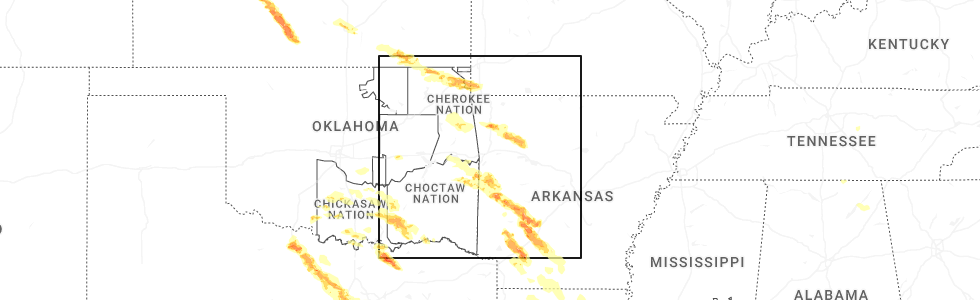
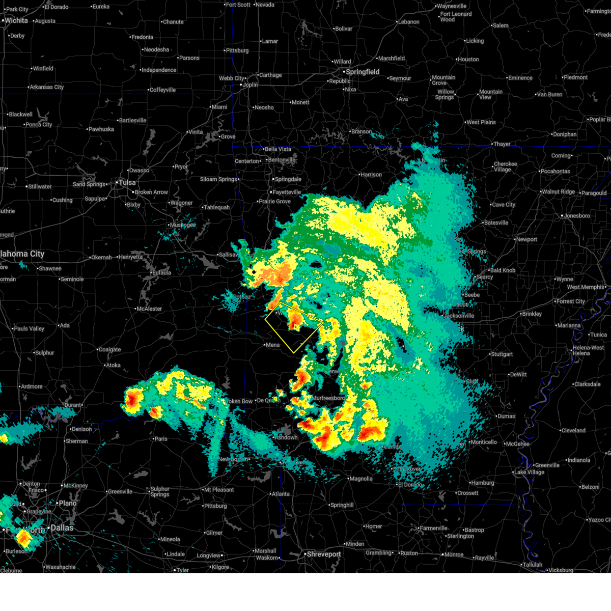
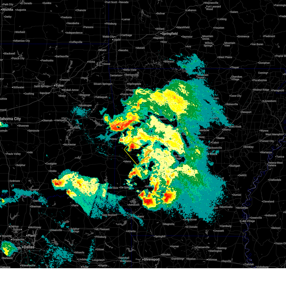
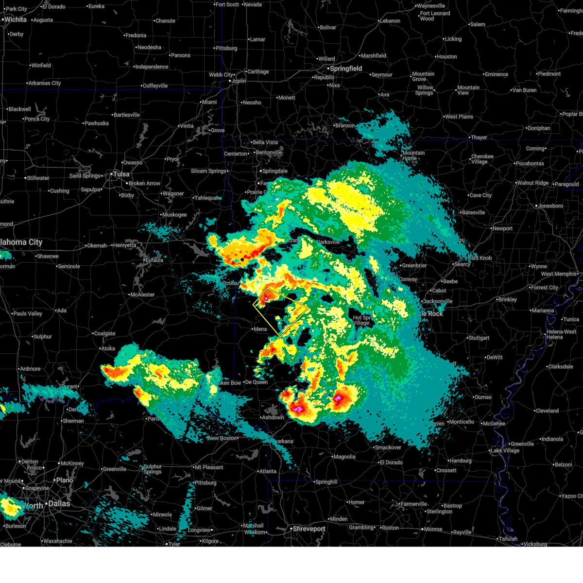
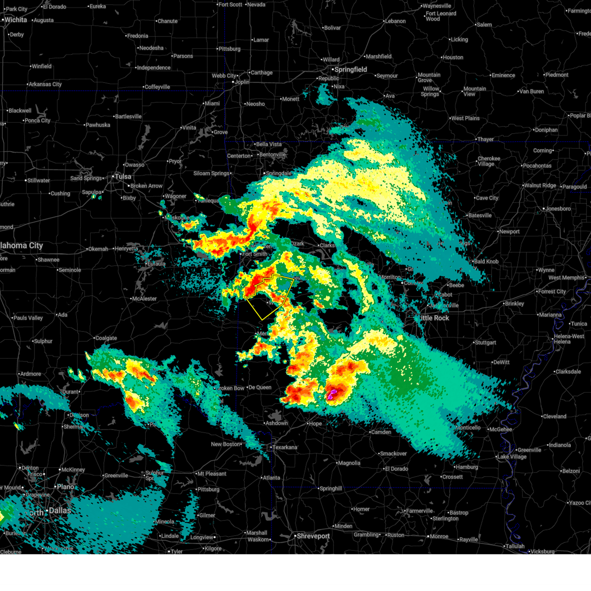
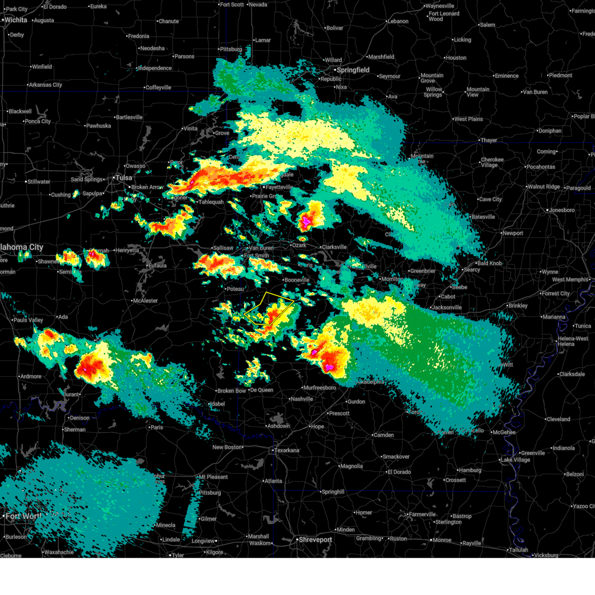
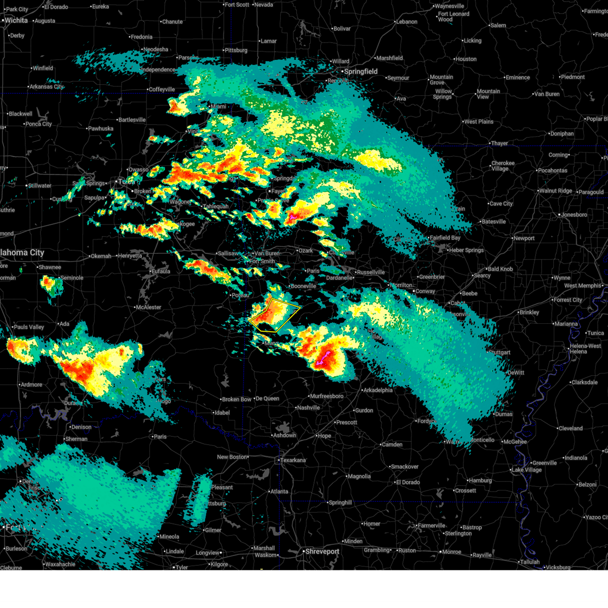
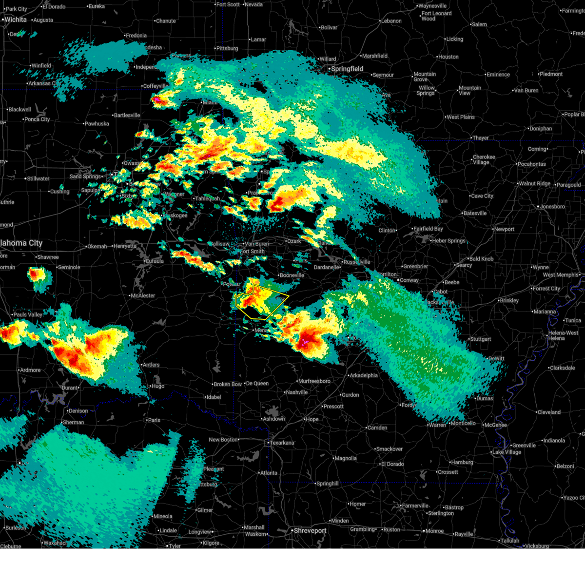
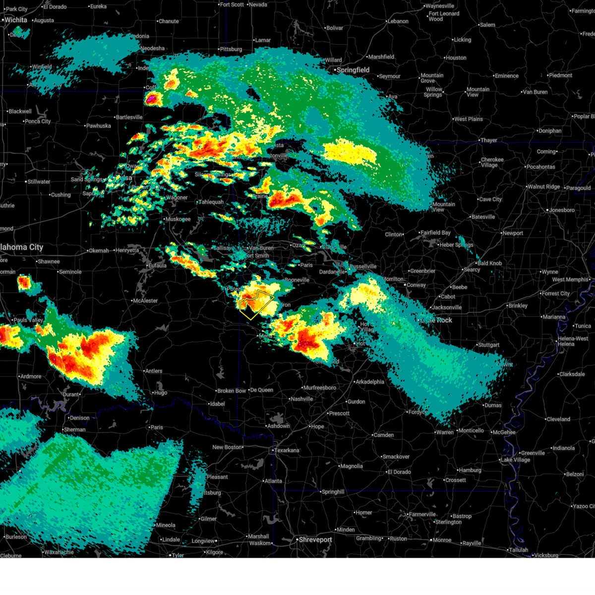
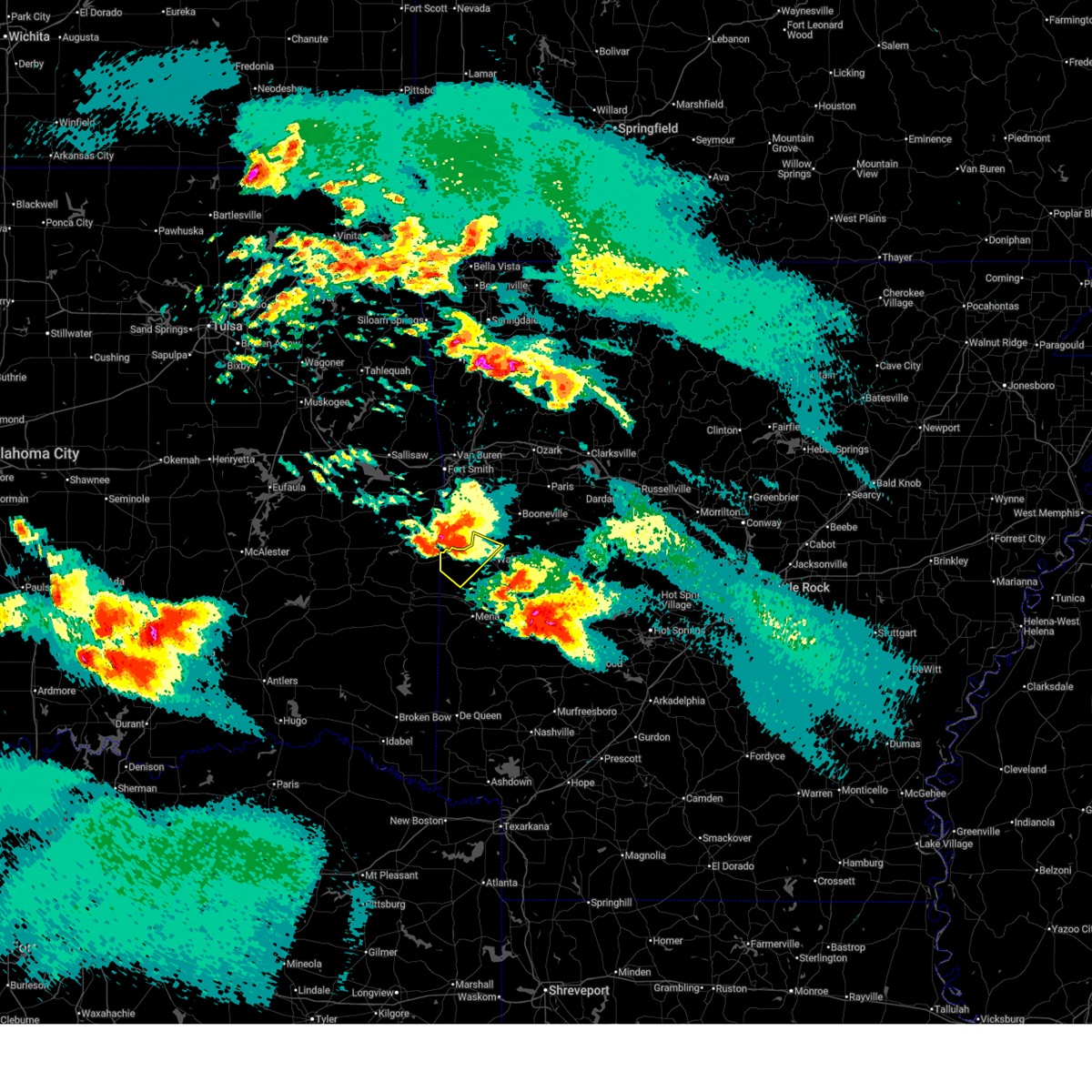
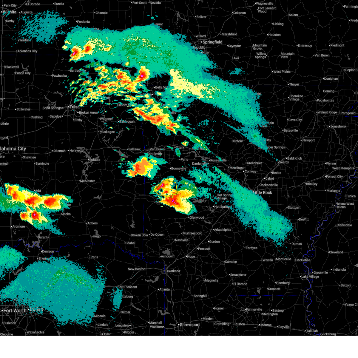
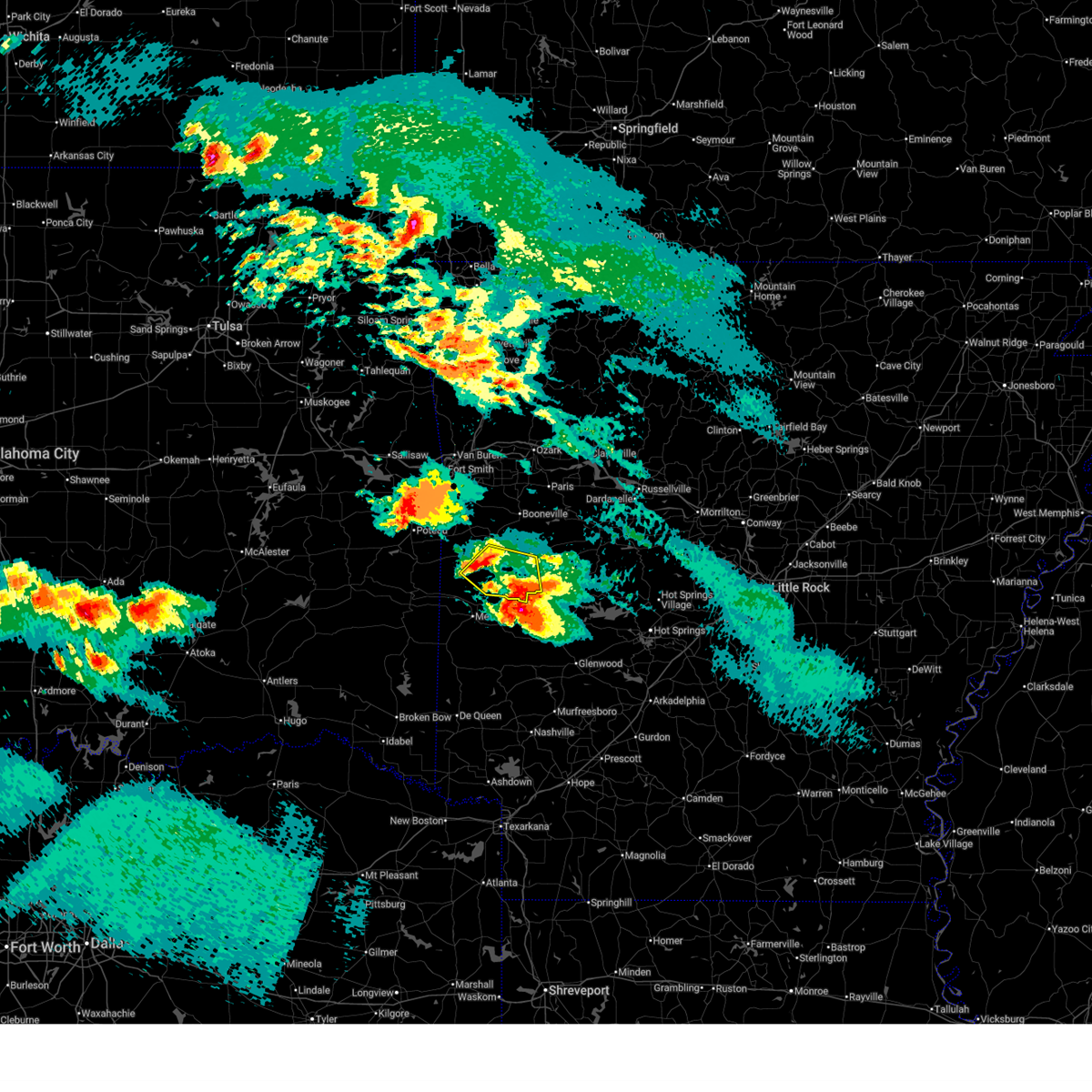
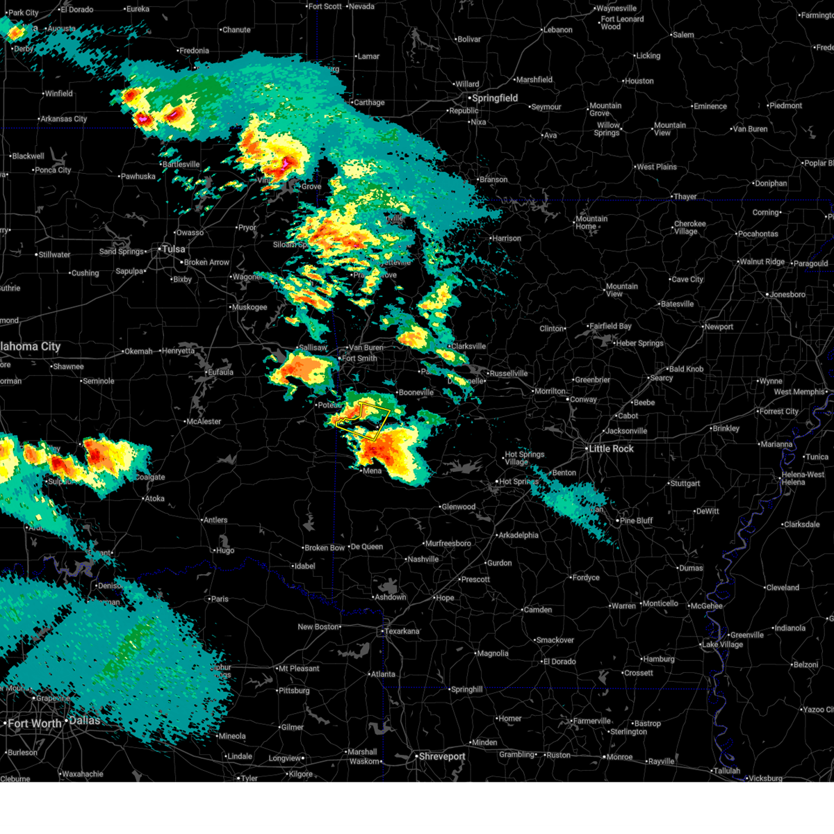
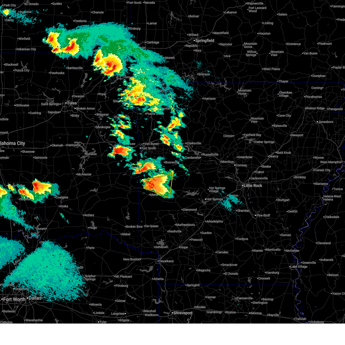
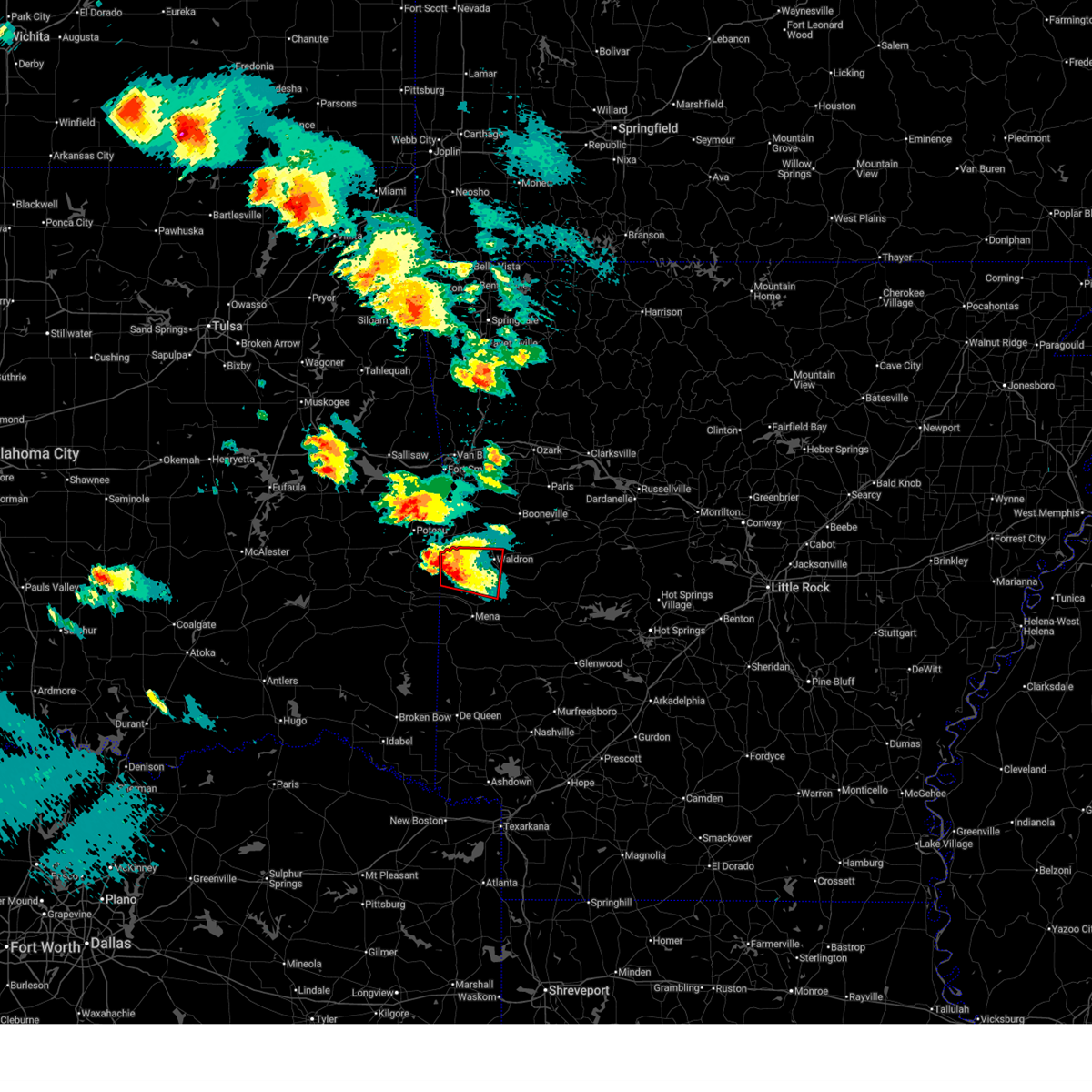
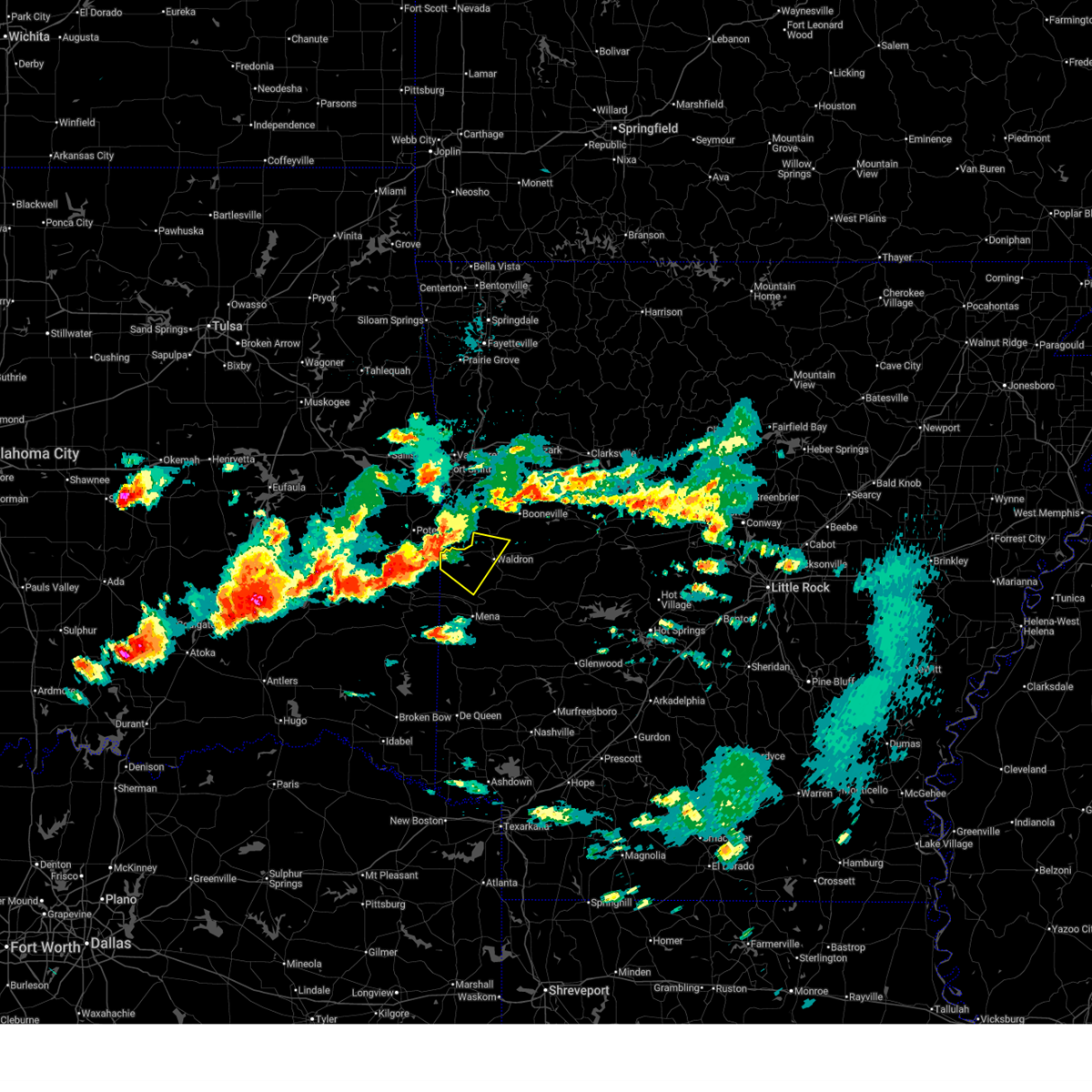
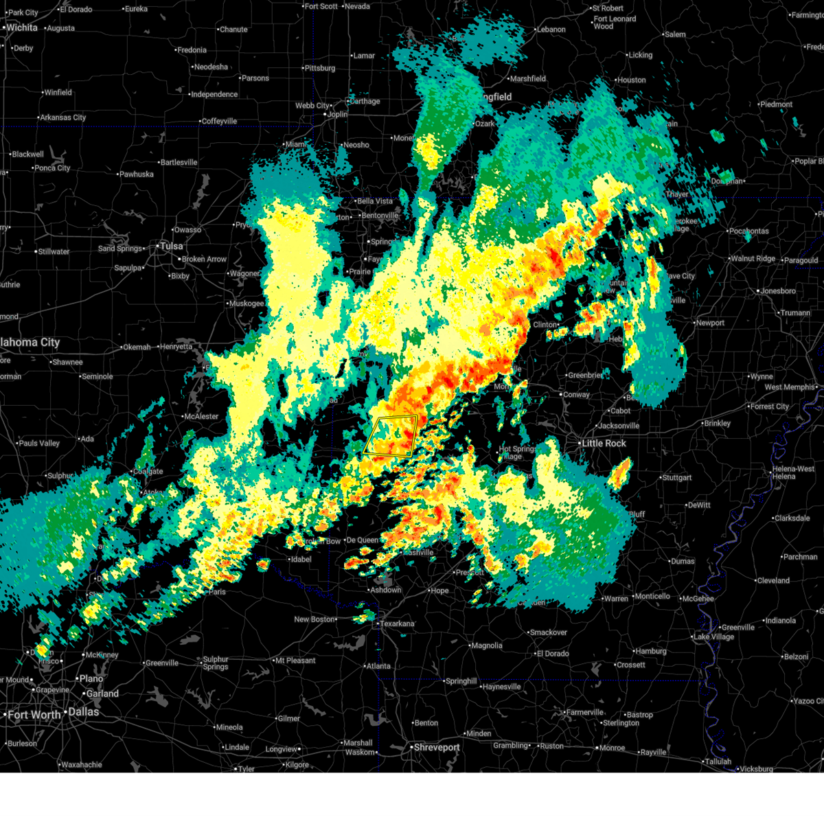
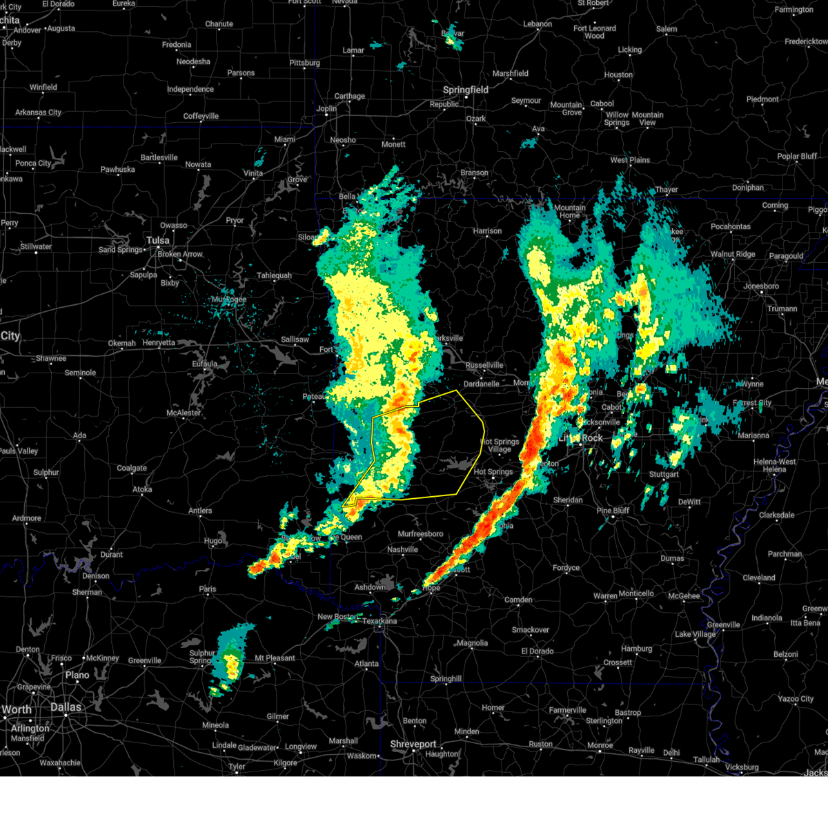
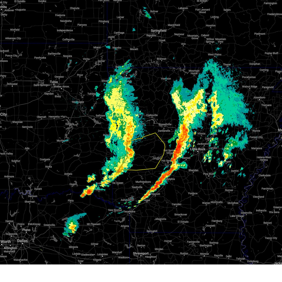
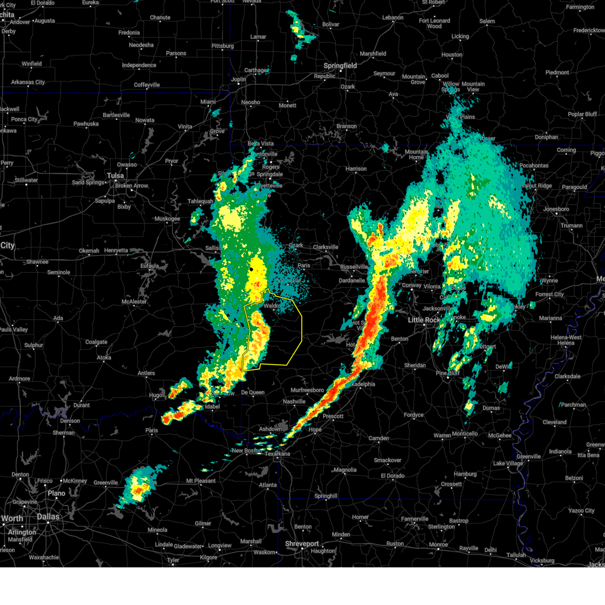
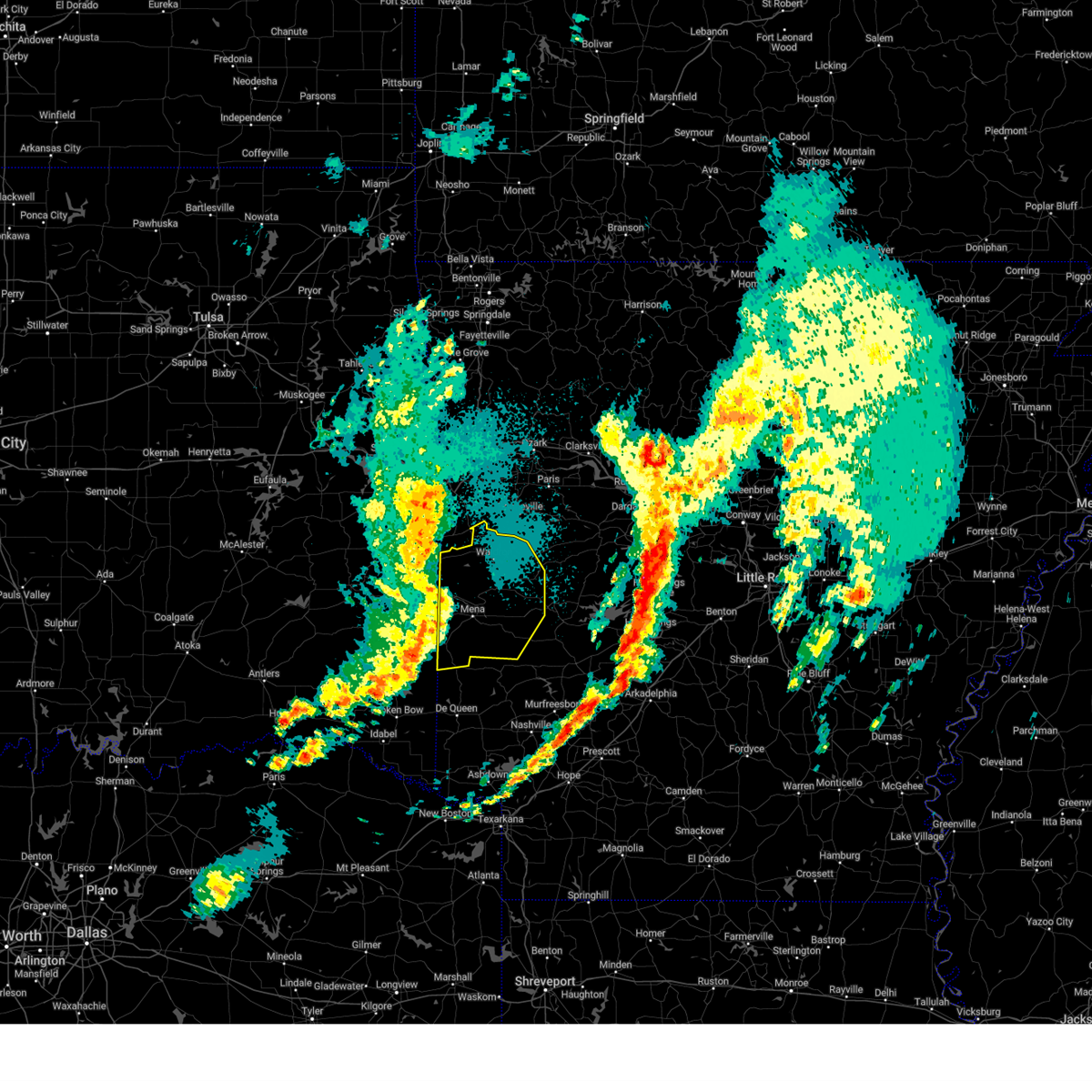
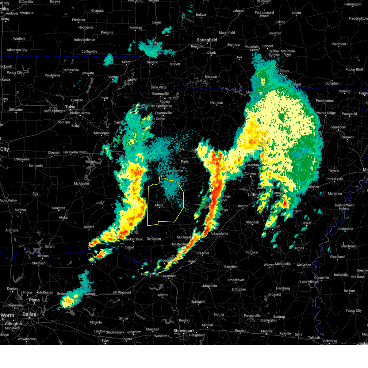
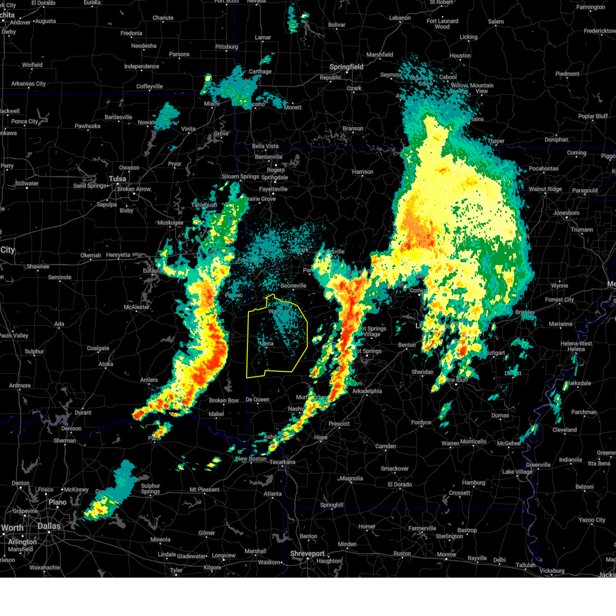
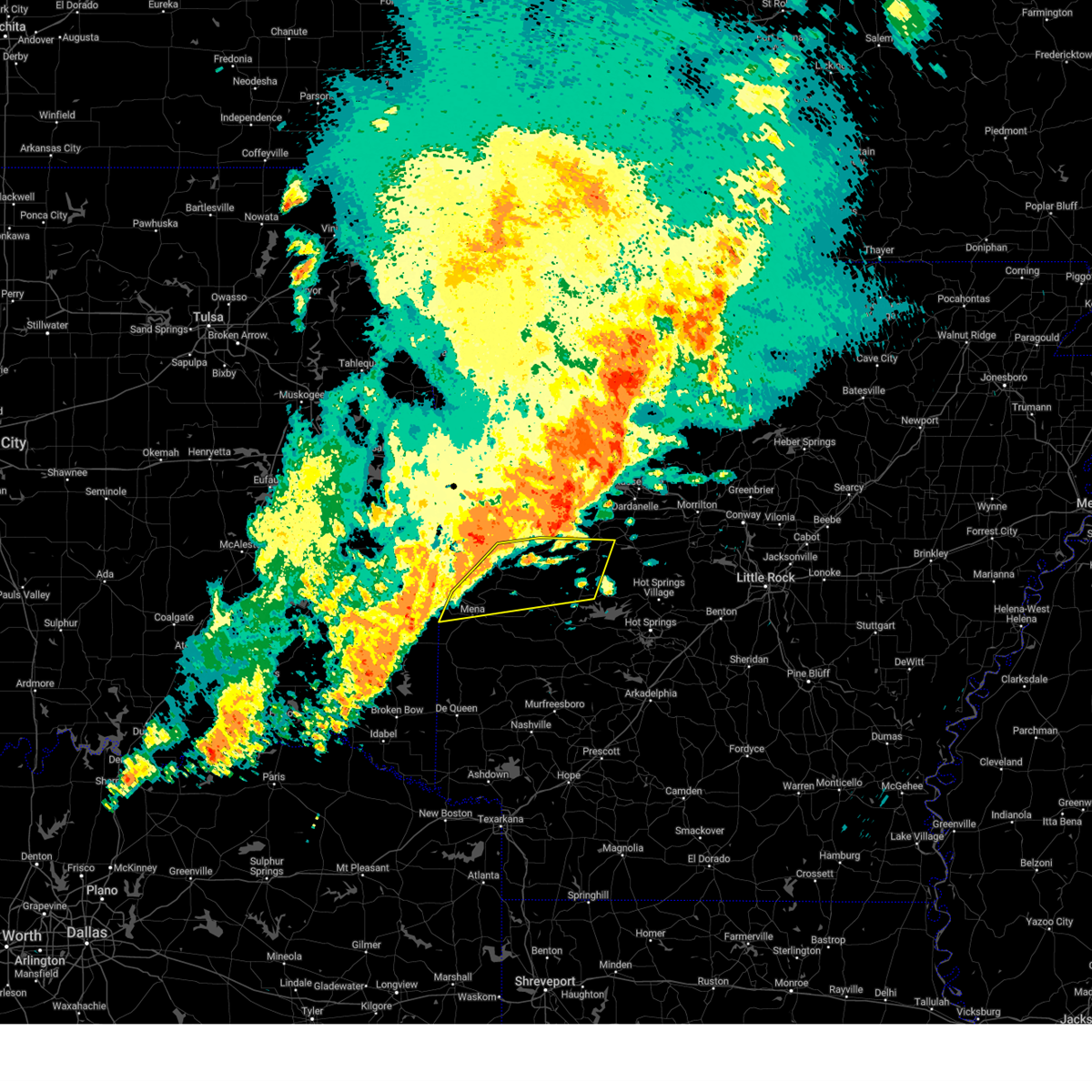
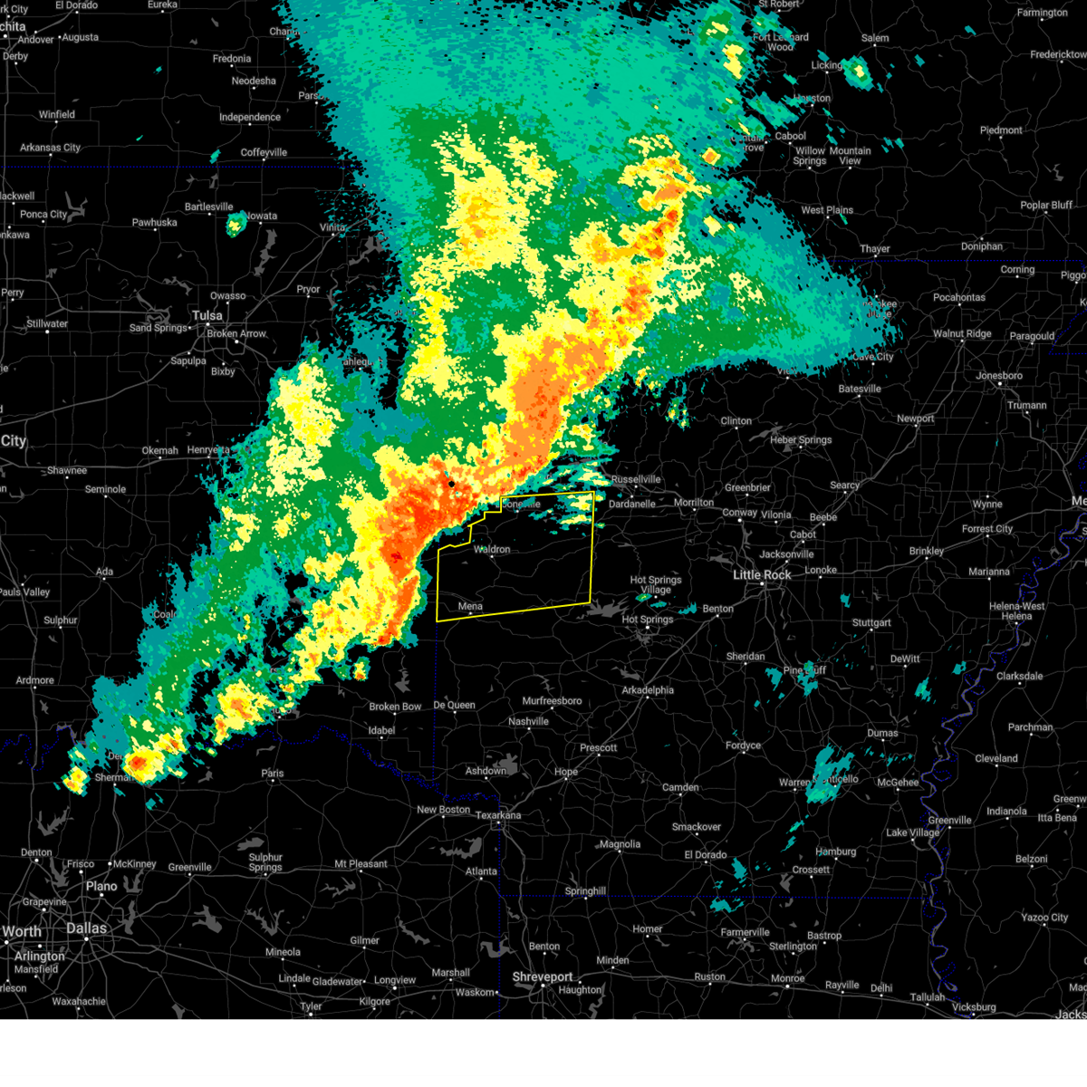
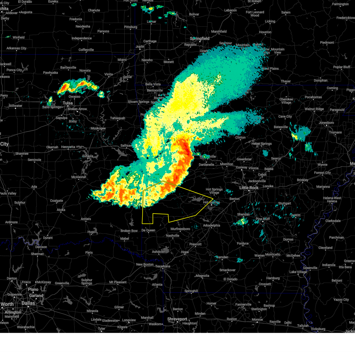
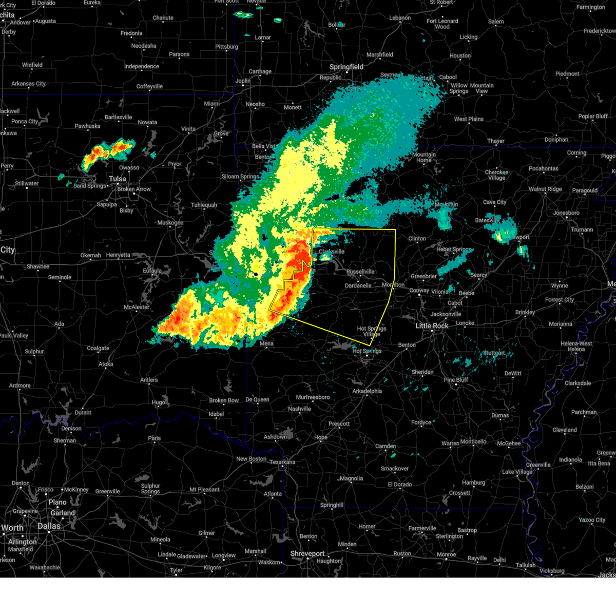
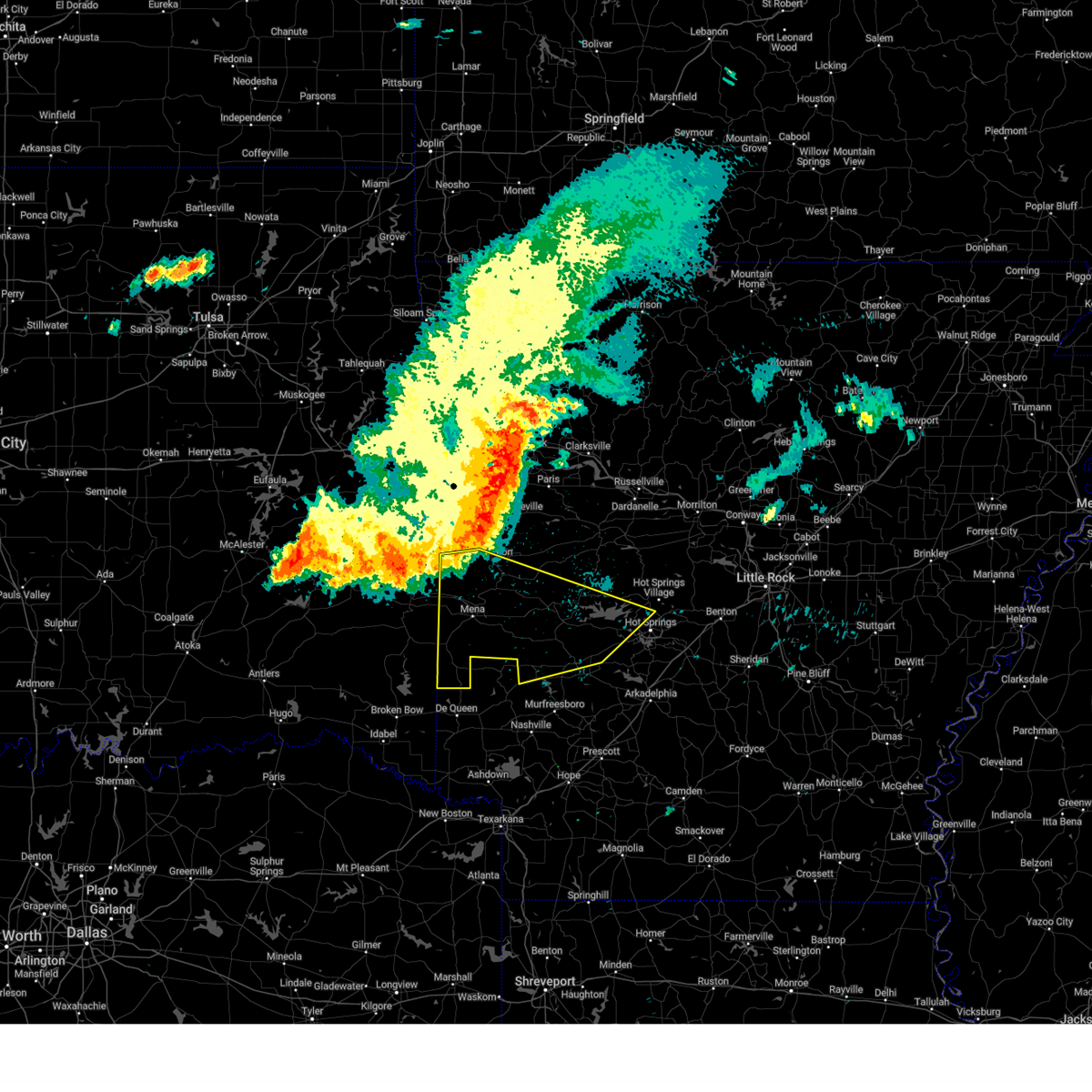
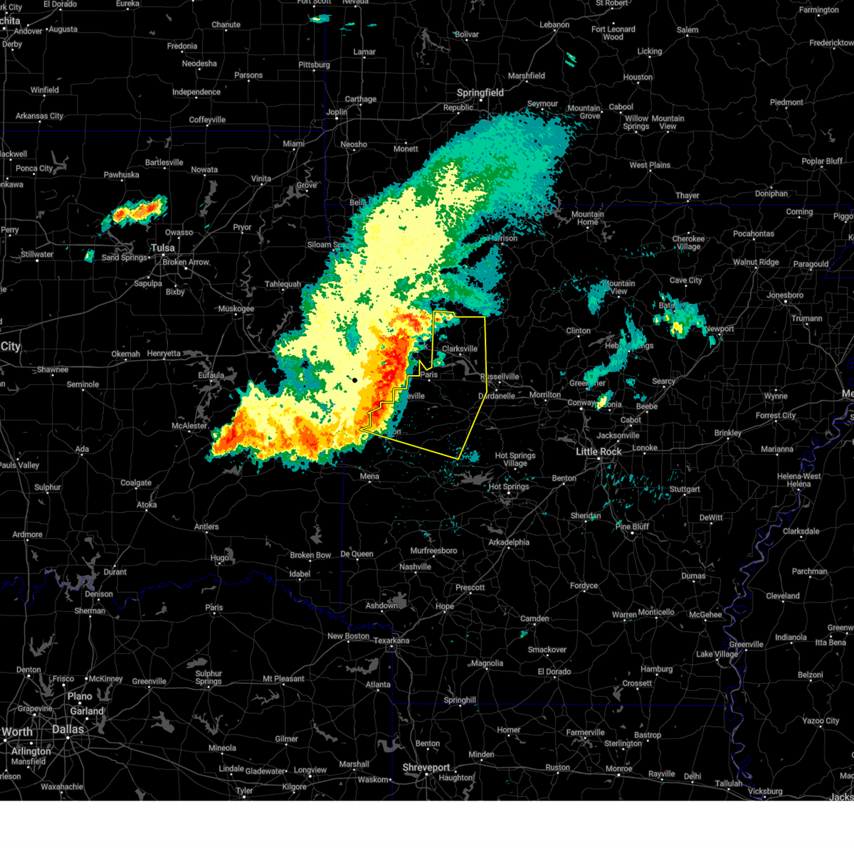
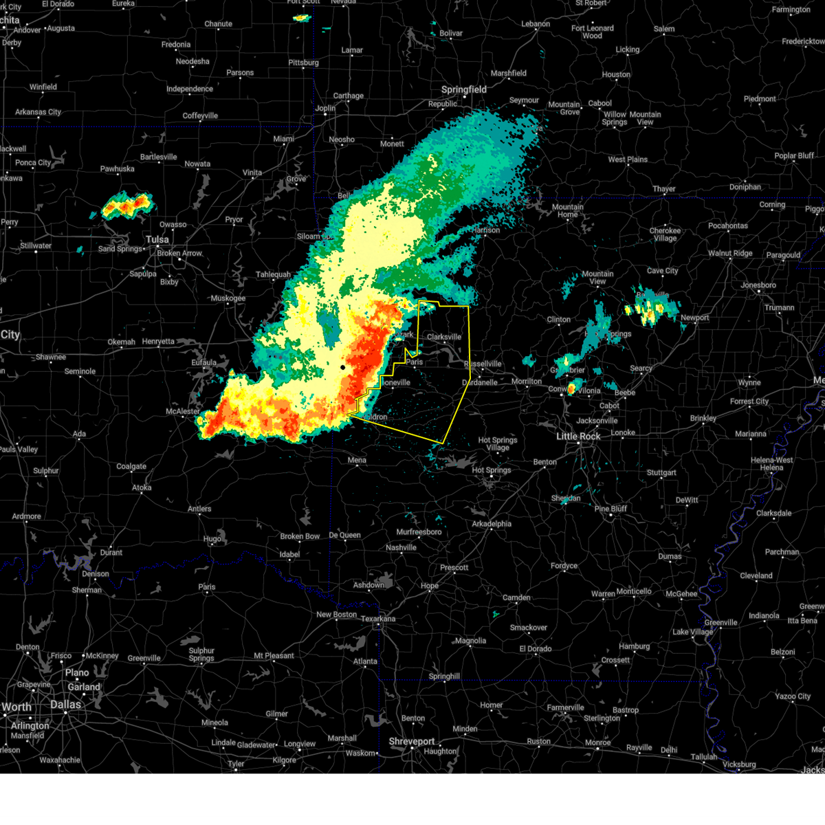
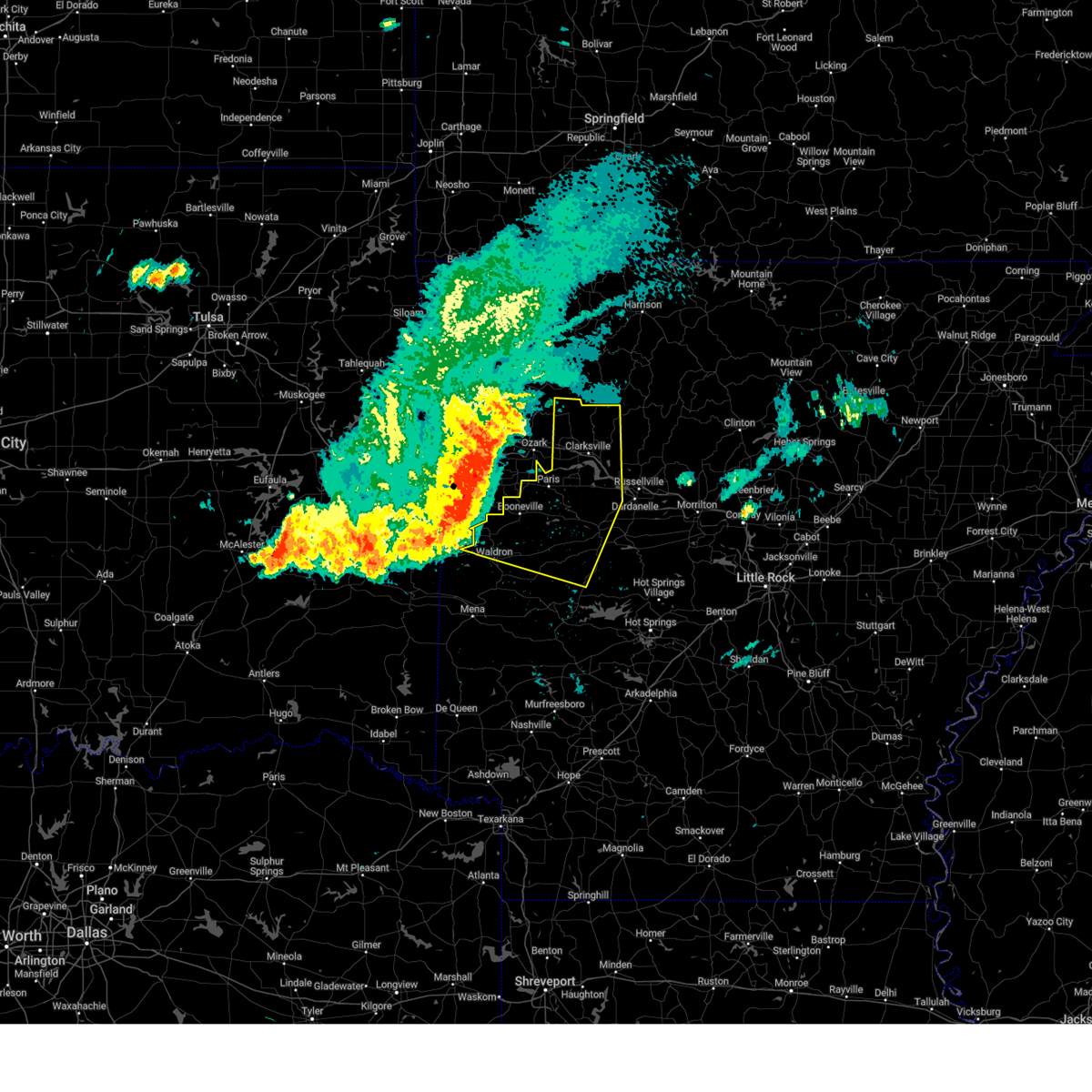
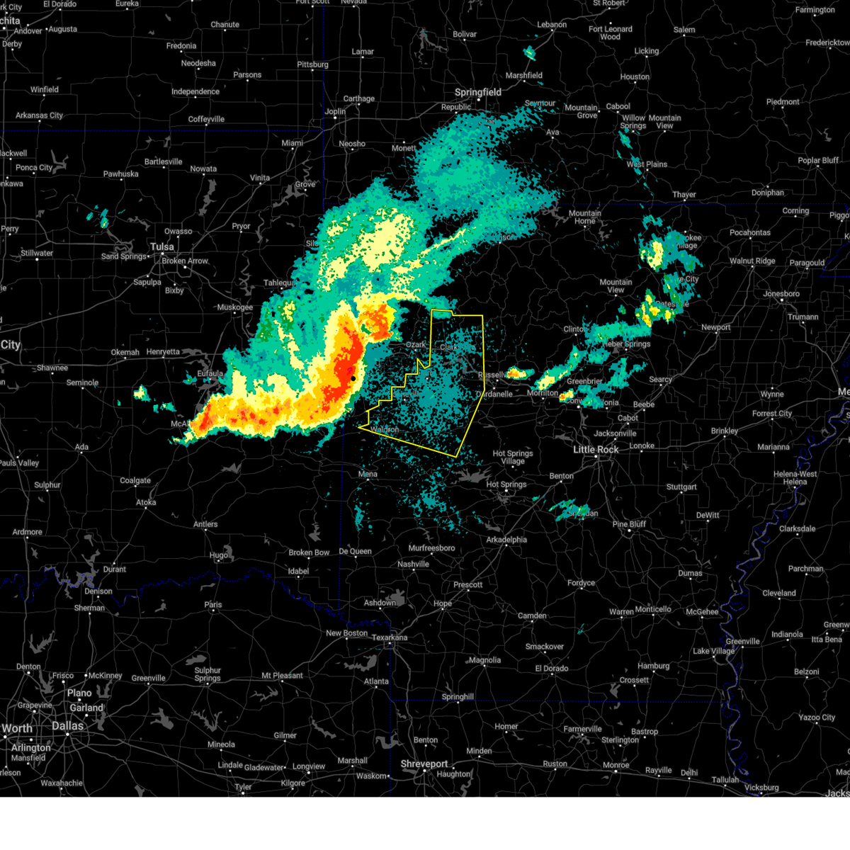
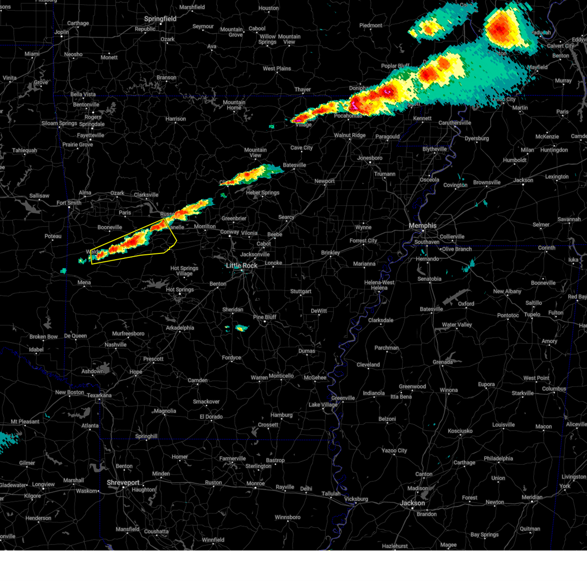
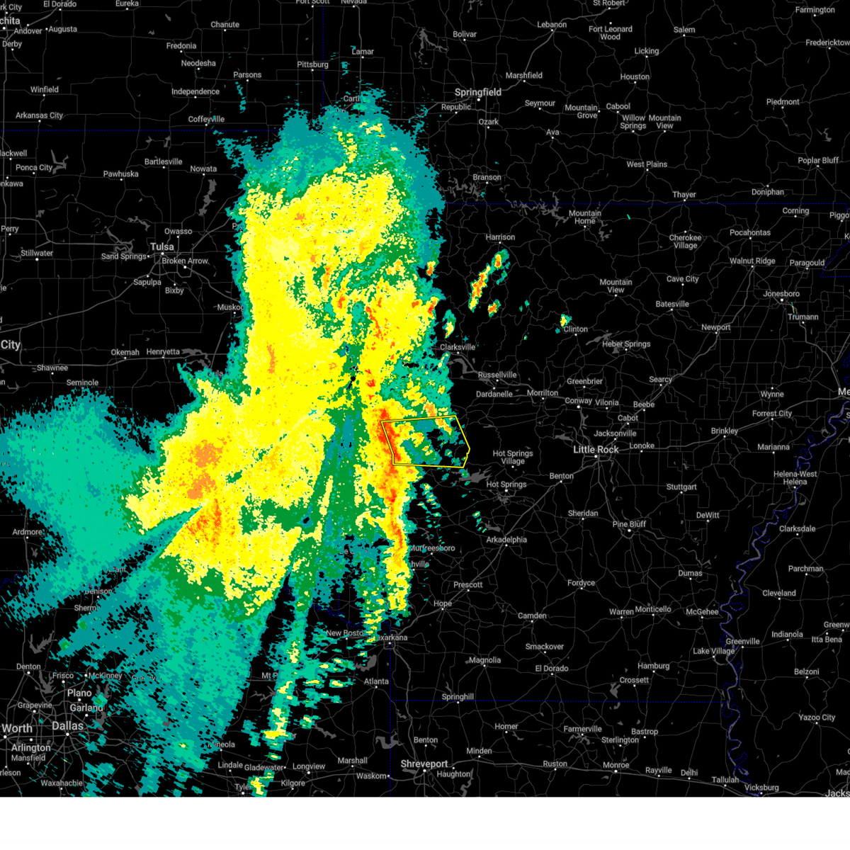
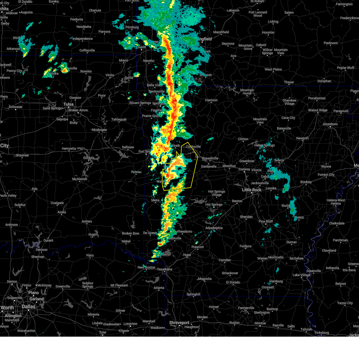
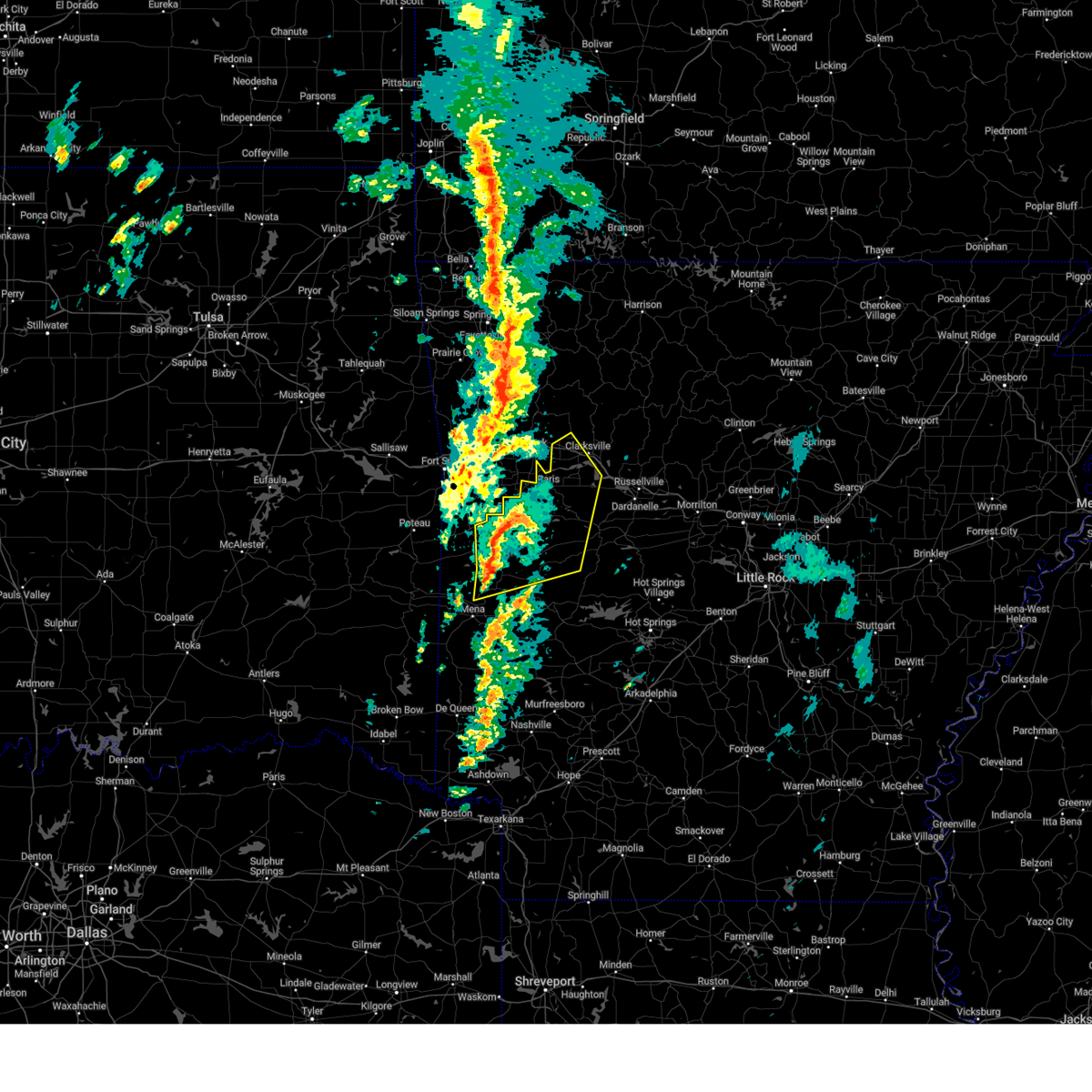
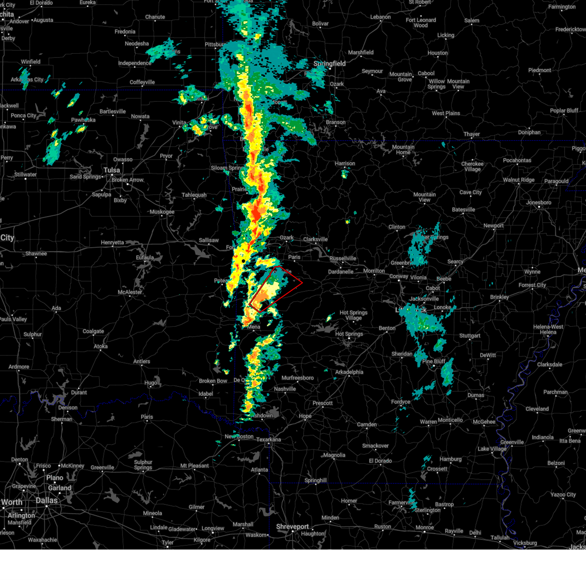
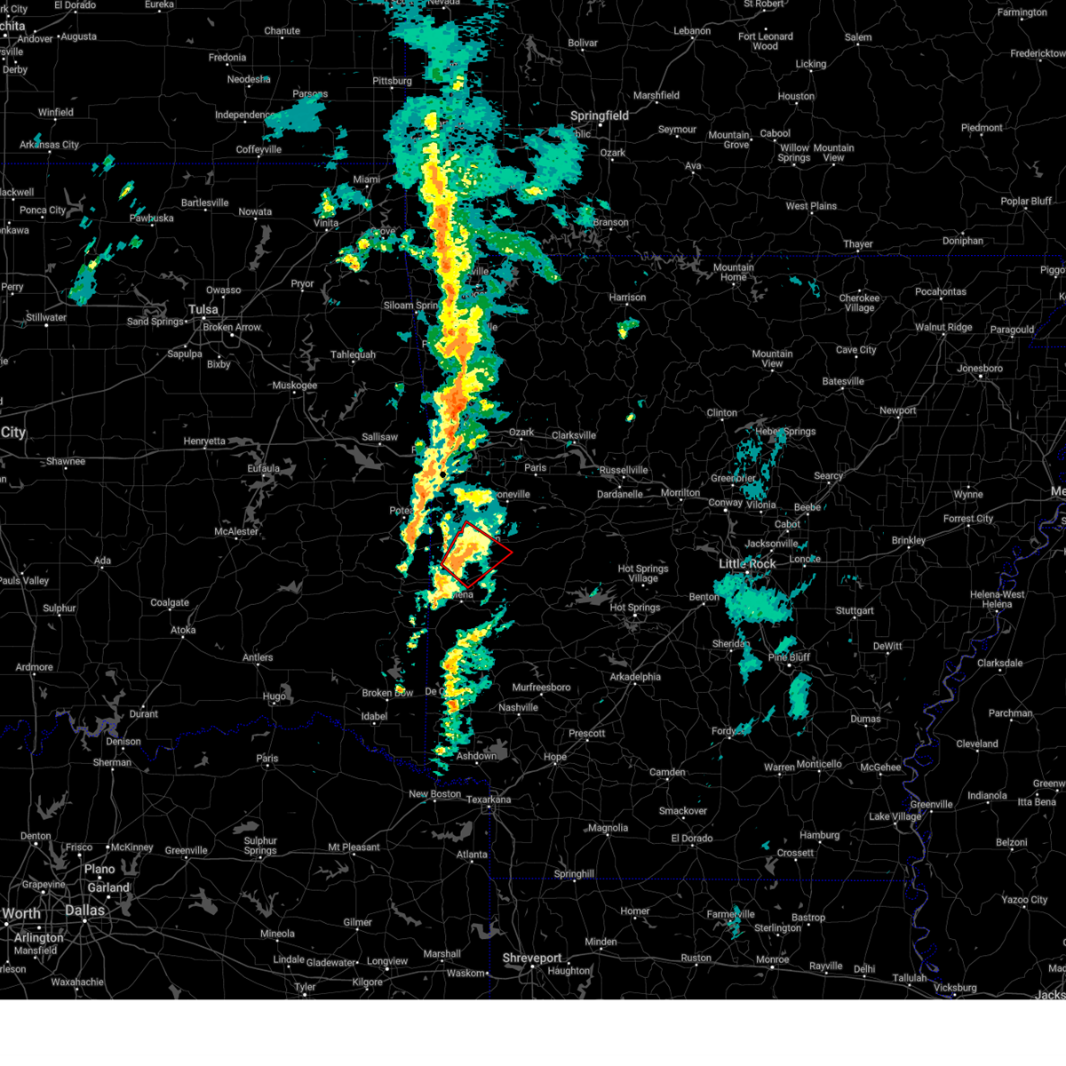
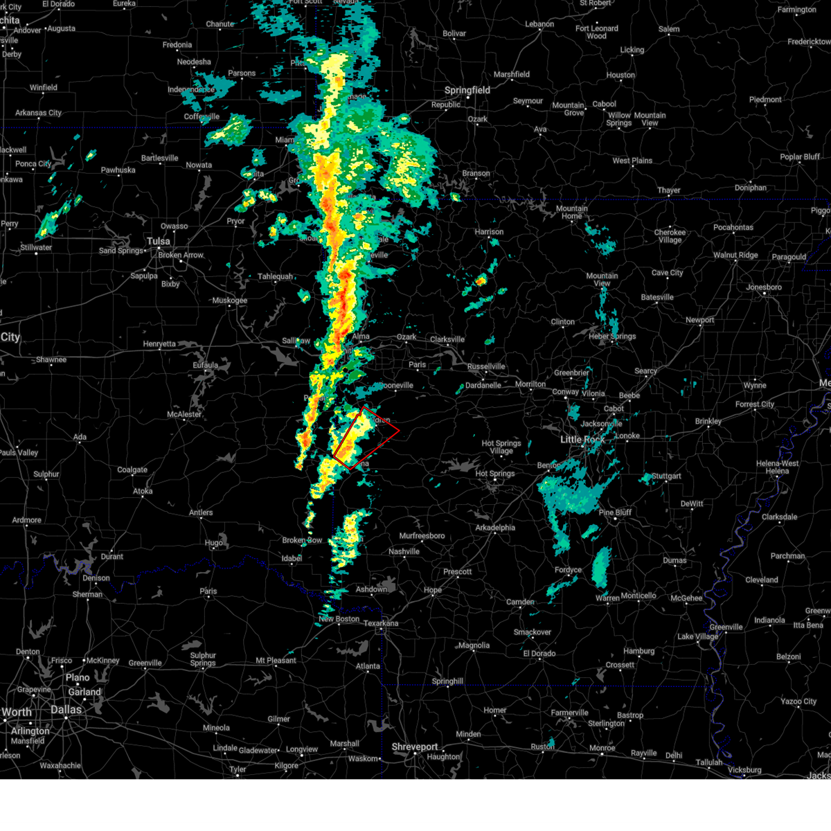
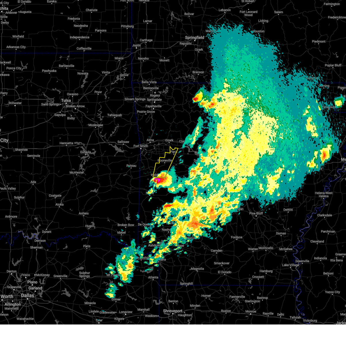
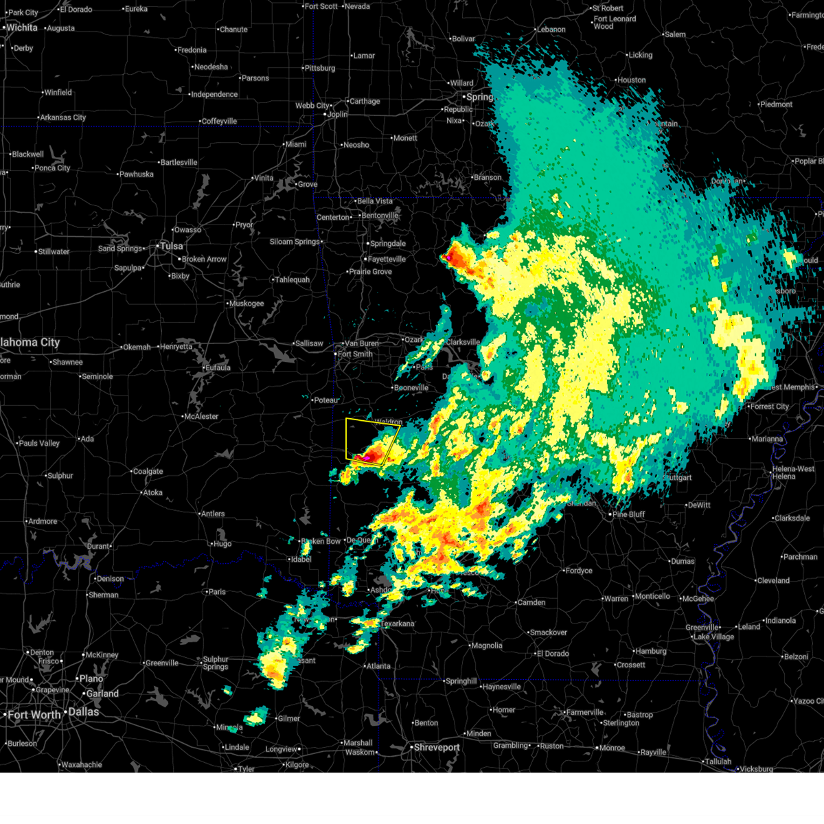
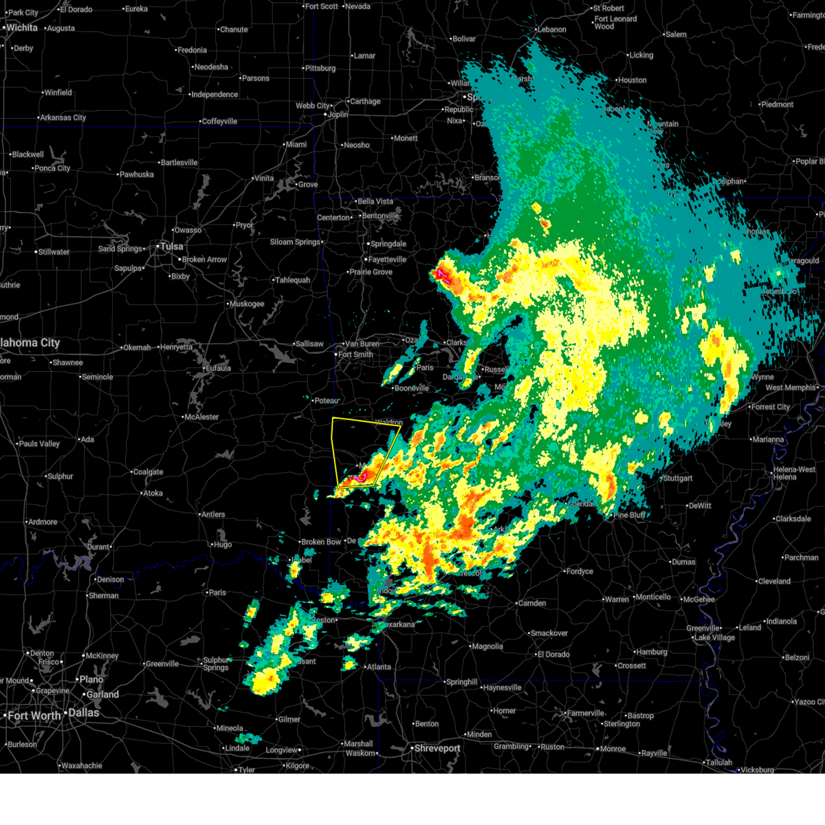
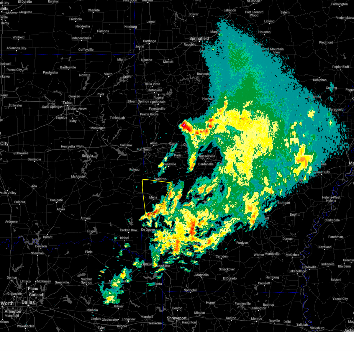
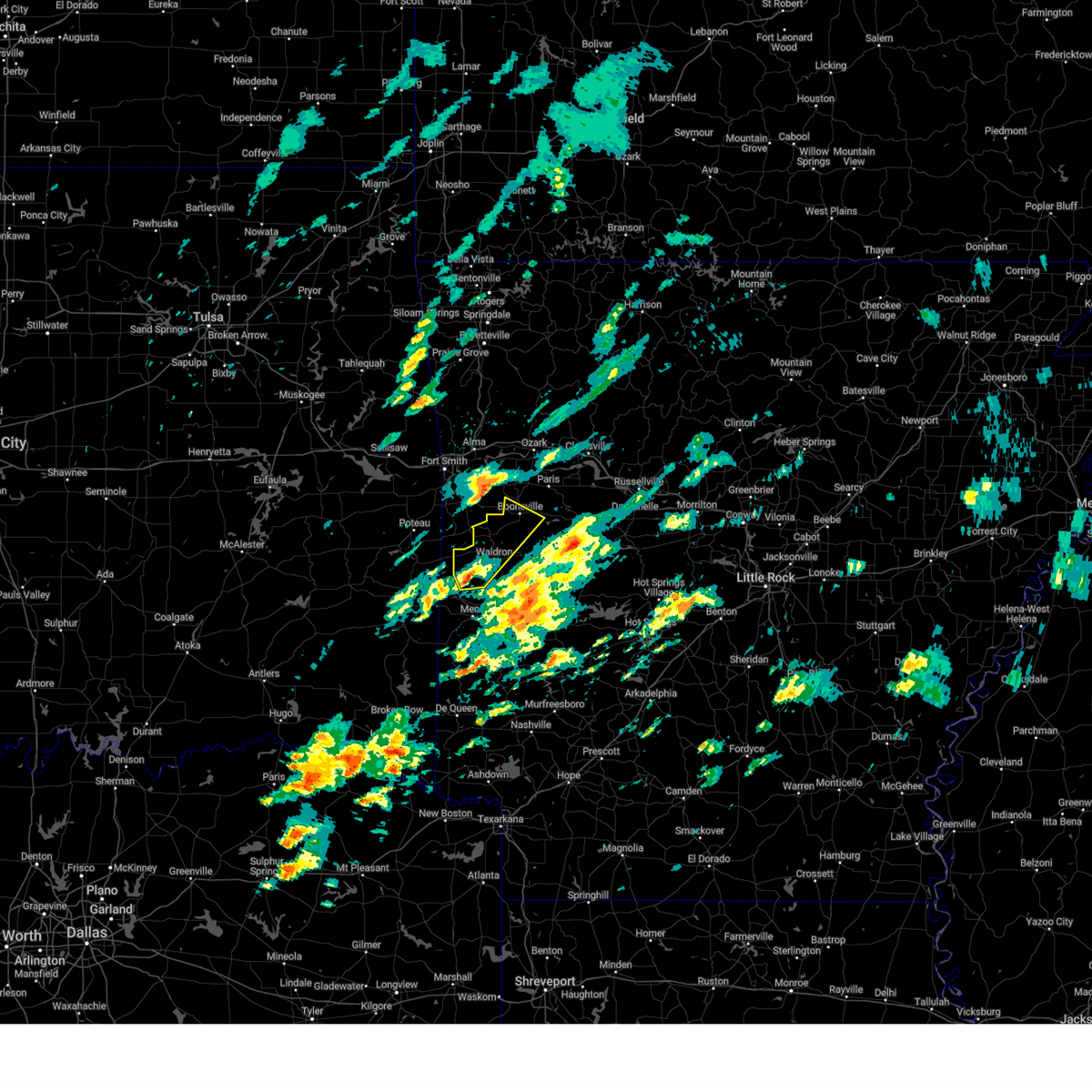
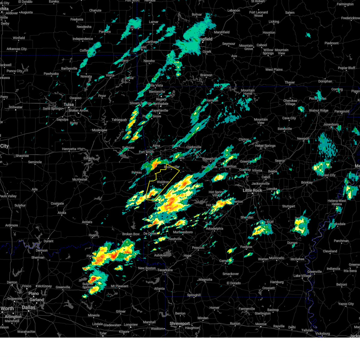
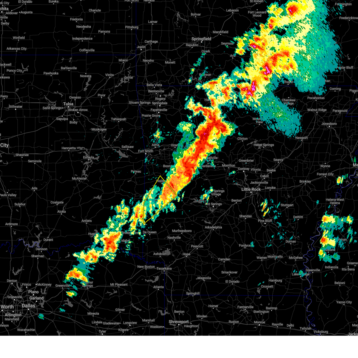
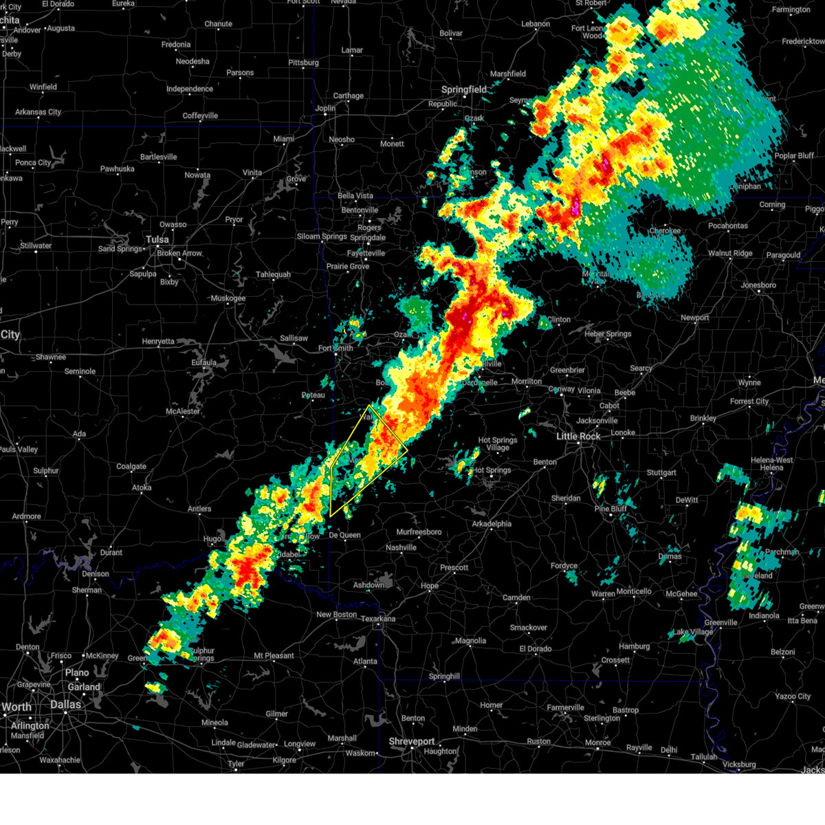
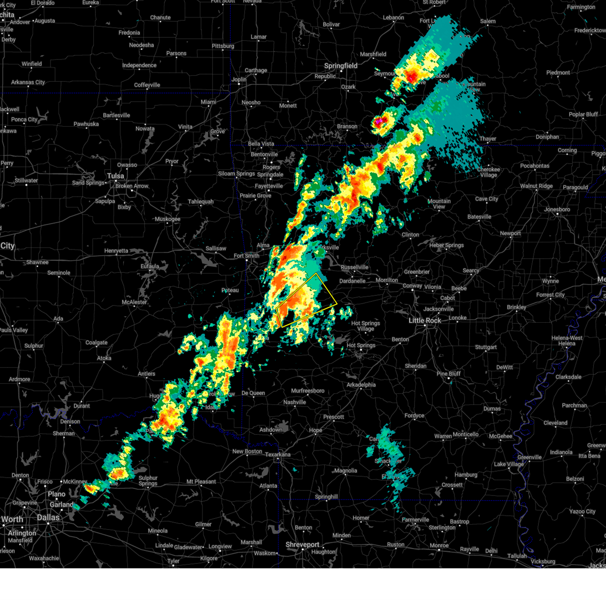
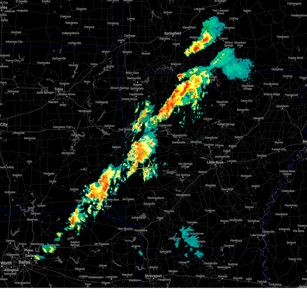
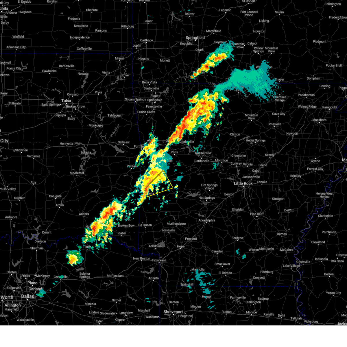
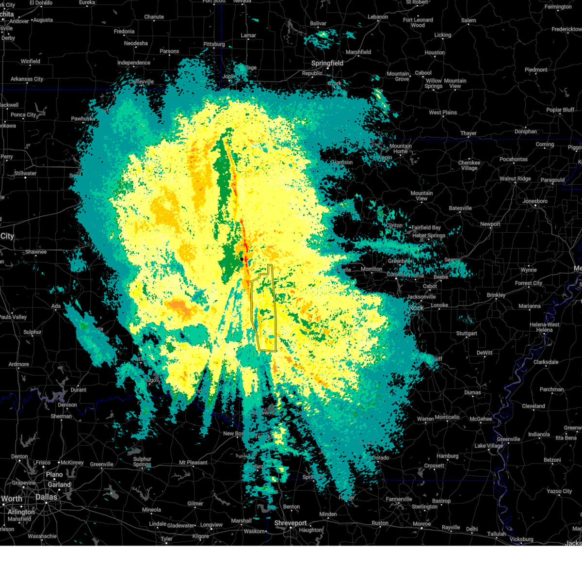
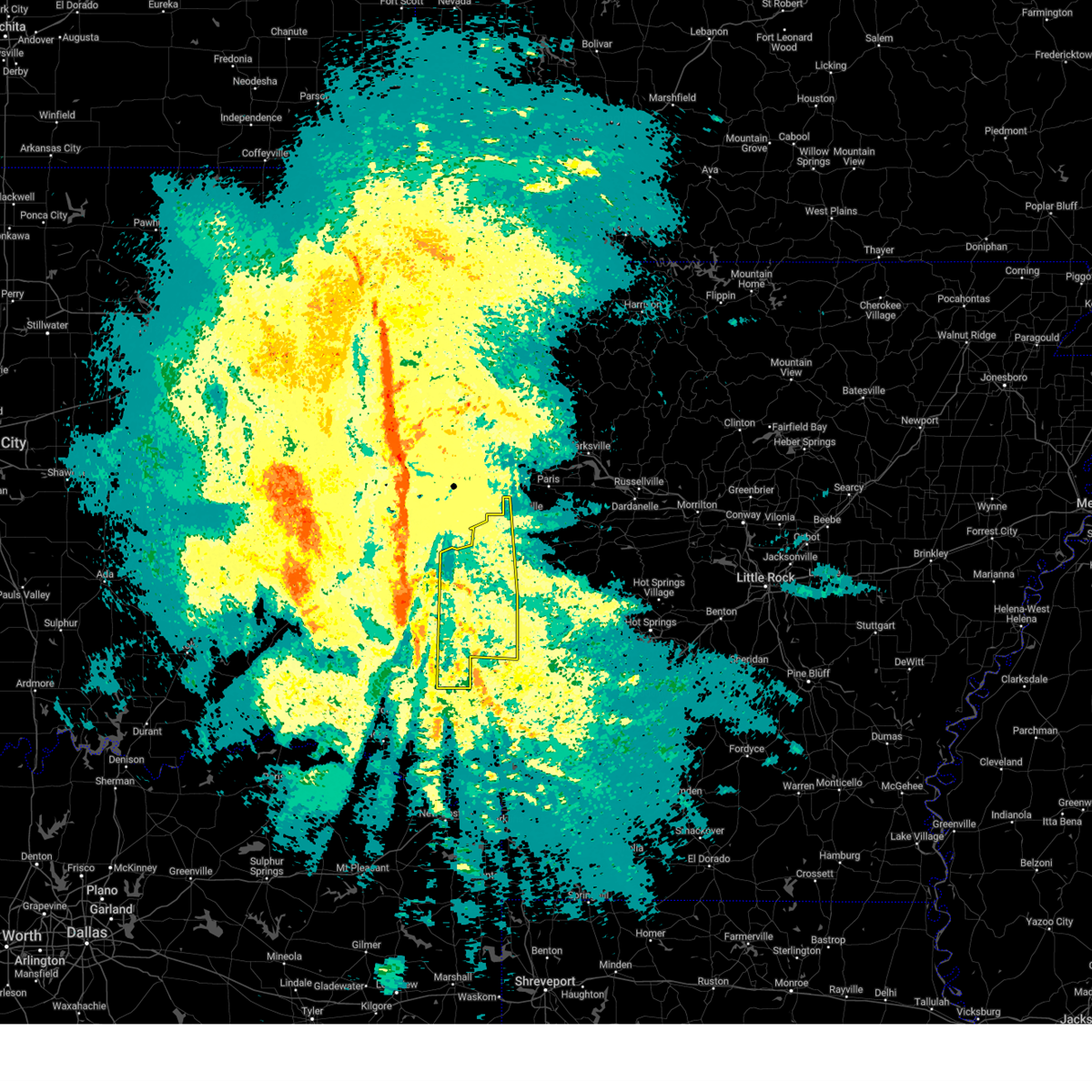
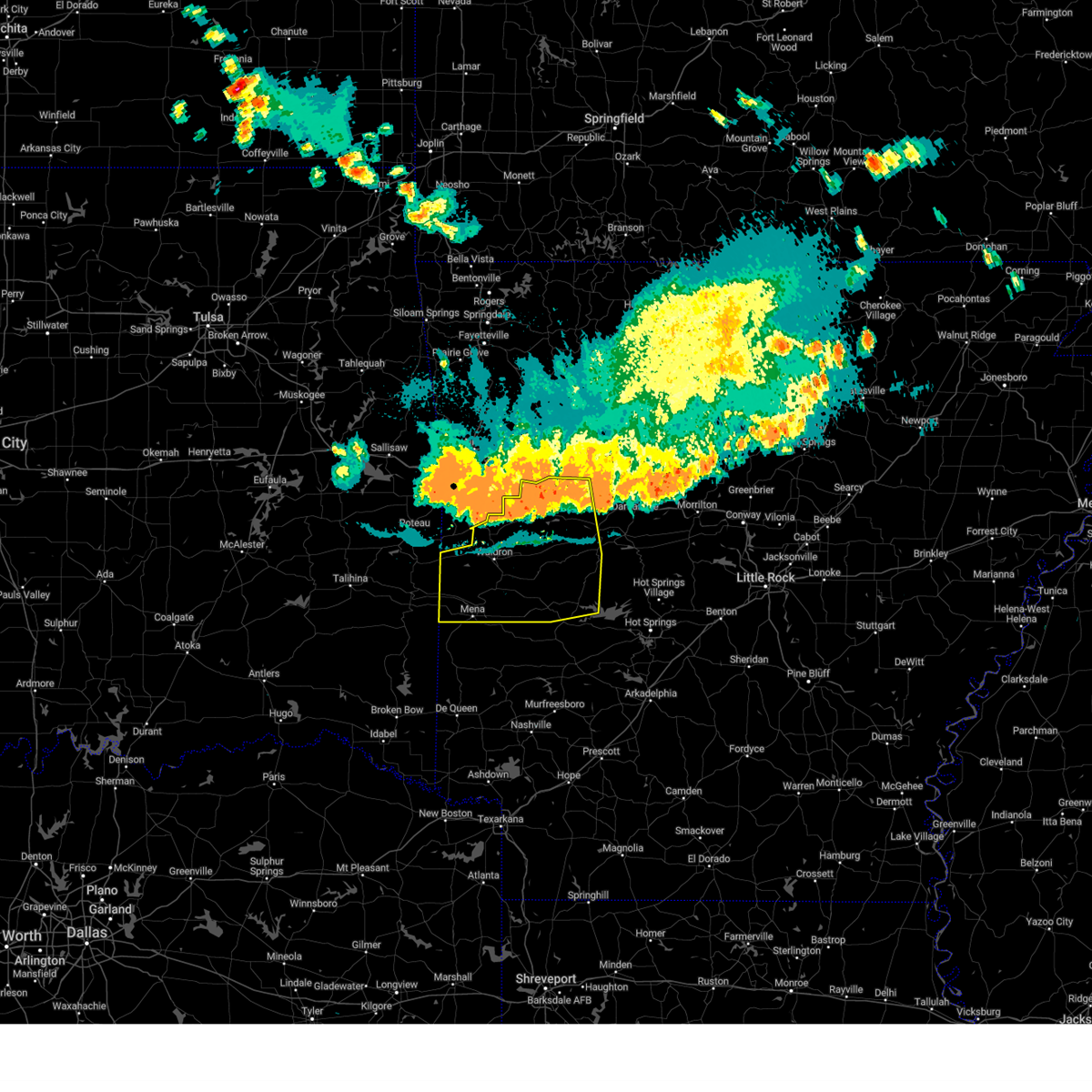
Hail Map for Waldron, AR
The Waldron, AR area has had 18 reports of on-the-ground hail by trained spotters, and has been under severe weather warnings 28 times during the past 12 months. Doppler radar has detected hail at or near Waldron, AR on 73 occasions, including 4 occasions during the past year.
| Name: | Waldron, AR |
| Where Located: | 38 miles SSE of Fort Smith, AR |
| Map: | Google Map for Waldron, AR |
| Population: | 3618 |
| Housing Units: | 1658 |
| More Info: | Search Google for Waldron, AR |
2
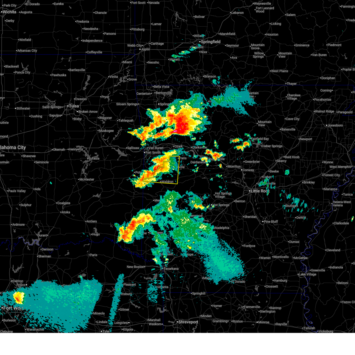
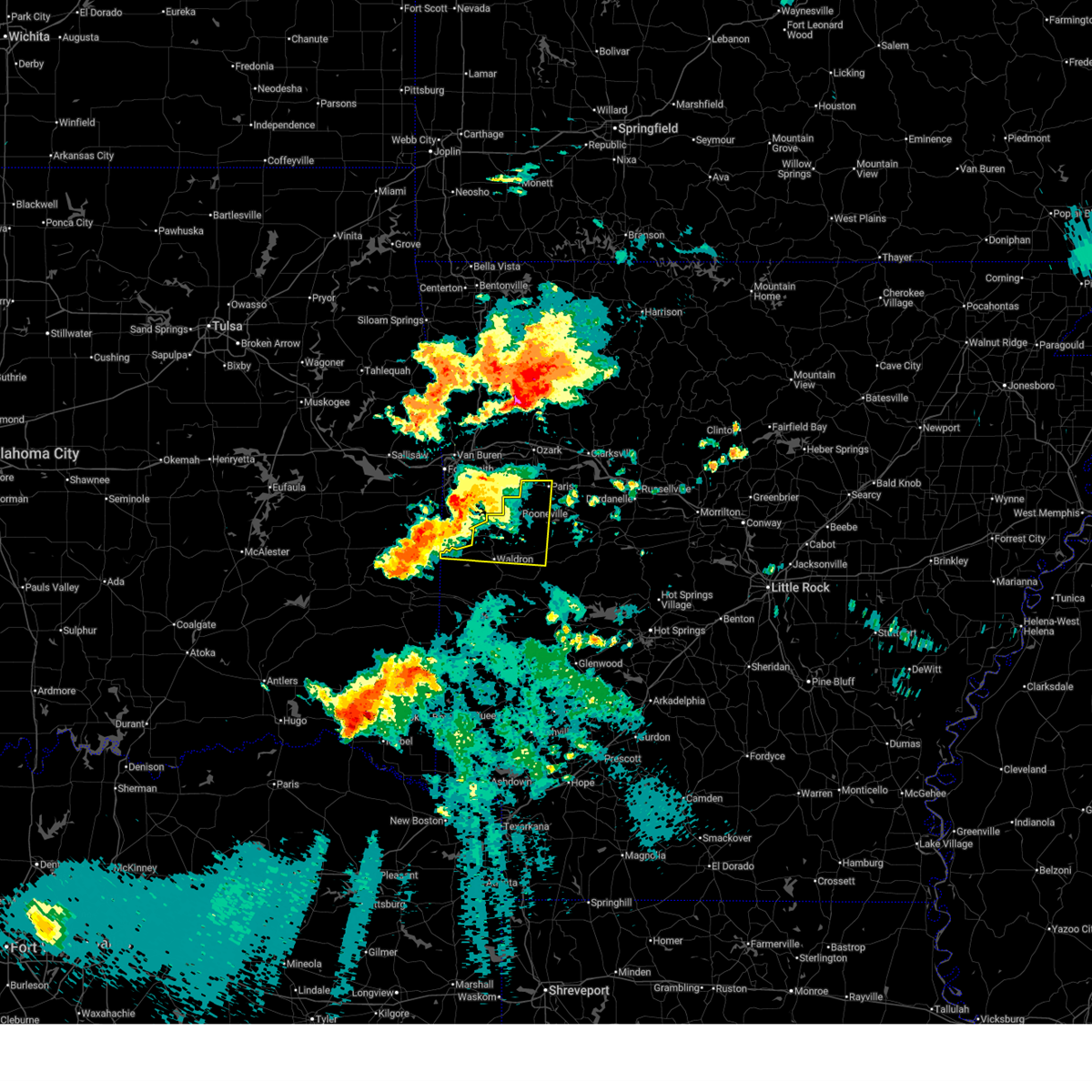
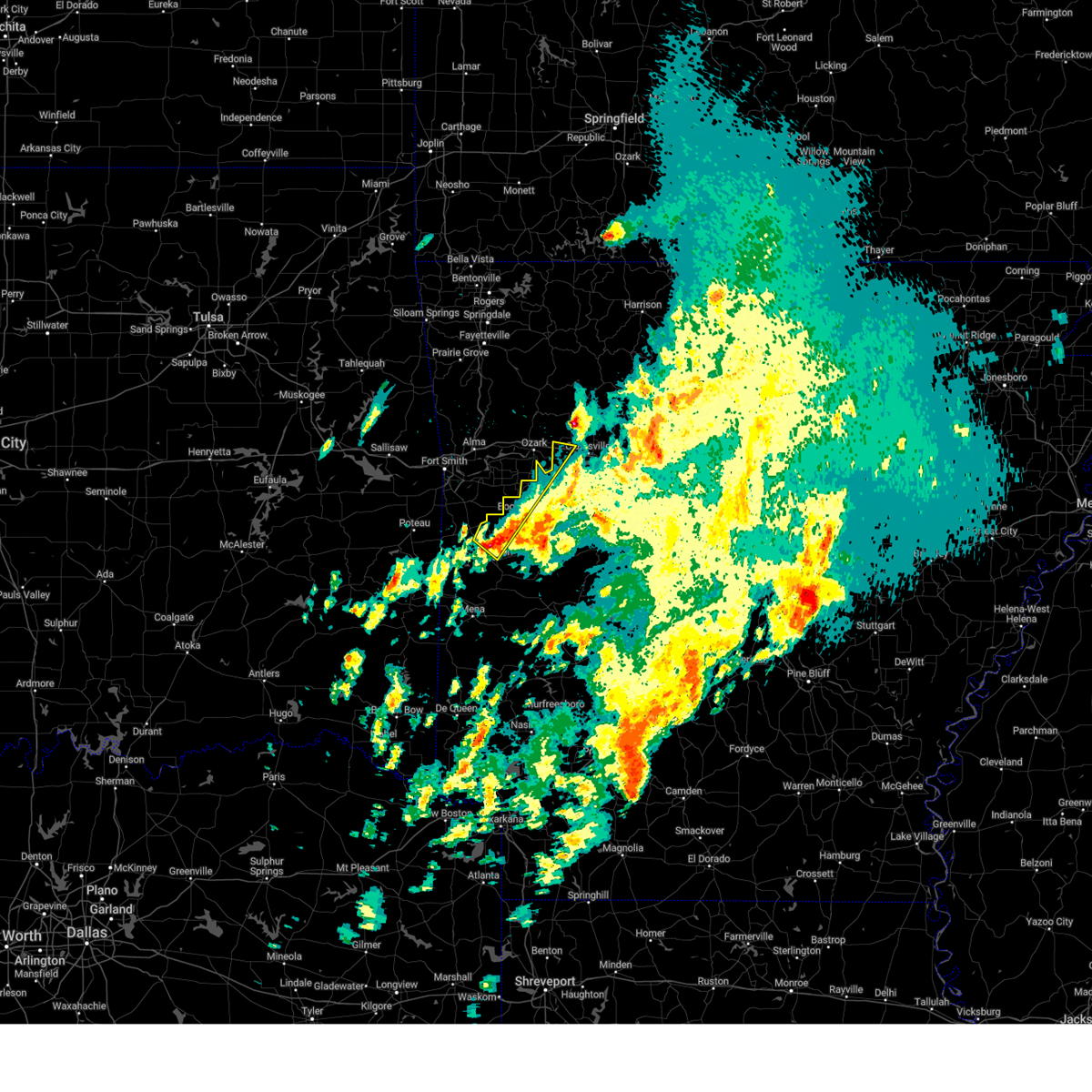
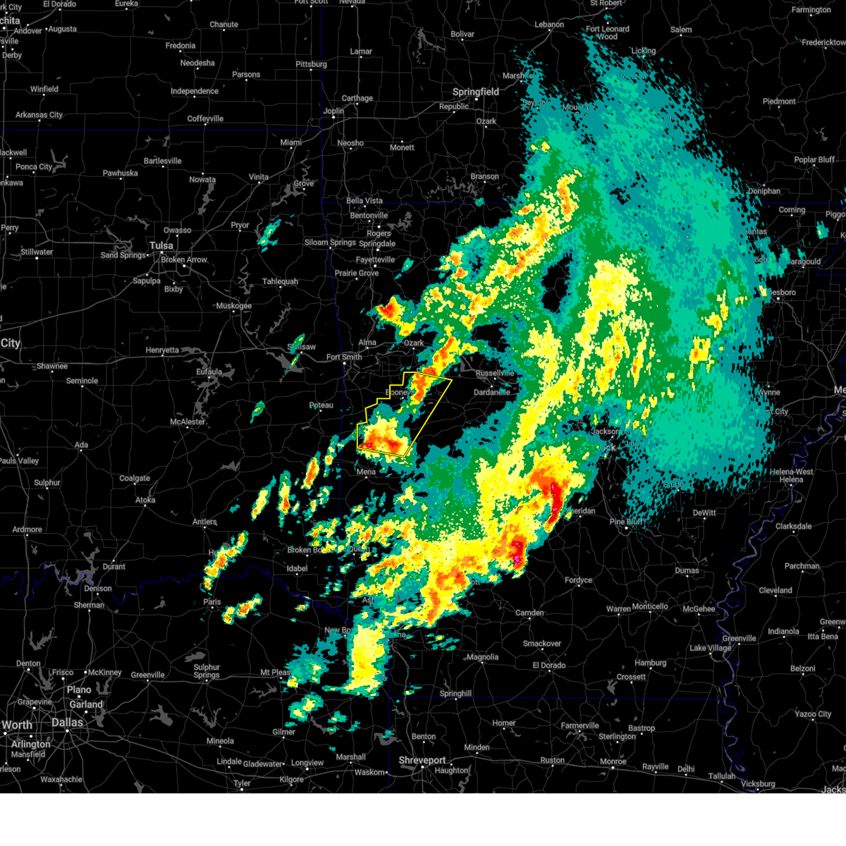
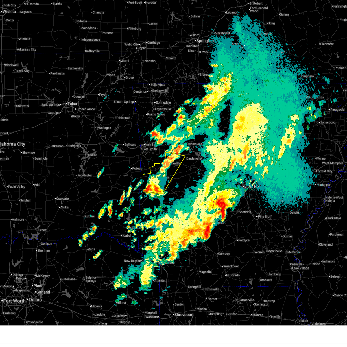
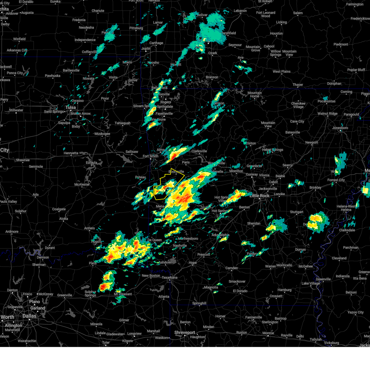
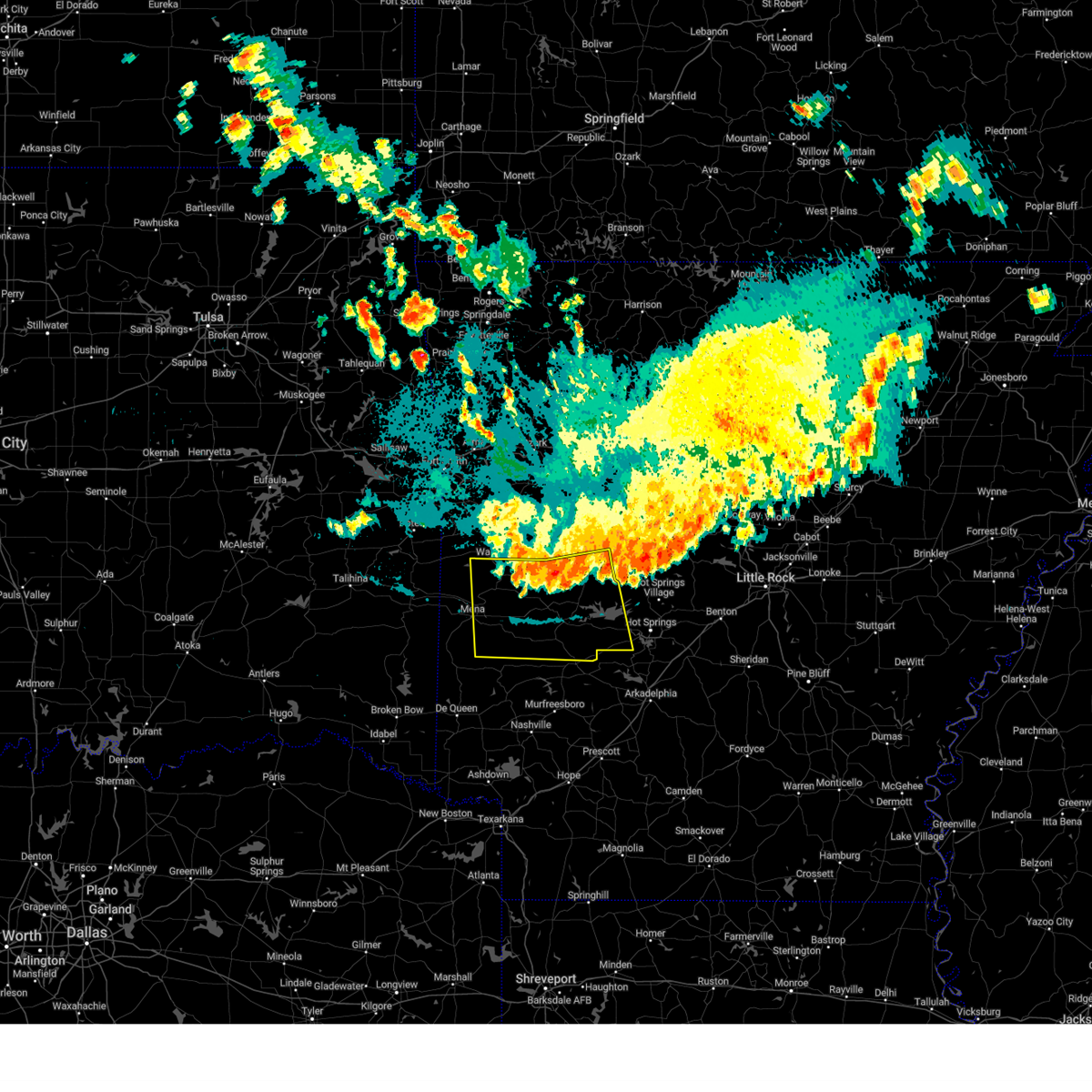
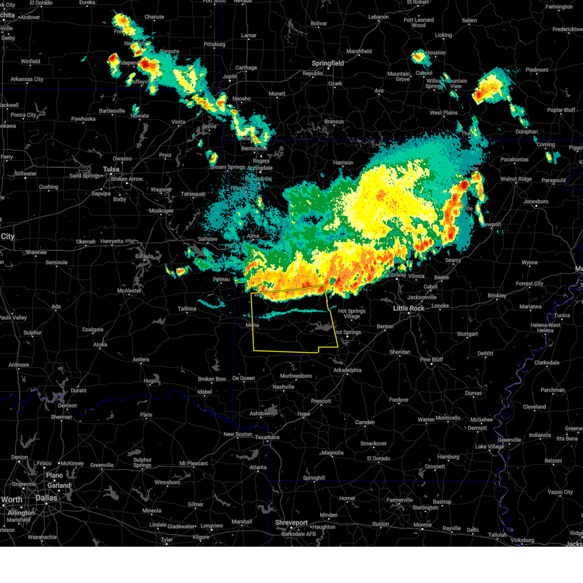
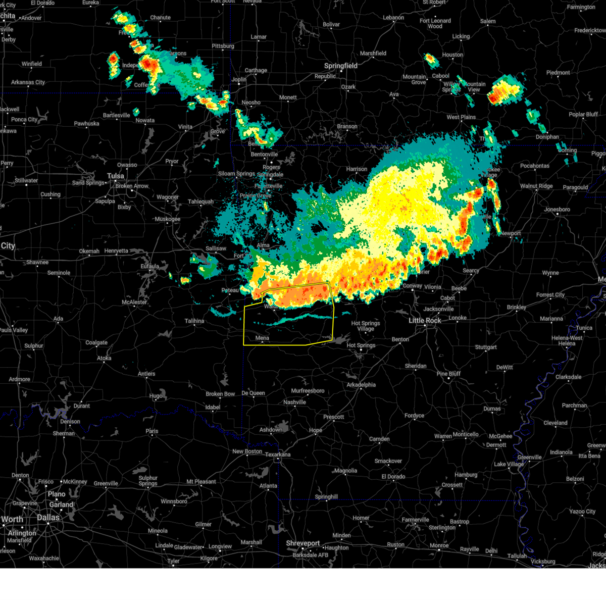
The Top Recent Hail Date for Waldron, AR is Saturday, April 25, 2026 (2nd out of 73)
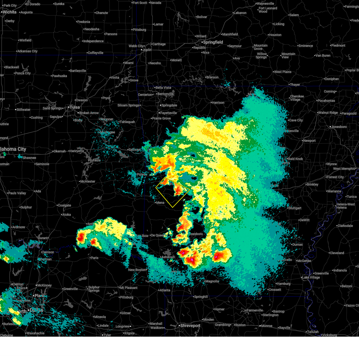
Hail and Wind Damage Spotted near Waldron, AR
| Date / Time | Report Details |
|---|---|
| 6/6/2026 9:15 PM CDT | A tree was reported down near this location onto east 1st street in waldro in scott county AR, 0.3 miles NNW of Waldron, AR |
| 4/28/2026 5:57 PM CDT |
 At 557 pm cdt, a severe thunderstorm was located near echo, or 10 miles north of waldron, moving east at 35 mph (radar indicated). Hazards include 60 mph wind gusts and penny size hail. Expect damage to roofs, siding, and trees. Locations impacted include, booneville, waldron, paris, mansfield, magazine, ratcliff, cardiff, echo, oliver, morgan springs, caulksville, bates, barber, olio, winfield, chismville, liberty, grayson, elm park, ione,. At 557 pm cdt, a severe thunderstorm was located near echo, or 10 miles north of waldron, moving east at 35 mph (radar indicated). Hazards include 60 mph wind gusts and penny size hail. Expect damage to roofs, siding, and trees. Locations impacted include, booneville, waldron, paris, mansfield, magazine, ratcliff, cardiff, echo, oliver, morgan springs, caulksville, bates, barber, olio, winfield, chismville, liberty, grayson, elm park, ione,.
|
| 4/28/2026 5:37 PM CDT |
 Svrlzk the national weather service in little rock has issued a * severe thunderstorm warning for, southwestern logan county in western arkansas, northern scott county in western arkansas, * until 615 pm cdt. * at 536 pm cdt, a severe thunderstorm was located over midland, or 16 miles east of poteau, moving east at 35 mph (radar indicated). Hazards include 60 mph wind gusts and penny size hail. expect damage to roofs, siding, and trees Svrlzk the national weather service in little rock has issued a * severe thunderstorm warning for, southwestern logan county in western arkansas, northern scott county in western arkansas, * until 615 pm cdt. * at 536 pm cdt, a severe thunderstorm was located over midland, or 16 miles east of poteau, moving east at 35 mph (radar indicated). Hazards include 60 mph wind gusts and penny size hail. expect damage to roofs, siding, and trees
|
| 4/26/2026 12:07 AM CDT |
 The storm which prompted the warning has weakened below severe limits, and no longer poses an immediate threat to life or property. therefore, the warning will be allowed to expire. however small hail and gusty winds are still possible with this thunderstorm. a severe thunderstorm watch remains in effect until 600 am cdt for western and central arkansas. The storm which prompted the warning has weakened below severe limits, and no longer poses an immediate threat to life or property. therefore, the warning will be allowed to expire. however small hail and gusty winds are still possible with this thunderstorm. a severe thunderstorm watch remains in effect until 600 am cdt for western and central arkansas.
|
| 4/25/2026 11:59 PM CDT |
 At 1159 pm cdt, a severe thunderstorm was located over waldron, moving southeast at 35 mph (radar indicated). Hazards include 60 mph wind gusts and quarter size hail. Hail damage to vehicles is expected. expect wind damage to roofs, siding, and trees. Locations impacted include, waldron, oden, cardiff, muddy creek wma, chula, olio, cedar creek, y city, pine ridge, nola, needmore, harvey, boles, parks, pencil bluff,. At 1159 pm cdt, a severe thunderstorm was located over waldron, moving southeast at 35 mph (radar indicated). Hazards include 60 mph wind gusts and quarter size hail. Hail damage to vehicles is expected. expect wind damage to roofs, siding, and trees. Locations impacted include, waldron, oden, cardiff, muddy creek wma, chula, olio, cedar creek, y city, pine ridge, nola, needmore, harvey, boles, parks, pencil bluff,.
|
| 4/25/2026 11:38 PM CDT |
 The severe thunderstorm which prompted the warning will be allowed to expire. however large hail is still possible with this thunderstorm. a severe thunderstorm watch remains in effect until 600 am cdt for western arkansas. remember, a severe thunderstorm warning still remains in effect for scott county until 1215 am cdt. The severe thunderstorm which prompted the warning will be allowed to expire. however large hail is still possible with this thunderstorm. a severe thunderstorm watch remains in effect until 600 am cdt for western arkansas. remember, a severe thunderstorm warning still remains in effect for scott county until 1215 am cdt.
|
| 4/25/2026 11:36 PM CDT |
 At 1135 pm cdt, a severe thunderstorm was located 7 miles southeast of waldron, moving southeast at 30 mph. this storm has a history of producing half dollar sized hail, most recently in waldron in scott county (broadcast media). Hazards include 60 mph wind gusts and half dollar size hail. Hail damage to vehicles is expected. expect wind damage to roofs, siding, and trees. Locations impacted include, waldron, oden, cardiff, muddy creek wma, chula, olio, cedar creek, y city, pine ridge, nola, needmore, harvey, boles, parks, pencil bluff,. At 1135 pm cdt, a severe thunderstorm was located 7 miles southeast of waldron, moving southeast at 30 mph. this storm has a history of producing half dollar sized hail, most recently in waldron in scott county (broadcast media). Hazards include 60 mph wind gusts and half dollar size hail. Hail damage to vehicles is expected. expect wind damage to roofs, siding, and trees. Locations impacted include, waldron, oden, cardiff, muddy creek wma, chula, olio, cedar creek, y city, pine ridge, nola, needmore, harvey, boles, parks, pencil bluff,.
|
| 4/25/2026 11:35 PM CDT | Quarter sized hail reported 0.3 miles NNW of Waldron, AR |
| 4/25/2026 11:29 PM CDT |
 At 1129 pm cdt, a severe thunderstorm was located near waldron, moving southeast at 35 mph (radar indicated). Hazards include 60 mph wind gusts and quarter size hail. Hail damage to vehicles is expected. expect wind damage to roofs, siding, and trees. Locations impacted include, waldron, cardiff, needmore,. At 1129 pm cdt, a severe thunderstorm was located near waldron, moving southeast at 35 mph (radar indicated). Hazards include 60 mph wind gusts and quarter size hail. Hail damage to vehicles is expected. expect wind damage to roofs, siding, and trees. Locations impacted include, waldron, cardiff, needmore,.
|
| 4/25/2026 11:28 PM CDT |
 Svrlzk the national weather service in little rock has issued a * severe thunderstorm warning for, southeastern scott county in western arkansas, northeastern polk county in western arkansas, southwestern yell county in central arkansas, northwestern montgomery county in western arkansas, * until 1215 am cdt. * at 1128 pm cdt, a severe thunderstorm was located near waldron, moving southeast at 30 mph (radar indicated). Hazards include 60 mph wind gusts and quarter size hail. Hail damage to vehicles is expected. Expect wind damage to roofs, siding, and trees. Svrlzk the national weather service in little rock has issued a * severe thunderstorm warning for, southeastern scott county in western arkansas, northeastern polk county in western arkansas, southwestern yell county in central arkansas, northwestern montgomery county in western arkansas, * until 1215 am cdt. * at 1128 pm cdt, a severe thunderstorm was located near waldron, moving southeast at 30 mph (radar indicated). Hazards include 60 mph wind gusts and quarter size hail. Hail damage to vehicles is expected. Expect wind damage to roofs, siding, and trees.
|
| 4/25/2026 11:14 PM CDT |
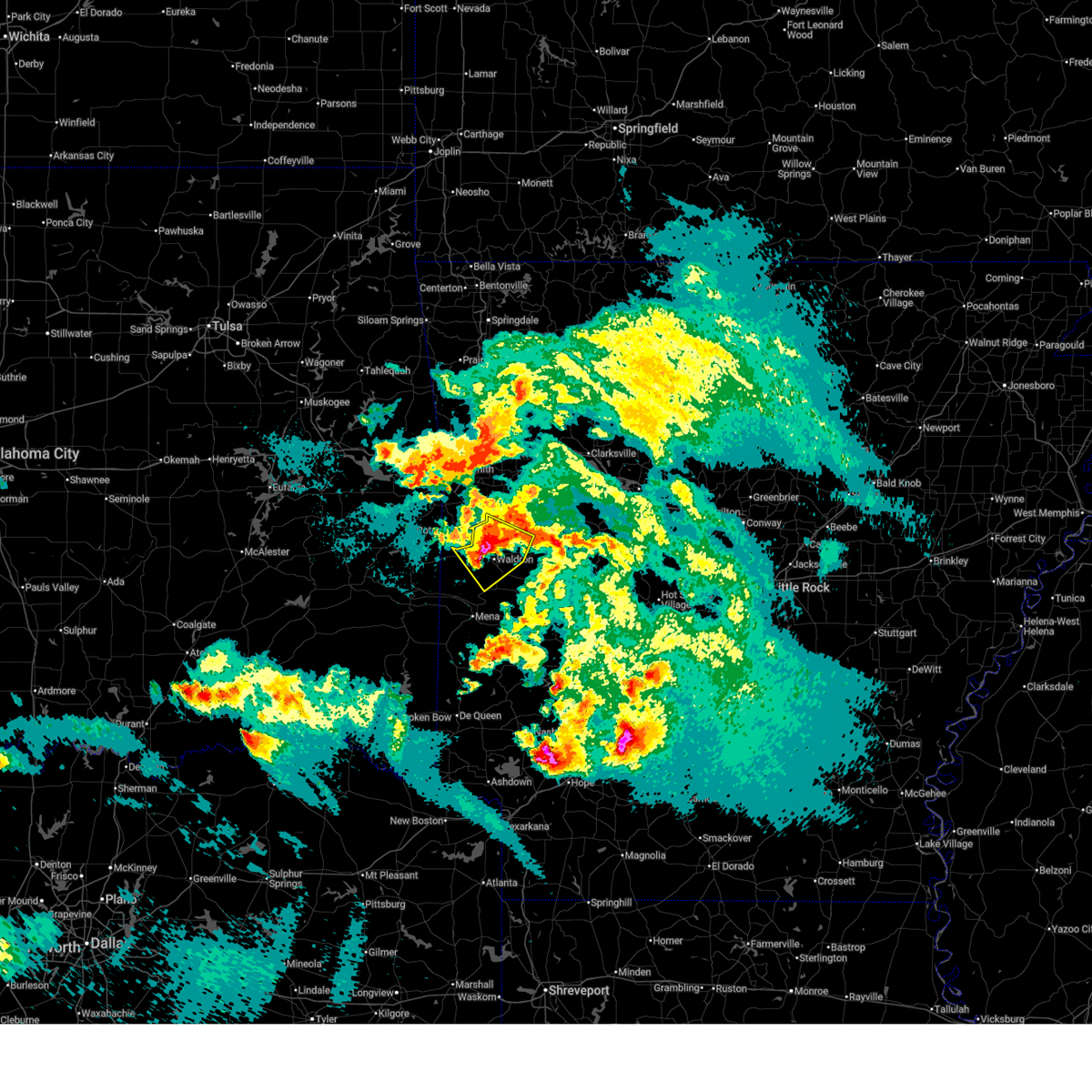 At 1114 pm cdt, a severe thunderstorm was located near waldron, moving southeast at 30 mph (radar indicated). Hazards include ping pong ball size hail and 60 mph wind gusts. People and animals outdoors will be injured. expect hail damage to roofs, siding, windows, and vehicles. expect wind damage to roofs, siding, and trees. Locations impacted include, waldron, mansfield, cardiff, echo, oliver, cauthron, winfield, hon, lucas, liberty, needmore, elm park, ione, boles,. At 1114 pm cdt, a severe thunderstorm was located near waldron, moving southeast at 30 mph (radar indicated). Hazards include ping pong ball size hail and 60 mph wind gusts. People and animals outdoors will be injured. expect hail damage to roofs, siding, windows, and vehicles. expect wind damage to roofs, siding, and trees. Locations impacted include, waldron, mansfield, cardiff, echo, oliver, cauthron, winfield, hon, lucas, liberty, needmore, elm park, ione, boles,.
|
| 4/25/2026 10:59 PM CDT |
 Svrlzk the national weather service in little rock has issued a * severe thunderstorm warning for, southwestern logan county in western arkansas, central scott county in western arkansas, * until 1145 pm cdt. * at 1059 pm cdt, a severe thunderstorm was located near mansfield, or 11 miles northwest of waldron, moving southeast at 35 mph (radar indicated). Hazards include 60 mph wind gusts and quarter size hail. Hail damage to vehicles is expected. Expect wind damage to roofs, siding, and trees. Svrlzk the national weather service in little rock has issued a * severe thunderstorm warning for, southwestern logan county in western arkansas, central scott county in western arkansas, * until 1145 pm cdt. * at 1059 pm cdt, a severe thunderstorm was located near mansfield, or 11 miles northwest of waldron, moving southeast at 35 mph (radar indicated). Hazards include 60 mph wind gusts and quarter size hail. Hail damage to vehicles is expected. Expect wind damage to roofs, siding, and trees.
|
| 4/25/2026 9:26 PM CDT |
 The storms which prompted the warning have weakened below severe limits, and no longer pose an immediate threat to life or property. therefore, the warning will be allowed to expire. however small hail and gusty winds are still possible with these thunderstorms. a tornado watch remains in effect until 100 am cdt for western arkansas. The storms which prompted the warning have weakened below severe limits, and no longer pose an immediate threat to life or property. therefore, the warning will be allowed to expire. however small hail and gusty winds are still possible with these thunderstorms. a tornado watch remains in effect until 100 am cdt for western arkansas.
|
| 4/25/2026 9:05 PM CDT |
 At 905 pm cdt, severe thunderstorms were located along a line extending from 6 miles southeast of waldron to 11 miles north of mena to near beauchamp, moving southeast at 20 mph (radar indicated). Hazards include 60 mph wind gusts and penny size hail. Expect damage to roofs, siding, and trees. Locations impacted include, waldron, beauchamp, cardiff, y city, needmore, olio, winfield, boles, parks, hon,. At 905 pm cdt, severe thunderstorms were located along a line extending from 6 miles southeast of waldron to 11 miles north of mena to near beauchamp, moving southeast at 20 mph (radar indicated). Hazards include 60 mph wind gusts and penny size hail. Expect damage to roofs, siding, and trees. Locations impacted include, waldron, beauchamp, cardiff, y city, needmore, olio, winfield, boles, parks, hon,.
|
| 4/25/2026 8:41 PM CDT |
 Svrlzk the national weather service in little rock has issued a * severe thunderstorm warning for, scott county in western arkansas, * until 930 pm cdt. * at 841 pm cdt, a severe thunderstorm was located over oliver, or 9 miles west of waldron, moving southeast at 20 mph. this storm most recently produced quarter sized hail in hon, scott county (public). Hazards include 60 mph wind gusts and quarter size hail. Hail damage to vehicles is expected. Expect wind damage to roofs, siding, and trees. Svrlzk the national weather service in little rock has issued a * severe thunderstorm warning for, scott county in western arkansas, * until 930 pm cdt. * at 841 pm cdt, a severe thunderstorm was located over oliver, or 9 miles west of waldron, moving southeast at 20 mph. this storm most recently produced quarter sized hail in hon, scott county (public). Hazards include 60 mph wind gusts and quarter size hail. Hail damage to vehicles is expected. Expect wind damage to roofs, siding, and trees.
|
| 4/25/2026 8:38 PM CDT | Quarter sized hail reported 5.6 miles ESE of Waldron, AR, ham radio operator reports quarter sized hail in hon. time estimated from radar. |
| 4/25/2026 8:31 PM CDT |
 At 830 pm cdt, a severe thunderstorm was located near morgan springs, or 14 miles west of waldron, moving southeast at 25 mph. this storm has a history of producing golf ball sized hail, most recently in hartford, franklin county (public). Hazards include golf ball size hail and 60 mph wind gusts. People and animals outdoors will be injured. expect hail damage to roofs, siding, windows, and vehicles. expect wind damage to roofs, siding, and trees. Locations impacted include, waldron, beauchamp, oliver, morgan springs, bates, cauthron, winfield, hon, liberty,. At 830 pm cdt, a severe thunderstorm was located near morgan springs, or 14 miles west of waldron, moving southeast at 25 mph. this storm has a history of producing golf ball sized hail, most recently in hartford, franklin county (public). Hazards include golf ball size hail and 60 mph wind gusts. People and animals outdoors will be injured. expect hail damage to roofs, siding, windows, and vehicles. expect wind damage to roofs, siding, and trees. Locations impacted include, waldron, beauchamp, oliver, morgan springs, bates, cauthron, winfield, hon, liberty,.
|
| 4/25/2026 8:08 PM CDT |
 Svrlzk the national weather service in little rock has issued a * severe thunderstorm warning for, northwestern scott county in western arkansas, * until 845 pm cdt. * at 807 pm cdt, a severe thunderstorm was located near hartford, or near poteau, moving southeast at 25 mph. this storm most recently produced golf ball sized hail northeast of monroe in le flore county, oklahoma (public). Hazards include golf ball size hail and 60 mph wind gusts. People and animals outdoors will be injured. expect hail damage to roofs, siding, windows, and vehicles. Expect wind damage to roofs, siding, and trees. Svrlzk the national weather service in little rock has issued a * severe thunderstorm warning for, northwestern scott county in western arkansas, * until 845 pm cdt. * at 807 pm cdt, a severe thunderstorm was located near hartford, or near poteau, moving southeast at 25 mph. this storm most recently produced golf ball sized hail northeast of monroe in le flore county, oklahoma (public). Hazards include golf ball size hail and 60 mph wind gusts. People and animals outdoors will be injured. expect hail damage to roofs, siding, windows, and vehicles. Expect wind damage to roofs, siding, and trees.
|
| 4/25/2026 7:51 PM CDT |
 At 751 pm cdt, a severe thunderstorm was located near waldron, moving southeast at 25 mph. this storm has a history of producing quarter sized hail, most recently just south of waldron in scott county (public). Hazards include 60 mph wind gusts and quarter size hail. Hail damage to vehicles is expected. expect wind damage to roofs, siding, and trees. Locations impacted include, waldron, cardiff, y city, needmore, olio, cedar creek, boles, parks,. At 751 pm cdt, a severe thunderstorm was located near waldron, moving southeast at 25 mph. this storm has a history of producing quarter sized hail, most recently just south of waldron in scott county (public). Hazards include 60 mph wind gusts and quarter size hail. Hail damage to vehicles is expected. expect wind damage to roofs, siding, and trees. Locations impacted include, waldron, cardiff, y city, needmore, olio, cedar creek, boles, parks,.
|
| 4/25/2026 7:45 PM CDT | Quarter sized hail reported 3.9 miles NNW of Waldron, AR, ham radio operator reports quarter sized hail. time and location estimated from radar. |
| 4/25/2026 7:42 PM CDT |
 The severe thunderstorm which prompted the warning will be allowed to expire. however large hail is still possible with this thunderstorm. a tornado watch remains in effect until 100 am cdt for western arkansas. remember, a new severe thunderstorm warning remains in effect for scott county until 830 pm cdt. The severe thunderstorm which prompted the warning will be allowed to expire. however large hail is still possible with this thunderstorm. a tornado watch remains in effect until 100 am cdt for western arkansas. remember, a new severe thunderstorm warning remains in effect for scott county until 830 pm cdt.
|
| 4/25/2026 7:40 PM CDT |
 Svrlzk the national weather service in little rock has issued a * severe thunderstorm warning for, southern scott county in western arkansas, * until 830 pm cdt. * at 739 pm cdt, a severe thunderstorm was located near waldron, moving southeast at 25 mph (radar indicated). Hazards include 60 mph wind gusts and quarter size hail. Hail damage to vehicles is expected. Expect wind damage to roofs, siding, and trees. Svrlzk the national weather service in little rock has issued a * severe thunderstorm warning for, southern scott county in western arkansas, * until 830 pm cdt. * at 739 pm cdt, a severe thunderstorm was located near waldron, moving southeast at 25 mph (radar indicated). Hazards include 60 mph wind gusts and quarter size hail. Hail damage to vehicles is expected. Expect wind damage to roofs, siding, and trees.
|
| 4/25/2026 7:14 PM CDT | Quarter sized hail reported 9.9 miles N of Waldron, AR, public report of quarter sized hail. time estimated from radar. |
| 4/25/2026 7:07 PM CDT |
 Svrlzk the national weather service in little rock has issued a * severe thunderstorm warning for, northwestern scott county in western arkansas, * until 745 pm cdt. * at 707 pm cdt, a severe thunderstorm was located near oliver, or 13 miles west of waldron, moving east at 25 mph (radar indicated). Hazards include 60 mph wind gusts and quarter size hail. Hail damage to vehicles is expected. Expect wind damage to roofs, siding, and trees. Svrlzk the national weather service in little rock has issued a * severe thunderstorm warning for, northwestern scott county in western arkansas, * until 745 pm cdt. * at 707 pm cdt, a severe thunderstorm was located near oliver, or 13 miles west of waldron, moving east at 25 mph (radar indicated). Hazards include 60 mph wind gusts and quarter size hail. Hail damage to vehicles is expected. Expect wind damage to roofs, siding, and trees.
|
| 4/25/2026 6:55 PM CDT |
 At 655 pm cdt, a severe thunderstorm was located near beauchamp, or 7 miles southwest of waldron, moving east at 30 mph (radar indicated). Hazards include 60 mph wind gusts and quarter size hail. Hail damage to vehicles is expected. expect wind damage to roofs, siding, and trees. Locations impacted include, waldron, oden, beauchamp, union hill, olio, cedar creek, y city, pine ridge, needmore, harvey, boles, parks, cherry hill in polk county,. At 655 pm cdt, a severe thunderstorm was located near beauchamp, or 7 miles southwest of waldron, moving east at 30 mph (radar indicated). Hazards include 60 mph wind gusts and quarter size hail. Hail damage to vehicles is expected. expect wind damage to roofs, siding, and trees. Locations impacted include, waldron, oden, beauchamp, union hill, olio, cedar creek, y city, pine ridge, needmore, harvey, boles, parks, cherry hill in polk county,.
|
| 4/25/2026 6:13 PM CDT |
 Torlzk the national weather service in little rock has issued a * tornado warning for, southwestern scott county in western arkansas, north central polk county in western arkansas, * until 700 pm cdt. * at 613 pm cdt, a severe thunderstorm capable of producing a tornado was located near heavener, or 13 miles southeast of poteau, moving east at 25 mph (radar indicated rotation). Hazards include tornado. Flying debris will be dangerous to those caught without shelter. mobile homes will be damaged or destroyed. damage to roofs, windows, and vehicles will occur. Tree damage is likely. Torlzk the national weather service in little rock has issued a * tornado warning for, southwestern scott county in western arkansas, north central polk county in western arkansas, * until 700 pm cdt. * at 613 pm cdt, a severe thunderstorm capable of producing a tornado was located near heavener, or 13 miles southeast of poteau, moving east at 25 mph (radar indicated rotation). Hazards include tornado. Flying debris will be dangerous to those caught without shelter. mobile homes will be damaged or destroyed. damage to roofs, windows, and vehicles will occur. Tree damage is likely.
|
| 4/24/2026 5:35 PM CDT |
 Svrlzk the national weather service in little rock has issued a * severe thunderstorm warning for, western scott county in western arkansas, * until 600 pm cdt. * at 535 pm cdt, a severe thunderstorm was located near hartford, or 11 miles southeast of poteau, moving east at 25 mph (radar indicated). Hazards include 60 mph wind gusts and quarter size hail. Hail damage to vehicles is expected. Expect wind damage to roofs, siding, and trees. Svrlzk the national weather service in little rock has issued a * severe thunderstorm warning for, western scott county in western arkansas, * until 600 pm cdt. * at 535 pm cdt, a severe thunderstorm was located near hartford, or 11 miles southeast of poteau, moving east at 25 mph (radar indicated). Hazards include 60 mph wind gusts and quarter size hail. Hail damage to vehicles is expected. Expect wind damage to roofs, siding, and trees.
|
| 3/7/2026 6:26 AM CST |
 the severe thunderstorm warning has been cancelled and is no longer in effect the severe thunderstorm warning has been cancelled and is no longer in effect
|
| 3/7/2026 6:01 AM CST |
 Svrlzk the national weather service in little rock has issued a * severe thunderstorm warning for, southeastern scott county in western arkansas, northeastern polk county in western arkansas, northwestern montgomery county in western arkansas, * until 645 am cst. * at 601 am cst, severe thunderstorms were located along a line extending from near waldron to 9 miles northeast of mena, moving east at 30 mph (radar indicated). Hazards include 60 mph wind gusts and quarter size hail. Hail damage to vehicles is expected. Expect wind damage to roofs, siding, and trees. Svrlzk the national weather service in little rock has issued a * severe thunderstorm warning for, southeastern scott county in western arkansas, northeastern polk county in western arkansas, northwestern montgomery county in western arkansas, * until 645 am cst. * at 601 am cst, severe thunderstorms were located along a line extending from near waldron to 9 miles northeast of mena, moving east at 30 mph (radar indicated). Hazards include 60 mph wind gusts and quarter size hail. Hail damage to vehicles is expected. Expect wind damage to roofs, siding, and trees.
|
| 9/23/2025 8:36 PM CDT | The storm which prompted the warning has weakened below severe limits, and no longer poses an immediate threat to life or property. therefore, the warning will be allowed to expire. a tornado watch remains in effect until 1000 pm cdt for western and central arkansas. a severe thunderstorm watch remains in effect until 1000 pm cdt for western arkansas. a severe thunderstorm watch also remains in effect until 100 am cdt for western arkansas. |
| 9/23/2025 7:57 PM CDT | Svrlzk the national weather service in little rock has issued a * severe thunderstorm warning for, southeastern scott county in western arkansas, northeastern polk county in western arkansas, southwestern yell county in central arkansas, northwestern montgomery county in western arkansas, * until 845 pm cdt. * at 756 pm cdt, a severe thunderstorm was located near waldron, moving southeast at 25 mph (radar indicated). Hazards include 60 mph wind gusts and quarter size hail. Hail damage to vehicles is expected. Expect wind damage to roofs, siding, and trees. |
| 9/23/2025 7:12 PM CDT | Svrlzk the national weather service in little rock has issued a * severe thunderstorm warning for, southwestern scott county in western arkansas, north central polk county in western arkansas, * until 800 pm cdt. * at 712 pm cdt, a severe thunderstorm was located over morgan springs, or 15 miles west of waldron, moving southeast at 15 mph (radar indicated). Hazards include 60 mph wind gusts. expect damage to roofs, siding, and trees |
| 9/23/2025 6:49 PM CDT | Svrlzk the national weather service in little rock has issued a * severe thunderstorm warning for, southwestern logan county in western arkansas, northern scott county in western arkansas, * until 730 pm cdt. * at 649 pm cdt, a severe thunderstorm was located over mansfield, or 14 miles northwest of waldron, moving southeast at 25 mph (radar indicated). Hazards include 60 mph wind gusts and penny size hail. expect damage to roofs, siding, and trees |
| 6/7/2025 7:41 AM CDT | Local police dispatch reported several trees down along arkansas highway 80 east of waldro in scott county AR, 10.4 miles W of Waldron, AR |
| 5/20/2025 2:36 AM CDT |
 the severe thunderstorm warning has been cancelled and is no longer in effect the severe thunderstorm warning has been cancelled and is no longer in effect
|
| 5/20/2025 2:25 AM CDT |
 At 225 am cdt, severe thunderstorms were located along a line extending from near waldron to 11 miles south of cardiff to 6 miles northwest of oden to near opal to bard springs recreation area, moving east at 60 mph (radar indicated). Hazards include 60 mph wind gusts. Expect damage to roofs, siding, and trees. Locations impacted include, big fork, wing, cardiff, mt tabor, bluffton, little missouri falls recreatio, pine ridge, lena landing rec area, rover, shady lake recreation area, corinth, blue ball, story, carter cove park, union hill, macedonia in yell county, cedar creek, pencil bluff, waltreak, crystal springs landing,. At 225 am cdt, severe thunderstorms were located along a line extending from near waldron to 11 miles south of cardiff to 6 miles northwest of oden to near opal to bard springs recreation area, moving east at 60 mph (radar indicated). Hazards include 60 mph wind gusts. Expect damage to roofs, siding, and trees. Locations impacted include, big fork, wing, cardiff, mt tabor, bluffton, little missouri falls recreatio, pine ridge, lena landing rec area, rover, shady lake recreation area, corinth, blue ball, story, carter cove park, union hill, macedonia in yell county, cedar creek, pencil bluff, waltreak, crystal springs landing,.
|
| 5/20/2025 2:12 AM CDT |
 Svrlzk the national weather service in little rock has issued a * severe thunderstorm warning for, southwestern perry county in central arkansas, western garland county in central arkansas, scott county in western arkansas, central polk county in western arkansas, yell county in central arkansas, montgomery county in western arkansas, * until 300 am cdt. * at 212 am cdt, severe thunderstorms were located along a line extending from near beauchamp to 11 miles south of waldron to 9 miles northwest of opal to near shady to cossatot river state park, moving east at 60 mph (radar indicated). Hazards include 60 mph wind gusts and quarter size hail. Hail damage to vehicles is expected. Expect wind damage to roofs, siding, and trees. Svrlzk the national weather service in little rock has issued a * severe thunderstorm warning for, southwestern perry county in central arkansas, western garland county in central arkansas, scott county in western arkansas, central polk county in western arkansas, yell county in central arkansas, montgomery county in western arkansas, * until 300 am cdt. * at 212 am cdt, severe thunderstorms were located along a line extending from near beauchamp to 11 miles south of waldron to 9 miles northwest of opal to near shady to cossatot river state park, moving east at 60 mph (radar indicated). Hazards include 60 mph wind gusts and quarter size hail. Hail damage to vehicles is expected. Expect wind damage to roofs, siding, and trees.
|
| 5/20/2025 2:08 AM CDT |
 At 207 am cdt, severe thunderstorms were located along a line extending from beauchamp to 12 miles east of queen wilhelmina state park to 8 miles northeast of mena to near mena intermountain airport to near cossatot river state park, moving east at 60 mph (radar indicated). Hazards include 60 mph wind gusts. Expect damage to roofs, siding, and trees. Locations impacted include, big fork, cardiff, hatfield, little missouri falls recreatio, pine ridge, shady lake recreation area, hatton, potter, cove, rocky, hon, cedar creek, acorn, bates, y city, bard springs recreation area, roaring branch natural area, parks, eagleton, bogg springs,. At 207 am cdt, severe thunderstorms were located along a line extending from beauchamp to 12 miles east of queen wilhelmina state park to 8 miles northeast of mena to near mena intermountain airport to near cossatot river state park, moving east at 60 mph (radar indicated). Hazards include 60 mph wind gusts. Expect damage to roofs, siding, and trees. Locations impacted include, big fork, cardiff, hatfield, little missouri falls recreatio, pine ridge, shady lake recreation area, hatton, potter, cove, rocky, hon, cedar creek, acorn, bates, y city, bard springs recreation area, roaring branch natural area, parks, eagleton, bogg springs,.
|
| 5/20/2025 1:59 AM CDT |
 At 159 am cdt, severe thunderstorms were located along a line extending from 8 miles north of mountain fork to near queen wilhelmina state park to near mena to near polk county fairgrounds to near vandervoort, moving east at 65 mph (radar indicated). Hazards include 60 mph wind gusts. Expect damage to roofs, siding, and trees. Locations impacted include, big fork, cardiff, hatfield, little missouri falls recreatio, pine ridge, shady lake recreation area, hatton, mountain fork, potter, cove, black fork, rocky, black fork mountain wilderness, hon, cedar creek, acorn, bates, y city, bard springs recreation area, roaring branch natural area,. At 159 am cdt, severe thunderstorms were located along a line extending from 8 miles north of mountain fork to near queen wilhelmina state park to near mena to near polk county fairgrounds to near vandervoort, moving east at 65 mph (radar indicated). Hazards include 60 mph wind gusts. Expect damage to roofs, siding, and trees. Locations impacted include, big fork, cardiff, hatfield, little missouri falls recreatio, pine ridge, shady lake recreation area, hatton, mountain fork, potter, cove, black fork, rocky, black fork mountain wilderness, hon, cedar creek, acorn, bates, y city, bard springs recreation area, roaring branch natural area,.
|
| 5/20/2025 1:52 AM CDT |
 At 151 am cdt, severe thunderstorms were located along a line extending from 9 miles southeast of heavener to near mountain fork to 6 miles southwest of queen wilhelmina state park to near hatfield to 11 miles west of vandervoort, moving east at 60 mph (radar indicated). Hazards include 60 mph wind gusts. Expect damage to roofs, siding, and trees. Locations impacted include, big fork, cardiff, hatfield, little missouri falls recreatio, pine ridge, shady lake recreation area, hatton, mountain fork, potter, cove, black fork, rocky, black fork mountain wilderness, hon, cedar creek, acorn, bates, y city, bard springs recreation area, roaring branch natural area,. At 151 am cdt, severe thunderstorms were located along a line extending from 9 miles southeast of heavener to near mountain fork to 6 miles southwest of queen wilhelmina state park to near hatfield to 11 miles west of vandervoort, moving east at 60 mph (radar indicated). Hazards include 60 mph wind gusts. Expect damage to roofs, siding, and trees. Locations impacted include, big fork, cardiff, hatfield, little missouri falls recreatio, pine ridge, shady lake recreation area, hatton, mountain fork, potter, cove, black fork, rocky, black fork mountain wilderness, hon, cedar creek, acorn, bates, y city, bard springs recreation area, roaring branch natural area,.
|
| 5/20/2025 1:37 AM CDT |
 Svrlzk the national weather service in little rock has issued a * severe thunderstorm warning for, scott county in western arkansas, polk county in western arkansas, northwestern montgomery county in western arkansas, * until 215 am cdt. * at 137 am cdt, severe thunderstorms were located along a line extending from 6 miles north of muse to big cedar to near octavia, moving east at 60 mph (radar indicated). Hazards include 60 mph wind gusts. expect damage to roofs, siding, and trees Svrlzk the national weather service in little rock has issued a * severe thunderstorm warning for, scott county in western arkansas, polk county in western arkansas, northwestern montgomery county in western arkansas, * until 215 am cdt. * at 137 am cdt, severe thunderstorms were located along a line extending from 6 miles north of muse to big cedar to near octavia, moving east at 60 mph (radar indicated). Hazards include 60 mph wind gusts. expect damage to roofs, siding, and trees
|
| 5/19/2025 9:38 PM CDT |
 Svrlzk the national weather service in little rock has issued a * severe thunderstorm warning for, scott county in western arkansas, northern polk county in western arkansas, southwestern yell county in central arkansas, northern montgomery county in western arkansas, * until 1030 pm cdt. * at 937 pm cdt, severe thunderstorms were located along a line extending from near waldron to 6 miles northeast of mena, moving east at 45 mph (radar indicated). Hazards include 60 mph wind gusts. expect damage to roofs, siding, and trees Svrlzk the national weather service in little rock has issued a * severe thunderstorm warning for, scott county in western arkansas, northern polk county in western arkansas, southwestern yell county in central arkansas, northern montgomery county in western arkansas, * until 1030 pm cdt. * at 937 pm cdt, severe thunderstorms were located along a line extending from near waldron to 6 miles northeast of mena, moving east at 45 mph (radar indicated). Hazards include 60 mph wind gusts. expect damage to roofs, siding, and trees
|
| 5/19/2025 8:52 PM CDT |
 Svrlzk the national weather service in little rock has issued a * severe thunderstorm warning for, southern logan county in western arkansas, scott county in western arkansas, northern polk county in western arkansas, western yell county in central arkansas, northern montgomery county in western arkansas, * until 945 pm cdt. * at 851 pm cdt, a severe thunderstorm was located near heavener, or 15 miles south of poteau, moving northeast at 65 mph (radar indicated). Hazards include 60 mph wind gusts and quarter size hail. Hail damage to vehicles is expected. Expect wind damage to roofs, siding, and trees. Svrlzk the national weather service in little rock has issued a * severe thunderstorm warning for, southern logan county in western arkansas, scott county in western arkansas, northern polk county in western arkansas, western yell county in central arkansas, northern montgomery county in western arkansas, * until 945 pm cdt. * at 851 pm cdt, a severe thunderstorm was located near heavener, or 15 miles south of poteau, moving northeast at 65 mph (radar indicated). Hazards include 60 mph wind gusts and quarter size hail. Hail damage to vehicles is expected. Expect wind damage to roofs, siding, and trees.
|
| 5/18/2025 5:23 AM CDT |
 At 522 am cdt, severe thunderstorms were located along a line extending from 6 miles southwest of muddy creek wma to opal to near mena intermountain airport, moving southeast at 55 mph (radar indicated). Hazards include 60 mph wind gusts and quarter size hail. Hail damage to vehicles is expected. expect wind damage to roofs, siding, and trees. Locations impacted include, big fork, bonnerdale, hatfield, little missouri falls recreatio, pine ridge, lena landing rec area, shady lake recreation area, hatton, mountain fork, potter, cove, story, rocky, black fork mountain wilderness, cedar creek, pencil bluff, glenwood, crystal springs landing, meyers, acorn,. At 522 am cdt, severe thunderstorms were located along a line extending from 6 miles southwest of muddy creek wma to opal to near mena intermountain airport, moving southeast at 55 mph (radar indicated). Hazards include 60 mph wind gusts and quarter size hail. Hail damage to vehicles is expected. expect wind damage to roofs, siding, and trees. Locations impacted include, big fork, bonnerdale, hatfield, little missouri falls recreatio, pine ridge, lena landing rec area, shady lake recreation area, hatton, mountain fork, potter, cove, story, rocky, black fork mountain wilderness, cedar creek, pencil bluff, glenwood, crystal springs landing, meyers, acorn,.
|
| 5/18/2025 5:10 AM CDT |
 Svrlzk the national weather service in little rock has issued a * severe thunderstorm warning for, logan county in western arkansas, johnson county in western arkansas, perry county in central arkansas, northwestern van buren county in north central arkansas, central conway county in central arkansas, northwestern garland county in central arkansas, northeastern scott county in western arkansas, northwestern saline county in central arkansas, yell county in central arkansas, northeastern montgomery county in western arkansas, pope county in central arkansas, * until 600 am cdt. * at 509 am cdt, severe thunderstorms were located along a line extending from 6 miles northwest of woodland to near subiaco to blue mountain to 6 miles west of gravelly, moving east at 50 mph (radar indicated). Hazards include 70 mph wind gusts and quarter size hail. Hail damage to vehicles is expected. expect considerable tree damage. Wind damage is also likely to mobile homes, roofs, and outbuildings. Svrlzk the national weather service in little rock has issued a * severe thunderstorm warning for, logan county in western arkansas, johnson county in western arkansas, perry county in central arkansas, northwestern van buren county in north central arkansas, central conway county in central arkansas, northwestern garland county in central arkansas, northeastern scott county in western arkansas, northwestern saline county in central arkansas, yell county in central arkansas, northeastern montgomery county in western arkansas, pope county in central arkansas, * until 600 am cdt. * at 509 am cdt, severe thunderstorms were located along a line extending from 6 miles northwest of woodland to near subiaco to blue mountain to 6 miles west of gravelly, moving east at 50 mph (radar indicated). Hazards include 70 mph wind gusts and quarter size hail. Hail damage to vehicles is expected. expect considerable tree damage. Wind damage is also likely to mobile homes, roofs, and outbuildings.
|
| 5/18/2025 5:06 AM CDT |
 Svrlzk the national weather service in little rock has issued a * severe thunderstorm warning for, northwestern clark county in southwestern arkansas, northwestern pike county in southwestern arkansas, southwestern garland county in central arkansas, scott county in western arkansas, polk county in western arkansas, southwestern yell county in central arkansas, western hot spring county in southwestern arkansas, montgomery county in western arkansas, * until 600 am cdt. * at 506 am cdt, severe thunderstorms were located along a line extending from 8 miles south of cardiff to near mena to near mountain fork, moving southeast at 55 mph (radar indicated). Hazards include 60 mph wind gusts and quarter size hail. Hail damage to vehicles is expected. Expect wind damage to roofs, siding, and trees. Svrlzk the national weather service in little rock has issued a * severe thunderstorm warning for, northwestern clark county in southwestern arkansas, northwestern pike county in southwestern arkansas, southwestern garland county in central arkansas, scott county in western arkansas, polk county in western arkansas, southwestern yell county in central arkansas, western hot spring county in southwestern arkansas, montgomery county in western arkansas, * until 600 am cdt. * at 506 am cdt, severe thunderstorms were located along a line extending from 8 miles south of cardiff to near mena to near mountain fork, moving southeast at 55 mph (radar indicated). Hazards include 60 mph wind gusts and quarter size hail. Hail damage to vehicles is expected. Expect wind damage to roofs, siding, and trees.
|
| 5/18/2025 5:04 AM CDT |
 At 504 am cdt, severe thunderstorms were located along a line extending from near denning to paris to near magazine to near blue mountain to near cardiff, moving east at 60 mph (radar indicated). Hazards include 70 mph wind gusts and quarter size hail. Hail damage to vehicles is expected. expect considerable tree damage. wind damage is also likely to mobile homes, roofs, and outbuildings. Locations impacted include, clarksville, ranger, wing, cardiff, yale, dublin, piney bay recreation area, bluffton, oark, ratcliff, barber, hunt, rover, wolf pen campground, hartman, corinth, blue ball, devils knob, glendale in logan county, spring lake campground,. At 504 am cdt, severe thunderstorms were located along a line extending from near denning to paris to near magazine to near blue mountain to near cardiff, moving east at 60 mph (radar indicated). Hazards include 70 mph wind gusts and quarter size hail. Hail damage to vehicles is expected. expect considerable tree damage. wind damage is also likely to mobile homes, roofs, and outbuildings. Locations impacted include, clarksville, ranger, wing, cardiff, yale, dublin, piney bay recreation area, bluffton, oark, ratcliff, barber, hunt, rover, wolf pen campground, hartman, corinth, blue ball, devils knob, glendale in logan county, spring lake campground,.
|
| 5/18/2025 4:58 AM CDT |
 At 458 am cdt, severe thunderstorms were located along a line extending from near altus to near ratcliff to near magazine to near booneville to near waldron, moving east at 60 mph (radar indicated). Hazards include 70 mph wind gusts and quarter size hail. Hail damage to vehicles is expected. expect considerable tree damage. wind damage is also likely to mobile homes, roofs, and outbuildings. Locations impacted include, clarksville, ranger, wing, cardiff, yale, dublin, piney bay recreation area, bluffton, oark, ratcliff, barber, hunt, rover, wolf pen campground, hartman, corinth, blue ball, devils knob, glendale in logan county, spring lake campground,. At 458 am cdt, severe thunderstorms were located along a line extending from near altus to near ratcliff to near magazine to near booneville to near waldron, moving east at 60 mph (radar indicated). Hazards include 70 mph wind gusts and quarter size hail. Hail damage to vehicles is expected. expect considerable tree damage. wind damage is also likely to mobile homes, roofs, and outbuildings. Locations impacted include, clarksville, ranger, wing, cardiff, yale, dublin, piney bay recreation area, bluffton, oark, ratcliff, barber, hunt, rover, wolf pen campground, hartman, corinth, blue ball, devils knob, glendale in logan county, spring lake campground,.
|
| 5/18/2025 4:48 AM CDT |
 At 448 am cdt, severe thunderstorms were located along a line extending from near ozark to near charleston to near washburn to 6 miles south of echo, moving east at 60 mph (radar indicated). Hazards include 70 mph wind gusts and quarter size hail. Hail damage to vehicles is expected. expect considerable tree damage. wind damage is also likely to mobile homes, roofs, and outbuildings. Locations impacted include, clarksville, ranger, wing, cardiff, yale, dublin, piney bay recreation area, bluffton, oark, ratcliff, barber, hunt, rover, wolf pen campground, hartman, corinth, blue ball, devils knob, glendale in logan county, spring lake campground,. At 448 am cdt, severe thunderstorms were located along a line extending from near ozark to near charleston to near washburn to 6 miles south of echo, moving east at 60 mph (radar indicated). Hazards include 70 mph wind gusts and quarter size hail. Hail damage to vehicles is expected. expect considerable tree damage. wind damage is also likely to mobile homes, roofs, and outbuildings. Locations impacted include, clarksville, ranger, wing, cardiff, yale, dublin, piney bay recreation area, bluffton, oark, ratcliff, barber, hunt, rover, wolf pen campground, hartman, corinth, blue ball, devils knob, glendale in logan county, spring lake campground,.
|
| 5/18/2025 4:41 AM CDT |
 At 440 am cdt, severe thunderstorms were located along a line extending from dyer to lavaca to burnville to near huntington, moving east at 55 mph (radar indicated). Hazards include 70 mph wind gusts and quarter size hail. Hail damage to vehicles is expected. expect considerable tree damage. wind damage is also likely to mobile homes, roofs, and outbuildings. Locations impacted include, clarksville, ranger, wing, cardiff, yale, dublin, piney bay recreation area, bluffton, oark, ratcliff, barber, hunt, rover, wolf pen campground, hartman, corinth, blue ball, devils knob, glendale in logan county, spring lake campground,. At 440 am cdt, severe thunderstorms were located along a line extending from dyer to lavaca to burnville to near huntington, moving east at 55 mph (radar indicated). Hazards include 70 mph wind gusts and quarter size hail. Hail damage to vehicles is expected. expect considerable tree damage. wind damage is also likely to mobile homes, roofs, and outbuildings. Locations impacted include, clarksville, ranger, wing, cardiff, yale, dublin, piney bay recreation area, bluffton, oark, ratcliff, barber, hunt, rover, wolf pen campground, hartman, corinth, blue ball, devils knob, glendale in logan county, spring lake campground,.
|
| 5/18/2025 4:29 AM CDT |
 Svrlzk the national weather service in little rock has issued a * severe thunderstorm warning for, logan county in western arkansas, johnson county in western arkansas, northern scott county in western arkansas, yell county in central arkansas, west central pope county in central arkansas, * until 515 am cdt. * at 429 am cdt, severe thunderstorms were located along a line extending from rudy to jenny lind to near hartford, moving east at 60 mph (radar indicated). Hazards include 60 mph wind gusts and quarter size hail. Hail damage to vehicles is expected. Expect wind damage to roofs, siding, and trees. Svrlzk the national weather service in little rock has issued a * severe thunderstorm warning for, logan county in western arkansas, johnson county in western arkansas, northern scott county in western arkansas, yell county in central arkansas, west central pope county in central arkansas, * until 515 am cdt. * at 429 am cdt, severe thunderstorms were located along a line extending from rudy to jenny lind to near hartford, moving east at 60 mph (radar indicated). Hazards include 60 mph wind gusts and quarter size hail. Hail damage to vehicles is expected. Expect wind damage to roofs, siding, and trees.
|
| 5/16/2025 7:07 PM CDT |
 Svrlzk the national weather service in little rock has issued a * severe thunderstorm warning for, southeastern logan county in western arkansas, northeastern scott county in western arkansas, yell county in central arkansas, * until 745 pm cdt. * at 707 pm cdt, a severe thunderstorm was located over stonehouse recreation area, or 15 miles west of danville, moving east at 40 mph (radar indicated). Hazards include 60 mph wind gusts and quarter size hail. Hail damage to vehicles is expected. Expect wind damage to roofs, siding, and trees. Svrlzk the national weather service in little rock has issued a * severe thunderstorm warning for, southeastern logan county in western arkansas, northeastern scott county in western arkansas, yell county in central arkansas, * until 745 pm cdt. * at 707 pm cdt, a severe thunderstorm was located over stonehouse recreation area, or 15 miles west of danville, moving east at 40 mph (radar indicated). Hazards include 60 mph wind gusts and quarter size hail. Hail damage to vehicles is expected. Expect wind damage to roofs, siding, and trees.
|
| 4/30/2025 2:52 PM CDT |
 Svrlzk the national weather service in little rock has issued a * severe thunderstorm warning for, eastern scott county in western arkansas, southwestern yell county in central arkansas, northern montgomery county in western arkansas, * until 330 pm cdt. * at 252 pm cdt, severe thunderstorms were located along a line extending from near cardiff to 8 miles west of oden, moving east at 40 mph (radar indicated). Hazards include 60 mph wind gusts. expect damage to roofs, siding, and trees Svrlzk the national weather service in little rock has issued a * severe thunderstorm warning for, eastern scott county in western arkansas, southwestern yell county in central arkansas, northern montgomery county in western arkansas, * until 330 pm cdt. * at 252 pm cdt, severe thunderstorms were located along a line extending from near cardiff to 8 miles west of oden, moving east at 40 mph (radar indicated). Hazards include 60 mph wind gusts. expect damage to roofs, siding, and trees
|
| 4/20/2025 3:09 PM CDT |
 the severe thunderstorm warning has been cancelled and is no longer in effect the severe thunderstorm warning has been cancelled and is no longer in effect
|
| 4/20/2025 3:09 PM CDT |
 At 309 pm cdt, severe thunderstorms were located along a line extending from near ozark to 7 miles southeast of booneville to 8 miles southeast of waldron, moving northeast at 55 mph (radar indicated). Hazards include 60 mph wind gusts and nickel size hail. Expect damage to roofs, siding, and trees. Locations impacted include, clarksville, cardiff, dublin, bluffton, ratcliff, barber, hunt, hartman, blue ball, glendale in logan county, hoyt, union hill, morrison bluff, harmony, caulksville, waltreak, booneville, midway in logan county, nola, driggs,. At 309 pm cdt, severe thunderstorms were located along a line extending from near ozark to 7 miles southeast of booneville to 8 miles southeast of waldron, moving northeast at 55 mph (radar indicated). Hazards include 60 mph wind gusts and nickel size hail. Expect damage to roofs, siding, and trees. Locations impacted include, clarksville, cardiff, dublin, bluffton, ratcliff, barber, hunt, hartman, blue ball, glendale in logan county, hoyt, union hill, morrison bluff, harmony, caulksville, waltreak, booneville, midway in logan county, nola, driggs,.
|
| 4/20/2025 2:57 PM CDT |
 Svrlzk the national weather service in little rock has issued a * severe thunderstorm warning for, logan county in western arkansas, southwestern johnson county in western arkansas, scott county in western arkansas, north central polk county in western arkansas, western yell county in central arkansas, * until 345 pm cdt. * at 257 pm cdt, severe thunderstorms were located along a line extending from 7 miles southeast of mulberry to near cardiff to 10 miles northeast of mena, moving northeast at 55 mph (radar indicated). Hazards include 60 mph wind gusts and nickel size hail. expect damage to roofs, siding, and trees Svrlzk the national weather service in little rock has issued a * severe thunderstorm warning for, logan county in western arkansas, southwestern johnson county in western arkansas, scott county in western arkansas, north central polk county in western arkansas, western yell county in central arkansas, * until 345 pm cdt. * at 257 pm cdt, severe thunderstorms were located along a line extending from 7 miles southeast of mulberry to near cardiff to 10 miles northeast of mena, moving northeast at 55 mph (radar indicated). Hazards include 60 mph wind gusts and nickel size hail. expect damage to roofs, siding, and trees
|
| 4/20/2025 2:46 PM CDT |
 Torlzk the national weather service in little rock has issued a * tornado warning for, southwestern logan county in western arkansas, central scott county in western arkansas, northwestern yell county in central arkansas, * until 330 pm cdt. * at 245 pm cdt, a severe thunderstorm capable of producing a tornado was located near waldron, moving northeast at 45 mph (radar indicated rotation). Hazards include tornado. Flying debris will be dangerous to those caught without shelter. mobile homes will be damaged or destroyed. damage to roofs, windows, and vehicles will occur. Tree damage is likely. Torlzk the national weather service in little rock has issued a * tornado warning for, southwestern logan county in western arkansas, central scott county in western arkansas, northwestern yell county in central arkansas, * until 330 pm cdt. * at 245 pm cdt, a severe thunderstorm capable of producing a tornado was located near waldron, moving northeast at 45 mph (radar indicated rotation). Hazards include tornado. Flying debris will be dangerous to those caught without shelter. mobile homes will be damaged or destroyed. damage to roofs, windows, and vehicles will occur. Tree damage is likely.
|
| 4/20/2025 2:35 PM CDT |
 At 235 pm cdt, a severe thunderstorm capable of producing a tornado was located over beauchamp, or 10 miles southwest of waldron, moving northeast at 45 mph (radar indicated rotation). Hazards include tornado. Flying debris will be dangerous to those caught without shelter. mobile homes will be damaged or destroyed. damage to roofs, windows, and vehicles will occur. tree damage is likely. Locations impacted include, oliver, needmore, hon, winfield, beauchamp, waldron, boles, y city,. At 235 pm cdt, a severe thunderstorm capable of producing a tornado was located over beauchamp, or 10 miles southwest of waldron, moving northeast at 45 mph (radar indicated rotation). Hazards include tornado. Flying debris will be dangerous to those caught without shelter. mobile homes will be damaged or destroyed. damage to roofs, windows, and vehicles will occur. tree damage is likely. Locations impacted include, oliver, needmore, hon, winfield, beauchamp, waldron, boles, y city,.
|
| 4/20/2025 2:24 PM CDT |
 Torlzk the national weather service in little rock has issued a * tornado warning for, central scott county in western arkansas, northwestern polk county in western arkansas, * until 300 pm cdt. * at 224 pm cdt, a severe thunderstorm capable of producing a tornado was located over queen wilhelmina state park, or 9 miles northwest of mena, moving northeast at 40 mph (radar indicated rotation). Hazards include tornado. Flying debris will be dangerous to those caught without shelter. mobile homes will be damaged or destroyed. damage to roofs, windows, and vehicles will occur. Tree damage is likely. Torlzk the national weather service in little rock has issued a * tornado warning for, central scott county in western arkansas, northwestern polk county in western arkansas, * until 300 pm cdt. * at 224 pm cdt, a severe thunderstorm capable of producing a tornado was located over queen wilhelmina state park, or 9 miles northwest of mena, moving northeast at 40 mph (radar indicated rotation). Hazards include tornado. Flying debris will be dangerous to those caught without shelter. mobile homes will be damaged or destroyed. damage to roofs, windows, and vehicles will occur. Tree damage is likely.
|
| 4/5/2025 2:00 AM CDT | Golf Ball sized hail reported 0.3 miles NNW of Waldron, AR |
| 4/5/2025 1:59 AM CDT |
 Svrlzk the national weather service in little rock has issued a * severe thunderstorm warning for, western logan county in western arkansas, southwestern johnson county in western arkansas, northeastern scott county in western arkansas, * until 245 am cdt. * at 159 am cdt, a severe thunderstorm was located over waldron, moving north at 50 mph (radar indicated). Hazards include ping pong ball size hail and 60 mph wind gusts. People and animals outdoors will be injured. expect hail damage to roofs, siding, windows, and vehicles. Expect wind damage to roofs, siding, and trees. Svrlzk the national weather service in little rock has issued a * severe thunderstorm warning for, western logan county in western arkansas, southwestern johnson county in western arkansas, northeastern scott county in western arkansas, * until 245 am cdt. * at 159 am cdt, a severe thunderstorm was located over waldron, moving north at 50 mph (radar indicated). Hazards include ping pong ball size hail and 60 mph wind gusts. People and animals outdoors will be injured. expect hail damage to roofs, siding, windows, and vehicles. Expect wind damage to roofs, siding, and trees.
|
| 4/5/2025 1:58 AM CDT | Ping Pong Ball sized hail reported 0.3 miles NNW of Waldron, AR |
| 4/5/2025 1:50 AM CDT | Hen Egg sized hail reported 11.3 miles N of Waldron, AR |
| 4/5/2025 1:43 AM CDT |
 At 143 am cdt, a severe thunderstorm was located 7 miles northeast of mena, moving north at 50 mph (radar indicated). Hazards include ping pong ball size hail and 60 mph wind gusts. People and animals outdoors will be injured. expect hail damage to roofs, siding, windows, and vehicles. expect wind damage to roofs, siding, and trees. Locations impacted include, y city, needmore, winfield, beauchamp, boles, acorn, parks, eagleton, waldron,. At 143 am cdt, a severe thunderstorm was located 7 miles northeast of mena, moving north at 50 mph (radar indicated). Hazards include ping pong ball size hail and 60 mph wind gusts. People and animals outdoors will be injured. expect hail damage to roofs, siding, windows, and vehicles. expect wind damage to roofs, siding, and trees. Locations impacted include, y city, needmore, winfield, beauchamp, boles, acorn, parks, eagleton, waldron,.
|
| 4/5/2025 1:29 AM CDT |
 At 128 am cdt, a severe thunderstorm was located near mena intermountain airport, or near mena, moving north at 40 mph (radar indicated). Hazards include ping pong ball size hail and 60 mph wind gusts. People and animals outdoors will be injured. expect hail damage to roofs, siding, windows, and vehicles. expect wind damage to roofs, siding, and trees. Locations impacted include, board camp, winfield, ink, beauchamp, hatfield, mena, mountain fork, potter, boles, polk county fairgrounds, dallas, mena intermountain airport, shady grove, mccauley, black fork, rocky, shady, black fork mountain wilderness, nunley, morgan springs,. At 128 am cdt, a severe thunderstorm was located near mena intermountain airport, or near mena, moving north at 40 mph (radar indicated). Hazards include ping pong ball size hail and 60 mph wind gusts. People and animals outdoors will be injured. expect hail damage to roofs, siding, windows, and vehicles. expect wind damage to roofs, siding, and trees. Locations impacted include, board camp, winfield, ink, beauchamp, hatfield, mena, mountain fork, potter, boles, polk county fairgrounds, dallas, mena intermountain airport, shady grove, mccauley, black fork, rocky, shady, black fork mountain wilderness, nunley, morgan springs,.
|
| 4/5/2025 1:17 AM CDT |
 Svrlzk the national weather service in little rock has issued a * severe thunderstorm warning for, southern scott county in western arkansas, polk county in western arkansas, * until 200 am cdt. * at 117 am cdt, a severe thunderstorm was located over cossatot river state park, or 13 miles south of mena, moving north at 45 mph (radar indicated). Hazards include 60 mph wind gusts and quarter size hail. Hail damage to vehicles is expected. Expect wind damage to roofs, siding, and trees. Svrlzk the national weather service in little rock has issued a * severe thunderstorm warning for, southern scott county in western arkansas, polk county in western arkansas, * until 200 am cdt. * at 117 am cdt, a severe thunderstorm was located over cossatot river state park, or 13 miles south of mena, moving north at 45 mph (radar indicated). Hazards include 60 mph wind gusts and quarter size hail. Hail damage to vehicles is expected. Expect wind damage to roofs, siding, and trees.
|
| 4/5/2025 12:01 AM CDT |
 Svrlzk the national weather service in little rock has issued a * severe thunderstorm warning for, western logan county in western arkansas, west central johnson county in western arkansas, north central scott county in western arkansas, * until 1245 am cdt. * at 1201 am cdt, a severe thunderstorm was located near echo, or 9 miles north of waldron, moving northeast at 55 mph (radar indicated). Hazards include quarter size hail. damage to vehicles is expected Svrlzk the national weather service in little rock has issued a * severe thunderstorm warning for, western logan county in western arkansas, west central johnson county in western arkansas, north central scott county in western arkansas, * until 1245 am cdt. * at 1201 am cdt, a severe thunderstorm was located near echo, or 9 miles north of waldron, moving northeast at 55 mph (radar indicated). Hazards include quarter size hail. damage to vehicles is expected
|
| 4/4/2025 10:36 PM CDT |
 the severe thunderstorm warning has been cancelled and is no longer in effect the severe thunderstorm warning has been cancelled and is no longer in effect
|
| 4/4/2025 10:36 PM CDT |
 At 1036 pm cdt, severe thunderstorms were located along a line extending from near beauchamp to 6 miles southwest of cardiff, moving northeast at 50 mph (radar indicated). Hazards include two inch hail and 60 mph wind gusts. People and animals outdoors will be injured. expect hail damage to roofs, siding, windows, and vehicles. expect wind damage to roofs, siding, and trees. Locations impacted include, stonehouse recreation area, mansfield, cardiff, olio, winfield, chismville, beauchamp, waldron, liberty, ratcliff, barber, blue mountain, boles, corley, grayson, elm park, glendale in logan county, ione, union hill, mount magazine,. At 1036 pm cdt, severe thunderstorms were located along a line extending from near beauchamp to 6 miles southwest of cardiff, moving northeast at 50 mph (radar indicated). Hazards include two inch hail and 60 mph wind gusts. People and animals outdoors will be injured. expect hail damage to roofs, siding, windows, and vehicles. expect wind damage to roofs, siding, and trees. Locations impacted include, stonehouse recreation area, mansfield, cardiff, olio, winfield, chismville, beauchamp, waldron, liberty, ratcliff, barber, blue mountain, boles, corley, grayson, elm park, glendale in logan county, ione, union hill, mount magazine,.
|
| 4/4/2025 10:24 PM CDT |
 Svrlzk the national weather service in little rock has issued a * severe thunderstorm warning for, logan county in western arkansas, scott county in western arkansas, northeastern polk county in western arkansas, west central yell county in central arkansas, * until 1115 pm cdt. * at 1024 pm cdt, severe thunderstorms were located along a line extending from near beauchamp to 11 miles north of opal, moving north at 50 mph (radar indicated). Hazards include 60 mph wind gusts and half dollar size hail. Hail damage to vehicles is expected. Expect wind damage to roofs, siding, and trees. Svrlzk the national weather service in little rock has issued a * severe thunderstorm warning for, logan county in western arkansas, scott county in western arkansas, northeastern polk county in western arkansas, west central yell county in central arkansas, * until 1115 pm cdt. * at 1024 pm cdt, severe thunderstorms were located along a line extending from near beauchamp to 11 miles north of opal, moving north at 50 mph (radar indicated). Hazards include 60 mph wind gusts and half dollar size hail. Hail damage to vehicles is expected. Expect wind damage to roofs, siding, and trees.
|
| 4/3/2025 1:47 PM CDT |
 the severe thunderstorm warning has been cancelled and is no longer in effect the severe thunderstorm warning has been cancelled and is no longer in effect
|
| 4/3/2025 1:35 PM CDT |
 At 135 pm cdt, a severe thunderstorm was located over beauchamp, or 11 miles southwest of waldron, moving northeast at 65 mph (radar indicated). Hazards include quarter size hail. Damage to vehicles is expected. Locations impacted include, mansfield, cauthron, oliver, echo, hon, winfield, morgan springs, lucas, beauchamp, waldron, booneville, barber, carolan, grayson, elm park, glendale in logan county, ione, liberty, sugar grove, magazine,. At 135 pm cdt, a severe thunderstorm was located over beauchamp, or 11 miles southwest of waldron, moving northeast at 65 mph (radar indicated). Hazards include quarter size hail. Damage to vehicles is expected. Locations impacted include, mansfield, cauthron, oliver, echo, hon, winfield, morgan springs, lucas, beauchamp, waldron, booneville, barber, carolan, grayson, elm park, glendale in logan county, ione, liberty, sugar grove, magazine,.
|
| 4/3/2025 1:35 PM CDT |
 the severe thunderstorm warning has been cancelled and is no longer in effect the severe thunderstorm warning has been cancelled and is no longer in effect
|
| 4/3/2025 1:28 PM CDT |
 Svrlzk the national weather service in little rock has issued a * severe thunderstorm warning for, southwestern logan county in western arkansas, western scott county in western arkansas, northwestern polk county in western arkansas, * until 215 pm cdt. * at 127 pm cdt, a severe thunderstorm was located over queen wilhelmina state park, or 10 miles northwest of mena, moving northeast at 50 mph (radar indicated). Hazards include quarter size hail. damage to vehicles is expected Svrlzk the national weather service in little rock has issued a * severe thunderstorm warning for, southwestern logan county in western arkansas, western scott county in western arkansas, northwestern polk county in western arkansas, * until 215 pm cdt. * at 127 pm cdt, a severe thunderstorm was located over queen wilhelmina state park, or 10 miles northwest of mena, moving northeast at 50 mph (radar indicated). Hazards include quarter size hail. damage to vehicles is expected
|
| 4/2/2025 3:06 PM CDT |
 the severe thunderstorm warning has been cancelled and is no longer in effect the severe thunderstorm warning has been cancelled and is no longer in effect
|
| 4/2/2025 2:46 PM CDT |
 Svrlzk the national weather service in little rock has issued a * severe thunderstorm warning for, southwestern scott county in western arkansas, polk county in western arkansas, northwestern montgomery county in western arkansas, * until 330 pm cdt. * at 246 pm cdt, a severe thunderstorm was located 8 miles southwest of vandervoort, or 21 miles northwest of de queen, moving northeast at 60 mph (radar indicated). Hazards include ping pong ball size hail and 60 mph wind gusts. People and animals outdoors will be injured. expect hail damage to roofs, siding, windows, and vehicles. Expect wind damage to roofs, siding, and trees. Svrlzk the national weather service in little rock has issued a * severe thunderstorm warning for, southwestern scott county in western arkansas, polk county in western arkansas, northwestern montgomery county in western arkansas, * until 330 pm cdt. * at 246 pm cdt, a severe thunderstorm was located 8 miles southwest of vandervoort, or 21 miles northwest of de queen, moving northeast at 60 mph (radar indicated). Hazards include ping pong ball size hail and 60 mph wind gusts. People and animals outdoors will be injured. expect hail damage to roofs, siding, windows, and vehicles. Expect wind damage to roofs, siding, and trees.
|
| 4/2/2025 1:38 PM CDT |
 Svrlzk the national weather service in little rock has issued a * severe thunderstorm warning for, south central logan county in western arkansas, eastern scott county in western arkansas, west central yell county in central arkansas, * until 215 pm cdt. * at 137 pm cdt, a severe thunderstorm was located over cardiff, or 10 miles east of waldron, moving northeast at 45 mph (radar indicated). Hazards include 60 mph wind gusts and nickel size hail. expect damage to roofs, siding, and trees Svrlzk the national weather service in little rock has issued a * severe thunderstorm warning for, south central logan county in western arkansas, eastern scott county in western arkansas, west central yell county in central arkansas, * until 215 pm cdt. * at 137 pm cdt, a severe thunderstorm was located over cardiff, or 10 miles east of waldron, moving northeast at 45 mph (radar indicated). Hazards include 60 mph wind gusts and nickel size hail. expect damage to roofs, siding, and trees
|
| 4/2/2025 1:16 PM CDT |
 At 116 pm cdt, a severe thunderstorm was located 8 miles southeast of beauchamp, or 11 miles south of waldron, moving northeast at 30 mph (radar indicated). Hazards include 60 mph wind gusts and quarter size hail. Hail damage to vehicles is expected. expect wind damage to roofs, siding, and trees. Locations impacted include, y city, cardiff, needmore, cedar creek, waldron, boles, parks,. At 116 pm cdt, a severe thunderstorm was located 8 miles southeast of beauchamp, or 11 miles south of waldron, moving northeast at 30 mph (radar indicated). Hazards include 60 mph wind gusts and quarter size hail. Hail damage to vehicles is expected. expect wind damage to roofs, siding, and trees. Locations impacted include, y city, cardiff, needmore, cedar creek, waldron, boles, parks,.
|
| 4/2/2025 1:02 PM CDT |
 Svrlzk the national weather service in little rock has issued a * severe thunderstorm warning for, southeastern scott county in western arkansas, northeastern polk county in western arkansas, northwestern montgomery county in western arkansas, * until 145 pm cdt. * at 102 pm cdt, a severe thunderstorm was located near queen wilhelmina state park, or near mena, moving northeast at 30 mph (radar indicated). Hazards include 60 mph wind gusts and quarter size hail. Hail damage to vehicles is expected. Expect wind damage to roofs, siding, and trees. Svrlzk the national weather service in little rock has issued a * severe thunderstorm warning for, southeastern scott county in western arkansas, northeastern polk county in western arkansas, northwestern montgomery county in western arkansas, * until 145 pm cdt. * at 102 pm cdt, a severe thunderstorm was located near queen wilhelmina state park, or near mena, moving northeast at 30 mph (radar indicated). Hazards include 60 mph wind gusts and quarter size hail. Hail damage to vehicles is expected. Expect wind damage to roofs, siding, and trees.
|
| 3/4/2025 8:54 AM CST |
 At 853 am cst, severe thunderstorms were located along a line extending from near mansfield to 11 miles southeast of beauchamp to near athens, moving east at 45 mph (radar indicated). Hazards include 60 mph wind gusts and penny size hail. Expect damage to roofs, siding, and trees. Locations impacted include, board camp, mansfield, big fork, winfield, ink, opal, waldron, liberty, barber, shady lake recreation area, boles, elm park, glendale in logan county, ione, shady, echo, hon, nunley, lucas, acorn,. At 853 am cst, severe thunderstorms were located along a line extending from near mansfield to 11 miles southeast of beauchamp to near athens, moving east at 45 mph (radar indicated). Hazards include 60 mph wind gusts and penny size hail. Expect damage to roofs, siding, and trees. Locations impacted include, board camp, mansfield, big fork, winfield, ink, opal, waldron, liberty, barber, shady lake recreation area, boles, elm park, glendale in logan county, ione, shady, echo, hon, nunley, lucas, acorn,.
|
| 3/4/2025 8:11 AM CST |
 Svrlzk the national weather service in little rock has issued a * severe thunderstorm warning for, southwestern logan county in western arkansas, scott county in western arkansas, polk county in western arkansas, * until 915 am cst. * at 810 am cst, severe thunderstorms were located in oklahoma along a line extending from panama to 6 miles northeast of big cedar to 10 miles west of grannis, moving east at 50 mph (radar indicated). Hazards include 60 mph wind gusts and penny size hail. expect damage to roofs, siding, and trees Svrlzk the national weather service in little rock has issued a * severe thunderstorm warning for, southwestern logan county in western arkansas, scott county in western arkansas, polk county in western arkansas, * until 915 am cst. * at 810 am cst, severe thunderstorms were located in oklahoma along a line extending from panama to 6 miles northeast of big cedar to 10 miles west of grannis, moving east at 50 mph (radar indicated). Hazards include 60 mph wind gusts and penny size hail. expect damage to roofs, siding, and trees
|
| 8/17/2024 12:30 AM CDT |
 At 1230 am cdt, severe thunderstorms were located along a line extending from near lake ouachita state park to mount ida to near mena intermountain airport, moving south at 45 mph (radar indicated). Hazards include 60 mph wind gusts. Expect damage to roofs, siding, and trees. Locations impacted include, mena, waldron, mount ida, norman, oden, little missouri falls recreatio, meyers, lofton, bard springs recreation area, mauldin, albert pike recreation area, muddy creek wma, opal, mimosa, gravelly, fourche valley, mena intermountain airport, shady, hartley, caney creek wilderness,. At 1230 am cdt, severe thunderstorms were located along a line extending from near lake ouachita state park to mount ida to near mena intermountain airport, moving south at 45 mph (radar indicated). Hazards include 60 mph wind gusts. Expect damage to roofs, siding, and trees. Locations impacted include, mena, waldron, mount ida, norman, oden, little missouri falls recreatio, meyers, lofton, bard springs recreation area, mauldin, albert pike recreation area, muddy creek wma, opal, mimosa, gravelly, fourche valley, mena intermountain airport, shady, hartley, caney creek wilderness,.
|
| 8/17/2024 12:12 AM CDT |
 Svrlzk the national weather service in little rock has issued a * severe thunderstorm warning for, western garland county in central arkansas, scott county in western arkansas, northeastern polk county in western arkansas, southwestern yell county in central arkansas, montgomery county in western arkansas, * until 1245 am cdt. * at 1211 am cdt, severe thunderstorms were located along a line extending from 8 miles south of plainview in yell county to muddy creek wma to 6 miles east of beauchamp, moving south at 50 mph (radar indicated). Hazards include 60 mph wind gusts. expect damage to roofs, siding, and trees Svrlzk the national weather service in little rock has issued a * severe thunderstorm warning for, western garland county in central arkansas, scott county in western arkansas, northeastern polk county in western arkansas, southwestern yell county in central arkansas, montgomery county in western arkansas, * until 1245 am cdt. * at 1211 am cdt, severe thunderstorms were located along a line extending from 8 miles south of plainview in yell county to muddy creek wma to 6 miles east of beauchamp, moving south at 50 mph (radar indicated). Hazards include 60 mph wind gusts. expect damage to roofs, siding, and trees
|
| 8/17/2024 12:02 AM CDT |
 At 1202 am cdt, severe thunderstorms were located along a line extending from 6 miles southeast of fourche valley to 7 miles south of cardiff to near morgan springs, moving south at 40 mph (radar indicated). Hazards include 60 mph wind gusts. Expect damage to roofs, siding, and trees. Locations impacted include, mena, waldron, danville, mansfield, oden, blue mountain, beauchamp, cardiff, mountain fork, mauldin, muddy creek wma, stonehouse recreation area, gravelly, polk county fairgrounds, fourche valley, oliver, echo, morgan springs, queen wilhelmina state park, mena intermountain airport,. At 1202 am cdt, severe thunderstorms were located along a line extending from 6 miles southeast of fourche valley to 7 miles south of cardiff to near morgan springs, moving south at 40 mph (radar indicated). Hazards include 60 mph wind gusts. Expect damage to roofs, siding, and trees. Locations impacted include, mena, waldron, danville, mansfield, oden, blue mountain, beauchamp, cardiff, mountain fork, mauldin, muddy creek wma, stonehouse recreation area, gravelly, polk county fairgrounds, fourche valley, oliver, echo, morgan springs, queen wilhelmina state park, mena intermountain airport,.
|
| 8/16/2024 11:50 PM CDT |
 At 1149 pm cdt, severe thunderstorms were located along a line extending from near danville to cardiff to near morgan springs, moving south at 40 mph. this storm has a history of producing severe wind gusts, most recently 58 mph winds were observed near booneville in logan county (radar indicated). Hazards include 60 mph wind gusts. Expect damage to roofs, siding, and trees. Locations impacted include, mena, booneville, waldron, paris, danville, mansfield, magazine, subiaco, oden, ratcliff, blue mountain, beauchamp, cardiff, mountain fork, midway in logan county, mauldin, muddy creek wma, stonehouse recreation area, gravelly, polk county fairgrounds,. At 1149 pm cdt, severe thunderstorms were located along a line extending from near danville to cardiff to near morgan springs, moving south at 40 mph. this storm has a history of producing severe wind gusts, most recently 58 mph winds were observed near booneville in logan county (radar indicated). Hazards include 60 mph wind gusts. Expect damage to roofs, siding, and trees. Locations impacted include, mena, booneville, waldron, paris, danville, mansfield, magazine, subiaco, oden, ratcliff, blue mountain, beauchamp, cardiff, mountain fork, midway in logan county, mauldin, muddy creek wma, stonehouse recreation area, gravelly, polk county fairgrounds,.
|
| 8/16/2024 11:36 PM CDT |
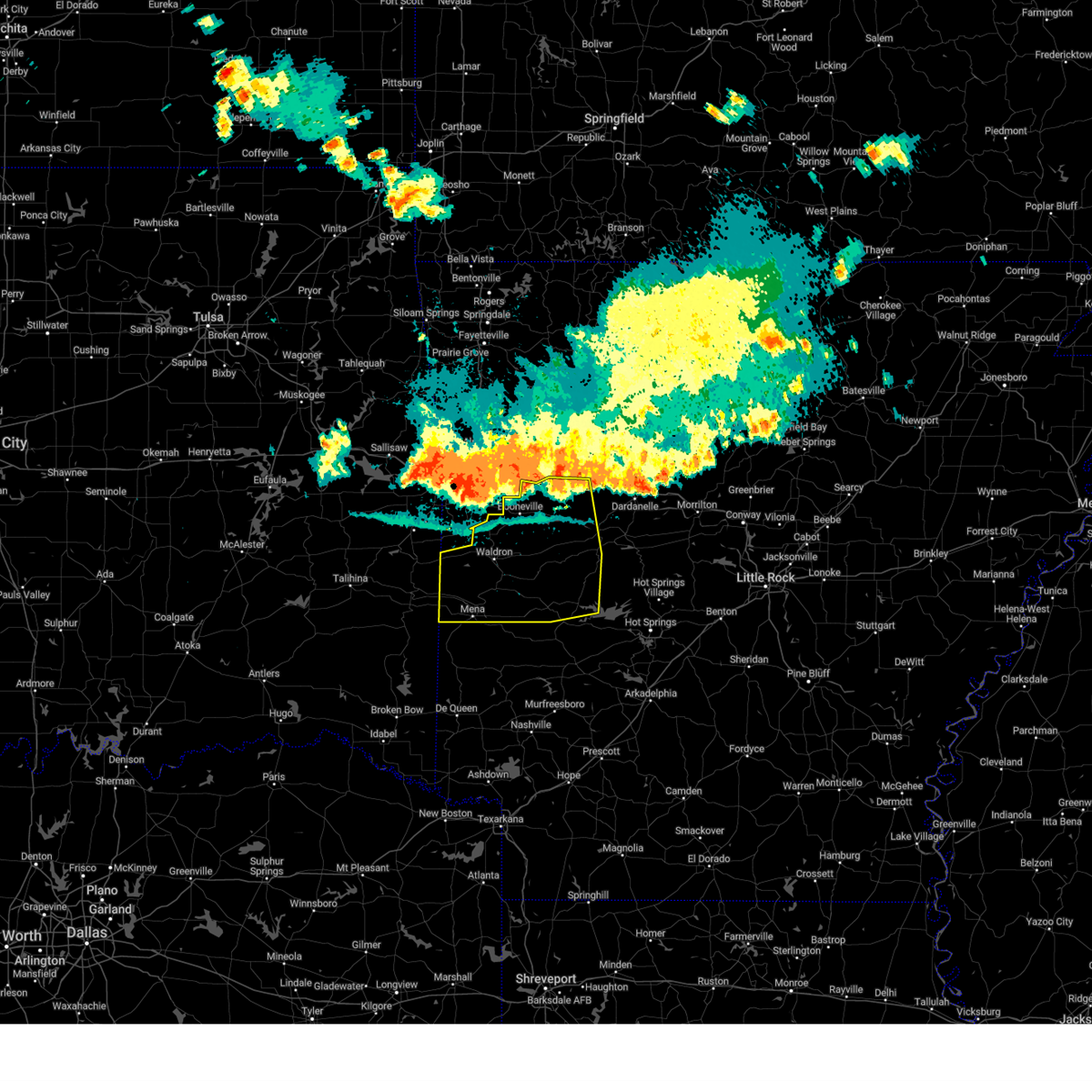 Svrlzk the national weather service in little rock has issued a * severe thunderstorm warning for, logan county in western arkansas, scott county in western arkansas, northern polk county in western arkansas, western yell county in central arkansas, northern montgomery county in western arkansas, * until 1215 am cdt. * at 1136 pm cdt, severe thunderstorms were located along a line extending from near mount magazine to near booneville to near midland, moving south at 45 mph (radar indicated). Hazards include 60 mph wind gusts. expect damage to roofs, siding, and trees Svrlzk the national weather service in little rock has issued a * severe thunderstorm warning for, logan county in western arkansas, scott county in western arkansas, northern polk county in western arkansas, western yell county in central arkansas, northern montgomery county in western arkansas, * until 1215 am cdt. * at 1136 pm cdt, severe thunderstorms were located along a line extending from near mount magazine to near booneville to near midland, moving south at 45 mph (radar indicated). Hazards include 60 mph wind gusts. expect damage to roofs, siding, and trees
|
| 6/4/2024 5:54 AM CDT |
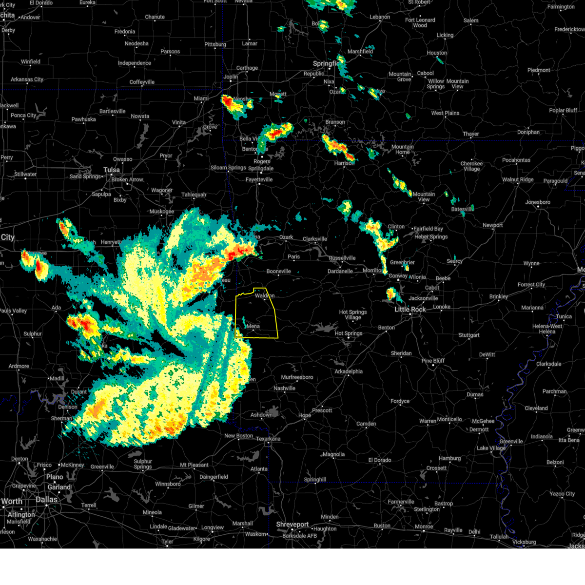 the severe thunderstorm warning has been cancelled and is no longer in effect the severe thunderstorm warning has been cancelled and is no longer in effect
|
| 6/4/2024 5:29 AM CDT |
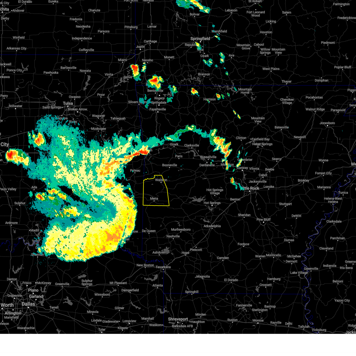 Svrlzk the national weather service in little rock has issued a * severe thunderstorm warning for, western scott county in western arkansas, northern polk county in western arkansas, * until 615 am cdt. * at 528 am cdt, severe thunderstorms were located along a line extending from near wister to near big cedar to 10 miles southeast of octavia, moving east at 40 mph (radar indicated). Hazards include 60 mph wind gusts and quarter size hail. Hail damage to vehicles is expected. Expect wind damage to roofs, siding, and trees. Svrlzk the national weather service in little rock has issued a * severe thunderstorm warning for, western scott county in western arkansas, northern polk county in western arkansas, * until 615 am cdt. * at 528 am cdt, severe thunderstorms were located along a line extending from near wister to near big cedar to 10 miles southeast of octavia, moving east at 40 mph (radar indicated). Hazards include 60 mph wind gusts and quarter size hail. Hail damage to vehicles is expected. Expect wind damage to roofs, siding, and trees.
|
| 5/21/2024 5:31 PM CDT |
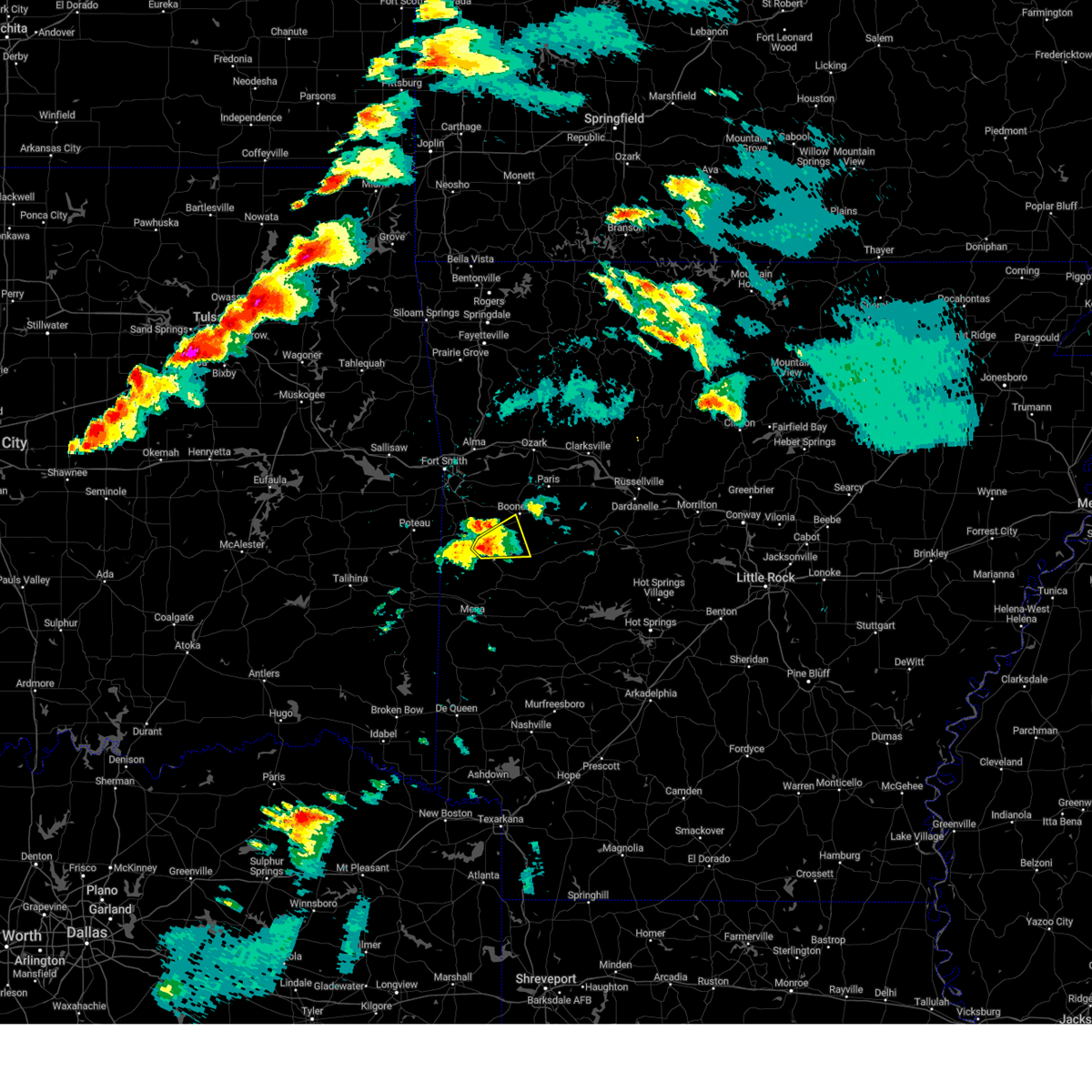 At 531 pm cdt, a severe thunderstorm was located near oliver, or near waldron, moving east at 45 mph (radar indicated). Hazards include 60 mph wind gusts and quarter size hail. Hail damage to vehicles is expected. expect wind damage to roofs, siding, and trees. Locations impacted include, waldron, cardiff, carolan, hon, elm park, ione,. At 531 pm cdt, a severe thunderstorm was located near oliver, or near waldron, moving east at 45 mph (radar indicated). Hazards include 60 mph wind gusts and quarter size hail. Hail damage to vehicles is expected. expect wind damage to roofs, siding, and trees. Locations impacted include, waldron, cardiff, carolan, hon, elm park, ione,.
|
| 5/21/2024 5:19 PM CDT |
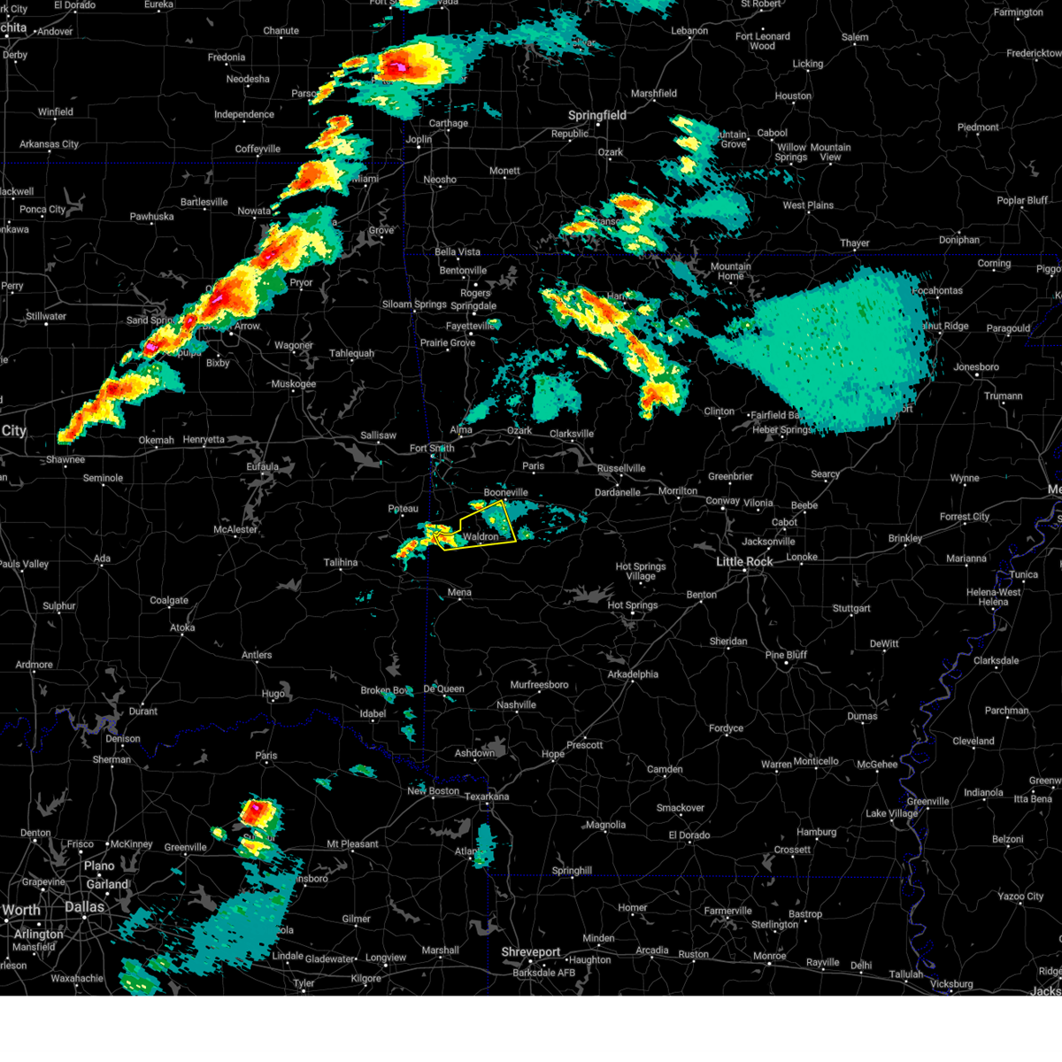 Svrlzk the national weather service in little rock has issued a * severe thunderstorm warning for, southwestern logan county in western arkansas, northern scott county in western arkansas, * until 545 pm cdt. * at 518 pm cdt, a severe thunderstorm was located near morgan springs, or 13 miles west of waldron, moving east at 50 mph (radar indicated). Hazards include 60 mph wind gusts and quarter size hail. Hail damage to vehicles is expected. Expect wind damage to roofs, siding, and trees. Svrlzk the national weather service in little rock has issued a * severe thunderstorm warning for, southwestern logan county in western arkansas, northern scott county in western arkansas, * until 545 pm cdt. * at 518 pm cdt, a severe thunderstorm was located near morgan springs, or 13 miles west of waldron, moving east at 50 mph (radar indicated). Hazards include 60 mph wind gusts and quarter size hail. Hail damage to vehicles is expected. Expect wind damage to roofs, siding, and trees.
|
| 3/14/2024 6:18 PM CDT | Golf Ball sized hail reported 14.1 miles WNW of Waldron, AR |
| 3/14/2024 5:40 PM CDT | Golf Ball sized hail reported 11.3 miles N of Waldron, AR |
| 3/14/2024 5:30 PM CDT |
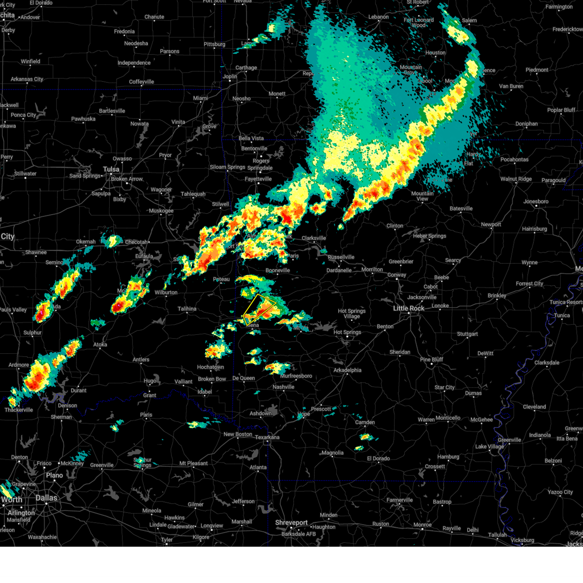 the severe thunderstorm warning has been cancelled and is no longer in effect the severe thunderstorm warning has been cancelled and is no longer in effect
|
| 3/14/2024 5:14 PM CDT |
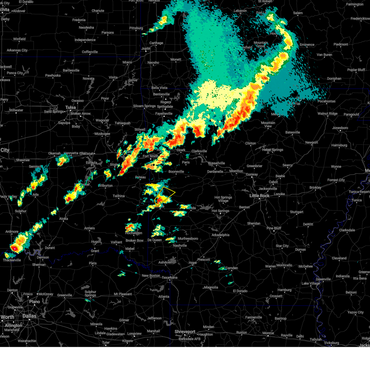 At 514 pm cdt, a severe thunderstorm was located near beauchamp, or 10 miles north of mena, moving northeast at 25 mph (radar indicated). Hazards include ping pong ball size hail and 60 mph wind gusts. People and animals outdoors will be injured. expect hail damage to roofs, siding, windows, and vehicles. expect wind damage to roofs, siding, and trees. Locations impacted include, waldron, beauchamp, needmore, winfield, boles, eagleton, rich mountain,. At 514 pm cdt, a severe thunderstorm was located near beauchamp, or 10 miles north of mena, moving northeast at 25 mph (radar indicated). Hazards include ping pong ball size hail and 60 mph wind gusts. People and animals outdoors will be injured. expect hail damage to roofs, siding, windows, and vehicles. expect wind damage to roofs, siding, and trees. Locations impacted include, waldron, beauchamp, needmore, winfield, boles, eagleton, rich mountain,.
|
| 3/14/2024 5:00 PM CDT |
 At 500 pm cdt, a severe thunderstorm was located over queen wilhelmina state park, or 10 miles northwest of mena, moving northeast at 35 mph (radar indicated). Hazards include ping pong ball size hail and 60 mph wind gusts. People and animals outdoors will be injured. expect hail damage to roofs, siding, windows, and vehicles. expect wind damage to roofs, siding, and trees. Locations impacted include, waldron, beauchamp, queen wilhelmina state park, rich mountain, needmore, hon, winfield, boles, eagleton, rocky,. At 500 pm cdt, a severe thunderstorm was located over queen wilhelmina state park, or 10 miles northwest of mena, moving northeast at 35 mph (radar indicated). Hazards include ping pong ball size hail and 60 mph wind gusts. People and animals outdoors will be injured. expect hail damage to roofs, siding, windows, and vehicles. expect wind damage to roofs, siding, and trees. Locations impacted include, waldron, beauchamp, queen wilhelmina state park, rich mountain, needmore, hon, winfield, boles, eagleton, rocky,.
|
| 3/14/2024 4:54 PM CDT |
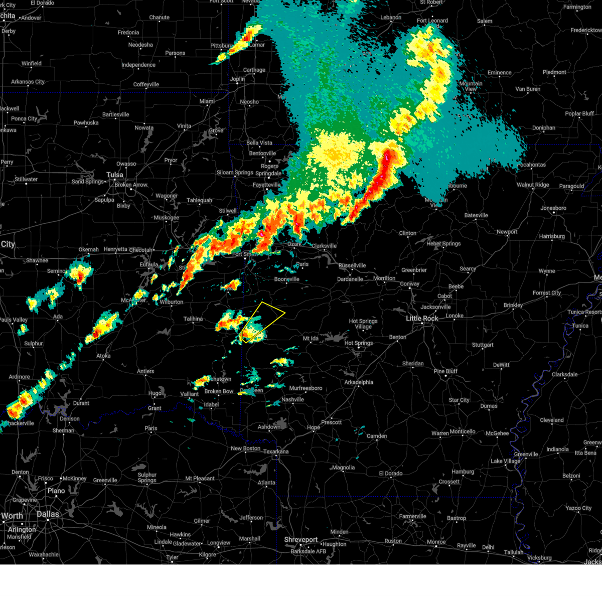 Svrlzk the national weather service in little rock has issued a * severe thunderstorm warning for, southwestern scott county in western arkansas, northwestern polk county in western arkansas, * until 545 pm cdt. * at 454 pm cdt, a severe thunderstorm was located over mountain fork, or 10 miles northwest of mena, moving northeast at 35 mph (radar indicated). Hazards include 60 mph wind gusts and quarter size hail. Hail damage to vehicles is expected. Expect wind damage to roofs, siding, and trees. Svrlzk the national weather service in little rock has issued a * severe thunderstorm warning for, southwestern scott county in western arkansas, northwestern polk county in western arkansas, * until 545 pm cdt. * at 454 pm cdt, a severe thunderstorm was located over mountain fork, or 10 miles northwest of mena, moving northeast at 35 mph (radar indicated). Hazards include 60 mph wind gusts and quarter size hail. Hail damage to vehicles is expected. Expect wind damage to roofs, siding, and trees.
|
| 9/8/2023 6:39 AM CDT |
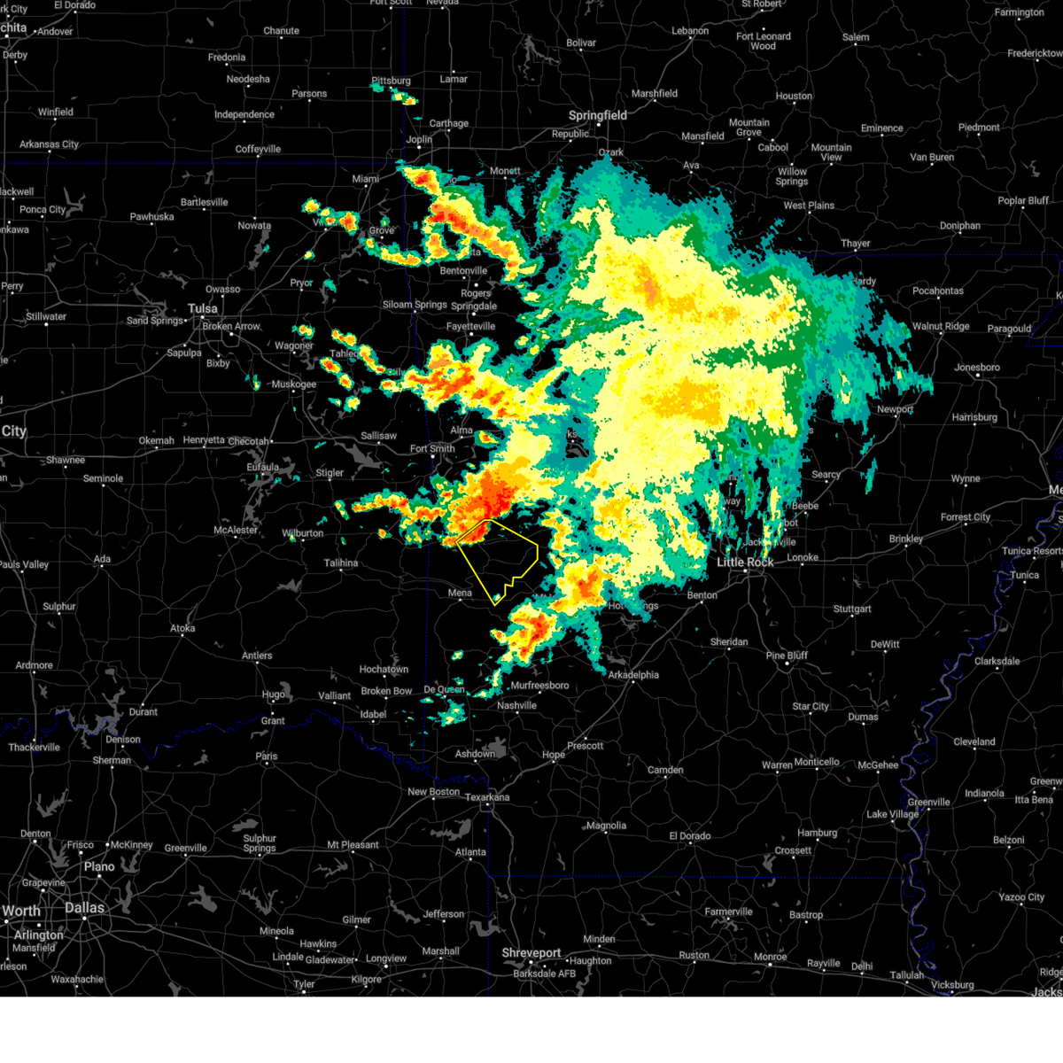 At 639 am cdt, severe thunderstorms were located along a line extending from 7 miles northwest of cardiff to near waldron, moving southeast at 40 mph (radar indicated). Hazards include 60 mph wind gusts. expect damage to roofs, siding, and trees At 639 am cdt, severe thunderstorms were located along a line extending from 7 miles northwest of cardiff to near waldron, moving southeast at 40 mph (radar indicated). Hazards include 60 mph wind gusts. expect damage to roofs, siding, and trees
|
| 6/27/2023 12:37 PM CDT |
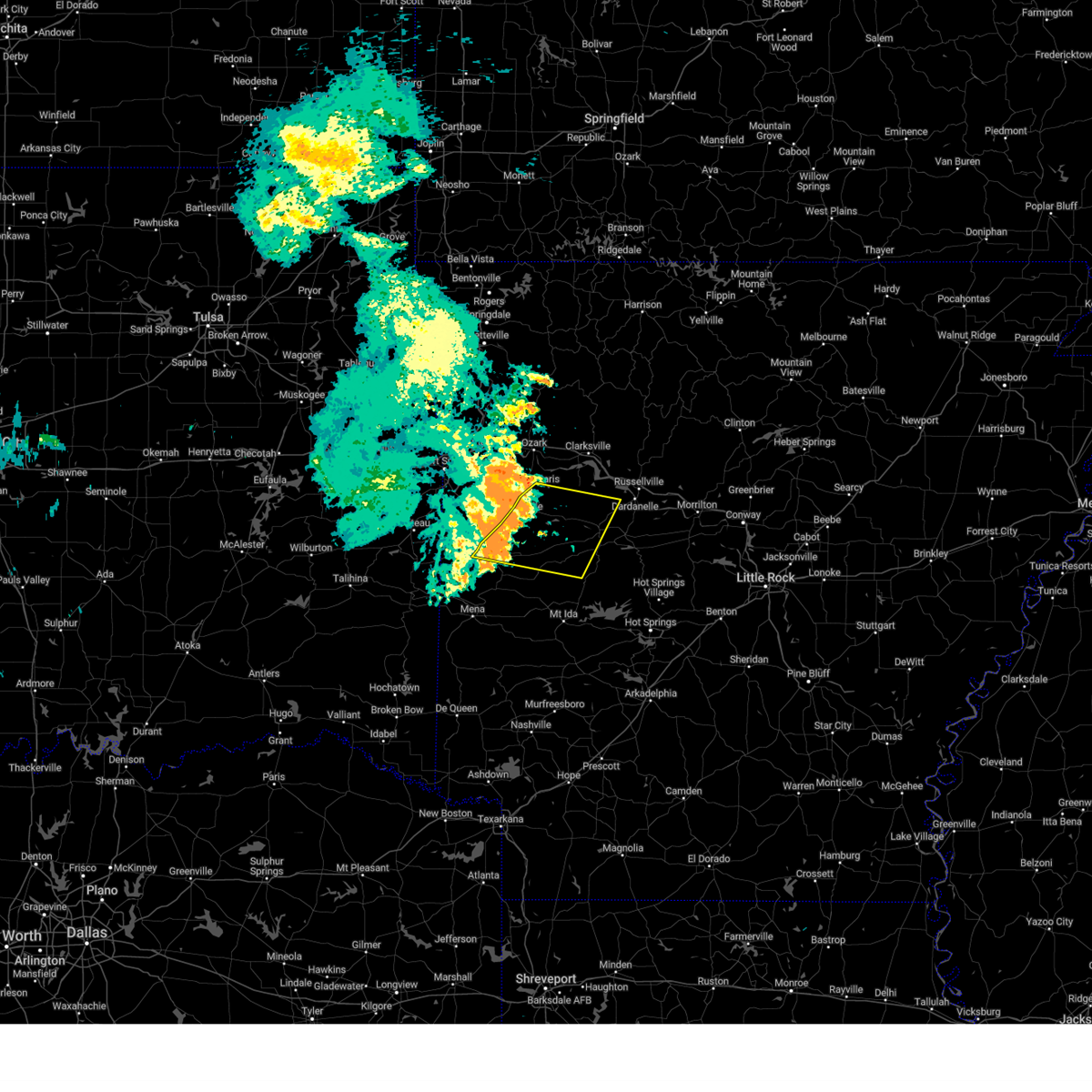 At 1236 pm cdt, a severe thunderstorm was located over blue mountain, or 8 miles east of booneville, moving southeast at 50 mph (radar indicated). Hazards include 70 mph wind gusts and quarter size hail. Hail damage to vehicles is expected. expect considerable tree damage. wind damage is also likely to mobile homes, roofs, and outbuildings. locations impacted include, booneville, waldron, paris, danville, magazine, blue mountain, stonehouse recreation area, cardiff, mt nebo state park, gravelly, fourche valley, mount magazine, belleville, havana, corinth, ranger, wing, olio, bluffton, corley, thunderstorm damage threat, considerable hail threat, radar indicated max hail size, 1. 00 in wind threat, radar indicated max wind gust, 70 mph. At 1236 pm cdt, a severe thunderstorm was located over blue mountain, or 8 miles east of booneville, moving southeast at 50 mph (radar indicated). Hazards include 70 mph wind gusts and quarter size hail. Hail damage to vehicles is expected. expect considerable tree damage. wind damage is also likely to mobile homes, roofs, and outbuildings. locations impacted include, booneville, waldron, paris, danville, magazine, blue mountain, stonehouse recreation area, cardiff, mt nebo state park, gravelly, fourche valley, mount magazine, belleville, havana, corinth, ranger, wing, olio, bluffton, corley, thunderstorm damage threat, considerable hail threat, radar indicated max hail size, 1. 00 in wind threat, radar indicated max wind gust, 70 mph.
|
| 6/27/2023 12:21 PM CDT |
 At 1221 pm cdt, a severe thunderstorm was located near booneville, moving east at 55 mph (radar indicated). Hazards include 70 mph wind gusts and quarter size hail. Hail damage to vehicles is expected. expect considerable tree damage. wind damage is also likely to mobile homes, roofs, and outbuildings. locations impacted include, booneville, waldron, paris, danville, mansfield, magazine, subiaco, ratcliff, blue mountain, cardiff, midway in logan county, stonehouse recreation area, mt nebo state park, gravelly, fourche valley, mount magazine, oliver, echo, lake dardanelle, belleville, thunderstorm damage threat, considerable hail threat, radar indicated max hail size, 1. 00 in wind threat, radar indicated max wind gust, 70 mph. At 1221 pm cdt, a severe thunderstorm was located near booneville, moving east at 55 mph (radar indicated). Hazards include 70 mph wind gusts and quarter size hail. Hail damage to vehicles is expected. expect considerable tree damage. wind damage is also likely to mobile homes, roofs, and outbuildings. locations impacted include, booneville, waldron, paris, danville, mansfield, magazine, subiaco, ratcliff, blue mountain, cardiff, midway in logan county, stonehouse recreation area, mt nebo state park, gravelly, fourche valley, mount magazine, oliver, echo, lake dardanelle, belleville, thunderstorm damage threat, considerable hail threat, radar indicated max hail size, 1. 00 in wind threat, radar indicated max wind gust, 70 mph.
|
| 6/27/2023 12:11 PM CDT |
 At 1211 pm cdt, a severe thunderstorm was located over fort chaffee, or near charleston, moving east at 55 mph (radar indicated). Hazards include 60 mph wind gusts and penny size hail. expect damage to roofs, siding, and trees At 1211 pm cdt, a severe thunderstorm was located over fort chaffee, or near charleston, moving east at 55 mph (radar indicated). Hazards include 60 mph wind gusts and penny size hail. expect damage to roofs, siding, and trees
|
| 6/14/2023 4:37 PM CDT |
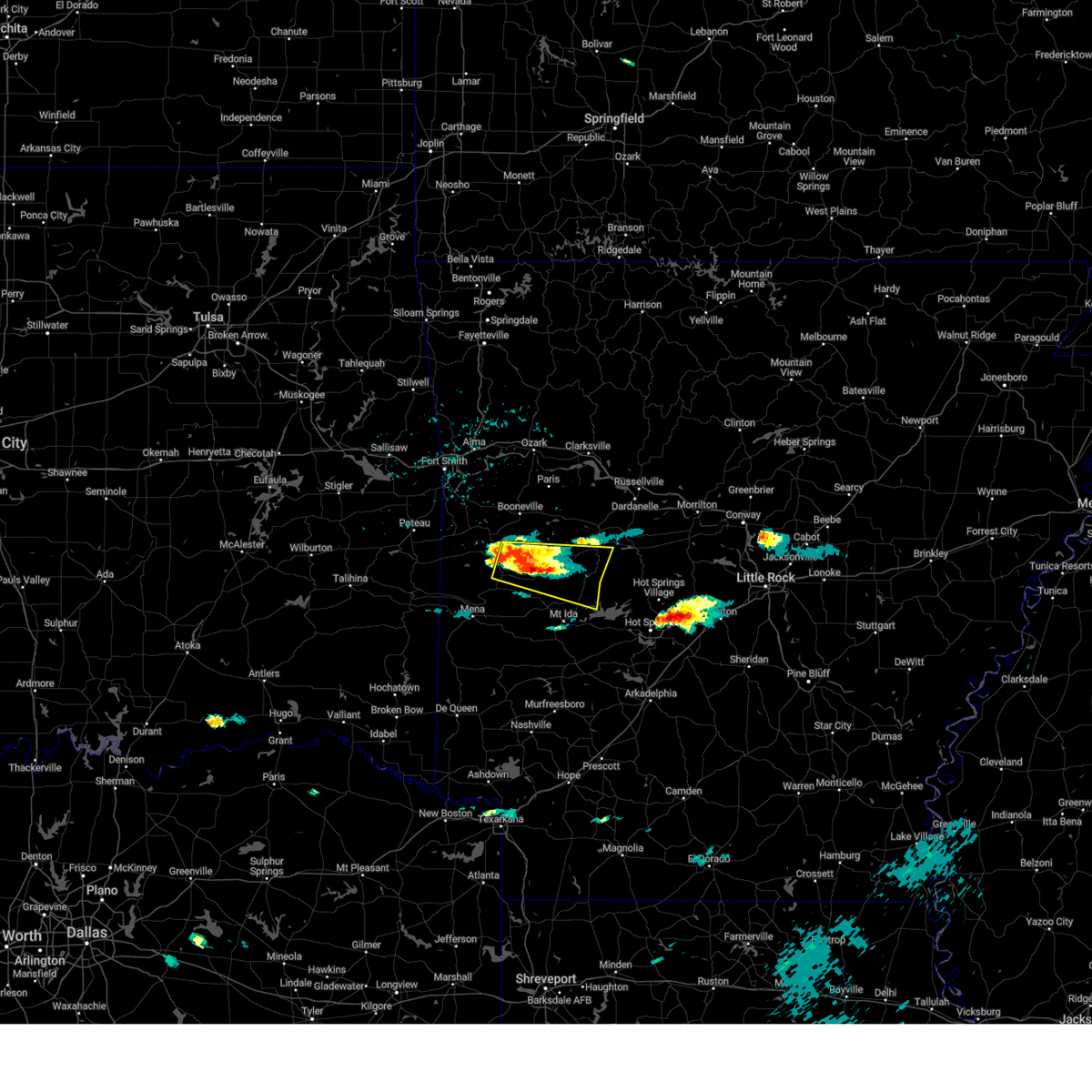 At 435 pm cdt, a severe thunderstorm was located near gravelly, or 18 miles east of waldron, moving east at 35 mph (radar indicated). Hazards include 60 mph wind gusts and quarter size hail. Hail damage to vehicles is expected. Expect wind damage to roofs, siding, and trees. At 435 pm cdt, a severe thunderstorm was located near gravelly, or 18 miles east of waldron, moving east at 35 mph (radar indicated). Hazards include 60 mph wind gusts and quarter size hail. Hail damage to vehicles is expected. Expect wind damage to roofs, siding, and trees.
|
| 6/14/2023 4:31 PM CDT |
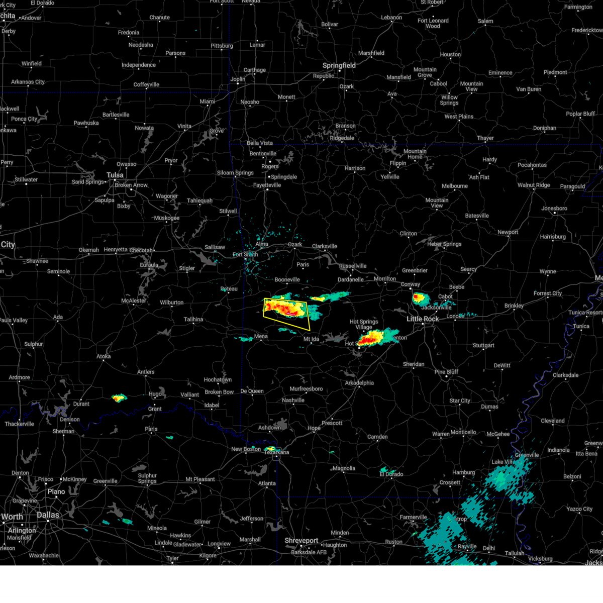 At 431 pm cdt, a severe thunderstorm was located 9 miles southwest of gravelly, or 17 miles southeast of waldron, moving east at 30 mph (radar indicated). Hazards include 60 mph wind gusts and half dollar size hail. Hail damage to vehicles is expected. expect wind damage to roofs, siding, and trees. locations impacted include, waldron, cardiff, gravelly, union hill, olio, winfield, hon, cedar creek, nola, needmore, harvey, boles, parks, blue ball, hail threat, radar indicated max hail size, 1. 25 in wind threat, radar indicated max wind gust, 60 mph. At 431 pm cdt, a severe thunderstorm was located 9 miles southwest of gravelly, or 17 miles southeast of waldron, moving east at 30 mph (radar indicated). Hazards include 60 mph wind gusts and half dollar size hail. Hail damage to vehicles is expected. expect wind damage to roofs, siding, and trees. locations impacted include, waldron, cardiff, gravelly, union hill, olio, winfield, hon, cedar creek, nola, needmore, harvey, boles, parks, blue ball, hail threat, radar indicated max hail size, 1. 25 in wind threat, radar indicated max wind gust, 60 mph.
|
| 6/14/2023 4:30 PM CDT | Picture of trees downed in waldron shared to the broadcast media from scott county emergency management. time is estimated from rada in scott county AR, 0.3 miles NNW of Waldron, AR |
| 6/14/2023 4:25 PM CDT |
 At 425 pm cdt, a severe thunderstorm was located 8 miles south of cardiff, or 13 miles southeast of waldron, moving east at 30 mph (radar indicated). Hazards include 60 mph wind gusts and half dollar size hail. Hail damage to vehicles is expected. expect wind damage to roofs, siding, and trees. locations impacted include, waldron, cardiff, gravelly, union hill, olio, winfield, hon, cedar creek, nola, needmore, harvey, boles, parks, blue ball, hail threat, radar indicated max hail size, 1. 25 in wind threat, radar indicated max wind gust, 60 mph. At 425 pm cdt, a severe thunderstorm was located 8 miles south of cardiff, or 13 miles southeast of waldron, moving east at 30 mph (radar indicated). Hazards include 60 mph wind gusts and half dollar size hail. Hail damage to vehicles is expected. expect wind damage to roofs, siding, and trees. locations impacted include, waldron, cardiff, gravelly, union hill, olio, winfield, hon, cedar creek, nola, needmore, harvey, boles, parks, blue ball, hail threat, radar indicated max hail size, 1. 25 in wind threat, radar indicated max wind gust, 60 mph.
|
| 6/14/2023 4:22 PM CDT |
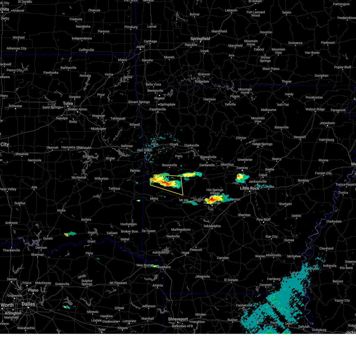 At 421 pm cdt, a severe thunderstorm was located 7 miles south of cardiff, or 11 miles southeast of waldron, moving east at 30 mph (radar indicated). Hazards include ping pong ball size hail and 60 mph wind gusts. People and animals outdoors will be injured. expect hail damage to roofs, siding, windows, and vehicles. expect wind damage to roofs, siding, and trees. locations impacted include, waldron, cardiff, oliver, gravelly, union hill, cauthron, olio, winfield, hon, cedar creek, nola, needmore, harvey, parks, blue ball, boles, hail threat, radar indicated max hail size, 1. 50 in wind threat, radar indicated max wind gust, 60 mph. At 421 pm cdt, a severe thunderstorm was located 7 miles south of cardiff, or 11 miles southeast of waldron, moving east at 30 mph (radar indicated). Hazards include ping pong ball size hail and 60 mph wind gusts. People and animals outdoors will be injured. expect hail damage to roofs, siding, windows, and vehicles. expect wind damage to roofs, siding, and trees. locations impacted include, waldron, cardiff, oliver, gravelly, union hill, cauthron, olio, winfield, hon, cedar creek, nola, needmore, harvey, parks, blue ball, boles, hail threat, radar indicated max hail size, 1. 50 in wind threat, radar indicated max wind gust, 60 mph.
|
| 6/14/2023 4:12 PM CDT |
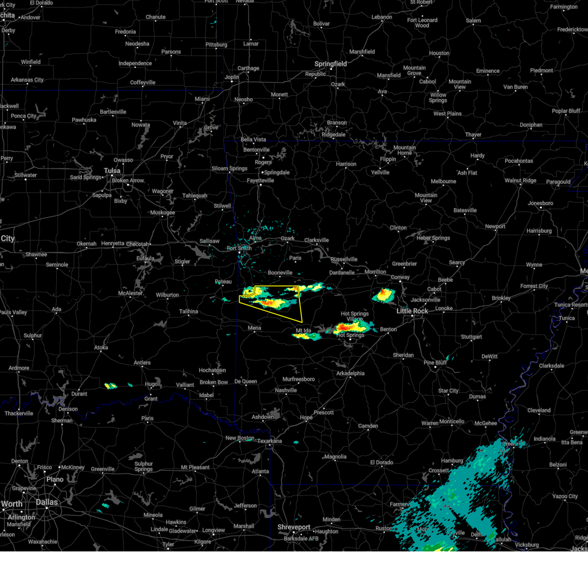 At 412 pm cdt, a severe thunderstorm was located near waldron, moving east at 30 mph (radar indicated). Hazards include ping pong ball size hail and 60 mph wind gusts. People and animals outdoors will be injured. expect hail damage to roofs, siding, windows, and vehicles. expect wind damage to roofs, siding, and trees. locations impacted include, waldron, cardiff, oliver, morgan springs, gravelly, bates, union hill, cauthron, olio, winfield, hon, cedar creek, liberty, nola, needmore, harvey, parks, blue ball, elm park, boles, hail threat, radar indicated max hail size, 1. 50 in wind threat, radar indicated max wind gust, 60 mph. At 412 pm cdt, a severe thunderstorm was located near waldron, moving east at 30 mph (radar indicated). Hazards include ping pong ball size hail and 60 mph wind gusts. People and animals outdoors will be injured. expect hail damage to roofs, siding, windows, and vehicles. expect wind damage to roofs, siding, and trees. locations impacted include, waldron, cardiff, oliver, morgan springs, gravelly, bates, union hill, cauthron, olio, winfield, hon, cedar creek, liberty, nola, needmore, harvey, parks, blue ball, elm park, boles, hail threat, radar indicated max hail size, 1. 50 in wind threat, radar indicated max wind gust, 60 mph.
|
| 6/14/2023 4:05 PM CDT |
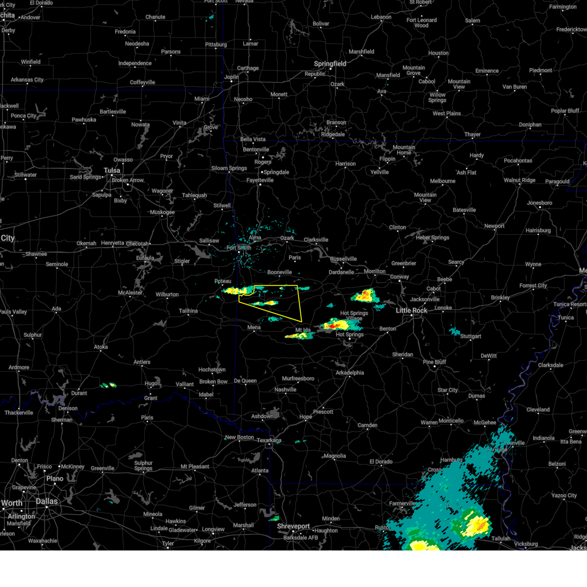 At 405 pm cdt, a severe thunderstorm was located near waldron, moving east at 35 mph (radar indicated). Hazards include 60 mph wind gusts and quarter size hail. Hail damage to vehicles is expected. Expect wind damage to roofs, siding, and trees. At 405 pm cdt, a severe thunderstorm was located near waldron, moving east at 35 mph (radar indicated). Hazards include 60 mph wind gusts and quarter size hail. Hail damage to vehicles is expected. Expect wind damage to roofs, siding, and trees.
|
| 5/19/2023 7:34 PM CDT |
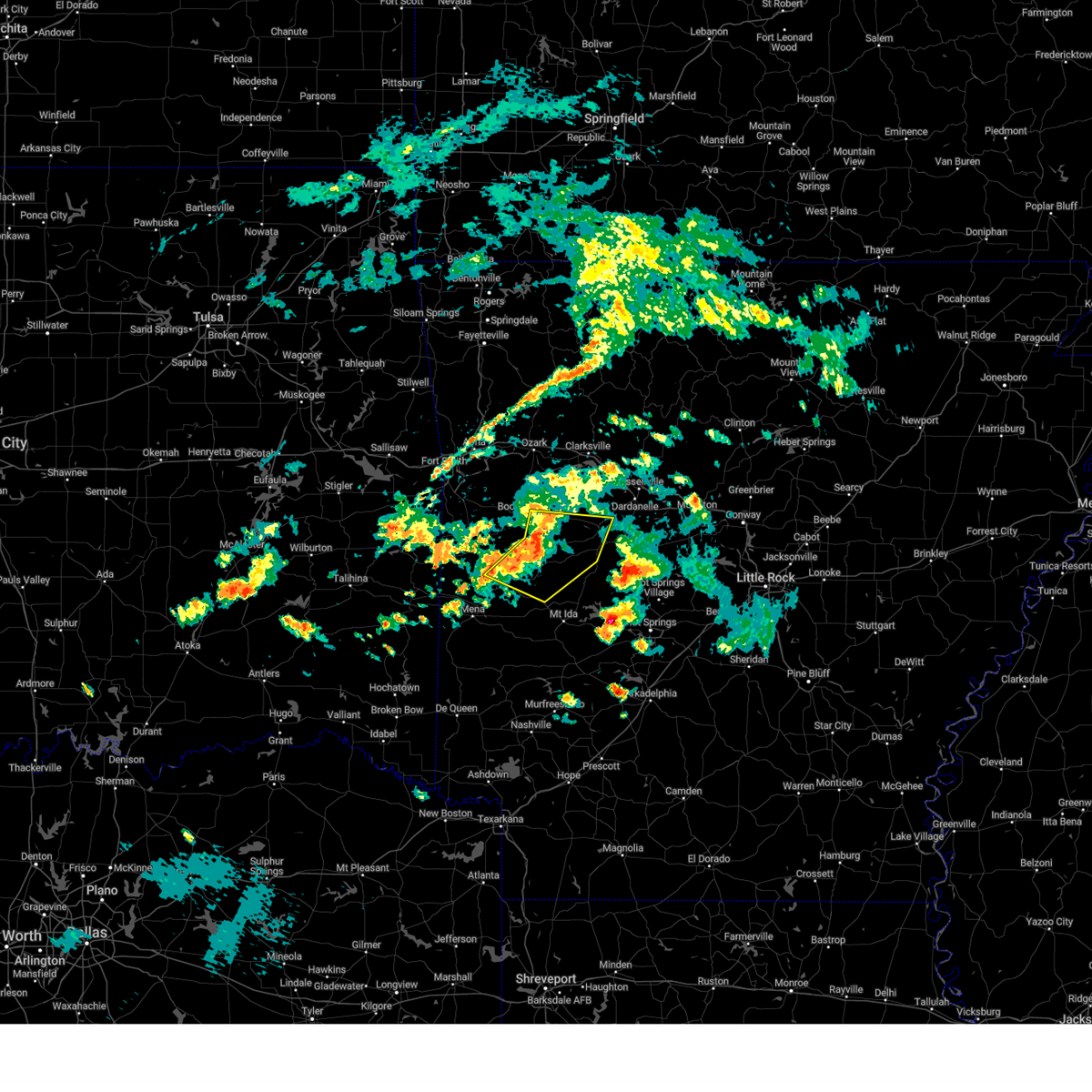 At 733 pm cdt, severe thunderstorms were located along a line extending from near stonehouse recreation area to near gravelly to 7 miles south of cardiff, moving east at 30 mph (radar indicated). Hazards include 60 mph wind gusts. Expect damage to roofs, siding, and trees. locations impacted include, danville, magazine, blue mountain, stonehouse recreation area, cardiff, gravelly, fourche valley, muddy creek wma, belleville, havana, corinth, ranger, wing, olio, bluffton, rover, boles, grayson, blue ball, union hill, hail threat, radar indicated max hail size, <. 75 in wind threat, radar indicated max wind gust, 60 mph. At 733 pm cdt, severe thunderstorms were located along a line extending from near stonehouse recreation area to near gravelly to 7 miles south of cardiff, moving east at 30 mph (radar indicated). Hazards include 60 mph wind gusts. Expect damage to roofs, siding, and trees. locations impacted include, danville, magazine, blue mountain, stonehouse recreation area, cardiff, gravelly, fourche valley, muddy creek wma, belleville, havana, corinth, ranger, wing, olio, bluffton, rover, boles, grayson, blue ball, union hill, hail threat, radar indicated max hail size, <. 75 in wind threat, radar indicated max wind gust, 60 mph.
|
| 5/19/2023 7:11 PM CDT |
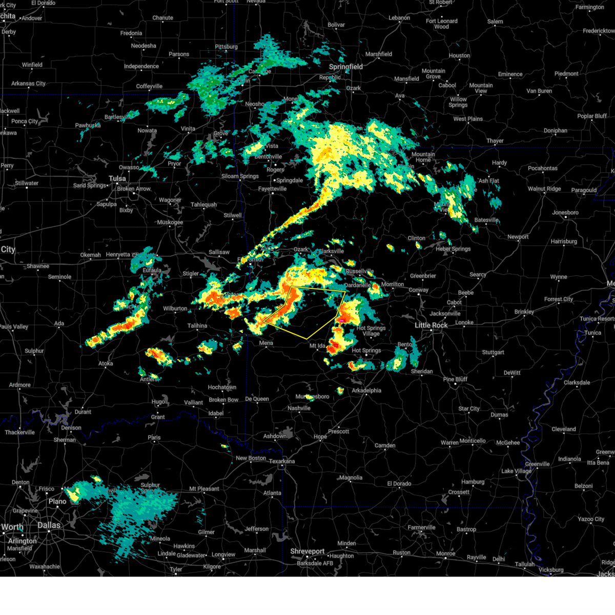 At 711 pm cdt, severe thunderstorms were located along a line extending from near booneville to near cardiff to near waldron, moving east at 35 mph (radar indicated). Hazards include 60 mph wind gusts. expect damage to roofs, siding, and trees At 711 pm cdt, severe thunderstorms were located along a line extending from near booneville to near cardiff to near waldron, moving east at 35 mph (radar indicated). Hazards include 60 mph wind gusts. expect damage to roofs, siding, and trees
|
| 5/19/2023 5:31 PM CDT |
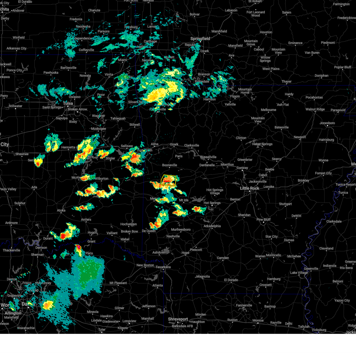 At 531 pm cdt, a severe thunderstorm was located near cardiff, or near waldron, moving east at 25 mph (radar indicated). Hazards include ping pong ball size hail. People and animals outdoors will be injured. expect damage to roofs, siding, windows, and vehicles. locations impacted include, waldron, cardiff, olio, hail threat, radar indicated max hail size, 1. 50 in wind threat, radar indicated max wind gust, <50 mph. At 531 pm cdt, a severe thunderstorm was located near cardiff, or near waldron, moving east at 25 mph (radar indicated). Hazards include ping pong ball size hail. People and animals outdoors will be injured. expect damage to roofs, siding, windows, and vehicles. locations impacted include, waldron, cardiff, olio, hail threat, radar indicated max hail size, 1. 50 in wind threat, radar indicated max wind gust, <50 mph.
|
| 5/19/2023 5:13 PM CDT |
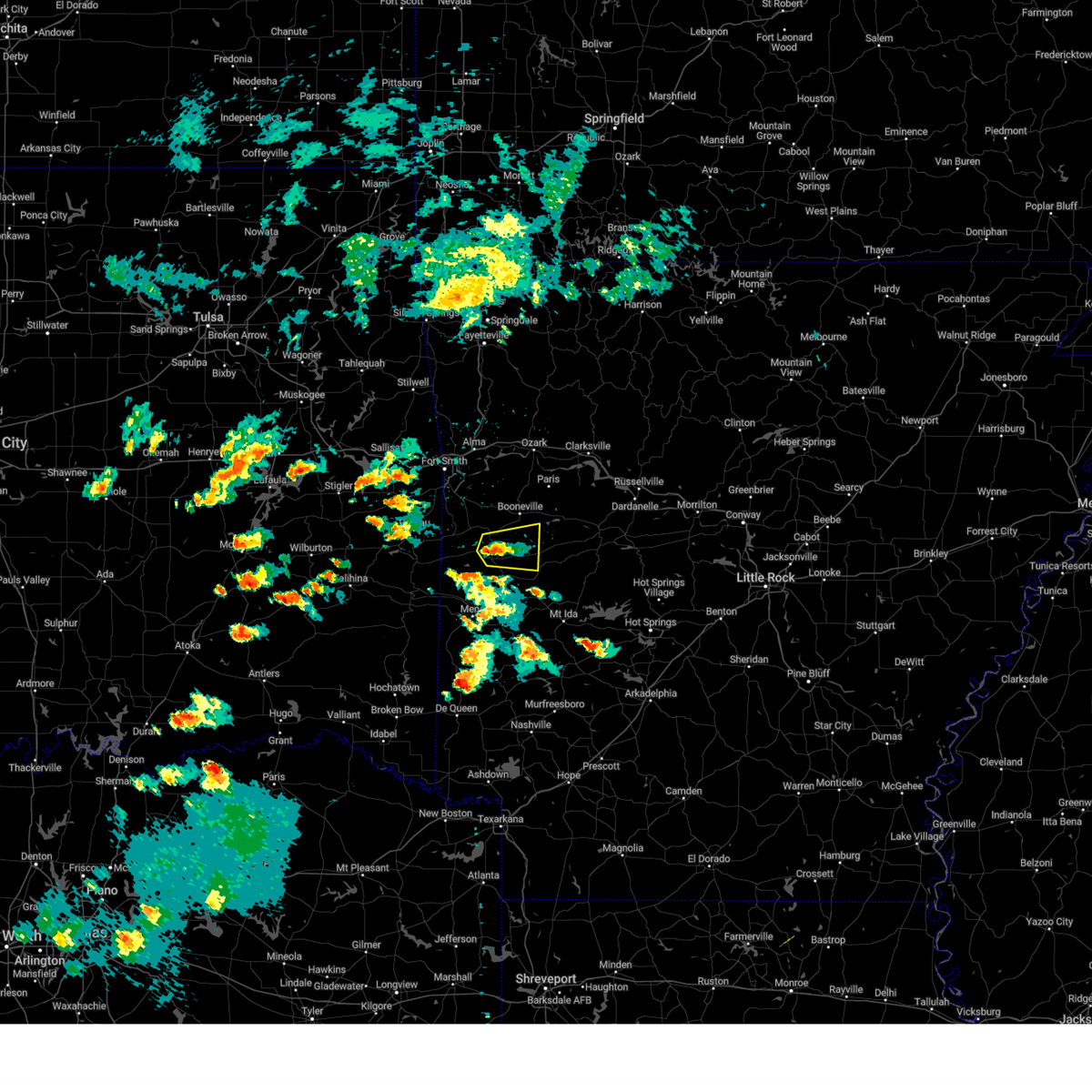 At 512 pm cdt, a severe thunderstorm was located near waldron, moving east at 15 mph (radar indicated). Hazards include quarter size hail. Damage to vehicles is expected. locations impacted include, waldron, cardiff, olio, hon, sugar grove, grayson, elm park, hail threat, radar indicated max hail size, 1. 00 in wind threat, radar indicated max wind gust, <50 mph. At 512 pm cdt, a severe thunderstorm was located near waldron, moving east at 15 mph (radar indicated). Hazards include quarter size hail. Damage to vehicles is expected. locations impacted include, waldron, cardiff, olio, hon, sugar grove, grayson, elm park, hail threat, radar indicated max hail size, 1. 00 in wind threat, radar indicated max wind gust, <50 mph.
|
| 5/19/2023 4:56 PM CDT |
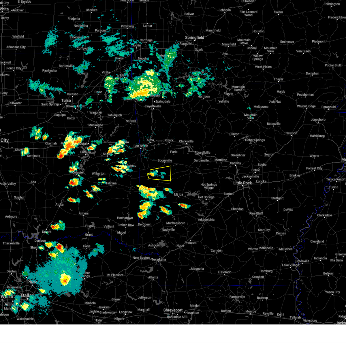 At 456 pm cdt, a severe thunderstorm was located near oliver, or near waldron, moving east at 30 mph (radar indicated). Hazards include 60 mph wind gusts and quarter size hail. Hail damage to vehicles is expected. Expect wind damage to roofs, siding, and trees. At 456 pm cdt, a severe thunderstorm was located near oliver, or near waldron, moving east at 30 mph (radar indicated). Hazards include 60 mph wind gusts and quarter size hail. Hail damage to vehicles is expected. Expect wind damage to roofs, siding, and trees.
|
| 4/15/2023 4:20 PM CDT |
 At 420 pm cdt, severe thunderstorms were located along a line extending from near waldron to 6 miles northeast of mena, moving east at 40 mph (radar indicated). Hazards include 60 mph wind gusts and half dollar size hail. Hail damage to vehicles is expected. expect wind damage to roofs, siding, and trees. locations impacted include, mena, waldron, mount ida, oden, stonehouse recreation area, cardiff, gravelly, polk county fairgrounds, mena intermountain airport, mauldin, muddy creek wma, acorn, olio, winfield, ink, bluffton, pine ridge, boles, dallas, blue ball, hail threat, radar indicated max hail size, 1. 25 in wind threat, radar indicated max wind gust, 60 mph. At 420 pm cdt, severe thunderstorms were located along a line extending from near waldron to 6 miles northeast of mena, moving east at 40 mph (radar indicated). Hazards include 60 mph wind gusts and half dollar size hail. Hail damage to vehicles is expected. expect wind damage to roofs, siding, and trees. locations impacted include, mena, waldron, mount ida, oden, stonehouse recreation area, cardiff, gravelly, polk county fairgrounds, mena intermountain airport, mauldin, muddy creek wma, acorn, olio, winfield, ink, bluffton, pine ridge, boles, dallas, blue ball, hail threat, radar indicated max hail size, 1. 25 in wind threat, radar indicated max wind gust, 60 mph.
|
| 4/15/2023 4:09 PM CDT |
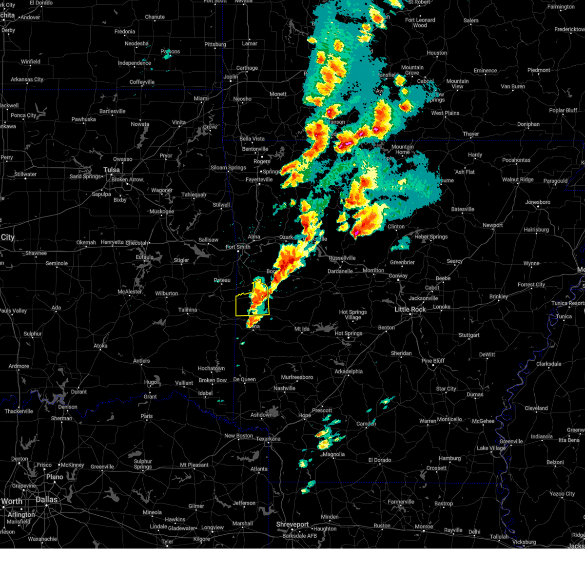 The severe thunderstorm warning for western scott county will expire at 415 pm cdt, the storm which prompted the warning has moved out of the area. therefore, the warning will be allowed to expire. however hail is still possible with this thunderstorm. a severe thunderstorm watch remains in effect until 700 pm cdt for western arkansas. remember, a severe thunderstorm warning still remains in effect for central and eastern scott county. The severe thunderstorm warning for western scott county will expire at 415 pm cdt, the storm which prompted the warning has moved out of the area. therefore, the warning will be allowed to expire. however hail is still possible with this thunderstorm. a severe thunderstorm watch remains in effect until 700 pm cdt for western arkansas. remember, a severe thunderstorm warning still remains in effect for central and eastern scott county.
|
| 4/15/2023 4:08 PM CDT |
 At 408 pm cdt, severe thunderstorms were located along a line extending from near oliver to near mena, moving east at 40 mph (radar indicated). Hazards include 60 mph wind gusts and quarter size hail. Hail damage to vehicles is expected. Expect wind damage to roofs, siding, and trees. At 408 pm cdt, severe thunderstorms were located along a line extending from near oliver to near mena, moving east at 40 mph (radar indicated). Hazards include 60 mph wind gusts and quarter size hail. Hail damage to vehicles is expected. Expect wind damage to roofs, siding, and trees.
|
| 4/15/2023 3:52 PM CDT |
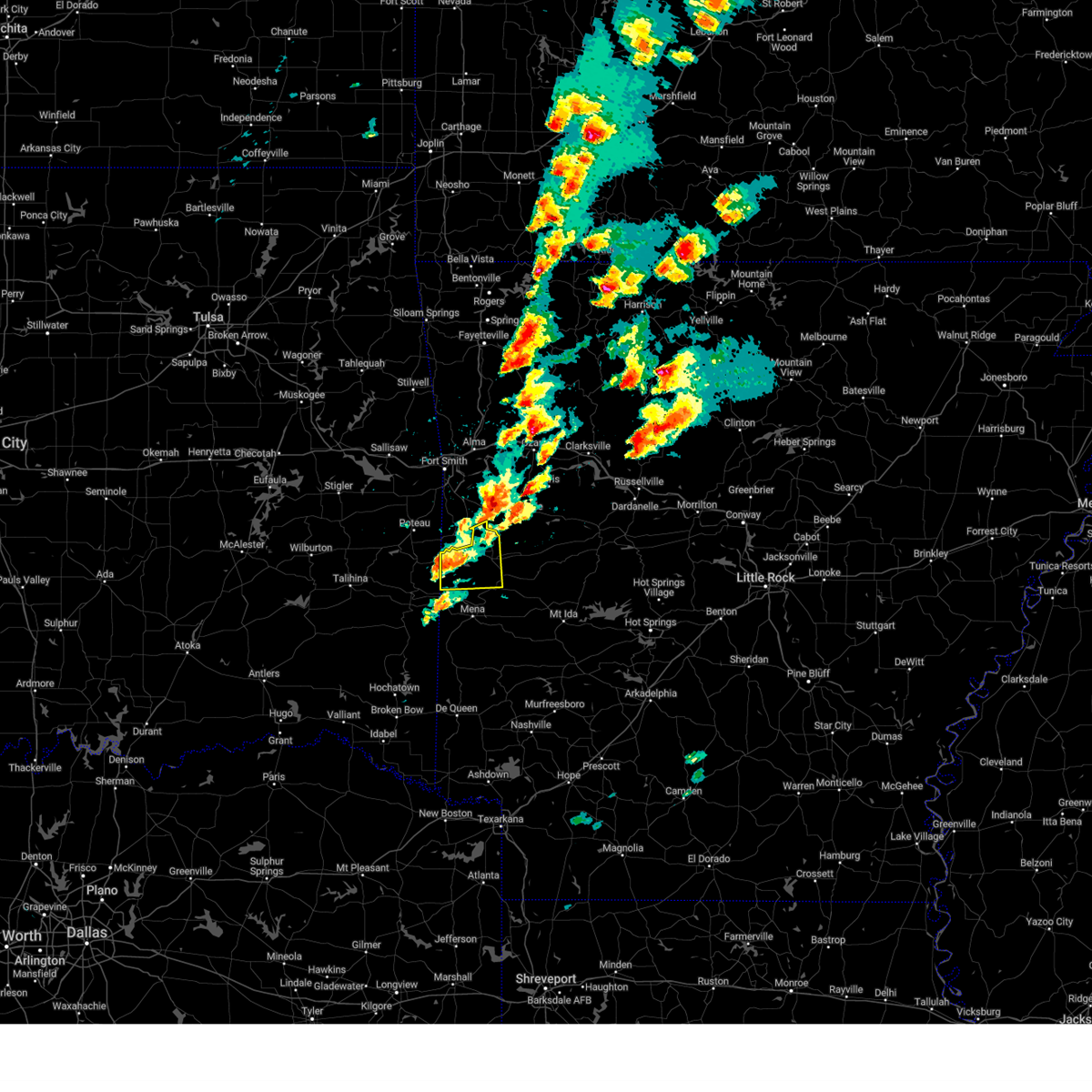 At 352 pm cdt, a severe thunderstorm was located over morgan springs, or 13 miles west of waldron, moving east at 35 mph (radar indicated). Hazards include 60 mph wind gusts and quarter size hail. Hail damage to vehicles is expected. expect wind damage to roofs, siding, and trees. locations impacted include, waldron, mansfield, beauchamp, oliver, morgan springs, bates, black fork, cauthron, winfield, hon, liberty, boles, elm park, hail threat, radar indicated max hail size, 1. 00 in wind threat, radar indicated max wind gust, 60 mph. At 352 pm cdt, a severe thunderstorm was located over morgan springs, or 13 miles west of waldron, moving east at 35 mph (radar indicated). Hazards include 60 mph wind gusts and quarter size hail. Hail damage to vehicles is expected. expect wind damage to roofs, siding, and trees. locations impacted include, waldron, mansfield, beauchamp, oliver, morgan springs, bates, black fork, cauthron, winfield, hon, liberty, boles, elm park, hail threat, radar indicated max hail size, 1. 00 in wind threat, radar indicated max wind gust, 60 mph.
|
| 4/15/2023 3:28 PM CDT |
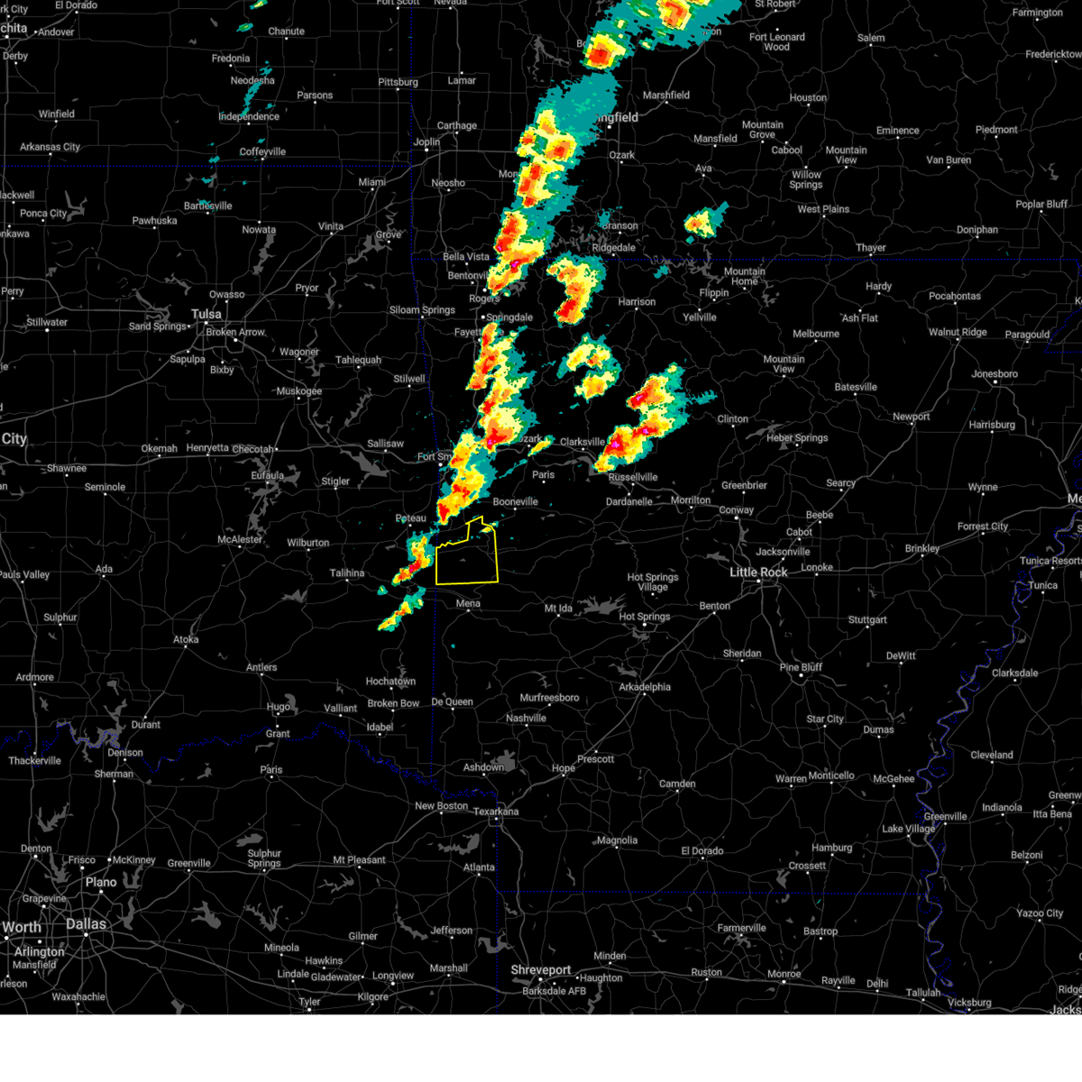 At 327 pm cdt, a severe thunderstorm was located near heavener, or 15 miles south of poteau, moving east at 35 mph (radar indicated). Hazards include 60 mph wind gusts and quarter size hail. Hail damage to vehicles is expected. Expect wind damage to roofs, siding, and trees. At 327 pm cdt, a severe thunderstorm was located near heavener, or 15 miles south of poteau, moving east at 35 mph (radar indicated). Hazards include 60 mph wind gusts and quarter size hail. Hail damage to vehicles is expected. Expect wind damage to roofs, siding, and trees.
|
| 4/5/2023 8:21 AM CDT |
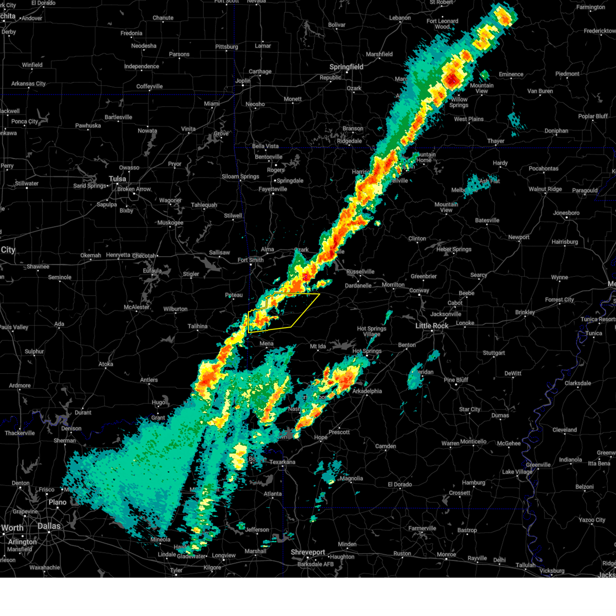 At 821 am cdt, a severe thunderstorm was located near beauchamp, or near waldron, moving northeast at 55 mph (radar indicated). Hazards include 60 mph wind gusts and quarter size hail. Hail damage to vehicles is expected. Expect wind damage to roofs, siding, and trees. At 821 am cdt, a severe thunderstorm was located near beauchamp, or near waldron, moving northeast at 55 mph (radar indicated). Hazards include 60 mph wind gusts and quarter size hail. Hail damage to vehicles is expected. Expect wind damage to roofs, siding, and trees.
|
| 3/11/2023 10:00 PM CDT |
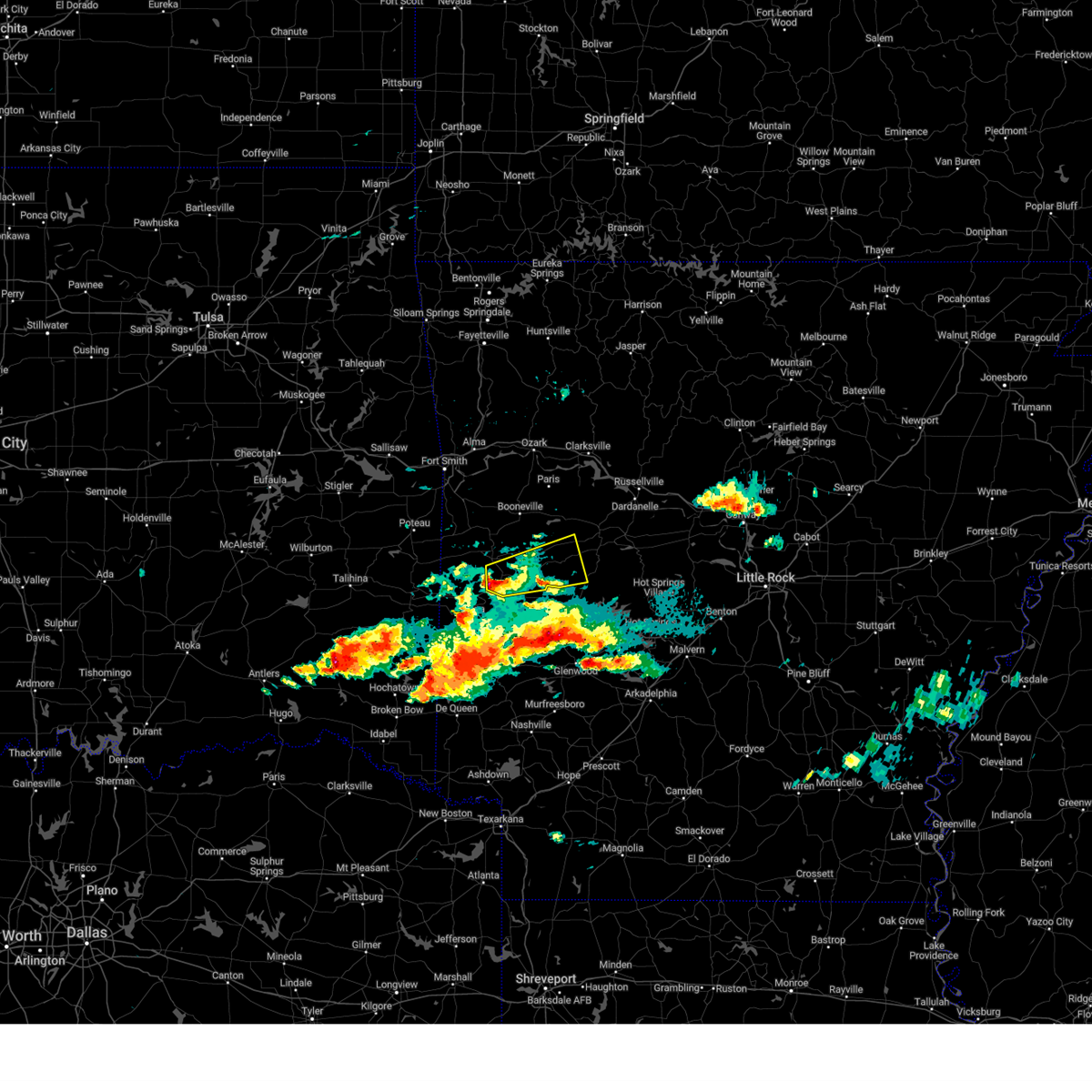 At 900 pm cst, a severe thunderstorm was located 8 miles south of waldron, moving east at 40 mph (radar indicated). Hazards include quarter size hail. Damage to vehicles is expected. locations impacted include, waldron, gravelly, fourche valley, muddy creek wma, union hill, chula, olio, cedar creek, waltreak, bluffton, y city, nola, needmore, harvey, boles, parks, blue ball, hail threat, radar indicated max hail size, 1. 00 in wind threat, radar indicated max wind gust, <50 mph. At 900 pm cst, a severe thunderstorm was located 8 miles south of waldron, moving east at 40 mph (radar indicated). Hazards include quarter size hail. Damage to vehicles is expected. locations impacted include, waldron, gravelly, fourche valley, muddy creek wma, union hill, chula, olio, cedar creek, waltreak, bluffton, y city, nola, needmore, harvey, boles, parks, blue ball, hail threat, radar indicated max hail size, 1. 00 in wind threat, radar indicated max wind gust, <50 mph.
|
| 3/11/2023 9:46 PM CDT |
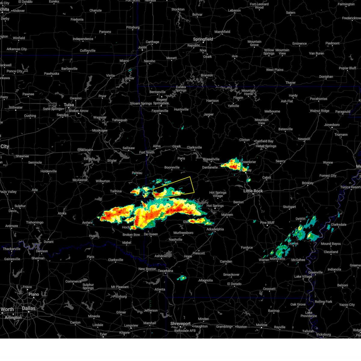 At 846 pm cst, a severe thunderstorm was located near beauchamp, or 11 miles southwest of waldron, moving east at 45 mph (radar indicated). Hazards include quarter size hail. damage to vehicles is expected At 846 pm cst, a severe thunderstorm was located near beauchamp, or 11 miles southwest of waldron, moving east at 45 mph (radar indicated). Hazards include quarter size hail. damage to vehicles is expected
|
| 3/11/2023 9:25 PM CDT |
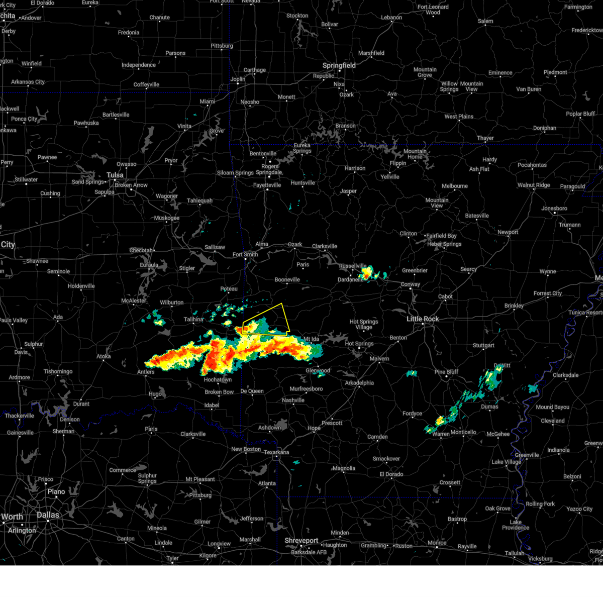 At 824 pm cst, a severe thunderstorm was located near queen wilhelmina state park, or 13 miles northwest of mena, moving east at 45 mph (radar indicated). Hazards include quarter size hail. Damage to vehicles is expected. locations impacted include, waldron, beauchamp, queen wilhelmina state park, acorn, black fork, y city, rich mountain, black fork mountain wilderness, needmore, boles, parks, eagleton, hail threat, radar indicated max hail size, 1. 00 in wind threat, radar indicated max wind gust, <50 mph. At 824 pm cst, a severe thunderstorm was located near queen wilhelmina state park, or 13 miles northwest of mena, moving east at 45 mph (radar indicated). Hazards include quarter size hail. Damage to vehicles is expected. locations impacted include, waldron, beauchamp, queen wilhelmina state park, acorn, black fork, y city, rich mountain, black fork mountain wilderness, needmore, boles, parks, eagleton, hail threat, radar indicated max hail size, 1. 00 in wind threat, radar indicated max wind gust, <50 mph.
|
| 3/11/2023 9:16 PM CDT |
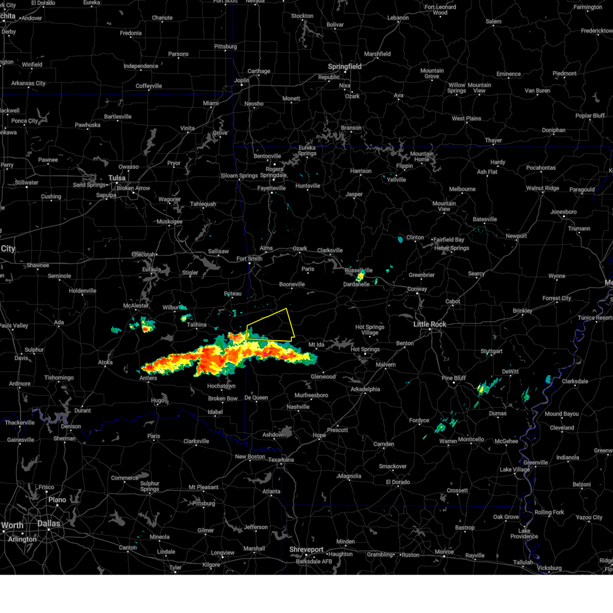 At 815 pm cst, a severe thunderstorm was located near mountain fork, or 17 miles northwest of mena, moving east at 55 mph (radar indicated). Hazards include quarter size hail. damage to vehicles is expected At 815 pm cst, a severe thunderstorm was located near mountain fork, or 17 miles northwest of mena, moving east at 55 mph (radar indicated). Hazards include quarter size hail. damage to vehicles is expected
|
| 1/11/2023 8:56 PM CST |
 At 856 pm cst, a severe thunderstorm was located near echo, or 8 miles north of waldron, moving east at 55 mph (radar indicated). Hazards include two inch hail and 60 mph wind gusts. People and animals outdoors will be injured. expect hail damage to roofs, siding, windows, and vehicles. Expect wind damage to roofs, siding, and trees. At 856 pm cst, a severe thunderstorm was located near echo, or 8 miles north of waldron, moving east at 55 mph (radar indicated). Hazards include two inch hail and 60 mph wind gusts. People and animals outdoors will be injured. expect hail damage to roofs, siding, windows, and vehicles. Expect wind damage to roofs, siding, and trees.
|
| 1/11/2023 8:43 PM CST |
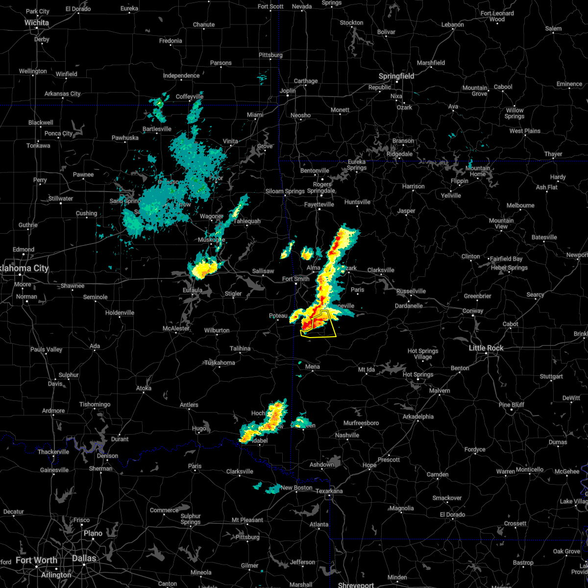 At 843 pm cst, a severe thunderstorm was located near oliver, or 11 miles northwest of waldron, moving east at 50 mph (radar indicated). Hazards include ping pong ball size hail and 60 mph wind gusts. People and animals outdoors will be injured. expect hail damage to roofs, siding, windows, and vehicles. expect wind damage to roofs, siding, and trees. locations impacted include, waldron, mansfield, oliver, echo, cauthron, hon, lucas, liberty, ione, elm park, hail threat, radar indicated max hail size, 1. 50 in wind threat, radar indicated max wind gust, 60 mph. At 843 pm cst, a severe thunderstorm was located near oliver, or 11 miles northwest of waldron, moving east at 50 mph (radar indicated). Hazards include ping pong ball size hail and 60 mph wind gusts. People and animals outdoors will be injured. expect hail damage to roofs, siding, windows, and vehicles. expect wind damage to roofs, siding, and trees. locations impacted include, waldron, mansfield, oliver, echo, cauthron, hon, lucas, liberty, ione, elm park, hail threat, radar indicated max hail size, 1. 50 in wind threat, radar indicated max wind gust, 60 mph.
|
| 1/11/2023 8:28 PM CST |
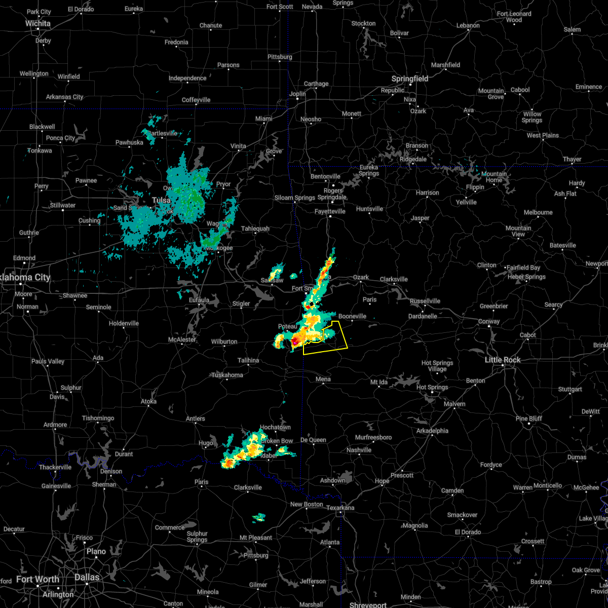 At 827 pm cst, a severe thunderstorm was located near heavener runestone state park, or 10 miles southeast of poteau, moving east at 45 mph (trained weather spotters). Hazards include ping pong ball size hail and 60 mph wind gusts. People and animals outdoors will be injured. expect hail damage to roofs, siding, windows, and vehicles. expect wind damage to roofs, siding, and trees. locations impacted include, waldron, mansfield, oliver, echo, morgan springs, bates, cauthron, winfield, hon, lucas, liberty, ione, elm park, hail threat, radar indicated max hail size, 1. 50 in wind threat, radar indicated max wind gust, 60 mph. At 827 pm cst, a severe thunderstorm was located near heavener runestone state park, or 10 miles southeast of poteau, moving east at 45 mph (trained weather spotters). Hazards include ping pong ball size hail and 60 mph wind gusts. People and animals outdoors will be injured. expect hail damage to roofs, siding, windows, and vehicles. expect wind damage to roofs, siding, and trees. locations impacted include, waldron, mansfield, oliver, echo, morgan springs, bates, cauthron, winfield, hon, lucas, liberty, ione, elm park, hail threat, radar indicated max hail size, 1. 50 in wind threat, radar indicated max wind gust, 60 mph.
|
| 1/11/2023 8:07 PM CST |
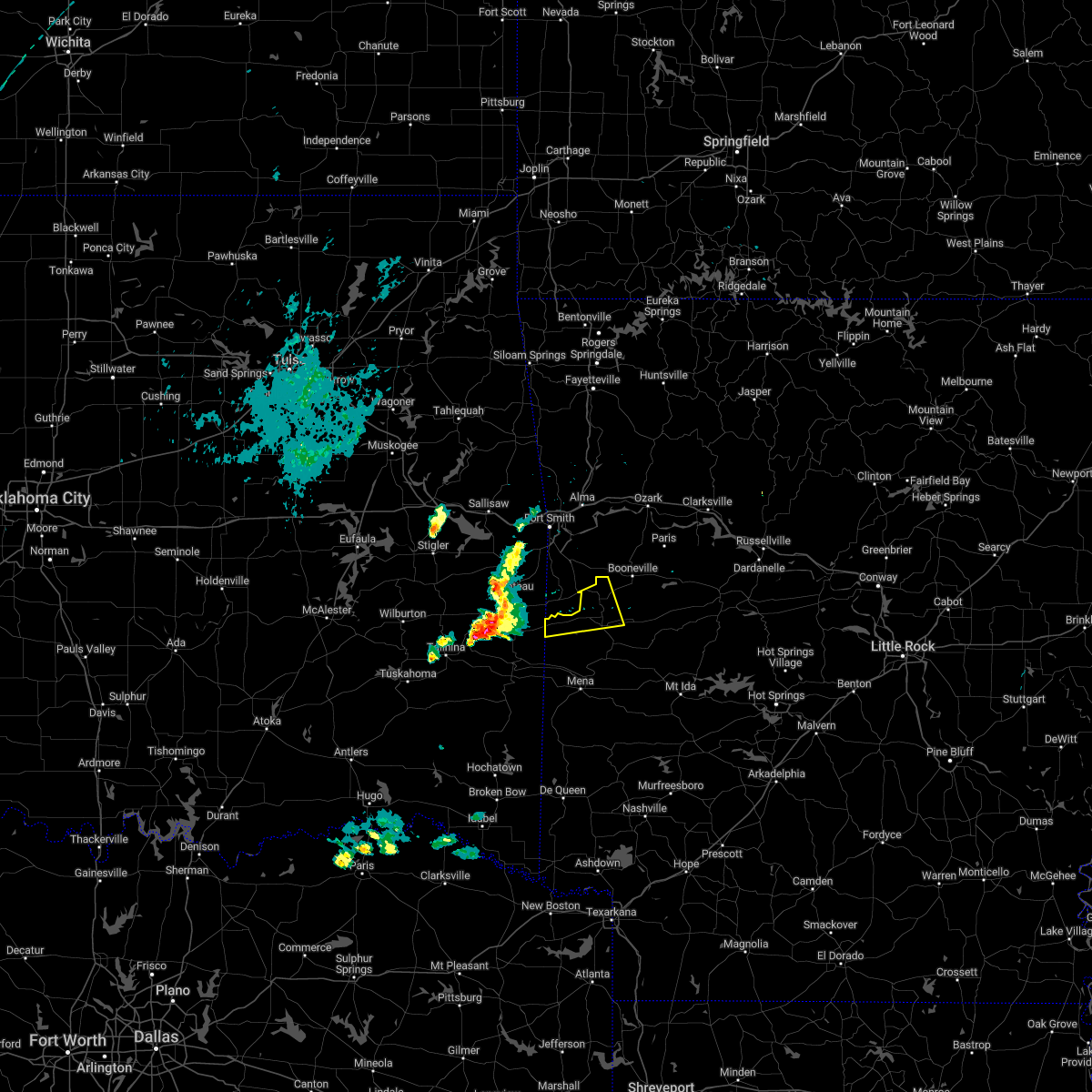 At 807 pm cst, a severe thunderstorm was located near lake wister state park, or 13 miles south of poteau, moving east at 55 mph (radar indicated). Hazards include 60 mph wind gusts and quarter size hail. Hail damage to vehicles is expected. Expect wind damage to roofs, siding, and trees. At 807 pm cst, a severe thunderstorm was located near lake wister state park, or 13 miles south of poteau, moving east at 55 mph (radar indicated). Hazards include 60 mph wind gusts and quarter size hail. Hail damage to vehicles is expected. Expect wind damage to roofs, siding, and trees.
|
| 11/4/2022 7:16 PM CDT |
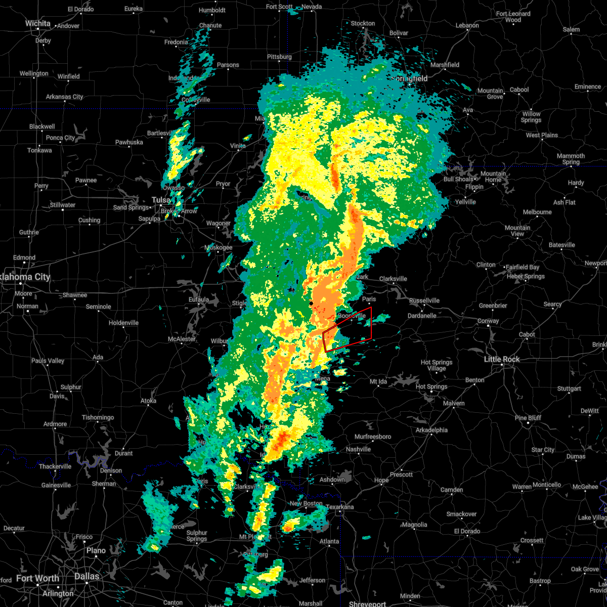 At 715 pm cdt, a severe thunderstorm capable of producing a tornado was located 7 miles north of waldron, moving east at 35 mph (radar indicated rotation). Hazards include tornado and quarter size hail. Flying debris will be dangerous to those caught without shelter. mobile homes will be damaged or destroyed. damage to roofs, windows, and vehicles will occur. tree damage is likely. Locations impacted include, booneville, waldron, magazine, blue mountain, cardiff, winfield, hon, lucas, driggs, sugar grove, carolan, grayson, ione, elm park, liberty,. At 715 pm cdt, a severe thunderstorm capable of producing a tornado was located 7 miles north of waldron, moving east at 35 mph (radar indicated rotation). Hazards include tornado and quarter size hail. Flying debris will be dangerous to those caught without shelter. mobile homes will be damaged or destroyed. damage to roofs, windows, and vehicles will occur. tree damage is likely. Locations impacted include, booneville, waldron, magazine, blue mountain, cardiff, winfield, hon, lucas, driggs, sugar grove, carolan, grayson, ione, elm park, liberty,.
|
| 11/4/2022 6:57 PM CDT |
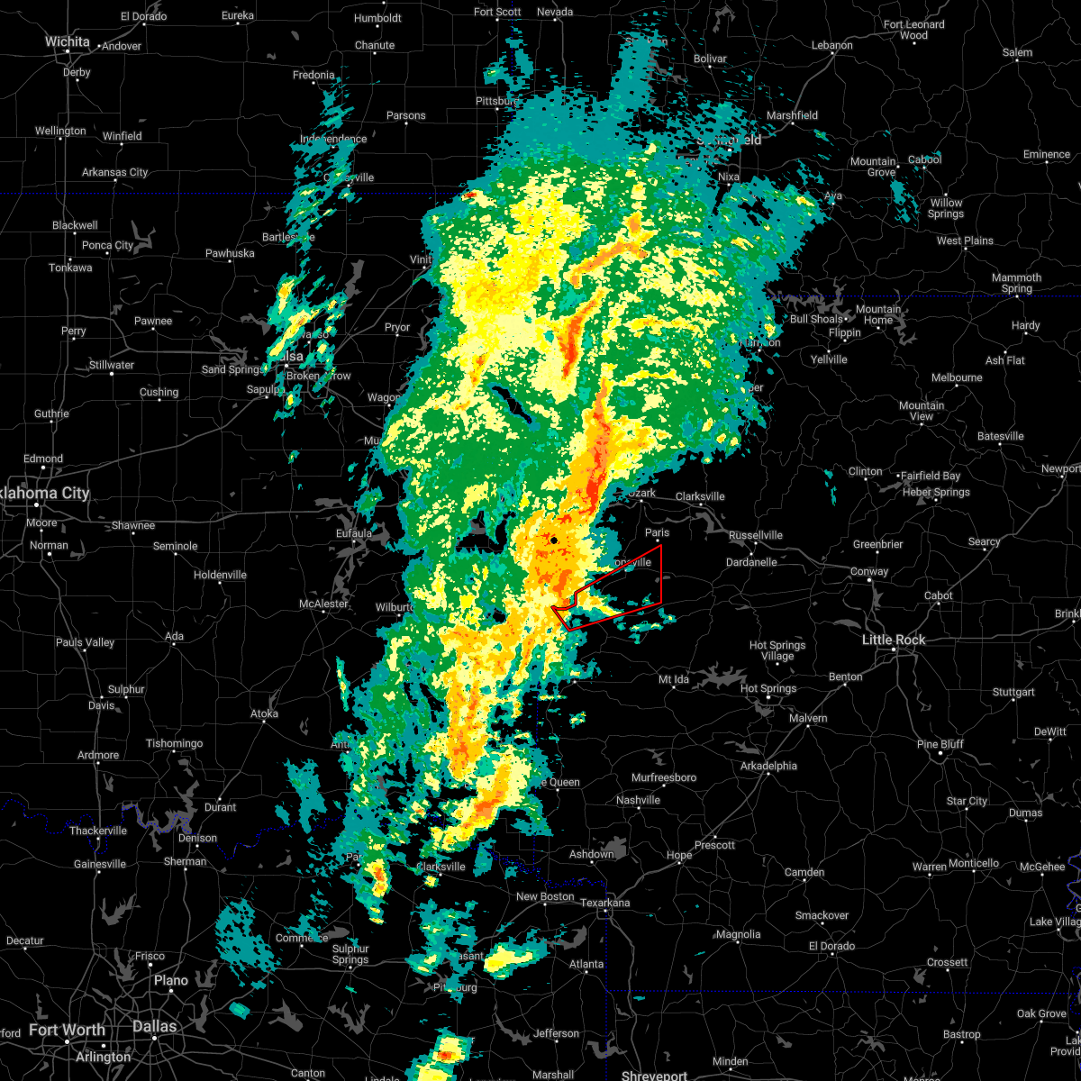 At 657 pm cdt, a severe thunderstorm capable of producing a tornado was located over oliver, or 8 miles west of waldron, moving northeast at 45 mph (radar indicated rotation). Hazards include tornado and quarter size hail. Flying debris will be dangerous to those caught without shelter. mobile homes will be damaged or destroyed. damage to roofs, windows, and vehicles will occur. Tree damage is likely. At 657 pm cdt, a severe thunderstorm capable of producing a tornado was located over oliver, or 8 miles west of waldron, moving northeast at 45 mph (radar indicated rotation). Hazards include tornado and quarter size hail. Flying debris will be dangerous to those caught without shelter. mobile homes will be damaged or destroyed. damage to roofs, windows, and vehicles will occur. Tree damage is likely.
|
| 10/15/2022 9:45 PM CDT |
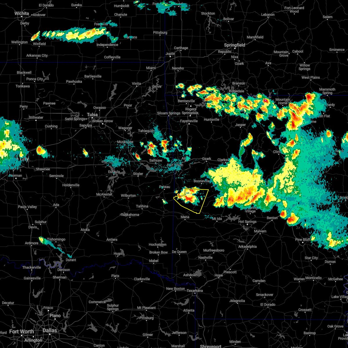 At 944 pm cdt, a severe thunderstorm was located near waldron, moving east at 15 mph (radar indicated). Hazards include 60 mph wind gusts and quarter size hail. Hail damage to vehicles is expected. expect wind damage to roofs, siding, and trees. locations impacted include, waldron, beauchamp, cardiff, oliver, morgan springs, bates, cauthron, winfield, hon, liberty, y city, needmore, boles, parks, elm park, hail threat, radar indicated max hail size, 1. 00 in wind threat, radar indicated max wind gust, 60 mph. At 944 pm cdt, a severe thunderstorm was located near waldron, moving east at 15 mph (radar indicated). Hazards include 60 mph wind gusts and quarter size hail. Hail damage to vehicles is expected. expect wind damage to roofs, siding, and trees. locations impacted include, waldron, beauchamp, cardiff, oliver, morgan springs, bates, cauthron, winfield, hon, liberty, y city, needmore, boles, parks, elm park, hail threat, radar indicated max hail size, 1. 00 in wind threat, radar indicated max wind gust, 60 mph.
|
| 10/15/2022 9:26 PM CDT |
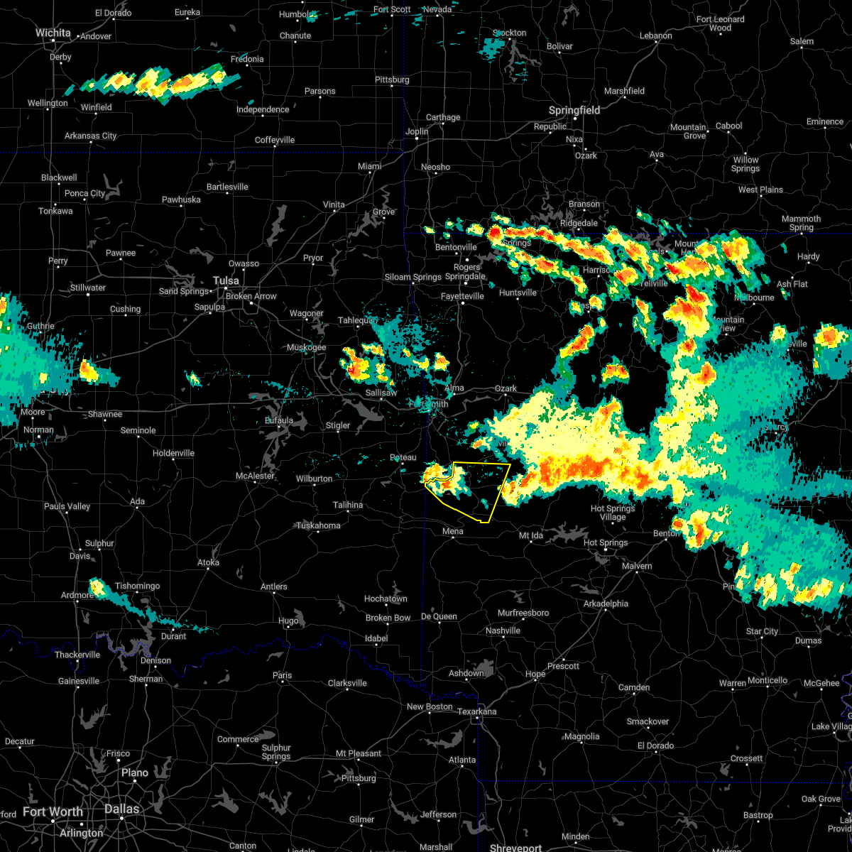 At 926 pm cdt, a severe thunderstorm was located over oliver, or 10 miles west of waldron, moving east at 20 mph (radar indicated). Hazards include 60 mph wind gusts and quarter size hail. Hail damage to vehicles is expected. Expect wind damage to roofs, siding, and trees. At 926 pm cdt, a severe thunderstorm was located over oliver, or 10 miles west of waldron, moving east at 20 mph (radar indicated). Hazards include 60 mph wind gusts and quarter size hail. Hail damage to vehicles is expected. Expect wind damage to roofs, siding, and trees.
|
| 10/15/2022 8:58 PM CDT |
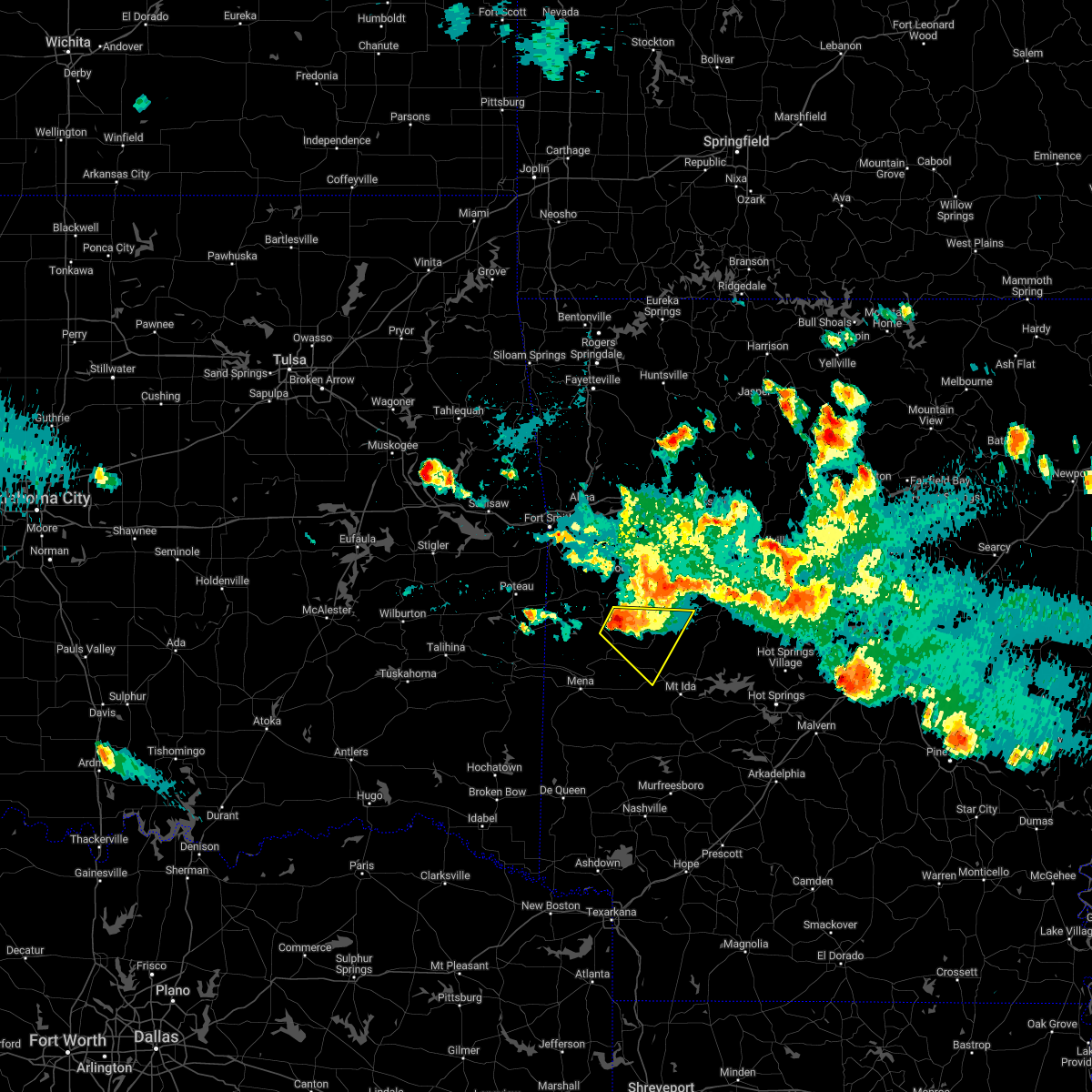 At 858 pm cdt, a severe thunderstorm was located near cardiff, or near waldron, moving southeast at 20 mph (radar indicated). Hazards include 60 mph wind gusts and quarter size hail. Hail damage to vehicles is expected. expect wind damage to roofs, siding, and trees. locations impacted include, waldron, oden, cardiff, gravelly, union hill, olio, cedar creek, bluffton, nola, needmore, harvey, parks, blue ball, hail threat, radar indicated max hail size, 1. 00 in wind threat, radar indicated max wind gust, 60 mph. At 858 pm cdt, a severe thunderstorm was located near cardiff, or near waldron, moving southeast at 20 mph (radar indicated). Hazards include 60 mph wind gusts and quarter size hail. Hail damage to vehicles is expected. expect wind damage to roofs, siding, and trees. locations impacted include, waldron, oden, cardiff, gravelly, union hill, olio, cedar creek, bluffton, nola, needmore, harvey, parks, blue ball, hail threat, radar indicated max hail size, 1. 00 in wind threat, radar indicated max wind gust, 60 mph.
|
| 10/15/2022 8:46 PM CDT |
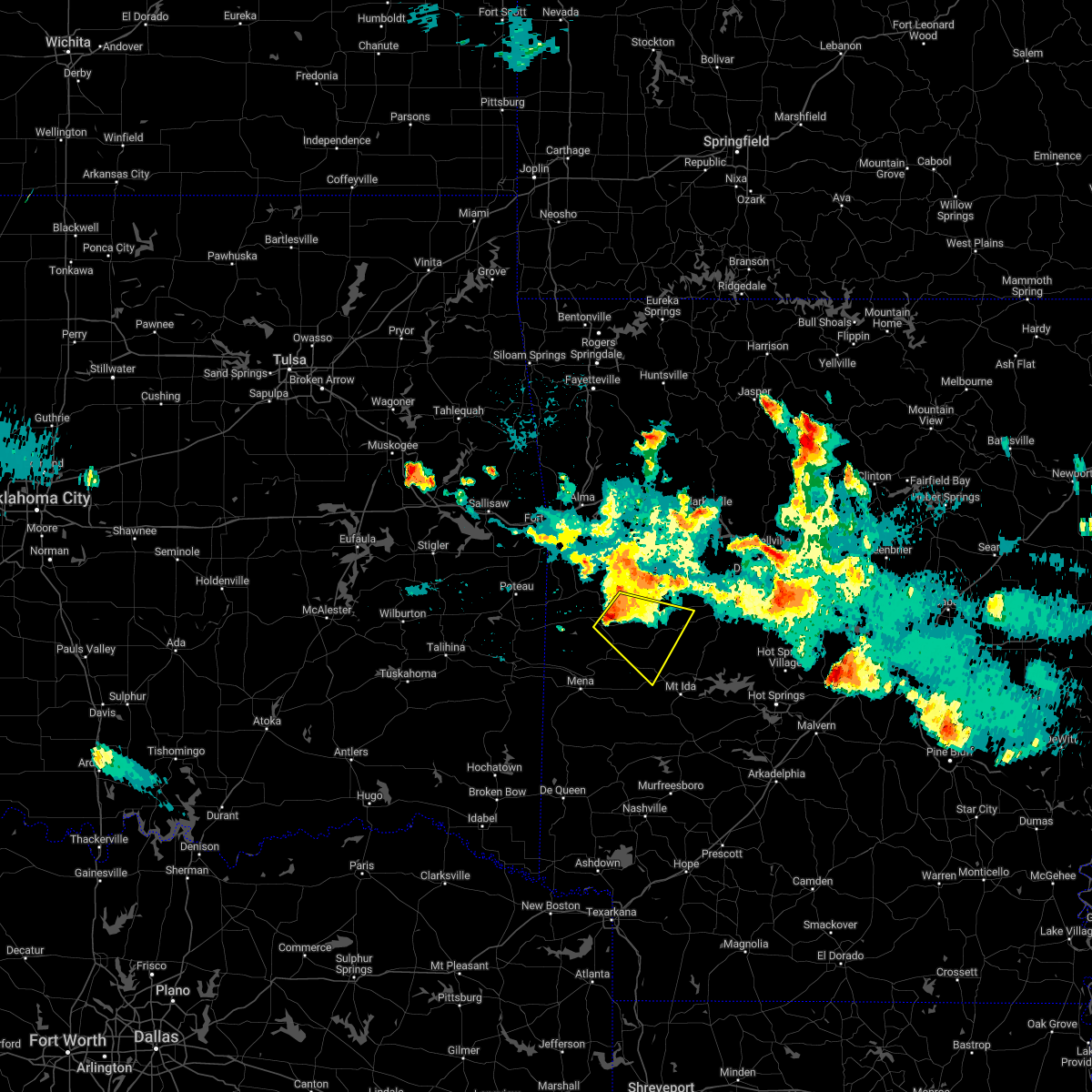 At 846 pm cdt, a severe thunderstorm was located over waldron, moving southeast at 20 mph (radar indicated). Hazards include 60 mph wind gusts and quarter size hail. Hail damage to vehicles is expected. expect wind damage to roofs, siding, and trees. locations impacted include, waldron, oden, cardiff, gravelly, union hill, olio, cedar creek, bluffton, nola, needmore, harvey, parks, blue ball, waltreak, hail threat, radar indicated max hail size, 1. 00 in wind threat, radar indicated max wind gust, 60 mph. At 846 pm cdt, a severe thunderstorm was located over waldron, moving southeast at 20 mph (radar indicated). Hazards include 60 mph wind gusts and quarter size hail. Hail damage to vehicles is expected. expect wind damage to roofs, siding, and trees. locations impacted include, waldron, oden, cardiff, gravelly, union hill, olio, cedar creek, bluffton, nola, needmore, harvey, parks, blue ball, waltreak, hail threat, radar indicated max hail size, 1. 00 in wind threat, radar indicated max wind gust, 60 mph.
|
| 10/15/2022 8:33 PM CDT |
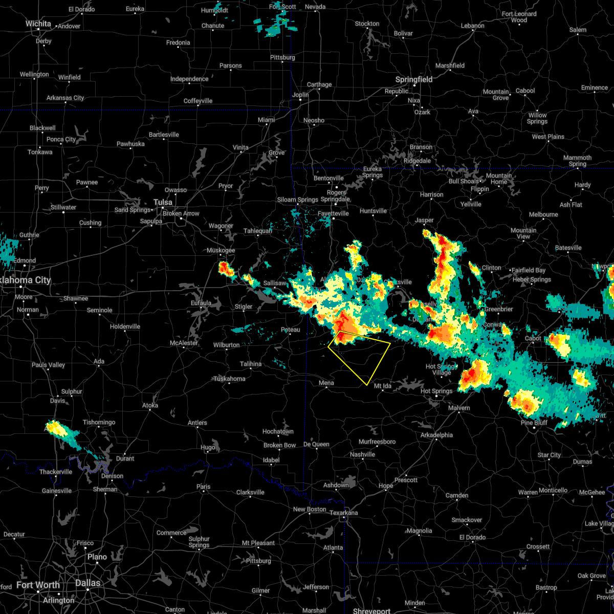 At 833 pm cdt, a severe thunderstorm was located 7 miles southeast of echo, or 8 miles north of waldron, moving southeast at 30 mph (radar indicated). Hazards include 60 mph wind gusts and quarter size hail. Hail damage to vehicles is expected. Expect wind damage to roofs, siding, and trees. At 833 pm cdt, a severe thunderstorm was located 7 miles southeast of echo, or 8 miles north of waldron, moving southeast at 30 mph (radar indicated). Hazards include 60 mph wind gusts and quarter size hail. Hail damage to vehicles is expected. Expect wind damage to roofs, siding, and trees.
|
| 7/21/2022 4:03 PM CDT |
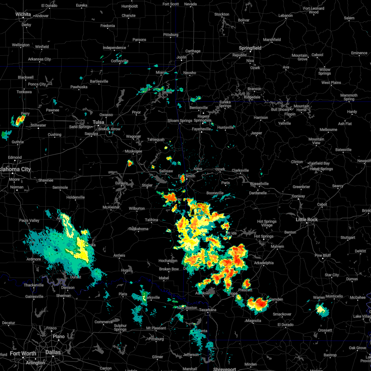 At 403 pm cdt, a severe thunderstorm was located near oliver, or 7 miles northwest of waldron, moving south at 10 mph (radar indicated). Hazards include 60 mph wind gusts and quarter size hail. Hail damage to vehicles is expected. expect wind damage to roofs, siding, and trees. locations impacted include, waldron, oliver, morgan springs, cauthron, winfield, hon, elm park, liberty, hail threat, radar indicated max hail size, 1. 00 in wind threat, radar indicated max wind gust, 60 mph. At 403 pm cdt, a severe thunderstorm was located near oliver, or 7 miles northwest of waldron, moving south at 10 mph (radar indicated). Hazards include 60 mph wind gusts and quarter size hail. Hail damage to vehicles is expected. expect wind damage to roofs, siding, and trees. locations impacted include, waldron, oliver, morgan springs, cauthron, winfield, hon, elm park, liberty, hail threat, radar indicated max hail size, 1. 00 in wind threat, radar indicated max wind gust, 60 mph.
|
| 7/21/2022 3:43 PM CDT |
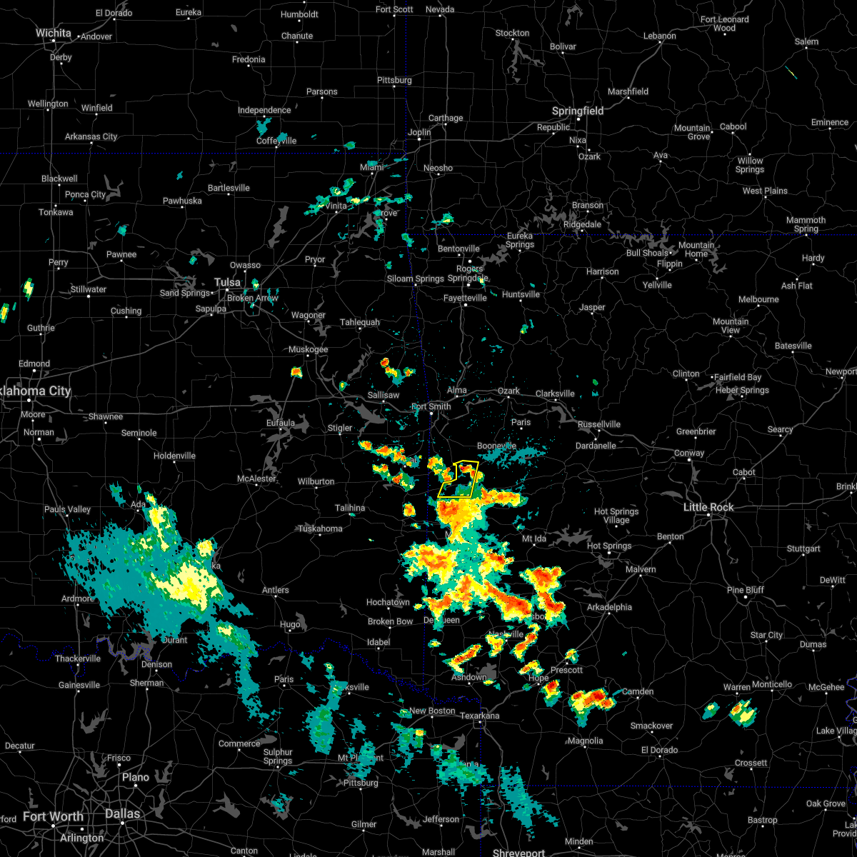 At 342 pm cdt, a severe thunderstorm was located near mansfield, or 9 miles northwest of waldron, moving south at 10 mph (radar indicated). Hazards include 60 mph wind gusts and quarter size hail. Hail damage to vehicles is expected. Expect wind damage to roofs, siding, and trees. At 342 pm cdt, a severe thunderstorm was located near mansfield, or 9 miles northwest of waldron, moving south at 10 mph (radar indicated). Hazards include 60 mph wind gusts and quarter size hail. Hail damage to vehicles is expected. Expect wind damage to roofs, siding, and trees.
|
| 7/21/2022 2:28 PM CDT |
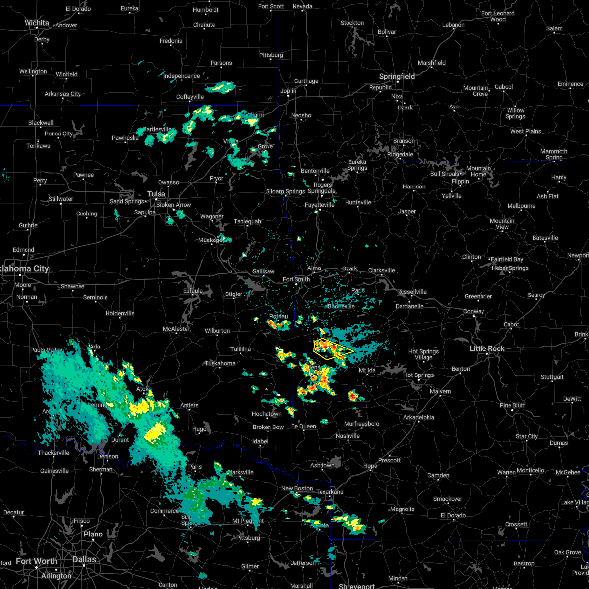 At 227 pm cdt, a severe thunderstorm was located 7 miles south of waldron, moving southeast at 10 mph (radar indicated). Hazards include 60 mph wind gusts and half dollar size hail. Hail damage to vehicles is expected. Expect wind damage to roofs, siding, and trees. At 227 pm cdt, a severe thunderstorm was located 7 miles south of waldron, moving southeast at 10 mph (radar indicated). Hazards include 60 mph wind gusts and half dollar size hail. Hail damage to vehicles is expected. Expect wind damage to roofs, siding, and trees.
|
| 5/15/2022 4:03 PM CDT |
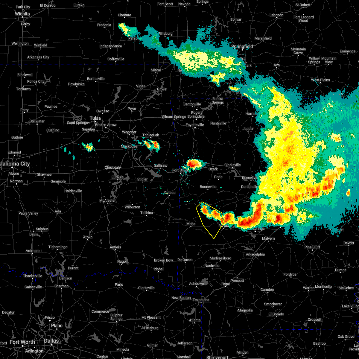 At 403 pm cdt, severe thunderstorms were located along a line extending from 8 miles southeast of cardiff to near oliver, moving southeast at 20 mph (radar indicated). Hazards include 60 mph wind gusts and quarter size hail. Hail damage to vehicles is expected. Expect wind damage to roofs, siding, and trees. At 403 pm cdt, severe thunderstorms were located along a line extending from 8 miles southeast of cardiff to near oliver, moving southeast at 20 mph (radar indicated). Hazards include 60 mph wind gusts and quarter size hail. Hail damage to vehicles is expected. Expect wind damage to roofs, siding, and trees.
|
| 5/2/2022 11:43 PM CDT |
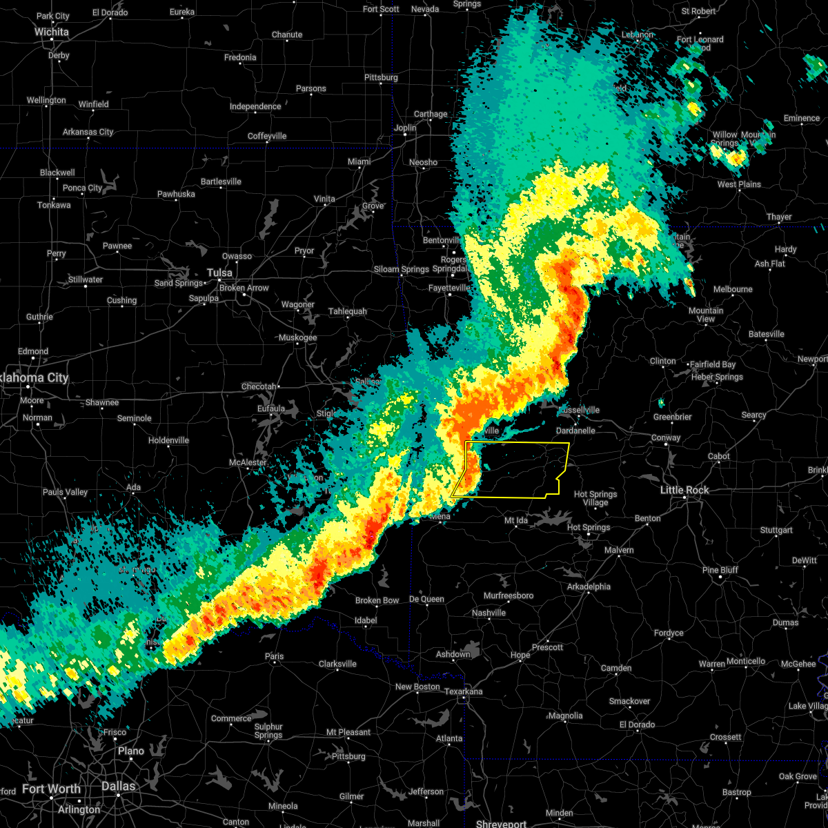 At 1143 pm cdt, a severe thunderstorm was located near cardiff, or 13 miles east of waldron, moving east at 45 mph (radar indicated). Hazards include 60 mph wind gusts. expect damage to roofs, siding, and trees At 1143 pm cdt, a severe thunderstorm was located near cardiff, or 13 miles east of waldron, moving east at 45 mph (radar indicated). Hazards include 60 mph wind gusts. expect damage to roofs, siding, and trees
|
| 5/2/2022 11:38 PM CDT |
 At 1138 pm cdt, severe thunderstorms were located along a line extending from 6 miles southwest of booneville to near cardiff to 11 miles northeast of mena, moving east at 45 mph (radar indicated). Hazards include 60 mph wind gusts. Expect damage to roofs, siding, and trees. locations impacted include, booneville, waldron, paris, mansfield, magazine, subiaco, oden, ratcliff, blue mountain, beauchamp, cardiff, muddy creek wma, stonehouse recreation area, gravelly, mount magazine, echo, oliver, queen wilhelmina state park, caulksville, acorn, hail threat, radar indicated max hail size, <. 75 in wind threat, radar indicated max wind gust, 60 mph. At 1138 pm cdt, severe thunderstorms were located along a line extending from 6 miles southwest of booneville to near cardiff to 11 miles northeast of mena, moving east at 45 mph (radar indicated). Hazards include 60 mph wind gusts. Expect damage to roofs, siding, and trees. locations impacted include, booneville, waldron, paris, mansfield, magazine, subiaco, oden, ratcliff, blue mountain, beauchamp, cardiff, muddy creek wma, stonehouse recreation area, gravelly, mount magazine, echo, oliver, queen wilhelmina state park, caulksville, acorn, hail threat, radar indicated max hail size, <. 75 in wind threat, radar indicated max wind gust, 60 mph.
|
| 5/2/2022 11:02 PM CDT |
 At 1102 pm cdt, severe thunderstorms were located along a line extending from near cameron to hartford to 6 miles northwest of mountain fork, moving east at 50 mph (radar indicated). Hazards include 60 mph wind gusts and quarter size hail. Hail damage to vehicles is expected. Expect wind damage to roofs, siding, and trees. At 1102 pm cdt, severe thunderstorms were located along a line extending from near cameron to hartford to 6 miles northwest of mountain fork, moving east at 50 mph (radar indicated). Hazards include 60 mph wind gusts and quarter size hail. Hail damage to vehicles is expected. Expect wind damage to roofs, siding, and trees.
|
| 4/16/2022 7:53 AM CDT |
 At 753 am cdt, a severe thunderstorm was located near cardiff, or 10 miles northeast of waldron, moving east at 40 mph (radar indicated). Hazards include 60 mph wind gusts and half dollar size hail. Hail damage to vehicles is expected. Expect wind damage to roofs, siding, and trees. At 753 am cdt, a severe thunderstorm was located near cardiff, or 10 miles northeast of waldron, moving east at 40 mph (radar indicated). Hazards include 60 mph wind gusts and half dollar size hail. Hail damage to vehicles is expected. Expect wind damage to roofs, siding, and trees.
|
| 4/16/2022 4:33 AM CDT |
 At 432 am cdt, severe thunderstorms were located along a line extending from 6 miles south of cardiff to 10 miles northwest of oden to 11 miles north of opal, moving southeast at 35 mph (radar indicated). Hazards include ping pong ball size hail and 60 mph wind gusts. People and animals outdoors will be injured. expect hail damage to roofs, siding, windows, and vehicles. expect wind damage to roofs, siding, and trees. locations impacted include, waldron, mount ida, oden, beauchamp, cardiff, opal, mimosa, gravelly, fourche valley, mauldin, muddy creek wma, olio, bluffton, pine ridge, boles, story, union hill, chula, cedar creek, gibbs, hail threat, radar indicated max hail size, 1. 50 in wind threat, radar indicated max wind gust, 60 mph. At 432 am cdt, severe thunderstorms were located along a line extending from 6 miles south of cardiff to 10 miles northwest of oden to 11 miles north of opal, moving southeast at 35 mph (radar indicated). Hazards include ping pong ball size hail and 60 mph wind gusts. People and animals outdoors will be injured. expect hail damage to roofs, siding, windows, and vehicles. expect wind damage to roofs, siding, and trees. locations impacted include, waldron, mount ida, oden, beauchamp, cardiff, opal, mimosa, gravelly, fourche valley, mauldin, muddy creek wma, olio, bluffton, pine ridge, boles, story, union hill, chula, cedar creek, gibbs, hail threat, radar indicated max hail size, 1. 50 in wind threat, radar indicated max wind gust, 60 mph.
|
| 4/16/2022 4:18 AM CDT |
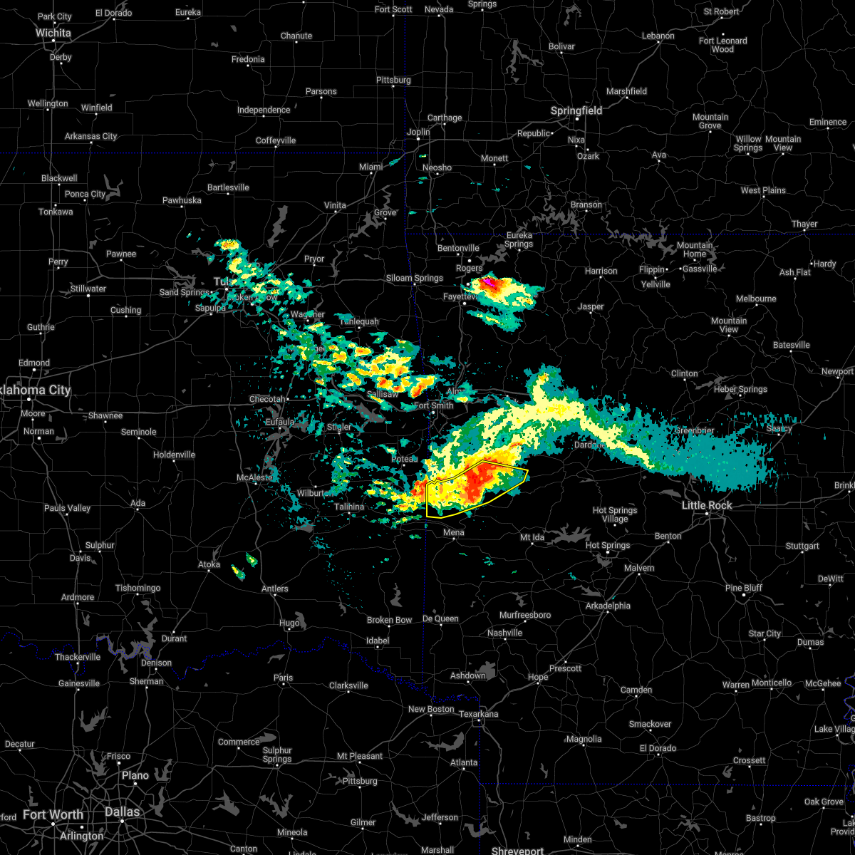 At 418 am cdt, severe thunderstorms were located along a line extending from near beauchamp to 12 miles southeast of oliver to 7 miles southeast of waldron to near cardiff, moving southeast at 30 mph (radar indicated). Hazards include ping pong ball size hail and 60 mph wind gusts. People and animals outdoors will be injured. expect hail damage to roofs, siding, windows, and vehicles. expect wind damage to roofs, siding, and trees. locations impacted include, waldron, beauchamp, stonehouse recreation area, cardiff, oliver, morgan springs, bates, black fork, union hill, cauthron, winfield, olio, hon, blue ball, elm park, needmore, ione, hail threat, radar indicated max hail size, 1. 50 in wind threat, radar indicated max wind gust, 60 mph. At 418 am cdt, severe thunderstorms were located along a line extending from near beauchamp to 12 miles southeast of oliver to 7 miles southeast of waldron to near cardiff, moving southeast at 30 mph (radar indicated). Hazards include ping pong ball size hail and 60 mph wind gusts. People and animals outdoors will be injured. expect hail damage to roofs, siding, windows, and vehicles. expect wind damage to roofs, siding, and trees. locations impacted include, waldron, beauchamp, stonehouse recreation area, cardiff, oliver, morgan springs, bates, black fork, union hill, cauthron, winfield, olio, hon, blue ball, elm park, needmore, ione, hail threat, radar indicated max hail size, 1. 50 in wind threat, radar indicated max wind gust, 60 mph.
|
| 4/16/2022 4:14 AM CDT |
 At 414 am cdt, severe thunderstorms were located along a line extending from near cardiff to 7 miles southeast of waldron to near beauchamp, moving southeast at 35 mph (radar indicated). Hazards include ping pong ball size hail and 60 mph wind gusts. People and animals outdoors will be injured. expect hail damage to roofs, siding, windows, and vehicles. Expect wind damage to roofs, siding, and trees. At 414 am cdt, severe thunderstorms were located along a line extending from near cardiff to 7 miles southeast of waldron to near beauchamp, moving southeast at 35 mph (radar indicated). Hazards include ping pong ball size hail and 60 mph wind gusts. People and animals outdoors will be injured. expect hail damage to roofs, siding, windows, and vehicles. Expect wind damage to roofs, siding, and trees.
|
| 4/16/2022 4:05 AM CDT | Trees and power lines down in waldron... ar along highway 8 in scott county AR, 0.3 miles NNW of Waldron, AR |
| 4/16/2022 4:05 AM CDT |
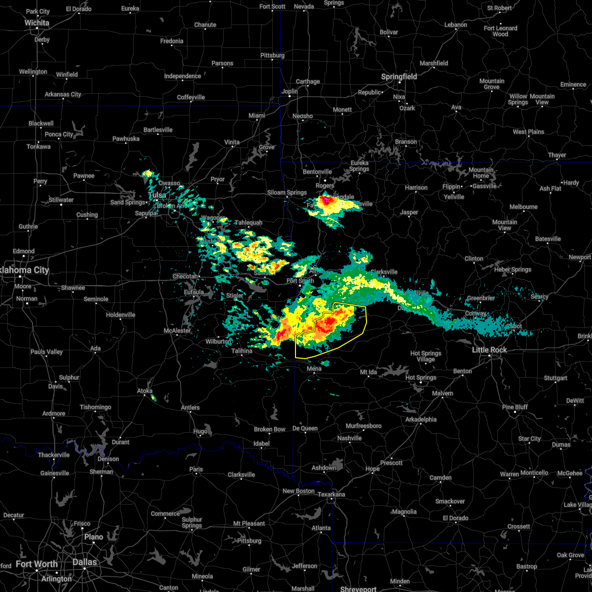 At 405 am cdt, severe thunderstorms were located along a line extending from near morgan springs to near beauchamp to waldron to 7 miles northwest of cardiff, moving southeast at 30 mph (radar indicated). Hazards include 60 mph wind gusts and half dollar size hail. Hail damage to vehicles is expected. expect wind damage to roofs, siding, and trees. locations impacted include, booneville, waldron, mansfield, magazine, blue mountain, beauchamp, stonehouse recreation area, cardiff, echo, oliver, morgan springs, mount magazine, bates, barber, black fork, winfield, olio, chismville, liberty, grayson, hail threat, radar indicated max hail size, 1. 25 in wind threat, radar indicated max wind gust, 60 mph. At 405 am cdt, severe thunderstorms were located along a line extending from near morgan springs to near beauchamp to waldron to 7 miles northwest of cardiff, moving southeast at 30 mph (radar indicated). Hazards include 60 mph wind gusts and half dollar size hail. Hail damage to vehicles is expected. expect wind damage to roofs, siding, and trees. locations impacted include, booneville, waldron, mansfield, magazine, blue mountain, beauchamp, stonehouse recreation area, cardiff, echo, oliver, morgan springs, mount magazine, bates, barber, black fork, winfield, olio, chismville, liberty, grayson, hail threat, radar indicated max hail size, 1. 25 in wind threat, radar indicated max wind gust, 60 mph.
|
| 4/16/2022 3:53 AM CDT |
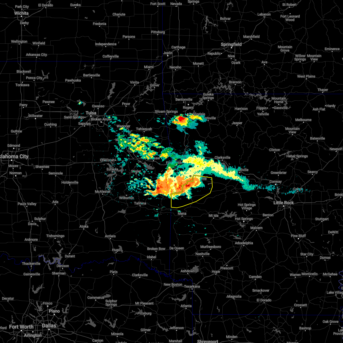 At 352 am cdt, severe thunderstorms were located along a line extending from 7 miles east of heavener runestone state park to morgan springs to near oliver to 6 miles east of echo, moving south at 20 mph (radar indicated). Hazards include 60 mph wind gusts and half dollar size hail. Hail damage to vehicles is expected. Expect wind damage to roofs, siding, and trees. At 352 am cdt, severe thunderstorms were located along a line extending from 7 miles east of heavener runestone state park to morgan springs to near oliver to 6 miles east of echo, moving south at 20 mph (radar indicated). Hazards include 60 mph wind gusts and half dollar size hail. Hail damage to vehicles is expected. Expect wind damage to roofs, siding, and trees.
|
| 4/16/2022 3:42 AM CDT |
 At 341 am cdt, severe thunderstorms were located along a line extending from 6 miles northeast of heavener runestone state park to near morgan springs to near oliver to near washburn, moving south at 20 mph (radar indicated). Hazards include 60 mph wind gusts and quarter size hail. Hail damage to vehicles is expected. Expect wind damage to roofs, siding, and trees. At 341 am cdt, severe thunderstorms were located along a line extending from 6 miles northeast of heavener runestone state park to near morgan springs to near oliver to near washburn, moving south at 20 mph (radar indicated). Hazards include 60 mph wind gusts and quarter size hail. Hail damage to vehicles is expected. Expect wind damage to roofs, siding, and trees.
|
| 4/16/2022 3:35 AM CDT |
 At 334 am cdt, severe thunderstorms were located along a line extending from near hartford to 6 miles east of echo, moving southeast at 30 mph (radar indicated). Hazards include 60 mph wind gusts and quarter size hail. Hail damage to vehicles is expected. expect wind damage to roofs, siding, and trees. locations impacted include, booneville, waldron, mansfield, magazine, blue mountain, stonehouse recreation area, cardiff, mount magazine, echo, oliver, morgan springs, bates, barber, winfield, olio, liberty, grayson, glendale in logan county, ione, elm park, hail threat, radar indicated max hail size, 1. 00 in wind threat, radar indicated max wind gust, 60 mph. At 334 am cdt, severe thunderstorms were located along a line extending from near hartford to 6 miles east of echo, moving southeast at 30 mph (radar indicated). Hazards include 60 mph wind gusts and quarter size hail. Hail damage to vehicles is expected. expect wind damage to roofs, siding, and trees. locations impacted include, booneville, waldron, mansfield, magazine, blue mountain, stonehouse recreation area, cardiff, mount magazine, echo, oliver, morgan springs, bates, barber, winfield, olio, liberty, grayson, glendale in logan county, ione, elm park, hail threat, radar indicated max hail size, 1. 00 in wind threat, radar indicated max wind gust, 60 mph.
|
| 4/16/2022 3:22 AM CDT |
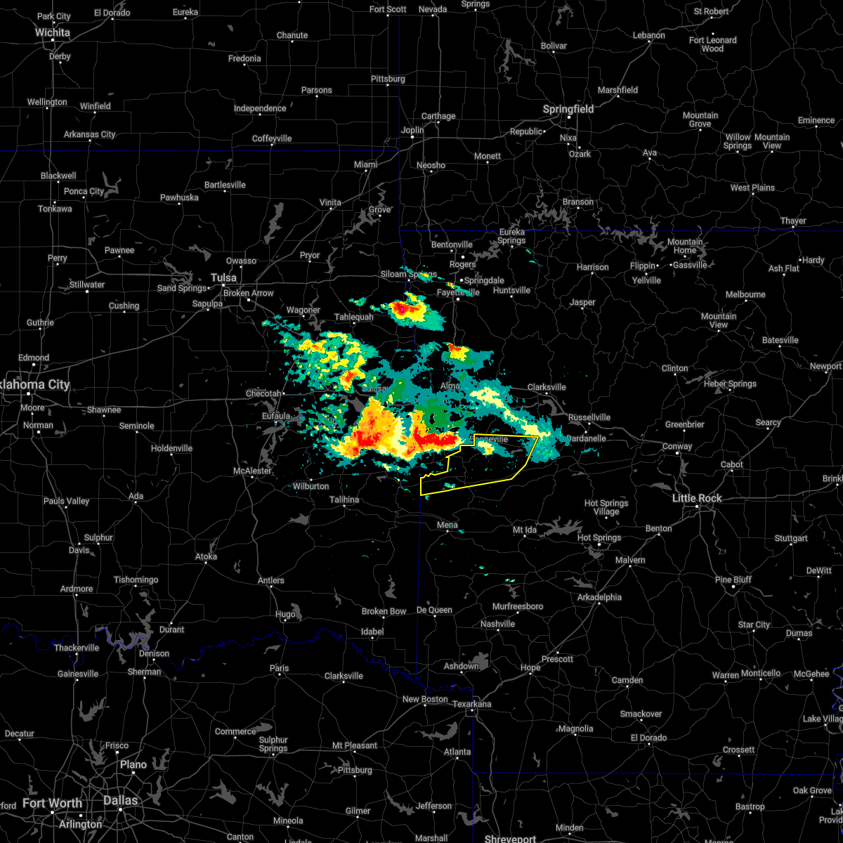 At 322 am cdt, severe thunderstorms were located along a line extending from midland to near echo, moving east at 35 mph (radar indicated). Hazards include 60 mph wind gusts and quarter size hail. Hail damage to vehicles is expected. Expect wind damage to roofs, siding, and trees. At 322 am cdt, severe thunderstorms were located along a line extending from midland to near echo, moving east at 35 mph (radar indicated). Hazards include 60 mph wind gusts and quarter size hail. Hail damage to vehicles is expected. Expect wind damage to roofs, siding, and trees.
|
| 4/16/2022 2:30 AM CDT |
 At 229 am cdt, a severe thunderstorm was located over huntington, or 16 miles northwest of waldron, moving east at 30 mph (radar indicated). Hazards include quarter size hail. Damage to vehicles is expected. locations impacted include, booneville, waldron, mansfield, cardiff, echo, barber, lucas, carolan, grayson, ione, elm park, liberty, hail threat, radar indicated max hail size, 1. 00 in wind threat, radar indicated max wind gust, <50 mph. At 229 am cdt, a severe thunderstorm was located over huntington, or 16 miles northwest of waldron, moving east at 30 mph (radar indicated). Hazards include quarter size hail. Damage to vehicles is expected. locations impacted include, booneville, waldron, mansfield, cardiff, echo, barber, lucas, carolan, grayson, ione, elm park, liberty, hail threat, radar indicated max hail size, 1. 00 in wind threat, radar indicated max wind gust, <50 mph.
|
| 4/16/2022 2:14 AM CDT |
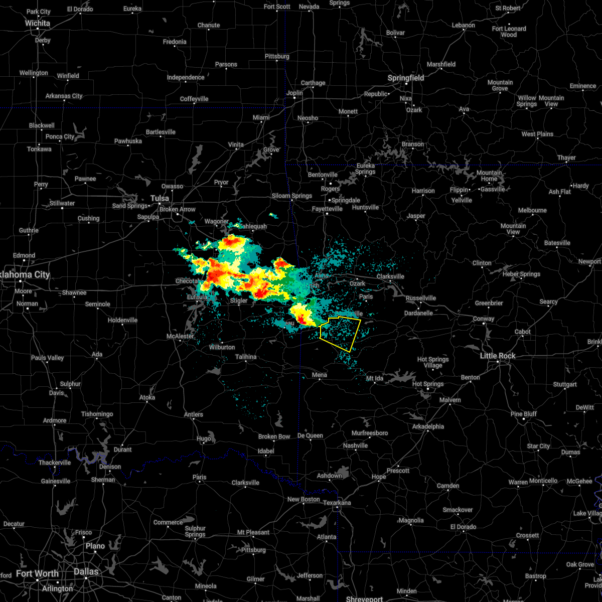 At 214 am cdt, a severe thunderstorm was located over midland, or 14 miles east of poteau, moving east at 35 mph (radar indicated). Hazards include ping pong ball size hail. People and animals outdoors will be injured. Expect damage to roofs, siding, windows, and vehicles. At 214 am cdt, a severe thunderstorm was located over midland, or 14 miles east of poteau, moving east at 35 mph (radar indicated). Hazards include ping pong ball size hail. People and animals outdoors will be injured. Expect damage to roofs, siding, windows, and vehicles.
|
| 3/30/2022 7:36 AM CDT |
 The tornado warning for central scott county will expire at 745 am cdt, the tornado threat has diminished and the tornado warning has been cancelled. however, large hail and damaging winds remain likely and a severe thunderstorm warning remains in effect for the area. a tornado watch remains in effect until 100 pm cdt for western arkansas. The tornado warning for central scott county will expire at 745 am cdt, the tornado threat has diminished and the tornado warning has been cancelled. however, large hail and damaging winds remain likely and a severe thunderstorm warning remains in effect for the area. a tornado watch remains in effect until 100 pm cdt for western arkansas.
|
| 3/30/2022 7:26 AM CDT |
 At 725 am cdt, a severe thunderstorm capable of producing a tornado was located over beauchamp, or 11 miles southwest of waldron, moving northeast at 45 mph (radar indicated rotation). Hazards include tornado. Flying debris will be dangerous to those caught without shelter. mobile homes will be damaged or destroyed. damage to roofs, windows, and vehicles will occur. tree damage is likely. Locations impacted include, waldron, beauchamp, winfield, hon,. At 725 am cdt, a severe thunderstorm capable of producing a tornado was located over beauchamp, or 11 miles southwest of waldron, moving northeast at 45 mph (radar indicated rotation). Hazards include tornado. Flying debris will be dangerous to those caught without shelter. mobile homes will be damaged or destroyed. damage to roofs, windows, and vehicles will occur. tree damage is likely. Locations impacted include, waldron, beauchamp, winfield, hon,.
|
| 3/30/2022 7:16 AM CDT |
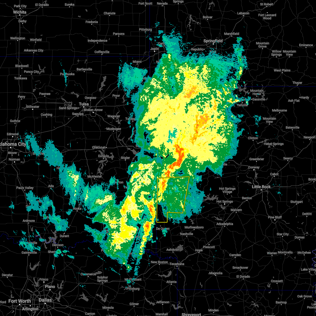 At 715 am cdt, severe thunderstorms were located along a line extending from near hatfield to 10 miles west of horatio, moving northeast at 65 mph (radar indicated). Hazards include 60 mph wind gusts and quarter size hail. Hail damage to vehicles is expected. expect wind damage to roofs, siding, and trees. Locations impacted include, mena, waldron, wickes, grannis, hatfield, vandervoort, beauchamp, cardiff, little missouri falls recreatio, mountain fork, bard springs recreation area, opal, cossatot river state park, polk county fairgrounds, mena intermountain airport, mccauley, shady, oliver, hartley, morgan springs,. At 715 am cdt, severe thunderstorms were located along a line extending from near hatfield to 10 miles west of horatio, moving northeast at 65 mph (radar indicated). Hazards include 60 mph wind gusts and quarter size hail. Hail damage to vehicles is expected. expect wind damage to roofs, siding, and trees. Locations impacted include, mena, waldron, wickes, grannis, hatfield, vandervoort, beauchamp, cardiff, little missouri falls recreatio, mountain fork, bard springs recreation area, opal, cossatot river state park, polk county fairgrounds, mena intermountain airport, mccauley, shady, oliver, hartley, morgan springs,.
|
| 3/30/2022 7:15 AM CDT |
 At 714 am cdt, a severe thunderstorm capable of producing a tornado was located over queen wilhelmina state park, or 8 miles northwest of mena, moving northeast at 65 mph (radar indicated rotation). Hazards include tornado. Flying debris will be dangerous to those caught without shelter. mobile homes will be damaged or destroyed. damage to roofs, windows, and vehicles will occur. tree damage is likely. Locations impacted include, waldron, beauchamp, queen wilhelmina state park, oliver, rich mountain, rocky, black fork mountain wilderness, winfield, hon, eagleton,. At 714 am cdt, a severe thunderstorm capable of producing a tornado was located over queen wilhelmina state park, or 8 miles northwest of mena, moving northeast at 65 mph (radar indicated rotation). Hazards include tornado. Flying debris will be dangerous to those caught without shelter. mobile homes will be damaged or destroyed. damage to roofs, windows, and vehicles will occur. tree damage is likely. Locations impacted include, waldron, beauchamp, queen wilhelmina state park, oliver, rich mountain, rocky, black fork mountain wilderness, winfield, hon, eagleton,.
|
| 3/30/2022 7:08 AM CDT |
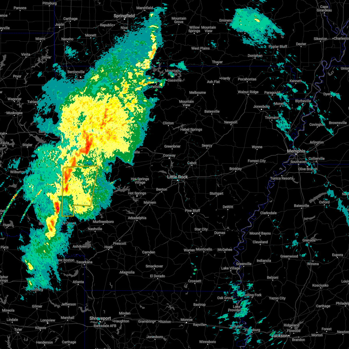 At 708 am cdt, severe thunderstorms were located along a line extending from 8 miles southwest of hatfield to 10 miles southeast of broken bow, moving northeast at 60 mph (radar indicated). Hazards include 60 mph wind gusts and quarter size hail. Hail damage to vehicles is expected. Expect wind damage to roofs, siding, and trees. At 708 am cdt, severe thunderstorms were located along a line extending from 8 miles southwest of hatfield to 10 miles southeast of broken bow, moving northeast at 60 mph (radar indicated). Hazards include 60 mph wind gusts and quarter size hail. Hail damage to vehicles is expected. Expect wind damage to roofs, siding, and trees.
|
| 3/30/2022 6:56 AM CDT |
 At 656 am cdt, a severe thunderstorm capable of producing a tornado was located near mountain fork, or 14 miles west of mena, moving northeast at 45 mph (radar indicated rotation). Hazards include tornado. Flying debris will be dangerous to those caught without shelter. mobile homes will be damaged or destroyed. damage to roofs, windows, and vehicles will occur. Tree damage is likely. At 656 am cdt, a severe thunderstorm capable of producing a tornado was located near mountain fork, or 14 miles west of mena, moving northeast at 45 mph (radar indicated rotation). Hazards include tornado. Flying debris will be dangerous to those caught without shelter. mobile homes will be damaged or destroyed. damage to roofs, windows, and vehicles will occur. Tree damage is likely.
|
| 3/30/2022 6:53 AM CDT |
 At 653 am cdt, severe thunderstorms were located along a line extending from echo to 8 miles south of washburn to near mansfield, moving northeast at 55 mph (radar indicated). Hazards include 70 mph wind gusts and quarter size hail. Hail damage to vehicles is expected. expect considerable tree damage. Wind damage is also likely to mobile homes, roofs, and outbuildings. At 653 am cdt, severe thunderstorms were located along a line extending from echo to 8 miles south of washburn to near mansfield, moving northeast at 55 mph (radar indicated). Hazards include 70 mph wind gusts and quarter size hail. Hail damage to vehicles is expected. expect considerable tree damage. Wind damage is also likely to mobile homes, roofs, and outbuildings.
|
| 3/30/2022 6:12 AM CDT |
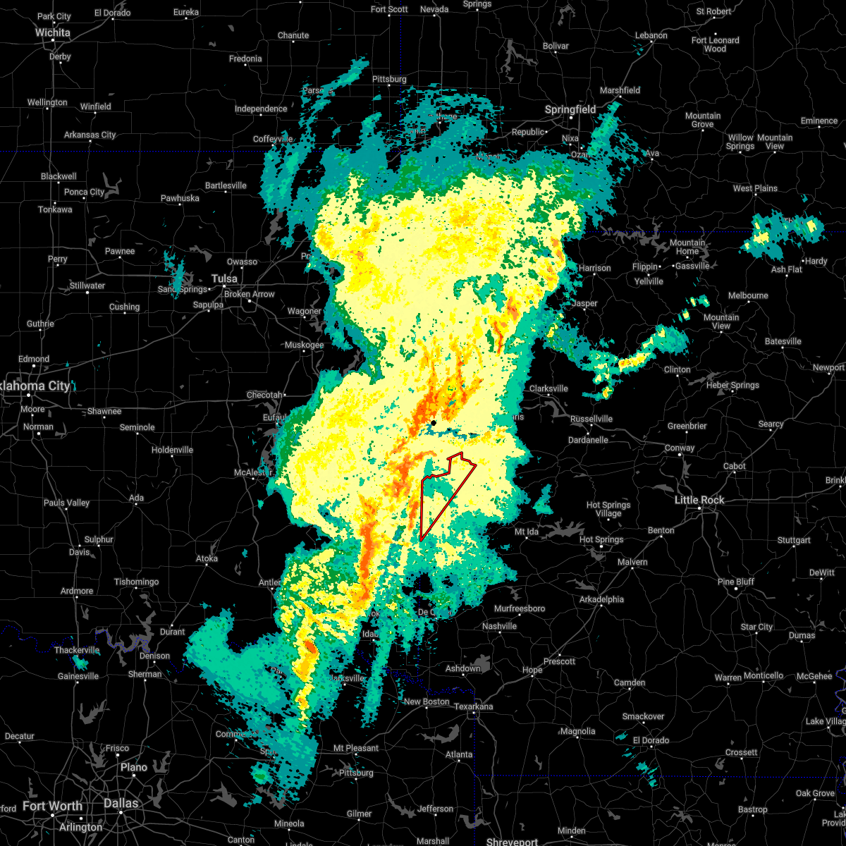 At 611 am cdt, a severe thunderstorm capable of producing a tornado was located near mountain fork, or 15 miles northwest of mena, moving northeast at 55 mph (radar indicated rotation). Hazards include tornado and quarter size hail. Flying debris will be dangerous to those caught without shelter. mobile homes will be damaged or destroyed. damage to roofs, windows, and vehicles will occur. Tree damage is likely. At 611 am cdt, a severe thunderstorm capable of producing a tornado was located near mountain fork, or 15 miles northwest of mena, moving northeast at 55 mph (radar indicated rotation). Hazards include tornado and quarter size hail. Flying debris will be dangerous to those caught without shelter. mobile homes will be damaged or destroyed. damage to roofs, windows, and vehicles will occur. Tree damage is likely.
|
| 3/6/2022 9:15 PM CST |
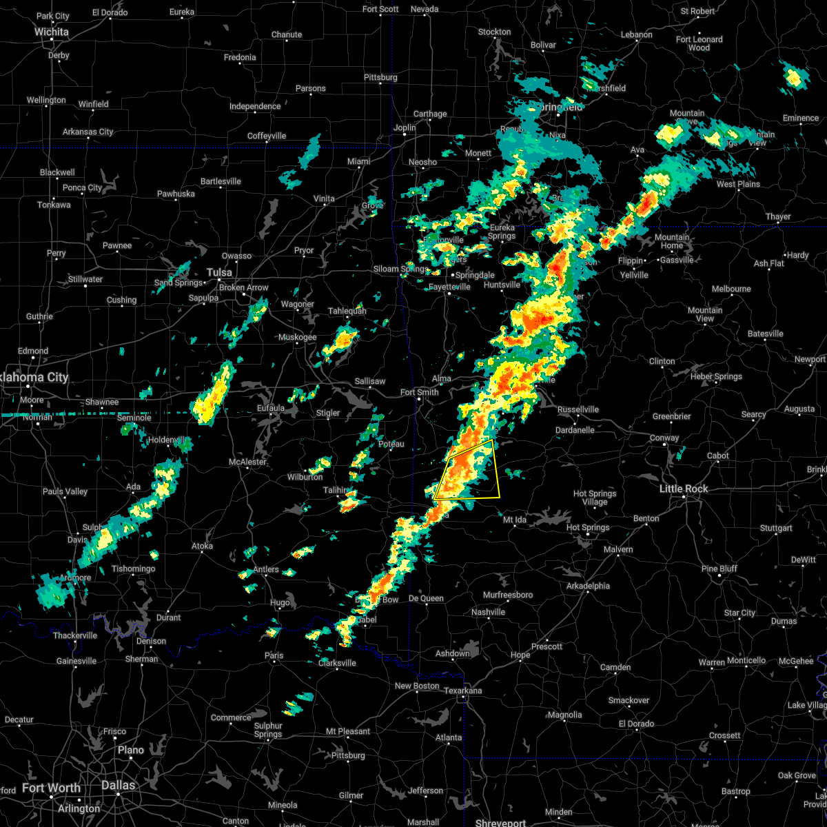 At 915 pm cst, a severe thunderstorm was located over cardiff, or 9 miles east of waldron, moving east at 45 mph (radar indicated). Hazards include 60 mph wind gusts and nickel size hail. Expect damage to roofs, siding, and trees. locations impacted include, waldron, cardiff, needmore, winfield, olio, hon, cedar creek, harvey, boles, parks, grayson, y city, hail threat, radar indicated max hail size, 0. 88 in wind threat, radar indicated max wind gust, 60 mph. At 915 pm cst, a severe thunderstorm was located over cardiff, or 9 miles east of waldron, moving east at 45 mph (radar indicated). Hazards include 60 mph wind gusts and nickel size hail. Expect damage to roofs, siding, and trees. locations impacted include, waldron, cardiff, needmore, winfield, olio, hon, cedar creek, harvey, boles, parks, grayson, y city, hail threat, radar indicated max hail size, 0. 88 in wind threat, radar indicated max wind gust, 60 mph.
|
| 3/6/2022 8:56 PM CST |
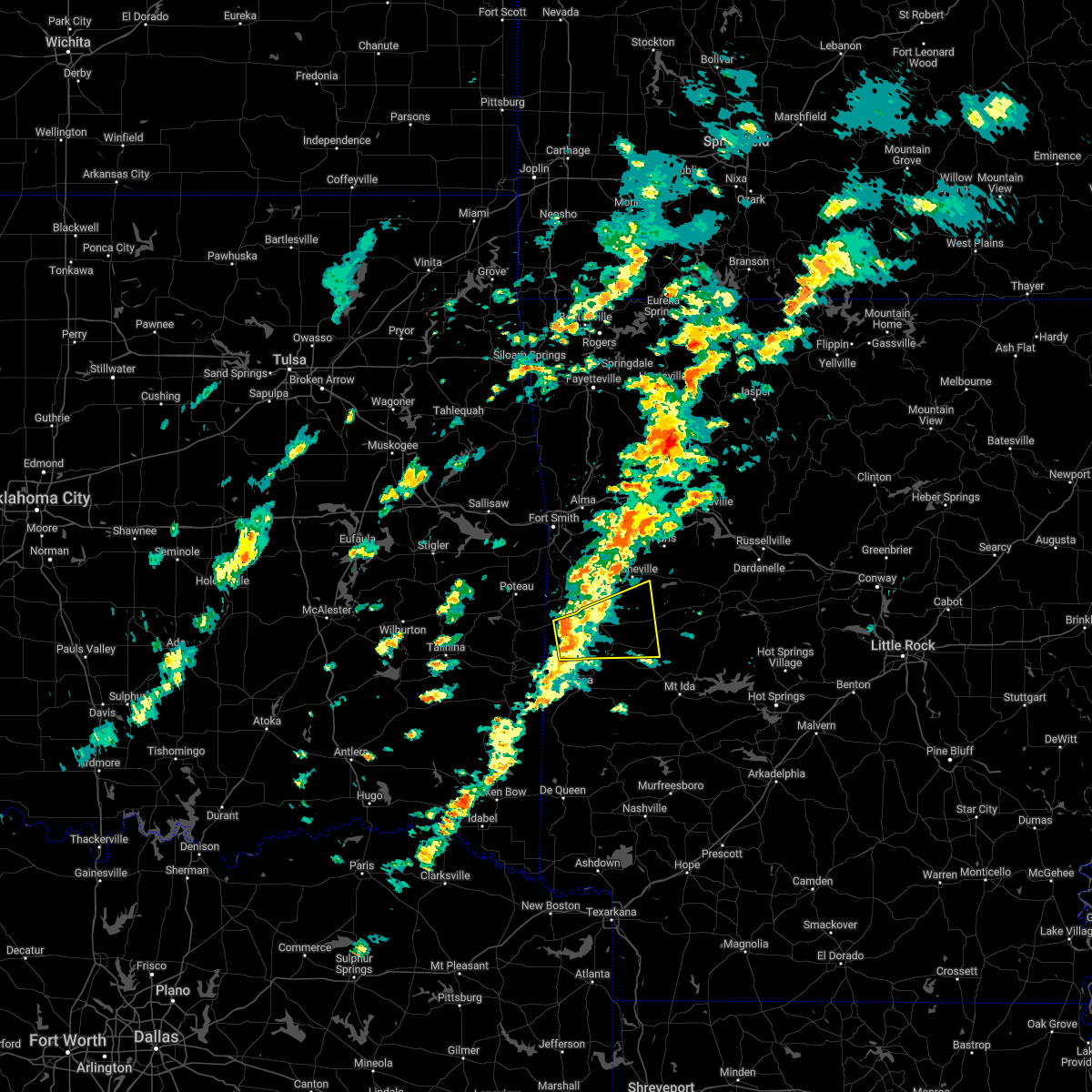 At 855 pm cst, a severe thunderstorm was located over beauchamp, or 10 miles southwest of waldron, moving northeast at 60 mph (radar indicated). Hazards include 60 mph wind gusts and nickel size hail. expect damage to roofs, siding, and trees At 855 pm cst, a severe thunderstorm was located over beauchamp, or 10 miles southwest of waldron, moving northeast at 60 mph (radar indicated). Hazards include 60 mph wind gusts and nickel size hail. expect damage to roofs, siding, and trees
|
| 3/6/2022 3:25 PM CST |
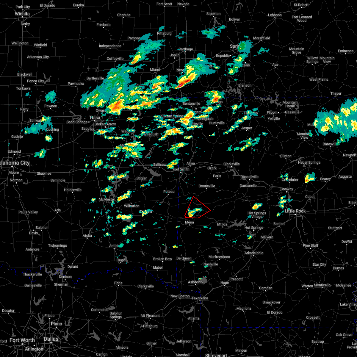 At 325 pm cst, a severe thunderstorm capable of producing a tornado was located near beauchamp, or 10 miles north of mena, moving northeast at 40 mph (radar indicated rotation). Hazards include tornado. Flying debris will be dangerous to those caught without shelter. mobile homes will be damaged or destroyed. damage to roofs, windows, and vehicles will occur. tree damage is likely. Locations impacted include, waldron, beauchamp, y city, needmore, winfield, hon, boles, parks,. At 325 pm cst, a severe thunderstorm capable of producing a tornado was located near beauchamp, or 10 miles north of mena, moving northeast at 40 mph (radar indicated rotation). Hazards include tornado. Flying debris will be dangerous to those caught without shelter. mobile homes will be damaged or destroyed. damage to roofs, windows, and vehicles will occur. tree damage is likely. Locations impacted include, waldron, beauchamp, y city, needmore, winfield, hon, boles, parks,.
|
| 3/6/2022 3:18 PM CST |
 At 318 pm cst, a severe thunderstorm capable of producing a tornado was located near queen wilhelmina state park, or near mena, moving northeast at 35 mph (radar indicated rotation). Hazards include tornado. Flying debris will be dangerous to those caught without shelter. mobile homes will be damaged or destroyed. damage to roofs, windows, and vehicles will occur. Tree damage is likely. At 318 pm cst, a severe thunderstorm capable of producing a tornado was located near queen wilhelmina state park, or near mena, moving northeast at 35 mph (radar indicated rotation). Hazards include tornado. Flying debris will be dangerous to those caught without shelter. mobile homes will be damaged or destroyed. damage to roofs, windows, and vehicles will occur. Tree damage is likely.
|
| 2/22/2022 2:17 AM CST |
 At 217 am cst, severe thunderstorms were located along a line extending from 6 miles east of echo to 6 miles south of waldron, moving east at 65 mph (radar indicated). Hazards include 60 mph wind gusts. expect damage to roofs, siding, and trees At 217 am cst, severe thunderstorms were located along a line extending from 6 miles east of echo to 6 miles south of waldron, moving east at 65 mph (radar indicated). Hazards include 60 mph wind gusts. expect damage to roofs, siding, and trees
|
| 10/24/2021 9:36 PM CDT |
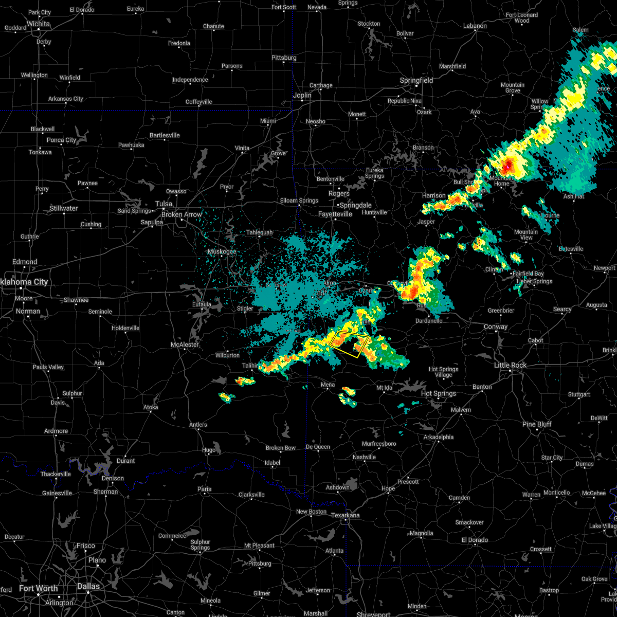 At 936 pm cdt, a severe thunderstorm was located near waldron, moving east at 25 mph (radar indicated). Hazards include 60 mph wind gusts and quarter size hail. Hail damage to vehicles is expected. expect wind damage to roofs, siding, and trees. locations impacted include, waldron, cardiff, lucas, ione, elm park, grayson, hail threat, radar indicated max hail size, 1. 00 in wind threat, radar indicated max wind gust, 60 mph. At 936 pm cdt, a severe thunderstorm was located near waldron, moving east at 25 mph (radar indicated). Hazards include 60 mph wind gusts and quarter size hail. Hail damage to vehicles is expected. expect wind damage to roofs, siding, and trees. locations impacted include, waldron, cardiff, lucas, ione, elm park, grayson, hail threat, radar indicated max hail size, 1. 00 in wind threat, radar indicated max wind gust, 60 mph.
|
| 10/24/2021 9:14 PM CDT |
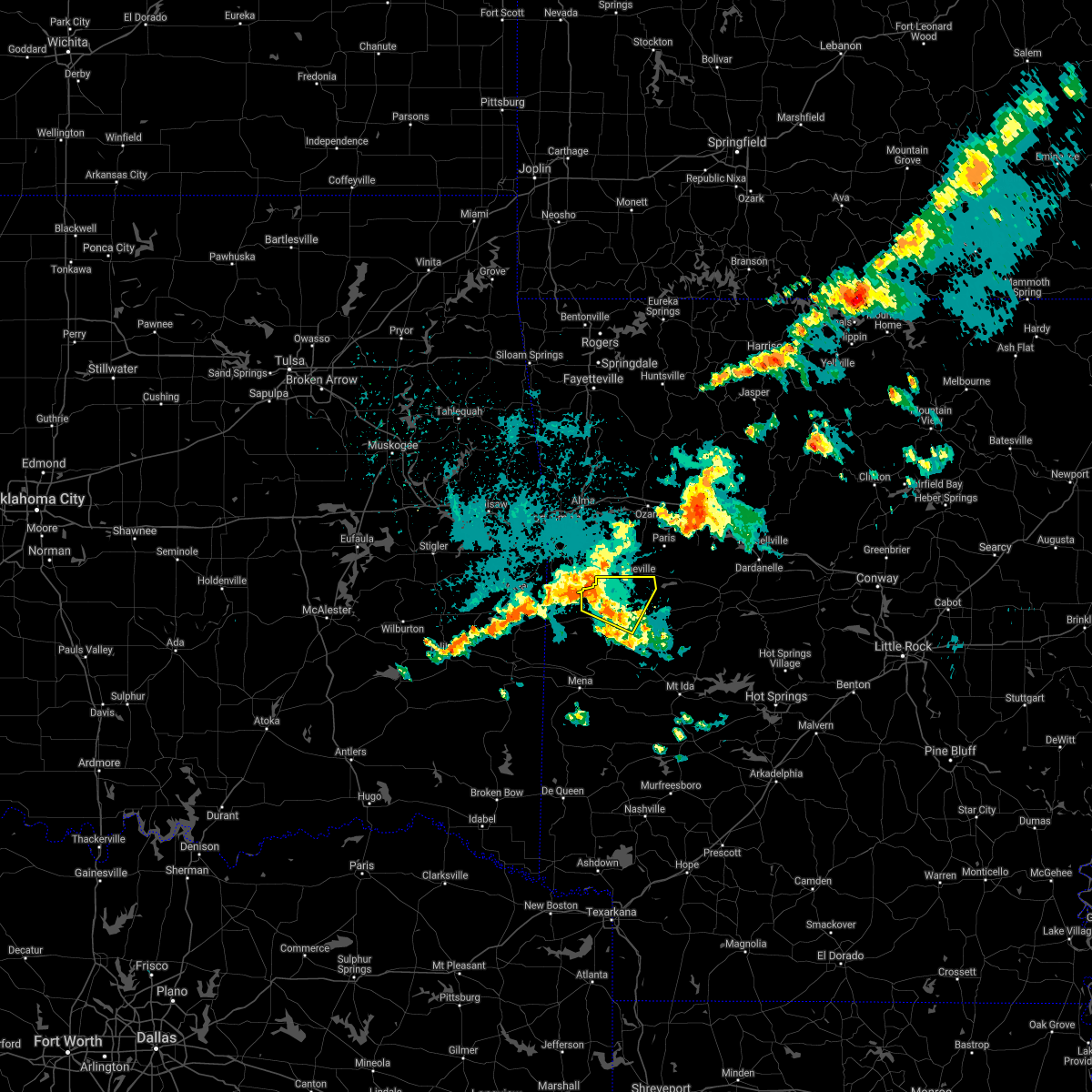 At 914 pm cdt, a severe thunderstorm was located over echo, or 13 miles north of waldron, moving east at 35 mph (radar indicated). Hazards include 60 mph wind gusts and quarter size hail. Hail damage to vehicles is expected. Expect wind damage to roofs, siding, and trees. At 914 pm cdt, a severe thunderstorm was located over echo, or 13 miles north of waldron, moving east at 35 mph (radar indicated). Hazards include 60 mph wind gusts and quarter size hail. Hail damage to vehicles is expected. Expect wind damage to roofs, siding, and trees.
|
| 6/21/2021 10:31 AM CDT |
 At 1030 am cdt, severe thunderstorms were located along a line extending from near ratcliff to hartford, moving east at 30 mph (radar indicated). Hazards include 60 mph wind gusts and nickel size hail. expect damage to roofs, siding, and trees At 1030 am cdt, severe thunderstorms were located along a line extending from near ratcliff to hartford, moving east at 30 mph (radar indicated). Hazards include 60 mph wind gusts and nickel size hail. expect damage to roofs, siding, and trees
|
| 5/27/2021 9:55 PM CDT |
 At 955 pm cdt, severe thunderstorms were located along a line extending from 6 miles southwest of waldron to 9 miles northeast of polk county fairgrounds to near mena to near hatfield, moving southeast at 35 mph (radar indicated). Hazards include 60 mph wind gusts and quarter size hail. Hail damage to vehicles is expected. Expect wind damage to roofs, siding, and trees. At 955 pm cdt, severe thunderstorms were located along a line extending from 6 miles southwest of waldron to 9 miles northeast of polk county fairgrounds to near mena to near hatfield, moving southeast at 35 mph (radar indicated). Hazards include 60 mph wind gusts and quarter size hail. Hail damage to vehicles is expected. Expect wind damage to roofs, siding, and trees.
|
| 5/27/2021 9:41 PM CDT |
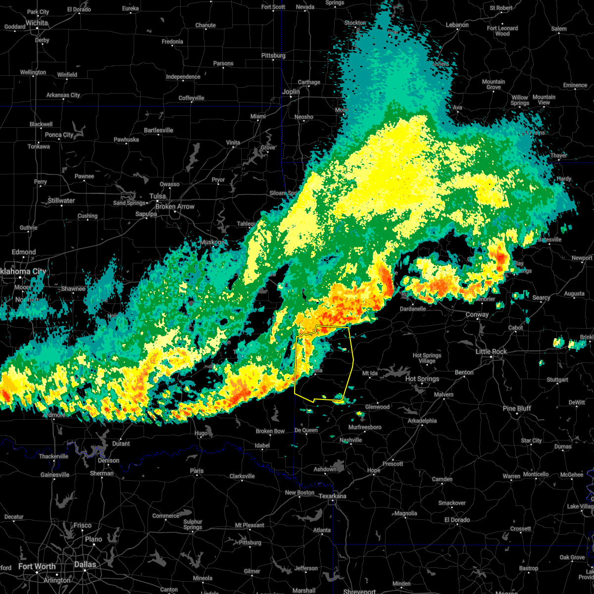 At 941 pm cdt, severe thunderstorms were located along a line extending from near morgan springs to near beauchamp to near mena to near hatfield, moving east at 45 mph (radar indicated). Hazards include 60 mph wind gusts and half dollar size hail. Hail damage to vehicles is expected. expect wind damage to roofs, siding, and trees. Locations impacted include, mena, waldron, hatfield, vandervoort, beauchamp, cardiff, little missouri falls recreatio, mountain fork, bard springs recreation area, opal, cossatot river state park, polk county fairgrounds, mena intermountain airport, mccauley, shady, oliver, hartley, morgan springs, caney creek wilderness, queen wilhelmina state park,. At 941 pm cdt, severe thunderstorms were located along a line extending from near morgan springs to near beauchamp to near mena to near hatfield, moving east at 45 mph (radar indicated). Hazards include 60 mph wind gusts and half dollar size hail. Hail damage to vehicles is expected. expect wind damage to roofs, siding, and trees. Locations impacted include, mena, waldron, hatfield, vandervoort, beauchamp, cardiff, little missouri falls recreatio, mountain fork, bard springs recreation area, opal, cossatot river state park, polk county fairgrounds, mena intermountain airport, mccauley, shady, oliver, hartley, morgan springs, caney creek wilderness, queen wilhelmina state park,.
|
| 5/27/2021 9:27 PM CDT |
 At 927 pm cdt, severe thunderstorms were located along a line extending from 7 miles southwest of hartford to 6 miles southwest of morgan springs to near mountain fork to 7 miles southeast of big cedar, moving east at 45 mph (radar indicated). Hazards include 60 mph wind gusts and half dollar size hail. Hail damage to vehicles is expected. expect wind damage to roofs, siding, and trees. Locations impacted include, mena, waldron, hatfield, vandervoort, beauchamp, cardiff, little missouri falls recreatio, mountain fork, bard springs recreation area, opal, cossatot river state park, polk county fairgrounds, mena intermountain airport, mccauley, shady, oliver, hartley, morgan springs, caney creek wilderness, queen wilhelmina state park,. At 927 pm cdt, severe thunderstorms were located along a line extending from 7 miles southwest of hartford to 6 miles southwest of morgan springs to near mountain fork to 7 miles southeast of big cedar, moving east at 45 mph (radar indicated). Hazards include 60 mph wind gusts and half dollar size hail. Hail damage to vehicles is expected. expect wind damage to roofs, siding, and trees. Locations impacted include, mena, waldron, hatfield, vandervoort, beauchamp, cardiff, little missouri falls recreatio, mountain fork, bard springs recreation area, opal, cossatot river state park, polk county fairgrounds, mena intermountain airport, mccauley, shady, oliver, hartley, morgan springs, caney creek wilderness, queen wilhelmina state park,.
|
| 5/27/2021 9:10 PM CDT |
 At 909 pm cdt, severe thunderstorms were located along a line extending from near poteau to heavener to 8 miles southwest of heavener runestone state park to near muse, moving southeast at 45 mph (radar indicated). Hazards include 60 mph wind gusts and half dollar size hail. Hail damage to vehicles is expected. Expect wind damage to roofs, siding, and trees. At 909 pm cdt, severe thunderstorms were located along a line extending from near poteau to heavener to 8 miles southwest of heavener runestone state park to near muse, moving southeast at 45 mph (radar indicated). Hazards include 60 mph wind gusts and half dollar size hail. Hail damage to vehicles is expected. Expect wind damage to roofs, siding, and trees.
|
| 5/18/2021 5:27 PM CDT |
 At 526 pm cdt, severe thunderstorms were located along a line extending from near cardiff to 10 miles southwest of stonehouse recreation area to near oden to near daisy, moving northeast at 40 mph (radar indicated). Hazards include 60 mph wind gusts and quarter size hail. Hail damage to vehicles is expected. expect wind damage to roofs, siding, and trees. Locations impacted include, waldron, mount ida, norman, oden, daisy, stonehouse recreation area, cardiff, mimosa, little missouri falls recreatio, gravelly, daisy state park, mauldin, albert pike recreation area, muddy creek wma, black springs, olio, bluffton, lodi, langley, pine ridge,. At 526 pm cdt, severe thunderstorms were located along a line extending from near cardiff to 10 miles southwest of stonehouse recreation area to near oden to near daisy, moving northeast at 40 mph (radar indicated). Hazards include 60 mph wind gusts and quarter size hail. Hail damage to vehicles is expected. expect wind damage to roofs, siding, and trees. Locations impacted include, waldron, mount ida, norman, oden, daisy, stonehouse recreation area, cardiff, mimosa, little missouri falls recreatio, gravelly, daisy state park, mauldin, albert pike recreation area, muddy creek wma, black springs, olio, bluffton, lodi, langley, pine ridge,.
|
| 5/18/2021 5:10 PM CDT |
 At 510 pm cdt, severe thunderstorms were located along a line extending from near waldron to 9 miles south of cardiff to near opal to 8 miles west of daisy, moving northeast at 35 mph (radar indicated). Hazards include 60 mph wind gusts and quarter size hail. Hail damage to vehicles is expected. Expect wind damage to roofs, siding, and trees. At 510 pm cdt, severe thunderstorms were located along a line extending from near waldron to 9 miles south of cardiff to near opal to 8 miles west of daisy, moving northeast at 35 mph (radar indicated). Hazards include 60 mph wind gusts and quarter size hail. Hail damage to vehicles is expected. Expect wind damage to roofs, siding, and trees.
|
| 5/10/2021 11:08 AM CDT |
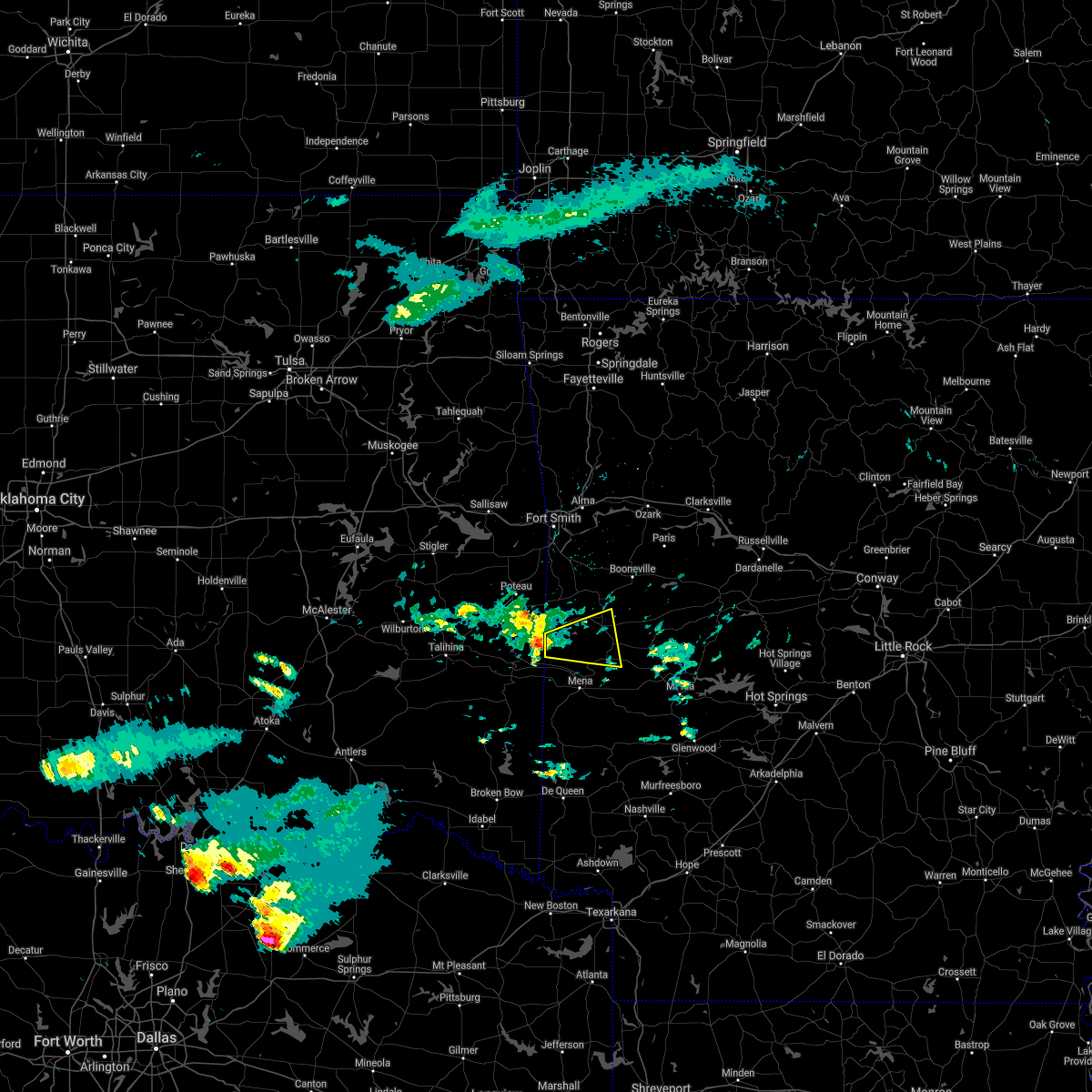 At 1108 am cdt, a severe thunderstorm was located near morgan springs, or 18 miles northwest of mena, moving east at 40 mph (radar indicated). Hazards include 60 mph wind gusts and quarter size hail. Hail damage to vehicles is expected. Expect wind damage to roofs, siding, and trees. At 1108 am cdt, a severe thunderstorm was located near morgan springs, or 18 miles northwest of mena, moving east at 40 mph (radar indicated). Hazards include 60 mph wind gusts and quarter size hail. Hail damage to vehicles is expected. Expect wind damage to roofs, siding, and trees.
|
| 5/3/2021 11:17 PM CDT |
 At 1117 pm cdt, severe thunderstorms were located along a line extending from 7 miles northwest of cardiff to 10 miles north of opal, moving northeast at 50 mph (radar indicated). Hazards include 60 mph wind gusts and quarter size hail. Hail damage to vehicles is expected. expect wind damage to roofs, siding, and trees. Locations impacted include, waldron, y city, boles, needmore,. At 1117 pm cdt, severe thunderstorms were located along a line extending from 7 miles northwest of cardiff to 10 miles north of opal, moving northeast at 50 mph (radar indicated). Hazards include 60 mph wind gusts and quarter size hail. Hail damage to vehicles is expected. expect wind damage to roofs, siding, and trees. Locations impacted include, waldron, y city, boles, needmore,.
|
| 5/3/2021 11:14 PM CDT |
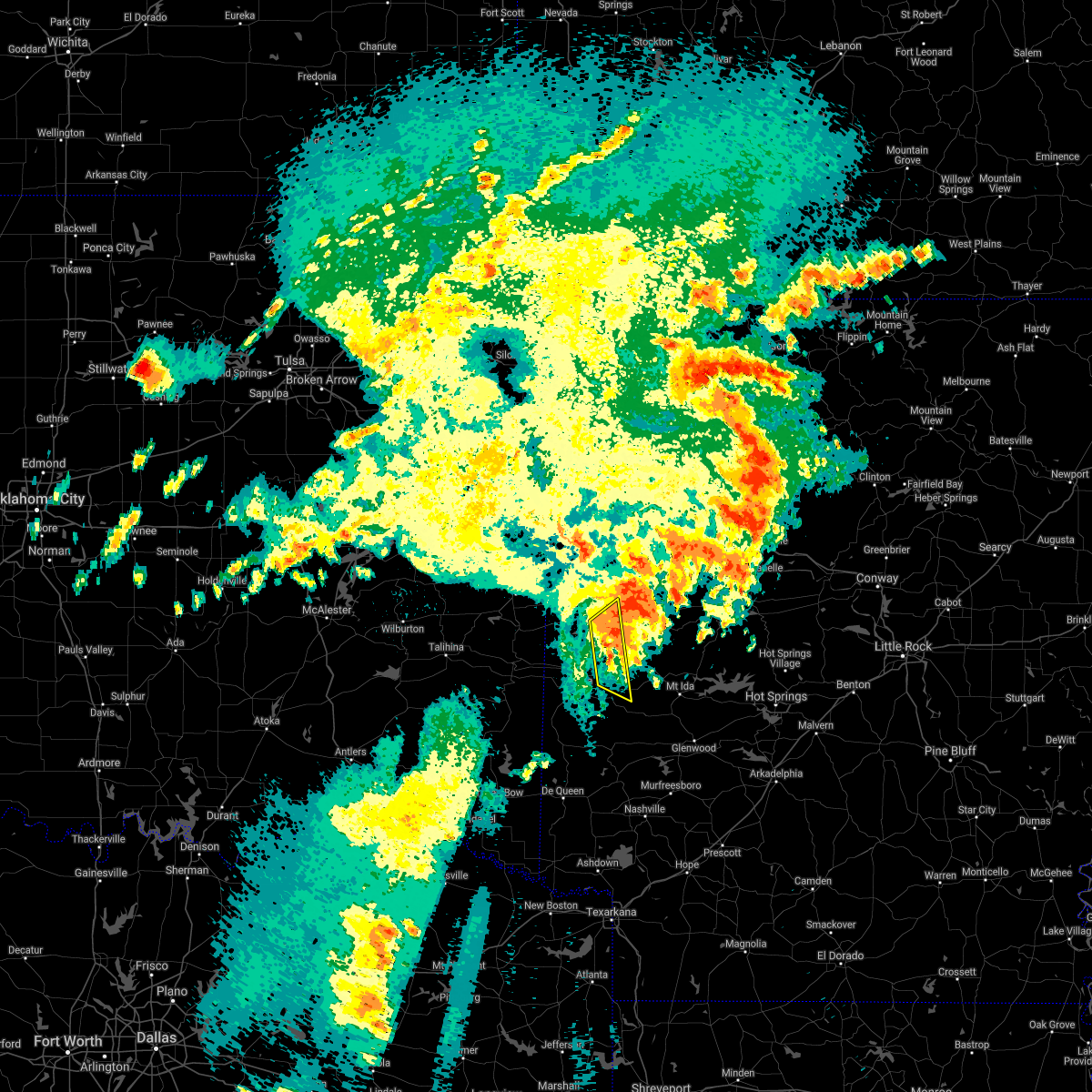 At 1114 pm cdt, severe thunderstorms were located along a line extending from near booneville to 7 miles northeast of mena intermountain airport, moving northeast at 50 mph (radar indicated). Hazards include 60 mph wind gusts and quarter size hail. Hail damage to vehicles is expected. expect wind damage to roofs, siding, and trees. Locations impacted include, waldron, y city, boles, needmore, cherry hill in polk county,. At 1114 pm cdt, severe thunderstorms were located along a line extending from near booneville to 7 miles northeast of mena intermountain airport, moving northeast at 50 mph (radar indicated). Hazards include 60 mph wind gusts and quarter size hail. Hail damage to vehicles is expected. expect wind damage to roofs, siding, and trees. Locations impacted include, waldron, y city, boles, needmore, cherry hill in polk county,.
|
| 5/3/2021 11:02 PM CDT |
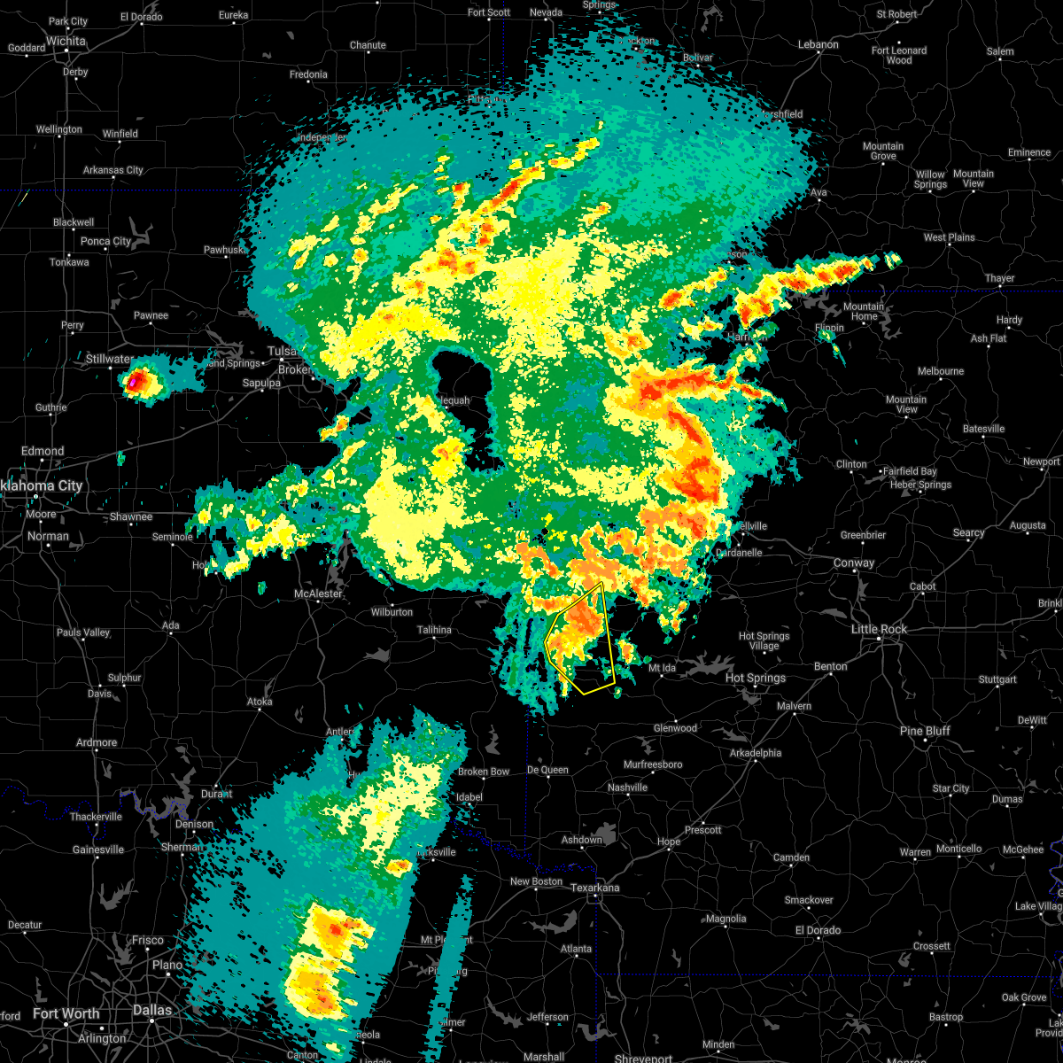 At 1102 pm cdt, severe thunderstorms were located along a line extending from 6 miles north of waldron to mena intermountain airport, moving northeast at 50 mph (radar indicated). Hazards include 60 mph wind gusts and quarter size hail. Hail damage to vehicles is expected. expect wind damage to roofs, siding, and trees. Locations impacted include, mena, waldron, beauchamp, opal, mena intermountain airport, acorn, board camp, winfield, nunley, ink, y city, rich mountain, needmore, cherry hill in polk county, boles, eagleton,. At 1102 pm cdt, severe thunderstorms were located along a line extending from 6 miles north of waldron to mena intermountain airport, moving northeast at 50 mph (radar indicated). Hazards include 60 mph wind gusts and quarter size hail. Hail damage to vehicles is expected. expect wind damage to roofs, siding, and trees. Locations impacted include, mena, waldron, beauchamp, opal, mena intermountain airport, acorn, board camp, winfield, nunley, ink, y city, rich mountain, needmore, cherry hill in polk county, boles, eagleton,.
|
| 5/3/2021 10:39 PM CDT |
 The national weather service in little rock has issued a * severe thunderstorm warning for. northeastern polk county in western arkansas. western scott county in western arkansas. until 1130 pm cdt. At 1038 pm cdt, severe thunderstorms were located along a line. The national weather service in little rock has issued a * severe thunderstorm warning for. northeastern polk county in western arkansas. western scott county in western arkansas. until 1130 pm cdt. At 1038 pm cdt, severe thunderstorms were located along a line.
|
| 5/3/2021 10:37 PM CDT |
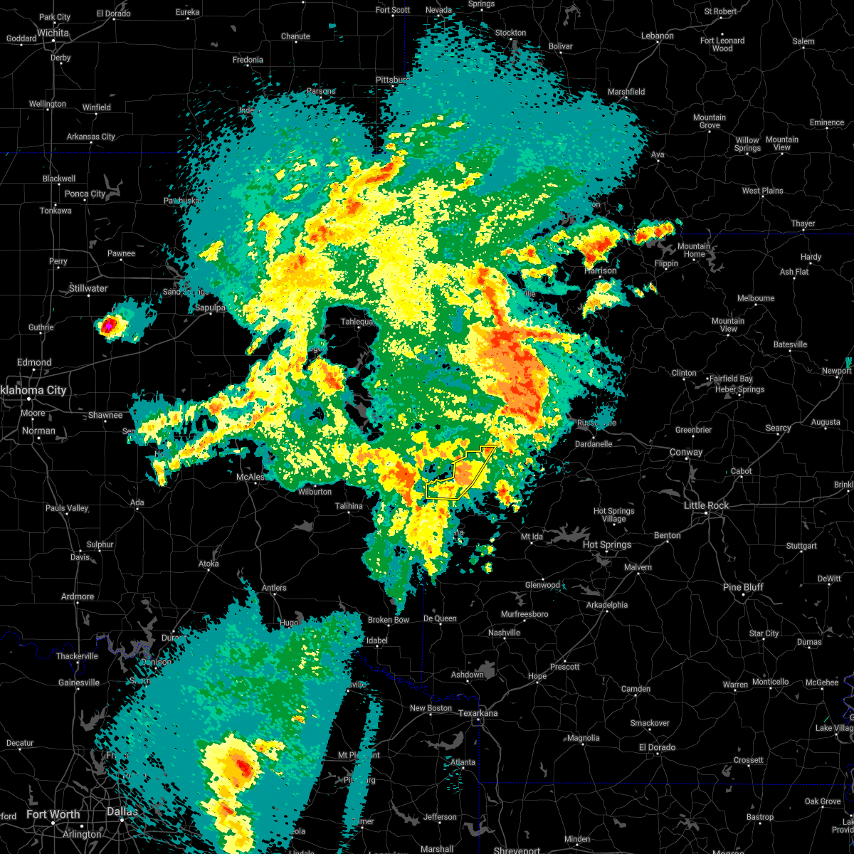 At 1037 pm cdt, severe thunderstorms were located along a line extending from near mansfield to near morgan springs, moving northeast at 35 mph (radar indicated). Hazards include 60 mph wind gusts and quarter size hail. Hail damage to vehicles is expected. expect wind damage to roofs, siding, and trees. Locations impacted include, booneville, waldron, mansfield, echo, oliver, morgan springs, bates, barber, cauthron, winfield, hon, lucas, liberty, carolan, glendale in logan county, ione, elm park,. At 1037 pm cdt, severe thunderstorms were located along a line extending from near mansfield to near morgan springs, moving northeast at 35 mph (radar indicated). Hazards include 60 mph wind gusts and quarter size hail. Hail damage to vehicles is expected. expect wind damage to roofs, siding, and trees. Locations impacted include, booneville, waldron, mansfield, echo, oliver, morgan springs, bates, barber, cauthron, winfield, hon, lucas, liberty, carolan, glendale in logan county, ione, elm park,.
|
| 5/3/2021 10:28 PM CDT |
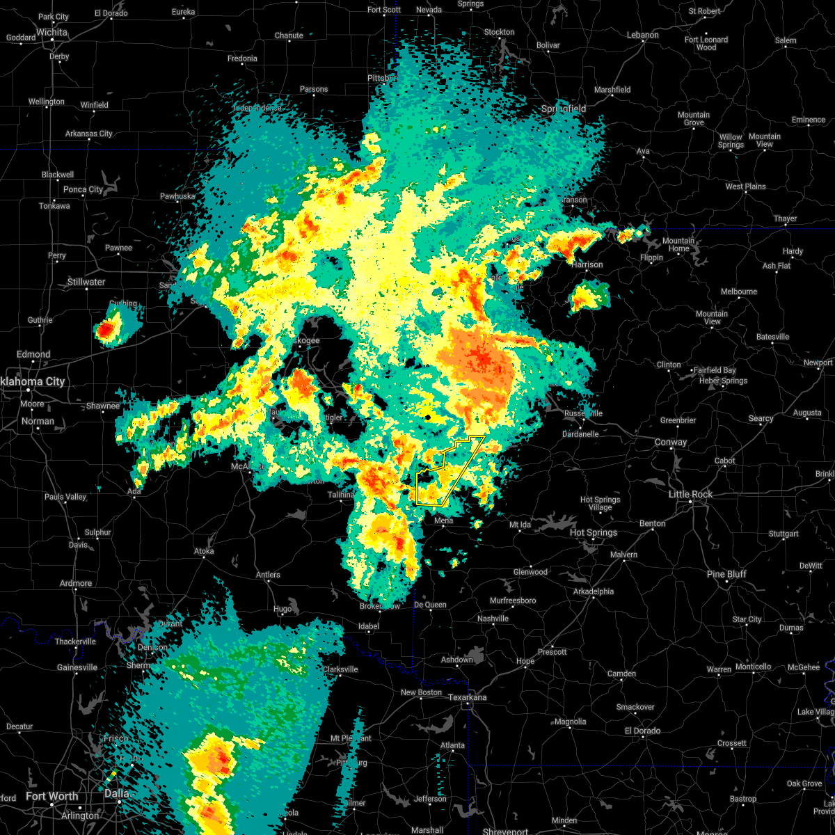 At 1028 pm cdt, severe thunderstorms were located along a line extending from near oliver to 8 miles northwest of queen wilhelmina state park, moving northeast at 35 mph (radar indicated). Hazards include 60 mph wind gusts and quarter size hail. Hail damage to vehicles is expected. Expect wind damage to roofs, siding, and trees. At 1028 pm cdt, severe thunderstorms were located along a line extending from near oliver to 8 miles northwest of queen wilhelmina state park, moving northeast at 35 mph (radar indicated). Hazards include 60 mph wind gusts and quarter size hail. Hail damage to vehicles is expected. Expect wind damage to roofs, siding, and trees.
|
| 4/9/2021 11:43 PM CDT |
 The severe thunderstorm warning for logan, south central johnson, eastern scott and western yell counties will expire at 1145 pm cdt, the storms which prompted the warning have weakened below severe limits, and no longer pose an immediate threat to life or property. therefore, the warning will be allowed to expire. however gusty winds are still possible with these thunderstorms. a severe thunderstorm watch remains in effect until 200 am cdt for western and central arkansas. The severe thunderstorm warning for logan, south central johnson, eastern scott and western yell counties will expire at 1145 pm cdt, the storms which prompted the warning have weakened below severe limits, and no longer pose an immediate threat to life or property. therefore, the warning will be allowed to expire. however gusty winds are still possible with these thunderstorms. a severe thunderstorm watch remains in effect until 200 am cdt for western and central arkansas.
|
| 4/9/2021 11:23 PM CDT |
 At 1122 pm cdt, severe thunderstorms were located along a line extending from 6 miles west of mt nebo state park to near stonehouse recreation area to waldron, moving southeast at 40 mph (radar indicated). Hazards include 60 mph wind gusts. Expect damage to roofs, siding, and trees. Locations impacted include, clarksville, booneville, waldron, paris, danville, lamar, magazine, knoxville, subiaco, scranton, blue mountain, cardiff, hoyt, midway in logan county, muddy creek wma, stonehouse recreation area, gravelly, fourche valley, mount magazine, spadra, this includes interstate 40 between mile markers 55 and 71. At 1122 pm cdt, severe thunderstorms were located along a line extending from 6 miles west of mt nebo state park to near stonehouse recreation area to waldron, moving southeast at 40 mph (radar indicated). Hazards include 60 mph wind gusts. Expect damage to roofs, siding, and trees. Locations impacted include, clarksville, booneville, waldron, paris, danville, lamar, magazine, knoxville, subiaco, scranton, blue mountain, cardiff, hoyt, midway in logan county, muddy creek wma, stonehouse recreation area, gravelly, fourche valley, mount magazine, spadra, this includes interstate 40 between mile markers 55 and 71.
|
| 4/9/2021 10:40 PM CDT |
 At 1040 pm cdt, severe thunderstorms were located along a line extending from near dyer to greenwood to 6 miles northwest of morgan springs, moving east at 50 mph (radar indicated). Hazards include 60 mph wind gusts. expect damage to roofs, siding, and trees At 1040 pm cdt, severe thunderstorms were located along a line extending from near dyer to greenwood to 6 miles northwest of morgan springs, moving east at 50 mph (radar indicated). Hazards include 60 mph wind gusts. expect damage to roofs, siding, and trees
|
| 11/24/2020 10:52 PM CST |
 At 1051 pm cst, a severe thunderstorm capable of producing a tornado was located near cardiff, or 7 miles northeast of waldron, moving east at 55 mph. radar was continuing to indicate an area of rotation, although no confirmed tornaodo reports have been received at this time (radar indicated rotation). Hazards include tornado. Flying debris will be dangerous to those caught without shelter. mobile homes will be damaged or destroyed. damage to roofs, windows, and vehicles will occur. tree damage is likely. Locations impacted include, waldron, cardiff, grayson, olio, union hill,. At 1051 pm cst, a severe thunderstorm capable of producing a tornado was located near cardiff, or 7 miles northeast of waldron, moving east at 55 mph. radar was continuing to indicate an area of rotation, although no confirmed tornaodo reports have been received at this time (radar indicated rotation). Hazards include tornado. Flying debris will be dangerous to those caught without shelter. mobile homes will be damaged or destroyed. damage to roofs, windows, and vehicles will occur. tree damage is likely. Locations impacted include, waldron, cardiff, grayson, olio, union hill,.
|
| 11/24/2020 10:39 PM CST |
 At 1039 pm cst, a severe thunderstorm capable of producing a tornado was located near oliver, or near waldron, moving east at 55 mph (radar indicated rotation). Hazards include tornado. Flying debris will be dangerous to those caught without shelter. mobile homes will be damaged or destroyed. damage to roofs, windows, and vehicles will occur. Tree damage is likely. At 1039 pm cst, a severe thunderstorm capable of producing a tornado was located near oliver, or near waldron, moving east at 55 mph (radar indicated rotation). Hazards include tornado. Flying debris will be dangerous to those caught without shelter. mobile homes will be damaged or destroyed. damage to roofs, windows, and vehicles will occur. Tree damage is likely.
|
| 11/24/2020 10:28 PM CST |
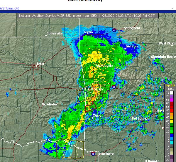 At 1026 pm cst, a severe squall line capable of producing both a tornado and extensive straight line wind damage was located over bates, moving northeast at 50 mph (radar indicated rotation). Hazards include tornado. Flying debris will be dangerous to those caught without shelter. mobile homes will be damaged or destroyed. damage to roofs, windows, and vehicles will occur. tree damage is likely. Locations impacted include, waldron, mansfield, oliver, morgan springs, bates, black fork, cauthron, winfield, hon, liberty,. At 1026 pm cst, a severe squall line capable of producing both a tornado and extensive straight line wind damage was located over bates, moving northeast at 50 mph (radar indicated rotation). Hazards include tornado. Flying debris will be dangerous to those caught without shelter. mobile homes will be damaged or destroyed. damage to roofs, windows, and vehicles will occur. tree damage is likely. Locations impacted include, waldron, mansfield, oliver, morgan springs, bates, black fork, cauthron, winfield, hon, liberty,.
|
| 11/24/2020 10:20 PM CST |
 At 1019 pm cst, severe thunderstorms capable of producing both tornadoes and extensive straight line wind damage were located near heavener runestone state park, or 15 miles southeast of poteau, moving northeast at 50 mph (radar indicated rotation). Hazards include tornado. Flying debris will be dangerous to those caught without shelter. mobile homes will be damaged or destroyed. damage to roofs, windows, and vehicles will occur. Tree damage is likely. At 1019 pm cst, severe thunderstorms capable of producing both tornadoes and extensive straight line wind damage were located near heavener runestone state park, or 15 miles southeast of poteau, moving northeast at 50 mph (radar indicated rotation). Hazards include tornado. Flying debris will be dangerous to those caught without shelter. mobile homes will be damaged or destroyed. damage to roofs, windows, and vehicles will occur. Tree damage is likely.
|
| 11/14/2020 11:39 PM CST |
 The severe thunderstorm warning for southern logan, scott and northwestern yell counties will expire at 1145 pm cst, the storms which prompted the warning have moved out of the area. therefore, the warning will be allowed to expire. however gusty winds are still possible with these thunderstorms. a tornado watch remains in effect until 100 am cst for western and central arkansas. The severe thunderstorm warning for southern logan, scott and northwestern yell counties will expire at 1145 pm cst, the storms which prompted the warning have moved out of the area. therefore, the warning will be allowed to expire. however gusty winds are still possible with these thunderstorms. a tornado watch remains in effect until 100 am cst for western and central arkansas.
|
| 11/14/2020 11:21 PM CST |
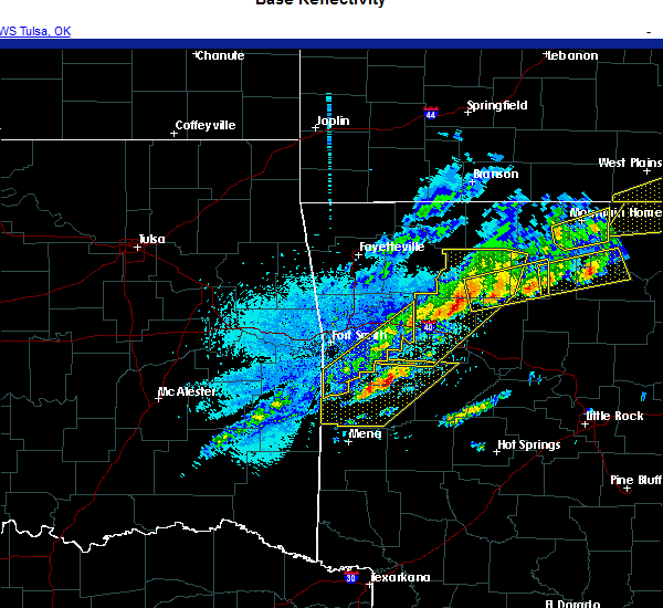 At 1121 pm cst, severe thunderstorms were located along a line extending from mount magazine to 6 miles west of stonehouse recreation area to near cardiff, moving east at 65 mph (radar indicated). Hazards include 60 mph wind gusts and penny size hail. Expect damage to roofs, siding, and trees. Locations impacted include, booneville, waldron, mansfield, magazine, blue mountain, beauchamp, stonehouse recreation area, cardiff, mount magazine, echo, oliver, morgan springs, havana, bates, barber, black fork, winfield, olio, chismville, liberty,. At 1121 pm cst, severe thunderstorms were located along a line extending from mount magazine to 6 miles west of stonehouse recreation area to near cardiff, moving east at 65 mph (radar indicated). Hazards include 60 mph wind gusts and penny size hail. Expect damage to roofs, siding, and trees. Locations impacted include, booneville, waldron, mansfield, magazine, blue mountain, beauchamp, stonehouse recreation area, cardiff, mount magazine, echo, oliver, morgan springs, havana, bates, barber, black fork, winfield, olio, chismville, liberty,.
|
| 11/14/2020 11:02 PM CST |
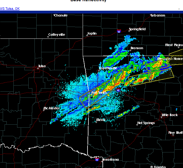 At 1102 pm cst, severe thunderstorms were located along a line extending from near echo to near morgan springs, moving east at 55 mph (radar indicated). Hazards include 60 mph wind gusts. expect damage to roofs, siding, and trees At 1102 pm cst, severe thunderstorms were located along a line extending from near echo to near morgan springs, moving east at 55 mph (radar indicated). Hazards include 60 mph wind gusts. expect damage to roofs, siding, and trees
|
| 8/31/2020 8:51 AM CDT | A tree was down at highway 270 and 71 at y city and on highway 28 west near cauthro in scott county AR, 12 miles N of Waldron, AR |
| 8/31/2020 7:34 AM CDT |
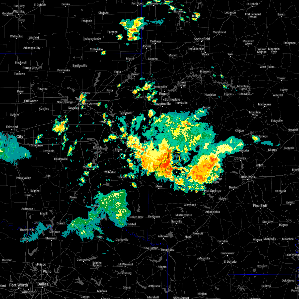 At 734 am cdt, severe thunderstorms were located along a line extending from near branch to 6 miles southwest of booneville to oliver, moving southeast at 35 mph (radar indicated). Hazards include 60 mph wind gusts and nickel size hail. Expect damage to roofs, siding, and trees. Locations impacted include, booneville, waldron, magazine, oliver, barber, winfield, hon, lucas, chismville, sugar grove, carolan, grayson, glendale in logan county, ione, elm park,. At 734 am cdt, severe thunderstorms were located along a line extending from near branch to 6 miles southwest of booneville to oliver, moving southeast at 35 mph (radar indicated). Hazards include 60 mph wind gusts and nickel size hail. Expect damage to roofs, siding, and trees. Locations impacted include, booneville, waldron, magazine, oliver, barber, winfield, hon, lucas, chismville, sugar grove, carolan, grayson, glendale in logan county, ione, elm park,.
|
| 8/31/2020 7:24 AM CDT |
 At 724 am cdt, severe thunderstorms were located along a line extending from near charleston to near echo to near hartford, moving southeast at 45 mph (radar indicated). Hazards include 60 mph wind gusts and nickel size hail. Expect damage to roofs, siding, and trees. Locations impacted include, booneville, waldron, mansfield, magazine, ratcliff, echo, oliver, caulksville, barber, winfield, hon, lucas, chismville, carbon city, sugar grove, driggs, carolan, grayson, glendale in logan county, ione,. At 724 am cdt, severe thunderstorms were located along a line extending from near charleston to near echo to near hartford, moving southeast at 45 mph (radar indicated). Hazards include 60 mph wind gusts and nickel size hail. Expect damage to roofs, siding, and trees. Locations impacted include, booneville, waldron, mansfield, magazine, ratcliff, echo, oliver, caulksville, barber, winfield, hon, lucas, chismville, carbon city, sugar grove, driggs, carolan, grayson, glendale in logan county, ione,.
|
| 8/31/2020 7:07 AM CDT |
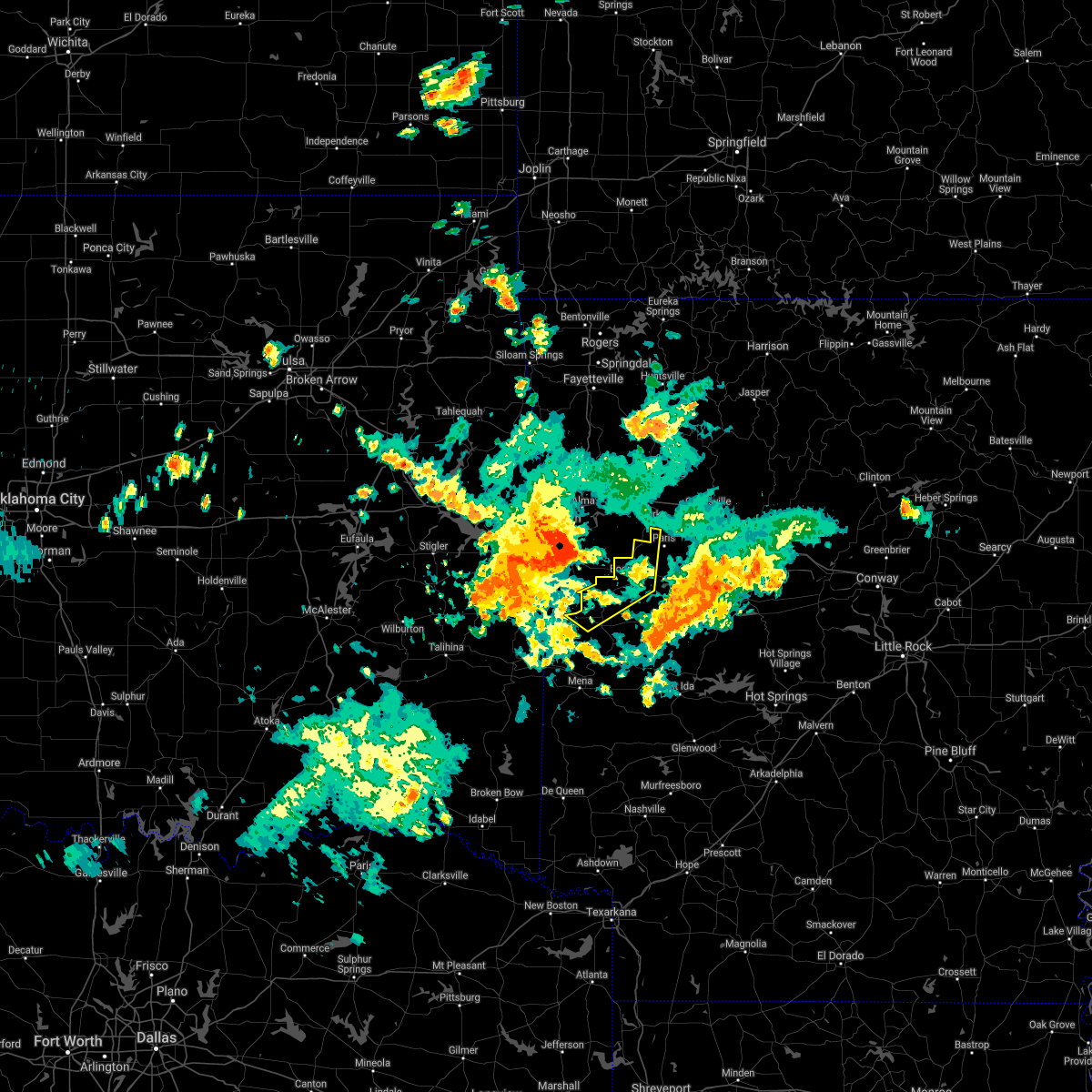 At 707 am cdt, severe thunderstorms were located along a line extending from near van buren to greenwood to near cameron, moving east at 40 mph (radar indicated). Hazards include 60 mph wind gusts and quarter size hail. Hail damage to vehicles is expected. Expect wind damage to roofs, siding, and trees. At 707 am cdt, severe thunderstorms were located along a line extending from near van buren to greenwood to near cameron, moving east at 40 mph (radar indicated). Hazards include 60 mph wind gusts and quarter size hail. Hail damage to vehicles is expected. Expect wind damage to roofs, siding, and trees.
|
| 8/29/2020 8:26 PM CDT |
 At 826 pm cdt, severe thunderstorms were located along a line extending from near waldron to near beauchamp to 6 miles north of queen wilhelmina state park, moving south at 25 mph (radar indicated). Hazards include 70 mph wind gusts and quarter size hail. Hail damage to vehicles is expected. expect considerable tree damage. wind damage is also likely to mobile homes, roofs, and outbuildings. Locations impacted include, mena, waldron, hatfield, beauchamp, mountain fork, polk county fairgrounds, mena intermountain airport, oliver, morgan springs, queen wilhelmina state park, bates, acorn, black fork, board camp, winfield, ink, liberty, potter, boles, dallas,. At 826 pm cdt, severe thunderstorms were located along a line extending from near waldron to near beauchamp to 6 miles north of queen wilhelmina state park, moving south at 25 mph (radar indicated). Hazards include 70 mph wind gusts and quarter size hail. Hail damage to vehicles is expected. expect considerable tree damage. wind damage is also likely to mobile homes, roofs, and outbuildings. Locations impacted include, mena, waldron, hatfield, beauchamp, mountain fork, polk county fairgrounds, mena intermountain airport, oliver, morgan springs, queen wilhelmina state park, bates, acorn, black fork, board camp, winfield, ink, liberty, potter, boles, dallas,.
|
| 8/29/2020 8:21 PM CDT | Scott county sheriff's office reported trees down over hwy 28 blocking the roa in scott county AR, 4.6 miles ESE of Waldron, AR |
| 8/29/2020 8:15 PM CDT |
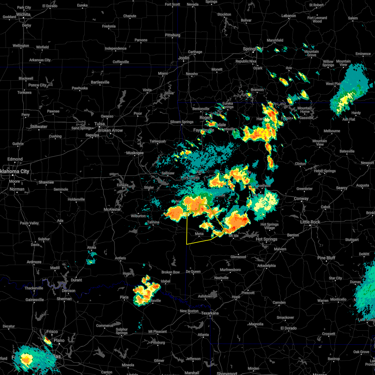 At 814 pm cdt, severe thunderstorms were located along a line extending from near waldron to near oliver to near morgan springs, moving south at 25 mph (radar indicated). Hazards include 60 mph wind gusts and nickel size hail. expect damage to roofs, siding, and trees At 814 pm cdt, severe thunderstorms were located along a line extending from near waldron to near oliver to near morgan springs, moving south at 25 mph (radar indicated). Hazards include 60 mph wind gusts and nickel size hail. expect damage to roofs, siding, and trees
|
| 8/29/2020 7:04 PM CDT |
 At 704 pm cdt, a severe thunderstorm was located near echo, or 8 miles north of waldron, moving east at 15 mph (radar indicated). Hazards include 60 mph wind gusts and quarter size hail. Hail damage to vehicles is expected. expect wind damage to roofs, siding, and trees. Locations impacted include, waldron, mansfield, beauchamp, cardiff, oliver, union hill, cauthron, winfield, olio, hon, lucas, nola, needmore, harvey, boles, carolan, parks, grayson, ione, elm park,. At 704 pm cdt, a severe thunderstorm was located near echo, or 8 miles north of waldron, moving east at 15 mph (radar indicated). Hazards include 60 mph wind gusts and quarter size hail. Hail damage to vehicles is expected. expect wind damage to roofs, siding, and trees. Locations impacted include, waldron, mansfield, beauchamp, cardiff, oliver, union hill, cauthron, winfield, olio, hon, lucas, nola, needmore, harvey, boles, carolan, parks, grayson, ione, elm park,.
|
| 8/29/2020 6:44 PM CDT |
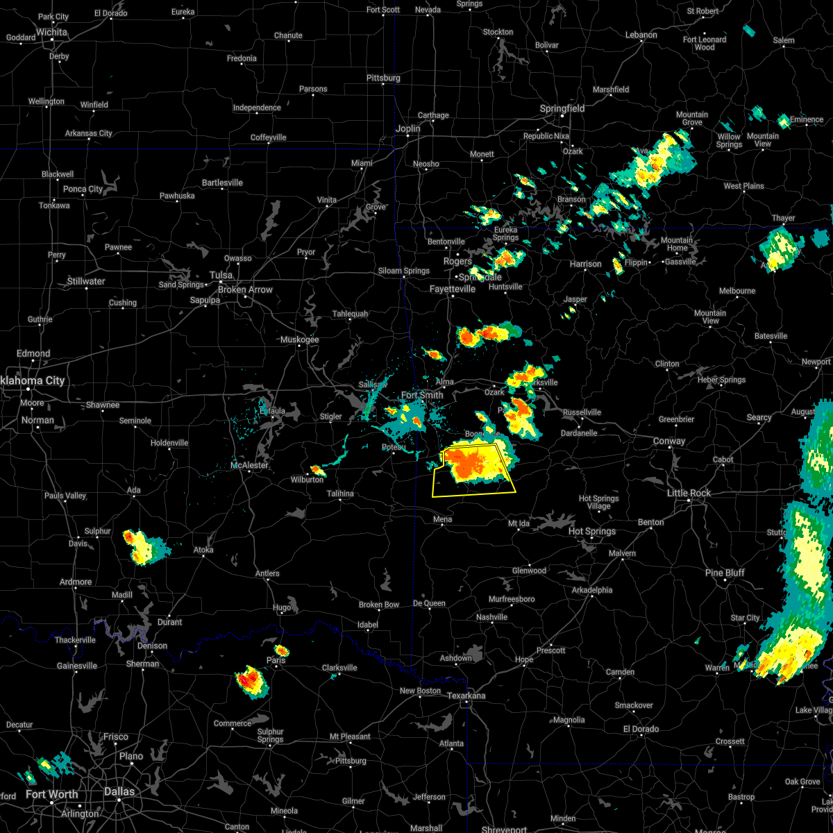 At 644 pm cdt, a severe thunderstorm was located near waldron, moving south at 10 mph (radar indicated). Hazards include 60 mph wind gusts and nickel size hail. Expect damage to roofs, siding, and trees. Locations impacted include, waldron, mansfield, beauchamp, cardiff, oliver, union hill, cauthron, winfield, olio, hon, lucas, nola, needmore, harvey, boles, carolan, parks, grayson, ione, elm park,. At 644 pm cdt, a severe thunderstorm was located near waldron, moving south at 10 mph (radar indicated). Hazards include 60 mph wind gusts and nickel size hail. Expect damage to roofs, siding, and trees. Locations impacted include, waldron, mansfield, beauchamp, cardiff, oliver, union hill, cauthron, winfield, olio, hon, lucas, nola, needmore, harvey, boles, carolan, parks, grayson, ione, elm park,.
|
| 8/29/2020 6:29 PM CDT |
 At 629 pm cdt, a severe thunderstorm was located near waldron, moving southeast at 10 mph (radar indicated). Hazards include 60 mph wind gusts and quarter size hail. Hail damage to vehicles is expected. Expect wind damage to roofs, siding, and trees. At 629 pm cdt, a severe thunderstorm was located near waldron, moving southeast at 10 mph (radar indicated). Hazards include 60 mph wind gusts and quarter size hail. Hail damage to vehicles is expected. Expect wind damage to roofs, siding, and trees.
|
| 8/29/2020 6:16 PM CDT |
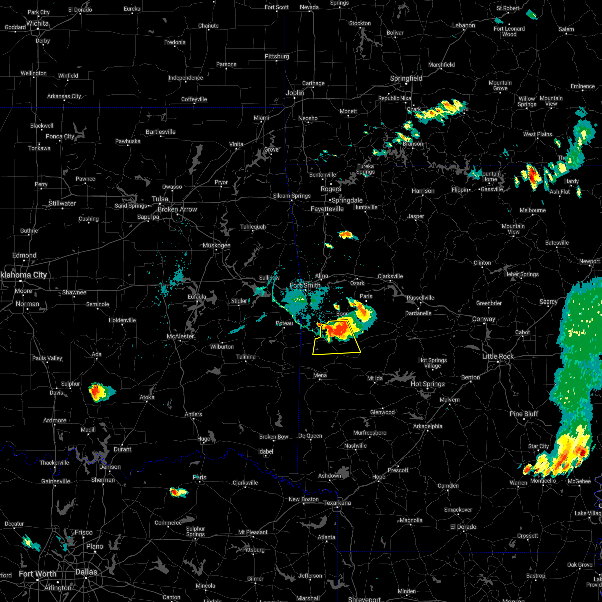 At 616 pm cdt, a severe thunderstorm was located near echo, or 7 miles north of waldron, moving south at 10 mph (radar indicated). Hazards include 60 mph wind gusts and nickel size hail. Expect damage to roofs, siding, and trees. Locations impacted include, waldron, mansfield, cardiff, echo, oliver, winfield, hon, lucas, carolan, ione, elm park, liberty, cauthron, olio,. At 616 pm cdt, a severe thunderstorm was located near echo, or 7 miles north of waldron, moving south at 10 mph (radar indicated). Hazards include 60 mph wind gusts and nickel size hail. Expect damage to roofs, siding, and trees. Locations impacted include, waldron, mansfield, cardiff, echo, oliver, winfield, hon, lucas, carolan, ione, elm park, liberty, cauthron, olio,.
|
| 8/29/2020 6:03 PM CDT |
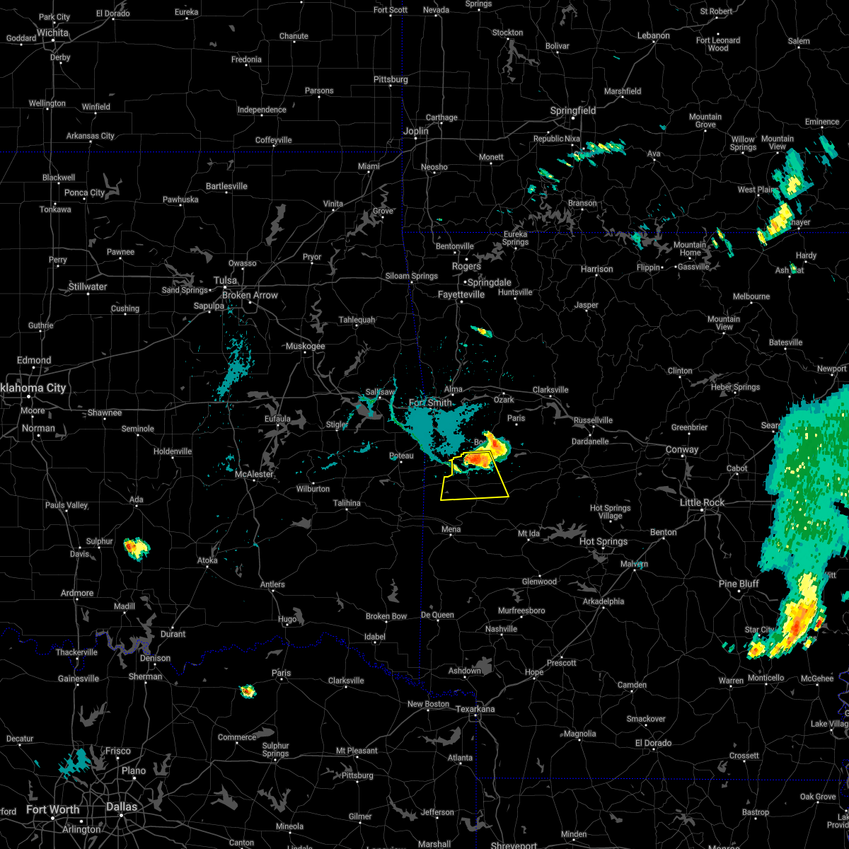 At 602 pm cdt, a severe thunderstorm was located near echo, or 8 miles north of waldron, moving south at 15 mph (radar indicated). Hazards include 60 mph wind gusts and quarter size hail. Hail damage to vehicles is expected. Expect wind damage to roofs, siding, and trees. At 602 pm cdt, a severe thunderstorm was located near echo, or 8 miles north of waldron, moving south at 15 mph (radar indicated). Hazards include 60 mph wind gusts and quarter size hail. Hail damage to vehicles is expected. Expect wind damage to roofs, siding, and trees.
|
| 8/14/2020 4:24 AM CDT |
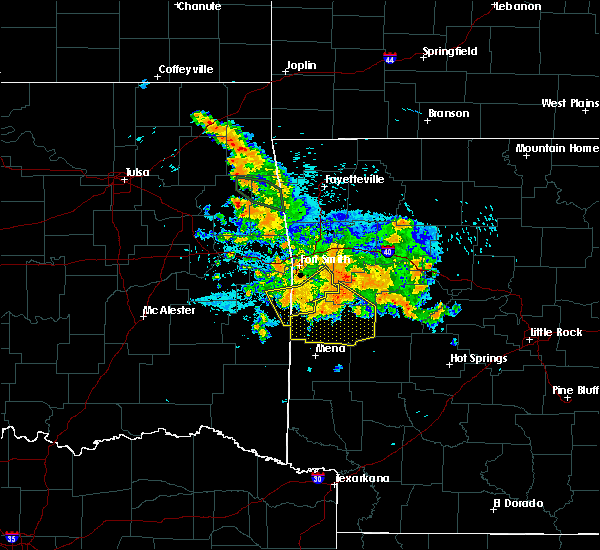 At 424 am cdt, severe thunderstorms were located along a line extending from 6 miles south of booneville to near waldron to near morgan springs, moving southeast at 40 mph (radar indicated). Hazards include 70 mph wind gusts and penny size hail. Expect considerable tree damage. damage is likely to mobile homes, roofs, and outbuildings. Locations impacted include, booneville, waldron, mansfield, beauchamp, cardiff, echo, oliver, morgan springs, bates, barber, black fork, winfield, olio, liberty, boles, grayson, glendale in logan county, ione, elm park, union hill,. At 424 am cdt, severe thunderstorms were located along a line extending from 6 miles south of booneville to near waldron to near morgan springs, moving southeast at 40 mph (radar indicated). Hazards include 70 mph wind gusts and penny size hail. Expect considerable tree damage. damage is likely to mobile homes, roofs, and outbuildings. Locations impacted include, booneville, waldron, mansfield, beauchamp, cardiff, echo, oliver, morgan springs, bates, barber, black fork, winfield, olio, liberty, boles, grayson, glendale in logan county, ione, elm park, union hill,.
|
| 8/14/2020 4:02 AM CDT |
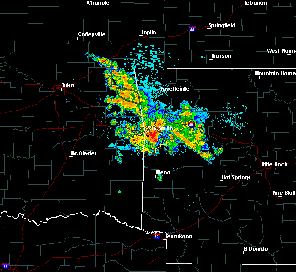 At 402 am cdt, severe thunderstorms were located along a line extending from near burnville to near huntington to near midland to near hartford, moving southeast at 35 mph (radar indicated). Hazards include 60 mph wind gusts and nickel size hail. expect damage to roofs, siding, and trees At 402 am cdt, severe thunderstorms were located along a line extending from near burnville to near huntington to near midland to near hartford, moving southeast at 35 mph (radar indicated). Hazards include 60 mph wind gusts and nickel size hail. expect damage to roofs, siding, and trees
|
| 7/30/2020 9:47 PM CDT |
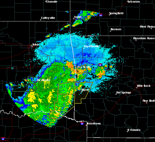 At 946 pm cdt, severe thunderstorms were located along a line extending from near beauchamp to near queen wilhelmina state park to 10 miles southeast of octavia to 10 miles northeast of broken bow, moving east at 35 mph (radar indicated). Hazards include 60 mph wind gusts and penny size hail. Expect damage to roofs, siding, and trees. Locations impacted include, mena, waldron, wickes, grannis, hatfield, vandervoort, beauchamp, cossatot river state park, mountain fork, polk county fairgrounds, mena intermountain airport, mccauley, shady, hartley, morgan springs, queen wilhelmina state park, cove, bates, acorn, black fork,. At 946 pm cdt, severe thunderstorms were located along a line extending from near beauchamp to near queen wilhelmina state park to 10 miles southeast of octavia to 10 miles northeast of broken bow, moving east at 35 mph (radar indicated). Hazards include 60 mph wind gusts and penny size hail. Expect damage to roofs, siding, and trees. Locations impacted include, mena, waldron, wickes, grannis, hatfield, vandervoort, beauchamp, cossatot river state park, mountain fork, polk county fairgrounds, mena intermountain airport, mccauley, shady, hartley, morgan springs, queen wilhelmina state park, cove, bates, acorn, black fork,.
|
| 7/30/2020 9:24 PM CDT |
 At 923 pm cdt, severe thunderstorms were located along a line extending from near morgan springs to near mountain fork to 12 miles southwest of octavia to 12 miles northwest of broken bow, moving east at 35 mph (radar indicated). Hazards include 60 mph wind gusts and penny size hail. expect damage to roofs, siding, and trees At 923 pm cdt, severe thunderstorms were located along a line extending from near morgan springs to near mountain fork to 12 miles southwest of octavia to 12 miles northwest of broken bow, moving east at 35 mph (radar indicated). Hazards include 60 mph wind gusts and penny size hail. expect damage to roofs, siding, and trees
|
| 7/11/2020 11:18 PM CDT |
 At 1117 pm cdt, severe thunderstorms were located along a line extending from near beauchamp to mountain fork to near octavia, moving southeast at 30 mph (radar indicated). Hazards include 60 mph wind gusts. Expect damage to roofs, siding, and trees. Locations impacted include, mena, waldron, hatfield, vandervoort, beauchamp, mountain fork, polk county fairgrounds, mena intermountain airport, mccauley, oliver, morgan springs, queen wilhelmina state park, cove, bates, acorn, black fork, winfield, ink, hatton, potter,. At 1117 pm cdt, severe thunderstorms were located along a line extending from near beauchamp to mountain fork to near octavia, moving southeast at 30 mph (radar indicated). Hazards include 60 mph wind gusts. Expect damage to roofs, siding, and trees. Locations impacted include, mena, waldron, hatfield, vandervoort, beauchamp, mountain fork, polk county fairgrounds, mena intermountain airport, mccauley, oliver, morgan springs, queen wilhelmina state park, cove, bates, acorn, black fork, winfield, ink, hatton, potter,.
|
| 7/11/2020 11:05 PM CDT |
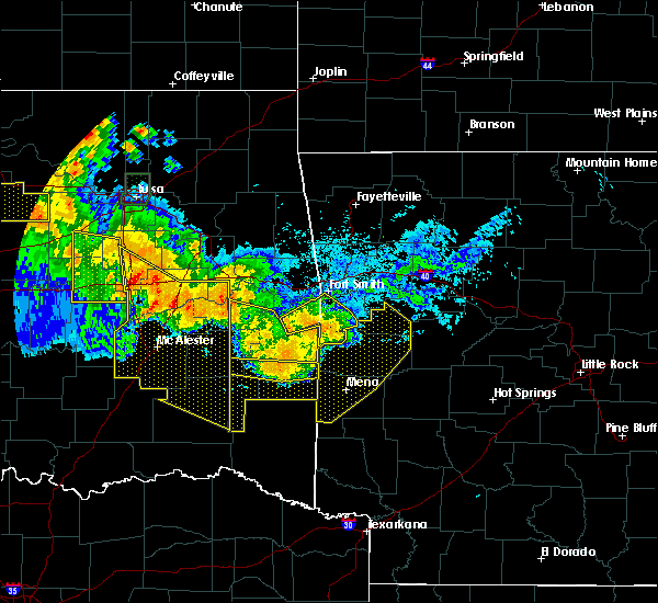 At 1105 pm cdt, severe thunderstorms were located along a line extending from near waldron to queen wilhelmina state park to near big cedar, moving south at 50 mph (radar indicated). Hazards include 60 mph wind gusts and quarter size hail. Hail damage to vehicles is expected. expect wind damage to roofs, siding, and trees. Locations impacted include, mena, booneville, waldron, mansfield, hatfield, vandervoort, beauchamp, cardiff, mountain fork, polk county fairgrounds, mena intermountain airport, mccauley, echo, oliver, morgan springs, queen wilhelmina state park, cove, bates, acorn, barber,. At 1105 pm cdt, severe thunderstorms were located along a line extending from near waldron to queen wilhelmina state park to near big cedar, moving south at 50 mph (radar indicated). Hazards include 60 mph wind gusts and quarter size hail. Hail damage to vehicles is expected. expect wind damage to roofs, siding, and trees. Locations impacted include, mena, booneville, waldron, mansfield, hatfield, vandervoort, beauchamp, cardiff, mountain fork, polk county fairgrounds, mena intermountain airport, mccauley, echo, oliver, morgan springs, queen wilhelmina state park, cove, bates, acorn, barber,.
|
| 7/11/2020 10:39 PM CDT |
 At 1038 pm cdt, severe thunderstorms were located along a line extending from burnville to near hartford to near heavener, moving south at 50 mph (radar indicated). Hazards include 70 mph wind gusts and quarter size hail. Hail damage to vehicles is expected. expect considerable tree damage. Wind damage is also likely to mobile homes, roofs, and outbuildings. At 1038 pm cdt, severe thunderstorms were located along a line extending from burnville to near hartford to near heavener, moving south at 50 mph (radar indicated). Hazards include 70 mph wind gusts and quarter size hail. Hail damage to vehicles is expected. expect considerable tree damage. Wind damage is also likely to mobile homes, roofs, and outbuildings.
|
| 7/9/2020 1:12 PM CDT |
 The severe thunderstorm warning for southwestern logan, northern polk, scott, southwestern yell and northwestern montgomery counties will expire at 115 pm cdt, the storms which prompted the warning have weakened below severe limits, and no longer pose an immediate threat to life or property. therefore, the warning will be allowed to expire. however gusty winds are still possible with these thunderstorms. a severe thunderstorm watch remains in effect until 700 pm cdt for western and central arkansas. to report severe weather, contact your nearest law enforcement agency. they will relay your report to the national weather service little rock. The severe thunderstorm warning for southwestern logan, northern polk, scott, southwestern yell and northwestern montgomery counties will expire at 115 pm cdt, the storms which prompted the warning have weakened below severe limits, and no longer pose an immediate threat to life or property. therefore, the warning will be allowed to expire. however gusty winds are still possible with these thunderstorms. a severe thunderstorm watch remains in effect until 700 pm cdt for western and central arkansas. to report severe weather, contact your nearest law enforcement agency. they will relay your report to the national weather service little rock.
|
| 7/9/2020 12:29 PM CDT |
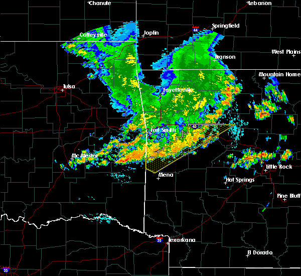 At 1227 pm cdt, severe thunderstorms were located along a line extending from near booneville to near oliver to near howe, moving southeast at 25 mph (radar indicated). Hazards include 60 mph wind gusts and penny size hail. expect damage to roofs, siding, and trees At 1227 pm cdt, severe thunderstorms were located along a line extending from near booneville to near oliver to near howe, moving southeast at 25 mph (radar indicated). Hazards include 60 mph wind gusts and penny size hail. expect damage to roofs, siding, and trees
|
| 7/9/2020 11:51 AM CDT |
 At 1150 am cdt, severe thunderstorms were located along a line extending from near wister to ozark, moving east at 25 mph (radar indicated). Hazards include 60 mph wind gusts and quarter size hail. Hail damage to vehicles may occur. Expect wind damage to roofs, siding, and trees. At 1150 am cdt, severe thunderstorms were located along a line extending from near wister to ozark, moving east at 25 mph (radar indicated). Hazards include 60 mph wind gusts and quarter size hail. Hail damage to vehicles may occur. Expect wind damage to roofs, siding, and trees.
|
| 5/23/2020 12:56 AM CDT |
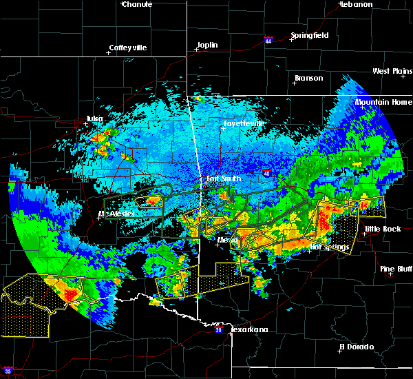 At 1256 am cdt, a severe thunderstorm was located near waldron, moving east at 20 mph (radar indicated). Hazards include 60 mph wind gusts and quarter size hail. Hail damage to vehicles is expected. Expect wind damage to roofs, siding, and trees. At 1256 am cdt, a severe thunderstorm was located near waldron, moving east at 20 mph (radar indicated). Hazards include 60 mph wind gusts and quarter size hail. Hail damage to vehicles is expected. Expect wind damage to roofs, siding, and trees.
|
| 5/23/2020 12:52 AM CDT |
 At 1252 am cdt, a severe thunderstorm was located near oliver, or 7 miles west of waldron, moving northeast at 30 mph (radar indicated). Hazards include 60 mph wind gusts and quarter size hail. Hail damage to vehicles is expected. expect wind damage to roofs, siding, and trees. Locations impacted include, waldron, beauchamp, oliver, morgan springs, cauthron, winfield, hon,. At 1252 am cdt, a severe thunderstorm was located near oliver, or 7 miles west of waldron, moving northeast at 30 mph (radar indicated). Hazards include 60 mph wind gusts and quarter size hail. Hail damage to vehicles is expected. expect wind damage to roofs, siding, and trees. Locations impacted include, waldron, beauchamp, oliver, morgan springs, cauthron, winfield, hon,.
|
| 5/23/2020 12:43 AM CDT |
 At 1242 am cdt, a severe thunderstorm was located over beauchamp, or 11 miles west of waldron, moving northeast at 30 mph (radar indicated). Hazards include ping pong ball size hail and 60 mph wind gusts. People and animals outdoors will be injured. expect hail damage to roofs, siding, windows, and vehicles. expect wind damage to roofs, siding, and trees. Locations impacted include, waldron, beauchamp, oliver, morgan springs, bates, black fork, cauthron, winfield, hon,. At 1242 am cdt, a severe thunderstorm was located over beauchamp, or 11 miles west of waldron, moving northeast at 30 mph (radar indicated). Hazards include ping pong ball size hail and 60 mph wind gusts. People and animals outdoors will be injured. expect hail damage to roofs, siding, windows, and vehicles. expect wind damage to roofs, siding, and trees. Locations impacted include, waldron, beauchamp, oliver, morgan springs, bates, black fork, cauthron, winfield, hon,.
|
| 5/23/2020 12:37 AM CDT |
 The severe thunderstorm warning for northwestern scott county will expire at 1245 am cdt, the severe thunderstorm which prompted the warning has weakened, therefore, the warning will be allowed to expire. another severe thunderstorm is currently moving through western scott county and may affect northern portions of the county in the next hour. large hail and damaging winds will be possible. The severe thunderstorm warning for northwestern scott county will expire at 1245 am cdt, the severe thunderstorm which prompted the warning has weakened, therefore, the warning will be allowed to expire. another severe thunderstorm is currently moving through western scott county and may affect northern portions of the county in the next hour. large hail and damaging winds will be possible.
|
| 5/23/2020 12:21 AM CDT |
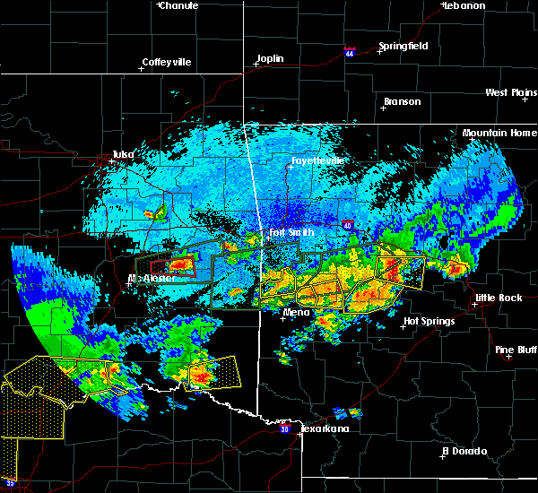 At 1221 am cdt, a severe thunderstorm was located near queen wilhelmina state park, or 15 miles northwest of mena, moving northeast at 30 mph (radar indicated). Hazards include 60 mph wind gusts and quarter size hail. Hail damage to vehicles is expected. Expect wind damage to roofs, siding, and trees. At 1221 am cdt, a severe thunderstorm was located near queen wilhelmina state park, or 15 miles northwest of mena, moving northeast at 30 mph (radar indicated). Hazards include 60 mph wind gusts and quarter size hail. Hail damage to vehicles is expected. Expect wind damage to roofs, siding, and trees.
|
| 5/23/2020 12:18 AM CDT |
 At 1218 am cdt, a severe thunderstorm was located over oliver, or 7 miles northwest of waldron, moving east at 30 mph (radar indicated). Hazards include 60 mph wind gusts and quarter size hail. Hail damage to vehicles is expected. expect wind damage to roofs, siding, and trees. Locations impacted include, waldron, oliver, cauthron, liberty, winfield, hon,. At 1218 am cdt, a severe thunderstorm was located over oliver, or 7 miles northwest of waldron, moving east at 30 mph (radar indicated). Hazards include 60 mph wind gusts and quarter size hail. Hail damage to vehicles is expected. expect wind damage to roofs, siding, and trees. Locations impacted include, waldron, oliver, cauthron, liberty, winfield, hon,.
|
| 5/22/2020 11:58 PM CDT |
 At 1158 pm cdt, a severe thunderstorm was located over morgan springs, or 15 miles west of waldron, moving east at 30 mph (radar indicated). Hazards include 60 mph wind gusts and quarter size hail. Hail damage to vehicles is expected. Expect wind damage to roofs, siding, and trees. At 1158 pm cdt, a severe thunderstorm was located over morgan springs, or 15 miles west of waldron, moving east at 30 mph (radar indicated). Hazards include 60 mph wind gusts and quarter size hail. Hail damage to vehicles is expected. Expect wind damage to roofs, siding, and trees.
|
| 5/22/2020 11:51 PM CDT |
 At 1151 pm cdt, a severe thunderstorm was located near beauchamp, or 7 miles southwest of waldron, moving east at 35 mph (radar indicated). Hazards include 60 mph wind gusts and quarter size hail. Hail damage to vehicles is expected. expect wind damage to roofs, siding, and trees. Locations impacted include, waldron, y city, boles, parks, needmore,. At 1151 pm cdt, a severe thunderstorm was located near beauchamp, or 7 miles southwest of waldron, moving east at 35 mph (radar indicated). Hazards include 60 mph wind gusts and quarter size hail. Hail damage to vehicles is expected. expect wind damage to roofs, siding, and trees. Locations impacted include, waldron, y city, boles, parks, needmore,.
|
| 5/22/2020 11:41 PM CDT |
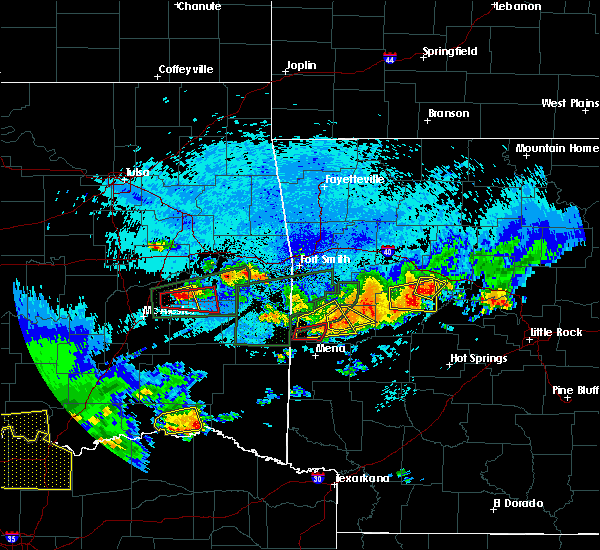 At 1140 pm cdt, a severe thunderstorm was located 7 miles west of beauchamp, or 17 miles northwest of mena, moving east at 25 mph (radar indicated). Hazards include 60 mph wind gusts and half dollar size hail. Hail damage to vehicles is expected. Expect wind damage to roofs, siding, and trees. At 1140 pm cdt, a severe thunderstorm was located 7 miles west of beauchamp, or 17 miles northwest of mena, moving east at 25 mph (radar indicated). Hazards include 60 mph wind gusts and half dollar size hail. Hail damage to vehicles is expected. Expect wind damage to roofs, siding, and trees.
|
| 5/22/2020 11:38 PM CDT |
 At 1138 pm cdt, a severe thunderstorm was located near cardiff, or near waldron, moving northeast at 20 mph (radar indicated). Hazards include 60 mph wind gusts and quarter size hail. Hail damage to vehicles is expected. expect wind damage to roofs, siding, and trees. Locations impacted include, waldron, cardiff, nola, olio, needmore,. At 1138 pm cdt, a severe thunderstorm was located near cardiff, or near waldron, moving northeast at 20 mph (radar indicated). Hazards include 60 mph wind gusts and quarter size hail. Hail damage to vehicles is expected. expect wind damage to roofs, siding, and trees. Locations impacted include, waldron, cardiff, nola, olio, needmore,.
|
| 5/22/2020 11:29 PM CDT |
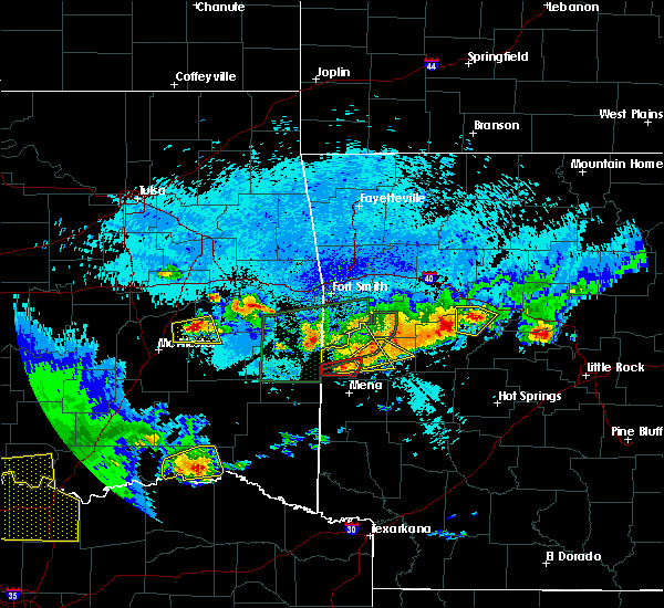 At 1129 pm cdt, a severe thunderstorm was located near waldron, moving east at 40 mph (radar indicated). Hazards include ping pong ball size hail and 60 mph wind gusts. People and animals outdoors will be injured. expect hail damage to roofs, siding, windows, and vehicles. expect wind damage to roofs, siding, and trees. Locations impacted include, waldron, beauchamp, oliver, morgan springs, bates, cauthron, needmore, winfield, hon, boles, parks, elm park,. At 1129 pm cdt, a severe thunderstorm was located near waldron, moving east at 40 mph (radar indicated). Hazards include ping pong ball size hail and 60 mph wind gusts. People and animals outdoors will be injured. expect hail damage to roofs, siding, windows, and vehicles. expect wind damage to roofs, siding, and trees. Locations impacted include, waldron, beauchamp, oliver, morgan springs, bates, cauthron, needmore, winfield, hon, boles, parks, elm park,.
|
| 5/22/2020 11:20 PM CDT |
 At 1119 pm cdt, a severe thunderstorm was located over waldron, moving northeast at 25 mph (radar indicated). Hazards include 60 mph wind gusts and quarter size hail. Hail damage to vehicles is expected. Expect wind damage to roofs, siding, and trees. At 1119 pm cdt, a severe thunderstorm was located over waldron, moving northeast at 25 mph (radar indicated). Hazards include 60 mph wind gusts and quarter size hail. Hail damage to vehicles is expected. Expect wind damage to roofs, siding, and trees.
|
| 5/22/2020 11:14 PM CDT |
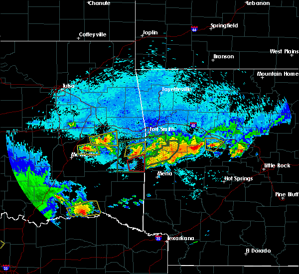 At 1114 pm cdt, a severe thunderstorm was located near morgan springs, or 13 miles west of waldron, moving east at 40 mph (radar indicated). Hazards include ping pong ball size hail and 60 mph wind gusts. People and animals outdoors will be injured. expect hail damage to roofs, siding, windows, and vehicles. expect wind damage to roofs, siding, and trees. Locations impacted include, waldron, mansfield, beauchamp, echo, oliver, morgan springs, bates, black fork, cauthron, winfield, hon, lucas, liberty, needmore, boles, parks, elm park,. At 1114 pm cdt, a severe thunderstorm was located near morgan springs, or 13 miles west of waldron, moving east at 40 mph (radar indicated). Hazards include ping pong ball size hail and 60 mph wind gusts. People and animals outdoors will be injured. expect hail damage to roofs, siding, windows, and vehicles. expect wind damage to roofs, siding, and trees. Locations impacted include, waldron, mansfield, beauchamp, echo, oliver, morgan springs, bates, black fork, cauthron, winfield, hon, lucas, liberty, needmore, boles, parks, elm park,.
|
| 5/22/2020 10:57 PM CDT |
 At 1057 pm cdt, a severe thunderstorm was located 7 miles southeast of heavener runestone state park, or 17 miles south of poteau, moving east at 40 mph (radar indicated). Hazards include 60 mph wind gusts and quarter size hail. Hail damage to vehicles is expected. Expect wind damage to roofs, siding, and trees. At 1057 pm cdt, a severe thunderstorm was located 7 miles southeast of heavener runestone state park, or 17 miles south of poteau, moving east at 40 mph (radar indicated). Hazards include 60 mph wind gusts and quarter size hail. Hail damage to vehicles is expected. Expect wind damage to roofs, siding, and trees.
|
| 5/22/2020 10:07 PM CDT |
 At 1006 pm cdt, a severe thunderstorm was located near echo, or 10 miles southwest of booneville, moving east at 25 mph (radar indicated). Hazards include 60 mph wind gusts and quarter size hail. Hail damage to vehicles is expected. expect wind damage to roofs, siding, and trees. Locations impacted include, booneville, waldron, mansfield, magazine, ratcliff, echo, caulksville, barber, hon, lucas, chismville, liberty, carolan, grayson, glendale in logan county, ione, elm park,. At 1006 pm cdt, a severe thunderstorm was located near echo, or 10 miles southwest of booneville, moving east at 25 mph (radar indicated). Hazards include 60 mph wind gusts and quarter size hail. Hail damage to vehicles is expected. expect wind damage to roofs, siding, and trees. Locations impacted include, booneville, waldron, mansfield, magazine, ratcliff, echo, caulksville, barber, hon, lucas, chismville, liberty, carolan, grayson, glendale in logan county, ione, elm park,.
|
| 5/22/2020 9:56 PM CDT |
 At 955 pm cdt, a few severe thunderstorms were located near echo, or 9 miles north of waldron, and the other storm was 3 miles east of burnsville, both moving east at 20 mph (radar indicated). Hazards include ping pong ball size hail and 60 mph wind gusts. People and animals outdoors will be injured. expect hail damage to roofs, siding, windows, and vehicles. expect wind damage to roofs, siding, and trees. Locations impacted include, booneville, waldron, mansfield, magazine, ratcliff, echo, caulksville, barber, hon, lucas, chismville, liberty, carolan, grayson, glendale in logan county, ione, elm park,. At 955 pm cdt, a few severe thunderstorms were located near echo, or 9 miles north of waldron, and the other storm was 3 miles east of burnsville, both moving east at 20 mph (radar indicated). Hazards include ping pong ball size hail and 60 mph wind gusts. People and animals outdoors will be injured. expect hail damage to roofs, siding, windows, and vehicles. expect wind damage to roofs, siding, and trees. Locations impacted include, booneville, waldron, mansfield, magazine, ratcliff, echo, caulksville, barber, hon, lucas, chismville, liberty, carolan, grayson, glendale in logan county, ione, elm park,.
|
| 5/22/2020 9:39 PM CDT |
 At 938 pm cdt, two severe thunderstorms were located over mansfield, or 12 miles northwest of waldron, moving northeast at 20 mph, and 2 miles east of witcherville, also moving northeast at 20 mph (radar indicated). Hazards include ping pong ball size hail and 60 mph wind gusts. People and animals outdoors will be injured. expect hail damage to roofs, siding, windows, and vehicles. expect wind damage to roofs, siding, and trees. Locations impacted include, booneville, waldron, mansfield, magazine, ratcliff, cardiff, echo, oliver, caulksville, barber, cauthron, hon, lucas, chismville, liberty, carolan, grayson, glendale in logan county, ione, elm park,. At 938 pm cdt, two severe thunderstorms were located over mansfield, or 12 miles northwest of waldron, moving northeast at 20 mph, and 2 miles east of witcherville, also moving northeast at 20 mph (radar indicated). Hazards include ping pong ball size hail and 60 mph wind gusts. People and animals outdoors will be injured. expect hail damage to roofs, siding, windows, and vehicles. expect wind damage to roofs, siding, and trees. Locations impacted include, booneville, waldron, mansfield, magazine, ratcliff, cardiff, echo, oliver, caulksville, barber, cauthron, hon, lucas, chismville, liberty, carolan, grayson, glendale in logan county, ione, elm park,.
|
| 5/22/2020 9:25 PM CDT |
 At 924 pm cdt, two severe thunderstorms were located near mansfield, or 13 miles northwest of waldron, moving east at 25 mph, and 1 mile east of witcherville moving east at 25 mph (radar indicated). Hazards include ping pong ball size hail and 60 mph wind gusts. People and animals outdoors will be injured. expect hail damage to roofs, siding, windows, and vehicles. Expect wind damage to roofs, siding, and trees. At 924 pm cdt, two severe thunderstorms were located near mansfield, or 13 miles northwest of waldron, moving east at 25 mph, and 1 mile east of witcherville moving east at 25 mph (radar indicated). Hazards include ping pong ball size hail and 60 mph wind gusts. People and animals outdoors will be injured. expect hail damage to roofs, siding, windows, and vehicles. Expect wind damage to roofs, siding, and trees.
|
| 5/22/2020 7:36 PM CDT |
 At 736 pm cdt, severe thunderstorms were located along a line extending from near echo to near waldron, moving east at 20 mph (radar indicated). Hazards include two inch hail and 60 mph wind gusts. People and animals outdoors will be injured. expect hail damage to roofs, siding, windows, and vehicles. Expect wind damage to roofs, siding, and trees. At 736 pm cdt, severe thunderstorms were located along a line extending from near echo to near waldron, moving east at 20 mph (radar indicated). Hazards include two inch hail and 60 mph wind gusts. People and animals outdoors will be injured. expect hail damage to roofs, siding, windows, and vehicles. Expect wind damage to roofs, siding, and trees.
|
| 5/22/2020 7:29 PM CDT |
 At 729 pm cdt, severe thunderstorms were located along a line extending from echo to near waldron, moving east at 30 mph (radar indicated). Hazards include golf ball size hail and 60 mph wind gusts. People and animals outdoors will be injured. expect hail damage to roofs, siding, windows, and vehicles. expect wind damage to roofs, siding, and trees. Locations impacted include, booneville, waldron, mansfield, cardiff, echo, oliver, barber, winfield, hon, lucas, chismville, carolan, grayson, glendale in logan county, ione, elm park, liberty,. At 729 pm cdt, severe thunderstorms were located along a line extending from echo to near waldron, moving east at 30 mph (radar indicated). Hazards include golf ball size hail and 60 mph wind gusts. People and animals outdoors will be injured. expect hail damage to roofs, siding, windows, and vehicles. expect wind damage to roofs, siding, and trees. Locations impacted include, booneville, waldron, mansfield, cardiff, echo, oliver, barber, winfield, hon, lucas, chismville, carolan, grayson, glendale in logan county, ione, elm park, liberty,.
|
| 5/22/2020 7:16 PM CDT |
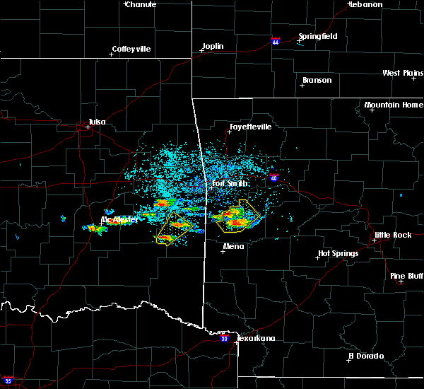 At 715 pm cdt, severe thunderstorms were located along a line extending from mansfield to near waldron, moving northeast at 20 mph (radar indicated). Hazards include 60 mph wind gusts and quarter size hail. Hail damage to vehicles is expected. expect wind damage to roofs, siding, and trees. Locations impacted include, booneville, waldron, mansfield, cardiff, echo, oliver, barber, winfield, hon, lucas, chismville, carolan, grayson, glendale in logan county, ione, elm park, liberty,. At 715 pm cdt, severe thunderstorms were located along a line extending from mansfield to near waldron, moving northeast at 20 mph (radar indicated). Hazards include 60 mph wind gusts and quarter size hail. Hail damage to vehicles is expected. expect wind damage to roofs, siding, and trees. Locations impacted include, booneville, waldron, mansfield, cardiff, echo, oliver, barber, winfield, hon, lucas, chismville, carolan, grayson, glendale in logan county, ione, elm park, liberty,.
|
| 5/22/2020 7:02 PM CDT |
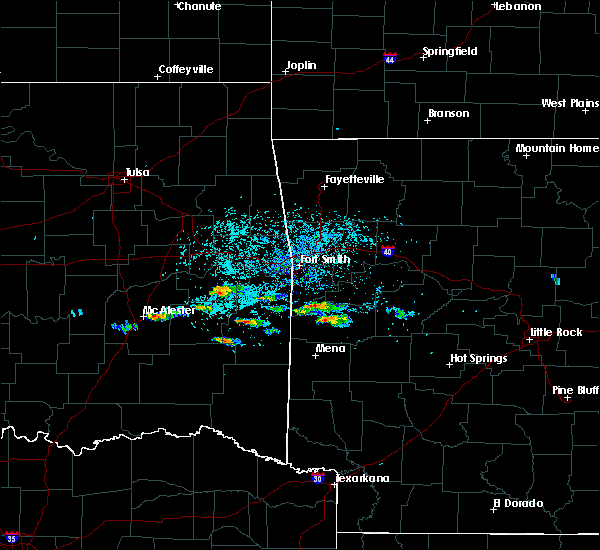 At 702 pm cdt, severe thunderstorms were located along a line extending from near mansfield to near waldron, moving northeast at 20 mph (radar indicated). Hazards include 60 mph wind gusts and quarter size hail. Hail damage to vehicles is expected. Expect wind damage to roofs, siding, and trees. At 702 pm cdt, severe thunderstorms were located along a line extending from near mansfield to near waldron, moving northeast at 20 mph (radar indicated). Hazards include 60 mph wind gusts and quarter size hail. Hail damage to vehicles is expected. Expect wind damage to roofs, siding, and trees.
|
| 5/15/2020 4:01 PM CDT |
 At 400 pm cdt, a severe thunderstorm was located near waldron, moving east at 15 mph (radar indicated). Hazards include 60 mph wind gusts and quarter size hail. Hail damage to vehicles is expected. expect wind damage to roofs, siding, and trees. Locations impacted include, waldron, mansfield, cardiff, echo, barber, winfield, hon, lucas, needmore, boles, carolan, parks, glendale in logan county, ione, elm park, liberty,. At 400 pm cdt, a severe thunderstorm was located near waldron, moving east at 15 mph (radar indicated). Hazards include 60 mph wind gusts and quarter size hail. Hail damage to vehicles is expected. expect wind damage to roofs, siding, and trees. Locations impacted include, waldron, mansfield, cardiff, echo, barber, winfield, hon, lucas, needmore, boles, carolan, parks, glendale in logan county, ione, elm park, liberty,.
|
| 5/15/2020 3:45 PM CDT |
 At 344 pm cdt, a severe thunderstorm was located near oliver, or 7 miles northwest of waldron, moving east at 15 mph (radar indicated). Hazards include 60 mph wind gusts and quarter size hail. Hail damage to vehicles is expected. Expect wind damage to roofs, siding, and trees. At 344 pm cdt, a severe thunderstorm was located near oliver, or 7 miles northwest of waldron, moving east at 15 mph (radar indicated). Hazards include 60 mph wind gusts and quarter size hail. Hail damage to vehicles is expected. Expect wind damage to roofs, siding, and trees.
|
| 5/15/2020 3:31 PM CDT |
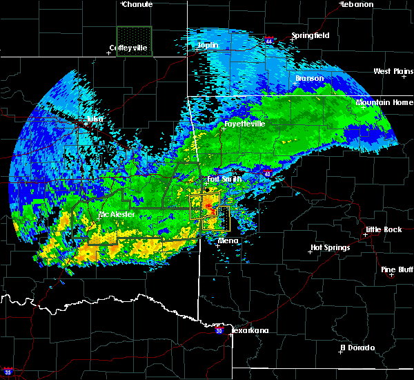 At 330 pm cdt, a severe thunderstorm was located over oliver, or 7 miles west of waldron, moving east at 25 mph (radar indicated). Hazards include golf ball size hail and 70 mph wind gusts. People and animals outdoors will be injured. expect hail damage to roofs, siding, windows, and vehicles. expect considerable tree damage. wind damage is also likely to mobile homes, roofs, and outbuildings. Locations impacted include, waldron, mansfield, beauchamp, oliver, morgan springs, bates, cauthron, winfield, hon, lucas, liberty, elm park,. At 330 pm cdt, a severe thunderstorm was located over oliver, or 7 miles west of waldron, moving east at 25 mph (radar indicated). Hazards include golf ball size hail and 70 mph wind gusts. People and animals outdoors will be injured. expect hail damage to roofs, siding, windows, and vehicles. expect considerable tree damage. wind damage is also likely to mobile homes, roofs, and outbuildings. Locations impacted include, waldron, mansfield, beauchamp, oliver, morgan springs, bates, cauthron, winfield, hon, lucas, liberty, elm park,.
|
| 5/15/2020 3:16 PM CDT |
 At 316 pm cdt, a severe thunderstorm was located over morgan springs, or 13 miles west of waldron, moving east at 25 mph (radar indicated). Hazards include 70 mph wind gusts and half dollar size hail. Hail damage to vehicles is expected. expect considerable tree damage. Wind damage is also likely to mobile homes, roofs, and outbuildings. At 316 pm cdt, a severe thunderstorm was located over morgan springs, or 13 miles west of waldron, moving east at 25 mph (radar indicated). Hazards include 70 mph wind gusts and half dollar size hail. Hail damage to vehicles is expected. expect considerable tree damage. Wind damage is also likely to mobile homes, roofs, and outbuildings.
|
| 5/8/2020 4:24 AM CDT |
 At 424 am cdt, severe thunderstorms were located along a line extending from near cardiff to 8 miles south of waldron to near mena, moving southeast at 60 mph (radar indicated). Hazards include 60 mph wind gusts. expect damage to roofs, siding, and trees At 424 am cdt, severe thunderstorms were located along a line extending from near cardiff to 8 miles south of waldron to near mena, moving southeast at 60 mph (radar indicated). Hazards include 60 mph wind gusts. expect damage to roofs, siding, and trees
|
| 5/8/2020 4:18 AM CDT |
 At 417 am cdt, severe thunderstorms were located along a line extending from near morgan springs to near queen wilhelmina state park to grannis, moving east at 65 mph (radar indicated). Hazards include 60 mph wind gusts. Expect damage to roofs, siding, and trees. Locations impacted include, mena, waldron, wickes, grannis, hatfield, vandervoort, beauchamp, cossatot river state park, mountain fork, polk county fairgrounds, mena intermountain airport, mccauley, shady, oliver, hartley, morgan springs, caney creek wilderness, queen wilhelmina state park, cove, bates,. At 417 am cdt, severe thunderstorms were located along a line extending from near morgan springs to near queen wilhelmina state park to grannis, moving east at 65 mph (radar indicated). Hazards include 60 mph wind gusts. Expect damage to roofs, siding, and trees. Locations impacted include, mena, waldron, wickes, grannis, hatfield, vandervoort, beauchamp, cossatot river state park, mountain fork, polk county fairgrounds, mena intermountain airport, mccauley, shady, oliver, hartley, morgan springs, caney creek wilderness, queen wilhelmina state park, cove, bates,.
|
| 5/8/2020 4:07 AM CDT |
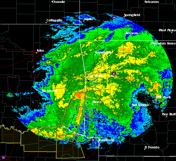 At 407 am cdt, severe thunderstorms were located along a line extending from 6 miles southwest of morgan springs to near mountain fork to 7 miles west of wickes, moving east at 50 mph (radar indicated). Hazards include 60 mph wind gusts and penny size hail. Expect damage to roofs, siding, and trees. Locations impacted include, mena, waldron, wickes, grannis, hatfield, vandervoort, beauchamp, cossatot river state park, mountain fork, polk county fairgrounds, mena intermountain airport, mccauley, shady, oliver, hartley, morgan springs, caney creek wilderness, queen wilhelmina state park, cove, bates,. At 407 am cdt, severe thunderstorms were located along a line extending from 6 miles southwest of morgan springs to near mountain fork to 7 miles west of wickes, moving east at 50 mph (radar indicated). Hazards include 60 mph wind gusts and penny size hail. Expect damage to roofs, siding, and trees. Locations impacted include, mena, waldron, wickes, grannis, hatfield, vandervoort, beauchamp, cossatot river state park, mountain fork, polk county fairgrounds, mena intermountain airport, mccauley, shady, oliver, hartley, morgan springs, caney creek wilderness, queen wilhelmina state park, cove, bates,.
|
| 5/8/2020 3:43 AM CDT |
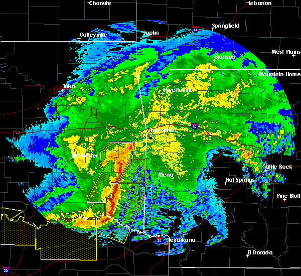 At 342 am cdt, severe thunderstorms were located along a line extending from near talimena state park to near whitesboro to 14 miles east of nashoba, moving east at 55 mph (radar indicated). Hazards include 60 mph wind gusts and penny size hail. expect damage to roofs, siding, and trees At 342 am cdt, severe thunderstorms were located along a line extending from near talimena state park to near whitesboro to 14 miles east of nashoba, moving east at 55 mph (radar indicated). Hazards include 60 mph wind gusts and penny size hail. expect damage to roofs, siding, and trees
|
| 4/28/2020 9:55 PM CDT |
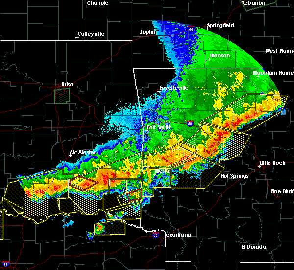 At 954 pm cdt, severe thunderstorms were located along a line extending from near fourche valley to near gravelly to 6 miles southeast of beauchamp, moving east at 35 mph (radar indicated). Hazards include 60 mph wind gusts and quarter size hail. Hail damage to vehicles is expected. expect wind damage to roofs, siding, and trees. Locations impacted include, beauchamp, gravelly, fourche valley, black fork, union hill, olio, cedar creek, waltreak, bluffton, y city, nola, needmore, harvey, boles, parks, blue ball,. At 954 pm cdt, severe thunderstorms were located along a line extending from near fourche valley to near gravelly to 6 miles southeast of beauchamp, moving east at 35 mph (radar indicated). Hazards include 60 mph wind gusts and quarter size hail. Hail damage to vehicles is expected. expect wind damage to roofs, siding, and trees. Locations impacted include, beauchamp, gravelly, fourche valley, black fork, union hill, olio, cedar creek, waltreak, bluffton, y city, nola, needmore, harvey, boles, parks, blue ball,.
|
| 4/28/2020 9:33 PM CDT |
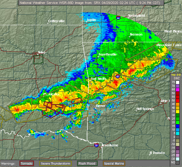 At 933 pm cdt, severe thunderstorms were located along a line extending from near stonehouse recreation area to near cardiff to morgan springs, moving southeast at 50 mph (radar indicated). Hazards include 60 mph wind gusts and quarter size hail. Hail damage to vehicles is expected. expect wind damage to roofs, siding, and trees. Locations impacted include, waldron, blue mountain, beauchamp, stonehouse recreation area, cardiff, gravelly, fourche valley, oliver, morgan springs, bates, black fork, winfield, olio, bluffton, boles, grayson, blue ball, union hill, cauthron, hon,. At 933 pm cdt, severe thunderstorms were located along a line extending from near stonehouse recreation area to near cardiff to morgan springs, moving southeast at 50 mph (radar indicated). Hazards include 60 mph wind gusts and quarter size hail. Hail damage to vehicles is expected. expect wind damage to roofs, siding, and trees. Locations impacted include, waldron, blue mountain, beauchamp, stonehouse recreation area, cardiff, gravelly, fourche valley, oliver, morgan springs, bates, black fork, winfield, olio, bluffton, boles, grayson, blue ball, union hill, cauthron, hon,.
|
| 4/28/2020 9:27 PM CDT | Trees were blown down on highway 80 east of waldron. other trees were blown down in various locations around the count in scott county AR, 9.8 miles W of Waldron, AR |
| 4/28/2020 9:14 PM CDT |
 At 914 pm cdt, severe thunderstorms were located along a line extending from near ratcliff to near booneville to 6 miles south of echo to 6 miles east of heavener runestone state park, moving east at 40 mph (radar indicated). Hazards include 60 mph wind gusts and quarter size hail. Hail damage to vehicles is expected. Expect wind damage to roofs, siding, and trees. At 914 pm cdt, severe thunderstorms were located along a line extending from near ratcliff to near booneville to 6 miles south of echo to 6 miles east of heavener runestone state park, moving east at 40 mph (radar indicated). Hazards include 60 mph wind gusts and quarter size hail. Hail damage to vehicles is expected. Expect wind damage to roofs, siding, and trees.
|
| 4/24/2020 9:43 PM CDT |
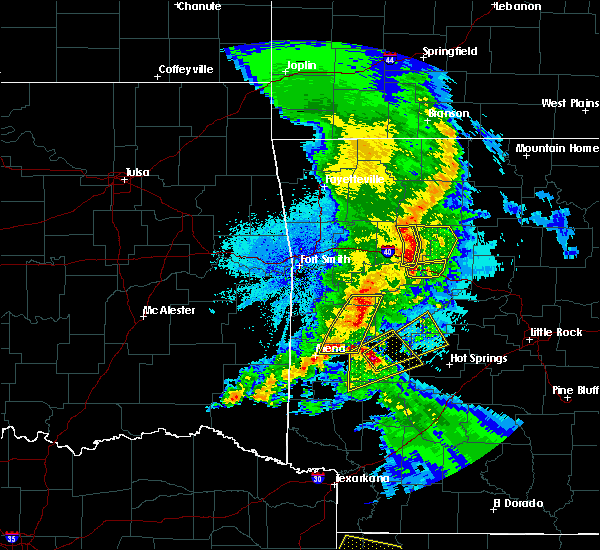 At 943 pm cdt, a severe thunderstorm was located 12 miles northwest of oden, or 14 miles southeast of waldron, moving east at 45 mph (radar indicated). Hazards include 60 mph wind gusts and quarter size hail. Hail damage to vehicles is expected. expect wind damage to roofs, siding, and trees. Locations impacted include, stonehouse recreation area, cardiff, union hill, olio, cedar creek, y city, needmore, harvey, sugar grove, boles, parks, grayson, nola, blue ball,. At 943 pm cdt, a severe thunderstorm was located 12 miles northwest of oden, or 14 miles southeast of waldron, moving east at 45 mph (radar indicated). Hazards include 60 mph wind gusts and quarter size hail. Hail damage to vehicles is expected. expect wind damage to roofs, siding, and trees. Locations impacted include, stonehouse recreation area, cardiff, union hill, olio, cedar creek, y city, needmore, harvey, sugar grove, boles, parks, grayson, nola, blue ball,.
|
| 4/24/2020 9:23 PM CDT |
 At 922 pm cdt, a severe thunderstorm was located near beauchamp, or 8 miles north of mena, moving east at 45 mph (radar indicated). Hazards include 60 mph wind gusts and quarter size hail. Hail damage to vehicles is expected. Expect wind damage to roofs, siding, and trees. At 922 pm cdt, a severe thunderstorm was located near beauchamp, or 8 miles north of mena, moving east at 45 mph (radar indicated). Hazards include 60 mph wind gusts and quarter size hail. Hail damage to vehicles is expected. Expect wind damage to roofs, siding, and trees.
|
| 3/19/2020 7:07 PM CDT |
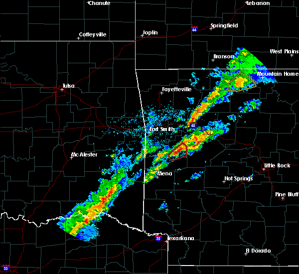 At 707 pm cdt, a severe thunderstorm was located near mena, moving northeast at 55 mph (radar indicated). Hazards include 60 mph wind gusts and quarter size hail. Hail damage to vehicles is expected. Expect wind damage to roofs, siding, and trees. At 707 pm cdt, a severe thunderstorm was located near mena, moving northeast at 55 mph (radar indicated). Hazards include 60 mph wind gusts and quarter size hail. Hail damage to vehicles is expected. Expect wind damage to roofs, siding, and trees.
|
| 3/19/2020 6:46 PM CDT |
 At 645 pm cdt, a severe thunderstorm capable of producing a tornado was located over waldron, moving northeast at 45 mph (radar indicated rotation). Hazards include tornado and quarter size hail. Flying debris will be dangerous to those caught without shelter. mobile homes will be damaged or destroyed. damage to roofs, windows, and vehicles will occur. tree damage is likely. Locations impacted include, booneville, waldron, magazine, blue mountain, cardiff, winfield, sugar grove, grayson, olio, union hill, carolan, blue ball,. At 645 pm cdt, a severe thunderstorm capable of producing a tornado was located over waldron, moving northeast at 45 mph (radar indicated rotation). Hazards include tornado and quarter size hail. Flying debris will be dangerous to those caught without shelter. mobile homes will be damaged or destroyed. damage to roofs, windows, and vehicles will occur. tree damage is likely. Locations impacted include, booneville, waldron, magazine, blue mountain, cardiff, winfield, sugar grove, grayson, olio, union hill, carolan, blue ball,.
|
| 3/19/2020 6:30 PM CDT |
 At 630 pm cdt, a severe thunderstorm capable of producing a tornado was located over beauchamp, or 10 miles southwest of waldron, moving northeast at 50 mph (radar indicated rotation). Hazards include tornado and quarter size hail. Flying debris will be dangerous to those caught without shelter. mobile homes will be damaged or destroyed. damage to roofs, windows, and vehicles will occur. Tree damage is likely. At 630 pm cdt, a severe thunderstorm capable of producing a tornado was located over beauchamp, or 10 miles southwest of waldron, moving northeast at 50 mph (radar indicated rotation). Hazards include tornado and quarter size hail. Flying debris will be dangerous to those caught without shelter. mobile homes will be damaged or destroyed. damage to roofs, windows, and vehicles will occur. Tree damage is likely.
|
| 3/19/2020 5:28 PM CDT |
 At 526 pm cdt, a severe thunderstorm was located near big cedar, or 19 miles west of mena, moving northeast at 35 mph (radar indicated). Hazards include 60 mph wind gusts and penny size hail. expect damage to roofs, siding, and trees At 526 pm cdt, a severe thunderstorm was located near big cedar, or 19 miles west of mena, moving northeast at 35 mph (radar indicated). Hazards include 60 mph wind gusts and penny size hail. expect damage to roofs, siding, and trees
|
| 1/10/2020 8:13 PM CST |
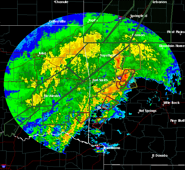 At 813 pm cst, severe thunderstorms were located along a line extending from mountain fork to 11 miles northeast of broken bow, moving northeast at 40 mph (radar indicated). Hazards include 60 mph wind gusts and quarter size hail. Hail damage to vehicles is expected. Expect wind damage to roofs, siding, and trees. At 813 pm cst, severe thunderstorms were located along a line extending from mountain fork to 11 miles northeast of broken bow, moving northeast at 40 mph (radar indicated). Hazards include 60 mph wind gusts and quarter size hail. Hail damage to vehicles is expected. Expect wind damage to roofs, siding, and trees.
|
| 10/21/2019 2:04 AM CDT |
 At 204 am cdt, severe thunderstorms were located along a line extending from near booneville to 11 miles northwest of oden to bard springs recreation area, moving east at 65 mph (radar indicated). Hazards include 60 mph wind gusts and quarter size hail. Hail damage to vehicles is expected. Expect wind damage to roofs, siding, and trees. At 204 am cdt, severe thunderstorms were located along a line extending from near booneville to 11 miles northwest of oden to bard springs recreation area, moving east at 65 mph (radar indicated). Hazards include 60 mph wind gusts and quarter size hail. Hail damage to vehicles is expected. Expect wind damage to roofs, siding, and trees.
|
| 8/27/2019 1:50 AM CDT |
 At 150 am cdt, severe thunderstorms were located along a line extending from near midway in logan county to near booneville to near oliver, moving southeast at 50 mph (radar indicated). Hazards include 60 mph wind gusts and penny size hail. Expect damage to roofs, siding, and trees. Locations impacted include, clarksville, booneville, waldron, paris, danville, dardanelle, ola, mansfield, magazine, knoxville, subiaco, hartman, scranton, ratcliff, blue mountain, beauchamp, cardiff, lake dardanelle state park, hoyt, petit jean river wma, this includes interstate 40 between mile markers 44 and 56. At 150 am cdt, severe thunderstorms were located along a line extending from near midway in logan county to near booneville to near oliver, moving southeast at 50 mph (radar indicated). Hazards include 60 mph wind gusts and penny size hail. Expect damage to roofs, siding, and trees. Locations impacted include, clarksville, booneville, waldron, paris, danville, dardanelle, ola, mansfield, magazine, knoxville, subiaco, hartman, scranton, ratcliff, blue mountain, beauchamp, cardiff, lake dardanelle state park, hoyt, petit jean river wma, this includes interstate 40 between mile markers 44 and 56.
|
| 8/27/2019 1:30 AM CDT |
 At 130 am cdt, severe thunderstorms were located along a line extending from denning to near charleston to hackett, moving southeast at 45 mph (radar indicated). Hazards include 60 mph wind gusts. expect damage to roofs, siding, and trees At 130 am cdt, severe thunderstorms were located along a line extending from denning to near charleston to hackett, moving southeast at 45 mph (radar indicated). Hazards include 60 mph wind gusts. expect damage to roofs, siding, and trees
|
| 7/10/2019 4:40 PM CDT |
 At 440 pm cdt, severe thunderstorms were located along a line extending from near hatfield to near oden to near meyers, moving south at 15 mph (radar indicated). Hazards include 60 mph wind gusts and quarter size hail. Hail damage to vehicles is expected. Expect wind damage to roofs, siding, and trees. At 440 pm cdt, severe thunderstorms were located along a line extending from near hatfield to near oden to near meyers, moving south at 15 mph (radar indicated). Hazards include 60 mph wind gusts and quarter size hail. Hail damage to vehicles is expected. Expect wind damage to roofs, siding, and trees.
|
| 7/10/2019 4:10 PM CDT |
 At 410 pm cdt, severe thunderstorms were located along a line extending from morgan springs to near oden to 6 miles northeast of meyers, moving south at 35 mph (radar indicated). Hazards include 60 mph wind gusts and quarter size hail. Hail damage to vehicles is expected. Expect wind damage to roofs, siding, and trees. At 410 pm cdt, severe thunderstorms were located along a line extending from morgan springs to near oden to 6 miles northeast of meyers, moving south at 35 mph (radar indicated). Hazards include 60 mph wind gusts and quarter size hail. Hail damage to vehicles is expected. Expect wind damage to roofs, siding, and trees.
|
| 7/10/2019 3:57 PM CDT | Numerous trees were blown down... and the roof was blown off of a hous in scott county AR, 0.3 miles NNW of Waldron, AR |
| 7/10/2019 3:46 PM CDT |
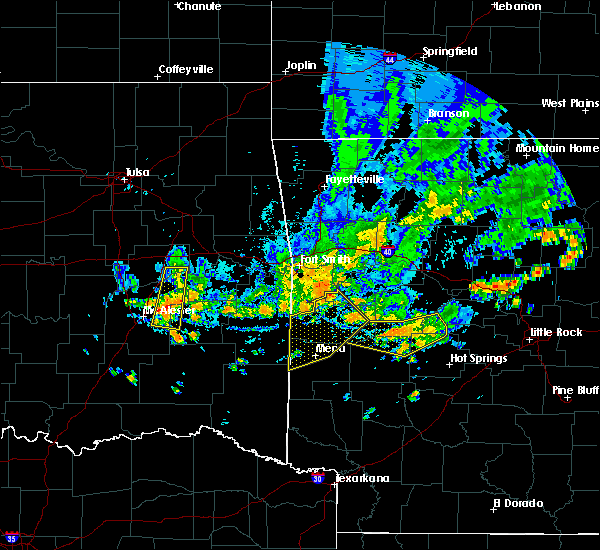 At 345 pm cdt, severe thunderstorms were located along a line extending from near echo to near oliver to near morgan springs, moving southeast at 30 mph (radar indicated). Hazards include 60 mph wind gusts. Expect damage to roofs, siding, and trees. Locations impacted include, mena, waldron, mansfield, hatfield, beauchamp, cardiff, mountain fork, polk county fairgrounds, mena intermountain airport, echo, oliver, morgan springs, queen wilhelmina state park, bates, acorn, barber, black fork, winfield, olio, ink,. At 345 pm cdt, severe thunderstorms were located along a line extending from near echo to near oliver to near morgan springs, moving southeast at 30 mph (radar indicated). Hazards include 60 mph wind gusts. Expect damage to roofs, siding, and trees. Locations impacted include, mena, waldron, mansfield, hatfield, beauchamp, cardiff, mountain fork, polk county fairgrounds, mena intermountain airport, echo, oliver, morgan springs, queen wilhelmina state park, bates, acorn, barber, black fork, winfield, olio, ink,.
|
| 7/10/2019 3:21 PM CDT |
 The national weather service in little rock has issued a * severe thunderstorm warning for. southwestern logan county in western arkansas. northern polk county in western arkansas. scott county in western arkansas. Until 400 pm cdt. The national weather service in little rock has issued a * severe thunderstorm warning for. southwestern logan county in western arkansas. northern polk county in western arkansas. scott county in western arkansas. Until 400 pm cdt.
|
| 6/23/2019 1:33 PM CDT | Power lines were blown down in evening shade... relayed by lawrence county oe in scott county AR, 4.2 miles SE of Waldron, AR |
| 5/18/2019 1:57 PM CDT |
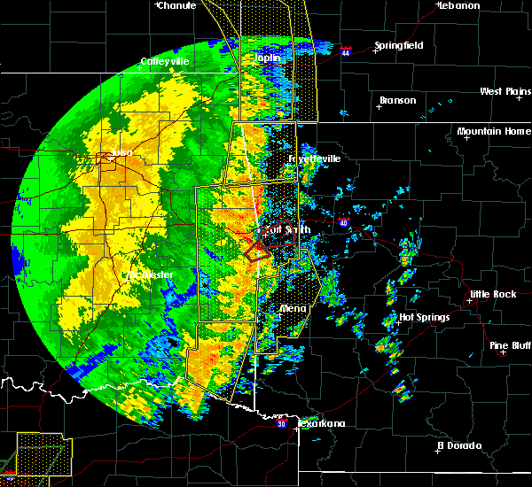 At 157 pm cdt, severe thunderstorms were located along a line extending from near pocola to near oliver to 10 miles west of vandervoort, moving east at 50 mph (radar indicated). Hazards include 60 mph wind gusts and nickel size hail. Expect damage to roofs, siding, and trees. Locations impacted include, mena, booneville, waldron, mansfield, wickes, grannis, hatfield, vandervoort, beauchamp, cardiff, mountain fork, opal, cossatot river state park, polk county fairgrounds, mena intermountain airport, mccauley, shady, echo, oliver, hartley, a tornado watch remains in effect until 800 pm cdt for western arkansas. At 157 pm cdt, severe thunderstorms were located along a line extending from near pocola to near oliver to 10 miles west of vandervoort, moving east at 50 mph (radar indicated). Hazards include 60 mph wind gusts and nickel size hail. Expect damage to roofs, siding, and trees. Locations impacted include, mena, booneville, waldron, mansfield, wickes, grannis, hatfield, vandervoort, beauchamp, cardiff, mountain fork, opal, cossatot river state park, polk county fairgrounds, mena intermountain airport, mccauley, shady, echo, oliver, hartley, a tornado watch remains in effect until 800 pm cdt for western arkansas.
|
| 5/18/2019 1:38 PM CDT |
 At 136 pm cdt, severe thunderstorms were located along a line extending from 10 miles west of fort smith to big cedar to 10 miles west of broken bow, moving east at 45 mph (radar indicated). Hazards include 60 mph wind gusts and nickel size hail. expect damage to roofs, siding, and trees At 136 pm cdt, severe thunderstorms were located along a line extending from 10 miles west of fort smith to big cedar to 10 miles west of broken bow, moving east at 45 mph (radar indicated). Hazards include 60 mph wind gusts and nickel size hail. expect damage to roofs, siding, and trees
|
| 4/17/2019 10:43 PM CDT |
 At 1043 pm cdt, a severe thunderstorm was located near cardiff, or 11 miles south of booneville, moving northeast at 45 mph (radar indicated). Hazards include quarter size hail. Damage to vehicles is expected. Locations impacted include, booneville, waldron, paris, danville, magazine, blue mountain, stonehouse recreation area, mount magazine, cardiff, belleville, havana, caulksville, corinth, union hill, waveland, olio, waltreak, carbon city, sugar grove, driggs,. At 1043 pm cdt, a severe thunderstorm was located near cardiff, or 11 miles south of booneville, moving northeast at 45 mph (radar indicated). Hazards include quarter size hail. Damage to vehicles is expected. Locations impacted include, booneville, waldron, paris, danville, magazine, blue mountain, stonehouse recreation area, mount magazine, cardiff, belleville, havana, caulksville, corinth, union hill, waveland, olio, waltreak, carbon city, sugar grove, driggs,.
|
| 4/17/2019 10:27 PM CDT |
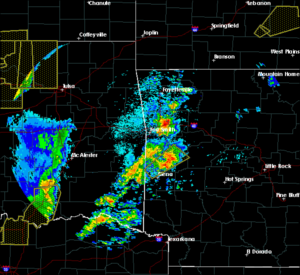 At 1027 pm cdt, a severe thunderstorm was located near waldron, moving northeast at 45 mph (radar indicated). Hazards include quarter size hail. damage to vehicles is expected At 1027 pm cdt, a severe thunderstorm was located near waldron, moving northeast at 45 mph (radar indicated). Hazards include quarter size hail. damage to vehicles is expected
|
| 4/17/2019 9:45 PM CDT |
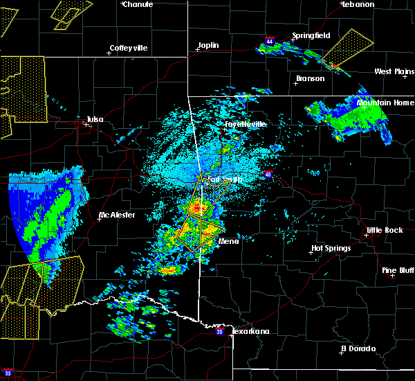 At 944 pm cdt, a severe thunderstorm was located near queen wilhelmina state park, or 11 miles northwest of mena, moving northeast at 45 mph (radar indicated). Hazards include quarter size hail. damage to vehicles is expected At 944 pm cdt, a severe thunderstorm was located near queen wilhelmina state park, or 11 miles northwest of mena, moving northeast at 45 mph (radar indicated). Hazards include quarter size hail. damage to vehicles is expected
|
| 3/24/2019 10:38 PM CDT | Half Dollar sized hail reported 0.3 miles NNW of Waldron, AR |
| 3/24/2019 10:35 PM CDT |
 At 1034 pm cdt, a severe thunderstorm was located near waldron, moving east at 35 mph (radar indicated). Hazards include 60 mph wind gusts and quarter size hail. Hail damage to vehicles is expected. Expect wind damage to roofs, siding, and trees. At 1034 pm cdt, a severe thunderstorm was located near waldron, moving east at 35 mph (radar indicated). Hazards include 60 mph wind gusts and quarter size hail. Hail damage to vehicles is expected. Expect wind damage to roofs, siding, and trees.
|
| 3/24/2019 7:28 PM CDT |
 At 727 pm cdt, a severe thunderstorm was located over oliver, or 8 miles west of waldron, moving east at 30 mph. this is a very dangerous storm (radar indicated). Hazards include baseball size hail and 60 mph wind gusts. People and animals outdoors will be severely injured. expect shattered windows, extensive damage to roofs, siding, and vehicles. Locations impacted include, waldron, beauchamp, oliver, morgan springs, cauthron, winfield, hon,. At 727 pm cdt, a severe thunderstorm was located over oliver, or 8 miles west of waldron, moving east at 30 mph. this is a very dangerous storm (radar indicated). Hazards include baseball size hail and 60 mph wind gusts. People and animals outdoors will be severely injured. expect shattered windows, extensive damage to roofs, siding, and vehicles. Locations impacted include, waldron, beauchamp, oliver, morgan springs, cauthron, winfield, hon,.
|
| 3/24/2019 6:55 PM CDT |
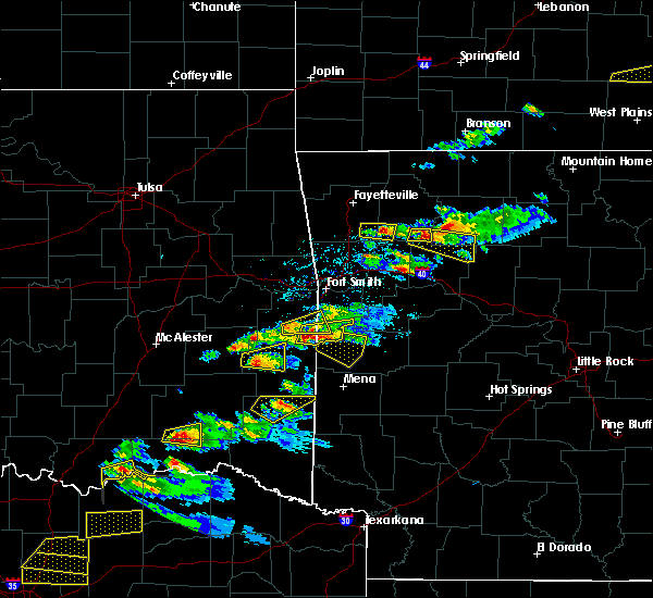 At 655 pm cdt, a severe thunderstorm was located near hartford, or 9 miles southeast of poteau, moving east at 25 mph. this is a very dangerous storm (radar indicated). Hazards include baseball size hail and 60 mph wind gusts. People and animals outdoors will be severely injured. Expect shattered windows, extensive damage to roofs, siding, and vehicles. At 655 pm cdt, a severe thunderstorm was located near hartford, or 9 miles southeast of poteau, moving east at 25 mph. this is a very dangerous storm (radar indicated). Hazards include baseball size hail and 60 mph wind gusts. People and animals outdoors will be severely injured. Expect shattered windows, extensive damage to roofs, siding, and vehicles.
|
| 3/9/2019 7:16 AM CST |
 At 715 am cst, severe thunderstorms were located along a line extending from branch to 9 miles southeast of beauchamp, moving east at 60 mph (radar indicated). Hazards include 60 mph wind gusts. expect damage to roofs, siding, and trees At 715 am cst, severe thunderstorms were located along a line extending from branch to 9 miles southeast of beauchamp, moving east at 60 mph (radar indicated). Hazards include 60 mph wind gusts. expect damage to roofs, siding, and trees
|
| 2/6/2019 4:45 PM CST |
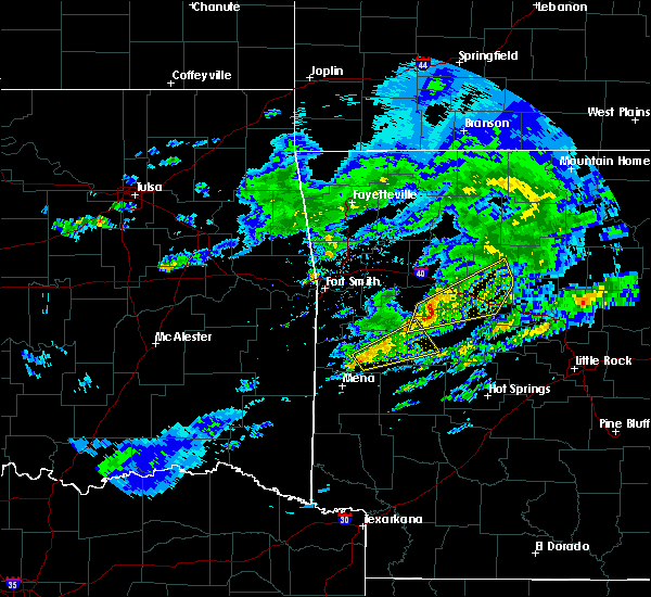 At 444 pm cst, a severe thunderstorm was located 7 miles southeast of waldron, moving northeast at 45 mph (radar indicated). Hazards include 60 mph wind gusts and quarter size hail. Hail damage to vehicles is expected. Expect wind damage to roofs, siding, and trees. At 444 pm cst, a severe thunderstorm was located 7 miles southeast of waldron, moving northeast at 45 mph (radar indicated). Hazards include 60 mph wind gusts and quarter size hail. Hail damage to vehicles is expected. Expect wind damage to roofs, siding, and trees.
|
| 11/30/2018 11:48 PM CST |
 At 1147 pm cst, severe thunderstorms were located along a line extending from near japton to 8 miles northwest of woodland to near magazine to 12 miles southeast of beauchamp, moving east at 65 mph (radar indicated). Hazards include 70 mph wind gusts and quarter size hail. Hail damage to vehicles is expected. expect considerable tree damage. wind damage is also likely to mobile homes, roofs, and outbuildings. locations impacted include, clarksville, booneville, waldron, paris, jasper, lamar, mansfield, magazine, knoxville, subiaco, hartman, scranton, ratcliff, blue mountain, beauchamp, erbie, upper buffalo wilderness area, devils knob, lost valley state park, pruitt, this includes interstate 40 between mile markers 44 and 67. A tornado watch remains in effect until 200 am cst for western, central and north central arkansas. At 1147 pm cst, severe thunderstorms were located along a line extending from near japton to 8 miles northwest of woodland to near magazine to 12 miles southeast of beauchamp, moving east at 65 mph (radar indicated). Hazards include 70 mph wind gusts and quarter size hail. Hail damage to vehicles is expected. expect considerable tree damage. wind damage is also likely to mobile homes, roofs, and outbuildings. locations impacted include, clarksville, booneville, waldron, paris, jasper, lamar, mansfield, magazine, knoxville, subiaco, hartman, scranton, ratcliff, blue mountain, beauchamp, erbie, upper buffalo wilderness area, devils knob, lost valley state park, pruitt, this includes interstate 40 between mile markers 44 and 67. A tornado watch remains in effect until 200 am cst for western, central and north central arkansas.
|
| 11/30/2018 11:09 PM CST |
 At 1109 pm cst, severe thunderstorms were located along a line extending from near short to fort smith to 9 miles northeast of big cedar, moving northeast at 70 mph (radar indicated). Hazards include 70 mph wind gusts and quarter size hail. Hail damage to vehicles is expected. expect considerable tree damage. Wind damage is also likely to mobile homes, roofs, and outbuildings. At 1109 pm cst, severe thunderstorms were located along a line extending from near short to fort smith to 9 miles northeast of big cedar, moving northeast at 70 mph (radar indicated). Hazards include 70 mph wind gusts and quarter size hail. Hail damage to vehicles is expected. expect considerable tree damage. Wind damage is also likely to mobile homes, roofs, and outbuildings.
|
| 8/30/2018 7:30 PM CDT | Several trees were blown dow in scott county AR, 0.3 miles NNW of Waldron, AR |
| 8/30/2018 7:28 PM CDT |
 At 728 pm cdt, severe thunderstorms were located along a line extending from 7 miles southwest of booneville to waldron to near beauchamp, moving east at 50 mph (radar indicated). Hazards include 60 mph wind gusts. expect damage to roofs, siding, and trees At 728 pm cdt, severe thunderstorms were located along a line extending from 7 miles southwest of booneville to waldron to near beauchamp, moving east at 50 mph (radar indicated). Hazards include 60 mph wind gusts. expect damage to roofs, siding, and trees
|
| 8/7/2018 6:22 PM CDT |
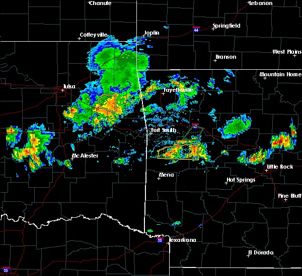 The severe thunderstorm warning for southwestern logan, west central yell and northeastern scott counties will expire at 630 pm cdt, the storm which prompted the warning has weakened below severe limits, and no longer poses an immediate threat to life or property. therefore, the warning will be allowed to expire. however heavy rain is still possible with this thunderstorm. The severe thunderstorm warning for southwestern logan, west central yell and northeastern scott counties will expire at 630 pm cdt, the storm which prompted the warning has weakened below severe limits, and no longer poses an immediate threat to life or property. therefore, the warning will be allowed to expire. however heavy rain is still possible with this thunderstorm.
|
| 8/7/2018 5:54 PM CDT |
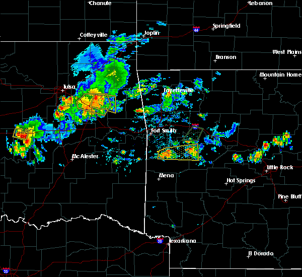 At 552 pm cdt, a severe thunderstorm was located near echo, or 9 miles north of waldron, moving east at 10 mph (radar indicated). Hazards include 60 mph wind gusts and nickel size hail. expect damage to roofs, siding, and trees At 552 pm cdt, a severe thunderstorm was located near echo, or 9 miles north of waldron, moving east at 10 mph (radar indicated). Hazards include 60 mph wind gusts and nickel size hail. expect damage to roofs, siding, and trees
|
| 6/24/2018 7:48 AM CDT | Trees down on hwy 270 at y city. time estimated from rada in scott county AR, 12 miles N of Waldron, AR |
| 6/24/2018 7:09 AM CDT |
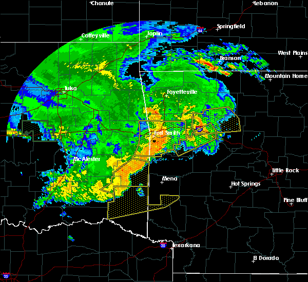 The national weather service in little rock has issued a * severe thunderstorm warning for. southwestern logan county in western arkansas. northwestern yell county in central arkansas. scott county in western arkansas. Until 800 am cdt. The national weather service in little rock has issued a * severe thunderstorm warning for. southwestern logan county in western arkansas. northwestern yell county in central arkansas. scott county in western arkansas. Until 800 am cdt.
|
| 6/23/2018 3:38 AM CDT |
 At 338 am cdt, severe thunderstorms were located along a line extending from near cardiff to cossatot river state park, moving east at 50 mph (radar indicated). Hazards include 60 mph wind gusts and penny size hail. expect damage to roofs, siding, and trees At 338 am cdt, severe thunderstorms were located along a line extending from near cardiff to cossatot river state park, moving east at 50 mph (radar indicated). Hazards include 60 mph wind gusts and penny size hail. expect damage to roofs, siding, and trees
|
| 6/7/2018 3:01 PM CDT |
 At 301 pm cdt, a severe thunderstorm was located near echo, or 9 miles north of waldron, moving south at 5 mph (radar indicated). Hazards include 60 mph wind gusts and quarter size hail. Hail damage to vehicles is expected. Expect wind damage to roofs, siding, and trees. At 301 pm cdt, a severe thunderstorm was located near echo, or 9 miles north of waldron, moving south at 5 mph (radar indicated). Hazards include 60 mph wind gusts and quarter size hail. Hail damage to vehicles is expected. Expect wind damage to roofs, siding, and trees.
|
| 5/23/2018 2:13 PM CDT |
 At 212 pm cdt, a severe thunderstorm was located 3 miles north of waldron, moving north at 10 mph (radar indicated). Hazards include 60 mph wind gusts and penny size hail. expect damage to roofs, siding, and trees At 212 pm cdt, a severe thunderstorm was located 3 miles north of waldron, moving north at 10 mph (radar indicated). Hazards include 60 mph wind gusts and penny size hail. expect damage to roofs, siding, and trees
|
| 4/13/2018 7:39 PM CDT |
 At 739 pm cdt, severe thunderstorms were located along a line extending from near booneville to near waldron to 6 miles southwest of cardiff to 11 miles southeast of beauchamp, moving northeast at 55 mph (radar indicated). Hazards include 60 mph wind gusts and penny size hail. expect damage to roofs, siding, and trees At 739 pm cdt, severe thunderstorms were located along a line extending from near booneville to near waldron to 6 miles southwest of cardiff to 11 miles southeast of beauchamp, moving northeast at 55 mph (radar indicated). Hazards include 60 mph wind gusts and penny size hail. expect damage to roofs, siding, and trees
|
| 4/13/2018 7:08 PM CDT |
 At 708 pm cdt, severe thunderstorms were located along a line extending from near mount magazine to near stonehouse recreation area to near cardiff, moving northeast at 45 mph (radar indicated). Hazards include 60 mph wind gusts and nickel size hail. Expect damage to roofs, siding, and trees. Locations impacted include, booneville, waldron, paris, danville, magazine, subiaco, scranton, ratcliff, blue mountain, cardiff, midway in logan county, stonehouse recreation area, gravelly, fourche valley, mount magazine, tokalon, lake dardanelle, belleville, havana, caulksville, a tornado watch remains in effect until 1000 pm cdt for western and central arkansas. At 708 pm cdt, severe thunderstorms were located along a line extending from near mount magazine to near stonehouse recreation area to near cardiff, moving northeast at 45 mph (radar indicated). Hazards include 60 mph wind gusts and nickel size hail. Expect damage to roofs, siding, and trees. Locations impacted include, booneville, waldron, paris, danville, magazine, subiaco, scranton, ratcliff, blue mountain, cardiff, midway in logan county, stonehouse recreation area, gravelly, fourche valley, mount magazine, tokalon, lake dardanelle, belleville, havana, caulksville, a tornado watch remains in effect until 1000 pm cdt for western and central arkansas.
|
| 4/13/2018 6:56 PM CDT |
 At 655 pm cdt, severe thunderstorms were located along a line extending from near magazine to near cardiff to 7 miles southeast of waldron, moving northeast at 40 mph (radar indicated). Hazards include 60 mph wind gusts and nickel size hail. expect damage to roofs, siding, and trees At 655 pm cdt, severe thunderstorms were located along a line extending from near magazine to near cardiff to 7 miles southeast of waldron, moving northeast at 40 mph (radar indicated). Hazards include 60 mph wind gusts and nickel size hail. expect damage to roofs, siding, and trees
|
| 4/13/2018 6:48 PM CDT |
 At 648 pm cdt, severe thunderstorms were located along a line extending from 6 miles south of booneville to near cardiff, moving northeast at 65 mph (radar indicated). Hazards include 60 mph wind gusts and quarter size hail. Hail damage to vehicles is expected. expect wind damage to roofs, siding, and trees. Locations impacted include, booneville, waldron, paris, magazine, knoxville, subiaco, scranton, ratcliff, blue mountain, cardiff, mount magazine, midway in logan county, lake dardanelle, caulksville, ludwig, wilkins, corley, grayson, elm park, ione, a tornado watch remains in effect until 1000 pm cdt for western and central arkansas. At 648 pm cdt, severe thunderstorms were located along a line extending from 6 miles south of booneville to near cardiff, moving northeast at 65 mph (radar indicated). Hazards include 60 mph wind gusts and quarter size hail. Hail damage to vehicles is expected. expect wind damage to roofs, siding, and trees. Locations impacted include, booneville, waldron, paris, magazine, knoxville, subiaco, scranton, ratcliff, blue mountain, cardiff, mount magazine, midway in logan county, lake dardanelle, caulksville, ludwig, wilkins, corley, grayson, elm park, ione, a tornado watch remains in effect until 1000 pm cdt for western and central arkansas.
|
| 4/13/2018 6:46 PM CDT |
 At 646 pm cdt, a severe thunderstorm was located near waldron, moving northeast at 55 mph (radar indicated). Hazards include 60 mph wind gusts and quarter size hail. Hail damage to vehicles is expected. expect wind damage to roofs, siding, and trees. Locations impacted include, waldron, beauchamp, oliver, needmore, winfield, hon, boles, shady grove, a tornado watch remains in effect until 1000 pm cdt for western arkansas. At 646 pm cdt, a severe thunderstorm was located near waldron, moving northeast at 55 mph (radar indicated). Hazards include 60 mph wind gusts and quarter size hail. Hail damage to vehicles is expected. expect wind damage to roofs, siding, and trees. Locations impacted include, waldron, beauchamp, oliver, needmore, winfield, hon, boles, shady grove, a tornado watch remains in effect until 1000 pm cdt for western arkansas.
|
| 4/13/2018 6:23 PM CDT |
 At 623 pm cdt, a severe thunderstorm was located over mountain fork, or 9 miles west of mena, moving northeast at 50 mph (radar indicated). Hazards include ping pong ball size hail and 60 mph wind gusts. People and animals outdoors will be injured. expect hail damage to roofs, siding, windows, and vehicles. expect wind damage to roofs, siding, and trees. Locations impacted include, waldron, beauchamp, oliver, morgan springs, queen wilhelmina state park, mountain fork, bates, black fork, cauthron, rocky, black fork mountain wilderness, winfield, hon, rich mountain, needmore, boles, eagleton, shady grove, a tornado watch remains in effect until 1000 pm cdt for western arkansas. At 623 pm cdt, a severe thunderstorm was located over mountain fork, or 9 miles west of mena, moving northeast at 50 mph (radar indicated). Hazards include ping pong ball size hail and 60 mph wind gusts. People and animals outdoors will be injured. expect hail damage to roofs, siding, windows, and vehicles. expect wind damage to roofs, siding, and trees. Locations impacted include, waldron, beauchamp, oliver, morgan springs, queen wilhelmina state park, mountain fork, bates, black fork, cauthron, rocky, black fork mountain wilderness, winfield, hon, rich mountain, needmore, boles, eagleton, shady grove, a tornado watch remains in effect until 1000 pm cdt for western arkansas.
|
| 4/13/2018 6:21 PM CDT |
 At 621 pm cdt, severe thunderstorms were located along a line extending from near charleston to near washburn to near mansfield, moving east at 40 mph (radar indicated). Hazards include 60 mph wind gusts and quarter size hail. Hail damage to vehicles is expected. Expect wind damage to roofs, siding, and trees. At 621 pm cdt, severe thunderstorms were located along a line extending from near charleston to near washburn to near mansfield, moving east at 40 mph (radar indicated). Hazards include 60 mph wind gusts and quarter size hail. Hail damage to vehicles is expected. Expect wind damage to roofs, siding, and trees.
|
| 4/13/2018 6:13 PM CDT |
 At 613 pm cdt, a severe thunderstorm was located 7 miles southwest of mountain fork, or 14 miles west of mena, moving northeast at 45 mph (radar indicated). Hazards include 60 mph wind gusts and quarter size hail. Hail damage to vehicles is expected. Expect wind damage to roofs, siding, and trees. At 613 pm cdt, a severe thunderstorm was located 7 miles southwest of mountain fork, or 14 miles west of mena, moving northeast at 45 mph (radar indicated). Hazards include 60 mph wind gusts and quarter size hail. Hail damage to vehicles is expected. Expect wind damage to roofs, siding, and trees.
|
| 4/3/2018 3:03 PM CDT |
 At 302 pm cdt, a severe thunderstorm was located near cardiff, or 9 miles south of booneville, moving east at 45 mph (radar indicated). Hazards include half dollar size hail. Damage to vehicles is expected. Locations impacted include, waldron, cardiff, union hill, nola, needmore, olio, cedar creek, harvey, boles, parks, blue ball, a tornado watch remains in effect until 800 pm cdt for western arkansas. At 302 pm cdt, a severe thunderstorm was located near cardiff, or 9 miles south of booneville, moving east at 45 mph (radar indicated). Hazards include half dollar size hail. Damage to vehicles is expected. Locations impacted include, waldron, cardiff, union hill, nola, needmore, olio, cedar creek, harvey, boles, parks, blue ball, a tornado watch remains in effect until 800 pm cdt for western arkansas.
|
| 4/3/2018 2:23 PM CDT |
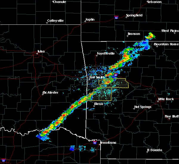 At 223 pm cdt, a severe thunderstorm was located over morgan springs, or 12 miles west of waldron, moving east at 45 mph (radar indicated). Hazards include half dollar size hail. damage to vehicles is expected At 223 pm cdt, a severe thunderstorm was located over morgan springs, or 12 miles west of waldron, moving east at 45 mph (radar indicated). Hazards include half dollar size hail. damage to vehicles is expected
|
| 2/24/2018 1:32 PM CST |
 At 131 pm cst, severe thunderstorms were located along a line extending from near waldron to 8 miles northeast of mena to near mena intermountain airport to near hartley, moving east at 45 mph (radar indicated). Hazards include 60 mph wind gusts. expect damage to roofs, siding, and trees At 131 pm cst, severe thunderstorms were located along a line extending from near waldron to 8 miles northeast of mena to near mena intermountain airport to near hartley, moving east at 45 mph (radar indicated). Hazards include 60 mph wind gusts. expect damage to roofs, siding, and trees
|
| 2/24/2018 1:07 PM CST |
 At 107 pm cst, severe thunderstorms were located along a line extending from near booneville to near waldron to near queen wilhelmina state park, moving east at 50 mph (radar indicated). Hazards include 60 mph wind gusts. Expect damage to roofs, siding, and trees. Locations impacted include, booneville, waldron, paris, mansfield, magazine, beauchamp, cardiff, mountain fork, echo, oliver, morgan springs, queen wilhelmina state park, acorn, barber, black fork, winfield, chismville, liberty, boles, grayson, a tornado watch remains in effect until 600 pm cst for western arkansas. At 107 pm cst, severe thunderstorms were located along a line extending from near booneville to near waldron to near queen wilhelmina state park, moving east at 50 mph (radar indicated). Hazards include 60 mph wind gusts. Expect damage to roofs, siding, and trees. Locations impacted include, booneville, waldron, paris, mansfield, magazine, beauchamp, cardiff, mountain fork, echo, oliver, morgan springs, queen wilhelmina state park, acorn, barber, black fork, winfield, chismville, liberty, boles, grayson, a tornado watch remains in effect until 600 pm cst for western arkansas.
|
| 2/24/2018 12:38 PM CST |
 At 1237 pm cst, severe thunderstorms were located along a line extending from 6 miles west of hartford to near heavener runestone state park to big cedar, moving east at 50 mph (radar indicated). Hazards include 60 mph wind gusts. expect damage to roofs, siding, and trees At 1237 pm cst, severe thunderstorms were located along a line extending from 6 miles west of hartford to near heavener runestone state park to big cedar, moving east at 50 mph (radar indicated). Hazards include 60 mph wind gusts. expect damage to roofs, siding, and trees
|
| 2/24/2018 11:00 AM CST |
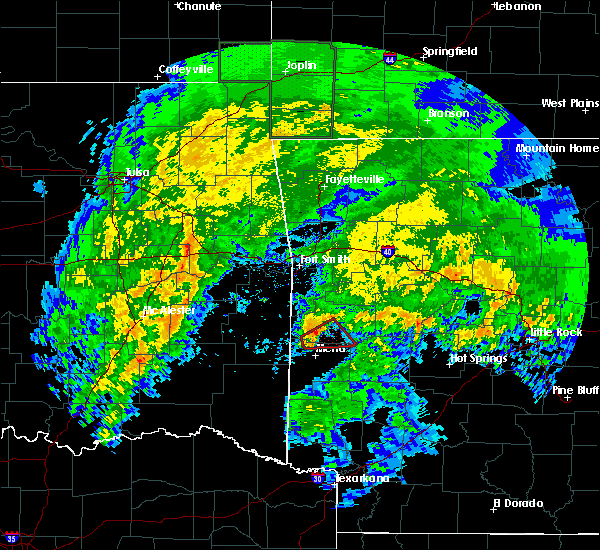 At 1059 am cst, a severe thunderstorm capable of producing a tornado was located near queen wilhelmina state park, or 8 miles north of mena, moving northeast at 50 mph (radar indicated rotation). Hazards include tornado and quarter size hail. Flying debris will be dangerous to those caught without shelter. mobile homes will be damaged or destroyed. damage to roofs, windows, and vehicles will occur. tree damage is likely. Locations impacted include, waldron, acorn, y city, rich mountain, needmore, boles, eagleton,. At 1059 am cst, a severe thunderstorm capable of producing a tornado was located near queen wilhelmina state park, or 8 miles north of mena, moving northeast at 50 mph (radar indicated rotation). Hazards include tornado and quarter size hail. Flying debris will be dangerous to those caught without shelter. mobile homes will be damaged or destroyed. damage to roofs, windows, and vehicles will occur. tree damage is likely. Locations impacted include, waldron, acorn, y city, rich mountain, needmore, boles, eagleton,.
|
| 2/24/2018 10:48 AM CST |
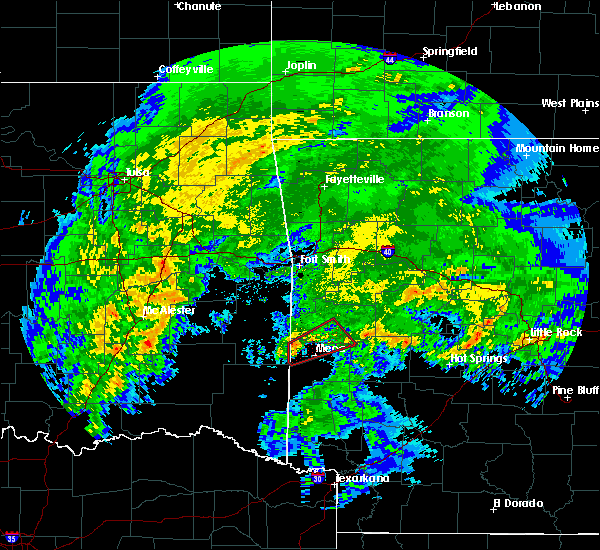 At 1047 am cst, a severe thunderstorm capable of producing a tornado was located over mountain fork, or 11 miles west of mena, moving northeast at 50 mph (radar indicated rotation). Hazards include tornado and quarter size hail. Flying debris will be dangerous to those caught without shelter. mobile homes will be damaged or destroyed. damage to roofs, windows, and vehicles will occur. Tree damage is likely. At 1047 am cst, a severe thunderstorm capable of producing a tornado was located over mountain fork, or 11 miles west of mena, moving northeast at 50 mph (radar indicated rotation). Hazards include tornado and quarter size hail. Flying debris will be dangerous to those caught without shelter. mobile homes will be damaged or destroyed. damage to roofs, windows, and vehicles will occur. Tree damage is likely.
|
| 10/22/2017 1:42 AM CDT |
 At 141 am cdt, severe thunderstorms were located along a line extending from near denning to near cardiff to 6 miles north of mena, moving east at 35 mph (radar indicated). Hazards include 60 mph wind gusts. Expect damage to roofs, siding, and trees. Locations impacted include, mena, booneville, waldron, paris, magazine, subiaco, blue mountain, cardiff, mount magazine, acorn, union hill, olio, ink, y city, needmore, driggs, sugar grove, carbon city, boles, parks,. At 141 am cdt, severe thunderstorms were located along a line extending from near denning to near cardiff to 6 miles north of mena, moving east at 35 mph (radar indicated). Hazards include 60 mph wind gusts. Expect damage to roofs, siding, and trees. Locations impacted include, mena, booneville, waldron, paris, magazine, subiaco, blue mountain, cardiff, mount magazine, acorn, union hill, olio, ink, y city, needmore, driggs, sugar grove, carbon city, boles, parks,.
|
| 10/22/2017 1:01 AM CDT |
 At 100 am cdt, severe thunderstorms were located along a line extending from near van buren to hartford to near muse, moving east at 35 mph (radar indicated). Hazards include 60 mph wind gusts. expect damage to roofs, siding, and trees At 100 am cdt, severe thunderstorms were located along a line extending from near van buren to hartford to near muse, moving east at 35 mph (radar indicated). Hazards include 60 mph wind gusts. expect damage to roofs, siding, and trees
|
| 6/18/2017 10:14 AM CDT |
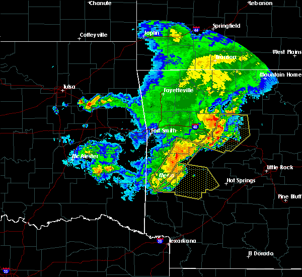 At 1014 am cdt, severe thunderstorms were located along a line extending from blue mountain to 11 miles northwest of oden to near mccauley, moving southeast at 40 mph (radar indicated). Hazards include 60 mph wind gusts and quarter size hail. Hail damage to vehicles is expected. expect wind damage to roofs, siding, and trees. Locations impacted include, mena, booneville, waldron, magazine, blue mountain, stonehouse recreation area, cardiff, polk county fairgrounds, mena intermountain airport, mccauley, mount magazine, shady, gravelly, havana, caulksville, acorn, board camp, olio, ink, potter,. At 1014 am cdt, severe thunderstorms were located along a line extending from blue mountain to 11 miles northwest of oden to near mccauley, moving southeast at 40 mph (radar indicated). Hazards include 60 mph wind gusts and quarter size hail. Hail damage to vehicles is expected. expect wind damage to roofs, siding, and trees. Locations impacted include, mena, booneville, waldron, magazine, blue mountain, stonehouse recreation area, cardiff, polk county fairgrounds, mena intermountain airport, mccauley, mount magazine, shady, gravelly, havana, caulksville, acorn, board camp, olio, ink, potter,.
|
| 6/18/2017 9:53 AM CDT |
 At 953 am cdt, severe thunderstorms were located along a line extending from near magazine to 6 miles south of waldron to near hatfield, moving southeast at 40 mph (radar indicated). Hazards include 60 mph wind gusts and quarter size hail. Hail damage to vehicles is expected. expect wind damage to roofs, siding, and trees. Locations impacted include, mena, booneville, waldron, mansfield, magazine, wickes, hatfield, blue mountain, vandervoort, beauchamp, cardiff, mountain fork, stonehouse recreation area, cossatot river state park, polk county fairgrounds, mena intermountain airport, mccauley, mount magazine, shady, echo,. At 953 am cdt, severe thunderstorms were located along a line extending from near magazine to 6 miles south of waldron to near hatfield, moving southeast at 40 mph (radar indicated). Hazards include 60 mph wind gusts and quarter size hail. Hail damage to vehicles is expected. expect wind damage to roofs, siding, and trees. Locations impacted include, mena, booneville, waldron, mansfield, magazine, wickes, hatfield, blue mountain, vandervoort, beauchamp, cardiff, mountain fork, stonehouse recreation area, cossatot river state park, polk county fairgrounds, mena intermountain airport, mccauley, mount magazine, shady, echo,.
|
| 6/18/2017 9:50 AM CDT | Large tree blown down over highway 28 just west of hon... a in scott county AR, 6.6 miles ESE of Waldron, AR |
| 6/18/2017 9:29 AM CDT |
 At 928 am cdt, severe thunderstorms were located along a line extending from branch to near hartford to near muse, moving southeast at 40 mph (radar indicated). Hazards include 60 mph wind gusts and quarter size hail. Hail damage to vehicles is expected. Expect wind damage to roofs, siding, and trees. At 928 am cdt, severe thunderstorms were located along a line extending from branch to near hartford to near muse, moving southeast at 40 mph (radar indicated). Hazards include 60 mph wind gusts and quarter size hail. Hail damage to vehicles is expected. Expect wind damage to roofs, siding, and trees.
|
| 5/28/2017 1:29 AM CDT |
 At 128 am cdt, severe thunderstorms were located along a line extending from near oliver to 10 miles north of opal to hartley, moving east at 50 mph (radar indicated). Hazards include 70 mph wind gusts and nickel size hail. Expect considerable tree damage. damage is likely to mobile homes, roofs, and outbuildings. Locations impacted include, waldron, mansfield, cardiff, echo, oliver, morgan springs, bates, barber, cauthron, winfield, olio, hon, cedar creek, lucas, liberty, nola, harvey, carolan, glendale in logan county, ione, a tornado watch remains in effect until 200 am cdt for western arkansas. At 128 am cdt, severe thunderstorms were located along a line extending from near oliver to 10 miles north of opal to hartley, moving east at 50 mph (radar indicated). Hazards include 70 mph wind gusts and nickel size hail. Expect considerable tree damage. damage is likely to mobile homes, roofs, and outbuildings. Locations impacted include, waldron, mansfield, cardiff, echo, oliver, morgan springs, bates, barber, cauthron, winfield, olio, hon, cedar creek, lucas, liberty, nola, harvey, carolan, glendale in logan county, ione, a tornado watch remains in effect until 200 am cdt for western arkansas.
|
| 5/28/2017 1:07 AM CDT |
 At 106 am cdt, severe thunderstorms were located along a line extending from near heavener to mountain fork to 9 miles west of vandervoort, moving east at 50 mph (radar indicated). Hazards include 70 mph wind gusts and nickel size hail. Expect considerable tree damage. Damage is likely to mobile homes, roofs, and outbuildings. At 106 am cdt, severe thunderstorms were located along a line extending from near heavener to mountain fork to 9 miles west of vandervoort, moving east at 50 mph (radar indicated). Hazards include 70 mph wind gusts and nickel size hail. Expect considerable tree damage. Damage is likely to mobile homes, roofs, and outbuildings.
|
| 5/19/2017 1:04 AM CDT |
 At 103 am cdt, severe thunderstorms were located along a line extending from near devils knob to near paris to near oliver, moving east at 45 mph (radar indicated). Hazards include 60 mph wind gusts and nickel size hail. Expect damage to roofs, siding, and trees. locations impacted include, clarksville, booneville, waldron, paris, lamar, magazine, subiaco, hartman, scranton, ratcliff, blue mountain, beauchamp, cardiff, devils knob, hoyt, midway in logan county, rosetta, woodland, hinkle, echo, this includes interstate 40 between mile markers 45 and 60. A tornado watch remains in effect until 300 am cdt for western and north central arkansas. At 103 am cdt, severe thunderstorms were located along a line extending from near devils knob to near paris to near oliver, moving east at 45 mph (radar indicated). Hazards include 60 mph wind gusts and nickel size hail. Expect damage to roofs, siding, and trees. locations impacted include, clarksville, booneville, waldron, paris, lamar, magazine, subiaco, hartman, scranton, ratcliff, blue mountain, beauchamp, cardiff, devils knob, hoyt, midway in logan county, rosetta, woodland, hinkle, echo, this includes interstate 40 between mile markers 45 and 60. A tornado watch remains in effect until 300 am cdt for western and north central arkansas.
|
| 5/19/2017 12:34 AM CDT |
 At 1232 am cdt, severe thunderstorms were located along a line extending from 7 miles west of saint paul to near charleston to 5 miles southwest of heavener, moving east at 40 mph (radar indicated). Hazards include 60 mph wind gusts and nickel size hail. expect damage to roofs, siding, and trees At 1232 am cdt, severe thunderstorms were located along a line extending from 7 miles west of saint paul to near charleston to 5 miles southwest of heavener, moving east at 40 mph (radar indicated). Hazards include 60 mph wind gusts and nickel size hail. expect damage to roofs, siding, and trees
|
| 4/29/2017 9:53 PM CDT | Tree blown down across the highway near the town of parks in scott county AR, 10.8 miles NW of Waldron, AR |
| 4/29/2017 9:24 PM CDT |
 At 923 pm cdt, severe thunderstorms were located along a line extending from 8 miles east of octavia to vandervoort to near wickes, moving northeast at 70 mph (radar indicated). Hazards include 60 mph wind gusts and penny size hail. expect damage to roofs, siding, and trees At 923 pm cdt, severe thunderstorms were located along a line extending from 8 miles east of octavia to vandervoort to near wickes, moving northeast at 70 mph (radar indicated). Hazards include 60 mph wind gusts and penny size hail. expect damage to roofs, siding, and trees
|
| 4/21/2017 2:01 PM CDT |
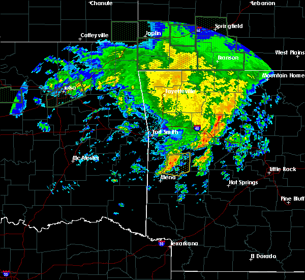 At 200 pm cdt, a severe thunderstorm was located near cardiff, or near waldron, moving east at 45 mph (radar indicated). Hazards include 60 mph wind gusts and penny size hail. Expect damage to roofs, siding, and trees. Locations impacted include, waldron, cardiff, union hill, olio, cedar creek, y city, nola, needmore, harvey, boles, parks, grayson, blue ball,. At 200 pm cdt, a severe thunderstorm was located near cardiff, or near waldron, moving east at 45 mph (radar indicated). Hazards include 60 mph wind gusts and penny size hail. Expect damage to roofs, siding, and trees. Locations impacted include, waldron, cardiff, union hill, olio, cedar creek, y city, nola, needmore, harvey, boles, parks, grayson, blue ball,.
|
| 4/21/2017 1:24 PM CDT |
 At 124 pm cdt, severe thunderstorms were located along a line extending from near mulberry to near echo to near morgan springs, moving east at 40 mph (radar indicated). Hazards include 60 mph wind gusts and quarter size hail. Hail damage to vehicles is expected. Expect wind damage to roofs, siding, and trees. At 124 pm cdt, severe thunderstorms were located along a line extending from near mulberry to near echo to near morgan springs, moving east at 40 mph (radar indicated). Hazards include 60 mph wind gusts and quarter size hail. Hail damage to vehicles is expected. Expect wind damage to roofs, siding, and trees.
|
| 3/7/2017 12:58 AM CST |
 At 1257 am cst, severe thunderstorms were located along a line extending from near stonehouse recreation area to near cardiff, moving northeast at 50 mph (radar indicated). Hazards include 60 mph wind gusts and quarter size hail. Hail damage to vehicles is expected. Expect wind damage to roofs, siding, and trees. At 1257 am cst, severe thunderstorms were located along a line extending from near stonehouse recreation area to near cardiff, moving northeast at 50 mph (radar indicated). Hazards include 60 mph wind gusts and quarter size hail. Hail damage to vehicles is expected. Expect wind damage to roofs, siding, and trees.
|
| 3/7/2017 12:43 AM CST |
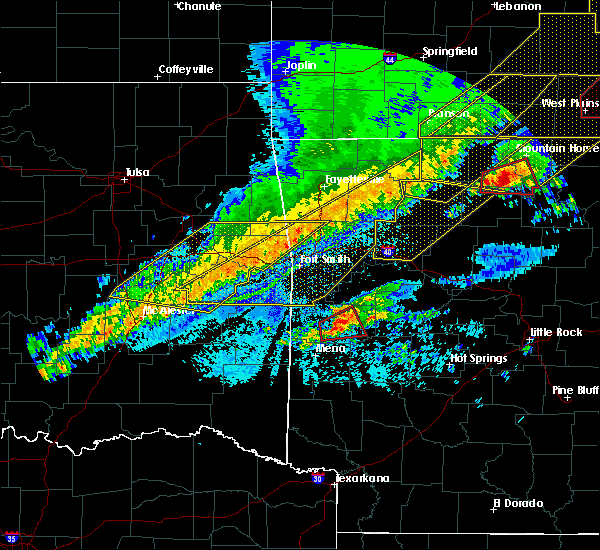 At 1242 am cst, a severe thunderstorm capable of producing a tornado was located near waldron, moving east at 35 mph (radar indicated rotation). Hazards include tornado. Flying debris will be dangerous to those caught without shelter. mobile homes will be damaged or destroyed. damage to roofs, windows, and vehicles will occur. tree damage is likely. Locations impacted include, waldron, cardiff, y city, needmore, cedar creek, boles, parks,. At 1242 am cst, a severe thunderstorm capable of producing a tornado was located near waldron, moving east at 35 mph (radar indicated rotation). Hazards include tornado. Flying debris will be dangerous to those caught without shelter. mobile homes will be damaged or destroyed. damage to roofs, windows, and vehicles will occur. tree damage is likely. Locations impacted include, waldron, cardiff, y city, needmore, cedar creek, boles, parks,.
|
| 3/7/2017 12:28 AM CST |
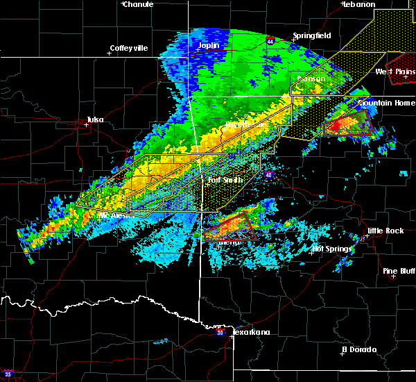 At 1228 am cst, a severe thunderstorm capable of producing a tornado was located near beauchamp, or 10 miles southwest of waldron, moving northeast at 40 mph (radar indicated rotation). Hazards include tornado. Flying debris will be dangerous to those caught without shelter. mobile homes will be damaged or destroyed. damage to roofs, windows, and vehicles will occur. tree damage is likely. Locations impacted include, waldron, beauchamp, cardiff, queen wilhelmina state park, y city, rich mountain, needmore, cedar creek, boles, parks, eagleton,. At 1228 am cst, a severe thunderstorm capable of producing a tornado was located near beauchamp, or 10 miles southwest of waldron, moving northeast at 40 mph (radar indicated rotation). Hazards include tornado. Flying debris will be dangerous to those caught without shelter. mobile homes will be damaged or destroyed. damage to roofs, windows, and vehicles will occur. tree damage is likely. Locations impacted include, waldron, beauchamp, cardiff, queen wilhelmina state park, y city, rich mountain, needmore, cedar creek, boles, parks, eagleton,.
|
| 3/7/2017 12:21 AM CST |
 At 1220 am cst, a severe thunderstorm capable of producing a tornado was located near beauchamp, or 10 miles north of mena, moving northeast at 30 mph (radar indicated rotation). Hazards include tornado. Flying debris will be dangerous to those caught without shelter. mobile homes will be damaged or destroyed. damage to roofs, windows, and vehicles will occur. Tree damage is likely. At 1220 am cst, a severe thunderstorm capable of producing a tornado was located near beauchamp, or 10 miles north of mena, moving northeast at 30 mph (radar indicated rotation). Hazards include tornado. Flying debris will be dangerous to those caught without shelter. mobile homes will be damaged or destroyed. damage to roofs, windows, and vehicles will occur. Tree damage is likely.
|
| 3/6/2017 11:35 PM CST |
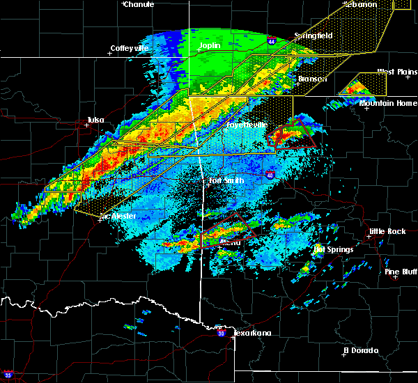 At 1134 pm cst, a severe thunderstorm capable of producing a tornado was located over queen wilhelmina state park, or 11 miles northwest of mena, moving northeast at 35 mph (radar indicated rotation). Hazards include tornado and quarter size hail. Flying debris will be dangerous to those caught without shelter. mobile homes will be damaged or destroyed. damage to roofs, windows, and vehicles will occur. tree damage is likely. Locations impacted include, waldron, beauchamp, queen wilhelmina state park, mountain fork, acorn, black fork, rocky, black fork mountain wilderness, winfield, cedar creek, y city, rich mountain, needmore, boles, parks, eagleton,. At 1134 pm cst, a severe thunderstorm capable of producing a tornado was located over queen wilhelmina state park, or 11 miles northwest of mena, moving northeast at 35 mph (radar indicated rotation). Hazards include tornado and quarter size hail. Flying debris will be dangerous to those caught without shelter. mobile homes will be damaged or destroyed. damage to roofs, windows, and vehicles will occur. tree damage is likely. Locations impacted include, waldron, beauchamp, queen wilhelmina state park, mountain fork, acorn, black fork, rocky, black fork mountain wilderness, winfield, cedar creek, y city, rich mountain, needmore, boles, parks, eagleton,.
|
| 3/6/2017 11:25 PM CST |
 At 1124 pm cst, a severe thunderstorm capable of producing a tornado was located over queen wilhelmina state park, or 11 miles northwest of mena, moving northeast at 35 mph (radar indicated rotation). Hazards include tornado and quarter size hail. Flying debris will be dangerous to those caught without shelter. mobile homes will be damaged or destroyed. damage to roofs, windows, and vehicles will occur. Tree damage is likely. At 1124 pm cst, a severe thunderstorm capable of producing a tornado was located over queen wilhelmina state park, or 11 miles northwest of mena, moving northeast at 35 mph (radar indicated rotation). Hazards include tornado and quarter size hail. Flying debris will be dangerous to those caught without shelter. mobile homes will be damaged or destroyed. damage to roofs, windows, and vehicles will occur. Tree damage is likely.
|
| 7/30/2016 2:33 PM CDT |
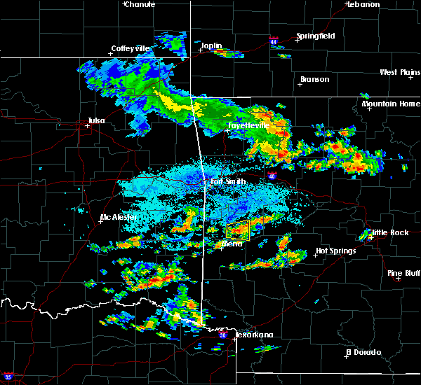 At 233 pm cdt, a severe thunderstorm was located near waldron, moving east at 20 mph (radar indicated). Hazards include 60 mph wind gusts and penny size hail. Expect damage to roofs. siding. And trees. At 233 pm cdt, a severe thunderstorm was located near waldron, moving east at 20 mph (radar indicated). Hazards include 60 mph wind gusts and penny size hail. Expect damage to roofs. siding. And trees.
|
| 7/29/2016 6:47 PM CDT |
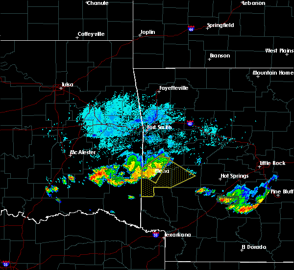 At 646 pm cdt, a severe thunderstorm was located near mena, moving southeast at 15 mph (radar indicated). Hazards include 60 mph wind gusts and half dollar size hail. Hail damage to vehicles is expected. expect wind damage to roofs, siding, and trees. Locations impacted include, mena, waldron, beauchamp, mena intermountain airport, polk county fairgrounds, queen wilhelmina state park, mountain fork, acorn, nunley, rich mountain, eagleton, y city, winfield, rocky, potter, shady grove, ink, dallas, boles, needmore,. At 646 pm cdt, a severe thunderstorm was located near mena, moving southeast at 15 mph (radar indicated). Hazards include 60 mph wind gusts and half dollar size hail. Hail damage to vehicles is expected. expect wind damage to roofs, siding, and trees. Locations impacted include, mena, waldron, beauchamp, mena intermountain airport, polk county fairgrounds, queen wilhelmina state park, mountain fork, acorn, nunley, rich mountain, eagleton, y city, winfield, rocky, potter, shady grove, ink, dallas, boles, needmore,.
|
| 7/29/2016 6:45 PM CDT |
 At 644 pm cdt, severe thunderstorms were located along a line extending from 9 miles northeast of mena to near hatfield, moving southeast at 20 mph (radar indicated). Hazards include 60 mph wind gusts and half dollar size hail. Hail damage to vehicles is expected. Expect wind damage to roofs, siding, and trees. At 644 pm cdt, severe thunderstorms were located along a line extending from 9 miles northeast of mena to near hatfield, moving southeast at 20 mph (radar indicated). Hazards include 60 mph wind gusts and half dollar size hail. Hail damage to vehicles is expected. Expect wind damage to roofs, siding, and trees.
|
| 7/29/2016 6:35 PM CDT |
 At 634 pm cdt, a severe thunderstorm was located near beauchamp, or 8 miles north of mena, moving east at 15 mph (radar indicated). Hazards include 60 mph wind gusts and half dollar size hail. Hail damage to vehicles is expected. expect wind damage to roofs, siding, and trees. Locations impacted include, mena, waldron, beauchamp, queen wilhelmina state park, mena intermountain airport, polk county fairgrounds, morgan springs, mountain fork, bates, acorn, black fork, nunley, black fork mountain wilderness, eagleton, winfield, shady grove, ink, dallas, boles, rich mountain,. At 634 pm cdt, a severe thunderstorm was located near beauchamp, or 8 miles north of mena, moving east at 15 mph (radar indicated). Hazards include 60 mph wind gusts and half dollar size hail. Hail damage to vehicles is expected. expect wind damage to roofs, siding, and trees. Locations impacted include, mena, waldron, beauchamp, queen wilhelmina state park, mena intermountain airport, polk county fairgrounds, morgan springs, mountain fork, bates, acorn, black fork, nunley, black fork mountain wilderness, eagleton, winfield, shady grove, ink, dallas, boles, rich mountain,.
|
| 7/29/2016 6:15 PM CDT |
 At 614 pm cdt, a severe thunderstorm was located near beauchamp, or 13 miles north of mena, moving east at 15 mph (radar indicated). Hazards include 60 mph wind gusts and half dollar size hail. Hail damage to vehicles is expected. Expect wind damage to roofs, siding, and trees. At 614 pm cdt, a severe thunderstorm was located near beauchamp, or 13 miles north of mena, moving east at 15 mph (radar indicated). Hazards include 60 mph wind gusts and half dollar size hail. Hail damage to vehicles is expected. Expect wind damage to roofs, siding, and trees.
|
| 7/16/2016 4:50 PM CDT |
 At 449 pm cdt, a severe thunderstorm was located near oliver, or 9 miles west of waldron, moving east at 5 mph (radar indicated). Hazards include 60 mph wind gusts and nickel size hail. Expect damage to roofs. siding. And trees. At 449 pm cdt, a severe thunderstorm was located near oliver, or 9 miles west of waldron, moving east at 5 mph (radar indicated). Hazards include 60 mph wind gusts and nickel size hail. Expect damage to roofs. siding. And trees.
|
| 7/14/2016 4:15 PM CDT | Trees were downed across highway 28 near park in scott county AR, 10.3 miles NW of Waldron, AR |
| 7/14/2016 4:06 PM CDT |
 At 405 pm cdt, severe thunderstorms were located along a line extending from 10 miles north of woodland to near paris to near hatfield, moving east at 55 mph (trained weather spotters reported 65 mph winds and damage to trees and shingles blown off of roofs in paris). Hazards include 70 mph wind gusts and quarter size hail. Hail damage to vehicles is expected. expect considerable tree damage. wind damage is also likely to mobile homes, roofs, and outbuildings. Locations impacted include, clarksville, mena, booneville, waldron, paris, danville, mount ida, lamar, mansfield, london, magazine, knoxville, subiaco, hartman, hatfield, norman, oden, scranton, ratcliff, blue mountain,. At 405 pm cdt, severe thunderstorms were located along a line extending from 10 miles north of woodland to near paris to near hatfield, moving east at 55 mph (trained weather spotters reported 65 mph winds and damage to trees and shingles blown off of roofs in paris). Hazards include 70 mph wind gusts and quarter size hail. Hail damage to vehicles is expected. expect considerable tree damage. wind damage is also likely to mobile homes, roofs, and outbuildings. Locations impacted include, clarksville, mena, booneville, waldron, paris, danville, mount ida, lamar, mansfield, london, magazine, knoxville, subiaco, hartman, hatfield, norman, oden, scranton, ratcliff, blue mountain,.
|
| 7/14/2016 4:05 PM CDT | Trees were blown down near waldron and in other areas of northern scott count in scott county AR, 0.3 miles NNW of Waldron, AR |
| 7/14/2016 3:28 PM CDT |
 At 328 pm cdt, severe thunderstorms were located along a line extending from near brentwood to near burnville to near muse, moving east at 45 mph (radar indicated). Hazards include 60 mph wind gusts and quarter size hail. Hail damage to vehicles is expected. Expect wind damage to roofs, siding, and trees. At 328 pm cdt, severe thunderstorms were located along a line extending from near brentwood to near burnville to near muse, moving east at 45 mph (radar indicated). Hazards include 60 mph wind gusts and quarter size hail. Hail damage to vehicles is expected. Expect wind damage to roofs, siding, and trees.
|
| 5/12/2016 5:15 AM CDT |
 At 514 am cdt, severe thunderstorms were located along a line extending from near oden to 6 miles northwest of mimosa to near little missouri falls recreation area, moving east at 50 mph (radar indicated). Hazards include 70 mph wind gusts and quarter size hail. Hail damage to vehicles is expected. expect considerable tree damage. wind damage is also likely to mobile homes, roofs, and outbuildings. Locations impacted include, mena, waldron, mount ida, glenwood, amity, norman, oden, daisy, muddy creek wma, mimosa, little missouri fall, mena intermountain a, meyers, opal, caney creek wilderne, mauldin, shady, bard springs recreat, polk county fairgrou, albert pike recreati,. At 514 am cdt, severe thunderstorms were located along a line extending from near oden to 6 miles northwest of mimosa to near little missouri falls recreation area, moving east at 50 mph (radar indicated). Hazards include 70 mph wind gusts and quarter size hail. Hail damage to vehicles is expected. expect considerable tree damage. wind damage is also likely to mobile homes, roofs, and outbuildings. Locations impacted include, mena, waldron, mount ida, glenwood, amity, norman, oden, daisy, muddy creek wma, mimosa, little missouri fall, mena intermountain a, meyers, opal, caney creek wilderne, mauldin, shady, bard springs recreat, polk county fairgrou, albert pike recreati,.
|
| 5/12/2016 5:08 AM CDT |
 At 508 am cdt, severe thunderstorms were located along a line extending from 7 miles northwest of oden to near opal to near little missouri falls recreation area, moving southeast at 50 mph (radar indicated). Hazards include 60 mph wind gusts and quarter size hail. Hail damage to vehicles is expected. expect wind damage to roofs, siding, and trees. Locations impacted include, mena, waldron, mount ida, glenwood, amity, norman, oden, daisy, muddy creek wma, mimosa, little missouri fall, mena intermountain a, meyers, opal, caney creek wilderne, mauldin, shady, bard springs recreat, polk county fairgrou, albert pike recreati,. At 508 am cdt, severe thunderstorms were located along a line extending from 7 miles northwest of oden to near opal to near little missouri falls recreation area, moving southeast at 50 mph (radar indicated). Hazards include 60 mph wind gusts and quarter size hail. Hail damage to vehicles is expected. expect wind damage to roofs, siding, and trees. Locations impacted include, mena, waldron, mount ida, glenwood, amity, norman, oden, daisy, muddy creek wma, mimosa, little missouri fall, mena intermountain a, meyers, opal, caney creek wilderne, mauldin, shady, bard springs recreat, polk county fairgrou, albert pike recreati,.
|
| 5/12/2016 5:04 AM CDT |
 At 504 am cdt, severe thunderstorms were located along a line extending from cardiff to 11 miles northwest of oden to 10 miles north of opal, moving east at 55 mph (radar indicated). Hazards include 60 mph wind gusts and quarter size hail. Hail damage to vehicles is expected. expect wind damage to roofs, siding, and trees. Locations impacted include, waldron, cardiff, acorn, olio, cedar creek, boles, needmore, parks, y city, union hill,. At 504 am cdt, severe thunderstorms were located along a line extending from cardiff to 11 miles northwest of oden to 10 miles north of opal, moving east at 55 mph (radar indicated). Hazards include 60 mph wind gusts and quarter size hail. Hail damage to vehicles is expected. expect wind damage to roofs, siding, and trees. Locations impacted include, waldron, cardiff, acorn, olio, cedar creek, boles, needmore, parks, y city, union hill,.
|
| 5/12/2016 4:58 AM CDT |
 At 457 am cdt, severe thunderstorms were located along a line extending from near waldron to 9 miles northwest of opal to mena intermountain airport, moving east at 50 mph (radar indicated). Hazards include 60 mph wind gusts and quarter size hail. Hail damage to vehicles is expected. Expect wind damage to roofs, siding, and trees. At 457 am cdt, severe thunderstorms were located along a line extending from near waldron to 9 miles northwest of opal to mena intermountain airport, moving east at 50 mph (radar indicated). Hazards include 60 mph wind gusts and quarter size hail. Hail damage to vehicles is expected. Expect wind damage to roofs, siding, and trees.
|
| 5/12/2016 4:50 AM CDT |
 At 450 am cdt, severe thunderstorms were located along a line extending from near waldron to 6 miles southeast of beauchamp, moving east at 35 mph (radar indicated). Hazards include 60 mph wind gusts and quarter size hail. Hail damage to vehicles is expected. expect wind damage to roofs, siding, and trees. Locations impacted include, booneville, waldron, mansfield, magazine, beauchamp, oliver, cardiff, echo, morgan springs, queen wilhelmina sta, acorn, barber, glendale in logan co, cedar creek, eagleton, carolan, hon, winfield, chismville, grayson,. At 450 am cdt, severe thunderstorms were located along a line extending from near waldron to 6 miles southeast of beauchamp, moving east at 35 mph (radar indicated). Hazards include 60 mph wind gusts and quarter size hail. Hail damage to vehicles is expected. expect wind damage to roofs, siding, and trees. Locations impacted include, booneville, waldron, mansfield, magazine, beauchamp, oliver, cardiff, echo, morgan springs, queen wilhelmina sta, acorn, barber, glendale in logan co, cedar creek, eagleton, carolan, hon, winfield, chismville, grayson,.
|
| 5/12/2016 4:38 AM CDT |
 At 438 am cdt, severe thunderstorms were located along a line extending from near oliver to beauchamp to near queen wilhelmina state park, moving northeast at 45 mph (radar indicated). Hazards include 60 mph wind gusts. Expect damage to roofs. siding. and trees. Locations impacted include, booneville, waldron, mansfield, magazine, beauchamp, queen wilhelmina sta, oliver, cardiff, echo, morgan springs, mountain fork, bates, acorn, barber, black fork, glendale in logan co, cedar creek, black fork mountain , eagleton, carolan,. At 438 am cdt, severe thunderstorms were located along a line extending from near oliver to beauchamp to near queen wilhelmina state park, moving northeast at 45 mph (radar indicated). Hazards include 60 mph wind gusts. Expect damage to roofs. siding. and trees. Locations impacted include, booneville, waldron, mansfield, magazine, beauchamp, queen wilhelmina sta, oliver, cardiff, echo, morgan springs, mountain fork, bates, acorn, barber, black fork, glendale in logan co, cedar creek, black fork mountain , eagleton, carolan,.
|
| 5/12/2016 4:24 AM CDT |
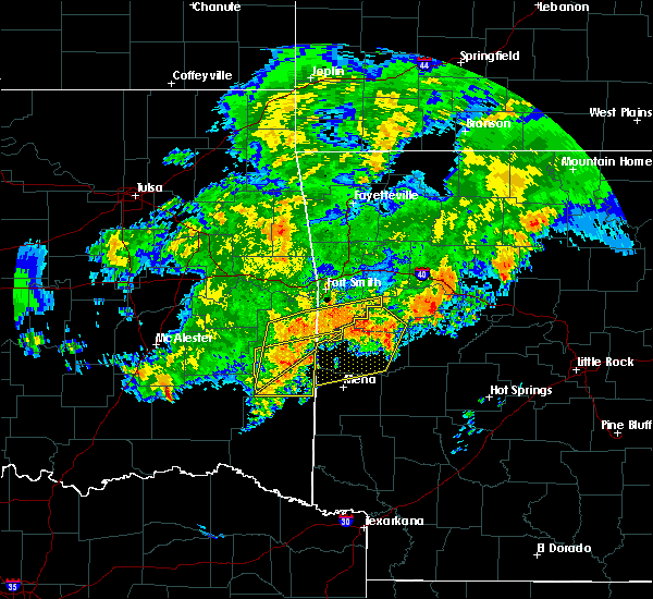 At 424 am cdt, severe thunderstorms were located along a line extending from heavener to near heavener runestone state park to big cedar, moving northeast at 50 mph (radar indicated). Hazards include 60 mph wind gusts. Expect damage to roofs. siding. And trees. At 424 am cdt, severe thunderstorms were located along a line extending from heavener to near heavener runestone state park to big cedar, moving northeast at 50 mph (radar indicated). Hazards include 60 mph wind gusts. Expect damage to roofs. siding. And trees.
|
| 4/27/2016 1:59 AM CDT |
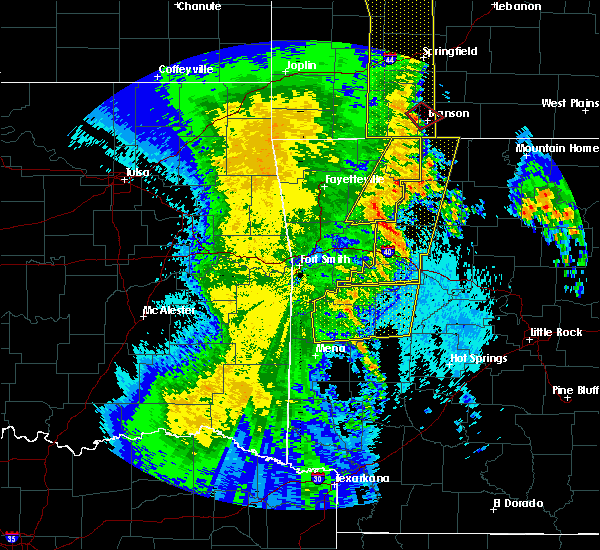 At 159 am cdt, severe thunderstorms were located along a line extending from near branch to 12 miles south of cardiff, moving east at 50 mph (radar indicated). Hazards include 60 mph wind gusts and penny size hail. Expect damage to roofs. siding. and trees. Locations impacted include, booneville, waldron, danville, mansfield, magazine, blue mountain, muddy creek wma, mount magazine, cardiff, echo, fourche valley, gravelly, stonehouse recreatio, belleville, havana, corinth, barber, bluffton, fourche mountain rec, briggsville,. At 159 am cdt, severe thunderstorms were located along a line extending from near branch to 12 miles south of cardiff, moving east at 50 mph (radar indicated). Hazards include 60 mph wind gusts and penny size hail. Expect damage to roofs. siding. and trees. Locations impacted include, booneville, waldron, danville, mansfield, magazine, blue mountain, muddy creek wma, mount magazine, cardiff, echo, fourche valley, gravelly, stonehouse recreatio, belleville, havana, corinth, barber, bluffton, fourche mountain rec, briggsville,.
|
| 4/27/2016 1:33 AM CDT |
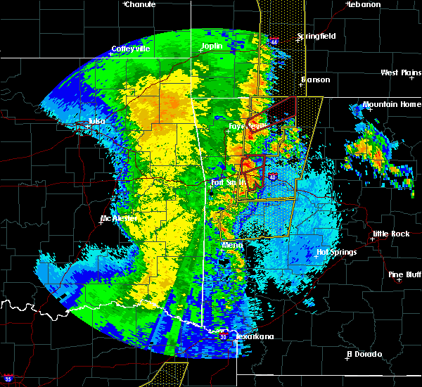 At 133 am cdt, severe thunderstorms were located along a line extending from greenwood to 10 miles southeast of beauchamp, moving east at 50 mph (radar indicated). Hazards include 60 mph wind gusts and penny size hail. Expect damage to roofs. siding. And trees. At 133 am cdt, severe thunderstorms were located along a line extending from greenwood to 10 miles southeast of beauchamp, moving east at 50 mph (radar indicated). Hazards include 60 mph wind gusts and penny size hail. Expect damage to roofs. siding. And trees.
|
| 4/27/2016 1:12 AM CDT |
 At 112 am cdt, severe thunderstorms were located along a line extending from morgan springs to near mena intermountain airport to near grannis, moving east at 45 mph (radar indicated). Hazards include 60 mph wind gusts. Expect damage to roofs. siding. and trees. Locations impacted include, mena, booneville, waldron, paris, mansfield, magazine, wickes, grannis, hatfield, oden, ratcliff, blue mountain, daisy, vandervoort, beauchamp, mccauley, hartley, cossatot river state, mimosa, little missouri fall,. At 112 am cdt, severe thunderstorms were located along a line extending from morgan springs to near mena intermountain airport to near grannis, moving east at 45 mph (radar indicated). Hazards include 60 mph wind gusts. Expect damage to roofs. siding. and trees. Locations impacted include, mena, booneville, waldron, paris, mansfield, magazine, wickes, grannis, hatfield, oden, ratcliff, blue mountain, daisy, vandervoort, beauchamp, mccauley, hartley, cossatot river state, mimosa, little missouri fall,.
|
| 4/27/2016 1:03 AM CDT |
 At 102 am cdt, severe thunderstorms were located along a line extending from near heavener to near hatfield to 8 miles west of gillham, moving northeast at 50 mph (radar indicated). Hazards include 60 mph wind gusts. Expect damage to roofs. siding. and trees. Locations impacted include, mena, booneville, waldron, paris, mansfield, magazine, wickes, grannis, hatfield, oden, ratcliff, blue mountain, daisy, vandervoort, beauchamp, mccauley, hartley, cossatot river state, mimosa, little missouri fall,. At 102 am cdt, severe thunderstorms were located along a line extending from near heavener to near hatfield to 8 miles west of gillham, moving northeast at 50 mph (radar indicated). Hazards include 60 mph wind gusts. Expect damage to roofs. siding. and trees. Locations impacted include, mena, booneville, waldron, paris, mansfield, magazine, wickes, grannis, hatfield, oden, ratcliff, blue mountain, daisy, vandervoort, beauchamp, mccauley, hartley, cossatot river state, mimosa, little missouri fall,.
|
| 4/27/2016 12:31 AM CDT |
 At 1230 am cdt, severe thunderstorms were located along a line extending from near whitesboro to 12 miles south of octavia to 9 miles southwest of idabel, moving northeast at 55 mph (radar indicated). Hazards include 60 mph wind gusts. Expect damage to roofs. siding. And trees. At 1230 am cdt, severe thunderstorms were located along a line extending from near whitesboro to 12 miles south of octavia to 9 miles southwest of idabel, moving northeast at 55 mph (radar indicated). Hazards include 60 mph wind gusts. Expect damage to roofs. siding. And trees.
|
| 3/30/2016 3:14 PM CDT |
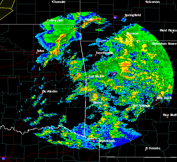 At 313 pm cdt, a severe thunderstorm was located near beauchamp, or 11 miles north of mena, moving northeast at 50 mph (radar indicated). Hazards include 60 mph wind gusts. Expect damage to roofs. siding. and trees. Locations impacted include, waldron, beauchamp, oliver, needmore, winfield, cauthron, boles,. At 313 pm cdt, a severe thunderstorm was located near beauchamp, or 11 miles north of mena, moving northeast at 50 mph (radar indicated). Hazards include 60 mph wind gusts. Expect damage to roofs. siding. and trees. Locations impacted include, waldron, beauchamp, oliver, needmore, winfield, cauthron, boles,.
|
| 3/30/2016 3:04 PM CDT |
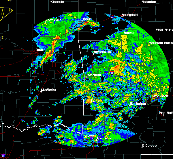 At 304 pm cdt, a severe thunderstorm was located near mena, moving northeast at 70 mph (radar indicated). Hazards include 60 mph wind gusts. Expect damage to roofs. siding. And trees. At 304 pm cdt, a severe thunderstorm was located near mena, moving northeast at 70 mph (radar indicated). Hazards include 60 mph wind gusts. Expect damage to roofs. siding. And trees.
|
| 3/13/2016 4:26 PM CDT |
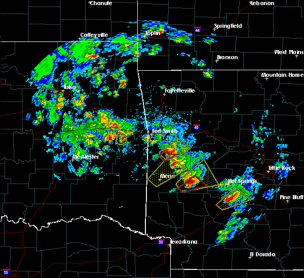 The tornado warning for north central scott county will expire at 430 pm cdt, the tornado threat has diminished and the tornado warning has been cancelled. however, large hail and damaging winds remain likely and a severe thunderstorm warning remains in effect for the area. however small hail is still possible with this thunderstorm. a tornado watch remains in effect until 800 pm cdt for western arkansas. remember, a severe thunderstorm warning still remains in effect for northern scott and southwest logan counties. The tornado warning for north central scott county will expire at 430 pm cdt, the tornado threat has diminished and the tornado warning has been cancelled. however, large hail and damaging winds remain likely and a severe thunderstorm warning remains in effect for the area. however small hail is still possible with this thunderstorm. a tornado watch remains in effect until 800 pm cdt for western arkansas. remember, a severe thunderstorm warning still remains in effect for northern scott and southwest logan counties.
|
| 3/13/2016 4:16 PM CDT |
 At 416 pm cdt, a severe thunderstorm capable of producing a tornado was located near waldron, moving northeast at 30 mph (radar indicated rotation). Hazards include tornado and golf ball size hail. Flying debris will be dangerous to those caught without shelter. mobile homes will be damaged or destroyed. damage to roofs, windows, and vehicles will occur. tree damage is likely. This tornadic thunderstorm will remain over mainly rural areas of north central scott county, including the following locations: elm park and hon. At 416 pm cdt, a severe thunderstorm capable of producing a tornado was located near waldron, moving northeast at 30 mph (radar indicated rotation). Hazards include tornado and golf ball size hail. Flying debris will be dangerous to those caught without shelter. mobile homes will be damaged or destroyed. damage to roofs, windows, and vehicles will occur. tree damage is likely. This tornadic thunderstorm will remain over mainly rural areas of north central scott county, including the following locations: elm park and hon.
|
| 3/13/2016 4:04 PM CDT |
 At 404 pm cdt, a severe thunderstorm capable of producing a tornado was located near oliver, or near waldron, moving northeast at 35 mph (radar indicated rotation). Hazards include tornado. Flying debris will be dangerous to those caught without shelter. mobile homes will be damaged or destroyed. damage to roofs, windows, and vehicles will occur. tree damage is likely. this dangerous storm will be near, waldron around 410 pm cdt. Other locations impacted by this tornadic thunderstorm include hon, winfield, elm park and cauthron. At 404 pm cdt, a severe thunderstorm capable of producing a tornado was located near oliver, or near waldron, moving northeast at 35 mph (radar indicated rotation). Hazards include tornado. Flying debris will be dangerous to those caught without shelter. mobile homes will be damaged or destroyed. damage to roofs, windows, and vehicles will occur. tree damage is likely. this dangerous storm will be near, waldron around 410 pm cdt. Other locations impacted by this tornadic thunderstorm include hon, winfield, elm park and cauthron.
|
| 3/13/2016 4:03 PM CDT |
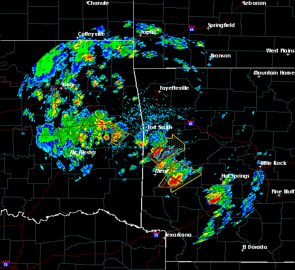 At 403 pm cdt, a severe thunderstorm was located 9 miles southeast of beauchamp, or 10 miles south of waldron, moving northeast at 40 mph (radar indicated). Hazards include 60 mph wind gusts. Expect damage to roofs. siding. and trees. locations impacted include, waldron, boles, parks, needmore and y city. A tornado watch remains in effect until 800 pm cdt for western arkansas. At 403 pm cdt, a severe thunderstorm was located 9 miles southeast of beauchamp, or 10 miles south of waldron, moving northeast at 40 mph (radar indicated). Hazards include 60 mph wind gusts. Expect damage to roofs. siding. and trees. locations impacted include, waldron, boles, parks, needmore and y city. A tornado watch remains in effect until 800 pm cdt for western arkansas.
|
| 3/13/2016 4:01 PM CDT |
 At 401 pm cdt, a severe thunderstorm was located over oliver, or 7 miles west of waldron, moving northeast at 35 mph (radar indicated). Hazards include golf ball size hail and 60 mph wind gusts. People and animals outdoors will be injured. expect hail damage to roofs, siding, windows, and vehicles. Expect wind damage to roofs, siding, and trees. At 401 pm cdt, a severe thunderstorm was located over oliver, or 7 miles west of waldron, moving northeast at 35 mph (radar indicated). Hazards include golf ball size hail and 60 mph wind gusts. People and animals outdoors will be injured. expect hail damage to roofs, siding, windows, and vehicles. Expect wind damage to roofs, siding, and trees.
|
| 3/13/2016 3:51 PM CDT |
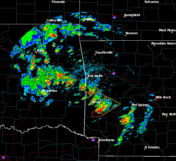 At 351 pm cdt, a severe thunderstorm was located near mena, moving northeast at 40 mph (radar indicated). Hazards include 70 mph wind gusts and quarter size hail. Hail damage to vehicles is expected. expect considerable tree damage. wind damage is also likely to mobile homes, roofs, and outbuildings. locations impacted include, mena, waldron, acorn, cedar creek, boles, needmore, parks and y city. A tornado watch remains in effect until 800 pm cdt for western arkansas. At 351 pm cdt, a severe thunderstorm was located near mena, moving northeast at 40 mph (radar indicated). Hazards include 70 mph wind gusts and quarter size hail. Hail damage to vehicles is expected. expect considerable tree damage. wind damage is also likely to mobile homes, roofs, and outbuildings. locations impacted include, mena, waldron, acorn, cedar creek, boles, needmore, parks and y city. A tornado watch remains in effect until 800 pm cdt for western arkansas.
|
| 3/13/2016 3:45 PM CDT | Golf Ball sized hail reported 10.6 miles ENE of Waldron, AR, golf ball sized hail reported by fire department in lake hinkle. |
| 3/13/2016 3:44 PM CDT | 7-8 houses were damaged near winfiel in scott county AR, 5.3 miles ENE of Waldron, AR |
| 3/13/2016 3:40 PM CDT |
 At 340 pm cdt, a severe thunderstorm was located near polk county fairgrounds, or near mena, moving northeast at 40 mph (radar indicated). Hazards include 70 mph wind gusts and quarter size hail. Hail damage to vehicles is expected. expect considerable tree damage. Wind damage is also likely to mobile homes, roofs, and outbuildings. At 340 pm cdt, a severe thunderstorm was located near polk county fairgrounds, or near mena, moving northeast at 40 mph (radar indicated). Hazards include 70 mph wind gusts and quarter size hail. Hail damage to vehicles is expected. expect considerable tree damage. Wind damage is also likely to mobile homes, roofs, and outbuildings.
|
| 12/27/2015 4:38 AM CST |
 The tornado warning for southwestern scott and northern polk counties will expire at 445 am cst, the storm which prompted the warning has weakened below severe limits, and no longer appears capable of producing a tornado. therefore the warning will be allowed to expire. however heavy rain is still possible with this thunderstorm. The tornado warning for southwestern scott and northern polk counties will expire at 445 am cst, the storm which prompted the warning has weakened below severe limits, and no longer appears capable of producing a tornado. therefore the warning will be allowed to expire. however heavy rain is still possible with this thunderstorm.
|
| 12/27/2015 4:27 AM CST |
 At 427 am cst, a severe thunderstorm capable of producing a tornado was located near mena, moving northeast at 30 mph (radar indicated rotation). Hazards include tornado. Flying debris will be dangerous to those caught without shelter. mobile homes will be damaged or destroyed. damage to roofs, windows, and vehicles will occur. tree damage is likely. Locations impacted include, mena, waldron, hatfield, beauchamp, polk county fairgrounds, queen wilhelmina state park, mountain fork, acorn, rich mountain, camp pioneer, eagleton, y city, hon, winfield, rocky, potter, shady grove, boles, needmore and parks. At 427 am cst, a severe thunderstorm capable of producing a tornado was located near mena, moving northeast at 30 mph (radar indicated rotation). Hazards include tornado. Flying debris will be dangerous to those caught without shelter. mobile homes will be damaged or destroyed. damage to roofs, windows, and vehicles will occur. tree damage is likely. Locations impacted include, mena, waldron, hatfield, beauchamp, polk county fairgrounds, queen wilhelmina state park, mountain fork, acorn, rich mountain, camp pioneer, eagleton, y city, hon, winfield, rocky, potter, shady grove, boles, needmore and parks.
|
| 12/27/2015 4:13 AM CST |
 At 413 am cst, a severe thunderstorm capable of producing a tornado was located over polk county fairgrounds, or near mena, moving northeast at 40 mph (radar indicated rotation). Hazards include tornado and quarter size hail. Flying debris will be dangerous to those caught without shelter. mobile homes will be damaged or destroyed. damage to roofs, windows, and vehicles will occur. Tree damage is likely. At 413 am cst, a severe thunderstorm capable of producing a tornado was located over polk county fairgrounds, or near mena, moving northeast at 40 mph (radar indicated rotation). Hazards include tornado and quarter size hail. Flying debris will be dangerous to those caught without shelter. mobile homes will be damaged or destroyed. damage to roofs, windows, and vehicles will occur. Tree damage is likely.
|
| 12/23/2015 6:32 AM CST |
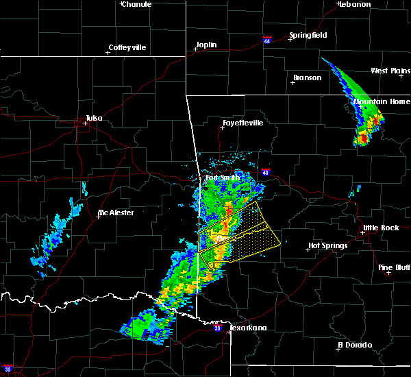 At 631 am cst, a severe thunderstorm was located near waldron, moving northeast at 55 mph (radar indicated). Hazards include 60 mph wind gusts and quarter size hail. Hail damage to vehicles is expected. expect wind damage to roofs, siding, and trees. locations impacted include, waldron, blue mountain, beauchamp, muddy creek wma, gravelly, cardiff, stonehouse recreation area, acorn, harvey, cedar creek, blue ball, union hill, y city, nola, olio, boles, needmore, parks and sugar grove. A tornado watch remains in effect until 100 pm cst for western arkansas. At 631 am cst, a severe thunderstorm was located near waldron, moving northeast at 55 mph (radar indicated). Hazards include 60 mph wind gusts and quarter size hail. Hail damage to vehicles is expected. expect wind damage to roofs, siding, and trees. locations impacted include, waldron, blue mountain, beauchamp, muddy creek wma, gravelly, cardiff, stonehouse recreation area, acorn, harvey, cedar creek, blue ball, union hill, y city, nola, olio, boles, needmore, parks and sugar grove. A tornado watch remains in effect until 100 pm cst for western arkansas.
|
| 12/23/2015 6:07 AM CST |
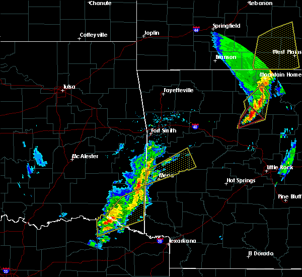 At 606 am cst, a severe thunderstorm was located over queen wilhelmina state park, or 10 miles northwest of mena, moving northeast at 60 mph (radar indicated). Hazards include 60 mph wind gusts and quarter size hail. Hail damage to vehicles is expected. Expect wind damage to roofs, siding, and trees. At 606 am cst, a severe thunderstorm was located over queen wilhelmina state park, or 10 miles northwest of mena, moving northeast at 60 mph (radar indicated). Hazards include 60 mph wind gusts and quarter size hail. Hail damage to vehicles is expected. Expect wind damage to roofs, siding, and trees.
|
| 11/5/2015 7:26 PM CST |
 At 723 pm cst, a severe thunderstorm was located near oliver, or 13 miles northwest of waldron, moving northeast at 55 mph (radar indicated). Hazards include 60 mph wind gusts and quarter size hail. Hail damage to vehicles is expected. expect wind damage to roofs, siding and trees. locations impacted include, waldron, mansfield, oliver, echo, morgan springs, bates, barber, cauthron, hon, liberty, lucas, ione and elm park. A tornado watch remains in effect until 900 pm cst for western arkansas. At 723 pm cst, a severe thunderstorm was located near oliver, or 13 miles northwest of waldron, moving northeast at 55 mph (radar indicated). Hazards include 60 mph wind gusts and quarter size hail. Hail damage to vehicles is expected. expect wind damage to roofs, siding and trees. locations impacted include, waldron, mansfield, oliver, echo, morgan springs, bates, barber, cauthron, hon, liberty, lucas, ione and elm park. A tornado watch remains in effect until 900 pm cst for western arkansas.
|
| 11/5/2015 7:08 PM CST |
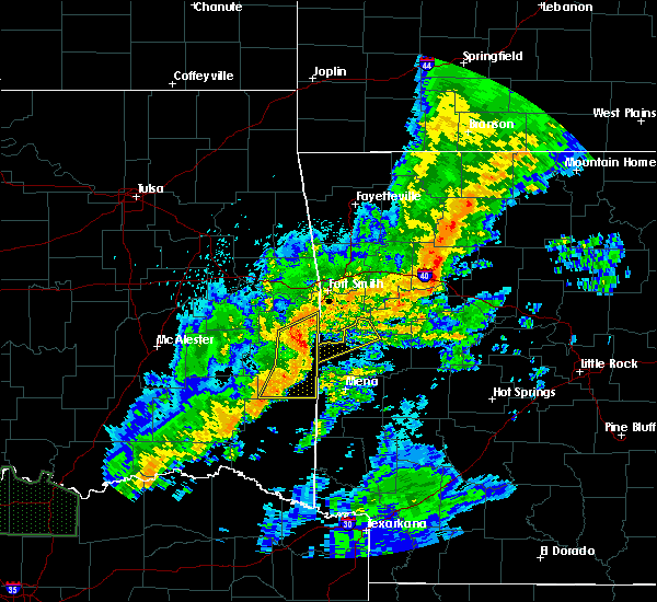 At 708 pm cst, a severe thunderstorm was located near heavener runestone state park, or 13 miles southeast of poteau, moving northeast at 55 mph (radar indicated). Hazards include 60 mph wind gusts and quarter size hail. Hail damage to vehicles is expected. Expect wind damage to roofs, siding and trees. At 708 pm cst, a severe thunderstorm was located near heavener runestone state park, or 13 miles southeast of poteau, moving northeast at 55 mph (radar indicated). Hazards include 60 mph wind gusts and quarter size hail. Hail damage to vehicles is expected. Expect wind damage to roofs, siding and trees.
|
| 5/25/2015 6:29 PM CDT | At 627 pm cdt, severe thunderstorms were located along a line extending from mansfield to 8 miles northeast of opal to 7 miles northwest of highland, and moving east at 50 mph (radar indicated). Hazards include 70 mph wind gusts and quarter size hail. Hail damage to vehicles is expected. expect considerable tree damage. Wind damage is also likely to mobile homes, roofs and outbuildings. |
| 5/25/2015 6:17 PM CDT | At 614 pm cdt, severe thunderstorms were located along a line extending from hackett to 5 miles north of lake mena to lockesburg, and moving east at 50 mph (radar indicated). Hazards include 70 mph wind gusts and quarter size hail. Hail damage to vehicles is expected. expect considerable tree damage. Wind damage is also likely to mobile homes, roofs and outbuildings. |
| 5/25/2015 5:48 PM CDT | At 545 pm cdt, severe thunderstorms were located along a line extending from 10 miles west of black fork to 7 miles west of hatfield to 5 miles northwest of horatio, and moving east at 50 mph (radar indicated). Hazards include 60 mph wind gusts and quarter size hail. Hail damage to vehicles is possible. Expect wind damage to roofs, siding and trees. |
| 5/25/2015 5:31 PM CDT | At 526 pm cdt, severe thunderstorms were located along a line extending from 20 miles west of black fork to 15 miles west of hatfield to 15 miles west of wickes, and moving east at 45 mph (radar indicated). Hazards include 60 mph wind gusts and quarter size hail. Hail damage to vehicles is possible. Expect wind damage to roofs, siding and trees. |
| 5/24/2015 3:20 PM CDT | At 318 pm cdt, severe thunderstorms were located along a line extending from 7 miles southwest of morgan springs to waldron to gravelly, and moving north at 70 mph (radar indicated). Hazards include 60 mph wind gusts. Expect damage to roofs. Siding and trees. |
| 5/24/2015 3:00 PM CDT | Numerous trees reported down across the county with several power outages as wel in scott county AR, 0.3 miles NNW of Waldron, AR |
| 5/24/2015 2:56 PM CDT | At 253 pm cdt, severe thunderstorms were located along a line extending from queen wilhelmina state park to oden, and moving north at 70 mph (radar indicated). Hazards include 60 mph wind gusts. Expect damage to roofs. Siding and trees. |
| 5/10/2015 10:51 PM CDT | At 1046 pm cdt, severe thunderstorms were located along a line extending from cardiff to mountain fork, and moving southeast at 40 mph (radar indicated). Hazards include 60 mph wind gusts and quarter size hail. Hail damage to vehicles is expected. Expect wind damage to roofs, siding and trees. |
| 5/10/2015 10:35 PM CDT | At 1031 pm cdt, severe thunderstorms were located along a line extending from huntington to queen wilhelmina state park, and moving southeast at 40 mph (radar indicated). Hazards include 60 mph wind gusts and quarter size hail. Hail damage to vehicles is expected. Expect wind damage to roofs, siding and trees. |
| 4/19/2015 4:15 PM CDT | At 411 pm cdt, a severe thunderstorm was located near blue mtn lake, and moving east at 30 mph (radar indicated). Hazards include golf ball to tennisball size hail and 60 mph wind gusts. People and animals outdoors will be injured. expect hail damage to roofs, siding, windows and vehicles. Expect wind damage to roofs, siding and trees. |
| 4/19/2015 3:57 PM CDT | At 353 pm cdt, a severe thunderstorm was located near huntington, and moving east at 35 mph. another severe storm was located 4 miles south of booneville, and moving northeast at 30 mph (radar indicated). Hazards include quarter to golf ball size hail and 60 mph wind gusts. People and animals outdoors will be injured. expect hail damage to roofs, siding, windows and vehicles. Expect wind damage to roofs, siding and trees. |
| 4/19/2015 3:50 PM CDT | At 348 pm cdt, a severe thunderstorm was located near huntington, and moving east at 40 mph. other storms continued developing in the warning area, and may become severe (radar indicated). Hazards include golf ball size hail and 60 mph wind gusts. People and animals outdoors will be injured. expect hail damage to roofs, siding, windows and vehicles. Expect wind damage to roofs, siding and trees. |
| 4/19/2015 3:39 PM CDT | At 335 pm cdt, a severe thunderstorm was located near midland, and moving east at 40 mph. other storms were popping up in the warning area and may become severe (radar indicated). Hazards include golf ball size hail and 60 mph wind gusts. People and animals outdoors will be injured. expect hail damage to roofs, siding, windows and vehicles. Expect wind damage to roofs, siding and trees. |
| 4/19/2015 3:25 PM CDT | this alert has expired |
| 3/26/2015 1:36 AM CDT | A severe thunderstorm warning remains in effect for scott and northern polk counties until 215 am cdt. at 134 am cdt. national weather service doppler radar continued to indicate a line of severe thunderstorms capable of producing damaging winds in excess of 60 mph. These storms were located along a line extending from black fork to queen wilhelmina state park to 2 miles. |
| 3/26/2015 1:11 AM CDT | The national weather service in little rock has issued a * severe thunderstorm warning for. northern polk county in western arkansas. scott county in western arkansas. until 215 am cdt * at 107 am cdt. National weather service doppler radar indicated a. |
| 4/27/2014 11:07 PM CDT | Limbs were blown dow in scott county AR, 0.3 miles NNW of Waldron, AR |
| 4/27/2014 6:40 PM CDT | Golf Ball sized hail reported 3.2 miles NNE of Waldron, AR, reported along ross creek road. |
| 9/1/2013 7:00 PM CDT | Several large tree limbs dow in scott county AR, 14.5 miles ENE of Waldron, AR |
| 9/1/2013 6:15 PM CDT | Trees down on highway 28 southeast of waldro in scott county AR, 2 miles NW of Waldron, AR |
| 8/8/2013 8:50 PM CDT | A few trees reported down along highway 25 in scott county AR, 2.9 miles NW of Waldron, AR |
| 12/19/2012 10:40 PM CST | Trees were downed at y cit in scott county AR, 12 miles N of Waldron, AR |
| 12/19/2012 10:40 PM CST | Trees were downed along highway 80 east of waldro in scott county AR, 4.6 miles W of Waldron, AR |
| 9/7/2012 7:33 PM CDT | Trees reported dow in scott county AR, 10.8 miles NW of Waldron, AR |
| 7/12/2012 7:38 PM CDT | Scott county sheriff office reported trees down...roofs blown off chicken houses...barns blown over...and roofs blown off of barn in scott county AR, 12 miles N of Waldron, AR |
| 7/8/2012 4:16 PM CDT | Trees and powerlines down in beaucham in scott county AR, 13.8 miles ENE of Waldron, AR |
| 7/8/2012 3:21 PM CDT | Trees and powerlines down in waldron and also 5 miles wsw in winfiel in scott county AR, 0.3 miles NNW of Waldron, AR |
| 7/8/2012 3:00 PM CDT | Trees down on powerlines east of waldro in scott county AR, 3.9 miles WNW of Waldron, AR |
| 1/1/0001 12:00 AM | Estimated 60-70 mph winds caused damage in a 2-mile swath across waldron. dozens of trees and power lines were blown down...as well as street lights. several houses had in scott county AR, 0.3 miles NNW of Waldron, AR |
| 1/1/0001 12:00 AM | Quarter sized hail reported 4.6 miles W of Waldron, AR, thunderstorm wind gusts of 60 mph were also measured at the same time the hail was falling |
| 1/1/0001 12:00 AM | Quarter sized hail reported 7.1 miles NNW of Waldron, AR, hail fell at intersection of hwy 71 and 28 east. |
| 1/1/0001 12:00 AM | Quarter sized hail reported 10.8 miles NW of Waldron, AR |
| 1/1/0001 12:00 AM | Quarter sized hail reported 9.5 miles NNW of Waldron, AR, reported along hwy 71 south of boles. |
| 1/1/0001 12:00 AM | Quarter sized hail reported 0.3 miles NNW of Waldron, AR |
| 1/1/0001 12:00 AM | Ping Pong Ball sized hail reported 10.8 miles NW of Waldron, AR |
Hail Maps for Waldron, AR
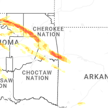
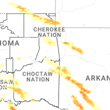
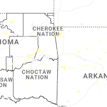

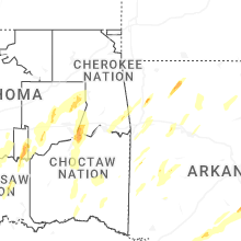


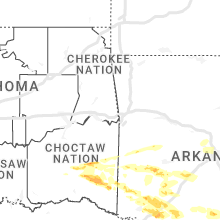


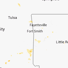


Connect with Interactive Hail Maps