

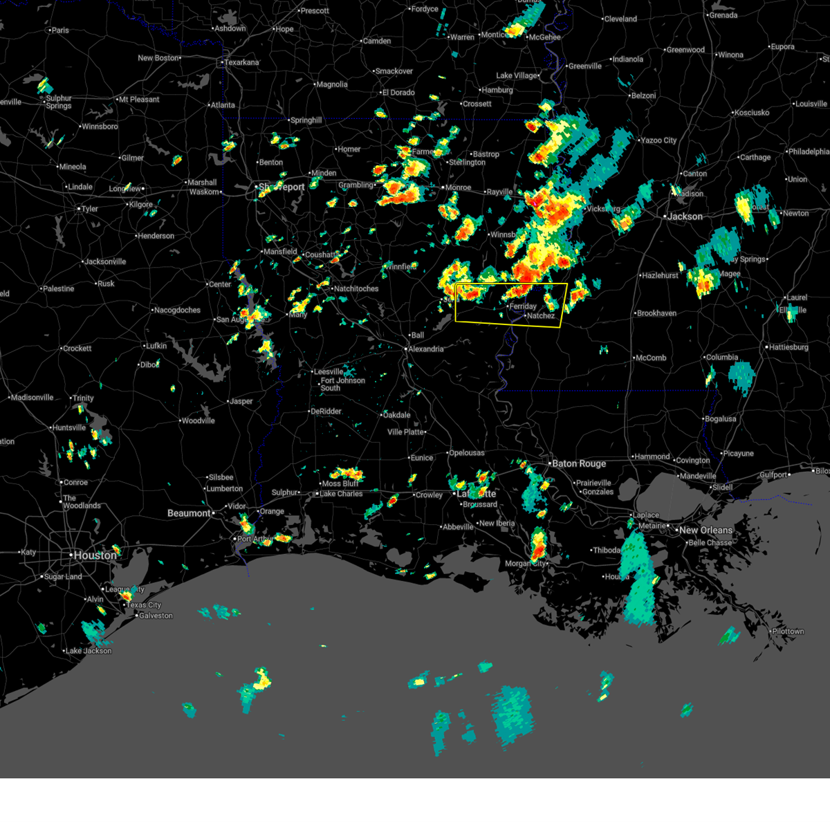
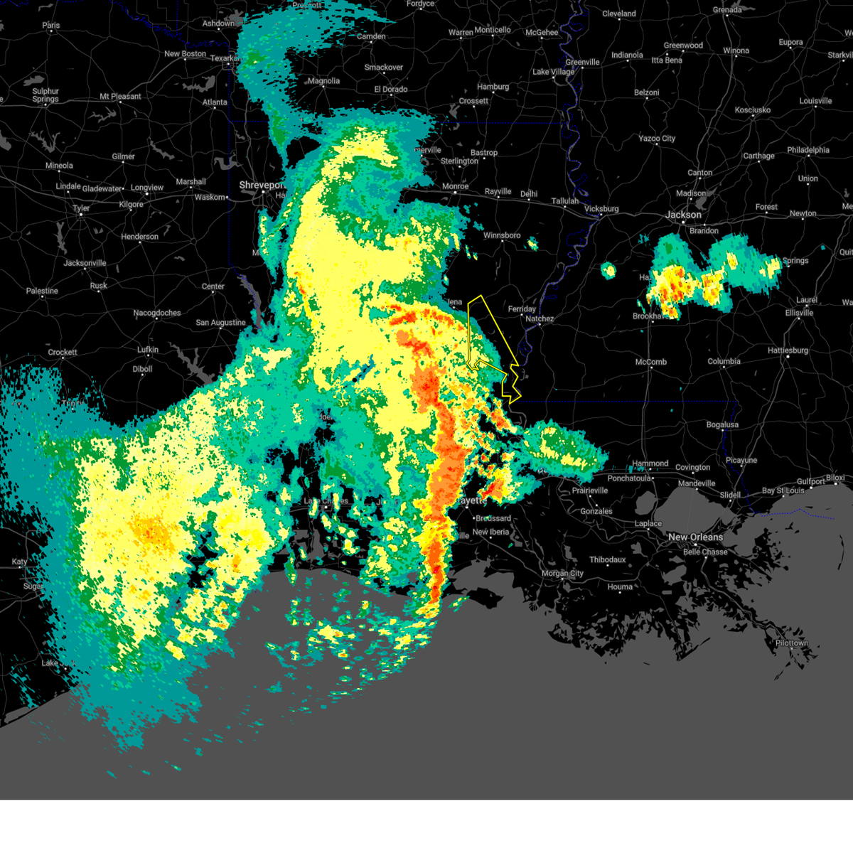
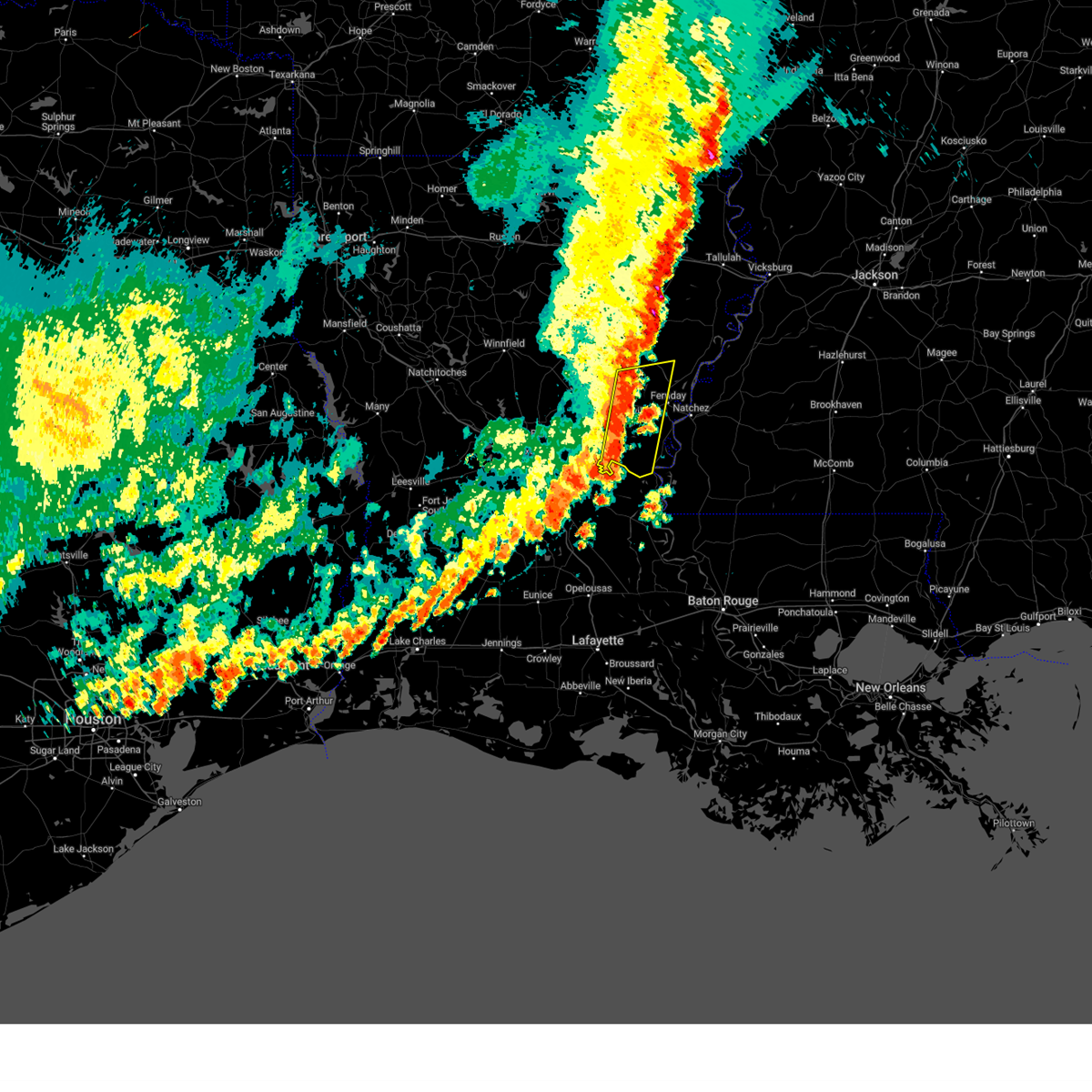
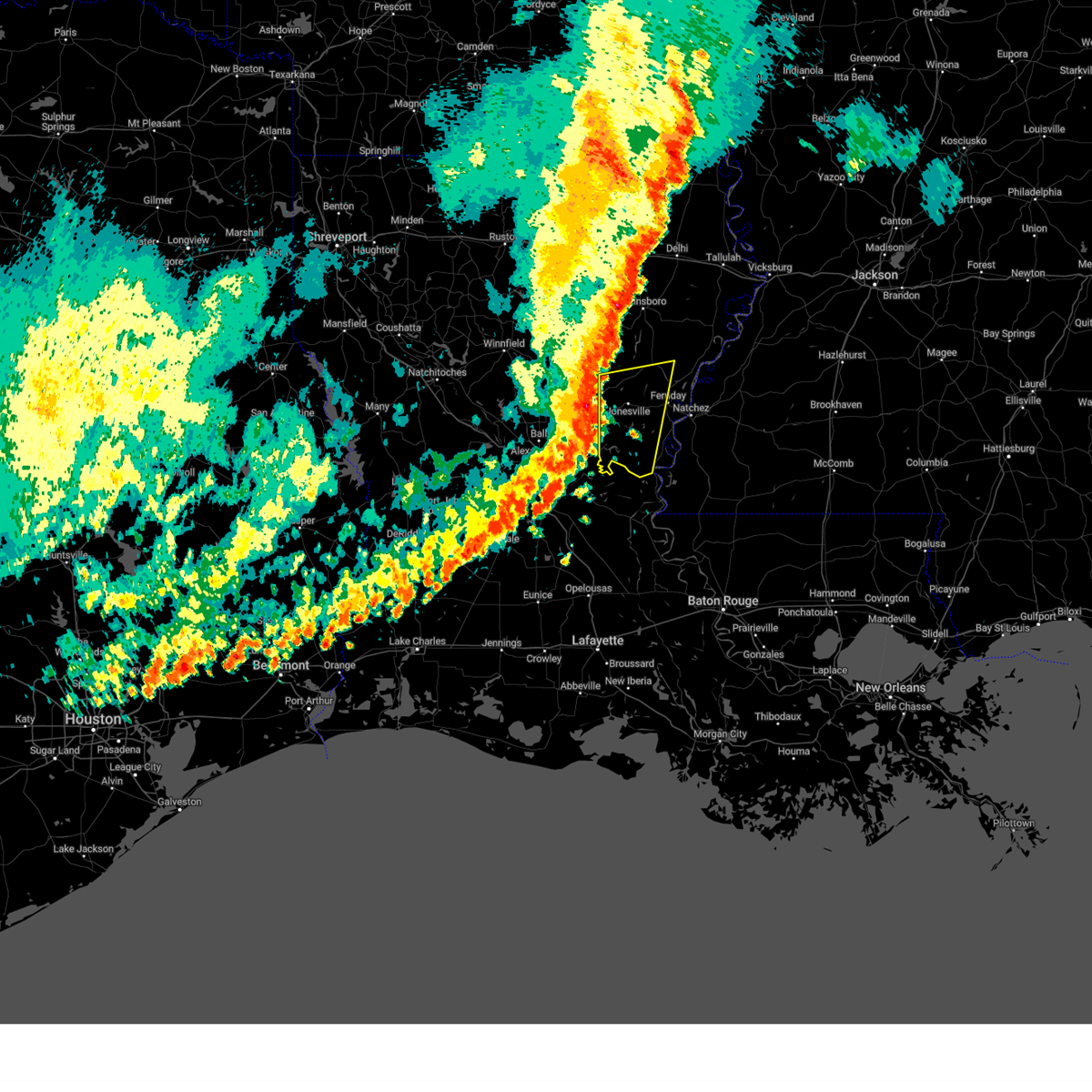
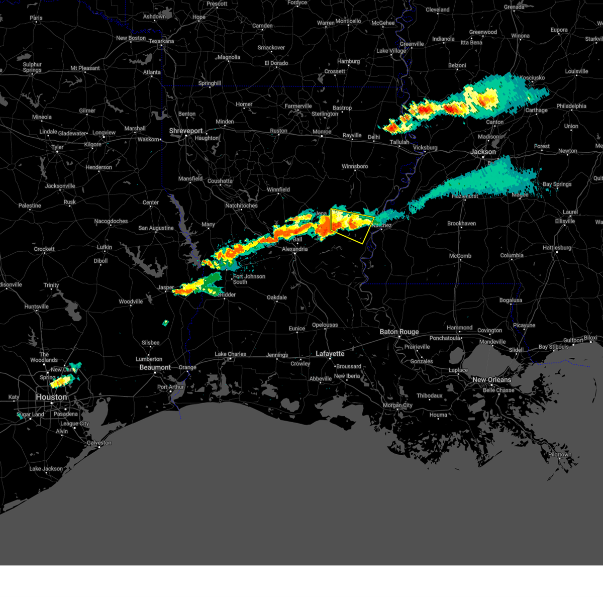
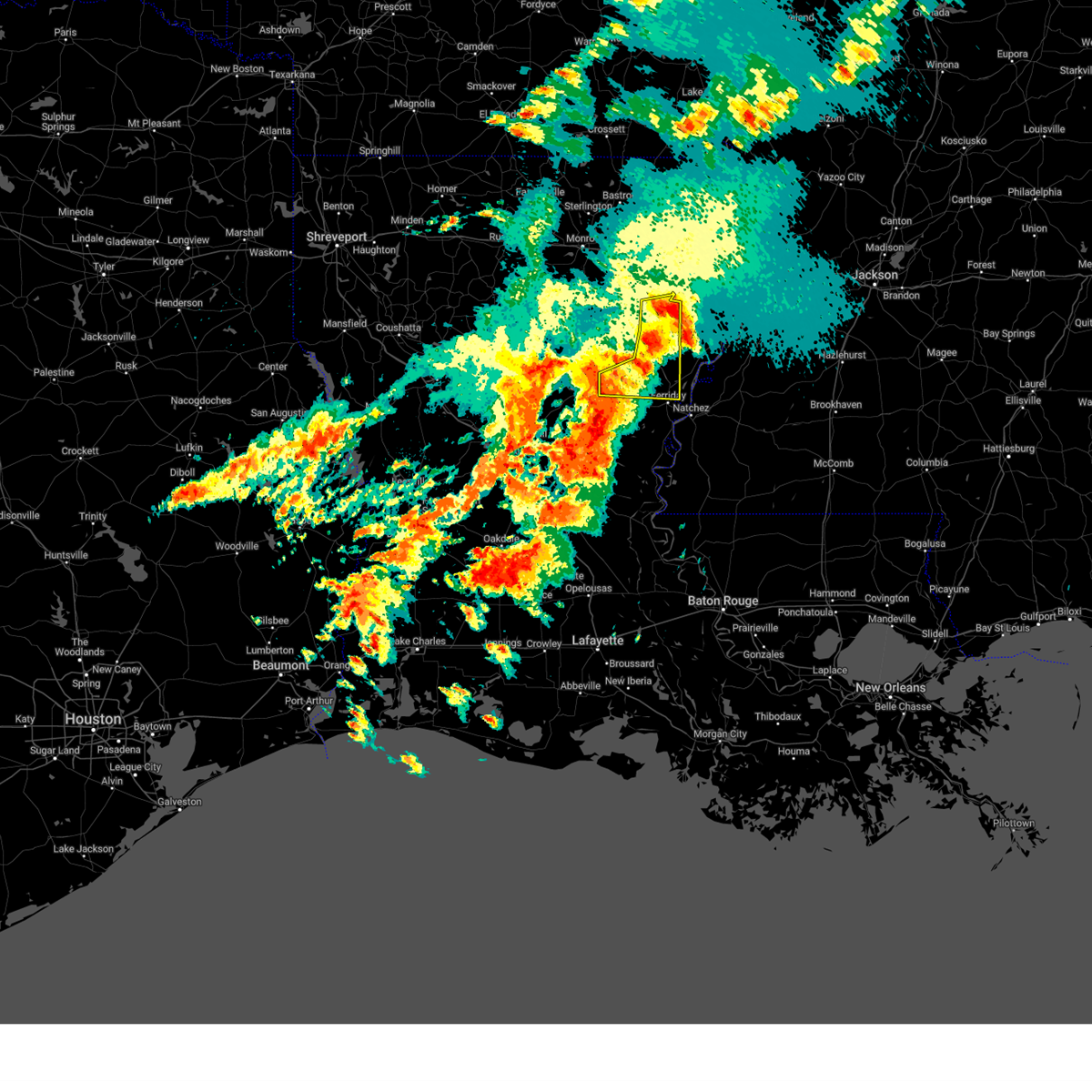
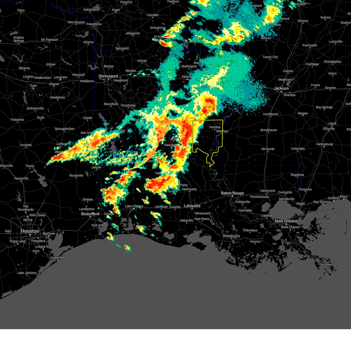
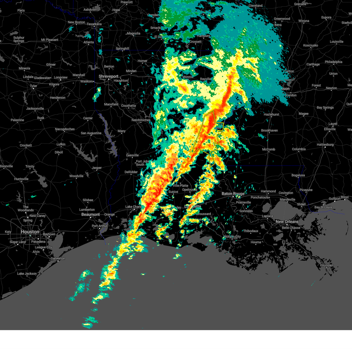
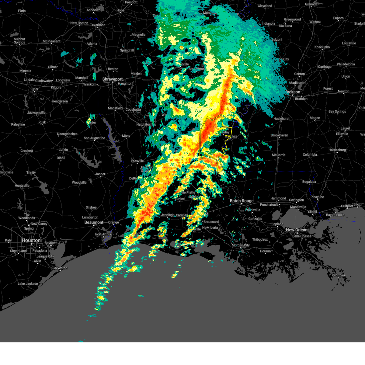
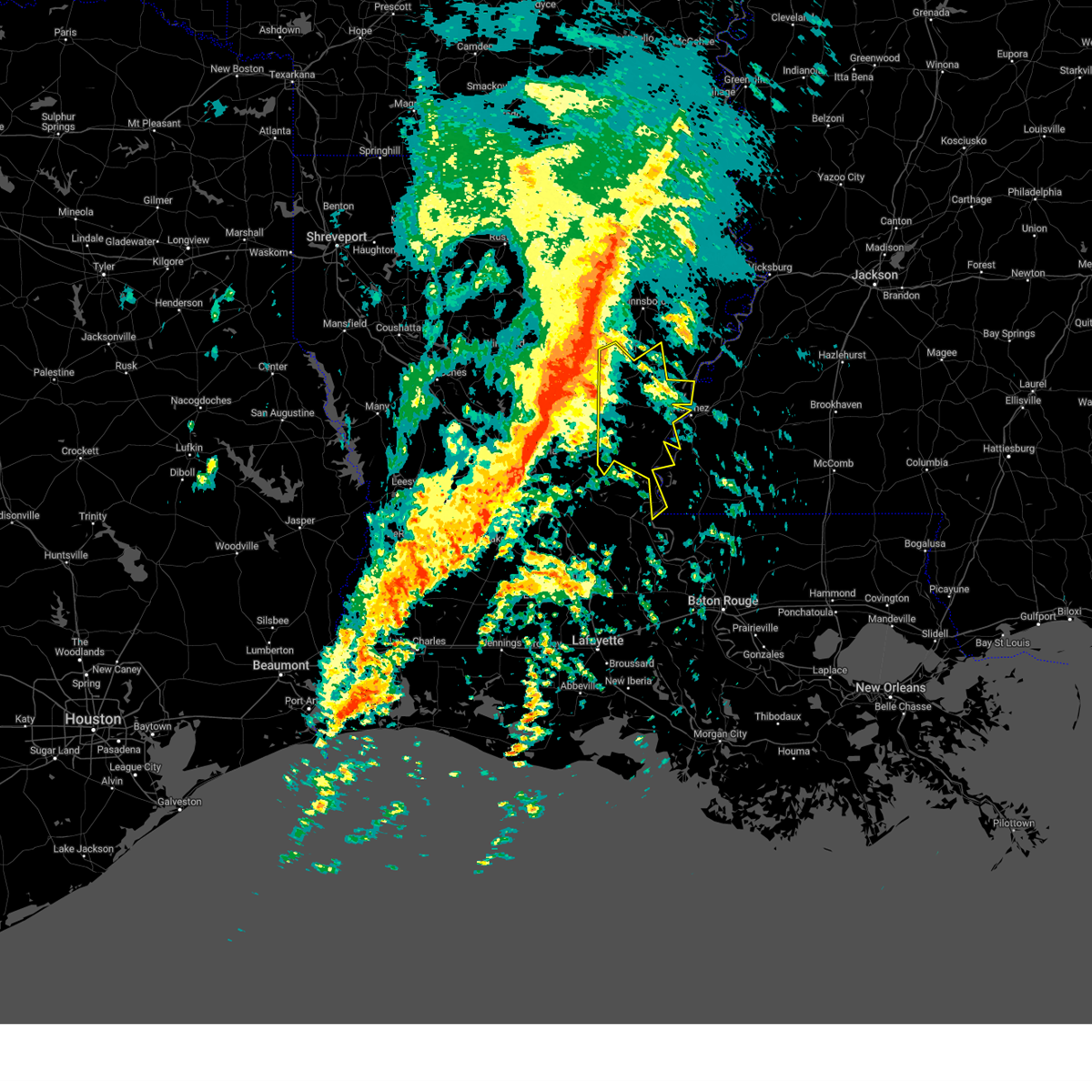
Hail Map for Wallace Ridge, LA
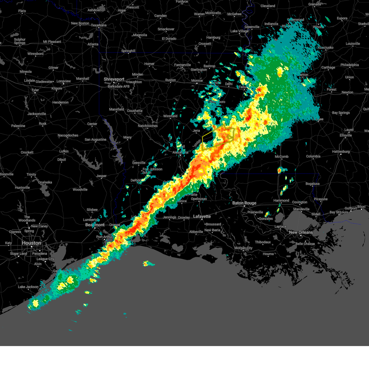
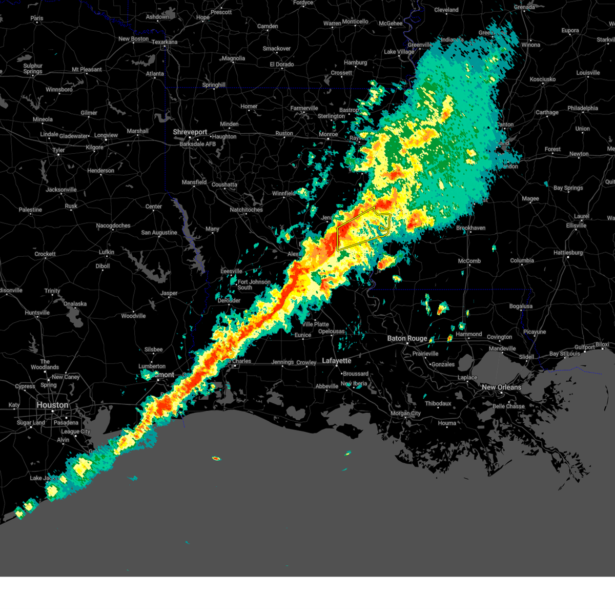
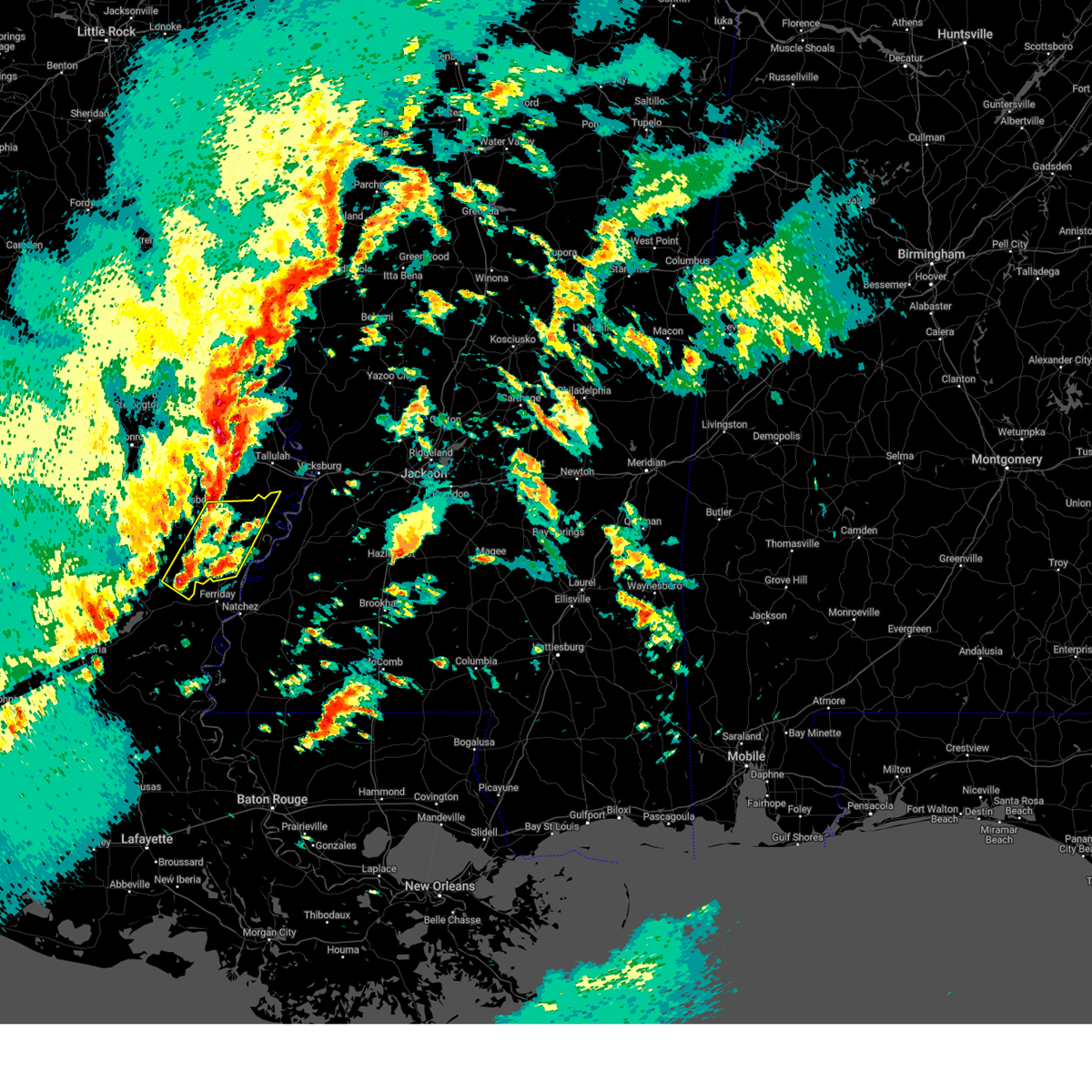
The Wallace Ridge, LA area has had 0 reports of on-the-ground hail by trained spotters, and has been under severe weather warnings 18 times during the past 12 months. Doppler radar has detected hail at or near Wallace Ridge, LA on 66 occasions, including 8 occasions during the past year.
| Name: | Wallace Ridge, LA |
| Where Located: | 76 miles S of Bastrop, LA |
| Map: | Google Map for Wallace Ridge, LA |
| Population: | 710 |
| Housing Units: | 308 |
| More Info: | Search Google for Wallace Ridge, LA |
2
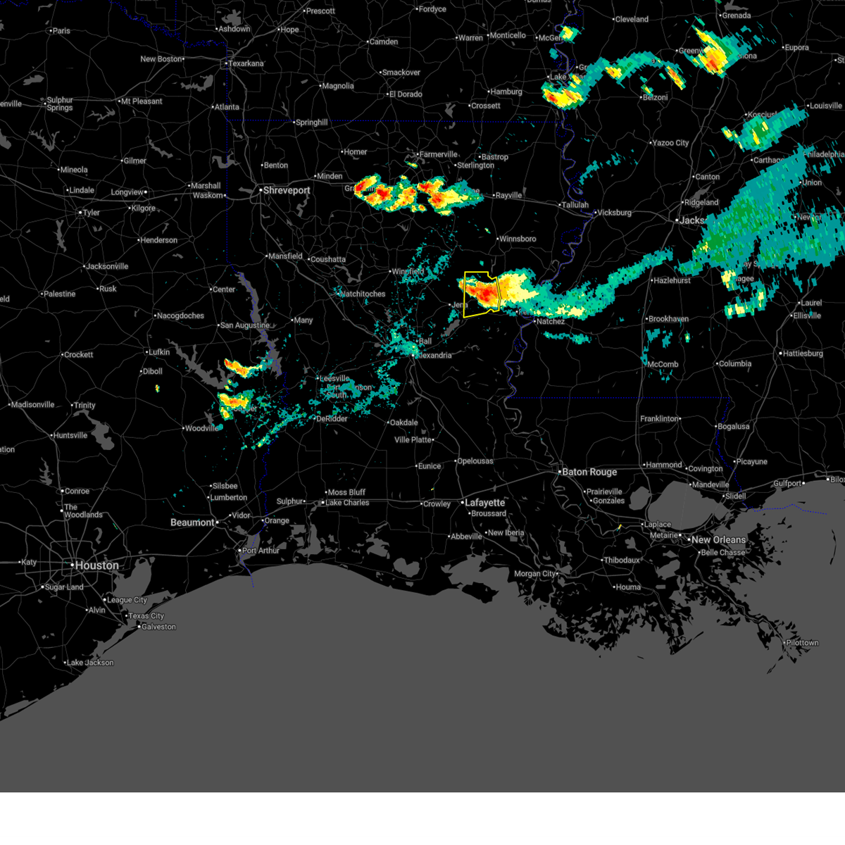
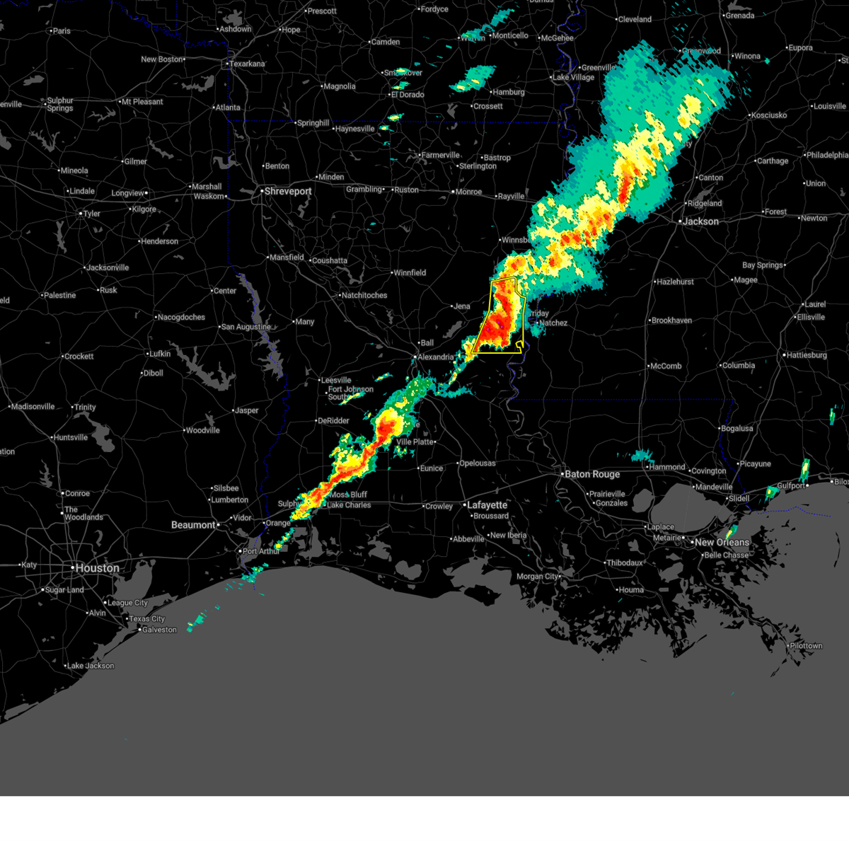
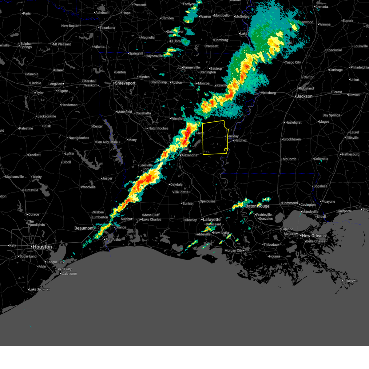
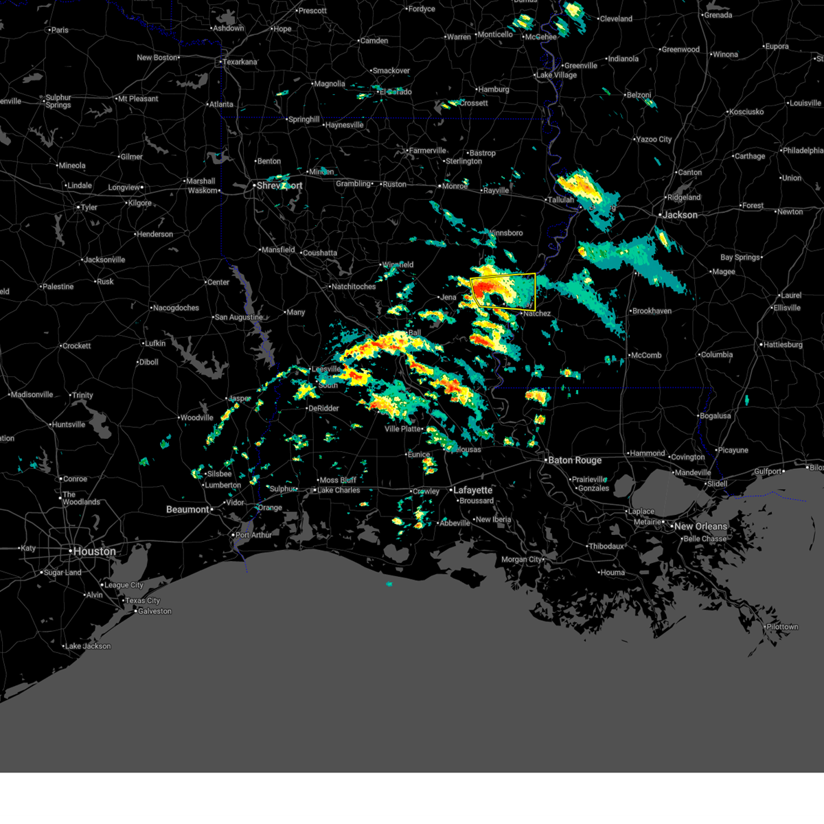
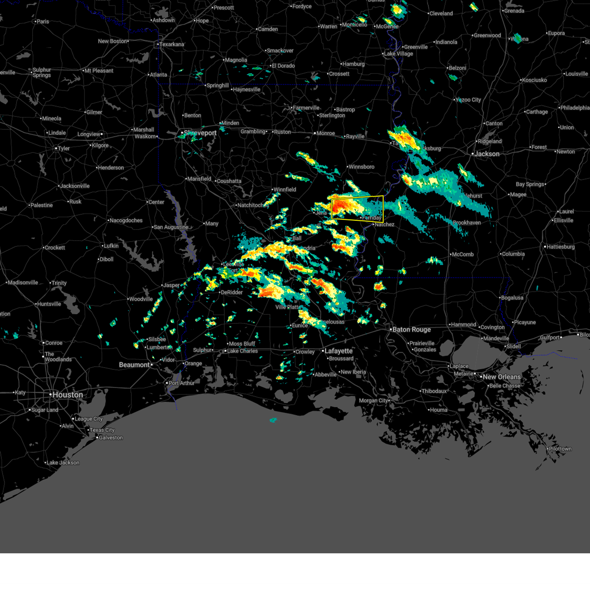
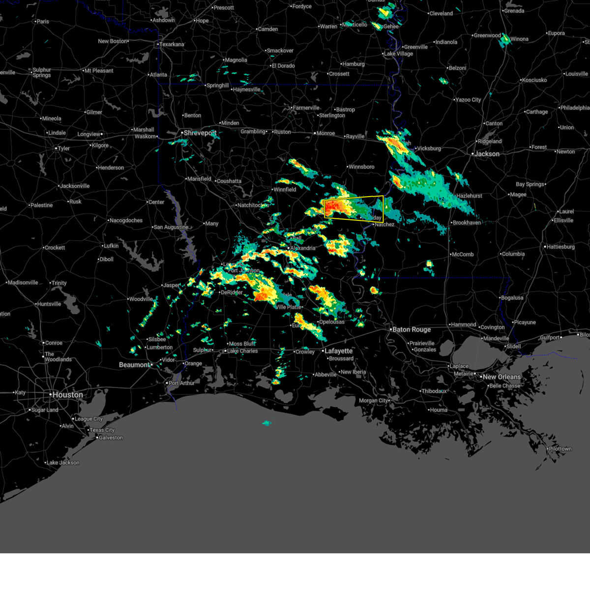
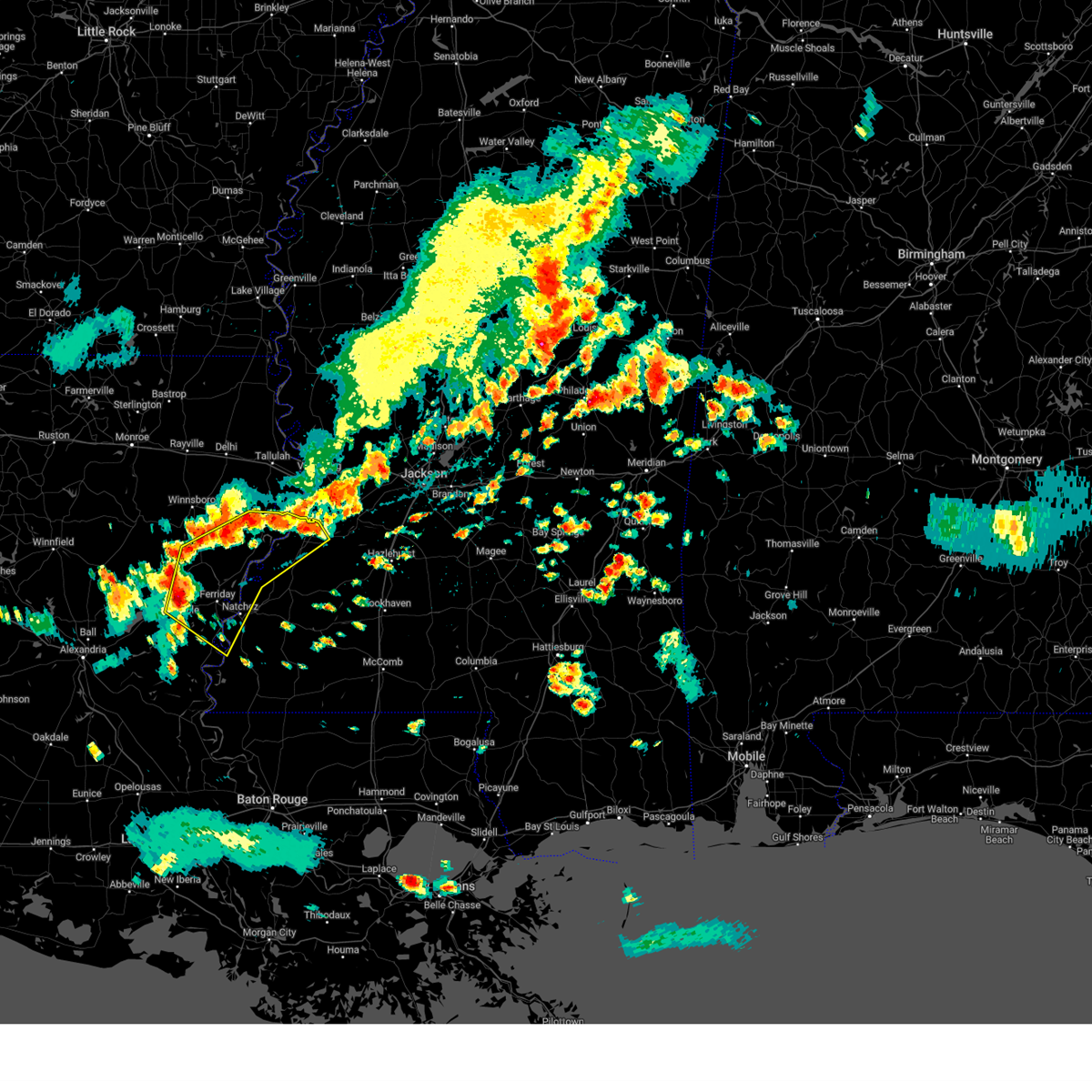
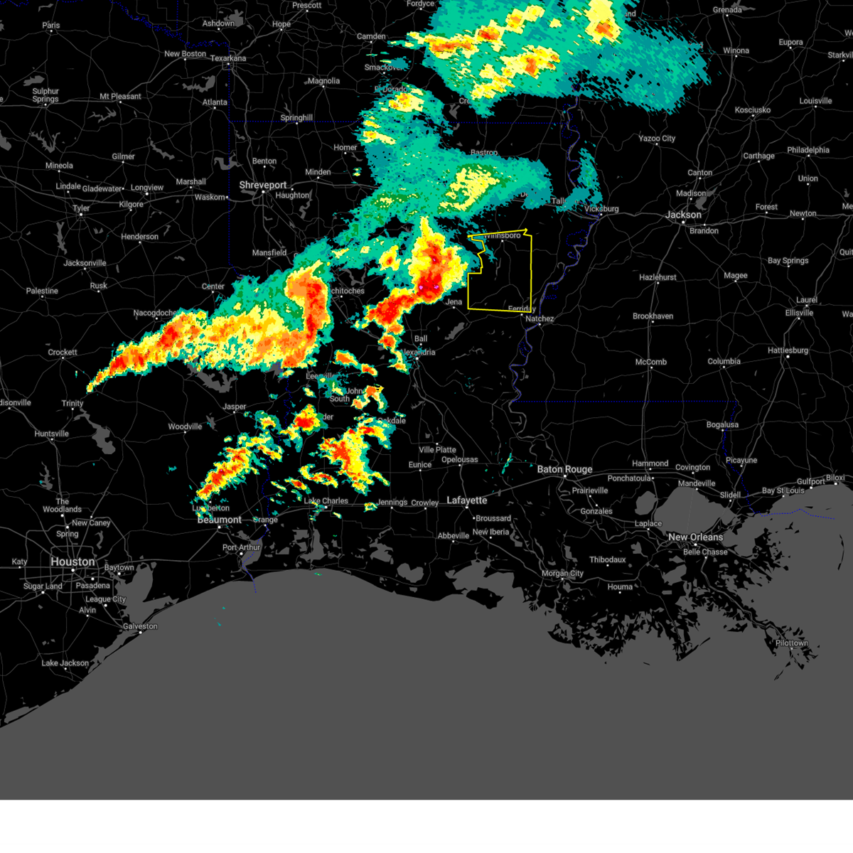
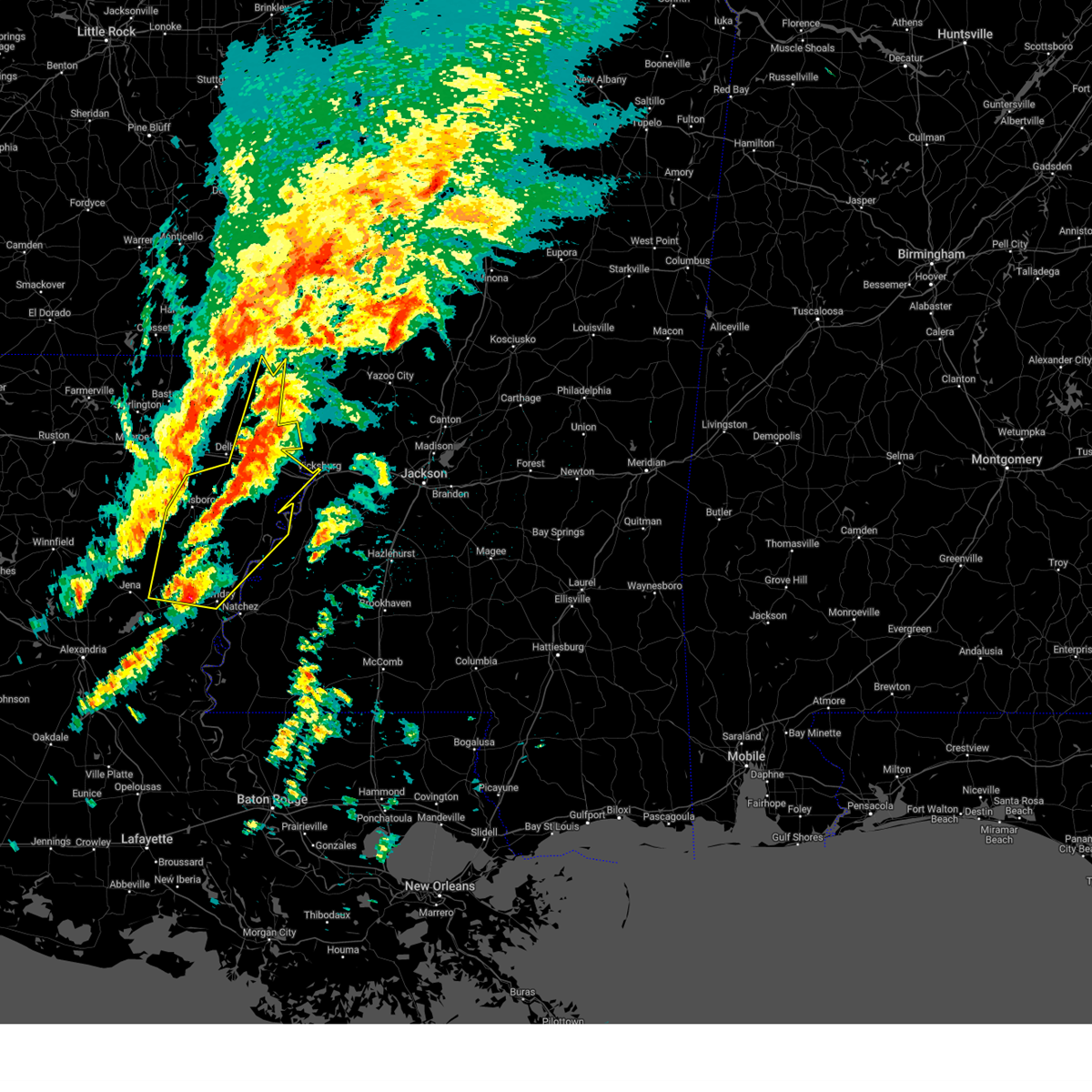
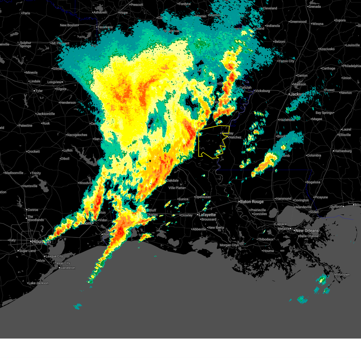
The Top Recent Hail Date for Wallace Ridge, LA is Sunday, March 15, 2026 (6th out of 66)

Hail and Wind Damage Spotted near Wallace Ridge, LA
| Date / Time | Report Details |
|---|---|
| 6/1/2026 9:15 PM CDT |
 At 915 pm cdt, a severe thunderstorm was located over wallace ridge, or over harrisonburg, moving west at 15 mph (radar indicated). Hazards include 60 mph wind gusts and quarter size hail. Hail damage to vehicles is expected. expect wind damage to roofs, siding, and trees. this severe storm will be near, jonesville and manifest around 920 pm cdt. Aimwell around 925 pm cdt. At 915 pm cdt, a severe thunderstorm was located over wallace ridge, or over harrisonburg, moving west at 15 mph (radar indicated). Hazards include 60 mph wind gusts and quarter size hail. Hail damage to vehicles is expected. expect wind damage to roofs, siding, and trees. this severe storm will be near, jonesville and manifest around 920 pm cdt. Aimwell around 925 pm cdt.
|
| 6/1/2026 8:53 PM CDT |
 At 852 pm cdt, a severe thunderstorm was located near harrisonburg, moving west at 15 mph (radar indicated). Hazards include 60 mph wind gusts and quarter size hail. Hail damage to vehicles is expected. expect wind damage to roofs, siding, and trees. This severe storm will be near, harrisonburg and wallace ridge around 900 pm cdt. At 852 pm cdt, a severe thunderstorm was located near harrisonburg, moving west at 15 mph (radar indicated). Hazards include 60 mph wind gusts and quarter size hail. Hail damage to vehicles is expected. expect wind damage to roofs, siding, and trees. This severe storm will be near, harrisonburg and wallace ridge around 900 pm cdt.
|
| 6/1/2026 8:53 PM CDT |
 the severe thunderstorm warning has been cancelled and is no longer in effect the severe thunderstorm warning has been cancelled and is no longer in effect
|
| 6/1/2026 8:36 PM CDT |
 Svrjan the national weather service in jackson has issued a * severe thunderstorm warning for, southwestern tensas parish in northeastern louisiana, northern concordia parish in northeastern louisiana, catahoula parish in northeastern louisiana, south central franklin parish in northeastern louisiana, north central adams county in southwestern mississippi, * until 930 pm cdt. * at 836 pm cdt, a severe thunderstorm was located near harrisonburg, moving west at 15 mph (radar indicated). Hazards include 60 mph wind gusts and quarter size hail. Hail damage to vehicles is expected. expect wind damage to roofs, siding, and trees. this severe thunderstorm will be near, harrisonburg and wallace ridge around 840 pm cdt. sherwood around 855 pm cdt. Aimwell and manifest around 900 pm cdt. Svrjan the national weather service in jackson has issued a * severe thunderstorm warning for, southwestern tensas parish in northeastern louisiana, northern concordia parish in northeastern louisiana, catahoula parish in northeastern louisiana, south central franklin parish in northeastern louisiana, north central adams county in southwestern mississippi, * until 930 pm cdt. * at 836 pm cdt, a severe thunderstorm was located near harrisonburg, moving west at 15 mph (radar indicated). Hazards include 60 mph wind gusts and quarter size hail. Hail damage to vehicles is expected. expect wind damage to roofs, siding, and trees. this severe thunderstorm will be near, harrisonburg and wallace ridge around 840 pm cdt. sherwood around 855 pm cdt. Aimwell and manifest around 900 pm cdt.
|
| 5/23/2026 11:58 AM CDT |
 At 1158 am cdt, severe thunderstorms were located along a line extending from sherwood to frogmore to near slocum, moving northeast at 45 mph (radar indicated). Hazards include 60 mph wind gusts and penny size hail. Expect damage to roofs, siding, and trees. these severe storms will be near, natchez, vidalia, ferriday, clayton, ridgecrest, sicily island, sibley, enterprise, and lee bayou around 1205 pm cdt. spokane around 1210 pm cdt. wisner and kingston around 1215 pm cdt. waterproof, helena, and cooter point around 1220 pm cdt. Church hill, cranfield, and stanton around 1225 pm cdt. At 1158 am cdt, severe thunderstorms were located along a line extending from sherwood to frogmore to near slocum, moving northeast at 45 mph (radar indicated). Hazards include 60 mph wind gusts and penny size hail. Expect damage to roofs, siding, and trees. these severe storms will be near, natchez, vidalia, ferriday, clayton, ridgecrest, sicily island, sibley, enterprise, and lee bayou around 1205 pm cdt. spokane around 1210 pm cdt. wisner and kingston around 1215 pm cdt. waterproof, helena, and cooter point around 1220 pm cdt. Church hill, cranfield, and stanton around 1225 pm cdt.
|
| 5/23/2026 11:48 AM CDT |
 At 1147 am cdt, severe thunderstorms were located along a line extending from near aimwell to near wildsville to near black hawk, moving northeast at 45 mph (radar indicated). Hazards include 60 mph wind gusts and penny size hail. Expect damage to roofs, siding, and trees. these severe storms will be near, ferriday, harrisonburg, sherwood, deer park, wallace ridge, and frogmore around 1155 am cdt. natchez, ridgecrest, and enterprise around 1200 pm cdt. vidalia, clayton, sicily island, lee bayou, and sibley around 1205 pm cdt. spokane around 1210 pm cdt. wisner and kingston around 1215 pm cdt. waterproof and cooter point around 1220 pm cdt. Cranfield, helena, stanton, and church hill around 1225 pm cdt. At 1147 am cdt, severe thunderstorms were located along a line extending from near aimwell to near wildsville to near black hawk, moving northeast at 45 mph (radar indicated). Hazards include 60 mph wind gusts and penny size hail. Expect damage to roofs, siding, and trees. these severe storms will be near, ferriday, harrisonburg, sherwood, deer park, wallace ridge, and frogmore around 1155 am cdt. natchez, ridgecrest, and enterprise around 1200 pm cdt. vidalia, clayton, sicily island, lee bayou, and sibley around 1205 pm cdt. spokane around 1210 pm cdt. wisner and kingston around 1215 pm cdt. waterproof and cooter point around 1220 pm cdt. Cranfield, helena, stanton, and church hill around 1225 pm cdt.
|
| 5/23/2026 11:22 AM CDT |
 Svrjan the national weather service in jackson has issued a * severe thunderstorm warning for, southwestern tensas parish in northeastern louisiana, concordia parish in northeastern louisiana, catahoula parish in northeastern louisiana, southern franklin parish in northeastern louisiana, western jefferson county in southwestern mississippi, adams county in southwestern mississippi, * until 1215 pm cdt. * at 1121 am cdt, severe thunderstorms were located along a line extending from 9 miles west of midway to 7 miles south of walters to bordelonville, moving northeast at 50 mph (radar indicated). Hazards include 60 mph wind gusts and penny size hail. Expect damage to roofs, siding, and trees. severe thunderstorms will be near, larto, walters, archie, acme, and mayna around 1125 am cdt. new era around 1130 am cdt. jonesville, monterey, aimwell, wildsville, and manifest around 1135 am cdt. harrisonburg, sherwood, slocum, wallace ridge, and rosefield around 1140 am cdt. deer park, enterprise, and frogmore around 1145 am cdt. natchez and ferriday around 1150 am cdt. clayton, ridgecrest, sicily island, and lee bayou around 1155 am cdt. Vidalia, wisner, and spokane around 1200 pm cdt. Svrjan the national weather service in jackson has issued a * severe thunderstorm warning for, southwestern tensas parish in northeastern louisiana, concordia parish in northeastern louisiana, catahoula parish in northeastern louisiana, southern franklin parish in northeastern louisiana, western jefferson county in southwestern mississippi, adams county in southwestern mississippi, * until 1215 pm cdt. * at 1121 am cdt, severe thunderstorms were located along a line extending from 9 miles west of midway to 7 miles south of walters to bordelonville, moving northeast at 50 mph (radar indicated). Hazards include 60 mph wind gusts and penny size hail. Expect damage to roofs, siding, and trees. severe thunderstorms will be near, larto, walters, archie, acme, and mayna around 1125 am cdt. new era around 1130 am cdt. jonesville, monterey, aimwell, wildsville, and manifest around 1135 am cdt. harrisonburg, sherwood, slocum, wallace ridge, and rosefield around 1140 am cdt. deer park, enterprise, and frogmore around 1145 am cdt. natchez and ferriday around 1150 am cdt. clayton, ridgecrest, sicily island, and lee bayou around 1155 am cdt. Vidalia, wisner, and spokane around 1200 pm cdt.
|
| 5/9/2026 4:16 AM CDT |
 At 415 am cdt, severe thunderstorms were located along a line extending from newlight to near harrisonburg, moving east at 35 mph (radar indicated). Hazards include 60 mph wind gusts and quarter size hail. Hail damage to vehicles is expected. expect wind damage to roofs, siding, and trees. these severe storms will be near, sicily island, cooter point, and newlight around 420 am cdt. newellton and lee bayou around 425 am cdt. Clayton, somerset, and helena around 430 am cdt. At 415 am cdt, severe thunderstorms were located along a line extending from newlight to near harrisonburg, moving east at 35 mph (radar indicated). Hazards include 60 mph wind gusts and quarter size hail. Hail damage to vehicles is expected. expect wind damage to roofs, siding, and trees. these severe storms will be near, sicily island, cooter point, and newlight around 420 am cdt. newellton and lee bayou around 425 am cdt. Clayton, somerset, and helena around 430 am cdt.
|
| 5/9/2026 3:56 AM CDT |
 Svrjan the national weather service in jackson has issued a * severe thunderstorm warning for, tensas parish in northeastern louisiana, southwestern madison parish in northeastern louisiana, north central concordia parish in northeastern louisiana, northern catahoula parish in northeastern louisiana, south central richland parish in northeastern louisiana, franklin parish in northeastern louisiana, * until 445 am cdt. * at 356 am cdt, severe thunderstorms were located along a line extending from 6 miles south of crowville to near aimwell, moving east at 35 mph (radar indicated). Hazards include 60 mph wind gusts and quarter size hail. Hail damage to vehicles is expected. expect wind damage to roofs, siding, and trees. severe thunderstorms will be near, harrisonburg, wisner, and gilbert around 400 am cdt. sicily island and newlight around 405 am cdt. wallace ridge around 410 am cdt. cooter point around 415 am cdt. newellton and lee bayou around 425 am cdt. Clayton and helena around 430 am cdt. Svrjan the national weather service in jackson has issued a * severe thunderstorm warning for, tensas parish in northeastern louisiana, southwestern madison parish in northeastern louisiana, north central concordia parish in northeastern louisiana, northern catahoula parish in northeastern louisiana, south central richland parish in northeastern louisiana, franklin parish in northeastern louisiana, * until 445 am cdt. * at 356 am cdt, severe thunderstorms were located along a line extending from 6 miles south of crowville to near aimwell, moving east at 35 mph (radar indicated). Hazards include 60 mph wind gusts and quarter size hail. Hail damage to vehicles is expected. expect wind damage to roofs, siding, and trees. severe thunderstorms will be near, harrisonburg, wisner, and gilbert around 400 am cdt. sicily island and newlight around 405 am cdt. wallace ridge around 410 am cdt. cooter point around 415 am cdt. newellton and lee bayou around 425 am cdt. Clayton and helena around 430 am cdt.
|
| 4/26/2026 4:30 AM CDT |
 Svrjan the national weather service in jackson has issued a * severe thunderstorm warning for, southwestern east carroll parish in northeastern louisiana, tensas parish in northeastern louisiana, madison parish in northeastern louisiana, northwestern concordia parish in northeastern louisiana, northern catahoula parish in northeastern louisiana, east central richland parish in northeastern louisiana, franklin parish in northeastern louisiana, southwestern warren county in west central mississippi, * until 530 am cdt. * at 430 am cdt, a severe thunderstorm was located near crowville, or 9 miles northeast of winnsboro, moving southeast at 45 mph (radar indicated). Hazards include 60 mph wind gusts and quarter size hail. Hail damage to vehicles is expected. expect wind damage to roofs, siding, and trees. this severe thunderstorm will be near, winnsboro, bakers, and crowville around 435 am cdt. newlight around 445 am cdt. newellton around 455 am cdt. lake bruin and somerset around 500 am cdt. st. joseph around 510 am cdt. Other locations impacted by this severe thunderstorm include richmond. Svrjan the national weather service in jackson has issued a * severe thunderstorm warning for, southwestern east carroll parish in northeastern louisiana, tensas parish in northeastern louisiana, madison parish in northeastern louisiana, northwestern concordia parish in northeastern louisiana, northern catahoula parish in northeastern louisiana, east central richland parish in northeastern louisiana, franklin parish in northeastern louisiana, southwestern warren county in west central mississippi, * until 530 am cdt. * at 430 am cdt, a severe thunderstorm was located near crowville, or 9 miles northeast of winnsboro, moving southeast at 45 mph (radar indicated). Hazards include 60 mph wind gusts and quarter size hail. Hail damage to vehicles is expected. expect wind damage to roofs, siding, and trees. this severe thunderstorm will be near, winnsboro, bakers, and crowville around 435 am cdt. newlight around 445 am cdt. newellton around 455 am cdt. lake bruin and somerset around 500 am cdt. st. joseph around 510 am cdt. Other locations impacted by this severe thunderstorm include richmond.
|
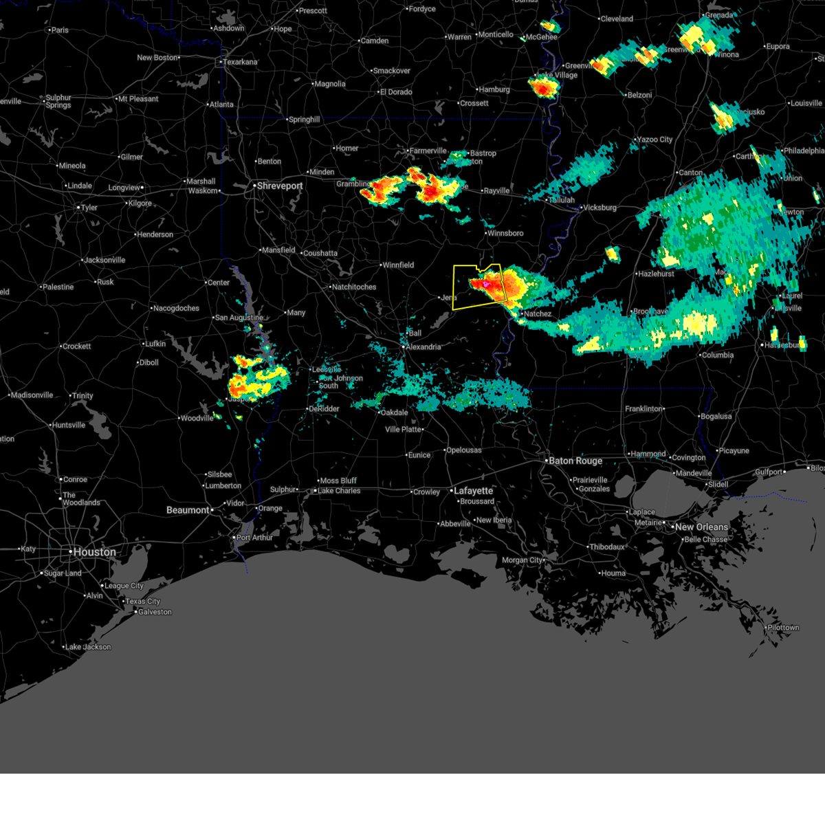
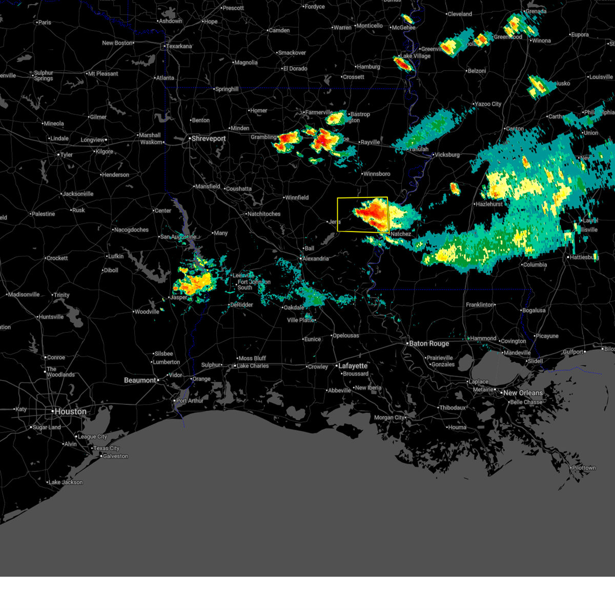
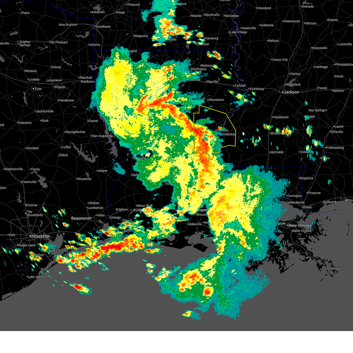
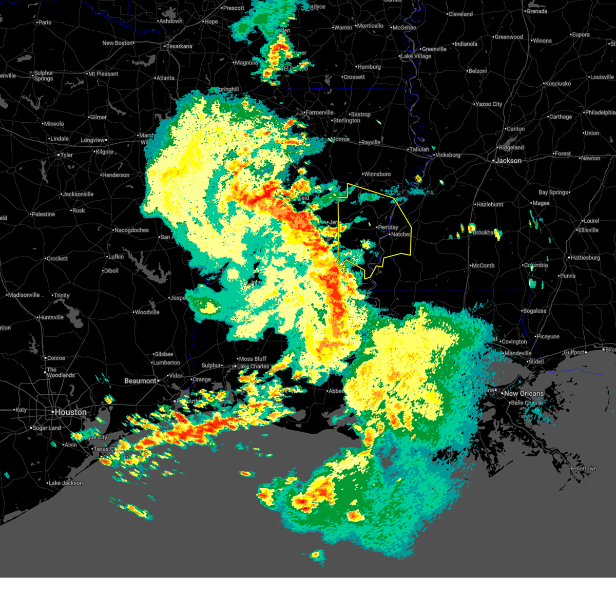
| 3/15/2026 10:21 PM CDT |
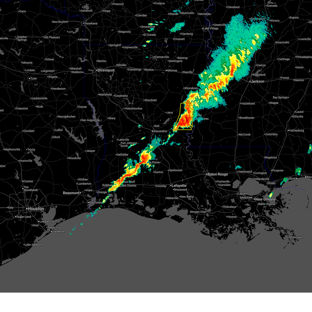 At 1021 pm cdt, a severe thunderstorm was located over spokane, or 8 miles northeast of ferriday, moving east at 50 mph (radar indicated). Hazards include golf ball size hail and 70 mph wind gusts. People and animals outdoors will be injured. expect hail damage to roofs, siding, windows, and vehicles. expect considerable tree damage. wind damage is also likely to mobile homes, roofs, and outbuildings. Locations impacted include, natchez, ferriday, clayton, ridgecrest, sicily island, monterey, larto, lee bayou, new era, wildsville, mayna, deer park, and frogmore. At 1021 pm cdt, a severe thunderstorm was located over spokane, or 8 miles northeast of ferriday, moving east at 50 mph (radar indicated). Hazards include golf ball size hail and 70 mph wind gusts. People and animals outdoors will be injured. expect hail damage to roofs, siding, windows, and vehicles. expect considerable tree damage. wind damage is also likely to mobile homes, roofs, and outbuildings. Locations impacted include, natchez, ferriday, clayton, ridgecrest, sicily island, monterey, larto, lee bayou, new era, wildsville, mayna, deer park, and frogmore.
|
| 3/15/2026 10:14 PM CDT |
 At 1013 pm cdt, a severe thunderstorm was located over clayton, or near ferriday, moving east at 50 mph (radar indicated). Hazards include golf ball size hail and 70 mph wind gusts. People and animals outdoors will be injured. expect hail damage to roofs, siding, windows, and vehicles. expect considerable tree damage. wind damage is also likely to mobile homes, roofs, and outbuildings. This severe thunderstorm will remain over mainly rural areas of northwestern concordia and central catahoula parishes. At 1013 pm cdt, a severe thunderstorm was located over clayton, or near ferriday, moving east at 50 mph (radar indicated). Hazards include golf ball size hail and 70 mph wind gusts. People and animals outdoors will be injured. expect hail damage to roofs, siding, windows, and vehicles. expect considerable tree damage. wind damage is also likely to mobile homes, roofs, and outbuildings. This severe thunderstorm will remain over mainly rural areas of northwestern concordia and central catahoula parishes.
|
| 3/15/2026 9:30 PM CDT |
 Svrjan the national weather service in jackson has issued a * severe thunderstorm warning for, northwestern concordia parish in northeastern louisiana, catahoula parish in northeastern louisiana, * until 1030 pm cdt. * at 930 pm cdt, a severe thunderstorm was located near midway, or 20 miles west of jonesville, moving east at 50 mph (radar indicated). Hazards include golf ball size hail and 70 mph wind gusts. People and animals outdoors will be injured. expect hail damage to roofs, siding, windows, and vehicles. expect considerable tree damage. wind damage is also likely to mobile homes, roofs, and outbuildings. this severe thunderstorm will be near, walters and archie around 935 pm cdt. manifest around 940 pm cdt. jonesville and wallace ridge around 945 pm cdt. wildsville around 950 pm cdt. harrisonburg around 955 pm cdt. frogmore around 1000 pm cdt. ferriday and clayton around 1005 pm cdt. Natchez, ridgecrest, and lee bayou around 1010 pm cdt. Svrjan the national weather service in jackson has issued a * severe thunderstorm warning for, northwestern concordia parish in northeastern louisiana, catahoula parish in northeastern louisiana, * until 1030 pm cdt. * at 930 pm cdt, a severe thunderstorm was located near midway, or 20 miles west of jonesville, moving east at 50 mph (radar indicated). Hazards include golf ball size hail and 70 mph wind gusts. People and animals outdoors will be injured. expect hail damage to roofs, siding, windows, and vehicles. expect considerable tree damage. wind damage is also likely to mobile homes, roofs, and outbuildings. this severe thunderstorm will be near, walters and archie around 935 pm cdt. manifest around 940 pm cdt. jonesville and wallace ridge around 945 pm cdt. wildsville around 950 pm cdt. harrisonburg around 955 pm cdt. frogmore around 1000 pm cdt. ferriday and clayton around 1005 pm cdt. Natchez, ridgecrest, and lee bayou around 1010 pm cdt.
|
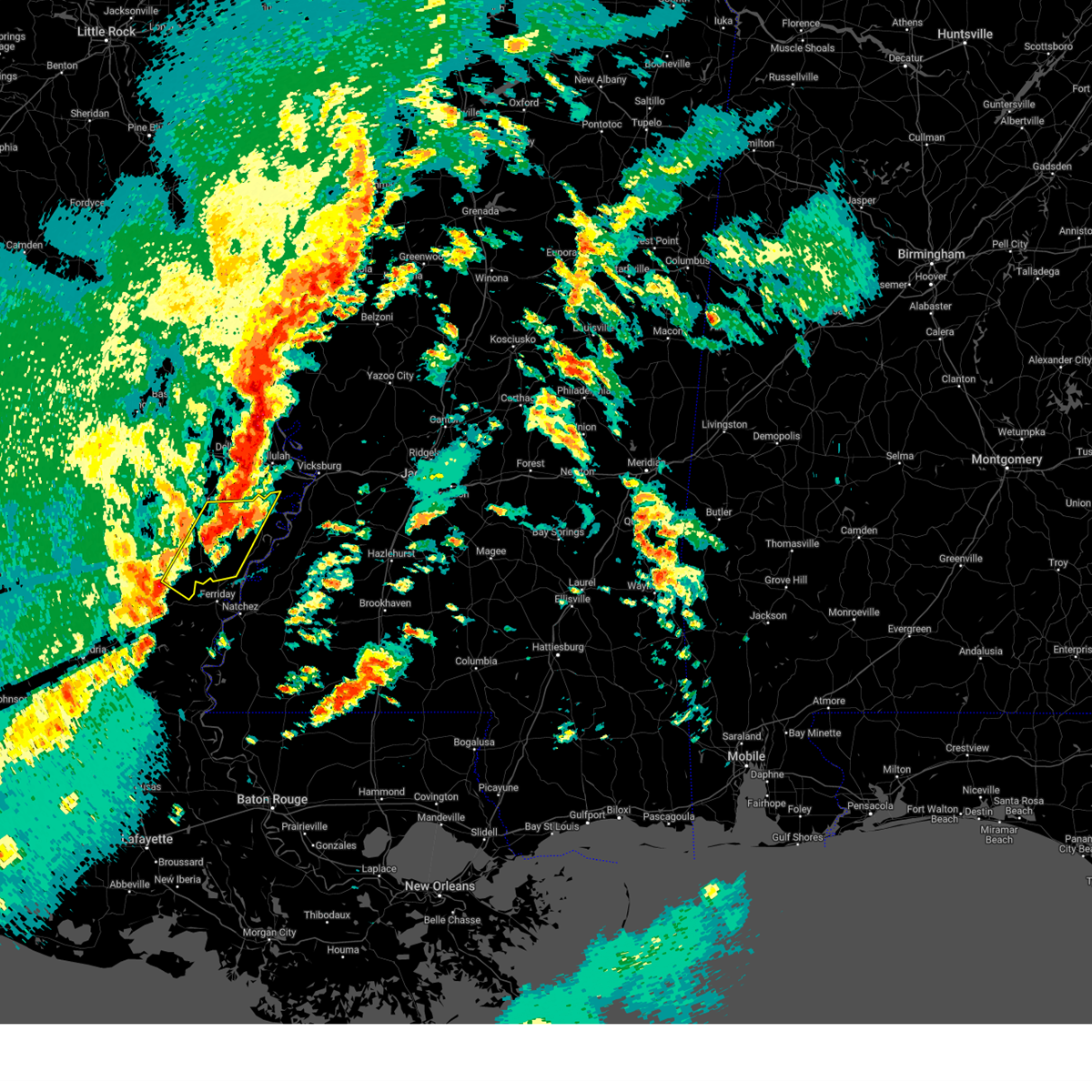
| 3/9/2026 2:37 PM CDT |
 At 236 pm cdt, a severe thunderstorm was located 7 miles west of lee bayou, or 9 miles east of harrisonburg, moving east at 25 mph (radar indicated). Hazards include 60 mph wind gusts and nickel size hail. Expect damage to roofs, siding, and trees. this severe storm will be near, ferriday, clayton, and lee bayou around 240 pm cdt. natchez and spokane around 250 pm cdt. Waterproof around 305 pm cdt. At 236 pm cdt, a severe thunderstorm was located 7 miles west of lee bayou, or 9 miles east of harrisonburg, moving east at 25 mph (radar indicated). Hazards include 60 mph wind gusts and nickel size hail. Expect damage to roofs, siding, and trees. this severe storm will be near, ferriday, clayton, and lee bayou around 240 pm cdt. natchez and spokane around 250 pm cdt. Waterproof around 305 pm cdt.
|
| 3/9/2026 2:25 PM CDT |
 At 225 pm cdt, a severe thunderstorm was located over wallace ridge, or near harrisonburg, moving east at 20 mph (radar indicated). Hazards include 60 mph wind gusts and nickel size hail. Expect damage to roofs, siding, and trees. this severe storm will be near, lee bayou around 240 pm cdt. ferriday and clayton around 245 pm cdt. Natchez and spokane around 300 pm cdt. At 225 pm cdt, a severe thunderstorm was located over wallace ridge, or near harrisonburg, moving east at 20 mph (radar indicated). Hazards include 60 mph wind gusts and nickel size hail. Expect damage to roofs, siding, and trees. this severe storm will be near, lee bayou around 240 pm cdt. ferriday and clayton around 245 pm cdt. Natchez and spokane around 300 pm cdt.
|
| 3/9/2026 2:13 PM CDT |
 Svrjan the national weather service in jackson has issued a * severe thunderstorm warning for, southwestern tensas parish in northeastern louisiana, northern concordia parish in northeastern louisiana, northern catahoula parish in northeastern louisiana, northwestern jefferson county in southwestern mississippi, north central adams county in southwestern mississippi, * until 315 pm cdt. * at 213 pm cdt, a severe thunderstorm was located over wallace ridge, or near harrisonburg, moving east at 30 mph (radar indicated). Hazards include 60 mph wind gusts and nickel size hail. Expect damage to roofs, siding, and trees. this severe thunderstorm will be near, ferriday, clayton, and lee bayou around 225 pm cdt. natchez and spokane around 235 pm cdt. Waterproof around 250 pm cdt. Svrjan the national weather service in jackson has issued a * severe thunderstorm warning for, southwestern tensas parish in northeastern louisiana, northern concordia parish in northeastern louisiana, northern catahoula parish in northeastern louisiana, northwestern jefferson county in southwestern mississippi, north central adams county in southwestern mississippi, * until 315 pm cdt. * at 213 pm cdt, a severe thunderstorm was located over wallace ridge, or near harrisonburg, moving east at 30 mph (radar indicated). Hazards include 60 mph wind gusts and nickel size hail. Expect damage to roofs, siding, and trees. this severe thunderstorm will be near, ferriday, clayton, and lee bayou around 225 pm cdt. natchez and spokane around 235 pm cdt. Waterproof around 250 pm cdt.
|
| 2/14/2026 10:02 PM CST |
 Svrjan the national weather service in jackson has issued a * severe thunderstorm warning for, tensas parish in northeastern louisiana, concordia parish in northeastern louisiana, catahoula parish in northeastern louisiana, southern franklin parish in northeastern louisiana, western jefferson county in southwestern mississippi, adams county in southwestern mississippi, * until 1115 pm cst. * at 1001 pm cst, severe thunderstorms were located along a line extending from near jigger to big bend, moving east at 40 mph (radar indicated). Hazards include 60 mph wind gusts. Expect damage to roofs, siding, and trees. severe thunderstorms will be near, monterey, black hawk, slocum, wildsville, and frogmore around 1005 pm cst. wisner, sicily island, and gilbert around 1010 pm cst. natchez, ferriday, clayton, deer park, and lee bayou around 1015 pm cst. ridgecrest and cooter point around 1020 pm cst. vidalia and spokane around 1025 pm cst. waterproof, newlight, sibley, and helena around 1030 pm cst. kingston around 1040 pm cst. st. Joseph, newellton, cranfield, lake bruin, church hill, and stanton around 1045 pm cst. Svrjan the national weather service in jackson has issued a * severe thunderstorm warning for, tensas parish in northeastern louisiana, concordia parish in northeastern louisiana, catahoula parish in northeastern louisiana, southern franklin parish in northeastern louisiana, western jefferson county in southwestern mississippi, adams county in southwestern mississippi, * until 1115 pm cst. * at 1001 pm cst, severe thunderstorms were located along a line extending from near jigger to big bend, moving east at 40 mph (radar indicated). Hazards include 60 mph wind gusts. Expect damage to roofs, siding, and trees. severe thunderstorms will be near, monterey, black hawk, slocum, wildsville, and frogmore around 1005 pm cst. wisner, sicily island, and gilbert around 1010 pm cst. natchez, ferriday, clayton, deer park, and lee bayou around 1015 pm cst. ridgecrest and cooter point around 1020 pm cst. vidalia and spokane around 1025 pm cst. waterproof, newlight, sibley, and helena around 1030 pm cst. kingston around 1040 pm cst. st. Joseph, newellton, cranfield, lake bruin, church hill, and stanton around 1045 pm cst.
|
| 8/14/2025 2:01 PM CDT |
 Svrjan the national weather service in jackson has issued a * severe thunderstorm warning for, southwestern tensas parish in northeastern louisiana, northern concordia parish in northeastern louisiana, central catahoula parish in northeastern louisiana, southwestern jefferson county in southwestern mississippi, northwestern franklin county in southwestern mississippi, northeastern adams county in southwestern mississippi, * until 300 pm cdt. * at 201 pm cdt, a severe thunderstorm was located over spokane, or 10 miles northeast of ferriday, moving east at 15 mph (radar indicated). Hazards include 60 mph wind gusts and quarter size hail. Hail damage to vehicles is expected. expect wind damage to roofs, siding, and trees. this severe thunderstorm will be near, natchez and church hill around 210 pm cdt. Stanton around 225 pm cdt. Svrjan the national weather service in jackson has issued a * severe thunderstorm warning for, southwestern tensas parish in northeastern louisiana, northern concordia parish in northeastern louisiana, central catahoula parish in northeastern louisiana, southwestern jefferson county in southwestern mississippi, northwestern franklin county in southwestern mississippi, northeastern adams county in southwestern mississippi, * until 300 pm cdt. * at 201 pm cdt, a severe thunderstorm was located over spokane, or 10 miles northeast of ferriday, moving east at 15 mph (radar indicated). Hazards include 60 mph wind gusts and quarter size hail. Hail damage to vehicles is expected. expect wind damage to roofs, siding, and trees. this severe thunderstorm will be near, natchez and church hill around 210 pm cdt. Stanton around 225 pm cdt.
|
| 5/27/2025 5:08 AM CDT |
 Svrjan the national weather service in jackson has issued a * severe thunderstorm warning for, southwestern concordia parish in northeastern louisiana, southwestern catahoula parish in northeastern louisiana, * until 615 am cdt. * at 508 am cdt, severe thunderstorms were located along a line extending from ball to evergreen to port barre, moving northeast at 40 mph (radar indicated). Hazards include 60 mph wind gusts and penny size hail. expect damage to roofs, siding, and trees Svrjan the national weather service in jackson has issued a * severe thunderstorm warning for, southwestern concordia parish in northeastern louisiana, southwestern catahoula parish in northeastern louisiana, * until 615 am cdt. * at 508 am cdt, severe thunderstorms were located along a line extending from ball to evergreen to port barre, moving northeast at 40 mph (radar indicated). Hazards include 60 mph wind gusts and penny size hail. expect damage to roofs, siding, and trees
|
| 5/26/2025 12:09 PM CDT |
 At 1209 pm cdt, severe thunderstorms were located along a line extending from near sicily island to near acme, moving east at 35 mph (radar indicated). Hazards include 60 mph wind gusts and nickel size hail. Expect damage to roofs, siding, and trees. Locations impacted include, ferriday, jonesville, harrisonburg, monterey, wallace ridge, mayna, larto, lee bayou, acme, new era, frogmore, and wildsville. At 1209 pm cdt, severe thunderstorms were located along a line extending from near sicily island to near acme, moving east at 35 mph (radar indicated). Hazards include 60 mph wind gusts and nickel size hail. Expect damage to roofs, siding, and trees. Locations impacted include, ferriday, jonesville, harrisonburg, monterey, wallace ridge, mayna, larto, lee bayou, acme, new era, frogmore, and wildsville.
|
| 5/26/2025 11:49 AM CDT |
 Svrjan the national weather service in jackson has issued a * severe thunderstorm warning for, southwestern tensas parish in northeastern louisiana, northwestern concordia parish in northeastern louisiana, catahoula parish in northeastern louisiana, * until 1230 pm cdt. * at 1149 am cdt, severe thunderstorms were located along a line extending from near aimwell to 7 miles west of larto, moving east at 45 mph (radar indicated). Hazards include 60 mph wind gusts and penny size hail. Expect damage to roofs, siding, and trees. severe thunderstorms will be near, jonesville, harrisonburg, larto, wallace ridge, and mayna around 1155 am cdt. wildsville around 1200 pm cdt. monterey and frogmore around 1210 pm cdt. Ferriday and lee bayou around 1215 pm cdt. Svrjan the national weather service in jackson has issued a * severe thunderstorm warning for, southwestern tensas parish in northeastern louisiana, northwestern concordia parish in northeastern louisiana, catahoula parish in northeastern louisiana, * until 1230 pm cdt. * at 1149 am cdt, severe thunderstorms were located along a line extending from near aimwell to 7 miles west of larto, moving east at 45 mph (radar indicated). Hazards include 60 mph wind gusts and penny size hail. Expect damage to roofs, siding, and trees. severe thunderstorms will be near, jonesville, harrisonburg, larto, wallace ridge, and mayna around 1155 am cdt. wildsville around 1200 pm cdt. monterey and frogmore around 1210 pm cdt. Ferriday and lee bayou around 1215 pm cdt.
|
| 5/24/2025 4:38 PM CDT |
 Svrjan the national weather service in jackson has issued a * severe thunderstorm warning for, tensas parish in northeastern louisiana, northern concordia parish in northeastern louisiana, northeastern catahoula parish in northeastern louisiana, southeastern franklin parish in northeastern louisiana, central claiborne county in southwestern mississippi, northwestern jefferson county in southwestern mississippi, central adams county in southwestern mississippi, * until 600 pm cdt. * at 438 pm cdt, severe thunderstorms were located along a line extending from near newellton to near wisner to wildsville, moving southeast at 25 mph (radar indicated). Hazards include 60 mph wind gusts and quarter size hail. Hail damage to vehicles is expected. Expect wind damage to roofs, siding, and trees. Svrjan the national weather service in jackson has issued a * severe thunderstorm warning for, tensas parish in northeastern louisiana, northern concordia parish in northeastern louisiana, northeastern catahoula parish in northeastern louisiana, southeastern franklin parish in northeastern louisiana, central claiborne county in southwestern mississippi, northwestern jefferson county in southwestern mississippi, central adams county in southwestern mississippi, * until 600 pm cdt. * at 438 pm cdt, severe thunderstorms were located along a line extending from near newellton to near wisner to wildsville, moving southeast at 25 mph (radar indicated). Hazards include 60 mph wind gusts and quarter size hail. Hail damage to vehicles is expected. Expect wind damage to roofs, siding, and trees.
|
| 5/20/2025 8:07 PM CDT |
 The storm which prompted the warning has weakened below severe limits, and no longer poses an immediate threat to life or property. therefore, the warning will be allowed to expire. a tornado watch remains in effect until midnight cdt for northeastern louisiana. The storm which prompted the warning has weakened below severe limits, and no longer poses an immediate threat to life or property. therefore, the warning will be allowed to expire. a tornado watch remains in effect until midnight cdt for northeastern louisiana.
|
| 5/20/2025 7:19 PM CDT | Svrjan the national weather service in jackson has issued a * severe thunderstorm warning for, northwestern concordia parish in northeastern louisiana, west central catahoula parish in northeastern louisiana, * until 815 pm cdt. * at 719 pm cdt, a severe thunderstorm was located near manifest, or 10 miles west of jonesville, moving east at 30 mph (radar indicated). Hazards include 60 mph wind gusts and quarter size hail. Hail damage to vehicles is expected. expect wind damage to roofs, siding, and trees. this severe thunderstorm will be near, jonesville, walters, archie, and wallace ridge around 725 pm cdt. wildsville around 730 pm cdt. frogmore around 740 pm cdt. ferriday around 750 pm cdt. natchez around 755 pm cdt. Ridgecrest around 800 pm cdt. |
| 3/31/2025 3:38 AM CDT |
 the severe thunderstorm warning has been cancelled and is no longer in effect the severe thunderstorm warning has been cancelled and is no longer in effect
|
| 3/31/2025 3:38 AM CDT |
 At 338 am cdt, a severe thunderstorm was located near newlight, or 14 miles northwest of st. joseph, moving east at 45 mph (radar indicated). Hazards include ping pong ball size hail and 60 mph wind gusts. People and animals outdoors will be injured. expect hail damage to roofs, siding, windows, and vehicles. expect wind damage to roofs, siding, and trees. This severe thunderstorm will remain over mainly rural areas of western tensas, north central concordia, northern catahoula and southeastern franklin parishes. At 338 am cdt, a severe thunderstorm was located near newlight, or 14 miles northwest of st. joseph, moving east at 45 mph (radar indicated). Hazards include ping pong ball size hail and 60 mph wind gusts. People and animals outdoors will be injured. expect hail damage to roofs, siding, windows, and vehicles. expect wind damage to roofs, siding, and trees. This severe thunderstorm will remain over mainly rural areas of western tensas, north central concordia, northern catahoula and southeastern franklin parishes.
|
| 3/31/2025 3:25 AM CDT |
 Svrjan the national weather service in jackson has issued a * severe thunderstorm warning for, southwestern tensas parish in northeastern louisiana, concordia parish in northeastern louisiana, catahoula parish in northeastern louisiana, western adams county in southwestern mississippi, * until 430 am cdt. * at 325 am cdt, a severe thunderstorm was located near walters, or 16 miles west of jonesville, moving east at 45 mph (radar indicated). Hazards include golf ball size hail and 60 mph wind gusts. People and animals outdoors will be injured. expect hail damage to roofs, siding, windows, and vehicles. expect wind damage to roofs, siding, and trees. this severe thunderstorm will be near, walters and archie around 330 am cdt. jonesville and wildsville around 340 am cdt. frogmore around 350 am cdt. ferriday around 355 am cdt. natchez and ridgecrest around 400 am cdt. clayton around 405 am cdt. Vidalia and spokane around 410 am cdt. Svrjan the national weather service in jackson has issued a * severe thunderstorm warning for, southwestern tensas parish in northeastern louisiana, concordia parish in northeastern louisiana, catahoula parish in northeastern louisiana, western adams county in southwestern mississippi, * until 430 am cdt. * at 325 am cdt, a severe thunderstorm was located near walters, or 16 miles west of jonesville, moving east at 45 mph (radar indicated). Hazards include golf ball size hail and 60 mph wind gusts. People and animals outdoors will be injured. expect hail damage to roofs, siding, windows, and vehicles. expect wind damage to roofs, siding, and trees. this severe thunderstorm will be near, walters and archie around 330 am cdt. jonesville and wildsville around 340 am cdt. frogmore around 350 am cdt. ferriday around 355 am cdt. natchez and ridgecrest around 400 am cdt. clayton around 405 am cdt. Vidalia and spokane around 410 am cdt.
|
| 3/31/2025 2:40 AM CDT |
 Svrjan the national weather service in jackson has issued a * severe thunderstorm warning for, western tensas parish in northeastern louisiana, north central concordia parish in northeastern louisiana, northern catahoula parish in northeastern louisiana, southwestern richland parish in northeastern louisiana, franklin parish in northeastern louisiana, * until 345 am cdt. * at 240 am cdt, a severe thunderstorm was located near olla, or 12 miles southwest of columbia, moving east at 45 mph (radar indicated). Hazards include ping pong ball size hail and 60 mph wind gusts. People and animals outdoors will be injured. expect hail damage to roofs, siding, windows, and vehicles. expect wind damage to roofs, siding, and trees. this severe thunderstorm will be near, rosefield around 245 am cdt. enterprise around 255 am cdt. jigger around 305 am cdt. wisner and gilbert around 310 am cdt. Cooter point around 330 am cdt. Svrjan the national weather service in jackson has issued a * severe thunderstorm warning for, western tensas parish in northeastern louisiana, north central concordia parish in northeastern louisiana, northern catahoula parish in northeastern louisiana, southwestern richland parish in northeastern louisiana, franklin parish in northeastern louisiana, * until 345 am cdt. * at 240 am cdt, a severe thunderstorm was located near olla, or 12 miles southwest of columbia, moving east at 45 mph (radar indicated). Hazards include ping pong ball size hail and 60 mph wind gusts. People and animals outdoors will be injured. expect hail damage to roofs, siding, windows, and vehicles. expect wind damage to roofs, siding, and trees. this severe thunderstorm will be near, rosefield around 245 am cdt. enterprise around 255 am cdt. jigger around 305 am cdt. wisner and gilbert around 310 am cdt. Cooter point around 330 am cdt.
|
| 3/4/2025 1:09 PM CST |
 At 109 pm cst, severe thunderstorms were located along a line extending from near cooter point to near ferriday to mansura, moving east at 45 mph (radar indicated). Hazards include 60 mph wind gusts. Expect damage to roofs, siding, and trees. these severe storms will be near, monterey, natchez, clayton, ridgecrest, ferriday, spokane, and acme around 115 pm cst. vidalia, deer park, and slocum around 120 pm cst. Black hawk around 130 pm cst. At 109 pm cst, severe thunderstorms were located along a line extending from near cooter point to near ferriday to mansura, moving east at 45 mph (radar indicated). Hazards include 60 mph wind gusts. Expect damage to roofs, siding, and trees. these severe storms will be near, monterey, natchez, clayton, ridgecrest, ferriday, spokane, and acme around 115 pm cst. vidalia, deer park, and slocum around 120 pm cst. Black hawk around 130 pm cst.
|
| 3/4/2025 12:50 PM CST |
 At 1249 pm cst, severe thunderstorms were located along a line extending from near wisner to jonesville to 6 miles east of deville, moving east at 45 mph (radar indicated). Hazards include 60 mph wind gusts. Expect damage to roofs, siding, and trees. these severe storms will be near, larto, sicily island, wildsville, new era, frogmore, and mayna around 1255 pm cst. monterey and lee bayou around 100 pm cst. clayton, ferriday, and acme around 105 pm cst. natchez, ridgecrest, and spokane around 110 pm cst. deer park around 115 pm cst. Vidalia around 120 pm cst. At 1249 pm cst, severe thunderstorms were located along a line extending from near wisner to jonesville to 6 miles east of deville, moving east at 45 mph (radar indicated). Hazards include 60 mph wind gusts. Expect damage to roofs, siding, and trees. these severe storms will be near, larto, sicily island, wildsville, new era, frogmore, and mayna around 1255 pm cst. monterey and lee bayou around 100 pm cst. clayton, ferriday, and acme around 105 pm cst. natchez, ridgecrest, and spokane around 110 pm cst. deer park around 115 pm cst. Vidalia around 120 pm cst.
|
| 3/4/2025 12:19 PM CST |
 Svrjan the national weather service in jackson has issued a * severe thunderstorm warning for, concordia parish in northeastern louisiana, catahoula parish in northeastern louisiana, * until 130 pm cst. * at 1219 pm cst, severe thunderstorms were located along a line extending from near rosefield to near midway to 7 miles west of lecompte, moving east at 45 mph (radar indicated). Hazards include 60 mph wind gusts. Expect damage to roofs, siding, and trees. severe thunderstorms will be near, sherwood, enterprise, aimwell, rosefield, and manifest around 1225 pm cst. walters and archie around 1230 pm cst. harrisonburg and wallace ridge around 1235 pm cst. jonesville around 1240 pm cst. sicily island and wildsville around 1245 pm cst. larto and mayna around 1250 pm cst. lee bayou, new era, and frogmore around 1255 pm cst. Monterey, clayton, ferriday, and acme around 100 pm cst. Svrjan the national weather service in jackson has issued a * severe thunderstorm warning for, concordia parish in northeastern louisiana, catahoula parish in northeastern louisiana, * until 130 pm cst. * at 1219 pm cst, severe thunderstorms were located along a line extending from near rosefield to near midway to 7 miles west of lecompte, moving east at 45 mph (radar indicated). Hazards include 60 mph wind gusts. Expect damage to roofs, siding, and trees. severe thunderstorms will be near, sherwood, enterprise, aimwell, rosefield, and manifest around 1225 pm cst. walters and archie around 1230 pm cst. harrisonburg and wallace ridge around 1235 pm cst. jonesville around 1240 pm cst. sicily island and wildsville around 1245 pm cst. larto and mayna around 1250 pm cst. lee bayou, new era, and frogmore around 1255 pm cst. Monterey, clayton, ferriday, and acme around 100 pm cst.
|
| 2/15/2025 8:26 PM CST |
 Svrjan the national weather service in jackson has issued a * severe thunderstorm warning for, east carroll parish in northeastern louisiana, tensas parish in northeastern louisiana, madison parish in northeastern louisiana, northern concordia parish in northeastern louisiana, northern catahoula parish in northeastern louisiana, franklin parish in northeastern louisiana, * until 945 pm cst. * at 825 pm cst, severe thunderstorms were located along a line extending from near goodwill to archibald to 6 miles north of rosefield, moving east at 30 mph (radar indicated). Hazards include 60 mph wind gusts and nickel size hail. Expect damage to roofs, siding, and trees. severe thunderstorms will be near, winnsboro, liddieville, and baskin around 830 pm cst. jigger and crowville around 840 pm cst. bakers around 845 pm cst. monticello, waverly, and gilbert around 850 pm cst. wisner around 855 pm cst. lake providence and tendal around 900 pm cst. shelburn around 905 pm cst. transylvania and newlight around 910 pm cst. Other locations impacted by these severe thunderstorms include richmond and delta. Svrjan the national weather service in jackson has issued a * severe thunderstorm warning for, east carroll parish in northeastern louisiana, tensas parish in northeastern louisiana, madison parish in northeastern louisiana, northern concordia parish in northeastern louisiana, northern catahoula parish in northeastern louisiana, franklin parish in northeastern louisiana, * until 945 pm cst. * at 825 pm cst, severe thunderstorms were located along a line extending from near goodwill to archibald to 6 miles north of rosefield, moving east at 30 mph (radar indicated). Hazards include 60 mph wind gusts and nickel size hail. Expect damage to roofs, siding, and trees. severe thunderstorms will be near, winnsboro, liddieville, and baskin around 830 pm cst. jigger and crowville around 840 pm cst. bakers around 845 pm cst. monticello, waverly, and gilbert around 850 pm cst. wisner around 855 pm cst. lake providence and tendal around 900 pm cst. shelburn around 905 pm cst. transylvania and newlight around 910 pm cst. Other locations impacted by these severe thunderstorms include richmond and delta.
|
| 1/5/2025 5:53 PM CST |
 the severe thunderstorm warning has been cancelled and is no longer in effect the severe thunderstorm warning has been cancelled and is no longer in effect
|
| 1/5/2025 5:13 PM CST |
 Svrjan the national weather service in jackson has issued a * severe thunderstorm warning for, northern concordia parish in northeastern louisiana, central catahoula parish in northeastern louisiana, * until 645 pm cst. * at 513 pm cst, a severe thunderstorm was located near walters, or 16 miles southwest of jonesville, moving northeast at 35 mph (radar indicated). Hazards include 60 mph wind gusts. Expect damage to roofs, siding, and trees. this severe thunderstorm will be near, walters and archie around 520 pm cst. jonesville around 530 pm cst. wildsville around 535 pm cst. frogmore around 545 pm cst. ferriday around 555 pm cst. natchez around 600 pm cst. clayton, lee bayou, and ridgecrest around 605 pm cst. Spokane around 610 pm cst. Svrjan the national weather service in jackson has issued a * severe thunderstorm warning for, northern concordia parish in northeastern louisiana, central catahoula parish in northeastern louisiana, * until 645 pm cst. * at 513 pm cst, a severe thunderstorm was located near walters, or 16 miles southwest of jonesville, moving northeast at 35 mph (radar indicated). Hazards include 60 mph wind gusts. Expect damage to roofs, siding, and trees. this severe thunderstorm will be near, walters and archie around 520 pm cst. jonesville around 530 pm cst. wildsville around 535 pm cst. frogmore around 545 pm cst. ferriday around 555 pm cst. natchez around 600 pm cst. clayton, lee bayou, and ridgecrest around 605 pm cst. Spokane around 610 pm cst.
|
| 12/28/2024 4:50 PM CST |
 At 450 pm cst, a severe thunderstorm was located near gilbert, or 11 miles southeast of winnsboro, moving northeast at 50 mph (radar indicated). Hazards include 60 mph wind gusts and half dollar size hail. Hail damage to vehicles is expected. expect wind damage to roofs, siding, and trees. This severe storm will be near, newlight around 455 pm cst. At 450 pm cst, a severe thunderstorm was located near gilbert, or 11 miles southeast of winnsboro, moving northeast at 50 mph (radar indicated). Hazards include 60 mph wind gusts and half dollar size hail. Hail damage to vehicles is expected. expect wind damage to roofs, siding, and trees. This severe storm will be near, newlight around 455 pm cst.
|
| 12/28/2024 4:44 PM CST |
 Svrjan the national weather service in jackson has issued a * severe thunderstorm warning for, concordia parish in northeastern louisiana, southern catahoula parish in northeastern louisiana, * until 530 pm cst. * at 444 pm cst, a severe thunderstorm was located near archie, or 11 miles west of jonesville, moving northeast at 55 mph (radar indicated). Hazards include 60 mph wind gusts and quarter size hail. Hail damage to vehicles is expected. expect wind damage to roofs, siding, and trees. this severe thunderstorm will be near, jonesville and wallace ridge around 450 pm cst. wildsville around 455 pm cst. Clayton around 515 pm cst. Svrjan the national weather service in jackson has issued a * severe thunderstorm warning for, concordia parish in northeastern louisiana, southern catahoula parish in northeastern louisiana, * until 530 pm cst. * at 444 pm cst, a severe thunderstorm was located near archie, or 11 miles west of jonesville, moving northeast at 55 mph (radar indicated). Hazards include 60 mph wind gusts and quarter size hail. Hail damage to vehicles is expected. expect wind damage to roofs, siding, and trees. this severe thunderstorm will be near, jonesville and wallace ridge around 450 pm cst. wildsville around 455 pm cst. Clayton around 515 pm cst.
|
| 12/28/2024 4:26 PM CST |
 Svrjan the national weather service in jackson has issued a * severe thunderstorm warning for, tensas parish in northeastern louisiana, northeastern catahoula parish in northeastern louisiana, southeastern franklin parish in northeastern louisiana, * until 515 pm cst. * at 425 pm cst, a severe thunderstorm was located near harrisonburg, moving northeast at 50 mph (radar indicated). Hazards include 60 mph wind gusts and half dollar size hail. Hail damage to vehicles is expected. expect wind damage to roofs, siding, and trees. this severe thunderstorm will be near, sicily island around 430 pm cst. wisner around 435 pm cst. gilbert around 440 pm cst. Newlight around 455 pm cst. Svrjan the national weather service in jackson has issued a * severe thunderstorm warning for, tensas parish in northeastern louisiana, northeastern catahoula parish in northeastern louisiana, southeastern franklin parish in northeastern louisiana, * until 515 pm cst. * at 425 pm cst, a severe thunderstorm was located near harrisonburg, moving northeast at 50 mph (radar indicated). Hazards include 60 mph wind gusts and half dollar size hail. Hail damage to vehicles is expected. expect wind damage to roofs, siding, and trees. this severe thunderstorm will be near, sicily island around 430 pm cst. wisner around 435 pm cst. gilbert around 440 pm cst. Newlight around 455 pm cst.
|
| 6/3/2024 9:47 PM CDT |
 At 947 pm cdt, severe thunderstorms were located along a line extending from near vicksburg to near st. joseph to near frogmore, moving southeast at 40 mph (radar indicated). Hazards include 60 mph wind gusts and penny size hail. Expect damage to roofs, siding, and trees. these severe storms will be near, natchez, ferriday, ridgecrest, spokane, and frogmore around 950 pm cdt. vidalia around 1000 pm cdt. Other locations impacted by these severe thunderstorms include delta. At 947 pm cdt, severe thunderstorms were located along a line extending from near vicksburg to near st. joseph to near frogmore, moving southeast at 40 mph (radar indicated). Hazards include 60 mph wind gusts and penny size hail. Expect damage to roofs, siding, and trees. these severe storms will be near, natchez, ferriday, ridgecrest, spokane, and frogmore around 950 pm cdt. vidalia around 1000 pm cdt. Other locations impacted by these severe thunderstorms include delta.
|
| 6/3/2024 9:11 PM CDT |
 At 911 pm cdt, severe thunderstorms were located along a line extending from mansford to 6 miles west of newlight to rosefield, moving southeast at 45 mph (radar indicated). Hazards include 60 mph wind gusts and penny size hail. Expect damage to roofs, siding, and trees. these severe storms will be near, tallulah, mansford, sherwood, enterprise, somerset, newlight, and afton around 915 pm cdt. harrisonburg, sicily island, mound, and cooter point around 920 pm cdt. newellton and lake bruin around 925 pm cdt. st. joseph and helena around 930 pm cdt. waterproof and lee bayou around 935 pm cdt. clayton around 940 pm cdt. ferriday and spokane around 945 pm cdt. natchez and ridgecrest around 950 pm cdt. Other locations impacted by these severe thunderstorms include delta and richmond. At 911 pm cdt, severe thunderstorms were located along a line extending from mansford to 6 miles west of newlight to rosefield, moving southeast at 45 mph (radar indicated). Hazards include 60 mph wind gusts and penny size hail. Expect damage to roofs, siding, and trees. these severe storms will be near, tallulah, mansford, sherwood, enterprise, somerset, newlight, and afton around 915 pm cdt. harrisonburg, sicily island, mound, and cooter point around 920 pm cdt. newellton and lake bruin around 925 pm cdt. st. joseph and helena around 930 pm cdt. waterproof and lee bayou around 935 pm cdt. clayton around 940 pm cdt. ferriday and spokane around 945 pm cdt. natchez and ridgecrest around 950 pm cdt. Other locations impacted by these severe thunderstorms include delta and richmond.
|
| 6/3/2024 8:51 PM CDT |
 Svrjan the national weather service in jackson has issued a * severe thunderstorm warning for, tensas parish in northeastern louisiana, madison parish in northeastern louisiana, concordia parish in northeastern louisiana, catahoula parish in northeastern louisiana, * until 1000 pm cdt. * at 851 pm cdt, severe thunderstorms were located along a line extending from near delhi to near clarks, moving southeast at 40 mph (radar indicated). Hazards include 60 mph wind gusts and penny size hail. Expect damage to roofs, siding, and trees. severe thunderstorms will be near, rosefield around 855 pm cdt. waverly around 900 pm cdt. sherwood and enterprise around 905 pm cdt. aimwell around 910 pm cdt. newlight around 915 pm cdt. harrisonburg, sicily island, and wallace ridge around 920 pm cdt. somerset, cooter point, and afton around 925 pm cdt. newellton around 930 pm cdt. Other locations impacted by these severe thunderstorms include delta and richmond. Svrjan the national weather service in jackson has issued a * severe thunderstorm warning for, tensas parish in northeastern louisiana, madison parish in northeastern louisiana, concordia parish in northeastern louisiana, catahoula parish in northeastern louisiana, * until 1000 pm cdt. * at 851 pm cdt, severe thunderstorms were located along a line extending from near delhi to near clarks, moving southeast at 40 mph (radar indicated). Hazards include 60 mph wind gusts and penny size hail. Expect damage to roofs, siding, and trees. severe thunderstorms will be near, rosefield around 855 pm cdt. waverly around 900 pm cdt. sherwood and enterprise around 905 pm cdt. aimwell around 910 pm cdt. newlight around 915 pm cdt. harrisonburg, sicily island, and wallace ridge around 920 pm cdt. somerset, cooter point, and afton around 925 pm cdt. newellton around 930 pm cdt. Other locations impacted by these severe thunderstorms include delta and richmond.
|
| 5/30/2024 11:14 PM CDT |
 The storms which prompted the warning have weakened below severe limits, and no longer pose an immediate threat to life or property. therefore, the warning will be allowed to expire. however, gusty winds and heavy rain are still possible with these thunderstorms. a severe thunderstorm watch remains in effect until 200 am cdt for northeastern louisiana, and southwestern mississippi. to report severe weather, contact your nearest law enforcement agency. they will relay your report to the national weather service jackson. The storms which prompted the warning have weakened below severe limits, and no longer pose an immediate threat to life or property. therefore, the warning will be allowed to expire. however, gusty winds and heavy rain are still possible with these thunderstorms. a severe thunderstorm watch remains in effect until 200 am cdt for northeastern louisiana, and southwestern mississippi. to report severe weather, contact your nearest law enforcement agency. they will relay your report to the national weather service jackson.
|
| 5/30/2024 11:04 PM CDT |
 At 1104 pm cdt, severe thunderstorms were located along a line extending from sherwood to near wildsville to near simmesport, moving east at 25 mph (trained weather spotters). Hazards include 60 mph wind gusts. Expect damage to roofs, siding, and trees. these severe storms will be near, harrisonburg, monterey, black hawk, slocum, wildsville, frogmore, and wallace ridge around 1110 pm cdt. ferriday and deer park around 1120 pm cdt. natchez, ridgecrest, and sicily island around 1130 pm cdt. clayton and lee bayou around 1140 pm cdt. Vidalia around 1145 pm cdt. At 1104 pm cdt, severe thunderstorms were located along a line extending from sherwood to near wildsville to near simmesport, moving east at 25 mph (trained weather spotters). Hazards include 60 mph wind gusts. Expect damage to roofs, siding, and trees. these severe storms will be near, harrisonburg, monterey, black hawk, slocum, wildsville, frogmore, and wallace ridge around 1110 pm cdt. ferriday and deer park around 1120 pm cdt. natchez, ridgecrest, and sicily island around 1130 pm cdt. clayton and lee bayou around 1140 pm cdt. Vidalia around 1145 pm cdt.
|
| 5/30/2024 10:33 PM CDT |
 At 1031 pm cdt, severe thunderstorms were located along a line extending from 7 miles north of jena to near walters to plaucheville, moving east at 40 mph (trained weather spotters. at 1025 pm cdt, widespread wind damage to trees was being reported across rapides parish in louisiana). Hazards include 70 mph wind gusts and penny size hail. Expect considerable tree damage. damage is likely to mobile homes, roofs, and outbuildings. these severe storms will be near, larto, walters, aimwell, archie, manifest, and mayna around 1035 pm cdt. new era and acme around 1040 pm cdt. jonesville and sherwood around 1045 pm cdt. harrisonburg, monterey, wildsville, and wallace ridge around 1050 pm cdt. black hawk, slocum, and frogmore around 1055 pm cdt. deer park around 1100 pm cdt. ferriday around 1105 pm cdt. Natchez, ridgecrest, and sicily island around 1110 pm cdt. At 1031 pm cdt, severe thunderstorms were located along a line extending from 7 miles north of jena to near walters to plaucheville, moving east at 40 mph (trained weather spotters. at 1025 pm cdt, widespread wind damage to trees was being reported across rapides parish in louisiana). Hazards include 70 mph wind gusts and penny size hail. Expect considerable tree damage. damage is likely to mobile homes, roofs, and outbuildings. these severe storms will be near, larto, walters, aimwell, archie, manifest, and mayna around 1035 pm cdt. new era and acme around 1040 pm cdt. jonesville and sherwood around 1045 pm cdt. harrisonburg, monterey, wildsville, and wallace ridge around 1050 pm cdt. black hawk, slocum, and frogmore around 1055 pm cdt. deer park around 1100 pm cdt. ferriday around 1105 pm cdt. Natchez, ridgecrest, and sicily island around 1110 pm cdt.
|
| 5/30/2024 10:20 PM CDT |
 Svrjan the national weather service in jackson has issued a * severe thunderstorm warning for, concordia parish in northeastern louisiana, catahoula parish in northeastern louisiana, western adams county in southwestern mississippi, * until 1115 pm cdt. * at 1019 pm cdt, severe thunderstorms were located along a line extending from 8 miles southwest of olla to 7 miles northeast of holloway to evergreen, moving east at 40 mph (radar indicated). Hazards include 60 mph wind gusts and penny size hail. Expect damage to roofs, siding, and trees. severe thunderstorms will be near, walters and archie around 1030 pm cdt. larto, manifest, and mayna around 1035 pm cdt. aimwell, new era, and acme around 1040 pm cdt. jonesville and sherwood around 1045 pm cdt. harrisonburg, monterey, wildsville, and wallace ridge around 1050 pm cdt. black hawk, slocum, and frogmore around 1055 pm cdt. deer park around 1100 pm cdt. Ferriday around 1105 pm cdt. Svrjan the national weather service in jackson has issued a * severe thunderstorm warning for, concordia parish in northeastern louisiana, catahoula parish in northeastern louisiana, western adams county in southwestern mississippi, * until 1115 pm cdt. * at 1019 pm cdt, severe thunderstorms were located along a line extending from 8 miles southwest of olla to 7 miles northeast of holloway to evergreen, moving east at 40 mph (radar indicated). Hazards include 60 mph wind gusts and penny size hail. Expect damage to roofs, siding, and trees. severe thunderstorms will be near, walters and archie around 1030 pm cdt. larto, manifest, and mayna around 1035 pm cdt. aimwell, new era, and acme around 1040 pm cdt. jonesville and sherwood around 1045 pm cdt. harrisonburg, monterey, wildsville, and wallace ridge around 1050 pm cdt. black hawk, slocum, and frogmore around 1055 pm cdt. deer park around 1100 pm cdt. Ferriday around 1105 pm cdt.
|
| 5/9/2024 11:03 PM CDT |
 Svrjan the national weather service in jackson has issued a * severe thunderstorm warning for, northwestern concordia parish in northeastern louisiana, southwestern catahoula parish in northeastern louisiana, * until midnight cdt. * at 1103 pm cdt, severe thunderstorms were located along a line extending from near manifest to near pineville, moving east at 40 mph (radar indicated). Hazards include 60 mph wind gusts and quarter size hail. Hail damage to vehicles is expected. Expect wind damage to roofs, siding, and trees. Svrjan the national weather service in jackson has issued a * severe thunderstorm warning for, northwestern concordia parish in northeastern louisiana, southwestern catahoula parish in northeastern louisiana, * until midnight cdt. * at 1103 pm cdt, severe thunderstorms were located along a line extending from near manifest to near pineville, moving east at 40 mph (radar indicated). Hazards include 60 mph wind gusts and quarter size hail. Hail damage to vehicles is expected. Expect wind damage to roofs, siding, and trees.
|
| 12/9/2023 7:25 PM CST |
 At 725 pm cst, severe thunderstorms were located along a line extending from near newlight to near cooter point to near harrisonburg, moving east at 30 mph (radar indicated). Hazards include 60 mph wind gusts and nickel size hail. Expect damage to roofs, siding, and trees. these severe storms will be near, sicily island around 730 pm cst. hail threat, radar indicated max hail size, 0. 88 in wind threat, radar indicated max wind gust, 60 mph. At 725 pm cst, severe thunderstorms were located along a line extending from near newlight to near cooter point to near harrisonburg, moving east at 30 mph (radar indicated). Hazards include 60 mph wind gusts and nickel size hail. Expect damage to roofs, siding, and trees. these severe storms will be near, sicily island around 730 pm cst. hail threat, radar indicated max hail size, 0. 88 in wind threat, radar indicated max wind gust, 60 mph.
|
| 12/9/2023 6:56 PM CST |
 At 656 pm cst, severe thunderstorms were located along a line extending from near gilbert to near wisner to near aimwell, moving east at 20 mph (radar indicated). Hazards include 60 mph wind gusts and quarter size hail. Hail damage to vehicles is expected. expect wind damage to roofs, siding, and trees. severe thunderstorms will be near, harrisonburg, wisner, and gilbert around 700 pm cst. sicily island and wallace ridge around 710 pm cst. newlight around 715 pm cst. hail threat, radar indicated max hail size, 1. 00 in wind threat, radar indicated max wind gust, 60 mph. At 656 pm cst, severe thunderstorms were located along a line extending from near gilbert to near wisner to near aimwell, moving east at 20 mph (radar indicated). Hazards include 60 mph wind gusts and quarter size hail. Hail damage to vehicles is expected. expect wind damage to roofs, siding, and trees. severe thunderstorms will be near, harrisonburg, wisner, and gilbert around 700 pm cst. sicily island and wallace ridge around 710 pm cst. newlight around 715 pm cst. hail threat, radar indicated max hail size, 1. 00 in wind threat, radar indicated max wind gust, 60 mph.
|
| 12/9/2023 6:47 PM CST |
 At 647 pm cst, severe thunderstorms were located along a line extending from tendal to 6 miles northwest of newlight to near jigger, moving east at 30 mph (radar indicated). Hazards include 60 mph wind gusts and quarter size hail. Hail damage to vehicles is expected. expect wind damage to roofs, siding, and trees. these severe storms will be near, wisner and gilbert around 650 pm cst. hail threat, radar indicated max hail size, 1. 00 in wind threat, radar indicated max wind gust, 60 mph. At 647 pm cst, severe thunderstorms were located along a line extending from tendal to 6 miles northwest of newlight to near jigger, moving east at 30 mph (radar indicated). Hazards include 60 mph wind gusts and quarter size hail. Hail damage to vehicles is expected. expect wind damage to roofs, siding, and trees. these severe storms will be near, wisner and gilbert around 650 pm cst. hail threat, radar indicated max hail size, 1. 00 in wind threat, radar indicated max wind gust, 60 mph.
|
| 12/9/2023 6:07 PM CST |
 At 606 pm cst, severe thunderstorms were located along a line extending from archibald to near liddieville to 7 miles southeast of olla, moving east at 30 mph (radar indicated). Hazards include 60 mph wind gusts and quarter size hail. Hail damage to vehicles is expected. expect wind damage to roofs, siding, and trees. severe thunderstorms will be near, winnsboro, mangham, baskin, rosefield, and liddieville around 610 pm cst. sherwood around 615 pm cst. enterprise and aimwell around 620 pm cst. jigger, bakers, and crowville around 625 pm cst. gilbert around 635 pm cst. wisner around 640 pm cst. tendal around 650 pm cst. hail threat, radar indicated max hail size, 1. 00 in wind threat, radar indicated max wind gust, 60 mph. At 606 pm cst, severe thunderstorms were located along a line extending from archibald to near liddieville to 7 miles southeast of olla, moving east at 30 mph (radar indicated). Hazards include 60 mph wind gusts and quarter size hail. Hail damage to vehicles is expected. expect wind damage to roofs, siding, and trees. severe thunderstorms will be near, winnsboro, mangham, baskin, rosefield, and liddieville around 610 pm cst. sherwood around 615 pm cst. enterprise and aimwell around 620 pm cst. jigger, bakers, and crowville around 625 pm cst. gilbert around 635 pm cst. wisner around 640 pm cst. tendal around 650 pm cst. hail threat, radar indicated max hail size, 1. 00 in wind threat, radar indicated max wind gust, 60 mph.
|
| 11/20/2023 4:10 PM CST |
 At 410 pm cst, a severe thunderstorm was located over ferriday, moving east at 55 mph (radar indicated). Hazards include golf ball size hail and 60 mph wind gusts. People and animals outdoors will be injured. expect hail damage to roofs, siding, windows, and vehicles. expect wind damage to roofs, siding, and trees. this severe storm will be near, natchez, ferriday, clayton, ridgecrest, spokane, and lee bayou around 415 pm cst. Church hill and stanton around 425 pm cst. At 410 pm cst, a severe thunderstorm was located over ferriday, moving east at 55 mph (radar indicated). Hazards include golf ball size hail and 60 mph wind gusts. People and animals outdoors will be injured. expect hail damage to roofs, siding, windows, and vehicles. expect wind damage to roofs, siding, and trees. this severe storm will be near, natchez, ferriday, clayton, ridgecrest, spokane, and lee bayou around 415 pm cst. Church hill and stanton around 425 pm cst.
|
| 11/20/2023 3:42 PM CST |
 At 341 pm cst, a severe thunderstorm was located over walters, or 12 miles west of jonesville, moving east at 55 mph (radar indicated). Hazards include 60 mph wind gusts and half dollar size hail. Hail damage to vehicles is expected. expect wind damage to roofs, siding, and trees. this severe thunderstorm will be near, jonesville, walters, and archie around 345 pm cst. wildsville around 350 pm cst. frogmore and wallace ridge around 355 pm cst. ferriday around 400 pm cst. natchez and ridgecrest around 405 pm cst. clayton and spokane around 410 pm cst. vidalia and lee bayou around 415 pm cst. Church hill and stanton around 425 pm cst. At 341 pm cst, a severe thunderstorm was located over walters, or 12 miles west of jonesville, moving east at 55 mph (radar indicated). Hazards include 60 mph wind gusts and half dollar size hail. Hail damage to vehicles is expected. expect wind damage to roofs, siding, and trees. this severe thunderstorm will be near, jonesville, walters, and archie around 345 pm cst. wildsville around 350 pm cst. frogmore and wallace ridge around 355 pm cst. ferriday around 400 pm cst. natchez and ridgecrest around 405 pm cst. clayton and spokane around 410 pm cst. vidalia and lee bayou around 415 pm cst. Church hill and stanton around 425 pm cst.
|
| 9/7/2023 4:12 PM CDT |
 At 412 pm cdt, a severe thunderstorm was located near harrisonburg, moving south at 10 mph (radar indicated). Hazards include 60 mph wind gusts and half dollar size hail. Hail damage to vehicles is expected. expect wind damage to roofs, siding, and trees. this severe storm will be near, harrisonburg, wallace ridge, and manifest around 420 pm cdt. hail threat, radar indicated max hail size, 1. 25 in wind threat, radar indicated max wind gust, 60 mph. At 412 pm cdt, a severe thunderstorm was located near harrisonburg, moving south at 10 mph (radar indicated). Hazards include 60 mph wind gusts and half dollar size hail. Hail damage to vehicles is expected. expect wind damage to roofs, siding, and trees. this severe storm will be near, harrisonburg, wallace ridge, and manifest around 420 pm cdt. hail threat, radar indicated max hail size, 1. 25 in wind threat, radar indicated max wind gust, 60 mph.
|
| 9/7/2023 3:39 PM CDT |
 At 339 pm cdt, a severe thunderstorm was located over sherwood, or 7 miles northwest of harrisonburg, moving south at 10 mph (radar indicated). Hazards include 60 mph wind gusts and quarter size hail. Hail damage to vehicles is expected. expect wind damage to roofs, siding, and trees. this severe thunderstorm will be near, harrisonburg and aimwell around 345 pm cdt. manifest around 355 pm cdt. hail threat, radar indicated max hail size, 1. 00 in wind threat, radar indicated max wind gust, 60 mph. At 339 pm cdt, a severe thunderstorm was located over sherwood, or 7 miles northwest of harrisonburg, moving south at 10 mph (radar indicated). Hazards include 60 mph wind gusts and quarter size hail. Hail damage to vehicles is expected. expect wind damage to roofs, siding, and trees. this severe thunderstorm will be near, harrisonburg and aimwell around 345 pm cdt. manifest around 355 pm cdt. hail threat, radar indicated max hail size, 1. 00 in wind threat, radar indicated max wind gust, 60 mph.
|
| 8/25/2023 4:35 PM CDT |
 At 435 pm cdt, a severe thunderstorm was located near enterprise, or 9 miles north of harrisonburg, moving south at 10 mph (radar indicated). Hazards include 60 mph wind gusts. Expect damage to roofs, siding, and trees. this severe storm will be near, enterprise around 440 pm cdt. sherwood around 445 pm cdt. hail threat, radar indicated max hail size, <. 75 in wind threat, radar indicated max wind gust, 60 mph. At 435 pm cdt, a severe thunderstorm was located near enterprise, or 9 miles north of harrisonburg, moving south at 10 mph (radar indicated). Hazards include 60 mph wind gusts. Expect damage to roofs, siding, and trees. this severe storm will be near, enterprise around 440 pm cdt. sherwood around 445 pm cdt. hail threat, radar indicated max hail size, <. 75 in wind threat, radar indicated max wind gust, 60 mph.
|
| 8/25/2023 4:26 PM CDT |
 At 426 pm cdt, a severe thunderstorm was located near manifest, or near harrisonburg, moving south at 10 mph (radar indicated). Hazards include 60 mph wind gusts. Expect damage to roofs, siding, and trees. this severe storm will be near, wallace ridge and manifest around 430 pm cdt. hail threat, radar indicated max hail size, <. 75 in wind threat, radar indicated max wind gust, 60 mph. At 426 pm cdt, a severe thunderstorm was located near manifest, or near harrisonburg, moving south at 10 mph (radar indicated). Hazards include 60 mph wind gusts. Expect damage to roofs, siding, and trees. this severe storm will be near, wallace ridge and manifest around 430 pm cdt. hail threat, radar indicated max hail size, <. 75 in wind threat, radar indicated max wind gust, 60 mph.
|
| 8/25/2023 4:03 PM CDT |
 At 402 pm cdt, a severe thunderstorm was located over sherwood, or near harrisonburg, moving south at 10 mph (radar indicated). Hazards include 60 mph wind gusts. Expect damage to roofs, siding, and trees. this severe thunderstorm will be near, harrisonburg, aimwell, and manifest around 410 pm cdt. wallace ridge around 415 pm cdt. hail threat, radar indicated max hail size, <. 75 in wind threat, radar indicated max wind gust, 60 mph. At 402 pm cdt, a severe thunderstorm was located over sherwood, or near harrisonburg, moving south at 10 mph (radar indicated). Hazards include 60 mph wind gusts. Expect damage to roofs, siding, and trees. this severe thunderstorm will be near, harrisonburg, aimwell, and manifest around 410 pm cdt. wallace ridge around 415 pm cdt. hail threat, radar indicated max hail size, <. 75 in wind threat, radar indicated max wind gust, 60 mph.
|
| 7/16/2023 5:05 PM CDT |
 At 505 pm cdt, a severe thunderstorm was located near wallace ridge, or near harrisonburg, moving southeast at 25 mph (radar indicated). Hazards include ping pong ball size hail and 60 mph wind gusts. People and animals outdoors will be injured. expect hail damage to roofs, siding, windows, and vehicles. expect wind damage to roofs, siding, and trees. this severe storm will be near, wallace ridge around 510 pm cdt. jonesville around 520 pm cdt. wildsville around 525 pm cdt. frogmore around 540 pm cdt. ferriday around 550 pm cdt. ridgecrest around 555 pm cdt. vidalia around 610 pm cdt. natchez around 615 pm cdt. hail threat, radar indicated max hail size, 1. 50 in wind threat, radar indicated max wind gust, 60 mph. At 505 pm cdt, a severe thunderstorm was located near wallace ridge, or near harrisonburg, moving southeast at 25 mph (radar indicated). Hazards include ping pong ball size hail and 60 mph wind gusts. People and animals outdoors will be injured. expect hail damage to roofs, siding, windows, and vehicles. expect wind damage to roofs, siding, and trees. this severe storm will be near, wallace ridge around 510 pm cdt. jonesville around 520 pm cdt. wildsville around 525 pm cdt. frogmore around 540 pm cdt. ferriday around 550 pm cdt. ridgecrest around 555 pm cdt. vidalia around 610 pm cdt. natchez around 615 pm cdt. hail threat, radar indicated max hail size, 1. 50 in wind threat, radar indicated max wind gust, 60 mph.
|
| 7/16/2023 4:36 PM CDT |
 At 436 pm cdt, a severe thunderstorm was located near jonesville, moving east at 25 mph (radar indicated). Hazards include 60 mph wind gusts and quarter size hail. Hail damage to vehicles is expected. expect wind damage to roofs, siding, and trees. this severe thunderstorm will be near, jonesville and wallace ridge around 445 pm cdt. wildsville around 450 pm cdt. frogmore around 505 pm cdt. ferriday around 520 pm cdt. ridgecrest around 525 pm cdt. vidalia around 535 pm cdt. natchez around 540 pm cdt. hail threat, radar indicated max hail size, 1. 00 in wind threat, radar indicated max wind gust, 60 mph. At 436 pm cdt, a severe thunderstorm was located near jonesville, moving east at 25 mph (radar indicated). Hazards include 60 mph wind gusts and quarter size hail. Hail damage to vehicles is expected. expect wind damage to roofs, siding, and trees. this severe thunderstorm will be near, jonesville and wallace ridge around 445 pm cdt. wildsville around 450 pm cdt. frogmore around 505 pm cdt. ferriday around 520 pm cdt. ridgecrest around 525 pm cdt. vidalia around 535 pm cdt. natchez around 540 pm cdt. hail threat, radar indicated max hail size, 1. 00 in wind threat, radar indicated max wind gust, 60 mph.
|
| 6/26/2023 8:28 AM CDT |
 At 828 am cdt, a severe thunderstorm was located over rosefield, or 13 miles south of columbia, moving southeast at 35 mph (radar indicated). Hazards include 60 mph wind gusts. Expect damage to roofs, siding, and trees. this severe thunderstorm will be near, sherwood, enterprise and aimwell around 840 am cdt. harrisonburg and wallace ridge around 855 am cdt. sicily island around 905 am cdt. lee bayou around 915 am cdt. hail threat, radar indicated max hail size, <. 75 in wind threat, radar indicated max wind gust, 60 mph. At 828 am cdt, a severe thunderstorm was located over rosefield, or 13 miles south of columbia, moving southeast at 35 mph (radar indicated). Hazards include 60 mph wind gusts. Expect damage to roofs, siding, and trees. this severe thunderstorm will be near, sherwood, enterprise and aimwell around 840 am cdt. harrisonburg and wallace ridge around 855 am cdt. sicily island around 905 am cdt. lee bayou around 915 am cdt. hail threat, radar indicated max hail size, <. 75 in wind threat, radar indicated max wind gust, 60 mph.
|
| 6/24/2023 3:37 PM CDT |
 At 337 pm cdt, a severe thunderstorm was located near jonesville, moving south at 15 mph (radar indicated). Hazards include 60 mph wind gusts and half dollar size hail. Hail damage to vehicles is expected. expect wind damage to roofs, siding, and trees. this severe storm will be near, mayna around 415 pm cdt. monterey around 420 pm cdt. hail threat, radar indicated max hail size, 1. 25 in wind threat, radar indicated max wind gust, 60 mph. At 337 pm cdt, a severe thunderstorm was located near jonesville, moving south at 15 mph (radar indicated). Hazards include 60 mph wind gusts and half dollar size hail. Hail damage to vehicles is expected. expect wind damage to roofs, siding, and trees. this severe storm will be near, mayna around 415 pm cdt. monterey around 420 pm cdt. hail threat, radar indicated max hail size, 1. 25 in wind threat, radar indicated max wind gust, 60 mph.
|
| 6/24/2023 3:33 PM CDT |
 At 333 pm cdt, a severe thunderstorm was located near jonesville, moving southeast at 15 mph (radar indicated). Hazards include 60 mph wind gusts and quarter size hail. Hail damage to vehicles is expected. expect wind damage to roofs, siding, and trees. this severe storm will be near, mayna around 420 pm cdt. monterey around 425 pm cdt. hail threat, radar indicated max hail size, 1. 00 in wind threat, radar indicated max wind gust, 60 mph. At 333 pm cdt, a severe thunderstorm was located near jonesville, moving southeast at 15 mph (radar indicated). Hazards include 60 mph wind gusts and quarter size hail. Hail damage to vehicles is expected. expect wind damage to roofs, siding, and trees. this severe storm will be near, mayna around 420 pm cdt. monterey around 425 pm cdt. hail threat, radar indicated max hail size, 1. 00 in wind threat, radar indicated max wind gust, 60 mph.
|
| 6/24/2023 3:25 PM CDT |
 At 325 pm cdt, a severe thunderstorm was located over jonesville, moving south at 15 mph (radar indicated). Hazards include 60 mph wind gusts and quarter size hail. Hail damage to vehicles is expected. expect wind damage to roofs, siding, and trees. this severe thunderstorm will be near, wildsville around 330 pm cdt. mayna around 410 pm cdt. monterey around 415 pm cdt. hail threat, radar indicated max hail size, 1. 00 in wind threat, radar indicated max wind gust, 60 mph. At 325 pm cdt, a severe thunderstorm was located over jonesville, moving south at 15 mph (radar indicated). Hazards include 60 mph wind gusts and quarter size hail. Hail damage to vehicles is expected. expect wind damage to roofs, siding, and trees. this severe thunderstorm will be near, wildsville around 330 pm cdt. mayna around 410 pm cdt. monterey around 415 pm cdt. hail threat, radar indicated max hail size, 1. 00 in wind threat, radar indicated max wind gust, 60 mph.
|
| 6/24/2023 2:53 PM CDT |
 At 253 pm cdt, a severe thunderstorm was located near lee bayou, or 8 miles northwest of ferriday, moving southeast at 15 mph (radar indicated). Hazards include 60 mph wind gusts and penny size hail. Expect damage to roofs, siding, and trees. this severe storm will be near, lee bayou around 310 pm cdt. clayton around 320 pm cdt. ferriday around 325 pm cdt. ridgecrest around 335 pm cdt. spokane around 340 pm cdt. vidalia around 355 pm cdt. natchez around 405 pm cdt. hail threat, radar indicated max hail size, 0. 75 in wind threat, radar indicated max wind gust, 60 mph. At 253 pm cdt, a severe thunderstorm was located near lee bayou, or 8 miles northwest of ferriday, moving southeast at 15 mph (radar indicated). Hazards include 60 mph wind gusts and penny size hail. Expect damage to roofs, siding, and trees. this severe storm will be near, lee bayou around 310 pm cdt. clayton around 320 pm cdt. ferriday around 325 pm cdt. ridgecrest around 335 pm cdt. spokane around 340 pm cdt. vidalia around 355 pm cdt. natchez around 405 pm cdt. hail threat, radar indicated max hail size, 0. 75 in wind threat, radar indicated max wind gust, 60 mph.
|
| 6/24/2023 2:42 PM CDT |
 At 242 pm cdt, a severe thunderstorm was located 7 miles east of harrisonburg, moving southeast at 15 mph (radar indicated). Hazards include 60 mph wind gusts and quarter size hail. Hail damage to vehicles is expected. expect wind damage to roofs, siding, and trees. this severe thunderstorm will be near, lee bayou around 310 pm cdt. clayton around 320 pm cdt. ferriday around 325 pm cdt. ridgecrest around 335 pm cdt. spokane around 340 pm cdt. vidalia around 355 pm cdt. natchez around 400 pm cdt. hail threat, radar indicated max hail size, 1. 00 in wind threat, radar indicated max wind gust, 60 mph. At 242 pm cdt, a severe thunderstorm was located 7 miles east of harrisonburg, moving southeast at 15 mph (radar indicated). Hazards include 60 mph wind gusts and quarter size hail. Hail damage to vehicles is expected. expect wind damage to roofs, siding, and trees. this severe thunderstorm will be near, lee bayou around 310 pm cdt. clayton around 320 pm cdt. ferriday around 325 pm cdt. ridgecrest around 335 pm cdt. spokane around 340 pm cdt. vidalia around 355 pm cdt. natchez around 400 pm cdt. hail threat, radar indicated max hail size, 1. 00 in wind threat, radar indicated max wind gust, 60 mph.
|
| 6/19/2023 12:26 AM CDT |
 At 1226 am cdt, a severe thunderstorm was located 8 miles north of enterprise, or 10 miles southeast of columbia, moving southeast at 40 mph (radar indicated). Hazards include 60 mph wind gusts and half dollar size hail. Hail damage to vehicles is expected. expect wind damage to roofs, siding, and trees. this severe thunderstorm will be near, enterprise around 1235 am cdt. jigger around 1240 am cdt. wisner around 1250 am cdt. sicily island around 1255 am cdt. lee bayou and cooter point around 105 am cdt. clayton around 110 am cdt. Helena around 115 am cdt. At 1226 am cdt, a severe thunderstorm was located 8 miles north of enterprise, or 10 miles southeast of columbia, moving southeast at 40 mph (radar indicated). Hazards include 60 mph wind gusts and half dollar size hail. Hail damage to vehicles is expected. expect wind damage to roofs, siding, and trees. this severe thunderstorm will be near, enterprise around 1235 am cdt. jigger around 1240 am cdt. wisner around 1250 am cdt. sicily island around 1255 am cdt. lee bayou and cooter point around 105 am cdt. clayton around 110 am cdt. Helena around 115 am cdt.
|
| 6/16/2023 3:39 AM CDT |
 At 338 am cdt, severe thunderstorms were located along a line extending from near enterprise to near wallace ridge to near deville, moving east at 55 mph. these are destructive storms for central louisiana and southwest mississippi (radar indicated). Hazards include 80 mph wind gusts and quarter size hail. Flying debris will be dangerous to those caught without shelter. mobile homes will be heavily damaged. expect considerable damage to roofs, windows, and vehicles. extensive tree damage and power outages are likely. these severe storms will be near, wisner and wildsville around 345 am cdt. sicily island, frogmore and mayna around 350 am cdt. ferriday, ridgecrest, new era, cooter point and lee bayou around 355 am cdt. acme around 400 am cdt. natchez, vidalia, waterproof and helena around 405 am cdt. slocum around 410 am cdt. church hill, kingston, black hawk and stanton around 415 am cdt. cranfield around 420 am cdt. thunderstorm damage threat, destructive hail threat, radar indicated max hail size, 1. 00 in wind threat, radar indicated max wind gust, 80 mph. At 338 am cdt, severe thunderstorms were located along a line extending from near enterprise to near wallace ridge to near deville, moving east at 55 mph. these are destructive storms for central louisiana and southwest mississippi (radar indicated). Hazards include 80 mph wind gusts and quarter size hail. Flying debris will be dangerous to those caught without shelter. mobile homes will be heavily damaged. expect considerable damage to roofs, windows, and vehicles. extensive tree damage and power outages are likely. these severe storms will be near, wisner and wildsville around 345 am cdt. sicily island, frogmore and mayna around 350 am cdt. ferriday, ridgecrest, new era, cooter point and lee bayou around 355 am cdt. acme around 400 am cdt. natchez, vidalia, waterproof and helena around 405 am cdt. slocum around 410 am cdt. church hill, kingston, black hawk and stanton around 415 am cdt. cranfield around 420 am cdt. thunderstorm damage threat, destructive hail threat, radar indicated max hail size, 1. 00 in wind threat, radar indicated max wind gust, 80 mph.
|
| 6/16/2023 3:05 AM CDT |
 At 304 am cdt, severe thunderstorms were located along a line extending from 13 miles west of clarks to 9 miles southwest of olla to near colfax, moving southeast at 60 mph. these are destructive storms for central louisiana and southwest mississippi (radar indicated). Hazards include 80 mph wind gusts and quarter size hail. Flying debris will be dangerous to those caught without shelter. mobile homes will be heavily damaged. expect considerable damage to roofs, windows, and vehicles. extensive tree damage and power outages are likely. severe thunderstorms will be near, rosefield and manifest around 330 am cdt. enterprise, archie, sherwood and walters around 335 am cdt. jonesville, harrisonburg and wildsville around 340 am cdt. sicily island and wallace ridge around 345 am cdt. monterey around 350 am cdt. lee bayou around 355 am cdt. ferriday, clayton, ridgecrest, spokane and deer park around 400 am cdt. natchez, vidalia, sibley and black hawk around 410 am cdt. thunderstorm damage threat, destructive hail threat, radar indicated max hail size, 1. 00 in wind threat, radar indicated max wind gust, 80 mph. At 304 am cdt, severe thunderstorms were located along a line extending from 13 miles west of clarks to 9 miles southwest of olla to near colfax, moving southeast at 60 mph. these are destructive storms for central louisiana and southwest mississippi (radar indicated). Hazards include 80 mph wind gusts and quarter size hail. Flying debris will be dangerous to those caught without shelter. mobile homes will be heavily damaged. expect considerable damage to roofs, windows, and vehicles. extensive tree damage and power outages are likely. severe thunderstorms will be near, rosefield and manifest around 330 am cdt. enterprise, archie, sherwood and walters around 335 am cdt. jonesville, harrisonburg and wildsville around 340 am cdt. sicily island and wallace ridge around 345 am cdt. monterey around 350 am cdt. lee bayou around 355 am cdt. ferriday, clayton, ridgecrest, spokane and deer park around 400 am cdt. natchez, vidalia, sibley and black hawk around 410 am cdt. thunderstorm damage threat, destructive hail threat, radar indicated max hail size, 1. 00 in wind threat, radar indicated max wind gust, 80 mph.
|
| 6/14/2023 4:40 PM CDT |
 At 440 pm cdt, a severe thunderstorm was located near cooter point, or 10 miles west of st. joseph, moving east at 55 mph (radar indicated). Hazards include ping pong ball size hail and 60 mph wind gusts. People and animals outdoors will be injured. expect hail damage to roofs, siding, windows, and vehicles. expect wind damage to roofs, siding, and trees. locations impacted include, harrisonburg, wisner, sicily island and gilbert. hail threat, radar indicated max hail size, 1. 50 in wind threat, radar indicated max wind gust, 60 mph. At 440 pm cdt, a severe thunderstorm was located near cooter point, or 10 miles west of st. joseph, moving east at 55 mph (radar indicated). Hazards include ping pong ball size hail and 60 mph wind gusts. People and animals outdoors will be injured. expect hail damage to roofs, siding, windows, and vehicles. expect wind damage to roofs, siding, and trees. locations impacted include, harrisonburg, wisner, sicily island and gilbert. hail threat, radar indicated max hail size, 1. 50 in wind threat, radar indicated max wind gust, 60 mph.
|
| 6/14/2023 4:23 PM CDT |
 At 421 pm cdt, a severe thunderstorm was located near cooter point, or 14 miles southeast of winnsboro, moving east at 65 mph. this is a destructive storm for sicily island, harrisonburg and surrounding areas. (radar indicated). Hazards include baseball size hail and 60 mph wind gusts. People and animals outdoors will be severely injured. expect shattered windows, extensive damage to roofs, siding, and vehicles. this severe thunderstorm will remain over mainly rural areas of northern catahoula and franklin parishes. thunderstorm damage threat, destructive hail threat, radar indicated max hail size, 2. 75 in wind threat, radar indicated max wind gust, 60 mph. At 421 pm cdt, a severe thunderstorm was located near cooter point, or 14 miles southeast of winnsboro, moving east at 65 mph. this is a destructive storm for sicily island, harrisonburg and surrounding areas. (radar indicated). Hazards include baseball size hail and 60 mph wind gusts. People and animals outdoors will be severely injured. expect shattered windows, extensive damage to roofs, siding, and vehicles. this severe thunderstorm will remain over mainly rural areas of northern catahoula and franklin parishes. thunderstorm damage threat, destructive hail threat, radar indicated max hail size, 2. 75 in wind threat, radar indicated max wind gust, 60 mph.
|
| 6/14/2023 3:55 PM CDT |
 At 354 pm cdt, a severe thunderstorm was located near columbia, moving east at 65 mph. this is a destructive storm for winnsboro, sicily island and surrounding areas (radar indicated). Hazards include softball size hail and 60 mph wind gusts. People and animals outdoors will be severely injured. expect shattered windows, extensive damage to roofs, siding, and vehicles. this severe thunderstorm will be near, liddieville around 405 pm cdt. winnsboro and jigger around 410 pm cdt. wisner and gilbert around 415 pm cdt. thunderstorm damage threat, destructive hail threat, radar indicated max hail size, 4. 00 in wind threat, radar indicated max wind gust, 60 mph. At 354 pm cdt, a severe thunderstorm was located near columbia, moving east at 65 mph. this is a destructive storm for winnsboro, sicily island and surrounding areas (radar indicated). Hazards include softball size hail and 60 mph wind gusts. People and animals outdoors will be severely injured. expect shattered windows, extensive damage to roofs, siding, and vehicles. this severe thunderstorm will be near, liddieville around 405 pm cdt. winnsboro and jigger around 410 pm cdt. wisner and gilbert around 415 pm cdt. thunderstorm damage threat, destructive hail threat, radar indicated max hail size, 4. 00 in wind threat, radar indicated max wind gust, 60 mph.
|
| 6/10/2023 5:10 PM CDT |
 At 509 pm cdt, a severe thunderstorm was located over sicily island, or 11 miles northeast of harrisonburg, moving east at 35 mph (radar indicated). Hazards include 60 mph wind gusts and quarter size hail. Hail damage to vehicles is expected. expect wind damage to roofs, siding, and trees. this severe thunderstorm will be near, lee bayou around 515 pm cdt. cooter point around 530 pm cdt. waterproof and helena around 535 pm cdt. hail threat, radar indicated max hail size, 1. 00 in wind threat, radar indicated max wind gust, 60 mph. At 509 pm cdt, a severe thunderstorm was located over sicily island, or 11 miles northeast of harrisonburg, moving east at 35 mph (radar indicated). Hazards include 60 mph wind gusts and quarter size hail. Hail damage to vehicles is expected. expect wind damage to roofs, siding, and trees. this severe thunderstorm will be near, lee bayou around 515 pm cdt. cooter point around 530 pm cdt. waterproof and helena around 535 pm cdt. hail threat, radar indicated max hail size, 1. 00 in wind threat, radar indicated max wind gust, 60 mph.
|
| 5/11/2023 12:40 PM CDT |
 At 1240 pm cdt, severe thunderstorms were located along a line extending from near helena to near lee bayou to near harrisonburg, moving east at 25 mph (radar indicated). Hazards include 60 mph wind gusts and penny size hail. Expect damage to roofs, siding, and trees. these severe thunderstorms will remain over mainly rural areas of catahoula and southern franklin parishes. hail threat, radar indicated max hail size, 0. 75 in wind threat, radar indicated max wind gust, 60 mph. At 1240 pm cdt, severe thunderstorms were located along a line extending from near helena to near lee bayou to near harrisonburg, moving east at 25 mph (radar indicated). Hazards include 60 mph wind gusts and penny size hail. Expect damage to roofs, siding, and trees. these severe thunderstorms will remain over mainly rural areas of catahoula and southern franklin parishes. hail threat, radar indicated max hail size, 0. 75 in wind threat, radar indicated max wind gust, 60 mph.
|
| 5/11/2023 11:38 AM CDT |
 At 1137 am cdt, severe thunderstorms were located along a line extending from columbia to near rosefield to 7 miles north of jena, moving east at 40 mph (radar indicated). Hazards include 60 mph wind gusts and penny size hail. Expect damage to roofs, siding, and trees. severe thunderstorms will be near, rosefield around 1145 am cdt. aimwell and sherwood around 1150 am cdt. enterprise and manifest around 1155 am cdt. harrisonburg and jigger around 1205 pm cdt. wallace ridge around 1210 pm cdt. wisner and sicily island around 1215 pm cdt. lee bayou around 1230 pm cdt. hail threat, radar indicated max hail size, 0. 75 in wind threat, radar indicated max wind gust, 60 mph. At 1137 am cdt, severe thunderstorms were located along a line extending from columbia to near rosefield to 7 miles north of jena, moving east at 40 mph (radar indicated). Hazards include 60 mph wind gusts and penny size hail. Expect damage to roofs, siding, and trees. severe thunderstorms will be near, rosefield around 1145 am cdt. aimwell and sherwood around 1150 am cdt. enterprise and manifest around 1155 am cdt. harrisonburg and jigger around 1205 pm cdt. wallace ridge around 1210 pm cdt. wisner and sicily island around 1215 pm cdt. lee bayou around 1230 pm cdt. hail threat, radar indicated max hail size, 0. 75 in wind threat, radar indicated max wind gust, 60 mph.
|
| 1/3/2023 7:47 AM CST |
 At 746 am cst, a severe thunderstorm was located near frogmore, or near ferriday, moving northeast at 50 mph (radar indicated). Hazards include 60 mph wind gusts and quarter size hail. Hail damage to vehicles is expected. expect wind damage to roofs, siding, and trees. this severe storm will be near, ferriday around 750 am cst. west ferriday around 755 am cst. natchez, vidalia and spokane around 800 am cst. stanton around 810 am cst. other locations impacted by this severe thunderstorm include ridgecrest. hail threat, radar indicated max hail size, 1. 00 in wind threat, radar indicated max wind gust, 60 mph. At 746 am cst, a severe thunderstorm was located near frogmore, or near ferriday, moving northeast at 50 mph (radar indicated). Hazards include 60 mph wind gusts and quarter size hail. Hail damage to vehicles is expected. expect wind damage to roofs, siding, and trees. this severe storm will be near, ferriday around 750 am cst. west ferriday around 755 am cst. natchez, vidalia and spokane around 800 am cst. stanton around 810 am cst. other locations impacted by this severe thunderstorm include ridgecrest. hail threat, radar indicated max hail size, 1. 00 in wind threat, radar indicated max wind gust, 60 mph.
|
| 1/3/2023 7:33 AM CST |
 At 733 am cst, a severe thunderstorm was located over monterey, moving northeast at 50 mph (radar indicated). Hazards include 60 mph wind gusts and quarter size hail. Hail damage to vehicles is expected. expect wind damage to roofs, siding, and trees. this severe thunderstorm will be near, frogmore around 745 am cst. ferriday and west ferriday around 750 am cst. vidalia around 755 am cst. natchez and spokane around 800 am cst. stanton around 810 am cst. other locations impacted by this severe thunderstorm include ridgecrest. hail threat, radar indicated max hail size, 1. 00 in wind threat, radar indicated max wind gust, 60 mph. At 733 am cst, a severe thunderstorm was located over monterey, moving northeast at 50 mph (radar indicated). Hazards include 60 mph wind gusts and quarter size hail. Hail damage to vehicles is expected. expect wind damage to roofs, siding, and trees. this severe thunderstorm will be near, frogmore around 745 am cst. ferriday and west ferriday around 750 am cst. vidalia around 755 am cst. natchez and spokane around 800 am cst. stanton around 810 am cst. other locations impacted by this severe thunderstorm include ridgecrest. hail threat, radar indicated max hail size, 1. 00 in wind threat, radar indicated max wind gust, 60 mph.
|
| 12/14/2022 12:16 AM CST |
 At 1216 am cst, a severe thunderstorm was located near wallace ridge, or 15 miles northwest of ferriday, moving northeast at 35 mph (radar indicated). Hazards include 60 mph wind gusts. Expect damage to roofs, siding, and trees. this severe thunderstorm will be near, lee bayou around 1235 am cst. cooter point around 1250 am cst. helena around 1255 am cst. Other locations impacted by this severe thunderstorm include gilbert and sicily island. At 1216 am cst, a severe thunderstorm was located near wallace ridge, or 15 miles northwest of ferriday, moving northeast at 35 mph (radar indicated). Hazards include 60 mph wind gusts. Expect damage to roofs, siding, and trees. this severe thunderstorm will be near, lee bayou around 1235 am cst. cooter point around 1250 am cst. helena around 1255 am cst. Other locations impacted by this severe thunderstorm include gilbert and sicily island.
|
| 12/13/2022 11:57 PM CST |
 At 1157 pm cst, a severe thunderstorm was located near manifest, or 20 miles north of larto, moving northeast at 35 mph (radar indicated). Hazards include 60 mph wind gusts and quarter size hail. Hail damage to vehicles is expected. expect wind damage to roofs, siding, and trees. this severe thunderstorm will be near, jonesville and manifest around 1205 am cst. wallace ridge around 1215 am cst. other locations impacted by this severe thunderstorm include harrisonburg. hail threat, radar indicated max hail size, 1. 00 in wind threat, radar indicated max wind gust, 60 mph. At 1157 pm cst, a severe thunderstorm was located near manifest, or 20 miles north of larto, moving northeast at 35 mph (radar indicated). Hazards include 60 mph wind gusts and quarter size hail. Hail damage to vehicles is expected. expect wind damage to roofs, siding, and trees. this severe thunderstorm will be near, jonesville and manifest around 1205 am cst. wallace ridge around 1215 am cst. other locations impacted by this severe thunderstorm include harrisonburg. hail threat, radar indicated max hail size, 1. 00 in wind threat, radar indicated max wind gust, 60 mph.
|
| 4/17/2022 6:51 PM CDT |
 The severe thunderstorm warning for tensas, southwestern madison, northern concordia, northeastern catahoula parishes in northeastern louisiana and northwestern jefferson counties will expire at 700 pm cdt, the storms which prompted the warning have moved out of the area. therefore, the warning will be allowed to expire. a severe thunderstorm watch remains in effect until 1000 pm cdt for northeastern louisiana, and southwestern and west central mississippi. The severe thunderstorm warning for tensas, southwestern madison, northern concordia, northeastern catahoula parishes in northeastern louisiana and northwestern jefferson counties will expire at 700 pm cdt, the storms which prompted the warning have moved out of the area. therefore, the warning will be allowed to expire. a severe thunderstorm watch remains in effect until 1000 pm cdt for northeastern louisiana, and southwestern and west central mississippi.
|
| 4/17/2022 6:25 PM CDT |
 At 625 pm cdt, severe thunderstorms were located along a line extending from near somerset to near wildsville, moving east at 45 mph (radar indicated). Hazards include 60 mph wind gusts and quarter size hail. Hail damage to vehicles is expected. expect wind damage to roofs, siding, and trees. these severe storms will be near, somerset and afton around 630 pm cdt. other locations impacted by these severe thunderstorms include ridgecrest. hail threat, radar indicated max hail size, 1. 00 in wind threat, radar indicated max wind gust, 60 mph. At 625 pm cdt, severe thunderstorms were located along a line extending from near somerset to near wildsville, moving east at 45 mph (radar indicated). Hazards include 60 mph wind gusts and quarter size hail. Hail damage to vehicles is expected. expect wind damage to roofs, siding, and trees. these severe storms will be near, somerset and afton around 630 pm cdt. other locations impacted by these severe thunderstorms include ridgecrest. hail threat, radar indicated max hail size, 1. 00 in wind threat, radar indicated max wind gust, 60 mph.
|
| 4/17/2022 6:11 PM CDT |
 At 611 pm cdt, severe thunderstorms were located along a line extending from 8 miles northwest of somerset to near jonesville, moving east at 45 mph (radar indicated). Hazards include 60 mph wind gusts and quarter size hail. Hail damage to vehicles is expected. expect wind damage to roofs, siding, and trees. these severe storms will be near, somerset and afton around 620 pm cdt. frogmore around 625 pm cdt. other locations impacted by these severe thunderstorms include harrisonburg, gilbert, sicily island and ridgecrest. hail threat, radar indicated max hail size, 1. 00 in wind threat, radar indicated max wind gust, 60 mph. At 611 pm cdt, severe thunderstorms were located along a line extending from 8 miles northwest of somerset to near jonesville, moving east at 45 mph (radar indicated). Hazards include 60 mph wind gusts and quarter size hail. Hail damage to vehicles is expected. expect wind damage to roofs, siding, and trees. these severe storms will be near, somerset and afton around 620 pm cdt. frogmore around 625 pm cdt. other locations impacted by these severe thunderstorms include harrisonburg, gilbert, sicily island and ridgecrest. hail threat, radar indicated max hail size, 1. 00 in wind threat, radar indicated max wind gust, 60 mph.
|
| 4/17/2022 5:56 PM CDT |
 At 556 pm cdt, severe thunderstorms were located along a line extending from near bakers to near jena, moving east at 45 mph (radar indicated). Hazards include 60 mph wind gusts and half dollar size hail. Hail damage to vehicles is expected. expect wind damage to roofs, siding, and trees. these severe storms will be near, bakers and crowville around 600 pm cdt. wildsville around 615 pm cdt. somerset and afton around 620 pm cdt. frogmore around 625 pm cdt. other locations impacted by these severe thunderstorms include harrisonburg, gilbert, baskin, sicily island and ridgecrest. hail threat, radar indicated max hail size, 1. 25 in wind threat, radar indicated max wind gust, 60 mph. At 556 pm cdt, severe thunderstorms were located along a line extending from near bakers to near jena, moving east at 45 mph (radar indicated). Hazards include 60 mph wind gusts and half dollar size hail. Hail damage to vehicles is expected. expect wind damage to roofs, siding, and trees. these severe storms will be near, bakers and crowville around 600 pm cdt. wildsville around 615 pm cdt. somerset and afton around 620 pm cdt. frogmore around 625 pm cdt. other locations impacted by these severe thunderstorms include harrisonburg, gilbert, baskin, sicily island and ridgecrest. hail threat, radar indicated max hail size, 1. 25 in wind threat, radar indicated max wind gust, 60 mph.
|
| 4/17/2022 5:48 PM CDT |
 At 548 pm cdt, severe thunderstorms were located along a line extending from near bakers to 7 miles northwest of aimwell, moving east at 45 mph (radar indicated). Hazards include 60 mph wind gusts and half dollar size hail. Hail damage to vehicles is expected. expect wind damage to roofs, siding, and trees. these severe storms will be near, bakers and crowville around 555 pm cdt. wallace ridge around 610 pm cdt. newellton, somerset and afton around 615 pm cdt. wildsville around 620 pm cdt. frogmore around 625 pm cdt. clayton and west ferriday around 630 pm cdt. ferriday around 635 pm cdt. spokane around 640 pm cdt. other locations impacted by these severe thunderstorms include harrisonburg, gilbert, baskin, sicily island and ridgecrest. hail threat, radar indicated max hail size, 1. 25 in wind threat, radar indicated max wind gust, 60 mph. At 548 pm cdt, severe thunderstorms were located along a line extending from near bakers to 7 miles northwest of aimwell, moving east at 45 mph (radar indicated). Hazards include 60 mph wind gusts and half dollar size hail. Hail damage to vehicles is expected. expect wind damage to roofs, siding, and trees. these severe storms will be near, bakers and crowville around 555 pm cdt. wallace ridge around 610 pm cdt. newellton, somerset and afton around 615 pm cdt. wildsville around 620 pm cdt. frogmore around 625 pm cdt. clayton and west ferriday around 630 pm cdt. ferriday around 635 pm cdt. spokane around 640 pm cdt. other locations impacted by these severe thunderstorms include harrisonburg, gilbert, baskin, sicily island and ridgecrest. hail threat, radar indicated max hail size, 1. 25 in wind threat, radar indicated max wind gust, 60 mph.
|
| 4/17/2022 5:28 PM CDT |
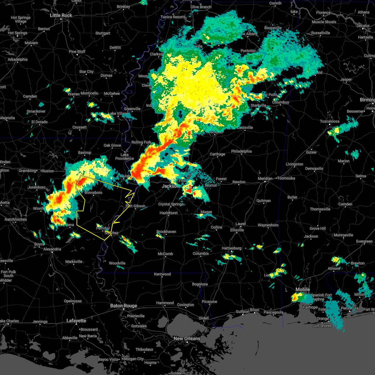 At 527 pm cdt, severe thunderstorms were located along a line extending from near archibald to 6 miles west of olla, moving southeast at 50 mph (radar indicated). Hazards include 60 mph wind gusts and nickel size hail. Expect damage to roofs, siding, and trees. severe thunderstorms will be near, mangham and archibald around 535 pm cdt. bakers and crowville around 545 pm cdt. rosefield around 550 pm cdt. aimwell and sherwood around 555 pm cdt. manifest around 600 pm cdt. wallace ridge and somerset around 610 pm cdt. newellton, afton and wildsville around 615 pm cdt. frogmore around 625 pm cdt. other locations impacted by these severe thunderstorms include harrisonburg, gilbert, baskin, sicily island and ridgecrest. hail threat, radar indicated max hail size, 0. 88 in wind threat, radar indicated max wind gust, 60 mph. At 527 pm cdt, severe thunderstorms were located along a line extending from near archibald to 6 miles west of olla, moving southeast at 50 mph (radar indicated). Hazards include 60 mph wind gusts and nickel size hail. Expect damage to roofs, siding, and trees. severe thunderstorms will be near, mangham and archibald around 535 pm cdt. bakers and crowville around 545 pm cdt. rosefield around 550 pm cdt. aimwell and sherwood around 555 pm cdt. manifest around 600 pm cdt. wallace ridge and somerset around 610 pm cdt. newellton, afton and wildsville around 615 pm cdt. frogmore around 625 pm cdt. other locations impacted by these severe thunderstorms include harrisonburg, gilbert, baskin, sicily island and ridgecrest. hail threat, radar indicated max hail size, 0. 88 in wind threat, radar indicated max wind gust, 60 mph.
|
| 4/13/2022 5:58 PM CDT |
 At 557 pm cdt, severe thunderstorms were located along a line extending from near aimwell to near libuse, moving east at 55 mph (radar indicated). Hazards include 60 mph wind gusts. Expect damage to roofs, siding, and trees. severe thunderstorms will be near, aimwell and manifest around 600 pm cdt. wallace ridge around 605 pm cdt. larto, clayton and lee bayou around 625 pm cdt. new era and mayna around 630 pm cdt. monterey around 640 pm cdt. deer park around 645 pm cdt. other locations impacted by these severe thunderstorms include harrisonburg and ridgecrest. hail threat, radar indicated max hail size, <. 75 in wind threat, radar indicated max wind gust, 60 mph. At 557 pm cdt, severe thunderstorms were located along a line extending from near aimwell to near libuse, moving east at 55 mph (radar indicated). Hazards include 60 mph wind gusts. Expect damage to roofs, siding, and trees. severe thunderstorms will be near, aimwell and manifest around 600 pm cdt. wallace ridge around 605 pm cdt. larto, clayton and lee bayou around 625 pm cdt. new era and mayna around 630 pm cdt. monterey around 640 pm cdt. deer park around 645 pm cdt. other locations impacted by these severe thunderstorms include harrisonburg and ridgecrest. hail threat, radar indicated max hail size, <. 75 in wind threat, radar indicated max wind gust, 60 mph.
|
| 4/5/2022 5:14 AM CDT |
 At 514 am cdt, severe thunderstorms were located along a line extending from newlight to near wallace ridge, moving east at 55 mph (radar indicated). Hazards include 60 mph wind gusts. Expect damage to roofs, siding, and trees. severe thunderstorms will be near, newellton, somerset, west ferriday and lake bruin around 525 am cdt. ferriday around 530 am cdt. waterproof and spokane around 535 am cdt. port gibson and church hill around 545 am cdt. stanton around 550 am cdt. stampley, rocky springs and hermanville around 555 am cdt. fayette, mcnair and reganton around 600 am cdt. other locations impacted by these severe thunderstorms include sicily island and ridgecrest. hail threat, radar indicated max hail size, <. 75 in wind threat, radar indicated max wind gust, 60 mph. At 514 am cdt, severe thunderstorms were located along a line extending from newlight to near wallace ridge, moving east at 55 mph (radar indicated). Hazards include 60 mph wind gusts. Expect damage to roofs, siding, and trees. severe thunderstorms will be near, newellton, somerset, west ferriday and lake bruin around 525 am cdt. ferriday around 530 am cdt. waterproof and spokane around 535 am cdt. port gibson and church hill around 545 am cdt. stanton around 550 am cdt. stampley, rocky springs and hermanville around 555 am cdt. fayette, mcnair and reganton around 600 am cdt. other locations impacted by these severe thunderstorms include sicily island and ridgecrest. hail threat, radar indicated max hail size, <. 75 in wind threat, radar indicated max wind gust, 60 mph.
|
| 3/30/2022 2:07 PM CDT |
 At 207 pm cdt, severe thunderstorms were located along a line extending from near winnsboro to near jonesville, moving east at 40 mph (radar indicated). Hazards include 60 mph wind gusts. Expect damage to roofs, siding, and trees. these severe storms will be near, winnsboro and jigger around 210 pm cdt. crowville around 220 pm cdt. lee bayou around 240 pm cdt. Other locations impacted by these severe thunderstorms include harrisonburg, gilbert and sicily island. At 207 pm cdt, severe thunderstorms were located along a line extending from near winnsboro to near jonesville, moving east at 40 mph (radar indicated). Hazards include 60 mph wind gusts. Expect damage to roofs, siding, and trees. these severe storms will be near, winnsboro and jigger around 210 pm cdt. crowville around 220 pm cdt. lee bayou around 240 pm cdt. Other locations impacted by these severe thunderstorms include harrisonburg, gilbert and sicily island.
|
| 3/30/2022 1:38 PM CDT |
 At 137 pm cdt, severe thunderstorms were located along a line extending from near columbia to 6 miles north of holloway, moving east at 40 mph (radar indicated). Hazards include 60 mph wind gusts. Expect damage to roofs, siding, and trees. severe thunderstorms will be near, liddieville around 155 pm cdt. winnsboro and archie around 205 pm cdt. mayna around 210 pm cdt. jonesville around 215 pm cdt. crowville around 220 pm cdt. Other locations impacted by these severe thunderstorms include harrisonburg, gilbert and sicily island. At 137 pm cdt, severe thunderstorms were located along a line extending from near columbia to 6 miles north of holloway, moving east at 40 mph (radar indicated). Hazards include 60 mph wind gusts. Expect damage to roofs, siding, and trees. severe thunderstorms will be near, liddieville around 155 pm cdt. winnsboro and archie around 205 pm cdt. mayna around 210 pm cdt. jonesville around 215 pm cdt. crowville around 220 pm cdt. Other locations impacted by these severe thunderstorms include harrisonburg, gilbert and sicily island.
|
| 10/27/2021 3:02 PM CDT |
 At 302 pm cdt, severe thunderstorms were located along a line extending from 8 miles northwest of enterprise to near black hawk, moving northeast at 40 mph (radar indicated). Hazards include 60 mph wind gusts. Expect damage to roofs, siding, and trees. Locations impacted include, natchez, vidalia, ferriday, monterey, jonesville, clayton, lee bayou, new era, kingston, black hawk, wildsville, sibley, slocum, spokane, wallace ridge, west ferriday, deer park, enterprise, frogmore and ridgecrest. At 302 pm cdt, severe thunderstorms were located along a line extending from 8 miles northwest of enterprise to near black hawk, moving northeast at 40 mph (radar indicated). Hazards include 60 mph wind gusts. Expect damage to roofs, siding, and trees. Locations impacted include, natchez, vidalia, ferriday, monterey, jonesville, clayton, lee bayou, new era, kingston, black hawk, wildsville, sibley, slocum, spokane, wallace ridge, west ferriday, deer park, enterprise, frogmore and ridgecrest.
|
| 10/27/2021 2:39 PM CDT |
 At 238 pm cdt, severe thunderstorms were located along a line extending from near olla to simmesport, moving northeast at 40 mph (radar indicated). Hazards include 60 mph wind gusts. Expect damage to roofs, siding, and trees. Locations impacted include, natchez, vidalia, ferriday, larto, monterey, jonesville, clayton, lee bayou, acme, new era, rosefield, kingston, wildsville, spokane, mayna, deer park, walters, black hawk, aimwell and sibley. At 238 pm cdt, severe thunderstorms were located along a line extending from near olla to simmesport, moving northeast at 40 mph (radar indicated). Hazards include 60 mph wind gusts. Expect damage to roofs, siding, and trees. Locations impacted include, natchez, vidalia, ferriday, larto, monterey, jonesville, clayton, lee bayou, acme, new era, rosefield, kingston, wildsville, spokane, mayna, deer park, walters, black hawk, aimwell and sibley.
|
| 10/27/2021 2:30 PM CDT |
 At 230 pm cdt, severe thunderstorms were located along a line extending from near olla to near simmesport, moving northeast at 40 mph (radar indicated). Hazards include 60 mph wind gusts. expect damage to roofs, siding, and trees At 230 pm cdt, severe thunderstorms were located along a line extending from near olla to near simmesport, moving northeast at 40 mph (radar indicated). Hazards include 60 mph wind gusts. expect damage to roofs, siding, and trees
|
| 7/27/2021 2:20 PM CDT |
 At 220 pm cdt, a severe thunderstorm was located near enterprise, or 22 miles southeast of columbia, and is nearly stationary (radar indicated). Hazards include 60 mph wind gusts. Expect damage to roofs, siding, and trees. Locations impacted include, wallace ridge, enterprise, rosefield, aimwell, manifest, sherwood and harrisonburg. At 220 pm cdt, a severe thunderstorm was located near enterprise, or 22 miles southeast of columbia, and is nearly stationary (radar indicated). Hazards include 60 mph wind gusts. Expect damage to roofs, siding, and trees. Locations impacted include, wallace ridge, enterprise, rosefield, aimwell, manifest, sherwood and harrisonburg.
|
| 7/27/2021 2:08 PM CDT |
 At 208 pm cdt, a severe thunderstorm was located near enterprise, or 21 miles southeast of columbia, moving southwest at 5 mph (radar indicated). Hazards include 60 mph wind gusts. Expect damage to roofs, siding, and trees. this severe thunderstorm will be near, sherwood around 230 pm cdt. aimwell, manifest and wallace ridge around 300 pm cdt. Other locations impacted by this severe thunderstorm include harrisonburg. At 208 pm cdt, a severe thunderstorm was located near enterprise, or 21 miles southeast of columbia, moving southwest at 5 mph (radar indicated). Hazards include 60 mph wind gusts. Expect damage to roofs, siding, and trees. this severe thunderstorm will be near, sherwood around 230 pm cdt. aimwell, manifest and wallace ridge around 300 pm cdt. Other locations impacted by this severe thunderstorm include harrisonburg.
|
| 6/21/2021 7:02 PM CDT | At 702 pm cdt, severe thunderstorms were located along a line extending from 7 miles west of buckner to 6 miles west of rosefield to near midway, moving east at 30 mph (radar indicated). Hazards include 60 mph wind gusts. Expect damage to roofs, siding, and trees. severe thunderstorms will be near, rosefield around 715 pm cdt. sherwood and aimwell around 720 pm cdt. enterprise around 725 pm cdt. liddieville and manifest around 735 pm cdt. archie around 740 pm cdt. winnsboro around 745 pm cdt. jonesville around 750 pm cdt. wildsville and crowville around 755 pm cdt. Other locations impacted by these severe thunderstorms include harrisonburg, gilbert, baskin and sicily island. |
| 5/4/2021 1:54 PM CDT |
 At 154 pm cdt, severe thunderstorms were located along a line extending from near newlight to clayton to near acme, moving east at 45 mph (radar indicated). Hazards include 70 mph wind gusts and nickel size hail. Expect considerable tree damage. damage is likely to mobile homes, roofs, and outbuildings. these severe storms will be near, spokane around 205 pm cdt. other locations impacted by these severe thunderstorms include sicily island and ridgecrest. A tornado watch remains in effect until 600 pm cdt for northeastern louisiana, and southwestern mississippi. At 154 pm cdt, severe thunderstorms were located along a line extending from near newlight to clayton to near acme, moving east at 45 mph (radar indicated). Hazards include 70 mph wind gusts and nickel size hail. Expect considerable tree damage. damage is likely to mobile homes, roofs, and outbuildings. these severe storms will be near, spokane around 205 pm cdt. other locations impacted by these severe thunderstorms include sicily island and ridgecrest. A tornado watch remains in effect until 600 pm cdt for northeastern louisiana, and southwestern mississippi.
|
| 5/4/2021 1:15 PM CDT |
 At 115 pm cdt, severe thunderstorms were located along a line extending from near buckner to near aimwell to near effie, moving east at 40 mph (radar indicated). Hazards include 70 mph wind gusts and nickel size hail. Expect considerable tree damage. damage is likely to mobile homes, roofs, and outbuildings. severe thunderstorms will be near, aimwell and manifest around 120 pm cdt. sherwood and rosefield around 125 pm cdt. enterprise around 130 pm cdt. larto around 135 pm cdt. acme and mayna around 140 pm cdt. new era around 145 pm cdt. monterey, wisner and slocum around 155 pm cdt. cooter point and deer park around 205 pm cdt. other locations impacted by these severe thunderstorms include harrisonburg, gilbert, sicily island and ridgecrest. A tornado watch remains in effect until 600 pm cdt for northeastern louisiana, and southwestern mississippi. At 115 pm cdt, severe thunderstorms were located along a line extending from near buckner to near aimwell to near effie, moving east at 40 mph (radar indicated). Hazards include 70 mph wind gusts and nickel size hail. Expect considerable tree damage. damage is likely to mobile homes, roofs, and outbuildings. severe thunderstorms will be near, aimwell and manifest around 120 pm cdt. sherwood and rosefield around 125 pm cdt. enterprise around 130 pm cdt. larto around 135 pm cdt. acme and mayna around 140 pm cdt. new era around 145 pm cdt. monterey, wisner and slocum around 155 pm cdt. cooter point and deer park around 205 pm cdt. other locations impacted by these severe thunderstorms include harrisonburg, gilbert, sicily island and ridgecrest. A tornado watch remains in effect until 600 pm cdt for northeastern louisiana, and southwestern mississippi.
|
| 4/23/2021 7:51 PM CDT |
 At 751 pm cdt, a severe thunderstorm was located over frogmore, or 8 miles southwest of ferriday, moving northeast at 50 mph (radar indicated). Hazards include 60 mph wind gusts and quarter size hail. Hail damage to vehicles is expected. expect wind damage to roofs, siding, and trees. this severe storm will be near, ferriday around 800 pm cdt. Other locations impacted by this severe thunderstorm include harrisonburg. At 751 pm cdt, a severe thunderstorm was located over frogmore, or 8 miles southwest of ferriday, moving northeast at 50 mph (radar indicated). Hazards include 60 mph wind gusts and quarter size hail. Hail damage to vehicles is expected. expect wind damage to roofs, siding, and trees. this severe storm will be near, ferriday around 800 pm cdt. Other locations impacted by this severe thunderstorm include harrisonburg.
|
| 4/23/2021 7:41 PM CDT |
 At 741 pm cdt, a severe thunderstorm was located near mayna, or near monterey, moving northeast at 50 mph (radar indicated). Hazards include 60 mph wind gusts and quarter size hail. Hail damage to vehicles is expected. expect wind damage to roofs, siding, and trees. this severe storm will be near, wildsville around 750 pm cdt. frogmore around 755 pm cdt. ferriday around 800 pm cdt. Other locations impacted by this severe thunderstorm include harrisonburg. At 741 pm cdt, a severe thunderstorm was located near mayna, or near monterey, moving northeast at 50 mph (radar indicated). Hazards include 60 mph wind gusts and quarter size hail. Hail damage to vehicles is expected. expect wind damage to roofs, siding, and trees. this severe storm will be near, wildsville around 750 pm cdt. frogmore around 755 pm cdt. ferriday around 800 pm cdt. Other locations impacted by this severe thunderstorm include harrisonburg.
|
| 4/23/2021 7:30 PM CDT |
 At 730 pm cdt, a severe thunderstorm was located near mayna, or near larto, moving northeast at 50 mph (radar indicated). Hazards include 60 mph wind gusts and quarter size hail. Hail damage to vehicles is expected. expect wind damage to roofs, siding, and trees. this severe thunderstorm will be near, monterey and jonesville around 745 pm cdt. wildsville around 750 pm cdt. frogmore around 755 pm cdt. ferriday around 800 pm cdt. Other locations impacted by this severe thunderstorm include harrisonburg. At 730 pm cdt, a severe thunderstorm was located near mayna, or near larto, moving northeast at 50 mph (radar indicated). Hazards include 60 mph wind gusts and quarter size hail. Hail damage to vehicles is expected. expect wind damage to roofs, siding, and trees. this severe thunderstorm will be near, monterey and jonesville around 745 pm cdt. wildsville around 750 pm cdt. frogmore around 755 pm cdt. ferriday around 800 pm cdt. Other locations impacted by this severe thunderstorm include harrisonburg.
|
| 4/14/2021 5:54 AM CDT |
 At 554 am cdt, a severe thunderstorm was located over walters, or 14 miles northwest of larto, moving northeast at 25 mph (radar indicated). Hazards include half dollar size hail. Damage to vehicles is expected. this severe thunderstorm will be near, jonesville around 620 am cdt. wildsville around 625 am cdt. wallace ridge around 630 am cdt. frogmore around 640 am cdt. Other locations impacted by this severe thunderstorm include harrisonburg. At 554 am cdt, a severe thunderstorm was located over walters, or 14 miles northwest of larto, moving northeast at 25 mph (radar indicated). Hazards include half dollar size hail. Damage to vehicles is expected. this severe thunderstorm will be near, jonesville around 620 am cdt. wildsville around 625 am cdt. wallace ridge around 630 am cdt. frogmore around 640 am cdt. Other locations impacted by this severe thunderstorm include harrisonburg.
|
| 4/9/2021 10:51 PM CDT |
 The severe thunderstorm warning for north central concordia, northern catahoula and south central franklin parishes will expire at 1100 pm cdt, the storm which prompted the warning has weakened below severe limits, and has exited the warned area. therefore, the warning will be allowed to expire. however heavy rain is still possible with this thunderstorm. a severe thunderstorm watch remains in effect until 400 am cdt for northeastern louisiana. The severe thunderstorm warning for north central concordia, northern catahoula and south central franklin parishes will expire at 1100 pm cdt, the storm which prompted the warning has weakened below severe limits, and has exited the warned area. therefore, the warning will be allowed to expire. however heavy rain is still possible with this thunderstorm. a severe thunderstorm watch remains in effect until 400 am cdt for northeastern louisiana.
|
| 4/9/2021 10:25 PM CDT |
 At 1025 pm cdt, a severe thunderstorm was located near wallace ridge, or 14 miles northwest of ferriday, moving east at 45 mph (radar indicated). Hazards include 60 mph wind gusts and penny size hail. Expect damage to roofs, siding, and trees. this severe storm will be near, clayton and lee bayou around 1040 pm cdt. Other locations impacted by this severe thunderstorm include harrisonburg and sicily island. At 1025 pm cdt, a severe thunderstorm was located near wallace ridge, or 14 miles northwest of ferriday, moving east at 45 mph (radar indicated). Hazards include 60 mph wind gusts and penny size hail. Expect damage to roofs, siding, and trees. this severe storm will be near, clayton and lee bayou around 1040 pm cdt. Other locations impacted by this severe thunderstorm include harrisonburg and sicily island.
|
| 4/9/2021 10:11 PM CDT |
 At 1011 pm cdt, a severe thunderstorm was located over aimwell, or 24 miles south of columbia, moving east at 40 mph (radar indicated). Hazards include 60 mph wind gusts and quarter size hail. Hail damage to vehicles is expected. expect wind damage to roofs, siding, and trees. this severe thunderstorm will be near, wallace ridge around 1020 pm cdt. lee bayou around 1045 pm cdt. Other locations impacted by this severe thunderstorm include harrisonburg and sicily island. At 1011 pm cdt, a severe thunderstorm was located over aimwell, or 24 miles south of columbia, moving east at 40 mph (radar indicated). Hazards include 60 mph wind gusts and quarter size hail. Hail damage to vehicles is expected. expect wind damage to roofs, siding, and trees. this severe thunderstorm will be near, wallace ridge around 1020 pm cdt. lee bayou around 1045 pm cdt. Other locations impacted by this severe thunderstorm include harrisonburg and sicily island.
|
| 12/23/2020 9:26 PM CST |
 The severe thunderstorm warning for northern concordia and southern catahoula parishes will expire at 930 pm cst, the severe thunderstorm which prompted the warning has weakened. herefore, the warning will be allowed to expire. however small hail and gusty winds are still possible with this thunderstorm. a tornado watch remains in effect until 200 am cst for northeastern louisiana, and southwestern mississippi. The severe thunderstorm warning for northern concordia and southern catahoula parishes will expire at 930 pm cst, the severe thunderstorm which prompted the warning has weakened. herefore, the warning will be allowed to expire. however small hail and gusty winds are still possible with this thunderstorm. a tornado watch remains in effect until 200 am cst for northeastern louisiana, and southwestern mississippi.
|
| 12/23/2020 8:39 PM CST |
 At 839 pm cst, a severe thunderstorm was located 7 miles southwest of walters, or 10 miles northwest of larto, moving east at 45 mph (radar indicated). Hazards include 60 mph wind gusts and quarter size hail. Hail damage to vehicles is expected. expect wind damage to roofs, siding, and trees. this severe storm will be near, walters around 845 pm cst. larto and archie around 850 pm cst. mayna around 855 pm cst. monterey and wildsville around 905 pm cst. frogmore around 915 pm cst. west ferriday around 920 pm cst. ferriday around 925 pm cst. natchez around 935 pm cst. other locations impacted by this severe thunderstorm include ridgecrest. A tornado watch remains in effect until 200 am cst for northeastern louisiana, and southwestern mississippi. At 839 pm cst, a severe thunderstorm was located 7 miles southwest of walters, or 10 miles northwest of larto, moving east at 45 mph (radar indicated). Hazards include 60 mph wind gusts and quarter size hail. Hail damage to vehicles is expected. expect wind damage to roofs, siding, and trees. this severe storm will be near, walters around 845 pm cst. larto and archie around 850 pm cst. mayna around 855 pm cst. monterey and wildsville around 905 pm cst. frogmore around 915 pm cst. west ferriday around 920 pm cst. ferriday around 925 pm cst. natchez around 935 pm cst. other locations impacted by this severe thunderstorm include ridgecrest. A tornado watch remains in effect until 200 am cst for northeastern louisiana, and southwestern mississippi.
|
| 12/23/2020 8:26 PM CST |
 At 825 pm cst, a severe thunderstorm was located over holloway, or 14 miles northeast of pineville, moving east at 45 mph (radar indicated). Hazards include 60 mph wind gusts and quarter size hail. Hail damage to vehicles is expected. expect wind damage to roofs, siding, and trees. this severe thunderstorm will be near, walters around 845 pm cst. larto and archie around 850 pm cst. mayna around 855 pm cst. monterey and wildsville around 905 pm cst. frogmore around 910 pm cst. ferriday and west ferriday around 920 pm cst. natchez around 930 pm cst. Other locations impacted by this severe thunderstorm include ridgecrest. At 825 pm cst, a severe thunderstorm was located over holloway, or 14 miles northeast of pineville, moving east at 45 mph (radar indicated). Hazards include 60 mph wind gusts and quarter size hail. Hail damage to vehicles is expected. expect wind damage to roofs, siding, and trees. this severe thunderstorm will be near, walters around 845 pm cst. larto and archie around 850 pm cst. mayna around 855 pm cst. monterey and wildsville around 905 pm cst. frogmore around 910 pm cst. ferriday and west ferriday around 920 pm cst. natchez around 930 pm cst. Other locations impacted by this severe thunderstorm include ridgecrest.
|
| 12/13/2020 6:22 PM CST |
 At 622 pm cst, severe thunderstorms were located along a line extending from 7 miles south of wisner to near acme, moving northeast at 55 mph (radar indicated). Hazards include 60 mph wind gusts. Expect damage to roofs, siding, and trees. these severe storms will be near, wisner around 625 pm cst. monterey, cooter point, helena and slocum around 635 pm cst. deer park around 640 pm cst. natchez and vidalia around 655 pm cst. Other locations impacted by these severe thunderstorms include harrisonburg, sicily island and ridgecrest. At 622 pm cst, severe thunderstorms were located along a line extending from 7 miles south of wisner to near acme, moving northeast at 55 mph (radar indicated). Hazards include 60 mph wind gusts. Expect damage to roofs, siding, and trees. these severe storms will be near, wisner around 625 pm cst. monterey, cooter point, helena and slocum around 635 pm cst. deer park around 640 pm cst. natchez and vidalia around 655 pm cst. Other locations impacted by these severe thunderstorms include harrisonburg, sicily island and ridgecrest.
|
| 12/13/2020 6:06 PM CST |
 At 605 pm cst, severe thunderstorms were located along a line extending from near wallace ridge to near brouillette, moving northeast at 55 mph (radar indicated). Hazards include 60 mph wind gusts. Expect damage to roofs, siding, and trees. these severe storms will be near, wallace ridge around 610 pm cst. acme around 615 pm cst. new era and mayna around 620 pm cst. wisner around 625 pm cst. monterey around 630 pm cst. cooter point and deer park around 635 pm cst. frogmore around 640 pm cst. ferriday and west ferriday around 645 pm cst. Other locations impacted by these severe thunderstorms include harrisonburg, sicily island and ridgecrest. At 605 pm cst, severe thunderstorms were located along a line extending from near wallace ridge to near brouillette, moving northeast at 55 mph (radar indicated). Hazards include 60 mph wind gusts. Expect damage to roofs, siding, and trees. these severe storms will be near, wallace ridge around 610 pm cst. acme around 615 pm cst. new era and mayna around 620 pm cst. wisner around 625 pm cst. monterey around 630 pm cst. cooter point and deer park around 635 pm cst. frogmore around 640 pm cst. ferriday and west ferriday around 645 pm cst. Other locations impacted by these severe thunderstorms include harrisonburg, sicily island and ridgecrest.
|
| 12/13/2020 5:48 PM CST |
 At 547 pm cst, severe thunderstorms were located along a line extending from near jena to centerpoint, moving northeast at 50 mph (radar indicated). Hazards include 60 mph wind gusts. Expect damage to roofs, siding, and trees. severe thunderstorms will be near, manifest and aimwell around 555 pm cst. wallace ridge and sherwood around 605 pm cst. larto around 610 pm cst. mayna and new era around 615 pm cst. monterey and wisner around 625 pm cst. cooter point, deer park and frogmore around 635 pm cst. ferriday, helena and west ferriday around 640 pm cst. natchez and vidalia around 645 pm cst. Other locations impacted by these severe thunderstorms include harrisonburg, sicily island and ridgecrest. At 547 pm cst, severe thunderstorms were located along a line extending from near jena to centerpoint, moving northeast at 50 mph (radar indicated). Hazards include 60 mph wind gusts. Expect damage to roofs, siding, and trees. severe thunderstorms will be near, manifest and aimwell around 555 pm cst. wallace ridge and sherwood around 605 pm cst. larto around 610 pm cst. mayna and new era around 615 pm cst. monterey and wisner around 625 pm cst. cooter point, deer park and frogmore around 635 pm cst. ferriday, helena and west ferriday around 640 pm cst. natchez and vidalia around 645 pm cst. Other locations impacted by these severe thunderstorms include harrisonburg, sicily island and ridgecrest.
|
| 8/15/2020 2:40 PM CDT |
 At 240 pm cdt, a severe thunderstorm was located near jonesville, or 16 miles northwest of monterey, moving south at 15 mph (radar indicated). Hazards include 60 mph wind gusts and nickel size hail. Expect damage to roofs, siding, and trees. this severe storm will be near, jonesville and wildsville around 250 pm cdt. archie around 255 pm cdt. Walters around 300 pm cdt. At 240 pm cdt, a severe thunderstorm was located near jonesville, or 16 miles northwest of monterey, moving south at 15 mph (radar indicated). Hazards include 60 mph wind gusts and nickel size hail. Expect damage to roofs, siding, and trees. this severe storm will be near, jonesville and wildsville around 250 pm cdt. archie around 255 pm cdt. Walters around 300 pm cdt.
|
| 8/15/2020 2:17 PM CDT |
 At 217 pm cdt, a severe thunderstorm was located over wallace ridge, or 17 miles west of ferriday, moving south at 20 mph (radar indicated). Hazards include 60 mph wind gusts and penny size hail. Expect damage to roofs, siding, and trees. this severe thunderstorm will be near, jonesville around 230 pm cdt. wildsville around 235 pm cdt. Other locations impacted by this severe thunderstorm include harrisonburg. At 217 pm cdt, a severe thunderstorm was located over wallace ridge, or 17 miles west of ferriday, moving south at 20 mph (radar indicated). Hazards include 60 mph wind gusts and penny size hail. Expect damage to roofs, siding, and trees. this severe thunderstorm will be near, jonesville around 230 pm cdt. wildsville around 235 pm cdt. Other locations impacted by this severe thunderstorm include harrisonburg.
|
| 4/19/2020 5:27 PM CDT |
 At 527 pm cdt, severe thunderstorms were located along a line extending from near columbia to rosefield to near midway, moving east at 60 mph (radar indicated). Hazards include 60 mph wind gusts and nickel size hail. Expect damage to roofs, siding, and trees. severe thunderstorms will be near, sherwood and rosefield around 530 pm cdt. enterprise and liddieville around 535 pm cdt. manifest and jigger around 540 pm cdt. winnsboro and wisner around 545 pm cdt. wallace ridge around 550 pm cdt. cooter point around 555 pm cdt. ferriday, newlight and helena around 600 pm cdt. clayton and lee bayou around 605 pm cdt. other locations impacted by these severe thunderstorms include harrisonburg, gilbert and sicily island. A tornado watch remains in effect until 700 pm cdt for northeastern louisiana, and southwestern and west central mississippi. At 527 pm cdt, severe thunderstorms were located along a line extending from near columbia to rosefield to near midway, moving east at 60 mph (radar indicated). Hazards include 60 mph wind gusts and nickel size hail. Expect damage to roofs, siding, and trees. severe thunderstorms will be near, sherwood and rosefield around 530 pm cdt. enterprise and liddieville around 535 pm cdt. manifest and jigger around 540 pm cdt. winnsboro and wisner around 545 pm cdt. wallace ridge around 550 pm cdt. cooter point around 555 pm cdt. ferriday, newlight and helena around 600 pm cdt. clayton and lee bayou around 605 pm cdt. other locations impacted by these severe thunderstorms include harrisonburg, gilbert and sicily island. A tornado watch remains in effect until 700 pm cdt for northeastern louisiana, and southwestern and west central mississippi.
|
| 1/11/2020 4:44 AM CST |
 At 444 am cst, severe thunderstorms were located along a line extending from near rosefield to 7 miles northeast of holloway, moving east at 55 mph (radar indicated). Hazards include 60 mph wind gusts and quarter size hail. Hail damage to vehicles is expected. expect wind damage to roofs, siding, and trees. severe thunderstorms will be near, enterprise and sherwood around 450 am cst. larto and mayna around 500 am cst. wisner and new era around 505 am cst. monterey around 510 am cst. cooter point around 515 am cst. deer park and helena around 520 am cst. natchez, st. joseph, lake bruin and sibley around 530 am cst. kingston around 540 am cst. other locations impacted by these severe thunderstorms include harrisonburg, sicily island and ridgecrest. A tornado watch remains in effect until 900 am cst for northeastern louisiana, and southwestern mississippi. At 444 am cst, severe thunderstorms were located along a line extending from near rosefield to 7 miles northeast of holloway, moving east at 55 mph (radar indicated). Hazards include 60 mph wind gusts and quarter size hail. Hail damage to vehicles is expected. expect wind damage to roofs, siding, and trees. severe thunderstorms will be near, enterprise and sherwood around 450 am cst. larto and mayna around 500 am cst. wisner and new era around 505 am cst. monterey around 510 am cst. cooter point around 515 am cst. deer park and helena around 520 am cst. natchez, st. joseph, lake bruin and sibley around 530 am cst. kingston around 540 am cst. other locations impacted by these severe thunderstorms include harrisonburg, sicily island and ridgecrest. A tornado watch remains in effect until 900 am cst for northeastern louisiana, and southwestern mississippi.
|
| 12/16/2019 2:01 PM CST |
 At 201 pm cst, a severe thunderstorm was located near wildsville, or 11 miles west of ferriday, moving northeast at 40 mph (radar indicated). Hazards include golf ball size hail and 60 mph wind gusts. People and animals outdoors will be injured. expect hail damage to roofs, siding, windows, and vehicles. expect wind damage to roofs, siding, and trees. this severe storm will be near, west ferriday around 210 pm cst. clayton and lee bayou around 220 pm cst. A tornado watch remains in effect until 600 pm cst for northeastern louisiana. At 201 pm cst, a severe thunderstorm was located near wildsville, or 11 miles west of ferriday, moving northeast at 40 mph (radar indicated). Hazards include golf ball size hail and 60 mph wind gusts. People and animals outdoors will be injured. expect hail damage to roofs, siding, windows, and vehicles. expect wind damage to roofs, siding, and trees. this severe storm will be near, west ferriday around 210 pm cst. clayton and lee bayou around 220 pm cst. A tornado watch remains in effect until 600 pm cst for northeastern louisiana.
|
| 12/16/2019 1:48 PM CST |
 At 148 pm cst, a severe thunderstorm was located over jonesville, or 13 miles northwest of monterey, moving northeast at 40 mph (radar indicated). Hazards include golf ball size hail and 60 mph wind gusts. People and animals outdoors will be injured. expect hail damage to roofs, siding, windows, and vehicles. expect wind damage to roofs, siding, and trees. this severe storm will be near, wildsville and wallace ridge around 155 pm cst. frogmore around 205 pm cst. west ferriday around 210 pm cst. clayton and lee bayou around 215 pm cst. other locations impacted by this severe thunderstorm include harrisonburg and sicily island. A tornado watch remains in effect until 600 pm cst for northeastern louisiana. At 148 pm cst, a severe thunderstorm was located over jonesville, or 13 miles northwest of monterey, moving northeast at 40 mph (radar indicated). Hazards include golf ball size hail and 60 mph wind gusts. People and animals outdoors will be injured. expect hail damage to roofs, siding, windows, and vehicles. expect wind damage to roofs, siding, and trees. this severe storm will be near, wildsville and wallace ridge around 155 pm cst. frogmore around 205 pm cst. west ferriday around 210 pm cst. clayton and lee bayou around 215 pm cst. other locations impacted by this severe thunderstorm include harrisonburg and sicily island. A tornado watch remains in effect until 600 pm cst for northeastern louisiana.
|
| 12/16/2019 1:29 PM CST |
 At 129 pm cst, a severe thunderstorm was located near walters, or 12 miles northwest of larto, moving northeast at 40 mph (radar indicated). Hazards include golf ball size hail and 60 mph wind gusts. People and animals outdoors will be injured. expect hail damage to roofs, siding, windows, and vehicles. expect wind damage to roofs, siding, and trees. this severe thunderstorm will be near, walters around 135 pm cst. archie around 140 pm cst. jonesville and wildsville around 155 pm cst. wallace ridge around 200 pm cst. frogmore around 205 pm cst. west ferriday around 210 pm cst. clayton and lee bayou around 220 pm cst. other locations impacted by this severe thunderstorm include harrisonburg and sicily island. A tornado watch remains in effect until 600 pm cst for northeastern louisiana. At 129 pm cst, a severe thunderstorm was located near walters, or 12 miles northwest of larto, moving northeast at 40 mph (radar indicated). Hazards include golf ball size hail and 60 mph wind gusts. People and animals outdoors will be injured. expect hail damage to roofs, siding, windows, and vehicles. expect wind damage to roofs, siding, and trees. this severe thunderstorm will be near, walters around 135 pm cst. archie around 140 pm cst. jonesville and wildsville around 155 pm cst. wallace ridge around 200 pm cst. frogmore around 205 pm cst. west ferriday around 210 pm cst. clayton and lee bayou around 220 pm cst. other locations impacted by this severe thunderstorm include harrisonburg and sicily island. A tornado watch remains in effect until 600 pm cst for northeastern louisiana.
|
| 5/19/2019 3:36 AM CDT |
 At 336 am cdt, severe thunderstorms were located along a line extending from newlight to near cooter point to near frogmore, moving east at 45 mph (radar indicated). Hazards include 60 mph wind gusts. Expect damage to roofs, siding, and trees. these severe storms will be near, newlight and cooter point around 340 am cdt. newellton, waterproof, helena, lee bayou, spokane and somerset around 345 am cdt. other locations impacted by these severe thunderstorms include harrisonburg, gilbert, sicily island and ridgecrest. A tornado watch remains in effect until 1000 am cdt for northeastern louisiana, and southwestern and west central mississippi. At 336 am cdt, severe thunderstorms were located along a line extending from newlight to near cooter point to near frogmore, moving east at 45 mph (radar indicated). Hazards include 60 mph wind gusts. Expect damage to roofs, siding, and trees. these severe storms will be near, newlight and cooter point around 340 am cdt. newellton, waterproof, helena, lee bayou, spokane and somerset around 345 am cdt. other locations impacted by these severe thunderstorms include harrisonburg, gilbert, sicily island and ridgecrest. A tornado watch remains in effect until 1000 am cdt for northeastern louisiana, and southwestern and west central mississippi.
|
| 5/19/2019 2:50 AM CDT |
 At 249 am cdt, severe thunderstorms were located along a line extending from near grayson to 7 miles west of aimwell to 11 miles southwest of midway, moving east at 45 mph (radar indicated). Hazards include 60 mph wind gusts. Expect damage to roofs, siding, and trees. these severe storms will be near, aimwell and rosefield around 300 am cdt. sherwood around 305 am cdt. enterprise around 310 am cdt. winnsboro, jigger, archie, walters and manifest around 315 am cdt. wisner around 320 am cdt. jonesville around 325 am cdt. wildsville and wallace ridge around 330 am cdt. newlight, cooter point and frogmore around 340 am cdt. other locations impacted by these severe thunderstorms include harrisonburg, gilbert, sicily island and ridgecrest. A tornado watch remains in effect until 1000 am cdt for northeastern louisiana, and southwestern and west central mississippi. At 249 am cdt, severe thunderstorms were located along a line extending from near grayson to 7 miles west of aimwell to 11 miles southwest of midway, moving east at 45 mph (radar indicated). Hazards include 60 mph wind gusts. Expect damage to roofs, siding, and trees. these severe storms will be near, aimwell and rosefield around 300 am cdt. sherwood around 305 am cdt. enterprise around 310 am cdt. winnsboro, jigger, archie, walters and manifest around 315 am cdt. wisner around 320 am cdt. jonesville around 325 am cdt. wildsville and wallace ridge around 330 am cdt. newlight, cooter point and frogmore around 340 am cdt. other locations impacted by these severe thunderstorms include harrisonburg, gilbert, sicily island and ridgecrest. A tornado watch remains in effect until 1000 am cdt for northeastern louisiana, and southwestern and west central mississippi.
|
| 5/19/2019 2:46 AM CDT |
 At 246 am cdt, severe thunderstorms were located along a line extending from clarks to 7 miles southeast of olla to 11 miles north of ball, moving east at 45 mph (radar indicated). Hazards include 60 mph wind gusts. Expect damage to roofs, siding, and trees. severe thunderstorms will be near, aimwell and rosefield around 300 am cdt. sherwood around 305 am cdt. enterprise and walters around 310 am cdt. jigger, archie and manifest around 315 am cdt. wisner around 320 am cdt. jonesville and wallace ridge around 325 am cdt. wildsville around 330 am cdt. newlight, cooter point and frogmore around 340 am cdt. other locations impacted by these severe thunderstorms include harrisonburg, gilbert, sicily island and ridgecrest. A tornado watch remains in effect until 1000 am cdt for northeastern louisiana, and southwestern and west central mississippi. At 246 am cdt, severe thunderstorms were located along a line extending from clarks to 7 miles southeast of olla to 11 miles north of ball, moving east at 45 mph (radar indicated). Hazards include 60 mph wind gusts. Expect damage to roofs, siding, and trees. severe thunderstorms will be near, aimwell and rosefield around 300 am cdt. sherwood around 305 am cdt. enterprise and walters around 310 am cdt. jigger, archie and manifest around 315 am cdt. wisner around 320 am cdt. jonesville and wallace ridge around 325 am cdt. wildsville around 330 am cdt. newlight, cooter point and frogmore around 340 am cdt. other locations impacted by these severe thunderstorms include harrisonburg, gilbert, sicily island and ridgecrest. A tornado watch remains in effect until 1000 am cdt for northeastern louisiana, and southwestern and west central mississippi.
|
| 5/8/2019 7:20 PM CDT |
 At 720 pm cdt, severe thunderstorms were located along a line extending from near st. joseph to near spokane to new era, moving east at 50 mph (radar indicated). Hazards include 60 mph wind gusts. Expect damage to roofs, siding, and trees. these severe thunderstorms will remain over mainly rural areas of catahoula parish, including the following locations, harrisonburg and sicily island. A tornado watch remains in effect until 1100 pm cdt for northeastern louisiana. At 720 pm cdt, severe thunderstorms were located along a line extending from near st. joseph to near spokane to new era, moving east at 50 mph (radar indicated). Hazards include 60 mph wind gusts. Expect damage to roofs, siding, and trees. these severe thunderstorms will remain over mainly rural areas of catahoula parish, including the following locations, harrisonburg and sicily island. A tornado watch remains in effect until 1100 pm cdt for northeastern louisiana.
|
| 5/8/2019 6:25 PM CDT |
 At 624 pm cdt, severe thunderstorms were located along a line extending from near rosefield to near midway to near the alexandria international airport, moving east at 50 mph (radar indicated). Hazards include 60 mph wind gusts. Expect damage to roofs, siding, and trees. severe thunderstorms will be near, rosefield and aimwell around 630 pm cdt. sherwood around 635 pm cdt. enterprise, archie and manifest around 640 pm cdt. jonesville and wallace ridge around 650 pm cdt. lee bayou around 710 pm cdt. larto and mayna around 715 pm cdt. other locations impacted by these severe thunderstorms include harrisonburg and sicily island. A tornado watch remains in effect until 1100 pm cdt for northeastern louisiana. At 624 pm cdt, severe thunderstorms were located along a line extending from near rosefield to near midway to near the alexandria international airport, moving east at 50 mph (radar indicated). Hazards include 60 mph wind gusts. Expect damage to roofs, siding, and trees. severe thunderstorms will be near, rosefield and aimwell around 630 pm cdt. sherwood around 635 pm cdt. enterprise, archie and manifest around 640 pm cdt. jonesville and wallace ridge around 650 pm cdt. lee bayou around 710 pm cdt. larto and mayna around 715 pm cdt. other locations impacted by these severe thunderstorms include harrisonburg and sicily island. A tornado watch remains in effect until 1100 pm cdt for northeastern louisiana.
|
| 4/25/2019 6:39 AM CDT |
 At 639 am cdt, severe thunderstorms were located along a line extending from 6 miles southeast of enterprise to near wildsville to near acme, moving east at 45 mph (radar indicated). Hazards include 60 mph wind gusts. Expect damage to roofs, siding, and trees. these severe storms will be near, frogmore around 645 am cdt. ferriday and west ferriday around 650 am cdt. clayton and lee bayou around 655 am cdt. spokane and deer park around 700 am cdt. Other locations impacted by these severe thunderstorms include harrisonburg, sicily island and ridgecrest. At 639 am cdt, severe thunderstorms were located along a line extending from 6 miles southeast of enterprise to near wildsville to near acme, moving east at 45 mph (radar indicated). Hazards include 60 mph wind gusts. Expect damage to roofs, siding, and trees. these severe storms will be near, frogmore around 645 am cdt. ferriday and west ferriday around 650 am cdt. clayton and lee bayou around 655 am cdt. spokane and deer park around 700 am cdt. Other locations impacted by these severe thunderstorms include harrisonburg, sicily island and ridgecrest.
|
| 4/25/2019 6:24 AM CDT |
 At 624 am cdt, severe thunderstorms were located along a line extending from aimwell to near jonesville to near lake ophelia national wildlife refuge, moving east at 45 mph (radar indicated). Hazards include 60 mph wind gusts. Expect damage to roofs, siding, and trees. these severe storms will be near, jonesville, wildsville and wallace ridge around 630 am cdt. frogmore around 640 am cdt. ferriday, slocum and west ferriday around 650 am cdt. clayton, lee bayou and deer park around 655 am cdt. spokane around 700 am cdt. Other locations impacted by these severe thunderstorms include harrisonburg, sicily island and ridgecrest. At 624 am cdt, severe thunderstorms were located along a line extending from aimwell to near jonesville to near lake ophelia national wildlife refuge, moving east at 45 mph (radar indicated). Hazards include 60 mph wind gusts. Expect damage to roofs, siding, and trees. these severe storms will be near, jonesville, wildsville and wallace ridge around 630 am cdt. frogmore around 640 am cdt. ferriday, slocum and west ferriday around 650 am cdt. clayton, lee bayou and deer park around 655 am cdt. spokane around 700 am cdt. Other locations impacted by these severe thunderstorms include harrisonburg, sicily island and ridgecrest.
|
| 4/25/2019 6:09 AM CDT |
 At 609 am cdt, severe thunderstorms were located along a line extending from midway to near walters to near marksville, moving east at 45 mph (radar indicated). Hazards include 60 mph wind gusts. Expect damage to roofs, siding, and trees. severe thunderstorms will be near, walters around 615 am cdt. archie around 620 am cdt. aimwell and manifest around 625 am cdt. jonesville and sherwood around 630 am cdt. wildsville, acme, wallace ridge and enterprise around 635 am cdt. frogmore around 640 am cdt. ferriday, slocum and west ferriday around 650 am cdt. wisner, clayton and lee bayou around 655 am cdt. Other locations impacted by these severe thunderstorms include harrisonburg, sicily island and ridgecrest. At 609 am cdt, severe thunderstorms were located along a line extending from midway to near walters to near marksville, moving east at 45 mph (radar indicated). Hazards include 60 mph wind gusts. Expect damage to roofs, siding, and trees. severe thunderstorms will be near, walters around 615 am cdt. archie around 620 am cdt. aimwell and manifest around 625 am cdt. jonesville and sherwood around 630 am cdt. wildsville, acme, wallace ridge and enterprise around 635 am cdt. frogmore around 640 am cdt. ferriday, slocum and west ferriday around 650 am cdt. wisner, clayton and lee bayou around 655 am cdt. Other locations impacted by these severe thunderstorms include harrisonburg, sicily island and ridgecrest.
|
| 4/18/2019 12:20 PM CDT |
 At 1220 pm cdt, severe thunderstorms were located along a line extending from near enterprise to near frogmore to near acme, moving northeast at 40 mph (radar indicated). Hazards include 60 mph wind gusts. Expect damage to roofs, siding, and trees. these severe storms will be near, frogmore around 1225 pm cdt. ferriday, jigger and west ferriday around 1230 pm cdt. wisner around 1235 pm cdt. deer park around 1240 pm cdt. other locations impacted by these severe thunderstorms include harrisonburg, gilbert and sicily island. A tornado watch remains in effect until 700 pm cdt for northeastern louisiana, and southwestern mississippi. At 1220 pm cdt, severe thunderstorms were located along a line extending from near enterprise to near frogmore to near acme, moving northeast at 40 mph (radar indicated). Hazards include 60 mph wind gusts. Expect damage to roofs, siding, and trees. these severe storms will be near, frogmore around 1225 pm cdt. ferriday, jigger and west ferriday around 1230 pm cdt. wisner around 1235 pm cdt. deer park around 1240 pm cdt. other locations impacted by these severe thunderstorms include harrisonburg, gilbert and sicily island. A tornado watch remains in effect until 700 pm cdt for northeastern louisiana, and southwestern mississippi.
|
| 4/18/2019 12:07 PM CDT |
 At 1207 pm cdt, severe thunderstorms were located along a line extending from enterprise to jonesville to near acme, moving northeast at 35 mph (radar indicated). Hazards include 60 mph wind gusts. Expect damage to roofs, siding, and trees. these severe storms will be near, wildsville, enterprise and wallace ridge around 1215 pm cdt. frogmore around 1220 pm cdt. jigger around 1225 pm cdt. ferriday, monterey, wisner, slocum and west ferriday around 1230 pm cdt. deer park around 1240 pm cdt. other locations impacted by these severe thunderstorms include harrisonburg, gilbert and sicily island. A tornado watch remains in effect until 700 pm cdt for northeastern louisiana, and southwestern mississippi. At 1207 pm cdt, severe thunderstorms were located along a line extending from enterprise to jonesville to near acme, moving northeast at 35 mph (radar indicated). Hazards include 60 mph wind gusts. Expect damage to roofs, siding, and trees. these severe storms will be near, wildsville, enterprise and wallace ridge around 1215 pm cdt. frogmore around 1220 pm cdt. jigger around 1225 pm cdt. ferriday, monterey, wisner, slocum and west ferriday around 1230 pm cdt. deer park around 1240 pm cdt. other locations impacted by these severe thunderstorms include harrisonburg, gilbert and sicily island. A tornado watch remains in effect until 700 pm cdt for northeastern louisiana, and southwestern mississippi.
|
| 4/18/2019 11:49 AM CDT |
 At 1149 am cdt, severe thunderstorms were located along a line extending from aimwell to near brouillette, moving northeast at 35 mph (radar indicated). Hazards include 60 mph wind gusts. Expect damage to roofs, siding, and trees. severe thunderstorms will be near, sherwood, rosefield and aimwell around 1155 am cdt. enterprise around 1205 pm cdt. acme around 1210 pm cdt. new era and mayna around 1215 pm cdt. jigger around 1225 pm cdt. monterey and wisner around 1230 pm cdt. ferriday, frogmore and west ferriday around 1245 pm cdt. other locations impacted by these severe thunderstorms include harrisonburg, gilbert and sicily island. A tornado watch remains in effect until 700 pm cdt for northeastern louisiana, and southwestern mississippi. At 1149 am cdt, severe thunderstorms were located along a line extending from aimwell to near brouillette, moving northeast at 35 mph (radar indicated). Hazards include 60 mph wind gusts. Expect damage to roofs, siding, and trees. severe thunderstorms will be near, sherwood, rosefield and aimwell around 1155 am cdt. enterprise around 1205 pm cdt. acme around 1210 pm cdt. new era and mayna around 1215 pm cdt. jigger around 1225 pm cdt. monterey and wisner around 1230 pm cdt. ferriday, frogmore and west ferriday around 1245 pm cdt. other locations impacted by these severe thunderstorms include harrisonburg, gilbert and sicily island. A tornado watch remains in effect until 700 pm cdt for northeastern louisiana, and southwestern mississippi.
|
| 4/13/2019 3:19 PM CDT |
 At 319 pm cdt, severe thunderstorms were located along a line extending from sherwood to near jonesville, moving northeast at 40 mph (radar indicated). Hazards include 70 mph wind gusts and quarter size hail. Hail damage to vehicles is expected. expect considerable tree damage. wind damage is also likely to mobile homes, roofs, and outbuildings. these severe storms will be near, enterprise around 325 pm cdt. jigger around 340 pm cdt. wisner, clayton and lee bayou around 345 pm cdt. other locations impacted by these severe thunderstorms include harrisonburg and sicily island. A tornado watch remains in effect until 900 pm cdt for northeastern louisiana, and southwestern mississippi. At 319 pm cdt, severe thunderstorms were located along a line extending from sherwood to near jonesville, moving northeast at 40 mph (radar indicated). Hazards include 70 mph wind gusts and quarter size hail. Hail damage to vehicles is expected. expect considerable tree damage. wind damage is also likely to mobile homes, roofs, and outbuildings. these severe storms will be near, enterprise around 325 pm cdt. jigger around 340 pm cdt. wisner, clayton and lee bayou around 345 pm cdt. other locations impacted by these severe thunderstorms include harrisonburg and sicily island. A tornado watch remains in effect until 900 pm cdt for northeastern louisiana, and southwestern mississippi.
|
| 4/13/2019 3:02 PM CDT |
 At 301 pm cdt, a severe thunderstorm was located near jena, or 23 miles north of larto, moving northeast at 50 mph (radar indicated). Hazards include 70 mph wind gusts and half dollar size hail. Hail damage to vehicles is expected. expect considerable tree damage. wind damage is also likely to mobile homes, roofs, and outbuildings. this severe thunderstorm will be near, manifest around 305 pm cdt. aimwell around 310 pm cdt. sherwood and wallace ridge around 315 pm cdt. enterprise around 320 pm cdt. wisner around 335 pm cdt. other locations impacted by this severe thunderstorm include harrisonburg, sicily island and ridgecrest. A tornado watch remains in effect until 900 pm cdt for northeastern louisiana, and southwestern mississippi. At 301 pm cdt, a severe thunderstorm was located near jena, or 23 miles north of larto, moving northeast at 50 mph (radar indicated). Hazards include 70 mph wind gusts and half dollar size hail. Hail damage to vehicles is expected. expect considerable tree damage. wind damage is also likely to mobile homes, roofs, and outbuildings. this severe thunderstorm will be near, manifest around 305 pm cdt. aimwell around 310 pm cdt. sherwood and wallace ridge around 315 pm cdt. enterprise around 320 pm cdt. wisner around 335 pm cdt. other locations impacted by this severe thunderstorm include harrisonburg, sicily island and ridgecrest. A tornado watch remains in effect until 900 pm cdt for northeastern louisiana, and southwestern mississippi.
|
| 4/7/2019 6:03 PM CDT |
 At 603 pm cdt, severe thunderstorms were located along a line extending from 7 miles north of enterprise to near wallace ridge, moving northeast at 30 mph (radar indicated). Hazards include 60 mph wind gusts. Expect damage to roofs, siding, and trees. these severe storms will be near, jigger around 615 pm cdt. liddieville and lee bayou around 620 pm cdt. winnsboro around 630 pm cdt. wisner around 640 pm cdt. Other locations impacted by these severe thunderstorms include harrisonburg, gilbert, sicily island and ridgecrest. At 603 pm cdt, severe thunderstorms were located along a line extending from 7 miles north of enterprise to near wallace ridge, moving northeast at 30 mph (radar indicated). Hazards include 60 mph wind gusts. Expect damage to roofs, siding, and trees. these severe storms will be near, jigger around 615 pm cdt. liddieville and lee bayou around 620 pm cdt. winnsboro around 630 pm cdt. wisner around 640 pm cdt. Other locations impacted by these severe thunderstorms include harrisonburg, gilbert, sicily island and ridgecrest.
|
| 4/7/2019 5:48 PM CDT |
 At 548 pm cdt, severe thunderstorms were located along a line extending from near enterprise to near wildsville, moving northeast at 30 mph (radar indicated). Hazards include 60 mph wind gusts. Expect damage to roofs, siding, and trees. severe thunderstorms will be near, enterprise around 555 pm cdt. jigger around 610 pm cdt. liddieville and lee bayou around 615 pm cdt. winnsboro around 625 pm cdt. wisner around 635 pm cdt. Other locations impacted by these severe thunderstorms include harrisonburg, gilbert, sicily island and ridgecrest. At 548 pm cdt, severe thunderstorms were located along a line extending from near enterprise to near wildsville, moving northeast at 30 mph (radar indicated). Hazards include 60 mph wind gusts. Expect damage to roofs, siding, and trees. severe thunderstorms will be near, enterprise around 555 pm cdt. jigger around 610 pm cdt. liddieville and lee bayou around 615 pm cdt. winnsboro around 625 pm cdt. wisner around 635 pm cdt. Other locations impacted by these severe thunderstorms include harrisonburg, gilbert, sicily island and ridgecrest.
|
| 4/6/2019 2:18 PM CDT |
 At 218 pm cdt, a severe thunderstorm was located near frogmore, or 8 miles west of ferriday, moving northeast at 30 mph (radar indicated). Hazards include 60 mph wind gusts and quarter size hail. Hail damage to vehicles is expected. expect wind damage to roofs, siding, and trees. this severe storm will be near, ferriday, clayton, west ferriday and lee bayou around 230 pm cdt. Other locations impacted by this severe thunderstorm include ridgecrest. At 218 pm cdt, a severe thunderstorm was located near frogmore, or 8 miles west of ferriday, moving northeast at 30 mph (radar indicated). Hazards include 60 mph wind gusts and quarter size hail. Hail damage to vehicles is expected. expect wind damage to roofs, siding, and trees. this severe storm will be near, ferriday, clayton, west ferriday and lee bayou around 230 pm cdt. Other locations impacted by this severe thunderstorm include ridgecrest.
|
| 4/6/2019 2:05 PM CDT |
 At 205 pm cdt, a severe thunderstorm was located over jonesville, or 13 miles northwest of monterey, moving east at 35 mph (radar indicated). Hazards include 60 mph wind gusts and quarter size hail. Hail damage to vehicles is expected. expect wind damage to roofs, siding, and trees. this severe storm will be near, frogmore around 220 pm cdt. ferriday, clayton, lee bayou and west ferriday around 230 pm cdt. Other locations impacted by this severe thunderstorm include harrisonburg, sicily island and ridgecrest. At 205 pm cdt, a severe thunderstorm was located over jonesville, or 13 miles northwest of monterey, moving east at 35 mph (radar indicated). Hazards include 60 mph wind gusts and quarter size hail. Hail damage to vehicles is expected. expect wind damage to roofs, siding, and trees. this severe storm will be near, frogmore around 220 pm cdt. ferriday, clayton, lee bayou and west ferriday around 230 pm cdt. Other locations impacted by this severe thunderstorm include harrisonburg, sicily island and ridgecrest.
|
| 4/6/2019 1:01 PM CDT |
 At 101 pm cdt, a severe thunderstorm was located near aimwell, or 21 miles south of columbia, moving northeast at 30 mph (radar indicated). Hazards include 60 mph wind gusts and quarter size hail. Hail damage to vehicles is expected. expect wind damage to roofs, siding, and trees. this severe thunderstorm will be near, aimwell around 110 pm cdt. rosefield around 115 pm cdt. sherwood around 120 pm cdt. enterprise around 130 pm cdt. jigger around 150 pm cdt. wisner around 155 pm cdt. Other locations impacted by this severe thunderstorm include harrisonburg, gilbert, sicily island and ridgecrest. At 101 pm cdt, a severe thunderstorm was located near aimwell, or 21 miles south of columbia, moving northeast at 30 mph (radar indicated). Hazards include 60 mph wind gusts and quarter size hail. Hail damage to vehicles is expected. expect wind damage to roofs, siding, and trees. this severe thunderstorm will be near, aimwell around 110 pm cdt. rosefield around 115 pm cdt. sherwood around 120 pm cdt. enterprise around 130 pm cdt. jigger around 150 pm cdt. wisner around 155 pm cdt. Other locations impacted by this severe thunderstorm include harrisonburg, gilbert, sicily island and ridgecrest.
|
| 1/19/2019 3:46 AM CST |
 At 346 am cst, a severe thunderstorm was located near manifest, or 19 miles north of larto, moving northeast at 45 mph (radar indicated). Hazards include 60 mph wind gusts and quarter size hail. Hail damage to vehicles is expected. expect wind damage to roofs, siding, and trees. this severe thunderstorm will be near, manifest around 350 am cst. jonesville around 355 am cst. wallace ridge and wildsville around 400 am cst. lee bayou around 420 am cst. Other locations impacted by this severe thunderstorm include harrisonburg, sicily island and ridgecrest. At 346 am cst, a severe thunderstorm was located near manifest, or 19 miles north of larto, moving northeast at 45 mph (radar indicated). Hazards include 60 mph wind gusts and quarter size hail. Hail damage to vehicles is expected. expect wind damage to roofs, siding, and trees. this severe thunderstorm will be near, manifest around 350 am cst. jonesville around 355 am cst. wallace ridge and wildsville around 400 am cst. lee bayou around 420 am cst. Other locations impacted by this severe thunderstorm include harrisonburg, sicily island and ridgecrest.
|
| 11/1/2018 1:32 AM CDT |
 At 132 am cdt, a severe thunderstorm capable of producing a tornado was located near wallace ridge, or 15 miles west of ferriday, moving northeast at 45 mph (radar indicated rotation). Hazards include tornado. Flying debris will be dangerous to those caught without shelter. mobile homes will be damaged or destroyed. damage to roofs, windows, and vehicles will occur. tree damage is likely. this dangerous storm will be near, lee bayou around 155 am cdt. Other locations impacted by this tornadic thunderstorm include sicily island. At 132 am cdt, a severe thunderstorm capable of producing a tornado was located near wallace ridge, or 15 miles west of ferriday, moving northeast at 45 mph (radar indicated rotation). Hazards include tornado. Flying debris will be dangerous to those caught without shelter. mobile homes will be damaged or destroyed. damage to roofs, windows, and vehicles will occur. tree damage is likely. this dangerous storm will be near, lee bayou around 155 am cdt. Other locations impacted by this tornadic thunderstorm include sicily island.
|
| 11/1/2018 1:19 AM CDT |
 At 119 am cdt, a severe thunderstorm capable of producing a tornado was located near archie, or just southwest of jonesville, moving northeast at 45 mph (radar indicated rotation). Hazards include tornado. Flying debris will be dangerous to those caught without shelter. mobile homes will be damaged or destroyed. damage to roofs, windows, and vehicles will occur. tree damage is likely. this dangerous storm will be near, jonesville and wildsville around 130 am cdt. wallace ridge around 135 am cdt. lee bayou around 150 am cdt. Other locations impacted by this tornadic thunderstorm include harrisonburg and sicily island. At 119 am cdt, a severe thunderstorm capable of producing a tornado was located near archie, or just southwest of jonesville, moving northeast at 45 mph (radar indicated rotation). Hazards include tornado. Flying debris will be dangerous to those caught without shelter. mobile homes will be damaged or destroyed. damage to roofs, windows, and vehicles will occur. tree damage is likely. this dangerous storm will be near, jonesville and wildsville around 130 am cdt. wallace ridge around 135 am cdt. lee bayou around 150 am cdt. Other locations impacted by this tornadic thunderstorm include harrisonburg and sicily island.
|
| 11/1/2018 12:32 AM CDT |
 At 1232 am cdt, severe thunderstorms were located along a line extending from near liddieville to 6 miles west of aimwell to tioga, moving northeast at 50 mph (radar indicated). Hazards include 60 mph wind gusts. expect damage to roofs, siding, and trees At 1232 am cdt, severe thunderstorms were located along a line extending from near liddieville to 6 miles west of aimwell to tioga, moving northeast at 50 mph (radar indicated). Hazards include 60 mph wind gusts. expect damage to roofs, siding, and trees
|
| 7/30/2018 3:25 PM CDT |
 The severe thunderstorm warning for north central concordia and northeastern catahoula parishes will expire at 330 pm cdt, the storm which prompted the warning has weakened below severe limits, and no longer poses an immediate threat to life or property. therefore, the warning will be allowed to expire. however gusty winds and heavy rain are still possible with this thunderstorm. The severe thunderstorm warning for north central concordia and northeastern catahoula parishes will expire at 330 pm cdt, the storm which prompted the warning has weakened below severe limits, and no longer poses an immediate threat to life or property. therefore, the warning will be allowed to expire. however gusty winds and heavy rain are still possible with this thunderstorm.
|
| 7/30/2018 3:04 PM CDT |
 At 304 pm cdt, a severe thunderstorm was located 7 miles northeast of wallace ridge, or 15 miles northwest of ferriday, moving east at 25 mph (radar indicated). Hazards include 60 mph wind gusts and penny size hail. Expect damage to roofs, siding, and trees. Locations impacted include, wallace ridge, sicily island and harrisonburg. At 304 pm cdt, a severe thunderstorm was located 7 miles northeast of wallace ridge, or 15 miles northwest of ferriday, moving east at 25 mph (radar indicated). Hazards include 60 mph wind gusts and penny size hail. Expect damage to roofs, siding, and trees. Locations impacted include, wallace ridge, sicily island and harrisonburg.
|
| 7/30/2018 2:49 PM CDT |
 At 248 pm cdt, a severe thunderstorm was located near sherwood, or 20 miles northwest of ferriday, moving east at 25 mph (radar indicated). Hazards include 60 mph wind gusts and quarter size hail. Hail damage to vehicles is expected. expect wind damage to roofs, siding, and trees. This severe thunderstorm will remain over mainly rural areas of north central concordia and northern catahoula parishes, including the following locations, harrisonburg and sicily island. At 248 pm cdt, a severe thunderstorm was located near sherwood, or 20 miles northwest of ferriday, moving east at 25 mph (radar indicated). Hazards include 60 mph wind gusts and quarter size hail. Hail damage to vehicles is expected. expect wind damage to roofs, siding, and trees. This severe thunderstorm will remain over mainly rural areas of north central concordia and northern catahoula parishes, including the following locations, harrisonburg and sicily island.
|
| 5/26/2018 4:00 PM CDT |
 The national weather service in jackson has issued a * severe thunderstorm warning for. northwestern catahoula parish in northeastern louisiana. until 445 pm cdt. At 359 pm cdt, severe thunderstorms were located along a line extending from enterprise to manifest to 7 miles south of midway,. The national weather service in jackson has issued a * severe thunderstorm warning for. northwestern catahoula parish in northeastern louisiana. until 445 pm cdt. At 359 pm cdt, severe thunderstorms were located along a line extending from enterprise to manifest to 7 miles south of midway,.
|
| 5/25/2018 7:35 PM CDT |
 The severe thunderstorm warning for northwestern concordia and southern catahoula parishes will expire at 745 pm cdt, the storm which prompted the warning has weakened below severe limits, and no longer poses an immediate threat to life or property. therefore, the warning will be allowed to expire. The severe thunderstorm warning for northwestern concordia and southern catahoula parishes will expire at 745 pm cdt, the storm which prompted the warning has weakened below severe limits, and no longer poses an immediate threat to life or property. therefore, the warning will be allowed to expire.
|
| 5/25/2018 6:58 PM CDT |
 At 658 pm cdt, a severe thunderstorm was located near jonesville, or 17 miles northwest of monterey, moving southeast at 10 mph (radar indicated). Hazards include 60 mph wind gusts and quarter size hail. Hail damage to vehicles is expected. expect wind damage to roofs, siding, and trees. this severe thunderstorm will be near, jonesville and archie around 715 pm cdt. walters around 725 pm cdt. Wildsville around 730 pm cdt. At 658 pm cdt, a severe thunderstorm was located near jonesville, or 17 miles northwest of monterey, moving southeast at 10 mph (radar indicated). Hazards include 60 mph wind gusts and quarter size hail. Hail damage to vehicles is expected. expect wind damage to roofs, siding, and trees. this severe thunderstorm will be near, jonesville and archie around 715 pm cdt. walters around 725 pm cdt. Wildsville around 730 pm cdt.
|
| 4/14/2018 5:40 AM CDT |
 At 540 am cdt, a severe thunderstorm was located near mayna, or near larto, moving northeast at 45 mph (radar indicated). Hazards include 60 mph wind gusts and nickel size hail. Expect damage to roofs, siding, and trees. this severe thunderstorm will be near, walters around 545 am cdt. archie around 550 am cdt. jonesville and wildsville around 600 am cdt. wallace ridge and frogmore around 605 am cdt. clayton around 620 am cdt. A tornado watch remains in effect until 600 am cdt for northeastern louisiana, and southwestern mississippi. At 540 am cdt, a severe thunderstorm was located near mayna, or near larto, moving northeast at 45 mph (radar indicated). Hazards include 60 mph wind gusts and nickel size hail. Expect damage to roofs, siding, and trees. this severe thunderstorm will be near, walters around 545 am cdt. archie around 550 am cdt. jonesville and wildsville around 600 am cdt. wallace ridge and frogmore around 605 am cdt. clayton around 620 am cdt. A tornado watch remains in effect until 600 am cdt for northeastern louisiana, and southwestern mississippi.
|
| 4/6/2018 10:05 PM CDT |
 At 1004 pm cdt, a severe thunderstorm was located over wildsville, or 9 miles northwest of monterey, moving southeast at 30 mph (radar indicated). Hazards include 60 mph wind gusts. Expect damage to roofs, siding, and trees. this severe storm will be near, frogmore around 1015 pm cdt. monterey around 1020 pm cdt. deer park around 1040 pm cdt. sibley around 1045 pm cdt. other locations impacted by this severe thunderstorm include ridgecrest. A tornado watch remains in effect until 1100 pm cdt for northeastern louisiana, and southwestern mississippi. At 1004 pm cdt, a severe thunderstorm was located over wildsville, or 9 miles northwest of monterey, moving southeast at 30 mph (radar indicated). Hazards include 60 mph wind gusts. Expect damage to roofs, siding, and trees. this severe storm will be near, frogmore around 1015 pm cdt. monterey around 1020 pm cdt. deer park around 1040 pm cdt. sibley around 1045 pm cdt. other locations impacted by this severe thunderstorm include ridgecrest. A tornado watch remains in effect until 1100 pm cdt for northeastern louisiana, and southwestern mississippi.
|
| 4/6/2018 9:37 PM CDT |
 At 937 pm cdt, a severe thunderstorm was located over jonesville, or 16 miles west of ferriday, moving southeast at 35 mph (radar indicated). Hazards include 60 mph wind gusts. Expect damage to roofs, siding, and trees. this severe thunderstorm will be near, frogmore around 955 pm cdt. monterey around 1005 pm cdt. deer park around 1015 pm cdt. sibley around 1030 pm cdt. other locations impacted by this severe thunderstorm include harrisonburg and ridgecrest. A tornado watch remains in effect until 1100 pm cdt for northeastern louisiana, and southwestern mississippi. At 937 pm cdt, a severe thunderstorm was located over jonesville, or 16 miles west of ferriday, moving southeast at 35 mph (radar indicated). Hazards include 60 mph wind gusts. Expect damage to roofs, siding, and trees. this severe thunderstorm will be near, frogmore around 955 pm cdt. monterey around 1005 pm cdt. deer park around 1015 pm cdt. sibley around 1030 pm cdt. other locations impacted by this severe thunderstorm include harrisonburg and ridgecrest. A tornado watch remains in effect until 1100 pm cdt for northeastern louisiana, and southwestern mississippi.
|
| 4/3/2018 7:40 PM CDT |
 At 740 pm cdt, severe thunderstorms were located along a line extending from near tallulah to 7 miles north of helena to near jonesville, moving southeast at 30 mph (radar indicated). Hazards include 60 mph wind gusts and nickel size hail. Expect damage to roofs, siding, and trees. severe thunderstorms will be near, helena around 745 pm cdt. lake bruin around 750 pm cdt. st. joseph around 800 pm cdt. frogmore around 805 pm cdt. alcorn around 810 pm cdt. vicksburg, ferriday and monterey around 815 pm cdt. lorman around 825 pm cdt. fayette and deer park around 830 pm cdt. Other locations impacted by these severe thunderstorms include mound, harrisonburg, sicily island, delta, ridgecrest and richmond. At 740 pm cdt, severe thunderstorms were located along a line extending from near tallulah to 7 miles north of helena to near jonesville, moving southeast at 30 mph (radar indicated). Hazards include 60 mph wind gusts and nickel size hail. Expect damage to roofs, siding, and trees. severe thunderstorms will be near, helena around 745 pm cdt. lake bruin around 750 pm cdt. st. joseph around 800 pm cdt. frogmore around 805 pm cdt. alcorn around 810 pm cdt. vicksburg, ferriday and monterey around 815 pm cdt. lorman around 825 pm cdt. fayette and deer park around 830 pm cdt. Other locations impacted by these severe thunderstorms include mound, harrisonburg, sicily island, delta, ridgecrest and richmond.
|
| 2/21/2018 1:08 PM CST |
 At 107 pm cst, severe thunderstorms were located along a line extending from near liddieville to near enterprise to wildsville, moving northeast at 35 mph (radar indicated). Hazards include 60 mph wind gusts. Expect damage to roofs, siding, and trees. these severe storms will be near, liddieville around 115 pm cst. winnsboro around 125 pm cst. mangham and wisner around 130 pm cst. other locations impacted by these severe thunderstorms include harrisonburg, gilbert, baskin and sicily island. A tornado watch remains in effect until 500 pm cst for northeastern louisiana. At 107 pm cst, severe thunderstorms were located along a line extending from near liddieville to near enterprise to wildsville, moving northeast at 35 mph (radar indicated). Hazards include 60 mph wind gusts. Expect damage to roofs, siding, and trees. these severe storms will be near, liddieville around 115 pm cst. winnsboro around 125 pm cst. mangham and wisner around 130 pm cst. other locations impacted by these severe thunderstorms include harrisonburg, gilbert, baskin and sicily island. A tornado watch remains in effect until 500 pm cst for northeastern louisiana.
|
| 2/21/2018 12:48 PM CST |
 At 1248 pm cst, severe thunderstorms were located along a line extending from near columbia to aimwell to near archie, moving northeast at 35 mph (radar indicated). Hazards include 60 mph wind gusts. Expect damage to roofs, siding, and trees. severe thunderstorms will be near, jonesville around 100 pm cst. wildsville, enterprise and wallace ridge around 105 pm cst. liddieville and frogmore around 115 pm cst. winnsboro, ferriday and west ferriday around 125 pm cst. mangham and wisner around 130 pm cst. other locations impacted by these severe thunderstorms include harrisonburg, gilbert, baskin and sicily island. A tornado watch remains in effect until 500 pm cst for northeastern louisiana. At 1248 pm cst, severe thunderstorms were located along a line extending from near columbia to aimwell to near archie, moving northeast at 35 mph (radar indicated). Hazards include 60 mph wind gusts. Expect damage to roofs, siding, and trees. severe thunderstorms will be near, jonesville around 100 pm cst. wildsville, enterprise and wallace ridge around 105 pm cst. liddieville and frogmore around 115 pm cst. winnsboro, ferriday and west ferriday around 125 pm cst. mangham and wisner around 130 pm cst. other locations impacted by these severe thunderstorms include harrisonburg, gilbert, baskin and sicily island. A tornado watch remains in effect until 500 pm cst for northeastern louisiana.
|
| 4/30/2017 5:29 AM CDT |
 At 528 am cdt, severe thunderstorms were located along a line extending from acme to fort adams, moving northeast at 20 mph (radar indicated). Hazards include 60 mph wind gusts and penny size hail. expect damage to roofs, siding, and trees At 528 am cdt, severe thunderstorms were located along a line extending from acme to fort adams, moving northeast at 20 mph (radar indicated). Hazards include 60 mph wind gusts and penny size hail. expect damage to roofs, siding, and trees
|
| 4/30/2017 5:14 AM CDT |
 At 514 am cdt, a severe thunderstorm was located near wildsville, or 7 miles northwest of monterey, moving northeast at 45 mph (radar indicated). Hazards include 60 mph wind gusts and penny size hail. Expect damage to roofs, siding, and trees. locations impacted include, natchez, vidalia, ferriday, larto, monterey, jonesville, clayton, lee bayou, acme, new era, rosefield, wildsville, spokane, mayna, deer park, walters, black hawk, aimwell, manifest and slocum. A tornado watch remains in effect until 900 am cdt for northeastern louisiana, and southwestern mississippi. At 514 am cdt, a severe thunderstorm was located near wildsville, or 7 miles northwest of monterey, moving northeast at 45 mph (radar indicated). Hazards include 60 mph wind gusts and penny size hail. Expect damage to roofs, siding, and trees. locations impacted include, natchez, vidalia, ferriday, larto, monterey, jonesville, clayton, lee bayou, acme, new era, rosefield, wildsville, spokane, mayna, deer park, walters, black hawk, aimwell, manifest and slocum. A tornado watch remains in effect until 900 am cdt for northeastern louisiana, and southwestern mississippi.
|
| 4/30/2017 4:40 AM CDT |
 At 440 am cdt, a severe thunderstorm was located over mayna, or over larto, moving north northeast at 50 mph (radar indicated). Hazards include 60 mph wind gusts and nickel size hail. expect damage to roofs, siding, and trees At 440 am cdt, a severe thunderstorm was located over mayna, or over larto, moving north northeast at 50 mph (radar indicated). Hazards include 60 mph wind gusts and nickel size hail. expect damage to roofs, siding, and trees
|
| 1/21/2017 8:43 PM CST |
 At 843 pm cst, a severe thunderstorm capable of producing a tornado was located over manifest, or 23 miles north of larto, moving east at 30 mph (radar indicated rotation). Hazards include tornado. Flying debris will be dangerous to those caught without shelter. mobile homes will be damaged or destroyed. damage to roofs, windows, and vehicles will occur. tree damage is likely. this dangerous storm will be near, wallace ridge around 905 pm cst. clayton and lee bayou around 935 pm cst. Other locations impacted by this tornadic thunderstorm include sicily island and harrisonburg. At 843 pm cst, a severe thunderstorm capable of producing a tornado was located over manifest, or 23 miles north of larto, moving east at 30 mph (radar indicated rotation). Hazards include tornado. Flying debris will be dangerous to those caught without shelter. mobile homes will be damaged or destroyed. damage to roofs, windows, and vehicles will occur. tree damage is likely. this dangerous storm will be near, wallace ridge around 905 pm cst. clayton and lee bayou around 935 pm cst. Other locations impacted by this tornadic thunderstorm include sicily island and harrisonburg.
|
| 1/21/2017 8:22 PM CST |
 The severe thunderstorm warning for northwestern concordia and catahoula parishes will expire at 830 pm cst, the storm which prompted the warning has moved out of the area. therefore the warning will be allowed to expire. a tornado watch remains in effect until 300 am cst for northeastern louisiana. The severe thunderstorm warning for northwestern concordia and catahoula parishes will expire at 830 pm cst, the storm which prompted the warning has moved out of the area. therefore the warning will be allowed to expire. a tornado watch remains in effect until 300 am cst for northeastern louisiana.
|
| 1/21/2017 7:48 PM CST |
 At 748 pm cst, a severe thunderstorm capable of producing a tornado was located over jonesville, or 11 miles northwest of monterey, moving northeast at 30 mph (radar indicated rotation). Hazards include tornado and baseball size hail. Flying debris will be dangerous to those caught without shelter. mobile homes will be damaged or destroyed. damage to roofs, windows, and vehicles will occur. tree damage is likely. this dangerous storm will be near, wildsville around 755 pm cst. frogmore around 805 pm cst. ferriday and west ferriday around 820 pm cst. clayton and lee bayou around 830 pm cst. Other locations impacted by this tornadic thunderstorm include ridgecrest. At 748 pm cst, a severe thunderstorm capable of producing a tornado was located over jonesville, or 11 miles northwest of monterey, moving northeast at 30 mph (radar indicated rotation). Hazards include tornado and baseball size hail. Flying debris will be dangerous to those caught without shelter. mobile homes will be damaged or destroyed. damage to roofs, windows, and vehicles will occur. tree damage is likely. this dangerous storm will be near, wildsville around 755 pm cst. frogmore around 805 pm cst. ferriday and west ferriday around 820 pm cst. clayton and lee bayou around 830 pm cst. Other locations impacted by this tornadic thunderstorm include ridgecrest.
|
| 1/21/2017 7:37 PM CST |
 At 736 pm cst, a severe thunderstorm capable of producing a tornado was located near archie, or 12 miles north of larto, moving northeast at 25 mph (radar indicated rotation). Hazards include tornado and baseball size hail. Flying debris will be dangerous to those caught without shelter. mobile homes will be damaged or destroyed. damage to roofs, windows, and vehicles will occur. tree damage is likely. this dangerous storm will be near, jonesville around 750 pm cst. wildsville around 755 pm cst. wallace ridge around 800 pm cst. frogmore around 810 pm cst. ferriday and west ferriday around 825 pm cst. clayton and lee bayou around 830 pm cst. Other locations impacted by this tornadic thunderstorm include sicily island and ridgecrest. At 736 pm cst, a severe thunderstorm capable of producing a tornado was located near archie, or 12 miles north of larto, moving northeast at 25 mph (radar indicated rotation). Hazards include tornado and baseball size hail. Flying debris will be dangerous to those caught without shelter. mobile homes will be damaged or destroyed. damage to roofs, windows, and vehicles will occur. tree damage is likely. this dangerous storm will be near, jonesville around 750 pm cst. wildsville around 755 pm cst. wallace ridge around 800 pm cst. frogmore around 810 pm cst. ferriday and west ferriday around 825 pm cst. clayton and lee bayou around 830 pm cst. Other locations impacted by this tornadic thunderstorm include sicily island and ridgecrest.
|
| 1/21/2017 7:24 PM CST |
 At 723 pm cst, a severe thunderstorm capable of producing a tornado was located over walters, or 13 miles north of larto, moving northeast at 30 mph (radar indicated rotation). Hazards include tornado and tennis ball size hail. Flying debris will be dangerous to those caught without shelter. mobile homes will be damaged or destroyed. damage to roofs, windows, and vehicles will occur. tree damage is likely. this dangerous storm will be near, jonesville around 745 pm cst. wallace ridge and wildsville around 750 pm cst. clayton and lee bayou around 820 pm cst. Other locations impacted by this tornadic thunderstorm include harrisonburg, sicily island and ridgecrest. At 723 pm cst, a severe thunderstorm capable of producing a tornado was located over walters, or 13 miles north of larto, moving northeast at 30 mph (radar indicated rotation). Hazards include tornado and tennis ball size hail. Flying debris will be dangerous to those caught without shelter. mobile homes will be damaged or destroyed. damage to roofs, windows, and vehicles will occur. tree damage is likely. this dangerous storm will be near, jonesville around 745 pm cst. wallace ridge and wildsville around 750 pm cst. clayton and lee bayou around 820 pm cst. Other locations impacted by this tornadic thunderstorm include harrisonburg, sicily island and ridgecrest.
|
| 1/21/2017 7:08 PM CST |
 At 708 pm cst, a severe thunderstorm was located near walters, or 16 miles northwest of larto, moving northeast at 30 mph (radar indicated). Hazards include 60 mph wind gusts and half dollar size hail. Hail damage to vehicles is expected. expect wind damage to roofs, siding, and trees. this severe thunderstorm will be near, walters around 720 pm cst. archie around 725 pm cst. manifest around 735 pm cst. jonesville around 740 pm cst. wallace ridge and wildsville around 745 pm cst. lee bayou around 815 pm cst. other locations impacted by this severe thunderstorm include sicily island and harrisonburg. A tornado watch remains in effect until 900 pm cst for northeastern louisiana. At 708 pm cst, a severe thunderstorm was located near walters, or 16 miles northwest of larto, moving northeast at 30 mph (radar indicated). Hazards include 60 mph wind gusts and half dollar size hail. Hail damage to vehicles is expected. expect wind damage to roofs, siding, and trees. this severe thunderstorm will be near, walters around 720 pm cst. archie around 725 pm cst. manifest around 735 pm cst. jonesville around 740 pm cst. wallace ridge and wildsville around 745 pm cst. lee bayou around 815 pm cst. other locations impacted by this severe thunderstorm include sicily island and harrisonburg. A tornado watch remains in effect until 900 pm cst for northeastern louisiana.
|
| 1/2/2017 12:08 PM CST |
 At 1208 pm cst, severe thunderstorms were located along a line extending from 6 miles northeast of wallace ridge to near deer park, moving northeast at 65 mph (radar indicated). Hazards include 60 mph wind gusts. Expect damage to roofs, siding, and trees. these severe storms will be near, lee bayou around 1215 pm cst. natchez and vidalia around 1225 pm cst. other locations impacted by these severe thunderstorms include harrisonburg, sicily island and ridgecrest. A tornado watch remains in effect until 800 pm cst for northeastern louisiana, and southwestern mississippi. At 1208 pm cst, severe thunderstorms were located along a line extending from 6 miles northeast of wallace ridge to near deer park, moving northeast at 65 mph (radar indicated). Hazards include 60 mph wind gusts. Expect damage to roofs, siding, and trees. these severe storms will be near, lee bayou around 1215 pm cst. natchez and vidalia around 1225 pm cst. other locations impacted by these severe thunderstorms include harrisonburg, sicily island and ridgecrest. A tornado watch remains in effect until 800 pm cst for northeastern louisiana, and southwestern mississippi.
|
| 1/2/2017 11:36 AM CST |
 At 1136 am cst, severe thunderstorms were located along a line extending from near walters to near lake ophelia national wildlife refuge, moving northeast at 60 mph (radar indicated). Hazards include 60 mph wind gusts. Expect damage to roofs, siding, and trees. severe thunderstorms will be near, archie and walters around 1140 am cst. new era, manifest, acme and mayna around 1145 am cst. jonesville and wallace ridge around 1150 am cst. monterey around 1155 am cst. deer park around 1200 pm cst. ferriday and west ferriday around 1210 pm cst. natchez, vidalia and spokane around 1215 pm cst. other locations impacted by these severe thunderstorms include harrisonburg, sicily island and ridgecrest. A tornado watch remains in effect until 800 pm cst for northeastern louisiana, and southwestern mississippi. At 1136 am cst, severe thunderstorms were located along a line extending from near walters to near lake ophelia national wildlife refuge, moving northeast at 60 mph (radar indicated). Hazards include 60 mph wind gusts. Expect damage to roofs, siding, and trees. severe thunderstorms will be near, archie and walters around 1140 am cst. new era, manifest, acme and mayna around 1145 am cst. jonesville and wallace ridge around 1150 am cst. monterey around 1155 am cst. deer park around 1200 pm cst. ferriday and west ferriday around 1210 pm cst. natchez, vidalia and spokane around 1215 pm cst. other locations impacted by these severe thunderstorms include harrisonburg, sicily island and ridgecrest. A tornado watch remains in effect until 800 pm cst for northeastern louisiana, and southwestern mississippi.
|
| 1/2/2017 2:22 AM CST |
 At 220 am cst, a severe thunderstorm was located over wildsville, or 13 miles north of monterey, moving northeast at 40 mph (radar indicated). Hazards include 60 mph wind gusts and quarter size hail. Hail damage to vehicles is expected. expect wind damage to roofs, siding, and trees. this severe thunderstorm will be near, wallace ridge around 225 am cst. Other locations impacted by this severe thunderstorm include sicily island and harrisonburg. At 220 am cst, a severe thunderstorm was located over wildsville, or 13 miles north of monterey, moving northeast at 40 mph (radar indicated). Hazards include 60 mph wind gusts and quarter size hail. Hail damage to vehicles is expected. expect wind damage to roofs, siding, and trees. this severe thunderstorm will be near, wallace ridge around 225 am cst. Other locations impacted by this severe thunderstorm include sicily island and harrisonburg.
|
| 12/18/2016 1:08 AM CST |
 The severe thunderstorm warning for northwestern concordia and central catahoula parishes will expire at 115 am cst, the storm which prompted the warning has weakened below severe limits, and no longer pose an immediate threat to life or property. therefore the warning will be allowed to expire. however gusty winds are still possible with this thunderstorm. a tornado watch remains in effect until 300 am cst for northeastern louisiana. The severe thunderstorm warning for northwestern concordia and central catahoula parishes will expire at 115 am cst, the storm which prompted the warning has weakened below severe limits, and no longer pose an immediate threat to life or property. therefore the warning will be allowed to expire. however gusty winds are still possible with this thunderstorm. a tornado watch remains in effect until 300 am cst for northeastern louisiana.
|
| 12/18/2016 12:55 AM CST |
 At 1254 am cst, a severe thunderstorm was located near archie, or 11 miles northwest of monterey, moving east at 40 mph (radar indicated). Hazards include 60 mph wind gusts and quarter size hail. Hail damage to vehicles is expected. expect wind damage to roofs, siding, and trees. this severe storm will be near, jonesville around 100 am cst. wildsville around 105 am cst. monterey around 110 am cst. ferriday, frogmore and west ferriday around 115 am cst. other locations impacted by this severe thunderstorm include ridgecrest. A tornado watch remains in effect until 300 am cst for northeastern louisiana. At 1254 am cst, a severe thunderstorm was located near archie, or 11 miles northwest of monterey, moving east at 40 mph (radar indicated). Hazards include 60 mph wind gusts and quarter size hail. Hail damage to vehicles is expected. expect wind damage to roofs, siding, and trees. this severe storm will be near, jonesville around 100 am cst. wildsville around 105 am cst. monterey around 110 am cst. ferriday, frogmore and west ferriday around 115 am cst. other locations impacted by this severe thunderstorm include ridgecrest. A tornado watch remains in effect until 300 am cst for northeastern louisiana.
|
| 12/18/2016 12:38 AM CST |
 At 1237 am cst, a severe thunderstorm was located near walters, or 13 miles northwest of larto, moving east at 55 mph (radar indicated). Hazards include 60 mph wind gusts and quarter size hail. Hail damage to vehicles is expected. expect wind damage to roofs, siding, and trees. this severe thunderstorm will be near, archie around 1245 am cst. jonesville around 1255 am cst. wildsville around 100 am cst. frogmore around 105 am cst. ferriday and west ferriday around 110 am cst. other locations impacted by this severe thunderstorm include ridgecrest. A tornado watch remains in effect until 300 am cst for northeastern louisiana. At 1237 am cst, a severe thunderstorm was located near walters, or 13 miles northwest of larto, moving east at 55 mph (radar indicated). Hazards include 60 mph wind gusts and quarter size hail. Hail damage to vehicles is expected. expect wind damage to roofs, siding, and trees. this severe thunderstorm will be near, archie around 1245 am cst. jonesville around 1255 am cst. wildsville around 100 am cst. frogmore around 105 am cst. ferriday and west ferriday around 110 am cst. other locations impacted by this severe thunderstorm include ridgecrest. A tornado watch remains in effect until 300 am cst for northeastern louisiana.
|
| 11/29/2016 10:38 PM CST |
 The severe thunderstorm warning for northern catahoula and southeastern franklin parishes will expire at 1045 pm cst, the storm which prompted the warning has weakened below severe limits, and have exited the warned area. therefore the warning will be allowed to expire. a tornado watch remains in effect until 500 am cst for northeastern louisiana. The severe thunderstorm warning for northern catahoula and southeastern franklin parishes will expire at 1045 pm cst, the storm which prompted the warning has weakened below severe limits, and have exited the warned area. therefore the warning will be allowed to expire. a tornado watch remains in effect until 500 am cst for northeastern louisiana.
|
| 11/29/2016 9:38 PM CST |
 At 938 pm cst, a severe thunderstorm was located near manifest, or 21 miles west of ferriday, moving northeast at 40 mph (radar indicated). Hazards include 60 mph wind gusts and quarter size hail. Hail damage to vehicles is expected. expect wind damage to roofs, siding, and trees. this severe thunderstorm will be near, wisner around 1010 pm cst. other locations impacted by this severe thunderstorm include sicily island and harrisonburg. A tornado watch remains in effect until 500 am cst for northeastern louisiana. At 938 pm cst, a severe thunderstorm was located near manifest, or 21 miles west of ferriday, moving northeast at 40 mph (radar indicated). Hazards include 60 mph wind gusts and quarter size hail. Hail damage to vehicles is expected. expect wind damage to roofs, siding, and trees. this severe thunderstorm will be near, wisner around 1010 pm cst. other locations impacted by this severe thunderstorm include sicily island and harrisonburg. A tornado watch remains in effect until 500 am cst for northeastern louisiana.
|
| 7/15/2016 5:06 PM CDT |
 At 506 pm cdt, a severe thunderstorm was located near wallace ridge, or 12 miles northwest of ferriday, moving southeast at 20 mph (radar indicated). Hazards include 60 mph wind gusts. Expect damage to roofs. siding. and trees. Locations impacted include, jonesville, manifest, wallace ridge and harrisonburg. At 506 pm cdt, a severe thunderstorm was located near wallace ridge, or 12 miles northwest of ferriday, moving southeast at 20 mph (radar indicated). Hazards include 60 mph wind gusts. Expect damage to roofs. siding. and trees. Locations impacted include, jonesville, manifest, wallace ridge and harrisonburg.
|
| 7/15/2016 4:45 PM CDT |
 At 445 pm cdt, severe thunderstorms were located along a line extending from near wisner to near wallace ridge, moving south at 15 mph (radar indicated). Hazards include 60 mph wind gusts. Expect damage to roofs. siding. and trees. Locations impacted include, jonesville, wisner, enterprise, manifest, lee bayou, rosefield, wallace ridge, sherwood, aimwell, sicily island and harrisonburg. At 445 pm cdt, severe thunderstorms were located along a line extending from near wisner to near wallace ridge, moving south at 15 mph (radar indicated). Hazards include 60 mph wind gusts. Expect damage to roofs. siding. and trees. Locations impacted include, jonesville, wisner, enterprise, manifest, lee bayou, rosefield, wallace ridge, sherwood, aimwell, sicily island and harrisonburg.
|
| 7/15/2016 4:22 PM CDT |
 At 422 pm cdt, a severe thunderstorm was located near enterprise, or 16 miles southwest of winnsboro, moving southeast at 30 mph (radar indicated). Hazards include 60 mph wind gusts. Expect damage to roofs. siding. And trees. At 422 pm cdt, a severe thunderstorm was located near enterprise, or 16 miles southwest of winnsboro, moving southeast at 30 mph (radar indicated). Hazards include 60 mph wind gusts. Expect damage to roofs. siding. And trees.
|
| 7/14/2016 9:16 PM CDT |
 At 916 pm cdt, severe thunderstorms were located along a line extending from valley park to 6 miles northwest of somerset to near olla, moving southeast at 40 mph (radar indicated). Hazards include 70 mph wind gusts. Expect considerable tree damage. damage is likely to mobile homes, roofs, and outbuildings. severe thunderstorms will be near, somerset around 925 pm cdt. newellton and rosefield around 930 pm cdt. lake bruin around 935 pm cdt. st. joseph and aimwell around 940 pm cdt. manifest around 945 pm cdt. alcorn and port gibson around 950 pm cdt. archie around 955 pm cdt. jonesville around 1000 pm cdt. Other locations impacted by these severe thunderstorms include sicily island and harrisonburg. At 916 pm cdt, severe thunderstorms were located along a line extending from valley park to 6 miles northwest of somerset to near olla, moving southeast at 40 mph (radar indicated). Hazards include 70 mph wind gusts. Expect considerable tree damage. damage is likely to mobile homes, roofs, and outbuildings. severe thunderstorms will be near, somerset around 925 pm cdt. newellton and rosefield around 930 pm cdt. lake bruin around 935 pm cdt. st. joseph and aimwell around 940 pm cdt. manifest around 945 pm cdt. alcorn and port gibson around 950 pm cdt. archie around 955 pm cdt. jonesville around 1000 pm cdt. Other locations impacted by these severe thunderstorms include sicily island and harrisonburg.
|
| 5/11/2016 5:34 PM CDT |
 At 533 pm cdt, a severe thunderstorm was located over archie, or 14 miles north of larto, moving east at 20 mph (radar indicated). Hazards include 60 mph wind gusts and quarter size hail. Hail damage to vehicles is expected. expect wind damage to roofs, siding, and trees. this severe thunderstorm will be near, jonesville around 550 pm cdt. wallace ridge around 555 pm cdt. Wildsville around 600 pm cdt. At 533 pm cdt, a severe thunderstorm was located over archie, or 14 miles north of larto, moving east at 20 mph (radar indicated). Hazards include 60 mph wind gusts and quarter size hail. Hail damage to vehicles is expected. expect wind damage to roofs, siding, and trees. this severe thunderstorm will be near, jonesville around 550 pm cdt. wallace ridge around 555 pm cdt. Wildsville around 600 pm cdt.
|
| 3/31/2016 4:13 PM CDT |
 At 412 pm cdt, a severe thunderstorm was located over enterprise, or 16 miles southeast of columbia, moving east at 45 mph (radar indicated). Hazards include 60 mph wind gusts and half dollar size hail. Hail damage to vehicles is expected. expect wind damage to roofs, siding and trees. this severe thunderstorm will be near, jigger around 430 pm cdt. wisner around 435 pm cdt. Other locations impacted by this severe thunderstorm include gilbert, harrisonburg and sicily island. At 412 pm cdt, a severe thunderstorm was located over enterprise, or 16 miles southeast of columbia, moving east at 45 mph (radar indicated). Hazards include 60 mph wind gusts and half dollar size hail. Hail damage to vehicles is expected. expect wind damage to roofs, siding and trees. this severe thunderstorm will be near, jigger around 430 pm cdt. wisner around 435 pm cdt. Other locations impacted by this severe thunderstorm include gilbert, harrisonburg and sicily island.
|
| 3/17/2016 2:37 PM CDT |
 At 236 pm cdt, a severe thunderstorm was located near rosefield, or 16 miles south of columbia, moving east at 35 mph. this is a very dangerous storm (radar indicated). Hazards include baseball size hail and 60 mph wind gusts. People and animals outdoors will be severely injured. expect shattered windows, extensive damage to roofs, siding and vehicles. this severe thunderstorm will be near, rosefield and aimwell around 245 pm cdt. sherwood around 250 pm cdt. enterprise around 300 pm cdt. Other locations impacted by this severe thunderstorm include sicily island and harrisonburg. At 236 pm cdt, a severe thunderstorm was located near rosefield, or 16 miles south of columbia, moving east at 35 mph. this is a very dangerous storm (radar indicated). Hazards include baseball size hail and 60 mph wind gusts. People and animals outdoors will be severely injured. expect shattered windows, extensive damage to roofs, siding and vehicles. this severe thunderstorm will be near, rosefield and aimwell around 245 pm cdt. sherwood around 250 pm cdt. enterprise around 300 pm cdt. Other locations impacted by this severe thunderstorm include sicily island and harrisonburg.
|
| 3/17/2016 1:52 PM CDT |
 At 151 pm cdt, a severe thunderstorm was located near wildsville, or 11 miles west of ferriday, moving northeast at 30 mph (radar indicated). Hazards include 60 mph wind gusts and quarter size hail. Hail damage to vehicles is expected. expect wind damage to roofs, siding and trees. this severe thunderstorm will be near, frogmore around 155 pm cdt. ferriday and west ferriday around 210 pm cdt. clayton around 215 pm cdt. lee bayou around 220 pm cdt. spokane around 225 pm cdt. waterproof around 240 pm cdt. Other locations impacted by this severe thunderstorm include ridgecrest. At 151 pm cdt, a severe thunderstorm was located near wildsville, or 11 miles west of ferriday, moving northeast at 30 mph (radar indicated). Hazards include 60 mph wind gusts and quarter size hail. Hail damage to vehicles is expected. expect wind damage to roofs, siding and trees. this severe thunderstorm will be near, frogmore around 155 pm cdt. ferriday and west ferriday around 210 pm cdt. clayton around 215 pm cdt. lee bayou around 220 pm cdt. spokane around 225 pm cdt. waterproof around 240 pm cdt. Other locations impacted by this severe thunderstorm include ridgecrest.
|
| 2/23/2016 7:31 PM CST |
 At 731 pm cst, severe thunderstorms were located along a line extending from near wallace ridge to near wildsville, moving northeast at 50 mph (radar indicated). Hazards include 60 mph wind gusts and half dollar size hail. Hail damage to vehicles is expected. expect wind damage to roofs, siding and trees. these severe storms will be near, lee bayou around 745 pm cst. Other locations impacted by these severe thunderstorms include sicily island and harrisonburg. At 731 pm cst, severe thunderstorms were located along a line extending from near wallace ridge to near wildsville, moving northeast at 50 mph (radar indicated). Hazards include 60 mph wind gusts and half dollar size hail. Hail damage to vehicles is expected. expect wind damage to roofs, siding and trees. these severe storms will be near, lee bayou around 745 pm cst. Other locations impacted by these severe thunderstorms include sicily island and harrisonburg.
|
| 2/23/2016 6:59 PM CST |
 At 659 pm cst, severe thunderstorms were located along a line extending from near aimwell to near manifest to 7 miles southwest of walters, moving east at 30 mph (radar indicated). Hazards include golf ball size hail and 60 mph wind gusts. People and animals outdoors will be injured. expect hail damage to roofs, siding, windows and vehicles. expect wind damage to roofs, siding and trees. severe thunderstorms will be near, manifest, rosefield, aimwell and archie around 705 pm cst. sherwood around 710 pm cst. jonesville, wallace ridge and enterprise around 720 pm cst. mayna around 725 pm cst. lee bayou around 750 pm cst. Other locations impacted by these severe thunderstorms include sicily island and harrisonburg. At 659 pm cst, severe thunderstorms were located along a line extending from near aimwell to near manifest to 7 miles southwest of walters, moving east at 30 mph (radar indicated). Hazards include golf ball size hail and 60 mph wind gusts. People and animals outdoors will be injured. expect hail damage to roofs, siding, windows and vehicles. expect wind damage to roofs, siding and trees. severe thunderstorms will be near, manifest, rosefield, aimwell and archie around 705 pm cst. sherwood around 710 pm cst. jonesville, wallace ridge and enterprise around 720 pm cst. mayna around 725 pm cst. lee bayou around 750 pm cst. Other locations impacted by these severe thunderstorms include sicily island and harrisonburg.
|
| 1/21/2016 2:48 PM CST | At 232 pm cst, a severe thunderstorm was located near archie, or 16 miles northwest of monterey, moving northeast at 55 mph (radar indicated). Hazards include 60 mph wind gusts and quarter size hail. Hail damage to vehicles is expected. expect wind damage to roofs, siding and trees. this severe thunderstorm will be near, wallace ridge around 240 pm cst. lee bayou around 255 pm cst. cooter point and helena around 310 pm cst. other locations impacted by this severe thunderstorm include sicily island and harrisonburg. A tornado watch remains in effect until 1000 pm cst for northeastern louisiana and southwestern mississippi. |
| 1/21/2016 2:32 PM CST | At 232 pm cst, a severe thunderstorm was located near archie, or 16 miles northwest of monterey, moving northeast at 55 mph (radar indicated). Hazards include 60 mph wind gusts and quarter size hail. Hail damage to vehicles is expected. expect wind damage to roofs, siding and trees. this severe thunderstorm will be near, wallace ridge around 240 pm cst. lee bayou around 255 pm cst. cooter point and helena around 310 pm cst. other locations impacted by this severe thunderstorm include sicily island and harrisonburg. A tornado watch remains in effect until 1000 pm cst for northeastern louisiana and southwestern mississippi. |
| 12/28/2015 1:10 AM CST |
 At 109 am cst, severe thunderstorms were located along a line extending from near olla to near big bend, moving northeast at 50 mph (radar indicated). Hazards include 60 mph wind gusts. Expect damage to roofs. siding and trees. these severe storms will be near, black hawk around 125 am cst. other locations impacted by these severe thunderstorms include harrisonburg, sicily island and ridgecrest. A tornado watch remains in effect until 500 am cst for northeastern louisiana and southwestern mississippi. At 109 am cst, severe thunderstorms were located along a line extending from near olla to near big bend, moving northeast at 50 mph (radar indicated). Hazards include 60 mph wind gusts. Expect damage to roofs. siding and trees. these severe storms will be near, black hawk around 125 am cst. other locations impacted by these severe thunderstorms include harrisonburg, sicily island and ridgecrest. A tornado watch remains in effect until 500 am cst for northeastern louisiana and southwestern mississippi.
|
| 12/28/2015 12:42 AM CST |
 At 1242 am cst, severe thunderstorms were located along a line extending from 13 miles southeast of winnfield to near morrow, moving northeast at 50 mph (radar indicated). Hazards include 60 mph wind gusts. Expect damage to roofs. siding and trees. severe thunderstorms will be near, black hawk around 120 am cst. other locations impacted by these severe thunderstorms include harrisonburg, sicily island and ridgecrest. A tornado watch remains in effect until 500 am cst for northeastern louisiana and southwestern mississippi. At 1242 am cst, severe thunderstorms were located along a line extending from 13 miles southeast of winnfield to near morrow, moving northeast at 50 mph (radar indicated). Hazards include 60 mph wind gusts. Expect damage to roofs. siding and trees. severe thunderstorms will be near, black hawk around 120 am cst. other locations impacted by these severe thunderstorms include harrisonburg, sicily island and ridgecrest. A tornado watch remains in effect until 500 am cst for northeastern louisiana and southwestern mississippi.
|
| 11/17/2015 6:37 PM CST |
 At 636 pm cst, a severe thunderstorm was located near bordelonville, moving northeast at 45 mph (radar indicated). Hazards include 60 mph wind gusts. Expect damage to roofs. siding and trees. this severe thunderstorm will be near, acme around 650 pm cst. new era around 655 pm cst. slocum around 700 pm cst. monterey around 705 pm cst. deer park around 715 pm cst. natchez and vidalia around 730 pm cst. other locations impacted by this severe thunderstorm include ridgecrest. A tornado watch remains in effect until 800 pm cst for northeastern louisiana and southwestern mississippi. At 636 pm cst, a severe thunderstorm was located near bordelonville, moving northeast at 45 mph (radar indicated). Hazards include 60 mph wind gusts. Expect damage to roofs. siding and trees. this severe thunderstorm will be near, acme around 650 pm cst. new era around 655 pm cst. slocum around 700 pm cst. monterey around 705 pm cst. deer park around 715 pm cst. natchez and vidalia around 730 pm cst. other locations impacted by this severe thunderstorm include ridgecrest. A tornado watch remains in effect until 800 pm cst for northeastern louisiana and southwestern mississippi.
|
| 7/25/2015 8:43 PM CDT |
 At 843 pm cdt, severe thunderstorms were located along a line extending from near manifest to near frogmore, moving south at 30 mph (radar indicated). Hazards include 60 mph wind gusts. Expect damage to roofs. siding and trees. severe thunderstorms will be near, monterey and archie around 855 pm cdt. walters and deer park around 900 pm cdt. new era around 910 pm cdt. slocum around 915 pm cdt. acme around 920 pm cdt. Black hawk around 930 pm cdt. At 843 pm cdt, severe thunderstorms were located along a line extending from near manifest to near frogmore, moving south at 30 mph (radar indicated). Hazards include 60 mph wind gusts. Expect damage to roofs. siding and trees. severe thunderstorms will be near, monterey and archie around 855 pm cdt. walters and deer park around 900 pm cdt. new era around 910 pm cdt. slocum around 915 pm cdt. acme around 920 pm cdt. Black hawk around 930 pm cdt.
|
| 7/5/2015 3:51 PM CDT |
 At 351 pm cdt, severe thunderstorms were located along a line extending from wallace ridge to near vidalia, moving northeast at 25 mph (radar indicated). Hazards include 60 mph wind gusts and nickel size hail. Expect damage to roofs. siding and trees. Locations impacted include, natchez, vidalia, ferriday, clayton, frogmore, cranfield, wallace ridge, sherwood, spokane, aimwell, west ferriday, manifest, enterprise, lee bayou, stanton, ridgecrest, sicily island and harrisonburg. At 351 pm cdt, severe thunderstorms were located along a line extending from wallace ridge to near vidalia, moving northeast at 25 mph (radar indicated). Hazards include 60 mph wind gusts and nickel size hail. Expect damage to roofs. siding and trees. Locations impacted include, natchez, vidalia, ferriday, clayton, frogmore, cranfield, wallace ridge, sherwood, spokane, aimwell, west ferriday, manifest, enterprise, lee bayou, stanton, ridgecrest, sicily island and harrisonburg.
|
| 7/5/2015 3:49 PM CDT |
 At 348 pm cdt, severe thunderstorms were located along a line extending from wallace ridge to near sibley, moving northeast at 30 mph (radar indicated). Hazards include 60 mph wind gusts. Expect damage to roofs. siding and trees. Locations impacted include, jonesville, deer park and wildsville. At 348 pm cdt, severe thunderstorms were located along a line extending from wallace ridge to near sibley, moving northeast at 30 mph (radar indicated). Hazards include 60 mph wind gusts. Expect damage to roofs. siding and trees. Locations impacted include, jonesville, deer park and wildsville.
|
| 7/5/2015 3:33 PM CDT |
 At 332 pm cdt, severe thunderstorms were located along a line extending from near manifest to near deer park, moving northeast at 35 mph (radar indicated). Hazards include 60 mph wind gusts and penny size hail. Expect damage to roofs. siding and trees. Locations impacted include, monterey, jonesville, wildsville, archie, walters and deer park. At 332 pm cdt, severe thunderstorms were located along a line extending from near manifest to near deer park, moving northeast at 35 mph (radar indicated). Hazards include 60 mph wind gusts and penny size hail. Expect damage to roofs. siding and trees. Locations impacted include, monterey, jonesville, wildsville, archie, walters and deer park.
|
| 7/5/2015 3:30 PM CDT |
 At 329 pm cdt, severe thunderstorms were located along a line extending from near manifest to near deer park, moving northeast at 40 mph (radar indicated). Hazards include 60 mph wind gusts and nickel size hail. Expect damage to roofs. Siding and trees. At 329 pm cdt, severe thunderstorms were located along a line extending from near manifest to near deer park, moving northeast at 40 mph (radar indicated). Hazards include 60 mph wind gusts and nickel size hail. Expect damage to roofs. Siding and trees.
|
| 7/5/2015 2:58 PM CDT |
 At 257 pm cdt, severe thunderstorms were located along a line extending from near deville to near simmesport, moving northeast at 30 mph (radar indicated). Hazards include 60 mph wind gusts and penny size hail. Expect damage to roofs. Siding and trees. At 257 pm cdt, severe thunderstorms were located along a line extending from near deville to near simmesport, moving northeast at 30 mph (radar indicated). Hazards include 60 mph wind gusts and penny size hail. Expect damage to roofs. Siding and trees.
|
| 6/24/2015 8:46 PM CDT |
 At 846 pm cdt, a severe thunderstorm was located over jonesville, or 13 miles northwest of monterey, moving south at 20 mph (radar indicated). Hazards include 60 mph wind gusts and quarter size hail. Hail damage to vehicles is expected. expect wind damage to roofs, siding and trees. This severe thunderstorm will be near, archie around 900 pm cdt. At 846 pm cdt, a severe thunderstorm was located over jonesville, or 13 miles northwest of monterey, moving south at 20 mph (radar indicated). Hazards include 60 mph wind gusts and quarter size hail. Hail damage to vehicles is expected. expect wind damage to roofs, siding and trees. This severe thunderstorm will be near, archie around 900 pm cdt.
|
| 5/25/2015 11:40 PM CDT | At 1140 pm cdt, severe thunderstorms were located along a line extending from wisner to near walters, moving east at 50 mph (radar indicated). Hazards include 60 mph wind gusts and nickel size hail. Expect damage to roofs. siding and trees. these severe storms will be near, wisner around 1145 pm cdt. other locations impacted by these severe thunderstorms include gilbert, harrisonburg and sicily island. A tornado watch remains in effect until 500 am cdt for northeastern louisiana. |
| 5/25/2015 11:15 PM CDT | At 1115 pm cdt, severe thunderstorms were located along a line extending from 6 miles north of rosefield to near glenmora, moving east at 30 mph (radar indicated). Hazards include 60 mph wind gusts and penny size hail. Expect damage to roofs. siding and trees. severe thunderstorms will be near, rosefield around 1120 pm cdt. enterprise around 1125 pm cdt. jigger around 1140 pm cdt. wisner around 1150 pm cdt. other locations impacted by these severe thunderstorms include gilbert, harrisonburg and sicily island. A tornado watch remains in effect until 500 am cdt for northeastern louisiana. |
| 4/19/2015 4:11 AM CDT | At 411 am cdt, severe thunderstorms were located along a line extending from near alto to near wallace ridge, moving northeast at 45 mph (radar indicated). Hazards include 60 mph wind gusts and quarter size hail. Hail damage to vehicles is expected. expect wind damage to roofs, siding and trees. these severe storms will be near, alto and archibald around 415 am cdt. rayville around 420 am cdt. lee bayou around 425 am cdt. holly ridge around 430 am cdt. other locations impacted by these severe thunderstorms include harrisonburg, baskin, gilbert and sicily island. 1. 00in. |
| 4/19/2015 3:40 AM CDT | At 339 am cdt, severe thunderstorms were located along a line extending from 13 miles northwest of columbia to near walters, moving east at 50 mph (radar indicated). Hazards include 60 mph wind gusts and quarter size hail. Hail damage to vehicles is expected. expect wind damage to roofs, siding and trees. severe thunderstorms will be near, manifest around 350 am cdt. jonesville around 355 am cdt. buckner, wildsville and wallace ridge around 400 am cdt. alto around 410 am cdt. mangham and archibald around 415 am cdt. rayville, clayton and lee bayou around 420 am cdt. holly ridge around 425 am cdt. delhi and bakers around 430 am cdt. other locations impacted by these severe thunderstorms include harrisonburg, baskin, gilbert and sicily island. 1. 00in. |
| 8/6/2012 8:10 PM CDT | Scattered trees down southwest of town causing power outages and road blockages. winds estimated by emergency manager to be 50 mp in catahoula county LA, 4.5 miles ESE of Wallace Ridge, LA |
| 1/1/0001 12:00 AM | Power lines downed...and a power pole was blown down along state highway 923 between jonesville and harrisonburg in catahoula county LA, 2.2 miles SE of Wallace Ridge, LA |
Hail Maps for Wallace Ridge, LA

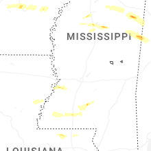
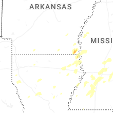
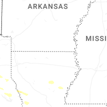
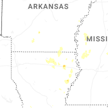
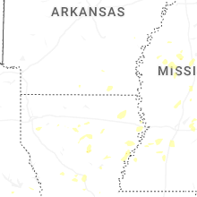
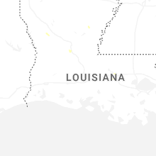
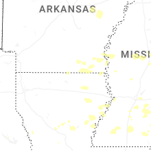

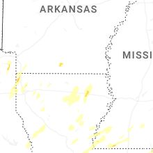
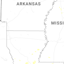


Connect with Interactive Hail Maps