

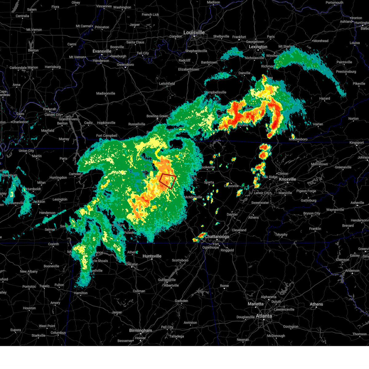
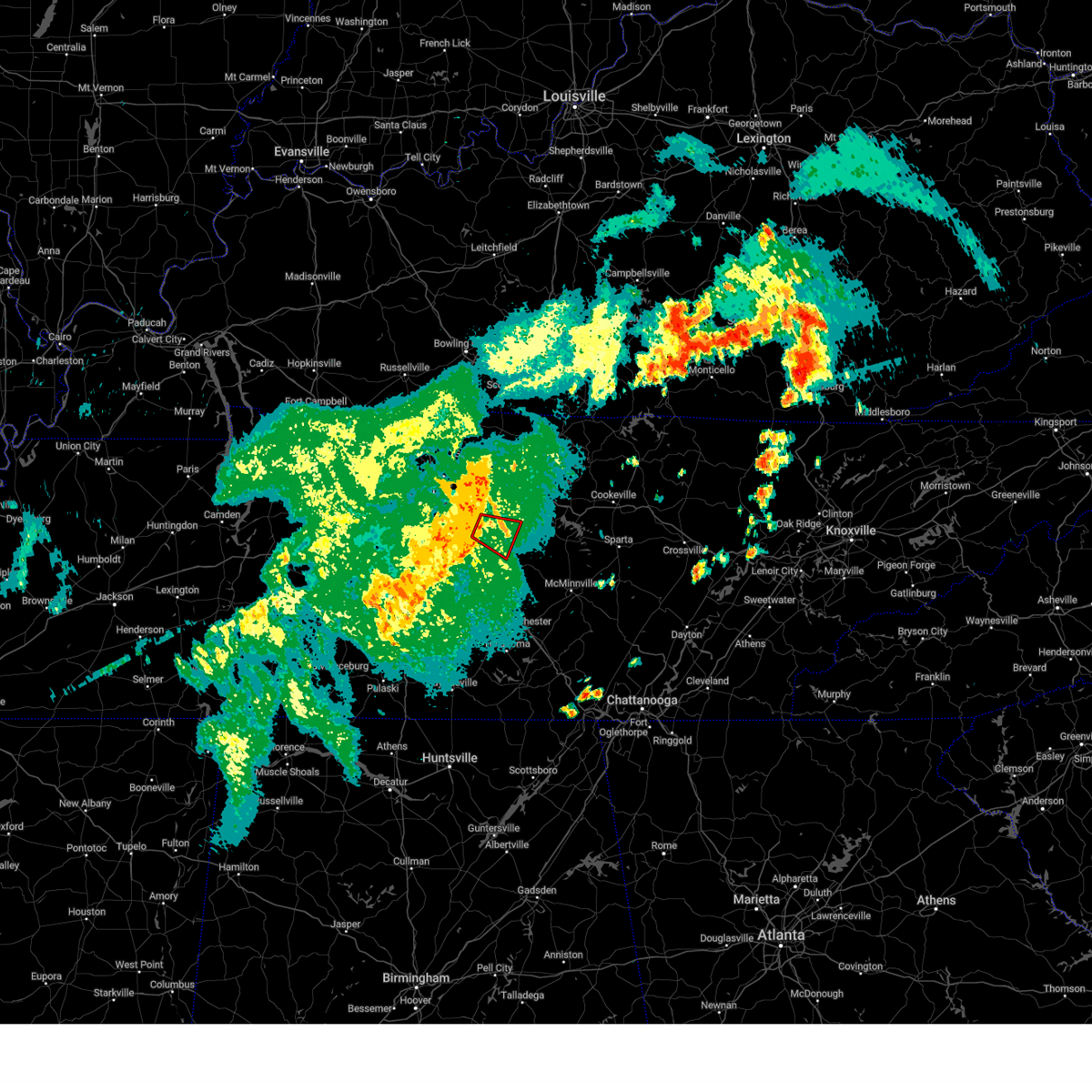
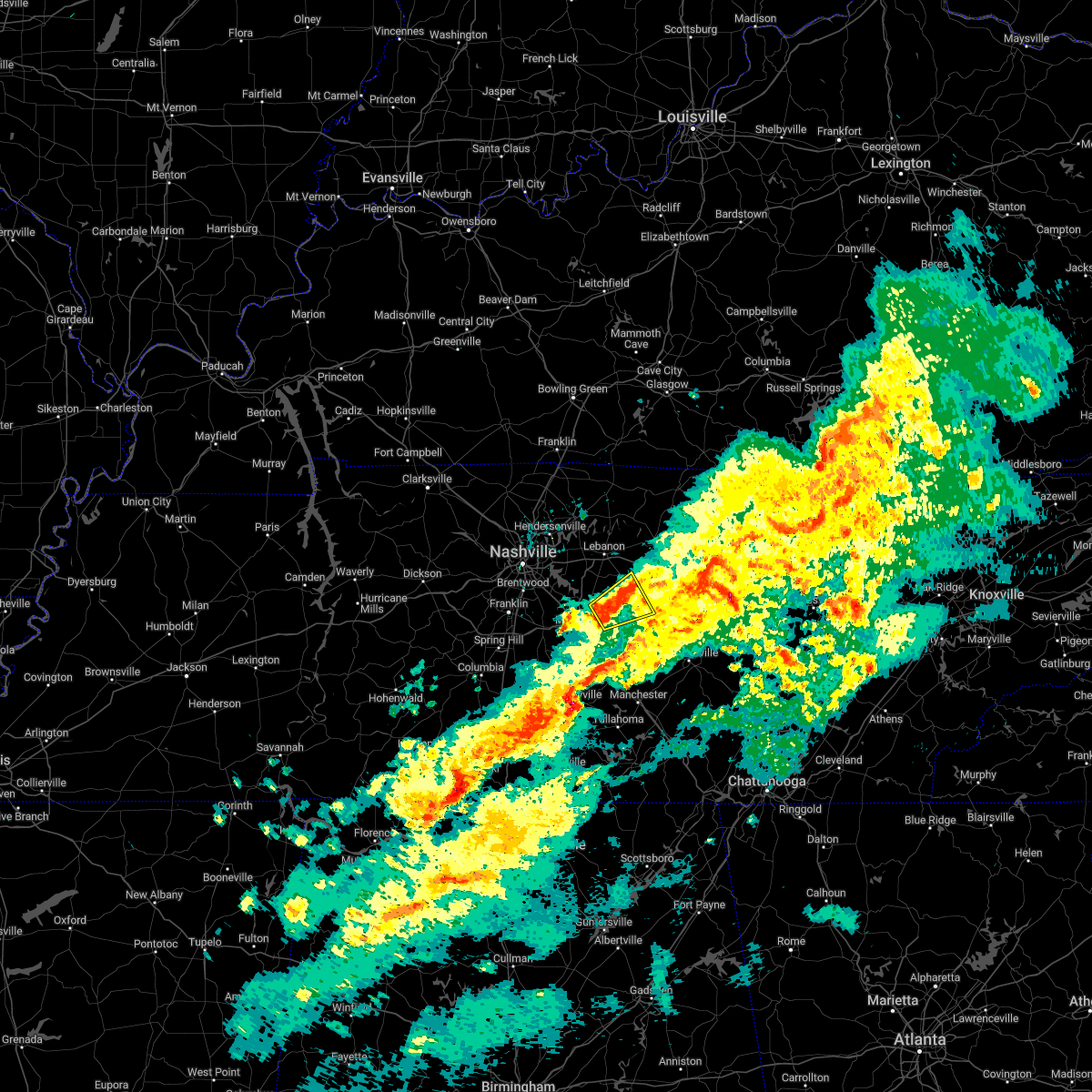
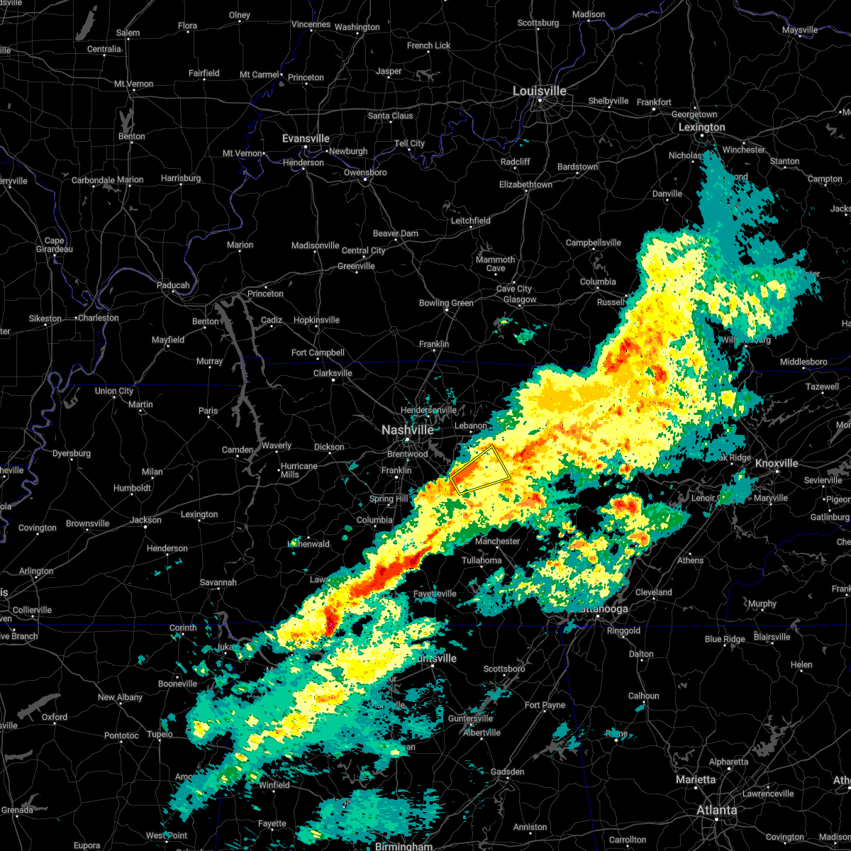
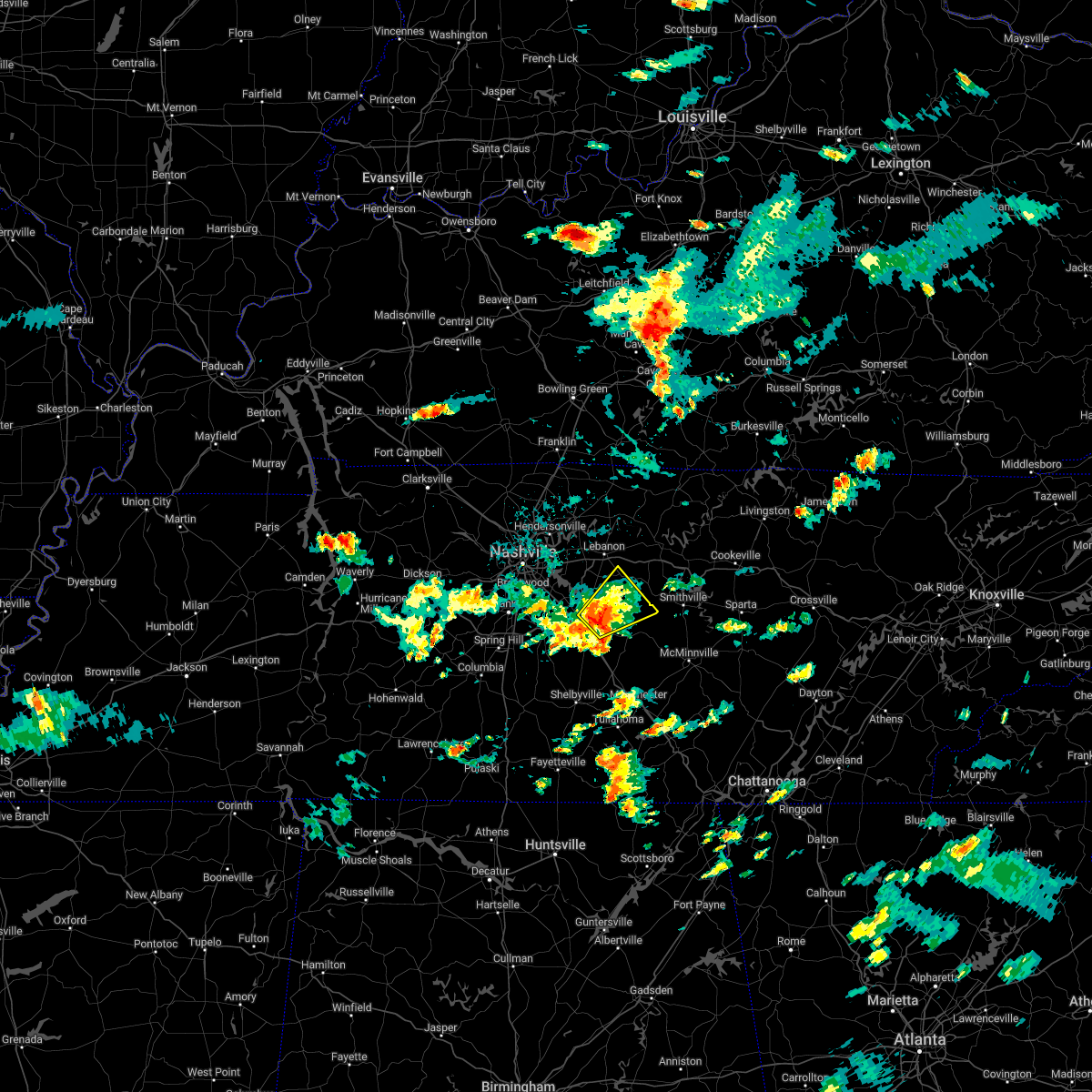
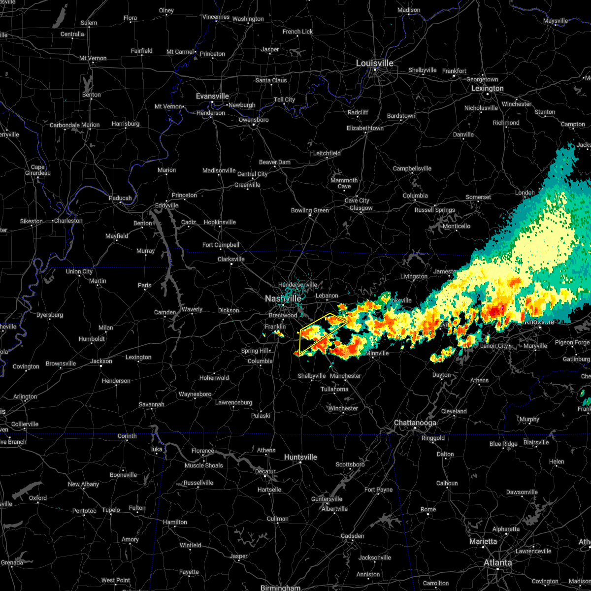
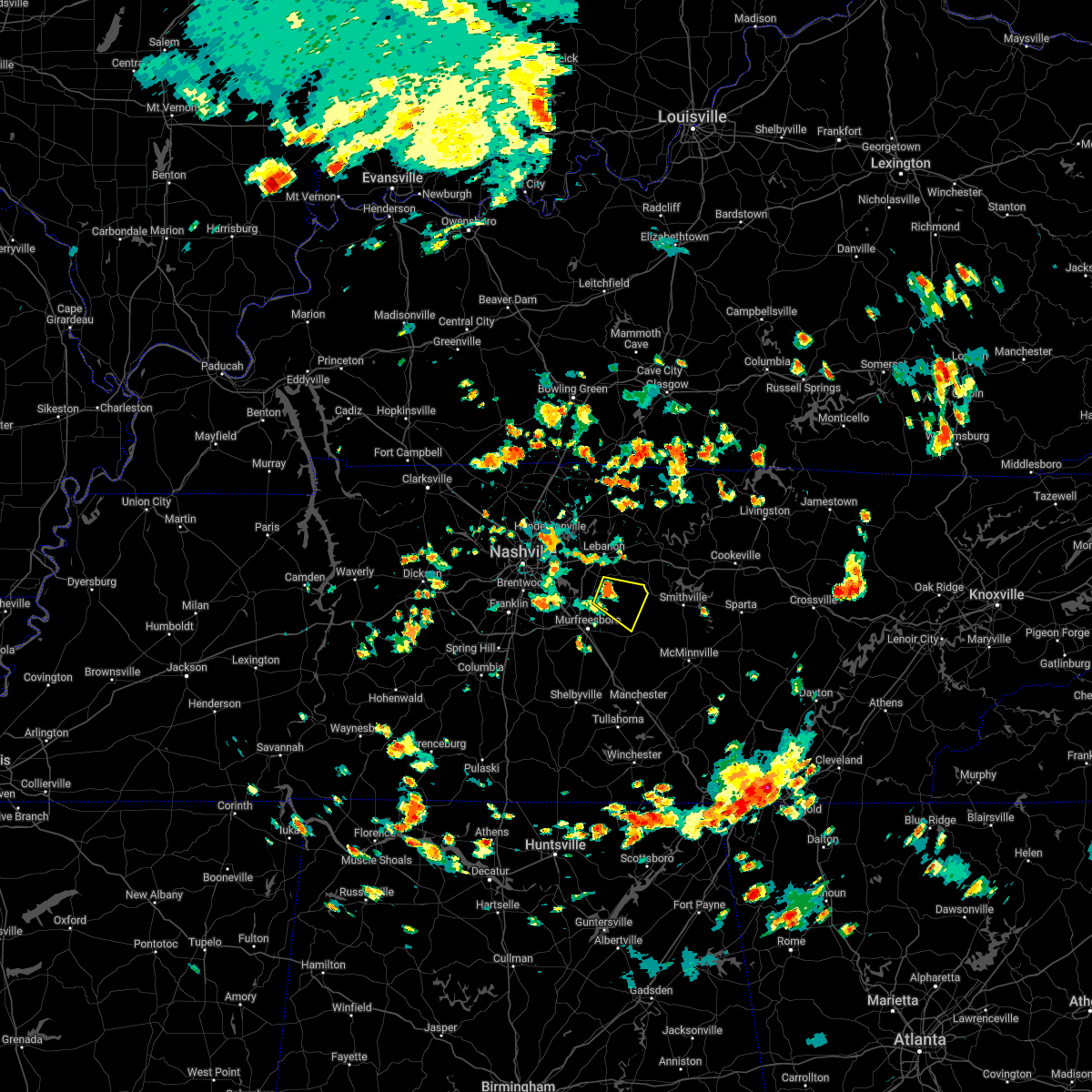
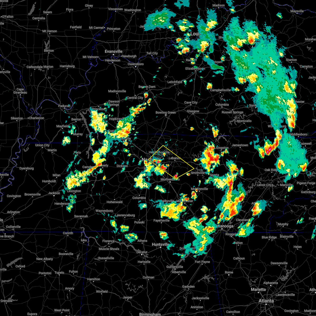
Hail Map for Walterhill, TN
The Walterhill, TN area has had 2 reports of on-the-ground hail by trained spotters, and has been under severe weather warnings 35 times during the past 12 months. Doppler radar has detected hail at or near Walterhill, TN on 43 occasions, including 1 occasion during the past year.
| Name: | Walterhill, TN |
| Where Located: | 27.2 miles ESE of Nashville, TN |
| Map: | Google Map for Walterhill, TN |
| Population: | 401 |
| Housing Units: | 168 |
| More Info: | Search Google for Walterhill, TN |
0
The Top Recent Hail Date for Walterhill, TN is Sunday, June 11, 2023 (42nd out of 43)

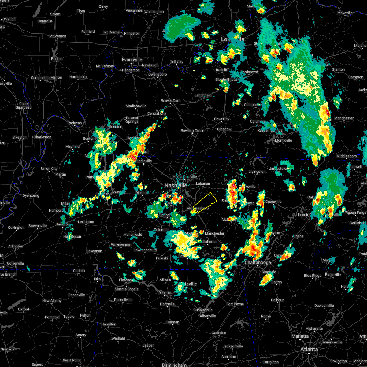
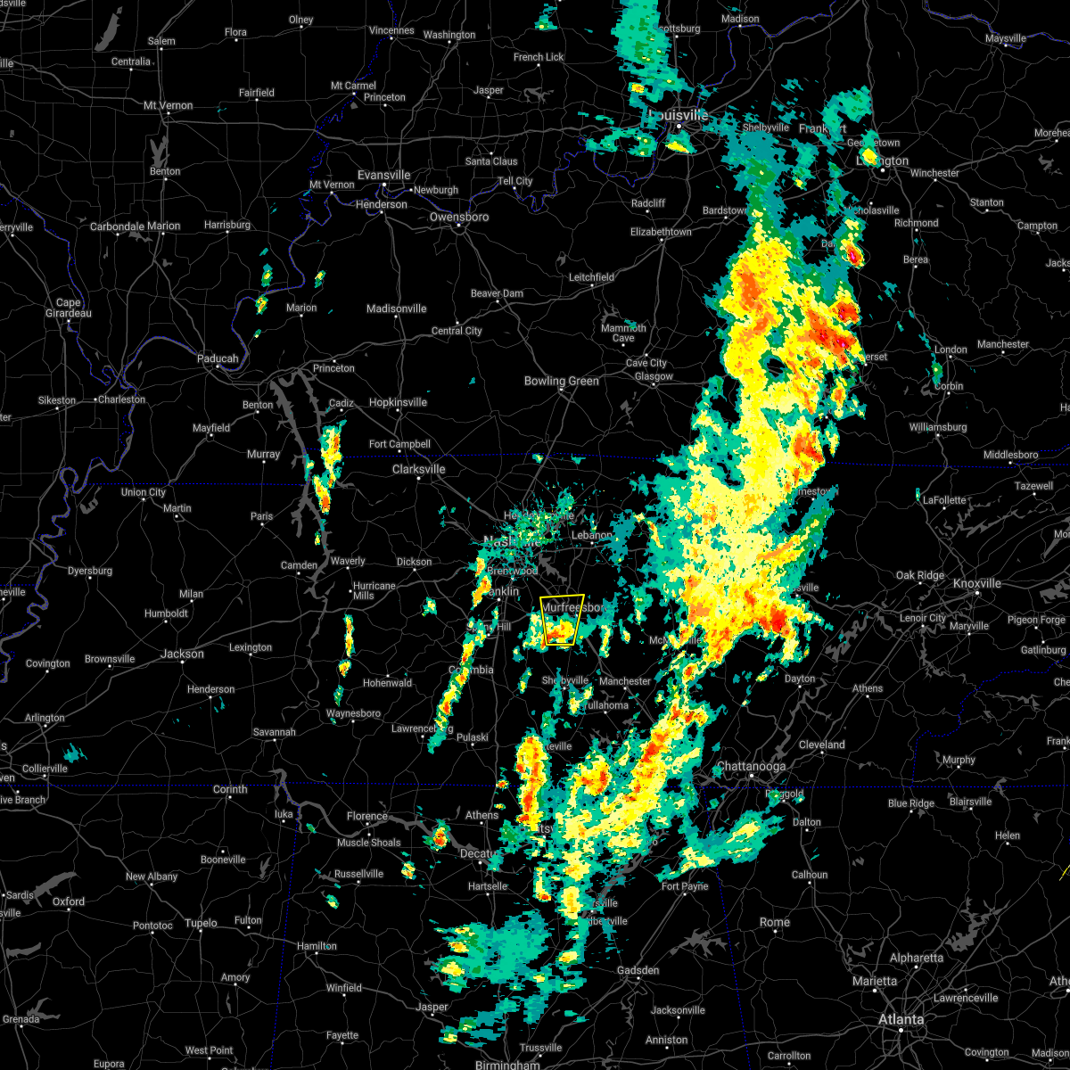
Hail and Wind Damage Spotted near Walterhill, TN
| Date / Time | Report Details |
|---|---|
| 8/13/2023 3:27 PM CDT |
 At 326 pm cdt, severe thunderstorms were located along a line extending from near greenbrier to near brentwood, moving east at 40 mph (radar indicated). Hazards include 60 mph wind gusts. Expect damage to roofs, siding, and trees. locations impacted include, murfreesboro, franklin, gallatin, lebanon, springfield, nashville, madison, hendersonville, smyrna, brentwood, la vergne, mount juliet, goodlettsville, white house, millersville, greenbrier, nolensville, forest hills, oak hill and coopertown. this includes the following highways, interstate 40 between mile markers 192 and 232. interstate 65 between mile markers 63 and 109. interstate 24 near mile marker 28, and between mile markers 32 and 74. interstate 840 between mile markers 53 and 72. hail threat, radar indicated max hail size, <. 75 in wind threat, radar indicated max wind gust, 60 mph. At 326 pm cdt, severe thunderstorms were located along a line extending from near greenbrier to near brentwood, moving east at 40 mph (radar indicated). Hazards include 60 mph wind gusts. Expect damage to roofs, siding, and trees. locations impacted include, murfreesboro, franklin, gallatin, lebanon, springfield, nashville, madison, hendersonville, smyrna, brentwood, la vergne, mount juliet, goodlettsville, white house, millersville, greenbrier, nolensville, forest hills, oak hill and coopertown. this includes the following highways, interstate 40 between mile markers 192 and 232. interstate 65 between mile markers 63 and 109. interstate 24 near mile marker 28, and between mile markers 32 and 74. interstate 840 between mile markers 53 and 72. hail threat, radar indicated max hail size, <. 75 in wind threat, radar indicated max wind gust, 60 mph.
|
| 8/13/2023 3:13 PM CDT |
 At 312 pm cdt, severe thunderstorms were located along a line extending from 6 miles southwest of coopertown to 8 miles west of franklin, moving east at 40 mph (radar indicated). Hazards include 60 mph wind gusts. Expect damage to roofs, siding, and trees. locations impacted include, murfreesboro, franklin, gallatin, lebanon, springfield, ashland city, nashville, madison, hendersonville, smyrna, brentwood, la vergne, mount juliet, goodlettsville, white house, millersville, greenbrier, nolensville, forest hills and oak hill. this includes the following highways, interstate 40 between mile markers 182 and 232. interstate 65 between mile markers 63 and 109. interstate 24 between mile markers 22 and 74. interstate 840 between mile markers 7 and 16, and between mile markers 53 and 72. hail threat, radar indicated max hail size, <. 75 in wind threat, radar indicated max wind gust, 60 mph. At 312 pm cdt, severe thunderstorms were located along a line extending from 6 miles southwest of coopertown to 8 miles west of franklin, moving east at 40 mph (radar indicated). Hazards include 60 mph wind gusts. Expect damage to roofs, siding, and trees. locations impacted include, murfreesboro, franklin, gallatin, lebanon, springfield, ashland city, nashville, madison, hendersonville, smyrna, brentwood, la vergne, mount juliet, goodlettsville, white house, millersville, greenbrier, nolensville, forest hills and oak hill. this includes the following highways, interstate 40 between mile markers 182 and 232. interstate 65 between mile markers 63 and 109. interstate 24 between mile markers 22 and 74. interstate 840 between mile markers 7 and 16, and between mile markers 53 and 72. hail threat, radar indicated max hail size, <. 75 in wind threat, radar indicated max wind gust, 60 mph.
|
| 8/13/2023 2:57 PM CDT |
 At 257 pm cdt, severe thunderstorms were located along a line extending from 10 miles northwest of ashland city to near fairview, moving east at 40 mph (radar indicated). Hazards include 60 mph wind gusts. expect damage to roofs, siding, and trees At 257 pm cdt, severe thunderstorms were located along a line extending from 10 miles northwest of ashland city to near fairview, moving east at 40 mph (radar indicated). Hazards include 60 mph wind gusts. expect damage to roofs, siding, and trees
|
| 8/12/2023 12:26 PM CDT |
 At 1226 pm cdt, severe thunderstorms were located along a line extending from hartsville to woodbury to murfreesboro, moving east at 50 mph (radar indicated). Hazards include 70 mph wind gusts. Expect considerable tree damage. Damage is likely to mobile homes, roofs, and outbuildings. At 1226 pm cdt, severe thunderstorms were located along a line extending from hartsville to woodbury to murfreesboro, moving east at 50 mph (radar indicated). Hazards include 70 mph wind gusts. Expect considerable tree damage. Damage is likely to mobile homes, roofs, and outbuildings.
|
| 8/12/2023 12:22 PM CDT |
 The tornado warning for northeastern rutherford and southeastern wilson counties will expire at 1230 pm cdt, the tornado warning that was previously in effect has been reissued for wilson and rutherford counties. please refer to that bulletin for the latest severe weather information. a severe thunderstorm watch remains in effect until 600 pm cdt for middle tennessee. The tornado warning for northeastern rutherford and southeastern wilson counties will expire at 1230 pm cdt, the tornado warning that was previously in effect has been reissued for wilson and rutherford counties. please refer to that bulletin for the latest severe weather information. a severe thunderstorm watch remains in effect until 600 pm cdt for middle tennessee.
|
| 8/12/2023 12:13 PM CDT |
 At 1212 pm cdt, a severe line of thunderstorms capable of producing both brief tornadoes and extensive straight line wind damage was located near walterhill, or 11 miles south of lebanon, moving east at 40 mph (radar indicated rotation). Hazards include tornado. Flying debris will be dangerous to those caught without shelter. mobile homes will be damaged or destroyed. damage to roofs, windows, and vehicles will occur. tree damage is likely. this tornadic thunderstorm will remain over mainly rural areas of northeastern rutherford and southeastern wilson counties, including the following locations, cedars of lebanon state park, milton and lascassas. This includes interstate 840 near mile marker 62. At 1212 pm cdt, a severe line of thunderstorms capable of producing both brief tornadoes and extensive straight line wind damage was located near walterhill, or 11 miles south of lebanon, moving east at 40 mph (radar indicated rotation). Hazards include tornado. Flying debris will be dangerous to those caught without shelter. mobile homes will be damaged or destroyed. damage to roofs, windows, and vehicles will occur. tree damage is likely. this tornadic thunderstorm will remain over mainly rural areas of northeastern rutherford and southeastern wilson counties, including the following locations, cedars of lebanon state park, milton and lascassas. This includes interstate 840 near mile marker 62.
|
| 8/12/2023 12:10 PM CDT |
 At 1209 pm cdt, severe thunderstorms were located along a line extending from 8 miles southwest of hartsville to near murfreesboro, moving east at 45 mph (radar indicated). Hazards include 60 mph wind gusts. Expect damage to roofs, siding, and trees. locations impacted include, murfreesboro, lebanon, smyrna, la vergne, mount juliet, nolensville, watertown, walterhill, south carthage, lascassas, tuckers crossroads, dixon springs, pleasant shade, dickerson chapel recreation area, cedars of lebanon state park, milton and gladeville. this includes the following highways, interstate 40 between mile markers 229 and 253. interstate 24 between mile markers 65 and 80. interstate 840 between mile markers 45 and 76. hail threat, radar indicated max hail size, <. 75 in wind threat, radar indicated max wind gust, 60 mph. At 1209 pm cdt, severe thunderstorms were located along a line extending from 8 miles southwest of hartsville to near murfreesboro, moving east at 45 mph (radar indicated). Hazards include 60 mph wind gusts. Expect damage to roofs, siding, and trees. locations impacted include, murfreesboro, lebanon, smyrna, la vergne, mount juliet, nolensville, watertown, walterhill, south carthage, lascassas, tuckers crossroads, dixon springs, pleasant shade, dickerson chapel recreation area, cedars of lebanon state park, milton and gladeville. this includes the following highways, interstate 40 between mile markers 229 and 253. interstate 24 between mile markers 65 and 80. interstate 840 between mile markers 45 and 76. hail threat, radar indicated max hail size, <. 75 in wind threat, radar indicated max wind gust, 60 mph.
|
| 8/12/2023 12:04 PM CDT |
 At 1204 pm cdt, a severe thunderstorm capable of producing a tornado was located near rural hill, or 11 miles southwest of lebanon, moving east at 40 mph (radar indicated rotation). Hazards include tornado. Flying debris will be dangerous to those caught without shelter. mobile homes will be damaged or destroyed. damage to roofs, windows, and vehicles will occur. tree damage is likely. this dangerous storm will be near, walterhill around 1215 pm cdt. other locations impacted by this tornadic thunderstorm include cedars of lebanon state park, milton and lascassas. This includes interstate 840 between mile markers 61 and 70. At 1204 pm cdt, a severe thunderstorm capable of producing a tornado was located near rural hill, or 11 miles southwest of lebanon, moving east at 40 mph (radar indicated rotation). Hazards include tornado. Flying debris will be dangerous to those caught without shelter. mobile homes will be damaged or destroyed. damage to roofs, windows, and vehicles will occur. tree damage is likely. this dangerous storm will be near, walterhill around 1215 pm cdt. other locations impacted by this tornadic thunderstorm include cedars of lebanon state park, milton and lascassas. This includes interstate 840 between mile markers 61 and 70.
|
| 8/12/2023 11:49 AM CDT |
 At 1148 am cdt, severe thunderstorms were located along a line extending from gallatin to near franklin, moving east at 30 mph (radar indicated). Hazards include 60 mph wind gusts. expect damage to roofs, siding, and trees At 1148 am cdt, severe thunderstorms were located along a line extending from gallatin to near franklin, moving east at 30 mph (radar indicated). Hazards include 60 mph wind gusts. expect damage to roofs, siding, and trees
|
| 7/29/2023 5:21 PM CDT |
 At 521 pm cdt, a severe thunderstorm was located 8 miles southwest of watertown, or 14 miles northeast of murfreesboro, moving southeast at 20 mph (radar indicated). Hazards include 60 mph wind gusts. expect damage to roofs, siding, and trees At 521 pm cdt, a severe thunderstorm was located 8 miles southwest of watertown, or 14 miles northeast of murfreesboro, moving southeast at 20 mph (radar indicated). Hazards include 60 mph wind gusts. expect damage to roofs, siding, and trees
|
| 7/20/2023 1:51 PM CDT |
 The severe thunderstorm warning for smith, northeastern rutherford and southeastern wilson counties will expire at 200 pm cdt, the storm which prompted the warning has moved out of the area. therefore, the warning will be allowed to expire. however gusty winds and heavy rain are still possible with this thunderstorm. a severe thunderstorm watch remains in effect until 700 pm cdt for middle tennessee. The severe thunderstorm warning for smith, northeastern rutherford and southeastern wilson counties will expire at 200 pm cdt, the storm which prompted the warning has moved out of the area. therefore, the warning will be allowed to expire. however gusty winds and heavy rain are still possible with this thunderstorm. a severe thunderstorm watch remains in effect until 700 pm cdt for middle tennessee.
|
| 7/20/2023 1:42 PM CDT |
 At 141 pm cdt, a severe thunderstorm was located over watertown, or 13 miles southwest of carthage, moving southeast at 50 mph (radar indicated). Hazards include 70 mph wind gusts and nickel size hail. Expect considerable tree damage. damage is likely to mobile homes, roofs, and outbuildings. locations impacted include, carthage, watertown, gordonsville, walterhill, hickman, south carthage, auburntown, cedars of lebanon state park, lascassas, tuckers crossroads and milton. this includes the following highways, interstate 40 between mile markers 242 and 265. interstate 840 between mile markers 63 and 65. thunderstorm damage threat, considerable hail threat, radar indicated max hail size, 0. 88 in wind threat, radar indicated max wind gust, 70 mph. At 141 pm cdt, a severe thunderstorm was located over watertown, or 13 miles southwest of carthage, moving southeast at 50 mph (radar indicated). Hazards include 70 mph wind gusts and nickel size hail. Expect considerable tree damage. damage is likely to mobile homes, roofs, and outbuildings. locations impacted include, carthage, watertown, gordonsville, walterhill, hickman, south carthage, auburntown, cedars of lebanon state park, lascassas, tuckers crossroads and milton. this includes the following highways, interstate 40 between mile markers 242 and 265. interstate 840 between mile markers 63 and 65. thunderstorm damage threat, considerable hail threat, radar indicated max hail size, 0. 88 in wind threat, radar indicated max wind gust, 70 mph.
|
| 7/20/2023 1:35 PM CDT |
 At 134 pm cdt, severe thunderstorms were located along a line extending from near gordonsville to near murfreesboro, moving southeast at 50 mph (radar indicated). Hazards include 70 mph wind gusts and nickel size hail. Expect considerable tree damage. Damage is likely to mobile homes, roofs, and outbuildings. At 134 pm cdt, severe thunderstorms were located along a line extending from near gordonsville to near murfreesboro, moving southeast at 50 mph (radar indicated). Hazards include 70 mph wind gusts and nickel size hail. Expect considerable tree damage. Damage is likely to mobile homes, roofs, and outbuildings.
|
| 7/20/2023 1:27 PM CDT |
 At 125 pm cdt, a severe thunderstorm was located near lebanon, moving southeast at 45 mph. this is a destructive storm for the lebanon and watertown areas (radar indicated). Hazards include 80 mph wind gusts and nickel size hail. Flying debris will be dangerous to those caught without shelter. mobile homes will be heavily damaged. expect considerable damage to roofs, windows, and vehicles. extensive tree damage and power outages are likely. locations impacted include, lebanon, carthage, hartsville, hendersonville, la vergne, mount juliet, watertown, gordonsville, rural hill, belinda city, walterhill, hickman, south carthage, auburntown, green hill, lascassas, tuckers crossroads, dickerson chapel recreation area, cedars of lebanon state park and milton. this includes the following highways, interstate 40 between mile markers 224 and 265. interstate 840 between mile markers 63 and 76. thunderstorm damage threat, destructive hail threat, radar indicated max hail size, 0. 88 in wind threat, radar indicated max wind gust, 80 mph. At 125 pm cdt, a severe thunderstorm was located near lebanon, moving southeast at 45 mph. this is a destructive storm for the lebanon and watertown areas (radar indicated). Hazards include 80 mph wind gusts and nickel size hail. Flying debris will be dangerous to those caught without shelter. mobile homes will be heavily damaged. expect considerable damage to roofs, windows, and vehicles. extensive tree damage and power outages are likely. locations impacted include, lebanon, carthage, hartsville, hendersonville, la vergne, mount juliet, watertown, gordonsville, rural hill, belinda city, walterhill, hickman, south carthage, auburntown, green hill, lascassas, tuckers crossroads, dickerson chapel recreation area, cedars of lebanon state park and milton. this includes the following highways, interstate 40 between mile markers 224 and 265. interstate 840 between mile markers 63 and 76. thunderstorm damage threat, destructive hail threat, radar indicated max hail size, 0. 88 in wind threat, radar indicated max wind gust, 80 mph.
|
| 7/20/2023 1:11 PM CDT |
 At 110 pm cdt, a severe thunderstorm was located near mount juliet, or 7 miles west of lebanon, moving southeast at 45 mph. this is a destructive storm for the mount juliet and lebanon areas (radar indicated). Hazards include 80 mph wind gusts and nickel size hail. Flying debris will be dangerous to those caught without shelter. mobile homes will be heavily damaged. expect considerable damage to roofs, windows, and vehicles. Extensive tree damage and power outages are likely. At 110 pm cdt, a severe thunderstorm was located near mount juliet, or 7 miles west of lebanon, moving southeast at 45 mph. this is a destructive storm for the mount juliet and lebanon areas (radar indicated). Hazards include 80 mph wind gusts and nickel size hail. Flying debris will be dangerous to those caught without shelter. mobile homes will be heavily damaged. expect considerable damage to roofs, windows, and vehicles. Extensive tree damage and power outages are likely.
|
| 7/18/2023 5:00 PM CDT |
 At 459 pm cdt, severe thunderstorms were located along a line extending from near gordonsville to 7 miles east of watertown to 10 miles south of murfreesboro, moving east at 50 mph (radar indicated). Hazards include 60 mph wind gusts and penny size hail. expect damage to roofs, siding, and trees At 459 pm cdt, severe thunderstorms were located along a line extending from near gordonsville to 7 miles east of watertown to 10 miles south of murfreesboro, moving east at 50 mph (radar indicated). Hazards include 60 mph wind gusts and penny size hail. expect damage to roofs, siding, and trees
|
| 7/18/2023 4:43 PM CDT |
 At 443 pm cdt, severe thunderstorms were located along a line extending from near westmoreland to near lebanon to la vergne, moving east at 50 mph (radar indicated). Hazards include 60 mph wind gusts and penny size hail. Expect damage to roofs, siding, and trees. locations impacted include, murfreesboro, gallatin, lebanon, lafayette, carthage, hartsville, smyrna, la vergne, mount juliet, westmoreland, watertown, gordonsville, red boiling springs, walterhill, rural hill, belinda city, hickman, south carthage, alexandria and liberty. this includes the following highways, interstate 40 between mile markers 223 and 264. interstate 840 between mile markers 58 and 76. hail threat, radar indicated max hail size, 0. 75 in wind threat, radar indicated max wind gust, 60 mph. At 443 pm cdt, severe thunderstorms were located along a line extending from near westmoreland to near lebanon to la vergne, moving east at 50 mph (radar indicated). Hazards include 60 mph wind gusts and penny size hail. Expect damage to roofs, siding, and trees. locations impacted include, murfreesboro, gallatin, lebanon, lafayette, carthage, hartsville, smyrna, la vergne, mount juliet, westmoreland, watertown, gordonsville, red boiling springs, walterhill, rural hill, belinda city, hickman, south carthage, alexandria and liberty. this includes the following highways, interstate 40 between mile markers 223 and 264. interstate 840 between mile markers 58 and 76. hail threat, radar indicated max hail size, 0. 75 in wind threat, radar indicated max wind gust, 60 mph.
|
| 7/18/2023 4:28 PM CDT |
 At 428 pm cdt, severe thunderstorms were located along a line extending from 7 miles northwest of westmoreland to near lebanon to antioch, moving east at 50 mph (radar indicated). Hazards include 60 mph wind gusts and penny size hail. Expect damage to roofs, siding, and trees. locations impacted include, murfreesboro, gallatin, lebanon, lafayette, carthage, hartsville, nashville, hendersonville, smyrna, la vergne, mount juliet, lakewood, westmoreland, watertown, gordonsville, red boiling springs, hermitage, walterhill, rural hill and belinda city. this includes the following highways, interstate 40 between mile markers 207 and 264. interstate 65 between mile markers 82 and 88. interstate 24 between mile markers 47 and 54. interstate 840 between mile markers 58 and 76. hail threat, radar indicated max hail size, 0. 75 in wind threat, radar indicated max wind gust, 60 mph. At 428 pm cdt, severe thunderstorms were located along a line extending from 7 miles northwest of westmoreland to near lebanon to antioch, moving east at 50 mph (radar indicated). Hazards include 60 mph wind gusts and penny size hail. Expect damage to roofs, siding, and trees. locations impacted include, murfreesboro, gallatin, lebanon, lafayette, carthage, hartsville, nashville, hendersonville, smyrna, la vergne, mount juliet, lakewood, westmoreland, watertown, gordonsville, red boiling springs, hermitage, walterhill, rural hill and belinda city. this includes the following highways, interstate 40 between mile markers 207 and 264. interstate 65 between mile markers 82 and 88. interstate 24 between mile markers 47 and 54. interstate 840 between mile markers 58 and 76. hail threat, radar indicated max hail size, 0. 75 in wind threat, radar indicated max wind gust, 60 mph.
|
| 7/18/2023 4:27 PM CDT |
 At 427 pm cdt, severe thunderstorms were located along a line extending from near la vergne to 7 miles east of spring hill to near mount pleasant, moving southeast at 45 mph (radar indicated). Hazards include 60 mph wind gusts and penny size hail. Expect damage to roofs, siding, and trees. locations impacted include, murfreesboro, franklin, columbia, shelbyville, lewisburg, nashville, smyrna, brentwood, la vergne, spring hill, nolensville, forest hills, mount pleasant, oak hill, belle meade, thompson`s station, petersburg, antioch, walterhill and chapel hill. this includes the following highways, interstate 40 between mile markers 206 and 217. interstate 65 between mile markers 23 and 88. interstate 24 between mile markers 44 and 95. interstate 840 between mile markers 22 and 61. hail threat, radar indicated max hail size, 0. 75 in wind threat, radar indicated max wind gust, 60 mph. At 427 pm cdt, severe thunderstorms were located along a line extending from near la vergne to 7 miles east of spring hill to near mount pleasant, moving southeast at 45 mph (radar indicated). Hazards include 60 mph wind gusts and penny size hail. Expect damage to roofs, siding, and trees. locations impacted include, murfreesboro, franklin, columbia, shelbyville, lewisburg, nashville, smyrna, brentwood, la vergne, spring hill, nolensville, forest hills, mount pleasant, oak hill, belle meade, thompson`s station, petersburg, antioch, walterhill and chapel hill. this includes the following highways, interstate 40 between mile markers 206 and 217. interstate 65 between mile markers 23 and 88. interstate 24 between mile markers 44 and 95. interstate 840 between mile markers 22 and 61. hail threat, radar indicated max hail size, 0. 75 in wind threat, radar indicated max wind gust, 60 mph.
|
| 7/18/2023 4:13 PM CDT |
 At 413 pm cdt, severe thunderstorms were located along a line extending from 7 miles northeast of portland to near hendersonville to forest hills, moving east at 50 mph (radar indicated). Hazards include 60 mph wind gusts and penny size hail. expect damage to roofs, siding, and trees At 413 pm cdt, severe thunderstorms were located along a line extending from 7 miles northeast of portland to near hendersonville to forest hills, moving east at 50 mph (radar indicated). Hazards include 60 mph wind gusts and penny size hail. expect damage to roofs, siding, and trees
|
| 7/18/2023 4:11 PM CDT |
 At 411 pm cdt, severe thunderstorms were located along a line extending from near nashville to near franklin to 6 miles northwest of mount pleasant, moving southeast at 45 mph (radar indicated). Hazards include 60 mph wind gusts and penny size hail. expect damage to roofs, siding, and trees At 411 pm cdt, severe thunderstorms were located along a line extending from near nashville to near franklin to 6 miles northwest of mount pleasant, moving southeast at 45 mph (radar indicated). Hazards include 60 mph wind gusts and penny size hail. expect damage to roofs, siding, and trees
|
| 7/1/2023 2:03 PM CDT |
 At 202 pm cdt, severe thunderstorms were located along a line extending from near hartsville to 6 miles north of watertown to 6 miles northwest of woodbury, moving east at 50 mph (emergency management). Hazards include 70 mph wind gusts. Expect considerable tree damage. damage is likely to mobile homes, roofs, and outbuildings. locations impacted include, murfreesboro, gallatin, lebanon, smithville, carthage, hartsville, watertown, gordonsville, walterhill, hickman, south carthage, alexandria, dowelltown, liberty, auburntown, pleasant shade, bledsoe creek state park, dickerson chapel recreation area, cedars of lebanon state park and center hill lake. this includes the following highways, interstate 40 between mile markers 235 and 266. interstate 840 near mile marker 76. thunderstorm damage threat, considerable hail threat, radar indicated max hail size, <. 75 in wind threat, observed max wind gust, 70 mph. At 202 pm cdt, severe thunderstorms were located along a line extending from near hartsville to 6 miles north of watertown to 6 miles northwest of woodbury, moving east at 50 mph (emergency management). Hazards include 70 mph wind gusts. Expect considerable tree damage. damage is likely to mobile homes, roofs, and outbuildings. locations impacted include, murfreesboro, gallatin, lebanon, smithville, carthage, hartsville, watertown, gordonsville, walterhill, hickman, south carthage, alexandria, dowelltown, liberty, auburntown, pleasant shade, bledsoe creek state park, dickerson chapel recreation area, cedars of lebanon state park and center hill lake. this includes the following highways, interstate 40 between mile markers 235 and 266. interstate 840 near mile marker 76. thunderstorm damage threat, considerable hail threat, radar indicated max hail size, <. 75 in wind threat, observed max wind gust, 70 mph.
|
| 7/1/2023 1:51 PM CDT |
 At 151 pm cdt, severe thunderstorms were located along a line extending from 6 miles southwest of westmoreland to near walterhill, moving east at 50 mph (trained weather spotters). Hazards include 70 mph wind gusts and penny size hail. Expect considerable tree damage. damage is likely to mobile homes, roofs, and outbuildings. locations impacted include, murfreesboro, gallatin, lebanon, hendersonville, smyrna, la vergne, mount juliet, goodlettsville, millersville, walterhill, rural hill, belinda city, green hill, bledsoe creek state park, cedars of lebanon state park and gladeville. this includes the following highways, interstate 40 between mile markers 224 and 242. interstate 65 between mile markers 101 and 103. interstate 24 between mile markers 64 and 82. interstate 840 between mile markers 46 and 76. thunderstorm damage threat, considerable hail threat, radar indicated max hail size, 0. 75 in wind threat, observed max wind gust, 70 mph. At 151 pm cdt, severe thunderstorms were located along a line extending from 6 miles southwest of westmoreland to near walterhill, moving east at 50 mph (trained weather spotters). Hazards include 70 mph wind gusts and penny size hail. Expect considerable tree damage. damage is likely to mobile homes, roofs, and outbuildings. locations impacted include, murfreesboro, gallatin, lebanon, hendersonville, smyrna, la vergne, mount juliet, goodlettsville, millersville, walterhill, rural hill, belinda city, green hill, bledsoe creek state park, cedars of lebanon state park and gladeville. this includes the following highways, interstate 40 between mile markers 224 and 242. interstate 65 between mile markers 101 and 103. interstate 24 between mile markers 64 and 82. interstate 840 between mile markers 46 and 76. thunderstorm damage threat, considerable hail threat, radar indicated max hail size, 0. 75 in wind threat, observed max wind gust, 70 mph.
|
| 7/1/2023 1:49 PM CDT |
 At 148 pm cdt, severe thunderstorms were located along a line extending from 7 miles west of hartsville to 7 miles east of murfreesboro, moving east at 50 mph (emergency management). Hazards include 70 mph wind gusts. Expect considerable tree damage. Damage is likely to mobile homes, roofs, and outbuildings. At 148 pm cdt, severe thunderstorms were located along a line extending from 7 miles west of hartsville to 7 miles east of murfreesboro, moving east at 50 mph (emergency management). Hazards include 70 mph wind gusts. Expect considerable tree damage. Damage is likely to mobile homes, roofs, and outbuildings.
|
| 7/1/2023 1:40 PM CDT |
 At 140 pm cdt, severe thunderstorms were located along a line extending from 6 miles north of gallatin to near murfreesboro, moving east at 50 mph (radar indicated). Hazards include 70 mph wind gusts and penny size hail. Expect considerable tree damage. damage is likely to mobile homes, roofs, and outbuildings. locations impacted include, murfreesboro, franklin, gallatin, lebanon, nashville, madison, hendersonville, smyrna, brentwood, la vergne, mount juliet, goodlettsville, millersville, nolensville, oak hill, lakewood, ridgetop, hermitage, walterhill and rural hill. this includes the following highways, interstate 40 between mile markers 210 and 242. interstate 65 between mile markers 77 and 82, and between mile markers 86 and 103. interstate 24 between mile markers 43 and 82. interstate 840 between mile markers 36 and 76. thunderstorm damage threat, considerable hail threat, radar indicated max hail size, 0. 75 in wind threat, radar indicated max wind gust, 70 mph. At 140 pm cdt, severe thunderstorms were located along a line extending from 6 miles north of gallatin to near murfreesboro, moving east at 50 mph (radar indicated). Hazards include 70 mph wind gusts and penny size hail. Expect considerable tree damage. damage is likely to mobile homes, roofs, and outbuildings. locations impacted include, murfreesboro, franklin, gallatin, lebanon, nashville, madison, hendersonville, smyrna, brentwood, la vergne, mount juliet, goodlettsville, millersville, nolensville, oak hill, lakewood, ridgetop, hermitage, walterhill and rural hill. this includes the following highways, interstate 40 between mile markers 210 and 242. interstate 65 between mile markers 77 and 82, and between mile markers 86 and 103. interstate 24 between mile markers 43 and 82. interstate 840 between mile markers 36 and 76. thunderstorm damage threat, considerable hail threat, radar indicated max hail size, 0. 75 in wind threat, radar indicated max wind gust, 70 mph.
|
| 7/1/2023 1:27 PM CDT |
 At 126 pm cdt, severe thunderstorms were located along a line extending from white house to 6 miles south of nolensville, moving east at 50 mph (radar indicated). Hazards include 70 mph wind gusts and penny size hail. Expect considerable tree damage. damage is likely to mobile homes, roofs, and outbuildings. locations impacted include, murfreesboro, franklin, gallatin, lebanon, nashville, madison, hendersonville, smyrna, brentwood, la vergne, spring hill, mount juliet, goodlettsville, millersville, nolensville, forest hills, oak hill, belle meade, lakewood and thompson`s station. this includes the following highways, interstate 40 between mile markers 199 and 242. interstate 65 between mile markers 56 and 103. interstate 24 between mile markers 34 and 82. interstate 840 between mile markers 25 and 76. thunderstorm damage threat, considerable hail threat, radar indicated max hail size, 0. 75 in wind threat, radar indicated max wind gust, 70 mph. At 126 pm cdt, severe thunderstorms were located along a line extending from white house to 6 miles south of nolensville, moving east at 50 mph (radar indicated). Hazards include 70 mph wind gusts and penny size hail. Expect considerable tree damage. damage is likely to mobile homes, roofs, and outbuildings. locations impacted include, murfreesboro, franklin, gallatin, lebanon, nashville, madison, hendersonville, smyrna, brentwood, la vergne, spring hill, mount juliet, goodlettsville, millersville, nolensville, forest hills, oak hill, belle meade, lakewood and thompson`s station. this includes the following highways, interstate 40 between mile markers 199 and 242. interstate 65 between mile markers 56 and 103. interstate 24 between mile markers 34 and 82. interstate 840 between mile markers 25 and 76. thunderstorm damage threat, considerable hail threat, radar indicated max hail size, 0. 75 in wind threat, radar indicated max wind gust, 70 mph.
|
| 7/1/2023 1:14 PM CDT |
 At 112 pm cdt, severe thunderstorms were located along a line extending from near greenbrier to near thompson`s station, moving east at 50 mph (radar indicated). Hazards include 70 mph wind gusts and penny size hail. Expect considerable tree damage. Damage is likely to mobile homes, roofs, and outbuildings. At 112 pm cdt, severe thunderstorms were located along a line extending from near greenbrier to near thompson`s station, moving east at 50 mph (radar indicated). Hazards include 70 mph wind gusts and penny size hail. Expect considerable tree damage. Damage is likely to mobile homes, roofs, and outbuildings.
|
| 6/30/2023 9:09 PM CDT |
 The severe thunderstorm warning for southeastern davidson, central rutherford, east central williamson and southwestern wilson counties will expire at 915 pm cdt, the storm which prompted the warning has weakened below severe limits, and no longer poses an immediate threat to life or property. therefore, the warning will be allowed to expire. however small hail, gusty winds and heavy rain are still possible with this thunderstorm. a severe thunderstorm watch remains in effect until 1100 pm cdt for middle tennessee. The severe thunderstorm warning for southeastern davidson, central rutherford, east central williamson and southwestern wilson counties will expire at 915 pm cdt, the storm which prompted the warning has weakened below severe limits, and no longer poses an immediate threat to life or property. therefore, the warning will be allowed to expire. however small hail, gusty winds and heavy rain are still possible with this thunderstorm. a severe thunderstorm watch remains in effect until 1100 pm cdt for middle tennessee.
|
| 6/30/2023 8:51 PM CDT |
 At 851 pm cdt, a severe thunderstorm was located over smyrna, or 10 miles northwest of murfreesboro, moving south at 35 mph (radar indicated). Hazards include 70 mph wind gusts and quarter size hail. Hail damage to vehicles is expected. expect considerable tree damage. wind damage is also likely to mobile homes, roofs, and outbuildings. locations impacted include, murfreesboro, smyrna, la vergne, nolensville, walterhill, eagleville and triune. this includes the following highways, interstate 24 between mile markers 59 and 83. interstate 840 between mile markers 41 and 68. thunderstorm damage threat, considerable hail threat, radar indicated max hail size, 1. 00 in wind threat, radar indicated max wind gust, 70 mph. At 851 pm cdt, a severe thunderstorm was located over smyrna, or 10 miles northwest of murfreesboro, moving south at 35 mph (radar indicated). Hazards include 70 mph wind gusts and quarter size hail. Hail damage to vehicles is expected. expect considerable tree damage. wind damage is also likely to mobile homes, roofs, and outbuildings. locations impacted include, murfreesboro, smyrna, la vergne, nolensville, walterhill, eagleville and triune. this includes the following highways, interstate 24 between mile markers 59 and 83. interstate 840 between mile markers 41 and 68. thunderstorm damage threat, considerable hail threat, radar indicated max hail size, 1. 00 in wind threat, radar indicated max wind gust, 70 mph.
|
| 6/30/2023 8:38 PM CDT |
 At 837 pm cdt, a severe thunderstorm was located over rural hill, or 14 miles southwest of lebanon, moving south at 35 mph (radar indicated). Hazards include 60 mph wind gusts and quarter size hail. Hail damage to vehicles is expected. Expect wind damage to roofs, siding, and trees. At 837 pm cdt, a severe thunderstorm was located over rural hill, or 14 miles southwest of lebanon, moving south at 35 mph (radar indicated). Hazards include 60 mph wind gusts and quarter size hail. Hail damage to vehicles is expected. Expect wind damage to roofs, siding, and trees.
|
| 6/29/2023 1:33 PM CDT |
 At 133 pm cdt, severe thunderstorms were located along a line extending from 7 miles west of franklin to near nolensville to walterhill, moving southeast at 45 mph (radar indicated). Hazards include 60 mph wind gusts. expect damage to roofs, siding, and trees At 133 pm cdt, severe thunderstorms were located along a line extending from 7 miles west of franklin to near nolensville to walterhill, moving southeast at 45 mph (radar indicated). Hazards include 60 mph wind gusts. expect damage to roofs, siding, and trees
|
| 6/11/2023 6:37 PM CDT |
 The severe thunderstorm warning for western de kalb, central rutherford, southeastern wilson and northern cannon counties will expire at 645 pm cdt, the storm which prompted the warning has weakened below severe limits, and no longer poses an immediate threat to life or property. therefore, the warning will be allowed to expire. however gusty winds and heavy rain are still possible with this thunderstorm. a severe thunderstorm watch remains in effect until 1000 pm cdt for middle tennessee. The severe thunderstorm warning for western de kalb, central rutherford, southeastern wilson and northern cannon counties will expire at 645 pm cdt, the storm which prompted the warning has weakened below severe limits, and no longer poses an immediate threat to life or property. therefore, the warning will be allowed to expire. however gusty winds and heavy rain are still possible with this thunderstorm. a severe thunderstorm watch remains in effect until 1000 pm cdt for middle tennessee.
|
| 6/11/2023 6:21 PM CDT |
 At 620 pm cdt, a severe thunderstorm was located near walterhill, or near murfreesboro, moving east at 60 mph (radar indicated). Hazards include 60 mph wind gusts and penny size hail. expect damage to roofs, siding, and trees At 620 pm cdt, a severe thunderstorm was located near walterhill, or near murfreesboro, moving east at 60 mph (radar indicated). Hazards include 60 mph wind gusts and penny size hail. expect damage to roofs, siding, and trees
|
| 5/7/2023 6:51 PM CDT |
 At 651 pm cdt, a severe thunderstorm was located over smyrna, or 10 miles northwest of murfreesboro, moving east at 40 mph (radar indicated). Hazards include quarter size hail. Damage to vehicles is expected. locations impacted include, murfreesboro, smyrna, la vergne, nolensville, walterhill, antioch, cedars of lebanon state park, lascassas, milton and triune. this includes the following highways, interstate 24 between mile markers 59 and 79. interstate 840 between mile markers 45 and 68. hail threat, radar indicated max hail size, 1. 00 in wind threat, radar indicated max wind gust, <50 mph. At 651 pm cdt, a severe thunderstorm was located over smyrna, or 10 miles northwest of murfreesboro, moving east at 40 mph (radar indicated). Hazards include quarter size hail. Damage to vehicles is expected. locations impacted include, murfreesboro, smyrna, la vergne, nolensville, walterhill, antioch, cedars of lebanon state park, lascassas, milton and triune. this includes the following highways, interstate 24 between mile markers 59 and 79. interstate 840 between mile markers 45 and 68. hail threat, radar indicated max hail size, 1. 00 in wind threat, radar indicated max wind gust, <50 mph.
|
| 5/7/2023 6:38 PM CDT |
 At 637 pm cdt, a severe thunderstorm was located over nolensville, or 8 miles east of franklin, moving east at 40 mph (radar indicated). Hazards include quarter size hail. damage to vehicles is expected At 637 pm cdt, a severe thunderstorm was located over nolensville, or 8 miles east of franklin, moving east at 40 mph (radar indicated). Hazards include quarter size hail. damage to vehicles is expected
|
| 3/24/2023 11:17 PM CDT |
 At 1116 pm cdt, severe thunderstorms were located along a line extending from 7 miles west of hartsville to near lebanon to near murfreesboro, moving northeast at 70 mph (radar indicated). Hazards include 60 mph wind gusts. Expect damage to roofs, siding, and trees. locations impacted include, murfreesboro, gallatin, lebanon, carthage, hartsville, hendersonville, smyrna, watertown, walterhill, south carthage, lascassas, tuckers crossroads, dixon springs, bledsoe creek state park, dickerson chapel recreation area, cedars of lebanon state park and milton. hail threat, radar indicated max hail size, <. 75 in wind threat, radar indicated max wind gust, 60 mph. At 1116 pm cdt, severe thunderstorms were located along a line extending from 7 miles west of hartsville to near lebanon to near murfreesboro, moving northeast at 70 mph (radar indicated). Hazards include 60 mph wind gusts. Expect damage to roofs, siding, and trees. locations impacted include, murfreesboro, gallatin, lebanon, carthage, hartsville, hendersonville, smyrna, watertown, walterhill, south carthage, lascassas, tuckers crossroads, dixon springs, bledsoe creek state park, dickerson chapel recreation area, cedars of lebanon state park and milton. hail threat, radar indicated max hail size, <. 75 in wind threat, radar indicated max wind gust, 60 mph.
|
| 3/24/2023 10:59 PM CDT |
 At 1058 pm cdt, severe thunderstorms were located along a line extending from near lakewood to la vergne to 12 miles east of spring hill, moving northeast at 70 mph (radar indicated). Hazards include 70 mph wind gusts. Expect considerable tree damage. Damage is likely to mobile homes, roofs, and outbuildings. At 1058 pm cdt, severe thunderstorms were located along a line extending from near lakewood to la vergne to 12 miles east of spring hill, moving northeast at 70 mph (radar indicated). Hazards include 70 mph wind gusts. Expect considerable tree damage. Damage is likely to mobile homes, roofs, and outbuildings.
|
| 3/3/2023 11:59 AM CST |
 At 1158 am cst, severe thunderstorms were located along a line extending from 6 miles southeast of gallatin to near lebanon to walterhill, moving northeast at 65 mph (radar indicated). Hazards include 70 mph wind gusts. Expect considerable tree damage. damage is likely to mobile homes, roofs, and outbuildings. locations impacted include, murfreesboro, gallatin, lebanon, smyrna, mount juliet, watertown, walterhill, lascassas, tuckers crossroads, bledsoe creek state park, dickerson chapel recreation area, cedars of lebanon state park and gladeville. this includes the following highways, interstate 40 between mile markers 229 and 247. interstate 24 between mile markers 79 and 80. interstate 840 between mile markers 57 and 76. thunderstorm damage threat, considerable hail threat, radar indicated max hail size, <. 75 in wind threat, radar indicated max wind gust, 70 mph. At 1158 am cst, severe thunderstorms were located along a line extending from 6 miles southeast of gallatin to near lebanon to walterhill, moving northeast at 65 mph (radar indicated). Hazards include 70 mph wind gusts. Expect considerable tree damage. damage is likely to mobile homes, roofs, and outbuildings. locations impacted include, murfreesboro, gallatin, lebanon, smyrna, mount juliet, watertown, walterhill, lascassas, tuckers crossroads, bledsoe creek state park, dickerson chapel recreation area, cedars of lebanon state park and gladeville. this includes the following highways, interstate 40 between mile markers 229 and 247. interstate 24 between mile markers 79 and 80. interstate 840 between mile markers 57 and 76. thunderstorm damage threat, considerable hail threat, radar indicated max hail size, <. 75 in wind threat, radar indicated max wind gust, 70 mph.
|
| 3/3/2023 11:46 AM CST |
 At 1145 am cst, severe thunderstorms were located along a line extending from near mount juliet to smyrna to 7 miles west of murfreesboro, moving northeast at 70 mph (radar indicated). Hazards include 70 mph wind gusts. Expect considerable tree damage. damage is likely to mobile homes, roofs, and outbuildings. locations impacted include, murfreesboro, gallatin, lebanon, hendersonville, smyrna, la vergne, mount juliet, nolensville, lakewood, watertown, hermitage, walterhill, rural hill, belinda city, old hickory, green hill, lascassas, tuckers crossroads, bledsoe creek state park and dickerson chapel recreation area. this includes the following highways, interstate 40 between mile markers 218 and 247. interstate 24 between mile markers 62 and 80. interstate 840 between mile markers 46 and 76. thunderstorm damage threat, considerable hail threat, radar indicated max hail size, <. 75 in wind threat, radar indicated max wind gust, 70 mph. At 1145 am cst, severe thunderstorms were located along a line extending from near mount juliet to smyrna to 7 miles west of murfreesboro, moving northeast at 70 mph (radar indicated). Hazards include 70 mph wind gusts. Expect considerable tree damage. damage is likely to mobile homes, roofs, and outbuildings. locations impacted include, murfreesboro, gallatin, lebanon, hendersonville, smyrna, la vergne, mount juliet, nolensville, lakewood, watertown, hermitage, walterhill, rural hill, belinda city, old hickory, green hill, lascassas, tuckers crossroads, bledsoe creek state park and dickerson chapel recreation area. this includes the following highways, interstate 40 between mile markers 218 and 247. interstate 24 between mile markers 62 and 80. interstate 840 between mile markers 46 and 76. thunderstorm damage threat, considerable hail threat, radar indicated max hail size, <. 75 in wind threat, radar indicated max wind gust, 70 mph.
|
| 3/3/2023 11:28 AM CST |
 At 1128 am cst, severe thunderstorms were located along a line extending from near franklin to 8 miles east of thompson`s station to 11 miles north of lewisburg, moving northeast at 65 mph (radar indicated). Hazards include 70 mph wind gusts. Expect considerable tree damage. Damage is likely to mobile homes, roofs, and outbuildings. At 1128 am cst, severe thunderstorms were located along a line extending from near franklin to 8 miles east of thompson`s station to 11 miles north of lewisburg, moving northeast at 65 mph (radar indicated). Hazards include 70 mph wind gusts. Expect considerable tree damage. Damage is likely to mobile homes, roofs, and outbuildings.
|
| 2/16/2023 5:17 PM CST |
 At 516 pm cst, a severe thunderstorm was located 9 miles east of walterhill, or 10 miles northwest of woodbury, moving northeast at 30 mph (radar indicated). Hazards include 60 mph wind gusts and penny size hail. Expect damage to roofs, siding, and trees. Locations impacted include, watertown, walterhill, auburntown, lascassas and milton. At 516 pm cst, a severe thunderstorm was located 9 miles east of walterhill, or 10 miles northwest of woodbury, moving northeast at 30 mph (radar indicated). Hazards include 60 mph wind gusts and penny size hail. Expect damage to roofs, siding, and trees. Locations impacted include, watertown, walterhill, auburntown, lascassas and milton.
|
| 2/16/2023 5:00 PM CST |
 At 459 pm cst, a severe thunderstorm was located on the northeast side of murfreesboro, moving northeast at 35 mph (radar indicated). Hazards include 60 mph wind gusts and quarter size hail. Hail damage to vehicles is expected. Expect wind damage to roofs, siding, and trees. At 459 pm cst, a severe thunderstorm was located on the northeast side of murfreesboro, moving northeast at 35 mph (radar indicated). Hazards include 60 mph wind gusts and quarter size hail. Hail damage to vehicles is expected. Expect wind damage to roofs, siding, and trees.
|
| 1/12/2023 1:20 PM CST |
 At 120 pm cst, a severe thunderstorm was located near antioch, or 9 miles northeast of franklin, moving east at 60 mph (radar indicated). Hazards include 60 mph wind gusts and half dollar size hail. Hail damage to vehicles is expected. Expect wind damage to roofs, siding, and trees. At 120 pm cst, a severe thunderstorm was located near antioch, or 9 miles northeast of franklin, moving east at 60 mph (radar indicated). Hazards include 60 mph wind gusts and half dollar size hail. Hail damage to vehicles is expected. Expect wind damage to roofs, siding, and trees.
|
| 10/12/2022 4:50 PM CDT |
 At 450 pm cdt, severe thunderstorms were located along a line extending from near belinda city to 12 miles southwest of murfreesboro, moving east at 40 mph (radar indicated). Hazards include 60 mph wind gusts and penny size hail. expect damage to roofs, siding, and trees At 450 pm cdt, severe thunderstorms were located along a line extending from near belinda city to 12 miles southwest of murfreesboro, moving east at 40 mph (radar indicated). Hazards include 60 mph wind gusts and penny size hail. expect damage to roofs, siding, and trees
|
| 8/20/2022 3:09 PM CDT |
 At 309 pm cdt, a severe thunderstorm was located near walterhill, or near murfreesboro, moving northeast at 20 mph (radar indicated). Hazards include 60 mph wind gusts and nickel size hail. expect damage to roofs, siding, and trees At 309 pm cdt, a severe thunderstorm was located near walterhill, or near murfreesboro, moving northeast at 20 mph (radar indicated). Hazards include 60 mph wind gusts and nickel size hail. expect damage to roofs, siding, and trees
|
| 7/28/2022 3:54 PM CDT |
 At 353 pm cdt, a severe thunderstorm was located near murfreesboro, moving east at 30 mph (radar indicated). Hazards include 60 mph wind gusts. expect damage to roofs, siding, and trees At 353 pm cdt, a severe thunderstorm was located near murfreesboro, moving east at 30 mph (radar indicated). Hazards include 60 mph wind gusts. expect damage to roofs, siding, and trees
|
| 7/12/2022 7:02 PM CDT |
 At 701 pm cdt, severe thunderstorms were located along a line extending from 7 miles southwest of watertown to 5 miles south of smyrna, moving southeast at 15 mph (radar indicated). Hazards include 60 mph wind gusts and nickel size hail. Expect damage to roofs, siding, and trees. locations impacted include, murfreesboro, smyrna, walterhill, cedars of lebanon state park, lascassas and rockvale. this includes the following highways, interstate 24 between mile markers 68 and 80. interstate 840 between mile markers 46 and 63. hail threat, radar indicated max hail size, 0. 88 in wind threat, radar indicated max wind gust, 60 mph. At 701 pm cdt, severe thunderstorms were located along a line extending from 7 miles southwest of watertown to 5 miles south of smyrna, moving southeast at 15 mph (radar indicated). Hazards include 60 mph wind gusts and nickel size hail. Expect damage to roofs, siding, and trees. locations impacted include, murfreesboro, smyrna, walterhill, cedars of lebanon state park, lascassas and rockvale. this includes the following highways, interstate 24 between mile markers 68 and 80. interstate 840 between mile markers 46 and 63. hail threat, radar indicated max hail size, 0. 88 in wind threat, radar indicated max wind gust, 60 mph.
|
| 7/12/2022 6:41 PM CDT |
 At 640 pm cdt, severe thunderstorms were located along a line extending from 6 miles northeast of walterhill to near nolensville, moving southeast at 10 mph (radar indicated. at 637 pm cdt...numerous reports of quarter size hail were occurring in nolensville with these storms). Hazards include 60 mph wind gusts and quarter size hail. Hail damage to vehicles is expected. Expect wind damage to roofs, siding, and trees. At 640 pm cdt, severe thunderstorms were located along a line extending from 6 miles northeast of walterhill to near nolensville, moving southeast at 10 mph (radar indicated. at 637 pm cdt...numerous reports of quarter size hail were occurring in nolensville with these storms). Hazards include 60 mph wind gusts and quarter size hail. Hail damage to vehicles is expected. Expect wind damage to roofs, siding, and trees.
|
| 7/12/2022 6:33 PM CDT |
 At 632 pm cdt, a severe thunderstorm was located over nolensville, or 12 miles east of franklin, moving southeast at 10 mph (trained weather spotters. at 628 pm cdt...quarter size hail was reported in nolensville with this storm). Hazards include 60 mph wind gusts and half dollar size hail. Hail damage to vehicles is expected. expect wind damage to roofs, siding, and trees. locations impacted include, murfreesboro, smyrna, la vergne, nolensville, walterhill, rockvale and triune. this includes the following highways, interstate 24 between mile markers 67 and 80. interstate 840 between mile markers 43 and 59. hail threat, observed max hail size, 1. 25 in wind threat, radar indicated max wind gust, 60 mph. At 632 pm cdt, a severe thunderstorm was located over nolensville, or 12 miles east of franklin, moving southeast at 10 mph (trained weather spotters. at 628 pm cdt...quarter size hail was reported in nolensville with this storm). Hazards include 60 mph wind gusts and half dollar size hail. Hail damage to vehicles is expected. expect wind damage to roofs, siding, and trees. locations impacted include, murfreesboro, smyrna, la vergne, nolensville, walterhill, rockvale and triune. this includes the following highways, interstate 24 between mile markers 67 and 80. interstate 840 between mile markers 43 and 59. hail threat, observed max hail size, 1. 25 in wind threat, radar indicated max wind gust, 60 mph.
|
| 7/12/2022 6:18 PM CDT |
 At 618 pm cdt, a severe thunderstorm was located over nolensville, or 11 miles east of franklin, moving southeast at 15 mph (radar indicated). Hazards include 60 mph wind gusts and quarter size hail. Hail damage to vehicles is expected. Expect wind damage to roofs, siding, and trees. At 618 pm cdt, a severe thunderstorm was located over nolensville, or 11 miles east of franklin, moving southeast at 15 mph (radar indicated). Hazards include 60 mph wind gusts and quarter size hail. Hail damage to vehicles is expected. Expect wind damage to roofs, siding, and trees.
|
| 7/12/2022 5:32 PM CDT |
 At 532 pm cdt, severe thunderstorms were located along a line extending from gainesboro to near smyrna, moving southeast at 25 mph (radar indicated). Hazards include 60 mph wind gusts and nickel size hail. expect damage to roofs, siding, and trees At 532 pm cdt, severe thunderstorms were located along a line extending from gainesboro to near smyrna, moving southeast at 25 mph (radar indicated). Hazards include 60 mph wind gusts and nickel size hail. expect damage to roofs, siding, and trees
|
| 7/9/2022 3:25 AM CDT |
 At 325 am cdt, severe thunderstorms were located along a line extending from near smithville to 10 miles southwest of murfreesboro, moving south at 45 mph (radar indicated). Hazards include 60 mph wind gusts. expect damage to roofs, siding, and trees At 325 am cdt, severe thunderstorms were located along a line extending from near smithville to 10 miles southwest of murfreesboro, moving south at 45 mph (radar indicated). Hazards include 60 mph wind gusts. expect damage to roofs, siding, and trees
|
| 7/9/2022 3:17 AM CDT |
 At 316 am cdt, a severe thunderstorm was located near murfreesboro, moving southeast at 40 mph (radar indicated). Hazards include 60 mph wind gusts. Expect damage to roofs, siding, and trees. locations impacted include, murfreesboro, woodbury, smyrna, la vergne, nolensville, walterhill, rural hill, auburntown, lascassas, christiana, fosterville, triune, cedars of lebanon state park, rockvale, milton, gladeville and readyville. this includes the following highways, interstate 24 between mile markers 64 and 93. interstate 840 between mile markers 42 and 72. hail threat, radar indicated max hail size, <. 75 in wind threat, radar indicated max wind gust, 60 mph. At 316 am cdt, a severe thunderstorm was located near murfreesboro, moving southeast at 40 mph (radar indicated). Hazards include 60 mph wind gusts. Expect damage to roofs, siding, and trees. locations impacted include, murfreesboro, woodbury, smyrna, la vergne, nolensville, walterhill, rural hill, auburntown, lascassas, christiana, fosterville, triune, cedars of lebanon state park, rockvale, milton, gladeville and readyville. this includes the following highways, interstate 24 between mile markers 64 and 93. interstate 840 between mile markers 42 and 72. hail threat, radar indicated max hail size, <. 75 in wind threat, radar indicated max wind gust, 60 mph.
|
| 7/9/2022 2:54 AM CDT |
 At 254 am cdt, a severe thunderstorm was located over rural hill, or 12 miles southwest of lebanon, moving south at 25 mph (radar indicated). Hazards include 60 mph wind gusts. expect damage to roofs, siding, and trees At 254 am cdt, a severe thunderstorm was located over rural hill, or 12 miles southwest of lebanon, moving south at 25 mph (radar indicated). Hazards include 60 mph wind gusts. expect damage to roofs, siding, and trees
|
| 7/7/2022 1:44 PM CDT |
 At 144 pm cdt, a severe thunderstorm was located 5 miles northeast of walterhill, or 13 miles northeast of murfreesboro, moving east at 5 mph (radar indicated). Hazards include 60 mph wind gusts and penny size hail. Expect damage to roofs, siding, and trees. locations impacted include, walterhill, auburntown, cedars of lebanon state park, lascassas and milton. hail threat, radar indicated max hail size, 0. 75 in wind threat, radar indicated max wind gust, 60 mph. At 144 pm cdt, a severe thunderstorm was located 5 miles northeast of walterhill, or 13 miles northeast of murfreesboro, moving east at 5 mph (radar indicated). Hazards include 60 mph wind gusts and penny size hail. Expect damage to roofs, siding, and trees. locations impacted include, walterhill, auburntown, cedars of lebanon state park, lascassas and milton. hail threat, radar indicated max hail size, 0. 75 in wind threat, radar indicated max wind gust, 60 mph.
|
| 7/7/2022 1:32 PM CDT |
 At 132 pm cdt, a severe thunderstorm was located 5 miles northeast of walterhill, or 13 miles northeast of murfreesboro, moving east at 10 mph (radar indicated). Hazards include 60 mph wind gusts and penny size hail. expect damage to roofs, siding, and trees At 132 pm cdt, a severe thunderstorm was located 5 miles northeast of walterhill, or 13 miles northeast of murfreesboro, moving east at 10 mph (radar indicated). Hazards include 60 mph wind gusts and penny size hail. expect damage to roofs, siding, and trees
|
| 7/6/2022 1:13 PM CDT |
 At 112 pm cdt, a cluster of severe thunderstorms were located along between walterhill and statesville, moving southeast at 10 mph (radar indicated). Hazards include 60 mph wind gusts and penny size hail. Expect damage to roofs, siding, and trees. locations impacted include, murfreesboro, walterhill, dowelltown, liberty, auburntown, lascassas, milton and readyville. this includes interstate 840 near mile marker 57. hail threat, radar indicated max hail size, 0. 75 in wind threat, radar indicated max wind gust, 60 mph. At 112 pm cdt, a cluster of severe thunderstorms were located along between walterhill and statesville, moving southeast at 10 mph (radar indicated). Hazards include 60 mph wind gusts and penny size hail. Expect damage to roofs, siding, and trees. locations impacted include, murfreesboro, walterhill, dowelltown, liberty, auburntown, lascassas, milton and readyville. this includes interstate 840 near mile marker 57. hail threat, radar indicated max hail size, 0. 75 in wind threat, radar indicated max wind gust, 60 mph.
|
| 7/6/2022 12:53 PM CDT |
 At 1253 pm cdt, a severe thunderstorm was located 7 miles south of watertown, or near statesville, moving southeast at 15 mph (radar indicated). Hazards include 60 mph wind gusts and penny size hail. expect damage to roofs, siding, and trees At 1253 pm cdt, a severe thunderstorm was located 7 miles south of watertown, or near statesville, moving southeast at 15 mph (radar indicated). Hazards include 60 mph wind gusts and penny size hail. expect damage to roofs, siding, and trees
|
| 6/17/2022 10:56 AM CDT |
 At 1056 am cdt, severe thunderstorms were located along a line extending from 8 miles northeast of walterhill to near murfreesboro to 11 miles south of nolensville, moving southeast at 40 mph (radar indicated). Hazards include 60 mph wind gusts and quarter size hail. Hail damage to vehicles is expected. Expect wind damage to roofs, siding, and trees. At 1056 am cdt, severe thunderstorms were located along a line extending from 8 miles northeast of walterhill to near murfreesboro to 11 miles south of nolensville, moving southeast at 40 mph (radar indicated). Hazards include 60 mph wind gusts and quarter size hail. Hail damage to vehicles is expected. Expect wind damage to roofs, siding, and trees.
|
| 6/17/2022 10:40 AM CDT |
 At 1040 am cdt, severe thunderstorms were located along a line extending from 7 miles southeast of belinda city to thompson`s station to 8 miles east of centerville, moving southeast at 40 mph (radar indicated). Hazards include 60 mph wind gusts and half dollar size hail. Hail damage to vehicles is expected. expect wind damage to roofs, siding, and trees. locations impacted include, murfreesboro, franklin, columbia, lebanon, centerville, smyrna, brentwood, la vergne, spring hill, mount juliet, nolensville, forest hills, oak hill, thompson`s station, walterhill, rural hill, antioch, belinda city, eagleville and primm springs. hail threat, radar indicated max hail size, 1. 25 in wind threat, radar indicated max wind gust, 60 mph. At 1040 am cdt, severe thunderstorms were located along a line extending from 7 miles southeast of belinda city to thompson`s station to 8 miles east of centerville, moving southeast at 40 mph (radar indicated). Hazards include 60 mph wind gusts and half dollar size hail. Hail damage to vehicles is expected. expect wind damage to roofs, siding, and trees. locations impacted include, murfreesboro, franklin, columbia, lebanon, centerville, smyrna, brentwood, la vergne, spring hill, mount juliet, nolensville, forest hills, oak hill, thompson`s station, walterhill, rural hill, antioch, belinda city, eagleville and primm springs. hail threat, radar indicated max hail size, 1. 25 in wind threat, radar indicated max wind gust, 60 mph.
|
| 6/17/2022 10:27 AM CDT |
 At 1026 am cdt, severe thunderstorms were located along a line extending from belinda city to 7 miles northwest of thompson`s station to near centerville, moving southeast at 40 mph (radar indicated). Hazards include 60 mph wind gusts. expect damage to roofs, siding, and trees At 1026 am cdt, severe thunderstorms were located along a line extending from belinda city to 7 miles northwest of thompson`s station to near centerville, moving southeast at 40 mph (radar indicated). Hazards include 60 mph wind gusts. expect damage to roofs, siding, and trees
|
| 5/6/2022 2:17 PM CDT |
 At 217 pm cdt, severe thunderstorms were located along a line extending from near madison to 6 miles east of walterhill, moving northeast at 35 mph (radar indicated). Hazards include 60 mph wind gusts and quarter size hail. Hail damage to vehicles is expected. Expect wind damage to roofs, siding, and trees. At 217 pm cdt, severe thunderstorms were located along a line extending from near madison to 6 miles east of walterhill, moving northeast at 35 mph (radar indicated). Hazards include 60 mph wind gusts and quarter size hail. Hail damage to vehicles is expected. Expect wind damage to roofs, siding, and trees.
|
| 5/6/2022 2:04 PM CDT |
 At 204 pm cdt, a severe thunderstorm was located near walterhill, moving northeast at 35 mph (radar indicated). Hazards include 60 mph wind gusts and quarter size hail. Hail damage to vehicles is expected. Expect wind damage to roofs, siding, and trees. At 204 pm cdt, a severe thunderstorm was located near walterhill, moving northeast at 35 mph (radar indicated). Hazards include 60 mph wind gusts and quarter size hail. Hail damage to vehicles is expected. Expect wind damage to roofs, siding, and trees.
|
| 4/13/2022 8:11 PM CDT |
 At 810 pm cdt, severe thunderstorms were located along a line extending from 7 miles northeast of lebanon to 8 miles southwest of murfreesboro, moving east at 65 mph (radar indicated). Hazards include 70 mph wind gusts. Expect considerable tree damage. damage is likely to mobile homes, roofs, and outbuildings. locations impacted include, murfreesboro, gallatin, lebanon, woodbury, carthage, hendersonville, smyrna, la vergne, mount juliet, watertown, gordonsville, walterhill, rural hill, belinda city, hickman, south carthage, alexandria, eagleville, dowelltown and liberty. this includes the following highways, interstate 40 between mile markers 223 and 263. interstate 24 between mile markers 65 and 91. Interstate 840 between mile markers 46 and 76. At 810 pm cdt, severe thunderstorms were located along a line extending from 7 miles northeast of lebanon to 8 miles southwest of murfreesboro, moving east at 65 mph (radar indicated). Hazards include 70 mph wind gusts. Expect considerable tree damage. damage is likely to mobile homes, roofs, and outbuildings. locations impacted include, murfreesboro, gallatin, lebanon, woodbury, carthage, hendersonville, smyrna, la vergne, mount juliet, watertown, gordonsville, walterhill, rural hill, belinda city, hickman, south carthage, alexandria, eagleville, dowelltown and liberty. this includes the following highways, interstate 40 between mile markers 223 and 263. interstate 24 between mile markers 65 and 91. Interstate 840 between mile markers 46 and 76.
|
| 4/13/2022 7:52 PM CDT |
 At 752 pm cdt, severe thunderstorms were located along a line extending from hendersonville to 6 miles east of spring hill, moving east at 65 mph (radar indicated). Hazards include 70 mph wind gusts. Expect considerable tree damage. Damage is likely to mobile homes, roofs, and outbuildings. At 752 pm cdt, severe thunderstorms were located along a line extending from hendersonville to 6 miles east of spring hill, moving east at 65 mph (radar indicated). Hazards include 70 mph wind gusts. Expect considerable tree damage. Damage is likely to mobile homes, roofs, and outbuildings.
|
| 4/12/2022 7:43 AM CDT |
 At 743 am cdt, a severe thunderstorm was located near smyrna, or 8 miles northwest of murfreesboro, moving east at 30 mph (radar indicated). Hazards include quarter size hail. Damage to vehicles is expected. locations impacted include, murfreesboro, smyrna, la vergne, walterhill, cedars of lebanon state park, lascassas and milton. this includes the following highways, interstate 24 between mile markers 67 and 74. interstate 840 between mile markers 53 and 66. hail threat, radar indicated max hail size, 1. 00 in wind threat, radar indicated max wind gust, <50 mph. At 743 am cdt, a severe thunderstorm was located near smyrna, or 8 miles northwest of murfreesboro, moving east at 30 mph (radar indicated). Hazards include quarter size hail. Damage to vehicles is expected. locations impacted include, murfreesboro, smyrna, la vergne, walterhill, cedars of lebanon state park, lascassas and milton. this includes the following highways, interstate 24 between mile markers 67 and 74. interstate 840 between mile markers 53 and 66. hail threat, radar indicated max hail size, 1. 00 in wind threat, radar indicated max wind gust, <50 mph.
|
| 4/12/2022 7:31 AM CDT |
 At 730 am cdt, a severe thunderstorm was located near smyrna, or 12 miles northwest of murfreesboro, moving east at 30 mph (radar indicated). Hazards include quarter size hail. damage to vehicles is expected At 730 am cdt, a severe thunderstorm was located near smyrna, or 12 miles northwest of murfreesboro, moving east at 30 mph (radar indicated). Hazards include quarter size hail. damage to vehicles is expected
|
| 10/6/2021 5:12 PM CDT |
 At 512 pm cdt, a severe thunderstorm was located 9 miles southwest of murfreesboro, moving north at 30 mph (radar indicated). Hazards include 60 mph wind gusts and quarter size hail. Hail damage to vehicles is expected. expect wind damage to roofs, siding, and trees. locations impacted include, murfreesboro, smyrna, walterhill and rockvale. this includes the following highways, interstate 24 between mile markers 70 and 82. interstate 840 between mile markers 46 and 58. hail threat, radar indicated max hail size, 1. 00 in wind threat, radar indicated max wind gust, 60 mph. At 512 pm cdt, a severe thunderstorm was located 9 miles southwest of murfreesboro, moving north at 30 mph (radar indicated). Hazards include 60 mph wind gusts and quarter size hail. Hail damage to vehicles is expected. expect wind damage to roofs, siding, and trees. locations impacted include, murfreesboro, smyrna, walterhill and rockvale. this includes the following highways, interstate 24 between mile markers 70 and 82. interstate 840 between mile markers 46 and 58. hail threat, radar indicated max hail size, 1. 00 in wind threat, radar indicated max wind gust, 60 mph.
|
| 10/6/2021 5:05 PM CDT |
 At 504 pm cdt, a severe thunderstorm was located 12 miles north of shelbyville, moving north at 30 mph (radar indicated). Hazards include 60 mph wind gusts and quarter size hail. Hail damage to vehicles is expected. Expect wind damage to roofs, siding, and trees. At 504 pm cdt, a severe thunderstorm was located 12 miles north of shelbyville, moving north at 30 mph (radar indicated). Hazards include 60 mph wind gusts and quarter size hail. Hail damage to vehicles is expected. Expect wind damage to roofs, siding, and trees.
|
| 5/6/2021 6:13 PM CDT |
 The national weather service in nashville has issued a * severe thunderstorm warning for. smith county in middle tennessee. de kalb county in middle tennessee. eastern rutherford county in middle tennessee. Jackson county in middle tennessee. The national weather service in nashville has issued a * severe thunderstorm warning for. smith county in middle tennessee. de kalb county in middle tennessee. eastern rutherford county in middle tennessee. Jackson county in middle tennessee.
|
| 5/6/2021 6:06 PM CDT |
 At 606 pm cdt, severe thunderstorms were located along a line extending from hartsville to 11 miles southeast of spring hill, moving east at 40 mph (radar indicated). Hazards include 60 mph wind gusts. Expect damage to roofs, siding, and trees. locations impacted include, murfreesboro, lebanon, smyrna, la vergne, mount juliet, watertown, walterhill, rural hill, eagleville, lascassas, tuckers crossroads, christiana, dixon springs, dickerson chapel recreation area, cedars of lebanon state park, rockvale and gladeville. this includes the following highways, interstate 40 between mile markers 229 and 249. interstate 24 between mile markers 66 and 88. Interstate 840 between mile markers 46 and 76. At 606 pm cdt, severe thunderstorms were located along a line extending from hartsville to 11 miles southeast of spring hill, moving east at 40 mph (radar indicated). Hazards include 60 mph wind gusts. Expect damage to roofs, siding, and trees. locations impacted include, murfreesboro, lebanon, smyrna, la vergne, mount juliet, watertown, walterhill, rural hill, eagleville, lascassas, tuckers crossroads, christiana, dixon springs, dickerson chapel recreation area, cedars of lebanon state park, rockvale and gladeville. this includes the following highways, interstate 40 between mile markers 229 and 249. interstate 24 between mile markers 66 and 88. Interstate 840 between mile markers 46 and 76.
|
| 5/6/2021 5:42 PM CDT |
 At 542 pm cdt, severe thunderstorms were located along a line extending from near gallatin to near columbia, moving east at 40 mph (radar indicated). Hazards include 60 mph wind gusts. expect damage to roofs, siding, and trees At 542 pm cdt, severe thunderstorms were located along a line extending from near gallatin to near columbia, moving east at 40 mph (radar indicated). Hazards include 60 mph wind gusts. expect damage to roofs, siding, and trees
|
| 5/6/2021 5:34 PM CDT |
 At 534 pm cdt, severe thunderstorms were located along a line extending from 7 miles east of gallatin to 10 miles south of nolensville, moving east at 55 mph (radar indicated). Hazards include 60 mph wind gusts. Expect damage to roofs, siding, and trees. locations impacted include, murfreesboro, franklin, gallatin, lebanon, nashville, hartsville, madison, hendersonville, smyrna, brentwood, la vergne, spring hill, mount juliet, goodlettsville, millersville, nolensville, forest hills, oak hill, belle meade and lakewood. this includes the following highways, interstate 40 between mile markers 203 and 248. interstate 65 between mile markers 53 and 102. interstate 24 between mile markers 38 and 87. Interstate 840 between mile markers 18 and 76. At 534 pm cdt, severe thunderstorms were located along a line extending from 7 miles east of gallatin to 10 miles south of nolensville, moving east at 55 mph (radar indicated). Hazards include 60 mph wind gusts. Expect damage to roofs, siding, and trees. locations impacted include, murfreesboro, franklin, gallatin, lebanon, nashville, hartsville, madison, hendersonville, smyrna, brentwood, la vergne, spring hill, mount juliet, goodlettsville, millersville, nolensville, forest hills, oak hill, belle meade and lakewood. this includes the following highways, interstate 40 between mile markers 203 and 248. interstate 65 between mile markers 53 and 102. interstate 24 between mile markers 38 and 87. Interstate 840 between mile markers 18 and 76.
|
| 5/6/2021 5:09 PM CDT |
 At 508 pm cdt, severe thunderstorms were located along a line extending from near greenbrier to 10 miles south of fairview, moving east at 55 mph (radar indicated). Hazards include 60 mph wind gusts. expect damage to roofs, siding, and trees At 508 pm cdt, severe thunderstorms were located along a line extending from near greenbrier to 10 miles south of fairview, moving east at 55 mph (radar indicated). Hazards include 60 mph wind gusts. expect damage to roofs, siding, and trees
|
| 3/28/2021 1:44 AM CDT |
 At 144 am cdt, a severe thunderstorm was located over walterhill, or near murfreesboro, moving east at 45 mph (radar indicated). Hazards include 60 mph wind gusts. expect damage to roofs, siding, and trees At 144 am cdt, a severe thunderstorm was located over walterhill, or near murfreesboro, moving east at 45 mph (radar indicated). Hazards include 60 mph wind gusts. expect damage to roofs, siding, and trees
|
| 3/27/2021 7:24 PM CDT |
 At 722 pm cdt, a severe thunderstorm was located 7 miles south of murfreesboro, moving east at 45 mph (trained weather spotters). Hazards include 60 mph wind gusts and half dollar size hail. Hail damage to vehicles is expected. expect wind damage to roofs, siding, and trees. locations impacted include, murfreesboro, smyrna, nolensville, walterhill, eagleville, bell buckle, lascassas, christiana, fosterville, rover, deason, rockvale and unionville. this includes the following highways, interstate 24 between mile markers 68 and 95. Interstate 840 between mile markers 46 and 61. At 722 pm cdt, a severe thunderstorm was located 7 miles south of murfreesboro, moving east at 45 mph (trained weather spotters). Hazards include 60 mph wind gusts and half dollar size hail. Hail damage to vehicles is expected. expect wind damage to roofs, siding, and trees. locations impacted include, murfreesboro, smyrna, nolensville, walterhill, eagleville, bell buckle, lascassas, christiana, fosterville, rover, deason, rockvale and unionville. this includes the following highways, interstate 24 between mile markers 68 and 95. Interstate 840 between mile markers 46 and 61.
|
| 3/27/2021 7:05 PM CDT |
 At 705 pm cdt, a severe thunderstorm was located 14 miles east of spring hill, or 17 miles southeast of franklin, moving east at 45 mph (trained weather spotters). Hazards include golf ball size hail and 60 mph wind gusts. People and animals outdoors will be injured. expect hail damage to roofs, siding, windows, and vehicles. expect wind damage to roofs, siding, and trees. locations impacted include, murfreesboro, franklin, columbia, smyrna, spring hill, nolensville, thompson`s station, walterhill, chapel hill, eagleville, bell buckle, lascassas, christiana, i-65 east of columbia, fosterville, triune, rover, deason, rockvale and unionville. this includes the following highways, interstate 65 between mile markers 42 and 64. interstate 24 between mile markers 68 and 96. Interstate 840 between mile markers 27 and 61. At 705 pm cdt, a severe thunderstorm was located 14 miles east of spring hill, or 17 miles southeast of franklin, moving east at 45 mph (trained weather spotters). Hazards include golf ball size hail and 60 mph wind gusts. People and animals outdoors will be injured. expect hail damage to roofs, siding, windows, and vehicles. expect wind damage to roofs, siding, and trees. locations impacted include, murfreesboro, franklin, columbia, smyrna, spring hill, nolensville, thompson`s station, walterhill, chapel hill, eagleville, bell buckle, lascassas, christiana, i-65 east of columbia, fosterville, triune, rover, deason, rockvale and unionville. this includes the following highways, interstate 65 between mile markers 42 and 64. interstate 24 between mile markers 68 and 96. Interstate 840 between mile markers 27 and 61.
|
| 3/27/2021 6:59 PM CDT |
 The national weather service in nashville has issued a * severe thunderstorm warning for. northeastern marshall county in middle tennessee. rutherford county in middle tennessee. northeastern maury county in middle tennessee. Southeastern williamson county in middle tennessee. The national weather service in nashville has issued a * severe thunderstorm warning for. northeastern marshall county in middle tennessee. rutherford county in middle tennessee. northeastern maury county in middle tennessee. Southeastern williamson county in middle tennessee.
|
| 3/27/2021 7:46 AM CDT |
 At 746 am cdt, a severe thunderstorm was located near walterhill, or 11 miles south of lebanon, moving east at 45 mph (radar indicated). Hazards include 60 mph wind gusts and nickel size hail. Expect damage to roofs, siding, and trees. locations impacted include, murfreesboro, lebanon, watertown, walterhill, cedars of lebanon state park, lascassas, tuckers crossroads, milton and gladeville. this includes the following highways, interstate 40 between mile markers 232 and 246. Interstate 840 between mile markers 70 and 76. At 746 am cdt, a severe thunderstorm was located near walterhill, or 11 miles south of lebanon, moving east at 45 mph (radar indicated). Hazards include 60 mph wind gusts and nickel size hail. Expect damage to roofs, siding, and trees. locations impacted include, murfreesboro, lebanon, watertown, walterhill, cedars of lebanon state park, lascassas, tuckers crossroads, milton and gladeville. this includes the following highways, interstate 40 between mile markers 232 and 246. Interstate 840 between mile markers 70 and 76.
|
| 3/27/2021 7:21 AM CDT |
 At 721 am cdt, a severe thunderstorm was located over nolensville, or 10 miles northeast of franklin, moving east at 45 mph (radar indicated). Hazards include 60 mph wind gusts and nickel size hail. expect damage to roofs, siding, and trees At 721 am cdt, a severe thunderstorm was located over nolensville, or 10 miles northeast of franklin, moving east at 45 mph (radar indicated). Hazards include 60 mph wind gusts and nickel size hail. expect damage to roofs, siding, and trees
|
| 3/25/2021 9:09 PM CDT |
 At 908 pm cdt, a severe thunderstorm was located 8 miles east of walterhill, or 11 miles northeast of murfreesboro, moving northeast at 55 mph (radar indicated). Hazards include 60 mph wind gusts and quarter size hail. Hail damage to vehicles is expected. Expect wind damage to roofs, siding, and trees. At 908 pm cdt, a severe thunderstorm was located 8 miles east of walterhill, or 11 miles northeast of murfreesboro, moving northeast at 55 mph (radar indicated). Hazards include 60 mph wind gusts and quarter size hail. Hail damage to vehicles is expected. Expect wind damage to roofs, siding, and trees.
|
| 3/25/2021 8:24 PM CDT |
 At 823 pm cdt, a severe thunderstorm capable of producing a tornado was located near walterhill, or 11 miles north of murfreesboro, moving east at 50 mph (radar indicated rotation). Hazards include tornado and quarter size hail. Flying debris will be dangerous to those caught without shelter. mobile homes will be damaged or destroyed. damage to roofs, windows, and vehicles will occur. tree damage is likely. locations impacted include, smyrna, la vergne, watertown, walterhill, alexandria, cedars of lebanon state park and gladeville. this includes the following highways, interstate 40 between mile markers 247 and 255. Interstate 840 between mile markers 59 and 70. At 823 pm cdt, a severe thunderstorm capable of producing a tornado was located near walterhill, or 11 miles north of murfreesboro, moving east at 50 mph (radar indicated rotation). Hazards include tornado and quarter size hail. Flying debris will be dangerous to those caught without shelter. mobile homes will be damaged or destroyed. damage to roofs, windows, and vehicles will occur. tree damage is likely. locations impacted include, smyrna, la vergne, watertown, walterhill, alexandria, cedars of lebanon state park and gladeville. this includes the following highways, interstate 40 between mile markers 247 and 255. Interstate 840 between mile markers 59 and 70.
|
| 3/25/2021 8:13 PM CDT |
 At 813 pm cdt, a severe thunderstorm capable of producing a tornado was located near la vergne, or 13 miles southeast of nashville, moving east at 45 mph (radar indicated rotation). Hazards include tornado and quarter size hail. Flying debris will be dangerous to those caught without shelter. mobile homes will be damaged or destroyed. damage to roofs, windows, and vehicles will occur. Tree damage is likely. At 813 pm cdt, a severe thunderstorm capable of producing a tornado was located near la vergne, or 13 miles southeast of nashville, moving east at 45 mph (radar indicated rotation). Hazards include tornado and quarter size hail. Flying debris will be dangerous to those caught without shelter. mobile homes will be damaged or destroyed. damage to roofs, windows, and vehicles will occur. Tree damage is likely.
|
| 8/12/2020 2:56 PM CDT |
 The severe thunderstorm warning for central rutherford county will expire at 300 pm cdt, the storm which prompted the warning has weakened below severe limits, and has exited the warned area. therefore, the warning will be allowed to expire. however gusty winds and heavy rain are still possible with this thunderstorm. The severe thunderstorm warning for central rutherford county will expire at 300 pm cdt, the storm which prompted the warning has weakened below severe limits, and has exited the warned area. therefore, the warning will be allowed to expire. however gusty winds and heavy rain are still possible with this thunderstorm.
|
| 8/12/2020 2:38 PM CDT |
 At 237 pm cdt, a severe thunderstorm was located near smyrna, or near murfreesboro, moving north at 10 mph (radar indicated). Hazards include 60 mph wind gusts and quarter size hail. Hail damage to vehicles is expected. Expect wind damage to roofs, siding, and trees. At 237 pm cdt, a severe thunderstorm was located near smyrna, or near murfreesboro, moving north at 10 mph (radar indicated). Hazards include 60 mph wind gusts and quarter size hail. Hail damage to vehicles is expected. Expect wind damage to roofs, siding, and trees.
|
| 5/3/2020 4:49 PM CDT |
 At 448 pm cdt, severe thunderstorms were located along a line extending from near nashville to near brentwood to 6 miles east of thompson`s station, moving east at 65 mph (radar indicated). Hazards include 70 mph wind gusts and penny size hail. Expect considerable tree damage. Damage is likely to mobile homes, roofs, and outbuildings. At 448 pm cdt, severe thunderstorms were located along a line extending from near nashville to near brentwood to 6 miles east of thompson`s station, moving east at 65 mph (radar indicated). Hazards include 70 mph wind gusts and penny size hail. Expect considerable tree damage. Damage is likely to mobile homes, roofs, and outbuildings.
|
| 4/12/2020 4:53 PM CDT |
 At 452 pm cdt, severe thunderstorms were located along a line extending from bellevue to near spring hill, moving northeast at 65 mph (radar indicated). Hazards include 60 mph wind gusts. expect damage to roofs, siding, and trees At 452 pm cdt, severe thunderstorms were located along a line extending from bellevue to near spring hill, moving northeast at 65 mph (radar indicated). Hazards include 60 mph wind gusts. expect damage to roofs, siding, and trees
|
| 4/8/2020 10:43 PM CDT |
 At 1042 pm cdt, severe thunderstorms were located along a line extending from near watertown to 14 miles northwest of woodbury to walterhill, moving southeast at 40 mph (radar indicated). Hazards include 60 mph wind gusts and nickel size hail. expect damage to roofs, siding, and trees At 1042 pm cdt, severe thunderstorms were located along a line extending from near watertown to 14 miles northwest of woodbury to walterhill, moving southeast at 40 mph (radar indicated). Hazards include 60 mph wind gusts and nickel size hail. expect damage to roofs, siding, and trees
|
| 4/8/2020 10:14 PM CDT |
 At 1014 pm cdt, severe thunderstorms were located along a line extending from near belinda city to near antioch, moving southeast at 30 mph (radar indicated). Hazards include 60 mph wind gusts and nickel size hail. expect damage to roofs, siding, and trees At 1014 pm cdt, severe thunderstorms were located along a line extending from near belinda city to near antioch, moving southeast at 30 mph (radar indicated). Hazards include 60 mph wind gusts and nickel size hail. expect damage to roofs, siding, and trees
|
| 1/11/2020 6:20 PM CST |
 At 620 pm cst, severe thunderstorms were located along a line extending from lebanon to near walterhill, moving east at 50 mph (radar indicated). Hazards include 60 mph wind gusts. expect damage to roofs, siding, and trees At 620 pm cst, severe thunderstorms were located along a line extending from lebanon to near walterhill, moving east at 50 mph (radar indicated). Hazards include 60 mph wind gusts. expect damage to roofs, siding, and trees
|
| 8/13/2019 4:00 PM CDT |
 At 400 pm cdt, severe thunderstorms were located along a line extending from 6 miles north of walterhill to near thompson`s station, moving east at 35 mph (radar indicated). Hazards include 60 mph wind gusts. expect damage to roofs, siding, and trees At 400 pm cdt, severe thunderstorms were located along a line extending from 6 miles north of walterhill to near thompson`s station, moving east at 35 mph (radar indicated). Hazards include 60 mph wind gusts. expect damage to roofs, siding, and trees
|
| 8/13/2019 3:35 PM CDT |
 At 335 pm cdt, a severe thunderstorm was located over antioch, or 9 miles south of nashville, moving east at 30 mph (radar indicated). Hazards include 60 mph wind gusts. expect damage to roofs, siding, and trees At 335 pm cdt, a severe thunderstorm was located over antioch, or 9 miles south of nashville, moving east at 30 mph (radar indicated). Hazards include 60 mph wind gusts. expect damage to roofs, siding, and trees
|
| 8/6/2019 9:07 PM CDT |
 At 907 pm cdt, severe thunderstorms were located along a line extending from 8 miles northwest of woodbury to 6 miles east of spring hill, moving southeast at 40 mph (radar indicated). Hazards include 60 mph wind gusts. expect damage to roofs, siding, and trees At 907 pm cdt, severe thunderstorms were located along a line extending from 8 miles northwest of woodbury to 6 miles east of spring hill, moving southeast at 40 mph (radar indicated). Hazards include 60 mph wind gusts. expect damage to roofs, siding, and trees
|
| 8/6/2019 8:34 PM CDT |
 At 834 pm cdt, severe thunderstorms were located along a line extending from near lebanon to near forest hills, moving southeast at 40 mph (radar indicated). Hazards include 60 mph wind gusts and penny size hail. expect damage to roofs, siding, and trees At 834 pm cdt, severe thunderstorms were located along a line extending from near lebanon to near forest hills, moving southeast at 40 mph (radar indicated). Hazards include 60 mph wind gusts and penny size hail. expect damage to roofs, siding, and trees
|
| 6/27/2019 5:59 PM CDT |
 At 537 pm cdt, a severe thunderstorm was located near murfreesboro, moving north at 45 mph (radar indicated). Hazards include 60 mph wind gusts and quarter size hail. Hail damage to vehicles is expected. Expect wind damage to roofs, siding, and trees. At 537 pm cdt, a severe thunderstorm was located near murfreesboro, moving north at 45 mph (radar indicated). Hazards include 60 mph wind gusts and quarter size hail. Hail damage to vehicles is expected. Expect wind damage to roofs, siding, and trees.
|
| 6/27/2019 5:37 PM CDT |
 At 537 pm cdt, a severe thunderstorm was located near murfreesboro, moving north at 45 mph (radar indicated). Hazards include 60 mph wind gusts and quarter size hail. Hail damage to vehicles is expected. Expect wind damage to roofs, siding, and trees. At 537 pm cdt, a severe thunderstorm was located near murfreesboro, moving north at 45 mph (radar indicated). Hazards include 60 mph wind gusts and quarter size hail. Hail damage to vehicles is expected. Expect wind damage to roofs, siding, and trees.
|
| 6/26/2019 11:50 PM CDT |
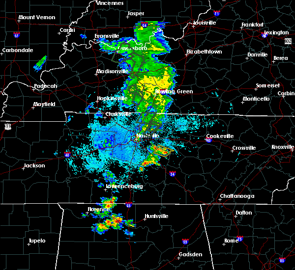 At 1150 pm cdt, a severe thunderstorm was located 7 miles east of walterhill, or 10 miles northeast of murfreesboro, moving northeast at 10 mph (radar indicated). Hazards include 60 mph wind gusts and penny size hail. Expect damage to roofs, siding, and trees. locations impacted include, walterhill, cedars of lebanon state park, lascassas and milton. This includes interstate 840 between mile markers 56 and 57. At 1150 pm cdt, a severe thunderstorm was located 7 miles east of walterhill, or 10 miles northeast of murfreesboro, moving northeast at 10 mph (radar indicated). Hazards include 60 mph wind gusts and penny size hail. Expect damage to roofs, siding, and trees. locations impacted include, walterhill, cedars of lebanon state park, lascassas and milton. This includes interstate 840 between mile markers 56 and 57.
|
| 6/26/2019 11:28 PM CDT |
 At 1127 pm cdt, a severe thunderstorm was located near murfreesboro, moving northeast at 10 mph (radar indicated). Hazards include 60 mph wind gusts and penny size hail. expect damage to roofs, siding, and trees At 1127 pm cdt, a severe thunderstorm was located near murfreesboro, moving northeast at 10 mph (radar indicated). Hazards include 60 mph wind gusts and penny size hail. expect damage to roofs, siding, and trees
|
| 6/22/2019 5:24 PM CDT |
 The severe thunderstorm warning for central rutherford and southeastern wilson counties will expire at 530 pm cdt, the storms which prompted the warning have weakened below severe limits, and no longer pose an immediate threat to life or property. therefore, the warning will be allowed to expire. to report severe weather, contact your nearest law enforcement agency. they will relay your report to the national weather service nashville. The severe thunderstorm warning for central rutherford and southeastern wilson counties will expire at 530 pm cdt, the storms which prompted the warning have weakened below severe limits, and no longer pose an immediate threat to life or property. therefore, the warning will be allowed to expire. to report severe weather, contact your nearest law enforcement agency. they will relay your report to the national weather service nashville.
|
| 6/22/2019 5:14 PM CDT |
 At 513 pm cdt, severe thunderstorms were located along a line extending from 6 miles east of lebanon to smyrna, moving southeast at 40 mph (radar indicated). Hazards include 60 mph wind gusts. Expect damage to roofs, siding, and trees. locations impacted include, murfreesboro, lebanon, smyrna, la vergne, watertown, walterhill, cedars of lebanon state park, lascassas, tuckers crossroads and gladeville. this includes the following highways, interstate 40 between mile markers 235 and 249. interstate 24 between mile markers 66 and 84. Interstate 840 between mile markers 52 and 76. At 513 pm cdt, severe thunderstorms were located along a line extending from 6 miles east of lebanon to smyrna, moving southeast at 40 mph (radar indicated). Hazards include 60 mph wind gusts. Expect damage to roofs, siding, and trees. locations impacted include, murfreesboro, lebanon, smyrna, la vergne, watertown, walterhill, cedars of lebanon state park, lascassas, tuckers crossroads and gladeville. this includes the following highways, interstate 40 between mile markers 235 and 249. interstate 24 between mile markers 66 and 84. Interstate 840 between mile markers 52 and 76.
|
| 6/22/2019 4:52 PM CDT |
 At 452 pm cdt, severe thunderstorms were located along a line extending from near gallatin to brentwood, moving southeast at 40 mph (radar indicated). Hazards include 60 mph wind gusts. expect damage to roofs, siding, and trees At 452 pm cdt, severe thunderstorms were located along a line extending from near gallatin to brentwood, moving southeast at 40 mph (radar indicated). Hazards include 60 mph wind gusts. expect damage to roofs, siding, and trees
|
| 6/21/2019 8:28 PM CDT |
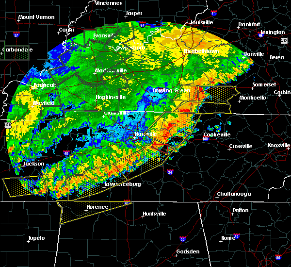 At 828 pm cdt, a severe thunderstorm capable of producing a tornado was located over walterhill, or 9 miles north of murfreesboro, moving east at 40 mph. in addition to the tornado, winds up to 80 mph are possible with this storm (radar indicated rotation). Hazards include tornado. Flying debris will be dangerous to those caught without shelter. mobile homes will be damaged or destroyed. damage to roofs, windows, and vehicles will occur. tree damage is likely. Locations impacted include, walterhill, milton and lascassas. At 828 pm cdt, a severe thunderstorm capable of producing a tornado was located over walterhill, or 9 miles north of murfreesboro, moving east at 40 mph. in addition to the tornado, winds up to 80 mph are possible with this storm (radar indicated rotation). Hazards include tornado. Flying debris will be dangerous to those caught without shelter. mobile homes will be damaged or destroyed. damage to roofs, windows, and vehicles will occur. tree damage is likely. Locations impacted include, walterhill, milton and lascassas.
|
| 6/21/2019 8:26 PM CDT |
 At 825 pm cdt, severe thunderstorms were located along a line extending from near watertown to murfreesboro to spring hill, moving southeast at 50 mph. these are very dangerous storms (radar indicated). Hazards include 80 mph wind gusts and penny size hail. Flying debris will be dangerous to those caught without shelter. mobile homes will be heavily damaged. expect considerable damage to roofs, windows, and vehicles. extensive tree damage and power outages are likely. locations impacted include, murfreesboro, columbia, lewisburg, smyrna, la vergne, spring hill, nolensville, thompson`s station, walterhill, chapel hill, eagleville, auburntown, fosterville, triune, cedars of lebanon state park, rover, rockvale, unionville, readyville and lascassas. this includes the following highways, interstate 65 between mile markers 29 and 60. interstate 24 between mile markers 66 and 93. Interstate 840 between mile markers 29 and 70. At 825 pm cdt, severe thunderstorms were located along a line extending from near watertown to murfreesboro to spring hill, moving southeast at 50 mph. these are very dangerous storms (radar indicated). Hazards include 80 mph wind gusts and penny size hail. Flying debris will be dangerous to those caught without shelter. mobile homes will be heavily damaged. expect considerable damage to roofs, windows, and vehicles. extensive tree damage and power outages are likely. locations impacted include, murfreesboro, columbia, lewisburg, smyrna, la vergne, spring hill, nolensville, thompson`s station, walterhill, chapel hill, eagleville, auburntown, fosterville, triune, cedars of lebanon state park, rover, rockvale, unionville, readyville and lascassas. this includes the following highways, interstate 65 between mile markers 29 and 60. interstate 24 between mile markers 66 and 93. Interstate 840 between mile markers 29 and 70.
|
| 6/21/2019 8:24 PM CDT |
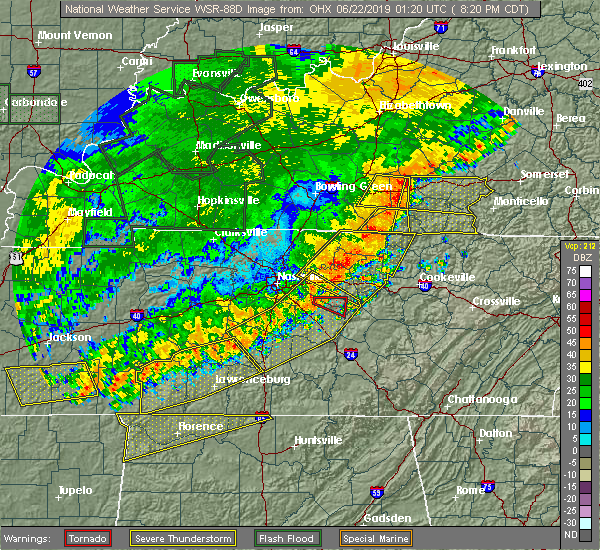 At 824 pm cdt, a severe thunderstorm capable of producing a tornado was located near walterhill, or 10 miles north of murfreesboro, moving east at 40 mph (radar indicated rotation). Hazards include tornado. Flying debris will be dangerous to those caught without shelter. mobile homes will be damaged or destroyed. damage to roofs, windows, and vehicles will occur. tree damage is likely. this tornadic thunderstorm will remain over mainly rural areas of northeastern rutherford and south central wilson counties, including the following locations, cedars of lebanon state park, milton and lascassas. This includes interstate 840 between mile markers 62 and 65. At 824 pm cdt, a severe thunderstorm capable of producing a tornado was located near walterhill, or 10 miles north of murfreesboro, moving east at 40 mph (radar indicated rotation). Hazards include tornado. Flying debris will be dangerous to those caught without shelter. mobile homes will be damaged or destroyed. damage to roofs, windows, and vehicles will occur. tree damage is likely. this tornadic thunderstorm will remain over mainly rural areas of northeastern rutherford and south central wilson counties, including the following locations, cedars of lebanon state park, milton and lascassas. This includes interstate 840 between mile markers 62 and 65.
|
| 6/21/2019 8:19 PM CDT |
 At 818 pm cdt, a severe thunderstorm capable of producing a tornado was located just northeast of smyrna airport, or 12 miles north of murfreesboro, moving east at 40 mph (radar indicated rotation). Hazards include tornado. Flying debris will be dangerous to those caught without shelter. mobile homes will be damaged or destroyed. damage to roofs, windows, and vehicles will occur. tree damage is likely. this dangerous storm will be near, walterhill around 825 pm cdt. other locations impacted by this tornadic thunderstorm include cedars of lebanon state park, lascassas, milton and gladeville. This includes interstate 840 between mile markers 62 and 70. At 818 pm cdt, a severe thunderstorm capable of producing a tornado was located just northeast of smyrna airport, or 12 miles north of murfreesboro, moving east at 40 mph (radar indicated rotation). Hazards include tornado. Flying debris will be dangerous to those caught without shelter. mobile homes will be damaged or destroyed. damage to roofs, windows, and vehicles will occur. tree damage is likely. this dangerous storm will be near, walterhill around 825 pm cdt. other locations impacted by this tornadic thunderstorm include cedars of lebanon state park, lascassas, milton and gladeville. This includes interstate 840 between mile markers 62 and 70.
|
| 6/21/2019 8:13 PM CDT |
 At 813 pm cdt, a severe thunderstorm capable of producing a tornado was located near rural hill, or 14 miles southwest of lebanon, moving east at 40 mph (radar indicated rotation). Hazards include tornado. Flying debris will be dangerous to those caught without shelter. mobile homes will be damaged or destroyed. damage to roofs, windows, and vehicles will occur. tree damage is likely. this dangerous storm will be near, walterhill around 825 pm cdt. other locations impacted by this tornadic thunderstorm include cedars of lebanon state park, lascassas, milton and gladeville. This includes interstate 840 between mile markers 62 and 71. At 813 pm cdt, a severe thunderstorm capable of producing a tornado was located near rural hill, or 14 miles southwest of lebanon, moving east at 40 mph (radar indicated rotation). Hazards include tornado. Flying debris will be dangerous to those caught without shelter. mobile homes will be damaged or destroyed. damage to roofs, windows, and vehicles will occur. tree damage is likely. this dangerous storm will be near, walterhill around 825 pm cdt. other locations impacted by this tornadic thunderstorm include cedars of lebanon state park, lascassas, milton and gladeville. This includes interstate 840 between mile markers 62 and 71.
|
| 6/21/2019 8:07 PM CDT |
 At 807 pm cdt, a severe thunderstorm capable of producing a tornado was located near rural hill, or 14 miles southeast of nashville, moving east at 45 mph (radar indicated rotation). Hazards include tornado. Flying debris will be dangerous to those caught without shelter. mobile homes will be damaged or destroyed. damage to roofs, windows, and vehicles will occur. tree damage is likely. this dangerous storm will be near, walterhill around 825 pm cdt. watertown around 840 pm cdt. other locations impacted by this tornadic thunderstorm include cedars of lebanon state park, percy priest lake, lascassas, milton and gladeville. this includes the following highways, interstate 24 between mile markers 62 and 65. Interstate 840 between mile markers 59 and 71. At 807 pm cdt, a severe thunderstorm capable of producing a tornado was located near rural hill, or 14 miles southeast of nashville, moving east at 45 mph (radar indicated rotation). Hazards include tornado. Flying debris will be dangerous to those caught without shelter. mobile homes will be damaged or destroyed. damage to roofs, windows, and vehicles will occur. tree damage is likely. this dangerous storm will be near, walterhill around 825 pm cdt. watertown around 840 pm cdt. other locations impacted by this tornadic thunderstorm include cedars of lebanon state park, percy priest lake, lascassas, milton and gladeville. this includes the following highways, interstate 24 between mile markers 62 and 65. Interstate 840 between mile markers 59 and 71.
|
| 6/21/2019 8:05 PM CDT |
 The national weather service in nashville has issued a * severe thunderstorm warning for. southeastern davidson county in middle tennessee. central marshall county in middle tennessee. rutherford county in middle tennessee. Central maury county in middle tennessee. The national weather service in nashville has issued a * severe thunderstorm warning for. southeastern davidson county in middle tennessee. central marshall county in middle tennessee. rutherford county in middle tennessee. Central maury county in middle tennessee.
|
| 6/19/2019 8:37 PM CDT |
 At 837 pm cdt, severe thunderstorms were located along a line extending from 9 miles northwest of woodbury to near spring hill, moving southeast at 15 mph (radar indicated). Hazards include 60 mph wind gusts and quarter size hail. Hail damage to vehicles is expected. expect wind damage to roofs, siding, and trees. locations impacted include, franklin, smyrna, spring hill, nolensville, thompson`s station, walterhill, eagleville and triune. this includes the following highways, interstate 65 between mile markers 55 and 65. interstate 24 between mile markers 67 and 75. Interstate 840 between mile markers 15 and 61. At 837 pm cdt, severe thunderstorms were located along a line extending from 9 miles northwest of woodbury to near spring hill, moving southeast at 15 mph (radar indicated). Hazards include 60 mph wind gusts and quarter size hail. Hail damage to vehicles is expected. expect wind damage to roofs, siding, and trees. locations impacted include, franklin, smyrna, spring hill, nolensville, thompson`s station, walterhill, eagleville and triune. this includes the following highways, interstate 65 between mile markers 55 and 65. interstate 24 between mile markers 67 and 75. Interstate 840 between mile markers 15 and 61.
|
| 6/19/2019 8:31 PM CDT |
 At 830 pm cdt, severe thunderstorms were located along a line extending from alexandria to christiana, moving east at 25 mph (radar indicated. at 828 pm cdt...several trees were blown down with these storms across rutherford county). Hazards include 70 mph wind gusts and quarter size hail. Hail damage to vehicles is expected. expect considerable tree damage. Wind damage is also likely to mobile homes, roofs, and outbuildings. At 830 pm cdt, severe thunderstorms were located along a line extending from alexandria to christiana, moving east at 25 mph (radar indicated. at 828 pm cdt...several trees were blown down with these storms across rutherford county). Hazards include 70 mph wind gusts and quarter size hail. Hail damage to vehicles is expected. expect considerable tree damage. Wind damage is also likely to mobile homes, roofs, and outbuildings.
|
| 6/19/2019 8:23 PM CDT |
 At 823 pm cdt, severe thunderstorms were located along a line extending from watertown to near thompson`s station, moving east at 30 mph (radar indicated). Hazards include 70 mph wind gusts and quarter size hail. Hail damage to vehicles is expected. expect considerable tree damage. wind damage is also likely to mobile homes, roofs, and outbuildings. locations impacted include, murfreesboro, franklin, smyrna, brentwood, la vergne, spring hill, nolensville, thompson`s station, watertown, walterhill, eagleville, auburntown, lascassas, triune, cedars of lebanon state park, leipers fork and milton. this includes the following highways, interstate 65 between mile markers 55 and 72. interstate 24 between mile markers 60 and 81. Interstate 840 between mile markers 10 and 70. At 823 pm cdt, severe thunderstorms were located along a line extending from watertown to near thompson`s station, moving east at 30 mph (radar indicated). Hazards include 70 mph wind gusts and quarter size hail. Hail damage to vehicles is expected. expect considerable tree damage. wind damage is also likely to mobile homes, roofs, and outbuildings. locations impacted include, murfreesboro, franklin, smyrna, brentwood, la vergne, spring hill, nolensville, thompson`s station, watertown, walterhill, eagleville, auburntown, lascassas, triune, cedars of lebanon state park, leipers fork and milton. this includes the following highways, interstate 65 between mile markers 55 and 72. interstate 24 between mile markers 60 and 81. Interstate 840 between mile markers 10 and 70.
|
| 6/19/2019 8:16 PM CDT |
 At 815 pm cdt, severe thunderstorms were located along a line extending from near watertown to thompson`s station, moving east at 35 mph. these storms have produced numerous reports of quarter size hail and blown down trees in the southern nashville metro area (radar indicated). Hazards include 60 mph wind gusts and quarter size hail. Hail damage to vehicles is expected. expect wind damage to roofs, siding, and trees. locations impacted include, murfreesboro, franklin, smyrna, brentwood, la vergne, spring hill, nolensville, thompson`s station, watertown, walterhill, eagleville, auburntown, lascassas, triune, cedars of lebanon state park, leipers fork and milton. this includes the following highways, interstate 65 between mile markers 55 and 72. interstate 24 between mile markers 60 and 81. Interstate 840 between mile markers 10 and 70. At 815 pm cdt, severe thunderstorms were located along a line extending from near watertown to thompson`s station, moving east at 35 mph. these storms have produced numerous reports of quarter size hail and blown down trees in the southern nashville metro area (radar indicated). Hazards include 60 mph wind gusts and quarter size hail. Hail damage to vehicles is expected. expect wind damage to roofs, siding, and trees. locations impacted include, murfreesboro, franklin, smyrna, brentwood, la vergne, spring hill, nolensville, thompson`s station, watertown, walterhill, eagleville, auburntown, lascassas, triune, cedars of lebanon state park, leipers fork and milton. this includes the following highways, interstate 65 between mile markers 55 and 72. interstate 24 between mile markers 60 and 81. Interstate 840 between mile markers 10 and 70.
|
| 6/19/2019 7:58 PM CDT |
 At 757 pm cdt, severe thunderstorms were located along a line extending from near rural hill to nolensville to leipers fork, moving east at 30 mph (radar indicated. at 756 pm cdt...numerous reports of quarter size hail were received from brentwood with these storms). Hazards include 60 mph wind gusts and quarter size hail. Hail damage to vehicles is expected. Expect wind damage to roofs, siding, and trees. At 757 pm cdt, severe thunderstorms were located along a line extending from near rural hill to nolensville to leipers fork, moving east at 30 mph (radar indicated. at 756 pm cdt...numerous reports of quarter size hail were received from brentwood with these storms). Hazards include 60 mph wind gusts and quarter size hail. Hail damage to vehicles is expected. Expect wind damage to roofs, siding, and trees.
|
| 5/2/2019 12:03 PM CDT |
 At 1203 pm cdt, a severe thunderstorm was located 11 miles south of nolensville, or 14 miles west of murfreesboro, moving north at 20 mph (radar indicated). Hazards include 60 mph wind gusts and quarter size hail. Hail damage to vehicles is expected. Expect wind damage to roofs, siding, and trees. At 1203 pm cdt, a severe thunderstorm was located 11 miles south of nolensville, or 14 miles west of murfreesboro, moving north at 20 mph (radar indicated). Hazards include 60 mph wind gusts and quarter size hail. Hail damage to vehicles is expected. Expect wind damage to roofs, siding, and trees.
|
| 3/30/2019 7:10 PM CDT |
 At 709 pm cdt, a severe thunderstorm was located 9 miles south of nolensville, or 10 miles west of murfreesboro, moving east at 45 mph (radar indicated). Hazards include 60 mph wind gusts. expect damage to roofs, siding, and trees At 709 pm cdt, a severe thunderstorm was located 9 miles south of nolensville, or 10 miles west of murfreesboro, moving east at 45 mph (radar indicated). Hazards include 60 mph wind gusts. expect damage to roofs, siding, and trees
|
| 3/9/2019 8:24 PM CDT |
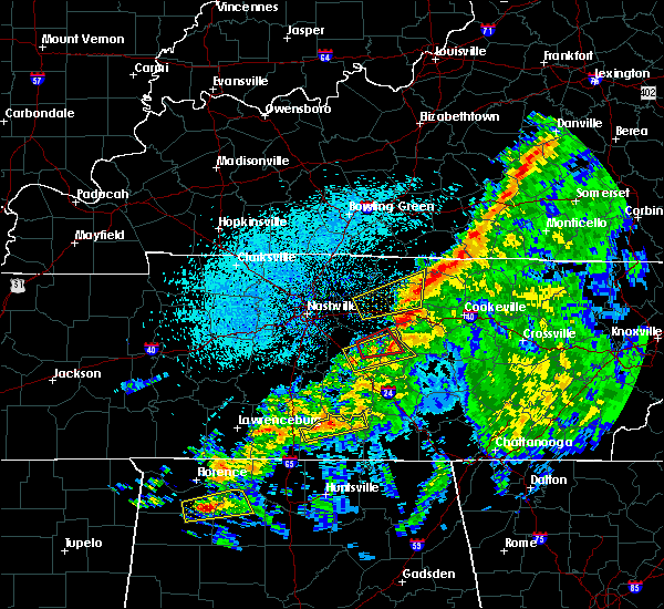 The tornado warning for east central rutherford, southeastern wilson and northwestern cannon counties will expire at 730 pm cst, the tornado threat has diminished and the tornado warning has been cancelled. however, damaging winds remain likely and a severe thunderstorm warning remains in effect for the area. a tornado watch remains in effect until 900 pm cst for middle tennessee. The tornado warning for east central rutherford, southeastern wilson and northwestern cannon counties will expire at 730 pm cst, the tornado threat has diminished and the tornado warning has been cancelled. however, damaging winds remain likely and a severe thunderstorm warning remains in effect for the area. a tornado watch remains in effect until 900 pm cst for middle tennessee.
|
| 3/9/2019 8:14 PM CDT |
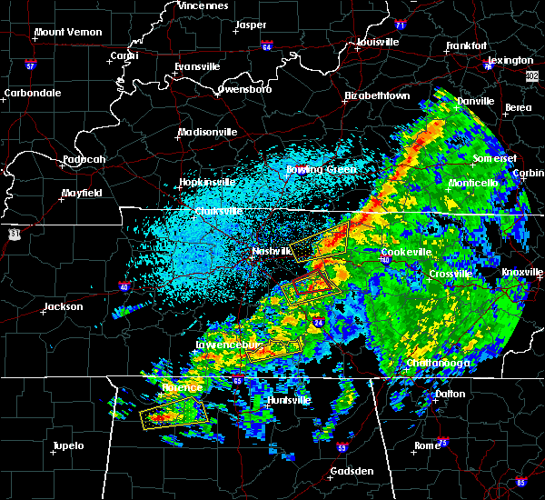 At 714 pm cst, a severe thunderstorm capable of producing a tornado was located 7 miles southeast of walterhill, or 8 miles northeast of murfreesboro, moving northeast at 60 mph (radar indicated rotation). Hazards include tornado. Flying debris will be dangerous to those caught without shelter. mobile homes will be damaged or destroyed. damage to roofs, windows, and vehicles will occur. tree damage is likely. This tornadic thunderstorm will remain over mainly rural areas of east central rutherford, southeastern wilson and northwestern cannon counties, including the following locations, milton, auburntown and lascassas. At 714 pm cst, a severe thunderstorm capable of producing a tornado was located 7 miles southeast of walterhill, or 8 miles northeast of murfreesboro, moving northeast at 60 mph (radar indicated rotation). Hazards include tornado. Flying debris will be dangerous to those caught without shelter. mobile homes will be damaged or destroyed. damage to roofs, windows, and vehicles will occur. tree damage is likely. This tornadic thunderstorm will remain over mainly rural areas of east central rutherford, southeastern wilson and northwestern cannon counties, including the following locations, milton, auburntown and lascassas.
|
| 3/9/2019 8:05 PM CDT |
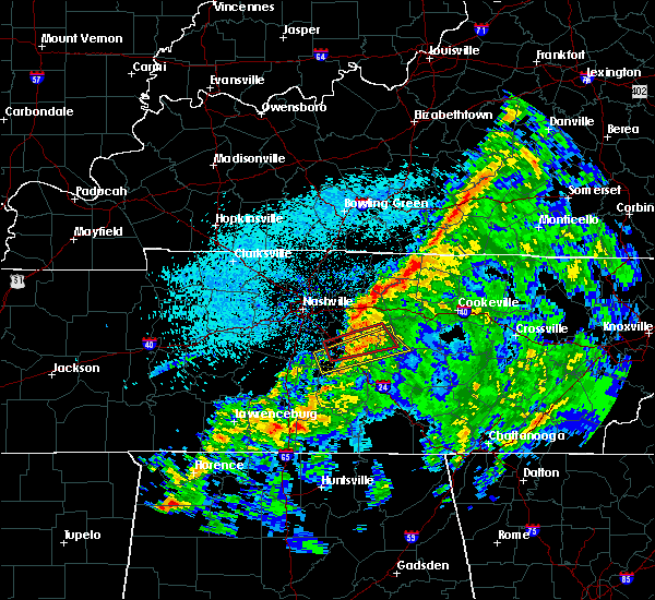 At 705 pm cst, a severe thunderstorm capable of producing a tornado was located over northwest murfreesboro, moving east at 45 mph (radar indicated rotation). Hazards include tornado. Flying debris will be dangerous to those caught without shelter. mobile homes will be damaged or destroyed. damage to roofs, windows, and vehicles will occur. tree damage is likely. this dangerous storm will be near, walterhill around 715 pm cst. other locations impacted by this tornadic thunderstorm include milton, auburntown and lascassas. this includes the following highways, interstate 24 between mile markers 73 and 83. Interstate 840 between mile markers 52 and 59. At 705 pm cst, a severe thunderstorm capable of producing a tornado was located over northwest murfreesboro, moving east at 45 mph (radar indicated rotation). Hazards include tornado. Flying debris will be dangerous to those caught without shelter. mobile homes will be damaged or destroyed. damage to roofs, windows, and vehicles will occur. tree damage is likely. this dangerous storm will be near, walterhill around 715 pm cst. other locations impacted by this tornadic thunderstorm include milton, auburntown and lascassas. this includes the following highways, interstate 24 between mile markers 73 and 83. Interstate 840 between mile markers 52 and 59.
|
| 3/9/2019 7:58 PM CDT |
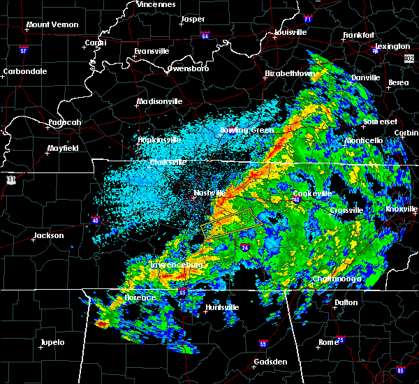 At 658 pm cst, a severe thunderstorm capable of producing a tornado was located about 5 miles west of murfreesboro, moving east at 45 mph (radar indicated rotation). Hazards include tornado. Flying debris will be dangerous to those caught without shelter. mobile homes will be damaged or destroyed. damage to roofs, windows, and vehicles will occur. tree damage is likely. this dangerous storm will be near, murfreesboro around 705 pm cst. walterhill around 715 pm cst. other locations impacted by this tornadic thunderstorm include auburntown, lascassas, milton and rockvale. this includes the following highways, interstate 24 between mile markers 71 and 83. Interstate 840 between mile markers 47 and 58. At 658 pm cst, a severe thunderstorm capable of producing a tornado was located about 5 miles west of murfreesboro, moving east at 45 mph (radar indicated rotation). Hazards include tornado. Flying debris will be dangerous to those caught without shelter. mobile homes will be damaged or destroyed. damage to roofs, windows, and vehicles will occur. tree damage is likely. this dangerous storm will be near, murfreesboro around 705 pm cst. walterhill around 715 pm cst. other locations impacted by this tornadic thunderstorm include auburntown, lascassas, milton and rockvale. this includes the following highways, interstate 24 between mile markers 71 and 83. Interstate 840 between mile markers 47 and 58.
|
| 12/31/2018 2:51 PM CST |
 At 250 pm cst, severe thunderstorms were located along a line extending from 9 miles northeast of scottsville to near mount juliet, moving northeast at 70 mph (radar indicated). Hazards include 60 mph wind gusts. Expect damage to roofs, siding, and trees. Locations impacted include, murfreesboro, franklin, gallatin, lebanon, lafayette, hartsville, hendersonville, smyrna, brentwood, la vergne, mount juliet, nolensville, westmoreland, hermitage, walterhill, rural hill, antioch, belinda city, bethpage and oak grove. At 250 pm cst, severe thunderstorms were located along a line extending from 9 miles northeast of scottsville to near mount juliet, moving northeast at 70 mph (radar indicated). Hazards include 60 mph wind gusts. Expect damage to roofs, siding, and trees. Locations impacted include, murfreesboro, franklin, gallatin, lebanon, lafayette, hartsville, hendersonville, smyrna, brentwood, la vergne, mount juliet, nolensville, westmoreland, hermitage, walterhill, rural hill, antioch, belinda city, bethpage and oak grove.
|
| 12/31/2018 2:25 PM CST |
 At 224 pm cst, severe thunderstorms were located along a line extending from portland to near franklin, moving northeast at 60 mph (radar indicated). Hazards include 60 mph wind gusts. expect damage to roofs, siding, and trees At 224 pm cst, severe thunderstorms were located along a line extending from portland to near franklin, moving northeast at 60 mph (radar indicated). Hazards include 60 mph wind gusts. expect damage to roofs, siding, and trees
|
| 11/6/2018 12:24 AM CST |
 The tornado warning for northwestern rutherford county will expire at 1230 am cst, the tornado warning that was previously in effect has been reissued for rutherford county. please refer to that bulletin for the latest severe weather information. a tornado watch remains in effect until 300 am cst for middle tennessee. The tornado warning for northwestern rutherford county will expire at 1230 am cst, the tornado warning that was previously in effect has been reissued for rutherford county. please refer to that bulletin for the latest severe weather information. a tornado watch remains in effect until 300 am cst for middle tennessee.
|
| 11/6/2018 12:19 AM CST |
 At 1219 am cst, severe thunderstorms were located along a line extending from near lebanon to near murfreesboro, moving east at 40 mph (radar indicated). Hazards include 60 mph wind gusts. Expect damage to roofs, siding, and trees. locations impacted include, murfreesboro, lebanon, smyrna, la vergne, walterhill, cedars of lebanon state park, lascassas and gladeville. this includes the following highways, interstate 40 between mile markers 238 and 244. interstate 24 between mile markers 71 and 84. interstate 840 between mile markers 49 and 75. A tornado watch remains in effect until 300 am cst for middle tennessee. At 1219 am cst, severe thunderstorms were located along a line extending from near lebanon to near murfreesboro, moving east at 40 mph (radar indicated). Hazards include 60 mph wind gusts. Expect damage to roofs, siding, and trees. locations impacted include, murfreesboro, lebanon, smyrna, la vergne, walterhill, cedars of lebanon state park, lascassas and gladeville. this includes the following highways, interstate 40 between mile markers 238 and 244. interstate 24 between mile markers 71 and 84. interstate 840 between mile markers 49 and 75. A tornado watch remains in effect until 300 am cst for middle tennessee.
|
| 11/6/2018 12:18 AM CST |
 At 1217 am cst, a severe thunderstorm capable of producing a tornado was located near walterhill, moving northeast at 35 mph (radar indicated rotation). Hazards include tornado. Flying debris will be dangerous to those caught without shelter. mobile homes will be damaged or destroyed. damage to roofs, windows, and vehicles will occur. Tree damage is likely. At 1217 am cst, a severe thunderstorm capable of producing a tornado was located near walterhill, moving northeast at 35 mph (radar indicated rotation). Hazards include tornado. Flying debris will be dangerous to those caught without shelter. mobile homes will be damaged or destroyed. damage to roofs, windows, and vehicles will occur. Tree damage is likely.
|
| 11/6/2018 12:02 AM CST |
 At 1202 am cst, a confirmed tornado was located near nolensville, or 11 miles west of murfreesboro, moving northeast at 50 mph (radar confirmed tornado). Hazards include damaging tornado. Flying debris will be dangerous to those caught without shelter. mobile homes will be damaged or destroyed. damage to roofs, windows, and vehicles will occur. tree damage is likely. locations impacted include, smyrna, la vergne, nolensville and walterhill. this includes the following highways, interstate 24 between mile markers 66 and 73. Interstate 840 between mile markers 46 and 49, and between mile markers 57 and 63. At 1202 am cst, a confirmed tornado was located near nolensville, or 11 miles west of murfreesboro, moving northeast at 50 mph (radar confirmed tornado). Hazards include damaging tornado. Flying debris will be dangerous to those caught without shelter. mobile homes will be damaged or destroyed. damage to roofs, windows, and vehicles will occur. tree damage is likely. locations impacted include, smyrna, la vergne, nolensville and walterhill. this includes the following highways, interstate 24 between mile markers 66 and 73. Interstate 840 between mile markers 46 and 49, and between mile markers 57 and 63.
|
| 11/5/2018 11:59 PM CST |
 At 1159 pm cst, a severe thunderstorm capable of producing a tornado was located near nolensville, or 12 miles east of franklin, moving northeast at 40 mph (radar indicated rotation). Hazards include tornado. Flying debris will be dangerous to those caught without shelter. mobile homes will be damaged or destroyed. damage to roofs, windows, and vehicles will occur. Tree damage is likely. At 1159 pm cst, a severe thunderstorm capable of producing a tornado was located near nolensville, or 12 miles east of franklin, moving northeast at 40 mph (radar indicated rotation). Hazards include tornado. Flying debris will be dangerous to those caught without shelter. mobile homes will be damaged or destroyed. damage to roofs, windows, and vehicles will occur. Tree damage is likely.
|
| 11/5/2018 11:55 PM CST |
 At 1155 pm cst, a severe thunderstorm was located over nolensville, or 10 miles east of franklin, moving northeast at 50 mph (radar indicated). Hazards include 70 mph wind gusts. Expect considerable tree damage. Damage is likely to mobile homes, roofs, and outbuildings. At 1155 pm cst, a severe thunderstorm was located over nolensville, or 10 miles east of franklin, moving northeast at 50 mph (radar indicated). Hazards include 70 mph wind gusts. Expect considerable tree damage. Damage is likely to mobile homes, roofs, and outbuildings.
|
| 2/24/2018 11:27 PM CST |
 At 1127 pm cst, severe thunderstorms were located along a line extending from 7 miles east of red boiling springs to near walterhill, moving east at 35 mph (radar indicated). Hazards include 60 mph wind gusts. expect damage to roofs, siding, and trees At 1127 pm cst, severe thunderstorms were located along a line extending from 7 miles east of red boiling springs to near walterhill, moving east at 35 mph (radar indicated). Hazards include 60 mph wind gusts. expect damage to roofs, siding, and trees
|
| 2/24/2018 11:12 PM CST |
 At 1111 pm cst, severe thunderstorms were located along a line extending from 6 miles south of tompkinsville to 12 miles south of nolensville, moving east at 45 mph (radar indicated). Hazards include 60 mph wind gusts. Expect damage to roofs, siding, and trees. locations impacted include, murfreesboro, lebanon, lafayette, carthage, celina, gainesboro, hartsville, smyrna, la vergne, spring hill, mount juliet, nolensville, thompson`s station, watertown, gordonsville, red boiling springs, walterhill, rural hill, belinda city and hickman. A tornado watch remains in effect until 200 am cst for middle tennessee. At 1111 pm cst, severe thunderstorms were located along a line extending from 6 miles south of tompkinsville to 12 miles south of nolensville, moving east at 45 mph (radar indicated). Hazards include 60 mph wind gusts. Expect damage to roofs, siding, and trees. locations impacted include, murfreesboro, lebanon, lafayette, carthage, celina, gainesboro, hartsville, smyrna, la vergne, spring hill, mount juliet, nolensville, thompson`s station, watertown, gordonsville, red boiling springs, walterhill, rural hill, belinda city and hickman. A tornado watch remains in effect until 200 am cst for middle tennessee.
|
| 2/24/2018 10:41 PM CST |
 At 1041 pm cst, severe thunderstorms were located along a line extending from 6 miles north of lafayette to near spring hill, moving east at 45 mph (radar indicated). Hazards include 60 mph wind gusts. expect damage to roofs, siding, and trees At 1041 pm cst, severe thunderstorms were located along a line extending from 6 miles north of lafayette to near spring hill, moving east at 45 mph (radar indicated). Hazards include 60 mph wind gusts. expect damage to roofs, siding, and trees
|
| 11/18/2017 5:09 PM CST |
 At 508 pm cst, severe thunderstorms were located along a line extending from lafayette to murfreesboro, moving east at 55 mph (radar indicated). Hazards include 70 mph wind gusts. Expect considerable tree damage. Damage is likely to mobile homes, roofs, and outbuildings. At 508 pm cst, severe thunderstorms were located along a line extending from lafayette to murfreesboro, moving east at 55 mph (radar indicated). Hazards include 70 mph wind gusts. Expect considerable tree damage. Damage is likely to mobile homes, roofs, and outbuildings.
|
| 8/22/2017 8:00 PM CDT |
 At 800 pm cdt, a severe thunderstorm was located near walterhill, or 10 miles south of lebanon, moving east at 30 mph (radar indicated). Hazards include 60 mph wind gusts. expect damage to roofs, siding, and trees At 800 pm cdt, a severe thunderstorm was located near walterhill, or 10 miles south of lebanon, moving east at 30 mph (radar indicated). Hazards include 60 mph wind gusts. expect damage to roofs, siding, and trees
|
| 8/4/2017 3:42 PM CDT |
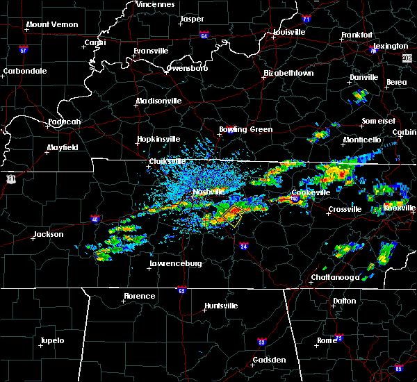 At 342 pm cdt, a severe thunderstorm was located 7 miles east of walterhill, or 10 miles northeast of murfreesboro, moving southeast at 25 mph (radar indicated). Hazards include 60 mph wind gusts and quarter size hail. Hail damage to vehicles is expected. expect wind damage to roofs, siding, and trees. Locations impacted include, murfreesboro, walterhill, lascassas and milton. At 342 pm cdt, a severe thunderstorm was located 7 miles east of walterhill, or 10 miles northeast of murfreesboro, moving southeast at 25 mph (radar indicated). Hazards include 60 mph wind gusts and quarter size hail. Hail damage to vehicles is expected. expect wind damage to roofs, siding, and trees. Locations impacted include, murfreesboro, walterhill, lascassas and milton.
|
| 8/4/2017 3:33 PM CDT |
 At 333 pm cdt, a severe thunderstorm was located near walterhill, or 11 miles north of murfreesboro, moving southeast at 15 mph (radar indicated). Hazards include 60 mph wind gusts and quarter size hail. Hail damage to vehicles is expected. Expect wind damage to roofs, siding, and trees. At 333 pm cdt, a severe thunderstorm was located near walterhill, or 11 miles north of murfreesboro, moving southeast at 15 mph (radar indicated). Hazards include 60 mph wind gusts and quarter size hail. Hail damage to vehicles is expected. Expect wind damage to roofs, siding, and trees.
|
| 5/27/2017 7:52 PM CDT |
 At 752 pm cdt, a severe thunderstorm was located near gordonsville, or 9 miles southwest of carthage, moving east at 70 mph (radar indicated). Hazards include 70 mph wind gusts and quarter size hail. Hail damage to vehicles is expected. expect considerable tree damage. wind damage is also likely to mobile homes, roofs, and outbuildings. Locations impacted include, murfreesboro, franklin, cookeville, smithville, woodbury, carthage, smyrna, brentwood, la vergne, nolensville, oak hill, algood, watertown, baxter, gordonsville, walterhill, antioch, rural hill, hickman and south carthage. At 752 pm cdt, a severe thunderstorm was located near gordonsville, or 9 miles southwest of carthage, moving east at 70 mph (radar indicated). Hazards include 70 mph wind gusts and quarter size hail. Hail damage to vehicles is expected. expect considerable tree damage. wind damage is also likely to mobile homes, roofs, and outbuildings. Locations impacted include, murfreesboro, franklin, cookeville, smithville, woodbury, carthage, smyrna, brentwood, la vergne, nolensville, oak hill, algood, watertown, baxter, gordonsville, walterhill, antioch, rural hill, hickman and south carthage.
|
| 5/27/2017 7:47 PM CDT |
 At 746 pm cdt, a severe thunderstorm was located near watertown, or 10 miles southeast of lebanon, moving east at 70 mph (radar indicated). Hazards include 70 mph wind gusts and quarter size hail. Hail damage to vehicles is expected. expect considerable tree damage. Wind damage is also likely to mobile homes, roofs, and outbuildings. At 746 pm cdt, a severe thunderstorm was located near watertown, or 10 miles southeast of lebanon, moving east at 70 mph (radar indicated). Hazards include 70 mph wind gusts and quarter size hail. Hail damage to vehicles is expected. expect considerable tree damage. Wind damage is also likely to mobile homes, roofs, and outbuildings.
|
| 5/27/2017 7:36 PM CDT |
 At 735 pm cdt, a severe thunderstorm was located over antioch, or 10 miles southeast of nashville, moving east at 40 mph (radar indicated). Hazards include 70 mph wind gusts and quarter size hail. Hail damage to vehicles is expected. expect considerable tree damage. wind damage is also likely to mobile homes, roofs, and outbuildings. Locations impacted include, murfreesboro, franklin, lebanon, smyrna, brentwood, la vergne, mount juliet, nolensville, forest hills, oak hill, belle meade, kingston springs, thompson`s station, pegram, watertown, walterhill, rural hill, bellevue, antioch and belinda city. At 735 pm cdt, a severe thunderstorm was located over antioch, or 10 miles southeast of nashville, moving east at 40 mph (radar indicated). Hazards include 70 mph wind gusts and quarter size hail. Hail damage to vehicles is expected. expect considerable tree damage. wind damage is also likely to mobile homes, roofs, and outbuildings. Locations impacted include, murfreesboro, franklin, lebanon, smyrna, brentwood, la vergne, mount juliet, nolensville, forest hills, oak hill, belle meade, kingston springs, thompson`s station, pegram, watertown, walterhill, rural hill, bellevue, antioch and belinda city.
|
| 5/27/2017 7:18 PM CDT |
 At 718 pm cdt, a severe thunderstorm was located over nashville, moving southeast at 60 mph (radar indicated). Hazards include 70 mph wind gusts and quarter size hail. Hail damage to vehicles is expected. expect considerable tree damage. Wind damage is also likely to mobile homes, roofs, and outbuildings. At 718 pm cdt, a severe thunderstorm was located over nashville, moving southeast at 60 mph (radar indicated). Hazards include 70 mph wind gusts and quarter size hail. Hail damage to vehicles is expected. expect considerable tree damage. Wind damage is also likely to mobile homes, roofs, and outbuildings.
|
| 4/30/2017 3:46 PM CDT |
 At 346 pm cdt, severe thunderstorms were located along a line extending from near murfreesboro to 10 miles southwest of woodbury to estill springs, moving northeast at 55 mph (radar indicated). Hazards include 60 mph wind gusts. Expect damage to roofs, siding, and trees. locations impacted include, murfreesboro, manchester, woodbury, tullahoma, walterhill, lascassas, christiana, beechgrove, fosterville, summitville, rockvale, bradyville, milton, readyville and arnold afb. A tornado watch remains in effect until 700 pm cdt for middle tennessee. At 346 pm cdt, severe thunderstorms were located along a line extending from near murfreesboro to 10 miles southwest of woodbury to estill springs, moving northeast at 55 mph (radar indicated). Hazards include 60 mph wind gusts. Expect damage to roofs, siding, and trees. locations impacted include, murfreesboro, manchester, woodbury, tullahoma, walterhill, lascassas, christiana, beechgrove, fosterville, summitville, rockvale, bradyville, milton, readyville and arnold afb. A tornado watch remains in effect until 700 pm cdt for middle tennessee.
|
| 4/30/2017 3:38 PM CDT |
 At 338 pm cdt, severe thunderstorms were located along a line extending from near rural hill to 6 miles south of nolensville, moving northeast at 35 mph (radar indicated). Hazards include 60 mph wind gusts. Expect damage to roofs, siding, and trees. locations impacted include, murfreesboro, lebanon, smyrna, la vergne, mount juliet, walterhill, rural hill, belinda city, cedars of lebanon state park and gladeville. A tornado watch remains in effect until 700 pm cdt for middle tennessee. At 338 pm cdt, severe thunderstorms were located along a line extending from near rural hill to 6 miles south of nolensville, moving northeast at 35 mph (radar indicated). Hazards include 60 mph wind gusts. Expect damage to roofs, siding, and trees. locations impacted include, murfreesboro, lebanon, smyrna, la vergne, mount juliet, walterhill, rural hill, belinda city, cedars of lebanon state park and gladeville. A tornado watch remains in effect until 700 pm cdt for middle tennessee.
|
| 4/30/2017 3:26 PM CDT |
 At 326 pm cdt, severe thunderstorms were located along a line extending from eagleville to near shelbyville to near huntland, moving northeast at 55 mph (radar indicated). Hazards include 60 mph wind gusts. expect damage to roofs, siding, and trees At 326 pm cdt, severe thunderstorms were located along a line extending from eagleville to near shelbyville to near huntland, moving northeast at 55 mph (radar indicated). Hazards include 60 mph wind gusts. expect damage to roofs, siding, and trees
|
| 4/30/2017 3:14 PM CDT |
 At 312 pm cdt, severe thunderstorms were located along a line extending from near hermitage to 9 miles east of spring hill, moving northeast at 30 mph (radar indicated. several trees in williamson county have been snapped or downed by this line of storms). Hazards include 60 mph wind gusts. expect damage to roofs, siding, and trees At 312 pm cdt, severe thunderstorms were located along a line extending from near hermitage to 9 miles east of spring hill, moving northeast at 30 mph (radar indicated. several trees in williamson county have been snapped or downed by this line of storms). Hazards include 60 mph wind gusts. expect damage to roofs, siding, and trees
|
| 3/30/2017 7:32 PM CDT |
 At 731 pm cdt, a severe thunderstorm was located near smyrna, moving north at 60 mph (radar indicated). Hazards include 60 mph wind gusts. Expect damage to roofs, siding, and trees. Locations impacted include, murfreesboro, smyrna, la vergne, walterhill, lascassas, christiana and rockvale. At 731 pm cdt, a severe thunderstorm was located near smyrna, moving north at 60 mph (radar indicated). Hazards include 60 mph wind gusts. Expect damage to roofs, siding, and trees. Locations impacted include, murfreesboro, smyrna, la vergne, walterhill, lascassas, christiana and rockvale.
|
| 3/30/2017 7:17 PM CDT |
 At 717 pm cdt, a severe thunderstorm was located 8 miles southwest of murfreesboro, moving northeast at 60 mph (radar indicated). Hazards include 60 mph wind gusts and penny size hail. expect damage to roofs, siding, and trees At 717 pm cdt, a severe thunderstorm was located 8 miles southwest of murfreesboro, moving northeast at 60 mph (radar indicated). Hazards include 60 mph wind gusts and penny size hail. expect damage to roofs, siding, and trees
|
| 3/21/2017 4:51 PM CDT |
 At 450 pm cdt, severe thunderstorms were located along a line extending from smyrna to 6 miles southwest of murfreesboro, moving east at 35 mph (radar indicated). Hazards include 70 mph wind gusts and nickel size hail. Expect considerable tree damage. Damage is likely to mobile homes, roofs, and outbuildings. At 450 pm cdt, severe thunderstorms were located along a line extending from smyrna to 6 miles southwest of murfreesboro, moving east at 35 mph (radar indicated). Hazards include 70 mph wind gusts and nickel size hail. Expect considerable tree damage. Damage is likely to mobile homes, roofs, and outbuildings.
|
| 3/21/2017 4:42 PM CDT |
 At 442 pm cdt, severe thunderstorms were located along a line extending from la vergne to 10 miles west of murfreesboro, moving east at 35 mph (radar indicated). Hazards include 60 mph wind gusts and nickel size hail. expect damage to roofs, siding, and trees At 442 pm cdt, severe thunderstorms were located along a line extending from la vergne to 10 miles west of murfreesboro, moving east at 35 mph (radar indicated). Hazards include 60 mph wind gusts and nickel size hail. expect damage to roofs, siding, and trees
|
| 3/9/2017 11:32 PM CST |
 At 1132 pm cst, a severe thunderstorm was located near murfreesboro, moving east at 50 mph (radar indicated). Hazards include 60 mph wind gusts. Expect damage to roofs, siding, and trees. Locations impacted include, murfreesboro, walterhill, chapel hill, cedars of lebanon state park, rover, rockvale and unionville. At 1132 pm cst, a severe thunderstorm was located near murfreesboro, moving east at 50 mph (radar indicated). Hazards include 60 mph wind gusts. Expect damage to roofs, siding, and trees. Locations impacted include, murfreesboro, walterhill, chapel hill, cedars of lebanon state park, rover, rockvale and unionville.
|
| 3/9/2017 11:21 PM CST |
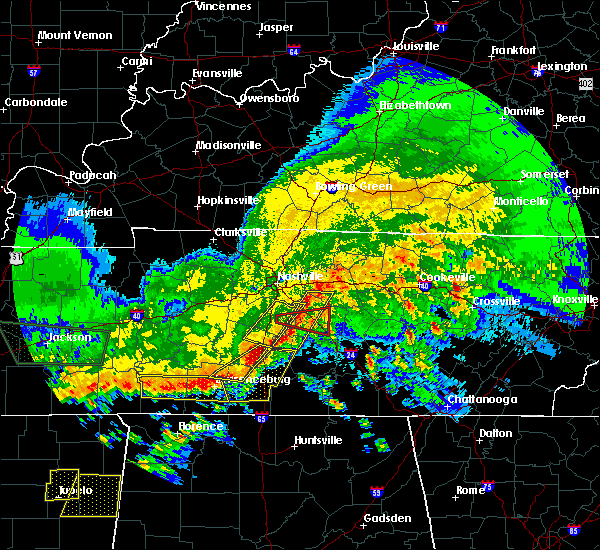 The tornado warning for central rutherford and east central williamson counties will expire at 1130 pm cst, the tornado threat has diminished and the tornado warning has been cancelled. however, damaging winds remain likely and a severe thunderstorm warning remains in effect for the area. a severe thunderstorm watch also remains in effect until 100 am cst for middle tennessee. The tornado warning for central rutherford and east central williamson counties will expire at 1130 pm cst, the tornado threat has diminished and the tornado warning has been cancelled. however, damaging winds remain likely and a severe thunderstorm warning remains in effect for the area. a severe thunderstorm watch also remains in effect until 100 am cst for middle tennessee.
|
| 3/9/2017 11:18 PM CST |
 At 1118 pm cst, a severe thunderstorm was located 11 miles south of nolensville, or 14 miles southeast of franklin, moving east at 50 mph (radar indicated). Hazards include 60 mph wind gusts. expect damage to roofs, siding, and trees At 1118 pm cst, a severe thunderstorm was located 11 miles south of nolensville, or 14 miles southeast of franklin, moving east at 50 mph (radar indicated). Hazards include 60 mph wind gusts. expect damage to roofs, siding, and trees
|
| 3/9/2017 11:13 PM CST |
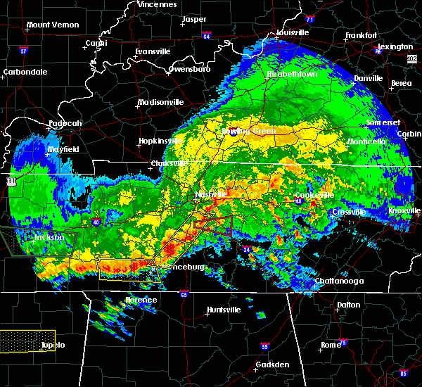 At 1113 pm cst, a severe thunderstorm capable of producing a tornado was located 7 miles southwest of nolensville, or 9 miles southeast of franklin, moving east at 50 mph (radar indicated rotation). Hazards include tornado. Flying debris will be dangerous to those caught without shelter. mobile homes will be damaged or destroyed. damage to roofs, windows, and vehicles will occur. tree damage is likely. this dangerous storm will be near, murfreesboro around 1130 pm cst. Other locations impacted by this tornadic thunderstorm include triune. At 1113 pm cst, a severe thunderstorm capable of producing a tornado was located 7 miles southwest of nolensville, or 9 miles southeast of franklin, moving east at 50 mph (radar indicated rotation). Hazards include tornado. Flying debris will be dangerous to those caught without shelter. mobile homes will be damaged or destroyed. damage to roofs, windows, and vehicles will occur. tree damage is likely. this dangerous storm will be near, murfreesboro around 1130 pm cst. Other locations impacted by this tornadic thunderstorm include triune.
|
| 3/9/2017 11:07 PM CST |
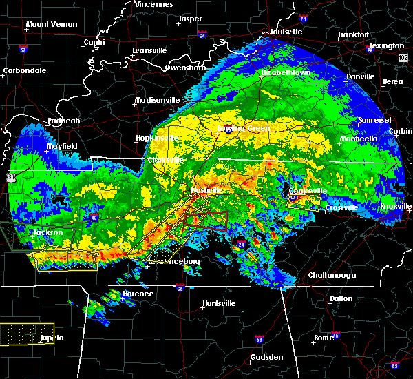 At 1107 pm cst, a severe thunderstorm capable of producing a tornado was located near franklin, moving east at 55 mph (radar indicated rotation). Hazards include tornado. Flying debris will be dangerous to those caught without shelter. mobile homes will be damaged or destroyed. damage to roofs, windows, and vehicles will occur. tree damage is likely. this dangerous storm will be near, murfreesboro around 1125 pm cst. Other locations impacted by this tornadic thunderstorm include triune and rockvale. At 1107 pm cst, a severe thunderstorm capable of producing a tornado was located near franklin, moving east at 55 mph (radar indicated rotation). Hazards include tornado. Flying debris will be dangerous to those caught without shelter. mobile homes will be damaged or destroyed. damage to roofs, windows, and vehicles will occur. tree damage is likely. this dangerous storm will be near, murfreesboro around 1125 pm cst. Other locations impacted by this tornadic thunderstorm include triune and rockvale.
|
| 3/9/2017 9:59 PM CST |
 At 959 pm cst, a severe thunderstorm was located near murfreesboro, moving northeast at 55 mph (radar indicated). Hazards include 60 mph wind gusts and quarter size hail. Hail damage to vehicles is expected. expect wind damage to roofs, siding, and trees. Locations impacted include, murfreesboro, walterhill, christiana, fosterville and rockvale. At 959 pm cst, a severe thunderstorm was located near murfreesboro, moving northeast at 55 mph (radar indicated). Hazards include 60 mph wind gusts and quarter size hail. Hail damage to vehicles is expected. expect wind damage to roofs, siding, and trees. Locations impacted include, murfreesboro, walterhill, christiana, fosterville and rockvale.
|
| 3/9/2017 9:39 PM CST |
 At 939 pm cst, a severe thunderstorm was located 13 miles southeast of spring hill, or 14 miles north of lewisburg, moving northeast at 55 mph (radar indicated). Hazards include 60 mph wind gusts and quarter size hail. Hail damage to vehicles is expected. Expect wind damage to roofs, siding, and trees. At 939 pm cst, a severe thunderstorm was located 13 miles southeast of spring hill, or 14 miles north of lewisburg, moving northeast at 55 mph (radar indicated). Hazards include 60 mph wind gusts and quarter size hail. Hail damage to vehicles is expected. Expect wind damage to roofs, siding, and trees.
|
| 3/1/2017 7:26 AM CST |
 At 726 am cst, severe thunderstorms were located along a line extending from 7 miles northwest of westmoreland to near murfreesboro, moving east at 70 mph (radar indicated). Hazards include 60 mph wind gusts and penny size hail. expect damage to roofs, siding, and trees At 726 am cst, severe thunderstorms were located along a line extending from 7 miles northwest of westmoreland to near murfreesboro, moving east at 70 mph (radar indicated). Hazards include 60 mph wind gusts and penny size hail. expect damage to roofs, siding, and trees
|
| 3/1/2017 7:17 AM CST |
 At 716 am cst, a severe thunderstorm capable of producing a tornado was located over la vergne, or 14 miles northwest of murfreesboro, moving east at 70 mph (radar indicated rotation. at 7:08am damage was reported at cool springs galleria ). Hazards include tornado. Flying debris will be dangerous to those caught without shelter. mobile homes will be damaged or destroyed. damage to roofs, windows, and vehicles will occur. tree damage is likely. this dangerous storm will be near, walterhill around 725 am cst. Other locations impacted by this tornadic thunderstorm include cedars of lebanon state park, gladeville and lascassas. At 716 am cst, a severe thunderstorm capable of producing a tornado was located over la vergne, or 14 miles northwest of murfreesboro, moving east at 70 mph (radar indicated rotation. at 7:08am damage was reported at cool springs galleria ). Hazards include tornado. Flying debris will be dangerous to those caught without shelter. mobile homes will be damaged or destroyed. damage to roofs, windows, and vehicles will occur. tree damage is likely. this dangerous storm will be near, walterhill around 725 am cst. Other locations impacted by this tornadic thunderstorm include cedars of lebanon state park, gladeville and lascassas.
|
| 3/1/2017 7:11 AM CST |
 At 710 am cst, a severe thunderstorm capable of producing a tornado was located near nolensville, or 10 miles northeast of franklin, moving east at 65 mph (radar indicated rotation. at 7:08 damage at cool spring galleria was reported). Hazards include tornado. Flying debris will be dangerous to those caught without shelter. mobile homes will be damaged or destroyed. damage to roofs, windows, and vehicles will occur. tree damage is likely. this dangerous storm will be near, smyrna and la vergne around 720 am cst. walterhill around 725 am cst. Other locations impacted by this tornadic thunderstorm include cedars of lebanon state park, gladeville and lascassas. At 710 am cst, a severe thunderstorm capable of producing a tornado was located near nolensville, or 10 miles northeast of franklin, moving east at 65 mph (radar indicated rotation. at 7:08 damage at cool spring galleria was reported). Hazards include tornado. Flying debris will be dangerous to those caught without shelter. mobile homes will be damaged or destroyed. damage to roofs, windows, and vehicles will occur. tree damage is likely. this dangerous storm will be near, smyrna and la vergne around 720 am cst. walterhill around 725 am cst. Other locations impacted by this tornadic thunderstorm include cedars of lebanon state park, gladeville and lascassas.
|
| 3/1/2017 7:03 AM CST |
 At 702 am cst, a severe thunderstorm capable of producing a tornado was located over franklin, moving east at 70 mph (radar indicated rotation). Hazards include tornado. Flying debris will be dangerous to those caught without shelter. mobile homes will be damaged or destroyed. damage to roofs, windows, and vehicles will occur. tree damage is likely. this dangerous storm will be near, brentwood around 705 am cst. nolensville and antioch around 710 am cst. smyrna and la vergne around 720 am cst. walterhill around 725 am cst. Other locations impacted by this tornadic thunderstorm include cedars of lebanon state park, gladeville and lascassas. At 702 am cst, a severe thunderstorm capable of producing a tornado was located over franklin, moving east at 70 mph (radar indicated rotation). Hazards include tornado. Flying debris will be dangerous to those caught without shelter. mobile homes will be damaged or destroyed. damage to roofs, windows, and vehicles will occur. tree damage is likely. this dangerous storm will be near, brentwood around 705 am cst. nolensville and antioch around 710 am cst. smyrna and la vergne around 720 am cst. walterhill around 725 am cst. Other locations impacted by this tornadic thunderstorm include cedars of lebanon state park, gladeville and lascassas.
|
| 3/1/2017 6:55 AM CST |
 At 654 am cst, severe thunderstorms were located along a line extending from near springfield to near oak hill to near thompson`s station, moving east at 65 mph (radar indicated). Hazards include 70 mph wind gusts and nickel size hail. Expect considerable tree damage. Damage is likely to mobile homes, roofs, and outbuildings. At 654 am cst, severe thunderstorms were located along a line extending from near springfield to near oak hill to near thompson`s station, moving east at 65 mph (radar indicated). Hazards include 70 mph wind gusts and nickel size hail. Expect considerable tree damage. Damage is likely to mobile homes, roofs, and outbuildings.
|
| 2/7/2017 10:41 AM CST |
 The national weather service in nashville has issued a * severe thunderstorm warning for. western smith county in middle tennessee. rutherford county in middle tennessee. southeastern sumner county in middle tennessee. Wilson county in middle tennessee. The national weather service in nashville has issued a * severe thunderstorm warning for. western smith county in middle tennessee. rutherford county in middle tennessee. southeastern sumner county in middle tennessee. Wilson county in middle tennessee.
|
| 2/7/2017 10:25 AM CST |
 At 1024 am cst, severe thunderstorms were located along a line extending from hendersonville to thompson`s station, moving east at 50 mph (radar indicated). Hazards include 60 mph wind gusts and penny size hail. Expect damage to roofs, siding, and trees. Locations impacted include, murfreesboro, franklin, gallatin, lebanon, nashville, madison, hendersonville, smyrna, brentwood, la vergne, spring hill, mount juliet, goodlettsville, millersville, nolensville, forest hills, oak hill, belle meade, lakewood and thompson`s station. At 1024 am cst, severe thunderstorms were located along a line extending from hendersonville to thompson`s station, moving east at 50 mph (radar indicated). Hazards include 60 mph wind gusts and penny size hail. Expect damage to roofs, siding, and trees. Locations impacted include, murfreesboro, franklin, gallatin, lebanon, nashville, madison, hendersonville, smyrna, brentwood, la vergne, spring hill, mount juliet, goodlettsville, millersville, nolensville, forest hills, oak hill, belle meade, lakewood and thompson`s station.
|
| 2/7/2017 10:11 AM CST |
 At 1010 am cst, severe thunderstorms were located along a line extending from near joelton to near franklin, moving east at 50 mph (radar indicated). Hazards include 70 mph wind gusts. Expect considerable tree damage. Damage is likely to mobile homes, roofs, and outbuildings. At 1010 am cst, severe thunderstorms were located along a line extending from near joelton to near franklin, moving east at 50 mph (radar indicated). Hazards include 70 mph wind gusts. Expect considerable tree damage. Damage is likely to mobile homes, roofs, and outbuildings.
|
| 9/10/2016 5:35 PM CDT |
 At 535 pm cdt, severe thunderstorms were located along a line extending from near gordonsville to near murfreesboro, moving east at 45 mph (radar indicated). Hazards include 60 mph wind gusts. Expect damage to roofs. siding. and trees. Locations impacted include, murfreesboro, smithville, woodbury, carthage, watertown, baxter, gordonsville, walterhill, hickman, south carthage, alexandria, dowelltown, liberty, auburntown, edgar evans state park, cedars of lebanon state park, tuckers crossroads, center hill lake, readyville and milton. At 535 pm cdt, severe thunderstorms were located along a line extending from near gordonsville to near murfreesboro, moving east at 45 mph (radar indicated). Hazards include 60 mph wind gusts. Expect damage to roofs. siding. and trees. Locations impacted include, murfreesboro, smithville, woodbury, carthage, watertown, baxter, gordonsville, walterhill, hickman, south carthage, alexandria, dowelltown, liberty, auburntown, edgar evans state park, cedars of lebanon state park, tuckers crossroads, center hill lake, readyville and milton.
|
| 9/10/2016 5:18 PM CDT |
 At 517 pm cdt, severe thunderstorms were located along a line extending from carthage to near murfreesboro, moving east at 45 mph (radar indicated). Hazards include 60 mph wind gusts. Expect damage to roofs. siding. And trees. At 517 pm cdt, severe thunderstorms were located along a line extending from carthage to near murfreesboro, moving east at 45 mph (radar indicated). Hazards include 60 mph wind gusts. Expect damage to roofs. siding. And trees.
|
| 9/10/2016 5:06 PM CDT |
 At 504 pm cdt, severe thunderstorms were located along a line extending from near belinda city to franklin, moving east at 40 mph (trained spotter repored and radar indicated. at 455pm, several trees have been blown down with these storms. a wind gust of 51 mph was also measured at nashville international airport with these storms). Hazards include 60 mph wind gusts. Expect damage to roofs. siding. and trees. Locations impacted include, murfreesboro, franklin, lebanon, smyrna, brentwood, la vergne, mount juliet, nolensville, oak hill, hermitage, belinda city, walterhill, rural hill, antioch, berry hill, cedars of lebanon state park, tuckers crossroads, percy priest lake, triune and gladeville. At 504 pm cdt, severe thunderstorms were located along a line extending from near belinda city to franklin, moving east at 40 mph (trained spotter repored and radar indicated. at 455pm, several trees have been blown down with these storms. a wind gust of 51 mph was also measured at nashville international airport with these storms). Hazards include 60 mph wind gusts. Expect damage to roofs. siding. and trees. Locations impacted include, murfreesboro, franklin, lebanon, smyrna, brentwood, la vergne, mount juliet, nolensville, oak hill, hermitage, belinda city, walterhill, rural hill, antioch, berry hill, cedars of lebanon state park, tuckers crossroads, percy priest lake, triune and gladeville.
|
| 9/10/2016 4:50 PM CDT |
 At 450 pm cdt, severe thunderstorms were located along a line extending from hermitage to near franklin, moving east at 40 mph (radar indicated). Hazards include 60 mph wind gusts and pea size hail. Expect damage to roofs. siding. And trees. At 450 pm cdt, severe thunderstorms were located along a line extending from hermitage to near franklin, moving east at 40 mph (radar indicated). Hazards include 60 mph wind gusts and pea size hail. Expect damage to roofs. siding. And trees.
|
| 8/4/2016 7:38 PM CDT |
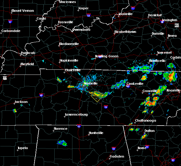 At 738 pm cdt, a severe thunderstorm was located over murfreesboro, moving southeast at 10 mph (radar indicated). Hazards include 60 mph wind gusts. Expect damage to roofs. siding. and trees. Locations impacted include, murfreesboro, smyrna, walterhill and lascassas. At 738 pm cdt, a severe thunderstorm was located over murfreesboro, moving southeast at 10 mph (radar indicated). Hazards include 60 mph wind gusts. Expect damage to roofs. siding. and trees. Locations impacted include, murfreesboro, smyrna, walterhill and lascassas.
|
| 8/4/2016 7:10 PM CDT |
 At 710 pm cdt, a severe thunderstorm was located over murfreesboro, moving southeast at 5 mph (radar indicated). Hazards include 60 mph wind gusts and penny size hail. Expect damage to roofs. siding. And trees. At 710 pm cdt, a severe thunderstorm was located over murfreesboro, moving southeast at 5 mph (radar indicated). Hazards include 60 mph wind gusts and penny size hail. Expect damage to roofs. siding. And trees.
|
| 7/14/2016 1:23 PM CDT |
 At 123 pm cdt, a severe thunderstorm was located near walterhill, or 11 miles northeast of murfreesboro, moving northeast at 15 mph (radar indicated). Hazards include 60 mph wind gusts and quarter size hail. Hail damage to vehicles is expected. Expect wind damage to roofs, siding, and trees. At 123 pm cdt, a severe thunderstorm was located near walterhill, or 11 miles northeast of murfreesboro, moving northeast at 15 mph (radar indicated). Hazards include 60 mph wind gusts and quarter size hail. Hail damage to vehicles is expected. Expect wind damage to roofs, siding, and trees.
|
| 7/8/2016 9:46 PM CDT |
 At 945 pm cdt, severe thunderstorms were located along a line extending from gainesboro to near woodbury, moving east at 55 mph (radar indicated). Hazards include 60 mph wind gusts and penny size hail. Expect damage to roofs. siding. and trees. Locations impacted include, murfreesboro, lebanon, smithville, woodbury, carthage, smyrna, watertown, baxter, gordonsville, walterhill, hickman, south carthage, alexandria, dowelltown, liberty, auburntown, dickerson chapel recreation area, granville, edgar evans state park and cedars of lebanon state park. At 945 pm cdt, severe thunderstorms were located along a line extending from gainesboro to near woodbury, moving east at 55 mph (radar indicated). Hazards include 60 mph wind gusts and penny size hail. Expect damage to roofs. siding. and trees. Locations impacted include, murfreesboro, lebanon, smithville, woodbury, carthage, smyrna, watertown, baxter, gordonsville, walterhill, hickman, south carthage, alexandria, dowelltown, liberty, auburntown, dickerson chapel recreation area, granville, edgar evans state park and cedars of lebanon state park.
|
| 7/8/2016 9:25 PM CDT |
 At 925 pm cdt, severe thunderstorms were located along a line extending from near carthage to near walterhill, moving east at 55 mph (radar indicated). Hazards include 70 mph wind gusts and penny size hail. Expect considerable tree damage. Damage is likely to mobile homes, roofs, and outbuildings. At 925 pm cdt, severe thunderstorms were located along a line extending from near carthage to near walterhill, moving east at 55 mph (radar indicated). Hazards include 70 mph wind gusts and penny size hail. Expect considerable tree damage. Damage is likely to mobile homes, roofs, and outbuildings.
|
| 7/8/2016 9:10 PM CDT |
 At 909 pm cdt, severe thunderstorms were located along a line extending from lafayette to thompson`s station, moving east at 60 mph (trained weather spotters. numerous trees and power lines have been blown down with these storms all across the nashville metro area). Hazards include 70 mph wind gusts and quarter size hail. Hail damage to vehicles is expected. expect considerable tree damage. wind damage is also likely to mobile homes, roofs, and outbuildings. Locations impacted include, murfreesboro, franklin, gallatin, lebanon, lafayette, carthage, hartsville, nashville, madison, hendersonville, smyrna, brentwood, la vergne, spring hill, mount juliet, goodlettsville, white house, nolensville, forest hills and oak hill. At 909 pm cdt, severe thunderstorms were located along a line extending from lafayette to thompson`s station, moving east at 60 mph (trained weather spotters. numerous trees and power lines have been blown down with these storms all across the nashville metro area). Hazards include 70 mph wind gusts and quarter size hail. Hail damage to vehicles is expected. expect considerable tree damage. wind damage is also likely to mobile homes, roofs, and outbuildings. Locations impacted include, murfreesboro, franklin, gallatin, lebanon, lafayette, carthage, hartsville, nashville, madison, hendersonville, smyrna, brentwood, la vergne, spring hill, mount juliet, goodlettsville, white house, nolensville, forest hills and oak hill.
|
| 7/8/2016 9:06 PM CDT |
 At 905 pm cdt, severe thunderstorms were located along a line extending from westmoreland to near thompson`s station, moving east at 45 mph (trained spotters. at 9 pm cdt...60 mph winds were estimated at the nws nashville office in old hickory. numerous trees and power lines have been blown down with these storms across the nashville metro area). Hazards include 60 mph wind gusts and quarter size hail. Hail damage to vehicles is expected. expect wind damage to roofs, siding, and trees. Locations impacted include, murfreesboro, franklin, gallatin, lebanon, lafayette, carthage, hartsville, nashville, madison, hendersonville, smyrna, brentwood, la vergne, spring hill, mount juliet, goodlettsville, white house, nolensville, forest hills and oak hill. At 905 pm cdt, severe thunderstorms were located along a line extending from westmoreland to near thompson`s station, moving east at 45 mph (trained spotters. at 9 pm cdt...60 mph winds were estimated at the nws nashville office in old hickory. numerous trees and power lines have been blown down with these storms across the nashville metro area). Hazards include 60 mph wind gusts and quarter size hail. Hail damage to vehicles is expected. expect wind damage to roofs, siding, and trees. Locations impacted include, murfreesboro, franklin, gallatin, lebanon, lafayette, carthage, hartsville, nashville, madison, hendersonville, smyrna, brentwood, la vergne, spring hill, mount juliet, goodlettsville, white house, nolensville, forest hills and oak hill.
|
| 7/8/2016 8:50 PM CDT |
 At 849 pm cdt, severe thunderstorms were located along a line extending from portland to near thompson`s station, moving east at 55 mph (radar indicated). Hazards include 60 mph wind gusts and quarter size hail. Hail damage to vehicles is expected. Expect wind damage to roofs, siding, and trees. At 849 pm cdt, severe thunderstorms were located along a line extending from portland to near thompson`s station, moving east at 55 mph (radar indicated). Hazards include 60 mph wind gusts and quarter size hail. Hail damage to vehicles is expected. Expect wind damage to roofs, siding, and trees.
|
| 7/6/2016 5:13 PM CDT |
 At 512 pm cdt, severe thunderstorms were located along a line extending from baxter to murfreesboro, moving east at 50 mph (radar indicated). Hazards include 60 mph wind gusts and penny size hail. Expect damage to roofs. siding. and trees. Locations impacted include, murfreesboro, cookeville, smithville, woodbury, walterhill, dowelltown, liberty, auburntown, edgar evans state park, bradyville, burgess falls state park, hamptons crossroads, center hill lake, readyville, milton, bakers crossroads and lascassas. At 512 pm cdt, severe thunderstorms were located along a line extending from baxter to murfreesboro, moving east at 50 mph (radar indicated). Hazards include 60 mph wind gusts and penny size hail. Expect damage to roofs. siding. and trees. Locations impacted include, murfreesboro, cookeville, smithville, woodbury, walterhill, dowelltown, liberty, auburntown, edgar evans state park, bradyville, burgess falls state park, hamptons crossroads, center hill lake, readyville, milton, bakers crossroads and lascassas.
|
| 7/6/2016 4:55 PM CDT |
 At 454 pm cdt, severe thunderstorms were located along a line extending from gordonsville to smyrna, moving east at 50 mph (radar indicated). Hazards include 60 mph wind gusts and penny size hail. Expect damage to roofs. siding. And trees. At 454 pm cdt, severe thunderstorms were located along a line extending from gordonsville to smyrna, moving east at 50 mph (radar indicated). Hazards include 60 mph wind gusts and penny size hail. Expect damage to roofs. siding. And trees.
|
| 7/6/2016 4:33 PM CDT |
 At 433 pm cdt, severe thunderstorms were located along a line extending from carthage to near brentwood, moving east at 40 mph (radar indicated). Hazards include 60 mph wind gusts and penny size hail. Expect damage to roofs. siding. And trees. At 433 pm cdt, severe thunderstorms were located along a line extending from carthage to near brentwood, moving east at 40 mph (radar indicated). Hazards include 60 mph wind gusts and penny size hail. Expect damage to roofs. siding. And trees.
|
| 6/15/2016 4:50 PM CDT |
 At 450 pm cdt, a severe thunderstorm was located near walterhill, or 9 miles northeast of murfreesboro, moving southeast at 45 mph (radar indicated). Hazards include 60 mph wind gusts. Expect damage to roofs. siding. and trees. Locations impacted include, murfreesboro, lebanon, smyrna, la vergne, watertown, walterhill, cedars of lebanon state park, gladeville, lascassas and tuckers crossroads. At 450 pm cdt, a severe thunderstorm was located near walterhill, or 9 miles northeast of murfreesboro, moving southeast at 45 mph (radar indicated). Hazards include 60 mph wind gusts. Expect damage to roofs. siding. and trees. Locations impacted include, murfreesboro, lebanon, smyrna, la vergne, watertown, walterhill, cedars of lebanon state park, gladeville, lascassas and tuckers crossroads.
|
| 6/15/2016 4:40 PM CDT |
 At 439 pm cdt, a severe thunderstorm was located near walterhill, or 11 miles north of murfreesboro, moving southeast at 45 mph (radar indicated). Hazards include 60 mph wind gusts. Expect damage to roofs. siding. and trees. Locations impacted include, murfreesboro, lebanon, smyrna, la vergne, mount juliet, watertown, belinda city, walterhill, rural hill, antioch, dickerson chapel recreation area, cedars of lebanon state park, tuckers crossroads, percy priest lake, gladeville and lascassas. At 439 pm cdt, a severe thunderstorm was located near walterhill, or 11 miles north of murfreesboro, moving southeast at 45 mph (radar indicated). Hazards include 60 mph wind gusts. Expect damage to roofs. siding. and trees. Locations impacted include, murfreesboro, lebanon, smyrna, la vergne, mount juliet, watertown, belinda city, walterhill, rural hill, antioch, dickerson chapel recreation area, cedars of lebanon state park, tuckers crossroads, percy priest lake, gladeville and lascassas.
|
| 6/15/2016 4:24 PM CDT |
 At 423 pm cdt, a severe thunderstorm was located over mount juliet, or 11 miles west of lebanon, moving southeast at 45 mph (radar indicated). Hazards include 60 mph wind gusts. Expect damage to roofs. siding. And trees. At 423 pm cdt, a severe thunderstorm was located over mount juliet, or 11 miles west of lebanon, moving southeast at 45 mph (radar indicated). Hazards include 60 mph wind gusts. Expect damage to roofs. siding. And trees.
|
| 5/11/2016 1:00 AM CDT |
 At 1259 am cdt, a severe thunderstorm was located 8 miles west of watertown, or 9 miles south of lebanon, moving southeast at 25 mph (radar indicated). Hazards include ping pong ball size hail and 60 mph wind gusts. People and animals outdoors will be injured. expect hail damage to roofs, siding, windows, and vehicles. expect wind damage to roofs, siding, and trees. Locations impacted include, lebanon, la vergne, watertown, walterhill, rural hill, cedars of lebanon state park, gladeville and lascassas. At 1259 am cdt, a severe thunderstorm was located 8 miles west of watertown, or 9 miles south of lebanon, moving southeast at 25 mph (radar indicated). Hazards include ping pong ball size hail and 60 mph wind gusts. People and animals outdoors will be injured. expect hail damage to roofs, siding, windows, and vehicles. expect wind damage to roofs, siding, and trees. Locations impacted include, lebanon, la vergne, watertown, walterhill, rural hill, cedars of lebanon state park, gladeville and lascassas.
|
| 5/11/2016 12:44 AM CDT |
 At 1244 am cdt, a severe thunderstorm was located near gladeville, moving southeast at 25 mph (radar indicated). Hazards include ping pong ball size hail and 60 mph wind gusts. People and animals outdoors will be injured. expect hail damage to roofs, siding, windows, and vehicles. Expect wind damage to roofs, siding, and trees. At 1244 am cdt, a severe thunderstorm was located near gladeville, moving southeast at 25 mph (radar indicated). Hazards include ping pong ball size hail and 60 mph wind gusts. People and animals outdoors will be injured. expect hail damage to roofs, siding, windows, and vehicles. Expect wind damage to roofs, siding, and trees.
|
| 5/11/2016 12:37 AM CDT |
 At 1237 am cdt, a severe thunderstorm was located near belinda city, or 7 miles southwest of lebanon, moving southeast at 25 mph (radar indicated). Hazards include ping pong ball size hail and 60 mph wind gusts. People and animals outdoors will be injured. expect hail damage to roofs, siding, windows, and vehicles. expect wind damage to roofs, siding, and trees. Locations impacted include, lebanon, mount juliet, watertown, belinda city, rural hill, walterhill, cedars of lebanon state park, gladeville and lascassas. At 1237 am cdt, a severe thunderstorm was located near belinda city, or 7 miles southwest of lebanon, moving southeast at 25 mph (radar indicated). Hazards include ping pong ball size hail and 60 mph wind gusts. People and animals outdoors will be injured. expect hail damage to roofs, siding, windows, and vehicles. expect wind damage to roofs, siding, and trees. Locations impacted include, lebanon, mount juliet, watertown, belinda city, rural hill, walterhill, cedars of lebanon state park, gladeville and lascassas.
|
| 5/11/2016 12:32 AM CDT |
 At 1232 am cdt, a severe thunderstorm was located over belinda city, or 8 miles southwest of lebanon, moving southeast at 25 mph (radar indicated). Hazards include 60 mph wind gusts and quarter size hail. Hail damage to vehicles is expected. expect wind damage to roofs, siding, and trees. Locations impacted include, lebanon, mount juliet, watertown, belinda city, rural hill, walterhill, cedars of lebanon state park, gladeville and lascassas. At 1232 am cdt, a severe thunderstorm was located over belinda city, or 8 miles southwest of lebanon, moving southeast at 25 mph (radar indicated). Hazards include 60 mph wind gusts and quarter size hail. Hail damage to vehicles is expected. expect wind damage to roofs, siding, and trees. Locations impacted include, lebanon, mount juliet, watertown, belinda city, rural hill, walterhill, cedars of lebanon state park, gladeville and lascassas.
|
| 5/11/2016 12:18 AM CDT |
 At 1218 am cdt, a severe thunderstorm was located over belinda city, or 9 miles west of lebanon, moving southeast at 25 mph (radar indicated). Hazards include 60 mph wind gusts and quarter size hail. Hail damage to vehicles is expected. Expect wind damage to roofs, siding, and trees. At 1218 am cdt, a severe thunderstorm was located over belinda city, or 9 miles west of lebanon, moving southeast at 25 mph (radar indicated). Hazards include 60 mph wind gusts and quarter size hail. Hail damage to vehicles is expected. Expect wind damage to roofs, siding, and trees.
|
| 5/10/2016 11:45 PM CDT |
 At 1145 pm cdt, severe thunderstorms were located along a line extending from 6 miles northeast of mount juliet to belinda city to near hermitage, moving southeast at 40 mph (radar indicated). Hazards include 60 mph wind gusts and quarter size hail. Hail damage to vehicles is expected. Expect wind damage to roofs, siding, and trees. At 1145 pm cdt, severe thunderstorms were located along a line extending from 6 miles northeast of mount juliet to belinda city to near hermitage, moving southeast at 40 mph (radar indicated). Hazards include 60 mph wind gusts and quarter size hail. Hail damage to vehicles is expected. Expect wind damage to roofs, siding, and trees.
|
| 12/23/2015 9:11 PM CST | The tornado warning for central rutherford county will expire at 915 pm cst, the storm which prompted the warning has weakened and exited the warned area. therefore the warning will be allowed to expire. a tornado watch remains in effect until 1100 pm cst for central tennessee. |
| 12/23/2015 8:58 PM CST | At 858 pm cst, a severe thunderstorm capable of producing a tornado was located near murfreesboro, moving northeast at 60 mph (radar indicated rotation). Hazards include tornado. Flying debris will be dangerous to those caught without shelter. mobile homes will be damaged or destroyed. damage to roofs, windows and vehicles will occur. tree damage is likely. this dangerous storm will be near, walterhill around 910 pm cst. Other locations impacted by this tornadic thunderstorm include lascassas. |
| 12/23/2015 8:50 PM CST | At 850 pm cst, a severe thunderstorm capable of producing a tornado was located 9 miles west of murfreesboro, moving northeast at 60 mph (radar indicated rotation). Hazards include tornado. Flying debris will be dangerous to those caught without shelter. mobile homes will be damaged or destroyed. damage to roofs, windows and vehicles will occur. tree damage is likely. this dangerous storm will be near, murfreesboro around 855 pm cst. walterhill around 905 pm cst. Other locations impacted by this tornadic thunderstorm include lascassas. |
| 7/28/2015 4:38 PM CDT |
 At 436 pm cdt, a severe thunderstorm was located over nolensville, or 12 miles east of franklin, moving south at 30 mph (radar indicated). Hazards include 60 mph wind gusts and penny size hail. Expect damage to roofs. siding and trees. this severe thunderstorm will be near, almaville around 445 pm cdt. Other locations impacted by this severe thunderstorm include rockvale, eagleville and triune. At 436 pm cdt, a severe thunderstorm was located over nolensville, or 12 miles east of franklin, moving south at 30 mph (radar indicated). Hazards include 60 mph wind gusts and penny size hail. Expect damage to roofs. siding and trees. this severe thunderstorm will be near, almaville around 445 pm cdt. Other locations impacted by this severe thunderstorm include rockvale, eagleville and triune.
|
| 7/28/2015 4:30 PM CDT |
 At 430 pm cdt, a severe thunderstorm was located over la vergne, or 14 miles northeast of franklin, moving south at 30 mph (radar indicated). Hazards include 60 mph wind gusts and penny size hail. Expect damage to roofs. siding and trees. this severe storm will be near, smyrna and nolensville around 435 pm cdt. Murfreesboro around 445 pm cdt. At 430 pm cdt, a severe thunderstorm was located over la vergne, or 14 miles northeast of franklin, moving south at 30 mph (radar indicated). Hazards include 60 mph wind gusts and penny size hail. Expect damage to roofs. siding and trees. this severe storm will be near, smyrna and nolensville around 435 pm cdt. Murfreesboro around 445 pm cdt.
|
| 7/28/2015 4:12 PM CDT |
 At 411 pm cdt, a severe thunderstorm was located near antioch, or 9 miles southeast of nashville, moving south at 25 mph (radar indicated). Hazards include 60 mph wind gusts and penny size hail. Expect damage to roofs. siding and trees. this severe thunderstorm will be near, antioch and rural hill around 415 pm cdt. la vergne around 420 pm cdt. nolensville around 425 pm cdt. smyrna around 430 pm cdt. murfreesboro around 445 pm cdt. Other locations impacted by this severe thunderstorm include berry hill and percy priest lake. At 411 pm cdt, a severe thunderstorm was located near antioch, or 9 miles southeast of nashville, moving south at 25 mph (radar indicated). Hazards include 60 mph wind gusts and penny size hail. Expect damage to roofs. siding and trees. this severe thunderstorm will be near, antioch and rural hill around 415 pm cdt. la vergne around 420 pm cdt. nolensville around 425 pm cdt. smyrna around 430 pm cdt. murfreesboro around 445 pm cdt. Other locations impacted by this severe thunderstorm include berry hill and percy priest lake.
|
| 7/14/2015 3:35 PM CDT |
 At 334 pm cdt, a severe thunderstorm was located over murfreesboro, moving east at 25 mph (radar indicated). Hazards include 60 mph wind gusts and quarter size hail. Hail damage to vehicles is expected. expect wind damage to roofs, siding and trees. This severe thunderstorm will remain over mainly rural areas of southern wilson, cannon and rutherford counties, including the following locations, christiana, fosterville, readyville, auburntown, milton, bradyville, cedars of lebanon state park, gladeville and lascassas. At 334 pm cdt, a severe thunderstorm was located over murfreesboro, moving east at 25 mph (radar indicated). Hazards include 60 mph wind gusts and quarter size hail. Hail damage to vehicles is expected. expect wind damage to roofs, siding and trees. This severe thunderstorm will remain over mainly rural areas of southern wilson, cannon and rutherford counties, including the following locations, christiana, fosterville, readyville, auburntown, milton, bradyville, cedars of lebanon state park, gladeville and lascassas.
|
| 7/14/2015 3:12 PM CDT |
 At 312 pm cdt, a severe thunderstorm was located 10 miles southeast of watertown, or 10 miles west of smithville, moving southeast at 45 mph (radar indicated). Hazards include 60 mph wind gusts and quarter size hail. Hail damage to vehicles is expected. expect wind damage to roofs, siding and trees. This severe thunderstorm will remain over mainly rural areas of southeastern wilson, northwestern cannon, southern smith, northwestern de kalb and northeastern rutherford counties, including the following locations, center hill lake, readyville, liberty, alexandria, edgar evans state park, auburntown, milton, cedars of lebanon state park, lascassas and hickman. At 312 pm cdt, a severe thunderstorm was located 10 miles southeast of watertown, or 10 miles west of smithville, moving southeast at 45 mph (radar indicated). Hazards include 60 mph wind gusts and quarter size hail. Hail damage to vehicles is expected. expect wind damage to roofs, siding and trees. This severe thunderstorm will remain over mainly rural areas of southeastern wilson, northwestern cannon, southern smith, northwestern de kalb and northeastern rutherford counties, including the following locations, center hill lake, readyville, liberty, alexandria, edgar evans state park, auburntown, milton, cedars of lebanon state park, lascassas and hickman.
|
| 7/14/2015 3:01 PM CDT |
 At 301 pm cdt, a severe thunderstorm was located near watertown, or 8 miles southeast of lebanon, moving southeast at 40 mph (radar indicated). Hazards include 60 mph wind gusts and quarter size hail. Hail damage to vehicles is expected. expect wind damage to roofs, siding and trees. this severe thunderstorm will be near, watertown around 310 pm cdt. Other locations impacted by this severe thunderstorm include edgar evans state park, auburntown, cedars of lebanon state park, tuckers crossroads, dowelltown, center hill lake, readyville, liberty, alexandria and milton. At 301 pm cdt, a severe thunderstorm was located near watertown, or 8 miles southeast of lebanon, moving southeast at 40 mph (radar indicated). Hazards include 60 mph wind gusts and quarter size hail. Hail damage to vehicles is expected. expect wind damage to roofs, siding and trees. this severe thunderstorm will be near, watertown around 310 pm cdt. Other locations impacted by this severe thunderstorm include edgar evans state park, auburntown, cedars of lebanon state park, tuckers crossroads, dowelltown, center hill lake, readyville, liberty, alexandria and milton.
|
| 7/14/2015 2:56 PM CDT |
 At 255 pm cdt, a severe thunderstorm was located over nolensville, or 10 miles east of franklin, moving east at 30 mph (radar indicated). Hazards include 60 mph wind gusts and quarter size hail. Hail damage to vehicles is expected. expect wind damage to roofs, siding and trees. this severe thunderstorm will be near, murfreesboro around 315 pm cdt. Other locations impacted by this severe thunderstorm include lascassas, triune and christiana. At 255 pm cdt, a severe thunderstorm was located over nolensville, or 10 miles east of franklin, moving east at 30 mph (radar indicated). Hazards include 60 mph wind gusts and quarter size hail. Hail damage to vehicles is expected. expect wind damage to roofs, siding and trees. this severe thunderstorm will be near, murfreesboro around 315 pm cdt. Other locations impacted by this severe thunderstorm include lascassas, triune and christiana.
|
| 6/23/2015 8:40 PM CDT |
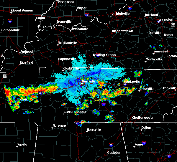 At 838 pm cdt, a severe thunderstorm was located near murfreesboro, moving southeast at 35 mph (radar indicated). Hazards include 60 mph wind gusts and quarter size hail. Hail damage to vehicles is expected. expect wind damage to roofs, siding and trees. dime to quarter size hail has been reported around murfreesboro. Locations impacted include, murfreesboro, walterhill and christiana. At 838 pm cdt, a severe thunderstorm was located near murfreesboro, moving southeast at 35 mph (radar indicated). Hazards include 60 mph wind gusts and quarter size hail. Hail damage to vehicles is expected. expect wind damage to roofs, siding and trees. dime to quarter size hail has been reported around murfreesboro. Locations impacted include, murfreesboro, walterhill and christiana.
|
| 6/23/2015 8:30 PM CDT |
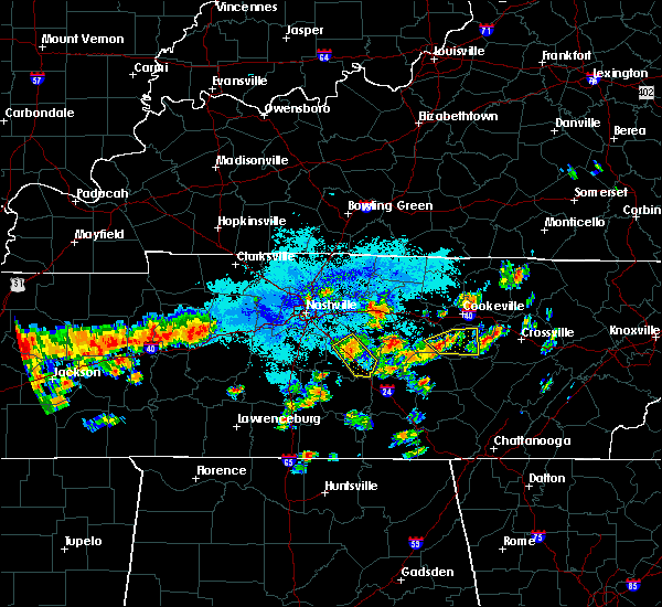 At 829 pm cdt, a severe thunderstorm was located over murfreesboro, moving southeast at 45 mph (radar indicated). Hazards include 60 mph wind gusts and quarter size hail. Hail damage to vehicles is expected. expect wind damage to roofs, siding and trees. This severe thunderstorm will remain over mainly rural areas of central rutherford county, including the following locations, christiana. At 829 pm cdt, a severe thunderstorm was located over murfreesboro, moving southeast at 45 mph (radar indicated). Hazards include 60 mph wind gusts and quarter size hail. Hail damage to vehicles is expected. expect wind damage to roofs, siding and trees. This severe thunderstorm will remain over mainly rural areas of central rutherford county, including the following locations, christiana.
|
| 6/23/2015 8:17 PM CDT |
 At 816 pm cdt, a severe thunderstorm was located near murfreesboro, moving southeast at 20 mph (radar indicated). Hazards include 60 mph wind gusts and quarter size hail. Hail damage to vehicles is expected. expect wind damage to roofs, siding and trees. this severe thunderstorm will be near, murfreesboro around 820 pm cdt. Other locations impacted by this severe thunderstorm include christiana and fosterville. At 816 pm cdt, a severe thunderstorm was located near murfreesboro, moving southeast at 20 mph (radar indicated). Hazards include 60 mph wind gusts and quarter size hail. Hail damage to vehicles is expected. expect wind damage to roofs, siding and trees. this severe thunderstorm will be near, murfreesboro around 820 pm cdt. Other locations impacted by this severe thunderstorm include christiana and fosterville.
|
| 6/23/2015 8:02 PM CDT |
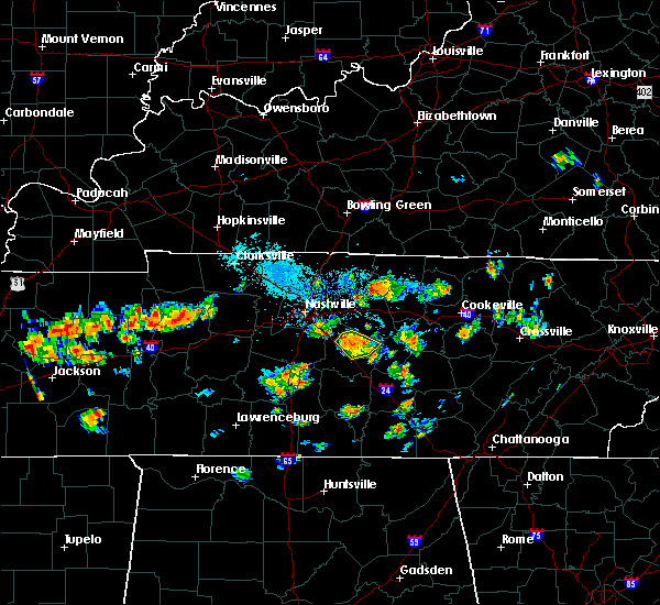 At 801 pm cdt, a severe thunderstorm was located over murfreesboro, moving southeast at 25 mph (radar indicated). Hazards include 60 mph wind gusts and quarter size hail. Hail damage to vehicles is expected. expect wind damage to roofs, siding and trees. This severe thunderstorm will remain over mainly rural areas of central rutherford county, including the following locations, lascassas. At 801 pm cdt, a severe thunderstorm was located over murfreesboro, moving southeast at 25 mph (radar indicated). Hazards include 60 mph wind gusts and quarter size hail. Hail damage to vehicles is expected. expect wind damage to roofs, siding and trees. This severe thunderstorm will remain over mainly rural areas of central rutherford county, including the following locations, lascassas.
|
| 6/23/2015 7:46 PM CDT |
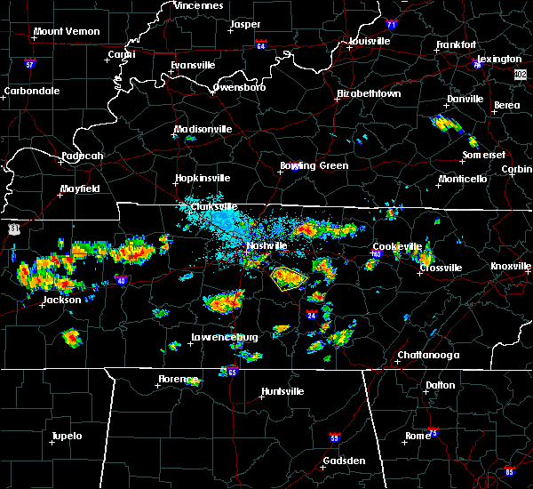 At 745 pm cdt, a severe thunderstorm was located over walterhill, or near murfreesboro, moving southeast at 25 mph (radar indicated). Hazards include 60 mph wind gusts and quarter size hail. Hail damage to vehicles is expected. expect wind damage to roofs, siding and trees. this severe thunderstorm will be near, murfreesboro around 755 pm cdt. Other locations impacted by this severe thunderstorm include lascassas. At 745 pm cdt, a severe thunderstorm was located over walterhill, or near murfreesboro, moving southeast at 25 mph (radar indicated). Hazards include 60 mph wind gusts and quarter size hail. Hail damage to vehicles is expected. expect wind damage to roofs, siding and trees. this severe thunderstorm will be near, murfreesboro around 755 pm cdt. Other locations impacted by this severe thunderstorm include lascassas.
|
| 6/23/2015 7:32 PM CDT |
 At 731 pm cdt, a severe thunderstorm was located near murfreesboro, moving southeast at 15 mph (radar indicated). Hazards include 60 mph wind gusts and quarter size hail. Hail damage to vehicles is expected. expect wind damage to roofs, siding and trees. This severe thunderstorm will remain over mainly rural areas of central rutherford county, including the following locations, lascassas. At 731 pm cdt, a severe thunderstorm was located near murfreesboro, moving southeast at 15 mph (radar indicated). Hazards include 60 mph wind gusts and quarter size hail. Hail damage to vehicles is expected. expect wind damage to roofs, siding and trees. This severe thunderstorm will remain over mainly rural areas of central rutherford county, including the following locations, lascassas.
|
| 6/23/2015 7:13 PM CDT |
 At 712 pm cdt, a severe thunderstorm was located near walterhill, or 8 miles north of murfreesboro, moving south at 20 mph (radar indicated). Hazards include 60 mph wind gusts and quarter size hail. Hail damage to vehicles is expected. expect wind damage to roofs, siding and trees. this severe thunderstorm will be near, murfreesboro around 735 pm cdt. Other locations impacted by this severe thunderstorm include lascassas. At 712 pm cdt, a severe thunderstorm was located near walterhill, or 8 miles north of murfreesboro, moving south at 20 mph (radar indicated). Hazards include 60 mph wind gusts and quarter size hail. Hail damage to vehicles is expected. expect wind damage to roofs, siding and trees. this severe thunderstorm will be near, murfreesboro around 735 pm cdt. Other locations impacted by this severe thunderstorm include lascassas.
|
| 6/8/2015 4:58 PM CDT | At 456 pm cdt, a severe thunderstorm was located 5 miles southeast of nolensville, and moving east at 30 mph (radar indicated). Hazards include 60 mph wind gusts and quarter size hail. Hail damage to vehicles is expected. expect wind damage to roofs, siding and trees. the severe thunderstorm will be near, smyrna around 505 pm cdt. Murfreesboro and walterhill around 515 pm cdt. |
| 6/8/2015 4:39 PM CDT | At 437 pm cdt, a severe thunderstorm was located 5 miles southeast of franklin, and moving east at 30 mph (radar indicated). Hazards include 60 mph wind gusts and quarter size hail. Hail damage to vehicles is expected. expect wind damage to roofs, siding and trees. the severe thunderstorm will be near, nolensville around 450 pm cdt. smyrna around 505 pm cdt. murfreesboro and walterhill around 515 pm cdt. Other locations in the warning include triune. |
| 4/19/2015 4:42 PM CDT | A severe thunderstorm warning remains in effect for eastern wilson. southern trousdale. western smith and north central rutherford counties until 500 pm cdt. at 440 pm cdt. severe thunderstorms were located along a line extending from lebanon to walterhill. And moving northeast at 45 mph. |
| 4/19/2015 4:29 PM CDT | At 427 pm cdt, severe thunderstorms were located along a line extending from belinda city to 5 miles northwest of murfreesboro, and moving northeast at 45 mph (radar indicated). Hazards include 60 mph wind gusts and penny size hail. Expect damage to roofs. siding and trees. severe thunderstorms will be near, lebanon and walterhill around 435 pm cdt. watertown around 455 pm cdt. other locations in the warning include cedars of lebanon state park, lascassas, dickerson chapel recreation area, tuckers crossroads and dixon springs. 0. 75in. |
| 4/10/2015 2:39 AM CDT | A severe thunderstorm warning remains in effect for northeastern maury. southeastern davidson. western wilson. eastern williamson and northwestern rutherford counties until 300 am cdt. at 238 am cdt. severe thunderstorms were located along a line extending from nolensville to spring hill. And moving northeast at 60 mph. |
| 4/10/2015 2:23 AM CDT | The national weather service in nashville has issued a * severe thunderstorm warning for. southern davidson county in middle tennessee. northern maury county in middle tennessee. northwestern rutherford county in middle tennessee. Williamson county in middle tennessee. |
| 4/3/2015 5:54 PM CDT | A severe thunderstorm warning remains in effect for southeastern davidson. eastern williamson and western rutherford counties until 615 pm cdt. at 551 pm cdt. a severe thunderstorm was located near nolensville. and moving east at 45 mph. hazard. 60 mph wind gusts and quarter size hail. |
| 4/3/2015 5:40 PM CDT | The national weather service in nashville has issued a * severe thunderstorm warning for. northern cannon county in middle tennessee. south central de kalb county in middle tennessee. northeastern rutherford county in middle tennessee. Southern wilson county in middle tennessee. |
| 4/3/2015 5:28 PM CDT | The national weather service in nashville has issued a * severe thunderstorm warning for. southern davidson county in middle tennessee. rutherford county in middle tennessee. williamson county in middle tennessee. Until 615 pm cdt. |
| 4/4/2014 6:26 AM CDT | Telephone poles snapped at the 1400 block of west jefferson pike in walterhil in rutherford county TN, 0.8 miles E of Walterhill, TN |
| 12/21/2013 10:11 PM CST | Large tree down in vine area blocking southbound lane of hwy 23 in wilson county TN, 6.2 miles SSW of Walterhill, TN |
| 7/10/2013 6:30 PM CDT | 4 trees reported blown down across the county in rutherford county TN, 0.8 miles E of Walterhill, TN |
| 7/10/2013 6:20 PM CDT | Tree down on rocky hill road in walterhill in rutherford county TN, 1.5 miles SSW of Walterhill, TN |
| 5/19/2013 4:12 PM CDT | Quarter sized hail reported 5.4 miles W of Walterhill, TN, quarter size hail was reported in milton. |
| 1/30/2013 3:51 AM CST | Trees down along hickory grove road in walterhill in rutherford county TN, 2.4 miles SE of Walterhill, TN |
| 1/1/0001 12:00 AM | Emergency mgr reported possible tornado damage at n36.02 and w86.28 near cedars of lebanon state park. damage length of 3/4 mile. some roof damage and mobile home damag in rutherford county TN, 5.4 miles W of Walterhill, TN |
| 1/1/0001 12:00 AM | Golf Ball sized hail reported 1.6 miles WNW of Walterhill, TN |
Hail Maps for Walterhill, TN


Connect with Interactive Hail Maps