

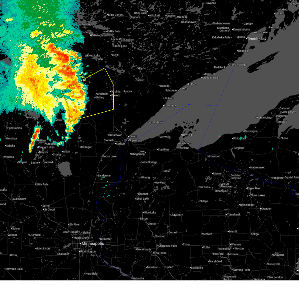
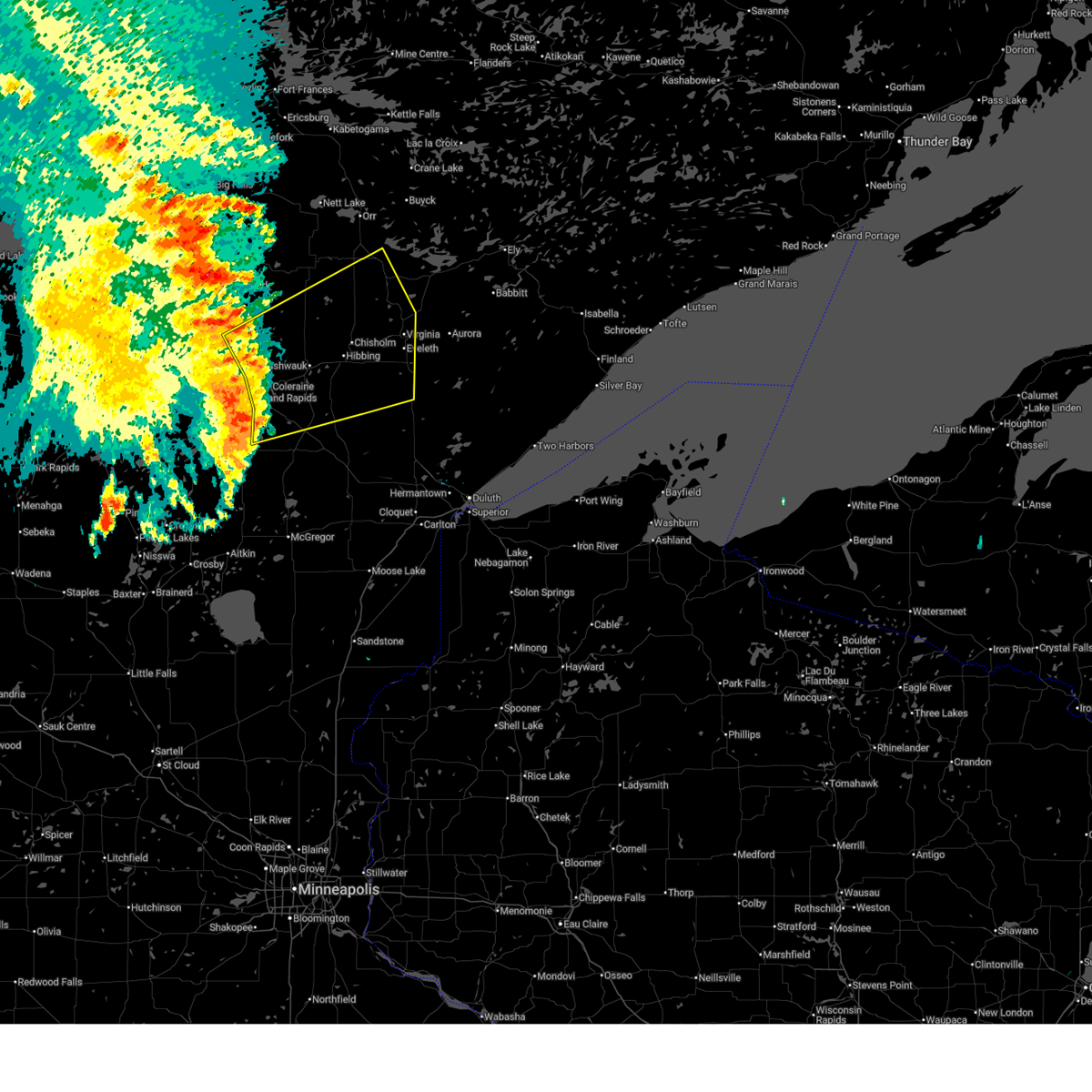
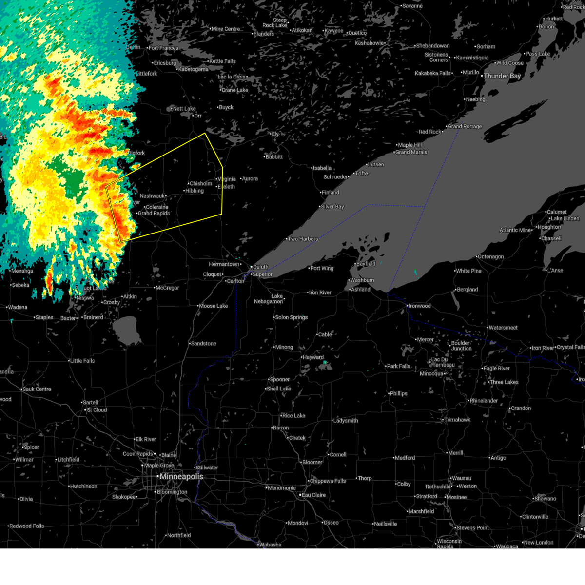
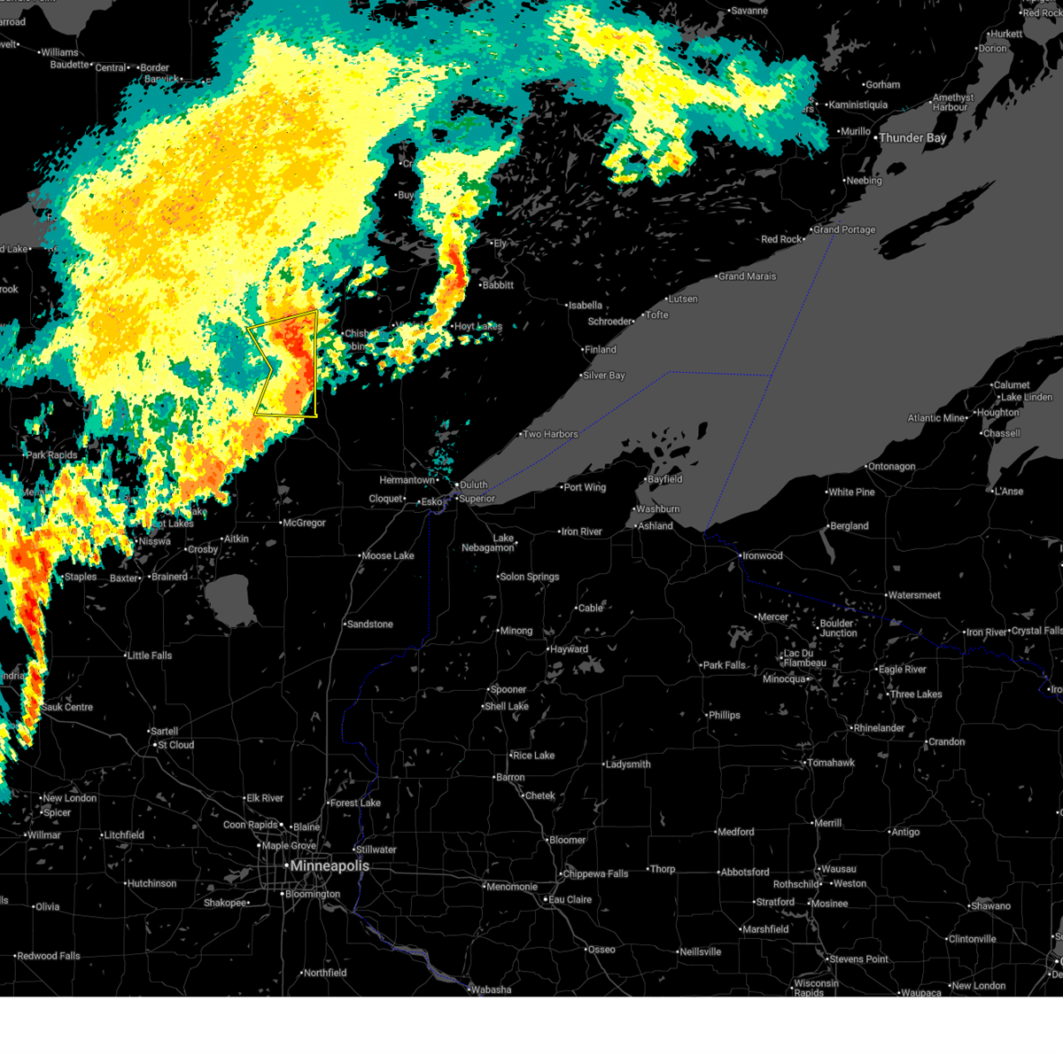
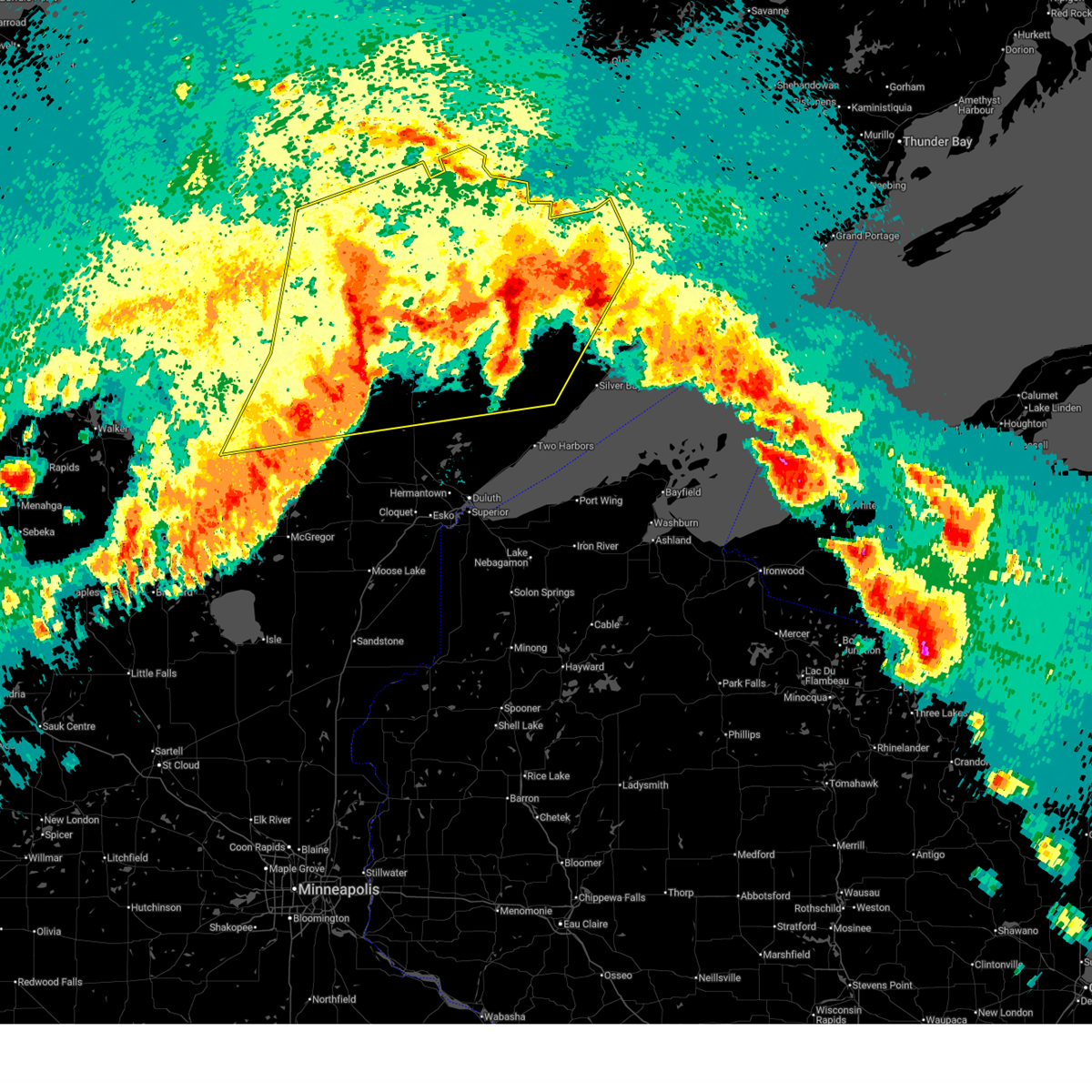
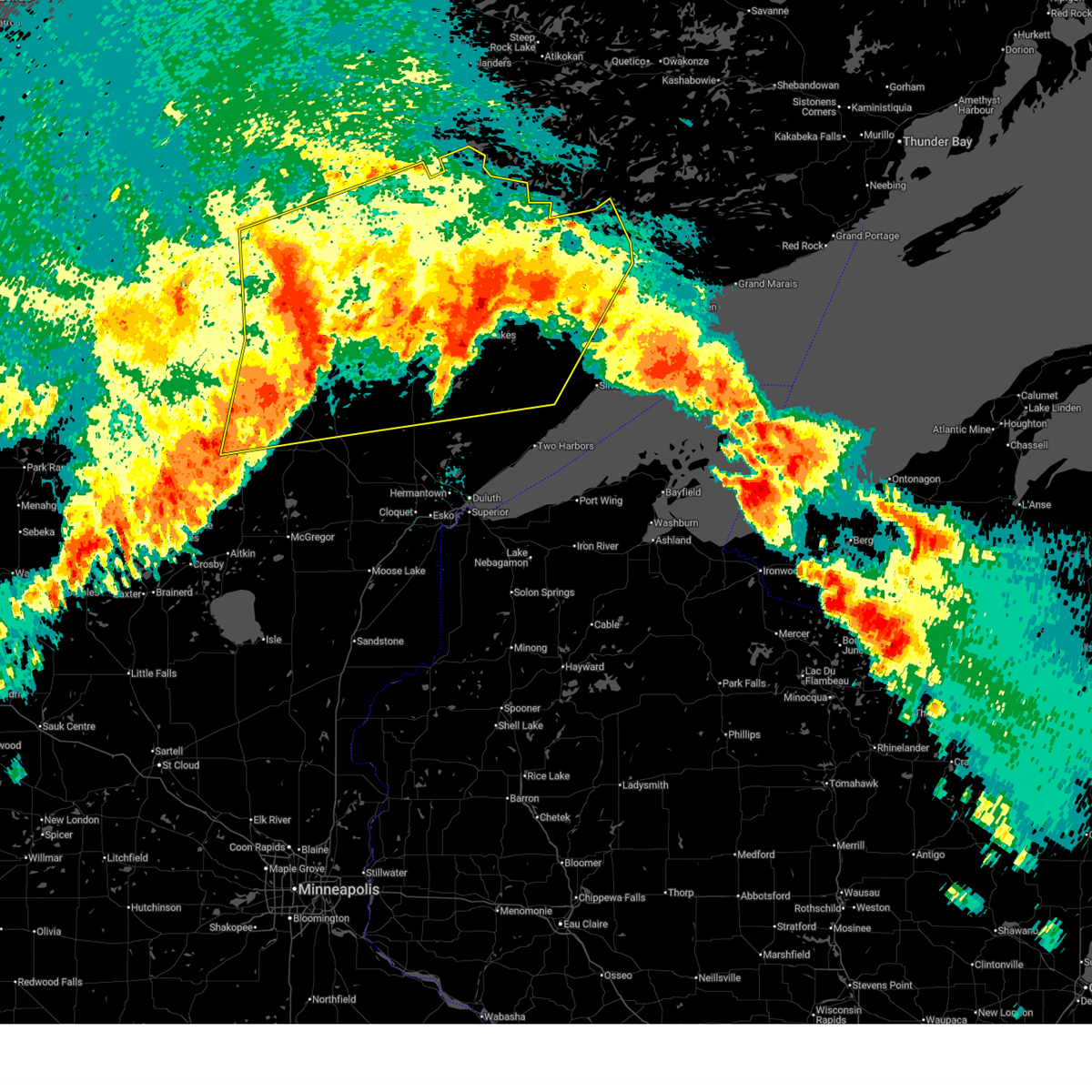
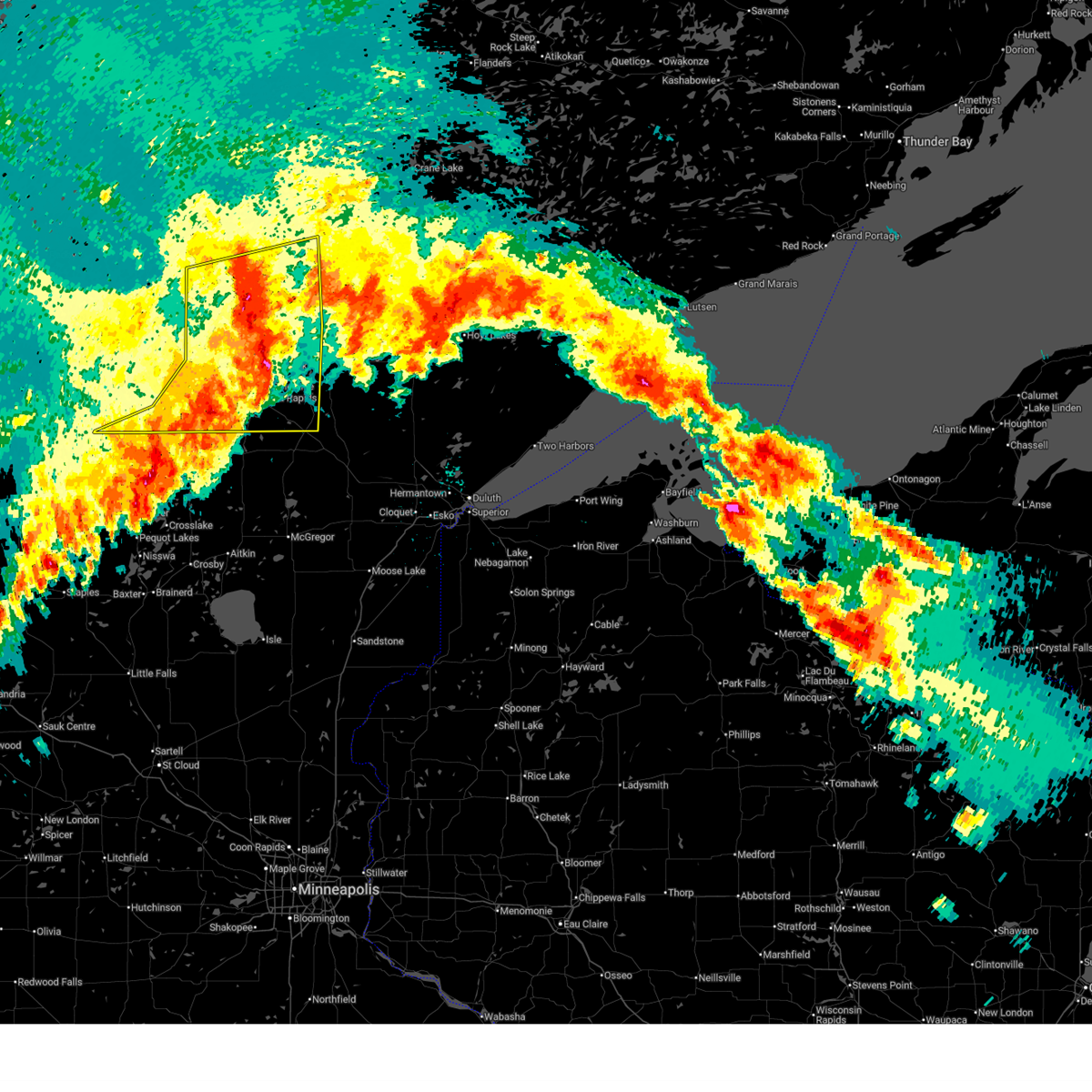
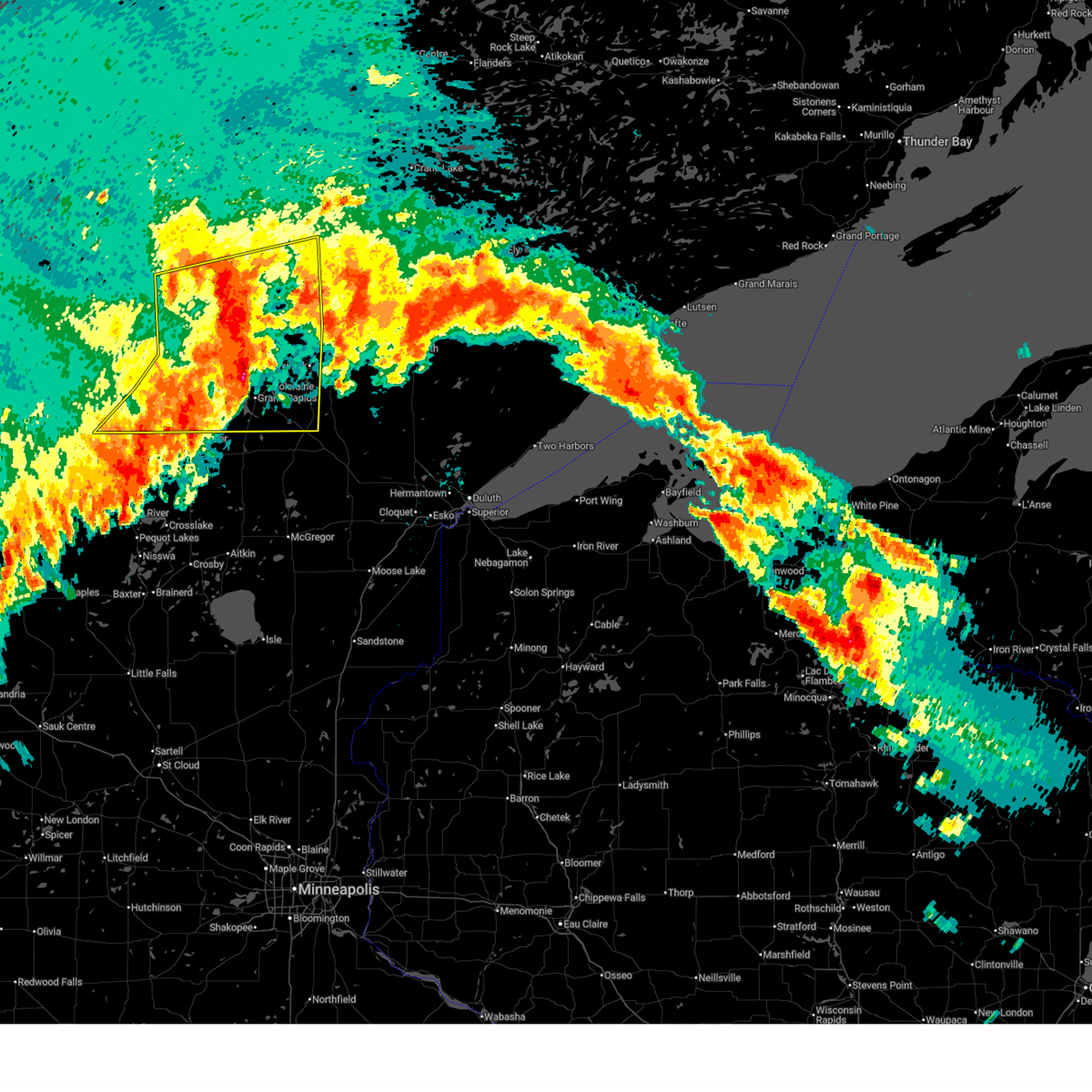
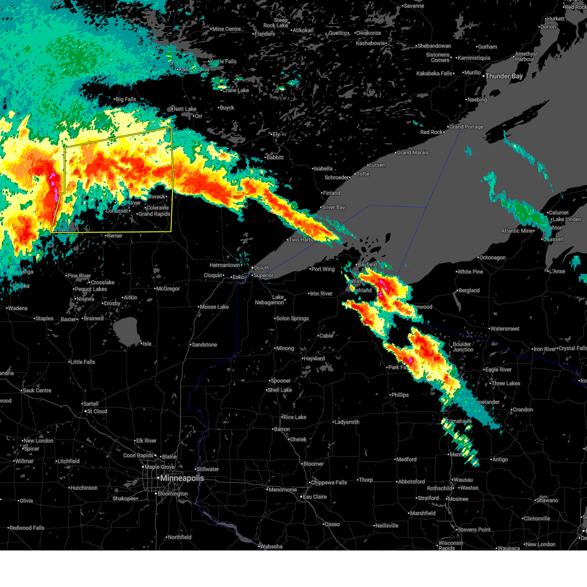
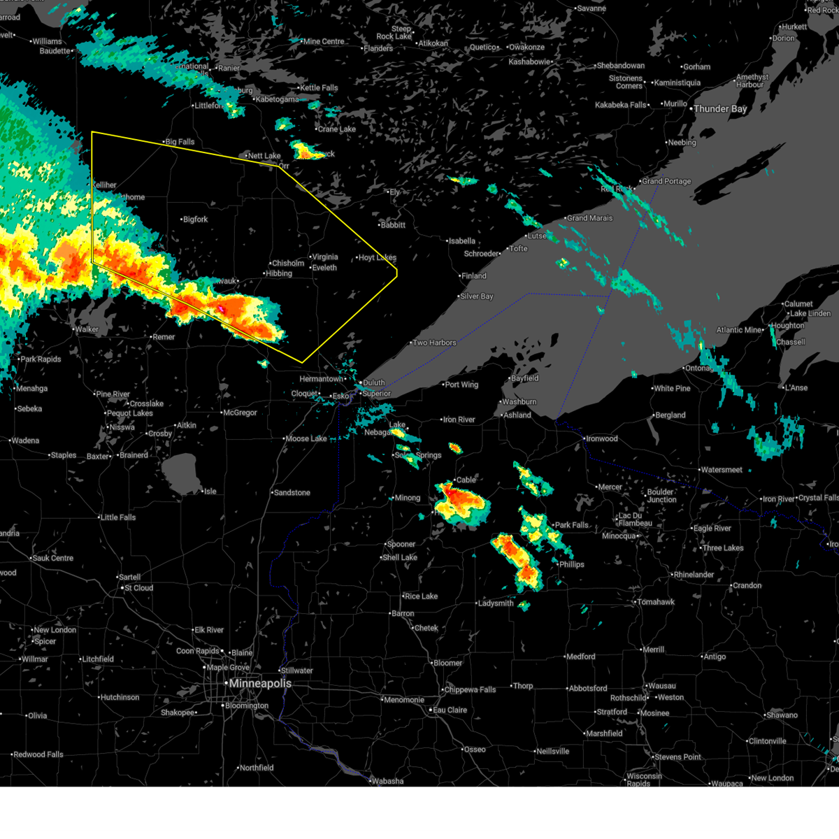
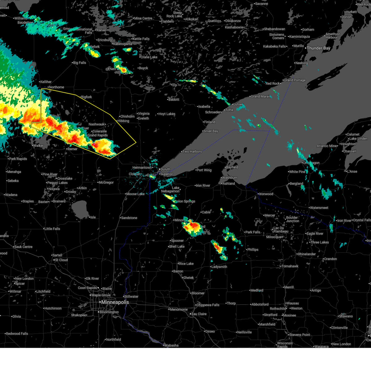
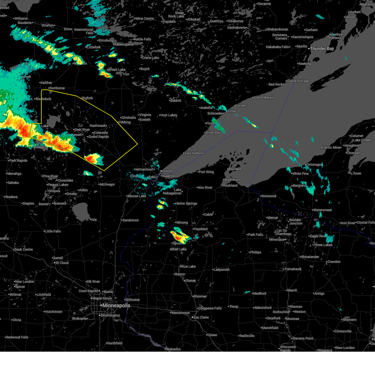
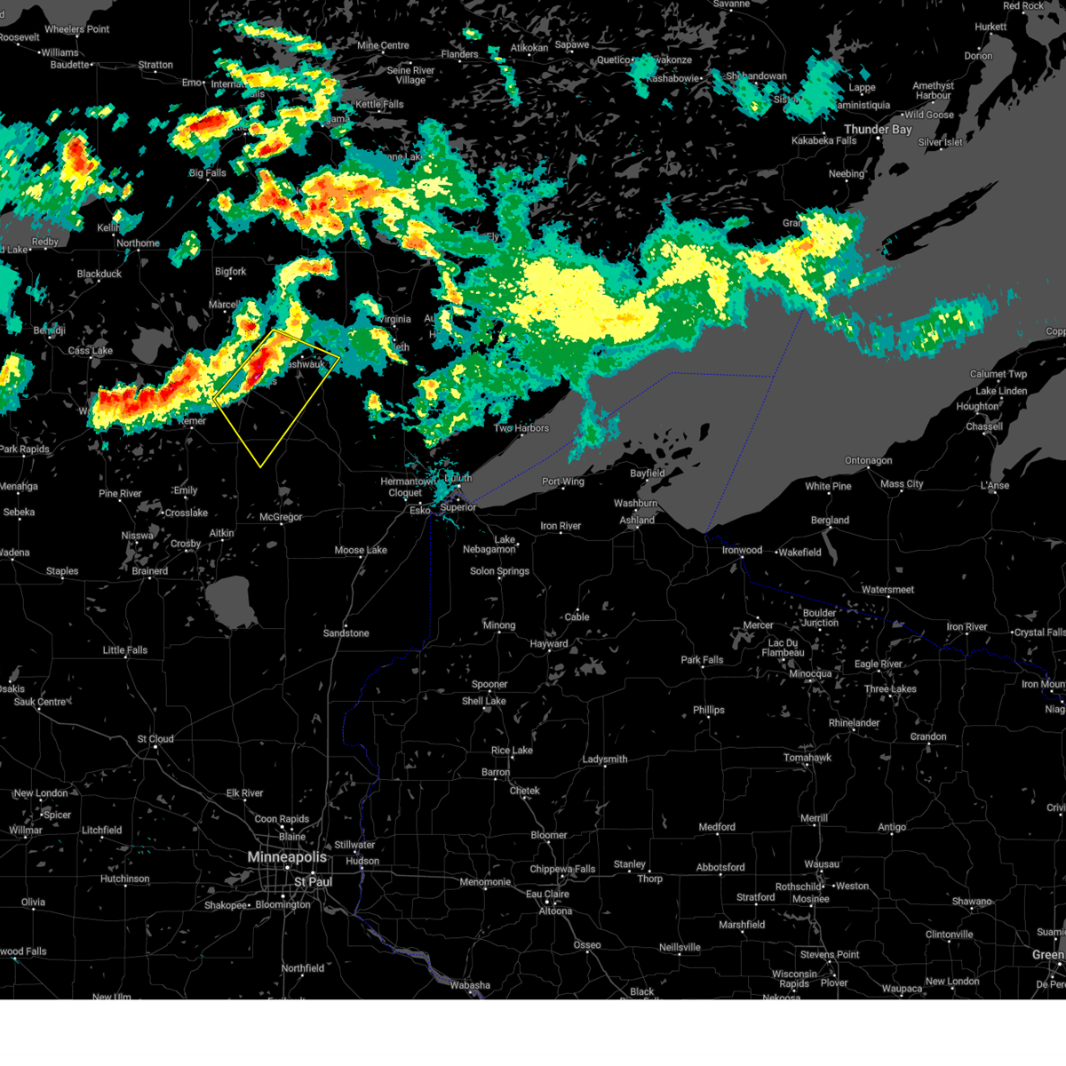
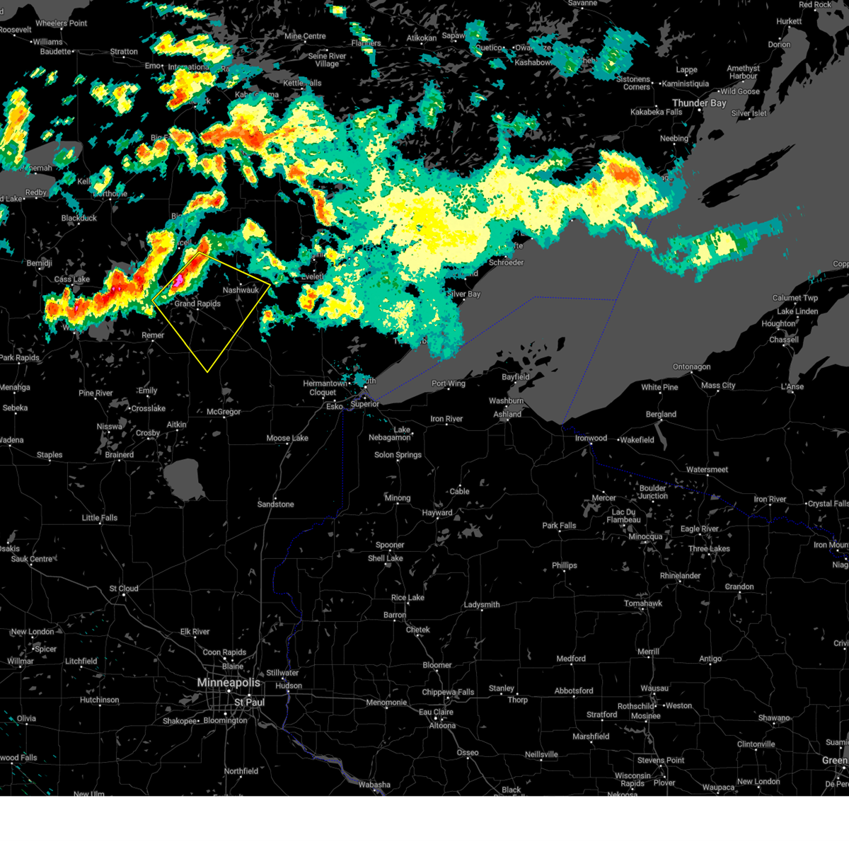
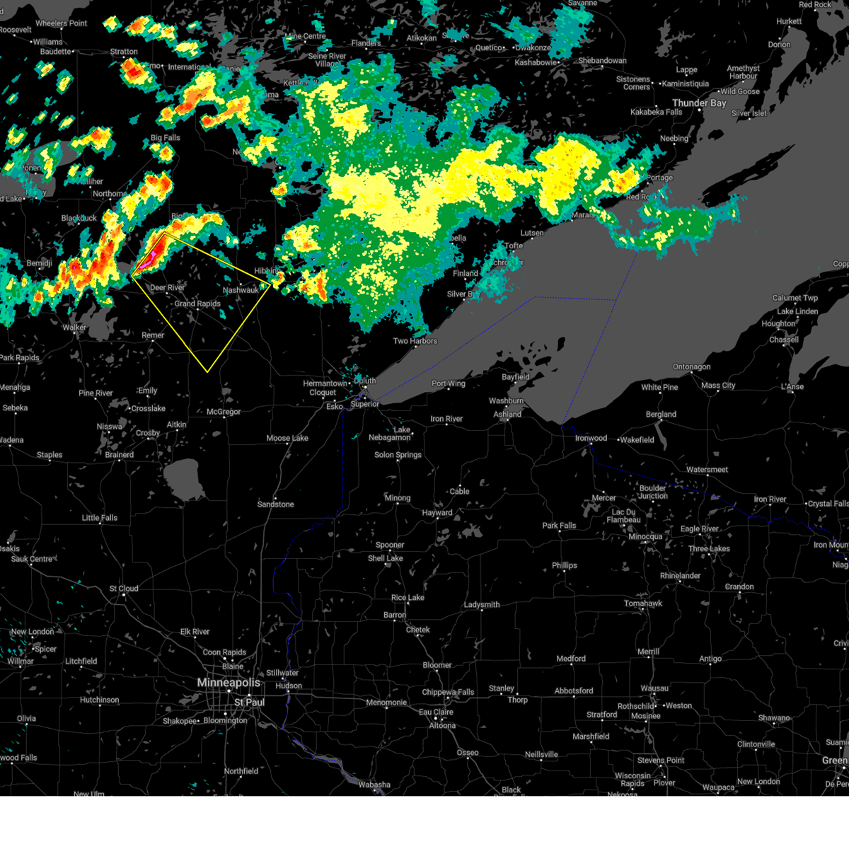
Hail Map for Warba, MN
The Warba, MN area has had 4 reports of on-the-ground hail by trained spotters, and has been under severe weather warnings 29 times during the past 12 months. Doppler radar has detected hail at or near Warba, MN on 34 occasions, including 4 occasions during the past year.
| Name: | Warba, MN |
| Where Located: | 60.6 miles WNW of Duluth, MN |
| Map: | Google Map for Warba, MN |
| Population: | 181 |
| Housing Units: | 90 |
| More Info: | Search Google for Warba, MN |
1
The Top Recent Hail Date for Warba, MN is Friday, July 11, 2025 (11th out of 34)
Hail and Wind Damage Spotted near Warba, MN
| Date / Time | Report Details |
|---|---|
| 7/27/2025 6:14 AM CDT |
 At 614 am cdt, a severe thunderstorm was located near deer river, or 14 miles northwest of grand rapids, moving east at 45 mph (radar indicated). Hazards include 70 mph wind gusts and quarter size hail. Hail damage to vehicles is expected. expect considerable tree damage. wind damage is also likely to mobile homes, roofs, and outbuildings. Locations impacted include, taconite, nashwauk, keewatin, hibbing and chisholm. At 614 am cdt, a severe thunderstorm was located near deer river, or 14 miles northwest of grand rapids, moving east at 45 mph (radar indicated). Hazards include 70 mph wind gusts and quarter size hail. Hail damage to vehicles is expected. expect considerable tree damage. wind damage is also likely to mobile homes, roofs, and outbuildings. Locations impacted include, taconite, nashwauk, keewatin, hibbing and chisholm.
|
| 7/27/2025 5:55 AM CDT |
 Svrdlh the national weather service in duluth mn has issued a * severe thunderstorm warning for, itasca county in north central minnesota, northeastern cass county in north central minnesota, west central st. louis county in northeastern minnesota, * until 700 am cdt. * at 554 am cdt, a severe thunderstorm was located near bena, or 28 miles west of grand rapids, moving east at 45 mph (radar indicated). Hazards include 70 mph wind gusts and half dollar size hail. Hail damage to vehicles is expected. expect considerable tree damage. wind damage is also likely to mobile homes, roofs, and outbuildings. this severe thunderstorm will be near, ball club around 600 am cdt. deer river and zemple around 610 am cdt. Other locations in the path of this severe thunderstorm include taconite, nashwauk, hibbing and keewatin. Svrdlh the national weather service in duluth mn has issued a * severe thunderstorm warning for, itasca county in north central minnesota, northeastern cass county in north central minnesota, west central st. louis county in northeastern minnesota, * until 700 am cdt. * at 554 am cdt, a severe thunderstorm was located near bena, or 28 miles west of grand rapids, moving east at 45 mph (radar indicated). Hazards include 70 mph wind gusts and half dollar size hail. Hail damage to vehicles is expected. expect considerable tree damage. wind damage is also likely to mobile homes, roofs, and outbuildings. this severe thunderstorm will be near, ball club around 600 am cdt. deer river and zemple around 610 am cdt. Other locations in the path of this severe thunderstorm include taconite, nashwauk, hibbing and keewatin.
|
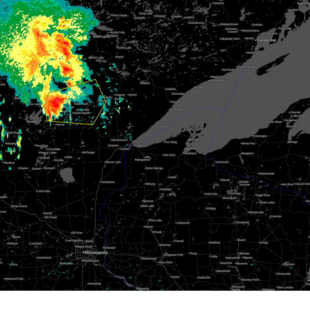
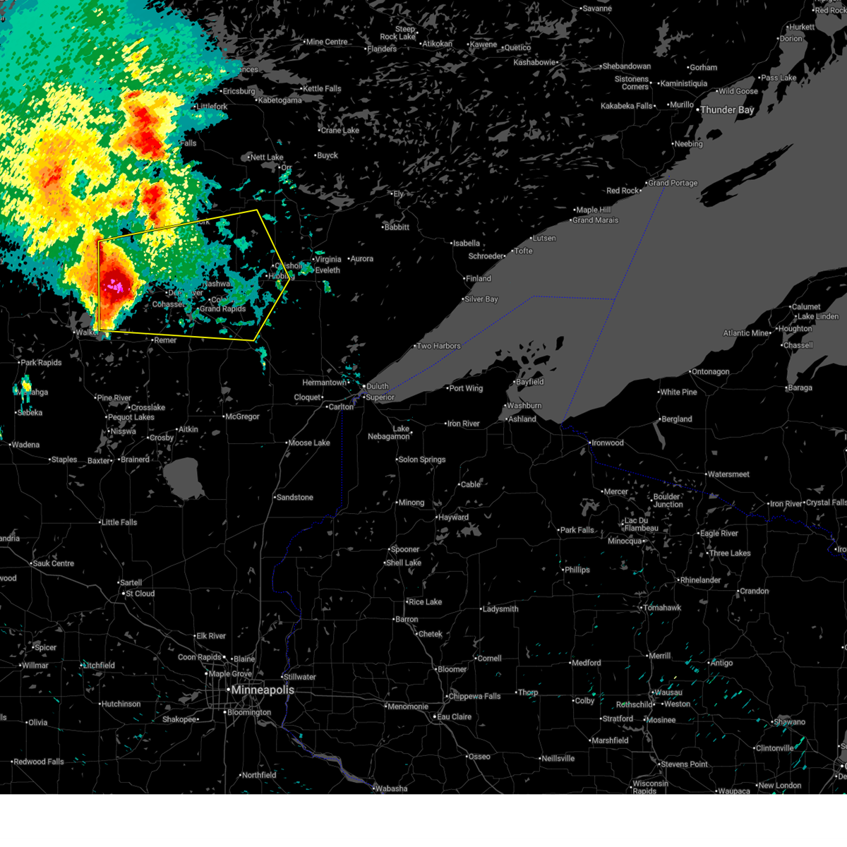
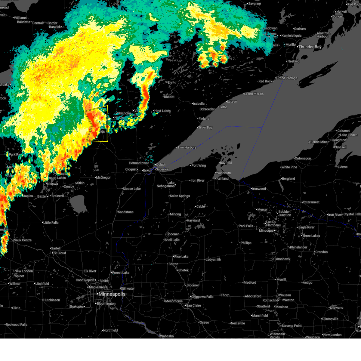
| 7/23/2025 8:45 AM CDT |
 At 844 am cdt, a severe thunderstorm was located near warba, or 17 miles east of grand rapids, moving east at 35 mph (emergency management reported several trees down near the community of blackberry in southeast itasca county). Hazards include 60 mph wind gusts and penny size hail. Expect damage to roofs, siding, and trees. Locations impacted include, hibbing, warba, toivola, meadowlands, hart lake, goodland, elmer, swan lake, kelsey, payne, silica, little swan, floodwood lake, and zim. At 844 am cdt, a severe thunderstorm was located near warba, or 17 miles east of grand rapids, moving east at 35 mph (emergency management reported several trees down near the community of blackberry in southeast itasca county). Hazards include 60 mph wind gusts and penny size hail. Expect damage to roofs, siding, and trees. Locations impacted include, hibbing, warba, toivola, meadowlands, hart lake, goodland, elmer, swan lake, kelsey, payne, silica, little swan, floodwood lake, and zim.
|
| 7/23/2025 8:37 AM CDT |
 Svrdlh the national weather service in duluth mn has issued a * severe thunderstorm warning for, southeastern itasca county in north central minnesota, southwestern st. louis county in northeastern minnesota, * until 915 am cdt. * at 836 am cdt, a severe thunderstorm was located near warba, or 13 miles east of grand rapids, moving east at 40 mph (radar indicated). Hazards include 60 mph wind gusts and penny size hail. expect damage to roofs, siding, and trees Svrdlh the national weather service in duluth mn has issued a * severe thunderstorm warning for, southeastern itasca county in north central minnesota, southwestern st. louis county in northeastern minnesota, * until 915 am cdt. * at 836 am cdt, a severe thunderstorm was located near warba, or 13 miles east of grand rapids, moving east at 40 mph (radar indicated). Hazards include 60 mph wind gusts and penny size hail. expect damage to roofs, siding, and trees
|
| 7/22/2025 8:36 AM CDT |
 the severe thunderstorm warning has been cancelled and is no longer in effect the severe thunderstorm warning has been cancelled and is no longer in effect
|
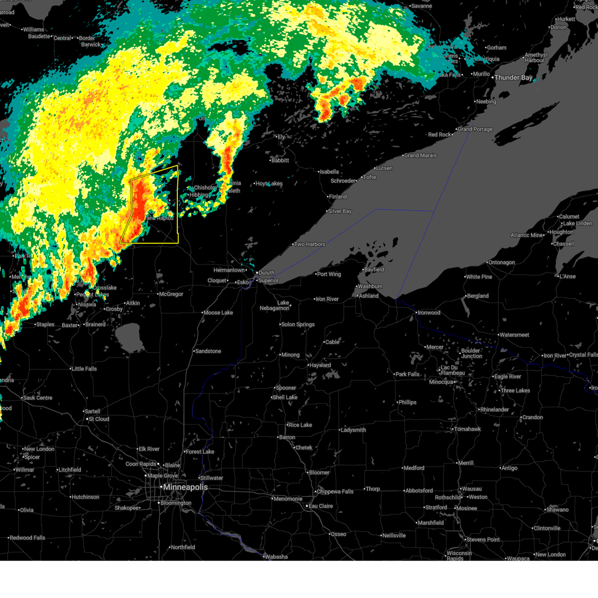
| 7/22/2025 8:23 AM CDT |
 At 822 am cdt, severe thunderstorms were located along a line extending from 6 miles southeast of marcell to 6 miles northwest of taconite to near coleraine to 6 miles southwest of warba, moving northeast at 55 mph (radar indicated). Hazards include 60 mph wind gusts. Expect damage to roofs, siding, and trees. Locations impacted include, hibbing, grand rapids, virginia, chisholm, eveleth, mountain iron, coleraine, gilbert, keewatin, buhl, nashwauk, cherry, cook, taconite, warba, toivola, mccarthy beach state park, pengilly, hill annex mine state park, and gunn. At 822 am cdt, severe thunderstorms were located along a line extending from 6 miles southeast of marcell to 6 miles northwest of taconite to near coleraine to 6 miles southwest of warba, moving northeast at 55 mph (radar indicated). Hazards include 60 mph wind gusts. Expect damage to roofs, siding, and trees. Locations impacted include, hibbing, grand rapids, virginia, chisholm, eveleth, mountain iron, coleraine, gilbert, keewatin, buhl, nashwauk, cherry, cook, taconite, warba, toivola, mccarthy beach state park, pengilly, hill annex mine state park, and gunn.
|
| 7/22/2025 8:23 AM CDT |
 the severe thunderstorm warning has been cancelled and is no longer in effect the severe thunderstorm warning has been cancelled and is no longer in effect
|
| 7/22/2025 8:12 AM CDT |
 Svrdlh the national weather service in duluth mn has issued a * severe thunderstorm warning for, southeastern itasca county in north central minnesota, northern aitkin county in east central minnesota, eastern cass county in north central minnesota, west central st. louis county in northeastern minnesota, * until 915 am cdt. * at 811 am cdt, severe thunderstorms were located along a line extending from 7 miles south of marcell to near cohasset to near grand rapids to near hill city, moving northeast at 55 mph (radar indicated). Hazards include 60 mph wind gusts. expect damage to roofs, siding, and trees Svrdlh the national weather service in duluth mn has issued a * severe thunderstorm warning for, southeastern itasca county in north central minnesota, northern aitkin county in east central minnesota, eastern cass county in north central minnesota, west central st. louis county in northeastern minnesota, * until 915 am cdt. * at 811 am cdt, severe thunderstorms were located along a line extending from 7 miles south of marcell to near cohasset to near grand rapids to near hill city, moving northeast at 55 mph (radar indicated). Hazards include 60 mph wind gusts. expect damage to roofs, siding, and trees
|
| 7/4/2025 9:57 PM CDT |
 The storms which prompted the warning have weakened below severe limits, and have exited the warned area. therefore, the warning will be allowed to expire. however, gusty winds are still possible with these thunderstorms. The storms which prompted the warning have weakened below severe limits, and have exited the warned area. therefore, the warning will be allowed to expire. however, gusty winds are still possible with these thunderstorms.
|
| 7/4/2025 9:42 PM CDT |
 At 941 pm cdt, severe thunderstorms were located along a line extending from 12 miles north of taconite to pengilly to warba, moving east at 45 mph (radar indicated). Hazards include 60 mph wind gusts and penny size hail. Expect damage to roofs, siding, and trees. Locations impacted include, keewatin, nashwauk, taconite, warba, pengilly, hill annex mine state park, blackberry, bovey, marble, hart lake, goodland, calumet, swan lake, buck lake, lawrence lake, and balsam lake. At 941 pm cdt, severe thunderstorms were located along a line extending from 12 miles north of taconite to pengilly to warba, moving east at 45 mph (radar indicated). Hazards include 60 mph wind gusts and penny size hail. Expect damage to roofs, siding, and trees. Locations impacted include, keewatin, nashwauk, taconite, warba, pengilly, hill annex mine state park, blackberry, bovey, marble, hart lake, goodland, calumet, swan lake, buck lake, lawrence lake, and balsam lake.
|
| 7/4/2025 9:29 PM CDT |
 the severe thunderstorm warning has been cancelled and is no longer in effect the severe thunderstorm warning has been cancelled and is no longer in effect
|
| 7/4/2025 9:29 PM CDT |
 At 928 pm cdt, severe thunderstorms were located along a line extending from 11 miles southeast of marcell to coleraine to 8 miles south of gunn, moving east at 40 mph (radar indicated). Hazards include 60 mph wind gusts and penny size hail. Expect damage to roofs, siding, and trees. Locations impacted include, nashwauk, taconite, warba, hill annex mine state park, pengilly, keewatin and swan river. At 928 pm cdt, severe thunderstorms were located along a line extending from 11 miles southeast of marcell to coleraine to 8 miles south of gunn, moving east at 40 mph (radar indicated). Hazards include 60 mph wind gusts and penny size hail. Expect damage to roofs, siding, and trees. Locations impacted include, nashwauk, taconite, warba, hill annex mine state park, pengilly, keewatin and swan river.
|
| 7/4/2025 9:12 PM CDT |
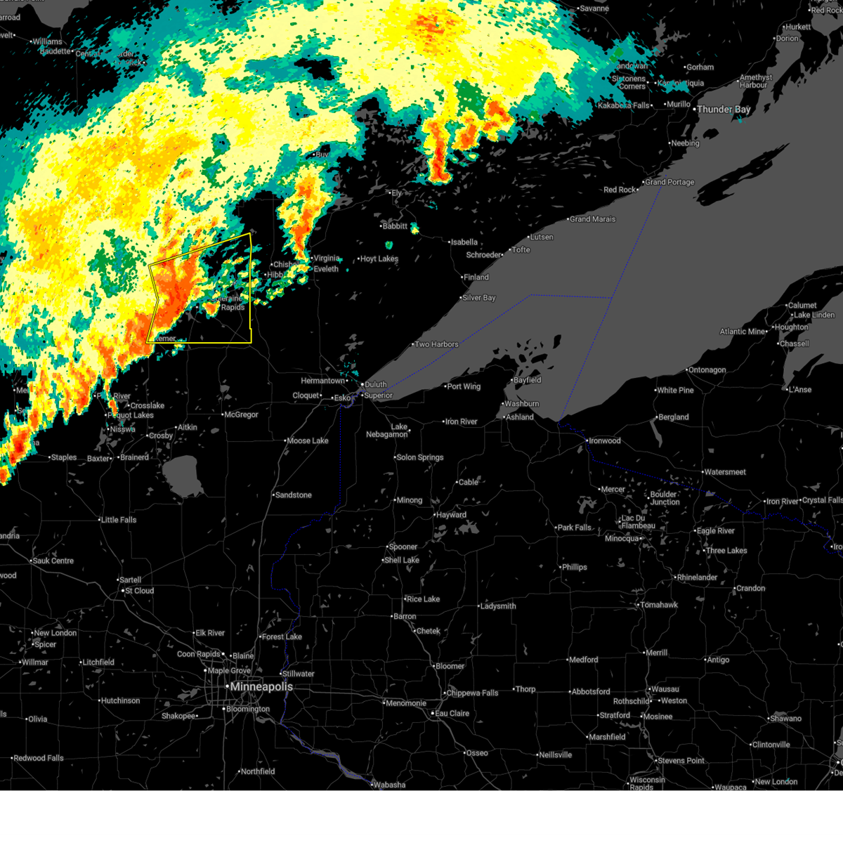 Svrdlh the national weather service in duluth mn has issued a * severe thunderstorm warning for, southeastern itasca county in north central minnesota, east central cass county in north central minnesota, * until 1000 pm cdt. * at 912 pm cdt, severe thunderstorms were located along a line extending from 7 miles south of marcell to near cohasset to 6 miles east of remer, moving east at 45 mph (radar indicated). Hazards include 60 mph wind gusts and penny size hail. Expect damage to roofs, siding, and trees. severe thunderstorms will be near, grand rapids, cohasset, coleraine, taconite, pokegama dam, and pokegama lake around 915 pm cdt. gunn around 920 pm cdt. nashwauk and hill annex mine state park around 930 pm cdt. Other locations in the path of these severe thunderstorms include pengilly, keewatin and warba. Svrdlh the national weather service in duluth mn has issued a * severe thunderstorm warning for, southeastern itasca county in north central minnesota, east central cass county in north central minnesota, * until 1000 pm cdt. * at 912 pm cdt, severe thunderstorms were located along a line extending from 7 miles south of marcell to near cohasset to 6 miles east of remer, moving east at 45 mph (radar indicated). Hazards include 60 mph wind gusts and penny size hail. Expect damage to roofs, siding, and trees. severe thunderstorms will be near, grand rapids, cohasset, coleraine, taconite, pokegama dam, and pokegama lake around 915 pm cdt. gunn around 920 pm cdt. nashwauk and hill annex mine state park around 930 pm cdt. Other locations in the path of these severe thunderstorms include pengilly, keewatin and warba.
|
| 6/23/2025 3:02 AM CDT |
 Svrdlh the national weather service in duluth mn has issued a * severe thunderstorm warning for, southeastern itasca county in north central minnesota, northeastern aitkin county in east central minnesota, southern st. louis county in northeastern minnesota, carlton county in northeastern minnesota, * until 400 am cdt. * at 301 am cdt, severe thunderstorms were located along a line extending from near hill city to jacobson to near cromwell to 8 miles west of kettle river, moving northeast at 55 mph (radar indicated. wind gusts to 62 mph have been observerd with this storm in aitkin county). Hazards include 70 mph wind gusts and quarter size hail. Hail damage to vehicles is expected. expect considerable tree damage. wind damage is also likely to mobile homes, roofs, and outbuildings. severe thunderstorms will be near, swan river, cromwell, kettle river, jacobson, and savanna portage state park around 305 am cdt. floodwood, warba, fond du lac band sawyer area, and fond du lac band brookston area around 310 am cdt. cloquet, mahtowa, brookston, meadowlands, and fond du lac band cloquet area around 320 am cdt. Other locations in the path of these severe thunderstorms include toivola, scanlon, carlton, saginaw, hibbing, hermantown, thomson, canyon, pike lake near duluth, jay cooke state park, proctor, cotton, island lake, duluth, city of rice lake and boulder lake. Svrdlh the national weather service in duluth mn has issued a * severe thunderstorm warning for, southeastern itasca county in north central minnesota, northeastern aitkin county in east central minnesota, southern st. louis county in northeastern minnesota, carlton county in northeastern minnesota, * until 400 am cdt. * at 301 am cdt, severe thunderstorms were located along a line extending from near hill city to jacobson to near cromwell to 8 miles west of kettle river, moving northeast at 55 mph (radar indicated. wind gusts to 62 mph have been observerd with this storm in aitkin county). Hazards include 70 mph wind gusts and quarter size hail. Hail damage to vehicles is expected. expect considerable tree damage. wind damage is also likely to mobile homes, roofs, and outbuildings. severe thunderstorms will be near, swan river, cromwell, kettle river, jacobson, and savanna portage state park around 305 am cdt. floodwood, warba, fond du lac band sawyer area, and fond du lac band brookston area around 310 am cdt. cloquet, mahtowa, brookston, meadowlands, and fond du lac band cloquet area around 320 am cdt. Other locations in the path of these severe thunderstorms include toivola, scanlon, carlton, saginaw, hibbing, hermantown, thomson, canyon, pike lake near duluth, jay cooke state park, proctor, cotton, island lake, duluth, city of rice lake and boulder lake.
|
| 6/23/2025 2:52 AM CDT |
 At 251 am cdt, severe thunderstorms were located along a line extending from near hill city to near libby to near tamarack, moving northeast at 55 mph (wind gusts to 62 mph in aitkin county have been observed on surface observation equipment). Hazards include 70 mph wind gusts and quarter size hail. Hail damage to vehicles is expected. expect considerable tree damage. wind damage is also likely to mobile homes, roofs, and outbuildings. Locations impacted include, grand rapids, big sandy lake, mille lacs lake, cohasset, aitkin, coleraine, emily, swan river, hill city, mcgregor, taconite, malmo, warba, palisade, tamarack, libby, outing, mille lacs band east lake area, savanna portage state park, and pokegama dam. At 251 am cdt, severe thunderstorms were located along a line extending from near hill city to near libby to near tamarack, moving northeast at 55 mph (wind gusts to 62 mph in aitkin county have been observed on surface observation equipment). Hazards include 70 mph wind gusts and quarter size hail. Hail damage to vehicles is expected. expect considerable tree damage. wind damage is also likely to mobile homes, roofs, and outbuildings. Locations impacted include, grand rapids, big sandy lake, mille lacs lake, cohasset, aitkin, coleraine, emily, swan river, hill city, mcgregor, taconite, malmo, warba, palisade, tamarack, libby, outing, mille lacs band east lake area, savanna portage state park, and pokegama dam.
|
| 6/23/2025 2:37 AM CDT |
 At 236 am cdt, severe thunderstorms were located along a line extending from near outing to 6 miles west of palisade to 10 miles east of aitkin, moving northeast at 55 mph (radar indicated. brainerd airport reported a 56 mph wind gust shortly after 2 am). Hazards include 60 mph wind gusts and quarter size hail. Hail damage to vehicles is expected. expect wind damage to roofs, siding, and trees. Locations impacted include, palisade, swatara, big sandy lake, mcgregor, mille lacs band east lake area, hill city, libby, savanna portage state park, tamarack, jacobson, swan river and warba. At 236 am cdt, severe thunderstorms were located along a line extending from near outing to 6 miles west of palisade to 10 miles east of aitkin, moving northeast at 55 mph (radar indicated. brainerd airport reported a 56 mph wind gust shortly after 2 am). Hazards include 60 mph wind gusts and quarter size hail. Hail damage to vehicles is expected. expect wind damage to roofs, siding, and trees. Locations impacted include, palisade, swatara, big sandy lake, mcgregor, mille lacs band east lake area, hill city, libby, savanna portage state park, tamarack, jacobson, swan river and warba.
|
| 6/23/2025 2:11 AM CDT |
 Svrdlh the national weather service in duluth mn has issued a * severe thunderstorm warning for, southeastern itasca county in north central minnesota, aitkin county in east central minnesota, east central cass county in north central minnesota, crow wing county in east central minnesota, * until 315 am cdt. * at 210 am cdt, severe thunderstorms were located along a line extending from near pine river to near cuyuna country state park to near garrison, moving northeast at 50 mph (brainerd airport reported a 56 mph wind gust). Hazards include 60 mph wind gusts and quarter size hail. Hail damage to vehicles is expected. expect wind damage to roofs, siding, and trees. severe thunderstorms will be near, mille lacs lake, crosby, crosslake, emily, deerwood, fifty lakes, cuyuna, and garrison around 215 am cdt. aitkin around 220 am cdt. outing around 225 am cdt. Other locations in the path of these severe thunderstorms include remer, palisade, swatara, hill city, mcgregor, big sandy lake, libby, savanna portage state park, grand rapids, cohasset, jacobson and pokegama lake. Svrdlh the national weather service in duluth mn has issued a * severe thunderstorm warning for, southeastern itasca county in north central minnesota, aitkin county in east central minnesota, east central cass county in north central minnesota, crow wing county in east central minnesota, * until 315 am cdt. * at 210 am cdt, severe thunderstorms were located along a line extending from near pine river to near cuyuna country state park to near garrison, moving northeast at 50 mph (brainerd airport reported a 56 mph wind gust). Hazards include 60 mph wind gusts and quarter size hail. Hail damage to vehicles is expected. expect wind damage to roofs, siding, and trees. severe thunderstorms will be near, mille lacs lake, crosby, crosslake, emily, deerwood, fifty lakes, cuyuna, and garrison around 215 am cdt. aitkin around 220 am cdt. outing around 225 am cdt. Other locations in the path of these severe thunderstorms include remer, palisade, swatara, hill city, mcgregor, big sandy lake, libby, savanna portage state park, grand rapids, cohasset, jacobson and pokegama lake.
|
| 6/21/2025 2:36 AM CDT |
 At 235 am cdt, severe thunderstorms were located along a line extending from boundary waters canoe area wilderness to near bear head lake state park to 9 miles northwest of whiteface reservoir, moving east at 80 mph (radar indicated). Hazards include 70 mph wind gusts and penny size hail. Expect considerable tree damage. damage is likely to mobile homes, roofs, and outbuildings. Locations impacted include, hibbing, ely, lake vermilion, virginia, chisholm, eveleth, mountain iron, hoyt lakes, gilbert, aurora, babbitt, keewatin, buhl, nashwauk, biwabik, cherry, swan river, embarrass, cook, and tower. At 235 am cdt, severe thunderstorms were located along a line extending from boundary waters canoe area wilderness to near bear head lake state park to 9 miles northwest of whiteface reservoir, moving east at 80 mph (radar indicated). Hazards include 70 mph wind gusts and penny size hail. Expect considerable tree damage. damage is likely to mobile homes, roofs, and outbuildings. Locations impacted include, hibbing, ely, lake vermilion, virginia, chisholm, eveleth, mountain iron, hoyt lakes, gilbert, aurora, babbitt, keewatin, buhl, nashwauk, biwabik, cherry, swan river, embarrass, cook, and tower.
|
| 6/21/2025 2:36 AM CDT |
 the severe thunderstorm warning has been cancelled and is no longer in effect the severe thunderstorm warning has been cancelled and is no longer in effect
|
| 6/21/2025 2:18 AM CDT |
 At 217 am cdt, severe thunderstorms were located along a line extending from near buyck to 8 miles north of biwabik to 7 miles north of toivola, moving east at 80 mph (radar indicated). Hazards include 70 mph wind gusts and penny size hail. Expect considerable tree damage. damage is likely to mobile homes, roofs, and outbuildings. Locations impacted include, lake vermilion, virginia, eveleth, hoyt lakes, gilbert, aurora, biwabik, embarrass, tower, boundary waters canoe area wilderness near trout lake, babbitt, robinson, birch lake, burntside lake, ely, white iron lake, winton, fall lake, basswood lake, snowbank lake, forest center and isabella. At 217 am cdt, severe thunderstorms were located along a line extending from near buyck to 8 miles north of biwabik to 7 miles north of toivola, moving east at 80 mph (radar indicated). Hazards include 70 mph wind gusts and penny size hail. Expect considerable tree damage. damage is likely to mobile homes, roofs, and outbuildings. Locations impacted include, lake vermilion, virginia, eveleth, hoyt lakes, gilbert, aurora, biwabik, embarrass, tower, boundary waters canoe area wilderness near trout lake, babbitt, robinson, birch lake, burntside lake, ely, white iron lake, winton, fall lake, basswood lake, snowbank lake, forest center and isabella.
|
| 6/21/2025 1:55 AM CDT |
 Svrdlh the national weather service in duluth mn has issued a * severe thunderstorm warning for, eastern itasca county in north central minnesota, north central aitkin county in east central minnesota, southeastern koochiching county in north central minnesota, st. louis county in northeastern minnesota, lake county in northeastern minnesota, * until 300 am cdt. * at 155 am cdt, severe thunderstorms were located along a line extending from 9 miles north of togo to near chisholm to near warba, moving east at 80 mph (radar indicated). Hazards include 70 mph wind gusts and penny size hail. Expect considerable tree damage. damage is likely to mobile homes, roofs, and outbuildings. severe thunderstorms will be near, hibbing, chisholm, keewatin, buhl, nashwauk, meadow brook, warba, and pelican lake around 200 am cdt. mountain iron, cook, orr, and gheen around 205 am cdt. lake vermilion, virginia, eveleth, and cherry around 210 am cdt. gilbert, biwabik, and buyck around 215 am cdt. Other locations in the path of these severe thunderstorms include embarrass, tower, boundary waters canoe area wilderness near trout lake, soudan underground mine state park, hoyt lakes, aurora, babbitt, bear head lake state park, robinson, birch lake, burntside lake, ely, winton, white iron lake and fall lake. Svrdlh the national weather service in duluth mn has issued a * severe thunderstorm warning for, eastern itasca county in north central minnesota, north central aitkin county in east central minnesota, southeastern koochiching county in north central minnesota, st. louis county in northeastern minnesota, lake county in northeastern minnesota, * until 300 am cdt. * at 155 am cdt, severe thunderstorms were located along a line extending from 9 miles north of togo to near chisholm to near warba, moving east at 80 mph (radar indicated). Hazards include 70 mph wind gusts and penny size hail. Expect considerable tree damage. damage is likely to mobile homes, roofs, and outbuildings. severe thunderstorms will be near, hibbing, chisholm, keewatin, buhl, nashwauk, meadow brook, warba, and pelican lake around 200 am cdt. mountain iron, cook, orr, and gheen around 205 am cdt. lake vermilion, virginia, eveleth, and cherry around 210 am cdt. gilbert, biwabik, and buyck around 215 am cdt. Other locations in the path of these severe thunderstorms include embarrass, tower, boundary waters canoe area wilderness near trout lake, soudan underground mine state park, hoyt lakes, aurora, babbitt, bear head lake state park, robinson, birch lake, burntside lake, ely, winton, white iron lake and fall lake.
|
| 6/21/2025 1:46 AM CDT |
 At 145 am cdt, severe thunderstorms were located along a line extending from near effie to 11 miles east of marcell to pokegama dam, moving east at 65 mph. these are destructive storms for northern cass and itasca counties (radar indicated). Hazards include 90 mph wind gusts and penny size hail. You are in a life-threatening situation. flying debris may be deadly to those caught without shelter. mobile homes will be heavily damaged or destroyed. homes and businesses will have substantial roof and window damage. expect extensive tree damage and power outages. Locations impacted include, grand rapids, walker, cohasset, coleraine, keewatin, nashwauk, deer river, marcell, bigfork, taconite, warba, effie, zemple, boy river, pengilly, scenic state park, inger, days high landing, schoolcraft state park, and hill annex mine state park. At 145 am cdt, severe thunderstorms were located along a line extending from near effie to 11 miles east of marcell to pokegama dam, moving east at 65 mph. these are destructive storms for northern cass and itasca counties (radar indicated). Hazards include 90 mph wind gusts and penny size hail. You are in a life-threatening situation. flying debris may be deadly to those caught without shelter. mobile homes will be heavily damaged or destroyed. homes and businesses will have substantial roof and window damage. expect extensive tree damage and power outages. Locations impacted include, grand rapids, walker, cohasset, coleraine, keewatin, nashwauk, deer river, marcell, bigfork, taconite, warba, effie, zemple, boy river, pengilly, scenic state park, inger, days high landing, schoolcraft state park, and hill annex mine state park.
|
| 6/21/2025 1:34 AM CDT |
 At 133 am cdt, severe thunderstorms were located along a line extending from 10 miles west of bigfork to near marcell to schoolcraft state park, moving east at 65 mph. these are destructive storms for northern cass and itasca counties (radar indicated). Hazards include 90 mph wind gusts and penny size hail. You are in a life-threatening situation. flying debris may be deadly to those caught without shelter. mobile homes will be heavily damaged or destroyed. homes and businesses will have substantial roof and window damage. expect extensive tree damage and power outages. Locations impacted include, grand rapids, cohasset, bigfork, effie, pokegama dam, scenic state park, coleraine, taconite, gunn, nashwauk, hill annex mine state park, pengilly, keewatin and togo. At 133 am cdt, severe thunderstorms were located along a line extending from 10 miles west of bigfork to near marcell to schoolcraft state park, moving east at 65 mph. these are destructive storms for northern cass and itasca counties (radar indicated). Hazards include 90 mph wind gusts and penny size hail. You are in a life-threatening situation. flying debris may be deadly to those caught without shelter. mobile homes will be heavily damaged or destroyed. homes and businesses will have substantial roof and window damage. expect extensive tree damage and power outages. Locations impacted include, grand rapids, cohasset, bigfork, effie, pokegama dam, scenic state park, coleraine, taconite, gunn, nashwauk, hill annex mine state park, pengilly, keewatin and togo.
|
| 6/21/2025 1:02 AM CDT |
 Svrdlh the national weather service in duluth mn has issued a * severe thunderstorm warning for, itasca county in north central minnesota, northern cass county in north central minnesota, southeastern koochiching county in north central minnesota, * until 200 am cdt. * at 101 am cdt, severe thunderstorms were located along a line extending from near blackduck to 9 miles west of lake winnibigoshish to near leech lake, moving east at 65 mph. these are destructive storms for northern cass and itasca counties (radar indicated). Hazards include 90 mph wind gusts and penny size hail. You are in a life-threatening situation. flying debris may be deadly to those caught without shelter. mobile homes will be heavily damaged or destroyed. homes and businesses will have substantial roof and window damage. expect extensive tree damage and power outages. severe thunderstorms will be near, leech lake and lake winnibigoshish around 105 am cdt. bena, federal dam, and alvwood around 110 am cdt. squaw lake and boy river around 115 am cdt. oslund, inger, and ball club around 120 am cdt. Other locations in the path of these severe thunderstorms include deer river, marcell, zemple, days high landing, schoolcraft state park, cohasset, bigfork, grand rapids, coleraine, effie, pokegama dam, pokegama lake and scenic state park. Svrdlh the national weather service in duluth mn has issued a * severe thunderstorm warning for, itasca county in north central minnesota, northern cass county in north central minnesota, southeastern koochiching county in north central minnesota, * until 200 am cdt. * at 101 am cdt, severe thunderstorms were located along a line extending from near blackduck to 9 miles west of lake winnibigoshish to near leech lake, moving east at 65 mph. these are destructive storms for northern cass and itasca counties (radar indicated). Hazards include 90 mph wind gusts and penny size hail. You are in a life-threatening situation. flying debris may be deadly to those caught without shelter. mobile homes will be heavily damaged or destroyed. homes and businesses will have substantial roof and window damage. expect extensive tree damage and power outages. severe thunderstorms will be near, leech lake and lake winnibigoshish around 105 am cdt. bena, federal dam, and alvwood around 110 am cdt. squaw lake and boy river around 115 am cdt. oslund, inger, and ball club around 120 am cdt. Other locations in the path of these severe thunderstorms include deer river, marcell, zemple, days high landing, schoolcraft state park, cohasset, bigfork, grand rapids, coleraine, effie, pokegama dam, pokegama lake and scenic state park.
|
| 6/21/2025 12:04 AM CDT |
 Svrdlh the national weather service in duluth mn has issued a * severe thunderstorm warning for, itasca county in north central minnesota, northeastern cass county in north central minnesota, southern koochiching county in north central minnesota, southern st. louis county in northeastern minnesota, * until 100 am cdt. * at 1204 am cdt, severe thunderstorms were located along a line extending from near inger to near coleraine to 8 miles northeast of swan river, moving northeast at 45 mph (radar indicated). Hazards include golf ball size hail and 60 mph wind gusts. People and animals outdoors will be injured. expect hail damage to roofs, siding, windows, and vehicles. expect wind damage to roofs, siding, and trees. severe thunderstorms will be near, hibbing, nashwauk, taconite, inger, hill annex mine state park, and pengilly around 1210 am cdt. keewatin and marcell around 1215 am cdt. Other locations in the path of these severe thunderstorms include chisholm, cherry, bigfork, scenic state park, mountain iron, buhl, virginia, eveleth, gilbert, effie, mccarthy beach state park and togo. Svrdlh the national weather service in duluth mn has issued a * severe thunderstorm warning for, itasca county in north central minnesota, northeastern cass county in north central minnesota, southern koochiching county in north central minnesota, southern st. louis county in northeastern minnesota, * until 100 am cdt. * at 1204 am cdt, severe thunderstorms were located along a line extending from near inger to near coleraine to 8 miles northeast of swan river, moving northeast at 45 mph (radar indicated). Hazards include golf ball size hail and 60 mph wind gusts. People and animals outdoors will be injured. expect hail damage to roofs, siding, windows, and vehicles. expect wind damage to roofs, siding, and trees. severe thunderstorms will be near, hibbing, nashwauk, taconite, inger, hill annex mine state park, and pengilly around 1210 am cdt. keewatin and marcell around 1215 am cdt. Other locations in the path of these severe thunderstorms include chisholm, cherry, bigfork, scenic state park, mountain iron, buhl, virginia, eveleth, gilbert, effie, mccarthy beach state park and togo.
|
| 6/20/2025 11:57 PM CDT |
 At 1157 pm cdt, severe thunderstorms were located along a line extending from ball club to grand rapids to near warba, moving northeast at 30 mph (radar indicated). Hazards include golf ball size hail and 60 mph wind gusts. People and animals outdoors will be injured. expect hail damage to roofs, siding, windows, and vehicles. expect wind damage to roofs, siding, and trees. Locations impacted include, hibbing, grand rapids, cohasset, coleraine, keewatin, nashwauk, deer river, swan river, marcell, bigfork, taconite, warba, toivola, meadowlands, bena, squaw lake, zemple, alvwood, pengilly, and lake winnibigoshish. At 1157 pm cdt, severe thunderstorms were located along a line extending from ball club to grand rapids to near warba, moving northeast at 30 mph (radar indicated). Hazards include golf ball size hail and 60 mph wind gusts. People and animals outdoors will be injured. expect hail damage to roofs, siding, windows, and vehicles. expect wind damage to roofs, siding, and trees. Locations impacted include, hibbing, grand rapids, cohasset, coleraine, keewatin, nashwauk, deer river, swan river, marcell, bigfork, taconite, warba, toivola, meadowlands, bena, squaw lake, zemple, alvwood, pengilly, and lake winnibigoshish.
|
| 6/20/2025 11:57 PM CDT |
 the severe thunderstorm warning has been cancelled and is no longer in effect the severe thunderstorm warning has been cancelled and is no longer in effect
|
| 6/20/2025 11:44 PM CDT |
 At 1144 pm cdt, severe thunderstorms were located along a line extending from near ball club to near pokegama dam to near jacobson, moving northeast at 30 mph (radar indicated). Hazards include 60 mph wind gusts and quarter size hail. Hail damage to vehicles is expected. expect wind damage to roofs, siding, and trees. Locations impacted include, grand rapids, cohasset, coleraine, deer river, warba, zemple, ball club, pokegama dam, days high landing, gunn, swan river, taconite, nashwauk, hill annex mine state park, pengilly, hibbing and keewatin. At 1144 pm cdt, severe thunderstorms were located along a line extending from near ball club to near pokegama dam to near jacobson, moving northeast at 30 mph (radar indicated). Hazards include 60 mph wind gusts and quarter size hail. Hail damage to vehicles is expected. expect wind damage to roofs, siding, and trees. Locations impacted include, grand rapids, cohasset, coleraine, deer river, warba, zemple, ball club, pokegama dam, days high landing, gunn, swan river, taconite, nashwauk, hill annex mine state park, pengilly, hibbing and keewatin.
|
| 6/20/2025 11:24 PM CDT |
 Svrdlh the national weather service in duluth mn has issued a * severe thunderstorm warning for, itasca county in north central minnesota, northeastern aitkin county in east central minnesota, northern cass county in north central minnesota, southwestern st. louis county in northeastern minnesota, * until 1230 am cdt. * at 1123 pm cdt, severe thunderstorms were located along a line extending from near boy river to 6 miles northeast of remer to near hill city, moving northeast at 30 mph (radar indicated). Hazards include 60 mph wind gusts and quarter size hail. Hail damage to vehicles is expected. expect wind damage to roofs, siding, and trees. severe thunderstorms will be near, cohasset and federal dam around 1130 pm cdt. days high landing, schoolcraft state park, and pokegama lake around 1135 pm cdt. grand rapids and ball club around 1140 pm cdt. Other locations in the path of these severe thunderstorms include coleraine, warba, zemple, pokegama dam, gunn, deer river, swan river, taconite, hill annex mine state park, nashwauk and pengilly. Svrdlh the national weather service in duluth mn has issued a * severe thunderstorm warning for, itasca county in north central minnesota, northeastern aitkin county in east central minnesota, northern cass county in north central minnesota, southwestern st. louis county in northeastern minnesota, * until 1230 am cdt. * at 1123 pm cdt, severe thunderstorms were located along a line extending from near boy river to 6 miles northeast of remer to near hill city, moving northeast at 30 mph (radar indicated). Hazards include 60 mph wind gusts and quarter size hail. Hail damage to vehicles is expected. expect wind damage to roofs, siding, and trees. severe thunderstorms will be near, cohasset and federal dam around 1130 pm cdt. days high landing, schoolcraft state park, and pokegama lake around 1135 pm cdt. grand rapids and ball club around 1140 pm cdt. Other locations in the path of these severe thunderstorms include coleraine, warba, zemple, pokegama dam, gunn, deer river, swan river, taconite, hill annex mine state park, nashwauk and pengilly.
|
| 8/3/2024 7:01 PM CDT | Several trees downed on the west side of ball bluff lake. time estimated from rada in aitkin county MN, 14.6 miles N of Warba, MN |
| 8/3/2024 1:33 PM CDT |
 the severe thunderstorm warning has been cancelled and is no longer in effect the severe thunderstorm warning has been cancelled and is no longer in effect
|
| 8/3/2024 1:33 PM CDT |
 At 132 pm cdt, a severe thunderstorm was located over coleraine, or 7 miles northeast of grand rapids, moving southeast at 45 mph (radar indicated). Hazards include 60 mph wind gusts and quarter size hail. Hail damage to vehicles is expected. expect wind damage to roofs, siding, and trees. Locations impacted include, hibbing, grand rapids, cohasset, coleraine, keewatin, nashwauk, taconite, warba, pokegama dam, gunn, pengilly, hill annex mine state park, blackberry, bovey, marble, la prairie, hart lake, calumet, swan lake, and split hand lake. At 132 pm cdt, a severe thunderstorm was located over coleraine, or 7 miles northeast of grand rapids, moving southeast at 45 mph (radar indicated). Hazards include 60 mph wind gusts and quarter size hail. Hail damage to vehicles is expected. expect wind damage to roofs, siding, and trees. Locations impacted include, hibbing, grand rapids, cohasset, coleraine, keewatin, nashwauk, taconite, warba, pokegama dam, gunn, pengilly, hill annex mine state park, blackberry, bovey, marble, la prairie, hart lake, calumet, swan lake, and split hand lake.
|
| 8/3/2024 1:16 PM CDT |
 At 116 pm cdt, a severe thunderstorm was located 8 miles north of cohasset, or 11 miles north of grand rapids, moving southeast at 40 mph (radar indicated). Hazards include 60 mph wind gusts and quarter size hail. Hail damage to vehicles is expected. expect wind damage to roofs, siding, and trees. Locations impacted include, hibbing, grand rapids, cohasset, coleraine, keewatin, nashwauk, deer river, hill city, taconite, warba, zemple, days high landing, schoolcraft state park, hill annex mine state park, pokegama dam, gunn, pengilly, blackberry, bovey, and marble. At 116 pm cdt, a severe thunderstorm was located 8 miles north of cohasset, or 11 miles north of grand rapids, moving southeast at 40 mph (radar indicated). Hazards include 60 mph wind gusts and quarter size hail. Hail damage to vehicles is expected. expect wind damage to roofs, siding, and trees. Locations impacted include, hibbing, grand rapids, cohasset, coleraine, keewatin, nashwauk, deer river, hill city, taconite, warba, zemple, days high landing, schoolcraft state park, hill annex mine state park, pokegama dam, gunn, pengilly, blackberry, bovey, and marble.
|
| 8/3/2024 12:53 PM CDT |
 Svrdlh the national weather service in duluth mn has issued a * severe thunderstorm warning for, southeastern itasca county in north central minnesota, north central aitkin county in east central minnesota, northeastern cass county in north central minnesota, west central st. louis county in northeastern minnesota, * until 145 pm cdt. * at 1253 pm cdt, a severe thunderstorm was located near inger, or 24 miles northwest of grand rapids, moving southeast at 45 mph (radar indicated). Hazards include 60 mph wind gusts and quarter size hail. Hail damage to vehicles is expected. Expect wind damage to roofs, siding, and trees. Svrdlh the national weather service in duluth mn has issued a * severe thunderstorm warning for, southeastern itasca county in north central minnesota, north central aitkin county in east central minnesota, northeastern cass county in north central minnesota, west central st. louis county in northeastern minnesota, * until 145 pm cdt. * at 1253 pm cdt, a severe thunderstorm was located near inger, or 24 miles northwest of grand rapids, moving southeast at 45 mph (radar indicated). Hazards include 60 mph wind gusts and quarter size hail. Hail damage to vehicles is expected. Expect wind damage to roofs, siding, and trees.
|
| 7/31/2024 5:09 PM CDT | Report from mping 1-inch tree limbs broken and shingles blown of in itasca county MN, 1.8 miles NW of Warba, MN |
| 7/31/2024 5:08 PM CDT | Report from mping of 3-inch tree limbs broke in itasca county MN, 2.6 miles NW of Warba, MN |
| 6/18/2024 3:48 PM CDT |
 the severe thunderstorm warning has been cancelled and is no longer in effect the severe thunderstorm warning has been cancelled and is no longer in effect
|
| 6/18/2024 3:42 PM CDT |
 The storm which prompted the warning has weakened below severe limits, and no longer appears capable of producing a tornado. therefore, the warning will be allowed to expire. a tornado watch remains in effect until 800 pm cdt for north central minnesota. The storm which prompted the warning has weakened below severe limits, and no longer appears capable of producing a tornado. therefore, the warning will be allowed to expire. a tornado watch remains in effect until 800 pm cdt for north central minnesota.
|
| 6/18/2024 3:38 PM CDT |
 At 338 pm cdt, a severe thunderstorm capable of producing a tornado was located 7 miles east of grand rapids, moving east at 40 mph (radar indicated rotation). Hazards include tornado. Flying debris will be dangerous to those caught without shelter. mobile homes will be damaged or destroyed. damage to roofs, windows, and vehicles will occur. tree damage is likely. This tornadic thunderstorm will remain over mainly rural areas of southeastern itasca county, including the following locations, split hand lake, blackberry, calumet, bovey, marble, and la prairie. At 338 pm cdt, a severe thunderstorm capable of producing a tornado was located 7 miles east of grand rapids, moving east at 40 mph (radar indicated rotation). Hazards include tornado. Flying debris will be dangerous to those caught without shelter. mobile homes will be damaged or destroyed. damage to roofs, windows, and vehicles will occur. tree damage is likely. This tornadic thunderstorm will remain over mainly rural areas of southeastern itasca county, including the following locations, split hand lake, blackberry, calumet, bovey, marble, and la prairie.
|
| 6/18/2024 3:38 PM CDT |
 the tornado warning has been cancelled and is no longer in effect the tornado warning has been cancelled and is no longer in effect
|
| 6/18/2024 3:21 PM CDT |
 At 321 pm cdt, a severe thunderstorm capable of producing a tornado was located near grand rapids, moving east at 45 mph (radar indicated rotation). Hazards include tornado. Flying debris will be dangerous to those caught without shelter. mobile homes will be damaged or destroyed. damage to roofs, windows, and vehicles will occur. tree damage is likely. this dangerous storm will be near, grand rapids, cohasset, coleraine, pokegama dam, and gunn around 325 pm cdt. Other locations in the path of this tornadic thunderstorm include taconite. At 321 pm cdt, a severe thunderstorm capable of producing a tornado was located near grand rapids, moving east at 45 mph (radar indicated rotation). Hazards include tornado. Flying debris will be dangerous to those caught without shelter. mobile homes will be damaged or destroyed. damage to roofs, windows, and vehicles will occur. tree damage is likely. this dangerous storm will be near, grand rapids, cohasset, coleraine, pokegama dam, and gunn around 325 pm cdt. Other locations in the path of this tornadic thunderstorm include taconite.
|
| 6/18/2024 3:19 PM CDT |
 At 318 pm cdt, a severe thunderstorm was located 7 miles southwest of grand rapids, moving east at 40 mph (radar indicated). Hazards include 60 mph wind gusts. Expect damage to roofs, siding, and trees. Locations impacted include, grand rapids, cohasset, coleraine, taconite, warba, pokegama dam, gunn, blackberry, bovey, la prairie, and siseebakwet lake. At 318 pm cdt, a severe thunderstorm was located 7 miles southwest of grand rapids, moving east at 40 mph (radar indicated). Hazards include 60 mph wind gusts. Expect damage to roofs, siding, and trees. Locations impacted include, grand rapids, cohasset, coleraine, taconite, warba, pokegama dam, gunn, blackberry, bovey, la prairie, and siseebakwet lake.
|
| 6/18/2024 3:14 PM CDT |
 At 314 pm cdt, severe thunderstorms were located along a line extending from 11 miles southeast of scenic state park to 11 miles northwest of coleraine to zemple, moving east at 35 mph (radar indicated). Hazards include 60 mph wind gusts. Expect damage to roofs, siding, and trees. these severe storms will be near, cohasset around 320 pm cdt. grand rapids and taconite around 325 pm cdt. Other locations in the path of these severe thunderstorms include coleraine, hibbing, nashwauk, hill annex mine state park, keewatin and pengilly. At 314 pm cdt, severe thunderstorms were located along a line extending from 11 miles southeast of scenic state park to 11 miles northwest of coleraine to zemple, moving east at 35 mph (radar indicated). Hazards include 60 mph wind gusts. Expect damage to roofs, siding, and trees. these severe storms will be near, cohasset around 320 pm cdt. grand rapids and taconite around 325 pm cdt. Other locations in the path of these severe thunderstorms include coleraine, hibbing, nashwauk, hill annex mine state park, keewatin and pengilly.
|
| 6/18/2024 3:09 PM CDT |
 Svrdlh the national weather service in duluth mn has issued a * severe thunderstorm warning for, eastern itasca county in north central minnesota, northeastern cass county in north central minnesota, west central st. louis county in northeastern minnesota, * until 400 pm cdt. * at 309 pm cdt, severe thunderstorms were located along a line extending from 8 miles southeast of scenic state park to 10 miles south of marcell to near deer river, moving east at 35 mph (radar indicated). Hazards include 60 mph wind gusts. Expect damage to roofs, siding, and trees. severe thunderstorms will be near, cohasset, deer river, and zemple around 315 pm cdt. grand rapids around 320 pm cdt. coleraine, taconite, and pokegama dam around 325 pm cdt. Other locations in the path of these severe thunderstorms include nashwauk, hibbing, gunn, hill annex mine state park, keewatin, pengilly and chisholm. Svrdlh the national weather service in duluth mn has issued a * severe thunderstorm warning for, eastern itasca county in north central minnesota, northeastern cass county in north central minnesota, west central st. louis county in northeastern minnesota, * until 400 pm cdt. * at 309 pm cdt, severe thunderstorms were located along a line extending from 8 miles southeast of scenic state park to 10 miles south of marcell to near deer river, moving east at 35 mph (radar indicated). Hazards include 60 mph wind gusts. Expect damage to roofs, siding, and trees. severe thunderstorms will be near, cohasset, deer river, and zemple around 315 pm cdt. grand rapids around 320 pm cdt. coleraine, taconite, and pokegama dam around 325 pm cdt. Other locations in the path of these severe thunderstorms include nashwauk, hibbing, gunn, hill annex mine state park, keewatin, pengilly and chisholm.
|
| 6/18/2024 3:05 PM CDT |
 Tordlh the national weather service in duluth mn has issued a * tornado warning for, southeastern itasca county in north central minnesota, east central cass county in north central minnesota, * until 345 pm cdt. * at 305 pm cdt, a severe thunderstorm capable of producing a tornado was located near schoolcraft state park, or 16 miles west of grand rapids, moving east at 40 mph (radar indicated rotation). Hazards include tornado. Flying debris will be dangerous to those caught without shelter. mobile homes will be damaged or destroyed. damage to roofs, windows, and vehicles will occur. tree damage is likely. this dangerous storm will be near, cohasset around 310 pm cdt. grand rapids and pokegama lake around 320 pm cdt. Other locations in the path of this tornadic thunderstorm include coleraine and gunn. Tordlh the national weather service in duluth mn has issued a * tornado warning for, southeastern itasca county in north central minnesota, east central cass county in north central minnesota, * until 345 pm cdt. * at 305 pm cdt, a severe thunderstorm capable of producing a tornado was located near schoolcraft state park, or 16 miles west of grand rapids, moving east at 40 mph (radar indicated rotation). Hazards include tornado. Flying debris will be dangerous to those caught without shelter. mobile homes will be damaged or destroyed. damage to roofs, windows, and vehicles will occur. tree damage is likely. this dangerous storm will be near, cohasset around 310 pm cdt. grand rapids and pokegama lake around 320 pm cdt. Other locations in the path of this tornadic thunderstorm include coleraine and gunn.
|
| 6/18/2024 2:57 PM CDT |
 At 257 pm cdt, a severe thunderstorm was located near remer, or 20 miles southwest of grand rapids, moving east at 35 mph (radar indicated). Hazards include 60 mph wind gusts. Expect damage to roofs, siding, and trees. This severe thunderstorm will remain over mainly rural areas of southeastern itasca and east central cass counties, including the following locations, blackberry, tobique, bass lake, wabana lake, bovey, la prairie, siseebakwet lake, and goose lake. At 257 pm cdt, a severe thunderstorm was located near remer, or 20 miles southwest of grand rapids, moving east at 35 mph (radar indicated). Hazards include 60 mph wind gusts. Expect damage to roofs, siding, and trees. This severe thunderstorm will remain over mainly rural areas of southeastern itasca and east central cass counties, including the following locations, blackberry, tobique, bass lake, wabana lake, bovey, la prairie, siseebakwet lake, and goose lake.
|
| 6/18/2024 2:48 PM CDT |
 Svrdlh the national weather service in duluth mn has issued a * severe thunderstorm warning for, southeastern itasca county in north central minnesota, northeastern cass county in north central minnesota, * until 330 pm cdt. * at 248 pm cdt, a severe thunderstorm was located near boy river, or 25 miles west of grand rapids, moving northeast at 45 mph (radar indicated). Hazards include 60 mph wind gusts. Expect damage to roofs, siding, and trees. this severe thunderstorm will be near, schoolcraft state park around 300 pm cdt. cohasset and days high landing around 305 pm cdt. Other locations in the path of this severe thunderstorm include grand rapids, pokegama dam and coleraine. Svrdlh the national weather service in duluth mn has issued a * severe thunderstorm warning for, southeastern itasca county in north central minnesota, northeastern cass county in north central minnesota, * until 330 pm cdt. * at 248 pm cdt, a severe thunderstorm was located near boy river, or 25 miles west of grand rapids, moving northeast at 45 mph (radar indicated). Hazards include 60 mph wind gusts. Expect damage to roofs, siding, and trees. this severe thunderstorm will be near, schoolcraft state park around 300 pm cdt. cohasset and days high landing around 305 pm cdt. Other locations in the path of this severe thunderstorm include grand rapids, pokegama dam and coleraine.
|
| 6/18/2024 12:36 PM CDT |
 Svrdlh the national weather service in duluth mn has issued a * severe thunderstorm warning for, southeastern itasca county in north central minnesota, west central st. louis county in northeastern minnesota, * until 115 pm cdt. * at 1236 pm cdt, severe thunderstorms were located along a line extending from 6 miles south of mccarthy beach state park to nashwauk to near gunn, moving northeast at 35 mph (radar indicated). Hazards include 60 mph wind gusts and half dollar size hail. Hail damage to vehicles is expected. expect wind damage to roofs, siding, and trees. severe thunderstorms will be near, hibbing, coleraine, keewatin, nashwauk, taconite, hill annex mine state park, and pengilly around 1240 pm cdt. chisholm around 1250 pm cdt. Other locations in the path of these severe thunderstorms include cook. Svrdlh the national weather service in duluth mn has issued a * severe thunderstorm warning for, southeastern itasca county in north central minnesota, west central st. louis county in northeastern minnesota, * until 115 pm cdt. * at 1236 pm cdt, severe thunderstorms were located along a line extending from 6 miles south of mccarthy beach state park to nashwauk to near gunn, moving northeast at 35 mph (radar indicated). Hazards include 60 mph wind gusts and half dollar size hail. Hail damage to vehicles is expected. expect wind damage to roofs, siding, and trees. severe thunderstorms will be near, hibbing, coleraine, keewatin, nashwauk, taconite, hill annex mine state park, and pengilly around 1240 pm cdt. chisholm around 1250 pm cdt. Other locations in the path of these severe thunderstorms include cook.
|
| 6/12/2024 6:03 PM CDT |
 Svrdlh the national weather service in duluth mn has issued a * severe thunderstorm warning for, southeastern itasca county in north central minnesota, northeastern aitkin county in east central minnesota, southern st. louis county in northeastern minnesota, northern carlton county in northeastern minnesota, * until 645 pm cdt. * at 602 pm cdt, severe thunderstorms were located along a line extending from near hibbing to near floodwood to near big sandy lake, moving east at 70 mph (radar indicated). Hazards include ping pong ball size hail and 60 mph wind gusts. People and animals outdoors will be injured. expect hail damage to roofs, siding, windows, and vehicles. expect wind damage to roofs, siding, and trees. severe thunderstorms will be near, floodwood, meadowlands, and fond du lac band brookston area around 610 pm cdt. cotton, brookston, and canyon around 615 pm cdt. fond du lac band sawyer area around 620 pm cdt. Other locations in the path of these severe thunderstorms include cloquet, pike lake near duluth, saginaw, boulder lake, island lake, whiteface reservoir, fond du lac band cloquet area, duluth, hermantown, scanlon, city of rice lake, proctor and wolf lake. Svrdlh the national weather service in duluth mn has issued a * severe thunderstorm warning for, southeastern itasca county in north central minnesota, northeastern aitkin county in east central minnesota, southern st. louis county in northeastern minnesota, northern carlton county in northeastern minnesota, * until 645 pm cdt. * at 602 pm cdt, severe thunderstorms were located along a line extending from near hibbing to near floodwood to near big sandy lake, moving east at 70 mph (radar indicated). Hazards include ping pong ball size hail and 60 mph wind gusts. People and animals outdoors will be injured. expect hail damage to roofs, siding, windows, and vehicles. expect wind damage to roofs, siding, and trees. severe thunderstorms will be near, floodwood, meadowlands, and fond du lac band brookston area around 610 pm cdt. cotton, brookston, and canyon around 615 pm cdt. fond du lac band sawyer area around 620 pm cdt. Other locations in the path of these severe thunderstorms include cloquet, pike lake near duluth, saginaw, boulder lake, island lake, whiteface reservoir, fond du lac band cloquet area, duluth, hermantown, scanlon, city of rice lake, proctor and wolf lake.
|
| 6/12/2024 5:42 PM CDT |
 the severe thunderstorm warning has been cancelled and is no longer in effect the severe thunderstorm warning has been cancelled and is no longer in effect
|
| 6/12/2024 5:42 PM CDT |
 At 541 pm cdt, a severe thunderstorm was located near gunn, or near grand rapids, moving east at 40 mph (radar indicated). Hazards include ping pong ball size hail and 60 mph wind gusts. People and animals outdoors will be injured. expect hail damage to roofs, siding, windows, and vehicles. expect wind damage to roofs, siding, and trees. Locations impacted include, warba and swan river. At 541 pm cdt, a severe thunderstorm was located near gunn, or near grand rapids, moving east at 40 mph (radar indicated). Hazards include ping pong ball size hail and 60 mph wind gusts. People and animals outdoors will be injured. expect hail damage to roofs, siding, windows, and vehicles. expect wind damage to roofs, siding, and trees. Locations impacted include, warba and swan river.
|
| 6/12/2024 5:26 PM CDT |
 Svrdlh the national weather service in duluth mn has issued a * severe thunderstorm warning for, southeastern itasca county in north central minnesota, northeastern aitkin county in east central minnesota, northeastern cass county in north central minnesota, southwestern st. louis county in northeastern minnesota, * until 615 pm cdt. * at 526 pm cdt, a severe thunderstorm was located near cohasset, or 7 miles southwest of grand rapids, moving east at 40 mph (radar indicated). Hazards include ping pong ball size hail and 60 mph wind gusts. People and animals outdoors will be injured. expect hail damage to roofs, siding, windows, and vehicles. expect wind damage to roofs, siding, and trees. this severe thunderstorm will be near, grand rapids, cohasset, and pokegama lake around 530 pm cdt. coleraine around 535 pm cdt. gunn around 540 pm cdt. Other locations in the path of this severe thunderstorm include warba and swan river. Svrdlh the national weather service in duluth mn has issued a * severe thunderstorm warning for, southeastern itasca county in north central minnesota, northeastern aitkin county in east central minnesota, northeastern cass county in north central minnesota, southwestern st. louis county in northeastern minnesota, * until 615 pm cdt. * at 526 pm cdt, a severe thunderstorm was located near cohasset, or 7 miles southwest of grand rapids, moving east at 40 mph (radar indicated). Hazards include ping pong ball size hail and 60 mph wind gusts. People and animals outdoors will be injured. expect hail damage to roofs, siding, windows, and vehicles. expect wind damage to roofs, siding, and trees. this severe thunderstorm will be near, grand rapids, cohasset, and pokegama lake around 530 pm cdt. coleraine around 535 pm cdt. gunn around 540 pm cdt. Other locations in the path of this severe thunderstorm include warba and swan river.
|
| 8/2/2022 12:41 PM CDT |
 At 1241 pm cdt, a severe thunderstorm was located over gunn, or near grand rapids, moving east at 25 mph (radar indicated). Hazards include quarter size hail. Damage to vehicles is expected. this severe storm will be near, pokegama lake around 1245 pm cdt. warba around 105 pm cdt. swan river around 115 pm cdt. other locations impacted by this severe thunderstorm include blackberry, hart lake, swan lake, bovey, wawina, goodland, la prairie and calumet. hail threat, radar indicated max hail size, 1. 00 in wind threat, radar indicated max wind gust, <50 mph. At 1241 pm cdt, a severe thunderstorm was located over gunn, or near grand rapids, moving east at 25 mph (radar indicated). Hazards include quarter size hail. Damage to vehicles is expected. this severe storm will be near, pokegama lake around 1245 pm cdt. warba around 105 pm cdt. swan river around 115 pm cdt. other locations impacted by this severe thunderstorm include blackberry, hart lake, swan lake, bovey, wawina, goodland, la prairie and calumet. hail threat, radar indicated max hail size, 1. 00 in wind threat, radar indicated max wind gust, <50 mph.
|
| 8/2/2022 12:33 PM CDT |
 At 1232 pm cdt, a severe thunderstorm was located near grand rapids, moving east at 30 mph (radar indicated). Hazards include quarter size hail. Damage to vehicles is expected. this severe storm will be near, gunn and pokegama lake around 1240 pm cdt. warba around 105 pm cdt. swan river around 110 pm cdt. other locations impacted by this severe thunderstorm include split hand lake, blackberry, hart lake, calumet, swan lake, bovey, wawina, goodland, marble and la prairie. hail threat, radar indicated max hail size, 1. 00 in wind threat, radar indicated max wind gust, <50 mph. At 1232 pm cdt, a severe thunderstorm was located near grand rapids, moving east at 30 mph (radar indicated). Hazards include quarter size hail. Damage to vehicles is expected. this severe storm will be near, gunn and pokegama lake around 1240 pm cdt. warba around 105 pm cdt. swan river around 110 pm cdt. other locations impacted by this severe thunderstorm include split hand lake, blackberry, hart lake, calumet, swan lake, bovey, wawina, goodland, marble and la prairie. hail threat, radar indicated max hail size, 1. 00 in wind threat, radar indicated max wind gust, <50 mph.
|
| 8/2/2022 12:20 PM CDT |
 At 1220 pm cdt, a severe thunderstorm was located 7 miles south of pokegama dam, or 7 miles southwest of grand rapids, moving east at 25 mph (radar indicated). Hazards include quarter size hail. Damage to vehicles is expected. this severe storm will be near, pokegama lake and pokegama dam around 1225 pm cdt. gunn around 1240 pm cdt. warba around 105 pm cdt. swan river around 110 pm cdt. other locations impacted by this severe thunderstorm include split hand lake, blackberry, hart lake, calumet, swan lake, bovey, wawina, goodland, marble and la prairie. hail threat, radar indicated max hail size, 1. 00 in wind threat, radar indicated max wind gust, <50 mph. At 1220 pm cdt, a severe thunderstorm was located 7 miles south of pokegama dam, or 7 miles southwest of grand rapids, moving east at 25 mph (radar indicated). Hazards include quarter size hail. Damage to vehicles is expected. this severe storm will be near, pokegama lake and pokegama dam around 1225 pm cdt. gunn around 1240 pm cdt. warba around 105 pm cdt. swan river around 110 pm cdt. other locations impacted by this severe thunderstorm include split hand lake, blackberry, hart lake, calumet, swan lake, bovey, wawina, goodland, marble and la prairie. hail threat, radar indicated max hail size, 1. 00 in wind threat, radar indicated max wind gust, <50 mph.
|
| 8/2/2022 12:09 PM CDT |
 At 1208 pm cdt, a severe thunderstorm was located 7 miles south of days high landing, or 12 miles southwest of grand rapids, moving east at 25 mph (radar indicated). Hazards include half dollar size hail. Damage to vehicles is expected. this severe thunderstorm will be near, pokegama lake around 1225 pm cdt. cohasset and pokegama dam around 1230 pm cdt. gunn around 1240 pm cdt. warba around 105 pm cdt. swan river around 110 pm cdt. other locations impacted by this severe thunderstorm include blackberry, hart lake, calumet, swan lake, bovey, wawina, goodland, marble, split hand lake and schoolcraft state park. hail threat, radar indicated max hail size, 1. 25 in wind threat, radar indicated max wind gust, <50 mph. At 1208 pm cdt, a severe thunderstorm was located 7 miles south of days high landing, or 12 miles southwest of grand rapids, moving east at 25 mph (radar indicated). Hazards include half dollar size hail. Damage to vehicles is expected. this severe thunderstorm will be near, pokegama lake around 1225 pm cdt. cohasset and pokegama dam around 1230 pm cdt. gunn around 1240 pm cdt. warba around 105 pm cdt. swan river around 110 pm cdt. other locations impacted by this severe thunderstorm include blackberry, hart lake, calumet, swan lake, bovey, wawina, goodland, marble, split hand lake and schoolcraft state park. hail threat, radar indicated max hail size, 1. 25 in wind threat, radar indicated max wind gust, <50 mph.
|
| 7/10/2022 11:14 AM CDT |
 At 1114 am cdt, severe thunderstorms were located along a line extending from 7 miles southwest of grand rapids, to near hill city, to 8 miles northwest of aitkin, moving east at 60 mph (radar indicated). Hazards include 60 mph wind gusts and penny size hail. Expect damage to roofs, siding, and trees. locations impacted include, warba, palisade, jacobson, swan river, big sandy lake and mcgregor. hail threat, radar indicated max hail size, 0. 75 in wind threat, radar indicated max wind gust, 60 mph. At 1114 am cdt, severe thunderstorms were located along a line extending from 7 miles southwest of grand rapids, to near hill city, to 8 miles northwest of aitkin, moving east at 60 mph (radar indicated). Hazards include 60 mph wind gusts and penny size hail. Expect damage to roofs, siding, and trees. locations impacted include, warba, palisade, jacobson, swan river, big sandy lake and mcgregor. hail threat, radar indicated max hail size, 0. 75 in wind threat, radar indicated max wind gust, 60 mph.
|
| 7/10/2022 10:54 AM CDT |
 At 1051 am cdt, severe thunderstorms were located along a line extending from near bena, to near longville, to near pequot lakes, moving east at 55 mph (radar indicated). Hazards include 60 mph wind gusts and quarter size hail. Hail damage to vehicles is expected. expect wind damage to roofs, siding, and trees. severe thunderstorms will be near, crosslake around 1100 am cdt. fifty lakes, remer and ball club around 1105 am cdt. days high landing around 1110 am cdt. other locations in the path of these severe thunderstorms include deer river, zemple, hill city, pokegama dam, grand rapids, coleraine, taconite, palisade, gunn and jacobson. hail threat, radar indicated max hail size, 1. 00 in wind threat, radar indicated max wind gust, 60 mph. At 1051 am cdt, severe thunderstorms were located along a line extending from near bena, to near longville, to near pequot lakes, moving east at 55 mph (radar indicated). Hazards include 60 mph wind gusts and quarter size hail. Hail damage to vehicles is expected. expect wind damage to roofs, siding, and trees. severe thunderstorms will be near, crosslake around 1100 am cdt. fifty lakes, remer and ball club around 1105 am cdt. days high landing around 1110 am cdt. other locations in the path of these severe thunderstorms include deer river, zemple, hill city, pokegama dam, grand rapids, coleraine, taconite, palisade, gunn and jacobson. hail threat, radar indicated max hail size, 1. 00 in wind threat, radar indicated max wind gust, 60 mph.
|
| 6/29/2022 7:25 PM CDT |
 At 725 pm cdt, a severe thunderstorm was located over gunn, or over grand rapids, moving east at 40 mph (public). Hazards include quarter size hail. Damage to vehicles is expected. this severe thunderstorm will be near, coleraine around 735 pm cdt. taconite around 740 pm cdt. other locations in the path of this severe thunderstorm include pengilly, keewatin and nashwauk. hail threat, observed max hail size, 1. 00 in wind threat, radar indicated max wind gust, <50 mph. At 725 pm cdt, a severe thunderstorm was located over gunn, or over grand rapids, moving east at 40 mph (public). Hazards include quarter size hail. Damage to vehicles is expected. this severe thunderstorm will be near, coleraine around 735 pm cdt. taconite around 740 pm cdt. other locations in the path of this severe thunderstorm include pengilly, keewatin and nashwauk. hail threat, observed max hail size, 1. 00 in wind threat, radar indicated max wind gust, <50 mph.
|
| 6/25/2022 12:12 AM CDT |
 At 1212 am cdt, severe thunderstorms were located along a line extending from 10 miles south of togo, to near pengilly, to near swan river, to 6 miles south of jacobson, to 6 miles north of palisade, moving east at 50 mph (radar indicated). Hazards include 70 mph wind gusts and quarter size hail. Hail damage to vehicles is expected. expect considerable tree damage. wind damage is also likely to mobile homes, roofs, and outbuildings. these severe storms will be near, hibbing around 1220 am cdt. Other locations in the path of these severe thunderstorms include floodwood, toivola, tamarack, buhl, meadowlands, mountain iron, virginia, eveleth, cotton, cromwell, gilbert, brookston, canyon, fond du lac band brookston area, cloquet, fond du lac band sawyer area, biwabik and saginaw. At 1212 am cdt, severe thunderstorms were located along a line extending from 10 miles south of togo, to near pengilly, to near swan river, to 6 miles south of jacobson, to 6 miles north of palisade, moving east at 50 mph (radar indicated). Hazards include 70 mph wind gusts and quarter size hail. Hail damage to vehicles is expected. expect considerable tree damage. wind damage is also likely to mobile homes, roofs, and outbuildings. these severe storms will be near, hibbing around 1220 am cdt. Other locations in the path of these severe thunderstorms include floodwood, toivola, tamarack, buhl, meadowlands, mountain iron, virginia, eveleth, cotton, cromwell, gilbert, brookston, canyon, fond du lac band brookston area, cloquet, fond du lac band sawyer area, biwabik and saginaw.
|
| 6/25/2022 12:06 AM CDT |
 At 1205 am cdt, severe thunderstorms were located along a line extending from 8 miles west of togo, to 7 miles northwest of keewatin, to near pengilly, to near warba, to 6 miles east of hill city, moving east at 45 mph (radar indicated). Hazards include 70 mph wind gusts and quarter size hail. Hail damage to vehicles is expected. expect considerable tree damage. wind damage is also likely to mobile homes, roofs, and outbuildings. these severe storms will be near, nashwauk around 1210 am cdt. Other locations in the path of these severe thunderstorms include togo. At 1205 am cdt, severe thunderstorms were located along a line extending from 8 miles west of togo, to 7 miles northwest of keewatin, to near pengilly, to near warba, to 6 miles east of hill city, moving east at 45 mph (radar indicated). Hazards include 70 mph wind gusts and quarter size hail. Hail damage to vehicles is expected. expect considerable tree damage. wind damage is also likely to mobile homes, roofs, and outbuildings. these severe storms will be near, nashwauk around 1210 am cdt. Other locations in the path of these severe thunderstorms include togo.
|
| 6/25/2022 12:02 AM CDT |
 At 1202 am cdt, severe thunderstorms were located along a line extending from 12 miles southwest of togo, to pengilly, to near warba, to 7 miles southeast of hill city, to near swatara, moving east at 50 mph (radar indicated). Hazards include 70 mph wind gusts and quarter size hail. Hail damage to vehicles is expected. expect considerable tree damage. wind damage is also likely to mobile homes, roofs, and outbuildings. severe thunderstorms will be near, pengilly around 1205 am cdt. keewatin, nashwauk, swan river, warba and jacobson around 1210 am cdt. hibbing and libby around 1220 am cdt. Other locations in the path of these severe thunderstorms include big sandy lake, toivola, floodwood, tamarack, buhl, meadowlands and mountain iron. At 1202 am cdt, severe thunderstorms were located along a line extending from 12 miles southwest of togo, to pengilly, to near warba, to 7 miles southeast of hill city, to near swatara, moving east at 50 mph (radar indicated). Hazards include 70 mph wind gusts and quarter size hail. Hail damage to vehicles is expected. expect considerable tree damage. wind damage is also likely to mobile homes, roofs, and outbuildings. severe thunderstorms will be near, pengilly around 1205 am cdt. keewatin, nashwauk, swan river, warba and jacobson around 1210 am cdt. hibbing and libby around 1220 am cdt. Other locations in the path of these severe thunderstorms include big sandy lake, toivola, floodwood, tamarack, buhl, meadowlands and mountain iron.
|
| 6/24/2022 11:54 PM CDT |
 At 1154 pm cdt, severe thunderstorms were located along a line extending from near effie, to 14 miles east of marcell, to coleraine, to 7 miles southwest of gunn, to near hill city, moving east at 45 mph (radar indicated). Hazards include 70 mph wind gusts and quarter size hail. Hail damage to vehicles is expected. expect considerable tree damage. wind damage is also likely to mobile homes, roofs, and outbuildings. these severe storms will be near, taconite around 1200 am cdt. Other locations in the path of these severe thunderstorms include pengilly, warba, nashwauk and togo. At 1154 pm cdt, severe thunderstorms were located along a line extending from near effie, to 14 miles east of marcell, to coleraine, to 7 miles southwest of gunn, to near hill city, moving east at 45 mph (radar indicated). Hazards include 70 mph wind gusts and quarter size hail. Hail damage to vehicles is expected. expect considerable tree damage. wind damage is also likely to mobile homes, roofs, and outbuildings. these severe storms will be near, taconite around 1200 am cdt. Other locations in the path of these severe thunderstorms include pengilly, warba, nashwauk and togo.
|
| 6/24/2022 11:43 PM CDT |
 At 1140 pm cdt, severe thunderstorms were located along a line extending from 7 miles west of effie, to near marcell, to near cohasset, to 8 miles south of days high landing, to near remer, moving east at 45 mph. these are destructive storms for deer river, cohasset, days high landing, highway 2 between deer river and cohasset, and state highway 6 between highway 2 and remer (radar indicated). Hazards include 80 mph wind gusts and quarter size hail. Flying debris will be dangerous to those caught without shelter. mobile homes will be heavily damaged. expect considerable damage to roofs, windows, and vehicles. extensive tree damage and power outages are likely. these severe storms will be near, pokegama dam around 1145 pm cdt. grand rapids, cohasset, pokegama lake and gunn around 1150 pm cdt. Other locations in the path of these severe thunderstorms include coleraine, taconite, pengilly, warba, nashwauk and togo. At 1140 pm cdt, severe thunderstorms were located along a line extending from 7 miles west of effie, to near marcell, to near cohasset, to 8 miles south of days high landing, to near remer, moving east at 45 mph. these are destructive storms for deer river, cohasset, days high landing, highway 2 between deer river and cohasset, and state highway 6 between highway 2 and remer (radar indicated). Hazards include 80 mph wind gusts and quarter size hail. Flying debris will be dangerous to those caught without shelter. mobile homes will be heavily damaged. expect considerable damage to roofs, windows, and vehicles. extensive tree damage and power outages are likely. these severe storms will be near, pokegama dam around 1145 pm cdt. grand rapids, cohasset, pokegama lake and gunn around 1150 pm cdt. Other locations in the path of these severe thunderstorms include coleraine, taconite, pengilly, warba, nashwauk and togo.
|
| 6/24/2022 11:31 PM CDT |
 At 1128 pm cdt, severe thunderstorms were located along a line extending from 8 miles southeast of gemmell, to 6 miles west of marcell, to near deer river, to 6 miles east of boy river, to 6 miles northeast of longville, moving east at 50 mph. these are destructive storms for bena, ball club, deer river, boy river, highway 2 between bena and deer river, cass county highway 4, cass county highway 65, and cass county highway 74 (radar indicated). Hazards include 80 mph wind gusts and quarter size hail. Flying debris will be dangerous to those caught without shelter. mobile homes will be heavily damaged. expect considerable damage to roofs, windows, and vehicles. extensive tree damage and power outages are likely. these severe storms will be near, deer river, marcell, zemple and days high landing around 1135 pm cdt. pokegama dam around 1145 pm cdt. grand rapids, cohasset, bigfork, effie, pokegama lake and gunn around 1150 pm cdt. coleraine around 1155 pm cdt. taconite around 1200 am cdt. pengilly around 1205 am cdt. warba around 1210 am cdt. nashwauk around 1215 am cdt. Other locations impacted by these severe thunderstorms include buck lake, blackberry, calumet, max, ball club lake, swan lake, stony brook, bovey, mud lake and bois forte band deer creek area. At 1128 pm cdt, severe thunderstorms were located along a line extending from 8 miles southeast of gemmell, to 6 miles west of marcell, to near deer river, to 6 miles east of boy river, to 6 miles northeast of longville, moving east at 50 mph. these are destructive storms for bena, ball club, deer river, boy river, highway 2 between bena and deer river, cass county highway 4, cass county highway 65, and cass county highway 74 (radar indicated). Hazards include 80 mph wind gusts and quarter size hail. Flying debris will be dangerous to those caught without shelter. mobile homes will be heavily damaged. expect considerable damage to roofs, windows, and vehicles. extensive tree damage and power outages are likely. these severe storms will be near, deer river, marcell, zemple and days high landing around 1135 pm cdt. pokegama dam around 1145 pm cdt. grand rapids, cohasset, bigfork, effie, pokegama lake and gunn around 1150 pm cdt. coleraine around 1155 pm cdt. taconite around 1200 am cdt. pengilly around 1205 am cdt. warba around 1210 am cdt. nashwauk around 1215 am cdt. Other locations impacted by these severe thunderstorms include buck lake, blackberry, calumet, max, ball club lake, swan lake, stony brook, bovey, mud lake and bois forte band deer creek area.
|
| 6/24/2022 11:20 PM CDT |
 At 1119 pm cdt, severe thunderstorms were located along a line extending from near mizpah, to inger, to ball club, to near longville, moving east at 55 mph. these are destructive storms for bena, ball club, deer river, highway 2 between deer river and bena (radar indicated). Hazards include 80 mph wind gusts and quarter size hail. Flying debris will be dangerous to those caught without shelter. mobile homes will be heavily damaged. expect considerable damage to roofs, windows, and vehicles. extensive tree damage and power outages are likely. these severe storms will be near, ball club around 1125 pm cdt. deer river, zemple and days high landing around 1130 pm cdt. marcell and remer around 1135 pm cdt. pokegama dam around 1140 pm cdt. grand rapids, bigfork, effie and gunn around 1145 pm cdt. coleraine around 1150 pm cdt. taconite around 1155 pm cdt. pengilly around 1200 am cdt. Other locations impacted by these severe thunderstorms include buck lake, calumet, swan lake, stony brook, orth, bowstring, wirt, la prairie, sugar lake and rosy. At 1119 pm cdt, severe thunderstorms were located along a line extending from near mizpah, to inger, to ball club, to near longville, moving east at 55 mph. these are destructive storms for bena, ball club, deer river, highway 2 between deer river and bena (radar indicated). Hazards include 80 mph wind gusts and quarter size hail. Flying debris will be dangerous to those caught without shelter. mobile homes will be heavily damaged. expect considerable damage to roofs, windows, and vehicles. extensive tree damage and power outages are likely. these severe storms will be near, ball club around 1125 pm cdt. deer river, zemple and days high landing around 1130 pm cdt. marcell and remer around 1135 pm cdt. pokegama dam around 1140 pm cdt. grand rapids, bigfork, effie and gunn around 1145 pm cdt. coleraine around 1150 pm cdt. taconite around 1155 pm cdt. pengilly around 1200 am cdt. Other locations impacted by these severe thunderstorms include buck lake, calumet, swan lake, stony brook, orth, bowstring, wirt, la prairie, sugar lake and rosy.
|
| 6/24/2022 11:09 PM CDT |
 At 1108 pm cdt, severe thunderstorms were located along a line extending from mizpah, to 6 miles northwest of oslund, to near lake winnibigoshish, to near leech lake, moving east at 45 mph (radar indicated). Hazards include 70 mph wind gusts and quarter size hail. Hail damage to vehicles is expected. expect considerable tree damage. wind damage is also likely to mobile homes, roofs, and outbuildings. severe thunderstorms will be near, oslund and inger around 1115 pm cdt. deer river around 1130 pm cdt. bigfork and remer around 1135 pm cdt. effie around 1145 pm cdt. coleraine around 1150 pm cdt. cohasset and pokegama lake around 1155 pm cdt. taconite and gunn around 1200 am cdt. pengilly around 1205 am cdt. Other locations impacted by these severe thunderstorms include buck lake, calumet, swan lake, stony brook, orth, bowstring, wirt, la prairie, sugar lake and rosy. At 1108 pm cdt, severe thunderstorms were located along a line extending from mizpah, to 6 miles northwest of oslund, to near lake winnibigoshish, to near leech lake, moving east at 45 mph (radar indicated). Hazards include 70 mph wind gusts and quarter size hail. Hail damage to vehicles is expected. expect considerable tree damage. wind damage is also likely to mobile homes, roofs, and outbuildings. severe thunderstorms will be near, oslund and inger around 1115 pm cdt. deer river around 1130 pm cdt. bigfork and remer around 1135 pm cdt. effie around 1145 pm cdt. coleraine around 1150 pm cdt. cohasset and pokegama lake around 1155 pm cdt. taconite and gunn around 1200 am cdt. pengilly around 1205 am cdt. Other locations impacted by these severe thunderstorms include buck lake, calumet, swan lake, stony brook, orth, bowstring, wirt, la prairie, sugar lake and rosy.
|
| 6/20/2022 10:23 PM CDT |
 At 1023 pm cdt, a severe thunderstorm was located near jacobson, or 12 miles north of big sandy lake, moving east at 45 mph (radar indicated). Hazards include 60 mph wind gusts and nickel size hail. expect damage to roofs, siding, and trees At 1023 pm cdt, a severe thunderstorm was located near jacobson, or 12 miles north of big sandy lake, moving east at 45 mph (radar indicated). Hazards include 60 mph wind gusts and nickel size hail. expect damage to roofs, siding, and trees
|
| 6/20/2022 9:16 PM CDT |
 At 914 pm cdt, severe thunderstorms were located along a line extending from near inger, to near warba, moving northeast at 65 mph. we have received some reports of tree and structural damage from grand rapids west towards cohasset (trained weather spotters). Hazards include 60 mph wind gusts. Expect damage to roofs, siding, and trees. severe thunderstorms will be near, marcell and pengilly around 925 pm cdt. keewatin and nashwauk around 930 pm cdt. bigfork around 935 pm cdt. hibbing, chisholm and effie around 940 pm cdt. other locations impacted by these severe thunderstorms include buck lake, side lake, kinney, calumet, swan lake, stony brook, silica, bowstring, la prairie and leetonia. hail threat, radar indicated max hail size, <. 75 in wind threat, radar indicated max wind gust, 60 mph. At 914 pm cdt, severe thunderstorms were located along a line extending from near inger, to near warba, moving northeast at 65 mph. we have received some reports of tree and structural damage from grand rapids west towards cohasset (trained weather spotters). Hazards include 60 mph wind gusts. Expect damage to roofs, siding, and trees. severe thunderstorms will be near, marcell and pengilly around 925 pm cdt. keewatin and nashwauk around 930 pm cdt. bigfork around 935 pm cdt. hibbing, chisholm and effie around 940 pm cdt. other locations impacted by these severe thunderstorms include buck lake, side lake, kinney, calumet, swan lake, stony brook, silica, bowstring, la prairie and leetonia. hail threat, radar indicated max hail size, <. 75 in wind threat, radar indicated max wind gust, 60 mph.
|
| 5/30/2022 7:09 PM CDT |
 At 709 pm cdt, severe thunderstorms were located along a line extending from 9 miles east of marcell, to nashwauk, to near swan river, moving northeast at 60 mph (radar indicated). Hazards include 70 mph wind gusts and quarter size hail. Hail damage to vehicles is expected. expect considerable tree damage. wind damage is also likely to mobile homes, roofs, and outbuildings. severe thunderstorms will be near, keewatin around 715 pm cdt. hibbing around 720 pm cdt. chisholm and toivola around 725 pm cdt. Other locations in the path of these severe thunderstorms include buhl, togo, virginia, eveleth, mountain iron, meadow brook, gilbert and cook. At 709 pm cdt, severe thunderstorms were located along a line extending from 9 miles east of marcell, to nashwauk, to near swan river, moving northeast at 60 mph (radar indicated). Hazards include 70 mph wind gusts and quarter size hail. Hail damage to vehicles is expected. expect considerable tree damage. wind damage is also likely to mobile homes, roofs, and outbuildings. severe thunderstorms will be near, keewatin around 715 pm cdt. hibbing around 720 pm cdt. chisholm and toivola around 725 pm cdt. Other locations in the path of these severe thunderstorms include buhl, togo, virginia, eveleth, mountain iron, meadow brook, gilbert and cook.
|
| 5/30/2022 6:52 PM CDT |
 At 651 pm cdt, severe thunderstorms were located along a line extending from 6 miles east of deer river, to 6 miles southwest of jacobson, moving northeast at 65 mph (radar indicated). Hazards include 70 mph wind gusts and quarter size hail. Hail damage to vehicles is expected. expect considerable tree damage. wind damage is also likely to mobile homes, roofs, and outbuildings. Locations impacted include, jacobson, swan river and warba. At 651 pm cdt, severe thunderstorms were located along a line extending from 6 miles east of deer river, to 6 miles southwest of jacobson, moving northeast at 65 mph (radar indicated). Hazards include 70 mph wind gusts and quarter size hail. Hail damage to vehicles is expected. expect considerable tree damage. wind damage is also likely to mobile homes, roofs, and outbuildings. Locations impacted include, jacobson, swan river and warba.
|
| 5/30/2022 6:36 PM CDT |
 At 636 pm cdt, a severe thunderstorm capable of producing a tornado was located over hill city, or 19 miles south of grand rapids, moving northeast at 65 mph (radar indicated rotation). Hazards include tornado. Flying debris will be dangerous to those caught without shelter. mobile homes will be damaged or destroyed. damage to roofs, windows, and vehicles will occur. tree damage is likely. this dangerous storm will be near, jacobson around 650 pm cdt. Swan river and warba around 655 pm cdt. At 636 pm cdt, a severe thunderstorm capable of producing a tornado was located over hill city, or 19 miles south of grand rapids, moving northeast at 65 mph (radar indicated rotation). Hazards include tornado. Flying debris will be dangerous to those caught without shelter. mobile homes will be damaged or destroyed. damage to roofs, windows, and vehicles will occur. tree damage is likely. this dangerous storm will be near, jacobson around 650 pm cdt. Swan river and warba around 655 pm cdt.
|
| 5/30/2022 6:27 PM CDT |
 At 626 pm cdt, severe thunderstorms were located along a line extending from near boy river, to 9 miles east of emily, moving northeast at 65 mph. Hazards include 70 mph wind gusts and nickel size hail. Expect considerable tree damage. damage is likely to mobile homes, roofs, and outbuildings. severe thunderstorms will be near, swatara and ball club around 635 pm cdt. hill city and days high landing around 640 pm cdt. deer river and zemple around 645 pm cdt. Other locations in the path of these severe thunderstorms include jacobson, swan river and warba. At 626 pm cdt, severe thunderstorms were located along a line extending from near boy river, to 9 miles east of emily, moving northeast at 65 mph. Hazards include 70 mph wind gusts and nickel size hail. Expect considerable tree damage. damage is likely to mobile homes, roofs, and outbuildings. severe thunderstorms will be near, swatara and ball club around 635 pm cdt. hill city and days high landing around 640 pm cdt. deer river and zemple around 645 pm cdt. Other locations in the path of these severe thunderstorms include jacobson, swan river and warba.
|
| 5/30/2022 6:20 AM CDT |
 At 620 am cdt, severe thunderstorms were located along a line extending from near warba, to 6 miles southeast of floodwood, to 9 miles northwest of dairyland, moving east at 55 mph (radar indicated). Hazards include 60 mph wind gusts and penny size hail. Expect damage to roofs, siding, and trees. locations impacted include, superior, hibbing, cloquet, hermantown, proctor, coleraine, hawthorne, keewatin, scanlon, nashwauk, carlton, swan river, mahtowa, poplar, floodwood, cotton, wrenshall, oliver, taconite, and cromwell. hail threat, radar indicated max hail size, 0. 75 in wind threat, radar indicated max wind gust, 60 mph. At 620 am cdt, severe thunderstorms were located along a line extending from near warba, to 6 miles southeast of floodwood, to 9 miles northwest of dairyland, moving east at 55 mph (radar indicated). Hazards include 60 mph wind gusts and penny size hail. Expect damage to roofs, siding, and trees. locations impacted include, superior, hibbing, cloquet, hermantown, proctor, coleraine, hawthorne, keewatin, scanlon, nashwauk, carlton, swan river, mahtowa, poplar, floodwood, cotton, wrenshall, oliver, taconite, and cromwell. hail threat, radar indicated max hail size, 0. 75 in wind threat, radar indicated max wind gust, 60 mph.
|
| 5/30/2022 6:03 AM CDT |
 At 603 am cdt, severe thunderstorms were located along a line extending from near hill city, to 6 miles northwest of cromwell, to near duxbury, moving east at 55 mph (radar indicated). Hazards include 60 mph wind gusts and penny size hail. Expect damage to roofs, siding, and trees. locations impacted include, fond du lac band sawyer area, swan river, fond du lac band brookston area, cloquet, fond du lac band cloquet area, scanlon, carlton, floodwood, wrenshall, thomson, superior, proctor, oliver and meadowlands. hail threat, radar indicated max hail size, 0. 75 in wind threat, radar indicated max wind gust, 60 mph. At 603 am cdt, severe thunderstorms were located along a line extending from near hill city, to 6 miles northwest of cromwell, to near duxbury, moving east at 55 mph (radar indicated). Hazards include 60 mph wind gusts and penny size hail. Expect damage to roofs, siding, and trees. locations impacted include, fond du lac band sawyer area, swan river, fond du lac band brookston area, cloquet, fond du lac band cloquet area, scanlon, carlton, floodwood, wrenshall, thomson, superior, proctor, oliver and meadowlands. hail threat, radar indicated max hail size, 0. 75 in wind threat, radar indicated max wind gust, 60 mph.
|
| 5/30/2022 5:49 AM CDT |
 At 548 am cdt, severe thunderstorms were located along a line extending from swatara, to near tamarack, to 6 miles west of mille lacs band lena lake area, moving northeast at 55 mph (radar indicated). Hazards include 60 mph wind gusts and penny size hail. Expect damage to roofs, siding, and trees. severe thunderstorms will be near, tamarack around 555 am cdt. duxbury around 600 am cdt. cromwell and cloverton around 605 am cdt. other locations in the path of these severe thunderstorms include floodwood, warba, gunn, taconite, foxboro, keewatin, nashwauk, meadowlands and pengilly. hail threat, radar indicated max hail size, 0. 75 in wind threat, radar indicated max wind gust, 60 mph. At 548 am cdt, severe thunderstorms were located along a line extending from swatara, to near tamarack, to 6 miles west of mille lacs band lena lake area, moving northeast at 55 mph (radar indicated). Hazards include 60 mph wind gusts and penny size hail. Expect damage to roofs, siding, and trees. severe thunderstorms will be near, tamarack around 555 am cdt. duxbury around 600 am cdt. cromwell and cloverton around 605 am cdt. other locations in the path of these severe thunderstorms include floodwood, warba, gunn, taconite, foxboro, keewatin, nashwauk, meadowlands and pengilly. hail threat, radar indicated max hail size, 0. 75 in wind threat, radar indicated max wind gust, 60 mph.
|
| 5/30/2022 3:56 AM CDT |
 At 354 am cdt, severe thunderstorms were located along a line extending from 8 miles south of pengilly, to warba, to 9 miles south of gunn, moving northeast at 40 mph (radar indicated). Hazards include ping pong ball size hail and 60 mph wind gusts. People and animals outdoors will be injured. expect hail damage to roofs, siding, windows, and vehicles. Expect wind damage to roofs, siding, and trees. At 354 am cdt, severe thunderstorms were located along a line extending from 8 miles south of pengilly, to warba, to 9 miles south of gunn, moving northeast at 40 mph (radar indicated). Hazards include ping pong ball size hail and 60 mph wind gusts. People and animals outdoors will be injured. expect hail damage to roofs, siding, windows, and vehicles. Expect wind damage to roofs, siding, and trees.
|
| 5/12/2022 9:15 PM CDT | Ping Pong Ball sized hail reported 6.3 miles W of Warba, MN, report via social media with tape measure picture. observer stated that only one or two hailstones fell but it was otherwise all rain. |
| 5/12/2022 3:45 PM CDT |
 At 345 pm cdt, severe thunderstorms were located along a line extending from near cotton, to near crosslake, moving northeast at 40 mph (radar indicated). Hazards include 60 mph wind gusts and quarter size hail. Hail damage to vehicles is expected. expect wind damage to roofs, siding, and trees. locations impacted include, cotton, emily, outing, swatara and hill city. hail threat, radar indicated max hail size, 1. 00 in wind threat, radar indicated max wind gust, 60 mph. At 345 pm cdt, severe thunderstorms were located along a line extending from near cotton, to near crosslake, moving northeast at 40 mph (radar indicated). Hazards include 60 mph wind gusts and quarter size hail. Hail damage to vehicles is expected. expect wind damage to roofs, siding, and trees. locations impacted include, cotton, emily, outing, swatara and hill city. hail threat, radar indicated max hail size, 1. 00 in wind threat, radar indicated max wind gust, 60 mph.
|
| 5/12/2022 3:19 PM CDT |
 At 318 pm cdt, severe thunderstorms were located along a line extending from near meadowlands, to 7 miles northeast of leader, moving northeast at 40 mph (radar indicated). Hazards include 60 mph wind gusts and quarter size hail. Hail damage to vehicles is expected. expect wind damage to roofs, siding, and trees. severe thunderstorms will be near, meadowlands around 325 pm cdt. pequot lakes, nisswa and pine river around 335 pm cdt. other locations in the path of these severe thunderstorms include canyon, breezy point, crosslake, cotton, fifty lakes, emily and outing. hail threat, radar indicated max hail size, 1. 00 in wind threat, radar indicated max wind gust, 60 mph. At 318 pm cdt, severe thunderstorms were located along a line extending from near meadowlands, to 7 miles northeast of leader, moving northeast at 40 mph (radar indicated). Hazards include 60 mph wind gusts and quarter size hail. Hail damage to vehicles is expected. expect wind damage to roofs, siding, and trees. severe thunderstorms will be near, meadowlands around 325 pm cdt. pequot lakes, nisswa and pine river around 335 pm cdt. other locations in the path of these severe thunderstorms include canyon, breezy point, crosslake, cotton, fifty lakes, emily and outing. hail threat, radar indicated max hail size, 1. 00 in wind threat, radar indicated max wind gust, 60 mph.
|
| 7/28/2021 10:07 AM CDT |
 At 1007 am cdt, a severe thunderstorm was located near days high landing, or 10 miles west of grand rapids, moving east at 50 mph (radar indicated). Hazards include quarter size hail. Damage to vehicles is expected. Locations impacted include, cohasset, pokegama lake, pokegama dam, gunn, warba, swan river and jacobson. At 1007 am cdt, a severe thunderstorm was located near days high landing, or 10 miles west of grand rapids, moving east at 50 mph (radar indicated). Hazards include quarter size hail. Damage to vehicles is expected. Locations impacted include, cohasset, pokegama lake, pokegama dam, gunn, warba, swan river and jacobson.
|
| 7/28/2021 9:53 AM CDT |
 At 953 am cdt, a severe thunderstorm was located 7 miles northeast of boy river, or 21 miles west of grand rapids, moving east at 45 mph (radar indicated). Hazards include quarter size hail. Damage to vehicles is expected. this severe thunderstorm will be near, days high landing around 1005 am cdt. Other locations in the path of this severe thunderstorm include cohasset, pokegama lake, pokegama dam, gunn, warba, swan river and jacobson. At 953 am cdt, a severe thunderstorm was located 7 miles northeast of boy river, or 21 miles west of grand rapids, moving east at 45 mph (radar indicated). Hazards include quarter size hail. Damage to vehicles is expected. this severe thunderstorm will be near, days high landing around 1005 am cdt. Other locations in the path of this severe thunderstorm include cohasset, pokegama lake, pokegama dam, gunn, warba, swan river and jacobson.
|
| 7/26/2021 7:40 PM CDT | Trees down in jacobson. fire dept also dispatched to powerline down. time radar estimate in aitkin county MN, 9.7 miles N of Warba, MN |
| 7/26/2021 7:36 PM CDT |
 At 736 pm cdt, a severe thunderstorm was located over swan river, or 19 miles southeast of grand rapids, moving southeast at 30 mph (radar indicated). Hazards include 70 mph wind gusts and ping pong ball size hail. People and animals outdoors will be injured. expect hail damage to roofs, siding, windows, and vehicles. expect considerable tree damage. wind damage is also likely to mobile homes, roofs, and outbuildings. this severe storm will be near, floodwood around 810 pm cdt. Other locations impacted by this severe thunderstorm include savanna portage state park, wawina, goodland, island and ball bluff. At 736 pm cdt, a severe thunderstorm was located over swan river, or 19 miles southeast of grand rapids, moving southeast at 30 mph (radar indicated). Hazards include 70 mph wind gusts and ping pong ball size hail. People and animals outdoors will be injured. expect hail damage to roofs, siding, windows, and vehicles. expect considerable tree damage. wind damage is also likely to mobile homes, roofs, and outbuildings. this severe storm will be near, floodwood around 810 pm cdt. Other locations impacted by this severe thunderstorm include savanna portage state park, wawina, goodland, island and ball bluff.
|
| 7/26/2021 7:24 PM CDT |
 At 723 pm cdt, a severe thunderstorm was located over warba, or 13 miles southeast of grand rapids, moving southeast at 30 mph (radar indicated. one inch hail was reported in blackberry and trees have been knocked down in grand rapids). Hazards include 70 mph wind gusts and ping pong ball size hail. People and animals outdoors will be injured. expect hail damage to roofs, siding, windows, and vehicles. expect considerable tree damage. wind damage is also likely to mobile homes, roofs, and outbuildings. this severe storm will be near, swan river around 735 pm cdt. jacobson around 740 pm cdt. floodwood around 810 pm cdt. Other locations impacted by this severe thunderstorm include blackberry, ball bluff, floodwood lake, savanna portage state park, wawina, goodland, island, la prairie and swan lake. At 723 pm cdt, a severe thunderstorm was located over warba, or 13 miles southeast of grand rapids, moving southeast at 30 mph (radar indicated. one inch hail was reported in blackberry and trees have been knocked down in grand rapids). Hazards include 70 mph wind gusts and ping pong ball size hail. People and animals outdoors will be injured. expect hail damage to roofs, siding, windows, and vehicles. expect considerable tree damage. wind damage is also likely to mobile homes, roofs, and outbuildings. this severe storm will be near, swan river around 735 pm cdt. jacobson around 740 pm cdt. floodwood around 810 pm cdt. Other locations impacted by this severe thunderstorm include blackberry, ball bluff, floodwood lake, savanna portage state park, wawina, goodland, island, la prairie and swan lake.
|
| 7/26/2021 7:13 PM CDT |
 At 712 pm cdt, a severe thunderstorm was located near warba, or 8 miles east of grand rapids, moving southeast at 30 mph (radar indicated). Hazards include 70 mph wind gusts and ping pong ball size hail. People and animals outdoors will be injured. expect hail damage to roofs, siding, windows, and vehicles. expect considerable tree damage. wind damage is also likely to mobile homes, roofs, and outbuildings. this severe thunderstorm will be near, warba around 725 pm cdt. swan river around 735 pm cdt. jacobson around 740 pm cdt. floodwood around 800 pm cdt. Other locations impacted by this severe thunderstorm include blackberry, ball bluff, floodwood lake, savanna portage state park, bovey, wawina, goodland, marble, island and la prairie. At 712 pm cdt, a severe thunderstorm was located near warba, or 8 miles east of grand rapids, moving southeast at 30 mph (radar indicated). Hazards include 70 mph wind gusts and ping pong ball size hail. People and animals outdoors will be injured. expect hail damage to roofs, siding, windows, and vehicles. expect considerable tree damage. wind damage is also likely to mobile homes, roofs, and outbuildings. this severe thunderstorm will be near, warba around 725 pm cdt. swan river around 735 pm cdt. jacobson around 740 pm cdt. floodwood around 800 pm cdt. Other locations impacted by this severe thunderstorm include blackberry, ball bluff, floodwood lake, savanna portage state park, bovey, wawina, goodland, marble, island and la prairie.
|
| 8/14/2020 7:15 PM CDT |
 At 715 pm cdt, a severe thunderstorm capable of producing a tornado was located over warba, or 13 miles southeast of grand rapids, moving northeast at 35 mph (radar indicated rotation). Hazards include tornado. Flying debris will be dangerous to those caught without shelter. mobile homes will be damaged or destroyed. damage to roofs, windows, and vehicles will occur. tree damage is likely. This tornadic thunderstorm will remain over mainly rural areas of southeastern itasca county, including the following locations, goodland. At 715 pm cdt, a severe thunderstorm capable of producing a tornado was located over warba, or 13 miles southeast of grand rapids, moving northeast at 35 mph (radar indicated rotation). Hazards include tornado. Flying debris will be dangerous to those caught without shelter. mobile homes will be damaged or destroyed. damage to roofs, windows, and vehicles will occur. tree damage is likely. This tornadic thunderstorm will remain over mainly rural areas of southeastern itasca county, including the following locations, goodland.
|
| 8/14/2020 7:04 PM CDT |
 At 704 pm cdt, a severe thunderstorm capable of producing a tornado was located near warba, or 12 miles southeast of grand rapids, moving northeast at 35 mph (radar indicated rotation). Hazards include tornado. Flying debris will be dangerous to those caught without shelter. mobile homes will be damaged or destroyed. damage to roofs, windows, and vehicles will occur. tree damage is likely. this dangerous storm will be near, warba around 715 pm cdt. Other locations impacted by this tornadic thunderstorm include goodland. At 704 pm cdt, a severe thunderstorm capable of producing a tornado was located near warba, or 12 miles southeast of grand rapids, moving northeast at 35 mph (radar indicated rotation). Hazards include tornado. Flying debris will be dangerous to those caught without shelter. mobile homes will be damaged or destroyed. damage to roofs, windows, and vehicles will occur. tree damage is likely. this dangerous storm will be near, warba around 715 pm cdt. Other locations impacted by this tornadic thunderstorm include goodland.
|
| 8/14/2020 6:54 PM CDT |
 At 654 pm cdt, a severe thunderstorm capable of producing a tornado was located 8 miles west of jacobson, or 14 miles south of grand rapids, moving northeast at 40 mph (radar indicated rotation). Hazards include tornado. Flying debris will be dangerous to those caught without shelter. mobile homes will be damaged or destroyed. damage to roofs, windows, and vehicles will occur. tree damage is likely. this dangerous storm will be near, warba around 715 pm cdt. Other locations impacted by this tornadic thunderstorm include goodland and split hand lake. At 654 pm cdt, a severe thunderstorm capable of producing a tornado was located 8 miles west of jacobson, or 14 miles south of grand rapids, moving northeast at 40 mph (radar indicated rotation). Hazards include tornado. Flying debris will be dangerous to those caught without shelter. mobile homes will be damaged or destroyed. damage to roofs, windows, and vehicles will occur. tree damage is likely. this dangerous storm will be near, warba around 715 pm cdt. Other locations impacted by this tornadic thunderstorm include goodland and split hand lake.
|
| 8/14/2020 6:49 PM CDT |
 At 647 pm cdt, severe thunderstorms were located along a line extending from 6 miles northwest of nashwauk, to near pengilly, to warba, moving east at 25 mph. spotters reported many trees down near a campground by coleraine earlier with this storm (trained weather spotters). Hazards include 70 mph wind gusts and penny size hail. Expect considerable tree damage. Damage is likely to mobile homes, roofs, and outbuildings. At 647 pm cdt, severe thunderstorms were located along a line extending from 6 miles northwest of nashwauk, to near pengilly, to warba, moving east at 25 mph. spotters reported many trees down near a campground by coleraine earlier with this storm (trained weather spotters). Hazards include 70 mph wind gusts and penny size hail. Expect considerable tree damage. Damage is likely to mobile homes, roofs, and outbuildings.
|
| 8/14/2020 6:26 PM CDT |
 At 626 pm cdt, a severe thunderstorm was located near gunn, or near grand rapids, moving northeast at 35 mph (radar indicated). Hazards include 70 mph wind gusts and quarter size hail. Hail damage to vehicles is expected. expect considerable tree damage. wind damage is also likely to mobile homes, roofs, and outbuildings. Locations impacted include, grand rapids, cohasset, coleraine, nashwauk, taconite, warba, pokegama dam, gunn, pengilly, blackberry, bovey, marble, la prairie, hart lake, calumet, swan lake, lawrence lake, and hill annex mine state park. At 626 pm cdt, a severe thunderstorm was located near gunn, or near grand rapids, moving northeast at 35 mph (radar indicated). Hazards include 70 mph wind gusts and quarter size hail. Hail damage to vehicles is expected. expect considerable tree damage. wind damage is also likely to mobile homes, roofs, and outbuildings. Locations impacted include, grand rapids, cohasset, coleraine, nashwauk, taconite, warba, pokegama dam, gunn, pengilly, blackberry, bovey, marble, la prairie, hart lake, calumet, swan lake, lawrence lake, and hill annex mine state park.
|
| 8/14/2020 6:22 PM CDT |
 At 622 pm cdt, a severe thunderstorm was located near gunn, or near grand rapids, moving northeast at 35 mph (radar indicated). Hazards include 60 mph wind gusts and quarter size hail. Hail damage to vehicles is expected. expect wind damage to roofs, siding, and trees. Locations impacted include, grand rapids, cohasset, coleraine, nashwauk, taconite, warba, pokegama dam, gunn, pengilly, blackberry, bovey, marble, la prairie, hart lake, calumet, swan lake, split hand lake, lawrence lake, and hill annex mine state park. At 622 pm cdt, a severe thunderstorm was located near gunn, or near grand rapids, moving northeast at 35 mph (radar indicated). Hazards include 60 mph wind gusts and quarter size hail. Hail damage to vehicles is expected. expect wind damage to roofs, siding, and trees. Locations impacted include, grand rapids, cohasset, coleraine, nashwauk, taconite, warba, pokegama dam, gunn, pengilly, blackberry, bovey, marble, la prairie, hart lake, calumet, swan lake, split hand lake, lawrence lake, and hill annex mine state park.
|
| 8/14/2020 6:13 PM CDT |
 At 613 pm cdt, a severe thunderstorm was located near gunn, or 7 miles south of grand rapids, moving northeast at 35 mph (radar indicated). Hazards include 60 mph wind gusts and quarter size hail. Hail damage to vehicles is expected. Expect wind damage to roofs, siding, and trees. At 613 pm cdt, a severe thunderstorm was located near gunn, or 7 miles south of grand rapids, moving northeast at 35 mph (radar indicated). Hazards include 60 mph wind gusts and quarter size hail. Hail damage to vehicles is expected. Expect wind damage to roofs, siding, and trees.
|
| 8/7/2020 9:45 PM CDT |
 At 944 pm cdt, severe thunderstorms were located along a line extending from near hibbing, to near swan river, to near hill city, moving east at 35 mph (radar indicated). Hazards include 60 mph wind gusts. Expect damage to roofs, siding, and trees. Locations impacted include, hibbing, keewatin, nashwauk, swan river, hill city, warba, toivola, jacobson, hart lake, goodland, swan lake, wawina, silica, little swan, split hand lake, and floodwood lake. At 944 pm cdt, severe thunderstorms were located along a line extending from near hibbing, to near swan river, to near hill city, moving east at 35 mph (radar indicated). Hazards include 60 mph wind gusts. Expect damage to roofs, siding, and trees. Locations impacted include, hibbing, keewatin, nashwauk, swan river, hill city, warba, toivola, jacobson, hart lake, goodland, swan lake, wawina, silica, little swan, split hand lake, and floodwood lake.
|
| 8/7/2020 9:29 PM CDT |
 At 929 pm cdt, severe thunderstorms were located along a line extending from pengilly, to 6 miles west of warba, to 6 miles northwest of hill city, moving east at 35 mph (radar indicated). Hazards include 60 mph wind gusts. expect damage to roofs, siding, and trees At 929 pm cdt, severe thunderstorms were located along a line extending from pengilly, to 6 miles west of warba, to 6 miles northwest of hill city, moving east at 35 mph (radar indicated). Hazards include 60 mph wind gusts. expect damage to roofs, siding, and trees
|
| 7/18/2020 6:45 PM CDT |
 At 645 pm cdt, a severe thunderstorm was located near swan river, or 21 miles southeast of grand rapids, moving east at 45 mph (radar indicated). Hazards include ping pong ball size hail and 60 mph wind gusts. People and animals outdoors will be injured. expect hail damage to roofs, siding, windows, and vehicles. expect wind damage to roofs, siding, and trees. Locations impacted include, swan river, warba, toivola, meadowlands, jacobson, goodland, elmer, kelsey, wawina, floodwood lake, and island. At 645 pm cdt, a severe thunderstorm was located near swan river, or 21 miles southeast of grand rapids, moving east at 45 mph (radar indicated). Hazards include ping pong ball size hail and 60 mph wind gusts. People and animals outdoors will be injured. expect hail damage to roofs, siding, windows, and vehicles. expect wind damage to roofs, siding, and trees. Locations impacted include, swan river, warba, toivola, meadowlands, jacobson, goodland, elmer, kelsey, wawina, floodwood lake, and island.
|
| 7/18/2020 6:33 PM CDT |
 At 632 pm cdt, a severe thunderstorm was located near jacobson, or 15 miles southeast of grand rapids, moving east at 45 mph (radar indicated). Hazards include ping pong ball size hail and 60 mph wind gusts. People and animals outdoors will be injured. expect hail damage to roofs, siding, windows, and vehicles. Expect wind damage to roofs, siding, and trees. At 632 pm cdt, a severe thunderstorm was located near jacobson, or 15 miles southeast of grand rapids, moving east at 45 mph (radar indicated). Hazards include ping pong ball size hail and 60 mph wind gusts. People and animals outdoors will be injured. expect hail damage to roofs, siding, windows, and vehicles. Expect wind damage to roofs, siding, and trees.
|
| 7/17/2020 10:35 PM CDT |
 At 1034 pm cdt, severe thunderstorms were located along a line extending from 7 miles northeast of remer, to near hill city, to near swatara, to 6 miles north of cuyuna, to near pillager, moving east at 30 mph. these are very dangerous storms (radar indicated). Hazards include 80 mph wind gusts and nickel size hail. Flying debris will be dangerous to those caught without shelter. mobile homes will be heavily damaged. expect considerable damage to roofs, windows, and vehicles. extensive tree damage and power outages are likely. Locations impacted include, brainerd, grand rapids, big sandy lake, mille lacs lake, baxter, cohasset, crosby, breezy point, aitkin, pequot lakes, crosslake, nisswa, coleraine, emily, swan river, hill city, ironton, deerwood, pillager, and fifty lakes. At 1034 pm cdt, severe thunderstorms were located along a line extending from 7 miles northeast of remer, to near hill city, to near swatara, to 6 miles north of cuyuna, to near pillager, moving east at 30 mph. these are very dangerous storms (radar indicated). Hazards include 80 mph wind gusts and nickel size hail. Flying debris will be dangerous to those caught without shelter. mobile homes will be heavily damaged. expect considerable damage to roofs, windows, and vehicles. extensive tree damage and power outages are likely. Locations impacted include, brainerd, grand rapids, big sandy lake, mille lacs lake, baxter, cohasset, crosby, breezy point, aitkin, pequot lakes, crosslake, nisswa, coleraine, emily, swan river, hill city, ironton, deerwood, pillager, and fifty lakes.
|
| 7/17/2020 10:09 PM CDT |
 At 1008 pm cdt, severe thunderstorms were located along a line extending from near boy river, to near remer, to near outing, to breezy point, to near staples, moving east at 30 mph. these are very dangerous storms (radar indicated). Hazards include 80 mph wind gusts and nickel size hail. Flying debris will be dangerous to those caught without shelter. mobile homes will be heavily damaged. expect considerable damage to roofs, windows, and vehicles. Extensive tree damage and power outages are likely. At 1008 pm cdt, severe thunderstorms were located along a line extending from near boy river, to near remer, to near outing, to breezy point, to near staples, moving east at 30 mph. these are very dangerous storms (radar indicated). Hazards include 80 mph wind gusts and nickel size hail. Flying debris will be dangerous to those caught without shelter. mobile homes will be heavily damaged. expect considerable damage to roofs, windows, and vehicles. Extensive tree damage and power outages are likely.
|
| 7/13/2020 11:10 PM CDT |
 At 1110 pm cdt, severe thunderstorms were located along a line extending from near buhl, to near toivola, to near jacobson, moving east at 45 mph (radar indicated). Hazards include 60 mph wind gusts and quarter size hail. Hail damage to vehicles is expected. expect wind damage to roofs, siding, and trees. severe thunderstorms will be near, buhl, cherry and toivola around 1115 pm cdt. virginia and eveleth around 1120 pm cdt. meadowlands around 1125 pm cdt. gilbert around 1130 pm cdt. floodwood around 1135 pm cdt. cotton and canyon around 1140 pm cdt. whiteface reservoir around 1150 pm cdt. brookston, fairbanks, boulder lake and island lake around 1200 am cdt. Other locations impacted by these severe thunderstorms include comstock lake, iron junction, kinney, kelsey, shaw, elmer, silica, little swan, prosit and nichols lake. At 1110 pm cdt, severe thunderstorms were located along a line extending from near buhl, to near toivola, to near jacobson, moving east at 45 mph (radar indicated). Hazards include 60 mph wind gusts and quarter size hail. Hail damage to vehicles is expected. expect wind damage to roofs, siding, and trees. severe thunderstorms will be near, buhl, cherry and toivola around 1115 pm cdt. virginia and eveleth around 1120 pm cdt. meadowlands around 1125 pm cdt. gilbert around 1130 pm cdt. floodwood around 1135 pm cdt. cotton and canyon around 1140 pm cdt. whiteface reservoir around 1150 pm cdt. brookston, fairbanks, boulder lake and island lake around 1200 am cdt. Other locations impacted by these severe thunderstorms include comstock lake, iron junction, kinney, kelsey, shaw, elmer, silica, little swan, prosit and nichols lake.
|
| 7/13/2020 11:02 PM CDT |
 At 1102 pm cdt, severe thunderstorms were located along a line extending from near chisholm, to 8 miles northeast of swan river, to near jacobson, moving east at 45 mph (radar indicated). Hazards include 60 mph wind gusts and quarter size hail. Hail damage to vehicles is expected. expect wind damage to roofs, siding, and trees. these severe storms will be near, chisholm around 1105 pm cdt. buhl around 1110 pm cdt. cherry around 1115 pm cdt. floodwood and toivola around 1120 pm cdt. virginia and eveleth around 1125 pm cdt. gilbert and meadowlands around 1130 pm cdt. cotton around 1140 pm cdt. Other locations impacted by these severe thunderstorms include buck lake, iron junction, blackberry, kinney, calumet, kelsey, swan lake, bovey, elmer and silica. At 1102 pm cdt, severe thunderstorms were located along a line extending from near chisholm, to 8 miles northeast of swan river, to near jacobson, moving east at 45 mph (radar indicated). Hazards include 60 mph wind gusts and quarter size hail. Hail damage to vehicles is expected. expect wind damage to roofs, siding, and trees. these severe storms will be near, chisholm around 1105 pm cdt. buhl around 1110 pm cdt. cherry around 1115 pm cdt. floodwood and toivola around 1120 pm cdt. virginia and eveleth around 1125 pm cdt. gilbert and meadowlands around 1130 pm cdt. cotton around 1140 pm cdt. Other locations impacted by these severe thunderstorms include buck lake, iron junction, blackberry, kinney, calumet, kelsey, swan lake, bovey, elmer and silica.
|
| 7/13/2020 10:50 PM CDT |
 At 1050 pm cdt, severe thunderstorms were located along a line extending from near keewatin, to near warba, to near jacobson, moving east at 45 mph (radar indicated). Hazards include 60 mph wind gusts and quarter size hail. Hail damage to vehicles is expected. expect wind damage to roofs, siding, and trees. these severe storms will be near, hibbing and keewatin around 1055 pm cdt. chisholm around 1100 pm cdt. buhl around 1110 pm cdt. cherry and toivola around 1115 pm cdt. floodwood around 1120 pm cdt. virginia and eveleth around 1125 pm cdt. gilbert, cotton and meadowlands around 1130 pm cdt. Other locations impacted by these severe thunderstorms include buck lake, iron junction, blackberry, kinney, calumet, kelsey, swan lake, bovey, elmer and silica. At 1050 pm cdt, severe thunderstorms were located along a line extending from near keewatin, to near warba, to near jacobson, moving east at 45 mph (radar indicated). Hazards include 60 mph wind gusts and quarter size hail. Hail damage to vehicles is expected. expect wind damage to roofs, siding, and trees. these severe storms will be near, hibbing and keewatin around 1055 pm cdt. chisholm around 1100 pm cdt. buhl around 1110 pm cdt. cherry and toivola around 1115 pm cdt. floodwood around 1120 pm cdt. virginia and eveleth around 1125 pm cdt. gilbert, cotton and meadowlands around 1130 pm cdt. Other locations impacted by these severe thunderstorms include buck lake, iron junction, blackberry, kinney, calumet, kelsey, swan lake, bovey, elmer and silica.
|
| 7/13/2020 10:35 PM CDT |
 At 1035 pm cdt, severe thunderstorms were located along a line extending from 8 miles northwest of nashwauk, to near gunn, to near hill city, moving east at 45 mph (radar indicated). Hazards include 60 mph wind gusts and quarter size hail. Hail damage to vehicles is expected. expect wind damage to roofs, siding, and trees. severe thunderstorms will be near, hibbing, keewatin, nashwauk and warba around 1050 pm cdt. jacobson around 1055 pm cdt. chisholm and swan river around 1100 pm cdt. buhl around 1110 pm cdt. eveleth, cherry, floodwood, toivola and meadowlands around 1115 pm cdt. Other locations impacted by these severe thunderstorms include buck lake, iron junction, blackberry, kinney, calumet, kelsey, swan lake, bovey, elmer and silica. At 1035 pm cdt, severe thunderstorms were located along a line extending from 8 miles northwest of nashwauk, to near gunn, to near hill city, moving east at 45 mph (radar indicated). Hazards include 60 mph wind gusts and quarter size hail. Hail damage to vehicles is expected. expect wind damage to roofs, siding, and trees. severe thunderstorms will be near, hibbing, keewatin, nashwauk and warba around 1050 pm cdt. jacobson around 1055 pm cdt. chisholm and swan river around 1100 pm cdt. buhl around 1110 pm cdt. eveleth, cherry, floodwood, toivola and meadowlands around 1115 pm cdt. Other locations impacted by these severe thunderstorms include buck lake, iron junction, blackberry, kinney, calumet, kelsey, swan lake, bovey, elmer and silica.
|
| 8/5/2019 8:32 AM CDT |
 At 832 am cdt, severe thunderstorms were located along a line extending from 6 miles northwest of keewatin, to 6 miles south of hibbing, to 8 miles northeast of swan river, moving east at 35 mph (radar indicated). Hazards include 60 mph wind gusts and penny size hail. Expect damage to roofs, siding, and trees. Locations impacted include, hibbing, virginia, chisholm, eveleth, mountain iron, gilbert, keewatin, buhl, nashwauk, cherry, swan river, cotton, taconite, warba, toivola, meadowlands, pengilly, jacobson, makinen, and marble. At 832 am cdt, severe thunderstorms were located along a line extending from 6 miles northwest of keewatin, to 6 miles south of hibbing, to 8 miles northeast of swan river, moving east at 35 mph (radar indicated). Hazards include 60 mph wind gusts and penny size hail. Expect damage to roofs, siding, and trees. Locations impacted include, hibbing, virginia, chisholm, eveleth, mountain iron, gilbert, keewatin, buhl, nashwauk, cherry, swan river, cotton, taconite, warba, toivola, meadowlands, pengilly, jacobson, makinen, and marble.
|
| 8/5/2019 8:22 AM CDT |
 At 822 am cdt, severe thunderstorms were located along a line extending from near nashwauk, to near pengilly, to near swan river, moving east at 40 mph (radar indicated). Hazards include 60 mph wind gusts and penny size hail. expect damage to roofs, siding, and trees At 822 am cdt, severe thunderstorms were located along a line extending from near nashwauk, to near pengilly, to near swan river, moving east at 40 mph (radar indicated). Hazards include 60 mph wind gusts and penny size hail. expect damage to roofs, siding, and trees
|
| 8/5/2019 8:13 AM CDT |
 At 813 am cdt, severe thunderstorms were located along a line extending from near taconite, to near pengilly, to near swan river, moving northeast at 40 mph (radar indicated). Hazards include 60 mph wind gusts and penny size hail. Expect damage to roofs, siding, and trees. Locations impacted include, hibbing, grand rapids, chisholm, cohasset, coleraine, keewatin, buhl, nashwauk, deer river, swan river, hill city, taconite, warba, toivola, meadowlands, zemple, pokegama dam, gunn, pengilly, and jacobson. At 813 am cdt, severe thunderstorms were located along a line extending from near taconite, to near pengilly, to near swan river, moving northeast at 40 mph (radar indicated). Hazards include 60 mph wind gusts and penny size hail. Expect damage to roofs, siding, and trees. Locations impacted include, hibbing, grand rapids, chisholm, cohasset, coleraine, keewatin, buhl, nashwauk, deer river, swan river, hill city, taconite, warba, toivola, meadowlands, zemple, pokegama dam, gunn, pengilly, and jacobson.
|
| 8/5/2019 7:57 AM CDT |
 At 753 am cdt, severe thunderstorms were located along a line extending from near cohasset, to near gunn, to near hill city, moving east at 50 mph (radar indicated). Hazards include 60 mph wind gusts and penny size hail. expect damage to roofs, siding, and trees At 753 am cdt, severe thunderstorms were located along a line extending from near cohasset, to near gunn, to near hill city, moving east at 50 mph (radar indicated). Hazards include 60 mph wind gusts and penny size hail. expect damage to roofs, siding, and trees
|
| 8/5/2019 7:53 AM CDT |
 At 753 am cdt, severe thunderstorms were located along a line extending from near cohasset, to near gunn, to near hill city, moving east at 50 mph (radar indicated). Hazards include 60 mph wind gusts and penny size hail. expect damage to roofs, siding, and trees At 753 am cdt, severe thunderstorms were located along a line extending from near cohasset, to near gunn, to near hill city, moving east at 50 mph (radar indicated). Hazards include 60 mph wind gusts and penny size hail. expect damage to roofs, siding, and trees
|
| 8/5/2019 7:44 AM CDT |
 At 744 am cdt, severe thunderstorms were located along a line extending from near cohasset, to 6 miles southwest of grand rapids, to near hill city, moving east at 50 mph (radar indicated). Hazards include 60 mph wind gusts and quarter size hail. Hail damage to vehicles is expected. expect wind damage to roofs, siding, and trees. Locations impacted include, grand rapids, cohasset, coleraine, hill city, remer, taconite, warba, zemple, days high landing, pokegama dam, gunn, blackberry, bovey, marble, la prairie, thunder lake, mud lake, split hand lake, tobique, and laura lake. At 744 am cdt, severe thunderstorms were located along a line extending from near cohasset, to 6 miles southwest of grand rapids, to near hill city, moving east at 50 mph (radar indicated). Hazards include 60 mph wind gusts and quarter size hail. Hail damage to vehicles is expected. expect wind damage to roofs, siding, and trees. Locations impacted include, grand rapids, cohasset, coleraine, hill city, remer, taconite, warba, zemple, days high landing, pokegama dam, gunn, blackberry, bovey, marble, la prairie, thunder lake, mud lake, split hand lake, tobique, and laura lake.
|
| 8/5/2019 7:33 AM CDT |
 At 732 am cdt, severe thunderstorms were located along a line extending from near days high landing, to near remer, to 9 miles northwest of swatara, moving east at 45 mph. another area of severe thunderstorms was located near boy river and was moving east at 45 mph (radar indicated). Hazards include 60 mph wind gusts and quarter size hail. Hail damage to vehicles is expected. expect wind damage to roofs, siding, and trees. Locations impacted include, grand rapids, cohasset, coleraine, deer river, hill city, remer, taconite, warba, zemple, boy river, days high landing, pokegama dam, gunn, swatara, blackberry, bovey, marble, la prairie, thunder lake, and boy lake. At 732 am cdt, severe thunderstorms were located along a line extending from near days high landing, to near remer, to 9 miles northwest of swatara, moving east at 45 mph. another area of severe thunderstorms was located near boy river and was moving east at 45 mph (radar indicated). Hazards include 60 mph wind gusts and quarter size hail. Hail damage to vehicles is expected. expect wind damage to roofs, siding, and trees. Locations impacted include, grand rapids, cohasset, coleraine, deer river, hill city, remer, taconite, warba, zemple, boy river, days high landing, pokegama dam, gunn, swatara, blackberry, bovey, marble, la prairie, thunder lake, and boy lake.
|
| 8/5/2019 7:16 AM CDT |
 At 716 am cdt, severe thunderstorms were located along a line extending from near boy river, to near remer, to 7 miles northeast of wabedo, moving east at 50 mph (radar indicated). Hazards include 70 mph wind gusts and quarter size hail. Hail damage to vehicles is expected. expect considerable tree damage. wind damage is also likely to mobile homes, roofs, and outbuildings. severe thunderstorms will be near, remer around 720 am cdt. zemple and days high landing around 735 am cdt. hill city around 740 am cdt. cohasset, pokegama dam and pokegama lake around 745 am cdt. grand rapids and gunn around 750 am cdt. coleraine around 755 am cdt. taconite and warba around 800 am cdt. Other locations impacted by these severe thunderstorms include boy lake, blackberry, bovey, mud lake, goose lake, thunder lake, split hand lake, tobique, bass lake and laura lake. At 716 am cdt, severe thunderstorms were located along a line extending from near boy river, to near remer, to 7 miles northeast of wabedo, moving east at 50 mph (radar indicated). Hazards include 70 mph wind gusts and quarter size hail. Hail damage to vehicles is expected. expect considerable tree damage. wind damage is also likely to mobile homes, roofs, and outbuildings. severe thunderstorms will be near, remer around 720 am cdt. zemple and days high landing around 735 am cdt. hill city around 740 am cdt. cohasset, pokegama dam and pokegama lake around 745 am cdt. grand rapids and gunn around 750 am cdt. coleraine around 755 am cdt. taconite and warba around 800 am cdt. Other locations impacted by these severe thunderstorms include boy lake, blackberry, bovey, mud lake, goose lake, thunder lake, split hand lake, tobique, bass lake and laura lake.
|
| 6/30/2019 3:18 AM CDT |
 At 318 am cdt, severe thunderstorms were located along a line extending from cherry, to 6 miles north of toivola, to 8 miles northeast of swan river, to near jacobson, moving southeast at 50 mph (radar indicated). Hazards include ping pong ball size hail and 60 mph wind gusts. People and animals outdoors will be injured. expect hail damage to roofs, siding, windows, and vehicles. expect wind damage to roofs, siding, and trees. Locations impacted include, hibbing, grand rapids, chisholm, eveleth, mountain iron, cohasset, coleraine, keewatin, buhl, nashwauk, cherry, swan river, cotton, taconite, warba, toivola, meadowlands, pokegama dam, gunn, and pengilly. At 318 am cdt, severe thunderstorms were located along a line extending from cherry, to 6 miles north of toivola, to 8 miles northeast of swan river, to near jacobson, moving southeast at 50 mph (radar indicated). Hazards include ping pong ball size hail and 60 mph wind gusts. People and animals outdoors will be injured. expect hail damage to roofs, siding, windows, and vehicles. expect wind damage to roofs, siding, and trees. Locations impacted include, hibbing, grand rapids, chisholm, eveleth, mountain iron, cohasset, coleraine, keewatin, buhl, nashwauk, cherry, swan river, cotton, taconite, warba, toivola, meadowlands, pokegama dam, gunn, and pengilly.
|
| 6/30/2019 2:57 AM CDT |
 At 257 am cdt, severe thunderstorms were located along a line extending from near chisholm, to near keewatin, to near taconite, to near grand rapids, moving southeast at 45 mph (radar indicated). Hazards include ping pong ball size hail and 60 mph wind gusts. People and animals outdoors will be injured. expect hail damage to roofs, siding, windows, and vehicles. expect wind damage to roofs, siding, and trees. Locations impacted include, hibbing, grand rapids, chisholm, eveleth, mountain iron, cohasset, coleraine, keewatin, buhl, nashwauk, deer river, cherry, swan river, cotton, taconite, warba, toivola, meadowlands, zemple, and pengilly. At 257 am cdt, severe thunderstorms were located along a line extending from near chisholm, to near keewatin, to near taconite, to near grand rapids, moving southeast at 45 mph (radar indicated). Hazards include ping pong ball size hail and 60 mph wind gusts. People and animals outdoors will be injured. expect hail damage to roofs, siding, windows, and vehicles. expect wind damage to roofs, siding, and trees. Locations impacted include, hibbing, grand rapids, chisholm, eveleth, mountain iron, cohasset, coleraine, keewatin, buhl, nashwauk, deer river, cherry, swan river, cotton, taconite, warba, toivola, meadowlands, zemple, and pengilly.
|
| 6/30/2019 2:39 AM CDT |
 The national weather service in duluth mn has issued a * severe thunderstorm warning for. eastern itasca county in north central minnesota. northeastern aitkin county in east central minnesota. northeastern cass county in north central minnesota. southwestern st. Louis county in northeastern minnesota. The national weather service in duluth mn has issued a * severe thunderstorm warning for. eastern itasca county in north central minnesota. northeastern aitkin county in east central minnesota. northeastern cass county in north central minnesota. southwestern st. Louis county in northeastern minnesota.
|
| 9/15/2018 12:46 AM CDT |
 At 1246 am cdt, a severe thunderstorm was located near floodwood, or 22 miles northeast of big sandy lake, moving east at 40 mph (radar indicated). Hazards include 70 mph wind gusts and quarter size hail. Hail damage to vehicles is expected. expect considerable tree damage. wind damage is also likely to mobile homes, roofs, and outbuildings. Locations impacted include, swan river, floodwood, warba, jacobson, ball bluff, wawina, gowan, and island. At 1246 am cdt, a severe thunderstorm was located near floodwood, or 22 miles northeast of big sandy lake, moving east at 40 mph (radar indicated). Hazards include 70 mph wind gusts and quarter size hail. Hail damage to vehicles is expected. expect considerable tree damage. wind damage is also likely to mobile homes, roofs, and outbuildings. Locations impacted include, swan river, floodwood, warba, jacobson, ball bluff, wawina, gowan, and island.
|
| 9/15/2018 12:28 AM CDT |
 At 1228 am cdt, a severe thunderstorm was located over jacobson, or 18 miles north of big sandy lake, moving east at 40 mph (radar indicated). Hazards include 70 mph wind gusts and quarter size hail. Hail damage to vehicles is expected. expect considerable tree damage. wind damage is also likely to mobile homes, roofs, and outbuildings. Locations impacted include, swan river, floodwood, warba, jacobson, ball bluff, wawina, gowan, and island. At 1228 am cdt, a severe thunderstorm was located over jacobson, or 18 miles north of big sandy lake, moving east at 40 mph (radar indicated). Hazards include 70 mph wind gusts and quarter size hail. Hail damage to vehicles is expected. expect considerable tree damage. wind damage is also likely to mobile homes, roofs, and outbuildings. Locations impacted include, swan river, floodwood, warba, jacobson, ball bluff, wawina, gowan, and island.
|
| 9/15/2018 12:11 AM CDT |
 At 1211 am cdt, a severe thunderstorm was located near hill city, or 12 miles south of grand rapids, moving east at 40 mph (radar indicated). Hazards include ping pong ball size hail and 60 mph wind gusts. People and animals outdoors will be injured. expect hail damage to roofs, siding, windows, and vehicles. Expect wind damage to roofs, siding, and trees. At 1211 am cdt, a severe thunderstorm was located near hill city, or 12 miles south of grand rapids, moving east at 40 mph (radar indicated). Hazards include ping pong ball size hail and 60 mph wind gusts. People and animals outdoors will be injured. expect hail damage to roofs, siding, windows, and vehicles. Expect wind damage to roofs, siding, and trees.
|
| 7/12/2018 1:49 AM CDT |
 At 149 am cdt, severe thunderstorms were located along a line extending from 11 miles south of hibbing, to near toivola, to 7 miles southeast of jacobson, to 7 miles northwest of libby, moving east at 30 mph (radar indicated). Hazards include 60 mph wind gusts. Expect damage to roofs, siding, and trees. Locations impacted include, hibbing, big sandy lake, swan river, hill city, floodwood, cotton, warba, toivola, meadowlands, tamarack, libby, canyon, swatara, jacobson, fond du lac reservation, hart lake, goodland, alborn, culver, and ball bluff. At 149 am cdt, severe thunderstorms were located along a line extending from 11 miles south of hibbing, to near toivola, to 7 miles southeast of jacobson, to 7 miles northwest of libby, moving east at 30 mph (radar indicated). Hazards include 60 mph wind gusts. Expect damage to roofs, siding, and trees. Locations impacted include, hibbing, big sandy lake, swan river, hill city, floodwood, cotton, warba, toivola, meadowlands, tamarack, libby, canyon, swatara, jacobson, fond du lac reservation, hart lake, goodland, alborn, culver, and ball bluff.
|
| 7/12/2018 1:27 AM CDT |
 At 126 am cdt, severe thunderstorms were located along a line extending from near pengilly, to 7 miles east of warba, to near swan river, to near swatara, moving east at 35 mph (radar indicated). Hazards include 60 mph wind gusts. expect damage to roofs, siding, and trees At 126 am cdt, severe thunderstorms were located along a line extending from near pengilly, to 7 miles east of warba, to near swan river, to near swatara, moving east at 35 mph (radar indicated). Hazards include 60 mph wind gusts. expect damage to roofs, siding, and trees
|
| 7/12/2018 1:04 AM CDT |
 At 104 am cdt, severe thunderstorms were located along a line extending from coleraine, to near gunn, to 9 miles south of grand rapids, to near hill city, moving east at 30 mph (radar indicated). Hazards include 60 mph wind gusts. Expect damage to roofs, siding, and trees. Locations impacted include, hibbing, grand rapids, cohasset, coleraine, nashwauk, swan river, hill city, floodwood, remer, taconite, warba, pokegama dam, gunn, pengilly, jacobson, blackberry, bovey, marble, la prairie, and hart lake. At 104 am cdt, severe thunderstorms were located along a line extending from coleraine, to near gunn, to 9 miles south of grand rapids, to near hill city, moving east at 30 mph (radar indicated). Hazards include 60 mph wind gusts. Expect damage to roofs, siding, and trees. Locations impacted include, hibbing, grand rapids, cohasset, coleraine, nashwauk, swan river, hill city, floodwood, remer, taconite, warba, pokegama dam, gunn, pengilly, jacobson, blackberry, bovey, marble, la prairie, and hart lake.
|
| 7/12/2018 12:42 AM CDT |
 At 1242 am cdt, severe thunderstorms were located along a line extending from near cohasset, to pokegama dam, to 6 miles southwest of grand rapids, to 9 miles northwest of hill city, to 6 miles east of remer, moving east at 40 mph (radar indicated). Hazards include 60 mph wind gusts. expect damage to roofs, siding, and trees At 1242 am cdt, severe thunderstorms were located along a line extending from near cohasset, to pokegama dam, to 6 miles southwest of grand rapids, to 9 miles northwest of hill city, to 6 miles east of remer, moving east at 40 mph (radar indicated). Hazards include 60 mph wind gusts. expect damage to roofs, siding, and trees
|
| 7/8/2018 6:58 PM CDT |
 At 658 pm cdt, a severe thunderstorm was located near hill city, or 12 miles south of grand rapids, moving southeast at 40 mph (radar indicated). Hazards include 70 mph wind gusts and half dollar size hail. Hail damage to vehicles is expected. expect considerable tree damage. wind damage is also likely to mobile homes, roofs, and outbuildings. Locations impacted include, swan river, hill city, warba, jacobson, ball bluff, wawina, and split hand lake. At 658 pm cdt, a severe thunderstorm was located near hill city, or 12 miles south of grand rapids, moving southeast at 40 mph (radar indicated). Hazards include 70 mph wind gusts and half dollar size hail. Hail damage to vehicles is expected. expect considerable tree damage. wind damage is also likely to mobile homes, roofs, and outbuildings. Locations impacted include, swan river, hill city, warba, jacobson, ball bluff, wawina, and split hand lake.
|
| 7/8/2018 6:45 PM CDT |
 At 645 pm cdt, a severe thunderstorm was located 9 miles southeast of days high landing, or 11 miles southwest of grand rapids, moving southeast at 40 mph (radar indicated). Hazards include golf ball size hail and 70 mph wind gusts. People and animals outdoors will be injured. expect hail damage to roofs, siding, windows, and vehicles. expect considerable tree damage. Wind damage is also likely to mobile homes, roofs, and outbuildings. At 645 pm cdt, a severe thunderstorm was located 9 miles southeast of days high landing, or 11 miles southwest of grand rapids, moving southeast at 40 mph (radar indicated). Hazards include golf ball size hail and 70 mph wind gusts. People and animals outdoors will be injured. expect hail damage to roofs, siding, windows, and vehicles. expect considerable tree damage. Wind damage is also likely to mobile homes, roofs, and outbuildings.
|
| 7/2/2018 11:04 PM CDT |
 At 1104 pm cdt, a severe thunderstorm was located near cohasset, or near grand rapids, moving east at 60 mph (radar indicated). Hazards include 60 mph wind gusts. Expect damage to roofs, siding, and trees. Locations impacted include, grand rapids, cohasset, coleraine, taconite, warba, pokegama dam, gunn, days high landing, blackberry, bovey, la prairie, hart lake, goodland, swan lake, mud lake, goose lake, schoolcraft state park, and siseebakwet lake. At 1104 pm cdt, a severe thunderstorm was located near cohasset, or near grand rapids, moving east at 60 mph (radar indicated). Hazards include 60 mph wind gusts. Expect damage to roofs, siding, and trees. Locations impacted include, grand rapids, cohasset, coleraine, taconite, warba, pokegama dam, gunn, days high landing, blackberry, bovey, la prairie, hart lake, goodland, swan lake, mud lake, goose lake, schoolcraft state park, and siseebakwet lake.
|
| 7/2/2018 10:50 PM CDT |
 At 1050 pm cdt, a severe thunderstorm was located near days high landing, or 18 miles west of grand rapids, moving east at 60 mph (radar indicated). Hazards include 70 mph wind gusts. Expect considerable tree damage. Damage is likely to mobile homes, roofs, and outbuildings. At 1050 pm cdt, a severe thunderstorm was located near days high landing, or 18 miles west of grand rapids, moving east at 60 mph (radar indicated). Hazards include 70 mph wind gusts. Expect considerable tree damage. Damage is likely to mobile homes, roofs, and outbuildings.
|
| 6/29/2018 6:51 AM CDT |
 At 651 am cdt, severe thunderstorms were located along a line extending from 13 miles north of nashwauk, to near coleraine, to 6 miles south of days high landing, moving east at 70 mph (radar indicated). Hazards include 70 mph wind gusts. Expect considerable tree damage. damage is likely to mobile homes, roofs, and outbuildings. Locations impacted include, hibbing, grand rapids, virginia, chisholm, eveleth, mountain iron, cohasset, coleraine, gilbert, aurora, keewatin, buhl, nashwauk, biwabik, deer river, cherry, swan river, taconite, warba, and toivola. At 651 am cdt, severe thunderstorms were located along a line extending from 13 miles north of nashwauk, to near coleraine, to 6 miles south of days high landing, moving east at 70 mph (radar indicated). Hazards include 70 mph wind gusts. Expect considerable tree damage. damage is likely to mobile homes, roofs, and outbuildings. Locations impacted include, hibbing, grand rapids, virginia, chisholm, eveleth, mountain iron, cohasset, coleraine, gilbert, aurora, keewatin, buhl, nashwauk, biwabik, deer river, cherry, swan river, taconite, warba, and toivola.
|
| 6/29/2018 6:39 AM CDT |
 At 639 am cdt, severe thunderstorms were located along a line extending from near marcell, to near deer river, to near boy river, moving east at 65 mph (radar indicated). Hazards include 70 mph wind gusts. Expect considerable tree damage. damage is likely to mobile homes, roofs, and outbuildings. Locations impacted include, hibbing, grand rapids, virginia, chisholm, eveleth, mountain iron, cohasset, coleraine, gilbert, aurora, keewatin, buhl, nashwauk, biwabik, deer river, cherry, swan river, hill city, floodwood, and remer. At 639 am cdt, severe thunderstorms were located along a line extending from near marcell, to near deer river, to near boy river, moving east at 65 mph (radar indicated). Hazards include 70 mph wind gusts. Expect considerable tree damage. damage is likely to mobile homes, roofs, and outbuildings. Locations impacted include, hibbing, grand rapids, virginia, chisholm, eveleth, mountain iron, cohasset, coleraine, gilbert, aurora, keewatin, buhl, nashwauk, biwabik, deer river, cherry, swan river, hill city, floodwood, and remer.
|
| 6/29/2018 6:22 AM CDT |
 At 621 am cdt, severe thunderstorms were located along a line extending from near oslund, to near bena, to near walker, moving east at 70 mph (radar indicated. storm spotters northwest of bemidji reported numerous trees down with these storms). Hazards include 70 mph wind gusts. Expect considerable tree damage. Damage is likely to mobile homes, roofs, and outbuildings. At 621 am cdt, severe thunderstorms were located along a line extending from near oslund, to near bena, to near walker, moving east at 70 mph (radar indicated. storm spotters northwest of bemidji reported numerous trees down with these storms). Hazards include 70 mph wind gusts. Expect considerable tree damage. Damage is likely to mobile homes, roofs, and outbuildings.
|
| 6/28/2018 3:55 PM CDT |
 At 354 pm cdt, a severe thunderstorm was located near hill city, or 14 miles southwest of grand rapids, moving southeast at 35 mph (radar indicated). Hazards include golf ball size hail and 60 mph wind gusts. People and animals outdoors will be injured. expect hail damage to roofs, siding, windows, and vehicles. expect wind damage to roofs, siding, and trees. this severe thunderstorm will be near, hill city around 405 pm cdt. jacobson around 425 pm cdt. Other locations impacted by this severe thunderstorm include split hand lake, ball bluff, and siseebakwet lake. At 354 pm cdt, a severe thunderstorm was located near hill city, or 14 miles southwest of grand rapids, moving southeast at 35 mph (radar indicated). Hazards include golf ball size hail and 60 mph wind gusts. People and animals outdoors will be injured. expect hail damage to roofs, siding, windows, and vehicles. expect wind damage to roofs, siding, and trees. this severe thunderstorm will be near, hill city around 405 pm cdt. jacobson around 425 pm cdt. Other locations impacted by this severe thunderstorm include split hand lake, ball bluff, and siseebakwet lake.
|
| 6/28/2018 11:28 AM CDT |
 At 1116 am cdt, a severe thunderstorm was located 7 miles northeast of hill city, or 10 miles south of grand rapids, moving southeast at 20 mph (radar indicated). Hazards include quarter size hail. Damage to vehicles is expected. this severe thunderstorm will be near, swan river and jacobson around 1145 am cdt. Other locations impacted by this severe thunderstorm include split hand lake, wawina, and ball bluff. At 1116 am cdt, a severe thunderstorm was located 7 miles northeast of hill city, or 10 miles south of grand rapids, moving southeast at 20 mph (radar indicated). Hazards include quarter size hail. Damage to vehicles is expected. this severe thunderstorm will be near, swan river and jacobson around 1145 am cdt. Other locations impacted by this severe thunderstorm include split hand lake, wawina, and ball bluff.
|
| 6/28/2018 11:16 AM CDT |
 At 1116 am cdt, a severe thunderstorm was located 7 miles northeast of hill city, or 10 miles south of grand rapids, moving southeast at 20 mph (radar indicated). Hazards include quarter size hail. Damage to vehicles is expected. this severe thunderstorm will be near, swan river and jacobson around 1145 am cdt. Other locations impacted by this severe thunderstorm include split hand lake, wawina, and ball bluff. At 1116 am cdt, a severe thunderstorm was located 7 miles northeast of hill city, or 10 miles south of grand rapids, moving southeast at 20 mph (radar indicated). Hazards include quarter size hail. Damage to vehicles is expected. this severe thunderstorm will be near, swan river and jacobson around 1145 am cdt. Other locations impacted by this severe thunderstorm include split hand lake, wawina, and ball bluff.
|
| 9/22/2017 3:55 AM CDT |
 At 354 am cdt, a severe thunderstorm was located over swan river, or 16 miles southeast of grand rapids, moving northeast at 40 mph (radar indicated). Hazards include quarter size hail. Damage to vehicles is expected. Locations impacted include, swan river, warba, goodland, wawina, and floodwood lake. At 354 am cdt, a severe thunderstorm was located over swan river, or 16 miles southeast of grand rapids, moving northeast at 40 mph (radar indicated). Hazards include quarter size hail. Damage to vehicles is expected. Locations impacted include, swan river, warba, goodland, wawina, and floodwood lake.
|
| 9/22/2017 3:44 AM CDT |
 At 343 am cdt, a severe thunderstorm was located near jacobson, or 14 miles southeast of grand rapids, moving northeast at 40 mph (radar indicated). Hazards include half dollar size hail. damage to vehicles is expected At 343 am cdt, a severe thunderstorm was located near jacobson, or 14 miles southeast of grand rapids, moving northeast at 40 mph (radar indicated). Hazards include half dollar size hail. damage to vehicles is expected
|
| 9/22/2017 3:32 AM CDT |
 At 331 am cdt, a severe thunderstorm was located near warba, or 13 miles southeast of grand rapids, moving northeast at 35 mph. a second thunderstorm was located 4 miles northeast of hill city, moving northeast at 35 mph (radar indicated). Hazards include quarter size hail. Damage to vehicles is expected. Locations impacted include, swan river, warba, hart lake, goodland, wawina, and split hand lake. At 331 am cdt, a severe thunderstorm was located near warba, or 13 miles southeast of grand rapids, moving northeast at 35 mph. a second thunderstorm was located 4 miles northeast of hill city, moving northeast at 35 mph (radar indicated). Hazards include quarter size hail. Damage to vehicles is expected. Locations impacted include, swan river, warba, hart lake, goodland, wawina, and split hand lake.
|
| 9/22/2017 3:20 AM CDT |
 At 320 am cdt, a severe thunderstorm was located 7 miles northeast of hill city, or 14 miles south of grand rapids, moving northeast at 35 mph (radar indicated). Hazards include ping pong ball size hail and 60 mph wind gusts. People and animals outdoors will be injured. expect hail damage to roofs, siding, windows, and vehicles. Expect wind damage to roofs, siding, and trees. At 320 am cdt, a severe thunderstorm was located 7 miles northeast of hill city, or 14 miles south of grand rapids, moving northeast at 35 mph (radar indicated). Hazards include ping pong ball size hail and 60 mph wind gusts. People and animals outdoors will be injured. expect hail damage to roofs, siding, windows, and vehicles. Expect wind damage to roofs, siding, and trees.
|
| 9/22/2017 3:02 AM CDT |
 At 302 am cdt, a severe thunderstorm was located 7 miles southwest of jacobson, or 14 miles north of big sandy lake, moving northeast at 40 mph (radar indicated). Hazards include quarter size hail. damage to vehicles is expected At 302 am cdt, a severe thunderstorm was located 7 miles southwest of jacobson, or 14 miles north of big sandy lake, moving northeast at 40 mph (radar indicated). Hazards include quarter size hail. damage to vehicles is expected
|
| 9/3/2017 9:04 PM CDT |
 At 904 pm cdt, severe thunderstorms were located along a line extending from near swan river, to near warba, to 8 miles south of grand rapids, moving southeast at 25 mph (public). Hazards include 60 mph wind gusts and quarter size hail. Hail damage to vehicles is expected. Expect wind damage to roofs, siding, and trees. At 904 pm cdt, severe thunderstorms were located along a line extending from near swan river, to near warba, to 8 miles south of grand rapids, moving southeast at 25 mph (public). Hazards include 60 mph wind gusts and quarter size hail. Hail damage to vehicles is expected. Expect wind damage to roofs, siding, and trees.
|
| 7/21/2017 7:38 PM CDT |
 At 737 pm cdt, a severe thunderstorm was located 7 miles northwest of cromwell, or 16 miles east of big sandy lake, moving east at 40 mph (radar indicated). Hazards include 70 mph wind gusts and quarter size hail. Hail damage to vehicles is expected. expect considerable tree damage. wind damage is also likely to mobile homes, roofs, and outbuildings. this severe storm will be near, cloquet around 800 pm cdt. Other locations impacted by this severe thunderstorm include gowan, grand lake, ball bluff, sheshebee, wright, savanna portage state park, burnett, wawina, sawyer, and island. At 737 pm cdt, a severe thunderstorm was located 7 miles northwest of cromwell, or 16 miles east of big sandy lake, moving east at 40 mph (radar indicated). Hazards include 70 mph wind gusts and quarter size hail. Hail damage to vehicles is expected. expect considerable tree damage. wind damage is also likely to mobile homes, roofs, and outbuildings. this severe storm will be near, cloquet around 800 pm cdt. Other locations impacted by this severe thunderstorm include gowan, grand lake, ball bluff, sheshebee, wright, savanna portage state park, burnett, wawina, sawyer, and island.
|
| 7/21/2017 7:18 PM CDT |
 At 718 pm cdt, a severe thunderstorm was located over jacobson, or 14 miles north of big sandy lake, moving east at 40 mph (radar indicated). Hazards include 70 mph wind gusts and quarter size hail. Hail damage to vehicles is expected. expect considerable tree damage. wind damage is also likely to mobile homes, roofs, and outbuildings. This severe thunderstorm will remain over mainly rural areas of southeastern itasca, northwestern aitkin, east central cass and northeastern crow wing counties, including the following locations: lake roosevelt, split hand lake, waukenabo, blackberry, flowage lake, esquagomah lake, ball bluff, haypoint, bain and white elk lake. At 718 pm cdt, a severe thunderstorm was located over jacobson, or 14 miles north of big sandy lake, moving east at 40 mph (radar indicated). Hazards include 70 mph wind gusts and quarter size hail. Hail damage to vehicles is expected. expect considerable tree damage. wind damage is also likely to mobile homes, roofs, and outbuildings. This severe thunderstorm will remain over mainly rural areas of southeastern itasca, northwestern aitkin, east central cass and northeastern crow wing counties, including the following locations: lake roosevelt, split hand lake, waukenabo, blackberry, flowage lake, esquagomah lake, ball bluff, haypoint, bain and white elk lake.
|
| 7/21/2017 7:14 PM CDT |
 At 714 pm cdt, a severe thunderstorm was located near libby, or near big sandy lake, moving east at 50 mph (radar indicated). Hazards include 70 mph wind gusts and quarter size hail. Hail damage to vehicles is expected. expect considerable tree damage. wind damage is also likely to mobile homes, roofs, and outbuildings. this severe thunderstorm will be near, tamarack around 725 pm cdt. cromwell around 740 pm cdt. cloquet and mahtowa around 755 pm cdt. Other locations impacted by this severe thunderstorm include gowan, grand lake, ball bluff, sheshebee, wright, savanna portage state park, burnett, wawina, sawyer, and island. At 714 pm cdt, a severe thunderstorm was located near libby, or near big sandy lake, moving east at 50 mph (radar indicated). Hazards include 70 mph wind gusts and quarter size hail. Hail damage to vehicles is expected. expect considerable tree damage. wind damage is also likely to mobile homes, roofs, and outbuildings. this severe thunderstorm will be near, tamarack around 725 pm cdt. cromwell around 740 pm cdt. cloquet and mahtowa around 755 pm cdt. Other locations impacted by this severe thunderstorm include gowan, grand lake, ball bluff, sheshebee, wright, savanna portage state park, burnett, wawina, sawyer, and island.
|
| 7/21/2017 7:02 PM CDT |
 At 702 pm cdt, a severe thunderstorm was located near hill city, or 15 miles south of grand rapids, moving east at 40 mph (radar indicated). Hazards include 70 mph wind gusts, quarter size hail, and localized flooding is possible. Hail damage to vehicles is expected. expect considerable tree damage. wind damage is also likely to mobile homes, roofs, and outbuildings. this severe storm will be near, jacobson around 715 pm cdt. Other locations impacted by this severe thunderstorm include lake roosevelt, waukenabo, blackberry, calumet, bovey, mud lake, split hand lake, flowage lake, laura lake, and schoolcraft state park. At 702 pm cdt, a severe thunderstorm was located near hill city, or 15 miles south of grand rapids, moving east at 40 mph (radar indicated). Hazards include 70 mph wind gusts, quarter size hail, and localized flooding is possible. Hail damage to vehicles is expected. expect considerable tree damage. wind damage is also likely to mobile homes, roofs, and outbuildings. this severe storm will be near, jacobson around 715 pm cdt. Other locations impacted by this severe thunderstorm include lake roosevelt, waukenabo, blackberry, calumet, bovey, mud lake, split hand lake, flowage lake, laura lake, and schoolcraft state park.
|
| 7/21/2017 6:53 PM CDT |
 At 653 pm cdt, a severe thunderstorm was located near hill city, or 12 miles south of grand rapids, moving east at 40 mph (radar indicated). Hazards include 70 mph wind gusts, quarter size hail, and localized flooding is possible. Hail damage to vehicles is expected. expect considerable tree damage. wind damage is also likely to mobile homes, roofs, and outbuildings. this severe thunderstorm will be near, jacobson around 715 pm cdt. Other locations impacted by this severe thunderstorm include lake roosevelt, waukenabo, blackberry, calumet, bovey, mud lake, split hand lake, flowage lake, wabana lake, and laura lake. At 653 pm cdt, a severe thunderstorm was located near hill city, or 12 miles south of grand rapids, moving east at 40 mph (radar indicated). Hazards include 70 mph wind gusts, quarter size hail, and localized flooding is possible. Hail damage to vehicles is expected. expect considerable tree damage. wind damage is also likely to mobile homes, roofs, and outbuildings. this severe thunderstorm will be near, jacobson around 715 pm cdt. Other locations impacted by this severe thunderstorm include lake roosevelt, waukenabo, blackberry, calumet, bovey, mud lake, split hand lake, flowage lake, wabana lake, and laura lake.
|
| 7/21/2017 6:21 PM CDT |
 At 620 pm cdt, a severe thunderstorm was located near boy river, or 22 miles east of walker, moving east at 45 mph (radar indicated). Hazards include 70 mph wind gusts and quarter size hail. Hail damage to vehicles is expected. expect considerable tree damage. wind damage is also likely to mobile homes, roofs, and outbuildings. this severe thunderstorm will be near, remer around 635 pm cdt. swatara around 650 pm cdt. hill city around 655 pm cdt. Other locations impacted by this severe thunderstorm include lake roosevelt, waukenabo, blackberry, calumet, bovey, mud lake, split hand lake, flowage lake, wabana lake, and laura lake. At 620 pm cdt, a severe thunderstorm was located near boy river, or 22 miles east of walker, moving east at 45 mph (radar indicated). Hazards include 70 mph wind gusts and quarter size hail. Hail damage to vehicles is expected. expect considerable tree damage. wind damage is also likely to mobile homes, roofs, and outbuildings. this severe thunderstorm will be near, remer around 635 pm cdt. swatara around 650 pm cdt. hill city around 655 pm cdt. Other locations impacted by this severe thunderstorm include lake roosevelt, waukenabo, blackberry, calumet, bovey, mud lake, split hand lake, flowage lake, wabana lake, and laura lake.
|
| 7/6/2017 5:02 AM CDT |
 At 502 am cdt, severe thunderstorms were located along a line extending from 8 miles west of toivola, to 6 miles north of cromwell, to 6 miles west of willow river, moving east at 50 mph (radar indicated). Hazards include 70 mph wind gusts and quarter size hail. Hail damage to vehicles is expected. expect considerable tree damage. wind damage is also likely to mobile homes, roofs, and outbuildings. locations impacted include, duluth, superior, cloquet, hermantown, proctor, scanlon, carlton, swan river, mahtowa, barnum, floodwood, cotton, willow river, wrenshall, oliver, cromwell, holyoke, warba, kettle river, and toivola. This also includes interstate 35 between barnum and duluth and state highway 61 between duluth and two harbors. At 502 am cdt, severe thunderstorms were located along a line extending from 8 miles west of toivola, to 6 miles north of cromwell, to 6 miles west of willow river, moving east at 50 mph (radar indicated). Hazards include 70 mph wind gusts and quarter size hail. Hail damage to vehicles is expected. expect considerable tree damage. wind damage is also likely to mobile homes, roofs, and outbuildings. locations impacted include, duluth, superior, cloquet, hermantown, proctor, scanlon, carlton, swan river, mahtowa, barnum, floodwood, cotton, willow river, wrenshall, oliver, cromwell, holyoke, warba, kettle river, and toivola. This also includes interstate 35 between barnum and duluth and state highway 61 between duluth and two harbors.
|
| 7/6/2017 4:44 AM CDT |
 At 443 am cdt, severe thunderstorms were located along a line extending from near warba, to 6 miles north of tamarack, to 6 miles north of mcgrath, moving east at 50 mph (radar indicated). Hazards include 70 mph wind gusts and quarter size hail. Hail damage to vehicles is expected. expect considerable tree damage. Wind damage is also likely to mobile homes, roofs, and outbuildings. At 443 am cdt, severe thunderstorms were located along a line extending from near warba, to 6 miles north of tamarack, to 6 miles north of mcgrath, moving east at 50 mph (radar indicated). Hazards include 70 mph wind gusts and quarter size hail. Hail damage to vehicles is expected. expect considerable tree damage. Wind damage is also likely to mobile homes, roofs, and outbuildings.
|
| 7/6/2017 4:37 AM CDT |
 At 437 am cdt, severe thunderstorms were located along a line extending from 8 miles south of marcell, to 8 miles northeast of hill city, moving east at 50 mph (radar indicated). Hazards include 70 mph wind gusts and penny size hail. Expect considerable tree damage. damage is likely to mobile homes, roofs, and outbuildings. locations impacted include, grand rapids, cohasset, coleraine, keewatin, nashwauk, deer river, swan river, taconite, warba, zemple, inger, days high landing, pokegama dam, gunn, pengilly, blackberry, bovey, marble, la prairie, and hart lake. This also includes highway 2 between grand rapids and warba. At 437 am cdt, severe thunderstorms were located along a line extending from 8 miles south of marcell, to 8 miles northeast of hill city, moving east at 50 mph (radar indicated). Hazards include 70 mph wind gusts and penny size hail. Expect considerable tree damage. damage is likely to mobile homes, roofs, and outbuildings. locations impacted include, grand rapids, cohasset, coleraine, keewatin, nashwauk, deer river, swan river, taconite, warba, zemple, inger, days high landing, pokegama dam, gunn, pengilly, blackberry, bovey, marble, la prairie, and hart lake. This also includes highway 2 between grand rapids and warba.
|
| 7/6/2017 4:20 AM CDT |
 At 420 am cdt, severe thunderstorms were located along a line extending from 8 miles southeast of inger, to near hill city, moving east at 45 mph (radar indicated). Hazards include 70 mph wind gusts and nickel size hail. Expect considerable tree damage. damage is likely to mobile homes, roofs, and outbuildings. locations impacted include, grand rapids, cohasset, coleraine, keewatin, nashwauk, deer river, swan river, remer, taconite, warba, zemple, pengilly, inger, days high landing, pokegama dam, gunn, ball club, lake winnibigoshish, blackberry, and bovey. This also includes highway 2 between ball club and warba. At 420 am cdt, severe thunderstorms were located along a line extending from 8 miles southeast of inger, to near hill city, moving east at 45 mph (radar indicated). Hazards include 70 mph wind gusts and nickel size hail. Expect considerable tree damage. damage is likely to mobile homes, roofs, and outbuildings. locations impacted include, grand rapids, cohasset, coleraine, keewatin, nashwauk, deer river, swan river, remer, taconite, warba, zemple, pengilly, inger, days high landing, pokegama dam, gunn, ball club, lake winnibigoshish, blackberry, and bovey. This also includes highway 2 between ball club and warba.
|
| 7/6/2017 3:57 AM CDT |
 At 356 am cdt, severe thunderstorms were located along a line extending from near lake winnibigoshish, to near remer, moving east at 45 mph (radar indicated). Hazards include 70 mph wind gusts and half dollar size hail. Hail damage to vehicles is expected. expect considerable tree damage. Wind damage is also likely to mobile homes, roofs, and outbuildings. At 356 am cdt, severe thunderstorms were located along a line extending from near lake winnibigoshish, to near remer, moving east at 45 mph (radar indicated). Hazards include 70 mph wind gusts and half dollar size hail. Hail damage to vehicles is expected. expect considerable tree damage. Wind damage is also likely to mobile homes, roofs, and outbuildings.
|
| 6/10/2017 3:47 AM CDT |
 At 347 am cdt, a severe thunderstorm was located over warba, or 12 miles southeast of grand rapids, moving east at 45 mph (radar indicated). Hazards include half dollar size hail. Damage to vehicles is expected. this severe thunderstorm will be near, swan river around 355 am cdt. toivola and meadowlands around 415 am cdt. Other locations impacted by this severe thunderstorm include blackberry, floodwood lake, wawina, goodland, elmer, silica, and little swan. At 347 am cdt, a severe thunderstorm was located over warba, or 12 miles southeast of grand rapids, moving east at 45 mph (radar indicated). Hazards include half dollar size hail. Damage to vehicles is expected. this severe thunderstorm will be near, swan river around 355 am cdt. toivola and meadowlands around 415 am cdt. Other locations impacted by this severe thunderstorm include blackberry, floodwood lake, wawina, goodland, elmer, silica, and little swan.
|
| 6/10/2017 3:33 AM CDT |
 At 332 am cdt, severe thunderstorms were located along a line extending from grand rapids, to 8 miles north of hill city, moving east at 45 mph (radar indicated). Hazards include 60 mph wind gusts and half dollar size hail. Hail damage to vehicles is expected. expect wind damage to roofs, siding, and trees. these severe storms will be near, coleraine and pokegama lake around 340 am cdt. warba and jacobson around 345 am cdt. Other locations impacted by these severe thunderstorms include split hand lake, blackberry, la prairie, and siseebakwet lake. At 332 am cdt, severe thunderstorms were located along a line extending from grand rapids, to 8 miles north of hill city, moving east at 45 mph (radar indicated). Hazards include 60 mph wind gusts and half dollar size hail. Hail damage to vehicles is expected. expect wind damage to roofs, siding, and trees. these severe storms will be near, coleraine and pokegama lake around 340 am cdt. warba and jacobson around 345 am cdt. Other locations impacted by these severe thunderstorms include split hand lake, blackberry, la prairie, and siseebakwet lake.
|
| 6/10/2017 3:24 AM CDT |
 At 324 am cdt, severe thunderstorms were located along a line extending from near pokegama dam, to 7 miles north of hill city, moving east at 45 mph (radar indicated). Hazards include 60 mph wind gusts and half dollar size hail. Hail damage to vehicles is expected. expect wind damage to roofs, siding, and trees. these severe storms will be near, grand rapids and pokegama lake around 330 am cdt. gunn around 335 am cdt. coleraine around 340 am cdt. warba and jacobson around 345 am cdt. Other locations impacted by these severe thunderstorms include split hand lake, blackberry, la prairie, and siseebakwet lake. At 324 am cdt, severe thunderstorms were located along a line extending from near pokegama dam, to 7 miles north of hill city, moving east at 45 mph (radar indicated). Hazards include 60 mph wind gusts and half dollar size hail. Hail damage to vehicles is expected. expect wind damage to roofs, siding, and trees. these severe storms will be near, grand rapids and pokegama lake around 330 am cdt. gunn around 335 am cdt. coleraine around 340 am cdt. warba and jacobson around 345 am cdt. Other locations impacted by these severe thunderstorms include split hand lake, blackberry, la prairie, and siseebakwet lake.
|
| 6/10/2017 3:17 AM CDT |
 At 316 am cdt, severe thunderstorms were located along a line extending from near days high landing, to 8 miles east of remer, moving east at 45 mph (radar indicated). Hazards include 60 mph wind gusts and half dollar size hail. Hail damage to vehicles is expected. expect wind damage to roofs, siding, and trees. these severe storms will be near, cohasset, hill city, pokegama lake and pokegama dam around 325 am cdt. grand rapids and gunn around 330 am cdt. coleraine around 335 am cdt. warba and jacobson around 345 am cdt. Other locations impacted by these severe thunderstorms include split hand lake, blackberry, calumet, bovey, marble, la prairie, hill annex mine state park, and siseebakwet lake. At 316 am cdt, severe thunderstorms were located along a line extending from near days high landing, to 8 miles east of remer, moving east at 45 mph (radar indicated). Hazards include 60 mph wind gusts and half dollar size hail. Hail damage to vehicles is expected. expect wind damage to roofs, siding, and trees. these severe storms will be near, cohasset, hill city, pokegama lake and pokegama dam around 325 am cdt. grand rapids and gunn around 330 am cdt. coleraine around 335 am cdt. warba and jacobson around 345 am cdt. Other locations impacted by these severe thunderstorms include split hand lake, blackberry, calumet, bovey, marble, la prairie, hill annex mine state park, and siseebakwet lake.
|
| 6/10/2017 3:04 AM CDT |
 At 303 am cdt, severe thunderstorms were located along a line extending from near days high landing, to remer, moving east at 45 mph (radar indicated). Hazards include ping pong ball size hail and 60 mph wind gusts. People and animals outdoors will be injured. expect hail damage to roofs, siding, windows, and vehicles. expect wind damage to roofs, siding, and trees. severe thunderstorms will be near, days high landing around 310 am cdt. cohasset, hill city, pokegama dam and pokegama lake around 325 am cdt. grand rapids and gunn around 330 am cdt. coleraine around 335 am cdt. taconite, warba and jacobson around 345 am cdt. Other locations impacted by these severe thunderstorms include blackberry, calumet, bovey, marble, mud lake, goose lake, split hand lake, tobique, schoolcraft state park, and la prairie. At 303 am cdt, severe thunderstorms were located along a line extending from near days high landing, to remer, moving east at 45 mph (radar indicated). Hazards include ping pong ball size hail and 60 mph wind gusts. People and animals outdoors will be injured. expect hail damage to roofs, siding, windows, and vehicles. expect wind damage to roofs, siding, and trees. severe thunderstorms will be near, days high landing around 310 am cdt. cohasset, hill city, pokegama dam and pokegama lake around 325 am cdt. grand rapids and gunn around 330 am cdt. coleraine around 335 am cdt. taconite, warba and jacobson around 345 am cdt. Other locations impacted by these severe thunderstorms include blackberry, calumet, bovey, marble, mud lake, goose lake, split hand lake, tobique, schoolcraft state park, and la prairie.
|
| 9/6/2016 12:36 AM CDT |
 At 1236 am cdt, severe thunderstorms were located along a line extending from coleraine, to near hill city, moving east at 50 mph (radar indicated). Hazards include 60 mph wind gusts and quarter size hail. Expect wind damage to trees. siding. and roofs. hail damage to vehicles is possible. severe thunderstorms will be near, coleraine around 1240 am cdt. taconite around 1245 am cdt. jacobson around 1250 am cdt. swan river and warba around 1255 am cdt. hibbing around 100 am cdt. Other locations impacted by these severe thunderstorms include split hand lake, hart lake, island, blackberry, la prairie, silica, swan lake, wawina, floodwood lake and ball bluff. At 1236 am cdt, severe thunderstorms were located along a line extending from coleraine, to near hill city, moving east at 50 mph (radar indicated). Hazards include 60 mph wind gusts and quarter size hail. Expect wind damage to trees. siding. and roofs. hail damage to vehicles is possible. severe thunderstorms will be near, coleraine around 1240 am cdt. taconite around 1245 am cdt. jacobson around 1250 am cdt. swan river and warba around 1255 am cdt. hibbing around 100 am cdt. Other locations impacted by these severe thunderstorms include split hand lake, hart lake, island, blackberry, la prairie, silica, swan lake, wawina, floodwood lake and ball bluff.
|
| 7/21/2016 2:46 AM CDT |
 At 245 am cdt, severe thunderstorms were located along a line extending from near togo, to 6 miles east of big sandy lake, moving east at 60 mph. these are very dangerous storms (trained weather spotters). Hazards include 80 mph wind gusts and quarter size hail. Flying debris will be dangerous to those caught without shelter. mobile homes will be heavily damaged. expect considerable damage to roofs, windows, and vehicles. extensive tree damage and power outages are likely. these severe storms will be near, meadow brook around 250 am cdt. floodwood around 255 am cdt. cook around 300 am cdt. Other locations impacted by these severe thunderstorms include side lake, angora, celina, savanna portage state park, perch lake, split hand lake, hart lake, island, gowan and ball bluff. At 245 am cdt, severe thunderstorms were located along a line extending from near togo, to 6 miles east of big sandy lake, moving east at 60 mph. these are very dangerous storms (trained weather spotters). Hazards include 80 mph wind gusts and quarter size hail. Flying debris will be dangerous to those caught without shelter. mobile homes will be heavily damaged. expect considerable damage to roofs, windows, and vehicles. extensive tree damage and power outages are likely. these severe storms will be near, meadow brook around 250 am cdt. floodwood around 255 am cdt. cook around 300 am cdt. Other locations impacted by these severe thunderstorms include side lake, angora, celina, savanna portage state park, perch lake, split hand lake, hart lake, island, gowan and ball bluff.
|
| 7/21/2016 2:36 AM CDT |
 At 235 am cdt, severe thunderstorms were located along a line extending from near togo, to libby, moving east at 55 mph. these are very dangerous storms (trained weather spotters reported numerous trees down and winds of 70 mph or greater). Hazards include 80 mph wind gusts and quarter size hail. Flying debris will be dangerous to those caught without shelter. mobile homes will be heavily damaged. expect considerable damage to roofs, windows, and vehicles. extensive tree damage and power outages are likely. these severe storms will be near, togo around 240 am cdt. meadow brook around 250 am cdt. floodwood around 255 am cdt. cook around 300 am cdt. Other locations impacted by these severe thunderstorms include savanna portage state park, perch lake, deer lake northern itasca county, scenic state park, hart lake, gowan, bowstring, ball bluff, little swan and leetonia. At 235 am cdt, severe thunderstorms were located along a line extending from near togo, to libby, moving east at 55 mph. these are very dangerous storms (trained weather spotters reported numerous trees down and winds of 70 mph or greater). Hazards include 80 mph wind gusts and quarter size hail. Flying debris will be dangerous to those caught without shelter. mobile homes will be heavily damaged. expect considerable damage to roofs, windows, and vehicles. extensive tree damage and power outages are likely. these severe storms will be near, togo around 240 am cdt. meadow brook around 250 am cdt. floodwood around 255 am cdt. cook around 300 am cdt. Other locations impacted by these severe thunderstorms include savanna portage state park, perch lake, deer lake northern itasca county, scenic state park, hart lake, gowan, bowstring, ball bluff, little swan and leetonia.
|
| 7/21/2016 2:23 AM CDT |
 At 221 am cdt, severe thunderstorms were located along a line extending from 7 miles southeast of effie, to 7 miles southeast of swatara, moving east at 60 mph. these are very dangerous storms (trained weather spotters reported winds to 70 mph and many downed trees as these storms moved through). Hazards include 80 mph wind gusts and quarter size hail. Flying debris will be dangerous to those caught without shelter. mobile homes will be heavily damaged. expect considerable damage to roofs, windows, and vehicles. extensive tree damage and power outages are likely. these severe storms will be near, grand rapids around 230 am cdt. togo around 235 am cdt. meadow brook around 245 am cdt. floodwood around 255 am cdt. cook around 300 am cdt. Other locations impacted by these severe thunderstorms include savanna portage state park, perch lake, washburn lake, deer lake northern itasca county, scenic state park, wirt, hart lake, gowan, bowstring and ball bluff. At 221 am cdt, severe thunderstorms were located along a line extending from 7 miles southeast of effie, to 7 miles southeast of swatara, moving east at 60 mph. these are very dangerous storms (trained weather spotters reported winds to 70 mph and many downed trees as these storms moved through). Hazards include 80 mph wind gusts and quarter size hail. Flying debris will be dangerous to those caught without shelter. mobile homes will be heavily damaged. expect considerable damage to roofs, windows, and vehicles. extensive tree damage and power outages are likely. these severe storms will be near, grand rapids around 230 am cdt. togo around 235 am cdt. meadow brook around 245 am cdt. floodwood around 255 am cdt. cook around 300 am cdt. Other locations impacted by these severe thunderstorms include savanna portage state park, perch lake, washburn lake, deer lake northern itasca county, scenic state park, wirt, hart lake, gowan, bowstring and ball bluff.
|
| 7/21/2016 2:01 AM CDT |
 At 158 am cdt, severe thunderstorms were located along a line extending from 10 miles northeast of oslund, to near outing, moving east at 60 mph (emergency management. spotters reported winds up to 70 mph at moondance jam). Hazards include 70 mph wind gusts and quarter size hail. Hail damage to vehicles is expected. expect considerable tree damage. wind damage is also likely to mobile homes, roofs, and outbuildings. severe thunderstorms will be near, bigfork around 210 am cdt. effie and grand rapids around 215 am cdt. togo around 235 am cdt. floodwood around 250 am cdt. cook around 255 am cdt. mountain iron around 300 am cdt. Other locations impacted by these severe thunderstorms include savanna portage state park, perch lake, cut foot sioux lake, washburn lake, deer lake northern itasca county, scenic state park, wirt, hart lake, gowan and bowstring. At 158 am cdt, severe thunderstorms were located along a line extending from 10 miles northeast of oslund, to near outing, moving east at 60 mph (emergency management. spotters reported winds up to 70 mph at moondance jam). Hazards include 70 mph wind gusts and quarter size hail. Hail damage to vehicles is expected. expect considerable tree damage. wind damage is also likely to mobile homes, roofs, and outbuildings. severe thunderstorms will be near, bigfork around 210 am cdt. effie and grand rapids around 215 am cdt. togo around 235 am cdt. floodwood around 250 am cdt. cook around 255 am cdt. mountain iron around 300 am cdt. Other locations impacted by these severe thunderstorms include savanna portage state park, perch lake, cut foot sioux lake, washburn lake, deer lake northern itasca county, scenic state park, wirt, hart lake, gowan and bowstring.
|
| 7/5/2016 6:31 PM CDT |
 At 630 pm cdt, severe thunderstorms were located along a line extending from 8 miles southwest of cook to near hibbing to swan river, moving east at 50 mph (radar indicated). Hazards include 60 mph wind gusts and penny size hail. Expect damage to roofs. siding. and trees. Locations impacted include, hibbing, virginia, chisholm, eveleth, mountain iron, keewatin, buhl, nashwauk, cherry, swan river, taconite, warba, toivola, pengilly, perch lake, blackberry, marble, franklin, hart lake and goodland. At 630 pm cdt, severe thunderstorms were located along a line extending from 8 miles southwest of cook to near hibbing to swan river, moving east at 50 mph (radar indicated). Hazards include 60 mph wind gusts and penny size hail. Expect damage to roofs. siding. and trees. Locations impacted include, hibbing, virginia, chisholm, eveleth, mountain iron, keewatin, buhl, nashwauk, cherry, swan river, taconite, warba, toivola, pengilly, perch lake, blackberry, marble, franklin, hart lake and goodland.
|
| 7/5/2016 6:15 PM CDT |
 At 615 pm cdt, severe thunderstorms were located along a line extending from near togo to near nashwauk to 7 miles west of warba, moving east at 40 mph (radar indicated). Hazards include 60 mph wind gusts and penny size hail. Expect damage to roofs. siding. And trees. At 615 pm cdt, severe thunderstorms were located along a line extending from near togo to near nashwauk to 7 miles west of warba, moving east at 40 mph (radar indicated). Hazards include 60 mph wind gusts and penny size hail. Expect damage to roofs. siding. And trees.
|
| 7/5/2016 6:03 PM CDT |
 At 603 pm cdt, severe thunderstorms were located along a line extending from togo to 6 miles northwest of nashwauk to 8 miles southwest of grand rapids, moving east at 55 mph (radar indicated). Hazards include 60 mph wind gusts and penny size hail. Expect damage to roofs. siding. and trees. Locations impacted include, hibbing, grand rapids, chisholm, mountain iron, cohasset, coleraine, keewatin, buhl, nashwauk, swan river, cook, taconite, meadow brook, warba, pengilly, pokegama dam, gunn, togo, and perch lake. At 603 pm cdt, severe thunderstorms were located along a line extending from togo to 6 miles northwest of nashwauk to 8 miles southwest of grand rapids, moving east at 55 mph (radar indicated). Hazards include 60 mph wind gusts and penny size hail. Expect damage to roofs. siding. and trees. Locations impacted include, hibbing, grand rapids, chisholm, mountain iron, cohasset, coleraine, keewatin, buhl, nashwauk, swan river, cook, taconite, meadow brook, warba, pengilly, pokegama dam, gunn, togo, and perch lake.
|
| 7/5/2016 5:51 PM CDT |
 At 550 pm cdt, severe thunderstorms were located along a line extending from 9 miles west of togo to 8 miles northwest of coleraine to near remer, moving east at 60 mph (radar indicated. trees were reported blown down along with nickel size hail northwest of ball club with these storms). Hazards include 60 mph wind gusts and nickel size hail. Expect damage to roofs. siding. and trees. Locations impacted include, hibbing, grand rapids, chisholm, mountain iron, cohasset, coleraine, keewatin, buhl, nashwauk, deer river, swan river, cook, marcell, bigfork, taconite, meadow brook, warba, effie, and pengilly. At 550 pm cdt, severe thunderstorms were located along a line extending from 9 miles west of togo to 8 miles northwest of coleraine to near remer, moving east at 60 mph (radar indicated. trees were reported blown down along with nickel size hail northwest of ball club with these storms). Hazards include 60 mph wind gusts and nickel size hail. Expect damage to roofs. siding. and trees. Locations impacted include, hibbing, grand rapids, chisholm, mountain iron, cohasset, coleraine, keewatin, buhl, nashwauk, deer river, swan river, cook, marcell, bigfork, taconite, meadow brook, warba, effie, and pengilly.
|
| 7/5/2016 5:37 PM CDT |
 At 536 pm cdt, severe thunderstorms were located along a line extending from near effie to 6 miles northeast of deer river to near boy river, moving east at 55 mph (radar indicated). Hazards include 60 mph wind gusts and nickel size hail. Expect damage to roofs. siding. And trees. At 536 pm cdt, severe thunderstorms were located along a line extending from near effie to 6 miles northeast of deer river to near boy river, moving east at 55 mph (radar indicated). Hazards include 60 mph wind gusts and nickel size hail. Expect damage to roofs. siding. And trees.
|
| 6/25/2016 3:31 PM CDT |
 At 331 pm cdt, severe thunderstorms were located along a line extending from near grand rapids to near floodwood, moving northeast at 45 mph (radar indicated). Hazards include 60 mph wind gusts and quarter size hail. Hail damage to vehicles is expected. expect wind damage to roofs, siding, and trees. locations impacted include, hibbing, grand rapids, cohasset, coleraine, nashwauk, swan river, hill city, floodwood, cotton, taconite, warba, toivola, meadowlands, pengilly, jacobson, pokegama dam, swatara, gunn, blackberry and bovey. A tornado watch remains in effect until 900 pm cdt for northeastern minnesota. At 331 pm cdt, severe thunderstorms were located along a line extending from near grand rapids to near floodwood, moving northeast at 45 mph (radar indicated). Hazards include 60 mph wind gusts and quarter size hail. Hail damage to vehicles is expected. expect wind damage to roofs, siding, and trees. locations impacted include, hibbing, grand rapids, cohasset, coleraine, nashwauk, swan river, hill city, floodwood, cotton, taconite, warba, toivola, meadowlands, pengilly, jacobson, pokegama dam, swatara, gunn, blackberry and bovey. A tornado watch remains in effect until 900 pm cdt for northeastern minnesota.
|
| 6/25/2016 3:16 PM CDT |
 At 315 pm cdt, severe thunderstorms were located along a line extending from near hill city to 8 miles southwest of floodwood, moving northeast at 45 mph (radar indicated). Hazards include 60 mph wind gusts and half dollar size hail. Hail damage to vehicles is expected. Expect wind damage to roofs, siding, and trees. At 315 pm cdt, severe thunderstorms were located along a line extending from near hill city to 8 miles southwest of floodwood, moving northeast at 45 mph (radar indicated). Hazards include 60 mph wind gusts and half dollar size hail. Hail damage to vehicles is expected. Expect wind damage to roofs, siding, and trees.
|
| 6/19/2016 7:55 PM CDT |
 The severe thunderstorm warning for southwestern st. louis, southeastern itasca and northeastern aitkin counties will expire at 800 pm cdt, the storm which prompted the warning has weakened below severe limits, and no longer pose an immediate threat to life or property. therefore the warning will be allowed to expire. however small hail and gusty winds are still possible with this thunderstorm. a severe thunderstorm watch remains in effect until 1100 pm cdt for northeastern minnesota. The severe thunderstorm warning for southwestern st. louis, southeastern itasca and northeastern aitkin counties will expire at 800 pm cdt, the storm which prompted the warning has weakened below severe limits, and no longer pose an immediate threat to life or property. therefore the warning will be allowed to expire. however small hail and gusty winds are still possible with this thunderstorm. a severe thunderstorm watch remains in effect until 1100 pm cdt for northeastern minnesota.
|
| 6/19/2016 7:54 PM CDT | Quarter sized hail reported 3.4 miles W of Warba, MN |
| 6/19/2016 7:53 PM CDT | Quarter sized hail reported 4.9 miles NW of Warba, MN |
| 6/19/2016 7:43 PM CDT | 6 to 8 inch diameter tree down. time estimated by rada in itasca county MN, 6.4 miles WSW of Warba, MN |
| 6/19/2016 7:31 PM CDT |
 At 730 pm cdt, a severe thunderstorm was located 7 miles southwest of warba, or 11 miles southeast of grand rapids, moving east at 65 mph. this is a very dangerous storm (radar indicated). Hazards include grapefruit size hail and 70 mph wind gusts. People and animals outdoors will be severely injured. expect shattered windows, extensive damage to roofs, siding, and vehicles. this severe thunderstorm will be near, jacobson around 735 pm cdt. swan river and warba around 740 pm cdt. Other locations impacted by this severe thunderstorm include silica, wawina, floodwood lake, ball bluff, split hand lake, hart lake, island, goodland, blackberry and swan lake. At 730 pm cdt, a severe thunderstorm was located 7 miles southwest of warba, or 11 miles southeast of grand rapids, moving east at 65 mph. this is a very dangerous storm (radar indicated). Hazards include grapefruit size hail and 70 mph wind gusts. People and animals outdoors will be severely injured. expect shattered windows, extensive damage to roofs, siding, and vehicles. this severe thunderstorm will be near, jacobson around 735 pm cdt. swan river and warba around 740 pm cdt. Other locations impacted by this severe thunderstorm include silica, wawina, floodwood lake, ball bluff, split hand lake, hart lake, island, goodland, blackberry and swan lake.
|
| 6/19/2016 7:19 PM CDT |
 At 718 pm cdt, a severe thunderstorm was located over hill city, or 16 miles south of grand rapids, moving east at 60 mph. this is a very dangerous storm (radar indicated). Hazards include baseball size hail and 70 mph wind gusts. People and animals outdoors will be severely injured. expect shattered windows, extensive damage to roofs, siding, and vehicles. this severe storm will be near, warba around 730 pm cdt. Other locations impacted by this severe thunderstorm include haypoint, split hand lake and white elk lake. At 718 pm cdt, a severe thunderstorm was located over hill city, or 16 miles south of grand rapids, moving east at 60 mph. this is a very dangerous storm (radar indicated). Hazards include baseball size hail and 70 mph wind gusts. People and animals outdoors will be severely injured. expect shattered windows, extensive damage to roofs, siding, and vehicles. this severe storm will be near, warba around 730 pm cdt. Other locations impacted by this severe thunderstorm include haypoint, split hand lake and white elk lake.
|
| 6/19/2016 7:00 PM CDT |
 At 659 pm cdt, a severe thunderstorm was located near outing, or 30 miles southwest of grand rapids, moving east at 60 mph. this is a very dangerous storm (radar indicated). Hazards include baseball size hail and 70 mph wind gusts. People and animals outdoors will be severely injured. expect shattered windows, extensive damage to roofs, siding, and vehicles. this severe thunderstorm will be near, swatara around 710 pm cdt. hill city around 715 pm cdt. Other locations impacted by this severe thunderstorm include bain, thunder lake, split hand lake, washburn lake, lake roosevelt, laura lake, haypoint and white elk lake. At 659 pm cdt, a severe thunderstorm was located near outing, or 30 miles southwest of grand rapids, moving east at 60 mph. this is a very dangerous storm (radar indicated). Hazards include baseball size hail and 70 mph wind gusts. People and animals outdoors will be severely injured. expect shattered windows, extensive damage to roofs, siding, and vehicles. this severe thunderstorm will be near, swatara around 710 pm cdt. hill city around 715 pm cdt. Other locations impacted by this severe thunderstorm include bain, thunder lake, split hand lake, washburn lake, lake roosevelt, laura lake, haypoint and white elk lake.
|
| 6/19/2016 6:57 PM CDT |
 At 657 pm cdt, a confirmed large and extremely dangerous tornado was located near swan river, or 21 miles northeast of big sandy lake, moving east at 35 mph. this is a particularly dangerous situation (radar confirmed tornado). Hazards include damaging tornado. You are in a life-threatening situation. flying debris may be deadly to those caught without shelter. mobile homes will be destroyed. considerable damage to homes, businesses, and vehicles is likely and complete destruction is possible. Locations impacted include, swan river, jacobson, wawina, island and floodwood lake. At 657 pm cdt, a confirmed large and extremely dangerous tornado was located near swan river, or 21 miles northeast of big sandy lake, moving east at 35 mph. this is a particularly dangerous situation (radar confirmed tornado). Hazards include damaging tornado. You are in a life-threatening situation. flying debris may be deadly to those caught without shelter. mobile homes will be destroyed. considerable damage to homes, businesses, and vehicles is likely and complete destruction is possible. Locations impacted include, swan river, jacobson, wawina, island and floodwood lake.
|
| 6/19/2016 6:54 PM CDT |
 At 654 pm cdt, a severe thunderstorm capable of producing a tornado was located near swan river, or 20 miles north of big sandy lake, moving east at 35 mph (radar indicated rotation). Hazards include tornado and golf ball size hail. Flying debris will be dangerous to those caught without shelter. mobile homes will be damaged or destroyed. damage to roofs, windows, and vehicles will occur. tree damage is likely. locations impacted include, swan river, jacobson, wawina, island and floodwood lake. this storm will cross highway 2 near wawina. If you are in or near wawina, seek shelter immediately!. At 654 pm cdt, a severe thunderstorm capable of producing a tornado was located near swan river, or 20 miles north of big sandy lake, moving east at 35 mph (radar indicated rotation). Hazards include tornado and golf ball size hail. Flying debris will be dangerous to those caught without shelter. mobile homes will be damaged or destroyed. damage to roofs, windows, and vehicles will occur. tree damage is likely. locations impacted include, swan river, jacobson, wawina, island and floodwood lake. this storm will cross highway 2 near wawina. If you are in or near wawina, seek shelter immediately!.
|
| 6/19/2016 6:49 PM CDT |
 At 648 pm cdt, a severe thunderstorm capable of producing a tornado was located just north of jacobson, or 18 miles north of big sandy lake, moving east at 35 mph (radar indicated rotation). Hazards include tornado and golf ball size hail. Flying debris will be dangerous to those caught without shelter. mobile homes will be damaged or destroyed. damage to roofs, windows, and vehicles will occur. tree damage is likely. Locations impacted include, swan river, warba, jacobson, wawina, island and floodwood lake. At 648 pm cdt, a severe thunderstorm capable of producing a tornado was located just north of jacobson, or 18 miles north of big sandy lake, moving east at 35 mph (radar indicated rotation). Hazards include tornado and golf ball size hail. Flying debris will be dangerous to those caught without shelter. mobile homes will be damaged or destroyed. damage to roofs, windows, and vehicles will occur. tree damage is likely. Locations impacted include, swan river, warba, jacobson, wawina, island and floodwood lake.
|
| 6/19/2016 6:40 PM CDT |
 At 640 pm cdt, a severe thunderstorm capable of producing a tornado was located near jacobson, or 16 miles southeast of grand rapids, moving east at 35 mph (radar indicated rotation). Hazards include tornado and golf ball size hail. Flying debris will be dangerous to those caught without shelter. mobile homes will be damaged or destroyed. damage to roofs, windows, and vehicles will occur. Tree damage is likely. At 640 pm cdt, a severe thunderstorm capable of producing a tornado was located near jacobson, or 16 miles southeast of grand rapids, moving east at 35 mph (radar indicated rotation). Hazards include tornado and golf ball size hail. Flying debris will be dangerous to those caught without shelter. mobile homes will be damaged or destroyed. damage to roofs, windows, and vehicles will occur. Tree damage is likely.
|
| 6/19/2016 6:31 PM CDT |
 At 631 pm cdt, a severe thunderstorm capable of producing a tornado was located near hill city, or 15 miles south of grand rapids, moving east at 35 mph (radar indicated rotation). Hazards include tornado and golf ball size hail. Flying debris will be dangerous to those caught without shelter. mobile homes will be damaged or destroyed. damage to roofs, windows, and vehicles will occur. tree damage is likely. Locations impacted include, warba, jacobson, ball bluff and split hand lake. At 631 pm cdt, a severe thunderstorm capable of producing a tornado was located near hill city, or 15 miles south of grand rapids, moving east at 35 mph (radar indicated rotation). Hazards include tornado and golf ball size hail. Flying debris will be dangerous to those caught without shelter. mobile homes will be damaged or destroyed. damage to roofs, windows, and vehicles will occur. tree damage is likely. Locations impacted include, warba, jacobson, ball bluff and split hand lake.
|
| 6/19/2016 6:25 PM CDT |
 At 624 pm cdt, a severe thunderstorm capable of producing a tornado was located over hill city, or 16 miles south of grand rapids, moving east at 40 mph (radar indicated rotation). Hazards include tornado and golf ball size hail. Flying debris will be dangerous to those caught without shelter. mobile homes will be damaged or destroyed. damage to roofs, windows, and vehicles will occur. tree damage is likely. Locations impacted include, hill city, warba, jacobson, ball bluff and split hand lake. At 624 pm cdt, a severe thunderstorm capable of producing a tornado was located over hill city, or 16 miles south of grand rapids, moving east at 40 mph (radar indicated rotation). Hazards include tornado and golf ball size hail. Flying debris will be dangerous to those caught without shelter. mobile homes will be damaged or destroyed. damage to roofs, windows, and vehicles will occur. tree damage is likely. Locations impacted include, hill city, warba, jacobson, ball bluff and split hand lake.
|
| 6/19/2016 6:14 PM CDT |
 At 613 pm cdt, a severe thunderstorm capable of producing a tornado was located near hill city, or 19 miles south of grand rapids, moving east at 40 mph (radar indicated rotation). Hazards include tornado and ping pong ball size hail. Flying debris will be dangerous to those caught without shelter. mobile homes will be damaged or destroyed. damage to roofs, windows, and vehicles will occur. Tree damage is likely. At 613 pm cdt, a severe thunderstorm capable of producing a tornado was located near hill city, or 19 miles south of grand rapids, moving east at 40 mph (radar indicated rotation). Hazards include tornado and ping pong ball size hail. Flying debris will be dangerous to those caught without shelter. mobile homes will be damaged or destroyed. damage to roofs, windows, and vehicles will occur. Tree damage is likely.
|
| 6/19/2016 6:12 PM CDT |
 At 611 pm cdt, a severe thunderstorm was located near hill city, or 19 miles south of grand rapids, moving east at 40 mph (radar indicated). Hazards include 70 mph wind gusts and ping pong ball size hail. People and animals outdoors will be injured. expect hail damage to roofs, siding, windows, and vehicles. expect considerable tree damage. wind damage is also likely to mobile homes, roofs, and outbuildings. Locations impacted include, swan river, hill city, warba, swatara, jacobson, goodland, ball bluff, wawina, split hand lake, haypoint and savanna portage state park. At 611 pm cdt, a severe thunderstorm was located near hill city, or 19 miles south of grand rapids, moving east at 40 mph (radar indicated). Hazards include 70 mph wind gusts and ping pong ball size hail. People and animals outdoors will be injured. expect hail damage to roofs, siding, windows, and vehicles. expect considerable tree damage. wind damage is also likely to mobile homes, roofs, and outbuildings. Locations impacted include, swan river, hill city, warba, swatara, jacobson, goodland, ball bluff, wawina, split hand lake, haypoint and savanna portage state park.
|
| 6/19/2016 6:03 PM CDT |
 At 603 pm cdt, a severe thunderstorm was located near swatara, or 22 miles southwest of grand rapids, moving east at 40 mph (radar indicated). Hazards include 70 mph wind gusts and half dollar size hail. Hail damage to vehicles is expected. expect considerable tree damage. Wind damage is also likely to mobile homes, roofs, and outbuildings. At 603 pm cdt, a severe thunderstorm was located near swatara, or 22 miles southwest of grand rapids, moving east at 40 mph (radar indicated). Hazards include 70 mph wind gusts and half dollar size hail. Hail damage to vehicles is expected. expect considerable tree damage. Wind damage is also likely to mobile homes, roofs, and outbuildings.
|
| 7/5/2015 8:57 PM CDT |
 At 857 pm cdt, severe thunderstorms were located along a line extending from virginia to 8 miles northwest of cotton to near swan river to 7 miles west of jacobson, moving east at 40 mph (radar indicated). Hazards include 70 mph wind gusts and quarter size hail. Hail damage to vehicles is expected. expect considerable tree damage. wind damage is also likely to mobile homes, roofs and outbuildings. severe thunderstorms will be near, virginia and eveleth around 900 pm cdt. gilbert around 905 pm cdt. biwabik and cotton around 910 pm cdt. aurora around 915 pm cdt. meadowlands around 925 pm cdt. boulder lake and whiteface reservoir around 930 pm cdt. floodwood around 935 pm cdt. fairbanks around 940 pm cdt. Other locations impacted by these severe thunderstorms include prosit, markham, pequaywam lake, kelsey, nichols lake, alborn, island, seven beaver lake, gowan and fish lake. At 857 pm cdt, severe thunderstorms were located along a line extending from virginia to 8 miles northwest of cotton to near swan river to 7 miles west of jacobson, moving east at 40 mph (radar indicated). Hazards include 70 mph wind gusts and quarter size hail. Hail damage to vehicles is expected. expect considerable tree damage. wind damage is also likely to mobile homes, roofs and outbuildings. severe thunderstorms will be near, virginia and eveleth around 900 pm cdt. gilbert around 905 pm cdt. biwabik and cotton around 910 pm cdt. aurora around 915 pm cdt. meadowlands around 925 pm cdt. boulder lake and whiteface reservoir around 930 pm cdt. floodwood around 935 pm cdt. fairbanks around 940 pm cdt. Other locations impacted by these severe thunderstorms include prosit, markham, pequaywam lake, kelsey, nichols lake, alborn, island, seven beaver lake, gowan and fish lake.
|
| 7/5/2015 8:46 PM CDT |
 At 844 pm cdt, severe thunderstorms were located along a line extending from near hill annex mine state park to near warba to 8 miles south of gunn, moving east at 45 mph (radar indicated). Hazards include 70 mph wind gusts and quarter size hail. Hail damage to vehicles is expected. expect considerable tree damage. wind damage is also likely to mobile homes, roofs and outbuildings. these severe storms will be near, jacobson around 855 pm cdt. swan river around 900 pm cdt. Other locations impacted by these severe thunderstorms include bovey, wawina, floodwood lake, ball bluff, split hand lake, hart lake, goodland, blackberry and la prairie. At 844 pm cdt, severe thunderstorms were located along a line extending from near hill annex mine state park to near warba to 8 miles south of gunn, moving east at 45 mph (radar indicated). Hazards include 70 mph wind gusts and quarter size hail. Hail damage to vehicles is expected. expect considerable tree damage. wind damage is also likely to mobile homes, roofs and outbuildings. these severe storms will be near, jacobson around 855 pm cdt. swan river around 900 pm cdt. Other locations impacted by these severe thunderstorms include bovey, wawina, floodwood lake, ball bluff, split hand lake, hart lake, goodland, blackberry and la prairie.
|
| 7/5/2015 8:29 PM CDT |
 At 828 pm cdt, severe thunderstorms were located along a line extending from near pokegama dam to near grand rapids to 8 miles southeast of schoolcraft state park, moving east at 40 mph (radar indicated). Hazards include 70 mph wind gusts and quarter size hail. Hail damage to vehicles is expected. expect considerable tree damage. wind damage is also likely to mobile homes, roofs and outbuildings. severe thunderstorms will be near, coleraine, gunn and pokegama lake around 835 pm cdt. taconite around 840 pm cdt. warba around 850 pm cdt. swan river and jacobson around 900 pm cdt. Other locations impacted by these severe thunderstorms include bovey, wawina, floodwood lake, ball bluff, split hand lake, hart lake, goodland, blackberry, siseebakwet lake and la prairie. At 828 pm cdt, severe thunderstorms were located along a line extending from near pokegama dam to near grand rapids to 8 miles southeast of schoolcraft state park, moving east at 40 mph (radar indicated). Hazards include 70 mph wind gusts and quarter size hail. Hail damage to vehicles is expected. expect considerable tree damage. wind damage is also likely to mobile homes, roofs and outbuildings. severe thunderstorms will be near, coleraine, gunn and pokegama lake around 835 pm cdt. taconite around 840 pm cdt. warba around 850 pm cdt. swan river and jacobson around 900 pm cdt. Other locations impacted by these severe thunderstorms include bovey, wawina, floodwood lake, ball bluff, split hand lake, hart lake, goodland, blackberry, siseebakwet lake and la prairie.
|
| 7/6/2014 12:18 AM CDT | Half Dollar sized hail reported 15.9 miles N of Warba, MN, relayed report from aitkin county 911 of hail damage to a car. size estimated. |
Hail Maps for Warba, MN
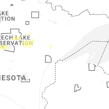
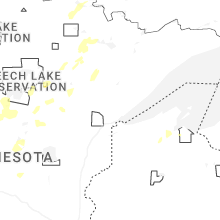
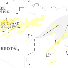


Connect with Interactive Hail Maps