

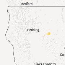
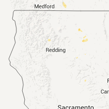
Hail Map for Warner Valley, CA
The Warner Valley, CA area has had 0 reports of on-the-ground hail by trained spotters, and has been under severe weather warnings 0 times during the past 12 months. Doppler radar has detected hail at or near Warner Valley, CA on 7 occasions, including 1 occasion during the past year.
| Name: | Warner Valley, CA |
| Where Located: | 58.5 miles ESE of Redding, CA |
| Map: | Google Map for Warner Valley, CA |
| Population: | 2 |
| Housing Units: | 43 |
| More Info: | Search Google for Warner Valley, CA |
1
The Top Recent Hail Date for Warner Valley, CA is Thursday, May 25, 2023 (2nd out of 7)
Hail and Wind Damage Spotted near Warner Valley, CA
| Date / Time | Report Details |
|---|---|
| 7/27/2020 4:05 PM PDT |
 At 403 pm pdt, a severe thunderstorm was located near chester, moving east at 10 mph (radar indicated). Hazards include quarter size hail. Damage to vehicles is expected. Locations impacted include, chester. At 403 pm pdt, a severe thunderstorm was located near chester, moving east at 10 mph (radar indicated). Hazards include quarter size hail. Damage to vehicles is expected. Locations impacted include, chester.
|
| 7/27/2020 3:44 PM PDT |
 At 343 pm pdt, a severe thunderstorm was located just north of chester, moving east at 10 mph (radar indicated). Hazards include ping pong ball size hail. People and animals outdoors will be injured. Expect damage to roofs, siding, windows, and vehicles. At 343 pm pdt, a severe thunderstorm was located just north of chester, moving east at 10 mph (radar indicated). Hazards include ping pong ball size hail. People and animals outdoors will be injured. Expect damage to roofs, siding, windows, and vehicles.
|
| 7/27/2020 3:36 PM PDT |
 At 334 pm pdt, a severe thunderstorm was located 7 miles northwest of chester, and is nearly stationary (radar indicated). Hazards include half dollar size hail and heavy rainfall. Damage to vehicles is expected. This severe thunderstorm will remain over mainly rural areas of northern plumas, southeastern shasta and southwestern lassen counties. At 334 pm pdt, a severe thunderstorm was located 7 miles northwest of chester, and is nearly stationary (radar indicated). Hazards include half dollar size hail and heavy rainfall. Damage to vehicles is expected. This severe thunderstorm will remain over mainly rural areas of northern plumas, southeastern shasta and southwestern lassen counties.
|
| 7/27/2020 3:21 PM PDT |
 At 321 pm pdt, a severe thunderstorm was located 7 miles northwest of chester, moving east at 5 mph (radar indicated). Hazards include quarter size hail. Damage to vehicles is expected. This severe thunderstorm will remain over mainly rural areas of northern plumas, southeastern shasta and southwestern lassen counties. At 321 pm pdt, a severe thunderstorm was located 7 miles northwest of chester, moving east at 5 mph (radar indicated). Hazards include quarter size hail. Damage to vehicles is expected. This severe thunderstorm will remain over mainly rural areas of northern plumas, southeastern shasta and southwestern lassen counties.
|
| 6/19/2017 4:07 PM PDT |
 The severe thunderstorm warning for northwestern plumas and east central tehama counties will expire at 415 pm pdt, the storm which prompted the warning has weakened below severe limits, and no longer poses an immediate threat to life or property. therefore the warning will be allowed to expire. The severe thunderstorm warning for northwestern plumas and east central tehama counties will expire at 415 pm pdt, the storm which prompted the warning has weakened below severe limits, and no longer poses an immediate threat to life or property. therefore the warning will be allowed to expire.
|
| 6/19/2017 3:37 PM PDT |
 At 334 pm pdt, a severe thunderstorm was located near chester, moving northeast at 10 mph (radar indicated). Hazards include 50 mph wind gusts and quarter size hail. Hail damage to vehicles is expected. Expect wind damage to trees. At 334 pm pdt, a severe thunderstorm was located near chester, moving northeast at 10 mph (radar indicated). Hazards include 50 mph wind gusts and quarter size hail. Hail damage to vehicles is expected. Expect wind damage to trees.
|
| 7/7/2015 5:26 PM PDT |
 At 522 pm pdt, doppler radar indicated a severe thunderstorm capable of producing large hail, gusty winds and very heavy rainfall. this storm was located in the chester, lake almonor area, and moving to the west at 15 mph. locations impacted include, chester, lake almanor, lake almanor west, lake almanor peninsula and lake almanor country club. At 522 pm pdt, doppler radar indicated a severe thunderstorm capable of producing large hail, gusty winds and very heavy rainfall. this storm was located in the chester, lake almonor area, and moving to the west at 15 mph. locations impacted include, chester, lake almanor, lake almanor west, lake almanor peninsula and lake almanor country club.
|
| 7/7/2015 5:04 PM PDT |
 At 502 pm pdt, doppler radar indicated a severe thunderstorm capable of producing quarter size hail and damaging winds. this storm was located near chester, and moving west at 10 mph. At 502 pm pdt, doppler radar indicated a severe thunderstorm capable of producing quarter size hail and damaging winds. this storm was located near chester, and moving west at 10 mph.
|
Hail Maps for Warner Valley, CA


Connect with Interactive Hail Maps