

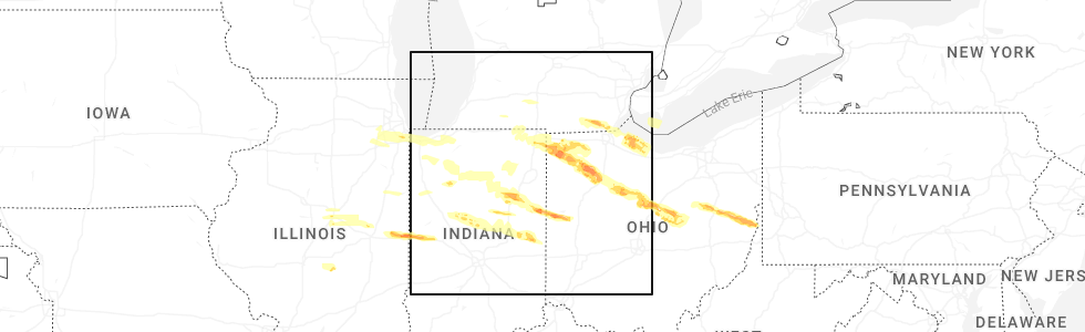
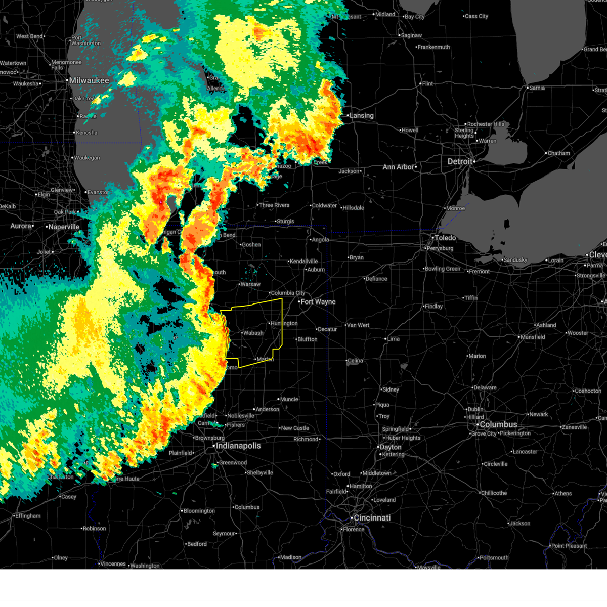
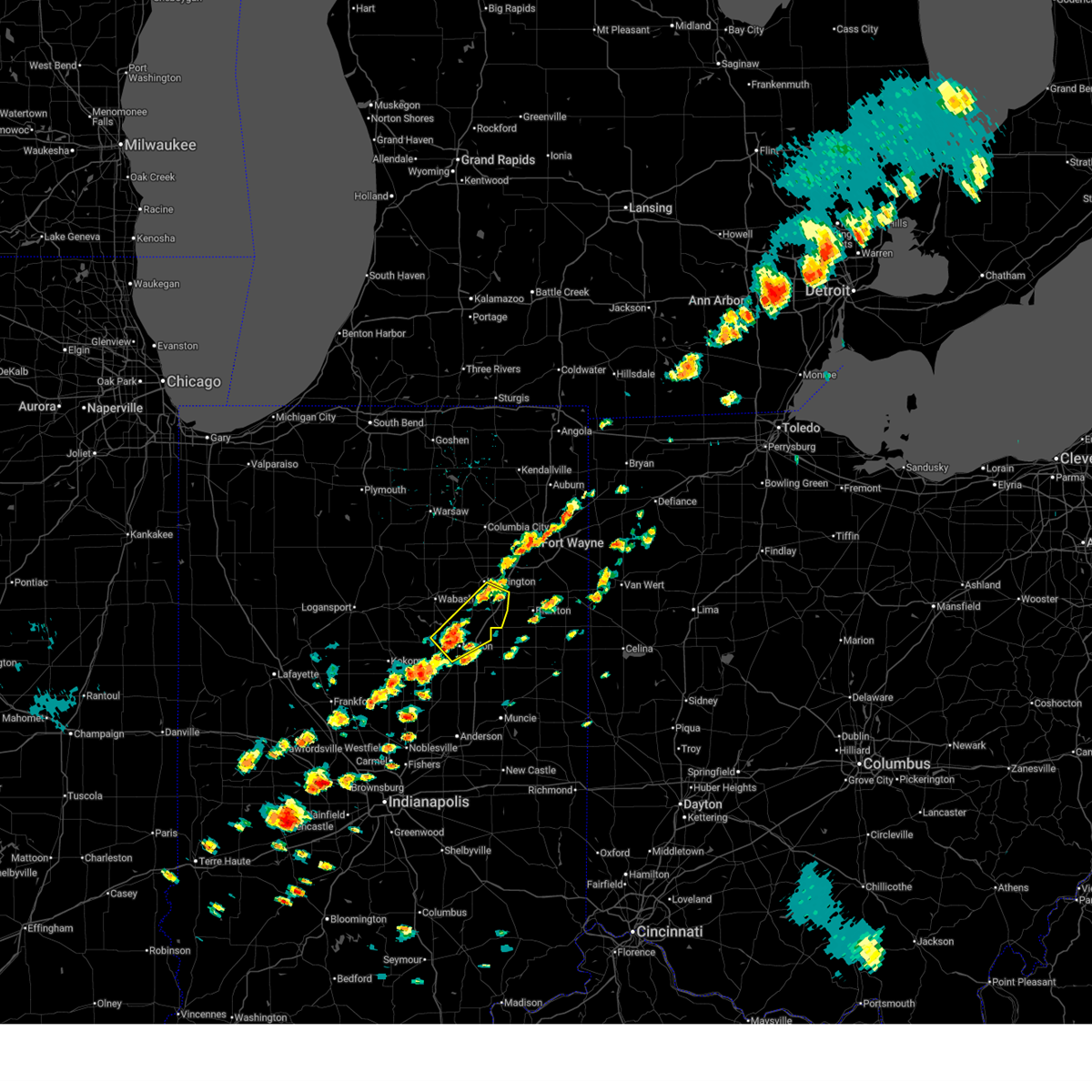
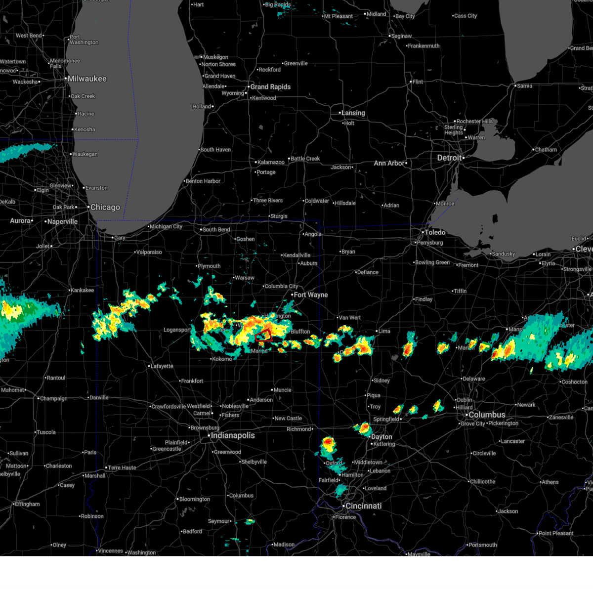
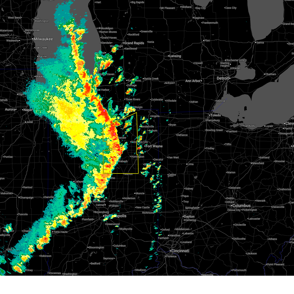
Hail Map for Warren, IN
The Warren, IN area has had 12 reports of on-the-ground hail by trained spotters, and has been under severe weather warnings 27 times during the past 12 months. Doppler radar has detected hail at or near Warren, IN on 49 occasions, including 3 occasions during the past year.
| Name: | Warren, IN |
| Where Located: | 31.9 miles SSW of Fort Wayne, IN |
| Map: | Google Map for Warren, IN |
| Population: | 1239 |
| Housing Units: | 600 |
| More Info: | Search Google for Warren, IN |
2
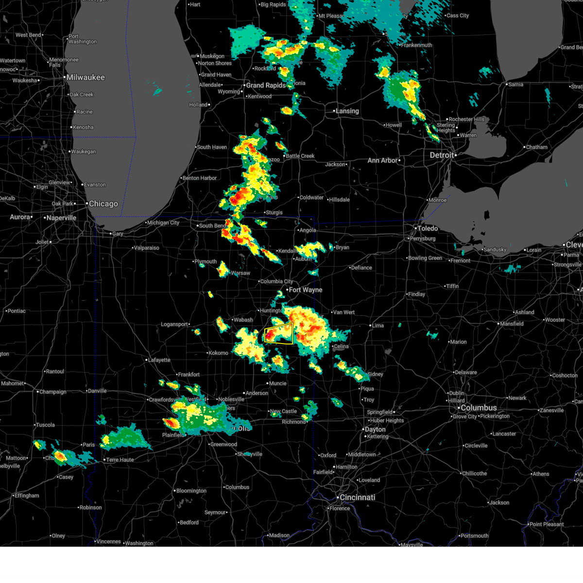
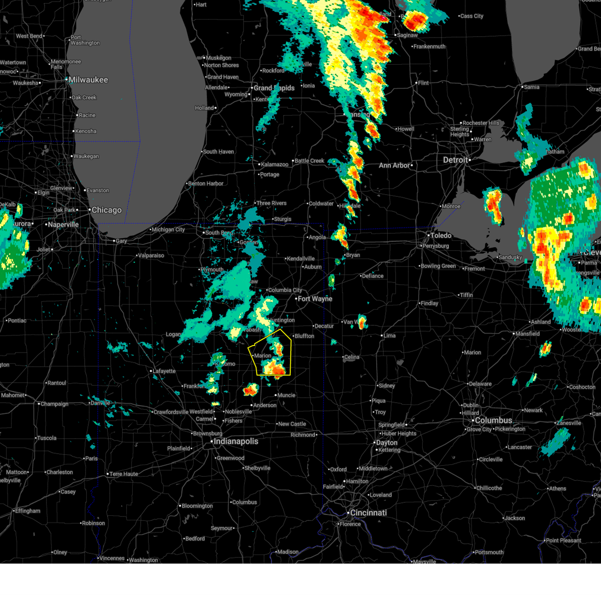
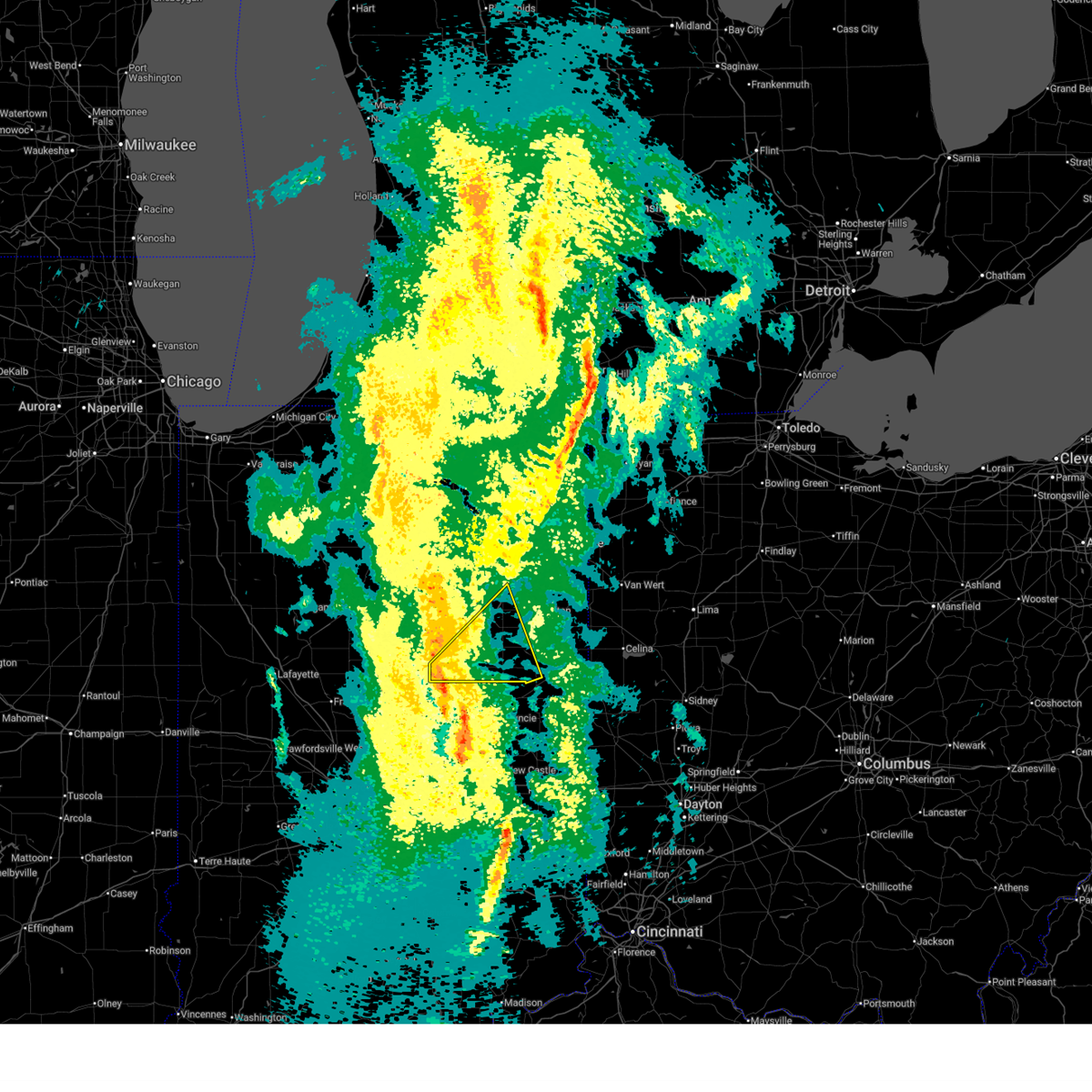
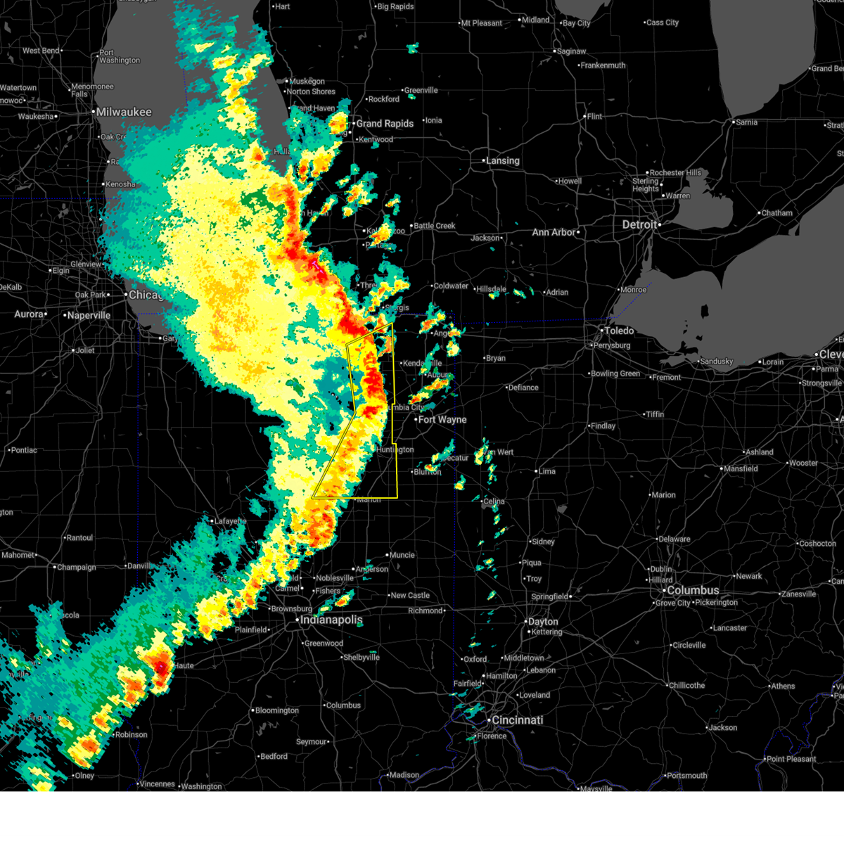
The Top Recent Hail Date for Warren, IN is Thursday, March 26, 2026 (6th out of 49)
Hail and Wind Damage Spotted near Warren, IN
| Date / Time | Report Details |
|---|---|
| 6/16/2026 7:26 PM EDT |
 Svriwx the national weather service in northern indiana has issued a * severe thunderstorm warning for, southeastern huntington county in northeastern indiana, southern wells county in northeastern indiana, * until 800 pm edt. * at 726 pm edt, a severe thunderstorm was located near van buren, or 11 miles north of hartford city, moving east at 30 mph (radar indicated). Hazards include 60 mph wind gusts and quarter size hail. Hail damage to vehicles is expected. Expect wind damage to roofs, siding, and trees. Svriwx the national weather service in northern indiana has issued a * severe thunderstorm warning for, southeastern huntington county in northeastern indiana, southern wells county in northeastern indiana, * until 800 pm edt. * at 726 pm edt, a severe thunderstorm was located near van buren, or 11 miles north of hartford city, moving east at 30 mph (radar indicated). Hazards include 60 mph wind gusts and quarter size hail. Hail damage to vehicles is expected. Expect wind damage to roofs, siding, and trees.
|
| 6/11/2026 10:50 PM EDT |
 Svriwx the national weather service in northern indiana has issued a * severe thunderstorm warning for, allen county in northeastern indiana, eastern grant county in central indiana, southeastern whitley county in northeastern indiana, huntington county in northeastern indiana, blackford county in east central indiana, wells county in northeastern indiana, adams county in northeastern indiana, jay county in east central indiana, * until 1130 pm edt. * at 1050 pm edt, severe thunderstorms were located along a line extending from 6 miles south of columbia city to near markle to near hartford city, moving east at 55 mph (radar indicated). Hazards include 70 mph wind gusts. Expect considerable tree damage. Damage is likely to mobile homes, roofs, and outbuildings. Svriwx the national weather service in northern indiana has issued a * severe thunderstorm warning for, allen county in northeastern indiana, eastern grant county in central indiana, southeastern whitley county in northeastern indiana, huntington county in northeastern indiana, blackford county in east central indiana, wells county in northeastern indiana, adams county in northeastern indiana, jay county in east central indiana, * until 1130 pm edt. * at 1050 pm edt, severe thunderstorms were located along a line extending from 6 miles south of columbia city to near markle to near hartford city, moving east at 55 mph (radar indicated). Hazards include 70 mph wind gusts. Expect considerable tree damage. Damage is likely to mobile homes, roofs, and outbuildings.
|
| 6/11/2026 10:40 PM EDT |
 At 1039 pm edt, severe thunderstorms were located along a line extending from near south whitley to near huntington to near van buren, moving east at 60 mph (radar indicated). Hazards include 60 mph wind gusts. Expect damage to roofs, siding, and trees. locations impacted include, marion, huntington, andrews, markle, la fontaine, van buren, roanoke, warren, lancaster, mount etna, laud, landess, liberty mills, raber, buckeye, majenica, banquo, roseburg, bippus, and luther. This includes interstate 69 in indiana between mile markers 264 and 291. At 1039 pm edt, severe thunderstorms were located along a line extending from near south whitley to near huntington to near van buren, moving east at 60 mph (radar indicated). Hazards include 60 mph wind gusts. Expect damage to roofs, siding, and trees. locations impacted include, marion, huntington, andrews, markle, la fontaine, van buren, roanoke, warren, lancaster, mount etna, laud, landess, liberty mills, raber, buckeye, majenica, banquo, roseburg, bippus, and luther. This includes interstate 69 in indiana between mile markers 264 and 291.
|
| 6/11/2026 10:19 PM EDT |
 Svriwx the national weather service in northern indiana has issued a * severe thunderstorm warning for, wabash county in north central indiana, northern grant county in central indiana, southern whitley county in northeastern indiana, huntington county in northeastern indiana, eastern miami county in north central indiana, * until 1100 pm edt. * at 1019 pm edt, severe thunderstorms were located along a line extending from near akron to near wabash to 8 miles southeast of bunker hill, moving northeast at 60 mph (radar indicated). Hazards include 60 mph wind gusts. expect damage to roofs, siding, and trees Svriwx the national weather service in northern indiana has issued a * severe thunderstorm warning for, wabash county in north central indiana, northern grant county in central indiana, southern whitley county in northeastern indiana, huntington county in northeastern indiana, eastern miami county in north central indiana, * until 1100 pm edt. * at 1019 pm edt, severe thunderstorms were located along a line extending from near akron to near wabash to 8 miles southeast of bunker hill, moving northeast at 60 mph (radar indicated). Hazards include 60 mph wind gusts. expect damage to roofs, siding, and trees
|
| 6/10/2026 8:37 PM EDT |
 The storm which prompted the warning has weakened below severe limits, and no longer poses an immediate threat to life or property. therefore, the warning will be allowed to expire. however, gusty winds are still possible with this thunderstorm. it remains possible that this storm could re-intensify across the southern portions of blackford county. a severe thunderstorm watch remains in effect until 1100 pm edt for central, north central, northeastern and east central indiana. The storm which prompted the warning has weakened below severe limits, and no longer poses an immediate threat to life or property. therefore, the warning will be allowed to expire. however, gusty winds are still possible with this thunderstorm. it remains possible that this storm could re-intensify across the southern portions of blackford county. a severe thunderstorm watch remains in effect until 1100 pm edt for central, north central, northeastern and east central indiana.
|
| 6/10/2026 8:22 PM EDT |
 Svriwx the national weather service in northern indiana has issued a * severe thunderstorm warning for, eastern grant county in central indiana, southern huntington county in northeastern indiana, blackford county in east central indiana, southwestern wells county in northeastern indiana, * until 845 pm edt. * at 822 pm edt, severe thunderstorms were located along a line extending from near marion to near jonesboro to 6 miles southwest of matthews, moving east at 25 mph (radar indicated). Hazards include 60 mph wind gusts and penny size hail. expect damage to roofs, siding, and trees Svriwx the national weather service in northern indiana has issued a * severe thunderstorm warning for, eastern grant county in central indiana, southern huntington county in northeastern indiana, blackford county in east central indiana, southwestern wells county in northeastern indiana, * until 845 pm edt. * at 822 pm edt, severe thunderstorms were located along a line extending from near marion to near jonesboro to 6 miles southwest of matthews, moving east at 25 mph (radar indicated). Hazards include 60 mph wind gusts and penny size hail. expect damage to roofs, siding, and trees
|
| 5/19/2026 4:23 PM EDT |
 the severe thunderstorm warning has been cancelled and is no longer in effect the severe thunderstorm warning has been cancelled and is no longer in effect
|
| 5/19/2026 4:23 PM EDT |
 At 423 pm edt, a severe thunderstorm was located near van buren, or 11 miles northeast of marion, moving northeast at 40 mph (radar indicated). Hazards include 60 mph wind gusts and quarter size hail. Hail damage to vehicles is expected. expect wind damage to roofs, siding, and trees. locations impacted include, marion, sweetser, markle, van buren, warren, lancaster, mount etna, hanfield, majenica, landess, pleasant plain, and plum tree. This includes interstate 69 in indiana between mile markers 266 and 286. At 423 pm edt, a severe thunderstorm was located near van buren, or 11 miles northeast of marion, moving northeast at 40 mph (radar indicated). Hazards include 60 mph wind gusts and quarter size hail. Hail damage to vehicles is expected. expect wind damage to roofs, siding, and trees. locations impacted include, marion, sweetser, markle, van buren, warren, lancaster, mount etna, hanfield, majenica, landess, pleasant plain, and plum tree. This includes interstate 69 in indiana between mile markers 266 and 286.
|
| 5/19/2026 4:13 PM EDT |
 Svriwx the national weather service in northern indiana has issued a * severe thunderstorm warning for, southeastern wabash county in north central indiana, northern grant county in central indiana, southern huntington county in northeastern indiana, * until 445 pm edt. * at 413 pm edt, a severe thunderstorm was located near marion, moving northeast at 40 mph (radar indicated). Hazards include 60 mph wind gusts and quarter size hail. Hail damage to vehicles is expected. Expect wind damage to roofs, siding, and trees. Svriwx the national weather service in northern indiana has issued a * severe thunderstorm warning for, southeastern wabash county in north central indiana, northern grant county in central indiana, southern huntington county in northeastern indiana, * until 445 pm edt. * at 413 pm edt, a severe thunderstorm was located near marion, moving northeast at 40 mph (radar indicated). Hazards include 60 mph wind gusts and quarter size hail. Hail damage to vehicles is expected. Expect wind damage to roofs, siding, and trees.
|
| 4/27/2026 11:11 PM EDT |
 the severe thunderstorm warning has been cancelled and is no longer in effect the severe thunderstorm warning has been cancelled and is no longer in effect
|
| 4/27/2026 11:11 PM EDT |
 At 1111 pm edt, severe thunderstorms were located along a line extending from 9 miles north of markle to near ossian to near hartford city, moving northeast at 65 mph (radar indicated). Hazards include 60 mph wind gusts. Expect damage to roofs, siding, and trees. locations impacted include, bluffton, hartford city, ossian, dunkirk, montpelier, markle, pennville, warren, preble, nottingham, zanesville, uniondale, shamrock lakes, poneto, vera cruz, mcnatts, wellsburg, murray, liberty center, and peterson. This includes interstate 69 in indiana between mile markers 278 and 293. At 1111 pm edt, severe thunderstorms were located along a line extending from 9 miles north of markle to near ossian to near hartford city, moving northeast at 65 mph (radar indicated). Hazards include 60 mph wind gusts. Expect damage to roofs, siding, and trees. locations impacted include, bluffton, hartford city, ossian, dunkirk, montpelier, markle, pennville, warren, preble, nottingham, zanesville, uniondale, shamrock lakes, poneto, vera cruz, mcnatts, wellsburg, murray, liberty center, and peterson. This includes interstate 69 in indiana between mile markers 278 and 293.
|
| 4/27/2026 11:01 PM EDT |
 At 1100 pm edt, severe thunderstorms were located along a line extending from near huntington to near markle to near matthews, moving northeast at 65 mph (radar indicated). Hazards include 60 mph wind gusts. Expect damage to roofs, siding, and trees. locations impacted include, bluffton, hartford city, gas city, upland, ossian, dunkirk, montpelier, markle, van buren, pennville, matthews, warren, lancaster, preble, nottingham, zanesville, uniondale, fowlerton, shamrock lakes, and poneto. This includes interstate 69 in indiana between mile markers 253 and 293. At 1100 pm edt, severe thunderstorms were located along a line extending from near huntington to near markle to near matthews, moving northeast at 65 mph (radar indicated). Hazards include 60 mph wind gusts. Expect damage to roofs, siding, and trees. locations impacted include, bluffton, hartford city, gas city, upland, ossian, dunkirk, montpelier, markle, van buren, pennville, matthews, warren, lancaster, preble, nottingham, zanesville, uniondale, fowlerton, shamrock lakes, and poneto. This includes interstate 69 in indiana between mile markers 253 and 293.
|
| 4/27/2026 10:53 PM EDT |
 Svriwx the national weather service in northern indiana has issued a * severe thunderstorm warning for, southeastern wabash county in north central indiana, grant county in central indiana, southern huntington county in northeastern indiana, blackford county in east central indiana, wells county in northeastern indiana, northwestern adams county in northeastern indiana, northwestern jay county in east central indiana, * until 1130 pm edt. * at 1052 pm edt, severe thunderstorms were located along a line extending from andrews to 9 miles south of huntington to near fairmount, moving northeast at 65 mph (radar indicated). Hazards include 60 mph wind gusts. expect damage to roofs, siding, and trees Svriwx the national weather service in northern indiana has issued a * severe thunderstorm warning for, southeastern wabash county in north central indiana, grant county in central indiana, southern huntington county in northeastern indiana, blackford county in east central indiana, wells county in northeastern indiana, northwestern adams county in northeastern indiana, northwestern jay county in east central indiana, * until 1130 pm edt. * at 1052 pm edt, severe thunderstorms were located along a line extending from andrews to 9 miles south of huntington to near fairmount, moving northeast at 65 mph (radar indicated). Hazards include 60 mph wind gusts. expect damage to roofs, siding, and trees
|
| 4/14/2026 6:35 PM EDT |
 The storm which prompted the warning has weakened below severe limits, and has exited the warned area. therefore, the warning will be allowed to expire. a severe thunderstorm watch remains in effect until 1100 pm edt for central and northeastern indiana. The storm which prompted the warning has weakened below severe limits, and has exited the warned area. therefore, the warning will be allowed to expire. a severe thunderstorm watch remains in effect until 1100 pm edt for central and northeastern indiana.
|
| 4/14/2026 6:29 PM EDT |
 At 628 pm edt, a severe thunderstorm was located 9 miles north of van buren, or 9 miles south of huntington, moving east at 35 mph (radar indicated). Hazards include 60 mph wind gusts and quarter size hail. Hail damage to vehicles is expected. expect wind damage to roofs, siding, and trees. locations impacted include, van buren, warren, mcnatts, and plum tree. This includes interstate 69 in indiana between mile markers 270 and 280. At 628 pm edt, a severe thunderstorm was located 9 miles north of van buren, or 9 miles south of huntington, moving east at 35 mph (radar indicated). Hazards include 60 mph wind gusts and quarter size hail. Hail damage to vehicles is expected. expect wind damage to roofs, siding, and trees. locations impacted include, van buren, warren, mcnatts, and plum tree. This includes interstate 69 in indiana between mile markers 270 and 280.
|
| 4/14/2026 6:20 PM EDT |
 At 620 pm edt, a severe thunderstorm was located 8 miles south of andrews, or 10 miles south of huntington, moving east at 35 mph (radar indicated). Hazards include 60 mph wind gusts and quarter size hail. Hail damage to vehicles is expected. expect wind damage to roofs, siding, and trees. locations impacted include, markle, van buren, warren, lancaster, mount etna, mcnatts, majenica, banquo, pleasant plain, and plum tree. This includes interstate 69 in indiana between mile markers 270 and 286. At 620 pm edt, a severe thunderstorm was located 8 miles south of andrews, or 10 miles south of huntington, moving east at 35 mph (radar indicated). Hazards include 60 mph wind gusts and quarter size hail. Hail damage to vehicles is expected. expect wind damage to roofs, siding, and trees. locations impacted include, markle, van buren, warren, lancaster, mount etna, mcnatts, majenica, banquo, pleasant plain, and plum tree. This includes interstate 69 in indiana between mile markers 270 and 286.
|
| 4/14/2026 6:07 PM EDT |
 Svriwx the national weather service in northern indiana has issued a * severe thunderstorm warning for, southeastern wabash county in north central indiana, northeastern grant county in central indiana, southern huntington county in northeastern indiana, southwestern wells county in northeastern indiana, * until 645 pm edt. * at 607 pm edt, a severe thunderstorm was located near la fontaine, or 8 miles southeast of wabash, moving east at 35 mph (radar indicated). Hazards include 60 mph wind gusts and quarter size hail. Hail damage to vehicles is expected. Expect wind damage to roofs, siding, and trees. Svriwx the national weather service in northern indiana has issued a * severe thunderstorm warning for, southeastern wabash county in north central indiana, northeastern grant county in central indiana, southern huntington county in northeastern indiana, southwestern wells county in northeastern indiana, * until 645 pm edt. * at 607 pm edt, a severe thunderstorm was located near la fontaine, or 8 miles southeast of wabash, moving east at 35 mph (radar indicated). Hazards include 60 mph wind gusts and quarter size hail. Hail damage to vehicles is expected. Expect wind damage to roofs, siding, and trees.
|
| 4/3/2026 8:09 PM EDT |
 The storm which prompted the warning has weakened below severe limits, and no longer appears capable of producing a tornado. therefore, the warning will be allowed to expire. gusty winds to 40 mph are still possible with this storm. The storm which prompted the warning has weakened below severe limits, and no longer appears capable of producing a tornado. therefore, the warning will be allowed to expire. gusty winds to 40 mph are still possible with this storm.
|
| 4/3/2026 7:54 PM EDT |
 the tornado warning has been cancelled and is no longer in effect the tornado warning has been cancelled and is no longer in effect
|
| 4/3/2026 7:54 PM EDT |
 At 754 pm edt, a severe thunderstorm capable of producing a tornado was located near van buren, or 10 miles northeast of marion, moving east at 20 mph (radar indicated rotation). Hazards include tornado, quarter size hail, and 60 mph wind gusts. Flying debris will be dangerous to those caught without shelter. mobile homes will be damaged or destroyed. damage to roofs, windows, and vehicles will occur. tree damage is likely. locations impacted include, warren and pleasant plain. This includes interstate 69 in indiana between mile markers 272 and 278. At 754 pm edt, a severe thunderstorm capable of producing a tornado was located near van buren, or 10 miles northeast of marion, moving east at 20 mph (radar indicated rotation). Hazards include tornado, quarter size hail, and 60 mph wind gusts. Flying debris will be dangerous to those caught without shelter. mobile homes will be damaged or destroyed. damage to roofs, windows, and vehicles will occur. tree damage is likely. locations impacted include, warren and pleasant plain. This includes interstate 69 in indiana between mile markers 272 and 278.
|
| 4/3/2026 7:41 PM EDT |
 Toriwx the national weather service in northern indiana has issued a * tornado warning for, northeastern grant county in central indiana, southwestern huntington county in northeastern indiana, * until 815 pm edt. * at 741 pm edt, a severe thunderstorm capable of producing a tornado was located near la fontaine, or 7 miles north of marion, moving east at 25 mph (radar indicated rotation). Hazards include tornado and quarter size hail. Flying debris will be dangerous to those caught without shelter. mobile homes will be damaged or destroyed. damage to roofs, windows, and vehicles will occur. tree damage is likely. this tornadic thunderstorm will remain over mainly rural areas of northeastern grant and southwestern huntington counties, including the following locations, warren and pleasant plain. This includes interstate 69 in indiana between mile markers 270 and 278. Toriwx the national weather service in northern indiana has issued a * tornado warning for, northeastern grant county in central indiana, southwestern huntington county in northeastern indiana, * until 815 pm edt. * at 741 pm edt, a severe thunderstorm capable of producing a tornado was located near la fontaine, or 7 miles north of marion, moving east at 25 mph (radar indicated rotation). Hazards include tornado and quarter size hail. Flying debris will be dangerous to those caught without shelter. mobile homes will be damaged or destroyed. damage to roofs, windows, and vehicles will occur. tree damage is likely. this tornadic thunderstorm will remain over mainly rural areas of northeastern grant and southwestern huntington counties, including the following locations, warren and pleasant plain. This includes interstate 69 in indiana between mile markers 270 and 278.
|
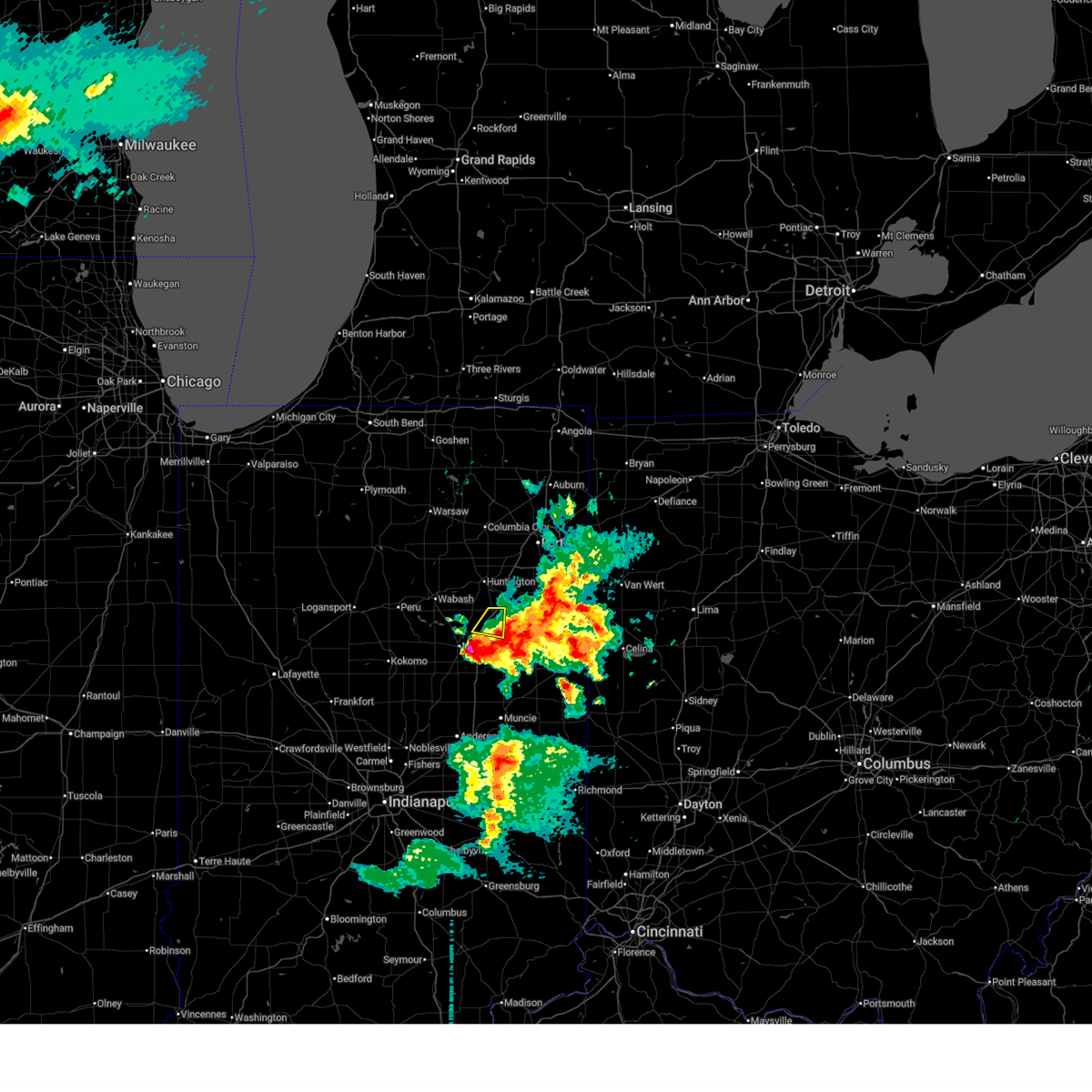
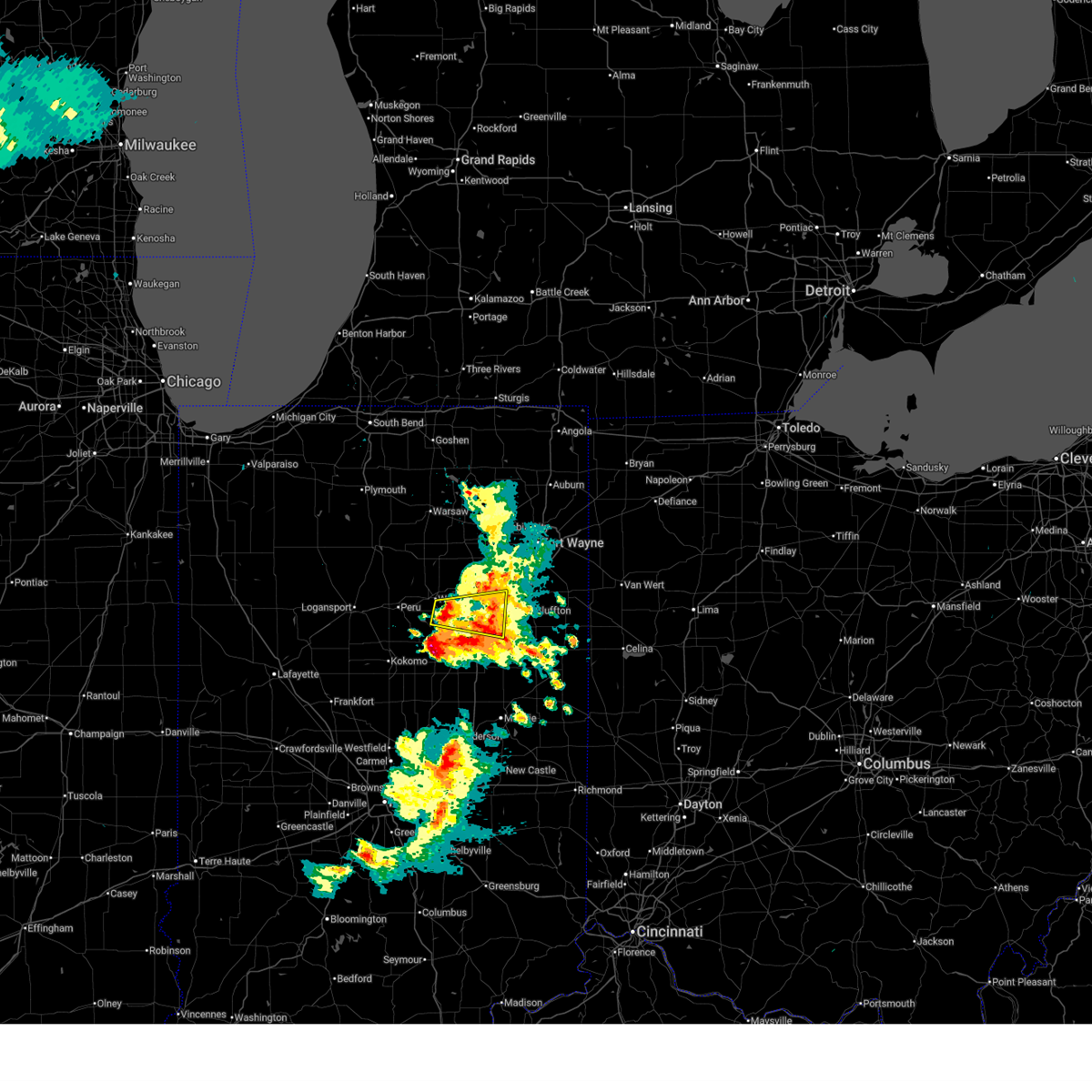
| 3/26/2026 7:23 PM EDT | Half Dollar sized hail reported 3.5 miles W of Warren, IN, estimated half dollar sized hail near warren... in. time estimated from radar. |
| 3/26/2026 7:19 PM EDT | Golf Ball sized hail reported 0.5 miles SW of Warren, IN, time estimated from radar. |
| 3/26/2026 7:18 PM EDT | Golf Ball sized hail reported 1.4 miles NW of Warren, IN, storm chaser reports golf ball size hail on sr 218 near warren. time estimated via radar. |
| 3/26/2026 7:18 PM EDT | Quarter sized hail reported 0.5 miles SW of Warren, IN, numerous photos and reports showing quarter size hail in warren. time estimated via radar. |
| 3/26/2026 7:17 PM EDT | Golf Ball sized hail reported 2.5 miles SSE of Warren, IN, ping pong to golf ball sized hail near intersection of i 69 and warren road. |
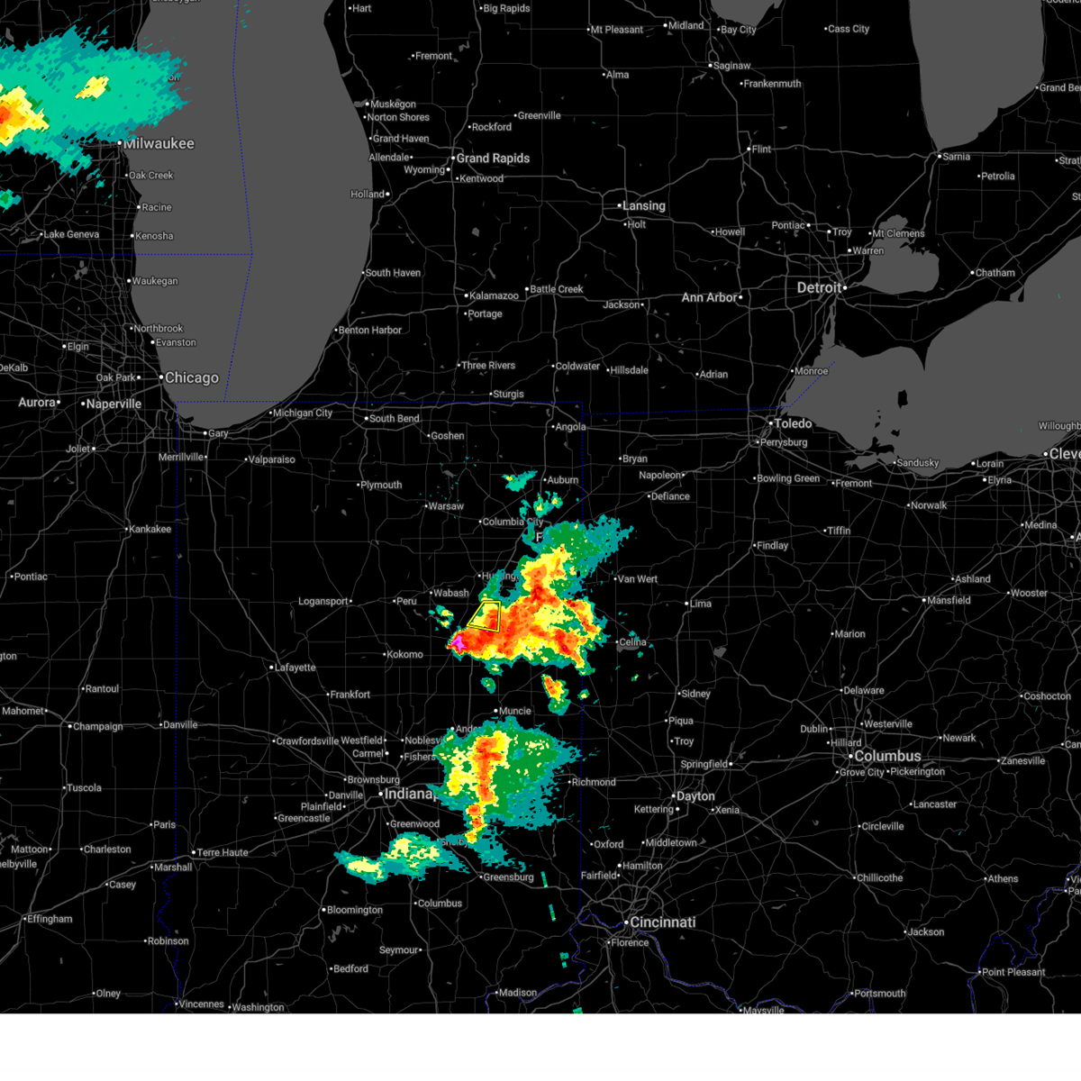
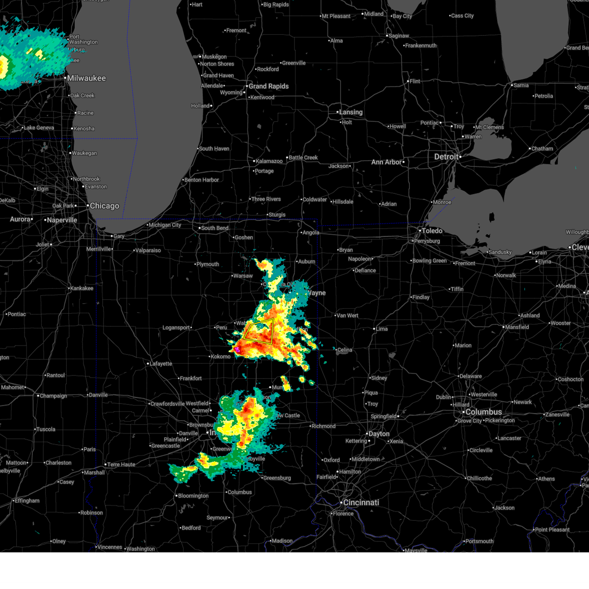
| 3/26/2026 7:14 PM EDT |
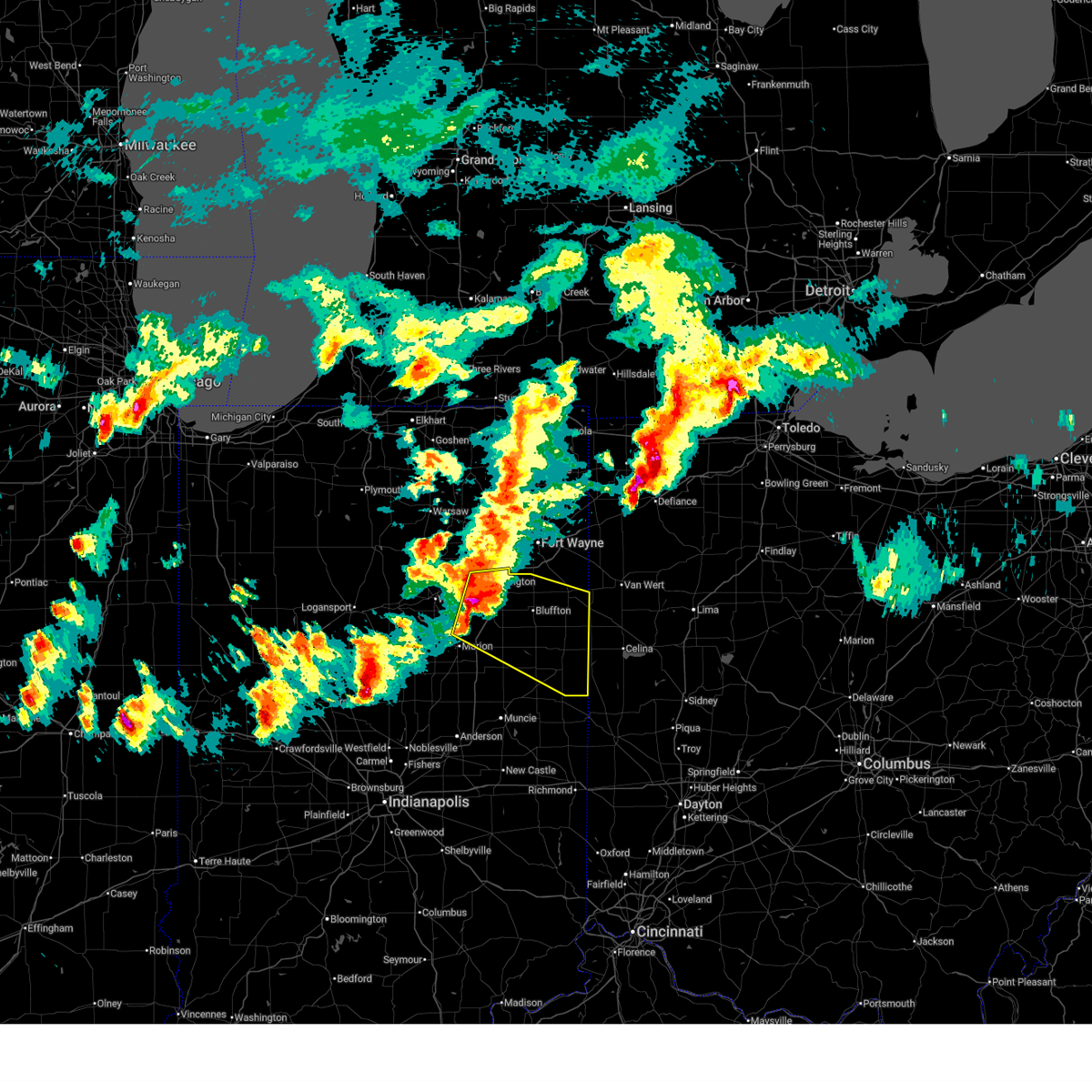 At 713 pm edt, severe thunderstorms were located along a line extending from near huntington to near van buren, moving east at 65 mph (radar indicated). Hazards include 60 mph wind gusts and quarter size hail. Hail damage to vehicles is expected. expect wind damage to roofs, siding, and trees. locations impacted include, huntington, bluffton, decatur, portland, berne, ossian, montpelier, geneva, andrews, markle, van buren, monroe, pennville, westchester, center, warren, lancaster, preble, nottingham, and zanesville. This includes interstate 69 in indiana between mile markers 265 and 293. At 713 pm edt, severe thunderstorms were located along a line extending from near huntington to near van buren, moving east at 65 mph (radar indicated). Hazards include 60 mph wind gusts and quarter size hail. Hail damage to vehicles is expected. expect wind damage to roofs, siding, and trees. locations impacted include, huntington, bluffton, decatur, portland, berne, ossian, montpelier, geneva, andrews, markle, van buren, monroe, pennville, westchester, center, warren, lancaster, preble, nottingham, and zanesville. This includes interstate 69 in indiana between mile markers 265 and 293.
|
| 3/26/2026 6:59 PM EDT |
 Svriwx the national weather service in northern indiana has issued a * severe thunderstorm warning for, eastern wabash county in north central indiana, northeastern grant county in central indiana, huntington county in northeastern indiana, northern blackford county in east central indiana, wells county in northeastern indiana, adams county in northeastern indiana, jay county in east central indiana, * until 745 pm edt. * at 659 pm edt, severe thunderstorms were located along a line extending from near north manchester to near la fontaine, moving east at 65 mph (radar indicated). Hazards include 60 mph wind gusts and quarter size hail. Hail damage to vehicles is expected. Expect wind damage to roofs, siding, and trees. Svriwx the national weather service in northern indiana has issued a * severe thunderstorm warning for, eastern wabash county in north central indiana, northeastern grant county in central indiana, huntington county in northeastern indiana, northern blackford county in east central indiana, wells county in northeastern indiana, adams county in northeastern indiana, jay county in east central indiana, * until 745 pm edt. * at 659 pm edt, severe thunderstorms were located along a line extending from near north manchester to near la fontaine, moving east at 65 mph (radar indicated). Hazards include 60 mph wind gusts and quarter size hail. Hail damage to vehicles is expected. Expect wind damage to roofs, siding, and trees.
|
| 3/16/2026 12:25 AM EDT |
 The storms which prompted the warning have weakened below severe limits, and no longer pose an immediate threat to life or property. therefore, the warning will be allowed to expire. The storms which prompted the warning have weakened below severe limits, and no longer pose an immediate threat to life or property. therefore, the warning will be allowed to expire.
|
| 3/16/2026 12:15 AM EDT |
 At 1214 am edt, severe thunderstorms were located along a line extending from near marion to near alexandria, moving northeast at 50 mph (radar indicated). Hazards include 60 mph wind gusts. Expect damage to roofs, siding, and trees. locations impacted include, marion, hartford city, gas city, upland, dunkirk, montpelier, jonesboro, markle, van buren, matthews, warren, fowlerton, shamrock lakes, mcnatts, landess, liberty center, mount zion, mill grove, buckeye, and majenica. This includes interstate 69 in indiana between mile markers 253 and 289. At 1214 am edt, severe thunderstorms were located along a line extending from near marion to near alexandria, moving northeast at 50 mph (radar indicated). Hazards include 60 mph wind gusts. Expect damage to roofs, siding, and trees. locations impacted include, marion, hartford city, gas city, upland, dunkirk, montpelier, jonesboro, markle, van buren, matthews, warren, fowlerton, shamrock lakes, mcnatts, landess, liberty center, mount zion, mill grove, buckeye, and majenica. This includes interstate 69 in indiana between mile markers 253 and 289.
|
| 3/16/2026 12:07 AM EDT |
 At 1207 am edt, severe thunderstorms were located along a line extending from near swayzee to alexandria, moving northeast at 50 mph (radar indicated). Hazards include 60 mph wind gusts. Expect damage to roofs, siding, and trees. locations impacted include, marion, hartford city, gas city, upland, fairmount, dunkirk, montpelier, jonesboro, markle, van buren, matthews, warren, fowlerton, shamrock lakes, mcnatts, landess, liberty center, mount zion, mill grove, and buckeye. This includes interstate 69 in indiana between mile markers 252 and 289. At 1207 am edt, severe thunderstorms were located along a line extending from near swayzee to alexandria, moving northeast at 50 mph (radar indicated). Hazards include 60 mph wind gusts. Expect damage to roofs, siding, and trees. locations impacted include, marion, hartford city, gas city, upland, fairmount, dunkirk, montpelier, jonesboro, markle, van buren, matthews, warren, fowlerton, shamrock lakes, mcnatts, landess, liberty center, mount zion, mill grove, and buckeye. This includes interstate 69 in indiana between mile markers 252 and 289.
|
| 3/15/2026 11:59 PM EDT |
 Svriwx the national weather service in northern indiana has issued a * severe thunderstorm warning for, grant county in central indiana, southeastern huntington county in northeastern indiana, blackford county in east central indiana, western wells county in northeastern indiana, northwestern jay county in east central indiana, * until 1230 am edt. * at 1159 pm edt, severe thunderstorms were located along a line extending from 6 miles northeast of windfall to near alexandria, moving northeast at 50 mph (radar indicated). Hazards include 60 mph wind gusts. expect damage to roofs, siding, and trees Svriwx the national weather service in northern indiana has issued a * severe thunderstorm warning for, grant county in central indiana, southeastern huntington county in northeastern indiana, blackford county in east central indiana, western wells county in northeastern indiana, northwestern jay county in east central indiana, * until 1230 am edt. * at 1159 pm edt, severe thunderstorms were located along a line extending from 6 miles northeast of windfall to near alexandria, moving northeast at 50 mph (radar indicated). Hazards include 60 mph wind gusts. expect damage to roofs, siding, and trees
|
| 6/18/2025 5:31 PM EDT |
 Svriwx the national weather service in northern indiana has issued a * severe thunderstorm warning for, southeastern huntington county in northeastern indiana, wells county in northeastern indiana, * until 600 pm edt. * at 530 pm edt, a severe thunderstorm was located 8 miles northeast of van buren, or 12 miles west of bluffton, moving northeast at 50 mph (radar indicated). Hazards include 60 mph wind gusts and quarter size hail. Hail damage to vehicles is expected. Expect wind damage to roofs, siding, and trees. Svriwx the national weather service in northern indiana has issued a * severe thunderstorm warning for, southeastern huntington county in northeastern indiana, wells county in northeastern indiana, * until 600 pm edt. * at 530 pm edt, a severe thunderstorm was located 8 miles northeast of van buren, or 12 miles west of bluffton, moving northeast at 50 mph (radar indicated). Hazards include 60 mph wind gusts and quarter size hail. Hail damage to vehicles is expected. Expect wind damage to roofs, siding, and trees.
|
| 5/16/2025 7:46 PM EDT | Metal barn door remove in huntington county IN, 2.5 miles ESE of Warren, IN |
| 5/16/2025 7:41 PM EDT |
 Svriwx the national weather service in northern indiana has issued a * severe thunderstorm warning for, grant county in central indiana, huntington county in northeastern indiana, blackford county in east central indiana, wells county in northeastern indiana, adams county in northeastern indiana, jay county in east central indiana, * until 845 pm edt. * at 741 pm edt, severe thunderstorms were located along a line extending from la fontaine to near muncie, moving northeast at 55 mph (radar indicated). Hazards include 60 mph wind gusts. expect damage to roofs, siding, and trees Svriwx the national weather service in northern indiana has issued a * severe thunderstorm warning for, grant county in central indiana, huntington county in northeastern indiana, blackford county in east central indiana, wells county in northeastern indiana, adams county in northeastern indiana, jay county in east central indiana, * until 845 pm edt. * at 741 pm edt, severe thunderstorms were located along a line extending from la fontaine to near muncie, moving northeast at 55 mph (radar indicated). Hazards include 60 mph wind gusts. expect damage to roofs, siding, and trees
|
| 3/30/2025 5:52 PM EDT |
 The storms which prompted the warning have weakened below severe limits, and have exited the warned area. therefore, the warning will be allowed to expire. however, gusty winds are still possible with these thunderstorms. a tornado watch remains in effect until 800 pm edt for central, north central and northeastern indiana. a severe thunderstorm watch remains in effect until 1000 pm edt for west central ohio. remember, a severe thunderstorm warning still remains in effect for allen, deklab, and steuben counties. The storms which prompted the warning have weakened below severe limits, and have exited the warned area. therefore, the warning will be allowed to expire. however, gusty winds are still possible with these thunderstorms. a tornado watch remains in effect until 800 pm edt for central, north central and northeastern indiana. a severe thunderstorm watch remains in effect until 1000 pm edt for west central ohio. remember, a severe thunderstorm warning still remains in effect for allen, deklab, and steuben counties.
|
| 3/30/2025 5:41 PM EDT |
 The storms which prompted the warning have weakened below severe limits, and no longer pose an immediate threat to life or property. therefore, the warning will be allowed to expire. however, gusty winds and heavy rain are still possible with these thunderstorms. a tornado watch remains in effect until 800 pm edt for central, northeastern and east central indiana. The storms which prompted the warning have weakened below severe limits, and no longer pose an immediate threat to life or property. therefore, the warning will be allowed to expire. however, gusty winds and heavy rain are still possible with these thunderstorms. a tornado watch remains in effect until 800 pm edt for central, northeastern and east central indiana.
|
| 3/30/2025 5:36 PM EDT |
 the severe thunderstorm warning has been cancelled and is no longer in effect the severe thunderstorm warning has been cancelled and is no longer in effect
|
| 3/30/2025 5:36 PM EDT |
 At 535 pm edt, severe thunderstorms were located along a line extending from 6 miles east of reading to near van wert, moving east at 115 mph (radar indicated). Hazards include 70 mph wind gusts and quarter size hail. Hail damage to vehicles is expected. expect considerable tree damage. wind damage is also likely to mobile homes, roofs, and outbuildings. locations impacted include, preble, yoder, angola, alvarado, fairfield center, aboite, liberty center, hamilton lake, laotto, zulu, big long lake, tocsin, salem center, helmer, kingsland, rivare, metz, sedan, bowerstown, and dunfee. this includes the following highways, interstate 469 between mile markers 0 and 30. interstate 69 in indiana between mile markers 270 and 355. Interstate 80 in indiana between mile markers 146 and 156. At 535 pm edt, severe thunderstorms were located along a line extending from 6 miles east of reading to near van wert, moving east at 115 mph (radar indicated). Hazards include 70 mph wind gusts and quarter size hail. Hail damage to vehicles is expected. expect considerable tree damage. wind damage is also likely to mobile homes, roofs, and outbuildings. locations impacted include, preble, yoder, angola, alvarado, fairfield center, aboite, liberty center, hamilton lake, laotto, zulu, big long lake, tocsin, salem center, helmer, kingsland, rivare, metz, sedan, bowerstown, and dunfee. this includes the following highways, interstate 469 between mile markers 0 and 30. interstate 69 in indiana between mile markers 270 and 355. Interstate 80 in indiana between mile markers 146 and 156.
|
| 3/30/2025 5:26 PM EDT |
 At 526 pm edt, severe thunderstorms were located along a line extending from near van buren to near fairmount, moving east at 60 mph (radar indicated). Hazards include 60 mph wind gusts. Expect damage to roofs, siding, and trees. locations impacted include, nottingham, mcnatts, landess, wellsburg, liberty center, mill grove, herbst, buckeye, point isabel, swayzee, home corner, fowlerton, hartford city, dillman, petroleum, shamrock lakes, matthews, hanfield, sweetser, and sims. This includes interstate 69 in indiana between mile markers 252 and 272. At 526 pm edt, severe thunderstorms were located along a line extending from near van buren to near fairmount, moving east at 60 mph (radar indicated). Hazards include 60 mph wind gusts. Expect damage to roofs, siding, and trees. locations impacted include, nottingham, mcnatts, landess, wellsburg, liberty center, mill grove, herbst, buckeye, point isabel, swayzee, home corner, fowlerton, hartford city, dillman, petroleum, shamrock lakes, matthews, hanfield, sweetser, and sims. This includes interstate 69 in indiana between mile markers 252 and 272.
|
| 3/30/2025 5:21 PM EDT |
 The storms which prompted the warning have moved out of the area. therefore, the warning will be allowed to expire. however, gusty winds are still possible with these thunderstorms. a tornado watch remains in effect until 800 pm edt for central, north central and northeastern indiana. remember, a severe thunderstorm warning still remains in effect for whitley, huntington, and allen counties until 6 pm edt. The storms which prompted the warning have moved out of the area. therefore, the warning will be allowed to expire. however, gusty winds are still possible with these thunderstorms. a tornado watch remains in effect until 800 pm edt for central, north central and northeastern indiana. remember, a severe thunderstorm warning still remains in effect for whitley, huntington, and allen counties until 6 pm edt.
|
| 3/30/2025 5:12 PM EDT |
 At 511 pm edt, severe thunderstorms were located along a line extending from near middlebury to near andrews, moving east at 65 mph. damage was reported in etna green around 5 pm, including trees and powerlines down (public). Hazards include 70 mph wind gusts and nickel size hail. Expect considerable tree damage. damage is likely to mobile homes, roofs, and outbuildings. locations impacted include, mcnatts, topeka, honeyville, landess, blue lake, la fontaine, tri-lakes, buckeye, larwill, lake wawasee, bippus, luther, bowerstown, south whitley, servia, coesse, goose lake, knapp lake, jalapa, and loon lake. This includes interstate 69 in indiana between mile markers 266 and 293. At 511 pm edt, severe thunderstorms were located along a line extending from near middlebury to near andrews, moving east at 65 mph. damage was reported in etna green around 5 pm, including trees and powerlines down (public). Hazards include 70 mph wind gusts and nickel size hail. Expect considerable tree damage. damage is likely to mobile homes, roofs, and outbuildings. locations impacted include, mcnatts, topeka, honeyville, landess, blue lake, la fontaine, tri-lakes, buckeye, larwill, lake wawasee, bippus, luther, bowerstown, south whitley, servia, coesse, goose lake, knapp lake, jalapa, and loon lake. This includes interstate 69 in indiana between mile markers 266 and 293.
|
| 3/30/2025 5:12 PM EDT |
 the severe thunderstorm warning has been cancelled and is no longer in effect the severe thunderstorm warning has been cancelled and is no longer in effect
|
| 3/30/2025 5:05 PM EDT |
 Svriwx the national weather service in northern indiana has issued a * severe thunderstorm warning for, southeastern elkhart county in north central indiana, wabash county in north central indiana, noble county in northeastern indiana, northern grant county in central indiana, whitley county in northeastern indiana, huntington county in northeastern indiana, eastern kosciusko county in north central indiana, southern lagrange county in northeastern indiana, steuben county in northeastern indiana, allen county in northeastern indiana, de kalb county in northeastern indiana, wells county in northeastern indiana, northern adams county in northeastern indiana, * until 600 pm edt. * at 504 pm edt, severe thunderstorms were located along a line extending from millersburg to 6 miles northwest of van buren, moving east at 115 mph (radar indicated). Hazards include 70 mph wind gusts and quarter size hail. Hail damage to vehicles is expected. expect considerable tree damage. Wind damage is also likely to mobile homes, roofs, and outbuildings. Svriwx the national weather service in northern indiana has issued a * severe thunderstorm warning for, southeastern elkhart county in north central indiana, wabash county in north central indiana, noble county in northeastern indiana, northern grant county in central indiana, whitley county in northeastern indiana, huntington county in northeastern indiana, eastern kosciusko county in north central indiana, southern lagrange county in northeastern indiana, steuben county in northeastern indiana, allen county in northeastern indiana, de kalb county in northeastern indiana, wells county in northeastern indiana, northern adams county in northeastern indiana, * until 600 pm edt. * at 504 pm edt, severe thunderstorms were located along a line extending from millersburg to 6 miles northwest of van buren, moving east at 115 mph (radar indicated). Hazards include 70 mph wind gusts and quarter size hail. Hail damage to vehicles is expected. expect considerable tree damage. Wind damage is also likely to mobile homes, roofs, and outbuildings.
|
| 3/30/2025 5:01 PM EDT |
 Svriwx the national weather service in northern indiana has issued a * severe thunderstorm warning for, grant county in central indiana, southeastern huntington county in northeastern indiana, blackford county in east central indiana, southern wells county in northeastern indiana, western jay county in east central indiana, * until 545 pm edt. * at 501 pm edt, severe thunderstorms were located along a line extending from 7 miles east of kokomo to near tipton, moving east at 60 mph (radar indicated). Hazards include 60 mph wind gusts. expect damage to roofs, siding, and trees Svriwx the national weather service in northern indiana has issued a * severe thunderstorm warning for, grant county in central indiana, southeastern huntington county in northeastern indiana, blackford county in east central indiana, southern wells county in northeastern indiana, western jay county in east central indiana, * until 545 pm edt. * at 501 pm edt, severe thunderstorms were located along a line extending from 7 miles east of kokomo to near tipton, moving east at 60 mph (radar indicated). Hazards include 60 mph wind gusts. expect damage to roofs, siding, and trees
|
| 3/30/2025 4:50 PM EDT |
 At 450 pm edt, severe thunderstorms were located along a line extending from near nappanee to near peru, moving northeast at 65 mph (radar indicated). Hazards include 70 mph wind gusts and nickel size hail. Expect considerable tree damage. damage is likely to mobile homes, roofs, and outbuildings. locations impacted include, mcnatts, honeyville, atwood, la fontaine, macy, tri-lakes, locke, syracuse, bippus, luther, nead, bowerstown, little chapman lake, warsaw, james lake, goose lake, knapp lake, jalapa, new paris, and loon lake. This includes interstate 69 in indiana between mile markers 266 and 293. At 450 pm edt, severe thunderstorms were located along a line extending from near nappanee to near peru, moving northeast at 65 mph (radar indicated). Hazards include 70 mph wind gusts and nickel size hail. Expect considerable tree damage. damage is likely to mobile homes, roofs, and outbuildings. locations impacted include, mcnatts, honeyville, atwood, la fontaine, macy, tri-lakes, locke, syracuse, bippus, luther, nead, bowerstown, little chapman lake, warsaw, james lake, goose lake, knapp lake, jalapa, new paris, and loon lake. This includes interstate 69 in indiana between mile markers 266 and 293.
|
| 3/30/2025 4:50 PM EDT |
 the severe thunderstorm warning has been cancelled and is no longer in effect the severe thunderstorm warning has been cancelled and is no longer in effect
|
| 3/30/2025 4:33 PM EDT |
 Svriwx the national weather service in northern indiana has issued a * severe thunderstorm warning for, southern elkhart county in north central indiana, wabash county in north central indiana, noble county in northeastern indiana, northern grant county in central indiana, whitley county in northeastern indiana, huntington county in northeastern indiana, kosciusko county in north central indiana, cass county in north central indiana, southwestern lagrange county in northeastern indiana, fulton county in north central indiana, western wells county in northeastern indiana, miami county in north central indiana, marshall county in north central indiana, * until 530 pm edt. * at 433 pm edt, severe thunderstorms were located along a line extending from plymouth to near walton, moving northeast at 65 mph (radar indicated). Hazards include 70 mph wind gusts and nickel size hail. Expect considerable tree damage. Damage is likely to mobile homes, roofs, and outbuildings. Svriwx the national weather service in northern indiana has issued a * severe thunderstorm warning for, southern elkhart county in north central indiana, wabash county in north central indiana, noble county in northeastern indiana, northern grant county in central indiana, whitley county in northeastern indiana, huntington county in northeastern indiana, kosciusko county in north central indiana, cass county in north central indiana, southwestern lagrange county in northeastern indiana, fulton county in north central indiana, western wells county in northeastern indiana, miami county in north central indiana, marshall county in north central indiana, * until 530 pm edt. * at 433 pm edt, severe thunderstorms were located along a line extending from plymouth to near walton, moving northeast at 65 mph (radar indicated). Hazards include 70 mph wind gusts and nickel size hail. Expect considerable tree damage. Damage is likely to mobile homes, roofs, and outbuildings.
|
| 3/19/2025 9:05 PM EDT |
 The storms which prompted the warning have weakened below severe limits, and have exited the warned area. therefore, the warning will be allowed to expire. a severe thunderstorm watch remains in effect until 100 am edt for central, north central and northeastern indiana. The storms which prompted the warning have weakened below severe limits, and have exited the warned area. therefore, the warning will be allowed to expire. a severe thunderstorm watch remains in effect until 100 am edt for central, north central and northeastern indiana.
|
| 3/19/2025 8:41 PM EDT |
 Svriwx the national weather service in northern indiana has issued a * severe thunderstorm warning for, southwestern allen county in northeastern indiana, southeastern wabash county in north central indiana, northeastern grant county in central indiana, huntington county in northeastern indiana, western wells county in northeastern indiana, * until 915 pm edt. * at 841 pm edt, severe thunderstorms were located along a line extending from near andrews to 6 miles south of huntington to near jonesboro, moving northeast at 60 mph (radar indicated). Hazards include 60 mph wind gusts and penny size hail. expect damage to roofs, siding, and trees Svriwx the national weather service in northern indiana has issued a * severe thunderstorm warning for, southwestern allen county in northeastern indiana, southeastern wabash county in north central indiana, northeastern grant county in central indiana, huntington county in northeastern indiana, western wells county in northeastern indiana, * until 915 pm edt. * at 841 pm edt, severe thunderstorms were located along a line extending from near andrews to 6 miles south of huntington to near jonesboro, moving northeast at 60 mph (radar indicated). Hazards include 60 mph wind gusts and penny size hail. expect damage to roofs, siding, and trees
|
| 7/16/2024 1:27 AM EDT |
 The storms which prompted the warning have weakened below severe limits. therefore, the warning will be allowed to expire. however, gusty winds to 50 to 55 mph are still possible with these storms through 145 am edt. a severe thunderstorm watch remains in effect until 500 am edt for central, northeastern and east central indiana, and west central ohio. The storms which prompted the warning have weakened below severe limits. therefore, the warning will be allowed to expire. however, gusty winds to 50 to 55 mph are still possible with these storms through 145 am edt. a severe thunderstorm watch remains in effect until 500 am edt for central, northeastern and east central indiana, and west central ohio.
|
| 7/16/2024 1:14 AM EDT |
 At 114 am edt, severe thunderstorms were located along a line extending from near decatur to 7 miles west of geneva, moving east at 60 mph (radar indicated). Hazards include 60 mph wind gusts. Expect damage to roofs, siding, and trees. locations impacted include, bluffton, decatur, berne, ossian, geneva, markle, van buren, monroe, warren, preble, nottingham, zanesville, uniondale, poneto, vera cruz, mcnatts, landess, wellsburg, murray, and liberty center. This includes interstate 69 in indiana between mile markers 268 and 293. At 114 am edt, severe thunderstorms were located along a line extending from near decatur to 7 miles west of geneva, moving east at 60 mph (radar indicated). Hazards include 60 mph wind gusts. Expect damage to roofs, siding, and trees. locations impacted include, bluffton, decatur, berne, ossian, geneva, markle, van buren, monroe, warren, preble, nottingham, zanesville, uniondale, poneto, vera cruz, mcnatts, landess, wellsburg, murray, and liberty center. This includes interstate 69 in indiana between mile markers 268 and 293.
|
| 7/16/2024 1:14 AM EDT |
 the severe thunderstorm warning has been cancelled and is no longer in effect the severe thunderstorm warning has been cancelled and is no longer in effect
|
| 7/16/2024 12:55 AM EDT | Tree down on 300w in lancaster. time estimated via rada in huntington county IN, 5.8 miles SE of Warren, IN |
| 7/16/2024 12:50 AM EDT |
 Svriwx the national weather service in northern indiana has issued a * severe thunderstorm warning for, southeastern wabash county in north central indiana, northeastern grant county in central indiana, huntington county in northeastern indiana, wells county in northeastern indiana, adams county in northeastern indiana, * until 130 am edt. * at 1250 am edt, severe thunderstorms were located along a line extending from near huntington to near van buren, moving east at 70 mph (radar indicated). Hazards include 60 mph wind gusts. expect damage to roofs, siding, and trees Svriwx the national weather service in northern indiana has issued a * severe thunderstorm warning for, southeastern wabash county in north central indiana, northeastern grant county in central indiana, huntington county in northeastern indiana, wells county in northeastern indiana, adams county in northeastern indiana, * until 130 am edt. * at 1250 am edt, severe thunderstorms were located along a line extending from near huntington to near van buren, moving east at 70 mph (radar indicated). Hazards include 60 mph wind gusts. expect damage to roofs, siding, and trees
|
| 7/14/2024 1:02 PM EDT |
 At 102 pm edt, a severe thunderstorm was located near bluffton, moving southeast at 50 mph (radar indicated). Hazards include 70 mph wind gusts. Expect considerable tree damage. damage is likely to mobile homes, roofs, and outbuildings. locations impacted include, bluffton, ossian, markle, warren, lancaster, nottingham, zanesville, uniondale, poneto, vera cruz, wellsburg, murray, liberty center, mount zion, buckeye, tocsin, majenica, domestic, kingsland, and travisville. This includes interstate 69 in indiana between mile markers 276 and 293. At 102 pm edt, a severe thunderstorm was located near bluffton, moving southeast at 50 mph (radar indicated). Hazards include 70 mph wind gusts. Expect considerable tree damage. damage is likely to mobile homes, roofs, and outbuildings. locations impacted include, bluffton, ossian, markle, warren, lancaster, nottingham, zanesville, uniondale, poneto, vera cruz, wellsburg, murray, liberty center, mount zion, buckeye, tocsin, majenica, domestic, kingsland, and travisville. This includes interstate 69 in indiana between mile markers 276 and 293.
|
| 7/14/2024 1:02 PM EDT |
 the severe thunderstorm warning has been cancelled and is no longer in effect the severe thunderstorm warning has been cancelled and is no longer in effect
|
| 7/14/2024 12:52 PM EDT |
 Svriwx the national weather service in northern indiana has issued a * severe thunderstorm warning for, southwestern allen county in northeastern indiana, eastern huntington county in northeastern indiana, wells county in northeastern indiana, * until 115 pm edt. * at 1251 pm edt, a severe thunderstorm was located near markle, or 8 miles southeast of huntington, moving southeast at 50 mph (radar indicated). Hazards include 60 mph wind gusts. expect damage to roofs, siding, and trees Svriwx the national weather service in northern indiana has issued a * severe thunderstorm warning for, southwestern allen county in northeastern indiana, eastern huntington county in northeastern indiana, wells county in northeastern indiana, * until 115 pm edt. * at 1251 pm edt, a severe thunderstorm was located near markle, or 8 miles southeast of huntington, moving southeast at 50 mph (radar indicated). Hazards include 60 mph wind gusts. expect damage to roofs, siding, and trees
|
| 3/14/2024 6:04 PM EDT |
 At 603 pm edt, a severe thunderstorm was located near bluffton, moving east at 45 mph (a storm chaser reported quarter inch hail in bluffton as of 6:02 pm edt). Hazards include 60 mph wind gusts and half dollar size hail. Hail damage to vehicles is expected. expect wind damage to roofs, siding, and trees. locations impacted include, bluffton, decatur, berne, monroe, warren, poneto, vera cruz, mcnatts, travisville, craigville, wellsburg, reiffsburg, liberty center, mount zion, peterson, plum tree, north oaks, buckeye, linn grove, and rockford. This includes interstate 69 in indiana between mile markers 278 and 279. At 603 pm edt, a severe thunderstorm was located near bluffton, moving east at 45 mph (a storm chaser reported quarter inch hail in bluffton as of 6:02 pm edt). Hazards include 60 mph wind gusts and half dollar size hail. Hail damage to vehicles is expected. expect wind damage to roofs, siding, and trees. locations impacted include, bluffton, decatur, berne, monroe, warren, poneto, vera cruz, mcnatts, travisville, craigville, wellsburg, reiffsburg, liberty center, mount zion, peterson, plum tree, north oaks, buckeye, linn grove, and rockford. This includes interstate 69 in indiana between mile markers 278 and 279.
|
| 3/14/2024 6:04 PM EDT |
 At 604 pm edt, a severe thunderstorm was located near van buren, or 14 miles west of bluffton, moving east at 40 mph (storm chasers reported quarter size hail in bluffton). Hazards include 60 mph wind gusts and half dollar size hail. Hail damage to vehicles is expected. expect wind damage to roofs, siding, and trees. locations impacted include, bluffton, van buren, warren, nottingham, poneto, vera cruz, mcnatts, travisville, craigville, wellsburg, reiffsburg, liberty center, mount zion, dillman, petroleum, plum tree, north oaks, buckeye, keystone, and rockford. This includes interstate 69 in indiana between mile markers 268 and 280. At 604 pm edt, a severe thunderstorm was located near van buren, or 14 miles west of bluffton, moving east at 40 mph (storm chasers reported quarter size hail in bluffton). Hazards include 60 mph wind gusts and half dollar size hail. Hail damage to vehicles is expected. expect wind damage to roofs, siding, and trees. locations impacted include, bluffton, van buren, warren, nottingham, poneto, vera cruz, mcnatts, travisville, craigville, wellsburg, reiffsburg, liberty center, mount zion, dillman, petroleum, plum tree, north oaks, buckeye, keystone, and rockford. This includes interstate 69 in indiana between mile markers 268 and 280.
|
| 3/14/2024 5:58 PM EDT |
 At 558 pm edt, a severe thunderstorm was located over bluffton, moving east at 45 mph (radar indicated). Hazards include 60 mph wind gusts and quarter size hail. Hail damage to vehicles is expected. expect wind damage to roofs, siding, and trees. locations impacted include, bluffton, decatur, berne, monroe, warren, poneto, vera cruz, mcnatts, travisville, craigville, wellsburg, reiffsburg, liberty center, mount zion, peterson, plum tree, north oaks, buckeye, linn grove, and rockford. This includes interstate 69 in indiana between mile markers 278 and 279. At 558 pm edt, a severe thunderstorm was located over bluffton, moving east at 45 mph (radar indicated). Hazards include 60 mph wind gusts and quarter size hail. Hail damage to vehicles is expected. expect wind damage to roofs, siding, and trees. locations impacted include, bluffton, decatur, berne, monroe, warren, poneto, vera cruz, mcnatts, travisville, craigville, wellsburg, reiffsburg, liberty center, mount zion, peterson, plum tree, north oaks, buckeye, linn grove, and rockford. This includes interstate 69 in indiana between mile markers 278 and 279.
|
| 3/14/2024 5:58 PM EDT |
 At 558 pm edt, a severe thunderstorm capable of producing a tornado was located near van buren, or 14 miles north of upland, moving east at 55 mph (radar indicated rotation). Hazards include tornado. Flying debris will be dangerous to those caught without shelter. mobile homes will be damaged or destroyed. damage to roofs, windows, and vehicles will occur. tree damage is likely. this tornadic thunderstorm will remain over mainly rural areas of northeastern grant, southeastern huntington and southwestern wells counties, including the following locations, warren, buckeye, mcnatts, and mount zion. This includes interstate 69 in indiana between mile markers 267 and 273. At 558 pm edt, a severe thunderstorm capable of producing a tornado was located near van buren, or 14 miles north of upland, moving east at 55 mph (radar indicated rotation). Hazards include tornado. Flying debris will be dangerous to those caught without shelter. mobile homes will be damaged or destroyed. damage to roofs, windows, and vehicles will occur. tree damage is likely. this tornadic thunderstorm will remain over mainly rural areas of northeastern grant, southeastern huntington and southwestern wells counties, including the following locations, warren, buckeye, mcnatts, and mount zion. This includes interstate 69 in indiana between mile markers 267 and 273.
|
| 3/14/2024 5:57 PM EDT |
 Svriwx the national weather service in northern indiana has issued a * severe thunderstorm warning for, northeastern grant county in central indiana, southern huntington county in northeastern indiana, wells county in northeastern indiana, * until 630 pm edt. * at 556 pm edt, a severe thunderstorm was located over van buren, or 10 miles northeast of marion, moving east at 40 mph (radar indicated). Hazards include 60 mph wind gusts and quarter size hail. Hail damage to vehicles is expected. Expect wind damage to roofs, siding, and trees. Svriwx the national weather service in northern indiana has issued a * severe thunderstorm warning for, northeastern grant county in central indiana, southern huntington county in northeastern indiana, wells county in northeastern indiana, * until 630 pm edt. * at 556 pm edt, a severe thunderstorm was located over van buren, or 10 miles northeast of marion, moving east at 40 mph (radar indicated). Hazards include 60 mph wind gusts and quarter size hail. Hail damage to vehicles is expected. Expect wind damage to roofs, siding, and trees.
|
| 3/14/2024 5:49 PM EDT |
 Toriwx the national weather service in northern indiana has issued a * tornado warning for, northeastern grant county in central indiana, southern huntington county in northeastern indiana, southwestern wells county in northeastern indiana, * until 615 pm edt. * at 549 pm edt, a severe thunderstorm capable of producing a tornado was located near van buren, or 7 miles northeast of marion, moving east at 55 mph (radar indicated rotation). Hazards include tornado. Flying debris will be dangerous to those caught without shelter. mobile homes will be damaged or destroyed. damage to roofs, windows, and vehicles will occur. tree damage is likely. this dangerous storm will be near, van buren around 555 pm edt. other locations impacted by this tornadic thunderstorm include hanfield, warren, buckeye, mcnatts, mount zion, and landess. This includes interstate 69 in indiana between mile markers 267 and 276. Toriwx the national weather service in northern indiana has issued a * tornado warning for, northeastern grant county in central indiana, southern huntington county in northeastern indiana, southwestern wells county in northeastern indiana, * until 615 pm edt. * at 549 pm edt, a severe thunderstorm capable of producing a tornado was located near van buren, or 7 miles northeast of marion, moving east at 55 mph (radar indicated rotation). Hazards include tornado. Flying debris will be dangerous to those caught without shelter. mobile homes will be damaged or destroyed. damage to roofs, windows, and vehicles will occur. tree damage is likely. this dangerous storm will be near, van buren around 555 pm edt. other locations impacted by this tornadic thunderstorm include hanfield, warren, buckeye, mcnatts, mount zion, and landess. This includes interstate 69 in indiana between mile markers 267 and 276.
|
| 3/14/2024 5:49 PM EDT |
 Svriwx the national weather service in northern indiana has issued a * severe thunderstorm warning for, southeastern huntington county in northeastern indiana, central wells county in northeastern indiana, central adams county in northeastern indiana, * until 615 pm edt. * at 549 pm edt, a severe thunderstorm was located 7 miles south of markle, or 8 miles west of bluffton, moving east at 45 mph (radar indicated). Hazards include 60 mph wind gusts and quarter size hail. Hail damage to vehicles is expected. Expect wind damage to roofs, siding, and trees. Svriwx the national weather service in northern indiana has issued a * severe thunderstorm warning for, southeastern huntington county in northeastern indiana, central wells county in northeastern indiana, central adams county in northeastern indiana, * until 615 pm edt. * at 549 pm edt, a severe thunderstorm was located 7 miles south of markle, or 8 miles west of bluffton, moving east at 45 mph (radar indicated). Hazards include 60 mph wind gusts and quarter size hail. Hail damage to vehicles is expected. Expect wind damage to roofs, siding, and trees.
|
| 3/14/2024 5:40 PM EDT | Golf Ball sized hail reported 0.4 miles SSE of Warren, IN |
| 3/14/2024 5:31 PM EDT |
 At 530 pm edt, a severe thunderstorm was located 7 miles south of markle, or 10 miles west of bluffton, moving east at 70 mph (radar indicated). Hazards include 60 mph wind gusts and quarter size hail. Hail damage to vehicles is expected. expect wind damage to roofs, siding, and trees. locations impacted include, marion, bluffton, van buren, warren, lancaster, uniondale, poneto, mount etna, vera cruz, mcnatts, landess, wellsburg, murray, liberty center, mount zion, buckeye, tocsin, majenica, banquo, and kingsland. This includes interstate 69 in indiana between mile markers 266 and 284. At 530 pm edt, a severe thunderstorm was located 7 miles south of markle, or 10 miles west of bluffton, moving east at 70 mph (radar indicated). Hazards include 60 mph wind gusts and quarter size hail. Hail damage to vehicles is expected. expect wind damage to roofs, siding, and trees. locations impacted include, marion, bluffton, van buren, warren, lancaster, uniondale, poneto, mount etna, vera cruz, mcnatts, landess, wellsburg, murray, liberty center, mount zion, buckeye, tocsin, majenica, banquo, and kingsland. This includes interstate 69 in indiana between mile markers 266 and 284.
|
| 3/14/2024 5:21 PM EDT |
 Svriwx the national weather service in northern indiana has issued a * severe thunderstorm warning for, southeastern wabash county in north central indiana, northern grant county in central indiana, southern huntington county in northeastern indiana, wells county in northeastern indiana, * until 545 pm edt. * at 519 pm edt, a severe thunderstorm was located near la fontaine, or 8 miles north of marion, moving east at 65 mph (radar indicated). Hazards include 60 mph wind gusts and quarter size hail. Hail damage to vehicles is expected. Expect wind damage to roofs, siding, and trees. Svriwx the national weather service in northern indiana has issued a * severe thunderstorm warning for, southeastern wabash county in north central indiana, northern grant county in central indiana, southern huntington county in northeastern indiana, wells county in northeastern indiana, * until 545 pm edt. * at 519 pm edt, a severe thunderstorm was located near la fontaine, or 8 miles north of marion, moving east at 65 mph (radar indicated). Hazards include 60 mph wind gusts and quarter size hail. Hail damage to vehicles is expected. Expect wind damage to roofs, siding, and trees.
|
| 8/17/2023 6:26 PM EDT |
 At 626 pm edt, severe thunderstorms were located along a line extending from near van buren to near la fontaine, moving southeast at 25 mph (radar indicated). Hazards include 60 mph wind gusts and quarter size hail. Hail damage to vehicles is expected. Expect wind damage to roofs, siding, and trees. At 626 pm edt, severe thunderstorms were located along a line extending from near van buren to near la fontaine, moving southeast at 25 mph (radar indicated). Hazards include 60 mph wind gusts and quarter size hail. Hail damage to vehicles is expected. Expect wind damage to roofs, siding, and trees.
|
| 7/29/2023 2:49 AM EDT |
 At 248 am edt, severe thunderstorms were located along a line extending from near huntington to near windfall, moving east at 55 mph (radar indicated). Hazards include 60 mph wind gusts. Expect damage to roofs, siding, and trees. locations impacted include, marion, hartford city, gas city, upland, fairmount, montpelier, jonesboro, sweetser, swayzee, la fontaine, van buren, matthews, warren, fowlerton, shamrock lakes, poneto, mcnatts, landess, wellsburg, and liberty center. this includes interstate 69 in indiana between mile markers 252 and 278. hail threat, radar indicated max hail size, <. 75 in wind threat, radar indicated max wind gust, 60 mph. At 248 am edt, severe thunderstorms were located along a line extending from near huntington to near windfall, moving east at 55 mph (radar indicated). Hazards include 60 mph wind gusts. Expect damage to roofs, siding, and trees. locations impacted include, marion, hartford city, gas city, upland, fairmount, montpelier, jonesboro, sweetser, swayzee, la fontaine, van buren, matthews, warren, fowlerton, shamrock lakes, poneto, mcnatts, landess, wellsburg, and liberty center. this includes interstate 69 in indiana between mile markers 252 and 278. hail threat, radar indicated max hail size, <. 75 in wind threat, radar indicated max wind gust, 60 mph.
|
| 7/29/2023 2:27 AM EDT |
 At 226 am edt, severe thunderstorms were located along a line extending from near wabash to 11 miles southwest of kokomo, moving east at 55 mph (radar indicated). Hazards include 60 mph wind gusts. expect damage to roofs, siding, and trees At 226 am edt, severe thunderstorms were located along a line extending from near wabash to 11 miles southwest of kokomo, moving east at 55 mph (radar indicated). Hazards include 60 mph wind gusts. expect damage to roofs, siding, and trees
|
| 4/5/2023 12:54 PM EDT |
 At 1254 pm edt, severe thunderstorms were located along a line extending from near markle to alexandria, moving northeast at 80 mph (radar indicated). Hazards include 60 mph wind gusts. expect damage to roofs, siding, and trees At 1254 pm edt, severe thunderstorms were located along a line extending from near markle to alexandria, moving northeast at 80 mph (radar indicated). Hazards include 60 mph wind gusts. expect damage to roofs, siding, and trees
|
| 7/23/2022 9:04 AM EDT |
 At 904 am edt, severe thunderstorms were located along a line extending from near andrews to near la fontaine to near kokomo, moving south at 40 mph (radar indicated). Hazards include 70 mph wind gusts. Expect considerable tree damage. Damage is likely to mobile homes, roofs, and outbuildings. At 904 am edt, severe thunderstorms were located along a line extending from near andrews to near la fontaine to near kokomo, moving south at 40 mph (radar indicated). Hazards include 70 mph wind gusts. Expect considerable tree damage. Damage is likely to mobile homes, roofs, and outbuildings.
|
| 3/23/2022 1:57 PM EDT |
 At 157 pm edt, severe thunderstorms were located along a line extending from huntington to near markle to near van buren, moving northeast at 35 mph (radar indicated). Hazards include 60 mph wind gusts and quarter size hail. Hail damage to vehicles is expected. Expect wind damage to roofs, siding, and trees. At 157 pm edt, severe thunderstorms were located along a line extending from huntington to near markle to near van buren, moving northeast at 35 mph (radar indicated). Hazards include 60 mph wind gusts and quarter size hail. Hail damage to vehicles is expected. Expect wind damage to roofs, siding, and trees.
|
| 3/6/2022 3:28 AM EST |
 The severe thunderstorm warning for western allen, southeastern wabash, southeastern noble, northern grant, whitley, huntington and wells counties will expire at 330 am est, the storms which prompted the warning have moved out of the area. therefore, the warning will be allowed to expire. however gusty winds up to around 45 mph are still possible. a severe thunderstorm watch remains in effect until 500 am est for central, north central and northeastern indiana. there are other warnings still in effect. visit our website for more information. The severe thunderstorm warning for western allen, southeastern wabash, southeastern noble, northern grant, whitley, huntington and wells counties will expire at 330 am est, the storms which prompted the warning have moved out of the area. therefore, the warning will be allowed to expire. however gusty winds up to around 45 mph are still possible. a severe thunderstorm watch remains in effect until 500 am est for central, north central and northeastern indiana. there are other warnings still in effect. visit our website for more information.
|
| 3/6/2022 3:13 AM EST |
 At 312 am est, severe thunderstorms were located along a line extending from huntertown to near markle to van buren, moving east at 65 mph (radar indicated). Hazards include 60 mph wind gusts. Expect damage to roofs, siding, and trees. locations impacted include, fort wayne, marion, huntington, new haven, bluffton, columbia city, ossian, tri-lakes, huntertown, avilla, churubusco, south whitley, sweetser, andrews, markle, la fontaine, van buren, aboite, leo-cedarville and swan. this includes the following highways, interstate 469 between mile markers 0 and 15, and between mile markers 25 and 30. Interstate 69 in indiana between mile markers 266 and 322. At 312 am est, severe thunderstorms were located along a line extending from huntertown to near markle to van buren, moving east at 65 mph (radar indicated). Hazards include 60 mph wind gusts. Expect damage to roofs, siding, and trees. locations impacted include, fort wayne, marion, huntington, new haven, bluffton, columbia city, ossian, tri-lakes, huntertown, avilla, churubusco, south whitley, sweetser, andrews, markle, la fontaine, van buren, aboite, leo-cedarville and swan. this includes the following highways, interstate 469 between mile markers 0 and 15, and between mile markers 25 and 30. Interstate 69 in indiana between mile markers 266 and 322.
|
| 3/6/2022 3:07 AM EST |
 At 307 am est, severe thunderstorms were located along a line extending from near churubusco to near markle to near van buren, moving east at 65 mph (radar indicated). Hazards include 60 mph wind gusts. Expect damage to roofs, siding, and trees. locations impacted include, fort wayne, marion, huntington, new haven, bluffton, columbia city, ossian, tri-lakes, huntertown, avilla, churubusco, south whitley, sweetser, andrews, markle, la fontaine, van buren, aboite, leo-cedarville and swan. this includes the following highways, interstate 469 between mile markers 0 and 15, and between mile markers 25 and 30. interstate 69 in indiana between mile markers 266 and 322. hail threat, radar indicated max hail size, <. 75 in wind threat, observed max wind gust, 60 mph. At 307 am est, severe thunderstorms were located along a line extending from near churubusco to near markle to near van buren, moving east at 65 mph (radar indicated). Hazards include 60 mph wind gusts. Expect damage to roofs, siding, and trees. locations impacted include, fort wayne, marion, huntington, new haven, bluffton, columbia city, ossian, tri-lakes, huntertown, avilla, churubusco, south whitley, sweetser, andrews, markle, la fontaine, van buren, aboite, leo-cedarville and swan. this includes the following highways, interstate 469 between mile markers 0 and 15, and between mile markers 25 and 30. interstate 69 in indiana between mile markers 266 and 322. hail threat, radar indicated max hail size, <. 75 in wind threat, observed max wind gust, 60 mph.
|
| 3/6/2022 2:43 AM EST |
 At 243 am est, severe thunderstorms were located along a line extending from near winona lake to 6 miles northwest of wabash to 6 miles northeast of kokomo, moving east at 65 mph (radar indicated). Hazards include 60 mph wind gusts. expect damage to roofs, siding, and trees At 243 am est, severe thunderstorms were located along a line extending from near winona lake to 6 miles northwest of wabash to 6 miles northeast of kokomo, moving east at 65 mph (radar indicated). Hazards include 60 mph wind gusts. expect damage to roofs, siding, and trees
|
| 8/11/2021 2:37 PM EDT |
 At 237 pm edt, severe thunderstorms were located along a line extending from near portland to near dunkirk to near alexandria, moving southeast at 40 mph (radar indicated). Hazards include 60 mph wind gusts and penny size hail. Expect damage to roofs, siding, and trees. locations impacted include, marion, portland, hartford city, gas city, upland, fairmount, dunkirk, montpelier, jonesboro, redkey, van buren, pennville, matthews, center, warren, nottingham, fowlerton, shamrock lakes, salamonia and mcnatts. this includes interstate 69 in indiana between mile markers 252 and 275. hail threat, radar indicated max hail size, 0. 75 in wind threat, radar indicated max wind gust, 60 mph. At 237 pm edt, severe thunderstorms were located along a line extending from near portland to near dunkirk to near alexandria, moving southeast at 40 mph (radar indicated). Hazards include 60 mph wind gusts and penny size hail. Expect damage to roofs, siding, and trees. locations impacted include, marion, portland, hartford city, gas city, upland, fairmount, dunkirk, montpelier, jonesboro, redkey, van buren, pennville, matthews, center, warren, nottingham, fowlerton, shamrock lakes, salamonia and mcnatts. this includes interstate 69 in indiana between mile markers 252 and 275. hail threat, radar indicated max hail size, 0. 75 in wind threat, radar indicated max wind gust, 60 mph.
|
| 8/11/2021 2:36 PM EDT |
 At 236 pm edt, severe thunderstorms were located along a line extending from 6 miles northeast of antwerp to near ohio city to near geneva, moving southeast at 40 mph (radar indicated). Hazards include 60 mph wind gusts and penny size hail. Expect damage to roofs, siding, and trees. locations impacted include, fort wayne, defiance, new haven, van wert, bluffton, decatur, berne, hicksville, ossian, paulding, antwerp, woodburn, geneva, monroeville, payne, markle, convoy, monroe, ohio city and westchester. this includes the following highways, interstate 469 near mile marker 6, and between mile markers 9 and 23. interstate 69 in indiana between mile markers 276 and 282. hail threat, radar indicated max hail size, 0. 75 in wind threat, radar indicated max wind gust, 60 mph. At 236 pm edt, severe thunderstorms were located along a line extending from 6 miles northeast of antwerp to near ohio city to near geneva, moving southeast at 40 mph (radar indicated). Hazards include 60 mph wind gusts and penny size hail. Expect damage to roofs, siding, and trees. locations impacted include, fort wayne, defiance, new haven, van wert, bluffton, decatur, berne, hicksville, ossian, paulding, antwerp, woodburn, geneva, monroeville, payne, markle, convoy, monroe, ohio city and westchester. this includes the following highways, interstate 469 near mile marker 6, and between mile markers 9 and 23. interstate 69 in indiana between mile markers 276 and 282. hail threat, radar indicated max hail size, 0. 75 in wind threat, radar indicated max wind gust, 60 mph.
|
| 8/11/2021 2:14 PM EDT |
 At 214 pm edt, severe thunderstorms were located along a line extending from st. joe to near decatur to 7 miles north of montpelier, moving southeast at 40 mph (radar indicated). Hazards include 60 mph wind gusts and penny size hail. expect damage to roofs, siding, and trees At 214 pm edt, severe thunderstorms were located along a line extending from st. joe to near decatur to 7 miles north of montpelier, moving southeast at 40 mph (radar indicated). Hazards include 60 mph wind gusts and penny size hail. expect damage to roofs, siding, and trees
|
| 8/11/2021 2:05 PM EDT |
 At 204 pm edt, severe thunderstorms were located along a line extending from 9 miles southwest of bluffton to near van buren to windfall city, moving southeast at 40 mph (radar indicated). Hazards include 60 mph wind gusts and penny size hail. expect damage to roofs, siding, and trees At 204 pm edt, severe thunderstorms were located along a line extending from 9 miles southwest of bluffton to near van buren to windfall city, moving southeast at 40 mph (radar indicated). Hazards include 60 mph wind gusts and penny size hail. expect damage to roofs, siding, and trees
|
| 8/11/2021 1:48 PM EDT |
 At 148 pm edt, severe thunderstorms were located along a line extending from near avilla to 8 miles northwest of ossian to near la fontaine, moving east at 55 mph (radar indicated). Hazards include 60 mph wind gusts and penny size hail. expect damage to roofs, siding, and trees At 148 pm edt, severe thunderstorms were located along a line extending from near avilla to 8 miles northwest of ossian to near la fontaine, moving east at 55 mph (radar indicated). Hazards include 60 mph wind gusts and penny size hail. expect damage to roofs, siding, and trees
|
| 6/18/2021 3:28 PM EDT |
 At 327 pm edt, a severe thunderstorm was located near la fontaine, or near marion, moving east at 25 mph (radar indicated). Hazards include 70 mph wind gusts and half dollar size hail. Hail damage to vehicles is expected. expect considerable tree damage. Wind damage is also likely to mobile homes, roofs, and outbuildings. At 327 pm edt, a severe thunderstorm was located near la fontaine, or near marion, moving east at 25 mph (radar indicated). Hazards include 70 mph wind gusts and half dollar size hail. Hail damage to vehicles is expected. expect considerable tree damage. Wind damage is also likely to mobile homes, roofs, and outbuildings.
|
| 7/19/2020 2:31 PM EDT |
 At 230 pm edt, severe thunderstorms were located along a line extending from 8 miles north of huntington to 6 miles southwest of markle to near fairmount, moving east at 57 mph (radar indicated). Hazards include 60 mph wind gusts. Expect damage to roofs, siding, and trees. Locations impacted include, fort wayne, marion, huntington, bluffton, hartford city, gas city, upland, ossian, fairmount, montpelier, jonesboro, andrews, markle, van buren, matthews, aboite, roanoke, warren, lancaster and nottingham. At 230 pm edt, severe thunderstorms were located along a line extending from 8 miles north of huntington to 6 miles southwest of markle to near fairmount, moving east at 57 mph (radar indicated). Hazards include 60 mph wind gusts. Expect damage to roofs, siding, and trees. Locations impacted include, fort wayne, marion, huntington, bluffton, hartford city, gas city, upland, ossian, fairmount, montpelier, jonesboro, andrews, markle, van buren, matthews, aboite, roanoke, warren, lancaster and nottingham.
|
| 7/19/2020 2:22 PM EDT |
 At 222 pm edt, severe thunderstorms were located along a line extending from near south whitley to 8 miles south of huntington to 6 miles southwest of fairmount, moving east at 60 mph (radar indicated). Hazards include 60 mph wind gusts. Expect damage to roofs, siding, and trees. Locations impacted include, fort wayne, marion, huntington, new haven, bluffton, hartford city, north manchester, gas city, berne, upland, ossian, fairmount, dunkirk, montpelier, jonesboro, redkey, geneva, sweetser, andrews and markle. At 222 pm edt, severe thunderstorms were located along a line extending from near south whitley to 8 miles south of huntington to 6 miles southwest of fairmount, moving east at 60 mph (radar indicated). Hazards include 60 mph wind gusts. Expect damage to roofs, siding, and trees. Locations impacted include, fort wayne, marion, huntington, new haven, bluffton, hartford city, north manchester, gas city, berne, upland, ossian, fairmount, dunkirk, montpelier, jonesboro, redkey, geneva, sweetser, andrews and markle.
|
| 7/19/2020 2:12 PM EDT |
 At 212 pm edt, severe thunderstorms were located along a line extending from north manchester to 6 miles north of la fontaine to near windfall city, moving east at 60 mph (radar indicated). Hazards include 60 mph wind gusts. Expect damage to roofs, siding, and trees. Locations impacted include, fort wayne, marion, huntington, new haven, wabash, bluffton, hartford city, north manchester, gas city, berne, upland, ossian, fairmount, dunkirk, montpelier, jonesboro, redkey, geneva, sweetser and andrews. At 212 pm edt, severe thunderstorms were located along a line extending from north manchester to 6 miles north of la fontaine to near windfall city, moving east at 60 mph (radar indicated). Hazards include 60 mph wind gusts. Expect damage to roofs, siding, and trees. Locations impacted include, fort wayne, marion, huntington, new haven, wabash, bluffton, hartford city, north manchester, gas city, berne, upland, ossian, fairmount, dunkirk, montpelier, jonesboro, redkey, geneva, sweetser and andrews.
|
| 7/19/2020 1:58 PM EDT |
 At 158 pm edt, severe thunderstorms were located along a line extending from near akron to near wabash to 6 miles west of windfall city, moving east at 60 mph (radar indicated). Hazards include 60 mph wind gusts. expect damage to roofs, siding, and trees At 158 pm edt, severe thunderstorms were located along a line extending from near akron to near wabash to 6 miles west of windfall city, moving east at 60 mph (radar indicated). Hazards include 60 mph wind gusts. expect damage to roofs, siding, and trees
|
| 7/7/2020 9:11 PM EDT | Semi truck and exit sign blown over. time estimated from rada in huntington county IN, 2.5 miles SSE of Warren, IN |
| 7/7/2020 9:11 PM EDT | Trees down on power lines. time estimated from rada in huntington county IN, 3.1 miles S of Warren, IN |
| 6/10/2020 4:09 PM EDT |
 At 409 pm edt, a severe thunderstorm was located near matthews, or 9 miles northwest of muncie, moving north at 55 mph (radar indicated). Hazards include 60 mph wind gusts and quarter size hail. Hail damage to vehicles is expected. Expect wind damage to roofs, siding, and trees. At 409 pm edt, a severe thunderstorm was located near matthews, or 9 miles northwest of muncie, moving north at 55 mph (radar indicated). Hazards include 60 mph wind gusts and quarter size hail. Hail damage to vehicles is expected. Expect wind damage to roofs, siding, and trees.
|
| 6/10/2020 3:29 PM EDT |
 At 329 pm edt, a severe thunderstorm was located near ossian, moving northeast at 75 mph (radar indicated). Hazards include 70 mph wind gusts and quarter size hail. Hail damage to vehicles is expected. expect considerable tree damage. wind damage is also likely to mobile homes, roofs, and outbuildings. this severe storm will be near, new haven around 340 pm edt. fort wayne around 345 pm edt. Other locations impacted by this severe thunderstorm include mcnatts, preble, yoder, poneto, aboite, wellsburg, edgerton in allen county, murray, liberty center and mount zion. At 329 pm edt, a severe thunderstorm was located near ossian, moving northeast at 75 mph (radar indicated). Hazards include 70 mph wind gusts and quarter size hail. Hail damage to vehicles is expected. expect considerable tree damage. wind damage is also likely to mobile homes, roofs, and outbuildings. this severe storm will be near, new haven around 340 pm edt. fort wayne around 345 pm edt. Other locations impacted by this severe thunderstorm include mcnatts, preble, yoder, poneto, aboite, wellsburg, edgerton in allen county, murray, liberty center and mount zion.
|
| 6/10/2020 3:09 PM EDT |
 At 309 pm edt, a severe thunderstorm was located near van buren, or 9 miles northeast of upland, moving north at 75 mph (radar indicated). Hazards include 70 mph wind gusts and quarter size hail. Hail damage to vehicles is expected. expect considerable tree damage. wind damage is also likely to mobile homes, roofs, and outbuildings. this severe thunderstorm will be near, bluffton around 320 pm edt. markle around 325 pm edt. ossian around 330 pm edt. fort wayne around 345 pm edt. other locations impacted by this severe thunderstorm include nottingham, mcnatts, preble, yoder, landess, aboite, wellsburg, edgerton in allen county, liberty center and zulu. this includes the following highways, interstate 469 between mile markers 0 and 21. Interstate 69 in indiana between mile markers 252 and 305. At 309 pm edt, a severe thunderstorm was located near van buren, or 9 miles northeast of upland, moving north at 75 mph (radar indicated). Hazards include 70 mph wind gusts and quarter size hail. Hail damage to vehicles is expected. expect considerable tree damage. wind damage is also likely to mobile homes, roofs, and outbuildings. this severe thunderstorm will be near, bluffton around 320 pm edt. markle around 325 pm edt. ossian around 330 pm edt. fort wayne around 345 pm edt. other locations impacted by this severe thunderstorm include nottingham, mcnatts, preble, yoder, landess, aboite, wellsburg, edgerton in allen county, liberty center and zulu. this includes the following highways, interstate 469 between mile markers 0 and 21. Interstate 69 in indiana between mile markers 252 and 305.
|
| 6/10/2020 2:33 PM EDT |
 At 231 pm edt, a severe thunderstorm was located near columbia city, moving northeast at 70 mph. another severe thunderstorm was near salamonie lake, moving northeast at 70 mph. reports of winds in excess of 60 mph, as well as trees and power lines down have been reported with both of these storms (radar indicated). Hazards include 60 mph wind gusts and half dollar size hail. Hail damage to vehicles is expected. expect wind damage to roofs, siding, and trees. Locations impacted include, fort wayne, huntington, columbia city, tri-lakes, huntertown, churubusco, andrews, markle, aboite, leo-cedarville, roanoke, warren, lancaster, zanesville, lagro, mount etna, laud, merriam, blue lake and laotto. At 231 pm edt, a severe thunderstorm was located near columbia city, moving northeast at 70 mph. another severe thunderstorm was near salamonie lake, moving northeast at 70 mph. reports of winds in excess of 60 mph, as well as trees and power lines down have been reported with both of these storms (radar indicated). Hazards include 60 mph wind gusts and half dollar size hail. Hail damage to vehicles is expected. expect wind damage to roofs, siding, and trees. Locations impacted include, fort wayne, huntington, columbia city, tri-lakes, huntertown, churubusco, andrews, markle, aboite, leo-cedarville, roanoke, warren, lancaster, zanesville, lagro, mount etna, laud, merriam, blue lake and laotto.
|
| 6/10/2020 2:13 PM EDT |
 At 213 pm edt, a severe thunderstorm was located near andrews, or 7 miles west of huntington, moving northeast at 70 mph (radar indicated). Hazards include golf ball size hail and 70 mph wind gusts. People and animals outdoors will be injured. expect hail damage to roofs, siding, windows, and vehicles. expect considerable tree damage. Wind damage is also likely to mobile homes, roofs, and outbuildings. At 213 pm edt, a severe thunderstorm was located near andrews, or 7 miles west of huntington, moving northeast at 70 mph (radar indicated). Hazards include golf ball size hail and 70 mph wind gusts. People and animals outdoors will be injured. expect hail damage to roofs, siding, windows, and vehicles. expect considerable tree damage. Wind damage is also likely to mobile homes, roofs, and outbuildings.
|
| 5/10/2020 1:50 PM EDT |
 At 149 pm edt, a severe thunderstorm was located 8 miles northwest of ossian, moving northeast at 45 mph (radar indicated). Hazards include 70 mph wind gusts. Expect considerable tree damage. Damage is likely to mobile homes, roofs, and outbuildings. At 149 pm edt, a severe thunderstorm was located 8 miles northwest of ossian, moving northeast at 45 mph (radar indicated). Hazards include 70 mph wind gusts. Expect considerable tree damage. Damage is likely to mobile homes, roofs, and outbuildings.
|
| 6/1/2019 10:51 PM EDT |
 The severe thunderstorm warning for southeastern wabash, northern grant, southern huntington and southwestern wells counties will expire at 1100 pm edt, the storm which prompted the warning has weakened below severe limits, and no longer poses an immediate threat to life or property. therefore, the warning will be allowed to expire. however, gusty winds to 50 mph and dime sized hail are possible through 1130 pm edt. The severe thunderstorm warning for southeastern wabash, northern grant, southern huntington and southwestern wells counties will expire at 1100 pm edt, the storm which prompted the warning has weakened below severe limits, and no longer poses an immediate threat to life or property. therefore, the warning will be allowed to expire. however, gusty winds to 50 mph and dime sized hail are possible through 1130 pm edt.
|
| 6/1/2019 10:40 PM EDT |
 At 1040 pm edt, a severe thunderstorm was located near la fontaine, or 8 miles south of wabash, moving southeast at 25 mph (radar indicated). Hazards include half dollar size hail. Damage to vehicles is expected. Locations impacted include, marion, sweetser, la fontaine, van buren, warren, lancaster, mount etna, mcnatts, landess, mount zion, jalapa, plum tree, hanfield, buckeye, treaty, banquo and pleasant plain. At 1040 pm edt, a severe thunderstorm was located near la fontaine, or 8 miles south of wabash, moving southeast at 25 mph (radar indicated). Hazards include half dollar size hail. Damage to vehicles is expected. Locations impacted include, marion, sweetser, la fontaine, van buren, warren, lancaster, mount etna, mcnatts, landess, mount zion, jalapa, plum tree, hanfield, buckeye, treaty, banquo and pleasant plain.
|
| 6/1/2019 10:31 PM EDT |
 At 1031 pm edt, severe thunderstorms were located along a line extending from 9 miles south of andrews to van buren to near gas city, moving east at 40 mph (radar indicated). Hazards include quarter size hail. Damage to vehicles is expected. Locations impacted include, marion, sweetser, la fontaine, van buren, warren, lancaster, mount etna, mcnatts, landess, mount zion, jalapa, plum tree, hanfield, buckeye, treaty, banquo and pleasant plain. At 1031 pm edt, severe thunderstorms were located along a line extending from 9 miles south of andrews to van buren to near gas city, moving east at 40 mph (radar indicated). Hazards include quarter size hail. Damage to vehicles is expected. Locations impacted include, marion, sweetser, la fontaine, van buren, warren, lancaster, mount etna, mcnatts, landess, mount zion, jalapa, plum tree, hanfield, buckeye, treaty, banquo and pleasant plain.
|
| 6/1/2019 10:16 PM EDT |
 At 1016 pm edt, severe thunderstorms were located along a line extending from near la fontaine to near marion to near sweetser, moving east at 35 mph (radar indicated). Hazards include quarter size hail. damage to vehicles is expected At 1016 pm edt, severe thunderstorms were located along a line extending from near la fontaine to near marion to near sweetser, moving east at 35 mph (radar indicated). Hazards include quarter size hail. damage to vehicles is expected
|
| 5/28/2019 4:50 PM EDT |
 The severe thunderstorm warning for southern huntington county will expire at 500 pm edt, the storm which prompted the warning has moved out of the area. therefore, the warning will be allowed to expire. a severe thunderstorm watch remains in effect until 800 pm edt for north central and northeastern indiana. The severe thunderstorm warning for southern huntington county will expire at 500 pm edt, the storm which prompted the warning has moved out of the area. therefore, the warning will be allowed to expire. a severe thunderstorm watch remains in effect until 800 pm edt for north central and northeastern indiana.
|
| 5/28/2019 4:30 PM EDT |
 At 429 pm edt, a severe thunderstorm was located near andrews, or 8 miles southwest of huntington, moving east at 35 mph (emergency management reported half dollar size hail at 425 pm edt west of mount etna). Hazards include 60 mph wind gusts and half dollar size hail. Hail damage to vehicles is expected. expect wind damage to roofs, siding, and trees. Locations impacted include, huntington, markle, warren, lancaster, mount etna, buckeye, majenica and plum tree. At 429 pm edt, a severe thunderstorm was located near andrews, or 8 miles southwest of huntington, moving east at 35 mph (emergency management reported half dollar size hail at 425 pm edt west of mount etna). Hazards include 60 mph wind gusts and half dollar size hail. Hail damage to vehicles is expected. expect wind damage to roofs, siding, and trees. Locations impacted include, huntington, markle, warren, lancaster, mount etna, buckeye, majenica and plum tree.
|
| 5/28/2019 4:20 PM EDT |
 At 419 pm edt, a severe thunderstorm was located near andrews, or 7 miles east of wabash, moving east at 35 mph (trained weather spotters reported pea sized hail in wabash at 405 pm edt). Hazards include 60 mph wind gusts and quarter size hail. Hail damage to vehicles is expected. expect wind damage to roofs, siding, and trees. Locations impacted include, huntington, andrews, markle, warren, lancaster, lagro, mount etna, buckeye, majenica, lincolnville and plum tree. At 419 pm edt, a severe thunderstorm was located near andrews, or 7 miles east of wabash, moving east at 35 mph (trained weather spotters reported pea sized hail in wabash at 405 pm edt). Hazards include 60 mph wind gusts and quarter size hail. Hail damage to vehicles is expected. expect wind damage to roofs, siding, and trees. Locations impacted include, huntington, andrews, markle, warren, lancaster, lagro, mount etna, buckeye, majenica, lincolnville and plum tree.
|
| 5/28/2019 4:09 PM EDT |
 At 409 pm edt, a severe thunderstorm was located over wabash, moving east at 35 mph (trained weather spotters reported pea sized hail in wabash at 405 pm edt). Hazards include 60 mph wind gusts and quarter size hail. Hail damage to vehicles is expected. Expect wind damage to roofs, siding, and trees. At 409 pm edt, a severe thunderstorm was located over wabash, moving east at 35 mph (trained weather spotters reported pea sized hail in wabash at 405 pm edt). Hazards include 60 mph wind gusts and quarter size hail. Hail damage to vehicles is expected. Expect wind damage to roofs, siding, and trees.
|
| 5/27/2019 9:00 PM EDT |
 At 900 pm edt, a severe thunderstorm was located near van buren, or 14 miles west of bluffton, moving east at 25 mph (radar indicated). Hazards include 70 mph wind gusts and nickel size hail. Expect considerable tree damage. damage is likely to mobile homes, roofs, and outbuildings. Locations impacted include, bluffton, montpelier, van buren, warren, poneto, mcnatts, landess, travisville, wellsburg, liberty center, mount zion, dillman, plum tree, north oaks, hanfield, buckeye, keystone, rockford and roll. At 900 pm edt, a severe thunderstorm was located near van buren, or 14 miles west of bluffton, moving east at 25 mph (radar indicated). Hazards include 70 mph wind gusts and nickel size hail. Expect considerable tree damage. damage is likely to mobile homes, roofs, and outbuildings. Locations impacted include, bluffton, montpelier, van buren, warren, poneto, mcnatts, landess, travisville, wellsburg, liberty center, mount zion, dillman, plum tree, north oaks, hanfield, buckeye, keystone, rockford and roll.
|
| 5/27/2019 8:49 PM EDT |
 At 849 pm edt, a severe thunderstorm was located near van buren, or 11 miles northeast of marion, moving east at 25 mph (radar indicated). Hazards include 70 mph wind gusts and nickel size hail. Expect considerable tree damage. damage is likely to mobile homes, roofs, and outbuildings. Locations impacted include, marion, bluffton, montpelier, van buren, warren, lancaster, poneto, mount etna, mcnatts, landess, wellsburg, liberty center, mount zion, buckeye, majenica, keystone, banquo, pleasant plain, travisville and dillman. At 849 pm edt, a severe thunderstorm was located near van buren, or 11 miles northeast of marion, moving east at 25 mph (radar indicated). Hazards include 70 mph wind gusts and nickel size hail. Expect considerable tree damage. damage is likely to mobile homes, roofs, and outbuildings. Locations impacted include, marion, bluffton, montpelier, van buren, warren, lancaster, poneto, mount etna, mcnatts, landess, wellsburg, liberty center, mount zion, buckeye, majenica, keystone, banquo, pleasant plain, travisville and dillman.
|
| 5/27/2019 8:45 PM EDT |
 At 845 pm edt, a severe thunderstorm capable of producing a tornado was located over van buren, or 8 miles northeast of marion, moving east at 15 mph (radar indicated rotation). Hazards include tornado. Flying debris will be dangerous to those caught without shelter. mobile homes will be damaged or destroyed. damage to roofs, windows, and vehicles will occur. tree damage is likely. this dangerous storm will be near, van buren around 855 pm edt. Other locations impacted by this tornadic thunderstorm include warren, mcnatts and landess. At 845 pm edt, a severe thunderstorm capable of producing a tornado was located over van buren, or 8 miles northeast of marion, moving east at 15 mph (radar indicated rotation). Hazards include tornado. Flying debris will be dangerous to those caught without shelter. mobile homes will be damaged or destroyed. damage to roofs, windows, and vehicles will occur. tree damage is likely. this dangerous storm will be near, van buren around 855 pm edt. Other locations impacted by this tornadic thunderstorm include warren, mcnatts and landess.
|
| 5/27/2019 8:30 PM EDT |
 At 830 pm edt, a severe thunderstorm was located near la fontaine, or 8 miles north of marion, moving east at 25 mph (radar indicated). Hazards include 60 mph wind gusts. expect damage to roofs, siding, and trees At 830 pm edt, a severe thunderstorm was located near la fontaine, or 8 miles north of marion, moving east at 25 mph (radar indicated). Hazards include 60 mph wind gusts. expect damage to roofs, siding, and trees
|
| 5/27/2019 8:15 PM EDT |
 At 815 pm edt, a severe thunderstorm was located 7 miles southwest of markle, or 8 miles south of huntington, moving east at 25 mph (radar indicated). Hazards include quarter size hail. Damage to vehicles is expected. this severe thunderstorm will be near, markle around 835 pm edt. bluffton around 845 pm edt. ossian around 855 pm edt. other locations impacted by this severe thunderstorm include travisville, craigville, lancaster, uniondale, murray, liberty center, plum tree, north oaks, buckeye and tocsin. this includes interstate 69 in indiana between mile markers 275 and 287. A tornado watch remains in effect until 1000 pm edt for northeastern indiana. At 815 pm edt, a severe thunderstorm was located 7 miles southwest of markle, or 8 miles south of huntington, moving east at 25 mph (radar indicated). Hazards include quarter size hail. Damage to vehicles is expected. this severe thunderstorm will be near, markle around 835 pm edt. bluffton around 845 pm edt. ossian around 855 pm edt. other locations impacted by this severe thunderstorm include travisville, craigville, lancaster, uniondale, murray, liberty center, plum tree, north oaks, buckeye and tocsin. this includes interstate 69 in indiana between mile markers 275 and 287. A tornado watch remains in effect until 1000 pm edt for northeastern indiana.
|
| 5/26/2019 5:01 AM EDT |
 At 450 am edt, severe thunderstorms were located along a line extending from near wabash to near la fontaine to near windfall city, moving east at 60 mph (radar indicated). Hazards include 60 mph wind gusts. expect damage to roofs, siding, and trees At 450 am edt, severe thunderstorms were located along a line extending from near wabash to near la fontaine to near windfall city, moving east at 60 mph (radar indicated). Hazards include 60 mph wind gusts. expect damage to roofs, siding, and trees
|
| 5/26/2019 4:51 AM EDT |
 At 450 am edt, severe thunderstorms were located along a line extending from near wabash to near la fontaine to near windfall city, moving east at 60 mph (radar indicated). Hazards include 60 mph wind gusts. expect damage to roofs, siding, and trees At 450 am edt, severe thunderstorms were located along a line extending from near wabash to near la fontaine to near windfall city, moving east at 60 mph (radar indicated). Hazards include 60 mph wind gusts. expect damage to roofs, siding, and trees
|
| 5/23/2019 5:32 AM EDT |
 A severe thunderstorm warning remains in effect until 600 am edt for southern allen. eastern grant. blackford. southeastern huntington. wells. adams and western jay counties. At 531 am edt, severe thunderstorms were located along a line extending from near new haven to bluffton to near hartford city, moving east at 50 mph. A severe thunderstorm warning remains in effect until 600 am edt for southern allen. eastern grant. blackford. southeastern huntington. wells. adams and western jay counties. At 531 am edt, severe thunderstorms were located along a line extending from near new haven to bluffton to near hartford city, moving east at 50 mph.
|
| 5/23/2019 5:03 AM EDT |
 At 503 am edt, severe thunderstorms were located along a line extending from 9 miles south of columbia city to 7 miles south of andrews to near windfall city, moving east at 65 mph (radar indicated). Hazards include 70 mph wind gusts and penny size hail. Expect considerable tree damage. Damage is likely to mobile homes, roofs, and outbuildings. At 503 am edt, severe thunderstorms were located along a line extending from 9 miles south of columbia city to 7 miles south of andrews to near windfall city, moving east at 65 mph (radar indicated). Hazards include 70 mph wind gusts and penny size hail. Expect considerable tree damage. Damage is likely to mobile homes, roofs, and outbuildings.
|
| 5/19/2019 6:38 PM EDT |
 At 638 pm edt, severe thunderstorms were located along a line extending from 8 miles north of van buren to near upland to near matthews, moving east at 50 mph (radar indicated). Hazards include 60 mph wind gusts and penny size hail. Expect damage to roofs, siding, and trees. Locations impacted include, marion, hartford city, gas city, upland, fairmount, montpelier, jonesboro, van buren, matthews, warren, lancaster, fowlerton, shamrock lakes, mount etna, mcnatts, landess, mount zion, buckeye, majenica and keystone. At 638 pm edt, severe thunderstorms were located along a line extending from 8 miles north of van buren to near upland to near matthews, moving east at 50 mph (radar indicated). Hazards include 60 mph wind gusts and penny size hail. Expect damage to roofs, siding, and trees. Locations impacted include, marion, hartford city, gas city, upland, fairmount, montpelier, jonesboro, van buren, matthews, warren, lancaster, fowlerton, shamrock lakes, mount etna, mcnatts, landess, mount zion, buckeye, majenica and keystone.
|
| 5/19/2019 6:07 PM EDT |
 At 607 pm edt, severe thunderstorms were located along a line extending from near kokomo to near windfall city to tipton, moving east at 50 mph (radar indicated). Hazards include 60 mph wind gusts and penny size hail. expect damage to roofs, siding, and trees At 607 pm edt, severe thunderstorms were located along a line extending from near kokomo to near windfall city to tipton, moving east at 50 mph (radar indicated). Hazards include 60 mph wind gusts and penny size hail. expect damage to roofs, siding, and trees
|
| 8/8/2018 5:51 PM EDT |
 At 550 pm edt, a severe thunderstorm was located near van buren, or 13 miles southwest of bluffton, moving southeast at 35 mph (radar indicated). Hazards include 60 mph wind gusts. Expect damage to roofs, siding, and trees. Locations impacted include, van buren, warren, nottingham, poneto, buckeye, mcnatts, keystone, landess, mount zion, dillman, pleasant plain and plum tree. At 550 pm edt, a severe thunderstorm was located near van buren, or 13 miles southwest of bluffton, moving southeast at 35 mph (radar indicated). Hazards include 60 mph wind gusts. Expect damage to roofs, siding, and trees. Locations impacted include, van buren, warren, nottingham, poneto, buckeye, mcnatts, keystone, landess, mount zion, dillman, pleasant plain and plum tree.
|
| 8/8/2018 5:31 PM EDT |
 At 530 pm edt, a severe thunderstorm was located 7 miles south of andrews, or 9 miles southwest of huntington, moving southeast at 35 mph (radar indicated). Hazards include 60 mph wind gusts. expect damage to roofs, siding, and trees At 530 pm edt, a severe thunderstorm was located 7 miles south of andrews, or 9 miles southwest of huntington, moving southeast at 35 mph (radar indicated). Hazards include 60 mph wind gusts. expect damage to roofs, siding, and trees
|
| 7/20/2018 3:40 PM EDT |
 At 339 pm edt, a line of severe thunderstorms were located from near pleasant plain to just south of hartford city, moving northeast at 45 mph (radar indicated). Hazards include 60 mph wind gusts and penny size hail. expect damage to roofs, siding, and trees At 339 pm edt, a line of severe thunderstorms were located from near pleasant plain to just south of hartford city, moving northeast at 45 mph (radar indicated). Hazards include 60 mph wind gusts and penny size hail. expect damage to roofs, siding, and trees
|
| 5/31/2018 3:24 PM EDT |
 The severe thunderstorm warning for central allen, southeastern huntington, northern wells and northwestern adams counties will expire at 330 pm edt, the storms which prompted the warning have weakened below severe limits, and no longer pose an immediate threat to life or property. therefore, the warning will be allowed to expire. The severe thunderstorm warning for central allen, southeastern huntington, northern wells and northwestern adams counties will expire at 330 pm edt, the storms which prompted the warning have weakened below severe limits, and no longer pose an immediate threat to life or property. therefore, the warning will be allowed to expire.
|
| 5/31/2018 3:11 PM EDT |
 At 311 pm edt, severe thunderstorms were located along a line extending from near new haven to 6 miles south of markle, moving east at 30 mph (radar indicated). Hazards include 60 mph wind gusts and quarter size hail. Hail damage to vehicles is expected. expect wind damage to roofs, siding, and trees. Locations impacted include, fort wayne, new haven, bluffton, ossian, woodburn, markle, middletown, warren, zanesville, uniondale, yoder, murray, liberty center, zulu, buckeye, tocsin, kingsland, nine mile, magley and travisville. At 311 pm edt, severe thunderstorms were located along a line extending from near new haven to 6 miles south of markle, moving east at 30 mph (radar indicated). Hazards include 60 mph wind gusts and quarter size hail. Hail damage to vehicles is expected. expect wind damage to roofs, siding, and trees. Locations impacted include, fort wayne, new haven, bluffton, ossian, woodburn, markle, middletown, warren, zanesville, uniondale, yoder, murray, liberty center, zulu, buckeye, tocsin, kingsland, nine mile, magley and travisville.
|
| 5/31/2018 2:48 PM EDT |
 At 248 pm edt, severe thunderstorms were located along a line extending from near fort wayne to near van buren, moving east at 30 mph (radar indicated). Hazards include 60 mph wind gusts and quarter size hail. Hail damage to vehicles is expected. Expect wind damage to roofs, siding, and trees. At 248 pm edt, severe thunderstorms were located along a line extending from near fort wayne to near van buren, moving east at 30 mph (radar indicated). Hazards include 60 mph wind gusts and quarter size hail. Hail damage to vehicles is expected. Expect wind damage to roofs, siding, and trees.
|
| 11/5/2017 2:10 PM EDT |
 The severe thunderstorm warning for grant, blackford, southern huntington and southwestern wells counties will expire at 115 pm est, the storms which prompted the warning have weakened below severe limits, and no longer pose an immediate threat to life or property. therefore the warning will be allowed to expire. a tornado watch remains in effect until 700 pm est for central, northeastern and east central indiana. a storm in northern madison county is currently being monitored. The severe thunderstorm warning for grant, blackford, southern huntington and southwestern wells counties will expire at 115 pm est, the storms which prompted the warning have weakened below severe limits, and no longer pose an immediate threat to life or property. therefore the warning will be allowed to expire. a tornado watch remains in effect until 700 pm est for central, northeastern and east central indiana. a storm in northern madison county is currently being monitored.
|
| 11/5/2017 1:35 PM EDT |
 At 1233 pm est, severe thunderstorms were located along a line extending from near sweetser to gas city to near elwood, moving northeast at 50 mph (trained weather spotters). Hazards include 60 mph wind gusts. expect damage to roofs, siding, and trees At 1233 pm est, severe thunderstorms were located along a line extending from near sweetser to gas city to near elwood, moving northeast at 50 mph (trained weather spotters). Hazards include 60 mph wind gusts. expect damage to roofs, siding, and trees
|
| 6/18/2017 1:39 AM EDT |
 At 139 am edt, severe thunderstorms were located along a line extending from 7 miles northeast of la fontaine to near gas city to near fairmount, moving east at 45 mph (radar indicated). Hazards include 60 mph wind gusts. expect damage to roofs, siding, and trees At 139 am edt, severe thunderstorms were located along a line extending from 7 miles northeast of la fontaine to near gas city to near fairmount, moving east at 45 mph (radar indicated). Hazards include 60 mph wind gusts. expect damage to roofs, siding, and trees
|
| 5/28/2017 7:45 PM EDT |
 At 745 pm edt, a severe thunderstorm capable of producing a tornado was located 7 miles northeast of van buren, or 12 miles west of bluffton, moving east at 25 mph (radar indicated rotation). Hazards include tornado. Flying debris will be dangerous to those caught without shelter. mobile homes will be damaged or destroyed. damage to roofs, windows, and vehicles will occur. tree damage is likely. Locations impacted include, warren and buckeye. At 745 pm edt, a severe thunderstorm capable of producing a tornado was located 7 miles northeast of van buren, or 12 miles west of bluffton, moving east at 25 mph (radar indicated rotation). Hazards include tornado. Flying debris will be dangerous to those caught without shelter. mobile homes will be damaged or destroyed. damage to roofs, windows, and vehicles will occur. tree damage is likely. Locations impacted include, warren and buckeye.
|
| 5/28/2017 7:44 PM EDT |
 At 743 pm edt, a severe thunderstorm was located near markle, or 10 miles west of bluffton, moving east at 20 mph (radar indicated). Hazards include 60 mph wind gusts and quarter size hail. Hail damage to vehicles is possible. Wind damage to roofs, siding, and trees is also possible. At 743 pm edt, a severe thunderstorm was located near markle, or 10 miles west of bluffton, moving east at 20 mph (radar indicated). Hazards include 60 mph wind gusts and quarter size hail. Hail damage to vehicles is possible. Wind damage to roofs, siding, and trees is also possible.
|
| 5/28/2017 7:32 PM EDT |
 At 732 pm edt, a severe thunderstorm capable of producing a tornado was located near van buren, or 12 miles south of huntington, moving east at 15 mph (radar indicated rotation). Hazards include tornado. Flying debris will be dangerous to those caught without shelter. mobile homes will be damaged or destroyed. damage to roofs, windows, and vehicles will occur. tree damage is likely. This tornadic thunderstorm will remain over mainly rural areas of southern huntington county, including the following locations: warren, buckeye, banquo, lancaster, mount etna, pleasant plain and plum tree. At 732 pm edt, a severe thunderstorm capable of producing a tornado was located near van buren, or 12 miles south of huntington, moving east at 15 mph (radar indicated rotation). Hazards include tornado. Flying debris will be dangerous to those caught without shelter. mobile homes will be damaged or destroyed. damage to roofs, windows, and vehicles will occur. tree damage is likely. This tornadic thunderstorm will remain over mainly rural areas of southern huntington county, including the following locations: warren, buckeye, banquo, lancaster, mount etna, pleasant plain and plum tree.
|
| 5/28/2017 7:17 PM EDT |
 The national weather service in northern indiana has issued a * severe thunderstorm warning for. southern huntington county in northeastern indiana. central wells county in northeastern indiana. Until 800 pm edt * at 716 pm edt, a severe thunderstorm was located 7 miles southeast. The national weather service in northern indiana has issued a * severe thunderstorm warning for. southern huntington county in northeastern indiana. central wells county in northeastern indiana. Until 800 pm edt * at 716 pm edt, a severe thunderstorm was located 7 miles southeast.
|
| 5/28/2017 5:19 PM EDT |
 At 518 pm edt, a severe thunderstorm was located near wabash, moving east at 35 mph (radar indicated). Hazards include 60 mph wind gusts and quarter size hail. Hail damage to vehicles is expected. Expect wind damage to roofs, siding, and trees. At 518 pm edt, a severe thunderstorm was located near wabash, moving east at 35 mph (radar indicated). Hazards include 60 mph wind gusts and quarter size hail. Hail damage to vehicles is expected. Expect wind damage to roofs, siding, and trees.
|
| 4/26/2017 8:20 PM EDT |
 At 820 pm edt, a severe thunderstorm was located near la fontaine, or 9 miles north of marion, moving northeast at 45 mph (radar indicated). Hazards include ping pong ball size hail and 60 mph wind gusts. People and animals outdoors will be injured. expect hail damage to roofs, siding, windows, and vehicles. Expect wind damage to roofs, siding, and trees. At 820 pm edt, a severe thunderstorm was located near la fontaine, or 9 miles north of marion, moving northeast at 45 mph (radar indicated). Hazards include ping pong ball size hail and 60 mph wind gusts. People and animals outdoors will be injured. expect hail damage to roofs, siding, windows, and vehicles. Expect wind damage to roofs, siding, and trees.
|
| 3/1/2017 3:17 AM EST |
 At 316 am est, a severe thunderstorm was located near bluffton, moving east at 90 mph (radar indicated). Hazards include 60 mph wind gusts and quarter size hail. Hail damage to vehicles is expected. expect wind damage to roofs, siding, and trees. locations impacted include, bluffton, decatur, berne, ossian, montpelier, geneva, markle, van buren, monroe, middletown, warren, preble, nottingham, uniondale, poneto, vera cruz, mcnatts, yoder, wellsburg and murray. this includes the following highways, interstate 469 near mile marker 1, and between mile markers 4 and 6. interstate 69 in indiana between mile markers 262 and 264. A tornado watch remains in effect until 700 am est for central, northeastern and east central indiana. At 316 am est, a severe thunderstorm was located near bluffton, moving east at 90 mph (radar indicated). Hazards include 60 mph wind gusts and quarter size hail. Hail damage to vehicles is expected. expect wind damage to roofs, siding, and trees. locations impacted include, bluffton, decatur, berne, ossian, montpelier, geneva, markle, van buren, monroe, middletown, warren, preble, nottingham, uniondale, poneto, vera cruz, mcnatts, yoder, wellsburg and murray. this includes the following highways, interstate 469 near mile marker 1, and between mile markers 4 and 6. interstate 69 in indiana between mile markers 262 and 264. A tornado watch remains in effect until 700 am est for central, northeastern and east central indiana.
|
| 3/1/2017 2:59 AM EST |
 At 258 am est, a severe thunderstorm was located near la fontaine, or near marion, moving east at 75 mph (radar indicated). Hazards include 60 mph wind gusts and quarter size hail. Hail damage to vehicles is expected. Expect wind damage to roofs, siding, and trees. At 258 am est, a severe thunderstorm was located near la fontaine, or near marion, moving east at 75 mph (radar indicated). Hazards include 60 mph wind gusts and quarter size hail. Hail damage to vehicles is expected. Expect wind damage to roofs, siding, and trees.
|
| 11/18/2016 6:42 PM EST |
 At 642 pm est, a severe thunderstorm was located 8 miles northeast of van buren, or 11 miles southwest of bluffton, moving northeast at 70 mph (radar indicated). Hazards include 60 mph wind gusts. Expect damage to roofs. siding. and trees. this severe thunderstorm will be near, bluffton around 650 pm est. ossian around 655 pm est. decatur around 700 pm est. monroeville around 705 pm est. other locations impacted by this severe thunderstorm include vera cruz, domestic, dixon, liberty center, travisville, yoder, dillman, reiffsburg, nottingham and rockford. this includes the following highways, interstate 469 between mile markers 0 and 2, between mile markers 4 and 6, and between mile markers 9 and 15. Interstate 69 in indiana between mile markers 272 and 294. At 642 pm est, a severe thunderstorm was located 8 miles northeast of van buren, or 11 miles southwest of bluffton, moving northeast at 70 mph (radar indicated). Hazards include 60 mph wind gusts. Expect damage to roofs. siding. and trees. this severe thunderstorm will be near, bluffton around 650 pm est. ossian around 655 pm est. decatur around 700 pm est. monroeville around 705 pm est. other locations impacted by this severe thunderstorm include vera cruz, domestic, dixon, liberty center, travisville, yoder, dillman, reiffsburg, nottingham and rockford. this includes the following highways, interstate 469 between mile markers 0 and 2, between mile markers 4 and 6, and between mile markers 9 and 15. Interstate 69 in indiana between mile markers 272 and 294.
|
| 6/23/2016 1:09 AM EDT |
 At 109 am edt, a severe thunderstorm was located 8 miles northeast of van buren, or 11 miles west of bluffton, moving southeast at 20 mph (radar indicated). Hazards include 60 mph wind gusts. Expect damage to roofs. siding and trees. this severe thunderstorm will remain over mainly rural areas of southeastern huntington and southern wells counties, including the following locations, dillman, keystone, nottingham, buckeye, pleasant plain, warren, mount zion, petroleum, poneto and mcnatts. this includes interstate 69 in indiana between mile markers 272 and 280. A tornado watch remains in effect until 500 am edt for northeastern indiana. At 109 am edt, a severe thunderstorm was located 8 miles northeast of van buren, or 11 miles west of bluffton, moving southeast at 20 mph (radar indicated). Hazards include 60 mph wind gusts. Expect damage to roofs. siding and trees. this severe thunderstorm will remain over mainly rural areas of southeastern huntington and southern wells counties, including the following locations, dillman, keystone, nottingham, buckeye, pleasant plain, warren, mount zion, petroleum, poneto and mcnatts. this includes interstate 69 in indiana between mile markers 272 and 280. A tornado watch remains in effect until 500 am edt for northeastern indiana.
|
| 6/23/2016 12:52 AM EDT |
 At 1251 am edt, a severe thunderstorm was located 7 miles south of huntington, moving southeast at 40 mph (radar indicated). Hazards include 60 mph wind gusts. Expect damage to roofs. siding and trees. this severe thunderstorm will be near, bluffton around 110 am edt. other locations impacted by this severe thunderstorm include vera cruz, pleasant plain, mount zion, domestic, mount etna, majenica, wellsburg, liberty center, travisville and plum tree. this includes interstate 69 in indiana between mile markers 272 and 286. A tornado watch remains in effect until 500 am edt for northeastern indiana. At 1251 am edt, a severe thunderstorm was located 7 miles south of huntington, moving southeast at 40 mph (radar indicated). Hazards include 60 mph wind gusts. Expect damage to roofs. siding and trees. this severe thunderstorm will be near, bluffton around 110 am edt. other locations impacted by this severe thunderstorm include vera cruz, pleasant plain, mount zion, domestic, mount etna, majenica, wellsburg, liberty center, travisville and plum tree. this includes interstate 69 in indiana between mile markers 272 and 286. A tornado watch remains in effect until 500 am edt for northeastern indiana.
|
| 3/27/2016 6:20 PM EDT | Quarter sized hail reported 1.7 miles SW of Warren, IN |
| 3/27/2016 6:17 PM EDT |
 At 617 pm edt, a severe thunderstorm was located near markle, or 10 miles west of bluffton, moving northeast at 50 mph (radar indicated). Hazards include ping pong ball size hail and 60 mph wind gusts. People and animals outdoors will be injured. expect hail damage to roofs, siding, windows and vehicles. Expect wind damage to roofs, siding and trees. At 617 pm edt, a severe thunderstorm was located near markle, or 10 miles west of bluffton, moving northeast at 50 mph (radar indicated). Hazards include ping pong ball size hail and 60 mph wind gusts. People and animals outdoors will be injured. expect hail damage to roofs, siding, windows and vehicles. Expect wind damage to roofs, siding and trees.
|
| 3/27/2016 6:13 PM EDT | Ping Pong Ball sized hail reported 0.8 miles ENE of Warren, IN, siding and screen damage from hail at several houses along cr 1000 s west of sr 5. |
| 3/27/2016 6:13 PM EDT | Ping Pong Ball sized hail reported 0.4 miles NNE of Warren, IN, photos sent in from warren of ping pong sized hail. |
| 3/27/2016 6:10 PM EDT |
 At 610 pm edt, a severe thunderstorm was located near van buren, or 13 miles south of huntington, moving northeast at 45 mph (radar indicated). Hazards include quarter size hail. Damage to vehicles is expected. locations impacted include, huntington, ossian, andrews, markle, warren, lancaster, zanesville, lagro, uniondale, mount etna, mahon, pleasant plain, majenica, plum tree, rockford and bowerstown. This includes interstate 69 in indiana between mile markers 272 and 293. At 610 pm edt, a severe thunderstorm was located near van buren, or 13 miles south of huntington, moving northeast at 45 mph (radar indicated). Hazards include quarter size hail. Damage to vehicles is expected. locations impacted include, huntington, ossian, andrews, markle, warren, lancaster, zanesville, lagro, uniondale, mount etna, mahon, pleasant plain, majenica, plum tree, rockford and bowerstown. This includes interstate 69 in indiana between mile markers 272 and 293.
|
| 3/27/2016 5:56 PM EDT |
 At 556 pm edt, a severe thunderstorm was located near marion, moving northeast at 45 mph (radar indicated). Hazards include quarter size hail. damage to vehicles is expected At 556 pm edt, a severe thunderstorm was located near marion, moving northeast at 45 mph (radar indicated). Hazards include quarter size hail. damage to vehicles is expected
|
| 6/12/2015 6:30 PM EDT | Large... healthy tree down across drivewa in wells county IN, 5.5 miles NW of Warren, IN |
| 6/12/2015 5:45 PM EDT | Large... healthy tree down across drivewa in wells county IN, 5.5 miles NW of Warren, IN |
| 8/25/2014 6:43 PM EDT | 2 ft diameter tree snapped off at the groun in huntington county IN, 5 miles SSE of Warren, IN |
| 6/20/2014 7:15 PM EDT | Tree down on willow road just west of state road in wells county IN, 4.6 miles NNW of Warren, IN |
| 11/17/2013 4:10 PM EST | Storm damage reported in huntington county IN, 1.4 miles NW of Warren, IN |
| 6/29/2013 3:50 PM EDT | Quarter sized hail reported 2.5 miles SSE of Warren, IN |
| 6/12/2013 11:17 PM EDT | Overturned semi on i-69 milemarker 274 in huntington county IN, 3.9 miles E of Warren, IN |
| 8/4/2012 8:08 PM EDT | Large tree down near wayne street and 2nd. time estimated from radar in huntington county IN, 0.4 miles NNE of Warren, IN |
| 4/30/2012 5:39 PM EDT | Tree down across road at first and nancy in huntington county IN, 0.4 miles NNE of Warren, IN |
| 1/1/0001 12:00 AM | Quarter sized hail reported 6.5 miles E of Warren, IN, just north of sr 218. |
| 1/1/0001 12:00 AM | Quarter sized hail reported 0.4 miles NNE of Warren, IN |
Hail Maps for Warren, IN
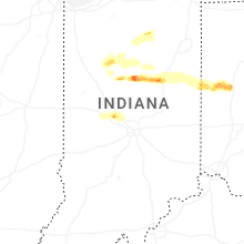


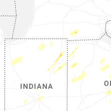


Connect with Interactive Hail Maps