

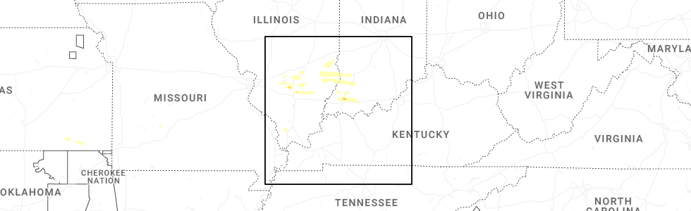
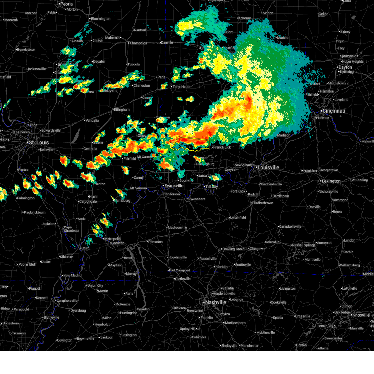
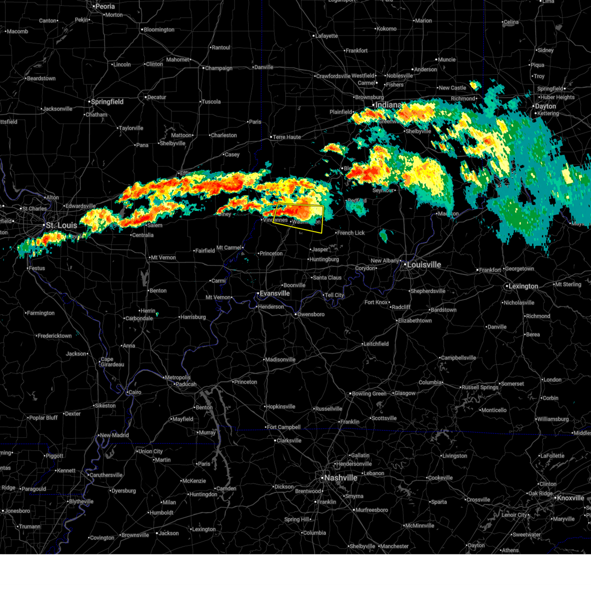
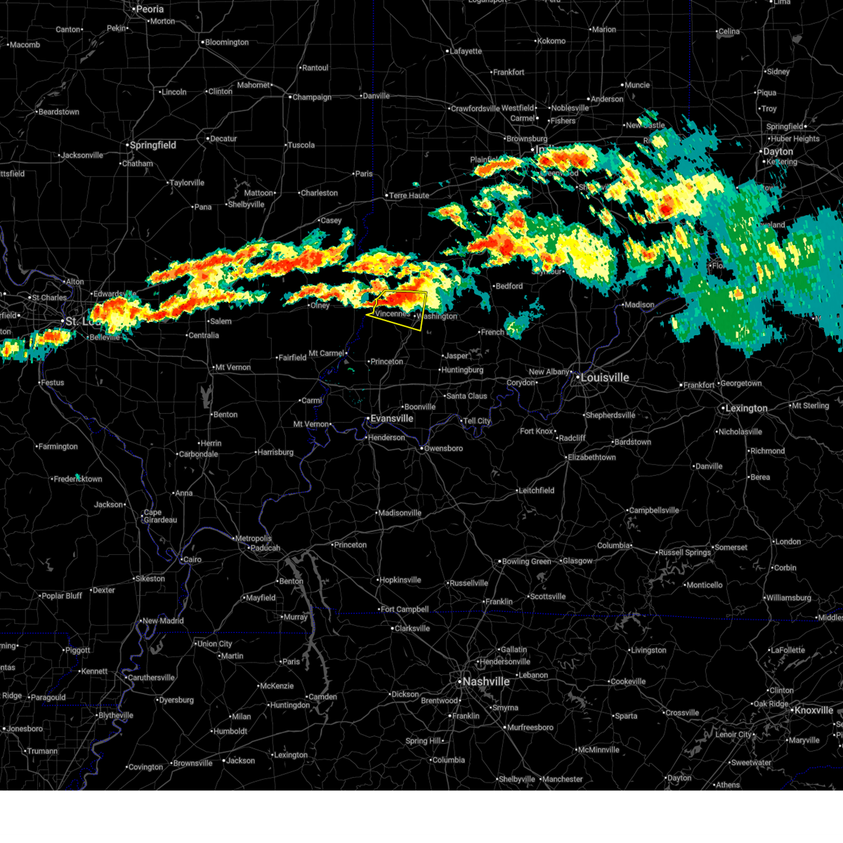
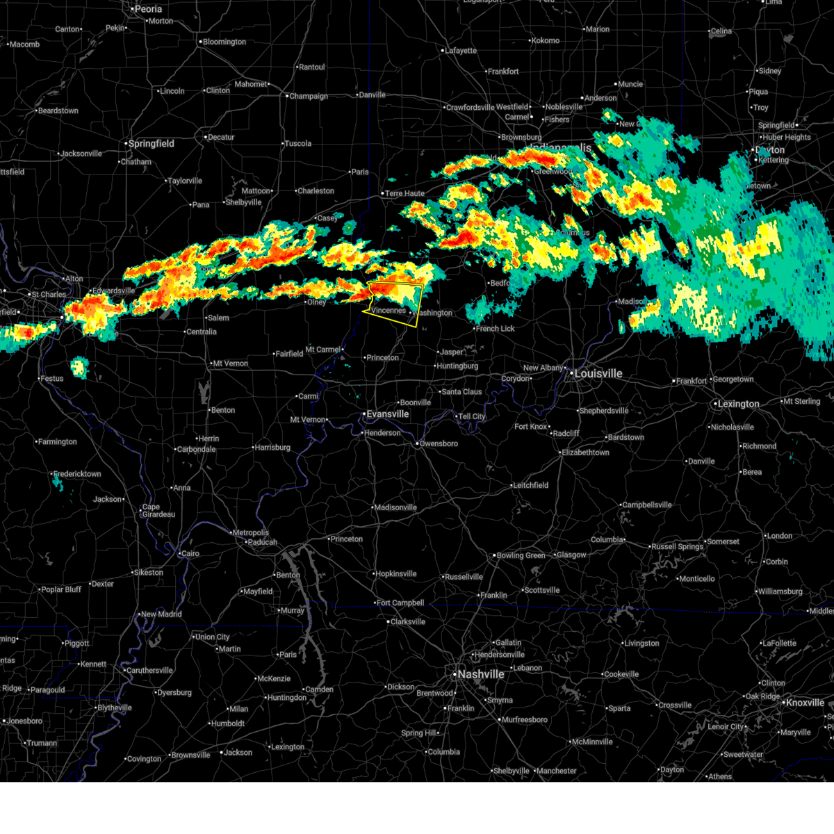
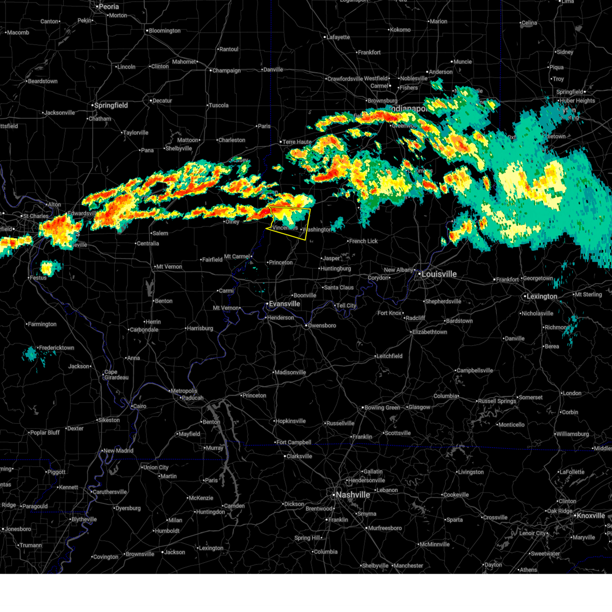
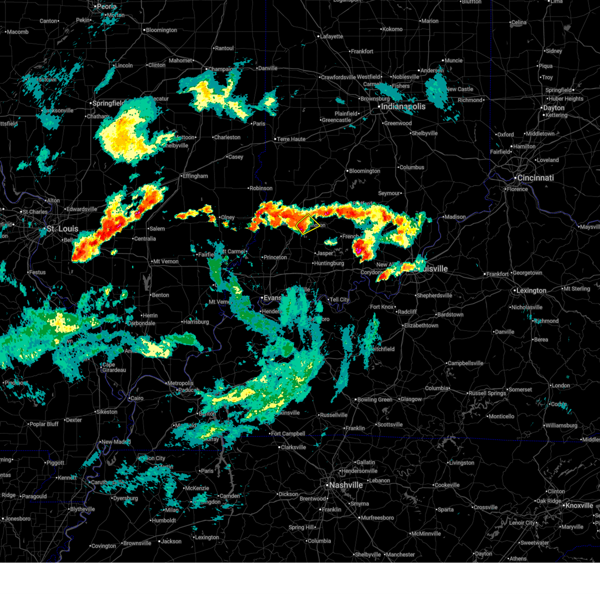
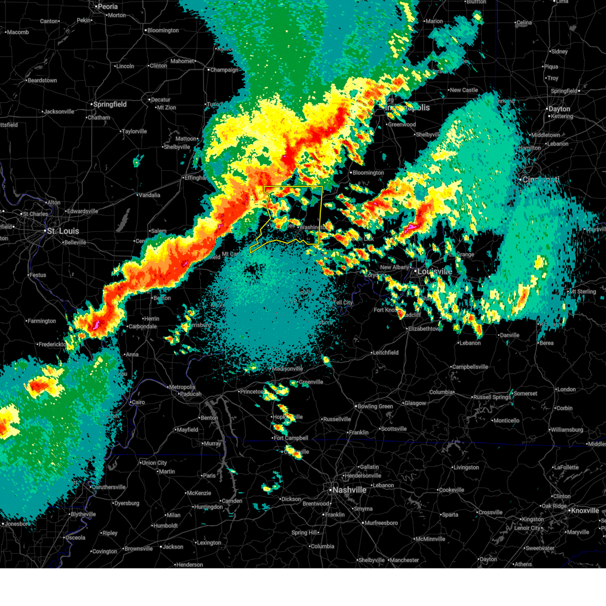
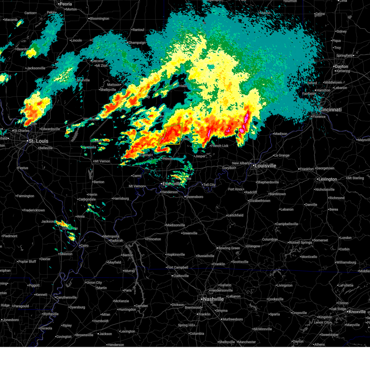
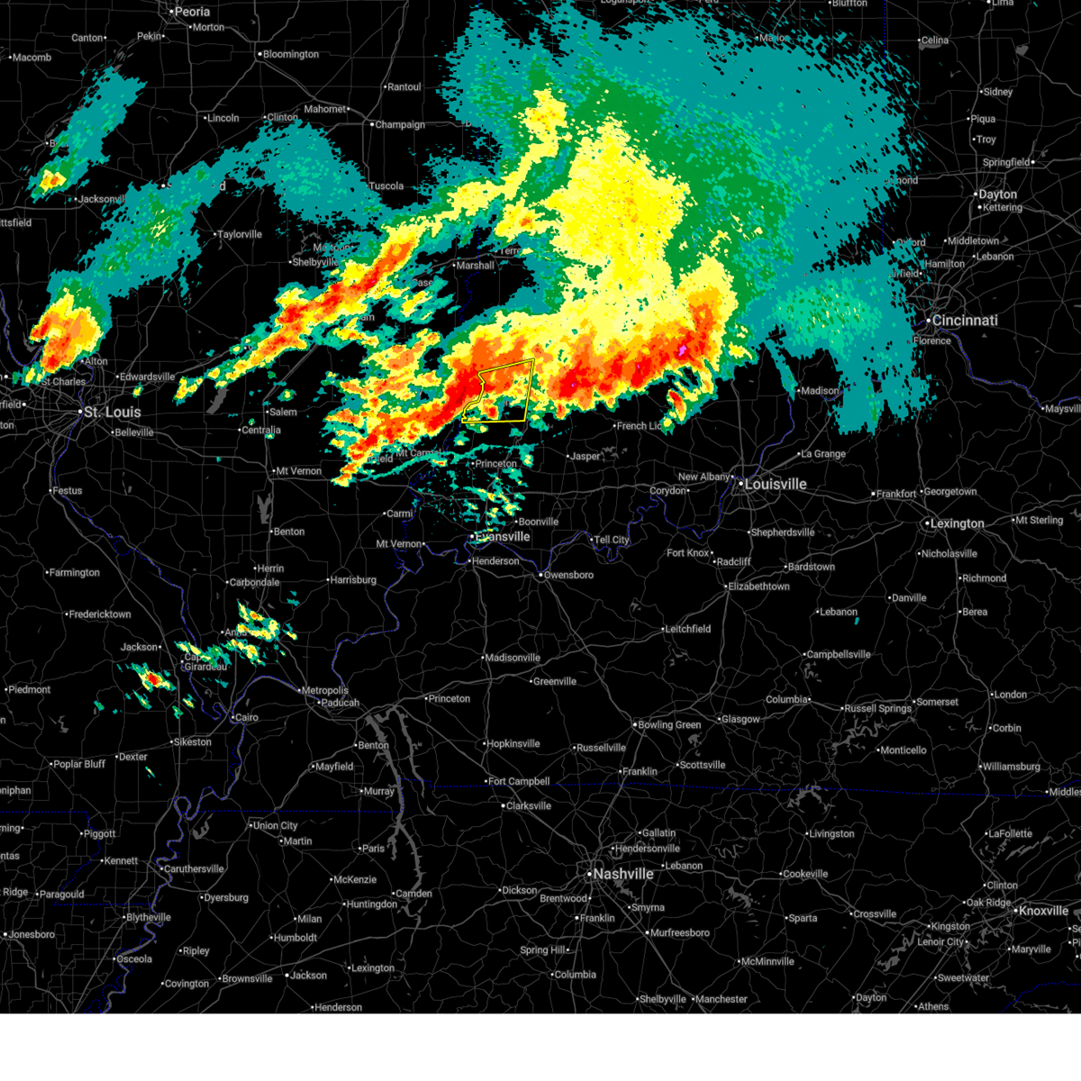
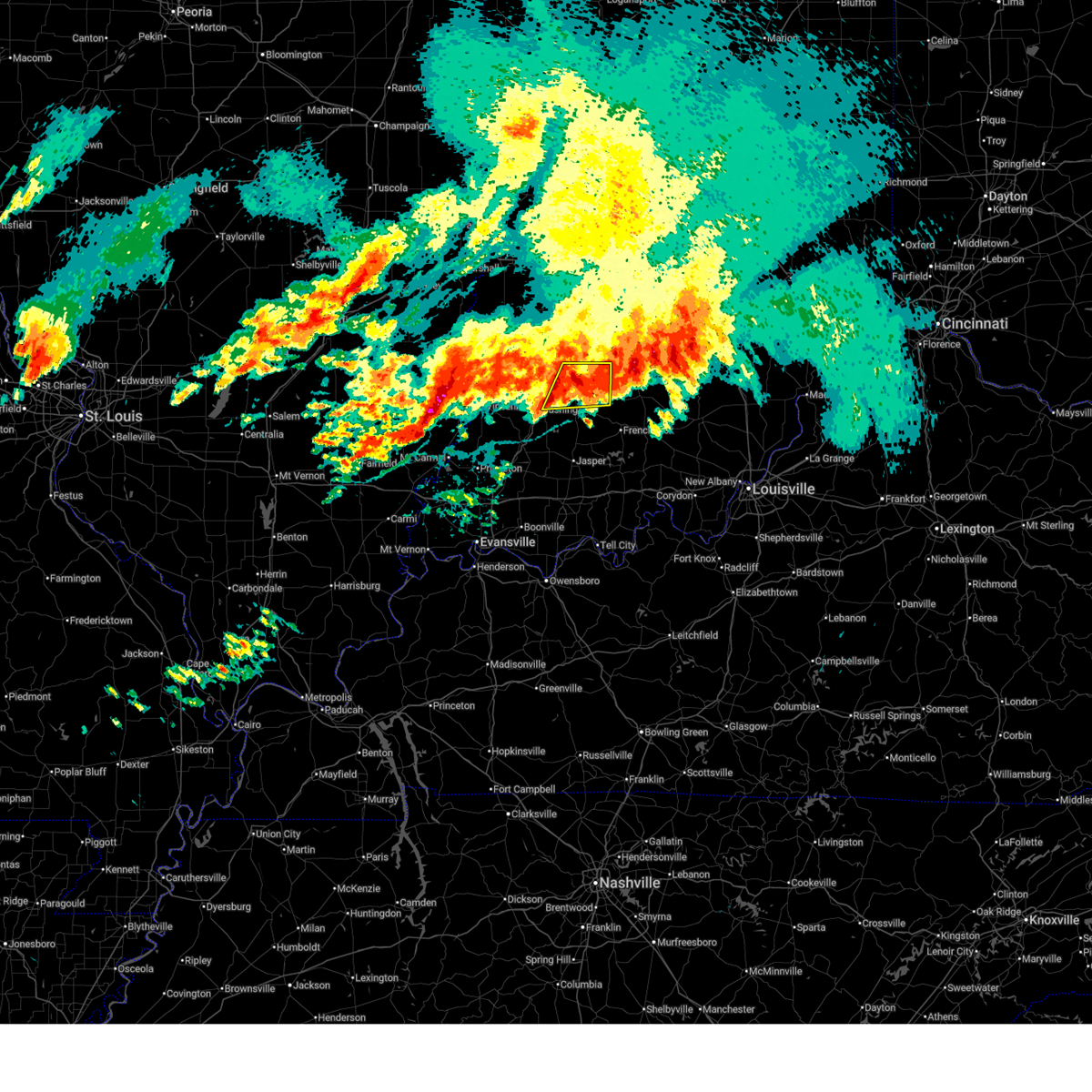
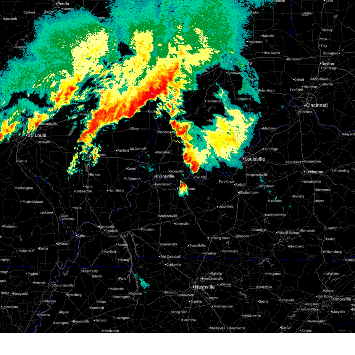
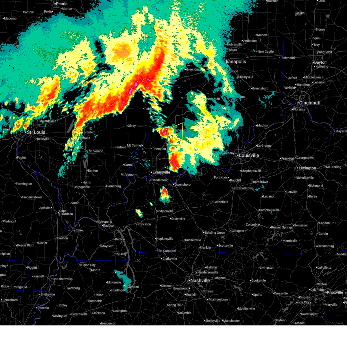
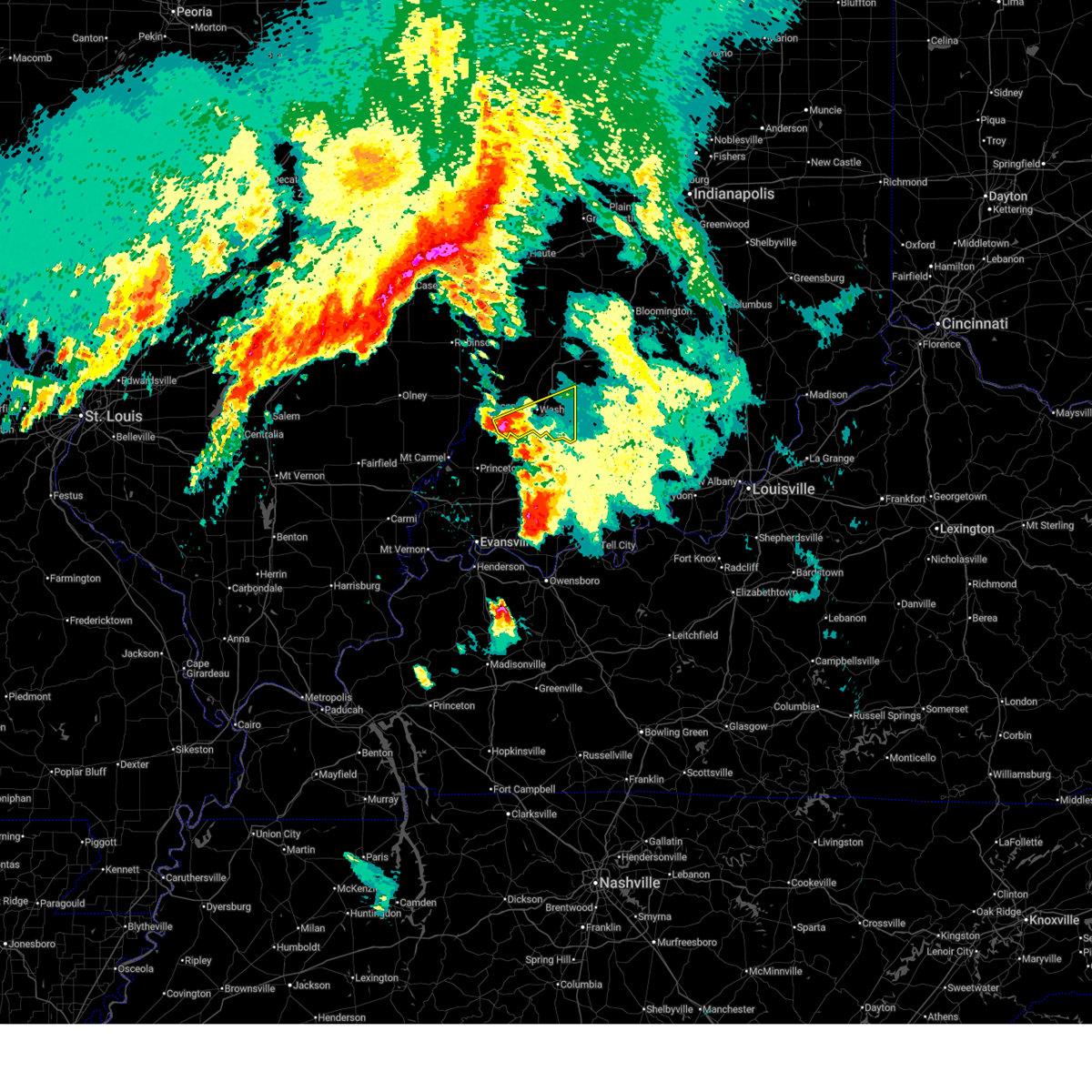
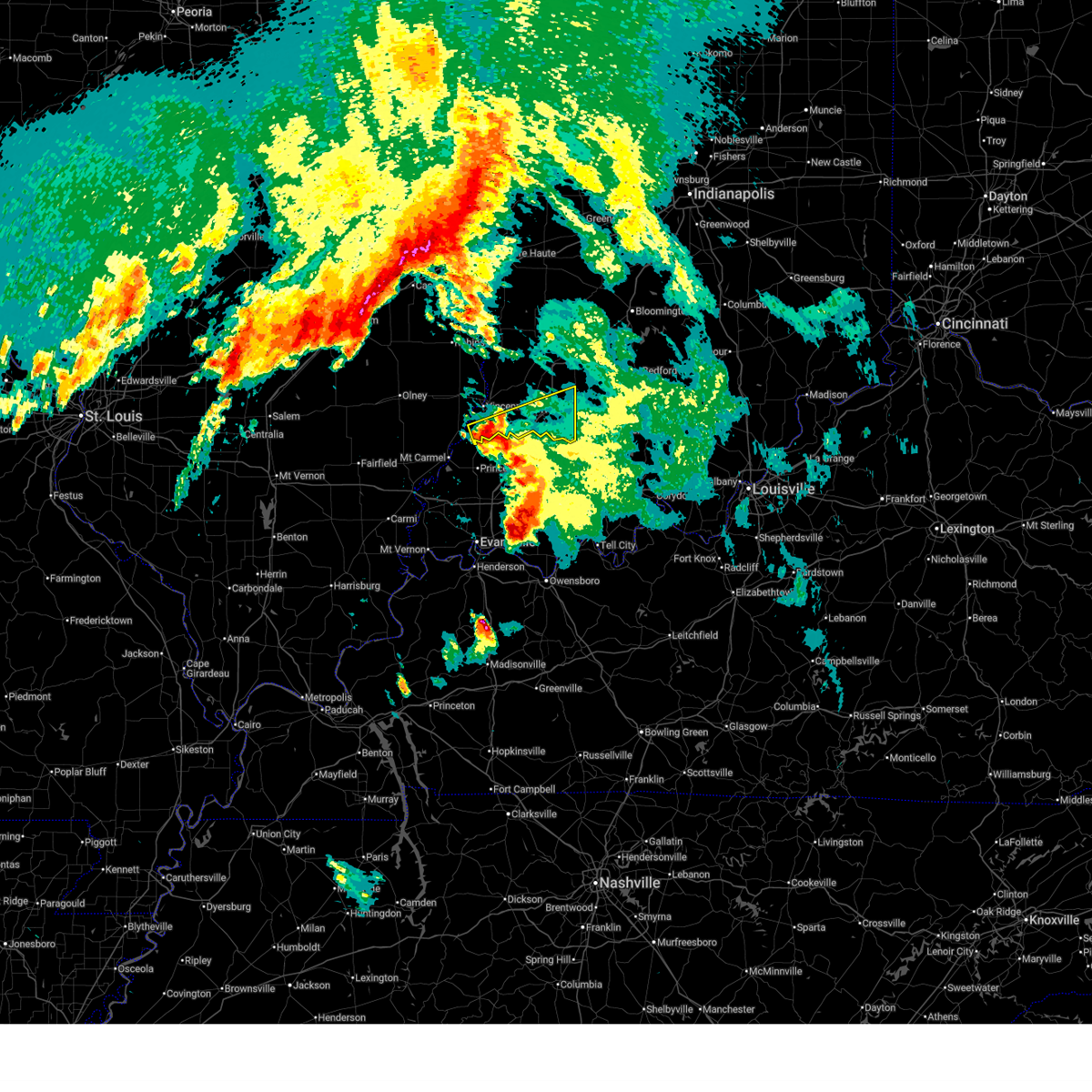
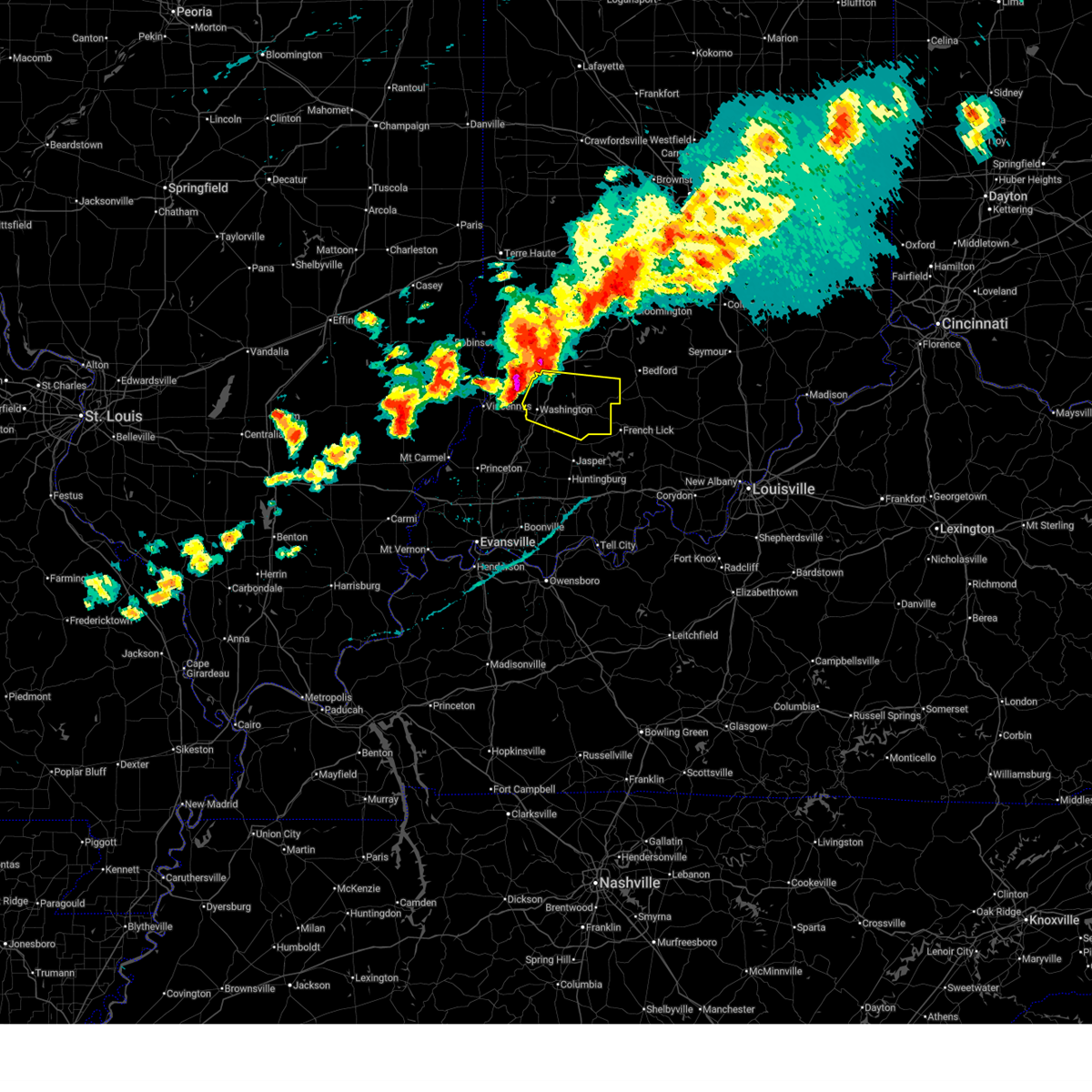
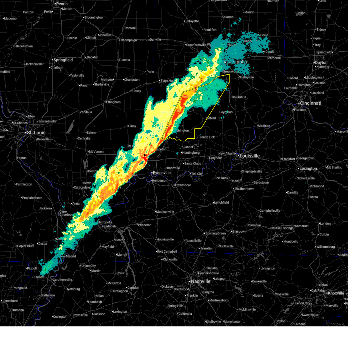
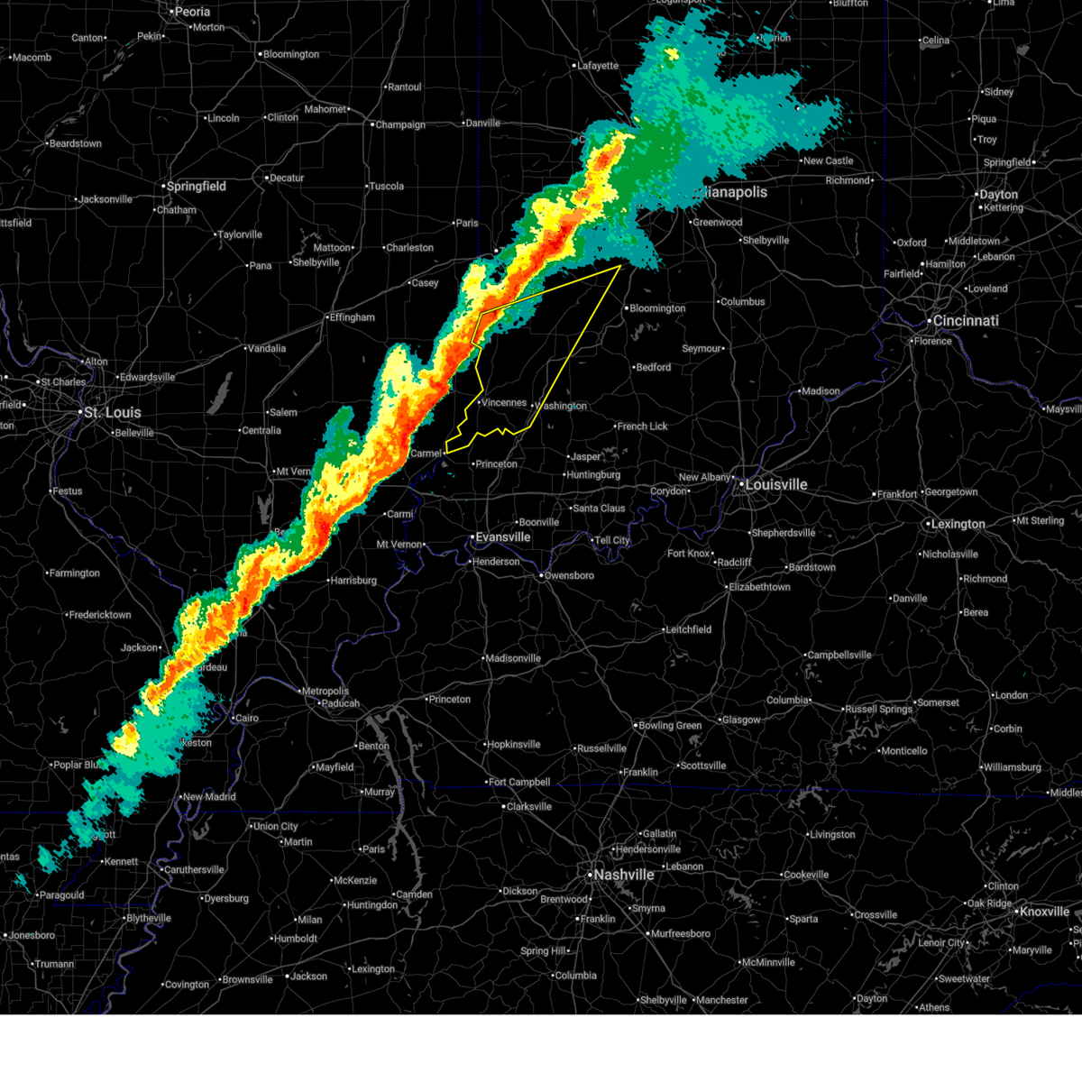
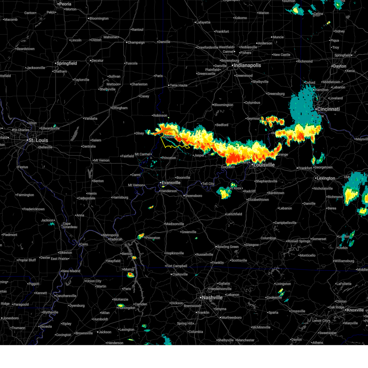
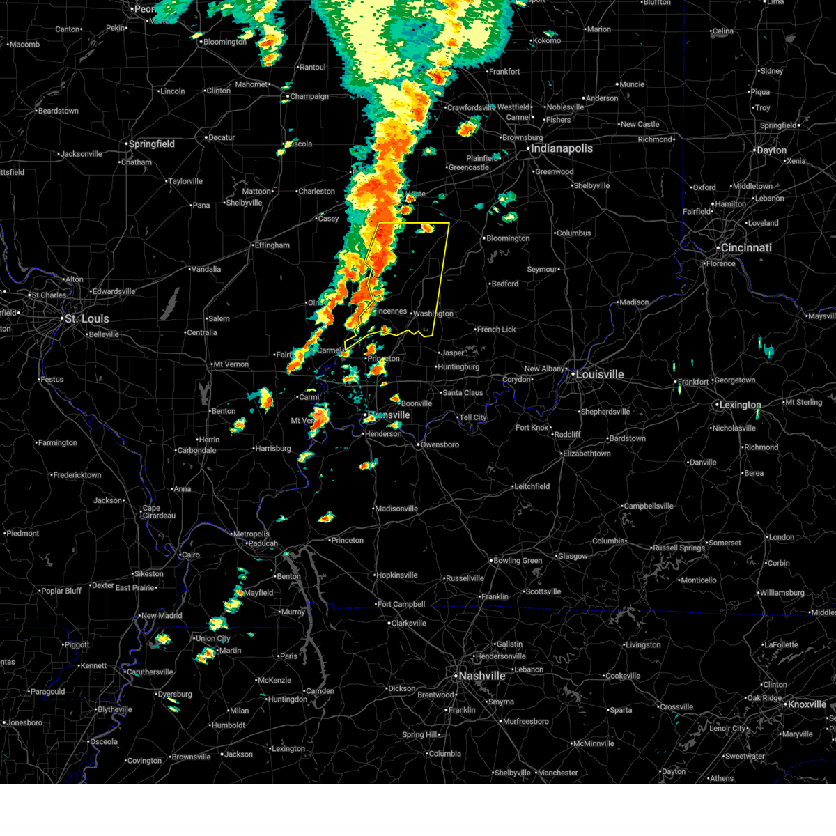
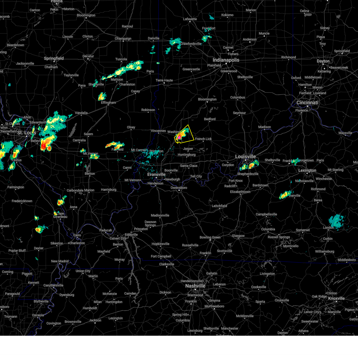
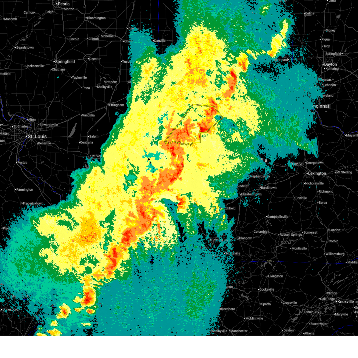
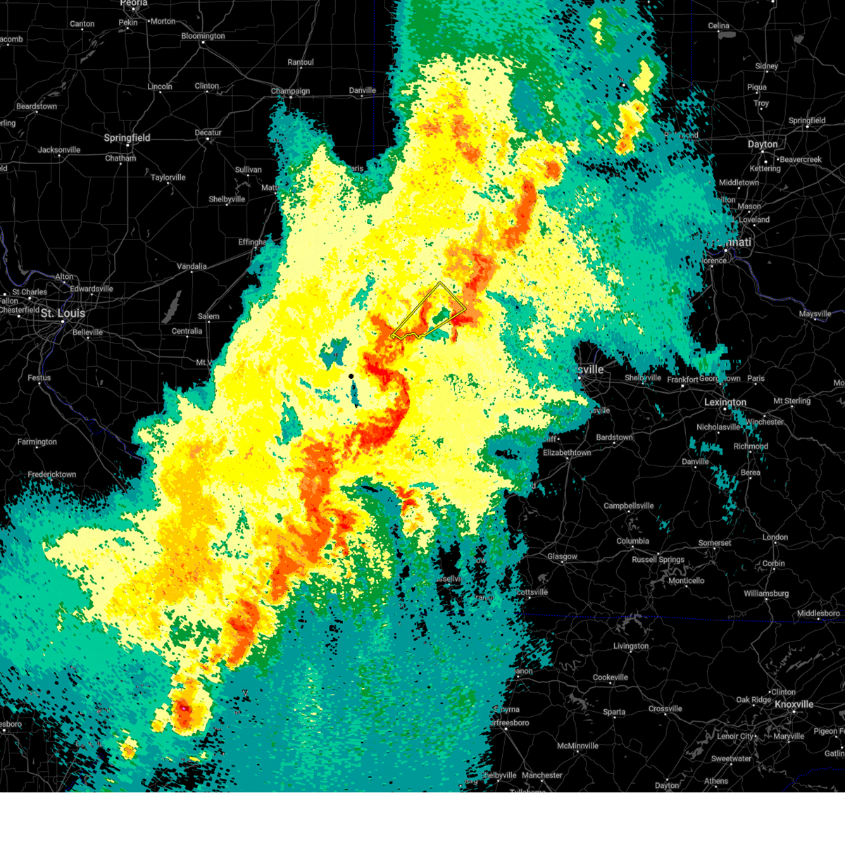
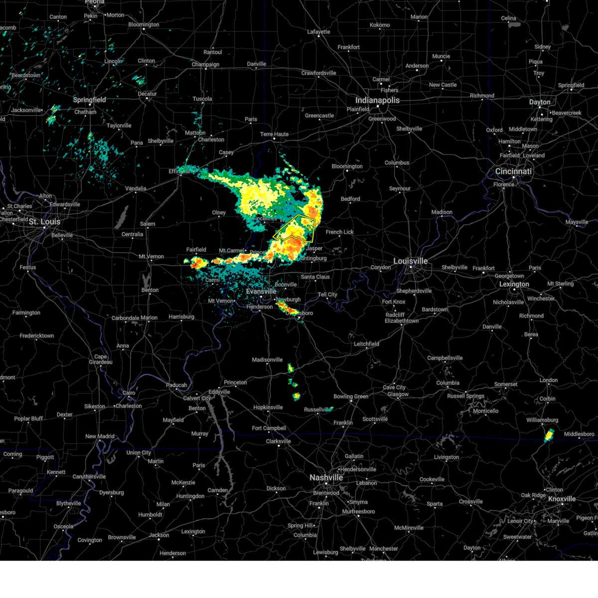
Hail Map for Washington, IN
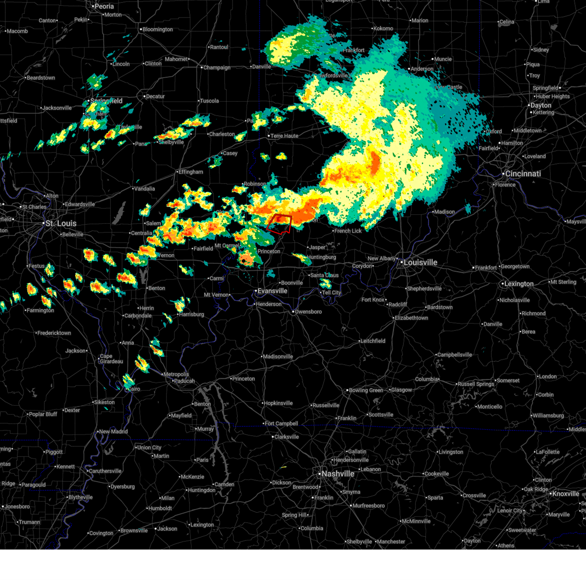
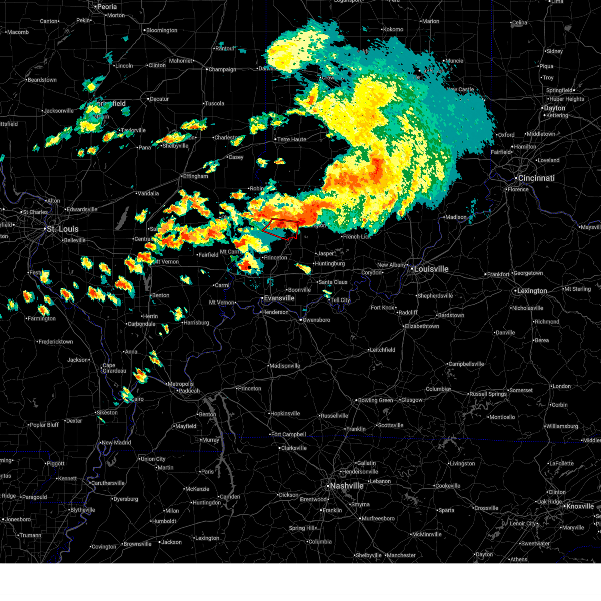
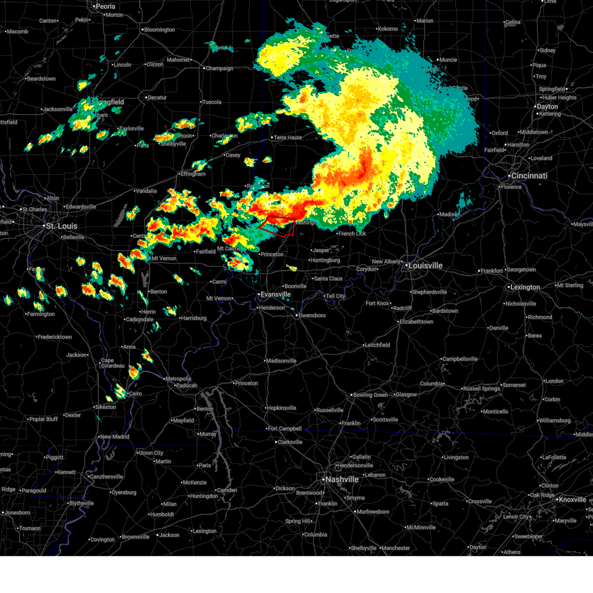
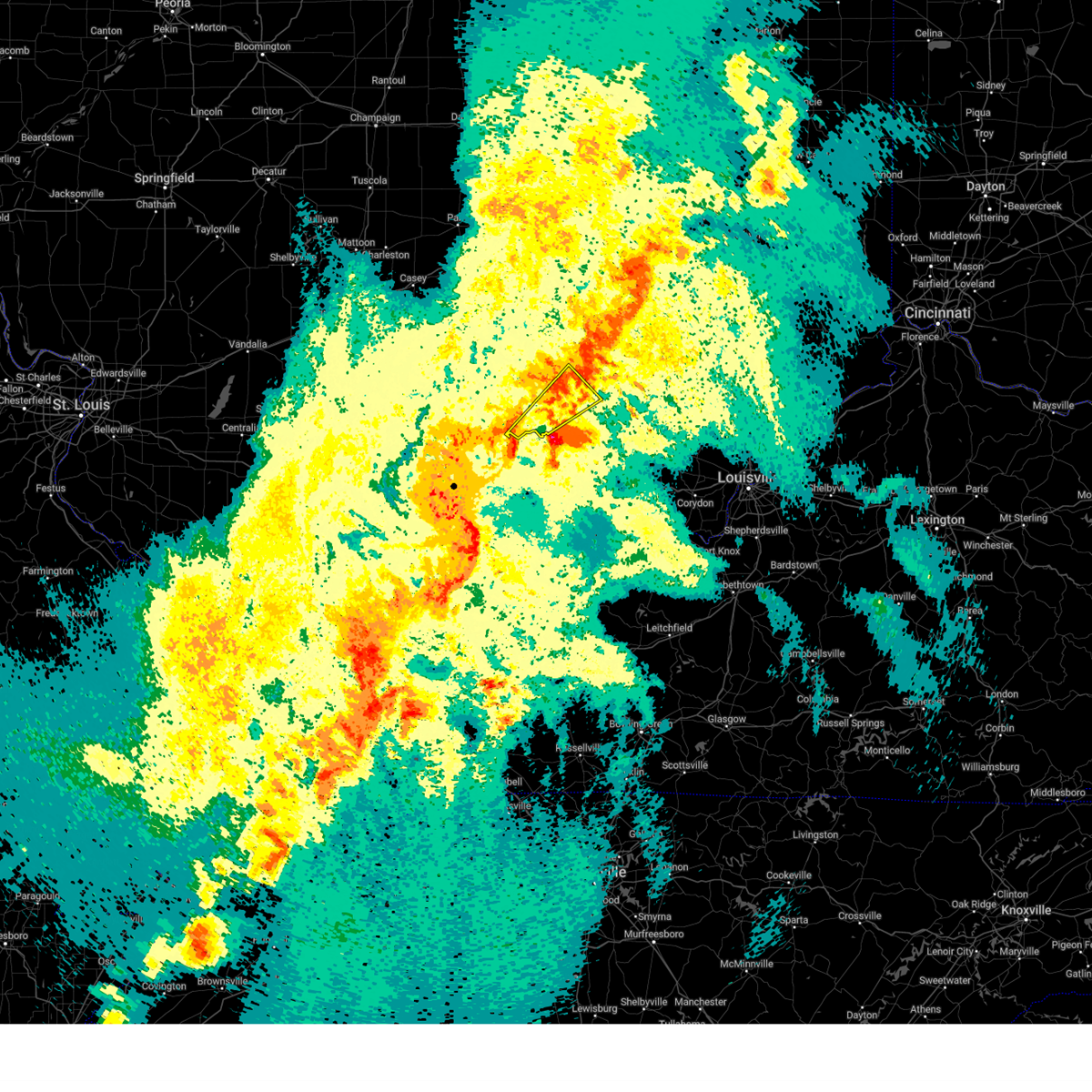
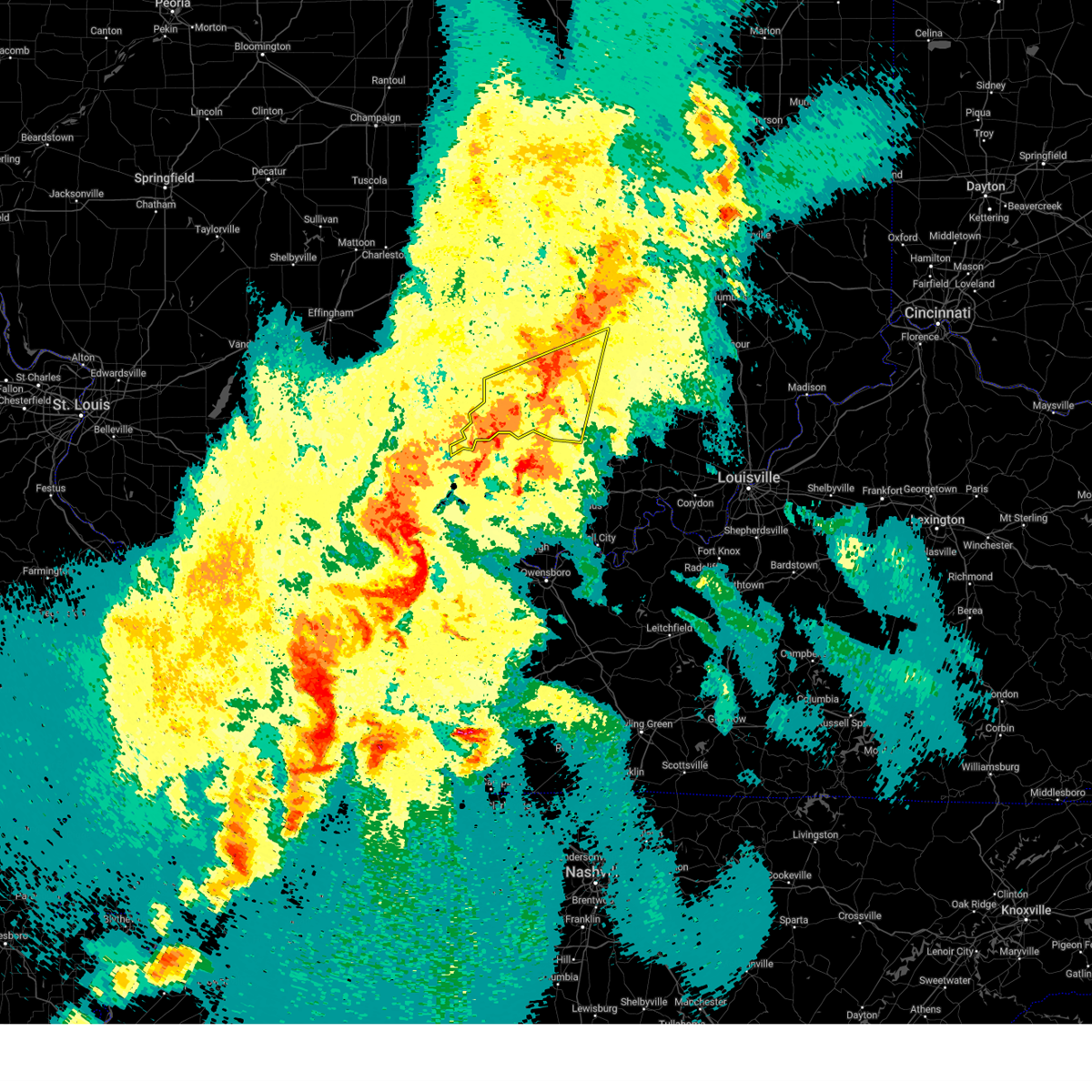
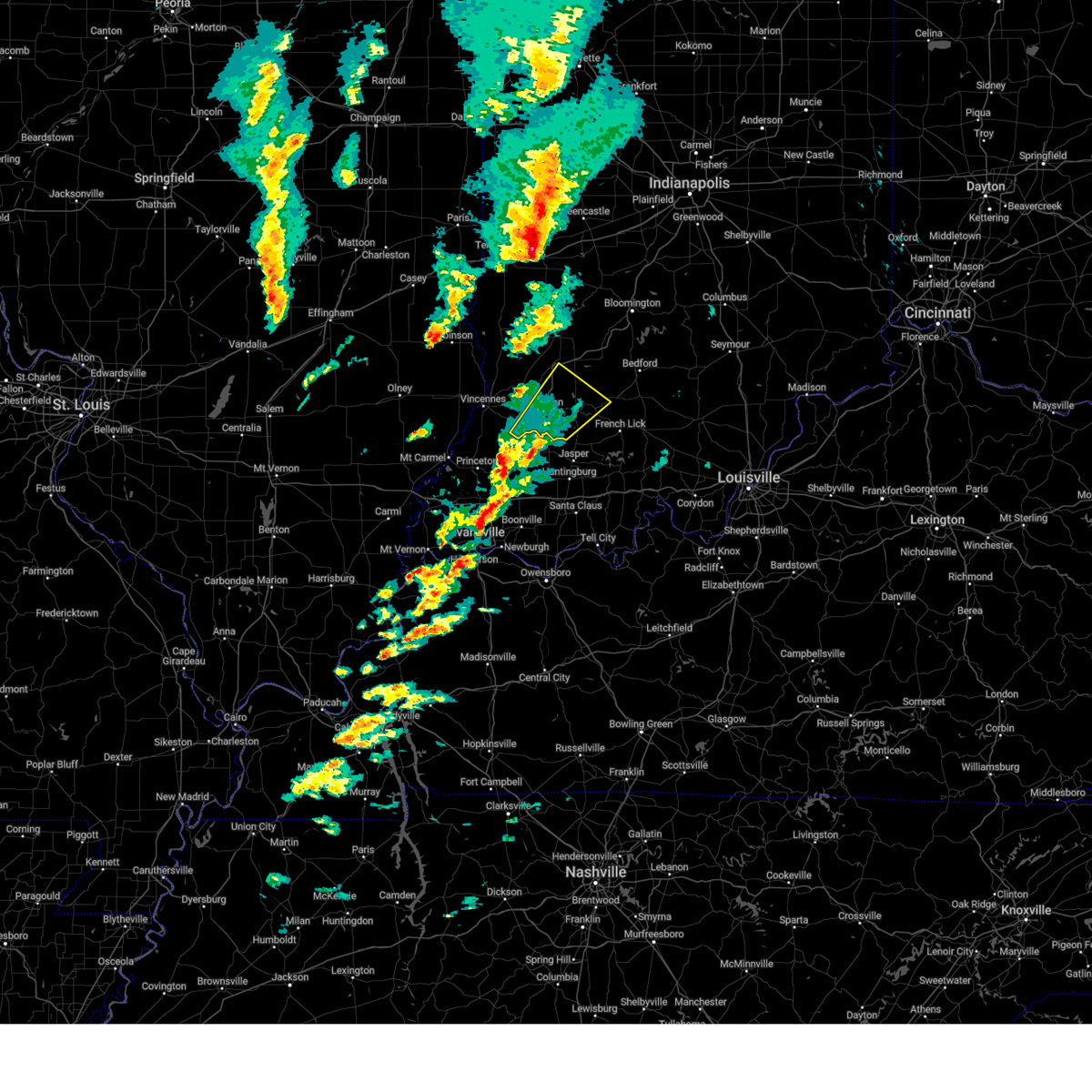
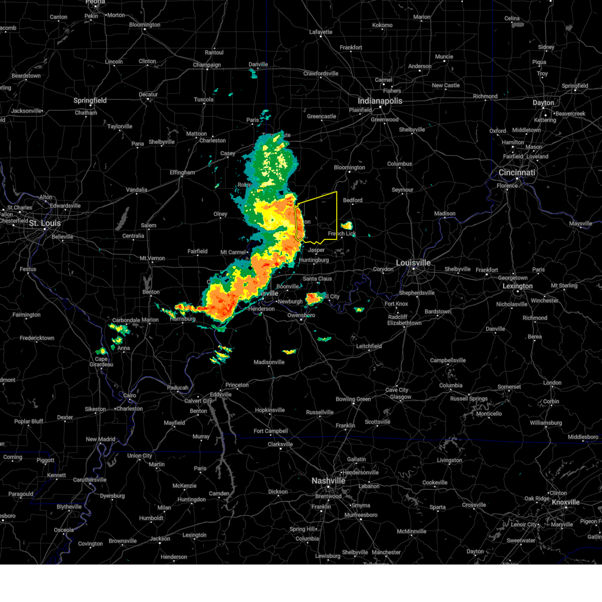
The Washington, IN area has had 12 reports of on-the-ground hail by trained spotters, and has been under severe weather warnings 48 times during the past 12 months. Doppler radar has detected hail at or near Washington, IN on 67 occasions, including 10 occasions during the past year.
| Name: | Washington, IN |
| Where Located: | 51.3 miles NNE of Evansville, IN |
| Map: | Google Map for Washington, IN |
| Population: | 11509 |
| Housing Units: | 5067 |
| More Info: | Search Google for Washington, IN |
1
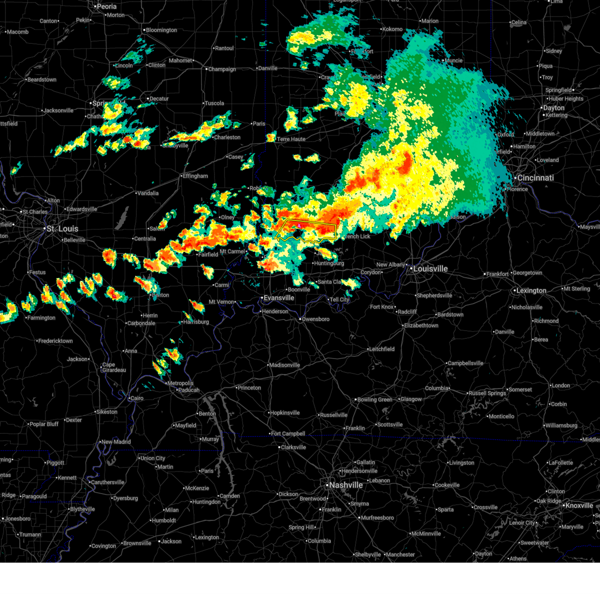
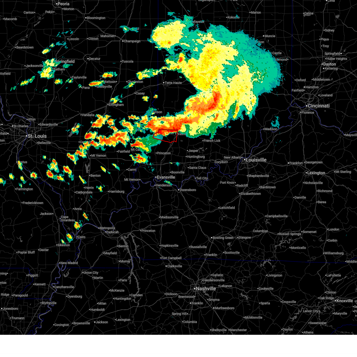
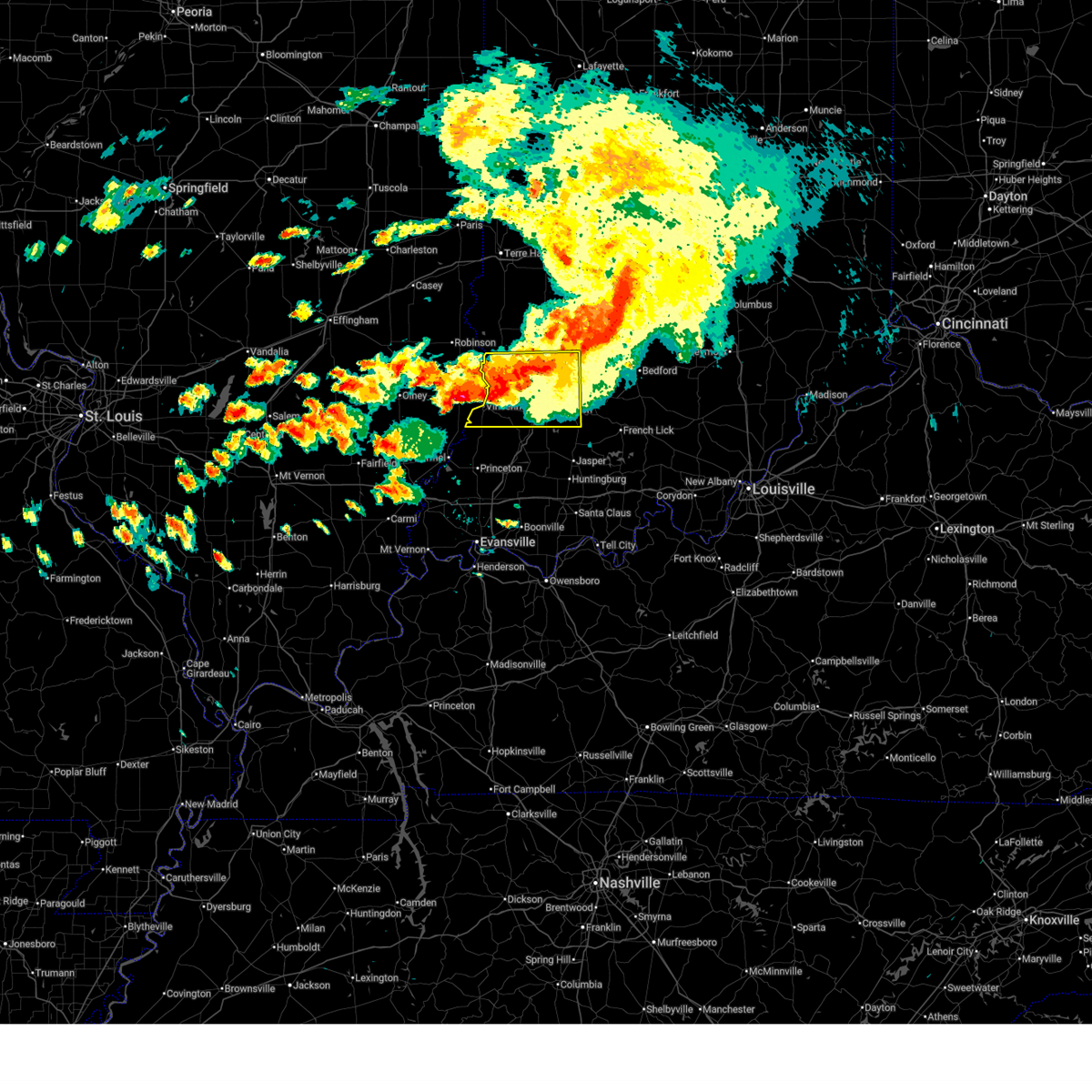
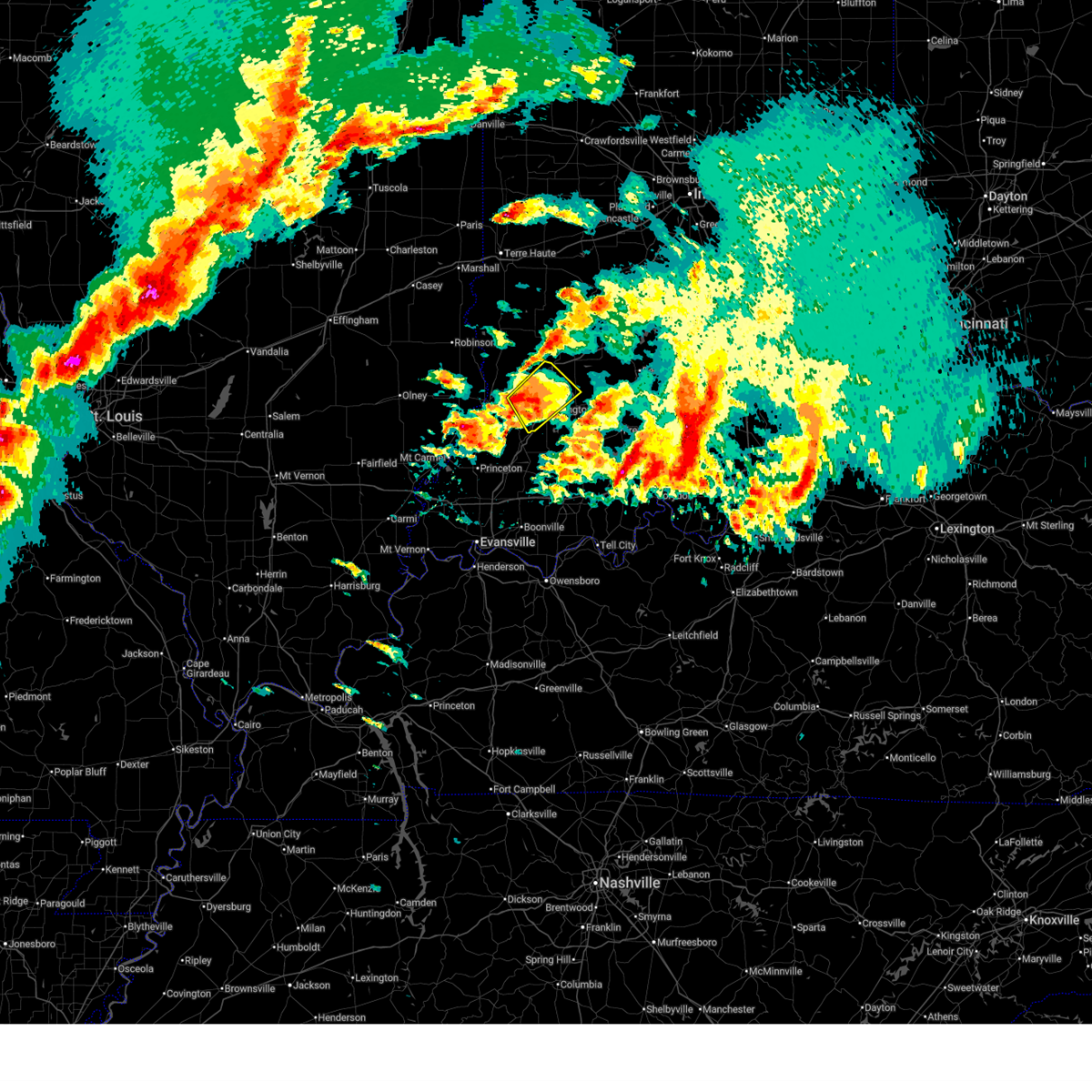
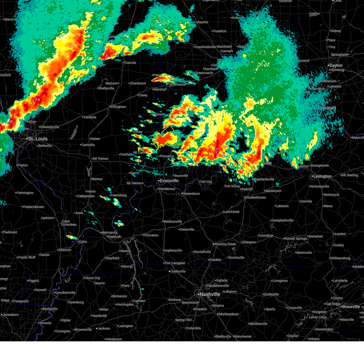
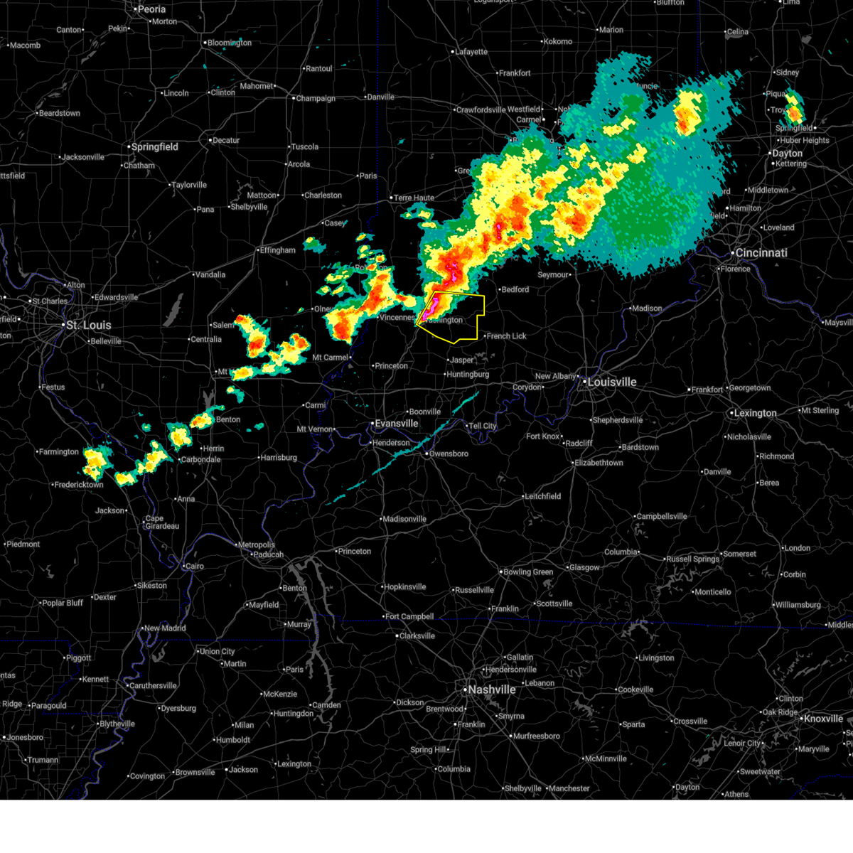
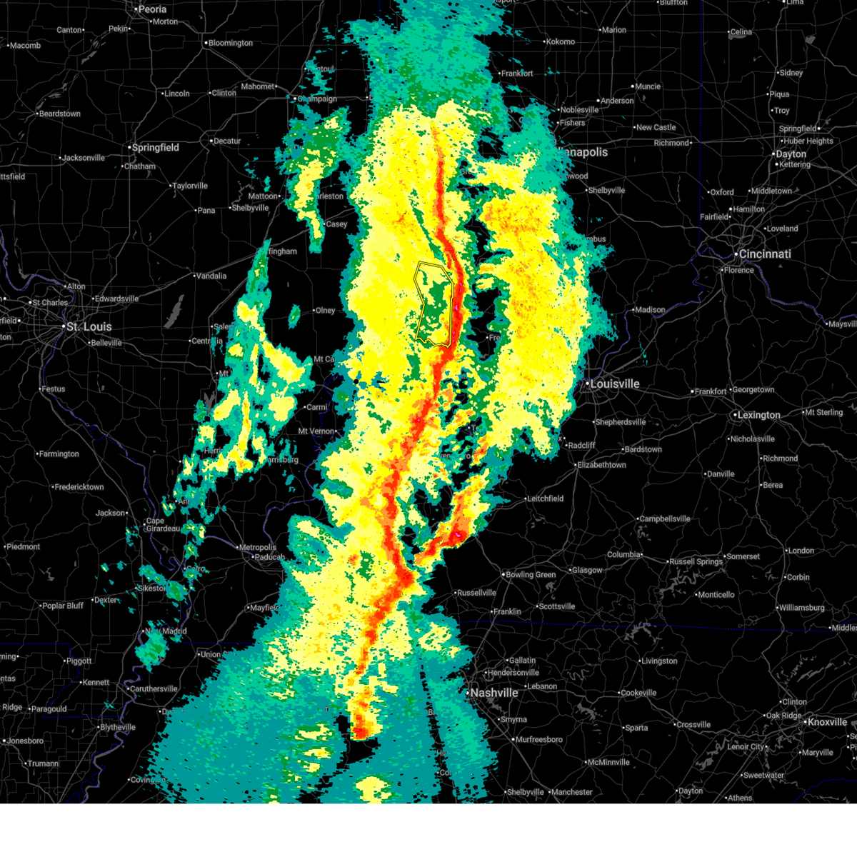
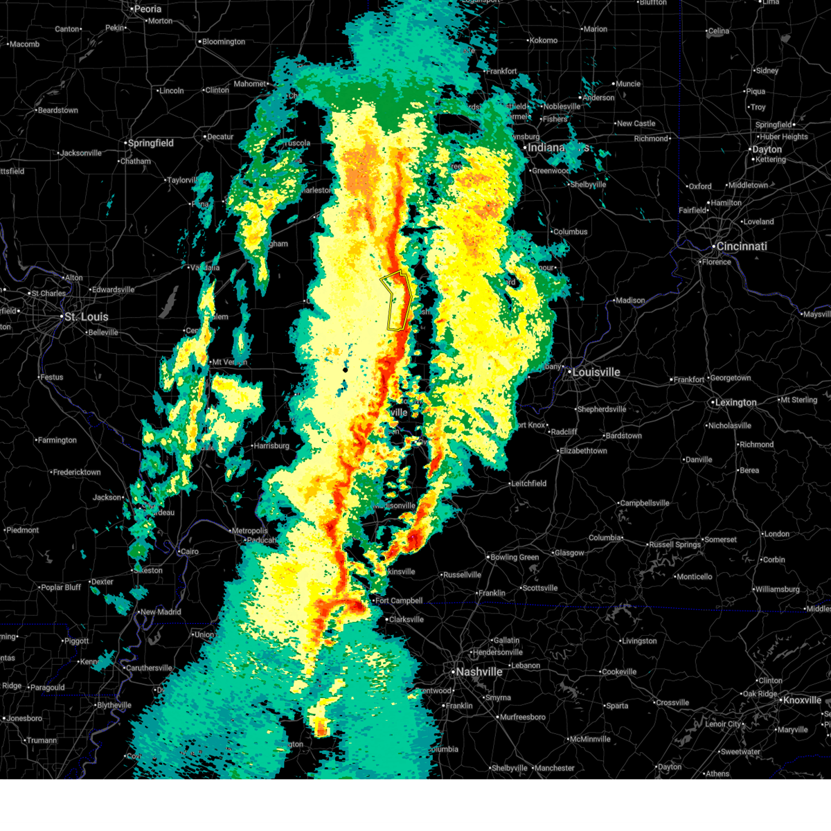
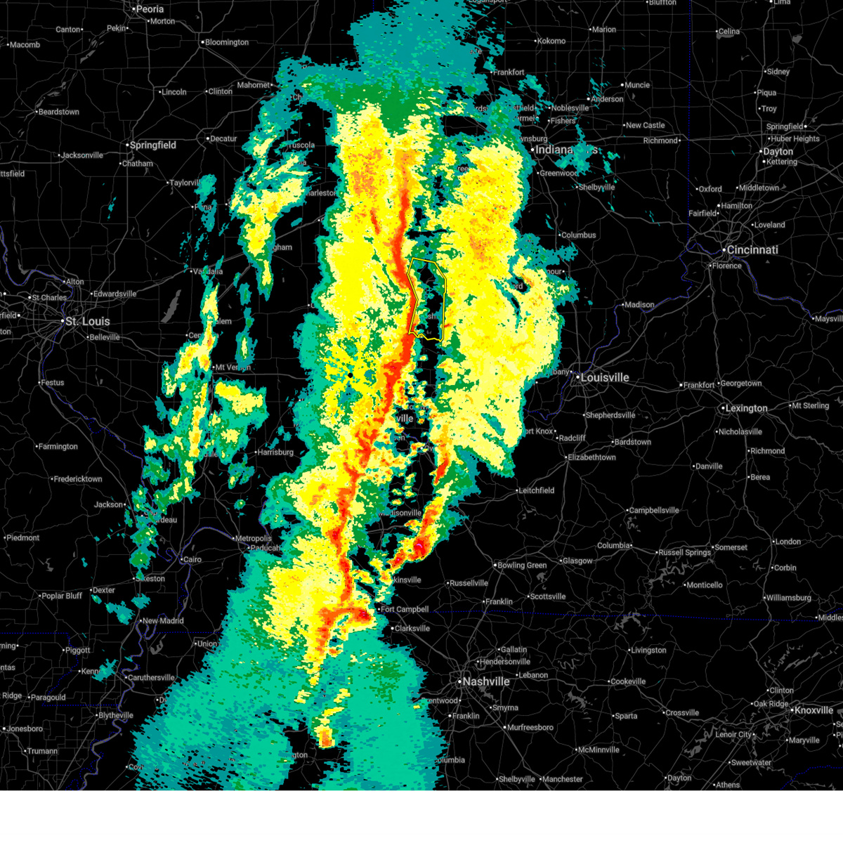
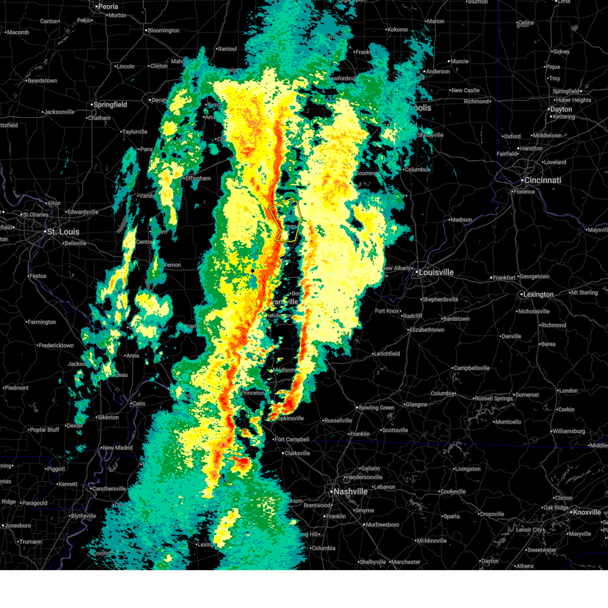
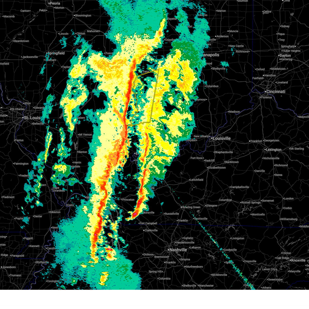
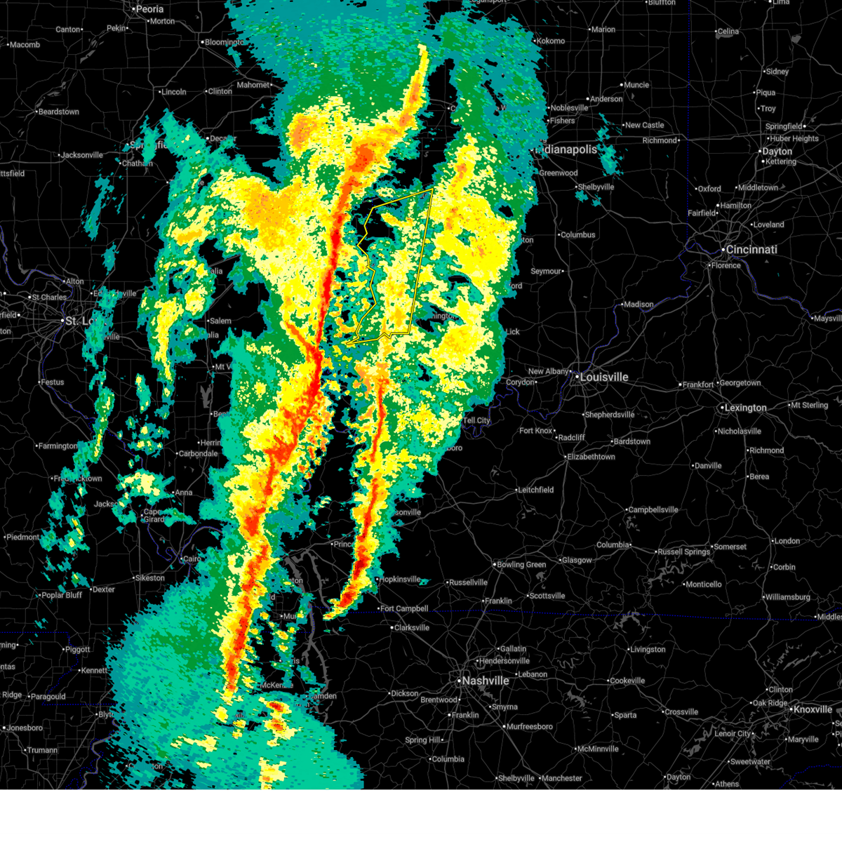
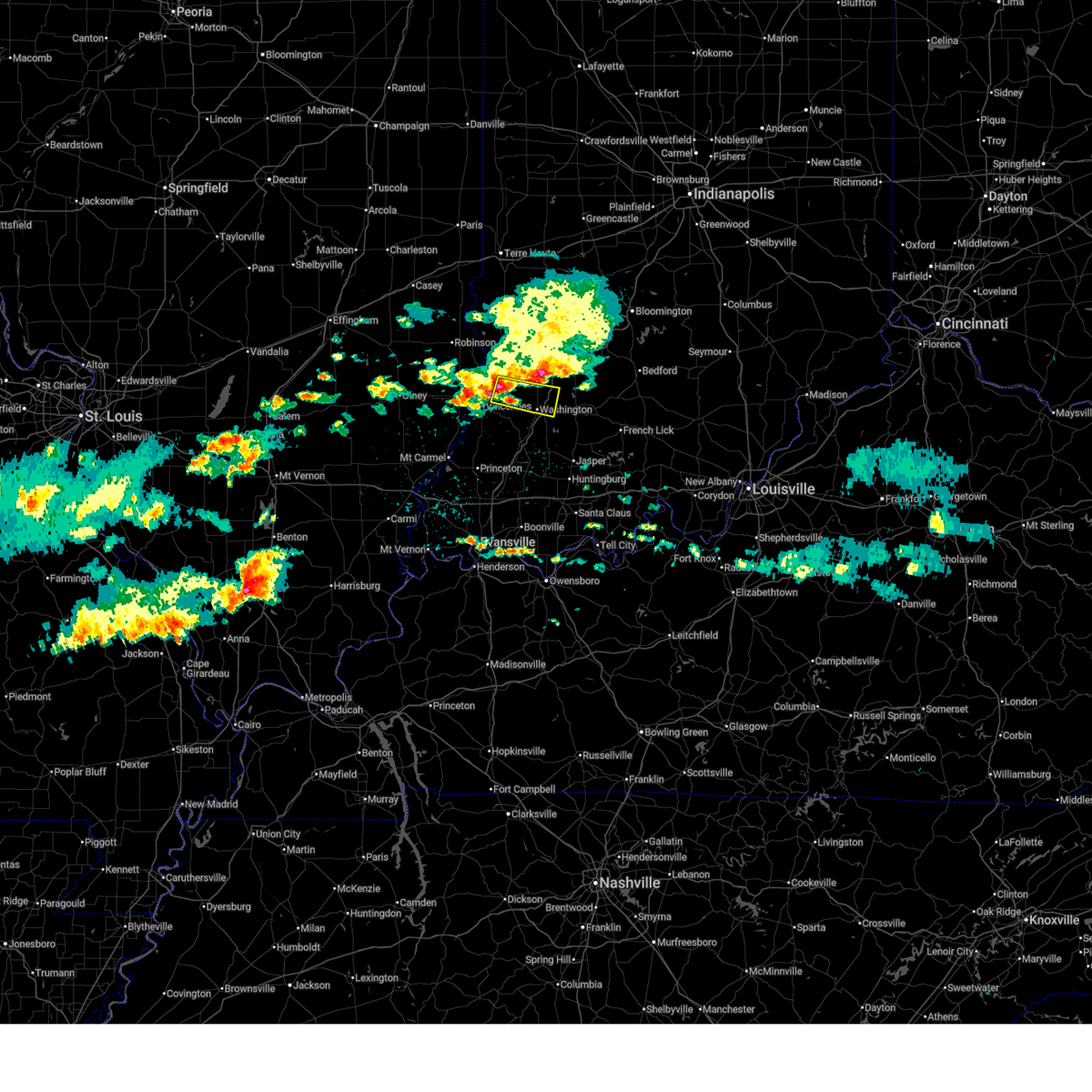
The Top Recent Hail Date for Washington, IN is Sunday, June 21, 2026 (13th out of 67)
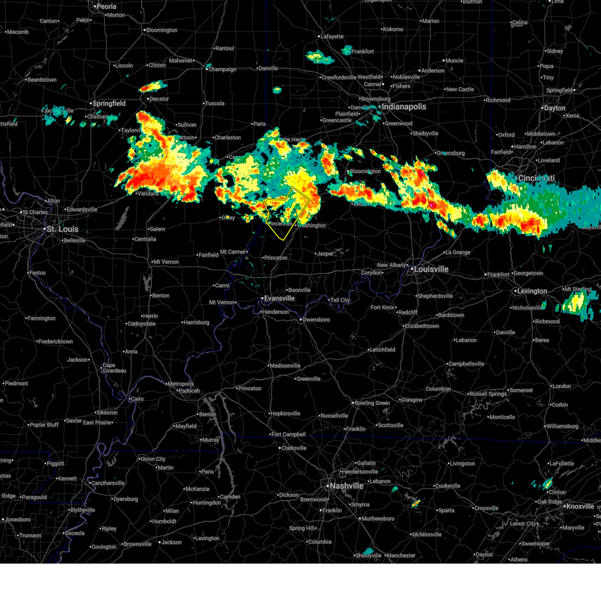
Hail and Wind Damage Spotted near Washington, IN
| Date / Time | Report Details |
|---|---|
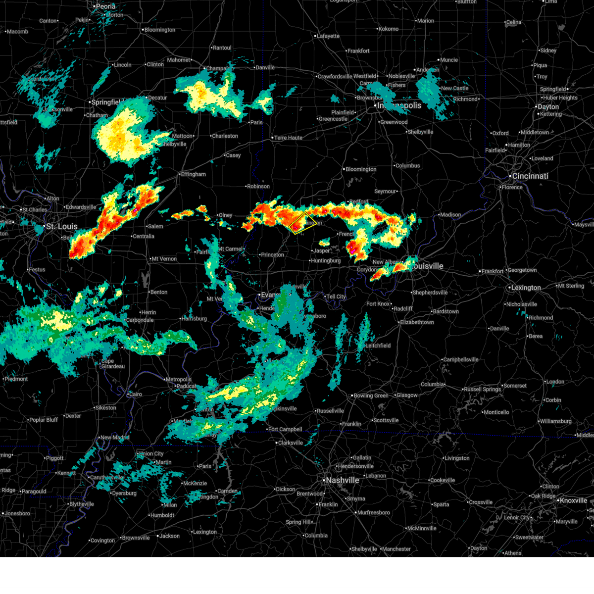
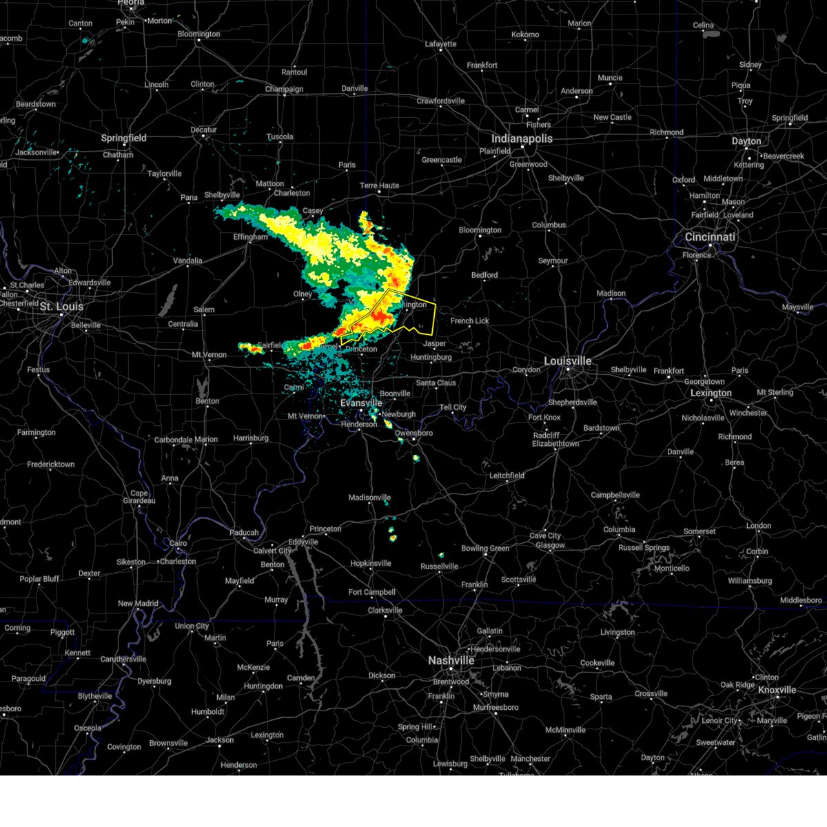
| 6/21/2026 9:12 PM EDT |
 The storm which prompted the warning has moved out of the area. therefore, the warning will be allowed to expire. however, gusty winds are still possible with this thunderstorm. a tornado watch remains in effect until 1000 pm edt for southwestern indiana. a tornado watch also remains in effect until midnight edt for southwestern indiana. The storm which prompted the warning has moved out of the area. therefore, the warning will be allowed to expire. however, gusty winds are still possible with this thunderstorm. a tornado watch remains in effect until 1000 pm edt for southwestern indiana. a tornado watch also remains in effect until midnight edt for southwestern indiana.
|
| 6/21/2026 8:46 PM EDT |
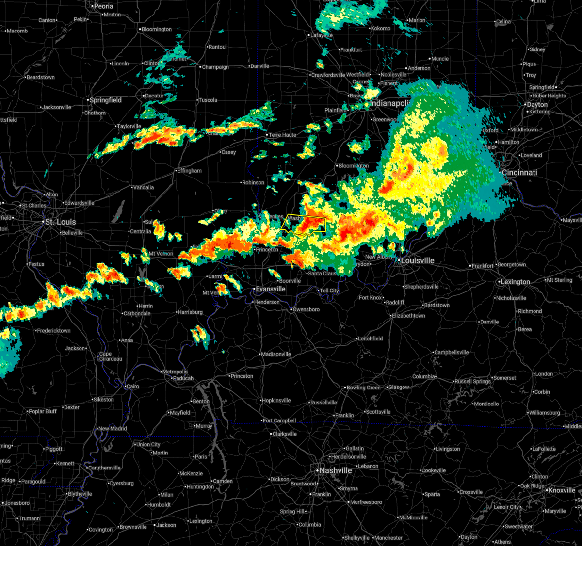
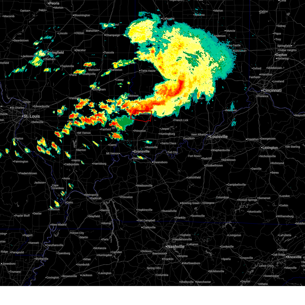
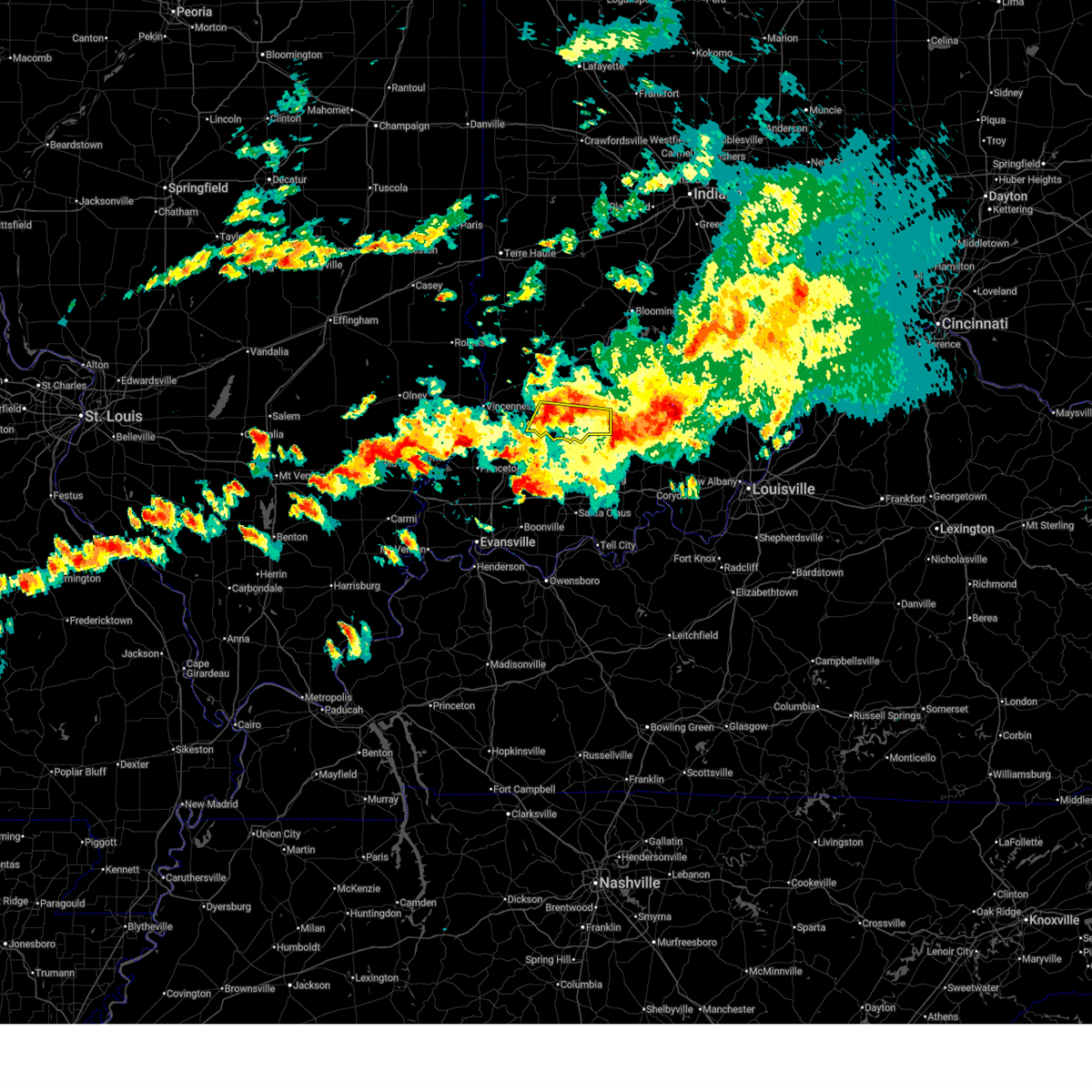 At 846 pm edt, a severe thunderstorm was located 9 miles southwest of shoals, or 19 miles east of petersburg, moving east at 25 mph (radar indicated). Hazards include 70 mph wind gusts and quarter size hail. Hail damage to vehicles is expected. expect considerable tree damage. wind damage is also likely to mobile homes, roofs, and outbuildings. Locations impacted include, washington, shoals, loogootee, montgomery, cannelburg, alfordsville, glendale fishery, and lacy. At 846 pm edt, a severe thunderstorm was located 9 miles southwest of shoals, or 19 miles east of petersburg, moving east at 25 mph (radar indicated). Hazards include 70 mph wind gusts and quarter size hail. Hail damage to vehicles is expected. expect considerable tree damage. wind damage is also likely to mobile homes, roofs, and outbuildings. Locations impacted include, washington, shoals, loogootee, montgomery, cannelburg, alfordsville, glendale fishery, and lacy.
|
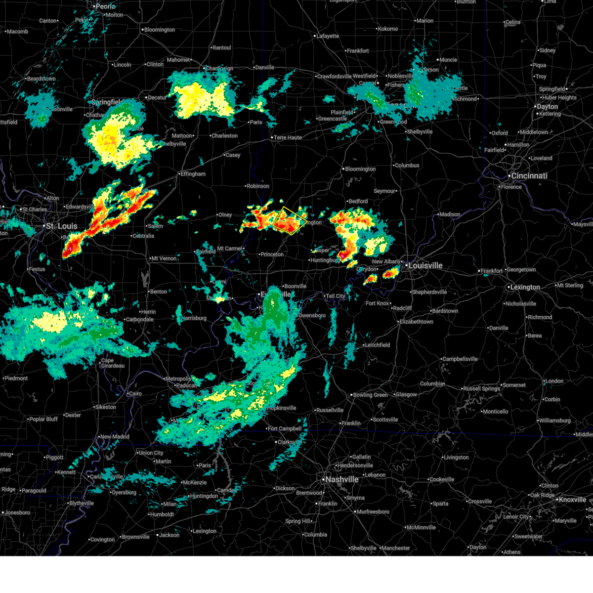
| 6/21/2026 8:15 PM EDT |
 At 815 pm edt, a severe thunderstorm was located 7 miles southeast of washington, or 14 miles northeast of petersburg, moving east at 45 mph (radar indicated). Hazards include 70 mph wind gusts and quarter size hail. Hail damage to vehicles is expected. expect considerable tree damage. wind damage is also likely to mobile homes, roofs, and outbuildings. Locations impacted include, washington, shoals, loogootee, monroe city, wheatland, montgomery, cannelburg, alfordsville, glendale fishery, and lacy. At 815 pm edt, a severe thunderstorm was located 7 miles southeast of washington, or 14 miles northeast of petersburg, moving east at 45 mph (radar indicated). Hazards include 70 mph wind gusts and quarter size hail. Hail damage to vehicles is expected. expect considerable tree damage. wind damage is also likely to mobile homes, roofs, and outbuildings. Locations impacted include, washington, shoals, loogootee, monroe city, wheatland, montgomery, cannelburg, alfordsville, glendale fishery, and lacy.
|
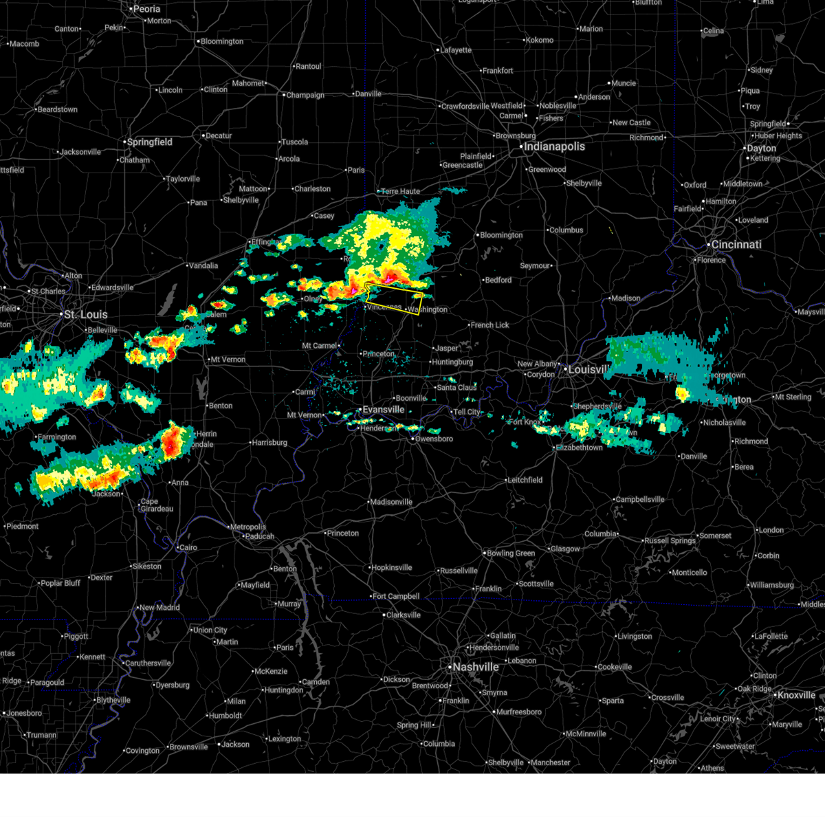
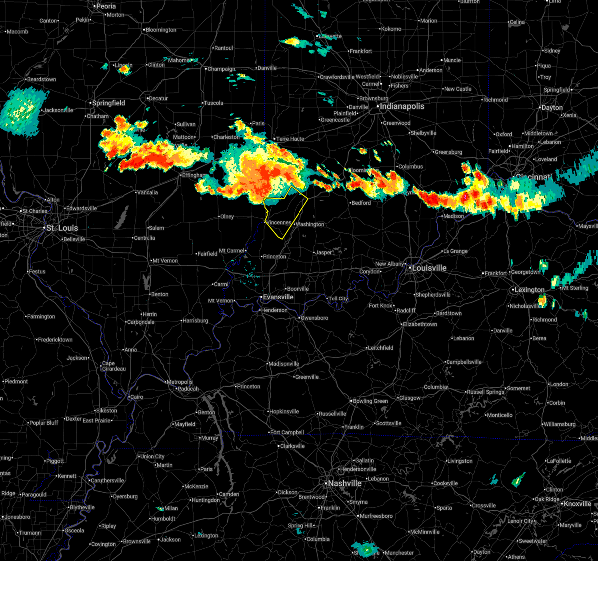
| 6/21/2026 8:09 PM EDT |
 Svrind the national weather service in indianapolis has issued a * severe thunderstorm warning for, southeastern knox county in southwestern indiana, southern martin county in southwestern indiana, southern daviess county in southwestern indiana, * until 915 pm edt. * at 809 pm edt, a severe thunderstorm was located near washington, or 10 miles northeast of petersburg, moving east at 45 mph (radar indicated). Hazards include 70 mph wind gusts. Expect considerable tree damage. Damage is likely to mobile homes, roofs, and outbuildings. Svrind the national weather service in indianapolis has issued a * severe thunderstorm warning for, southeastern knox county in southwestern indiana, southern martin county in southwestern indiana, southern daviess county in southwestern indiana, * until 915 pm edt. * at 809 pm edt, a severe thunderstorm was located near washington, or 10 miles northeast of petersburg, moving east at 45 mph (radar indicated). Hazards include 70 mph wind gusts. Expect considerable tree damage. Damage is likely to mobile homes, roofs, and outbuildings.
|
| 6/21/2026 7:58 PM EDT |
 At 758 pm edt, a severe thunderstorm capable of producing a tornado was located 7 miles west of washington, or 8 miles north of petersburg, moving east at 30 mph (radar indicated rotation). Hazards include tornado. Flying debris will be dangerous to those caught without shelter. mobile homes will be damaged or destroyed. damage to roofs, windows, and vehicles will occur. tree damage is likely. Locations impacted include, washington, monroe city, and wheatland. At 758 pm edt, a severe thunderstorm capable of producing a tornado was located 7 miles west of washington, or 8 miles north of petersburg, moving east at 30 mph (radar indicated rotation). Hazards include tornado. Flying debris will be dangerous to those caught without shelter. mobile homes will be damaged or destroyed. damage to roofs, windows, and vehicles will occur. tree damage is likely. Locations impacted include, washington, monroe city, and wheatland.
|
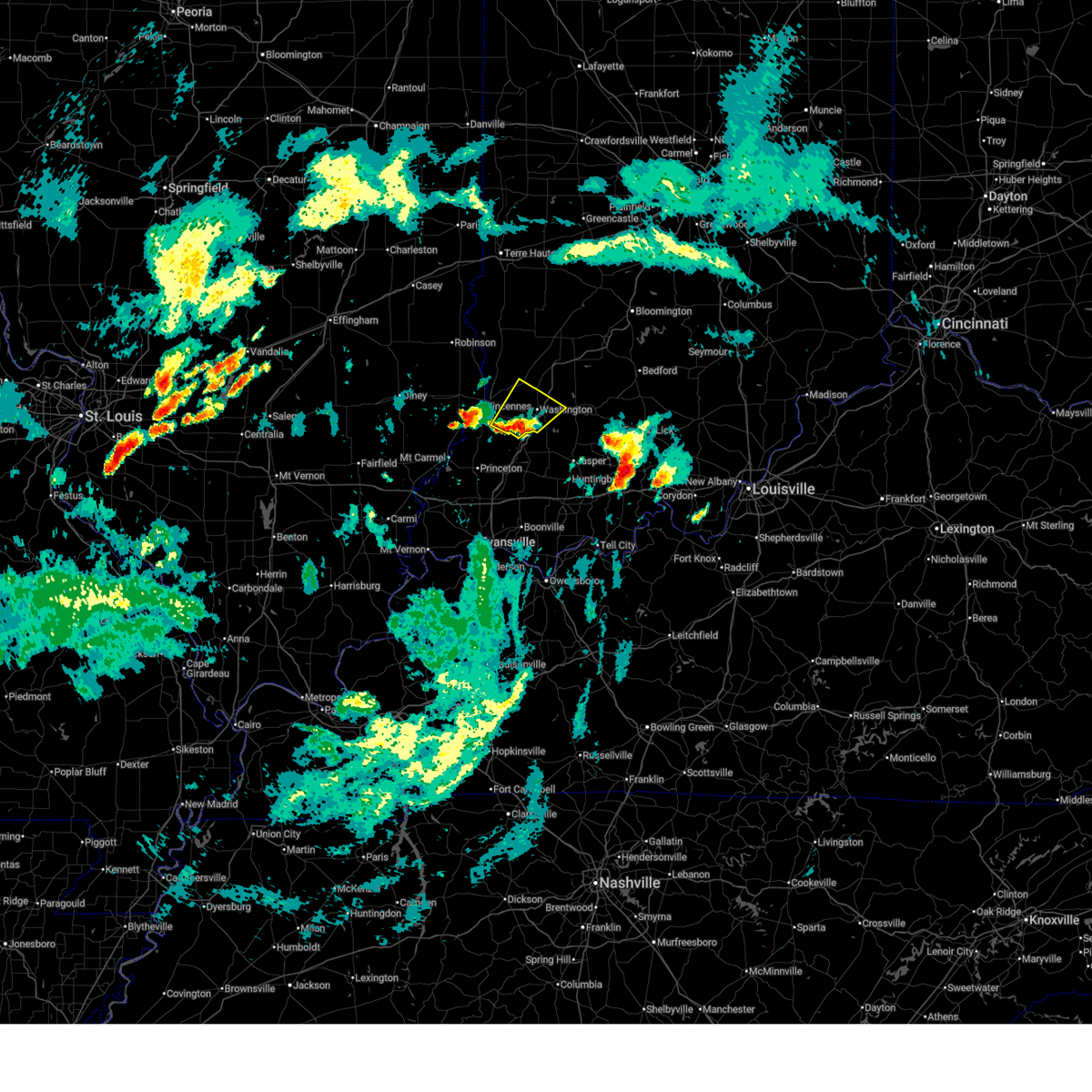
| 6/21/2026 7:49 PM EDT |
 At 749 pm edt, a severe thunderstorm capable of producing a tornado was located near vincennes, moving east at 30 mph (radar indicated rotation). Hazards include tornado and ping pong ball size hail. Flying debris will be dangerous to those caught without shelter. mobile homes will be damaged or destroyed. damage to roofs, windows, and vehicles will occur. tree damage is likely. Locations impacted include, vincennes, washington, monroe city, and wheatland. At 749 pm edt, a severe thunderstorm capable of producing a tornado was located near vincennes, moving east at 30 mph (radar indicated rotation). Hazards include tornado and ping pong ball size hail. Flying debris will be dangerous to those caught without shelter. mobile homes will be damaged or destroyed. damage to roofs, windows, and vehicles will occur. tree damage is likely. Locations impacted include, vincennes, washington, monroe city, and wheatland.
|
| 6/21/2026 7:44 PM EDT |
 At 743 pm edt, a severe thunderstorm capable of producing a tornado was located near vincennes, moving east at 30 mph (radar indicated rotation). Hazards include tornado. Flying debris will be dangerous to those caught without shelter. mobile homes will be damaged or destroyed. damage to roofs, windows, and vehicles will occur. tree damage is likely. Locations impacted include, vincennes, washington, monroe city, and wheatland. At 743 pm edt, a severe thunderstorm capable of producing a tornado was located near vincennes, moving east at 30 mph (radar indicated rotation). Hazards include tornado. Flying debris will be dangerous to those caught without shelter. mobile homes will be damaged or destroyed. damage to roofs, windows, and vehicles will occur. tree damage is likely. Locations impacted include, vincennes, washington, monroe city, and wheatland.
|
| 6/21/2026 7:40 PM EDT | Several tree limbs snappe in daviess county IN, 8.6 miles S of Washington, IN |
| 6/21/2026 7:40 PM EDT |
 At 740 pm edt, a severe thunderstorm capable of producing a tornado was located near vincennes, moving east at 30 mph (radar indicated rotation). Hazards include tornado. Flying debris will be dangerous to those caught without shelter. mobile homes will be damaged or destroyed. damage to roofs, windows, and vehicles will occur. tree damage is likely. Locations impacted include, vincennes, washington, monroe city, wheatland, and vincennes university. At 740 pm edt, a severe thunderstorm capable of producing a tornado was located near vincennes, moving east at 30 mph (radar indicated rotation). Hazards include tornado. Flying debris will be dangerous to those caught without shelter. mobile homes will be damaged or destroyed. damage to roofs, windows, and vehicles will occur. tree damage is likely. Locations impacted include, vincennes, washington, monroe city, wheatland, and vincennes university.
|
| 6/21/2026 7:27 PM EDT |
 Torind the national weather service in indianapolis has issued a * tornado warning for, central knox county in southwestern indiana, southwestern daviess county in southwestern indiana, * until 815 pm edt. * at 727 pm edt, a severe thunderstorm capable of producing a tornado was located near st. francisville, or near lawrenceville, moving east at 30 mph (radar indicated rotation). Hazards include tornado. Flying debris will be dangerous to those caught without shelter. mobile homes will be damaged or destroyed. damage to roofs, windows, and vehicles will occur. Tree damage is likely. Torind the national weather service in indianapolis has issued a * tornado warning for, central knox county in southwestern indiana, southwestern daviess county in southwestern indiana, * until 815 pm edt. * at 727 pm edt, a severe thunderstorm capable of producing a tornado was located near st. francisville, or near lawrenceville, moving east at 30 mph (radar indicated rotation). Hazards include tornado. Flying debris will be dangerous to those caught without shelter. mobile homes will be damaged or destroyed. damage to roofs, windows, and vehicles will occur. Tree damage is likely.
|
| 6/21/2026 7:17 PM EDT |
 Svrind the national weather service in indianapolis has issued a * severe thunderstorm warning for, southeastern sullivan county in southwestern indiana, knox county in southwestern indiana, northwestern martin county in southwestern indiana, southwestern greene county in southwestern indiana, daviess county in southwestern indiana, * until 800 pm edt. * at 716 pm edt, a severe thunderstorm was located near russellville, or near vincennes, moving east at 30 mph (radar indicated). Hazards include 70 mph wind gusts. Expect considerable tree damage. Damage is likely to mobile homes, roofs, and outbuildings. Svrind the national weather service in indianapolis has issued a * severe thunderstorm warning for, southeastern sullivan county in southwestern indiana, knox county in southwestern indiana, northwestern martin county in southwestern indiana, southwestern greene county in southwestern indiana, daviess county in southwestern indiana, * until 800 pm edt. * at 716 pm edt, a severe thunderstorm was located near russellville, or near vincennes, moving east at 30 mph (radar indicated). Hazards include 70 mph wind gusts. Expect considerable tree damage. Damage is likely to mobile homes, roofs, and outbuildings.
|
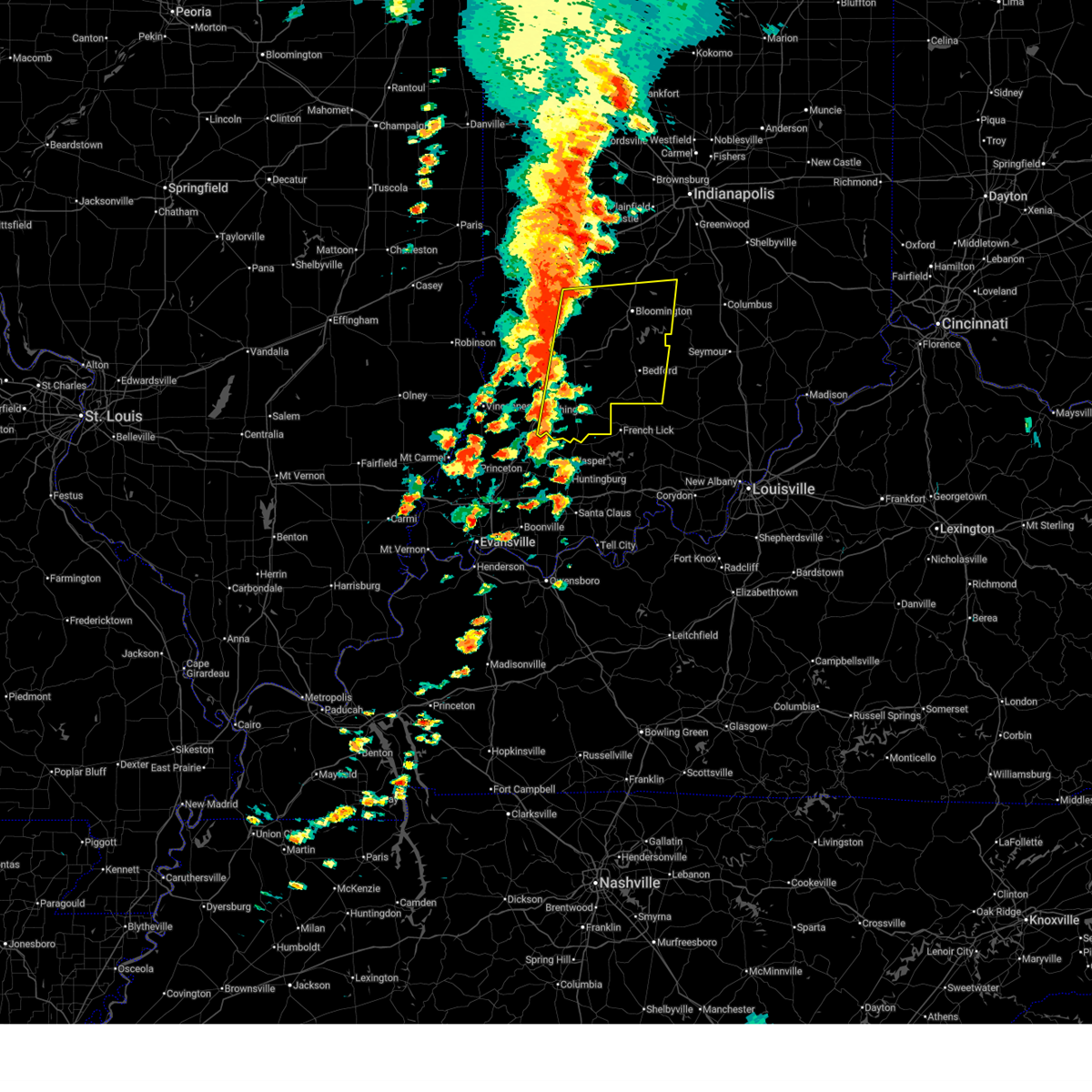
| 6/18/2026 2:15 AM EDT |
 Svrind the national weather service in indianapolis has issued a * severe thunderstorm warning for, central knox county in southwestern indiana, martin county in southwestern indiana, southern lawrence county in south central indiana, southwestern jackson county in south central indiana, daviess county in southwestern indiana, * until 245 am edt. * at 215 am edt, severe thunderstorms were located along a line extending from 9 miles southwest of bedford to near vincennes, moving east at 65 mph (radar indicated). Hazards include 60 mph wind gusts. expect damage to roofs, siding, and trees Svrind the national weather service in indianapolis has issued a * severe thunderstorm warning for, central knox county in southwestern indiana, martin county in southwestern indiana, southern lawrence county in south central indiana, southwestern jackson county in south central indiana, daviess county in southwestern indiana, * until 245 am edt. * at 215 am edt, severe thunderstorms were located along a line extending from 9 miles southwest of bedford to near vincennes, moving east at 65 mph (radar indicated). Hazards include 60 mph wind gusts. expect damage to roofs, siding, and trees
|
| 6/18/2026 1:26 AM EDT |
 Svrind the national weather service in indianapolis has issued a * severe thunderstorm warning for, northeastern knox county in southwestern indiana, southwestern martin county in southwestern indiana, daviess county in southwestern indiana, * until 215 am edt. * at 126 am edt, a severe thunderstorm was located 8 miles northwest of washington, or 12 miles east of vincennes, moving east at 40 mph (radar indicated). Hazards include 60 mph wind gusts. expect damage to roofs, siding, and trees Svrind the national weather service in indianapolis has issued a * severe thunderstorm warning for, northeastern knox county in southwestern indiana, southwestern martin county in southwestern indiana, daviess county in southwestern indiana, * until 215 am edt. * at 126 am edt, a severe thunderstorm was located 8 miles northwest of washington, or 12 miles east of vincennes, moving east at 40 mph (radar indicated). Hazards include 60 mph wind gusts. expect damage to roofs, siding, and trees
|
| 6/18/2026 1:12 AM EDT |
 At 112 am edt, a severe thunderstorm was located 10 miles northeast of vincennes, moving east at 45 mph (radar indicated). Hazards include 60 mph wind gusts. Expect damage to roofs, siding, and trees. Locations impacted include, vincennes, washington, bicknell, monroe city, wheatland, bruceville, plainville, edwardsport, and vincennes university. At 112 am edt, a severe thunderstorm was located 10 miles northeast of vincennes, moving east at 45 mph (radar indicated). Hazards include 60 mph wind gusts. Expect damage to roofs, siding, and trees. Locations impacted include, vincennes, washington, bicknell, monroe city, wheatland, bruceville, plainville, edwardsport, and vincennes university.
|
| 6/18/2026 1:02 AM EDT |
 At 102 am edt, a severe thunderstorm was located near russellville, or near vincennes, moving east at 55 mph (radar indicated). Hazards include 60 mph wind gusts. Expect damage to roofs, siding, and trees. Locations impacted include, vincennes, washington, bicknell, monroe city, wheatland, bruceville, plainville, edwardsport, and vincennes university. At 102 am edt, a severe thunderstorm was located near russellville, or near vincennes, moving east at 55 mph (radar indicated). Hazards include 60 mph wind gusts. Expect damage to roofs, siding, and trees. Locations impacted include, vincennes, washington, bicknell, monroe city, wheatland, bruceville, plainville, edwardsport, and vincennes university.
|
| 6/18/2026 12:49 AM EDT |
 Svrind the national weather service in indianapolis has issued a * severe thunderstorm warning for, northeastern knox county in southwestern indiana, western daviess county in southwestern indiana, * until 130 am edt. * at 1249 am edt, a severe thunderstorm was located near lawrenceville vincennes airport, or near lawrenceville, moving east at 40 mph (radar indicated). Hazards include 60 mph wind gusts. expect damage to roofs, siding, and trees Svrind the national weather service in indianapolis has issued a * severe thunderstorm warning for, northeastern knox county in southwestern indiana, western daviess county in southwestern indiana, * until 130 am edt. * at 1249 am edt, a severe thunderstorm was located near lawrenceville vincennes airport, or near lawrenceville, moving east at 40 mph (radar indicated). Hazards include 60 mph wind gusts. expect damage to roofs, siding, and trees
|
| 5/16/2026 4:52 PM EDT |
 At 451 pm edt, a severe thunderstorm was located near washington, or 15 miles northeast of petersburg, moving northeast at 20 mph (radar indicated). Hazards include 60 mph wind gusts and quarter size hail. Hail damage to vehicles is expected. expect wind damage to roofs, siding, and trees. Locations impacted include, washington, loogootee, montgomery, and cannelburg. At 451 pm edt, a severe thunderstorm was located near washington, or 15 miles northeast of petersburg, moving northeast at 20 mph (radar indicated). Hazards include 60 mph wind gusts and quarter size hail. Hail damage to vehicles is expected. expect wind damage to roofs, siding, and trees. Locations impacted include, washington, loogootee, montgomery, and cannelburg.
|
| 5/16/2026 4:45 PM EDT |
 Svrind the national weather service in indianapolis has issued a * severe thunderstorm warning for, southwestern martin county in southwestern indiana, central daviess county in southwestern indiana, * until 515 pm edt. * at 445 pm edt, a severe thunderstorm was located near washington, or 12 miles northeast of petersburg, moving northeast at 15 mph (radar indicated). Hazards include 60 mph wind gusts and quarter size hail. Hail damage to vehicles is expected. Expect wind damage to roofs, siding, and trees. Svrind the national weather service in indianapolis has issued a * severe thunderstorm warning for, southwestern martin county in southwestern indiana, central daviess county in southwestern indiana, * until 515 pm edt. * at 445 pm edt, a severe thunderstorm was located near washington, or 12 miles northeast of petersburg, moving northeast at 15 mph (radar indicated). Hazards include 60 mph wind gusts and quarter size hail. Hail damage to vehicles is expected. Expect wind damage to roofs, siding, and trees.
|
| 5/16/2026 4:33 PM EDT |
 At 433 pm edt, a severe thunderstorm was located near washington, or 9 miles north of petersburg, moving northeast at 20 mph (radar indicated). Hazards include 60 mph wind gusts and quarter size hail. Hail damage to vehicles is expected. expect wind damage to roofs, siding, and trees. Locations impacted include, washington, bicknell, monroe city, wheatland, montgomery, and cannelburg. At 433 pm edt, a severe thunderstorm was located near washington, or 9 miles north of petersburg, moving northeast at 20 mph (radar indicated). Hazards include 60 mph wind gusts and quarter size hail. Hail damage to vehicles is expected. expect wind damage to roofs, siding, and trees. Locations impacted include, washington, bicknell, monroe city, wheatland, montgomery, and cannelburg.
|
| 5/16/2026 4:22 PM EDT |
 Svrind the national weather service in indianapolis has issued a * severe thunderstorm warning for, central knox county in southwestern indiana, southern daviess county in southwestern indiana, * until 445 pm edt. * at 421 pm edt, a severe thunderstorm was located 7 miles northwest of petersburg, moving northeast at 20 mph (radar indicated). Hazards include 60 mph wind gusts and quarter size hail. Hail damage to vehicles is expected. Expect wind damage to roofs, siding, and trees. Svrind the national weather service in indianapolis has issued a * severe thunderstorm warning for, central knox county in southwestern indiana, southern daviess county in southwestern indiana, * until 445 pm edt. * at 421 pm edt, a severe thunderstorm was located 7 miles northwest of petersburg, moving northeast at 20 mph (radar indicated). Hazards include 60 mph wind gusts and quarter size hail. Hail damage to vehicles is expected. Expect wind damage to roofs, siding, and trees.
|
| 4/27/2026 10:35 PM EDT |
 Svrind the national weather service in indianapolis has issued a * severe thunderstorm warning for, southern sullivan county in southwestern indiana, knox county in southwestern indiana, southwestern greene county in southwestern indiana, daviess county in southwestern indiana, * until 1130 pm edt. * at 1035 pm edt, severe thunderstorms were located along a line extending from near robinson to near chauncey to parkersburg, moving east at 70 mph (radar indicated). Hazards include 70 mph wind gusts and quarter size hail. Hail damage to vehicles is expected. expect considerable tree damage. Wind damage is also likely to mobile homes, roofs, and outbuildings. Svrind the national weather service in indianapolis has issued a * severe thunderstorm warning for, southern sullivan county in southwestern indiana, knox county in southwestern indiana, southwestern greene county in southwestern indiana, daviess county in southwestern indiana, * until 1130 pm edt. * at 1035 pm edt, severe thunderstorms were located along a line extending from near robinson to near chauncey to parkersburg, moving east at 70 mph (radar indicated). Hazards include 70 mph wind gusts and quarter size hail. Hail damage to vehicles is expected. expect considerable tree damage. Wind damage is also likely to mobile homes, roofs, and outbuildings.
|
| 4/27/2026 7:53 PM EDT |
 Svrind the national weather service in indianapolis has issued a * severe thunderstorm warning for, northeastern knox county in southwestern indiana, northwestern martin county in southwestern indiana, daviess county in southwestern indiana, * until 830 pm edt. * at 753 pm edt, a severe thunderstorm was located near washington, or 12 miles north of petersburg, moving northeast at 40 mph (radar indicated). Hazards include 60 mph wind gusts and quarter size hail. Hail damage to vehicles is expected. Expect wind damage to roofs, siding, and trees. Svrind the national weather service in indianapolis has issued a * severe thunderstorm warning for, northeastern knox county in southwestern indiana, northwestern martin county in southwestern indiana, daviess county in southwestern indiana, * until 830 pm edt. * at 753 pm edt, a severe thunderstorm was located near washington, or 12 miles north of petersburg, moving northeast at 40 mph (radar indicated). Hazards include 60 mph wind gusts and quarter size hail. Hail damage to vehicles is expected. Expect wind damage to roofs, siding, and trees.
|
| 4/27/2026 7:29 PM EDT |
 Svrind the national weather service in indianapolis has issued a * severe thunderstorm warning for, knox county in southwestern indiana, southwestern daviess county in southwestern indiana, * until 800 pm edt. * at 728 pm edt, a severe thunderstorm was located 7 miles southeast of st. francisville, or 9 miles south of vincennes, moving northeast at 45 mph (radar indicated). Hazards include 60 mph wind gusts and quarter size hail. Hail damage to vehicles is expected. Expect wind damage to roofs, siding, and trees. Svrind the national weather service in indianapolis has issued a * severe thunderstorm warning for, knox county in southwestern indiana, southwestern daviess county in southwestern indiana, * until 800 pm edt. * at 728 pm edt, a severe thunderstorm was located 7 miles southeast of st. francisville, or 9 miles south of vincennes, moving northeast at 45 mph (radar indicated). Hazards include 60 mph wind gusts and quarter size hail. Hail damage to vehicles is expected. Expect wind damage to roofs, siding, and trees.
|
| 4/27/2026 5:28 PM EDT |
 Svrind the national weather service in indianapolis has issued a * severe thunderstorm warning for, southwestern martin county in southwestern indiana, southern daviess county in southwestern indiana, * until 600 pm edt. * at 528 pm edt, a severe thunderstorm was located near washington, or 9 miles northeast of petersburg, moving east at 50 mph (radar indicated). Hazards include 60 mph wind gusts and quarter size hail. Hail damage to vehicles is expected. Expect wind damage to roofs, siding, and trees. Svrind the national weather service in indianapolis has issued a * severe thunderstorm warning for, southwestern martin county in southwestern indiana, southern daviess county in southwestern indiana, * until 600 pm edt. * at 528 pm edt, a severe thunderstorm was located near washington, or 9 miles northeast of petersburg, moving east at 50 mph (radar indicated). Hazards include 60 mph wind gusts and quarter size hail. Hail damage to vehicles is expected. Expect wind damage to roofs, siding, and trees.
|
| 4/27/2026 4:51 PM EDT |
 At 451 pm edt, a severe thunderstorm was located 8 miles northwest of washington, or 11 miles east of vincennes, moving east at 60 mph (radar indicated). Hazards include 60 mph wind gusts and quarter size hail. Hail damage to vehicles is expected. expect wind damage to roofs, siding, and trees. Locations impacted include, vincennes, washington, bicknell, monroe city, wheatland, bruceville, sandborn, edwardsport, vincennes university, and freelandville. At 451 pm edt, a severe thunderstorm was located 8 miles northwest of washington, or 11 miles east of vincennes, moving east at 60 mph (radar indicated). Hazards include 60 mph wind gusts and quarter size hail. Hail damage to vehicles is expected. expect wind damage to roofs, siding, and trees. Locations impacted include, vincennes, washington, bicknell, monroe city, wheatland, bruceville, sandborn, edwardsport, vincennes university, and freelandville.
|
| 4/27/2026 4:34 PM EDT |
 Svrind the national weather service in indianapolis has issued a * severe thunderstorm warning for, knox county in southwestern indiana, northwestern daviess county in southwestern indiana, * until 515 pm edt. * at 433 pm edt, a severe thunderstorm was located over lawrenceville, moving east at 60 mph (radar indicated). Hazards include golf ball size hail and 60 mph wind gusts. People and animals outdoors will be injured. expect hail damage to roofs, siding, windows, and vehicles. Expect wind damage to roofs, siding, and trees. Svrind the national weather service in indianapolis has issued a * severe thunderstorm warning for, knox county in southwestern indiana, northwestern daviess county in southwestern indiana, * until 515 pm edt. * at 433 pm edt, a severe thunderstorm was located over lawrenceville, moving east at 60 mph (radar indicated). Hazards include golf ball size hail and 60 mph wind gusts. People and animals outdoors will be injured. expect hail damage to roofs, siding, windows, and vehicles. Expect wind damage to roofs, siding, and trees.
|
| 4/27/2026 4:25 PM EDT |
 Svrind the national weather service in indianapolis has issued a * severe thunderstorm warning for, northern martin county in southwestern indiana, northeastern daviess county in southwestern indiana, * until 445 pm edt. * at 424 pm edt, a severe thunderstorm was located 11 miles northwest of shoals, or 22 miles west of bedford, moving east at 50 mph (radar indicated). Hazards include 60 mph wind gusts and quarter size hail. Hail damage to vehicles is expected. Expect wind damage to roofs, siding, and trees. Svrind the national weather service in indianapolis has issued a * severe thunderstorm warning for, northern martin county in southwestern indiana, northeastern daviess county in southwestern indiana, * until 445 pm edt. * at 424 pm edt, a severe thunderstorm was located 11 miles northwest of shoals, or 22 miles west of bedford, moving east at 50 mph (radar indicated). Hazards include 60 mph wind gusts and quarter size hail. Hail damage to vehicles is expected. Expect wind damage to roofs, siding, and trees.
|
| 4/27/2026 2:24 PM EDT |
 The storm which prompted the warning has weakened below severe limits, and has exited the warned area. therefore, the warning will be allowed to expire. however, small hail is still possible with this thunderstorm. a severe thunderstorm watch remains in effect until 700 pm edt for southwestern indiana. The storm which prompted the warning has weakened below severe limits, and has exited the warned area. therefore, the warning will be allowed to expire. however, small hail is still possible with this thunderstorm. a severe thunderstorm watch remains in effect until 700 pm edt for southwestern indiana.
|
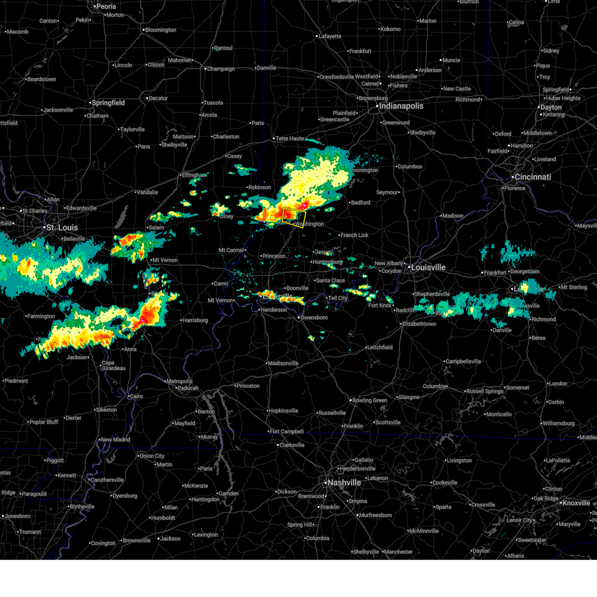
| 4/27/2026 2:10 PM EDT | Quarter sized hail reported 0.6 miles WSW of Washington, IN |
| 4/27/2026 2:08 PM EDT |
 At 207 pm edt, a severe thunderstorm was located over washington, or 12 miles northeast of petersburg, moving east at 50 mph (radar indicated). Hazards include quarter size hail. Damage to vehicles is expected. Locations impacted include, washington, montgomery, cannelburg, alfordsville, glendale fishery, and west boggs lake. At 207 pm edt, a severe thunderstorm was located over washington, or 12 miles northeast of petersburg, moving east at 50 mph (radar indicated). Hazards include quarter size hail. Damage to vehicles is expected. Locations impacted include, washington, montgomery, cannelburg, alfordsville, glendale fishery, and west boggs lake.
|
| 4/27/2026 1:56 PM EDT |
 At 155 pm edt, a severe thunderstorm was located near petersburg, moving east at 50 mph (radar indicated). Hazards include quarter size hail. Damage to vehicles is expected. Locations impacted include, washington, loogootee, monroe city, wheatland, montgomery, cannelburg, alfordsville, west boggs lake, and glendale fishery. At 155 pm edt, a severe thunderstorm was located near petersburg, moving east at 50 mph (radar indicated). Hazards include quarter size hail. Damage to vehicles is expected. Locations impacted include, washington, loogootee, monroe city, wheatland, montgomery, cannelburg, alfordsville, west boggs lake, and glendale fishery.
|
| 4/27/2026 1:38 PM EDT |
 Svrind the national weather service in indianapolis has issued a * severe thunderstorm warning for, southern knox county in southwestern indiana, southern daviess county in southwestern indiana, * until 230 pm edt. * at 137 pm edt, a severe thunderstorm was located 9 miles southeast of st. francisville, or 10 miles south of vincennes, moving east at 60 mph (radar indicated). Hazards include quarter size hail. damage to vehicles is expected Svrind the national weather service in indianapolis has issued a * severe thunderstorm warning for, southern knox county in southwestern indiana, southern daviess county in southwestern indiana, * until 230 pm edt. * at 137 pm edt, a severe thunderstorm was located 9 miles southeast of st. francisville, or 10 miles south of vincennes, moving east at 60 mph (radar indicated). Hazards include quarter size hail. damage to vehicles is expected
|
| 3/22/2026 10:06 PM EDT |
 At 1006 pm edt, a severe thunderstorm was located 7 miles east of washington, or 18 miles northeast of petersburg, moving east at 50 mph (emergency management). Hazards include two inch hail and 60 mph wind gusts. People and animals outdoors will be injured. expect hail damage to roofs, siding, windows, and vehicles. expect wind damage to roofs, siding, and trees. Locations impacted include, washington, shoals, loogootee, odon, montgomery, cannelburg, alfordsville, west boggs lake, indian springs, huron, burns city, lacy, and williams. At 1006 pm edt, a severe thunderstorm was located 7 miles east of washington, or 18 miles northeast of petersburg, moving east at 50 mph (emergency management). Hazards include two inch hail and 60 mph wind gusts. People and animals outdoors will be injured. expect hail damage to roofs, siding, windows, and vehicles. expect wind damage to roofs, siding, and trees. Locations impacted include, washington, shoals, loogootee, odon, montgomery, cannelburg, alfordsville, west boggs lake, indian springs, huron, burns city, lacy, and williams.
|
| 3/22/2026 10:04 PM EDT | Golf Ball sized hail reported 4.4 miles W of Washington, IN, time estimated from radar. |
| 3/22/2026 9:54 PM EDT | Quarter sized hail reported 8.6 miles S of Washington, IN, time estimated from radar. |
| 3/22/2026 9:54 PM EDT |
 Svrind the national weather service in indianapolis has issued a * severe thunderstorm warning for, martin county in southwestern indiana, southwestern lawrence county in south central indiana, daviess county in southwestern indiana, * until 1045 pm edt. * at 954 pm edt, a severe thunderstorm was located 8 miles north of washington, or 20 miles east of vincennes, moving east at 60 mph (emergency management). Hazards include golf ball size hail and 60 mph wind gusts. People and animals outdoors will be injured. expect hail damage to roofs, siding, windows, and vehicles. Expect wind damage to roofs, siding, and trees. Svrind the national weather service in indianapolis has issued a * severe thunderstorm warning for, martin county in southwestern indiana, southwestern lawrence county in south central indiana, daviess county in southwestern indiana, * until 1045 pm edt. * at 954 pm edt, a severe thunderstorm was located 8 miles north of washington, or 20 miles east of vincennes, moving east at 60 mph (emergency management). Hazards include golf ball size hail and 60 mph wind gusts. People and animals outdoors will be injured. expect hail damage to roofs, siding, windows, and vehicles. Expect wind damage to roofs, siding, and trees.
|
| 3/15/2026 10:31 PM EDT |
 the severe thunderstorm warning has been cancelled and is no longer in effect the severe thunderstorm warning has been cancelled and is no longer in effect
|
| 3/15/2026 10:13 PM EDT |
 the severe thunderstorm warning has been cancelled and is no longer in effect the severe thunderstorm warning has been cancelled and is no longer in effect
|
| 3/15/2026 10:07 PM EDT |
 Svrind the national weather service in indianapolis has issued a * severe thunderstorm warning for, northeastern knox county in southwestern indiana, southwestern greene county in southwestern indiana, daviess county in southwestern indiana, * until 1100 pm edt. * at 1007 pm edt, a severe thunderstorm was located 12 miles north of washington, or 21 miles northeast of vincennes, moving northeast at 65 mph (radar indicated). Hazards include 60 mph wind gusts. expect damage to roofs, siding, and trees Svrind the national weather service in indianapolis has issued a * severe thunderstorm warning for, northeastern knox county in southwestern indiana, southwestern greene county in southwestern indiana, daviess county in southwestern indiana, * until 1100 pm edt. * at 1007 pm edt, a severe thunderstorm was located 12 miles north of washington, or 21 miles northeast of vincennes, moving northeast at 65 mph (radar indicated). Hazards include 60 mph wind gusts. expect damage to roofs, siding, and trees
|
| 3/15/2026 10:05 PM EDT |
 At 1005 pm edt, a severe thunderstorm was located 11 miles north of washington, or 17 miles northeast of vincennes, moving northeast at 70 mph (radar indicated). Hazards include 60 mph wind gusts. Expect damage to roofs, siding, and trees. Locations impacted include, washington, bicknell, wheatland, edwardsport, and freelandville. At 1005 pm edt, a severe thunderstorm was located 11 miles north of washington, or 17 miles northeast of vincennes, moving northeast at 70 mph (radar indicated). Hazards include 60 mph wind gusts. Expect damage to roofs, siding, and trees. Locations impacted include, washington, bicknell, wheatland, edwardsport, and freelandville.
|
| 3/15/2026 9:56 PM EDT |
 Svrind the national weather service in indianapolis has issued a * severe thunderstorm warning for, southeastern sullivan county in southwestern indiana, northeastern knox county in southwestern indiana, western daviess county in southwestern indiana, * until 1045 pm edt. * at 955 pm edt, a severe thunderstorm was located 8 miles east of vincennes, moving northeast at 45 mph (radar indicated). Hazards include 60 mph wind gusts. expect damage to roofs, siding, and trees Svrind the national weather service in indianapolis has issued a * severe thunderstorm warning for, southeastern sullivan county in southwestern indiana, northeastern knox county in southwestern indiana, western daviess county in southwestern indiana, * until 1045 pm edt. * at 955 pm edt, a severe thunderstorm was located 8 miles east of vincennes, moving northeast at 45 mph (radar indicated). Hazards include 60 mph wind gusts. expect damage to roofs, siding, and trees
|
| 3/15/2026 9:39 PM EDT |
 At 938 pm edt, severe thunderstorms were located along a line extending from near marshall to near owensville, moving northeast at 65 mph (radar indicated). Hazards include 60 mph wind gusts. Expect damage to roofs, siding, and trees. locations impacted include, vincennes, washington, linton, sullivan, bicknell, jasonville, shelburn, prairieton, prairie creek, farmersburg, dugger, clay city, hymera, fairbanks, carlisle, oaktown, monroe city, wheatland, bruceville, and sandborn. This includes interstate 70 between mile markers 12 and 28. At 938 pm edt, severe thunderstorms were located along a line extending from near marshall to near owensville, moving northeast at 65 mph (radar indicated). Hazards include 60 mph wind gusts. Expect damage to roofs, siding, and trees. locations impacted include, vincennes, washington, linton, sullivan, bicknell, jasonville, shelburn, prairieton, prairie creek, farmersburg, dugger, clay city, hymera, fairbanks, carlisle, oaktown, monroe city, wheatland, bruceville, and sandborn. This includes interstate 70 between mile markers 12 and 28.
|
| 3/15/2026 9:22 PM EDT |
 Svrind the national weather service in indianapolis has issued a * severe thunderstorm warning for, southern vigo county in west central indiana, sullivan county in southwestern indiana, knox county in southwestern indiana, clay county in west central indiana, western greene county in southwestern indiana, western daviess county in southwestern indiana, * until 1000 pm edt. * at 922 pm edt, severe thunderstorms were located along a line extending from 8 miles northwest of hutsonville to 6 miles southwest of new harmony, moving northeast at 55 mph (radar indicated). Hazards include 60 mph wind gusts. expect damage to roofs, siding, and trees Svrind the national weather service in indianapolis has issued a * severe thunderstorm warning for, southern vigo county in west central indiana, sullivan county in southwestern indiana, knox county in southwestern indiana, clay county in west central indiana, western greene county in southwestern indiana, western daviess county in southwestern indiana, * until 1000 pm edt. * at 922 pm edt, severe thunderstorms were located along a line extending from 8 miles northwest of hutsonville to 6 miles southwest of new harmony, moving northeast at 55 mph (radar indicated). Hazards include 60 mph wind gusts. expect damage to roofs, siding, and trees
|
| 3/4/2026 10:26 AM EST |
 At 1026 am est, a severe thunderstorm was located near washington, or 16 miles east of vincennes, moving east at 45 mph (radar indicated). Hazards include quarter size hail. Damage to vehicles is expected. Locations impacted include, washington, bicknell, and montgomery. At 1026 am est, a severe thunderstorm was located near washington, or 16 miles east of vincennes, moving east at 45 mph (radar indicated). Hazards include quarter size hail. Damage to vehicles is expected. Locations impacted include, washington, bicknell, and montgomery.
|
| 3/4/2026 10:17 AM EST |
 At 1017 am est, a severe thunderstorm was located 10 miles northeast of vincennes, moving east at 40 mph (radar indicated). Hazards include up to quarter size hail. Damage to vehicles is possible. Locations impacted include, washington, bicknell, bruceville, and montgomery. At 1017 am est, a severe thunderstorm was located 10 miles northeast of vincennes, moving east at 40 mph (radar indicated). Hazards include up to quarter size hail. Damage to vehicles is possible. Locations impacted include, washington, bicknell, bruceville, and montgomery.
|
| 3/4/2026 10:07 AM EST |
 Svrind the national weather service in indianapolis has issued a * severe thunderstorm warning for, northeastern knox county in southwestern indiana, west central daviess county in southwestern indiana, * until 1045 am est. * at 1007 am est, a severe thunderstorm was located near russellville, or near vincennes, moving east at 40 mph (radar indicated). Hazards include quarter size hail. damage to vehicles is expected Svrind the national weather service in indianapolis has issued a * severe thunderstorm warning for, northeastern knox county in southwestern indiana, west central daviess county in southwestern indiana, * until 1045 am est. * at 1007 am est, a severe thunderstorm was located near russellville, or near vincennes, moving east at 40 mph (radar indicated). Hazards include quarter size hail. damage to vehicles is expected
|
| 12/28/2025 7:40 PM EST |
 Svrind the national weather service in indianapolis has issued a * severe thunderstorm warning for, monroe county in south central indiana, southeastern morgan county in central indiana, brown county in south central indiana, johnson county in central indiana, northwestern bartholomew county in central indiana, eastern knox county in southwestern indiana, southeastern owen county in west central indiana, martin county in southwestern indiana, lawrence county in south central indiana, greene county in southwestern indiana, northwestern jackson county in south central indiana, daviess county in southwestern indiana, * until 830 pm est. * at 739 pm est, severe thunderstorms were located along a line extending from 9 miles northeast of spencer to near petersburg, moving northeast at 65 mph (radar indicated). Hazards include 60 mph wind gusts. expect damage to roofs, siding, and trees Svrind the national weather service in indianapolis has issued a * severe thunderstorm warning for, monroe county in south central indiana, southeastern morgan county in central indiana, brown county in south central indiana, johnson county in central indiana, northwestern bartholomew county in central indiana, eastern knox county in southwestern indiana, southeastern owen county in west central indiana, martin county in southwestern indiana, lawrence county in south central indiana, greene county in southwestern indiana, northwestern jackson county in south central indiana, daviess county in southwestern indiana, * until 830 pm est. * at 739 pm est, severe thunderstorms were located along a line extending from 9 miles northeast of spencer to near petersburg, moving northeast at 65 mph (radar indicated). Hazards include 60 mph wind gusts. expect damage to roofs, siding, and trees
|
| 12/28/2025 7:28 PM EST |
 At 728 pm est, severe thunderstorms were located along a line extending from near spencer to 7 miles northwest of petersburg, moving east at 60 mph (radar indicated). Hazards include 60 mph wind gusts. Expect damage to roofs, siding, and trees. Locations impacted include, washington, linton, bloomfield, spencer, bicknell, worthington, odon, gosport, lyons, elnora, monroe city, wheatland, bruceville, plainville, sandborn, edwardsport, switz city, decker, stinesville, and newberry. At 728 pm est, severe thunderstorms were located along a line extending from near spencer to 7 miles northwest of petersburg, moving east at 60 mph (radar indicated). Hazards include 60 mph wind gusts. Expect damage to roofs, siding, and trees. Locations impacted include, washington, linton, bloomfield, spencer, bicknell, worthington, odon, gosport, lyons, elnora, monroe city, wheatland, bruceville, plainville, sandborn, edwardsport, switz city, decker, stinesville, and newberry.
|
| 12/28/2025 6:59 PM EST |
 Svrind the national weather service in indianapolis has issued a * severe thunderstorm warning for, northwestern monroe county in south central indiana, southern morgan county in central indiana, sullivan county in southwestern indiana, knox county in southwestern indiana, southwestern clay county in west central indiana, southern owen county in west central indiana, greene county in southwestern indiana, central daviess county in southwestern indiana, * until 745 pm est. * at 658 pm est, severe thunderstorms were located along a line extending from 6 miles northeast of sullivan to 7 miles west of mount carmel, moving east at 60 mph (radar indicated). Hazards include 60 mph wind gusts. expect damage to roofs, siding, and trees Svrind the national weather service in indianapolis has issued a * severe thunderstorm warning for, northwestern monroe county in south central indiana, southern morgan county in central indiana, sullivan county in southwestern indiana, knox county in southwestern indiana, southwestern clay county in west central indiana, southern owen county in west central indiana, greene county in southwestern indiana, central daviess county in southwestern indiana, * until 745 pm est. * at 658 pm est, severe thunderstorms were located along a line extending from 6 miles northeast of sullivan to 7 miles west of mount carmel, moving east at 60 mph (radar indicated). Hazards include 60 mph wind gusts. expect damage to roofs, siding, and trees
|
| 7/28/2025 7:15 PM EDT |
 Svrind the national weather service in indianapolis has issued a * severe thunderstorm warning for, central knox county in southwestern indiana, southwestern daviess county in southwestern indiana, * until 800 pm edt. * at 715 pm edt, a severe thunderstorm was located 7 miles east of vincennes, moving southeast at 20 mph (radar indicated). Hazards include 60 mph wind gusts. expect damage to roofs, siding, and trees Svrind the national weather service in indianapolis has issued a * severe thunderstorm warning for, central knox county in southwestern indiana, southwestern daviess county in southwestern indiana, * until 800 pm edt. * at 715 pm edt, a severe thunderstorm was located 7 miles east of vincennes, moving southeast at 20 mph (radar indicated). Hazards include 60 mph wind gusts. expect damage to roofs, siding, and trees
|
| 7/20/2025 8:54 PM EDT |
 The storms which prompted the warning have moved out of the area. therefore, the warning will be allowed to expire. a severe thunderstorm watch remains in effect until 100 am edt for southwestern indiana. The storms which prompted the warning have moved out of the area. therefore, the warning will be allowed to expire. a severe thunderstorm watch remains in effect until 100 am edt for southwestern indiana.
|
| 7/20/2025 8:09 PM EDT |
 Svrind the national weather service in indianapolis has issued a * severe thunderstorm warning for, southeastern sullivan county in southwestern indiana, knox county in southwestern indiana, southwestern greene county in southwestern indiana, northwestern daviess county in southwestern indiana, * until 900 pm edt. * at 809 pm edt, severe thunderstorms were located along a line extending from 9 miles southeast of palestine to lawrenceville vincennes airport, moving southeast at 45 mph (radar indicated). Hazards include 60 mph wind gusts. expect damage to roofs, siding, and trees Svrind the national weather service in indianapolis has issued a * severe thunderstorm warning for, southeastern sullivan county in southwestern indiana, knox county in southwestern indiana, southwestern greene county in southwestern indiana, northwestern daviess county in southwestern indiana, * until 900 pm edt. * at 809 pm edt, severe thunderstorms were located along a line extending from 9 miles southeast of palestine to lawrenceville vincennes airport, moving southeast at 45 mph (radar indicated). Hazards include 60 mph wind gusts. expect damage to roofs, siding, and trees
|
| 6/18/2025 3:59 PM EDT |
 Svrind the national weather service in indianapolis has issued a * severe thunderstorm warning for, monroe county in south central indiana, western brown county in south central indiana, southern owen county in west central indiana, martin county in southwestern indiana, lawrence county in south central indiana, greene county in southwestern indiana, daviess county in southwestern indiana, * until 445 pm edt. * at 359 pm edt, severe thunderstorms were located along a line extending from 8 miles west of spencer to 10 miles northwest of jasper, moving east at 40 mph (radar indicated). Hazards include 70 mph wind gusts and nickel size hail. Expect considerable tree damage. Damage is likely to mobile homes, roofs, and outbuildings. Svrind the national weather service in indianapolis has issued a * severe thunderstorm warning for, monroe county in south central indiana, western brown county in south central indiana, southern owen county in west central indiana, martin county in southwestern indiana, lawrence county in south central indiana, greene county in southwestern indiana, daviess county in southwestern indiana, * until 445 pm edt. * at 359 pm edt, severe thunderstorms were located along a line extending from 8 miles west of spencer to 10 miles northwest of jasper, moving east at 40 mph (radar indicated). Hazards include 70 mph wind gusts and nickel size hail. Expect considerable tree damage. Damage is likely to mobile homes, roofs, and outbuildings.
|
| 6/18/2025 3:57 PM EDT | At 357 pm edt, severe thunderstorms were located along a line extending from 10 miles southwest of spencer to 7 miles east of washington, moving east at 45 mph (radar indicated). Hazards include 70 mph wind gusts and quarter size hail. Hail damage to vehicles is expected. expect considerable tree damage. wind damage is also likely to mobile homes, roofs, and outbuildings. Locations impacted include, vincennes, washington, linton, bloomfield, bicknell, jasonville, worthington, odon, dugger, lyons, elnora, monroe city, wheatland, plainville, sandborn, montgomery, edwardsport, switz city, decker, and newberry. |
| 6/18/2025 3:57 PM EDT | the severe thunderstorm warning has been cancelled and is no longer in effect |
| 6/18/2025 3:26 PM EDT |
 Svrind the national weather service in indianapolis has issued a * severe thunderstorm warning for, south central vigo county in west central indiana, sullivan county in southwestern indiana, knox county in southwestern indiana, southwestern clay county in west central indiana, southwestern owen county in west central indiana, greene county in southwestern indiana, daviess county in southwestern indiana, * until 415 pm edt. * at 325 pm edt, severe thunderstorms were located along a line extending from 12 miles north of sullivan to 7 miles northeast of vincennes, moving east at 30 mph (radar indicated). Hazards include 70 mph wind gusts and quarter size hail. Hail damage to vehicles is expected. expect considerable tree damage. Wind damage is also likely to mobile homes, roofs, and outbuildings. Svrind the national weather service in indianapolis has issued a * severe thunderstorm warning for, south central vigo county in west central indiana, sullivan county in southwestern indiana, knox county in southwestern indiana, southwestern clay county in west central indiana, southwestern owen county in west central indiana, greene county in southwestern indiana, daviess county in southwestern indiana, * until 415 pm edt. * at 325 pm edt, severe thunderstorms were located along a line extending from 12 miles north of sullivan to 7 miles northeast of vincennes, moving east at 30 mph (radar indicated). Hazards include 70 mph wind gusts and quarter size hail. Hail damage to vehicles is expected. expect considerable tree damage. Wind damage is also likely to mobile homes, roofs, and outbuildings.
|
| 4/30/2025 5:40 PM EDT | Quarter sized hail reported 5 miles NW of Washington, IN |
| 4/30/2025 5:39 PM EDT | Quarter sized hail reported 5.9 miles NW of Washington, IN, report from mping: quarter (1.00 in.). |
| 4/30/2025 5:36 PM EDT |
 Svrind the national weather service in indianapolis has issued a * severe thunderstorm warning for, southwestern martin county in southwestern indiana, southern daviess county in southwestern indiana, * until 615 pm edt. * at 536 pm edt, a severe thunderstorm was located 7 miles south of washington, or 8 miles northeast of petersburg, moving northeast at 15 mph (radar indicated). Hazards include 60 mph wind gusts and quarter size hail. Hail damage to vehicles is expected. Expect wind damage to roofs, siding, and trees. Svrind the national weather service in indianapolis has issued a * severe thunderstorm warning for, southwestern martin county in southwestern indiana, southern daviess county in southwestern indiana, * until 615 pm edt. * at 536 pm edt, a severe thunderstorm was located 7 miles south of washington, or 8 miles northeast of petersburg, moving northeast at 15 mph (radar indicated). Hazards include 60 mph wind gusts and quarter size hail. Hail damage to vehicles is expected. Expect wind damage to roofs, siding, and trees.
|
| 4/29/2025 5:17 PM EDT |
 Svrind the national weather service in indianapolis has issued a * severe thunderstorm warning for, northeastern knox county in southwestern indiana, martin county in southwestern indiana, daviess county in southwestern indiana, * until 600 pm edt. * at 516 pm edt, severe thunderstorms were located along a line extending from 5 miles southeast of russellville to 7 miles west of washington to 5 miles north of petersburg, moving northeast at 60 mph (radar indicated). Hazards include 60 mph wind gusts. expect damage to roofs, siding, and trees Svrind the national weather service in indianapolis has issued a * severe thunderstorm warning for, northeastern knox county in southwestern indiana, martin county in southwestern indiana, daviess county in southwestern indiana, * until 600 pm edt. * at 516 pm edt, severe thunderstorms were located along a line extending from 5 miles southeast of russellville to 7 miles west of washington to 5 miles north of petersburg, moving northeast at 60 mph (radar indicated). Hazards include 60 mph wind gusts. expect damage to roofs, siding, and trees
|
| 4/2/2025 10:31 PM EDT |
 Svrind the national weather service in indianapolis has issued a * severe thunderstorm warning for, southern monroe county in south central indiana, southeastern knox county in southwestern indiana, martin county in southwestern indiana, eastern greene county in southwestern indiana, lawrence county in south central indiana, west central jackson county in south central indiana, daviess county in southwestern indiana, * until 1100 pm edt. * at 1031 pm edt, severe thunderstorms were located along a line extending from 9 miles north of washington to 16 miles south of bloomfield to shoals, moving northeast at 70 mph (radar indicated). Hazards include 60 mph wind gusts and penny size hail. expect damage to roofs, siding, and trees Svrind the national weather service in indianapolis has issued a * severe thunderstorm warning for, southern monroe county in south central indiana, southeastern knox county in southwestern indiana, martin county in southwestern indiana, eastern greene county in southwestern indiana, lawrence county in south central indiana, west central jackson county in south central indiana, daviess county in southwestern indiana, * until 1100 pm edt. * at 1031 pm edt, severe thunderstorms were located along a line extending from 9 miles north of washington to 16 miles south of bloomfield to shoals, moving northeast at 70 mph (radar indicated). Hazards include 60 mph wind gusts and penny size hail. expect damage to roofs, siding, and trees
|
| 4/2/2025 10:16 PM EDT |
 At 1015 pm edt, a severe thunderstorm was located near washington, or 16 miles northeast of petersburg, moving northeast at 55 mph (radar indicated). Hazards include 60 mph wind gusts and penny size hail. Expect damage to roofs, siding, and trees. Locations impacted include, odon, cannelburg, loogootee, montgomery, west boggs lake, burns city, and washington. At 1015 pm edt, a severe thunderstorm was located near washington, or 16 miles northeast of petersburg, moving northeast at 55 mph (radar indicated). Hazards include 60 mph wind gusts and penny size hail. Expect damage to roofs, siding, and trees. Locations impacted include, odon, cannelburg, loogootee, montgomery, west boggs lake, burns city, and washington.
|
| 4/2/2025 10:00 PM EDT |
 Svrind the national weather service in indianapolis has issued a * severe thunderstorm warning for, southeastern knox county in southwestern indiana, northwestern martin county in southwestern indiana, daviess county in southwestern indiana, * until 1030 pm edt. * at 1000 pm edt, a severe thunderstorm was located over petersburg, moving northeast at 60 mph (radar indicated). Hazards include 60 mph wind gusts and penny size hail. expect damage to roofs, siding, and trees Svrind the national weather service in indianapolis has issued a * severe thunderstorm warning for, southeastern knox county in southwestern indiana, northwestern martin county in southwestern indiana, daviess county in southwestern indiana, * until 1030 pm edt. * at 1000 pm edt, a severe thunderstorm was located over petersburg, moving northeast at 60 mph (radar indicated). Hazards include 60 mph wind gusts and penny size hail. expect damage to roofs, siding, and trees
|
| 4/2/2025 9:40 PM EDT |
 At 939 pm edt, severe thunderstorms were located along a line extending from 6 miles southwest of bloomfield to near washington, moving east at 40 mph (radar indicated). Hazards include 70 mph wind gusts and penny size hail. Expect considerable tree damage. damage is likely to mobile homes, roofs, and outbuildings. Locations impacted include, newberry, cannelburg, loogootee, bicknell, montgomery, west boggs lake, crane, freelandville, alfordsville, burns city, washington, sandborn, bruceville, monroe city, decker, odon, edwardsport, vincennes university, vincennes, and elnora. At 939 pm edt, severe thunderstorms were located along a line extending from 6 miles southwest of bloomfield to near washington, moving east at 40 mph (radar indicated). Hazards include 70 mph wind gusts and penny size hail. Expect considerable tree damage. damage is likely to mobile homes, roofs, and outbuildings. Locations impacted include, newberry, cannelburg, loogootee, bicknell, montgomery, west boggs lake, crane, freelandville, alfordsville, burns city, washington, sandborn, bruceville, monroe city, decker, odon, edwardsport, vincennes university, vincennes, and elnora.
|
| 4/2/2025 9:40 PM EDT |
 the severe thunderstorm warning has been cancelled and is no longer in effect the severe thunderstorm warning has been cancelled and is no longer in effect
|
| 4/2/2025 9:10 PM EDT |
 Svrind the national weather service in indianapolis has issued a * severe thunderstorm warning for, southeastern sullivan county in southwestern indiana, knox county in southwestern indiana, western martin county in southwestern indiana, southern greene county in southwestern indiana, daviess county in southwestern indiana, * until 1000 pm edt. * at 909 pm edt, severe thunderstorms were located along a line extending from 7 miles southeast of russellville to near patoka, moving northeast at 60 mph (radar indicated). Hazards include 70 mph wind gusts and penny size hail. Expect considerable tree damage. Damage is likely to mobile homes, roofs, and outbuildings. Svrind the national weather service in indianapolis has issued a * severe thunderstorm warning for, southeastern sullivan county in southwestern indiana, knox county in southwestern indiana, western martin county in southwestern indiana, southern greene county in southwestern indiana, daviess county in southwestern indiana, * until 1000 pm edt. * at 909 pm edt, severe thunderstorms were located along a line extending from 7 miles southeast of russellville to near patoka, moving northeast at 60 mph (radar indicated). Hazards include 70 mph wind gusts and penny size hail. Expect considerable tree damage. Damage is likely to mobile homes, roofs, and outbuildings.
|
| 3/19/2025 7:12 PM EDT |
 Svrind the national weather service in indianapolis has issued a * severe thunderstorm warning for, southeastern knox county in southwestern indiana, southern martin county in southwestern indiana, daviess county in southwestern indiana, * until 800 pm edt. * at 711 pm edt, a severe thunderstorm was located 9 miles east of petersburg, moving northeast at 50 mph (radar indicated). Hazards include 60 mph wind gusts and quarter size hail. Hail damage to vehicles is expected. Expect wind damage to roofs, siding, and trees. Svrind the national weather service in indianapolis has issued a * severe thunderstorm warning for, southeastern knox county in southwestern indiana, southern martin county in southwestern indiana, daviess county in southwestern indiana, * until 800 pm edt. * at 711 pm edt, a severe thunderstorm was located 9 miles east of petersburg, moving northeast at 50 mph (radar indicated). Hazards include 60 mph wind gusts and quarter size hail. Hail damage to vehicles is expected. Expect wind damage to roofs, siding, and trees.
|
| 3/15/2025 4:05 AM EDT |
 Svrind the national weather service in indianapolis has issued a * severe thunderstorm warning for, southeastern knox county in southwestern indiana, southern martin county in southwestern indiana, daviess county in southwestern indiana, * until 445 am edt. * at 404 am edt, a severe thunderstorm was located over oakland city, moving northeast at 70 mph (radar indicated). Hazards include golf ball size hail and 70 mph wind gusts. People and animals outdoors will be injured. expect hail damage to roofs, siding, windows, and vehicles. expect considerable tree damage. Wind damage is also likely to mobile homes, roofs, and outbuildings. Svrind the national weather service in indianapolis has issued a * severe thunderstorm warning for, southeastern knox county in southwestern indiana, southern martin county in southwestern indiana, daviess county in southwestern indiana, * until 445 am edt. * at 404 am edt, a severe thunderstorm was located over oakland city, moving northeast at 70 mph (radar indicated). Hazards include golf ball size hail and 70 mph wind gusts. People and animals outdoors will be injured. expect hail damage to roofs, siding, windows, and vehicles. expect considerable tree damage. Wind damage is also likely to mobile homes, roofs, and outbuildings.
|
| 8/1/2024 3:11 PM EDT |
 Svrind the national weather service in indianapolis has issued a * severe thunderstorm warning for, martin county in southwestern indiana, southeastern greene county in southwestern indiana, daviess county in southwestern indiana, * until 400 pm edt. * at 310 pm edt, severe thunderstorms were located along a line extending from 14 miles south of linton to near washington to near winslow, moving east at 40 mph (radar indicated). Hazards include 60 mph wind gusts. expect damage to roofs, siding, and trees Svrind the national weather service in indianapolis has issued a * severe thunderstorm warning for, martin county in southwestern indiana, southeastern greene county in southwestern indiana, daviess county in southwestern indiana, * until 400 pm edt. * at 310 pm edt, severe thunderstorms were located along a line extending from 14 miles south of linton to near washington to near winslow, moving east at 40 mph (radar indicated). Hazards include 60 mph wind gusts. expect damage to roofs, siding, and trees
|
| 7/30/2024 12:09 PM EDT | Tree over road near sr 257. time estimated from rada in daviess county IN, 7.6 miles NNW of Washington, IN |
| 7/30/2024 12:07 PM EDT |
 At 1206 pm edt, severe thunderstorms were located along a line extending from 8 miles east of washington to 8 miles northeast of winslow to near petersburg, moving east at 50 mph (radar indicated). Hazards include 60 mph wind gusts and penny size hail. Expect damage to roofs, siding, and trees. Locations impacted include, washington, loogootee, montgomery, cannelburg, alfordsville, and glendale fishery. At 1206 pm edt, severe thunderstorms were located along a line extending from 8 miles east of washington to 8 miles northeast of winslow to near petersburg, moving east at 50 mph (radar indicated). Hazards include 60 mph wind gusts and penny size hail. Expect damage to roofs, siding, and trees. Locations impacted include, washington, loogootee, montgomery, cannelburg, alfordsville, and glendale fishery.
|
| 7/30/2024 11:44 AM EDT |
 Svrind the national weather service in indianapolis has issued a * severe thunderstorm warning for, central knox county in southwestern indiana, southern daviess county in southwestern indiana, * until 1215 pm edt. * at 1144 am edt, severe thunderstorms were located along a line extending from 7 miles northwest of washington to near petersburg to 6 miles southeast of st. francisville, moving east at 50 mph (radar indicated). Hazards include 60 mph wind gusts and penny size hail. expect damage to roofs, siding, and trees Svrind the national weather service in indianapolis has issued a * severe thunderstorm warning for, central knox county in southwestern indiana, southern daviess county in southwestern indiana, * until 1215 pm edt. * at 1144 am edt, severe thunderstorms were located along a line extending from 7 miles northwest of washington to near petersburg to 6 miles southeast of st. francisville, moving east at 50 mph (radar indicated). Hazards include 60 mph wind gusts and penny size hail. expect damage to roofs, siding, and trees
|
| 7/9/2024 7:06 PM EDT |
 Svrind the national weather service in indianapolis has issued a * severe thunderstorm warning for, central knox county in southwestern indiana, southwestern daviess county in southwestern indiana, * until 745 pm edt. * at 706 pm edt, severe thunderstorms were located along a line extending from near vincennes to near oakland city, moving northeast at 30 mph (radar indicated). Hazards include 60 mph wind gusts. expect damage to roofs, siding, and trees Svrind the national weather service in indianapolis has issued a * severe thunderstorm warning for, central knox county in southwestern indiana, southwestern daviess county in southwestern indiana, * until 745 pm edt. * at 706 pm edt, severe thunderstorms were located along a line extending from near vincennes to near oakland city, moving northeast at 30 mph (radar indicated). Hazards include 60 mph wind gusts. expect damage to roofs, siding, and trees
|
| 6/17/2024 7:41 PM EDT |
 At 741 pm edt, a severe thunderstorm was located near washington, or 17 miles northeast of petersburg, moving north at 35 mph (radar indicated). Hazards include 60 mph wind gusts and penny size hail. Expect damage to roofs, siding, and trees. Locations impacted include, washington, loogootee, montgomery, cannelburg, and west boggs lake. At 741 pm edt, a severe thunderstorm was located near washington, or 17 miles northeast of petersburg, moving north at 35 mph (radar indicated). Hazards include 60 mph wind gusts and penny size hail. Expect damage to roofs, siding, and trees. Locations impacted include, washington, loogootee, montgomery, cannelburg, and west boggs lake.
|
| 6/17/2024 7:15 PM EDT |
 Svrind the national weather service in indianapolis has issued a * severe thunderstorm warning for, central daviess county in southwestern indiana, * until 800 pm edt. * at 714 pm edt, a severe thunderstorm was located 8 miles northeast of winslow, or 9 miles east of petersburg, moving north at 35 mph (radar indicated). Hazards include 60 mph wind gusts and penny size hail. expect damage to roofs, siding, and trees Svrind the national weather service in indianapolis has issued a * severe thunderstorm warning for, central daviess county in southwestern indiana, * until 800 pm edt. * at 714 pm edt, a severe thunderstorm was located 8 miles northeast of winslow, or 9 miles east of petersburg, moving north at 35 mph (radar indicated). Hazards include 60 mph wind gusts and penny size hail. expect damage to roofs, siding, and trees
|
| 5/26/2024 10:23 PM EDT |
 At 1022 pm edt, severe thunderstorms were located along a line extending from 9 miles north of sullivan to near linton to 7 miles southeast of washington to 8 miles northeast of winslow, moving east at 60 mph (radar indicated). Hazards include 70 mph wind gusts and penny size hail. Expect considerable tree damage. damage is likely to mobile homes, roofs, and outbuildings. Locations impacted include, bloomington, bedford, washington, linton, sullivan, bloomfield, spencer, shoals, ellettsville, mitchell, bicknell, loogootee, jasonville, worthington, odon, shelburn, oolitic, farmersburg, dugger, and clay city. At 1022 pm edt, severe thunderstorms were located along a line extending from 9 miles north of sullivan to near linton to 7 miles southeast of washington to 8 miles northeast of winslow, moving east at 60 mph (radar indicated). Hazards include 70 mph wind gusts and penny size hail. Expect considerable tree damage. damage is likely to mobile homes, roofs, and outbuildings. Locations impacted include, bloomington, bedford, washington, linton, sullivan, bloomfield, spencer, shoals, ellettsville, mitchell, bicknell, loogootee, jasonville, worthington, odon, shelburn, oolitic, farmersburg, dugger, and clay city.
|
| 5/26/2024 10:12 PM EDT |
 Svrind the national weather service in indianapolis has issued a * severe thunderstorm warning for, southeastern vigo county in west central indiana, monroe county in south central indiana, southwestern morgan county in central indiana, sullivan county in southwestern indiana, southwestern brown county in south central indiana, eastern knox county in southwestern indiana, southern clay county in west central indiana, owen county in west central indiana, martin county in southwestern indiana, lawrence county in south central indiana, greene county in southwestern indiana, daviess county in southwestern indiana, * until 1100 pm edt. * at 1012 pm edt, severe thunderstorms were located along a line extending from 8 miles northwest of sullivan to near linton to near washington to near winslow, moving east at 60 mph (radar indicated). Hazards include 70 mph wind gusts and penny size hail. Expect considerable tree damage. Damage is likely to mobile homes, roofs, and outbuildings. Svrind the national weather service in indianapolis has issued a * severe thunderstorm warning for, southeastern vigo county in west central indiana, monroe county in south central indiana, southwestern morgan county in central indiana, sullivan county in southwestern indiana, southwestern brown county in south central indiana, eastern knox county in southwestern indiana, southern clay county in west central indiana, owen county in west central indiana, martin county in southwestern indiana, lawrence county in south central indiana, greene county in southwestern indiana, daviess county in southwestern indiana, * until 1100 pm edt. * at 1012 pm edt, severe thunderstorms were located along a line extending from 8 miles northwest of sullivan to near linton to near washington to near winslow, moving east at 60 mph (radar indicated). Hazards include 70 mph wind gusts and penny size hail. Expect considerable tree damage. Damage is likely to mobile homes, roofs, and outbuildings.
|
| 5/26/2024 10:08 PM EDT |
 At 1008 pm edt, a severe thunderstorm capable of producing a tornado was located near washington, or 10 miles north of petersburg, moving northeast at 65 mph (radar indicated rotation). Hazards include tornado. Flying debris will be dangerous to those caught without shelter. mobile homes will be damaged or destroyed. damage to roofs, windows, and vehicles will occur. tree damage is likely. Locations impacted include, washington, wheatland, montgomery, and cannelburg. At 1008 pm edt, a severe thunderstorm capable of producing a tornado was located near washington, or 10 miles north of petersburg, moving northeast at 65 mph (radar indicated rotation). Hazards include tornado. Flying debris will be dangerous to those caught without shelter. mobile homes will be damaged or destroyed. damage to roofs, windows, and vehicles will occur. tree damage is likely. Locations impacted include, washington, wheatland, montgomery, and cannelburg.
|
| 5/26/2024 10:01 PM EDT |
 At 1001 pm edt, a confirmed tornado was located 7 miles northwest of petersburg, moving northeast at 65 mph (radar confirmed tornado). Hazards include damaging tornado. Flying debris will be dangerous to those caught without shelter. mobile homes will be damaged or destroyed. damage to roofs, windows, and vehicles will occur. tree damage is likely. Locations impacted include, washington, monroe city, wheatland, montgomery, and cannelburg. At 1001 pm edt, a confirmed tornado was located 7 miles northwest of petersburg, moving northeast at 65 mph (radar confirmed tornado). Hazards include damaging tornado. Flying debris will be dangerous to those caught without shelter. mobile homes will be damaged or destroyed. damage to roofs, windows, and vehicles will occur. tree damage is likely. Locations impacted include, washington, monroe city, wheatland, montgomery, and cannelburg.
|
| 5/26/2024 9:57 PM EDT |
 Torind the national weather service in indianapolis has issued a * tornado warning for, central knox county in southwestern indiana, central daviess county in southwestern indiana, * until 1030 pm edt. * at 957 pm edt, a severe thunderstorm capable of producing a tornado was located 8 miles northwest of petersburg, moving northeast at 65 mph (radar indicated rotation). Hazards include tornado. Flying debris will be dangerous to those caught without shelter. mobile homes will be damaged or destroyed. damage to roofs, windows, and vehicles will occur. Tree damage is likely. Torind the national weather service in indianapolis has issued a * tornado warning for, central knox county in southwestern indiana, central daviess county in southwestern indiana, * until 1030 pm edt. * at 957 pm edt, a severe thunderstorm capable of producing a tornado was located 8 miles northwest of petersburg, moving northeast at 65 mph (radar indicated rotation). Hazards include tornado. Flying debris will be dangerous to those caught without shelter. mobile homes will be damaged or destroyed. damage to roofs, windows, and vehicles will occur. Tree damage is likely.
|
| 5/26/2024 9:30 PM EDT |
 Svrind the national weather service in indianapolis has issued a * severe thunderstorm warning for, sullivan county in southwestern indiana, knox county in southwestern indiana, western greene county in southwestern indiana, western daviess county in southwestern indiana, * until 1015 pm edt. * at 930 pm edt, severe thunderstorms were located along a line extending from near willow hill to 6 miles southeast of oblong to near chauncey to grayville, moving east at 50 mph (radar indicated). Hazards include 70 mph wind gusts and nickel size hail. Expect considerable tree damage. Damage is likely to mobile homes, roofs, and outbuildings. Svrind the national weather service in indianapolis has issued a * severe thunderstorm warning for, sullivan county in southwestern indiana, knox county in southwestern indiana, western greene county in southwestern indiana, western daviess county in southwestern indiana, * until 1015 pm edt. * at 930 pm edt, severe thunderstorms were located along a line extending from near willow hill to 6 miles southeast of oblong to near chauncey to grayville, moving east at 50 mph (radar indicated). Hazards include 70 mph wind gusts and nickel size hail. Expect considerable tree damage. Damage is likely to mobile homes, roofs, and outbuildings.
|
| 5/8/2024 10:15 PM EDT |
 The storms which prompted the warning have weakened below severe limits, and no longer pose an immediate threat to life or property. therefore, the warning will be allowed to expire. however, gusty winds and heavy rain are still possible with these thunderstorms. The storms which prompted the warning have weakened below severe limits, and no longer pose an immediate threat to life or property. therefore, the warning will be allowed to expire. however, gusty winds and heavy rain are still possible with these thunderstorms.
|
| 5/8/2024 9:57 PM EDT |
 At 957 pm edt, severe thunderstorms were located along a line extending from near washington to 8 miles northwest of jasper to lynnville, moving east at 55 mph (radar indicated). Hazards include 60 mph wind gusts. Expect damage to roofs, siding, and trees. Locations impacted include, vincennes, washington, monroe city, wheatland, montgomery, cannelburg, alfordsville, west boggs lake, and glendale fishery. At 957 pm edt, severe thunderstorms were located along a line extending from near washington to 8 miles northwest of jasper to lynnville, moving east at 55 mph (radar indicated). Hazards include 60 mph wind gusts. Expect damage to roofs, siding, and trees. Locations impacted include, vincennes, washington, monroe city, wheatland, montgomery, cannelburg, alfordsville, west boggs lake, and glendale fishery.
|
| 5/8/2024 9:49 PM EDT |
 At 948 pm edt, severe thunderstorms were located along a line extending from 8 miles northeast of vincennes to near petersburg to 6 miles west of lynnville, moving east at 60 mph (radar indicated). Hazards include 60 mph wind gusts. Expect damage to roofs, siding, and trees. Locations impacted include, vincennes, washington, bicknell, monroe city, wheatland, bruceville, plainville, montgomery, edwardsport, decker, cannelburg, alfordsville, west boggs lake, vincennes university, and glendale fishery. At 948 pm edt, severe thunderstorms were located along a line extending from 8 miles northeast of vincennes to near petersburg to 6 miles west of lynnville, moving east at 60 mph (radar indicated). Hazards include 60 mph wind gusts. Expect damage to roofs, siding, and trees. Locations impacted include, vincennes, washington, bicknell, monroe city, wheatland, bruceville, plainville, montgomery, edwardsport, decker, cannelburg, alfordsville, west boggs lake, vincennes university, and glendale fishery.
|
| 5/8/2024 9:39 PM EDT |
 At 939 pm edt, severe thunderstorms were located along a line extending from near lawrenceville vincennes airport to 6 miles west of petersburg to haubstadt, moving east at 55 mph (trained weather spotters). Hazards include 70 mph wind gusts. Expect considerable tree damage. damage is likely to mobile homes, roofs, and outbuildings. Locations impacted include, vincennes, monroe city, wheatland, bruceville, washington, bicknell, glendale fishery, montgomery, cannelburg, alfordsville and west boggs lake. At 939 pm edt, severe thunderstorms were located along a line extending from near lawrenceville vincennes airport to 6 miles west of petersburg to haubstadt, moving east at 55 mph (trained weather spotters). Hazards include 70 mph wind gusts. Expect considerable tree damage. damage is likely to mobile homes, roofs, and outbuildings. Locations impacted include, vincennes, monroe city, wheatland, bruceville, washington, bicknell, glendale fishery, montgomery, cannelburg, alfordsville and west boggs lake.
|
| 5/8/2024 9:12 PM EDT |
 Svrind the national weather service in indianapolis has issued a * severe thunderstorm warning for, knox county in southwestern indiana, daviess county in southwestern indiana, * until 1015 pm edt. * at 911 pm edt, severe thunderstorms were located along a line extending from near olney to near mount carmel to near grayville, moving east at 60 mph (trained weather spotters). Hazards include 70 mph wind gusts. Expect considerable tree damage. Damage is likely to mobile homes, roofs, and outbuildings. Svrind the national weather service in indianapolis has issued a * severe thunderstorm warning for, knox county in southwestern indiana, daviess county in southwestern indiana, * until 1015 pm edt. * at 911 pm edt, severe thunderstorms were located along a line extending from near olney to near mount carmel to near grayville, moving east at 60 mph (trained weather spotters). Hazards include 70 mph wind gusts. Expect considerable tree damage. Damage is likely to mobile homes, roofs, and outbuildings.
|
| 4/18/2024 10:36 PM EDT |
 At 1035 pm edt, severe thunderstorms were located along a line extending from near linton to 6 miles east of washington to near petersburg, moving east at 45 mph (emergency management reported trees and powerlines down in knox county). Hazards include 60 mph wind gusts. Expect damage to roofs, siding, and trees. Locations impacted include, washington, linton, bloomfield, shoals, loogootee, odon, lyons, elnora, montgomery, switz city, newberry, crane, cannelburg, alfordsville, west boggs lake, indian springs, burns city, lacy, solsberry, and owensburg. At 1035 pm edt, severe thunderstorms were located along a line extending from near linton to 6 miles east of washington to near petersburg, moving east at 45 mph (emergency management reported trees and powerlines down in knox county). Hazards include 60 mph wind gusts. Expect damage to roofs, siding, and trees. Locations impacted include, washington, linton, bloomfield, shoals, loogootee, odon, lyons, elnora, montgomery, switz city, newberry, crane, cannelburg, alfordsville, west boggs lake, indian springs, burns city, lacy, solsberry, and owensburg.
|
| 4/18/2024 10:36 PM EDT |
 the severe thunderstorm warning has been cancelled and is no longer in effect the severe thunderstorm warning has been cancelled and is no longer in effect
|
| 4/18/2024 10:26 PM EDT |
 At 1024 pm edt, severe thunderstorms were located along a line extending from linton to 10 miles north of washington to 8 miles north of petersburg, moving east at 50 mph (emergency management reported trees and power lines down in knox county). Hazards include 60 mph wind gusts. Expect damage to roofs, siding, and trees. Locations impacted include, washington, linton, bloomfield, shoals, bicknell, loogootee, worthington, odon, dugger, lyons, elnora, monroe city, wheatland, plainville, sandborn, montgomery, edwardsport, switz city, newberry, and crane. At 1024 pm edt, severe thunderstorms were located along a line extending from linton to 10 miles north of washington to 8 miles north of petersburg, moving east at 50 mph (emergency management reported trees and power lines down in knox county). Hazards include 60 mph wind gusts. Expect damage to roofs, siding, and trees. Locations impacted include, washington, linton, bloomfield, shoals, bicknell, loogootee, worthington, odon, dugger, lyons, elnora, monroe city, wheatland, plainville, sandborn, montgomery, edwardsport, switz city, newberry, and crane.
|
| 4/18/2024 10:14 PM EDT |
 Svrind the national weather service in indianapolis has issued a * severe thunderstorm warning for, southeastern sullivan county in southwestern indiana, knox county in southwestern indiana, martin county in southwestern indiana, greene county in southwestern indiana, daviess county in southwestern indiana, * until 1115 pm edt. * at 1013 pm edt, severe thunderstorms were located along a line extending from sullivan to 8 miles northeast of vincennes to princeton, moving east at 50 mph (radar indicated. wind damge has been reported in knox county). Hazards include 60 mph wind gusts. expect damage to roofs, siding, and trees Svrind the national weather service in indianapolis has issued a * severe thunderstorm warning for, southeastern sullivan county in southwestern indiana, knox county in southwestern indiana, martin county in southwestern indiana, greene county in southwestern indiana, daviess county in southwestern indiana, * until 1115 pm edt. * at 1013 pm edt, severe thunderstorms were located along a line extending from sullivan to 8 miles northeast of vincennes to princeton, moving east at 50 mph (radar indicated. wind damge has been reported in knox county). Hazards include 60 mph wind gusts. expect damage to roofs, siding, and trees
|
| 4/18/2024 9:59 PM EDT |
 At 959 pm edt, severe thunderstorms were located along a line extending from 8 miles southwest of terre haute to near palestine to mount carmel, moving east at 60 mph (radar indicated). Hazards include up to 60 mph wind gusts. Expect damage to roofs, siding, and trees. Locations impacted include, terre haute, vincennes, washington, linton, sullivan, bicknell, jasonville, shelburn, prairieton, prairie creek, farmersburg, dugger, clay city, hymera, lyons, fairbanks, carlisle, elnora, oaktown, and monroe city. At 959 pm edt, severe thunderstorms were located along a line extending from 8 miles southwest of terre haute to near palestine to mount carmel, moving east at 60 mph (radar indicated). Hazards include up to 60 mph wind gusts. Expect damage to roofs, siding, and trees. Locations impacted include, terre haute, vincennes, washington, linton, sullivan, bicknell, jasonville, shelburn, prairieton, prairie creek, farmersburg, dugger, clay city, hymera, lyons, fairbanks, carlisle, elnora, oaktown, and monroe city.
|
| 4/18/2024 9:38 PM EDT |
 At 936 pm edt, severe thunderstorms were located along a line extending from martinsville to robinson to parkersburg, moving east at 40 mph (radar indicated). Hazards include up to 60 mph wind gusts and penny size hail. Expect damage to roofs, siding, and trees. Locations impacted include, terre haute, vincennes, washington, linton, sullivan, bicknell, jasonville, shelburn, prairieton, prairie creek, farmersburg, dugger, clay city, hymera, lyons, fairbanks, carlisle, elnora, oaktown, and monroe city. At 936 pm edt, severe thunderstorms were located along a line extending from martinsville to robinson to parkersburg, moving east at 40 mph (radar indicated). Hazards include up to 60 mph wind gusts and penny size hail. Expect damage to roofs, siding, and trees. Locations impacted include, terre haute, vincennes, washington, linton, sullivan, bicknell, jasonville, shelburn, prairieton, prairie creek, farmersburg, dugger, clay city, hymera, lyons, fairbanks, carlisle, elnora, oaktown, and monroe city.
|
| 4/18/2024 9:20 PM EDT |
 Svrind the national weather service in indianapolis has issued a * severe thunderstorm warning for, vigo county in west central indiana, sullivan county in southwestern indiana, knox county in southwestern indiana, southwestern clay county in west central indiana, western greene county in southwestern indiana, northwestern daviess county in southwestern indiana, * until 1015 pm edt. * at 919 pm edt, severe thunderstorms were located along a line extending from charleston to near willow hill to noble, moving east at 50 mph (radar indicated). Hazards include 60 mph wind gusts and penny size hail. expect damage to roofs, siding, and trees Svrind the national weather service in indianapolis has issued a * severe thunderstorm warning for, vigo county in west central indiana, sullivan county in southwestern indiana, knox county in southwestern indiana, southwestern clay county in west central indiana, western greene county in southwestern indiana, northwestern daviess county in southwestern indiana, * until 1015 pm edt. * at 919 pm edt, severe thunderstorms were located along a line extending from charleston to near willow hill to noble, moving east at 50 mph (radar indicated). Hazards include 60 mph wind gusts and penny size hail. expect damage to roofs, siding, and trees
|
| 3/14/2024 10:26 PM EDT |
 Svrind the national weather service in indianapolis has issued a * severe thunderstorm warning for, martin county in southwestern indiana, daviess county in southwestern indiana, * until 1100 pm edt. * at 1025 pm edt, severe thunderstorms were located along a line extending from 13 miles northeast of washington to 8 miles northwest of jasper, moving east at 55 mph (radar indicated). Hazards include 60 mph wind gusts and penny size hail. expect damage to roofs, siding, and trees Svrind the national weather service in indianapolis has issued a * severe thunderstorm warning for, martin county in southwestern indiana, daviess county in southwestern indiana, * until 1100 pm edt. * at 1025 pm edt, severe thunderstorms were located along a line extending from 13 miles northeast of washington to 8 miles northwest of jasper, moving east at 55 mph (radar indicated). Hazards include 60 mph wind gusts and penny size hail. expect damage to roofs, siding, and trees
|
| 3/14/2024 10:12 PM EDT |
 At 1011 pm edt, severe thunderstorms were located along a line extending from 11 miles north of washington to near petersburg, moving east at 60 mph (radar indicated). Hazards include 60 mph wind gusts and quarter size hail. Hail damage to vehicles is expected. expect wind damage to roofs, siding, and trees. Locations impacted include, vincennes, washington, bicknell, odon, monroe city, wheatland, bruceville, plainville, montgomery, edwardsport, cannelburg, alfordsville, west boggs lake, and glendale fishery. At 1011 pm edt, severe thunderstorms were located along a line extending from 11 miles north of washington to near petersburg, moving east at 60 mph (radar indicated). Hazards include 60 mph wind gusts and quarter size hail. Hail damage to vehicles is expected. expect wind damage to roofs, siding, and trees. Locations impacted include, vincennes, washington, bicknell, odon, monroe city, wheatland, bruceville, plainville, montgomery, edwardsport, cannelburg, alfordsville, west boggs lake, and glendale fishery.
|
| 3/14/2024 9:30 PM EDT |
 Svrind the national weather service in indianapolis has issued a * severe thunderstorm warning for, knox county in southwestern indiana, daviess county in southwestern indiana, * until 1030 pm edt. * at 929 pm edt, severe thunderstorms were located along a line extending from near olney to near albion, moving east at 60 mph (radar indicated). Hazards include 60 mph wind gusts and quarter size hail. Hail damage to vehicles is expected. Expect wind damage to roofs, siding, and trees. Svrind the national weather service in indianapolis has issued a * severe thunderstorm warning for, knox county in southwestern indiana, daviess county in southwestern indiana, * until 1030 pm edt. * at 929 pm edt, severe thunderstorms were located along a line extending from near olney to near albion, moving east at 60 mph (radar indicated). Hazards include 60 mph wind gusts and quarter size hail. Hail damage to vehicles is expected. Expect wind damage to roofs, siding, and trees.
|
| 8/7/2023 12:23 AM EDT |
 At 1222 am edt, severe thunderstorms were located along a line extending from near shoals to 7 miles northwest of jasper to near oakland city, moving east at 35 mph (radar indicated). Hazards include 60 mph wind gusts and nickel size hail. Expect damage to roofs, siding, and trees. Locations impacted include, shoals, loogootee, alfordsville, indian springs, west boggs lake and lacy. At 1222 am edt, severe thunderstorms were located along a line extending from near shoals to 7 miles northwest of jasper to near oakland city, moving east at 35 mph (radar indicated). Hazards include 60 mph wind gusts and nickel size hail. Expect damage to roofs, siding, and trees. Locations impacted include, shoals, loogootee, alfordsville, indian springs, west boggs lake and lacy.
|
| 8/7/2023 12:07 AM EDT |
 At 1207 am edt, severe thunderstorms were located along a line extending from 11 miles northwest of shoals to near petersburg to near princeton, moving east at 35 mph (radar indicated). Hazards include 60 mph wind gusts. Expect damage to roofs, siding, and trees. severe thunderstorms will be near, loogootee, montgomery, cannelburg and west boggs lake around 1210 am edt. shoals and glendale fishery around 1225 am edt. Other locations in the path of these severe thunderstorms include indian springs, alfordsville and lacy. At 1207 am edt, severe thunderstorms were located along a line extending from 11 miles northwest of shoals to near petersburg to near princeton, moving east at 35 mph (radar indicated). Hazards include 60 mph wind gusts. Expect damage to roofs, siding, and trees. severe thunderstorms will be near, loogootee, montgomery, cannelburg and west boggs lake around 1210 am edt. shoals and glendale fishery around 1225 am edt. Other locations in the path of these severe thunderstorms include indian springs, alfordsville and lacy.
|
| 8/6/2023 11:38 PM EDT |
 The severe thunderstorm warning for knox, martin and daviess counties will expire at 1145 pm edt, the storms which prompted the warning have weakened below severe limits, and no longer pose an immediate threat to life or property. therefore, the warning will be allowed to expire. however small hail, gusty winds and heavy rain are still possible with these thunderstorms. a tornado watch remains in effect until 500 am edt for south central and southwestern indiana. The severe thunderstorm warning for knox, martin and daviess counties will expire at 1145 pm edt, the storms which prompted the warning have weakened below severe limits, and no longer pose an immediate threat to life or property. therefore, the warning will be allowed to expire. however small hail, gusty winds and heavy rain are still possible with these thunderstorms. a tornado watch remains in effect until 500 am edt for south central and southwestern indiana.
|
| 8/6/2023 11:17 PM EDT |
 At 1117 pm edt, severe thunderstorms were located along a line extending from 7 miles north of shoals to near vincennes, moving east at 25 mph (radar indicated). Hazards include 60 mph wind gusts and quarter size hail. Hail damage to vehicles is expected. expect wind damage to roofs, siding, and trees. locations impacted include, vincennes, washington, shoals, bicknell, loogootee, odon, elnora, oaktown, monroe city, wheatland, bruceville, plainville, sandborn, montgomery, edwardsport, decker, crane, cannelburg, alfordsville and west boggs lake. hail threat, radar indicated max hail size, 1. 00 in wind threat, radar indicated max wind gust, 60 mph. At 1117 pm edt, severe thunderstorms were located along a line extending from 7 miles north of shoals to near vincennes, moving east at 25 mph (radar indicated). Hazards include 60 mph wind gusts and quarter size hail. Hail damage to vehicles is expected. expect wind damage to roofs, siding, and trees. locations impacted include, vincennes, washington, shoals, bicknell, loogootee, odon, elnora, oaktown, monroe city, wheatland, bruceville, plainville, sandborn, montgomery, edwardsport, decker, crane, cannelburg, alfordsville and west boggs lake. hail threat, radar indicated max hail size, 1. 00 in wind threat, radar indicated max wind gust, 60 mph.
|
| 8/6/2023 11:00 PM EDT |
 At 1100 pm edt, severe thunderstorms were located along a line extending from 8 miles northwest of shoals to near st. francisville, moving east at 35 mph (radar indicated). Hazards include 60 mph wind gusts and quarter size hail. Hail damage to vehicles is expected. expect wind damage to roofs, siding, and trees. locations impacted include, shoals, burns city, west boggs lake, indian springs, monroe city, wheatland, washington, montgomery, glendale fishery, loogootee, cannelburg and alfordsville. hail threat, radar indicated max hail size, 1. 00 in wind threat, radar indicated max wind gust, 60 mph. At 1100 pm edt, severe thunderstorms were located along a line extending from 8 miles northwest of shoals to near st. francisville, moving east at 35 mph (radar indicated). Hazards include 60 mph wind gusts and quarter size hail. Hail damage to vehicles is expected. expect wind damage to roofs, siding, and trees. locations impacted include, shoals, burns city, west boggs lake, indian springs, monroe city, wheatland, washington, montgomery, glendale fishery, loogootee, cannelburg and alfordsville. hail threat, radar indicated max hail size, 1. 00 in wind threat, radar indicated max wind gust, 60 mph.
|
| 8/6/2023 10:44 PM EDT |
 At 1044 pm edt, severe thunderstorms were located along a line extending from 7 miles northeast of washington to near lancaster, moving east at 30 mph (radar indicated). Hazards include 60 mph wind gusts and quarter size hail. Hail damage to vehicles is expected. expect wind damage to roofs, siding, and trees. severe thunderstorms will be near, montgomery and cannelburg around 1050 pm edt. loogootee, west boggs lake and burns city around 1100 pm edt. other locations in the path of these severe thunderstorms include shoals, decker, indian springs, lacy, vincennes university, monroe city, wheatland and washington. hail threat, radar indicated max hail size, 1. 00 in wind threat, radar indicated max wind gust, 60 mph. At 1044 pm edt, severe thunderstorms were located along a line extending from 7 miles northeast of washington to near lancaster, moving east at 30 mph (radar indicated). Hazards include 60 mph wind gusts and quarter size hail. Hail damage to vehicles is expected. expect wind damage to roofs, siding, and trees. severe thunderstorms will be near, montgomery and cannelburg around 1050 pm edt. loogootee, west boggs lake and burns city around 1100 pm edt. other locations in the path of these severe thunderstorms include shoals, decker, indian springs, lacy, vincennes university, monroe city, wheatland and washington. hail threat, radar indicated max hail size, 1. 00 in wind threat, radar indicated max wind gust, 60 mph.
|
| 7/1/2023 8:33 PM EDT |
 At 832 pm edt, severe thunderstorms were located along a line extending from 13 miles southeast of bloomfield to 15 miles southwest of bedford to near shoals, moving east at 40 mph (radar indicated). Hazards include 60 mph wind gusts. Expect damage to roofs, siding, and trees. locations impacted include, washington, shoals, loogootee, odon, montgomery, cannelburg, alfordsville, west boggs lake, indian springs, burns city, glendale fishery and lacy. hail threat, radar indicated max hail size, <. 75 in wind threat, radar indicated max wind gust, 60 mph. At 832 pm edt, severe thunderstorms were located along a line extending from 13 miles southeast of bloomfield to 15 miles southwest of bedford to near shoals, moving east at 40 mph (radar indicated). Hazards include 60 mph wind gusts. Expect damage to roofs, siding, and trees. locations impacted include, washington, shoals, loogootee, odon, montgomery, cannelburg, alfordsville, west boggs lake, indian springs, burns city, glendale fishery and lacy. hail threat, radar indicated max hail size, <. 75 in wind threat, radar indicated max wind gust, 60 mph.
|
| 7/1/2023 8:13 PM EDT |
 At 812 pm edt, severe thunderstorms were located along a line extending from 14 miles northeast of washington to 7 miles west of shoals to 10 miles north of jasper, moving east at 40 mph. this storm has a history of producing damaging winds (radar indicated). Hazards include 60 mph wind gusts. Expect damage to roofs, siding, and trees. locations impacted include, shoals, lacy and indian springs. hail threat, radar indicated max hail size, <. 75 in wind threat, radar indicated max wind gust, 60 mph. At 812 pm edt, severe thunderstorms were located along a line extending from 14 miles northeast of washington to 7 miles west of shoals to 10 miles north of jasper, moving east at 40 mph. this storm has a history of producing damaging winds (radar indicated). Hazards include 60 mph wind gusts. Expect damage to roofs, siding, and trees. locations impacted include, shoals, lacy and indian springs. hail threat, radar indicated max hail size, <. 75 in wind threat, radar indicated max wind gust, 60 mph.
|
| 7/1/2023 7:53 PM EDT |
 At 752 pm edt, severe thunderstorms were located along a line extending from 15 miles east of vincennes to near washington to near petersburg, moving northeast at 50 mph (emergency management). Hazards include 70 mph wind gusts and penny size hail. Expect considerable tree damage. damage is likely to mobile homes, roofs, and outbuildings. severe thunderstorms will be near, plainville around 800 pm edt. elnora, montgomery, cannelburg and glendale fishery around 805 pm edt. loogootee, odon, alfordsville and west boggs lake around 810 pm edt. other locations in the path of these severe thunderstorms include burns city, shoals, crane, lacy and indian springs. thunderstorm damage threat, considerable hail threat, radar indicated max hail size, 0. 75 in wind threat, observed max wind gust, 70 mph. At 752 pm edt, severe thunderstorms were located along a line extending from 15 miles east of vincennes to near washington to near petersburg, moving northeast at 50 mph (emergency management). Hazards include 70 mph wind gusts and penny size hail. Expect considerable tree damage. damage is likely to mobile homes, roofs, and outbuildings. severe thunderstorms will be near, plainville around 800 pm edt. elnora, montgomery, cannelburg and glendale fishery around 805 pm edt. loogootee, odon, alfordsville and west boggs lake around 810 pm edt. other locations in the path of these severe thunderstorms include burns city, shoals, crane, lacy and indian springs. thunderstorm damage threat, considerable hail threat, radar indicated max hail size, 0. 75 in wind threat, observed max wind gust, 70 mph.
|
| 7/1/2023 7:40 PM EDT |
 At 739 pm edt, severe thunderstorms were located along a line extending from near flat rock to russellville to near vincennes to 6 miles northwest of petersburg to 6 miles north of oakland city, moving northeast at 55 mph (emergency management). Hazards include 70 mph wind gusts and penny size hail. Expect considerable tree damage. damage is likely to mobile homes, roofs, and outbuildings. locations impacted include, oaktown, wheatland, bicknell, carlisle, edwardsport, freelandville, washington, sullivan, plainville, pleasantville, paxton, dugger, elnora, sandborn and linton. thunderstorm damage threat, considerable hail threat, radar indicated max hail size, 0. 75 in wind threat, observed max wind gust, 70 mph. At 739 pm edt, severe thunderstorms were located along a line extending from near flat rock to russellville to near vincennes to 6 miles northwest of petersburg to 6 miles north of oakland city, moving northeast at 55 mph (emergency management). Hazards include 70 mph wind gusts and penny size hail. Expect considerable tree damage. damage is likely to mobile homes, roofs, and outbuildings. locations impacted include, oaktown, wheatland, bicknell, carlisle, edwardsport, freelandville, washington, sullivan, plainville, pleasantville, paxton, dugger, elnora, sandborn and linton. thunderstorm damage threat, considerable hail threat, radar indicated max hail size, 0. 75 in wind threat, observed max wind gust, 70 mph.
|
| 7/1/2023 7:18 PM EDT |
 At 718 pm edt, severe thunderstorms were located along a line extending from near sumner to near lawrenceville to near st. francisville to near mount carmel to near owensville, moving northeast at 55 mph (radar indicated). Hazards include 70 mph wind gusts and penny size hail. Expect considerable tree damage. damage is likely to mobile homes, roofs, and outbuildings. severe thunderstorms will be near, decker and vincennes university around 730 pm edt. vincennes around 735 pm edt. other locations in the path of these severe thunderstorms include oaktown, bruceville, bicknell, monroe city, carlisle, wheatland, edwardsport, paxton, freelandville, sullivan, sandborn, pleasantville, washington, linton, dugger, elnora and plainville. thunderstorm damage threat, considerable hail threat, radar indicated max hail size, 0. 75 in wind threat, radar indicated max wind gust, 70 mph. At 718 pm edt, severe thunderstorms were located along a line extending from near sumner to near lawrenceville to near st. francisville to near mount carmel to near owensville, moving northeast at 55 mph (radar indicated). Hazards include 70 mph wind gusts and penny size hail. Expect considerable tree damage. damage is likely to mobile homes, roofs, and outbuildings. severe thunderstorms will be near, decker and vincennes university around 730 pm edt. vincennes around 735 pm edt. other locations in the path of these severe thunderstorms include oaktown, bruceville, bicknell, monroe city, carlisle, wheatland, edwardsport, paxton, freelandville, sullivan, sandborn, pleasantville, washington, linton, dugger, elnora and plainville. thunderstorm damage threat, considerable hail threat, radar indicated max hail size, 0. 75 in wind threat, radar indicated max wind gust, 70 mph.
|
| 6/29/2023 3:40 PM EDT |
 At 339 pm edt, severe thunderstorms were located along a line extending from near spencer to near vincennes, moving southeast at 60 mph (radar indicated). Hazards include 70 mph wind gusts and quarter size hail. Hail damage to vehicles is expected. expect considerable tree damage. wind damage is also likely to mobile homes, roofs, and outbuildings. severe thunderstorms will be near, ellettsville around 345 pm edt. indiana university and whitehall around 355 pm edt. other locations in the path of these severe thunderstorms include lake lemon, woodville hills, yellowwood lake, story, elkinsville, stone head, spurgeons corner, waymansville and cortland. this includes interstate 65 between mile markers 58 and 64. thunderstorm damage threat, considerable hail threat, radar indicated max hail size, 1. 00 in wind threat, radar indicated max wind gust, 70 mph. At 339 pm edt, severe thunderstorms were located along a line extending from near spencer to near vincennes, moving southeast at 60 mph (radar indicated). Hazards include 70 mph wind gusts and quarter size hail. Hail damage to vehicles is expected. expect considerable tree damage. wind damage is also likely to mobile homes, roofs, and outbuildings. severe thunderstorms will be near, ellettsville around 345 pm edt. indiana university and whitehall around 355 pm edt. other locations in the path of these severe thunderstorms include lake lemon, woodville hills, yellowwood lake, story, elkinsville, stone head, spurgeons corner, waymansville and cortland. this includes interstate 65 between mile markers 58 and 64. thunderstorm damage threat, considerable hail threat, radar indicated max hail size, 1. 00 in wind threat, radar indicated max wind gust, 70 mph.
|
| 6/29/2023 3:06 PM EDT |
 At 305 pm edt, severe thunderstorms were located along a line extending from 7 miles south of terre haute to hardinville, moving east at 85 mph (radar indicated). Hazards include 70 mph wind gusts and quarter size hail. Hail damage to vehicles is expected. expect considerable tree damage. wind damage is also likely to mobile homes, roofs, and outbuildings. severe thunderstorms will be near, clay city around 315 pm edt. oaktown and coal city around 320 pm edt. bruceville, freedom and freelandville around 325 pm edt. other locations in the path of these severe thunderstorms include bicknell, wheatland, edwardsport, washington, ellettsville, plainville, solsberry, bloomington, montgomery, cannelburg, whitehall, indiana university, shoals, loogootee, alfordsville, west boggs lake, smithville, lacy and fairfax state recreation area. thunderstorm damage threat, considerable hail threat, radar indicated max hail size, 1. 00 in wind threat, radar indicated max wind gust, 70 mph. At 305 pm edt, severe thunderstorms were located along a line extending from 7 miles south of terre haute to hardinville, moving east at 85 mph (radar indicated). Hazards include 70 mph wind gusts and quarter size hail. Hail damage to vehicles is expected. expect considerable tree damage. wind damage is also likely to mobile homes, roofs, and outbuildings. severe thunderstorms will be near, clay city around 315 pm edt. oaktown and coal city around 320 pm edt. bruceville, freedom and freelandville around 325 pm edt. other locations in the path of these severe thunderstorms include bicknell, wheatland, edwardsport, washington, ellettsville, plainville, solsberry, bloomington, montgomery, cannelburg, whitehall, indiana university, shoals, loogootee, alfordsville, west boggs lake, smithville, lacy and fairfax state recreation area. thunderstorm damage threat, considerable hail threat, radar indicated max hail size, 1. 00 in wind threat, radar indicated max wind gust, 70 mph.
|
| 6/29/2023 7:37 AM EDT |
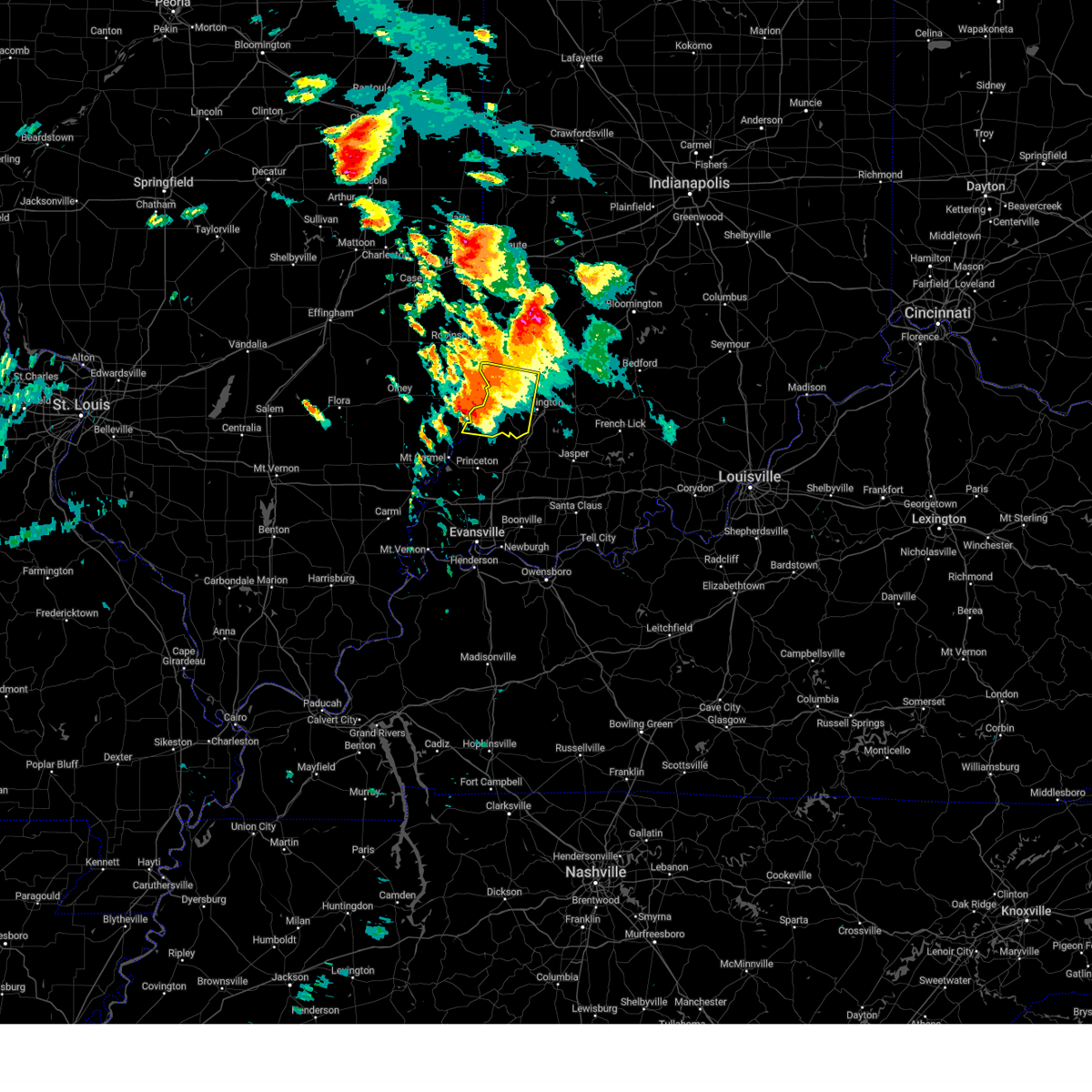 At 737 am edt, a severe thunderstorm was located near vincennes, moving east at 40 mph (radar indicated). Hazards include 60 mph wind gusts and quarter size hail. Hail damage to vehicles is expected. expect wind damage to roofs, siding, and trees. locations impacted include, monroe city. hail threat, radar indicated max hail size, 1. 00 in wind threat, radar indicated max wind gust, 60 mph. At 737 am edt, a severe thunderstorm was located near vincennes, moving east at 40 mph (radar indicated). Hazards include 60 mph wind gusts and quarter size hail. Hail damage to vehicles is expected. expect wind damage to roofs, siding, and trees. locations impacted include, monroe city. hail threat, radar indicated max hail size, 1. 00 in wind threat, radar indicated max wind gust, 60 mph.
|
| 6/29/2023 7:17 AM EDT |
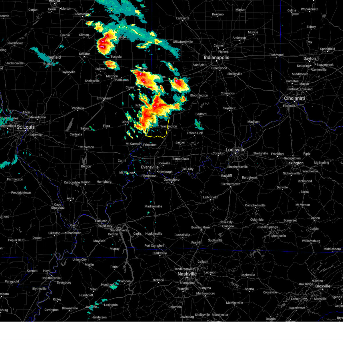 At 717 am edt, a severe thunderstorm was located near lawrenceville, moving east at 25 mph (radar indicated). Hazards include 60 mph wind gusts and quarter size hail. Hail damage to vehicles is expected. expect wind damage to roofs, siding, and trees. this severe thunderstorm will be near, vincennes and vincennes university around 730 am edt. other locations in the path of this severe thunderstorm include monroe city and wheatland. hail threat, radar indicated max hail size, 1. 00 in wind threat, radar indicated max wind gust, 60 mph. At 717 am edt, a severe thunderstorm was located near lawrenceville, moving east at 25 mph (radar indicated). Hazards include 60 mph wind gusts and quarter size hail. Hail damage to vehicles is expected. expect wind damage to roofs, siding, and trees. this severe thunderstorm will be near, vincennes and vincennes university around 730 am edt. other locations in the path of this severe thunderstorm include monroe city and wheatland. hail threat, radar indicated max hail size, 1. 00 in wind threat, radar indicated max wind gust, 60 mph.
|
| 6/25/2023 4:08 PM EDT | Quarter sized hail reported 1.1 miles SSW of Washington, IN, report from mping: quarter (1.00 in.). |
| 6/25/2023 4:06 PM EDT | Pictures of tree damage just off i-69 at the loogootee exit. delayed report... time estimated via rada in daviess county IN, 3.8 miles W of Washington, IN |
| 6/25/2023 4:05 PM EDT |
 At 405 pm edt, a severe thunderstorm was located 9 miles east of washington, or 16 miles northeast of petersburg, moving east at 40 mph (radar indicated). Hazards include golf ball size hail and 60 mph wind gusts. People and animals outdoors will be injured. expect hail damage to roofs, siding, windows, and vehicles. expect wind damage to roofs, siding, and trees. this severe thunderstorm will be near, loogootee and alfordsville around 410 pm edt. shoals around 420 pm edt. lacy around 425 pm edt. thunderstorm damage threat, considerable hail threat, radar indicated max hail size, 1. 75 in wind threat, radar indicated max wind gust, 60 mph. At 405 pm edt, a severe thunderstorm was located 9 miles east of washington, or 16 miles northeast of petersburg, moving east at 40 mph (radar indicated). Hazards include golf ball size hail and 60 mph wind gusts. People and animals outdoors will be injured. expect hail damage to roofs, siding, windows, and vehicles. expect wind damage to roofs, siding, and trees. this severe thunderstorm will be near, loogootee and alfordsville around 410 pm edt. shoals around 420 pm edt. lacy around 425 pm edt. thunderstorm damage threat, considerable hail threat, radar indicated max hail size, 1. 75 in wind threat, radar indicated max wind gust, 60 mph.
|
| 6/25/2023 3:56 PM EDT | Quarter sized hail reported 1.1 miles WSW of Washington, IN, the hail lasted about 5 min. |
| 7/24/2022 8:30 PM EDT |
 At 829 pm edt, a severe thunderstorm was located over washington, or 13 miles northeast of petersburg, moving southeast at 25 mph (radar indicated. at 810 pm edt...a 69 mph wind gust was reported at daviess county airport in washington). Hazards include 70 mph wind gusts and penny size hail. Expect considerable tree damage. damage is likely to mobile homes, roofs, and outbuildings. locations impacted include, washington, bicknell, loogootee, wheatland, bruceville, plainville, montgomery, edwardsport, cannelburg, alfordsville, west boggs lake and glendale fishery. thunderstorm damage threat, considerable hail threat, radar indicated max hail size, 0. 75 in wind threat, observed max wind gust, 70 mph. At 829 pm edt, a severe thunderstorm was located over washington, or 13 miles northeast of petersburg, moving southeast at 25 mph (radar indicated. at 810 pm edt...a 69 mph wind gust was reported at daviess county airport in washington). Hazards include 70 mph wind gusts and penny size hail. Expect considerable tree damage. damage is likely to mobile homes, roofs, and outbuildings. locations impacted include, washington, bicknell, loogootee, wheatland, bruceville, plainville, montgomery, edwardsport, cannelburg, alfordsville, west boggs lake and glendale fishery. thunderstorm damage threat, considerable hail threat, radar indicated max hail size, 0. 75 in wind threat, observed max wind gust, 70 mph.
|
| 7/24/2022 8:16 PM EDT | Time is approximate based on report time and radar srm. relayed by medi in daviess county IN, 3.8 miles S of Washington, IN |
| 7/24/2022 8:14 PM EDT |
 At 814 pm edt, a severe thunderstorm was located near washington, or 18 miles northeast of petersburg, moving southeast at 25 mph (radar indicated). Hazards include 60 mph wind gusts and quarter size hail. Hail damage to vehicles is expected. expect wind damage to roofs, siding, and trees. locations impacted include, montgomery, cannelburg, loogootee, west boggs lake and alfordsville. hail threat, radar indicated max hail size, 1. 00 in wind threat, radar indicated max wind gust, 60 mph. At 814 pm edt, a severe thunderstorm was located near washington, or 18 miles northeast of petersburg, moving southeast at 25 mph (radar indicated). Hazards include 60 mph wind gusts and quarter size hail. Hail damage to vehicles is expected. expect wind damage to roofs, siding, and trees. locations impacted include, montgomery, cannelburg, loogootee, west boggs lake and alfordsville. hail threat, radar indicated max hail size, 1. 00 in wind threat, radar indicated max wind gust, 60 mph.
|
| 7/24/2022 8:10 PM EDT | Storm damage reported in daviess county IN, 4.1 miles SW of Washington, IN |
| 7/24/2022 7:43 PM EDT |
 At 743 pm edt, a severe thunderstorm was located 8 miles east of russellville, or 13 miles northeast of vincennes, moving southeast at 25 mph (radar indicated). Hazards include 60 mph wind gusts and quarter size hail. Hail damage to vehicles is expected. expect wind damage to roofs, siding, and trees. this severe thunderstorm will be near, bicknell around 755 pm edt. edwardsport around 800 pm edt. other locations in the path of this severe thunderstorm include plainville, washington, montgomery, cannelburg, loogootee, west boggs lake and alfordsville. hail threat, radar indicated max hail size, 1. 00 in wind threat, radar indicated max wind gust, 60 mph. At 743 pm edt, a severe thunderstorm was located 8 miles east of russellville, or 13 miles northeast of vincennes, moving southeast at 25 mph (radar indicated). Hazards include 60 mph wind gusts and quarter size hail. Hail damage to vehicles is expected. expect wind damage to roofs, siding, and trees. this severe thunderstorm will be near, bicknell around 755 pm edt. edwardsport around 800 pm edt. other locations in the path of this severe thunderstorm include plainville, washington, montgomery, cannelburg, loogootee, west boggs lake and alfordsville. hail threat, radar indicated max hail size, 1. 00 in wind threat, radar indicated max wind gust, 60 mph.
|
| 6/17/2022 9:27 AM EDT |
 The severe thunderstorm warning for southern daviess county will expire at 930 am edt, the storms which prompted the warning have weakened below severe limits, and have exited the warned area. therefore, the warning will be allowed to expire. a severe thunderstorm watch remains in effect until noon edt for southwestern indiana. The severe thunderstorm warning for southern daviess county will expire at 930 am edt, the storms which prompted the warning have weakened below severe limits, and have exited the warned area. therefore, the warning will be allowed to expire. a severe thunderstorm watch remains in effect until noon edt for southwestern indiana.
|
| 6/17/2022 9:08 AM EDT |
 At 908 am edt, severe thunderstorms were located along a line extending from 10 miles northwest of shoals to 6 miles northeast of winslow, moving east at 45 mph (radar indicated). Hazards include 60 mph wind gusts. Expect damage to roofs, siding, and trees. locations impacted include, washington, loogootee, montgomery, cannelburg, alfordsville, west boggs lake and glendale fishery. hail threat, radar indicated max hail size, <. 75 in wind threat, observed max wind gust, 60 mph. At 908 am edt, severe thunderstorms were located along a line extending from 10 miles northwest of shoals to 6 miles northeast of winslow, moving east at 45 mph (radar indicated). Hazards include 60 mph wind gusts. Expect damage to roofs, siding, and trees. locations impacted include, washington, loogootee, montgomery, cannelburg, alfordsville, west boggs lake and glendale fishery. hail threat, radar indicated max hail size, <. 75 in wind threat, observed max wind gust, 60 mph.
|
| 6/17/2022 9:00 AM EDT | Multiple trees down and/or snapped in residential are in daviess county IN, 0.3 miles S of Washington, IN |
| 6/17/2022 8:55 AM EDT |
 At 855 am edt, severe thunderstorms were located along a line extending from 10 miles north of washington to petersburg, moving east at 45 mph (radar indicated). Hazards include 60 mph wind gusts. Expect damage to roofs, siding, and trees. locations impacted include, cannelburg, loogootee, west boggs lake and glendale fishery. hail threat, radar indicated max hail size, <. 75 in wind threat, observed max wind gust, 60 mph. At 855 am edt, severe thunderstorms were located along a line extending from 10 miles north of washington to petersburg, moving east at 45 mph (radar indicated). Hazards include 60 mph wind gusts. Expect damage to roofs, siding, and trees. locations impacted include, cannelburg, loogootee, west boggs lake and glendale fishery. hail threat, radar indicated max hail size, <. 75 in wind threat, observed max wind gust, 60 mph.
|
| 6/17/2022 8:42 AM EDT |
 At 842 am edt, severe thunderstorms were located along a line extending from 7 miles east of russellville to 9 miles west of petersburg, moving east at 45 mph. this line recently produced estimated 60 mph winds in decker (radar indicated). Hazards include 60 mph wind gusts. Expect damage to roofs, siding, and trees. severe thunderstorms will be near, bicknell around 850 am edt. edwardsport around 855 am edt. plainville around 900 am edt. other locations in the path of these severe thunderstorms include montgomery, glendale fishery, cannelburg, loogootee and west boggs lake. hail threat, radar indicated max hail size, <. 75 in wind threat, observed max wind gust, 60 mph. At 842 am edt, severe thunderstorms were located along a line extending from 7 miles east of russellville to 9 miles west of petersburg, moving east at 45 mph. this line recently produced estimated 60 mph winds in decker (radar indicated). Hazards include 60 mph wind gusts. Expect damage to roofs, siding, and trees. severe thunderstorms will be near, bicknell around 850 am edt. edwardsport around 855 am edt. plainville around 900 am edt. other locations in the path of these severe thunderstorms include montgomery, glendale fishery, cannelburg, loogootee and west boggs lake. hail threat, radar indicated max hail size, <. 75 in wind threat, observed max wind gust, 60 mph.
|
| 5/19/2022 11:27 PM EDT |
 At 1126 pm edt, severe thunderstorms were located along a line extending from 14 miles south of linton to 11 miles north of washington to 9 miles west of shoals, moving northeast at 55 mph (radar indicated). Hazards include 70 mph wind gusts. Expect considerable tree damage. damage is likely to mobile homes, roofs, and outbuildings. locations impacted include, elnora, west boggs lake, odon, linton, lyons, newberry, crane, burns city, indian springs, bloomfield, switz city, owensburg and solsberry. thunderstorm damage threat, considerable hail threat, radar indicated max hail size, <. 75 in wind threat, radar indicated max wind gust, 70 mph. At 1126 pm edt, severe thunderstorms were located along a line extending from 14 miles south of linton to 11 miles north of washington to 9 miles west of shoals, moving northeast at 55 mph (radar indicated). Hazards include 70 mph wind gusts. Expect considerable tree damage. damage is likely to mobile homes, roofs, and outbuildings. locations impacted include, elnora, west boggs lake, odon, linton, lyons, newberry, crane, burns city, indian springs, bloomfield, switz city, owensburg and solsberry. thunderstorm damage threat, considerable hail threat, radar indicated max hail size, <. 75 in wind threat, radar indicated max wind gust, 70 mph.
|
| 5/19/2022 11:07 PM EDT |
 At 1106 pm edt, severe thunderstorms were located along a line extending from near vincennes to 8 miles west of washington to petersburg, moving northeast at 65 mph (radar indicated). Hazards include 70 mph wind gusts. Expect considerable tree damage. damage is likely to mobile homes, roofs, and outbuildings. severe thunderstorms will be near, washington, bicknell and glendale fishery around 1115 pm edt. montgomery, edwardsport, alfordsville and freelandville around 1120 pm edt. loogootee, plainville, sandborn and cannelburg around 1125 pm edt. Other locations in the path of these severe thunderstorms include elnora, west boggs lake, shoals, odon, newberry, lacy, burns city, crane, indian springs and owensburg. At 1106 pm edt, severe thunderstorms were located along a line extending from near vincennes to 8 miles west of washington to petersburg, moving northeast at 65 mph (radar indicated). Hazards include 70 mph wind gusts. Expect considerable tree damage. damage is likely to mobile homes, roofs, and outbuildings. severe thunderstorms will be near, washington, bicknell and glendale fishery around 1115 pm edt. montgomery, edwardsport, alfordsville and freelandville around 1120 pm edt. loogootee, plainville, sandborn and cannelburg around 1125 pm edt. Other locations in the path of these severe thunderstorms include elnora, west boggs lake, shoals, odon, newberry, lacy, burns city, crane, indian springs and owensburg.
|
| 5/19/2022 6:16 PM EDT |
 At 615 pm edt, a severe thunderstorm was located near washington, or 16 miles northeast of petersburg, moving east at 45 mph (radar indicated). Hazards include quarter size hail. Damage to vehicles is expected. this severe thunderstorm will be near, montgomery and cannelburg around 625 pm edt. loogootee and west boggs lake around 630 pm edt. burns city around 635 pm edt. other locations in the path of this severe thunderstorm include shoals and lacy. hail threat, radar indicated max hail size, 1. 00 in wind threat, radar indicated max wind gust, <50 mph. At 615 pm edt, a severe thunderstorm was located near washington, or 16 miles northeast of petersburg, moving east at 45 mph (radar indicated). Hazards include quarter size hail. Damage to vehicles is expected. this severe thunderstorm will be near, montgomery and cannelburg around 625 pm edt. loogootee and west boggs lake around 630 pm edt. burns city around 635 pm edt. other locations in the path of this severe thunderstorm include shoals and lacy. hail threat, radar indicated max hail size, 1. 00 in wind threat, radar indicated max wind gust, <50 mph.
|
| 5/19/2022 6:15 PM EDT | Half Dollar sized hail reported 1.8 miles SSW of Washington, IN, 1.27 inch hail found along the road after a bit of melting. |
| 5/19/2022 6:11 PM EDT |
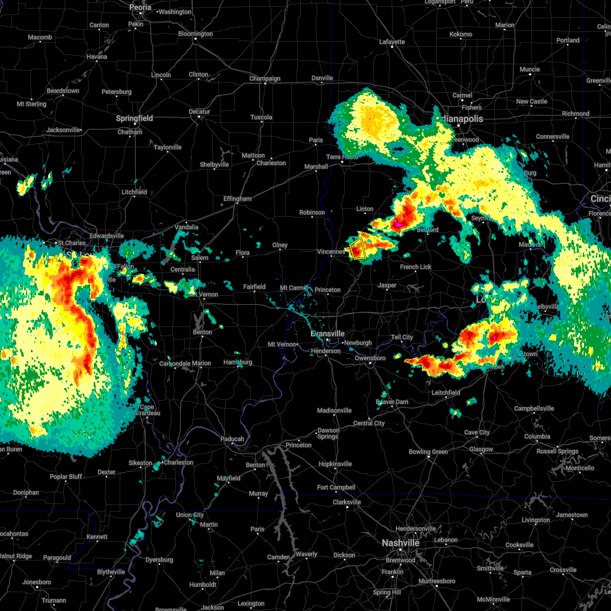 At 610 pm edt, a severe thunderstorm was located 8 miles northwest of washington, or 11 miles east of vincennes, moving northeast at 30 mph (emergency management). Hazards include quarter size hail. Damage to vehicles is expected. this severe storm will be near, washington and edwardsport around 620 pm edt. hail threat, observed max hail size, 1. 00 in wind threat, radar indicated max wind gust, <50 mph. At 610 pm edt, a severe thunderstorm was located 8 miles northwest of washington, or 11 miles east of vincennes, moving northeast at 30 mph (emergency management). Hazards include quarter size hail. Damage to vehicles is expected. this severe storm will be near, washington and edwardsport around 620 pm edt. hail threat, observed max hail size, 1. 00 in wind threat, radar indicated max wind gust, <50 mph.
|
| 5/19/2022 6:00 PM EDT |
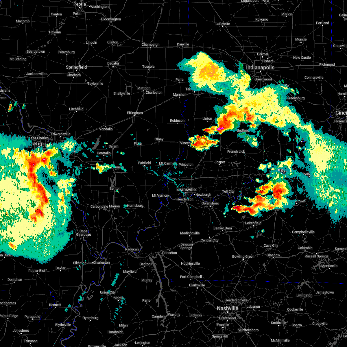 At 600 pm edt, a severe thunderstorm was located near vincennes, moving northeast at 30 mph (emergency management). Hazards include quarter size hail. Damage to vehicles is expected. this severe thunderstorm will be near, wheatland around 610 pm edt. bicknell around 615 pm edt. washington around 620 pm edt. other locations in the path of this severe thunderstorm include edwardsport. hail threat, observed max hail size, 1. 00 in wind threat, radar indicated max wind gust, <50 mph. At 600 pm edt, a severe thunderstorm was located near vincennes, moving northeast at 30 mph (emergency management). Hazards include quarter size hail. Damage to vehicles is expected. this severe thunderstorm will be near, wheatland around 610 pm edt. bicknell around 615 pm edt. washington around 620 pm edt. other locations in the path of this severe thunderstorm include edwardsport. hail threat, observed max hail size, 1. 00 in wind threat, radar indicated max wind gust, <50 mph.
|
| 8/12/2021 6:30 PM EDT |
 At 629 pm edt, severe thunderstorms were located along a line extending from 12 miles southeast of terre haute to 6 miles northeast of lancaster, moving southeast at 25 mph (radar indicated). Hazards include 60 mph wind gusts and quarter size hail. Hail damage to vehicles is expected. Expect wind damage to roofs, siding, and trees. At 629 pm edt, severe thunderstorms were located along a line extending from 12 miles southeast of terre haute to 6 miles northeast of lancaster, moving southeast at 25 mph (radar indicated). Hazards include 60 mph wind gusts and quarter size hail. Hail damage to vehicles is expected. Expect wind damage to roofs, siding, and trees.
|
| 3/25/2021 8:15 PM EDT |
 At 815 pm edt, a severe thunderstorm was located over washington, or 13 miles northeast of petersburg, moving northeast at 75 mph (radar indicated). Hazards include quarter size hail. damage to vehicles is expected At 815 pm edt, a severe thunderstorm was located over washington, or 13 miles northeast of petersburg, moving northeast at 75 mph (radar indicated). Hazards include quarter size hail. damage to vehicles is expected
|
| 10/23/2020 4:26 PM EDT |
 The severe thunderstorm warning for knox and western daviess counties will expire at 430 pm edt, the storm which prompted the warning has weakened below severe limits, and no longer poses an immediate threat to life or property. therefore, the warning will be allowed to expire. however heavy rain is still possible with this thunderstorm. The severe thunderstorm warning for knox and western daviess counties will expire at 430 pm edt, the storm which prompted the warning has weakened below severe limits, and no longer poses an immediate threat to life or property. therefore, the warning will be allowed to expire. however heavy rain is still possible with this thunderstorm.
|
| 10/23/2020 4:02 PM EDT |
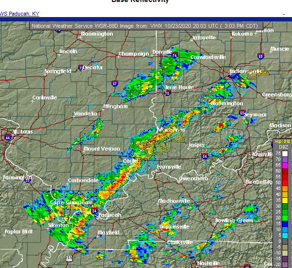 At 402 pm edt, a severe thunderstorm was located 7 miles west of washington, or 10 miles east of vincennes, moving east at 30 mph. largest hail reported so far has been pea sized (radar indicated). Hazards include 60 mph wind gusts and quarter size hail. Hail damage to vehicles is expected. expect wind damage to roofs, siding, and trees. Locations impacted include, vincennes, washington, bicknell, monroe city, wheatland, plainville, edwardsport, decker and glendale fishery. At 402 pm edt, a severe thunderstorm was located 7 miles west of washington, or 10 miles east of vincennes, moving east at 30 mph. largest hail reported so far has been pea sized (radar indicated). Hazards include 60 mph wind gusts and quarter size hail. Hail damage to vehicles is expected. expect wind damage to roofs, siding, and trees. Locations impacted include, vincennes, washington, bicknell, monroe city, wheatland, plainville, edwardsport, decker and glendale fishery.
|
| 10/23/2020 3:44 PM EDT |
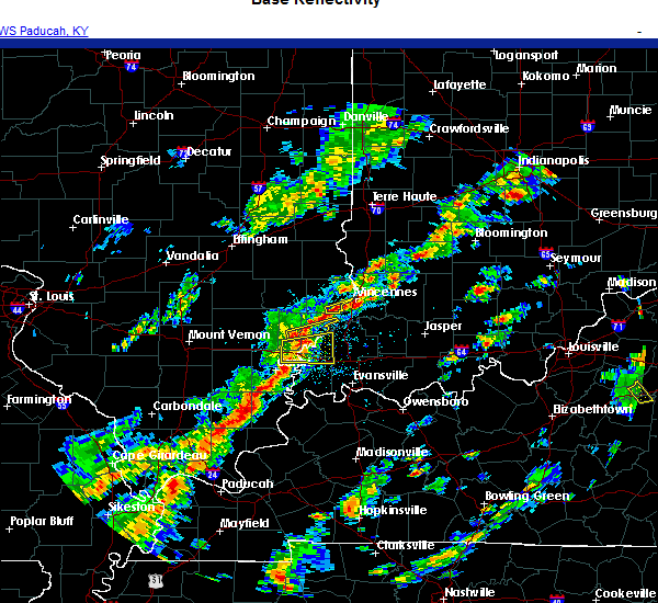 At 344 pm edt, a severe thunderstorm was located near vincennes, moving east at 30 mph (radar indicated). Hazards include 60 mph wind gusts and quarter size hail. Hail damage to vehicles is expected. Expect wind damage to roofs, siding, and trees. At 344 pm edt, a severe thunderstorm was located near vincennes, moving east at 30 mph (radar indicated). Hazards include 60 mph wind gusts and quarter size hail. Hail damage to vehicles is expected. Expect wind damage to roofs, siding, and trees.
|
| 7/11/2020 9:30 PM EDT |
 At 929 pm edt, a severe thunderstorm was located near vincennes, moving southeast at 30 mph (radar indicated). Hazards include 60 mph wind gusts and quarter size hail. Hail damage to vehicles is expected. Expect wind damage to roofs, siding, and trees. At 929 pm edt, a severe thunderstorm was located near vincennes, moving southeast at 30 mph (radar indicated). Hazards include 60 mph wind gusts and quarter size hail. Hail damage to vehicles is expected. Expect wind damage to roofs, siding, and trees.
|
| 4/8/2020 9:16 PM EDT |
 At 915 pm edt, severe thunderstorms were located along a line extending from near nashville to 9 miles north of shoals to petersburg, moving east at 60 mph. these are very dangerous storms (radar indicated). Hazards include 80 mph wind gusts and quarter size hail. Flying debris will be dangerous to those caught without shelter. mobile homes will be heavily damaged. expect considerable damage to roofs, windows, and vehicles. extensive tree damage and power outages are likely. locations impacted include, bloomington, columbus, vincennes, seymour, bedford, washington, brownstown, bloomfield, nashville, shoals, ellettsville, mitchell, bicknell, loogootee, odon, oolitic, medora, elnora, monroe city and elizabethtown. This includes interstate 65 between mile markers 54 and 68. At 915 pm edt, severe thunderstorms were located along a line extending from near nashville to 9 miles north of shoals to petersburg, moving east at 60 mph. these are very dangerous storms (radar indicated). Hazards include 80 mph wind gusts and quarter size hail. Flying debris will be dangerous to those caught without shelter. mobile homes will be heavily damaged. expect considerable damage to roofs, windows, and vehicles. extensive tree damage and power outages are likely. locations impacted include, bloomington, columbus, vincennes, seymour, bedford, washington, brownstown, bloomfield, nashville, shoals, ellettsville, mitchell, bicknell, loogootee, odon, oolitic, medora, elnora, monroe city and elizabethtown. This includes interstate 65 between mile markers 54 and 68.
|
| 4/8/2020 8:59 PM EDT |
 At 859 pm edt, severe thunderstorms were located along a line extending from 7 miles northwest of bloomington to 11 miles south of linton to near st. francisville, moving southeast at 60 mph. these are very dangerous storms (radar indicated). Hazards include 80 mph wind gusts and quarter size hail. Flying debris will be dangerous to those caught without shelter. mobile homes will be heavily damaged. expect considerable damage to roofs, windows, and vehicles. Extensive tree damage and power outages are likely. At 859 pm edt, severe thunderstorms were located along a line extending from 7 miles northwest of bloomington to 11 miles south of linton to near st. francisville, moving southeast at 60 mph. these are very dangerous storms (radar indicated). Hazards include 80 mph wind gusts and quarter size hail. Flying debris will be dangerous to those caught without shelter. mobile homes will be heavily damaged. expect considerable damage to roofs, windows, and vehicles. Extensive tree damage and power outages are likely.
|
| 4/8/2020 8:24 PM EDT |
 At 824 pm edt, a severe thunderstorm was located near sullivan, or 19 miles northeast of robinson, moving southeast at 55 mph (radar indicated). Hazards include 60 mph wind gusts and quarter size hail. Hail damage to vehicles is expected. Expect wind damage to roofs, siding, and trees. At 824 pm edt, a severe thunderstorm was located near sullivan, or 19 miles northeast of robinson, moving southeast at 55 mph (radar indicated). Hazards include 60 mph wind gusts and quarter size hail. Hail damage to vehicles is expected. Expect wind damage to roofs, siding, and trees.
|
| 8/20/2019 2:50 PM EDT |
 At 249 pm edt, severe thunderstorms were located along a line extending from 6 miles southeast of bloomington to 10 miles north of shoals to 6 miles west of petersburg, moving east at 50 mph (radar indicated). Hazards include 60 mph wind gusts. Expect damage to roofs, siding, and trees. Locations impacted include, bloomington, vincennes, washington, bloomfield, shoals, ellettsville, bicknell, loogootee, odon, lyons, elnora, monroe city, wheatland, bruceville, plainville, sandborn, montgomery, edwardsport, switz city and decker. At 249 pm edt, severe thunderstorms were located along a line extending from 6 miles southeast of bloomington to 10 miles north of shoals to 6 miles west of petersburg, moving east at 50 mph (radar indicated). Hazards include 60 mph wind gusts. Expect damage to roofs, siding, and trees. Locations impacted include, bloomington, vincennes, washington, bloomfield, shoals, ellettsville, bicknell, loogootee, odon, lyons, elnora, monroe city, wheatland, bruceville, plainville, sandborn, montgomery, edwardsport, switz city and decker.
|
| 8/20/2019 2:30 PM EDT |
 At 229 pm edt, a severe thunderstorm was located 9 miles southwest of linton, or 22 miles northeast of vincennes, moving east at 45 mph (radar indicated). Hazards include 60 mph wind gusts and penny size hail. expect damage to roofs, siding, and trees At 229 pm edt, a severe thunderstorm was located 9 miles southwest of linton, or 22 miles northeast of vincennes, moving east at 45 mph (radar indicated). Hazards include 60 mph wind gusts and penny size hail. expect damage to roofs, siding, and trees
|
| 8/13/2019 1:30 AM EDT |
 At 129 am edt, a severe thunderstorm was located 12 miles north of washington, or 24 miles northeast of vincennes, moving southeast at 50 mph (radar indicated). Hazards include 60 mph wind gusts. expect damage to roofs, siding, and trees At 129 am edt, a severe thunderstorm was located 12 miles north of washington, or 24 miles northeast of vincennes, moving southeast at 50 mph (radar indicated). Hazards include 60 mph wind gusts. expect damage to roofs, siding, and trees
|
| 6/30/2019 7:53 PM EDT |
 At 753 pm edt, a severe thunderstorm was located near vincennes, moving south at 30 mph (radar indicated). Hazards include 70 mph wind gusts. Expect considerable tree damage. damage is likely to mobile homes, roofs, and outbuildings. Locations impacted include, vincennes, washington, monroe city, wheatland, montgomery, decker, alfordsville, vincennes university and glendale fishery. At 753 pm edt, a severe thunderstorm was located near vincennes, moving south at 30 mph (radar indicated). Hazards include 70 mph wind gusts. Expect considerable tree damage. damage is likely to mobile homes, roofs, and outbuildings. Locations impacted include, vincennes, washington, monroe city, wheatland, montgomery, decker, alfordsville, vincennes university and glendale fishery.
|
| 6/30/2019 7:45 PM EDT |
 At 743 pm edt, a severe thunderstorm was located near vincennes, moving south at 30 mph (radar indicated). Hazards include 70 mph wind gusts. Expect considerable tree damage. Damage is likely to mobile homes, roofs, and outbuildings. At 743 pm edt, a severe thunderstorm was located near vincennes, moving south at 30 mph (radar indicated). Hazards include 70 mph wind gusts. Expect considerable tree damage. Damage is likely to mobile homes, roofs, and outbuildings.
|
| 6/30/2019 7:35 PM EDT |
 At 735 pm edt, a severe thunderstorm was located 10 miles southeast of washington, or 14 miles east of petersburg, moving south at 15 mph (radar indicated). Hazards include 60 mph wind gusts. Expect damage to roofs, siding, and trees. Locations impacted include, vincennes, bedford, washington, shoals, mitchell, bicknell, loogootee, odon, oolitic, carlisle, elnora, oaktown, monroe city, wheatland, bruceville, plainville, sandborn, montgomery, edwardsport and decker. At 735 pm edt, a severe thunderstorm was located 10 miles southeast of washington, or 14 miles east of petersburg, moving south at 15 mph (radar indicated). Hazards include 60 mph wind gusts. Expect damage to roofs, siding, and trees. Locations impacted include, vincennes, bedford, washington, shoals, mitchell, bicknell, loogootee, odon, oolitic, carlisle, elnora, oaktown, monroe city, wheatland, bruceville, plainville, sandborn, montgomery, edwardsport and decker.
|
| 6/30/2019 7:18 PM EDT |
 At 717 pm edt, a severe thunderstorm was located 8 miles east of washington, or 17 miles northeast of petersburg, moving southwest at 20 mph (radar indicated). Hazards include 60 mph wind gusts. Expect damage to roofs, siding, and trees. Locations impacted include, vincennes, bedford, washington, sullivan, shoals, mitchell, bicknell, loogootee, odon, shelburn, oolitic, dugger, hymera, carlisle, elnora, oaktown, monroe city, wheatland, bruceville and plainville. At 717 pm edt, a severe thunderstorm was located 8 miles east of washington, or 17 miles northeast of petersburg, moving southwest at 20 mph (radar indicated). Hazards include 60 mph wind gusts. Expect damage to roofs, siding, and trees. Locations impacted include, vincennes, bedford, washington, sullivan, shoals, mitchell, bicknell, loogootee, odon, shelburn, oolitic, dugger, hymera, carlisle, elnora, oaktown, monroe city, wheatland, bruceville and plainville.
|
| 6/30/2019 7:15 PM EDT | Approximate locatio in daviess county IN, 0.6 miles WSW of Washington, IN |
| 6/30/2019 6:56 PM EDT |
 At 656 pm edt, a severe thunderstorm was located 10 miles north of shoals, or 15 miles west of bedford, moving south at 10 mph (radar indicated). Hazards include 60 mph wind gusts. expect damage to roofs, siding, and trees At 656 pm edt, a severe thunderstorm was located 10 miles north of shoals, or 15 miles west of bedford, moving south at 10 mph (radar indicated). Hazards include 60 mph wind gusts. expect damage to roofs, siding, and trees
|
| 6/23/2019 2:08 PM EDT |
 At 146 pm edt, severe thunderstorms were located along a line extending from 6 miles southeast of palestine to near washington to 7 miles northeast of lynnville, moving northeast at 45 mph (radar indicated). Hazards include 60 mph wind gusts. expect damage to roofs, siding, and trees At 146 pm edt, severe thunderstorms were located along a line extending from 6 miles southeast of palestine to near washington to 7 miles northeast of lynnville, moving northeast at 45 mph (radar indicated). Hazards include 60 mph wind gusts. expect damage to roofs, siding, and trees
|
| 6/23/2019 1:46 PM EDT |
 At 146 pm edt, severe thunderstorms were located along a line extending from 6 miles southeast of palestine to near washington to 7 miles northeast of lynnville, moving northeast at 45 mph (radar indicated). Hazards include 60 mph wind gusts. expect damage to roofs, siding, and trees At 146 pm edt, severe thunderstorms were located along a line extending from 6 miles southeast of palestine to near washington to 7 miles northeast of lynnville, moving northeast at 45 mph (radar indicated). Hazards include 60 mph wind gusts. expect damage to roofs, siding, and trees
|
| 6/21/2019 5:20 PM EDT |
 The severe thunderstorm warning for eastern sullivan, eastern knox, southwestern clay, western greene and western daviess counties will expire at 530 pm edt, the storms which prompted the warning have weakened below severe limits, and no longer pose an immediate threat to life or property. therefore, the warning will be allowed to expire. a severe thunderstorm watch remains in effect until 800 pm edt for southwestern and west central indiana. The severe thunderstorm warning for eastern sullivan, eastern knox, southwestern clay, western greene and western daviess counties will expire at 530 pm edt, the storms which prompted the warning have weakened below severe limits, and no longer pose an immediate threat to life or property. therefore, the warning will be allowed to expire. a severe thunderstorm watch remains in effect until 800 pm edt for southwestern and west central indiana.
|
| 6/21/2019 5:16 PM EDT |
 At 515 pm edt, severe thunderstorms were located along a line extending from 10 miles north of linton to near petersburg, moving southeast at 45 mph (radar indicated). Hazards include 60 mph wind gusts. Expect damage to roofs, siding, and trees. Locations impacted include, washington, linton, bicknell, jasonville, dugger, lyons, elnora, monroe city, wheatland, plainville, sandborn, edwardsport, freelandville, coalmont, pleasantville and vicksburg. At 515 pm edt, severe thunderstorms were located along a line extending from 10 miles north of linton to near petersburg, moving southeast at 45 mph (radar indicated). Hazards include 60 mph wind gusts. Expect damage to roofs, siding, and trees. Locations impacted include, washington, linton, bicknell, jasonville, dugger, lyons, elnora, monroe city, wheatland, plainville, sandborn, edwardsport, freelandville, coalmont, pleasantville and vicksburg.
|
| 6/21/2019 5:05 PM EDT |
 At 505 pm edt, severe thunderstorms were located along a line extending from 10 miles north of sullivan to 8 miles west of petersburg, moving southeast at 40 mph (radar indicated). Hazards include 60 mph wind gusts. Expect damage to roofs, siding, and trees. Locations impacted include, vincennes, washington, linton, sullivan, bicknell, jasonville, shelburn, farmersburg, dugger, hymera, lyons, fairbanks, carlisle, elnora, oaktown, monroe city, wheatland, bruceville, plainville and sandborn. At 505 pm edt, severe thunderstorms were located along a line extending from 10 miles north of sullivan to 8 miles west of petersburg, moving southeast at 40 mph (radar indicated). Hazards include 60 mph wind gusts. Expect damage to roofs, siding, and trees. Locations impacted include, vincennes, washington, linton, sullivan, bicknell, jasonville, shelburn, farmersburg, dugger, hymera, lyons, fairbanks, carlisle, elnora, oaktown, monroe city, wheatland, bruceville, plainville and sandborn.
|
| 6/21/2019 4:42 PM EDT |
 The national weather service in indianapolis has issued a * severe thunderstorm warning for. south central vigo county in west central indiana. sullivan county in southwestern indiana. knox county in southwestern indiana. Southwestern clay county in west central indiana. The national weather service in indianapolis has issued a * severe thunderstorm warning for. south central vigo county in west central indiana. sullivan county in southwestern indiana. knox county in southwestern indiana. Southwestern clay county in west central indiana.
|
| 6/16/2019 2:56 AM EDT |
 The severe thunderstorm warning for northeastern knox, martin, southeastern greene, western lawrence and northern daviess counties will expire at 300 am edt, the storm which prompted the warning has weakened below severe limits, and no longer poses an immediate threat to life or property. therefore, the warning will be allowed to expire. however gusty winds are still possible with this thunderstorm. The severe thunderstorm warning for northeastern knox, martin, southeastern greene, western lawrence and northern daviess counties will expire at 300 am edt, the storm which prompted the warning has weakened below severe limits, and no longer poses an immediate threat to life or property. therefore, the warning will be allowed to expire. however gusty winds are still possible with this thunderstorm.
|
| 6/16/2019 2:37 AM EDT |
 At 237 am edt, a severe thunderstorm was located 11 miles northeast of washington, or 24 miles northeast of petersburg, moving east at 25 mph (radar indicated). Hazards include 60 mph wind gusts and nickel size hail. expect damage to roofs, siding, and trees At 237 am edt, a severe thunderstorm was located 11 miles northeast of washington, or 24 miles northeast of petersburg, moving east at 25 mph (radar indicated). Hazards include 60 mph wind gusts and nickel size hail. expect damage to roofs, siding, and trees
|
| 6/16/2019 2:18 AM EDT |
 At 217 am edt, a severe thunderstorm was located near washington, or 18 miles northeast of petersburg, moving east at 35 mph (radar indicated). Hazards include 70 mph wind gusts. Expect considerable tree damage. damage is likely to mobile homes, roofs, and outbuildings. Locations impacted include, washington, shoals, bicknell, loogootee, odon, elnora, wheatland, plainville, sandborn, montgomery, edwardsport, newberry, crane, cannelburg, alfordsville, west boggs lake, indian springs, freelandville, burns city and lacy. At 217 am edt, a severe thunderstorm was located near washington, or 18 miles northeast of petersburg, moving east at 35 mph (radar indicated). Hazards include 70 mph wind gusts. Expect considerable tree damage. damage is likely to mobile homes, roofs, and outbuildings. Locations impacted include, washington, shoals, bicknell, loogootee, odon, elnora, wheatland, plainville, sandborn, montgomery, edwardsport, newberry, crane, cannelburg, alfordsville, west boggs lake, indian springs, freelandville, burns city and lacy.
|
| 6/16/2019 2:06 AM EDT |
 At 205 am edt, a severe thunderstorm was located near washington, or 12 miles east of vincennes, moving east at 25 mph (radar indicated). Hazards include 70 mph wind gusts. Expect considerable tree damage. Damage is likely to mobile homes, roofs, and outbuildings. At 205 am edt, a severe thunderstorm was located near washington, or 12 miles east of vincennes, moving east at 25 mph (radar indicated). Hazards include 70 mph wind gusts. Expect considerable tree damage. Damage is likely to mobile homes, roofs, and outbuildings.
|
| 5/29/2019 11:12 AM EDT | Spotter reported several power poles down and a few trees uprooted in washington. time estimated from rada in daviess county IN, 0.6 miles WSW of Washington, IN |
| 3/14/2019 12:04 PM EDT |
 At 1203 pm edt, a severe thunderstorm was located over washington, or 14 miles north of petersburg, moving northeast at 65 mph (radar indicated). Hazards include 60 mph wind gusts. Expect damage to roofs, siding, and trees. locations impacted include, washington, odon, elnora, monroe city, wheatland, plainville, sandborn, montgomery and cannelburg. A tornado watch remains in effect until 500 pm edt for southwestern indiana. At 1203 pm edt, a severe thunderstorm was located over washington, or 14 miles north of petersburg, moving northeast at 65 mph (radar indicated). Hazards include 60 mph wind gusts. Expect damage to roofs, siding, and trees. locations impacted include, washington, odon, elnora, monroe city, wheatland, plainville, sandborn, montgomery and cannelburg. A tornado watch remains in effect until 500 pm edt for southwestern indiana.
|
| 3/14/2019 11:52 AM EDT |
 At 1151 am edt, a severe thunderstorm was located near petersburg, moving northeast at 55 mph (radar indicated). Hazards include 60 mph wind gusts. Expect damage to roofs, siding, and trees. locations impacted include, washington, bicknell, odon, elnora, monroe city, wheatland, plainville, sandborn, montgomery, edwardsport and cannelburg. A tornado watch remains in effect until 500 pm edt for southwestern indiana. At 1151 am edt, a severe thunderstorm was located near petersburg, moving northeast at 55 mph (radar indicated). Hazards include 60 mph wind gusts. Expect damage to roofs, siding, and trees. locations impacted include, washington, bicknell, odon, elnora, monroe city, wheatland, plainville, sandborn, montgomery, edwardsport and cannelburg. A tornado watch remains in effect until 500 pm edt for southwestern indiana.
|
| 3/14/2019 11:42 AM EDT |
 At 1141 am edt, a severe thunderstorm was located near patoka, or near princeton, moving northeast at 65 mph (radar indicated). Hazards include 60 mph wind gusts. expect damage to roofs, siding, and trees At 1141 am edt, a severe thunderstorm was located near patoka, or near princeton, moving northeast at 65 mph (radar indicated). Hazards include 60 mph wind gusts. expect damage to roofs, siding, and trees
|
| 2/7/2019 12:17 PM EST |
 At 1217 pm est, a severe thunderstorm was located 7 miles northeast of washington, or 20 miles northeast of petersburg, moving northeast at 65 mph (radar indicated). Hazards include 60 mph wind gusts. expect damage to roofs, siding, and trees At 1217 pm est, a severe thunderstorm was located 7 miles northeast of washington, or 20 miles northeast of petersburg, moving northeast at 65 mph (radar indicated). Hazards include 60 mph wind gusts. expect damage to roofs, siding, and trees
|
| 2/7/2019 11:59 AM EST |
 At 1158 am est, severe thunderstorms were located along a line extending from near russellville to 7 miles southeast of vincennes to fort branch, moving northeast at 65 mph (radar indicated). Hazards include 60 mph wind gusts. Expect damage to roofs, siding, and trees. Locations impacted include, vincennes, washington, bicknell, elnora, monroe city, wheatland, bruceville, plainville, montgomery, edwardsport, decker and vincennes university. At 1158 am est, severe thunderstorms were located along a line extending from near russellville to 7 miles southeast of vincennes to fort branch, moving northeast at 65 mph (radar indicated). Hazards include 60 mph wind gusts. Expect damage to roofs, siding, and trees. Locations impacted include, vincennes, washington, bicknell, elnora, monroe city, wheatland, bruceville, plainville, montgomery, edwardsport, decker and vincennes university.
|
| 2/7/2019 11:48 AM EST |
 At 1148 am est, severe thunderstorms were located along a line extending from near birds to 7 miles southeast of st. francisville to cynthiana, moving east at 65 mph (radar indicated). Hazards include 60 mph wind gusts. expect damage to roofs, siding, and trees At 1148 am est, severe thunderstorms were located along a line extending from near birds to 7 miles southeast of st. francisville to cynthiana, moving east at 65 mph (radar indicated). Hazards include 60 mph wind gusts. expect damage to roofs, siding, and trees
|
| 5/31/2018 1:25 PM EDT |
 The severe thunderstorm warning for northeastern knox and daviess counties will expire at 130 pm edt, the storm which prompted the warning has moved out of the area. therefore the warning will be allowed to expire. a severe thunderstorm watch remains in effect until 600 pm edt for southwestern indiana. The severe thunderstorm warning for northeastern knox and daviess counties will expire at 130 pm edt, the storm which prompted the warning has moved out of the area. therefore the warning will be allowed to expire. a severe thunderstorm watch remains in effect until 600 pm edt for southwestern indiana.
|
| 5/31/2018 1:21 PM EDT |
 At 120 pm edt, a severe thunderstorm was located 10 miles northwest of shoals, or 23 miles west of bedford, moving northeast at 50 mph (trained weather spotters). Hazards include 60 mph wind gusts. Expect damage to roofs, siding, and trees. Locations impacted include, washington, bicknell, loogootee, odon, elnora, oaktown, wheatland, bruceville, plainville, montgomery, edwardsport, cannelburg, alfordsville, west boggs lake, freelandville, glendale fishery and portersville. At 120 pm edt, a severe thunderstorm was located 10 miles northwest of shoals, or 23 miles west of bedford, moving northeast at 50 mph (trained weather spotters). Hazards include 60 mph wind gusts. Expect damage to roofs, siding, and trees. Locations impacted include, washington, bicknell, loogootee, odon, elnora, oaktown, wheatland, bruceville, plainville, montgomery, edwardsport, cannelburg, alfordsville, west boggs lake, freelandville, glendale fishery and portersville.
|
| 5/31/2018 1:03 PM EDT |
 At 103 pm edt, a severe thunderstorm was located near washington, or 16 miles northeast of petersburg, moving northeast at 50 mph (trained weather spotters). Hazards include 60 mph wind gusts. Expect damage to roofs, siding, and trees. trained weather spotters reported 60 mph winds near bicknell. Locations impacted include, washington, bicknell, loogootee, odon, elnora, oaktown, wheatland, bruceville, plainville, sandborn, montgomery, edwardsport, cannelburg, alfordsville, west boggs lake, freelandville, glendale fishery and portersville. At 103 pm edt, a severe thunderstorm was located near washington, or 16 miles northeast of petersburg, moving northeast at 50 mph (trained weather spotters). Hazards include 60 mph wind gusts. Expect damage to roofs, siding, and trees. trained weather spotters reported 60 mph winds near bicknell. Locations impacted include, washington, bicknell, loogootee, odon, elnora, oaktown, wheatland, bruceville, plainville, sandborn, montgomery, edwardsport, cannelburg, alfordsville, west boggs lake, freelandville, glendale fishery and portersville.
|
| 5/31/2018 12:48 PM EDT |
 At 1247 pm edt, a severe thunderstorm was located near petersburg, moving northeast at 55 mph (radar indicated). Hazards include 60 mph wind gusts. expect damage to roofs, siding, and trees At 1247 pm edt, a severe thunderstorm was located near petersburg, moving northeast at 55 mph (radar indicated). Hazards include 60 mph wind gusts. expect damage to roofs, siding, and trees
|
| 4/5/2017 5:58 PM EDT |
 At 557 pm edt, a severe thunderstorm was located near washington, or 13 miles northeast of petersburg, moving northeast at 35 mph (radar indicated). Hazards include 60 mph wind gusts and quarter size hail. Hail damage to vehicles is expected. Expect wind damage to roofs, siding, and trees. At 557 pm edt, a severe thunderstorm was located near washington, or 13 miles northeast of petersburg, moving northeast at 35 mph (radar indicated). Hazards include 60 mph wind gusts and quarter size hail. Hail damage to vehicles is expected. Expect wind damage to roofs, siding, and trees.
|
| 4/5/2017 5:51 PM EDT |
 At 550 pm edt, a severe thunderstorm was located near washington, or 10 miles northeast of petersburg, moving northeast at 35 mph (radar indicated). Hazards include 60 mph wind gusts and quarter size hail. Hail damage to vehicles is expected. expect wind damage to roofs, siding, and trees. Locations impacted include, washington, plainville and montgomery. At 550 pm edt, a severe thunderstorm was located near washington, or 10 miles northeast of petersburg, moving northeast at 35 mph (radar indicated). Hazards include 60 mph wind gusts and quarter size hail. Hail damage to vehicles is expected. expect wind damage to roofs, siding, and trees. Locations impacted include, washington, plainville and montgomery.
|
| 4/5/2017 5:41 PM EDT |
 At 540 pm edt, a severe thunderstorm was located 7 miles north of petersburg, moving northeast at 45 mph (radar indicated). Hazards include 60 mph wind gusts and quarter size hail. Hail damage to vehicles is expected. expect wind damage to roofs, siding, and trees. Locations impacted include, washington, bicknell, monroe city, wheatland, plainville, montgomery and edwardsport. At 540 pm edt, a severe thunderstorm was located 7 miles north of petersburg, moving northeast at 45 mph (radar indicated). Hazards include 60 mph wind gusts and quarter size hail. Hail damage to vehicles is expected. expect wind damage to roofs, siding, and trees. Locations impacted include, washington, bicknell, monroe city, wheatland, plainville, montgomery and edwardsport.
|
| 4/5/2017 5:33 PM EDT |
 At 532 pm edt, a severe thunderstorm was located near petersburg, moving northeast at 45 mph (radar indicated). Hazards include 60 mph wind gusts and quarter size hail. Hail damage to vehicles is expected. Expect wind damage to roofs, siding, and trees. At 532 pm edt, a severe thunderstorm was located near petersburg, moving northeast at 45 mph (radar indicated). Hazards include 60 mph wind gusts and quarter size hail. Hail damage to vehicles is expected. Expect wind damage to roofs, siding, and trees.
|
| 4/5/2017 4:41 PM EDT |
 At 439 pm edt, a severe thunderstorm was located near patoka, or 8 miles north of princeton in gibson county, moving northeast at 50 mph. at 433 pm, a funnel cloud was reported 2 ssw of patoka (radar indicated). Hazards include 60 mph wind gusts and quarter size hail. Hail damage to vehicles is expected. Expect wind damage to roofs, siding, and trees. At 439 pm edt, a severe thunderstorm was located near patoka, or 8 miles north of princeton in gibson county, moving northeast at 50 mph. at 433 pm, a funnel cloud was reported 2 ssw of patoka (radar indicated). Hazards include 60 mph wind gusts and quarter size hail. Hail damage to vehicles is expected. Expect wind damage to roofs, siding, and trees.
|
| 3/30/2017 5:41 PM EDT |
 The severe thunderstorm warning for northeastern knox and central daviess counties will expire at 545 pm edt, the storm which prompted the warning has moved out of the area. therefore the warning will be allowed to expire. a tornado watch remains in effect until 1000 pm edt for southwestern indiana. The severe thunderstorm warning for northeastern knox and central daviess counties will expire at 545 pm edt, the storm which prompted the warning has moved out of the area. therefore the warning will be allowed to expire. a tornado watch remains in effect until 1000 pm edt for southwestern indiana.
|
| 3/30/2017 5:20 PM EDT |
 At 520 pm edt, a severe thunderstorm was located near washington, or 14 miles east of vincennes, moving northeast at 50 mph (radar indicated). Hazards include 60 mph wind gusts and quarter size hail. Hail damage to vehicles is expected. expect wind damage to roofs, siding, and trees. locations impacted include, washington, bicknell, elnora, wheatland, plainville, sandborn and edwardsport. A tornado watch remains in effect until 1000 pm edt for southwestern indiana. At 520 pm edt, a severe thunderstorm was located near washington, or 14 miles east of vincennes, moving northeast at 50 mph (radar indicated). Hazards include 60 mph wind gusts and quarter size hail. Hail damage to vehicles is expected. expect wind damage to roofs, siding, and trees. locations impacted include, washington, bicknell, elnora, wheatland, plainville, sandborn and edwardsport. A tornado watch remains in effect until 1000 pm edt for southwestern indiana.
|
| 3/30/2017 5:03 PM EDT |
 At 502 pm edt, a severe thunderstorm was located 7 miles southeast of vincennes, moving northeast at 50 mph (radar indicated). Hazards include 60 mph wind gusts and quarter size hail. Hail damage to vehicles is expected. Expect wind damage to roofs, siding, and trees. At 502 pm edt, a severe thunderstorm was located 7 miles southeast of vincennes, moving northeast at 50 mph (radar indicated). Hazards include 60 mph wind gusts and quarter size hail. Hail damage to vehicles is expected. Expect wind damage to roofs, siding, and trees.
|
| 7/13/2016 7:57 PM EDT |
 At 756 pm edt, a severe thunderstorm was located near spencer, or 16 miles northwest of bloomington, moving east at 50 mph (radar indicated). Hazards include 60 mph wind gusts. Expect damage to roofs. siding. and trees. locations impacted include, washington, greencastle, bloomfield, spencer, shoals, loogootee, cloverdale, odon, roachdale, bainbridge, fillmore, russellville, montgomery, newberry, crane, cannelburg, alfordsville, west boggs lake, groveland and glendale fishery. This includes interstate 70 between mile markers 39 and 47. At 756 pm edt, a severe thunderstorm was located near spencer, or 16 miles northwest of bloomington, moving east at 50 mph (radar indicated). Hazards include 60 mph wind gusts. Expect damage to roofs. siding. and trees. locations impacted include, washington, greencastle, bloomfield, spencer, shoals, loogootee, cloverdale, odon, roachdale, bainbridge, fillmore, russellville, montgomery, newberry, crane, cannelburg, alfordsville, west boggs lake, groveland and glendale fishery. This includes interstate 70 between mile markers 39 and 47.
|
| 7/13/2016 7:46 PM EDT |
 At 746 pm edt, a severe thunderstorm was located near spencer, or 21 miles northwest of bloomington, moving east at 50 mph (radar indicated). Hazards include 60 mph wind gusts. Expect damage to roofs. siding. and trees. locations impacted include, washington, greencastle, linton, bloomfield, spencer, shoals, loogootee, cloverdale, worthington, odon, roachdale, bainbridge, lyons, elnora, fillmore, plainville, waveland, russellville, montgomery and switz city. This includes interstate 70 between mile markers 26 and 47. At 746 pm edt, a severe thunderstorm was located near spencer, or 21 miles northwest of bloomington, moving east at 50 mph (radar indicated). Hazards include 60 mph wind gusts. Expect damage to roofs. siding. and trees. locations impacted include, washington, greencastle, linton, bloomfield, spencer, shoals, loogootee, cloverdale, worthington, odon, roachdale, bainbridge, lyons, elnora, fillmore, plainville, waveland, russellville, montgomery and switz city. This includes interstate 70 between mile markers 26 and 47.
|
| 7/13/2016 7:27 PM EDT |
 At 726 pm edt, a severe thunderstorm was located 12 miles north of linton, or 20 miles southeast of terre haute, moving east at 50 mph (radar indicated). Hazards include 60 mph wind gusts. Expect damage to roofs. siding. And trees. At 726 pm edt, a severe thunderstorm was located 12 miles north of linton, or 20 miles southeast of terre haute, moving east at 50 mph (radar indicated). Hazards include 60 mph wind gusts. Expect damage to roofs. siding. And trees.
|
| 6/15/2016 5:59 PM EDT |
 At 559 pm edt, severe thunderstorms were located along a line extending from 6 miles north of washington to near vincennes, moving southeast at 35 mph (radar indicated). Hazards include 60 mph wind gusts. Expect damage to roofs. siding. and trees. Locations impacted include, vincennes, washington, russellville, bicknell, loogootee, oaktown, monroe city, wheatland, bruceville, plainville, sandborn, montgomery, edwardsport, decker, cannelburg, freelandville and vincennes university. At 559 pm edt, severe thunderstorms were located along a line extending from 6 miles north of washington to near vincennes, moving southeast at 35 mph (radar indicated). Hazards include 60 mph wind gusts. Expect damage to roofs. siding. and trees. Locations impacted include, vincennes, washington, russellville, bicknell, loogootee, oaktown, monroe city, wheatland, bruceville, plainville, sandborn, montgomery, edwardsport, decker, cannelburg, freelandville and vincennes university.
|
| 6/15/2016 5:44 PM EDT |
 At 544 pm edt, severe thunderstorms were located along a line extending from 9 miles southeast of sullivan to near russellville, moving southeast at 45 mph (radar indicated). Hazards include 60 mph wind gusts. Expect damage to roofs. siding. And trees. At 544 pm edt, severe thunderstorms were located along a line extending from 9 miles southeast of sullivan to near russellville, moving southeast at 45 mph (radar indicated). Hazards include 60 mph wind gusts. Expect damage to roofs. siding. And trees.
|
| 6/15/2016 4:58 PM EDT |
 At 458 pm edt, severe thunderstorms were located along a line extending from 9 miles east of shoals to near washington, moving southeast at 60 mph (radar indicated). Hazards include 60 mph wind gusts. Expect damage to roofs. siding. And trees. At 458 pm edt, severe thunderstorms were located along a line extending from 9 miles east of shoals to near washington, moving southeast at 60 mph (radar indicated). Hazards include 60 mph wind gusts. Expect damage to roofs. siding. And trees.
|
| 6/15/2016 4:48 PM EDT |
 At 448 pm edt, a severe thunderstorm was located near shoals, or 21 miles west of bedford, moving southeast at 20 mph (radar indicated). Hazards include 60 mph wind gusts and penny size hail. Expect damage to roofs. siding. and trees. Locations impacted include, washington, shoals, loogootee, odon, elnora, plainville, sandborn, montgomery, edwardsport, crane, cannelburg, alfordsville, roland, west boggs lake, lacy, glendale fishery, burns city and indian springs. At 448 pm edt, a severe thunderstorm was located near shoals, or 21 miles west of bedford, moving southeast at 20 mph (radar indicated). Hazards include 60 mph wind gusts and penny size hail. Expect damage to roofs. siding. and trees. Locations impacted include, washington, shoals, loogootee, odon, elnora, plainville, sandborn, montgomery, edwardsport, crane, cannelburg, alfordsville, roland, west boggs lake, lacy, glendale fishery, burns city and indian springs.
|
| 6/15/2016 4:32 PM EDT |
 At 431 pm edt, a severe thunderstorm was located 12 miles northwest of shoals, or 25 miles west of bedford, moving southeast at 20 mph (public. at 428 pm...the public reported a measured 59 mph wind gust 2 miles southeast of odon). Hazards include 60 mph wind gusts and penny size hail. Expect damage to roofs. siding. And trees. At 431 pm edt, a severe thunderstorm was located 12 miles northwest of shoals, or 25 miles west of bedford, moving southeast at 20 mph (public. at 428 pm...the public reported a measured 59 mph wind gust 2 miles southeast of odon). Hazards include 60 mph wind gusts and penny size hail. Expect damage to roofs. siding. And trees.
|
| 5/7/2016 7:51 PM EDT |
 At 750 pm edt, a severe thunderstorm was located over washington, or 12 miles northeast of petersburg, moving southeast at 25 mph (radar indicated). Hazards include golf ball size hail and 60 mph wind gusts. People and animals outdoors will be injured. expect hail damage to roofs, siding, windows, and vehicles. expect wind damage to roofs, siding, and trees. Locations impacted include, washington, montgomery and glendale fishery. At 750 pm edt, a severe thunderstorm was located over washington, or 12 miles northeast of petersburg, moving southeast at 25 mph (radar indicated). Hazards include golf ball size hail and 60 mph wind gusts. People and animals outdoors will be injured. expect hail damage to roofs, siding, windows, and vehicles. expect wind damage to roofs, siding, and trees. Locations impacted include, washington, montgomery and glendale fishery.
|
| 5/7/2016 7:48 PM EDT | Golf Ball sized hail reported 0.6 miles WSW of Washington, IN |
| 5/7/2016 7:48 PM EDT | Storm damage reported in daviess county IN, 0.6 miles WSW of Washington, IN |
| 5/7/2016 7:45 PM EDT | Quarter sized hail reported 0.3 miles S of Washington, IN |
| 5/7/2016 7:33 PM EDT |
 At 733 pm edt, a severe thunderstorm was located near washington, or 14 miles east of vincennes, moving southeast at 25 mph (radar indicated). Hazards include 60 mph wind gusts and quarter size hail. Hail damage to vehicles is expected. Expect wind damage to roofs, siding, and trees. At 733 pm edt, a severe thunderstorm was located near washington, or 14 miles east of vincennes, moving southeast at 25 mph (radar indicated). Hazards include 60 mph wind gusts and quarter size hail. Hail damage to vehicles is expected. Expect wind damage to roofs, siding, and trees.
|
| 4/26/2016 6:55 PM EDT |
 The severe thunderstorm warning for southwestern greene, knox, southeastern sullivan, northwestern martin and daviess counties will expire at 700 pm edt, the storms which prompted the warning have weakened below severe limits, and no longer pose an immediate threat to life or property. therefore the warning will be allowed to expire. however gusty winds are still possible with these thunderstorms. a severe thunderstorm watch remains in effect until 1100 pm edt for southwestern indiana. The severe thunderstorm warning for southwestern greene, knox, southeastern sullivan, northwestern martin and daviess counties will expire at 700 pm edt, the storms which prompted the warning have weakened below severe limits, and no longer pose an immediate threat to life or property. therefore the warning will be allowed to expire. however gusty winds are still possible with these thunderstorms. a severe thunderstorm watch remains in effect until 1100 pm edt for southwestern indiana.
|
| 4/26/2016 6:42 PM EDT |
 At 641 pm edt, severe thunderstorms were located along a line extending from near russellville to near washington, moving northeast at 25 mph (radar indicated). Hazards include 60 mph wind gusts and penny size hail. Expect damage to roofs. siding. and trees. Locations impacted include, vincennes, washington, linton, bicknell, odon, dugger, lyons, elnora, oaktown, monroe city, wheatland, bruceville, plainville, sandborn, montgomery, edwardsport, newberry, crane, pleasantville and west boggs lake. At 641 pm edt, severe thunderstorms were located along a line extending from near russellville to near washington, moving northeast at 25 mph (radar indicated). Hazards include 60 mph wind gusts and penny size hail. Expect damage to roofs. siding. and trees. Locations impacted include, vincennes, washington, linton, bicknell, odon, dugger, lyons, elnora, oaktown, monroe city, wheatland, bruceville, plainville, sandborn, montgomery, edwardsport, newberry, crane, pleasantville and west boggs lake.
|
| 4/26/2016 6:28 PM EDT |
 At 628 pm edt, severe thunderstorms were located along a line extending from near vincennes to 6 miles northwest of petersburg, moving northeast at 25 mph (radar indicated). Hazards include 60 mph wind gusts and nickel size hail. Expect damage to roofs. siding. And trees. At 628 pm edt, severe thunderstorms were located along a line extending from near vincennes to 6 miles northwest of petersburg, moving northeast at 25 mph (radar indicated). Hazards include 60 mph wind gusts and nickel size hail. Expect damage to roofs. siding. And trees.
|
| 12/23/2015 5:33 PM EST | The national weather service in indianapolis has issued a * severe thunderstorm warning for. martin county in southwestern indiana. southeastern daviess county in southwestern indiana. until 600 pm est * at 533 pm est. A severe thunderstorm was located 7 miles east of. |
| 12/23/2015 2:49 PM EST | Storm damage reported in daviess county IN, 7.4 miles NNW of Washington, IN |
| 12/23/2015 2:43 PM EST | At 242 pm est, severe thunderstorms were located along a line extending from 15 miles west of spencer to 6 miles southwest of bloomfield to 7 miles south of washington, moving northeast at 70 mph (radar indicated). Hazards include 60 mph wind gusts. Expect damage to roofs. siding and trees. locations impacted include, washington, linton, bloomfield, spencer, shoals, loogootee, jasonville, worthington, odon, clay city, lyons, elnora, plainville, sandborn, montgomery, switz city, newberry, crane, cannelburg and alfordsville. A tornado watch remains in effect until 900 pm est for southwestern indiana. |
| 12/23/2015 2:27 PM EST | At 226 pm est, severe thunderstorms were located along a line extending from 8 miles northeast of sullivan to 12 miles north of washington to near oakland city, moving northeast at 65 mph (radar indicated). Hazards include 60 mph wind gusts. Expect damage to roofs. Siding and trees. |
| 12/23/2015 2:15 PM EST | At 214 pm est, severe thunderstorms were located along a line extending from 6 miles northeast of palestine to 6 miles northeast of patoka, moving east at 55 mph (radar indicated). Hazards include 60 mph wind gusts. Expect damage to roofs. siding and trees. locations impacted include, vincennes, washington, linton, sullivan, russellville, bicknell, jasonville, dugger, lyons, carlisle, elnora, oaktown, monroe city, wheatland, bruceville, plainville, sandborn, montgomery, edwardsport and decker. A tornado watch remains in effect until 900 pm est for southwestern indiana. |
| 12/23/2015 2:12 PM EST | At 212 pm est, severe thunderstorms capable of producing both tornadoes and extensive straight line wind damage were located near vincennes, moving northeast at 60 mph (radar indicated rotation). Hazards include tornado. Flying debris will be dangerous to those caught without shelter. mobile homes will be damaged or destroyed. damage to roofs, windows and vehicles will occur. tree damage is likely. these dangerous storms will be near, vincennes around 220 pm est. washington around 230 pm est. Other locations impacted by this tornadic thunderstorm include decker, plainville, edwardsport, bicknell, monroe city and wheatland. |
| 12/23/2015 1:57 PM EST | At 156 pm est, severe thunderstorms were located along a line extending from robinson to near mount carmel, moving east at 60 mph (radar indicated). Hazards include 60 mph wind gusts. Expect damage to roofs. Siding and trees. |
| 7/14/2015 5:57 AM EDT |
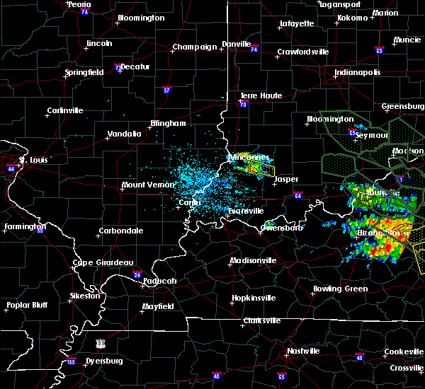 At 555 am edt, a severe thunderstorm was located near washington, and moving southeast at 45 mph (radar indicated). Hazards include 60 mph wind gusts and nickel size hail. Expect damage to roofs. siding and trees. Locations impacted include, glendale fishery and alfordsville. At 555 am edt, a severe thunderstorm was located near washington, and moving southeast at 45 mph (radar indicated). Hazards include 60 mph wind gusts and nickel size hail. Expect damage to roofs. siding and trees. Locations impacted include, glendale fishery and alfordsville.
|
| 7/14/2015 5:41 AM EDT |
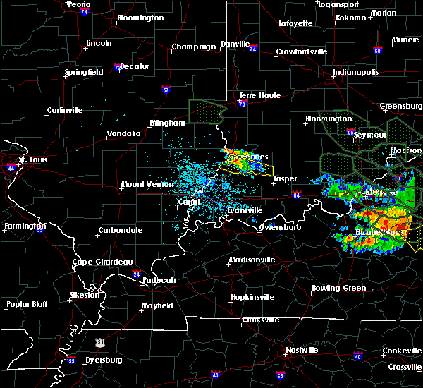 At 539 am edt, a severe thunderstorm was located 6 miles east of vincennes, and moving southeast at 45 mph (radar indicated). Hazards include 60 mph wind gusts and nickel size hail. Expect damage to roofs. Siding and trees. At 539 am edt, a severe thunderstorm was located 6 miles east of vincennes, and moving southeast at 45 mph (radar indicated). Hazards include 60 mph wind gusts and nickel size hail. Expect damage to roofs. Siding and trees.
|
| 4/8/2015 4:34 PM EDT | A severe thunderstorm warning remains in effect for daviess and central knox counties until 500 pm edt. at 432 pm edt. a severe thunderstorm was located 6 miles north of petersburg. and moving east at 30 mph. hazard. ping pong ball size hail and 60 mph wind gusts. source. Radar indicated. |
| 4/8/2015 4:16 PM EDT | The national weather service in indianapolis has issued a * severe thunderstorm warning for. daviess county in southwest indiana. central knox county in southwest indiana. until 500 pm edt * at 415 pm edt. A severe thunderstorm was located 9 miles northwest. |
| 4/2/2015 7:25 PM EDT | A severe thunderstorm warning remains in effect for south central clay. northern daviess. greene. northeastern knox. northern martin and southeastern sullivan counties until 800 pm edt. at 723 pm edt. a severe thunderstorm was located 12 miles southwest of linton. and moving east at 45 mph. hazard. 60 mph wind gusts and quarter size hail. |
| 4/2/2015 7:12 PM EDT | The national weather service in indianapolis has issued a * severe thunderstorm warning for. south central clay county in west central indiana. northern daviess county in southwest indiana. greene county in southwest indiana. Northeastern knox county in southwest indiana. |
| 11/17/2013 4:15 PM EST | Orchard with lots of tree damage... time approximate in daviess county IN, 0.6 miles WSW of Washington, IN |
| 11/17/2013 3:15 PM EST | Old us 50 on west side of washington. eitcines farmers market destroyed. multiple trees down in daviess county IN, 0.6 miles WSW of Washington, IN |
| 5/21/2013 2:42 AM EDT | Tree damage reporte in daviess county IN, 2.2 miles W of Washington, IN |
| 5/21/2013 2:38 AM EDT | Several trees knocked over in downtown washington. main street was closed for a few hours until trees were remove in daviess county IN, 0.6 miles WSW of Washington, IN |
| 5/21/2013 2:38 AM EDT | Roof damage downtown...one roof was only 2 years old and debris from it flew 3 blocks. damage to old trees and structurally unsound out buildings and canopys. wind dama in daviess county IN, 0.6 miles WSW of Washington, IN |
| 7/31/2012 6:14 PM EDT | Quarter sized hail reported 0.6 miles WSW of Washington, IN |
| 7/31/2012 6:12 PM EDT | Storm damage reported in daviess county IN, 0.6 miles WSW of Washington, IN |
| 4/28/2012 6:06 PM EDT | Ping Pong Ball sized hail reported 0.6 miles WSW of Washington, IN |
| 4/28/2012 6:06 PM EDT | Storm damage reported in daviess county IN, 0.6 miles WSW of Washington, IN |
| 1/1/0001 12:00 AM | House and turkey barns destroyed at 4930 north and 350 west. one wall left standing of house. reference city and direction/distance is estimate in daviess county IN, 4.1 miles SE of Washington, IN |
| 1/1/0001 12:00 AM | Telephone poll down at sw 3rd and washington. also pea sized hai in daviess county IN, 1.1 miles SSW of Washington, IN |
| 1/1/0001 12:00 AM | 10 inch tree limb downe in daviess county IN, 0.6 miles WSW of Washington, IN |
| 1/1/0001 12:00 AM | Winds estimated to be at least 65 to 70 mph...with a possible wall clou in daviess county IN, 0.6 miles WSW of Washington, IN |
| 1/1/0001 12:00 AM | Shingles were also reported to blown off home in daviess county IN, 0.6 miles WSW of Washington, IN |
| 1/1/0001 12:00 AM | Numerous trees down in the seven curves area of highway 257. trees also down at cr 500 s and hwy 25 in daviess county IN, 3.9 miles N of Washington, IN |
Hail Maps for Washington, IN
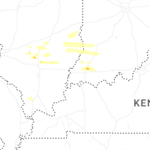
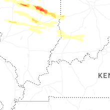
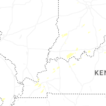
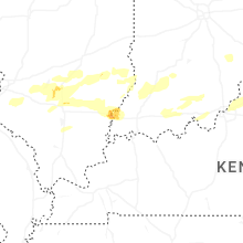
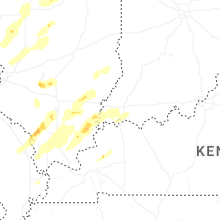

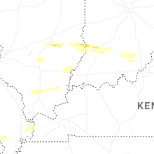
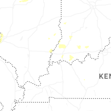
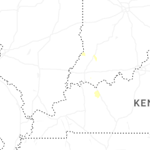
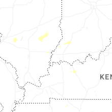
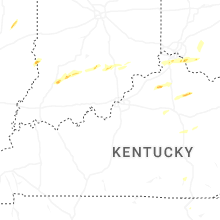


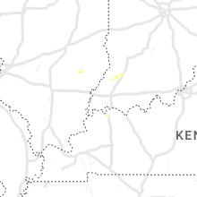


Connect with Interactive Hail Maps