

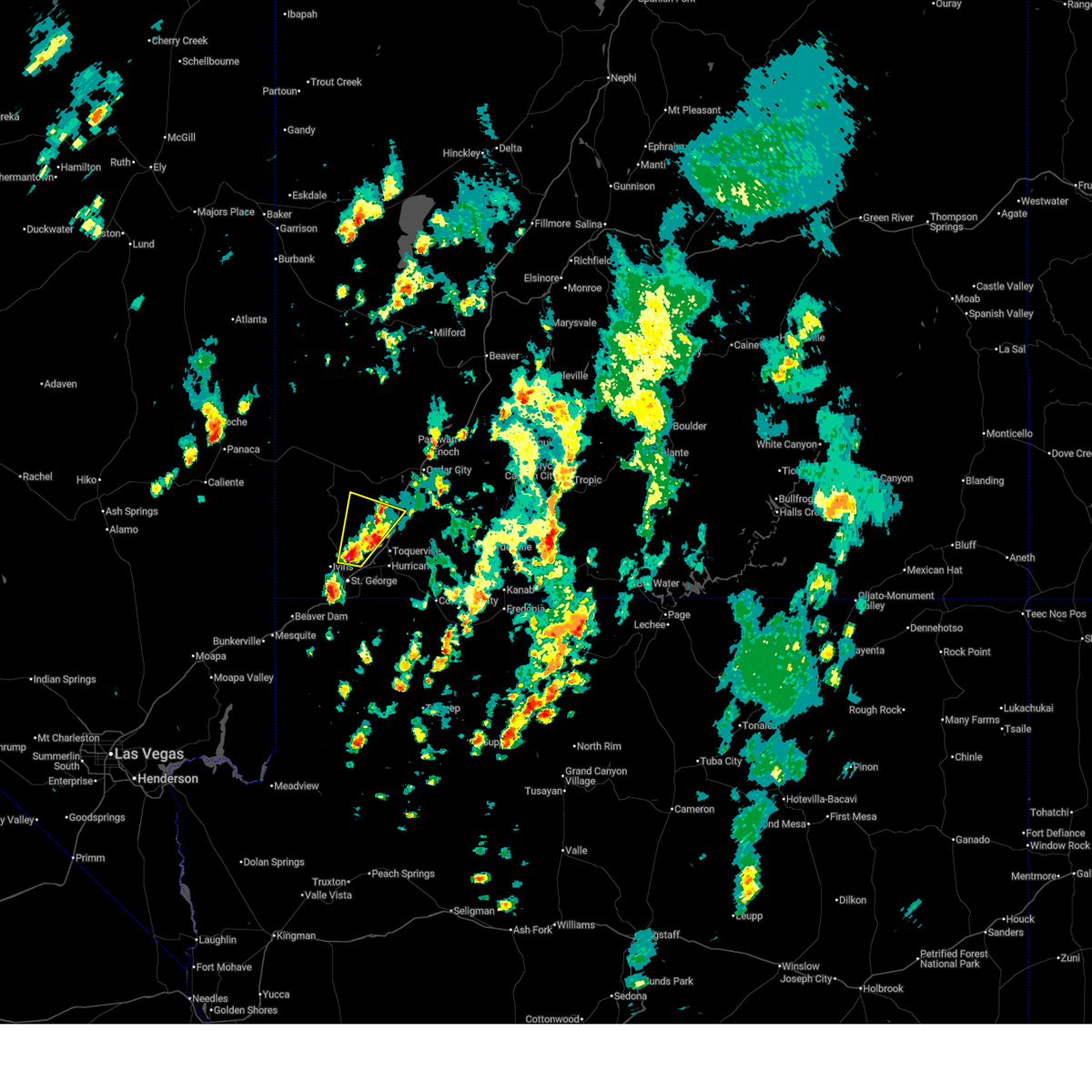
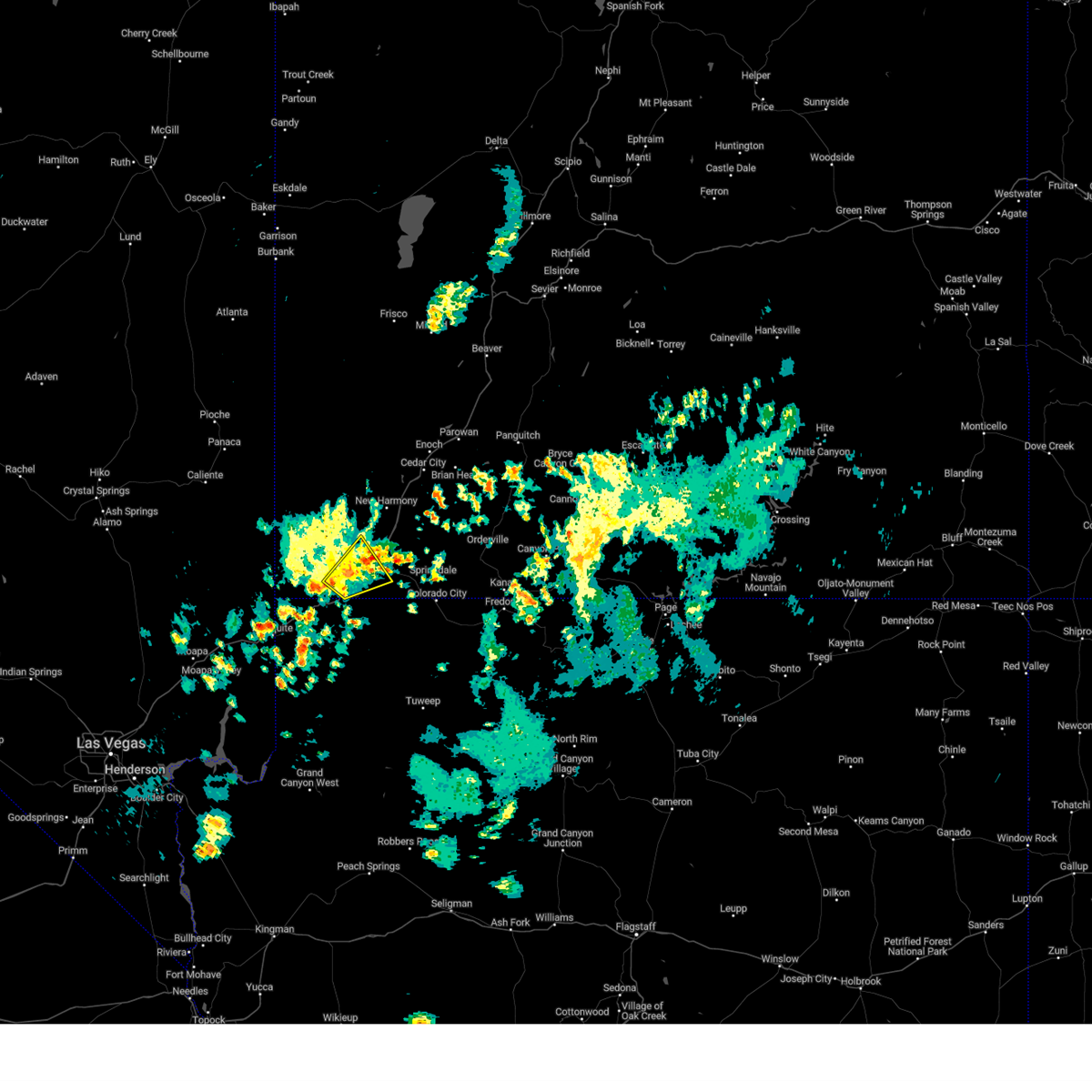
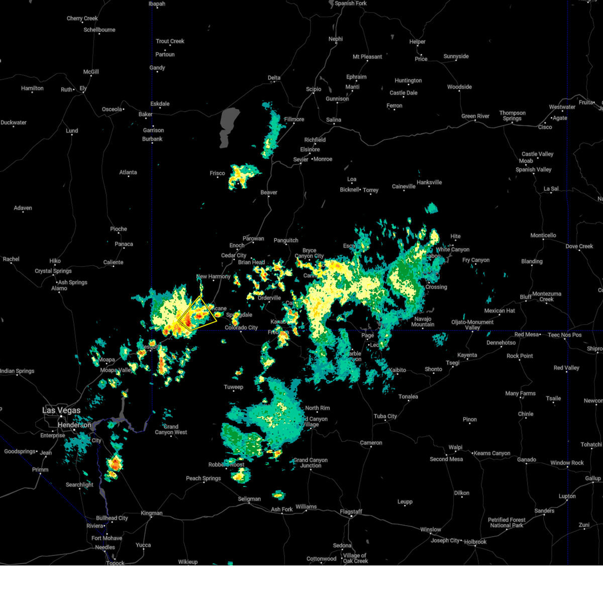
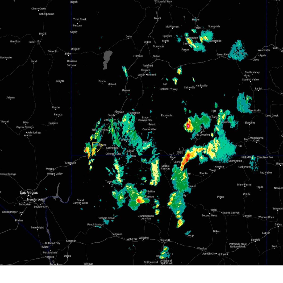
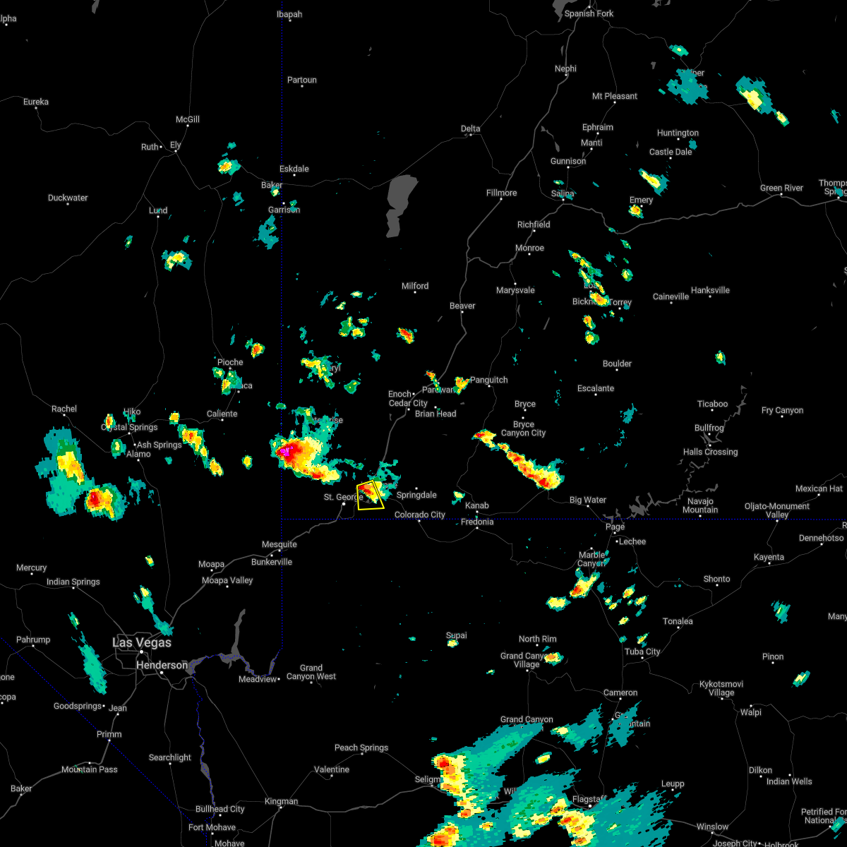
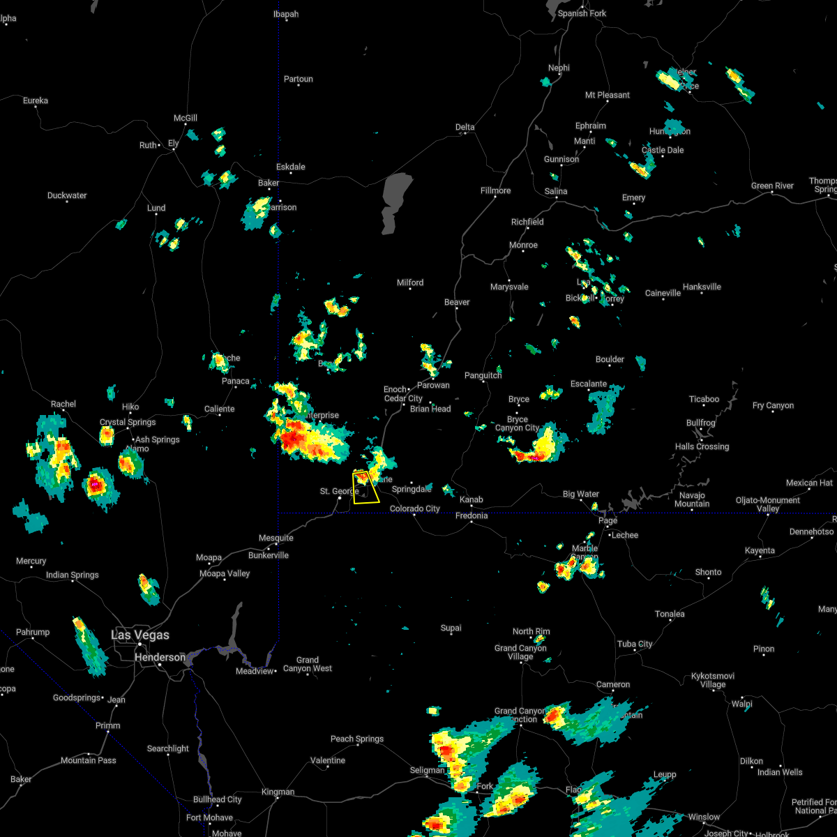
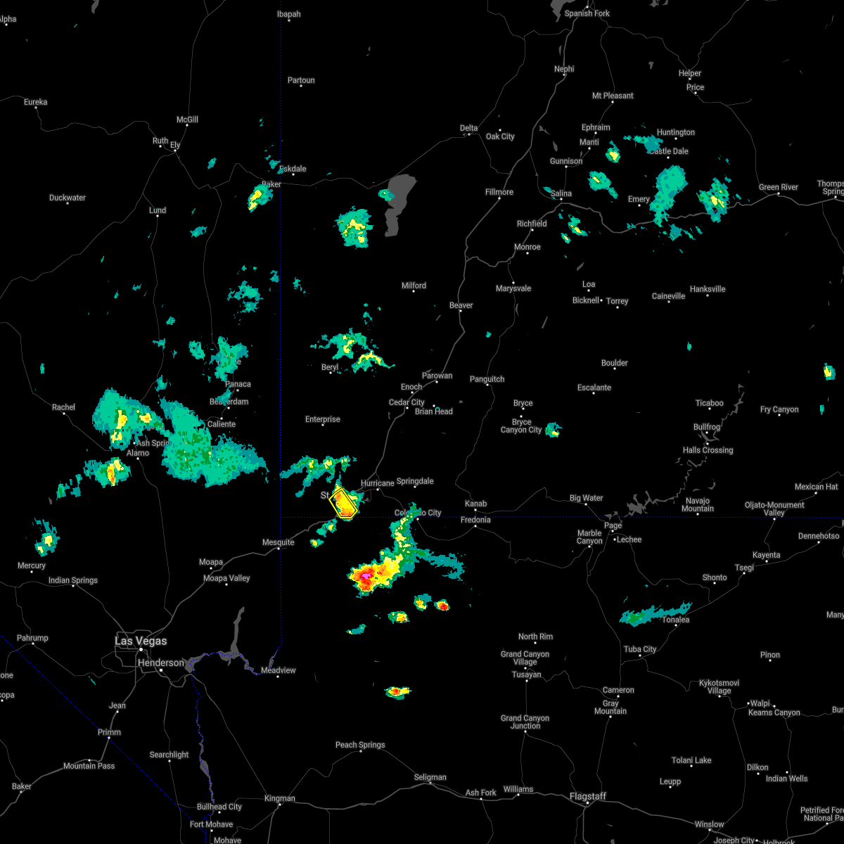
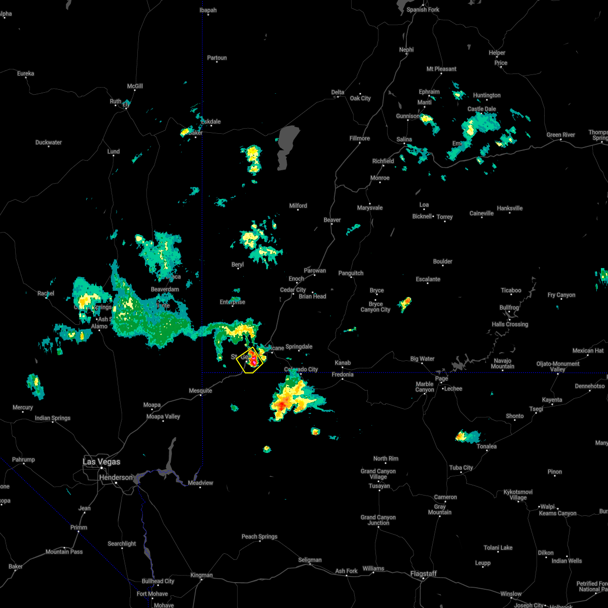
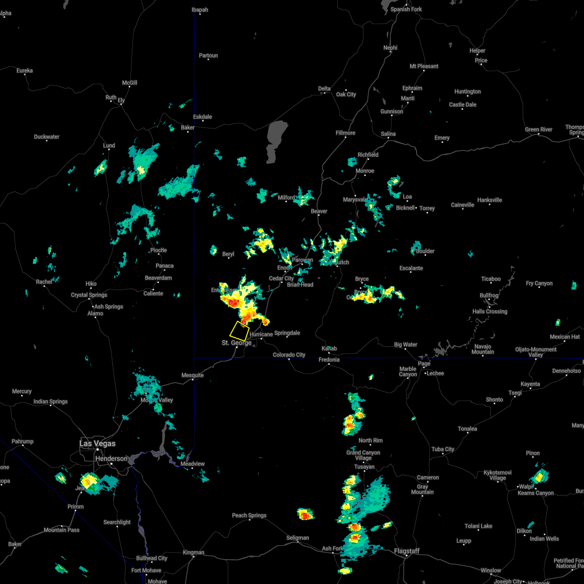
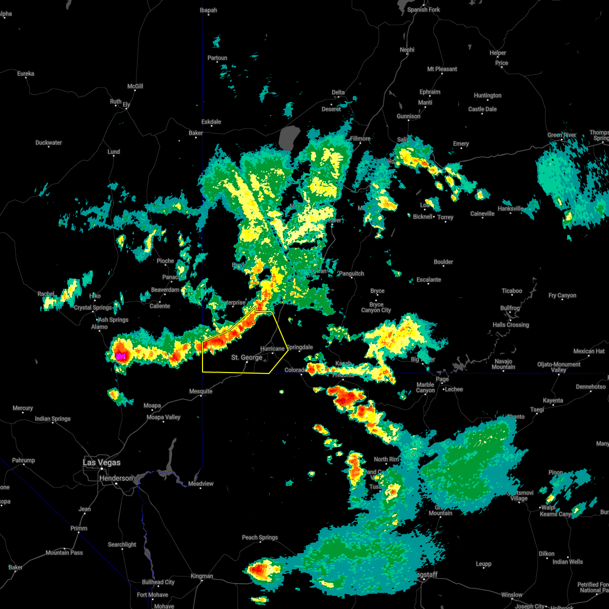
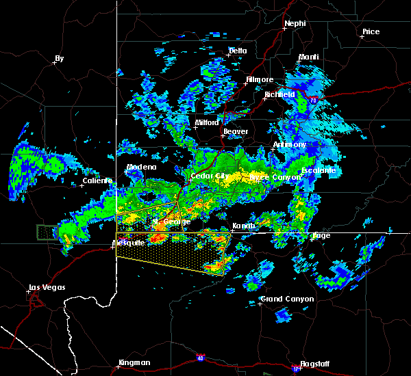
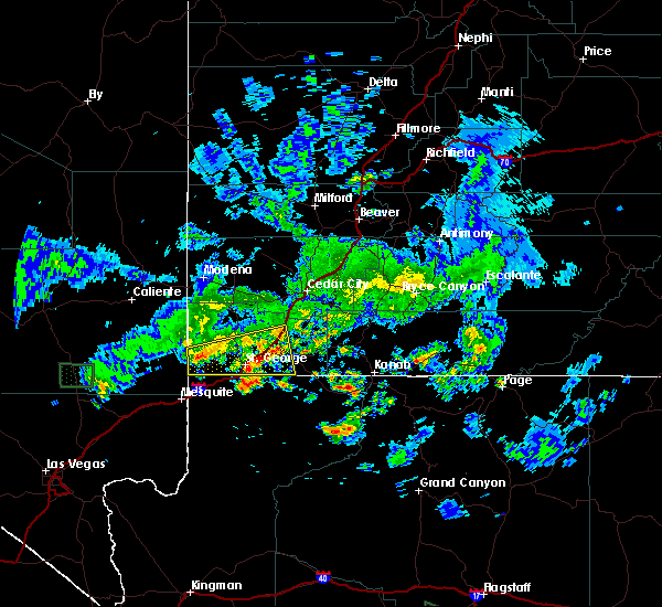
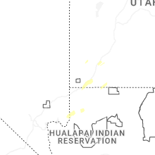
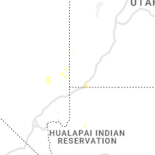
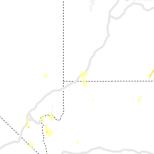
Hail Map for Washington, UT
The Washington, UT area has had 2 reports of on-the-ground hail by trained spotters, and has been under severe weather warnings 0 times during the past 12 months. Doppler radar has detected hail at or near Washington, UT on 27 occasions.
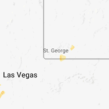
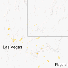
| Name: | Washington, UT |
| Where Located: | 5.1 miles E of Saint George, UT |
| Map: | Google Map for Washington, UT |
| Population: | 18761 |
| Housing Units: | 7546 |
| More Info: | Search Google for Washington, UT |
4
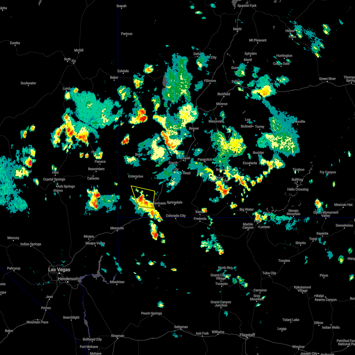
The Top Recent Hail Date for Washington, UT is Thursday, October 17, 2024 (3rd out of 27)

Hail and Wind Damage Spotted near Washington, UT
| Date / Time | Report Details |
|---|---|
| 8/17/2024 5:16 PM MDT |
 Svrslc the national weather service in salt lake city has issued a * severe thunderstorm warning for, central washington county in southwestern utah, * until 600 pm mdt. * at 516 pm mdt, a severe thunderstorm was located near washington, or 23 miles northeast of virgin river gorge, moving northeast at 25 mph (radar indicated). Hazards include 60 mph wind gusts and quarter size hail. Hail damage to vehicles is expected. Expect wind damage to roofs, siding, and trees. Svrslc the national weather service in salt lake city has issued a * severe thunderstorm warning for, central washington county in southwestern utah, * until 600 pm mdt. * at 516 pm mdt, a severe thunderstorm was located near washington, or 23 miles northeast of virgin river gorge, moving northeast at 25 mph (radar indicated). Hazards include 60 mph wind gusts and quarter size hail. Hail damage to vehicles is expected. Expect wind damage to roofs, siding, and trees.
|
| 8/31/2023 9:35 PM MDT |
 At 934 pm mdt, a severe thunderstorm was located over st george, or 18 miles northeast of virgin river gorge, moving northeast at 25 mph (radar indicated). Hazards include 60 mph wind gusts and penny size hail. Expect damage to roofs, siding, and trees. locations impacted include, st george, washington, hurricane, santa clara, sand hollow state park, quail creek state park, ivins, bloomington and snow canyon state park. this includes the following highways, interstate 15 between mile markers 2 and 21. utah route 18 between mile markers 0 and 8. hail threat, radar indicated max hail size, 0. 75 in wind threat, radar indicated max wind gust, 60 mph. At 934 pm mdt, a severe thunderstorm was located over st george, or 18 miles northeast of virgin river gorge, moving northeast at 25 mph (radar indicated). Hazards include 60 mph wind gusts and penny size hail. Expect damage to roofs, siding, and trees. locations impacted include, st george, washington, hurricane, santa clara, sand hollow state park, quail creek state park, ivins, bloomington and snow canyon state park. this includes the following highways, interstate 15 between mile markers 2 and 21. utah route 18 between mile markers 0 and 8. hail threat, radar indicated max hail size, 0. 75 in wind threat, radar indicated max wind gust, 60 mph.
|
| 8/31/2023 9:22 PM MDT |
 At 922 pm mdt, a severe thunderstorm was located over st george, or 14 miles northeast of virgin river gorge, moving northeast at 15 mph (radar indicated). Hazards include 60 mph wind gusts and penny size hail. expect damage to roofs, siding, and trees At 922 pm mdt, a severe thunderstorm was located over st george, or 14 miles northeast of virgin river gorge, moving northeast at 15 mph (radar indicated). Hazards include 60 mph wind gusts and penny size hail. expect damage to roofs, siding, and trees
|
| 8/22/2023 6:22 PM MDT |
 The severe thunderstorm warning for south central washington county will expire at 630 pm mdt, the storm which prompted the warning has moved out of the area. therefore, the warning will be allowed to expire. to report severe weather, contact your nearest law enforcement agency. they will relay your report to the national weather service salt lake city. remember, a severe thunderstorm warning still remains in effect for north central washington county until 6:45 pm mdt. The severe thunderstorm warning for south central washington county will expire at 630 pm mdt, the storm which prompted the warning has moved out of the area. therefore, the warning will be allowed to expire. to report severe weather, contact your nearest law enforcement agency. they will relay your report to the national weather service salt lake city. remember, a severe thunderstorm warning still remains in effect for north central washington county until 6:45 pm mdt.
|
| 8/22/2023 5:57 PM MDT |
 At 557 pm mdt, a severe thunderstorm was located over sand hollow state park, or 24 miles northeast of virgin river gorge, moving north at 20 mph (radar indicated). Hazards include 60 mph wind gusts and quarter size hail. Hail damage to vehicles is expected. expect wind damage to roofs, siding, and trees. locations impacted include, washington, hurricane, la verkin, sand hollow state park, quail creek state park, toquerville, leeds and virgin. This includes interstate 15 between mile markers 12 and 24. At 557 pm mdt, a severe thunderstorm was located over sand hollow state park, or 24 miles northeast of virgin river gorge, moving north at 20 mph (radar indicated). Hazards include 60 mph wind gusts and quarter size hail. Hail damage to vehicles is expected. expect wind damage to roofs, siding, and trees. locations impacted include, washington, hurricane, la verkin, sand hollow state park, quail creek state park, toquerville, leeds and virgin. This includes interstate 15 between mile markers 12 and 24.
|
| 8/22/2023 5:46 PM MDT |
 At 546 pm mdt, a severe thunderstorm was located near sand hollow state park, or 20 miles east of virgin river gorge, moving north at 15 mph (radar indicated). Hazards include 60 mph wind gusts and quarter size hail. Hail damage to vehicles is expected. Expect wind damage to roofs, siding, and trees. At 546 pm mdt, a severe thunderstorm was located near sand hollow state park, or 20 miles east of virgin river gorge, moving north at 15 mph (radar indicated). Hazards include 60 mph wind gusts and quarter size hail. Hail damage to vehicles is expected. Expect wind damage to roofs, siding, and trees.
|
| 8/22/2022 5:40 PM MDT | The severe thunderstorm warning for south central washington county will expire at 545 pm mdt, the storm which prompted the warning has weakened below severe limits, and has exited the warned area. therefore, the warning will be allowed to expire. |
| 8/22/2022 5:32 PM MDT | At 531 pm mdt, a severe thunderstorm was located 8 miles southeast of st george, or 18 miles east of virgin river gorge, moving southeast at 25 mph (radar indicated). Hazards include 60 mph wind gusts and quarter size hail. Hail damage to vehicles is expected. expect wind damage to roofs, siding, and trees. locations impacted include, st george and washington. hail threat, radar indicated max hail size, 1. 00 in wind threat, radar indicated max wind gust, 60 mph. |
| 8/22/2022 5:17 PM MDT | Quarter sized hail reported 0.8 miles S of Washington, UT, time of report estimated. |
| 8/22/2022 5:16 PM MDT | At 515 pm mdt, a severe thunderstorm was located near st george, or 18 miles northeast of virgin river gorge, moving southeast at 25 mph (radar indicated). Hazards include 60 mph wind gusts and quarter size hail. Hail damage to vehicles is expected. Expect wind damage to roofs, siding, and trees. |
| 8/21/2022 4:41 PM MDT |
 The severe thunderstorm warning for south central washington county will expire at 445 pm mdt, the storm which prompted the warning has weakened below severe limits, and no longer poses an immediate threat to life or property. therefore, the warning will be allowed to expire. however small hail and heavy rain are still possible with this thunderstorm. The severe thunderstorm warning for south central washington county will expire at 445 pm mdt, the storm which prompted the warning has weakened below severe limits, and no longer poses an immediate threat to life or property. therefore, the warning will be allowed to expire. however small hail and heavy rain are still possible with this thunderstorm.
|
| 8/21/2022 4:20 PM MDT |
 At 420 pm mdt, a severe thunderstorm was located over quail creek state park, or 21 miles southwest of zion national park, moving south at 15 mph (radar indicated). Hazards include 60 mph wind gusts and half dollar size hail. Hail damage to vehicles is expected. expect wind damage to roofs, siding, and trees. locations impacted include, washington, hurricane, sand hollow state park, quail creek state park and leeds. this includes interstate 15 between mile markers 16 and 22. hail threat, radar indicated max hail size, 1. 25 in wind threat, radar indicated max wind gust, 60 mph. At 420 pm mdt, a severe thunderstorm was located over quail creek state park, or 21 miles southwest of zion national park, moving south at 15 mph (radar indicated). Hazards include 60 mph wind gusts and half dollar size hail. Hail damage to vehicles is expected. expect wind damage to roofs, siding, and trees. locations impacted include, washington, hurricane, sand hollow state park, quail creek state park and leeds. this includes interstate 15 between mile markers 16 and 22. hail threat, radar indicated max hail size, 1. 25 in wind threat, radar indicated max wind gust, 60 mph.
|
| 8/21/2022 4:03 PM MDT |
 At 403 pm mdt, a severe thunderstorm was located over quail creek state park, or 21 miles west of zion national park, moving south at 15 mph (radar indicated). Hazards include ping pong ball size hail and 60 mph wind gusts. People and animals outdoors will be injured. expect hail damage to roofs, siding, windows, and vehicles. Expect wind damage to roofs, siding, and trees. At 403 pm mdt, a severe thunderstorm was located over quail creek state park, or 21 miles west of zion national park, moving south at 15 mph (radar indicated). Hazards include ping pong ball size hail and 60 mph wind gusts. People and animals outdoors will be injured. expect hail damage to roofs, siding, windows, and vehicles. Expect wind damage to roofs, siding, and trees.
|
| 8/14/2021 7:25 PM MDT |
 At 725 pm mdt, a severe thunderstorm was located over st george, or 16 miles northeast of virgin river gorge, moving southwest at 10 mph (radar indicated). Hazards include 60 mph wind gusts and penny size hail. Expect damage to roofs, siding, and trees. locations impacted include, st george, washington, santa clara and bloomington. this includes the following highways, interstate 15 between mile markers 3 and 10. utah route 18 between mile markers 0 and 5. hail threat, radar indicated max hail size, 0. 75 in wind threat, radar indicated max wind gust, 60 mph. At 725 pm mdt, a severe thunderstorm was located over st george, or 16 miles northeast of virgin river gorge, moving southwest at 10 mph (radar indicated). Hazards include 60 mph wind gusts and penny size hail. Expect damage to roofs, siding, and trees. locations impacted include, st george, washington, santa clara and bloomington. this includes the following highways, interstate 15 between mile markers 3 and 10. utah route 18 between mile markers 0 and 5. hail threat, radar indicated max hail size, 0. 75 in wind threat, radar indicated max wind gust, 60 mph.
|
| 8/14/2021 7:01 PM MDT |
 At 701 pm mdt, a severe thunderstorm was located over st george, or 20 miles northeast of virgin river gorge, moving southwest at 10 mph (radar indicated). Hazards include 60 mph wind gusts and quarter size hail. Hail damage to vehicles is expected. Expect wind damage to roofs, siding, and trees. At 701 pm mdt, a severe thunderstorm was located over st george, or 20 miles northeast of virgin river gorge, moving southwest at 10 mph (radar indicated). Hazards include 60 mph wind gusts and quarter size hail. Hail damage to vehicles is expected. Expect wind damage to roofs, siding, and trees.
|
| 8/13/2021 5:14 PM MDT |
 The national weather service in salt lake city has issued a * severe thunderstorm warning for. central washington county in southwestern utah. Until 545 pm mdt * at 513 pm mdt, a severe thunderstorm was located near washington, or 26 miles northeast of virgin river gorge, moving south at 20. The national weather service in salt lake city has issued a * severe thunderstorm warning for. central washington county in southwestern utah. Until 545 pm mdt * at 513 pm mdt, a severe thunderstorm was located near washington, or 26 miles northeast of virgin river gorge, moving south at 20.
|
| 7/26/2021 4:17 PM MDT |
 At 417 pm mdt, severe thunderstorms were located along a line extending from dameron valley to 7 miles north of washington, moving north at 15 mph (radar indicated). Hazards include 60 mph wind gusts and half dollar size hail. Hail damage to vehicles is expected. expect wind damage to roofs, siding, and trees. locations impacted include, washington, hurricane, dameron valley, quail creek state park, ivins, veyo and snow canyon state park. this includes the following highways, interstate 15 between mile markers 14 and 20. Utah route 18 between mile markers 7 and 28. At 417 pm mdt, severe thunderstorms were located along a line extending from dameron valley to 7 miles north of washington, moving north at 15 mph (radar indicated). Hazards include 60 mph wind gusts and half dollar size hail. Hail damage to vehicles is expected. expect wind damage to roofs, siding, and trees. locations impacted include, washington, hurricane, dameron valley, quail creek state park, ivins, veyo and snow canyon state park. this includes the following highways, interstate 15 between mile markers 14 and 20. Utah route 18 between mile markers 7 and 28.
|
| 7/26/2021 4:00 PM MDT |
 At 400 pm mdt, severe thunderstorms were located along a line extending from near dameron valley to near washington, moving north at 15 mph (radar indicated). Hazards include 60 mph wind gusts and half dollar size hail. Hail damage to vehicles is expected. Expect wind damage to roofs, siding, and trees. At 400 pm mdt, severe thunderstorms were located along a line extending from near dameron valley to near washington, moving north at 15 mph (radar indicated). Hazards include 60 mph wind gusts and half dollar size hail. Hail damage to vehicles is expected. Expect wind damage to roofs, siding, and trees.
|
| 7/26/2021 3:30 PM MDT |
 At 330 pm mdt, a severe thunderstorm was located over washington, or 20 miles northeast of virgin river gorge, moving northwest at 10 mph (radar indicated). Hazards include 60 mph wind gusts and half dollar size hail. Hail damage to vehicles is expected. Expect wind damage to roofs, siding, and trees. At 330 pm mdt, a severe thunderstorm was located over washington, or 20 miles northeast of virgin river gorge, moving northwest at 10 mph (radar indicated). Hazards include 60 mph wind gusts and half dollar size hail. Hail damage to vehicles is expected. Expect wind damage to roofs, siding, and trees.
|
| 7/25/2021 5:53 PM MDT |
 At 553 pm mdt, a severe thunderstorm was located 7 miles northwest of quail creek state park, or 28 miles northeast of virgin river gorge, moving south at 10 mph (radar indicated). Hazards include 60 mph wind gusts and half dollar size hail. Hail damage to vehicles is expected. expect wind damage to roofs, siding, and trees. locations impacted include, st george, washington, hurricane, santa clara, sand hollow state park, quail creek state park, dameron valley, ivins, leeds and snow canyon state park. this includes the following highways, interstate 15 between mile markers 9 and 24. Utah route 18 between mile markers 2 and 16. At 553 pm mdt, a severe thunderstorm was located 7 miles northwest of quail creek state park, or 28 miles northeast of virgin river gorge, moving south at 10 mph (radar indicated). Hazards include 60 mph wind gusts and half dollar size hail. Hail damage to vehicles is expected. expect wind damage to roofs, siding, and trees. locations impacted include, st george, washington, hurricane, santa clara, sand hollow state park, quail creek state park, dameron valley, ivins, leeds and snow canyon state park. this includes the following highways, interstate 15 between mile markers 9 and 24. Utah route 18 between mile markers 2 and 16.
|
| 7/25/2021 5:42 PM MDT |
 At 541 pm mdt, a severe thunderstorm was located 9 miles east of dameron valley, or 30 miles northeast of virgin river gorge, moving south at 10 mph (radar indicated). Hazards include 60 mph wind gusts and half dollar size hail. Hail damage to vehicles is expected. Expect wind damage to roofs, siding, and trees. At 541 pm mdt, a severe thunderstorm was located 9 miles east of dameron valley, or 30 miles northeast of virgin river gorge, moving south at 10 mph (radar indicated). Hazards include 60 mph wind gusts and half dollar size hail. Hail damage to vehicles is expected. Expect wind damage to roofs, siding, and trees.
|
| 7/24/2021 3:31 PM MDT |
 At 331 pm mdt, a severe thunderstorm was located 9 miles southwest of new harmony, or 28 miles southwest of cedar city, moving north at 10 mph (radar indicated). Hazards include 60 mph wind gusts and quarter size hail. Hail damage to vehicles is expected. expect wind damage to roofs, siding, and trees. locations impacted include, washington, hurricane, new harmony, quail creek state park, ivins, toquerville, leeds, pine valley and snow canyon state park. this includes the following highways, interstate 15 between mile markers 18 and 25. Utah route 18 between mile markers 9 and 15. At 331 pm mdt, a severe thunderstorm was located 9 miles southwest of new harmony, or 28 miles southwest of cedar city, moving north at 10 mph (radar indicated). Hazards include 60 mph wind gusts and quarter size hail. Hail damage to vehicles is expected. expect wind damage to roofs, siding, and trees. locations impacted include, washington, hurricane, new harmony, quail creek state park, ivins, toquerville, leeds, pine valley and snow canyon state park. this includes the following highways, interstate 15 between mile markers 18 and 25. Utah route 18 between mile markers 9 and 15.
|
| 7/24/2021 3:16 PM MDT |
 At 315 pm mdt, a severe thunderstorm was located 11 miles southwest of new harmony, or 28 miles west of zion national park, and is nearly stationary (radar indicated). Hazards include 60 mph wind gusts and quarter size hail. Hail damage to vehicles is expected. Expect wind damage to roofs, siding, and trees. At 315 pm mdt, a severe thunderstorm was located 11 miles southwest of new harmony, or 28 miles west of zion national park, and is nearly stationary (radar indicated). Hazards include 60 mph wind gusts and quarter size hail. Hail damage to vehicles is expected. Expect wind damage to roofs, siding, and trees.
|
| 7/14/2021 8:56 PM MDT | Power lines down in washington in washington county UT, 0.8 miles S of Washington, UT |
| 7/14/2021 8:40 PM MDT |
 At 840 pm mdt, severe thunderstorms were located along a line extending from 7 miles north of la verkin to st george to near virgin river gorge, moving east at 25 mph (radar indicated). Hazards include 60 mph wind gusts. Expect damage to roofs, siding, and trees. locations impacted include, st george, washington, hurricane, santa clara, la verkin, quail creek state park, sand hollow state park, ivins, toquerville, leeds, virgin, pintura, bloomington and snow canyon state park. this includes the following highways, interstate 15 between mile markers 1 and 35. Utah route 18 between mile markers 0 and 10. At 840 pm mdt, severe thunderstorms were located along a line extending from 7 miles north of la verkin to st george to near virgin river gorge, moving east at 25 mph (radar indicated). Hazards include 60 mph wind gusts. Expect damage to roofs, siding, and trees. locations impacted include, st george, washington, hurricane, santa clara, la verkin, quail creek state park, sand hollow state park, ivins, toquerville, leeds, virgin, pintura, bloomington and snow canyon state park. this includes the following highways, interstate 15 between mile markers 1 and 35. Utah route 18 between mile markers 0 and 10.
|
| 7/14/2021 7:53 PM MDT |
 At 753 pm mdt, severe thunderstorms were located along a line extending from 7 miles northwest of new harmony to near dameron valley to 16 miles southwest of gunlock state park, moving southeast at 25 mph (radar indicated). Hazards include 60 mph wind gusts. expect damage to roofs, siding, and trees At 753 pm mdt, severe thunderstorms were located along a line extending from 7 miles northwest of new harmony to near dameron valley to 16 miles southwest of gunlock state park, moving southeast at 25 mph (radar indicated). Hazards include 60 mph wind gusts. expect damage to roofs, siding, and trees
|
| 4/29/2019 7:00 PM MDT |
 At 700 pm mdt, severe thunderstorms were located along a line extending from 17 miles north of santa clara to near la verkin, moving north at 25 mph (radar indicated). Hazards include 60 mph wind gusts and quarter size hail. Hail damage to vehicles is expected. expect wind damage to roofs, siding, and trees. Locations impacted include, washington, hurricane, la verkin, toquerville, leeds, virgin, pintura, pine valley, gunlock, veyo and snow canyon state park. At 700 pm mdt, severe thunderstorms were located along a line extending from 17 miles north of santa clara to near la verkin, moving north at 25 mph (radar indicated). Hazards include 60 mph wind gusts and quarter size hail. Hail damage to vehicles is expected. expect wind damage to roofs, siding, and trees. Locations impacted include, washington, hurricane, la verkin, toquerville, leeds, virgin, pintura, pine valley, gunlock, veyo and snow canyon state park.
|
| 4/29/2019 6:49 PM MDT |
 At 648 pm mdt, severe thunderstorms were located along a line extending from 12 miles northwest of santa clara to 7 miles southeast of hurricane, moving northeast at 20 mph (radar indicated). Hazards include 60 mph wind gusts and quarter size hail. Hail damage to vehicles is expected. expect wind damage to roofs, siding, and trees. Locations impacted include, st george, washington, hurricane, santa clara, la verkin, ivins, toquerville, leeds, virgin, pintura, bloomington, pine valley, gunlock, veyo and snow canyon state park. At 648 pm mdt, severe thunderstorms were located along a line extending from 12 miles northwest of santa clara to 7 miles southeast of hurricane, moving northeast at 20 mph (radar indicated). Hazards include 60 mph wind gusts and quarter size hail. Hail damage to vehicles is expected. expect wind damage to roofs, siding, and trees. Locations impacted include, st george, washington, hurricane, santa clara, la verkin, ivins, toquerville, leeds, virgin, pintura, bloomington, pine valley, gunlock, veyo and snow canyon state park.
|
| 4/29/2019 6:28 PM MDT |
 At 628 pm mdt, severe thunderstorms were located along a line extending from 10 miles west of santa clara to 11 miles south of hurricane, moving northeast at 20 mph (radar indicated). Hazards include 60 mph wind gusts and quarter size hail. Hail damage to vehicles is expected. Expect wind damage to roofs, siding, and trees. At 628 pm mdt, severe thunderstorms were located along a line extending from 10 miles west of santa clara to 11 miles south of hurricane, moving northeast at 20 mph (radar indicated). Hazards include 60 mph wind gusts and quarter size hail. Hail damage to vehicles is expected. Expect wind damage to roofs, siding, and trees.
|
| 10/3/2018 6:42 PM MDT |
 The severe thunderstorm warning for southeastern washington county will expire at 645 pm mdt, the storm which prompted the warning has weakened below severe limits, and no longer poses an immediate threat to life or property. therefore, the warning will be allowed to expire. however small hail and heavy rain are still possible with this thunderstorm. to report severe weather, contact your nearest law enforcement agency. they will relay your report to the national weather service salt lake city. The severe thunderstorm warning for southeastern washington county will expire at 645 pm mdt, the storm which prompted the warning has weakened below severe limits, and no longer poses an immediate threat to life or property. therefore, the warning will be allowed to expire. however small hail and heavy rain are still possible with this thunderstorm. to report severe weather, contact your nearest law enforcement agency. they will relay your report to the national weather service salt lake city.
|
| 10/3/2018 6:36 PM MDT |
 At 635 pm mdt, a severe thunderstorm was located over hurricane, or 16 miles east of st george, moving north at 35 mph (radar indicated). Hazards include 60 mph wind gusts and quarter size hail. Hail damage to vehicles is expected. expect wind damage to roofs, siding, and trees. Locations impacted include, washington, hurricane, la verkin, toquerville, leeds, virgin and pintura. At 635 pm mdt, a severe thunderstorm was located over hurricane, or 16 miles east of st george, moving north at 35 mph (radar indicated). Hazards include 60 mph wind gusts and quarter size hail. Hail damage to vehicles is expected. expect wind damage to roofs, siding, and trees. Locations impacted include, washington, hurricane, la verkin, toquerville, leeds, virgin and pintura.
|
| 10/3/2018 6:22 PM MDT |
 At 622 pm mdt, a severe thunderstorm was located 7 miles south of hurricane, or 14 miles east of st george, moving north at 30 mph (radar indicated). Hazards include 60 mph wind gusts and quarter size hail. Hail damage to vehicles is expected. Expect wind damage to roofs, siding, and trees. At 622 pm mdt, a severe thunderstorm was located 7 miles south of hurricane, or 14 miles east of st george, moving north at 30 mph (radar indicated). Hazards include 60 mph wind gusts and quarter size hail. Hail damage to vehicles is expected. Expect wind damage to roofs, siding, and trees.
|
| 8/11/2018 7:18 PM MDT |
 At 718 pm mdt, a severe thunderstorm was located 18 miles northwest of beaver dam, moving west at 55 mph (emergency management). Hazards include 60 mph wind gusts and quarter size hail. Hail damage to vehicles is expected. expect wind damage to roofs, siding, and trees. Locations impacted include, st george, washington, hurricane, santa clara, ivins, motoqua, bloomington, gunlock, veyo and snow canyon state park. At 718 pm mdt, a severe thunderstorm was located 18 miles northwest of beaver dam, moving west at 55 mph (emergency management). Hazards include 60 mph wind gusts and quarter size hail. Hail damage to vehicles is expected. expect wind damage to roofs, siding, and trees. Locations impacted include, st george, washington, hurricane, santa clara, ivins, motoqua, bloomington, gunlock, veyo and snow canyon state park.
|
| 8/11/2018 6:53 PM MDT |
 At 652 pm mdt, a severe thunderstorm was located over santa clara, or near st george, moving west at 40 mph (radar indicated). Hazards include 60 mph wind gusts and quarter size hail. Hail damage to vehicles is expected. Expect wind damage to roofs, siding, and trees. At 652 pm mdt, a severe thunderstorm was located over santa clara, or near st george, moving west at 40 mph (radar indicated). Hazards include 60 mph wind gusts and quarter size hail. Hail damage to vehicles is expected. Expect wind damage to roofs, siding, and trees.
|
| 8/10/2016 4:50 PM MDT |
 The severe thunderstorm warning for southeastern washington county will expire at 500 pm mdt, the storm which prompted the warning has weakened below severe limits, and no longer poses an immediate threat to life or property. therefore the warning will be allowed to expire. The severe thunderstorm warning for southeastern washington county will expire at 500 pm mdt, the storm which prompted the warning has weakened below severe limits, and no longer poses an immediate threat to life or property. therefore the warning will be allowed to expire.
|
| 8/10/2016 4:37 PM MDT |
 At 437 pm mdt, doppler radar indicated a severe thunderstorm capable of producing quarter size hail. this storm was located near hurricane, or 12 miles east of st george, and moving northeast at 30 mph. At 437 pm mdt, doppler radar indicated a severe thunderstorm capable of producing quarter size hail. this storm was located near hurricane, or 12 miles east of st george, and moving northeast at 30 mph.
|
| 8/10/2016 4:18 PM MDT |
 At 416 pm mdt, doppler radar indicated a severe thunderstorm capable of producing quarter size hail. this storm was located near washington, or 10 miles east of st george, moving northeast at 25 mph. locations impacted include, washington, hurricane, la verkin and toquerville. At 416 pm mdt, doppler radar indicated a severe thunderstorm capable of producing quarter size hail. this storm was located near washington, or 10 miles east of st george, moving northeast at 25 mph. locations impacted include, washington, hurricane, la verkin and toquerville.
|
| 8/10/2016 4:05 PM MDT |
 At 404 pm mdt, doppler radar indicated a severe thunderstorm capable of producing quarter size hail and gusty winds to 50 mph. this storm was located near st george, and moving northeast at 25 mph. At 404 pm mdt, doppler radar indicated a severe thunderstorm capable of producing quarter size hail and gusty winds to 50 mph. this storm was located near st george, and moving northeast at 25 mph.
|
| 8/1/2016 8:15 PM MDT | St george airport awos... ksg in washington county UT, 4.8 miles NNE of Washington, UT |
| 7/30/2016 9:26 PM MDT |
 At 925 pm mdt, doppler radar indicated severe thunderstorms capable of still producing damaging winds in excess of 60 mph. these storms were located along a line extending from 10 miles northwest of zion national park to 15 miles west of santa clara, moving southeast at 25 mph. locations impacted include, st george, washington, hurricane, santa clara, la verkin, ivins, leeds, virgin, gunlock, snow canyon state park, bloomington. At 925 pm mdt, doppler radar indicated severe thunderstorms capable of still producing damaging winds in excess of 60 mph. these storms were located along a line extending from 10 miles northwest of zion national park to 15 miles west of santa clara, moving southeast at 25 mph. locations impacted include, st george, washington, hurricane, santa clara, la verkin, ivins, leeds, virgin, gunlock, snow canyon state park, bloomington.
|
| 7/30/2016 9:06 PM MDT |
 At 905 pm mdt, doppler radar indicated a line of severe thunderstorms capable of producing damaging winds in excess of 60 mph. these storms were located along a line extending from 9 miles southeast of new harmony to 19 miles west of santa clara, and moving southeast at 20 mph. At 905 pm mdt, doppler radar indicated a line of severe thunderstorms capable of producing damaging winds in excess of 60 mph. these storms were located along a line extending from 9 miles southeast of new harmony to 19 miles west of santa clara, and moving southeast at 20 mph.
|
| 7/28/2016 4:45 PM MDT | Dry microburst in washington county UT, 4.8 miles NNE of Washington, UT |
| 3/26/2014 3:35 PM MDT | Measured at st george airport awo in washington county UT, 4.8 miles NNE of Washington, UT |
| 9/14/2013 7:14 PM MDT | Quarter sized hail reported 3.1 miles SSW of Washington, UT, hail large enough to damage police car. |
| 1/1/0001 12:00 AM | Barn blown across road...taking powerlines with it in washington county UT, 0.8 miles S of Washington, UT |
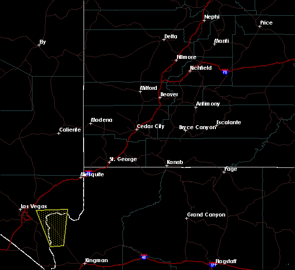
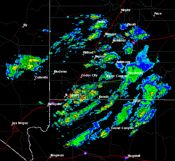
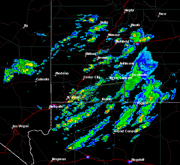
Hail Maps for Washington, UT


Connect with Interactive Hail Maps