

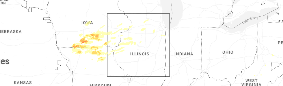
Hail Map for Wataga, IL
The Wataga, IL area has had 1 report of on-the-ground hail by trained spotters, and has been under severe weather warnings 31 times during the past 12 months. Doppler radar has detected hail at or near Wataga, IL on 52 occasions, including 3 occasions during the past year.
| Name: | Wataga, IL |
| Where Located: | 42.7 miles WNW of Peoria, IL |
| Map: | Google Map for Wataga, IL |
| Population: | 843 |
| Housing Units: | 372 |
| More Info: | Search Google for Wataga, IL |
2
The Top Recent Hail Date for Wataga, IL is Thursday, June 11, 2026 (8th out of 52)
Hail and Wind Damage Spotted near Wataga, IL
| Date / Time | Report Details |
|---|---|
| 6/17/2026 8:41 AM CDT |
 At 840 am cdt, severe thunderstorms were located along a line extending from oneida to near little swan lake, moving southeast at 55 mph. these are destructive storms for central and southern knox county and northern fulton county (radar indicated). Hazards include 80 mph wind gusts and quarter size hail. Flying debris will be dangerous to those caught without shelter. mobile homes will be heavily damaged. expect considerable damage to roofs, windows, and vehicles. extensive tree damage and power outages are likely. these severe storms will be near, abingdon, knoxville, avon, victoria, and st. augustine around 845 am cdt. williamsfield, london mills, and maquon around 850 am cdt. laura and elmore around 855 am cdt. farmington, elmwood, brimfield, yates city, and fairview around 900 am cdt. canton, princeville, and cuba around 905 am cdt. hanna city, trivoli, and st. david around 910 am cdt. other locations impacted by these severe thunderstorms include bryant, norris, jubilee college state park, ellisville, banner, smithville, west jersey, gilson, dunfermline, and monica. this also includes banner marsh state fish and wildlife area, jubilee college state park, rice lake state fish and wildlife area, and snakeden hollow state fish and wildlife area. This includes interstate 74 between mile markers 34 and 82. At 840 am cdt, severe thunderstorms were located along a line extending from oneida to near little swan lake, moving southeast at 55 mph. these are destructive storms for central and southern knox county and northern fulton county (radar indicated). Hazards include 80 mph wind gusts and quarter size hail. Flying debris will be dangerous to those caught without shelter. mobile homes will be heavily damaged. expect considerable damage to roofs, windows, and vehicles. extensive tree damage and power outages are likely. these severe storms will be near, abingdon, knoxville, avon, victoria, and st. augustine around 845 am cdt. williamsfield, london mills, and maquon around 850 am cdt. laura and elmore around 855 am cdt. farmington, elmwood, brimfield, yates city, and fairview around 900 am cdt. canton, princeville, and cuba around 905 am cdt. hanna city, trivoli, and st. david around 910 am cdt. other locations impacted by these severe thunderstorms include bryant, norris, jubilee college state park, ellisville, banner, smithville, west jersey, gilson, dunfermline, and monica. this also includes banner marsh state fish and wildlife area, jubilee college state park, rice lake state fish and wildlife area, and snakeden hollow state fish and wildlife area. This includes interstate 74 between mile markers 34 and 82.
|
| 6/17/2026 8:27 AM CDT |
 At 826 am cdt, severe thunderstorms were located along a line extending from near cambridge to kirkwood, moving east at 55 mph (radar indicated). Hazards include 70 mph wind gusts and quarter size hail. Hail damage to vehicles is expected. expect considerable tree damage. wind damage is also likely to mobile homes, roofs, and outbuildings. these severe storms will be near, henderson and rio around 830 am cdt. galesburg, wataga, oneida, and altona around 835 am cdt. abingdon and knoxville around 840 am cdt. victoria, la fayette, and st. augustine around 845 am cdt. toulon, osceola, williamsfield, london mills, elmira, and maquon around 850 am cdt. wyoming, bradford, laura, and elmore around 855 am cdt. elmwood, yates city, and castleton around 900 am cdt. farmington, princeville, brimfield, and camp grove around 905 am cdt. other locations impacted by these severe thunderstorms include bryant, norris, jubilee college state park, ellisville, banner, smithville, west jersey, gilson, dunfermline, and monica. this also includes banner marsh state fish and wildlife area, jubilee college state park, rice lake state fish and wildlife area, and snakeden hollow state fish and wildlife area. This includes interstate 74 between mile markers 34 and 82. At 826 am cdt, severe thunderstorms were located along a line extending from near cambridge to kirkwood, moving east at 55 mph (radar indicated). Hazards include 70 mph wind gusts and quarter size hail. Hail damage to vehicles is expected. expect considerable tree damage. wind damage is also likely to mobile homes, roofs, and outbuildings. these severe storms will be near, henderson and rio around 830 am cdt. galesburg, wataga, oneida, and altona around 835 am cdt. abingdon and knoxville around 840 am cdt. victoria, la fayette, and st. augustine around 845 am cdt. toulon, osceola, williamsfield, london mills, elmira, and maquon around 850 am cdt. wyoming, bradford, laura, and elmore around 855 am cdt. elmwood, yates city, and castleton around 900 am cdt. farmington, princeville, brimfield, and camp grove around 905 am cdt. other locations impacted by these severe thunderstorms include bryant, norris, jubilee college state park, ellisville, banner, smithville, west jersey, gilson, dunfermline, and monica. this also includes banner marsh state fish and wildlife area, jubilee college state park, rice lake state fish and wildlife area, and snakeden hollow state fish and wildlife area. This includes interstate 74 between mile markers 34 and 82.
|
| 6/17/2026 8:14 AM CDT |
 Svrilx the national weather service in lincoln has issued a * severe thunderstorm warning for, fulton county in west central illinois, stark county in north central illinois, knox county in west central illinois, western peoria county in central illinois, * until 915 am cdt. * at 813 am cdt, severe thunderstorms were located along a line extending from warner to near gladstone, moving east at 60 mph (radar indicated). Hazards include 60 mph wind gusts and quarter size hail. Hail damage to vehicles is expected. expect wind damage to roofs, siding, and trees. severe thunderstorms will be near, rio around 820 am cdt. galesburg, wataga, oneida, altona, and henderson around 830 am cdt. other locations in the path of these severe thunderstorms include abingdon, knoxville, victoria, la fayette, st. augustine, toulon, osceola, elmira, wyoming, bradford, williamsfield, london mills, maquon, castleton, elmore, yates city, laura, camp grove, farmington, elmwood, princeville, brimfield and fairview. this includes interstate 74 between mile markers 34 and 82. This also includes banner marsh state fish and wildlife area, jubilee college state park, rice lake state fish and wildlife area, and snakeden hollow state fish and wildlife area. Svrilx the national weather service in lincoln has issued a * severe thunderstorm warning for, fulton county in west central illinois, stark county in north central illinois, knox county in west central illinois, western peoria county in central illinois, * until 915 am cdt. * at 813 am cdt, severe thunderstorms were located along a line extending from warner to near gladstone, moving east at 60 mph (radar indicated). Hazards include 60 mph wind gusts and quarter size hail. Hail damage to vehicles is expected. expect wind damage to roofs, siding, and trees. severe thunderstorms will be near, rio around 820 am cdt. galesburg, wataga, oneida, altona, and henderson around 830 am cdt. other locations in the path of these severe thunderstorms include abingdon, knoxville, victoria, la fayette, st. augustine, toulon, osceola, elmira, wyoming, bradford, williamsfield, london mills, maquon, castleton, elmore, yates city, laura, camp grove, farmington, elmwood, princeville, brimfield and fairview. this includes interstate 74 between mile markers 34 and 82. This also includes banner marsh state fish and wildlife area, jubilee college state park, rice lake state fish and wildlife area, and snakeden hollow state fish and wildlife area.
|
| 6/11/2026 12:12 PM CDT |
 At 1212 pm cdt, a severe thunderstorm was located over victoria, or 14 miles northeast of galesburg, moving east at 40 mph (radar indicated). Hazards include 60 mph wind gusts and quarter size hail. Hail damage to vehicles is expected. expect wind damage to roofs, siding, and trees. this severe thunderstorm will remain over mainly rural areas of northeastern knox county, including the following locations, dahinda. This includes interstate 74 between mile markers 51 and 53. At 1212 pm cdt, a severe thunderstorm was located over victoria, or 14 miles northeast of galesburg, moving east at 40 mph (radar indicated). Hazards include 60 mph wind gusts and quarter size hail. Hail damage to vehicles is expected. expect wind damage to roofs, siding, and trees. this severe thunderstorm will remain over mainly rural areas of northeastern knox county, including the following locations, dahinda. This includes interstate 74 between mile markers 51 and 53.
|
| 6/11/2026 11:47 AM CDT |
 Svrilx the national weather service in lincoln has issued a * severe thunderstorm warning for, northern knox county in west central illinois, * until 1230 pm cdt. * at 1147 am cdt, a severe thunderstorm was located near north henderson, or near galesburg, moving east at 40 mph (radar indicated). Hazards include 60 mph wind gusts and quarter size hail. Hail damage to vehicles is expected. expect wind damage to roofs, siding, and trees. this severe thunderstorm will be near, galesburg, wataga, and henderson around 1155 am cdt. oneida around 1200 pm cdt. other locations in the path of this severe thunderstorm include victoria. This includes interstate 74 between mile markers 35 and 54. Svrilx the national weather service in lincoln has issued a * severe thunderstorm warning for, northern knox county in west central illinois, * until 1230 pm cdt. * at 1147 am cdt, a severe thunderstorm was located near north henderson, or near galesburg, moving east at 40 mph (radar indicated). Hazards include 60 mph wind gusts and quarter size hail. Hail damage to vehicles is expected. expect wind damage to roofs, siding, and trees. this severe thunderstorm will be near, galesburg, wataga, and henderson around 1155 am cdt. oneida around 1200 pm cdt. other locations in the path of this severe thunderstorm include victoria. This includes interstate 74 between mile markers 35 and 54.
|
| 6/10/2026 8:24 PM CDT |
 The storms which prompted the warning have weakened below severe limits, and no longer pose an immediate threat to life or property. therefore, the warning will be allowed to expire. however, gusty winds and heavy rain are still possible with these thunderstorms. a tornado watch remains in effect until 1100 pm cdt for central, north central and west central illinois. The storms which prompted the warning have weakened below severe limits, and no longer pose an immediate threat to life or property. therefore, the warning will be allowed to expire. however, gusty winds and heavy rain are still possible with these thunderstorms. a tornado watch remains in effect until 1100 pm cdt for central, north central and west central illinois.
|
| 6/10/2026 7:49 PM CDT |
 At 748 pm cdt, severe thunderstorms were located along a line extending from near bureau junction to near wyoming to 6 miles southeast of monmouth, moving east at 60 mph (radar indicated). Hazards include 60 mph wind gusts. Expect damage to roofs, siding, and trees. these severe storms will be near, wyoming, abingdon, knoxville, henry, williamsfield, laura, elmore, and camp grove around 755 pm cdt. princeville and sparland around 800 pm cdt. lacon, maquon, and edelstein around 805 pm cdt. brimfield around 810 pm cdt. chillicothe, dunlap, and varna around 815 pm cdt. rome, toluca, and wenona around 820 pm cdt. washburn around 825 pm cdt. other locations impacted by these severe thunderstorms include lake wildwood, hopewell, west jersey, gilson, monica, lawn ridge, la rose, dahinda, marshall-putnam county fairgrounds, and delong. this includes the following highways, interstate 39 between mile markers 29 and 40. Interstate 74 between mile markers 37 and 76. At 748 pm cdt, severe thunderstorms were located along a line extending from near bureau junction to near wyoming to 6 miles southeast of monmouth, moving east at 60 mph (radar indicated). Hazards include 60 mph wind gusts. Expect damage to roofs, siding, and trees. these severe storms will be near, wyoming, abingdon, knoxville, henry, williamsfield, laura, elmore, and camp grove around 755 pm cdt. princeville and sparland around 800 pm cdt. lacon, maquon, and edelstein around 805 pm cdt. brimfield around 810 pm cdt. chillicothe, dunlap, and varna around 815 pm cdt. rome, toluca, and wenona around 820 pm cdt. washburn around 825 pm cdt. other locations impacted by these severe thunderstorms include lake wildwood, hopewell, west jersey, gilson, monica, lawn ridge, la rose, dahinda, marshall-putnam county fairgrounds, and delong. this includes the following highways, interstate 39 between mile markers 29 and 40. Interstate 74 between mile markers 37 and 76.
|
| 6/10/2026 7:24 PM CDT |
 Svrilx the national weather service in lincoln has issued a * severe thunderstorm warning for, marshall county in central illinois, stark county in north central illinois, knox county in west central illinois, northern peoria county in central illinois, * until 830 pm cdt. * at 723 pm cdt, severe thunderstorms were located along a line extending from near kewanee to oneida to near abingdon, moving east at 60 mph (radar indicated). Hazards include 60 mph wind gusts. Expect damage to roofs, siding, and trees. severe thunderstorms will be near, abingdon, knoxville, victoria, and la fayette around 730 pm cdt. toulon, osceola, williamsfield, and elmira around 735 pm cdt. wyoming, maquon, and elmore around 740 pm cdt. other locations in the path of these severe thunderstorms include bradford, laura, castleton, princeville, brimfield, camp grove, dunlap, edelstein, lacon, henry, sparland, chillicothe and rome. this includes the following highways, interstate 39 between mile markers 29 and 40. Interstate 74 between mile markers 37 and 76. Svrilx the national weather service in lincoln has issued a * severe thunderstorm warning for, marshall county in central illinois, stark county in north central illinois, knox county in west central illinois, northern peoria county in central illinois, * until 830 pm cdt. * at 723 pm cdt, severe thunderstorms were located along a line extending from near kewanee to oneida to near abingdon, moving east at 60 mph (radar indicated). Hazards include 60 mph wind gusts. Expect damage to roofs, siding, and trees. severe thunderstorms will be near, abingdon, knoxville, victoria, and la fayette around 730 pm cdt. toulon, osceola, williamsfield, and elmira around 735 pm cdt. wyoming, maquon, and elmore around 740 pm cdt. other locations in the path of these severe thunderstorms include bradford, laura, castleton, princeville, brimfield, camp grove, dunlap, edelstein, lacon, henry, sparland, chillicothe and rome. this includes the following highways, interstate 39 between mile markers 29 and 40. Interstate 74 between mile markers 37 and 76.
|
| 5/4/2026 7:19 PM CDT |
 Svrilx the national weather service in lincoln has issued a * severe thunderstorm warning for, northwestern fulton county in west central illinois, knox county in west central illinois, * until 800 pm cdt. * at 719 pm cdt, severe thunderstorms were located along a line extending from near rio to 6 miles west of galesburg to kirkwood, moving east at 35 mph (radar indicated). Hazards include 60 mph wind gusts and quarter size hail. Hail damage to vehicles is expected. expect wind damage to roofs, siding, and trees. severe thunderstorms will be near, galesburg, wataga, oneida, and henderson around 725 pm cdt. knoxville around 730 pm cdt. victoria around 735 pm cdt. other locations in the path of these severe thunderstorms include abingdon. This includes interstate 74 between mile markers 34 and 65. Svrilx the national weather service in lincoln has issued a * severe thunderstorm warning for, northwestern fulton county in west central illinois, knox county in west central illinois, * until 800 pm cdt. * at 719 pm cdt, severe thunderstorms were located along a line extending from near rio to 6 miles west of galesburg to kirkwood, moving east at 35 mph (radar indicated). Hazards include 60 mph wind gusts and quarter size hail. Hail damage to vehicles is expected. expect wind damage to roofs, siding, and trees. severe thunderstorms will be near, galesburg, wataga, oneida, and henderson around 725 pm cdt. knoxville around 730 pm cdt. victoria around 735 pm cdt. other locations in the path of these severe thunderstorms include abingdon. This includes interstate 74 between mile markers 34 and 65.
|
| 5/4/2026 6:27 PM CDT |
 Svrilx the national weather service in lincoln has issued a * severe thunderstorm warning for, southwestern stark county in north central illinois, knox county in west central illinois, northwestern peoria county in central illinois, * until 715 pm cdt. * at 626 pm cdt, a severe thunderstorm was located over henderson, or near galesburg, moving east at 40 mph (radar indicated). Hazards include 60 mph wind gusts and quarter size hail. Hail damage to vehicles is expected. expect wind damage to roofs, siding, and trees. this severe thunderstorm will be near, galesburg, wataga, oneida, and henderson around 630 pm cdt. victoria around 640 pm cdt. other locations in the path of this severe thunderstorm include elmore. This includes interstate 74 between mile markers 34 and 68. Svrilx the national weather service in lincoln has issued a * severe thunderstorm warning for, southwestern stark county in north central illinois, knox county in west central illinois, northwestern peoria county in central illinois, * until 715 pm cdt. * at 626 pm cdt, a severe thunderstorm was located over henderson, or near galesburg, moving east at 40 mph (radar indicated). Hazards include 60 mph wind gusts and quarter size hail. Hail damage to vehicles is expected. expect wind damage to roofs, siding, and trees. this severe thunderstorm will be near, galesburg, wataga, oneida, and henderson around 630 pm cdt. victoria around 640 pm cdt. other locations in the path of this severe thunderstorm include elmore. This includes interstate 74 between mile markers 34 and 68.
|
| 5/4/2026 5:46 PM CDT |
 Svrilx the national weather service in lincoln has issued a * severe thunderstorm warning for, knox county in west central illinois, * until 630 pm cdt. * at 546 pm cdt, a severe thunderstorm was located near burgess, or 11 miles southeast of aledo, moving east at 40 mph (radar indicated). Hazards include 60 mph wind gusts and quarter size hail. Hail damage to vehicles is expected. expect wind damage to roofs, siding, and trees. this severe thunderstorm will be near, rio around 555 pm cdt. henderson around 600 pm cdt. wataga and oneida around 605 pm cdt. other locations in the path of this severe thunderstorm include victoria. This includes interstate 74 between mile markers 34 and 67. Svrilx the national weather service in lincoln has issued a * severe thunderstorm warning for, knox county in west central illinois, * until 630 pm cdt. * at 546 pm cdt, a severe thunderstorm was located near burgess, or 11 miles southeast of aledo, moving east at 40 mph (radar indicated). Hazards include 60 mph wind gusts and quarter size hail. Hail damage to vehicles is expected. expect wind damage to roofs, siding, and trees. this severe thunderstorm will be near, rio around 555 pm cdt. henderson around 600 pm cdt. wataga and oneida around 605 pm cdt. other locations in the path of this severe thunderstorm include victoria. This includes interstate 74 between mile markers 34 and 67.
|
| 4/27/2026 9:37 AM CDT |
 Svrilx the national weather service in lincoln has issued a * severe thunderstorm warning for, fulton county in west central illinois, knox county in west central illinois, north central mason county in central illinois, * until 1000 am cdt. * at 936 am cdt, severe thunderstorms were located along a line extending from near abingdon to near vermont, moving northeast at 60 mph (radar indicated). Hazards include 60 mph wind gusts. Expect damage to roofs, siding, and trees. severe thunderstorms will be near, abingdon, avon, ipava, and st. augustine around 940 am cdt. lewistown, knoxville, cuba, fairview, and london mills around 945 am cdt. canton, st. david, and maquon around 950 am cdt. farmington, yates city, and williamsfield around 955 am cdt. This includes interstate 74 between mile markers 44 and 67. Svrilx the national weather service in lincoln has issued a * severe thunderstorm warning for, fulton county in west central illinois, knox county in west central illinois, north central mason county in central illinois, * until 1000 am cdt. * at 936 am cdt, severe thunderstorms were located along a line extending from near abingdon to near vermont, moving northeast at 60 mph (radar indicated). Hazards include 60 mph wind gusts. Expect damage to roofs, siding, and trees. severe thunderstorms will be near, abingdon, avon, ipava, and st. augustine around 940 am cdt. lewistown, knoxville, cuba, fairview, and london mills around 945 am cdt. canton, st. david, and maquon around 950 am cdt. farmington, yates city, and williamsfield around 955 am cdt. This includes interstate 74 between mile markers 44 and 67.
|
| 4/17/2026 7:35 PM CDT |
 At 734 pm cdt, severe thunderstorms were located along a line extending from near elmira to near brimfield to near london mills to near industry, moving east at 45 mph. the strongest portion of the line of storms will be moving across southern fulton county (radar indicated). Hazards include 70 mph wind gusts. Expect considerable tree damage. damage is likely to mobile homes, roofs, and outbuildings. these severe storms will be near, farmington, yates city, vermont, fairview, and ipava around 740 pm cdt. cuba around 745 pm cdt. canton and lewistown around 750 pm cdt. st. david around 755 pm cdt. other locations impacted by these severe thunderstorms include bryant, norris, liverpool, bernadotte, ellisville, gilson, dunfermline, duncan mills, smithfield, and marietta. This includes interstate 74 between mile markers 42 and 67. At 734 pm cdt, severe thunderstorms were located along a line extending from near elmira to near brimfield to near london mills to near industry, moving east at 45 mph. the strongest portion of the line of storms will be moving across southern fulton county (radar indicated). Hazards include 70 mph wind gusts. Expect considerable tree damage. damage is likely to mobile homes, roofs, and outbuildings. these severe storms will be near, farmington, yates city, vermont, fairview, and ipava around 740 pm cdt. cuba around 745 pm cdt. canton and lewistown around 750 pm cdt. st. david around 755 pm cdt. other locations impacted by these severe thunderstorms include bryant, norris, liverpool, bernadotte, ellisville, gilson, dunfermline, duncan mills, smithfield, and marietta. This includes interstate 74 between mile markers 42 and 67.
|
| 4/17/2026 7:21 PM CDT |
 Svrilx the national weather service in lincoln has issued a * severe thunderstorm warning for, fulton county in west central illinois, knox county in west central illinois, * until 815 pm cdt. * at 721 pm cdt, severe thunderstorms were located along a line extending from near la fayette to near williamsfield to prairie city to near fandon, moving east at 45 mph (radar indicated). Hazards include 70 mph wind gusts. Expect considerable tree damage. damage is likely to mobile homes, roofs, and outbuildings. severe thunderstorms will be near, avon, yates city, london mills, and maquon around 725 pm cdt. farmington, vermont, and fairview around 735 pm cdt. cuba and ipava around 740 pm cdt. other locations in the path of these severe thunderstorms include canton, lewistown and st. david. This includes interstate 74 between mile markers 42 and 67. Svrilx the national weather service in lincoln has issued a * severe thunderstorm warning for, fulton county in west central illinois, knox county in west central illinois, * until 815 pm cdt. * at 721 pm cdt, severe thunderstorms were located along a line extending from near la fayette to near williamsfield to prairie city to near fandon, moving east at 45 mph (radar indicated). Hazards include 70 mph wind gusts. Expect considerable tree damage. damage is likely to mobile homes, roofs, and outbuildings. severe thunderstorms will be near, avon, yates city, london mills, and maquon around 725 pm cdt. farmington, vermont, and fairview around 735 pm cdt. cuba and ipava around 740 pm cdt. other locations in the path of these severe thunderstorms include canton, lewistown and st. david. This includes interstate 74 between mile markers 42 and 67.
|
| 4/17/2026 7:05 PM CDT |
 Torilx the national weather service in lincoln has issued a * tornado warning for, stark county in north central illinois, northeastern knox county in west central illinois, * until 730 pm cdt. * at 705 pm cdt, severe thunderstorms capable of producing both tornadoes and extensive straight line wind damage were located over wataga, or near galesburg, moving northeast at 45 mph (radar indicated rotation). Hazards include tornado. Flying debris will be dangerous to those caught without shelter. mobile homes will be damaged or destroyed. damage to roofs, windows, and vehicles will occur. tree damage is likely. these dangerous storms will be near, wataga around 710 pm cdt. victoria around 715 pm cdt. La fayette around 725 pm cdt. Torilx the national weather service in lincoln has issued a * tornado warning for, stark county in north central illinois, northeastern knox county in west central illinois, * until 730 pm cdt. * at 705 pm cdt, severe thunderstorms capable of producing both tornadoes and extensive straight line wind damage were located over wataga, or near galesburg, moving northeast at 45 mph (radar indicated rotation). Hazards include tornado. Flying debris will be dangerous to those caught without shelter. mobile homes will be damaged or destroyed. damage to roofs, windows, and vehicles will occur. tree damage is likely. these dangerous storms will be near, wataga around 710 pm cdt. victoria around 715 pm cdt. La fayette around 725 pm cdt.
|
| 4/17/2026 6:59 PM CDT |
 At 658 pm cdt, severe thunderstorms were located along a line extending from near woodhull to knoxville to abingdon, moving northeast at 35 mph (radar indicated). Hazards include 70 mph wind gusts and penny size hail. Expect considerable tree damage. damage is likely to mobile homes, roofs, and outbuildings. these severe storms will be near, knoxville, wataga, oneida, and altona around 705 pm cdt. victoria around 710 pm cdt. other locations impacted by these severe thunderstorms include gilson, dahinda, galesburg municipal airport, delong, and east galesburg. This includes interstate 74 between mile markers 34 and 68. At 658 pm cdt, severe thunderstorms were located along a line extending from near woodhull to knoxville to abingdon, moving northeast at 35 mph (radar indicated). Hazards include 70 mph wind gusts and penny size hail. Expect considerable tree damage. damage is likely to mobile homes, roofs, and outbuildings. these severe storms will be near, knoxville, wataga, oneida, and altona around 705 pm cdt. victoria around 710 pm cdt. other locations impacted by these severe thunderstorms include gilson, dahinda, galesburg municipal airport, delong, and east galesburg. This includes interstate 74 between mile markers 34 and 68.
|
| 4/17/2026 6:38 PM CDT |
 Svrilx the national weather service in lincoln has issued a * severe thunderstorm warning for, knox county in west central illinois, * until 715 pm cdt. * at 637 pm cdt, severe thunderstorms were located along a line extending from near alpha to near abingdon to near roseville, moving northeast at 40 mph (radar indicated). Hazards include 70 mph wind gusts and penny size hail. Expect considerable tree damage. damage is likely to mobile homes, roofs, and outbuildings. severe thunderstorms will be near, galesburg, henderson, and rio around 640 pm cdt. wataga around 650 pm cdt. other locations in the path of these severe thunderstorms include oneida and altona. This includes interstate 74 between mile markers 34 and 68. Svrilx the national weather service in lincoln has issued a * severe thunderstorm warning for, knox county in west central illinois, * until 715 pm cdt. * at 637 pm cdt, severe thunderstorms were located along a line extending from near alpha to near abingdon to near roseville, moving northeast at 40 mph (radar indicated). Hazards include 70 mph wind gusts and penny size hail. Expect considerable tree damage. damage is likely to mobile homes, roofs, and outbuildings. severe thunderstorms will be near, galesburg, henderson, and rio around 640 pm cdt. wataga around 650 pm cdt. other locations in the path of these severe thunderstorms include oneida and altona. This includes interstate 74 between mile markers 34 and 68.
|
| 4/17/2026 6:15 PM CDT |
 At 614 pm cdt, a severe thunderstorm was located over elmore, or 8 miles southwest of toulon, moving northeast at 50 mph (broadcast media. at 612 pm, a large tree branch was down at the junction of state highways 8 and 97 near maquon). Hazards include golf ball size hail and 60 mph wind gusts. People and animals outdoors will be injured. expect hail damage to roofs, siding, windows, and vehicles. expect wind damage to roofs, siding, and trees. this severe storm will be near, toulon around 620 pm cdt. wyoming around 625 pm cdt. osceola and elmira around 630 pm cdt. other locations impacted by this severe thunderstorm include west jersey, dahinda, duncan, east galesburg, and monica. This includes interstate 74 between mile markers 49 and 66. At 614 pm cdt, a severe thunderstorm was located over elmore, or 8 miles southwest of toulon, moving northeast at 50 mph (broadcast media. at 612 pm, a large tree branch was down at the junction of state highways 8 and 97 near maquon). Hazards include golf ball size hail and 60 mph wind gusts. People and animals outdoors will be injured. expect hail damage to roofs, siding, windows, and vehicles. expect wind damage to roofs, siding, and trees. this severe storm will be near, toulon around 620 pm cdt. wyoming around 625 pm cdt. osceola and elmira around 630 pm cdt. other locations impacted by this severe thunderstorm include west jersey, dahinda, duncan, east galesburg, and monica. This includes interstate 74 between mile markers 49 and 66.
|
| 4/17/2026 5:58 PM CDT |
 Svrilx the national weather service in lincoln has issued a * severe thunderstorm warning for, stark county in north central illinois, northern knox county in west central illinois, northwestern peoria county in central illinois, * until 645 pm cdt. * at 558 pm cdt, a severe thunderstorm was located near maquon, or 16 miles southeast of galesburg, moving north at 50 mph (radar indicated). Hazards include golf ball size hail and 60 mph wind gusts. People and animals outdoors will be injured. expect hail damage to roofs, siding, windows, and vehicles. expect wind damage to roofs, siding, and trees. this severe thunderstorm will be near, williamsfield around 605 pm cdt. elmore around 610 pm cdt. other locations in the path of this severe thunderstorm include la fayette. This includes interstate 74 between mile markers 49 and 66. Svrilx the national weather service in lincoln has issued a * severe thunderstorm warning for, stark county in north central illinois, northern knox county in west central illinois, northwestern peoria county in central illinois, * until 645 pm cdt. * at 558 pm cdt, a severe thunderstorm was located near maquon, or 16 miles southeast of galesburg, moving north at 50 mph (radar indicated). Hazards include golf ball size hail and 60 mph wind gusts. People and animals outdoors will be injured. expect hail damage to roofs, siding, windows, and vehicles. expect wind damage to roofs, siding, and trees. this severe thunderstorm will be near, williamsfield around 605 pm cdt. elmore around 610 pm cdt. other locations in the path of this severe thunderstorm include la fayette. This includes interstate 74 between mile markers 49 and 66.
|
| 4/2/2026 5:43 PM CDT |
 At 543 pm cdt, a severe thunderstorm capable of producing a tornado was located near oneida, or 11 miles northeast of galesburg, moving northeast at 50 mph (radar indicated rotation). Hazards include tornado and quarter size hail. Flying debris will be dangerous to those caught without shelter. mobile homes will be damaged or destroyed. damage to roofs, windows, and vehicles will occur. tree damage is likely. this dangerous storm will be near, victoria around 550 pm cdt. other locations impacted by this tornadic thunderstorm include east galesburg. This includes interstate 74 between mile markers 39 and 52. At 543 pm cdt, a severe thunderstorm capable of producing a tornado was located near oneida, or 11 miles northeast of galesburg, moving northeast at 50 mph (radar indicated rotation). Hazards include tornado and quarter size hail. Flying debris will be dangerous to those caught without shelter. mobile homes will be damaged or destroyed. damage to roofs, windows, and vehicles will occur. tree damage is likely. this dangerous storm will be near, victoria around 550 pm cdt. other locations impacted by this tornadic thunderstorm include east galesburg. This includes interstate 74 between mile markers 39 and 52.
|
| 4/2/2026 5:32 PM CDT |
 At 532 pm cdt, a severe thunderstorm capable of producing a tornado was located over knoxville, or near galesburg, moving northeast at 50 mph (radar indicated rotation). Hazards include tornado and quarter size hail. Flying debris will be dangerous to those caught without shelter. mobile homes will be damaged or destroyed. damage to roofs, windows, and vehicles will occur. tree damage is likely. this dangerous storm will be near, galesburg and knoxville around 535 pm cdt. victoria around 545 pm cdt. other locations impacted by this tornadic thunderstorm include gilson, dahinda, galesburg municipal airport, and east galesburg. This includes interstate 74 between mile markers 39 and 67. At 532 pm cdt, a severe thunderstorm capable of producing a tornado was located over knoxville, or near galesburg, moving northeast at 50 mph (radar indicated rotation). Hazards include tornado and quarter size hail. Flying debris will be dangerous to those caught without shelter. mobile homes will be damaged or destroyed. damage to roofs, windows, and vehicles will occur. tree damage is likely. this dangerous storm will be near, galesburg and knoxville around 535 pm cdt. victoria around 545 pm cdt. other locations impacted by this tornadic thunderstorm include gilson, dahinda, galesburg municipal airport, and east galesburg. This includes interstate 74 between mile markers 39 and 67.
|
| 4/2/2026 5:19 PM CDT |
 Torilx the national weather service in lincoln has issued a * tornado warning for, central knox county in west central illinois, * until 600 pm cdt. * at 518 pm cdt, a severe thunderstorm capable of producing a tornado was located 7 miles west of abingdon, or 8 miles southeast of monmouth, moving northeast at 50 mph (radar indicated rotation). Hazards include tornado and quarter size hail. Flying debris will be dangerous to those caught without shelter. mobile homes will be damaged or destroyed. damage to roofs, windows, and vehicles will occur. tree damage is likely. this dangerous storm will be near, galesburg around 525 pm cdt. knoxville around 530 pm cdt. other locations in the path of this tornadic thunderstorm include victoria. This includes interstate 74 between mile markers 39 and 67. Torilx the national weather service in lincoln has issued a * tornado warning for, central knox county in west central illinois, * until 600 pm cdt. * at 518 pm cdt, a severe thunderstorm capable of producing a tornado was located 7 miles west of abingdon, or 8 miles southeast of monmouth, moving northeast at 50 mph (radar indicated rotation). Hazards include tornado and quarter size hail. Flying debris will be dangerous to those caught without shelter. mobile homes will be damaged or destroyed. damage to roofs, windows, and vehicles will occur. tree damage is likely. this dangerous storm will be near, galesburg around 525 pm cdt. knoxville around 530 pm cdt. other locations in the path of this tornadic thunderstorm include victoria. This includes interstate 74 between mile markers 39 and 67.
|
| 3/31/2026 8:36 AM CDT |
 The storm which prompted the warning has weakened below severe limits, and no longer poses an immediate threat to life or property. therefore, the warning will be allowed to expire. however, small hail is still possible with this thunderstorm. The storm which prompted the warning has weakened below severe limits, and no longer poses an immediate threat to life or property. therefore, the warning will be allowed to expire. however, small hail is still possible with this thunderstorm.
|
| 3/31/2026 8:23 AM CDT |
 At 823 am cdt, a severe thunderstorm was located over oneida, or 9 miles northeast of galesburg, moving east at 30 mph (radar indicated). Hazards include 60 mph wind gusts and quarter size hail. Hail damage to vehicles is expected. expect wind damage to roofs, siding, and trees. this severe storm will be near, oneida, altona, and victoria around 830 am cdt. This includes interstate 74 between mile markers 38 and 45. At 823 am cdt, a severe thunderstorm was located over oneida, or 9 miles northeast of galesburg, moving east at 30 mph (radar indicated). Hazards include 60 mph wind gusts and quarter size hail. Hail damage to vehicles is expected. expect wind damage to roofs, siding, and trees. this severe storm will be near, oneida, altona, and victoria around 830 am cdt. This includes interstate 74 between mile markers 38 and 45.
|
| 3/31/2026 7:54 AM CDT |
 Svrilx the national weather service in lincoln has issued a * severe thunderstorm warning for, northern knox county in west central illinois, * until 845 am cdt. * at 753 am cdt, a severe thunderstorm was located near henderson, moving northeast at 40 mph (radar indicated). Hazards include 60 mph wind gusts and quarter size hail. Hail damage to vehicles is expected. expect wind damage to roofs, siding, and trees. this severe thunderstorm will be near, galesburg, wataga, and henderson around 800 am cdt. oneida around 805 am cdt. altona around 810 am cdt. This includes interstate 74 between mile markers 34 and 50. Svrilx the national weather service in lincoln has issued a * severe thunderstorm warning for, northern knox county in west central illinois, * until 845 am cdt. * at 753 am cdt, a severe thunderstorm was located near henderson, moving northeast at 40 mph (radar indicated). Hazards include 60 mph wind gusts and quarter size hail. Hail damage to vehicles is expected. expect wind damage to roofs, siding, and trees. this severe thunderstorm will be near, galesburg, wataga, and henderson around 800 am cdt. oneida around 805 am cdt. altona around 810 am cdt. This includes interstate 74 between mile markers 34 and 50.
|
| 3/10/2026 7:03 PM CDT |
 At 700 pm cdt, a severe thunderstorm was located near woodhull, or 9 miles south of cambridge, moving east at 45 mph (radar indicated). Hazards include two inch hail and 60 mph wind gusts. People and animals outdoors will be injured. expect hail damage to roofs, siding, windows, and vehicles. expect wind damage to roofs, siding, and trees. locations impacted include, wataga, oneida, altona, henderson, and rio. This includes interstate 74 between mile markers 34 and 43. At 700 pm cdt, a severe thunderstorm was located near woodhull, or 9 miles south of cambridge, moving east at 45 mph (radar indicated). Hazards include two inch hail and 60 mph wind gusts. People and animals outdoors will be injured. expect hail damage to roofs, siding, windows, and vehicles. expect wind damage to roofs, siding, and trees. locations impacted include, wataga, oneida, altona, henderson, and rio. This includes interstate 74 between mile markers 34 and 43.
|
| 3/10/2026 6:52 PM CDT |
 Svrilx the national weather service in lincoln has issued a * severe thunderstorm warning for, northern knox county in west central illinois, * until 715 pm cdt. * at 652 pm cdt, a severe thunderstorm was located over woodhull, or 12 miles southwest of cambridge, moving east at 40 mph (radar indicated). Hazards include 60 mph wind gusts and half dollar size hail. Hail damage to vehicles is expected. expect wind damage to roofs, siding, and trees. this severe thunderstorm will remain over mainly rural areas of northern knox county. This includes interstate 74 between mile markers 34 and 45. Svrilx the national weather service in lincoln has issued a * severe thunderstorm warning for, northern knox county in west central illinois, * until 715 pm cdt. * at 652 pm cdt, a severe thunderstorm was located over woodhull, or 12 miles southwest of cambridge, moving east at 40 mph (radar indicated). Hazards include 60 mph wind gusts and half dollar size hail. Hail damage to vehicles is expected. expect wind damage to roofs, siding, and trees. this severe thunderstorm will remain over mainly rural areas of northern knox county. This includes interstate 74 between mile markers 34 and 45.
|
| 8/18/2025 6:18 PM CDT |
 At 616 pm cdt, the leading edge of wind gusts ahead of severe thunderstorms was located along a line extending from near galva to knoxville, moving east at 35 mph (radar indicated). Hazards include 60 mph wind gusts. Expect damage to roofs, siding, and trees. these severe storms will be near, victoria around 620 pm cdt. williamsfield around 630 pm cdt. other locations impacted by these severe thunderstorms include dahinda and east galesburg. This includes interstate 74 between mile markers 34 and 48. At 616 pm cdt, the leading edge of wind gusts ahead of severe thunderstorms was located along a line extending from near galva to knoxville, moving east at 35 mph (radar indicated). Hazards include 60 mph wind gusts. Expect damage to roofs, siding, and trees. these severe storms will be near, victoria around 620 pm cdt. williamsfield around 630 pm cdt. other locations impacted by these severe thunderstorms include dahinda and east galesburg. This includes interstate 74 between mile markers 34 and 48.
|
| 8/18/2025 5:56 PM CDT |
 Svrilx the national weather service in lincoln has issued a * severe thunderstorm warning for, northern knox county in west central illinois, * until 645 pm cdt. * at 555 pm cdt, severe thunderstorms were located along a line extending from near woodhull to 7 miles southwest of galesburg, moving east at 35 mph (radar indicated). Hazards include 60 mph wind gusts. Expect damage to roofs, siding, and trees. severe thunderstorms will be near, galesburg, wataga, oneida, altona, and henderson around 600 pm cdt. victoria around 610 pm cdt. other locations in the path of these severe thunderstorms include williamsfield. This includes interstate 74 between mile markers 34 and 48. Svrilx the national weather service in lincoln has issued a * severe thunderstorm warning for, northern knox county in west central illinois, * until 645 pm cdt. * at 555 pm cdt, severe thunderstorms were located along a line extending from near woodhull to 7 miles southwest of galesburg, moving east at 35 mph (radar indicated). Hazards include 60 mph wind gusts. Expect damage to roofs, siding, and trees. severe thunderstorms will be near, galesburg, wataga, oneida, altona, and henderson around 600 pm cdt. victoria around 610 pm cdt. other locations in the path of these severe thunderstorms include williamsfield. This includes interstate 74 between mile markers 34 and 48.
|
| 7/28/2025 5:54 AM CDT |
 The storms which prompted the warning have weakened below severe limits, and no longer pose an immediate threat to life or property. therefore, the warning will be allowed to expire. however, gusty winds are still possible with these thunderstorms. The storms which prompted the warning have weakened below severe limits, and no longer pose an immediate threat to life or property. therefore, the warning will be allowed to expire. however, gusty winds are still possible with these thunderstorms.
|
| 7/28/2025 5:32 AM CDT |
 Svrilx the national weather service in lincoln has issued a * severe thunderstorm warning for, northwestern fulton county in west central illinois, southern knox county in west central illinois, * until 600 am cdt. * at 532 am cdt, severe thunderstorms were located along a line extending from near knoxville to near galesburg to near abingdon, moving southeast at 35 mph (radar indicated). Hazards include 60 mph wind gusts. Expect damage to roofs, siding, and trees. severe thunderstorms will be near, abingdon and knoxville around 540 am cdt. maquon and st. augustine around 545 am cdt. This includes interstate 74 between mile markers 44 and 64. Svrilx the national weather service in lincoln has issued a * severe thunderstorm warning for, northwestern fulton county in west central illinois, southern knox county in west central illinois, * until 600 am cdt. * at 532 am cdt, severe thunderstorms were located along a line extending from near knoxville to near galesburg to near abingdon, moving southeast at 35 mph (radar indicated). Hazards include 60 mph wind gusts. Expect damage to roofs, siding, and trees. severe thunderstorms will be near, abingdon and knoxville around 540 am cdt. maquon and st. augustine around 545 am cdt. This includes interstate 74 between mile markers 44 and 64.
|
| 6/3/2025 7:22 PM CDT |
 At 722 pm cdt, severe thunderstorms were located along a line extending from altona to near knoxville, moving northeast at 50 mph (radar indicated). Hazards include 60 mph wind gusts. Expect damage to roofs, siding, and trees. Locations impacted include, knoxville, wataga, dahinda, east galesburg, victoria, abingdon, gilson, altona, williamsfield, oneida, and galesburg. At 722 pm cdt, severe thunderstorms were located along a line extending from altona to near knoxville, moving northeast at 50 mph (radar indicated). Hazards include 60 mph wind gusts. Expect damage to roofs, siding, and trees. Locations impacted include, knoxville, wataga, dahinda, east galesburg, victoria, abingdon, gilson, altona, williamsfield, oneida, and galesburg.
|
| 6/3/2025 7:00 PM CDT |
 At 659 pm cdt, severe thunderstorms were located along a line extending from near burgess to 6 miles east of lake warren to 6 miles west of abingdon, moving northeast at 50 mph (radar indicated). Hazards include 70 mph wind gusts and penny size hail. Expect considerable tree damage. damage is likely to mobile homes, roofs, and outbuildings. Locations impacted include, galesburg, victoria, gilson, altona, oneida, knoxville, wataga, dahinda, east galesburg, abingdon, rio, williamsfield, galesburg municipal airport, and henderson. At 659 pm cdt, severe thunderstorms were located along a line extending from near burgess to 6 miles east of lake warren to 6 miles west of abingdon, moving northeast at 50 mph (radar indicated). Hazards include 70 mph wind gusts and penny size hail. Expect considerable tree damage. damage is likely to mobile homes, roofs, and outbuildings. Locations impacted include, galesburg, victoria, gilson, altona, oneida, knoxville, wataga, dahinda, east galesburg, abingdon, rio, williamsfield, galesburg municipal airport, and henderson.
|
| 6/3/2025 6:46 PM CDT |
 Svrilx the national weather service in lincoln has issued a * severe thunderstorm warning for, knox county in west central illinois, * until 745 pm cdt. * at 646 pm cdt, severe thunderstorms were located along a line extending from keithsburg to near kirkwood to near roseville, moving northeast at 50 mph (radar indicated). Hazards include 60 mph wind gusts and penny size hail. expect damage to roofs, siding, and trees Svrilx the national weather service in lincoln has issued a * severe thunderstorm warning for, knox county in west central illinois, * until 745 pm cdt. * at 646 pm cdt, severe thunderstorms were located along a line extending from keithsburg to near kirkwood to near roseville, moving northeast at 50 mph (radar indicated). Hazards include 60 mph wind gusts and penny size hail. expect damage to roofs, siding, and trees
|
| 4/20/2025 8:28 PM CDT |
 Svrilx the national weather service in lincoln has issued a * severe thunderstorm warning for, western marshall county in central illinois, northwestern woodford county in central illinois, northeastern fulton county in west central illinois, stark county in north central illinois, knox county in west central illinois, northern tazewell county in central illinois, peoria county in central illinois, * until 900 pm cdt. * at 828 pm cdt, severe thunderstorms were located along a line extending from near rio to near glasford, moving north at 75 mph (radar indicated). Hazards include 60 mph wind gusts. Expect damage to roofs, siding, and trees. severe thunderstorms will be near, victoria, laura, bellevue, elmwood, williamsfield, trivoli, elmore, brimfield, peoria international airport, and oneida around 835 pm cdt. west peoria, peoria, and la fayette around 840 pm cdt. dunlap, princeville, wyoming, and toulon around 845 pm cdt. other locations in the path of these severe thunderstorms include elmira and edelstein. this includes the following highways, interstate 474 between mile markers 0 and 5. Interstate 74 between mile markers 34 and 45, and between mile markers 53 and 92. Svrilx the national weather service in lincoln has issued a * severe thunderstorm warning for, western marshall county in central illinois, northwestern woodford county in central illinois, northeastern fulton county in west central illinois, stark county in north central illinois, knox county in west central illinois, northern tazewell county in central illinois, peoria county in central illinois, * until 900 pm cdt. * at 828 pm cdt, severe thunderstorms were located along a line extending from near rio to near glasford, moving north at 75 mph (radar indicated). Hazards include 60 mph wind gusts. Expect damage to roofs, siding, and trees. severe thunderstorms will be near, victoria, laura, bellevue, elmwood, williamsfield, trivoli, elmore, brimfield, peoria international airport, and oneida around 835 pm cdt. west peoria, peoria, and la fayette around 840 pm cdt. dunlap, princeville, wyoming, and toulon around 845 pm cdt. other locations in the path of these severe thunderstorms include elmira and edelstein. this includes the following highways, interstate 474 between mile markers 0 and 5. Interstate 74 between mile markers 34 and 45, and between mile markers 53 and 92.
|
| 4/20/2025 8:15 PM CDT |
 At 814 pm cdt, severe thunderstorms were located along a line extending from reynolds to near lewistown, moving northeast at 50 mph (emergency management). Hazards include 60 mph wind gusts. Expect damage to roofs, siding, and trees. these severe storms will be near, rio, fairview, knoxville, st. david, henderson, maquon, wataga, galesburg, and canton around 820 pm cdt. farmington and oneida around 825 pm cdt. yates city around 830 pm cdt. other locations impacted by these severe thunderstorms include bryant, norris, topeka, liverpool, banner, chatauqua park, gilson, dunfermline, goofy ridge, and little america. This includes interstate 74 between mile markers 34 and 63. At 814 pm cdt, severe thunderstorms were located along a line extending from reynolds to near lewistown, moving northeast at 50 mph (emergency management). Hazards include 60 mph wind gusts. Expect damage to roofs, siding, and trees. these severe storms will be near, rio, fairview, knoxville, st. david, henderson, maquon, wataga, galesburg, and canton around 820 pm cdt. farmington and oneida around 825 pm cdt. yates city around 830 pm cdt. other locations impacted by these severe thunderstorms include bryant, norris, topeka, liverpool, banner, chatauqua park, gilson, dunfermline, goofy ridge, and little america. This includes interstate 74 between mile markers 34 and 63.
|
| 4/20/2025 8:15 PM CDT |
 the severe thunderstorm warning has been cancelled and is no longer in effect the severe thunderstorm warning has been cancelled and is no longer in effect
|
| 4/20/2025 7:59 PM CDT |
 Svrilx the national weather service in lincoln has issued a * severe thunderstorm warning for, fulton county in west central illinois, knox county in west central illinois, eastern schuyler county in west central illinois, northeastern mason county in central illinois, * until 830 pm cdt. * at 758 pm cdt, severe thunderstorms were located along a line extending from joy to near astoria, moving northeast at 50 mph (radar indicated). Hazards include 60 mph wind gusts. Expect damage to roofs, siding, and trees. severe thunderstorms will be near, abingdon, lewistown, st. augustine, cuba, and avon around 805 pm cdt. london mills and galesburg around 810 pm cdt. rio, fairview, knoxville, st. david, and henderson around 815 pm cdt. other locations in the path of these severe thunderstorms include maquon, wataga and canton. This includes interstate 74 between mile markers 35 and 63. Svrilx the national weather service in lincoln has issued a * severe thunderstorm warning for, fulton county in west central illinois, knox county in west central illinois, eastern schuyler county in west central illinois, northeastern mason county in central illinois, * until 830 pm cdt. * at 758 pm cdt, severe thunderstorms were located along a line extending from joy to near astoria, moving northeast at 50 mph (radar indicated). Hazards include 60 mph wind gusts. Expect damage to roofs, siding, and trees. severe thunderstorms will be near, abingdon, lewistown, st. augustine, cuba, and avon around 805 pm cdt. london mills and galesburg around 810 pm cdt. rio, fairview, knoxville, st. david, and henderson around 815 pm cdt. other locations in the path of these severe thunderstorms include maquon, wataga and canton. This includes interstate 74 between mile markers 35 and 63.
|
| 3/14/2025 9:56 PM CDT |
 The storms which prompted the warning have moved out of the area. therefore, the warning will be allowed to expire. however, gusty winds are still possible with these thunderstorms. a severe thunderstorm warning remains in effect until 1045 pm cdt for far northeastern fulton county. a tornado watch remains in effect until 300 am cdt for central and west central illinois. The storms which prompted the warning have moved out of the area. therefore, the warning will be allowed to expire. however, gusty winds are still possible with these thunderstorms. a severe thunderstorm warning remains in effect until 1045 pm cdt for far northeastern fulton county. a tornado watch remains in effect until 300 am cdt for central and west central illinois.
|
| 3/14/2025 8:57 PM CDT |
 Svrilx the national weather service in lincoln has issued a * severe thunderstorm warning for, fulton county in west central illinois, knox county in west central illinois, * until 1000 pm cdt. * at 857 pm cdt, severe thunderstorms were located along a line extending from lake warren to near bushnell to near industry, moving northeast at 65 mph (radar indicated). Hazards include 70 mph wind gusts and quarter size hail. Hail damage to vehicles is expected. expect considerable tree damage. wind damage is also likely to mobile homes, roofs, and outbuildings. severe thunderstorms will be near, st. augustine and avon around 900 pm cdt. abingdon and galesburg around 905 pm cdt. rio and henderson around 910 pm cdt. knoxville, wataga, and london mills around 915 pm cdt. other locations in the path of these severe thunderstorms include oneida, maquon, altona, victoria and williamsfield. This includes interstate 74 between mile markers 34 and 67. Svrilx the national weather service in lincoln has issued a * severe thunderstorm warning for, fulton county in west central illinois, knox county in west central illinois, * until 1000 pm cdt. * at 857 pm cdt, severe thunderstorms were located along a line extending from lake warren to near bushnell to near industry, moving northeast at 65 mph (radar indicated). Hazards include 70 mph wind gusts and quarter size hail. Hail damage to vehicles is expected. expect considerable tree damage. wind damage is also likely to mobile homes, roofs, and outbuildings. severe thunderstorms will be near, st. augustine and avon around 900 pm cdt. abingdon and galesburg around 905 pm cdt. rio and henderson around 910 pm cdt. knoxville, wataga, and london mills around 915 pm cdt. other locations in the path of these severe thunderstorms include oneida, maquon, altona, victoria and williamsfield. This includes interstate 74 between mile markers 34 and 67.
|
| 8/27/2024 9:05 PM CDT |
 the severe thunderstorm warning has been cancelled and is no longer in effect the severe thunderstorm warning has been cancelled and is no longer in effect
|
| 8/27/2024 8:26 PM CDT |
 Svrilx the national weather service in lincoln has issued a * severe thunderstorm warning for, northwestern marshall county in central illinois, stark county in north central illinois, northern knox county in west central illinois, * until 930 pm cdt. * at 826 pm cdt, a severe thunderstorm was located near la fayette, or 7 miles west of toulon, moving east at 15 mph (radar indicated). Hazards include 60 mph wind gusts and quarter size hail. Hail damage to vehicles is expected. expect wind damage to roofs, siding, and trees. this severe thunderstorm will be near, la fayette around 830 pm cdt. toulon around 835 pm cdt. other locations in the path of this severe thunderstorm include wyoming. This includes interstate 74 between mile markers 34 and 47. Svrilx the national weather service in lincoln has issued a * severe thunderstorm warning for, northwestern marshall county in central illinois, stark county in north central illinois, northern knox county in west central illinois, * until 930 pm cdt. * at 826 pm cdt, a severe thunderstorm was located near la fayette, or 7 miles west of toulon, moving east at 15 mph (radar indicated). Hazards include 60 mph wind gusts and quarter size hail. Hail damage to vehicles is expected. expect wind damage to roofs, siding, and trees. this severe thunderstorm will be near, la fayette around 830 pm cdt. toulon around 835 pm cdt. other locations in the path of this severe thunderstorm include wyoming. This includes interstate 74 between mile markers 34 and 47.
|
| 8/15/2024 10:52 PM CDT |
 At 1052 pm cdt, severe thunderstorms were located along a line extending from near galva to near little swan lake, moving east at 35 mph (radar indicated). Hazards include ping pong ball size hail and 60 mph wind gusts. People and animals outdoors will be injured. expect hail damage to roofs, siding, windows, and vehicles. expect wind damage to roofs, siding, and trees. these severe storms will be near, abingdon, knoxville, victoria, la fayette, and st. augustine around 1100 pm cdt. london mills around 1105 pm cdt. maquon around 1110 pm cdt. other locations impacted by these severe thunderstorms include gilson, dahinda, ellisville, delong, and east galesburg. This includes interstate 74 between mile markers 45 and 63. At 1052 pm cdt, severe thunderstorms were located along a line extending from near galva to near little swan lake, moving east at 35 mph (radar indicated). Hazards include ping pong ball size hail and 60 mph wind gusts. People and animals outdoors will be injured. expect hail damage to roofs, siding, windows, and vehicles. expect wind damage to roofs, siding, and trees. these severe storms will be near, abingdon, knoxville, victoria, la fayette, and st. augustine around 1100 pm cdt. london mills around 1105 pm cdt. maquon around 1110 pm cdt. other locations impacted by these severe thunderstorms include gilson, dahinda, ellisville, delong, and east galesburg. This includes interstate 74 between mile markers 45 and 63.
|
| 8/15/2024 10:40 PM CDT |
 Svrilx the national weather service in lincoln has issued a * severe thunderstorm warning for, northwestern fulton county in west central illinois, west central stark county in north central illinois, knox county in west central illinois, * until 1130 pm cdt. * at 1039 pm cdt, severe thunderstorms were located along a line extending from near woodhull to near roseville, moving east at 35 mph (radar indicated). Hazards include 60 mph wind gusts and quarter size hail. Hail damage to vehicles is expected. expect wind damage to roofs, siding, and trees. severe thunderstorms will be near, galesburg, abingdon, knoxville, wataga, oneida, altona, and henderson around 1045 pm cdt. st. augustine around 1050 pm cdt. avon and victoria around 1055 pm cdt. other locations in the path of these severe thunderstorms include la fayette, london mills and maquon. This includes interstate 74 between mile markers 36 and 63. Svrilx the national weather service in lincoln has issued a * severe thunderstorm warning for, northwestern fulton county in west central illinois, west central stark county in north central illinois, knox county in west central illinois, * until 1130 pm cdt. * at 1039 pm cdt, severe thunderstorms were located along a line extending from near woodhull to near roseville, moving east at 35 mph (radar indicated). Hazards include 60 mph wind gusts and quarter size hail. Hail damage to vehicles is expected. expect wind damage to roofs, siding, and trees. severe thunderstorms will be near, galesburg, abingdon, knoxville, wataga, oneida, altona, and henderson around 1045 pm cdt. st. augustine around 1050 pm cdt. avon and victoria around 1055 pm cdt. other locations in the path of these severe thunderstorms include la fayette, london mills and maquon. This includes interstate 74 between mile markers 36 and 63.
|
| 7/15/2024 8:16 PM CDT |
 The storms which prompted the warning have moved out of the warned area. therefore, the warning has been allowed to expire. however, gusty winds and heavy rain are still possible with these thunderstorms. a tornado watch remains in effect until 100 am cdt for north central and west central illinois. The storms which prompted the warning have moved out of the warned area. therefore, the warning has been allowed to expire. however, gusty winds and heavy rain are still possible with these thunderstorms. a tornado watch remains in effect until 100 am cdt for north central and west central illinois.
|
| 7/15/2024 8:00 PM CDT |
 At 759 pm cdt, severe thunderstorms were located along a line extending from near altona to near little swan lake, moving southeast at 70 mph (radar indicated). Hazards include 70 mph wind gusts and nickel size hail. Expect considerable tree damage. damage is likely to mobile homes, roofs, and outbuildings. these severe storms will be near, avon and victoria around 805 pm cdt. other locations impacted by these severe thunderstorms include gilson, galesburg municipal airport, delong, east galesburg, and dahinda. This includes interstate 74 between mile markers 34 and 59. At 759 pm cdt, severe thunderstorms were located along a line extending from near altona to near little swan lake, moving southeast at 70 mph (radar indicated). Hazards include 70 mph wind gusts and nickel size hail. Expect considerable tree damage. damage is likely to mobile homes, roofs, and outbuildings. these severe storms will be near, avon and victoria around 805 pm cdt. other locations impacted by these severe thunderstorms include gilson, galesburg municipal airport, delong, east galesburg, and dahinda. This includes interstate 74 between mile markers 34 and 59.
|
| 7/15/2024 7:55 PM CDT |
 Torilx the national weather service in lincoln has issued a * tornado warning for, northwestern marshall county in central illinois, northeastern fulton county in west central illinois, stark county in north central illinois, knox county in west central illinois, peoria county in central illinois, * until 830 pm cdt. * at 754 pm cdt, severe thunderstorms capable of producing both tornadoes and extensive straight line wind damage were located along a line extending from near atkinson to near knoxville, moving southeast at 65 mph (radar indicated rotation). Hazards include tornado. Flying debris will be dangerous to those caught without shelter. mobile homes will be damaged or destroyed. damage to roofs, windows, and vehicles will occur. tree damage is likely. these dangerous storms will be near, williamsfield, victoria, maquon, and la fayette around 800 pm cdt. toulon, farmington, elmwood, yates city, elmira, laura, and elmore around 805 pm cdt. wyoming, osceola, and brimfield around 810 pm cdt. other locations in the path of these tornadic storms include princeville, trivoli, bradford, castleton, peoria, dunlap, hanna city, glasford, camp grove and edelstein. this includes the following highways, interstate 474 near mile marker 0. Interstate 74 between mile markers 45 and 86. Torilx the national weather service in lincoln has issued a * tornado warning for, northwestern marshall county in central illinois, northeastern fulton county in west central illinois, stark county in north central illinois, knox county in west central illinois, peoria county in central illinois, * until 830 pm cdt. * at 754 pm cdt, severe thunderstorms capable of producing both tornadoes and extensive straight line wind damage were located along a line extending from near atkinson to near knoxville, moving southeast at 65 mph (radar indicated rotation). Hazards include tornado. Flying debris will be dangerous to those caught without shelter. mobile homes will be damaged or destroyed. damage to roofs, windows, and vehicles will occur. tree damage is likely. these dangerous storms will be near, williamsfield, victoria, maquon, and la fayette around 800 pm cdt. toulon, farmington, elmwood, yates city, elmira, laura, and elmore around 805 pm cdt. wyoming, osceola, and brimfield around 810 pm cdt. other locations in the path of these tornadic storms include princeville, trivoli, bradford, castleton, peoria, dunlap, hanna city, glasford, camp grove and edelstein. this includes the following highways, interstate 474 near mile marker 0. Interstate 74 between mile markers 45 and 86.
|
| 7/15/2024 7:37 PM CDT |
 Svrilx the national weather service in lincoln has issued a * severe thunderstorm warning for, northwestern fulton county in west central illinois, west central stark county in north central illinois, knox county in west central illinois, * until 815 pm cdt. * at 735 pm cdt, severe thunderstorms were located along a line extending from near new windsor to near oquawka, moving southeast at 65 mph (radar indicated). Hazards include 70 mph wind gusts and nickel size hail. Expect considerable tree damage. damage is likely to mobile homes, roofs, and outbuildings. severe thunderstorms will be near, rio around 740 pm cdt. henderson around 745 pm cdt. galesburg, wataga, and oneida around 750 pm cdt. abingdon and knoxville around 755 pm cdt. other locations in the path of these severe thunderstorms include avon and st. augustine. This includes interstate 74 between mile markers 34 and 59. Svrilx the national weather service in lincoln has issued a * severe thunderstorm warning for, northwestern fulton county in west central illinois, west central stark county in north central illinois, knox county in west central illinois, * until 815 pm cdt. * at 735 pm cdt, severe thunderstorms were located along a line extending from near new windsor to near oquawka, moving southeast at 65 mph (radar indicated). Hazards include 70 mph wind gusts and nickel size hail. Expect considerable tree damage. damage is likely to mobile homes, roofs, and outbuildings. severe thunderstorms will be near, rio around 740 pm cdt. henderson around 745 pm cdt. galesburg, wataga, and oneida around 750 pm cdt. abingdon and knoxville around 755 pm cdt. other locations in the path of these severe thunderstorms include avon and st. augustine. This includes interstate 74 between mile markers 34 and 59.
|
| 7/15/2024 12:46 AM CDT |
 The severe thunderstorm which prompted the warning has weakened. therefore, the warning has been allowed to expire. a severe thunderstorm watch remains in effect until 100 am cdt for west central illinois. The severe thunderstorm which prompted the warning has weakened. therefore, the warning has been allowed to expire. a severe thunderstorm watch remains in effect until 100 am cdt for west central illinois.
|
| 7/15/2024 12:31 AM CDT |
 At 1231 am cdt, a severe thunderstorm was located near galesburg, moving southeast at 25 mph (radar indicated). Hazards include 60 mph wind gusts and quarter size hail. Hail damage to vehicles is expected. expect wind damage to roofs, siding, and trees. this severe storm will be near, galesburg around 1235 am cdt. knoxville around 1245 am cdt. other locations impacted by this severe thunderstorm include gilson, galesburg municipal airport, delong, and east galesburg. This includes interstate 74 between mile markers 42 and 61. At 1231 am cdt, a severe thunderstorm was located near galesburg, moving southeast at 25 mph (radar indicated). Hazards include 60 mph wind gusts and quarter size hail. Hail damage to vehicles is expected. expect wind damage to roofs, siding, and trees. this severe storm will be near, galesburg around 1235 am cdt. knoxville around 1245 am cdt. other locations impacted by this severe thunderstorm include gilson, galesburg municipal airport, delong, and east galesburg. This includes interstate 74 between mile markers 42 and 61.
|
| 7/15/2024 12:20 AM CDT |
 Svrilx the national weather service in lincoln has issued a * severe thunderstorm warning for, southwestern knox county in west central illinois, * until 1245 am cdt. * at 1220 am cdt, a severe thunderstorm was located over galesburg, moving southeast at 35 mph (radar indicated). Hazards include 60 mph wind gusts. Expect damage to roofs, siding, and trees. this severe thunderstorm will be near, galesburg and knoxville around 1225 am cdt. This includes interstate 74 between mile markers 40 and 60. Svrilx the national weather service in lincoln has issued a * severe thunderstorm warning for, southwestern knox county in west central illinois, * until 1245 am cdt. * at 1220 am cdt, a severe thunderstorm was located over galesburg, moving southeast at 35 mph (radar indicated). Hazards include 60 mph wind gusts. Expect damage to roofs, siding, and trees. this severe thunderstorm will be near, galesburg and knoxville around 1225 am cdt. This includes interstate 74 between mile markers 40 and 60.
|
| 6/25/2024 9:06 PM CDT |
 The storm which prompted the warning has moved out of the area. therefore, the warning will be allowed to expire. however, gusty winds and heavy rain are still possible with this thunderstorm. a severe thunderstorm watch remains in effect until midnight cdt for west central illinois. The storm which prompted the warning has moved out of the area. therefore, the warning will be allowed to expire. however, gusty winds and heavy rain are still possible with this thunderstorm. a severe thunderstorm watch remains in effect until midnight cdt for west central illinois.
|
| 6/25/2024 8:43 PM CDT |
 Svrilx the national weather service in lincoln has issued a * severe thunderstorm warning for, western knox county in west central illinois, * until 915 pm cdt. * at 842 pm cdt, a severe thunderstorm was located over knox, moving east at 35 mph (radar indicated). Hazards include 60 mph wind gusts. Expect damage to roofs, siding, and trees. this severe thunderstorm will remain over mainly rural areas of western knox county, including the following locations, gilson, galesburg municipal airport, delong, and east galesburg. This includes interstate 74 between mile markers 34 and 58. Svrilx the national weather service in lincoln has issued a * severe thunderstorm warning for, western knox county in west central illinois, * until 915 pm cdt. * at 842 pm cdt, a severe thunderstorm was located over knox, moving east at 35 mph (radar indicated). Hazards include 60 mph wind gusts. Expect damage to roofs, siding, and trees. this severe thunderstorm will remain over mainly rural areas of western knox county, including the following locations, gilson, galesburg municipal airport, delong, and east galesburg. This includes interstate 74 between mile markers 34 and 58.
|
| 6/25/2024 8:43 AM CDT |
 Svrilx the national weather service in lincoln has issued a * severe thunderstorm warning for, southwestern stark county in north central illinois, central knox county in west central illinois, northwestern peoria county in central illinois, * until 915 am cdt. * at 842 am cdt, a severe thunderstorm was located over wataga, or near galesburg, moving east at 45 mph (radar indicated). Hazards include 60 mph wind gusts and quarter size hail. Hail damage to vehicles is expected. expect wind damage to roofs, siding, and trees. this severe thunderstorm will be near, williamsfield around 855 am cdt. laura and elmore around 900 am cdt. This includes interstate 74 between mile markers 39 and 53, and near mile marker 58. Svrilx the national weather service in lincoln has issued a * severe thunderstorm warning for, southwestern stark county in north central illinois, central knox county in west central illinois, northwestern peoria county in central illinois, * until 915 am cdt. * at 842 am cdt, a severe thunderstorm was located over wataga, or near galesburg, moving east at 45 mph (radar indicated). Hazards include 60 mph wind gusts and quarter size hail. Hail damage to vehicles is expected. expect wind damage to roofs, siding, and trees. this severe thunderstorm will be near, williamsfield around 855 am cdt. laura and elmore around 900 am cdt. This includes interstate 74 between mile markers 39 and 53, and near mile marker 58.
|
| 5/24/2024 8:40 AM CDT |
 Svrilx the national weather service in lincoln has issued a * severe thunderstorm warning for, western marshall county in central illinois, stark county in north central illinois, northern knox county in west central illinois, northern peoria county in central illinois, * until 945 am cdt. * at 840 am cdt, a severe thunderstorm was located over oneida, or 13 miles northeast of galesburg, moving east at 45 mph (radar indicated). Hazards include 60 mph wind gusts and penny size hail. Expect damage to roofs, siding, and trees. this severe thunderstorm will be near, victoria around 845 am cdt. la fayette around 850 am cdt. toulon around 855 am cdt. other locations in the path of this severe thunderstorm include wyoming, castleton, camp grove, sparland and lacon. This includes interstate 74 between mile markers 49 and 67. Svrilx the national weather service in lincoln has issued a * severe thunderstorm warning for, western marshall county in central illinois, stark county in north central illinois, northern knox county in west central illinois, northern peoria county in central illinois, * until 945 am cdt. * at 840 am cdt, a severe thunderstorm was located over oneida, or 13 miles northeast of galesburg, moving east at 45 mph (radar indicated). Hazards include 60 mph wind gusts and penny size hail. Expect damage to roofs, siding, and trees. this severe thunderstorm will be near, victoria around 845 am cdt. la fayette around 850 am cdt. toulon around 855 am cdt. other locations in the path of this severe thunderstorm include wyoming, castleton, camp grove, sparland and lacon. This includes interstate 74 between mile markers 49 and 67.
|
| 5/24/2024 8:22 AM CDT |
 At 821 am cdt, severe thunderstorms were located along a line extending from near lynn center to near rio to monmouth, moving east at 40 mph (radar indicated). Hazards include 60 mph wind gusts and penny size hail. Expect damage to roofs, siding, and trees. locations impacted include, galesburg, knoxville, wataga, oneida, altona, victoria, henderson, rio, east galesburg, dahinda, galesburg municipal airport, and gilson. This includes interstate 74 between mile markers 34 and 60. At 821 am cdt, severe thunderstorms were located along a line extending from near lynn center to near rio to monmouth, moving east at 40 mph (radar indicated). Hazards include 60 mph wind gusts and penny size hail. Expect damage to roofs, siding, and trees. locations impacted include, galesburg, knoxville, wataga, oneida, altona, victoria, henderson, rio, east galesburg, dahinda, galesburg municipal airport, and gilson. This includes interstate 74 between mile markers 34 and 60.
|
| 5/24/2024 7:48 AM CDT |
 Svrilx the national weather service in lincoln has issued a * severe thunderstorm warning for, northern knox county in west central illinois, * until 845 am cdt. * at 748 am cdt, severe thunderstorms were located along a line extending from hamlet to near seaton to 6 miles north of gulf port, moving east at 40 mph (radar indicated). Hazards include 60 mph wind gusts and penny size hail. expect damage to roofs, siding, and trees Svrilx the national weather service in lincoln has issued a * severe thunderstorm warning for, northern knox county in west central illinois, * until 845 am cdt. * at 748 am cdt, severe thunderstorms were located along a line extending from hamlet to near seaton to 6 miles north of gulf port, moving east at 40 mph (radar indicated). Hazards include 60 mph wind gusts and penny size hail. expect damage to roofs, siding, and trees
|
| 5/2/2024 5:45 PM CDT |
 Svrilx the national weather service in lincoln has issued a * severe thunderstorm warning for, northern fulton county in west central illinois, southern knox county in west central illinois, southwestern peoria county in central illinois, * until 630 pm cdt. * at 543 pm cdt, a severe thunderstorm was located near fairview, or near canton, moving northeast at 35 mph. a line of storms behind that are located from roughly adair to smithfield, moving northeast at 50 mph (radar indicated. though spotter indicate the line of storms further southwest is producing intense straight line winds). Hazards include 60 mph wind gusts and half dollar size hail. Hail damage to vehicles is expected. expect wind damage to roofs, siding, and trees. the storms further southwest are producing strong winds, while the storm near fairview is producing mainly hail. this severe thunderstorm will be near, farmington around 550 pm cdt. elmwood and yates city around 600 pm cdt. other locations in the path of this severe thunderstorm include trivoli and brimfield. this includes the following highways, interstate 474 between mile markers 0 and 5. Interstate 74 between mile markers 42 and 91. Svrilx the national weather service in lincoln has issued a * severe thunderstorm warning for, northern fulton county in west central illinois, southern knox county in west central illinois, southwestern peoria county in central illinois, * until 630 pm cdt. * at 543 pm cdt, a severe thunderstorm was located near fairview, or near canton, moving northeast at 35 mph. a line of storms behind that are located from roughly adair to smithfield, moving northeast at 50 mph (radar indicated. though spotter indicate the line of storms further southwest is producing intense straight line winds). Hazards include 60 mph wind gusts and half dollar size hail. Hail damage to vehicles is expected. expect wind damage to roofs, siding, and trees. the storms further southwest are producing strong winds, while the storm near fairview is producing mainly hail. this severe thunderstorm will be near, farmington around 550 pm cdt. elmwood and yates city around 600 pm cdt. other locations in the path of this severe thunderstorm include trivoli and brimfield. this includes the following highways, interstate 474 between mile markers 0 and 5. Interstate 74 between mile markers 42 and 91.
|
| 3/14/2024 2:57 AM CDT |
 The storm which prompted the warning has weakened below severe limits, and no longer poses an immediate threat to life or property. therefore, the warning will be allowed to expire. however, small hail and gusty winds are still possible with this thunderstorm. to report severe weather, contact your nearest law enforcement agency. they will relay your report to the national weather service lincoln. The storm which prompted the warning has weakened below severe limits, and no longer poses an immediate threat to life or property. therefore, the warning will be allowed to expire. however, small hail and gusty winds are still possible with this thunderstorm. to report severe weather, contact your nearest law enforcement agency. they will relay your report to the national weather service lincoln.
|
| 3/14/2024 2:36 AM CDT |
 At 236 am cdt, a severe thunderstorm was located over henderson, or 5 miles north of galesburg, moving northeast at 30 mph (radar indicated). Hazards include 60 mph wind gusts and quarter size hail. Hail damage to vehicles is expected. expect wind damage to roofs, siding, and trees. this severe storm will be near, wataga and henderson around 240 am cdt. oneida around 245 am cdt. altona around 255 am cdt. other locations impacted by this severe thunderstorm include galesburg municipal airport and east galesburg. This includes interstate 74 between mile markers 34 and 47. At 236 am cdt, a severe thunderstorm was located over henderson, or 5 miles north of galesburg, moving northeast at 30 mph (radar indicated). Hazards include 60 mph wind gusts and quarter size hail. Hail damage to vehicles is expected. expect wind damage to roofs, siding, and trees. this severe storm will be near, wataga and henderson around 240 am cdt. oneida around 245 am cdt. altona around 255 am cdt. other locations impacted by this severe thunderstorm include galesburg municipal airport and east galesburg. This includes interstate 74 between mile markers 34 and 47.
|
| 3/14/2024 2:16 AM CDT |
 Svrilx the national weather service in lincoln has issued a * severe thunderstorm warning for, northern knox county in west central illinois, * until 300 am cdt. * at 216 am cdt, a severe thunderstorm was located near lake warren, or 7 miles northeast of monmouth, moving northeast at 35 mph (radar indicated). Hazards include 60 mph wind gusts and quarter size hail. Hail damage to vehicles is expected. expect wind damage to roofs, siding, and trees. this severe thunderstorm will be near, henderson around 225 am cdt. rio around 230 am cdt. other locations in the path of this severe thunderstorm include oneida and altona. This includes interstate 74 between mile markers 35 and 50. Svrilx the national weather service in lincoln has issued a * severe thunderstorm warning for, northern knox county in west central illinois, * until 300 am cdt. * at 216 am cdt, a severe thunderstorm was located near lake warren, or 7 miles northeast of monmouth, moving northeast at 35 mph (radar indicated). Hazards include 60 mph wind gusts and quarter size hail. Hail damage to vehicles is expected. expect wind damage to roofs, siding, and trees. this severe thunderstorm will be near, henderson around 225 am cdt. rio around 230 am cdt. other locations in the path of this severe thunderstorm include oneida and altona. This includes interstate 74 between mile markers 35 and 50.
|
| 3/14/2024 1:04 AM CDT |
 the severe thunderstorm warning has been cancelled and is no longer in effect the severe thunderstorm warning has been cancelled and is no longer in effect
|
| 3/14/2024 12:44 AM CDT |
 At 1244 am cdt, a severe thunderstorm was located over knoxville, or 7 miles east of galesburg, moving northeast at 20 mph (radar indicated). Hazards include quarter size hail. Damage to vehicles is expected. this severe storm will be near, victoria around 105 am cdt. This includes interstate 74 between mile markers 51 and 55. At 1244 am cdt, a severe thunderstorm was located over knoxville, or 7 miles east of galesburg, moving northeast at 20 mph (radar indicated). Hazards include quarter size hail. Damage to vehicles is expected. this severe storm will be near, victoria around 105 am cdt. This includes interstate 74 between mile markers 51 and 55.
|
| 3/14/2024 12:28 AM CDT |
 Svrilx the national weather service in lincoln has issued a * severe thunderstorm warning for, western knox county in west central illinois, * until 115 am cdt. * at 1228 am cdt, a severe thunderstorm was located near abingdon, or 7 miles south of galesburg, moving northeast at 20 mph (radar indicated). Hazards include quarter size hail. Damage to vehicles is expected. this severe thunderstorm will be near, galesburg and knoxville around 1235 am cdt. other locations in the path of this severe thunderstorm include wataga. This includes interstate 74 between mile markers 39 and 55. Svrilx the national weather service in lincoln has issued a * severe thunderstorm warning for, western knox county in west central illinois, * until 115 am cdt. * at 1228 am cdt, a severe thunderstorm was located near abingdon, or 7 miles south of galesburg, moving northeast at 20 mph (radar indicated). Hazards include quarter size hail. Damage to vehicles is expected. this severe thunderstorm will be near, galesburg and knoxville around 1235 am cdt. other locations in the path of this severe thunderstorm include wataga. This includes interstate 74 between mile markers 39 and 55.
|
| 8/17/2023 6:21 AM CDT |
 At 621 am cdt, a severe thunderstorm was located over new windsor, or 15 miles east of aledo, moving east at 60 mph (radar indicated). Hazards include 60 mph wind gusts and quarter size hail. Hail damage to vehicles is expected. expect wind damage to roofs, siding, and trees. this severe thunderstorm will be near, wataga around 630 am cdt. oneida and altona around 635 am cdt. victoria around 640 am cdt. other locations in the path of this severe thunderstorm include la fayette, toulon and west jersey. this includes interstate 74 between mile markers 34 and 44. hail threat, radar indicated max hail size, 1. 00 in wind threat, radar indicated max wind gust, 60 mph. At 621 am cdt, a severe thunderstorm was located over new windsor, or 15 miles east of aledo, moving east at 60 mph (radar indicated). Hazards include 60 mph wind gusts and quarter size hail. Hail damage to vehicles is expected. expect wind damage to roofs, siding, and trees. this severe thunderstorm will be near, wataga around 630 am cdt. oneida and altona around 635 am cdt. victoria around 640 am cdt. other locations in the path of this severe thunderstorm include la fayette, toulon and west jersey. this includes interstate 74 between mile markers 34 and 44. hail threat, radar indicated max hail size, 1. 00 in wind threat, radar indicated max wind gust, 60 mph.
|
| 8/11/2023 6:37 AM CDT |
 At 636 am cdt, severe thunderstorms were located along a line extending from near altona to near lake warren, moving southeast at 45 mph (radar indicated). Hazards include 60 mph wind gusts and penny size hail. Expect damage to roofs, siding, and trees. locations impacted include, altona, victoria, galesburg, la fayette, abingdon, knoxville, toulon, west jersey, gilson, london mills and maquon. This includes interstate 74 between mile markers 34 and 63. At 636 am cdt, severe thunderstorms were located along a line extending from near altona to near lake warren, moving southeast at 45 mph (radar indicated). Hazards include 60 mph wind gusts and penny size hail. Expect damage to roofs, siding, and trees. locations impacted include, altona, victoria, galesburg, la fayette, abingdon, knoxville, toulon, west jersey, gilson, london mills and maquon. This includes interstate 74 between mile markers 34 and 63.
|
| 8/11/2023 6:19 AM CDT |
 At 619 am cdt, severe thunderstorms were located along a line extending from near andover to near little york, moving southeast at 45 mph (radar indicated). Hazards include 60 mph wind gusts. Expect damage to roofs, siding, and trees. severe thunderstorms will be near, oneida and altona around 635 am cdt. other locations in the path of these severe thunderstorms include victoria, la fayette, galesburg, toulon, abingdon, knoxville, west jersey, london mills, maquon and gilson. This includes interstate 74 between mile markers 34 and 63. At 619 am cdt, severe thunderstorms were located along a line extending from near andover to near little york, moving southeast at 45 mph (radar indicated). Hazards include 60 mph wind gusts. Expect damage to roofs, siding, and trees. severe thunderstorms will be near, oneida and altona around 635 am cdt. other locations in the path of these severe thunderstorms include victoria, la fayette, galesburg, toulon, abingdon, knoxville, west jersey, london mills, maquon and gilson. This includes interstate 74 between mile markers 34 and 63.
|
| 7/14/2023 7:03 PM CDT | Large tree branch broken off near the bas in knox county IL, 0.4 miles ESE of Wataga, IL |
| 7/14/2023 6:36 PM CDT |
 At 635 pm cdt, a severe thunderstorm was located near north henderson, or 11 miles southeast of aledo, moving east at 30 mph (radar indicated). Hazards include 60 mph wind gusts and quarter size hail. Hail damage to vehicles is expected. expect wind damage to roofs, siding, and trees. this severe thunderstorm will be near, rio around 655 pm cdt. other locations in the path of this severe thunderstorm include oneida and altona. this includes interstate 74 between mile markers 34 and 41. hail threat, radar indicated max hail size, 1. 00 in wind threat, radar indicated max wind gust, 60 mph. At 635 pm cdt, a severe thunderstorm was located near north henderson, or 11 miles southeast of aledo, moving east at 30 mph (radar indicated). Hazards include 60 mph wind gusts and quarter size hail. Hail damage to vehicles is expected. expect wind damage to roofs, siding, and trees. this severe thunderstorm will be near, rio around 655 pm cdt. other locations in the path of this severe thunderstorm include oneida and altona. this includes interstate 74 between mile markers 34 and 41. hail threat, radar indicated max hail size, 1. 00 in wind threat, radar indicated max wind gust, 60 mph.
|
| 6/29/2023 11:41 AM CDT |
 At 1139 am cdt, severe thunderstorms were located along a line extending from near maquon to near canton to lewistown, moving east at 65 mph. these are destructive storms for canton, st. david, and little america (emergency management). Hazards include 80 mph wind gusts and half dollar size hail. Flying debris will be dangerous to those caught without shelter. mobile homes will be heavily damaged. expect considerable damage to roofs, windows, and vehicles. extensive tree damage and power outages are likely. locations impacted include, farmington. This includes interstate 74 between mile markers 38 and 58. At 1139 am cdt, severe thunderstorms were located along a line extending from near maquon to near canton to lewistown, moving east at 65 mph. these are destructive storms for canton, st. david, and little america (emergency management). Hazards include 80 mph wind gusts and half dollar size hail. Flying debris will be dangerous to those caught without shelter. mobile homes will be heavily damaged. expect considerable damage to roofs, windows, and vehicles. extensive tree damage and power outages are likely. locations impacted include, farmington. This includes interstate 74 between mile markers 38 and 58.
|
| 6/29/2023 11:20 AM CDT |
 At 1119 am cdt, severe thunderstorms were located along a line extending from near roseville to bushnell to near adair, moving east at 70 mph. these are destructive storms for avon, marietta, and ellisville (emergency management). Hazards include 80 mph wind gusts and half dollar size hail. Flying debris will be dangerous to those caught without shelter. mobile homes will be heavily damaged. expect considerable damage to roofs, windows, and vehicles. extensive tree damage and power outages are likely. these severe storms will be near, abingdon around 1130 am cdt. other locations in the path of these severe thunderstorms include lewistown, cuba, fairview, london mills, canton, st. david, maquon and farmington. This includes interstate 74 between mile markers 38 and 58. At 1119 am cdt, severe thunderstorms were located along a line extending from near roseville to bushnell to near adair, moving east at 70 mph. these are destructive storms for avon, marietta, and ellisville (emergency management). Hazards include 80 mph wind gusts and half dollar size hail. Flying debris will be dangerous to those caught without shelter. mobile homes will be heavily damaged. expect considerable damage to roofs, windows, and vehicles. extensive tree damage and power outages are likely. these severe storms will be near, abingdon around 1130 am cdt. other locations in the path of these severe thunderstorms include lewistown, cuba, fairview, london mills, canton, st. david, maquon and farmington. This includes interstate 74 between mile markers 38 and 58.
|
| 6/29/2023 11:10 AM CDT |
 At 1107 am cdt, severe thunderstorms were located along a line extending from near stronghurst to near western illinois university to near fandon, moving east at 70 mph. these are destructive storms for avon, marietta, and ellisville (radar indicated). Hazards include 80 mph wind gusts and half dollar size hail. Flying debris will be dangerous to those caught without shelter. mobile homes will be heavily damaged. expect considerable damage to roofs, windows, and vehicles. extensive tree damage and power outages are likely. severe thunderstorms will be near, avon around 1125 am cdt. other locations in the path of these severe thunderstorms include abingdon, lewistown, knoxville, cuba, fairview, london mills, canton, farmington, st. david, maquon and gilson. This includes interstate 74 between mile markers 38 and 58. At 1107 am cdt, severe thunderstorms were located along a line extending from near stronghurst to near western illinois university to near fandon, moving east at 70 mph. these are destructive storms for avon, marietta, and ellisville (radar indicated). Hazards include 80 mph wind gusts and half dollar size hail. Flying debris will be dangerous to those caught without shelter. mobile homes will be heavily damaged. expect considerable damage to roofs, windows, and vehicles. extensive tree damage and power outages are likely. severe thunderstorms will be near, avon around 1125 am cdt. other locations in the path of these severe thunderstorms include abingdon, lewistown, knoxville, cuba, fairview, london mills, canton, farmington, st. david, maquon and gilson. This includes interstate 74 between mile markers 38 and 58.
|
| 5/7/2023 7:34 PM CDT |
 At 733 pm cdt, severe thunderstorms were located along a line extending from near osceola to near little york, moving southeast at 25 mph (radar indicated). Hazards include 60 mph wind gusts and quarter size hail. Hail damage to vehicles is expected. expect wind damage to roofs, siding, and trees. locations impacted include, galesburg, abingdon, knoxville, henry, wyoming, toulon, osceola, wataga, bradford, oneida, williamsfield, altona, sparland, elmira, victoria, west jersey, la fayette, rio, castleton and gilson. this includes interstate 74 between mile markers 34 and 64. hail threat, radar indicated max hail size, 1. 00 in wind threat, radar indicated max wind gust, 60 mph. At 733 pm cdt, severe thunderstorms were located along a line extending from near osceola to near little york, moving southeast at 25 mph (radar indicated). Hazards include 60 mph wind gusts and quarter size hail. Hail damage to vehicles is expected. expect wind damage to roofs, siding, and trees. locations impacted include, galesburg, abingdon, knoxville, henry, wyoming, toulon, osceola, wataga, bradford, oneida, williamsfield, altona, sparland, elmira, victoria, west jersey, la fayette, rio, castleton and gilson. this includes interstate 74 between mile markers 34 and 64. hail threat, radar indicated max hail size, 1. 00 in wind threat, radar indicated max wind gust, 60 mph.
|
| 5/7/2023 7:11 PM CDT |
 At 710 pm cdt, severe thunderstorms were located along a line extending from annawan to near seaton, moving southeast at 25 mph (radar indicated). Hazards include 60 mph wind gusts and quarter size hail. Hail damage to vehicles is expected. Expect wind damage to roofs, siding, and trees. At 710 pm cdt, severe thunderstorms were located along a line extending from annawan to near seaton, moving southeast at 25 mph (radar indicated). Hazards include 60 mph wind gusts and quarter size hail. Hail damage to vehicles is expected. Expect wind damage to roofs, siding, and trees.
|
| 4/20/2023 3:56 PM CDT |
 At 356 pm cdt, severe thunderstorms were located along a line extending from near altona to near wataga, moving northeast at 45 mph (radar indicated). Hazards include 60 mph wind gusts and quarter size hail. Hail damage to vehicles is expected. expect wind damage to roofs, siding, and trees. severe thunderstorms will be near, altona and victoria around 405 pm cdt. la fayette around 415 pm cdt. Other locations in the path of these severe thunderstorms include toulon, elmira, osceola, castleton and bradford. At 356 pm cdt, severe thunderstorms were located along a line extending from near altona to near wataga, moving northeast at 45 mph (radar indicated). Hazards include 60 mph wind gusts and quarter size hail. Hail damage to vehicles is expected. expect wind damage to roofs, siding, and trees. severe thunderstorms will be near, altona and victoria around 405 pm cdt. la fayette around 415 pm cdt. Other locations in the path of these severe thunderstorms include toulon, elmira, osceola, castleton and bradford.
|
| 4/20/2023 3:51 PM CDT |
 At 351 pm cdt, severe thunderstorms were located along a line extending from near oneida to near wataga, moving northeast at 40 mph (radar indicated). Hazards include 60 mph wind gusts and quarter size hail. Hail damage to vehicles is expected. expect wind damage to roofs, siding, and trees. locations impacted include, altona and oneida. this includes interstate 74 between mile markers 34 and 50. hail threat, radar indicated max hail size, 1. 00 in wind threat, radar indicated max wind gust, 60 mph. At 351 pm cdt, severe thunderstorms were located along a line extending from near oneida to near wataga, moving northeast at 40 mph (radar indicated). Hazards include 60 mph wind gusts and quarter size hail. Hail damage to vehicles is expected. expect wind damage to roofs, siding, and trees. locations impacted include, altona and oneida. this includes interstate 74 between mile markers 34 and 50. hail threat, radar indicated max hail size, 1. 00 in wind threat, radar indicated max wind gust, 60 mph.
|
| 4/20/2023 3:31 PM CDT |
 At 331 pm cdt, severe thunderstorms were located along a line extending from near orion to near monmouth, moving northeast at 40 mph (radar indicated). Hazards include 60 mph wind gusts and quarter size hail. Hail damage to vehicles is expected. expect wind damage to roofs, siding, and trees. severe thunderstorms will be near, galesburg around 350 pm cdt. other locations in the path of these severe thunderstorms include rio, wataga, oneida and altona. this includes interstate 74 between mile markers 34 and 50. hail threat, radar indicated max hail size, 1. 00 in wind threat, radar indicated max wind gust, 60 mph. At 331 pm cdt, severe thunderstorms were located along a line extending from near orion to near monmouth, moving northeast at 40 mph (radar indicated). Hazards include 60 mph wind gusts and quarter size hail. Hail damage to vehicles is expected. expect wind damage to roofs, siding, and trees. severe thunderstorms will be near, galesburg around 350 pm cdt. other locations in the path of these severe thunderstorms include rio, wataga, oneida and altona. this includes interstate 74 between mile markers 34 and 50. hail threat, radar indicated max hail size, 1. 00 in wind threat, radar indicated max wind gust, 60 mph.
|
| 4/15/2023 7:56 PM CDT |
 At 756 pm cdt, a severe thunderstorm was located over fairview, or 10 miles northwest of canton, moving northeast at 30 mph (emergency management). Hazards include 70 mph wind gusts and nickel size hail. Expect considerable tree damage. damage is likely to mobile homes, roofs, and outbuildings. this severe thunderstorm will be near, farmington and maquon around 810 pm cdt. yates city and gilson around 815 pm cdt. other locations in the path of this severe thunderstorm include elmwood, brimfield, williamsfield, elmore, laura and west jersey. this includes interstate 74 between mile markers 34 and 78. thunderstorm damage threat, considerable hail threat, radar indicated max hail size, 0. 88 in wind threat, observed max wind gust, 70 mph. At 756 pm cdt, a severe thunderstorm was located over fairview, or 10 miles northwest of canton, moving northeast at 30 mph (emergency management). Hazards include 70 mph wind gusts and nickel size hail. Expect considerable tree damage. damage is likely to mobile homes, roofs, and outbuildings. this severe thunderstorm will be near, farmington and maquon around 810 pm cdt. yates city and gilson around 815 pm cdt. other locations in the path of this severe thunderstorm include elmwood, brimfield, williamsfield, elmore, laura and west jersey. this includes interstate 74 between mile markers 34 and 78. thunderstorm damage threat, considerable hail threat, radar indicated max hail size, 0. 88 in wind threat, observed max wind gust, 70 mph.
|
| 8/1/2022 2:34 AM CDT |
 At 233 am cdt, a severe thunderstorm was located near new windsor, or 14 miles north of galesburg, moving southeast at 40 mph (radar indicated). Hazards include 60 mph wind gusts. expect damage to roofs, siding, and trees At 233 am cdt, a severe thunderstorm was located near new windsor, or 14 miles north of galesburg, moving southeast at 40 mph (radar indicated). Hazards include 60 mph wind gusts. expect damage to roofs, siding, and trees
|
| 7/5/2022 11:26 PM CDT |
 At 1125 pm cdt, severe thunderstorms were located along a line extending from altona to colchester, moving southeast at 45 mph (radar indicated). Hazards include 60 mph wind gusts. Expect damage to roofs, siding, and trees. locations impacted include, williamsfield. this includes interstate 74 between mile markers 34 and 67. hail threat, radar indicated max hail size, <. 75 in wind threat, radar indicated max wind gust, 60 mph. At 1125 pm cdt, severe thunderstorms were located along a line extending from altona to colchester, moving southeast at 45 mph (radar indicated). Hazards include 60 mph wind gusts. Expect damage to roofs, siding, and trees. locations impacted include, williamsfield. this includes interstate 74 between mile markers 34 and 67. hail threat, radar indicated max hail size, <. 75 in wind threat, radar indicated max wind gust, 60 mph.
|
| 7/5/2022 11:00 PM CDT |
 At 1100 pm cdt, severe thunderstorms were located along a line extending from lynn center to near disco, moving southeast at 50 mph (radar indicated). Hazards include 60 mph wind gusts. Expect damage to roofs, siding, and trees. severe thunderstorms will be near, oneida and altona around 1120 pm cdt. other locations in the path of these severe thunderstorms include victoria and williamsfield. this includes interstate 74 between mile markers 34 and 67. hail threat, radar indicated max hail size, <. 75 in wind threat, radar indicated max wind gust, 60 mph. At 1100 pm cdt, severe thunderstorms were located along a line extending from lynn center to near disco, moving southeast at 50 mph (radar indicated). Hazards include 60 mph wind gusts. Expect damage to roofs, siding, and trees. severe thunderstorms will be near, oneida and altona around 1120 pm cdt. other locations in the path of these severe thunderstorms include victoria and williamsfield. this includes interstate 74 between mile markers 34 and 67. hail threat, radar indicated max hail size, <. 75 in wind threat, radar indicated max wind gust, 60 mph.
|
| 5/13/2022 5:47 PM CDT |
 At 546 pm cdt, a severe thunderstorm was located over abingdon, or 9 miles south of galesburg, moving northeast at 25 mph (trained weather spotters). Hazards include 60 mph wind gusts and quarter size hail. Hail damage to vehicles is expected. expect wind damage to roofs, siding, and trees. landspout tornadoes could also occur with these storms. this severe storm will be near, galesburg around 600 pm cdt. knoxville around 605 pm cdt. maquon and gilson around 610 pm cdt. williamsfield and victoria around 630 pm cdt. other locations impacted by this severe thunderstorm include snake den hollow, dahinda, galesburg airport, ellisville, delong, east galesburg, st. augustine, middle grove and henderson. This includes interstate 74 between mile markers 40 and 65. At 546 pm cdt, a severe thunderstorm was located over abingdon, or 9 miles south of galesburg, moving northeast at 25 mph (trained weather spotters). Hazards include 60 mph wind gusts and quarter size hail. Hail damage to vehicles is expected. expect wind damage to roofs, siding, and trees. landspout tornadoes could also occur with these storms. this severe storm will be near, galesburg around 600 pm cdt. knoxville around 605 pm cdt. maquon and gilson around 610 pm cdt. williamsfield and victoria around 630 pm cdt. other locations impacted by this severe thunderstorm include snake den hollow, dahinda, galesburg airport, ellisville, delong, east galesburg, st. augustine, middle grove and henderson. This includes interstate 74 between mile markers 40 and 65.
|
| 5/13/2022 5:38 PM CDT |
 At 537 pm cdt, a severe thunderstorm was located over abingdon, or 12 miles south of galesburg, moving northeast at 25 mph (trained weather spotters). Hazards include 60 mph wind gusts and quarter size hail. Hail damage to vehicles is expected. expect wind damage to roofs, siding, and trees. this severe thunderstorm will be near, abingdon around 545 pm cdt. other locations in the path of this severe thunderstorm include galesburg, knoxville, maquon and gilson. This includes interstate 74 between mile markers 40 and 65. At 537 pm cdt, a severe thunderstorm was located over abingdon, or 12 miles south of galesburg, moving northeast at 25 mph (trained weather spotters). Hazards include 60 mph wind gusts and quarter size hail. Hail damage to vehicles is expected. expect wind damage to roofs, siding, and trees. this severe thunderstorm will be near, abingdon around 545 pm cdt. other locations in the path of this severe thunderstorm include galesburg, knoxville, maquon and gilson. This includes interstate 74 between mile markers 40 and 65.
|
| 3/5/2022 9:33 PM CST |
 At 933 pm cst, a severe thunderstorm was located near wataga, or 9 miles east of galesburg, moving northeast at 60 mph (radar indicated). Hazards include 60 mph wind gusts. Expect damage to roofs, siding, and trees. locations impacted include, williamsfield. this includes interstate 74 between mile markers 49 and 68. hail threat, radar indicated max hail size, <. 75 in wind threat, radar indicated max wind gust, 60 mph. At 933 pm cst, a severe thunderstorm was located near wataga, or 9 miles east of galesburg, moving northeast at 60 mph (radar indicated). Hazards include 60 mph wind gusts. Expect damage to roofs, siding, and trees. locations impacted include, williamsfield. this includes interstate 74 between mile markers 49 and 68. hail threat, radar indicated max hail size, <. 75 in wind threat, radar indicated max wind gust, 60 mph.
|
| 3/5/2022 9:18 PM CST |
 At 917 pm cst, a severe thunderstorm was located 7 miles northwest of abingdon, or 7 miles southeast of monmouth, moving northeast at 55 mph (radar indicated). Hazards include 60 mph wind gusts. Expect damage to roofs, siding, and trees. this severe thunderstorm will be near, galesburg and knoxville around 930 pm cst. wataga around 935 pm cst. other locations in the path of this severe thunderstorm include oneida, altona and victoria. this includes interstate 74 between mile markers 34 and 68. hail threat, radar indicated max hail size, <. 75 in wind threat, radar indicated max wind gust, 60 mph. At 917 pm cst, a severe thunderstorm was located 7 miles northwest of abingdon, or 7 miles southeast of monmouth, moving northeast at 55 mph (radar indicated). Hazards include 60 mph wind gusts. Expect damage to roofs, siding, and trees. this severe thunderstorm will be near, galesburg and knoxville around 930 pm cst. wataga around 935 pm cst. other locations in the path of this severe thunderstorm include oneida, altona and victoria. this includes interstate 74 between mile markers 34 and 68. hail threat, radar indicated max hail size, <. 75 in wind threat, radar indicated max wind gust, 60 mph.
|
| 6/18/2021 11:23 PM CDT |
 At 1122 pm cdt, a severe thunderstorm was located near galesburg, moving southeast at 35 mph (radar indicated). Hazards include 70 mph wind gusts and quarter size hail. Hail damage to vehicles is expected. expect considerable tree damage. wind damage is also likely to mobile homes, roofs, and outbuildings. locations impacted include, knoxville, gilson, maquon and yates city. This includes interstate 74 between mile markers 34 and 68. At 1122 pm cdt, a severe thunderstorm was located near galesburg, moving southeast at 35 mph (radar indicated). Hazards include 70 mph wind gusts and quarter size hail. Hail damage to vehicles is expected. expect considerable tree damage. wind damage is also likely to mobile homes, roofs, and outbuildings. locations impacted include, knoxville, gilson, maquon and yates city. This includes interstate 74 between mile markers 34 and 68.
|
| 6/18/2021 11:06 PM CDT |
 At 1106 pm cdt, a severe thunderstorm was located near monmouth, moving southeast at 45 mph (radar indicated). Hazards include 60 mph wind gusts and quarter size hail. Hail damage to vehicles is expected. expect wind damage to roofs, siding, and trees. this severe thunderstorm will be near, galesburg, abingdon and knoxville around 1125 pm cdt. other locations in the path of this severe thunderstorm include gilson, maquon and yates city. This includes interstate 74 between mile markers 34 and 68. At 1106 pm cdt, a severe thunderstorm was located near monmouth, moving southeast at 45 mph (radar indicated). Hazards include 60 mph wind gusts and quarter size hail. Hail damage to vehicles is expected. expect wind damage to roofs, siding, and trees. this severe thunderstorm will be near, galesburg, abingdon and knoxville around 1125 pm cdt. other locations in the path of this severe thunderstorm include gilson, maquon and yates city. This includes interstate 74 between mile markers 34 and 68.
|
| 11/10/2020 2:41 PM CST |
 At 241 pm cst, severe thunderstorms were located along a line extending from 7 miles northwest of kewanee to near rushville, moving east at 45 mph (radar indicated). Hazards include 60 mph wind gusts and penny size hail. expect damage to roofs, siding, and trees At 241 pm cst, severe thunderstorms were located along a line extending from 7 miles northwest of kewanee to near rushville, moving east at 45 mph (radar indicated). Hazards include 60 mph wind gusts and penny size hail. expect damage to roofs, siding, and trees
|
| 11/10/2020 2:24 PM CST |
 At 223 pm cst, severe thunderstorms were located along a line extending from near woodhull to near adair, moving east at 40 mph (radar indicated). Hazards include 60 mph wind gusts and penny size hail. Expect damage to roofs, siding, and trees. locations impacted include, galesburg, canton, lewistown, abingdon, knoxville, cuba, wataga, avon, oneida, altona, fairview, london mills, victoria, maquon, rio, gilson, east galesburg, table grove, bernadotte and henderson. This includes interstate 74 between mile markers 34 and 65. At 223 pm cst, severe thunderstorms were located along a line extending from near woodhull to near adair, moving east at 40 mph (radar indicated). Hazards include 60 mph wind gusts and penny size hail. Expect damage to roofs, siding, and trees. locations impacted include, galesburg, canton, lewistown, abingdon, knoxville, cuba, wataga, avon, oneida, altona, fairview, london mills, victoria, maquon, rio, gilson, east galesburg, table grove, bernadotte and henderson. This includes interstate 74 between mile markers 34 and 65.
|
| 11/10/2020 2:01 PM CST |
 At 201 pm cst, severe thunderstorms were located along a line extending from near shale city to near fandon, moving east at 55 mph (radar indicated). Hazards include 60 mph wind gusts and nickel size hail. expect damage to roofs, siding, and trees At 201 pm cst, severe thunderstorms were located along a line extending from near shale city to near fandon, moving east at 55 mph (radar indicated). Hazards include 60 mph wind gusts and nickel size hail. expect damage to roofs, siding, and trees
|
| 8/10/2020 2:05 PM CDT |
 At 202 pm cdt, severe thunderstorms were located along a line extending from 6 miles northeast of kewanee to near victoria to bushnell, moving east at 70 mph (radar indicated. at 155 pm gusts to 54 mph was reported at galesburg airport). Hazards include 70 mph wind gusts. Expect considerable tree damage. damage is likely to mobile homes, roofs, and outbuildings. strong winds will continue for an extended period behind the initial gusts. these severe storms will be near, osceola, williamsfield, west jersey, la fayette and elmore around 205 pm cdt. toulon and laura around 210 pm cdt. wyoming around 215 pm cdt. other locations impacted by these severe thunderstorms include snake den hollow, galesburg airport, ellisville, monica, smithfield, marietta, fiatt, dahinda, delong and east galesburg. This includes interstate 74 between mile markers 34 and 75. At 202 pm cdt, severe thunderstorms were located along a line extending from 6 miles northeast of kewanee to near victoria to bushnell, moving east at 70 mph (radar indicated. at 155 pm gusts to 54 mph was reported at galesburg airport). Hazards include 70 mph wind gusts. Expect considerable tree damage. damage is likely to mobile homes, roofs, and outbuildings. strong winds will continue for an extended period behind the initial gusts. these severe storms will be near, osceola, williamsfield, west jersey, la fayette and elmore around 205 pm cdt. toulon and laura around 210 pm cdt. wyoming around 215 pm cdt. other locations impacted by these severe thunderstorms include snake den hollow, galesburg airport, ellisville, monica, smithfield, marietta, fiatt, dahinda, delong and east galesburg. This includes interstate 74 between mile markers 34 and 75.
|
| 8/10/2020 1:33 PM CDT |
 At 131 pm cdt, severe thunderstorms were located along a line extending from near coal valley to near burgess to dallas city, moving east at 70 mph (radar indicated). Hazards include 70 mph wind gusts. Expect considerable tree damage. damage is likely to mobile homes, roofs, and outbuildings. severe thunderstorms will be near, rio and galesburg around 145 pm cdt. wataga and oneida around 150 pm cdt. altona around 155 pm cdt. victoria around 200 pm cdt. toulon, osceola, williamsfield, west jersey, la fayette, elmore and laura around 205 pm cdt. wyoming around 210 pm cdt. other locations impacted by these severe thunderstorms include snake den hollow, galesburg airport, ellisville, monica, smithfield, marietta, fiatt, dahinda, delong and east galesburg. This includes interstate 74 between mile markers 34 and 75. At 131 pm cdt, severe thunderstorms were located along a line extending from near coal valley to near burgess to dallas city, moving east at 70 mph (radar indicated). Hazards include 70 mph wind gusts. Expect considerable tree damage. damage is likely to mobile homes, roofs, and outbuildings. severe thunderstorms will be near, rio and galesburg around 145 pm cdt. wataga and oneida around 150 pm cdt. altona around 155 pm cdt. victoria around 200 pm cdt. toulon, osceola, williamsfield, west jersey, la fayette, elmore and laura around 205 pm cdt. wyoming around 210 pm cdt. other locations impacted by these severe thunderstorms include snake den hollow, galesburg airport, ellisville, monica, smithfield, marietta, fiatt, dahinda, delong and east galesburg. This includes interstate 74 between mile markers 34 and 75.
|
| 7/19/2020 9:33 AM CDT |
 At 933 am cdt, severe thunderstorms were located along a line extending from near galva to oneida, moving east at 60 mph (radar indicated). Hazards include 60 mph wind gusts and quarter size hail. Hail damage to vehicles is expected. Expect wind damage to roofs, siding, and trees. At 933 am cdt, severe thunderstorms were located along a line extending from near galva to oneida, moving east at 60 mph (radar indicated). Hazards include 60 mph wind gusts and quarter size hail. Hail damage to vehicles is expected. Expect wind damage to roofs, siding, and trees.
|
| 7/11/2020 8:12 PM CDT |
 The severe thunderstorm warning for stark, knox and northwestern peoria counties will expire at 815 pm cdt, the storms which prompted the warning have moved out of the area. therefore, the warning will be allowed to expire. however gusty winds are still likely. a severe thunderstorm watch remains in effect until midnight cdt for central, north central and west central illinois. The severe thunderstorm warning for stark, knox and northwestern peoria counties will expire at 815 pm cdt, the storms which prompted the warning have moved out of the area. therefore, the warning will be allowed to expire. however gusty winds are still likely. a severe thunderstorm watch remains in effect until midnight cdt for central, north central and west central illinois.
|
| 7/11/2020 7:38 PM CDT |
 At 737 pm cdt, severe thunderstorms were located along a line extending from near atkinson to near rio to near little york, moving southeast at 55 mph. these are very dangerous storms (radar indicated). Hazards include 80 mph wind gusts. Flying debris will be dangerous to those caught without shelter. mobile homes will be heavily damaged. expect considerable damage to roofs, windows, and vehicles. Extensive tree damage and power outages are likely. At 737 pm cdt, severe thunderstorms were located along a line extending from near atkinson to near rio to near little york, moving southeast at 55 mph. these are very dangerous storms (radar indicated). Hazards include 80 mph wind gusts. Flying debris will be dangerous to those caught without shelter. mobile homes will be heavily damaged. expect considerable damage to roofs, windows, and vehicles. Extensive tree damage and power outages are likely.
|
| 7/9/2020 7:01 PM CDT |
 The national weather service in lincoln has issued a * severe thunderstorm warning for. knox county in west central illinois. until 745 pm cdt. At 701 pm cdt, severe thunderstorms were located along a line extending from near alpha to roseville, moving east at 30 mph. The national weather service in lincoln has issued a * severe thunderstorm warning for. knox county in west central illinois. until 745 pm cdt. At 701 pm cdt, severe thunderstorms were located along a line extending from near alpha to roseville, moving east at 30 mph.
|
| 6/22/2020 5:21 PM CDT |
 The severe thunderstorm warning for central knox county will expire at 530 pm cdt, the storm which prompted the warning has weakened below severe limits, and no longer poses an immediate threat to life or property. therefore, the warning will be allowed to expire. however heavy rain is still possible with this thunderstorm. The severe thunderstorm warning for central knox county will expire at 530 pm cdt, the storm which prompted the warning has weakened below severe limits, and no longer poses an immediate threat to life or property. therefore, the warning will be allowed to expire. however heavy rain is still possible with this thunderstorm.
|
| 6/22/2020 5:01 PM CDT |
 At 501 pm cdt, a severe thunderstorm was located near knoxville, or 8 miles east of galesburg, moving east at 25 mph (radar indicated). Hazards include 60 mph wind gusts and penny size hail. Expect damage to roofs, siding, and trees. locations impacted include, galesburg, knoxville, wataga, oneida, williamsfield, altona, victoria, east galesburg, henderson, snake den hollow and dahinda. This includes interstate 74 between mile markers 42 and 60. At 501 pm cdt, a severe thunderstorm was located near knoxville, or 8 miles east of galesburg, moving east at 25 mph (radar indicated). Hazards include 60 mph wind gusts and penny size hail. Expect damage to roofs, siding, and trees. locations impacted include, galesburg, knoxville, wataga, oneida, williamsfield, altona, victoria, east galesburg, henderson, snake den hollow and dahinda. This includes interstate 74 between mile markers 42 and 60.
|
| 6/22/2020 4:40 PM CDT |
 At 440 pm cdt, a severe thunderstorm was located over galesburg, moving northeast at 20 mph (radar indicated). Hazards include 60 mph wind gusts and quarter size hail. Hail damage to vehicles is expected. Expect wind damage to roofs, siding, and trees. At 440 pm cdt, a severe thunderstorm was located over galesburg, moving northeast at 20 mph (radar indicated). Hazards include 60 mph wind gusts and quarter size hail. Hail damage to vehicles is expected. Expect wind damage to roofs, siding, and trees.
|
| 5/14/2020 10:20 PM CDT |
 The national weather service in lincoln has issued a * severe thunderstorm warning for. northern fulton county in west central illinois. southern stark county in north central illinois. knox county in west central illinois. Peoria county in central illinois. The national weather service in lincoln has issued a * severe thunderstorm warning for. northern fulton county in west central illinois. southern stark county in north central illinois. knox county in west central illinois. Peoria county in central illinois.
|
| 4/8/2020 3:53 PM CDT |
 At 353 pm cdt, a severe thunderstorm was located near galesburg, moving east at 50 mph (radar indicated). Hazards include 60 mph wind gusts and quarter size hail. Hail damage to vehicles is expected. Expect wind damage to roofs, siding, and trees. At 353 pm cdt, a severe thunderstorm was located near galesburg, moving east at 50 mph (radar indicated). Hazards include 60 mph wind gusts and quarter size hail. Hail damage to vehicles is expected. Expect wind damage to roofs, siding, and trees.
|
| 4/7/2020 10:48 PM CDT |
 At 1048 pm cdt, a severe thunderstorm was located near north henderson, or 7 miles northwest of galesburg, moving southeast at 40 mph (radar indicated). Hazards include half dollar size hail. damage to vehicles is expected At 1048 pm cdt, a severe thunderstorm was located near north henderson, or 7 miles northwest of galesburg, moving southeast at 40 mph (radar indicated). Hazards include half dollar size hail. damage to vehicles is expected
|
| 3/28/2020 5:28 PM CDT |
 At 527 pm cdt, a severe thunderstorm capable of producing a tornado was located over wataga, or near galesburg, moving northeast at 45 mph (radar indicated rotation). Hazards include tornado and quarter size hail. Flying debris will be dangerous to those caught without shelter. mobile homes will be damaged or destroyed. damage to roofs, windows, and vehicles will occur. tree damage is likely. this dangerous storm will be near, oneida around 535 pm cdt. altona and victoria around 540 pm cdt. other locations impacted by this tornadic thunderstorm include henderson. This includes interstate 74 between mile markers 38 and 47. At 527 pm cdt, a severe thunderstorm capable of producing a tornado was located over wataga, or near galesburg, moving northeast at 45 mph (radar indicated rotation). Hazards include tornado and quarter size hail. Flying debris will be dangerous to those caught without shelter. mobile homes will be damaged or destroyed. damage to roofs, windows, and vehicles will occur. tree damage is likely. this dangerous storm will be near, oneida around 535 pm cdt. altona and victoria around 540 pm cdt. other locations impacted by this tornadic thunderstorm include henderson. This includes interstate 74 between mile markers 38 and 47.
|
| 3/28/2020 5:18 PM CDT |
 At 517 pm cdt, a severe thunderstorm capable of producing a tornado was located over galesburg, moving northeast at 55 mph (radar indicated rotation). Hazards include tornado and quarter size hail. Flying debris will be dangerous to those caught without shelter. mobile homes will be damaged or destroyed. damage to roofs, windows, and vehicles will occur. tree damage is likely. this dangerous storm will be near, wataga and rio around 525 pm cdt. oneida around 530 pm cdt. altona around 535 pm cdt. other locations impacted by this tornadic thunderstorm include galesburg airport, henderson and east galesburg. This includes interstate 74 between mile markers 35 and 49. At 517 pm cdt, a severe thunderstorm capable of producing a tornado was located over galesburg, moving northeast at 55 mph (radar indicated rotation). Hazards include tornado and quarter size hail. Flying debris will be dangerous to those caught without shelter. mobile homes will be damaged or destroyed. damage to roofs, windows, and vehicles will occur. tree damage is likely. this dangerous storm will be near, wataga and rio around 525 pm cdt. oneida around 530 pm cdt. altona around 535 pm cdt. other locations impacted by this tornadic thunderstorm include galesburg airport, henderson and east galesburg. This includes interstate 74 between mile markers 35 and 49.
|
| 3/28/2020 5:08 PM CDT |
 At 508 pm cdt, a severe thunderstorm capable of producing a tornado was located 7 miles east of monmouth, moving northeast at 50 mph (radar indicated rotation). Hazards include tornado and quarter size hail. Flying debris will be dangerous to those caught without shelter. mobile homes will be damaged or destroyed. damage to roofs, windows, and vehicles will occur. tree damage is likely. this dangerous storm will be near, galesburg and knoxville around 520 pm cdt. wataga and rio around 530 pm cdt. oneida around 535 pm cdt. altona around 540 pm cdt. other locations impacted by this tornadic thunderstorm include snake den hollow, galesburg airport, henderson and east galesburg. This includes interstate 74 between mile markers 35 and 52. At 508 pm cdt, a severe thunderstorm capable of producing a tornado was located 7 miles east of monmouth, moving northeast at 50 mph (radar indicated rotation). Hazards include tornado and quarter size hail. Flying debris will be dangerous to those caught without shelter. mobile homes will be damaged or destroyed. damage to roofs, windows, and vehicles will occur. tree damage is likely. this dangerous storm will be near, galesburg and knoxville around 520 pm cdt. wataga and rio around 530 pm cdt. oneida around 535 pm cdt. altona around 540 pm cdt. other locations impacted by this tornadic thunderstorm include snake den hollow, galesburg airport, henderson and east galesburg. This includes interstate 74 between mile markers 35 and 52.
|
| 9/27/2019 7:21 PM CDT |
 At 720 pm cdt, a severe thunderstorm was located over wataga, or 9 miles northeast of galesburg, moving east at 45 mph (radar indicated). Hazards include 60 mph wind gusts and quarter size hail. Hail damage to vehicles is expected. expect wind damage to roofs, siding, and trees. locations impacted include, galesburg, toulon, wataga, oneida, altona, victoria, west jersey, la fayette, east galesburg, henderson and snake den hollow. This includes interstate 74 between mile markers 37 and 48. At 720 pm cdt, a severe thunderstorm was located over wataga, or 9 miles northeast of galesburg, moving east at 45 mph (radar indicated). Hazards include 60 mph wind gusts and quarter size hail. Hail damage to vehicles is expected. expect wind damage to roofs, siding, and trees. locations impacted include, galesburg, toulon, wataga, oneida, altona, victoria, west jersey, la fayette, east galesburg, henderson and snake den hollow. This includes interstate 74 between mile markers 37 and 48.
|
| 9/27/2019 7:09 PM CDT |
 At 709 pm cdt, a severe thunderstorm was located near wataga, or near galesburg, moving east at 45 mph (radar indicated). Hazards include 60 mph wind gusts and quarter size hail. Hail damage to vehicles is expected. Expect wind damage to roofs, siding, and trees. At 709 pm cdt, a severe thunderstorm was located near wataga, or near galesburg, moving east at 45 mph (radar indicated). Hazards include 60 mph wind gusts and quarter size hail. Hail damage to vehicles is expected. Expect wind damage to roofs, siding, and trees.
|
| 8/20/2019 8:46 AM CDT |
 A severe thunderstorm warning remains in effect until 930 am cdt for fulton. stark. knox. schuyler and peoria counties. at 846 am cdt, severe thunderstorms were located along a line extending from andover to near abingdon to near bowen, moving east at 55 mph. hazard. 60 mph wind gusts and quarter size hail. A severe thunderstorm warning remains in effect until 930 am cdt for fulton. stark. knox. schuyler and peoria counties. at 846 am cdt, severe thunderstorms were located along a line extending from andover to near abingdon to near bowen, moving east at 55 mph. hazard. 60 mph wind gusts and quarter size hail.
|
| 8/20/2019 8:20 AM CDT |
 At 819 am cdt, severe thunderstorms were located along a line extending from andalusia to kirkwood to near warsaw, moving east at 55 mph (radar indicated). Hazards include 60 mph wind gusts and quarter size hail. Hail damage to vehicles is expected. Expect wind damage to roofs, siding, and trees. At 819 am cdt, severe thunderstorms were located along a line extending from andalusia to kirkwood to near warsaw, moving east at 55 mph (radar indicated). Hazards include 60 mph wind gusts and quarter size hail. Hail damage to vehicles is expected. Expect wind damage to roofs, siding, and trees.
|
| 6/30/2019 7:35 PM CDT |
 At 735 pm cdt, severe thunderstorms were located along a line extending from near buda to 7 miles south of north henderson, moving southeast at 55 mph (radar indicated). Hazards include 60 mph wind gusts. expect damage to roofs, siding, and trees At 735 pm cdt, severe thunderstorms were located along a line extending from near buda to 7 miles south of north henderson, moving southeast at 55 mph (radar indicated). Hazards include 60 mph wind gusts. expect damage to roofs, siding, and trees
|
| 6/15/2019 9:37 PM CDT |
 At 937 pm cdt, a severe thunderstorm was located over gilson, or 13 miles southeast of galesburg, moving east at 40 mph (radar indicated). Hazards include 60 mph wind gusts and quarter size hail. Hail damage to vehicles is expected. expect wind damage to roofs, siding, and trees. locations impacted include, knoxville, elmwood, wataga, oneida, yates city, williamsfield, altona, victoria, maquon, gilson, snake den hollow and dahinda. This includes interstate 74 between mile markers 52 and 68. At 937 pm cdt, a severe thunderstorm was located over gilson, or 13 miles southeast of galesburg, moving east at 40 mph (radar indicated). Hazards include 60 mph wind gusts and quarter size hail. Hail damage to vehicles is expected. expect wind damage to roofs, siding, and trees. locations impacted include, knoxville, elmwood, wataga, oneida, yates city, williamsfield, altona, victoria, maquon, gilson, snake den hollow and dahinda. This includes interstate 74 between mile markers 52 and 68.
|
| 6/15/2019 9:25 PM CDT |
 At 925 pm cdt, a severe thunderstorm was located over knoxville, or near galesburg, moving east at 40 mph (radar indicated). Hazards include 60 mph wind gusts and quarter size hail. Hail damage to vehicles is expected. expect wind damage to roofs, siding, and trees. locations impacted include, galesburg, abingdon, knoxville, elmwood, wataga, oneida, yates city, williamsfield, altona, london mills, victoria, maquon, rio, gilson, east galesburg, henderson, st. augustine, snake den hollow, galesburg airport and dahinda. This includes interstate 74 between mile markers 34 and 68. At 925 pm cdt, a severe thunderstorm was located over knoxville, or near galesburg, moving east at 40 mph (radar indicated). Hazards include 60 mph wind gusts and quarter size hail. Hail damage to vehicles is expected. expect wind damage to roofs, siding, and trees. locations impacted include, galesburg, abingdon, knoxville, elmwood, wataga, oneida, yates city, williamsfield, altona, london mills, victoria, maquon, rio, gilson, east galesburg, henderson, st. augustine, snake den hollow, galesburg airport and dahinda. This includes interstate 74 between mile markers 34 and 68.
|
| 6/15/2019 9:10 PM CDT |
 At 909 pm cdt, a severe thunderstorm was located near galesburg, moving east at 45 mph (radar indicated). Hazards include 60 mph wind gusts and nickel size hail. expect damage to roofs, siding, and trees At 909 pm cdt, a severe thunderstorm was located near galesburg, moving east at 45 mph (radar indicated). Hazards include 60 mph wind gusts and nickel size hail. expect damage to roofs, siding, and trees
|
| 6/1/2019 4:54 PM CDT |
 The severe thunderstorm warning for central knox county will expire at 500 pm cdt, the storm which prompted the warning has weakened below severe limits, and has exited the warned area. therefore, the warning will be allowed to expire. however gusty winds are still possible with this thunderstorm. The severe thunderstorm warning for central knox county will expire at 500 pm cdt, the storm which prompted the warning has weakened below severe limits, and has exited the warned area. therefore, the warning will be allowed to expire. however gusty winds are still possible with this thunderstorm.
|
| 6/1/2019 4:39 PM CDT |
 At 438 pm cdt, a severe thunderstorm was located over wataga, or near galesburg, moving east at 40 mph (radar indicated). Hazards include 60 mph wind gusts and quarter size hail. Hail damage to vehicles is expected. Expect wind damage to roofs, siding, and trees. At 438 pm cdt, a severe thunderstorm was located over wataga, or near galesburg, moving east at 40 mph (radar indicated). Hazards include 60 mph wind gusts and quarter size hail. Hail damage to vehicles is expected. Expect wind damage to roofs, siding, and trees.
|
| 5/28/2019 8:16 PM CDT |
 At 815 pm cdt, severe thunderstorms were located along a line extending from near altona to near lewistown, moving east at 50 mph. a spotter reported 70 mph wind gust 2 miles north of abingdon at 806 pm with this storm (trained weather spotters). Hazards include 70 mph wind gusts and quarter size hail. Hail damage to vehicles is expected. expect considerable tree damage. wind damage is also likely to mobile homes, roofs, and outbuildings. locations impacted include, galesburg, canton, lewistown, abingdon, knoxville, farmington, cuba, wataga, avon, oneida, yates city, vermont, st. david, williamsfield, altona, fairview, ipava, london mills, victoria and maquon. This includes interstate 74 between mile markers 34 and 68. At 815 pm cdt, severe thunderstorms were located along a line extending from near altona to near lewistown, moving east at 50 mph. a spotter reported 70 mph wind gust 2 miles north of abingdon at 806 pm with this storm (trained weather spotters). Hazards include 70 mph wind gusts and quarter size hail. Hail damage to vehicles is expected. expect considerable tree damage. wind damage is also likely to mobile homes, roofs, and outbuildings. locations impacted include, galesburg, canton, lewistown, abingdon, knoxville, farmington, cuba, wataga, avon, oneida, yates city, vermont, st. david, williamsfield, altona, fairview, ipava, london mills, victoria and maquon. This includes interstate 74 between mile markers 34 and 68.
|
| 5/28/2019 8:01 PM CDT |
 At 800 pm cdt, severe thunderstorms were located along a line extending from near alpha to near vermont, moving east at 50 mph (radar indicated). Hazards include 70 mph wind gusts and quarter size hail. Hail damage to vehicles is expected. expect considerable tree damage. wind damage is also likely to mobile homes, roofs, and outbuildings. locations impacted include, galesburg, canton, lewistown, abingdon, knoxville, farmington, cuba, wataga, avon, oneida, yates city, vermont, st. david, williamsfield, altona, fairview, ipava, london mills, victoria and maquon. This includes interstate 74 between mile markers 34 and 68. At 800 pm cdt, severe thunderstorms were located along a line extending from near alpha to near vermont, moving east at 50 mph (radar indicated). Hazards include 70 mph wind gusts and quarter size hail. Hail damage to vehicles is expected. expect considerable tree damage. wind damage is also likely to mobile homes, roofs, and outbuildings. locations impacted include, galesburg, canton, lewistown, abingdon, knoxville, farmington, cuba, wataga, avon, oneida, yates city, vermont, st. david, williamsfield, altona, fairview, ipava, london mills, victoria and maquon. This includes interstate 74 between mile markers 34 and 68.
|
| 5/28/2019 7:41 PM CDT |
 At 740 pm cdt, severe thunderstorms were located along a line extending from shale city to near littleton, moving east at 60 mph (radar indicated). Hazards include 70 mph wind gusts and quarter size hail. Hail damage to vehicles is expected. expect considerable tree damage. Wind damage is also likely to mobile homes, roofs, and outbuildings. At 740 pm cdt, severe thunderstorms were located along a line extending from shale city to near littleton, moving east at 60 mph (radar indicated). Hazards include 70 mph wind gusts and quarter size hail. Hail damage to vehicles is expected. expect considerable tree damage. Wind damage is also likely to mobile homes, roofs, and outbuildings.
|
| 5/24/2019 8:39 PM CDT |
 At 836 pm cdt, severe thunderstorms were located along a line extending from near galesburg to near west jersey, moving northeast at 35 mph (radar indicated. at 815 pm cdt, broadcast media reported nickel size hail in east galesburg). Hazards include 60 mph wind gusts and quarter size hail. Hail damage to vehicles is expected. expect wind damage to roofs, siding, and trees. locations impacted include, galesburg, wataga, oneida, altona, victoria, east galesburg, henderson, snake den hollow and galesburg airport. This includes interstate 74 between mile markers 38 and 47. At 836 pm cdt, severe thunderstorms were located along a line extending from near galesburg to near west jersey, moving northeast at 35 mph (radar indicated. at 815 pm cdt, broadcast media reported nickel size hail in east galesburg). Hazards include 60 mph wind gusts and quarter size hail. Hail damage to vehicles is expected. expect wind damage to roofs, siding, and trees. locations impacted include, galesburg, wataga, oneida, altona, victoria, east galesburg, henderson, snake den hollow and galesburg airport. This includes interstate 74 between mile markers 38 and 47.
|
| 5/24/2019 8:23 PM CDT |
 At 822 pm cdt, a severe thunderstorm was located over wataga, or 7 miles northeast of galesburg, moving northeast at 35 mph (radar indicated). Hazards include 60 mph wind gusts and quarter size hail. Hail damage to vehicles is expected. expect wind damage to roofs, siding, and trees. locations impacted include, galesburg, knoxville, wataga, oneida, williamsfield, altona, victoria, east galesburg, henderson, snake den hollow, galesburg airport and dahinda. This includes interstate 74 between mile markers 38 and 60. At 822 pm cdt, a severe thunderstorm was located over wataga, or 7 miles northeast of galesburg, moving northeast at 35 mph (radar indicated). Hazards include 60 mph wind gusts and quarter size hail. Hail damage to vehicles is expected. expect wind damage to roofs, siding, and trees. locations impacted include, galesburg, knoxville, wataga, oneida, williamsfield, altona, victoria, east galesburg, henderson, snake den hollow, galesburg airport and dahinda. This includes interstate 74 between mile markers 38 and 60.
|
| 5/24/2019 8:08 PM CDT |
 At 807 pm cdt, a severe thunderstorm was located near galesburg, moving northeast at 35 mph (radar indicated). Hazards include 60 mph wind gusts and quarter size hail. Hail damage to vehicles is expected. Expect wind damage to roofs, siding, and trees. At 807 pm cdt, a severe thunderstorm was located near galesburg, moving northeast at 35 mph (radar indicated). Hazards include 60 mph wind gusts and quarter size hail. Hail damage to vehicles is expected. Expect wind damage to roofs, siding, and trees.
|
| 5/16/2019 11:52 PM CDT |
 The severe thunderstorm warning for stark and northeastern knox counties will expire at midnight cdt, the storm which prompted the warning has weakened below severe limits, and has exited the warned area. therefore, the warning will be allowed to expire. a severe thunderstorm watch remains in effect until 300 am cdt for north central and west central illinois. to report severe weather, contact your nearest law enforcement agency. they will relay your report to the national weather service lincoln. The severe thunderstorm warning for stark and northeastern knox counties will expire at midnight cdt, the storm which prompted the warning has weakened below severe limits, and has exited the warned area. therefore, the warning will be allowed to expire. a severe thunderstorm watch remains in effect until 300 am cdt for north central and west central illinois. to report severe weather, contact your nearest law enforcement agency. they will relay your report to the national weather service lincoln.
|
| 5/16/2019 11:18 PM CDT |
 At 1117 pm cdt, a severe thunderstorm was located over altona, or 14 miles northeast of galesburg, moving east at 40 mph (radar indicated). Hazards include 60 mph wind gusts and quarter size hail. Hail damage to vehicles is expected. Expect wind damage to roofs, siding, and trees. At 1117 pm cdt, a severe thunderstorm was located over altona, or 14 miles northeast of galesburg, moving east at 40 mph (radar indicated). Hazards include 60 mph wind gusts and quarter size hail. Hail damage to vehicles is expected. Expect wind damage to roofs, siding, and trees.
|
| 5/16/2019 10:49 PM CDT |
 At 1048 pm cdt, a severe thunderstorm was located over andover, or near cambridge, moving southeast at 45 mph (radar indicated). Hazards include 60 mph wind gusts and quarter size hail. Hail damage to vehicles is expected. Expect wind damage to roofs, siding, and trees. At 1048 pm cdt, a severe thunderstorm was located over andover, or near cambridge, moving southeast at 45 mph (radar indicated). Hazards include 60 mph wind gusts and quarter size hail. Hail damage to vehicles is expected. Expect wind damage to roofs, siding, and trees.
|
| 8/28/2018 9:46 PM CDT |
 At 945 pm cdt, severe thunderstorms were located along a line extending from oneida to near london mills to near adair, moving east at 50 mph (radar indicated). Hazards include 60 mph wind gusts and penny size hail. Expect damage to roofs, siding, and trees. locations impacted include, galesburg, canton, lewistown, abingdon, knoxville, farmington, elmwood, cuba, toulon, brimfield, wataga, avon, oneida, yates city, vermont, st. david, williamsfield, altona, fairview and ipava. This includes interstate 74 between mile markers 34 and 75. At 945 pm cdt, severe thunderstorms were located along a line extending from oneida to near london mills to near adair, moving east at 50 mph (radar indicated). Hazards include 60 mph wind gusts and penny size hail. Expect damage to roofs, siding, and trees. locations impacted include, galesburg, canton, lewistown, abingdon, knoxville, farmington, elmwood, cuba, toulon, brimfield, wataga, avon, oneida, yates city, vermont, st. david, williamsfield, altona, fairview and ipava. This includes interstate 74 between mile markers 34 and 75.
|
| 8/28/2018 9:20 PM CDT |
 At 919 pm cdt, severe thunderstorms were located along a line extending from 6 miles east of little york to roseville to near tennessee, moving east at 50 mph (radar indicated). Hazards include 60 mph wind gusts and penny size hail. expect damage to roofs, siding, and trees At 919 pm cdt, severe thunderstorms were located along a line extending from 6 miles east of little york to roseville to near tennessee, moving east at 50 mph (radar indicated). Hazards include 60 mph wind gusts and penny size hail. expect damage to roofs, siding, and trees
|
| 6/21/2018 1:15 PM CDT |
 At 115 pm cdt, tornado producing storms were located along a line extending from oneida to near trivoli, moving northeast at 25 mph (law enforcement confirmed tornado). Hazards include tornado. Expect damage to mobile homes, roofs, and vehicles. these tornadic storms will be near, hanna city around 120 pm cdt. brimfield around 125 pm cdt. dunlap, altona and victoria around 130 pm cdt. other locations impacted by these tornadic storms include snake den hollow, norris, banner, smithville, monica, kickapoo, dahinda, east galesburg, middle grove and henderson. This includes interstate 74 between mile markers 34 and 83. At 115 pm cdt, tornado producing storms were located along a line extending from oneida to near trivoli, moving northeast at 25 mph (law enforcement confirmed tornado). Hazards include tornado. Expect damage to mobile homes, roofs, and vehicles. these tornadic storms will be near, hanna city around 120 pm cdt. brimfield around 125 pm cdt. dunlap, altona and victoria around 130 pm cdt. other locations impacted by these tornadic storms include snake den hollow, norris, banner, smithville, monica, kickapoo, dahinda, east galesburg, middle grove and henderson. This includes interstate 74 between mile markers 34 and 83.
|
| 6/21/2018 1:00 PM CDT |
 At 1259 pm cdt, tornado producing storms were located along a line extending from near wataga to near trivoli, moving northeast at 25 mph (law enforcement confirmed tornado). Hazards include tornado. Expect damage to mobile homes, roofs, and vehicles. these tornadic storms will be near, elmwood and trivoli around 105 pm cdt. hanna city and oneida around 115 pm cdt. brimfield around 120 pm cdt. altona and victoria around 125 pm cdt. dunlap around 130 pm cdt. other locations impacted by these tornadic storms include snake den hollow, norris, banner, smithville, monica, kickapoo, dahinda, east galesburg, middle grove and henderson. This includes interstate 74 between mile markers 34 and 83. At 1259 pm cdt, tornado producing storms were located along a line extending from near wataga to near trivoli, moving northeast at 25 mph (law enforcement confirmed tornado). Hazards include tornado. Expect damage to mobile homes, roofs, and vehicles. these tornadic storms will be near, elmwood and trivoli around 105 pm cdt. hanna city and oneida around 115 pm cdt. brimfield around 120 pm cdt. altona and victoria around 125 pm cdt. dunlap around 130 pm cdt. other locations impacted by these tornadic storms include snake den hollow, norris, banner, smithville, monica, kickapoo, dahinda, east galesburg, middle grove and henderson. This includes interstate 74 between mile markers 34 and 83.
|
| 5/13/2018 3:33 PM CDT |
 At 332 pm cdt, a severe thunderstorm was located over oneida, or 13 miles south of cambridge, moving east at 35 mph (trained weather spotters). Hazards include quarter size hail. Damage to vehicles is expected. locations impacted include, wataga, oneida, altona, victoria, rio, henderson and snake den hollow. This includes interstate 74 between mile markers 34 and 44. At 332 pm cdt, a severe thunderstorm was located over oneida, or 13 miles south of cambridge, moving east at 35 mph (trained weather spotters). Hazards include quarter size hail. Damage to vehicles is expected. locations impacted include, wataga, oneida, altona, victoria, rio, henderson and snake den hollow. This includes interstate 74 between mile markers 34 and 44.
|
| 5/13/2018 3:13 PM CDT |
 At 312 pm cdt, a severe thunderstorm was located over rio, or 11 miles north of galesburg, moving east at 35 mph (radar indicated). Hazards include 60 mph wind gusts and quarter size hail. Hail damage to vehicles is expected. Expect wind damage to roofs, siding, and trees. At 312 pm cdt, a severe thunderstorm was located over rio, or 11 miles north of galesburg, moving east at 35 mph (radar indicated). Hazards include 60 mph wind gusts and quarter size hail. Hail damage to vehicles is expected. Expect wind damage to roofs, siding, and trees.
|
| 10/14/2017 6:13 PM CDT |
 At 612 pm cdt, a severe thunderstorm was located near gilson, or 10 miles east of galesburg, moving east at 55 mph (radar indicated). Hazards include 70 mph wind gusts and ping pong ball size hail. People and animals outdoors will be injured. expect hail damage to roofs, siding, windows, and vehicles. expect considerable tree damage. wind damage is also likely to mobile homes, roofs, and outbuildings. locations impacted include, galesburg, abingdon, knoxville, wataga, oneida, yates city, williamsfield, altona, victoria, maquon, rio, gilson, east galesburg, henderson, st. augustine, dahinda, delong, snake den hollow and galesburg airport. this includes interstate 74 between mile markers 35 and 67. A tornado watch remains in effect until 100 am cdt for west central illinois. At 612 pm cdt, a severe thunderstorm was located near gilson, or 10 miles east of galesburg, moving east at 55 mph (radar indicated). Hazards include 70 mph wind gusts and ping pong ball size hail. People and animals outdoors will be injured. expect hail damage to roofs, siding, windows, and vehicles. expect considerable tree damage. wind damage is also likely to mobile homes, roofs, and outbuildings. locations impacted include, galesburg, abingdon, knoxville, wataga, oneida, yates city, williamsfield, altona, victoria, maquon, rio, gilson, east galesburg, henderson, st. augustine, dahinda, delong, snake den hollow and galesburg airport. this includes interstate 74 between mile markers 35 and 67. A tornado watch remains in effect until 100 am cdt for west central illinois.
|
| 10/14/2017 5:54 PM CDT |
 At 553 pm cdt, a severe thunderstorm was located near the west side of galesburg, moving east at 60 mph (radar indicated). Hazards include 70 mph wind gusts and ping pong ball size hail. People and animals outdoors will be injured. expect hail damage to roofs, siding, windows, and vehicles. expect considerable tree damage. wind damage is also likely to mobile homes, roofs, and outbuildings. locations impacted include, galesburg, abingdon, knoxville, wataga, oneida, yates city, williamsfield, altona, victoria, maquon, rio, gilson, east galesburg, henderson, st. augustine, dahinda, delong, snake den hollow and galesburg airport. this includes interstate 74 between mile markers 35 and 67. A tornado watch remains in effect until 100 am cdt for west central illinois. At 553 pm cdt, a severe thunderstorm was located near the west side of galesburg, moving east at 60 mph (radar indicated). Hazards include 70 mph wind gusts and ping pong ball size hail. People and animals outdoors will be injured. expect hail damage to roofs, siding, windows, and vehicles. expect considerable tree damage. wind damage is also likely to mobile homes, roofs, and outbuildings. locations impacted include, galesburg, abingdon, knoxville, wataga, oneida, yates city, williamsfield, altona, victoria, maquon, rio, gilson, east galesburg, henderson, st. augustine, dahinda, delong, snake den hollow and galesburg airport. this includes interstate 74 between mile markers 35 and 67. A tornado watch remains in effect until 100 am cdt for west central illinois.
|
| 10/14/2017 5:45 PM CDT |
 At 545 pm cdt, a severe thunderstorm was located near monmouth, moving east at 60 mph (radar indicated). Hazards include 70 mph wind gusts and quarter size hail. Hail damage to vehicles is expected. expect considerable tree damage. Wind damage is also likely to mobile homes, roofs, and outbuildings. At 545 pm cdt, a severe thunderstorm was located near monmouth, moving east at 60 mph (radar indicated). Hazards include 70 mph wind gusts and quarter size hail. Hail damage to vehicles is expected. expect considerable tree damage. Wind damage is also likely to mobile homes, roofs, and outbuildings.
|
| 5/17/2017 9:30 PM CDT |
 At 929 pm cdt, a severe thunderstorm was located 8 miles northeast of galesburg, moving northeast at 50 mph (radar indicated). Hazards include 60 mph wind gusts and quarter size hail. Hail damage to vehicles is expected. expect wind damage to roofs, siding, and trees. locations impacted include, galesburg, wataga, oneida, altona, victoria, east galesburg and henderson. this includes interstate 74 between mile markers 37 and 50. A tornado watch remains in effect until 1100 pm cdt for north central and west central illinois. At 929 pm cdt, a severe thunderstorm was located 8 miles northeast of galesburg, moving northeast at 50 mph (radar indicated). Hazards include 60 mph wind gusts and quarter size hail. Hail damage to vehicles is expected. expect wind damage to roofs, siding, and trees. locations impacted include, galesburg, wataga, oneida, altona, victoria, east galesburg and henderson. this includes interstate 74 between mile markers 37 and 50. A tornado watch remains in effect until 1100 pm cdt for north central and west central illinois.
|
| 5/17/2017 9:08 PM CDT |
 At 907 pm cdt, a severe thunderstorm was located over wataga, or 8 miles northeast of galesburg, moving northeast at 50 mph (radar indicated). Hazards include 60 mph wind gusts and quarter size hail. Hail damage to vehicles is expected. Expect wind damage to roofs, siding, and trees. At 907 pm cdt, a severe thunderstorm was located over wataga, or 8 miles northeast of galesburg, moving northeast at 50 mph (radar indicated). Hazards include 60 mph wind gusts and quarter size hail. Hail damage to vehicles is expected. Expect wind damage to roofs, siding, and trees.
|
| 5/17/2017 9:05 PM CDT | Quarter sized hail reported 4 miles E of Wataga, IL |
| 5/17/2017 9:05 PM CDT | Storm damage reported in knox county IL, 4 miles E of Wataga, IL |
| 3/20/2017 12:42 AM CDT |
 At 1241 am cdt, a severe thunderstorm was located near north henderson, or near galesburg, moving east at 30 mph (radar indicated). Hazards include quarter size hail. damage to vehicles is expected At 1241 am cdt, a severe thunderstorm was located near north henderson, or near galesburg, moving east at 30 mph (radar indicated). Hazards include quarter size hail. damage to vehicles is expected
|
| 3/6/2017 11:38 PM CST |
 The tornado warning for northeastern knox county will expire at 1145 pm cst, the storm which prompted the warning has moved out of the area. therefore the warning will be allowed to expire. a tornado watch remains in effect until 400 am cst for west central illinois. remember, a tornado warning still remains in effect for central and southern knox county until 1145 pm cst. The tornado warning for northeastern knox county will expire at 1145 pm cst, the storm which prompted the warning has moved out of the area. therefore the warning will be allowed to expire. a tornado watch remains in effect until 400 am cst for west central illinois. remember, a tornado warning still remains in effect for central and southern knox county until 1145 pm cst.
|
| 3/6/2017 11:25 PM CST |
 A severe thunderstorm warning remains in effect until midnight cst for fulton, stark, knox, schuyler and western peoria counties, , a tornado warning remains in effect for portions of knox and northern fulton county. at 1124 pm cst, severe thunderstorms were located along a line extending from near galva to near meredosia, moving northeast at 70 mph (radar indicated). Hazards include 70 mph wind gusts and quarter size hail. Hail damage to vehicles is expected. expect considerable tree damage. wind damage is also likely to mobile homes, roofs, and outbuildings. locations impacted include, galesburg, canton, beardstown, rushville, lewistown, abingdon, knoxville, farmington, elmwood, princeville, wyoming, cuba, toulon, hanna city, astoria, trivoli, osceola, brimfield, wataga and avon. this includes interstate 74 between mile markers 35 and 82. A tornado watch remains in effect until 400 am cst for central, north central and west central illinois. A severe thunderstorm warning remains in effect until midnight cst for fulton, stark, knox, schuyler and western peoria counties, , a tornado warning remains in effect for portions of knox and northern fulton county. at 1124 pm cst, severe thunderstorms were located along a line extending from near galva to near meredosia, moving northeast at 70 mph (radar indicated). Hazards include 70 mph wind gusts and quarter size hail. Hail damage to vehicles is expected. expect considerable tree damage. wind damage is also likely to mobile homes, roofs, and outbuildings. locations impacted include, galesburg, canton, beardstown, rushville, lewistown, abingdon, knoxville, farmington, elmwood, princeville, wyoming, cuba, toulon, hanna city, astoria, trivoli, osceola, brimfield, wataga and avon. this includes interstate 74 between mile markers 35 and 82. A tornado watch remains in effect until 400 am cst for central, north central and west central illinois.
|
| 3/6/2017 11:20 PM CST |
 At 1120 pm cst, a severe squall line capable of producing both tornadoes and extensive straight line wind damage was located over oneida, or 12 miles northeast of galesburg, moving northeast at 50 mph (radar indicated rotation). Hazards include tornado and quarter size hail. Flying debris will be dangerous to those caught without shelter. mobile homes will be damaged or destroyed. damage to roofs, windows, and vehicles will occur. tree damage is likely. This tornadic thunderstorm will remain over mainly rural areas of northeastern knox county. At 1120 pm cst, a severe squall line capable of producing both tornadoes and extensive straight line wind damage was located over oneida, or 12 miles northeast of galesburg, moving northeast at 50 mph (radar indicated rotation). Hazards include tornado and quarter size hail. Flying debris will be dangerous to those caught without shelter. mobile homes will be damaged or destroyed. damage to roofs, windows, and vehicles will occur. tree damage is likely. This tornadic thunderstorm will remain over mainly rural areas of northeastern knox county.
|
| 3/6/2017 11:14 PM CST |
 At 1114 pm cst, a severe thunderstorm capable of producing a tornado was located over wataga, or near galesburg, moving northeast at 55 mph (radar indicated rotation). Hazards include tornado and quarter size hail. Flying debris will be dangerous to those caught without shelter. mobile homes will be damaged or destroyed. damage to roofs, windows, and vehicles will occur. tree damage is likely. this dangerous storm will be near, altona around 1125 pm cst. other locations impacted by this tornadic thunderstorm include henderson. This includes interstate 74 between mile markers 37 and 45. At 1114 pm cst, a severe thunderstorm capable of producing a tornado was located over wataga, or near galesburg, moving northeast at 55 mph (radar indicated rotation). Hazards include tornado and quarter size hail. Flying debris will be dangerous to those caught without shelter. mobile homes will be damaged or destroyed. damage to roofs, windows, and vehicles will occur. tree damage is likely. this dangerous storm will be near, altona around 1125 pm cst. other locations impacted by this tornadic thunderstorm include henderson. This includes interstate 74 between mile markers 37 and 45.
|
| 3/6/2017 11:12 PM CST |
 At 1109 pm cst, severe thunderstorms were located along a line extending from abingdon to 7 miles west of griggsville, moving east at 60 mph (radar indicated). Hazards include 70 mph wind gusts and quarter size hail. Hail damage to vehicles is expected. expect considerable tree damage. wind damage is also likely to mobile homes, roofs, and outbuildings. locations impacted include, galesburg, canton, beardstown, rushville, lewistown, abingdon, knoxville, farmington, elmwood, princeville, wyoming, cuba, toulon, hanna city, astoria, trivoli, osceola, brimfield, wataga and avon. this includes interstate 74 between mile markers 35 and 82. A tornado watch remains in effect until 400 am cst for central, north central and west central illinois. At 1109 pm cst, severe thunderstorms were located along a line extending from abingdon to 7 miles west of griggsville, moving east at 60 mph (radar indicated). Hazards include 70 mph wind gusts and quarter size hail. Hail damage to vehicles is expected. expect considerable tree damage. wind damage is also likely to mobile homes, roofs, and outbuildings. locations impacted include, galesburg, canton, beardstown, rushville, lewistown, abingdon, knoxville, farmington, elmwood, princeville, wyoming, cuba, toulon, hanna city, astoria, trivoli, osceola, brimfield, wataga and avon. this includes interstate 74 between mile markers 35 and 82. A tornado watch remains in effect until 400 am cst for central, north central and west central illinois.
|
| 3/6/2017 11:03 PM CST |
 At 1102 pm cst, a severe thunderstorm capable of producing a tornado was located near galesburg, moving northeast at 50 mph (radar indicated rotation). Hazards include tornado and quarter size hail. Flying debris will be dangerous to those caught without shelter. mobile homes will be damaged or destroyed. damage to roofs, windows, and vehicles will occur. tree damage is likely. this dangerous storm will be near, wataga around 1115 pm cst. oneida around 1120 pm cst. altona around 1125 pm cst. other locations impacted by this tornadic thunderstorm include henderson. This includes interstate 74 between mile markers 37 and 45. At 1102 pm cst, a severe thunderstorm capable of producing a tornado was located near galesburg, moving northeast at 50 mph (radar indicated rotation). Hazards include tornado and quarter size hail. Flying debris will be dangerous to those caught without shelter. mobile homes will be damaged or destroyed. damage to roofs, windows, and vehicles will occur. tree damage is likely. this dangerous storm will be near, wataga around 1115 pm cst. oneida around 1120 pm cst. altona around 1125 pm cst. other locations impacted by this tornadic thunderstorm include henderson. This includes interstate 74 between mile markers 37 and 45.
|
| 3/6/2017 10:58 PM CST |
 At 1058 pm cst, severe thunderstorms were located along a line extending from north henderson to near clayton, moving northeast at 60 mph (radar indicated). Hazards include 70 mph wind gusts and quarter size hail. Hail damage to vehicles is expected. expect considerable tree damage. Wind damage is also likely to mobile homes, roofs, and outbuildings. At 1058 pm cst, severe thunderstorms were located along a line extending from north henderson to near clayton, moving northeast at 60 mph (radar indicated). Hazards include 70 mph wind gusts and quarter size hail. Hail damage to vehicles is expected. expect considerable tree damage. Wind damage is also likely to mobile homes, roofs, and outbuildings.
|
| 3/6/2017 10:49 PM CST |
 At 1049 pm cst, severe thunderstorms were located along a line extending from near kirkwood to near beverly, moving northeast at 60 mph (radar indicated). Hazards include 70 mph wind gusts and quarter size hail. Hail damage to vehicles is expected. expect considerable tree damage. wind damage is also likely to mobile homes, roofs, and outbuildings. locations impacted include, galesburg, canton, rushville, lewistown, abingdon, knoxville, farmington, elmwood, princeville, wyoming, cuba, toulon, hanna city, astoria, trivoli, osceola, brimfield, wataga, avon and bradford. this includes interstate 74 between mile markers 34 and 82. A tornado watch remains in effect until 400 am cst for central, north central and west central illinois. At 1049 pm cst, severe thunderstorms were located along a line extending from near kirkwood to near beverly, moving northeast at 60 mph (radar indicated). Hazards include 70 mph wind gusts and quarter size hail. Hail damage to vehicles is expected. expect considerable tree damage. wind damage is also likely to mobile homes, roofs, and outbuildings. locations impacted include, galesburg, canton, rushville, lewistown, abingdon, knoxville, farmington, elmwood, princeville, wyoming, cuba, toulon, hanna city, astoria, trivoli, osceola, brimfield, wataga, avon and bradford. this includes interstate 74 between mile markers 34 and 82. A tornado watch remains in effect until 400 am cst for central, north central and west central illinois.
|
| 3/6/2017 10:32 PM CST |
 At 1031 pm cst, severe thunderstorms were located along a line extending from near rock island to near stronghurst to near palmyra, moving northeast at 65 mph (radar indicated). Hazards include 70 mph wind gusts and quarter size hail. Hail damage to vehicles is expected. expect considerable tree damage. Wind damage is also likely to mobile homes, roofs, and outbuildings. At 1031 pm cst, severe thunderstorms were located along a line extending from near rock island to near stronghurst to near palmyra, moving northeast at 65 mph (radar indicated). Hazards include 70 mph wind gusts and quarter size hail. Hail damage to vehicles is expected. expect considerable tree damage. Wind damage is also likely to mobile homes, roofs, and outbuildings.
|
| 2/28/2017 3:50 PM CST |
 At 349 pm cst, a severe thunderstorm was located over rio, or 9 miles north of galesburg, moving east at 50 mph (radar indicated). Hazards include 60 mph wind gusts and half dollar size hail. Hail damage to vehicles is expected. Expect wind damage to roofs, siding, and trees. At 349 pm cst, a severe thunderstorm was located over rio, or 9 miles north of galesburg, moving east at 50 mph (radar indicated). Hazards include 60 mph wind gusts and half dollar size hail. Hail damage to vehicles is expected. Expect wind damage to roofs, siding, and trees.
|
| 9/21/2016 12:45 PM CDT | Trees down...1 foot diameter and estimated gusts to 60 mph with shingles off roof. no rain at time...was with storm overflow passage from storm to nort in knox county IL, 4 miles E of Wataga, IL |
| 7/13/2016 3:55 PM CDT |
 At 354 pm cdt, severe thunderstorms were located along a line extending from near woodhull to wataga to near galesburg, moving east at 55 mph (radar indicated). Hazards include 60 mph wind gusts. Expect damage to roofs. siding. and trees. locations impacted include, galesburg, knoxville, wataga, oneida, altona, victoria, east galesburg, henderson, dahinda and snake den hollow. This includes interstate 74 between mile markers 35 and 58. At 354 pm cdt, severe thunderstorms were located along a line extending from near woodhull to wataga to near galesburg, moving east at 55 mph (radar indicated). Hazards include 60 mph wind gusts. Expect damage to roofs. siding. and trees. locations impacted include, galesburg, knoxville, wataga, oneida, altona, victoria, east galesburg, henderson, dahinda and snake den hollow. This includes interstate 74 between mile markers 35 and 58.
|
| 7/13/2016 3:39 PM CDT |
 At 339 pm cdt, severe thunderstorms were located along a line extending from near new windsor to near monmouth, moving east at 35 mph (radar indicated). Hazards include 60 mph wind gusts. Expect damage to roofs. siding. And trees. At 339 pm cdt, severe thunderstorms were located along a line extending from near new windsor to near monmouth, moving east at 35 mph (radar indicated). Hazards include 60 mph wind gusts. Expect damage to roofs. siding. And trees.
|
| 7/6/2016 4:30 AM CDT |
 At 430 am cdt, a severe thunderstorm was located over victoria, or 15 miles east of galesburg, moving southeast at 50 mph (radar indicated). Hazards include 60 mph wind gusts. Expect damage to roofs. siding. and trees. locations impacted include, galesburg, knoxville, toulon, osceola, wataga, bradford, oneida, williamsfield, altona, elmira, victoria, west jersey, la fayette, rio, gilson, elmore, east galesburg, henderson, dahinda and snake den hollow. This includes interstate 74 between mile markers 34 and 63. At 430 am cdt, a severe thunderstorm was located over victoria, or 15 miles east of galesburg, moving southeast at 50 mph (radar indicated). Hazards include 60 mph wind gusts. Expect damage to roofs. siding. and trees. locations impacted include, galesburg, knoxville, toulon, osceola, wataga, bradford, oneida, williamsfield, altona, elmira, victoria, west jersey, la fayette, rio, gilson, elmore, east galesburg, henderson, dahinda and snake den hollow. This includes interstate 74 between mile markers 34 and 63.
|
| 7/6/2016 4:12 AM CDT |
 At 412 am cdt, a severe thunderstorm was located over woodhull, or 8 miles southwest of cambridge, moving southeast at 30 mph (radar indicated). Hazards include 60 mph wind gusts. Expect damage to roofs. siding. And trees. At 412 am cdt, a severe thunderstorm was located over woodhull, or 8 miles southwest of cambridge, moving southeast at 30 mph (radar indicated). Hazards include 60 mph wind gusts. Expect damage to roofs. siding. And trees.
|
| 3/15/2016 7:28 PM CDT |
 At 728 pm cdt, a severe thunderstorm was located over oneida, or 13 miles northeast of galesburg, moving northeast at 60 mph (radar indicated). Hazards include 70 mph wind gusts and quarter size hail. Hail damage to vehicles is expected. expect considerable tree damage. Wind damage is also likely to mobile homes, roofs and outbuildings. At 728 pm cdt, a severe thunderstorm was located over oneida, or 13 miles northeast of galesburg, moving northeast at 60 mph (radar indicated). Hazards include 70 mph wind gusts and quarter size hail. Hail damage to vehicles is expected. expect considerable tree damage. Wind damage is also likely to mobile homes, roofs and outbuildings.
|
| 12/23/2015 5:08 PM CST | At 508 pm cst, a severe thunderstorm capable of producing a tornado was located near wataga, or 5 miles east of galesburg, moving northeast at 40 mph (radar indicated rotation). Hazards include tornado. Flying debris will be dangerous to those caught without shelter. mobile homes will be damaged or destroyed. damage to roofs, windows and vehicles will occur. tree damage is likely. this dangerous storm will be near, oneida around 520 pm cst. altona and victoria around 525 pm cst. other locations impacted by this tornadic thunderstorm include henderson, east galesburg and snake den hollow. This includes interstate 74 between mile markers 42 and 57. |
| 11/11/2015 6:25 PM CST |
 At 624 pm cst, severe thunderstorms were located along a line extending from near warner to prairie city, moving northeast at 55 mph (radar indicated). Hazards include 70 mph wind gusts. Expect considerable tree damage. damage is likely to mobile homes, roofs and outbuildings. locations impacted include, peoria, galesburg, canton, bartonville, abingdon, knoxville, farmington, elmwood, bellevue, princeville, wyoming, dunlap, cuba, toulon, hanna city, glasford, trivoli, osceola, brimfield and wataga. this includes the following highways, interstate 474 between mile markers 0 and 6. interstate 74 between mile markers 34 and 87. A tornado watch remains in effect until 900 pm cst for northwestern illinois. At 624 pm cst, severe thunderstorms were located along a line extending from near warner to prairie city, moving northeast at 55 mph (radar indicated). Hazards include 70 mph wind gusts. Expect considerable tree damage. damage is likely to mobile homes, roofs and outbuildings. locations impacted include, peoria, galesburg, canton, bartonville, abingdon, knoxville, farmington, elmwood, bellevue, princeville, wyoming, dunlap, cuba, toulon, hanna city, glasford, trivoli, osceola, brimfield and wataga. this includes the following highways, interstate 474 between mile markers 0 and 6. interstate 74 between mile markers 34 and 87. A tornado watch remains in effect until 900 pm cst for northwestern illinois.
|
| 11/11/2015 6:01 PM CST |
 At 600 pm cst, severe thunderstorms were located along a line extending from near shale city to fandon, moving northeast at 70 mph (radar indicated). Hazards include 70 mph wind gusts. Expect considerable tree damage. Damage is likely to mobile homes, roofs and outbuildings. At 600 pm cst, severe thunderstorms were located along a line extending from near shale city to fandon, moving northeast at 70 mph (radar indicated). Hazards include 70 mph wind gusts. Expect considerable tree damage. Damage is likely to mobile homes, roofs and outbuildings.
|
| 8/18/2015 3:14 PM CDT |
 At 313 pm cdt, a severe thunderstorm was located 5 miles northwest of avon, or 16 miles southwest of galesburg, moving northeast at 20 mph (radar indicated). Hazards include 60 mph wind gusts. Expect damage to roofs. Siding and trees. At 313 pm cdt, a severe thunderstorm was located 5 miles northwest of avon, or 16 miles southwest of galesburg, moving northeast at 20 mph (radar indicated). Hazards include 60 mph wind gusts. Expect damage to roofs. Siding and trees.
|
| 6/20/2015 8:55 PM CDT |
 At 855 pm cdt, severe thunderstorms were located along a line extending from victoria to 4 miles northeast of cuba to near astoria, moving east at 50 mph (radar indicated). Hazards include 60 mph wind gusts. Expect damage to roofs. siding and trees. locations impacted include, canton, havana, rushville, knoxville, farmington, lewistown, cuba, astoria, wataga, brooklyn, oneida, yates city, vermont, st. david, williamsfield, altona, fairview, ipava, london mills and victoria. this includes interstate 74 between mile markers 51 and 68. A tornado watch remains in effect until 1100 pm cdt for northwestern illinois. At 855 pm cdt, severe thunderstorms were located along a line extending from victoria to 4 miles northeast of cuba to near astoria, moving east at 50 mph (radar indicated). Hazards include 60 mph wind gusts. Expect damage to roofs. siding and trees. locations impacted include, canton, havana, rushville, knoxville, farmington, lewistown, cuba, astoria, wataga, brooklyn, oneida, yates city, vermont, st. david, williamsfield, altona, fairview, ipava, london mills and victoria. this includes interstate 74 between mile markers 51 and 68. A tornado watch remains in effect until 1100 pm cdt for northwestern illinois.
|
| 6/20/2015 8:39 PM CDT |
 At 839 pm cdt, severe thunderstorms were located along a line extending from wataga to 7 miles northwest of cuba to 7 miles north of rushville, moving east at 50 mph (radar indicated). Hazards include 60 mph wind gusts and penny size hail. Expect damage to roofs. siding and trees. locations impacted include, galesburg, canton, havana, rushville, abingdon, knoxville, farmington, lewistown, cuba, astoria, wataga, avon, brooklyn, oneida, yates city, vermont, st. david, williamsfield, altona and fairview. this includes interstate 74 between mile markers 34 and 68. A tornado watch remains in effect until 1100 pm cdt for northwestern illinois. At 839 pm cdt, severe thunderstorms were located along a line extending from wataga to 7 miles northwest of cuba to 7 miles north of rushville, moving east at 50 mph (radar indicated). Hazards include 60 mph wind gusts and penny size hail. Expect damage to roofs. siding and trees. locations impacted include, galesburg, canton, havana, rushville, abingdon, knoxville, farmington, lewistown, cuba, astoria, wataga, avon, brooklyn, oneida, yates city, vermont, st. david, williamsfield, altona and fairview. this includes interstate 74 between mile markers 34 and 68. A tornado watch remains in effect until 1100 pm cdt for northwestern illinois.
|
| 6/20/2015 8:14 PM CDT |
 At 813 pm cdt, severe thunderstorms were located along a line extending from 10 miles northwest of abingdon to 11 miles west of avon to 11 miles north of brooklyn, moving east at 55 mph (trained weather spotters). Hazards include 60 mph wind gusts and penny size hail. Expect damage to roofs. Siding and trees. At 813 pm cdt, severe thunderstorms were located along a line extending from 10 miles northwest of abingdon to 11 miles west of avon to 11 miles north of brooklyn, moving east at 55 mph (trained weather spotters). Hazards include 60 mph wind gusts and penny size hail. Expect damage to roofs. Siding and trees.
|
Hail Maps for Wataga, IL


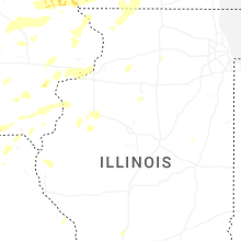


Connect with Interactive Hail Maps