

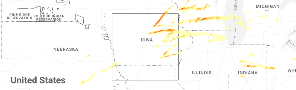
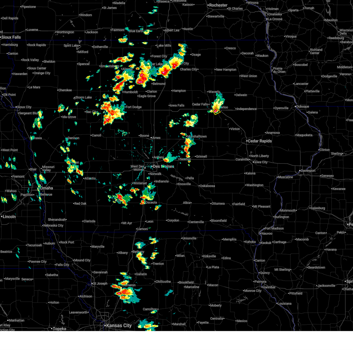
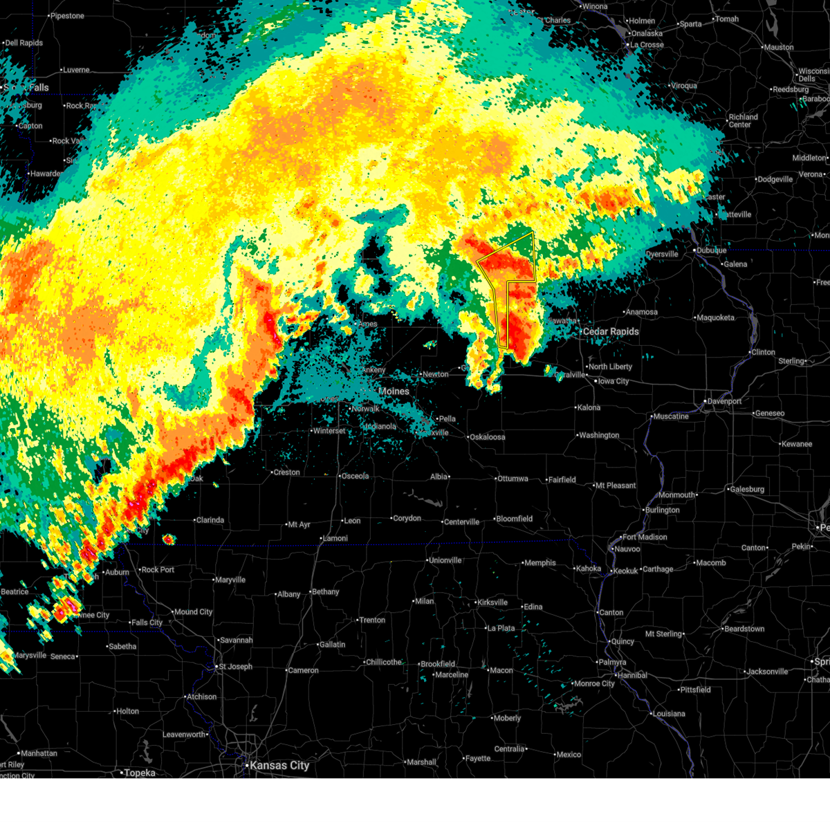
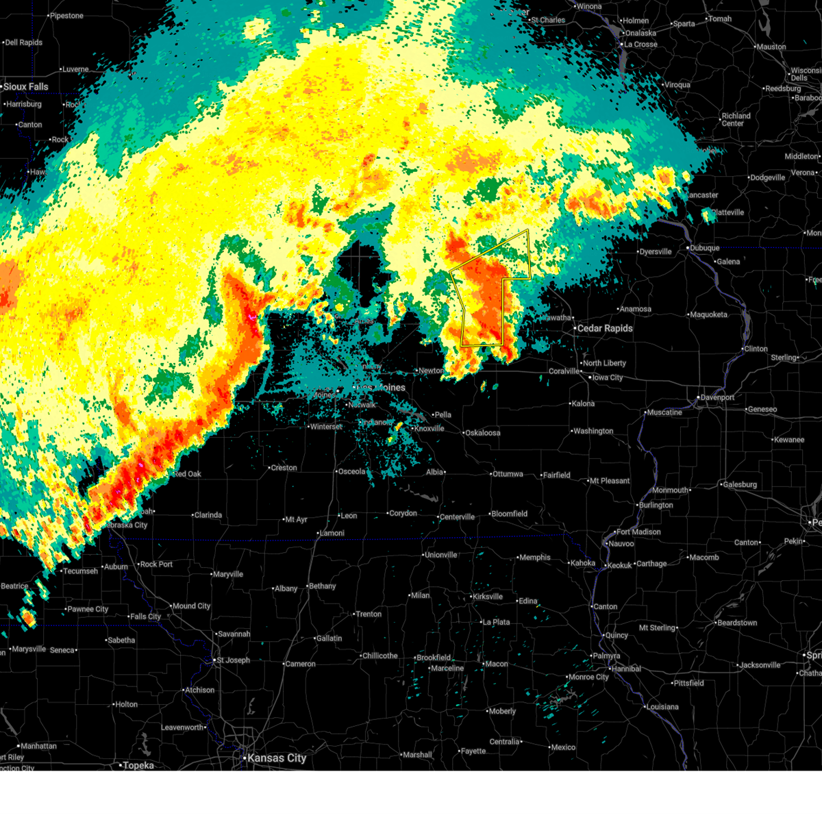
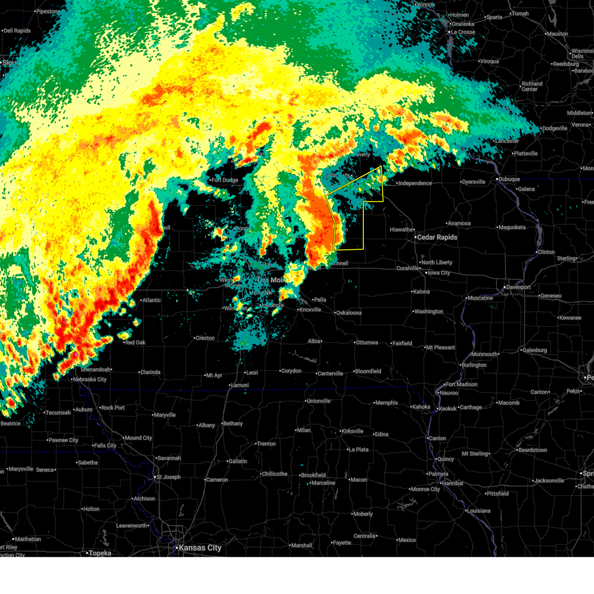
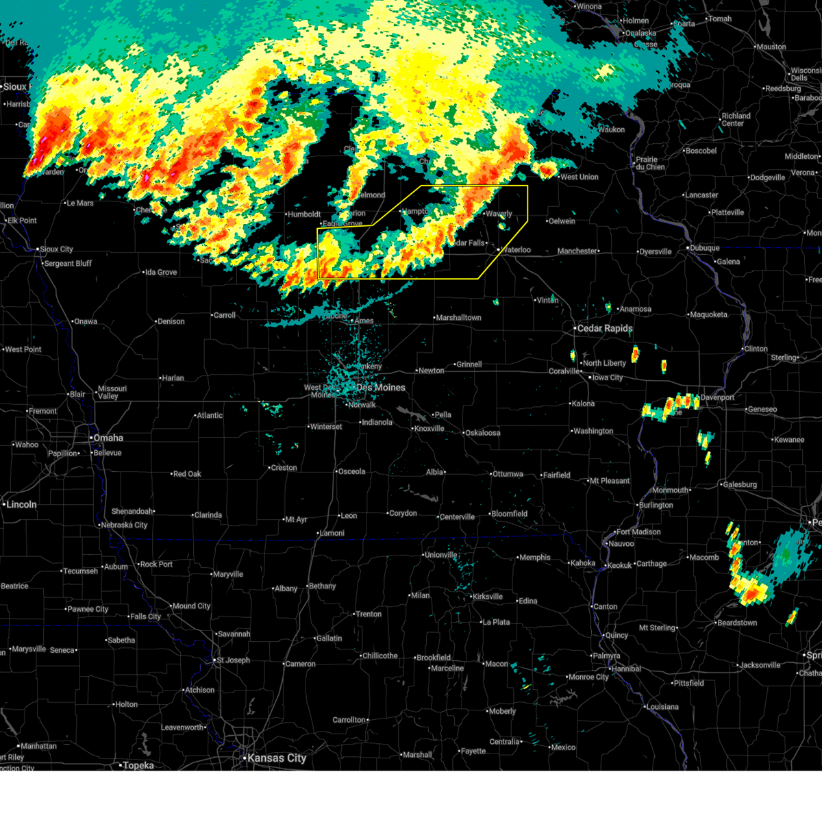
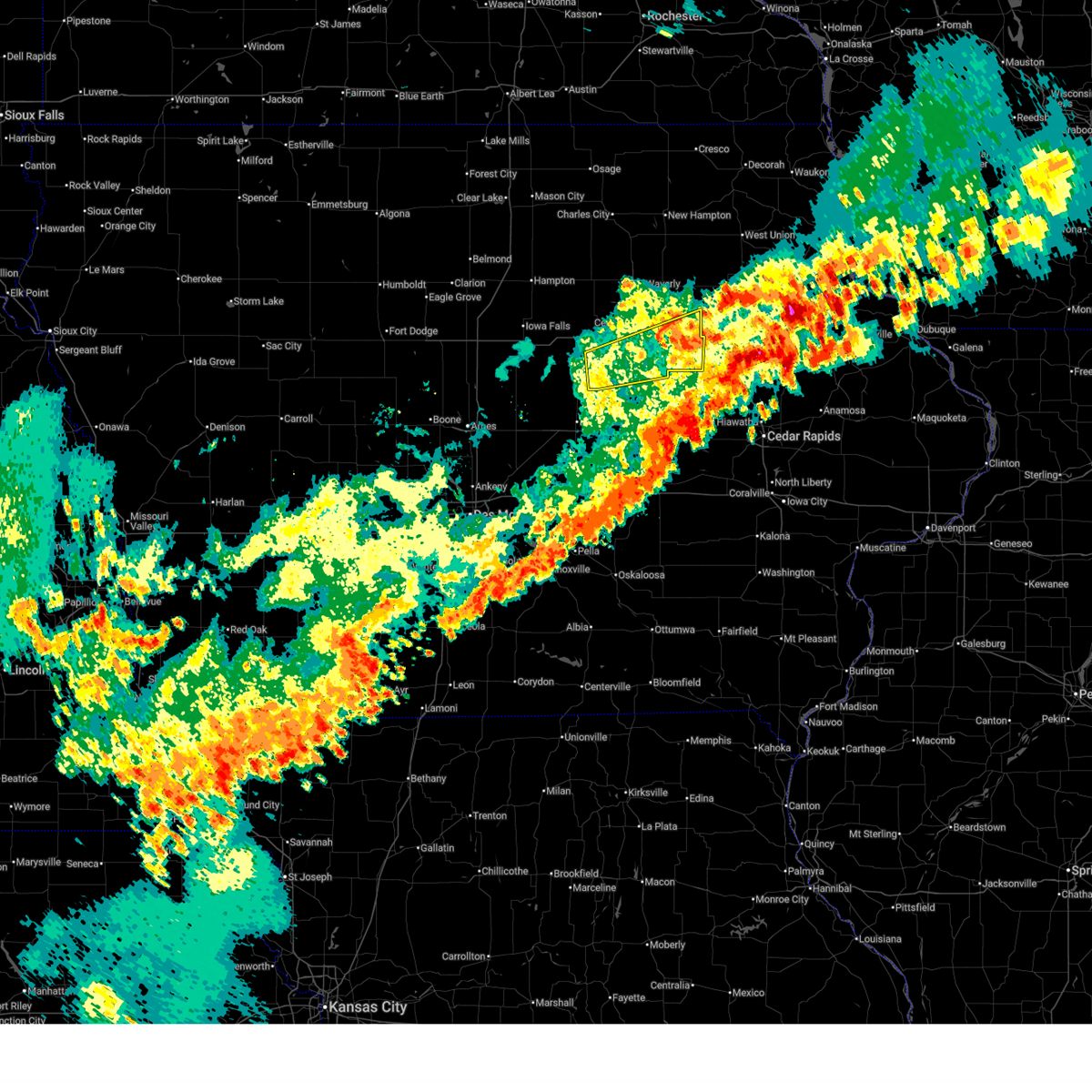
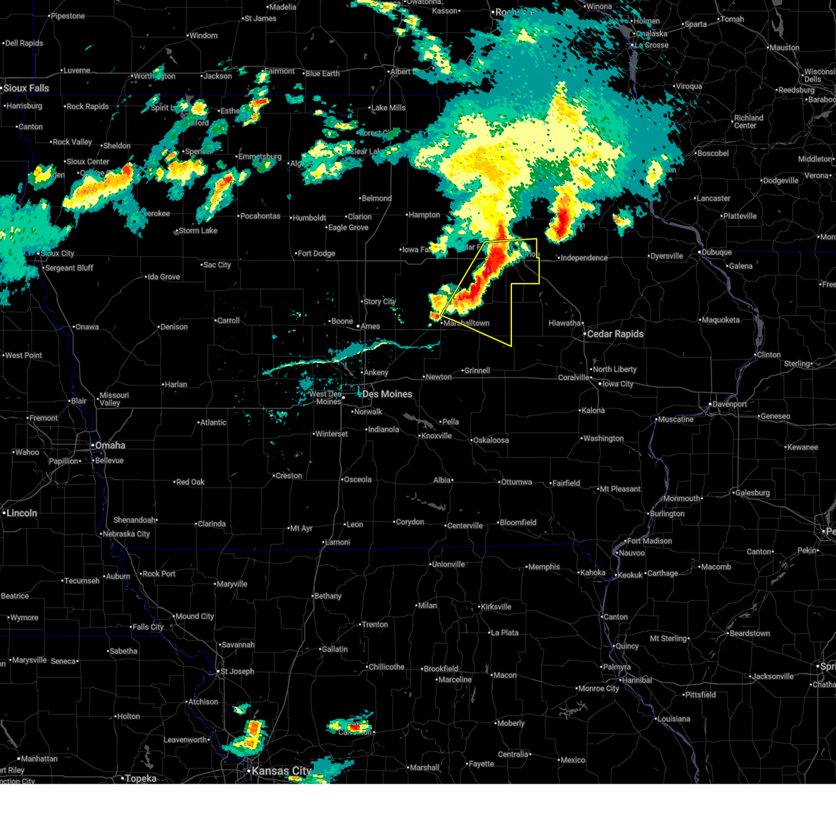
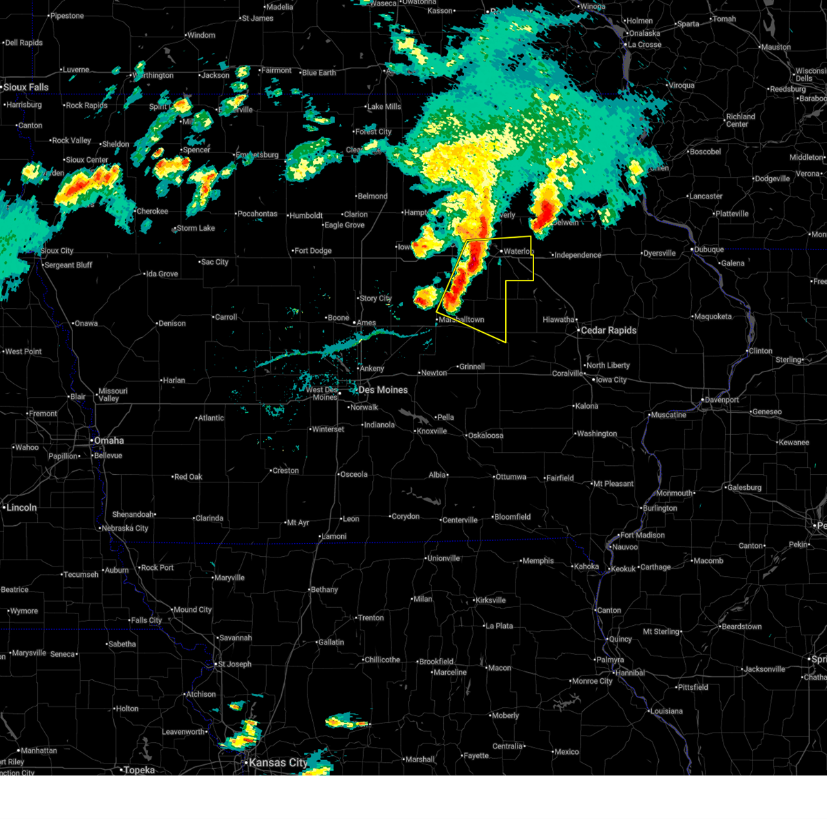
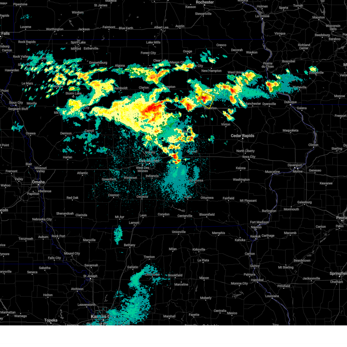
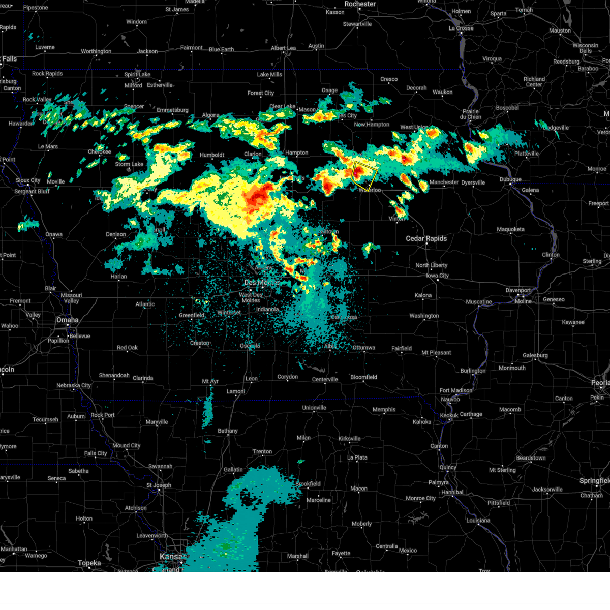
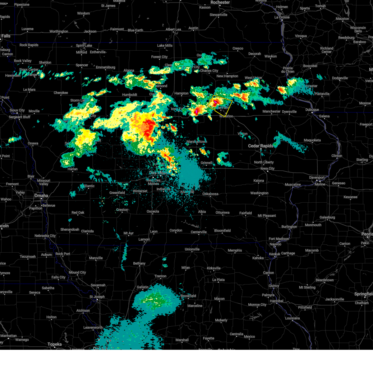
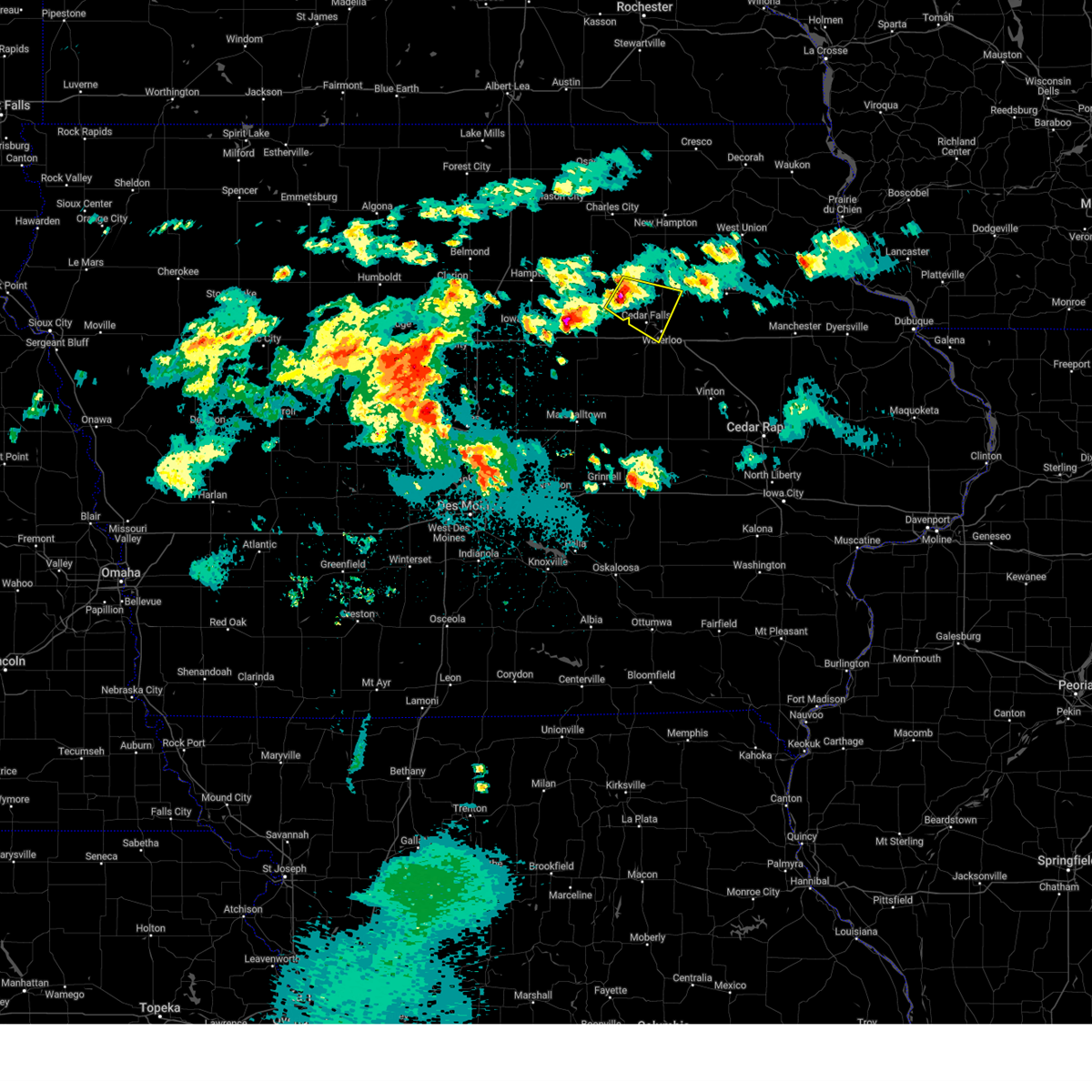
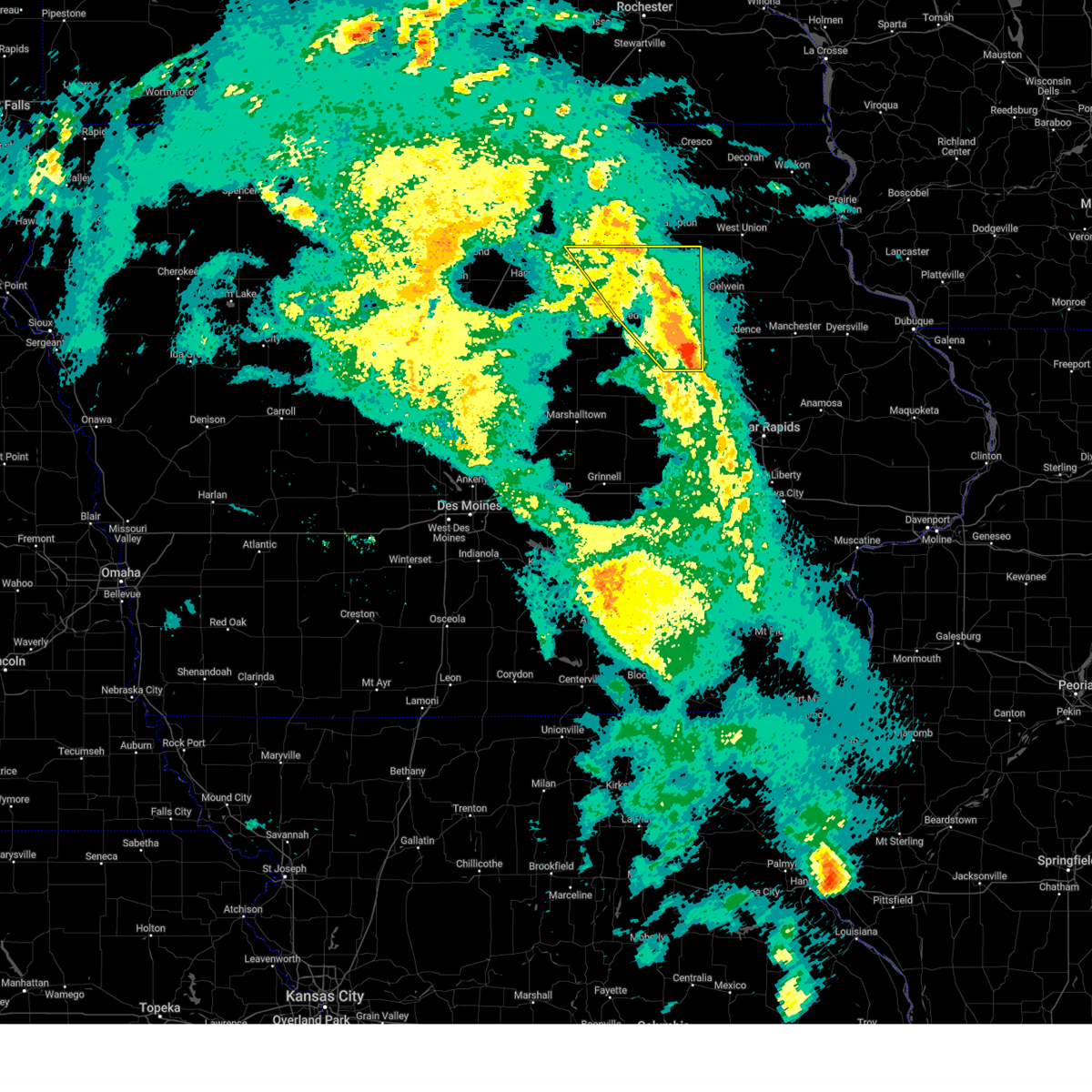
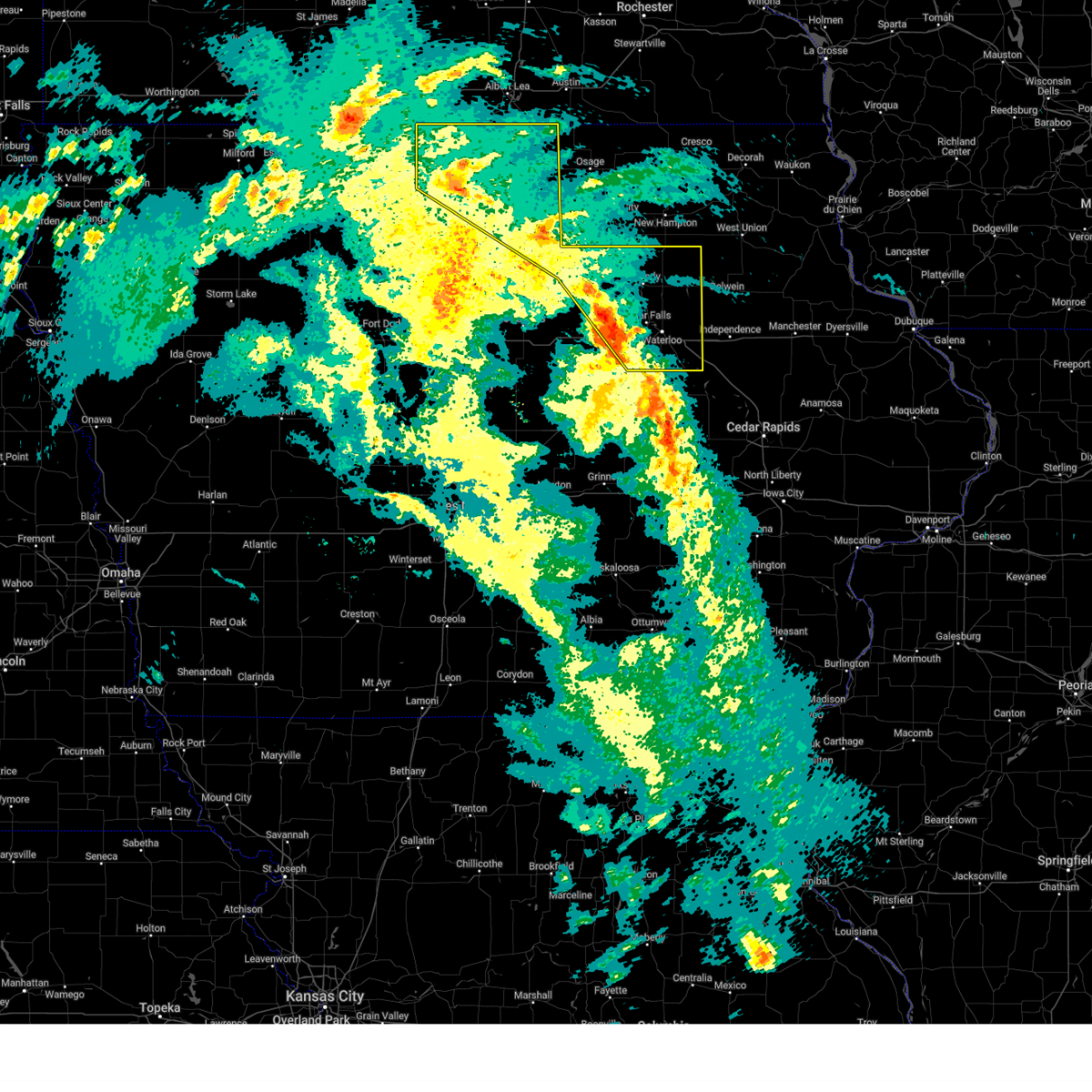
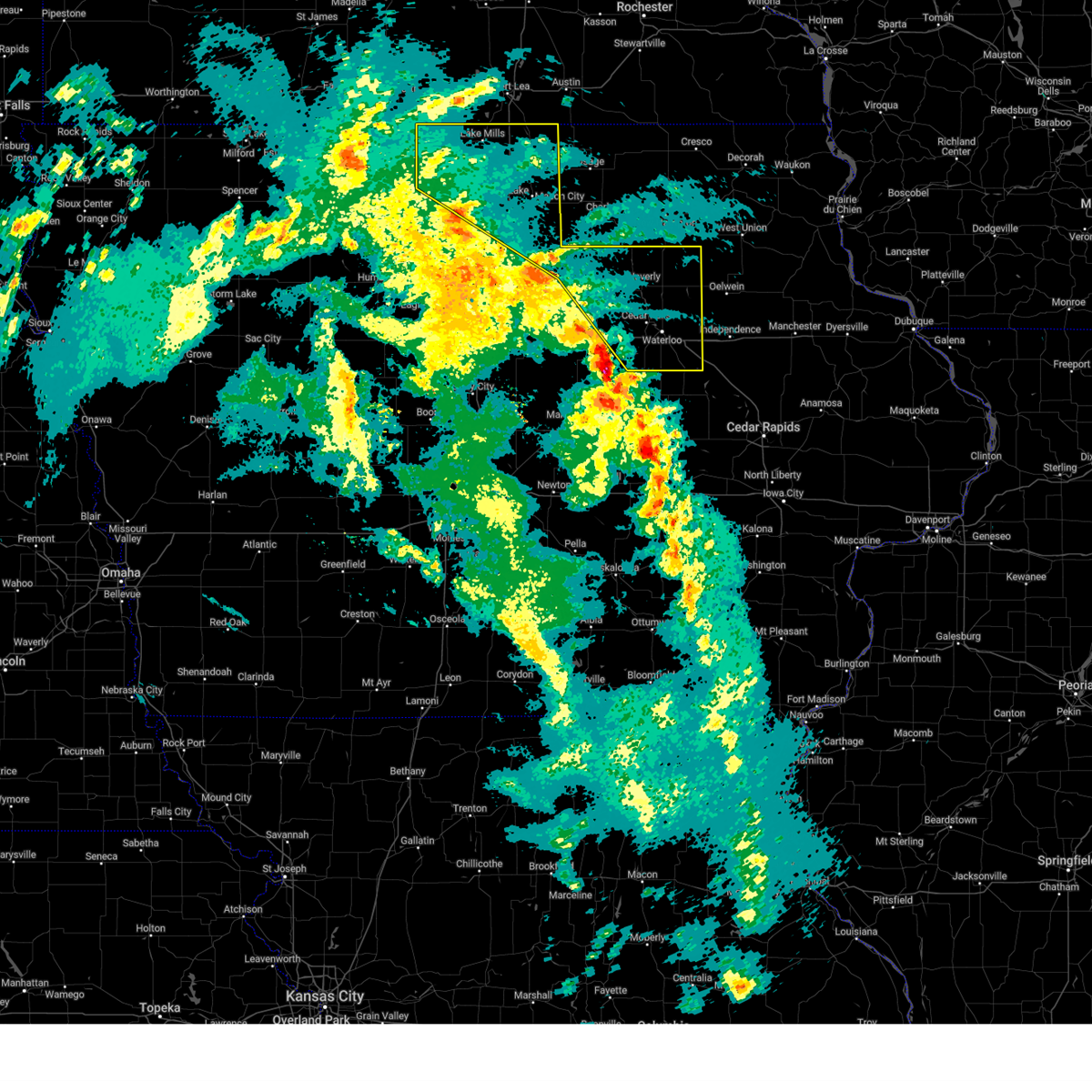
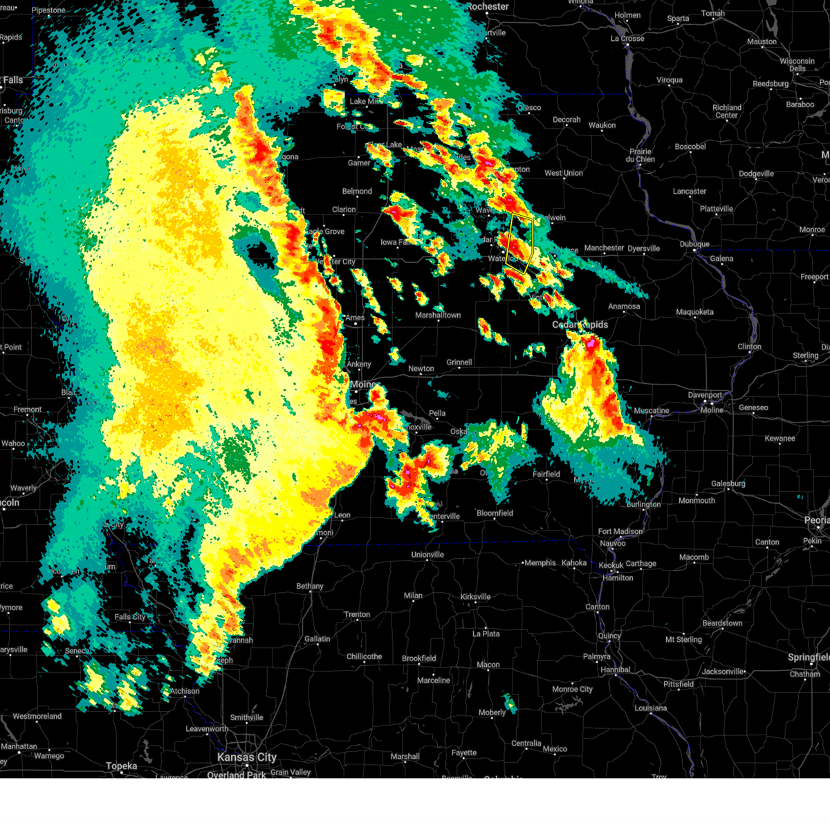
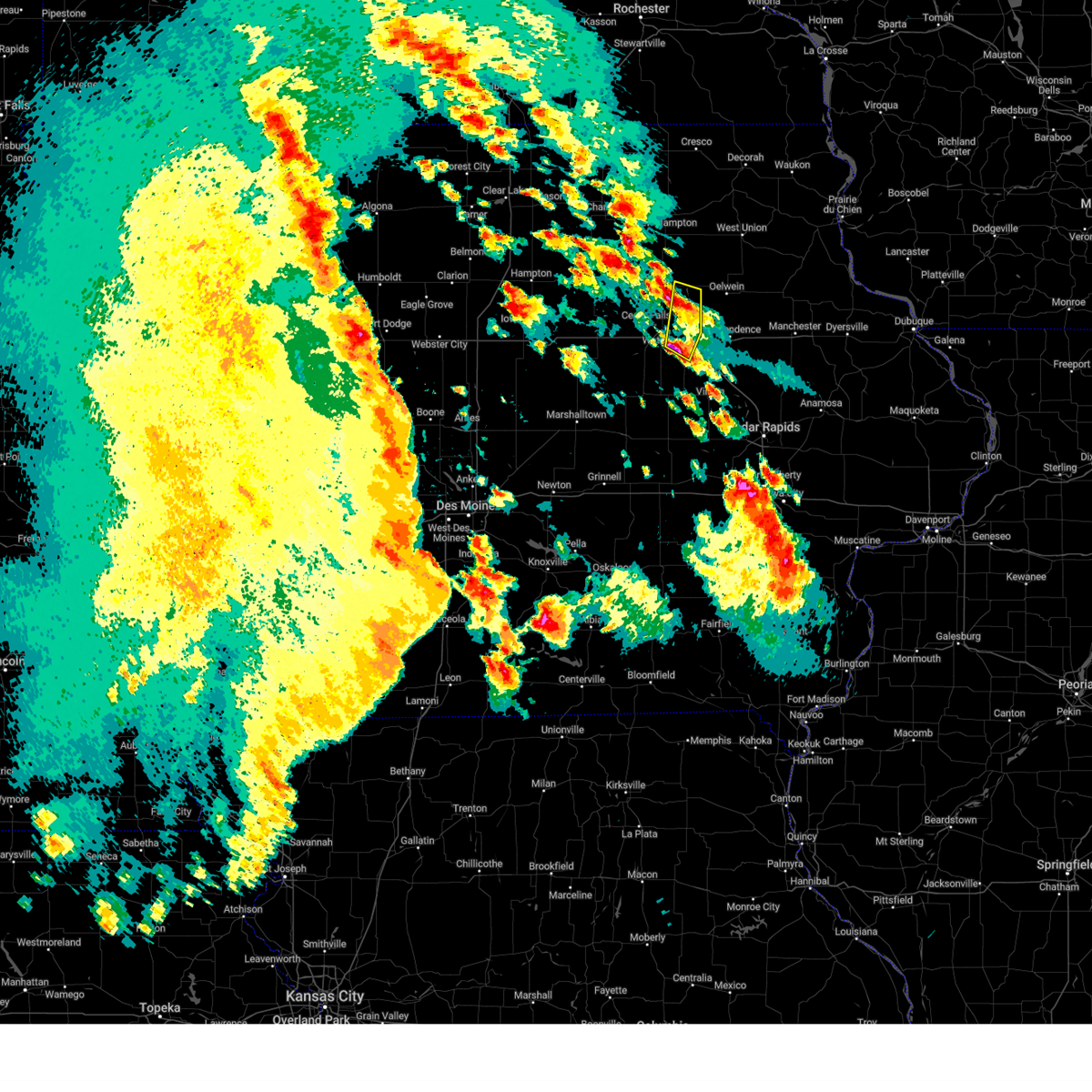
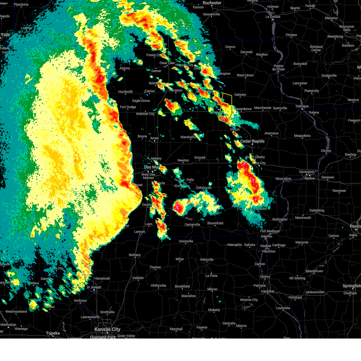
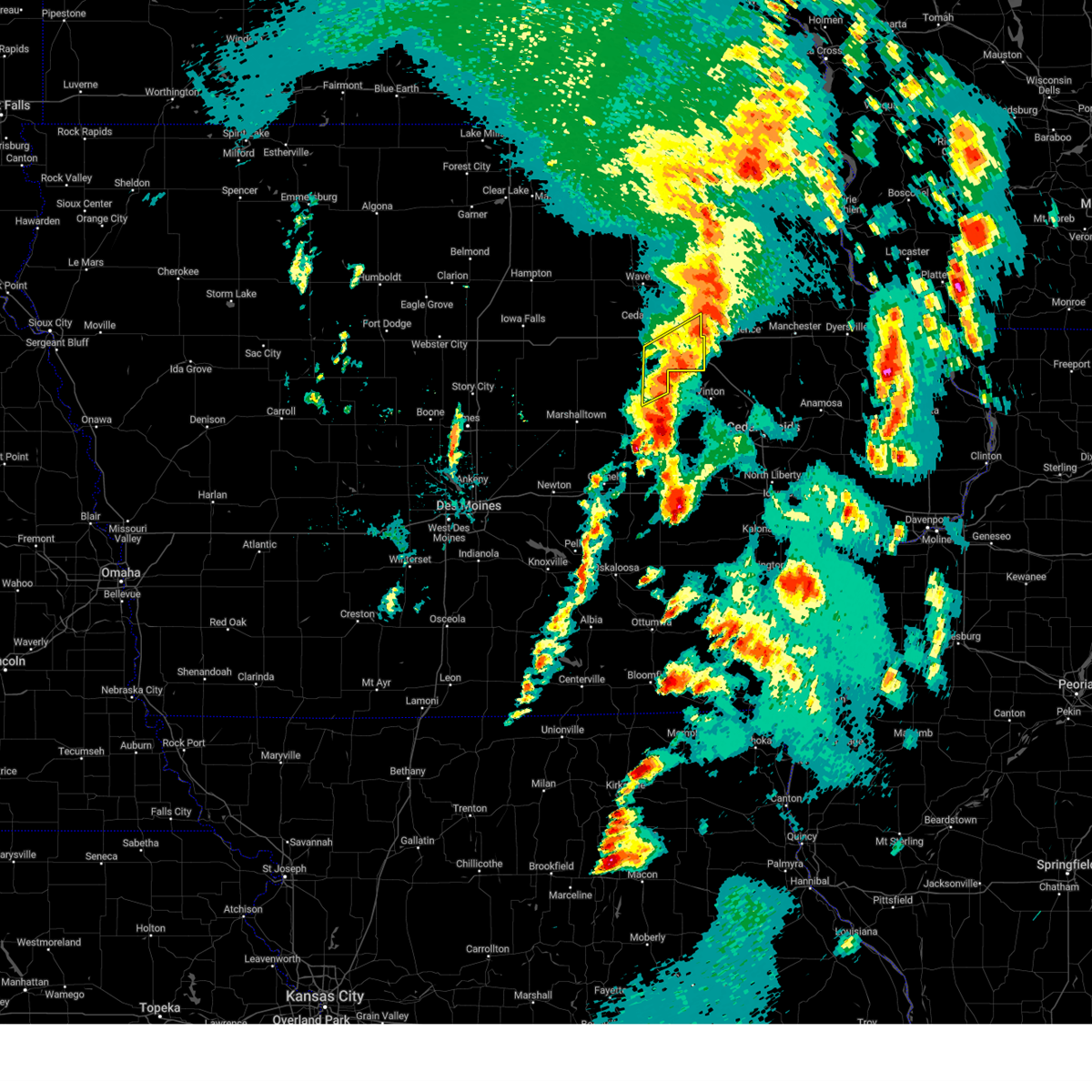
Hail Map for Waterloo, IA
The Waterloo, IA area has had 29 reports of on-the-ground hail by trained spotters, and has been under severe weather warnings 36 times during the past 12 months. Doppler radar has detected hail at or near Waterloo, IA on 102 occasions, including 7 occasions during the past year.
| Name: | Waterloo, IA |
| Where Located: | 48 miles NW of Cedar Rapids, IA |
| Map: | Google Map for Waterloo, IA |
| Population: | 68406 |
| Housing Units: | 30723 |
| More Info: | Search Google for Waterloo, IA |
5
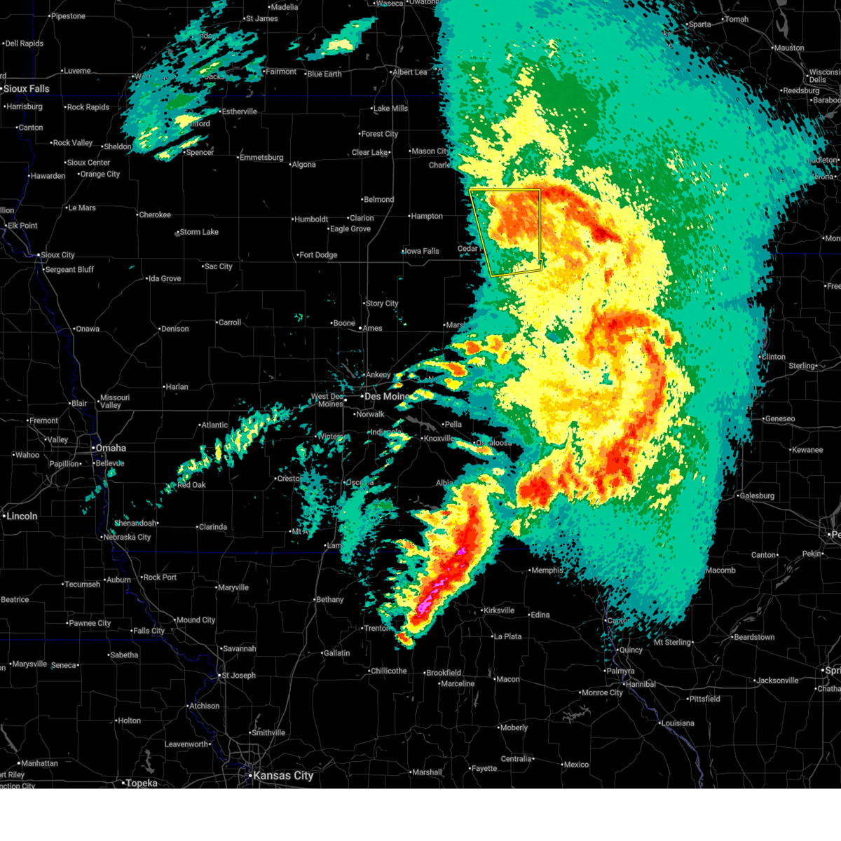
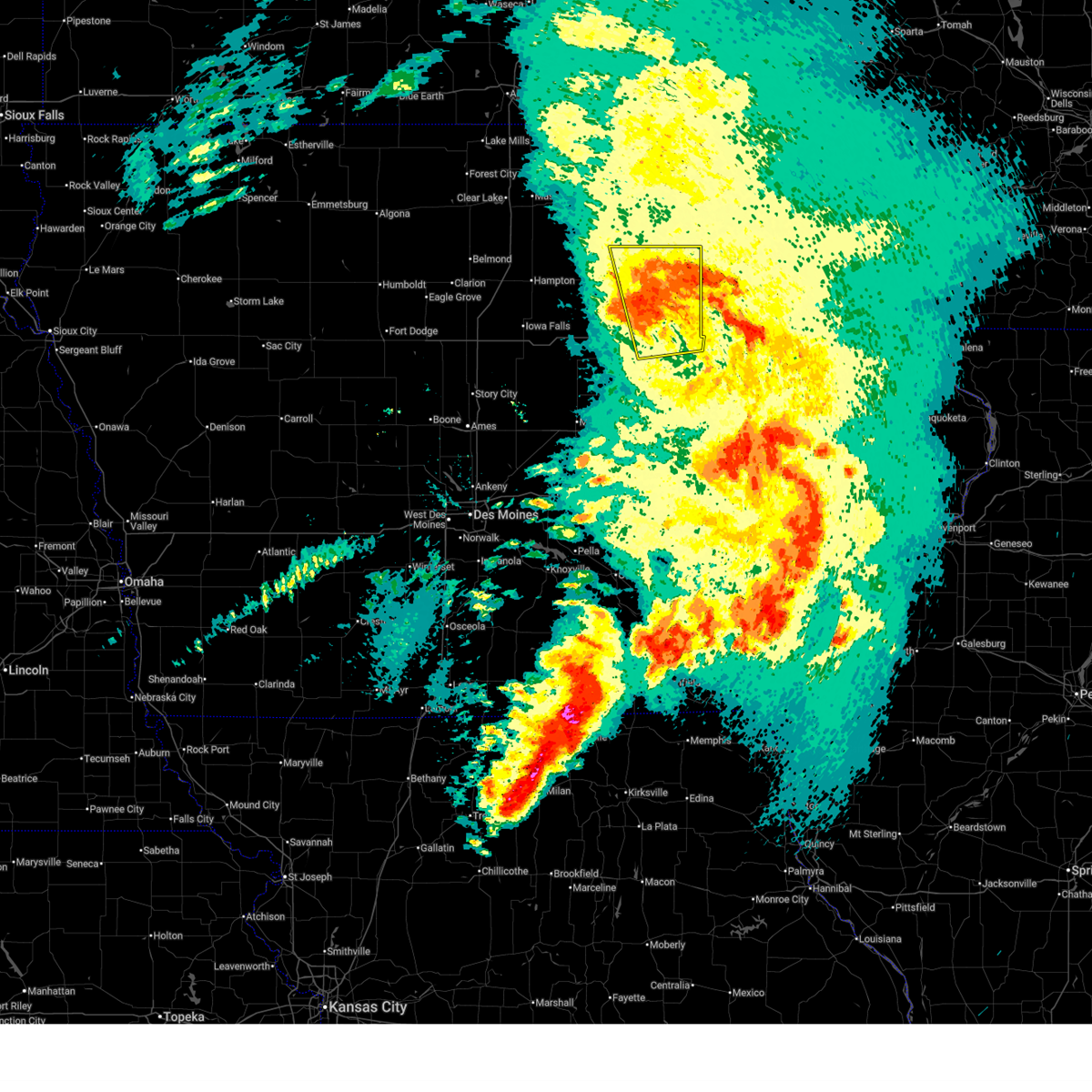
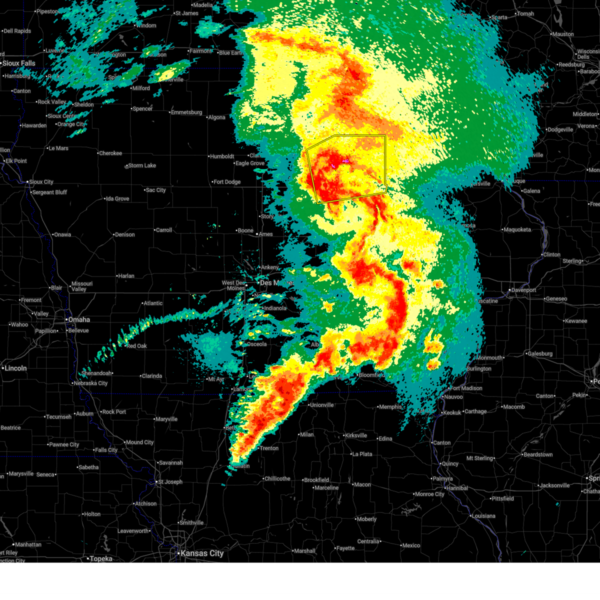
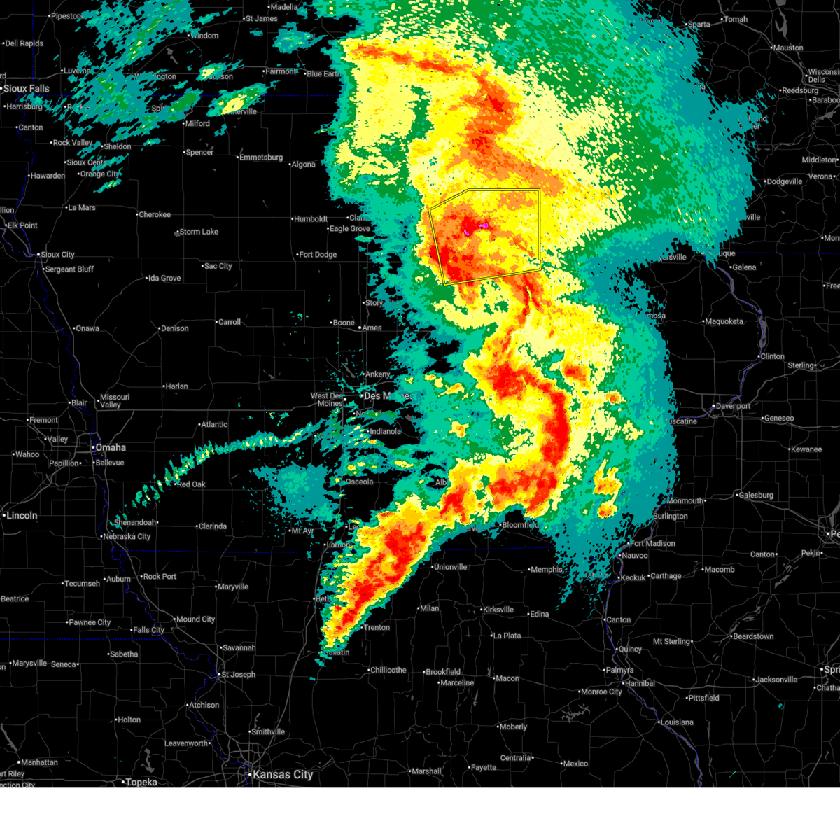
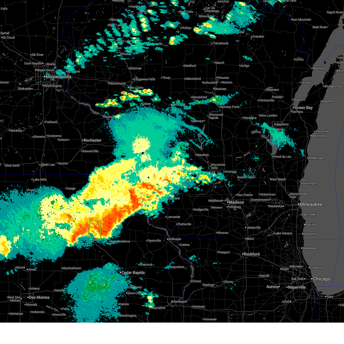
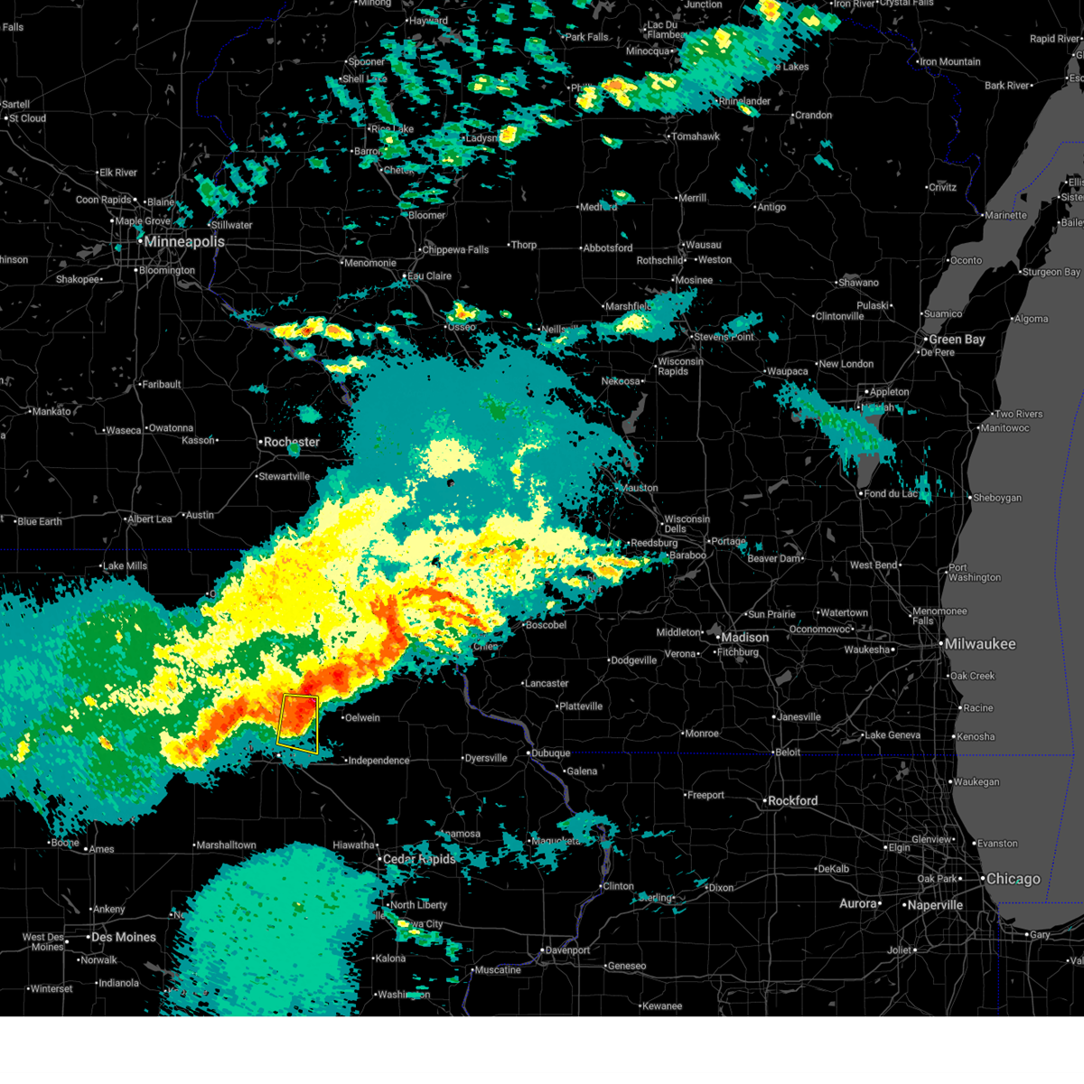
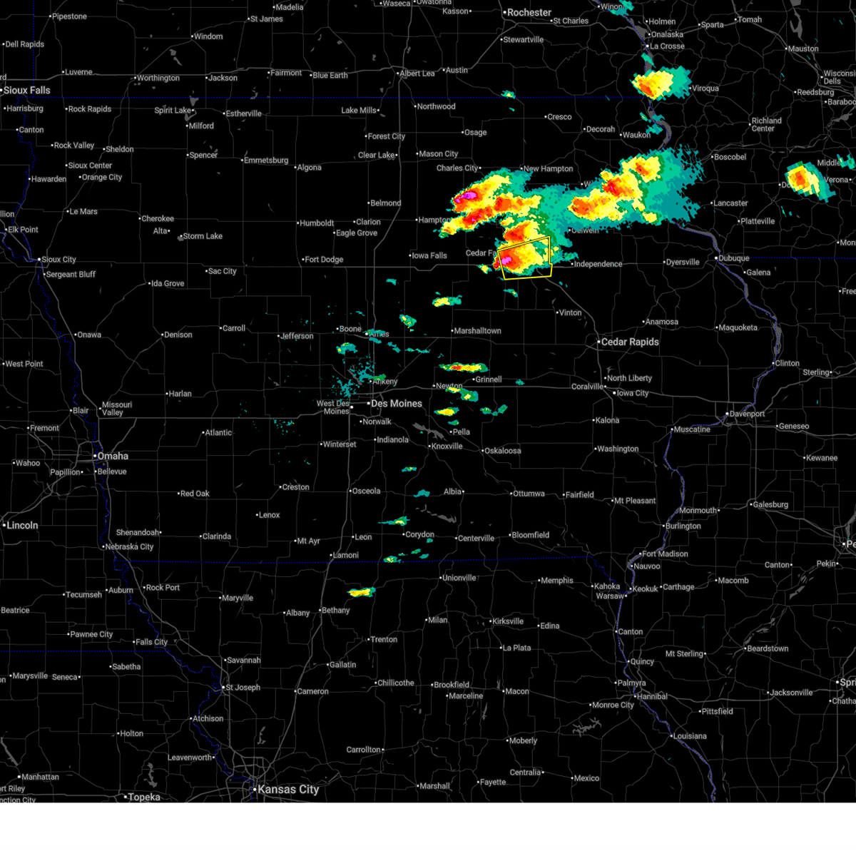
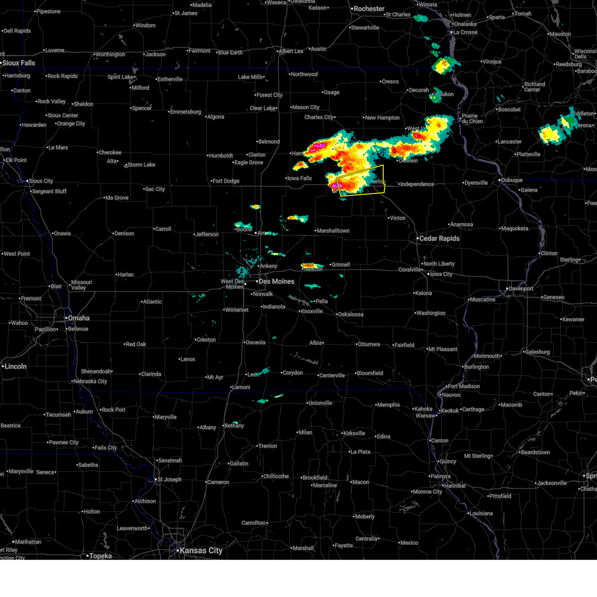
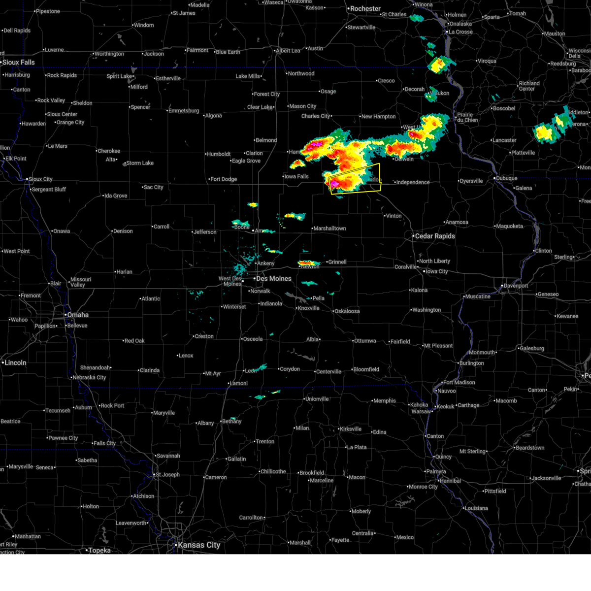
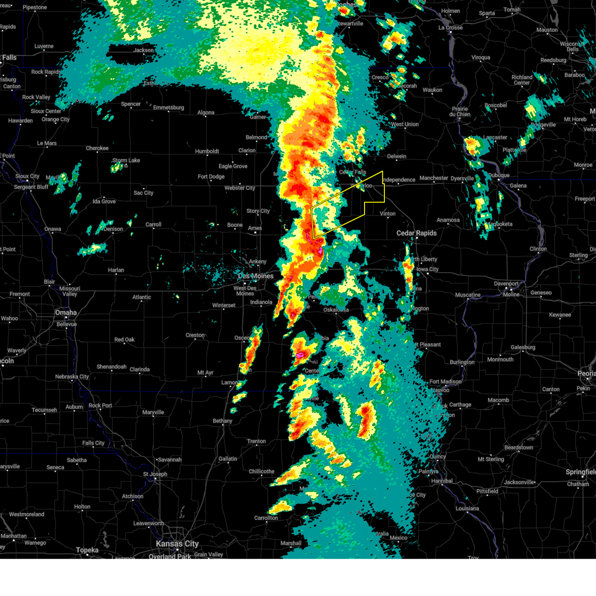
The Top Recent Hail Date for Waterloo, IA is Tuesday, April 14, 2026 (1st out of 102)
Hail and Wind Damage Spotted near Waterloo, IA
| Date / Time | Report Details |
|---|---|
| 6/11/2026 9:46 AM CDT |
 The storm which prompted the warning has moved out of the area. therefore, the warning has been allowed to expire. however, gusty winds of 45 to 55 mph are still possible with this thunderstorm. a severe thunderstorm watch remains in effect until 1000 am cdt for central and northeastern iowa. The storm which prompted the warning has moved out of the area. therefore, the warning has been allowed to expire. however, gusty winds of 45 to 55 mph are still possible with this thunderstorm. a severe thunderstorm watch remains in effect until 1000 am cdt for central and northeastern iowa.
|
| 6/11/2026 9:38 AM CDT | Delayed report - measured at kalo aso in black hawk county IA, 6.9 miles SE of Waterloo, IA |
| 6/11/2026 9:25 AM CDT |
 At 925 am cdt, a severe thunderstorm was located over dunkerton, or 8 miles east of waterloo, moving northeast at 45 mph (radar indicated). Hazards include 60 mph wind gusts. Expect damage to roofs, siding, and trees. locations impacted include, waterloo, cedar falls, waverly, evansdale, jesup, hudson, sumner, denver, tripoli, shell rock, elk run heights, waterloo municipal airport, crossroads mall, uni-dome and mcleod center, janesville, washburn, dunkerton, readlyn, raymond, and gilbertville. This includes interstate 380 between mile markers 61 and 73. At 925 am cdt, a severe thunderstorm was located over dunkerton, or 8 miles east of waterloo, moving northeast at 45 mph (radar indicated). Hazards include 60 mph wind gusts. Expect damage to roofs, siding, and trees. locations impacted include, waterloo, cedar falls, waverly, evansdale, jesup, hudson, sumner, denver, tripoli, shell rock, elk run heights, waterloo municipal airport, crossroads mall, uni-dome and mcleod center, janesville, washburn, dunkerton, readlyn, raymond, and gilbertville. This includes interstate 380 between mile markers 61 and 73.
|
| 6/11/2026 8:58 AM CDT |
 the severe thunderstorm warning has been cancelled and is no longer in effect the severe thunderstorm warning has been cancelled and is no longer in effect
|
| 6/11/2026 8:58 AM CDT |
 At 857 am cdt, a severe thunderstorm was located near uni-dome and mcleod center, or 5 miles west of cedar falls, moving east at 55 mph (radar indicated). Hazards include 60 mph wind gusts. Expect damage to roofs, siding, and trees. locations impacted include, waterloo, cedar falls, waverly, grundy center, allison, evansdale, jesup, hudson, sumner, parkersburg, denver, clarksville, tripoli, shell rock, dike, aplington, elk run heights, crossroads mall, waterloo municipal airport, and uni-dome and mcleod center. This includes interstate 380 between mile markers 61 and 73. At 857 am cdt, a severe thunderstorm was located near uni-dome and mcleod center, or 5 miles west of cedar falls, moving east at 55 mph (radar indicated). Hazards include 60 mph wind gusts. Expect damage to roofs, siding, and trees. locations impacted include, waterloo, cedar falls, waverly, grundy center, allison, evansdale, jesup, hudson, sumner, parkersburg, denver, clarksville, tripoli, shell rock, dike, aplington, elk run heights, crossroads mall, waterloo municipal airport, and uni-dome and mcleod center. This includes interstate 380 between mile markers 61 and 73.
|
| 6/11/2026 8:38 AM CDT |
 Svrdmx the national weather service in des moines has issued a * severe thunderstorm warning for, eastern hardin county in central iowa, black hawk county in northeastern iowa, bremer county in northeastern iowa, southeastern franklin county in north central iowa, grundy county in central iowa, butler county in north central iowa, * until 945 am cdt. * at 837 am cdt, a severe thunderstorm was located over wellsburg, or 7 miles northwest of grundy center, moving east at 55 mph (radar indicated). Hazards include 60 mph wind gusts. expect damage to roofs, siding, and trees Svrdmx the national weather service in des moines has issued a * severe thunderstorm warning for, eastern hardin county in central iowa, black hawk county in northeastern iowa, bremer county in northeastern iowa, southeastern franklin county in north central iowa, grundy county in central iowa, butler county in north central iowa, * until 945 am cdt. * at 837 am cdt, a severe thunderstorm was located over wellsburg, or 7 miles northwest of grundy center, moving east at 55 mph (radar indicated). Hazards include 60 mph wind gusts. expect damage to roofs, siding, and trees
|
| 6/10/2026 11:58 AM CDT |
 Svrdmx the national weather service in des moines has issued a * severe thunderstorm warning for, eastern black hawk county in northeastern iowa, * until 1230 pm cdt. * at 1158 am cdt, a severe thunderstorm was located over independence airport, or 5 miles west of independence, moving northeast at 45 mph (personal weather stations from la porte city to gilbertville gusting from 50 to 60 mph). Hazards include 60 mph wind gusts. expect damage to roofs, siding, and trees Svrdmx the national weather service in des moines has issued a * severe thunderstorm warning for, eastern black hawk county in northeastern iowa, * until 1230 pm cdt. * at 1158 am cdt, a severe thunderstorm was located over independence airport, or 5 miles west of independence, moving northeast at 45 mph (personal weather stations from la porte city to gilbertville gusting from 50 to 60 mph). Hazards include 60 mph wind gusts. expect damage to roofs, siding, and trees
|
| 6/10/2026 11:33 AM CDT |
 Svrdmx the national weather service in des moines has issued a * severe thunderstorm warning for, southern black hawk county in northeastern iowa, * until noon cdt. * at 1133 am cdt, severe thunderstorms were located along a line extending from hudson to 5 miles northeast of dysart to van horne, moving northeast at 50 mph (radar indicated). Hazards include 60 mph wind gusts. expect damage to roofs, siding, and trees Svrdmx the national weather service in des moines has issued a * severe thunderstorm warning for, southern black hawk county in northeastern iowa, * until noon cdt. * at 1133 am cdt, severe thunderstorms were located along a line extending from hudson to 5 miles northeast of dysart to van horne, moving northeast at 50 mph (radar indicated). Hazards include 60 mph wind gusts. expect damage to roofs, siding, and trees
|
| 5/15/2026 10:51 PM CDT |
 The storm which prompted the warning has moved out of the area. therefore, the warning will be allowed to expire. a severe thunderstorm watch remains in effect until 100 am cdt for northeastern iowa. The storm which prompted the warning has moved out of the area. therefore, the warning will be allowed to expire. a severe thunderstorm watch remains in effect until 100 am cdt for northeastern iowa.
|
| 5/15/2026 10:31 PM CDT |
 At 1030 pm cdt, a severe thunderstorm was located over fairbank, or 8 miles west of oelwein, moving east at 55 mph (radar indicated). Hazards include 60 mph wind gusts and penny size hail. Expect damage to roofs, siding, and trees. Locations impacted include, waterloo, denver, dunkerton, and readlyn. At 1030 pm cdt, a severe thunderstorm was located over fairbank, or 8 miles west of oelwein, moving east at 55 mph (radar indicated). Hazards include 60 mph wind gusts and penny size hail. Expect damage to roofs, siding, and trees. Locations impacted include, waterloo, denver, dunkerton, and readlyn.
|
| 5/15/2026 10:14 PM CDT |
 Svrdmx the national weather service in des moines has issued a * severe thunderstorm warning for, northern black hawk county in northeastern iowa, southern bremer county in northeastern iowa, east central butler county in north central iowa, * until 1100 pm cdt. * at 1013 pm cdt, a severe thunderstorm was located near janesville, or near waverly, moving east at 55 mph (radar indicated). Hazards include 60 mph wind gusts and penny size hail. expect damage to roofs, siding, and trees Svrdmx the national weather service in des moines has issued a * severe thunderstorm warning for, northern black hawk county in northeastern iowa, southern bremer county in northeastern iowa, east central butler county in north central iowa, * until 1100 pm cdt. * at 1013 pm cdt, a severe thunderstorm was located near janesville, or near waverly, moving east at 55 mph (radar indicated). Hazards include 60 mph wind gusts and penny size hail. expect damage to roofs, siding, and trees
|
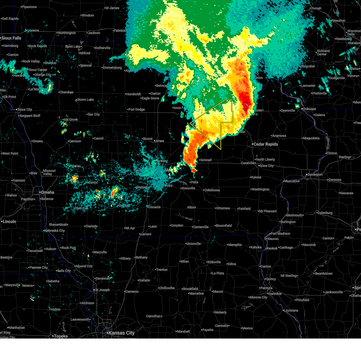
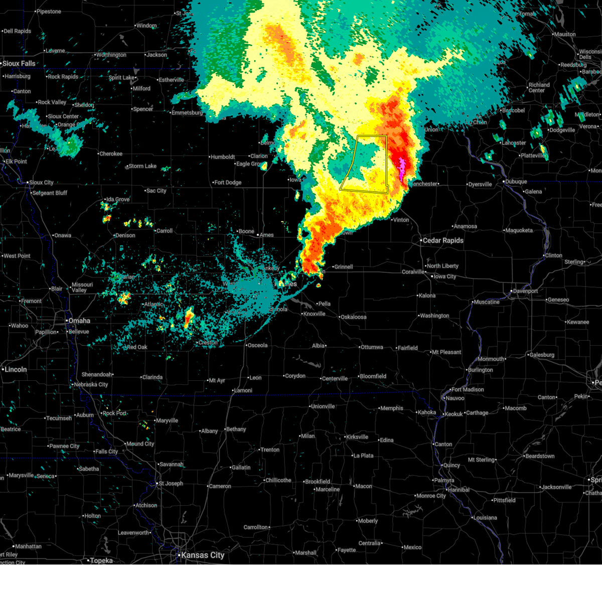
| 4/14/2026 5:32 PM CDT |
 Svrdmx the national weather service in des moines has issued a * severe thunderstorm warning for, eastern black hawk county in northeastern iowa, * until 600 pm cdt. * at 531 pm cdt, a severe thunderstorm was located over gilbertville, or 6 miles southeast of waterloo, moving east at 50 mph (radar indicated). Hazards include 60 mph wind gusts and quarter size hail. Hail damage to vehicles is expected. Expect wind damage to roofs, siding, and trees. Svrdmx the national weather service in des moines has issued a * severe thunderstorm warning for, eastern black hawk county in northeastern iowa, * until 600 pm cdt. * at 531 pm cdt, a severe thunderstorm was located over gilbertville, or 6 miles southeast of waterloo, moving east at 50 mph (radar indicated). Hazards include 60 mph wind gusts and quarter size hail. Hail damage to vehicles is expected. Expect wind damage to roofs, siding, and trees.
|
| 4/14/2026 4:35 PM CDT | Golf Ball sized hail reported 5.4 miles WSW of Waterloo, IA |
| 4/14/2026 4:30 PM CDT |
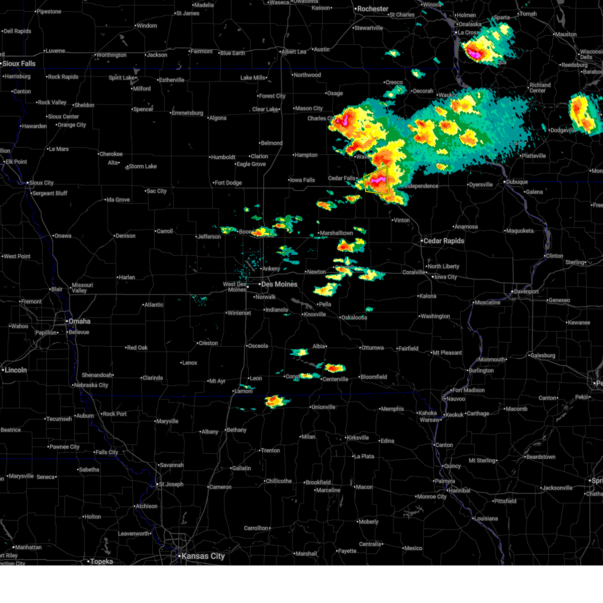 At 430 pm cdt, a severe thunderstorm was located over evansdale, or near waterloo, moving east at 35 mph (trained weather spotters). Hazards include two inch hail and 60 mph wind gusts. People and animals outdoors will be injured. expect hail damage to roofs, siding, windows, and vehicles. expect wind damage to roofs, siding, and trees. locations impacted include, waterloo, evansdale, jesup, elk run heights, crossroads mall, washburn, dunkerton, raymond, and gilbertville. This includes interstate 380 between mile markers 61 and 73. At 430 pm cdt, a severe thunderstorm was located over evansdale, or near waterloo, moving east at 35 mph (trained weather spotters). Hazards include two inch hail and 60 mph wind gusts. People and animals outdoors will be injured. expect hail damage to roofs, siding, windows, and vehicles. expect wind damage to roofs, siding, and trees. locations impacted include, waterloo, evansdale, jesup, elk run heights, crossroads mall, washburn, dunkerton, raymond, and gilbertville. This includes interstate 380 between mile markers 61 and 73.
|
| 4/14/2026 4:29 PM CDT | Hen Egg sized hail reported 2 miles E of Waterloo, IA |
| 4/14/2026 4:24 PM CDT | Tennis Ball sized hail reported 1.6 miles SSE of Waterloo, IA, estimated in comparison to tennis ball. time estimated from radar. |
| 4/14/2026 4:21 PM CDT | Golf Ball sized hail reported 1.6 miles SSE of Waterloo, IA |
| 4/14/2026 4:17 PM CDT |
 At 417 pm cdt, a severe thunderstorm was located over waterloo, moving east at 35 mph (trained weather spotters). Hazards include golf ball size hail and 60 mph wind gusts. People and animals outdoors will be injured. expect hail damage to roofs, siding, windows, and vehicles. expect wind damage to roofs, siding, and trees. locations impacted include, waterloo, cedar falls, evansdale, jesup, hudson, elk run heights, waterloo municipal airport, crossroads mall, uni-dome and mcleod center, washburn, dunkerton, raymond, gilbertville, and george wyth state park. This includes interstate 380 between mile markers 60 and 73. At 417 pm cdt, a severe thunderstorm was located over waterloo, moving east at 35 mph (trained weather spotters). Hazards include golf ball size hail and 60 mph wind gusts. People and animals outdoors will be injured. expect hail damage to roofs, siding, windows, and vehicles. expect wind damage to roofs, siding, and trees. locations impacted include, waterloo, cedar falls, evansdale, jesup, hudson, elk run heights, waterloo municipal airport, crossroads mall, uni-dome and mcleod center, washburn, dunkerton, raymond, gilbertville, and george wyth state park. This includes interstate 380 between mile markers 60 and 73.
|
| 4/14/2026 4:11 PM CDT |
 At 410 pm cdt, a severe thunderstorm was located over uni-dome and mcleod center, or near cedar falls, moving east at 35 mph (trained weather spotters). Hazards include golf ball size hail and 60 mph wind gusts. People and animals outdoors will be injured. expect hail damage to roofs, siding, windows, and vehicles. expect wind damage to roofs, siding, and trees. locations impacted include, waterloo, cedar falls, evansdale, jesup, hudson, dike, elk run heights, waterloo municipal airport, crossroads mall, uni-dome and mcleod center, washburn, dunkerton, raymond, gilbertville, and george wyth state park. This includes interstate 380 between mile markers 60 and 73. At 410 pm cdt, a severe thunderstorm was located over uni-dome and mcleod center, or near cedar falls, moving east at 35 mph (trained weather spotters). Hazards include golf ball size hail and 60 mph wind gusts. People and animals outdoors will be injured. expect hail damage to roofs, siding, windows, and vehicles. expect wind damage to roofs, siding, and trees. locations impacted include, waterloo, cedar falls, evansdale, jesup, hudson, dike, elk run heights, waterloo municipal airport, crossroads mall, uni-dome and mcleod center, washburn, dunkerton, raymond, gilbertville, and george wyth state park. This includes interstate 380 between mile markers 60 and 73.
|
| 4/14/2026 4:00 PM CDT |
 Svrdmx the national weather service in des moines has issued a * severe thunderstorm warning for, black hawk county in northeastern iowa, northeastern grundy county in central iowa, * until 445 pm cdt. * at 400 pm cdt, a severe thunderstorm was located over dike, or 8 miles southwest of cedar falls, moving east at 35 mph (radar indicated). Hazards include golf ball size hail and 60 mph wind gusts. People and animals outdoors will be injured. expect hail damage to roofs, siding, windows, and vehicles. Expect wind damage to roofs, siding, and trees. Svrdmx the national weather service in des moines has issued a * severe thunderstorm warning for, black hawk county in northeastern iowa, northeastern grundy county in central iowa, * until 445 pm cdt. * at 400 pm cdt, a severe thunderstorm was located over dike, or 8 miles southwest of cedar falls, moving east at 35 mph (radar indicated). Hazards include golf ball size hail and 60 mph wind gusts. People and animals outdoors will be injured. expect hail damage to roofs, siding, windows, and vehicles. Expect wind damage to roofs, siding, and trees.
|
| 9/22/2025 8:09 PM CDT | the severe thunderstorm warning has been cancelled and is no longer in effect |
| 9/22/2025 7:40 PM CDT | Svrdmx the national weather service in des moines has issued a * severe thunderstorm warning for, central black hawk county in northeastern iowa, * until 830 pm cdt. * at 739 pm cdt, a severe thunderstorm was located near waterloo municipal airport, or 5 miles north of waterloo, moving southeast at 20 mph (radar indicated). Hazards include 60 mph wind gusts and quarter size hail. Hail damage to vehicles is expected. Expect wind damage to roofs, siding, and trees. |
| 9/16/2025 8:25 PM CDT | Wind gust measured by the waterloo asos. time from meta in black hawk county IA, 6.9 miles SE of Waterloo, IA |
| 9/16/2025 4:41 PM CDT | The storm which prompted the warning has weakened below severe limits, and no longer poses an immediate threat to life or property. therefore, the warning will be allowed to expire. however, heavy rain is still possible with this thunderstorm. |
| 9/16/2025 4:14 PM CDT | the severe thunderstorm warning has been cancelled and is no longer in effect |
| 9/16/2025 4:13 PM CDT | Svrdmx the national weather service in des moines has issued a * severe thunderstorm warning for, west central black hawk county in northeastern iowa, * until 445 pm cdt. * at 413 pm cdt, a severe thunderstorm was located over hudson, or near waterloo, and is nearly stationary (radar indicated). Hazards include quarter size hail. damage to vehicles is expected |
| 9/16/2025 3:59 PM CDT |
 Svrdmx the national weather service in des moines has issued a * severe thunderstorm warning for, central black hawk county in northeastern iowa, * until 430 pm cdt. * at 358 pm cdt, a severe thunderstorm was located over crossroads mall, or near waterloo, and is nearly stationary (radar indicated). Hazards include quarter size hail. damage to vehicles is expected Svrdmx the national weather service in des moines has issued a * severe thunderstorm warning for, central black hawk county in northeastern iowa, * until 430 pm cdt. * at 358 pm cdt, a severe thunderstorm was located over crossroads mall, or near waterloo, and is nearly stationary (radar indicated). Hazards include quarter size hail. damage to vehicles is expected
|
| 9/16/2025 3:45 PM CDT | Quarter sized hail reported 1.6 miles SSE of Waterloo, IA, sheets of dime to quarter size hail. |
| 9/16/2025 3:38 PM CDT | At 338 pm cdt, a severe thunderstorm was located over waterloo, and is nearly stationary (trained weather spotters). Hazards include quarter size hail. Damage to vehicles is expected. locations impacted include, waterloo, evansdale, elk run heights, crossroads mall, washburn, and raymond. This includes interstate 380 between mile markers 67 and 73. |
| 9/16/2025 3:37 PM CDT | Quarter sized hail reported 2.2 miles NNW of Waterloo, IA |
| 9/16/2025 3:36 PM CDT | Svrdmx the national weather service in des moines has issued a * severe thunderstorm warning for, central black hawk county in northeastern iowa, * until 400 pm cdt. * at 336 pm cdt, a severe thunderstorm was located over waterloo, and is nearly stationary (radar indicated). Hazards include quarter size hail. damage to vehicles is expected |
| 7/30/2025 1:58 AM CDT | Personal weather statio in black hawk county IA, 8.8 miles W of Waterloo, IA |
| 7/30/2025 1:50 AM CDT | Iowa dot rwi in black hawk county IA, 1.4 miles NNW of Waterloo, IA |
| 7/30/2025 1:50 AM CDT |
 At 149 am cdt, severe thunderstorms were located along a line extending from near raymond to near lime creek county park to near newhall, moving east at 40 mph (personal weather stations. several stations have gusted from 55 to 68 mph). Hazards include 60 mph wind gusts. Expect damage to roofs, siding, and trees. locations impacted include, waterloo, cedar falls, evansdale, jesup, la porte city, hudson, dysart, elk run heights, crossroads mall, washburn, dunkerton, raymond, gilbertville, clutier, elberon, and vining. This includes interstate 380 between mile markers 56 and 73. At 149 am cdt, severe thunderstorms were located along a line extending from near raymond to near lime creek county park to near newhall, moving east at 40 mph (personal weather stations. several stations have gusted from 55 to 68 mph). Hazards include 60 mph wind gusts. Expect damage to roofs, siding, and trees. locations impacted include, waterloo, cedar falls, evansdale, jesup, la porte city, hudson, dysart, elk run heights, crossroads mall, washburn, dunkerton, raymond, gilbertville, clutier, elberon, and vining. This includes interstate 380 between mile markers 56 and 73.
|
| 7/30/2025 1:43 AM CDT | Personal weather statio in black hawk county IA, 3.2 miles ENE of Waterloo, IA |
| 7/30/2025 1:28 AM CDT |
 At 127 am cdt, severe thunderstorms were located along a line extending from near hudson to 5 miles west of la porte city to belle plaine, moving northeast at 35 mph (automated weather stations. wind gusts of 50 to 68 mph have been reported with the cluster of storms). Hazards include 60 mph wind gusts. Expect damage to roofs, siding, and trees. locations impacted include, waterloo, cedar falls, toledo, evansdale, tama, jesup, la porte city, hudson, traer, reinbeck, dysart, elk run heights, crossroads mall, washburn, dunkerton, raymond, gilbertville, chelsea, clutier, and elberon. This includes interstate 380 between mile markers 56 and 73. At 127 am cdt, severe thunderstorms were located along a line extending from near hudson to 5 miles west of la porte city to belle plaine, moving northeast at 35 mph (automated weather stations. wind gusts of 50 to 68 mph have been reported with the cluster of storms). Hazards include 60 mph wind gusts. Expect damage to roofs, siding, and trees. locations impacted include, waterloo, cedar falls, toledo, evansdale, tama, jesup, la porte city, hudson, traer, reinbeck, dysart, elk run heights, crossroads mall, washburn, dunkerton, raymond, gilbertville, chelsea, clutier, and elberon. This includes interstate 380 between mile markers 56 and 73.
|
| 7/30/2025 1:07 AM CDT |
 Svrdmx the national weather service in des moines has issued a * severe thunderstorm warning for, black hawk county in northeastern iowa, tama county in central iowa, east central grundy county in central iowa, * until 200 am cdt. * at 106 am cdt, severe thunderstorms were located along a line extending from reinbeck to 4 miles southeast of traer to near holiday lake, moving east at 40 mph (radar indicated). Hazards include 60 mph wind gusts. expect damage to roofs, siding, and trees Svrdmx the national weather service in des moines has issued a * severe thunderstorm warning for, black hawk county in northeastern iowa, tama county in central iowa, east central grundy county in central iowa, * until 200 am cdt. * at 106 am cdt, severe thunderstorms were located along a line extending from reinbeck to 4 miles southeast of traer to near holiday lake, moving east at 40 mph (radar indicated). Hazards include 60 mph wind gusts. expect damage to roofs, siding, and trees
|
| 7/29/2025 1:55 AM CDT |
 The storms which prompted the warning have moved out of the area. therefore, the warning will be allowed to expire. however, gusty winds are still possible with these thunderstorms. a severe thunderstorm watch remains in effect until 400 am cdt for central and northeastern iowa. remember, a severe thunderstorm warning still remains in effect for much of tama county until 300 am. The storms which prompted the warning have moved out of the area. therefore, the warning will be allowed to expire. however, gusty winds are still possible with these thunderstorms. a severe thunderstorm watch remains in effect until 400 am cdt for central and northeastern iowa. remember, a severe thunderstorm warning still remains in effect for much of tama county until 300 am.
|
| 7/29/2025 1:49 AM CDT |
 The storms which prompted the warning have moved out of the area. therefore, the warning has been allowed to expire. a severe thunderstorm watch remains in effect until 400 am cdt for central, north central and northeastern iowa. The storms which prompted the warning have moved out of the area. therefore, the warning has been allowed to expire. a severe thunderstorm watch remains in effect until 400 am cdt for central, north central and northeastern iowa.
|
| 7/29/2025 1:27 AM CDT |
 the severe thunderstorm warning has been cancelled and is no longer in effect the severe thunderstorm warning has been cancelled and is no longer in effect
|
| 7/29/2025 1:27 AM CDT |
 At 126 am cdt, severe thunderstorms were located along a line extending from hawkeye to uni-dome and mcleod center, moving east at 50 mph (waterloo airport reported a wind gust of 78 mph). Hazards include 70 mph wind gusts and penny size hail. Expect considerable tree damage. damage is likely to mobile homes, roofs, and outbuildings. locations impacted include, waterloo, cedar falls, waverly, evansdale, jesup, hudson, sumner, denver, tripoli, dike, elk run heights, waterloo municipal airport, crossroads mall, uni-dome and mcleod center, janesville, washburn, dunkerton, readlyn, raymond, and gilbertville. This includes interstate 380 between mile markers 62 and 73. At 126 am cdt, severe thunderstorms were located along a line extending from hawkeye to uni-dome and mcleod center, moving east at 50 mph (waterloo airport reported a wind gust of 78 mph). Hazards include 70 mph wind gusts and penny size hail. Expect considerable tree damage. damage is likely to mobile homes, roofs, and outbuildings. locations impacted include, waterloo, cedar falls, waverly, evansdale, jesup, hudson, sumner, denver, tripoli, dike, elk run heights, waterloo municipal airport, crossroads mall, uni-dome and mcleod center, janesville, washburn, dunkerton, readlyn, raymond, and gilbertville. This includes interstate 380 between mile markers 62 and 73.
|
| 7/29/2025 1:23 AM CDT |
 Svrdmx the national weather service in des moines has issued a * severe thunderstorm warning for, black hawk county in northeastern iowa, northern tama county in central iowa, southern grundy county in central iowa, * until 200 am cdt. * at 121 am cdt, severe thunderstorms were located along a line extending from near fairbank to washburn to near lincoln, moving southeast at 55 mph (waterloo asos reported a wind gust of 78 mph). Hazards include 70 mph wind gusts. Expect considerable tree damage. Damage is likely to mobile homes, roofs, and outbuildings. Svrdmx the national weather service in des moines has issued a * severe thunderstorm warning for, black hawk county in northeastern iowa, northern tama county in central iowa, southern grundy county in central iowa, * until 200 am cdt. * at 121 am cdt, severe thunderstorms were located along a line extending from near fairbank to washburn to near lincoln, moving southeast at 55 mph (waterloo asos reported a wind gust of 78 mph). Hazards include 70 mph wind gusts. Expect considerable tree damage. Damage is likely to mobile homes, roofs, and outbuildings.
|
| 7/29/2025 1:19 AM CDT | Gust to 78 mph at aso in black hawk county IA, 6.9 miles SE of Waterloo, IA |
| 7/29/2025 1:15 AM CDT | Several reports across waterloo of trees on utility lines and transformers. power is out in various locations around waterloo. time estimated by rada in black hawk county IA, 1.7 miles ESE of Waterloo, IA |
| 7/29/2025 12:47 AM CDT |
 Svrdmx the national weather service in des moines has issued a * severe thunderstorm warning for, northeastern hardin county in central iowa, black hawk county in northeastern iowa, bremer county in northeastern iowa, northern grundy county in central iowa, butler county in north central iowa, * until 145 am cdt. * at 1246 am cdt, severe thunderstorms were located along a line extending from river ranch campground to near ackley municipal airport, moving east at 50 mph (radar indicated). Hazards include 60 mph wind gusts and penny size hail. expect damage to roofs, siding, and trees Svrdmx the national weather service in des moines has issued a * severe thunderstorm warning for, northeastern hardin county in central iowa, black hawk county in northeastern iowa, bremer county in northeastern iowa, northern grundy county in central iowa, butler county in north central iowa, * until 145 am cdt. * at 1246 am cdt, severe thunderstorms were located along a line extending from river ranch campground to near ackley municipal airport, moving east at 50 mph (radar indicated). Hazards include 60 mph wind gusts and penny size hail. expect damage to roofs, siding, and trees
|
| 7/28/2025 1:14 AM CDT | Storm damage reported in black hawk county IA, 6.9 miles SE of Waterloo, IA |
| 7/28/2025 12:54 AM CDT |
 The storms which prompted the warning have weakened below severe limits, and no longer pose an immediate threat to life or property. therefore, the warning will be allowed to expire. however, gusty winds are still possible with these thunderstorms. The storms which prompted the warning have weakened below severe limits, and no longer pose an immediate threat to life or property. therefore, the warning will be allowed to expire. however, gusty winds are still possible with these thunderstorms.
|
| 7/28/2025 12:39 AM CDT |
 At 1238 am cdt, severe thunderstorms were located along a line extending from waverly to near steamboat rock to 5 miles south of blairsburg, moving southeast at 45 mph (radar indicated). Hazards include 60 mph wind gusts. Expect damage to roofs, siding, and trees. locations impacted include, waterloo, cedar falls, waverly, webster city, iowa falls, hampton, eldora, grundy center, allison, hudson, sumner, parkersburg, denver, reinbeck, ackley, clarksville, tripoli, shell rock, jewell junction, and dike. This includes interstate 35 between mile markers 133 and 158. At 1238 am cdt, severe thunderstorms were located along a line extending from waverly to near steamboat rock to 5 miles south of blairsburg, moving southeast at 45 mph (radar indicated). Hazards include 60 mph wind gusts. Expect damage to roofs, siding, and trees. locations impacted include, waterloo, cedar falls, waverly, webster city, iowa falls, hampton, eldora, grundy center, allison, hudson, sumner, parkersburg, denver, reinbeck, ackley, clarksville, tripoli, shell rock, jewell junction, and dike. This includes interstate 35 between mile markers 133 and 158.
|
| 7/28/2025 12:39 AM CDT |
 the severe thunderstorm warning has been cancelled and is no longer in effect the severe thunderstorm warning has been cancelled and is no longer in effect
|
| 7/28/2025 12:13 AM CDT |
 Svrdmx the national weather service in des moines has issued a * severe thunderstorm warning for, hardin county in central iowa, western black hawk county in northeastern iowa, bremer county in northeastern iowa, wright county in north central iowa, franklin county in north central iowa, grundy county in central iowa, butler county in north central iowa, hamilton county in central iowa, southern cerro gordo county in north central iowa, * until 100 am cdt. * at 1212 am cdt, severe thunderstorms were located along a line extending from 4 miles south of greene to alden to 4 miles northeast of duncombe, moving southeast at 45 mph (radar indicated). Hazards include 60 mph wind gusts. expect damage to roofs, siding, and trees Svrdmx the national weather service in des moines has issued a * severe thunderstorm warning for, hardin county in central iowa, western black hawk county in northeastern iowa, bremer county in northeastern iowa, wright county in north central iowa, franklin county in north central iowa, grundy county in central iowa, butler county in north central iowa, hamilton county in central iowa, southern cerro gordo county in north central iowa, * until 100 am cdt. * at 1212 am cdt, severe thunderstorms were located along a line extending from 4 miles south of greene to alden to 4 miles northeast of duncombe, moving southeast at 45 mph (radar indicated). Hazards include 60 mph wind gusts. expect damage to roofs, siding, and trees
|
| 6/26/2025 5:44 PM CDT |
 Svrdmx the national weather service in des moines has issued a * severe thunderstorm warning for, northern poweshiek county in central iowa, eastern marshall county in central iowa, southern black hawk county in northeastern iowa, tama county in central iowa, southeastern grundy county in central iowa, northeastern jasper county in central iowa, * until 630 pm cdt. * at 543 pm cdt, severe thunderstorms were located along a line extending from gladbrook to meskwaki casino to near grinnell, moving northeast at 50 mph (radar indicated). Hazards include 60 mph wind gusts. expect damage to roofs, siding, and trees Svrdmx the national weather service in des moines has issued a * severe thunderstorm warning for, northern poweshiek county in central iowa, eastern marshall county in central iowa, southern black hawk county in northeastern iowa, tama county in central iowa, southeastern grundy county in central iowa, northeastern jasper county in central iowa, * until 630 pm cdt. * at 543 pm cdt, severe thunderstorms were located along a line extending from gladbrook to meskwaki casino to near grinnell, moving northeast at 50 mph (radar indicated). Hazards include 60 mph wind gusts. expect damage to roofs, siding, and trees
|
| 6/23/2025 7:13 PM CDT |
 the severe thunderstorm warning has been cancelled and is no longer in effect the severe thunderstorm warning has been cancelled and is no longer in effect
|
| 6/23/2025 6:39 PM CDT |
 Svrdmx the national weather service in des moines has issued a * severe thunderstorm warning for, black hawk county in northeastern iowa, northern tama county in central iowa, southeastern grundy county in central iowa, * until 730 pm cdt. * at 638 pm cdt, a severe thunderstorm was located near lincoln, or near grundy center, moving east at 35 mph (radar indicated). Hazards include 60 mph wind gusts and penny size hail. expect damage to roofs, siding, and trees Svrdmx the national weather service in des moines has issued a * severe thunderstorm warning for, black hawk county in northeastern iowa, northern tama county in central iowa, southeastern grundy county in central iowa, * until 730 pm cdt. * at 638 pm cdt, a severe thunderstorm was located near lincoln, or near grundy center, moving east at 35 mph (radar indicated). Hazards include 60 mph wind gusts and penny size hail. expect damage to roofs, siding, and trees
|
| 6/11/2025 8:09 PM CDT |
 At 809 pm cdt, severe thunderstorms were located along a line extending from jesup to 5 miles east of gilbertville to vining, moving east at 30 mph (personal weather station reported a wind gust of 67 mph at 752 pm near la porte city). Hazards include 60 mph wind gusts and penny size hail. Expect damage to roofs, siding, and trees. locations impacted include, waterloo, evansdale, jesup, la porte city, traer, dysart, elk run heights, washburn, dunkerton, raymond, gilbertville, clutier, elberon, vining, and tf clark state park. This includes interstate 380 between mile markers 56 and 71. At 809 pm cdt, severe thunderstorms were located along a line extending from jesup to 5 miles east of gilbertville to vining, moving east at 30 mph (personal weather station reported a wind gust of 67 mph at 752 pm near la porte city). Hazards include 60 mph wind gusts and penny size hail. Expect damage to roofs, siding, and trees. locations impacted include, waterloo, evansdale, jesup, la porte city, traer, dysart, elk run heights, washburn, dunkerton, raymond, gilbertville, clutier, elberon, vining, and tf clark state park. This includes interstate 380 between mile markers 56 and 71.
|
| 6/11/2025 7:54 PM CDT |
 the severe thunderstorm warning has been cancelled and is no longer in effect the severe thunderstorm warning has been cancelled and is no longer in effect
|
| 6/11/2025 7:54 PM CDT |
 At 753 pm cdt, severe thunderstorms were located along a line extending from near raymond to gilbertville to toledo municipal airport, moving east at 30 mph (emergency management reported 60 mph winds and blowing dust near trear). Hazards include 60 mph wind gusts and penny size hail. Expect damage to roofs, siding, and trees. locations impacted include, waterloo, cedar falls, toledo, evansdale, jesup, la porte city, hudson, traer, dysart, elk run heights, crossroads mall, waterloo municipal airport, gladbrook, washburn, dunkerton, raymond, gilbertville, garwin, chelsea, and clutier. This includes interstate 380 between mile markers 56 and 73. At 753 pm cdt, severe thunderstorms were located along a line extending from near raymond to gilbertville to toledo municipal airport, moving east at 30 mph (emergency management reported 60 mph winds and blowing dust near trear). Hazards include 60 mph wind gusts and penny size hail. Expect damage to roofs, siding, and trees. locations impacted include, waterloo, cedar falls, toledo, evansdale, jesup, la porte city, hudson, traer, dysart, elk run heights, crossroads mall, waterloo municipal airport, gladbrook, washburn, dunkerton, raymond, gilbertville, garwin, chelsea, and clutier. This includes interstate 380 between mile markers 56 and 73.
|
| 6/11/2025 7:37 PM CDT | Multiple homes damaged by downed tree limbs. time estimated from rada in black hawk county IA, 1.5 miles E of Waterloo, IA |
| 6/11/2025 7:35 PM CDT |
 At 734 pm cdt, severe thunderstorms were located along a line extending from near waterloo municipal airport to near crossroads mall to meskwaki casino, moving east at 30 mph (emergency management and multiple personal weather stations reported winds up to 66 mph in the cedar falls and waterloo areas). Hazards include 60 mph wind gusts. Expect damage to roofs, siding, and trees. locations impacted include, waterloo, cedar falls, toledo, evansdale, jesup, la porte city, hudson, traer, reinbeck, dysart, dike, elk run heights, crossroads mall, waterloo municipal airport, uni-dome and mcleod center, gladbrook, washburn, dunkerton, raymond, and gilbertville. This includes interstate 380 between mile markers 56 and 73. At 734 pm cdt, severe thunderstorms were located along a line extending from near waterloo municipal airport to near crossroads mall to meskwaki casino, moving east at 30 mph (emergency management and multiple personal weather stations reported winds up to 66 mph in the cedar falls and waterloo areas). Hazards include 60 mph wind gusts. Expect damage to roofs, siding, and trees. locations impacted include, waterloo, cedar falls, toledo, evansdale, jesup, la porte city, hudson, traer, reinbeck, dysart, dike, elk run heights, crossroads mall, waterloo municipal airport, uni-dome and mcleod center, gladbrook, washburn, dunkerton, raymond, and gilbertville. This includes interstate 380 between mile markers 56 and 73.
|
| 6/11/2025 7:28 PM CDT | Tree damage covering road. small to medium branches. time estimated from rada in black hawk county IA, 2 miles E of Waterloo, IA |
| 6/11/2025 7:25 PM CDT |
 Svrdmx the national weather service in des moines has issued a * severe thunderstorm warning for, northeastern marshall county in central iowa, black hawk county in northeastern iowa, tama county in central iowa, eastern grundy county in central iowa, * until 830 pm cdt. * at 725 pm cdt, severe thunderstorms were located along a line extending from waterloo municipal airport to hudson to near le grand, moving east at 30 mph (radar indicated). Hazards include 60 mph wind gusts. expect damage to roofs, siding, and trees Svrdmx the national weather service in des moines has issued a * severe thunderstorm warning for, northeastern marshall county in central iowa, black hawk county in northeastern iowa, tama county in central iowa, eastern grundy county in central iowa, * until 830 pm cdt. * at 725 pm cdt, severe thunderstorms were located along a line extending from waterloo municipal airport to hudson to near le grand, moving east at 30 mph (radar indicated). Hazards include 60 mph wind gusts. expect damage to roofs, siding, and trees
|
| 6/11/2025 7:16 PM CDT | Personal weather statio in black hawk county IA, 8.8 miles W of Waterloo, IA |
| 4/23/2025 10:00 PM CDT |
 The storm which prompted the warning has weakened below severe limits, and no longer poses an immediate threat to life or property. therefore, the warning will be allowed to expire. however small hail is still possible with this thunderstorm. The storm which prompted the warning has weakened below severe limits, and no longer poses an immediate threat to life or property. therefore, the warning will be allowed to expire. however small hail is still possible with this thunderstorm.
|
| 4/23/2025 9:45 PM CDT |
 At 945 pm cdt, a severe thunderstorm was located near janesville, or 5 miles north of cedar falls, moving southeast at 10 mph (radar indicated). Hazards include quarter size hail. Damage to vehicles is expected. Locations impacted include, cedar falls, janesville, waterloo municipal airport, uni-dome and mcleod center, waterloo and george wyth state park. At 945 pm cdt, a severe thunderstorm was located near janesville, or 5 miles north of cedar falls, moving southeast at 10 mph (radar indicated). Hazards include quarter size hail. Damage to vehicles is expected. Locations impacted include, cedar falls, janesville, waterloo municipal airport, uni-dome and mcleod center, waterloo and george wyth state park.
|
| 4/23/2025 9:25 PM CDT |
 At 925 pm cdt, a severe thunderstorm was located near janesville, or 6 miles southwest of waverly, moving southeast at 15 mph (radar indicated). Hazards include 60 mph wind gusts and half dollar size hail. Hail damage to vehicles is expected. expect wind damage to roofs, siding, and trees. Locations impacted include, cedar falls, janesville, waverly, denver, waterloo municipal airport, uni-dome and mcleod center, waterloo, shell rock, new hartford and george wyth state park. At 925 pm cdt, a severe thunderstorm was located near janesville, or 6 miles southwest of waverly, moving southeast at 15 mph (radar indicated). Hazards include 60 mph wind gusts and half dollar size hail. Hail damage to vehicles is expected. expect wind damage to roofs, siding, and trees. Locations impacted include, cedar falls, janesville, waverly, denver, waterloo municipal airport, uni-dome and mcleod center, waterloo, shell rock, new hartford and george wyth state park.
|
| 4/23/2025 9:09 PM CDT |
 Svrdmx the national weather service in des moines has issued a * severe thunderstorm warning for, northwestern black hawk county in northeastern iowa, southwestern bremer county in northeastern iowa, southeastern butler county in north central iowa, * until 1000 pm cdt. * at 909 pm cdt, a severe thunderstorm was located near shell rock, or 7 miles southwest of waverly, moving east at 15 mph (radar indicated). Hazards include 60 mph wind gusts and half dollar size hail. Hail damage to vehicles is expected. expect wind damage to roofs, siding, and trees. this severe thunderstorm will be near, janesville, waverly, cedar falls and waverly municipal airport around 915 pm cdt. waterloo and waterloo municipal airport around 920 pm cdt. george wyth state park around 925 pm cdt. Other locations in the path of this severe thunderstorm include denver and uni-dome and mcleod center. Svrdmx the national weather service in des moines has issued a * severe thunderstorm warning for, northwestern black hawk county in northeastern iowa, southwestern bremer county in northeastern iowa, southeastern butler county in north central iowa, * until 1000 pm cdt. * at 909 pm cdt, a severe thunderstorm was located near shell rock, or 7 miles southwest of waverly, moving east at 15 mph (radar indicated). Hazards include 60 mph wind gusts and half dollar size hail. Hail damage to vehicles is expected. expect wind damage to roofs, siding, and trees. this severe thunderstorm will be near, janesville, waverly, cedar falls and waverly municipal airport around 915 pm cdt. waterloo and waterloo municipal airport around 920 pm cdt. george wyth state park around 925 pm cdt. Other locations in the path of this severe thunderstorm include denver and uni-dome and mcleod center.
|
| 3/14/2025 8:01 PM CDT |
 the severe thunderstorm warning has been cancelled and is no longer in effect the severe thunderstorm warning has been cancelled and is no longer in effect
|
| 3/14/2025 8:01 PM CDT |
 At 800 pm cdt, severe thunderstorms were located along a line extending from lake mills municipal airport to floyd crossing to near dunkerton, moving north at 60 mph (radar indicated). Hazards include 60 mph wind gusts. Expect damage to roofs, siding, and trees. locations impacted include, clarksville, raymond, plainfield, dunkerton, waterloo, new hartford, george wyth state park, crossroads mall, allison municipal airport, readlyn, waverly municipal airport, sumner, tripoli, denver, evansdale, shell rock, cedar falls, janesville, elk run heights, and hudson. This includes interstate 380 between mile markers 57 and 73. At 800 pm cdt, severe thunderstorms were located along a line extending from lake mills municipal airport to floyd crossing to near dunkerton, moving north at 60 mph (radar indicated). Hazards include 60 mph wind gusts. Expect damage to roofs, siding, and trees. locations impacted include, clarksville, raymond, plainfield, dunkerton, waterloo, new hartford, george wyth state park, crossroads mall, allison municipal airport, readlyn, waverly municipal airport, sumner, tripoli, denver, evansdale, shell rock, cedar falls, janesville, elk run heights, and hudson. This includes interstate 380 between mile markers 57 and 73.
|
| 3/14/2025 7:34 PM CDT | Personal weather station reported a peak gust of 74 mp in black hawk county IA, 6.1 miles N of Waterloo, IA |
| 3/14/2025 7:24 PM CDT |
 At 722 pm cdt, severe thunderstorms were located along a line extending from near crystal lake to near dougherty to near hudson, moving north at 60 mph (trained weather spotters. at 720pm, a trained spotter reported a wind gust of 71mph in grundy center). Hazards include 70 mph wind gusts. Expect considerable tree damage. damage is likely to mobile homes, roofs, and outbuildings. locations impacted include, clarksville, lake mills municipal airport, mcintosh woods state park, forest city municipal airport, plainfield, grafton, waterloo, george wyth state park, buffalo center, mason city, readlyn, eagle lake state park, kensett, ventura, evansdale, thompson, dike, cedar falls, hayfield, and janesville. this includes the following highways, interstate 35 between mile markers 177 and 218. Interstate 380 between mile markers 57 and 73. At 722 pm cdt, severe thunderstorms were located along a line extending from near crystal lake to near dougherty to near hudson, moving north at 60 mph (trained weather spotters. at 720pm, a trained spotter reported a wind gust of 71mph in grundy center). Hazards include 70 mph wind gusts. Expect considerable tree damage. damage is likely to mobile homes, roofs, and outbuildings. locations impacted include, clarksville, lake mills municipal airport, mcintosh woods state park, forest city municipal airport, plainfield, grafton, waterloo, george wyth state park, buffalo center, mason city, readlyn, eagle lake state park, kensett, ventura, evansdale, thompson, dike, cedar falls, hayfield, and janesville. this includes the following highways, interstate 35 between mile markers 177 and 218. Interstate 380 between mile markers 57 and 73.
|
| 3/14/2025 7:11 PM CDT |
 Svrdmx the national weather service in des moines has issued a * severe thunderstorm warning for, black hawk county in northeastern iowa, worth county in north central iowa, bremer county in northeastern iowa, northeastern franklin county in north central iowa, northern hancock county in north central iowa, northeastern grundy county in central iowa, butler county in north central iowa, cerro gordo county in north central iowa, winnebago county in north central iowa, * until 815 pm cdt. * at 710 pm cdt, severe thunderstorms were located along a line extending from near eagle lake state park to aredale to 6 miles north of tf clark state park, moving northeast at 45 mph (radar indicated). Hazards include 60 mph wind gusts. expect damage to roofs, siding, and trees Svrdmx the national weather service in des moines has issued a * severe thunderstorm warning for, black hawk county in northeastern iowa, worth county in north central iowa, bremer county in northeastern iowa, northeastern franklin county in north central iowa, northern hancock county in north central iowa, northeastern grundy county in central iowa, butler county in north central iowa, cerro gordo county in north central iowa, winnebago county in north central iowa, * until 815 pm cdt. * at 710 pm cdt, severe thunderstorms were located along a line extending from near eagle lake state park to aredale to 6 miles north of tf clark state park, moving northeast at 45 mph (radar indicated). Hazards include 60 mph wind gusts. expect damage to roofs, siding, and trees
|
| 7/15/2024 4:35 PM CDT | Half Dollar sized hail reported 9.7 miles NNE of Waterloo, IA, relayed by broadcast media. |
| 6/18/2024 10:46 PM CDT |
 the severe thunderstorm warning has been cancelled and is no longer in effect the severe thunderstorm warning has been cancelled and is no longer in effect
|
| 6/18/2024 10:34 PM CDT |
 At 1034 pm cdt, severe thunderstorms were located along a line extending from near highway 18 and county v 56 to near gilbertville to near vining, moving east at 45 mph (radar indicated). Hazards include 60 mph wind gusts. Expect damage to roofs, siding, and trees. locations impacted include, waterloo, evansdale, jesup, la porte city, sumner, denver, dysart, tripoli, elk run heights, crossroads mall, washburn, dunkerton, readlyn, raymond, gilbertville, chelsea, clutier, elberon, frederika, and vining. This includes interstate 380 between mile markers 56 and 73. At 1034 pm cdt, severe thunderstorms were located along a line extending from near highway 18 and county v 56 to near gilbertville to near vining, moving east at 45 mph (radar indicated). Hazards include 60 mph wind gusts. Expect damage to roofs, siding, and trees. locations impacted include, waterloo, evansdale, jesup, la porte city, sumner, denver, dysart, tripoli, elk run heights, crossroads mall, washburn, dunkerton, readlyn, raymond, gilbertville, chelsea, clutier, elberon, frederika, and vining. This includes interstate 380 between mile markers 56 and 73.
|
| 6/18/2024 10:18 PM CDT | Asos station kalo waterloo airpor in black hawk county IA, 6.4 miles SE of Waterloo, IA |
| 6/18/2024 10:15 PM CDT |
 Svrdmx the national weather service in des moines has issued a * severe thunderstorm warning for, black hawk county in northeastern iowa, eastern tama county in central iowa, bremer county in northeastern iowa, * until 1100 pm cdt. * at 1015 pm cdt, severe thunderstorms were located along a line extending from near republic to 5 miles south of hudson to near tama, moving east at 45 mph (radar indicated). Hazards include 60 mph wind gusts. expect damage to roofs, siding, and trees Svrdmx the national weather service in des moines has issued a * severe thunderstorm warning for, black hawk county in northeastern iowa, eastern tama county in central iowa, bremer county in northeastern iowa, * until 1100 pm cdt. * at 1015 pm cdt, severe thunderstorms were located along a line extending from near republic to 5 miles south of hudson to near tama, moving east at 45 mph (radar indicated). Hazards include 60 mph wind gusts. expect damage to roofs, siding, and trees
|
| 5/27/2024 3:42 PM CDT | Storm damage reported in black hawk county IA, 6.9 miles SE of Waterloo, IA |
| 5/24/2024 6:47 AM CDT |
 the severe thunderstorm warning has been cancelled and is no longer in effect the severe thunderstorm warning has been cancelled and is no longer in effect
|
| 5/24/2024 6:38 AM CDT |
 the severe thunderstorm warning has been cancelled and is no longer in effect the severe thunderstorm warning has been cancelled and is no longer in effect
|
| 5/24/2024 6:38 AM CDT |
 At 638 am cdt, severe thunderstorms were located along a line extending from near twin ponds park to near jesup to 4 miles south of benton county fairgrounds, moving east at 50 mph (radar indicated). Hazards include 60 mph wind gusts and penny size hail. Expect damage to roofs, siding, and trees. locations impacted include, waterloo, cedar falls, waverly, evansdale, jesup, la porte city, sumner, denver, tripoli, elk run heights, waterloo municipal airport, crossroads mall, washburn, dunkerton, readlyn, raymond, gilbertville, frederika, and george wyth state park. This includes interstate 380 between mile markers 56 and 73. At 638 am cdt, severe thunderstorms were located along a line extending from near twin ponds park to near jesup to 4 miles south of benton county fairgrounds, moving east at 50 mph (radar indicated). Hazards include 60 mph wind gusts and penny size hail. Expect damage to roofs, siding, and trees. locations impacted include, waterloo, cedar falls, waverly, evansdale, jesup, la porte city, sumner, denver, tripoli, elk run heights, waterloo municipal airport, crossroads mall, washburn, dunkerton, readlyn, raymond, gilbertville, frederika, and george wyth state park. This includes interstate 380 between mile markers 56 and 73.
|
| 5/24/2024 6:30 AM CDT |
 the severe thunderstorm warning has been cancelled and is no longer in effect the severe thunderstorm warning has been cancelled and is no longer in effect
|
| 5/24/2024 6:30 AM CDT |
 At 630 am cdt, severe thunderstorms were located along a line extending from bradford to gilbertville to 4 miles northwest of van horne, moving east at 50 mph (radar indicated). Hazards include 60 mph wind gusts and penny size hail. Expect damage to roofs, siding, and trees. locations impacted include, waterloo, cedar falls, waverly, evansdale, jesup, la porte city, hudson, sumner, denver, traer, dysart, tripoli, elk run heights, crossroads mall, waterloo municipal airport, uni-dome and mcleod center, janesville, washburn, dunkerton, and readlyn. This includes interstate 380 between mile markers 56 and 73. At 630 am cdt, severe thunderstorms were located along a line extending from bradford to gilbertville to 4 miles northwest of van horne, moving east at 50 mph (radar indicated). Hazards include 60 mph wind gusts and penny size hail. Expect damage to roofs, siding, and trees. locations impacted include, waterloo, cedar falls, waverly, evansdale, jesup, la porte city, hudson, sumner, denver, traer, dysart, tripoli, elk run heights, crossroads mall, waterloo municipal airport, uni-dome and mcleod center, janesville, washburn, dunkerton, and readlyn. This includes interstate 380 between mile markers 56 and 73.
|
| 5/24/2024 6:16 AM CDT |
 the severe thunderstorm warning has been cancelled and is no longer in effect the severe thunderstorm warning has been cancelled and is no longer in effect
|
| 5/24/2024 6:16 AM CDT |
 At 616 am cdt, severe thunderstorms were located along a line extending from powersville to 4 miles south of hudson to elberon, moving east at 50 mph (radar indicated). Hazards include 60 mph wind gusts and penny size hail. Expect damage to roofs, siding, and trees. locations impacted include, waterloo, cedar falls, waverly, toledo, allison, evansdale, tama, jesup, la porte city, hudson, sumner, parkersburg, denver, traer, reinbeck, clarksville, dysart, tripoli, shell rock, and dike. This includes interstate 380 between mile markers 56 and 73. At 616 am cdt, severe thunderstorms were located along a line extending from powersville to 4 miles south of hudson to elberon, moving east at 50 mph (radar indicated). Hazards include 60 mph wind gusts and penny size hail. Expect damage to roofs, siding, and trees. locations impacted include, waterloo, cedar falls, waverly, toledo, allison, evansdale, tama, jesup, la porte city, hudson, sumner, parkersburg, denver, traer, reinbeck, clarksville, dysart, tripoli, shell rock, and dike. This includes interstate 380 between mile markers 56 and 73.
|
| 5/24/2024 5:57 AM CDT |
 Svrdmx the national weather service in des moines has issued a * severe thunderstorm warning for, northern poweshiek county in central iowa, eastern marshall county in central iowa, northeastern hardin county in central iowa, black hawk county in northeastern iowa, tama county in central iowa, bremer county in northeastern iowa, eastern franklin county in north central iowa, grundy county in central iowa, butler county in north central iowa, northeastern jasper county in central iowa, * until 700 am cdt. * at 556 am cdt, severe thunderstorms were located along a line extending from aredale to lincoln to near tama, moving east at 50 mph (public). Hazards include 60 mph wind gusts and quarter size hail. Hail damage to vehicles is expected. Expect wind damage to roofs, siding, and trees. Svrdmx the national weather service in des moines has issued a * severe thunderstorm warning for, northern poweshiek county in central iowa, eastern marshall county in central iowa, northeastern hardin county in central iowa, black hawk county in northeastern iowa, tama county in central iowa, bremer county in northeastern iowa, eastern franklin county in north central iowa, grundy county in central iowa, butler county in north central iowa, northeastern jasper county in central iowa, * until 700 am cdt. * at 556 am cdt, severe thunderstorms were located along a line extending from aredale to lincoln to near tama, moving east at 50 mph (public). Hazards include 60 mph wind gusts and quarter size hail. Hail damage to vehicles is expected. Expect wind damage to roofs, siding, and trees.
|
| 5/24/2024 5:04 AM CDT |
 Svrdmx the national weather service in des moines has issued a * severe thunderstorm warning for, northeastern black hawk county in northeastern iowa, bremer county in northeastern iowa, * until 600 am cdt. * at 504 am cdt, a severe thunderstorm was located 5 miles northwest of dunkerton, or 10 miles northeast of waterloo, moving north at 30 mph (broadcast media). Hazards include golf ball size hail and 60 mph wind gusts. People and animals outdoors will be injured. expect hail damage to roofs, siding, windows, and vehicles. expect wind damage to roofs, siding, and trees. this severe thunderstorm will be near, readlyn around 510 am cdt. tripoli around 520 am cdt. Other locations impacted by this severe thunderstorm include frederika, readlyn, and dunkerton. Svrdmx the national weather service in des moines has issued a * severe thunderstorm warning for, northeastern black hawk county in northeastern iowa, bremer county in northeastern iowa, * until 600 am cdt. * at 504 am cdt, a severe thunderstorm was located 5 miles northwest of dunkerton, or 10 miles northeast of waterloo, moving north at 30 mph (broadcast media). Hazards include golf ball size hail and 60 mph wind gusts. People and animals outdoors will be injured. expect hail damage to roofs, siding, windows, and vehicles. expect wind damage to roofs, siding, and trees. this severe thunderstorm will be near, readlyn around 510 am cdt. tripoli around 520 am cdt. Other locations impacted by this severe thunderstorm include frederika, readlyn, and dunkerton.
|
| 5/24/2024 5:02 AM CDT |
 At 502 am cdt, a severe thunderstorm was located near dunkerton, or 11 miles northeast of waterloo, moving north at 30 mph (broadcast media). Hazards include golf ball size hail and 60 mph wind gusts. People and animals outdoors will be injured. expect hail damage to roofs, siding, windows, and vehicles. expect wind damage to roofs, siding, and trees. this severe storm will be near, readlyn around 510 am cdt. other locations impacted by this severe thunderstorm include washburn, raymond, gilbertville, readlyn, and dunkerton. This includes interstate 380 between mile markers 61 and 72. At 502 am cdt, a severe thunderstorm was located near dunkerton, or 11 miles northeast of waterloo, moving north at 30 mph (broadcast media). Hazards include golf ball size hail and 60 mph wind gusts. People and animals outdoors will be injured. expect hail damage to roofs, siding, windows, and vehicles. expect wind damage to roofs, siding, and trees. this severe storm will be near, readlyn around 510 am cdt. other locations impacted by this severe thunderstorm include washburn, raymond, gilbertville, readlyn, and dunkerton. This includes interstate 380 between mile markers 61 and 72.
|
| 5/24/2024 4:44 AM CDT |
 At 444 am cdt, a severe thunderstorm was located over raymond, or 7 miles east of waterloo, moving north at 25 mph (radar indicated). Hazards include golf ball size hail and 60 mph wind gusts. People and animals outdoors will be injured. expect hail damage to roofs, siding, windows, and vehicles. expect wind damage to roofs, siding, and trees. this severe storm will be near, waterloo and dunkerton around 450 am cdt. readlyn around 515 am cdt. other locations impacted by this severe thunderstorm include washburn, raymond, gilbertville, readlyn, and dunkerton. This includes interstate 380 between mile markers 61 and 72. At 444 am cdt, a severe thunderstorm was located over raymond, or 7 miles east of waterloo, moving north at 25 mph (radar indicated). Hazards include golf ball size hail and 60 mph wind gusts. People and animals outdoors will be injured. expect hail damage to roofs, siding, windows, and vehicles. expect wind damage to roofs, siding, and trees. this severe storm will be near, waterloo and dunkerton around 450 am cdt. readlyn around 515 am cdt. other locations impacted by this severe thunderstorm include washburn, raymond, gilbertville, readlyn, and dunkerton. This includes interstate 380 between mile markers 61 and 72.
|
| 5/24/2024 4:35 AM CDT |
 Svrdmx the national weather service in des moines has issued a * severe thunderstorm warning for, eastern black hawk county in northeastern iowa, southeastern bremer county in northeastern iowa, * until 515 am cdt. * at 435 am cdt, a severe thunderstorm was located over gilbertville, or 9 miles southeast of waterloo, moving north at 30 mph (radar indicated). Hazards include 60 mph wind gusts and quarter size hail. Hail damage to vehicles is expected. expect wind damage to roofs, siding, and trees. this severe thunderstorm will be near, evansdale, elk run heights, and raymond around 440 am cdt. dunkerton around 450 am cdt. other locations impacted by this severe thunderstorm include washburn, raymond, gilbertville, readlyn, and dunkerton. This includes interstate 380 between mile markers 59 and 72. Svrdmx the national weather service in des moines has issued a * severe thunderstorm warning for, eastern black hawk county in northeastern iowa, southeastern bremer county in northeastern iowa, * until 515 am cdt. * at 435 am cdt, a severe thunderstorm was located over gilbertville, or 9 miles southeast of waterloo, moving north at 30 mph (radar indicated). Hazards include 60 mph wind gusts and quarter size hail. Hail damage to vehicles is expected. expect wind damage to roofs, siding, and trees. this severe thunderstorm will be near, evansdale, elk run heights, and raymond around 440 am cdt. dunkerton around 450 am cdt. other locations impacted by this severe thunderstorm include washburn, raymond, gilbertville, readlyn, and dunkerton. This includes interstate 380 between mile markers 59 and 72.
|
| 5/21/2024 6:41 PM CDT | Report from mping: 3-inch tree limbs broken; power poles broke in black hawk county IA, 4.2 miles ENE of Waterloo, IA |
| 5/21/2024 6:30 PM CDT |
 The storm which prompted the warning has moved out of the area. therefore, the warning will be allowed to expire. a tornado watch remains in effect until 900 pm cdt for central and northeastern iowa. The storm which prompted the warning has moved out of the area. therefore, the warning will be allowed to expire. a tornado watch remains in effect until 900 pm cdt for central and northeastern iowa.
|
| 5/21/2024 6:27 PM CDT |
 The storm which prompted the warning has moved out of the area. therefore, the warning will be allowed to expire. a tornado watch remains in effect until 900 pm cdt for northeastern iowa. The storm which prompted the warning has moved out of the area. therefore, the warning will be allowed to expire. a tornado watch remains in effect until 900 pm cdt for northeastern iowa.
|
| 5/21/2024 6:23 PM CDT |
 the severe thunderstorm warning has been cancelled and is no longer in effect the severe thunderstorm warning has been cancelled and is no longer in effect
|
| 5/21/2024 6:23 PM CDT |
 At 623 pm cdt, a severe thunderstorm was located over oelwein, moving northeast at 60 mph (radar indicated). Hazards include 60 mph wind gusts and nickel size hail. Expect damage to roofs, siding, and trees. locations impacted include, waterloo, evansdale, jesup, la porte city, hudson, traer, elk run heights, crossroads mall, washburn, raymond, gilbertville, and tf clark state park. This includes interstate 380 between mile markers 56 and 73. At 623 pm cdt, a severe thunderstorm was located over oelwein, moving northeast at 60 mph (radar indicated). Hazards include 60 mph wind gusts and nickel size hail. Expect damage to roofs, siding, and trees. locations impacted include, waterloo, evansdale, jesup, la porte city, hudson, traer, elk run heights, crossroads mall, washburn, raymond, gilbertville, and tf clark state park. This includes interstate 380 between mile markers 56 and 73.
|
| 5/21/2024 6:18 PM CDT |
 At 617 pm cdt, a severe thunderstorm was located over readlyn, or 13 miles west of oelwein, moving northeast at 45 mph (radar indicated). Hazards include 70 mph wind gusts and quarter size hail. Hail damage to vehicles is expected. expect considerable tree damage. wind damage is also likely to mobile homes, roofs, and outbuildings. Locations impacted include, waterloo, sumner, denver, tripoli, dunkerton, readlyn, and frederika. At 617 pm cdt, a severe thunderstorm was located over readlyn, or 13 miles west of oelwein, moving northeast at 45 mph (radar indicated). Hazards include 70 mph wind gusts and quarter size hail. Hail damage to vehicles is expected. expect considerable tree damage. wind damage is also likely to mobile homes, roofs, and outbuildings. Locations impacted include, waterloo, sumner, denver, tripoli, dunkerton, readlyn, and frederika.
|
| 5/21/2024 6:11 PM CDT |
 The storms which prompted the warning have moved out of the area. therefore, the warning will be allowed to expire. a severe thunderstorm warning remains in effect for central and eastern portions of bremer and black hawk counties. a tornado watch remains in effect until 900 pm cdt for central, north central and northeastern iowa. The storms which prompted the warning have moved out of the area. therefore, the warning will be allowed to expire. a severe thunderstorm warning remains in effect for central and eastern portions of bremer and black hawk counties. a tornado watch remains in effect until 900 pm cdt for central, north central and northeastern iowa.
|
| 5/21/2024 6:06 PM CDT |
 At 606 pm cdt, a severe thunderstorm was located near raymond, or 7 miles east of waterloo, moving northeast at 60 mph (radar indicated). Hazards include 60 mph wind gusts and nickel size hail. Expect damage to roofs, siding, and trees. locations impacted include, waterloo, evansdale, jesup, la porte city, hudson, traer, reinbeck, elk run heights, crossroads mall, washburn, raymond, gilbertville, garwin, and tf clark state park. This includes interstate 380 between mile markers 56 and 73. At 606 pm cdt, a severe thunderstorm was located near raymond, or 7 miles east of waterloo, moving northeast at 60 mph (radar indicated). Hazards include 60 mph wind gusts and nickel size hail. Expect damage to roofs, siding, and trees. locations impacted include, waterloo, evansdale, jesup, la porte city, hudson, traer, reinbeck, elk run heights, crossroads mall, washburn, raymond, gilbertville, garwin, and tf clark state park. This includes interstate 380 between mile markers 56 and 73.
|
| 5/21/2024 6:06 PM CDT |
 the severe thunderstorm warning has been cancelled and is no longer in effect the severe thunderstorm warning has been cancelled and is no longer in effect
|
| 5/21/2024 6:06 PM CDT |
 the severe thunderstorm warning has been cancelled and is no longer in effect the severe thunderstorm warning has been cancelled and is no longer in effect
|
| 5/21/2024 6:06 PM CDT |
 At 606 pm cdt, a severe thunderstorm was located over raymond, or 6 miles east of waterloo, moving northeast at 55 mph (radar indicated). Hazards include 70 mph wind gusts and nickel size hail. Expect considerable tree damage. damage is likely to mobile homes, roofs, and outbuildings. locations impacted include, waterloo, evansdale, jesup, la porte city, hudson, traer, reinbeck, elk run heights, crossroads mall, gladbrook, washburn, raymond, gilbertville, garwin, lincoln, morrison, tf clark state park, and union grove state park. This includes interstate 380 between mile markers 56 and 73. At 606 pm cdt, a severe thunderstorm was located over raymond, or 6 miles east of waterloo, moving northeast at 55 mph (radar indicated). Hazards include 70 mph wind gusts and nickel size hail. Expect considerable tree damage. damage is likely to mobile homes, roofs, and outbuildings. locations impacted include, waterloo, evansdale, jesup, la porte city, hudson, traer, reinbeck, elk run heights, crossroads mall, gladbrook, washburn, raymond, gilbertville, garwin, lincoln, morrison, tf clark state park, and union grove state park. This includes interstate 380 between mile markers 56 and 73.
|
| 5/21/2024 6:05 PM CDT |
 At 604 pm cdt, severe thunderstorms were located along a line extending from bradford to 5 miles southeast of hudson, moving northeast at 40 mph (radar indicated). Hazards include 60 mph wind gusts and nickel size hail. Expect damage to roofs, siding, and trees. Locations impacted include, waterloo, cedar falls, waverly, hudson, clarksville, shell rock, dike, uni-dome and mcleod center, waterloo municipal airport, janesville, new hartford, plainfield, morrison, waverly municipal airport, and george wyth state park. At 604 pm cdt, severe thunderstorms were located along a line extending from bradford to 5 miles southeast of hudson, moving northeast at 40 mph (radar indicated). Hazards include 60 mph wind gusts and nickel size hail. Expect damage to roofs, siding, and trees. Locations impacted include, waterloo, cedar falls, waverly, hudson, clarksville, shell rock, dike, uni-dome and mcleod center, waterloo municipal airport, janesville, new hartford, plainfield, morrison, waverly municipal airport, and george wyth state park.
|
| 5/21/2024 6:05 PM CDT |
 the severe thunderstorm warning has been cancelled and is no longer in effect the severe thunderstorm warning has been cancelled and is no longer in effect
|
| 5/21/2024 6:01 PM CDT | Storm damage reported in black hawk county IA, 6.9 miles SE of Waterloo, IA |
| 5/21/2024 5:51 PM CDT |
 At 551 pm cdt, severe thunderstorms were located along a line extending from near powersville to near reinbeck, moving east at 60 mph (radar indicated). Hazards include 60 mph wind gusts and nickel size hail. Expect damage to roofs, siding, and trees. Locations impacted include, waterloo, cedar falls, waverly, grundy center, allison, hudson, parkersburg, reinbeck, clarksville, shell rock, dike, greene, aplington, uni-dome and mcleod center, janesville, wellsburg, dumont, new hartford, plainfield, and holland. At 551 pm cdt, severe thunderstorms were located along a line extending from near powersville to near reinbeck, moving east at 60 mph (radar indicated). Hazards include 60 mph wind gusts and nickel size hail. Expect damage to roofs, siding, and trees. Locations impacted include, waterloo, cedar falls, waverly, grundy center, allison, hudson, parkersburg, reinbeck, clarksville, shell rock, dike, greene, aplington, uni-dome and mcleod center, janesville, wellsburg, dumont, new hartford, plainfield, and holland.
|
| 5/21/2024 5:51 PM CDT |
 the severe thunderstorm warning has been cancelled and is no longer in effect the severe thunderstorm warning has been cancelled and is no longer in effect
|
| 5/21/2024 5:48 PM CDT |
 Svrdmx the national weather service in des moines has issued a * severe thunderstorm warning for, northern black hawk county in northeastern iowa, bremer county in northeastern iowa, * until 630 pm cdt. * at 547 pm cdt, a severe thunderstorm was located near dike, or 5 miles southwest of cedar falls, moving northeast at 75 mph (radar indicated). Hazards include 70 mph wind gusts and quarter size hail. Hail damage to vehicles is expected. expect considerable tree damage. Wind damage is also likely to mobile homes, roofs, and outbuildings. Svrdmx the national weather service in des moines has issued a * severe thunderstorm warning for, northern black hawk county in northeastern iowa, bremer county in northeastern iowa, * until 630 pm cdt. * at 547 pm cdt, a severe thunderstorm was located near dike, or 5 miles southwest of cedar falls, moving northeast at 75 mph (radar indicated). Hazards include 70 mph wind gusts and quarter size hail. Hail damage to vehicles is expected. expect considerable tree damage. Wind damage is also likely to mobile homes, roofs, and outbuildings.
|
| 5/21/2024 5:29 PM CDT |
 Svrdmx the national weather service in des moines has issued a * severe thunderstorm warning for, northeastern marshall county in central iowa, southern black hawk county in northeastern iowa, northern tama county in central iowa, southeastern grundy county in central iowa, * until 630 pm cdt. * at 529 pm cdt, a severe thunderstorm was located near beaman, or 10 miles northeast of marshalltown, moving northeast at 60 mph (radar indicated). Hazards include 60 mph wind gusts and nickel size hail. expect damage to roofs, siding, and trees Svrdmx the national weather service in des moines has issued a * severe thunderstorm warning for, northeastern marshall county in central iowa, southern black hawk county in northeastern iowa, northern tama county in central iowa, southeastern grundy county in central iowa, * until 630 pm cdt. * at 529 pm cdt, a severe thunderstorm was located near beaman, or 10 miles northeast of marshalltown, moving northeast at 60 mph (radar indicated). Hazards include 60 mph wind gusts and nickel size hail. expect damage to roofs, siding, and trees
|
| 5/21/2024 5:17 PM CDT |
 Svrdmx the national weather service in des moines has issued a * severe thunderstorm warning for, eastern hardin county in central iowa, western black hawk county in northeastern iowa, northwestern tama county in central iowa, western bremer county in northeastern iowa, eastern franklin county in north central iowa, grundy county in central iowa, butler county in north central iowa, * until 615 pm cdt. * at 516 pm cdt, severe thunderstorms were located along a line extending from dougherty to 5 miles north of zearing, moving northeast at 40 mph (radar indicated). Hazards include 60 mph wind gusts and nickel size hail. expect damage to roofs, siding, and trees Svrdmx the national weather service in des moines has issued a * severe thunderstorm warning for, eastern hardin county in central iowa, western black hawk county in northeastern iowa, northwestern tama county in central iowa, western bremer county in northeastern iowa, eastern franklin county in north central iowa, grundy county in central iowa, butler county in north central iowa, * until 615 pm cdt. * at 516 pm cdt, severe thunderstorms were located along a line extending from dougherty to 5 miles north of zearing, moving northeast at 40 mph (radar indicated). Hazards include 60 mph wind gusts and nickel size hail. expect damage to roofs, siding, and trees
|
| 5/21/2024 3:07 AM CDT |
 At 306 am cdt, a severe thunderstorm was located near denver, or 8 miles northeast of cedar falls, moving northeast at 50 mph (radar indicated. at 305 am 70 mph wind was observed at the waterloo airport). Hazards include 70 mph wind gusts and penny size hail. Expect considerable tree damage. damage is likely to mobile homes, roofs, and outbuildings. locations impacted include, waterloo, cedar falls, waverly, evansdale, hudson, sumner, denver, tripoli, shell rock, elk run heights, waterloo municipal airport, crossroads mall, uni-dome and mcleod center, janesville, dunkerton, readlyn, raymond, frederika, george wyth state park, and waverly municipal airport. This includes interstate 380 between mile markers 67 and 73. At 306 am cdt, a severe thunderstorm was located near denver, or 8 miles northeast of cedar falls, moving northeast at 50 mph (radar indicated. at 305 am 70 mph wind was observed at the waterloo airport). Hazards include 70 mph wind gusts and penny size hail. Expect considerable tree damage. damage is likely to mobile homes, roofs, and outbuildings. locations impacted include, waterloo, cedar falls, waverly, evansdale, hudson, sumner, denver, tripoli, shell rock, elk run heights, waterloo municipal airport, crossroads mall, uni-dome and mcleod center, janesville, dunkerton, readlyn, raymond, frederika, george wyth state park, and waverly municipal airport. This includes interstate 380 between mile markers 67 and 73.
|
| 5/21/2024 3:06 AM CDT | 70mph wind gust measured by the waterloo airport aso in black hawk county IA, 6.9 miles SE of Waterloo, IA |
| 5/21/2024 2:56 AM CDT |
 Svrdmx the national weather service in des moines has issued a * severe thunderstorm warning for, northern black hawk county in northeastern iowa, bremer county in northeastern iowa, southeastern butler county in north central iowa, * until 345 am cdt. * at 256 am cdt, a severe thunderstorm was located over the uni-dome and mcleod center, or over cedar falls, moving northeast at 50 mph (radar indicated). Hazards include 60 mph wind gusts and penny size hail. expect damage to roofs, siding, and trees Svrdmx the national weather service in des moines has issued a * severe thunderstorm warning for, northern black hawk county in northeastern iowa, bremer county in northeastern iowa, southeastern butler county in north central iowa, * until 345 am cdt. * at 256 am cdt, a severe thunderstorm was located over the uni-dome and mcleod center, or over cedar falls, moving northeast at 50 mph (radar indicated). Hazards include 60 mph wind gusts and penny size hail. expect damage to roofs, siding, and trees
|
| 5/21/2024 2:54 AM CDT |
 At 253 am cdt, a severe thunderstorm was located over the uni-dome and mcleod center, or over cedar falls, moving northeast at 55 mph (radar indicated). Hazards include 60 mph wind gusts and nickel size hail. Expect damage to roofs, siding, and trees. locations impacted include, waterloo, cedar falls, grundy center, allison, evansdale, hudson, parkersburg, reinbeck, ackley, dike, aplington, elk run heights, waterloo municipal airport, crossroads mall, uni-dome and mcleod center, wellsburg, new hartford, holland, stout, and morrison. This includes interstate 380 between mile markers 69 and 73. At 253 am cdt, a severe thunderstorm was located over the uni-dome and mcleod center, or over cedar falls, moving northeast at 55 mph (radar indicated). Hazards include 60 mph wind gusts and nickel size hail. Expect damage to roofs, siding, and trees. locations impacted include, waterloo, cedar falls, grundy center, allison, evansdale, hudson, parkersburg, reinbeck, ackley, dike, aplington, elk run heights, waterloo municipal airport, crossroads mall, uni-dome and mcleod center, wellsburg, new hartford, holland, stout, and morrison. This includes interstate 380 between mile markers 69 and 73.
|
| 5/21/2024 2:38 AM CDT |
 Svrdmx the national weather service in des moines has issued a * severe thunderstorm warning for, northeastern hardin county in central iowa, western black hawk county in northeastern iowa, grundy county in central iowa, southern butler county in north central iowa, * until 315 am cdt. * at 237 am cdt, a severe thunderstorm was located near holland, or near grundy center, moving northeast at 45 mph (radar indicated). Hazards include 60 mph wind gusts and nickel size hail. expect damage to roofs, siding, and trees Svrdmx the national weather service in des moines has issued a * severe thunderstorm warning for, northeastern hardin county in central iowa, western black hawk county in northeastern iowa, grundy county in central iowa, southern butler county in north central iowa, * until 315 am cdt. * at 237 am cdt, a severe thunderstorm was located near holland, or near grundy center, moving northeast at 45 mph (radar indicated). Hazards include 60 mph wind gusts and nickel size hail. expect damage to roofs, siding, and trees
|
| 5/19/2024 7:44 PM CDT |
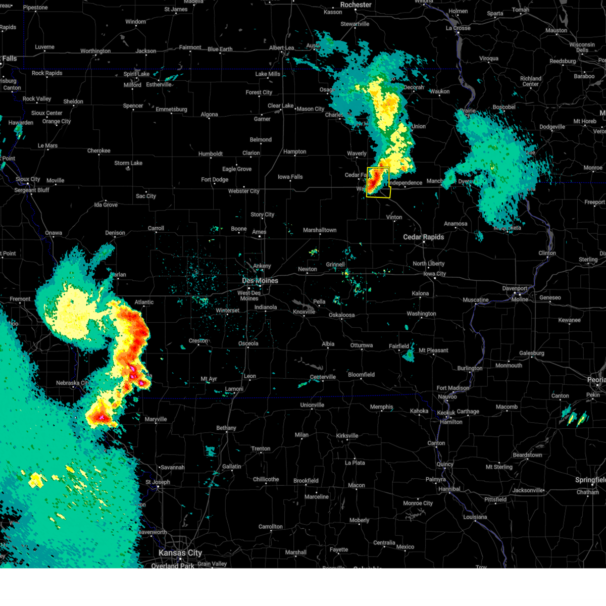 At 743 pm cdt, a severe thunderstorm was located near raymond, or 7 miles east of waterloo, moving east at 30 mph (radar indicated). Hazards include 60 mph wind gusts and quarter size hail. Hail damage to vehicles is expected. expect wind damage to roofs, siding, and trees. locations impacted include, waterloo, evansdale, jesup, elk run heights, crossroads mall, washburn, dunkerton, raymond, and gilbertville. This includes interstate 380 between mile markers 59 and 73. At 743 pm cdt, a severe thunderstorm was located near raymond, or 7 miles east of waterloo, moving east at 30 mph (radar indicated). Hazards include 60 mph wind gusts and quarter size hail. Hail damage to vehicles is expected. expect wind damage to roofs, siding, and trees. locations impacted include, waterloo, evansdale, jesup, elk run heights, crossroads mall, washburn, dunkerton, raymond, and gilbertville. This includes interstate 380 between mile markers 59 and 73.
|
| 5/19/2024 7:14 PM CDT |
 Svrdmx the national weather service in des moines has issued a * severe thunderstorm warning for, black hawk county in northeastern iowa, * until 815 pm cdt. * at 714 pm cdt, a severe thunderstorm was located near uni-dome and mcleod center, or near cedar falls, moving east at 30 mph (radar indicated). Hazards include 60 mph wind gusts and quarter size hail. Hail damage to vehicles is expected. Expect wind damage to roofs, siding, and trees. Svrdmx the national weather service in des moines has issued a * severe thunderstorm warning for, black hawk county in northeastern iowa, * until 815 pm cdt. * at 714 pm cdt, a severe thunderstorm was located near uni-dome and mcleod center, or near cedar falls, moving east at 30 mph (radar indicated). Hazards include 60 mph wind gusts and quarter size hail. Hail damage to vehicles is expected. Expect wind damage to roofs, siding, and trees.
|
| 5/8/2024 10:05 PM CDT |
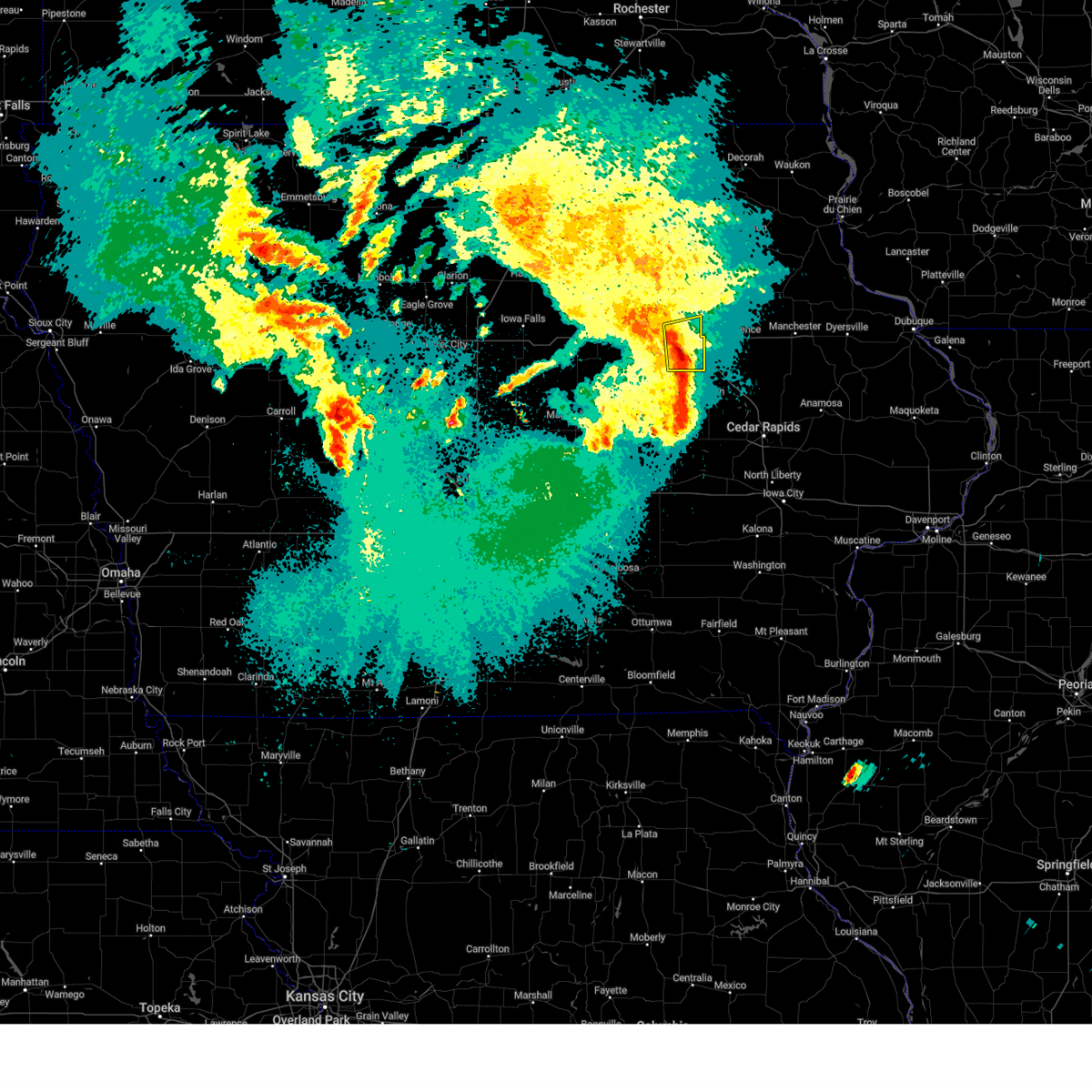 the severe thunderstorm warning has been cancelled and is no longer in effect the severe thunderstorm warning has been cancelled and is no longer in effect
|
| 5/8/2024 10:05 PM CDT |
 At 1005 pm cdt, severe thunderstorms were located along a line extending from elk run heights to near la porte city to dysart, moving east at 25 mph (radar indicated). Hazards include 60 mph wind gusts and quarter size hail. Hail damage to vehicles is expected. expect wind damage to roofs, siding, and trees. locations impacted include, waterloo, evansdale, jesup, la porte city, elk run heights, crossroads mall, washburn, dunkerton, raymond, and gilbertville. This includes interstate 380 between mile markers 56 and 73. At 1005 pm cdt, severe thunderstorms were located along a line extending from elk run heights to near la porte city to dysart, moving east at 25 mph (radar indicated). Hazards include 60 mph wind gusts and quarter size hail. Hail damage to vehicles is expected. expect wind damage to roofs, siding, and trees. locations impacted include, waterloo, evansdale, jesup, la porte city, elk run heights, crossroads mall, washburn, dunkerton, raymond, and gilbertville. This includes interstate 380 between mile markers 56 and 73.
|
| 5/8/2024 9:43 PM CDT |
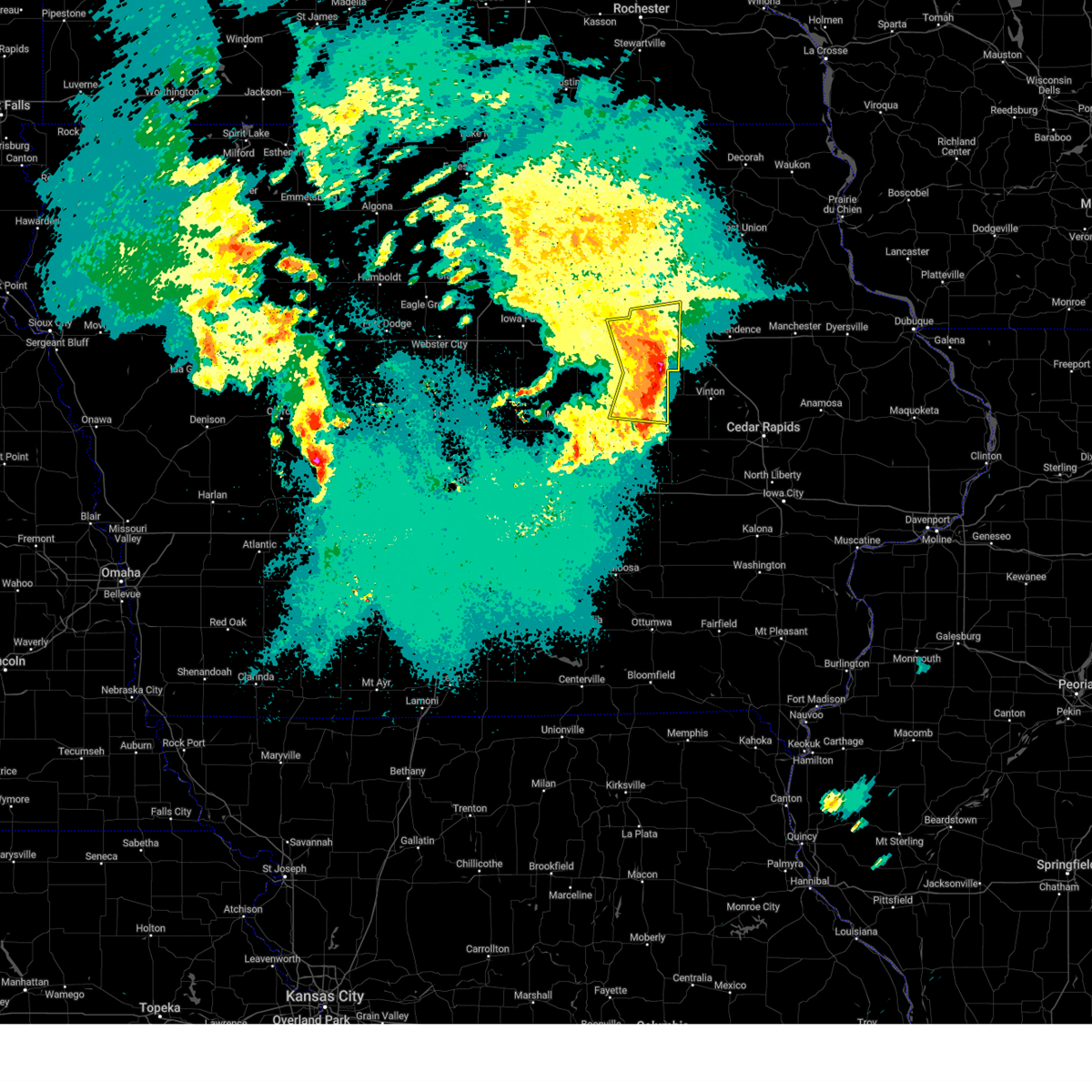 The storm which prompted the warning has moved out of grundy county, as well as western tama and black hawk counties. remember, a severe thunderstorm warning still remains in effect for black hawk county and eastern tama county. The storm which prompted the warning has moved out of grundy county, as well as western tama and black hawk counties. remember, a severe thunderstorm warning still remains in effect for black hawk county and eastern tama county.
|
| 5/8/2024 9:39 PM CDT |
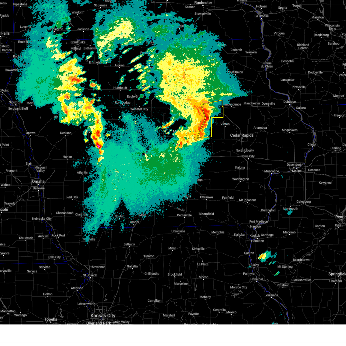 Svrdmx the national weather service in des moines has issued a * severe thunderstorm warning for, black hawk county in northeastern iowa, northeastern tama county in central iowa, * until 1030 pm cdt. * at 939 pm cdt, severe thunderstorms were located along a line extending from hudson to 6 miles northeast of tf clark state park to 4 miles southwest of traer, moving east at 25 mph (radar indicated). Hazards include 60 mph wind gusts and quarter size hail. Hail damage to vehicles is expected. Expect wind damage to roofs, siding, and trees. Svrdmx the national weather service in des moines has issued a * severe thunderstorm warning for, black hawk county in northeastern iowa, northeastern tama county in central iowa, * until 1030 pm cdt. * at 939 pm cdt, severe thunderstorms were located along a line extending from hudson to 6 miles northeast of tf clark state park to 4 miles southwest of traer, moving east at 25 mph (radar indicated). Hazards include 60 mph wind gusts and quarter size hail. Hail damage to vehicles is expected. Expect wind damage to roofs, siding, and trees.
|
| 5/8/2024 9:26 PM CDT |
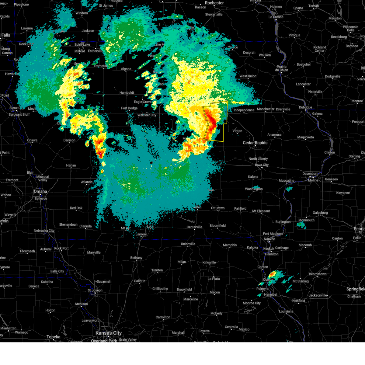 the severe thunderstorm warning has been cancelled and is no longer in effect the severe thunderstorm warning has been cancelled and is no longer in effect
|
| 5/8/2024 9:26 PM CDT |
 At 925 pm cdt, a severe thunderstorm was located over tf clark state park, or 17 miles south of waterloo, moving east at 30 mph (radar indicated). Hazards include 60 mph wind gusts and quarter size hail. Hail damage to vehicles is expected. expect wind damage to roofs, siding, and trees. locations impacted include, waterloo, cedar falls, evansdale, hudson, traer, reinbeck, dysart, dike, elk run heights, waterloo municipal airport, crossroads mall, uni-dome and mcleod center, washburn, raymond, garwin, clutier, tf clark state park, and george wyth state park. This includes interstate 380 between mile markers 68 and 73. At 925 pm cdt, a severe thunderstorm was located over tf clark state park, or 17 miles south of waterloo, moving east at 30 mph (radar indicated). Hazards include 60 mph wind gusts and quarter size hail. Hail damage to vehicles is expected. expect wind damage to roofs, siding, and trees. locations impacted include, waterloo, cedar falls, evansdale, hudson, traer, reinbeck, dysart, dike, elk run heights, waterloo municipal airport, crossroads mall, uni-dome and mcleod center, washburn, raymond, garwin, clutier, tf clark state park, and george wyth state park. This includes interstate 380 between mile markers 68 and 73.
|
| 5/8/2024 8:53 PM CDT |
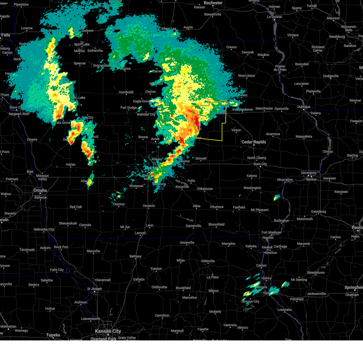 Svrdmx the national weather service in des moines has issued a * severe thunderstorm warning for, northeastern marshall county in central iowa, black hawk county in northeastern iowa, northern tama county in central iowa, grundy county in central iowa, * until 945 pm cdt. * at 853 pm cdt, a severe thunderstorm was located over lincoln, or 8 miles south of grundy center, moving east at 30 mph (radar indicated). Hazards include 60 mph wind gusts and quarter size hail. Hail damage to vehicles is expected. Expect wind damage to roofs, siding, and trees. Svrdmx the national weather service in des moines has issued a * severe thunderstorm warning for, northeastern marshall county in central iowa, black hawk county in northeastern iowa, northern tama county in central iowa, grundy county in central iowa, * until 945 pm cdt. * at 853 pm cdt, a severe thunderstorm was located over lincoln, or 8 miles south of grundy center, moving east at 30 mph (radar indicated). Hazards include 60 mph wind gusts and quarter size hail. Hail damage to vehicles is expected. Expect wind damage to roofs, siding, and trees.
|
| 4/16/2024 2:25 PM CDT |
 At 224 pm cdt, a severe thunderstorm was located 5 miles east of plainfield, or 10 miles north of waverly, moving northeast at 50 mph (radar indicated). Hazards include 60 mph wind gusts. Expect damage to roofs, siding, and trees. locations impacted include, waterloo, cedar falls, waverly, allison, evansdale, hudson, sumner, denver, clarksville, tripoli, shell rock, greene, waterloo municipal airport, crossroads mall, uni-dome and mcleod center, janesville, readlyn, new hartford, plainfield, and frederika. This includes interstate 380 between mile markers 72 and 73. At 224 pm cdt, a severe thunderstorm was located 5 miles east of plainfield, or 10 miles north of waverly, moving northeast at 50 mph (radar indicated). Hazards include 60 mph wind gusts. Expect damage to roofs, siding, and trees. locations impacted include, waterloo, cedar falls, waverly, allison, evansdale, hudson, sumner, denver, clarksville, tripoli, shell rock, greene, waterloo municipal airport, crossroads mall, uni-dome and mcleod center, janesville, readlyn, new hartford, plainfield, and frederika. This includes interstate 380 between mile markers 72 and 73.
|
| 4/16/2024 2:05 PM CDT |
 Svrdmx the national weather service in des moines has issued a * severe thunderstorm warning for, western black hawk county in northeastern iowa, bremer county in northeastern iowa, northern grundy county in central iowa, butler county in north central iowa, * until 245 pm cdt. * at 204 pm cdt, a severe thunderstorm was located near new hartford, or 8 miles southwest of waverly, moving northeast at 50 mph (radar indicated). Hazards include 60 mph wind gusts. expect damage to roofs, siding, and trees Svrdmx the national weather service in des moines has issued a * severe thunderstorm warning for, western black hawk county in northeastern iowa, bremer county in northeastern iowa, northern grundy county in central iowa, butler county in north central iowa, * until 245 pm cdt. * at 204 pm cdt, a severe thunderstorm was located near new hartford, or 8 miles southwest of waverly, moving northeast at 50 mph (radar indicated). Hazards include 60 mph wind gusts. expect damage to roofs, siding, and trees
|
| 7/28/2023 7:18 PM CDT |
 At 717 pm cdt, a severe thunderstorm was located over lincoln, or 8 miles southeast of grundy center, moving southeast at 25 mph (trained weather spotters). Hazards include 60 mph wind gusts and quarter size hail. Hail damage to vehicles is expected. Expect wind damage to roofs, siding, and trees. At 717 pm cdt, a severe thunderstorm was located over lincoln, or 8 miles southeast of grundy center, moving southeast at 25 mph (trained weather spotters). Hazards include 60 mph wind gusts and quarter size hail. Hail damage to vehicles is expected. Expect wind damage to roofs, siding, and trees.
|
| 7/15/2023 6:45 PM CDT |
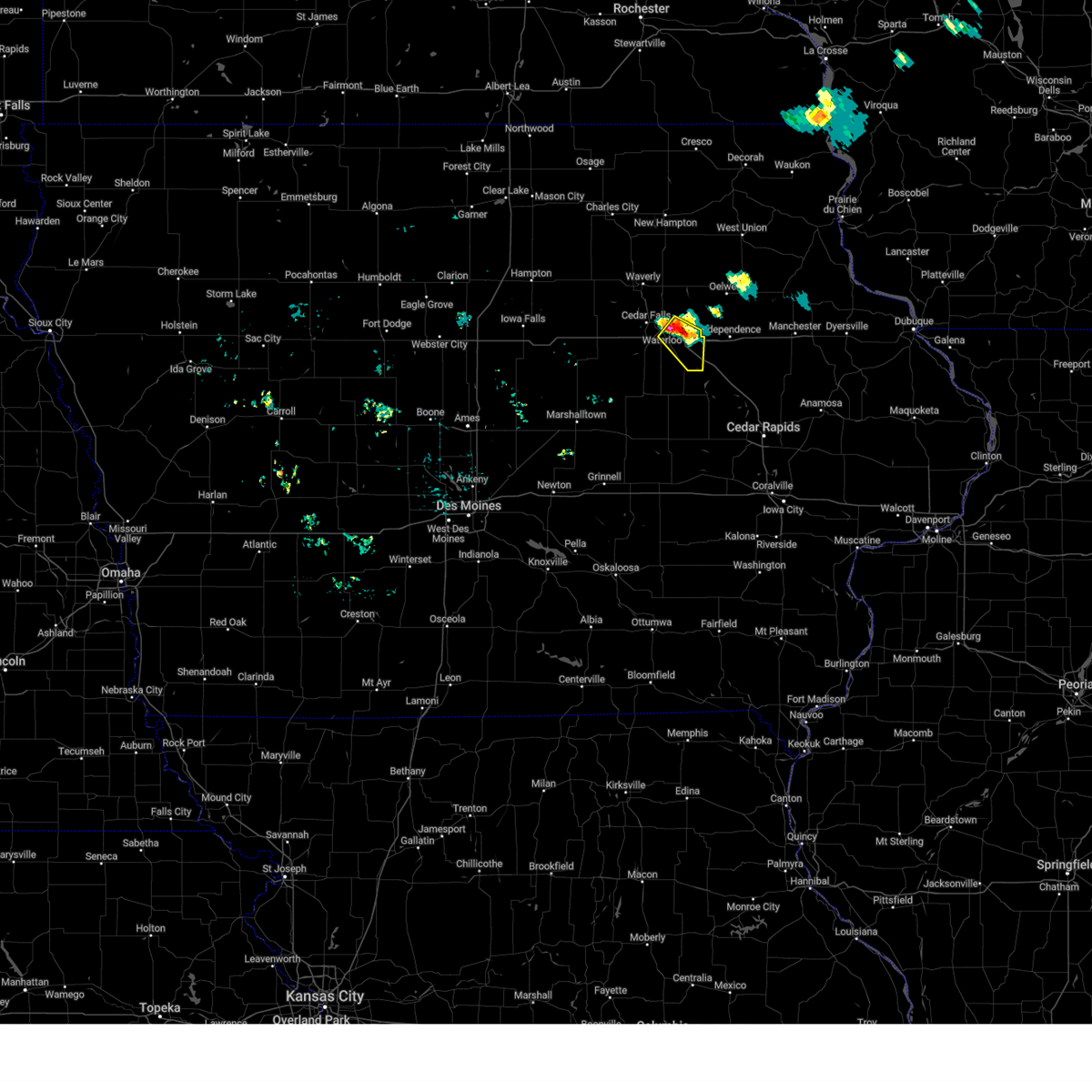 At 644 pm cdt, a severe thunderstorm was located near elk run heights, or 5 miles east of waterloo, moving southeast at 20 mph (radar indicated). Hazards include 60 mph wind gusts and quarter size hail. Hail damage to vehicles is expected. expect wind damage to roofs, siding, and trees. this severe thunderstorm will be near, washburn and raymond around 655 pm cdt. gilbertville around 700 pm cdt. other locations in the path of this severe thunderstorm include jesup. this includes interstate 380 between mile markers 56 and 73. hail threat, radar indicated max hail size, 1. 00 in wind threat, radar indicated max wind gust, 60 mph. At 644 pm cdt, a severe thunderstorm was located near elk run heights, or 5 miles east of waterloo, moving southeast at 20 mph (radar indicated). Hazards include 60 mph wind gusts and quarter size hail. Hail damage to vehicles is expected. expect wind damage to roofs, siding, and trees. this severe thunderstorm will be near, washburn and raymond around 655 pm cdt. gilbertville around 700 pm cdt. other locations in the path of this severe thunderstorm include jesup. this includes interstate 380 between mile markers 56 and 73. hail threat, radar indicated max hail size, 1. 00 in wind threat, radar indicated max wind gust, 60 mph.
|
| 7/15/2023 6:00 PM CDT |
 At 559 pm cdt, a severe thunderstorm was located near waverly, moving southeast at 30 mph (radar indicated). Hazards include 60 mph wind gusts and quarter size hail. Hail damage to vehicles is expected. expect wind damage to roofs, siding, and trees. this severe thunderstorm will be near, denver around 610 pm cdt. readlyn around 615 pm cdt. other locations in the path of this severe thunderstorm include dunkerton. hail threat, radar indicated max hail size, 1. 00 in wind threat, radar indicated max wind gust, 60 mph. At 559 pm cdt, a severe thunderstorm was located near waverly, moving southeast at 30 mph (radar indicated). Hazards include 60 mph wind gusts and quarter size hail. Hail damage to vehicles is expected. expect wind damage to roofs, siding, and trees. this severe thunderstorm will be near, denver around 610 pm cdt. readlyn around 615 pm cdt. other locations in the path of this severe thunderstorm include dunkerton. hail threat, radar indicated max hail size, 1. 00 in wind threat, radar indicated max wind gust, 60 mph.
|
| 6/25/2023 1:03 AM CDT | Golf Ball sized hail reported 3.7 miles ENE of Waterloo, IA, report from mping: golf ball (1.75 in.). |
| 6/25/2023 12:55 AM CDT | Baseball sized hail reported 2.5 miles ENE of Waterloo, IA, from kwwl tv viewer. |
| 6/25/2023 12:55 AM CDT | Tea Cup sized hail reported 2.2 miles NNW of Waterloo, IA |
| 6/25/2023 12:52 AM CDT | Golf Ball sized hail reported 2.5 miles ENE of Waterloo, IA |
| 6/25/2023 12:50 AM CDT | Ping Pong Ball sized hail reported 1.7 miles ESE of Waterloo, IA |
| 6/25/2023 12:48 AM CDT | Golf Ball sized hail reported 0.9 miles E of Waterloo, IA, report from mping: golf ball (1.75 in.). |
| 6/25/2023 12:40 AM CDT |
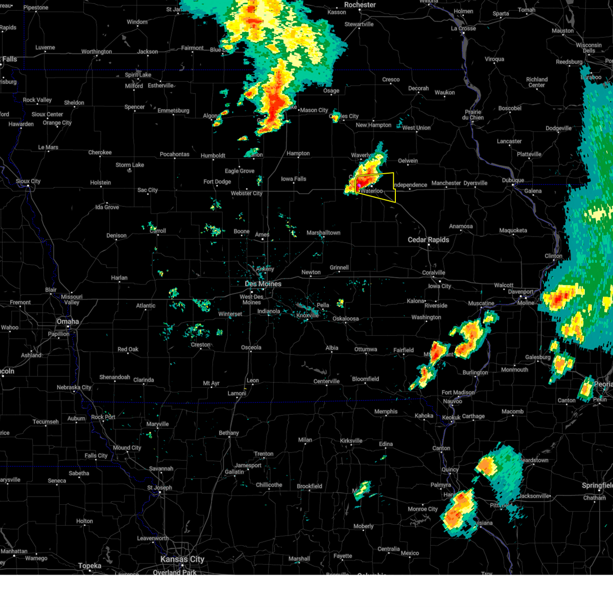 At 1240 am cdt, a severe thunderstorm was located over cedar falls, moving east at 35 mph (radar indicated). Hazards include 60 mph wind gusts and half dollar size hail. Hail damage to vehicles is expected. expect wind damage to roofs, siding, and trees. locations impacted include, waterloo, cedar falls, evansdale, jesup, hudson, elk run heights, waterloo municipal airport, crossroads mall, uni-dome and mcleod center, washburn, dunkerton, raymond, gilbertville and george wyth state park. this includes interstate 380 between mile markers 57 and 73. hail threat, radar indicated max hail size, 1. 25 in wind threat, radar indicated max wind gust, 60 mph. At 1240 am cdt, a severe thunderstorm was located over cedar falls, moving east at 35 mph (radar indicated). Hazards include 60 mph wind gusts and half dollar size hail. Hail damage to vehicles is expected. expect wind damage to roofs, siding, and trees. locations impacted include, waterloo, cedar falls, evansdale, jesup, hudson, elk run heights, waterloo municipal airport, crossroads mall, uni-dome and mcleod center, washburn, dunkerton, raymond, gilbertville and george wyth state park. this includes interstate 380 between mile markers 57 and 73. hail threat, radar indicated max hail size, 1. 25 in wind threat, radar indicated max wind gust, 60 mph.
|
| 6/25/2023 12:30 AM CDT |
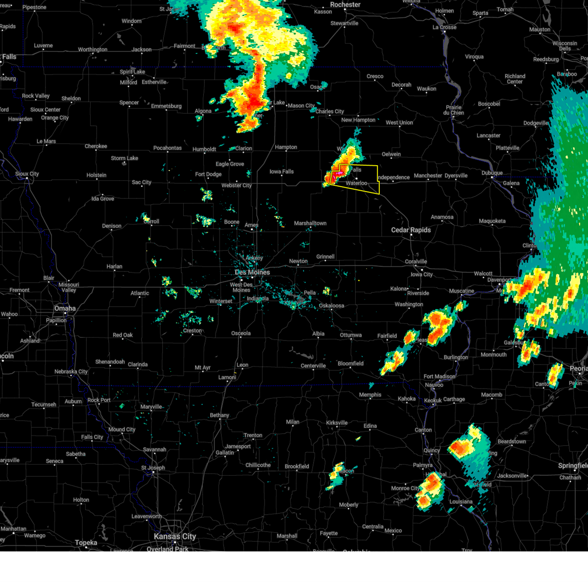 At 1230 am cdt, a severe thunderstorm was located near uni-dome and mcleod center, or near cedar falls, moving east at 35 mph (radar indicated). Hazards include 60 mph wind gusts and quarter size hail. Hail damage to vehicles is expected. Expect wind damage to roofs, siding, and trees. At 1230 am cdt, a severe thunderstorm was located near uni-dome and mcleod center, or near cedar falls, moving east at 35 mph (radar indicated). Hazards include 60 mph wind gusts and quarter size hail. Hail damage to vehicles is expected. Expect wind damage to roofs, siding, and trees.
|
| 6/24/2023 4:58 PM CDT |
 At 457 pm cdt, a severe thunderstorm was located over denver, or 5 miles southeast of waverly, moving northeast at 30 mph (radar indicated). Hazards include 60 mph wind gusts and half dollar size hail. Hail damage to vehicles is expected. expect wind damage to roofs, siding, and trees. this severe thunderstorm will be near, denver around 500 pm cdt. readlyn around 510 pm cdt. tripoli around 515 pm cdt. other locations in the path of this severe thunderstorm include sumner. hail threat, radar indicated max hail size, 1. 25 in wind threat, radar indicated max wind gust, 60 mph. At 457 pm cdt, a severe thunderstorm was located over denver, or 5 miles southeast of waverly, moving northeast at 30 mph (radar indicated). Hazards include 60 mph wind gusts and half dollar size hail. Hail damage to vehicles is expected. expect wind damage to roofs, siding, and trees. this severe thunderstorm will be near, denver around 500 pm cdt. readlyn around 510 pm cdt. tripoli around 515 pm cdt. other locations in the path of this severe thunderstorm include sumner. hail threat, radar indicated max hail size, 1. 25 in wind threat, radar indicated max wind gust, 60 mph.
|
| 8/19/2022 4:10 PM CDT |
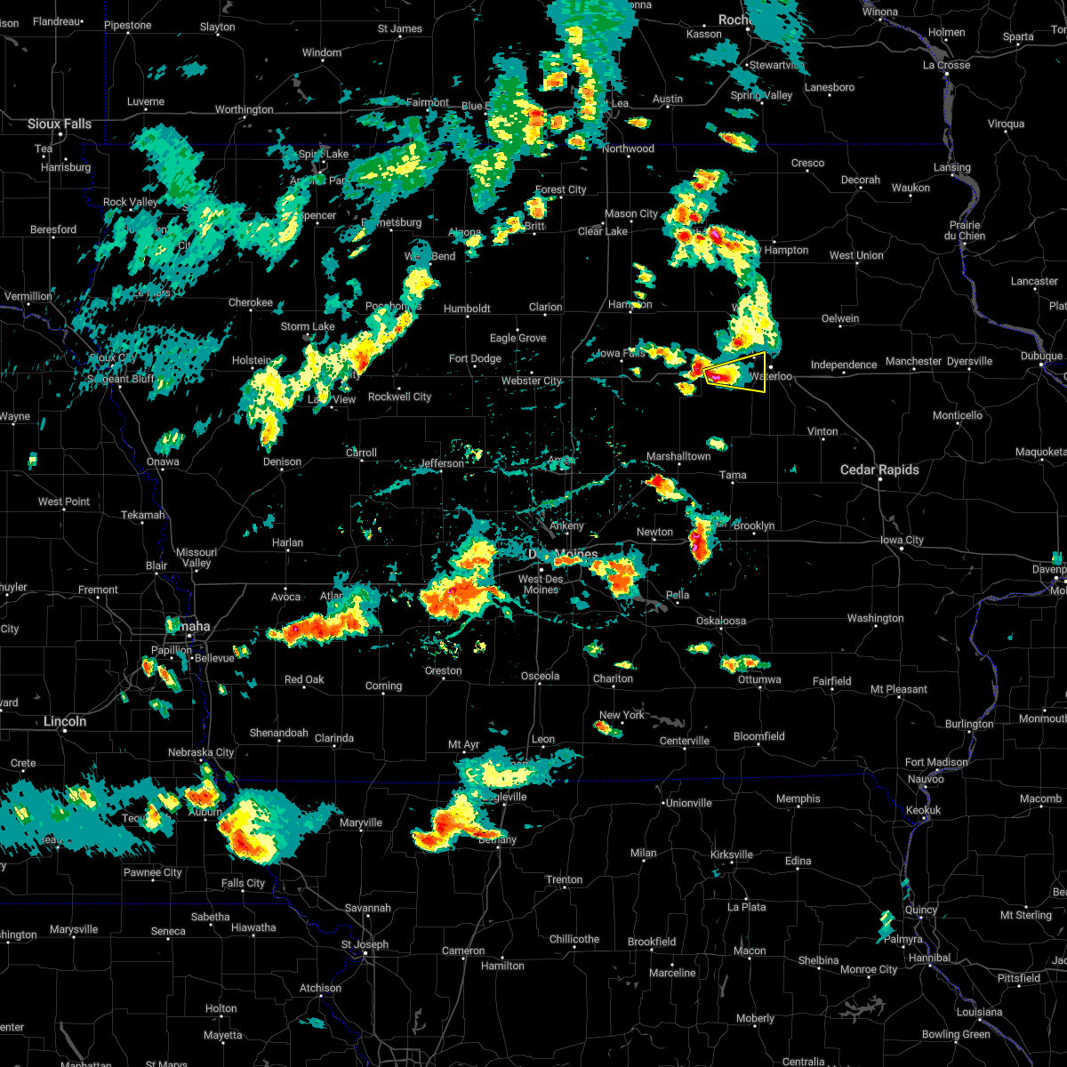 At 410 pm cdt, a severe thunderstorm was located over dike, or 8 miles northeast of grundy center, moving east at 20 mph (trained weather spotters). Hazards include half dollar size hail. Damage to vehicles is expected. locations impacted include, waterloo, cedar falls, hudson, dike, waterloo municipal airport, uni-dome and mcleod center and george wyth state park. hail threat, observed max hail size, 1. 25 in wind threat, radar indicated max wind gust, <50 mph. At 410 pm cdt, a severe thunderstorm was located over dike, or 8 miles northeast of grundy center, moving east at 20 mph (trained weather spotters). Hazards include half dollar size hail. Damage to vehicles is expected. locations impacted include, waterloo, cedar falls, hudson, dike, waterloo municipal airport, uni-dome and mcleod center and george wyth state park. hail threat, observed max hail size, 1. 25 in wind threat, radar indicated max wind gust, <50 mph.
|
| 8/19/2022 3:55 PM CDT |
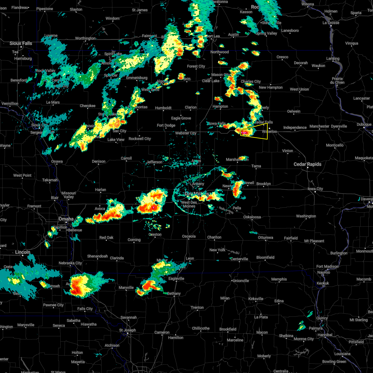 At 354 pm cdt, a severe thunderstorm was located near holland or 5 miles north of grundy center, moving east at 20 mph (radar indicated). Hazards include half dollar size hail. damage to vehicles is expected At 354 pm cdt, a severe thunderstorm was located near holland or 5 miles north of grundy center, moving east at 20 mph (radar indicated). Hazards include half dollar size hail. damage to vehicles is expected
|
| 7/5/2022 8:57 PM CDT |
 The severe thunderstorm warning for black hawk, bremer, northeastern grundy and southeastern butler counties will expire at 900 pm cdt, the storms which prompted the warning have moved out of the area. therefore, the warning will be allowed to expire. a severe thunderstorm watch remains in effect until 1000 pm cdt for central, north central and northeastern iowa. The severe thunderstorm warning for black hawk, bremer, northeastern grundy and southeastern butler counties will expire at 900 pm cdt, the storms which prompted the warning have moved out of the area. therefore, the warning will be allowed to expire. a severe thunderstorm watch remains in effect until 1000 pm cdt for central, north central and northeastern iowa.
|
| 7/5/2022 8:24 PM CDT |
 At 824 pm cdt, severe thunderstorms were located along a line extending from 6 miles northwest of tripoli to near reinbeck, moving east at 50 mph (radar indicated). Hazards include 60 mph wind gusts. expect damage to roofs, siding, and trees At 824 pm cdt, severe thunderstorms were located along a line extending from 6 miles northwest of tripoli to near reinbeck, moving east at 50 mph (radar indicated). Hazards include 60 mph wind gusts. expect damage to roofs, siding, and trees
|
| 7/5/2022 8:10 PM CDT |
 At 810 pm cdt, severe thunderstorms were located along a line extending from near nashua to near conrad, moving east at 40 mph (radar indicated). Hazards include 60 mph wind gusts. Expect damage to roofs, siding, and trees. locations impacted include, waterloo, cedar falls, waverly, grundy center, allison, evansdale, jesup, la porte city, hudson, sumner, parkersburg, denver, reinbeck, clarksville, tripoli, shell rock, dike, aplington, elk run heights and conrad. hail threat, radar indicated max hail size, <. 75 in wind threat, radar indicated max wind gust, 60 mph. At 810 pm cdt, severe thunderstorms were located along a line extending from near nashua to near conrad, moving east at 40 mph (radar indicated). Hazards include 60 mph wind gusts. Expect damage to roofs, siding, and trees. locations impacted include, waterloo, cedar falls, waverly, grundy center, allison, evansdale, jesup, la porte city, hudson, sumner, parkersburg, denver, reinbeck, clarksville, tripoli, shell rock, dike, aplington, elk run heights and conrad. hail threat, radar indicated max hail size, <. 75 in wind threat, radar indicated max wind gust, 60 mph.
|
| 7/5/2022 7:31 PM CDT |
 At 730 pm cdt, severe thunderstorms were located along a line extending from 7 miles east of sheffield to 11 miles northeast of roland, moving east at 40 mph (radar indicated). Hazards include 60 mph wind gusts. expect damage to roofs, siding, and trees At 730 pm cdt, severe thunderstorms were located along a line extending from 7 miles east of sheffield to 11 miles northeast of roland, moving east at 40 mph (radar indicated). Hazards include 60 mph wind gusts. expect damage to roofs, siding, and trees
|
| 6/15/2022 3:41 AM CDT |
 The severe thunderstorm warning for black hawk and bremer counties will expire at 345 am cdt, the storm which prompted the warning has weakened below severe limits, and no longer poses an immediate threat to life or property. therefore, the warning will be allowed to expire. however gusty winds and heavy rain are still possible with this thunderstorm. a severe thunderstorm watch remains in effect until 400 am cdt for northeastern iowa. The severe thunderstorm warning for black hawk and bremer counties will expire at 345 am cdt, the storm which prompted the warning has weakened below severe limits, and no longer poses an immediate threat to life or property. therefore, the warning will be allowed to expire. however gusty winds and heavy rain are still possible with this thunderstorm. a severe thunderstorm watch remains in effect until 400 am cdt for northeastern iowa.
|
| 6/15/2022 3:27 AM CDT |
 At 327 am cdt, a severe thunderstorm was located near waterloo municipal airport, or near waterloo, moving northeast at 30 mph (radar indicated). Hazards include 60 mph wind gusts and quarter size hail. Hail damage to vehicles is expected. expect wind damage to roofs, siding, and trees. locations impacted include, waterloo, cedar falls, waverly, evansdale, jesup, hudson, sumner, denver, tripoli, elk run heights, crossroads mall, waterloo municipal airport, uni-dome and mcleod center, janesville, washburn, dunkerton, readlyn, raymond, gilbertville and george wyth state park. hail threat, radar indicated max hail size, 1. 00 in wind threat, radar indicated max wind gust, 60 mph. At 327 am cdt, a severe thunderstorm was located near waterloo municipal airport, or near waterloo, moving northeast at 30 mph (radar indicated). Hazards include 60 mph wind gusts and quarter size hail. Hail damage to vehicles is expected. expect wind damage to roofs, siding, and trees. locations impacted include, waterloo, cedar falls, waverly, evansdale, jesup, hudson, sumner, denver, tripoli, elk run heights, crossroads mall, waterloo municipal airport, uni-dome and mcleod center, janesville, washburn, dunkerton, readlyn, raymond, gilbertville and george wyth state park. hail threat, radar indicated max hail size, 1. 00 in wind threat, radar indicated max wind gust, 60 mph.
|
| 6/15/2022 3:04 AM CDT |
 At 304 am cdt, a severe thunderstorm was located over uni-dome and mcleod center, or near cedar falls, moving northeast at 40 mph (radar indicated). Hazards include ping pong ball size hail and 60 mph wind gusts. People and animals outdoors will be injured. expect hail damage to roofs, siding, windows, and vehicles. expect wind damage to roofs, siding, and trees. locations impacted include, waterloo, cedar falls, waverly, evansdale, jesup, hudson, sumner, parkersburg, denver, tripoli, dike, elk run heights, crossroads mall, waterloo municipal airport, uni-dome and mcleod center, janesville, washburn, dunkerton, readlyn and raymond. hail threat, radar indicated max hail size, 1. 50 in wind threat, radar indicated max wind gust, 60 mph. At 304 am cdt, a severe thunderstorm was located over uni-dome and mcleod center, or near cedar falls, moving northeast at 40 mph (radar indicated). Hazards include ping pong ball size hail and 60 mph wind gusts. People and animals outdoors will be injured. expect hail damage to roofs, siding, windows, and vehicles. expect wind damage to roofs, siding, and trees. locations impacted include, waterloo, cedar falls, waverly, evansdale, jesup, hudson, sumner, parkersburg, denver, tripoli, dike, elk run heights, crossroads mall, waterloo municipal airport, uni-dome and mcleod center, janesville, washburn, dunkerton, readlyn and raymond. hail threat, radar indicated max hail size, 1. 50 in wind threat, radar indicated max wind gust, 60 mph.
|
| 6/15/2022 2:54 AM CDT |
 At 254 am cdt, a severe thunderstorm was located over dike, or 8 miles west of cedar falls, moving northeast at 45 mph (radar indicated). Hazards include 60 mph wind gusts and quarter size hail. Hail damage to vehicles is expected. Expect wind damage to roofs, siding, and trees. At 254 am cdt, a severe thunderstorm was located over dike, or 8 miles west of cedar falls, moving northeast at 45 mph (radar indicated). Hazards include 60 mph wind gusts and quarter size hail. Hail damage to vehicles is expected. Expect wind damage to roofs, siding, and trees.
|
| 4/23/2022 9:00 PM CDT |
 At 900 pm cdt, severe thunderstorms were located along a line extending from near waverly to near waterloo municipal airport to crossroads mall, moving east at 70 mph (marshalltown asos). Hazards include 60 mph wind gusts. Expect damage to roofs, siding, and trees. locations impacted include, waterloo, cedar falls, evansdale, jesup, la porte city, sumner, denver, tripoli, elk run heights, crossroads mall, waterloo municipal airport, janesville, washburn, dunkerton, readlyn, raymond, gilbertville and george wyth state park. hail threat, radar indicated max hail size, <. 75 in wind threat, radar indicated max wind gust, 60 mph. At 900 pm cdt, severe thunderstorms were located along a line extending from near waverly to near waterloo municipal airport to crossroads mall, moving east at 70 mph (marshalltown asos). Hazards include 60 mph wind gusts. Expect damage to roofs, siding, and trees. locations impacted include, waterloo, cedar falls, evansdale, jesup, la porte city, sumner, denver, tripoli, elk run heights, crossroads mall, waterloo municipal airport, janesville, washburn, dunkerton, readlyn, raymond, gilbertville and george wyth state park. hail threat, radar indicated max hail size, <. 75 in wind threat, radar indicated max wind gust, 60 mph.
|
| 4/23/2022 8:38 PM CDT |
 At 837 pm cdt, severe thunderstorms were located along a line extending from near grundy center to near reinbeck to 9 miles north of meskwaki casino, moving northeast at 75 mph (marshalltown asos). Hazards include 60 mph wind gusts. expect damage to roofs, siding, and trees At 837 pm cdt, severe thunderstorms were located along a line extending from near grundy center to near reinbeck to 9 miles north of meskwaki casino, moving northeast at 75 mph (marshalltown asos). Hazards include 60 mph wind gusts. expect damage to roofs, siding, and trees
|
| 12/15/2021 11:17 PM CST | Waterloo aso in black hawk county IA, 6.9 miles SE of Waterloo, IA |
| 12/15/2021 10:37 PM CST | Waterloo aso in black hawk county IA, 6.9 miles SE of Waterloo, IA |
| 12/15/2021 7:44 PM CST |
 At 743 pm cst, severe thunderstorms were located along a line extending from near shell rock to near belle plaine, moving northeast at 75 mph (trained weather spotters). Hazards include 70 mph wind gusts. Expect considerable tree damage. damage is likely to mobile homes, roofs, and outbuildings. severe thunderstorms will be near, waverly around 750 pm cst. This includes interstate 380 between mile markers 56 and 73. At 743 pm cst, severe thunderstorms were located along a line extending from near shell rock to near belle plaine, moving northeast at 75 mph (trained weather spotters). Hazards include 70 mph wind gusts. Expect considerable tree damage. damage is likely to mobile homes, roofs, and outbuildings. severe thunderstorms will be near, waverly around 750 pm cst. This includes interstate 380 between mile markers 56 and 73.
|
| 12/15/2021 7:36 PM CST | Waterloo municipal airport asos recorded 54 kt wind gus in black hawk county IA, 6.9 miles SE of Waterloo, IA |
| 12/15/2021 7:34 PM CST | Storm damage reported in black hawk county IA, 6.9 miles SE of Waterloo, IA |
| 12/15/2021 6:30 PM CST |
 At 629 pm cst, severe thunderstorms were located along a line extending from near easton to 9 miles north of grinnell, moving northeast at 110 mph (radar indicated). Hazards include 70 mph wind gusts. Expect considerable tree damage. damage is likely to mobile homes, roofs, and outbuildings. severe thunderstorms will be near, toledo and tama around 635 pm cst. dysart around 645 pm cst. this includes the following highways, interstate 35 between mile markers 178 and 218. interstate 380 between mile markers 56 and 73. thunderstorm damage threat, considerable hail threat, radar indicated max hail size, <. 75 in wind threat, radar indicated max wind gust, 70 mph. At 629 pm cst, severe thunderstorms were located along a line extending from near easton to 9 miles north of grinnell, moving northeast at 110 mph (radar indicated). Hazards include 70 mph wind gusts. Expect considerable tree damage. damage is likely to mobile homes, roofs, and outbuildings. severe thunderstorms will be near, toledo and tama around 635 pm cst. dysart around 645 pm cst. this includes the following highways, interstate 35 between mile markers 178 and 218. interstate 380 between mile markers 56 and 73. thunderstorm damage threat, considerable hail threat, radar indicated max hail size, <. 75 in wind threat, radar indicated max wind gust, 70 mph.
|
| 8/24/2021 4:58 PM CDT |
 The severe thunderstorm warning for northeastern poweshiek, marshall, southwestern black hawk, tama and central grundy counties will expire at 500 pm cdt, the storm which prompted the warning has moved out of the area. therefore, the warning will be allowed to expire. however small hail and gusty winds are still possible with this thunderstorm. a severe thunderstorm watch remains in effect until 700 pm cdt for central and northeastern iowa. The severe thunderstorm warning for northeastern poweshiek, marshall, southwestern black hawk, tama and central grundy counties will expire at 500 pm cdt, the storm which prompted the warning has moved out of the area. therefore, the warning will be allowed to expire. however small hail and gusty winds are still possible with this thunderstorm. a severe thunderstorm watch remains in effect until 700 pm cdt for central and northeastern iowa.
|
| 8/24/2021 4:35 PM CDT |
 At 434 pm cdt, a severe thunderstorm was located over traer, or 17 miles northeast of toledo, moving east at 50 mph (radar indicated). Hazards include 60 mph wind gusts and quarter size hail. Hail damage to vehicles is expected. expect wind damage to roofs, siding, and trees. locations impacted include, waterloo, cedar falls, marshalltown, grundy center, toledo, evansdale, tama, hudson, traer, reinbeck, dysart, dike, conrad, meskwaki casino, crossroads mall, gladbrook, le grand, victor, garwin and gilman. hail threat, radar indicated max hail size, 1. 00 in wind threat, radar indicated max wind gust, 60 mph. At 434 pm cdt, a severe thunderstorm was located over traer, or 17 miles northeast of toledo, moving east at 50 mph (radar indicated). Hazards include 60 mph wind gusts and quarter size hail. Hail damage to vehicles is expected. expect wind damage to roofs, siding, and trees. locations impacted include, waterloo, cedar falls, marshalltown, grundy center, toledo, evansdale, tama, hudson, traer, reinbeck, dysart, dike, conrad, meskwaki casino, crossroads mall, gladbrook, le grand, victor, garwin and gilman. hail threat, radar indicated max hail size, 1. 00 in wind threat, radar indicated max wind gust, 60 mph.
|
| 8/24/2021 4:03 PM CDT |
 At 402 pm cdt, a severe thunderstorm was located near conrad, or 9 miles southeast of eldora, moving east at 50 mph (radar indicated). Hazards include 60 mph wind gusts and quarter size hail. Hail damage to vehicles is expected. Expect wind damage to roofs, siding, and trees. At 402 pm cdt, a severe thunderstorm was located near conrad, or 9 miles southeast of eldora, moving east at 50 mph (radar indicated). Hazards include 60 mph wind gusts and quarter size hail. Hail damage to vehicles is expected. Expect wind damage to roofs, siding, and trees.
|
| 8/24/2021 2:49 PM CDT |
 At 248 pm cdt, a severe thunderstorm was located over independence, moving southeast at 45 mph (radar indicated. this storm has a history of producing 60 mph near waterloo, and causing tree damage near tripoli). Hazards include 60 mph wind gusts and quarter size hail. Hail damage to vehicles is expected. expect wind damage to roofs, siding, and trees. locations impacted include, waterloo, evansdale, jesup, sumner, denver, tripoli, elk run heights, crossroads mall, washburn, dunkerton, readlyn, raymond, gilbertville and frederika. hail threat, radar indicated max hail size, 1. 00 in wind threat, radar indicated max wind gust, 60 mph. At 248 pm cdt, a severe thunderstorm was located over independence, moving southeast at 45 mph (radar indicated. this storm has a history of producing 60 mph near waterloo, and causing tree damage near tripoli). Hazards include 60 mph wind gusts and quarter size hail. Hail damage to vehicles is expected. expect wind damage to roofs, siding, and trees. locations impacted include, waterloo, evansdale, jesup, sumner, denver, tripoli, elk run heights, crossroads mall, washburn, dunkerton, readlyn, raymond, gilbertville and frederika. hail threat, radar indicated max hail size, 1. 00 in wind threat, radar indicated max wind gust, 60 mph.
|
| 8/24/2021 2:30 PM CDT | Tree limbs & a few power lines downed. ponding observed on area roadway in black hawk county IA, 1.7 miles ESE of Waterloo, IA |
| 8/24/2021 2:28 PM CDT |
 At 227 pm cdt, a severe thunderstorm was located near elk run heights, or 8 miles northeast of waterloo, moving east at 65 mph (waterloo asos reported a 61 mph gust). Hazards include 60 mph wind gusts and quarter size hail. Hail damage to vehicles is expected. expect wind damage to roofs, siding, and trees. this severe thunderstorm will remain over mainly rural areas of black hawk and bremer counties, including the following locations, janesville, raymond, plainfield, dunkerton, washburn, george wyth state park, waverly municipal airport, readlyn, frederika and gilbertville. hail threat, radar indicated max hail size, 1. 00 in wind threat, observed max wind gust, 60 mph. At 227 pm cdt, a severe thunderstorm was located near elk run heights, or 8 miles northeast of waterloo, moving east at 65 mph (waterloo asos reported a 61 mph gust). Hazards include 60 mph wind gusts and quarter size hail. Hail damage to vehicles is expected. expect wind damage to roofs, siding, and trees. this severe thunderstorm will remain over mainly rural areas of black hawk and bremer counties, including the following locations, janesville, raymond, plainfield, dunkerton, washburn, george wyth state park, waverly municipal airport, readlyn, frederika and gilbertville. hail threat, radar indicated max hail size, 1. 00 in wind threat, observed max wind gust, 60 mph.
|
| 8/24/2021 2:19 PM CDT | Storm damage reported in black hawk county IA, 6.4 miles SE of Waterloo, IA |
| 8/24/2021 1:53 PM CDT |
 At 153 pm cdt, a severe thunderstorm was located over shell rock, or 7 miles west of waverly, moving southeast at 45 mph (radar indicated). Hazards include 60 mph wind gusts and quarter size hail. Hail damage to vehicles is expected. expect wind damage to roofs, siding, and trees. this severe thunderstorm will be near, waverly around 200 pm cdt. cedar falls and denver around 210 pm cdt. other locations in the path of this severe thunderstorm include waterloo municipal airport, waterloo, evansdale, elk run heights and jesup. this includes interstate 380 between mile markers 58 and 73. hail threat, radar indicated max hail size, 1. 00 in wind threat, radar indicated max wind gust, 60 mph. At 153 pm cdt, a severe thunderstorm was located over shell rock, or 7 miles west of waverly, moving southeast at 45 mph (radar indicated). Hazards include 60 mph wind gusts and quarter size hail. Hail damage to vehicles is expected. expect wind damage to roofs, siding, and trees. this severe thunderstorm will be near, waverly around 200 pm cdt. cedar falls and denver around 210 pm cdt. other locations in the path of this severe thunderstorm include waterloo municipal airport, waterloo, evansdale, elk run heights and jesup. this includes interstate 380 between mile markers 58 and 73. hail threat, radar indicated max hail size, 1. 00 in wind threat, radar indicated max wind gust, 60 mph.
|
| 8/10/2021 2:11 PM CDT |
 At 211 pm cdt, a severe thunderstorm was located near tripoli, or near waverly, moving east at 30 mph (emergency management. half to one inch hail reported north of waverly at 207 pm). Hazards include 60 mph wind gusts and quarter size hail. Hail damage to vehicles is expected. expect wind damage to roofs, siding, and trees. locations impacted include, tripoli. hail threat, observed max hail size, 1. 00 in wind threat, radar indicated max wind gust, 60 mph. At 211 pm cdt, a severe thunderstorm was located near tripoli, or near waverly, moving east at 30 mph (emergency management. half to one inch hail reported north of waverly at 207 pm). Hazards include 60 mph wind gusts and quarter size hail. Hail damage to vehicles is expected. expect wind damage to roofs, siding, and trees. locations impacted include, tripoli. hail threat, observed max hail size, 1. 00 in wind threat, radar indicated max wind gust, 60 mph.
|
| 7/14/2021 6:22 PM CDT | Trees down. time estimate in black hawk county IA, 2.1 miles SE of Waterloo, IA |
| 7/14/2021 6:20 PM CDT |
 At 619 pm cdt, severe thunderstorms were located along a line extending from near denver to 6 miles north of elk run heights to near hudson, moving east at 30 mph (radar indicated). Hazards include 60 mph wind gusts. Expect damage to roofs, siding, and trees. locations impacted include, waterloo, cedar falls, evansdale, jesup, hudson, denver, elk run heights, crossroads mall, waterloo municipal airport, uni-dome and mcleod center, washburn, dunkerton, raymond, gilbertville and george wyth state park. This includes interstate 380 between mile markers 60 and 73. At 619 pm cdt, severe thunderstorms were located along a line extending from near denver to 6 miles north of elk run heights to near hudson, moving east at 30 mph (radar indicated). Hazards include 60 mph wind gusts. Expect damage to roofs, siding, and trees. locations impacted include, waterloo, cedar falls, evansdale, jesup, hudson, denver, elk run heights, crossroads mall, waterloo municipal airport, uni-dome and mcleod center, washburn, dunkerton, raymond, gilbertville and george wyth state park. This includes interstate 380 between mile markers 60 and 73.
|
| 7/14/2021 6:17 PM CDT | Numerous trees down. time estimated from rada in black hawk county IA, 2.1 miles SE of Waterloo, IA |
| 7/14/2021 5:49 PM CDT |
 At 548 pm cdt, severe thunderstorms were located along a line extending from near denver to waterloo municipal airport to hudson, moving east at 35 mph (radar indicated). Hazards include 60 mph wind gusts. expect damage to roofs, siding, and trees At 548 pm cdt, severe thunderstorms were located along a line extending from near denver to waterloo municipal airport to hudson, moving east at 35 mph (radar indicated). Hazards include 60 mph wind gusts. expect damage to roofs, siding, and trees
|
| 6/20/2021 7:27 PM CDT |
 At 727 pm cdt, a severe thunderstorm was located near la porte city, or 13 miles southeast of waterloo, moving east at 40 mph (radar indicated). Hazards include 60 mph wind gusts and nickel size hail. Expect damage to roofs, siding, and trees. this severe thunderstorm will remain over mainly rural areas of southern black hawk and northeastern tama counties, including the following locations, raymond, tf clark state park, washburn, gilbertville and dunkerton. This includes interstate 380 between mile markers 57 and 73. At 727 pm cdt, a severe thunderstorm was located near la porte city, or 13 miles southeast of waterloo, moving east at 40 mph (radar indicated). Hazards include 60 mph wind gusts and nickel size hail. Expect damage to roofs, siding, and trees. this severe thunderstorm will remain over mainly rural areas of southern black hawk and northeastern tama counties, including the following locations, raymond, tf clark state park, washburn, gilbertville and dunkerton. This includes interstate 380 between mile markers 57 and 73.
|
| 6/20/2021 7:17 PM CDT |
 At 716 pm cdt, a severe thunderstorm was located near evansdale, or 7 miles southeast of waterloo, moving east at 40 mph (radar indicated). Hazards include 60 mph wind gusts and nickel size hail. Expect damage to roofs, siding, and trees. this severe thunderstorm will be near, la porte city around 725 pm cdt. jesup around 730 pm cdt. This includes interstate 380 between mile markers 57 and 73. At 716 pm cdt, a severe thunderstorm was located near evansdale, or 7 miles southeast of waterloo, moving east at 40 mph (radar indicated). Hazards include 60 mph wind gusts and nickel size hail. Expect damage to roofs, siding, and trees. this severe thunderstorm will be near, la porte city around 725 pm cdt. jesup around 730 pm cdt. This includes interstate 380 between mile markers 57 and 73.
|
| 6/20/2021 6:40 PM CDT |
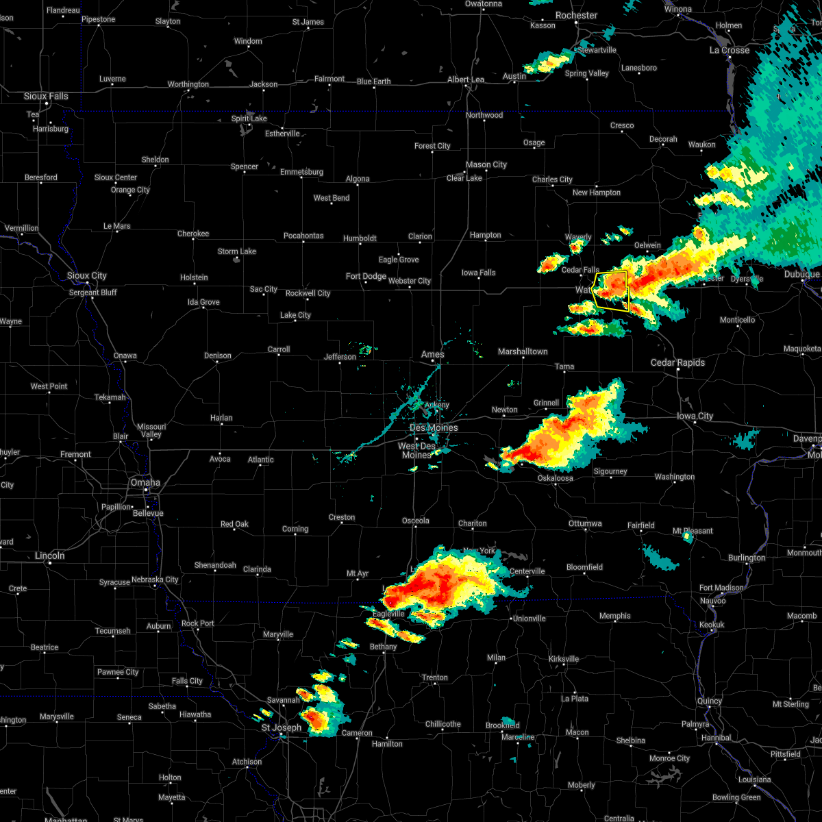 At 640 pm cdt, a severe thunderstorm was located over evansdale, or near waterloo, moving east at 25 mph (radar indicated). Hazards include 60 mph wind gusts and quarter size hail. Hail damage to vehicles is expected. expect wind damage to roofs, siding, and trees. locations impacted include, elk run heights and jesup. This includes interstate 380 between mile markers 56 and 73. At 640 pm cdt, a severe thunderstorm was located over evansdale, or near waterloo, moving east at 25 mph (radar indicated). Hazards include 60 mph wind gusts and quarter size hail. Hail damage to vehicles is expected. expect wind damage to roofs, siding, and trees. locations impacted include, elk run heights and jesup. This includes interstate 380 between mile markers 56 and 73.
|
| 6/20/2021 6:20 PM CDT |
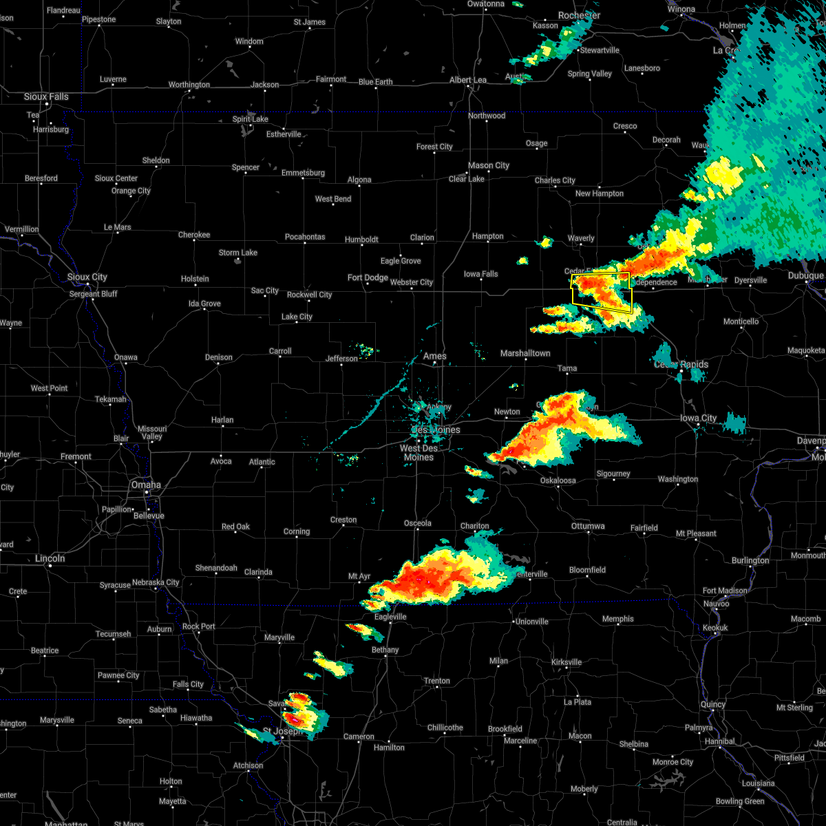 At 619 pm cdt, a severe thunderstorm was located over hudson, or near cedar falls, moving east at 25 mph (radar indicated). Hazards include 60 mph wind gusts and quarter size hail. Hail damage to vehicles is expected. expect wind damage to roofs, siding, and trees. this severe thunderstorm will be near, waterloo municipal airport around 625 pm cdt. crossroads mall around 635 pm cdt. other locations in the path of this severe thunderstorm include waterloo, evansdale, elk run heights and jesup. This includes interstate 380 between mile markers 56 and 73. At 619 pm cdt, a severe thunderstorm was located over hudson, or near cedar falls, moving east at 25 mph (radar indicated). Hazards include 60 mph wind gusts and quarter size hail. Hail damage to vehicles is expected. expect wind damage to roofs, siding, and trees. this severe thunderstorm will be near, waterloo municipal airport around 625 pm cdt. crossroads mall around 635 pm cdt. other locations in the path of this severe thunderstorm include waterloo, evansdale, elk run heights and jesup. This includes interstate 380 between mile markers 56 and 73.
|
| 8/10/2020 12:47 PM CDT |
 At 1247 pm cdt, a severe thunderstorm was located near la porte city, or 13 miles north of vinton, moving east at 40 mph (radar indicated). Hazards include 60 mph wind gusts. Expect damage to roofs, siding, and trees. locations impacted include, waterloo, evansdale, jesup, la porte city, elk run heights, washburn, dunkerton, raymond and gilbertville. This includes interstate 380 between mile markers 56 and 71. At 1247 pm cdt, a severe thunderstorm was located near la porte city, or 13 miles north of vinton, moving east at 40 mph (radar indicated). Hazards include 60 mph wind gusts. Expect damage to roofs, siding, and trees. locations impacted include, waterloo, evansdale, jesup, la porte city, elk run heights, washburn, dunkerton, raymond and gilbertville. This includes interstate 380 between mile markers 56 and 71.
|
| 8/10/2020 12:37 PM CDT |
 At 1237 pm cdt, a severe thunderstorm was located over la porte city, or 13 miles southeast of waterloo, moving east at 45 mph (radar indicated). Hazards include 70 mph wind gusts. Expect considerable tree damage. damage is likely to mobile homes, roofs, and outbuildings. locations impacted include, waterloo, cedar falls, evansdale, jesup, la porte city, hudson, elk run heights, crossroads mall, waterloo municipal airport, uni-dome and mcleod center, washburn, dunkerton, raymond, gilbertville, tf clark state park and george wyth state park. This includes interstate 380 between mile markers 56 and 73. At 1237 pm cdt, a severe thunderstorm was located over la porte city, or 13 miles southeast of waterloo, moving east at 45 mph (radar indicated). Hazards include 70 mph wind gusts. Expect considerable tree damage. damage is likely to mobile homes, roofs, and outbuildings. locations impacted include, waterloo, cedar falls, evansdale, jesup, la porte city, hudson, elk run heights, crossroads mall, waterloo municipal airport, uni-dome and mcleod center, washburn, dunkerton, raymond, gilbertville, tf clark state park and george wyth state park. This includes interstate 380 between mile markers 56 and 73.
|
| 8/10/2020 12:13 PM CDT |
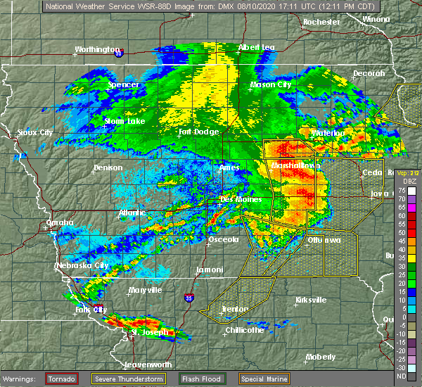 At 1212 pm cdt, a severe thunderstorm was located near reinbeck, or 13 miles east of grundy center, moving east at 50 mph (radar indicated). Hazards include 70 mph wind gusts. Expect considerable tree damage. Damage is likely to mobile homes, roofs, and outbuildings. At 1212 pm cdt, a severe thunderstorm was located near reinbeck, or 13 miles east of grundy center, moving east at 50 mph (radar indicated). Hazards include 70 mph wind gusts. Expect considerable tree damage. Damage is likely to mobile homes, roofs, and outbuildings.
|
| 7/11/2020 4:58 PM CDT |
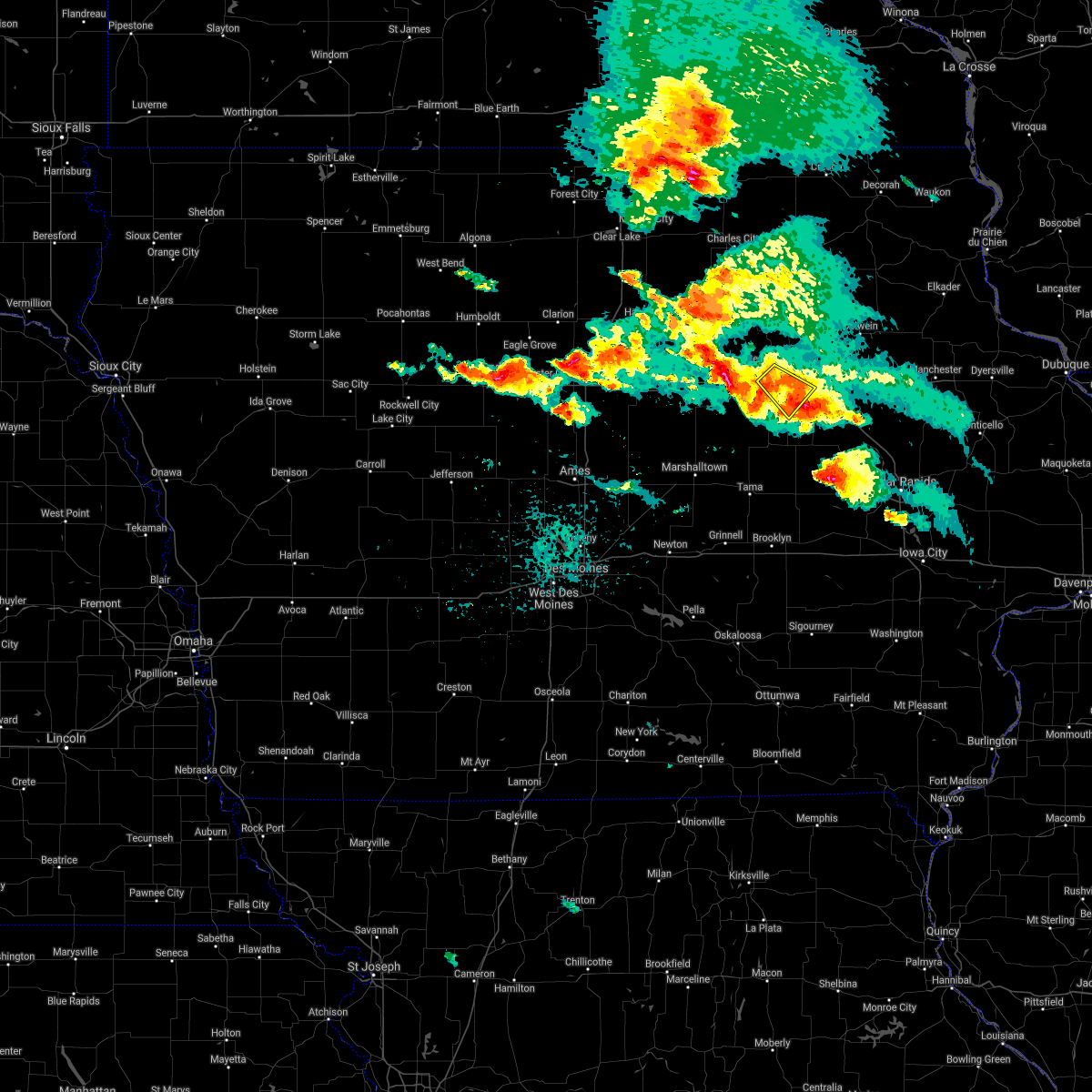 The severe thunderstorm warning for central black hawk county will expire at 500 pm cdt, the storm which prompted the warning has moved out of the area. therefore, the warning will be allowed to expire. however small hail and heavy rain are still possible with this thunderstorm. a severe thunderstorm watch remains in effect until 800 pm cdt for northeastern iowa. to report severe weather, contact your nearest law enforcement agency. they will relay your report to the national weather service des moines. The severe thunderstorm warning for central black hawk county will expire at 500 pm cdt, the storm which prompted the warning has moved out of the area. therefore, the warning will be allowed to expire. however small hail and heavy rain are still possible with this thunderstorm. a severe thunderstorm watch remains in effect until 800 pm cdt for northeastern iowa. to report severe weather, contact your nearest law enforcement agency. they will relay your report to the national weather service des moines.
|
| 7/11/2020 4:48 PM CDT |
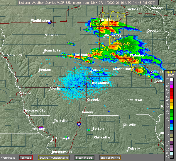 At 448 pm cdt, a severe thunderstorm was located near parkersburg, or 10 miles north of grundy center, moving east at 25 mph (radar indicated). Hazards include 60 mph wind gusts and quarter size hail. Hail damage to vehicles is expected. Expect wind damage to roofs, siding, and trees. At 448 pm cdt, a severe thunderstorm was located near parkersburg, or 10 miles north of grundy center, moving east at 25 mph (radar indicated). Hazards include 60 mph wind gusts and quarter size hail. Hail damage to vehicles is expected. Expect wind damage to roofs, siding, and trees.
|
| 7/11/2020 4:36 PM CDT |
 At 436 pm cdt, a severe thunderstorm was located near parkersburg, or 10 miles north of grundy center, moving east at 15 mph (radar indicated). Hazards include 60 mph wind gusts and quarter size hail. Hail damage to vehicles is expected. expect wind damage to roofs, siding, and trees. Locations impacted include, cedar falls, parkersburg, dike, aplington, uni-dome and mcleod center, new hartford, stout and george wyth state park. At 436 pm cdt, a severe thunderstorm was located near parkersburg, or 10 miles north of grundy center, moving east at 15 mph (radar indicated). Hazards include 60 mph wind gusts and quarter size hail. Hail damage to vehicles is expected. expect wind damage to roofs, siding, and trees. Locations impacted include, cedar falls, parkersburg, dike, aplington, uni-dome and mcleod center, new hartford, stout and george wyth state park.
|
| 7/11/2020 4:29 PM CDT |
 At 429 pm cdt, a severe thunderstorm was located near crossroads mall, or near waterloo, moving southeast at 15 mph (radar indicated). Hazards include 60 mph wind gusts and quarter size hail. Hail damage to vehicles is expected. expect wind damage to roofs, siding, and trees. locations impacted include, waterloo, cedar falls, evansdale, hudson, elk run heights, crossroads mall, uni-dome and mcleod center, washburn, gilbertville and george wyth state park. This includes interstate 380 between mile markers 65 and 73. At 429 pm cdt, a severe thunderstorm was located near crossroads mall, or near waterloo, moving southeast at 15 mph (radar indicated). Hazards include 60 mph wind gusts and quarter size hail. Hail damage to vehicles is expected. expect wind damage to roofs, siding, and trees. locations impacted include, waterloo, cedar falls, evansdale, hudson, elk run heights, crossroads mall, uni-dome and mcleod center, washburn, gilbertville and george wyth state park. This includes interstate 380 between mile markers 65 and 73.
|
| 7/11/2020 4:23 PM CDT |
 At 423 pm cdt, a severe thunderstorm was located near parkersburg, or 11 miles north of grundy center, moving southeast at 30 mph (radar indicated). Hazards include 60 mph wind gusts and quarter size hail. Hail damage to vehicles is expected. expect wind damage to roofs, siding, and trees. Locations impacted include, waterloo, cedar falls, hudson, parkersburg, reinbeck, dike, aplington, waterloo municipal airport, uni-dome and mcleod center, new hartford, stout and george wyth state park. At 423 pm cdt, a severe thunderstorm was located near parkersburg, or 11 miles north of grundy center, moving southeast at 30 mph (radar indicated). Hazards include 60 mph wind gusts and quarter size hail. Hail damage to vehicles is expected. expect wind damage to roofs, siding, and trees. Locations impacted include, waterloo, cedar falls, hudson, parkersburg, reinbeck, dike, aplington, waterloo municipal airport, uni-dome and mcleod center, new hartford, stout and george wyth state park.
|
| 7/11/2020 4:20 PM CDT |
 At 420 pm cdt, a severe thunderstorm was located over hudson, or near waterloo, moving southeast at 15 mph (radar indicated). Hazards include 60 mph wind gusts and quarter size hail. Hail damage to vehicles is expected. Expect wind damage to roofs, siding, and trees. At 420 pm cdt, a severe thunderstorm was located over hudson, or near waterloo, moving southeast at 15 mph (radar indicated). Hazards include 60 mph wind gusts and quarter size hail. Hail damage to vehicles is expected. Expect wind damage to roofs, siding, and trees.
|
| 7/11/2020 4:06 PM CDT |
 At 406 pm cdt, a severe thunderstorm was located near aplington, or 12 miles northwest of grundy center, moving east at 35 mph (radar indicated). Hazards include 60 mph wind gusts and quarter size hail. Hail damage to vehicles is expected. Expect wind damage to roofs, siding, and trees. At 406 pm cdt, a severe thunderstorm was located near aplington, or 12 miles northwest of grundy center, moving east at 35 mph (radar indicated). Hazards include 60 mph wind gusts and quarter size hail. Hail damage to vehicles is expected. Expect wind damage to roofs, siding, and trees.
|
| 7/9/2020 1:55 PM CDT |
 The severe thunderstorm warning for northwestern black hawk and bremer counties will expire at 200 pm cdt, the storm which prompted the warning has weakened below severe limits, and no longer poses an immediate threat to life or property. therefore, the warning will be allowed to expire. however gusty winds and heavy rain are still possible with this thunderstorm. a severe thunderstorm watch remains in effect until 700 pm cdt for northeastern iowa. The severe thunderstorm warning for northwestern black hawk and bremer counties will expire at 200 pm cdt, the storm which prompted the warning has weakened below severe limits, and no longer poses an immediate threat to life or property. therefore, the warning will be allowed to expire. however gusty winds and heavy rain are still possible with this thunderstorm. a severe thunderstorm watch remains in effect until 700 pm cdt for northeastern iowa.
|
| 7/9/2020 1:55 PM CDT |
 The severe thunderstorm warning for northeastern black hawk and eastern bremer counties will expire at 200 pm cdt, the storm which prompted the warning has weakened below severe limits, and no longer poses an immediate threat to life or property. therefore, the warning will be allowed to expire. however gusty winds and heavy rain are still possible with this thunderstorm. a severe thunderstorm watch remains in effect until 700 pm cdt for northeastern iowa. The severe thunderstorm warning for northeastern black hawk and eastern bremer counties will expire at 200 pm cdt, the storm which prompted the warning has weakened below severe limits, and no longer poses an immediate threat to life or property. therefore, the warning will be allowed to expire. however gusty winds and heavy rain are still possible with this thunderstorm. a severe thunderstorm watch remains in effect until 700 pm cdt for northeastern iowa.
|
| 7/9/2020 1:39 PM CDT |
 At 139 pm cdt, a severe thunderstorm was located near waterloo, moving north at 25 mph (radar indicated). Hazards include 60 mph wind gusts and nickel size hail. Expect damage to roofs, siding, and trees. Locations impacted include, waterloo, evansdale, sumner, elk run heights, dunkerton, readlyn and raymond. At 139 pm cdt, a severe thunderstorm was located near waterloo, moving north at 25 mph (radar indicated). Hazards include 60 mph wind gusts and nickel size hail. Expect damage to roofs, siding, and trees. Locations impacted include, waterloo, evansdale, sumner, elk run heights, dunkerton, readlyn and raymond.
|
| 7/9/2020 1:22 PM CDT |
 At 121 pm cdt, a severe thunderstorm was located near waterloo municipal airport, or near cedar falls, moving northeast at 25 mph (radar indicated). Hazards include 60 mph wind gusts and penny size hail. expect damage to roofs, siding, and trees At 121 pm cdt, a severe thunderstorm was located near waterloo municipal airport, or near cedar falls, moving northeast at 25 mph (radar indicated). Hazards include 60 mph wind gusts and penny size hail. expect damage to roofs, siding, and trees
|
| 7/9/2020 1:13 PM CDT | Storm damage reported in black hawk county IA, 6.9 miles SE of Waterloo, IA |
| 7/9/2020 1:13 PM CDT |
 At 113 pm cdt, a severe thunderstorm was located near waterloo, moving northeast at 30 mph (radar indicated). Hazards include 60 mph wind gusts and quarter size hail. Hail damage to vehicles is expected. expect wind damage to roofs, siding, and trees. locations impacted include, waterloo, evansdale, sumner, elk run heights, crossroads mall, dunkerton, readlyn and raymond. This includes interstate 380 near mile marker 73. At 113 pm cdt, a severe thunderstorm was located near waterloo, moving northeast at 30 mph (radar indicated). Hazards include 60 mph wind gusts and quarter size hail. Hail damage to vehicles is expected. expect wind damage to roofs, siding, and trees. locations impacted include, waterloo, evansdale, sumner, elk run heights, crossroads mall, dunkerton, readlyn and raymond. This includes interstate 380 near mile marker 73.
|
| 7/9/2020 12:58 PM CDT |
 At 1258 pm cdt, a severe thunderstorm was located over evansdale, or near waterloo, moving northeast at 35 mph (radar indicated). Hazards include 60 mph wind gusts. expect damage to roofs, siding, and trees At 1258 pm cdt, a severe thunderstorm was located over evansdale, or near waterloo, moving northeast at 35 mph (radar indicated). Hazards include 60 mph wind gusts. expect damage to roofs, siding, and trees
|
| 7/9/2020 12:53 PM CDT |
 At 1251 pm cdt, a severe thunderstorm was located over waverly, moving north at 30 mph (public. at about 1239 pm cdt, a report of tree limbs down in cedar falls). Hazards include 60 mph wind gusts. Expect damage to roofs, siding, and trees. Locations impacted include, waterloo, cedar falls, waverly, hudson, denver, clarksville, tripoli, shell rock, waterloo municipal airport, uni-dome and mcleod center, janesville, new hartford, plainfield, frederika, george wyth state park and waverly municipal airport. At 1251 pm cdt, a severe thunderstorm was located over waverly, moving north at 30 mph (public. at about 1239 pm cdt, a report of tree limbs down in cedar falls). Hazards include 60 mph wind gusts. Expect damage to roofs, siding, and trees. Locations impacted include, waterloo, cedar falls, waverly, hudson, denver, clarksville, tripoli, shell rock, waterloo municipal airport, uni-dome and mcleod center, janesville, new hartford, plainfield, frederika, george wyth state park and waverly municipal airport.
|
| 7/9/2020 12:50 PM CDT | Storm damage reported in black hawk county IA, 6.9 miles SE of Waterloo, IA |
| 7/9/2020 12:30 PM CDT |
 At 1230 pm cdt, a severe thunderstorm was located over uni-dome and mcleod center, or near cedar falls, moving north at 20 mph (radar indicated). Hazards include 60 mph wind gusts. expect damage to roofs, siding, and trees At 1230 pm cdt, a severe thunderstorm was located over uni-dome and mcleod center, or near cedar falls, moving north at 20 mph (radar indicated). Hazards include 60 mph wind gusts. expect damage to roofs, siding, and trees
|
| 7/7/2020 8:04 PM CDT |
 At 804 pm cdt, a severe thunderstorm was located near reinbeck, or 11 miles south of cedar falls, moving southeast at 20 mph (radar indicated). Hazards include 60 mph wind gusts and nickel size hail. expect damage to roofs, siding, and trees At 804 pm cdt, a severe thunderstorm was located near reinbeck, or 11 miles south of cedar falls, moving southeast at 20 mph (radar indicated). Hazards include 60 mph wind gusts and nickel size hail. expect damage to roofs, siding, and trees
|
| 6/4/2020 4:00 PM CDT | 6 inch diameter tree limbs down in lafayette par in black hawk county IA, 0.8 miles S of Waterloo, IA |
| 3/28/2020 6:08 PM CDT |
 At 607 pm cdt, a severe thunderstorm capable of producing a tornado was located near elk run heights, or 7 miles northeast of waterloo, moving northeast at 45 mph (weather spotters reported a rotating wall cloud east of crossroads mall at 604 pm). Hazards include tornado. Flying debris will be dangerous to those caught without shelter. mobile homes will be damaged or destroyed. damage to roofs, windows, and vehicles will occur. tree damage is likely. This tornadic thunderstorm will remain over mainly rural areas of northeastern black hawk county, including the following locations, dunkerton. At 607 pm cdt, a severe thunderstorm capable of producing a tornado was located near elk run heights, or 7 miles northeast of waterloo, moving northeast at 45 mph (weather spotters reported a rotating wall cloud east of crossroads mall at 604 pm). Hazards include tornado. Flying debris will be dangerous to those caught without shelter. mobile homes will be damaged or destroyed. damage to roofs, windows, and vehicles will occur. tree damage is likely. This tornadic thunderstorm will remain over mainly rural areas of northeastern black hawk county, including the following locations, dunkerton.
|
| 3/28/2020 6:02 PM CDT |
 At 601 pm cdt, a severe thunderstorm capable of producing a tornado was located over waterloo, moving northeast at 35 mph (weather spotters reported a funnel cloud over eastern waterloo at 602 pm). Hazards include tornado. Flying debris will be dangerous to those caught without shelter. mobile homes will be damaged or destroyed. damage to roofs, windows, and vehicles will occur. tree damage is likely. this tornadic thunderstorm will remain over mainly rural areas of northeastern black hawk county, including the following locations, raymond and dunkerton. This includes interstate 380 between mile markers 69 and 70, and between mile markers 72 and 73. At 601 pm cdt, a severe thunderstorm capable of producing a tornado was located over waterloo, moving northeast at 35 mph (weather spotters reported a funnel cloud over eastern waterloo at 602 pm). Hazards include tornado. Flying debris will be dangerous to those caught without shelter. mobile homes will be damaged or destroyed. damage to roofs, windows, and vehicles will occur. tree damage is likely. this tornadic thunderstorm will remain over mainly rural areas of northeastern black hawk county, including the following locations, raymond and dunkerton. This includes interstate 380 between mile markers 69 and 70, and between mile markers 72 and 73.
|
| 3/28/2020 5:54 PM CDT |
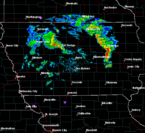 At 553 pm cdt, a severe thunderstorm capable of producing a tornado was located over crossroads mall, or near waterloo, moving northeast at 45 mph (radar indicated rotation). Hazards include tornado. Flying debris will be dangerous to those caught without shelter. mobile homes will be damaged or destroyed. damage to roofs, windows, and vehicles will occur. tree damage is likely. this dangerous storm will be near, elk run heights around 600 pm cdt. other locations impacted by this tornadic thunderstorm include dunkerton and raymond. This includes interstate 380 between mile markers 69 and 73. At 553 pm cdt, a severe thunderstorm capable of producing a tornado was located over crossroads mall, or near waterloo, moving northeast at 45 mph (radar indicated rotation). Hazards include tornado. Flying debris will be dangerous to those caught without shelter. mobile homes will be damaged or destroyed. damage to roofs, windows, and vehicles will occur. tree damage is likely. this dangerous storm will be near, elk run heights around 600 pm cdt. other locations impacted by this tornadic thunderstorm include dunkerton and raymond. This includes interstate 380 between mile markers 69 and 73.
|
| 10/1/2019 6:06 PM CDT |
 At 605 pm cdt, a severe thunderstorm was located over elk run heights, or near waterloo, moving northeast at 30 mph (radar indicated). Hazards include 60 mph wind gusts and quarter size hail. Hail damage to vehicles is expected. expect wind damage to roofs, siding, and trees. locations impacted include, waterloo, evansdale, jesup, elk run heights, crossroads mall, washburn, dunkerton, raymond and gilbertville. This includes interstate 380 between mile markers 64 and 73. At 605 pm cdt, a severe thunderstorm was located over elk run heights, or near waterloo, moving northeast at 30 mph (radar indicated). Hazards include 60 mph wind gusts and quarter size hail. Hail damage to vehicles is expected. expect wind damage to roofs, siding, and trees. locations impacted include, waterloo, evansdale, jesup, elk run heights, crossroads mall, washburn, dunkerton, raymond and gilbertville. This includes interstate 380 between mile markers 64 and 73.
|
| 10/1/2019 5:53 PM CDT |
 At 553 pm cdt, a severe thunderstorm was located over hudson, or near waterloo, moving northeast at 30 mph (radar indicated). Hazards include 60 mph wind gusts and quarter size hail. Hail damage to vehicles is expected. Expect wind damage to roofs, siding, and trees. At 553 pm cdt, a severe thunderstorm was located over hudson, or near waterloo, moving northeast at 30 mph (radar indicated). Hazards include 60 mph wind gusts and quarter size hail. Hail damage to vehicles is expected. Expect wind damage to roofs, siding, and trees.
|
| 9/9/2019 8:40 PM CDT | Damage to mobile home skirting. 2.5 inch tree limbs down. time estimated by rada in black hawk county IA, 3.7 miles NNW of Waterloo, IA |
| 9/9/2019 8:22 PM CDT |
 At 822 pm cdt, severe thunderstorms were located along a line extending from near waucoma to denver to 7 miles north of traer, moving east at 40 mph (radar indicated). Hazards include 60 mph wind gusts. Expect damage to roofs, siding, and trees. locations impacted include, waterloo, cedar falls, waverly, evansdale, jesup, la porte city, hudson, sumner, denver, traer, dysart, tripoli, elk run heights, crossroads mall, waterloo municipal airport, uni-dome and mcleod center, janesville, washburn, dunkerton and readlyn. This includes interstate 380 between mile markers 56 and 73. At 822 pm cdt, severe thunderstorms were located along a line extending from near waucoma to denver to 7 miles north of traer, moving east at 40 mph (radar indicated). Hazards include 60 mph wind gusts. Expect damage to roofs, siding, and trees. locations impacted include, waterloo, cedar falls, waverly, evansdale, jesup, la porte city, hudson, sumner, denver, traer, dysart, tripoli, elk run heights, crossroads mall, waterloo municipal airport, uni-dome and mcleod center, janesville, washburn, dunkerton and readlyn. This includes interstate 380 between mile markers 56 and 73.
|
| 9/9/2019 8:03 PM CDT |
 At 803 pm cdt, severe thunderstorms were located along a line extending from near fredericksburg to 6 miles northwest of uni-dome and mcleod center to near reinbeck, moving east at 40 mph (radar indicated). Hazards include 60 mph wind gusts. expect damage to roofs, siding, and trees At 803 pm cdt, severe thunderstorms were located along a line extending from near fredericksburg to 6 miles northwest of uni-dome and mcleod center to near reinbeck, moving east at 40 mph (radar indicated). Hazards include 60 mph wind gusts. expect damage to roofs, siding, and trees
|
| 9/9/2019 7:52 PM CDT |
 The severe thunderstorm warning for southeastern black hawk county will expire at 800 pm cdt, the storm which prompted the warning has moved out of the area. therefore, the warning will be allowed to expire. however gusty winds are still possible with this thunderstorm. a tornado watch remains in effect until 1000 pm cdt for northeastern iowa. The severe thunderstorm warning for southeastern black hawk county will expire at 800 pm cdt, the storm which prompted the warning has moved out of the area. therefore, the warning will be allowed to expire. however gusty winds are still possible with this thunderstorm. a tornado watch remains in effect until 1000 pm cdt for northeastern iowa.
|
| 9/9/2019 7:34 PM CDT |
 At 734 pm cdt, a severe thunderstorm was located over jesup, or 11 miles west of independence, moving northeast at 40 mph (radar indicated). Hazards include 60 mph wind gusts. Expect damage to roofs, siding, and trees. locations impacted include, evansdale, jesup, elk run heights, washburn, raymond and gilbertville. This includes interstate 380 between mile markers 59 and 68. At 734 pm cdt, a severe thunderstorm was located over jesup, or 11 miles west of independence, moving northeast at 40 mph (radar indicated). Hazards include 60 mph wind gusts. Expect damage to roofs, siding, and trees. locations impacted include, evansdale, jesup, elk run heights, washburn, raymond and gilbertville. This includes interstate 380 between mile markers 59 and 68.
|
| 9/9/2019 7:20 PM CDT |
 At 719 pm cdt, a severe thunderstorm was located near fort atkinson, or 8 miles northwest of west union, moving northeast at 50 mph (radar indicated). Hazards include 60 mph wind gusts and penny size hail. Expect damage to roofs, siding, and trees. locations impacted include, waterloo, evansdale, denver, elk run heights, crossroads mall, dunkerton, readlyn and raymond. This includes interstate 380 between mile markers 69 and 73. At 719 pm cdt, a severe thunderstorm was located near fort atkinson, or 8 miles northwest of west union, moving northeast at 50 mph (radar indicated). Hazards include 60 mph wind gusts and penny size hail. Expect damage to roofs, siding, and trees. locations impacted include, waterloo, evansdale, denver, elk run heights, crossroads mall, dunkerton, readlyn and raymond. This includes interstate 380 between mile markers 69 and 73.
|
| 9/9/2019 7:10 PM CDT |
 At 710 pm cdt, a severe thunderstorm was located 7 miles west of la porte city, or 10 miles south of waterloo, moving northeast at 35 mph (radar indicated). Hazards include 70 mph wind gusts. Expect considerable tree damage. Damage is likely to mobile homes, roofs, and outbuildings. At 710 pm cdt, a severe thunderstorm was located 7 miles west of la porte city, or 10 miles south of waterloo, moving northeast at 35 mph (radar indicated). Hazards include 70 mph wind gusts. Expect considerable tree damage. Damage is likely to mobile homes, roofs, and outbuildings.
|
| 9/9/2019 7:07 PM CDT |
 At 706 pm cdt, a severe thunderstorm was located near hawkeye, or 12 miles west of west union, moving northeast at 50 mph (radar indicated). Hazards include 60 mph wind gusts and penny size hail. Expect damage to roofs, siding, and trees. locations impacted include, waterloo, cedar falls, evansdale, hudson, sumner, denver, tripoli, elk run heights, crossroads mall, waterloo municipal airport, uni-dome and mcleod center, dunkerton, readlyn, raymond and george wyth state park. This includes interstate 380 between mile markers 69 and 73. At 706 pm cdt, a severe thunderstorm was located near hawkeye, or 12 miles west of west union, moving northeast at 50 mph (radar indicated). Hazards include 60 mph wind gusts and penny size hail. Expect damage to roofs, siding, and trees. locations impacted include, waterloo, cedar falls, evansdale, hudson, sumner, denver, tripoli, elk run heights, crossroads mall, waterloo municipal airport, uni-dome and mcleod center, dunkerton, readlyn, raymond and george wyth state park. This includes interstate 380 between mile markers 69 and 73.
|
| 9/9/2019 7:02 PM CDT | Asos station kalo waterloo airpor in black hawk county IA, 6.4 miles SE of Waterloo, IA |
| 9/9/2019 6:25 PM CDT |
 At 624 pm cdt, a severe thunderstorm was located near shell rock, or 9 miles southwest of waverly, moving northeast at 50 mph (radar indicated). Hazards include 60 mph wind gusts and penny size hail. expect damage to roofs, siding, and trees At 624 pm cdt, a severe thunderstorm was located near shell rock, or 9 miles southwest of waverly, moving northeast at 50 mph (radar indicated). Hazards include 60 mph wind gusts and penny size hail. expect damage to roofs, siding, and trees
|
| 6/30/2019 5:13 PM CDT |
 The severe thunderstorm warning for northern black hawk, bremer and butler counties will expire at 515 pm cdt, the storms which prompted the warning have weakened below severe limits, and no longer pose an immediate threat to life or property. therefore, the warning will be allowed to expire. however gusty winds are still possible with these thunderstorms. a severe thunderstorm watch remains in effect until 900 pm cdt for north central and northeastern iowa. The severe thunderstorm warning for northern black hawk, bremer and butler counties will expire at 515 pm cdt, the storms which prompted the warning have weakened below severe limits, and no longer pose an immediate threat to life or property. therefore, the warning will be allowed to expire. however gusty winds are still possible with these thunderstorms. a severe thunderstorm watch remains in effect until 900 pm cdt for north central and northeastern iowa.
|
| 6/30/2019 5:00 PM CDT |
 At 459 pm cdt, severe thunderstorms were located along a line extending from near jesup to near shell rock to 8 miles northwest of allison, moving south at 50 mph (radar indicated). Hazards include 60 mph wind gusts. Expect damage to roofs, siding, and trees. Locations impacted include, waterloo, cedar falls, waverly, allison, sumner, parkersburg, denver, clarksville, tripoli, shell rock, greene, aplington, waterloo municipal airport, janesville, dunkerton, readlyn, dumont, new hartford, plainfield and frederika. At 459 pm cdt, severe thunderstorms were located along a line extending from near jesup to near shell rock to 8 miles northwest of allison, moving south at 50 mph (radar indicated). Hazards include 60 mph wind gusts. Expect damage to roofs, siding, and trees. Locations impacted include, waterloo, cedar falls, waverly, allison, sumner, parkersburg, denver, clarksville, tripoli, shell rock, greene, aplington, waterloo municipal airport, janesville, dunkerton, readlyn, dumont, new hartford, plainfield and frederika.
|
| 6/30/2019 4:27 PM CDT |
 At 426 pm cdt, a severe thunderstorm was located near fredericksburg, or 12 miles south of new hampton, moving south at 35 mph (public. home weather station just west of fredericksburg reported a wind gust 65 mph). Hazards include 60 mph wind gusts. expect damage to roofs, siding, and trees At 426 pm cdt, a severe thunderstorm was located near fredericksburg, or 12 miles south of new hampton, moving south at 35 mph (public. home weather station just west of fredericksburg reported a wind gust 65 mph). Hazards include 60 mph wind gusts. expect damage to roofs, siding, and trees
|
| 6/30/2018 7:47 PM CDT |
 At 747 pm cdt, severe thunderstorms were located along a line extending from evansdale to dysart, moving east at 30 mph (radar indicated). Hazards include 60 mph wind gusts. Expect damage to roofs, siding, and trees. locations impacted include, waterloo, cedar falls, evansdale, jesup, la porte city, dysart, elk run heights, crossroads mall, washburn, raymond, gilbertville, clutier and george wyth state park. This includes interstate 380 between mile markers 56 and 73. At 747 pm cdt, severe thunderstorms were located along a line extending from evansdale to dysart, moving east at 30 mph (radar indicated). Hazards include 60 mph wind gusts. Expect damage to roofs, siding, and trees. locations impacted include, waterloo, cedar falls, evansdale, jesup, la porte city, dysart, elk run heights, crossroads mall, washburn, raymond, gilbertville, clutier and george wyth state park. This includes interstate 380 between mile markers 56 and 73.
|
| 6/30/2018 7:37 PM CDT |
 At 736 pm cdt, severe thunderstorms were located along a line extending from near crossroads mall to near traer, moving east at 30 mph (radar indicated). Hazards include 60 mph wind gusts. Expect damage to roofs, siding, and trees. locations impacted include, waterloo, cedar falls, toledo, evansdale, tama, jesup, la porte city, hudson, traer, dysart, elk run heights, crossroads mall, uni-dome and mcleod center, waterloo municipal airport, washburn, dunkerton, raymond, gilbertville, clutier and elberon. This includes interstate 380 between mile markers 56 and 73. At 736 pm cdt, severe thunderstorms were located along a line extending from near crossroads mall to near traer, moving east at 30 mph (radar indicated). Hazards include 60 mph wind gusts. Expect damage to roofs, siding, and trees. locations impacted include, waterloo, cedar falls, toledo, evansdale, tama, jesup, la porte city, hudson, traer, dysart, elk run heights, crossroads mall, uni-dome and mcleod center, waterloo municipal airport, washburn, dunkerton, raymond, gilbertville, clutier and elberon. This includes interstate 380 between mile markers 56 and 73.
|
| 6/30/2018 7:30 PM CDT |
 At 730 pm cdt, severe thunderstorms were located along a line extending from near hudson to near traer, moving east at 40 mph (radar indicated). Hazards include 60 mph wind gusts. Expect damage to roofs, siding, and trees. locations impacted include, waterloo, cedar falls, toledo, evansdale, tama, jesup, la porte city, hudson, traer, reinbeck, dysart, dike, elk run heights, meskwaki casino, crossroads mall, uni-dome and mcleod center, waterloo municipal airport, gladbrook, washburn and dunkerton. This includes interstate 380 between mile markers 56 and 73. At 730 pm cdt, severe thunderstorms were located along a line extending from near hudson to near traer, moving east at 40 mph (radar indicated). Hazards include 60 mph wind gusts. Expect damage to roofs, siding, and trees. locations impacted include, waterloo, cedar falls, toledo, evansdale, tama, jesup, la porte city, hudson, traer, reinbeck, dysart, dike, elk run heights, meskwaki casino, crossroads mall, uni-dome and mcleod center, waterloo municipal airport, gladbrook, washburn and dunkerton. This includes interstate 380 between mile markers 56 and 73.
|
| 6/30/2018 7:03 PM CDT |
 At 703 pm cdt, severe thunderstorms were located along a line extending from near dike to 6 miles south of conrad, moving east at 35 mph (radar indicated). Hazards include 60 mph wind gusts and penny size hail. expect damage to roofs, siding, and trees At 703 pm cdt, severe thunderstorms were located along a line extending from near dike to 6 miles south of conrad, moving east at 35 mph (radar indicated). Hazards include 60 mph wind gusts and penny size hail. expect damage to roofs, siding, and trees
|
| 6/9/2018 9:09 PM CDT |
 A severe thunderstorm warning remains in effect until 945 pm cdt for black hawk county. at 908 pm cdt, severe thunderstorms were located along a line extending from near fairbank to near elk run heights to near hudson, moving east at 45 mph. hazard. 60 mph wind gusts and quarter size hail. A severe thunderstorm warning remains in effect until 945 pm cdt for black hawk county. at 908 pm cdt, severe thunderstorms were located along a line extending from near fairbank to near elk run heights to near hudson, moving east at 45 mph. hazard. 60 mph wind gusts and quarter size hail.
|
| 6/9/2018 8:51 PM CDT |
 At 851 pm cdt, severe thunderstorms were located along a line extending from near denver to waterloo to near dike, moving southeast at 30 mph (radar indicated). Hazards include 60 mph wind gusts and quarter size hail. Hail damage to vehicles is expected. Expect wind damage to roofs, siding, and trees. At 851 pm cdt, severe thunderstorms were located along a line extending from near denver to waterloo to near dike, moving southeast at 30 mph (radar indicated). Hazards include 60 mph wind gusts and quarter size hail. Hail damage to vehicles is expected. Expect wind damage to roofs, siding, and trees.
|
| 6/9/2018 8:08 PM CDT |
 The severe thunderstorm warning for northeastern black hawk county will expire at 815 pm cdt, the storm which prompted the warning has moved out of the area. therefore, the warning will be allowed to expire. a severe thunderstorm watch remains in effect until 200 am cdt for northeastern iowa. The severe thunderstorm warning for northeastern black hawk county will expire at 815 pm cdt, the storm which prompted the warning has moved out of the area. therefore, the warning will be allowed to expire. a severe thunderstorm watch remains in effect until 200 am cdt for northeastern iowa.
|
| 6/9/2018 7:51 PM CDT |
 At 751 pm cdt, a severe thunderstorm was located near fairbank, or 11 miles southwest of oelwein, moving east at 25 mph (radar indicated). Hazards include 60 mph wind gusts and quarter size hail. Hail damage to vehicles is expected. expect wind damage to roofs, siding, and trees. locations impacted include, waterloo, jesup and dunkerton. A tornado watch remains in effect until 1000 pm cdt for northeastern iowa. At 751 pm cdt, a severe thunderstorm was located near fairbank, or 11 miles southwest of oelwein, moving east at 25 mph (radar indicated). Hazards include 60 mph wind gusts and quarter size hail. Hail damage to vehicles is expected. expect wind damage to roofs, siding, and trees. locations impacted include, waterloo, jesup and dunkerton. A tornado watch remains in effect until 1000 pm cdt for northeastern iowa.
|
| 6/9/2018 7:30 PM CDT |
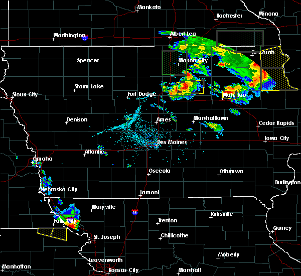 At 730 pm cdt, a severe thunderstorm was located near denver, or 7 miles northeast of waterloo, moving east at 25 mph (radar indicated). Hazards include 60 mph wind gusts and quarter size hail. Hail damage to vehicles is expected. Expect wind damage to roofs, siding, and trees. At 730 pm cdt, a severe thunderstorm was located near denver, or 7 miles northeast of waterloo, moving east at 25 mph (radar indicated). Hazards include 60 mph wind gusts and quarter size hail. Hail damage to vehicles is expected. Expect wind damage to roofs, siding, and trees.
|
| 7/12/2017 5:25 PM CDT |
 At 524 pm cdt, a severe thunderstorm was located over denver, or 7 miles southeast of waverly, moving northeast at 30 mph (radar indicated. at 5:17 pm quarter hail was reported near janesville). Hazards include 60 mph wind gusts and quarter size hail. Hail damage to vehicles is expected. Expect wind damage to roofs, siding, and trees. At 524 pm cdt, a severe thunderstorm was located over denver, or 7 miles southeast of waverly, moving northeast at 30 mph (radar indicated. at 5:17 pm quarter hail was reported near janesville). Hazards include 60 mph wind gusts and quarter size hail. Hail damage to vehicles is expected. Expect wind damage to roofs, siding, and trees.
|
| 6/29/2017 10:00 PM CDT | Iowa dot rwis site along highway 2 in black hawk county IA, 1.4 miles NNW of Waterloo, IA |
| 6/29/2017 5:04 PM CDT |
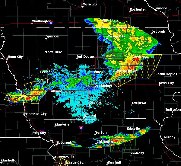 At 1003 pm cdt, severe thunderstorms were located along a line extending from near denver to near la porte city, moving east at 40 mph (radar indicated). Hazards include 60 mph wind gusts and penny size hail. Expect damage to roofs, siding, and trees. locations impacted include, waterloo, evansdale, jesup, la porte city, elk run heights, crossroads mall, washburn, dunkerton, raymond and gilbertville. This includes interstate 380 between mile markers 56 and 73. At 1003 pm cdt, severe thunderstorms were located along a line extending from near denver to near la porte city, moving east at 40 mph (radar indicated). Hazards include 60 mph wind gusts and penny size hail. Expect damage to roofs, siding, and trees. locations impacted include, waterloo, evansdale, jesup, la porte city, elk run heights, crossroads mall, washburn, dunkerton, raymond and gilbertville. This includes interstate 380 between mile markers 56 and 73.
|
| 6/29/2017 4:47 PM CDT |
 At 947 pm cdt, severe thunderstorms were located along a line extending from near waterloo municipal airport to 7 miles east of reinbeck, moving east at 40 mph (radar indicated). Hazards include 60 mph wind gusts. expect damage to roofs, siding, and trees At 947 pm cdt, severe thunderstorms were located along a line extending from near waterloo municipal airport to 7 miles east of reinbeck, moving east at 40 mph (radar indicated). Hazards include 60 mph wind gusts. expect damage to roofs, siding, and trees
|
| 6/28/2017 1:49 PM CDT |
 At 649 pm cdt, a severe thunderstorm was located over la porte city, or 12 miles northwest of vinton, moving east at 80 mph (radar indicated). Hazards include 60 mph wind gusts and quarter size hail. Hail damage to vehicles is expected. expect wind damage to roofs, siding, and trees. locations impacted include, waterloo, la porte city, hudson, reinbeck, washburn, gilbertville, morrison and tf clark state park. this includes interstate 380 between mile markers 56 and 63. A tornado watch remains in effect until 1000 pm cdt for central and northeastern iowa. At 649 pm cdt, a severe thunderstorm was located over la porte city, or 12 miles northwest of vinton, moving east at 80 mph (radar indicated). Hazards include 60 mph wind gusts and quarter size hail. Hail damage to vehicles is expected. expect wind damage to roofs, siding, and trees. locations impacted include, waterloo, la porte city, hudson, reinbeck, washburn, gilbertville, morrison and tf clark state park. this includes interstate 380 between mile markers 56 and 63. A tornado watch remains in effect until 1000 pm cdt for central and northeastern iowa.
|
| 6/28/2017 1:29 PM CDT |
 At 629 pm cdt, a severe thunderstorm was located near hudson, or 10 miles south of cedar falls, moving east at 50 mph (radar indicated). Hazards include golf ball size hail and 70 mph wind gusts. People and animals outdoors will be injured. expect hail damage to roofs, siding, windows, and vehicles. expect considerable tree damage. Wind damage is also likely to mobile homes, roofs, and outbuildings. At 629 pm cdt, a severe thunderstorm was located near hudson, or 10 miles south of cedar falls, moving east at 50 mph (radar indicated). Hazards include golf ball size hail and 70 mph wind gusts. People and animals outdoors will be injured. expect hail damage to roofs, siding, windows, and vehicles. expect considerable tree damage. Wind damage is also likely to mobile homes, roofs, and outbuildings.
|
| 6/15/2017 8:09 PM CDT |
 At 808 pm cdt, a severe thunderstorm was located over denver, or near waverly, moving east at 35 mph (trained weather spotters. at 7:58pm, trained weather spotters reported half dollar sized hail near janesville). Hazards include golf ball size hail. People and animals outdoors will be injured. expect damage to roofs, siding, windows, and vehicles. Locations impacted include, waterloo, waverly, denver, waterloo municipal airport, janesville, dunkerton, readlyn and waverly municipal airport. At 808 pm cdt, a severe thunderstorm was located over denver, or near waverly, moving east at 35 mph (trained weather spotters. at 7:58pm, trained weather spotters reported half dollar sized hail near janesville). Hazards include golf ball size hail. People and animals outdoors will be injured. expect damage to roofs, siding, windows, and vehicles. Locations impacted include, waterloo, waverly, denver, waterloo municipal airport, janesville, dunkerton, readlyn and waverly municipal airport.
|
| 6/15/2017 8:03 PM CDT | Ping Pong Ball sized hail reported 8.5 miles S of Waterloo, IA, reported along e bennington rd.... |
| 6/15/2017 7:52 PM CDT |
 At 751 pm cdt, a severe thunderstorm was located over shell rock, or near waverly, moving east at 35 mph (radar indicated). Hazards include quarter size hail. damage to vehicles is expected At 751 pm cdt, a severe thunderstorm was located over shell rock, or near waverly, moving east at 35 mph (radar indicated). Hazards include quarter size hail. damage to vehicles is expected
|
| 6/15/2017 7:49 PM CDT |
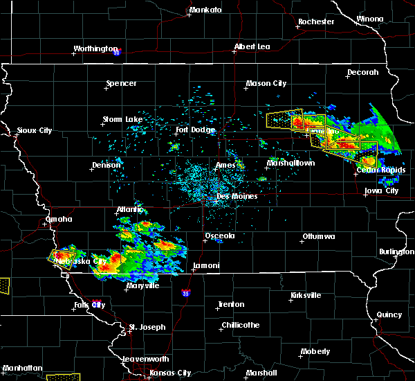 At 749 pm cdt, a severe thunderstorm was located near jesup, or 11 miles east of waterloo, moving southeast at 35 mph (trained weather spotters. at 7:33pm, quarter sized hail was reported 2 miles southeast of waterloo). Hazards include 60 mph wind gusts and quarter size hail. Hail damage to vehicles is expected. expect wind damage to roofs, siding, and trees. locations impacted include, waterloo, evansdale, jesup, elk run heights, washburn, dunkerton, raymond and gilbertville. This includes interstate 380 between mile markers 56 and 70. At 749 pm cdt, a severe thunderstorm was located near jesup, or 11 miles east of waterloo, moving southeast at 35 mph (trained weather spotters. at 7:33pm, quarter sized hail was reported 2 miles southeast of waterloo). Hazards include 60 mph wind gusts and quarter size hail. Hail damage to vehicles is expected. expect wind damage to roofs, siding, and trees. locations impacted include, waterloo, evansdale, jesup, elk run heights, washburn, dunkerton, raymond and gilbertville. This includes interstate 380 between mile markers 56 and 70.
|
| 6/15/2017 7:43 PM CDT |
 At 742 pm cdt, a severe thunderstorm was located over elk run heights, or 7 miles east of waterloo, moving east at 35 mph (trained weather spotters. at 7:42pm, quarter sized hail was reported in elk run heights). Hazards include ping pong ball size hail and 60 mph wind gusts. People and animals outdoors will be injured. expect hail damage to roofs, siding, windows, and vehicles. expect wind damage to roofs, siding, and trees. locations impacted include, waterloo, evansdale, jesup, elk run heights, waterloo municipal airport, crossroads mall, washburn, dunkerton, raymond, gilbertville and george wyth state park. This includes interstate 380 between mile markers 56 and 73. At 742 pm cdt, a severe thunderstorm was located over elk run heights, or 7 miles east of waterloo, moving east at 35 mph (trained weather spotters. at 7:42pm, quarter sized hail was reported in elk run heights). Hazards include ping pong ball size hail and 60 mph wind gusts. People and animals outdoors will be injured. expect hail damage to roofs, siding, windows, and vehicles. expect wind damage to roofs, siding, and trees. locations impacted include, waterloo, evansdale, jesup, elk run heights, waterloo municipal airport, crossroads mall, washburn, dunkerton, raymond, gilbertville and george wyth state park. This includes interstate 380 between mile markers 56 and 73.
|
| 6/15/2017 7:40 PM CDT | Ping Pong Ball sized hail reported 0.8 miles S of Waterloo, IA |
| 6/15/2017 7:39 PM CDT | Quarter sized hail reported 0.8 miles S of Waterloo, IA, nickel to quarter hail. |
| 6/15/2017 7:33 PM CDT | Golf Ball sized hail reported 0.7 miles NE of Waterloo, IA |
| 6/15/2017 7:28 PM CDT |
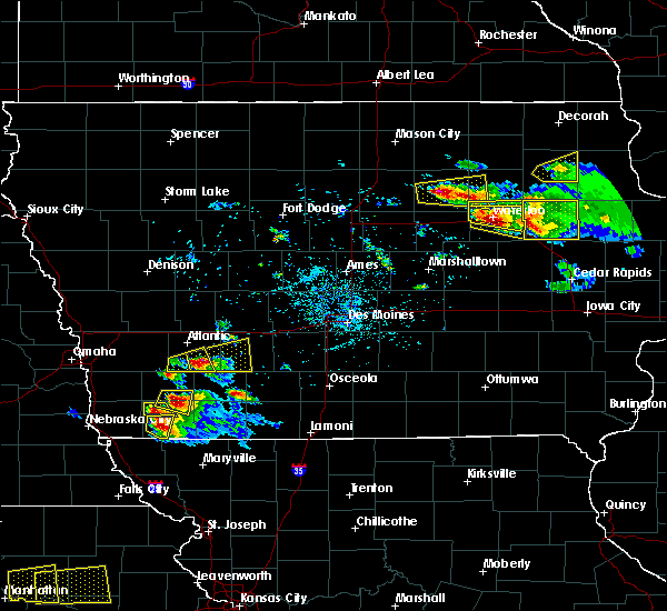 At 728 pm cdt, a severe thunderstorm was located over waterloo, moving southeast at 35 mph (trained weather spotters. at 7:29pm, trained spotters reported golf ball sized hail in cedar falls). Hazards include two inch hail and 60 mph wind gusts. People and animals outdoors will be injured. expect hail damage to roofs, siding, windows, and vehicles. Expect wind damage to roofs, siding, and trees. At 728 pm cdt, a severe thunderstorm was located over waterloo, moving southeast at 35 mph (trained weather spotters. at 7:29pm, trained spotters reported golf ball sized hail in cedar falls). Hazards include two inch hail and 60 mph wind gusts. People and animals outdoors will be injured. expect hail damage to roofs, siding, windows, and vehicles. Expect wind damage to roofs, siding, and trees.
|
| 6/15/2017 7:18 PM CDT |
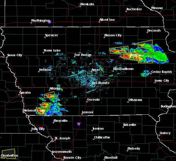 At 717 pm cdt, a severe thunderstorm was located over jesup, or 10 miles west of independence, moving east at 35 mph (radar indicated). Hazards include two inch hail and 60 mph wind gusts. People and animals outdoors will be injured. expect hail damage to roofs, siding, windows, and vehicles. expect wind damage to roofs, siding, and trees. locations impacted include, waterloo, cedar falls, evansdale, jesup, hudson, elk run heights, crossroads mall, waterloo municipal airport, uni-dome and mcleod center, washburn, dunkerton, raymond, gilbertville and george wyth state park. This includes interstate 380 between mile markers 59 and 73. At 717 pm cdt, a severe thunderstorm was located over jesup, or 10 miles west of independence, moving east at 35 mph (radar indicated). Hazards include two inch hail and 60 mph wind gusts. People and animals outdoors will be injured. expect hail damage to roofs, siding, windows, and vehicles. expect wind damage to roofs, siding, and trees. locations impacted include, waterloo, cedar falls, evansdale, jesup, hudson, elk run heights, crossroads mall, waterloo municipal airport, uni-dome and mcleod center, washburn, dunkerton, raymond, gilbertville and george wyth state park. This includes interstate 380 between mile markers 59 and 73.
|
| 6/15/2017 7:00 PM CDT |
 At 658 pm cdt, a severe thunderstorm was located over waterloo, moving east at 35 mph (trained weather spotters. at 6:44pm, trained weather spotters reported golf ball sized hail in cedar falls. at 6:57pm, trained spotters reported ping pong sized hail in waterloo). Hazards include two inch hail and 60 mph wind gusts. People and animals outdoors will be injured. expect hail damage to roofs, siding, windows, and vehicles. expect wind damage to roofs, siding, and trees. locations impacted include, waterloo, cedar falls, evansdale, jesup, hudson, elk run heights, crossroads mall, waterloo municipal airport, uni-dome and mcleod center, washburn, dunkerton, raymond, gilbertville and george wyth state park. This includes interstate 380 between mile markers 59 and 73. At 658 pm cdt, a severe thunderstorm was located over waterloo, moving east at 35 mph (trained weather spotters. at 6:44pm, trained weather spotters reported golf ball sized hail in cedar falls. at 6:57pm, trained spotters reported ping pong sized hail in waterloo). Hazards include two inch hail and 60 mph wind gusts. People and animals outdoors will be injured. expect hail damage to roofs, siding, windows, and vehicles. expect wind damage to roofs, siding, and trees. locations impacted include, waterloo, cedar falls, evansdale, jesup, hudson, elk run heights, crossroads mall, waterloo municipal airport, uni-dome and mcleod center, washburn, dunkerton, raymond, gilbertville and george wyth state park. This includes interstate 380 between mile markers 59 and 73.
|
| 6/15/2017 6:58 PM CDT | Tennis Ball sized hail reported 1.7 miles ESE of Waterloo, IA, from kwwl tv meteorologist. time estimated from radar. |
| 6/15/2017 6:58 PM CDT | Golf Ball sized hail reported 1.7 miles ESE of Waterloo, IA, from social media. |
| 6/15/2017 6:54 PM CDT | Ping Pong Ball sized hail reported 4.1 miles ESE of Waterloo, IA |
| 6/15/2017 6:44 PM CDT |
 At 644 pm cdt, a severe thunderstorm was located over cedar falls, moving east at 35 mph (radar indicated). Hazards include 60 mph wind gusts and half dollar size hail. Hail damage to vehicles is expected. Expect wind damage to roofs, siding, and trees. At 644 pm cdt, a severe thunderstorm was located over cedar falls, moving east at 35 mph (radar indicated). Hazards include 60 mph wind gusts and half dollar size hail. Hail damage to vehicles is expected. Expect wind damage to roofs, siding, and trees.
|
| 6/15/2017 6:31 PM CDT |
 At 630 pm cdt, a severe thunderstorm was located over hudson, or near waterloo, moving east at 45 mph (radar indicated). Hazards include 60 mph wind gusts and half dollar size hail. Hail damage to vehicles is expected. expect wind damage to roofs, siding, and trees. locations impacted include, waterloo, cedar falls, evansdale, hudson, elk run heights, waterloo municipal airport, crossroads mall, uni-dome and mcleod center, washburn, raymond, new hartford and george wyth state park. This includes interstate 380 between mile markers 68 and 73. At 630 pm cdt, a severe thunderstorm was located over hudson, or near waterloo, moving east at 45 mph (radar indicated). Hazards include 60 mph wind gusts and half dollar size hail. Hail damage to vehicles is expected. expect wind damage to roofs, siding, and trees. locations impacted include, waterloo, cedar falls, evansdale, hudson, elk run heights, waterloo municipal airport, crossroads mall, uni-dome and mcleod center, washburn, raymond, new hartford and george wyth state park. This includes interstate 380 between mile markers 68 and 73.
|
| 6/15/2017 6:22 PM CDT |
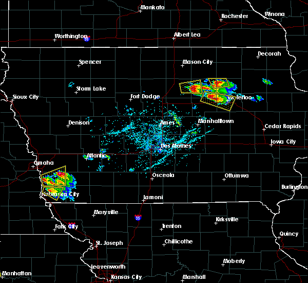 At 621 pm cdt, a severe thunderstorm was located near dike, or near cedar falls, moving east at 45 mph (trained weather spotters. at 6:19pm, trained weather spotters in parkersburg reported half dollar sized hail). Hazards include 60 mph wind gusts and half dollar size hail. Hail damage to vehicles is expected. expect wind damage to roofs, siding, and trees. locations impacted include, waterloo, cedar falls, evansdale, hudson, parkersburg, dike, elk run heights, crossroads mall, waterloo municipal airport, uni-dome and mcleod center, washburn, raymond, new hartford, stout and george wyth state park. This includes interstate 380 between mile markers 68 and 73. At 621 pm cdt, a severe thunderstorm was located near dike, or near cedar falls, moving east at 45 mph (trained weather spotters. at 6:19pm, trained weather spotters in parkersburg reported half dollar sized hail). Hazards include 60 mph wind gusts and half dollar size hail. Hail damage to vehicles is expected. expect wind damage to roofs, siding, and trees. locations impacted include, waterloo, cedar falls, evansdale, hudson, parkersburg, dike, elk run heights, crossroads mall, waterloo municipal airport, uni-dome and mcleod center, washburn, raymond, new hartford, stout and george wyth state park. This includes interstate 380 between mile markers 68 and 73.
|
| 6/15/2017 6:06 PM CDT |
 At 606 pm cdt, a severe thunderstorm was located over parkersburg, or 12 miles north of grundy center, moving east at 45 mph (radar indicated). Hazards include 60 mph wind gusts and half dollar size hail. Hail damage to vehicles is expected. Expect wind damage to roofs, siding, and trees. At 606 pm cdt, a severe thunderstorm was located over parkersburg, or 12 miles north of grundy center, moving east at 45 mph (radar indicated). Hazards include 60 mph wind gusts and half dollar size hail. Hail damage to vehicles is expected. Expect wind damage to roofs, siding, and trees.
|
| 5/17/2017 6:18 PM CDT | Estimated 6 inch diameter limb down pinning people in a car. numerous locations in north waterloo with smaller limbs down on streets and car in black hawk county IA, 2.6 miles SSE of Waterloo, IA |
| 5/17/2017 6:16 PM CDT |
 At 616 pm cdt, severe thunderstorms were located along a line extending from near nashua to near tripoli to near jesup, moving northeast at 55 mph (radar indicated). Hazards include 70 mph wind gusts. Expect considerable tree damage. Damage is likely to mobile homes, roofs, and outbuildings. At 616 pm cdt, severe thunderstorms were located along a line extending from near nashua to near tripoli to near jesup, moving northeast at 55 mph (radar indicated). Hazards include 70 mph wind gusts. Expect considerable tree damage. Damage is likely to mobile homes, roofs, and outbuildings.
|
| 5/17/2017 6:05 PM CDT |
 At 604 pm cdt, severe thunderstorms were located along a line extending from near marble rock to 6 miles west of tripoli to jesup, moving north at 55 mph (trained weather spotters. at 553 pm...70 mph winds were reported at the waterloo airport. numerous trees were reported down in town). Hazards include 70 mph wind gusts and nickel size hail. Expect considerable tree damage. damage is likely to mobile homes, roofs, and outbuildings. locations impacted include, waterloo, cedar falls, waverly, allison, evansdale, jesup, la porte city, hudson, sumner, denver, clarksville, tripoli, shell rock, greene, elk run heights, crossroads mall, waterloo municipal airport, uni-dome and mcleod center, janesville and washburn. this includes interstate 380 between mile markers 56 and 73. A tornado watch remains in effect until 700 pm cdt for central, north central and northeastern iowa. At 604 pm cdt, severe thunderstorms were located along a line extending from near marble rock to 6 miles west of tripoli to jesup, moving north at 55 mph (trained weather spotters. at 553 pm...70 mph winds were reported at the waterloo airport. numerous trees were reported down in town). Hazards include 70 mph wind gusts and nickel size hail. Expect considerable tree damage. damage is likely to mobile homes, roofs, and outbuildings. locations impacted include, waterloo, cedar falls, waverly, allison, evansdale, jesup, la porte city, hudson, sumner, denver, clarksville, tripoli, shell rock, greene, elk run heights, crossroads mall, waterloo municipal airport, uni-dome and mcleod center, janesville and washburn. this includes interstate 380 between mile markers 56 and 73. A tornado watch remains in effect until 700 pm cdt for central, north central and northeastern iowa.
|
| 5/17/2017 5:53 PM CDT | At waterloo airpor in black hawk county IA, 6.9 miles SE of Waterloo, IA |
| 5/17/2017 5:47 PM CDT |
 At 545 pm cdt, severe thunderstorms were located along a line extending from 7 miles northeast of hampton to near shell rock to 7 miles west of la porte city, moving northeast at 70 mph (trained weather spotters. numerous reports of 60 to 70 mph winds have been reported over northeast iowa. doppler radar indicates that the strongest winds are now moving into the southern sections of the waterloo area). Hazards include 70 mph wind gusts and nickel size hail. Expect considerable tree damage. damage is likely to mobile homes, roofs, and outbuildings. locations impacted include, waterloo, cedar falls, waverly, allison, evansdale, jesup, la porte city, hudson, sumner, parkersburg, denver, clarksville, tripoli, shell rock, greene, aplington, elk run heights, crossroads mall, waterloo municipal airport and uni-dome and mcleod center. this includes interstate 380 between mile markers 56 and 73. A tornado watch remains in effect until 700 pm cdt for central, north central and northeastern iowa. At 545 pm cdt, severe thunderstorms were located along a line extending from 7 miles northeast of hampton to near shell rock to 7 miles west of la porte city, moving northeast at 70 mph (trained weather spotters. numerous reports of 60 to 70 mph winds have been reported over northeast iowa. doppler radar indicates that the strongest winds are now moving into the southern sections of the waterloo area). Hazards include 70 mph wind gusts and nickel size hail. Expect considerable tree damage. damage is likely to mobile homes, roofs, and outbuildings. locations impacted include, waterloo, cedar falls, waverly, allison, evansdale, jesup, la porte city, hudson, sumner, parkersburg, denver, clarksville, tripoli, shell rock, greene, aplington, elk run heights, crossroads mall, waterloo municipal airport and uni-dome and mcleod center. this includes interstate 380 between mile markers 56 and 73. A tornado watch remains in effect until 700 pm cdt for central, north central and northeastern iowa.
|
| 5/17/2017 5:32 PM CDT |
 At 531 pm cdt, severe thunderstorms were located along a line extending from 6 miles north of iowa falls to 6 miles west of dike to near traer, moving northeast at 70 mph (trained weather spotters. numerous reports of 60 to 70 mph winds with tree damage across central and northeastern iowa). Hazards include 70 mph wind gusts and nickel size hail. Expect considerable tree damage. Damage is likely to mobile homes, roofs, and outbuildings. At 531 pm cdt, severe thunderstorms were located along a line extending from 6 miles north of iowa falls to 6 miles west of dike to near traer, moving northeast at 70 mph (trained weather spotters. numerous reports of 60 to 70 mph winds with tree damage across central and northeastern iowa). Hazards include 70 mph wind gusts and nickel size hail. Expect considerable tree damage. Damage is likely to mobile homes, roofs, and outbuildings.
|
| 5/17/2017 3:15 PM CDT | Quarter sized hail reported 4.3 miles S of Waterloo, IA |
| 5/17/2017 3:14 PM CDT |
 At 314 pm cdt, a severe thunderstorm was located near denver, or 8 miles north of waterloo, moving north at 50 mph (radar indicated). Hazards include 60 mph wind gusts and quarter size hail. Hail damage to vehicles is expected. Expect wind damage to roofs, siding, and trees. At 314 pm cdt, a severe thunderstorm was located near denver, or 8 miles north of waterloo, moving north at 50 mph (radar indicated). Hazards include 60 mph wind gusts and quarter size hail. Hail damage to vehicles is expected. Expect wind damage to roofs, siding, and trees.
|
| 4/15/2017 7:54 PM CDT |
 The severe thunderstorm warning for southeastern black hawk and northeastern tama counties will expire at 800 pm cdt, the storm which prompted the warning has moved out of the area. therefore the warning will be allowed to expire. however heavy rain is still possible with this thunderstorm. a severe thunderstorm watch remains in effect until 1100 pm cdt for central iowa. The severe thunderstorm warning for southeastern black hawk and northeastern tama counties will expire at 800 pm cdt, the storm which prompted the warning has moved out of the area. therefore the warning will be allowed to expire. however heavy rain is still possible with this thunderstorm. a severe thunderstorm watch remains in effect until 1100 pm cdt for central iowa.
|
| 4/15/2017 7:31 PM CDT | Quarter sized hail reported 6.2 miles WNW of Waterloo, IA |
| 4/15/2017 7:30 PM CDT |
 At 730 pm cdt, a severe thunderstorm was located near la porte city, or 14 miles northwest of vinton, moving east at 40 mph (radar indicated). Hazards include ping pong ball size hail and 60 mph wind gusts. People and animals outdoors will be injured. expect hail damage to roofs, siding, windows, and vehicles. expect wind damage to roofs, siding, and trees. locations impacted include, waterloo, evansdale, jesup, la porte city, traer, dysart, elk run heights, crossroads mall, washburn, raymond, gilbertville and tf clark state park. This includes interstate 380 between mile markers 56 and 72. At 730 pm cdt, a severe thunderstorm was located near la porte city, or 14 miles northwest of vinton, moving east at 40 mph (radar indicated). Hazards include ping pong ball size hail and 60 mph wind gusts. People and animals outdoors will be injured. expect hail damage to roofs, siding, windows, and vehicles. expect wind damage to roofs, siding, and trees. locations impacted include, waterloo, evansdale, jesup, la porte city, traer, dysart, elk run heights, crossroads mall, washburn, raymond, gilbertville and tf clark state park. This includes interstate 380 between mile markers 56 and 72.
|
| 4/15/2017 7:13 PM CDT |
 At 713 pm cdt, severe thunderstorms were located along a line extending from near hudson to 6 miles west of traer, moving east at 25 mph (radar indicated). Hazards include 60 mph wind gusts and quarter size hail. Hail damage to vehicles is expected. expect wind damage to roofs, siding, and trees. Locations impacted include, waterloo, marshalltown, hudson, reinbeck, meskwaki casino, gladbrook, le grand, garwin, montour, lincoln, green mountain, morrison and union grove state park. At 713 pm cdt, severe thunderstorms were located along a line extending from near hudson to 6 miles west of traer, moving east at 25 mph (radar indicated). Hazards include 60 mph wind gusts and quarter size hail. Hail damage to vehicles is expected. expect wind damage to roofs, siding, and trees. Locations impacted include, waterloo, marshalltown, hudson, reinbeck, meskwaki casino, gladbrook, le grand, garwin, montour, lincoln, green mountain, morrison and union grove state park.
|
| 4/15/2017 7:02 PM CDT |
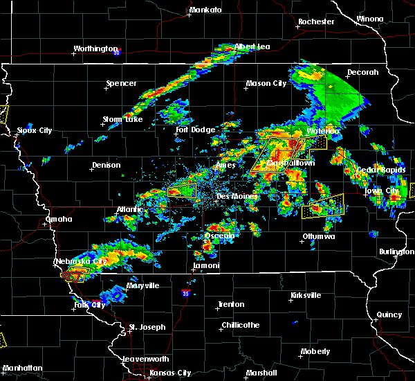 At 702 pm cdt, a severe thunderstorm was located near reinbeck, or 13 miles east of grundy center, moving east at 40 mph (radar indicated). Hazards include 60 mph wind gusts and quarter size hail. Hail damage to vehicles is expected. Expect wind damage to roofs, siding, and trees. At 702 pm cdt, a severe thunderstorm was located near reinbeck, or 13 miles east of grundy center, moving east at 40 mph (radar indicated). Hazards include 60 mph wind gusts and quarter size hail. Hail damage to vehicles is expected. Expect wind damage to roofs, siding, and trees.
|
| 4/15/2017 6:29 PM CDT |
 At 628 pm cdt, severe thunderstorms were located along a line extending from 6 miles north of grundy center to near conrad, moving east at 25 mph (radar indicated). Hazards include 60 mph wind gusts and quarter size hail. Hail damage to vehicles is expected. Expect wind damage to roofs, siding, and trees. At 628 pm cdt, severe thunderstorms were located along a line extending from 6 miles north of grundy center to near conrad, moving east at 25 mph (radar indicated). Hazards include 60 mph wind gusts and quarter size hail. Hail damage to vehicles is expected. Expect wind damage to roofs, siding, and trees.
|
| 3/6/2017 8:21 PM CST |
 The severe thunderstorm warning for black hawk, bremer, northeastern grundy and southeastern butler counties will expire at 830 pm cst, the storms which prompted the warning have moved out of the area. therefore the warning will be allowed to expire. a tornado watch remains in effect until 1000 pm cst for central, north central and northeastern iowa. The severe thunderstorm warning for black hawk, bremer, northeastern grundy and southeastern butler counties will expire at 830 pm cst, the storms which prompted the warning have moved out of the area. therefore the warning will be allowed to expire. a tornado watch remains in effect until 1000 pm cst for central, north central and northeastern iowa.
|
| 3/6/2017 8:03 PM CST |
 At 803 pm cst, severe thunderstorms were located along a line extending from near sumner to 6 miles northeast of traer, moving east at 50 mph (trained weather spotters. these storms have a history of producing thunderstorm wind damage). Hazards include 60 mph wind gusts and nickel size hail. Expect damage to roofs, siding, and trees. locations impacted include, waterloo, cedar falls, waverly, evansdale, jesup, la porte city, hudson, sumner, denver, reinbeck, tripoli, dike, elk run heights, crossroads mall, waterloo municipal airport, uni-dome and mcleod center, janesville, washburn, dunkerton and readlyn. this includes interstate 380 between mile markers 56 and 73. A tornado watch remains in effect until 1000 pm cst for central, north central and northeastern iowa. At 803 pm cst, severe thunderstorms were located along a line extending from near sumner to 6 miles northeast of traer, moving east at 50 mph (trained weather spotters. these storms have a history of producing thunderstorm wind damage). Hazards include 60 mph wind gusts and nickel size hail. Expect damage to roofs, siding, and trees. locations impacted include, waterloo, cedar falls, waverly, evansdale, jesup, la porte city, hudson, sumner, denver, reinbeck, tripoli, dike, elk run heights, crossroads mall, waterloo municipal airport, uni-dome and mcleod center, janesville, washburn, dunkerton and readlyn. this includes interstate 380 between mile markers 56 and 73. A tornado watch remains in effect until 1000 pm cst for central, north central and northeastern iowa.
|
| 3/6/2017 7:58 PM CST | . in black hawk county IA, 6.9 miles SE of Waterloo, IA |
| 3/6/2017 7:32 PM CST |
 At 732 pm cst, severe thunderstorms were located along a line extending from near shell rock to near conrad, moving east at 50 mph (radar indicated). Hazards include 60 mph wind gusts and nickel size hail. expect damage to roofs, siding, and trees At 732 pm cst, severe thunderstorms were located along a line extending from near shell rock to near conrad, moving east at 50 mph (radar indicated). Hazards include 60 mph wind gusts and nickel size hail. expect damage to roofs, siding, and trees
|
| 9/15/2016 8:03 PM CDT | . in black hawk county IA, 6.9 miles SE of Waterloo, IA |
| 8/4/2016 6:39 PM CDT |
 The severe thunderstorm warning for northern black hawk and bremer counties will expire at 645 pm cdt, the storm which prompted the warning has weakened below severe limits, and no longer poses an immediate threat to life or property. therefore the warning will be allowed to expire. however heavy rain is still possible with this thunderstorm. a severe thunderstorm watch remains in effect until midnight cdt for northeastern iowa. The severe thunderstorm warning for northern black hawk and bremer counties will expire at 645 pm cdt, the storm which prompted the warning has weakened below severe limits, and no longer poses an immediate threat to life or property. therefore the warning will be allowed to expire. however heavy rain is still possible with this thunderstorm. a severe thunderstorm watch remains in effect until midnight cdt for northeastern iowa.
|
| 8/4/2016 6:24 PM CDT |
 At 624 pm cdt, a severe thunderstorm was located near tripoli, or 12 miles east of waverly, moving east at 35 mph (radar indicated). Hazards include 60 mph wind gusts. Expect damage to roofs. siding. and trees. Locations impacted include, waterloo, cedar falls, waverly, sumner, denver, tripoli, waterloo municipal airport, janesville, dunkerton and readlyn. At 624 pm cdt, a severe thunderstorm was located near tripoli, or 12 miles east of waverly, moving east at 35 mph (radar indicated). Hazards include 60 mph wind gusts. Expect damage to roofs. siding. and trees. Locations impacted include, waterloo, cedar falls, waverly, sumner, denver, tripoli, waterloo municipal airport, janesville, dunkerton and readlyn.
|
| 8/4/2016 5:58 PM CDT |
 At 558 pm cdt, a severe thunderstorm was located near waverly, moving east at 55 mph (radar indicated). Hazards include 60 mph wind gusts. Expect damage to roofs. siding. And trees. At 558 pm cdt, a severe thunderstorm was located near waverly, moving east at 55 mph (radar indicated). Hazards include 60 mph wind gusts. Expect damage to roofs. siding. And trees.
|
| 8/4/2016 1:13 PM CDT | Large tree down on some power lines. delayed repor in black hawk county IA, 2.5 miles SE of Waterloo, IA |
| 7/23/2016 2:47 PM CDT |
 At 247 pm cdt, the leading edge of a severe thunderstorm was located near fairbank, or 11 miles west of oelwein, moving northeast at 30 mph (radar indicated). Hazards include 60 mph wind gusts and quarter size hail. Hail damage to vehicles is expected. expect wind damage to roofs, siding, and trees. Locations impacted include, waterloo, cedar falls, evansdale, hudson, sumner, denver, elk run heights, waterloo municipal airport, crossroads mall, uni-dome and mcleod center, dunkerton, readlyn, raymond and george wyth state park. At 247 pm cdt, the leading edge of a severe thunderstorm was located near fairbank, or 11 miles west of oelwein, moving northeast at 30 mph (radar indicated). Hazards include 60 mph wind gusts and quarter size hail. Hail damage to vehicles is expected. expect wind damage to roofs, siding, and trees. Locations impacted include, waterloo, cedar falls, evansdale, hudson, sumner, denver, elk run heights, waterloo municipal airport, crossroads mall, uni-dome and mcleod center, dunkerton, readlyn, raymond and george wyth state park.
|
| 7/23/2016 2:20 PM CDT |
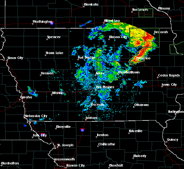 At 220 pm cdt, a severe thunderstorm was located over waterloo, moving northeast at 30 mph (radar indicated). Hazards include 60 mph wind gusts and quarter size hail. Hail damage to vehicles is expected. Expect wind damage to roofs, siding, and trees. At 220 pm cdt, a severe thunderstorm was located over waterloo, moving northeast at 30 mph (radar indicated). Hazards include 60 mph wind gusts and quarter size hail. Hail damage to vehicles is expected. Expect wind damage to roofs, siding, and trees.
|
| 7/17/2016 4:35 AM CDT | A shed and a morton building partially destroyed. numerous trees at least 12 to 18 inches in diameter snapped near the bas in black hawk county IA, 5.8 miles WNW of Waterloo, IA |
| 7/17/2016 4:26 AM CDT |
 At 426 am cdt, severe thunderstorms were located along a line extending from near hudson to 7 miles south of reinbeck to near state center, moving southeast at 55 mph (radar indicated). Hazards include 70 mph wind gusts. Expect considerable tree damage. damage is likely to mobile homes, roofs, and outbuildings. Locations impacted include, waterloo, cedar falls, marshalltown, grundy center, toledo, evansdale, tama, jesup, la porte city, hudson, traer, reinbeck, dysart, dike, elk run heights, conrad, crossroads mall, uni-dome and mcleod center, meskwaki casino and gladbrook. At 426 am cdt, severe thunderstorms were located along a line extending from near hudson to 7 miles south of reinbeck to near state center, moving southeast at 55 mph (radar indicated). Hazards include 70 mph wind gusts. Expect considerable tree damage. damage is likely to mobile homes, roofs, and outbuildings. Locations impacted include, waterloo, cedar falls, marshalltown, grundy center, toledo, evansdale, tama, jesup, la porte city, hudson, traer, reinbeck, dysart, dike, elk run heights, conrad, crossroads mall, uni-dome and mcleod center, meskwaki casino and gladbrook.
|
| 7/17/2016 4:16 AM CDT |
 At 416 am cdt, severe thunderstorms were located along a line extending from near dike to near conrad to near state center, moving east at 65 mph (radar indicated). Hazards include 70 mph wind gusts. Expect considerable tree damage. damage is likely to mobile homes, roofs, and outbuildings. Locations impacted include, waterloo, cedar falls, marshalltown, grundy center, toledo, evansdale, tama, jesup, la porte city, hudson, traer, reinbeck, dysart, dike, elk run heights, conrad, crossroads mall, uni-dome and mcleod center, meskwaki casino and gladbrook. At 416 am cdt, severe thunderstorms were located along a line extending from near dike to near conrad to near state center, moving east at 65 mph (radar indicated). Hazards include 70 mph wind gusts. Expect considerable tree damage. damage is likely to mobile homes, roofs, and outbuildings. Locations impacted include, waterloo, cedar falls, marshalltown, grundy center, toledo, evansdale, tama, jesup, la porte city, hudson, traer, reinbeck, dysart, dike, elk run heights, conrad, crossroads mall, uni-dome and mcleod center, meskwaki casino and gladbrook.
|
| 7/17/2016 4:00 AM CDT |
 At 400 am cdt, severe thunderstorms were located along a line extending from near ackley to 8 miles southwest of eldora to near nevada, moving southeast at 55 mph (radar indicated). Hazards include 60 mph wind gusts. Expect damage to roofs. siding. And trees. At 400 am cdt, severe thunderstorms were located along a line extending from near ackley to 8 miles southwest of eldora to near nevada, moving southeast at 55 mph (radar indicated). Hazards include 60 mph wind gusts. Expect damage to roofs. siding. And trees.
|
| 5/30/2016 8:18 PM CDT |
 At 818 pm cdt, a severe thunderstorm was located 5 miles northeast of elk run heights, or 8 miles east of waterloo, moving north at 20 mph (radar indicated). Hazards include 60 mph wind gusts and quarter size hail. Hail damage to vehicles is expected. expect wind damage to roofs, siding, and trees. Locations impacted include, jesup, elk run heights, dunkerton and raymond. At 818 pm cdt, a severe thunderstorm was located 5 miles northeast of elk run heights, or 8 miles east of waterloo, moving north at 20 mph (radar indicated). Hazards include 60 mph wind gusts and quarter size hail. Hail damage to vehicles is expected. expect wind damage to roofs, siding, and trees. Locations impacted include, jesup, elk run heights, dunkerton and raymond.
|
| 5/30/2016 8:05 PM CDT |
 At 804 pm cdt, a severe thunderstorm was located near elk run heights, or 8 miles east of waterloo, moving north at 20 mph (radar indicated). Hazards include 60 mph wind gusts and quarter size hail. Hail damage to vehicles is expected. Expect wind damage to roofs, siding, and trees. At 804 pm cdt, a severe thunderstorm was located near elk run heights, or 8 miles east of waterloo, moving north at 20 mph (radar indicated). Hazards include 60 mph wind gusts and quarter size hail. Hail damage to vehicles is expected. Expect wind damage to roofs, siding, and trees.
|
| 5/26/2016 4:40 AM CDT |
 The severe thunderstorm warning for northeastern tama, black hawk and southeastern bremer counties will expire at 445 am cdt, the storm which prompted the warning has moved out of the area. therefore the warning will be allowed to expire. The severe thunderstorm warning for northeastern tama, black hawk and southeastern bremer counties will expire at 445 am cdt, the storm which prompted the warning has moved out of the area. therefore the warning will be allowed to expire.
|
| 5/26/2016 4:19 AM CDT |
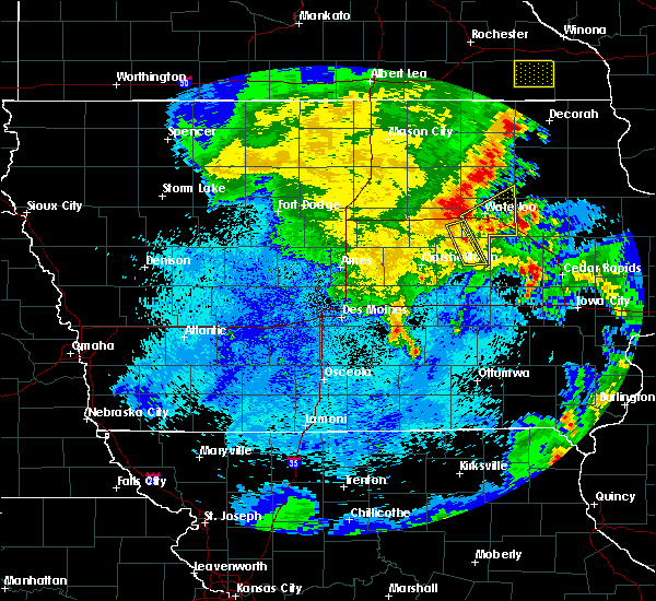 At 419 am cdt, a severe thunderstorm was located near hudson, or 8 miles southwest of waterloo, moving northeast at 55 mph (radar indicated). Hazards include 60 mph wind gusts. Expect damage to roofs. siding. And trees. At 419 am cdt, a severe thunderstorm was located near hudson, or 8 miles southwest of waterloo, moving northeast at 55 mph (radar indicated). Hazards include 60 mph wind gusts. Expect damage to roofs. siding. And trees.
|
| 11/11/2015 5:26 PM CST | The severe thunderstorm warning for black hawk county will expire at 530 pm cst, the storms which prompted the warning have moved out of the area. therefore the warning will be allowed to expire. a tornado watch remains in effect until 600 pm cst for northeastern iowa. |
| 11/11/2015 5:16 PM CST |
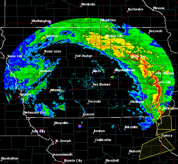 At 516 pm cst, a severe thunderstorm capable of producing a tornado was located 4 miles north of evansdale, or 4 miles northeast of waterloo, moving northeast at 45 mph (radar indicated rotation). Hazards include tornado. Flying debris will be dangerous to those caught without shelter. mobile homes will be damaged or destroyed. damage to roofs, windows and vehicles will occur. tree damage is likely. locations impacted include, waterloo, cedar falls, evansdale, elk run heights, waterloo municipal airport, crossroads mall, dunkerton, raymond and george wyth state park. This includes interstate 380 between mile markers 64 and 73. At 516 pm cst, a severe thunderstorm capable of producing a tornado was located 4 miles north of evansdale, or 4 miles northeast of waterloo, moving northeast at 45 mph (radar indicated rotation). Hazards include tornado. Flying debris will be dangerous to those caught without shelter. mobile homes will be damaged or destroyed. damage to roofs, windows and vehicles will occur. tree damage is likely. locations impacted include, waterloo, cedar falls, evansdale, elk run heights, waterloo municipal airport, crossroads mall, dunkerton, raymond and george wyth state park. This includes interstate 380 between mile markers 64 and 73.
|
| 11/11/2015 5:10 PM CST |
 At 510 pm cst, severe thunderstorms were located along a line extending from 4 miles northwest of waterloo municipal airport to 4 miles west of jesup to near brandon, moving northeast at 60 mph (radar indicated). Hazards include 60 mph wind gusts. Expect damage to roofs. siding and trees. locations impacted include, waterloo, cedar falls, evansdale, jesup, la porte city, hudson, elk run heights, waterloo municipal airport, crossroads mall, uni-dome and mcleod center, janesville, washburn, dunkerton, raymond, gilbertville and george wyth state park. this includes interstate 380 between mile markers 56 and 73. A tornado watch remains in effect until 600 pm cst for northeastern iowa. At 510 pm cst, severe thunderstorms were located along a line extending from 4 miles northwest of waterloo municipal airport to 4 miles west of jesup to near brandon, moving northeast at 60 mph (radar indicated). Hazards include 60 mph wind gusts. Expect damage to roofs. siding and trees. locations impacted include, waterloo, cedar falls, evansdale, jesup, la porte city, hudson, elk run heights, waterloo municipal airport, crossroads mall, uni-dome and mcleod center, janesville, washburn, dunkerton, raymond, gilbertville and george wyth state park. this includes interstate 380 between mile markers 56 and 73. A tornado watch remains in effect until 600 pm cst for northeastern iowa.
|
| 11/11/2015 5:09 PM CST |
 At 508 pm cst, a severe thunderstorm capable of producing a tornado was located just south of waterloo, moving northeast at 50 mph (radar indicated rotation). Hazards include tornado. Flying debris will be dangerous to those caught without shelter. mobile homes will be damaged or destroyed. damage to roofs, windows and vehicles will occur. tree damage is likely. this tornadic thunderstorm will remain over mainly rural areas of central black hawk county, including the following locations, george wyth state park, washburn, raymond, dunkerton and gilbertville. This includes interstate 380 between mile markers 59 and 73. At 508 pm cst, a severe thunderstorm capable of producing a tornado was located just south of waterloo, moving northeast at 50 mph (radar indicated rotation). Hazards include tornado. Flying debris will be dangerous to those caught without shelter. mobile homes will be damaged or destroyed. damage to roofs, windows and vehicles will occur. tree damage is likely. this tornadic thunderstorm will remain over mainly rural areas of central black hawk county, including the following locations, george wyth state park, washburn, raymond, dunkerton and gilbertville. This includes interstate 380 between mile markers 59 and 73.
|
| 11/11/2015 5:02 PM CST |
 At 502 pm cst, a severe thunderstorm capable of producing a tornado was located 6 miles southeast of hudson, or 8 miles south of waterloo, moving northeast at 45 mph (radar indicated rotation). Hazards include tornado. Flying debris will be dangerous to those caught without shelter. mobile homes will be damaged or destroyed. damage to roofs, windows and vehicles will occur. tree damage is likely. this dangerous storm will be near, crossroads mall around 510 pm cst. waterloo, evansdale, elk run heights and waterloo municipal airport around 515 pm cst. other locations impacted by this tornadic thunderstorm include george wyth state park, washburn, raymond, dunkerton and gilbertville. This includes interstate 380 between mile markers 59 and 73. At 502 pm cst, a severe thunderstorm capable of producing a tornado was located 6 miles southeast of hudson, or 8 miles south of waterloo, moving northeast at 45 mph (radar indicated rotation). Hazards include tornado. Flying debris will be dangerous to those caught without shelter. mobile homes will be damaged or destroyed. damage to roofs, windows and vehicles will occur. tree damage is likely. this dangerous storm will be near, crossroads mall around 510 pm cst. waterloo, evansdale, elk run heights and waterloo municipal airport around 515 pm cst. other locations impacted by this tornadic thunderstorm include george wyth state park, washburn, raymond, dunkerton and gilbertville. This includes interstate 380 between mile markers 59 and 73.
|
| 11/11/2015 4:39 PM CST |
 At 439 pm cst, severe thunderstorms were located along a line extending from 4 miles northeast of conrad to 3 miles southwest of traer to 6 miles west of keystone, moving northeast at 60 mph (radar indicated). Hazards include 60 mph wind gusts. Expect damage to roofs. Siding and trees. At 439 pm cst, severe thunderstorms were located along a line extending from 4 miles northeast of conrad to 3 miles southwest of traer to 6 miles west of keystone, moving northeast at 60 mph (radar indicated). Hazards include 60 mph wind gusts. Expect damage to roofs. Siding and trees.
|
| 6/22/2015 8:17 AM CDT |
 At 815 am cdt, severe thunderstorms were located along a line extending from near sumner to near waterloo to 8 miles southwest of eldora, moving east at 75 mph (radar indicated. at 809 am the waterloo airport reported 59 mph). Hazards include 60 mph wind gusts. Expect damage to roofs. siding and trees. locations impacted include, waterloo, cedar falls, waverly, iowa falls, eldora, grundy center, allison, evansdale, jesup, la porte city, hudson, sumner, parkersburg, denver, reinbeck, ackley, clarksville, tripoli, shell rock and dike. This includes interstate 380 between mile markers 57 and 73. At 815 am cdt, severe thunderstorms were located along a line extending from near sumner to near waterloo to 8 miles southwest of eldora, moving east at 75 mph (radar indicated. at 809 am the waterloo airport reported 59 mph). Hazards include 60 mph wind gusts. Expect damage to roofs. siding and trees. locations impacted include, waterloo, cedar falls, waverly, iowa falls, eldora, grundy center, allison, evansdale, jesup, la porte city, hudson, sumner, parkersburg, denver, reinbeck, ackley, clarksville, tripoli, shell rock and dike. This includes interstate 380 between mile markers 57 and 73.
|
| 6/22/2015 8:09 AM CDT | Storm damage reported in black hawk county IA, 6.9 miles SE of Waterloo, IA |
| 6/22/2015 8:06 AM CDT | Black hawk county emergency manager reports numerous trees and powerlines down in cedar falls...waterloo...and evansdale...time radar estimated in black hawk county IA, 1.7 miles ESE of Waterloo, IA |
| 6/22/2015 7:54 AM CDT |
 At 753 am cdt, severe thunderstorms were located along a line extending from 5 miles southwest of nashua to 3 miles south of aplington to 4 miles southwest of jewell junction, moving east at 75 mph (radar indicated). Hazards include 60 mph wind gusts and penny size hail. Expect damage to roofs. Siding and trees. At 753 am cdt, severe thunderstorms were located along a line extending from 5 miles southwest of nashua to 3 miles south of aplington to 4 miles southwest of jewell junction, moving east at 75 mph (radar indicated). Hazards include 60 mph wind gusts and penny size hail. Expect damage to roofs. Siding and trees.
|
| 5/4/2015 12:01 AM CDT | At 1200 am cdt, a severe thunderstorm was located 7 miles south of shell rock, or 8 miles northwest of cedar falls, moving east at 35 mph (radar indicated). Hazards include quarter size hail. Damage to vehicles is expected. locations impacted include, waterloo, cedar falls, waverly, denver, waterloo municipal airport, uni-dome and mcleod center, janesville, new hartford and george wyth state park. 1. 00in. |
| 5/3/2015 11:47 PM CDT | At 1147 pm cdt, a severe thunderstorm was located near parkersburg, or 11 miles south of allison, moving east at 35 mph (radar indicated). Hazards include 60 mph wind gusts and half dollar size hail. Hail damage to vehicles is expected. Expect wind damage to roofs, siding and trees. |
| 6/16/2014 8:50 PM CDT | Downed tree blocking the road. report via social media in black hawk county IA, 6.4 miles S of Waterloo, IA |
| 6/16/2014 8:26 PM CDT | 65 to 70 mph wind gust. several small tree limbs down. diameter unknow in black hawk county IA, 6 miles SSW of Waterloo, IA |
| 6/16/2014 8:21 PM CDT | Sustained 60 knots for 3 minutes in black hawk county IA, 6.9 miles SE of Waterloo, IA |
| 5/29/2013 4:38 PM CDT | Tree reported down. size unknown at this tim in black hawk county IA, 1.7 miles ESE of Waterloo, IA |
| 5/29/2013 4:30 PM CDT | Quarter sized hail reported 2 miles E of Waterloo, IA, from social media. |
| 4/29/2013 9:35 AM CDT | Quarter sized hail reported 2.2 miles S of Waterloo, IA, black hawk county emergency manager reported quarter size hail |
| 4/29/2013 9:30 AM CDT | Quarter sized hail reported 1.6 miles SSE of Waterloo, IA, one inch wide by one half inch thick hail measured at kwwl. |
| 4/29/2013 9:30 AM CDT | Quarter sized hail reported 2.4 miles SSE of Waterloo, IA, quarter sized hail covering the ground 2 to 3 inches deep at intersection of conger st and highway 63 |
| 4/29/2013 9:30 AM CDT | Quarter sized hail reported 3.5 miles SE of Waterloo, IA, measured at the pepsi plant |
| 4/29/2013 9:25 AM CDT | Hen Egg sized hail reported 4.1 miles SSE of Waterloo, IA, trained spotter estimated 2 inch diameter hail |
| 4/29/2013 9:20 AM CDT | Quarter sized hail reported 4.1 miles ESE of Waterloo, IA, hail covering the ground at the intersection of greenhill road and rainbow dr. relayed by kcvm |
| 5/24/2012 5:25 PM CDT | Measured by idot rwis in black hawk county IA, 2 miles NNW of Waterloo, IA |
| 5/24/2012 5:25 PM CDT | Uprooted 3 foot in diameter tree at orange elementary school...numerous large tree branches downed near school along washington street in black hawk county IA, 1.7 miles ESE of Waterloo, IA |
| 1/1/0001 12:00 AM | Storm damage reported in black hawk county IA, 6.9 miles SE of Waterloo, IA |
| 1/1/0001 12:00 AM | Small tree limbs down in black hawk county IA, 1.7 miles ESE of Waterloo, IA |
| 1/1/0001 12:00 AM | Storm damage reported in black hawk county IA, 1.4 miles NNW of Waterloo, IA |
| 1/1/0001 12:00 AM | Storm damage reported in black hawk county IA, 6.9 miles SE of Waterloo, IA |
| 1/1/0001 12:00 AM | Tree down at 11th and washington. size unknown. time estimated by rada in black hawk county IA, 1.7 miles ESE of Waterloo, IA |
Hail Maps for Waterloo, IA

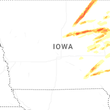
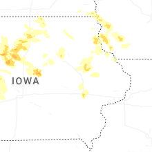
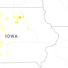
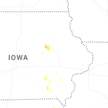
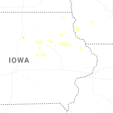
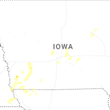
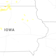
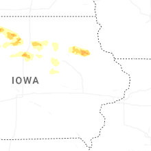
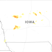
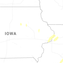


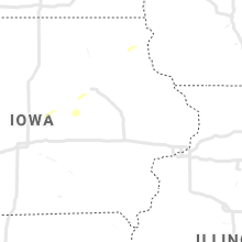


Connect with Interactive Hail Maps