

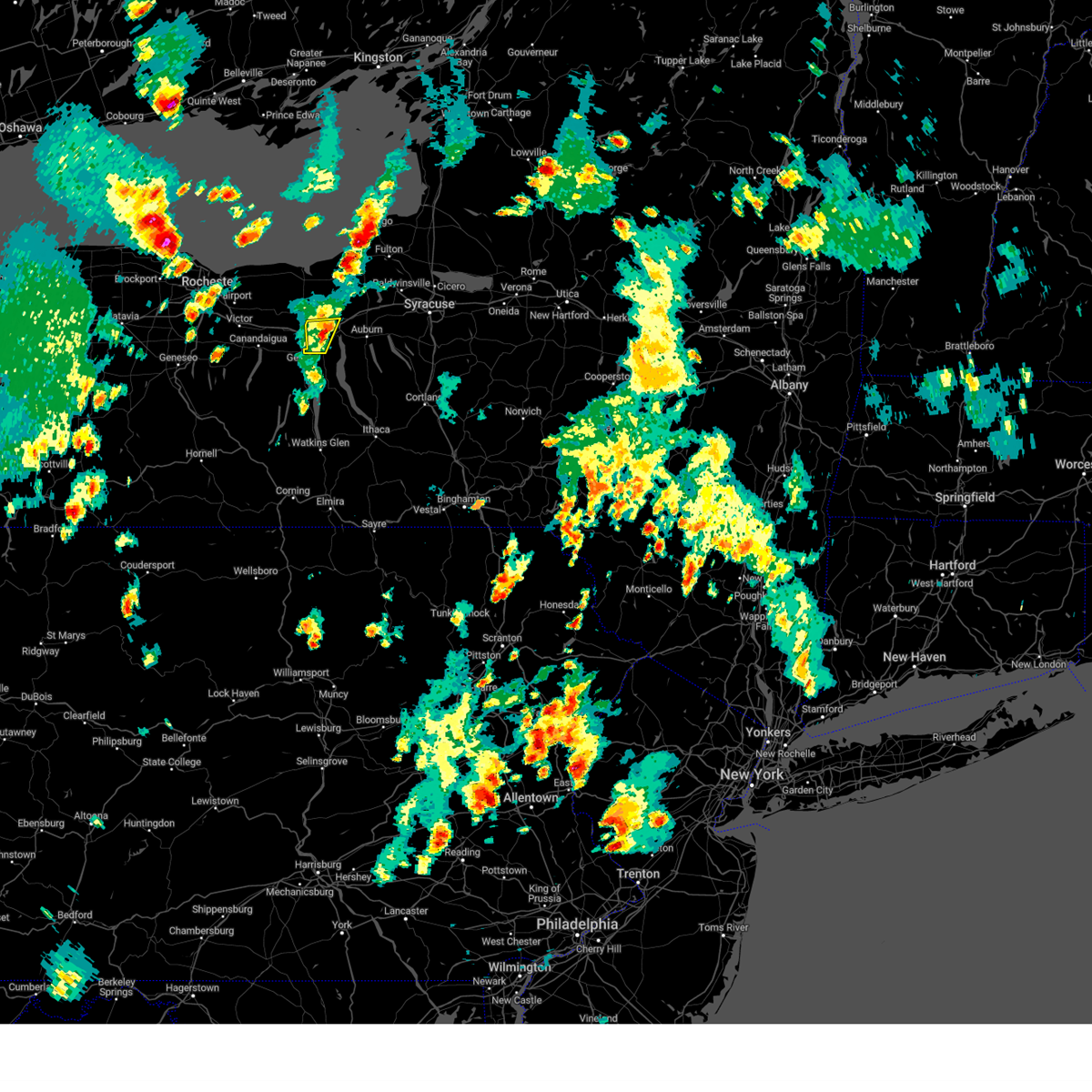
Hail Map for Waterloo, NY
The Waterloo, NY area has had 7 reports of on-the-ground hail by trained spotters, and has been under severe weather warnings 3 times during the past 12 months. Doppler radar has detected hail at or near Waterloo, NY on 20 occasions.
| Name: | Waterloo, NY |
| Where Located: | 37.5 miles WSW of Syracuse, NY |
| Map: | Google Map for Waterloo, NY |
| Population: | 5171 |
| Housing Units: | 2164 |
| More Info: | Search Google for Waterloo, NY |
2
The Top Recent Hail Date for Waterloo, NY is Saturday, June 22, 2024 (4th out of 20)

Hail and Wind Damage Spotted near Waterloo, NY
| Date / Time | Report Details |
|---|---|
| 6/11/2026 4:27 PM EDT |
 Svrbgm the national weather service in binghamton has issued a * severe thunderstorm warning for, seneca county in central new york, northern schuyler county in central new york, eastern yates county in central new york, western cayuga county in central new york, northwestern tompkins county in central new york, * until 530 pm edt. * at 426 pm edt, severe thunderstorms were located along a line extending from near geneva to himrod to near tyrone, moving east at 25 mph (radar indicated). Hazards include 60 mph wind gusts and quarter size hail. Hail damage to vehicles is expected. Expect wind damage to roofs, siding, and trees. Svrbgm the national weather service in binghamton has issued a * severe thunderstorm warning for, seneca county in central new york, northern schuyler county in central new york, eastern yates county in central new york, western cayuga county in central new york, northwestern tompkins county in central new york, * until 530 pm edt. * at 426 pm edt, severe thunderstorms were located along a line extending from near geneva to himrod to near tyrone, moving east at 25 mph (radar indicated). Hazards include 60 mph wind gusts and quarter size hail. Hail damage to vehicles is expected. Expect wind damage to roofs, siding, and trees.
|
| 5/13/2026 4:02 PM EDT |
 Svrbgm the national weather service in binghamton has issued a * severe thunderstorm warning for, seneca county in central new york, northeastern yates county in central new york, cayuga county in central new york, northwestern cortland county in central new york, onondaga county in central new york, * until 445 pm edt. * at 401 pm edt, severe thunderstorms were located along a line extending from near clyde to mays mills, moving east at 50 mph (radar indicated). Hazards include 60 mph wind gusts and penny size hail. expect damage to roofs, siding, and trees Svrbgm the national weather service in binghamton has issued a * severe thunderstorm warning for, seneca county in central new york, northeastern yates county in central new york, cayuga county in central new york, northwestern cortland county in central new york, onondaga county in central new york, * until 445 pm edt. * at 401 pm edt, severe thunderstorms were located along a line extending from near clyde to mays mills, moving east at 50 mph (radar indicated). Hazards include 60 mph wind gusts and penny size hail. expect damage to roofs, siding, and trees
|
| 7/7/2025 6:55 PM EDT |
 Svrbgm the national weather service in binghamton has issued a * severe thunderstorm warning for, northwestern seneca county in central new york, northwestern cayuga county in central new york, * until 800 pm edt. * at 655 pm edt, a severe thunderstorm was located over waterloo, moving east at 20 mph (radar indicated). Hazards include 60 mph wind gusts and quarter size hail. Hail damage to vehicles is expected. Expect wind damage to roofs, siding, and trees. Svrbgm the national weather service in binghamton has issued a * severe thunderstorm warning for, northwestern seneca county in central new york, northwestern cayuga county in central new york, * until 800 pm edt. * at 655 pm edt, a severe thunderstorm was located over waterloo, moving east at 20 mph (radar indicated). Hazards include 60 mph wind gusts and quarter size hail. Hail damage to vehicles is expected. Expect wind damage to roofs, siding, and trees.
|
| 4/29/2025 7:08 PM EDT |
 The storms which prompted the warning have weakened below severe limits, and no longer pose an immediate threat to life or property. therefore, the warning will be allowed to expire. a severe thunderstorm watch remains in effect until 1000 pm edt for central new york. The storms which prompted the warning have weakened below severe limits, and no longer pose an immediate threat to life or property. therefore, the warning will be allowed to expire. a severe thunderstorm watch remains in effect until 1000 pm edt for central new york.
|
| 4/29/2025 6:26 PM EDT |
 Svrbgm the national weather service in binghamton has issued a * severe thunderstorm warning for, seneca county in central new york, northeastern yates county in central new york, cayuga county in central new york, onondaga county in central new york, * until 715 pm edt. * at 626 pm edt, severe thunderstorms were located along a line extending from near camillus to melrose park to union springs to near romulus, moving east at 40 mph (radar indicated). Hazards include 60 mph wind gusts and penny size hail. expect damage to roofs, siding, and trees Svrbgm the national weather service in binghamton has issued a * severe thunderstorm warning for, seneca county in central new york, northeastern yates county in central new york, cayuga county in central new york, onondaga county in central new york, * until 715 pm edt. * at 626 pm edt, severe thunderstorms were located along a line extending from near camillus to melrose park to union springs to near romulus, moving east at 40 mph (radar indicated). Hazards include 60 mph wind gusts and penny size hail. expect damage to roofs, siding, and trees
|
| 4/29/2025 5:03 PM EDT |
 the severe thunderstorm warning has been cancelled and is no longer in effect the severe thunderstorm warning has been cancelled and is no longer in effect
|
| 4/29/2025 4:37 PM EDT |
 Svrbgm the national weather service in binghamton has issued a * severe thunderstorm warning for, northwestern seneca county in central new york, * until 515 pm edt. * at 435 pm edt, a severe thunderstorm was located over clifton springs, or near canandaigua, moving east at 50 mph (radar indicated). Hazards include 60 mph wind gusts and quarter size hail. Hail damage to vehicles is possible. Expect wind damage to trees and power lines. Svrbgm the national weather service in binghamton has issued a * severe thunderstorm warning for, northwestern seneca county in central new york, * until 515 pm edt. * at 435 pm edt, a severe thunderstorm was located over clifton springs, or near canandaigua, moving east at 50 mph (radar indicated). Hazards include 60 mph wind gusts and quarter size hail. Hail damage to vehicles is possible. Expect wind damage to trees and power lines.
|
| 3/16/2025 4:44 PM EDT |
 The storms which prompted the warning have moved out of the area. therefore, the warning will be allowed to expire. a severe thunderstorm watch remains in effect until 700 pm edt for central new york. to report severe weather, contact your nearest law enforcement agency. they will relay your report to the national weather service binghamton. The storms which prompted the warning have moved out of the area. therefore, the warning will be allowed to expire. a severe thunderstorm watch remains in effect until 700 pm edt for central new york. to report severe weather, contact your nearest law enforcement agency. they will relay your report to the national weather service binghamton.
|
| 3/16/2025 4:24 PM EDT |
 At 424 pm edt, severe thunderstorms were located along a line extending from near waterloo to enfield, moving northeast at 55 mph (radar indicated). Hazards include 60 mph wind gusts. Expect damage to roofs, siding, and trees. locations impacted include, cayuga heights, east venice, allan h. Treman state marine park, canoga, buttermilk falls state park, waterloo, fayette, montville, long point state park, and cayuga. At 424 pm edt, severe thunderstorms were located along a line extending from near waterloo to enfield, moving northeast at 55 mph (radar indicated). Hazards include 60 mph wind gusts. Expect damage to roofs, siding, and trees. locations impacted include, cayuga heights, east venice, allan h. Treman state marine park, canoga, buttermilk falls state park, waterloo, fayette, montville, long point state park, and cayuga.
|
| 3/16/2025 4:24 PM EDT |
 the severe thunderstorm warning has been cancelled and is no longer in effect the severe thunderstorm warning has been cancelled and is no longer in effect
|
| 3/16/2025 4:17 PM EDT |
 Svrbgm the national weather service in binghamton has issued a * severe thunderstorm warning for, seneca county in central new york, eastern schuyler county in central new york, broome county in central new york, cayuga county in central new york, cortland county in central new york, eastern chemung county in central new york, tioga county in central new york, onondaga county in central new york, tompkins county in central new york, * until 515 pm edt. * at 417 pm edt, severe thunderstorms were located along a line extending from 6 miles southeast of lyons to lowman, moving northeast at 60 mph (radar indicated). Hazards include 60 mph wind gusts. expect damage to roofs, siding, and trees Svrbgm the national weather service in binghamton has issued a * severe thunderstorm warning for, seneca county in central new york, eastern schuyler county in central new york, broome county in central new york, cayuga county in central new york, cortland county in central new york, eastern chemung county in central new york, tioga county in central new york, onondaga county in central new york, tompkins county in central new york, * until 515 pm edt. * at 417 pm edt, severe thunderstorms were located along a line extending from 6 miles southeast of lyons to lowman, moving northeast at 60 mph (radar indicated). Hazards include 60 mph wind gusts. expect damage to roofs, siding, and trees
|
| 3/16/2025 4:11 PM EDT | Tree and limbs in roadway... blocking only one lane of the road. time estimated by rada in ontario county NY, 5.2 miles E of Waterloo, NY |
| 3/16/2025 3:50 PM EDT |
 Svrbgm the national weather service in binghamton has issued a * severe thunderstorm warning for, seneca county in central new york, schuyler county in central new york, eastern yates county in central new york, cayuga county in central new york, north central chemung county in central new york, tompkins county in central new york, * until 445 pm edt. * at 350 pm edt, severe thunderstorms were located along a line extending from near vine valley to coopers plains, moving northeast at 55 mph (radar indicated). Hazards include 60 mph wind gusts. expect damage to roofs, siding, and trees Svrbgm the national weather service in binghamton has issued a * severe thunderstorm warning for, seneca county in central new york, schuyler county in central new york, eastern yates county in central new york, cayuga county in central new york, north central chemung county in central new york, tompkins county in central new york, * until 445 pm edt. * at 350 pm edt, severe thunderstorms were located along a line extending from near vine valley to coopers plains, moving northeast at 55 mph (radar indicated). Hazards include 60 mph wind gusts. expect damage to roofs, siding, and trees
|
| 7/15/2024 5:36 PM EDT |
 the severe thunderstorm warning has been cancelled and is no longer in effect the severe thunderstorm warning has been cancelled and is no longer in effect
|
| 7/15/2024 5:36 PM EDT |
 At 536 pm edt, a severe thunderstorm was located over fleming, or near auburn, moving northeast at 55 mph (radar indicated). Hazards include 60 mph wind gusts and quarter size hail. Hail damage to vehicles is expected. expect wind damage to roofs, siding, and trees. Locations impacted include, auburn, seneca falls, waterloo, romulus, fayette, owasco, sennett, fleming, genoa, and ledyard. At 536 pm edt, a severe thunderstorm was located over fleming, or near auburn, moving northeast at 55 mph (radar indicated). Hazards include 60 mph wind gusts and quarter size hail. Hail damage to vehicles is expected. expect wind damage to roofs, siding, and trees. Locations impacted include, auburn, seneca falls, waterloo, romulus, fayette, owasco, sennett, fleming, genoa, and ledyard.
|
| 7/15/2024 5:00 PM EDT |
 Svrbgm the national weather service in binghamton has issued a * severe thunderstorm warning for, seneca county in central new york, northeastern yates county in central new york, cayuga county in central new york, * until 545 pm edt. * at 500 pm edt, a severe thunderstorm was located over willard, or 9 miles east of penn yan, moving northeast at 50 mph (radar indicated). Hazards include 60 mph wind gusts and quarter size hail. Hail damage to vehicles is expected. Expect wind damage to roofs, siding, and trees. Svrbgm the national weather service in binghamton has issued a * severe thunderstorm warning for, seneca county in central new york, northeastern yates county in central new york, cayuga county in central new york, * until 545 pm edt. * at 500 pm edt, a severe thunderstorm was located over willard, or 9 miles east of penn yan, moving northeast at 50 mph (radar indicated). Hazards include 60 mph wind gusts and quarter size hail. Hail damage to vehicles is expected. Expect wind damage to roofs, siding, and trees.
|
| 7/10/2024 3:31 PM EDT |
 The tornado warning that was previously in effect has been reissued for north central seneca and northwestern cayuga counties and is in effect until 400 pm. please refer to that bulletin for the latest severe weather information. a tornado watch remains in effect until 900 pm edt for central new york. to report severe weather, contact your nearest law enforcement agency. they will relay your report to the national weather service binghamton. The tornado warning that was previously in effect has been reissued for north central seneca and northwestern cayuga counties and is in effect until 400 pm. please refer to that bulletin for the latest severe weather information. a tornado watch remains in effect until 900 pm edt for central new york. to report severe weather, contact your nearest law enforcement agency. they will relay your report to the national weather service binghamton.
|
| 7/10/2024 3:17 PM EDT |
 At 317 pm edt, a severe thunderstorm capable of producing a tornado was located over lehigh vallley junction, or near seneca falls, moving northeast at 35 mph (radar indicated rotation). Hazards include tornado and quarter size hail. Flying debris will be dangerous to those caught without shelter. mobile homes will be damaged or destroyed. damage to roofs, windows, and vehicles will occur. tree damage is likely. This dangerous storm will be near, cayuga around 325 pm edt. At 317 pm edt, a severe thunderstorm capable of producing a tornado was located over lehigh vallley junction, or near seneca falls, moving northeast at 35 mph (radar indicated rotation). Hazards include tornado and quarter size hail. Flying debris will be dangerous to those caught without shelter. mobile homes will be damaged or destroyed. damage to roofs, windows, and vehicles will occur. tree damage is likely. This dangerous storm will be near, cayuga around 325 pm edt.
|
| 7/10/2024 3:16 PM EDT | Trees and wires dow in seneca county NY, 4.6 miles SSW of Waterloo, NY |
| 7/10/2024 3:15 PM EDT | Trees down in waterloo. one large tree has fallen onto a home. unknown injurie in seneca county NY, 0.3 miles S of Waterloo, NY |
| 7/10/2024 2:57 PM EDT |
 Torbgm the national weather service in binghamton has issued a * tornado warning for, northwestern seneca county in central new york, western cayuga county in central new york, * until 330 pm edt. * at 256 pm edt, a severe thunderstorm capable of producing a tornado was located over geneva, moving northeast at 35 mph (radar indicated rotation). Hazards include tornado and quarter size hail. Flying debris will be dangerous to those caught without shelter. mobile homes will be damaged or destroyed. damage to roofs, windows, and vehicles will occur. tree damage is likely. this dangerous storm will be near, waterloo around 305 pm edt. seneca falls around 310 pm edt. lehigh vallley junction around 315 pm edt. Cayuga around 320 pm edt. Torbgm the national weather service in binghamton has issued a * tornado warning for, northwestern seneca county in central new york, western cayuga county in central new york, * until 330 pm edt. * at 256 pm edt, a severe thunderstorm capable of producing a tornado was located over geneva, moving northeast at 35 mph (radar indicated rotation). Hazards include tornado and quarter size hail. Flying debris will be dangerous to those caught without shelter. mobile homes will be damaged or destroyed. damage to roofs, windows, and vehicles will occur. tree damage is likely. this dangerous storm will be near, waterloo around 305 pm edt. seneca falls around 310 pm edt. lehigh vallley junction around 315 pm edt. Cayuga around 320 pm edt.
|
| 6/30/2024 3:42 AM EDT |
 Svrbgm the national weather service in binghamton has issued a * severe thunderstorm warning for, northwestern seneca county in central new york, northwestern cayuga county in central new york, * until 430 am edt. * at 341 am edt, a severe thunderstorm was located over geneva, moving east at 45 mph (radar indicated). Hazards include 60 mph wind gusts and penny size hail. expect damage to roofs, siding, and trees Svrbgm the national weather service in binghamton has issued a * severe thunderstorm warning for, northwestern seneca county in central new york, northwestern cayuga county in central new york, * until 430 am edt. * at 341 am edt, a severe thunderstorm was located over geneva, moving east at 45 mph (radar indicated). Hazards include 60 mph wind gusts and penny size hail. expect damage to roofs, siding, and trees
|
| 6/22/2024 8:20 PM EDT |
 The storm which prompted the warning has moved out of the area. therefore, the warning will be allowed to expire. The storm which prompted the warning has moved out of the area. therefore, the warning will be allowed to expire.
|
| 6/22/2024 8:07 PM EDT |
 At 807 pm edt, a severe thunderstorm was located over montezuma, or 9 miles northwest of auburn, moving northeast at 35 mph (radar indicated). Hazards include 60 mph wind gusts and quarter size hail. Hail damage to vehicles is expected. expect wind damage to roofs, siding, and trees. Locations impacted include, auburn, seneca falls, waterloo, sennett, montezuma, tyre, cayuga, lehigh vallley junction, throopsville, and dublin. At 807 pm edt, a severe thunderstorm was located over montezuma, or 9 miles northwest of auburn, moving northeast at 35 mph (radar indicated). Hazards include 60 mph wind gusts and quarter size hail. Hail damage to vehicles is expected. expect wind damage to roofs, siding, and trees. Locations impacted include, auburn, seneca falls, waterloo, sennett, montezuma, tyre, cayuga, lehigh vallley junction, throopsville, and dublin.
|
| 6/22/2024 7:42 PM EDT |
 Svrbgm the national weather service in binghamton has issued a * severe thunderstorm warning for, northwestern seneca county in central new york, northwestern cayuga county in central new york, * until 830 pm edt. * at 742 pm edt, a severe thunderstorm was located near waterloo, moving northeast at 35 mph (radar indicated). Hazards include 60 mph wind gusts and quarter size hail. Hail damage to vehicles is expected. Expect wind damage to roofs, siding, and trees. Svrbgm the national weather service in binghamton has issued a * severe thunderstorm warning for, northwestern seneca county in central new york, northwestern cayuga county in central new york, * until 830 pm edt. * at 742 pm edt, a severe thunderstorm was located near waterloo, moving northeast at 35 mph (radar indicated). Hazards include 60 mph wind gusts and quarter size hail. Hail damage to vehicles is expected. Expect wind damage to roofs, siding, and trees.
|
| 6/22/2024 6:31 PM EDT |
 At 631 pm edt, a severe thunderstorm was located near lehigh vallley junction, or near seneca falls, moving northeast at 35 mph (radar indicated). Hazards include 60 mph wind gusts and penny size hail. Expect damage to roofs, siding, and trees. Locations impacted include, seneca falls, waterloo, montezuma, tyre, cayuga, lehigh vallley junction, dublin, magee, and packwood corners. At 631 pm edt, a severe thunderstorm was located near lehigh vallley junction, or near seneca falls, moving northeast at 35 mph (radar indicated). Hazards include 60 mph wind gusts and penny size hail. Expect damage to roofs, siding, and trees. Locations impacted include, seneca falls, waterloo, montezuma, tyre, cayuga, lehigh vallley junction, dublin, magee, and packwood corners.
|
| 6/22/2024 6:14 PM EDT |
 Svrbgm the national weather service in binghamton has issued a * severe thunderstorm warning for, northwestern seneca county in central new york, northwestern cayuga county in central new york, * until 645 pm edt. * at 613 pm edt, a severe thunderstorm was located near waterloo, moving northeast at 35 mph (radar indicated). Hazards include 60 mph wind gusts and penny size hail. expect damage to roofs, siding, and trees Svrbgm the national weather service in binghamton has issued a * severe thunderstorm warning for, northwestern seneca county in central new york, northwestern cayuga county in central new york, * until 645 pm edt. * at 613 pm edt, a severe thunderstorm was located near waterloo, moving northeast at 35 mph (radar indicated). Hazards include 60 mph wind gusts and penny size hail. expect damage to roofs, siding, and trees
|
| 6/22/2024 5:59 PM EDT |
 At 558 pm edt, a severe thunderstorm was located near benton, or near geneva, moving northeast at 35 mph (radar indicated). Hazards include 60 mph wind gusts and nickel size hail. Expect damage to roofs, siding, and trees. Locations impacted include, seneca falls, waterloo, romulus, fayette, benton, kendaia, ferguson corners, sampson state park, border city, and rose hill. At 558 pm edt, a severe thunderstorm was located near benton, or near geneva, moving northeast at 35 mph (radar indicated). Hazards include 60 mph wind gusts and nickel size hail. Expect damage to roofs, siding, and trees. Locations impacted include, seneca falls, waterloo, romulus, fayette, benton, kendaia, ferguson corners, sampson state park, border city, and rose hill.
|
| 6/22/2024 5:39 PM EDT |
 Svrbgm the national weather service in binghamton has issued a * severe thunderstorm warning for, northwestern seneca county in central new york, northeastern yates county in central new york, * until 615 pm edt. * at 539 pm edt, a severe thunderstorm was located near ferguson corners, or 7 miles northwest of penn yan, moving east at 35 mph (radar indicated). Hazards include 60 mph wind gusts and nickel size hail. expect damage to roofs, siding, and trees Svrbgm the national weather service in binghamton has issued a * severe thunderstorm warning for, northwestern seneca county in central new york, northeastern yates county in central new york, * until 615 pm edt. * at 539 pm edt, a severe thunderstorm was located near ferguson corners, or 7 miles northwest of penn yan, moving east at 35 mph (radar indicated). Hazards include 60 mph wind gusts and nickel size hail. expect damage to roofs, siding, and trees
|
| 6/17/2024 5:16 PM EDT |
 At 514 pm edt, severe thunderstorms were located along a line extending from near waterloo to near tyrone, moving east at 20 mph. the strongest storm was in the south end of the line, just west of glenora, and will cross the south end of seneca lake towards hector shortly. additional stronger storms may develop further north in the line (radar indicated). Hazards include 60 mph wind gusts and penny size hail. Expect damage to roofs, siding, and trees. Locations impacted include, seneca falls, waterloo, penn yan, hector, romulus, fayette, starkey, watkins glen, dundee, and montour falls. At 514 pm edt, severe thunderstorms were located along a line extending from near waterloo to near tyrone, moving east at 20 mph. the strongest storm was in the south end of the line, just west of glenora, and will cross the south end of seneca lake towards hector shortly. additional stronger storms may develop further north in the line (radar indicated). Hazards include 60 mph wind gusts and penny size hail. Expect damage to roofs, siding, and trees. Locations impacted include, seneca falls, waterloo, penn yan, hector, romulus, fayette, starkey, watkins glen, dundee, and montour falls.
|
| 6/17/2024 5:07 PM EDT |
 Svrbgm the national weather service in binghamton has issued a * severe thunderstorm warning for, seneca county in central new york, schuyler county in central new york, eastern yates county in central new york, * until 600 pm edt. * at 506 pm edt, severe thunderstorms were located along a line extending from near geneva to tyrone, moving east at 20 mph (radar indicated). Hazards include 60 mph wind gusts and penny size hail. expect damage to roofs, siding, and trees Svrbgm the national weather service in binghamton has issued a * severe thunderstorm warning for, seneca county in central new york, schuyler county in central new york, eastern yates county in central new york, * until 600 pm edt. * at 506 pm edt, severe thunderstorms were located along a line extending from near geneva to tyrone, moving east at 20 mph (radar indicated). Hazards include 60 mph wind gusts and penny size hail. expect damage to roofs, siding, and trees
|
| 5/22/2024 4:19 PM EDT |
 the severe thunderstorm warning has been cancelled and is no longer in effect the severe thunderstorm warning has been cancelled and is no longer in effect
|
| 5/22/2024 4:19 PM EDT |
 At 419 pm edt, a severe thunderstorm was located over cayuga, or near seneca falls, moving northeast at 55 mph (radar indicated). Hazards include 60 mph wind gusts and quarter size hail. Hail damage to vehicles is expected. expect wind damage to roofs, siding, and trees. Locations impacted include, auburn, seneca falls, waterloo, romulus, fayette, montezuma, union springs, tyre, cayuga, and kendaia. At 419 pm edt, a severe thunderstorm was located over cayuga, or near seneca falls, moving northeast at 55 mph (radar indicated). Hazards include 60 mph wind gusts and quarter size hail. Hail damage to vehicles is expected. expect wind damage to roofs, siding, and trees. Locations impacted include, auburn, seneca falls, waterloo, romulus, fayette, montezuma, union springs, tyre, cayuga, and kendaia.
|
| 5/22/2024 3:54 PM EDT |
 Svrbgm the national weather service in binghamton has issued a * severe thunderstorm warning for, seneca county in central new york, northeastern yates county in central new york, northwestern cayuga county in central new york, * until 445 pm edt. * at 353 pm edt, a severe thunderstorm was located over benton, or near penn yan, moving northeast at 55 mph (radar indicated). Hazards include 60 mph wind gusts and quarter size hail. Hail damage to vehicles is expected. Expect wind damage to roofs, siding, and trees. Svrbgm the national weather service in binghamton has issued a * severe thunderstorm warning for, seneca county in central new york, northeastern yates county in central new york, northwestern cayuga county in central new york, * until 445 pm edt. * at 353 pm edt, a severe thunderstorm was located over benton, or near penn yan, moving northeast at 55 mph (radar indicated). Hazards include 60 mph wind gusts and quarter size hail. Hail damage to vehicles is expected. Expect wind damage to roofs, siding, and trees.
|
| 8/12/2023 2:01 PM EDT |
 At 201 pm edt, a severe thunderstorm was located near kendaia, or near geneva, moving east at 25 mph (radar indicated). Hazards include 60 mph wind gusts and quarter size hail. Hail damage to vehicles is expected. Expect wind damage to roofs, siding, and trees. At 201 pm edt, a severe thunderstorm was located near kendaia, or near geneva, moving east at 25 mph (radar indicated). Hazards include 60 mph wind gusts and quarter size hail. Hail damage to vehicles is expected. Expect wind damage to roofs, siding, and trees.
|
| 8/7/2023 6:01 PM EDT |
 At 601 pm edt, severe thunderstorms were located along a line extending from 6 miles east of fair haven beach state park to near weedsport to near kendaia, moving northeast at 30 mph (radar indicated). Hazards include 60 mph wind gusts and penny size hail. expect damage to roofs, siding, and trees At 601 pm edt, severe thunderstorms were located along a line extending from 6 miles east of fair haven beach state park to near weedsport to near kendaia, moving northeast at 30 mph (radar indicated). Hazards include 60 mph wind gusts and penny size hail. expect damage to roofs, siding, and trees
|
| 8/7/2023 5:25 PM EDT |
 At 525 pm edt, severe thunderstorms were located along a line extending from near chimney bluffs state park to near lyons to near potter, moving northeast at 35 mph (radar indicated). Hazards include 60 mph wind gusts and penny size hail. Expect damage to roofs, siding, and trees. locations impacted include, auburn, seneca falls, waterloo, fayette, sennett, benton, union springs, tyre, cayuga and canoga. hail threat, radar indicated max hail size, 0. 75 in wind threat, radar indicated max wind gust, 60 mph. At 525 pm edt, severe thunderstorms were located along a line extending from near chimney bluffs state park to near lyons to near potter, moving northeast at 35 mph (radar indicated). Hazards include 60 mph wind gusts and penny size hail. Expect damage to roofs, siding, and trees. locations impacted include, auburn, seneca falls, waterloo, fayette, sennett, benton, union springs, tyre, cayuga and canoga. hail threat, radar indicated max hail size, 0. 75 in wind threat, radar indicated max wind gust, 60 mph.
|
| 8/7/2023 5:05 PM EDT |
 At 505 pm edt, severe thunderstorms were located along a line extending from near marion to near clifton springs to near italy, moving northeast at 35 mph (radar indicated). Hazards include 60 mph wind gusts and penny size hail. expect damage to roofs, siding, and trees At 505 pm edt, severe thunderstorms were located along a line extending from near marion to near clifton springs to near italy, moving northeast at 35 mph (radar indicated). Hazards include 60 mph wind gusts and penny size hail. expect damage to roofs, siding, and trees
|
| 7/24/2023 1:33 PM EDT |
 At 132 pm edt, a severe thunderstorm was located over geneva, moving northeast at 15 mph (radar indicated). Hazards include 60 mph wind gusts and quarter size hail. Hail damage to vehicles is expected. Expect wind damage to roofs, siding, and trees. At 132 pm edt, a severe thunderstorm was located over geneva, moving northeast at 15 mph (radar indicated). Hazards include 60 mph wind gusts and quarter size hail. Hail damage to vehicles is expected. Expect wind damage to roofs, siding, and trees.
|
| 7/13/2023 2:14 PM EDT |
 At 213 pm edt, severe thunderstorms were located along a line extending from throopsville to near ovid, moving northeast at 75 mph (radar indicated). Hazards include 60 mph wind gusts and nickel size hail. Expect damage to roofs, siding, and trees. locations impacted include, auburn, seneca falls, waterloo, romulus, fayette, owasco, fleming, genoa, ledyard and union springs. hail threat, radar indicated max hail size, 0. 88 in wind threat, radar indicated max wind gust, 60 mph. At 213 pm edt, severe thunderstorms were located along a line extending from throopsville to near ovid, moving northeast at 75 mph (radar indicated). Hazards include 60 mph wind gusts and nickel size hail. Expect damage to roofs, siding, and trees. locations impacted include, auburn, seneca falls, waterloo, romulus, fayette, owasco, fleming, genoa, ledyard and union springs. hail threat, radar indicated max hail size, 0. 88 in wind threat, radar indicated max wind gust, 60 mph.
|
| 7/13/2023 2:00 PM EDT |
 At 200 pm edt, severe thunderstorms were located along a line extending from near waterloo to mays mills, moving east at 30 mph (radar indicated). Hazards include 60 mph wind gusts and nickel size hail. expect damage to roofs, siding, and trees At 200 pm edt, severe thunderstorms were located along a line extending from near waterloo to mays mills, moving east at 30 mph (radar indicated). Hazards include 60 mph wind gusts and nickel size hail. expect damage to roofs, siding, and trees
|
| 6/26/2023 6:13 PM EDT |
 At 613 pm edt, a severe thunderstorm was located over canoga, or near seneca falls, moving northeast at 20 mph (radar indicated). Hazards include 60 mph wind gusts and quarter size hail. Hail damage to vehicles is expected. Expect wind damage to roofs, siding, and trees. At 613 pm edt, a severe thunderstorm was located over canoga, or near seneca falls, moving northeast at 20 mph (radar indicated). Hazards include 60 mph wind gusts and quarter size hail. Hail damage to vehicles is expected. Expect wind damage to roofs, siding, and trees.
|
| 6/26/2023 5:48 PM EDT |
 At 548 pm edt, a severe thunderstorm was located over seneca falls, moving north at 30 mph (radar indicated). Hazards include 60 mph wind gusts and half dollar size hail. Hail damage to vehicles is expected. Expect wind damage to roofs, siding, and trees. At 548 pm edt, a severe thunderstorm was located over seneca falls, moving north at 30 mph (radar indicated). Hazards include 60 mph wind gusts and half dollar size hail. Hail damage to vehicles is expected. Expect wind damage to roofs, siding, and trees.
|
| 6/26/2023 2:52 PM EDT |
 The severe thunderstorm warning for northwestern seneca county will expire at 300 pm edt, the severe thunderstorm which prompted the warning has weakened. therefore, the warning will be allowed to expire. a severe thunderstorm watch remains in effect until 900 pm edt for central new york. The severe thunderstorm warning for northwestern seneca county will expire at 300 pm edt, the severe thunderstorm which prompted the warning has weakened. therefore, the warning will be allowed to expire. a severe thunderstorm watch remains in effect until 900 pm edt for central new york.
|
| 6/26/2023 2:42 PM EDT |
 At 242 pm edt, a severe thunderstorm was located near waterloo, moving north at 15 mph (radar indicated). Hazards include 60 mph wind gusts and quarter size hail. Hail damage to vehicles is expected. expect wind damage to roofs, siding, and trees. locations impacted include, seneca falls, waterloo, tyre, border city, dublin, magee, packwood corners and rose hill. hail threat, radar indicated max hail size, 1. 00 in wind threat, radar indicated max wind gust, 60 mph. At 242 pm edt, a severe thunderstorm was located near waterloo, moving north at 15 mph (radar indicated). Hazards include 60 mph wind gusts and quarter size hail. Hail damage to vehicles is expected. expect wind damage to roofs, siding, and trees. locations impacted include, seneca falls, waterloo, tyre, border city, dublin, magee, packwood corners and rose hill. hail threat, radar indicated max hail size, 1. 00 in wind threat, radar indicated max wind gust, 60 mph.
|
| 6/26/2023 2:30 PM EDT | Tree fell on top of mobile home. radar estimated time. via county dispatc in seneca county NY, 4.4 miles ENE of Waterloo, NY |
| 6/26/2023 2:18 PM EDT |
 At 217 pm edt, a severe thunderstorm was located near kendaia, or near geneva, moving north at 15 mph (radar indicated). Hazards include 60 mph wind gusts and quarter size hail. Hail damage to vehicles is expected. expect wind damage to roofs, siding, and trees. locations impacted include, seneca falls, waterloo, tyre, border city, dublin, magee, packwood corners and rose hill. hail threat, radar indicated max hail size, 1. 00 in wind threat, radar indicated max wind gust, 60 mph. At 217 pm edt, a severe thunderstorm was located near kendaia, or near geneva, moving north at 15 mph (radar indicated). Hazards include 60 mph wind gusts and quarter size hail. Hail damage to vehicles is expected. expect wind damage to roofs, siding, and trees. locations impacted include, seneca falls, waterloo, tyre, border city, dublin, magee, packwood corners and rose hill. hail threat, radar indicated max hail size, 1. 00 in wind threat, radar indicated max wind gust, 60 mph.
|
| 6/26/2023 2:06 PM EDT |
 At 206 pm edt, a severe thunderstorm was located near kendaia, or 7 miles south of geneva, moving north at 15 mph (radar indicated). Hazards include 60 mph wind gusts and quarter size hail. Hail damage to vehicles is expected. Expect wind damage to roofs, siding, and trees. At 206 pm edt, a severe thunderstorm was located near kendaia, or 7 miles south of geneva, moving north at 15 mph (radar indicated). Hazards include 60 mph wind gusts and quarter size hail. Hail damage to vehicles is expected. Expect wind damage to roofs, siding, and trees.
|
| 4/1/2023 4:27 PM EDT |
 At 427 pm edt, severe thunderstorms were located along a line extending from 7 miles north of sodus to millport, moving east at 50 mph (radar indicated). Hazards include 60 mph wind gusts and penny size hail. Expect damage to roofs, siding, and trees. locations impacted include, ithaca, auburn, seneca falls, bath, newfield, waterloo, penn yan, hector, romulus and fayette. hail threat, radar indicated max hail size, 0. 75 in wind threat, observed max wind gust, 60 mph. At 427 pm edt, severe thunderstorms were located along a line extending from 7 miles north of sodus to millport, moving east at 50 mph (radar indicated). Hazards include 60 mph wind gusts and penny size hail. Expect damage to roofs, siding, and trees. locations impacted include, ithaca, auburn, seneca falls, bath, newfield, waterloo, penn yan, hector, romulus and fayette. hail threat, radar indicated max hail size, 0. 75 in wind threat, observed max wind gust, 60 mph.
|
| 4/1/2023 3:49 PM EDT |
 At 349 pm edt, severe thunderstorms were located along a line extending from near greece to cameron, moving east at 50 mph (radar indicated). Hazards include 60 mph wind gusts and penny size hail. expect damage to roofs, siding, and trees At 349 pm edt, severe thunderstorms were located along a line extending from near greece to cameron, moving east at 50 mph (radar indicated). Hazards include 60 mph wind gusts and penny size hail. expect damage to roofs, siding, and trees
|
| 9/22/2022 2:12 AM EDT | Wires down... causing a power outage on seneca boulevard. time estimated from rada in seneca county NY, 4.4 miles ENE of Waterloo, NY |
| 9/22/2022 2:04 AM EDT |
 At 204 am edt, a severe thunderstorm was located over phelps, or 7 miles north of geneva, moving east at 50 mph (radar indicated). Hazards include 60 mph wind gusts and quarter size hail. Hail damage to vehicles is expected. Expect wind damage to roofs, siding, and trees. At 204 am edt, a severe thunderstorm was located over phelps, or 7 miles north of geneva, moving east at 50 mph (radar indicated). Hazards include 60 mph wind gusts and quarter size hail. Hail damage to vehicles is expected. Expect wind damage to roofs, siding, and trees.
|
| 8/17/2022 5:23 PM EDT |
 At 523 pm edt, a severe thunderstorm was located over waterloo, and is nearly stationary (radar indicated). Hazards include 60 mph wind gusts and quarter size hail. Hail damage to vehicles is expected. Expect wind damage to roofs, siding, and trees. At 523 pm edt, a severe thunderstorm was located over waterloo, and is nearly stationary (radar indicated). Hazards include 60 mph wind gusts and quarter size hail. Hail damage to vehicles is expected. Expect wind damage to roofs, siding, and trees.
|
| 6/16/2022 5:20 PM EDT |
 At 520 pm edt, severe thunderstorms were located along a line extending from cayuga to near kirkville, moving east at 15 mph (radar indicated). Hazards include 60 mph wind gusts and quarter size hail. Hail damage to vehicles is expected. expect wind damage to roofs, siding, and trees. Locations impacted include, onondaga, syracuse, auburn, de witt, van buren, north syracuse, seneca falls, solvay, waterloo and chittenango. At 520 pm edt, severe thunderstorms were located along a line extending from cayuga to near kirkville, moving east at 15 mph (radar indicated). Hazards include 60 mph wind gusts and quarter size hail. Hail damage to vehicles is expected. expect wind damage to roofs, siding, and trees. Locations impacted include, onondaga, syracuse, auburn, de witt, van buren, north syracuse, seneca falls, solvay, waterloo and chittenango.
|
| 6/16/2022 4:50 PM EDT |
 At 450 pm edt, severe thunderstorms were located along a line extending from near waterloo to near liverpool, moving east at 15 mph (radar indicated). Hazards include 60 mph wind gusts and quarter size hail. Hail damage to vehicles is expected. Expect wind damage to roofs, siding, and trees. At 450 pm edt, severe thunderstorms were located along a line extending from near waterloo to near liverpool, moving east at 15 mph (radar indicated). Hazards include 60 mph wind gusts and quarter size hail. Hail damage to vehicles is expected. Expect wind damage to roofs, siding, and trees.
|
| 5/16/2022 12:36 PM EDT |
 At 1235 pm edt, severe thunderstorms were located along a line extending from near canoga to levanna to king ferry to near locke, moving north at 35 mph (radar indicated). Hazards include 60 mph wind gusts and quarter size hail. Hail damage to vehicles is expected. Expect wind damage to roofs, siding, and trees. At 1235 pm edt, severe thunderstorms were located along a line extending from near canoga to levanna to king ferry to near locke, moving north at 35 mph (radar indicated). Hazards include 60 mph wind gusts and quarter size hail. Hail damage to vehicles is expected. Expect wind damage to roofs, siding, and trees.
|
| 8/29/2021 4:01 PM EDT |
 At 400 pm edt, severe thunderstorms were located along a line extending from near montezuma to near waterloo, moving east at 20 mph (radar indicated). Hazards include 60 mph wind gusts and penny size hail. Expect damage to roofs, siding, and trees. locations impacted include, auburn, seneca falls, fayette, union springs, cayuga, canoga, throopsville, rose hill, cayuga lake state park and fosterville. hail threat, radar indicated max hail size, 0. 75 in wind threat, radar indicated max wind gust, 60 mph. At 400 pm edt, severe thunderstorms were located along a line extending from near montezuma to near waterloo, moving east at 20 mph (radar indicated). Hazards include 60 mph wind gusts and penny size hail. Expect damage to roofs, siding, and trees. locations impacted include, auburn, seneca falls, fayette, union springs, cayuga, canoga, throopsville, rose hill, cayuga lake state park and fosterville. hail threat, radar indicated max hail size, 0. 75 in wind threat, radar indicated max wind gust, 60 mph.
|
| 8/29/2021 3:59 PM EDT | Pole down across yellow tavern rd. time estimated from rada in seneca county NY, 3.8 miles N of Waterloo, NY |
| 8/29/2021 3:44 PM EDT | Trees down on marshall rd... time estimated from rada in seneca county NY, 1.5 miles NE of Waterloo, NY |
| 8/29/2021 3:40 PM EDT | Tree down blocking serven rd... time estimated from rada in seneca county NY, 4.6 miles E of Waterloo, NY |
| 8/29/2021 3:37 PM EDT |
 At 336 pm edt, severe thunderstorms were located along a line extending from near lyons to near geneva, moving east at 25 mph (radar indicated). Hazards include 60 mph wind gusts. expect damage to roofs, siding, and trees At 336 pm edt, severe thunderstorms were located along a line extending from near lyons to near geneva, moving east at 25 mph (radar indicated). Hazards include 60 mph wind gusts. expect damage to roofs, siding, and trees
|
| 6/30/2021 2:15 PM EDT | Tree down on road. time estimated by rada in seneca county NY, 0.3 miles S of Waterloo, NY |
| 6/30/2021 2:13 PM EDT | Tree down across the road. time estimated by radar. time estimated by rada in seneca county NY, 1 miles ESE of Waterloo, NY |
| 6/30/2021 2:07 PM EDT |
 At 206 pm edt, a severe thunderstorm was located near waterloo, moving east at 35 mph (radar indicated). Hazards include 60 mph wind gusts and quarter size hail. Hail damage to vehicles is expected. Expect wind damage to roofs, siding, and trees. At 206 pm edt, a severe thunderstorm was located near waterloo, moving east at 35 mph (radar indicated). Hazards include 60 mph wind gusts and quarter size hail. Hail damage to vehicles is expected. Expect wind damage to roofs, siding, and trees.
|
| 6/21/2021 4:44 PM EDT |
 At 444 pm edt, severe thunderstorms were located along a line extending from near waterloo to near addison, moving east at 40 mph (radar indicated). Hazards include 60 mph wind gusts and quarter size hail. Hail damage to vehicles is expected. expect wind damage to roofs, siding, and trees. Locations impacted include, corning, seneca falls, bath, waterloo, penn yan, romulus, fayette, starkey, campbell and benton. At 444 pm edt, severe thunderstorms were located along a line extending from near waterloo to near addison, moving east at 40 mph (radar indicated). Hazards include 60 mph wind gusts and quarter size hail. Hail damage to vehicles is expected. expect wind damage to roofs, siding, and trees. Locations impacted include, corning, seneca falls, bath, waterloo, penn yan, romulus, fayette, starkey, campbell and benton.
|
| 6/21/2021 4:16 PM EDT |
 At 415 pm edt, severe thunderstorms were located along a line extending from near rushville to near troupsburg, moving east at 40 mph (radar indicated). Hazards include 60 mph wind gusts and quarter size hail. Hail damage to vehicles is expected. Expect wind damage to roofs, siding, and trees. At 415 pm edt, severe thunderstorms were located along a line extending from near rushville to near troupsburg, moving east at 40 mph (radar indicated). Hazards include 60 mph wind gusts and quarter size hail. Hail damage to vehicles is expected. Expect wind damage to roofs, siding, and trees.
|
| 5/26/2021 12:38 PM EDT |
 At 1238 pm edt, severe thunderstorms were located along a line extending from lysander to near keuka park, moving east at 45 mph (radar indicated). Hazards include 60 mph wind gusts and penny size hail. expect damage to roofs, siding, and trees At 1238 pm edt, severe thunderstorms were located along a line extending from lysander to near keuka park, moving east at 45 mph (radar indicated). Hazards include 60 mph wind gusts and penny size hail. expect damage to roofs, siding, and trees
|
| 8/27/2020 3:37 PM EDT |
 At 335 pm edt, a severe thunderstorm was located over montville, or 12 miles northwest of cortland, moving southeast at 40 mph (radar indicated). Hazards include 60 mph wind gusts and quarter size hail. Hail damage to vehicles is expected. expect wind damage to roofs, siding, and trees. Locations impacted include, auburn, seneca falls, waterloo, fayette, owasco, fleming, moravia, union springs, niles and sempronius. At 335 pm edt, a severe thunderstorm was located over montville, or 12 miles northwest of cortland, moving southeast at 40 mph (radar indicated). Hazards include 60 mph wind gusts and quarter size hail. Hail damage to vehicles is expected. expect wind damage to roofs, siding, and trees. Locations impacted include, auburn, seneca falls, waterloo, fayette, owasco, fleming, moravia, union springs, niles and sempronius.
|
| 8/27/2020 3:13 PM EDT |
 At 312 pm edt, a severe thunderstorm was located near geneva, moving east at 50 mph (radar indicated). Hazards include 60 mph wind gusts and half dollar size hail. Hail damage to vehicles is expected. Expect wind damage to roofs, siding, and trees. At 312 pm edt, a severe thunderstorm was located near geneva, moving east at 50 mph (radar indicated). Hazards include 60 mph wind gusts and half dollar size hail. Hail damage to vehicles is expected. Expect wind damage to roofs, siding, and trees.
|
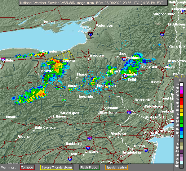
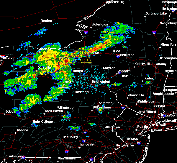
| 7/29/2020 5:12 PM EDT |
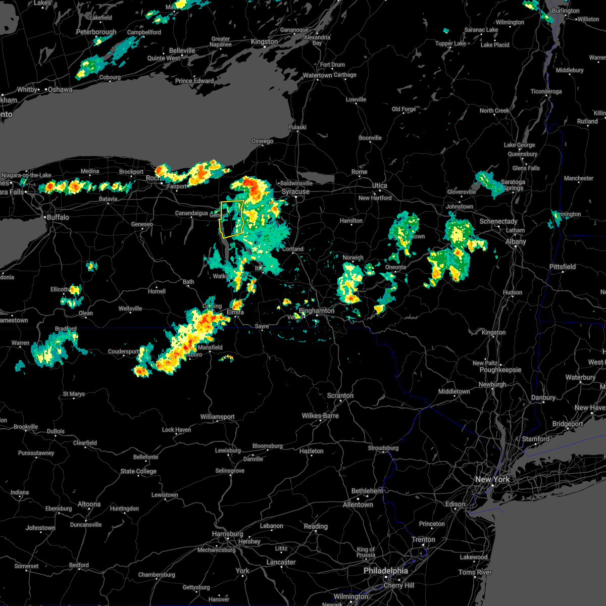 The severe thunderstorm warning for northwestern seneca county will expire at 515 pm edt, the storm which prompted the warning is exiting the area. therefore, the warning will be allowed to expire. this storm caused down trees and powerlines. to report severe weather, contact your nearest law enforcement agency. they will relay your report to the national weather service binghamton. The severe thunderstorm warning for northwestern seneca county will expire at 515 pm edt, the storm which prompted the warning is exiting the area. therefore, the warning will be allowed to expire. this storm caused down trees and powerlines. to report severe weather, contact your nearest law enforcement agency. they will relay your report to the national weather service binghamton.
|
| 7/29/2020 5:01 PM EDT |
 At 459 pm edt, severe thunderstorms were located along a line extending from near lyons to near waterloo to near benton, moving east at 35 mph (radar indicated. at approximately 450 pm trees and wires were reported down over parts of yates and seneca counties). Hazards include 60 mph wind gusts and penny size hail. Expect damage to roofs, siding, powerlines and trees. Locations impacted include, seneca falls, waterloo, romulus, fayette, montezuma, tyre, kendaia, canoga, lehigh vallley junction and border city. At 459 pm edt, severe thunderstorms were located along a line extending from near lyons to near waterloo to near benton, moving east at 35 mph (radar indicated. at approximately 450 pm trees and wires were reported down over parts of yates and seneca counties). Hazards include 60 mph wind gusts and penny size hail. Expect damage to roofs, siding, powerlines and trees. Locations impacted include, seneca falls, waterloo, romulus, fayette, montezuma, tyre, kendaia, canoga, lehigh vallley junction and border city.
|
| 7/29/2020 4:55 PM EDT | Trees and wires down along miller road as per county dispatch feed. car hit tree but drove away. no known injurie in seneca county NY, 3.2 miles N of Waterloo, NY |
| 7/29/2020 4:50 PM EDT | Radar estimated time. tree down on west town line roa in seneca county NY, 0.4 miles N of Waterloo, NY |
| 7/29/2020 4:36 PM EDT |
 At 434 pm edt, severe thunderstorms were located along a line extending from near clifton springs to near geneva to potter, moving northeast at 35 mph (radar indicated). Hazards include 60 mph wind gusts and penny size hail. expect damage to roofs, siding, powerlines and trees At 434 pm edt, severe thunderstorms were located along a line extending from near clifton springs to near geneva to potter, moving northeast at 35 mph (radar indicated). Hazards include 60 mph wind gusts and penny size hail. expect damage to roofs, siding, powerlines and trees
|
| 7/19/2020 4:14 PM EDT |
 At 411 pm edt, severe thunderstorms were located along a line extending from near lehigh vallley junction to near benton to near himrod to campbell, moving east at 35 mph. trees have been blown down with this line of thunderstorms (law enforcement). Hazards include 60 mph wind gusts and penny size hail. Expect damage to roofs, siding, and trees. Locations impacted include, ithaca, auburn, corning, big flats, seneca falls, horseheads, newfield, waterloo, penn yan and hector. At 411 pm edt, severe thunderstorms were located along a line extending from near lehigh vallley junction to near benton to near himrod to campbell, moving east at 35 mph. trees have been blown down with this line of thunderstorms (law enforcement). Hazards include 60 mph wind gusts and penny size hail. Expect damage to roofs, siding, and trees. Locations impacted include, ithaca, auburn, corning, big flats, seneca falls, horseheads, newfield, waterloo, penn yan and hector.
|
| 7/19/2020 3:56 PM EDT |
 At 354 pm edt, severe thunderstorms were located along a line extending from near phelps to rushville to near branchport to west cameron, moving east at 35 mph. trees have been blown down in steuben county, in howard, with this line of thunderstorms (law enforcement). Hazards include 60 mph wind gusts and penny size hail. expect damage to roofs, siding, and trees At 354 pm edt, severe thunderstorms were located along a line extending from near phelps to rushville to near branchport to west cameron, moving east at 35 mph. trees have been blown down in steuben county, in howard, with this line of thunderstorms (law enforcement). Hazards include 60 mph wind gusts and penny size hail. expect damage to roofs, siding, and trees
|
| 5/15/2020 4:04 PM EDT |
 At 404 pm edt, severe thunderstorms were located along a line extending from near aurora to near dresden to near himrod to near pulteney, moving east at 55 mph (radar indicated). Hazards include 60 mph wind gusts and penny size hail. Expect damage to roofs, siding, and trees. Locations impacted include, seneca falls, waterloo, penn yan, romulus, fayette, benton, dundee, ovid, dresden and lodi. At 404 pm edt, severe thunderstorms were located along a line extending from near aurora to near dresden to near himrod to near pulteney, moving east at 55 mph (radar indicated). Hazards include 60 mph wind gusts and penny size hail. Expect damage to roofs, siding, and trees. Locations impacted include, seneca falls, waterloo, penn yan, romulus, fayette, benton, dundee, ovid, dresden and lodi.
|
| 5/15/2020 3:56 PM EDT |
 At 356 pm edt, a severe thunderstorm was located over canoga, or near seneca falls, moving east at 60 mph (radar indicated). Hazards include 60 mph wind gusts and half dollar size hail. Hail damage to vehicles is expected. Expect wind damage to roofs, siding, and trees. At 356 pm edt, a severe thunderstorm was located over canoga, or near seneca falls, moving east at 60 mph (radar indicated). Hazards include 60 mph wind gusts and half dollar size hail. Hail damage to vehicles is expected. Expect wind damage to roofs, siding, and trees.
|
| 5/15/2020 3:53 PM EDT | Tree down on county rt 9 in seneca county NY, 1.9 miles NNW of Waterloo, NY |
| 5/15/2020 3:45 PM EDT |
 At 345 pm edt, severe thunderstorms were located along a line extending from near geneva to near naples, moving east at 45 mph (radar indicated). Hazards include 60 mph wind gusts and half dollar size hail. Hail damage to vehicles is expected. expect wind damage to roofs, siding, and trees. Locations impacted include, seneca falls, waterloo, penn yan, romulus, fayette, benton, potter, wayland, dundee and middlesex. At 345 pm edt, severe thunderstorms were located along a line extending from near geneva to near naples, moving east at 45 mph (radar indicated). Hazards include 60 mph wind gusts and half dollar size hail. Hail damage to vehicles is expected. expect wind damage to roofs, siding, and trees. Locations impacted include, seneca falls, waterloo, penn yan, romulus, fayette, benton, potter, wayland, dundee and middlesex.
|
| 5/15/2020 3:26 PM EDT |
 At 325 pm edt, severe thunderstorms were located along a line extending from near rushville to dansville, moving east at 40 mph (radar indicated). Hazards include 60 mph wind gusts and nickel size hail. expect damage to roofs, siding, and trees At 325 pm edt, severe thunderstorms were located along a line extending from near rushville to dansville, moving east at 40 mph (radar indicated). Hazards include 60 mph wind gusts and nickel size hail. expect damage to roofs, siding, and trees
|
| 8/16/2019 8:02 PM EDT |
 A severe thunderstorm warning remains in effect until 845 pm edt for seneca and cayuga counties. at 801 pm edt, a severe thunderstorm was located over romulus, or 9 miles south of seneca falls, moving northeast at 30 mph. hazard. 60 mph wind gusts and quarter size hail. source. Radar indicated. A severe thunderstorm warning remains in effect until 845 pm edt for seneca and cayuga counties. at 801 pm edt, a severe thunderstorm was located over romulus, or 9 miles south of seneca falls, moving northeast at 30 mph. hazard. 60 mph wind gusts and quarter size hail. source. Radar indicated.
|
| 8/16/2019 7:43 PM EDT |
 At 743 pm edt, a severe thunderstorm was located near dresden, or 7 miles northeast of penn yan, moving northeast at 30 mph (radar indicated). Hazards include 60 mph wind gusts and quarter size hail. Hail damage to vehicles is expected. Expect wind damage to roofs, siding, and trees. At 743 pm edt, a severe thunderstorm was located near dresden, or 7 miles northeast of penn yan, moving northeast at 30 mph (radar indicated). Hazards include 60 mph wind gusts and quarter size hail. Hail damage to vehicles is expected. Expect wind damage to roofs, siding, and trees.
|
| 8/8/2019 1:50 PM EDT |
 At 148 pm edt, severe thunderstorms were located along a line extending from near oswego to ovid, moving east at 50 mph (law enforcement has reported multiple trees and wires down in the penn yan area). Hazards include 60 mph wind gusts and penny size hail. Expect damage to roofs, siding, and trees. Locations impacted include, auburn, seneca falls, waterloo, hector, romulus, fayette, owasco, sennett, starkey and fleming. At 148 pm edt, severe thunderstorms were located along a line extending from near oswego to ovid, moving east at 50 mph (law enforcement has reported multiple trees and wires down in the penn yan area). Hazards include 60 mph wind gusts and penny size hail. Expect damage to roofs, siding, and trees. Locations impacted include, auburn, seneca falls, waterloo, hector, romulus, fayette, owasco, sennett, starkey and fleming.
|
| 8/8/2019 1:20 PM EDT |
 At 119 pm edt, severe thunderstorms were located along a line extending from 6 miles north of chimney bluffs state park to near italy, moving east at 40 mph (radar indicated). Hazards include 60 mph wind gusts and penny size hail. expect damage to roofs, siding, and trees At 119 pm edt, severe thunderstorms were located along a line extending from 6 miles north of chimney bluffs state park to near italy, moving east at 40 mph (radar indicated). Hazards include 60 mph wind gusts and penny size hail. expect damage to roofs, siding, and trees
|
| 5/25/2019 8:52 PM EDT |
 The severe thunderstorm warning for central seneca and eastern yates counties will expire at 900 pm edt, the storms which prompted the warning have moved out of the area. therefore, the warning will be allowed to expire. The severe thunderstorm warning for central seneca and eastern yates counties will expire at 900 pm edt, the storms which prompted the warning have moved out of the area. therefore, the warning will be allowed to expire.
|
| 5/25/2019 8:41 PM EDT |
 At 841 pm edt, severe thunderstorms were located along a line extending from near ferguson corners to near cohocton, moving east at 45 mph (radar indicated). Hazards include 60 mph wind gusts. Expect damage to roofs, siding, and trees. Locations impacted include, seneca falls, waterloo, penn yan, romulus, fayette, starkey, dundee, montezuma, ovid and cayuga. At 841 pm edt, severe thunderstorms were located along a line extending from near ferguson corners to near cohocton, moving east at 45 mph (radar indicated). Hazards include 60 mph wind gusts. Expect damage to roofs, siding, and trees. Locations impacted include, seneca falls, waterloo, penn yan, romulus, fayette, starkey, dundee, montezuma, ovid and cayuga.
|
| 5/25/2019 8:16 PM EDT |
 The national weather service in binghamton has issued a * severe thunderstorm warning for. seneca county in central new york. yates county in central new york. northern steuben county in central new york. Until 900 pm edt. The national weather service in binghamton has issued a * severe thunderstorm warning for. seneca county in central new york. yates county in central new york. northern steuben county in central new york. Until 900 pm edt.
|
| 9/21/2018 7:40 PM EDT |
 At 739 pm edt, severe thunderstorms were located along a line extending from near lehigh vallley junction to near canoga to near dresden to bluff point to near pulteney to near avoca to howard, moving east at 55 mph (radar indicated). Hazards include 60 mph wind gusts. Expect damage to roofs, siding, and trees. severe thunderstorms will be near, seneca falls, romulus and montezuma around 745 pm edt. auburn, sennett and ovid around 750 pm edt. dundee, starkey and fleming around 755 pm edt. hector, owasco and campbell around 800 pm edt. covert, genoa and marcellus around 805 pm edt. watkins glen, locke and moravia around 810 pm edt. Ithaca, montour falls and odessa around 815 pm edt. At 739 pm edt, severe thunderstorms were located along a line extending from near lehigh vallley junction to near canoga to near dresden to bluff point to near pulteney to near avoca to howard, moving east at 55 mph (radar indicated). Hazards include 60 mph wind gusts. Expect damage to roofs, siding, and trees. severe thunderstorms will be near, seneca falls, romulus and montezuma around 745 pm edt. auburn, sennett and ovid around 750 pm edt. dundee, starkey and fleming around 755 pm edt. hector, owasco and campbell around 800 pm edt. covert, genoa and marcellus around 805 pm edt. watkins glen, locke and moravia around 810 pm edt. Ithaca, montour falls and odessa around 815 pm edt.
|
| 9/21/2018 7:04 PM EDT |
 At 704 pm edt, severe thunderstorms were located along a line extending from near victor to bloomfield to honeoye to near conesus to dansville to 8 miles southeast of portageville to near belfast, moving east at 50 mph (radar indicated). Hazards include 60 mph wind gusts. Expect damage to roofs, siding, and trees. severe thunderstorms will be near, rushville and vine valley around 720 pm edt. middlesex and arkport around 725 pm edt. hornell, benton and potter around 730 pm edt. waterloo, penn yan and howard around 735 pm edt. seneca falls, montezuma and milo center around 740 pm edt. Auburn, dundee and bath around 745 pm edt. At 704 pm edt, severe thunderstorms were located along a line extending from near victor to bloomfield to honeoye to near conesus to dansville to 8 miles southeast of portageville to near belfast, moving east at 50 mph (radar indicated). Hazards include 60 mph wind gusts. Expect damage to roofs, siding, and trees. severe thunderstorms will be near, rushville and vine valley around 720 pm edt. middlesex and arkport around 725 pm edt. hornell, benton and potter around 730 pm edt. waterloo, penn yan and howard around 735 pm edt. seneca falls, montezuma and milo center around 740 pm edt. Auburn, dundee and bath around 745 pm edt.
|
| 7/2/2018 4:30 PM EDT | Trees and power lines down on inslee stree in seneca county NY, 0.4 miles N of Waterloo, NY |
| 8/22/2017 4:29 PM EDT |
 At 429 pm edt, a severe thunderstorm was located over new york thruway exit 42, moving east at 55 mph (radar indicated). Hazards include 60 mph wind gusts. Expect damage to trees, and power lines. this severe thunderstorm will be near, seneca falls around 435 pm edt. montezuma, cayuga and lehigh vly jct around 440 pm edt. auburn and throopsville around 445 pm edt. sennett and melrose park around 450 pm edt. A tornado watch remains in effect until 900 pm edt for central new york. At 429 pm edt, a severe thunderstorm was located over new york thruway exit 42, moving east at 55 mph (radar indicated). Hazards include 60 mph wind gusts. Expect damage to trees, and power lines. this severe thunderstorm will be near, seneca falls around 435 pm edt. montezuma, cayuga and lehigh vly jct around 440 pm edt. auburn and throopsville around 445 pm edt. sennett and melrose park around 450 pm edt. A tornado watch remains in effect until 900 pm edt for central new york.
|
| 8/4/2017 7:37 PM EDT |
 At 736 pm edt, severe thunderstorms were located along a line extending from 6 miles northeast of clyde to near romulus, moving northeast at 35 mph (radar indicated). Hazards include 60 mph wind gusts. Expect damage to trees, and power lines. Locations impacted include, auburn, seneca falls, waterloo, romulus, fayette, sennett, fleming, ledyard, montezuma and union springs. At 736 pm edt, severe thunderstorms were located along a line extending from 6 miles northeast of clyde to near romulus, moving northeast at 35 mph (radar indicated). Hazards include 60 mph wind gusts. Expect damage to trees, and power lines. Locations impacted include, auburn, seneca falls, waterloo, romulus, fayette, sennett, fleming, ledyard, montezuma and union springs.
|
| 8/4/2017 7:22 PM EDT |
 At 722 pm edt, severe thunderstorms were located along a line extending from near clyde to near mays mills, moving northeast at 50 mph (radar indicated). Hazards include 60 mph wind gusts. expect damage to trees, and power lines At 722 pm edt, severe thunderstorms were located along a line extending from near clyde to near mays mills, moving northeast at 50 mph (radar indicated). Hazards include 60 mph wind gusts. expect damage to trees, and power lines
|
| 6/18/2017 6:38 PM EDT |
 At 637 pm edt, severe thunderstorms were located along a line extending from 6 miles west of cato to near kendaia, moving east at 35 mph (radar indicated). Hazards include 60 mph wind gusts and quarter size hail. Minor hail damage to vehicles is possible. expect wind to cause damage to trees, and power lines. severe thunderstorms will be near, seneca falls around 655 pm edt. lysander, union springs and cayuga around 700 pm edt. baldwinsville around 705 pm edt. auburn, fleming and scipio center around 710 pm edt. melrose park and casowasco around 715 pm edt. owasco and sennett around 720 pm edt. skaneateles, niles and brewerton around 725 pm edt. Marcellus around 730 pm edt. At 637 pm edt, severe thunderstorms were located along a line extending from 6 miles west of cato to near kendaia, moving east at 35 mph (radar indicated). Hazards include 60 mph wind gusts and quarter size hail. Minor hail damage to vehicles is possible. expect wind to cause damage to trees, and power lines. severe thunderstorms will be near, seneca falls around 655 pm edt. lysander, union springs and cayuga around 700 pm edt. baldwinsville around 705 pm edt. auburn, fleming and scipio center around 710 pm edt. melrose park and casowasco around 715 pm edt. owasco and sennett around 720 pm edt. skaneateles, niles and brewerton around 725 pm edt. Marcellus around 730 pm edt.
|
| 6/16/2017 5:59 PM EDT |
 At 558 pm edt, a severe thunderstorm was located near geneva, moving southeast at 15 mph (radar indicated). Hazards include 60 mph wind gusts and quarter size hail. Minor hail damage to vehicles is possible. expect wind to cause damage to trees, and power lines. this severe thunderstorm will be near, benton around 610 pm edt. kendaia, mays mills and milo center around 635 pm edt. Romulus and dresden around 640 pm edt. At 558 pm edt, a severe thunderstorm was located near geneva, moving southeast at 15 mph (radar indicated). Hazards include 60 mph wind gusts and quarter size hail. Minor hail damage to vehicles is possible. expect wind to cause damage to trees, and power lines. this severe thunderstorm will be near, benton around 610 pm edt. kendaia, mays mills and milo center around 635 pm edt. Romulus and dresden around 640 pm edt.
|
| 5/30/2017 1:27 PM EDT |
 At 127 pm edt, a severe thunderstorm was located over naples, or 16 miles west of penn yan, moving northeast at 40 mph (radar indicated). Hazards include quarter size hail. Damage to vehicles is expected. this severe thunderstorm will be near, italy around 130 pm edt. middlesex and vine valley around 135 pm edt. potter around 140 pm edt. Rushville and ferguson corners around 145 pm edt. At 127 pm edt, a severe thunderstorm was located over naples, or 16 miles west of penn yan, moving northeast at 40 mph (radar indicated). Hazards include quarter size hail. Damage to vehicles is expected. this severe thunderstorm will be near, italy around 130 pm edt. middlesex and vine valley around 135 pm edt. potter around 140 pm edt. Rushville and ferguson corners around 145 pm edt.
|
| 5/18/2017 4:09 PM EDT |
 At 409 pm edt, a severe thunderstorm was located near new york thruway exit 42, moving east at 45 mph (radar indicated). Hazards include 60 mph wind gusts and half dollar size hail. Hail damage to vehicles is expected. expect wind damage to roofs, siding, and trees. this severe thunderstorm will be near, waterloo around 420 pm edt. seneca falls and lehigh vly jct around 425 pm edt. montezuma, union springs and cayuga around 430 pm edt. auburn, fleming and throopsville around 440 pm edt. Sennett and melrose park around 445 pm edt. At 409 pm edt, a severe thunderstorm was located near new york thruway exit 42, moving east at 45 mph (radar indicated). Hazards include 60 mph wind gusts and half dollar size hail. Hail damage to vehicles is expected. expect wind damage to roofs, siding, and trees. this severe thunderstorm will be near, waterloo around 420 pm edt. seneca falls and lehigh vly jct around 425 pm edt. montezuma, union springs and cayuga around 430 pm edt. auburn, fleming and throopsville around 440 pm edt. Sennett and melrose park around 445 pm edt.
|
| 5/1/2017 6:08 PM EDT |
 At 607 pm edt, severe thunderstorms were located along a line extending from near clyde to near aurora, moving northeast at 55 mph (radar indicated). Hazards include 60 mph wind gusts. Expect damage to roofs, siding, and trees. these severe storms will be near, lehigh vly jct around 610 pm edt. union springs and cayuga around 615 pm edt. auburn, fleming and throopsville around 620 pm edt. sennett and melrose park around 625 pm edt. A tornado watch remains in effect until 1000 pm edt for central new york. At 607 pm edt, severe thunderstorms were located along a line extending from near clyde to near aurora, moving northeast at 55 mph (radar indicated). Hazards include 60 mph wind gusts. Expect damage to roofs, siding, and trees. these severe storms will be near, lehigh vly jct around 610 pm edt. union springs and cayuga around 615 pm edt. auburn, fleming and throopsville around 620 pm edt. sennett and melrose park around 625 pm edt. A tornado watch remains in effect until 1000 pm edt for central new york.
|
| 5/1/2017 5:42 PM EDT |
 At 542 pm edt, severe thunderstorms were located along a line extending from near ferguson corners to branchport, moving northeast at 55 mph (radar indicated). Hazards include 60 mph wind gusts. Expect damage to roofs, siding, and trees. severe thunderstorms will be near, benton and ferguson corners around 545 pm edt. penn yan and milo center around 550 pm edt. dresden and mays mills around 555 pm edt. waterloo, willard and kendaia around 600 pm edt. seneca falls, romulus and cayuga around 605 pm edt. aurora, levanna and canoga around 610 pm edt. auburn, sennett and union springs around 615 pm edt. fleming around 620 pm edt. A tornado watch remains in effect until 1000 pm edt for central new york. At 542 pm edt, severe thunderstorms were located along a line extending from near ferguson corners to branchport, moving northeast at 55 mph (radar indicated). Hazards include 60 mph wind gusts. Expect damage to roofs, siding, and trees. severe thunderstorms will be near, benton and ferguson corners around 545 pm edt. penn yan and milo center around 550 pm edt. dresden and mays mills around 555 pm edt. waterloo, willard and kendaia around 600 pm edt. seneca falls, romulus and cayuga around 605 pm edt. aurora, levanna and canoga around 610 pm edt. auburn, sennett and union springs around 615 pm edt. fleming around 620 pm edt. A tornado watch remains in effect until 1000 pm edt for central new york.
|
| 7/18/2016 4:21 PM EDT |
 At 420 pm edt, a severe thunderstorm was located near scipio center, or 9 miles south of auburn, moving southeast at 35 mph (radar indicated). Hazards include 60 mph wind gusts and penny size hail. Expect damage to roofs. siding. and trees. this severe thunderstorm will be near, scipio center around 425 pm edt. genoa, casowasco and venice center around 430 pm edt. moravia, niles and cascade around 435 pm edt. locke, montville and kelloggsville around 440 pm edt. sempronius around 445 pm edt. groton around 450 pm edt. scott around 455 pm edt. Homer, preble and south cortland around 500 pm edt. At 420 pm edt, a severe thunderstorm was located near scipio center, or 9 miles south of auburn, moving southeast at 35 mph (radar indicated). Hazards include 60 mph wind gusts and penny size hail. Expect damage to roofs. siding. and trees. this severe thunderstorm will be near, scipio center around 425 pm edt. genoa, casowasco and venice center around 430 pm edt. moravia, niles and cascade around 435 pm edt. locke, montville and kelloggsville around 440 pm edt. sempronius around 445 pm edt. groton around 450 pm edt. scott around 455 pm edt. Homer, preble and south cortland around 500 pm edt.
|
| 6/12/2015 5:36 PM EDT |
 At 534 pm edt, severe thunderstorms were located along a line extending from 6 miles north of clyde to near clifton springs to near rushville to near springwater to near i-390 exit 5 to near arkport, moving east at 40 mph (radar indicated). Hazards include 60 mph wind gusts. Expect damage to roofs. siding and trees. severe thunderstorms will be near, dansville at 540 pm. seneca falls and penn yan at 6 pm. prattsburg at 615 pm. A tornado watch remains in effect until 1100 pm edt for central new york. At 534 pm edt, severe thunderstorms were located along a line extending from 6 miles north of clyde to near clifton springs to near rushville to near springwater to near i-390 exit 5 to near arkport, moving east at 40 mph (radar indicated). Hazards include 60 mph wind gusts. Expect damage to roofs. siding and trees. severe thunderstorms will be near, dansville at 540 pm. seneca falls and penn yan at 6 pm. prattsburg at 615 pm. A tornado watch remains in effect until 1100 pm edt for central new york.
|
| 6/10/2015 10:43 PM EDT |
 The national weather service in binghamton has issued a * severe thunderstorm warning for. southern onondaga county in central new york. northwestern cortland county in central new york. northwestern seneca county in central new york. Cayuga county in central new york. The national weather service in binghamton has issued a * severe thunderstorm warning for. southern onondaga county in central new york. northwestern cortland county in central new york. northwestern seneca county in central new york. Cayuga county in central new york.
|
| 6/10/2015 10:33 PM EDT |
 At 1032 pm edt, a severe thunderstorm was located near canoga, or near seneca falls, moving east at 35 mph (radar indicated). Hazards include 70 mph wind gusts and quarter size hail. in addition expect very heavy rainfall with flooding of low lying and urban areas possible. Hail damage to vehicles is expected. expect considerable tree damage. wind damage is also likely to mobile homes, roofs and outbuildings. this severe storm will be near, cayuga and canoga around 1035 pm edt. union springs and aurora around 1040 pm edt. Fleming, ledyard and levanna around 1045 pm edt. At 1032 pm edt, a severe thunderstorm was located near canoga, or near seneca falls, moving east at 35 mph (radar indicated). Hazards include 70 mph wind gusts and quarter size hail. in addition expect very heavy rainfall with flooding of low lying and urban areas possible. Hail damage to vehicles is expected. expect considerable tree damage. wind damage is also likely to mobile homes, roofs and outbuildings. this severe storm will be near, cayuga and canoga around 1035 pm edt. union springs and aurora around 1040 pm edt. Fleming, ledyard and levanna around 1045 pm edt.
|
| 6/10/2015 9:54 PM EDT |
 At 953 pm edt, a severe thunderstorm was located over clifton springs, or over new york thruway exit 43, moving east at 50 mph (radar indicated). Hazards include 70 mph wind gusts and quarter size hail. Hail damage to vehicles is expected. expect considerable tree damage. wind damage is also likely to mobile homes, roofs and outbuildings. this severe thunderstorm will be near, waterloo around 1015 pm edt. seneca falls, cayuga and lehigh vallley junction around 1020 pm edt. union springs, aurora and canoga around 1025 pm edt. auburn and throopsville around 1030 pm edt. fleming, scipio center and melrose park around 1035 pm edt. Casowasco and cascade around 1040 pm edt. At 953 pm edt, a severe thunderstorm was located over clifton springs, or over new york thruway exit 43, moving east at 50 mph (radar indicated). Hazards include 70 mph wind gusts and quarter size hail. Hail damage to vehicles is expected. expect considerable tree damage. wind damage is also likely to mobile homes, roofs and outbuildings. this severe thunderstorm will be near, waterloo around 1015 pm edt. seneca falls, cayuga and lehigh vallley junction around 1020 pm edt. union springs, aurora and canoga around 1025 pm edt. auburn and throopsville around 1030 pm edt. fleming, scipio center and melrose park around 1035 pm edt. Casowasco and cascade around 1040 pm edt.
|
| 6/8/2015 12:45 PM EDT | Trees and wires down in seneca county NY, 0.4 miles N of Waterloo, NY |
| 6/8/2015 12:31 PM EDT |
 At 1230 pm edt, a severe thunderstorm was located near montezuma, or 9 miles north of seneca falls, moving northeast at 55 mph (radar indicated). Hazards include 60 mph wind gusts. Expect damage to roofs. siding and trees. this severe thunderstorm will be near, jordan around 1240 pm edt. Baldwinsville, lysander and plainville around 1245 pm edt. At 1230 pm edt, a severe thunderstorm was located near montezuma, or 9 miles north of seneca falls, moving northeast at 55 mph (radar indicated). Hazards include 60 mph wind gusts. Expect damage to roofs. siding and trees. this severe thunderstorm will be near, jordan around 1240 pm edt. Baldwinsville, lysander and plainville around 1245 pm edt.
|
| 5/18/2015 9:12 PM EDT | At 912 pm edt, a severe thunderstorm was located near geneva, moving northeast at 20 mph (radar indicated). Hazards include 60 mph wind gusts and quarter size hail. Hail damage to vehicles is expected. expect wind damage to roofs, siding and trees. this severe thunderstorm will be near, kendaia around 920 pm edt. romulus around 925 pm edt. waterloo around 940 pm edt. seneca falls, union springs and cayuga around 945 pm edt. 1. 00in. |
| 7/31/2014 6:43 AM EDT | Quarter sized hail reported 0.4 miles N of Waterloo, NY |
| 5/29/2013 4:45 PM EDT | Ping Pong Ball sized hail reported 0.4 miles N of Waterloo, NY |
| 5/29/2013 4:44 PM EDT | Quarter sized hail reported 0.4 miles N of Waterloo, NY |
| 5/21/2013 6:00 PM EDT | Quarter sized hail reported 0.4 miles N of Waterloo, NY |
| 5/21/2013 5:48 PM EDT | Trees reported down at the intersection state route 96 and burgess road in the village of waterlo in seneca county NY, 0.4 miles N of Waterloo, NY |
| 5/21/2013 1:24 PM EDT | Golf Ball sized hail reported 4.8 miles NNW of Waterloo, NY |
| 5/21/2013 1:13 PM EDT | Quarter sized hail reported 0.4 miles N of Waterloo, NY |
| 5/29/2012 1:32 PM EDT | Significant damage to old barn with 75 percent of roof lifted away and destroyed. debris blown 75 yards across road into fiel in seneca county NY, 3.2 miles N of Waterloo, NY |
| 5/29/2012 1:31 PM EDT | Half Dollar sized hail reported 1.8 miles N of Waterloo, NY |
Hail Maps for Waterloo, NY


Connect with Interactive Hail Maps