

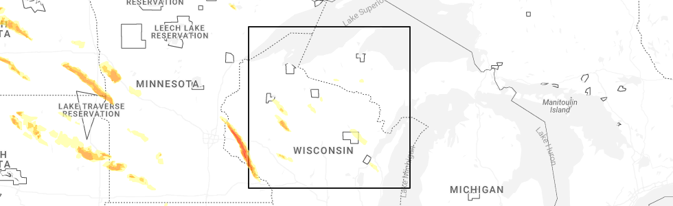
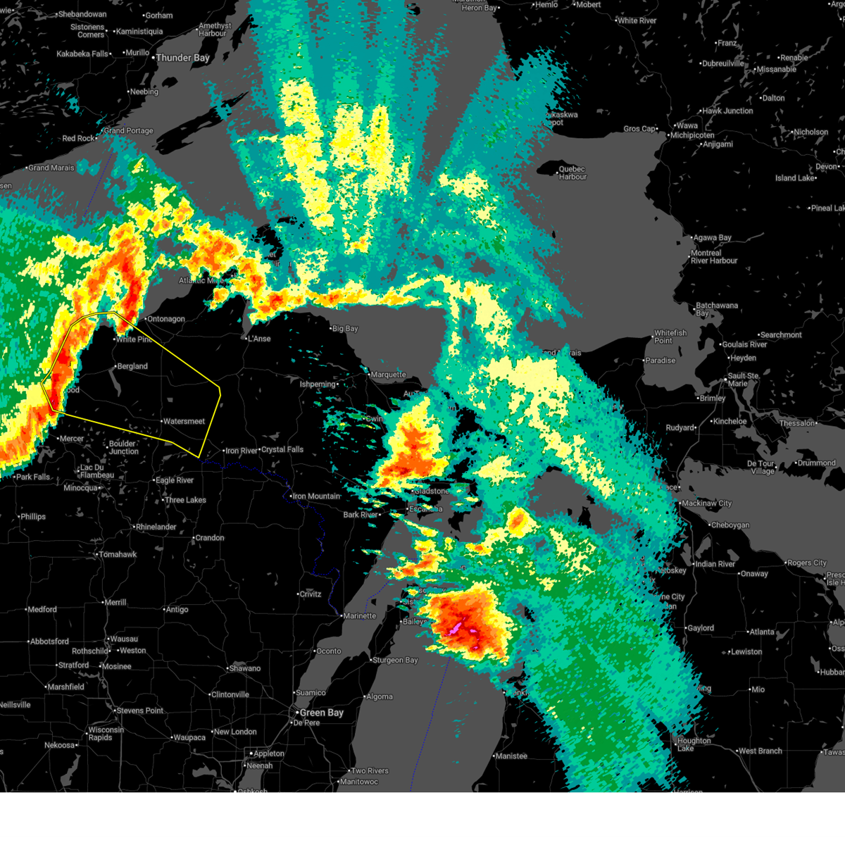
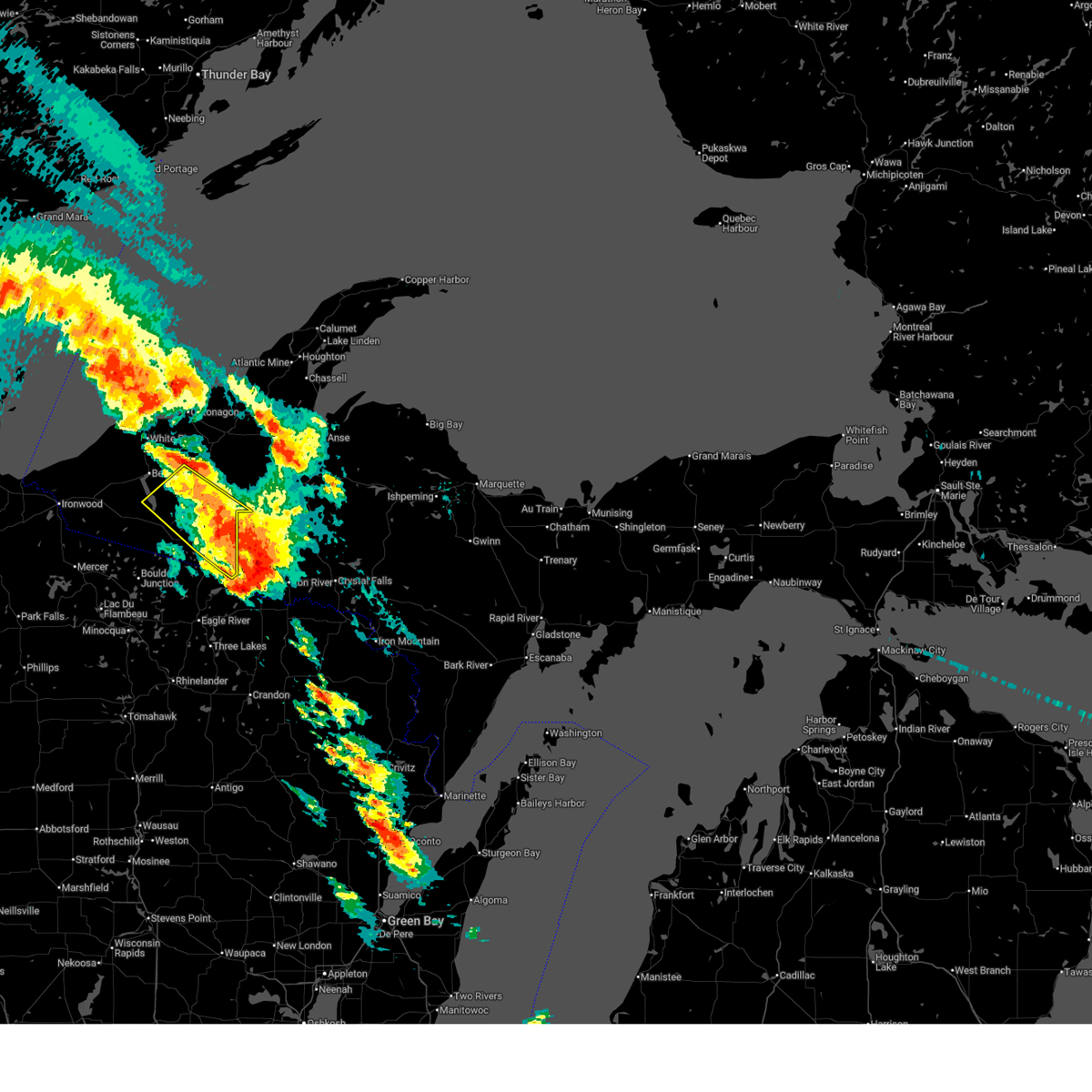
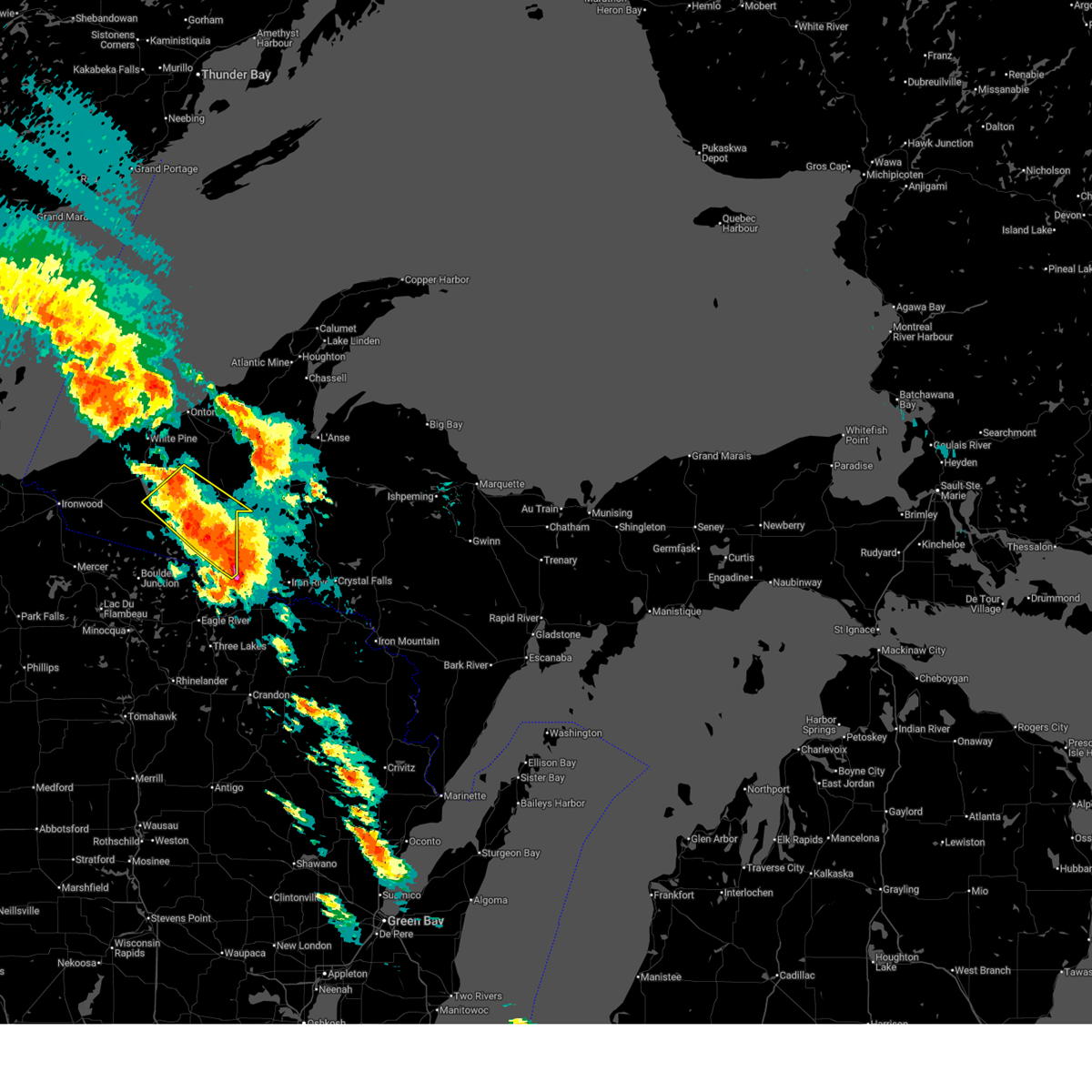
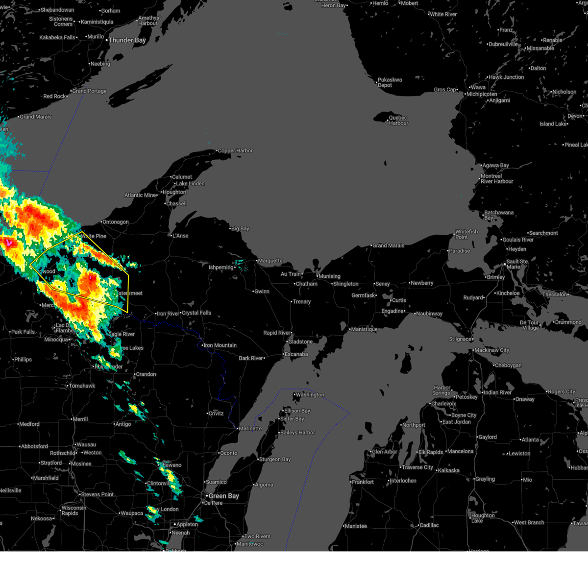
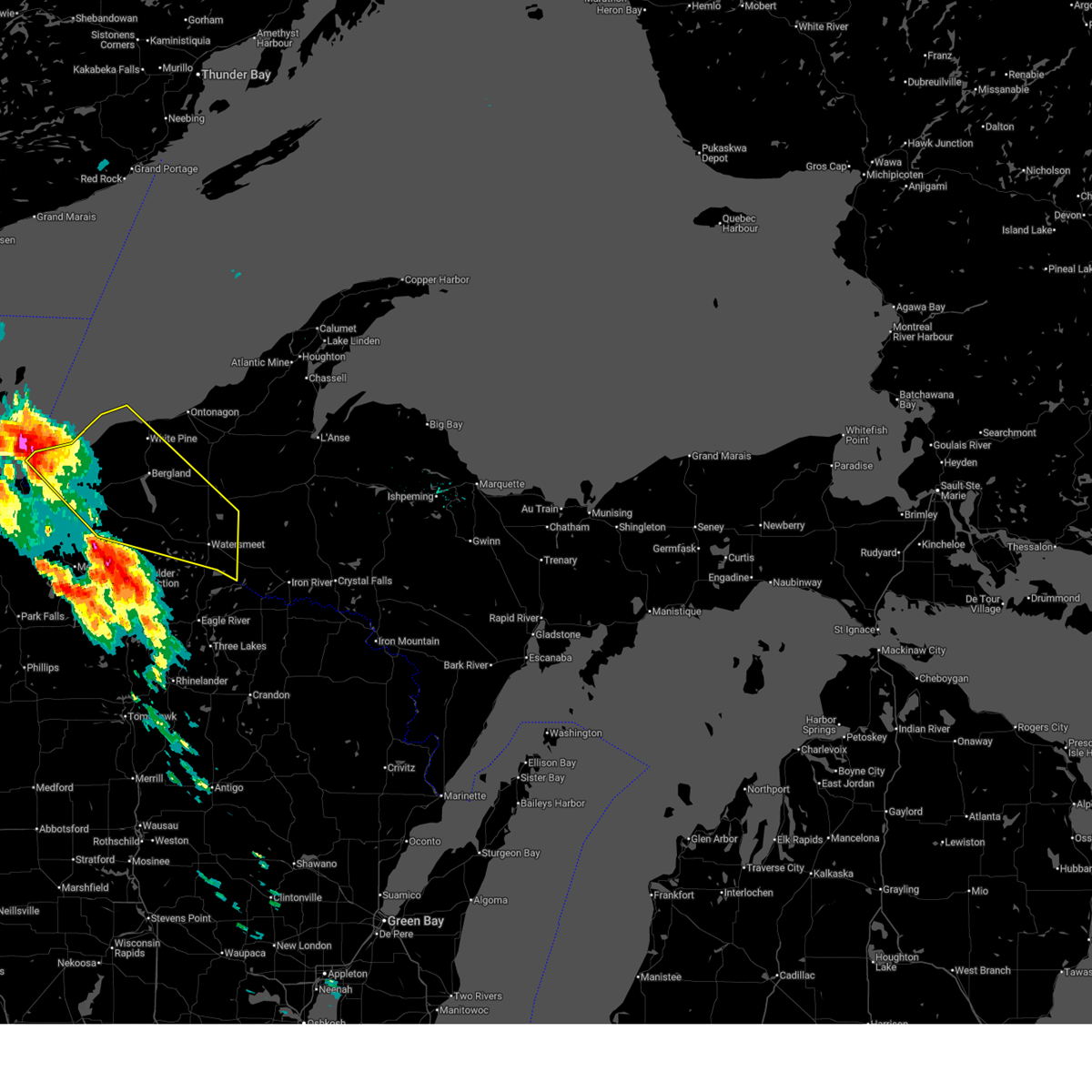
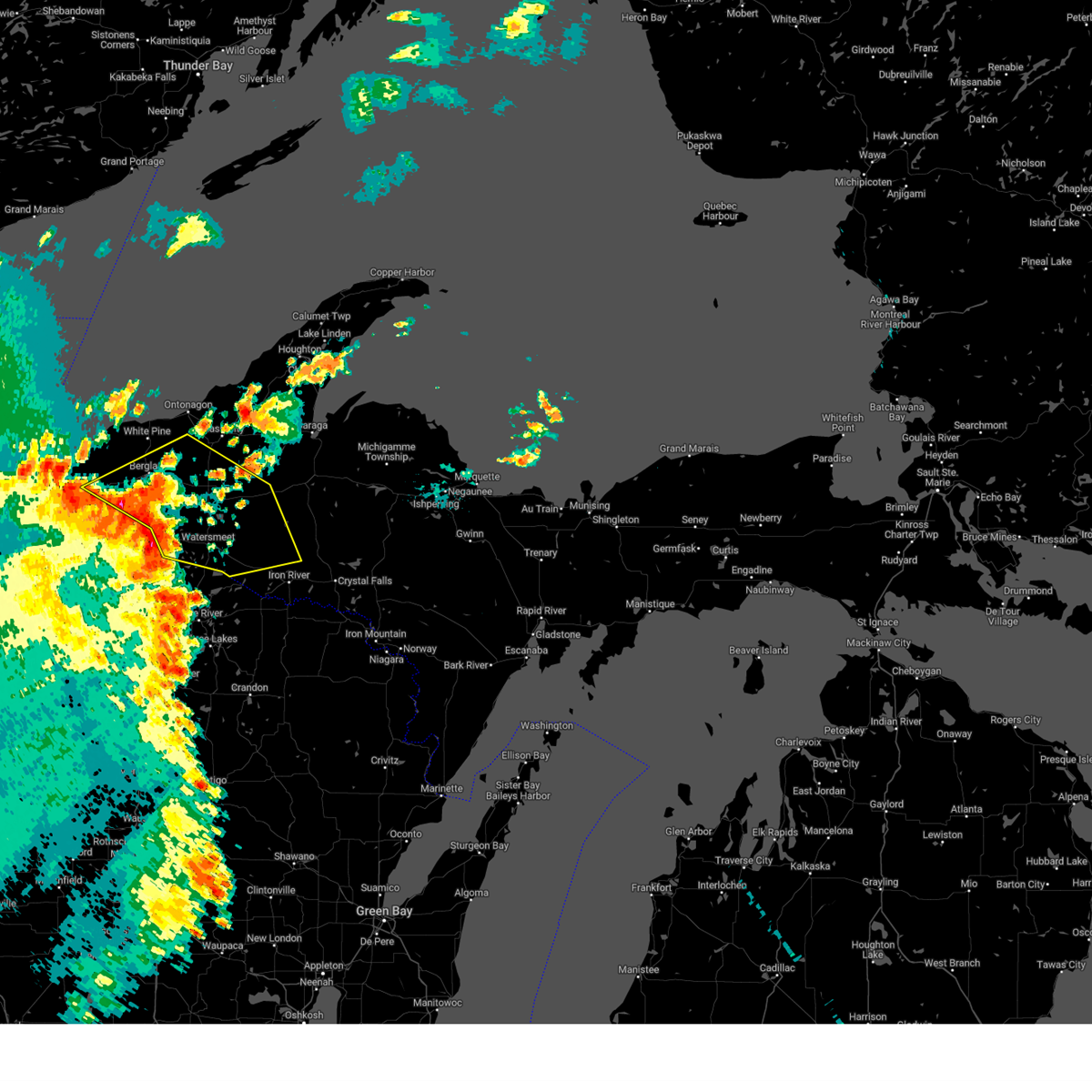
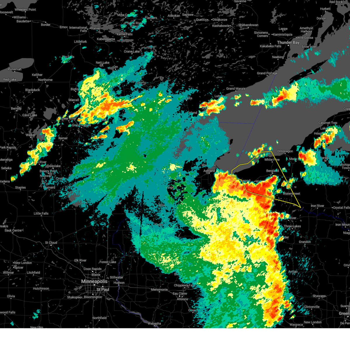
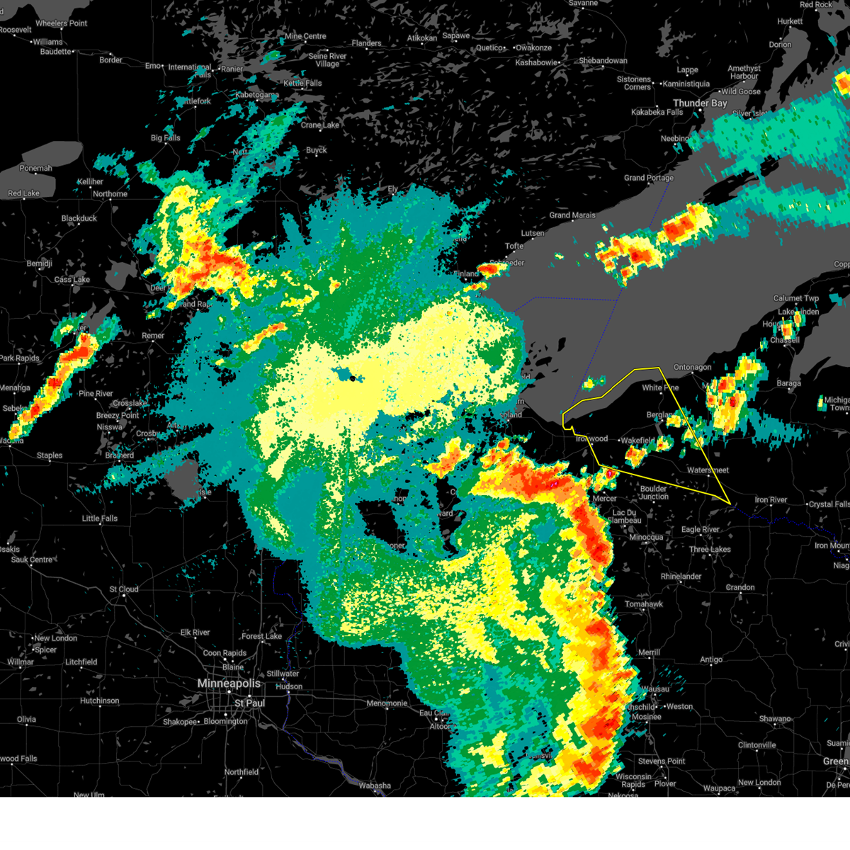
Hail Map for Watersmeet, MI
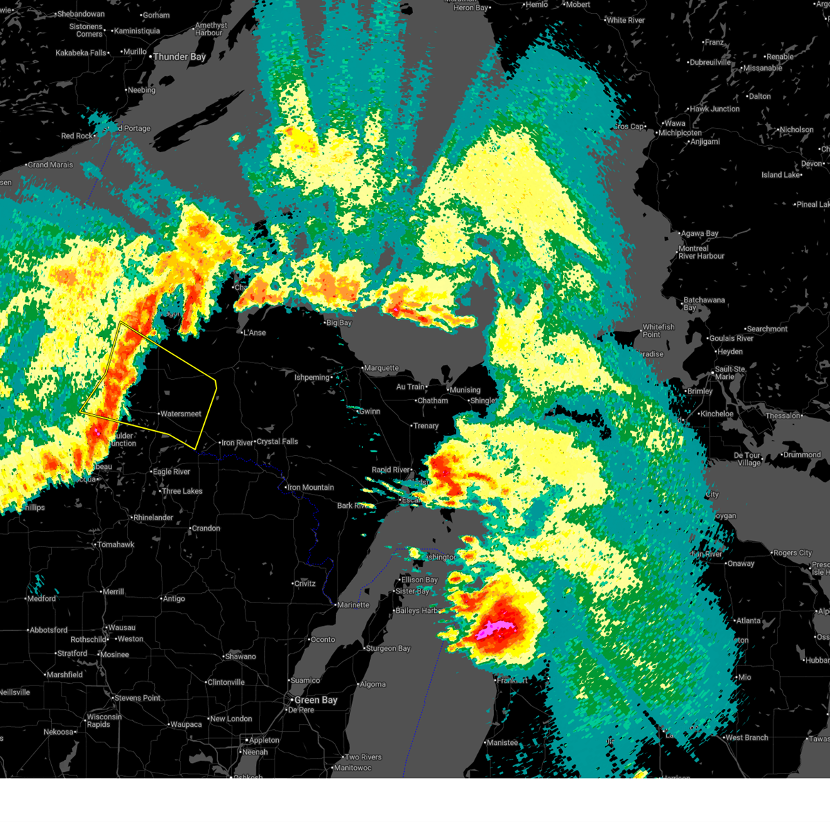
The Watersmeet, MI area has had 7 reports of on-the-ground hail by trained spotters, and has been under severe weather warnings 9 times during the past 12 months. Doppler radar has detected hail at or near Watersmeet, MI on 31 occasions, including 2 occasions during the past year.
| Name: | Watersmeet, MI |
| Where Located: | 46 miles NNE of Rhinelander, WI |
| Map: | Google Map for Watersmeet, MI |
| Population: | 428 |
| Housing Units: | 252 |
| More Info: | Search Google for Watersmeet, MI |
2
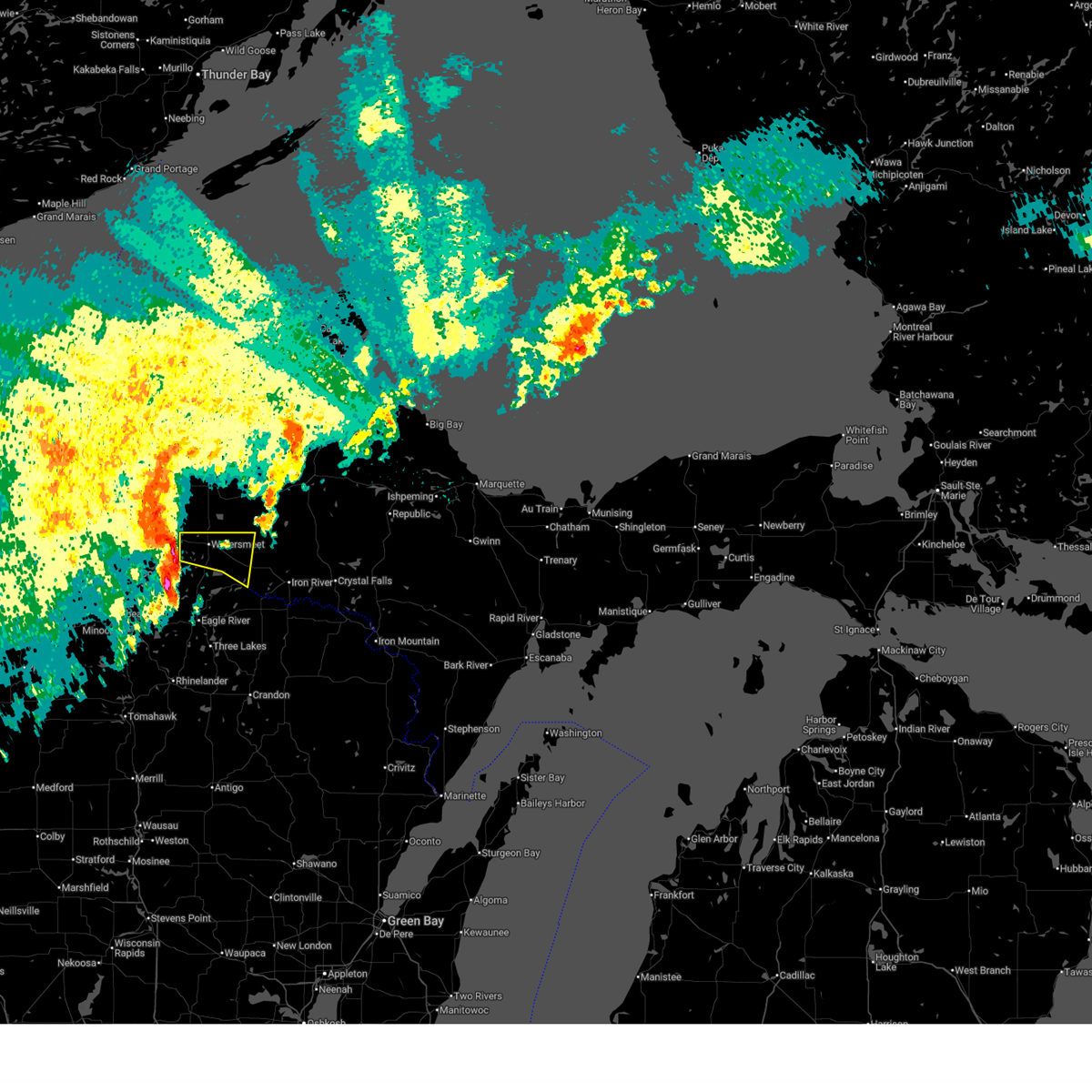
The Top Recent Hail Date for Watersmeet, MI is Thursday, June 19, 2025 (5th out of 31)
Hail and Wind Damage Spotted near Watersmeet, MI
| Date / Time | Report Details |
|---|---|
| 7/15/2025 9:15 PM CDT |
 At 915 pm cdt, a severe thunderstorm was located 7 miles southeast of watersmeet, or 20 miles northeast of eagle river, moving east at 45 mph (radar indicated). Hazards include 60 mph wind gusts. Expect damage to roofs, siding, and trees. Locations impacted include, watersmeet and tamarack lake. At 915 pm cdt, a severe thunderstorm was located 7 miles southeast of watersmeet, or 20 miles northeast of eagle river, moving east at 45 mph (radar indicated). Hazards include 60 mph wind gusts. Expect damage to roofs, siding, and trees. Locations impacted include, watersmeet and tamarack lake.
|
| 7/15/2025 9:02 PM CDT |
 Svrmqt the national weather service in marquette has issued a * severe thunderstorm warning for, west central iron county in south central upper michigan, southeastern gogebic county in western upper michigan, * until 945 pm cdt. * at 902 pm cdt, a severe thunderstorm was located near watersmeet, or 20 miles north of eagle river, moving east at 45 mph (radar indicated). Hazards include 60 mph wind gusts. expect damage to roofs, siding, and trees Svrmqt the national weather service in marquette has issued a * severe thunderstorm warning for, west central iron county in south central upper michigan, southeastern gogebic county in western upper michigan, * until 945 pm cdt. * at 902 pm cdt, a severe thunderstorm was located near watersmeet, or 20 miles north of eagle river, moving east at 45 mph (radar indicated). Hazards include 60 mph wind gusts. expect damage to roofs, siding, and trees
|
| 6/21/2025 6:26 AM EDT |
 At 626 am edt/526 am cdt/, severe thunderstorms were located along a line extending from 9 miles southwest of rockland to 7 miles north of johnson lake barrens natural area to near squirrel lake, moving southeast at 50 mph (radar indicated). Hazards include 60 mph wind gusts. Expect damage to roofs, siding, and trees. Locations impacted include, marenisco, watersmeet, bergland, kenton, bruce crossing, paulding, northern lake gogebic, norwich, tamarack lake, trout creek, presque isle reservoir, and pomeroy lake. At 626 am edt/526 am cdt/, severe thunderstorms were located along a line extending from 9 miles southwest of rockland to 7 miles north of johnson lake barrens natural area to near squirrel lake, moving southeast at 50 mph (radar indicated). Hazards include 60 mph wind gusts. Expect damage to roofs, siding, and trees. Locations impacted include, marenisco, watersmeet, bergland, kenton, bruce crossing, paulding, northern lake gogebic, norwich, tamarack lake, trout creek, presque isle reservoir, and pomeroy lake.
|
| 6/21/2025 5:53 AM EDT |
 Svrmqt the national weather service in marquette has issued a * severe thunderstorm warning for, northwestern iron county in south central upper michigan, gogebic county in western upper michigan, southwestern houghton county in western upper michigan, ontonagon county in western upper michigan, * until 700 am edt/600 am cdt/. * at 553 am edt/453 am cdt/, severe thunderstorms were located along a line extending from 9 miles north of porcupine mountains state park to wakefield to near turtle flambeau flowage, moving southeast at 50 mph (radar indicated). Hazards include 60 mph wind gusts. expect damage to roofs, siding, and trees Svrmqt the national weather service in marquette has issued a * severe thunderstorm warning for, northwestern iron county in south central upper michigan, gogebic county in western upper michigan, southwestern houghton county in western upper michigan, ontonagon county in western upper michigan, * until 700 am edt/600 am cdt/. * at 553 am edt/453 am cdt/, severe thunderstorms were located along a line extending from 9 miles north of porcupine mountains state park to wakefield to near turtle flambeau flowage, moving southeast at 50 mph (radar indicated). Hazards include 60 mph wind gusts. expect damage to roofs, siding, and trees
|
| 6/21/2025 2:34 AM CDT |
 the severe thunderstorm warning has been cancelled and is no longer in effect the severe thunderstorm warning has been cancelled and is no longer in effect
|
| 6/21/2025 2:20 AM CDT |
 At 320 am edt/220 am cdt/, severe thunderstorms were located along a line extending from 8 miles northeast of phelps to 9 miles east of marenisco, moving east at 25 mph (radar indicated). Hazards include 60 mph wind gusts and penny size hail. Expect damage to roofs, siding, and trees. Locations impacted include, watersmeet, bruce crossing, paulding, tamarack lake, bond falls, lake gogebic state park, and ewen. At 320 am edt/220 am cdt/, severe thunderstorms were located along a line extending from 8 miles northeast of phelps to 9 miles east of marenisco, moving east at 25 mph (radar indicated). Hazards include 60 mph wind gusts and penny size hail. Expect damage to roofs, siding, and trees. Locations impacted include, watersmeet, bruce crossing, paulding, tamarack lake, bond falls, lake gogebic state park, and ewen.
|
| 6/21/2025 1:59 AM CDT |
 Svrmqt the national weather service in marquette has issued a * severe thunderstorm warning for, southeastern gogebic county in western upper michigan, southwestern houghton county in western upper michigan, southeastern ontonagon county in western upper michigan, * until 345 am edt/245 am cdt/. * at 259 am edt/159 am cdt/, severe thunderstorms were located along a line extending from near phelps to near marenisco, moving east at 30 mph (radar indicated). Hazards include 60 mph wind gusts and penny size hail. expect damage to roofs, siding, and trees Svrmqt the national weather service in marquette has issued a * severe thunderstorm warning for, southeastern gogebic county in western upper michigan, southwestern houghton county in western upper michigan, southeastern ontonagon county in western upper michigan, * until 345 am edt/245 am cdt/. * at 259 am edt/159 am cdt/, severe thunderstorms were located along a line extending from near phelps to near marenisco, moving east at 30 mph (radar indicated). Hazards include 60 mph wind gusts and penny size hail. expect damage to roofs, siding, and trees
|
| 6/21/2025 1:35 AM CDT |
 At 234 am edt/134 am cdt/, severe thunderstorms were located along a line extending from 10 miles northwest of porcupine mountains state park to near watersmeet, moving northeast at 55 mph (radar indicated). Hazards include 60 mph wind gusts and penny size hail. Expect damage to roofs, siding, and trees. Locations impacted include, ironwood, porcupine mountains state park, bessemer, wakefield, marenisco, watersmeet, bergland, bruce crossing, paulding, northern lake gogebic, norwich, and thomaston. At 234 am edt/134 am cdt/, severe thunderstorms were located along a line extending from 10 miles northwest of porcupine mountains state park to near watersmeet, moving northeast at 55 mph (radar indicated). Hazards include 60 mph wind gusts and penny size hail. Expect damage to roofs, siding, and trees. Locations impacted include, ironwood, porcupine mountains state park, bessemer, wakefield, marenisco, watersmeet, bergland, bruce crossing, paulding, northern lake gogebic, norwich, and thomaston.
|
| 6/21/2025 2:09 AM EDT |
 Svrmqt the national weather service in marquette has issued a * severe thunderstorm warning for, gogebic county in western upper michigan, southern ontonagon county in western upper michigan, * until 300 am edt/200 am cdt/. * at 209 am edt/109 am cdt/, severe thunderstorms were located along a line extending from 12 miles northeast of saxon to 8 miles southeast of johnson lake barrens natural area, moving northeast at 55 mph (radar indicated). Hazards include 60 mph wind gusts and penny size hail. expect damage to roofs, siding, and trees Svrmqt the national weather service in marquette has issued a * severe thunderstorm warning for, gogebic county in western upper michigan, southern ontonagon county in western upper michigan, * until 300 am edt/200 am cdt/. * at 209 am edt/109 am cdt/, severe thunderstorms were located along a line extending from 12 miles northeast of saxon to 8 miles southeast of johnson lake barrens natural area, moving northeast at 55 mph (radar indicated). Hazards include 60 mph wind gusts and penny size hail. expect damage to roofs, siding, and trees
|
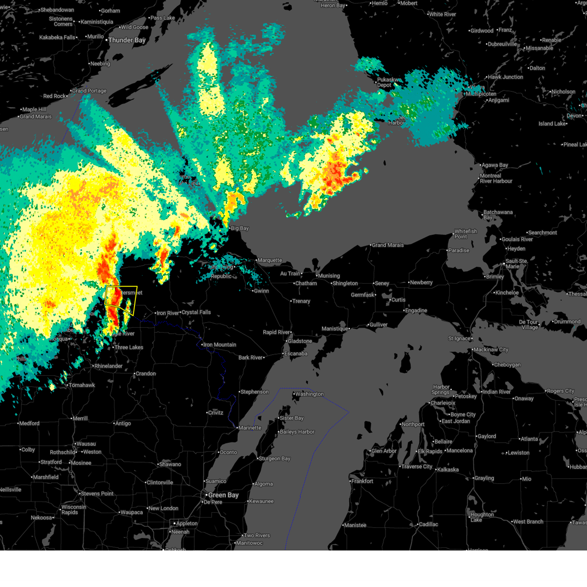
| 6/19/2025 3:40 PM CDT | Ping Pong Ball sized hail reported 0.8 miles WSW of Watersmeet, MI, video shows hail covering the ground at a golf course. |
| 5/15/2025 8:47 PM EDT | Dispatch reports large tree down at us-45 and himanka hill roa in ontonagon county MI, 13.4 miles S of Watersmeet, MI |
| 5/15/2025 7:30 PM CDT | Dispatch reports several trees down at us-2 and beatons lake roa in gogebic county MI, 10.3 miles E of Watersmeet, MI |
| 8/27/2024 12:35 AM CDT |
 the severe thunderstorm warning has been cancelled and is no longer in effect the severe thunderstorm warning has been cancelled and is no longer in effect
|
| 8/27/2024 12:13 AM CDT |
 Svrmqt the national weather service in marquette has issued a * severe thunderstorm warning for, iron county in south central upper michigan, southeastern gogebic county in western upper michigan, southwestern houghton county in western upper michigan, southeastern ontonagon county in western upper michigan, southwestern baraga county in north central upper michigan, * until 145 am edt/1245 am cdt/. * at 112 am edt/1212 am cdt/, severe thunderstorms were located along a line extending from 8 miles southeast of northern lake gogebic to 7 miles southeast of paulding to 6 miles east of phelps, moving east at 40 mph (radar indicated). Hazards include 70 mph wind gusts and quarter size hail. Hail damage to vehicles is expected. expect considerable tree damage. Wind damage is also likely to mobile homes, roofs, and outbuildings. Svrmqt the national weather service in marquette has issued a * severe thunderstorm warning for, iron county in south central upper michigan, southeastern gogebic county in western upper michigan, southwestern houghton county in western upper michigan, southeastern ontonagon county in western upper michigan, southwestern baraga county in north central upper michigan, * until 145 am edt/1245 am cdt/. * at 112 am edt/1212 am cdt/, severe thunderstorms were located along a line extending from 8 miles southeast of northern lake gogebic to 7 miles southeast of paulding to 6 miles east of phelps, moving east at 40 mph (radar indicated). Hazards include 70 mph wind gusts and quarter size hail. Hail damage to vehicles is expected. expect considerable tree damage. Wind damage is also likely to mobile homes, roofs, and outbuildings.
|
| 8/27/2024 1:03 AM EDT |
 At 103 am edt/1203 am cdt/, severe thunderstorms were located along a line extending from near bergland to near paulding to 7 miles east of watersmeet, moving east at 55 mph (radar indicated). Hazards include 70 mph wind gusts and quarter size hail. Hail damage to vehicles is expected. expect considerable tree damage. wind damage is also likely to mobile homes, roofs, and outbuildings. Locations impacted include, watersmeet, bergland, kenton, bruce crossing, paulding, northern lake gogebic, norwich, tamarack lake, trout creek, lake gogebic state park, golden lake, and victoria dam. At 103 am edt/1203 am cdt/, severe thunderstorms were located along a line extending from near bergland to near paulding to 7 miles east of watersmeet, moving east at 55 mph (radar indicated). Hazards include 70 mph wind gusts and quarter size hail. Hail damage to vehicles is expected. expect considerable tree damage. wind damage is also likely to mobile homes, roofs, and outbuildings. Locations impacted include, watersmeet, bergland, kenton, bruce crossing, paulding, northern lake gogebic, norwich, tamarack lake, trout creek, lake gogebic state park, golden lake, and victoria dam.
|
| 8/27/2024 12:42 AM EDT |
 Svrmqt the national weather service in marquette has issued a * severe thunderstorm warning for, northwestern iron county in south central upper michigan, southeastern gogebic county in western upper michigan, southwestern houghton county in western upper michigan, southern ontonagon county in western upper michigan, * until 115 am edt/1215 am cdt/. * at 1241 am edt/1141 pm cdt/, severe thunderstorms were located along a line extending from near wakefield to 9 miles east of marenisco to 6 miles east of johnson lake barrens natural area, moving east at 55 mph (radar indicated). Hazards include 70 mph wind gusts and quarter size hail. Hail damage to vehicles is expected. expect considerable tree damage. Wind damage is also likely to mobile homes, roofs, and outbuildings. Svrmqt the national weather service in marquette has issued a * severe thunderstorm warning for, northwestern iron county in south central upper michigan, southeastern gogebic county in western upper michigan, southwestern houghton county in western upper michigan, southern ontonagon county in western upper michigan, * until 115 am edt/1215 am cdt/. * at 1241 am edt/1141 pm cdt/, severe thunderstorms were located along a line extending from near wakefield to 9 miles east of marenisco to 6 miles east of johnson lake barrens natural area, moving east at 55 mph (radar indicated). Hazards include 70 mph wind gusts and quarter size hail. Hail damage to vehicles is expected. expect considerable tree damage. Wind damage is also likely to mobile homes, roofs, and outbuildings.
|
| 8/26/2024 11:26 PM CDT |
 At 1226 am edt/1126 pm cdt/, severe thunderstorms were located along a line extending from near wakefield to near rainbow flowage, moving northeast at 50 mph (radar indicated). Hazards include 70 mph wind gusts and quarter size hail. Hail damage to vehicles is expected. expect considerable tree damage. wind damage is also likely to mobile homes, roofs, and outbuildings. Locations impacted include, porcupine mountains state park, ironwood, bessemer, wakefield, marenisco, hurley, watersmeet, bergland, northern lake gogebic, silver city, presque isle reservoir, and pomeroy lake. At 1226 am edt/1126 pm cdt/, severe thunderstorms were located along a line extending from near wakefield to near rainbow flowage, moving northeast at 50 mph (radar indicated). Hazards include 70 mph wind gusts and quarter size hail. Hail damage to vehicles is expected. expect considerable tree damage. wind damage is also likely to mobile homes, roofs, and outbuildings. Locations impacted include, porcupine mountains state park, ironwood, bessemer, wakefield, marenisco, hurley, watersmeet, bergland, northern lake gogebic, silver city, presque isle reservoir, and pomeroy lake.
|
| 8/26/2024 10:53 PM CDT |
 Svrmqt the national weather service in marquette has issued a * severe thunderstorm warning for, gogebic county in western upper michigan, southwestern ontonagon county in western upper michigan, * until 1245 am edt/1145 pm cdt/. * at 1153 pm edt/1053 pm cdt/, severe thunderstorms were located along a line extending from near upson to willow reservoir, moving northeast at 50 mph (radar indicated). Hazards include 60 mph wind gusts and quarter size hail. Hail damage to vehicles is expected. Expect wind damage to roofs, siding, and trees. Svrmqt the national weather service in marquette has issued a * severe thunderstorm warning for, gogebic county in western upper michigan, southwestern ontonagon county in western upper michigan, * until 1245 am edt/1145 pm cdt/. * at 1153 pm edt/1053 pm cdt/, severe thunderstorms were located along a line extending from near upson to willow reservoir, moving northeast at 50 mph (radar indicated). Hazards include 60 mph wind gusts and quarter size hail. Hail damage to vehicles is expected. Expect wind damage to roofs, siding, and trees.
|
| 6/19/2024 12:25 AM CDT |
 The storm which prompted the warning has weakened below severe limits, and no longer poses an immediate threat to life or property. therefore, the warning will be allowed to expire. The storm which prompted the warning has weakened below severe limits, and no longer poses an immediate threat to life or property. therefore, the warning will be allowed to expire.
|
| 6/19/2024 12:04 AM CDT |
 At 103 am edt/1203 am cdt/, a severe thunderstorm was located 9 miles northeast of border lakes natural area, or 29 miles northwest of eagle river, moving northeast at 45 mph (radar indicated). Hazards include 60 mph wind gusts. Expect damage to roofs, siding, and trees. Locations impacted include, iron river, porcupine mountains state park, ironwood, bessemer, wakefield, marenisco, hurley, watersmeet, stambaugh, bergland, bruce crossing, and paulding. At 103 am edt/1203 am cdt/, a severe thunderstorm was located 9 miles northeast of border lakes natural area, or 29 miles northwest of eagle river, moving northeast at 45 mph (radar indicated). Hazards include 60 mph wind gusts. Expect damage to roofs, siding, and trees. Locations impacted include, iron river, porcupine mountains state park, ironwood, bessemer, wakefield, marenisco, hurley, watersmeet, stambaugh, bergland, bruce crossing, and paulding.
|
| 6/18/2024 11:47 PM CDT |
 Svrmqt the national weather service in marquette has issued a * severe thunderstorm warning for, iron county in south central upper michigan, gogebic county in western upper michigan, southwestern houghton county in western upper michigan, ontonagon county in western upper michigan, southwestern baraga county in north central upper michigan, * until 130 am edt/1230 am cdt/. * at 1247 am edt/1147 pm cdt/, a severe thunderstorm was located near rice creek natural area, or 19 miles northeast of turtle flambeau flowage, moving northeast at 40 mph (radar indicated). Hazards include 60 mph wind gusts. expect damage to roofs, siding, and trees Svrmqt the national weather service in marquette has issued a * severe thunderstorm warning for, iron county in south central upper michigan, gogebic county in western upper michigan, southwestern houghton county in western upper michigan, ontonagon county in western upper michigan, southwestern baraga county in north central upper michigan, * until 130 am edt/1230 am cdt/. * at 1247 am edt/1147 pm cdt/, a severe thunderstorm was located near rice creek natural area, or 19 miles northeast of turtle flambeau flowage, moving northeast at 40 mph (radar indicated). Hazards include 60 mph wind gusts. expect damage to roofs, siding, and trees
|
| 6/17/2024 9:59 AM CDT |
 At 1058 am edt/958 am cdt/, severe thunderstorms were located along a line extending from near border lakes natural area to near phelps, moving east at 30 mph (radar indicated). Hazards include quarter size hail. Damage to vehicles is expected. Locations impacted include, watersmeet, paulding, paint lake, tamarack lake, thousand island lake, bond falls, and golden lake. At 1058 am edt/958 am cdt/, severe thunderstorms were located along a line extending from near border lakes natural area to near phelps, moving east at 30 mph (radar indicated). Hazards include quarter size hail. Damage to vehicles is expected. Locations impacted include, watersmeet, paulding, paint lake, tamarack lake, thousand island lake, bond falls, and golden lake.
|
| 6/17/2024 9:47 AM CDT |
 Svrmqt the national weather service in marquette has issued a * severe thunderstorm warning for, northwestern iron county in south central upper michigan, southeastern gogebic county in western upper michigan, south central ontonagon county in western upper michigan, * until 1115 am edt/1015 am cdt/. * at 1047 am edt/947 am cdt/, severe thunderstorms were located along a line extending from near boulder junction to near phelps, moving northeast at 30 mph (radar indicated). Hazards include quarter size hail. damage to vehicles is expected Svrmqt the national weather service in marquette has issued a * severe thunderstorm warning for, northwestern iron county in south central upper michigan, southeastern gogebic county in western upper michigan, south central ontonagon county in western upper michigan, * until 1115 am edt/1015 am cdt/. * at 1047 am edt/947 am cdt/, severe thunderstorms were located along a line extending from near boulder junction to near phelps, moving northeast at 30 mph (radar indicated). Hazards include quarter size hail. damage to vehicles is expected
|
| 6/17/2024 10:36 AM EDT |
 The storm which prompted the warning has weakened below severe limits, and no longer poses an immediate threat to life or property. therefore, the warning will be allowed to expire. however, small hail and heavy rain are still possible with this thunderstorm. a severe thunderstorm watch remains in effect until 500 pm edt/400 pm cdt/ for western upper and south central upper michigan. The storm which prompted the warning has weakened below severe limits, and no longer poses an immediate threat to life or property. therefore, the warning will be allowed to expire. however, small hail and heavy rain are still possible with this thunderstorm. a severe thunderstorm watch remains in effect until 500 pm edt/400 pm cdt/ for western upper and south central upper michigan.
|
| 6/17/2024 10:21 AM EDT |
 At 1020 am edt/920 am cdt/, a severe thunderstorm was located 11 miles northeast of border lakes natural area, or 27 miles north of eagle river, moving northeast at 40 mph (radar indicated). Hazards include quarter size hail. Damage to vehicles is expected. Locations impacted include, bruce crossing, paulding, ewen, thousand island lake, bond falls, and pomeroy lake. At 1020 am edt/920 am cdt/, a severe thunderstorm was located 11 miles northeast of border lakes natural area, or 27 miles north of eagle river, moving northeast at 40 mph (radar indicated). Hazards include quarter size hail. Damage to vehicles is expected. Locations impacted include, bruce crossing, paulding, ewen, thousand island lake, bond falls, and pomeroy lake.
|
| 6/17/2024 10:12 AM EDT |
 Svrmqt the national weather service in marquette has issued a * severe thunderstorm warning for, southeastern gogebic county in western upper michigan, southeastern ontonagon county in western upper michigan, * until 1045 am edt/945 am cdt/. * at 1012 am edt/912 am cdt/, a severe thunderstorm was located near border lakes natural area, or 25 miles northwest of eagle river, moving northeast at 40 mph (radar indicated). Hazards include half dollar size hail. damage to vehicles is expected Svrmqt the national weather service in marquette has issued a * severe thunderstorm warning for, southeastern gogebic county in western upper michigan, southeastern ontonagon county in western upper michigan, * until 1045 am edt/945 am cdt/. * at 1012 am edt/912 am cdt/, a severe thunderstorm was located near border lakes natural area, or 25 miles northwest of eagle river, moving northeast at 40 mph (radar indicated). Hazards include half dollar size hail. damage to vehicles is expected
|
| 5/18/2024 6:20 PM EDT | Quarter sized hail reported 17.4 miles SSE of Watersmeet, MI, hail lasted 5-10 minutes. |
| 7/27/2023 7:23 PM CDT |
 The severe thunderstorm warning for western iron, southeastern gogebic and southeastern ontonagon counties will expire at 830 pm edt/730 pm cdt/, the storms which prompted the warning have weakened below severe limits, and no longer pose an immediate threat to life or property. therefore, the warning will be allowed to expire. however gusty winds are still possible with these thunderstorms. a severe thunderstorm watch remains in effect until midnight edt/1100 pm cdt/ for western upper and south central upper michigan. The severe thunderstorm warning for western iron, southeastern gogebic and southeastern ontonagon counties will expire at 830 pm edt/730 pm cdt/, the storms which prompted the warning have weakened below severe limits, and no longer pose an immediate threat to life or property. therefore, the warning will be allowed to expire. however gusty winds are still possible with these thunderstorms. a severe thunderstorm watch remains in effect until midnight edt/1100 pm cdt/ for western upper and south central upper michigan.
|
| 7/27/2023 7:10 PM CDT |
 At 810 pm edt/710 pm cdt/, severe thunderstorms were located along a line extending from near watersmeet to near woodboro, moving east at 45 mph (radar indicated). Hazards include 60 mph wind gusts. Expect damage to roofs, siding, and trees. these severe thunderstorms will remain over mainly rural areas of western iron, southeastern gogebic and southeastern ontonagon counties, including the following locations, hagerman lake, paint lake, tamarack lake, gibbs city, golden lake and bond falls. hail threat, radar indicated max hail size, <. 75 in wind threat, radar indicated max wind gust, 60 mph. At 810 pm edt/710 pm cdt/, severe thunderstorms were located along a line extending from near watersmeet to near woodboro, moving east at 45 mph (radar indicated). Hazards include 60 mph wind gusts. Expect damage to roofs, siding, and trees. these severe thunderstorms will remain over mainly rural areas of western iron, southeastern gogebic and southeastern ontonagon counties, including the following locations, hagerman lake, paint lake, tamarack lake, gibbs city, golden lake and bond falls. hail threat, radar indicated max hail size, <. 75 in wind threat, radar indicated max wind gust, 60 mph.
|
| 7/27/2023 6:58 PM CDT |
 At 758 pm edt/658 pm cdt/, severe thunderstorms were located along a line extending from near watersmeet to 6 miles west of woodboro, moving east at 45 mph (radar indicated). Hazards include 60 mph wind gusts and penny size hail. Expect damage to roofs, siding, and trees. severe thunderstorms will be near, watersmeet around 705 pm cdt. Paulding around 805 pm edt. At 758 pm edt/658 pm cdt/, severe thunderstorms were located along a line extending from near watersmeet to 6 miles west of woodboro, moving east at 45 mph (radar indicated). Hazards include 60 mph wind gusts and penny size hail. Expect damage to roofs, siding, and trees. severe thunderstorms will be near, watersmeet around 705 pm cdt. Paulding around 805 pm edt.
|
| 7/27/2023 6:44 PM CDT |
 At 744 pm edt/644 pm cdt/, severe thunderstorms were located along a line extending from 9 miles east of marenisco to 6 miles southeast of squirrel lake, moving southeast at 40 mph (radar indicated). Hazards include 60 mph wind gusts and penny size hail. Expect damage to roofs, siding, and trees. Locations impacted include, watersmeet, paulding, tamarack lake, thousand island lake, bond falls and pomeroy lake. At 744 pm edt/644 pm cdt/, severe thunderstorms were located along a line extending from 9 miles east of marenisco to 6 miles southeast of squirrel lake, moving southeast at 40 mph (radar indicated). Hazards include 60 mph wind gusts and penny size hail. Expect damage to roofs, siding, and trees. Locations impacted include, watersmeet, paulding, tamarack lake, thousand island lake, bond falls and pomeroy lake.
|
| 7/27/2023 7:41 PM EDT | Ontonagon county dispatch reports a few trees of unknown size down on power lines in ewe in ontonagon county MI, 17.4 miles SSE of Watersmeet, MI |
| 7/27/2023 6:31 PM CDT |
 At 731 pm edt/631 pm cdt/, severe thunderstorms were located along a line extending from near marenisco to squirrel lake, moving southeast at 40 mph (radar indicated). Hazards include 60 mph wind gusts and penny size hail. expect damage to roofs, siding, and trees At 731 pm edt/631 pm cdt/, severe thunderstorms were located along a line extending from near marenisco to squirrel lake, moving southeast at 40 mph (radar indicated). Hazards include 60 mph wind gusts and penny size hail. expect damage to roofs, siding, and trees
|
| 7/27/2023 7:19 PM EDT | Corrects time of previous tstm wnd dmg report from ewen. ontonagon county dispatch reports a few trees of unknown size down on power lines in ewe in ontonagon county MI, 17.4 miles SSE of Watersmeet, MI |
| 7/27/2023 7:19 PM EDT | Corrects time of previous tstm wnd dmg report from ewen. ontonagon county dispatch reports a few trees of unknown size down on power lines in ewe in ontonagon county MI, 17.4 miles SSE of Watersmeet, MI |
| 7/27/2023 6:11 PM CDT |
 At 710 pm edt/610 pm cdt/, severe thunderstorms were located along a line extending from 10 miles west of paulding to wakefield to 8 miles southwest of turtle flambeau flowage, moving east at 35 mph (radar indicated). Hazards include 70 mph wind gusts and penny size hail. Expect considerable tree damage. damage is likely to mobile homes, roofs, and outbuildings. locations impacted include, paulding and marenisco. thunderstorm damage threat, considerable hail threat, radar indicated max hail size, 0. 75 in wind threat, radar indicated max wind gust, 70 mph. At 710 pm edt/610 pm cdt/, severe thunderstorms were located along a line extending from 10 miles west of paulding to wakefield to 8 miles southwest of turtle flambeau flowage, moving east at 35 mph (radar indicated). Hazards include 70 mph wind gusts and penny size hail. Expect considerable tree damage. damage is likely to mobile homes, roofs, and outbuildings. locations impacted include, paulding and marenisco. thunderstorm damage threat, considerable hail threat, radar indicated max hail size, 0. 75 in wind threat, radar indicated max wind gust, 70 mph.
|
| 7/27/2023 5:57 PM CDT |
 At 656 pm edt/556 pm cdt/, severe thunderstorms were located along a line extending from 6 miles east of marenisco to ironwood to near park falls, moving east at 35 mph. the ironwood airport reported 50 mph winds recently. in addition, there were down downed powerlines in bessemer (radar and observation indicated). Hazards include 60 mph wind gusts. Expect damage to roofs, siding, and trees. severe thunderstorms will be near, wakefield around 605 pm cdt. other locations in the path of these severe thunderstorms include marenisco and paulding. hail threat, radar indicated max hail size, <. 75 in wind threat, radar indicated max wind gust, 60 mph. At 656 pm edt/556 pm cdt/, severe thunderstorms were located along a line extending from 6 miles east of marenisco to ironwood to near park falls, moving east at 35 mph. the ironwood airport reported 50 mph winds recently. in addition, there were down downed powerlines in bessemer (radar and observation indicated). Hazards include 60 mph wind gusts. Expect damage to roofs, siding, and trees. severe thunderstorms will be near, wakefield around 605 pm cdt. other locations in the path of these severe thunderstorms include marenisco and paulding. hail threat, radar indicated max hail size, <. 75 in wind threat, radar indicated max wind gust, 60 mph.
|
| 8/2/2022 9:11 PM EDT | Michigan dot reports eastbound and westbound lanes of m-28 are closed in kenton due to a downed tree on the highway. relayed report via social medi in houghton county MI, 19.9 miles SW of Watersmeet, MI |
| 6/28/2022 2:10 PM CDT |
 At 210 pm cdt, a severe thunderstorm was located 7 miles southeast of watersmeet, or 21 miles northwest of iron river, moving east at 40 mph (radar indicated). Hazards include ping pong ball size hail and 60 mph wind gusts. People and animals outdoors will be injured. expect hail damage to roofs, siding, windows, and vehicles. expect wind damage to roofs, siding, and trees. this severe thunderstorm will remain over mainly rural areas of northwestern iron and southeastern gogebic counties, including the following locations, tamarack lake and golden lake. hail threat, radar indicated max hail size, 1. 50in wind threat, radar indicated max wind gust, 60 mph. At 210 pm cdt, a severe thunderstorm was located 7 miles southeast of watersmeet, or 21 miles northwest of iron river, moving east at 40 mph (radar indicated). Hazards include ping pong ball size hail and 60 mph wind gusts. People and animals outdoors will be injured. expect hail damage to roofs, siding, windows, and vehicles. expect wind damage to roofs, siding, and trees. this severe thunderstorm will remain over mainly rural areas of northwestern iron and southeastern gogebic counties, including the following locations, tamarack lake and golden lake. hail threat, radar indicated max hail size, 1. 50in wind threat, radar indicated max wind gust, 60 mph.
|
| 6/28/2022 1:51 PM CDT |
 At 151 pm cdt, a severe thunderstorm was located near watersmeet, or 24 miles north of eagle river, moving east at 40 mph (radar indicated). Hazards include ping pong ball size hail and 60 mph wind gusts. People and animals outdoors will be injured. expect hail damage to roofs, siding, windows, and vehicles. expect wind damage to roofs, siding, and trees. this severe thunderstorm will be near, watersmeet around 200 pm cdt. hail threat, radar indicated max hail size, 1. 50 in wind threat, radar indicated max wind gust, 60 mph. At 151 pm cdt, a severe thunderstorm was located near watersmeet, or 24 miles north of eagle river, moving east at 40 mph (radar indicated). Hazards include ping pong ball size hail and 60 mph wind gusts. People and animals outdoors will be injured. expect hail damage to roofs, siding, windows, and vehicles. expect wind damage to roofs, siding, and trees. this severe thunderstorm will be near, watersmeet around 200 pm cdt. hail threat, radar indicated max hail size, 1. 50 in wind threat, radar indicated max wind gust, 60 mph.
|
| 6/28/2022 1:35 PM CDT |
 At 235 pm edt/135 pm cdt/, a severe thunderstorm was located 9 miles southeast of marenisco, or 30 miles northwest of eagle river, moving east at 35 mph (radar indicated). Hazards include 60 mph wind gusts and quarter size hail. Hail damage to vehicles is expected. Expect wind damage to roofs, siding, and trees. At 235 pm edt/135 pm cdt/, a severe thunderstorm was located 9 miles southeast of marenisco, or 30 miles northwest of eagle river, moving east at 35 mph (radar indicated). Hazards include 60 mph wind gusts and quarter size hail. Hail damage to vehicles is expected. Expect wind damage to roofs, siding, and trees.
|
| 8/10/2021 2:51 PM CDT |
 At 351 pm edt/251 pm cdt/, a severe thunderstorm was located 7 miles west of watersmeet, or 24 miles north of eagle river, moving east at 40 mph (radar indicated). Hazards include 60 mph wind gusts and penny size hail. Expect damage to roofs, siding, and trees. this severe thunderstorm will be near, watersmeet around 300 pm cdt. hail threat, radar indicated max hail size, 0. 75 in wind threat, radar indicated max wind gust, 60 mph. At 351 pm edt/251 pm cdt/, a severe thunderstorm was located 7 miles west of watersmeet, or 24 miles north of eagle river, moving east at 40 mph (radar indicated). Hazards include 60 mph wind gusts and penny size hail. Expect damage to roofs, siding, and trees. this severe thunderstorm will be near, watersmeet around 300 pm cdt. hail threat, radar indicated max hail size, 0. 75 in wind threat, radar indicated max wind gust, 60 mph.
|
| 8/10/2021 2:00 PM CDT | Baseball sized hail reported 0.5 miles NNW of Watersmeet, MI, public submitted photo of a large hailstone to local news station immediately after hail stopped at 308 pm cst. |
| 8/10/2021 2:00 PM CDT | Hen Egg sized hail reported 1.2 miles NNW of Watersmeet, MI, picture of 2 inch hailstone next to ruler sent to local media outlet from watersmeet... but exact location is unknown. time estimated by radar. |
| 8/10/2021 1:37 PM CDT |
 The severe thunderstorm warning for northwestern iron, southeastern gogebic, southwestern houghton and southeastern ontonagon counties will expire at 245 pm edt/145 pm cdt/, the storm which prompted the warning has moved out of the area. therefore, the warning will be allowed to expire. The severe thunderstorm warning for northwestern iron, southeastern gogebic, southwestern houghton and southeastern ontonagon counties will expire at 245 pm edt/145 pm cdt/, the storm which prompted the warning has moved out of the area. therefore, the warning will be allowed to expire.
|
| 8/10/2021 1:00 PM CDT |
 At 200 pm edt/100 pm cdt/, a severe thunderstorm was located over watersmeet, or 24 miles north of eagle river, moving east at 40 mph (radar indicated). Hazards include 60 mph wind gusts and penny size hail. Expect damage to roofs, siding, and trees. this severe thunderstorm will remain over mainly rural areas of northwestern iron, southeastern gogebic, southwestern houghton and southeastern ontonagon counties, including the following locations, paint lake, tamarack lake, trout creek, echo lake and bond falls. hail threat, radar indicated max hail size, 0. 75 in wind threat, radar indicated max wind gust, 60 mph. At 200 pm edt/100 pm cdt/, a severe thunderstorm was located over watersmeet, or 24 miles north of eagle river, moving east at 40 mph (radar indicated). Hazards include 60 mph wind gusts and penny size hail. Expect damage to roofs, siding, and trees. this severe thunderstorm will remain over mainly rural areas of northwestern iron, southeastern gogebic, southwestern houghton and southeastern ontonagon counties, including the following locations, paint lake, tamarack lake, trout creek, echo lake and bond falls. hail threat, radar indicated max hail size, 0. 75 in wind threat, radar indicated max wind gust, 60 mph.
|
| 7/26/2021 10:26 PM CDT |
 At 1025 pm cdt, a severe thunderstorm was located near watersmeet, or 21 miles north of eagle river, moving southeast at 35 mph (radar indicated). Hazards include 60 mph wind gusts and quarter size hail. Hail damage to vehicles is expected. expect wind damage to roofs, siding, and trees. This severe thunderstorm will remain over mainly rural areas of southwestern iron and southeastern gogebic counties, including the following locations, hagerman lake, gaastra, caspian, tamarack lake, golden lake and mineral hills. At 1025 pm cdt, a severe thunderstorm was located near watersmeet, or 21 miles north of eagle river, moving southeast at 35 mph (radar indicated). Hazards include 60 mph wind gusts and quarter size hail. Hail damage to vehicles is expected. expect wind damage to roofs, siding, and trees. This severe thunderstorm will remain over mainly rural areas of southwestern iron and southeastern gogebic counties, including the following locations, hagerman lake, gaastra, caspian, tamarack lake, golden lake and mineral hills.
|
| 7/26/2021 10:06 PM CDT |
 At 1106 pm edt/1006 pm cdt/, a severe thunderstorm was located 11 miles southeast of marenisco, or 30 miles north of eagle river, moving southeast at 45 mph (radar indicated). Hazards include 60 mph wind gusts and penny size hail. Expect damage to roofs, siding, and trees. Locations impacted include, watersmeet, paulding, tamarack lake, thousand island lake and pomeroy lake. At 1106 pm edt/1006 pm cdt/, a severe thunderstorm was located 11 miles southeast of marenisco, or 30 miles north of eagle river, moving southeast at 45 mph (radar indicated). Hazards include 60 mph wind gusts and penny size hail. Expect damage to roofs, siding, and trees. Locations impacted include, watersmeet, paulding, tamarack lake, thousand island lake and pomeroy lake.
|
| 7/26/2021 9:43 PM CDT |
 At 1042 pm edt/942 pm cdt/, a severe thunderstorm was located near marenisco, or 22 miles east of ironwood, moving southeast at 65 mph (radar indicated). Hazards include 60 mph wind gusts and penny size hail. expect damage to roofs, siding, and trees At 1042 pm edt/942 pm cdt/, a severe thunderstorm was located near marenisco, or 22 miles east of ironwood, moving southeast at 65 mph (radar indicated). Hazards include 60 mph wind gusts and penny size hail. expect damage to roofs, siding, and trees
|
| 6/10/2021 4:37 PM CDT |
 At 437 pm cdt, a severe thunderstorm was located near marenisco, or 23 miles east of ironwood, moving east at 25 mph (radar indicated). Hazards include 60 mph wind gusts and quarter size hail. Hail damage to vehicles is expected. expect wind damage to roofs, siding, and trees. This severe thunderstorm will remain over mainly rural areas of southeastern gogebic county, including the following locations, thousand island lake, presque isle reservoir and pomeroy lake. At 437 pm cdt, a severe thunderstorm was located near marenisco, or 23 miles east of ironwood, moving east at 25 mph (radar indicated). Hazards include 60 mph wind gusts and quarter size hail. Hail damage to vehicles is expected. expect wind damage to roofs, siding, and trees. This severe thunderstorm will remain over mainly rural areas of southeastern gogebic county, including the following locations, thousand island lake, presque isle reservoir and pomeroy lake.
|
| 6/10/2021 4:15 PM CDT | Quarter sized hail reported 14.1 miles E of Watersmeet, MI, observed quarter size hail and larger at langford lake in southeastern gogebic county. |
| 6/10/2021 4:12 PM CDT |
 At 411 pm cdt, a severe thunderstorm was located 7 miles south of wakefield, or 14 miles east of ironwood, moving east at 25 mph (radar indicated). Hazards include 60 mph wind gusts and quarter size hail. Hail damage to vehicles is expected. expect wind damage to roofs, siding, and trees. This severe thunderstorm will be near, marenisco around 425 pm cdt. At 411 pm cdt, a severe thunderstorm was located 7 miles south of wakefield, or 14 miles east of ironwood, moving east at 25 mph (radar indicated). Hazards include 60 mph wind gusts and quarter size hail. Hail damage to vehicles is expected. expect wind damage to roofs, siding, and trees. This severe thunderstorm will be near, marenisco around 425 pm cdt.
|
| 6/10/2021 2:37 PM CDT |
 At 237 pm cdt, a severe thunderstorm was located near watersmeet, or 20 miles north of eagle river, moving east at 20 mph (radar indicated). Hazards include 60 mph wind gusts and quarter size hail. Hail damage to vehicles is expected. expect wind damage to roofs, siding, and trees. This severe thunderstorm will remain over mainly rural areas of southeastern gogebic county. At 237 pm cdt, a severe thunderstorm was located near watersmeet, or 20 miles north of eagle river, moving east at 20 mph (radar indicated). Hazards include 60 mph wind gusts and quarter size hail. Hail damage to vehicles is expected. expect wind damage to roofs, siding, and trees. This severe thunderstorm will remain over mainly rural areas of southeastern gogebic county.
|
| 9/25/2020 9:48 PM CDT | Half Dollar sized hail reported 9 miles NNE of Watersmeet, MI, the hail cracked the windshield of a vilas county squad car. |
| 9/25/2020 9:27 PM CDT |
 At 926 pm cdt, a severe thunderstorm was located near watersmeet, or 19 miles north of eagle river, moving east-southeast at 40 mph (radar indicated). Hazards include 60 mph wind gusts and quarter size hail. Hail damage to vehicles is expected. Expect wind damage to roofs, siding, and trees. At 926 pm cdt, a severe thunderstorm was located near watersmeet, or 19 miles north of eagle river, moving east-southeast at 40 mph (radar indicated). Hazards include 60 mph wind gusts and quarter size hail. Hail damage to vehicles is expected. Expect wind damage to roofs, siding, and trees.
|
| 8/21/2020 8:15 PM EDT |
 At 814 pm edt/714 pm cdt/, a severe thunderstorm was located near paulding, or 30 miles south of ontonagon, moving east at 25 mph (radar indicated). Hazards include 60 mph wind gusts and quarter size hail. Hail damage to vehicles is expected. Expect wind damage to roofs, siding, and trees. At 814 pm edt/714 pm cdt/, a severe thunderstorm was located near paulding, or 30 miles south of ontonagon, moving east at 25 mph (radar indicated). Hazards include 60 mph wind gusts and quarter size hail. Hail damage to vehicles is expected. Expect wind damage to roofs, siding, and trees.
|
| 8/9/2020 8:10 PM CDT | Numerous trees down. some trees sheared of in vilas county WI, 10.1 miles N of Watersmeet, MI |
| 7/19/2020 12:42 AM EDT |
 The severe thunderstorm warning for southeastern gogebic, southwestern houghton, northwestern baraga and southeastern ontonagon counties will expire at 1245 am edt/1145 pm cdt/, the storms which prompted the warning have weakened below severe limits, and have exited the warned area. therefore, the warning will be allowed to expire. however heavy rain is still possible with these thunderstorms. a severe thunderstorm watch remains in effect until 600 am edt/500 am cdt/ for north central upper, western upper and south central upper michigan. to report severe weather, contact your nearest law enforcement agency. they will relay your report to the national weather service marquette. The severe thunderstorm warning for southeastern gogebic, southwestern houghton, northwestern baraga and southeastern ontonagon counties will expire at 1245 am edt/1145 pm cdt/, the storms which prompted the warning have weakened below severe limits, and have exited the warned area. therefore, the warning will be allowed to expire. however heavy rain is still possible with these thunderstorms. a severe thunderstorm watch remains in effect until 600 am edt/500 am cdt/ for north central upper, western upper and south central upper michigan. to report severe weather, contact your nearest law enforcement agency. they will relay your report to the national weather service marquette.
|
| 7/19/2020 12:21 AM EDT |
 At 1220 am edt/1120 pm cdt/, severe thunderstorms were located along a line extending from 7 miles northeast of mass city to 9 miles west of paulding to near marenisco, moving east at 55 mph. law enforcement reports numerous trees and power lines down throughout western gogebic county, including in bessemer and marenisco (law enforcement). Hazards include 60 mph wind gusts. Expect damage to roofs, siding, and trees. Locations impacted include, baraga, l`anse, watersmeet, rockland, bruce crossing, paulding, keweenaw bay, kenton, mass city, nisula, greenland and trout creek. At 1220 am edt/1120 pm cdt/, severe thunderstorms were located along a line extending from 7 miles northeast of mass city to 9 miles west of paulding to near marenisco, moving east at 55 mph. law enforcement reports numerous trees and power lines down throughout western gogebic county, including in bessemer and marenisco (law enforcement). Hazards include 60 mph wind gusts. Expect damage to roofs, siding, and trees. Locations impacted include, baraga, l`anse, watersmeet, rockland, bruce crossing, paulding, keweenaw bay, kenton, mass city, nisula, greenland and trout creek.
|
| 7/19/2020 12:03 AM EDT |
 At 1202 am edt/1102 pm cdt/, severe thunderstorms were located along a line extending from near ontonagon to near marenisco to 6 miles southeast of gile, moving east at 50 mph (radar indicated). Hazards include 60 mph wind gusts. expect damage to roofs, siding, and trees At 1202 am edt/1102 pm cdt/, severe thunderstorms were located along a line extending from near ontonagon to near marenisco to 6 miles southeast of gile, moving east at 50 mph (radar indicated). Hazards include 60 mph wind gusts. expect damage to roofs, siding, and trees
|
| 7/5/2020 9:08 PM EDT |
 At 908 pm edt/808 pm cdt/, a severe thunderstorm was located near paulding, or 27 miles northwest of iron river, moving northeast at 20 mph (radar indicated). Hazards include 60 mph wind gusts and quarter size hail. Hail damage to vehicles is expected. expect wind damage to roofs, siding, and trees. Locations impacted include, watersmeet, paulding, trout creek and bond falls. At 908 pm edt/808 pm cdt/, a severe thunderstorm was located near paulding, or 27 miles northwest of iron river, moving northeast at 20 mph (radar indicated). Hazards include 60 mph wind gusts and quarter size hail. Hail damage to vehicles is expected. expect wind damage to roofs, siding, and trees. Locations impacted include, watersmeet, paulding, trout creek and bond falls.
|
| 7/5/2020 8:53 PM EDT |
 At 852 pm edt/752 pm cdt/, a severe thunderstorm was located near watersmeet, or 27 miles northwest of iron river, moving northeast at 15 mph (radar indicated). Hazards include 60 mph wind gusts and quarter size hail. Hail damage to vehicles is expected. Expect wind damage to roofs, siding, and trees. At 852 pm edt/752 pm cdt/, a severe thunderstorm was located near watersmeet, or 27 miles northwest of iron river, moving northeast at 15 mph (radar indicated). Hazards include 60 mph wind gusts and quarter size hail. Hail damage to vehicles is expected. Expect wind damage to roofs, siding, and trees.
|
| 9/24/2019 8:53 PM CDT |
 At 952 pm edt/852 pm cdt/, a severe thunderstorm capable of producing a tornado was located over paulding, or 31 miles northwest of iron river, moving east at 35 mph (radar indicated rotation). Hazards include tornado and half dollar size hail. Flying debris will be dangerous to those caught without shelter. mobile homes will be damaged or destroyed. damage to roofs, windows, and vehicles will occur. tree damage is likely. this dangerous storm will be near, kenton around 915 pm cdt. sidnaw around 930 pm cdt. Other locations impacted by this tornadic thunderstorm include trout creek, bond falls and paint lake. At 952 pm edt/852 pm cdt/, a severe thunderstorm capable of producing a tornado was located over paulding, or 31 miles northwest of iron river, moving east at 35 mph (radar indicated rotation). Hazards include tornado and half dollar size hail. Flying debris will be dangerous to those caught without shelter. mobile homes will be damaged or destroyed. damage to roofs, windows, and vehicles will occur. tree damage is likely. this dangerous storm will be near, kenton around 915 pm cdt. sidnaw around 930 pm cdt. Other locations impacted by this tornadic thunderstorm include trout creek, bond falls and paint lake.
|
| 9/24/2019 9:40 PM EDT |
 At 939 pm edt/839 pm cdt/, a severe thunderstorm was located over bruce crossing, or 22 miles south of ontonagon, moving east at 40 mph (radar indicated). Hazards include 60 mph wind gusts and half dollar size hail. Hail damage to vehicles is expected. expect wind damage to roofs, siding, and trees. locations impacted include, kenton, bruce crossing, mass city, paulding, trout creek, echo lake, bond falls, bob lake, ewen and victoria dam. A tornado watch remains in effect until 100 am edt/midnight cdt/ for north central upper, western upper and south central upper michigan. At 939 pm edt/839 pm cdt/, a severe thunderstorm was located over bruce crossing, or 22 miles south of ontonagon, moving east at 40 mph (radar indicated). Hazards include 60 mph wind gusts and half dollar size hail. Hail damage to vehicles is expected. expect wind damage to roofs, siding, and trees. locations impacted include, kenton, bruce crossing, mass city, paulding, trout creek, echo lake, bond falls, bob lake, ewen and victoria dam. A tornado watch remains in effect until 100 am edt/midnight cdt/ for north central upper, western upper and south central upper michigan.
|
| 9/24/2019 9:21 PM EDT |
 At 921 pm edt/821 pm cdt/, a severe thunderstorm was located 8 miles southeast of northern lake gogebic, or 28 miles south of ontonagon, moving east at 40 mph (radar indicated). Hazards include 60 mph wind gusts and quarter size hail. Hail damage to vehicles is expected. Expect wind damage to roofs, siding, and trees. At 921 pm edt/821 pm cdt/, a severe thunderstorm was located 8 miles southeast of northern lake gogebic, or 28 miles south of ontonagon, moving east at 40 mph (radar indicated). Hazards include 60 mph wind gusts and quarter size hail. Hail damage to vehicles is expected. Expect wind damage to roofs, siding, and trees.
|
| 6/30/2018 7:45 PM EDT | Aspen trees blown down at the roots with diameters of up to 8 inches. report received via social medi in ontonagon county MI, 15.8 miles SSW of Watersmeet, MI |
| 6/30/2018 6:12 PM CDT | Several trees down in the watersmeet area. source is gogebic/iron central dispatch. time estimated from rada in gogebic county MI, 1.8 miles N of Watersmeet, MI |
| 6/30/2018 6:01 PM CDT |
 At 701 pm edt/601 pm cdt/, a severe thunderstorm was located over watersmeet, or 22 miles north of eagle river, moving northeast at 25 mph (radar indicated). Hazards include 60 mph wind gusts and quarter size hail. Hail damage to vehicles is expected. Expect wind damage to roofs, siding, and trees. At 701 pm edt/601 pm cdt/, a severe thunderstorm was located over watersmeet, or 22 miles north of eagle river, moving northeast at 25 mph (radar indicated). Hazards include 60 mph wind gusts and quarter size hail. Hail damage to vehicles is expected. Expect wind damage to roofs, siding, and trees.
|
| 6/17/2018 6:08 PM CDT | Trees down in vilas county WI, 9 miles NNE of Watersmeet, MI |
| 6/17/2018 5:52 PM CDT |
 At 651 pm edt/551 pm cdt/, a severe thunderstorm was located 11 miles northeast of boulder junction, or 21 miles north of eagle river, moving east at 45 mph (radar indicated). Hazards include 70 mph wind gusts and quarter size hail. Hail damage to vehicles is expected. expect considerable tree damage. Wind damage is also likely to mobile homes, roofs, and outbuildings. At 651 pm edt/551 pm cdt/, a severe thunderstorm was located 11 miles northeast of boulder junction, or 21 miles north of eagle river, moving east at 45 mph (radar indicated). Hazards include 70 mph wind gusts and quarter size hail. Hail damage to vehicles is expected. expect considerable tree damage. Wind damage is also likely to mobile homes, roofs, and outbuildings.
|
| 9/22/2017 12:38 PM EDT |
 At 1237 pm edt/1137 am cdt/, severe thunderstorms were located along a line extending from 7 miles northwest of bruce crossing to near lac du flambeau, moving east at 40 mph (law enforcement). Hazards include 60 mph wind gusts and penny size hail. Expect damage to roofs, siding, and trees. Locations impacted include, watersmeet, rockland, bruce crossing, mass city, paulding, trout creek, thousand island lake, bond falls, ewen and victoria dam. At 1237 pm edt/1137 am cdt/, severe thunderstorms were located along a line extending from 7 miles northwest of bruce crossing to near lac du flambeau, moving east at 40 mph (law enforcement). Hazards include 60 mph wind gusts and penny size hail. Expect damage to roofs, siding, and trees. Locations impacted include, watersmeet, rockland, bruce crossing, mass city, paulding, trout creek, thousand island lake, bond falls, ewen and victoria dam.
|
| 9/22/2017 12:25 PM EDT |
 At 1225 pm edt/1125 am cdt/, severe thunderstorms were located along a line extending from 7 miles east of bergland to near lac du flambeau, moving east at 45 mph (law enforcement). Hazards include 60 mph wind gusts and penny size hail. Expect damage to roofs, siding, and trees. Locations impacted include, marenisco, watersmeet, bergland, rockland, bruce crossing, mass city, paulding, northern lake gogebic, norwich, trout creek, presque isle reservoir and pomeroy lake. At 1225 pm edt/1125 am cdt/, severe thunderstorms were located along a line extending from 7 miles east of bergland to near lac du flambeau, moving east at 45 mph (law enforcement). Hazards include 60 mph wind gusts and penny size hail. Expect damage to roofs, siding, and trees. Locations impacted include, marenisco, watersmeet, bergland, rockland, bruce crossing, mass city, paulding, northern lake gogebic, norwich, trout creek, presque isle reservoir and pomeroy lake.
|
| 9/22/2017 12:05 PM EDT |
 At 1205 pm edt/1105 am cdt/, severe thunderstorms were located along a line extending from near wakefield to 9 miles southeast of fifield, moving east at 40 mph (radar indicated). Hazards include 60 mph wind gusts and penny size hail. expect damage to roofs, siding, and trees At 1205 pm edt/1105 am cdt/, severe thunderstorms were located along a line extending from near wakefield to 9 miles southeast of fifield, moving east at 40 mph (radar indicated). Hazards include 60 mph wind gusts and penny size hail. expect damage to roofs, siding, and trees
|
| 7/12/2017 4:53 PM CDT | Tree down on crystal lake road near wisconsin border. source is gogebic/iron county dispatch. time is estimated from rada in gogebic county MI, 9.4 miles N of Watersmeet, MI |
| 7/12/2017 4:53 PM CDT | Tree down on crystal lake road close to the wi state line. source is law enforcement. time is estimated from rada in gogebic county MI, 8.8 miles N of Watersmeet, MI |
| 7/12/2017 4:47 PM CDT |
 At 446 pm cdt, a severe thunderstorm was located near watersmeet, or 21 miles north of eagle river, moving east at 20 mph (radar indicated). Hazards include 60 mph wind gusts and quarter size hail. Hail damage to vehicles is expected. Expect wind damage to roofs, siding, and trees. At 446 pm cdt, a severe thunderstorm was located near watersmeet, or 21 miles north of eagle river, moving east at 20 mph (radar indicated). Hazards include 60 mph wind gusts and quarter size hail. Hail damage to vehicles is expected. Expect wind damage to roofs, siding, and trees.
|
| 6/3/2017 4:37 PM EDT |
 At 436 pm edt/336 pm cdt/, severe thunderstorms were located along a line extending from 8 miles northwest of sidnaw to 8 miles southeast of kenton to near watersmeet to 11 miles northeast of boulder junction, moving east at 30 mph (trained weather spotters). Hazards include 60 mph wind gusts and half dollar size hail. Hail damage to vehicles is expected. expect wind damage to roofs, siding, and trees. Locations impacted include, watersmeet, kenton, sidnaw, paint lake, tamarack lake, trout creek, thousand island lake, echo lake, bond falls, and golden lake. At 436 pm edt/336 pm cdt/, severe thunderstorms were located along a line extending from 8 miles northwest of sidnaw to 8 miles southeast of kenton to near watersmeet to 11 miles northeast of boulder junction, moving east at 30 mph (trained weather spotters). Hazards include 60 mph wind gusts and half dollar size hail. Hail damage to vehicles is expected. expect wind damage to roofs, siding, and trees. Locations impacted include, watersmeet, kenton, sidnaw, paint lake, tamarack lake, trout creek, thousand island lake, echo lake, bond falls, and golden lake.
|
| 6/3/2017 4:16 PM EDT |
 At 415 pm edt/315 pm cdt/, severe thunderstorms were located along a line extending from 7 miles southwest of rockland to near paulding to near marenisco to 6 miles northwest of winchester, moving east at 30 mph (trained weather spotters). Hazards include 60 mph wind gusts and half dollar size hail. Hail damage to vehicles is expected. Expect wind damage to roofs, siding, and trees. At 415 pm edt/315 pm cdt/, severe thunderstorms were located along a line extending from 7 miles southwest of rockland to near paulding to near marenisco to 6 miles northwest of winchester, moving east at 30 mph (trained weather spotters). Hazards include 60 mph wind gusts and half dollar size hail. Hail damage to vehicles is expected. Expect wind damage to roofs, siding, and trees.
|
| 6/3/2017 4:08 PM EDT | Multiple trees dow in ontonagon county MI, 7.9 miles S of Watersmeet, MI |
| 6/3/2017 2:49 PM CDT |
 At 348 pm edt/248 pm cdt/, a severe thunderstorm was located near marenisco, or 26 miles east of ironwood, moving east at 30 mph (radar indicated). Hazards include 60 mph wind gusts and quarter size hail. Hail damage to vehicles is expected. expect wind damage to roofs, siding, and trees. Locations impacted include, marenisco, lake gogebic state park and ewen. At 348 pm edt/248 pm cdt/, a severe thunderstorm was located near marenisco, or 26 miles east of ironwood, moving east at 30 mph (radar indicated). Hazards include 60 mph wind gusts and quarter size hail. Hail damage to vehicles is expected. expect wind damage to roofs, siding, and trees. Locations impacted include, marenisco, lake gogebic state park and ewen.
|
| 6/3/2017 2:30 PM CDT |
 At 330 pm edt/230 pm cdt/, a severe thunderstorm was located near marenisco, or 18 miles east of ironwood, moving east at 35 mph (radar indicated). Hazards include 60 mph wind gusts and quarter size hail. Hail damage to vehicles is expected. Expect wind damage to roofs, siding, and trees. At 330 pm edt/230 pm cdt/, a severe thunderstorm was located near marenisco, or 18 miles east of ironwood, moving east at 35 mph (radar indicated). Hazards include 60 mph wind gusts and quarter size hail. Hail damage to vehicles is expected. Expect wind damage to roofs, siding, and trees.
|
| 4/10/2017 12:05 AM CDT |
 At 1204 am cdt, a severe thunderstorm was located 9 miles southeast of watersmeet, or 18 miles northwest of iron river, moving northeast at 45 mph (radar indicated). Hazards include ping pong ball size hail and 60 mph wind gusts. People and animals outdoors will be injured. expect hail damage to roofs, siding, windows, and vehicles. Expect wind damage to roofs, siding, and trees. At 1204 am cdt, a severe thunderstorm was located 9 miles southeast of watersmeet, or 18 miles northwest of iron river, moving northeast at 45 mph (radar indicated). Hazards include ping pong ball size hail and 60 mph wind gusts. People and animals outdoors will be injured. expect hail damage to roofs, siding, windows, and vehicles. Expect wind damage to roofs, siding, and trees.
|
| 7/21/2016 6:37 AM EDT |
 At 636 am edt/536 am cdt/, severe thunderstorms were located along a line extending from ontonagon to 9 miles west of bruce crossing to near boulder junction, moving east at 65 mph (radar indicated. this storm downed trees and powerlines as it moved through western gogebic county). Hazards include 60 mph wind gusts and quarter size hail. Hail damage to vehicles is expected. expect wind damage to roofs, siding and trees. Locations impacted include, ontonagon, watersmeet, rockland, bruce crossing, mass city, paulding, fourteen mile point, greenland, norwich, pomeroy lake, bond falls, ewen, tamarack lake, trout creek, victoria dam and thousand island lake. At 636 am edt/536 am cdt/, severe thunderstorms were located along a line extending from ontonagon to 9 miles west of bruce crossing to near boulder junction, moving east at 65 mph (radar indicated. this storm downed trees and powerlines as it moved through western gogebic county). Hazards include 60 mph wind gusts and quarter size hail. Hail damage to vehicles is expected. expect wind damage to roofs, siding and trees. Locations impacted include, ontonagon, watersmeet, rockland, bruce crossing, mass city, paulding, fourteen mile point, greenland, norwich, pomeroy lake, bond falls, ewen, tamarack lake, trout creek, victoria dam and thousand island lake.
|
| 7/21/2016 6:22 AM EDT |
 At 621 am edt/521 am cdt/, severe thunderstorms were located along a line extending from near silver city to near northern lake gogebic to manitowish, moving east at 65 mph (radar indicated. at 611 am edt/511 am cdt/ 55 mph wind gusts were observed in bessemer). Hazards include quarter size hail and 60 mph wind gusts. Hail damage to vehicles is expected. Expect wind damage to roofs, siding and trees. At 621 am edt/521 am cdt/, severe thunderstorms were located along a line extending from near silver city to near northern lake gogebic to manitowish, moving east at 65 mph (radar indicated. at 611 am edt/511 am cdt/ 55 mph wind gusts were observed in bessemer). Hazards include quarter size hail and 60 mph wind gusts. Hail damage to vehicles is expected. Expect wind damage to roofs, siding and trees.
|
| 7/12/2016 1:43 AM EDT |
 At 142 am edt/1242 am cdt/, severe thunderstorms were located along a line extending from ontonagon to 6 miles northwest of bruce crossing to 9 miles southeast of marenisco, moving east at 55 mph (law enforcement in wakefield and bessemer have reported widespread wind damage in those towns with this storm. numerous trees and powerlines are down). Hazards include 70 mph wind gusts and quarter size hail. Hail damage to vehicles is expected. expect considerable tree damage. wind damage is also likely to mobile homes, roofs and outbuildings. Locations impacted include, ontonagon, rockland, kenton, bruce crossing, mass city, paulding, sidnaw, nisula, greenland, norwich, bond falls, ewen, bob lake, winona, donken, echo lake, trout creek, twin lakes, victoria dam and alston. At 142 am edt/1242 am cdt/, severe thunderstorms were located along a line extending from ontonagon to 6 miles northwest of bruce crossing to 9 miles southeast of marenisco, moving east at 55 mph (law enforcement in wakefield and bessemer have reported widespread wind damage in those towns with this storm. numerous trees and powerlines are down). Hazards include 70 mph wind gusts and quarter size hail. Hail damage to vehicles is expected. expect considerable tree damage. wind damage is also likely to mobile homes, roofs and outbuildings. Locations impacted include, ontonagon, rockland, kenton, bruce crossing, mass city, paulding, sidnaw, nisula, greenland, norwich, bond falls, ewen, bob lake, winona, donken, echo lake, trout creek, twin lakes, victoria dam and alston.
|
| 7/12/2016 1:30 AM EDT |
 At 130 am edt/1230 am cdt/, severe thunderstorms were located along a line extending from 6 miles west of ontonagon to 9 miles east of bergland to 6 miles southeast of marenisco, moving east at 55 mph (radar indicated). Hazards include quarter size hail and 70 mph wind gusts. Hail damage to vehicles is expected. expect considerable tree damage. Wind damage is also likely to mobile homes, roofs and outbuildings. At 130 am edt/1230 am cdt/, severe thunderstorms were located along a line extending from 6 miles west of ontonagon to 9 miles east of bergland to 6 miles southeast of marenisco, moving east at 55 mph (radar indicated). Hazards include quarter size hail and 70 mph wind gusts. Hail damage to vehicles is expected. expect considerable tree damage. Wind damage is also likely to mobile homes, roofs and outbuildings.
|
| 7/5/2016 11:14 PM CDT |
 At 1213 am edt/1113 pm cdt/, a severe thunderstorm was located near watersmeet, or 26 miles northwest of iron river, moving east at 35 mph (radar indicated). Hazards include 60 mph wind gusts. Expect damage to roofs. siding and trees. Locations impacted include, iron river, watersmeet, stambaugh, paulding, caspian, gaastra, gibbs city, paint lake, bond falls, tamarack lake, smoky lake, mineral hills, thousand island lake, hagerman lake and golden lake. At 1213 am edt/1113 pm cdt/, a severe thunderstorm was located near watersmeet, or 26 miles northwest of iron river, moving east at 35 mph (radar indicated). Hazards include 60 mph wind gusts. Expect damage to roofs. siding and trees. Locations impacted include, iron river, watersmeet, stambaugh, paulding, caspian, gaastra, gibbs city, paint lake, bond falls, tamarack lake, smoky lake, mineral hills, thousand island lake, hagerman lake and golden lake.
|
| 7/5/2016 10:45 PM CDT |
 At 1144 pm edt/1044 pm cdt/, a severe thunderstorm was located 9 miles west of watersmeet, or 26 miles north of eagle river, moving east at 45 mph (radar indicated). Hazards include 60 mph wind gusts. Expect damage to roofs. Siding and trees. At 1144 pm edt/1044 pm cdt/, a severe thunderstorm was located 9 miles west of watersmeet, or 26 miles north of eagle river, moving east at 45 mph (radar indicated). Hazards include 60 mph wind gusts. Expect damage to roofs. Siding and trees.
|
| 6/25/2016 8:44 PM CDT |
 At 844 pm cdt, severe thunderstorms were located along a line extending from 6 miles west of bruce crossing to near watersmeet to 8 miles northwest of eagle river, moving east at 50 mph (radar indicated). Hazards include 60 mph wind gusts and penny size hail. Expect damage to roofs. siding and trees. Locations impacted include, watersmeet and tamarack lake. At 844 pm cdt, severe thunderstorms were located along a line extending from 6 miles west of bruce crossing to near watersmeet to 8 miles northwest of eagle river, moving east at 50 mph (radar indicated). Hazards include 60 mph wind gusts and penny size hail. Expect damage to roofs. siding and trees. Locations impacted include, watersmeet and tamarack lake.
|
| 6/25/2016 8:35 PM CDT | Tree of unknown size down across roa in gogebic county MI, 10.1 miles ENE of Watersmeet, MI |
| 6/25/2016 8:27 PM CDT |
 At 826 pm cdt, severe thunderstorms were located along a line extending from near northern lake gogebic to 11 miles southeast of marenisco to 7 miles southwest of boulder junction, moving east at 50 mph (radar indicated). Hazards include 60 mph wind gusts and penny size hail. Expect damage to roofs. siding and trees. Locations impacted include, marenisco, watersmeet, pomeroy lake, thousand island lake, tamarack lake, lake gogebic state park and presque isle reservoir. At 826 pm cdt, severe thunderstorms were located along a line extending from near northern lake gogebic to 11 miles southeast of marenisco to 7 miles southwest of boulder junction, moving east at 50 mph (radar indicated). Hazards include 60 mph wind gusts and penny size hail. Expect damage to roofs. siding and trees. Locations impacted include, marenisco, watersmeet, pomeroy lake, thousand island lake, tamarack lake, lake gogebic state park and presque isle reservoir.
|
| 6/25/2016 8:18 PM CDT |
 At 818 pm cdt, severe thunderstorms were located along a line extending from near northern lake gogebic to 7 miles north of boulder junction to 6 miles northeast of lac du flambeau, moving east at 45 mph (radar indicated). Hazards include 60 mph wind gusts and penny size hail. Expect damage to roofs. siding and trees. Locations impacted include, marenisco, watersmeet, pomeroy lake, thousand island lake, tamarack lake, lake gogebic state park and presque isle reservoir. At 818 pm cdt, severe thunderstorms were located along a line extending from near northern lake gogebic to 7 miles north of boulder junction to 6 miles northeast of lac du flambeau, moving east at 45 mph (radar indicated). Hazards include 60 mph wind gusts and penny size hail. Expect damage to roofs. siding and trees. Locations impacted include, marenisco, watersmeet, pomeroy lake, thousand island lake, tamarack lake, lake gogebic state park and presque isle reservoir.
|
| 6/25/2016 8:06 PM CDT |
 At 806 pm cdt, severe thunderstorms were located along a line extending from near wakefield to winchester to near manitowish, moving east at 45 mph (radar indicated). Hazards include 60 mph wind gusts and penny size hail. Expect damage to roofs. siding and trees. Locations impacted include, marenisco, watersmeet, pomeroy lake, thousand island lake, tamarack lake, chaney lake, lake gogebic state park and presque isle reservoir. At 806 pm cdt, severe thunderstorms were located along a line extending from near wakefield to winchester to near manitowish, moving east at 45 mph (radar indicated). Hazards include 60 mph wind gusts and penny size hail. Expect damage to roofs. siding and trees. Locations impacted include, marenisco, watersmeet, pomeroy lake, thousand island lake, tamarack lake, chaney lake, lake gogebic state park and presque isle reservoir.
|
| 6/25/2016 7:44 PM CDT |
 At 744 pm cdt, severe thunderstorms were located along a line extending from 7 miles north of ironwood to 8 miles northwest of mercer to near park falls, moving east at 45 mph (radar indicated). Hazards include 60 mph wind gusts and penny size hail. Expect damage to roofs. Siding and trees. At 744 pm cdt, severe thunderstorms were located along a line extending from 7 miles north of ironwood to 8 miles northwest of mercer to near park falls, moving east at 45 mph (radar indicated). Hazards include 60 mph wind gusts and penny size hail. Expect damage to roofs. Siding and trees.
|
| 6/25/2016 3:34 PM EDT |
 At 333 pm edt/233 pm cdt/, a severe thunderstorm was located near paulding, or 29 miles south of ontonagon, moving northeast at 30 mph (radar indicated). Hazards include half dollar size hail and 60 mph wind gusts. Hail damage to vehicles is expected. Expect wind damage to roofs, siding and trees. At 333 pm edt/233 pm cdt/, a severe thunderstorm was located near paulding, or 29 miles south of ontonagon, moving northeast at 30 mph (radar indicated). Hazards include half dollar size hail and 60 mph wind gusts. Hail damage to vehicles is expected. Expect wind damage to roofs, siding and trees.
|
| 6/10/2016 4:27 PM CDT | Large tree down on m-45 in gogebic county MI, 0.5 miles NNW of Watersmeet, MI |
| 6/10/2016 5:12 PM EDT |
 At 511 pm edt/411 pm cdt/, severe thunderstorms were located along a line extending from 7 miles northwest of kenton to 11 miles northeast of boulder junction, moving east at 45 mph (radar indicated). Hazards include 60 mph wind gusts and quarter size hail. Hail damage to vehicles is expected. expect wind damage to roofs, siding and trees. locations impacted include, watersmeet, paulding, paint lake, pomeroy lake, bond falls, thousand island lake and tamarack lake. A tornado watch remains in effect until 1000 pm edt/900 pm cdt/ for central michigan. At 511 pm edt/411 pm cdt/, severe thunderstorms were located along a line extending from 7 miles northwest of kenton to 11 miles northeast of boulder junction, moving east at 45 mph (radar indicated). Hazards include 60 mph wind gusts and quarter size hail. Hail damage to vehicles is expected. expect wind damage to roofs, siding and trees. locations impacted include, watersmeet, paulding, paint lake, pomeroy lake, bond falls, thousand island lake and tamarack lake. A tornado watch remains in effect until 1000 pm edt/900 pm cdt/ for central michigan.
|
| 6/10/2016 4:51 PM EDT |
 At 450 pm edt/350 pm cdt/, severe thunderstorms were located along a line extending from 8 miles northwest of bruce crossing to 7 miles northeast of winchester, moving east at 45 mph (radar indicated). Hazards include quarter size hail and 60 mph wind gusts. Hail damage to vehicles is expected. Expect wind damage to roofs, siding and trees. At 450 pm edt/350 pm cdt/, severe thunderstorms were located along a line extending from 8 miles northwest of bruce crossing to 7 miles northeast of winchester, moving east at 45 mph (radar indicated). Hazards include quarter size hail and 60 mph wind gusts. Hail damage to vehicles is expected. Expect wind damage to roofs, siding and trees.
|
| 9/2/2015 8:34 AM CDT |
 At 833 am cdt, a severe thunderstorm was located 7 miles southeast of watersmeet, or 20 miles northwest of iron river, moving northeast at 10 mph (radar indicated). Hazards include 60 mph wind gusts and quarter size hail. Hail damage to vehicles is expected. expect wind damage to roofs, siding and trees. Locations impacted include, watersmeet, smoky lake, golden lake and tamarack lake. At 833 am cdt, a severe thunderstorm was located 7 miles southeast of watersmeet, or 20 miles northwest of iron river, moving northeast at 10 mph (radar indicated). Hazards include 60 mph wind gusts and quarter size hail. Hail damage to vehicles is expected. expect wind damage to roofs, siding and trees. Locations impacted include, watersmeet, smoky lake, golden lake and tamarack lake.
|
| 9/2/2015 8:12 AM CDT |
 At 812 am cdt, a severe thunderstorm was located 7 miles southeast of watersmeet, or 20 miles north of eagle river, moving northeast at 20 mph (radar indicated). Hazards include 60 mph wind gusts and quarter size hail. Hail damage to vehicles is expected. expect wind damage to roofs, siding and trees. Locations impacted include, watersmeet, smoky lake, golden lake and tamarack lake. At 812 am cdt, a severe thunderstorm was located 7 miles southeast of watersmeet, or 20 miles north of eagle river, moving northeast at 20 mph (radar indicated). Hazards include 60 mph wind gusts and quarter size hail. Hail damage to vehicles is expected. expect wind damage to roofs, siding and trees. Locations impacted include, watersmeet, smoky lake, golden lake and tamarack lake.
|
| 9/2/2015 8:01 AM CDT |
 At 801 am cdt, a severe thunderstorm was located 7 miles north of phelps, or 19 miles northeast of eagle river, moving northeast at 15 mph (radar indicated). Hazards include quarter size hail and 60 mph wind gusts. Hail damage to vehicles is expected. Expect wind damage to roofs, siding and trees. At 801 am cdt, a severe thunderstorm was located 7 miles north of phelps, or 19 miles northeast of eagle river, moving northeast at 15 mph (radar indicated). Hazards include quarter size hail and 60 mph wind gusts. Hail damage to vehicles is expected. Expect wind damage to roofs, siding and trees.
|
| 6/9/2015 11:50 PM CDT |
 The severe thunderstorm warning for gogebic and ontonagon counties will expire at 100 am edt, the storms which prompted the warning have moved out of the area. therefore the warning will be allowed to expire. however gusty winds are still possible with these thunderstorms. The severe thunderstorm warning for gogebic and ontonagon counties will expire at 100 am edt, the storms which prompted the warning have moved out of the area. therefore the warning will be allowed to expire. however gusty winds are still possible with these thunderstorms.
|
| 6/9/2015 11:20 PM CDT |
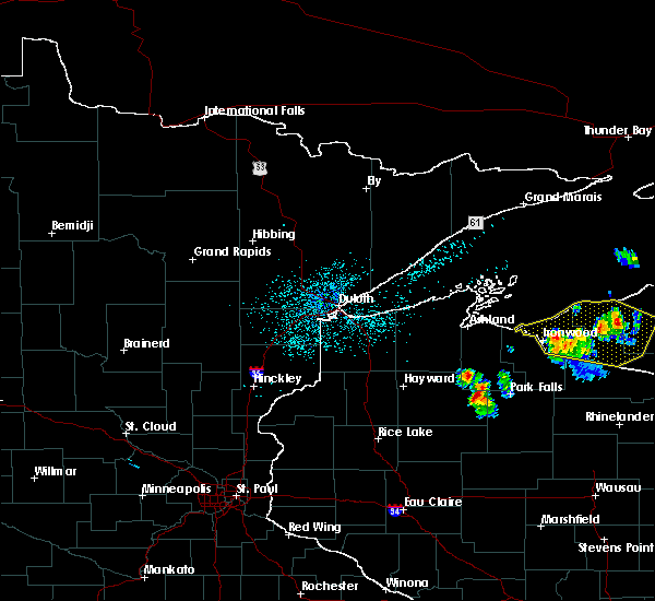 At 1219 am edt /1119 pm cdt/, severe thunderstorms were located along a line extending from near rockland to near van buskirk, moving east at 45 mph (radar indicated). Hazards include 60 mph wind gusts and penny size hail. Expect damage to roofs. siding and trees. these severe storms will be near, marenisco around 1245 am edt. Other locations impacted by these severe thunderstorms include pomeroy lake, lake of the clouds, ewen, merriweather, clark lake, mirror lake, chaney lake, norwich, lake gogebic state park and thomaston. At 1219 am edt /1119 pm cdt/, severe thunderstorms were located along a line extending from near rockland to near van buskirk, moving east at 45 mph (radar indicated). Hazards include 60 mph wind gusts and penny size hail. Expect damage to roofs. siding and trees. these severe storms will be near, marenisco around 1245 am edt. Other locations impacted by these severe thunderstorms include pomeroy lake, lake of the clouds, ewen, merriweather, clark lake, mirror lake, chaney lake, norwich, lake gogebic state park and thomaston.
|
| 6/9/2015 11:06 PM CDT |
 At 1205 am edt /1105 pm cdt/, severe thunderstorms were located along a line extending from 8 miles southeast of silver city to near upson, moving east at 40 mph (radar indicated). Hazards include 60 mph wind gusts and penny size hail. Expect damage to roofs. siding and trees. severe thunderstorms will be near, ironwood around 1115 pm cdt. Other locations impacted by these severe thunderstorms include pomeroy lake, lake of the clouds, ewen, merriweather, clark lake, mirror lake, chaney lake, norwich, lake gogebic state park and thomaston. At 1205 am edt /1105 pm cdt/, severe thunderstorms were located along a line extending from 8 miles southeast of silver city to near upson, moving east at 40 mph (radar indicated). Hazards include 60 mph wind gusts and penny size hail. Expect damage to roofs. siding and trees. severe thunderstorms will be near, ironwood around 1115 pm cdt. Other locations impacted by these severe thunderstorms include pomeroy lake, lake of the clouds, ewen, merriweather, clark lake, mirror lake, chaney lake, norwich, lake gogebic state park and thomaston.
|
| 7/3/2012 2:30 AM EDT | Trees downed on a powerline. no specifics known on diameter or timin in ontonagon county MI, 7.9 miles S of Watersmeet, MI |
| 7/3/2012 12:30 AM CDT | 911 dispatcher said there have been numerous calls about downed powerlines and tree damage. no specifics on location were availabl in gogebic county MI, 1.2 miles NNW of Watersmeet, MI |
| 7/3/2012 12:45 AM EDT | Trees downed on a powerline. no specifics known on diameter or timin in ontonagon county MI, 7.9 miles S of Watersmeet, MI |
| 1/1/0001 12:00 AM | Trees down across town. sizes unknow in ontonagon county MI, 7.9 miles S of Watersmeet, MI |
| 1/1/0001 12:00 AM | Trees down. dimensions unknown. time estimated by radar. pea sized hail also reported in tow in ontonagon county MI, 17.2 miles SSE of Watersmeet, MI |
| 1/1/0001 12:00 AM | Trees down. time estimated by rada in ontonagon county MI, 16.8 miles S of Watersmeet, MI |
| 1/1/0001 12:00 AM | Quarter sized hail reported 16.8 miles S of Watersmeet, MI, multiple local reports of estimated quarter sized hail between bruce crossing and trout creek. time estimated from radar. |
Hail Maps for Watersmeet, MI
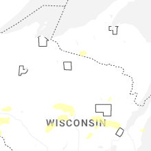
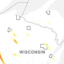


Connect with Interactive Hail Maps