

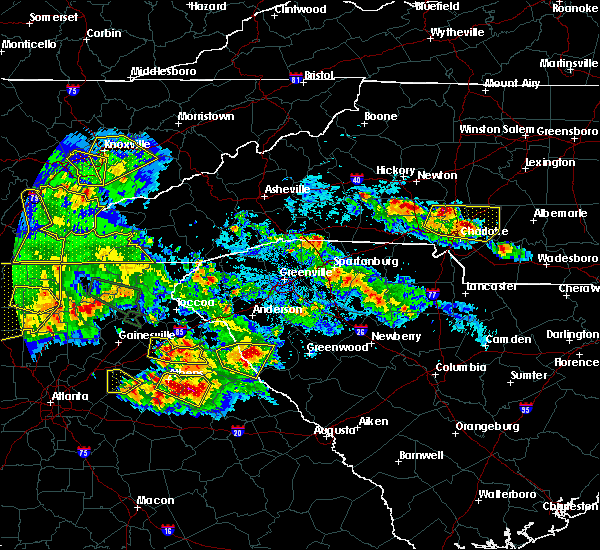
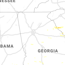
Hail Map for Watkinsville, GA
The Watkinsville, GA area has had 2 reports of on-the-ground hail by trained spotters, and has been under severe weather warnings 14 times during the past 12 months. Doppler radar has detected hail at or near Watkinsville, GA on 31 occasions, including 3 occasions during the past year.
| Name: | Watkinsville, GA |
| Where Located: | 57.2 miles E of Atlanta, GA |
| Map: | Google Map for Watkinsville, GA |
| Population: | 2832 |
| Housing Units: | 1130 |
| More Info: | Search Google for Watkinsville, GA |
3
The Top Recent Hail Date for Watkinsville, GA is Thursday, August 3, 2023 (5th out of 31)

Hail and Wind Damage Spotted near Watkinsville, GA
| Date / Time | Report Details |
|---|---|
| 4/3/2024 12:52 AM EDT |
 The storm which prompted the warning has moved out of the area. therefore, the warning will be allowed to expire. however, heavy rain is still possible with this thunderstorm. a tornado watch remains in effect until 300 am edt for north central, northeastern and east central georgia. The storm which prompted the warning has moved out of the area. therefore, the warning will be allowed to expire. however, heavy rain is still possible with this thunderstorm. a tornado watch remains in effect until 300 am edt for north central, northeastern and east central georgia.
|
| 4/3/2024 12:43 AM EDT |
 the severe thunderstorm warning has been cancelled and is no longer in effect the severe thunderstorm warning has been cancelled and is no longer in effect
|
| 4/3/2024 12:43 AM EDT |
 At 1242 am edt, a severe thunderstorm was located near smithonia, or near lexington, moving east at 60 mph (radar indicated). Hazards include 60 mph wind gusts and penny size hail. Expect damage to roofs, siding, and trees. Locations impacted include, watkinsville, athens, nicholson, winterville, bogart, north high shoals, bishop, athens-clarke county, whitehall, westgate park, james holland youth sports cmpx, bear creek reservoir, beechwood hills, sandy creek recreation area, oconee heights, eastville, barnett shoals, barretts mill, state botanical garden of ga, and farmington. At 1242 am edt, a severe thunderstorm was located near smithonia, or near lexington, moving east at 60 mph (radar indicated). Hazards include 60 mph wind gusts and penny size hail. Expect damage to roofs, siding, and trees. Locations impacted include, watkinsville, athens, nicholson, winterville, bogart, north high shoals, bishop, athens-clarke county, whitehall, westgate park, james holland youth sports cmpx, bear creek reservoir, beechwood hills, sandy creek recreation area, oconee heights, eastville, barnett shoals, barretts mill, state botanical garden of ga, and farmington.
|
| 4/3/2024 12:21 AM EDT |
 Svrffc the national weather service in peachtree city has issued a * severe thunderstorm warning for, oconee county in northeastern georgia, southeastern barrow county in north central georgia, northwestern morgan county in north central georgia, clarke county in northeastern georgia, eastern walton county in north central georgia, southeastern jackson county in northeastern georgia, west central oglethorpe county in northeastern georgia, * until 100 am edt. * at 1221 am edt, a severe thunderstorm was located over north high shoals, or near watkinsville, moving east at 60 mph (radar indicated). Hazards include 60 mph wind gusts and penny size hail. expect damage to roofs, siding, and trees Svrffc the national weather service in peachtree city has issued a * severe thunderstorm warning for, oconee county in northeastern georgia, southeastern barrow county in north central georgia, northwestern morgan county in north central georgia, clarke county in northeastern georgia, eastern walton county in north central georgia, southeastern jackson county in northeastern georgia, west central oglethorpe county in northeastern georgia, * until 100 am edt. * at 1221 am edt, a severe thunderstorm was located over north high shoals, or near watkinsville, moving east at 60 mph (radar indicated). Hazards include 60 mph wind gusts and penny size hail. expect damage to roofs, siding, and trees
|
| 2/28/2024 4:22 PM EST |
 At 422 pm est, severe thunderstorms were located along a line extending from winterville to farmington to near ebenezer, moving east at 45 mph (radar indicated). Hazards include 60 mph wind gusts. Expect damage to roofs, siding, and trees. Locations impacted include, watkinsville, athens, social circle, winterville, rutledge, north high shoals, bostwick, arnoldsville, bishop, athens-clarke county, whitehall, ebenezer, hard labor creek state park, barnett shoals, herndonville, dunlap, state botanical garden of ga, farmington, and apalachee. At 422 pm est, severe thunderstorms were located along a line extending from winterville to farmington to near ebenezer, moving east at 45 mph (radar indicated). Hazards include 60 mph wind gusts. Expect damage to roofs, siding, and trees. Locations impacted include, watkinsville, athens, social circle, winterville, rutledge, north high shoals, bostwick, arnoldsville, bishop, athens-clarke county, whitehall, ebenezer, hard labor creek state park, barnett shoals, herndonville, dunlap, state botanical garden of ga, farmington, and apalachee.
|
| 2/28/2024 4:15 PM EST | Tree down on norton rd between barnett shoals rd and williamsburg p in oconee county GA, 1.2 miles WNW of Watkinsville, GA |
| 2/28/2024 3:56 PM EST |
 At 356 pm est, severe thunderstorms were located along a line extending from near statham to near campton to walnut grove, moving east at 40 mph (radar indicated). Hazards include 60 mph wind gusts. Expect damage to roofs, siding, and trees. Locations impacted include, monroe, watkinsville, athens, social circle, statham, walnut grove, winterville, bogart, rutledge, north high shoals, bethlehem, bostwick, arnoldsville, between, good hope, bishop, jersey, whitehall, athens-clarke county, and westgate park. At 356 pm est, severe thunderstorms were located along a line extending from near statham to near campton to walnut grove, moving east at 40 mph (radar indicated). Hazards include 60 mph wind gusts. Expect damage to roofs, siding, and trees. Locations impacted include, monroe, watkinsville, athens, social circle, statham, walnut grove, winterville, bogart, rutledge, north high shoals, bethlehem, bostwick, arnoldsville, between, good hope, bishop, jersey, whitehall, athens-clarke county, and westgate park.
|
| 2/28/2024 3:41 PM EST |
 Svrffc the national weather service in peachtree city has issued a * severe thunderstorm warning for, northeastern rockdale county in north central georgia, oconee county in northeastern georgia, barrow county in north central georgia, northwestern morgan county in north central georgia, southeastern gwinnett county in north central georgia, clarke county in northeastern georgia, walton county in north central georgia, southern jackson county in northeastern georgia, northwestern oglethorpe county in northeastern georgia, northeastern newton county in north central georgia, * until 430 pm est. * at 340 pm est, severe thunderstorms were located along a line extending from county line to near loganville to near rosebud, moving east at 45 mph (radar indicated). Hazards include 70 mph wind gusts. Expect considerable tree damage. Damage is likely to mobile homes, roofs, and outbuildings. Svrffc the national weather service in peachtree city has issued a * severe thunderstorm warning for, northeastern rockdale county in north central georgia, oconee county in northeastern georgia, barrow county in north central georgia, northwestern morgan county in north central georgia, southeastern gwinnett county in north central georgia, clarke county in northeastern georgia, walton county in north central georgia, southern jackson county in northeastern georgia, northwestern oglethorpe county in northeastern georgia, northeastern newton county in north central georgia, * until 430 pm est. * at 340 pm est, severe thunderstorms were located along a line extending from county line to near loganville to near rosebud, moving east at 45 mph (radar indicated). Hazards include 70 mph wind gusts. Expect considerable tree damage. Damage is likely to mobile homes, roofs, and outbuildings.
|
| 8/15/2023 1:39 PM EDT | Tree down on mail truck on west cloverhurst avenue between s milledge avenue and springdale s in clarke county GA, 5 miles SSW of Watkinsville, GA |
| 8/15/2023 1:37 PM EDT |
 At 137 pm edt, a severe thunderstorm was located over eastville, or near watkinsville, moving east at 20 mph (radar indicated). Hazards include 60 mph wind gusts and quarter size hail. Hail damage to vehicles is expected. Expect wind damage to roofs, siding, and trees. At 137 pm edt, a severe thunderstorm was located over eastville, or near watkinsville, moving east at 20 mph (radar indicated). Hazards include 60 mph wind gusts and quarter size hail. Hail damage to vehicles is expected. Expect wind damage to roofs, siding, and trees.
|
| 8/7/2023 6:40 PM EDT | Emergency manager reports a tree down at the state botanical gardens of georgi in clarke county GA, 2.6 miles SW of Watkinsville, GA |
| 8/7/2023 6:29 PM EDT |
 At 629 pm edt, severe thunderstorms were located along a line extending from bear creek reservoir to near bostwick to near farrar, moving east at 45 mph (radar indicated). Hazards include 60 mph wind gusts and quarter size hail. Hail damage to vehicles is expected. Expect wind damage to roofs, siding, and trees. At 629 pm edt, severe thunderstorms were located along a line extending from bear creek reservoir to near bostwick to near farrar, moving east at 45 mph (radar indicated). Hazards include 60 mph wind gusts and quarter size hail. Hail damage to vehicles is expected. Expect wind damage to roofs, siding, and trees.
|
| 8/7/2023 6:27 PM EDT |
 The severe thunderstorm warning for oconee, southeastern clarke, northern wilkes and oglethorpe counties will expire at 630 pm edt, the storms which prompted the warning have weakened below severe limits, and have exited the warned area. therefore, the warning will be allowed to expire. a severe thunderstorm watch remains in effect until 800 pm edt for north central and northeastern georgia. a severe thunderstorm watch also remains in effect until midnight edt for northeastern and east central georgia. The severe thunderstorm warning for oconee, southeastern clarke, northern wilkes and oglethorpe counties will expire at 630 pm edt, the storms which prompted the warning have weakened below severe limits, and have exited the warned area. therefore, the warning will be allowed to expire. a severe thunderstorm watch remains in effect until 800 pm edt for north central and northeastern georgia. a severe thunderstorm watch also remains in effect until midnight edt for northeastern and east central georgia.
|
| 8/7/2023 5:46 PM EDT |
 At 546 pm edt, severe thunderstorms were located along a line extending from point peter to near dunlap to north high shoals, moving east at 60 mph (radar indicated). Hazards include 60 mph wind gusts and quarter size hail. Hail damage to vehicles is expected. Expect wind damage to roofs, siding, and trees. At 546 pm edt, severe thunderstorms were located along a line extending from point peter to near dunlap to north high shoals, moving east at 60 mph (radar indicated). Hazards include 60 mph wind gusts and quarter size hail. Hail damage to vehicles is expected. Expect wind damage to roofs, siding, and trees.
|
| 8/7/2023 5:04 PM EDT |
 At 504 pm edt, severe thunderstorms were located along a line extending from near county line to windsor, moving east at 35 mph (radar indicated). Hazards include 60 mph wind gusts and quarter size hail. Hail damage to vehicles is expected. Expect wind damage to roofs, siding, and trees. At 504 pm edt, severe thunderstorms were located along a line extending from near county line to windsor, moving east at 35 mph (radar indicated). Hazards include 60 mph wind gusts and quarter size hail. Hail damage to vehicles is expected. Expect wind damage to roofs, siding, and trees.
|
| 7/20/2023 6:13 PM EDT |
 At 612 pm edt, severe thunderstorms were located along a line extending from near clermont to suwanee, moving southeast at 50 mph (radar indicated). Hazards include 70 mph wind gusts and penny size hail. Expect considerable tree damage. Damage is likely to mobile homes, roofs, and outbuildings. At 612 pm edt, severe thunderstorms were located along a line extending from near clermont to suwanee, moving southeast at 50 mph (radar indicated). Hazards include 70 mph wind gusts and penny size hail. Expect considerable tree damage. Damage is likely to mobile homes, roofs, and outbuildings.
|
| 6/25/2023 6:39 PM EDT | Tree down on rocky branch and old waverly wa in oconee county GA, 5.8 miles ESE of Watkinsville, GA |
| 6/25/2023 6:07 PM EDT |
 At 607 pm edt, severe thunderstorms were located along a line extending from near danielsville to auburn, moving southeast at 25 mph (radar indicated). Hazards include 60 mph wind gusts. expect damage to roofs, siding, and trees At 607 pm edt, severe thunderstorms were located along a line extending from near danielsville to auburn, moving southeast at 25 mph (radar indicated). Hazards include 60 mph wind gusts. expect damage to roofs, siding, and trees
|
| 4/1/2023 10:37 AM EDT | Trees down at exit 1 on the athens perimete in oconee county GA, 3.8 miles SE of Watkinsville, GA |
| 4/1/2023 9:37 AM EDT | Trees down at greesnboro hwy and wire bridge r in oconee county GA, 8.3 miles NW of Watkinsville, GA |
| 4/1/2023 9:20 AM EDT | Multiple trees down near the intersection of pinecrest dr and pinecrest c in clarke county GA, 4.5 miles SSW of Watkinsville, GA |
| 4/1/2023 9:16 AM EDT | Tree down on car on parkway d in clarke county GA, 4.3 miles SSW of Watkinsville, GA |
| 4/1/2023 9:16 AM EDT | Multiple trees down on milledge ave near east campus r in clarke county GA, 4.5 miles SSW of Watkinsville, GA |
| 4/1/2023 9:15 AM EDT | 1 tree on a hous in clarke county GA, 4.2 miles S of Watkinsville, GA |
| 4/1/2023 9:14 AM EDT | Tree down on dogwood d in clarke county GA, 4.2 miles S of Watkinsville, GA |
| 4/1/2023 9:14 AM EDT | Tree down on dogwood d in clarke county GA, 4.2 miles S of Watkinsville, GA |
| 4/1/2023 9:14 AM EDT | Trees down at exit 4 on the athens perimete in oconee county GA, 3.5 miles S of Watkinsville, GA |
| 3/27/2023 12:30 AM EDT |
 At 1230 am edt, severe thunderstorms were located along a line extending from near bostwick to turtle cove, moving northeast at 60 mph (radar indicated). Hazards include 60 mph wind gusts. expect damage to roofs, siding, and trees At 1230 am edt, severe thunderstorms were located along a line extending from near bostwick to turtle cove, moving northeast at 60 mph (radar indicated). Hazards include 60 mph wind gusts. expect damage to roofs, siding, and trees
|
| 1/12/2023 4:46 PM EST |
 At 446 pm est, severe thunderstorms were located along a line extending from near gratis to monroe to near oxford, moving east at 40 mph (radar indicated). Hazards include 60 mph wind gusts. expect damage to roofs, siding, and trees At 446 pm est, severe thunderstorms were located along a line extending from near gratis to monroe to near oxford, moving east at 40 mph (radar indicated). Hazards include 60 mph wind gusts. expect damage to roofs, siding, and trees
|
| 7/3/2022 6:32 PM EDT |
 At 632 pm edt, a severe thunderstorm was located near bostwick, or 9 miles southwest of watkinsville, and is nearly stationary (radar indicated). Hazards include 60 mph wind gusts and quarter size hail. Hail damage to vehicles is expected. Expect wind damage to roofs, siding, and trees. At 632 pm edt, a severe thunderstorm was located near bostwick, or 9 miles southwest of watkinsville, and is nearly stationary (radar indicated). Hazards include 60 mph wind gusts and quarter size hail. Hail damage to vehicles is expected. Expect wind damage to roofs, siding, and trees.
|
| 7/3/2022 5:45 PM EDT |
 At 544 pm edt, a severe thunderstorm was located over bogart, or 7 miles northwest of watkinsville, and is nearly stationary (radar indicated). Hazards include 60 mph wind gusts and quarter size hail. Hail damage to vehicles is expected. Expect wind damage to roofs, siding, and trees. At 544 pm edt, a severe thunderstorm was located over bogart, or 7 miles northwest of watkinsville, and is nearly stationary (radar indicated). Hazards include 60 mph wind gusts and quarter size hail. Hail damage to vehicles is expected. Expect wind damage to roofs, siding, and trees.
|
| 6/2/2022 6:20 PM EDT |
 At 619 pm edt, a severe thunderstorm was located over bishop, or over watkinsville, moving east at 20 mph (radar indicated). Hazards include 60 mph wind gusts and penny size hail. Expect damage to roofs, siding, and trees. locations impacted include, watkinsville, north high shoals, bishop, barnett shoals and farmington. hail threat, radar indicated max hail size, 0. 75 in wind threat, radar indicated max wind gust, 60 mph. At 619 pm edt, a severe thunderstorm was located over bishop, or over watkinsville, moving east at 20 mph (radar indicated). Hazards include 60 mph wind gusts and penny size hail. Expect damage to roofs, siding, and trees. locations impacted include, watkinsville, north high shoals, bishop, barnett shoals and farmington. hail threat, radar indicated max hail size, 0. 75 in wind threat, radar indicated max wind gust, 60 mph.
|
| 6/2/2022 6:09 PM EDT |
 At 609 pm edt, a severe thunderstorm was located over north high shoals, or near watkinsville, moving east at 10 mph (radar indicated). Hazards include 60 mph wind gusts and quarter size hail. Hail damage to vehicles is expected. Expect wind damage to roofs, siding, and trees. At 609 pm edt, a severe thunderstorm was located over north high shoals, or near watkinsville, moving east at 10 mph (radar indicated). Hazards include 60 mph wind gusts and quarter size hail. Hail damage to vehicles is expected. Expect wind damage to roofs, siding, and trees.
|
| 12/31/2021 6:22 PM EST |
 At 621 pm est, a severe thunderstorm capable of producing a tornado was located over ebenezer, or 7 miles southeast of monroe, moving east at 25 mph (weather spotters reported funnel cloud). Hazards include tornado. Flying debris will be dangerous to those caught without shelter. mobile homes will be damaged or destroyed. damage to roofs, windows, and vehicles will occur. Tree damage is likely. At 621 pm est, a severe thunderstorm capable of producing a tornado was located over ebenezer, or 7 miles southeast of monroe, moving east at 25 mph (weather spotters reported funnel cloud). Hazards include tornado. Flying debris will be dangerous to those caught without shelter. mobile homes will be damaged or destroyed. damage to roofs, windows, and vehicles will occur. Tree damage is likely.
|
| 6/6/2021 9:52 PM EDT |
 The severe thunderstorm warning for northwestern oconee, west central clarke and northeastern walton counties will expire at 1000 pm edt, the storm which prompted the warning has weakened below severe limits, and has exited the warned area. therefore, the warning will be allowed to expire. however small hail, gusty winds and heavy rain are still possible with this thunderstorm. The severe thunderstorm warning for northwestern oconee, west central clarke and northeastern walton counties will expire at 1000 pm edt, the storm which prompted the warning has weakened below severe limits, and has exited the warned area. therefore, the warning will be allowed to expire. however small hail, gusty winds and heavy rain are still possible with this thunderstorm.
|
| 6/6/2021 9:30 PM EDT |
 At 929 pm edt, a severe thunderstorm was located over north high shoals, or near watkinsville, moving north at 25 mph (radar indicated). Hazards include 60 mph wind gusts and quarter size hail. Hail damage to vehicles is expected. Expect wind damage to roofs, siding, and trees. At 929 pm edt, a severe thunderstorm was located over north high shoals, or near watkinsville, moving north at 25 mph (radar indicated). Hazards include 60 mph wind gusts and quarter size hail. Hail damage to vehicles is expected. Expect wind damage to roofs, siding, and trees.
|
| 4/24/2021 10:11 PM EDT |
 The severe thunderstorm warning for oconee, morgan, putnam, southeastern clarke, greene, oglethorpe and northern jasper counties will expire at 1015 pm edt, the storms which prompted the warning have weakened below severe limits, and no longer pose an immediate threat to life or property. therefore, the warning will be allowed to expire. The severe thunderstorm warning for oconee, morgan, putnam, southeastern clarke, greene, oglethorpe and northern jasper counties will expire at 1015 pm edt, the storms which prompted the warning have weakened below severe limits, and no longer pose an immediate threat to life or property. therefore, the warning will be allowed to expire.
|
| 4/24/2021 9:36 PM EDT |
 At 936 pm edt, severe thunderstorms were located along a line extending from near eastville to 6 miles southwest of madison to near flovilla, moving east at 45 mph (radar indicated). Hazards include 60 mph wind gusts and penny size hail. expect damage to roofs, siding, and trees At 936 pm edt, severe thunderstorms were located along a line extending from near eastville to 6 miles southwest of madison to near flovilla, moving east at 45 mph (radar indicated). Hazards include 60 mph wind gusts and penny size hail. expect damage to roofs, siding, and trees
|
| 4/24/2021 9:21 PM EDT |
 At 921 pm edt, severe thunderstorms were located along a line extending from near gratis to mansfield to east griffin, moving east at 65 mph (radar indicated). Hazards include 60 mph wind gusts and quarter size hail. Hail damage to vehicles is expected. expect wind damage to roofs, siding, and trees. Locations impacted include, griffin, monroe, covington, jackson, madison, watkinsville, monticello, locust grove, social circle, oxford, walnut grove, rutledge, newborn, flovilla, north high shoals, mansfield, jenkinsburg, bostwick, between and good hope. At 921 pm edt, severe thunderstorms were located along a line extending from near gratis to mansfield to east griffin, moving east at 65 mph (radar indicated). Hazards include 60 mph wind gusts and quarter size hail. Hail damage to vehicles is expected. expect wind damage to roofs, siding, and trees. Locations impacted include, griffin, monroe, covington, jackson, madison, watkinsville, monticello, locust grove, social circle, oxford, walnut grove, rutledge, newborn, flovilla, north high shoals, mansfield, jenkinsburg, bostwick, between and good hope.
|
| 4/24/2021 9:03 PM EDT |
 At 903 pm edt, severe thunderstorms were located along a line extending from near rosebud to near oak hill to near digbey, moving east at 65 mph (radar indicated). Hazards include 60 mph wind gusts and quarter size hail. Hail damage to vehicles is expected. Expect wind damage to roofs, siding, and trees. At 903 pm edt, severe thunderstorms were located along a line extending from near rosebud to near oak hill to near digbey, moving east at 65 mph (radar indicated). Hazards include 60 mph wind gusts and quarter size hail. Hail damage to vehicles is expected. Expect wind damage to roofs, siding, and trees.
|
| 6/27/2020 5:25 PM EDT |
 At 525 pm edt, severe thunderstorms were located along a line extending from near carnesville to oconee heights to near herndonville, moving east at 45 mph (radar indicated). Hazards include 60 mph wind gusts. expect damage to roofs, siding, and trees At 525 pm edt, severe thunderstorms were located along a line extending from near carnesville to oconee heights to near herndonville, moving east at 45 mph (radar indicated). Hazards include 60 mph wind gusts. expect damage to roofs, siding, and trees
|
| 6/14/2020 7:04 PM EDT |
 At 704 pm edt, a severe thunderstorm was located over bogart, or 9 miles northwest of watkinsville, moving southeast at 10 mph (radar indicated). Hazards include 60 mph wind gusts and quarter size hail. Hail damage to vehicles is expected. Expect wind damage to roofs, siding, and trees. At 704 pm edt, a severe thunderstorm was located over bogart, or 9 miles northwest of watkinsville, moving southeast at 10 mph (radar indicated). Hazards include 60 mph wind gusts and quarter size hail. Hail damage to vehicles is expected. Expect wind damage to roofs, siding, and trees.
|
| 3/31/2020 12:27 PM EDT |
 At 1227 pm edt, severe thunderstorms were located along a line extending from north high shoals to near shady dale, moving east at 60 mph (radar indicated). Hazards include 60 mph wind gusts. expect damage to roofs, siding, and trees At 1227 pm edt, severe thunderstorms were located along a line extending from north high shoals to near shady dale, moving east at 60 mph (radar indicated). Hazards include 60 mph wind gusts. expect damage to roofs, siding, and trees
|
| 2/6/2020 9:44 AM EST |
 At 944 am est, a severe thunderstorm capable of producing a tornado was located just west of watkinsville, moving northeast at 55 mph (radar indicated rotation). Hazards include tornado. Flying debris will be dangerous to those caught without shelter. mobile homes will be damaged or destroyed. damage to roofs, windows, and vehicles will occur. Tree damage is likely. At 944 am est, a severe thunderstorm capable of producing a tornado was located just west of watkinsville, moving northeast at 55 mph (radar indicated rotation). Hazards include tornado. Flying debris will be dangerous to those caught without shelter. mobile homes will be damaged or destroyed. damage to roofs, windows, and vehicles will occur. Tree damage is likely.
|
| 9/13/2019 9:41 PM EDT |
 At 914 pm edt, severe thunderstorms were located along a line extending from arnoldsville to gratis, moving southwest at 15 mph (radar indicated). Hazards include 60 mph wind gusts. expect damage to roofs, siding, and trees At 914 pm edt, severe thunderstorms were located along a line extending from arnoldsville to gratis, moving southwest at 15 mph (radar indicated). Hazards include 60 mph wind gusts. expect damage to roofs, siding, and trees
|
| 9/13/2019 9:15 PM EDT |
 At 914 pm edt, severe thunderstorms were located along a line extending from arnoldsville to gratis, moving southwest at 15 mph (radar indicated). Hazards include 60 mph wind gusts. expect damage to roofs, siding, and trees At 914 pm edt, severe thunderstorms were located along a line extending from arnoldsville to gratis, moving southwest at 15 mph (radar indicated). Hazards include 60 mph wind gusts. expect damage to roofs, siding, and trees
|
| 8/23/2019 6:43 PM EDT | Tree down along s milledge ave near peabody s in clarke county GA, 5.7 miles S of Watkinsville, GA |
| 8/23/2019 6:43 PM EDT | Tree on powerlines reported on the 700 block of whitehall road. tree down near snapfinger dr and sorenson ridge just to the eas in clarke county GA, 3.4 miles SW of Watkinsville, GA |
| 8/23/2019 6:36 PM EDT |
 At 636 pm edt, severe thunderstorms were located along a line extending from near arcade to athens-clarke county to watkinsville, moving east at 20 mph (radar indicated). Hazards include 60 mph wind gusts and quarter size hail. Hail damage to vehicles is expected. Expect wind damage to roofs, siding, and trees. At 636 pm edt, severe thunderstorms were located along a line extending from near arcade to athens-clarke county to watkinsville, moving east at 20 mph (radar indicated). Hazards include 60 mph wind gusts and quarter size hail. Hail damage to vehicles is expected. Expect wind damage to roofs, siding, and trees.
|
| 8/23/2019 6:33 PM EDT | Tree reported down across the street near cocorahs observer's hom in clarke county GA, 4.8 miles SW of Watkinsville, GA |
| 8/23/2019 6:18 PM EDT |
 At 617 pm edt, a severe thunderstorm was located over bostwick, or 8 miles south of watkinsville, moving northeast at 10 mph (radar indicated). Hazards include 60 mph wind gusts and quarter size hail. Hail damage to vehicles is expected. Expect wind damage to roofs, siding, and trees. At 617 pm edt, a severe thunderstorm was located over bostwick, or 8 miles south of watkinsville, moving northeast at 10 mph (radar indicated). Hazards include 60 mph wind gusts and quarter size hail. Hail damage to vehicles is expected. Expect wind damage to roofs, siding, and trees.
|
| 8/19/2019 6:45 PM EDT | A large tree fell onto power lines near the intersection of sunset drive and edwards d in clarke county GA, 6.3 miles S of Watkinsville, GA |
| 8/19/2019 6:35 PM EDT | Large tree uprooted and toppled onto vehicle on pine needle rd in clarke county GA, 6.3 miles S of Watkinsville, GA |
| 8/19/2019 6:35 PM EDT |
 At 635 pm edt, a severe thunderstorm was located over athens-clarke county, or over athens, and is nearly stationary (radar indicated). Hazards include 60 mph wind gusts and half dollar size hail. Hail damage to vehicles is expected. Expect wind damage to roofs, siding, and trees. At 635 pm edt, a severe thunderstorm was located over athens-clarke county, or over athens, and is nearly stationary (radar indicated). Hazards include 60 mph wind gusts and half dollar size hail. Hail damage to vehicles is expected. Expect wind damage to roofs, siding, and trees.
|
| 8/5/2019 6:24 PM EDT | Trees reported down near intersection of davis st and south milledge ave and the intersection of riverbend rd and college station r in clarke county GA, 3.8 miles SSW of Watkinsville, GA |
| 8/5/2019 6:22 PM EDT |
 At 622 pm edt, a severe thunderstorm was located over whitehall, or near athens, and is nearly stationary (radar indicated). Hazards include 60 mph wind gusts and nickel size hail. expect damage to roofs, siding, and trees At 622 pm edt, a severe thunderstorm was located over whitehall, or near athens, and is nearly stationary (radar indicated). Hazards include 60 mph wind gusts and nickel size hail. expect damage to roofs, siding, and trees
|
| 7/17/2019 4:59 PM EDT |
 At 458 pm edt, severe thunderstorms were located along a line extending from near arcade to near bogart to north high shoals, moving east at 40 mph (radar indicated). Hazards include 60 mph wind gusts. Expect damage to roofs, siding, and trees. Locations impacted include, watkinsville, danielsville, athens, statham, arcade, nicholson, comer, winterville, bogart, crawford, north high shoals, colbert, arnoldsville, ila, carlton, hull, whitehall, athens-clarke county, westgate park and diamond hill. At 458 pm edt, severe thunderstorms were located along a line extending from near arcade to near bogart to north high shoals, moving east at 40 mph (radar indicated). Hazards include 60 mph wind gusts. Expect damage to roofs, siding, and trees. Locations impacted include, watkinsville, danielsville, athens, statham, arcade, nicholson, comer, winterville, bogart, crawford, north high shoals, colbert, arnoldsville, ila, carlton, hull, whitehall, athens-clarke county, westgate park and diamond hill.
|
| 7/17/2019 4:44 PM EDT |
 At 443 pm edt, severe thunderstorms were located along a line extending from near winder to near bogart to good hope, moving east at 45 mph (radar indicated). Hazards include 60 mph wind gusts. expect damage to roofs, siding, and trees At 443 pm edt, severe thunderstorms were located along a line extending from near winder to near bogart to good hope, moving east at 45 mph (radar indicated). Hazards include 60 mph wind gusts. expect damage to roofs, siding, and trees
|
| 6/23/2019 5:25 PM EDT |
 At 525 pm edt, severe thunderstorms were located along a line extending from near farmington to buckhead, moving east at 30 mph (radar indicated). Hazards include 60 mph wind gusts and quarter size hail. Hail damage to vehicles is expected. expect wind damage to roofs, siding, and trees. Locations impacted include, madison, watkinsville, bishop, buckhead, parks mill, carey, swords, wrayswood, barnett shoals, greshamville, farmington and apalachee. At 525 pm edt, severe thunderstorms were located along a line extending from near farmington to buckhead, moving east at 30 mph (radar indicated). Hazards include 60 mph wind gusts and quarter size hail. Hail damage to vehicles is expected. expect wind damage to roofs, siding, and trees. Locations impacted include, madison, watkinsville, bishop, buckhead, parks mill, carey, swords, wrayswood, barnett shoals, greshamville, farmington and apalachee.
|
| 6/23/2019 5:13 PM EDT |
 At 513 pm edt, severe thunderstorms were located along a line extending from near farmington to near madison, moving east at 40 mph (radar indicated). Hazards include 60 mph wind gusts and quarter size hail. Hail damage to vehicles is expected. expect wind damage to roofs, siding, and trees. Locations impacted include, madison, watkinsville, rutledge, north high shoals, bostwick, good hope, bishop, buckhead, wrayswood, eastville, godfrey, barnett shoals, greshamville, parks mill, carey, swords, farmington and apalachee. At 513 pm edt, severe thunderstorms were located along a line extending from near farmington to near madison, moving east at 40 mph (radar indicated). Hazards include 60 mph wind gusts and quarter size hail. Hail damage to vehicles is expected. expect wind damage to roofs, siding, and trees. Locations impacted include, madison, watkinsville, rutledge, north high shoals, bostwick, good hope, bishop, buckhead, wrayswood, eastville, godfrey, barnett shoals, greshamville, parks mill, carey, swords, farmington and apalachee.
|
| 6/23/2019 5:06 PM EDT | Trees down near the intersection of oliver bridge rd and flat rock rd south of athen in oconee county GA, 6 miles NW of Watkinsville, GA |
| 6/23/2019 4:57 PM EDT |
 At 457 pm edt, severe thunderstorms were located along a line extending from good hope to near newborn, moving east at 30 mph (radar indicated). Hazards include 60 mph wind gusts and quarter size hail. Hail damage to vehicles is expected. Expect wind damage to roofs, siding, and trees. At 457 pm edt, severe thunderstorms were located along a line extending from good hope to near newborn, moving east at 30 mph (radar indicated). Hazards include 60 mph wind gusts and quarter size hail. Hail damage to vehicles is expected. Expect wind damage to roofs, siding, and trees.
|
| 5/11/2019 5:34 PM EDT |
 At 533 pm edt, a severe thunderstorm was located over watkinsville, moving east at 40 mph (radar indicated). Hazards include 60 mph wind gusts and quarter size hail. Hail damage to vehicles is expected. Expect wind damage to roofs, siding, and trees. At 533 pm edt, a severe thunderstorm was located over watkinsville, moving east at 40 mph (radar indicated). Hazards include 60 mph wind gusts and quarter size hail. Hail damage to vehicles is expected. Expect wind damage to roofs, siding, and trees.
|
| 4/20/2019 9:25 AM EDT | Power lines reported down on the 200 block of evans s in clarke county GA, 5.6 miles S of Watkinsville, GA |
| 9/27/2018 5:42 PM EDT | Multiple reports of trees down on the west side of athens in clarke county GA, 5.6 miles S of Watkinsville, GA |
| 9/27/2018 5:42 PM EDT | Tree down at s barnett shoals rd & whit davis rd in clarke county GA, 5.2 miles WSW of Watkinsville, GA |
| 9/27/2018 5:37 PM EDT |
 At 536 pm edt, severe thunderstorms were located along a line extending from near arcade to whitehall to penfield, moving northeast at 55 mph (trained weather spotters have reported numerous trees down in multiple locations). Hazards include 70 mph wind gusts. Expect considerable tree damage. damage is likely to mobile homes, roofs, and outbuildings. Locations impacted include, winder, jefferson, greensboro, watkinsville, lexington, athens, statham, arcade, nicholson, union point, winterville, bogart, crawford, north high shoals, bethlehem, colbert, arnoldsville, woodville, maxeys and bishop. At 536 pm edt, severe thunderstorms were located along a line extending from near arcade to whitehall to penfield, moving northeast at 55 mph (trained weather spotters have reported numerous trees down in multiple locations). Hazards include 70 mph wind gusts. Expect considerable tree damage. damage is likely to mobile homes, roofs, and outbuildings. Locations impacted include, winder, jefferson, greensboro, watkinsville, lexington, athens, statham, arcade, nicholson, union point, winterville, bogart, crawford, north high shoals, bethlehem, colbert, arnoldsville, woodville, maxeys and bishop.
|
| 9/27/2018 5:26 PM EDT |
 A severe thunderstorm warning remains in effect until 545 pm edt for oconee. southeastern barrow. morgan. clarke. northeastern walton. northern greene. southeastern jackson. oglethorpe and southwestern madison counties. At 524 pm edt, severe thunderstorms were located along a line extending from gratis to apalachee to near godfrey, moving northeast. A severe thunderstorm warning remains in effect until 545 pm edt for oconee. southeastern barrow. morgan. clarke. northeastern walton. northern greene. southeastern jackson. oglethorpe and southwestern madison counties. At 524 pm edt, severe thunderstorms were located along a line extending from gratis to apalachee to near godfrey, moving northeast.
|
| 9/27/2018 5:08 PM EDT |
 At 506 pm edt, severe thunderstorms were located along a line extending from near between to hard labor creek state park to shady dale, moving northeast at 35 mph (radar indicated. multiple trees have been reported down with this storm). Hazards include 60 mph wind gusts and quarter size hail. Hail damage to vehicles is expected. Expect wind damage to roofs, siding, and trees. At 506 pm edt, severe thunderstorms were located along a line extending from near between to hard labor creek state park to shady dale, moving northeast at 35 mph (radar indicated. multiple trees have been reported down with this storm). Hazards include 60 mph wind gusts and quarter size hail. Hail damage to vehicles is expected. Expect wind damage to roofs, siding, and trees.
|
| 8/1/2018 8:20 PM EDT |
 At 819 pm edt, a severe thunderstorm was located over eastville, or 7 miles west of watkinsville, moving northeast at 20 mph (radar indicated). Hazards include 60 mph wind gusts. expect damage to roofs, siding, and trees At 819 pm edt, a severe thunderstorm was located over eastville, or 7 miles west of watkinsville, moving northeast at 20 mph (radar indicated). Hazards include 60 mph wind gusts. expect damage to roofs, siding, and trees
|
| 7/22/2018 8:17 PM EDT |
 At 817 pm edt, a severe thunderstorm was located over arnoldsville, or 7 miles west of lexington, moving southeast at 20 mph (radar indicated). Hazards include 60 mph wind gusts and quarter size hail. Hail damage to vehicles is expected. expect wind damage to roofs, siding, and trees. Locations impacted include, watkinsville, lexington, athens, winterville, crawford, colbert, arnoldsville, maxeys, hull, athens-clarke county, whitehall, stephens, smithonia, hutchings, barnett shoals, dunlap, state botanical garden of ga, watson mill bridge state park and point peter. At 817 pm edt, a severe thunderstorm was located over arnoldsville, or 7 miles west of lexington, moving southeast at 20 mph (radar indicated). Hazards include 60 mph wind gusts and quarter size hail. Hail damage to vehicles is expected. expect wind damage to roofs, siding, and trees. Locations impacted include, watkinsville, lexington, athens, winterville, crawford, colbert, arnoldsville, maxeys, hull, athens-clarke county, whitehall, stephens, smithonia, hutchings, barnett shoals, dunlap, state botanical garden of ga, watson mill bridge state park and point peter.
|
| 7/22/2018 7:49 PM EDT |
 At 749 pm edt, a severe thunderstorm was located over athens-clarke county, or over athens, moving southeast at 20 mph (radar indicated). Hazards include 60 mph wind gusts and quarter size hail. Hail damage to vehicles is expected. Expect wind damage to roofs, siding, and trees. At 749 pm edt, a severe thunderstorm was located over athens-clarke county, or over athens, moving southeast at 20 mph (radar indicated). Hazards include 60 mph wind gusts and quarter size hail. Hail damage to vehicles is expected. Expect wind damage to roofs, siding, and trees.
|
| 7/21/2018 8:42 PM EDT |
 At 842 pm edt, a severe thunderstorm was located over bogart, or 9 miles west of athens, moving east at 45 mph (radar indicated). Hazards include ping pong ball size hail and 60 mph wind gusts. People and animals outdoors will be injured. expect hail damage to roofs, siding, windows, and vehicles. Expect wind damage to roofs, siding, and trees. At 842 pm edt, a severe thunderstorm was located over bogart, or 9 miles west of athens, moving east at 45 mph (radar indicated). Hazards include ping pong ball size hail and 60 mph wind gusts. People and animals outdoors will be injured. expect hail damage to roofs, siding, windows, and vehicles. Expect wind damage to roofs, siding, and trees.
|
| 7/21/2018 8:22 PM EDT |
 At 822 pm edt, a severe thunderstorm was located near bold springs, or near winder, moving east at 40 mph (radar indicated). Hazards include golf ball size hail and 60 mph wind gusts. People and animals outdoors will be injured. expect hail damage to roofs, siding, windows, and vehicles. Expect wind damage to roofs, siding, and trees. At 822 pm edt, a severe thunderstorm was located near bold springs, or near winder, moving east at 40 mph (radar indicated). Hazards include golf ball size hail and 60 mph wind gusts. People and animals outdoors will be injured. expect hail damage to roofs, siding, windows, and vehicles. Expect wind damage to roofs, siding, and trees.
|
| 6/1/2018 4:10 PM EDT | Reports of trees down at the 1100 block of antioch church road in rose hil in oconee county GA, 8.8 miles NW of Watkinsville, GA |
| 6/1/2018 4:05 PM EDT | Reports of trees down near salem road and hale road in sale in oconee county GA, 10.3 miles N of Watkinsville, GA |
| 6/1/2018 3:56 PM EDT | Reports of trees down on harden hill road in watkinsvill in oconee county GA, 1 miles NE of Watkinsville, GA |
| 6/1/2018 3:56 PM EDT |
 At 355 pm edt, severe thunderstorms were located along a line extending from near north high shoals to near social circle, moving northeast at 35 mph (radar indicated). Hazards include 60 mph wind gusts and penny size hail. expect damage to roofs, siding, and trees At 355 pm edt, severe thunderstorms were located along a line extending from near north high shoals to near social circle, moving northeast at 35 mph (radar indicated). Hazards include 60 mph wind gusts and penny size hail. expect damage to roofs, siding, and trees
|
| 7/1/2017 6:40 PM EDT | Widespread tree damage and power outages from a microburst in athens including damage to multiple trees near the intersection of oglethorpe and hawthorne in clarke county GA, 6.3 miles S of Watkinsville, GA |
| 7/1/2017 6:40 PM EDT | Widespread tree damage and power outages from a microburst in athens icluding damage to multiple trees at jefferson rd at the athens perimeter loop in clarke county GA, 7 miles S of Watkinsville, GA |
| 6/22/2017 8:47 PM EDT |
 At 846 pm edt, severe thunderstorms were located along a line extending from near pannell to near farmington to buckhead, moving northeast at 30 mph (radar indicated). Hazards include 60 mph wind gusts. expect damage to roofs, siding, and trees At 846 pm edt, severe thunderstorms were located along a line extending from near pannell to near farmington to buckhead, moving northeast at 30 mph (radar indicated). Hazards include 60 mph wind gusts. expect damage to roofs, siding, and trees
|
| 4/3/2017 1:31 PM EDT |
 At 131 pm edt, a severe thunderstorm was located near hard labor creek state park, or 9 miles southeast of monroe, moving northeast at 45 mph (radar indicated). Hazards include 60 mph wind gusts. expect damage to roofs, siding, and trees At 131 pm edt, a severe thunderstorm was located near hard labor creek state park, or 9 miles southeast of monroe, moving northeast at 45 mph (radar indicated). Hazards include 60 mph wind gusts. expect damage to roofs, siding, and trees
|
| 3/21/2017 9:22 PM EDT |
 At 921 pm edt, severe thunderstorms were located extending from near bowman to arnoldsville to good hope, moving southeast at 60 mph (radar indicated, plus numerous reports of downed trees and powerlines across north georgia). Hazards include 60 mph wind gusts and penny size hail. expect damage to roofs, siding, and trees At 921 pm edt, severe thunderstorms were located extending from near bowman to arnoldsville to good hope, moving southeast at 60 mph (radar indicated, plus numerous reports of downed trees and powerlines across north georgia). Hazards include 60 mph wind gusts and penny size hail. expect damage to roofs, siding, and trees
|
| 3/21/2017 8:54 PM EDT |
 The severe thunderstorm warning for oconee, north central morgan and northeastern walton counties will expire at 900 pm edt, the storm which prompted the warning has moved out of the area. therefore the warning will be allowed to expire. a severe thunderstorm watch remains in effect until 1100 pm edt for north central, northeastern and east central georgia. The severe thunderstorm warning for oconee, north central morgan and northeastern walton counties will expire at 900 pm edt, the storm which prompted the warning has moved out of the area. therefore the warning will be allowed to expire. a severe thunderstorm watch remains in effect until 1100 pm edt for north central, northeastern and east central georgia.
|
| 3/21/2017 8:49 PM EDT |
 At 849 pm edt, a severe thunderstorm was located near barnett shoals, or 9 miles southwest of lexington, moving east at 30 mph (radar indicated). Hazards include 60 mph wind gusts and quarter size hail. Hail damage to vehicles is expected. Expect wind damage to roofs, siding, and trees. At 849 pm edt, a severe thunderstorm was located near barnett shoals, or 9 miles southwest of lexington, moving east at 30 mph (radar indicated). Hazards include 60 mph wind gusts and quarter size hail. Hail damage to vehicles is expected. Expect wind damage to roofs, siding, and trees.
|
| 3/21/2017 8:35 PM EDT | Quarter sized hail reported 0.6 miles NNE of Watkinsville, GA, quarter-sized hail reported on the ground in watkinsville. |
| 3/21/2017 8:08 PM EDT |
 At 807 pm edt, a severe thunderstorm was located over gratis, or near monroe, moving east at 35 mph (radar indicated). Hazards include 60 mph wind gusts and quarter size hail. Hail damage to vehicles is expected. Expect wind damage to roofs, siding, and trees. At 807 pm edt, a severe thunderstorm was located over gratis, or near monroe, moving east at 35 mph (radar indicated). Hazards include 60 mph wind gusts and quarter size hail. Hail damage to vehicles is expected. Expect wind damage to roofs, siding, and trees.
|
| 3/21/2017 8:05 PM EDT |
 At 804 pm edt, a severe thunderstorm was located over hull, or near athens, moving east at 30 mph (radar indicated). Hazards include golf ball size hail and 60 mph wind gusts. People and animals outdoors will be injured. expect hail damage to roofs, siding, windows, and vehicles. expect wind damage to roofs, siding, and trees. Locations impacted include, watkinsville, lexington, athens, winterville, crawford, arnoldsville, maxeys, athens-clarke county, whitehall, stephens, james holland youth sports cmpx, smithonia, beechwood hills, sandy creek recreation area, oconee heights, hutchings, barnett shoals, barretts mill, dunlap and state botanical garden of ga. At 804 pm edt, a severe thunderstorm was located over hull, or near athens, moving east at 30 mph (radar indicated). Hazards include golf ball size hail and 60 mph wind gusts. People and animals outdoors will be injured. expect hail damage to roofs, siding, windows, and vehicles. expect wind damage to roofs, siding, and trees. Locations impacted include, watkinsville, lexington, athens, winterville, crawford, arnoldsville, maxeys, athens-clarke county, whitehall, stephens, james holland youth sports cmpx, smithonia, beechwood hills, sandy creek recreation area, oconee heights, hutchings, barnett shoals, barretts mill, dunlap and state botanical garden of ga.
|
| 3/21/2017 8:01 PM EDT | Quarter sized hail reported 4.8 miles SW of Watkinsville, GA, received a report of quarter-sized hail on lindmar court. |
| 3/21/2017 7:51 PM EDT |
 At 751 pm edt, a severe thunderstorm was located over james holland youth sports cmpx, or near athens, moving east at 30 mph (radar indicated). Hazards include golf ball size hail and 60 mph wind gusts. People and animals outdoors will be injured. expect hail damage to roofs, siding, windows, and vehicles. expect wind damage to roofs, siding, and trees. Locations impacted include, watkinsville, lexington, athens, comer, winterville, bogart, crawford, colbert, arnoldsville, carlton, maxeys, hull, whitehall, athens-clarke county, stephens, westgate park, diamond hill, smithonia, beechwood hills and oconee heights. At 751 pm edt, a severe thunderstorm was located over james holland youth sports cmpx, or near athens, moving east at 30 mph (radar indicated). Hazards include golf ball size hail and 60 mph wind gusts. People and animals outdoors will be injured. expect hail damage to roofs, siding, windows, and vehicles. expect wind damage to roofs, siding, and trees. Locations impacted include, watkinsville, lexington, athens, comer, winterville, bogart, crawford, colbert, arnoldsville, carlton, maxeys, hull, whitehall, athens-clarke county, stephens, westgate park, diamond hill, smithonia, beechwood hills and oconee heights.
|
| 3/21/2017 7:45 PM EDT |
 At 745 pm edt, a severe thunderstorm was located over westgate park, or near athens, moving east at 30 mph (radar indicated). Hazards include 60 mph wind gusts and quarter size hail. Hail damage to vehicles is expected. Expect wind damage to roofs, siding, and trees. At 745 pm edt, a severe thunderstorm was located over westgate park, or near athens, moving east at 30 mph (radar indicated). Hazards include 60 mph wind gusts and quarter size hail. Hail damage to vehicles is expected. Expect wind damage to roofs, siding, and trees.
|
| 7/19/2016 7:40 PM EDT | Trees snapped or uproote in oconee county GA, 2.2 miles WNW of Watkinsville, GA |
| 7/8/2016 7:41 PM EDT |
 At 741 pm edt, a severe thunderstorm was located near good hope, or near monroe, moving east at 35 mph (radar indicated). Hazards include 60 mph wind gusts and nickel size hail. Expect damage to roofs. siding. and trees. Other locations in the warning include but are not limited to monroe, watkinsville, north high shoals, bostwick, good hope, bishop, gratis, pannell, barnett shoals, farmington and eastville. At 741 pm edt, a severe thunderstorm was located near good hope, or near monroe, moving east at 35 mph (radar indicated). Hazards include 60 mph wind gusts and nickel size hail. Expect damage to roofs. siding. and trees. Other locations in the warning include but are not limited to monroe, watkinsville, north high shoals, bostwick, good hope, bishop, gratis, pannell, barnett shoals, farmington and eastville.
|
| 6/2/2016 7:49 PM EDT |
 At 749 pm edt, a severe thunderstorm was located over bostwick, or 10 miles east of monroe, moving northeast at 30 mph (radar indicated). Hazards include 60 mph wind gusts and penny size hail. Expect damage to roofs. siding. and trees. Other locations in the warning include but are not limited to watkinsville, north high shoals, bostwick, good hope, bishop, farmington and eastville. At 749 pm edt, a severe thunderstorm was located over bostwick, or 10 miles east of monroe, moving northeast at 30 mph (radar indicated). Hazards include 60 mph wind gusts and penny size hail. Expect damage to roofs. siding. and trees. Other locations in the warning include but are not limited to watkinsville, north high shoals, bostwick, good hope, bishop, farmington and eastville.
|
| 4/7/2016 12:27 AM EDT |
 At 1226 am edt, severe thunderstorms were located along a line extending from buford to near lithonia to near sunny side, moving east at 50 mph (radar indicated. damaging winds have already been reported with this line). Hazards include 60 mph wind gusts and nickel size hail. Expect damage to roofs. siding. and trees. Other locations in the warning include but are not limited to lawrenceville, mcdonough, conyers, winder, monroe, covington, jefferson, watkinsville, snellville, buford, loganville, braselton, auburn, locust grove, dacula, social circle, grayson, statham, oxford and arcade. At 1226 am edt, severe thunderstorms were located along a line extending from buford to near lithonia to near sunny side, moving east at 50 mph (radar indicated. damaging winds have already been reported with this line). Hazards include 60 mph wind gusts and nickel size hail. Expect damage to roofs. siding. and trees. Other locations in the warning include but are not limited to lawrenceville, mcdonough, conyers, winder, monroe, covington, jefferson, watkinsville, snellville, buford, loganville, braselton, auburn, locust grove, dacula, social circle, grayson, statham, oxford and arcade.
|
| 8/10/2015 3:55 PM EDT |
 At 354 pm edt, a severe thunderstorm was located over watkinsville, moving southeast at 20 mph (radar indicated). Hazards include 60 mph wind gusts and quarter size hail. Hail damage to vehicles is expected. expect wind damage to roofs, siding and trees. Other locations in the warning include but are not limited to watkinsville, athens, north high shoals, bishop, whitehall, athens-clarke county (balance), state botanical garden of ga, barnett shoals, beechwood hills and farmington. At 354 pm edt, a severe thunderstorm was located over watkinsville, moving southeast at 20 mph (radar indicated). Hazards include 60 mph wind gusts and quarter size hail. Hail damage to vehicles is expected. expect wind damage to roofs, siding and trees. Other locations in the warning include but are not limited to watkinsville, athens, north high shoals, bishop, whitehall, athens-clarke county (balance), state botanical garden of ga, barnett shoals, beechwood hills and farmington.
|
| 8/10/2015 3:49 PM EDT | The clarke county 911 center reported numerous trees and powerlines down with some damage to homes and businesses. time is based on radar estimate. additional details w in clarke county GA, 2.6 miles SW of Watkinsville, GA |
| 8/6/2015 3:38 PM EDT |
 At 338 pm edt, severe thunderstorms were located extending from commerce to near nicholson to near north high shoals, moving east at 50 mph (radar indicated). Hazards include 60 mph wind gusts. Expect damage to roofs. siding and trees. Other locations in the warning include but are not limited to commerce, watkinsville, danielsville, athens, arcade, nicholson, comer, winterville, bogart, crawford, north high shoals, colbert, arnoldsville, ila, carlton, hull, athens-clarke county (balance), whitehall, smithonia and beechwood hills. At 338 pm edt, severe thunderstorms were located extending from commerce to near nicholson to near north high shoals, moving east at 50 mph (radar indicated). Hazards include 60 mph wind gusts. Expect damage to roofs. siding and trees. Other locations in the warning include but are not limited to commerce, watkinsville, danielsville, athens, arcade, nicholson, comer, winterville, bogart, crawford, north high shoals, colbert, arnoldsville, ila, carlton, hull, athens-clarke county (balance), whitehall, smithonia and beechwood hills.
|
| 7/14/2015 8:37 PM EDT | A tree was downed onto a power line on epps bridge parkwa in oconee county GA, 4.2 miles SE of Watkinsville, GA |
| 7/14/2015 8:23 PM EDT |
 At 823 pm edt, severe thunderstorms were located extending from near winterville to arcade, moving south at 35 mph (radar indicated). Hazards include 60 mph wind gusts. Expect damage to roofs. siding and trees. Other locations in the warning include but are not limited to watkinsville, athens, arcade, winterville, bogart, north high shoals, arnoldsville, bishop, hull, athens-clarke county (balance), whitehall, stephens, barnett shoals, beechwood hills, bear creek reservoir, westgate park, sandy creek recreation area, state botanical garden of ga, james holland youth sports cmpx and barretts mill. At 823 pm edt, severe thunderstorms were located extending from near winterville to arcade, moving south at 35 mph (radar indicated). Hazards include 60 mph wind gusts. Expect damage to roofs. siding and trees. Other locations in the warning include but are not limited to watkinsville, athens, arcade, winterville, bogart, north high shoals, arnoldsville, bishop, hull, athens-clarke county (balance), whitehall, stephens, barnett shoals, beechwood hills, bear creek reservoir, westgate park, sandy creek recreation area, state botanical garden of ga, james holland youth sports cmpx and barretts mill.
|
| 5/26/2015 6:00 PM EDT | At 600 pm edt, severe thunderstorms were located along a line extending from near arcade to athens-clarke county (balance) to 8 miles north of buckhead, moving northeast at 50 mph (law enforcement). Hazards include 60 mph wind gusts. Expect damage to roofs. siding and trees. Other locations in the warning include but are not limited to jefferson, commerce, madison, watkinsville, danielsville, lexington, athens, statham, arcade, nicholson, comer, winterville, bogart, crawford, north high shoals, colbert, arnoldsville, ila, woodville and carlton. |
| 5/26/2015 5:51 PM EDT | At 551 pm edt, severe thunderstorms were located along a line extending from near statham to near north high shoals to near bostwick, moving east at 40 mph (law enforcement). Hazards include 70 mph wind gusts. Expect considerable tree damage. damage is likely to mobile homes, roofs and outbuildings. Other locations in the warning include but are not limited to winder, monroe, madison, watkinsville, athens, statham, winterville, bogart, crawford, rutledge, north high shoals, bethlehem, bostwick, arnoldsville, good hope, bishop, maxeys, buckhead, athens-clarke county (balance) and whitehall. |
| 5/26/2015 5:38 PM EDT | At 536 pm edt, severe thunderstorms were located along a line extending from near winder to near north high shoals to near bostwick, moving northeast at 60 mph (law enforcement). Hazards include 70 mph wind gusts. Expect considerable tree damage. damage is likely to mobile homes, roofs and outbuildings. Other locations in the warning include but are not limited to winder, monroe, madison, watkinsville, athens, loganville, social circle, statham, walnut grove, winterville, bogart, crawford, rutledge, newborn, north high shoals, bethlehem, bostwick, arnoldsville, between and good hope. |
| 5/26/2015 5:15 PM EDT | At 515 pm edt, severe thunderstorms were located along a line extending from near loganville to near jersey to near mansfield, moving northeast at 60 mph (radar indicated). Hazards include 60 mph wind gusts. Expect damage to roofs. siding and trees. Other locations in the warning include but are not limited to conyers, winder, monroe, madison, watkinsville, athens, loganville, social circle, statham, walnut grove, winterville, bogart, crawford, rutledge, newborn, north high shoals, bethlehem, bostwick, arnoldsville and between. |
| 4/20/2015 6:18 PM EDT | At 618 pm edt, a severe thunderstorm was located over whitehall, or over athens, moving east at 45 mph (radar indicated). Hazards include 60 mph wind gusts and quarter size hail. Hail damage to vehicles is expected. expect wind damage to roofs, siding and trees. other locations in the warning include but are not limited to watkinsville, lexington, athens, winterville, crawford, colbert, arnoldsville, hull, athens-clarke county (balance), whitehall, smithonia, beechwood hills, sandy creek recreation area, state botanical garden of ga, james holland youth sports cmpx, barretts mill, dunlap and oconee heights. a tornado watch remains in effect until 800 pm edt for northeastern georgia. Possible. |
| 4/20/2015 5:58 PM EDT | At 558 pm edt, a severe thunderstorm was located near bogart, or 8 miles west of watkinsville, moving east at 35 mph (radar indicated). Hazards include 60 mph wind gusts and quarter size hail. Hail damage to vehicles is expected. expect wind damage to roofs, siding and trees. other locations in the warning include but are not limited to watkinsville, lexington, athens, winterville, bogart, crawford, colbert, arnoldsville, hull, athens-clarke county (balance), whitehall, smithonia, beechwood hills, westgate park, sandy creek recreation area, state botanical garden of ga, james holland youth sports cmpx, barretts mill, dunlap and eastville. a tornado watch remains in effect until 800 pm edt for northeastern georgia. 1. 00in. |
| 1/1/0001 12:00 AM | Oconee county 911 relayed reports of several downed lines near the malcolm bridge and lenru roads are in oconee county GA, 3.8 miles SSE of Watkinsville, GA |
| 1/1/0001 12:00 AM | At least 6 trees down from watkinsville to east of bisho in oconee county GA, 0.6 miles NNE of Watkinsville, GA |
Hail Maps for Watkinsville, GA


Connect with Interactive Hail Maps