

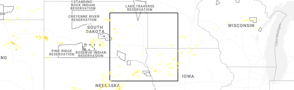
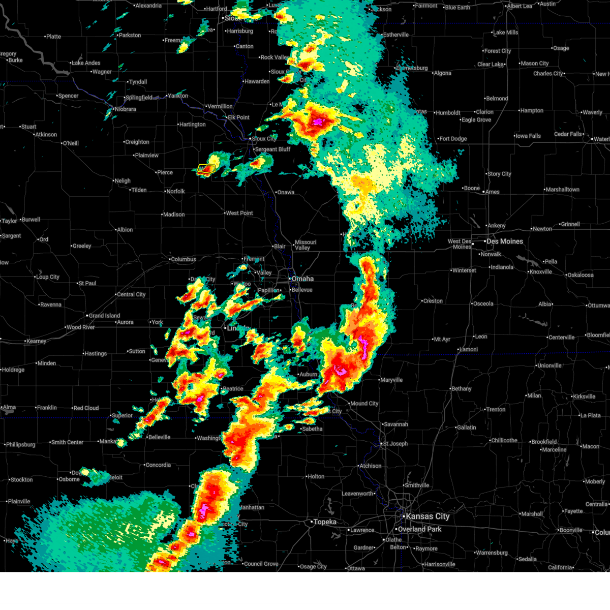
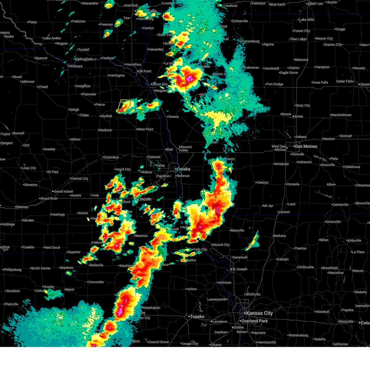
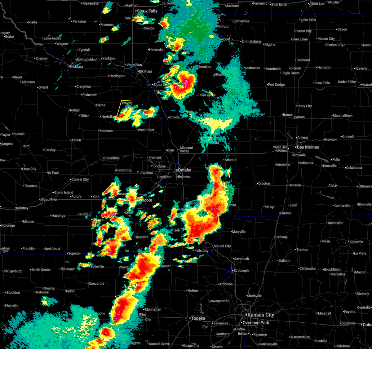
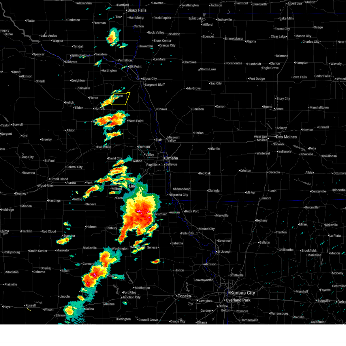
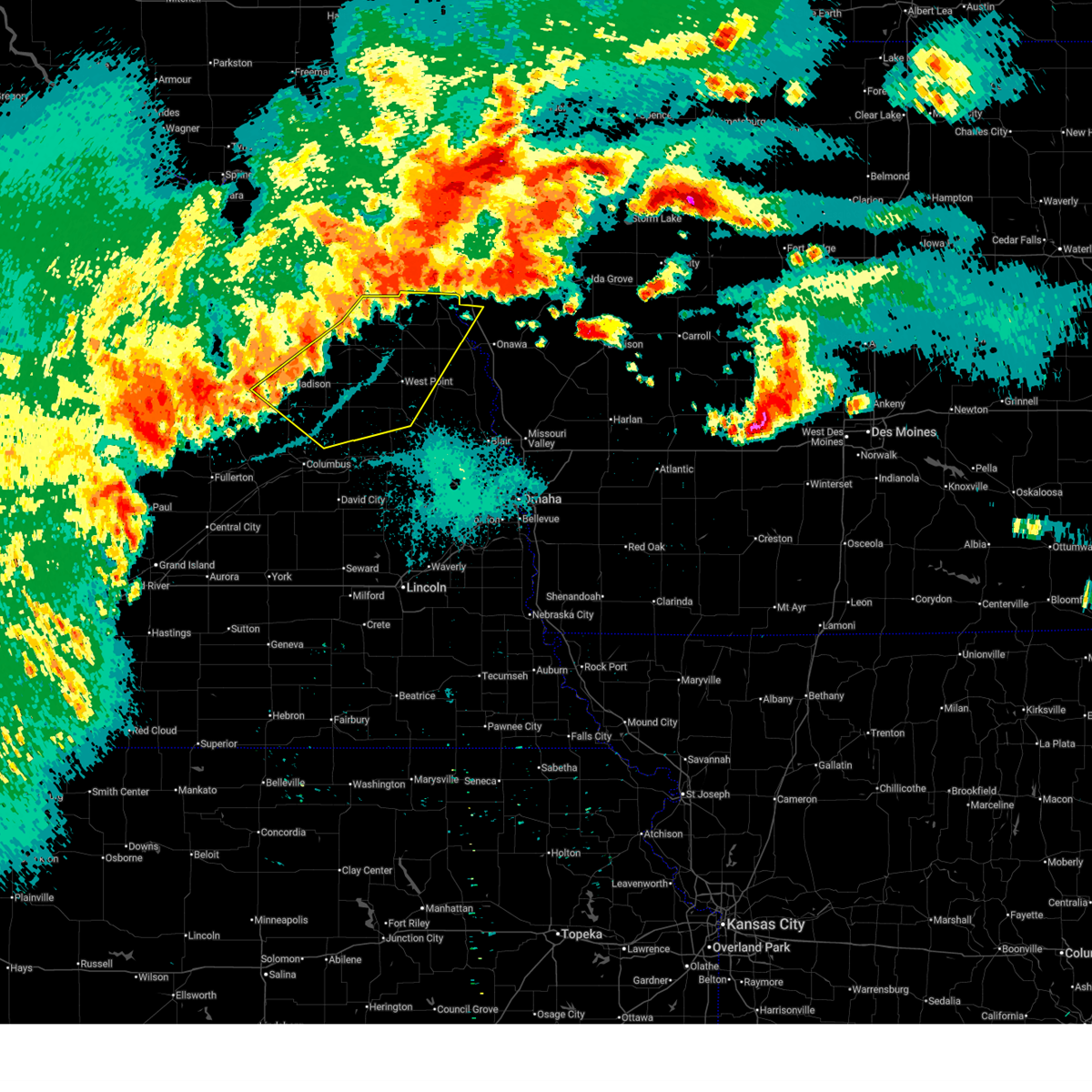
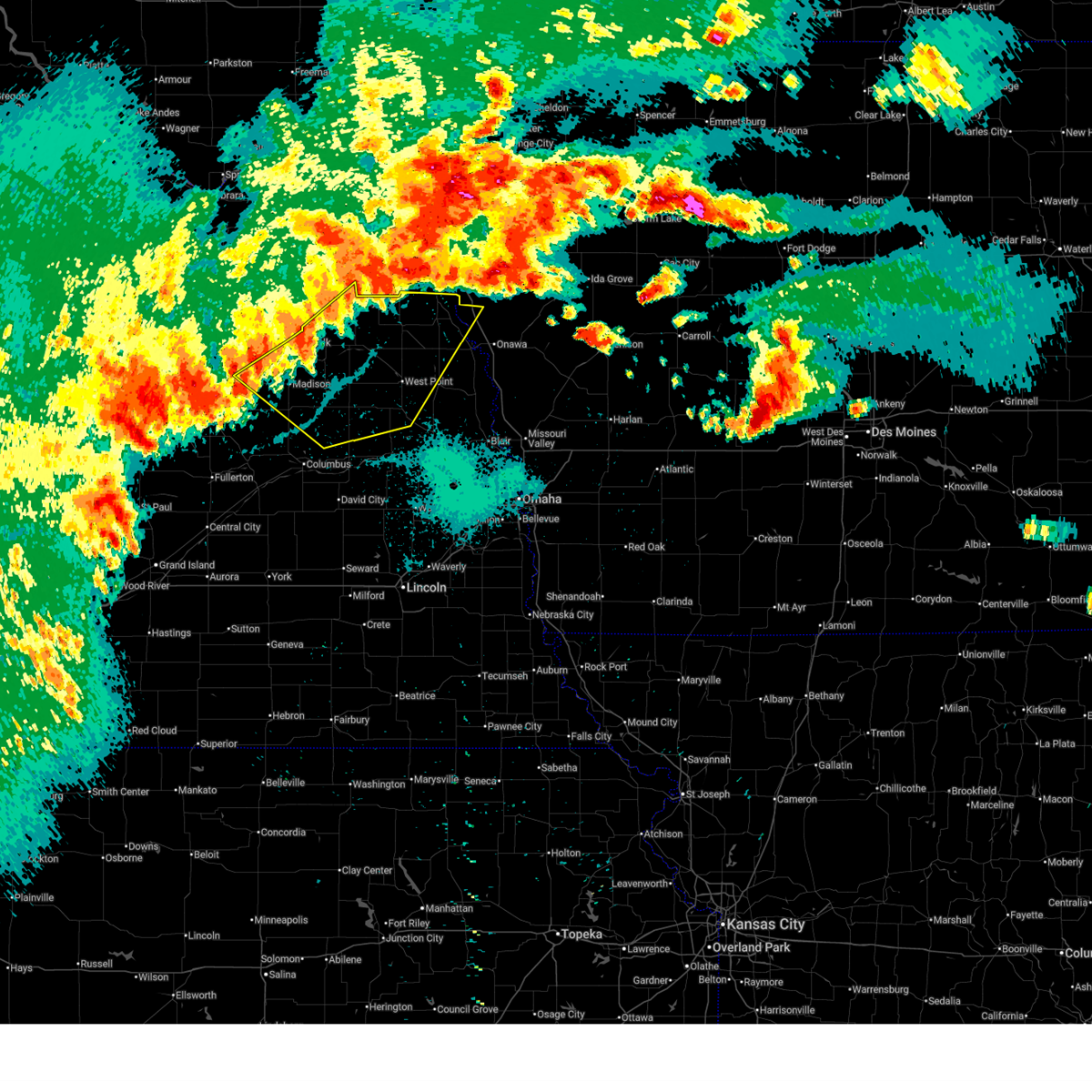
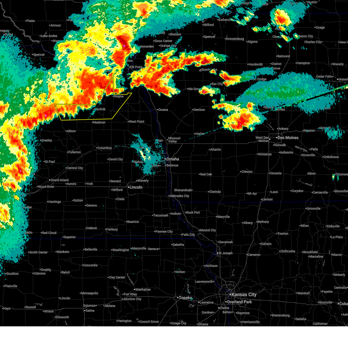
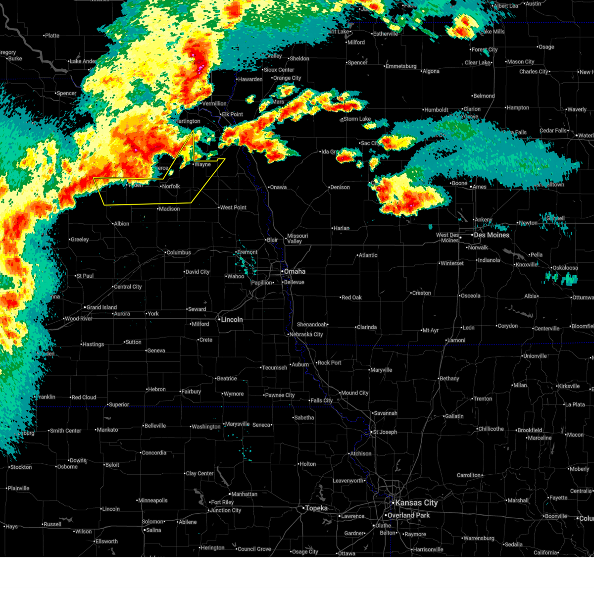
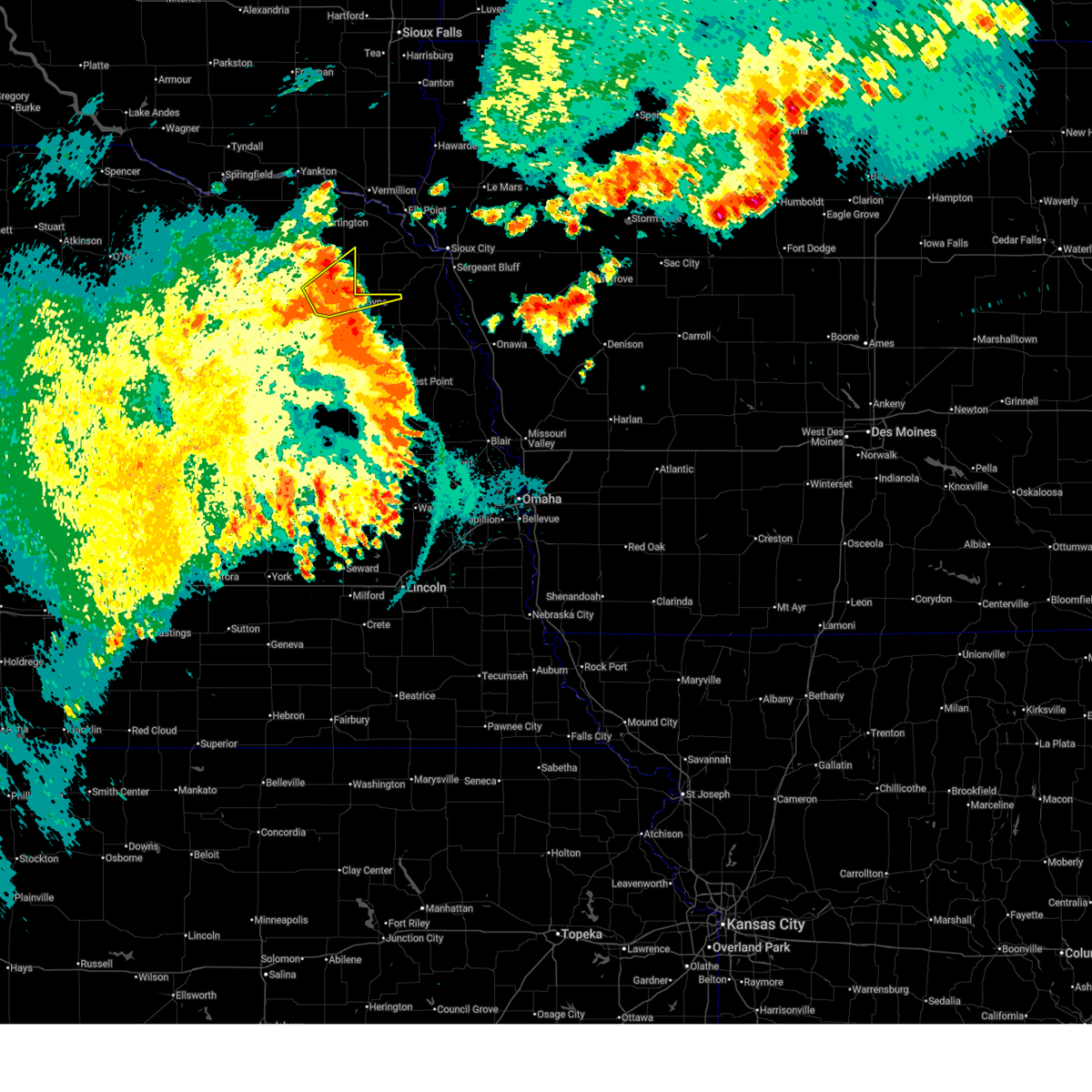
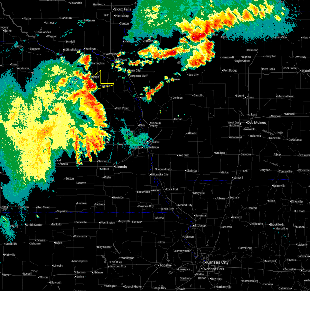
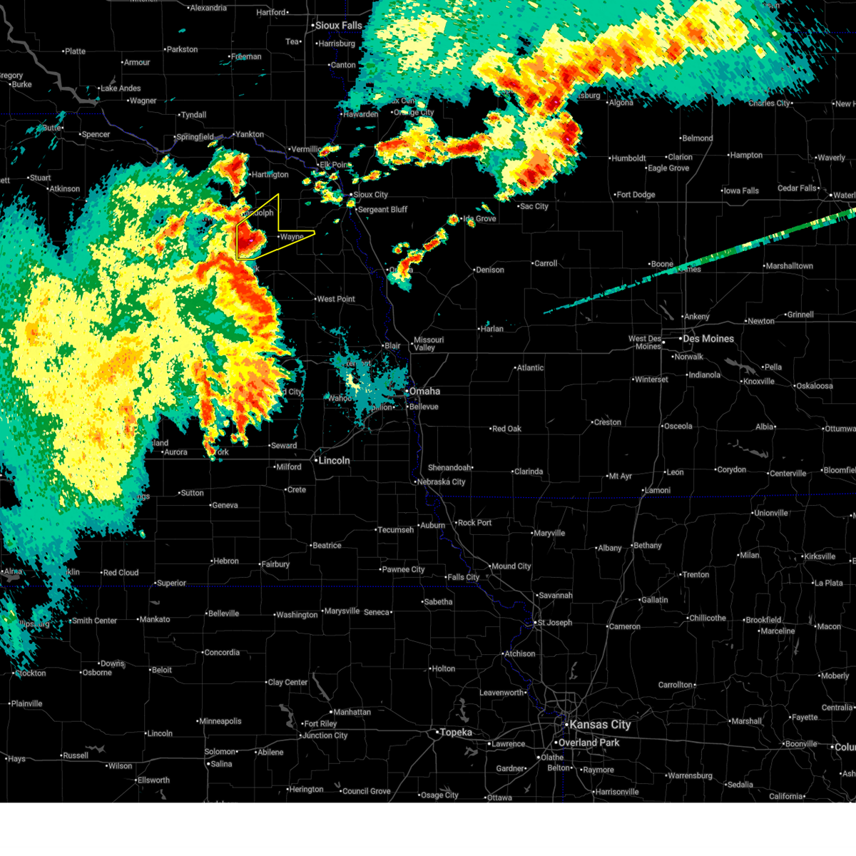
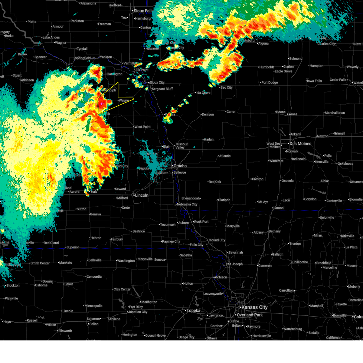
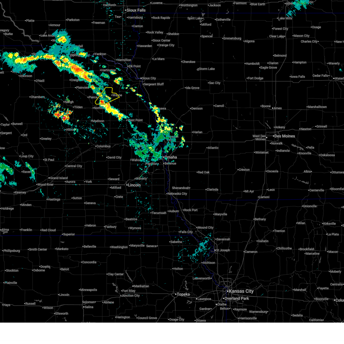
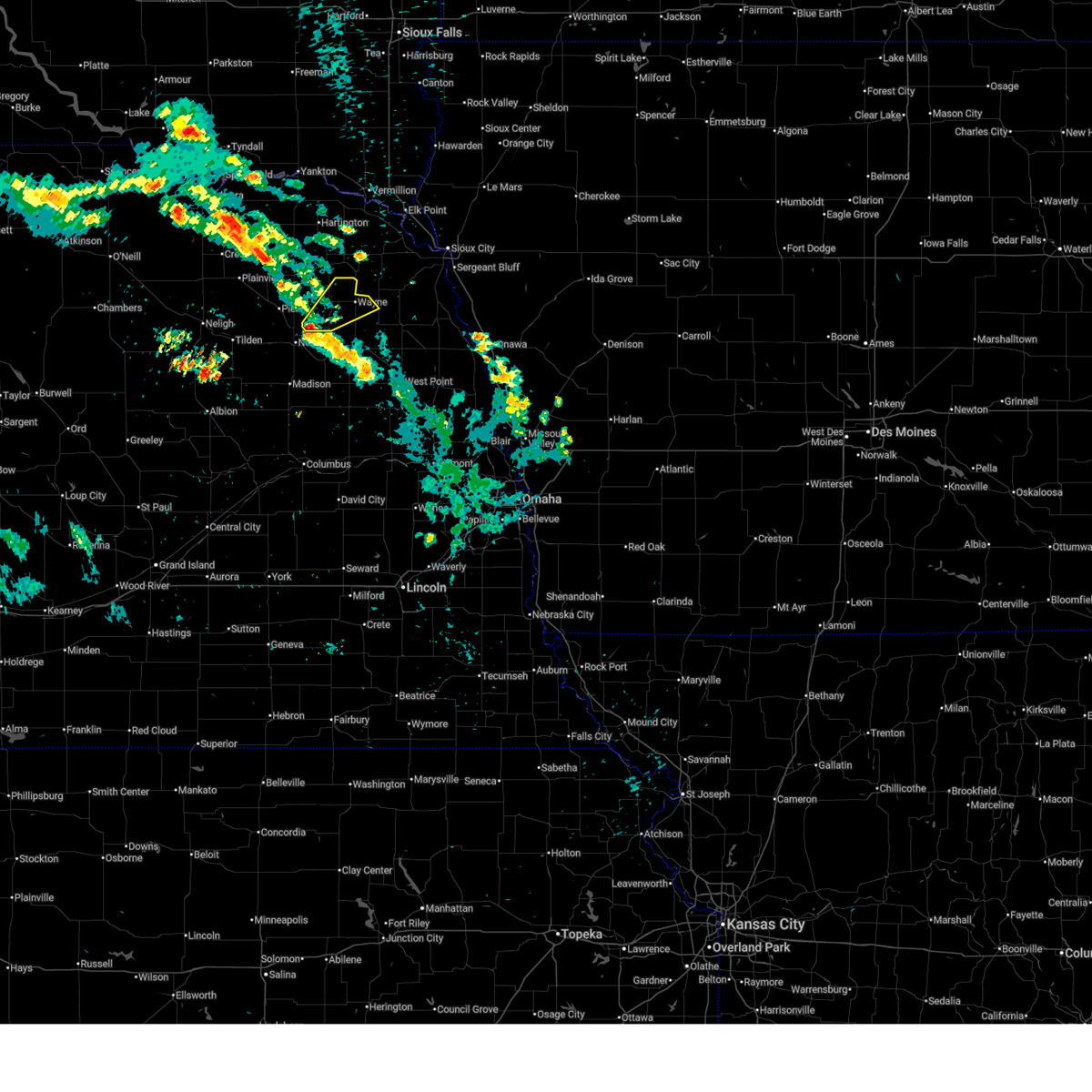
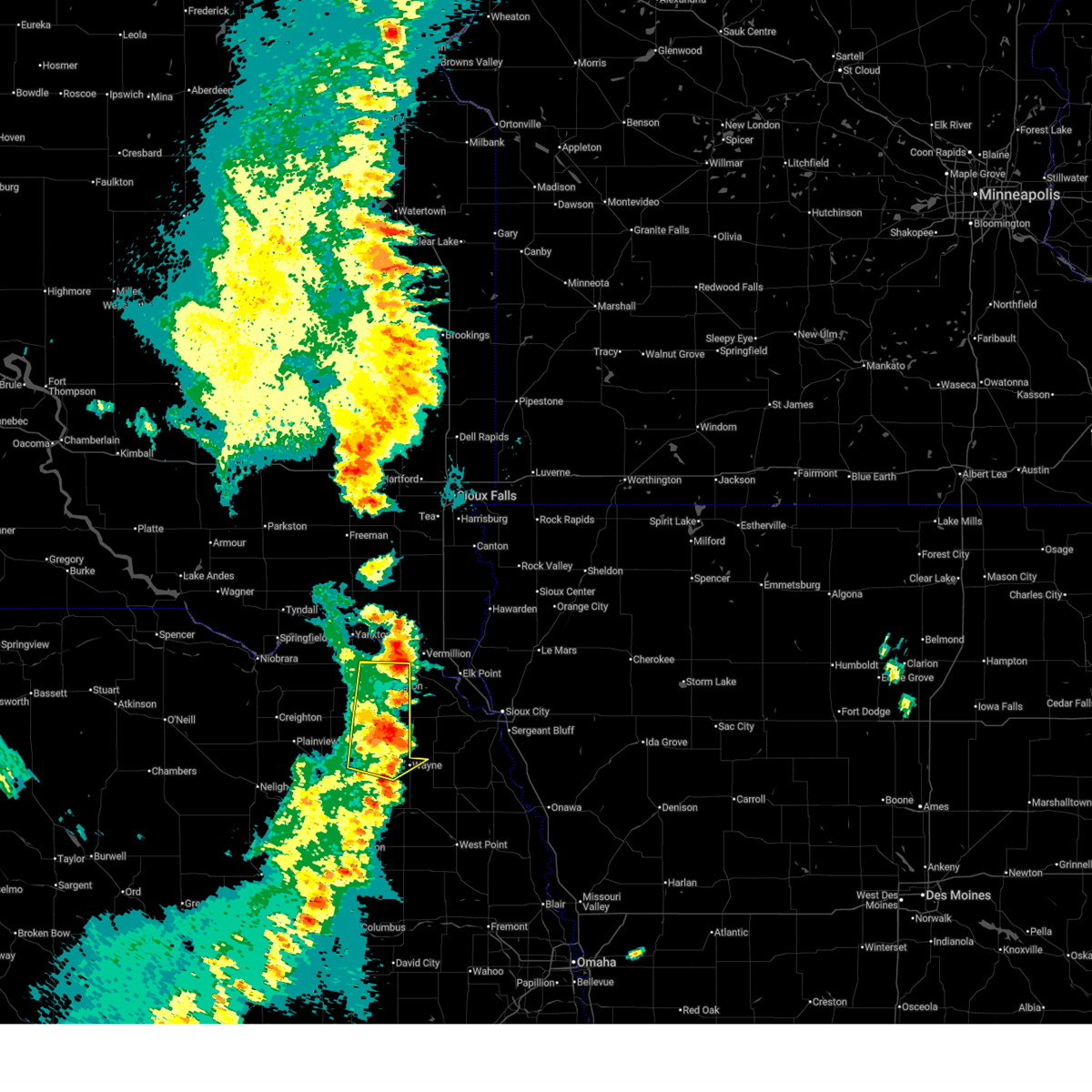
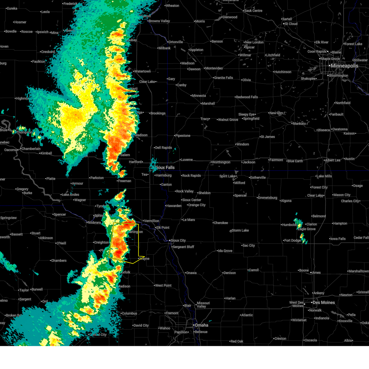
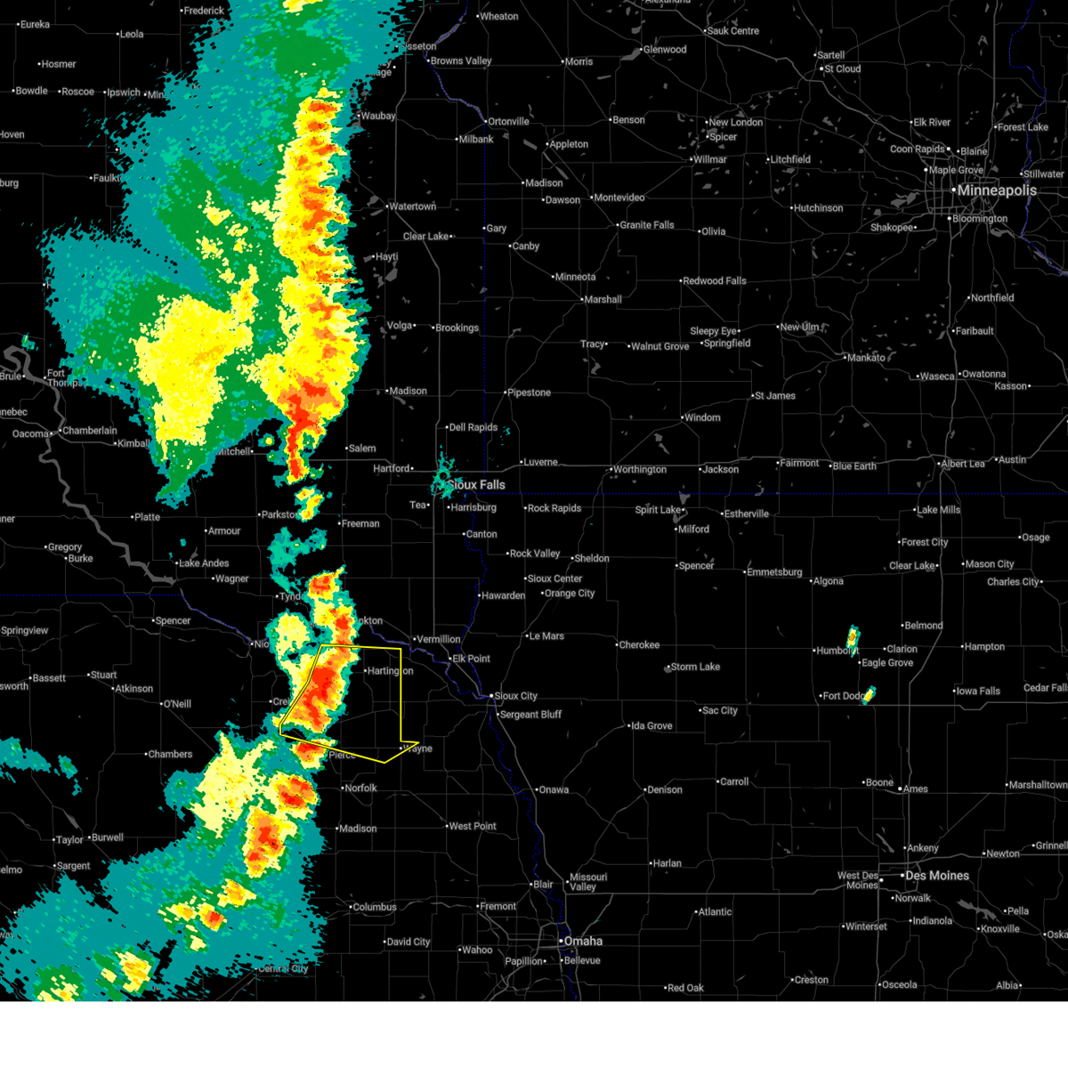
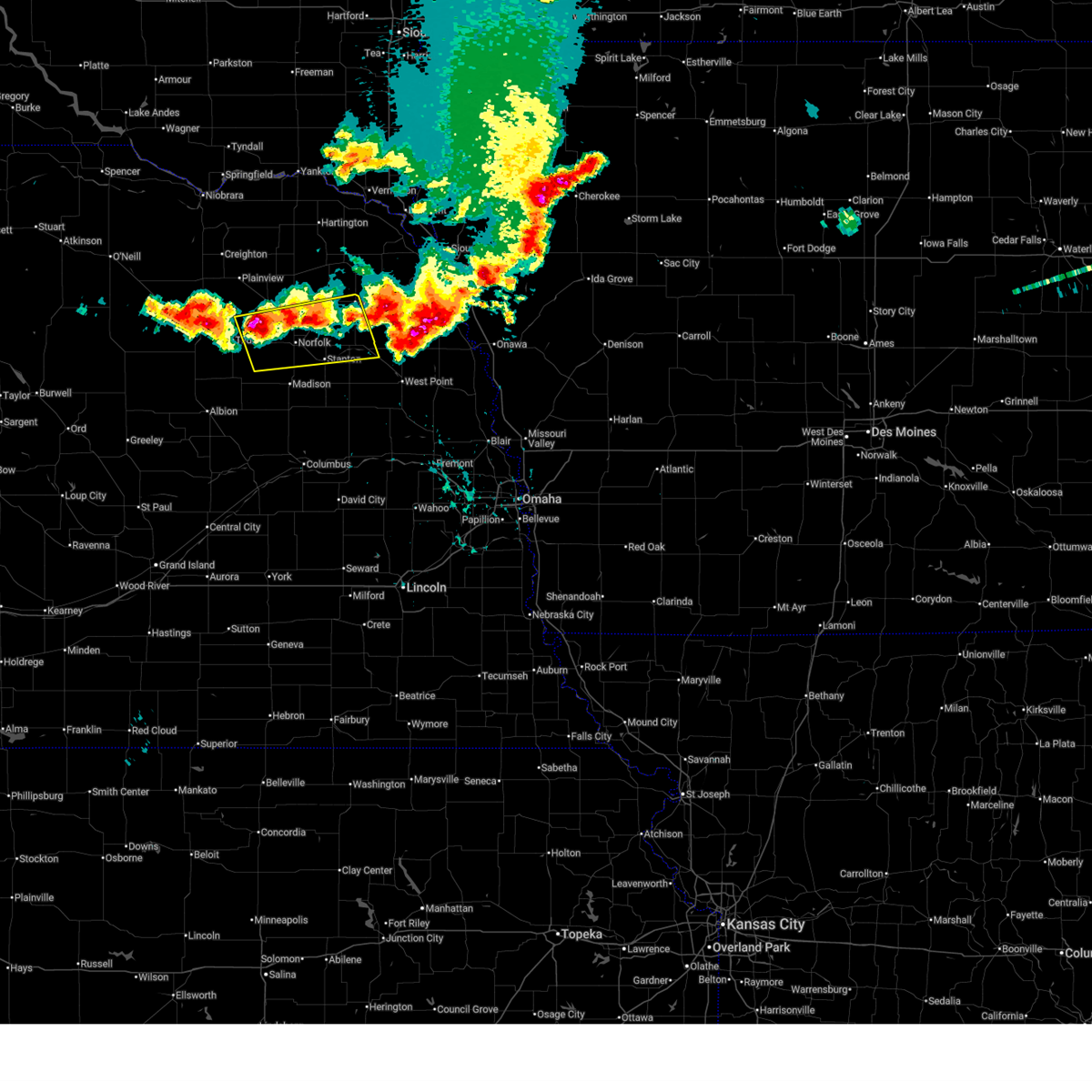
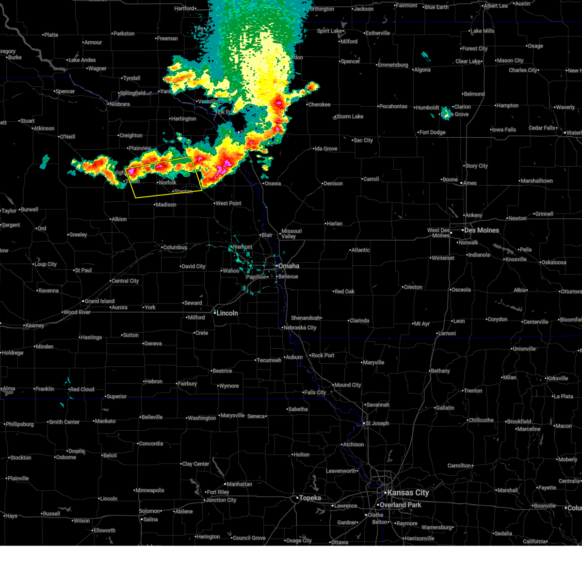
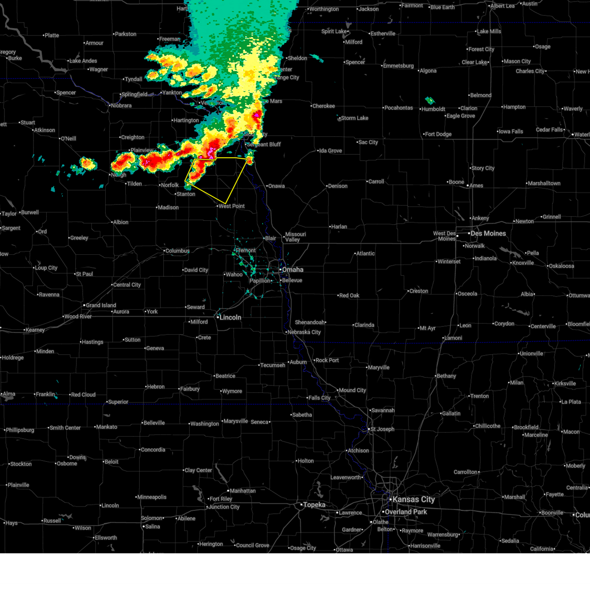
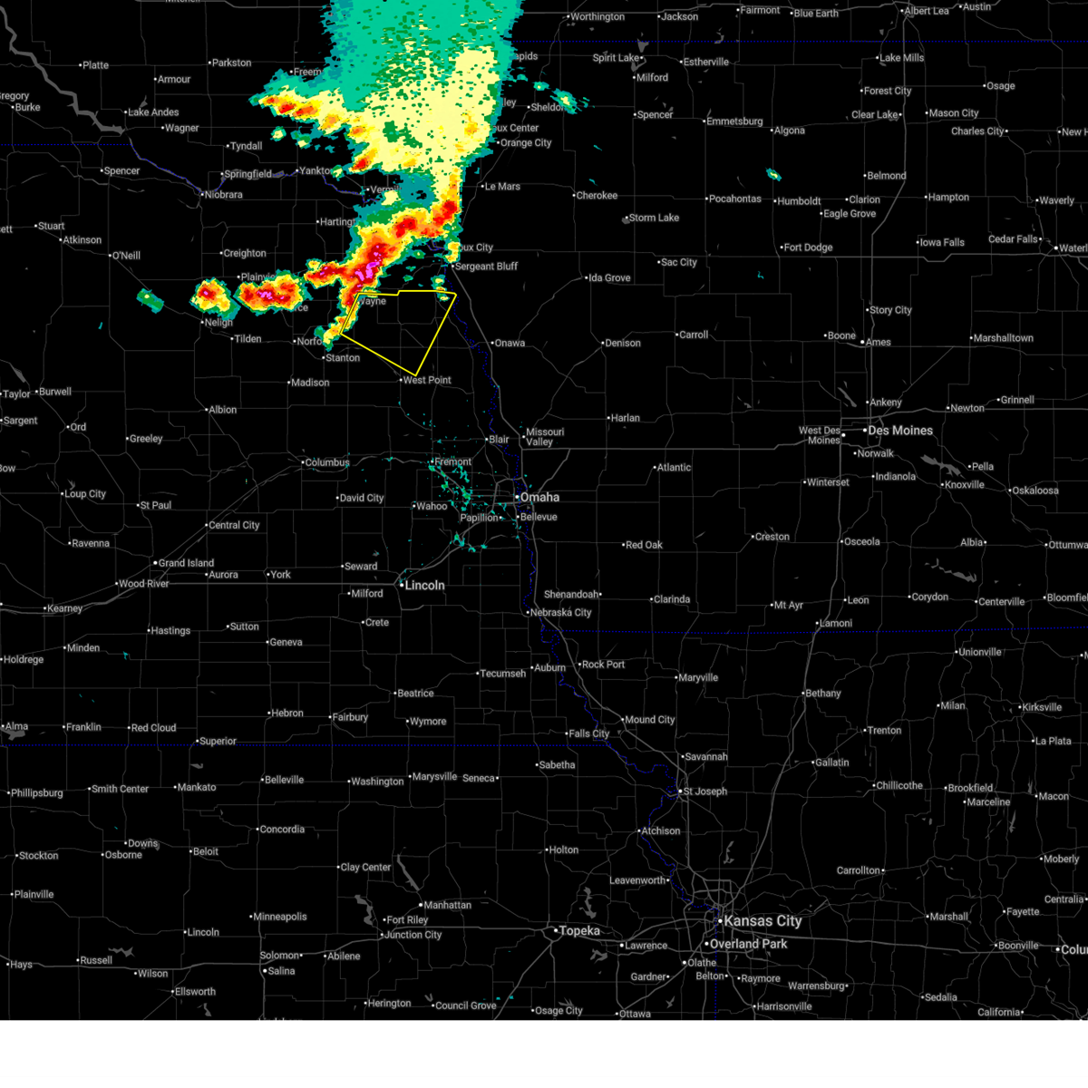
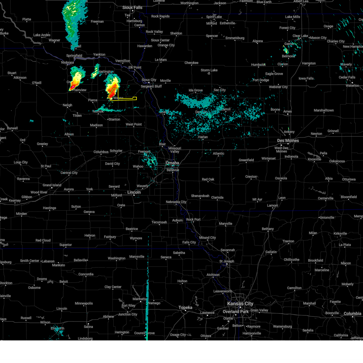
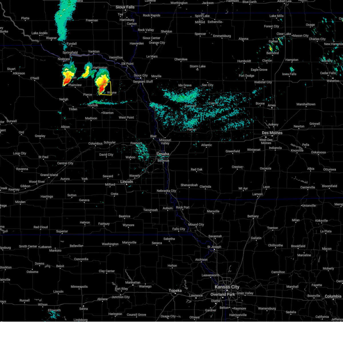
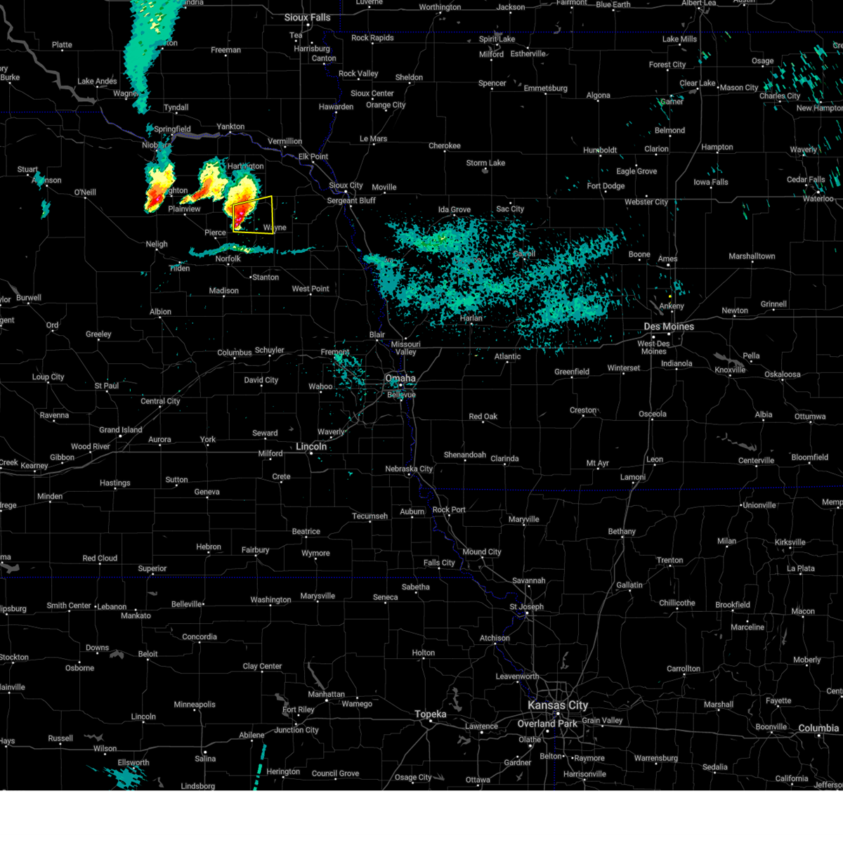
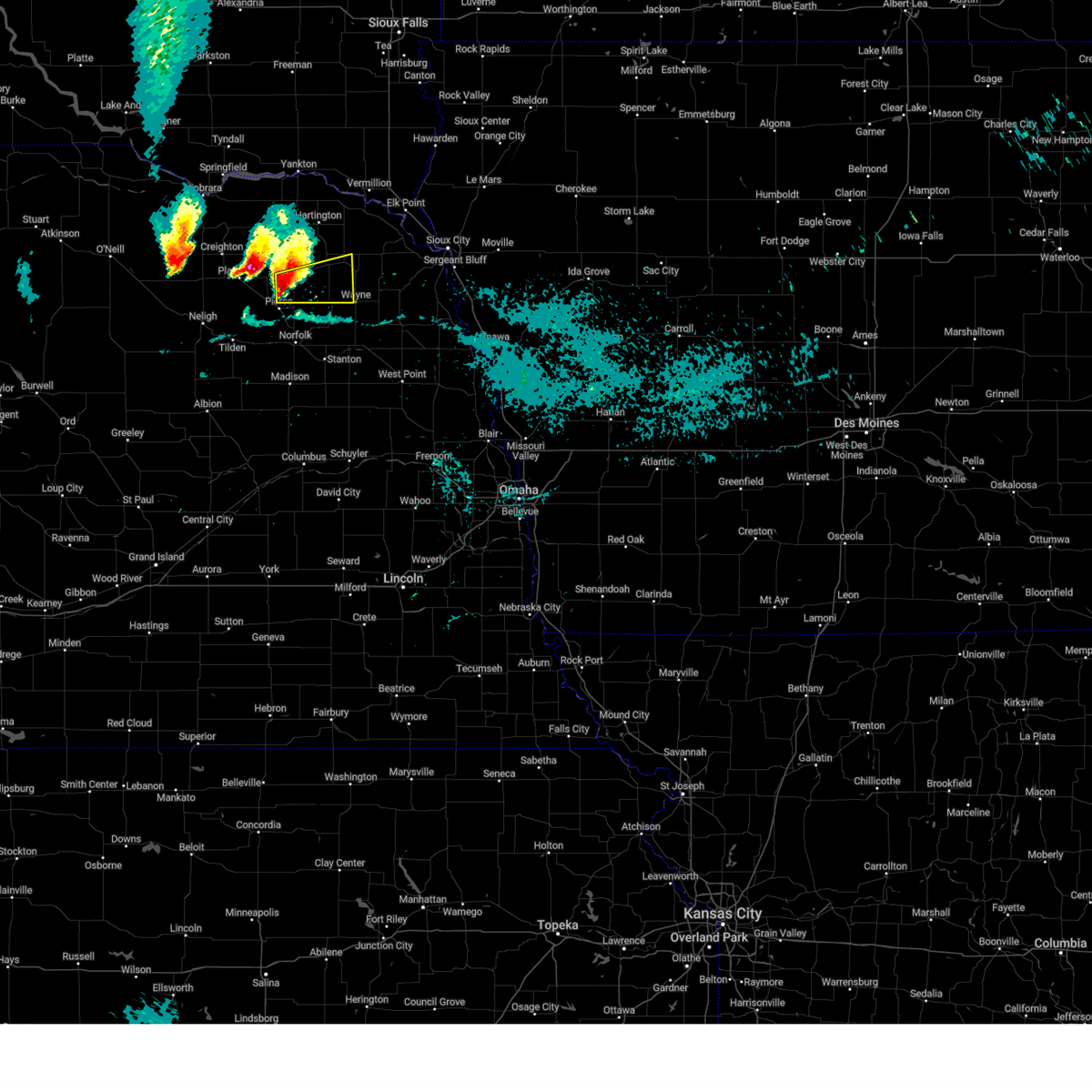
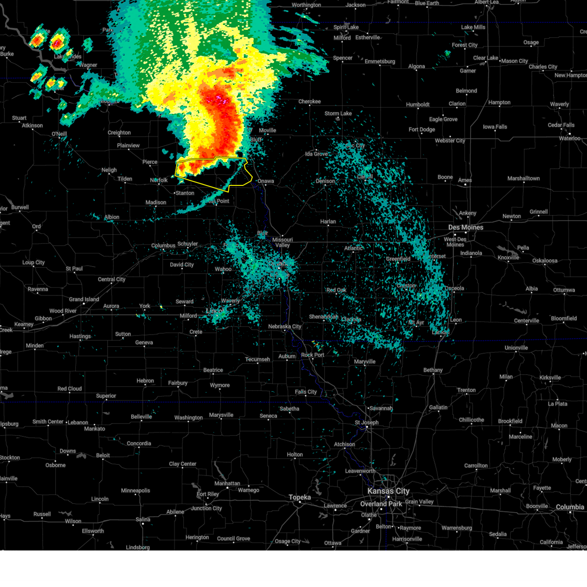
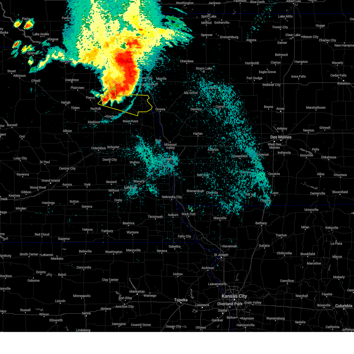
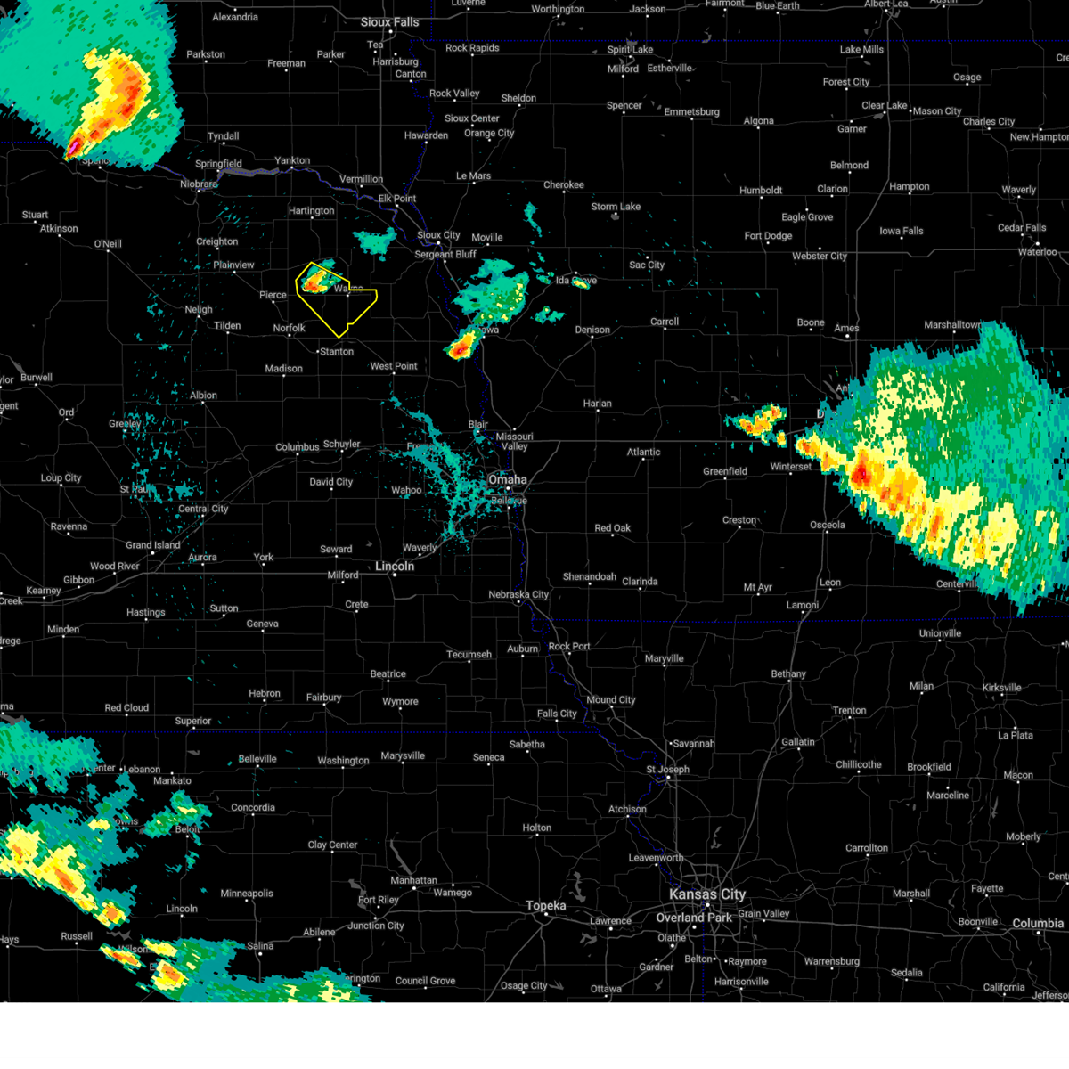
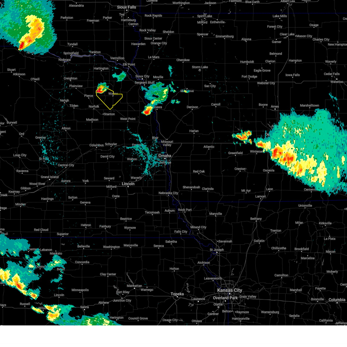
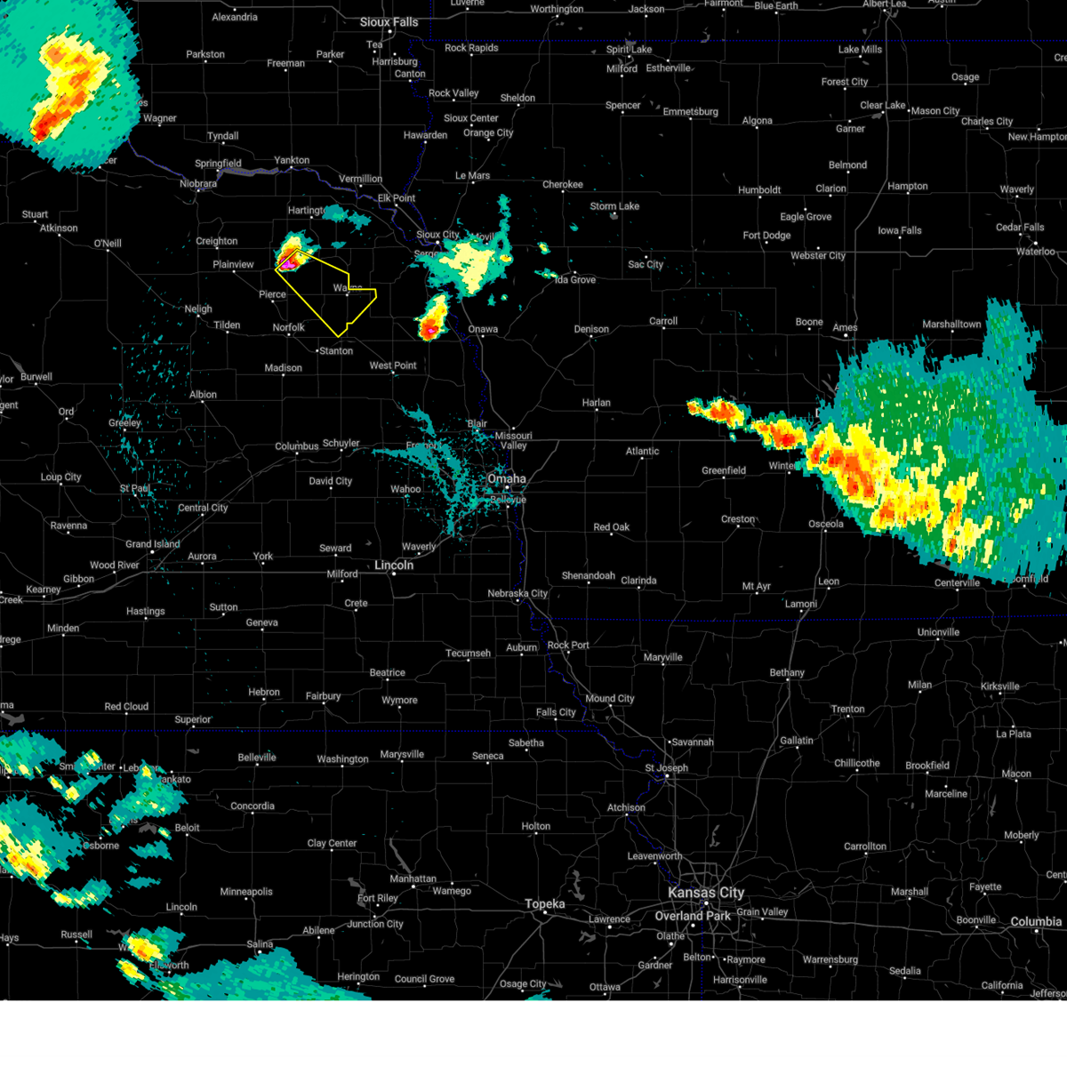
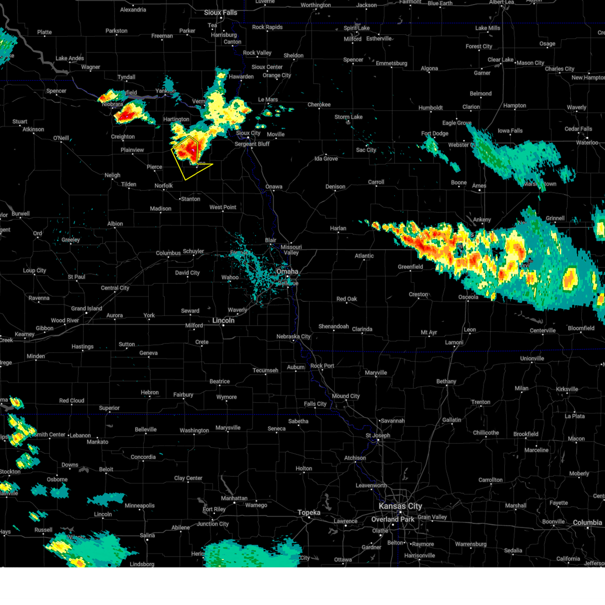
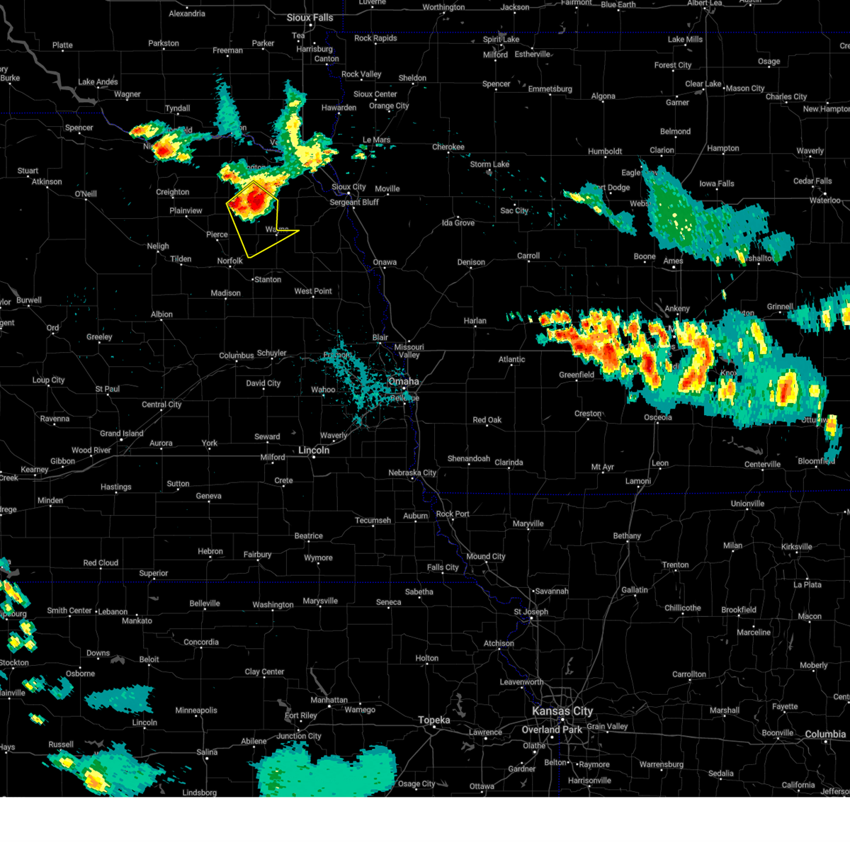
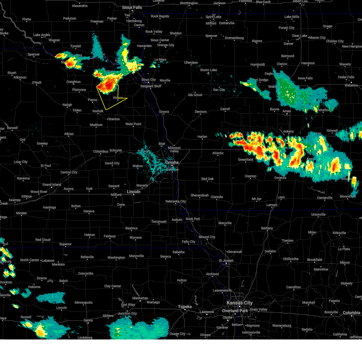
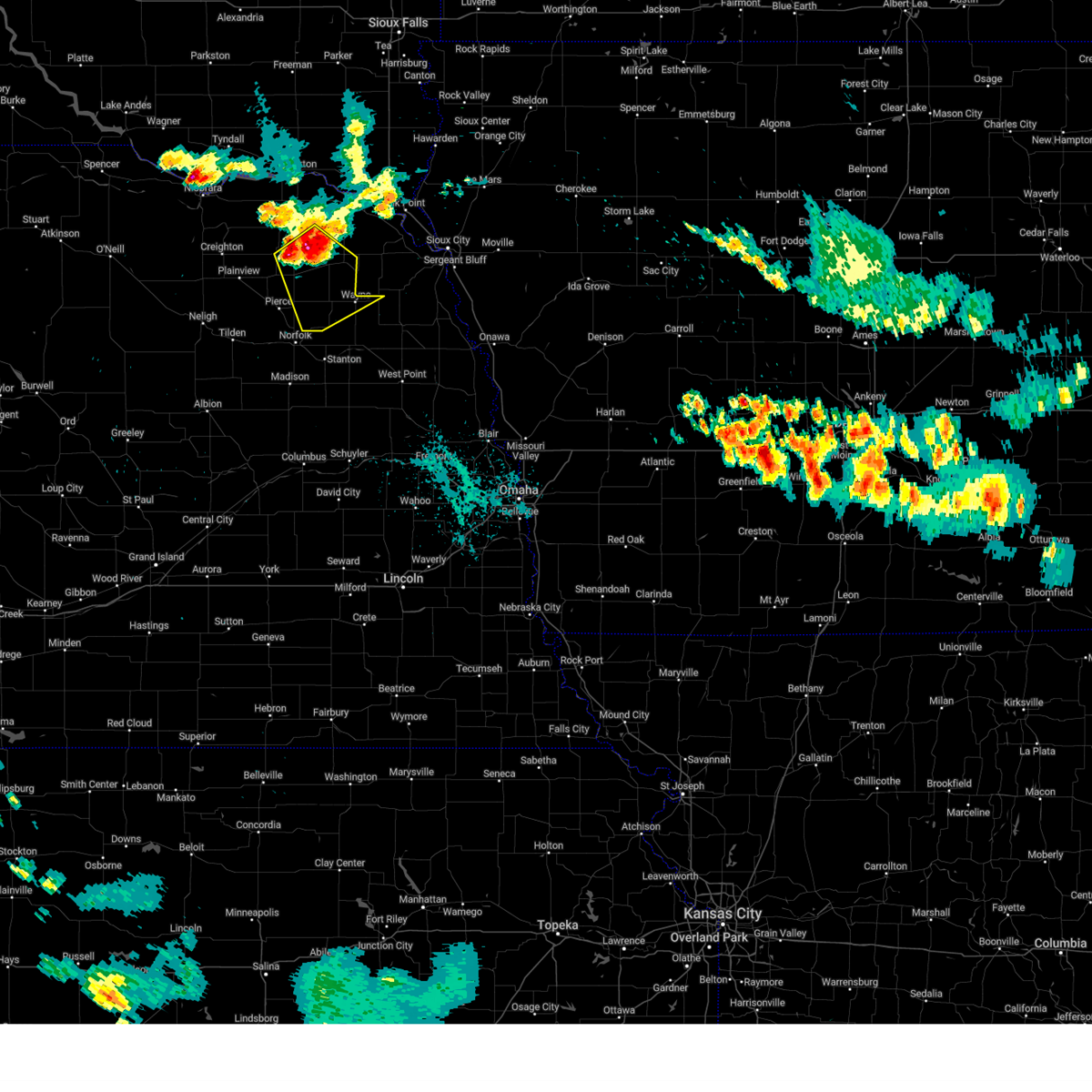
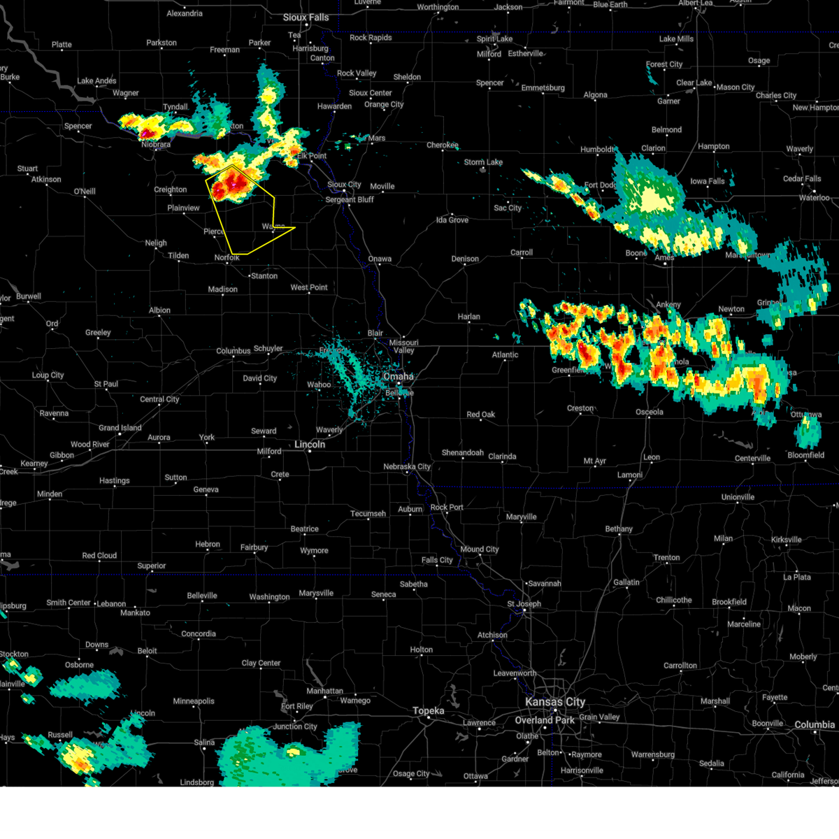
Hail Map for Wayne, NE
The Wayne, NE area has had 20 reports of on-the-ground hail by trained spotters, and has been under severe weather warnings 23 times during the past 12 months. Doppler radar has detected hail at or near Wayne, NE on 98 occasions, including 7 occasions during the past year.
| Name: | Wayne, NE |
| Where Located: | 85 miles E of Oneill, NE |
| Map: | Google Map for Wayne, NE |
| Population: | 5660 |
| Housing Units: | 2082 |
| More Info: | Search Google for Wayne, NE |
1
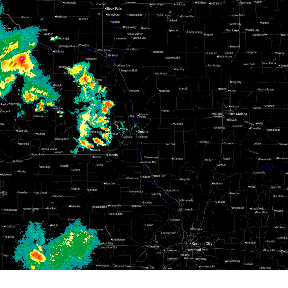
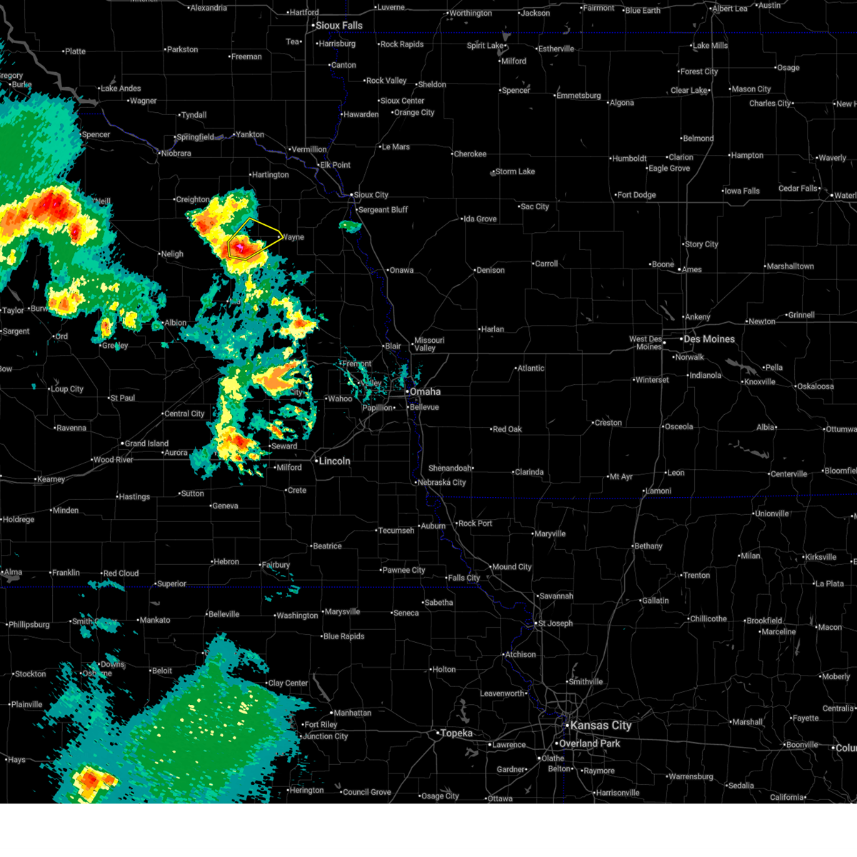
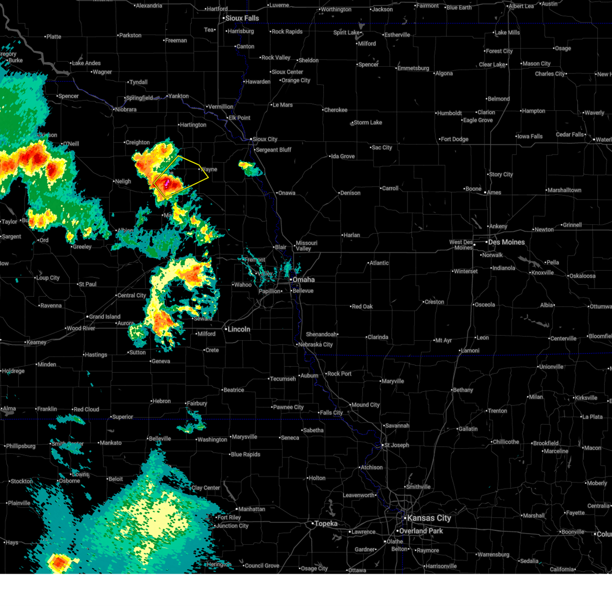
The Top Recent Hail Date for Wayne, NE is Wednesday, July 23, 2025 (24th out of 98)
Hail and Wind Damage Spotted near Wayne, NE
| Date / Time | Report Details |
|---|---|
| 6/9/2026 10:07 PM CDT |
 At 1006 pm cdt, a severe thunderstorm was located 4 miles southwest of carroll, or 12 miles west of wayne, moving northeast at 35 mph (at 1001 pm, a public mesonet station reported a wind gust of 63 mph 7 miles northwest of hoskins). Hazards include 60 mph wind gusts. Expect damage to roofs, siding, and trees. This severe storm will be near, carroll around 1010 pm cdt. At 1006 pm cdt, a severe thunderstorm was located 4 miles southwest of carroll, or 12 miles west of wayne, moving northeast at 35 mph (at 1001 pm, a public mesonet station reported a wind gust of 63 mph 7 miles northwest of hoskins). Hazards include 60 mph wind gusts. Expect damage to roofs, siding, and trees. This severe storm will be near, carroll around 1010 pm cdt.
|
| 6/9/2026 9:56 PM CDT |
 At 956 pm cdt, a severe thunderstorm was located over hoskins, or 9 miles northeast of norfolk, moving northeast at 35 mph (radar indicated). Hazards include 60 mph wind gusts and quarter size hail. Hail damage to vehicles is expected. expect wind damage to roofs, siding, and trees. this severe storm will be near, winside around 1000 pm cdt. Other locations in the path of this severe thunderstorm include wayne. At 956 pm cdt, a severe thunderstorm was located over hoskins, or 9 miles northeast of norfolk, moving northeast at 35 mph (radar indicated). Hazards include 60 mph wind gusts and quarter size hail. Hail damage to vehicles is expected. expect wind damage to roofs, siding, and trees. this severe storm will be near, winside around 1000 pm cdt. Other locations in the path of this severe thunderstorm include wayne.
|
| 6/9/2026 9:46 PM CDT |
 Svroax the national weather service in omaha has issued a * severe thunderstorm warning for, northeastern madison county in northeastern nebraska, wayne county in northeastern nebraska, southeastern pierce county in northeastern nebraska, northwestern stanton county in northeastern nebraska, * until 1030 pm cdt. * at 945 pm cdt, a severe thunderstorm was located near hadar, or 3 miles north of norfolk, moving northeast at 35 mph (radar indicated). Hazards include 60 mph wind gusts and quarter size hail. Hail damage to vehicles is expected. expect wind damage to roofs, siding, and trees. this severe thunderstorm will be near, hoskins around 950 pm cdt. winside around 1000 pm cdt. Other locations in the path of this severe thunderstorm include wayne. Svroax the national weather service in omaha has issued a * severe thunderstorm warning for, northeastern madison county in northeastern nebraska, wayne county in northeastern nebraska, southeastern pierce county in northeastern nebraska, northwestern stanton county in northeastern nebraska, * until 1030 pm cdt. * at 945 pm cdt, a severe thunderstorm was located near hadar, or 3 miles north of norfolk, moving northeast at 35 mph (radar indicated). Hazards include 60 mph wind gusts and quarter size hail. Hail damage to vehicles is expected. expect wind damage to roofs, siding, and trees. this severe thunderstorm will be near, hoskins around 950 pm cdt. winside around 1000 pm cdt. Other locations in the path of this severe thunderstorm include wayne.
|
| 5/18/2026 5:54 PM CDT |
 The storm which prompted the warning has moved out of the area. therefore, the warning will be allowed to expire. The storm which prompted the warning has moved out of the area. therefore, the warning will be allowed to expire.
|
| 5/18/2026 5:52 PM CDT | Quarter sized hail reported 4.2 miles WSW of Wayne, NE, report from mping: quarter (1.00 in.). |
| 5/18/2026 5:50 PM CDT | Quarter sized hail reported 0.9 miles WNW of Wayne, NE |
| 5/18/2026 5:40 PM CDT |
 the severe thunderstorm warning has been cancelled and is no longer in effect the severe thunderstorm warning has been cancelled and is no longer in effect
|
| 5/18/2026 5:40 PM CDT |
 At 540 pm cdt, a severe thunderstorm was located 4 miles southeast of wayne, moving northeast at 60 mph (emergency management. this storm has a history of producing golf ball sized hail in pilger). Hazards include golf ball size hail. People and animals outdoors will be injured. expect damage to roofs, siding, windows, and vehicles. This severe storm will be near, wayne and wakefield around 545 pm cdt. At 540 pm cdt, a severe thunderstorm was located 4 miles southeast of wayne, moving northeast at 60 mph (emergency management. this storm has a history of producing golf ball sized hail in pilger). Hazards include golf ball size hail. People and animals outdoors will be injured. expect damage to roofs, siding, windows, and vehicles. This severe storm will be near, wayne and wakefield around 545 pm cdt.
|
| 5/18/2026 5:34 PM CDT |
 Svroax the national weather service in omaha has issued a * severe thunderstorm warning for, northwestern cuming county in northeastern nebraska, southeastern wayne county in northeastern nebraska, northeastern stanton county in northeastern nebraska, * until 600 pm cdt. * at 534 pm cdt, a severe thunderstorm was located 7 miles north of pilger, or 8 miles south of wayne, moving northeast at 60 mph (emergency management. at 532 pm, golf ball sized hail was reported in pilger ). Hazards include golf ball size hail. People and animals outdoors will be injured. expect damage to roofs, siding, windows, and vehicles. this severe thunderstorm will be near, wayne around 540 pm cdt. Wakefield around 545 pm cdt. Svroax the national weather service in omaha has issued a * severe thunderstorm warning for, northwestern cuming county in northeastern nebraska, southeastern wayne county in northeastern nebraska, northeastern stanton county in northeastern nebraska, * until 600 pm cdt. * at 534 pm cdt, a severe thunderstorm was located 7 miles north of pilger, or 8 miles south of wayne, moving northeast at 60 mph (emergency management. at 532 pm, golf ball sized hail was reported in pilger ). Hazards include golf ball size hail. People and animals outdoors will be injured. expect damage to roofs, siding, windows, and vehicles. this severe thunderstorm will be near, wayne around 540 pm cdt. Wakefield around 545 pm cdt.
|
| 5/18/2026 4:06 PM CDT |
 Svroax the national weather service in omaha has issued a * severe thunderstorm warning for, southeastern wayne county in northeastern nebraska, northwestern thurston county in northeastern nebraska, * until 430 pm cdt. * at 405 pm cdt, a severe thunderstorm was located 5 miles north of wisner, or 12 miles southeast of wayne, moving northeast at 60 mph (emergency management. this storm has a history of producing golf ball sized hail northwest of clarkson). Hazards include golf ball size hail. People and animals outdoors will be injured. expect damage to roofs, siding, windows, and vehicles. this severe thunderstorm will be near, wakefield around 415 pm cdt. Emerson around 420 pm cdt. Svroax the national weather service in omaha has issued a * severe thunderstorm warning for, southeastern wayne county in northeastern nebraska, northwestern thurston county in northeastern nebraska, * until 430 pm cdt. * at 405 pm cdt, a severe thunderstorm was located 5 miles north of wisner, or 12 miles southeast of wayne, moving northeast at 60 mph (emergency management. this storm has a history of producing golf ball sized hail northwest of clarkson). Hazards include golf ball size hail. People and animals outdoors will be injured. expect damage to roofs, siding, windows, and vehicles. this severe thunderstorm will be near, wakefield around 415 pm cdt. Emerson around 420 pm cdt.
|
| 7/29/2025 10:00 PM CDT |
 At 1000 pm cdt, severe thunderstorms were located along a line extending from 3 miles west of bancroft to near howells to 2 miles northeast of silver creek, moving southeast at 35 mph (radar indicated). Hazards include 60 mph wind gusts. Expect damage to roofs, siding, and trees. Locations impacted include, west point, dodge, bancroft, snyder, lyons, oakland and scribner. At 1000 pm cdt, severe thunderstorms were located along a line extending from 3 miles west of bancroft to near howells to 2 miles northeast of silver creek, moving southeast at 35 mph (radar indicated). Hazards include 60 mph wind gusts. Expect damage to roofs, siding, and trees. Locations impacted include, west point, dodge, bancroft, snyder, lyons, oakland and scribner.
|
| 7/29/2025 9:43 PM CDT |
 Svroax the national weather service in omaha has issued a * severe thunderstorm warning for, northwestern monona county in west central iowa, central madison county in northeastern nebraska, northwestern burt county in east central nebraska, cuming county in northeastern nebraska, wayne county in northeastern nebraska, colfax county in northeastern nebraska, northeastern platte county in northeastern nebraska, northwestern dodge county in east central nebraska, thurston county in northeastern nebraska, stanton county in northeastern nebraska, * until 1030 pm cdt. * at 943 pm cdt, severe thunderstorms were located along a line extending from 6 miles northeast of wisner to near leigh to 6 miles southwest of genoa, moving southeast at 30 mph (radar indicated). Hazards include 60 mph wind gusts. Expect damage to roofs, siding, and trees. severe thunderstorms will be near, wisner, beemer, clarkson, and leigh around 950 pm cdt. howells around 955 pm cdt. other locations in the path of these severe thunderstorms include west point, dodge and snyder. This includes interstate 29 between mile markers 122 and 125. Svroax the national weather service in omaha has issued a * severe thunderstorm warning for, northwestern monona county in west central iowa, central madison county in northeastern nebraska, northwestern burt county in east central nebraska, cuming county in northeastern nebraska, wayne county in northeastern nebraska, colfax county in northeastern nebraska, northeastern platte county in northeastern nebraska, northwestern dodge county in east central nebraska, thurston county in northeastern nebraska, stanton county in northeastern nebraska, * until 1030 pm cdt. * at 943 pm cdt, severe thunderstorms were located along a line extending from 6 miles northeast of wisner to near leigh to 6 miles southwest of genoa, moving southeast at 30 mph (radar indicated). Hazards include 60 mph wind gusts. Expect damage to roofs, siding, and trees. severe thunderstorms will be near, wisner, beemer, clarkson, and leigh around 950 pm cdt. howells around 955 pm cdt. other locations in the path of these severe thunderstorms include west point, dodge and snyder. This includes interstate 29 between mile markers 122 and 125.
|
| 7/29/2025 9:10 PM CDT |
 At 909 pm cdt, severe thunderstorms were located along a line extending from 3 miles southeast of carroll to near norfolk to 2 miles northeast of elgin, moving southeast at 25 mph (radar indicated). Hazards include 70 mph wind gusts. Expect considerable tree damage. damage is likely to mobile homes, roofs, and outbuildings. Locations impacted include, norfolk, wayne, battle creek, tilden, winside, meadow grove, hoskins, stanton and pilger. At 909 pm cdt, severe thunderstorms were located along a line extending from 3 miles southeast of carroll to near norfolk to 2 miles northeast of elgin, moving southeast at 25 mph (radar indicated). Hazards include 70 mph wind gusts. Expect considerable tree damage. damage is likely to mobile homes, roofs, and outbuildings. Locations impacted include, norfolk, wayne, battle creek, tilden, winside, meadow grove, hoskins, stanton and pilger.
|
| 7/29/2025 8:54 PM CDT |
 Svroax the national weather service in omaha has issued a * severe thunderstorm warning for, madison county in northeastern nebraska, northwestern cuming county in northeastern nebraska, wayne county in northeastern nebraska, southern pierce county in northeastern nebraska, southern antelope county in northeastern nebraska, northwestern thurston county in northeastern nebraska, southeastern cedar county in northeastern nebraska, northeastern boone county in northeastern nebraska, stanton county in northeastern nebraska, * until 1000 pm cdt. * at 854 pm cdt, severe thunderstorms were located along a line extending from near carroll to 4 miles northeast of battle creek to 5 miles northwest of elgin, moving southeast at 25 mph (radar indicated). Hazards include 60 mph wind gusts. Expect damage to roofs, siding, and trees. severe thunderstorms will be near, norfolk, battle creek, tilden, elgin, winside, oakdale, meadow grove, hoskins, and carroll around 900 pm cdt. wayne around 905 pm cdt. Other locations in the path of these severe thunderstorms include stanton and pilger. Svroax the national weather service in omaha has issued a * severe thunderstorm warning for, madison county in northeastern nebraska, northwestern cuming county in northeastern nebraska, wayne county in northeastern nebraska, southern pierce county in northeastern nebraska, southern antelope county in northeastern nebraska, northwestern thurston county in northeastern nebraska, southeastern cedar county in northeastern nebraska, northeastern boone county in northeastern nebraska, stanton county in northeastern nebraska, * until 1000 pm cdt. * at 854 pm cdt, severe thunderstorms were located along a line extending from near carroll to 4 miles northeast of battle creek to 5 miles northwest of elgin, moving southeast at 25 mph (radar indicated). Hazards include 60 mph wind gusts. Expect damage to roofs, siding, and trees. severe thunderstorms will be near, norfolk, battle creek, tilden, elgin, winside, oakdale, meadow grove, hoskins, and carroll around 900 pm cdt. wayne around 905 pm cdt. Other locations in the path of these severe thunderstorms include stanton and pilger.
|
| 7/23/2025 10:00 PM CDT |
 The storm which prompted the warning has weakened below severe limits, and has exited the warned area. therefore, the warning has been allowed to expire. however, heavy rain is still possible with this thunderstorm. a severe thunderstorm watch remains in effect until midnight cdt for northeastern nebraska. The storm which prompted the warning has weakened below severe limits, and has exited the warned area. therefore, the warning has been allowed to expire. however, heavy rain is still possible with this thunderstorm. a severe thunderstorm watch remains in effect until midnight cdt for northeastern nebraska.
|
| 7/23/2025 9:41 PM CDT |
 At 941 pm cdt, a severe thunderstorm was located over carroll, or 8 miles northwest of wayne, moving northeast at 25 mph (radar indicated). Hazards include 60 mph wind gusts and quarter size hail. Hail damage to vehicles is expected. expect wind damage to roofs, siding, and trees. this severe thunderstorm will remain over mainly rural areas of central wayne, northwestern thurston and southeastern cedar counties, including the following locations, sholes and winnebago reservation. People attending wayne county fairgrounds should seek safe shelter immediately!. At 941 pm cdt, a severe thunderstorm was located over carroll, or 8 miles northwest of wayne, moving northeast at 25 mph (radar indicated). Hazards include 60 mph wind gusts and quarter size hail. Hail damage to vehicles is expected. expect wind damage to roofs, siding, and trees. this severe thunderstorm will remain over mainly rural areas of central wayne, northwestern thurston and southeastern cedar counties, including the following locations, sholes and winnebago reservation. People attending wayne county fairgrounds should seek safe shelter immediately!.
|
| 7/23/2025 9:32 PM CDT |
 the severe thunderstorm warning has been cancelled and is no longer in effect the severe thunderstorm warning has been cancelled and is no longer in effect
|
| 7/23/2025 9:32 PM CDT |
 At 932 pm cdt, a severe thunderstorm was located over carroll, or 10 miles west of wayne, moving northeast at 25 mph (radar indicated). Hazards include 60 mph wind gusts and quarter size hail. Hail damage to vehicles is expected. expect wind damage to roofs, siding, and trees. this severe thunderstorm will remain over mainly rural areas of wayne, northwestern thurston and southeastern cedar counties, including the following locations, sholes and winnebago reservation. People attending wayne county fairgrounds should seek safe shelter immediately!. At 932 pm cdt, a severe thunderstorm was located over carroll, or 10 miles west of wayne, moving northeast at 25 mph (radar indicated). Hazards include 60 mph wind gusts and quarter size hail. Hail damage to vehicles is expected. expect wind damage to roofs, siding, and trees. this severe thunderstorm will remain over mainly rural areas of wayne, northwestern thurston and southeastern cedar counties, including the following locations, sholes and winnebago reservation. People attending wayne county fairgrounds should seek safe shelter immediately!.
|
| 7/23/2025 9:19 PM CDT |
 Svroax the national weather service in omaha has issued a * severe thunderstorm warning for, northeastern madison county in northeastern nebraska, wayne county in northeastern nebraska, southeastern pierce county in northeastern nebraska, northwestern thurston county in northeastern nebraska, southeastern cedar county in northeastern nebraska, northwestern stanton county in northeastern nebraska, * until 1000 pm cdt. * at 919 pm cdt, a severe thunderstorm was located 6 miles north of hoskins, or 13 miles northeast of norfolk, moving northeast at 25 mph (radar indicated). Hazards include 60 mph wind gusts and quarter size hail. Hail damage to vehicles is expected. expect wind damage to roofs, siding, and trees. this severe thunderstorm will be near, carroll around 925 pm cdt. People attending wayne county fairgrounds should seek safe shelter immediately!. Svroax the national weather service in omaha has issued a * severe thunderstorm warning for, northeastern madison county in northeastern nebraska, wayne county in northeastern nebraska, southeastern pierce county in northeastern nebraska, northwestern thurston county in northeastern nebraska, southeastern cedar county in northeastern nebraska, northwestern stanton county in northeastern nebraska, * until 1000 pm cdt. * at 919 pm cdt, a severe thunderstorm was located 6 miles north of hoskins, or 13 miles northeast of norfolk, moving northeast at 25 mph (radar indicated). Hazards include 60 mph wind gusts and quarter size hail. Hail damage to vehicles is expected. expect wind damage to roofs, siding, and trees. this severe thunderstorm will be near, carroll around 925 pm cdt. People attending wayne county fairgrounds should seek safe shelter immediately!.
|
| 7/10/2025 1:44 PM CDT |
 the severe thunderstorm warning has been cancelled and is no longer in effect the severe thunderstorm warning has been cancelled and is no longer in effect
|
| 7/10/2025 1:33 PM CDT |
 Svroax the national weather service in omaha has issued a * severe thunderstorm warning for, central wayne county in northeastern nebraska, * until 200 pm cdt. * at 133 pm cdt, a severe thunderstorm was located over hoskins, or 8 miles northeast of norfolk, moving northeast at 30 mph (radar indicated). Hazards include 60 mph wind gusts and quarter size hail. Hail damage to vehicles is expected. expect wind damage to roofs, siding, and trees. This severe thunderstorm will be near, winside around 140 pm cdt. Svroax the national weather service in omaha has issued a * severe thunderstorm warning for, central wayne county in northeastern nebraska, * until 200 pm cdt. * at 133 pm cdt, a severe thunderstorm was located over hoskins, or 8 miles northeast of norfolk, moving northeast at 30 mph (radar indicated). Hazards include 60 mph wind gusts and quarter size hail. Hail damage to vehicles is expected. expect wind damage to roofs, siding, and trees. This severe thunderstorm will be near, winside around 140 pm cdt.
|
| 7/10/2025 12:15 AM CDT |
 the severe thunderstorm warning has been cancelled and is no longer in effect the severe thunderstorm warning has been cancelled and is no longer in effect
|
| 7/10/2025 12:15 AM CDT |
 At 1214 am cdt, severe thunderstorms were located along a line extending from near maskell to 2 miles west of dixon in dixon county to 2 miles northeast of winside, moving east at 35 mph (radar indicated). Hazards include 60 mph wind gusts and penny size hail. Expect damage to roofs, siding, and trees. Locations impacted include, wayne, hartington, laurel, randolph, coleridge, winside, carroll, belden, obert, sholes, the highway 84 and 15 junction, bow valley, and camp assurance. At 1214 am cdt, severe thunderstorms were located along a line extending from near maskell to 2 miles west of dixon in dixon county to 2 miles northeast of winside, moving east at 35 mph (radar indicated). Hazards include 60 mph wind gusts and penny size hail. Expect damage to roofs, siding, and trees. Locations impacted include, wayne, hartington, laurel, randolph, coleridge, winside, carroll, belden, obert, sholes, the highway 84 and 15 junction, bow valley, and camp assurance.
|
| 7/10/2025 12:01 AM CDT |
 At 1201 am cdt, severe thunderstorms were located along a line extending from 4 miles southeast of wynot to near belden to 6 miles southwest of carroll, moving east at 35 mph (radar indicated). Hazards include 60 mph wind gusts and penny size hail. Expect damage to roofs, siding, and trees. Locations impacted include, laurel, winside, carroll and wayne. At 1201 am cdt, severe thunderstorms were located along a line extending from 4 miles southeast of wynot to near belden to 6 miles southwest of carroll, moving east at 35 mph (radar indicated). Hazards include 60 mph wind gusts and penny size hail. Expect damage to roofs, siding, and trees. Locations impacted include, laurel, winside, carroll and wayne.
|
| 7/9/2025 11:38 PM CDT |
 Svroax the national weather service in omaha has issued a * severe thunderstorm warning for, northern wayne county in northeastern nebraska, northern pierce county in northeastern nebraska, southeastern knox county in northeastern nebraska, cedar county in northeastern nebraska, * until 1230 am cdt. * at 1137 pm cdt, severe thunderstorms were located along a line extending from fordyce to 4 miles northwest of randolph to 4 miles southwest of osmond, moving east at 35 mph (radar indicated). Hazards include 60 mph wind gusts and penny size hail. Expect damage to roofs, siding, and trees. severe thunderstorms will be near, hartington, randolph, and coleridge around 1145 pm cdt. belden around 1150 pm cdt. laurel around 1155 pm cdt. Other locations in the path of these severe thunderstorms include carroll. Svroax the national weather service in omaha has issued a * severe thunderstorm warning for, northern wayne county in northeastern nebraska, northern pierce county in northeastern nebraska, southeastern knox county in northeastern nebraska, cedar county in northeastern nebraska, * until 1230 am cdt. * at 1137 pm cdt, severe thunderstorms were located along a line extending from fordyce to 4 miles northwest of randolph to 4 miles southwest of osmond, moving east at 35 mph (radar indicated). Hazards include 60 mph wind gusts and penny size hail. Expect damage to roofs, siding, and trees. severe thunderstorms will be near, hartington, randolph, and coleridge around 1145 pm cdt. belden around 1150 pm cdt. laurel around 1155 pm cdt. Other locations in the path of these severe thunderstorms include carroll.
|
| 6/16/2025 5:36 PM CDT |
 At 535 pm cdt, severe thunderstorms were located along a line extending from 2 miles north of hoskins to 6 miles north of meadow grove, moving southeast at 25 mph (radar indicated). Hazards include 60 mph wind gusts and half dollar size hail. Hail damage to vehicles is expected. expect wind damage to roofs, siding, and trees. these severe storms will be near, norfolk, hadar, and hoskins around 540 pm cdt. Other locations in the path of these severe thunderstorms include pilger and wisner. At 535 pm cdt, severe thunderstorms were located along a line extending from 2 miles north of hoskins to 6 miles north of meadow grove, moving southeast at 25 mph (radar indicated). Hazards include 60 mph wind gusts and half dollar size hail. Hail damage to vehicles is expected. expect wind damage to roofs, siding, and trees. these severe storms will be near, norfolk, hadar, and hoskins around 540 pm cdt. Other locations in the path of these severe thunderstorms include pilger and wisner.
|
| 6/16/2025 5:26 PM CDT |
 Svroax the national weather service in omaha has issued a * severe thunderstorm warning for, northern madison county in northeastern nebraska, northwestern cuming county in northeastern nebraska, southwestern wayne county in northeastern nebraska, southern pierce county in northeastern nebraska, northern stanton county in northeastern nebraska, * until 615 pm cdt. * at 525 pm cdt, severe thunderstorms were located along a line extending from 6 miles north of hoskins to 7 miles northeast of tilden, moving east at 25 mph (radar indicated). Hazards include 60 mph wind gusts and quarter size hail. Hail damage to vehicles is expected. expect wind damage to roofs, siding, and trees. severe thunderstorms will be near, pierce and hadar around 530 pm cdt. winside and hoskins around 535 pm cdt. Norfolk around 545 pm cdt. Svroax the national weather service in omaha has issued a * severe thunderstorm warning for, northern madison county in northeastern nebraska, northwestern cuming county in northeastern nebraska, southwestern wayne county in northeastern nebraska, southern pierce county in northeastern nebraska, northern stanton county in northeastern nebraska, * until 615 pm cdt. * at 525 pm cdt, severe thunderstorms were located along a line extending from 6 miles north of hoskins to 7 miles northeast of tilden, moving east at 25 mph (radar indicated). Hazards include 60 mph wind gusts and quarter size hail. Hail damage to vehicles is expected. expect wind damage to roofs, siding, and trees. severe thunderstorms will be near, pierce and hadar around 530 pm cdt. winside and hoskins around 535 pm cdt. Norfolk around 545 pm cdt.
|
| 6/16/2025 5:02 PM CDT |
 At 502 pm cdt, severe thunderstorms were located along a line extending from 3 miles west of hubbard to 4 miles northwest of wisner, moving southeast at 40 mph (radar indicated). Hazards include 70 mph wind gusts and quarter size hail. Hail damage to vehicles is expected. expect considerable tree damage. wind damage is also likely to mobile homes, roofs, and outbuildings. these severe storms will be near, wisner, emerson, and thurston around 505 pm cdt. pender around 510 pm cdt. winnebago around 515 pm cdt. Other locations in the path of these severe thunderstorms include walthill, bancroft and rosalie. At 502 pm cdt, severe thunderstorms were located along a line extending from 3 miles west of hubbard to 4 miles northwest of wisner, moving southeast at 40 mph (radar indicated). Hazards include 70 mph wind gusts and quarter size hail. Hail damage to vehicles is expected. expect considerable tree damage. wind damage is also likely to mobile homes, roofs, and outbuildings. these severe storms will be near, wisner, emerson, and thurston around 505 pm cdt. pender around 510 pm cdt. winnebago around 515 pm cdt. Other locations in the path of these severe thunderstorms include walthill, bancroft and rosalie.
|
| 6/16/2025 4:57 PM CDT |
 At 456 pm cdt, severe thunderstorms were located along a line extending from 5 miles west of hubbard to 3 miles northeast of pilger, moving southeast at 40 mph (radar indicated). Hazards include 60 mph wind gusts and quarter size hail. Hail damage to vehicles is expected. expect wind damage to roofs, siding, and trees. these severe storms will be near, wisner and emerson around 500 pm cdt. pender and thurston around 505 pm cdt. Other locations in the path of these severe thunderstorms include winnebago, walthill, bancroft and rosalie. At 456 pm cdt, severe thunderstorms were located along a line extending from 5 miles west of hubbard to 3 miles northeast of pilger, moving southeast at 40 mph (radar indicated). Hazards include 60 mph wind gusts and quarter size hail. Hail damage to vehicles is expected. expect wind damage to roofs, siding, and trees. these severe storms will be near, wisner and emerson around 500 pm cdt. pender and thurston around 505 pm cdt. Other locations in the path of these severe thunderstorms include winnebago, walthill, bancroft and rosalie.
|
| 6/16/2025 4:47 PM CDT |
 Svroax the national weather service in omaha has issued a * severe thunderstorm warning for, northwestern burt county in east central nebraska, northern cuming county in northeastern nebraska, southeastern wayne county in northeastern nebraska, thurston county in northeastern nebraska, northeastern stanton county in northeastern nebraska, * until 530 pm cdt. * at 447 pm cdt, severe thunderstorms were located along a line extending from 2 miles north of allen to 6 miles southeast of winside, moving southeast at 35 mph (radar indicated). Hazards include 60 mph wind gusts and quarter size hail. Hail damage to vehicles is expected. expect wind damage to roofs, siding, and trees. severe thunderstorms will be near, wakefield around 450 pm cdt. wisner and emerson around 500 pm cdt. pender and thurston around 505 pm cdt. Other locations in the path of these severe thunderstorms include winnebago, walthill and bancroft. Svroax the national weather service in omaha has issued a * severe thunderstorm warning for, northwestern burt county in east central nebraska, northern cuming county in northeastern nebraska, southeastern wayne county in northeastern nebraska, thurston county in northeastern nebraska, northeastern stanton county in northeastern nebraska, * until 530 pm cdt. * at 447 pm cdt, severe thunderstorms were located along a line extending from 2 miles north of allen to 6 miles southeast of winside, moving southeast at 35 mph (radar indicated). Hazards include 60 mph wind gusts and quarter size hail. Hail damage to vehicles is expected. expect wind damage to roofs, siding, and trees. severe thunderstorms will be near, wakefield around 450 pm cdt. wisner and emerson around 500 pm cdt. pender and thurston around 505 pm cdt. Other locations in the path of these severe thunderstorms include winnebago, walthill and bancroft.
|
| 4/14/2025 4:15 PM CDT | Storm damage reported in wayne county NE, 1.9 miles W of Wayne, NE |
| 8/26/2024 7:24 PM CDT |
 the severe thunderstorm warning has been cancelled and is no longer in effect the severe thunderstorm warning has been cancelled and is no longer in effect
|
| 8/26/2024 7:17 PM CDT |
 the severe thunderstorm warning has been cancelled and is no longer in effect the severe thunderstorm warning has been cancelled and is no longer in effect
|
| 8/26/2024 7:17 PM CDT |
 At 717 pm cdt, a severe thunderstorm was located near wakefield, or 8 miles northeast of wayne, moving east at 30 mph (radar indicated). Hazards include 60 mph wind gusts and quarter size hail. Hail damage to vehicles is expected. expect wind damage to roofs, siding, and trees. this severe storm will be near, wakefield around 720 pm cdt. emerson around 725 pm cdt. Other locations impacted by this severe thunderstorm include winnebago reservation. At 717 pm cdt, a severe thunderstorm was located near wakefield, or 8 miles northeast of wayne, moving east at 30 mph (radar indicated). Hazards include 60 mph wind gusts and quarter size hail. Hail damage to vehicles is expected. expect wind damage to roofs, siding, and trees. this severe storm will be near, wakefield around 720 pm cdt. emerson around 725 pm cdt. Other locations impacted by this severe thunderstorm include winnebago reservation.
|
| 8/26/2024 7:16 PM CDT |
 the severe thunderstorm warning has been cancelled and is no longer in effect the severe thunderstorm warning has been cancelled and is no longer in effect
|
| 8/26/2024 7:08 PM CDT |
 The severe thunderstorm which prompted the warning has a new severe warning in effect. therefore, this warning will be allowed to expire. a severe thunderstorm watch remains in effect until 1100 pm cdt for northeastern nebraska. to report severe weather, contact your nearest law enforcement agency. they will relay your report to the national weather service omaha. The severe thunderstorm which prompted the warning has a new severe warning in effect. therefore, this warning will be allowed to expire. a severe thunderstorm watch remains in effect until 1100 pm cdt for northeastern nebraska. to report severe weather, contact your nearest law enforcement agency. they will relay your report to the national weather service omaha.
|
| 8/26/2024 7:05 PM CDT |
 Svroax the national weather service in omaha has issued a * severe thunderstorm warning for, north central wayne county in northeastern nebraska, southeastern cedar county in northeastern nebraska, * until 745 pm cdt. * at 704 pm cdt, a severe thunderstorm was located 5 miles northeast of carroll, or 6 miles northwest of wayne, moving east at 25 mph (radar indicated). Hazards include ping pong ball size hail and 60 mph wind gusts. People and animals outdoors will be injured. expect hail damage to roofs, siding, windows, and vehicles. expect wind damage to roofs, siding, and trees. This severe thunderstorm will remain over mainly rural areas of north central wayne and southeastern cedar counties. Svroax the national weather service in omaha has issued a * severe thunderstorm warning for, north central wayne county in northeastern nebraska, southeastern cedar county in northeastern nebraska, * until 745 pm cdt. * at 704 pm cdt, a severe thunderstorm was located 5 miles northeast of carroll, or 6 miles northwest of wayne, moving east at 25 mph (radar indicated). Hazards include ping pong ball size hail and 60 mph wind gusts. People and animals outdoors will be injured. expect hail damage to roofs, siding, windows, and vehicles. expect wind damage to roofs, siding, and trees. This severe thunderstorm will remain over mainly rural areas of north central wayne and southeastern cedar counties.
|
| 8/26/2024 7:00 PM CDT |
 Svroax the national weather service in omaha has issued a * severe thunderstorm warning for, northeastern wayne county in northeastern nebraska, northwestern thurston county in northeastern nebraska, southeastern cedar county in northeastern nebraska, * until 745 pm cdt. * at 700 pm cdt, a severe thunderstorm was located 4 miles northwest of wayne, moving east at 30 mph (radar indicated). Hazards include ping pong ball size hail and 60 mph wind gusts. People and animals outdoors will be injured. expect hail damage to roofs, siding, windows, and vehicles. expect wind damage to roofs, siding, and trees. this severe thunderstorm will be near, wayne around 705 pm cdt. wakefield around 715 pm cdt. emerson around 725 pm cdt. Other locations impacted by this severe thunderstorm include winnebago reservation. Svroax the national weather service in omaha has issued a * severe thunderstorm warning for, northeastern wayne county in northeastern nebraska, northwestern thurston county in northeastern nebraska, southeastern cedar county in northeastern nebraska, * until 745 pm cdt. * at 700 pm cdt, a severe thunderstorm was located 4 miles northwest of wayne, moving east at 30 mph (radar indicated). Hazards include ping pong ball size hail and 60 mph wind gusts. People and animals outdoors will be injured. expect hail damage to roofs, siding, windows, and vehicles. expect wind damage to roofs, siding, and trees. this severe thunderstorm will be near, wayne around 705 pm cdt. wakefield around 715 pm cdt. emerson around 725 pm cdt. Other locations impacted by this severe thunderstorm include winnebago reservation.
|
| 8/26/2024 6:50 PM CDT |
 At 649 pm cdt, a severe thunderstorm was located near carroll, or 11 miles northwest of wayne, moving east at 25 mph (at 640 pm, trained weather spotters near randolf reported quarter-sized hail). Hazards include ping pong ball size hail and 60 mph wind gusts. People and animals outdoors will be injured. expect hail damage to roofs, siding, windows, and vehicles. expect wind damage to roofs, siding, and trees. This severe storm will be near, carroll around 655 pm cdt. At 649 pm cdt, a severe thunderstorm was located near carroll, or 11 miles northwest of wayne, moving east at 25 mph (at 640 pm, trained weather spotters near randolf reported quarter-sized hail). Hazards include ping pong ball size hail and 60 mph wind gusts. People and animals outdoors will be injured. expect hail damage to roofs, siding, windows, and vehicles. expect wind damage to roofs, siding, and trees. This severe storm will be near, carroll around 655 pm cdt.
|
| 8/26/2024 6:40 PM CDT |
 At 640 pm cdt, a severe thunderstorm was located 5 miles west of carroll, or 15 miles west of wayne, moving east at 25 mph. this is a destructive storm for wayne and cedar counties (trained weather spotters). Hazards include baseball size hail and 70 mph wind gusts. People and animals outdoors will be severely injured. expect shattered windows, extensive damage to roofs, siding, and vehicles. this severe storm will be near, carroll around 645 pm cdt. Other locations impacted by this severe thunderstorm include camp assurance and sholes. At 640 pm cdt, a severe thunderstorm was located 5 miles west of carroll, or 15 miles west of wayne, moving east at 25 mph. this is a destructive storm for wayne and cedar counties (trained weather spotters). Hazards include baseball size hail and 70 mph wind gusts. People and animals outdoors will be severely injured. expect shattered windows, extensive damage to roofs, siding, and vehicles. this severe storm will be near, carroll around 645 pm cdt. Other locations impacted by this severe thunderstorm include camp assurance and sholes.
|
| 8/26/2024 6:40 PM CDT |
 the severe thunderstorm warning has been cancelled and is no longer in effect the severe thunderstorm warning has been cancelled and is no longer in effect
|
| 8/26/2024 6:24 PM CDT |
 Svroax the national weather service in omaha has issued a * severe thunderstorm warning for, northwestern wayne county in northeastern nebraska, northeastern pierce county in northeastern nebraska, southeastern cedar county in northeastern nebraska, * until 715 pm cdt. * at 623 pm cdt, a severe thunderstorm was located 6 miles northeast of pierce, or 17 miles north of norfolk, moving east at 25 mph. this is a destructive storm for pierce, wayne, and cedar counties (trained weather spotters). Hazards include softball size hail and 70 mph wind gusts. People and animals outdoors will be severely injured. expect shattered windows, extensive damage to roofs, siding, and vehicles. this severe thunderstorm will be near, carroll around 650 pm cdt. Other locations impacted by this severe thunderstorm include mclean, the highway 81 and 20 junction, camp assurance, and sholes. Svroax the national weather service in omaha has issued a * severe thunderstorm warning for, northwestern wayne county in northeastern nebraska, northeastern pierce county in northeastern nebraska, southeastern cedar county in northeastern nebraska, * until 715 pm cdt. * at 623 pm cdt, a severe thunderstorm was located 6 miles northeast of pierce, or 17 miles north of norfolk, moving east at 25 mph. this is a destructive storm for pierce, wayne, and cedar counties (trained weather spotters). Hazards include softball size hail and 70 mph wind gusts. People and animals outdoors will be severely injured. expect shattered windows, extensive damage to roofs, siding, and vehicles. this severe thunderstorm will be near, carroll around 650 pm cdt. Other locations impacted by this severe thunderstorm include mclean, the highway 81 and 20 junction, camp assurance, and sholes.
|
| 7/29/2024 11:38 PM CDT |
 the severe thunderstorm warning has been cancelled and is no longer in effect the severe thunderstorm warning has been cancelled and is no longer in effect
|
| 7/29/2024 11:38 PM CDT |
 At 1137 pm cdt, severe thunderstorms were located along a line extending from 3 miles west of salix to 2 miles east of walthill to 4 miles west of bancroft, moving east at 50 mph (emergency management). Hazards include 60 mph wind gusts. Expect damage to roofs, siding, and trees. Locations impacted include, wayne, wakefield, pender, emerson, walthill, winnebago, bancroft, winside, rosalie, thurston, macy, the highway 9 and 51 junction, omaha reservation, and winnebago reservation. At 1137 pm cdt, severe thunderstorms were located along a line extending from 3 miles west of salix to 2 miles east of walthill to 4 miles west of bancroft, moving east at 50 mph (emergency management). Hazards include 60 mph wind gusts. Expect damage to roofs, siding, and trees. Locations impacted include, wayne, wakefield, pender, emerson, walthill, winnebago, bancroft, winside, rosalie, thurston, macy, the highway 9 and 51 junction, omaha reservation, and winnebago reservation.
|
| 7/29/2024 11:26 PM CDT |
 Svroax the national weather service in omaha has issued a * severe thunderstorm warning for, wayne county in northeastern nebraska, northern cuming county in northeastern nebraska, thurston county in northeastern nebraska, southeastern cedar county in northeastern nebraska, northeastern stanton county in northeastern nebraska, * until midnight cdt. * at 1125 pm cdt, severe thunderstorms were located along a line extending from 2 miles west of hubbard to 3 miles northwest of thurston to 6 miles north of wisner, moving east at 45 mph (emergency management. at 1122 pm cdt, emergency management reported a power line and tree branches down ranging from 3 to 4 inches in the town of carroll). Hazards include 60 mph wind gusts. expect damage to roofs, siding, and trees Svroax the national weather service in omaha has issued a * severe thunderstorm warning for, wayne county in northeastern nebraska, northern cuming county in northeastern nebraska, thurston county in northeastern nebraska, southeastern cedar county in northeastern nebraska, northeastern stanton county in northeastern nebraska, * until midnight cdt. * at 1125 pm cdt, severe thunderstorms were located along a line extending from 2 miles west of hubbard to 3 miles northwest of thurston to 6 miles north of wisner, moving east at 45 mph (emergency management. at 1122 pm cdt, emergency management reported a power line and tree branches down ranging from 3 to 4 inches in the town of carroll). Hazards include 60 mph wind gusts. expect damage to roofs, siding, and trees
|
| 7/29/2024 2:54 AM CDT |
 the severe thunderstorm warning has been cancelled and is no longer in effect the severe thunderstorm warning has been cancelled and is no longer in effect
|
| 7/29/2024 2:49 AM CDT |
 At 249 am cdt, a severe thunderstorm was located over carroll, or 11 miles west of wayne, moving southeast at 35 mph (radar indicated). Hazards include 60 mph wind gusts and quarter size hail. Hail damage to vehicles is expected. expect wind damage to roofs, siding, and trees. locations impacted include, wayne, wakefield, winside, carroll, and sholes. People attending wayne county fairgrounds should seek safe shelter immediately!. At 249 am cdt, a severe thunderstorm was located over carroll, or 11 miles west of wayne, moving southeast at 35 mph (radar indicated). Hazards include 60 mph wind gusts and quarter size hail. Hail damage to vehicles is expected. expect wind damage to roofs, siding, and trees. locations impacted include, wayne, wakefield, winside, carroll, and sholes. People attending wayne county fairgrounds should seek safe shelter immediately!.
|
| 7/29/2024 2:49 AM CDT |
 the severe thunderstorm warning has been cancelled and is no longer in effect the severe thunderstorm warning has been cancelled and is no longer in effect
|
| 7/29/2024 2:37 AM CDT |
 Svroax the national weather service in omaha has issued a * severe thunderstorm warning for, wayne county in northeastern nebraska, northeastern pierce county in northeastern nebraska, south central cedar county in northeastern nebraska, northeastern stanton county in northeastern nebraska, * until 315 am cdt. * at 237 am cdt, a severe thunderstorm was located near randolph, or 18 miles northwest of wayne, moving southeast at 35 mph (radar indicated). Hazards include ping pong ball size hail and 60 mph wind gusts. People and animals outdoors will be injured. expect hail damage to roofs, siding, windows, and vehicles. Expect wind damage to roofs, siding, and trees. Svroax the national weather service in omaha has issued a * severe thunderstorm warning for, wayne county in northeastern nebraska, northeastern pierce county in northeastern nebraska, south central cedar county in northeastern nebraska, northeastern stanton county in northeastern nebraska, * until 315 am cdt. * at 237 am cdt, a severe thunderstorm was located near randolph, or 18 miles northwest of wayne, moving southeast at 35 mph (radar indicated). Hazards include ping pong ball size hail and 60 mph wind gusts. People and animals outdoors will be injured. expect hail damage to roofs, siding, windows, and vehicles. Expect wind damage to roofs, siding, and trees.
|
| 7/29/2024 1:49 AM CDT |
 the severe thunderstorm warning has been cancelled and is no longer in effect the severe thunderstorm warning has been cancelled and is no longer in effect
|
| 7/29/2024 1:49 AM CDT |
 At 148 am cdt, a severe thunderstorm was located 4 miles west of thurston, or 13 miles southeast of wayne, moving southeast at 40 mph (radar indicated). Hazards include 60 mph wind gusts and half dollar size hail. Hail damage to vehicles is expected. expect wind damage to roofs, siding, and trees. locations impacted include, wayne, wakefield, pender, emerson, walthill, winnebago, bancroft, rosalie, thurston, macy, the highway 9 and 51 junction, omaha reservation, and winnebago reservation. People attending wayne county fairgrounds should seek safe shelter immediately!. At 148 am cdt, a severe thunderstorm was located 4 miles west of thurston, or 13 miles southeast of wayne, moving southeast at 40 mph (radar indicated). Hazards include 60 mph wind gusts and half dollar size hail. Hail damage to vehicles is expected. expect wind damage to roofs, siding, and trees. locations impacted include, wayne, wakefield, pender, emerson, walthill, winnebago, bancroft, rosalie, thurston, macy, the highway 9 and 51 junction, omaha reservation, and winnebago reservation. People attending wayne county fairgrounds should seek safe shelter immediately!.
|
| 7/29/2024 1:37 AM CDT |
 At 137 am cdt, a severe thunderstorm was located 3 miles southwest of wakefield, or 5 miles east of wayne, moving southeast at 40 mph (radar indicated). Hazards include 60 mph wind gusts and half dollar size hail. Hail damage to vehicles is expected. expect wind damage to roofs, siding, and trees. locations impacted include, wayne, wakefield, pender, laurel, emerson, walthill, winnebago, bancroft, rosalie, thurston, macy, the highway 9 and 51 junction, omaha reservation, and winnebago reservation. People attending wayne county fairgrounds should seek safe shelter immediately!. At 137 am cdt, a severe thunderstorm was located 3 miles southwest of wakefield, or 5 miles east of wayne, moving southeast at 40 mph (radar indicated). Hazards include 60 mph wind gusts and half dollar size hail. Hail damage to vehicles is expected. expect wind damage to roofs, siding, and trees. locations impacted include, wayne, wakefield, pender, laurel, emerson, walthill, winnebago, bancroft, rosalie, thurston, macy, the highway 9 and 51 junction, omaha reservation, and winnebago reservation. People attending wayne county fairgrounds should seek safe shelter immediately!.
|
| 7/29/2024 1:35 AM CDT |
 The storm which prompted the warning has moved out of the area. therefore, the warning will be allowed to expire. remember, a severe thunderstorm warning still remains in effect for northeast wayne county and southeast cedar county. The storm which prompted the warning has moved out of the area. therefore, the warning will be allowed to expire. remember, a severe thunderstorm warning still remains in effect for northeast wayne county and southeast cedar county.
|
| 7/29/2024 1:31 AM CDT |
 Svroax the national weather service in omaha has issued a * severe thunderstorm warning for, northwestern monona county in west central iowa, northwestern burt county in east central nebraska, central wayne county in northeastern nebraska, cuming county in northeastern nebraska, thurston county in northeastern nebraska, southeastern cedar county in northeastern nebraska, * until 215 am cdt. * at 131 am cdt, a severe thunderstorm was located near wayne, moving southeast at 40 mph (radar indicated). Hazards include 60 mph wind gusts and half dollar size hail. Hail damage to vehicles is expected. Expect wind damage to roofs, siding, and trees. Svroax the national weather service in omaha has issued a * severe thunderstorm warning for, northwestern monona county in west central iowa, northwestern burt county in east central nebraska, central wayne county in northeastern nebraska, cuming county in northeastern nebraska, thurston county in northeastern nebraska, southeastern cedar county in northeastern nebraska, * until 215 am cdt. * at 131 am cdt, a severe thunderstorm was located near wayne, moving southeast at 40 mph (radar indicated). Hazards include 60 mph wind gusts and half dollar size hail. Hail damage to vehicles is expected. Expect wind damage to roofs, siding, and trees.
|
| 7/29/2024 1:26 AM CDT |
 At 126 am cdt, a severe thunderstorm was located 3 miles north of wayne, moving southeast at 30 mph (radar indicated). Hazards include 60 mph wind gusts and half dollar size hail. Hail damage to vehicles is expected. expect wind damage to roofs, siding, and trees. locations impacted include, wayne, wakefield, laurel, winside, carroll, belden, sholes, and camp assurance. People attending wayne county fairgrounds should seek safe shelter immediately!. At 126 am cdt, a severe thunderstorm was located 3 miles north of wayne, moving southeast at 30 mph (radar indicated). Hazards include 60 mph wind gusts and half dollar size hail. Hail damage to vehicles is expected. expect wind damage to roofs, siding, and trees. locations impacted include, wayne, wakefield, laurel, winside, carroll, belden, sholes, and camp assurance. People attending wayne county fairgrounds should seek safe shelter immediately!.
|
| 7/29/2024 1:26 AM CDT |
 the severe thunderstorm warning has been cancelled and is no longer in effect the severe thunderstorm warning has been cancelled and is no longer in effect
|
| 7/29/2024 1:13 AM CDT |
 At 112 am cdt, a severe thunderstorm was located 5 miles north of carroll, or 10 miles northwest of wayne, moving southeast at 30 mph (radar indicated). Hazards include 60 mph wind gusts and half dollar size hail. Hail damage to vehicles is expected. expect wind damage to roofs, siding, and trees. locations impacted include, wayne, wakefield, laurel, randolph, coleridge, winside, carroll, belden, sholes, and camp assurance. People attending wayne county fairgrounds should seek safe shelter immediately!. At 112 am cdt, a severe thunderstorm was located 5 miles north of carroll, or 10 miles northwest of wayne, moving southeast at 30 mph (radar indicated). Hazards include 60 mph wind gusts and half dollar size hail. Hail damage to vehicles is expected. expect wind damage to roofs, siding, and trees. locations impacted include, wayne, wakefield, laurel, randolph, coleridge, winside, carroll, belden, sholes, and camp assurance. People attending wayne county fairgrounds should seek safe shelter immediately!.
|
| 7/29/2024 1:13 AM CDT |
 the severe thunderstorm warning has been cancelled and is no longer in effect the severe thunderstorm warning has been cancelled and is no longer in effect
|
| 7/29/2024 1:03 AM CDT |
 At 102 am cdt, a severe thunderstorm was located over belden, or 15 miles south of hartington, moving southeast at 30 mph (radar indicated). Hazards include 60 mph wind gusts and half dollar size hail. Hail damage to vehicles is expected. expect wind damage to roofs, siding, and trees. locations impacted include, wayne, wakefield, laurel, randolph, coleridge, winside, hoskins, carroll, belden, magnet, mclean, sholes, camp assurance, and the highway 81 and 20 junction. People attending wayne county fairgrounds should seek safe shelter immediately!. At 102 am cdt, a severe thunderstorm was located over belden, or 15 miles south of hartington, moving southeast at 30 mph (radar indicated). Hazards include 60 mph wind gusts and half dollar size hail. Hail damage to vehicles is expected. expect wind damage to roofs, siding, and trees. locations impacted include, wayne, wakefield, laurel, randolph, coleridge, winside, hoskins, carroll, belden, magnet, mclean, sholes, camp assurance, and the highway 81 and 20 junction. People attending wayne county fairgrounds should seek safe shelter immediately!.
|
| 7/29/2024 12:55 AM CDT |
 Svroax the national weather service in omaha has issued a * severe thunderstorm warning for, wayne county in northeastern nebraska, northeastern pierce county in northeastern nebraska, southeastern knox county in northeastern nebraska, southern cedar county in northeastern nebraska, * until 145 am cdt. * at 1254 am cdt, a severe thunderstorm was located 5 miles northeast of randolph, or 12 miles south of hartington, moving southeast at 30 mph (radar indicated). Hazards include 60 mph wind gusts and half dollar size hail. Hail damage to vehicles is expected. Expect wind damage to roofs, siding, and trees. Svroax the national weather service in omaha has issued a * severe thunderstorm warning for, wayne county in northeastern nebraska, northeastern pierce county in northeastern nebraska, southeastern knox county in northeastern nebraska, southern cedar county in northeastern nebraska, * until 145 am cdt. * at 1254 am cdt, a severe thunderstorm was located 5 miles northeast of randolph, or 12 miles south of hartington, moving southeast at 30 mph (radar indicated). Hazards include 60 mph wind gusts and half dollar size hail. Hail damage to vehicles is expected. Expect wind damage to roofs, siding, and trees.
|
| 7/7/2024 5:17 PM CDT |
 the severe thunderstorm warning has been cancelled and is no longer in effect the severe thunderstorm warning has been cancelled and is no longer in effect
|
| 7/7/2024 5:14 PM CDT |
 At 514 pm cdt, a severe thunderstorm was located 4 miles southeast of carroll, or 5 miles west of wayne, moving east at 20 mph (radar indicated). Hazards include 60 mph wind gusts and quarter size hail. Hail damage to vehicles is expected. expect wind damage to roofs, siding, and trees. This severe thunderstorm will remain over mainly rural areas of central wayne county. At 514 pm cdt, a severe thunderstorm was located 4 miles southeast of carroll, or 5 miles west of wayne, moving east at 20 mph (radar indicated). Hazards include 60 mph wind gusts and quarter size hail. Hail damage to vehicles is expected. expect wind damage to roofs, siding, and trees. This severe thunderstorm will remain over mainly rural areas of central wayne county.
|
| 7/7/2024 5:04 PM CDT |
 At 504 pm cdt, a severe thunderstorm was located near carroll, or 8 miles west of wayne, moving east at 15 mph (radar indicated). Hazards include 60 mph wind gusts and quarter size hail. Hail damage to vehicles is expected. expect wind damage to roofs, siding, and trees. Locations impacted include, carroll. At 504 pm cdt, a severe thunderstorm was located near carroll, or 8 miles west of wayne, moving east at 15 mph (radar indicated). Hazards include 60 mph wind gusts and quarter size hail. Hail damage to vehicles is expected. expect wind damage to roofs, siding, and trees. Locations impacted include, carroll.
|
| 7/7/2024 5:00 PM CDT |
 At 459 pm cdt, a severe thunderstorm was located near carroll, or 10 miles west of wayne, moving east at 15 mph (radar indicated). Hazards include 60 mph wind gusts and quarter size hail. Hail damage to vehicles is expected. expect wind damage to roofs, siding, and trees. Locations impacted include, carroll. At 459 pm cdt, a severe thunderstorm was located near carroll, or 10 miles west of wayne, moving east at 15 mph (radar indicated). Hazards include 60 mph wind gusts and quarter size hail. Hail damage to vehicles is expected. expect wind damage to roofs, siding, and trees. Locations impacted include, carroll.
|
| 7/7/2024 4:53 PM CDT |
 Svroax the national weather service in omaha has issued a * severe thunderstorm warning for, central wayne county in northeastern nebraska, * until 545 pm cdt. * at 453 pm cdt, a severe thunderstorm was located 4 miles southwest of carroll, or 12 miles west of wayne, moving east at 20 mph (radar indicated). Hazards include 60 mph wind gusts and quarter size hail. Hail damage to vehicles is expected. Expect wind damage to roofs, siding, and trees. Svroax the national weather service in omaha has issued a * severe thunderstorm warning for, central wayne county in northeastern nebraska, * until 545 pm cdt. * at 453 pm cdt, a severe thunderstorm was located 4 miles southwest of carroll, or 12 miles west of wayne, moving east at 20 mph (radar indicated). Hazards include 60 mph wind gusts and quarter size hail. Hail damage to vehicles is expected. Expect wind damage to roofs, siding, and trees.
|
| 7/1/2024 8:32 PM CDT | Quarter sized hail reported 0.4 miles NNE of Wayne, NE |
| 7/1/2024 8:27 PM CDT |
 Svroax the national weather service in omaha has issued a * severe thunderstorm warning for, eastern wayne county in northeastern nebraska, northwestern thurston county in northeastern nebraska, * until 915 pm cdt. * at 827 pm cdt, a severe thunderstorm was located 3 miles northeast of wayne, moving northeast at 55 mph (radar indicated). Hazards include quarter size hail. damage to vehicles is expected Svroax the national weather service in omaha has issued a * severe thunderstorm warning for, eastern wayne county in northeastern nebraska, northwestern thurston county in northeastern nebraska, * until 915 pm cdt. * at 827 pm cdt, a severe thunderstorm was located 3 miles northeast of wayne, moving northeast at 55 mph (radar indicated). Hazards include quarter size hail. damage to vehicles is expected
|
| 7/1/2024 8:25 PM CDT | Quarter sized hail reported 0.5 miles NW of Wayne, NE |
| 6/15/2024 7:05 PM CDT |
 the severe thunderstorm warning has been cancelled and is no longer in effect the severe thunderstorm warning has been cancelled and is no longer in effect
|
| 6/15/2024 7:05 PM CDT |
 At 705 pm cdt, severe thunderstorms were located along a line extending from 4 miles south of wayne to 3 miles north of stanton to 9 miles northeast of newman grove, moving east at 10 mph (radar indicated). Hazards include ping pong ball size hail and 60 mph wind gusts. People and animals outdoors will be injured. expect hail damage to roofs, siding, windows, and vehicles. expect wind damage to roofs, siding, and trees. Locations impacted include, norfolk, wayne, stanton, pilger, and lake maskenthine recreation area. At 705 pm cdt, severe thunderstorms were located along a line extending from 4 miles south of wayne to 3 miles north of stanton to 9 miles northeast of newman grove, moving east at 10 mph (radar indicated). Hazards include ping pong ball size hail and 60 mph wind gusts. People and animals outdoors will be injured. expect hail damage to roofs, siding, windows, and vehicles. expect wind damage to roofs, siding, and trees. Locations impacted include, norfolk, wayne, stanton, pilger, and lake maskenthine recreation area.
|
| 6/15/2024 6:25 PM CDT |
 Svroax the national weather service in omaha has issued a * severe thunderstorm warning for, central madison county in northeastern nebraska, southeastern wayne county in northeastern nebraska, northwestern cuming county in northeastern nebraska, southeastern pierce county in northeastern nebraska, northern stanton county in northeastern nebraska, * until 730 pm cdt. * at 625 pm cdt, severe thunderstorms were located along a line extending from 2 miles northeast of hoskins to 9 miles north of newman grove, moving east at 25 mph (radar indicated). Hazards include golf ball size hail and 60 mph wind gusts. People and animals outdoors will be injured. expect hail damage to roofs, siding, windows, and vehicles. Expect wind damage to roofs, siding, and trees. Svroax the national weather service in omaha has issued a * severe thunderstorm warning for, central madison county in northeastern nebraska, southeastern wayne county in northeastern nebraska, northwestern cuming county in northeastern nebraska, southeastern pierce county in northeastern nebraska, northern stanton county in northeastern nebraska, * until 730 pm cdt. * at 625 pm cdt, severe thunderstorms were located along a line extending from 2 miles northeast of hoskins to 9 miles north of newman grove, moving east at 25 mph (radar indicated). Hazards include golf ball size hail and 60 mph wind gusts. People and animals outdoors will be injured. expect hail damage to roofs, siding, windows, and vehicles. Expect wind damage to roofs, siding, and trees.
|
| 5/24/2024 12:46 AM CDT |
 Svroax the national weather service in omaha has issued a * severe thunderstorm warning for, madison county in northeastern nebraska, wayne county in northeastern nebraska, northwestern cuming county in northeastern nebraska, southeastern pierce county in northeastern nebraska, northwestern thurston county in northeastern nebraska, southeastern cedar county in northeastern nebraska, stanton county in northeastern nebraska, * until 130 am cdt. * at 1246 am cdt, severe thunderstorms were located along a line extending from 2 miles northeast of belden to 3 miles east of hadar to 5 miles northeast of newman grove, moving east at 35 mph (radar indicated). Hazards include 60 mph wind gusts and quarter size hail. Hail damage to vehicles is expected. Expect wind damage to roofs, siding, and trees. Svroax the national weather service in omaha has issued a * severe thunderstorm warning for, madison county in northeastern nebraska, wayne county in northeastern nebraska, northwestern cuming county in northeastern nebraska, southeastern pierce county in northeastern nebraska, northwestern thurston county in northeastern nebraska, southeastern cedar county in northeastern nebraska, stanton county in northeastern nebraska, * until 130 am cdt. * at 1246 am cdt, severe thunderstorms were located along a line extending from 2 miles northeast of belden to 3 miles east of hadar to 5 miles northeast of newman grove, moving east at 35 mph (radar indicated). Hazards include 60 mph wind gusts and quarter size hail. Hail damage to vehicles is expected. Expect wind damage to roofs, siding, and trees.
|
| 10/3/2023 7:46 PM CDT |
 At 746 pm cdt, severe thunderstorms were located along a line extending from 4 miles northwest of winside to 7 miles south of wayne to 5 miles southwest of wisner, moving northeast at 65 mph (radar indicated). Hazards include 60 mph wind gusts. Expect damage to roofs, siding, and trees. locations impacted include, wayne, wakefield, wisner, pender, laurel, emerson, winnebago, winside, pilger, carroll, thurston, belden, winnebago reservation, and omaha reservation. hail threat, radar indicated max hail size, <. 75 in wind threat, observed max wind gust, 60 mph. At 746 pm cdt, severe thunderstorms were located along a line extending from 4 miles northwest of winside to 7 miles south of wayne to 5 miles southwest of wisner, moving northeast at 65 mph (radar indicated). Hazards include 60 mph wind gusts. Expect damage to roofs, siding, and trees. locations impacted include, wayne, wakefield, wisner, pender, laurel, emerson, winnebago, winside, pilger, carroll, thurston, belden, winnebago reservation, and omaha reservation. hail threat, radar indicated max hail size, <. 75 in wind threat, observed max wind gust, 60 mph.
|
| 10/3/2023 7:31 PM CDT |
 At 731 pm cdt, severe thunderstorms were located along a line extending from norfolk to near stanton to 4 miles northwest of clarkson, moving northeast at 65 mph (radar indicated). Hazards include 60 mph wind gusts. expect damage to roofs, siding, and trees At 731 pm cdt, severe thunderstorms were located along a line extending from norfolk to near stanton to 4 miles northwest of clarkson, moving northeast at 65 mph (radar indicated). Hazards include 60 mph wind gusts. expect damage to roofs, siding, and trees
|
| 9/29/2023 9:14 PM CDT |
 At 913 pm cdt, a severe thunderstorm was located 4 miles south of wakefield, or 7 miles east of wayne, moving northeast at 35 mph (law enforcement. at 900 pm, a large tree branch was reported downed in wayne). Hazards include 60 mph wind gusts and quarter size hail. Hail damage to vehicles is expected. expect wind damage to roofs, siding, and trees. locations impacted include, wayne and wakefield. hail threat, observed max hail size, 1. 00 in wind threat, observed max wind gust, 60 mph. At 913 pm cdt, a severe thunderstorm was located 4 miles south of wakefield, or 7 miles east of wayne, moving northeast at 35 mph (law enforcement. at 900 pm, a large tree branch was reported downed in wayne). Hazards include 60 mph wind gusts and quarter size hail. Hail damage to vehicles is expected. expect wind damage to roofs, siding, and trees. locations impacted include, wayne and wakefield. hail threat, observed max hail size, 1. 00 in wind threat, observed max wind gust, 60 mph.
|
| 9/29/2023 9:00 PM CDT | Tree branch down in roa in wayne county NE, 0.4 miles SE of Wayne, NE |
| 9/29/2023 8:56 PM CDT |
 At 855 pm cdt, a severe thunderstorm was located 5 miles southeast of winside, or 8 miles southwest of wayne, moving northeast at 35 mph (public. this storm has a history of producing quarter size hail in and east of norfolk). Hazards include 60 mph wind gusts and quarter size hail. Hail damage to vehicles is expected. Expect wind damage to roofs, siding, and trees. At 855 pm cdt, a severe thunderstorm was located 5 miles southeast of winside, or 8 miles southwest of wayne, moving northeast at 35 mph (public. this storm has a history of producing quarter size hail in and east of norfolk). Hazards include 60 mph wind gusts and quarter size hail. Hail damage to vehicles is expected. Expect wind damage to roofs, siding, and trees.
|
| 9/18/2023 8:40 PM CDT |
 At 839 pm cdt, a severe thunderstorm was located 3 miles east of winside, or 6 miles southwest of wayne, moving east at 20 mph (radar indicated). Hazards include 60 mph wind gusts and quarter size hail. Hail damage to vehicles is expected. Expect wind damage to roofs, siding, and trees. At 839 pm cdt, a severe thunderstorm was located 3 miles east of winside, or 6 miles southwest of wayne, moving east at 20 mph (radar indicated). Hazards include 60 mph wind gusts and quarter size hail. Hail damage to vehicles is expected. Expect wind damage to roofs, siding, and trees.
|
| 8/13/2023 3:38 AM CDT |
 At 338 am cdt, a severe thunderstorm was located 4 miles west of wayne, moving northeast at 25 mph (radar indicated). Hazards include 60 mph wind gusts and quarter size hail. Hail damage to vehicles is expected. expect wind damage to roofs, siding, and trees. locations impacted include, wayne. hail threat, radar indicated max hail size, 1. 00 in wind threat, radar indicated max wind gust, 60 mph. At 338 am cdt, a severe thunderstorm was located 4 miles west of wayne, moving northeast at 25 mph (radar indicated). Hazards include 60 mph wind gusts and quarter size hail. Hail damage to vehicles is expected. expect wind damage to roofs, siding, and trees. locations impacted include, wayne. hail threat, radar indicated max hail size, 1. 00 in wind threat, radar indicated max wind gust, 60 mph.
|
| 8/13/2023 3:22 AM CDT |
 At 322 am cdt, a severe thunderstorm was located over winside, or 10 miles west of wayne, moving northeast at 25 mph (radar indicated). Hazards include 60 mph wind gusts and quarter size hail. Hail damage to vehicles is expected. expect wind damage to roofs, siding, and trees. this severe thunderstorm will be near, wayne around 335 am cdt. hail threat, radar indicated max hail size, 1. 00 in wind threat, radar indicated max wind gust, 60 mph. At 322 am cdt, a severe thunderstorm was located over winside, or 10 miles west of wayne, moving northeast at 25 mph (radar indicated). Hazards include 60 mph wind gusts and quarter size hail. Hail damage to vehicles is expected. expect wind damage to roofs, siding, and trees. this severe thunderstorm will be near, wayne around 335 am cdt. hail threat, radar indicated max hail size, 1. 00 in wind threat, radar indicated max wind gust, 60 mph.
|
| 8/2/2023 7:13 AM CDT |
 The severe thunderstorm warning for eastern wayne and northwestern thurston counties will expire at 715 am cdt, the storm which prompted the warning has moved out of the area. therefore, the warning will be allowed to expire. The severe thunderstorm warning for eastern wayne and northwestern thurston counties will expire at 715 am cdt, the storm which prompted the warning has moved out of the area. therefore, the warning will be allowed to expire.
|
| 8/2/2023 6:40 AM CDT |
 At 640 am cdt, a severe thunderstorm was located 3 miles southwest of wayne, moving northeast at 40 mph (radar indicated). Hazards include 70 mph wind gusts. Expect considerable tree damage. Damage is likely to mobile homes, roofs, and outbuildings. At 640 am cdt, a severe thunderstorm was located 3 miles southwest of wayne, moving northeast at 40 mph (radar indicated). Hazards include 70 mph wind gusts. Expect considerable tree damage. Damage is likely to mobile homes, roofs, and outbuildings.
|
| 8/2/2023 6:32 AM CDT |
 At 631 am cdt, a severe thunderstorm was located 4 miles southwest of winside, or 12 miles northeast of norfolk, moving northeast at 35 mph (weather instrument measurement. the norfolk airport weather equipment measured a 71 mph wind gust with this storm). Hazards include 70 mph wind gusts. Expect considerable tree damage. damage is likely to mobile homes, roofs, and outbuildings. locations impacted include, norfolk, wayne, wakefield, winside, hadar, hoskins, carroll, lake maskenthine recreation area, and winnebago reservation. thunderstorm damage threat, considerable hail threat, radar indicated max hail size, <. 75 in wind threat, observed max wind gust, 70 mph. At 631 am cdt, a severe thunderstorm was located 4 miles southwest of winside, or 12 miles northeast of norfolk, moving northeast at 35 mph (weather instrument measurement. the norfolk airport weather equipment measured a 71 mph wind gust with this storm). Hazards include 70 mph wind gusts. Expect considerable tree damage. damage is likely to mobile homes, roofs, and outbuildings. locations impacted include, norfolk, wayne, wakefield, winside, hadar, hoskins, carroll, lake maskenthine recreation area, and winnebago reservation. thunderstorm damage threat, considerable hail threat, radar indicated max hail size, <. 75 in wind threat, observed max wind gust, 70 mph.
|
| 8/2/2023 6:14 AM CDT |
 At 614 am cdt, a severe thunderstorm was located over norfolk, moving northeast at 35 mph (weather instrument measurement). Hazards include 70 mph wind gusts. Expect considerable tree damage. Damage is likely to mobile homes, roofs, and outbuildings. At 614 am cdt, a severe thunderstorm was located over norfolk, moving northeast at 35 mph (weather instrument measurement). Hazards include 70 mph wind gusts. Expect considerable tree damage. Damage is likely to mobile homes, roofs, and outbuildings.
|
| 7/24/2023 3:39 AM CDT |
 The severe thunderstorm warning for east central wayne and northwestern thurston counties will expire at 345 am cdt, the storm which prompted the warning has weakened below severe limits, and has exited the warned area. therefore, the warning will be allowed to expire. a severe thunderstorm watch remains in effect until 900 am cdt for northeastern nebraska. The severe thunderstorm warning for east central wayne and northwestern thurston counties will expire at 345 am cdt, the storm which prompted the warning has weakened below severe limits, and has exited the warned area. therefore, the warning will be allowed to expire. a severe thunderstorm watch remains in effect until 900 am cdt for northeastern nebraska.
|
| 7/24/2023 3:28 AM CDT |
 At 328 am cdt, a severe thunderstorm was located 3 miles southeast of wakefield, or 9 miles east of wayne, moving east at 35 mph (radar indicated). Hazards include quarter size hail. Damage to vehicles is expected. locations impacted include, wayne, wakefield, emerson, thurston, winnebago reservation and omaha reservation. hail threat, radar indicated max hail size, 1. 00 in wind threat, radar indicated max wind gust, <50 mph. At 328 am cdt, a severe thunderstorm was located 3 miles southeast of wakefield, or 9 miles east of wayne, moving east at 35 mph (radar indicated). Hazards include quarter size hail. Damage to vehicles is expected. locations impacted include, wayne, wakefield, emerson, thurston, winnebago reservation and omaha reservation. hail threat, radar indicated max hail size, 1. 00 in wind threat, radar indicated max wind gust, <50 mph.
|
| 7/24/2023 3:15 AM CDT |
 At 314 am cdt, a severe thunderstorm was located over wayne, moving east at 35 mph (radar indicated). Hazards include ping pong ball size hail. People and animals outdoors will be injured. expect damage to roofs, siding, windows, and vehicles. locations impacted include, wakefield, emerson and thurston. hail threat, radar indicated max hail size, 1. 50 in wind threat, radar indicated max wind gust, <50 mph. At 314 am cdt, a severe thunderstorm was located over wayne, moving east at 35 mph (radar indicated). Hazards include ping pong ball size hail. People and animals outdoors will be injured. expect damage to roofs, siding, windows, and vehicles. locations impacted include, wakefield, emerson and thurston. hail threat, radar indicated max hail size, 1. 50 in wind threat, radar indicated max wind gust, <50 mph.
|
| 7/24/2023 2:58 AM CDT |
 At 258 am cdt, a severe thunderstorm was located over carroll, or 9 miles west of wayne, moving east at 35 mph (radar indicated). Hazards include ping pong ball size hail. People and animals outdoors will be injured. expect damage to roofs, siding, windows, and vehicles. this severe thunderstorm will be near, wayne around 315 am cdt. other locations in the path of this severe thunderstorm include wakefield, emerson, pender and thurston. hail threat, radar indicated max hail size, 1. 50 in wind threat, radar indicated max wind gust, <50 mph. At 258 am cdt, a severe thunderstorm was located over carroll, or 9 miles west of wayne, moving east at 35 mph (radar indicated). Hazards include ping pong ball size hail. People and animals outdoors will be injured. expect damage to roofs, siding, windows, and vehicles. this severe thunderstorm will be near, wayne around 315 am cdt. other locations in the path of this severe thunderstorm include wakefield, emerson, pender and thurston. hail threat, radar indicated max hail size, 1. 50 in wind threat, radar indicated max wind gust, <50 mph.
|
| 7/12/2023 4:59 AM CDT |
 At 459 am cdt, severe thunderstorms were located along a line extending from 5 miles northwest of martinsburg to 5 miles northwest of pilger to 3 miles north of primrose, moving southeast at 70 mph (radar indicated). Hazards include 70 mph wind gusts and quarter size hail. Hail damage to vehicles is expected. expect considerable tree damage. wind damage is also likely to mobile homes, roofs, and outbuildings. these severe thunderstorms will remain over mainly rural areas of madison, wayne, southern pierce, southern antelope, eastern cedar, northern boone and northwestern stanton counties, including the following locations, loretto, willow creek state recreation area, obert, the highway 84 and 15 junction, brooky bottom, camp assurance and sholes. thunderstorm damage threat, considerable hail threat, radar indicated max hail size, 1. 00 in wind threat, observed max wind gust, 70 mph. At 459 am cdt, severe thunderstorms were located along a line extending from 5 miles northwest of martinsburg to 5 miles northwest of pilger to 3 miles north of primrose, moving southeast at 70 mph (radar indicated). Hazards include 70 mph wind gusts and quarter size hail. Hail damage to vehicles is expected. expect considerable tree damage. wind damage is also likely to mobile homes, roofs, and outbuildings. these severe thunderstorms will remain over mainly rural areas of madison, wayne, southern pierce, southern antelope, eastern cedar, northern boone and northwestern stanton counties, including the following locations, loretto, willow creek state recreation area, obert, the highway 84 and 15 junction, brooky bottom, camp assurance and sholes. thunderstorm damage threat, considerable hail threat, radar indicated max hail size, 1. 00 in wind threat, observed max wind gust, 70 mph.
|
| 7/12/2023 4:41 AM CDT |
 At 441 am cdt, severe thunderstorms were located along a line extending from 5 miles south of wynot to 7 miles southeast of bartlett, moving southeast at 55 mph (radar indicated). Hazards include 70 mph wind gusts and quarter size hail. Hail damage to vehicles is expected. expect considerable tree damage. wind damage is also likely to mobile homes, roofs, and outbuildings. these severe thunderstorms will remain over mainly rural areas of madison, wayne, pierce, antelope, cedar, northern boone and northwestern stanton counties, including the following locations, loretto, mclean, brunswick, the highway 84 and 15 junction, magnet, pleasant valley, brooky bottom, bow valley, menominee and camp assurance. thunderstorm damage threat, considerable hail threat, radar indicated max hail size, 1. 00 in wind threat, radar indicated max wind gust, 70 mph. At 441 am cdt, severe thunderstorms were located along a line extending from 5 miles south of wynot to 7 miles southeast of bartlett, moving southeast at 55 mph (radar indicated). Hazards include 70 mph wind gusts and quarter size hail. Hail damage to vehicles is expected. expect considerable tree damage. wind damage is also likely to mobile homes, roofs, and outbuildings. these severe thunderstorms will remain over mainly rural areas of madison, wayne, pierce, antelope, cedar, northern boone and northwestern stanton counties, including the following locations, loretto, mclean, brunswick, the highway 84 and 15 junction, magnet, pleasant valley, brooky bottom, bow valley, menominee and camp assurance. thunderstorm damage threat, considerable hail threat, radar indicated max hail size, 1. 00 in wind threat, radar indicated max wind gust, 70 mph.
|
| 7/12/2023 4:20 AM CDT |
 At 420 am cdt, severe thunderstorms were located along a line extending from 5 miles northeast of crofton to 11 miles northwest of ericson, moving southeast at 55 mph (radar indicated). Hazards include 70 mph wind gusts and quarter size hail. Hail damage to vehicles is expected. expect considerable tree damage. wind damage is also likely to mobile homes, roofs, and outbuildings. severe thunderstorms will be near, yankton and crofton around 425 am cdt. fordyce and st. helena around 430 am cdt. hartington and wynot around 435 am cdt. thunderstorm damage threat, considerable hail threat, radar indicated max hail size, 1. 00 in wind threat, radar indicated max wind gust, 70 mph. At 420 am cdt, severe thunderstorms were located along a line extending from 5 miles northeast of crofton to 11 miles northwest of ericson, moving southeast at 55 mph (radar indicated). Hazards include 70 mph wind gusts and quarter size hail. Hail damage to vehicles is expected. expect considerable tree damage. wind damage is also likely to mobile homes, roofs, and outbuildings. severe thunderstorms will be near, yankton and crofton around 425 am cdt. fordyce and st. helena around 430 am cdt. hartington and wynot around 435 am cdt. thunderstorm damage threat, considerable hail threat, radar indicated max hail size, 1. 00 in wind threat, radar indicated max wind gust, 70 mph.
|
| 7/10/2023 5:40 PM CDT |
 At 539 pm cdt, a severe thunderstorm was located over carroll, or 9 miles west of wayne, moving southeast at 25 mph (radar indicated). Hazards include 60 mph wind gusts and quarter size hail. Hail damage to vehicles is expected. expect wind damage to roofs, siding, and trees. locations impacted include, wayne, winside, hoskins and carroll. hail threat, radar indicated max hail size, 1. 00 in wind threat, radar indicated max wind gust, 60 mph. At 539 pm cdt, a severe thunderstorm was located over carroll, or 9 miles west of wayne, moving southeast at 25 mph (radar indicated). Hazards include 60 mph wind gusts and quarter size hail. Hail damage to vehicles is expected. expect wind damage to roofs, siding, and trees. locations impacted include, wayne, winside, hoskins and carroll. hail threat, radar indicated max hail size, 1. 00 in wind threat, radar indicated max wind gust, 60 mph.
|
| 7/10/2023 5:16 PM CDT |
 At 516 pm cdt, a severe thunderstorm was located over randolph, or 18 miles south of hartington, moving southeast at 25 mph (radar indicated). Hazards include 60 mph wind gusts and quarter size hail. Hail damage to vehicles is expected. Expect wind damage to roofs, siding, and trees. At 516 pm cdt, a severe thunderstorm was located over randolph, or 18 miles south of hartington, moving southeast at 25 mph (radar indicated). Hazards include 60 mph wind gusts and quarter size hail. Hail damage to vehicles is expected. Expect wind damage to roofs, siding, and trees.
|
| 6/24/2023 4:20 AM CDT |
 The severe thunderstorm warning for wayne, eastern pierce and cedar counties will expire at 430 am cdt, the storms which prompted the warning have weakened below severe limits, and no longer pose an immediate threat to life or property. therefore, the warning will be allowed to expire. however gusty winds and heavy rain are still possible with these thunderstorms. a severe thunderstorm watch remains in effect until 600 am cdt for northeastern nebraska. The severe thunderstorm warning for wayne, eastern pierce and cedar counties will expire at 430 am cdt, the storms which prompted the warning have weakened below severe limits, and no longer pose an immediate threat to life or property. therefore, the warning will be allowed to expire. however gusty winds and heavy rain are still possible with these thunderstorms. a severe thunderstorm watch remains in effect until 600 am cdt for northeastern nebraska.
|
| 6/24/2023 3:50 AM CDT |
 At 350 am cdt, severe thunderstorms were located along a line extending from 4 miles northeast of fordyce to 5 miles north of hoskins, moving northeast at 45 mph (radar indicated). Hazards include 60 mph wind gusts and quarter size hail. Hail damage to vehicles is expected. expect wind damage to roofs, siding, and trees. severe thunderstorms will be near, wynot and st. helena around 355 am cdt. wayne around 405 am cdt. hail threat, radar indicated max hail size, 1. 00 in wind threat, radar indicated max wind gust, 60 mph. At 350 am cdt, severe thunderstorms were located along a line extending from 4 miles northeast of fordyce to 5 miles north of hoskins, moving northeast at 45 mph (radar indicated). Hazards include 60 mph wind gusts and quarter size hail. Hail damage to vehicles is expected. expect wind damage to roofs, siding, and trees. severe thunderstorms will be near, wynot and st. helena around 355 am cdt. wayne around 405 am cdt. hail threat, radar indicated max hail size, 1. 00 in wind threat, radar indicated max wind gust, 60 mph.
|
| 5/12/2023 6:31 PM CDT |
 At 630 pm cdt, a confirmed tornado was located just east of carroll, moving north at 30 mph (weather spotters confirmed tornado). Hazards include damaging tornado. Flying debris will be dangerous to those caught without shelter. mobile homes will be damaged or destroyed. damage to roofs, windows, and vehicles will occur. tree damage is likely. Locations impacted include, laurel. At 630 pm cdt, a confirmed tornado was located just east of carroll, moving north at 30 mph (weather spotters confirmed tornado). Hazards include damaging tornado. Flying debris will be dangerous to those caught without shelter. mobile homes will be damaged or destroyed. damage to roofs, windows, and vehicles will occur. tree damage is likely. Locations impacted include, laurel.
|
| 5/12/2023 6:23 PM CDT |
 At 623 pm cdt, a severe thunderstorm capable of producing a tornado was located 3 miles southeast of carroll, or 7 miles west of wayne, moving north at 30 mph (radar indicated rotation). Hazards include tornado. Flying debris will be dangerous to those caught without shelter. mobile homes will be damaged or destroyed. damage to roofs, windows, and vehicles will occur. tree damage is likely. This tornadic thunderstorm will remain over mainly rural areas of central wayne county. At 623 pm cdt, a severe thunderstorm capable of producing a tornado was located 3 miles southeast of carroll, or 7 miles west of wayne, moving north at 30 mph (radar indicated rotation). Hazards include tornado. Flying debris will be dangerous to those caught without shelter. mobile homes will be damaged or destroyed. damage to roofs, windows, and vehicles will occur. tree damage is likely. This tornadic thunderstorm will remain over mainly rural areas of central wayne county.
|
| 5/12/2023 6:21 PM CDT |
 At 620 pm cdt, a severe thunderstorm capable of producing a tornado was located 4 miles south of wayne, moving north at 20 mph (radar indicated rotation). Hazards include tornado. Flying debris will be dangerous to those caught without shelter. mobile homes will be damaged or destroyed. damage to roofs, windows, and vehicles will occur. tree damage is likely. This dangerous storm will be near, wayne around 635 pm cdt. At 620 pm cdt, a severe thunderstorm capable of producing a tornado was located 4 miles south of wayne, moving north at 20 mph (radar indicated rotation). Hazards include tornado. Flying debris will be dangerous to those caught without shelter. mobile homes will be damaged or destroyed. damage to roofs, windows, and vehicles will occur. tree damage is likely. This dangerous storm will be near, wayne around 635 pm cdt.
|
| 5/12/2023 5:46 PM CDT |
 At 546 pm cdt, a severe thunderstorm capable of producing a tornado was located 5 miles east of stanton, or 16 miles east of norfolk, moving north at 30 mph (radar indicated rotation). Hazards include tornado. Flying debris will be dangerous to those caught without shelter. mobile homes will be damaged or destroyed. damage to roofs, windows, and vehicles will occur. tree damage is likely. this dangerous storm will be near, pilger around 555 pm cdt. Other locations in the path of this tornadic thunderstorm include winside, wayne and carroll. At 546 pm cdt, a severe thunderstorm capable of producing a tornado was located 5 miles east of stanton, or 16 miles east of norfolk, moving north at 30 mph (radar indicated rotation). Hazards include tornado. Flying debris will be dangerous to those caught without shelter. mobile homes will be damaged or destroyed. damage to roofs, windows, and vehicles will occur. tree damage is likely. this dangerous storm will be near, pilger around 555 pm cdt. Other locations in the path of this tornadic thunderstorm include winside, wayne and carroll.
|
| 10/23/2022 6:13 PM CDT |
 At 611 pm cdt, a severe thunderstorm was located 6 miles northwest of winside, or 14 miles northeast of norfolk, moving northeast at 55 mph (public. at 540 pm, half dollar size hail was reported by the public 4 miles south of meadow grove). Hazards include 60 mph wind gusts and half dollar size hail. Hail damage to vehicles is expected. expect wind damage to roofs, siding, and trees. this severe thunderstorm will be near, winside around 615 pm cdt. carroll around 620 pm cdt. belden around 625 pm cdt. laurel around 630 pm cdt. hail threat, observed max hail size, 1. 25 in wind threat, radar indicated max wind gust, 60 mph. At 611 pm cdt, a severe thunderstorm was located 6 miles northwest of winside, or 14 miles northeast of norfolk, moving northeast at 55 mph (public. at 540 pm, half dollar size hail was reported by the public 4 miles south of meadow grove). Hazards include 60 mph wind gusts and half dollar size hail. Hail damage to vehicles is expected. expect wind damage to roofs, siding, and trees. this severe thunderstorm will be near, winside around 615 pm cdt. carroll around 620 pm cdt. belden around 625 pm cdt. laurel around 630 pm cdt. hail threat, observed max hail size, 1. 25 in wind threat, radar indicated max wind gust, 60 mph.
|
| 10/23/2022 6:08 PM CDT |
 The tornado warning for northeastern madison, wayne, southeastern pierce and northwestern stanton counties will expire at 615 pm cdt, the tornado threat has diminished and the tornado warning has been cancelled. however, large hail and damaging winds remain likely and a severe thunderstorm warning remains in effect for the area. The tornado warning for northeastern madison, wayne, southeastern pierce and northwestern stanton counties will expire at 615 pm cdt, the tornado threat has diminished and the tornado warning has been cancelled. however, large hail and damaging winds remain likely and a severe thunderstorm warning remains in effect for the area.
|
| 10/23/2022 6:04 PM CDT |
 At 604 pm cdt, a confirmed tornado was located over winside, or 9 miles southwest of wayne, moving northeast at 75 mph (public confirmed tornado). Hazards include damaging tornado and quarter size hail. Flying debris will be dangerous to those caught without shelter. mobile homes will be damaged or destroyed. damage to roofs, windows, and vehicles will occur. tree damage is likely. Locations impacted include, wayne. At 604 pm cdt, a confirmed tornado was located over winside, or 9 miles southwest of wayne, moving northeast at 75 mph (public confirmed tornado). Hazards include damaging tornado and quarter size hail. Flying debris will be dangerous to those caught without shelter. mobile homes will be damaged or destroyed. damage to roofs, windows, and vehicles will occur. tree damage is likely. Locations impacted include, wayne.
|
| 10/23/2022 5:54 PM CDT |
 At 553 pm cdt, a confirmed tornado was located over norfolk, moving northeast at 75 mph (public confirmed tornado). Hazards include damaging tornado and quarter size hail. Flying debris will be dangerous to those caught without shelter. mobile homes will be damaged or destroyed. damage to roofs, windows, and vehicles will occur. tree damage is likely. this tornado will be near, winside around 605 pm cdt. Other locations in the path of this tornadic thunderstorm include carroll and wayne. At 553 pm cdt, a confirmed tornado was located over norfolk, moving northeast at 75 mph (public confirmed tornado). Hazards include damaging tornado and quarter size hail. Flying debris will be dangerous to those caught without shelter. mobile homes will be damaged or destroyed. damage to roofs, windows, and vehicles will occur. tree damage is likely. this tornado will be near, winside around 605 pm cdt. Other locations in the path of this tornadic thunderstorm include carroll and wayne.
|
| 10/23/2022 5:47 PM CDT |
 At 547 pm cdt, a confirmed tornado was located 4 miles southeast of battle creek, or 6 miles southwest of norfolk, moving northeast at 75 mph (public confirmed tornado). Hazards include damaging tornado and quarter size hail. Flying debris will be dangerous to those caught without shelter. mobile homes will be damaged or destroyed. damage to roofs, windows, and vehicles will occur. tree damage is likely. the tornado will be near, hoskins around 600 pm cdt. winside around 605 pm cdt. Other locations in the path of this tornadic thunderstorm include wayne. At 547 pm cdt, a confirmed tornado was located 4 miles southeast of battle creek, or 6 miles southwest of norfolk, moving northeast at 75 mph (public confirmed tornado). Hazards include damaging tornado and quarter size hail. Flying debris will be dangerous to those caught without shelter. mobile homes will be damaged or destroyed. damage to roofs, windows, and vehicles will occur. tree damage is likely. the tornado will be near, hoskins around 600 pm cdt. winside around 605 pm cdt. Other locations in the path of this tornadic thunderstorm include wayne.
|
| 8/18/2022 5:33 PM CDT |
 At 533 pm cdt, a severe thunderstorm was located 8 miles west of pender, or 10 miles southeast of wayne, moving southeast at 30 mph (radar indicated). Hazards include 60 mph wind gusts and penny size hail. Expect damage to roofs, siding, and trees. locations impacted include, wayne, wakefield, pender, beemer, thurston, the highway 9 and 51 junction, omaha reservation and winnebago reservation. hail threat, radar indicated max hail size, 0. 75 in wind threat, radar indicated max wind gust, 60 mph. At 533 pm cdt, a severe thunderstorm was located 8 miles west of pender, or 10 miles southeast of wayne, moving southeast at 30 mph (radar indicated). Hazards include 60 mph wind gusts and penny size hail. Expect damage to roofs, siding, and trees. locations impacted include, wayne, wakefield, pender, beemer, thurston, the highway 9 and 51 junction, omaha reservation and winnebago reservation. hail threat, radar indicated max hail size, 0. 75 in wind threat, radar indicated max wind gust, 60 mph.
|
| 8/18/2022 5:24 PM CDT |
 At 523 pm cdt, a severe thunderstorm was located 5 miles southeast of wayne, moving southeast at 25 mph (radar indicated). Hazards include 60 mph wind gusts and penny size hail. Expect damage to roofs, siding, and trees. locations impacted include, thurston and pender. hail threat, radar indicated max hail size, 0. 75 in wind threat, radar indicated max wind gust, 60 mph. At 523 pm cdt, a severe thunderstorm was located 5 miles southeast of wayne, moving southeast at 25 mph (radar indicated). Hazards include 60 mph wind gusts and penny size hail. Expect damage to roofs, siding, and trees. locations impacted include, thurston and pender. hail threat, radar indicated max hail size, 0. 75 in wind threat, radar indicated max wind gust, 60 mph.
|
| 8/18/2022 5:16 PM CDT |
 At 516 pm cdt, a severe thunderstorm was located near wayne, moving southeast at 30 mph (radar indicated). Hazards include 60 mph wind gusts and half dollar size hail. Hail damage to vehicles is expected. expect wind damage to roofs, siding, and trees. this severe thunderstorm will be near, wakefield around 520 pm cdt. other locations in the path of this severe thunderstorm include thurston and pender. hail threat, radar indicated max hail size, 1. 25 in wind threat, radar indicated max wind gust, 60 mph. At 516 pm cdt, a severe thunderstorm was located near wayne, moving southeast at 30 mph (radar indicated). Hazards include 60 mph wind gusts and half dollar size hail. Hail damage to vehicles is expected. expect wind damage to roofs, siding, and trees. this severe thunderstorm will be near, wakefield around 520 pm cdt. other locations in the path of this severe thunderstorm include thurston and pender. hail threat, radar indicated max hail size, 1. 25 in wind threat, radar indicated max wind gust, 60 mph.
|
| 5/29/2022 11:38 PM CDT |
 At 1138 pm cdt, a severe thunderstorm was located 4 miles northeast of carroll, or 9 miles northwest of wayne, moving northeast at 45 mph (radar indicated). Hazards include 60 mph wind gusts and quarter size hail. Hail damage to vehicles is expected. expect wind damage to roofs, siding, and trees. this severe storm will be near, laurel around 1145 pm cdt. hail threat, radar indicated max hail size, 1. 00 in wind threat, radar indicated max wind gust, 60 mph. At 1138 pm cdt, a severe thunderstorm was located 4 miles northeast of carroll, or 9 miles northwest of wayne, moving northeast at 45 mph (radar indicated). Hazards include 60 mph wind gusts and quarter size hail. Hail damage to vehicles is expected. expect wind damage to roofs, siding, and trees. this severe storm will be near, laurel around 1145 pm cdt. hail threat, radar indicated max hail size, 1. 00 in wind threat, radar indicated max wind gust, 60 mph.
|
| 5/29/2022 11:30 PM CDT |
 At 1130 pm cdt, a severe thunderstorm was located near carroll, or 10 miles west of wayne, moving northeast at 45 mph (radar indicated). Hazards include 60 mph wind gusts and quarter size hail. Hail damage to vehicles is expected. expect wind damage to roofs, siding, and trees. this severe thunderstorm will be near, belden around 1140 pm cdt. laurel around 1145 pm cdt. hail threat, radar indicated max hail size, 1. 00 in wind threat, radar indicated max wind gust, 60 mph. At 1130 pm cdt, a severe thunderstorm was located near carroll, or 10 miles west of wayne, moving northeast at 45 mph (radar indicated). Hazards include 60 mph wind gusts and quarter size hail. Hail damage to vehicles is expected. expect wind damage to roofs, siding, and trees. this severe thunderstorm will be near, belden around 1140 pm cdt. laurel around 1145 pm cdt. hail threat, radar indicated max hail size, 1. 00 in wind threat, radar indicated max wind gust, 60 mph.
|
| 5/17/2022 11:28 AM CDT |
 At 1128 am cdt, a severe thunderstorm was located 3 miles south of wayne, moving east at 25 mph (trained weather spotters). Hazards include quarter size hail. Damage to vehicles is expected. locations impacted include, wayne. people attending any events at wayne municipal airport / stan morris field should seek safe shelter immediately! hail threat, radar indicated max hail size, 1. 00 in wind threat, radar indicated max wind gust, <50 mph. At 1128 am cdt, a severe thunderstorm was located 3 miles south of wayne, moving east at 25 mph (trained weather spotters). Hazards include quarter size hail. Damage to vehicles is expected. locations impacted include, wayne. people attending any events at wayne municipal airport / stan morris field should seek safe shelter immediately! hail threat, radar indicated max hail size, 1. 00 in wind threat, radar indicated max wind gust, <50 mph.
|
| 5/17/2022 11:19 AM CDT |
 At 1118 am cdt, a severe thunderstorm was located 3 miles east of winside, or 6 miles southwest of wayne, moving east at 25 mph (trained weather spotters). Hazards include ping pong ball size hail. People and animals outdoors will be injured. expect damage to roofs, siding, windows, and vehicles. locations impacted include, wayne and winside. people attending any events at wayne municipal airport / stan morris field should seek safe shelter immediately! hail threat, radar indicated max hail size, 1. 50 in wind threat, radar indicated max wind gust, <50 mph. At 1118 am cdt, a severe thunderstorm was located 3 miles east of winside, or 6 miles southwest of wayne, moving east at 25 mph (trained weather spotters). Hazards include ping pong ball size hail. People and animals outdoors will be injured. expect damage to roofs, siding, windows, and vehicles. locations impacted include, wayne and winside. people attending any events at wayne municipal airport / stan morris field should seek safe shelter immediately! hail threat, radar indicated max hail size, 1. 50 in wind threat, radar indicated max wind gust, <50 mph.
|
| 5/17/2022 11:11 AM CDT |
 At 1111 am cdt, a severe thunderstorm was located over winside, or 8 miles southwest of wayne, moving east at 25 mph (radar indicated). Hazards include quarter size hail. damage to vehicles is expected At 1111 am cdt, a severe thunderstorm was located over winside, or 8 miles southwest of wayne, moving east at 25 mph (radar indicated). Hazards include quarter size hail. damage to vehicles is expected
|
| 5/12/2022 6:15 PM CDT |
 At 615 pm cdt, a severe thunderstorm was located 8 miles southeast of wayne, moving north at 60 mph (radar indicated). Hazards include 70 mph wind gusts, ping pong ball size hail, and blowing dust. People and animals outdoors will be injured. expect hail damage to roofs, siding, windows, and vehicles. expect considerable tree damage. wind damage is also likely to mobile homes, roofs, and outbuildings. this severe storm will be near, wayne and wakefield around 625 pm cdt. thunderstorm damage threat, considerable hail threat, radar indicated max hail size, 1. 50 in wind threat, radar indicated max wind gust, 70 mph. At 615 pm cdt, a severe thunderstorm was located 8 miles southeast of wayne, moving north at 60 mph (radar indicated). Hazards include 70 mph wind gusts, ping pong ball size hail, and blowing dust. People and animals outdoors will be injured. expect hail damage to roofs, siding, windows, and vehicles. expect considerable tree damage. wind damage is also likely to mobile homes, roofs, and outbuildings. this severe storm will be near, wayne and wakefield around 625 pm cdt. thunderstorm damage threat, considerable hail threat, radar indicated max hail size, 1. 50 in wind threat, radar indicated max wind gust, 70 mph.
|
| 5/12/2022 6:07 PM CDT |
 At 606 pm cdt, a severe thunderstorm was located 3 miles east of pilger, or 16 miles south of wayne, moving north at 60 mph (radar indicated). Hazards include 70 mph wind gusts, ping pong ball size hail, and blowing dust. People and animals outdoors will be injured. expect hail damage to roofs, siding, windows, and vehicles. expect considerable tree damage. wind damage is also likely to mobile homes, roofs, and outbuildings. this severe thunderstorm will be near, wayne and wakefield around 625 pm cdt. thunderstorm damage threat, considerable hail threat, radar indicated max hail size, 1. 50 in wind threat, radar indicated max wind gust, 70 mph. At 606 pm cdt, a severe thunderstorm was located 3 miles east of pilger, or 16 miles south of wayne, moving north at 60 mph (radar indicated). Hazards include 70 mph wind gusts, ping pong ball size hail, and blowing dust. People and animals outdoors will be injured. expect hail damage to roofs, siding, windows, and vehicles. expect considerable tree damage. wind damage is also likely to mobile homes, roofs, and outbuildings. this severe thunderstorm will be near, wayne and wakefield around 625 pm cdt. thunderstorm damage threat, considerable hail threat, radar indicated max hail size, 1. 50 in wind threat, radar indicated max wind gust, 70 mph.
|
| 5/12/2022 4:53 PM CDT |
 The severe thunderstorm warning for wayne and eastern cedar counties will expire at 500 pm cdt, the storms which prompted the warning are in the process of moving out of the area. therefore, the warning will be allowed to expire. a severe thunderstorm watch remains in effect until 900 pm cdt for northeastern nebraska. The severe thunderstorm warning for wayne and eastern cedar counties will expire at 500 pm cdt, the storms which prompted the warning are in the process of moving out of the area. therefore, the warning will be allowed to expire. a severe thunderstorm watch remains in effect until 900 pm cdt for northeastern nebraska.
|
| 5/12/2022 4:45 PM CDT |
 At 444 pm cdt, severe thunderstorms were located along a line extending from 5 miles east of menno to 2 miles northwest of wakonda to 6 miles northeast of meckling to 2 miles west of martinsburg, moving northeast at 65 mph (radar indicated). Hazards include 70 mph wind gusts and penny size hail. Expect considerable tree damage. damage is likely to mobile homes, roofs, and outbuildings. locations impacted include, wayne, hartington, laurel, coleridge, winside, hoskins, carroll, wynot, belden, st. helena, obert, sholes, the highway 84 and 15 junction, brooky bottom, bow valley, camp assurance and st. helena boat dock. thunderstorm damage threat, considerable hail threat, radar indicated max hail size, 0. 75 in wind threat, radar indicated max wind gust, 70 mph. At 444 pm cdt, severe thunderstorms were located along a line extending from 5 miles east of menno to 2 miles northwest of wakonda to 6 miles northeast of meckling to 2 miles west of martinsburg, moving northeast at 65 mph (radar indicated). Hazards include 70 mph wind gusts and penny size hail. Expect considerable tree damage. damage is likely to mobile homes, roofs, and outbuildings. locations impacted include, wayne, hartington, laurel, coleridge, winside, hoskins, carroll, wynot, belden, st. helena, obert, sholes, the highway 84 and 15 junction, brooky bottom, bow valley, camp assurance and st. helena boat dock. thunderstorm damage threat, considerable hail threat, radar indicated max hail size, 0. 75 in wind threat, radar indicated max wind gust, 70 mph.
|
| 5/12/2022 4:33 PM CDT |
 At 432 pm cdt, severe thunderstorms were located along a line extending from 7 miles southeast of scotland to near mission hill to 2 miles north of wynot to 2 miles west of concord, moving northeast at 65 mph (radar indicated). Hazards include 70 mph wind gusts and penny size hail. Expect considerable tree damage. damage is likely to mobile homes, roofs, and outbuildings. these severe thunderstorms will remain over mainly rural areas of wayne, eastern pierce, northeastern knox, cedar and northern stanton counties, including the following locations, mclean, the highway 84 and 15 junction, magnet, pleasant valley, weigand marina, lewis and clark state recreation area, brooky bottom, bow valley, menominee and camp assurance. thunderstorm damage threat, considerable hail threat, radar indicated max hail size, 0. 75 in wind threat, radar indicated max wind gust, 70 mph. At 432 pm cdt, severe thunderstorms were located along a line extending from 7 miles southeast of scotland to near mission hill to 2 miles north of wynot to 2 miles west of concord, moving northeast at 65 mph (radar indicated). Hazards include 70 mph wind gusts and penny size hail. Expect considerable tree damage. damage is likely to mobile homes, roofs, and outbuildings. these severe thunderstorms will remain over mainly rural areas of wayne, eastern pierce, northeastern knox, cedar and northern stanton counties, including the following locations, mclean, the highway 84 and 15 junction, magnet, pleasant valley, weigand marina, lewis and clark state recreation area, brooky bottom, bow valley, menominee and camp assurance. thunderstorm damage threat, considerable hail threat, radar indicated max hail size, 0. 75 in wind threat, radar indicated max wind gust, 70 mph.
|
| 5/12/2022 4:12 PM CDT |
 At 411 pm cdt, severe thunderstorms were located along a line extending from near santee to 6 miles northeast of bloomfield to 6 miles east of wausa to near hoskins, moving northeast at 70 mph. these are destructive storms! (radar indicated). Hazards include 90 mph wind gusts and penny size hail. You are in a life-threatening situation. flying debris may be deadly to those caught without shelter. mobile homes will be heavily damaged or destroyed. homes and businesses will have substantial roof and window damage. expect extensive tree damage and power outages. these severe storms will be near, crofton around 415 pm cdt. other locations in the path of these severe thunderstorms include hartington, fordyce, yankton, wayne, st. helena, laurel and wynot. thunderstorm damage threat, destructive hail threat, radar indicated max hail size, 0. 75 in wind threat, radar indicated max wind gust, 90 mph. At 411 pm cdt, severe thunderstorms were located along a line extending from near santee to 6 miles northeast of bloomfield to 6 miles east of wausa to near hoskins, moving northeast at 70 mph. these are destructive storms! (radar indicated). Hazards include 90 mph wind gusts and penny size hail. You are in a life-threatening situation. flying debris may be deadly to those caught without shelter. mobile homes will be heavily damaged or destroyed. homes and businesses will have substantial roof and window damage. expect extensive tree damage and power outages. these severe storms will be near, crofton around 415 pm cdt. other locations in the path of these severe thunderstorms include hartington, fordyce, yankton, wayne, st. helena, laurel and wynot. thunderstorm damage threat, destructive hail threat, radar indicated max hail size, 0. 75 in wind threat, radar indicated max wind gust, 90 mph.
|
| 5/12/2022 3:59 PM CDT |
 At 358 pm cdt, severe thunderstorms were located along a line extending from 5 miles north of verdigre to 2 miles northeast of pierce, moving northeast at 75 mph. these are destructive storms! (radar indicated). Hazards include 90 mph wind gusts and penny size hail. You are in a life-threatening situation. flying debris may be deadly to those caught without shelter. mobile homes will be heavily damaged or destroyed. homes and businesses will have substantial roof and window damage. expect extensive tree damage and power outages. severe thunderstorms will be near, randolph around 410 pm cdt. santee and belden around 415 pm cdt. other locations in the path of these severe thunderstorms include laurel, coleridge, hartington and wynot. thunderstorm damage threat, destructive hail threat, radar indicated max hail size, 0. 75 in wind threat, radar indicated max wind gust, 90 mph. At 358 pm cdt, severe thunderstorms were located along a line extending from 5 miles north of verdigre to 2 miles northeast of pierce, moving northeast at 75 mph. these are destructive storms! (radar indicated). Hazards include 90 mph wind gusts and penny size hail. You are in a life-threatening situation. flying debris may be deadly to those caught without shelter. mobile homes will be heavily damaged or destroyed. homes and businesses will have substantial roof and window damage. expect extensive tree damage and power outages. severe thunderstorms will be near, randolph around 410 pm cdt. santee and belden around 415 pm cdt. other locations in the path of these severe thunderstorms include laurel, coleridge, hartington and wynot. thunderstorm damage threat, destructive hail threat, radar indicated max hail size, 0. 75 in wind threat, radar indicated max wind gust, 90 mph.
|
| 8/30/2021 11:16 PM CDT |
 At 1116 pm cdt, a severe thunderstorm was located 6 miles northwest of pilger, or 13 miles east of norfolk, moving southeast at 20 mph (radar indicated). Hazards include two inch hail and 60 mph wind gusts. People and animals outdoors will be injured. expect hail damage to roofs, siding, windows, and vehicles. expect wind damage to roofs, siding, and trees. locations impacted include, wayne, stanton, winside, pilger, hoskins and 8 miles south of wayne. thunderstorm damage threat, considerable hail threat, radar indicated max hail size, 2. 00 in wind threat, radar indicated max wind gust, 60 mph. At 1116 pm cdt, a severe thunderstorm was located 6 miles northwest of pilger, or 13 miles east of norfolk, moving southeast at 20 mph (radar indicated). Hazards include two inch hail and 60 mph wind gusts. People and animals outdoors will be injured. expect hail damage to roofs, siding, windows, and vehicles. expect wind damage to roofs, siding, and trees. locations impacted include, wayne, stanton, winside, pilger, hoskins and 8 miles south of wayne. thunderstorm damage threat, considerable hail threat, radar indicated max hail size, 2. 00 in wind threat, radar indicated max wind gust, 60 mph.
|
| 8/30/2021 11:01 PM CDT |
 At 1101 pm cdt, a severe thunderstorm was located over winside, or 16 miles northeast of norfolk, moving southeast at 20 mph (radar indicated). Hazards include golf ball size hail and 60 mph wind gusts. People and animals outdoors will be injured. expect hail damage to roofs, siding, windows, and vehicles. Expect wind damage to roofs, siding, and trees. At 1101 pm cdt, a severe thunderstorm was located over winside, or 16 miles northeast of norfolk, moving southeast at 20 mph (radar indicated). Hazards include golf ball size hail and 60 mph wind gusts. People and animals outdoors will be injured. expect hail damage to roofs, siding, windows, and vehicles. Expect wind damage to roofs, siding, and trees.
|
| 8/30/2021 10:44 PM CDT |
 At 1044 pm cdt, a severe thunderstorm was located near winside, or 19 miles northeast of norfolk, moving southeast at 20 mph (trained weather spotters). Hazards include ping pong ball size hail and 60 mph wind gusts. People and animals outdoors will be injured. expect hail damage to roofs, siding, windows, and vehicles. expect wind damage to roofs, siding, and trees. locations impacted include, wayne, wakefield, winside, carroll and 8 miles south of wayne. hail threat, observed max hail size, 1. 50 in wind threat, radar indicated max wind gust, 60 mph. At 1044 pm cdt, a severe thunderstorm was located near winside, or 19 miles northeast of norfolk, moving southeast at 20 mph (trained weather spotters). Hazards include ping pong ball size hail and 60 mph wind gusts. People and animals outdoors will be injured. expect hail damage to roofs, siding, windows, and vehicles. expect wind damage to roofs, siding, and trees. locations impacted include, wayne, wakefield, winside, carroll and 8 miles south of wayne. hail threat, observed max hail size, 1. 50 in wind threat, radar indicated max wind gust, 60 mph.
|
| 8/30/2021 10:39 PM CDT |
 At 1039 pm cdt, a severe thunderstorm was located over carroll, or 19 miles northeast of norfolk, moving southeast at 20 mph (trained weather spotters). Hazards include 60 mph wind gusts and quarter size hail. Hail damage to vehicles is expected. expect wind damage to roofs, siding, and trees. locations impacted include, wayne and wakefield. hail threat, observed max hail size, 1. 00 in wind threat, radar indicated max wind gust, 60 mph. At 1039 pm cdt, a severe thunderstorm was located over carroll, or 19 miles northeast of norfolk, moving southeast at 20 mph (trained weather spotters). Hazards include 60 mph wind gusts and quarter size hail. Hail damage to vehicles is expected. expect wind damage to roofs, siding, and trees. locations impacted include, wayne and wakefield. hail threat, observed max hail size, 1. 00 in wind threat, radar indicated max wind gust, 60 mph.
|
| 8/30/2021 10:31 PM CDT |
 At 1031 pm cdt, a severe thunderstorm was located over carroll, or 19 miles northeast of norfolk, moving southeast at 25 mph (radar indicated). Hazards include 60 mph wind gusts and quarter size hail. Hail damage to vehicles is expected. expect wind damage to roofs, siding, and trees. this severe thunderstorm will be near, wayne around 1050 pm cdt. other locations in the path of this severe thunderstorm include wakefield. hail threat, radar indicated max hail size, 1. 00 in wind threat, radar indicated max wind gust, 60 mph. At 1031 pm cdt, a severe thunderstorm was located over carroll, or 19 miles northeast of norfolk, moving southeast at 25 mph (radar indicated). Hazards include 60 mph wind gusts and quarter size hail. Hail damage to vehicles is expected. expect wind damage to roofs, siding, and trees. this severe thunderstorm will be near, wayne around 1050 pm cdt. other locations in the path of this severe thunderstorm include wakefield. hail threat, radar indicated max hail size, 1. 00 in wind threat, radar indicated max wind gust, 60 mph.
|
| 8/26/2021 5:51 AM CDT |
 At 551 am cdt, a severe thunderstorm was located 6 miles southwest of pender, or 30 miles east of norfolk, moving east at 55 mph (radar indicated). Hazards include 60 mph wind gusts. Expect damage to roofs, siding, and trees. locations impacted include, wayne, winside and 8 miles south of wayne. hail threat, radar indicated max hail size, <. 75 in wind threat, radar indicated max wind gust, 60 mph. At 551 am cdt, a severe thunderstorm was located 6 miles southwest of pender, or 30 miles east of norfolk, moving east at 55 mph (radar indicated). Hazards include 60 mph wind gusts. Expect damage to roofs, siding, and trees. locations impacted include, wayne, winside and 8 miles south of wayne. hail threat, radar indicated max hail size, <. 75 in wind threat, radar indicated max wind gust, 60 mph.
|
| 8/26/2021 5:44 AM CDT |
 At 544 am cdt, a severe thunderstorm was located 8 miles northeast of pilger, or 24 miles east of norfolk, moving east at 55 mph (radar indicated). Hazards include 60 mph wind gusts. Expect damage to roofs, siding, and trees. this severe thunderstorm will remain over mainly rural areas of southeastern wayne and west central thurston counties, including the following locations, 8 miles south of wayne. hail threat, radar indicated max hail size, <. 75 in wind threat, radar indicated max wind gust, 60 mph. At 544 am cdt, a severe thunderstorm was located 8 miles northeast of pilger, or 24 miles east of norfolk, moving east at 55 mph (radar indicated). Hazards include 60 mph wind gusts. Expect damage to roofs, siding, and trees. this severe thunderstorm will remain over mainly rural areas of southeastern wayne and west central thurston counties, including the following locations, 8 miles south of wayne. hail threat, radar indicated max hail size, <. 75 in wind threat, radar indicated max wind gust, 60 mph.
|
| 7/9/2021 10:48 PM CDT |
 At 1047 pm cdt, a severe thunderstorm was located near hadar, or 6 miles northwest of norfolk, moving east at 50 mph (radar indicated). Hazards include 60 mph wind gusts and quarter size hail. Hail damage to vehicles is expected. expect wind damage to roofs, siding, and trees. Locations impacted include, norfolk, wayne, pierce, plainview, battle creek, randolph, osmond, winside, meadow grove, hadar, hoskins, carroll, laurel, tilden, belden, magnet, foster, mclean, sholes and camp assurance. At 1047 pm cdt, a severe thunderstorm was located near hadar, or 6 miles northwest of norfolk, moving east at 50 mph (radar indicated). Hazards include 60 mph wind gusts and quarter size hail. Hail damage to vehicles is expected. expect wind damage to roofs, siding, and trees. Locations impacted include, norfolk, wayne, pierce, plainview, battle creek, randolph, osmond, winside, meadow grove, hadar, hoskins, carroll, laurel, tilden, belden, magnet, foster, mclean, sholes and camp assurance.
|
| 7/9/2021 10:37 PM CDT |
 At 1037 pm cdt, a severe thunderstorm was located 6 miles southwest of pierce, or 14 miles northwest of norfolk, moving east at 50 mph (radar indicated). Hazards include 60 mph wind gusts and quarter size hail. Hail damage to vehicles is expected. expect wind damage to roofs, siding, and trees. Locations impacted include, norfolk, wayne, pierce, neligh, plainview, battle creek, creighton, randolph, osmond, wausa, coleridge, winside, oakdale, meadow grove, hadar, hoskins, carroll, laurel, tilden and brunswick. At 1037 pm cdt, a severe thunderstorm was located 6 miles southwest of pierce, or 14 miles northwest of norfolk, moving east at 50 mph (radar indicated). Hazards include 60 mph wind gusts and quarter size hail. Hail damage to vehicles is expected. expect wind damage to roofs, siding, and trees. Locations impacted include, norfolk, wayne, pierce, neligh, plainview, battle creek, creighton, randolph, osmond, wausa, coleridge, winside, oakdale, meadow grove, hadar, hoskins, carroll, laurel, tilden and brunswick.
|
| 7/9/2021 10:26 PM CDT |
 At 1026 pm cdt, a severe thunderstorm was located 8 miles south of plainview, or 23 miles northwest of norfolk, moving southeast at 50 mph (radar indicated). Hazards include 60 mph wind gusts and quarter size hail. Hail damage to vehicles is expected. expect wind damage to roofs, siding, and trees. Locations impacted include, pierce, hadar, norfolk and hoskins. At 1026 pm cdt, a severe thunderstorm was located 8 miles south of plainview, or 23 miles northwest of norfolk, moving southeast at 50 mph (radar indicated). Hazards include 60 mph wind gusts and quarter size hail. Hail damage to vehicles is expected. expect wind damage to roofs, siding, and trees. Locations impacted include, pierce, hadar, norfolk and hoskins.
|
| 7/9/2021 10:12 PM CDT |
 At 1011 pm cdt, severe thunderstorms were located along a line extending from randolph to 4 miles northeast of neligh, moving southeast at 65 mph (radar indicated). Hazards include 60 mph wind gusts and quarter size hail. Hail damage to vehicles is expected. expect wind damage to roofs, siding, and trees. severe thunderstorms will be near, randolph around 1015 pm cdt. meadow grove and carroll around 1025 pm cdt. wayne and battle creek around 1030 pm cdt. Other locations in the path of these severe thunderstorms include hadar and norfolk. At 1011 pm cdt, severe thunderstorms were located along a line extending from randolph to 4 miles northeast of neligh, moving southeast at 65 mph (radar indicated). Hazards include 60 mph wind gusts and quarter size hail. Hail damage to vehicles is expected. expect wind damage to roofs, siding, and trees. severe thunderstorms will be near, randolph around 1015 pm cdt. meadow grove and carroll around 1025 pm cdt. wayne and battle creek around 1030 pm cdt. Other locations in the path of these severe thunderstorms include hadar and norfolk.
|
| 5/24/2020 3:51 AM CDT |
 At 350 am cdt, severe thunderstorms were located along a line extending from near wynot to 4 miles west of martinsburg to 5 miles southwest of wakefield, moving east at 55 mph (radar indicated). Hazards include 65 mph wind gusts. Expect damage to roofs, siding, and trees. Locations impacted include, wayne, wakefield, winside, wynot, laurel, obert, 8 miles south of wayne and brooky bottom. At 350 am cdt, severe thunderstorms were located along a line extending from near wynot to 4 miles west of martinsburg to 5 miles southwest of wakefield, moving east at 55 mph (radar indicated). Hazards include 65 mph wind gusts. Expect damage to roofs, siding, and trees. Locations impacted include, wayne, wakefield, winside, wynot, laurel, obert, 8 miles south of wayne and brooky bottom.
|
| 5/24/2020 3:37 AM CDT |
 At 336 am cdt, severe thunderstorms were located along a line extending from 9 miles south of yankton to near coleridge to near winside, moving east at 55 mph (radar indicated). Hazards include 75 mph wind gusts. Expect considerable tree damage. damage is likely to mobile homes, roofs, and outbuildings. locations impacted include, wayne, hartington, wakefield, randolph, coleridge, winside, hoskins, carroll, wynot, laurel, pleasant valley, fordyce, belden, st. Helena, obert, sholes, brooky bottom, camp assurance, 8 miles south of wayne and the highway 81 and 20 junction. At 336 am cdt, severe thunderstorms were located along a line extending from 9 miles south of yankton to near coleridge to near winside, moving east at 55 mph (radar indicated). Hazards include 75 mph wind gusts. Expect considerable tree damage. damage is likely to mobile homes, roofs, and outbuildings. locations impacted include, wayne, hartington, wakefield, randolph, coleridge, winside, hoskins, carroll, wynot, laurel, pleasant valley, fordyce, belden, st. Helena, obert, sholes, brooky bottom, camp assurance, 8 miles south of wayne and the highway 81 and 20 junction.
|
| 5/24/2020 3:13 AM CDT |
 At 312 am cdt, severe thunderstorms were located along a line extending from 8 miles north of bloomfield to 6 miles north of randolph to near hoskins, moving east at 55 mph (this line of storms has a history of producing wind gusts to 75 mph). Hazards include 75 mph wind gusts and penny size hail. Expect considerable tree damage. Damage is likely to mobile homes, roofs, and outbuildings. At 312 am cdt, severe thunderstorms were located along a line extending from 8 miles north of bloomfield to 6 miles north of randolph to near hoskins, moving east at 55 mph (this line of storms has a history of producing wind gusts to 75 mph). Hazards include 75 mph wind gusts and penny size hail. Expect considerable tree damage. Damage is likely to mobile homes, roofs, and outbuildings.
|
| 5/24/2020 3:03 AM CDT |
 At 302 am cdt, severe thunderstorms were located along a line extending from 8 miles southwest of lewis and clark state recreation area to 5 miles northeast of wausa to near pierce, moving northeast at 60 mph (this storm has a history of producing 75 mph wind gusts). Hazards include 75 mph wind gusts and penny size hail. Expect considerable tree damage. damage is likely to mobile homes, roofs, and outbuildings. locations impacted include, wayne, pierce, hartington, bloomfield, randolph, osmond, wausa, coleridge, winside, hadar, hoskins, carroll, wynot, laurel, crofton, pleasant valley, fordyce, belden, st. Helena and magnet. At 302 am cdt, severe thunderstorms were located along a line extending from 8 miles southwest of lewis and clark state recreation area to 5 miles northeast of wausa to near pierce, moving northeast at 60 mph (this storm has a history of producing 75 mph wind gusts). Hazards include 75 mph wind gusts and penny size hail. Expect considerable tree damage. damage is likely to mobile homes, roofs, and outbuildings. locations impacted include, wayne, pierce, hartington, bloomfield, randolph, osmond, wausa, coleridge, winside, hadar, hoskins, carroll, wynot, laurel, crofton, pleasant valley, fordyce, belden, st. Helena and magnet.
|
| 5/24/2020 2:50 AM CDT |
 At 250 am cdt, severe thunderstorms were located along a line extending from 9 miles northwest of bloomfield to 4 miles west of wausa to 6 miles north of meadow grove, moving northeast at 50 mph (radar indicated). Hazards include 60 mph wind gusts and penny size hail. Expect damage to roofs, siding, and trees. locations impacted include, wayne, pierce, hartington, plainview, bloomfield, randolph, osmond, wausa, coleridge, winside, hadar, hoskins, carroll, wynot, laurel, crofton, pleasant valley, fordyce, belden and st. Helena. At 250 am cdt, severe thunderstorms were located along a line extending from 9 miles northwest of bloomfield to 4 miles west of wausa to 6 miles north of meadow grove, moving northeast at 50 mph (radar indicated). Hazards include 60 mph wind gusts and penny size hail. Expect damage to roofs, siding, and trees. locations impacted include, wayne, pierce, hartington, plainview, bloomfield, randolph, osmond, wausa, coleridge, winside, hadar, hoskins, carroll, wynot, laurel, crofton, pleasant valley, fordyce, belden and st. Helena.
|
| 5/24/2020 2:33 AM CDT |
 At 232 am cdt, severe thunderstorms were located along a line extending from 8 miles southeast of niobrara to 9 miles northeast of oakdale, moving northeast at 50 mph (radar indicated. these storms have a history of producing wind gusts near 70). Hazards include 70 mph wind gusts. Expect considerable tree damage. Damage is likely to mobile homes, roofs, and outbuildings. At 232 am cdt, severe thunderstorms were located along a line extending from 8 miles southeast of niobrara to 9 miles northeast of oakdale, moving northeast at 50 mph (radar indicated. these storms have a history of producing wind gusts near 70). Hazards include 70 mph wind gusts. Expect considerable tree damage. Damage is likely to mobile homes, roofs, and outbuildings.
|
| 8/26/2018 8:10 AM CDT |
 At 809 am cdt, a severe thunderstorm was located 5 miles south of wayne, or 23 miles east of norfolk, moving northeast at 30 mph (radar indicated). Hazards include quarter size hail. Damage to vehicles is expected. Locations impacted include, wayne, wakefield, winside and 8 miles south of wayne. At 809 am cdt, a severe thunderstorm was located 5 miles south of wayne, or 23 miles east of norfolk, moving northeast at 30 mph (radar indicated). Hazards include quarter size hail. Damage to vehicles is expected. Locations impacted include, wayne, wakefield, winside and 8 miles south of wayne.
|
| 8/26/2018 7:58 AM CDT |
 At 758 am cdt, a severe thunderstorm was located 4 miles southeast of winside, or 16 miles east of norfolk, moving northeast at 30 mph (radar indicated). Hazards include quarter size hail. damage to vehicles is expected At 758 am cdt, a severe thunderstorm was located 4 miles southeast of winside, or 16 miles east of norfolk, moving northeast at 30 mph (radar indicated). Hazards include quarter size hail. damage to vehicles is expected
|
| 6/28/2018 8:33 AM CDT |
 At 830 am cdt, severe thunderstorms were located along a line extending from 4 miles southwest of wayne to 5 miles south of pilger, moving east at 50 mph (the norfolk airport measured a 57 mph winds. stronger winds are likely occurring in this storm). Hazards include 70 mph wind gusts and quarter size hail. Hail damage to vehicles is expected. expect considerable tree damage. wind damage is also likely to mobile homes, roofs, and outbuildings. Locations impacted include, wayne, stanton, wakefield, wisner, pender, emerson, beemer, winside, pilger, hoskins, thurston and 8 miles south of wayne. At 830 am cdt, severe thunderstorms were located along a line extending from 4 miles southwest of wayne to 5 miles south of pilger, moving east at 50 mph (the norfolk airport measured a 57 mph winds. stronger winds are likely occurring in this storm). Hazards include 70 mph wind gusts and quarter size hail. Hail damage to vehicles is expected. expect considerable tree damage. wind damage is also likely to mobile homes, roofs, and outbuildings. Locations impacted include, wayne, stanton, wakefield, wisner, pender, emerson, beemer, winside, pilger, hoskins, thurston and 8 miles south of wayne.
|
| 6/28/2018 8:20 AM CDT |
 At 819 am cdt, a severe thunderstorm was located near hoskins, or 9 miles northeast of norfolk, moving east at 45 mph (radar indicated). Hazards include 70 mph wind gusts and quarter size hail. Hail damage to vehicles is expected. expect considerable tree damage. Wind damage is also likely to mobile homes, roofs, and outbuildings. At 819 am cdt, a severe thunderstorm was located near hoskins, or 9 miles northeast of norfolk, moving east at 45 mph (radar indicated). Hazards include 70 mph wind gusts and quarter size hail. Hail damage to vehicles is expected. expect considerable tree damage. Wind damage is also likely to mobile homes, roofs, and outbuildings.
|
| 6/23/2018 5:58 PM CDT | Quarter sized hail reported 4.9 miles ESE of Wayne, NE |
| 6/6/2018 7:38 PM CDT |
 At 738 pm cdt, a severe thunderstorm was located over hoskins, or 10 miles northeast of norfolk, moving northeast at 15 mph (radar indicated). Hazards include 60 mph wind gusts and half dollar size hail. Hail damage to vehicles is expected. expect wind damage to roofs, siding, and trees. Locations impacted include, norfolk, wayne, stanton, wakefield, winside, pilger, hadar, hoskins, carroll and 8 miles south of wayne. At 738 pm cdt, a severe thunderstorm was located over hoskins, or 10 miles northeast of norfolk, moving northeast at 15 mph (radar indicated). Hazards include 60 mph wind gusts and half dollar size hail. Hail damage to vehicles is expected. expect wind damage to roofs, siding, and trees. Locations impacted include, norfolk, wayne, stanton, wakefield, winside, pilger, hadar, hoskins, carroll and 8 miles south of wayne.
|
| 6/6/2018 7:22 PM CDT |
 At 721 pm cdt, a severe thunderstorm was located near hoskins, or 8 miles east of norfolk, moving northeast at 30 mph (radar indicated). Hazards include 60 mph wind gusts and half dollar size hail. Hail damage to vehicles is expected. Expect wind damage to roofs, siding, and trees. At 721 pm cdt, a severe thunderstorm was located near hoskins, or 8 miles east of norfolk, moving northeast at 30 mph (radar indicated). Hazards include 60 mph wind gusts and half dollar size hail. Hail damage to vehicles is expected. Expect wind damage to roofs, siding, and trees.
|
| 6/1/2018 10:18 PM CDT |
 At 1017 pm cdt, severe thunderstorms were located along a line extending from near wynot to 4 miles southwest of carroll, moving east at 30 mph (trained weather spotters. spotters reported 60 mph winds between randolph and mclean with this line of storms). Hazards include 70 mph wind gusts and quarter size hail. Hail damage to vehicles is expected. expect considerable tree damage. wind damage is also likely to mobile homes, roofs, and outbuildings. locations impacted include, wayne, hartington, randolph, coleridge, winside, hoskins, carroll, wynot, laurel, fordyce, belden, st. helena, obert, sholes, brooky bottom, camp assurance, the highway 81 and 20 junction and st. helena boat dock. this includes the following highways, highway 275 in nebraska near mile marker 90. highway 81 in nebraska between mile markers 171 and 186. Highway 20 in nebraska between mile markers 373 and 398. At 1017 pm cdt, severe thunderstorms were located along a line extending from near wynot to 4 miles southwest of carroll, moving east at 30 mph (trained weather spotters. spotters reported 60 mph winds between randolph and mclean with this line of storms). Hazards include 70 mph wind gusts and quarter size hail. Hail damage to vehicles is expected. expect considerable tree damage. wind damage is also likely to mobile homes, roofs, and outbuildings. locations impacted include, wayne, hartington, randolph, coleridge, winside, hoskins, carroll, wynot, laurel, fordyce, belden, st. helena, obert, sholes, brooky bottom, camp assurance, the highway 81 and 20 junction and st. helena boat dock. this includes the following highways, highway 275 in nebraska near mile marker 90. highway 81 in nebraska between mile markers 171 and 186. Highway 20 in nebraska between mile markers 373 and 398.
|
| 6/1/2018 9:59 PM CDT |
 At 959 pm cdt, severe thunderstorms were located along a line extending from 3 miles southwest of wynot to 5 miles east of pierce, moving east at 40 mph (radar indicated). Hazards include 70 mph wind gusts and quarter size hail. this line of storms has produced damaging winds. Hail damage to vehicles is expected. expect considerable tree damage. Wind damage is also likely to mobile homes, roofs, and outbuildings. At 959 pm cdt, severe thunderstorms were located along a line extending from 3 miles southwest of wynot to 5 miles east of pierce, moving east at 40 mph (radar indicated). Hazards include 70 mph wind gusts and quarter size hail. this line of storms has produced damaging winds. Hail damage to vehicles is expected. expect considerable tree damage. Wind damage is also likely to mobile homes, roofs, and outbuildings.
|
| 9/16/2017 1:08 AM CDT |
 At 107 am cdt, a severe thunderstorm was located 4 miles northwest of pilger, or 15 miles east of norfolk, moving north at 30 mph (radar indicated). Hazards include 60 mph wind gusts and quarter size hail. Hail damage to vehicles is expected. Expect wind damage to roofs, siding, and trees. At 107 am cdt, a severe thunderstorm was located 4 miles northwest of pilger, or 15 miles east of norfolk, moving north at 30 mph (radar indicated). Hazards include 60 mph wind gusts and quarter size hail. Hail damage to vehicles is expected. Expect wind damage to roofs, siding, and trees.
|
| 8/24/2017 12:11 PM CDT | Storm damage reported in wayne county NE, 1.9 miles W of Wayne, NE |
| 8/24/2017 12:02 PM CDT |
 At 1201 pm cdt, a severe thunderstorm was located over wayne, or 24 miles northeast of norfolk, moving southeast at 20 mph (radar indicated). Hazards include 60 mph wind gusts and quarter size hail. Hail damage to vehicles is expected. Expect wind damage to roofs, siding, and trees. At 1201 pm cdt, a severe thunderstorm was located over wayne, or 24 miles northeast of norfolk, moving southeast at 20 mph (radar indicated). Hazards include 60 mph wind gusts and quarter size hail. Hail damage to vehicles is expected. Expect wind damage to roofs, siding, and trees.
|
| 7/11/2017 12:19 AM CDT |
 At 1218 am cdt, a severe thunderstorm was located 6 miles south of winside, or 15 miles east of norfolk, moving east at 40 mph (radar indicated). Hazards include 60 mph wind gusts and quarter size hail. Hail damage to vehicles is expected. expect wind damage to roofs, siding, and trees. locations impacted include, norfolk, wayne, stanton, winside, pilger, hoskins and 8 miles south of wayne. this includes the following highways, highway 275 in nebraska between mile markers 70 and 99. Highway 81 in nebraska between mile markers 149 and 161. At 1218 am cdt, a severe thunderstorm was located 6 miles south of winside, or 15 miles east of norfolk, moving east at 40 mph (radar indicated). Hazards include 60 mph wind gusts and quarter size hail. Hail damage to vehicles is expected. expect wind damage to roofs, siding, and trees. locations impacted include, norfolk, wayne, stanton, winside, pilger, hoskins and 8 miles south of wayne. this includes the following highways, highway 275 in nebraska between mile markers 70 and 99. Highway 81 in nebraska between mile markers 149 and 161.
|
| 7/10/2017 11:56 PM CDT |
 The national weather service in omaha has issued a * severe thunderstorm warning for. northeastern madison county in northeastern nebraska. wayne county in northeastern nebraska. northwestern cuming county in northeastern nebraska. Southeastern pierce county in northeastern nebraska. The national weather service in omaha has issued a * severe thunderstorm warning for. northeastern madison county in northeastern nebraska. wayne county in northeastern nebraska. northwestern cuming county in northeastern nebraska. Southeastern pierce county in northeastern nebraska.
|
| 6/29/2017 5:02 PM CDT | Quarter sized hail reported 3.8 miles N of Wayne, NE, quarter size hail and estimated 50 to 60 mph winds |
| 6/29/2017 11:59 AM CDT |
 At 458 pm cdt, a severe thunderstorm was located near wayne, or 23 miles northeast of norfolk, moving east at 40 mph (radar indicated). Hazards include 60 mph wind gusts and quarter size hail. Hail damage to vehicles is expected. expect wind damage to roofs, siding, and trees. Locations impacted include, wayne, wakefield, winside and 8 miles south of wayne. At 458 pm cdt, a severe thunderstorm was located near wayne, or 23 miles northeast of norfolk, moving east at 40 mph (radar indicated). Hazards include 60 mph wind gusts and quarter size hail. Hail damage to vehicles is expected. expect wind damage to roofs, siding, and trees. Locations impacted include, wayne, wakefield, winside and 8 miles south of wayne.
|
| 6/29/2017 11:46 AM CDT |
 At 445 pm cdt, a severe thunderstorm was located over winside, or 16 miles northeast of norfolk, moving east at 35 mph (radar indicated). Hazards include 60 mph wind gusts and quarter size hail. Hail damage to vehicles is expected. Expect wind damage to roofs, siding, and trees. At 445 pm cdt, a severe thunderstorm was located over winside, or 16 miles northeast of norfolk, moving east at 35 mph (radar indicated). Hazards include 60 mph wind gusts and quarter size hail. Hail damage to vehicles is expected. Expect wind damage to roofs, siding, and trees.
|
| 6/16/2017 4:57 PM CDT |
 The national weather service in omaha has issued a * severe thunderstorm warning for. wayne county in northeastern nebraska. northwestern cuming county in northeastern nebraska. northwestern thurston county in northeastern nebraska. Northeastern stanton county in northeastern nebraska. The national weather service in omaha has issued a * severe thunderstorm warning for. wayne county in northeastern nebraska. northwestern cuming county in northeastern nebraska. northwestern thurston county in northeastern nebraska. Northeastern stanton county in northeastern nebraska.
|
| 6/13/2017 8:49 PM CDT |
 At 848 pm cdt, severe thunderstorms were located along a line extending from near emerson to 6 miles south of pender to 4 miles north of snyder, moving northeast at 45 mph (radar indicated). Hazards include 70 mph wind gusts. Expect considerable tree damage. damage is likely to mobile homes, roofs, and outbuildings. locations impacted include, wayne, west point, wakefield, wisner, pender, walthill, winnebago, beemer, bancroft, pilger, rosalie, thurston, the highway 15 and 32 junction, 10 miles west of west point, the highway 9 and 51 junction, omaha reservation, 8 miles south of wayne and winnebago reservation. this includes the following highways, highway 275 in nebraska between mile markers 93 and 123. highway 75 in nebraska near mile marker 171. Highway 77 in nebraska between mile markers 164 and 172. At 848 pm cdt, severe thunderstorms were located along a line extending from near emerson to 6 miles south of pender to 4 miles north of snyder, moving northeast at 45 mph (radar indicated). Hazards include 70 mph wind gusts. Expect considerable tree damage. damage is likely to mobile homes, roofs, and outbuildings. locations impacted include, wayne, west point, wakefield, wisner, pender, walthill, winnebago, beemer, bancroft, pilger, rosalie, thurston, the highway 15 and 32 junction, 10 miles west of west point, the highway 9 and 51 junction, omaha reservation, 8 miles south of wayne and winnebago reservation. this includes the following highways, highway 275 in nebraska between mile markers 93 and 123. highway 75 in nebraska near mile marker 171. Highway 77 in nebraska between mile markers 164 and 172.
|
| 6/13/2017 8:43 PM CDT | Storm damage reported in wayne county NE, 0.4 miles SE of Wayne, NE |
| 6/13/2017 8:33 PM CDT |
 At 833 pm cdt, severe thunderstorms were located along a line extending from near wayne to near wisner to near howells, moving northeast at 40 mph (radar indicated). Hazards include 60 mph wind gusts. Expect damage to roofs, siding, and trees. locations impacted include, wayne, west point, wakefield, wisner, pender, walthill, winnebago, beemer, bancroft, pilger, rosalie, thurston, the highway 15 and 32 junction, 10 miles west of west point, the highway 9 and 51 junction, omaha reservation, 8 miles south of wayne and winnebago reservation. this includes the following highways, highway 275 in nebraska between mile markers 93 and 123. highway 75 in nebraska near mile marker 171. Highway 77 in nebraska between mile markers 164 and 172. At 833 pm cdt, severe thunderstorms were located along a line extending from near wayne to near wisner to near howells, moving northeast at 40 mph (radar indicated). Hazards include 60 mph wind gusts. Expect damage to roofs, siding, and trees. locations impacted include, wayne, west point, wakefield, wisner, pender, walthill, winnebago, beemer, bancroft, pilger, rosalie, thurston, the highway 15 and 32 junction, 10 miles west of west point, the highway 9 and 51 junction, omaha reservation, 8 miles south of wayne and winnebago reservation. this includes the following highways, highway 275 in nebraska between mile markers 93 and 123. highway 75 in nebraska near mile marker 171. Highway 77 in nebraska between mile markers 164 and 172.
|
| 6/13/2017 8:23 PM CDT |
 At 823 pm cdt, severe thunderstorms were located along a line extending from near wayne to 3 miles southeast of pilger to near clarkson, moving northeast at 45 mph (radar indicated). Hazards include 60 mph wind gusts. expect damage to roofs, siding, and trees At 823 pm cdt, severe thunderstorms were located along a line extending from near wayne to 3 miles southeast of pilger to near clarkson, moving northeast at 45 mph (radar indicated). Hazards include 60 mph wind gusts. expect damage to roofs, siding, and trees
|
| 4/15/2017 7:24 PM CDT |
 The severe thunderstorm warning for central wayne county will expire at 730 pm cdt, the storm which prompted the warning has weakened below severe limits, and no longer poses an immediate threat to life or property. therefore, the warning will be allowed to expire. a severe thunderstorm watch remains in effect until 1100 pm cdt for northeastern nebraska. The severe thunderstorm warning for central wayne county will expire at 730 pm cdt, the storm which prompted the warning has weakened below severe limits, and no longer poses an immediate threat to life or property. therefore, the warning will be allowed to expire. a severe thunderstorm watch remains in effect until 1100 pm cdt for northeastern nebraska.
|
| 4/15/2017 7:15 PM CDT |
 At 715 pm cdt, a severe thunderstorm was located near wayne, or 22 miles northeast of norfolk, moving southeast at 35 mph (trained weather spotters). Hazards include golf ball size hail. People and animals outdoors will be injured. expect damage to roofs, siding, windows, and vehicles. Locations impacted include, wayne and 8 miles south of wayne. At 715 pm cdt, a severe thunderstorm was located near wayne, or 22 miles northeast of norfolk, moving southeast at 35 mph (trained weather spotters). Hazards include golf ball size hail. People and animals outdoors will be injured. expect damage to roofs, siding, windows, and vehicles. Locations impacted include, wayne and 8 miles south of wayne.
|
| 4/15/2017 7:04 PM CDT |
 At 704 pm cdt, a severe thunderstorm was located near carroll, or 20 miles northeast of norfolk, moving southeast at 30 mph (radar indicated). Hazards include half dollar size hail. Damage to vehicles is expected. Locations impacted include, wayne, carroll and 8 miles south of wayne. At 704 pm cdt, a severe thunderstorm was located near carroll, or 20 miles northeast of norfolk, moving southeast at 30 mph (radar indicated). Hazards include half dollar size hail. Damage to vehicles is expected. Locations impacted include, wayne, carroll and 8 miles south of wayne.
|
| 4/15/2017 6:55 PM CDT |
 At 655 pm cdt, a severe thunderstorm was located over carroll, or 20 miles northeast of norfolk, moving southeast at 35 mph (radar indicated). Hazards include golf ball size hail and 60 mph wind gusts. People and animals outdoors will be injured. expect hail damage to roofs, siding, windows, and vehicles. Expect wind damage to roofs, siding, and trees. At 655 pm cdt, a severe thunderstorm was located over carroll, or 20 miles northeast of norfolk, moving southeast at 35 mph (radar indicated). Hazards include golf ball size hail and 60 mph wind gusts. People and animals outdoors will be injured. expect hail damage to roofs, siding, windows, and vehicles. Expect wind damage to roofs, siding, and trees.
|
| 8/11/2016 5:35 PM CDT | Storm damage reported in wayne county NE, 0.4 miles SE of Wayne, NE |
| 8/11/2016 5:32 PM CDT |
 At 532 pm cdt, severe thunderstorms were located along a line extending from 4 miles north of wayne to 7 miles north of wisner, moving east at 25 mph (radar indicated). Hazards include 60 mph wind gusts and penny size hail. Expect damage to roofs. siding. and trees. Locations impacted include, wayne, wakefield and 8 miles south of wayne. At 532 pm cdt, severe thunderstorms were located along a line extending from 4 miles north of wayne to 7 miles north of wisner, moving east at 25 mph (radar indicated). Hazards include 60 mph wind gusts and penny size hail. Expect damage to roofs. siding. and trees. Locations impacted include, wayne, wakefield and 8 miles south of wayne.
|
| 8/11/2016 5:25 PM CDT |
 At 525 pm cdt, severe thunderstorms were located along a line extending from 4 miles southwest of concord to 6 miles north of pilger, moving east at 25 mph (radar indicated). Hazards include 60 mph wind gusts and penny size hail. Expect damage to roofs. siding. and trees. Locations impacted include, wayne, wakefield, winside, carroll and 8 miles south of wayne. At 525 pm cdt, severe thunderstorms were located along a line extending from 4 miles southwest of concord to 6 miles north of pilger, moving east at 25 mph (radar indicated). Hazards include 60 mph wind gusts and penny size hail. Expect damage to roofs. siding. and trees. Locations impacted include, wayne, wakefield, winside, carroll and 8 miles south of wayne.
|
| 8/11/2016 5:19 PM CDT |
 At 518 pm cdt, severe thunderstorms were located along a line extending from 6 miles southwest of concord to 4 miles north of pilger, moving east at 20 mph (radar indicated). Hazards include 60 mph wind gusts and penny size hail. Expect damage to roofs. siding. And trees. At 518 pm cdt, severe thunderstorms were located along a line extending from 6 miles southwest of concord to 4 miles north of pilger, moving east at 20 mph (radar indicated). Hazards include 60 mph wind gusts and penny size hail. Expect damage to roofs. siding. And trees.
|
| 7/6/2016 11:21 PM CDT |
 At 1121 pm cdt, severe thunderstorms were located along a line extending from 6 miles west of winnebago to 3 miles northwest of pilger, moving east at 40 mph (radar indicated). Hazards include 60 mph wind gusts and penny size hail. Expect damage to roofs. siding and trees. Locations impacted include, wayne, wakefield, pender, emerson, walthill, winside, pilger, hoskins, thurston and 8 miles south of wayne. At 1121 pm cdt, severe thunderstorms were located along a line extending from 6 miles west of winnebago to 3 miles northwest of pilger, moving east at 40 mph (radar indicated). Hazards include 60 mph wind gusts and penny size hail. Expect damage to roofs. siding and trees. Locations impacted include, wayne, wakefield, pender, emerson, walthill, winside, pilger, hoskins, thurston and 8 miles south of wayne.
|
| 7/6/2016 11:14 PM CDT |
 At 1113 pm cdt, severe thunderstorms were located along a line extending from emerson to 4 miles north of stanton, moving east at 35 mph (radar indicated). Hazards include 60 mph wind gusts and quarter size hail. Hail damage to vehicles is expected. expect wind damage to roofs, siding and trees. Locations impacted include, wayne, stanton, wakefield, wisner, pender, emerson, walthill, winside, pilger, hoskins, carroll, thurston and 8 miles south of wayne. At 1113 pm cdt, severe thunderstorms were located along a line extending from emerson to 4 miles north of stanton, moving east at 35 mph (radar indicated). Hazards include 60 mph wind gusts and quarter size hail. Hail damage to vehicles is expected. expect wind damage to roofs, siding and trees. Locations impacted include, wayne, stanton, wakefield, wisner, pender, emerson, walthill, winside, pilger, hoskins, carroll, thurston and 8 miles south of wayne.
|
| 7/6/2016 11:04 PM CDT |
 At 1103 pm cdt, severe thunderstorms were located along a line extending from wakefield to 3 miles east of norfolk, moving southeast at 35 mph. these storms may produce winds of 60 to 70 mph (radar indicated). Hazards include 70 mph wind gusts and nickel size hail. Expect considerable tree damage. damage is likely to mobile homes, roofs and outbuildings. Locations impacted include, wayne, stanton, wakefield, wisner, pender, emerson, walthill, winside, pilger, hoskins, carroll, thurston and 8 miles south of wayne. At 1103 pm cdt, severe thunderstorms were located along a line extending from wakefield to 3 miles east of norfolk, moving southeast at 35 mph. these storms may produce winds of 60 to 70 mph (radar indicated). Hazards include 70 mph wind gusts and nickel size hail. Expect considerable tree damage. damage is likely to mobile homes, roofs and outbuildings. Locations impacted include, wayne, stanton, wakefield, wisner, pender, emerson, walthill, winside, pilger, hoskins, carroll, thurston and 8 miles south of wayne.
|
| 7/6/2016 10:56 PM CDT |
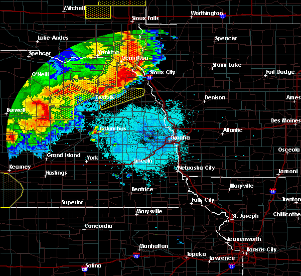 At 1056 pm cdt, severe thunderstorms were located along a line extending from 4 miles southeast of concord to near hadar, moving east at 45 mph (radar indicated). Hazards include 60 mph wind gusts and nickel size hail. Expect damage to roofs. Siding and trees. At 1056 pm cdt, severe thunderstorms were located along a line extending from 4 miles southeast of concord to near hadar, moving east at 45 mph (radar indicated). Hazards include 60 mph wind gusts and nickel size hail. Expect damage to roofs. Siding and trees.
|
| 6/17/2016 11:28 PM CDT |
 At 1128 pm cdt, severe thunderstorms were located along a line extending from 5 miles east of hoskins to 4 miles northeast of macy, moving southeast at 25 mph (radar indicated). Hazards include 60 mph wind gusts. Expect damage to roofs. Siding and trees. At 1128 pm cdt, severe thunderstorms were located along a line extending from 5 miles east of hoskins to 4 miles northeast of macy, moving southeast at 25 mph (radar indicated). Hazards include 60 mph wind gusts. Expect damage to roofs. Siding and trees.
|
| 6/17/2016 11:15 PM CDT | Storm damage reported in wayne county NE, 0.4 miles SE of Wayne, NE |
| 6/17/2016 11:02 PM CDT |
 At 1102 pm cdt, severe thunderstorms were located along a line extending from 4 miles west of wayne to 4 miles east of winnebago, moving south at 20 mph (radar indicated). Hazards include 60 mph wind gusts. Expect damage to roofs. Siding and trees. At 1102 pm cdt, severe thunderstorms were located along a line extending from 4 miles west of wayne to 4 miles east of winnebago, moving south at 20 mph (radar indicated). Hazards include 60 mph wind gusts. Expect damage to roofs. Siding and trees.
|
| 6/17/2016 11:01 PM CDT | Tree limbs down... 8 to 12 inch diameter... south and southwest of wayn in wayne county NE, 0.4 miles SE of Wayne, NE |
| 6/17/2016 10:58 PM CDT | Tree limbs down... 8 to 12 inch diameter... south and southwest of wayn in wayne county NE, 0.4 miles SE of Wayne, NE |
| 6/17/2016 10:55 PM CDT | Storm damage reported in wayne county NE, 0.4 miles SE of Wayne, NE |
| 6/17/2016 10:15 PM CDT | Storm damage reported in wayne county NE, 0.4 miles SE of Wayne, NE |
| 6/17/2016 10:15 PM CDT |
 At 1015 pm cdt, a severe thunderstorm was located 5 miles north of emerson, or 15 miles south of ponca, moving south at 25 mph (radar indicated). Hazards include 60 mph wind gusts and quarter size hail. Hail damage to vehicles is expected. Expect wind damage to roofs, siding and trees. At 1015 pm cdt, a severe thunderstorm was located 5 miles north of emerson, or 15 miles south of ponca, moving south at 25 mph (radar indicated). Hazards include 60 mph wind gusts and quarter size hail. Hail damage to vehicles is expected. Expect wind damage to roofs, siding and trees.
|
| 5/26/2016 12:27 AM CDT | The severe thunderstorm warning for east central wayne county will expire at 1230 am cdt, the storm which prompted the warning has weakened below severe limits, and no longer poses an immediate threat to life or property. therefore the warning will be allowed to expire. however small hail and gusty winds are still possible with this thunderstorm. a severe thunderstorm watch remains in effect until 200 am cdt for northeastern nebraska. |
| 5/25/2016 11:57 PM CDT |
 At 1156 pm cdt, a severe thunderstorm was located over wayne, or 25 miles northeast of norfolk, moving east at 15 mph (law enforcement). Hazards include quarter size hail. damage to vehicles is expected At 1156 pm cdt, a severe thunderstorm was located over wayne, or 25 miles northeast of norfolk, moving east at 15 mph (law enforcement). Hazards include quarter size hail. damage to vehicles is expected
|
| 5/25/2016 11:55 PM CDT | Quarter sized hail reported 0.4 miles SE of Wayne, NE |
| 5/25/2016 11:46 PM CDT |
 At 1145 pm cdt, a severe thunderstorm was located near wayne, or 25 miles southwest of ponca, moving east at 30 mph (radar indicated). Hazards include 60 mph wind gusts and quarter size hail. Hail damage to vehicles is expected. expect wind damage to roofs, siding and trees. Locations impacted include, wayne. At 1145 pm cdt, a severe thunderstorm was located near wayne, or 25 miles southwest of ponca, moving east at 30 mph (radar indicated). Hazards include 60 mph wind gusts and quarter size hail. Hail damage to vehicles is expected. expect wind damage to roofs, siding and trees. Locations impacted include, wayne.
|
| 5/25/2016 11:27 PM CDT |
 At 1126 pm cdt, a severe thunderstorm was located near dixon in dixon county, or 20 miles southwest of ponca, moving east at 30 mph (radar indicated). Hazards include 60 mph wind gusts and quarter size hail. Hail damage to vehicles is expected. Expect wind damage to roofs, siding and trees. At 1126 pm cdt, a severe thunderstorm was located near dixon in dixon county, or 20 miles southwest of ponca, moving east at 30 mph (radar indicated). Hazards include 60 mph wind gusts and quarter size hail. Hail damage to vehicles is expected. Expect wind damage to roofs, siding and trees.
|
| 5/9/2016 8:54 PM CDT |
 The severe thunderstorm warning for southeastern wayne county will expire at 900 pm cdt, the storm which prompted the warning has weakened below severe limits, and no longer poses an immediate threat to life or property. therefore the warning will be allowed to expire. however small hail and heavy rain are still possible with this thunderstorm. a severe thunderstorm watch remains in effect until midnight cdt for northeastern nebraska. The severe thunderstorm warning for southeastern wayne county will expire at 900 pm cdt, the storm which prompted the warning has weakened below severe limits, and no longer poses an immediate threat to life or property. therefore the warning will be allowed to expire. however small hail and heavy rain are still possible with this thunderstorm. a severe thunderstorm watch remains in effect until midnight cdt for northeastern nebraska.
|
| 5/9/2016 8:31 PM CDT | Half Dollar sized hail reported 3.2 miles N of Wayne, NE |
| 5/9/2016 8:31 PM CDT |
 At 831 pm cdt, a severe thunderstorm was located near wayne, or 22 miles northeast of norfolk, and is nearly stationary (trained weather spotters). Hazards include half dollar size hail. damage to vehicles is expected At 831 pm cdt, a severe thunderstorm was located near wayne, or 22 miles northeast of norfolk, and is nearly stationary (trained weather spotters). Hazards include half dollar size hail. damage to vehicles is expected
|
| 5/9/2016 7:35 PM CDT |
 At 734 pm cdt, a severe thunderstorm was located over wayne, or 23 miles northeast of norfolk, moving northeast at 15 mph (radar indicated and golfball hail reported 3 sw of wayne. ). Hazards include golf ball size hail. People and animals outdoors will be injured. Expect damage to roofs, siding, windows and vehicles. At 734 pm cdt, a severe thunderstorm was located over wayne, or 23 miles northeast of norfolk, moving northeast at 15 mph (radar indicated and golfball hail reported 3 sw of wayne. ). Hazards include golf ball size hail. People and animals outdoors will be injured. Expect damage to roofs, siding, windows and vehicles.
|
| 5/9/2016 7:33 PM CDT | Golf Ball sized hail reported 2.9 miles NE of Wayne, NE |
| 7/17/2015 10:55 PM CDT |
 The severe thunderstorm warning for southeastern cedar and central wayne counties will expire at 1100 pm cdt, the storms which prompted the warning have moved out of the area. therefore the warning will be allowed to expire. however gusty winds and heavy rain are still possible with these thunderstorms. a severe thunderstorm watch remains in effect until 200 am cdt for northeastern nebraska. to report severe weather, contact your nearest law enforcement agency. they will relay your report to the national weather service omaha. The severe thunderstorm warning for southeastern cedar and central wayne counties will expire at 1100 pm cdt, the storms which prompted the warning have moved out of the area. therefore the warning will be allowed to expire. however gusty winds and heavy rain are still possible with these thunderstorms. a severe thunderstorm watch remains in effect until 200 am cdt for northeastern nebraska. to report severe weather, contact your nearest law enforcement agency. they will relay your report to the national weather service omaha.
|
| 7/17/2015 10:41 PM CDT |
 At 1040 pm cdt, severe thunderstorms were located along a line extending from near dixon in dixon county to near winside, moving east at 45 mph (radar indicated). Hazards include ping pong ball size hail and 60 mph wind gusts. People and animals outdoors will be injured. expect hail damage to roofs, siding, windows and vehicles. expect wind damage to roofs, siding and trees. locations impacted include, wayne, winside, hoskins, carroll and laurel. This includes highway 20 in nebraska between mile markers 388 and 398. At 1040 pm cdt, severe thunderstorms were located along a line extending from near dixon in dixon county to near winside, moving east at 45 mph (radar indicated). Hazards include ping pong ball size hail and 60 mph wind gusts. People and animals outdoors will be injured. expect hail damage to roofs, siding, windows and vehicles. expect wind damage to roofs, siding and trees. locations impacted include, wayne, winside, hoskins, carroll and laurel. This includes highway 20 in nebraska between mile markers 388 and 398.
|
| 7/17/2015 10:30 PM CDT |
 At 1029 pm cdt, severe thunderstorms were located along a line extending from 7 miles south of coleridge to near pierce, moving east at 40 mph (radar indicated). Hazards include ping pong ball size hail and 60 mph wind gusts. People and animals outdoors will be injured. expect hail damage to roofs, siding, windows and vehicles. expect wind damage to roofs, siding and trees. locations impacted include, wayne, winside, hadar, hoskins, carroll, laurel, belden, sholes and camp assurance. this includes the following highways, highway 81 in nebraska between milemarkers 163 and 171. Highway 20 in nebraska between mile markers 380 and 398. At 1029 pm cdt, severe thunderstorms were located along a line extending from 7 miles south of coleridge to near pierce, moving east at 40 mph (radar indicated). Hazards include ping pong ball size hail and 60 mph wind gusts. People and animals outdoors will be injured. expect hail damage to roofs, siding, windows and vehicles. expect wind damage to roofs, siding and trees. locations impacted include, wayne, winside, hadar, hoskins, carroll, laurel, belden, sholes and camp assurance. this includes the following highways, highway 81 in nebraska between milemarkers 163 and 171. Highway 20 in nebraska between mile markers 380 and 398.
|
| 7/17/2015 10:10 PM CDT |
 At 1010 pm cdt, severe thunderstorms were located along a line extending from near randolph to 6 miles southwest of pierce, moving east at 40 mph (radar indicated). Hazards include ping pong ball size hail and 60 mph wind gusts. People and animals outdoors will be injured. expect hail damage to roofs, siding, windows and vehicles. Expect wind damage to roofs, siding and trees. At 1010 pm cdt, severe thunderstorms were located along a line extending from near randolph to 6 miles southwest of pierce, moving east at 40 mph (radar indicated). Hazards include ping pong ball size hail and 60 mph wind gusts. People and animals outdoors will be injured. expect hail damage to roofs, siding, windows and vehicles. Expect wind damage to roofs, siding and trees.
|
| 6/10/2015 9:25 PM CDT |
 The severe thunderstorm warning for northwestern thurston and wayne counties will expire at 930 pm cdt, the storm which prompted the warning has weakened below severe limits, and no longer poses an immediate threat to life or property. therefore the warning will be allowed to expire. however gusty winds are still possible with this thunderstorm. The severe thunderstorm warning for northwestern thurston and wayne counties will expire at 930 pm cdt, the storm which prompted the warning has weakened below severe limits, and no longer poses an immediate threat to life or property. therefore the warning will be allowed to expire. however gusty winds are still possible with this thunderstorm.
|
| 6/10/2015 9:18 PM CDT |
 At 918 pm cdt, a severe thunderstorm was located near wayne, or 26 miles southwest of ponca, moving northeast at 30 mph (radar indicated). Hazards include 60 mph wind gusts and penny size hail. Expect damage to roofs. siding and trees. Locations impacted include, wayne, wakefield, emerson, winside, carroll and 8 miles south of wayne. At 918 pm cdt, a severe thunderstorm was located near wayne, or 26 miles southwest of ponca, moving northeast at 30 mph (radar indicated). Hazards include 60 mph wind gusts and penny size hail. Expect damage to roofs. siding and trees. Locations impacted include, wayne, wakefield, emerson, winside, carroll and 8 miles south of wayne.
|
| 6/10/2015 9:11 PM CDT |
 At 910 pm cdt, a severe thunderstorm was located near wayne, or 22 miles northeast of norfolk, moving northeast at 30 mph (radar indicated). Hazards include 60 mph wind gusts and penny size hail. Expect damage to roofs. siding and trees. Locations impacted include, wayne, wakefield, emerson, winside, carroll and 8 miles south of wayne. At 910 pm cdt, a severe thunderstorm was located near wayne, or 22 miles northeast of norfolk, moving northeast at 30 mph (radar indicated). Hazards include 60 mph wind gusts and penny size hail. Expect damage to roofs. siding and trees. Locations impacted include, wayne, wakefield, emerson, winside, carroll and 8 miles south of wayne.
|
| 6/10/2015 9:05 PM CDT |
 At 905 pm cdt, a severe thunderstorm was located over wayne, or 25 miles northeast of norfolk, moving northeast at 45 mph (radar indicated). Hazards include 60 mph wind gusts and penny size hail. Expect damage to roofs. siding and trees. Locations impacted include, wayne, wakefield, emerson, winside, carroll and 8 miles south of wayne. At 905 pm cdt, a severe thunderstorm was located over wayne, or 25 miles northeast of norfolk, moving northeast at 45 mph (radar indicated). Hazards include 60 mph wind gusts and penny size hail. Expect damage to roofs. siding and trees. Locations impacted include, wayne, wakefield, emerson, winside, carroll and 8 miles south of wayne.
|
| 6/10/2015 9:01 PM CDT |
 At 901 pm cdt, a severe thunderstorm was located near wayne, or 20 miles northeast of norfolk, moving northeast at 45 mph (radar indicated). Hazards include 60 mph wind gusts and penny size hail. Expect damage to roofs. siding and trees. Locations impacted include, wayne, wakefield, emerson, winside, carroll and 8 miles south of wayne. At 901 pm cdt, a severe thunderstorm was located near wayne, or 20 miles northeast of norfolk, moving northeast at 45 mph (radar indicated). Hazards include 60 mph wind gusts and penny size hail. Expect damage to roofs. siding and trees. Locations impacted include, wayne, wakefield, emerson, winside, carroll and 8 miles south of wayne.
|
| 6/10/2015 8:55 PM CDT |
 At 854 pm cdt, a severe thunderstorm was located near winside, or 17 miles northeast of norfolk, moving northeast at 60 mph (radar indicated). Hazards include 60 mph wind gusts and penny size hail. Expect damage to roofs. Siding and trees. At 854 pm cdt, a severe thunderstorm was located near winside, or 17 miles northeast of norfolk, moving northeast at 60 mph (radar indicated). Hazards include 60 mph wind gusts and penny size hail. Expect damage to roofs. Siding and trees.
|
| 6/30/2014 10:07 AM CDT | Trees dow in wayne county NE, 0.4 miles SE of Wayne, NE |
| 5/16/2013 2:53 PM CDT | Quarter sized hail reported 8.1 miles ENE of Wayne, NE, hail up to quarter size |
| 4/9/2013 3:47 PM CDT | Quarter sized hail reported 0.4 miles SE of Wayne, NE |
| 4/9/2013 3:46 PM CDT | Quarter sized hail reported 0.4 miles SE of Wayne, NE |
| 4/9/2013 3:38 PM CDT | Ping Pong Ball sized hail reported 0.4 miles SE of Wayne, NE |
| 8/1/2012 11:00 PM CDT | 6 inch diameter limbs broken in dixon county NE, 3.7 miles SW of Wayne, NE |
| 8/1/2012 10:59 PM CDT | A few tree limbs dow in wayne county NE, 4.2 miles WSW of Wayne, NE |
| 8/1/2012 10:55 PM CDT | Storm damage reported in wayne county NE, 0.4 miles SE of Wayne, NE |
| 5/27/2012 5:10 PM CDT | Golf Ball sized hail reported 5.9 miles E of Wayne, NE |
| 5/4/2012 9:52 PM CDT | Quarter sized hail reported 3.3 miles SSE of Wayne, NE, hail covering the ground |
| 5/4/2012 9:52 PM CDT | Quarter sized hail reported 3.1 miles S of Wayne, NE |
| 1/1/0001 12:00 AM | Storm damage reported in wayne county NE, 0.4 miles SE of Wayne, NE |
| 1/1/0001 12:00 AM | Tree damage including large branches blown dow in dixon county NE, 3.2 miles SSW of Wayne, NE |
| 1/1/0001 12:00 AM | Ping Pong Ball sized hail reported 0.4 miles SE of Wayne, NE |
| 1/1/0001 12:00 AM | Golf Ball sized hail reported 2.9 miles NE of Wayne, NE |
| 1/1/0001 12:00 AM | Ping Pong Ball sized hail reported 3.3 miles WSW of Wayne, NE |
| 1/1/0001 12:00 AM | Quarter sized hail reported 0.4 miles SE of Wayne, NE, hail up to quarter size reported in wayne to 1 mile east of town...hail was from 332 to 338 pm. |
Hail Maps for Wayne, NE
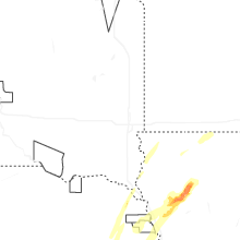
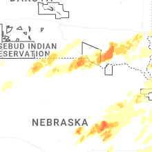
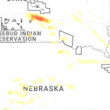
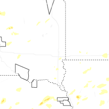
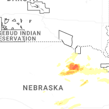
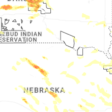

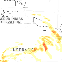


Connect with Interactive Hail Maps