

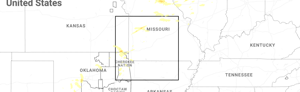
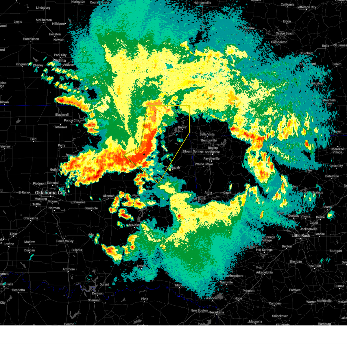
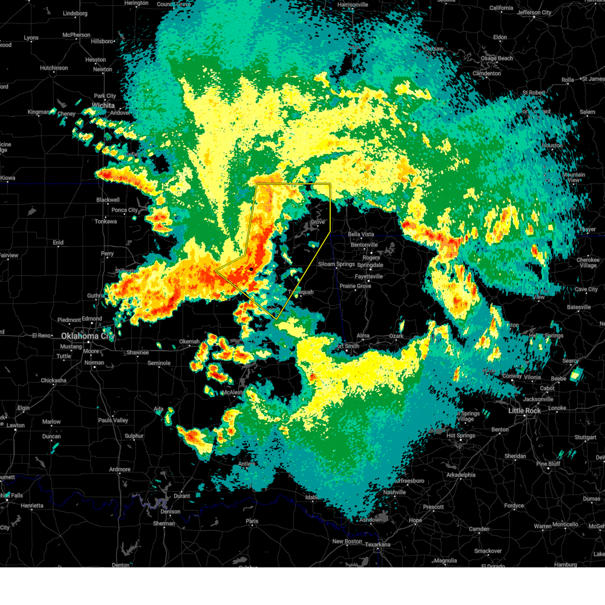
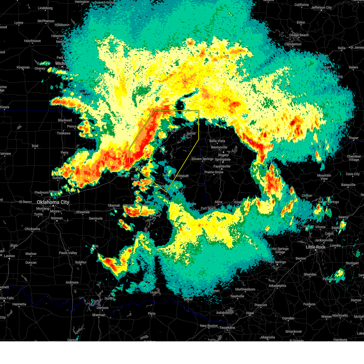
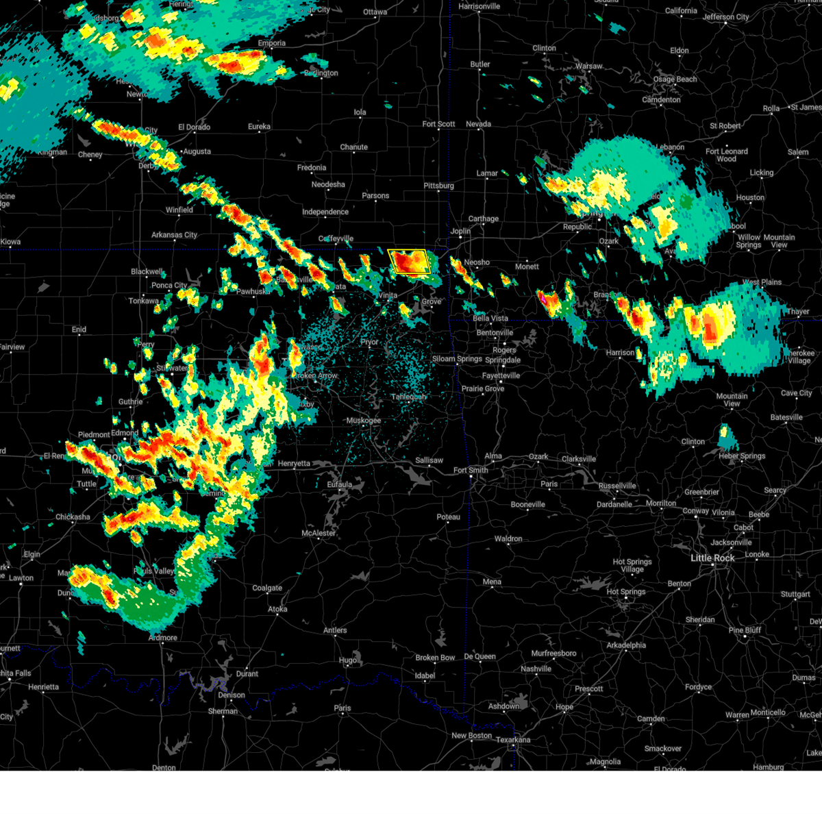
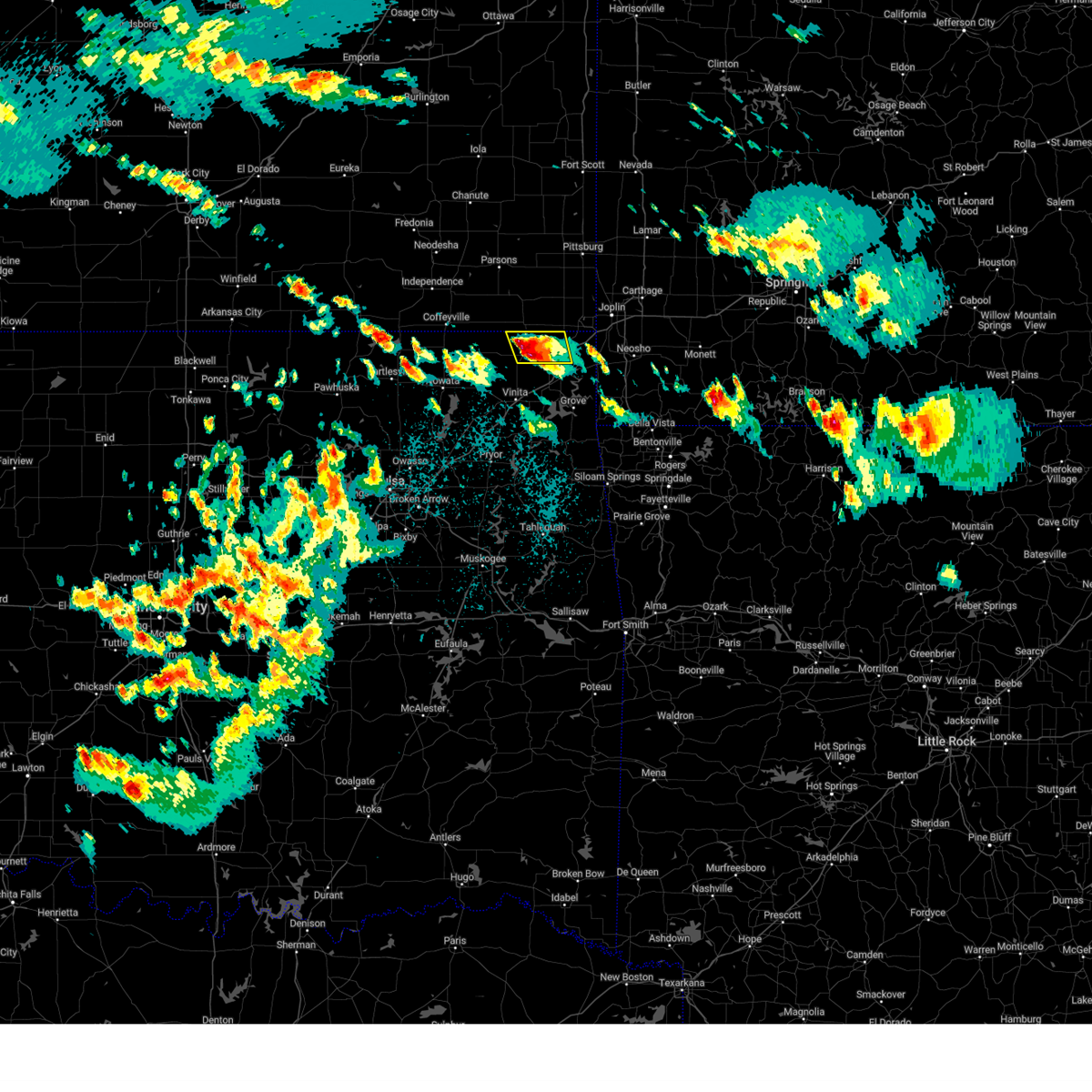
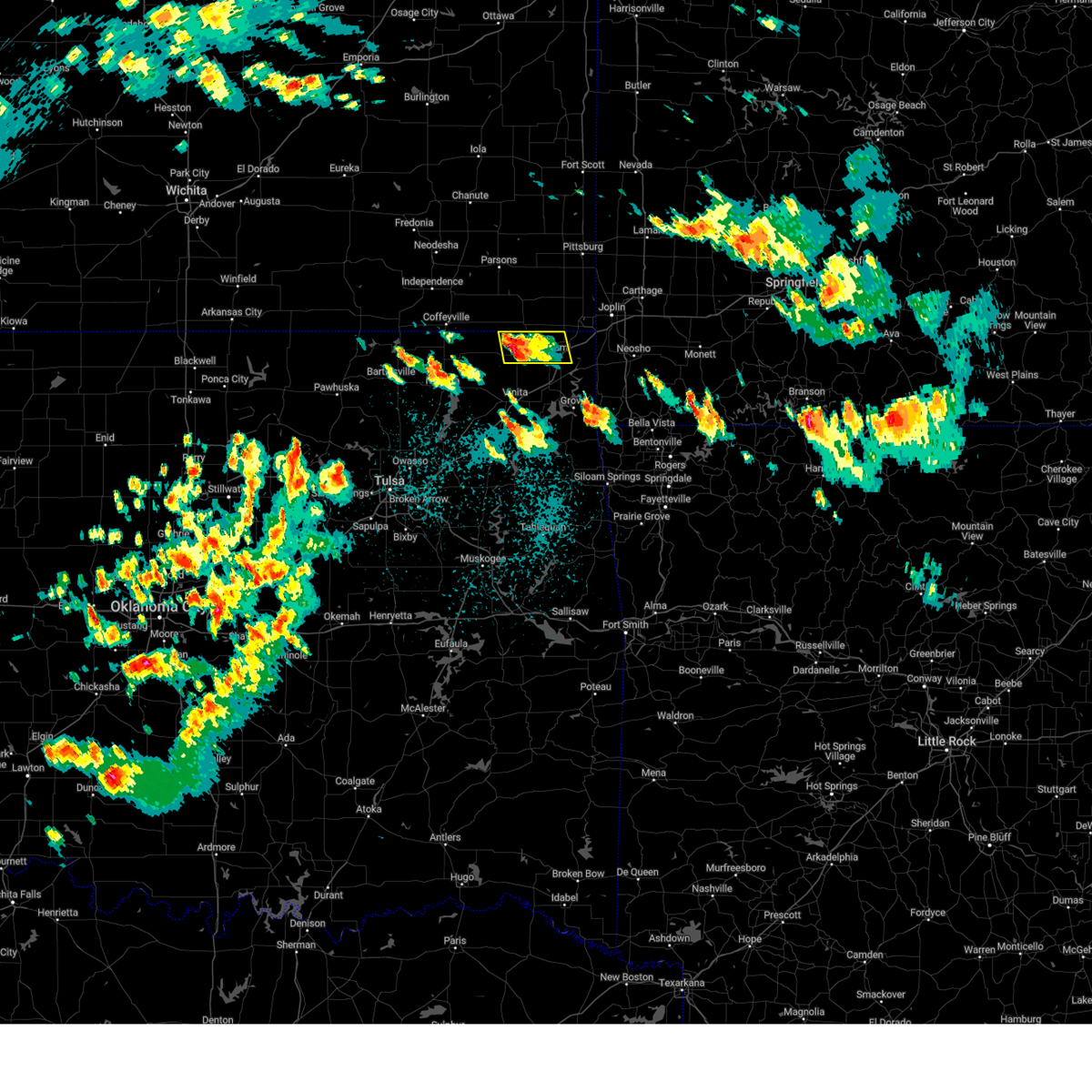
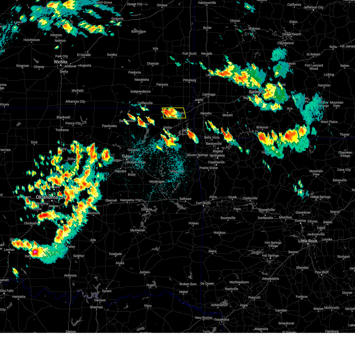
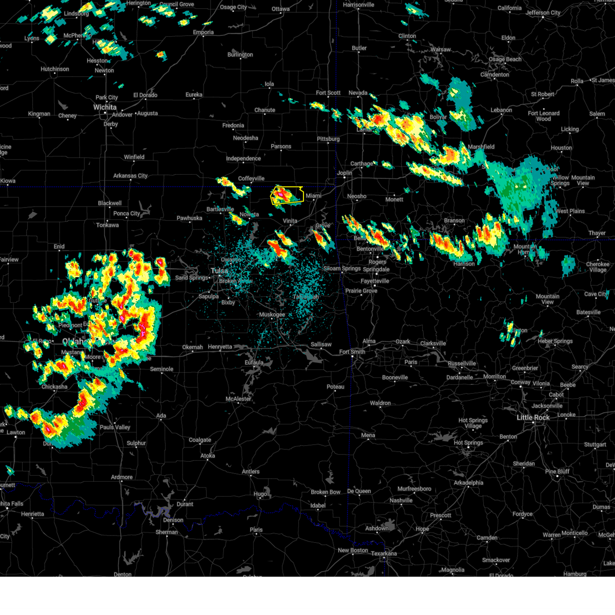
Hail Map for Welch, OK
The Welch, OK area has had 9 reports of on-the-ground hail by trained spotters, and has been under severe weather warnings 29 times during the past 12 months. Doppler radar has detected hail at or near Welch, OK on 79 occasions, including 7 occasions during the past year.
| Name: | Welch, OK |
| Where Located: | 59.1 miles SSE of Chanute, KS |
| Map: | Google Map for Welch, OK |
| Population: | 619 |
| Housing Units: | 297 |
| More Info: | Search Google for Welch, OK |
2
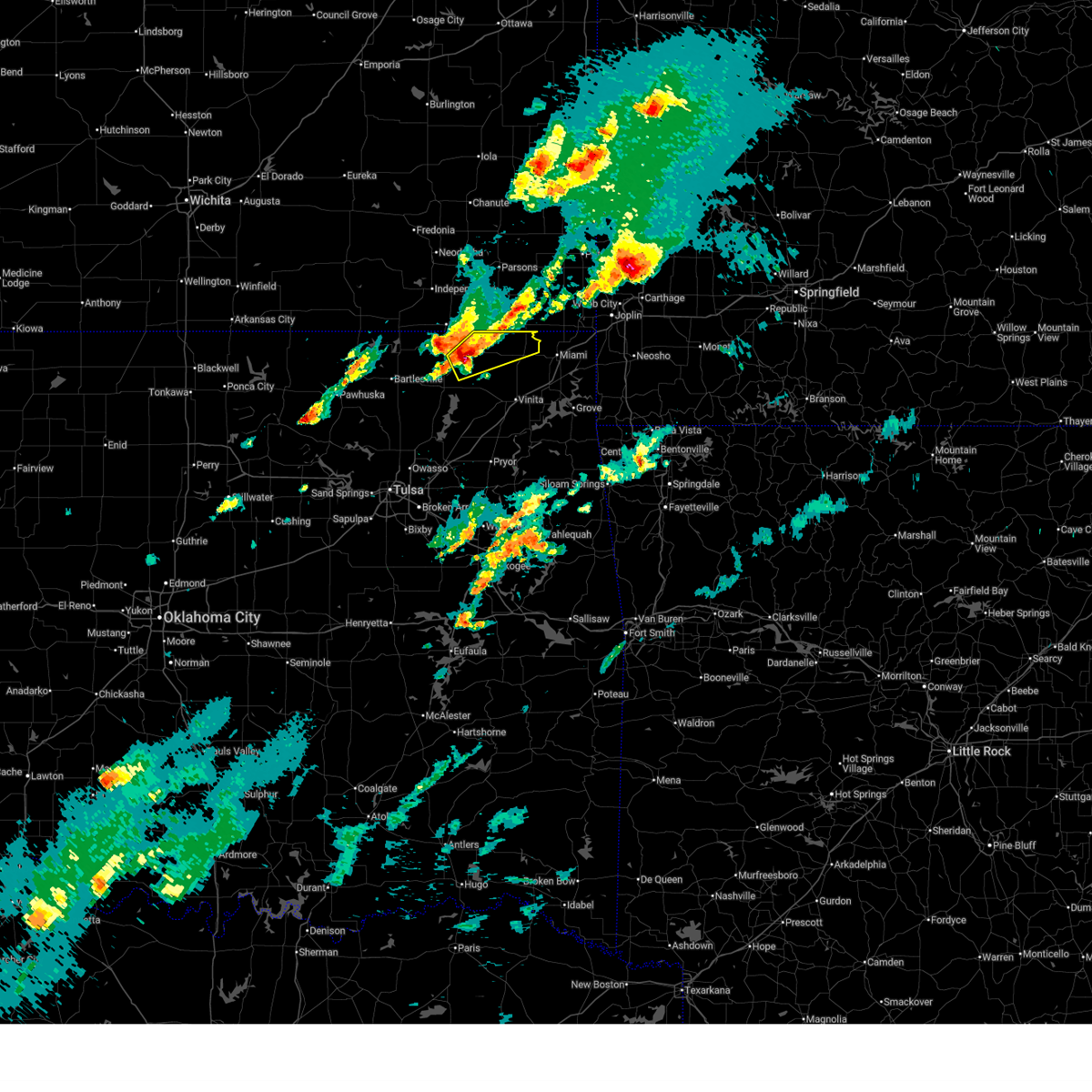
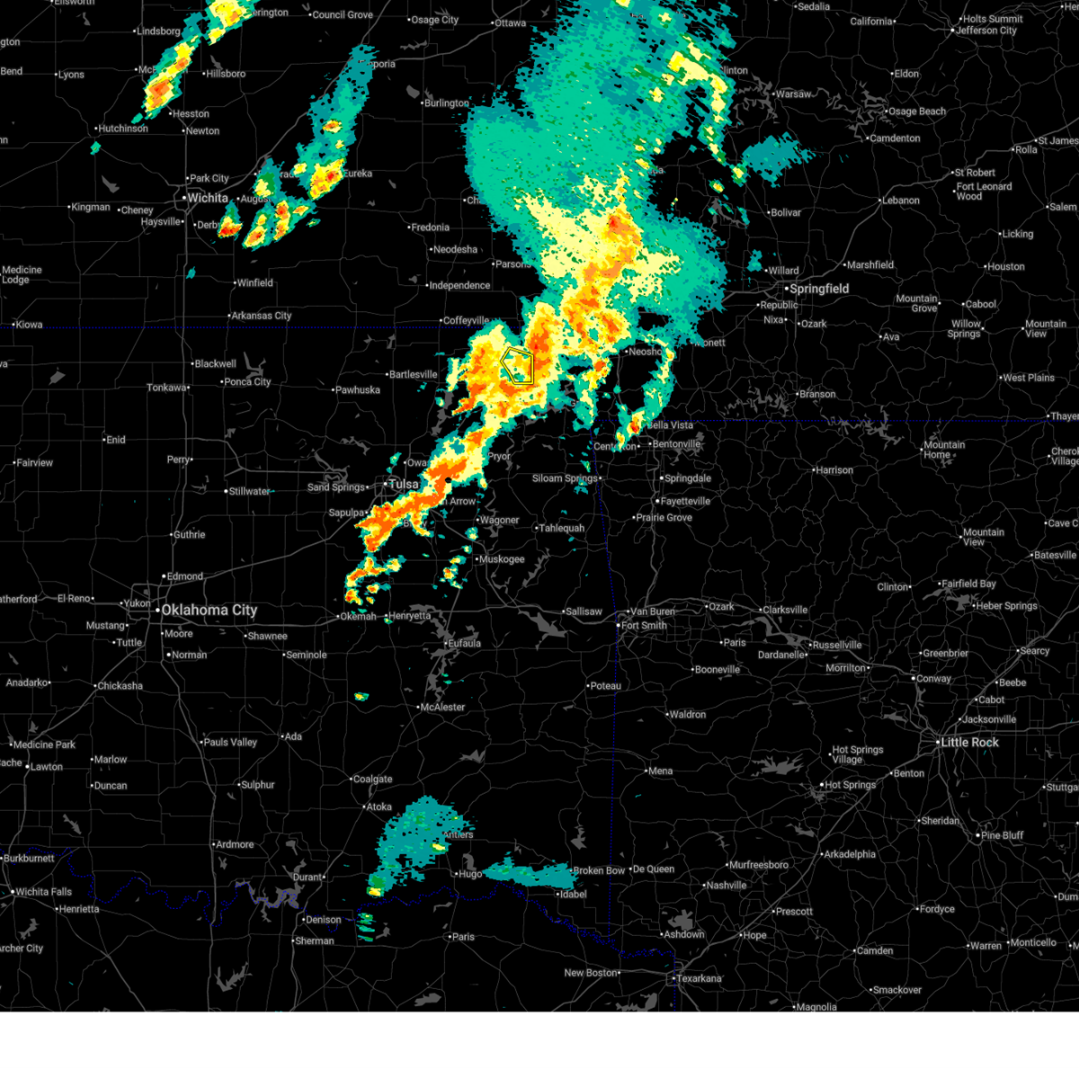
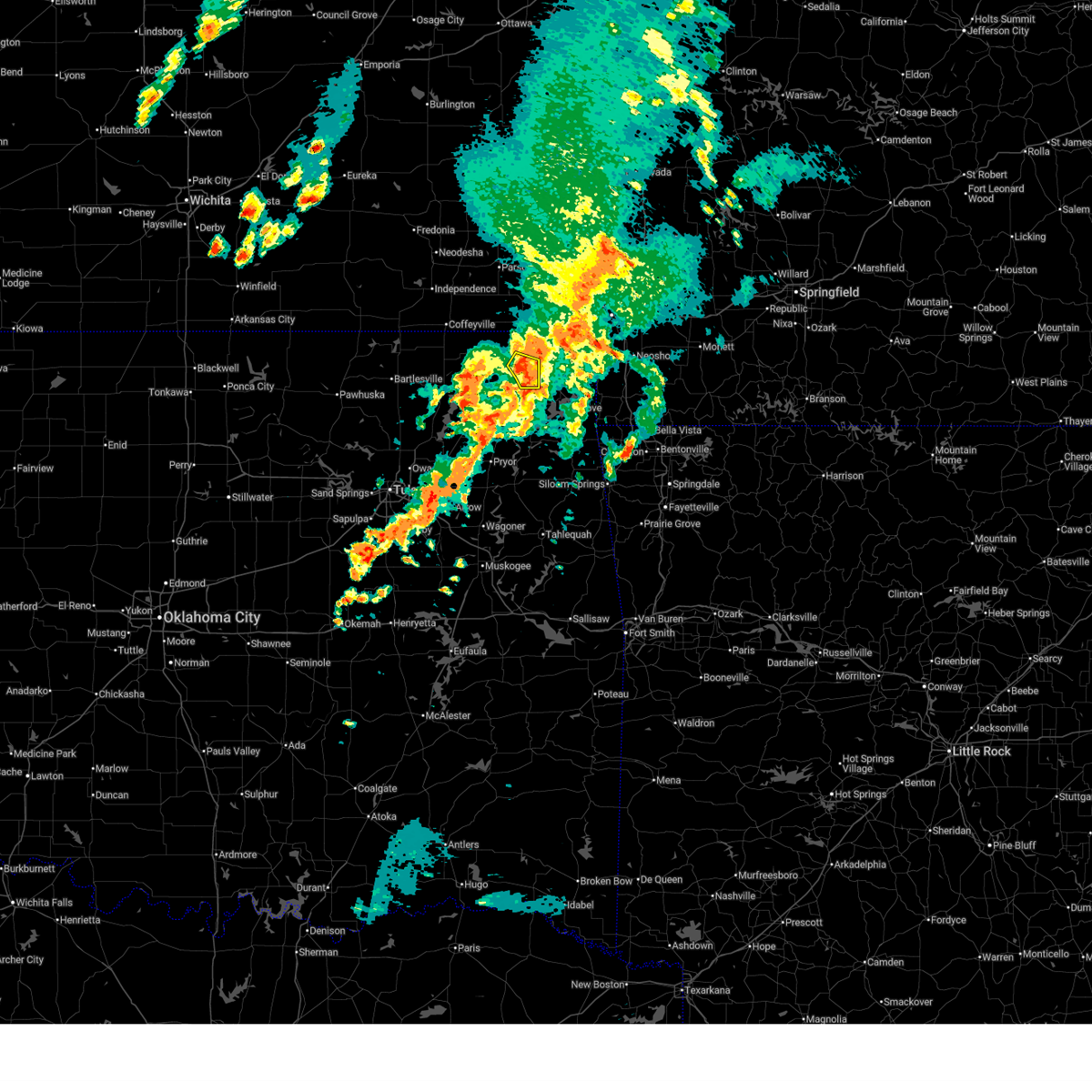
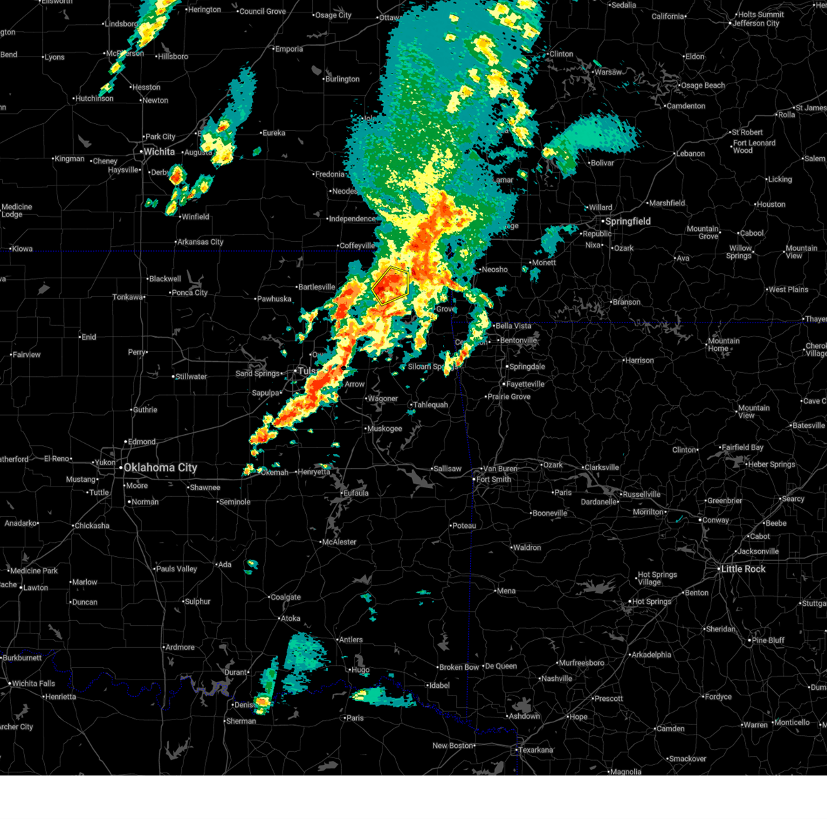
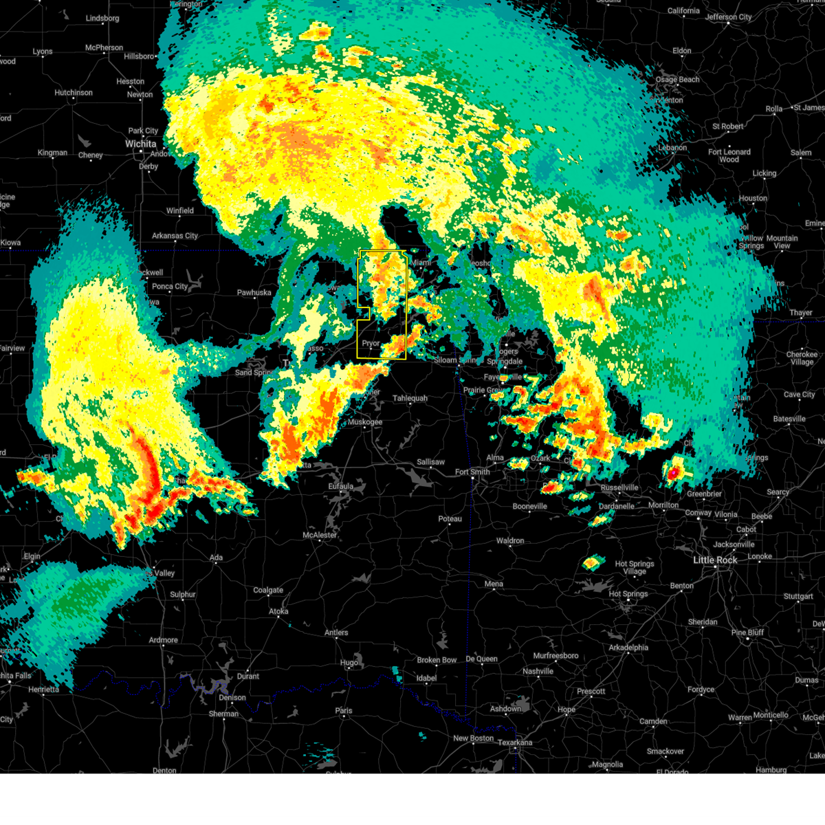
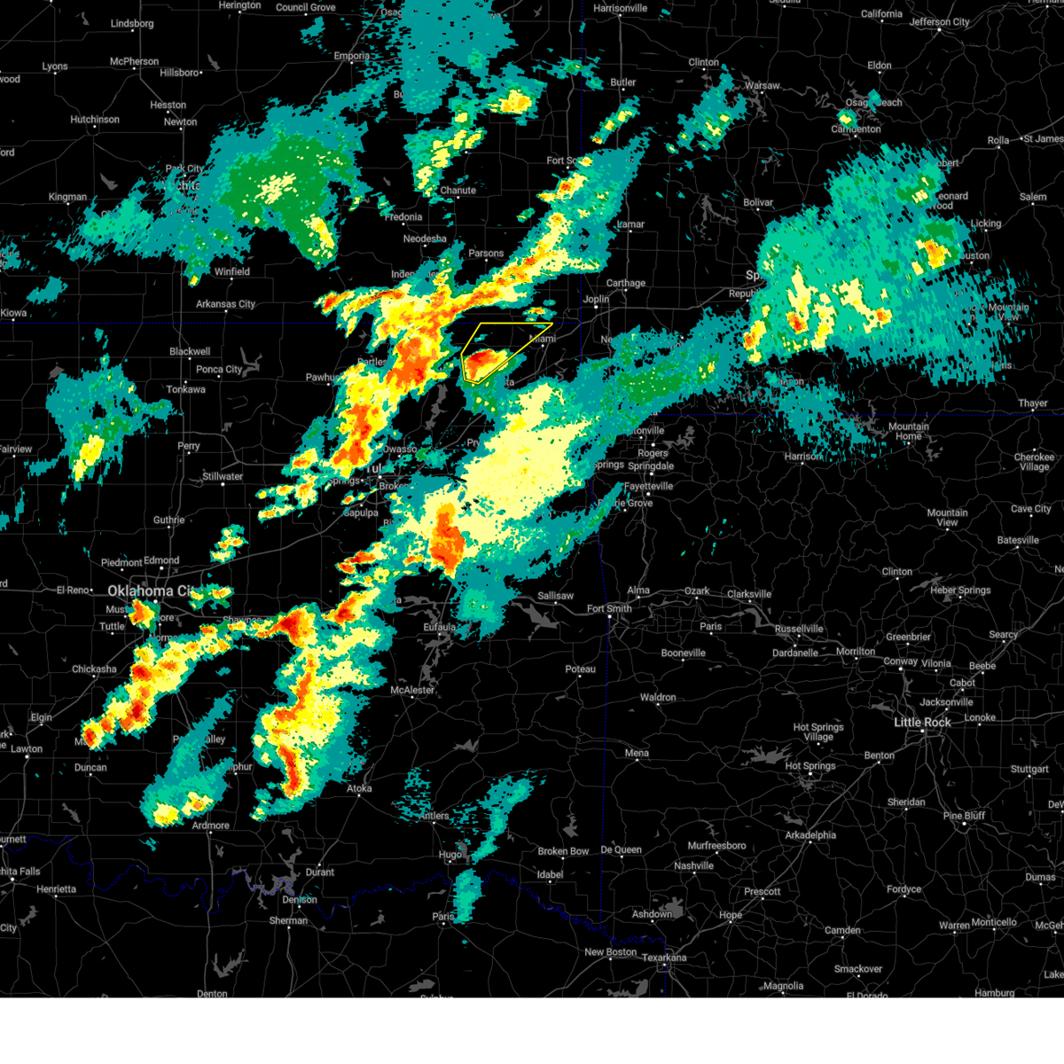
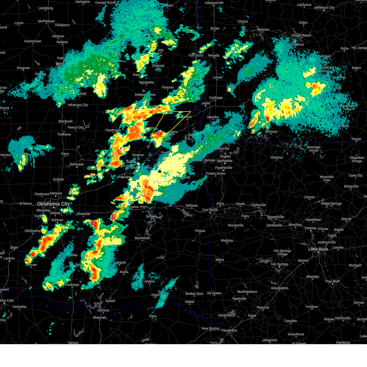
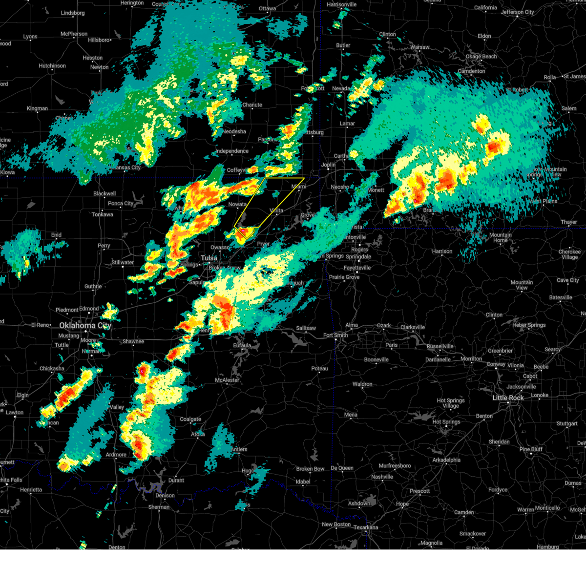
The Top Recent Hail Date for Welch, OK is Thursday, June 11, 2026 (20th out of 79)
Hail and Wind Damage Spotted near Welch, OK
| Date / Time | Report Details |
|---|---|
| 6/18/2026 9:28 AM CDT |
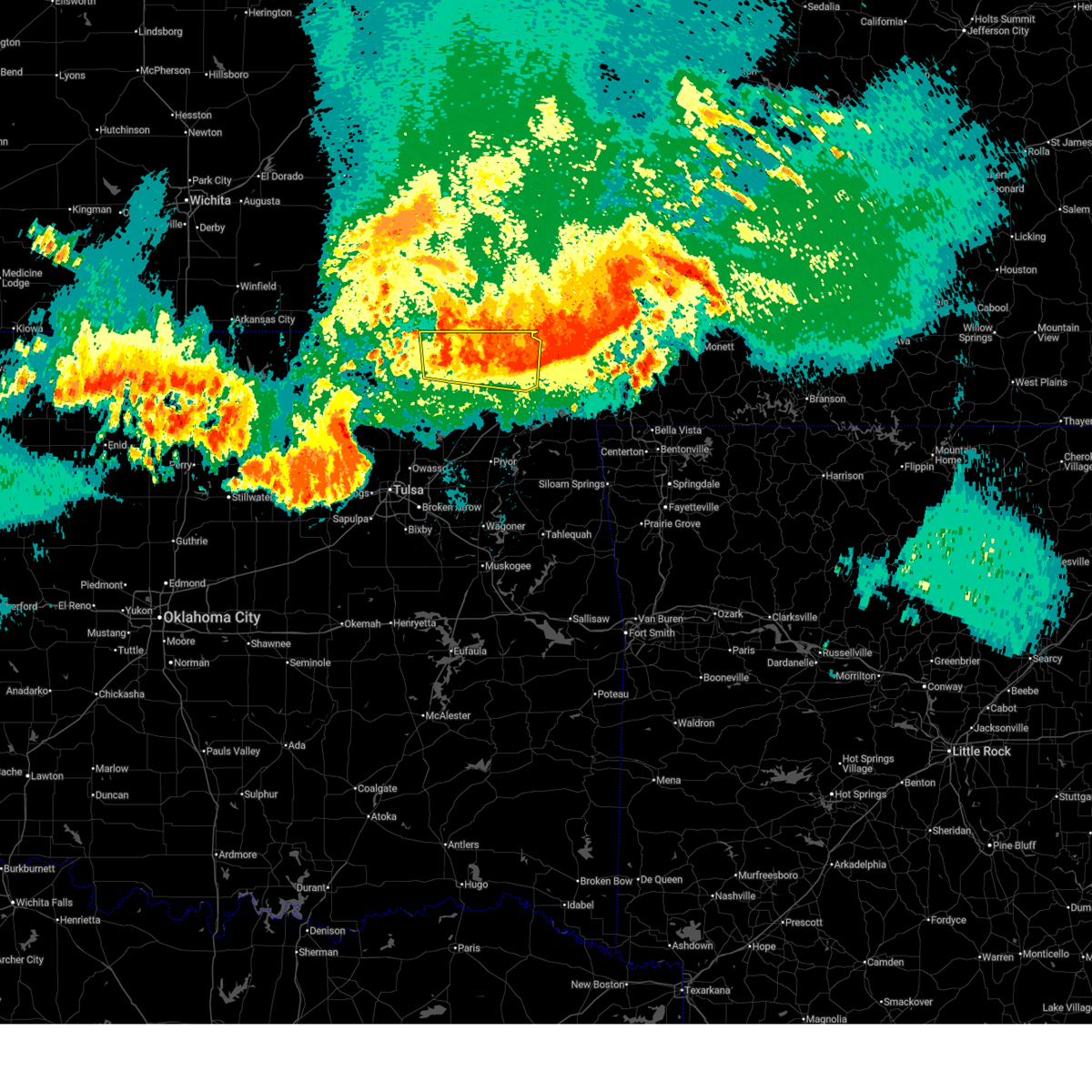
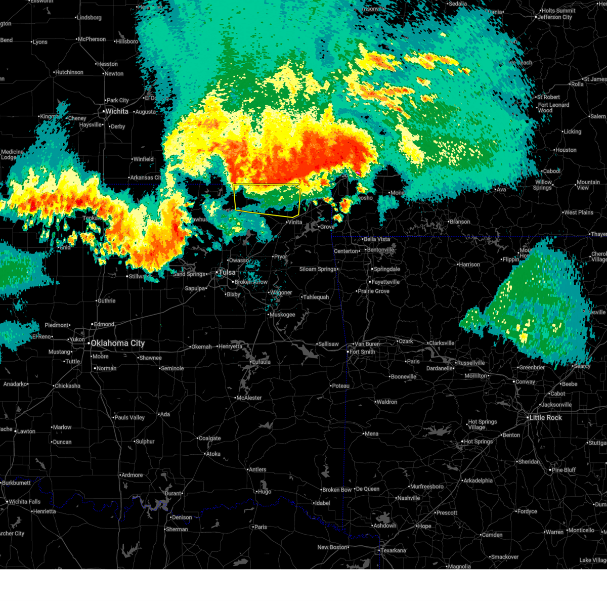
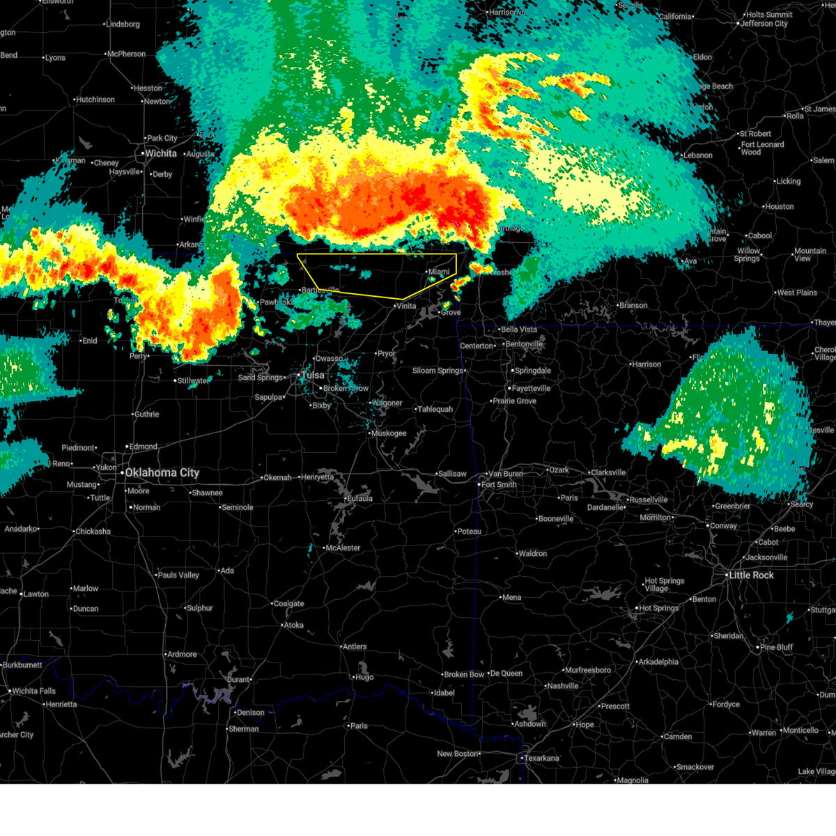
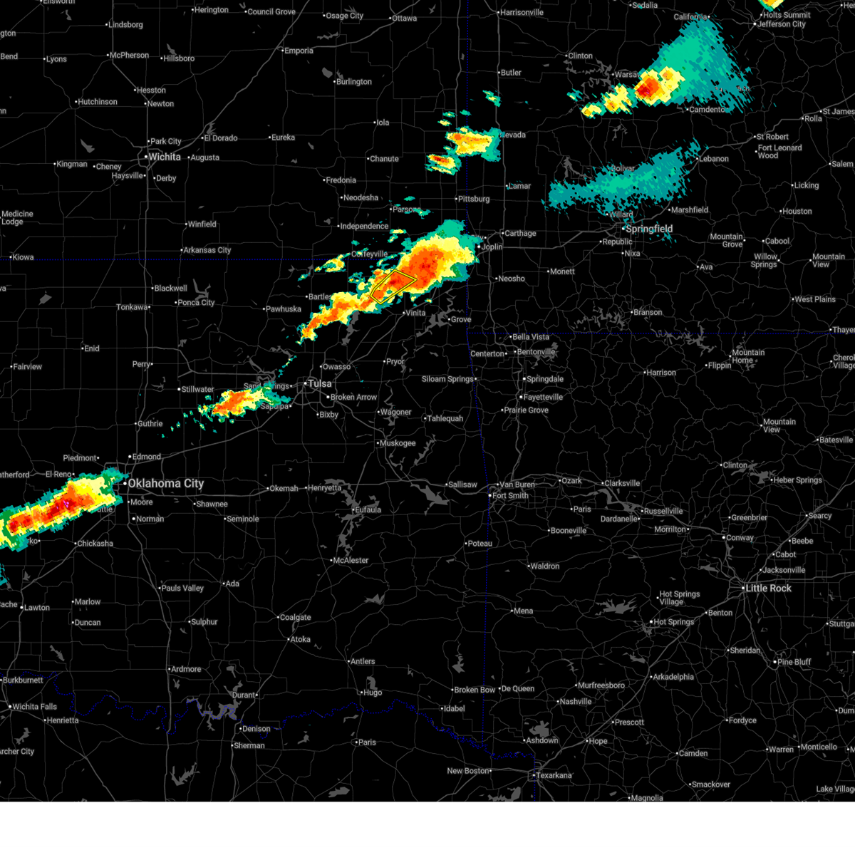
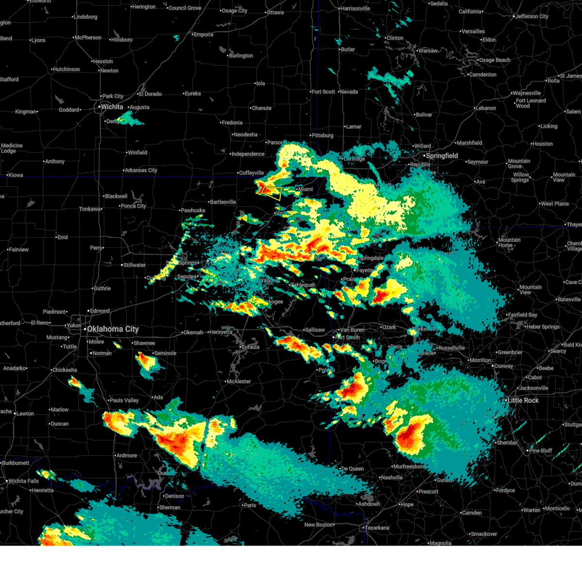
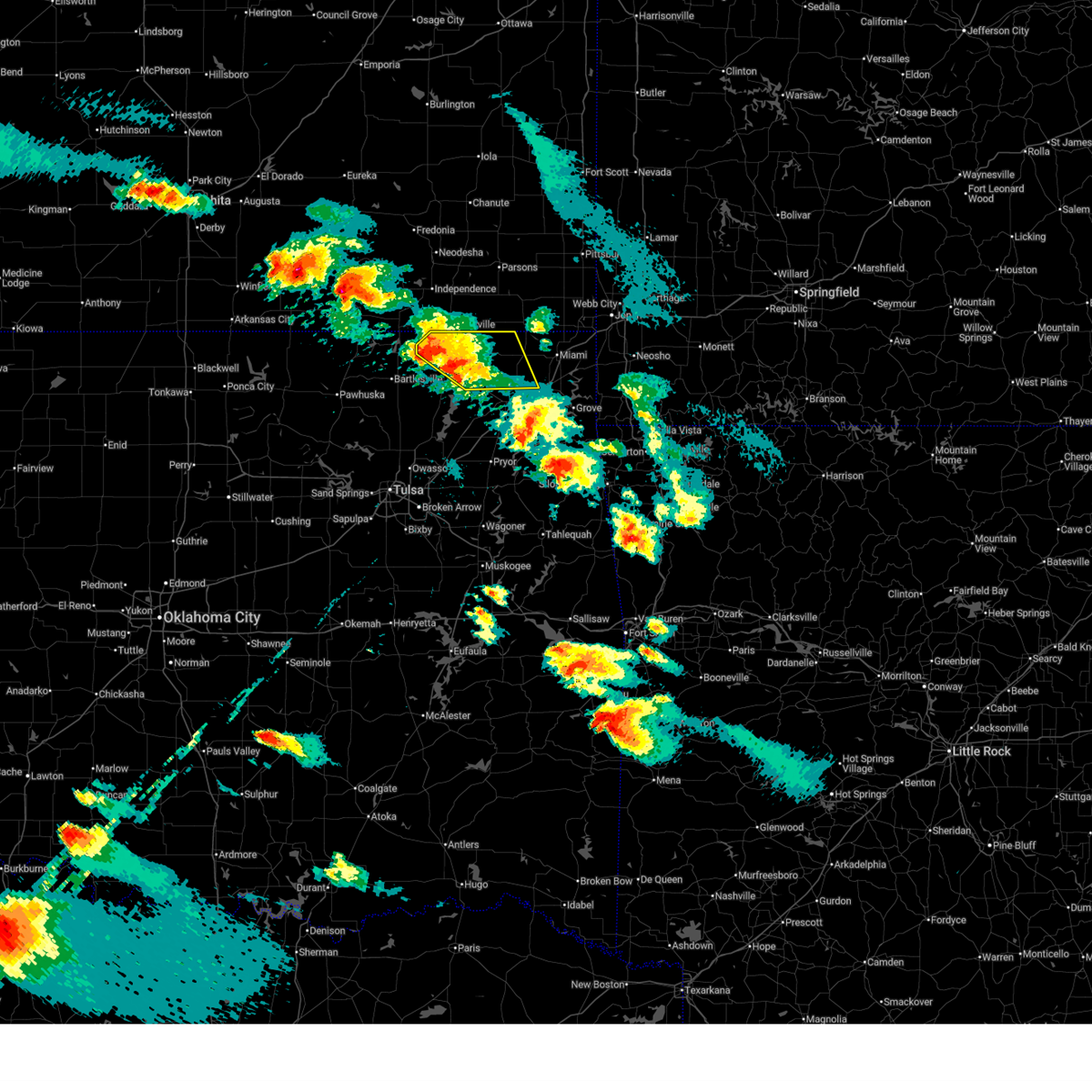
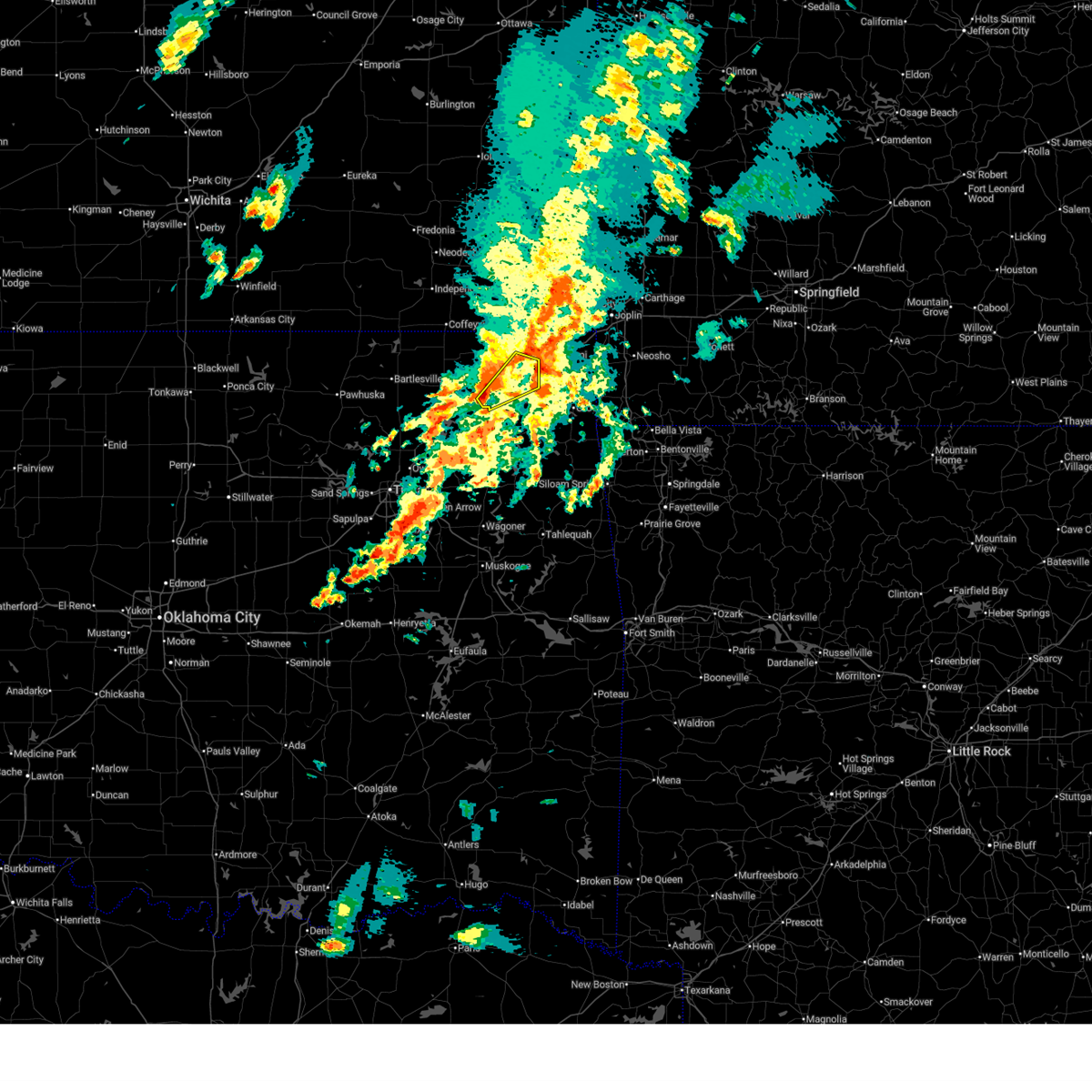
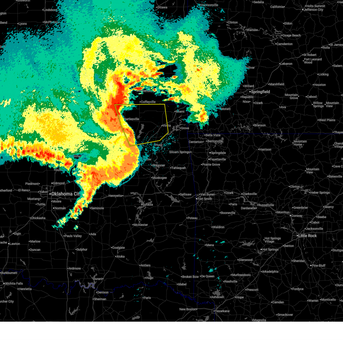
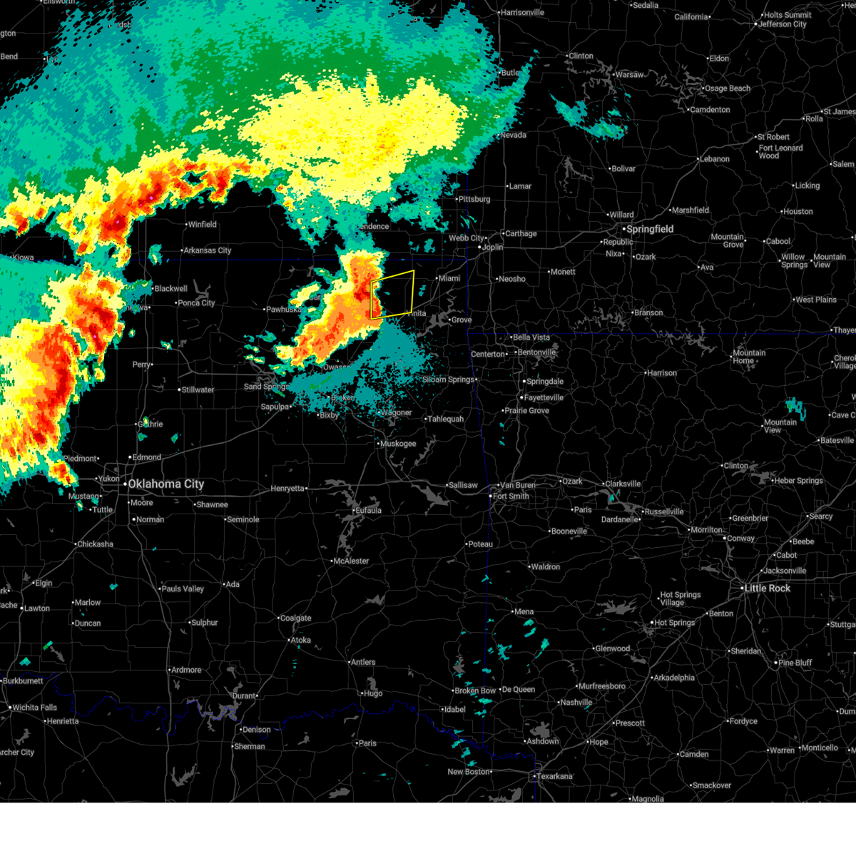
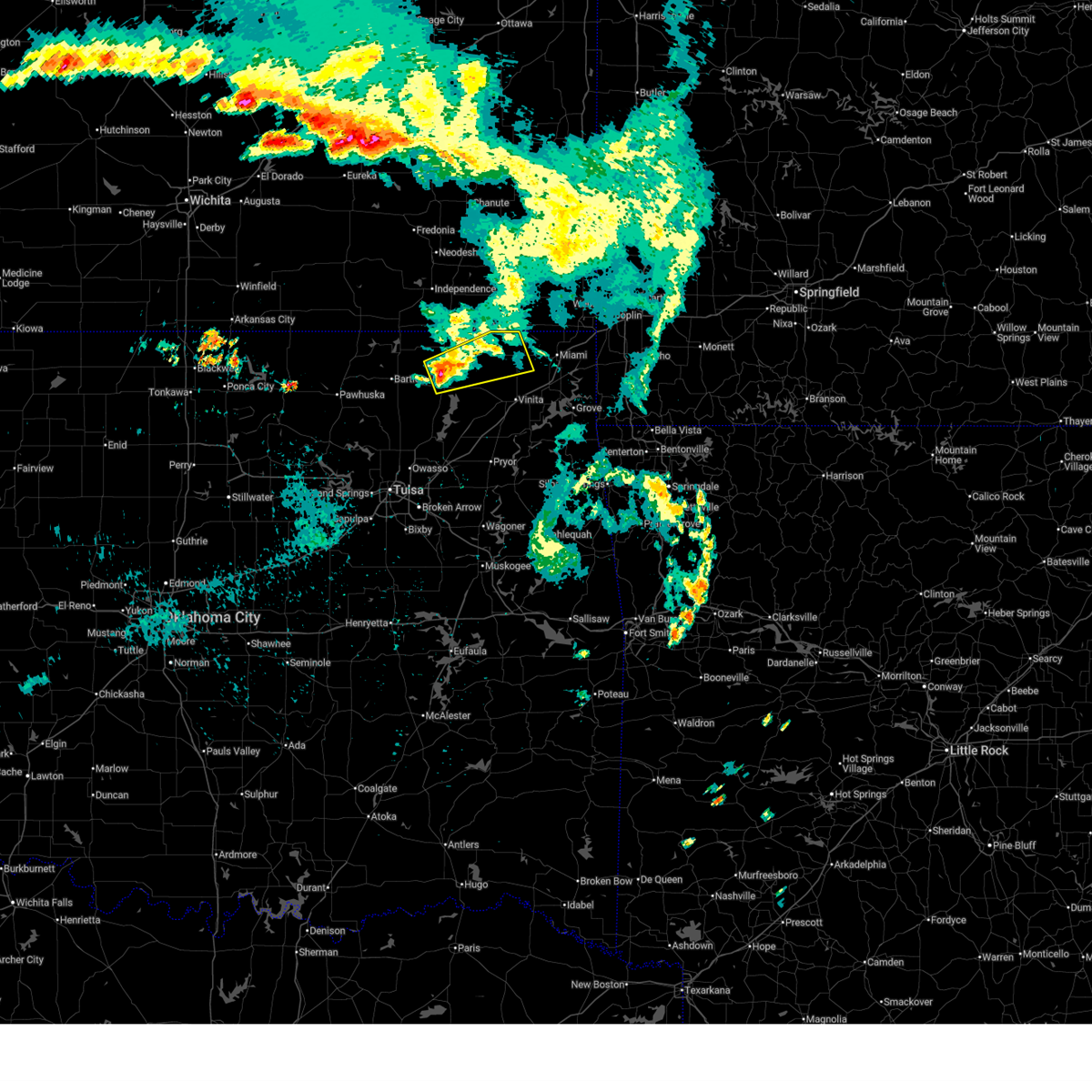
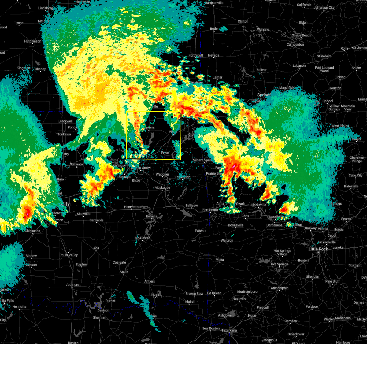
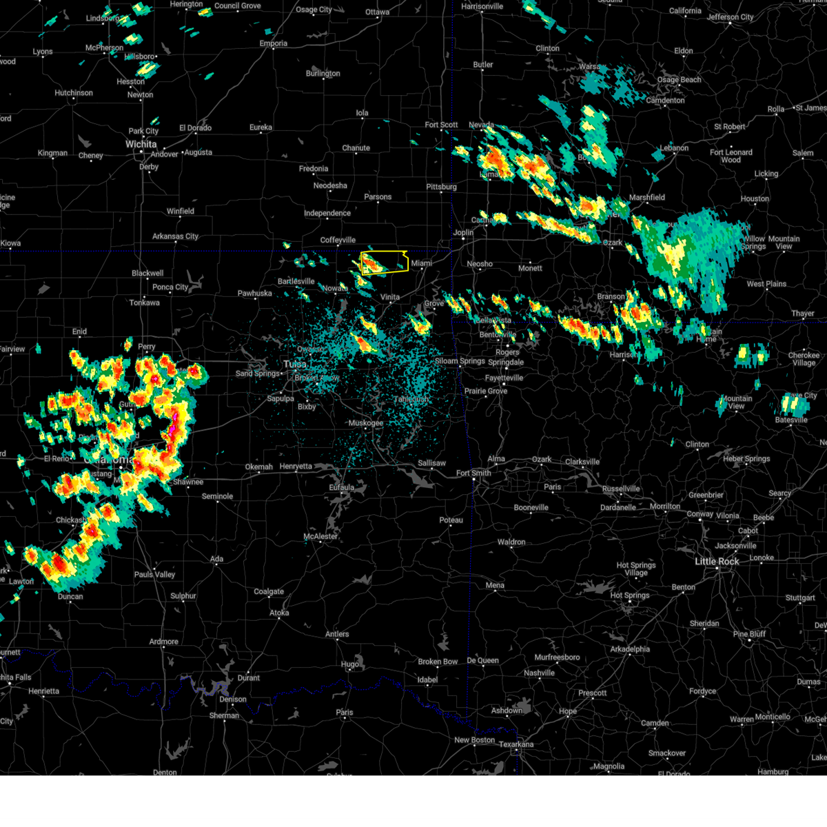
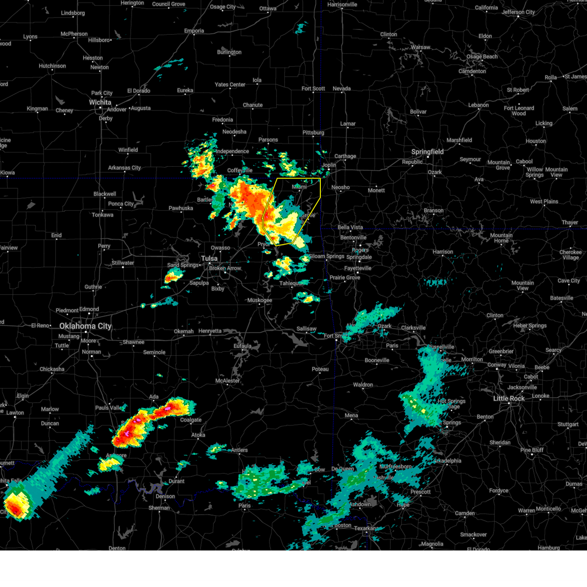
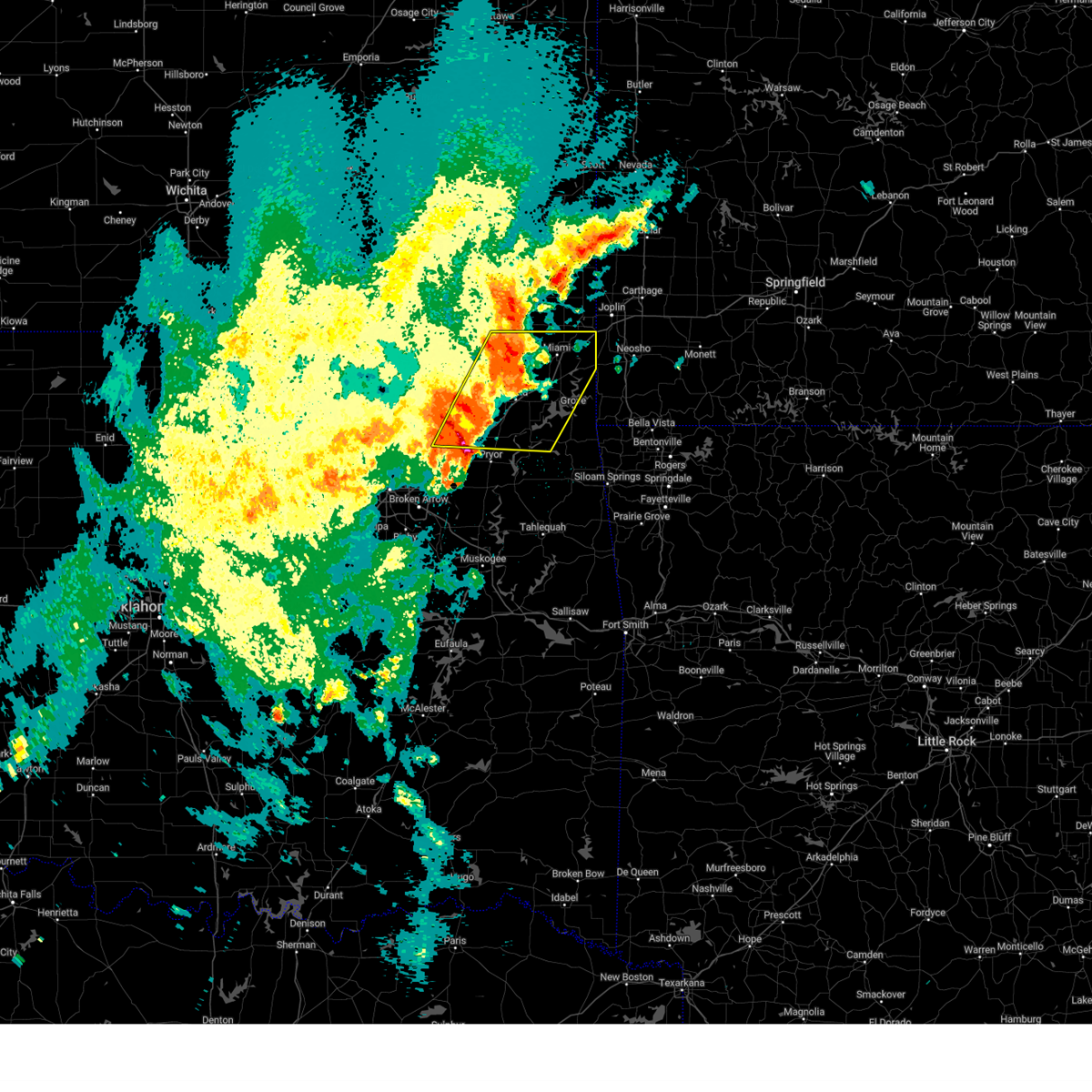
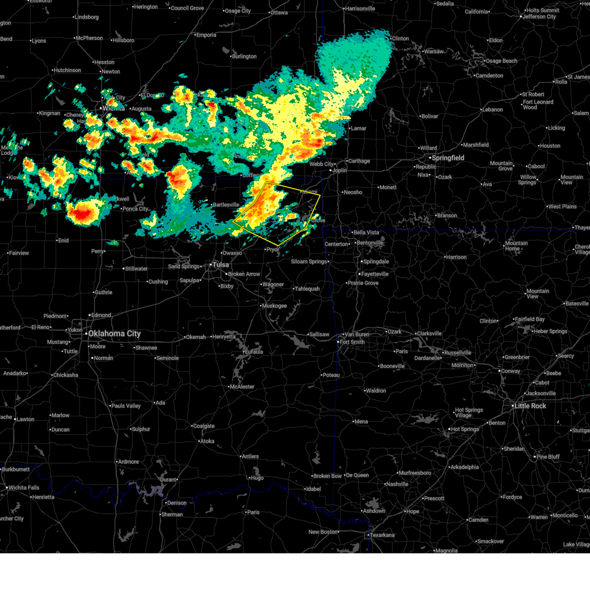 At 928 am cdt, severe thunderstorms were located along a line extending from 2 miles northeast of welch to 4 miles southwest of bluejacket to 4 miles southwest of white oak to 2 miles northwest of foyil, moving southeast at 40 mph (radar indicated). Hazards include 60 mph wind gusts. Expect damage to roofs, siding, and trees. Locations in or near the path include, miami, vinita, grove, chelsea, fairland, afton, langley, adair, welch, bernice, ketchum, bluejacket, wyandotte, disney, big cabin, pensacola, new alluwe, hoot owl, cherokee state park, bernice state park, this includes interstate 44 between mile markers 265 and 309. At 928 am cdt, severe thunderstorms were located along a line extending from 2 miles northeast of welch to 4 miles southwest of bluejacket to 4 miles southwest of white oak to 2 miles northwest of foyil, moving southeast at 40 mph (radar indicated). Hazards include 60 mph wind gusts. Expect damage to roofs, siding, and trees. Locations in or near the path include, miami, vinita, grove, chelsea, fairland, afton, langley, adair, welch, bernice, ketchum, bluejacket, wyandotte, disney, big cabin, pensacola, new alluwe, hoot owl, cherokee state park, bernice state park, this includes interstate 44 between mile markers 265 and 309.
|
| 6/18/2026 9:15 AM CDT |
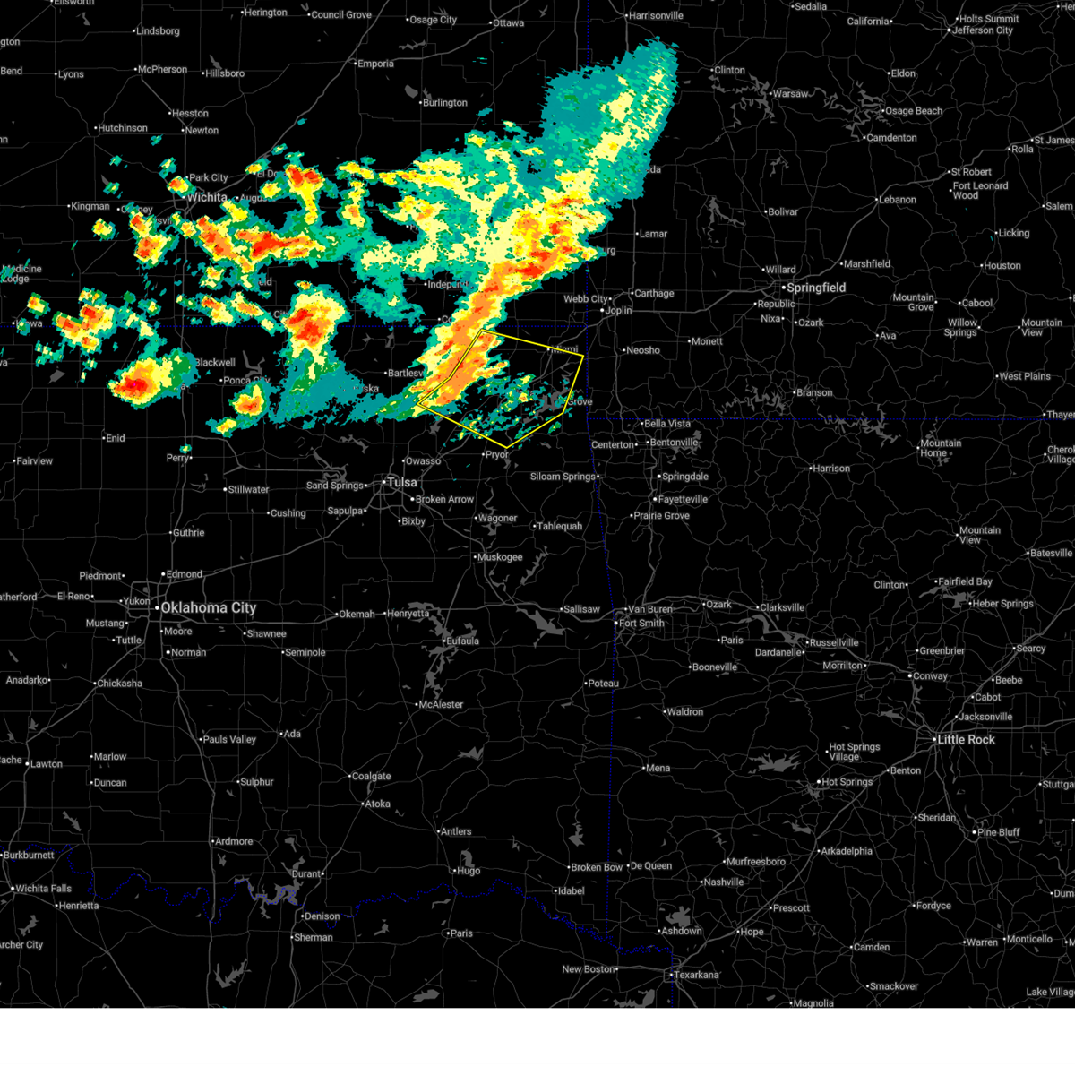 Svrtsa the national weather service in tulsa has issued a * severe thunderstorm warning for, craig county in northeastern oklahoma, northeastern rogers county in northeastern oklahoma, northwestern delaware county in northeastern oklahoma, southern ottawa county in northeastern oklahoma, northern mayes county in northeastern oklahoma, southeastern nowata county in northeastern oklahoma, * until 1000 am cdt. * at 915 am cdt, severe thunderstorms were located along a line extending from 6 miles west of welch to 6 miles northeast of new alluwe to 4 miles east of talala, moving east at 40 mph (radar indicated). Hazards include 60 mph wind gusts. Expect damage to roofs, siding, and trees. Locations in or near the path include, miami, vinita, grove, chelsea, fairland, afton, langley, adair, welch, bernice, ketchum, spavinaw, bluejacket, wyandotte, disney, big cabin, pensacola, new alluwe, hoot owl, honey creek state park, this includes interstate 44 between mile markers 265 and 309. Svrtsa the national weather service in tulsa has issued a * severe thunderstorm warning for, craig county in northeastern oklahoma, northeastern rogers county in northeastern oklahoma, northwestern delaware county in northeastern oklahoma, southern ottawa county in northeastern oklahoma, northern mayes county in northeastern oklahoma, southeastern nowata county in northeastern oklahoma, * until 1000 am cdt. * at 915 am cdt, severe thunderstorms were located along a line extending from 6 miles west of welch to 6 miles northeast of new alluwe to 4 miles east of talala, moving east at 40 mph (radar indicated). Hazards include 60 mph wind gusts. Expect damage to roofs, siding, and trees. Locations in or near the path include, miami, vinita, grove, chelsea, fairland, afton, langley, adair, welch, bernice, ketchum, spavinaw, bluejacket, wyandotte, disney, big cabin, pensacola, new alluwe, hoot owl, honey creek state park, this includes interstate 44 between mile markers 265 and 309.
|
| 6/13/2026 11:15 PM CDT |
 At 1115 pm cdt, severe thunderstorms were located along a line extending from 2 miles northwest of seneca to 5 miles southwest of bluejacket to near delaware, moving southeast at 50 mph (radar indicated). Hazards include 70 mph wind gusts. Expect considerable tree damage. damage is likely to mobile homes, roofs, and outbuildings. Locations in or near the path include, miami, commerce, quapaw, south coffeyville, welch, delaware, bluejacket, lenapah, picher, narcissa, ottawa, peoria, cardin, hollow, pyramid corners, centralia, this includes interstate 44 between mile markers 300 and 324. At 1115 pm cdt, severe thunderstorms were located along a line extending from 2 miles northwest of seneca to 5 miles southwest of bluejacket to near delaware, moving southeast at 50 mph (radar indicated). Hazards include 70 mph wind gusts. Expect considerable tree damage. damage is likely to mobile homes, roofs, and outbuildings. Locations in or near the path include, miami, commerce, quapaw, south coffeyville, welch, delaware, bluejacket, lenapah, picher, narcissa, ottawa, peoria, cardin, hollow, pyramid corners, centralia, this includes interstate 44 between mile markers 300 and 324.
|
| 6/13/2026 11:14 PM CDT |
 At 1114 pm cdt, severe thunderstorms were located along a line extending from 2 miles southwest of miami to 9 miles north of white oak to near lenapah, moving southeast at 45 mph (radar indicated). Hazards include 70 mph wind gusts. Expect considerable tree damage. damage is likely to mobile homes, roofs, and outbuildings. Locations in or near the path include, south coffeyville, welch, delaware, bluejacket, lenapah, hollow, pyramid corners, centralia,. At 1114 pm cdt, severe thunderstorms were located along a line extending from 2 miles southwest of miami to 9 miles north of white oak to near lenapah, moving southeast at 45 mph (radar indicated). Hazards include 70 mph wind gusts. Expect considerable tree damage. damage is likely to mobile homes, roofs, and outbuildings. Locations in or near the path include, south coffeyville, welch, delaware, bluejacket, lenapah, hollow, pyramid corners, centralia,.
|
| 6/13/2026 10:53 PM CDT |
 Svrtsa the national weather service in tulsa has issued a * severe thunderstorm warning for, craig county in northeastern oklahoma, nowata county in northeastern oklahoma, * until 1145 pm cdt. * at 1053 pm cdt, severe thunderstorms were located along a line extending from chetopa to 8 miles east of south coffeyville to near tyro, moving southeast at 40 mph. these are destructive storms for south coffeyville, lenapah, centralia and welch (radar indicated). Hazards include 80 mph wind gusts. Flying debris will be dangerous to those caught without shelter. mobile homes will be heavily damaged. expect considerable damage to roofs, windows, and vehicles. extensive tree damage and power outages are likely. Locations in or near the path include, south coffeyville, welch, delaware, bluejacket, lenapah, hollow, pyramid corners, centralia,. Svrtsa the national weather service in tulsa has issued a * severe thunderstorm warning for, craig county in northeastern oklahoma, nowata county in northeastern oklahoma, * until 1145 pm cdt. * at 1053 pm cdt, severe thunderstorms were located along a line extending from chetopa to 8 miles east of south coffeyville to near tyro, moving southeast at 40 mph. these are destructive storms for south coffeyville, lenapah, centralia and welch (radar indicated). Hazards include 80 mph wind gusts. Flying debris will be dangerous to those caught without shelter. mobile homes will be heavily damaged. expect considerable damage to roofs, windows, and vehicles. extensive tree damage and power outages are likely. Locations in or near the path include, south coffeyville, welch, delaware, bluejacket, lenapah, hollow, pyramid corners, centralia,.
|
| 6/13/2026 10:41 PM CDT |
 Svrtsa the national weather service in tulsa has issued a * severe thunderstorm warning for, craig county in northeastern oklahoma, ottawa county in northeastern oklahoma, northern washington county in northeastern oklahoma, nowata county in northeastern oklahoma, * until 1130 pm cdt. * at 1041 pm cdt, severe thunderstorms were located along a line extending from 2 miles southeast of west mineral to 5 miles west of edna to near havana, moving southeast at 50 mph (radar indicated). Hazards include 70 mph wind gusts. Expect considerable tree damage. damage is likely to mobile homes, roofs, and outbuildings. Locations in or near the path include, miami, commerce, quapaw, south coffeyville, copan, welch, delaware, bluejacket, lenapah, wann, picher, narcissa, ottawa, peoria, cardin, hollow, pyramid corners, centralia, this includes interstate 44 between mile markers 300 and 324. Svrtsa the national weather service in tulsa has issued a * severe thunderstorm warning for, craig county in northeastern oklahoma, ottawa county in northeastern oklahoma, northern washington county in northeastern oklahoma, nowata county in northeastern oklahoma, * until 1130 pm cdt. * at 1041 pm cdt, severe thunderstorms were located along a line extending from 2 miles southeast of west mineral to 5 miles west of edna to near havana, moving southeast at 50 mph (radar indicated). Hazards include 70 mph wind gusts. Expect considerable tree damage. damage is likely to mobile homes, roofs, and outbuildings. Locations in or near the path include, miami, commerce, quapaw, south coffeyville, copan, welch, delaware, bluejacket, lenapah, wann, picher, narcissa, ottawa, peoria, cardin, hollow, pyramid corners, centralia, this includes interstate 44 between mile markers 300 and 324.
|
| 6/11/2026 7:34 PM CDT |
 At 734 pm cdt, a severe thunderstorm was located 9 miles northwest of vinita, moving southeast at 15 mph (radar indicated). Hazards include 60 mph wind gusts. Expect damage to roofs, siding, and trees. Locations in or near the path include, welch,. At 734 pm cdt, a severe thunderstorm was located 9 miles northwest of vinita, moving southeast at 15 mph (radar indicated). Hazards include 60 mph wind gusts. Expect damage to roofs, siding, and trees. Locations in or near the path include, welch,.
|
| 6/11/2026 7:16 PM CDT |
 the severe thunderstorm warning has been cancelled and is no longer in effect the severe thunderstorm warning has been cancelled and is no longer in effect
|
| 6/11/2026 7:16 PM CDT |
 At 716 pm cdt, a severe thunderstorm was located 11 miles north of white oak, moving east at 20 mph (radar indicated). Hazards include ping pong ball size hail and 60 mph wind gusts. People and animals outdoors will be injured. expect hail damage to roofs, siding, windows, and vehicles. expect wind damage to roofs, siding, and trees. Locations in or near the path include, welch, hollow, centralia,. At 716 pm cdt, a severe thunderstorm was located 11 miles north of white oak, moving east at 20 mph (radar indicated). Hazards include ping pong ball size hail and 60 mph wind gusts. People and animals outdoors will be injured. expect hail damage to roofs, siding, windows, and vehicles. expect wind damage to roofs, siding, and trees. Locations in or near the path include, welch, hollow, centralia,.
|
| 6/11/2026 6:57 PM CDT |
 Svrtsa the national weather service in tulsa has issued a * severe thunderstorm warning for, northern craig county in northeastern oklahoma, east central nowata county in northeastern oklahoma, * until 745 pm cdt. * at 656 pm cdt, a severe thunderstorm was located 9 miles west of welch another severe thunderstorm was located 12 miles east of lenapah, both were moving southeast at 15 mph (radar indicated). Hazards include 60 mph wind gusts and quarter size hail. Hail damage to vehicles is expected. expect wind damage to roofs, siding, and trees. Locations in or near the path include, welch, hollow, centralia,. Svrtsa the national weather service in tulsa has issued a * severe thunderstorm warning for, northern craig county in northeastern oklahoma, east central nowata county in northeastern oklahoma, * until 745 pm cdt. * at 656 pm cdt, a severe thunderstorm was located 9 miles west of welch another severe thunderstorm was located 12 miles east of lenapah, both were moving southeast at 15 mph (radar indicated). Hazards include 60 mph wind gusts and quarter size hail. Hail damage to vehicles is expected. expect wind damage to roofs, siding, and trees. Locations in or near the path include, welch, hollow, centralia,.
|
| 6/8/2026 6:35 AM CDT |
 At 635 am cdt, a severe thunderstorm was located near welch, moving east at 30 mph (radar indicated). Hazards include 60 mph wind gusts. Expect damage to roofs, siding, and trees. Locations in or near the path include, welch, bluejacket,. At 635 am cdt, a severe thunderstorm was located near welch, moving east at 30 mph (radar indicated). Hazards include 60 mph wind gusts. Expect damage to roofs, siding, and trees. Locations in or near the path include, welch, bluejacket,.
|
| 6/8/2026 6:18 AM CDT |
 Svrtsa the national weather service in tulsa has issued a * severe thunderstorm warning for, northern craig county in northeastern oklahoma, northwestern ottawa county in northeastern oklahoma, * until 700 am cdt. * at 618 am cdt, a severe thunderstorm was located 8 miles west of welch, moving east at 25 mph (radar indicated). Hazards include 60 mph wind gusts and quarter size hail. Hail damage to vehicles is expected. expect wind damage to roofs, siding, and trees. Locations in or near the path include, welch, bluejacket, hollow, pyramid corners,. Svrtsa the national weather service in tulsa has issued a * severe thunderstorm warning for, northern craig county in northeastern oklahoma, northwestern ottawa county in northeastern oklahoma, * until 700 am cdt. * at 618 am cdt, a severe thunderstorm was located 8 miles west of welch, moving east at 25 mph (radar indicated). Hazards include 60 mph wind gusts and quarter size hail. Hail damage to vehicles is expected. expect wind damage to roofs, siding, and trees. Locations in or near the path include, welch, bluejacket, hollow, pyramid corners,.
|
| 4/25/2026 9:26 PM CDT |
 The storm which prompted the warning has weakened below severe limits, and no longer poses an immediate threat to life or property. therefore, the warning will be allowed to expire. however, small hail is still possible with this thunderstorm. a severe thunderstorm watch remains in effect until midnight cdt for northeastern oklahoma. The storm which prompted the warning has weakened below severe limits, and no longer poses an immediate threat to life or property. therefore, the warning will be allowed to expire. however, small hail is still possible with this thunderstorm. a severe thunderstorm watch remains in effect until midnight cdt for northeastern oklahoma.
|
| 4/25/2026 9:05 PM CDT |
 At 904 pm cdt, a severe thunderstorm was located 7 miles west of welch, moving east at 30 mph (radar indicated). Hazards include 60 mph wind gusts and quarter size hail. Hail damage to vehicles is expected. expect wind damage to roofs, siding, and trees. Locations in or near the path include, welch, hollow, pyramid corners,. At 904 pm cdt, a severe thunderstorm was located 7 miles west of welch, moving east at 30 mph (radar indicated). Hazards include 60 mph wind gusts and quarter size hail. Hail damage to vehicles is expected. expect wind damage to roofs, siding, and trees. Locations in or near the path include, welch, hollow, pyramid corners,.
|
| 4/25/2026 8:54 PM CDT |
 At 854 pm cdt, a severe thunderstorm was located 11 miles west of welch, moving east at 30 mph (radar indicated). Hazards include ping pong ball size hail and 60 mph wind gusts. People and animals outdoors will be injured. expect hail damage to roofs, siding, windows, and vehicles. expect wind damage to roofs, siding, and trees. Locations in or near the path include, welch, hollow, pyramid corners,. At 854 pm cdt, a severe thunderstorm was located 11 miles west of welch, moving east at 30 mph (radar indicated). Hazards include ping pong ball size hail and 60 mph wind gusts. People and animals outdoors will be injured. expect hail damage to roofs, siding, windows, and vehicles. expect wind damage to roofs, siding, and trees. Locations in or near the path include, welch, hollow, pyramid corners,.
|
| 4/25/2026 8:37 PM CDT |
 Svrtsa the national weather service in tulsa has issued a * severe thunderstorm warning for, northern craig county in northeastern oklahoma, northeastern nowata county in northeastern oklahoma, * until 930 pm cdt. * at 837 pm cdt, a severe thunderstorm was located 10 miles southeast of south coffeyville, moving east at 30 mph (radar indicated). Hazards include two inch hail and 60 mph wind gusts. People and animals outdoors will be injured. expect hail damage to roofs, siding, windows, and vehicles. expect wind damage to roofs, siding, and trees. Locations in or near the path include, welch, hollow, pyramid corners,. Svrtsa the national weather service in tulsa has issued a * severe thunderstorm warning for, northern craig county in northeastern oklahoma, northeastern nowata county in northeastern oklahoma, * until 930 pm cdt. * at 837 pm cdt, a severe thunderstorm was located 10 miles southeast of south coffeyville, moving east at 30 mph (radar indicated). Hazards include two inch hail and 60 mph wind gusts. People and animals outdoors will be injured. expect hail damage to roofs, siding, windows, and vehicles. expect wind damage to roofs, siding, and trees. Locations in or near the path include, welch, hollow, pyramid corners,.
|
| 4/25/2026 6:24 PM CDT |
 At 621 pm cdt, a severe thunderstorm was located 13 miles northwest of white oak with another severe thunderstorm was located 2 miles northeast of lenapah. both storms were moving east at 30 mph (radar indicated). Hazards include half dollar size hail. Damage to vehicles is expected. Locations in or near the path include, south coffeyville, welch, delaware, bluejacket, lenapah, hollow, pyramid corners, centralia,. At 621 pm cdt, a severe thunderstorm was located 13 miles northwest of white oak with another severe thunderstorm was located 2 miles northeast of lenapah. both storms were moving east at 30 mph (radar indicated). Hazards include half dollar size hail. Damage to vehicles is expected. Locations in or near the path include, south coffeyville, welch, delaware, bluejacket, lenapah, hollow, pyramid corners, centralia,.
|
| 4/25/2026 6:06 PM CDT |
 Svrtsa the national weather service in tulsa has issued a * severe thunderstorm warning for, northern craig county in northeastern oklahoma, northern nowata county in northeastern oklahoma, * until 645 pm cdt. * at 605 pm cdt, severe thunderstorms were located 4 miles northwest of lenapah and 6 miles northeast of delaware, moving east at 35 mph (radar indicated). Hazards include quarter size hail. Damage to vehicles is expected. Locations in or near the path include, south coffeyville, welch, delaware, bluejacket, lenapah, wann, hollow, pyramid corners, centralia,. Svrtsa the national weather service in tulsa has issued a * severe thunderstorm warning for, northern craig county in northeastern oklahoma, northern nowata county in northeastern oklahoma, * until 645 pm cdt. * at 605 pm cdt, severe thunderstorms were located 4 miles northwest of lenapah and 6 miles northeast of delaware, moving east at 35 mph (radar indicated). Hazards include quarter size hail. Damage to vehicles is expected. Locations in or near the path include, south coffeyville, welch, delaware, bluejacket, lenapah, wann, hollow, pyramid corners, centralia,.
|
| 4/23/2026 11:45 PM CDT |
 At 1145 pm cdt, severe thunderstorms were located along a line extending from 5 miles northeast of chetopa to 2 miles northwest of miami to vinita, moving east at 45 mph (radar indicated). Hazards include 60 mph wind gusts. Expect damage to roofs, siding, and trees. Locations in or near the path include, miami, vinita, commerce, fairland, afton, quapaw, welch, bluejacket, wyandotte, picher, white oak, narcissa, ottawa, peoria, cardin, pyramid corners, twin bridges state park, this includes interstate 44 between mile markers 284 and 324. At 1145 pm cdt, severe thunderstorms were located along a line extending from 5 miles northeast of chetopa to 2 miles northwest of miami to vinita, moving east at 45 mph (radar indicated). Hazards include 60 mph wind gusts. Expect damage to roofs, siding, and trees. Locations in or near the path include, miami, vinita, commerce, fairland, afton, quapaw, welch, bluejacket, wyandotte, picher, white oak, narcissa, ottawa, peoria, cardin, pyramid corners, twin bridges state park, this includes interstate 44 between mile markers 284 and 324.
|
| 4/23/2026 11:32 PM CDT |
 Svrtsa the national weather service in tulsa has issued a * severe thunderstorm warning for, craig county in northeastern oklahoma, ottawa county in northeastern oklahoma, * until 1215 am cdt. * at 1132 pm cdt, severe thunderstorms were located along a line extending from 6 miles west of chetopa to near welch to 4 miles west of white oak, moving east at 40 mph (radar indicated). Hazards include 60 mph wind gusts. Expect damage to roofs, siding, and trees. Locations in or near the path include, miami, vinita, commerce, fairland, afton, quapaw, welch, bluejacket, wyandotte, picher, white oak, narcissa, ottawa, peoria, cardin, hollow, pyramid corners, centralia, twin bridges state park, this includes interstate 44 between mile markers 284 and 324. Svrtsa the national weather service in tulsa has issued a * severe thunderstorm warning for, craig county in northeastern oklahoma, ottawa county in northeastern oklahoma, * until 1215 am cdt. * at 1132 pm cdt, severe thunderstorms were located along a line extending from 6 miles west of chetopa to near welch to 4 miles west of white oak, moving east at 40 mph (radar indicated). Hazards include 60 mph wind gusts. Expect damage to roofs, siding, and trees. Locations in or near the path include, miami, vinita, commerce, fairland, afton, quapaw, welch, bluejacket, wyandotte, picher, white oak, narcissa, ottawa, peoria, cardin, hollow, pyramid corners, centralia, twin bridges state park, this includes interstate 44 between mile markers 284 and 324.
|
| 4/15/2026 5:25 PM CDT |
 At 525 pm cdt, a severe thunderstorm was located 8 miles northwest of welch, moving east at 45 mph (radar indicated). Hazards include ping pong ball size hail and 60 mph wind gusts. People and animals outdoors will be injured. expect hail damage to roofs, siding, windows, and vehicles. expect wind damage to roofs, siding, and trees. Locations in or near the path include, hollow, welch, centralia,. At 525 pm cdt, a severe thunderstorm was located 8 miles northwest of welch, moving east at 45 mph (radar indicated). Hazards include ping pong ball size hail and 60 mph wind gusts. People and animals outdoors will be injured. expect hail damage to roofs, siding, windows, and vehicles. expect wind damage to roofs, siding, and trees. Locations in or near the path include, hollow, welch, centralia,.
|
| 4/15/2026 5:08 PM CDT |
 Svrtsa the national weather service in tulsa has issued a * severe thunderstorm warning for, northern craig county in northeastern oklahoma, northeastern nowata county in northeastern oklahoma, * until 600 pm cdt. * at 508 pm cdt, a severe thunderstorm was located 8 miles east of lenapah, moving northeast at 45 mph (radar indicated). Hazards include 60 mph wind gusts and half dollar size hail. Hail damage to vehicles is expected. expect wind damage to roofs, siding, and trees. Locations in or near the path include, hollow, welch, centralia,. Svrtsa the national weather service in tulsa has issued a * severe thunderstorm warning for, northern craig county in northeastern oklahoma, northeastern nowata county in northeastern oklahoma, * until 600 pm cdt. * at 508 pm cdt, a severe thunderstorm was located 8 miles east of lenapah, moving northeast at 45 mph (radar indicated). Hazards include 60 mph wind gusts and half dollar size hail. Hail damage to vehicles is expected. expect wind damage to roofs, siding, and trees. Locations in or near the path include, hollow, welch, centralia,.
|
| 3/6/2026 8:19 PM CST |
 the severe thunderstorm warning has been cancelled and is no longer in effect the severe thunderstorm warning has been cancelled and is no longer in effect
|
| 3/6/2026 8:06 PM CST |
 At 806 pm cst, a severe thunderstorm was located 3 miles southwest of bluejacket, moving northeast at 30 mph (radar indicated). Hazards include 60 mph wind gusts and penny size hail. Expect damage to roofs, siding, and trees. Locations in or near the path include, bluejacket, pyramid corners, welch,. At 806 pm cst, a severe thunderstorm was located 3 miles southwest of bluejacket, moving northeast at 30 mph (radar indicated). Hazards include 60 mph wind gusts and penny size hail. Expect damage to roofs, siding, and trees. Locations in or near the path include, bluejacket, pyramid corners, welch,.
|
| 3/6/2026 7:56 PM CST |
 At 756 pm cst, a severe thunderstorm was located 5 miles northwest of vinita, moving northeast at 50 mph (radar indicated). Hazards include 60 mph wind gusts and penny size hail. Expect damage to roofs, siding, and trees. Locations in or near the path include, welch, bluejacket, pyramid corners, vinita,. At 756 pm cst, a severe thunderstorm was located 5 miles northwest of vinita, moving northeast at 50 mph (radar indicated). Hazards include 60 mph wind gusts and penny size hail. Expect damage to roofs, siding, and trees. Locations in or near the path include, welch, bluejacket, pyramid corners, vinita,.
|
| 3/6/2026 7:42 PM CST |
 Svrtsa the national weather service in tulsa has issued a * severe thunderstorm warning for, central craig county in northeastern oklahoma, * until 830 pm cst. * at 741 pm cst, a severe thunderstorm was located 5 miles west of white oak, moving northeast at 30 mph (radar indicated). Hazards include 60 mph wind gusts and penny size hail. Expect damage to roofs, siding, and trees. Locations in or near the path include, white oak, welch, bluejacket, pyramid corners, vinita,. Svrtsa the national weather service in tulsa has issued a * severe thunderstorm warning for, central craig county in northeastern oklahoma, * until 830 pm cst. * at 741 pm cst, a severe thunderstorm was located 5 miles west of white oak, moving northeast at 30 mph (radar indicated). Hazards include 60 mph wind gusts and penny size hail. Expect damage to roofs, siding, and trees. Locations in or near the path include, white oak, welch, bluejacket, pyramid corners, vinita,.
|
| 1/8/2026 10:24 AM CST |
 At 1024 am cst, severe thunderstorms were located along a line extending from 5 miles west of treece to 3 miles southwest of afton to 3 miles southeast of big cabin, moving northeast at 55 mph (radar indicated). Hazards include 60 mph wind gusts and nickel size hail. Expect damage to roofs, siding, and trees. Locations in or near the path include, pensacola, vinita, commerce, cherokee state park, bernice state park, langley, disney little blue state park, picher, big cabin, strang, cleora, chloeta, white oak, welch, fairland, bernice, adair, ketchum, afton, miami, this includes interstate 44 between mile markers 269 and 312. At 1024 am cst, severe thunderstorms were located along a line extending from 5 miles west of treece to 3 miles southwest of afton to 3 miles southeast of big cabin, moving northeast at 55 mph (radar indicated). Hazards include 60 mph wind gusts and nickel size hail. Expect damage to roofs, siding, and trees. Locations in or near the path include, pensacola, vinita, commerce, cherokee state park, bernice state park, langley, disney little blue state park, picher, big cabin, strang, cleora, chloeta, white oak, welch, fairland, bernice, adair, ketchum, afton, miami, this includes interstate 44 between mile markers 269 and 312.
|
| 1/8/2026 10:24 AM CST |
 the severe thunderstorm warning has been cancelled and is no longer in effect the severe thunderstorm warning has been cancelled and is no longer in effect
|
| 1/8/2026 10:01 AM CST |
 Svrtsa the national weather service in tulsa has issued a * severe thunderstorm warning for, craig county in northeastern oklahoma, eastern rogers county in northeastern oklahoma, northwestern delaware county in northeastern oklahoma, western ottawa county in northeastern oklahoma, northern mayes county in northeastern oklahoma, * until 1045 am cst. * at 1001 am cst, severe thunderstorms were located along a line extending from 6 miles west of welch to 5 miles west of adair to near tiawah, moving northeast at 45 mph (radar indicated). Hazards include 60 mph wind gusts and nickel size hail. Expect damage to roofs, siding, and trees. Locations in or near the path include, pensacola, vinita, commerce, cherokee state park, bernice state park, langley, snowdale state park, disney little blue state park, picher, big cabin, strang, hoot owl, cleora, chloeta, pryor creek, white oak, welch, fairland, bernice, adair, this includes interstate 44 between mile markers 264 and 312. Svrtsa the national weather service in tulsa has issued a * severe thunderstorm warning for, craig county in northeastern oklahoma, eastern rogers county in northeastern oklahoma, northwestern delaware county in northeastern oklahoma, western ottawa county in northeastern oklahoma, northern mayes county in northeastern oklahoma, * until 1045 am cst. * at 1001 am cst, severe thunderstorms were located along a line extending from 6 miles west of welch to 5 miles west of adair to near tiawah, moving northeast at 45 mph (radar indicated). Hazards include 60 mph wind gusts and nickel size hail. Expect damage to roofs, siding, and trees. Locations in or near the path include, pensacola, vinita, commerce, cherokee state park, bernice state park, langley, snowdale state park, disney little blue state park, picher, big cabin, strang, hoot owl, cleora, chloeta, pryor creek, white oak, welch, fairland, bernice, adair, this includes interstate 44 between mile markers 264 and 312.
|
| 6/18/2025 1:19 AM CDT |
 At 119 am cdt, severe thunderstorms were located along a line extending from 3 miles west of chetopa to miami to 3 miles northeast of grove, moving east at 55 mph (radar indicated). Hazards include 60 mph wind gusts and nickel size hail. Expect damage to roofs, siding, and trees. Locations in or near the path include, hollow, vinita, commerce, afton, bernice state park, miami, picher, cardin, peoria, narcissa, welch, fairland, ottawa, bluejacket, wyandotte, pyramid corners, centralia, quapaw, twin bridges state park, bernice, this includes interstate 44 between mile markers 285 and 324. At 119 am cdt, severe thunderstorms were located along a line extending from 3 miles west of chetopa to miami to 3 miles northeast of grove, moving east at 55 mph (radar indicated). Hazards include 60 mph wind gusts and nickel size hail. Expect damage to roofs, siding, and trees. Locations in or near the path include, hollow, vinita, commerce, afton, bernice state park, miami, picher, cardin, peoria, narcissa, welch, fairland, ottawa, bluejacket, wyandotte, pyramid corners, centralia, quapaw, twin bridges state park, bernice, this includes interstate 44 between mile markers 285 and 324.
|
| 6/18/2025 1:02 AM CDT |
 Svrtsa the national weather service in tulsa has issued a * severe thunderstorm warning for, craig county in northeastern oklahoma, northwestern delaware county in northeastern oklahoma, ottawa county in northeastern oklahoma, northeastern nowata county in northeastern oklahoma, * until 145 am cdt. * at 102 am cdt, severe thunderstorms were located along a line extending from 4 miles southwest of edna to 2 miles southwest of welch to 3 miles northwest of cleora, moving east at 55 mph (radar indicated). Hazards include 60 mph wind gusts and nickel size hail. Expect damage to roofs, siding, and trees. Locations in or near the path include, hollow, vinita, south coffeyville, commerce, afton, miami, picher, cardin, peoria, white oak, narcissa, welch, fairland, ottawa, bluejacket, wyandotte, pyramid corners, centralia, quapaw, twin bridges state park, this includes interstate 44 between mile markers 282 and 324. Svrtsa the national weather service in tulsa has issued a * severe thunderstorm warning for, craig county in northeastern oklahoma, northwestern delaware county in northeastern oklahoma, ottawa county in northeastern oklahoma, northeastern nowata county in northeastern oklahoma, * until 145 am cdt. * at 102 am cdt, severe thunderstorms were located along a line extending from 4 miles southwest of edna to 2 miles southwest of welch to 3 miles northwest of cleora, moving east at 55 mph (radar indicated). Hazards include 60 mph wind gusts and nickel size hail. Expect damage to roofs, siding, and trees. Locations in or near the path include, hollow, vinita, south coffeyville, commerce, afton, miami, picher, cardin, peoria, white oak, narcissa, welch, fairland, ottawa, bluejacket, wyandotte, pyramid corners, centralia, quapaw, twin bridges state park, this includes interstate 44 between mile markers 282 and 324.
|
| 6/18/2025 12:16 AM CDT |
 Svrtsa the national weather service in tulsa has issued a * severe thunderstorm warning for, craig county in northeastern oklahoma, rogers county in northeastern oklahoma, northeastern osage county in northeastern oklahoma, northwestern mayes county in northeastern oklahoma, washington county in northeastern oklahoma, nowata county in northeastern oklahoma, northeastern tulsa county in northeastern oklahoma, * until 100 am cdt. * at 1215 am cdt, severe thunderstorms were located along a line extending from 4 miles east of ochelata to 5 miles west of talala to 3 miles east of collinsville, moving east at 60 mph (radar indicated). Hazards include 60 mph wind gusts and quarter size hail. Hail damage to vehicles is expected. Expect wind damage to roofs, siding, and trees. Svrtsa the national weather service in tulsa has issued a * severe thunderstorm warning for, craig county in northeastern oklahoma, rogers county in northeastern oklahoma, northeastern osage county in northeastern oklahoma, northwestern mayes county in northeastern oklahoma, washington county in northeastern oklahoma, nowata county in northeastern oklahoma, northeastern tulsa county in northeastern oklahoma, * until 100 am cdt. * at 1215 am cdt, severe thunderstorms were located along a line extending from 4 miles east of ochelata to 5 miles west of talala to 3 miles east of collinsville, moving east at 60 mph (radar indicated). Hazards include 60 mph wind gusts and quarter size hail. Hail damage to vehicles is expected. Expect wind damage to roofs, siding, and trees.
|
| 6/17/2025 11:03 PM CDT |
 At 1103 pm cdt, severe thunderstorms were located along a line extending from 3 miles southwest of commerce to near fairland to 3 miles northwest of grove, moving east at 40 mph (radar indicated). Hazards include 60 mph wind gusts and nickel size hail. Expect damage to roofs, siding, and trees. Locations in or near the path include, bernice, commerce, afton, bernice state park, miami, peoria, narcissa, welch, fairland, ottawa, bluejacket, wyandotte, twin bridges state park, grove, this includes interstate 44 between mile markers 289 and 321. At 1103 pm cdt, severe thunderstorms were located along a line extending from 3 miles southwest of commerce to near fairland to 3 miles northwest of grove, moving east at 40 mph (radar indicated). Hazards include 60 mph wind gusts and nickel size hail. Expect damage to roofs, siding, and trees. Locations in or near the path include, bernice, commerce, afton, bernice state park, miami, peoria, narcissa, welch, fairland, ottawa, bluejacket, wyandotte, twin bridges state park, grove, this includes interstate 44 between mile markers 289 and 321.
|
| 6/17/2025 10:51 PM CDT |
 Svrtsa the national weather service in tulsa has issued a * severe thunderstorm warning for, eastern craig county in northeastern oklahoma, northwestern delaware county in northeastern oklahoma, ottawa county in northeastern oklahoma, * until 1130 pm cdt. * at 1051 pm cdt, a severe thunderstorm was located near bluejacket, moving east at 30 mph (radar indicated). Hazards include 60 mph wind gusts and nickel size hail. expect damage to roofs, siding, and trees Svrtsa the national weather service in tulsa has issued a * severe thunderstorm warning for, eastern craig county in northeastern oklahoma, northwestern delaware county in northeastern oklahoma, ottawa county in northeastern oklahoma, * until 1130 pm cdt. * at 1051 pm cdt, a severe thunderstorm was located near bluejacket, moving east at 30 mph (radar indicated). Hazards include 60 mph wind gusts and nickel size hail. expect damage to roofs, siding, and trees
|
| 6/17/2025 10:42 PM CDT |
 At 1042 pm cdt, severe thunderstorms were located along a line extending from 3 miles northwest of bluejacket to 5 miles west of ketchum, moving east at 60 mph (radar indicated). Hazards include 60 mph wind gusts and quarter size hail. Hail damage to vehicles is expected. expect wind damage to roofs, siding, and trees. Locations impacted include, miami, vinita, jay, grove, commerce, fairland, afton, quapaw, langley, adair, welch, bernice, ketchum, bluejacket, disney, big cabin, pensacola, honey creek state park, cherokee state park, and bernice state park. At 1042 pm cdt, severe thunderstorms were located along a line extending from 3 miles northwest of bluejacket to 5 miles west of ketchum, moving east at 60 mph (radar indicated). Hazards include 60 mph wind gusts and quarter size hail. Hail damage to vehicles is expected. expect wind damage to roofs, siding, and trees. Locations impacted include, miami, vinita, jay, grove, commerce, fairland, afton, quapaw, langley, adair, welch, bernice, ketchum, bluejacket, disney, big cabin, pensacola, honey creek state park, cherokee state park, and bernice state park.
|
| 6/17/2025 10:42 PM CDT |
 the severe thunderstorm warning has been cancelled and is no longer in effect the severe thunderstorm warning has been cancelled and is no longer in effect
|
| 6/17/2025 10:25 PM CDT |
 At 1024 pm cdt, severe thunderstorms were located along a line extending from 14 miles east of lenapah to 4 miles northeast of chelsea, moving east at 35 mph (radar indicated). Hazards include 60 mph wind gusts and quarter size hail. Hail damage to vehicles is expected. expect wind damage to roofs, siding, and trees. Locations impacted include, miami, vinita, jay, grove, commerce, chelsea, fairland, afton, quapaw, langley, adair, welch, bernice, ketchum, bluejacket, disney, big cabin, pensacola, new alluwe, and honey creek state park. At 1024 pm cdt, severe thunderstorms were located along a line extending from 14 miles east of lenapah to 4 miles northeast of chelsea, moving east at 35 mph (radar indicated). Hazards include 60 mph wind gusts and quarter size hail. Hail damage to vehicles is expected. expect wind damage to roofs, siding, and trees. Locations impacted include, miami, vinita, jay, grove, commerce, chelsea, fairland, afton, quapaw, langley, adair, welch, bernice, ketchum, bluejacket, disney, big cabin, pensacola, new alluwe, and honey creek state park.
|
| 6/17/2025 10:15 PM CDT |
 the severe thunderstorm warning has been cancelled and is no longer in effect the severe thunderstorm warning has been cancelled and is no longer in effect
|
| 6/17/2025 10:15 PM CDT |
 At 1015 pm cdt, a severe thunderstorm was located 10 miles northwest of white oak, moving east at 35 mph (radar indicated). Hazards include 70 mph wind gusts and quarter size hail. Hail damage to vehicles is expected. expect considerable tree damage. wind damage is also likely to mobile homes, roofs, and outbuildings. Locations impacted include, vinita, welch, bluejacket, white oak, pyramid corners, and centralia. At 1015 pm cdt, a severe thunderstorm was located 10 miles northwest of white oak, moving east at 35 mph (radar indicated). Hazards include 70 mph wind gusts and quarter size hail. Hail damage to vehicles is expected. expect considerable tree damage. wind damage is also likely to mobile homes, roofs, and outbuildings. Locations impacted include, vinita, welch, bluejacket, white oak, pyramid corners, and centralia.
|
| 6/17/2025 10:07 PM CDT |
 Svrtsa the national weather service in tulsa has issued a * severe thunderstorm warning for, craig county in northeastern oklahoma, northern rogers county in northeastern oklahoma, northwestern delaware county in northeastern oklahoma, ottawa county in northeastern oklahoma, northern mayes county in northeastern oklahoma, nowata county in northeastern oklahoma, * until 1100 pm cdt. * at 1007 pm cdt, severe thunderstorms were located along a line extending from 5 miles east of lenapah to near new alluwe, moving east at 60 mph (radar indicated). Hazards include 60 mph wind gusts and quarter size hail. Hail damage to vehicles is expected. Expect wind damage to roofs, siding, and trees. Svrtsa the national weather service in tulsa has issued a * severe thunderstorm warning for, craig county in northeastern oklahoma, northern rogers county in northeastern oklahoma, northwestern delaware county in northeastern oklahoma, ottawa county in northeastern oklahoma, northern mayes county in northeastern oklahoma, nowata county in northeastern oklahoma, * until 1100 pm cdt. * at 1007 pm cdt, severe thunderstorms were located along a line extending from 5 miles east of lenapah to near new alluwe, moving east at 60 mph (radar indicated). Hazards include 60 mph wind gusts and quarter size hail. Hail damage to vehicles is expected. Expect wind damage to roofs, siding, and trees.
|
| 6/17/2025 9:54 PM CDT |
 Svrtsa the national weather service in tulsa has issued a * severe thunderstorm warning for, central craig county in northeastern oklahoma, southeastern nowata county in northeastern oklahoma, * until 1045 pm cdt. * at 953 pm cdt, a severe thunderstorm was located 4 miles east of nowata, moving east at 35 mph (radar indicated). Hazards include 70 mph wind gusts and quarter size hail. Hail damage to vehicles is expected. expect considerable tree damage. Wind damage is also likely to mobile homes, roofs, and outbuildings. Svrtsa the national weather service in tulsa has issued a * severe thunderstorm warning for, central craig county in northeastern oklahoma, southeastern nowata county in northeastern oklahoma, * until 1045 pm cdt. * at 953 pm cdt, a severe thunderstorm was located 4 miles east of nowata, moving east at 35 mph (radar indicated). Hazards include 70 mph wind gusts and quarter size hail. Hail damage to vehicles is expected. expect considerable tree damage. Wind damage is also likely to mobile homes, roofs, and outbuildings.
|
| 6/17/2025 12:35 PM CDT |
 the severe thunderstorm warning has been cancelled and is no longer in effect the severe thunderstorm warning has been cancelled and is no longer in effect
|
| 6/17/2025 12:18 PM CDT |
 Svrtsa the national weather service in tulsa has issued a * severe thunderstorm warning for, northern craig county in northeastern oklahoma, central nowata county in northeastern oklahoma, * until 100 pm cdt. * at 1218 pm cdt, a severe thunderstorm was located near delaware, moving east at 30 mph (radar indicated). Hazards include 60 mph wind gusts and quarter size hail. Hail damage to vehicles is expected. Expect wind damage to roofs, siding, and trees. Svrtsa the national weather service in tulsa has issued a * severe thunderstorm warning for, northern craig county in northeastern oklahoma, central nowata county in northeastern oklahoma, * until 100 pm cdt. * at 1218 pm cdt, a severe thunderstorm was located near delaware, moving east at 30 mph (radar indicated). Hazards include 60 mph wind gusts and quarter size hail. Hail damage to vehicles is expected. Expect wind damage to roofs, siding, and trees.
|
| 6/7/2025 4:41 AM CDT |
 The storms which prompted the warning have weakened below severe limits, and no longer pose an immediate threat to life or property. therefore, the warning will be allowed to expire. however, gusty winds are still possible with these thunderstorms. a tornado watch remains in effect until 700 am cdt for northeastern oklahoma. The storms which prompted the warning have weakened below severe limits, and no longer pose an immediate threat to life or property. therefore, the warning will be allowed to expire. however, gusty winds are still possible with these thunderstorms. a tornado watch remains in effect until 700 am cdt for northeastern oklahoma.
|
| 6/7/2025 4:32 AM CDT |
 At 432 am cdt, severe thunderstorms were located along a line extending from 3 miles south of edna to near big cabin to 2 miles north of sportsmen acres community, moving east at 50 mph (radar indicated). Hazards include 60 mph wind gusts. Expect damage to roofs, siding, and trees. Locations in or near the path include, pensacola, hollow, adair, pryor, vinita, ketchum, cherokee state park, langley, snowdale state park, disney little blue state park, spavinaw state park, big cabin, strang, disney, hoot owl, salina, pryor creek, white oak, welch, spavinaw, this includes interstate 44 between mile markers 260 and 292. At 432 am cdt, severe thunderstorms were located along a line extending from 3 miles south of edna to near big cabin to 2 miles north of sportsmen acres community, moving east at 50 mph (radar indicated). Hazards include 60 mph wind gusts. Expect damage to roofs, siding, and trees. Locations in or near the path include, pensacola, hollow, adair, pryor, vinita, ketchum, cherokee state park, langley, snowdale state park, disney little blue state park, spavinaw state park, big cabin, strang, disney, hoot owl, salina, pryor creek, white oak, welch, spavinaw, this includes interstate 44 between mile markers 260 and 292.
|
| 6/7/2025 4:32 AM CDT |
 the severe thunderstorm warning has been cancelled and is no longer in effect the severe thunderstorm warning has been cancelled and is no longer in effect
|
| 6/7/2025 4:20 AM CDT |
 At 419 am cdt, severe thunderstorms were located along a line extending from 3 miles east of south coffeyville to chelsea to 4 miles east of tiawah, moving east at 45 mph (radar indicated). Hazards include 60 mph wind gusts. Expect damage to roofs, siding, and trees. Locations in or near the path include, pensacola, wann, vinita, cherokee state park, langley, snowdale state park, disney little blue state park, watova, big cabin, strang, hoot owl, talala, chelsea, pryor creek, white oak, welch, foyil, bushyhead, new alluwe, hollow, this includes interstate 44 between mile markers 244 and 292. At 419 am cdt, severe thunderstorms were located along a line extending from 3 miles east of south coffeyville to chelsea to 4 miles east of tiawah, moving east at 45 mph (radar indicated). Hazards include 60 mph wind gusts. Expect damage to roofs, siding, and trees. Locations in or near the path include, pensacola, wann, vinita, cherokee state park, langley, snowdale state park, disney little blue state park, watova, big cabin, strang, hoot owl, talala, chelsea, pryor creek, white oak, welch, foyil, bushyhead, new alluwe, hollow, this includes interstate 44 between mile markers 244 and 292.
|
| 6/7/2025 4:20 AM CDT |
 the severe thunderstorm warning has been cancelled and is no longer in effect the severe thunderstorm warning has been cancelled and is no longer in effect
|
| 6/7/2025 3:52 AM CDT |
 Svrtsa the national weather service in tulsa has issued a * severe thunderstorm warning for, craig county in northeastern oklahoma, rogers county in northeastern oklahoma, northeastern osage county in northeastern oklahoma, mayes county in northeastern oklahoma, washington county in northeastern oklahoma, nowata county in northeastern oklahoma, northeastern tulsa county in northeastern oklahoma, * until 445 am cdt. * at 352 am cdt, severe thunderstorms were located along a line extending from 2 miles east of caney to 4 miles northwest of talala to owasso, moving east at 55 mph (radar indicated). Hazards include 60 mph wind gusts. Expect damage to roofs, siding, and trees. Locations in or near the path include, pensacola, wann, vinita, collinsville, cherokee state park, disney little blue state park, big cabin, strang, hoot owl, vera, chelsea, white oak, bushyhead, wolco, owasso, hollow, pryor, ketchum, delaware, ochelata, this includes interstate 44 between mile markers 244 and 292. Svrtsa the national weather service in tulsa has issued a * severe thunderstorm warning for, craig county in northeastern oklahoma, rogers county in northeastern oklahoma, northeastern osage county in northeastern oklahoma, mayes county in northeastern oklahoma, washington county in northeastern oklahoma, nowata county in northeastern oklahoma, northeastern tulsa county in northeastern oklahoma, * until 445 am cdt. * at 352 am cdt, severe thunderstorms were located along a line extending from 2 miles east of caney to 4 miles northwest of talala to owasso, moving east at 55 mph (radar indicated). Hazards include 60 mph wind gusts. Expect damage to roofs, siding, and trees. Locations in or near the path include, pensacola, wann, vinita, collinsville, cherokee state park, disney little blue state park, big cabin, strang, hoot owl, vera, chelsea, white oak, bushyhead, wolco, owasso, hollow, pryor, ketchum, delaware, ochelata, this includes interstate 44 between mile markers 244 and 292.
|
| 6/6/2025 5:20 AM CDT |
 The storm which prompted the warning has weakened below severe limits, and no longer poses an immediate threat to life or property. therefore, the warning will be allowed to expire. a severe thunderstorm watch remains in effect until 800 am cdt for northeastern oklahoma. The storm which prompted the warning has weakened below severe limits, and no longer poses an immediate threat to life or property. therefore, the warning will be allowed to expire. a severe thunderstorm watch remains in effect until 800 am cdt for northeastern oklahoma.
|
| 6/6/2025 4:53 AM CDT |
 At 453 am cdt, a severe thunderstorm was located 7 miles northwest of welch, moving east at 25 mph (radar indicated). Hazards include 60 mph wind gusts and half dollar size hail. Hail damage to vehicles is expected. expect wind damage to roofs, siding, and trees. Locations in or near the path include, hollow, welch,. At 453 am cdt, a severe thunderstorm was located 7 miles northwest of welch, moving east at 25 mph (radar indicated). Hazards include 60 mph wind gusts and half dollar size hail. Hail damage to vehicles is expected. expect wind damage to roofs, siding, and trees. Locations in or near the path include, hollow, welch,.
|
| 6/6/2025 4:38 AM CDT |
 Svrtsa the national weather service in tulsa has issued a * severe thunderstorm warning for, northern craig county in northeastern oklahoma, * until 530 am cdt. * at 438 am cdt, a severe thunderstorm was located 12 miles south of edna, moving northeast at 10 mph (radar indicated). Hazards include 60 mph wind gusts and half dollar size hail. Hail damage to vehicles is expected. expect wind damage to roofs, siding, and trees. Locations in or near the path include, hollow, welch, centralia,. Svrtsa the national weather service in tulsa has issued a * severe thunderstorm warning for, northern craig county in northeastern oklahoma, * until 530 am cdt. * at 438 am cdt, a severe thunderstorm was located 12 miles south of edna, moving northeast at 10 mph (radar indicated). Hazards include 60 mph wind gusts and half dollar size hail. Hail damage to vehicles is expected. expect wind damage to roofs, siding, and trees. Locations in or near the path include, hollow, welch, centralia,.
|
| 5/24/2025 6:14 AM CDT |
 the severe thunderstorm warning has been cancelled and is no longer in effect the severe thunderstorm warning has been cancelled and is no longer in effect
|
| 5/24/2025 6:14 AM CDT |
 At 614 am cdt, severe thunderstorms were located along a line extending from 2 miles east of vinita to near sportsmen acres community to 4 miles southeast of coweta, moving southeast at 60 mph (radar indicated). Hazards include 70 mph wind gusts and nickel size hail. Expect considerable tree damage. damage is likely to mobile homes, roofs, and outbuildings. Locations in or near the path include, pensacola, jay, vinita, honey creek state park, inola, commerce, cherokee state park, mazie, locust grove, fort gibson, disney little blue state park, okay, picher, big cabin, strang, leach, hoot owl, zena, cleora, chloeta, this includes interstate 44 between mile markers 226 and 324. At 614 am cdt, severe thunderstorms were located along a line extending from 2 miles east of vinita to near sportsmen acres community to 4 miles southeast of coweta, moving southeast at 60 mph (radar indicated). Hazards include 70 mph wind gusts and nickel size hail. Expect considerable tree damage. damage is likely to mobile homes, roofs, and outbuildings. Locations in or near the path include, pensacola, jay, vinita, honey creek state park, inola, commerce, cherokee state park, mazie, locust grove, fort gibson, disney little blue state park, okay, picher, big cabin, strang, leach, hoot owl, zena, cleora, chloeta, this includes interstate 44 between mile markers 226 and 324.
|
| 5/24/2025 5:53 AM CDT |
 Svrtsa the national weather service in tulsa has issued a * severe thunderstorm warning for, craig county in northeastern oklahoma, rogers county in northeastern oklahoma, delaware county in northeastern oklahoma, ottawa county in northeastern oklahoma, mayes county in northeastern oklahoma, southern washington county in northeastern oklahoma, nowata county in northeastern oklahoma, wagoner county in northeastern oklahoma, northwestern cherokee county in east central oklahoma, north central muskogee county in east central oklahoma, northeastern tulsa county in northeastern oklahoma, * until 645 am cdt. * at 552 am cdt, severe thunderstorms were located along a line extending from 13 miles northeast of new alluwe to 5 miles west of foyil to tulsa, moving southeast at 60 mph (trained weather spotters). Hazards include 70 mph wind gusts and nickel size hail. Expect considerable tree damage. damage is likely to mobile homes, roofs, and outbuildings. Locations in or near the path include, pensacola, jay, vinita, honey creek state park, inola, collinsville, commerce, cherokee state park, mazie, locust grove, fort gibson, disney little blue state park, okay, picher, big cabin, strang, leach, hoot owl, zena, cleora, this includes interstate 44 between mile markers 226 and 324. Svrtsa the national weather service in tulsa has issued a * severe thunderstorm warning for, craig county in northeastern oklahoma, rogers county in northeastern oklahoma, delaware county in northeastern oklahoma, ottawa county in northeastern oklahoma, mayes county in northeastern oklahoma, southern washington county in northeastern oklahoma, nowata county in northeastern oklahoma, wagoner county in northeastern oklahoma, northwestern cherokee county in east central oklahoma, north central muskogee county in east central oklahoma, northeastern tulsa county in northeastern oklahoma, * until 645 am cdt. * at 552 am cdt, severe thunderstorms were located along a line extending from 13 miles northeast of new alluwe to 5 miles west of foyil to tulsa, moving southeast at 60 mph (trained weather spotters). Hazards include 70 mph wind gusts and nickel size hail. Expect considerable tree damage. damage is likely to mobile homes, roofs, and outbuildings. Locations in or near the path include, pensacola, jay, vinita, honey creek state park, inola, collinsville, commerce, cherokee state park, mazie, locust grove, fort gibson, disney little blue state park, okay, picher, big cabin, strang, leach, hoot owl, zena, cleora, this includes interstate 44 between mile markers 226 and 324.
|
| 5/24/2025 1:31 AM CDT |
 At 131 am cdt, a severe thunderstorm was located 6 miles northeast of welch, moving east at 25 mph (radar indicated). Hazards include 60 mph wind gusts and quarter size hail. Hail damage to vehicles is expected. expect wind damage to roofs, siding, and trees. Locations in or near the path include, commerce, picher, welch, cardin, miami, ottawa, this includes interstate 44 between mile markers 306 and 312. At 131 am cdt, a severe thunderstorm was located 6 miles northeast of welch, moving east at 25 mph (radar indicated). Hazards include 60 mph wind gusts and quarter size hail. Hail damage to vehicles is expected. expect wind damage to roofs, siding, and trees. Locations in or near the path include, commerce, picher, welch, cardin, miami, ottawa, this includes interstate 44 between mile markers 306 and 312.
|
| 5/24/2025 1:18 AM CDT |
 At 118 am cdt, a severe thunderstorm was located 3 miles north of welch, moving east at 15 mph (radar indicated). Hazards include ping pong ball size hail and 60 mph wind gusts. People and animals outdoors will be injured. expect hail damage to roofs, siding, windows, and vehicles. expect wind damage to roofs, siding, and trees. Locations in or near the path include, commerce, picher, welch, cardin, miami, ottawa, this includes interstate 44 between mile markers 306 and 312. At 118 am cdt, a severe thunderstorm was located 3 miles north of welch, moving east at 15 mph (radar indicated). Hazards include ping pong ball size hail and 60 mph wind gusts. People and animals outdoors will be injured. expect hail damage to roofs, siding, windows, and vehicles. expect wind damage to roofs, siding, and trees. Locations in or near the path include, commerce, picher, welch, cardin, miami, ottawa, this includes interstate 44 between mile markers 306 and 312.
|
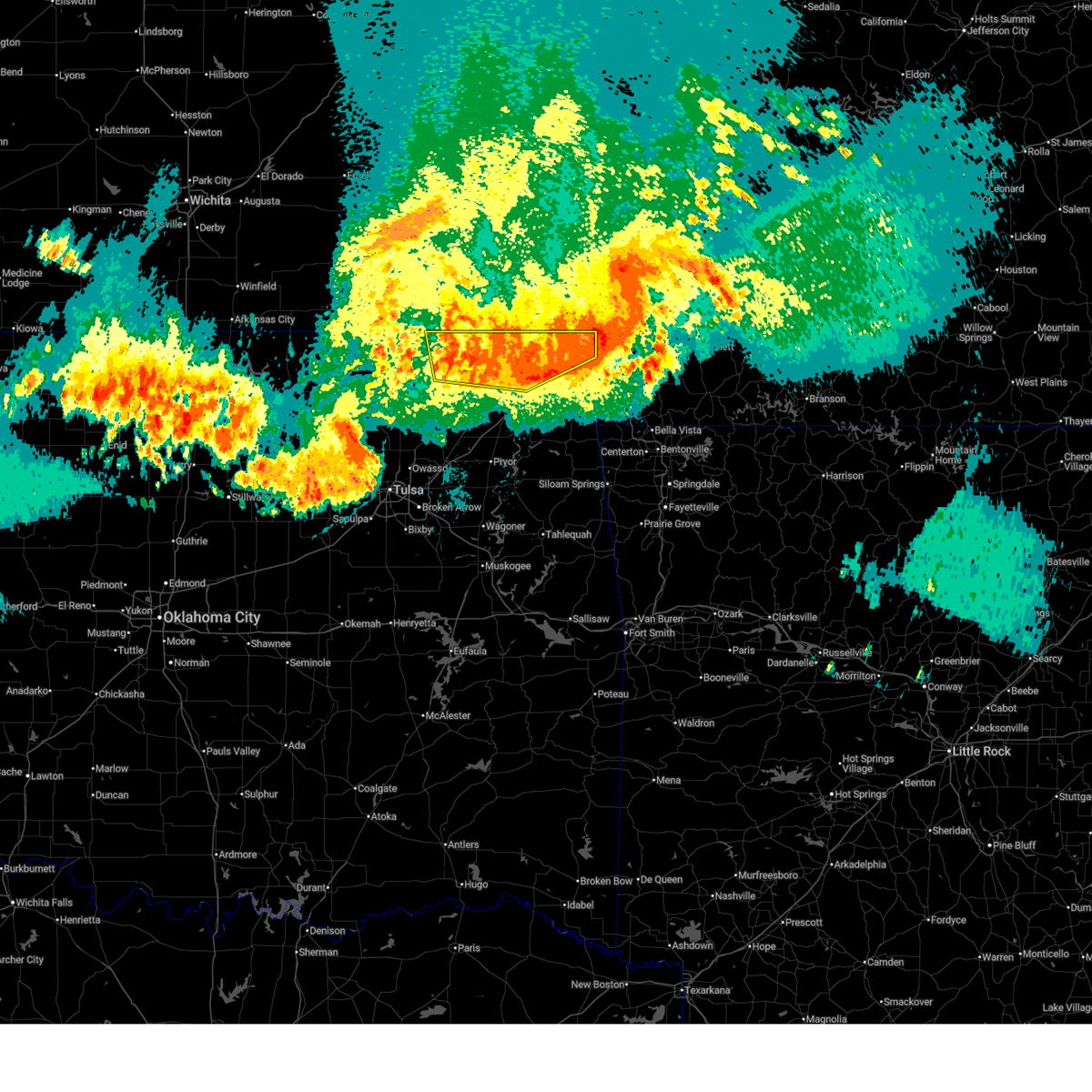
| 5/24/2025 1:15 AM CDT | Baseball sized hail reported 2.1 miles E of Welch, OK, social media picture of hailstones. |
| 5/24/2025 1:00 AM CDT |
 At 1259 am cdt, a severe thunderstorm was located 3 miles northwest of welch, moving east at 30 mph (radar indicated). Hazards include golf ball size hail and 60 mph wind gusts. People and animals outdoors will be injured. expect hail damage to roofs, siding, windows, and vehicles. expect wind damage to roofs, siding, and trees. Locations in or near the path include, commerce, picher, welch, cardin, miami, ottawa, this includes interstate 44 between mile markers 306 and 312. At 1259 am cdt, a severe thunderstorm was located 3 miles northwest of welch, moving east at 30 mph (radar indicated). Hazards include golf ball size hail and 60 mph wind gusts. People and animals outdoors will be injured. expect hail damage to roofs, siding, windows, and vehicles. expect wind damage to roofs, siding, and trees. Locations in or near the path include, commerce, picher, welch, cardin, miami, ottawa, this includes interstate 44 between mile markers 306 and 312.
|
| 5/24/2025 12:55 AM CDT |
 Svrtsa the national weather service in tulsa has issued a * severe thunderstorm warning for, northeastern craig county in northeastern oklahoma, northwestern ottawa county in northeastern oklahoma, * until 145 am cdt. * at 1255 am cdt, a severe thunderstorm was located 4 miles northwest of welch, moving east at 25 mph (radar indicated). Hazards include 60 mph wind gusts and quarter size hail. Hail damage to vehicles is expected. expect wind damage to roofs, siding, and trees. Locations in or near the path include, commerce, picher, welch, cardin, miami, ottawa, this includes interstate 44 between mile markers 306 and 312. Svrtsa the national weather service in tulsa has issued a * severe thunderstorm warning for, northeastern craig county in northeastern oklahoma, northwestern ottawa county in northeastern oklahoma, * until 145 am cdt. * at 1255 am cdt, a severe thunderstorm was located 4 miles northwest of welch, moving east at 25 mph (radar indicated). Hazards include 60 mph wind gusts and quarter size hail. Hail damage to vehicles is expected. expect wind damage to roofs, siding, and trees. Locations in or near the path include, commerce, picher, welch, cardin, miami, ottawa, this includes interstate 44 between mile markers 306 and 312.
|
| 5/24/2025 12:31 AM CDT |
 At 1231 am cdt, a severe thunderstorm was located 9 miles northwest of welch, moving east at 25 mph (radar indicated). Hazards include 60 mph wind gusts and half dollar size hail. Hail damage to vehicles is expected. expect wind damage to roofs, siding, and trees. Locations in or near the path include, hollow, welch,. At 1231 am cdt, a severe thunderstorm was located 9 miles northwest of welch, moving east at 25 mph (radar indicated). Hazards include 60 mph wind gusts and half dollar size hail. Hail damage to vehicles is expected. expect wind damage to roofs, siding, and trees. Locations in or near the path include, hollow, welch,.
|
| 5/24/2025 12:18 AM CDT |
 Svrtsa the national weather service in tulsa has issued a * severe thunderstorm warning for, northern craig county in northeastern oklahoma, * until 100 am cdt. * at 1218 am cdt, a severe thunderstorm was located 9 miles south of edna, moving east at 25 mph (radar indicated). Hazards include 60 mph wind gusts and quarter size hail. Hail damage to vehicles is expected. expect wind damage to roofs, siding, and trees. Locations in or near the path include, hollow, welch,. Svrtsa the national weather service in tulsa has issued a * severe thunderstorm warning for, northern craig county in northeastern oklahoma, * until 100 am cdt. * at 1218 am cdt, a severe thunderstorm was located 9 miles south of edna, moving east at 25 mph (radar indicated). Hazards include 60 mph wind gusts and quarter size hail. Hail damage to vehicles is expected. expect wind damage to roofs, siding, and trees. Locations in or near the path include, hollow, welch,.
|
| 5/19/2025 4:40 PM CDT |
 Svrtsa the national weather service in tulsa has issued a * severe thunderstorm warning for, craig county in northeastern oklahoma, northern rogers county in northeastern oklahoma, northeastern osage county in northeastern oklahoma, northwestern mayes county in northeastern oklahoma, washington county in northeastern oklahoma, nowata county in northeastern oklahoma, * until 530 pm cdt. * at 440 pm cdt, severe thunderstorms were located along a line extending from 4 miles east of barnsdall to 2 miles northwest of nowata to 3 miles northeast of foyil, moving northeast at 40 mph (radar indicated). Hazards include 60 mph wind gusts and half dollar size hail. Hail damage to vehicles is expected. expect wind damage to roofs, siding, and trees. Locations in or near the path include, barnsdall, wann, dewey, bartlesville municipal airport, watova, ramona, vera, talala, chelsea, white oak, welch, foyil, bushyhead, wolco, new alluwe, hollow, lenapah, south coffeyville, hulah, delaware,. Svrtsa the national weather service in tulsa has issued a * severe thunderstorm warning for, craig county in northeastern oklahoma, northern rogers county in northeastern oklahoma, northeastern osage county in northeastern oklahoma, northwestern mayes county in northeastern oklahoma, washington county in northeastern oklahoma, nowata county in northeastern oklahoma, * until 530 pm cdt. * at 440 pm cdt, severe thunderstorms were located along a line extending from 4 miles east of barnsdall to 2 miles northwest of nowata to 3 miles northeast of foyil, moving northeast at 40 mph (radar indicated). Hazards include 60 mph wind gusts and half dollar size hail. Hail damage to vehicles is expected. expect wind damage to roofs, siding, and trees. Locations in or near the path include, barnsdall, wann, dewey, bartlesville municipal airport, watova, ramona, vera, talala, chelsea, white oak, welch, foyil, bushyhead, wolco, new alluwe, hollow, lenapah, south coffeyville, hulah, delaware,.
|
| 5/19/2025 2:33 PM CDT |
 the severe thunderstorm warning has been cancelled and is no longer in effect the severe thunderstorm warning has been cancelled and is no longer in effect
|
| 5/19/2025 2:33 PM CDT |
 At 233 pm cdt, a severe thunderstorm was located over afton, moving northeast at 60 mph (radar indicated). Hazards include 60 mph wind gusts and quarter size hail. Hail damage to vehicles is expected. expect wind damage to roofs, siding, and trees. Locations in or near the path include, bluejacket, pyramid corners, welch,. At 233 pm cdt, a severe thunderstorm was located over afton, moving northeast at 60 mph (radar indicated). Hazards include 60 mph wind gusts and quarter size hail. Hail damage to vehicles is expected. expect wind damage to roofs, siding, and trees. Locations in or near the path include, bluejacket, pyramid corners, welch,.
|
| 5/19/2025 2:25 PM CDT |
 the severe thunderstorm warning has been cancelled and is no longer in effect the severe thunderstorm warning has been cancelled and is no longer in effect
|
| 5/19/2025 2:25 PM CDT |
 At 224 pm cdt, a severe thunderstorm was located 4 miles west of cleora, moving northeast at 60 mph (radar indicated). Hazards include 60 mph wind gusts and quarter size hail. Hail damage to vehicles is expected. expect wind damage to roofs, siding, and trees. Locations in or near the path include, bernice, vinita, commerce, ketchum, afton, bernice state park, miami, picher, cleora, cardin, peoria, narcissa, welch, fairland, ottawa, bluejacket, pyramid corners, wyandotte, quapaw, twin bridges state park, this includes interstate 44 between mile markers 280 and 324. At 224 pm cdt, a severe thunderstorm was located 4 miles west of cleora, moving northeast at 60 mph (radar indicated). Hazards include 60 mph wind gusts and quarter size hail. Hail damage to vehicles is expected. expect wind damage to roofs, siding, and trees. Locations in or near the path include, bernice, vinita, commerce, ketchum, afton, bernice state park, miami, picher, cleora, cardin, peoria, narcissa, welch, fairland, ottawa, bluejacket, pyramid corners, wyandotte, quapaw, twin bridges state park, this includes interstate 44 between mile markers 280 and 324.
|
| 5/19/2025 2:11 PM CDT |
 At 210 pm cdt, a severe thunderstorm was located over pensacola, moving northeast at 65 mph (radar indicated). Hazards include 60 mph wind gusts and quarter size hail. Hail damage to vehicles is expected. expect wind damage to roofs, siding, and trees. Locations in or near the path include, pensacola, vinita, commerce, cherokee state park, bernice state park, langley, disney little blue state park, picher, big cabin, strang, hoot owl, cleora, chloeta, peoria, white oak, welch, fairland, ottawa, bernice, ketchum, this includes interstate 44 between mile markers 270 and 324. At 210 pm cdt, a severe thunderstorm was located over pensacola, moving northeast at 65 mph (radar indicated). Hazards include 60 mph wind gusts and quarter size hail. Hail damage to vehicles is expected. expect wind damage to roofs, siding, and trees. Locations in or near the path include, pensacola, vinita, commerce, cherokee state park, bernice state park, langley, disney little blue state park, picher, big cabin, strang, hoot owl, cleora, chloeta, peoria, white oak, welch, fairland, ottawa, bernice, ketchum, this includes interstate 44 between mile markers 270 and 324.
|
| 5/19/2025 1:43 PM CDT |
 Svrtsa the national weather service in tulsa has issued a * severe thunderstorm warning for, craig county in northeastern oklahoma, northwestern delaware county in northeastern oklahoma, ottawa county in northeastern oklahoma, northern mayes county in northeastern oklahoma, * until 245 pm cdt. * at 143 pm cdt, a severe thunderstorm was located 3 miles east of sportsmen acres community, moving northeast at 60 mph (radar indicated). Hazards include 60 mph wind gusts and quarter size hail. Hail damage to vehicles is expected. expect wind damage to roofs, siding, and trees. Locations in or near the path include, pensacola, vinita, honey creek state park, commerce, cherokee state park, rose, bernice state park, langley, snowdale state park, disney little blue state park, picher, big cabin, strang, zena, hoot owl, cleora, chloeta, peoria, white oak, welch, this includes interstate 44 between mile markers 260 and 324. Svrtsa the national weather service in tulsa has issued a * severe thunderstorm warning for, craig county in northeastern oklahoma, northwestern delaware county in northeastern oklahoma, ottawa county in northeastern oklahoma, northern mayes county in northeastern oklahoma, * until 245 pm cdt. * at 143 pm cdt, a severe thunderstorm was located 3 miles east of sportsmen acres community, moving northeast at 60 mph (radar indicated). Hazards include 60 mph wind gusts and quarter size hail. Hail damage to vehicles is expected. expect wind damage to roofs, siding, and trees. Locations in or near the path include, pensacola, vinita, honey creek state park, commerce, cherokee state park, rose, bernice state park, langley, snowdale state park, disney little blue state park, picher, big cabin, strang, zena, hoot owl, cleora, chloeta, peoria, white oak, welch, this includes interstate 44 between mile markers 260 and 324.
|
| 4/29/2025 7:57 AM CDT |
 The storms which prompted the warning have moved out of the area. therefore, the warning will be allowed to expire. a severe thunderstorm watch remains in effect until 1000 am cdt for northeastern oklahoma. The storms which prompted the warning have moved out of the area. therefore, the warning will be allowed to expire. a severe thunderstorm watch remains in effect until 1000 am cdt for northeastern oklahoma.
|
| 4/29/2025 7:39 AM CDT |
 the severe thunderstorm warning has been cancelled and is no longer in effect the severe thunderstorm warning has been cancelled and is no longer in effect
|
| 4/29/2025 7:39 AM CDT |
 At 738 am cdt, severe thunderstorms were located along a line extending from 5 miles northeast of welch to 4 miles west of adair, moving east at 55 mph (radar indicated). Hazards include 60 mph wind gusts and quarter size hail. Hail damage to vehicles is expected. expect wind damage to roofs, siding, and trees. Locations in or near the path include, pensacola, vinita, honey creek state park, commerce, cherokee state park, bernice state park, langley, disney little blue state park, picher, big cabin, strang, zena, cleora, chloeta, peoria, white oak, welch, fairland, ottawa, bernice, this includes interstate 44 between mile markers 260 and 324. At 738 am cdt, severe thunderstorms were located along a line extending from 5 miles northeast of welch to 4 miles west of adair, moving east at 55 mph (radar indicated). Hazards include 60 mph wind gusts and quarter size hail. Hail damage to vehicles is expected. expect wind damage to roofs, siding, and trees. Locations in or near the path include, pensacola, vinita, honey creek state park, commerce, cherokee state park, bernice state park, langley, disney little blue state park, picher, big cabin, strang, zena, cleora, chloeta, peoria, white oak, welch, fairland, ottawa, bernice, this includes interstate 44 between mile markers 260 and 324.
|
| 4/29/2025 7:31 AM CDT |
 At 730 am cdt, severe thunderstorms were located along a line extending from 5 miles northwest of welch to foyil, moving east at 55 mph (radar indicated). Hazards include 60 mph wind gusts and quarter size hail. Hail damage to vehicles is expected. expect wind damage to roofs, siding, and trees. Locations in or near the path include, pensacola, vinita, honey creek state park, commerce, cherokee state park, bernice state park, langley, disney little blue state park, picher, big cabin, strang, zena, cleora, chloeta, peoria, chelsea, white oak, welch, fairland, ottawa, this includes interstate 44 between mile markers 260 and 324. At 730 am cdt, severe thunderstorms were located along a line extending from 5 miles northwest of welch to foyil, moving east at 55 mph (radar indicated). Hazards include 60 mph wind gusts and quarter size hail. Hail damage to vehicles is expected. expect wind damage to roofs, siding, and trees. Locations in or near the path include, pensacola, vinita, honey creek state park, commerce, cherokee state park, bernice state park, langley, disney little blue state park, picher, big cabin, strang, zena, cleora, chloeta, peoria, chelsea, white oak, welch, fairland, ottawa, this includes interstate 44 between mile markers 260 and 324.
|
| 4/29/2025 7:16 AM CDT |
 Svrtsa the national weather service in tulsa has issued a * severe thunderstorm warning for, craig county in northeastern oklahoma, northern rogers county in northeastern oklahoma, northwestern delaware county in northeastern oklahoma, ottawa county in northeastern oklahoma, northern mayes county in northeastern oklahoma, eastern nowata county in northeastern oklahoma, * until 800 am cdt. * at 716 am cdt, severe thunderstorms were located along a line extending from 6 miles south of edna to near oologah, moving east at 55 mph (radar indicated). Hazards include 60 mph wind gusts and quarter size hail. Hail damage to vehicles is expected. expect wind damage to roofs, siding, and trees. Locations in or near the path include, pensacola, vinita, honey creek state park, commerce, cherokee state park, bernice state park, langley, disney little blue state park, watova, picher, big cabin, strang, zena, hoot owl, cleora, chloeta, talala, peoria, chelsea, white oak, this includes interstate 44 between mile markers 259 and 324. Svrtsa the national weather service in tulsa has issued a * severe thunderstorm warning for, craig county in northeastern oklahoma, northern rogers county in northeastern oklahoma, northwestern delaware county in northeastern oklahoma, ottawa county in northeastern oklahoma, northern mayes county in northeastern oklahoma, eastern nowata county in northeastern oklahoma, * until 800 am cdt. * at 716 am cdt, severe thunderstorms were located along a line extending from 6 miles south of edna to near oologah, moving east at 55 mph (radar indicated). Hazards include 60 mph wind gusts and quarter size hail. Hail damage to vehicles is expected. expect wind damage to roofs, siding, and trees. Locations in or near the path include, pensacola, vinita, honey creek state park, commerce, cherokee state park, bernice state park, langley, disney little blue state park, watova, picher, big cabin, strang, zena, hoot owl, cleora, chloeta, talala, peoria, chelsea, white oak, this includes interstate 44 between mile markers 259 and 324.
|
| 4/18/2025 11:52 PM CDT |
 the severe thunderstorm warning has been cancelled and is no longer in effect the severe thunderstorm warning has been cancelled and is no longer in effect
|
| 4/18/2025 11:29 PM CDT |
 the severe thunderstorm warning has been cancelled and is no longer in effect the severe thunderstorm warning has been cancelled and is no longer in effect
|
| 4/18/2025 11:29 PM CDT |
 At 1129 pm cdt, a severe thunderstorm was located 10 miles west of welch, moving northeast at 75 mph (radar indicated). Hazards include quarter size hail. Damage to vehicles is expected. Locations in or near the path include, welch, picher, hollow, cardin, pyramid corners, centralia,. At 1129 pm cdt, a severe thunderstorm was located 10 miles west of welch, moving northeast at 75 mph (radar indicated). Hazards include quarter size hail. Damage to vehicles is expected. Locations in or near the path include, welch, picher, hollow, cardin, pyramid corners, centralia,.
|
| 4/18/2025 11:21 PM CDT |
 the severe thunderstorm warning has been cancelled and is no longer in effect the severe thunderstorm warning has been cancelled and is no longer in effect
|
| 4/18/2025 11:21 PM CDT |
 At 1120 pm cdt, a severe thunderstorm was located 8 miles northwest of white oak, moving northeast at 75 mph (radar indicated). Hazards include ping pong ball size hail. People and animals outdoors will be injured. expect damage to roofs, siding, windows, and vehicles. Locations in or near the path include, new alluwe, picher, hollow, cardin, welch, bluejacket, pyramid corners, centralia,. At 1120 pm cdt, a severe thunderstorm was located 8 miles northwest of white oak, moving northeast at 75 mph (radar indicated). Hazards include ping pong ball size hail. People and animals outdoors will be injured. expect damage to roofs, siding, windows, and vehicles. Locations in or near the path include, new alluwe, picher, hollow, cardin, welch, bluejacket, pyramid corners, centralia,.
|
| 4/18/2025 11:09 PM CDT |
 Svrtsa the national weather service in tulsa has issued a * severe thunderstorm warning for, craig county in northeastern oklahoma, northeastern rogers county in northeastern oklahoma, northwestern ottawa county in northeastern oklahoma, southeastern nowata county in northeastern oklahoma, * until midnight cdt. * at 1109 pm cdt, a severe thunderstorm was located 5 miles southwest of new alluwe, moving northeast at 60 mph (radar indicated). Hazards include quarter size hail. Damage to vehicles is expected. Locations in or near the path include, new alluwe, picher, hollow, cardin, chelsea, white oak, welch, bluejacket, foyil, pyramid corners, bushyhead, centralia,. Svrtsa the national weather service in tulsa has issued a * severe thunderstorm warning for, craig county in northeastern oklahoma, northeastern rogers county in northeastern oklahoma, northwestern ottawa county in northeastern oklahoma, southeastern nowata county in northeastern oklahoma, * until midnight cdt. * at 1109 pm cdt, a severe thunderstorm was located 5 miles southwest of new alluwe, moving northeast at 60 mph (radar indicated). Hazards include quarter size hail. Damage to vehicles is expected. Locations in or near the path include, new alluwe, picher, hollow, cardin, chelsea, white oak, welch, bluejacket, foyil, pyramid corners, bushyhead, centralia,.
|
| 4/2/2025 7:58 AM CDT |
 Svrtsa the national weather service in tulsa has issued a * severe thunderstorm warning for, benton county in northwestern arkansas, western washington county in northwestern arkansas, eastern craig county in northeastern oklahoma, delaware county in northeastern oklahoma, ottawa county in northeastern oklahoma, mayes county in northeastern oklahoma, adair county in northeastern oklahoma, eastern wagoner county in northeastern oklahoma, cherokee county in east central oklahoma, northeastern muskogee county in east central oklahoma, * until 845 am cdt. * at 758 am cdt, severe thunderstorms were located along a line extending from 6 miles northeast of grove to 5 miles east of pumpkin center, moving east at 55 mph (radar indicated). Hazards include 60 mph wind gusts and nickel size hail. Expect damage to roofs, siding, and trees. locations in or near the path include, adair state park, jay, vinita, honey creek state park, commerce, cincinnati, savoy, fort gibson, disney little blue state park, okay, cave springs, picher, strang, leach, zena, cleora, chloeta, scraper, odell, ottawa, this includes the following highways, interstate 44 between mile markers 274 and 324. Interstate 49 between mile markers 88 and 93. Svrtsa the national weather service in tulsa has issued a * severe thunderstorm warning for, benton county in northwestern arkansas, western washington county in northwestern arkansas, eastern craig county in northeastern oklahoma, delaware county in northeastern oklahoma, ottawa county in northeastern oklahoma, mayes county in northeastern oklahoma, adair county in northeastern oklahoma, eastern wagoner county in northeastern oklahoma, cherokee county in east central oklahoma, northeastern muskogee county in east central oklahoma, * until 845 am cdt. * at 758 am cdt, severe thunderstorms were located along a line extending from 6 miles northeast of grove to 5 miles east of pumpkin center, moving east at 55 mph (radar indicated). Hazards include 60 mph wind gusts and nickel size hail. Expect damage to roofs, siding, and trees. locations in or near the path include, adair state park, jay, vinita, honey creek state park, commerce, cincinnati, savoy, fort gibson, disney little blue state park, okay, cave springs, picher, strang, leach, zena, cleora, chloeta, scraper, odell, ottawa, this includes the following highways, interstate 44 between mile markers 274 and 324. Interstate 49 between mile markers 88 and 93.
|
| 4/2/2025 7:56 AM CDT |
 the severe thunderstorm warning has been cancelled and is no longer in effect the severe thunderstorm warning has been cancelled and is no longer in effect
|
| 4/2/2025 7:56 AM CDT |
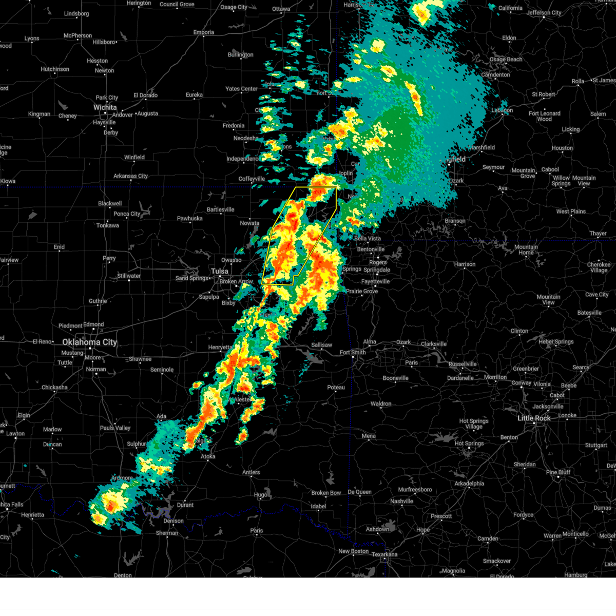 At 756 am cdt, severe thunderstorms were located along a line extending from miami to near chouteau, moving east at 40 mph (radar indicated). Hazards include 60 mph wind gusts and nickel size hail. Expect damage to roofs, siding, and trees. Locations in or near the path include, pensacola, vinita, honey creek state park, commerce, cherokee state park, rose, mazie, bernice state park, langley, snowdale state park, locust grove, disney little blue state park, picher, big cabin, strang, hoot owl, zena, cleora, chloeta, chouteau, this includes interstate 44 between mile markers 261 and 324. At 756 am cdt, severe thunderstorms were located along a line extending from miami to near chouteau, moving east at 40 mph (radar indicated). Hazards include 60 mph wind gusts and nickel size hail. Expect damage to roofs, siding, and trees. Locations in or near the path include, pensacola, vinita, honey creek state park, commerce, cherokee state park, rose, mazie, bernice state park, langley, snowdale state park, locust grove, disney little blue state park, picher, big cabin, strang, hoot owl, zena, cleora, chloeta, chouteau, this includes interstate 44 between mile markers 261 and 324.
|
| 4/2/2025 7:35 AM CDT |
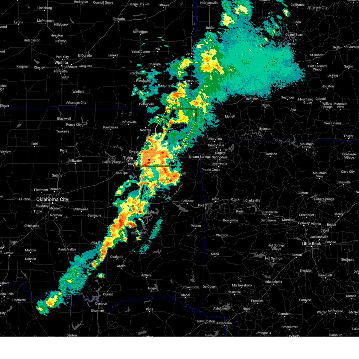 At 735 am cdt, severe thunderstorms were located along a line extending from near bluejacket to inola, moving northeast at 45 mph (radar indicated). Hazards include 60 mph wind gusts and nickel size hail. Expect damage to roofs, siding, and trees. Locations in or near the path include, pensacola, vinita, honey creek state park, inola, commerce, cherokee state park, mazie, locust grove, disney little blue state park, picher, big cabin, strang, hoot owl, zena, cleora, chloeta, chouteau, peoria, chelsea, white oak, this includes interstate 44 between mile markers 233 and 324. At 735 am cdt, severe thunderstorms were located along a line extending from near bluejacket to inola, moving northeast at 45 mph (radar indicated). Hazards include 60 mph wind gusts and nickel size hail. Expect damage to roofs, siding, and trees. Locations in or near the path include, pensacola, vinita, honey creek state park, inola, commerce, cherokee state park, mazie, locust grove, disney little blue state park, picher, big cabin, strang, hoot owl, zena, cleora, chloeta, chouteau, peoria, chelsea, white oak, this includes interstate 44 between mile markers 233 and 324.
|
| 4/2/2025 7:12 AM CDT |
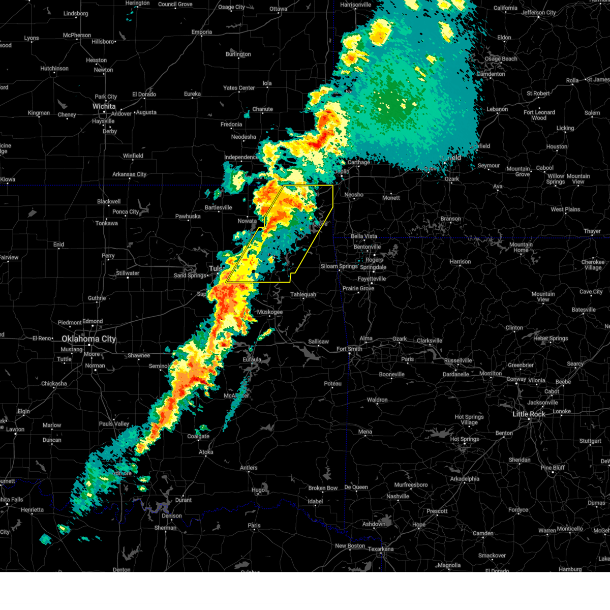 Svrtsa the national weather service in tulsa has issued a * severe thunderstorm warning for, craig county in northeastern oklahoma, rogers county in northeastern oklahoma, northwestern delaware county in northeastern oklahoma, ottawa county in northeastern oklahoma, mayes county in northeastern oklahoma, northern wagoner county in northeastern oklahoma, east central tulsa county in northeastern oklahoma, * until 815 am cdt. * at 712 am cdt, severe thunderstorms were located along a line extending from 3 miles south of chetopa to 5 miles north of broken arrow, moving northeast at 35 mph (radar indicated). Hazards include 60 mph wind gusts and nickel size hail. Expect damage to roofs, siding, and trees. Locations in or near the path include, pensacola, vinita, honey creek state park, inola, commerce, cherokee state park, mazie, locust grove, disney little blue state park, picher, big cabin, strang, hoot owl, zena, cleora, chloeta, chouteau, peoria, chelsea, white oak, this includes interstate 44 between mile markers 233 and 324. Svrtsa the national weather service in tulsa has issued a * severe thunderstorm warning for, craig county in northeastern oklahoma, rogers county in northeastern oklahoma, northwestern delaware county in northeastern oklahoma, ottawa county in northeastern oklahoma, mayes county in northeastern oklahoma, northern wagoner county in northeastern oklahoma, east central tulsa county in northeastern oklahoma, * until 815 am cdt. * at 712 am cdt, severe thunderstorms were located along a line extending from 3 miles south of chetopa to 5 miles north of broken arrow, moving northeast at 35 mph (radar indicated). Hazards include 60 mph wind gusts and nickel size hail. Expect damage to roofs, siding, and trees. Locations in or near the path include, pensacola, vinita, honey creek state park, inola, commerce, cherokee state park, mazie, locust grove, disney little blue state park, picher, big cabin, strang, hoot owl, zena, cleora, chloeta, chouteau, peoria, chelsea, white oak, this includes interstate 44 between mile markers 233 and 324.
|
| 4/2/2025 6:52 AM CDT |
 At 651 am cdt, severe thunderstorms were located along a line extending from 3 miles west of chetopa to 4 miles north of broken arrow, moving east at 60 mph (radar indicated). Hazards include 60 mph wind gusts and quarter size hail. Hail damage to vehicles is expected. expect wind damage to roofs, siding, and trees. Locations in or near the path include, sand springs, vinita, inola, collinsville, commerce, mazie, watova, picher, big cabin, talala, chouteau, pryor creek, chelsea, white oak, welch, foyil, bushyhead, owasso, new alluwe, hollow, this includes interstate 44 between mile markers 217 and 294. At 651 am cdt, severe thunderstorms were located along a line extending from 3 miles west of chetopa to 4 miles north of broken arrow, moving east at 60 mph (radar indicated). Hazards include 60 mph wind gusts and quarter size hail. Hail damage to vehicles is expected. expect wind damage to roofs, siding, and trees. Locations in or near the path include, sand springs, vinita, inola, collinsville, commerce, mazie, watova, picher, big cabin, talala, chouteau, pryor creek, chelsea, white oak, welch, foyil, bushyhead, owasso, new alluwe, hollow, this includes interstate 44 between mile markers 217 and 294.
|
| 4/2/2025 6:52 AM CDT |
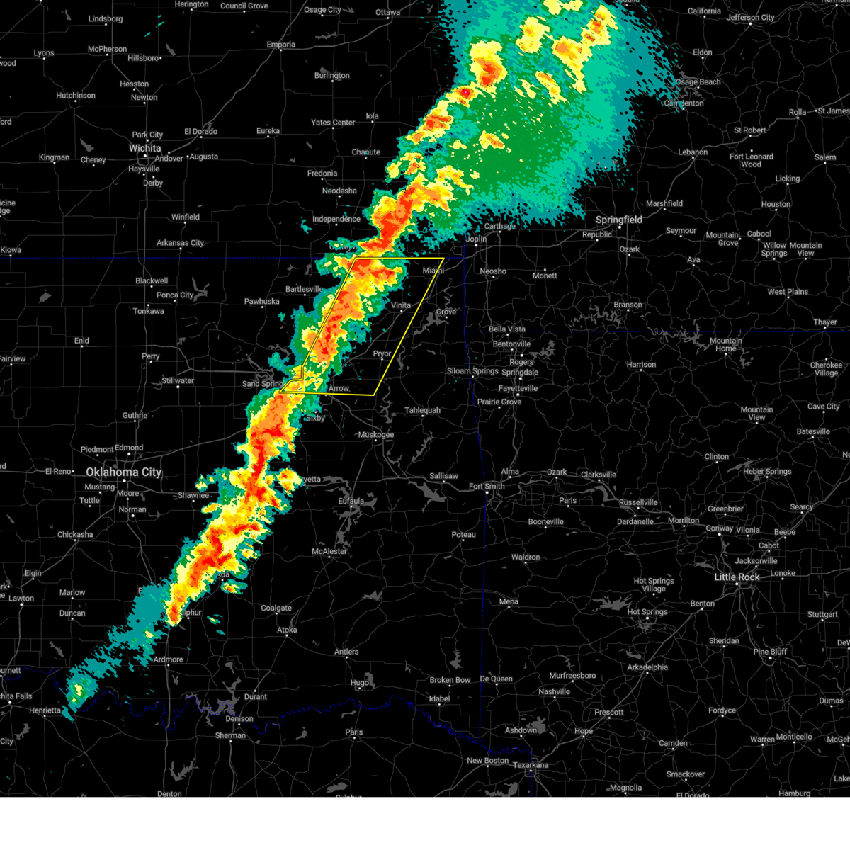 the severe thunderstorm warning has been cancelled and is no longer in effect the severe thunderstorm warning has been cancelled and is no longer in effect
|
| 4/2/2025 6:29 AM CDT |
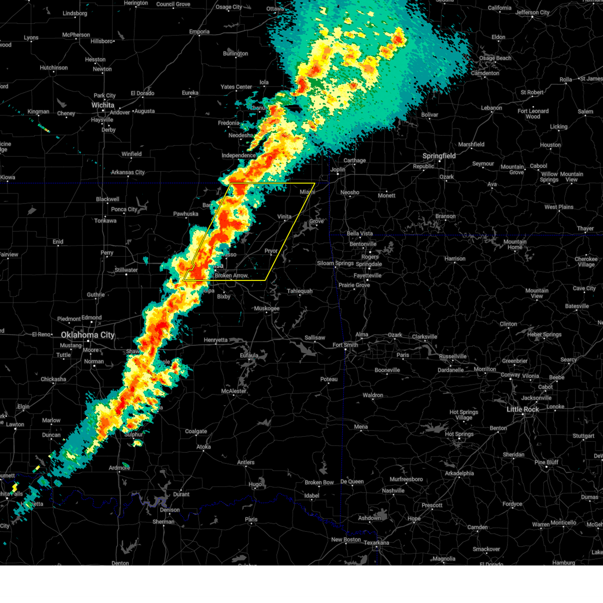 Svrtsa the national weather service in tulsa has issued a * severe thunderstorm warning for, craig county in northeastern oklahoma, rogers county in northeastern oklahoma, southeastern osage county in northeastern oklahoma, western ottawa county in northeastern oklahoma, northeastern creek county in northeastern oklahoma, western mayes county in northeastern oklahoma, washington county in northeastern oklahoma, nowata county in northeastern oklahoma, northwestern wagoner county in northeastern oklahoma, tulsa county in northeastern oklahoma, * until 715 am cdt. * at 628 am cdt, severe thunderstorms were located along a line extending from 6 miles east of south coffeyville to 3 miles north of sapulpa, moving east at 60 mph (radar indicated). Hazards include 60 mph wind gusts and quarter size hail. Hail damage to vehicles is expected. expect wind damage to roofs, siding, and trees. Locations in or near the path include, sand springs, wann, vinita, inola, collinsville, commerce, mazie, picher, big cabin, vera, chouteau, chelsea, white oak, bushyhead, wolco, owasso, keystone state park, hollow, pryor, delaware, this includes interstate 44 between mile markers 216 and 294. Svrtsa the national weather service in tulsa has issued a * severe thunderstorm warning for, craig county in northeastern oklahoma, rogers county in northeastern oklahoma, southeastern osage county in northeastern oklahoma, western ottawa county in northeastern oklahoma, northeastern creek county in northeastern oklahoma, western mayes county in northeastern oklahoma, washington county in northeastern oklahoma, nowata county in northeastern oklahoma, northwestern wagoner county in northeastern oklahoma, tulsa county in northeastern oklahoma, * until 715 am cdt. * at 628 am cdt, severe thunderstorms were located along a line extending from 6 miles east of south coffeyville to 3 miles north of sapulpa, moving east at 60 mph (radar indicated). Hazards include 60 mph wind gusts and quarter size hail. Hail damage to vehicles is expected. expect wind damage to roofs, siding, and trees. Locations in or near the path include, sand springs, wann, vinita, inola, collinsville, commerce, mazie, picher, big cabin, vera, chouteau, chelsea, white oak, bushyhead, wolco, owasso, keystone state park, hollow, pryor, delaware, this includes interstate 44 between mile markers 216 and 294.
|
| 3/30/2025 1:39 AM CDT |
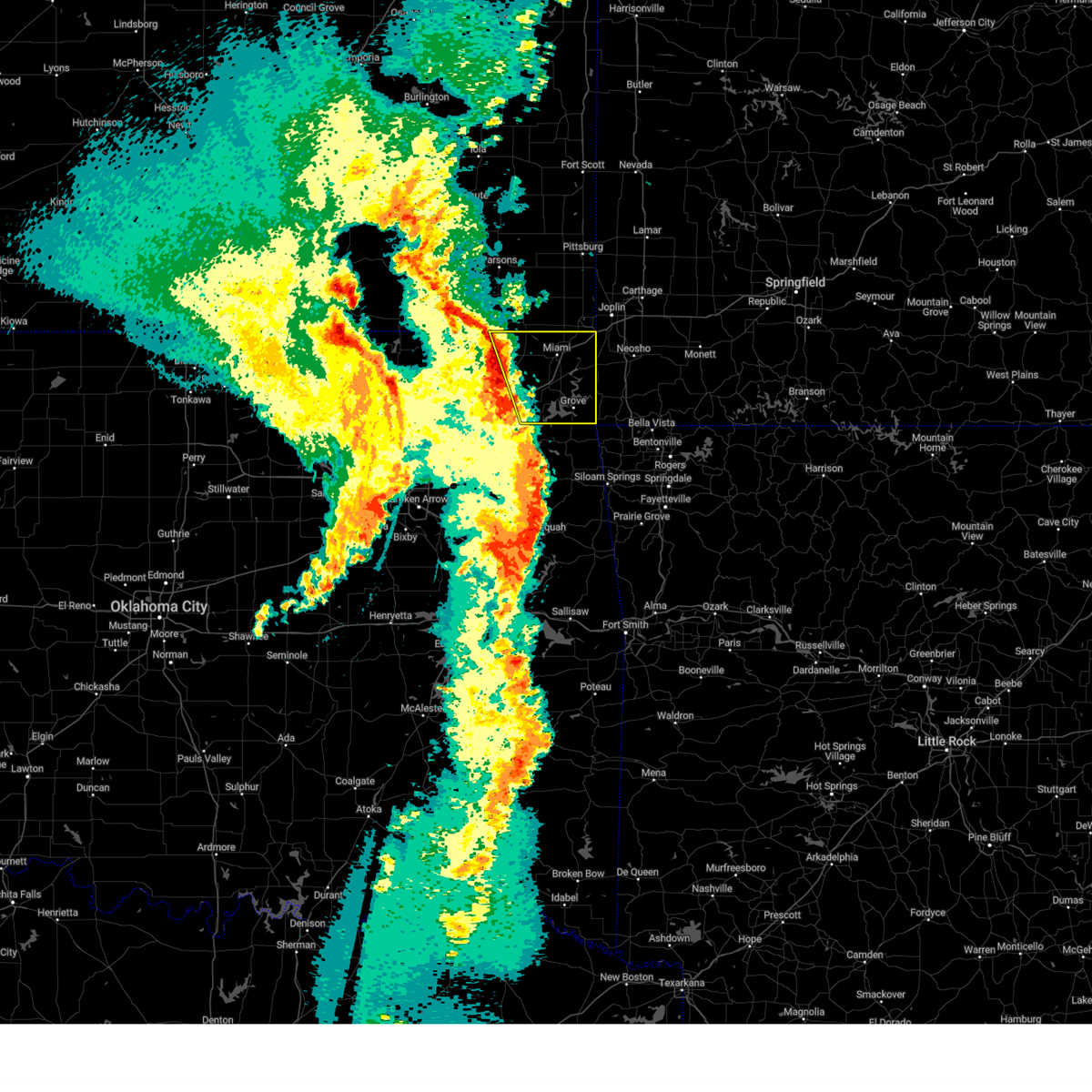 Svrtsa the national weather service in tulsa has issued a * severe thunderstorm warning for, eastern craig county in northeastern oklahoma, northern delaware county in northeastern oklahoma, ottawa county in northeastern oklahoma, * until 230 am cdt. * at 139 am cdt, severe thunderstorms were located along a line extending from 9 miles southeast of edna to 5 miles northwest of ketchum, moving east at 55 mph (radar indicated). Hazards include 60 mph wind gusts and nickel size hail. Expect damage to roofs, siding, and trees. Locations in or near the path include, bernice, hollow, vinita, honey creek state park, commerce, ketchum, afton, bernice state park, grove, miami, picher, cleora, cardin, peoria, narcissa, welch, fairland, ottawa, bluejacket, pyramid corners, this includes interstate 44 between mile markers 283 and 324. Svrtsa the national weather service in tulsa has issued a * severe thunderstorm warning for, eastern craig county in northeastern oklahoma, northern delaware county in northeastern oklahoma, ottawa county in northeastern oklahoma, * until 230 am cdt. * at 139 am cdt, severe thunderstorms were located along a line extending from 9 miles southeast of edna to 5 miles northwest of ketchum, moving east at 55 mph (radar indicated). Hazards include 60 mph wind gusts and nickel size hail. Expect damage to roofs, siding, and trees. Locations in or near the path include, bernice, hollow, vinita, honey creek state park, commerce, ketchum, afton, bernice state park, grove, miami, picher, cleora, cardin, peoria, narcissa, welch, fairland, ottawa, bluejacket, pyramid corners, this includes interstate 44 between mile markers 283 and 324.
|
| 3/30/2025 1:23 AM CDT |
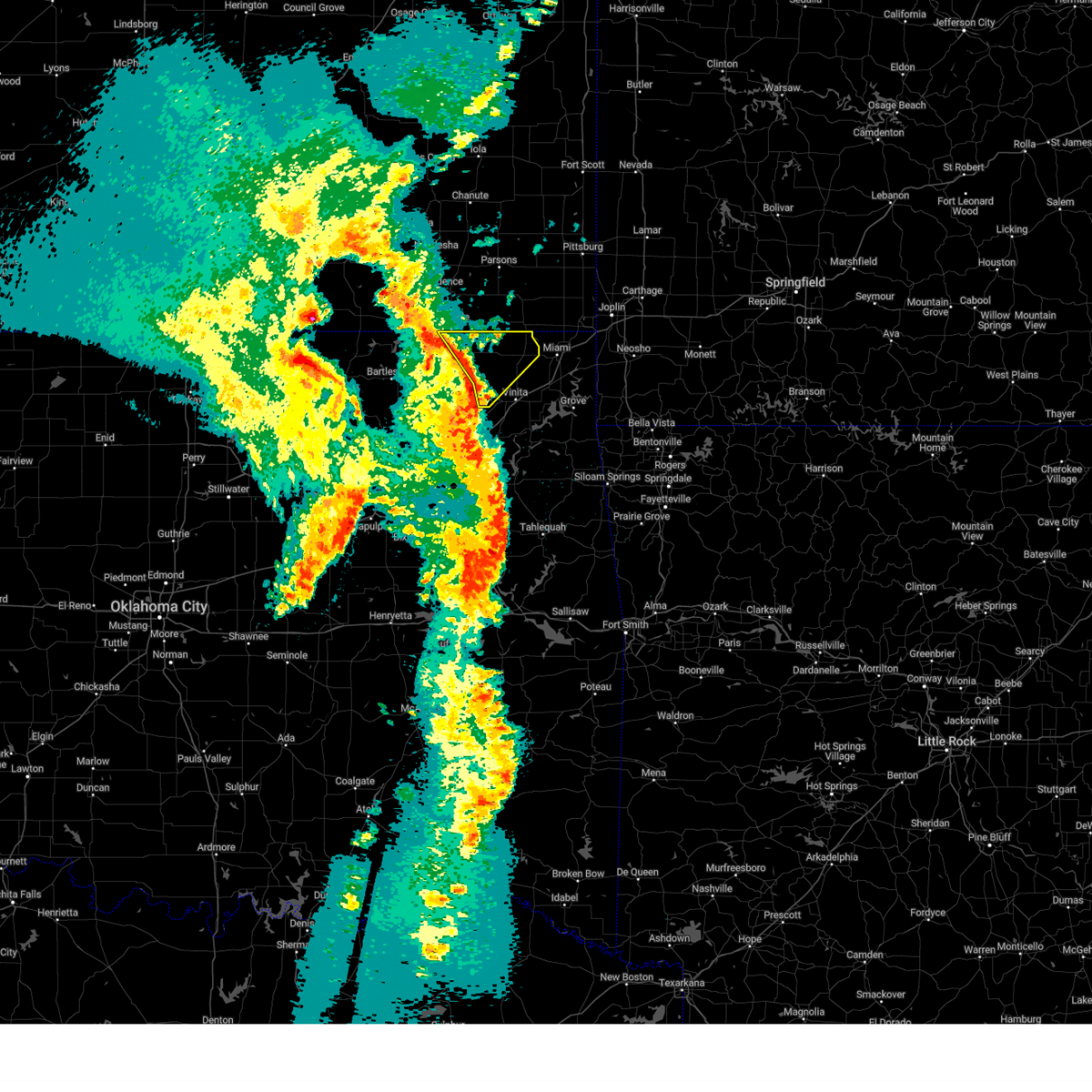 the severe thunderstorm warning has been cancelled and is no longer in effect the severe thunderstorm warning has been cancelled and is no longer in effect
|
| 3/30/2025 1:23 AM CDT |
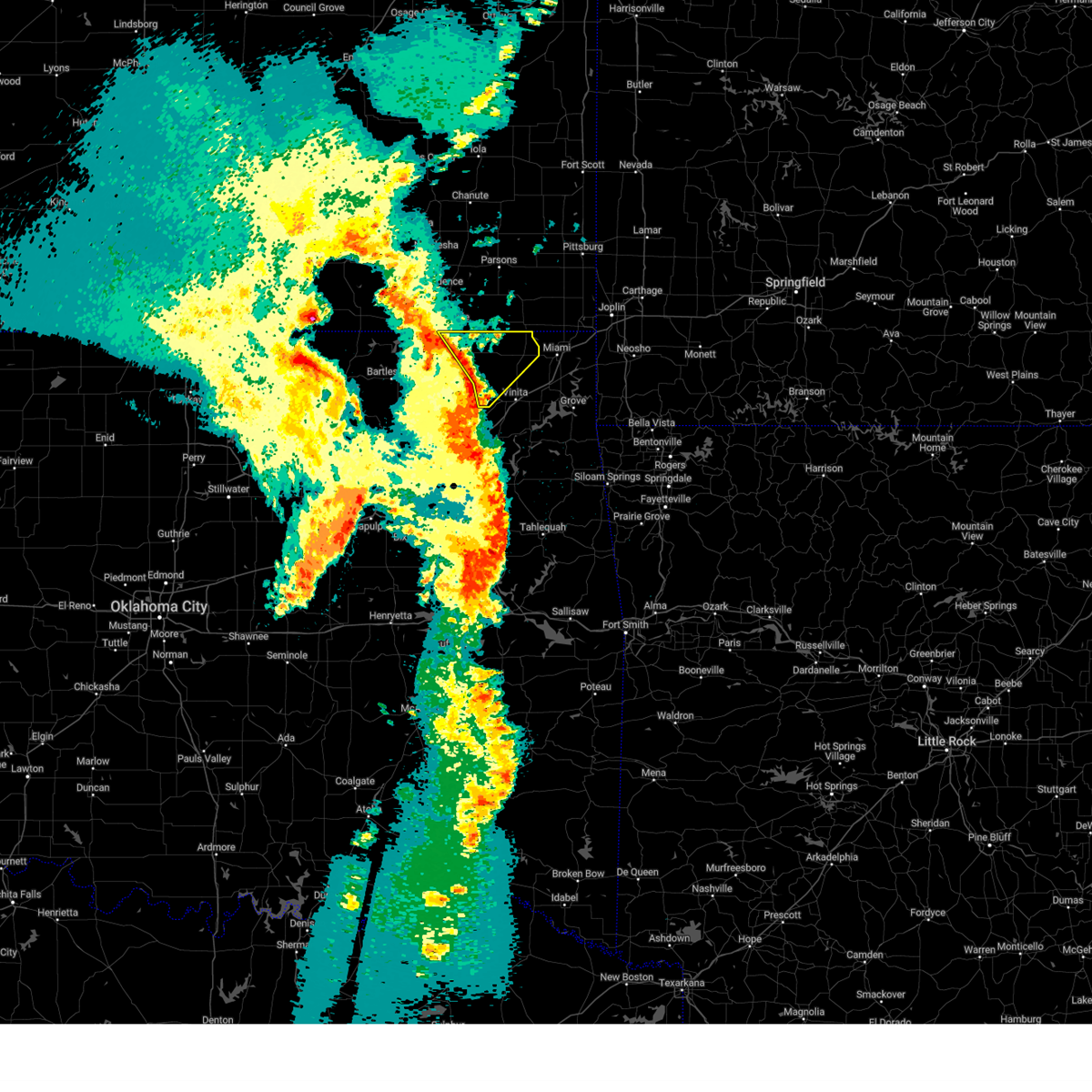 At 122 am cdt, severe thunderstorms were located along a line extending from 3 miles east of south coffeyville to 11 miles northwest of white oak to 5 miles west of big cabin, moving northeast at 45 mph (radar indicated). Hazards include 60 mph wind gusts. Expect damage to roofs, siding, and trees. Locations in or near the path include, south coffeyville, welch, hollow, pyramid corners, centralia, bluejacket,. At 122 am cdt, severe thunderstorms were located along a line extending from 3 miles east of south coffeyville to 11 miles northwest of white oak to 5 miles west of big cabin, moving northeast at 45 mph (radar indicated). Hazards include 60 mph wind gusts. Expect damage to roofs, siding, and trees. Locations in or near the path include, south coffeyville, welch, hollow, pyramid corners, centralia, bluejacket,.
|
| 3/30/2025 12:56 AM CDT |
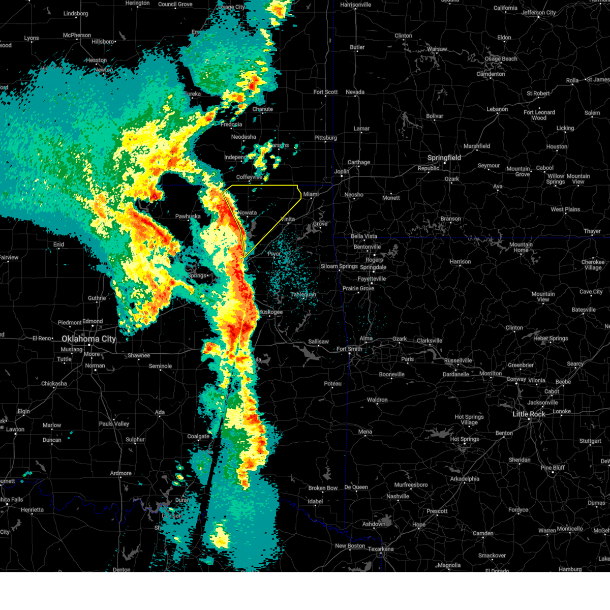 Svrtsa the national weather service in tulsa has issued a * severe thunderstorm warning for, craig county in northeastern oklahoma, northeastern rogers county in northeastern oklahoma, northern washington county in northeastern oklahoma, nowata county in northeastern oklahoma, * until 145 am cdt. * at 1256 am cdt, severe thunderstorms were located along a line extending from near wann to watova to 3 miles north of claremore, moving northeast at 45 mph (radar indicated). Hazards include 60 mph wind gusts and quarter size hail. Hail damage to vehicles is expected. expect wind damage to roofs, siding, and trees. Locations in or near the path include, new alluwe, wann, hollow, lenapah, south coffeyville, delaware, watova, nowata, talala, chelsea, welch, pyramid corners, bushyhead, centralia, foyil, bluejacket, copan,. Svrtsa the national weather service in tulsa has issued a * severe thunderstorm warning for, craig county in northeastern oklahoma, northeastern rogers county in northeastern oklahoma, northern washington county in northeastern oklahoma, nowata county in northeastern oklahoma, * until 145 am cdt. * at 1256 am cdt, severe thunderstorms were located along a line extending from near wann to watova to 3 miles north of claremore, moving northeast at 45 mph (radar indicated). Hazards include 60 mph wind gusts and quarter size hail. Hail damage to vehicles is expected. expect wind damage to roofs, siding, and trees. Locations in or near the path include, new alluwe, wann, hollow, lenapah, south coffeyville, delaware, watova, nowata, talala, chelsea, welch, pyramid corners, bushyhead, centralia, foyil, bluejacket, copan,.
|
| 11/4/2024 2:03 PM CST |
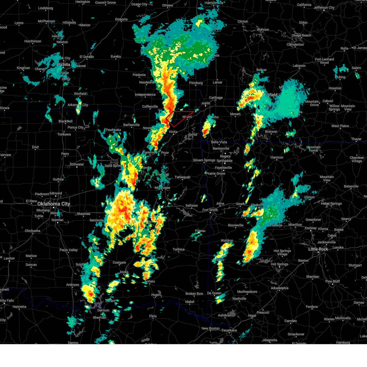 Tortsa the national weather service in tulsa has issued a * tornado warning for, northeastern craig county in northeastern oklahoma, northwestern ottawa county in northeastern oklahoma, * until 245 pm cst. * at 203 pm cst, a severe thunderstorm capable of producing a tornado was located 3 miles west of welch, moving northeast at 50 mph (radar indicated rotation). Hazards include tornado. Flying debris will be dangerous to those caught without shelter. mobile homes will be damaged or destroyed. damage to roofs, windows, and vehicles will occur. tree damage is likely. Locations in or near the path include, commerce, welch, bluejacket, picher, cardin, hollow, pyramid corners,. Tortsa the national weather service in tulsa has issued a * tornado warning for, northeastern craig county in northeastern oklahoma, northwestern ottawa county in northeastern oklahoma, * until 245 pm cst. * at 203 pm cst, a severe thunderstorm capable of producing a tornado was located 3 miles west of welch, moving northeast at 50 mph (radar indicated rotation). Hazards include tornado. Flying debris will be dangerous to those caught without shelter. mobile homes will be damaged or destroyed. damage to roofs, windows, and vehicles will occur. tree damage is likely. Locations in or near the path include, commerce, welch, bluejacket, picher, cardin, hollow, pyramid corners,.
|
| 8/16/2024 8:58 PM CDT |
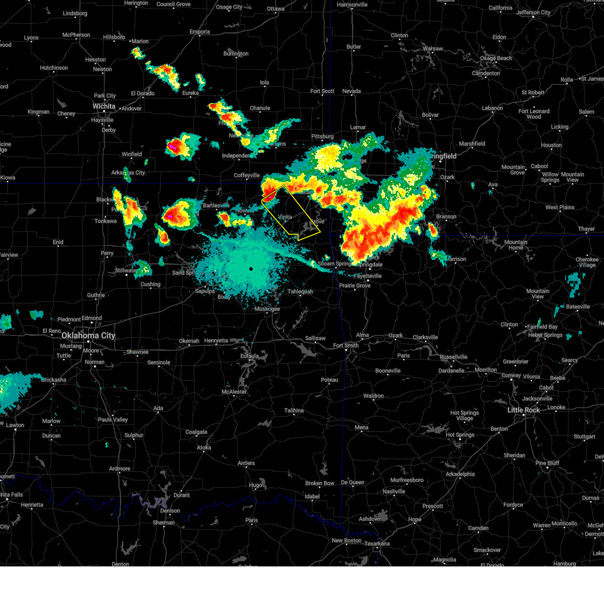 Svrtsa the national weather service in tulsa has issued a * severe thunderstorm warning for, craig county in northeastern oklahoma, northwestern delaware county in northeastern oklahoma, southwestern ottawa county in northeastern oklahoma, * until 945 pm cdt. * at 857 pm cdt, a severe thunderstorm was located 9 miles west of welch, moving southeast at 45 mph (radar indicated). Hazards include golf ball size hail and 70 mph wind gusts. People and animals outdoors will be injured. expect hail damage to roofs, siding, windows, and vehicles. expect considerable tree damage. wind damage is also likely to mobile homes, roofs, and outbuildings. Locations in or near the path include, vinita, grove, afton, welch, bernice, ketchum, bluejacket, honey creek state park, bernice state park, cleora, hollow, centrailia, zena, pyramid corners, centralia, this includes interstate 44 between mile markers 280 and 297. Svrtsa the national weather service in tulsa has issued a * severe thunderstorm warning for, craig county in northeastern oklahoma, northwestern delaware county in northeastern oklahoma, southwestern ottawa county in northeastern oklahoma, * until 945 pm cdt. * at 857 pm cdt, a severe thunderstorm was located 9 miles west of welch, moving southeast at 45 mph (radar indicated). Hazards include golf ball size hail and 70 mph wind gusts. People and animals outdoors will be injured. expect hail damage to roofs, siding, windows, and vehicles. expect considerable tree damage. wind damage is also likely to mobile homes, roofs, and outbuildings. Locations in or near the path include, vinita, grove, afton, welch, bernice, ketchum, bluejacket, honey creek state park, bernice state park, cleora, hollow, centrailia, zena, pyramid corners, centralia, this includes interstate 44 between mile markers 280 and 297.
|
| 8/16/2024 7:34 PM CDT |
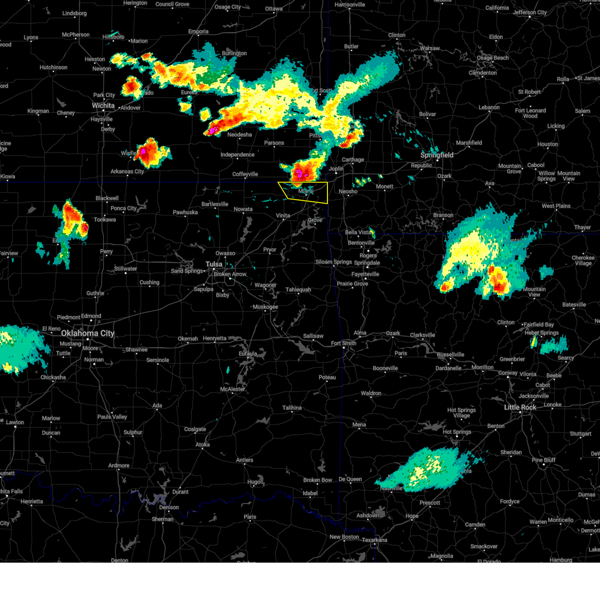 At 733 pm cdt, a severe thunderstorm was located over picher, moving southeast at 40 mph. this is a destructive storm for norhtern ottawa county (radar indicated). Hazards include 80 mph wind gusts and ping pong ball size hail. Flying debris will be dangerous to those caught without shelter. mobile homes will be heavily damaged. expect considerable damage to roofs, windows, and vehicles. extensive tree damage and power outages are likely. Locations in or near the path include, miami, commerce, quapaw, welch, picher, ottawa, peoria, cardin, twin bridges state park, this includes interstate 44 between mile markers 305 and 324. At 733 pm cdt, a severe thunderstorm was located over picher, moving southeast at 40 mph. this is a destructive storm for norhtern ottawa county (radar indicated). Hazards include 80 mph wind gusts and ping pong ball size hail. Flying debris will be dangerous to those caught without shelter. mobile homes will be heavily damaged. expect considerable damage to roofs, windows, and vehicles. extensive tree damage and power outages are likely. Locations in or near the path include, miami, commerce, quapaw, welch, picher, ottawa, peoria, cardin, twin bridges state park, this includes interstate 44 between mile markers 305 and 324.
|
| 8/16/2024 7:22 PM CDT |
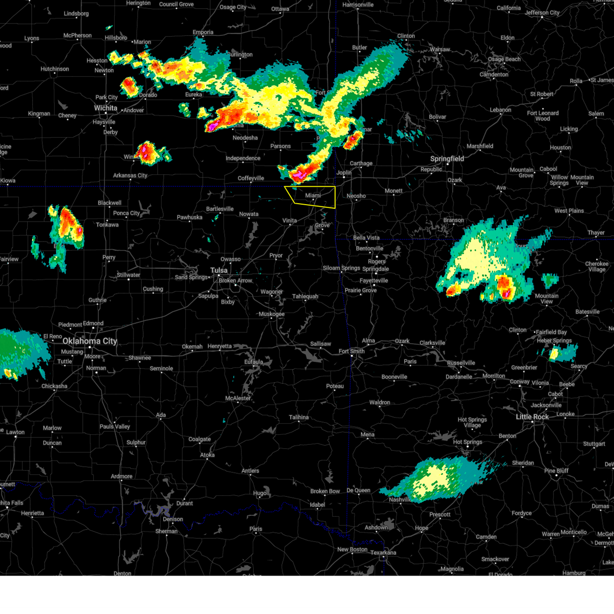 At 721 pm cdt, a severe thunderstorm was located 7 miles east of chetopa, kansas moving southeast at 40 mph (radar indicated). Hazards include 70 mph wind gusts and ping pong ball size hail. People and animals outdoors will be injured. expect hail damage to roofs, siding, windows, and vehicles. expect considerable tree damage. wind damage is also likely to mobile homes, roofs, and outbuildings. Locations in or near the path include, miami, commerce, quapaw, welch, picher, ottawa, peoria, cardin, twin bridges state park, this includes interstate 44 between mile markers 305 and 324. At 721 pm cdt, a severe thunderstorm was located 7 miles east of chetopa, kansas moving southeast at 40 mph (radar indicated). Hazards include 70 mph wind gusts and ping pong ball size hail. People and animals outdoors will be injured. expect hail damage to roofs, siding, windows, and vehicles. expect considerable tree damage. wind damage is also likely to mobile homes, roofs, and outbuildings. Locations in or near the path include, miami, commerce, quapaw, welch, picher, ottawa, peoria, cardin, twin bridges state park, this includes interstate 44 between mile markers 305 and 324.
|
| 8/16/2024 7:19 PM CDT |
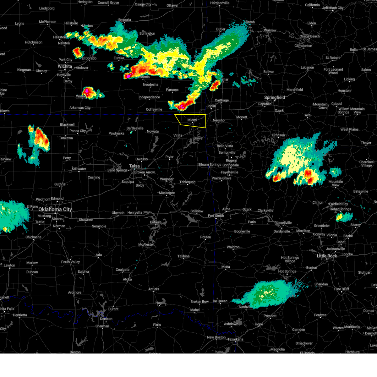 Svrtsa the national weather service in tulsa has issued a * severe thunderstorm warning for, northeastern craig county in northeastern oklahoma, northern ottawa county in northeastern oklahoma, * until 800 pm cdt. * at 718 pm cdt, a severe thunderstorm was located 5 miles northeast of chetopa, kansas moving southeast at 40 mph (radar indicated). Hazards include ping pong ball size hail and 60 mph wind gusts. People and animals outdoors will be injured. expect hail damage to roofs, siding, windows, and vehicles. expect wind damage to roofs, siding, and trees. Locations in or near the path include, miami, commerce, quapaw, welch, picher, ottawa, peoria, cardin, twin bridges state park, this includes interstate 44 between mile markers 305 and 324. Svrtsa the national weather service in tulsa has issued a * severe thunderstorm warning for, northeastern craig county in northeastern oklahoma, northern ottawa county in northeastern oklahoma, * until 800 pm cdt. * at 718 pm cdt, a severe thunderstorm was located 5 miles northeast of chetopa, kansas moving southeast at 40 mph (radar indicated). Hazards include ping pong ball size hail and 60 mph wind gusts. People and animals outdoors will be injured. expect hail damage to roofs, siding, windows, and vehicles. expect wind damage to roofs, siding, and trees. Locations in or near the path include, miami, commerce, quapaw, welch, picher, ottawa, peoria, cardin, twin bridges state park, this includes interstate 44 between mile markers 305 and 324.
|
| 6/29/2024 6:50 PM CDT |
 At 649 pm cdt, a severe thunderstorm was located 3 miles northwest of welch, moving east at 40 mph (radar indicated). Hazards include 70 mph wind gusts and quarter size hail. Hail damage to vehicles is expected. expect considerable tree damage. wind damage is also likely to mobile homes, roofs, and outbuildings. Locations in or near the path include, miami, commerce, fairland, afton, quapaw, south coffeyville, welch, bluejacket, lenapah, picher, narcissa, ottawa, cardin, hollow, centrailia, pyramid corners, centralia, this includes interstate 44 between mile markers 294 and 315. At 649 pm cdt, a severe thunderstorm was located 3 miles northwest of welch, moving east at 40 mph (radar indicated). Hazards include 70 mph wind gusts and quarter size hail. Hail damage to vehicles is expected. expect considerable tree damage. wind damage is also likely to mobile homes, roofs, and outbuildings. Locations in or near the path include, miami, commerce, fairland, afton, quapaw, south coffeyville, welch, bluejacket, lenapah, picher, narcissa, ottawa, cardin, hollow, centrailia, pyramid corners, centralia, this includes interstate 44 between mile markers 294 and 315.
|
| 6/29/2024 6:24 PM CDT |
 Svrtsa the national weather service in tulsa has issued a * severe thunderstorm warning for, northern craig county in northeastern oklahoma, western ottawa county in northeastern oklahoma, northern nowata county in northeastern oklahoma, * until 715 pm cdt. * at 624 pm cdt, a severe thunderstorm was located 6 miles southwest of edna, moving east at 40 mph (radar indicated). Hazards include 70 mph wind gusts and quarter size hail. Hail damage to vehicles is expected. expect considerable tree damage. wind damage is also likely to mobile homes, roofs, and outbuildings. Locations in or near the path include, miami, commerce, fairland, afton, quapaw, south coffeyville, welch, bluejacket, lenapah, picher, narcissa, ottawa, cardin, hollow, centrailia, pyramid corners, centralia, this includes interstate 44 between mile markers 294 and 315. Svrtsa the national weather service in tulsa has issued a * severe thunderstorm warning for, northern craig county in northeastern oklahoma, western ottawa county in northeastern oklahoma, northern nowata county in northeastern oklahoma, * until 715 pm cdt. * at 624 pm cdt, a severe thunderstorm was located 6 miles southwest of edna, moving east at 40 mph (radar indicated). Hazards include 70 mph wind gusts and quarter size hail. Hail damage to vehicles is expected. expect considerable tree damage. wind damage is also likely to mobile homes, roofs, and outbuildings. Locations in or near the path include, miami, commerce, fairland, afton, quapaw, south coffeyville, welch, bluejacket, lenapah, picher, narcissa, ottawa, cardin, hollow, centrailia, pyramid corners, centralia, this includes interstate 44 between mile markers 294 and 315.
|
| 6/26/2024 5:36 AM CDT |
 Svrtsa the national weather service in tulsa has issued a * severe thunderstorm warning for, northwestern benton county in northwestern arkansas, craig county in northeastern oklahoma, eastern rogers county in northeastern oklahoma, delaware county in northeastern oklahoma, ottawa county in northeastern oklahoma, mayes county in northeastern oklahoma, eastern nowata county in northeastern oklahoma, * until 615 am cdt. * at 536 am cdt, severe thunderstorms were located along a line extending from 4 miles west of carl junction to near edna, moving south at 70 mph (radar indicated). Hazards include 70 mph wind gusts. Expect considerable tree damage. damage is likely to mobile homes, roofs, and outbuildings. Locations in or near the path include, claremore, miami, vinita, jay, pryor, pryor creek, grove, commerce, chouteau, chelsea, inola, locust grove, salina, fairland, afton, quapaw, langley, colcord, adair, welch, this includes interstate 44 between mile markers 249 and 324. Svrtsa the national weather service in tulsa has issued a * severe thunderstorm warning for, northwestern benton county in northwestern arkansas, craig county in northeastern oklahoma, eastern rogers county in northeastern oklahoma, delaware county in northeastern oklahoma, ottawa county in northeastern oklahoma, mayes county in northeastern oklahoma, eastern nowata county in northeastern oklahoma, * until 615 am cdt. * at 536 am cdt, severe thunderstorms were located along a line extending from 4 miles west of carl junction to near edna, moving south at 70 mph (radar indicated). Hazards include 70 mph wind gusts. Expect considerable tree damage. damage is likely to mobile homes, roofs, and outbuildings. Locations in or near the path include, claremore, miami, vinita, jay, pryor, pryor creek, grove, commerce, chouteau, chelsea, inola, locust grove, salina, fairland, afton, quapaw, langley, colcord, adair, welch, this includes interstate 44 between mile markers 249 and 324.
|
| 5/26/2024 2:10 AM CDT |
 Svrtsa the national weather service in tulsa has issued a * severe thunderstorm warning for, northern craig county in northeastern oklahoma, northern delaware county in northeastern oklahoma, ottawa county in northeastern oklahoma, * until 300 am cdt. * at 210 am cdt, severe thunderstorms were located along a line extending from 5 miles southwest of chetopa to 9 miles west of bluejacket, moving east at 45 mph (radar indicated). Hazards include two inch hail and 70 mph wind gusts. People and animals outdoors will be injured. expect hail damage to roofs, siding, windows, and vehicles. expect considerable tree damage. wind damage is also likely to mobile homes, roofs, and outbuildings. Locations in or near the path include, miami, grove, commerce, fairland, afton, quapaw, welch, bernice, bluejacket, wyandotte, picher, bernice state park, narcissa, ottawa, peoria, cardin, hollow, centrailia, pyramid corners, twin bridges state park, this includes interstate 44 between mile markers 289 and 324. Svrtsa the national weather service in tulsa has issued a * severe thunderstorm warning for, northern craig county in northeastern oklahoma, northern delaware county in northeastern oklahoma, ottawa county in northeastern oklahoma, * until 300 am cdt. * at 210 am cdt, severe thunderstorms were located along a line extending from 5 miles southwest of chetopa to 9 miles west of bluejacket, moving east at 45 mph (radar indicated). Hazards include two inch hail and 70 mph wind gusts. People and animals outdoors will be injured. expect hail damage to roofs, siding, windows, and vehicles. expect considerable tree damage. wind damage is also likely to mobile homes, roofs, and outbuildings. Locations in or near the path include, miami, grove, commerce, fairland, afton, quapaw, welch, bernice, bluejacket, wyandotte, picher, bernice state park, narcissa, ottawa, peoria, cardin, hollow, centrailia, pyramid corners, twin bridges state park, this includes interstate 44 between mile markers 289 and 324.
|
| 5/26/2024 2:08 AM CDT |
 the severe thunderstorm warning has been cancelled and is no longer in effect the severe thunderstorm warning has been cancelled and is no longer in effect
|
| 5/26/2024 2:08 AM CDT |
 At 208 am cdt, a severe thunderstorm was located 11 miles south of edna, moving east at 35 mph (radar indicated). Hazards include two inch hail and 70 mph wind gusts. People and animals outdoors will be injured. expect hail damage to roofs, siding, windows, and vehicles. expect considerable tree damage. wind damage is also likely to mobile homes, roofs, and outbuildings. Locations in or near the path include, welch, bluejacket, hollow, pyramid corners, centralia, centrailia, this includes interstate 44 near mile marker 293. At 208 am cdt, a severe thunderstorm was located 11 miles south of edna, moving east at 35 mph (radar indicated). Hazards include two inch hail and 70 mph wind gusts. People and animals outdoors will be injured. expect hail damage to roofs, siding, windows, and vehicles. expect considerable tree damage. wind damage is also likely to mobile homes, roofs, and outbuildings. Locations in or near the path include, welch, bluejacket, hollow, pyramid corners, centralia, centrailia, this includes interstate 44 near mile marker 293.
|
| 5/26/2024 1:50 AM CDT |
 the tornado warning has been cancelled and is no longer in effect the tornado warning has been cancelled and is no longer in effect
|
| 5/26/2024 1:49 AM CDT |
 Svrtsa the national weather service in tulsa has issued a * severe thunderstorm warning for, northern craig county in northeastern oklahoma, northeastern nowata county in northeastern oklahoma, * until 230 am cdt. * at 149 am cdt, a severe thunderstorm was located 5 miles southeast of south coffeyville, moving east at 35 mph (radar indicated). Hazards include two inch hail and 70 mph wind gusts. People and animals outdoors will be injured. expect hail damage to roofs, siding, windows, and vehicles. expect considerable tree damage. wind damage is also likely to mobile homes, roofs, and outbuildings. Locations in or near the path include, south coffeyville, welch, delaware, bluejacket, lenapah, hollow, pyramid corners, centralia, centrailia, this includes interstate 44 near mile marker 293. Svrtsa the national weather service in tulsa has issued a * severe thunderstorm warning for, northern craig county in northeastern oklahoma, northeastern nowata county in northeastern oklahoma, * until 230 am cdt. * at 149 am cdt, a severe thunderstorm was located 5 miles southeast of south coffeyville, moving east at 35 mph (radar indicated). Hazards include two inch hail and 70 mph wind gusts. People and animals outdoors will be injured. expect hail damage to roofs, siding, windows, and vehicles. expect considerable tree damage. wind damage is also likely to mobile homes, roofs, and outbuildings. Locations in or near the path include, south coffeyville, welch, delaware, bluejacket, lenapah, hollow, pyramid corners, centralia, centrailia, this includes interstate 44 near mile marker 293.
|
| 5/26/2024 1:35 AM CDT |
 Tortsa the national weather service in tulsa has issued a * tornado warning for, northern craig county in northeastern oklahoma, northern nowata county in northeastern oklahoma, * until 215 am cdt. * at 135 am cdt, a severe thunderstorm capable of producing a tornado was located 5 miles east of wann, moving east at 50 mph (radar indicated rotation). Hazards include tornado and golf ball size hail. Flying debris will be dangerous to those caught without shelter. mobile homes will be damaged or destroyed. damage to roofs, windows, and vehicles will occur. tree damage is likely. Locations in or near the path include, south coffeyville, welch, bluejacket, lenapah, wann, hollow, pyramid corners, centrailia,. Tortsa the national weather service in tulsa has issued a * tornado warning for, northern craig county in northeastern oklahoma, northern nowata county in northeastern oklahoma, * until 215 am cdt. * at 135 am cdt, a severe thunderstorm capable of producing a tornado was located 5 miles east of wann, moving east at 50 mph (radar indicated rotation). Hazards include tornado and golf ball size hail. Flying debris will be dangerous to those caught without shelter. mobile homes will be damaged or destroyed. damage to roofs, windows, and vehicles will occur. tree damage is likely. Locations in or near the path include, south coffeyville, welch, bluejacket, lenapah, wann, hollow, pyramid corners, centrailia,.
|
| 5/8/2024 2:10 PM CDT |
 Tortsa the national weather service in tulsa has issued a * tornado warning for, northeastern craig county in northeastern oklahoma, northern ottawa county in northeastern oklahoma, * until 300 pm cdt. * at 210 pm cdt, a severe thunderstorm capable of producing a tornado was located 4 miles northeast of bluejacket, moving east at 30 mph (radar indicated rotation). Hazards include tornado. Flying debris will be dangerous to those caught without shelter. mobile homes will be damaged or destroyed. damage to roofs, windows, and vehicles will occur. tree damage is likely. Locations in or near the path include, miami, commerce, quapaw, welch, bluejacket, picher, narcissa, ottawa, peoria, cardin, this includes interstate 44 between mile markers 303 and 324. Tortsa the national weather service in tulsa has issued a * tornado warning for, northeastern craig county in northeastern oklahoma, northern ottawa county in northeastern oklahoma, * until 300 pm cdt. * at 210 pm cdt, a severe thunderstorm capable of producing a tornado was located 4 miles northeast of bluejacket, moving east at 30 mph (radar indicated rotation). Hazards include tornado. Flying debris will be dangerous to those caught without shelter. mobile homes will be damaged or destroyed. damage to roofs, windows, and vehicles will occur. tree damage is likely. Locations in or near the path include, miami, commerce, quapaw, welch, bluejacket, picher, narcissa, ottawa, peoria, cardin, this includes interstate 44 between mile markers 303 and 324.
|
| 5/8/2024 1:59 PM CDT |
 Svrtsa the national weather service in tulsa has issued a * severe thunderstorm warning for, northeastern craig county in northeastern oklahoma, northern ottawa county in northeastern oklahoma, * until 245 pm cdt. * at 159 pm cdt, a severe thunderstorm was located 3 miles east of welch, moving east at 30 mph (radar indicated). Hazards include 60 mph wind gusts and half dollar size hail. Hail damage to vehicles is expected. expect wind damage to roofs, siding, and trees. Locations in or near the path include, miami, commerce, quapaw, welch, bluejacket, picher, peoria, cardin, this includes interstate 44 between mile markers 308 and 324. Svrtsa the national weather service in tulsa has issued a * severe thunderstorm warning for, northeastern craig county in northeastern oklahoma, northern ottawa county in northeastern oklahoma, * until 245 pm cdt. * at 159 pm cdt, a severe thunderstorm was located 3 miles east of welch, moving east at 30 mph (radar indicated). Hazards include 60 mph wind gusts and half dollar size hail. Hail damage to vehicles is expected. expect wind damage to roofs, siding, and trees. Locations in or near the path include, miami, commerce, quapaw, welch, bluejacket, picher, peoria, cardin, this includes interstate 44 between mile markers 308 and 324.
|
| 5/8/2024 1:57 PM CDT |
 At 157 pm cdt, a severe thunderstorm was located 3 miles northeast of welch, moving northeast at 40 mph (radar indicated). Hazards include ping pong ball size hail and 60 mph wind gusts. People and animals outdoors will be injured. expect hail damage to roofs, siding, windows, and vehicles. expect wind damage to roofs, siding, and trees. Locations in or near the path include, welch,. At 157 pm cdt, a severe thunderstorm was located 3 miles northeast of welch, moving northeast at 40 mph (radar indicated). Hazards include ping pong ball size hail and 60 mph wind gusts. People and animals outdoors will be injured. expect hail damage to roofs, siding, windows, and vehicles. expect wind damage to roofs, siding, and trees. Locations in or near the path include, welch,.
|
| 5/8/2024 1:50 PM CDT |
 At 150 pm cdt, a severe thunderstorm was located over welch, moving northeast at 30 mph (radar indicated). Hazards include ping pong ball size hail and 60 mph wind gusts. People and animals outdoors will be injured. expect hail damage to roofs, siding, windows, and vehicles. expect wind damage to roofs, siding, and trees. Locations in or near the path include, welch, pyramid corners,. At 150 pm cdt, a severe thunderstorm was located over welch, moving northeast at 30 mph (radar indicated). Hazards include ping pong ball size hail and 60 mph wind gusts. People and animals outdoors will be injured. expect hail damage to roofs, siding, windows, and vehicles. expect wind damage to roofs, siding, and trees. Locations in or near the path include, welch, pyramid corners,.
|
| 5/8/2024 1:46 PM CDT |
 At 146 pm cdt, a severe thunderstorm was located 4 miles west of welch, moving northeast at 5 mph (radar indicated). Hazards include 60 mph wind gusts and quarter size hail. Hail damage to vehicles is expected. expect wind damage to roofs, siding, and trees. Locations in or near the path include, welch, pyramid corners,. At 146 pm cdt, a severe thunderstorm was located 4 miles west of welch, moving northeast at 5 mph (radar indicated). Hazards include 60 mph wind gusts and quarter size hail. Hail damage to vehicles is expected. expect wind damage to roofs, siding, and trees. Locations in or near the path include, welch, pyramid corners,.
|
| 5/8/2024 1:40 PM CDT |
 At 140 pm cdt, a severe thunderstorm was located 5 miles west of welch, moving northeast at 10 mph (radar indicated). Hazards include 60 mph wind gusts and quarter size hail. Hail damage to vehicles is expected. expect wind damage to roofs, siding, and trees. Locations in or near the path include, welch, pyramid corners, centrailia, centralia,. At 140 pm cdt, a severe thunderstorm was located 5 miles west of welch, moving northeast at 10 mph (radar indicated). Hazards include 60 mph wind gusts and quarter size hail. Hail damage to vehicles is expected. expect wind damage to roofs, siding, and trees. Locations in or near the path include, welch, pyramid corners, centrailia, centralia,.
|
| 5/8/2024 1:32 PM CDT |
 At 132 pm cdt, a severe thunderstorm was located 8 miles west of welch, moving northeast at 30 mph (radar indicated). Hazards include 60 mph wind gusts and quarter size hail. Hail damage to vehicles is expected. expect wind damage to roofs, siding, and trees. Locations in or near the path include, welch, hollow, pyramid corners, centralia, centrailia,. At 132 pm cdt, a severe thunderstorm was located 8 miles west of welch, moving northeast at 30 mph (radar indicated). Hazards include 60 mph wind gusts and quarter size hail. Hail damage to vehicles is expected. expect wind damage to roofs, siding, and trees. Locations in or near the path include, welch, hollow, pyramid corners, centralia, centrailia,.
|
| 5/8/2024 1:22 PM CDT |
 Svrtsa the national weather service in tulsa has issued a * severe thunderstorm warning for, craig county in northeastern oklahoma, northwestern ottawa county in northeastern oklahoma, * until 215 pm cdt. * at 122 pm cdt, severe thunderstorms were located along a line extending from 7 miles northwest of welch to 4 miles northeast of new alluwe, moving northeast at 5 mph (radar indicated). Hazards include 60 mph wind gusts and quarter size hail. Hail damage to vehicles is expected. expect wind damage to roofs, siding, and trees. Locations in or near the path include, welch, bluejacket, white oak, hollow, pyramid corners, centralia, centrailia,. Svrtsa the national weather service in tulsa has issued a * severe thunderstorm warning for, craig county in northeastern oklahoma, northwestern ottawa county in northeastern oklahoma, * until 215 pm cdt. * at 122 pm cdt, severe thunderstorms were located along a line extending from 7 miles northwest of welch to 4 miles northeast of new alluwe, moving northeast at 5 mph (radar indicated). Hazards include 60 mph wind gusts and quarter size hail. Hail damage to vehicles is expected. expect wind damage to roofs, siding, and trees. Locations in or near the path include, welch, bluejacket, white oak, hollow, pyramid corners, centralia, centrailia,.
|
| 5/6/2024 11:00 PM CDT | Damage to welch schools... including to the roof of the gymnasiu in craig county OK, 0.5 miles SE of Welch, OK |
| 5/6/2024 11:00 PM CDT |
 At 1059 pm cdt, severe thunderstorms were located along a line extending from near chetopa to 4 miles southeast of bluejacket to 6 miles northwest of pryor, moving east at 55 mph (radar indicated. at 10:50 pm, a 65 mph wind gust was reported 7 miles east of centralia at the vinita mesonet station). Hazards include 60 mph wind gusts and penny size hail. Expect damage to roofs, siding, and trees. Locations in or near the path include, miami, vinita, commerce, chelsea, fairland, afton, quapaw, langley, adair, welch, bernice, ketchum, spavinaw, bluejacket, disney, big cabin, pensacola, picher, hoot owl, cherokee state park, this includes interstate 44 between mile markers 261 and 314. At 1059 pm cdt, severe thunderstorms were located along a line extending from near chetopa to 4 miles southeast of bluejacket to 6 miles northwest of pryor, moving east at 55 mph (radar indicated. at 10:50 pm, a 65 mph wind gust was reported 7 miles east of centralia at the vinita mesonet station). Hazards include 60 mph wind gusts and penny size hail. Expect damage to roofs, siding, and trees. Locations in or near the path include, miami, vinita, commerce, chelsea, fairland, afton, quapaw, langley, adair, welch, bernice, ketchum, spavinaw, bluejacket, disney, big cabin, pensacola, picher, hoot owl, cherokee state park, this includes interstate 44 between mile markers 261 and 314.
|
| 5/6/2024 10:46 PM CDT |
 At 1046 pm cdt, severe thunderstorms were located along a line extending from 5 miles southeast of edna to 6 miles north of white oak to 5 miles south of foyil, moving east at 50 mph (radar indicated). Hazards include 60 mph wind gusts and nickel size hail. Expect damage to roofs, siding, and trees. Locations in or near the path include, claremore, miami, vinita, pryor creek, commerce, chelsea, fairland, afton, quapaw, langley, adair, welch, bernice, ketchum, spavinaw, foyil, bluejacket, disney, big cabin, pensacola, this includes interstate 44 between mile markers 252 and 314. At 1046 pm cdt, severe thunderstorms were located along a line extending from 5 miles southeast of edna to 6 miles north of white oak to 5 miles south of foyil, moving east at 50 mph (radar indicated). Hazards include 60 mph wind gusts and nickel size hail. Expect damage to roofs, siding, and trees. Locations in or near the path include, claremore, miami, vinita, pryor creek, commerce, chelsea, fairland, afton, quapaw, langley, adair, welch, bernice, ketchum, spavinaw, foyil, bluejacket, disney, big cabin, pensacola, this includes interstate 44 between mile markers 252 and 314.
|
| 5/6/2024 10:46 PM CDT |
 the severe thunderstorm warning has been cancelled and is no longer in effect the severe thunderstorm warning has been cancelled and is no longer in effect
|
| 5/6/2024 10:30 PM CDT |
 Svrtsa the national weather service in tulsa has issued a * severe thunderstorm warning for, craig county in northeastern oklahoma, northern rogers county in northeastern oklahoma, northwestern delaware county in northeastern oklahoma, western ottawa county in northeastern oklahoma, northern mayes county in northeastern oklahoma, nowata county in northeastern oklahoma, * until 1115 pm cdt. * at 1030 pm cdt, severe thunderstorms were located along a line extending from 5 miles east of south coffeyville to 7 miles north of new alluwe to 5 miles northwest of claremore, moving east at 45 mph (radar indicated). Hazards include 60 mph wind gusts and nickel size hail. Expect damage to roofs, siding, and trees. Locations in or near the path include, claremore, miami, vinita, nowata, pryor creek, commerce, chelsea, oologah, fairland, afton, quapaw, langley, adair, welch, bernice, ketchum, spavinaw, delaware, foyil, bluejacket, this includes interstate 44 between mile markers 252 and 314. Svrtsa the national weather service in tulsa has issued a * severe thunderstorm warning for, craig county in northeastern oklahoma, northern rogers county in northeastern oklahoma, northwestern delaware county in northeastern oklahoma, western ottawa county in northeastern oklahoma, northern mayes county in northeastern oklahoma, nowata county in northeastern oklahoma, * until 1115 pm cdt. * at 1030 pm cdt, severe thunderstorms were located along a line extending from 5 miles east of south coffeyville to 7 miles north of new alluwe to 5 miles northwest of claremore, moving east at 45 mph (radar indicated). Hazards include 60 mph wind gusts and nickel size hail. Expect damage to roofs, siding, and trees. Locations in or near the path include, claremore, miami, vinita, nowata, pryor creek, commerce, chelsea, oologah, fairland, afton, quapaw, langley, adair, welch, bernice, ketchum, spavinaw, delaware, foyil, bluejacket, this includes interstate 44 between mile markers 252 and 314.
|
| 4/28/2024 7:02 PM CDT |
 the severe thunderstorm warning has been cancelled and is no longer in effect the severe thunderstorm warning has been cancelled and is no longer in effect
|
| 4/28/2024 6:39 PM CDT |
 Svrtsa the national weather service in tulsa has issued a * severe thunderstorm warning for, northeastern craig county in northeastern oklahoma, northwestern ottawa county in northeastern oklahoma, * until 730 pm cdt. * at 639 pm cdt, a severe thunderstorm was located near bluejacket, moving northeast at 40 mph (radar indicated). Hazards include 60 mph wind gusts and quarter size hail. Hail damage to vehicles is expected. expect wind damage to roofs, siding, and trees. Locations in or near the path include, miami, commerce, afton, quapaw, welch, bluejacket, picher, narcissa, ottawa, cardin, pyramid corners, this includes interstate 44 between mile markers 289 and 297, and between mile markers 300 and 324. Svrtsa the national weather service in tulsa has issued a * severe thunderstorm warning for, northeastern craig county in northeastern oklahoma, northwestern ottawa county in northeastern oklahoma, * until 730 pm cdt. * at 639 pm cdt, a severe thunderstorm was located near bluejacket, moving northeast at 40 mph (radar indicated). Hazards include 60 mph wind gusts and quarter size hail. Hail damage to vehicles is expected. expect wind damage to roofs, siding, and trees. Locations in or near the path include, miami, commerce, afton, quapaw, welch, bluejacket, picher, narcissa, ottawa, cardin, pyramid corners, this includes interstate 44 between mile markers 289 and 297, and between mile markers 300 and 324.
|
| 4/28/2024 1:22 AM CDT |
 At 122 am cdt, severe thunderstorms were located along a line extending from 6 miles east of chetopa to 2 miles south of narcissa to 2 miles south of cleora, moving east at 30 mph (radar indicated). Hazards include 60 mph wind gusts and penny size hail. Expect damage to roofs, siding, and trees. Locations in or near the path include, miami, grove, commerce, fairland, afton, quapaw, welch, bernice, ketchum, bluejacket, wyandotte, picher, honey creek state park, bernice state park, cleora, narcissa, ottawa, peoria, cardin, twin bridges state park, this includes interstate 44 between mile markers 286 and 324. At 122 am cdt, severe thunderstorms were located along a line extending from 6 miles east of chetopa to 2 miles south of narcissa to 2 miles south of cleora, moving east at 30 mph (radar indicated). Hazards include 60 mph wind gusts and penny size hail. Expect damage to roofs, siding, and trees. Locations in or near the path include, miami, grove, commerce, fairland, afton, quapaw, welch, bernice, ketchum, bluejacket, wyandotte, picher, honey creek state park, bernice state park, cleora, narcissa, ottawa, peoria, cardin, twin bridges state park, this includes interstate 44 between mile markers 286 and 324.
|
| 4/28/2024 12:43 AM CDT |
 Svrtsa the national weather service in tulsa has issued a * severe thunderstorm warning for, craig county in northeastern oklahoma, northern delaware county in northeastern oklahoma, ottawa county in northeastern oklahoma, * until 145 am cdt. * at 1243 am cdt, severe thunderstorms were located along a line extending from 4 miles southwest of edna to 9 miles north of white oak to 5 miles west of big cabin, moving east at 40 mph (radar indicated). Hazards include 70 mph wind gusts and penny size hail. Expect considerable tree damage. damage is likely to mobile homes, roofs, and outbuildings. Locations in or near the path include, miami, vinita, grove, commerce, fairland, afton, quapaw, welch, bernice, ketchum, bluejacket, wyandotte, big cabin, picher, honey creek state park, bernice state park, cleora, white oak, narcissa, ottawa, this includes interstate 44 between mile markers 275 and 324. Svrtsa the national weather service in tulsa has issued a * severe thunderstorm warning for, craig county in northeastern oklahoma, northern delaware county in northeastern oklahoma, ottawa county in northeastern oklahoma, * until 145 am cdt. * at 1243 am cdt, severe thunderstorms were located along a line extending from 4 miles southwest of edna to 9 miles north of white oak to 5 miles west of big cabin, moving east at 40 mph (radar indicated). Hazards include 70 mph wind gusts and penny size hail. Expect considerable tree damage. damage is likely to mobile homes, roofs, and outbuildings. Locations in or near the path include, miami, vinita, grove, commerce, fairland, afton, quapaw, welch, bernice, ketchum, bluejacket, wyandotte, big cabin, picher, honey creek state park, bernice state park, cleora, white oak, narcissa, ottawa, this includes interstate 44 between mile markers 275 and 324.
|
| 4/1/2024 10:28 PM CDT |
 The storm which prompted the warning has moved out of the area. therefore, the warning will be allowed to expire. a tornado watch remains in effect until midnight cdt for northeastern oklahoma. The storm which prompted the warning has moved out of the area. therefore, the warning will be allowed to expire. a tornado watch remains in effect until midnight cdt for northeastern oklahoma.
|
| 4/1/2024 10:10 PM CDT |
 At 1010 pm cdt, a severe thunderstorm was located 5 miles north of vinita, moving northeast at 45 mph (radar indicated). Hazards include 60 mph wind gusts and quarter size hail. Hail damage to vehicles is expected. expect wind damage to roofs, siding, and trees. Locations in or near the path include, vinita, welch, bluejacket, pyramid corners, this includes interstate 44 between mile markers 285 and 289. At 1010 pm cdt, a severe thunderstorm was located 5 miles north of vinita, moving northeast at 45 mph (radar indicated). Hazards include 60 mph wind gusts and quarter size hail. Hail damage to vehicles is expected. expect wind damage to roofs, siding, and trees. Locations in or near the path include, vinita, welch, bluejacket, pyramid corners, this includes interstate 44 between mile markers 285 and 289.
|
| 4/1/2024 10:04 PM CDT |
 Svrtsa the national weather service in tulsa has issued a * severe thunderstorm warning for, eastern craig county in northeastern oklahoma, * until 1030 pm cdt. * at 1004 pm cdt, a severe thunderstorm was located 4 miles northwest of vinita, moving northeast at 45 mph (radar indicated). Hazards include 60 mph wind gusts and quarter size hail. Hail damage to vehicles is expected. expect wind damage to roofs, siding, and trees. Locations in or near the path include, vinita, welch, bluejacket, white oak, pyramid corners, this includes interstate 44 between mile markers 280 and 289. Svrtsa the national weather service in tulsa has issued a * severe thunderstorm warning for, eastern craig county in northeastern oklahoma, * until 1030 pm cdt. * at 1004 pm cdt, a severe thunderstorm was located 4 miles northwest of vinita, moving northeast at 45 mph (radar indicated). Hazards include 60 mph wind gusts and quarter size hail. Hail damage to vehicles is expected. expect wind damage to roofs, siding, and trees. Locations in or near the path include, vinita, welch, bluejacket, white oak, pyramid corners, this includes interstate 44 between mile markers 280 and 289.
|
| 4/1/2024 9:13 PM CDT |
 The storms which prompted the warning have moved out of the area. therefore, the warning will be allowed to expire. a tornado watch remains in effect until midnight cdt for northeastern oklahoma. The storms which prompted the warning have moved out of the area. therefore, the warning will be allowed to expire. a tornado watch remains in effect until midnight cdt for northeastern oklahoma.
|
| 4/1/2024 8:58 PM CDT |
 Svrtsa the national weather service in tulsa has issued a * severe thunderstorm warning for, northeastern craig county in northeastern oklahoma, northern ottawa county in northeastern oklahoma, * until 945 pm cdt. * at 858 pm cdt, a severe thunderstorm was located 3 miles northwest of welch, moving east at 55 mph (radar indicated). Hazards include 60 mph wind gusts and quarter size hail. Hail damage to vehicles is expected. expect wind damage to roofs, siding, and trees. Locations in or near the path include, miami, commerce, quapaw, welch, bluejacket, picher, ottawa, peoria, cardin, pyramid corners, this includes interstate 44 between mile markers 306 and 324. Svrtsa the national weather service in tulsa has issued a * severe thunderstorm warning for, northeastern craig county in northeastern oklahoma, northern ottawa county in northeastern oklahoma, * until 945 pm cdt. * at 858 pm cdt, a severe thunderstorm was located 3 miles northwest of welch, moving east at 55 mph (radar indicated). Hazards include 60 mph wind gusts and quarter size hail. Hail damage to vehicles is expected. expect wind damage to roofs, siding, and trees. Locations in or near the path include, miami, commerce, quapaw, welch, bluejacket, picher, ottawa, peoria, cardin, pyramid corners, this includes interstate 44 between mile markers 306 and 324.
|
| 4/1/2024 8:42 PM CDT |
 the severe thunderstorm warning has been cancelled and is no longer in effect the severe thunderstorm warning has been cancelled and is no longer in effect
|
| 4/1/2024 8:42 PM CDT |
 At 842 pm cdt, severe thunderstorms were located along a line extending from 6 miles south of edna to 9 miles west of welch to 10 miles north of white oak, moving east at 50 mph (radar indicated). Hazards include 60 mph wind gusts and nickel size hail. Expect damage to roofs, siding, and trees. Locations in or near the path include, welch, bluejacket, hollow, pyramid corners, centralia, centrailia,. At 842 pm cdt, severe thunderstorms were located along a line extending from 6 miles south of edna to 9 miles west of welch to 10 miles north of white oak, moving east at 50 mph (radar indicated). Hazards include 60 mph wind gusts and nickel size hail. Expect damage to roofs, siding, and trees. Locations in or near the path include, welch, bluejacket, hollow, pyramid corners, centralia, centrailia,.
|
| 4/1/2024 8:26 PM CDT |
 Svrtsa the national weather service in tulsa has issued a * severe thunderstorm warning for, northern craig county in northeastern oklahoma, northeastern nowata county in northeastern oklahoma, * until 915 pm cdt. * at 826 pm cdt, a severe thunderstorm was located 8 miles east of lenapah, moving east at 50 mph (radar indicated). Hazards include 60 mph wind gusts and nickel size hail. Expect damage to roofs, siding, and trees. Locations in or near the path include, welch, bluejacket, hollow, pyramid corners, centralia, centrailia,. Svrtsa the national weather service in tulsa has issued a * severe thunderstorm warning for, northern craig county in northeastern oklahoma, northeastern nowata county in northeastern oklahoma, * until 915 pm cdt. * at 826 pm cdt, a severe thunderstorm was located 8 miles east of lenapah, moving east at 50 mph (radar indicated). Hazards include 60 mph wind gusts and nickel size hail. Expect damage to roofs, siding, and trees. Locations in or near the path include, welch, bluejacket, hollow, pyramid corners, centralia, centrailia,.
|
| 9/19/2023 9:29 PM CDT |
 At 929 pm cdt, a severe thunderstorm was located 10 miles west of bluejacket, moving southeast at 25 mph (radar indicated). Hazards include 60 mph wind gusts and quarter size hail. Hail damage to vehicles is expected. expect wind damage to roofs, siding, and trees. locations in or near the path include, vinita, welch, bluejacket, white oak, narcissa, hollow, pyramid corners, centralia, centrailia, this includes interstate 44 between mile markers 280 and 289, and near mile marker 302. hail threat, radar indicated max hail size, 1. 00 in wind threat, radar indicated max wind gust, 60 mph. At 929 pm cdt, a severe thunderstorm was located 10 miles west of bluejacket, moving southeast at 25 mph (radar indicated). Hazards include 60 mph wind gusts and quarter size hail. Hail damage to vehicles is expected. expect wind damage to roofs, siding, and trees. locations in or near the path include, vinita, welch, bluejacket, white oak, narcissa, hollow, pyramid corners, centralia, centrailia, this includes interstate 44 between mile markers 280 and 289, and near mile marker 302. hail threat, radar indicated max hail size, 1. 00 in wind threat, radar indicated max wind gust, 60 mph.
|
| 9/19/2023 9:10 PM CDT |
 At 910 pm cdt, a severe thunderstorm was located 13 miles south of edna, moving southeast at 25 mph (radar indicated). Hazards include 60 mph wind gusts and quarter size hail. Hail damage to vehicles is expected. expect wind damage to roofs, siding, and trees. locations in or near the path include, vinita, welch, bluejacket, white oak, narcissa, hollow, pyramid corners, centralia, centrailia, this includes interstate 44 between mile markers 280 and 289, and near mile marker 302. hail threat, radar indicated max hail size, 1. 00 in wind threat, radar indicated max wind gust, 60 mph. At 910 pm cdt, a severe thunderstorm was located 13 miles south of edna, moving southeast at 25 mph (radar indicated). Hazards include 60 mph wind gusts and quarter size hail. Hail damage to vehicles is expected. expect wind damage to roofs, siding, and trees. locations in or near the path include, vinita, welch, bluejacket, white oak, narcissa, hollow, pyramid corners, centralia, centrailia, this includes interstate 44 between mile markers 280 and 289, and near mile marker 302. hail threat, radar indicated max hail size, 1. 00 in wind threat, radar indicated max wind gust, 60 mph.
|
| 9/19/2023 8:54 PM CDT |
 At 853 pm cdt, a severe thunderstorm was located 8 miles southwest of edna, moving southeast at 5 mph (radar indicated). Hazards include 60 mph wind gusts and half dollar size hail. Hail damage to vehicles is expected. expect wind damage to roofs, siding, and trees. locations in or near the path include, welch, hollow, pyramid corners, hail threat, radar indicated max hail size, 1. 25 in wind threat, radar indicated max wind gust, 60 mph. At 853 pm cdt, a severe thunderstorm was located 8 miles southwest of edna, moving southeast at 5 mph (radar indicated). Hazards include 60 mph wind gusts and half dollar size hail. Hail damage to vehicles is expected. expect wind damage to roofs, siding, and trees. locations in or near the path include, welch, hollow, pyramid corners, hail threat, radar indicated max hail size, 1. 25 in wind threat, radar indicated max wind gust, 60 mph.
|
| 9/19/2023 8:41 PM CDT |
 At 841 pm cdt, a severe thunderstorm was located 7 miles southwest of edna, and is nearly stationary (radar indicated). Hazards include ping pong ball size hail and 60 mph wind gusts. People and animals outdoors will be injured. expect hail damage to roofs, siding, windows, and vehicles. expect wind damage to roofs, siding, and trees. locations in or near the path include, welch, hollow, pyramid corners, hail threat, radar indicated max hail size, 1. 50 in wind threat, radar indicated max wind gust, 60 mph. At 841 pm cdt, a severe thunderstorm was located 7 miles southwest of edna, and is nearly stationary (radar indicated). Hazards include ping pong ball size hail and 60 mph wind gusts. People and animals outdoors will be injured. expect hail damage to roofs, siding, windows, and vehicles. expect wind damage to roofs, siding, and trees. locations in or near the path include, welch, hollow, pyramid corners, hail threat, radar indicated max hail size, 1. 50 in wind threat, radar indicated max wind gust, 60 mph.
|
| 9/19/2023 8:23 PM CDT |
 At 823 pm cdt, a severe thunderstorm was located 7 miles southwest of edna, moving southeast at 5 mph (radar indicated). Hazards include 60 mph wind gusts and quarter size hail. Hail damage to vehicles is expected. expect wind damage to roofs, siding, and trees. locations in or near the path include, welch, hollow, pyramid corners, hail threat, radar indicated max hail size, 1. 00 in wind threat, radar indicated max wind gust, 60 mph. At 823 pm cdt, a severe thunderstorm was located 7 miles southwest of edna, moving southeast at 5 mph (radar indicated). Hazards include 60 mph wind gusts and quarter size hail. Hail damage to vehicles is expected. expect wind damage to roofs, siding, and trees. locations in or near the path include, welch, hollow, pyramid corners, hail threat, radar indicated max hail size, 1. 00 in wind threat, radar indicated max wind gust, 60 mph.
|
| 9/5/2023 9:27 PM CDT |
 The severe thunderstorm warning for northeastern craig and west central ottawa counties will expire at 930 pm cdt, the storms which prompted the warning have moved out of the area. therefore, the warning will be allowed to expire. a severe thunderstorm watch remains in effect until midnight cdt for northeastern oklahoma. to report severe weather, contact your nearest law enforcement agency. they will relay your report to the national weather service tulsa. The severe thunderstorm warning for northeastern craig and west central ottawa counties will expire at 930 pm cdt, the storms which prompted the warning have moved out of the area. therefore, the warning will be allowed to expire. a severe thunderstorm watch remains in effect until midnight cdt for northeastern oklahoma. to report severe weather, contact your nearest law enforcement agency. they will relay your report to the national weather service tulsa.
|
| 9/5/2023 9:18 PM CDT |
 At 918 pm cdt, severe thunderstorms were located along a line extending from 2 miles south of welch to 4 miles southeast of bluejacket, moving east at 35 mph (radar indicated). Hazards include 60 mph wind gusts. Expect damage to roofs, siding, and trees. locations in or near the path include, vinita, welch, bluejacket, pyramid corners, hail threat, radar indicated max hail size, <. 75 in wind threat, radar indicated max wind gust, 60 mph. At 918 pm cdt, severe thunderstorms were located along a line extending from 2 miles south of welch to 4 miles southeast of bluejacket, moving east at 35 mph (radar indicated). Hazards include 60 mph wind gusts. Expect damage to roofs, siding, and trees. locations in or near the path include, vinita, welch, bluejacket, pyramid corners, hail threat, radar indicated max hail size, <. 75 in wind threat, radar indicated max wind gust, 60 mph.
|
| 9/5/2023 8:58 PM CDT |
 At 857 pm cdt, severe thunderstorms were located along a line extending from 11 miles northwest of white oak to 4 miles north of vinita, moving northeast at 35 mph (radar indicated). Hazards include 60 mph wind gusts. Expect damage to roofs, siding, and trees. locations in or near the path include, vinita, welch, bluejacket, hollow, pyramid corners, centralia, hail threat, radar indicated max hail size, <. 75 in wind threat, radar indicated max wind gust, 60 mph. At 857 pm cdt, severe thunderstorms were located along a line extending from 11 miles northwest of white oak to 4 miles north of vinita, moving northeast at 35 mph (radar indicated). Hazards include 60 mph wind gusts. Expect damage to roofs, siding, and trees. locations in or near the path include, vinita, welch, bluejacket, hollow, pyramid corners, centralia, hail threat, radar indicated max hail size, <. 75 in wind threat, radar indicated max wind gust, 60 mph.
|
| 7/14/2023 7:01 PM CDT |
 At 701 pm cdt, severe thunderstorms were located along a line extending from 3 miles northeast of seneca to 10 miles north of white oak to 8 miles east of bartlesville, moving southeast at 35 mph (radar indicated). Hazards include 60 mph wind gusts and penny size hail. Expect damage to roofs, siding, and trees. locations in or near the path include, bartlesville, miami, vinita, nowata, grove, dewey, commerce, fairland, afton, quapaw, welch, bernice, delaware, bluejacket, wyandotte, lenapah, new alluwe, bernice state park, watova, white oak, this includes interstate 44 between mile markers 280 and 323. hail threat, radar indicated max hail size, 0. 75 in wind threat, radar indicated max wind gust, 60 mph. At 701 pm cdt, severe thunderstorms were located along a line extending from 3 miles northeast of seneca to 10 miles north of white oak to 8 miles east of bartlesville, moving southeast at 35 mph (radar indicated). Hazards include 60 mph wind gusts and penny size hail. Expect damage to roofs, siding, and trees. locations in or near the path include, bartlesville, miami, vinita, nowata, grove, dewey, commerce, fairland, afton, quapaw, welch, bernice, delaware, bluejacket, wyandotte, lenapah, new alluwe, bernice state park, watova, white oak, this includes interstate 44 between mile markers 280 and 323. hail threat, radar indicated max hail size, 0. 75 in wind threat, radar indicated max wind gust, 60 mph.
|
| 7/14/2023 6:54 PM CDT | Power pole snapped at hwy 59 and s530 road east of welch. time is radar estimated. report relayed via social medi in craig county OK, 0.5 miles NE of Welch, OK |
| 7/14/2023 6:42 PM CDT |
 At 642 pm cdt, severe thunderstorms were located along a line extending from near quapaw to 9 miles west of welch to 3 miles north of dewey, moving southeast at 40 mph (radar indicated). Hazards include 60 mph wind gusts and penny size hail. Expect damage to roofs, siding, and trees. locations in or near the path include, bartlesville, miami, vinita, nowata, grove, dewey, commerce, fairland, afton, quapaw, copan, welch, bernice, delaware, bluejacket, wyandotte, lenapah, wann, new alluwe, picher, this includes interstate 44 between mile markers 280 and 323. hail threat, radar indicated max hail size, 0. 75 in wind threat, radar indicated max wind gust, 60 mph. At 642 pm cdt, severe thunderstorms were located along a line extending from near quapaw to 9 miles west of welch to 3 miles north of dewey, moving southeast at 40 mph (radar indicated). Hazards include 60 mph wind gusts and penny size hail. Expect damage to roofs, siding, and trees. locations in or near the path include, bartlesville, miami, vinita, nowata, grove, dewey, commerce, fairland, afton, quapaw, copan, welch, bernice, delaware, bluejacket, wyandotte, lenapah, wann, new alluwe, picher, this includes interstate 44 between mile markers 280 and 323. hail threat, radar indicated max hail size, 0. 75 in wind threat, radar indicated max wind gust, 60 mph.
|
| 7/14/2023 6:14 PM CDT |
 At 614 pm cdt, severe thunderstorms were located along a line extending from 3 miles northwest of west mineral to 2 miles south of dearing, moving southeast at 35 mph (radar indicated). Hazards include 60 mph wind gusts. Expect damage to roofs, siding, and trees. locations in or near the path include, bartlesville, dewey, commerce, quapaw, south coffeyville, copan, welch, delaware, lenapah, wann, picher, cardin, hollow, centrailia, centralia, hail threat, radar indicated max hail size, <. 75 in wind threat, radar indicated max wind gust, 60 mph. At 614 pm cdt, severe thunderstorms were located along a line extending from 3 miles northwest of west mineral to 2 miles south of dearing, moving southeast at 35 mph (radar indicated). Hazards include 60 mph wind gusts. Expect damage to roofs, siding, and trees. locations in or near the path include, bartlesville, dewey, commerce, quapaw, south coffeyville, copan, welch, delaware, lenapah, wann, picher, cardin, hollow, centrailia, centralia, hail threat, radar indicated max hail size, <. 75 in wind threat, radar indicated max wind gust, 60 mph.
|
| 7/14/2023 5:50 PM CDT |
 At 550 pm cdt, severe thunderstorms were located along a line extending from 3 miles east of st. paul to 6 miles south of elk city, moving southeast at 50 mph (radar indicated). Hazards include 60 mph wind gusts. Expect damage to roofs, siding, and trees. locations in or near the path include, bartlesville, dewey, commerce, quapaw, south coffeyville, copan, welch, delaware, lenapah, wann, picher, cardin, hollow, centrailia, centralia, hail threat, radar indicated max hail size, <. 75 in wind threat, radar indicated max wind gust, 60 mph. At 550 pm cdt, severe thunderstorms were located along a line extending from 3 miles east of st. paul to 6 miles south of elk city, moving southeast at 50 mph (radar indicated). Hazards include 60 mph wind gusts. Expect damage to roofs, siding, and trees. locations in or near the path include, bartlesville, dewey, commerce, quapaw, south coffeyville, copan, welch, delaware, lenapah, wann, picher, cardin, hollow, centrailia, centralia, hail threat, radar indicated max hail size, <. 75 in wind threat, radar indicated max wind gust, 60 mph.
|
| 7/13/2023 3:11 AM CDT |
 At 311 am cdt, severe thunderstorms were located along a line extending from 5 miles east of welch to 5 miles west of bluejacket to 10 miles northeast of new alluwe, moving southeast at 35 mph (radar indicated). Hazards include 60 mph wind gusts and penny size hail. Expect damage to roofs, siding, and trees. locations in or near the path include, miami, vinita, fairland, afton, welch, bluejacket, white oak, narcissa, hollow, pyramid corners, centralia, centrailia, this includes interstate 44 between mile markers 280 and 304. hail threat, radar indicated max hail size, 0. 75 in wind threat, radar indicated max wind gust, 60 mph. At 311 am cdt, severe thunderstorms were located along a line extending from 5 miles east of welch to 5 miles west of bluejacket to 10 miles northeast of new alluwe, moving southeast at 35 mph (radar indicated). Hazards include 60 mph wind gusts and penny size hail. Expect damage to roofs, siding, and trees. locations in or near the path include, miami, vinita, fairland, afton, welch, bluejacket, white oak, narcissa, hollow, pyramid corners, centralia, centrailia, this includes interstate 44 between mile markers 280 and 304. hail threat, radar indicated max hail size, 0. 75 in wind threat, radar indicated max wind gust, 60 mph.
|
| 7/13/2023 2:45 AM CDT |
 At 245 am cdt, severe thunderstorms were located along a line extending from chetopa to 8 miles southeast of edna to 7 miles southeast of south coffeyville, moving south at 40 mph (radar indicated). Hazards include 60 mph wind gusts and penny size hail. Expect damage to roofs, siding, and trees. locations in or near the path include, miami, vinita, fairland, afton, welch, bluejacket, white oak, narcissa, hollow, pyramid corners, centralia, centrailia, this includes interstate 44 between mile markers 280 and 304. hail threat, radar indicated max hail size, 0. 75 in wind threat, radar indicated max wind gust, 60 mph. At 245 am cdt, severe thunderstorms were located along a line extending from chetopa to 8 miles southeast of edna to 7 miles southeast of south coffeyville, moving south at 40 mph (radar indicated). Hazards include 60 mph wind gusts and penny size hail. Expect damage to roofs, siding, and trees. locations in or near the path include, miami, vinita, fairland, afton, welch, bluejacket, white oak, narcissa, hollow, pyramid corners, centralia, centrailia, this includes interstate 44 between mile markers 280 and 304. hail threat, radar indicated max hail size, 0. 75 in wind threat, radar indicated max wind gust, 60 mph.
|
| 6/18/2023 1:48 AM CDT |
 At 148 am cdt, severe thunderstorms were located along a line extending from near chetopa to 4 miles north of grove, moving northeast at 45 mph (radar indicated). Hazards include 70 mph wind gusts and penny size hail. Expect considerable tree damage. damage is likely to mobile homes, roofs, and outbuildings. locations in or near the path include, miami, grove, commerce, fairland, afton, quapaw, welch, bernice, bluejacket, wyandotte, picher, bernice state park, cleora, narcissa, ottawa, peoria, cardin, pyramid corners, twin bridges state park, this includes interstate 44 between mile markers 290 and 324. thunderstorm damage threat, considerable hail threat, radar indicated max hail size, 0. 75 in wind threat, radar indicated max wind gust, 70 mph. At 148 am cdt, severe thunderstorms were located along a line extending from near chetopa to 4 miles north of grove, moving northeast at 45 mph (radar indicated). Hazards include 70 mph wind gusts and penny size hail. Expect considerable tree damage. damage is likely to mobile homes, roofs, and outbuildings. locations in or near the path include, miami, grove, commerce, fairland, afton, quapaw, welch, bernice, bluejacket, wyandotte, picher, bernice state park, cleora, narcissa, ottawa, peoria, cardin, pyramid corners, twin bridges state park, this includes interstate 44 between mile markers 290 and 324. thunderstorm damage threat, considerable hail threat, radar indicated max hail size, 0. 75 in wind threat, radar indicated max wind gust, 70 mph.
|
| 6/18/2023 1:25 AM CDT |
 At 124 am cdt, severe thunderstorms were located along a line extending from 13 miles south of edna to near ketchum, moving northeast at 40 mph (radar indicated). Hazards include 70 mph wind gusts and penny size hail. Expect considerable tree damage. damage is likely to mobile homes, roofs, and outbuildings. locations in or near the path include, miami, vinita, commerce, fairland, afton, quapaw, welch, bernice, ketchum, bluejacket, wyandotte, picher, bernice state park, cleora, narcissa, ottawa, peoria, cardin, hollow, pyramid corners, this includes interstate 44 between mile markers 283 and 324. thunderstorm damage threat, considerable hail threat, radar indicated max hail size, 0. 75 in wind threat, radar indicated max wind gust, 70 mph. At 124 am cdt, severe thunderstorms were located along a line extending from 13 miles south of edna to near ketchum, moving northeast at 40 mph (radar indicated). Hazards include 70 mph wind gusts and penny size hail. Expect considerable tree damage. damage is likely to mobile homes, roofs, and outbuildings. locations in or near the path include, miami, vinita, commerce, fairland, afton, quapaw, welch, bernice, ketchum, bluejacket, wyandotte, picher, bernice state park, cleora, narcissa, ottawa, peoria, cardin, hollow, pyramid corners, this includes interstate 44 between mile markers 283 and 324. thunderstorm damage threat, considerable hail threat, radar indicated max hail size, 0. 75 in wind threat, radar indicated max wind gust, 70 mph.
|
| 6/18/2023 12:52 AM CDT |
 At 1251 am cdt, severe thunderstorms were located along a line extending from 2 miles north of watova to 2 miles south of foyil, moving east at 55 mph (radar indicated). Hazards include 70 mph wind gusts and nickel size hail. Expect considerable tree damage. damage is likely to mobile homes, roofs, and outbuildings. locations in or near the path include, miami, vinita, grove, chelsea, fairland, afton, welch, bernice, ketchum, foyil, bluejacket, big cabin, new alluwe, honey creek state park, bernice state park, watova, cleora, white oak, narcissa, centrailia, this includes interstate 44 between mile markers 266 and 304. thunderstorm damage threat, considerable hail threat, radar indicated max hail size, 0. 88 in wind threat, radar indicated max wind gust, 70 mph. At 1251 am cdt, severe thunderstorms were located along a line extending from 2 miles north of watova to 2 miles south of foyil, moving east at 55 mph (radar indicated). Hazards include 70 mph wind gusts and nickel size hail. Expect considerable tree damage. damage is likely to mobile homes, roofs, and outbuildings. locations in or near the path include, miami, vinita, grove, chelsea, fairland, afton, welch, bernice, ketchum, foyil, bluejacket, big cabin, new alluwe, honey creek state park, bernice state park, watova, cleora, white oak, narcissa, centrailia, this includes interstate 44 between mile markers 266 and 304. thunderstorm damage threat, considerable hail threat, radar indicated max hail size, 0. 88 in wind threat, radar indicated max wind gust, 70 mph.
|
| 6/9/2023 7:42 PM CDT |
 The severe thunderstorm warning for northeastern craig and southwestern ottawa counties will expire at 745 pm cdt, the storm which prompted the warning has weakened below severe limits, and no longer poses an immediate threat to life or property. therefore, the warning will be allowed to expire. The severe thunderstorm warning for northeastern craig and southwestern ottawa counties will expire at 745 pm cdt, the storm which prompted the warning has weakened below severe limits, and no longer poses an immediate threat to life or property. therefore, the warning will be allowed to expire.
|
| 6/9/2023 7:22 PM CDT |
 At 722 pm cdt, a severe thunderstorm was located 7 miles north of vinita, moving northeast at 10 mph (radar indicated). Hazards include 60 mph wind gusts and quarter size hail. Hail damage to vehicles is expected. expect wind damage to roofs, siding, and trees. locations in or near the path include, vinita, welch, bluejacket, pyramid corners, this includes interstate 44 between mile markers 286 and 293. hail threat, radar indicated max hail size, 1. 00 in wind threat, radar indicated max wind gust, 60 mph. At 722 pm cdt, a severe thunderstorm was located 7 miles north of vinita, moving northeast at 10 mph (radar indicated). Hazards include 60 mph wind gusts and quarter size hail. Hail damage to vehicles is expected. expect wind damage to roofs, siding, and trees. locations in or near the path include, vinita, welch, bluejacket, pyramid corners, this includes interstate 44 between mile markers 286 and 293. hail threat, radar indicated max hail size, 1. 00 in wind threat, radar indicated max wind gust, 60 mph.
|
| 4/5/2023 3:37 AM CDT |
 At 336 am cdt, severe thunderstorms were located 9 miles southwest of chetopa and also 5 miles northeast of welch, moving northeast at 60 mph (radar indicated). Hazards include 60 mph wind gusts and quarter size hail. Hail damage to vehicles is expected. expect wind damage to roofs, siding, and trees. locations in or near the path include, miami, commerce, quapaw, welch, picher, cardin, this includes interstate 44 between mile markers 322 and 324. hail threat, radar indicated max hail size, 1. 00 in wind threat, radar indicated max wind gust, 60 mph. At 336 am cdt, severe thunderstorms were located 9 miles southwest of chetopa and also 5 miles northeast of welch, moving northeast at 60 mph (radar indicated). Hazards include 60 mph wind gusts and quarter size hail. Hail damage to vehicles is expected. expect wind damage to roofs, siding, and trees. locations in or near the path include, miami, commerce, quapaw, welch, picher, cardin, this includes interstate 44 between mile markers 322 and 324. hail threat, radar indicated max hail size, 1. 00 in wind threat, radar indicated max wind gust, 60 mph.
|
| 5/15/2022 1:57 AM CDT |
 At 157 am cdt, a severe thunderstorm was located 9 miles north of white oak, moving northeast at 20 mph (radar indicated). Hazards include 60 mph wind gusts and quarter size hail. Hail damage to vehicles is expected. expect wind damage to roofs, siding, and trees. locations in or near the path include, miami, welch, bluejacket, narcissa, pyramid corners, centralia, centrailia, this includes interstate 44 between mile markers 303 and 308. hail threat, radar indicated max hail size, 1. 00 in wind threat, radar indicated max wind gust, 60 mph. At 157 am cdt, a severe thunderstorm was located 9 miles north of white oak, moving northeast at 20 mph (radar indicated). Hazards include 60 mph wind gusts and quarter size hail. Hail damage to vehicles is expected. expect wind damage to roofs, siding, and trees. locations in or near the path include, miami, welch, bluejacket, narcissa, pyramid corners, centralia, centrailia, this includes interstate 44 between mile markers 303 and 308. hail threat, radar indicated max hail size, 1. 00 in wind threat, radar indicated max wind gust, 60 mph.
|
| 5/5/2022 3:15 PM CDT |
 At 315 pm cdt, a severe thunderstorm was located 5 miles north of white oak, moving northeast at 55 mph (radar indicated). Hazards include quarter size hail. Damage to vehicles is expected. locations in or near the path include, welch, bluejacket, white oak, hollow, pyramid corners, centrailia, hail threat, radar indicated max hail size, 1. 00 in wind threat, radar indicated max wind gust, <50 mph. At 315 pm cdt, a severe thunderstorm was located 5 miles north of white oak, moving northeast at 55 mph (radar indicated). Hazards include quarter size hail. Damage to vehicles is expected. locations in or near the path include, welch, bluejacket, white oak, hollow, pyramid corners, centrailia, hail threat, radar indicated max hail size, 1. 00 in wind threat, radar indicated max wind gust, <50 mph.
|
| 5/5/2022 2:54 PM CDT |
 At 254 pm cdt, a severe thunderstorm was located 3 miles northeast of foyil, moving northeast at 55 mph (radar indicated). Hazards include quarter size hail. Damage to vehicles is expected. locations in or near the path include, vinita, chelsea, welch, foyil, bluejacket, new alluwe, white oak, hollow, pyramid corners, bushyhead, centralia, centrailia, this includes interstate 44 between mile markers 264 and 265. hail threat, radar indicated max hail size, 1. 00 in wind threat, radar indicated max wind gust, <50 mph. At 254 pm cdt, a severe thunderstorm was located 3 miles northeast of foyil, moving northeast at 55 mph (radar indicated). Hazards include quarter size hail. Damage to vehicles is expected. locations in or near the path include, vinita, chelsea, welch, foyil, bluejacket, new alluwe, white oak, hollow, pyramid corners, bushyhead, centralia, centrailia, this includes interstate 44 between mile markers 264 and 265. hail threat, radar indicated max hail size, 1. 00 in wind threat, radar indicated max wind gust, <50 mph.
|
| 4/30/2022 12:54 AM CDT |
 At 1254 am cdt, a severe thunderstorm was located over south coffeyville, moving east at 60 mph (radar indicated). Hazards include 60 mph wind gusts and quarter size hail. Hail damage to vehicles is expected. expect wind damage to roofs, siding, and trees. locations in or near the path include, south coffeyville, welch, lenapah, hollow, hail threat, radar indicated max hail size, 1. 00 in wind threat, radar indicated max wind gust, 60 mph. At 1254 am cdt, a severe thunderstorm was located over south coffeyville, moving east at 60 mph (radar indicated). Hazards include 60 mph wind gusts and quarter size hail. Hail damage to vehicles is expected. expect wind damage to roofs, siding, and trees. locations in or near the path include, south coffeyville, welch, lenapah, hollow, hail threat, radar indicated max hail size, 1. 00 in wind threat, radar indicated max wind gust, 60 mph.
|
| 4/11/2022 12:54 AM CDT |
 At 1253 am cdt, a severe thunderstorm was located 4 miles southwest of bluejacket, moving east at 45 mph (radar indicated). Hazards include 60 mph wind gusts. Expect damage to roofs, siding, and trees. locations in or near the path include, miami, vinita, grove, commerce, fairland, afton, quapaw, welch, bernice, bluejacket, wyandotte, picher, honey creek state park, bernice state park, cleora, narcissa, ottawa, peoria, cardin, pyramid corners, this includes interstate 44 between mile markers 282 and 324. hail threat, radar indicated max hail size, <. 75 in wind threat, radar indicated max wind gust, 60 mph. At 1253 am cdt, a severe thunderstorm was located 4 miles southwest of bluejacket, moving east at 45 mph (radar indicated). Hazards include 60 mph wind gusts. Expect damage to roofs, siding, and trees. locations in or near the path include, miami, vinita, grove, commerce, fairland, afton, quapaw, welch, bernice, bluejacket, wyandotte, picher, honey creek state park, bernice state park, cleora, narcissa, ottawa, peoria, cardin, pyramid corners, this includes interstate 44 between mile markers 282 and 324. hail threat, radar indicated max hail size, <. 75 in wind threat, radar indicated max wind gust, 60 mph.
|
| 4/11/2022 12:45 AM CDT |
 At 1245 am cdt, severe thunderstorms were located along a line extending from 4 miles north of welch to 5 miles west of adair to 2 miles northwest of broken arrow, moving east at 45 mph (radar indicated). Hazards include 60 mph wind gusts and nickel size hail. Expect damage to roofs, siding, and trees. locations in or near the path include, tulsa, broken arrow, sand springs, claremore, vinita, nowata, owasso, skiatook, catoosa, collinsville, verdigris, chelsea, sperry, oologah, adair, welch, foyil, bluejacket, talala, big cabin, this includes interstate 44 between mile markers 216 and 286. hail threat, radar indicated max hail size, 0. 88 in wind threat, radar indicated max wind gust, 60 mph. At 1245 am cdt, severe thunderstorms were located along a line extending from 4 miles north of welch to 5 miles west of adair to 2 miles northwest of broken arrow, moving east at 45 mph (radar indicated). Hazards include 60 mph wind gusts and nickel size hail. Expect damage to roofs, siding, and trees. locations in or near the path include, tulsa, broken arrow, sand springs, claremore, vinita, nowata, owasso, skiatook, catoosa, collinsville, verdigris, chelsea, sperry, oologah, adair, welch, foyil, bluejacket, talala, big cabin, this includes interstate 44 between mile markers 216 and 286. hail threat, radar indicated max hail size, 0. 88 in wind threat, radar indicated max wind gust, 60 mph.
|
| 4/11/2022 12:15 AM CDT |
 At 1215 am cdt, severe thunderstorms were located along a line extending from 7 miles east of south coffeyville to 2 miles west of talala to 3 miles east of keystone state park, moving east at 45 mph (radar indicated). Hazards include 60 mph wind gusts and nickel size hail. Expect damage to roofs, siding, and trees. locations in or near the path include, tulsa, broken arrow, sand springs, claremore, vinita, nowata, pryor, owasso, bixby, jenks, coweta, pryor creek, skiatook, catoosa, collinsville, verdigris, chelsea, inola, sperry, oologah, this includes interstate 44 between mile markers 216 and 289. hail threat, radar indicated max hail size, 0. 88 in wind threat, radar indicated max wind gust, 60 mph. At 1215 am cdt, severe thunderstorms were located along a line extending from 7 miles east of south coffeyville to 2 miles west of talala to 3 miles east of keystone state park, moving east at 45 mph (radar indicated). Hazards include 60 mph wind gusts and nickel size hail. Expect damage to roofs, siding, and trees. locations in or near the path include, tulsa, broken arrow, sand springs, claremore, vinita, nowata, pryor, owasso, bixby, jenks, coweta, pryor creek, skiatook, catoosa, collinsville, verdigris, chelsea, inola, sperry, oologah, this includes interstate 44 between mile markers 216 and 289. hail threat, radar indicated max hail size, 0. 88 in wind threat, radar indicated max wind gust, 60 mph.
|
| 4/9/2021 5:04 PM CDT |
 At 504 pm cdt, severe thunderstorms were located 10 miles east of delaware and 3 miles north of white oak, moving east at 35 mph (radar indicated). Hazards include 60 mph wind gusts and quarter size hail. Hail damage to vehicles is expected. expect wind damage to roofs, siding, and trees. Locations in or near the path include, welch, hollow, pyramid corners, centralia, centrailia,. At 504 pm cdt, severe thunderstorms were located 10 miles east of delaware and 3 miles north of white oak, moving east at 35 mph (radar indicated). Hazards include 60 mph wind gusts and quarter size hail. Hail damage to vehicles is expected. expect wind damage to roofs, siding, and trees. Locations in or near the path include, welch, hollow, pyramid corners, centralia, centrailia,.
|
| 4/9/2021 4:56 PM CDT |
 At 456 pm cdt, severe thunderstorms were located along a line extending from 6 miles east of delaware to 4 miles west of white oak, moving northeast at 30 mph (radar indicated). Hazards include 60 mph wind gusts and quarter size hail. Hail damage to vehicles is expected. expect wind damage to roofs, siding, and trees. Locations in or near the path include, welch, hollow, pyramid corners, centralia, centrailia,. At 456 pm cdt, severe thunderstorms were located along a line extending from 6 miles east of delaware to 4 miles west of white oak, moving northeast at 30 mph (radar indicated). Hazards include 60 mph wind gusts and quarter size hail. Hail damage to vehicles is expected. expect wind damage to roofs, siding, and trees. Locations in or near the path include, welch, hollow, pyramid corners, centralia, centrailia,.
|
| 1/30/2021 3:22 PM CST |
 At 322 pm cst, a severe thunderstorm capable of producing a tornado was located 3 miles west of welch, moving east at 30 mph (radar indicated rotation). Hazards include tornado. Flying debris will be dangerous to those caught without shelter. mobile homes will be damaged or destroyed. damage to roofs, windows, and vehicles will occur. tree damage is likely. Locations in or near the path include, miami, commerce, quapaw, welch, bluejacket, wyandotte, picher, narcissa, ottawa, peoria, cardin, pyramid corners, twin bridges state park, this includes interstate 44 between mile markers 303 and 324. At 322 pm cst, a severe thunderstorm capable of producing a tornado was located 3 miles west of welch, moving east at 30 mph (radar indicated rotation). Hazards include tornado. Flying debris will be dangerous to those caught without shelter. mobile homes will be damaged or destroyed. damage to roofs, windows, and vehicles will occur. tree damage is likely. Locations in or near the path include, miami, commerce, quapaw, welch, bluejacket, wyandotte, picher, narcissa, ottawa, peoria, cardin, pyramid corners, twin bridges state park, this includes interstate 44 between mile markers 303 and 324.
|
| 1/30/2021 3:03 PM CST |
 At 302 pm cst, a severe thunderstorm capable of producing a tornado was located 13 miles south of edna, moving east at 40 mph (radar indicated rotation). Hazards include tornado. Flying debris will be dangerous to those caught without shelter. mobile homes will be damaged or destroyed. damage to roofs, windows, and vehicles will occur. tree damage is likely. Locations in or near the path include, miami, welch, bluejacket, narcissa, hollow, pyramid corners, centralia, centrailia,. At 302 pm cst, a severe thunderstorm capable of producing a tornado was located 13 miles south of edna, moving east at 40 mph (radar indicated rotation). Hazards include tornado. Flying debris will be dangerous to those caught without shelter. mobile homes will be damaged or destroyed. damage to roofs, windows, and vehicles will occur. tree damage is likely. Locations in or near the path include, miami, welch, bluejacket, narcissa, hollow, pyramid corners, centralia, centrailia,.
|
| 1/30/2021 2:51 PM CST |
 At 251 pm cst, a severe thunderstorm capable of producing a tornado was located 9 miles east of lenapah, moving east at 40 mph (radar indicated rotation). Hazards include tornado. Flying debris will be dangerous to those caught without shelter. mobile homes will be damaged or destroyed. damage to roofs, windows, and vehicles will occur. tree damage is likely. Locations in or near the path include, miami, commerce, welch, bluejacket, narcissa, cardin, hollow, pyramid corners, centralia, centrailia, this includes interstate 44 between mile markers 303 and 311. At 251 pm cst, a severe thunderstorm capable of producing a tornado was located 9 miles east of lenapah, moving east at 40 mph (radar indicated rotation). Hazards include tornado. Flying debris will be dangerous to those caught without shelter. mobile homes will be damaged or destroyed. damage to roofs, windows, and vehicles will occur. tree damage is likely. Locations in or near the path include, miami, commerce, welch, bluejacket, narcissa, cardin, hollow, pyramid corners, centralia, centrailia, this includes interstate 44 between mile markers 303 and 311.
|
| 11/24/2020 8:19 PM CST |
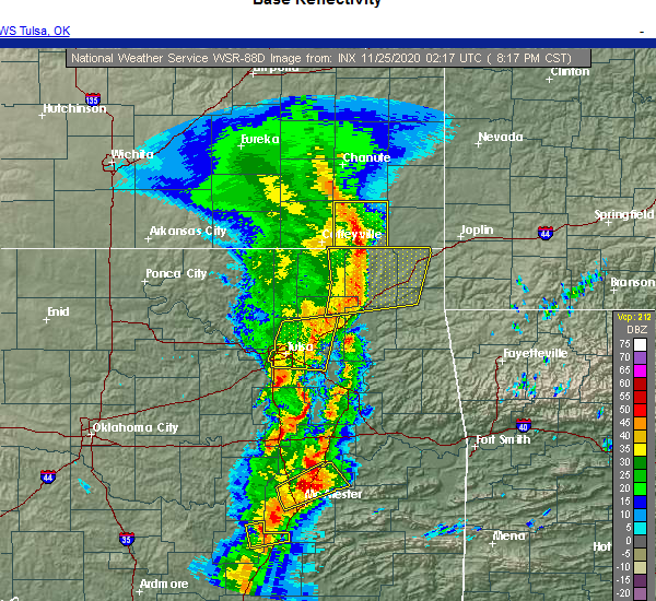 At 819 pm cst, severe thunderstorms were located along a line extending from 2 miles east of edna to 8 miles southwest of welch to 3 miles west of big cabin, moving east at 55 mph (radar indicated). Hazards include 60 mph wind gusts and quarter size hail. Hail damage to vehicles is expected. expect wind damage to roofs, siding, and trees. Locations in or near the path include, miami, vinita, grove, commerce, fairland, afton, quapaw, welch, bernice, ketchum, bluejacket, big cabin, picher, bernice state park, cleora, white oak, narcissa, ottawa, cardin, hollow, this includes interstate 44 between mile markers 273 and 316. At 819 pm cst, severe thunderstorms were located along a line extending from 2 miles east of edna to 8 miles southwest of welch to 3 miles west of big cabin, moving east at 55 mph (radar indicated). Hazards include 60 mph wind gusts and quarter size hail. Hail damage to vehicles is expected. expect wind damage to roofs, siding, and trees. Locations in or near the path include, miami, vinita, grove, commerce, fairland, afton, quapaw, welch, bernice, ketchum, bluejacket, big cabin, picher, bernice state park, cleora, white oak, narcissa, ottawa, cardin, hollow, this includes interstate 44 between mile markers 273 and 316.
|
| 11/24/2020 8:02 PM CST |
 At 802 pm cst, severe thunderstorms were located along a line extending from 6 miles east of south coffeyville to 9 miles east of delaware to near foyil, moving east at 50 mph (radar indicated). Hazards include 60 mph wind gusts and quarter size hail. Hail damage to vehicles is expected. expect wind damage to roofs, siding, and trees. Locations in or near the path include, miami, vinita, grove, commerce, chelsea, fairland, afton, quapaw, welch, bernice, ketchum, bluejacket, big cabin, new alluwe, picher, bernice state park, cleora, white oak, narcissa, ottawa, this includes interstate 44 between mile markers 269 and 316. At 802 pm cst, severe thunderstorms were located along a line extending from 6 miles east of south coffeyville to 9 miles east of delaware to near foyil, moving east at 50 mph (radar indicated). Hazards include 60 mph wind gusts and quarter size hail. Hail damage to vehicles is expected. expect wind damage to roofs, siding, and trees. Locations in or near the path include, miami, vinita, grove, commerce, chelsea, fairland, afton, quapaw, welch, bernice, ketchum, bluejacket, big cabin, new alluwe, picher, bernice state park, cleora, white oak, narcissa, ottawa, this includes interstate 44 between mile markers 269 and 316.
|
| 11/14/2020 5:42 PM CST |
 At 541 pm cst, a severe thunderstorm was located over bluejacket, moving northeast at 55 mph (radar indicated). Hazards include 60 mph wind gusts and quarter size hail. Hail damage to vehicles is expected. expect wind damage to roofs, siding, and trees. locations in or near the path include, miami, commerce, fairland, quapaw, welch, bluejacket, wyandotte, picher, narcissa, ottawa, peoria, cardin, pyramid corners, twin bridges state park, this includes interstate 44 between mile markers 298 and 324. A tornado watch remains in effect until midnight cst for northeastern oklahoma. At 541 pm cst, a severe thunderstorm was located over bluejacket, moving northeast at 55 mph (radar indicated). Hazards include 60 mph wind gusts and quarter size hail. Hail damage to vehicles is expected. expect wind damage to roofs, siding, and trees. locations in or near the path include, miami, commerce, fairland, quapaw, welch, bluejacket, wyandotte, picher, narcissa, ottawa, peoria, cardin, pyramid corners, twin bridges state park, this includes interstate 44 between mile markers 298 and 324. A tornado watch remains in effect until midnight cst for northeastern oklahoma.
|
| 8/7/2020 6:03 AM CDT |
 At 603 am cdt, severe thunderstorms were located along a line extending from 8 miles west of welch to 2 miles west of vinita, moving northeast at 15 mph (radar indicated). Hazards include 60 mph wind gusts. Expect damage to roofs, siding, and trees. Locations in or near the path include, vinita, welch, bluejacket, hollow, pyramid corners, this includes interstate 44 between mile markers 285 and 293. At 603 am cdt, severe thunderstorms were located along a line extending from 8 miles west of welch to 2 miles west of vinita, moving northeast at 15 mph (radar indicated). Hazards include 60 mph wind gusts. Expect damage to roofs, siding, and trees. Locations in or near the path include, vinita, welch, bluejacket, hollow, pyramid corners, this includes interstate 44 between mile markers 285 and 293.
|
| 7/11/2020 7:32 PM CDT |
 At 731 pm cdt, a severe thunderstorm was located 4 miles west of bluejacket, moving southeast at 35 mph (radar indicated). Hazards include golf ball size hail and 70 mph wind gusts. People and animals outdoors will be injured. expect hail damage to roofs, siding, windows, and vehicles. expect considerable tree damage. wind damage is also likely to mobile homes, roofs, and outbuildings. Locations in or near the path include, welch, bluejacket, hollow, pyramid corners,. At 731 pm cdt, a severe thunderstorm was located 4 miles west of bluejacket, moving southeast at 35 mph (radar indicated). Hazards include golf ball size hail and 70 mph wind gusts. People and animals outdoors will be injured. expect hail damage to roofs, siding, windows, and vehicles. expect considerable tree damage. wind damage is also likely to mobile homes, roofs, and outbuildings. Locations in or near the path include, welch, bluejacket, hollow, pyramid corners,.
|
| 7/11/2020 7:20 PM CDT | Hen Egg sized hail reported 9.8 miles E of Welch, OK, pics taken and sent via twitter |
| 7/11/2020 7:13 PM CDT |
 At 713 pm cdt, a severe thunderstorm was located 9 miles southeast of edna, moving southeast at 35 mph. this is a very dangerous storm (radar indicated). Hazards include baseball size hail and 70 mph wind gusts. People and animals outdoors will be severely injured. expect shattered windows, extensive damage to roofs, siding, and vehicles. Locations in or near the path include, welch, bluejacket, hollow, pyramid corners,. At 713 pm cdt, a severe thunderstorm was located 9 miles southeast of edna, moving southeast at 35 mph. this is a very dangerous storm (radar indicated). Hazards include baseball size hail and 70 mph wind gusts. People and animals outdoors will be severely injured. expect shattered windows, extensive damage to roofs, siding, and vehicles. Locations in or near the path include, welch, bluejacket, hollow, pyramid corners,.
|
| 7/11/2020 7:10 PM CDT | Hen Egg sized hail reported 10.1 miles SE of Welch, OK, also reported a tree was snapped and a power line down at the same location near the oklahoma and kansas border to the northwest of welch. |
| 7/11/2020 7:08 PM CDT |
 At 708 pm cdt, a severe thunderstorm was located 7 miles southeast of edna, moving southeast at 35 mph (radar indicated). Hazards include tennis ball size hail and 70 mph wind gusts. People and animals outdoors will be injured. expect hail damage to roofs, siding, windows, and vehicles. expect considerable tree damage. wind damage is also likely to mobile homes, roofs, and outbuildings. Locations in or near the path include, welch, bluejacket, hollow, pyramid corners,. At 708 pm cdt, a severe thunderstorm was located 7 miles southeast of edna, moving southeast at 35 mph (radar indicated). Hazards include tennis ball size hail and 70 mph wind gusts. People and animals outdoors will be injured. expect hail damage to roofs, siding, windows, and vehicles. expect considerable tree damage. wind damage is also likely to mobile homes, roofs, and outbuildings. Locations in or near the path include, welch, bluejacket, hollow, pyramid corners,.
|
| 7/11/2020 6:55 PM CDT |
 At 654 pm cdt, a severe thunderstorm was located near edna, moving southeast at 35 mph (radar indicated). Hazards include two inch hail and 70 mph wind gusts. People and animals outdoors will be injured. expect hail damage to roofs, siding, windows, and vehicles. expect considerable tree damage. wind damage is also likely to mobile homes, roofs, and outbuildings. Locations in or near the path include, welch, bluejacket, hollow, pyramid corners,. At 654 pm cdt, a severe thunderstorm was located near edna, moving southeast at 35 mph (radar indicated). Hazards include two inch hail and 70 mph wind gusts. People and animals outdoors will be injured. expect hail damage to roofs, siding, windows, and vehicles. expect considerable tree damage. wind damage is also likely to mobile homes, roofs, and outbuildings. Locations in or near the path include, welch, bluejacket, hollow, pyramid corners,.
|
| 7/11/2020 6:48 PM CDT |
 At 648 pm cdt, a severe thunderstorm was located 5 miles east of welch, moving southeast at 30 mph (radar indicated). Hazards include 70 mph wind gusts and half dollar size hail. Hail damage to vehicles is expected. expect considerable tree damage. wind damage is also likely to mobile homes, roofs, and outbuildings. Locations in or near the path include, miami, commerce, fairland, quapaw, welch, bluejacket, wyandotte, picher, narcissa, ottawa, peoria, cardin, twin bridges state park, this includes interstate 44 between mile markers 299 and 324. At 648 pm cdt, a severe thunderstorm was located 5 miles east of welch, moving southeast at 30 mph (radar indicated). Hazards include 70 mph wind gusts and half dollar size hail. Hail damage to vehicles is expected. expect considerable tree damage. wind damage is also likely to mobile homes, roofs, and outbuildings. Locations in or near the path include, miami, commerce, fairland, quapaw, welch, bluejacket, wyandotte, picher, narcissa, ottawa, peoria, cardin, twin bridges state park, this includes interstate 44 between mile markers 299 and 324.
|
| 7/11/2020 6:38 PM CDT |
 At 638 pm cdt, a severe thunderstorm was located 6 miles northeast of welch, moving southeast at 30 mph (radar indicated). Hazards include two inch hail and 70 mph wind gusts. People and animals outdoors will be injured. expect hail damage to roofs, siding, windows, and vehicles. expect considerable tree damage. wind damage is also likely to mobile homes, roofs, and outbuildings. Locations in or near the path include, miami, commerce, fairland, quapaw, welch, bluejacket, wyandotte, picher, narcissa, ottawa, peoria, cardin, pyramid corners, twin bridges state park, this includes interstate 44 between mile markers 299 and 324. At 638 pm cdt, a severe thunderstorm was located 6 miles northeast of welch, moving southeast at 30 mph (radar indicated). Hazards include two inch hail and 70 mph wind gusts. People and animals outdoors will be injured. expect hail damage to roofs, siding, windows, and vehicles. expect considerable tree damage. wind damage is also likely to mobile homes, roofs, and outbuildings. Locations in or near the path include, miami, commerce, fairland, quapaw, welch, bluejacket, wyandotte, picher, narcissa, ottawa, peoria, cardin, pyramid corners, twin bridges state park, this includes interstate 44 between mile markers 299 and 324.
|
| 7/11/2020 6:19 PM CDT |
 At 618 pm cdt, a severe thunderstorm was located over chetopa, moving south at 35 mph. this is a very dangerous storm (radar indicated). Hazards include baseball size hail and 70 mph wind gusts. People and animals outdoors will be severely injured. expect shattered windows, extensive damage to roofs, siding, and vehicles. Locations in or near the path include, miami, commerce, fairland, quapaw, welch, bluejacket, wyandotte, picher, narcissa, ottawa, peoria, cardin, pyramid corners, twin bridges state park, this includes interstate 44 between mile markers 299 and 324. At 618 pm cdt, a severe thunderstorm was located over chetopa, moving south at 35 mph. this is a very dangerous storm (radar indicated). Hazards include baseball size hail and 70 mph wind gusts. People and animals outdoors will be severely injured. expect shattered windows, extensive damage to roofs, siding, and vehicles. Locations in or near the path include, miami, commerce, fairland, quapaw, welch, bluejacket, wyandotte, picher, narcissa, ottawa, peoria, cardin, pyramid corners, twin bridges state park, this includes interstate 44 between mile markers 299 and 324.
|
| 7/11/2020 5:54 PM CDT |
 At 552 pm cdt, a severe thunderstorm was located 3 miles northwest of oswego, moving south at 35 mph. this is a very dangerous storm (radar indicated). Hazards include baseball size hail and 70 mph wind gusts. People and animals outdoors will be severely injured. expect shattered windows, extensive damage to roofs, siding, and vehicles. locations in or near the path include, miami, commerce, fairland, quapaw, welch, bluejacket, wyandotte, picher, narcissa, ottawa, peoria, cardin, pyramid corners, twin bridges state park, this includes interstate 44 between mile markers 299 and 324. this is a dangerous storm. Take the proper precautions now while there is time. At 552 pm cdt, a severe thunderstorm was located 3 miles northwest of oswego, moving south at 35 mph. this is a very dangerous storm (radar indicated). Hazards include baseball size hail and 70 mph wind gusts. People and animals outdoors will be severely injured. expect shattered windows, extensive damage to roofs, siding, and vehicles. locations in or near the path include, miami, commerce, fairland, quapaw, welch, bluejacket, wyandotte, picher, narcissa, ottawa, peoria, cardin, pyramid corners, twin bridges state park, this includes interstate 44 between mile markers 299 and 324. this is a dangerous storm. Take the proper precautions now while there is time.
|
| 5/4/2020 5:36 PM CDT |
 At 535 pm cdt, a severe thunderstorm was located 4 miles northeast of welch, moving east at 40 mph (radar indicated). Hazards include quarter size hail. Damage to vehicles is expected. locations in or near the path include, miami, commerce, quapaw, welch, picher, peoria, cardin, this includes interstate 44 between mile markers 310 and 324. A tornado watch remains in effect until 1000 pm cdt for northeastern oklahoma. At 535 pm cdt, a severe thunderstorm was located 4 miles northeast of welch, moving east at 40 mph (radar indicated). Hazards include quarter size hail. Damage to vehicles is expected. locations in or near the path include, miami, commerce, quapaw, welch, picher, peoria, cardin, this includes interstate 44 between mile markers 310 and 324. A tornado watch remains in effect until 1000 pm cdt for northeastern oklahoma.
|
| 5/4/2020 5:18 PM CDT |
 At 518 pm cdt, a severe thunderstorm was located 5 miles northwest of welch, moving east at 35 mph (radar indicated). Hazards include quarter size hail. Damage to vehicles is expected. locations in or near the path include, miami, commerce, quapaw, welch, picher, peoria, cardin, hollow, this includes interstate 44 between mile markers 310 and 324. A tornado watch remains in effect until 1000 pm cdt for northeastern oklahoma. At 518 pm cdt, a severe thunderstorm was located 5 miles northwest of welch, moving east at 35 mph (radar indicated). Hazards include quarter size hail. Damage to vehicles is expected. locations in or near the path include, miami, commerce, quapaw, welch, picher, peoria, cardin, hollow, this includes interstate 44 between mile markers 310 and 324. A tornado watch remains in effect until 1000 pm cdt for northeastern oklahoma.
|
| 5/4/2020 4:25 PM CDT | Golf Ball sized hail reported 7.4 miles SE of Welch, OK, report from labette county kansas em |
| 5/4/2020 9:03 AM CDT |
 At 902 am cdt, severe thunderstorms were located along a line extending from 6 miles northeast of welch to 3 miles west of wyandotte, moving northeast at 40 mph (radar indicated). Hazards include two inch hail. People and animals outdoors will be injured. expect damage to roofs, siding, windows, and vehicles. Locations in or near the path include, miami, vinita, commerce, fairland, afton, quapaw, welch, bluejacket, wyandotte, picher, narcissa, ottawa, peoria, cardin, pyramid corners, twin bridges state park, this includes interstate 44 between mile markers 286 and 324. At 902 am cdt, severe thunderstorms were located along a line extending from 6 miles northeast of welch to 3 miles west of wyandotte, moving northeast at 40 mph (radar indicated). Hazards include two inch hail. People and animals outdoors will be injured. expect damage to roofs, siding, windows, and vehicles. Locations in or near the path include, miami, vinita, commerce, fairland, afton, quapaw, welch, bluejacket, wyandotte, picher, narcissa, ottawa, peoria, cardin, pyramid corners, twin bridges state park, this includes interstate 44 between mile markers 286 and 324.
|
| 5/4/2020 8:51 AM CDT |
 At 850 am cdt, severe thunderstorms were located along a line extending from 3 miles northwest of bluejacket to near afton, moving northeast at 35 mph (radar indicated). Hazards include ping pong ball size hail. People and animals outdoors will be injured. expect damage to roofs, siding, windows, and vehicles. Locations in or near the path include, miami, vinita, commerce, fairland, afton, quapaw, welch, bluejacket, wyandotte, picher, narcissa, ottawa, peoria, cardin, pyramid corners, twin bridges state park, this includes interstate 44 between mile markers 286 and 324. At 850 am cdt, severe thunderstorms were located along a line extending from 3 miles northwest of bluejacket to near afton, moving northeast at 35 mph (radar indicated). Hazards include ping pong ball size hail. People and animals outdoors will be injured. expect damage to roofs, siding, windows, and vehicles. Locations in or near the path include, miami, vinita, commerce, fairland, afton, quapaw, welch, bluejacket, wyandotte, picher, narcissa, ottawa, peoria, cardin, pyramid corners, twin bridges state park, this includes interstate 44 between mile markers 286 and 324.
|
| 5/4/2020 8:43 AM CDT |
 At 843 am cdt, a severe thunderstorm was located 9 miles north of white oak, moving northeast at 30 mph (radar indicated). Hazards include quarter size hail. Damage to vehicles is expected. Locations in or near the path include, welch, hollow, pyramid corners, centralia, centrailia,. At 843 am cdt, a severe thunderstorm was located 9 miles north of white oak, moving northeast at 30 mph (radar indicated). Hazards include quarter size hail. Damage to vehicles is expected. Locations in or near the path include, welch, hollow, pyramid corners, centralia, centrailia,.
|
| 5/4/2020 8:28 AM CDT |
 At 828 am cdt, a severe thunderstorm was located 9 miles northeast of new alluwe, moving northeast at 30 mph (radar indicated). Hazards include quarter size hail. Damage to vehicles is expected. Locations in or near the path include, welch, hollow, pyramid corners, centralia, centrailia,. At 828 am cdt, a severe thunderstorm was located 9 miles northeast of new alluwe, moving northeast at 30 mph (radar indicated). Hazards include quarter size hail. Damage to vehicles is expected. Locations in or near the path include, welch, hollow, pyramid corners, centralia, centrailia,.
|
| 5/4/2020 8:19 AM CDT |
 The national weather service in tulsa has issued a * severe thunderstorm warning for. northern craig county in northeastern oklahoma. southeastern nowata county in northeastern oklahoma. until 915 am cdt. At 819 am cdt, a severe thunderstorm was located 6 miles north of. The national weather service in tulsa has issued a * severe thunderstorm warning for. northern craig county in northeastern oklahoma. southeastern nowata county in northeastern oklahoma. until 915 am cdt. At 819 am cdt, a severe thunderstorm was located 6 miles north of.
|
| 5/3/2020 9:16 AM CDT |
 At 916 am cdt, a severe thunderstorm was located 3 miles south of chetopa, moving east at 45 mph (radar indicated). Hazards include 60 mph wind gusts. Expect damage to roofs, siding, and trees. Locations in or near the path include, miami, commerce, quapaw, welch, wyandotte, picher, ottawa, peoria, cardin, hollow, twin bridges state park, this includes interstate 44 between mile markers 305 and 324. At 916 am cdt, a severe thunderstorm was located 3 miles south of chetopa, moving east at 45 mph (radar indicated). Hazards include 60 mph wind gusts. Expect damage to roofs, siding, and trees. Locations in or near the path include, miami, commerce, quapaw, welch, wyandotte, picher, ottawa, peoria, cardin, hollow, twin bridges state park, this includes interstate 44 between mile markers 305 and 324.
|
| 5/3/2020 9:01 AM CDT |
 At 900 am cdt, a severe thunderstorm was located 5 miles southeast of edna, moving east at 50 mph (radar indicated). Hazards include 60 mph wind gusts. Expect damage to roofs, siding, and trees. Locations in or near the path include, miami, commerce, fairland, quapaw, welch, bluejacket, wyandotte, picher, narcissa, ottawa, peoria, cardin, hollow, twin bridges state park, this includes interstate 44 between mile markers 301 and 324. At 900 am cdt, a severe thunderstorm was located 5 miles southeast of edna, moving east at 50 mph (radar indicated). Hazards include 60 mph wind gusts. Expect damage to roofs, siding, and trees. Locations in or near the path include, miami, commerce, fairland, quapaw, welch, bluejacket, wyandotte, picher, narcissa, ottawa, peoria, cardin, hollow, twin bridges state park, this includes interstate 44 between mile markers 301 and 324.
|
| 4/28/2020 5:44 PM CDT |
 At 544 pm cdt, severe thunderstorms were located along a line extending from 3 miles southeast of chetopa to 11 miles west of welch to 3 miles southeast of nowata, moving east at 55 mph (radar indicated). Hazards include 60 mph wind gusts and quarter size hail. Hail damage to vehicles is expected. expect wind damage to roofs, siding, and trees. locations in or near the path include, miami, vinita, grove, commerce, chelsea, fairland, afton, quapaw, welch, bernice, ketchum, bluejacket, wyandotte, big cabin, picher, honey creek state park, bernice state park, cleora, white oak, narcissa, this includes interstate 44 between mile markers 273 and 324. A tornado watch remains in effect until 1100 pm cdt for northeastern oklahoma. At 544 pm cdt, severe thunderstorms were located along a line extending from 3 miles southeast of chetopa to 11 miles west of welch to 3 miles southeast of nowata, moving east at 55 mph (radar indicated). Hazards include 60 mph wind gusts and quarter size hail. Hail damage to vehicles is expected. expect wind damage to roofs, siding, and trees. locations in or near the path include, miami, vinita, grove, commerce, chelsea, fairland, afton, quapaw, welch, bernice, ketchum, bluejacket, wyandotte, big cabin, picher, honey creek state park, bernice state park, cleora, white oak, narcissa, this includes interstate 44 between mile markers 273 and 324. A tornado watch remains in effect until 1100 pm cdt for northeastern oklahoma.
|
| 4/28/2020 5:19 PM CDT |
 At 519 pm cdt, severe thunderstorms were located along a line extending from 5 miles east of south coffeyville to ochelata, moving southeast at 30 mph (radar indicated). Hazards include 60 mph wind gusts and quarter size hail. Hail damage to vehicles is expected. expect wind damage to roofs, siding, and trees. Locations in or near the path include, bartlesville, nowata, chelsea, oologah, south coffeyville, welch, ramona, ochelata, delaware, foyil, bluejacket, lenapah, talala, new alluwe, watova, white oak, hollow, centrailia, pyramid corners, bushyhead, a tornado watch remains in effect until 1100 pm cdt for northeastern oklahoma. At 519 pm cdt, severe thunderstorms were located along a line extending from 5 miles east of south coffeyville to ochelata, moving southeast at 30 mph (radar indicated). Hazards include 60 mph wind gusts and quarter size hail. Hail damage to vehicles is expected. expect wind damage to roofs, siding, and trees. Locations in or near the path include, bartlesville, nowata, chelsea, oologah, south coffeyville, welch, ramona, ochelata, delaware, foyil, bluejacket, lenapah, talala, new alluwe, watova, white oak, hollow, centrailia, pyramid corners, bushyhead, a tornado watch remains in effect until 1100 pm cdt for northeastern oklahoma.
|
| 3/11/2020 5:07 AM CDT |
 At 507 am cdt, severe thunderstorms were located along a line extending from 3 miles southwest of welch to 2 miles south of baxter springs, moving southeast at 50 mph (radar indicated). Hazards include 60 mph wind gusts and quarter size hail. Hail damage to vehicles is expected. expect wind damage to roofs, siding, and trees. Locations in or near the path include, miami, jay, grove, commerce, fairland, afton, quapaw, welch, bernice, bluejacket, wyandotte, picher, honey creek state park, bernice state park, narcissa, ottawa, peoria, cardin, twin bridges state park, this includes interstate 44 between mile markers 293 and 324. At 507 am cdt, severe thunderstorms were located along a line extending from 3 miles southwest of welch to 2 miles south of baxter springs, moving southeast at 50 mph (radar indicated). Hazards include 60 mph wind gusts and quarter size hail. Hail damage to vehicles is expected. expect wind damage to roofs, siding, and trees. Locations in or near the path include, miami, jay, grove, commerce, fairland, afton, quapaw, welch, bernice, bluejacket, wyandotte, picher, honey creek state park, bernice state park, narcissa, ottawa, peoria, cardin, twin bridges state park, this includes interstate 44 between mile markers 293 and 324.
|
| 1/10/2020 12:23 PM CST |
 At 1223 pm cst, severe thunderstorms were located along a line extending from 3 miles south of spavinaw to 5 miles southeast of bernice and from 2 miles northwest of fairland to 8 miles west of welch, moving northeast at 55 mph (radar indicated). Hazards include 60 mph wind gusts and penny size hail. Expect damage to roofs, siding, and trees. locations in or near the path include, miami, grove, salina, fairland, afton, langley, welch, bernice, ketchum, spavinaw, bluejacket, wyandotte, disney, hoot owl, honey creek state park, cherokee state park, bernice state park, cleora, chloeta, spavinaw state park, this includes interstate 44 between mile markers 290 and 306. A tornado watch remains in effect until 600 pm cst for northeastern oklahoma. At 1223 pm cst, severe thunderstorms were located along a line extending from 3 miles south of spavinaw to 5 miles southeast of bernice and from 2 miles northwest of fairland to 8 miles west of welch, moving northeast at 55 mph (radar indicated). Hazards include 60 mph wind gusts and penny size hail. Expect damage to roofs, siding, and trees. locations in or near the path include, miami, grove, salina, fairland, afton, langley, welch, bernice, ketchum, spavinaw, bluejacket, wyandotte, disney, hoot owl, honey creek state park, cherokee state park, bernice state park, cleora, chloeta, spavinaw state park, this includes interstate 44 between mile markers 290 and 306. A tornado watch remains in effect until 600 pm cst for northeastern oklahoma.
|
| 1/10/2020 12:08 PM CST |
 At 1207 pm cst, severe thunderstorms were located along a line extending from near locust grove to 2 miles east of spavinaw and also from 2 miles northwest of cleora to 2 miles southwest of white oak, moving northeast at 55 mph (radar indicated). Hazards include 60 mph wind gusts and nickel size hail. Expect damage to roofs, siding, and trees. locations in or near the path include, miami, vinita, grove, locust grove, salina, fairland, afton, langley, welch, bernice, ketchum, spavinaw, bluejacket, wyandotte, disney, big cabin, pensacola, hoot owl, honey creek state park, cherokee state park, this includes interstate 44 between mile markers 274 and 306. A tornado watch remains in effect until 600 pm cst for northeastern and east central oklahoma. At 1207 pm cst, severe thunderstorms were located along a line extending from near locust grove to 2 miles east of spavinaw and also from 2 miles northwest of cleora to 2 miles southwest of white oak, moving northeast at 55 mph (radar indicated). Hazards include 60 mph wind gusts and nickel size hail. Expect damage to roofs, siding, and trees. locations in or near the path include, miami, vinita, grove, locust grove, salina, fairland, afton, langley, welch, bernice, ketchum, spavinaw, bluejacket, wyandotte, disney, big cabin, pensacola, hoot owl, honey creek state park, cherokee state park, this includes interstate 44 between mile markers 274 and 306. A tornado watch remains in effect until 600 pm cst for northeastern and east central oklahoma.
|
| 1/10/2020 11:54 AM CST |
 At 1154 am cst, severe thunderstorms were located along a line extending from 2 miles southeast of locust grove to pensacola to 7 miles east of foyil, moving northeast at 55 mph (radar indicated). Hazards include 60 mph wind gusts and nickel size hail. Expect damage to roofs, siding, and trees. locations in or near the path include, miami, vinita, pryor, pryor creek, grove, locust grove, salina, fairland, afton, langley, adair, welch, bernice, ketchum, spavinaw, bluejacket, wyandotte, disney, big cabin, pensacola, this includes interstate 44 between mile markers 261 and 306. A tornado watch remains in effect until 600 pm cst for northeastern and east central oklahoma. At 1154 am cst, severe thunderstorms were located along a line extending from 2 miles southeast of locust grove to pensacola to 7 miles east of foyil, moving northeast at 55 mph (radar indicated). Hazards include 60 mph wind gusts and nickel size hail. Expect damage to roofs, siding, and trees. locations in or near the path include, miami, vinita, pryor, pryor creek, grove, locust grove, salina, fairland, afton, langley, adair, welch, bernice, ketchum, spavinaw, bluejacket, wyandotte, disney, big cabin, pensacola, this includes interstate 44 between mile markers 261 and 306. A tornado watch remains in effect until 600 pm cst for northeastern and east central oklahoma.
|
| 10/20/2019 10:58 PM CDT |
 At 1057 pm cdt, severe thunderstorms were located along a line extending from 2 miles west of welch to 4 miles west of ketchum, moving northeast at 60 mph (radar indicated). Hazards include 60 mph wind gusts and penny size hail. Expect damage to roofs, siding, and trees. locations in or near the path include, miami, vinita, grove, commerce, fairland, afton, quapaw, welch, bernice, ketchum, bluejacket, wyandotte, picher, honey creek state park, bernice state park, cleora, narcissa, ottawa, peoria, cardin, this includes interstate 44 between mile markers 283 and 324. A tornado watch remains in effect until 300 am cdt for northeastern oklahoma. At 1057 pm cdt, severe thunderstorms were located along a line extending from 2 miles west of welch to 4 miles west of ketchum, moving northeast at 60 mph (radar indicated). Hazards include 60 mph wind gusts and penny size hail. Expect damage to roofs, siding, and trees. locations in or near the path include, miami, vinita, grove, commerce, fairland, afton, quapaw, welch, bernice, ketchum, bluejacket, wyandotte, picher, honey creek state park, bernice state park, cleora, narcissa, ottawa, peoria, cardin, this includes interstate 44 between mile markers 283 and 324. A tornado watch remains in effect until 300 am cdt for northeastern oklahoma.
|
| 8/30/2019 3:20 AM CDT |
 At 320 am cdt, severe thunderstorms were located along a line extending from 6 miles southwest of chetopa to 9 miles north of new alluwe to 3 miles northwest of talala, moving southeast at 55 mph (radar indicated). Hazards include 60 mph wind gusts. Expect damage to roofs, siding, and trees. Locations in or near the path include, vinita, nowata, chelsea, oologah, welch, delaware, foyil, bluejacket, lenapah, talala, new alluwe, watova, white oak, hollow, centrailia, pyramid corners, bushyhead, centralia,. At 320 am cdt, severe thunderstorms were located along a line extending from 6 miles southwest of chetopa to 9 miles north of new alluwe to 3 miles northwest of talala, moving southeast at 55 mph (radar indicated). Hazards include 60 mph wind gusts. Expect damage to roofs, siding, and trees. Locations in or near the path include, vinita, nowata, chelsea, oologah, welch, delaware, foyil, bluejacket, lenapah, talala, new alluwe, watova, white oak, hollow, centrailia, pyramid corners, bushyhead, centralia,.
|
| 8/30/2019 2:52 AM CDT |
 The national weather service in tulsa has issued a * severe thunderstorm warning for. craig county in northeastern oklahoma. northern rogers county in northeastern oklahoma. northwestern mayes county in northeastern oklahoma. Northern washington county in northeastern oklahoma. The national weather service in tulsa has issued a * severe thunderstorm warning for. craig county in northeastern oklahoma. northern rogers county in northeastern oklahoma. northwestern mayes county in northeastern oklahoma. Northern washington county in northeastern oklahoma.
|
| 8/26/2019 10:19 PM CDT |
 At 1019 pm cdt, severe thunderstorms were located along a line extending from 6 miles west of goodman to 7 miles northeast of grove to near cleora, moving southeast at 25 mph (radar indicated). Hazards include 60 mph wind gusts and nickel size hail. Expect damage to roofs, siding, and trees. Locations in or near the path include, miami, grove, commerce, fairland, afton, quapaw, welch, bernice, bluejacket, wyandotte, picher, honey creek state park, bernice state park, cleora, narcissa, ottawa, peoria, cardin, pyramid corners, twin bridges state park, this includes interstate 44 between mile markers 290 and 324. At 1019 pm cdt, severe thunderstorms were located along a line extending from 6 miles west of goodman to 7 miles northeast of grove to near cleora, moving southeast at 25 mph (radar indicated). Hazards include 60 mph wind gusts and nickel size hail. Expect damage to roofs, siding, and trees. Locations in or near the path include, miami, grove, commerce, fairland, afton, quapaw, welch, bernice, bluejacket, wyandotte, picher, honey creek state park, bernice state park, cleora, narcissa, ottawa, peoria, cardin, pyramid corners, twin bridges state park, this includes interstate 44 between mile markers 290 and 324.
|
| 8/26/2019 9:59 PM CDT |
 At 957 pm cdt, severe thunderstorms were located along a line extending from near seneca to 4 miles southwest of wyandotte to 5 miles west of afton, moving southeast at 30 mph (radar indicated). Hazards include 70 mph wind gusts and quarter size hail. Hail damage to vehicles is expected. expect considerable tree damage. wind damage is also likely to mobile homes, roofs, and outbuildings. Locations in or near the path include, miami, grove, commerce, fairland, afton, quapaw, welch, bernice, bluejacket, wyandotte, picher, honey creek state park, bernice state park, cleora, narcissa, ottawa, peoria, cardin, pyramid corners, twin bridges state park, this includes interstate 44 between mile markers 290 and 324. At 957 pm cdt, severe thunderstorms were located along a line extending from near seneca to 4 miles southwest of wyandotte to 5 miles west of afton, moving southeast at 30 mph (radar indicated). Hazards include 70 mph wind gusts and quarter size hail. Hail damage to vehicles is expected. expect considerable tree damage. wind damage is also likely to mobile homes, roofs, and outbuildings. Locations in or near the path include, miami, grove, commerce, fairland, afton, quapaw, welch, bernice, bluejacket, wyandotte, picher, honey creek state park, bernice state park, cleora, narcissa, ottawa, peoria, cardin, pyramid corners, twin bridges state park, this includes interstate 44 between mile markers 290 and 324.
|
| 8/26/2019 9:37 PM CDT |
 At 937 pm cdt, a severe thunderstorm was located near wyandotte, moving southeast at 15 mph (radar indicated). Hazards include 60 mph wind gusts and quarter size hail. Hail damage to vehicles is expected. expect wind damage to roofs, siding, and trees. Locations in or near the path include, miami, grove, commerce, fairland, afton, quapaw, welch, bernice, bluejacket, wyandotte, picher, honey creek state park, bernice state park, cleora, narcissa, ottawa, peoria, cardin, pyramid corners, twin bridges state park, this includes interstate 44 between mile markers 290 and 324. At 937 pm cdt, a severe thunderstorm was located near wyandotte, moving southeast at 15 mph (radar indicated). Hazards include 60 mph wind gusts and quarter size hail. Hail damage to vehicles is expected. expect wind damage to roofs, siding, and trees. Locations in or near the path include, miami, grove, commerce, fairland, afton, quapaw, welch, bernice, bluejacket, wyandotte, picher, honey creek state park, bernice state park, cleora, narcissa, ottawa, peoria, cardin, pyramid corners, twin bridges state park, this includes interstate 44 between mile markers 290 and 324.
|
| 8/18/2019 4:52 AM CDT |
 The severe thunderstorm warning for northern craig county will expire at 500 am cdt, the storm which prompted the warning has weakened below severe limits, and no longer poses an immediate threat to life or property. therefore the warning will be allowed to expire. however gusty winds and heavy rain are still possible with this thunderstorm. a severe thunderstorm watch remains in effect until 1000 am cdt for northeastern oklahoma. The severe thunderstorm warning for northern craig county will expire at 500 am cdt, the storm which prompted the warning has weakened below severe limits, and no longer poses an immediate threat to life or property. therefore the warning will be allowed to expire. however gusty winds and heavy rain are still possible with this thunderstorm. a severe thunderstorm watch remains in effect until 1000 am cdt for northeastern oklahoma.
|
| 8/18/2019 4:20 AM CDT |
 At 420 am cdt, a severe thunderstorm was located 6 miles southeast of edna, moving east at 30 mph (radar indicated). Hazards include 60 mph wind gusts and quarter size hail. Hail damage to vehicles is expected. expect wind damage to roofs, siding, and trees. Locations in or near the path include, welch, bluejacket, hollow,. At 420 am cdt, a severe thunderstorm was located 6 miles southeast of edna, moving east at 30 mph (radar indicated). Hazards include 60 mph wind gusts and quarter size hail. Hail damage to vehicles is expected. expect wind damage to roofs, siding, and trees. Locations in or near the path include, welch, bluejacket, hollow,.
|
| 8/18/2019 4:12 AM CDT |
 At 411 am cdt, a severe thunderstorm was located 5 miles south of edna, moving east at 30 mph (radar indicated). Hazards include 60 mph wind gusts and quarter size hail. Hail damage to vehicles is expected. expect wind damage to roofs, siding, and trees. Locations in or near the path include, welch, bluejacket, hollow,. At 411 am cdt, a severe thunderstorm was located 5 miles south of edna, moving east at 30 mph (radar indicated). Hazards include 60 mph wind gusts and quarter size hail. Hail damage to vehicles is expected. expect wind damage to roofs, siding, and trees. Locations in or near the path include, welch, bluejacket, hollow,.
|
| 7/21/2019 10:22 PM CDT |
 The severe thunderstorm warning for craig, northwestern delaware and ottawa counties will expire at 1030 pm cdt, the storms which prompted the warning have weakened below severe limits, and no longer pose an immediate threat to life or property. therefore the warning will be allowed to expire. however gusty winds are still possible with these thunderstorms. The severe thunderstorm warning for craig, northwestern delaware and ottawa counties will expire at 1030 pm cdt, the storms which prompted the warning have weakened below severe limits, and no longer pose an immediate threat to life or property. therefore the warning will be allowed to expire. however gusty winds are still possible with these thunderstorms.
|
| 7/21/2019 10:13 PM CDT |
 At 1012 pm cdt, severe thunderstorms were located along a line extending from joplin to 4 miles northwest of narcissa, moving southeast at 45 mph (radar indicated). Hazards include 60 mph wind gusts. Expect damage to roofs, siding, and trees. Locations in or near the path include, miami, vinita, baxter springs, grove, commerce, fairland, afton, quapaw, welch, bernice, bluejacket, wyandotte, treece, picher, bernice state park, white oak, narcissa, ottawa, cayuga, peoria, this includes interstate 44 between mile markers 282 and 324. At 1012 pm cdt, severe thunderstorms were located along a line extending from joplin to 4 miles northwest of narcissa, moving southeast at 45 mph (radar indicated). Hazards include 60 mph wind gusts. Expect damage to roofs, siding, and trees. Locations in or near the path include, miami, vinita, baxter springs, grove, commerce, fairland, afton, quapaw, welch, bernice, bluejacket, wyandotte, treece, picher, bernice state park, white oak, narcissa, ottawa, cayuga, peoria, this includes interstate 44 between mile markers 282 and 324.
|
| 7/21/2019 9:52 PM CDT |
 At 952 pm cdt, severe thunderstorms were located along a line extending from 6 miles west of carl junction to 3 miles south of chetopa, moving southeast at 40 mph (radar indicated). Hazards include 60 mph wind gusts. Expect damage to roofs, siding, and trees. Locations in or near the path include, miami, vinita, baxter springs, grove, commerce, fairland, afton, quapaw, welch, bernice, bluejacket, wyandotte, treece, picher, bernice state park, white oak, narcissa, ottawa, cayuga, peoria, this includes interstate 44 between mile markers 282 and 324. At 952 pm cdt, severe thunderstorms were located along a line extending from 6 miles west of carl junction to 3 miles south of chetopa, moving southeast at 40 mph (radar indicated). Hazards include 60 mph wind gusts. Expect damage to roofs, siding, and trees. Locations in or near the path include, miami, vinita, baxter springs, grove, commerce, fairland, afton, quapaw, welch, bernice, bluejacket, wyandotte, treece, picher, bernice state park, white oak, narcissa, ottawa, cayuga, peoria, this includes interstate 44 between mile markers 282 and 324.
|
| 6/1/2019 4:41 PM CDT |
 At 440 pm cdt, a severe thunderstorm was located 13 miles south of edna, moving east at 35 mph (radar indicated). Hazards include 60 mph wind gusts and quarter size hail. Hail damage to vehicles is expected. expect wind damage to roofs, siding, and trees. locations in or near the path include, welch, bluejacket, hollow, pyramid corners, centralia, centrailia, a pronounced weakening trend has been observed with this storm. If this trend continues, the warning may be canceled early. At 440 pm cdt, a severe thunderstorm was located 13 miles south of edna, moving east at 35 mph (radar indicated). Hazards include 60 mph wind gusts and quarter size hail. Hail damage to vehicles is expected. expect wind damage to roofs, siding, and trees. locations in or near the path include, welch, bluejacket, hollow, pyramid corners, centralia, centrailia, a pronounced weakening trend has been observed with this storm. If this trend continues, the warning may be canceled early.
|
| 6/1/2019 4:33 PM CDT |
 At 433 pm cdt, a severe thunderstorm was located 12 miles east of lenapah, moving east at 35 mph (radar indicated). Hazards include 60 mph wind gusts and half dollar size hail. Hail damage to vehicles is expected. expect wind damage to roofs, siding, and trees. Locations in or near the path include, welch, bluejacket, hollow, pyramid corners, centralia, centrailia,. At 433 pm cdt, a severe thunderstorm was located 12 miles east of lenapah, moving east at 35 mph (radar indicated). Hazards include 60 mph wind gusts and half dollar size hail. Hail damage to vehicles is expected. expect wind damage to roofs, siding, and trees. Locations in or near the path include, welch, bluejacket, hollow, pyramid corners, centralia, centrailia,.
|
| 6/1/2019 4:23 PM CDT |
 At 423 pm cdt, a severe thunderstorm was located 6 miles east of lenapah, moving east at 35 mph (radar indicated). Hazards include 60 mph wind gusts and quarter size hail. Hail damage to vehicles is expected. expect wind damage to roofs, siding, and trees. Locations in or near the path include, welch, bluejacket, hollow, pyramid corners, centralia, centrailia,. At 423 pm cdt, a severe thunderstorm was located 6 miles east of lenapah, moving east at 35 mph (radar indicated). Hazards include 60 mph wind gusts and quarter size hail. Hail damage to vehicles is expected. expect wind damage to roofs, siding, and trees. Locations in or near the path include, welch, bluejacket, hollow, pyramid corners, centralia, centrailia,.
|
| 5/22/2019 7:13 PM CDT |
 At 713 pm cdt, a severe thunderstorm capable of producing a tornado was located 6 miles northeast of welch, moving northeast at 40 mph (radar indicated rotation). Hazards include tornado and quarter size hail. Flying debris will be dangerous to those caught without shelter. mobile homes will be damaged or destroyed. damage to roofs, windows, and vehicles will occur. tree damage is likely. Locations in or near the path include, commerce, welch, treece, picher, cardin,. At 713 pm cdt, a severe thunderstorm capable of producing a tornado was located 6 miles northeast of welch, moving northeast at 40 mph (radar indicated rotation). Hazards include tornado and quarter size hail. Flying debris will be dangerous to those caught without shelter. mobile homes will be damaged or destroyed. damage to roofs, windows, and vehicles will occur. tree damage is likely. Locations in or near the path include, commerce, welch, treece, picher, cardin,.
|
| 5/22/2019 6:59 PM CDT |
 At 659 pm cdt, a severe thunderstorm capable of producing a tornado was located over welch, moving northeast at 35 mph (radar indicated rotation). Hazards include tornado. Flying debris will be dangerous to those caught without shelter. mobile homes will be damaged or destroyed. damage to roofs, windows, and vehicles will occur. tree damage is likely. Locations in or near the path include, welch, pyramid corners,. At 659 pm cdt, a severe thunderstorm capable of producing a tornado was located over welch, moving northeast at 35 mph (radar indicated rotation). Hazards include tornado. Flying debris will be dangerous to those caught without shelter. mobile homes will be damaged or destroyed. damage to roofs, windows, and vehicles will occur. tree damage is likely. Locations in or near the path include, welch, pyramid corners,.
|
| 5/22/2019 6:58 PM CDT |
 At 657 pm cdt, a severe thunderstorm capable of producing a tornado was located near welch, moving northeast at 35 mph (radar indicated rotation). Hazards include tornado and quarter size hail. Flying debris will be dangerous to those caught without shelter. mobile homes will be damaged or destroyed. damage to roofs, windows, and vehicles will occur. tree damage is likely. Locations in or near the path include, commerce, welch, bluejacket, treece, picher, cardin, pyramid corners,. At 657 pm cdt, a severe thunderstorm capable of producing a tornado was located near welch, moving northeast at 35 mph (radar indicated rotation). Hazards include tornado and quarter size hail. Flying debris will be dangerous to those caught without shelter. mobile homes will be damaged or destroyed. damage to roofs, windows, and vehicles will occur. tree damage is likely. Locations in or near the path include, commerce, welch, bluejacket, treece, picher, cardin, pyramid corners,.
|
| 5/22/2019 6:51 PM CDT |
 At 651 pm cdt, severe thunderstorms were located along a line extending from 5 miles west of talala to 3 miles northwest of new alluwe to 6 miles south of edna to 4 miles west of welch, moving northeast at 40 mph (radar indicated). Hazards include 60 mph wind gusts and quarter size hail. Hail damage to vehicles is expected. expect wind damage to roofs, siding, and trees. Locations in or near the path include, nowata, welch, talala, new alluwe, watova, hollow, pyramid corners, centralia, centrailia, a tornado watch remains in effect until 1100 pm cdt for northeastern oklahoma. At 651 pm cdt, severe thunderstorms were located along a line extending from 5 miles west of talala to 3 miles northwest of new alluwe to 6 miles south of edna to 4 miles west of welch, moving northeast at 40 mph (radar indicated). Hazards include 60 mph wind gusts and quarter size hail. Hail damage to vehicles is expected. expect wind damage to roofs, siding, and trees. Locations in or near the path include, nowata, welch, talala, new alluwe, watova, hollow, pyramid corners, centralia, centrailia, a tornado watch remains in effect until 1100 pm cdt for northeastern oklahoma.
|
| 5/22/2019 6:44 PM CDT |
 At 644 pm cdt, a severe thunderstorm with strong low level rotation that could produce a tornado at any time was located 10 miles west of bluejacket, moving northeast at 35 mph (radar indicated rotation). Hazards include tornado. Flying debris will be dangerous to those caught without shelter. mobile homes will be damaged or destroyed. damage to roofs, windows, and vehicles will occur. tree damage is likely. Locations in or near the path include, welch, hollow, pyramid corners, centralia, centrailia,. At 644 pm cdt, a severe thunderstorm with strong low level rotation that could produce a tornado at any time was located 10 miles west of bluejacket, moving northeast at 35 mph (radar indicated rotation). Hazards include tornado. Flying debris will be dangerous to those caught without shelter. mobile homes will be damaged or destroyed. damage to roofs, windows, and vehicles will occur. tree damage is likely. Locations in or near the path include, welch, hollow, pyramid corners, centralia, centrailia,.
|
| 5/22/2019 6:32 PM CDT |
 At 632 pm cdt, a severe thunderstorm capable of producing a tornado was located 8 miles northwest of white oak, moving northeast at 40 mph (radar indicated rotation). Hazards include tornado. Flying debris will be dangerous to those caught without shelter. mobile homes will be damaged or destroyed. damage to roofs, windows, and vehicles will occur. tree damage is likely. Locations in or near the path include, welch, hollow, pyramid corners, centralia, centrailia,. At 632 pm cdt, a severe thunderstorm capable of producing a tornado was located 8 miles northwest of white oak, moving northeast at 40 mph (radar indicated rotation). Hazards include tornado. Flying debris will be dangerous to those caught without shelter. mobile homes will be damaged or destroyed. damage to roofs, windows, and vehicles will occur. tree damage is likely. Locations in or near the path include, welch, hollow, pyramid corners, centralia, centrailia,.
|
| 5/22/2019 6:31 PM CDT |
 At 630 pm cdt, a cluster of severe thunderstorms were located along a line extending from 3 miles southwest of vera to talala to 5 miles east of delaware to 9 miles south of edna, moving northeast at 55 mph (radar indicated). Hazards include 60 mph wind gusts and quarter size hail. Hail damage to vehicles is expected. expect wind damage to roofs, siding, and trees. Locations in or near the path include, nowata, skiatook, collinsville, oologah, welch, ramona, delaware, lenapah, talala, vera, new alluwe, watova, hollow, centrailia, pyramid corners, centralia, a tornado watch remains in effect until 1100 pm cdt for northeastern oklahoma. At 630 pm cdt, a cluster of severe thunderstorms were located along a line extending from 3 miles southwest of vera to talala to 5 miles east of delaware to 9 miles south of edna, moving northeast at 55 mph (radar indicated). Hazards include 60 mph wind gusts and quarter size hail. Hail damage to vehicles is expected. expect wind damage to roofs, siding, and trees. Locations in or near the path include, nowata, skiatook, collinsville, oologah, welch, ramona, delaware, lenapah, talala, vera, new alluwe, watova, hollow, centrailia, pyramid corners, centralia, a tornado watch remains in effect until 1100 pm cdt for northeastern oklahoma.
|
| 5/22/2019 6:12 PM CDT |
 At 612 pm cdt, severe thunderstorms were located along a line extending from 6 miles southwest of sperry to 2 miles west of collinsville to talala to 9 miles northwest of white oak, moving northeast at 50 mph (radar indicated). Hazards include 60 mph wind gusts and quarter size hail. Hail damage to vehicles is expected. expect wind damage to roofs, siding, and trees. Locations in or near the path include, tulsa, nowata, owasso, skiatook, collinsville, sperry, oologah, welch, ramona, delaware, lenapah, talala, vera, new alluwe, walnut creek state park, watova, turley, tulsa international airport, hollow, centrailia, a tornado watch remains in effect until 1100 pm cdt for northeastern oklahoma. At 612 pm cdt, severe thunderstorms were located along a line extending from 6 miles southwest of sperry to 2 miles west of collinsville to talala to 9 miles northwest of white oak, moving northeast at 50 mph (radar indicated). Hazards include 60 mph wind gusts and quarter size hail. Hail damage to vehicles is expected. expect wind damage to roofs, siding, and trees. Locations in or near the path include, tulsa, nowata, owasso, skiatook, collinsville, sperry, oologah, welch, ramona, delaware, lenapah, talala, vera, new alluwe, walnut creek state park, watova, turley, tulsa international airport, hollow, centrailia, a tornado watch remains in effect until 1100 pm cdt for northeastern oklahoma.
|
| 5/21/2019 7:35 AM CDT |
 At 735 am cdt, severe thunderstorms were located along a line extending from 5 miles northwest of edna to 7 miles southwest of bluejacket to 3 miles northwest of locust grove, moving northeast at 55 mph (radar indicated). Hazards include 60 mph wind gusts and quarter size hail. Hail damage to vehicles is expected. expect wind damage to roofs, siding, and trees. locations in or near the path include, vinita, pryor, pryor creek, chouteau, locust grove, salina, langley, adair, south coffeyville, welch, ketchum, spavinaw, bluejacket, disney, lenapah, big cabin, pensacola, hoot owl, cherokee state park, rose, this includes interstate 44 between mile markers 261 and 293. A tornado watch remains in effect until noon cdt for northeastern and east central oklahoma. At 735 am cdt, severe thunderstorms were located along a line extending from 5 miles northwest of edna to 7 miles southwest of bluejacket to 3 miles northwest of locust grove, moving northeast at 55 mph (radar indicated). Hazards include 60 mph wind gusts and quarter size hail. Hail damage to vehicles is expected. expect wind damage to roofs, siding, and trees. locations in or near the path include, vinita, pryor, pryor creek, chouteau, locust grove, salina, langley, adair, south coffeyville, welch, ketchum, spavinaw, bluejacket, disney, lenapah, big cabin, pensacola, hoot owl, cherokee state park, rose, this includes interstate 44 between mile markers 261 and 293. A tornado watch remains in effect until noon cdt for northeastern and east central oklahoma.
|
| 5/21/2019 7:33 AM CDT |
 At 733 am cdt, severe thunderstorms were located along a line extending from 6 miles southwest of edna to near vinita to 7 miles west of peggs, moving northeast at 60 mph (radar indicated). Hazards include 60 mph wind gusts and quarter size hail. Hail damage to vehicles is expected. expect wind damage to roofs, siding, and trees. locations in or near the path include, miami, vinita, baxter springs, jay, grove, commerce, locust grove, salina, fairland, afton, quapaw, langley, colcord, kansas, welch, bernice, ketchum, spavinaw, bluejacket, wyandotte, this includes interstate 44 between mile markers 284 and 324. A tornado watch remains in effect until noon cdt for northwestern arkansas, and northeastern and east central oklahoma. At 733 am cdt, severe thunderstorms were located along a line extending from 6 miles southwest of edna to near vinita to 7 miles west of peggs, moving northeast at 60 mph (radar indicated). Hazards include 60 mph wind gusts and quarter size hail. Hail damage to vehicles is expected. expect wind damage to roofs, siding, and trees. locations in or near the path include, miami, vinita, baxter springs, jay, grove, commerce, locust grove, salina, fairland, afton, quapaw, langley, colcord, kansas, welch, bernice, ketchum, spavinaw, bluejacket, wyandotte, this includes interstate 44 between mile markers 284 and 324. A tornado watch remains in effect until noon cdt for northwestern arkansas, and northeastern and east central oklahoma.
|
| 5/21/2019 7:14 AM CDT |
 At 713 am cdt, severe thunderstorms were located along a line extending from 4 miles south of south coffeyville to 2 miles northeast of chelsea to 6 miles north of wagoner, moving northeast at 60 mph (radar indicated). Hazards include 60 mph wind gusts and quarter size hail. Hail damage to vehicles is expected. expect wind damage to roofs, siding, and trees. locations in or near the path include, claremore, vinita, nowata, pryor, coweta, pryor creek, chouteau, chelsea, inola, locust grove, salina, langley, adair, south coffeyville, welch, ketchum, spavinaw, delaware, foyil, bluejacket, this includes interstate 44 between mile markers 245 and 293. A tornado watch remains in effect until noon cdt for northeastern and east central oklahoma. At 713 am cdt, severe thunderstorms were located along a line extending from 4 miles south of south coffeyville to 2 miles northeast of chelsea to 6 miles north of wagoner, moving northeast at 60 mph (radar indicated). Hazards include 60 mph wind gusts and quarter size hail. Hail damage to vehicles is expected. expect wind damage to roofs, siding, and trees. locations in or near the path include, claremore, vinita, nowata, pryor, coweta, pryor creek, chouteau, chelsea, inola, locust grove, salina, langley, adair, south coffeyville, welch, ketchum, spavinaw, delaware, foyil, bluejacket, this includes interstate 44 between mile markers 245 and 293. A tornado watch remains in effect until noon cdt for northeastern and east central oklahoma.
|
| 5/21/2019 6:53 AM CDT |
 At 653 am cdt, severe thunderstorms were located along a line extending from 7 miles southeast of bartlesville to 2 miles northwest of claremore to 2 miles east of haskell, moving northeast at 50 mph (radar indicated). Hazards include 60 mph wind gusts. Expect damage to roofs, siding, and trees. locations in or near the path include, claremore, vinita, nowata, pryor, coweta, pryor creek, chouteau, chelsea, inola, locust grove, salina, oologah, langley, adair, south coffeyville, welch, ketchum, spavinaw, delaware, foyil, this includes interstate 44 between mile markers 245 and 293. A tornado watch remains in effect until noon cdt for northeastern and east central oklahoma. At 653 am cdt, severe thunderstorms were located along a line extending from 7 miles southeast of bartlesville to 2 miles northwest of claremore to 2 miles east of haskell, moving northeast at 50 mph (radar indicated). Hazards include 60 mph wind gusts. Expect damage to roofs, siding, and trees. locations in or near the path include, claremore, vinita, nowata, pryor, coweta, pryor creek, chouteau, chelsea, inola, locust grove, salina, oologah, langley, adair, south coffeyville, welch, ketchum, spavinaw, delaware, foyil, this includes interstate 44 between mile markers 245 and 293. A tornado watch remains in effect until noon cdt for northeastern and east central oklahoma.
|
| 5/20/2019 8:39 PM CDT |
 At 838 pm cdt, severe thunderstorms were located along a line extending from 2 miles north of quapaw to 4 miles east of chelsea, moving east at 20 mph (radar indicated). Hazards include 60 mph wind gusts. Expect damage to roofs, siding, and trees. locations in or near the path include, miami, vinita, baxter springs, grove, commerce, chelsea, fairland, afton, quapaw, welch, bernice, ketchum, bluejacket, wyandotte, big cabin, treece, picher, bernice state park, cleora, white oak, this includes interstate 44 between mile markers 273 and 324. A tornado watch remains in effect until 100 am cdt for northeastern oklahoma. At 838 pm cdt, severe thunderstorms were located along a line extending from 2 miles north of quapaw to 4 miles east of chelsea, moving east at 20 mph (radar indicated). Hazards include 60 mph wind gusts. Expect damage to roofs, siding, and trees. locations in or near the path include, miami, vinita, baxter springs, grove, commerce, chelsea, fairland, afton, quapaw, welch, bernice, ketchum, bluejacket, wyandotte, big cabin, treece, picher, bernice state park, cleora, white oak, this includes interstate 44 between mile markers 273 and 324. A tornado watch remains in effect until 100 am cdt for northeastern oklahoma.
|
| 5/19/2019 12:49 AM CDT |
 At 1249 am cdt, severe thunderstorms were located along a line extending from 3 miles east of welch to 3 miles northwest of afton to 4 miles east of vinita, moving east at 55 mph (radar indicated). Hazards include 60 mph wind gusts. Expect damage to roofs, siding, and trees. Locations in or near the path include, miami, vinita, grove, commerce, fairland, afton, quapaw, welch, bernice, bluejacket, wyandotte, bernice state park, narcissa, ottawa, cayuga, peoria, pyramid corners, twin bridges state park, this includes interstate 44 between mile markers 283 and 324. At 1249 am cdt, severe thunderstorms were located along a line extending from 3 miles east of welch to 3 miles northwest of afton to 4 miles east of vinita, moving east at 55 mph (radar indicated). Hazards include 60 mph wind gusts. Expect damage to roofs, siding, and trees. Locations in or near the path include, miami, vinita, grove, commerce, fairland, afton, quapaw, welch, bernice, bluejacket, wyandotte, bernice state park, narcissa, ottawa, cayuga, peoria, pyramid corners, twin bridges state park, this includes interstate 44 between mile markers 283 and 324.
|
| 5/19/2019 12:41 AM CDT |
 At 1240 am cdt, severe thunderstorms were located along a line extending from 5 miles southwest of welch to 4 miles north of vinita to 3 miles southeast of white oak, moving east at 55 mph (radar indicated). Hazards include 60 mph wind gusts. Expect damage to roofs, siding, and trees. Locations in or near the path include, miami, vinita, grove, commerce, fairland, afton, quapaw, welch, bernice, bluejacket, wyandotte, bernice state park, white oak, narcissa, cleora, ottawa, cayuga, peoria, picher, cardin, this includes interstate 44 between mile markers 278 and 324. At 1240 am cdt, severe thunderstorms were located along a line extending from 5 miles southwest of welch to 4 miles north of vinita to 3 miles southeast of white oak, moving east at 55 mph (radar indicated). Hazards include 60 mph wind gusts. Expect damage to roofs, siding, and trees. Locations in or near the path include, miami, vinita, grove, commerce, fairland, afton, quapaw, welch, bernice, bluejacket, wyandotte, bernice state park, white oak, narcissa, cleora, ottawa, cayuga, peoria, picher, cardin, this includes interstate 44 between mile markers 278 and 324.
|
| 5/19/2019 12:32 AM CDT |
 At 1232 am cdt, severe thunderstorms were located along a line extending from 9 miles west of bluejacket to 6 miles northwest of vinita to 4 miles west of white oak, moving east at 65 mph (radar indicated). Hazards include 60 mph wind gusts. Expect damage to roofs, siding, and trees. Locations in or near the path include, miami, vinita, baxter springs, grove, commerce, fairland, afton, quapaw, welch, bernice, bluejacket, wyandotte, treece, picher, bernice state park, white oak, narcissa, cleora, ottawa, cayuga, this includes interstate 44 between mile markers 278 and 324. At 1232 am cdt, severe thunderstorms were located along a line extending from 9 miles west of bluejacket to 6 miles northwest of vinita to 4 miles west of white oak, moving east at 65 mph (radar indicated). Hazards include 60 mph wind gusts. Expect damage to roofs, siding, and trees. Locations in or near the path include, miami, vinita, baxter springs, grove, commerce, fairland, afton, quapaw, welch, bernice, bluejacket, wyandotte, treece, picher, bernice state park, white oak, narcissa, cleora, ottawa, cayuga, this includes interstate 44 between mile markers 278 and 324.
|
| 5/18/2019 1:02 PM CDT |
 At 102 pm cdt, severe thunderstorms were located along a line extending from 4 miles northwest of commerce to 5 miles northwest of wyandotte to 3 miles south of fairland, moving north at 50 mph (radar indicated). Hazards include 60 mph wind gusts. Expect damage to roofs, siding, and trees. locations in or near the path include, miami, baxter springs, commerce, fairland, afton, quapaw, welch, bluejacket, wyandotte, treece, picher, narcissa, ottawa, peoria, cardin, pyramid corners, twin bridges state park, this includes interstate 44 between mile markers 286 and 324. A tornado watch remains in effect until 500 pm cdt for northeastern oklahoma. At 102 pm cdt, severe thunderstorms were located along a line extending from 4 miles northwest of commerce to 5 miles northwest of wyandotte to 3 miles south of fairland, moving north at 50 mph (radar indicated). Hazards include 60 mph wind gusts. Expect damage to roofs, siding, and trees. locations in or near the path include, miami, baxter springs, commerce, fairland, afton, quapaw, welch, bluejacket, wyandotte, treece, picher, narcissa, ottawa, peoria, cardin, pyramid corners, twin bridges state park, this includes interstate 44 between mile markers 286 and 324. A tornado watch remains in effect until 500 pm cdt for northeastern oklahoma.
|
| 5/18/2019 12:40 PM CDT |
 At 1240 pm cdt, severe thunderstorms were located along a line extending from 9 miles south of edna to 4 miles north of welch to 3 miles west of afton, moving northeast at 50 mph (radar indicated). Hazards include 60 mph wind gusts. Expect damage to roofs, siding, and trees. locations in or near the path include, miami, vinita, baxter springs, commerce, fairland, afton, quapaw, welch, bluejacket, wyandotte, treece, picher, narcissa, ottawa, peoria, cardin, hollow, pyramid corners, twin bridges state park, this includes interstate 44 between mile markers 285 and 324. A tornado watch remains in effect until 500 pm cdt for northeastern oklahoma. At 1240 pm cdt, severe thunderstorms were located along a line extending from 9 miles south of edna to 4 miles north of welch to 3 miles west of afton, moving northeast at 50 mph (radar indicated). Hazards include 60 mph wind gusts. Expect damage to roofs, siding, and trees. locations in or near the path include, miami, vinita, baxter springs, commerce, fairland, afton, quapaw, welch, bluejacket, wyandotte, treece, picher, narcissa, ottawa, peoria, cardin, hollow, pyramid corners, twin bridges state park, this includes interstate 44 between mile markers 285 and 324. A tornado watch remains in effect until 500 pm cdt for northeastern oklahoma.
|
| 4/17/2019 11:55 PM CDT |
 The severe thunderstorm warning for craig and northeastern nowata counties will expire at midnight cdt, the storms which prompted the warning have weakened below severe limits and have exited the warned area. therefore the warning will be allowed to expire. however gusty winds and heavy rain are still possible with these thunderstorms across far eastern craig county through 1215 am thursday. a severe thunderstorm watch remains in effect until midnight cdt for northeastern oklahoma. The severe thunderstorm warning for craig and northeastern nowata counties will expire at midnight cdt, the storms which prompted the warning have weakened below severe limits and have exited the warned area. therefore the warning will be allowed to expire. however gusty winds and heavy rain are still possible with these thunderstorms across far eastern craig county through 1215 am thursday. a severe thunderstorm watch remains in effect until midnight cdt for northeastern oklahoma.
|
| 4/17/2019 11:35 PM CDT |
 At 1135 pm cdt, severe thunderstorms were located along a line extending from 6 miles southwest of edna to 11 miles west of welch to 8 miles north of white oak, moving east at 60 mph (radar indicated). Hazards include 60 mph wind gusts. Expect damage to roofs, siding, and trees. Locations in or near the path include, welch, bluejacket, hollow, pyramid corners, centralia,. At 1135 pm cdt, severe thunderstorms were located along a line extending from 6 miles southwest of edna to 11 miles west of welch to 8 miles north of white oak, moving east at 60 mph (radar indicated). Hazards include 60 mph wind gusts. Expect damage to roofs, siding, and trees. Locations in or near the path include, welch, bluejacket, hollow, pyramid corners, centralia,.
|
| 4/17/2019 11:23 PM CDT |
 At 1123 pm cdt, severe thunderstorms were located along a line extending from near coffeyville to 2 miles east of lenapah to 8 miles north of new alluwe, moving east at 60 mph (radar indicated). Hazards include 60 mph wind gusts and penny size hail. Expect damage to roofs, siding, and trees. Locations in or near the path include, nowata, south coffeyville, welch, delaware, bluejacket, lenapah, hollow, pyramid corners, centralia,. At 1123 pm cdt, severe thunderstorms were located along a line extending from near coffeyville to 2 miles east of lenapah to 8 miles north of new alluwe, moving east at 60 mph (radar indicated). Hazards include 60 mph wind gusts and penny size hail. Expect damage to roofs, siding, and trees. Locations in or near the path include, nowata, south coffeyville, welch, delaware, bluejacket, lenapah, hollow, pyramid corners, centralia,.
|
| 11/30/2018 10:59 PM CST |
 At 1058 pm cst, severe thunderstorms were located along a line extending from 3 miles northeast of welch to 2 miles west of rose, moving east at 55 mph (radar indicated). Hazards include 60 mph wind gusts. Expect damage to roofs, siding, and trees. locations in or near the path include, vinita, pryor, pryor creek, chouteau, locust grove, salina, langley, adair, welch, ketchum, spavinaw, bluejacket, disney, big cabin, pensacola, hoot owl, cherokee state park, rose, white oak, spavinaw state park, this includes interstate 44 between mile markers 270 and 292. A tornado watch remains in effect until midnight cst for northeastern and east central oklahoma. At 1058 pm cst, severe thunderstorms were located along a line extending from 3 miles northeast of welch to 2 miles west of rose, moving east at 55 mph (radar indicated). Hazards include 60 mph wind gusts. Expect damage to roofs, siding, and trees. locations in or near the path include, vinita, pryor, pryor creek, chouteau, locust grove, salina, langley, adair, welch, ketchum, spavinaw, bluejacket, disney, big cabin, pensacola, hoot owl, cherokee state park, rose, white oak, spavinaw state park, this includes interstate 44 between mile markers 270 and 292. A tornado watch remains in effect until midnight cst for northeastern and east central oklahoma.
|
| 11/30/2018 10:52 PM CST |
 At 1051 pm cst, severe thunderstorms were located along a line extending from 5 miles north of welch to 6 miles west of peggs, moving east at 35 mph (radar indicated). Hazards include 70 mph wind gusts. Expect considerable tree damage. damage is likely to mobile homes, roofs, and outbuildings. locations in or near the path include, miami, wagoner, vinita, baxter springs, jay, pryor, pryor creek, grove, commerce, chouteau, locust grove, salina, fairland, afton, quapaw, langley, colcord, kansas, adair, welch, this includes interstate 44 between mile markers 266 and 324. A tornado watch remains in effect until midnight cst for northeastern and east central oklahoma. At 1051 pm cst, severe thunderstorms were located along a line extending from 5 miles north of welch to 6 miles west of peggs, moving east at 35 mph (radar indicated). Hazards include 70 mph wind gusts. Expect considerable tree damage. damage is likely to mobile homes, roofs, and outbuildings. locations in or near the path include, miami, wagoner, vinita, baxter springs, jay, pryor, pryor creek, grove, commerce, chouteau, locust grove, salina, fairland, afton, quapaw, langley, colcord, kansas, adair, welch, this includes interstate 44 between mile markers 266 and 324. A tornado watch remains in effect until midnight cst for northeastern and east central oklahoma.
|
| 11/30/2018 10:40 PM CST |
 At 1040 pm cst, severe thunderstorms were located along a line extending from 7 miles northwest of white oak to near chouteau, moving northeast at 30 mph (radar indicated). Hazards include 60 mph wind gusts and penny size hail. Expect damage to roofs, siding, and trees. locations in or near the path include, vinita, pryor, pryor creek, chouteau, chelsea, inola, locust grove, salina, langley, adair, welch, ketchum, spavinaw, foyil, bluejacket, disney, big cabin, pensacola, new alluwe, hoot owl, this includes interstate 44 between mile markers 251 and 292. A tornado watch remains in effect until midnight cst for northeastern and east central oklahoma. At 1040 pm cst, severe thunderstorms were located along a line extending from 7 miles northwest of white oak to near chouteau, moving northeast at 30 mph (radar indicated). Hazards include 60 mph wind gusts and penny size hail. Expect damage to roofs, siding, and trees. locations in or near the path include, vinita, pryor, pryor creek, chouteau, chelsea, inola, locust grove, salina, langley, adair, welch, ketchum, spavinaw, foyil, bluejacket, disney, big cabin, pensacola, new alluwe, hoot owl, this includes interstate 44 between mile markers 251 and 292. A tornado watch remains in effect until midnight cst for northeastern and east central oklahoma.
|
| 11/30/2018 10:12 PM CST |
 At 1011 pm cst, severe thunderstorms were located along a line extending from 4 miles southeast of nowata to 3 miles south of taiwah, moving northeast at 50 mph (radar indicated). Hazards include 60 mph wind gusts and nickel size hail. Expect damage to roofs, siding, and trees. locations in or near the path include, broken arrow, claremore, vinita, pryor, pryor creek, catoosa, verdigris, chouteau, chelsea, inola, locust grove, salina, oologah, langley, adair, welch, ketchum, spavinaw, foyil, bluejacket, this includes interstate 44 between mile markers 236 and 292. A tornado watch remains in effect until midnight cst for northeastern and east central oklahoma. At 1011 pm cst, severe thunderstorms were located along a line extending from 4 miles southeast of nowata to 3 miles south of taiwah, moving northeast at 50 mph (radar indicated). Hazards include 60 mph wind gusts and nickel size hail. Expect damage to roofs, siding, and trees. locations in or near the path include, broken arrow, claremore, vinita, pryor, pryor creek, catoosa, verdigris, chouteau, chelsea, inola, locust grove, salina, oologah, langley, adair, welch, ketchum, spavinaw, foyil, bluejacket, this includes interstate 44 between mile markers 236 and 292. A tornado watch remains in effect until midnight cst for northeastern and east central oklahoma.
|
| 10/9/2018 1:24 PM CDT |
 At 123 pm cdt, severe thunderstorms were located along a line extending from 3 miles south of chetopa to 3 miles southwest of honey creek state park, moving northeast at 35 mph (radar indicated). Hazards include 60 mph wind gusts. Expect damage to roofs, siding, and trees. locations in or near the path include, miami, baxter springs, jay, grove, commerce, fairland, afton, quapaw, welch, bernice, bluejacket, wyandotte, treece, picher, honey creek state park, bernice state park, cleora, narcissa, ottawa, dodge, this includes interstate 44 between mile markers 289 and 324. A tornado watch remains in effect until 200 pm cdt for northeastern oklahoma. At 123 pm cdt, severe thunderstorms were located along a line extending from 3 miles south of chetopa to 3 miles southwest of honey creek state park, moving northeast at 35 mph (radar indicated). Hazards include 60 mph wind gusts. Expect damage to roofs, siding, and trees. locations in or near the path include, miami, baxter springs, jay, grove, commerce, fairland, afton, quapaw, welch, bernice, bluejacket, wyandotte, treece, picher, honey creek state park, bernice state park, cleora, narcissa, ottawa, dodge, this includes interstate 44 between mile markers 289 and 324. A tornado watch remains in effect until 200 pm cdt for northeastern oklahoma.
|
| 10/9/2018 12:54 PM CDT |
 At 1253 pm cdt, severe thunderstorms were located along a line extending from 4 miles south of edna to 3 miles northeast of rose, moving northeast at 35 mph (radar indicated). Hazards include 60 mph wind gusts. Expect damage to roofs, siding, and trees. locations in or near the path include, miami, vinita, baxter springs, jay, grove, commerce, gravette, fairland, afton, quapaw, langley, colcord, kansas, welch, bernice, ketchum, spavinaw, bluejacket, wyandotte, disney, this includes interstate 44 between mile markers 281 and 324. a tornado watch remains in effect until 200 pm cdt for northeastern and east central oklahoma. A tornado watch also remains in effect until 800 pm cdt for northwestern arkansas. At 1253 pm cdt, severe thunderstorms were located along a line extending from 4 miles south of edna to 3 miles northeast of rose, moving northeast at 35 mph (radar indicated). Hazards include 60 mph wind gusts. Expect damage to roofs, siding, and trees. locations in or near the path include, miami, vinita, baxter springs, jay, grove, commerce, gravette, fairland, afton, quapaw, langley, colcord, kansas, welch, bernice, ketchum, spavinaw, bluejacket, wyandotte, disney, this includes interstate 44 between mile markers 281 and 324. a tornado watch remains in effect until 200 pm cdt for northeastern and east central oklahoma. A tornado watch also remains in effect until 800 pm cdt for northwestern arkansas.
|
| 8/16/2018 5:34 PM CDT |
 At 534 pm cdt, severe thunderstorms were located along a line extending from 9 miles south of edna to 2 miles north of welch, moving north at 15 mph (radar indicated). Hazards include 60 mph wind gusts and quarter size hail. Hail damage to vehicles is expected. expect wind damage to roofs, siding, and trees. Locations in or near the path include, welch, bluejacket, hollow, pyramid corners,. At 534 pm cdt, severe thunderstorms were located along a line extending from 9 miles south of edna to 2 miles north of welch, moving north at 15 mph (radar indicated). Hazards include 60 mph wind gusts and quarter size hail. Hail damage to vehicles is expected. expect wind damage to roofs, siding, and trees. Locations in or near the path include, welch, bluejacket, hollow, pyramid corners,.
|
| 8/16/2018 5:17 PM CDT |
 At 517 pm cdt, a severe thunderstorm was located 13 miles south of edna, moving north at 25 mph (radar indicated). Hazards include 60 mph wind gusts and quarter size hail. Hail damage to vehicles is expected. expect wind damage to roofs, siding, and trees. Locations in or near the path include, welch, bluejacket, hollow, pyramid corners, centralia, centrailia,. At 517 pm cdt, a severe thunderstorm was located 13 miles south of edna, moving north at 25 mph (radar indicated). Hazards include 60 mph wind gusts and quarter size hail. Hail damage to vehicles is expected. expect wind damage to roofs, siding, and trees. Locations in or near the path include, welch, bluejacket, hollow, pyramid corners, centralia, centrailia,.
|
| 7/17/2018 12:35 PM CDT |
 At 1233 pm cdt, severe thunderstorms were located along a line extending from 5 miles southeast of chetopa to 3 miles west of big cabin, moving east at 25 mph (radar indicated). Hazards include 60 mph wind gusts. Expect damage to roofs, siding, and trees. Locations in or near the path include, miami, vinita, baxter springs, commerce, fairland, afton, quapaw, welch, bernice, ketchum, bluejacket, big cabin, treece, picher, bernice state park, cleora, white oak, narcissa, ottawa, cardin, this includes interstate 44 between mile markers 274 and 322. At 1233 pm cdt, severe thunderstorms were located along a line extending from 5 miles southeast of chetopa to 3 miles west of big cabin, moving east at 25 mph (radar indicated). Hazards include 60 mph wind gusts. Expect damage to roofs, siding, and trees. Locations in or near the path include, miami, vinita, baxter springs, commerce, fairland, afton, quapaw, welch, bernice, ketchum, bluejacket, big cabin, treece, picher, bernice state park, cleora, white oak, narcissa, ottawa, cardin, this includes interstate 44 between mile markers 274 and 322.
|
| 6/12/2018 4:21 AM CDT |
 At 421 am cdt, severe thunderstorms were located along a line extending from 2 miles southwest of welch to 2 miles southeast of bartlesville, moving south at 45 mph (radar indicated). Hazards include 70 mph wind gusts and nickel size hail. Expect considerable tree damage. damage is likely to mobile homes, roofs, and outbuildings. Locations in or near the path include, bartlesville, vinita, nowata, dewey, chelsea, oologah, langley, adair, welch, ramona, ketchum, ochelata, delaware, foyil, bluejacket, disney, lenapah, talala, big cabin, vera, this includes interstate 44 between mile markers 265 and 293. At 421 am cdt, severe thunderstorms were located along a line extending from 2 miles southwest of welch to 2 miles southeast of bartlesville, moving south at 45 mph (radar indicated). Hazards include 70 mph wind gusts and nickel size hail. Expect considerable tree damage. damage is likely to mobile homes, roofs, and outbuildings. Locations in or near the path include, bartlesville, vinita, nowata, dewey, chelsea, oologah, langley, adair, welch, ramona, ketchum, ochelata, delaware, foyil, bluejacket, disney, lenapah, talala, big cabin, vera, this includes interstate 44 between mile markers 265 and 293.
|
| 6/12/2018 3:57 AM CDT |
 At 354 am cdt, severe thunderstorms were located along a line extending from 2 miles northeast of chetopa to 2 miles west of caney, moving south at 35 mph (radar indicated). Hazards include 70 mph wind gusts and nickel size hail. Expect considerable tree damage. damage is likely to mobile homes, roofs, and outbuildings. Locations in or near the path include, bartlesville, dewey, south coffeyville, copan, welch, delaware, lenapah, wann, hollow, centralia, centrailia,. At 354 am cdt, severe thunderstorms were located along a line extending from 2 miles northeast of chetopa to 2 miles west of caney, moving south at 35 mph (radar indicated). Hazards include 70 mph wind gusts and nickel size hail. Expect considerable tree damage. damage is likely to mobile homes, roofs, and outbuildings. Locations in or near the path include, bartlesville, dewey, south coffeyville, copan, welch, delaware, lenapah, wann, hollow, centralia, centrailia,.
|
| 6/12/2018 3:40 AM CDT |
 The national weather service in tulsa has issued a * severe thunderstorm warning for. northern craig county in northeastern oklahoma. washington county in northeastern oklahoma. nowata county in northeastern oklahoma. Until 430 am cdt. The national weather service in tulsa has issued a * severe thunderstorm warning for. northern craig county in northeastern oklahoma. washington county in northeastern oklahoma. nowata county in northeastern oklahoma. Until 430 am cdt.
|
| 5/19/2018 4:41 PM CDT |
 At 441 pm cdt, a severe thunderstorm was located 9 miles west of welch, moving east at 35 mph (radar indicated). Hazards include 60 mph wind gusts and quarter size hail. Hail damage to vehicles is expected. expect wind damage to roofs, siding, and trees. Locations in or near the path include, welch, bluejacket, hollow, pyramid corners, centralia, centrailia,. At 441 pm cdt, a severe thunderstorm was located 9 miles west of welch, moving east at 35 mph (radar indicated). Hazards include 60 mph wind gusts and quarter size hail. Hail damage to vehicles is expected. expect wind damage to roofs, siding, and trees. Locations in or near the path include, welch, bluejacket, hollow, pyramid corners, centralia, centrailia,.
|
| 5/19/2018 4:27 PM CDT |
 At 427 pm cdt, a severe thunderstorm was located 14 miles south of edna, moving east at 40 mph (radar indicated). Hazards include 70 mph wind gusts and half dollar size hail. Hail damage to vehicles is expected. expect considerable tree damage. wind damage is also likely to mobile homes, roofs, and outbuildings. Locations in or near the path include, south coffeyville, welch, bluejacket, hollow, pyramid corners, centralia, centrailia,. At 427 pm cdt, a severe thunderstorm was located 14 miles south of edna, moving east at 40 mph (radar indicated). Hazards include 70 mph wind gusts and half dollar size hail. Hail damage to vehicles is expected. expect considerable tree damage. wind damage is also likely to mobile homes, roofs, and outbuildings. Locations in or near the path include, south coffeyville, welch, bluejacket, hollow, pyramid corners, centralia, centrailia,.
|
| 5/19/2018 4:12 PM CDT |
 At 412 pm cdt, a severe thunderstorm was located 4 miles southeast of lenapah, moving east at 45 mph (radar indicated). Hazards include 70 mph wind gusts and half dollar size hail. Hail damage to vehicles is expected. expect considerable tree damage. wind damage is also likely to mobile homes, roofs, and outbuildings. Locations in or near the path include, nowata, south coffeyville, welch, delaware, bluejacket, lenapah, hollow, pyramid corners, centralia, centrailia,. At 412 pm cdt, a severe thunderstorm was located 4 miles southeast of lenapah, moving east at 45 mph (radar indicated). Hazards include 70 mph wind gusts and half dollar size hail. Hail damage to vehicles is expected. expect considerable tree damage. wind damage is also likely to mobile homes, roofs, and outbuildings. Locations in or near the path include, nowata, south coffeyville, welch, delaware, bluejacket, lenapah, hollow, pyramid corners, centralia, centrailia,.
|
| 5/15/2018 5:59 PM CDT |
 At 559 pm cdt, a severe thunderstorm was located near welch, moving south at 10 mph (radar indicated). Hazards include 60 mph wind gusts and nickel size hail. Expect damage to roofs, siding, and trees. Locations in or near the path include, welch, bluejacket, pyramid corners,. At 559 pm cdt, a severe thunderstorm was located near welch, moving south at 10 mph (radar indicated). Hazards include 60 mph wind gusts and nickel size hail. Expect damage to roofs, siding, and trees. Locations in or near the path include, welch, bluejacket, pyramid corners,.
|
| 5/15/2018 5:40 PM CDT |
 At 540 pm cdt, a severe thunderstorm was located 3 miles northwest of welch, moving southeast at 15 mph (radar indicated). Hazards include 60 mph wind gusts and quarter size hail. Hail damage to vehicles is expected. expect wind damage to roofs, siding, and trees. Locations in or near the path include, welch, bluejacket, pyramid corners,. At 540 pm cdt, a severe thunderstorm was located 3 miles northwest of welch, moving southeast at 15 mph (radar indicated). Hazards include 60 mph wind gusts and quarter size hail. Hail damage to vehicles is expected. expect wind damage to roofs, siding, and trees. Locations in or near the path include, welch, bluejacket, pyramid corners,.
|
| 5/2/2018 11:44 PM CDT |
 At 1144 pm cdt, severe thunderstorms were located along a line extending from 5 miles west of treece to 5 miles northeast of vinita, moving east at 45 mph (radar indicated). Hazards include 60 mph wind gusts. Expect damage to roofs, siding, and trees. locations in or near the path include, miami, baxter springs, commerce, fairland, afton, quapaw, welch, bluejacket, wyandotte, treece, picher, narcissa, ottawa, peoria, cardin, pyramid corners, twin bridges state park, this includes interstate 44 between mile markers 288 and 324. A tornado watch remains in effect until 300 am cdt for northeastern oklahoma. At 1144 pm cdt, severe thunderstorms were located along a line extending from 5 miles west of treece to 5 miles northeast of vinita, moving east at 45 mph (radar indicated). Hazards include 60 mph wind gusts. Expect damage to roofs, siding, and trees. locations in or near the path include, miami, baxter springs, commerce, fairland, afton, quapaw, welch, bluejacket, wyandotte, treece, picher, narcissa, ottawa, peoria, cardin, pyramid corners, twin bridges state park, this includes interstate 44 between mile markers 288 and 324. A tornado watch remains in effect until 300 am cdt for northeastern oklahoma.
|
| 5/2/2018 11:27 PM CDT |
 At 1126 pm cdt, severe thunderstorms were located along a line extending from 6 miles west of chetopa to 5 miles northwest of white oak, moving east at 55 mph (radar indicated). Hazards include 60 mph wind gusts. Expect damage to roofs, siding, and trees. locations in or near the path include, miami, baxter springs, commerce, fairland, afton, quapaw, welch, bluejacket, wyandotte, treece, picher, narcissa, ottawa, peoria, cardin, hollow, centrailia, pyramid corners, centralia, twin bridges state park, this includes interstate 44 between mile markers 288 and 324. A tornado watch remains in effect until 300 am cdt for northeastern oklahoma. At 1126 pm cdt, severe thunderstorms were located along a line extending from 6 miles west of chetopa to 5 miles northwest of white oak, moving east at 55 mph (radar indicated). Hazards include 60 mph wind gusts. Expect damage to roofs, siding, and trees. locations in or near the path include, miami, baxter springs, commerce, fairland, afton, quapaw, welch, bluejacket, wyandotte, treece, picher, narcissa, ottawa, peoria, cardin, hollow, centrailia, pyramid corners, centralia, twin bridges state park, this includes interstate 44 between mile markers 288 and 324. A tornado watch remains in effect until 300 am cdt for northeastern oklahoma.
|
| 10/9/2017 9:06 PM CDT |
 At 905 pm cdt, a severe thunderstorm was located 4 miles northwest of afton, moving east at 35 mph (radar indicated). Hazards include 60 mph wind gusts. Expect damage to roofs, siding, and trees. Locations in or near the path include, miami, vinita, grove, commerce, fairland, afton, quapaw, welch, bernice, ketchum, bluejacket, wyandotte, big cabin, treece, picher, honey creek state park, bernice state park, cleora, white oak, narcissa, this includes interstate 44 between mile markers 273 and 324. At 905 pm cdt, a severe thunderstorm was located 4 miles northwest of afton, moving east at 35 mph (radar indicated). Hazards include 60 mph wind gusts. Expect damage to roofs, siding, and trees. Locations in or near the path include, miami, vinita, grove, commerce, fairland, afton, quapaw, welch, bernice, ketchum, bluejacket, wyandotte, big cabin, treece, picher, honey creek state park, bernice state park, cleora, white oak, narcissa, this includes interstate 44 between mile markers 273 and 324.
|
| 10/9/2017 8:44 PM CDT |
 At 844 pm cdt, a severe thunderstorm was located 3 miles northeast of white oak, moving east at 35 mph (radar indicated). Hazards include 60 mph wind gusts and nickel size hail. Expect damage to roofs, siding, and trees. Locations in or near the path include, miami, vinita, grove, commerce, fairland, afton, quapaw, welch, bernice, ketchum, bluejacket, wyandotte, big cabin, treece, picher, honey creek state park, bernice state park, cleora, white oak, narcissa, this includes interstate 44 between mile markers 273 and 324. At 844 pm cdt, a severe thunderstorm was located 3 miles northeast of white oak, moving east at 35 mph (radar indicated). Hazards include 60 mph wind gusts and nickel size hail. Expect damage to roofs, siding, and trees. Locations in or near the path include, miami, vinita, grove, commerce, fairland, afton, quapaw, welch, bernice, ketchum, bluejacket, wyandotte, big cabin, treece, picher, honey creek state park, bernice state park, cleora, white oak, narcissa, this includes interstate 44 between mile markers 273 and 324.
|
| 10/9/2017 7:30 PM CDT |
 At 730 pm cdt, a severe thunderstorm was located near welch, moving northeast at 30 mph (radar indicated). Hazards include 60 mph wind gusts and quarter size hail. Hail damage to vehicles is expected. expect wind damage to roofs, siding, and trees. Locations in or near the path include, miami, commerce, quapaw, welch, treece, picher, peoria, cardin, this includes interstate 44 between mile markers 309 and 324. At 730 pm cdt, a severe thunderstorm was located near welch, moving northeast at 30 mph (radar indicated). Hazards include 60 mph wind gusts and quarter size hail. Hail damage to vehicles is expected. expect wind damage to roofs, siding, and trees. Locations in or near the path include, miami, commerce, quapaw, welch, treece, picher, peoria, cardin, this includes interstate 44 between mile markers 309 and 324.
|
| 10/9/2017 7:15 PM CDT |
 At 715 pm cdt, a severe thunderstorm was located 4 miles west of welch, moving northeast at 25 mph (radar indicated). Hazards include 60 mph wind gusts and half dollar size hail. Hail damage to vehicles is expected. expect wind damage to roofs, siding, and trees. Locations in or near the path include, miami, commerce, quapaw, welch, bluejacket, treece, picher, peoria, cardin, pyramid corners, this includes interstate 44 between mile markers 308 and 324. At 715 pm cdt, a severe thunderstorm was located 4 miles west of welch, moving northeast at 25 mph (radar indicated). Hazards include 60 mph wind gusts and half dollar size hail. Hail damage to vehicles is expected. expect wind damage to roofs, siding, and trees. Locations in or near the path include, miami, commerce, quapaw, welch, bluejacket, treece, picher, peoria, cardin, pyramid corners, this includes interstate 44 between mile markers 308 and 324.
|
| 8/16/2017 9:38 PM CDT |
 The severe thunderstorm warning for craig, northern rogers, northern delaware, ottawa, central washington and nowata counties will expire at 945 pm cdt, the storms which prompted the warning have weakened below severe limits, and no longer pose an immediate threat to life or property. therefore the warning will be allowed to expire. however gusty winds of up to 45 mph are still possible with these thunderstorms. a severe thunderstorm watch remains in effect until midnight cdt for northeastern oklahoma. The severe thunderstorm warning for craig, northern rogers, northern delaware, ottawa, central washington and nowata counties will expire at 945 pm cdt, the storms which prompted the warning have weakened below severe limits, and no longer pose an immediate threat to life or property. therefore the warning will be allowed to expire. however gusty winds of up to 45 mph are still possible with these thunderstorms. a severe thunderstorm watch remains in effect until midnight cdt for northeastern oklahoma.
|
| 8/16/2017 9:07 PM CDT |
 At 906 pm cdt, severe thunderstorms were located along a line extending from 5 miles southeast of chetopa to 10 miles west of bluejacket to near nowata, moving east at 30 mph (radar indicated). Hazards include 60 mph wind gusts. Expect damage to roofs, siding, and trees. Locations in or near the path include, bartlesville, miami, vinita, nowata, grove, commerce, chelsea, fairland, afton, quapaw, welch, bernice, ketchum, delaware, bluejacket, wyandotte, lenapah, big cabin, treece, new alluwe, this includes interstate 44 between mile markers 273 and 324. At 906 pm cdt, severe thunderstorms were located along a line extending from 5 miles southeast of chetopa to 10 miles west of bluejacket to near nowata, moving east at 30 mph (radar indicated). Hazards include 60 mph wind gusts. Expect damage to roofs, siding, and trees. Locations in or near the path include, bartlesville, miami, vinita, nowata, grove, commerce, chelsea, fairland, afton, quapaw, welch, bernice, ketchum, delaware, bluejacket, wyandotte, lenapah, big cabin, treece, new alluwe, this includes interstate 44 between mile markers 273 and 324.
|
| 8/16/2017 8:45 PM CDT |
 At 845 pm cdt, severe thunderstorms were located along a line extending from 6 miles southeast of edna to 6 miles east of nowata to 6 miles east of ochelata, moving east at 45 mph (radar indicated). Hazards include 60 mph wind gusts. Expect damage to roofs, siding, and trees. Locations in or near the path include, bartlesville, miami, vinita, nowata, grove, commerce, chelsea, fairland, afton, quapaw, welch, bernice, ketchum, delaware, bluejacket, wyandotte, lenapah, big cabin, treece, new alluwe, this includes interstate 44 between mile markers 273 and 324. At 845 pm cdt, severe thunderstorms were located along a line extending from 6 miles southeast of edna to 6 miles east of nowata to 6 miles east of ochelata, moving east at 45 mph (radar indicated). Hazards include 60 mph wind gusts. Expect damage to roofs, siding, and trees. Locations in or near the path include, bartlesville, miami, vinita, nowata, grove, commerce, chelsea, fairland, afton, quapaw, welch, bernice, ketchum, delaware, bluejacket, wyandotte, lenapah, big cabin, treece, new alluwe, this includes interstate 44 between mile markers 273 and 324.
|
| 8/16/2017 8:13 PM CDT |
 At 813 pm cdt, severe thunderstorms were located along a line extending from 5 miles east of coffeyville to 3 miles northwest of pawhuska, moving east at 35 mph (radar indicated). Hazards include 60 mph wind gusts. Expect damage to roofs, siding, and trees. Locations in or near the path include, bartlesville, nowata, pawhuska, dewey, south coffeyville, copan, welch, delaware, lenapah, wann, new alluwe, bigheart, pearsonia, hulah, osage hills state park, watova, okesa, wah sha she state park, hollow, centrailia,. At 813 pm cdt, severe thunderstorms were located along a line extending from 5 miles east of coffeyville to 3 miles northwest of pawhuska, moving east at 35 mph (radar indicated). Hazards include 60 mph wind gusts. Expect damage to roofs, siding, and trees. Locations in or near the path include, bartlesville, nowata, pawhuska, dewey, south coffeyville, copan, welch, delaware, lenapah, wann, new alluwe, bigheart, pearsonia, hulah, osage hills state park, watova, okesa, wah sha she state park, hollow, centrailia,.
|
| 8/16/2017 7:52 PM CDT |
 At 752 pm cdt, severe thunderstorms were located along a line extending from 3 miles northwest of dearing to 4 miles southeast of shidler, moving east at 65 mph (radar indicated). Hazards include 70 mph wind gusts and nickel size hail. Expect considerable tree damage. damage is likely to mobile homes, roofs, and outbuildings. Locations in or near the path include, bartlesville, nowata, pawhuska, dewey, south coffeyville, copan, welch, delaware, lenapah, wann, new alluwe, bigheart, pearsonia, hulah, osage hills state park, watova, okesa, wah sha she state park, hollow, centrailia,. At 752 pm cdt, severe thunderstorms were located along a line extending from 3 miles northwest of dearing to 4 miles southeast of shidler, moving east at 65 mph (radar indicated). Hazards include 70 mph wind gusts and nickel size hail. Expect considerable tree damage. damage is likely to mobile homes, roofs, and outbuildings. Locations in or near the path include, bartlesville, nowata, pawhuska, dewey, south coffeyville, copan, welch, delaware, lenapah, wann, new alluwe, bigheart, pearsonia, hulah, osage hills state park, watova, okesa, wah sha she state park, hollow, centrailia,.
|
| 7/7/2017 5:00 PM CDT |
 At 500 pm cdt, a severe thunderstorm was located 9 miles west of welch, moving southeast at 15 mph (radar indicated). Hazards include 60 mph wind gusts and quarter size hail. Hail damage to vehicles is expected. expect wind damage to roofs, siding, and trees. Locations in or near the path include, vinita, welch, bluejacket, hollow, pyramid corners, centralia, centrailia, this includes interstate 44 between mile markers 284 and 288. At 500 pm cdt, a severe thunderstorm was located 9 miles west of welch, moving southeast at 15 mph (radar indicated). Hazards include 60 mph wind gusts and quarter size hail. Hail damage to vehicles is expected. expect wind damage to roofs, siding, and trees. Locations in or near the path include, vinita, welch, bluejacket, hollow, pyramid corners, centralia, centrailia, this includes interstate 44 between mile markers 284 and 288.
|
| 7/7/2017 4:45 PM CDT |
 At 444 pm cdt, a severe thunderstorm was located 12 miles west of welch, moving east at 15 mph (radar indicated). Hazards include 60 mph wind gusts and quarter size hail. Hail damage to vehicles is expected. expect wind damage to roofs, siding, and trees. Locations in or near the path include, vinita, welch, bluejacket, hollow, pyramid corners, centralia, centrailia, this includes interstate 44 between mile markers 283 and 292. At 444 pm cdt, a severe thunderstorm was located 12 miles west of welch, moving east at 15 mph (radar indicated). Hazards include 60 mph wind gusts and quarter size hail. Hail damage to vehicles is expected. expect wind damage to roofs, siding, and trees. Locations in or near the path include, vinita, welch, bluejacket, hollow, pyramid corners, centralia, centrailia, this includes interstate 44 between mile markers 283 and 292.
|
| 6/29/2017 11:38 PM CDT |
 At 438 am cdt, severe thunderstorms were located along a line extending from 5 miles west of miami to 10 miles north of white oak, moving northeast at 130 mph (radar indicated). Hazards include 60 mph wind gusts and quarter size hail. Hail damage to vehicles is expected. expect wind damage to roofs, siding, and trees. locations in or near the path include, welch, bluejacket, pyramid corners, centralia, centrailia, hollow, this includes interstate 44 between mile markers 288 and 290. Time, mot, loc 0938z 210deg 114kt 3690 9498 3678 9529. At 438 am cdt, severe thunderstorms were located along a line extending from 5 miles west of miami to 10 miles north of white oak, moving northeast at 130 mph (radar indicated). Hazards include 60 mph wind gusts and quarter size hail. Hail damage to vehicles is expected. expect wind damage to roofs, siding, and trees. locations in or near the path include, welch, bluejacket, pyramid corners, centralia, centrailia, hollow, this includes interstate 44 between mile markers 288 and 290. Time, mot, loc 0938z 210deg 114kt 3690 9498 3678 9529.
|
| 6/29/2017 11:04 PM CDT |
 At 404 am cdt, severe thunderstorms were located along a line extending from 5 miles east of south coffeyville to near delaware, moving east at 45 mph (radar indicated). Hazards include 60 mph wind gusts and quarter size hail. Hail damage to vehicles is expected. expect wind damage to roofs, siding, and trees. Locations in or near the path include, nowata, welch, delaware, bluejacket, lenapah, hollow, pyramid corners, centralia, centrailia, this includes interstate 44 between mile markers 288 and 290. At 404 am cdt, severe thunderstorms were located along a line extending from 5 miles east of south coffeyville to near delaware, moving east at 45 mph (radar indicated). Hazards include 60 mph wind gusts and quarter size hail. Hail damage to vehicles is expected. expect wind damage to roofs, siding, and trees. Locations in or near the path include, nowata, welch, delaware, bluejacket, lenapah, hollow, pyramid corners, centralia, centrailia, this includes interstate 44 between mile markers 288 and 290.
|
| 6/18/2017 12:07 AM CDT |
 At 1207 am cdt, a severe thunderstorm was located 7 miles south of edna, moving southeast at 35 mph (radar indicated). Hazards include 60 mph wind gusts. Expect damage to roofs, siding, and trees. Locations in or near the path include, miami, commerce, welch, bluejacket, narcissa, hollow, pyramid corners, centrailia,. At 1207 am cdt, a severe thunderstorm was located 7 miles south of edna, moving southeast at 35 mph (radar indicated). Hazards include 60 mph wind gusts. Expect damage to roofs, siding, and trees. Locations in or near the path include, miami, commerce, welch, bluejacket, narcissa, hollow, pyramid corners, centrailia,.
|
| 6/17/2017 11:46 PM CDT |
 At 1146 pm cdt, a severe thunderstorm was located 5 miles east of coffeyville, moving southeast at 45 mph (radar indicated). Hazards include 60 mph wind gusts and quarter size hail. Hail damage to vehicles is expected. expect wind damage to roofs, siding, and trees. Locations in or near the path include, miami, commerce, south coffeyville, welch, bluejacket, lenapah, treece, picher, narcissa, cardin, hollow, centrailia, pyramid corners, centralia, this includes interstate 44 between mile markers 289 and 295. At 1146 pm cdt, a severe thunderstorm was located 5 miles east of coffeyville, moving southeast at 45 mph (radar indicated). Hazards include 60 mph wind gusts and quarter size hail. Hail damage to vehicles is expected. expect wind damage to roofs, siding, and trees. Locations in or near the path include, miami, commerce, south coffeyville, welch, bluejacket, lenapah, treece, picher, narcissa, cardin, hollow, centrailia, pyramid corners, centralia, this includes interstate 44 between mile markers 289 and 295.
|
| 6/17/2017 7:27 AM CDT |
 At 727 am cdt, severe thunderstorms were located along a line extending from 4 miles east of quapaw to 2 miles south of bluejacket, moving south at 30 mph (radar indicated). Hazards include 60 mph wind gusts and quarter size hail. Hail damage to vehicles is expected. expect wind damage to roofs, siding, and trees. Locations in or near the path include, miami, grove, commerce, fairland, afton, quapaw, welch, bernice, bluejacket, wyandotte, bernice state park, narcissa, ottawa, peoria, twin bridges state park, this includes interstate 44 between mile markers 285 and 322. At 727 am cdt, severe thunderstorms were located along a line extending from 4 miles east of quapaw to 2 miles south of bluejacket, moving south at 30 mph (radar indicated). Hazards include 60 mph wind gusts and quarter size hail. Hail damage to vehicles is expected. expect wind damage to roofs, siding, and trees. Locations in or near the path include, miami, grove, commerce, fairland, afton, quapaw, welch, bernice, bluejacket, wyandotte, bernice state park, narcissa, ottawa, peoria, twin bridges state park, this includes interstate 44 between mile markers 285 and 322.
|
| 6/17/2017 7:17 AM CDT |
 At 717 am cdt, a severe thunderstorm was located 4 miles west of miami, moving south at 30 mph (radar indicated). Hazards include 60 mph wind gusts and quarter size hail. Hail damage to vehicles is expected. expect wind damage to roofs, siding, and trees. Locations in or near the path include, miami, commerce, fairland, afton, quapaw, welch, bluejacket, wyandotte, treece, picher, narcissa, ottawa, peoria, cardin, twin bridges state park, this includes interstate 44 between mile markers 289 and 323. At 717 am cdt, a severe thunderstorm was located 4 miles west of miami, moving south at 30 mph (radar indicated). Hazards include 60 mph wind gusts and quarter size hail. Hail damage to vehicles is expected. expect wind damage to roofs, siding, and trees. Locations in or near the path include, miami, commerce, fairland, afton, quapaw, welch, bluejacket, wyandotte, treece, picher, narcissa, ottawa, peoria, cardin, twin bridges state park, this includes interstate 44 between mile markers 289 and 323.
|
| 6/17/2017 6:46 AM CDT |
 At 646 am cdt, a severe thunderstorm was located 5 miles north of treece, moving south at 40 mph (radar indicated). Hazards include 60 mph wind gusts and quarter size hail. Hail damage to vehicles is expected. expect wind damage to roofs, siding, and trees. Locations in or near the path include, miami, commerce, fairland, afton, quapaw, welch, bluejacket, wyandotte, treece, picher, narcissa, ottawa, peoria, cardin, twin bridges state park, this includes interstate 44 between mile markers 289 and 323. At 646 am cdt, a severe thunderstorm was located 5 miles north of treece, moving south at 40 mph (radar indicated). Hazards include 60 mph wind gusts and quarter size hail. Hail damage to vehicles is expected. expect wind damage to roofs, siding, and trees. Locations in or near the path include, miami, commerce, fairland, afton, quapaw, welch, bluejacket, wyandotte, treece, picher, narcissa, ottawa, peoria, cardin, twin bridges state park, this includes interstate 44 between mile markers 289 and 323.
|
| 6/15/2017 10:28 PM CDT |
 At 1028 pm cdt, severe thunderstorms were located along a line extending from 3 miles east of welch to 4 miles south of chelsea to near skedee, moving southeast at 25 mph (radar indicated). Hazards include 70 mph wind gusts and nickel size hail. Expect considerable tree damage. damage is likely to mobile homes, roofs, and outbuildings. Locations in or near the path include, northwestern tulsa, claremore, vinita, pawnee, owasso, skiatook, collinsville, hominy, cleveland, chelsea, fairfax, barnsdall, sperry, oologah, adair, welch, ramona, ketchum, wynona, ochelata, this includes interstate 44 between mile markers 261 and 292. At 1028 pm cdt, severe thunderstorms were located along a line extending from 3 miles east of welch to 4 miles south of chelsea to near skedee, moving southeast at 25 mph (radar indicated). Hazards include 70 mph wind gusts and nickel size hail. Expect considerable tree damage. damage is likely to mobile homes, roofs, and outbuildings. Locations in or near the path include, northwestern tulsa, claremore, vinita, pawnee, owasso, skiatook, collinsville, hominy, cleveland, chelsea, fairfax, barnsdall, sperry, oologah, adair, welch, ramona, ketchum, wynona, ochelata, this includes interstate 44 between mile markers 261 and 292.
|
| 6/15/2017 10:12 PM CDT |
 At 1011 pm cdt, severe thunderstorms were located along a line extending from 4 miles southeast of bluejacket to 5 miles southeast of chelsea to 8 miles northeast of walnut creek state park, moving southeast at 45 mph (radar indicated). Hazards include 70 mph wind gusts. Expect considerable tree damage. damage is likely to mobile homes, roofs, and outbuildings. Locations in or near the path include, northwestern tulsa, bartlesville, claremore, vinita, nowata, pawhuska, owasso, skiatook, collinsville, dewey, chelsea, barnsdall, sperry, oologah, adair, welch, ramona, ketchum, wynona, ochelata, this includes interstate 44 between mile markers 260 and 292. At 1011 pm cdt, severe thunderstorms were located along a line extending from 4 miles southeast of bluejacket to 5 miles southeast of chelsea to 8 miles northeast of walnut creek state park, moving southeast at 45 mph (radar indicated). Hazards include 70 mph wind gusts. Expect considerable tree damage. damage is likely to mobile homes, roofs, and outbuildings. Locations in or near the path include, northwestern tulsa, bartlesville, claremore, vinita, nowata, pawhuska, owasso, skiatook, collinsville, dewey, chelsea, barnsdall, sperry, oologah, adair, welch, ramona, ketchum, wynona, ochelata, this includes interstate 44 between mile markers 260 and 292.
|
| 6/15/2017 9:40 PM CDT |
 At 939 pm cdt, severe thunderstorms were located along a line extending from 8 miles southwest of chetopa to 3 miles east of nowata to 2 miles southwest of wynona, moving southeast at 35 mph (radar indicated). Hazards include 70 mph wind gusts. Expect considerable tree damage. damage is likely to mobile homes, roofs, and outbuildings. Locations in or near the path include, northwestern tulsa, bartlesville, claremore, vinita, nowata, pawhuska, owasso, skiatook, collinsville, dewey, chelsea, barnsdall, sperry, oologah, adair, south coffeyville, copan, welch, ramona, ketchum, this includes interstate 44 between mile markers 260 and 292. At 939 pm cdt, severe thunderstorms were located along a line extending from 8 miles southwest of chetopa to 3 miles east of nowata to 2 miles southwest of wynona, moving southeast at 35 mph (radar indicated). Hazards include 70 mph wind gusts. Expect considerable tree damage. damage is likely to mobile homes, roofs, and outbuildings. Locations in or near the path include, northwestern tulsa, bartlesville, claremore, vinita, nowata, pawhuska, owasso, skiatook, collinsville, dewey, chelsea, barnsdall, sperry, oologah, adair, south coffeyville, copan, welch, ramona, ketchum, this includes interstate 44 between mile markers 260 and 292.
|
| 5/27/2017 11:37 PM CDT |
 At 1137 pm cdt, a severe thunderstorm was located near narcissa, moving northeast at 35 mph (radar indicated). Hazards include tennis ball size hail and 60 mph wind gusts. People and animals outdoors will be injured. expect hail damage to roofs, siding, windows, and vehicles. expect wind damage to roofs, siding, and trees. locations in or near the path include, miami, commerce, quapaw, welch, bluejacket, treece, picher, narcissa, ottawa, peoria, cardin, twin bridges state park, this includes interstate 44 between mile markers 302 and 324. A tornado watch remains in effect until midnight cdt for northeastern oklahoma. At 1137 pm cdt, a severe thunderstorm was located near narcissa, moving northeast at 35 mph (radar indicated). Hazards include tennis ball size hail and 60 mph wind gusts. People and animals outdoors will be injured. expect hail damage to roofs, siding, windows, and vehicles. expect wind damage to roofs, siding, and trees. locations in or near the path include, miami, commerce, quapaw, welch, bluejacket, treece, picher, narcissa, ottawa, peoria, cardin, twin bridges state park, this includes interstate 44 between mile markers 302 and 324. A tornado watch remains in effect until midnight cdt for northeastern oklahoma.
|
| 5/27/2017 11:09 PM CDT |
 At 1108 pm cdt, a severe thunderstorm was located 3 miles north of white oak, moving northeast at 35 mph (radar indicated). Hazards include tennis ball size hail and 60 mph wind gusts. People and animals outdoors will be injured. expect hail damage to roofs, siding, windows, and vehicles. expect wind damage to roofs, siding, and trees. locations in or near the path include, miami, commerce, quapaw, welch, bluejacket, treece, picher, narcissa, ottawa, peoria, cardin, pyramid corners, twin bridges state park, this includes interstate 44 between mile markers 302 and 324. A tornado watch remains in effect until midnight cdt for northeastern oklahoma. At 1108 pm cdt, a severe thunderstorm was located 3 miles north of white oak, moving northeast at 35 mph (radar indicated). Hazards include tennis ball size hail and 60 mph wind gusts. People and animals outdoors will be injured. expect hail damage to roofs, siding, windows, and vehicles. expect wind damage to roofs, siding, and trees. locations in or near the path include, miami, commerce, quapaw, welch, bluejacket, treece, picher, narcissa, ottawa, peoria, cardin, pyramid corners, twin bridges state park, this includes interstate 44 between mile markers 302 and 324. A tornado watch remains in effect until midnight cdt for northeastern oklahoma.
|
| 5/27/2017 5:56 PM CDT |
 At 555 pm cdt, severe thunderstorms were located along a line extending from 3 miles east of quapaw to 5 miles west of bluejacket, moving east at 50 mph (radar indicated). Hazards include 60 mph wind gusts and quarter size hail. Hail damage to vehicles is expected. expect wind damage to roofs, siding, and trees. locations in or near the path include, miami, commerce, quapaw, welch, treece, picher, ottawa, peoria, cardin, this includes interstate 44 between mile markers 308 and 324. A tornado watch remains in effect until midnight cdt for northeastern oklahoma. At 555 pm cdt, severe thunderstorms were located along a line extending from 3 miles east of quapaw to 5 miles west of bluejacket, moving east at 50 mph (radar indicated). Hazards include 60 mph wind gusts and quarter size hail. Hail damage to vehicles is expected. expect wind damage to roofs, siding, and trees. locations in or near the path include, miami, commerce, quapaw, welch, treece, picher, ottawa, peoria, cardin, this includes interstate 44 between mile markers 308 and 324. A tornado watch remains in effect until midnight cdt for northeastern oklahoma.
|
| 5/27/2017 5:36 PM CDT |
 At 535 pm cdt, a severe thunderstorm was located over welch, moving east at 30 mph (radar indicated). Hazards include 60 mph wind gusts and half dollar size hail. Hail damage to vehicles is expected. expect wind damage to roofs, siding, and trees. locations in or near the path include, miami, commerce, quapaw, welch, treece, picher, ottawa, peoria, cardin, this includes interstate 44 between mile markers 308 and 324. A tornado watch remains in effect until midnight cdt for northeastern oklahoma. At 535 pm cdt, a severe thunderstorm was located over welch, moving east at 30 mph (radar indicated). Hazards include 60 mph wind gusts and half dollar size hail. Hail damage to vehicles is expected. expect wind damage to roofs, siding, and trees. locations in or near the path include, miami, commerce, quapaw, welch, treece, picher, ottawa, peoria, cardin, this includes interstate 44 between mile markers 308 and 324. A tornado watch remains in effect until midnight cdt for northeastern oklahoma.
|
| 5/27/2017 5:17 PM CDT |
 At 517 pm cdt, a severe thunderstorm was located 6 miles south of chetopa, moving east at 45 mph (radar indicated). Hazards include golf ball size hail and 60 mph wind gusts. People and animals outdoors will be injured. expect hail damage to roofs, siding, windows, and vehicles. expect wind damage to roofs, siding, and trees. locations in or near the path include, miami, commerce, quapaw, welch, treece, picher, ottawa, peoria, cardin, this includes interstate 44 between mile markers 308 and 324. A tornado watch remains in effect until midnight cdt for northeastern oklahoma. At 517 pm cdt, a severe thunderstorm was located 6 miles south of chetopa, moving east at 45 mph (radar indicated). Hazards include golf ball size hail and 60 mph wind gusts. People and animals outdoors will be injured. expect hail damage to roofs, siding, windows, and vehicles. expect wind damage to roofs, siding, and trees. locations in or near the path include, miami, commerce, quapaw, welch, treece, picher, ottawa, peoria, cardin, this includes interstate 44 between mile markers 308 and 324. A tornado watch remains in effect until midnight cdt for northeastern oklahoma.
|
| 5/11/2017 2:59 PM CDT |
 At 259 pm cdt, severe thunderstorms were located along a line extending from 4 miles east of delaware to 6 miles west of bluejacket, moving northeast at 35 mph (radar indicated). Hazards include 60 mph wind gusts and quarter size hail. Hail damage to vehicles is expected. expect wind damage to roofs, siding, and trees. Locations in or near the path include, south coffeyville, welch, delaware, lenapah, hollow, pyramid corners, centralia, centrailia,. At 259 pm cdt, severe thunderstorms were located along a line extending from 4 miles east of delaware to 6 miles west of bluejacket, moving northeast at 35 mph (radar indicated). Hazards include 60 mph wind gusts and quarter size hail. Hail damage to vehicles is expected. expect wind damage to roofs, siding, and trees. Locations in or near the path include, south coffeyville, welch, delaware, lenapah, hollow, pyramid corners, centralia, centrailia,.
|
| 5/11/2017 2:41 PM CDT |
 At 240 pm cdt, severe thunderstorms were located along a line extending from near watova to 2 miles northwest of white oak, moving northeast at 35 mph (radar indicated). Hazards include 60 mph wind gusts and quarter size hail. Hail damage to vehicles is expected. expect wind damage to roofs, siding, and trees. Locations in or near the path include, nowata, south coffeyville, welch, delaware, lenapah, watova, hollow, pyramid corners, centralia, centrailia,. At 240 pm cdt, severe thunderstorms were located along a line extending from near watova to 2 miles northwest of white oak, moving northeast at 35 mph (radar indicated). Hazards include 60 mph wind gusts and quarter size hail. Hail damage to vehicles is expected. expect wind damage to roofs, siding, and trees. Locations in or near the path include, nowata, south coffeyville, welch, delaware, lenapah, watova, hollow, pyramid corners, centralia, centrailia,.
|
| 5/10/2017 11:59 PM CDT |
 At 1158 pm cdt, severe thunderstorms were located along a line extending from 3 miles north of welch to near bluejacket to 5 miles east of vinita, moving northeast at 60 mph (radar indicated. at 1150 pm, vinita mesonet reported a 57 mph wind gust). Hazards include 60 mph wind gusts. Expect damage to roofs, siding, and trees. Locations in or near the path include, miami, commerce, fairland, afton, quapaw, welch, bluejacket, wyandotte, treece, picher, narcissa, ottawa, peoria, cardin, twin bridges state park, this includes interstate 44 between mile markers 287 and 324. At 1158 pm cdt, severe thunderstorms were located along a line extending from 3 miles north of welch to near bluejacket to 5 miles east of vinita, moving northeast at 60 mph (radar indicated. at 1150 pm, vinita mesonet reported a 57 mph wind gust). Hazards include 60 mph wind gusts. Expect damage to roofs, siding, and trees. Locations in or near the path include, miami, commerce, fairland, afton, quapaw, welch, bluejacket, wyandotte, treece, picher, narcissa, ottawa, peoria, cardin, twin bridges state park, this includes interstate 44 between mile markers 287 and 324.
|
| 5/3/2017 3:04 AM CDT |
 At 303 am cdt, severe thunderstorms were located along a line extending from 10 miles northeast of new alluwe to 5 miles southwest of white oak to 5 miles west of adair, moving east at 30 mph (radar indicated). Hazards include 70 mph wind gusts and quarter size hail. Hail damage to vehicles is expected. expect considerable tree damage. wind damage is also likely to mobile homes, roofs, and outbuildings. Locations in or near the path include, vinita, chelsea, adair, welch, bluejacket, big cabin, pensacola, white oak, strang, hollow, centrailia, pyramid corners, centralia, this includes interstate 44 between mile markers 263 and 289. At 303 am cdt, severe thunderstorms were located along a line extending from 10 miles northeast of new alluwe to 5 miles southwest of white oak to 5 miles west of adair, moving east at 30 mph (radar indicated). Hazards include 70 mph wind gusts and quarter size hail. Hail damage to vehicles is expected. expect considerable tree damage. wind damage is also likely to mobile homes, roofs, and outbuildings. Locations in or near the path include, vinita, chelsea, adair, welch, bluejacket, big cabin, pensacola, white oak, strang, hollow, centrailia, pyramid corners, centralia, this includes interstate 44 between mile markers 263 and 289.
|
| 5/3/2017 2:45 AM CDT |
 At 243 am cdt, severe thunderstorms were located along a line extending from 6 miles east of delaware to 2 miles southwest of new alluwe to 4 miles southwest of foyil, moving east at 35 mph (radar indicated. at 230 am, wind gust s to 82 mph were reported at the talala mesonet). Hazards include 70 mph wind gusts and quarter size hail. Hail damage to vehicles is expected. expect considerable tree damage. wind damage is also likely to mobile homes, roofs, and outbuildings. Locations in or near the path include, vinita, pryor, pryor creek, chelsea, salina, adair, welch, foyil, bluejacket, big cabin, pensacola, new alluwe, white oak, strang, hollow, snowdale state park, centrailia, bushyhead, pyramid corners, centralia, this includes interstate 44 between mile markers 254 and 289. At 243 am cdt, severe thunderstorms were located along a line extending from 6 miles east of delaware to 2 miles southwest of new alluwe to 4 miles southwest of foyil, moving east at 35 mph (radar indicated. at 230 am, wind gust s to 82 mph were reported at the talala mesonet). Hazards include 70 mph wind gusts and quarter size hail. Hail damage to vehicles is expected. expect considerable tree damage. wind damage is also likely to mobile homes, roofs, and outbuildings. Locations in or near the path include, vinita, pryor, pryor creek, chelsea, salina, adair, welch, foyil, bluejacket, big cabin, pensacola, new alluwe, white oak, strang, hollow, snowdale state park, centrailia, bushyhead, pyramid corners, centralia, this includes interstate 44 between mile markers 254 and 289.
|
| 4/29/2017 6:38 PM CDT |
 At 637 pm cdt, a severe thunderstorm was located near ketchum, moving north at 50 mph (radar indicated). Hazards include 60 mph wind gusts and half dollar size hail. Hail damage to vehicles is expected. expect wind damage to roofs, siding, and trees. Locations in or near the path include, miami, vinita, fairland, afton, welch, bernice, ketchum, bluejacket, wyandotte, bernice state park, cleora, narcissa, twin bridges state park, this includes interstate 44 between mile markers 283 and 306. At 637 pm cdt, a severe thunderstorm was located near ketchum, moving north at 50 mph (radar indicated). Hazards include 60 mph wind gusts and half dollar size hail. Hail damage to vehicles is expected. expect wind damage to roofs, siding, and trees. Locations in or near the path include, miami, vinita, fairland, afton, welch, bernice, ketchum, bluejacket, wyandotte, bernice state park, cleora, narcissa, twin bridges state park, this includes interstate 44 between mile markers 283 and 306.
|
| 4/29/2017 6:26 PM CDT |
 At 625 pm cdt, a severe thunderstorm was located near hoot owl, moving northeast at 50 mph (radar indicated). Hazards include 60 mph wind gusts and quarter size hail. Hail damage to vehicles is expected. expect wind damage to roofs, siding, and trees. Locations in or near the path include, miami, vinita, fairland, afton, langley, welch, bernice, ketchum, spavinaw, bluejacket, wyandotte, disney, big cabin, pensacola, hoot owl, cherokee state park, bernice state park, spavinaw state park, cleora, narcissa, this includes interstate 44 between mile markers 278 and 306. At 625 pm cdt, a severe thunderstorm was located near hoot owl, moving northeast at 50 mph (radar indicated). Hazards include 60 mph wind gusts and quarter size hail. Hail damage to vehicles is expected. expect wind damage to roofs, siding, and trees. Locations in or near the path include, miami, vinita, fairland, afton, langley, welch, bernice, ketchum, spavinaw, bluejacket, wyandotte, disney, big cabin, pensacola, hoot owl, cherokee state park, bernice state park, spavinaw state park, cleora, narcissa, this includes interstate 44 between mile markers 278 and 306.
|
| 4/29/2017 6:31 AM CDT |
 At 631 am cdt, severe thunderstorms were located along a line extending from 5 miles north of welch to 2 miles south of fairland, moving northeast at 55 mph (trained weather spotters. at 617 am, wind gusts to 76 mph were reported 5 miles east of vinita). Hazards include 70 mph wind gusts and quarter size hail. Hail damage to vehicles is expected. expect considerable tree damage. wind damage is also likely to mobile homes, roofs, and outbuildings. Locations in or near the path include, miami, vinita, commerce, fairland, afton, welch, bernice, ketchum, bluejacket, wyandotte, bernice state park, cleora, narcissa, ottawa, pyramid corners, twin bridges state park, this includes interstate 44 between mile markers 283 and 312. At 631 am cdt, severe thunderstorms were located along a line extending from 5 miles north of welch to 2 miles south of fairland, moving northeast at 55 mph (trained weather spotters. at 617 am, wind gusts to 76 mph were reported 5 miles east of vinita). Hazards include 70 mph wind gusts and quarter size hail. Hail damage to vehicles is expected. expect considerable tree damage. wind damage is also likely to mobile homes, roofs, and outbuildings. Locations in or near the path include, miami, vinita, commerce, fairland, afton, welch, bernice, ketchum, bluejacket, wyandotte, bernice state park, cleora, narcissa, ottawa, pyramid corners, twin bridges state park, this includes interstate 44 between mile markers 283 and 312.
|
| 4/29/2017 6:14 AM CDT |
 At 614 am cdt, severe thunderstorms were located along a line extending from 6 miles west of bluejacket to near ketchum, moving northeast at 45 mph (radar indicated). Hazards include 60 mph wind gusts and quarter size hail. Hail damage to vehicles is expected. expect wind damage to roofs, siding, and trees. Locations in or near the path include, miami, vinita, commerce, fairland, afton, welch, bernice, ketchum, bluejacket, wyandotte, bernice state park, cleora, narcissa, ottawa, pyramid corners, twin bridges state park, this includes interstate 44 between mile markers 283 and 312. At 614 am cdt, severe thunderstorms were located along a line extending from 6 miles west of bluejacket to near ketchum, moving northeast at 45 mph (radar indicated). Hazards include 60 mph wind gusts and quarter size hail. Hail damage to vehicles is expected. expect wind damage to roofs, siding, and trees. Locations in or near the path include, miami, vinita, commerce, fairland, afton, welch, bernice, ketchum, bluejacket, wyandotte, bernice state park, cleora, narcissa, ottawa, pyramid corners, twin bridges state park, this includes interstate 44 between mile markers 283 and 312.
|
| 4/29/2017 6:07 AM CDT |
 At 606 am cdt, severe thunderstorms were located along a line extending from 8 miles north of white oak to 3 miles south of vinita to pensacola, moving north at 70 mph (at 545 am, 65 mph winds were reported 4 miles north of pryor!). Hazards include 60 mph wind gusts and quarter size hail. Hail damage to vehicles is expected. expect wind damage to roofs, siding, and trees. Locations in or near the path include, vinita, pryor, pryor creek, afton, langley, adair, welch, bernice, ketchum, bluejacket, big cabin, pensacola, cherokee state park, bernice state park, cleora, white oak, strang, hollow, pyramid corners, this includes interstate 44 between mile markers 268 and 299. At 606 am cdt, severe thunderstorms were located along a line extending from 8 miles north of white oak to 3 miles south of vinita to pensacola, moving north at 70 mph (at 545 am, 65 mph winds were reported 4 miles north of pryor!). Hazards include 60 mph wind gusts and quarter size hail. Hail damage to vehicles is expected. expect wind damage to roofs, siding, and trees. Locations in or near the path include, vinita, pryor, pryor creek, afton, langley, adair, welch, bernice, ketchum, bluejacket, big cabin, pensacola, cherokee state park, bernice state park, cleora, white oak, strang, hollow, pyramid corners, this includes interstate 44 between mile markers 268 and 299.
|
| 4/29/2017 5:54 AM CDT |
 At 554 am cdt, severe thunderstorms were located along a line extending from 14 miles northeast of new alluwe to near white oak to adair, moving northeast at 40 mph (radar indicated). Hazards include 60 mph wind gusts and quarter size hail. Hail damage to vehicles is expected. expect wind damage to roofs, siding, and trees. Locations in or near the path include, vinita, pryor, pryor creek, chelsea, afton, langley, adair, welch, bernice, ketchum, bluejacket, big cabin, pensacola, cherokee state park, bernice state park, cleora, white oak, strang, hollow, centrailia, this includes interstate 44 between mile markers 257 and 299. At 554 am cdt, severe thunderstorms were located along a line extending from 14 miles northeast of new alluwe to near white oak to adair, moving northeast at 40 mph (radar indicated). Hazards include 60 mph wind gusts and quarter size hail. Hail damage to vehicles is expected. expect wind damage to roofs, siding, and trees. Locations in or near the path include, vinita, pryor, pryor creek, chelsea, afton, langley, adair, welch, bernice, ketchum, bluejacket, big cabin, pensacola, cherokee state park, bernice state park, cleora, white oak, strang, hollow, centrailia, this includes interstate 44 between mile markers 257 and 299.
|
| 4/29/2017 5:42 AM CDT |
 At 542 am cdt, severe thunderstorms were located along a line extending from 5 miles north of new alluwe to 3 miles east of chelsea to 4 miles west of pryor creek, moving northeast at 65 mph (radar indicated). Hazards include 60 mph wind gusts and quarter size hail. Hail damage to vehicles is expected. expect wind damage to roofs, siding, and trees. Locations in or near the path include, vinita, pryor, pryor creek, chelsea, afton, langley, adair, welch, bernice, ketchum, bluejacket, big cabin, pensacola, new alluwe, cherokee state park, bernice state park, cleora, white oak, strang, hollow, this includes interstate 44 between mile markers 257 and 299. At 542 am cdt, severe thunderstorms were located along a line extending from 5 miles north of new alluwe to 3 miles east of chelsea to 4 miles west of pryor creek, moving northeast at 65 mph (radar indicated). Hazards include 60 mph wind gusts and quarter size hail. Hail damage to vehicles is expected. expect wind damage to roofs, siding, and trees. Locations in or near the path include, vinita, pryor, pryor creek, chelsea, afton, langley, adair, welch, bernice, ketchum, bluejacket, big cabin, pensacola, new alluwe, cherokee state park, bernice state park, cleora, white oak, strang, hollow, this includes interstate 44 between mile markers 257 and 299.
|
| 4/16/2017 8:51 PM CDT |
 At 851 pm cdt, a severe thunderstorm was located 3 miles northeast of bluejacket, moving east at 20 mph (radar indicated). Hazards include 60 mph wind gusts and quarter size hail. Hail damage to vehicles is expected. expect wind damage to roofs, siding, and trees. Locations in or near the path include, welch, bluejacket, narcissa,. At 851 pm cdt, a severe thunderstorm was located 3 miles northeast of bluejacket, moving east at 20 mph (radar indicated). Hazards include 60 mph wind gusts and quarter size hail. Hail damage to vehicles is expected. expect wind damage to roofs, siding, and trees. Locations in or near the path include, welch, bluejacket, narcissa,.
|
| 4/16/2017 8:43 PM CDT |
 At 842 pm cdt, a severe thunderstorm was located over bluejacket, moving east at 15 mph (radar indicated). Hazards include 60 mph wind gusts and quarter size hail. Hail damage to vehicles is expected. expect wind damage to roofs, siding, and trees. Locations in or near the path include, welch, bluejacket, narcissa, pyramid corners,. At 842 pm cdt, a severe thunderstorm was located over bluejacket, moving east at 15 mph (radar indicated). Hazards include 60 mph wind gusts and quarter size hail. Hail damage to vehicles is expected. expect wind damage to roofs, siding, and trees. Locations in or near the path include, welch, bluejacket, narcissa, pyramid corners,.
|
| 4/16/2017 8:14 PM CDT |
 At 814 pm cdt, a severe thunderstorm was located 7 miles west of bluejacket, moving east at 20 mph (radar indicated). Hazards include 60 mph wind gusts and quarter size hail. Hail damage to vehicles is expected. expect wind damage to roofs, siding, and trees. Locations in or near the path include, welch, bluejacket, narcissa, pyramid corners,. At 814 pm cdt, a severe thunderstorm was located 7 miles west of bluejacket, moving east at 20 mph (radar indicated). Hazards include 60 mph wind gusts and quarter size hail. Hail damage to vehicles is expected. expect wind damage to roofs, siding, and trees. Locations in or near the path include, welch, bluejacket, narcissa, pyramid corners,.
|
| 3/6/2017 10:18 PM CST |
 At 1017 pm cst, severe thunderstorms were located along a line extending from near quapaw to 4 miles southeast of bluejacket to 5 miles southeast of chelsea, moving east at 55 mph (radar indicated). Hazards include 60 mph wind gusts and quarter size hail. Hail damage to vehicles is expected. expect wind damage to roofs, siding, and trees. locations in or near the path include, miami, vinita, commerce, chelsea, oologah, adair, welch, foyil, bluejacket, big cabin, treece, new alluwe, picher, narcissa, white oak, cardin, bushyhead, pyramid corners, this includes interstate 44 between mile markers 265 and 294. A tornado watch remains in effect until 300 am cst for northeastern oklahoma. At 1017 pm cst, severe thunderstorms were located along a line extending from near quapaw to 4 miles southeast of bluejacket to 5 miles southeast of chelsea, moving east at 55 mph (radar indicated). Hazards include 60 mph wind gusts and quarter size hail. Hail damage to vehicles is expected. expect wind damage to roofs, siding, and trees. locations in or near the path include, miami, vinita, commerce, chelsea, oologah, adair, welch, foyil, bluejacket, big cabin, treece, new alluwe, picher, narcissa, white oak, cardin, bushyhead, pyramid corners, this includes interstate 44 between mile markers 265 and 294. A tornado watch remains in effect until 300 am cst for northeastern oklahoma.
|
| 3/6/2017 9:59 PM CST |
 At 959 pm cst, severe thunderstorms were located along a line extending from 5 miles north of welch to 10 miles north of white oak to 4 miles southeast of talala, moving east at 55 mph (radar indicated). Hazards include 70 mph wind gusts and quarter size hail. Hail damage to vehicles is expected. expect considerable tree damage. wind damage is also likely to mobile homes, roofs, and outbuildings. locations in or near the path include, miami, vinita, nowata, commerce, chelsea, oologah, adair, welch, foyil, bluejacket, talala, big cabin, vera, treece, new alluwe, picher, watova, white oak, narcissa, cardin, this includes interstate 44 between mile markers 265 and 294. A tornado watch remains in effect until 300 am cst for northeastern oklahoma. At 959 pm cst, severe thunderstorms were located along a line extending from 5 miles north of welch to 10 miles north of white oak to 4 miles southeast of talala, moving east at 55 mph (radar indicated). Hazards include 70 mph wind gusts and quarter size hail. Hail damage to vehicles is expected. expect considerable tree damage. wind damage is also likely to mobile homes, roofs, and outbuildings. locations in or near the path include, miami, vinita, nowata, commerce, chelsea, oologah, adair, welch, foyil, bluejacket, talala, big cabin, vera, treece, new alluwe, picher, watova, white oak, narcissa, cardin, this includes interstate 44 between mile markers 265 and 294. A tornado watch remains in effect until 300 am cst for northeastern oklahoma.
|
| 3/6/2017 9:24 PM CST |
 At 924 pm cst, severe thunderstorms were located along a line extending from 2 miles southeast of south coffeyville to 5 miles east of dewey to 3 miles southeast of barnsdall, moving east at 55 mph (radar indicated). Hazards include 70 mph wind gusts and quarter size hail. Hail damage to vehicles is expected. expect considerable tree damage. wind damage is also likely to mobile homes, roofs, and outbuildings. locations in or near the path include, bartlesville, miami, vinita, nowata, commerce, chelsea, oologah, adair, welch, ramona, ochelata, delaware, foyil, bluejacket, avant, lenapah, talala, big cabin, vera, treece, this includes interstate 44 between mile markers 264 and 294. A tornado watch remains in effect until 300 am cst for northeastern oklahoma. At 924 pm cst, severe thunderstorms were located along a line extending from 2 miles southeast of south coffeyville to 5 miles east of dewey to 3 miles southeast of barnsdall, moving east at 55 mph (radar indicated). Hazards include 70 mph wind gusts and quarter size hail. Hail damage to vehicles is expected. expect considerable tree damage. wind damage is also likely to mobile homes, roofs, and outbuildings. locations in or near the path include, bartlesville, miami, vinita, nowata, commerce, chelsea, oologah, adair, welch, ramona, ochelata, delaware, foyil, bluejacket, avant, lenapah, talala, big cabin, vera, treece, this includes interstate 44 between mile markers 264 and 294. A tornado watch remains in effect until 300 am cst for northeastern oklahoma.
|
| 9/9/2016 11:50 PM CDT |
 The severe thunderstorm warning for northeastern craig county will expire at midnight cdt, the storm which prompted the warning has weakened below severe limits, and no longer poses an immediate threat to life or property. therefore the warning will be allowed to expire. however gusty winds and heavy rain are still possible with the thunderstorms in the area. The severe thunderstorm warning for northeastern craig county will expire at midnight cdt, the storm which prompted the warning has weakened below severe limits, and no longer poses an immediate threat to life or property. therefore the warning will be allowed to expire. however gusty winds and heavy rain are still possible with the thunderstorms in the area.
|
| 9/9/2016 11:44 PM CDT |
 At 1143 pm cdt, a severe thunderstorm was located 4 miles west of welch, moving northeast at 35 mph (radar indicated). Hazards include 60 mph wind gusts and quarter size hail. Hail damage to vehicles is expected. expect wind damage to roofs, siding, and trees. locations in or near the path include, welch, bluejacket, pyramid corners, the storm has been on a weakening trend over the past 10 minutes. If this trend continues, the warning may be cancelled early. At 1143 pm cdt, a severe thunderstorm was located 4 miles west of welch, moving northeast at 35 mph (radar indicated). Hazards include 60 mph wind gusts and quarter size hail. Hail damage to vehicles is expected. expect wind damage to roofs, siding, and trees. locations in or near the path include, welch, bluejacket, pyramid corners, the storm has been on a weakening trend over the past 10 minutes. If this trend continues, the warning may be cancelled early.
|
| 9/9/2016 11:33 PM CDT |
 At 1132 pm cdt, a severe thunderstorm was located 9 miles southwest of welch, moving northeast at 30 mph (radar indicated). Hazards include 60 mph wind gusts and quarter size hail. Hail damage to vehicles is expected. expect wind damage to roofs, siding, and trees. Locations in or near the path include, welch, bluejacket, pyramid corners, hollow, centrailia,. At 1132 pm cdt, a severe thunderstorm was located 9 miles southwest of welch, moving northeast at 30 mph (radar indicated). Hazards include 60 mph wind gusts and quarter size hail. Hail damage to vehicles is expected. expect wind damage to roofs, siding, and trees. Locations in or near the path include, welch, bluejacket, pyramid corners, hollow, centrailia,.
|
| 4/26/2016 11:43 PM CDT |
 At 1143 pm cdt, severe thunderstorms were located along a line extending from 5 miles west of treece to 2 miles west of bernice to near rose, moving east at 40 mph (radar indicated). Hazards include 70 mph wind gusts and penny size hail. Expect considerable tree damage. damage is likely to mobile homes, roofs, and outbuildings. Locations in or near the path include, miami, vinita, jay, pryor, pryor creek, grove, commerce, chouteau, locust grove, salina, fairland, afton, quapaw, west siloam springs, langley, colcord, kansas, adair, welch, bernice, this includes interstate 44 between mile markers 270 and 324. At 1143 pm cdt, severe thunderstorms were located along a line extending from 5 miles west of treece to 2 miles west of bernice to near rose, moving east at 40 mph (radar indicated). Hazards include 70 mph wind gusts and penny size hail. Expect considerable tree damage. damage is likely to mobile homes, roofs, and outbuildings. Locations in or near the path include, miami, vinita, jay, pryor, pryor creek, grove, commerce, chouteau, locust grove, salina, fairland, afton, quapaw, west siloam springs, langley, colcord, kansas, adair, welch, bernice, this includes interstate 44 between mile markers 270 and 324.
|
| 4/26/2016 11:41 PM CDT |
 The tornado warning for east central craig county will expire at 1145 pm cdt, the storm which prompted the warning has weakened, and no longer appears capable of producing a tornado. therefore the tornado warning will be allowed to expire. however damaging winds are still possible with this line of severe thunderstorm. a severe thunderstorm warning still remains in effect for all of craig county until 1215 am! a severe thunderstorm watch remains in effect until 500 am cdt for northeastern oklahoma. The tornado warning for east central craig county will expire at 1145 pm cdt, the storm which prompted the warning has weakened, and no longer appears capable of producing a tornado. therefore the tornado warning will be allowed to expire. however damaging winds are still possible with this line of severe thunderstorm. a severe thunderstorm warning still remains in effect for all of craig county until 1215 am! a severe thunderstorm watch remains in effect until 500 am cdt for northeastern oklahoma.
|
| 4/26/2016 11:31 PM CDT |
 At 1130 pm cdt, a severe thunderstorm capable of producing a tornado was located 4 miles south of bluejacket, moving east at 45 mph (radar indicated rotation). Hazards include tornado. Flying debris will be dangerous to those caught without shelter. mobile homes will be damaged or destroyed. damage to roofs, windows, and vehicles will occur. tree damage is likely. Locations in or near the path include, vinita, welch, bluejacket, pyramid corners, this includes interstate 44 between mile markers 287 and 292. At 1130 pm cdt, a severe thunderstorm capable of producing a tornado was located 4 miles south of bluejacket, moving east at 45 mph (radar indicated rotation). Hazards include tornado. Flying debris will be dangerous to those caught without shelter. mobile homes will be damaged or destroyed. damage to roofs, windows, and vehicles will occur. tree damage is likely. Locations in or near the path include, vinita, welch, bluejacket, pyramid corners, this includes interstate 44 between mile markers 287 and 292.
|
| 4/26/2016 11:24 PM CDT |
 At 1124 pm cdt, severe thunderstorms were located along a line extending from 6 miles southwest of chetopa to 4 miles north of vinita to 3 miles northwest of salina, moving east at 45 mph (radar indicated). Hazards include 70 mph wind gusts and penny size hail. Expect considerable tree damage. damage is likely to mobile homes, roofs, and outbuildings. Locations in or near the path include, miami, vinita, jay, pryor, pryor creek, grove, commerce, chouteau, chelsea, inola, locust grove, salina, fairland, afton, quapaw, west siloam springs, langley, colcord, kansas, adair, this includes interstate 44 between mile markers 253 and 324. At 1124 pm cdt, severe thunderstorms were located along a line extending from 6 miles southwest of chetopa to 4 miles north of vinita to 3 miles northwest of salina, moving east at 45 mph (radar indicated). Hazards include 70 mph wind gusts and penny size hail. Expect considerable tree damage. damage is likely to mobile homes, roofs, and outbuildings. Locations in or near the path include, miami, vinita, jay, pryor, pryor creek, grove, commerce, chouteau, chelsea, inola, locust grove, salina, fairland, afton, quapaw, west siloam springs, langley, colcord, kansas, adair, this includes interstate 44 between mile markers 253 and 324.
|
| 4/26/2016 11:21 PM CDT |
 At 1121 pm cdt, severe thunderstorms were located along a line extending from 8 miles southeast of edna to 2 miles northeast of adair to 7 miles northeast of wagoner, moving east at 35 mph (radar indicated). Hazards include 70 mph wind gusts and penny size hail. Expect considerable tree damage. damage is likely to mobile homes, roofs, and outbuildings. Locations in or near the path include, claremore, wagoner, vinita, pryor, pryor creek, chouteau, chelsea, inola, locust grove, salina, langley, adair, south coffeyville, welch, ketchum, spavinaw, foyil, bluejacket, disney, big cabin, this includes interstate 44 between mile markers 250 and 291. At 1121 pm cdt, severe thunderstorms were located along a line extending from 8 miles southeast of edna to 2 miles northeast of adair to 7 miles northeast of wagoner, moving east at 35 mph (radar indicated). Hazards include 70 mph wind gusts and penny size hail. Expect considerable tree damage. damage is likely to mobile homes, roofs, and outbuildings. Locations in or near the path include, claremore, wagoner, vinita, pryor, pryor creek, chouteau, chelsea, inola, locust grove, salina, langley, adair, south coffeyville, welch, ketchum, spavinaw, foyil, bluejacket, disney, big cabin, this includes interstate 44 between mile markers 250 and 291.
|
| 4/26/2016 11:13 PM CDT |
 At 1113 pm cdt, a severe thunderstorm capable of producing a tornado was located 5 miles northwest of white oak, moving northeast at 45 mph (radar indicated rotation). Hazards include tornado. Flying debris will be dangerous to those caught without shelter. mobile homes will be damaged or destroyed. damage to roofs, windows, and vehicles will occur. tree damage is likely. Locations in or near the path include, vinita, welch, bluejacket, white oak, pyramid corners, this includes interstate 44 between mile markers 286 and 292. At 1113 pm cdt, a severe thunderstorm capable of producing a tornado was located 5 miles northwest of white oak, moving northeast at 45 mph (radar indicated rotation). Hazards include tornado. Flying debris will be dangerous to those caught without shelter. mobile homes will be damaged or destroyed. damage to roofs, windows, and vehicles will occur. tree damage is likely. Locations in or near the path include, vinita, welch, bluejacket, white oak, pyramid corners, this includes interstate 44 between mile markers 286 and 292.
|
| 4/26/2016 10:57 PM CDT |
 At 1057 pm cdt, severe thunderstorms were located along a line extending from 6 miles east of south coffeyville to 4 miles southwest of chelsea to 6 miles south of inola, moving east at 45 mph (radar indicated). Hazards include 70 mph wind gusts and penny size hail. Expect considerable tree damage. damage is likely to mobile homes, roofs, and outbuildings. Locations in or near the path include, claremore, wagoner, vinita, pryor, pryor creek, chouteau, chelsea, inola, locust grove, salina, langley, adair, south coffeyville, welch, ketchum, spavinaw, foyil, bluejacket, disney, big cabin, this includes interstate 44 between mile markers 250 and 291. At 1057 pm cdt, severe thunderstorms were located along a line extending from 6 miles east of south coffeyville to 4 miles southwest of chelsea to 6 miles south of inola, moving east at 45 mph (radar indicated). Hazards include 70 mph wind gusts and penny size hail. Expect considerable tree damage. damage is likely to mobile homes, roofs, and outbuildings. Locations in or near the path include, claremore, wagoner, vinita, pryor, pryor creek, chouteau, chelsea, inola, locust grove, salina, langley, adair, south coffeyville, welch, ketchum, spavinaw, foyil, bluejacket, disney, big cabin, this includes interstate 44 between mile markers 250 and 291.
|
| 3/30/2016 9:57 PM CDT |
 At 957 pm cdt, a severe thunderstorm was located 6 miles west of welch, moving east at 40 mph (radar indicated). Hazards include quarter size hail. Damage to vehicles is expected. Locations in or near the path include, miami, commerce, welch, bluejacket, pyramid corners, this includes interstate 44 between mile markers 305 and 309. At 957 pm cdt, a severe thunderstorm was located 6 miles west of welch, moving east at 40 mph (radar indicated). Hazards include quarter size hail. Damage to vehicles is expected. Locations in or near the path include, miami, commerce, welch, bluejacket, pyramid corners, this includes interstate 44 between mile markers 305 and 309.
|
| 3/30/2016 9:43 PM CDT |
 At 943 pm cdt, a severe thunderstorm was located 12 miles west of welch, moving east at 45 mph (radar indicated). Hazards include quarter size hail. Damage to vehicles is expected. Locations in or near the path include, welch, bluejacket, pyramid corners, hollow, centrailia,. At 943 pm cdt, a severe thunderstorm was located 12 miles west of welch, moving east at 45 mph (radar indicated). Hazards include quarter size hail. Damage to vehicles is expected. Locations in or near the path include, welch, bluejacket, pyramid corners, hollow, centrailia,.
|
| 3/30/2016 9:32 PM CDT |
 At 931 pm cdt, a severe thunderstorm was located 9 miles east of delaware, moving east at 45 mph (radar indicated). Hazards include half dollar size hail. Damage to vehicles is expected. Locations in or near the path include, welch, bluejacket, pyramid corners, hollow, centrailia,. At 931 pm cdt, a severe thunderstorm was located 9 miles east of delaware, moving east at 45 mph (radar indicated). Hazards include half dollar size hail. Damage to vehicles is expected. Locations in or near the path include, welch, bluejacket, pyramid corners, hollow, centrailia,.
|
| 3/30/2016 9:26 PM CDT |
 At 925 pm cdt, a severe thunderstorm was located 6 miles east of delaware, moving east at 50 mph (radar indicated). Hazards include quarter size hail. Damage to vehicles is expected. Locations in or near the path include, nowata, welch, bluejacket, pyramid corners, centrailia, hollow,. At 925 pm cdt, a severe thunderstorm was located 6 miles east of delaware, moving east at 50 mph (radar indicated). Hazards include quarter size hail. Damage to vehicles is expected. Locations in or near the path include, nowata, welch, bluejacket, pyramid corners, centrailia, hollow,.
|
| 3/30/2016 8:13 PM CDT |
 At 813 pm cdt, a severe thunderstorm capable of producing a tornado was located 14 miles west of welch, moving northeast at 30 mph (radar indicated rotation). Hazards include tornado. Flying debris will be dangerous to those caught without shelter. mobile homes will be damaged or destroyed. damage to roofs, windows, and vehicles will occur. tree damage is likely. Locations in or near the path include, welch, bluejacket, pyramid corners, hollow, centrailia,. At 813 pm cdt, a severe thunderstorm capable of producing a tornado was located 14 miles west of welch, moving northeast at 30 mph (radar indicated rotation). Hazards include tornado. Flying debris will be dangerous to those caught without shelter. mobile homes will be damaged or destroyed. damage to roofs, windows, and vehicles will occur. tree damage is likely. Locations in or near the path include, welch, bluejacket, pyramid corners, hollow, centrailia,.
|
| 8/27/2015 8:25 AM CDT |
 At 824 am cdt, severe thunderstorms were located along a line extending from 4 miles northeast of welch to 5 miles north of wyandotte, moving southwest at 20 mph (radar indicated). Hazards include quarter size hail. Damage to vehicles is expected. Locations impacted include, miami, commerce, fairland, afton, welch, bluejacket, wyandotte, narcissa, ottawa, pyramid corners and twin bridges state park. At 824 am cdt, severe thunderstorms were located along a line extending from 4 miles northeast of welch to 5 miles north of wyandotte, moving southwest at 20 mph (radar indicated). Hazards include quarter size hail. Damage to vehicles is expected. Locations impacted include, miami, commerce, fairland, afton, welch, bluejacket, wyandotte, narcissa, ottawa, pyramid corners and twin bridges state park.
|
| 8/27/2015 8:10 AM CDT |
 At 810 am cdt, severe thunderstorms were located along a line extending from 3 miles west of commerce to near quapaw, moving south at 25 mph (radar indicated). Hazards include quarter size hail. damage to vehicles is expected At 810 am cdt, severe thunderstorms were located along a line extending from 3 miles west of commerce to near quapaw, moving south at 25 mph (radar indicated). Hazards include quarter size hail. damage to vehicles is expected
|
| 5/23/2015 10:57 PM CDT | The severe thunderstorm warning for northern craig county will expire at 1100 pm cdt, the line of storms which prompted the warning has weakened and moved out of the warned area. a tornado watch remains in effect until 4 am. to report severe weather, contact your nearest law enforcement agency. they will relay your report to the national weather service in tulsa. |
| 5/23/2015 10:55 PM CDT | At 1052 pm cdt, severe thunderstorms were located along a line extending from edna to 9 miles southwest of chetopa to 8 miles west of bluejacket, and moving northeast at 40 mph (radar indicated). Hazards include 60 mph wind gusts. Expect damage to roofs. siding and trees. Locations in or near the path include, pyramid corners and welch. |
| 5/23/2015 10:19 PM CDT | At 1017 pm cdt, severe thunderstorms were located along a line extending from 6 miles northeast of nowata to 6 miles northeast of new alluwe to 5 miles southeast of chelsea, and moving northeast at 30 mph (radar indicated). Hazards include 60 mph wind gusts. Expect damage to roofs. siding and trees. Locations in or near the path include, centralia, centrailia, hollow, pyramid corners and welch. |
| 5/17/2015 12:40 AM CDT | At 1238 am cdt, severe thunderstorms were located along a line extending from 8 miles north of treece to bluejacket to fairland, and moving northeast at 55 mph (radar indicated). Hazards include 70 mph wind gusts and penny size hail. Expect considerable tree damage. damage is likely to mobile homes, roofs and outbuildings. locations in or near the path include, twin bridges state park, miami, ottawa, commerce, cardin, quapaw and picher this includes interstate 44 between mile markers 283 and 320. 0. 75in. |
| 5/17/2015 12:30 AM CDT | At 1229 am cdt, severe thunderstorms were located along a line extending from 7 miles northwest of cardin to vinita to bernice, moving northeast at 65 mph. storm hazards include, quarter size hail, damaging wind gusts to 70 mph, some locations in or near the path of this storm include, bernice state park, bernice, afton, narcissa, fairland, twin bridges state park, miami, ottawa, commerce, cardin, picher and quapaw. this includes interstate 44 between mile markers 273 and 320. |
| 5/16/2015 11:55 PM CDT | At 1154 pm cdt, severe thunderstorms were located along a line extending from chetopa to chelsea, and moving northeast at 70 mph (radar indicated). Hazards include 70 mph wind gusts and quarter size hail. Hail damage to vehicles is expected. expect considerable tree damage. wind damage is also likely to mobile homes, roofs and outbuildings. locations in or near the path include, big cabin, white oak, pyramid corners, welch, vinita, bluejacket, bernice, bernice state park, afton, narcissa, fairland, commerce, cardin, twin bridges state park, miami, picher, ottawa and quapaw. this includes interstate 44 between mile markers 268 and 320. Possible. |
| 5/16/2015 11:22 PM CDT | At 1121 pm cdt, severe thunderstorms were located along a line extending from 8 miles north of hollow to 8 miles southwest of centralia to oologah, moving northeast at 55 mph. storm hazards include, quarter size hail, damaging wind gusts to 70 mph, some locations in or near the path of this storm include, new alluwe, centralia, centrailia, hollow, chelsea, pyramid corners, welch, white oak, bluejacket and vinita. this includes interstate 44 between mile markers 277 and 293. |
| 5/16/2015 11:12 PM CDT | At 1109 pm cdt, severe thunderstorms were located along a line extending from 7 miles southwest of edna to 7 miles north of new alluwe to oologah, and moving northeast at 55 mph (radar indicated). Hazards include 70 mph wind gusts and quarter size hail. Hail damage to vehicles is expected. expect considerable tree damage. wind damage is also likely to mobile homes, roofs and outbuildings. locations in or near the path include, new alluwe, centralia, centrailia, hollow, chelsea, white oak, welch, pyramid corners, vinita and bluejacket. this includes interstate 44 between mile markers 277 and 293. Possible. |
| 4/3/2015 2:08 AM CDT | The national weather service in tulsa has issued a * tornado warning for. northeastern craig county in northeast oklahoma. ottawa county in northeast oklahoma. until 245 am cdt * at 206 am cdt. A severe thunderstorm capable of producing a. |
| 4/2/2015 9:52 PM CDT | A severe thunderstorm warning remains in effect for southern ottawa. northern delaware and craig counties until 1045 pm cdt. at 951 pm cdt. a severe thunderstorm was located 5 miles southwest of bluejacket. and moving east at 35 mph. hazard. golf ball size hail and 60 mph wind gusts. source. Radar indicated. |
| 4/2/2015 9:44 PM CDT | The national weather service in tulsa has issued a * severe thunderstorm warning for. craig county in northeast oklahoma. northern delaware county in northeast oklahoma. ottawa county in northeast oklahoma. Until 1045 pm cdt. |
| 4/2/2015 9:11 PM CDT | The national weather service in tulsa has issued a * severe thunderstorm warning for. east central craig county in northeast oklahoma. northern ottawa county in northeast oklahoma. until 1000 pm cdt * at 909 pm cdt. A severe thunderstorm was located near. |
| 4/2/2015 9:08 PM CDT | A severe thunderstorm warning remains in effect for northern nowata and northern craig counties until 945 pm cdt. at 905 pm cdt. a severe thunderstorm was located 5 miles northeast of lenapah. and moving east at 50 mph. hazard. ping pong ball size hail and 60 mph wind gusts. source. Radar indicated. |
| 4/2/2015 8:58 PM CDT | The national weather service in tulsa has issued a * severe thunderstorm warning for. northern craig county in northeast oklahoma. northern nowata county in northeast oklahoma. until 945 pm cdt * at 855 pm cdt. A severe thunderstorm was located near south. |
| 9/1/2014 6:24 PM CDT | Baseball sized hail reported 15.9 miles ESE of Welch, OK |
| 9/1/2014 6:24 PM CDT | Baseball sized hail reported 7.4 miles SE of Welch, OK |
| 6/1/2013 12:06 AM CDT | Several large tree limbs downe in craig county OK, 0.5 miles NE of Welch, OK |
| 8/8/2012 5:10 PM CDT | Trees snapped off and marble size hai in craig county OK, 0.5 miles NE of Welch, OK |
| 5/1/2012 1:25 AM CDT | Home d in craig county OK, 1.1 miles SSE of Welch, OK |
| 1/1/0001 12:00 AM | Quarter sized hail reported 5.9 miles E of Welch, OK |
| 1/1/0001 12:00 AM | Quarter sized hail reported 12.6 miles E of Welch, OK |
| 1/1/0001 12:00 AM | Quarter sized hail reported 3.8 miles S of Welch, OK |
Hail Maps for Welch, OK
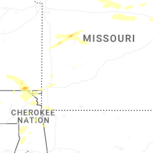
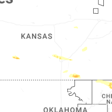
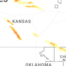
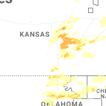
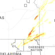
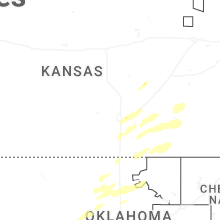
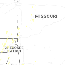


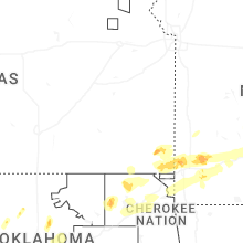


Connect with Interactive Hail Maps