

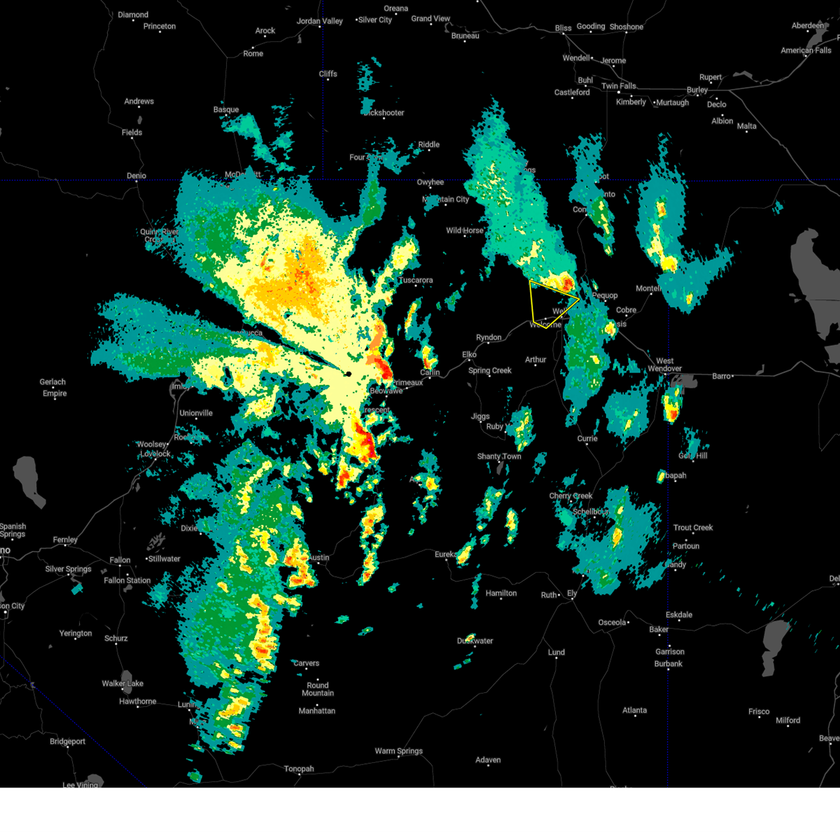
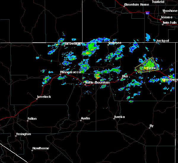
Hail Map for Wells, NV
The Wells, NV area has had 3 reports of on-the-ground hail by trained spotters, and has been under severe weather warnings 0 times during the past 12 months. Doppler radar has detected hail at or near Wells, NV on 1 occasion.
| Name: | Wells, NV |
| Where Located: | 46.2 miles ENE of Elko, NV |
| Map: | Google Map for Wells, NV |
| Population: | 1292 |
| Housing Units: | 641 |
| More Info: | Search Google for Wells, NV |
0
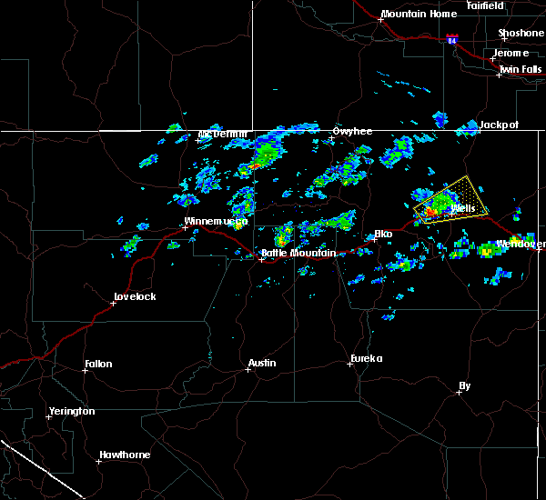
The Top Recent Hail Date for Wells, NV is Sunday, September 3, 2023 (1st out of 1)

Hail and Wind Damage Spotted near Wells, NV
| Date / Time | Report Details |
|---|---|
| 7/15/2025 1:39 PM PDT | Station moor raws... elevation 6121 f in elko county NV, 11.4 miles WSW of Wells, NV |
| 7/14/2024 6:50 PM PDT | Moor upr (up990)... elevation 6121 fee in elko county NV, 11.4 miles WSW of Wells, NV |
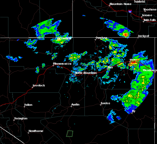
| 9/11/2023 8:17 PM PDT | Station (pqrnv) i-80 pequop summit... elevation 6954 fee in elko county NV, 20.5 miles W of Wells, NV |
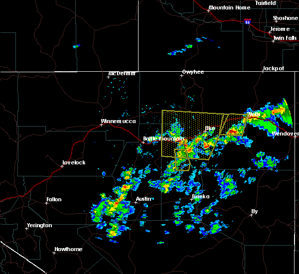
| 9/3/2023 1:23 PM PDT |
 The severe thunderstorm warning for eastern elko county will expire at 130 pm pdt, the storm which prompted the warning has weakened below severe limits, and has exited the warned area. therefore, the warning will be allowed to expire. however, gusty winds and heavy rain are still possible with this thunderstorm. a severe thunderstorm watch remains in effect until 800 pm pdt for northeastern nevada. to report severe weather, contact your nearest law enforcement agency. they will relay your report to the national weather service elko nevada. The severe thunderstorm warning for eastern elko county will expire at 130 pm pdt, the storm which prompted the warning has weakened below severe limits, and has exited the warned area. therefore, the warning will be allowed to expire. however, gusty winds and heavy rain are still possible with this thunderstorm. a severe thunderstorm watch remains in effect until 800 pm pdt for northeastern nevada. to report severe weather, contact your nearest law enforcement agency. they will relay your report to the national weather service elko nevada.
|
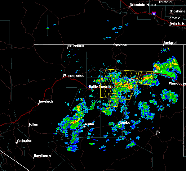
| 9/3/2023 1:13 PM PDT |
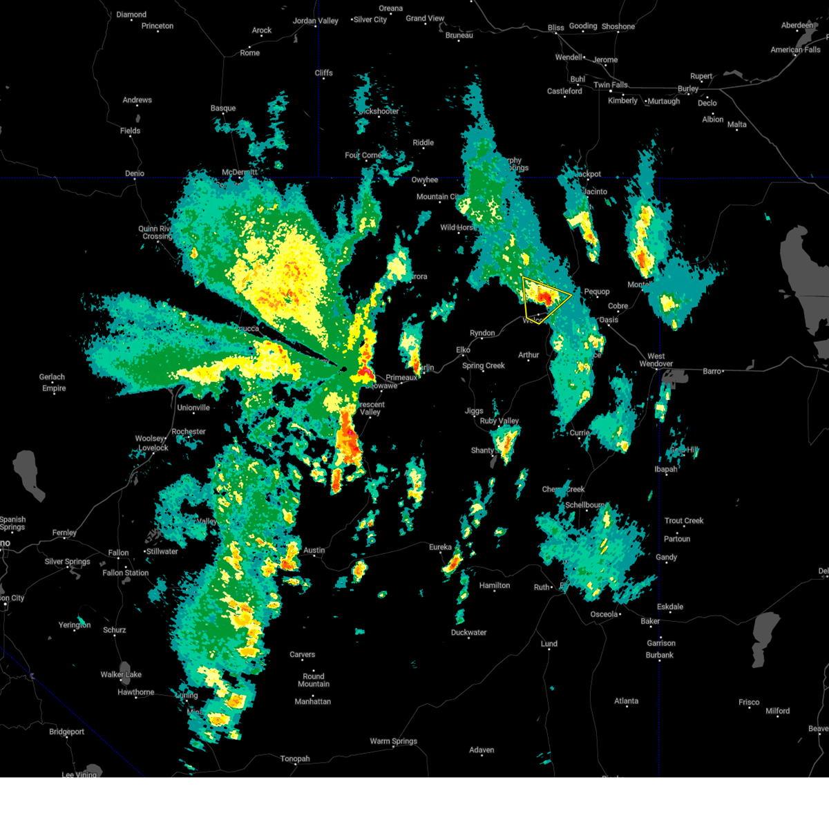 At 113 pm pdt, a severe thunderstorm was located 9 miles northwest of wells, and is nearly stationary (radar indicated). Hazards include 60 mph wind gusts and quarter size hail. Hail damage to vehicles is expected. expect wind damage to roofs, siding, and trees. locations impacted include, wells. hail threat, radar indicated max hail size, 1. 00 in wind threat, radar indicated max wind gust, 60 mph. At 113 pm pdt, a severe thunderstorm was located 9 miles northwest of wells, and is nearly stationary (radar indicated). Hazards include 60 mph wind gusts and quarter size hail. Hail damage to vehicles is expected. expect wind damage to roofs, siding, and trees. locations impacted include, wells. hail threat, radar indicated max hail size, 1. 00 in wind threat, radar indicated max wind gust, 60 mph.
|
| 9/3/2023 1:00 PM PDT |
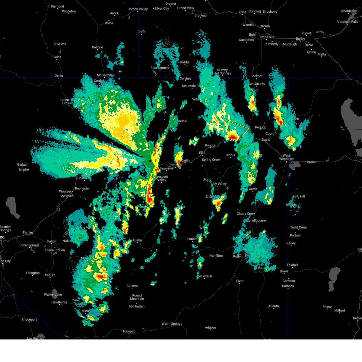 At 100 pm pdt, a severe thunderstorm was located 8 miles west of wells, moving northeast at 30 mph (radar indicated). Hazards include 60 mph wind gusts and quarter size hail. Hail damage to vehicles is expected. Expect wind damage to roofs, siding, and trees. At 100 pm pdt, a severe thunderstorm was located 8 miles west of wells, moving northeast at 30 mph (radar indicated). Hazards include 60 mph wind gusts and quarter size hail. Hail damage to vehicles is expected. Expect wind damage to roofs, siding, and trees.
|
| 9/1/2023 2:25 PM PDT | A thunderstorm produced very strong winds that caused a tree to fall on a deck. approximate diameter of the tree trunk is 18 inches. the house was not damaged. wind gus in elko county NV, 0.5 miles ESE of Wells, NV |
| 9/1/2023 1:57 PM PDT | Mesonet station wlsnv 2.3 e wells (nv dot). tree damage also reported in wells. station elevation: 5845 f in elko county NV, 2.8 miles WNW of Wells, NV |
| 9/1/2023 1:57 PM PDT | A thunderstorm produced very strong winds that caused a tree to fall on a deck. approximate diameter of the tree trunk is 18 inches. the house was not damaged. wind gus in elko county NV, 0.5 miles ESE of Wells, NV |
| 7/31/2021 3:26 PM PDT | Union pacific railroad (upr) station up011 1 ene deeth... from nearby thunderstorm. station elevation 5356 f in elko county NV, 15.2 miles E of Wells, NV |
| 6/16/2020 11:18 AM PDT |
 At 1117 am pdt, a severe thunderstorm was located near wells, moving east at 25 mph (radar indicated). Hazards include 60 mph wind gusts and quarter size hail. Hail damage to vehicles is expected. expect wind damage to roofs, siding, and trees. Locations impacted include, wells, moor summit and hd summit. At 1117 am pdt, a severe thunderstorm was located near wells, moving east at 25 mph (radar indicated). Hazards include 60 mph wind gusts and quarter size hail. Hail damage to vehicles is expected. expect wind damage to roofs, siding, and trees. Locations impacted include, wells, moor summit and hd summit.
|
| 6/16/2020 10:55 AM PDT |
 At 1054 am pdt, a severe thunderstorm was located 9 miles west of wells, moving east at 20 mph (radar indicated). Hazards include 60 mph wind gusts and quarter size hail. Hail damage to vehicles is expected. Expect wind damage to roofs, siding, and trees. At 1054 am pdt, a severe thunderstorm was located 9 miles west of wells, moving east at 20 mph (radar indicated). Hazards include 60 mph wind gusts and quarter size hail. Hail damage to vehicles is expected. Expect wind damage to roofs, siding, and trees.
|
| 6/5/2020 6:42 PM PDT | Corrects previous non-tstm wnd gst report from 6 s clover valley. mesonet station wspnv 6.3 s clover valley (nv dot in elko county NV, 24.4 miles N of Wells, NV |
| 5/30/2018 3:16 PM PDT |
 At 316 pm pdt, a severe thunderstorm was located near deeth, moving north at 25 mph (radar indicated). Hazards include 60 mph wind gusts and quarter size hail. Hail damage to vehicles is expected. expect wind damage to roofs, siding, and trees. Locations impacted include, wells, deeth, angel lake and star valley. At 316 pm pdt, a severe thunderstorm was located near deeth, moving north at 25 mph (radar indicated). Hazards include 60 mph wind gusts and quarter size hail. Hail damage to vehicles is expected. expect wind damage to roofs, siding, and trees. Locations impacted include, wells, deeth, angel lake and star valley.
|
| 5/30/2018 2:53 PM PDT |
 At 253 pm pdt, a severe thunderstorm was located near ruby valley, moving north at 25 mph (radar indicated). Hazards include 70 mph wind gusts and quarter size hail. Hail damage to vehicles is expected. expect considerable tree damage. Wind damage is also likely to mobile homes, roofs, and outbuildings. At 253 pm pdt, a severe thunderstorm was located near ruby valley, moving north at 25 mph (radar indicated). Hazards include 70 mph wind gusts and quarter size hail. Hail damage to vehicles is expected. expect considerable tree damage. Wind damage is also likely to mobile homes, roofs, and outbuildings.
|
| 7/25/2017 7:23 PM PDT |
 At 722 pm pdt, a severe thunderstorm was located near wells, moving southeast at 10 mph (radar indicated). Hazards include 60 mph wind gusts and quarter size hail. Hail damage to vehicles is expected. Expect wind damage to roofs, siding, and trees. At 722 pm pdt, a severe thunderstorm was located near wells, moving southeast at 10 mph (radar indicated). Hazards include 60 mph wind gusts and quarter size hail. Hail damage to vehicles is expected. Expect wind damage to roofs, siding, and trees.
|
| 6/26/2017 7:25 PM PDT | Mesonet station up011... deeth siding up in elko county NV, 15.2 miles E of Wells, NV |
| 6/3/2015 3:35 PM PDT | Half Dollar sized hail reported 21.1 miles W of Wells, NV, video sent in showed estimated quarter to half dollar sized falling on interstate 80 near pequop summit. |
| 9/18/2014 5:02 PM PDT | Quarter sized hail reported 7.5 miles N of Wells, NV, public reported via facebook...heavy rain and 1.00 inch hail at their location. |
| 9/18/2014 1:40 PM PDT | Quarter sized hail reported 0.6 miles W of Wells, NV, public reported via facebook...heavy rain and 1.00 inch hail at their location. previous report indicating time of 5 pm and location 8 miles south was an estimate befor |
| 8/31/2012 6:10 PM PDT | Clover valley dri sit in elko county NV, 16.5 miles N of Wells, NV |
| 8/31/2012 5:55 PM PDT | Hd summit in elko county NV, 18.4 miles SSW of Wells, NV |
| 8/31/2012 5:52 PM PDT | Bishop fla in elko county NV, 13.1 miles SSW of Wells, NV |
Hail Maps for Wells, NV

Connect with Interactive Hail Maps