

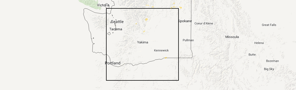
Hail Map for Wenatchee, WA
The Wenatchee, WA area has had 0 reports of on-the-ground hail by trained spotters, and has been under severe weather warnings 1 time during the past 12 months. Doppler radar has detected hail at or near Wenatchee, WA on 2 occasions.
| Name: | Wenatchee, WA |
| Where Located: | 57.4 miles N of Yakima, WA |
| Map: | Google Map for Wenatchee, WA |
| Population: | 31925 |
| Housing Units: | 13175 |
| More Info: | Search Google for Wenatchee, WA |
0
The Top Recent Hail Date for Wenatchee, WA is Friday, May 29, 2015 (2nd out of 2)
Hail and Wind Damage Spotted near Wenatchee, WA
| Date / Time | Report Details |
|---|---|
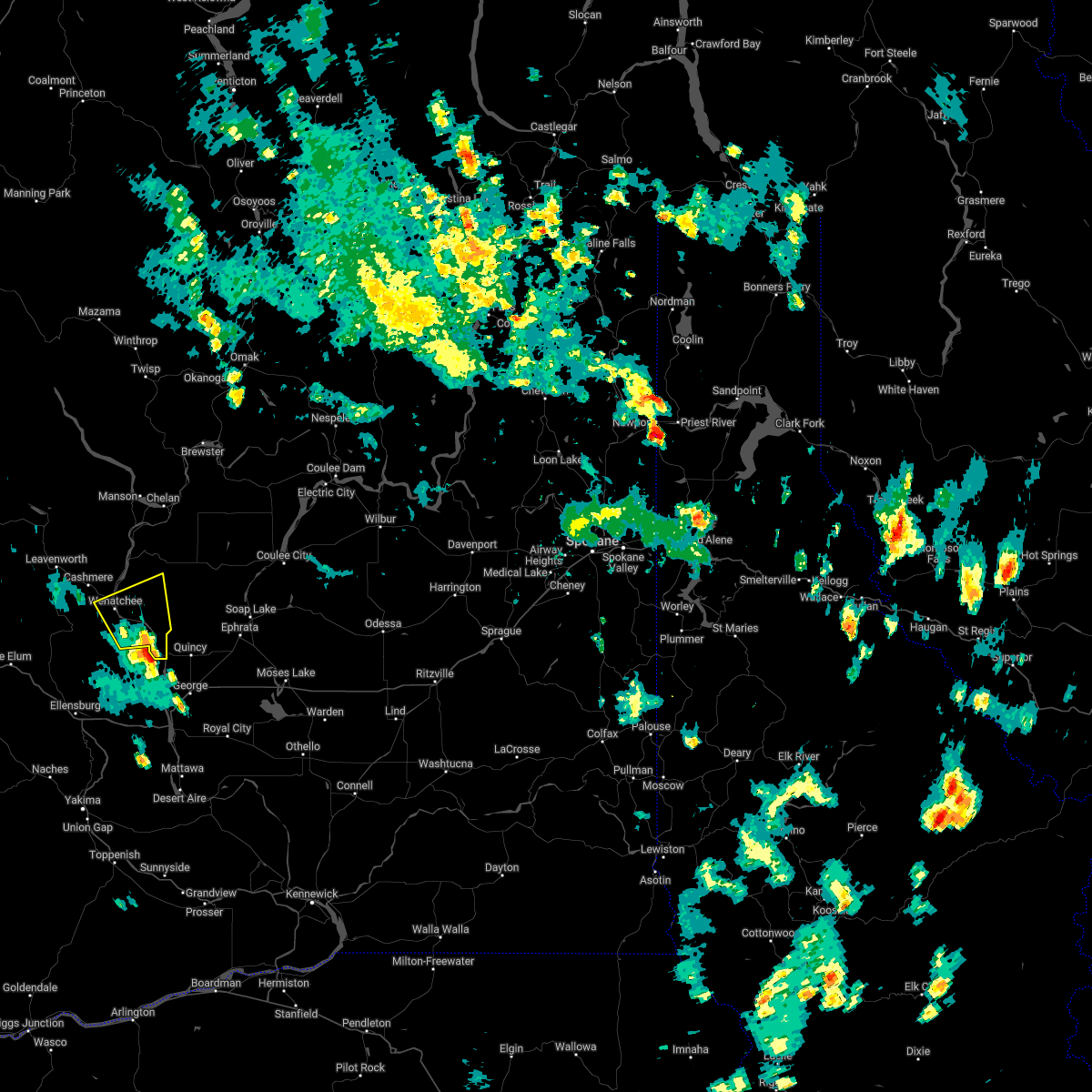
| 5/28/2026 9:00 PM PDT |
 Svrotx the national weather service in spokane has issued a * severe thunderstorm warning for, douglas county in north central washington, south central chelan county in north central washington, north central adams county in eastern washington, western lincoln county in eastern washington, northern grant county in north central washington, * until 1015 pm pdt. * at 900 pm pdt, severe thunderstorms were located along a line extending from 8 miles southwest of quincy to 15 miles northeast of moses lake north, moving north at 40 mph (grant county international airport reported a 69 mph at 852 pm). Hazards include 70 mph wind gusts. Expect considerable tree damage. Damage is likely to mobile homes, roofs, and outbuildings. Svrotx the national weather service in spokane has issued a * severe thunderstorm warning for, douglas county in north central washington, south central chelan county in north central washington, north central adams county in eastern washington, western lincoln county in eastern washington, northern grant county in north central washington, * until 1015 pm pdt. * at 900 pm pdt, severe thunderstorms were located along a line extending from 8 miles southwest of quincy to 15 miles northeast of moses lake north, moving north at 40 mph (grant county international airport reported a 69 mph at 852 pm). Hazards include 70 mph wind gusts. Expect considerable tree damage. Damage is likely to mobile homes, roofs, and outbuildings.
|
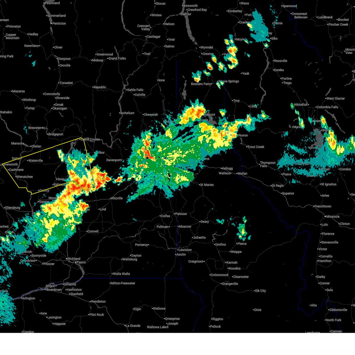
| 7/3/2022 3:04 PM PDT |
 At 304 pm pdt, a severe thunderstorm was located near rock island, or 13 miles southeast of wenatchee, moving north at 20 mph (radar indicated). Hazards include 60 mph wind gusts and quarter size hail. Hail damage to vehicles is expected. Expect wind damage to roofs, siding, and trees. At 304 pm pdt, a severe thunderstorm was located near rock island, or 13 miles southeast of wenatchee, moving north at 20 mph (radar indicated). Hazards include 60 mph wind gusts and quarter size hail. Hail damage to vehicles is expected. Expect wind damage to roofs, siding, and trees.
|
| 6/5/2022 1:50 PM PDT | Small trees dow in chelan county WA, 1.6 miles S of Wenatchee, WA |
| 6/5/2022 1:45 PM PDT | Power lines dow in chelan county WA, 1.1 miles SE of Wenatchee, WA |
| 6/5/2022 1:17 PM PDT | Report from mping: 3-inch tree limbs broken; power poles broke in chelan county WA, 1.1 miles SE of Wenatchee, WA |
| 1/4/2020 4:42 AM PST | Report from mping: 1-inch tree limbs broken; shingles blown of in chelan county WA, 1.1 miles SE of Wenatchee, WA |
Hail Maps for Wenatchee, WA


Connect with Interactive Hail Maps