

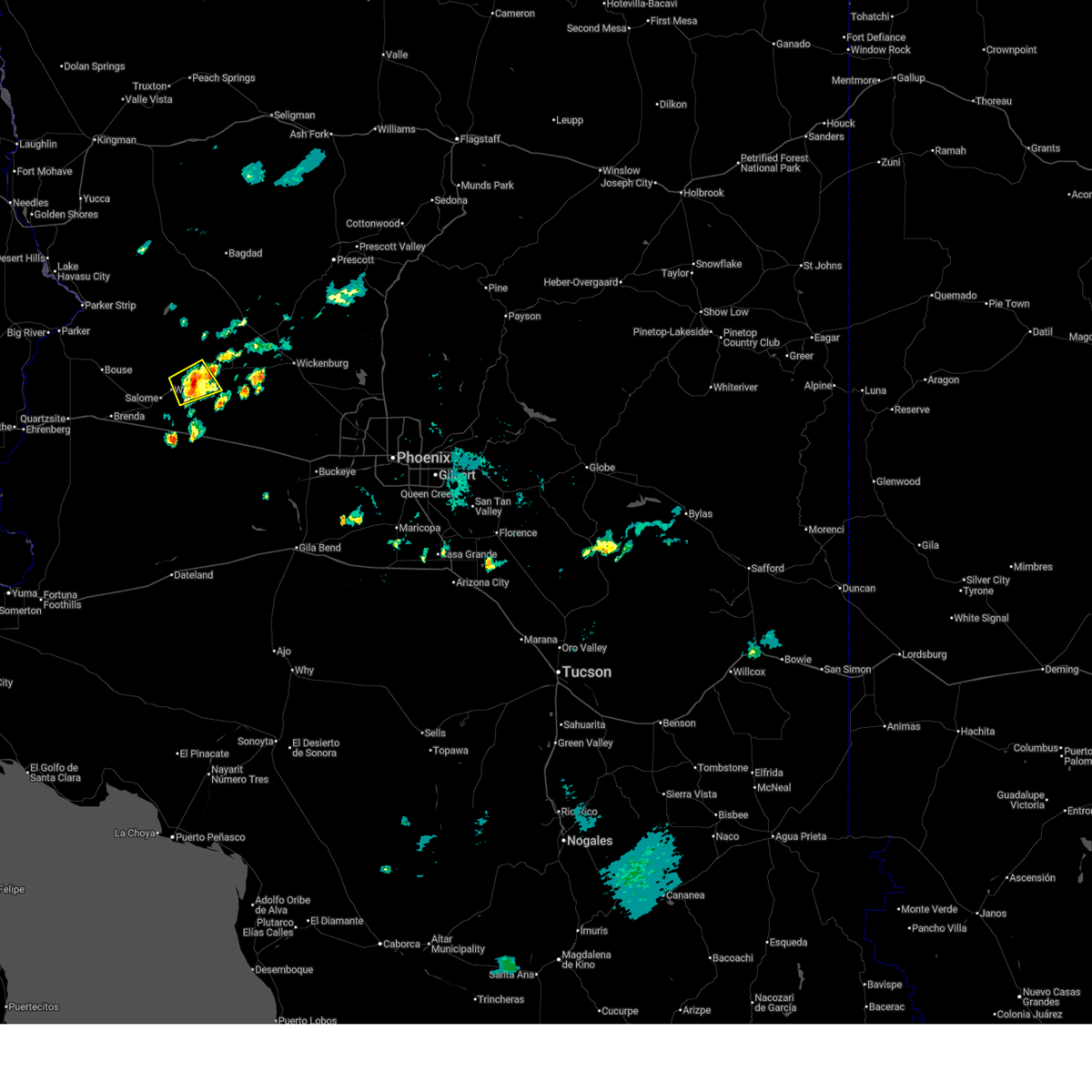
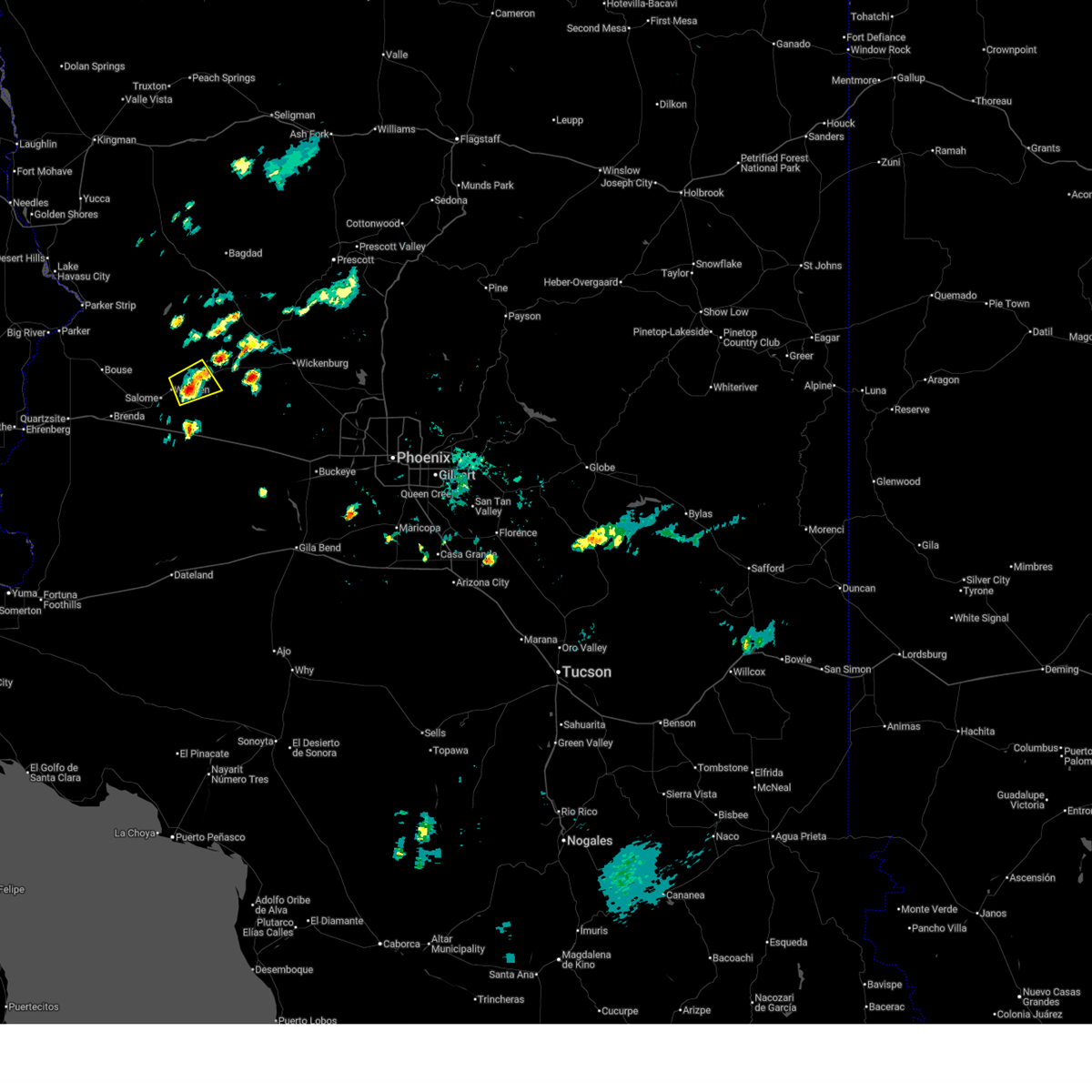
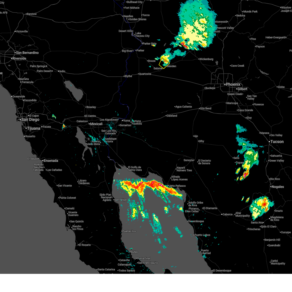
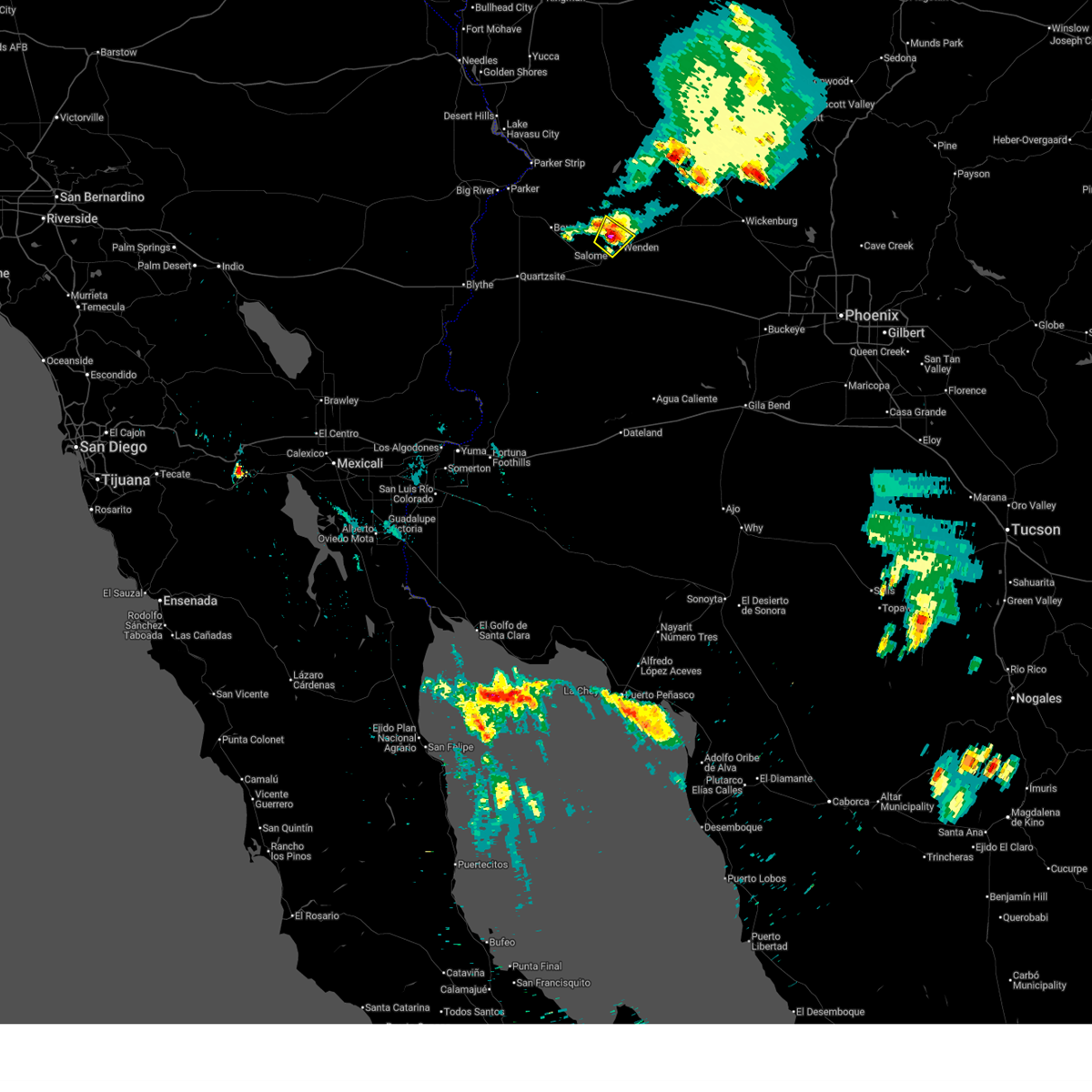
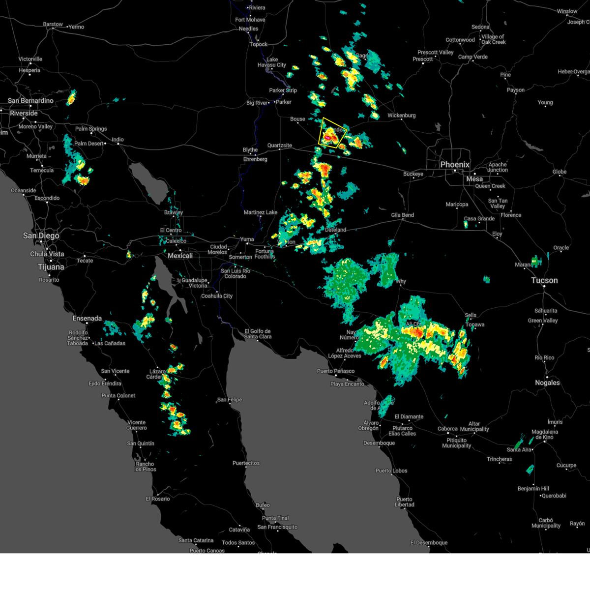
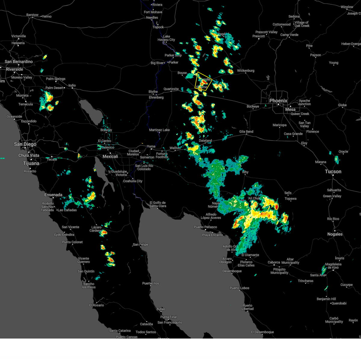
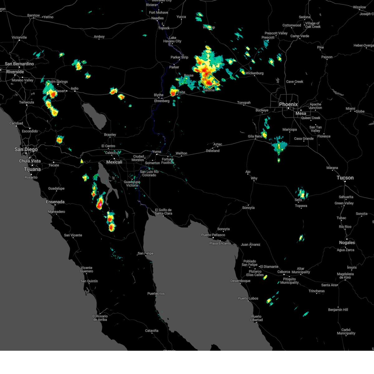
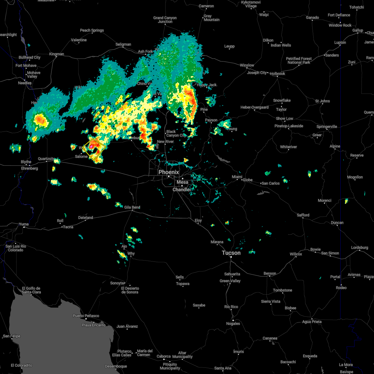
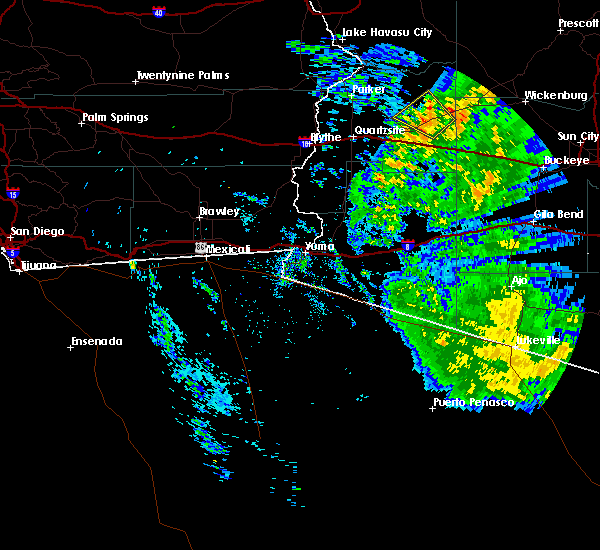
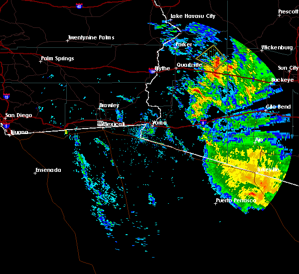
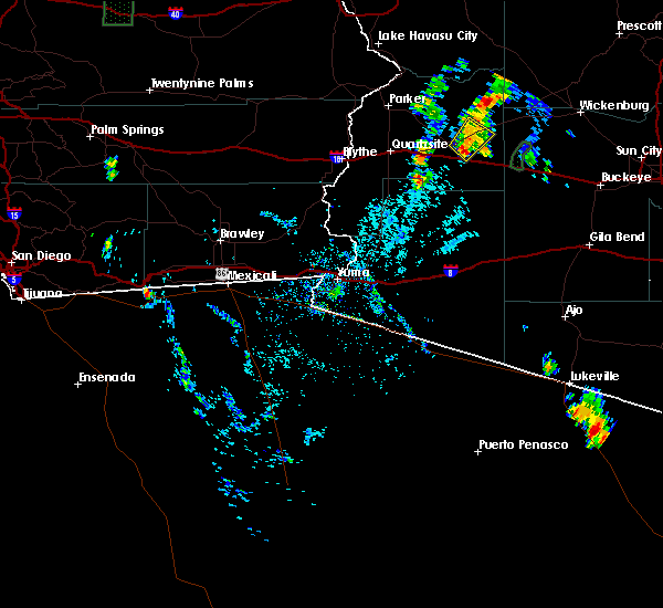
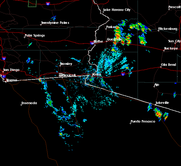
Hail Map for Wenden, AZ
The Wenden, AZ area has had 0 reports of on-the-ground hail by trained spotters, and has been under severe weather warnings 7 times during the past 12 months. Doppler radar has detected hail at or near Wenden, AZ on 22 occasions.
| Name: | Wenden, AZ |
| Where Located: | 63.9 miles SE of Lake Havasu City, AZ |
| Map: | Google Map for Wenden, AZ |
| Population: | 728 |
| Housing Units: | 416 |
| More Info: | Search Google for Wenden, AZ |
0
The Top Recent Hail Date for Wenden, AZ is Saturday, August 10, 2024 (21st out of 22)

Hail and Wind Damage Spotted near Wenden, AZ
| Date / Time | Report Details |
|---|---|
| 6/15/2026 6:54 PM MST |
 The storm which prompted the warning has weakened below severe limits, and no longer poses an immediate threat to life or property. therefore, the warning will be allowed to expire. however, gusty winds are still possible with this thunderstorm. The storm which prompted the warning has weakened below severe limits, and no longer poses an immediate threat to life or property. therefore, the warning will be allowed to expire. however, gusty winds are still possible with this thunderstorm.
|
| 6/15/2026 6:35 PM MST |
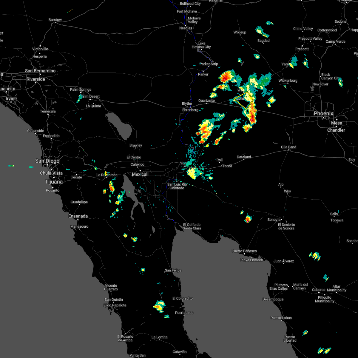
 Svrpsr the national weather service in phoenix has issued a * severe thunderstorm warning for, northeastern la paz county in west central arizona, maricopa county in south central arizona, * until 700 pm mst. * at 635 pm mst, a severe thunderstorm was located near wenden, or 30 miles south of alamo lake, moving east at 5 mph (radar indicated). Hazards include 60 mph wind gusts. expect damage to roofs, siding, and trees Svrpsr the national weather service in phoenix has issued a * severe thunderstorm warning for, northeastern la paz county in west central arizona, maricopa county in south central arizona, * until 700 pm mst. * at 635 pm mst, a severe thunderstorm was located near wenden, or 30 miles south of alamo lake, moving east at 5 mph (radar indicated). Hazards include 60 mph wind gusts. expect damage to roofs, siding, and trees
|
| 9/18/2025 2:03 PM MST | the severe thunderstorm warning has been cancelled and is no longer in effect |
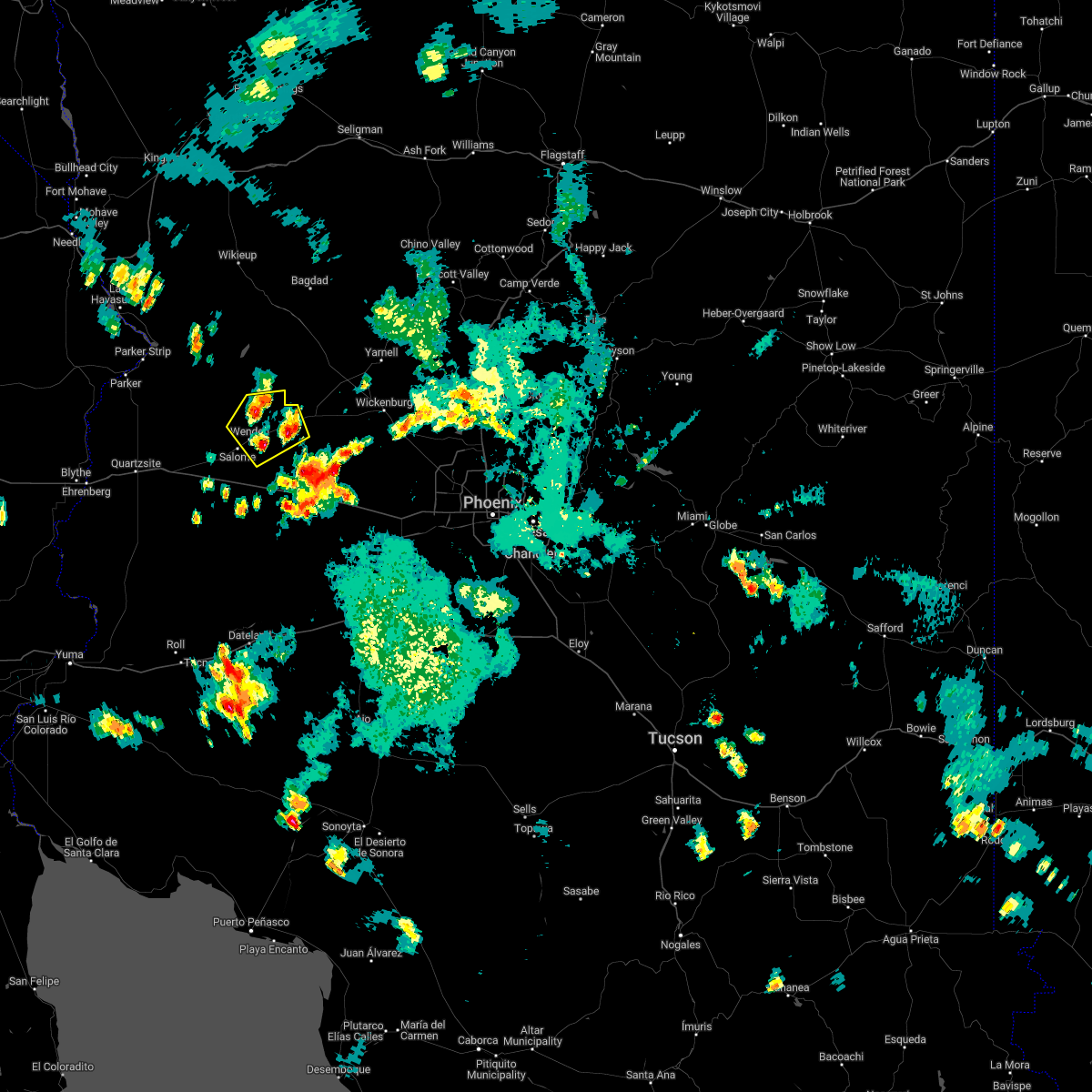
| 9/18/2025 1:45 PM MST | At 145 pm mst, a severe thunderstorm was located over salome, or 32 miles south of alamo lake, moving north at 25 mph (radar indicated). Hazards include 60 mph wind gusts. Expect damage to roofs, siding, and trees. locations impacted include, salome, vicksburg, vicksburg junction, wenden, and harcuvar. this includes the following highways, us highway 60 between mile markers 48 and 62. Az route 72 between mile markers 46 and 49. |
| 9/18/2025 1:16 PM MST | Svrpsr the national weather service in phoenix has issued a * severe thunderstorm warning for, east central la paz county in west central arizona, * until 215 pm mst. * at 116 pm mst, a severe thunderstorm was located 13 miles south of salome, or 35 miles west of tonopah, moving northwest at 15 mph (radar indicated). Hazards include 60 mph wind gusts and quarter size hail. Hail damage to vehicles is expected. Expect wind damage to roofs, siding, and trees. |
| 8/15/2025 9:29 PM MST |
 the severe thunderstorm warning has been cancelled and is no longer in effect the severe thunderstorm warning has been cancelled and is no longer in effect
|
| 8/15/2025 9:13 PM MST |
 Svrpsr the national weather service in phoenix has issued a * severe thunderstorm warning for, east central la paz county in west central arizona, * until 945 pm mst. * at 913 pm mst, a severe thunderstorm was located near wenden, or 26 miles south of alamo lake, moving northeast at 15 mph (radar indicated). Hazards include 60 mph wind gusts. expect damage to roofs, siding, and trees Svrpsr the national weather service in phoenix has issued a * severe thunderstorm warning for, east central la paz county in west central arizona, * until 945 pm mst. * at 913 pm mst, a severe thunderstorm was located near wenden, or 26 miles south of alamo lake, moving northeast at 15 mph (radar indicated). Hazards include 60 mph wind gusts. expect damage to roofs, siding, and trees
|
| 8/10/2024 4:07 PM MST |
 the severe thunderstorm warning has been cancelled and is no longer in effect the severe thunderstorm warning has been cancelled and is no longer in effect
|
| 8/10/2024 3:52 PM MST |
 At 352 pm mst, a severe thunderstorm was located 11 miles south of gladden, or 27 miles northwest of tonopah, moving northwest at 10 mph (radar indicated). Hazards include 60 mph wind gusts. Expect damage to roofs, siding, and trees. locations impacted include, gladden and wenden. This includes us highway 60 between mile markers 63 and 76. At 352 pm mst, a severe thunderstorm was located 11 miles south of gladden, or 27 miles northwest of tonopah, moving northwest at 10 mph (radar indicated). Hazards include 60 mph wind gusts. Expect damage to roofs, siding, and trees. locations impacted include, gladden and wenden. This includes us highway 60 between mile markers 63 and 76.
|
| 8/10/2024 3:44 PM MST |
 At 343 pm mst, a severe thunderstorm was located over salome, or 31 miles south of alamo lake, and is nearly stationary (radar indicated). Hazards include 60 mph wind gusts. Expect damage to roofs, siding, and trees. locations impacted include, salome, vicksburg, vicksburg junction, wenden, and harcuvar. this includes the following highways, us highway 60 between mile markers 47 and 69. Az route 72 between mile markers 48 and 49. At 343 pm mst, a severe thunderstorm was located over salome, or 31 miles south of alamo lake, and is nearly stationary (radar indicated). Hazards include 60 mph wind gusts. Expect damage to roofs, siding, and trees. locations impacted include, salome, vicksburg, vicksburg junction, wenden, and harcuvar. this includes the following highways, us highway 60 between mile markers 47 and 69. Az route 72 between mile markers 48 and 49.
|
| 8/10/2024 3:42 PM MST |
 Svrpsr the national weather service in phoenix has issued a * severe thunderstorm warning for, east central la paz county in west central arizona, maricopa county in south central arizona, * until 430 pm mst. * at 342 pm mst, a severe thunderstorm was located 11 miles south of gladden, or 26 miles northwest of tonopah, moving northwest at 20 mph (radar indicated). Hazards include 60 mph wind gusts. expect damage to roofs, siding, and trees Svrpsr the national weather service in phoenix has issued a * severe thunderstorm warning for, east central la paz county in west central arizona, maricopa county in south central arizona, * until 430 pm mst. * at 342 pm mst, a severe thunderstorm was located 11 miles south of gladden, or 26 miles northwest of tonopah, moving northwest at 20 mph (radar indicated). Hazards include 60 mph wind gusts. expect damage to roofs, siding, and trees
|
| 8/10/2024 3:28 PM MST |
 Svrpsr the national weather service in phoenix has issued a * severe thunderstorm warning for, east central la paz county in west central arizona, * until 400 pm mst. * at 328 pm mst, a severe thunderstorm was located over salome, or 32 miles south of alamo lake, and is nearly stationary (radar indicated). Hazards include 60 mph wind gusts. expect damage to roofs, siding, and trees Svrpsr the national weather service in phoenix has issued a * severe thunderstorm warning for, east central la paz county in west central arizona, * until 400 pm mst. * at 328 pm mst, a severe thunderstorm was located over salome, or 32 miles south of alamo lake, and is nearly stationary (radar indicated). Hazards include 60 mph wind gusts. expect damage to roofs, siding, and trees
|
| 8/13/2023 1:54 PM MST |
 At 153 pm mst, a severe thunderstorm was located near wenden, or 28 miles south of alamo lake, moving northeast at 15 mph (radar indicated). Hazards include 60 mph wind gusts. expect damage to roofs, siding, and trees At 153 pm mst, a severe thunderstorm was located near wenden, or 28 miles south of alamo lake, moving northeast at 15 mph (radar indicated). Hazards include 60 mph wind gusts. expect damage to roofs, siding, and trees
|
| 10/3/2022 3:55 PM MST |
 At 355 pm mst, a severe thunderstorm was located near gladden, or 30 miles south of alamo lake, moving east at 10 mph (radar indicated). Hazards include 60 mph wind gusts and penny size hail. Expect damage to roofs, siding, and trees. locations impacted include, wenden. this includes us highway 60 between mile markers 62 and 75. hail threat, radar indicated max hail size, 0. 75 in wind threat, radar indicated max wind gust, 60 mph. At 355 pm mst, a severe thunderstorm was located near gladden, or 30 miles south of alamo lake, moving east at 10 mph (radar indicated). Hazards include 60 mph wind gusts and penny size hail. Expect damage to roofs, siding, and trees. locations impacted include, wenden. this includes us highway 60 between mile markers 62 and 75. hail threat, radar indicated max hail size, 0. 75 in wind threat, radar indicated max wind gust, 60 mph.
|
| 10/3/2022 3:32 PM MST |
 At 332 pm mst, a severe thunderstorm was located 7 miles west of gladden, or 27 miles south of alamo lake, moving southeast at 5 mph (radar indicated). Hazards include 60 mph wind gusts and nickel size hail. expect damage to roofs, siding, and trees At 332 pm mst, a severe thunderstorm was located 7 miles west of gladden, or 27 miles south of alamo lake, moving southeast at 5 mph (radar indicated). Hazards include 60 mph wind gusts and nickel size hail. expect damage to roofs, siding, and trees
|
| 9/23/2022 2:11 PM MST |
 The severe thunderstorm warning for east central la paz county will expire at 215 pm mst, the storm which prompted the warning has weakened below severe limits, and no longer poses an immediate threat to life or property. therefore, the warning will be allowed to expire. The severe thunderstorm warning for east central la paz county will expire at 215 pm mst, the storm which prompted the warning has weakened below severe limits, and no longer poses an immediate threat to life or property. therefore, the warning will be allowed to expire.
|
| 9/23/2022 1:29 PM MST |
 At 129 pm mst, a severe thunderstorm was located near salome, or 37 miles south of alamo lake, and is nearly stationary (radar indicated). Hazards include 60 mph wind gusts and quarter size hail. Hail damage to vehicles is expected. Expect wind damage to roofs, siding, and trees. At 129 pm mst, a severe thunderstorm was located near salome, or 37 miles south of alamo lake, and is nearly stationary (radar indicated). Hazards include 60 mph wind gusts and quarter size hail. Hail damage to vehicles is expected. Expect wind damage to roofs, siding, and trees.
|
| 9/23/2022 1:10 PM MST |
 At 110 pm mst, a severe thunderstorm was located near harcuvar, or 30 miles south of alamo lake, and is nearly stationary (radar indicated). Hazards include 60 mph wind gusts and quarter size hail. Hail damage to vehicles is expected. Expect wind damage to roofs, siding, and trees. At 110 pm mst, a severe thunderstorm was located near harcuvar, or 30 miles south of alamo lake, and is nearly stationary (radar indicated). Hazards include 60 mph wind gusts and quarter size hail. Hail damage to vehicles is expected. Expect wind damage to roofs, siding, and trees.
|
| 9/2/2022 7:26 PM MST |
 The severe thunderstorm warning for east central la paz and maricopa counties will expire at 730 pm mst, the storm which prompted the warning has weakened below severe limits, and no longer poses an immediate threat to life or property. therefore, the warning will be allowed to expire. however gusty winds and heavy rain are still possible with this thunderstorm. a severe thunderstorm watch remains in effect until 1100 pm mst for south central and west central arizona. The severe thunderstorm warning for east central la paz and maricopa counties will expire at 730 pm mst, the storm which prompted the warning has weakened below severe limits, and no longer poses an immediate threat to life or property. therefore, the warning will be allowed to expire. however gusty winds and heavy rain are still possible with this thunderstorm. a severe thunderstorm watch remains in effect until 1100 pm mst for south central and west central arizona.
|
| 9/2/2022 7:19 PM MST |
 At 719 pm mst, a severe thunderstorm was located near wenden, or 30 miles south of alamo lake, moving southwest at 15 mph (radar indicated). Hazards include 60 mph wind gusts and nickel size hail. Expect damage to roofs, siding, and trees. locations impacted include, wenden and gladden. this includes us highway 60 between mile markers 60 and 77. hail threat, radar indicated max hail size, 0. 88 in wind threat, radar indicated max wind gust, 60 mph. At 719 pm mst, a severe thunderstorm was located near wenden, or 30 miles south of alamo lake, moving southwest at 15 mph (radar indicated). Hazards include 60 mph wind gusts and nickel size hail. Expect damage to roofs, siding, and trees. locations impacted include, wenden and gladden. this includes us highway 60 between mile markers 60 and 77. hail threat, radar indicated max hail size, 0. 88 in wind threat, radar indicated max wind gust, 60 mph.
|
| 9/2/2022 7:01 PM MST |
 At 701 pm mst, a severe thunderstorm was located near gladden, or 29 miles southeast of alamo lake, moving west at 10 mph (radar indicated). Hazards include 60 mph wind gusts and quarter size hail. Hail damage to vehicles is expected. Expect wind damage to roofs, siding, and trees. At 701 pm mst, a severe thunderstorm was located near gladden, or 29 miles southeast of alamo lake, moving west at 10 mph (radar indicated). Hazards include 60 mph wind gusts and quarter size hail. Hail damage to vehicles is expected. Expect wind damage to roofs, siding, and trees.
|
| 8/23/2022 6:29 PM MST | At 629 pm mst, a severe thunderstorm was located 12 miles north of wenden, or 19 miles south of alamo lake, moving southwest at 30 mph (radar indicated). Hazards include 60 mph wind gusts and quarter size hail. Hail damage to vehicles is expected. Expect wind damage to roofs, siding, and trees. |
| 8/21/2022 11:01 PM MST | At 1101 pm mst/1101 pm pdt/, severe thunderstorms were located along a line extending from near big river to 17 miles west of bouse to 7 miles east of quartzsite to 6 miles southeast of brenda, moving southwest at 35 mph (radar indicated). Hazards include 60 mph wind gusts. Expect damage to roofs, siding, and trees. locations impacted include, parker, quartzsite, salome, brenda, vicksburg junction, buckskin mountain park, wenden, kofa wildlife refuge, vicksburg, bouse, harcuvar and poston. this includes the following highways, az interstate 10 between mile markers 11 and 54. us highway 60 between mile markers 31 and 64. az route 72 between mile markers 14 and 49. hail threat, radar indicated max hail size, <. 75 in wind threat, radar indicated max wind gust, 60 mph. |
| 8/21/2022 11:01 PM MST | At 1101 pm mst/1101 pm pdt/, severe thunderstorms were located along a line extending from near big river to 17 miles west of bouse to 7 miles east of quartzsite to 6 miles southeast of brenda, moving southwest at 35 mph (radar indicated). Hazards include 60 mph wind gusts. Expect damage to roofs, siding, and trees. locations impacted include, parker, quartzsite, salome, brenda, vicksburg junction, buckskin mountain park, wenden, kofa wildlife refuge, vicksburg, bouse, harcuvar and poston. this includes the following highways, az interstate 10 between mile markers 11 and 54. us highway 60 between mile markers 31 and 64. az route 72 between mile markers 14 and 49. hail threat, radar indicated max hail size, <. 75 in wind threat, radar indicated max wind gust, 60 mph. |
| 8/21/2022 10:33 PM MST | At 1032 pm mst/1032 pm pdt/, severe thunderstorms were located along a line extending from parker dam to 7 miles northwest of bouse to 8 miles northwest of vicksburg to near salome, moving southwest at 25 mph (radar indicated). Hazards include 60 mph wind gusts. expect damage to roofs, siding, and trees |
| 8/21/2022 10:33 PM MST | At 1032 pm mst/1032 pm pdt/, severe thunderstorms were located along a line extending from parker dam to 7 miles northwest of bouse to 8 miles northwest of vicksburg to near salome, moving southwest at 25 mph (radar indicated). Hazards include 60 mph wind gusts. expect damage to roofs, siding, and trees |
| 8/21/2022 8:34 PM MST | At 833 pm mst, a severe thunderstorm was located 7 miles southeast of wenden, or 34 miles northwest of tonopah, moving south at 15 mph (radar indicated). Hazards include 60 mph wind gusts and quarter size hail. Hail damage to vehicles is expected. Expect wind damage to roofs, siding, and trees. |
| 8/20/2022 11:54 PM MST |
 The severe thunderstorm warning for eastern la paz and maricopa counties will expire at midnight mst, the storm which prompted the warning has weakened below severe limits, and has exited the warned area. therefore, the warning will be allowed to expire. The severe thunderstorm warning for eastern la paz and maricopa counties will expire at midnight mst, the storm which prompted the warning has weakened below severe limits, and has exited the warned area. therefore, the warning will be allowed to expire.
|
| 8/20/2022 11:40 PM MST |
 At 1140 pm mst, a severe thunderstorm was located 7 miles southwest of gladden, or 32 miles south of alamo lake, moving southwest at 15 mph (radar indicated). Hazards include 60 mph wind gusts. Expect damage to roofs, siding, and trees. locations impacted include, wenden and salome. this includes us highway 60 near mile marker 58, and between mile markers 71 and 74. hail threat, radar indicated max hail size, <. 75 in wind threat, radar indicated max wind gust, 60 mph. At 1140 pm mst, a severe thunderstorm was located 7 miles southwest of gladden, or 32 miles south of alamo lake, moving southwest at 15 mph (radar indicated). Hazards include 60 mph wind gusts. Expect damage to roofs, siding, and trees. locations impacted include, wenden and salome. this includes us highway 60 near mile marker 58, and between mile markers 71 and 74. hail threat, radar indicated max hail size, <. 75 in wind threat, radar indicated max wind gust, 60 mph.
|
| 8/20/2022 11:29 PM MST |
 At 1129 pm mst, a severe thunderstorm was located near gladden, or 31 miles southeast of alamo lake, moving southwest at 15 mph (radar indicated). Hazards include 60 mph wind gusts. expect damage to roofs, siding, and trees At 1129 pm mst, a severe thunderstorm was located near gladden, or 31 miles southeast of alamo lake, moving southwest at 15 mph (radar indicated). Hazards include 60 mph wind gusts. expect damage to roofs, siding, and trees
|
| 8/19/2022 7:36 PM MST |
 At 736 pm mst, a severe thunderstorm was located near wenden, or 30 miles south of alamo lake, moving south at 10 mph (radar indicated). Hazards include 60 mph wind gusts. Expect damage to roofs, siding, and trees. locations impacted include, wenden, salome and harcuvar. this includes us highway 60 between mile markers 54 and 72. hail threat, radar indicated max hail size, <. 75 in wind threat, radar indicated max wind gust, 60 mph. At 736 pm mst, a severe thunderstorm was located near wenden, or 30 miles south of alamo lake, moving south at 10 mph (radar indicated). Hazards include 60 mph wind gusts. Expect damage to roofs, siding, and trees. locations impacted include, wenden, salome and harcuvar. this includes us highway 60 between mile markers 54 and 72. hail threat, radar indicated max hail size, <. 75 in wind threat, radar indicated max wind gust, 60 mph.
|
| 8/19/2022 7:25 PM MST |
 At 725 pm mst, a severe thunderstorm was located near wenden, or 28 miles south of alamo lake, moving south at 10 mph (radar indicated). Hazards include 60 mph wind gusts and penny size hail. expect damage to roofs, siding, and trees At 725 pm mst, a severe thunderstorm was located near wenden, or 28 miles south of alamo lake, moving south at 10 mph (radar indicated). Hazards include 60 mph wind gusts and penny size hail. expect damage to roofs, siding, and trees
|
| 8/17/2022 4:23 PM MST |
 The severe thunderstorm warning for east central la paz county will expire at 430 pm mst, the storm which prompted the warning has weakened below severe limits, and no longer poses an immediate threat to life or property. therefore, the warning will be allowed to expire. however heavy rain is still possible with this thunderstorm. The severe thunderstorm warning for east central la paz county will expire at 430 pm mst, the storm which prompted the warning has weakened below severe limits, and no longer poses an immediate threat to life or property. therefore, the warning will be allowed to expire. however heavy rain is still possible with this thunderstorm.
|
| 8/17/2022 4:16 PM MST |
 At 416 pm mst, a severe thunderstorm was located near wenden, or 29 miles south of alamo lake, moving south at 10 mph (radar indicated). Hazards include 60 mph wind gusts. Expect damage to roofs, siding, and trees. locations impacted include, salome, vicksburg, vicksburg junction, wenden and harcuvar. this includes the following highways, us highway 60 between mile markers 51 and 64. az route 72 between mile markers 42 and 49. hail threat, radar indicated max hail size, <. 75 in wind threat, radar indicated max wind gust, 60 mph. At 416 pm mst, a severe thunderstorm was located near wenden, or 29 miles south of alamo lake, moving south at 10 mph (radar indicated). Hazards include 60 mph wind gusts. Expect damage to roofs, siding, and trees. locations impacted include, salome, vicksburg, vicksburg junction, wenden and harcuvar. this includes the following highways, us highway 60 between mile markers 51 and 64. az route 72 between mile markers 42 and 49. hail threat, radar indicated max hail size, <. 75 in wind threat, radar indicated max wind gust, 60 mph.
|
| 8/17/2022 3:58 PM MST |
 At 358 pm mst, a severe thunderstorm was located near wenden, or 26 miles south of alamo lake, moving south at 10 mph (radar indicated). Hazards include 60 mph wind gusts and penny size hail. expect damage to roofs, siding, and trees At 358 pm mst, a severe thunderstorm was located near wenden, or 26 miles south of alamo lake, moving south at 10 mph (radar indicated). Hazards include 60 mph wind gusts and penny size hail. expect damage to roofs, siding, and trees
|
| 8/17/2022 3:50 PM MST |
 At 350 pm mst, a severe thunderstorm was located 9 miles southeast of wenden, or 32 miles northwest of tonopah, moving southwest at 15 mph (radar indicated). Hazards include 60 mph wind gusts. Expect damage to roofs, siding, and trees. locations impacted include, wenden, salome and harcuvar. this includes the following highways, az interstate 10 between mile markers 60 and 72. us highway 60 between mile markers 51 and 69. hail threat, radar indicated max hail size, <. 75 in wind threat, radar indicated max wind gust, 60 mph. At 350 pm mst, a severe thunderstorm was located 9 miles southeast of wenden, or 32 miles northwest of tonopah, moving southwest at 15 mph (radar indicated). Hazards include 60 mph wind gusts. Expect damage to roofs, siding, and trees. locations impacted include, wenden, salome and harcuvar. this includes the following highways, az interstate 10 between mile markers 60 and 72. us highway 60 between mile markers 51 and 69. hail threat, radar indicated max hail size, <. 75 in wind threat, radar indicated max wind gust, 60 mph.
|
| 8/17/2022 3:36 PM MST |
 At 335 pm mst, a severe thunderstorm was located 9 miles southeast of wenden, or 32 miles northwest of tonopah, moving southwest at 15 mph (radar indicated). Hazards include 60 mph wind gusts. expect damage to roofs, siding, and trees At 335 pm mst, a severe thunderstorm was located 9 miles southeast of wenden, or 32 miles northwest of tonopah, moving southwest at 15 mph (radar indicated). Hazards include 60 mph wind gusts. expect damage to roofs, siding, and trees
|
| 8/12/2022 5:02 PM MST |
 At 502 pm mst, a severe thunderstorm was located over gladden, or 31 miles southeast of alamo lake, and is nearly stationary (radar indicated). Hazards include 60 mph wind gusts and penny size hail. expect damage to roofs, siding, and trees At 502 pm mst, a severe thunderstorm was located over gladden, or 31 miles southeast of alamo lake, and is nearly stationary (radar indicated). Hazards include 60 mph wind gusts and penny size hail. expect damage to roofs, siding, and trees
|
| 7/30/2022 4:26 PM MST |
 At 426 pm mst, a severe thunderstorm was located 10 miles southeast of wenden, or 31 miles northwest of tonopah, and is nearly stationary (radar indicated). Hazards include 60 mph wind gusts. expect damage to roofs, siding, and trees At 426 pm mst, a severe thunderstorm was located 10 miles southeast of wenden, or 31 miles northwest of tonopah, and is nearly stationary (radar indicated). Hazards include 60 mph wind gusts. expect damage to roofs, siding, and trees
|
| 8/16/2021 2:54 AM MST |
 The severe thunderstorm warning for central la paz county will expire at 300 am mst, the storm which prompted the warning has weakened below severe limits, and has exited the warned area. therefore, the warning will be allowed to expire. however heavy rain is still possible with this thunderstorm. The severe thunderstorm warning for central la paz county will expire at 300 am mst, the storm which prompted the warning has weakened below severe limits, and has exited the warned area. therefore, the warning will be allowed to expire. however heavy rain is still possible with this thunderstorm.
|
| 8/16/2021 1:54 AM MST |
 At 154 am mst, a severe thunderstorm was located 7 miles east of bouse, or 27 miles southeast of parker, moving southwest at 30 mph (radar indicated). Hazards include 60 mph wind gusts and quarter size hail. Hail damage to vehicles is expected. Expect wind damage to roofs, siding, and trees. At 154 am mst, a severe thunderstorm was located 7 miles east of bouse, or 27 miles southeast of parker, moving southwest at 30 mph (radar indicated). Hazards include 60 mph wind gusts and quarter size hail. Hail damage to vehicles is expected. Expect wind damage to roofs, siding, and trees.
|
| 8/16/2021 12:49 AM MST |
 At 1248 am mst, a severe thunderstorm was located near aguila, or 19 miles west of wickenburg, moving southwest at 40 mph (radar indicated). Hazards include 60 mph wind gusts and penny size hail. expect damage to roofs, siding, and trees At 1248 am mst, a severe thunderstorm was located near aguila, or 19 miles west of wickenburg, moving southwest at 40 mph (radar indicated). Hazards include 60 mph wind gusts and penny size hail. expect damage to roofs, siding, and trees
|
| 8/13/2021 11:34 PM MST |
 At 1133 pm mst, severe thunderstorms were located along a line extending from 6 miles east of bouse to near vicksburg junction to 13 miles south of vicksburg to 18 miles northwest of sundad, moving southwest at 50 mph (radar indicated). Hazards include 60 mph wind gusts. Expect damage to roofs, siding, and trees. locations impacted include, quartzsite, salome, aguila, brenda, vicksburg junction, wenden, kofa wildlife refuge, vicksburg, bouse, gladden, harcuvar and palm canyon. this includes the following highways, az interstate 10 between mile markers 6 and 88. us highway 60 between mile markers 31 and 85. az route 72 between mile markers 25 and 49. hail threat, radar indicated max hail size, <. 75 in wind threat, radar indicated max wind gust, 60 mph. At 1133 pm mst, severe thunderstorms were located along a line extending from 6 miles east of bouse to near vicksburg junction to 13 miles south of vicksburg to 18 miles northwest of sundad, moving southwest at 50 mph (radar indicated). Hazards include 60 mph wind gusts. Expect damage to roofs, siding, and trees. locations impacted include, quartzsite, salome, aguila, brenda, vicksburg junction, wenden, kofa wildlife refuge, vicksburg, bouse, gladden, harcuvar and palm canyon. this includes the following highways, az interstate 10 between mile markers 6 and 88. us highway 60 between mile markers 31 and 85. az route 72 between mile markers 25 and 49. hail threat, radar indicated max hail size, <. 75 in wind threat, radar indicated max wind gust, 60 mph.
|
| 8/13/2021 11:01 PM MST |
 At 1100 pm mst, severe thunderstorms were located along a line extending from 14 miles south of alamo lake state park to near wenden to 13 miles south of gladden to 11 miles northwest of tonopah, moving southwest at 60 mph (radar indicated). Hazards include 70 mph wind gusts and penny size hail. Expect considerable tree damage. Damage is likely to mobile homes, roofs, and outbuildings. At 1100 pm mst, severe thunderstorms were located along a line extending from 14 miles south of alamo lake state park to near wenden to 13 miles south of gladden to 11 miles northwest of tonopah, moving southwest at 60 mph (radar indicated). Hazards include 70 mph wind gusts and penny size hail. Expect considerable tree damage. Damage is likely to mobile homes, roofs, and outbuildings.
|
| 8/13/2021 10:24 PM MST |
 At 1023 pm mst, severe thunderstorms were located along a line extending from 18 miles east of alamo lake state park to near aguila to 9 miles east of gladden to 18 miles north of tonopah, moving southwest at 45 mph (radar indicated). Hazards include 60 mph wind gusts and penny size hail. expect damage to roofs, siding, and trees At 1023 pm mst, severe thunderstorms were located along a line extending from 18 miles east of alamo lake state park to near aguila to 9 miles east of gladden to 18 miles north of tonopah, moving southwest at 45 mph (radar indicated). Hazards include 60 mph wind gusts and penny size hail. expect damage to roofs, siding, and trees
|
| 8/10/2021 8:18 PM MST |
 At 816 pm mst/pdt, severe thunderstorms were located over central and southwest la paz county moving southwest at 20 mph (radar indicated). Hazards include 60 mph wind gusts. small hail. expect damage to roofs, siding, and trees At 816 pm mst/pdt, severe thunderstorms were located over central and southwest la paz county moving southwest at 20 mph (radar indicated). Hazards include 60 mph wind gusts. small hail. expect damage to roofs, siding, and trees
|
| 8/10/2021 8:08 PM MST |
 At 806 pm mst/806 pm pdt/, severe thunderstorms were located over central and southwestern portions of la paz county moving southwest at 15 mph (radar indicated). Hazards include 60 mph wind gusts. dense blowing dust. Expect damage to roofs, siding, and trees. very hazardous driving conditions due to sudden very strong wind gusts and poor visibility. locations impacted include, blythe, quartzsite, cibola, salome, brenda, bouse, vicksburg junction, wenden, vicksburg, harcuvar, and ehrenberg. this includes the following highways, az interstate 10 between mile markers 1 and 71. ca interstate 10 between mile markers 153 and 156. Us highway 60 between mile markers 31 and 70. At 806 pm mst/806 pm pdt/, severe thunderstorms were located over central and southwestern portions of la paz county moving southwest at 15 mph (radar indicated). Hazards include 60 mph wind gusts. dense blowing dust. Expect damage to roofs, siding, and trees. very hazardous driving conditions due to sudden very strong wind gusts and poor visibility. locations impacted include, blythe, quartzsite, cibola, salome, brenda, bouse, vicksburg junction, wenden, vicksburg, harcuvar, and ehrenberg. this includes the following highways, az interstate 10 between mile markers 1 and 71. ca interstate 10 between mile markers 153 and 156. Us highway 60 between mile markers 31 and 70.
|
| 8/10/2021 7:26 PM MST |
 At 723 pm mst/723 pm pdt/, multiple severe thunderstorms were located over central la paz county, moving southwest at 15 mph (radar indicated). Hazards include 60 mph wind gusts. dense blowing dust. Expect damage to roofs, siding, and trees. Very hazardous driving conditions due to sudden very strong wind gusts and poor visibility. At 723 pm mst/723 pm pdt/, multiple severe thunderstorms were located over central la paz county, moving southwest at 15 mph (radar indicated). Hazards include 60 mph wind gusts. dense blowing dust. Expect damage to roofs, siding, and trees. Very hazardous driving conditions due to sudden very strong wind gusts and poor visibility.
|
| 8/10/2021 6:53 PM MST |
 At 651 pm mst/pdt, severe thunderstorms were over northern and western la paz county and moving south-southwest at up to 45 mph (radar indicated). Hazards include 60 mph wind gusts. half inch sized hail. Expect damage to roofs, siding, and trees. locations impacted include, parker, quartzsite, salome, brenda, wenden, vicksburg, bouse, harcuvar and poston. this includes the following highways, az interstate 10 between mile markers 8 and 64. us highway 60 between mile markers 31 and 73. Az route 72 between mile markers 14 and 49. At 651 pm mst/pdt, severe thunderstorms were over northern and western la paz county and moving south-southwest at up to 45 mph (radar indicated). Hazards include 60 mph wind gusts. half inch sized hail. Expect damage to roofs, siding, and trees. locations impacted include, parker, quartzsite, salome, brenda, wenden, vicksburg, bouse, harcuvar and poston. this includes the following highways, az interstate 10 between mile markers 8 and 64. us highway 60 between mile markers 31 and 73. Az route 72 between mile markers 14 and 49.
|
| 8/10/2021 6:30 PM MST |
 At 625 pm mst/pdt, severe thunderstorms were located over northern and western portions of la paz county moving south and southwest at 45 mph (radar indicated). Hazards include 60 mph wind gusts. half inch sized hail. expect damage to roofs, siding, and trees At 625 pm mst/pdt, severe thunderstorms were located over northern and western portions of la paz county moving south and southwest at 45 mph (radar indicated). Hazards include 60 mph wind gusts. half inch sized hail. expect damage to roofs, siding, and trees
|
| 7/14/2021 9:09 PM MST | Mesonet station as887 wende in la paz county AZ, 2.1 miles ESE of Wenden, AZ |
| 9/23/2019 12:11 PM MST |
 The severe thunderstorm warning for east central la paz and maricopa counties will expire at 1215 pm mst, the storm which prompted the warning has weakened below severe limits, and has exited the warned area. therefore, the warning will be allowed to expire. a severe thunderstorm watch remains in effect until 800 pm mst for south central and west central arizona. to report severe weather, contact your nearest law enforcement agency. they will relay your report to the national weather service phoenix. The severe thunderstorm warning for east central la paz and maricopa counties will expire at 1215 pm mst, the storm which prompted the warning has weakened below severe limits, and has exited the warned area. therefore, the warning will be allowed to expire. a severe thunderstorm watch remains in effect until 800 pm mst for south central and west central arizona. to report severe weather, contact your nearest law enforcement agency. they will relay your report to the national weather service phoenix.
|
| 9/23/2019 11:54 AM MST |
 At 1154 am mst, a severe thunderstorm was located 10 miles northwest of gladden, or 19 miles southeast of alamo lake, moving northeast at 15 mph (radar indicated). Hazards include 60 mph wind gusts and quarter size hail. Hail damage to vehicles is expected. expect wind damage to roofs, siding, and trees. locations impacted include, gladden and wenden. This includes us highway 60 between mile markers 62 and 82. At 1154 am mst, a severe thunderstorm was located 10 miles northwest of gladden, or 19 miles southeast of alamo lake, moving northeast at 15 mph (radar indicated). Hazards include 60 mph wind gusts and quarter size hail. Hail damage to vehicles is expected. expect wind damage to roofs, siding, and trees. locations impacted include, gladden and wenden. This includes us highway 60 between mile markers 62 and 82.
|
| 9/23/2019 11:24 AM MST |
 At 1124 am mst, a severe thunderstorm was located 11 miles north of wenden, or 19 miles south of alamo lake, moving northeast at 15 mph (radar indicated). Hazards include 60 mph wind gusts and quarter size hail. Hail damage to vehicles is expected. Expect wind damage to roofs, siding, and trees. At 1124 am mst, a severe thunderstorm was located 11 miles north of wenden, or 19 miles south of alamo lake, moving northeast at 15 mph (radar indicated). Hazards include 60 mph wind gusts and quarter size hail. Hail damage to vehicles is expected. Expect wind damage to roofs, siding, and trees.
|
| 9/5/2019 7:19 PM MST |
 At 719 pm mst, a severe thunderstorm was located over salome, or 33 miles south of alamo lake, moving northeast at 5 mph (radar indicated). Hazards include 60 mph wind gusts and penny size hail. Expect damage to roofs, siding, and trees. locations impacted include, salome, vicksburg, vicksburg junction, wenden and harcuvar. this includes the following highways, az interstate 10 between mile markers 40 and 55. us highway 60 between mile markers 43 and 66. Az route 72 between mile markers 45 and 49. At 719 pm mst, a severe thunderstorm was located over salome, or 33 miles south of alamo lake, moving northeast at 5 mph (radar indicated). Hazards include 60 mph wind gusts and penny size hail. Expect damage to roofs, siding, and trees. locations impacted include, salome, vicksburg, vicksburg junction, wenden and harcuvar. this includes the following highways, az interstate 10 between mile markers 40 and 55. us highway 60 between mile markers 43 and 66. Az route 72 between mile markers 45 and 49.
|
| 9/5/2019 6:53 PM MST |
 At 653 pm mst, a severe thunderstorm was located 8 miles southwest of vicksburg junction, or 44 miles southeast of parker, moving northeast at 20 mph (radar indicated). Hazards include 60 mph wind gusts and penny size hail. expect damage to roofs, siding, and trees At 653 pm mst, a severe thunderstorm was located 8 miles southwest of vicksburg junction, or 44 miles southeast of parker, moving northeast at 20 mph (radar indicated). Hazards include 60 mph wind gusts and penny size hail. expect damage to roofs, siding, and trees
|
| 9/1/2019 8:53 PM MST | Raws station qhqa3 smith pea in la paz county AZ, 21.9 miles SSW of Wenden, AZ |
| 7/21/2018 6:22 AM MST |
 The severe thunderstorm warning for east central la paz county will expire at 630 am mst, the storm which prompted the warning has weakened below severe limits, and no longer poses an immediate threat to life or property. therefore, the warning will be allowed to expire. however gusty winds are still possible with this thunderstorm. The severe thunderstorm warning for east central la paz county will expire at 630 am mst, the storm which prompted the warning has weakened below severe limits, and no longer poses an immediate threat to life or property. therefore, the warning will be allowed to expire. however gusty winds are still possible with this thunderstorm.
|
| 7/21/2018 6:06 AM MST |
 At 606 am mst, a severe thunderstorm was located over wenden, or 31 miles south of alamo lake, moving northwest at 20 mph (radar indicated). Hazards include 60 mph wind gusts and nickel size hail. expect damage to roofs, siding, and trees At 606 am mst, a severe thunderstorm was located over wenden, or 31 miles south of alamo lake, moving northwest at 20 mph (radar indicated). Hazards include 60 mph wind gusts and nickel size hail. expect damage to roofs, siding, and trees
|
| 9/8/2017 8:12 PM MST |
 At 812 pm mst, a severe thunderstorm was located near vicksburg, or 30 miles south of alamo lake, moving north at 25 mph (radar indicated). Hazards include 60 mph wind gusts and nickel size hail. Expect damage to roofs, siding, and trees. Locations impacted include, salome, vicksburg, harcuvar and wenden. At 812 pm mst, a severe thunderstorm was located near vicksburg, or 30 miles south of alamo lake, moving north at 25 mph (radar indicated). Hazards include 60 mph wind gusts and nickel size hail. Expect damage to roofs, siding, and trees. Locations impacted include, salome, vicksburg, harcuvar and wenden.
|
| 9/8/2017 8:00 PM MST |
 At 759 pm mst, a severe thunderstorm was located over vicksburg, or 34 miles south of alamo lake, moving north at 15 mph (radar indicated). Hazards include 60 mph wind gusts and quarter size hail. Hail damage to vehicles is expected. Expect wind damage to roofs, siding, and trees. At 759 pm mst, a severe thunderstorm was located over vicksburg, or 34 miles south of alamo lake, moving north at 15 mph (radar indicated). Hazards include 60 mph wind gusts and quarter size hail. Hail damage to vehicles is expected. Expect wind damage to roofs, siding, and trees.
|
| 7/5/2015 5:20 PM MST |
 At 518 pm mst, doppler radar indicated a severe thunderstorm capable of producing damaging winds in excess of 60 mph. this storm was located over salome, moving north at 15 mph. in addition, half inch size hail was reported with this storm. larger hail will be possible. locations impacted include, wenden, harcuvar, salome, vicksburg junction and vicksburg. At 518 pm mst, doppler radar indicated a severe thunderstorm capable of producing damaging winds in excess of 60 mph. this storm was located over salome, moving north at 15 mph. in addition, half inch size hail was reported with this storm. larger hail will be possible. locations impacted include, wenden, harcuvar, salome, vicksburg junction and vicksburg.
|
| 7/5/2015 4:57 PM MST |
 At 456 pm mst, doppler radar indicated a severe thunderstorm capable of producing destructive winds in excess of 70 mph. this storm was located over salome, or 42 miles northwest of tonopah, and moving northeast at 10 mph. At 456 pm mst, doppler radar indicated a severe thunderstorm capable of producing destructive winds in excess of 70 mph. this storm was located over salome, or 42 miles northwest of tonopah, and moving northeast at 10 mph.
|
| 6/29/2015 10:09 PM MST |
 The severe thunderstorm warning for northeastern la paz county will expire at 1015 pm mst, the storm which prompted the warning has weakened below severe limits, and no longer poses an immediate threat to life or property. therefore the warning will be allowed to expire. The severe thunderstorm warning for northeastern la paz county will expire at 1015 pm mst, the storm which prompted the warning has weakened below severe limits, and no longer poses an immediate threat to life or property. therefore the warning will be allowed to expire.
|
| 6/29/2015 9:43 PM MST |
 At 942 pm mst, doppler radar indicated a severe thunderstorm capable of producing damaging winds in excess of 60 mph. this storm was located over wenden, or 41 miles northwest of tonopah, and moving west at 35 mph. penny size hail may also accompany the damaging winds. At 942 pm mst, doppler radar indicated a severe thunderstorm capable of producing damaging winds in excess of 60 mph. this storm was located over wenden, or 41 miles northwest of tonopah, and moving west at 35 mph. penny size hail may also accompany the damaging winds.
|
Hail Maps for Wenden, AZ


Connect with Interactive Hail Maps