

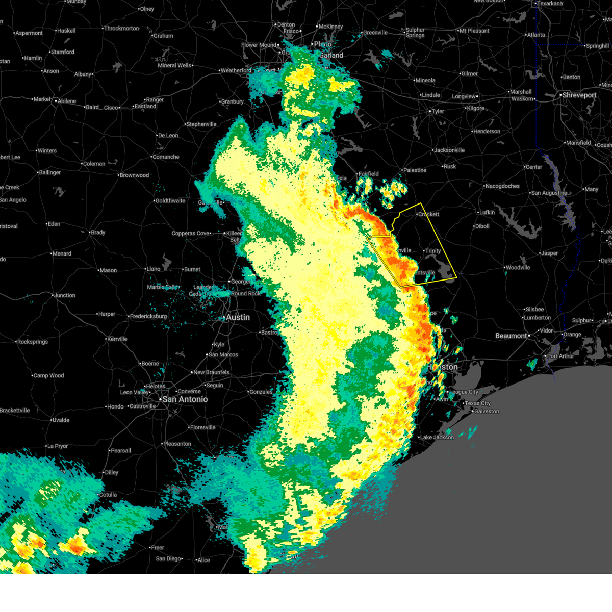
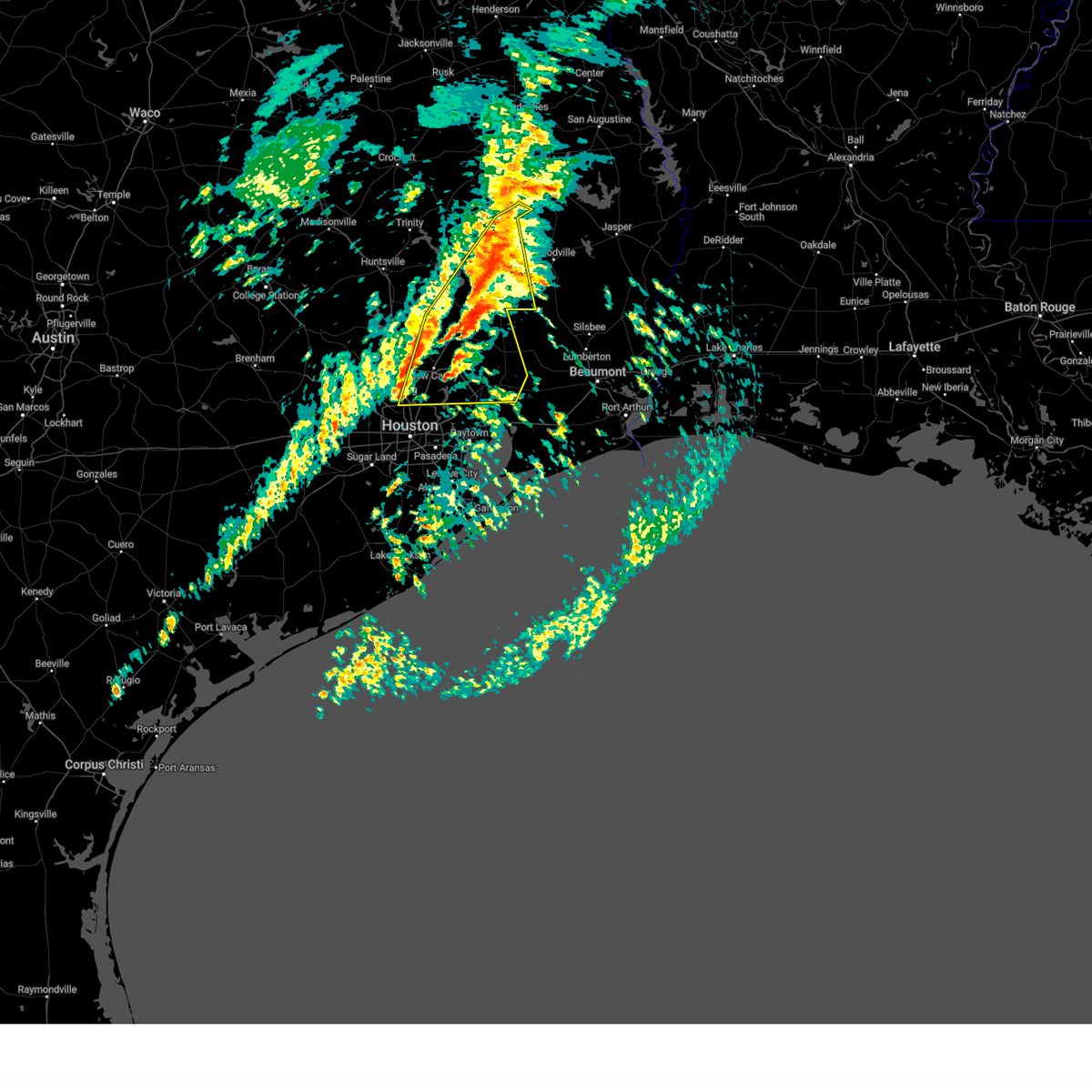
Hail Map for West Livingston, TX
The West Livingston, TX area has had 0 reports of on-the-ground hail by trained spotters, and has been under severe weather warnings 12 times during the past 12 months. Doppler radar has detected hail at or near West Livingston, TX on 87 occasions, including 2 occasions during the past year.
| Name: | West Livingston, TX |
| Where Located: | 47.7 miles SSW of Lufkin, TX |
| Map: | Google Map for West Livingston, TX |
| Population: | 8071 |
| Housing Units: | 2384 |
| More Info: | Search Google for West Livingston, TX |
2
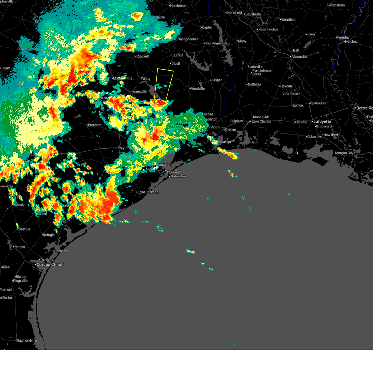
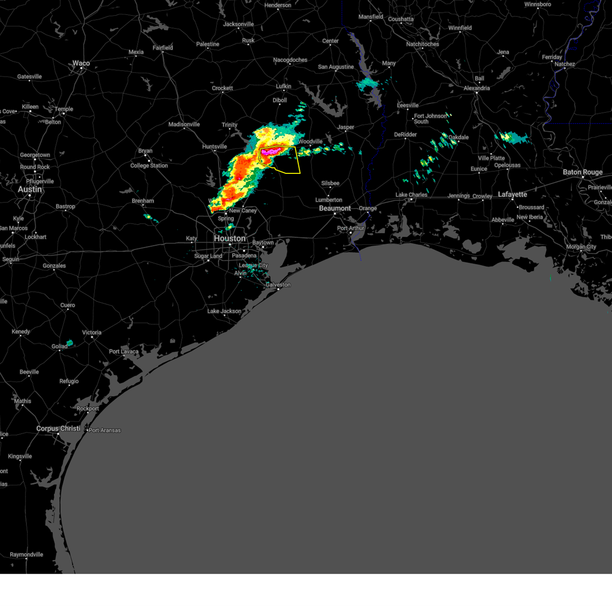
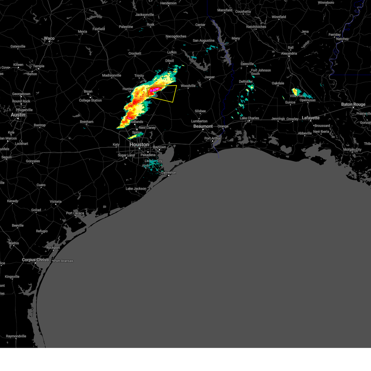
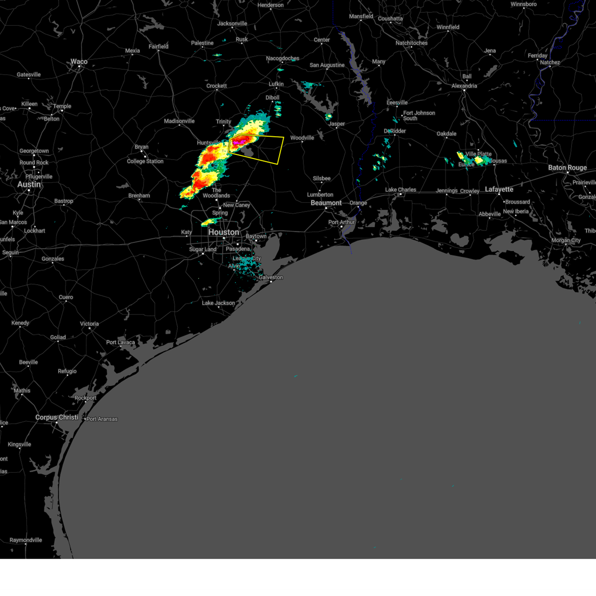
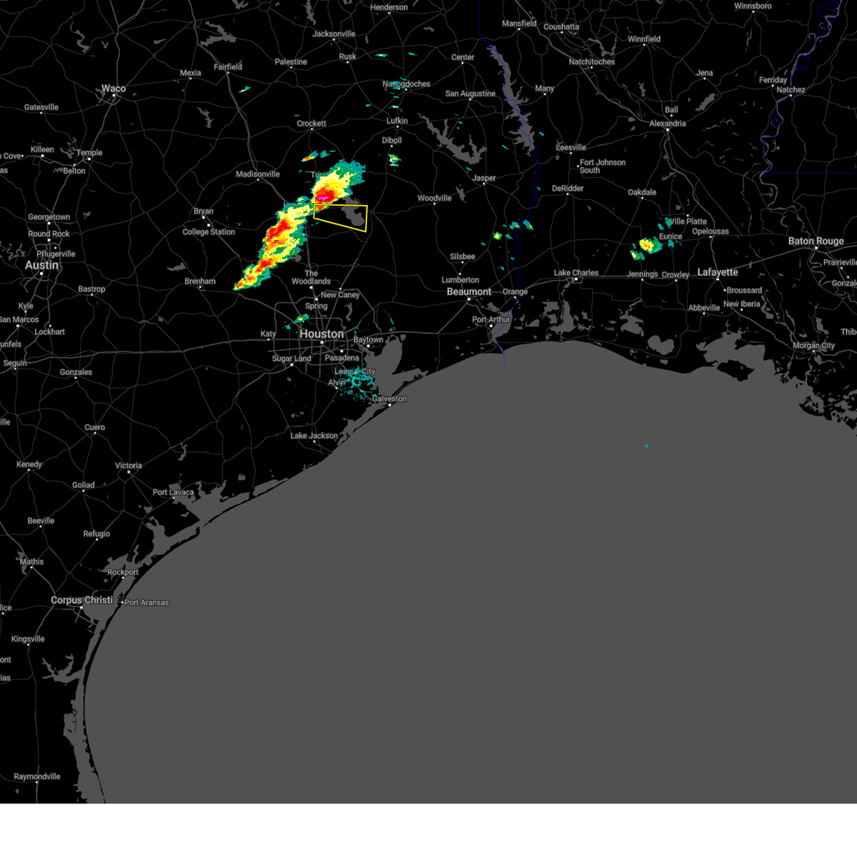
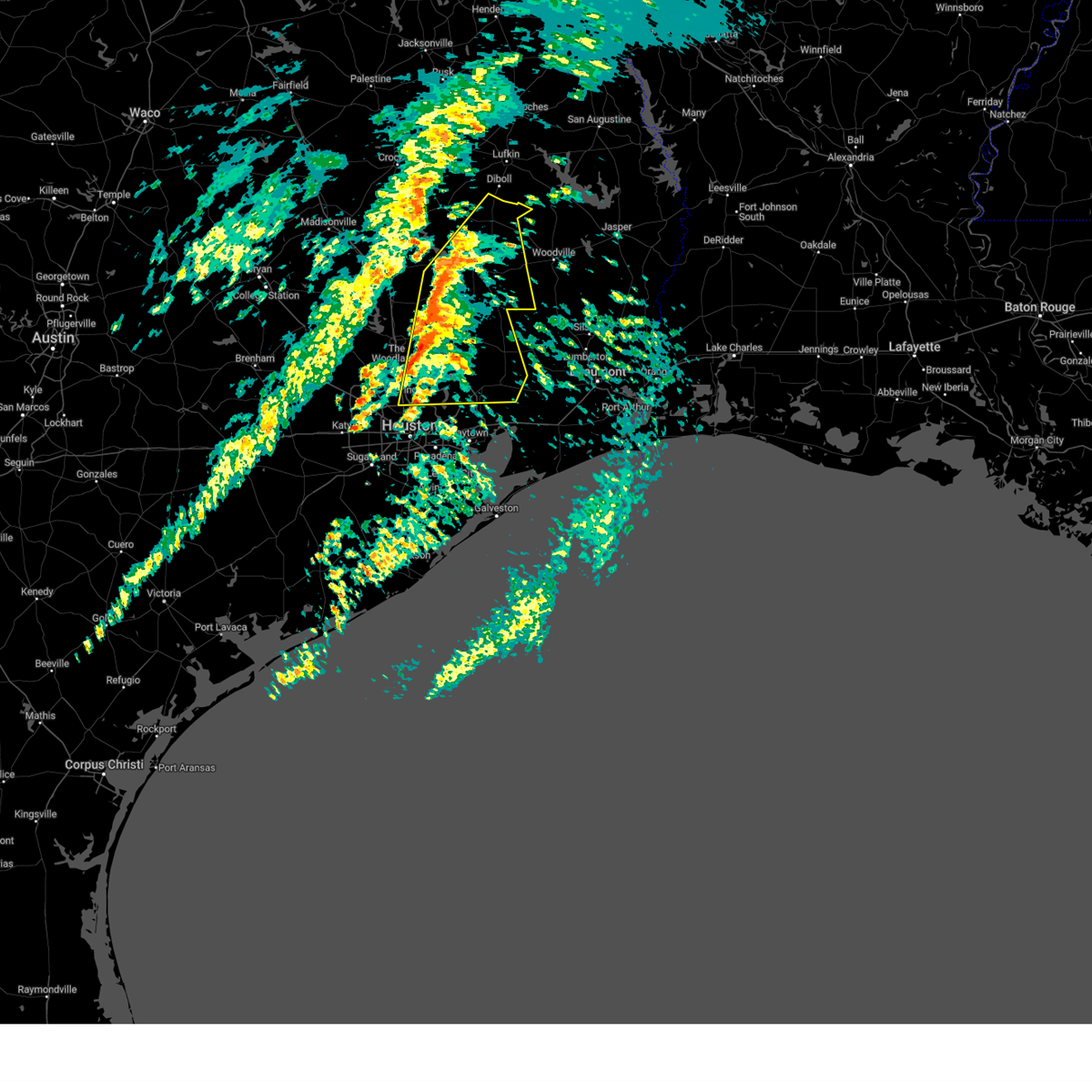
The Top Recent Hail Date for West Livingston, TX is Sunday, March 15, 2026 (7th out of 87)

Hail and Wind Damage Spotted near West Livingston, TX
| Date / Time | Report Details |
|---|---|
| 5/27/2026 2:44 AM CDT |
 Svrhgx the national weather service in league city has issued a * severe thunderstorm warning for, southwestern trinity county in southeastern texas, northeastern grimes county in southeastern texas, northwestern san jacinto county in southeastern texas, southwestern houston county in southeastern texas, eastern madison county in southeastern texas, west central polk county in southeastern texas, walker county in southeastern texas, * until 315 am cdt. * at 243 am cdt, a severe thunderstorm was located near huntsville, moving northeast at 45 mph (radar indicated). Hazards include 60 mph wind gusts. expect damage to roofs, siding, and trees Svrhgx the national weather service in league city has issued a * severe thunderstorm warning for, southwestern trinity county in southeastern texas, northeastern grimes county in southeastern texas, northwestern san jacinto county in southeastern texas, southwestern houston county in southeastern texas, eastern madison county in southeastern texas, west central polk county in southeastern texas, walker county in southeastern texas, * until 315 am cdt. * at 243 am cdt, a severe thunderstorm was located near huntsville, moving northeast at 45 mph (radar indicated). Hazards include 60 mph wind gusts. expect damage to roofs, siding, and trees
|
| 5/10/2026 9:18 PM CDT |
 Svrhgx the national weather service in league city has issued a * severe thunderstorm warning for, central polk county in southeastern texas, * until 945 pm cdt. * at 918 pm cdt, a severe thunderstorm was located near livingston, moving northeast at 10 mph (radar indicated). Hazards include quarter size hail. damage to vehicles is expected Svrhgx the national weather service in league city has issued a * severe thunderstorm warning for, central polk county in southeastern texas, * until 945 pm cdt. * at 918 pm cdt, a severe thunderstorm was located near livingston, moving northeast at 10 mph (radar indicated). Hazards include quarter size hail. damage to vehicles is expected
|
| 5/10/2026 7:00 PM CDT |
 Svrhgx the national weather service in league city has issued a * severe thunderstorm warning for, eastern san jacinto county in southeastern texas, southeastern polk county in southeastern texas, * until 730 pm cdt. * at 659 pm cdt, a severe thunderstorm was located 10 miles northwest of votaw, or 14 miles southeast of livingston, moving north at 10 mph (radar indicated). Hazards include 60 mph wind gusts and quarter size hail. Hail damage to vehicles is expected. Expect wind damage to roofs, siding, and trees. Svrhgx the national weather service in league city has issued a * severe thunderstorm warning for, eastern san jacinto county in southeastern texas, southeastern polk county in southeastern texas, * until 730 pm cdt. * at 659 pm cdt, a severe thunderstorm was located 10 miles northwest of votaw, or 14 miles southeast of livingston, moving north at 10 mph (radar indicated). Hazards include 60 mph wind gusts and quarter size hail. Hail damage to vehicles is expected. Expect wind damage to roofs, siding, and trees.
|
| 5/10/2026 6:27 PM CDT |
 Svrhgx the national weather service in league city has issued a * severe thunderstorm warning for, central san jacinto county in southeastern texas, north central liberty county in southeastern texas, southern polk county in southeastern texas, * until 700 pm cdt. * at 627 pm cdt, a severe thunderstorm was located 9 miles west of votaw, or 12 miles west of thicket, moving north at 15 mph (radar indicated). Hazards include quarter size hail. damage to vehicles is expected Svrhgx the national weather service in league city has issued a * severe thunderstorm warning for, central san jacinto county in southeastern texas, north central liberty county in southeastern texas, southern polk county in southeastern texas, * until 700 pm cdt. * at 627 pm cdt, a severe thunderstorm was located 9 miles west of votaw, or 12 miles west of thicket, moving north at 15 mph (radar indicated). Hazards include quarter size hail. damage to vehicles is expected
|
| 3/15/2026 7:05 PM CDT |
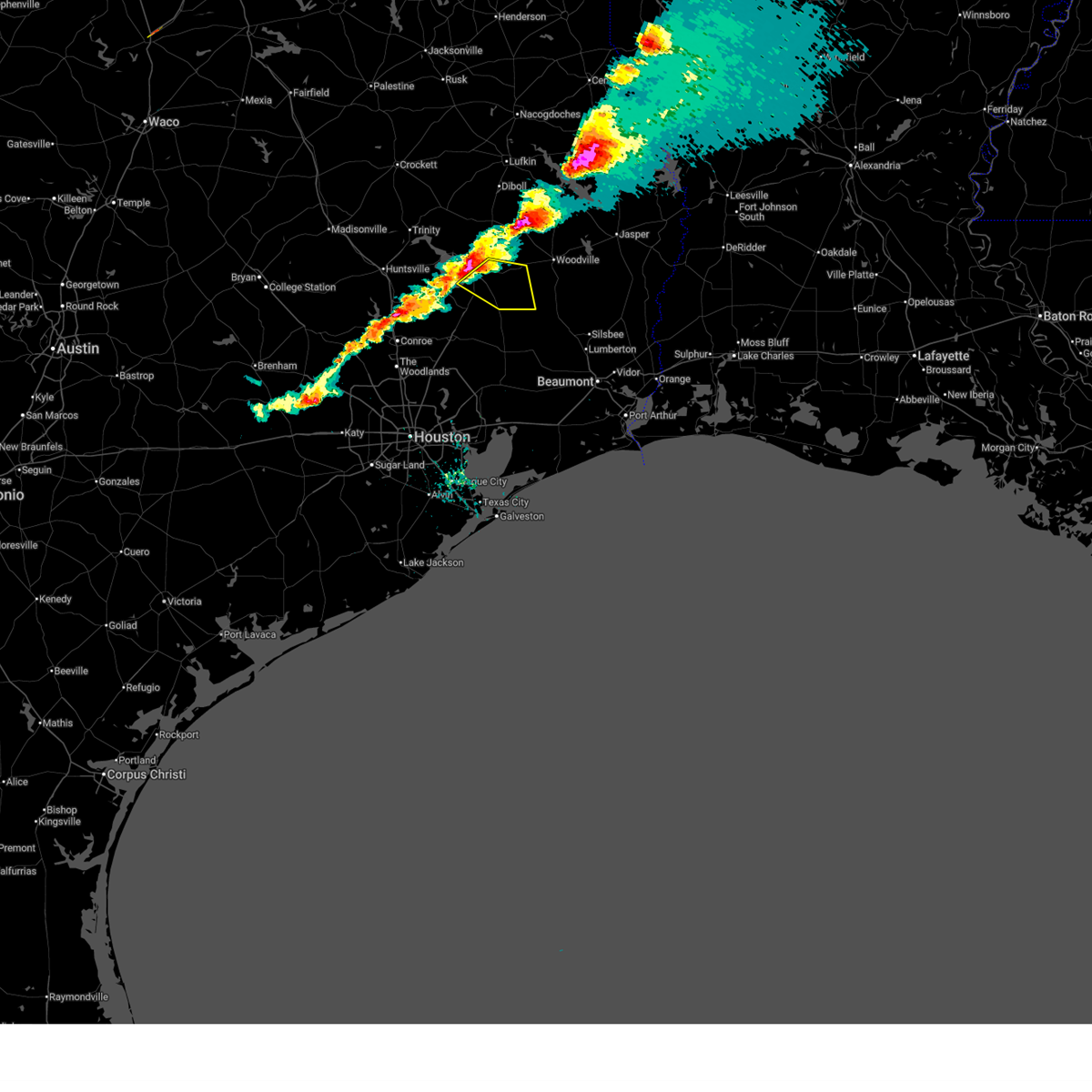 Svrhgx the national weather service in league city has issued a * severe thunderstorm warning for, east central san jacinto county in southeastern texas, southeastern polk county in southeastern texas, * until 745 pm cdt. * at 704 pm cdt, a severe thunderstorm was located over livingston, moving southeast at around 40 mph (radar indicated). Hazards include 60 mph wind gusts and quarter size hail. Hail damage to vehicles is expected. Expect wind damage to roofs, siding, and trees. Svrhgx the national weather service in league city has issued a * severe thunderstorm warning for, east central san jacinto county in southeastern texas, southeastern polk county in southeastern texas, * until 745 pm cdt. * at 704 pm cdt, a severe thunderstorm was located over livingston, moving southeast at around 40 mph (radar indicated). Hazards include 60 mph wind gusts and quarter size hail. Hail damage to vehicles is expected. Expect wind damage to roofs, siding, and trees.
|
| 3/15/2026 6:53 PM CDT |
 the severe thunderstorm warning has been cancelled and is no longer in effect the severe thunderstorm warning has been cancelled and is no longer in effect
|
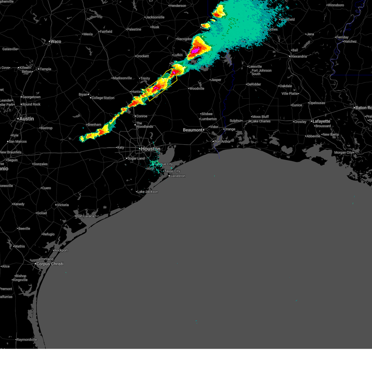
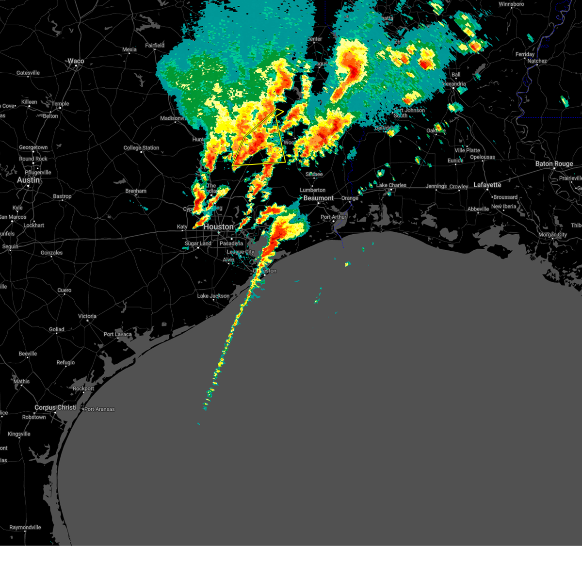
| 3/15/2026 6:53 PM CDT |
 At 652 pm cdt, severe thunderstorms were located along a line extending from 10 miles southeast of diboll to near onalaska, moving southeast at 40 mph (radar indicated). Hazards include 60 mph wind gusts and quarter size hail. Hail damage to vehicles is expected. expect wind damage to roofs, siding, and trees. Locations impacted include, livingston, onalaska, corrigan, coldspring, point blank, seven oaks, west livingston, leggett, and moscow. At 652 pm cdt, severe thunderstorms were located along a line extending from 10 miles southeast of diboll to near onalaska, moving southeast at 40 mph (radar indicated). Hazards include 60 mph wind gusts and quarter size hail. Hail damage to vehicles is expected. expect wind damage to roofs, siding, and trees. Locations impacted include, livingston, onalaska, corrigan, coldspring, point blank, seven oaks, west livingston, leggett, and moscow.
|
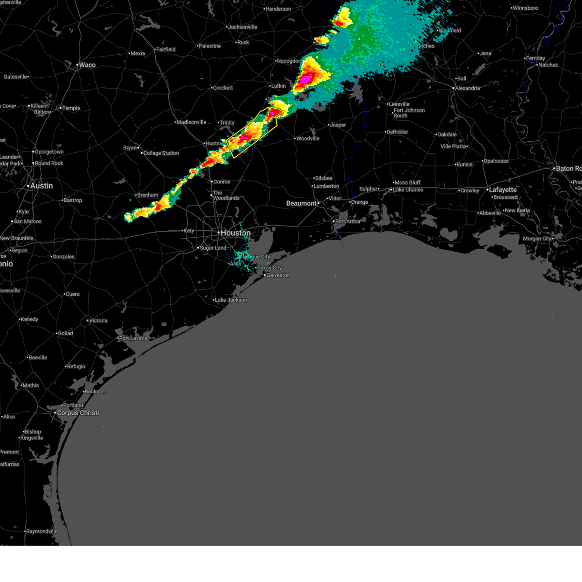
| 3/15/2026 6:30 PM CDT |
 Svrhgx the national weather service in league city has issued a * severe thunderstorm warning for, southern trinity county in southeastern texas, northwestern san jacinto county in southeastern texas, central polk county in southeastern texas, east central walker county in southeastern texas, * until 715 pm cdt. * at 629 pm cdt, severe thunderstorms were located along a line extending from near diboll to riverside, moving southeast at around 35 mph (radar indicated). Hazards include 60 mph wind gusts and quarter size hail. Hail damage to vehicles is expected. Expect wind damage to roofs, siding, and trees. Svrhgx the national weather service in league city has issued a * severe thunderstorm warning for, southern trinity county in southeastern texas, northwestern san jacinto county in southeastern texas, central polk county in southeastern texas, east central walker county in southeastern texas, * until 715 pm cdt. * at 629 pm cdt, severe thunderstorms were located along a line extending from near diboll to riverside, moving southeast at around 35 mph (radar indicated). Hazards include 60 mph wind gusts and quarter size hail. Hail damage to vehicles is expected. Expect wind damage to roofs, siding, and trees.
|
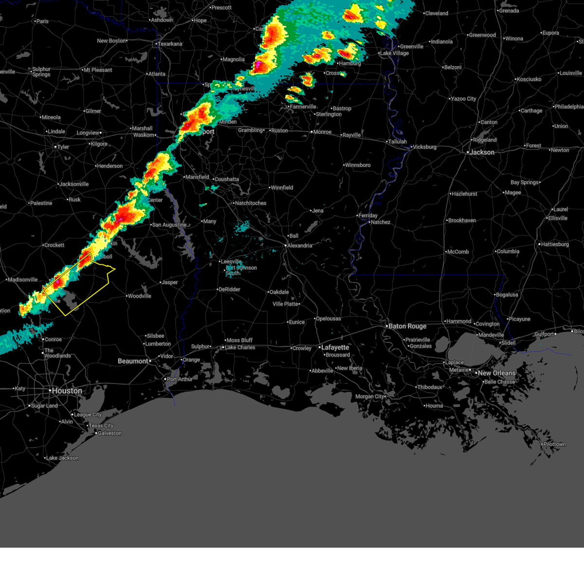
| 10/25/2025 3:59 AM CDT | Svrhgx the national weather service in league city has issued a * severe thunderstorm warning for, southern trinity county in southeastern texas, galveston county in southeastern texas, east central fort bend county in southeastern texas, southeastern montgomery county in southeastern texas, san jacinto county in southeastern texas, chambers county in southeastern texas, northeastern brazoria county in southeastern texas, liberty county in southeastern texas, polk county in southeastern texas, eastern harris county in southeastern texas, * until 445 am cdt. * at 358 am cdt, severe thunderstorms were located along a line extending from livingston to near kenefick to near alvin, moving east at 55 mph (radar indicated). Hazards include 60 mph wind gusts. expect damage to roofs, siding, and trees |
| 10/25/2025 3:42 AM CDT | At 342 am cdt, severe thunderstorms were located along a line extending from 9 miles east of grapeland to west livingston to near plum grove, moving east at 55 mph (radar indicated). Hazards include 60 mph wind gusts. Expect damage to roofs, siding, and trees. Locations impacted include, conroe, huntsville, cleveland, crockett, willis, livingston, austonio, apple springs, the woodlands, spring, oak ridge north, trinity, shepherd, shenandoah, onalaska, splendora, corrigan, patton village, roman forest, and grapeland. |
| 10/25/2025 3:42 AM CDT | the severe thunderstorm warning has been cancelled and is no longer in effect |
| 10/25/2025 3:11 AM CDT | Svrhgx the national weather service in league city has issued a * severe thunderstorm warning for, trinity county in southeastern texas, eastern grimes county in southeastern texas, montgomery county in southeastern texas, san jacinto county in southeastern texas, houston county in southeastern texas, eastern madison county in southeastern texas, northwestern liberty county in southeastern texas, northeastern waller county in southeastern texas, polk county in southeastern texas, walker county in southeastern texas, northwestern harris county in southeastern texas, * until 400 am cdt. * at 311 am cdt, severe thunderstorms were located along a line extending from 13 miles northeast of centerville to new waverly to the woodlands pavillion, moving east at 55 mph (radar indicated). Hazards include 60 mph wind gusts. expect damage to roofs, siding, and trees |
| 6/12/2025 4:41 AM CDT |
 Svrhgx the national weather service in league city has issued a * severe thunderstorm warning for, southeastern trinity county in southeastern texas, east central san jacinto county in southeastern texas, central polk county in southeastern texas, * until 530 am cdt. * at 441 am cdt, a severe thunderstorm was located over goodrich, or 7 miles south of livingston, moving north at 35 mph (radar indicated). Hazards include ping pong ball size hail and 60 mph wind gusts. People and animals outdoors will be injured. expect hail damage to roofs, siding, windows, and vehicles. Expect wind damage to roofs, siding, and trees. Svrhgx the national weather service in league city has issued a * severe thunderstorm warning for, southeastern trinity county in southeastern texas, east central san jacinto county in southeastern texas, central polk county in southeastern texas, * until 530 am cdt. * at 441 am cdt, a severe thunderstorm was located over goodrich, or 7 miles south of livingston, moving north at 35 mph (radar indicated). Hazards include ping pong ball size hail and 60 mph wind gusts. People and animals outdoors will be injured. expect hail damage to roofs, siding, windows, and vehicles. Expect wind damage to roofs, siding, and trees.
|
| 5/27/2025 12:30 AM CDT |
 At 1230 am cdt, severe thunderstorms were located along a line extending from near chester to west livingston to near cut and shoot, moving east at 60 mph (radar indicated). Hazards include 60 mph wind gusts and penny size hail. Expect damage to roofs, siding, and trees. Locations impacted include, cleveland, willis, livingston, shepherd, onalaska, corrigan, cut and shoot, coldspring, point blank, goodrich, north cleveland, seven oaks, lake livingston state park, west livingston, leggett, moscow, and evergreen. At 1230 am cdt, severe thunderstorms were located along a line extending from near chester to west livingston to near cut and shoot, moving east at 60 mph (radar indicated). Hazards include 60 mph wind gusts and penny size hail. Expect damage to roofs, siding, and trees. Locations impacted include, cleveland, willis, livingston, shepherd, onalaska, corrigan, cut and shoot, coldspring, point blank, goodrich, north cleveland, seven oaks, lake livingston state park, west livingston, leggett, moscow, and evergreen.
|
| 5/26/2025 11:57 PM CDT |
 Svrhgx the national weather service in league city has issued a * severe thunderstorm warning for, southern trinity county in southeastern texas, northern montgomery county in southeastern texas, san jacinto county in southeastern texas, northwestern liberty county in southeastern texas, polk county in southeastern texas, walker county in southeastern texas, * until 1245 am cdt. * at 1157 pm cdt, severe thunderstorms were located along a line extending from huntsville to montgomery, moving east at 40 mph (radar indicated). Hazards include 60 mph wind gusts and penny size hail. expect damage to roofs, siding, and trees Svrhgx the national weather service in league city has issued a * severe thunderstorm warning for, southern trinity county in southeastern texas, northern montgomery county in southeastern texas, san jacinto county in southeastern texas, northwestern liberty county in southeastern texas, polk county in southeastern texas, walker county in southeastern texas, * until 1245 am cdt. * at 1157 pm cdt, severe thunderstorms were located along a line extending from huntsville to montgomery, moving east at 40 mph (radar indicated). Hazards include 60 mph wind gusts and penny size hail. expect damage to roofs, siding, and trees
|
| 3/8/2025 7:13 PM CDT |
 Svrhgx the national weather service in league city has issued a * severe thunderstorm warning for, southeastern polk county in southeastern texas, * until 715 pm cst. * at 612 pm cst, a severe thunderstorm was located over livingston, moving east at 25 mph. this storm has a history of producing large hail (trained weather spotters). Hazards include ping pong ball size hail and 60 mph wind gusts. People and animals outdoors will be injured. expect hail damage to roofs, siding, windows, and vehicles. Expect wind damage to roofs, siding, and trees. Svrhgx the national weather service in league city has issued a * severe thunderstorm warning for, southeastern polk county in southeastern texas, * until 715 pm cst. * at 612 pm cst, a severe thunderstorm was located over livingston, moving east at 25 mph. this storm has a history of producing large hail (trained weather spotters). Hazards include ping pong ball size hail and 60 mph wind gusts. People and animals outdoors will be injured. expect hail damage to roofs, siding, windows, and vehicles. Expect wind damage to roofs, siding, and trees.
|
| 3/8/2025 5:43 PM CST |
 the severe thunderstorm warning has been cancelled and is no longer in effect the severe thunderstorm warning has been cancelled and is no longer in effect
|
| 3/8/2025 5:43 PM CST |
 At 542 pm cst, a severe thunderstorm was located near west livingston, or 8 miles west of livingston, moving east at 35 mph (public). Hazards include ping pong ball size hail and 60 mph wind gusts. People and animals outdoors will be injured. expect hail damage to roofs, siding, windows, and vehicles. expect wind damage to roofs, siding, and trees. Locations impacted include, point blank, lake livingston state park, livingston, alabama-coushatta reservation, west livingston, goodrich, and onalaska. At 542 pm cst, a severe thunderstorm was located near west livingston, or 8 miles west of livingston, moving east at 35 mph (public). Hazards include ping pong ball size hail and 60 mph wind gusts. People and animals outdoors will be injured. expect hail damage to roofs, siding, windows, and vehicles. expect wind damage to roofs, siding, and trees. Locations impacted include, point blank, lake livingston state park, livingston, alabama-coushatta reservation, west livingston, goodrich, and onalaska.
|
| 3/8/2025 5:27 PM CST |
 Svrhgx the national weather service in league city has issued a * severe thunderstorm warning for, southern trinity county in southeastern texas, northwestern san jacinto county in southeastern texas, southern polk county in southeastern texas, * until 615 pm cst. * at 527 pm cst, a severe thunderstorm was located over point blank, or 14 miles west of livingston, moving east at 35 mph (radar indicated). Hazards include 60 mph wind gusts and quarter size hail. Hail damage to vehicles is expected. Expect wind damage to roofs, siding, and trees. Svrhgx the national weather service in league city has issued a * severe thunderstorm warning for, southern trinity county in southeastern texas, northwestern san jacinto county in southeastern texas, southern polk county in southeastern texas, * until 615 pm cst. * at 527 pm cst, a severe thunderstorm was located over point blank, or 14 miles west of livingston, moving east at 35 mph (radar indicated). Hazards include 60 mph wind gusts and quarter size hail. Hail damage to vehicles is expected. Expect wind damage to roofs, siding, and trees.
|
| 3/8/2025 5:11 PM CST |
 Svrhgx the national weather service in league city has issued a * severe thunderstorm warning for, west central san jacinto county in southeastern texas, southwestern polk county in southeastern texas, eastern walker county in southeastern texas, * until 530 pm cst. * at 510 pm cst, a severe thunderstorm was located near riverside, or 14 miles east of huntsville, moving east at 30 mph (radar indicated). Hazards include 60 mph wind gusts and quarter size hail. Hail damage to vehicles is expected. Expect wind damage to roofs, siding, and trees. Svrhgx the national weather service in league city has issued a * severe thunderstorm warning for, west central san jacinto county in southeastern texas, southwestern polk county in southeastern texas, eastern walker county in southeastern texas, * until 530 pm cst. * at 510 pm cst, a severe thunderstorm was located near riverside, or 14 miles east of huntsville, moving east at 30 mph (radar indicated). Hazards include 60 mph wind gusts and quarter size hail. Hail damage to vehicles is expected. Expect wind damage to roofs, siding, and trees.
|
| 3/4/2025 9:28 AM CST |
 At 927 am cst, clusters of strong to severe thunderstorm were located near shepherd, or 12 miles northeast of cleveland, moving northeast at 30 mph (radar indicated). Hazards include 60 mph wind gusts. Expect damage to roofs, siding, and trees. Locations impacted include, bush intercontinental airport, leggett, lake livingston state park, dayton lakes, west livingston, liberty, moscow, cleveland, woodbranch, dayton, north cleveland, moss hill, hardin, splendora, kingwood, porter, romayor, kenefick, daisetta, and goodrich. At 927 am cst, clusters of strong to severe thunderstorm were located near shepherd, or 12 miles northeast of cleveland, moving northeast at 30 mph (radar indicated). Hazards include 60 mph wind gusts. Expect damage to roofs, siding, and trees. Locations impacted include, bush intercontinental airport, leggett, lake livingston state park, dayton lakes, west livingston, liberty, moscow, cleveland, woodbranch, dayton, north cleveland, moss hill, hardin, splendora, kingwood, porter, romayor, kenefick, daisetta, and goodrich.
|
| 3/4/2025 9:28 AM CST |
 the severe thunderstorm warning has been cancelled and is no longer in effect the severe thunderstorm warning has been cancelled and is no longer in effect
|
| 3/4/2025 8:51 AM CST |
 Svrhgx the national weather service in league city has issued a * severe thunderstorm warning for, east central trinity county in southeastern texas, southeastern montgomery county in southeastern texas, san jacinto county in southeastern texas, liberty county in southeastern texas, polk county in southeastern texas, northeastern harris county in southeastern texas, * until 945 am cst. * at 850 am cst, a line of severe thunderstorms was centered near cut and shoot, or 10 miles west of cleveland, moving northeast at 45 mph (radar indicated). Hazards include 60 mph wind gusts. expect damage to roofs, siding, and trees Svrhgx the national weather service in league city has issued a * severe thunderstorm warning for, east central trinity county in southeastern texas, southeastern montgomery county in southeastern texas, san jacinto county in southeastern texas, liberty county in southeastern texas, polk county in southeastern texas, northeastern harris county in southeastern texas, * until 945 am cst. * at 850 am cst, a line of severe thunderstorms was centered near cut and shoot, or 10 miles west of cleveland, moving northeast at 45 mph (radar indicated). Hazards include 60 mph wind gusts. expect damage to roofs, siding, and trees
|
| 12/28/2024 2:35 PM CST |
 Svrhgx the national weather service in league city has issued a * severe thunderstorm warning for, central san jacinto county in southeastern texas, polk county in southeastern texas, * until 315 pm cst. * at 235 pm cst, a cluster of severe thunderstorms was centered near goodrich, or near livingston, moving east at 35 mph (radar indicated). Hazards include 60 mph wind gusts and quarter size hail. Hail damage to vehicles is expected. Expect wind damage to roofs, siding, and trees. Svrhgx the national weather service in league city has issued a * severe thunderstorm warning for, central san jacinto county in southeastern texas, polk county in southeastern texas, * until 315 pm cst. * at 235 pm cst, a cluster of severe thunderstorms was centered near goodrich, or near livingston, moving east at 35 mph (radar indicated). Hazards include 60 mph wind gusts and quarter size hail. Hail damage to vehicles is expected. Expect wind damage to roofs, siding, and trees.
|
| 5/30/2024 7:12 PM CDT |
 Svrhgx the national weather service in league city has issued a * severe thunderstorm warning for, southern trinity county in southeastern texas, southeastern grimes county in southeastern texas, northwestern montgomery county in southeastern texas, northwestern san jacinto county in southeastern texas, polk county in southeastern texas, southeastern walker county in southeastern texas, * until 745 pm cdt. * at 711 pm cdt, severe thunderstorms were located along a line extending from 6 miles west of chester to 8 miles southwest of point blank to near navasota, moving southeast at 30 mph (radar indicated). Hazards include 60 mph wind gusts and quarter size hail. Hail damage to vehicles is expected. Expect wind damage to roofs, siding, and trees. Svrhgx the national weather service in league city has issued a * severe thunderstorm warning for, southern trinity county in southeastern texas, southeastern grimes county in southeastern texas, northwestern montgomery county in southeastern texas, northwestern san jacinto county in southeastern texas, polk county in southeastern texas, southeastern walker county in southeastern texas, * until 745 pm cdt. * at 711 pm cdt, severe thunderstorms were located along a line extending from 6 miles west of chester to 8 miles southwest of point blank to near navasota, moving southeast at 30 mph (radar indicated). Hazards include 60 mph wind gusts and quarter size hail. Hail damage to vehicles is expected. Expect wind damage to roofs, siding, and trees.
|
| 5/28/2024 12:35 PM CDT |
 Svrhgx the national weather service in league city has issued a * severe thunderstorm warning for, southern montgomery county in southeastern texas, southern san jacinto county in southeastern texas, northwestern liberty county in southeastern texas, south central polk county in southeastern texas, northern harris county in southeastern texas, * until 130 pm cdt. * at 1234 pm cdt, severe thunderstorms were located along a line extending from near west livingston to 8 miles east of new waverly to near montgomery, moving south at 25 mph (radar indicated). Hazards include 60 mph wind gusts and quarter size hail. Hail damage to vehicles is expected. Expect wind damage to roofs, siding, and trees. Svrhgx the national weather service in league city has issued a * severe thunderstorm warning for, southern montgomery county in southeastern texas, southern san jacinto county in southeastern texas, northwestern liberty county in southeastern texas, south central polk county in southeastern texas, northern harris county in southeastern texas, * until 130 pm cdt. * at 1234 pm cdt, severe thunderstorms were located along a line extending from near west livingston to 8 miles east of new waverly to near montgomery, moving south at 25 mph (radar indicated). Hazards include 60 mph wind gusts and quarter size hail. Hail damage to vehicles is expected. Expect wind damage to roofs, siding, and trees.
|
| 5/28/2024 12:12 PM CDT |
 Svrhgx the national weather service in league city has issued a * severe thunderstorm warning for, southwestern trinity county in southeastern texas, northwestern montgomery county in southeastern texas, san jacinto county in southeastern texas, southwestern polk county in southeastern texas, walker county in southeastern texas, * until 1245 pm cdt. * at 1209 pm cdt, severe thunderstorms were located along a line extending from sebastopol to near huntsville state park to 11 miles west of new waverly, moving southeast at 40 mph (radar indicated). Hazards include 70 mph wind gusts and quarter size hail. Hail damage to vehicles is expected. expect considerable tree damage. Wind damage is also likely to mobile homes, roofs, and outbuildings. Svrhgx the national weather service in league city has issued a * severe thunderstorm warning for, southwestern trinity county in southeastern texas, northwestern montgomery county in southeastern texas, san jacinto county in southeastern texas, southwestern polk county in southeastern texas, walker county in southeastern texas, * until 1245 pm cdt. * at 1209 pm cdt, severe thunderstorms were located along a line extending from sebastopol to near huntsville state park to 11 miles west of new waverly, moving southeast at 40 mph (radar indicated). Hazards include 70 mph wind gusts and quarter size hail. Hail damage to vehicles is expected. expect considerable tree damage. Wind damage is also likely to mobile homes, roofs, and outbuildings.
|
| 5/9/2024 9:50 PM CDT |
 The storm which prompted the warning has weakened below severe limits, and has exited the warned area. therefore, the warning has been allowed to expire. however, small hail and gusty winds are still possible with this thunderstorm. a severe thunderstorm watch remains in effect until midnight cdt for southeastern texas. The storm which prompted the warning has weakened below severe limits, and has exited the warned area. therefore, the warning has been allowed to expire. however, small hail and gusty winds are still possible with this thunderstorm. a severe thunderstorm watch remains in effect until midnight cdt for southeastern texas.
|
| 5/9/2024 9:39 PM CDT |
 At 939 pm cdt, a severe thunderstorm was located near coldspring, or 16 miles northwest of cleveland, moving southeast at 30 mph (radar indicated). Hazards include 60 mph wind gusts and penny size hail. Expect damage to roofs, siding, and trees. Locations impacted include, coldspring, west livingston, evergreen, and oakhurst. At 939 pm cdt, a severe thunderstorm was located near coldspring, or 16 miles northwest of cleveland, moving southeast at 30 mph (radar indicated). Hazards include 60 mph wind gusts and penny size hail. Expect damage to roofs, siding, and trees. Locations impacted include, coldspring, west livingston, evergreen, and oakhurst.
|
| 5/9/2024 9:20 PM CDT |
 Svrhgx the national weather service in league city has issued a * severe thunderstorm warning for, north central montgomery county in southeastern texas, southwestern san jacinto county in southeastern texas, west central polk county in southeastern texas, southeastern walker county in southeastern texas, * until 945 pm cdt. * at 919 pm cdt, a severe thunderstorm was located 9 miles northeast of new waverly, or 12 miles southeast of huntsville, moving southeast at 30 mph (radar indicated). Hazards include 60 mph wind gusts and quarter size hail. Hail damage to vehicles is expected. Expect wind damage to roofs, siding, and trees. Svrhgx the national weather service in league city has issued a * severe thunderstorm warning for, north central montgomery county in southeastern texas, southwestern san jacinto county in southeastern texas, west central polk county in southeastern texas, southeastern walker county in southeastern texas, * until 945 pm cdt. * at 919 pm cdt, a severe thunderstorm was located 9 miles northeast of new waverly, or 12 miles southeast of huntsville, moving southeast at 30 mph (radar indicated). Hazards include 60 mph wind gusts and quarter size hail. Hail damage to vehicles is expected. Expect wind damage to roofs, siding, and trees.
|
| 5/5/2024 12:49 AM CDT |
 Svrhgx the national weather service in league city has issued a * severe thunderstorm warning for, southern trinity county in southeastern texas, northwestern san jacinto county in southeastern texas, west central polk county in southeastern texas, southeastern walker county in southeastern texas, * until 115 am cdt. * at 1249 am cdt, a severe thunderstorm was located near point blank, or 14 miles west of livingston, moving northeast at 25 mph (radar indicated). Hazards include quarter size hail. damage to vehicles is expected Svrhgx the national weather service in league city has issued a * severe thunderstorm warning for, southern trinity county in southeastern texas, northwestern san jacinto county in southeastern texas, west central polk county in southeastern texas, southeastern walker county in southeastern texas, * until 115 am cdt. * at 1249 am cdt, a severe thunderstorm was located near point blank, or 14 miles west of livingston, moving northeast at 25 mph (radar indicated). Hazards include quarter size hail. damage to vehicles is expected
|
| 5/2/2024 2:55 AM CDT |
 Svrhgx the national weather service in league city has issued a * severe thunderstorm warning for, east central san jacinto county in southeastern texas, north central liberty county in southeastern texas, southeastern polk county in southeastern texas, * until 345 am cdt. * at 254 am cdt, severe thunderstorms were located along a line extending from near livingston to 6 miles east of goodrich to shepherd, moving east at 15 mph (radar indicated). Hazards include quarter size hail. damage to vehicles is expected Svrhgx the national weather service in league city has issued a * severe thunderstorm warning for, east central san jacinto county in southeastern texas, north central liberty county in southeastern texas, southeastern polk county in southeastern texas, * until 345 am cdt. * at 254 am cdt, severe thunderstorms were located along a line extending from near livingston to 6 miles east of goodrich to shepherd, moving east at 15 mph (radar indicated). Hazards include quarter size hail. damage to vehicles is expected
|
| 5/2/2024 2:31 AM CDT |
 At 230 am cdt, severe thunderstorms were located along a line extending from west livingston to near shepherd, moving east at 20 mph. this storm has a history of producing large hail in san jacinto county (radar indicated). Hazards include quarter size hail. Damage to vehicles is expected. Locations impacted include, livingston, shepherd, goodrich, lake livingston state park, west livingston, romayor, and rye. At 230 am cdt, severe thunderstorms were located along a line extending from west livingston to near shepherd, moving east at 20 mph. this storm has a history of producing large hail in san jacinto county (radar indicated). Hazards include quarter size hail. Damage to vehicles is expected. Locations impacted include, livingston, shepherd, goodrich, lake livingston state park, west livingston, romayor, and rye.
|
| 5/2/2024 2:09 AM CDT |
 Svrhgx the national weather service in league city has issued a * severe thunderstorm warning for, southeastern san jacinto county in southeastern texas, north central liberty county in southeastern texas, southwestern polk county in southeastern texas, * until 300 am cdt. * at 208 am cdt, severe thunderstorms were located along a line extending from near coldspring to 7 miles north of north cleveland, moving east at 30 mph (trained weather spotters). Hazards include ping pong ball size hail. People and animals outdoors will be injured. Expect damage to roofs, siding, windows, and vehicles. Svrhgx the national weather service in league city has issued a * severe thunderstorm warning for, southeastern san jacinto county in southeastern texas, north central liberty county in southeastern texas, southwestern polk county in southeastern texas, * until 300 am cdt. * at 208 am cdt, severe thunderstorms were located along a line extending from near coldspring to 7 miles north of north cleveland, moving east at 30 mph (trained weather spotters). Hazards include ping pong ball size hail. People and animals outdoors will be injured. Expect damage to roofs, siding, windows, and vehicles.
|
| 4/29/2024 2:16 AM CDT |
 the severe thunderstorm warning has been cancelled and is no longer in effect the severe thunderstorm warning has been cancelled and is no longer in effect
|
| 4/29/2024 2:16 AM CDT |
 At 215 am cdt, a severe thunderstorm was located near seven oaks, or 11 miles north of livingston, moving northeast at 35 mph (radar indicated). Hazards include 60 mph wind gusts and nickel size hail. Expect damage to roofs, siding, and trees. Locations impacted include, livingston, shepherd, coldspring, point blank, lake livingston state park, west livingston, and evergreen. At 215 am cdt, a severe thunderstorm was located near seven oaks, or 11 miles north of livingston, moving northeast at 35 mph (radar indicated). Hazards include 60 mph wind gusts and nickel size hail. Expect damage to roofs, siding, and trees. Locations impacted include, livingston, shepherd, coldspring, point blank, lake livingston state park, west livingston, and evergreen.
|
| 4/29/2024 1:47 AM CDT |
 Svrhgx the national weather service in league city has issued a * severe thunderstorm warning for, south central trinity county in southeastern texas, san jacinto county in southeastern texas, southwestern polk county in southeastern texas, * until 230 am cdt. * at 147 am cdt, a severe thunderstorms were impacting portions of trinity, san jacinto, and polk counties (radar indicated). Hazards include 60 mph wind gusts and nickel size hail. expect damage to roofs, siding, and trees Svrhgx the national weather service in league city has issued a * severe thunderstorm warning for, south central trinity county in southeastern texas, san jacinto county in southeastern texas, southwestern polk county in southeastern texas, * until 230 am cdt. * at 147 am cdt, a severe thunderstorms were impacting portions of trinity, san jacinto, and polk counties (radar indicated). Hazards include 60 mph wind gusts and nickel size hail. expect damage to roofs, siding, and trees
|
| 4/29/2024 1:47 AM CDT |
 At 144 am cdt, a severe thunderstorm was located over point blank, or 16 miles west of livingston, moving northeast at 30 mph (radar indicated). Hazards include 60 mph wind gusts and penny size hail. Expect damage to roofs, siding, and trees. Locations impacted include, onalaska. At 144 am cdt, a severe thunderstorm was located over point blank, or 16 miles west of livingston, moving northeast at 30 mph (radar indicated). Hazards include 60 mph wind gusts and penny size hail. Expect damage to roofs, siding, and trees. Locations impacted include, onalaska.
|
| 4/29/2024 1:47 AM CDT |
 the severe thunderstorm warning has been cancelled and is no longer in effect the severe thunderstorm warning has been cancelled and is no longer in effect
|
| 4/29/2024 1:31 AM CDT |
 Svrhgx the national weather service in league city has issued a * severe thunderstorm warning for, south central trinity county in southeastern texas, northwestern san jacinto county in southeastern texas, west central polk county in southeastern texas, east central walker county in southeastern texas, * until 200 am cdt. * at 131 am cdt, a severe thunderstorm was located near point blank, or 15 miles east of huntsville, moving northeast at 30 mph (radar indicated). Hazards include 60 mph wind gusts and penny size hail. expect damage to roofs, siding, and trees Svrhgx the national weather service in league city has issued a * severe thunderstorm warning for, south central trinity county in southeastern texas, northwestern san jacinto county in southeastern texas, west central polk county in southeastern texas, east central walker county in southeastern texas, * until 200 am cdt. * at 131 am cdt, a severe thunderstorm was located near point blank, or 15 miles east of huntsville, moving northeast at 30 mph (radar indicated). Hazards include 60 mph wind gusts and penny size hail. expect damage to roofs, siding, and trees
|
| 4/29/2024 1:07 AM CDT |
 At 107 am cdt, a severe thunderstorm was located over livingston, moving north at 35 mph (radar indicated). Hazards include 60 mph wind gusts and nickel size hail. Expect damage to roofs, siding, and trees. Locations impacted include, livingston, shepherd, goodrich, seven oaks, lake livingston state park, alabama-coushatta reservation, west livingston, and leggett. At 107 am cdt, a severe thunderstorm was located over livingston, moving north at 35 mph (radar indicated). Hazards include 60 mph wind gusts and nickel size hail. Expect damage to roofs, siding, and trees. Locations impacted include, livingston, shepherd, goodrich, seven oaks, lake livingston state park, alabama-coushatta reservation, west livingston, and leggett.
|
| 4/29/2024 12:43 AM CDT |
 Svrhgx the national weather service in league city has issued a * severe thunderstorm warning for, southeastern san jacinto county in southeastern texas, southern polk county in southeastern texas, * until 130 am cdt. * at 1243 am cdt, a severe thunderstorm was located over shepherd, or 13 miles north of cleveland, moving north at 35 mph (radar indicated). Hazards include 60 mph wind gusts and nickel size hail. expect damage to roofs, siding, and trees Svrhgx the national weather service in league city has issued a * severe thunderstorm warning for, southeastern san jacinto county in southeastern texas, southern polk county in southeastern texas, * until 130 am cdt. * at 1243 am cdt, a severe thunderstorm was located over shepherd, or 13 miles north of cleveland, moving north at 35 mph (radar indicated). Hazards include 60 mph wind gusts and nickel size hail. expect damage to roofs, siding, and trees
|
| 4/29/2024 12:15 AM CDT |
 Svrhgx the national weather service in league city has issued a * severe thunderstorm warning for, southern trinity county in southeastern texas, central san jacinto county in southeastern texas, central polk county in southeastern texas, * until 1245 am cdt. * at 1214 am cdt, a cluster of severe thunderstorms continues to impact portions of san jacinto and polk counties (radar indicated). Hazards include 70 mph wind gusts and quarter size hail. Hail damage to vehicles is expected. expect considerable tree damage. Wind damage is also likely to mobile homes, roofs, and outbuildings. Svrhgx the national weather service in league city has issued a * severe thunderstorm warning for, southern trinity county in southeastern texas, central san jacinto county in southeastern texas, central polk county in southeastern texas, * until 1245 am cdt. * at 1214 am cdt, a cluster of severe thunderstorms continues to impact portions of san jacinto and polk counties (radar indicated). Hazards include 70 mph wind gusts and quarter size hail. Hail damage to vehicles is expected. expect considerable tree damage. Wind damage is also likely to mobile homes, roofs, and outbuildings.
|
| 4/28/2024 11:34 PM CDT |
 Svrhgx the national weather service in league city has issued a * severe thunderstorm warning for, south central trinity county in southeastern texas, central san jacinto county in southeastern texas, southwestern polk county in southeastern texas, * until 1215 am cdt. * at 1133 pm cdt, a severe thunderstorm was located over coldspring, or 14 miles southwest of livingston, moving northeast at 20 mph (radar indicated). Hazards include 60 mph wind gusts and quarter size hail. Hail damage to vehicles is expected. expect wind damage to roofs, siding, and trees. Torrential rain will likely continue. Svrhgx the national weather service in league city has issued a * severe thunderstorm warning for, south central trinity county in southeastern texas, central san jacinto county in southeastern texas, southwestern polk county in southeastern texas, * until 1215 am cdt. * at 1133 pm cdt, a severe thunderstorm was located over coldspring, or 14 miles southwest of livingston, moving northeast at 20 mph (radar indicated). Hazards include 60 mph wind gusts and quarter size hail. Hail damage to vehicles is expected. expect wind damage to roofs, siding, and trees. Torrential rain will likely continue.
|
| 4/28/2024 10:22 PM CDT |
 Svrhgx the national weather service in league city has issued a * severe thunderstorm warning for, southern trinity county in southeastern texas, northwestern san jacinto county in southeastern texas, central polk county in southeastern texas, * until 1100 pm cdt. * at 1019 pm cdt, a cluster of severe thunderstorms continues to impact portions over portions of trinity, polk, and northern san jacinto counties. heavy rainfall, damaging wind gusts, and large hail likely. a tornado is possible (radar indicated). Hazards include golf ball size hail and 70 mph wind gusts. People and animals outdoors will be injured. expect hail damage to roofs, siding, windows, and vehicles. expect considerable tree damage. Wind damage is also likely to mobile homes, roofs, and outbuildings. Svrhgx the national weather service in league city has issued a * severe thunderstorm warning for, southern trinity county in southeastern texas, northwestern san jacinto county in southeastern texas, central polk county in southeastern texas, * until 1100 pm cdt. * at 1019 pm cdt, a cluster of severe thunderstorms continues to impact portions over portions of trinity, polk, and northern san jacinto counties. heavy rainfall, damaging wind gusts, and large hail likely. a tornado is possible (radar indicated). Hazards include golf ball size hail and 70 mph wind gusts. People and animals outdoors will be injured. expect hail damage to roofs, siding, windows, and vehicles. expect considerable tree damage. Wind damage is also likely to mobile homes, roofs, and outbuildings.
|
| 2/11/2024 10:32 AM CST |
 At 1031 am cst, a confirmed tornado was located near onalaska, or 9 miles northwest of livingston, moving east at 35 mph (radar confirmed tornado). Hazards include damaging tornado and half dollar size hail. Flying debris will be dangerous to those caught without shelter. mobile homes will be damaged or destroyed. damage to roofs, windows, and vehicles will occur. tree damage is likely. this tornado will be near, livingston, seven oaks, and northeastern west livingston around 1035 am cst. Other locations impacted by this tornadic thunderstorm include moscow and leggett. At 1031 am cst, a confirmed tornado was located near onalaska, or 9 miles northwest of livingston, moving east at 35 mph (radar confirmed tornado). Hazards include damaging tornado and half dollar size hail. Flying debris will be dangerous to those caught without shelter. mobile homes will be damaged or destroyed. damage to roofs, windows, and vehicles will occur. tree damage is likely. this tornado will be near, livingston, seven oaks, and northeastern west livingston around 1035 am cst. Other locations impacted by this tornadic thunderstorm include moscow and leggett.
|
| 2/11/2024 10:26 AM CST |
 At 1026 am cst, a tornado producing storm was located over onalaska, or 10 miles northwest of livingston, moving east at 35 mph (radar confirmed tornado). Hazards include damaging tornado and quarter size hail. Flying debris will be dangerous to those caught without shelter. mobile homes will be damaged or destroyed. damage to roofs, windows, and vehicles will occur. tree damage is likely. this tornadic storm will be near, livingston, onalaska, and northern west livingston around 1030 am cst. seven oaks around 1040 am cst. Other locations impacted by this tornadic thunderstorm include moscow and leggett. At 1026 am cst, a tornado producing storm was located over onalaska, or 10 miles northwest of livingston, moving east at 35 mph (radar confirmed tornado). Hazards include damaging tornado and quarter size hail. Flying debris will be dangerous to those caught without shelter. mobile homes will be damaged or destroyed. damage to roofs, windows, and vehicles will occur. tree damage is likely. this tornadic storm will be near, livingston, onalaska, and northern west livingston around 1030 am cst. seven oaks around 1040 am cst. Other locations impacted by this tornadic thunderstorm include moscow and leggett.
|
| 2/11/2024 10:16 AM CST |
 At 1016 am cst, a confirmed tornado was located over point blank, or 15 miles west of livingston, moving east at 35 mph (radar confirmed tornado). Hazards include damaging tornado and quarter size hail. Flying debris will be dangerous to those caught without shelter. mobile homes will be damaged or destroyed. damage to roofs, windows, and vehicles will occur. tree damage is likely. this tornado will be near, onalaska and west livingston around 1020 am cst. livingston around 1025 am cst. Other locations impacted by this tornadic thunderstorm include oakhurst. At 1016 am cst, a confirmed tornado was located over point blank, or 15 miles west of livingston, moving east at 35 mph (radar confirmed tornado). Hazards include damaging tornado and quarter size hail. Flying debris will be dangerous to those caught without shelter. mobile homes will be damaged or destroyed. damage to roofs, windows, and vehicles will occur. tree damage is likely. this tornado will be near, onalaska and west livingston around 1020 am cst. livingston around 1025 am cst. Other locations impacted by this tornadic thunderstorm include oakhurst.
|
| 2/11/2024 10:03 AM CST |
 At 1002 am cst, a tornado producing storm was located near point blank, or 13 miles east of huntsville, moving east at 35 mph (radar confirmed tornado). Hazards include damaging tornado and quarter size hail. Flying debris will be dangerous to those caught without shelter. mobile homes will be damaged or destroyed. damage to roofs, windows, and vehicles will occur. tree damage is likely. this tornadic storm will be near, point blank around 1010 am cst. onalaska around 1015 am cst. Other locations impacted by this tornadic thunderstorm include oakhurst. At 1002 am cst, a tornado producing storm was located near point blank, or 13 miles east of huntsville, moving east at 35 mph (radar confirmed tornado). Hazards include damaging tornado and quarter size hail. Flying debris will be dangerous to those caught without shelter. mobile homes will be damaged or destroyed. damage to roofs, windows, and vehicles will occur. tree damage is likely. this tornadic storm will be near, point blank around 1010 am cst. onalaska around 1015 am cst. Other locations impacted by this tornadic thunderstorm include oakhurst.
|
| 1/8/2024 2:50 PM CST |
 At 249 pm cst, a severe thunderstorm capable of producing a tornado was located near onalaska, or 9 miles northwest of livingston, moving northeast at 50 mph (radar indicated rotation). Hazards include tornado. Flying debris will be dangerous to those caught without shelter. mobile homes will be damaged or destroyed. damage to roofs, windows, and vehicles will occur. tree damage is likely. this dangerous storm will be near, seven oaks around 255 pm cst. corrigan around 300 pm cst. Other locations impacted by this tornadic thunderstorm include moscow. At 249 pm cst, a severe thunderstorm capable of producing a tornado was located near onalaska, or 9 miles northwest of livingston, moving northeast at 50 mph (radar indicated rotation). Hazards include tornado. Flying debris will be dangerous to those caught without shelter. mobile homes will be damaged or destroyed. damage to roofs, windows, and vehicles will occur. tree damage is likely. this dangerous storm will be near, seven oaks around 255 pm cst. corrigan around 300 pm cst. Other locations impacted by this tornadic thunderstorm include moscow.
|
| 1/8/2024 2:46 PM CST |
 At 245 pm cst, a severe thunderstorm capable of producing a tornado was located near onalaska, or 9 miles northwest of livingston, moving northeast at 45 mph (radar indicated rotation). Hazards include tornado. Flying debris will be dangerous to those caught without shelter. mobile homes will be damaged or destroyed. damage to roofs, windows, and vehicles will occur. tree damage is likely. This tornadic thunderstorm will remain over mainly rural areas of north central san jacinto and west central polk counties. At 245 pm cst, a severe thunderstorm capable of producing a tornado was located near onalaska, or 9 miles northwest of livingston, moving northeast at 45 mph (radar indicated rotation). Hazards include tornado. Flying debris will be dangerous to those caught without shelter. mobile homes will be damaged or destroyed. damage to roofs, windows, and vehicles will occur. tree damage is likely. This tornadic thunderstorm will remain over mainly rural areas of north central san jacinto and west central polk counties.
|
| 1/8/2024 2:33 PM CST |
 At 232 pm cst, a severe thunderstorm capable of producing a tornado was located near point blank, or 17 miles west of livingston, moving northeast at 40 mph (radar indicated rotation). Hazards include tornado. Flying debris will be dangerous to those caught without shelter. mobile homes will be damaged or destroyed. damage to roofs, windows, and vehicles will occur. tree damage is likely. This dangerous storm will be near, onalaska and point blank around 240 pm cst. At 232 pm cst, a severe thunderstorm capable of producing a tornado was located near point blank, or 17 miles west of livingston, moving northeast at 40 mph (radar indicated rotation). Hazards include tornado. Flying debris will be dangerous to those caught without shelter. mobile homes will be damaged or destroyed. damage to roofs, windows, and vehicles will occur. tree damage is likely. This dangerous storm will be near, onalaska and point blank around 240 pm cst.
|
| 1/8/2024 2:28 PM CST |
 At 228 pm cst, a thunderstorm with a history of producing a spotter confirmed tornado was located near lake livingston state park, moving northeast at 50 mph (weather spotters confirmed tornado). Hazards include damaging tornado. Flying debris will be dangerous to those caught without shelter. mobile homes will be damaged or destroyed. damage to roofs, windows, and vehicles will occur. tree damage is likely. The tornado will be near, livingston and northeastern west livingston around 235 pm cst. At 228 pm cst, a thunderstorm with a history of producing a spotter confirmed tornado was located near lake livingston state park, moving northeast at 50 mph (weather spotters confirmed tornado). Hazards include damaging tornado. Flying debris will be dangerous to those caught without shelter. mobile homes will be damaged or destroyed. damage to roofs, windows, and vehicles will occur. tree damage is likely. The tornado will be near, livingston and northeastern west livingston around 235 pm cst.
|
| 1/8/2024 2:23 PM CST |
 At 222 pm cst, a confirmed tornado was located near lake livingston state park, moving northeast at 50 mph (weather spotters confirmed tornado near lower van rd and fm 2025 in san jacinto county). Hazards include damaging tornado. Flying debris will be dangerous to those caught without shelter. mobile homes will be damaged or destroyed. damage to roofs, windows, and vehicles will occur. tree damage is likely. this tornado will be near, livingston and northeastern west livingston around 230 pm cst. Other locations impacted by this tornadic thunderstorm include evergreen. At 222 pm cst, a confirmed tornado was located near lake livingston state park, moving northeast at 50 mph (weather spotters confirmed tornado near lower van rd and fm 2025 in san jacinto county). Hazards include damaging tornado. Flying debris will be dangerous to those caught without shelter. mobile homes will be damaged or destroyed. damage to roofs, windows, and vehicles will occur. tree damage is likely. this tornado will be near, livingston and northeastern west livingston around 230 pm cst. Other locations impacted by this tornadic thunderstorm include evergreen.
|
| 1/8/2024 2:18 PM CST |
 At 217 pm cst, a spotter confirmed tornado was located near coldspring, or 12 miles southwest of livingston, moving northeast at 55 mph (weather spotters confirmed tornado near lower van rd and fm 2025 in san jacinto county). Hazards include damaging tornado. Flying debris will be dangerous to those caught without shelter. mobile homes will be damaged or destroyed. damage to roofs, windows, and vehicles will occur. tree damage is likely. this tornado will be near, livingston, goodrich, lake livingston state park, and west livingston around 225 pm cst. Other locations impacted by this tornadic thunderstorm include evergreen. At 217 pm cst, a spotter confirmed tornado was located near coldspring, or 12 miles southwest of livingston, moving northeast at 55 mph (weather spotters confirmed tornado near lower van rd and fm 2025 in san jacinto county). Hazards include damaging tornado. Flying debris will be dangerous to those caught without shelter. mobile homes will be damaged or destroyed. damage to roofs, windows, and vehicles will occur. tree damage is likely. this tornado will be near, livingston, goodrich, lake livingston state park, and west livingston around 225 pm cst. Other locations impacted by this tornadic thunderstorm include evergreen.
|
| 1/8/2024 2:07 PM CST |
 At 206 pm cst, a severe thunderstorm capable of producing a tornado was located 9 miles southwest of coldspring, or 12 miles northwest of cleveland, moving northeast at 50 mph (radar indicated rotation). Hazards include tornado. Flying debris will be dangerous to those caught without shelter. mobile homes will be damaged or destroyed. damage to roofs, windows, and vehicles will occur. tree damage is likely. this dangerous storm will be near, coldspring around 210 pm cst. shepherd, lake livingston state park, and west livingston around 215 pm cst. livingston and goodrich around 220 pm cst. Other locations impacted by this tornadic thunderstorm include evergreen. At 206 pm cst, a severe thunderstorm capable of producing a tornado was located 9 miles southwest of coldspring, or 12 miles northwest of cleveland, moving northeast at 50 mph (radar indicated rotation). Hazards include tornado. Flying debris will be dangerous to those caught without shelter. mobile homes will be damaged or destroyed. damage to roofs, windows, and vehicles will occur. tree damage is likely. this dangerous storm will be near, coldspring around 210 pm cst. shepherd, lake livingston state park, and west livingston around 215 pm cst. livingston and goodrich around 220 pm cst. Other locations impacted by this tornadic thunderstorm include evergreen.
|
| 6/10/2023 8:20 PM CDT |
 At 819 pm cdt, severe thunderstorms were located along a line extending from near chester to near coldspring to 7 miles north of montgomery, moving southeast at 30 mph. this line of storms has a history of producing strong damaging winds in the huntsville area (radar indicated). Hazards include 60 mph wind gusts and nickel size hail. expect damage to roofs, siding, and trees At 819 pm cdt, severe thunderstorms were located along a line extending from near chester to near coldspring to 7 miles north of montgomery, moving southeast at 30 mph. this line of storms has a history of producing strong damaging winds in the huntsville area (radar indicated). Hazards include 60 mph wind gusts and nickel size hail. expect damage to roofs, siding, and trees
|
| 6/10/2023 7:45 PM CDT |
 At 745 pm cdt, severe thunderstorms were located along a line extending from near groveton to near huntsville, moving southeast at 45 mph (radar indicated). Hazards include 60 mph wind gusts and quarter size hail. Hail damage to vehicles is expected. Expect wind damage to roofs, siding, and trees. At 745 pm cdt, severe thunderstorms were located along a line extending from near groveton to near huntsville, moving southeast at 45 mph (radar indicated). Hazards include 60 mph wind gusts and quarter size hail. Hail damage to vehicles is expected. Expect wind damage to roofs, siding, and trees.
|
| 4/26/2023 11:10 PM CDT |
 At 1110 pm cdt, a severe thunderstorm was located near livingston, moving southeast at 35 mph (radar indicated). Hazards include 60 mph wind gusts and half dollar size hail. Hail damage to vehicles is expected. expect wind damage to roofs, siding, and trees. locations impacted include, livingston, goodrich, seven oaks, northeastern west livingston, leggett and moscow. hail threat, radar indicated max hail size, 1. 25 in wind threat, radar indicated max wind gust, 60 mph. At 1110 pm cdt, a severe thunderstorm was located near livingston, moving southeast at 35 mph (radar indicated). Hazards include 60 mph wind gusts and half dollar size hail. Hail damage to vehicles is expected. expect wind damage to roofs, siding, and trees. locations impacted include, livingston, goodrich, seven oaks, northeastern west livingston, leggett and moscow. hail threat, radar indicated max hail size, 1. 25 in wind threat, radar indicated max wind gust, 60 mph.
|
| 4/26/2023 10:55 PM CDT |
 At 1054 pm cdt, a severe thunderstorm was located near onalaska, or 15 miles northwest of livingston, moving southeast at 35 mph (radar indicated). Hazards include 60 mph wind gusts and quarter size hail. Hail damage to vehicles is expected. Expect wind damage to roofs, siding, and trees. At 1054 pm cdt, a severe thunderstorm was located near onalaska, or 15 miles northwest of livingston, moving southeast at 35 mph (radar indicated). Hazards include 60 mph wind gusts and quarter size hail. Hail damage to vehicles is expected. Expect wind damage to roofs, siding, and trees.
|
| 4/15/2023 7:20 PM CDT |
 At 720 pm cdt, a severe thunderstorm was located near shepherd, or 11 miles south of livingston, moving east at 20 mph (radar indicated). Hazards include quarter size hail. Damage to vehicles is expected. locations impacted include, shepherd, goodrich and romayor. hail threat, radar indicated max hail size, 1. 00 in wind threat, radar indicated max wind gust, <50 mph. At 720 pm cdt, a severe thunderstorm was located near shepherd, or 11 miles south of livingston, moving east at 20 mph (radar indicated). Hazards include quarter size hail. Damage to vehicles is expected. locations impacted include, shepherd, goodrich and romayor. hail threat, radar indicated max hail size, 1. 00 in wind threat, radar indicated max wind gust, <50 mph.
|
| 4/15/2023 7:04 PM CDT |
 At 703 pm cdt, a severe thunderstorm was located near coldspring, or 12 miles southwest of livingston, moving east at 20 mph (radar indicated). Hazards include quarter size hail. damage to vehicles is expected At 703 pm cdt, a severe thunderstorm was located near coldspring, or 12 miles southwest of livingston, moving east at 20 mph (radar indicated). Hazards include quarter size hail. damage to vehicles is expected
|
| 4/15/2023 6:59 PM CDT |
 The severe thunderstorm warning for southern trinity, northwestern san jacinto, southwestern polk and east central walker counties will expire at 700 pm cdt, the storm which prompted the warning has moved out of the area. therefore, the warning will be allowed to expire. however hail is still possible with this thunderstorm. a severe thunderstorm watch remains in effect until midnight cdt for southeastern texas. remember, a severe thunderstorm warning still remains in effect for walker and san jacinto counties. The severe thunderstorm warning for southern trinity, northwestern san jacinto, southwestern polk and east central walker counties will expire at 700 pm cdt, the storm which prompted the warning has moved out of the area. therefore, the warning will be allowed to expire. however hail is still possible with this thunderstorm. a severe thunderstorm watch remains in effect until midnight cdt for southeastern texas. remember, a severe thunderstorm warning still remains in effect for walker and san jacinto counties.
|
| 4/15/2023 6:26 PM CDT |
 At 625 pm cdt, a severe thunderstorm was located near point blank, or 16 miles east of huntsville, moving east at 30 mph (radar indicated). Hazards include quarter size hail. damage to vehicles is expected At 625 pm cdt, a severe thunderstorm was located near point blank, or 16 miles east of huntsville, moving east at 30 mph (radar indicated). Hazards include quarter size hail. damage to vehicles is expected
|
| 1/7/2023 9:14 PM CST |
 At 913 pm cst, a severe thunderstorm was located near coldspring, or 11 miles west of livingston, moving northeast at 20 mph (radar indicated). Hazards include 60 mph wind gusts and quarter size hail. Hail damage to vehicles is expected. Expect wind damage to roofs, siding, and trees. At 913 pm cst, a severe thunderstorm was located near coldspring, or 11 miles west of livingston, moving northeast at 20 mph (radar indicated). Hazards include 60 mph wind gusts and quarter size hail. Hail damage to vehicles is expected. Expect wind damage to roofs, siding, and trees.
|
| 12/13/2022 3:41 PM CST |
 At 341 pm cst, a severe thunderstorm was located near west livingston, or near livingston, moving northeast at 35 mph (radar indicated). Hazards include 60 mph wind gusts and penny size hail. expect damage to roofs, siding, and trees At 341 pm cst, a severe thunderstorm was located near west livingston, or near livingston, moving northeast at 35 mph (radar indicated). Hazards include 60 mph wind gusts and penny size hail. expect damage to roofs, siding, and trees
|
| 5/5/2022 5:12 PM CDT |
 At 512 pm cdt, a severe thunderstorm was located over western west livingston, or near livingston, moving east at 40 mph (radar indicated). Hazards include 60 mph wind gusts and quarter size hail. Hail damage to vehicles is expected. Expect wind damage to roofs, siding, and trees. At 512 pm cdt, a severe thunderstorm was located over western west livingston, or near livingston, moving east at 40 mph (radar indicated). Hazards include 60 mph wind gusts and quarter size hail. Hail damage to vehicles is expected. Expect wind damage to roofs, siding, and trees.
|
| 5/5/2022 4:41 PM CDT |
 At 440 pm cdt, severe thunderstorms were located along a line extending from 6 miles northeast of groveton to 7 miles southwest of point blank to new waverly to 6 miles north of montgomery, moving east at 40 mph (radar indicated). Hazards include 60 mph wind gusts. Expect damage to roofs, siding, and trees. locations impacted include, conroe, huntsville, willis, livingston, trinity, shepherd, panorama village, onalaska, cut and shoot, groveton, new waverly, coldspring, point blank, montgomery, riverside, sebastopol, lake livingston state park, west livingston, huntsville state park and lake conroe dam. hail threat, radar indicated max hail size, <. 75 in wind threat, radar indicated max wind gust, 60 mph. At 440 pm cdt, severe thunderstorms were located along a line extending from 6 miles northeast of groveton to 7 miles southwest of point blank to new waverly to 6 miles north of montgomery, moving east at 40 mph (radar indicated). Hazards include 60 mph wind gusts. Expect damage to roofs, siding, and trees. locations impacted include, conroe, huntsville, willis, livingston, trinity, shepherd, panorama village, onalaska, cut and shoot, groveton, new waverly, coldspring, point blank, montgomery, riverside, sebastopol, lake livingston state park, west livingston, huntsville state park and lake conroe dam. hail threat, radar indicated max hail size, <. 75 in wind threat, radar indicated max wind gust, 60 mph.
|
| 5/5/2022 4:23 PM CDT |
 At 423 pm cdt, severe thunderstorms were located along a line extending from near lovelady to 9 miles east of huntsville to panorama village, moving east at 45 mph (radar indicated). Hazards include 60 mph wind gusts. expect damage to roofs, siding, and trees At 423 pm cdt, severe thunderstorms were located along a line extending from near lovelady to 9 miles east of huntsville to panorama village, moving east at 45 mph (radar indicated). Hazards include 60 mph wind gusts. expect damage to roofs, siding, and trees
|
| 4/30/2022 9:25 PM CDT |
 At 925 pm cdt, severe thunderstorms were located along a line extending from 7 miles east of kurten to 8 miles southeast of bedias to 6 miles north of huntsville to trinity, moving southeast at 20 mph (radar indicated). Hazards include quarter size hail. damage to vehicles is expected At 925 pm cdt, severe thunderstorms were located along a line extending from 7 miles east of kurten to 8 miles southeast of bedias to 6 miles north of huntsville to trinity, moving southeast at 20 mph (radar indicated). Hazards include quarter size hail. damage to vehicles is expected
|
| 8/26/2021 7:49 PM CDT |
 At 749 pm cdt, a severe thunderstorm was located over seven oaks, or 11 miles northeast of livingston, moving west at 30 mph (radar indicated). Hazards include 60 mph wind gusts and penny size hail. Expect damage to roofs, siding, and trees. locations impacted include, seven oaks, northwestern west livingston, leggett and moscow. hail threat, radar indicated max hail size, 0. 75 in wind threat, radar indicated max wind gust, 60 mph. At 749 pm cdt, a severe thunderstorm was located over seven oaks, or 11 miles northeast of livingston, moving west at 30 mph (radar indicated). Hazards include 60 mph wind gusts and penny size hail. Expect damage to roofs, siding, and trees. locations impacted include, seven oaks, northwestern west livingston, leggett and moscow. hail threat, radar indicated max hail size, 0. 75 in wind threat, radar indicated max wind gust, 60 mph.
|
| 8/26/2021 7:36 PM CDT |
 At 736 pm cdt, a severe thunderstorm was located 7 miles east of seven oaks, or 8 miles west of chester, moving west at 30 mph (radar indicated). Hazards include 60 mph wind gusts and penny size hail. expect damage to roofs, siding, and trees At 736 pm cdt, a severe thunderstorm was located 7 miles east of seven oaks, or 8 miles west of chester, moving west at 30 mph (radar indicated). Hazards include 60 mph wind gusts and penny size hail. expect damage to roofs, siding, and trees
|
| 5/11/2021 6:07 PM CDT |
 At 606 pm cdt, a severe thunderstorm was located near goodrich, or 9 miles south of livingston, moving east at 25 mph (radar indicated). Hazards include 60 mph wind gusts and quarter size hail. Hail damage to vehicles is expected. expect wind damage to roofs, siding, and trees. Locations impacted include, cleveland, livingston, shepherd, corrigan, coldspring, goodrich, north cleveland, seven oaks, lake livingston state park, alabama-coushatta reservation, west livingston, leggett, moscow, tarkington prairie, segno, romayor and rye. At 606 pm cdt, a severe thunderstorm was located near goodrich, or 9 miles south of livingston, moving east at 25 mph (radar indicated). Hazards include 60 mph wind gusts and quarter size hail. Hail damage to vehicles is expected. expect wind damage to roofs, siding, and trees. Locations impacted include, cleveland, livingston, shepherd, corrigan, coldspring, goodrich, north cleveland, seven oaks, lake livingston state park, alabama-coushatta reservation, west livingston, leggett, moscow, tarkington prairie, segno, romayor and rye.
|
| 5/11/2021 5:54 PM CDT |
 At 553 pm cdt, a severe thunderstorm was located near livingston, moving east at 25 mph (radar indicated). Hazards include ping pong ball size hail and 60 mph wind gusts. People and animals outdoors will be injured. expect hail damage to roofs, siding, windows, and vehicles. expect wind damage to roofs, siding, and trees. Locations impacted include, cleveland, livingston, shepherd, corrigan, coldspring, goodrich, north cleveland, seven oaks, lake livingston state park, alabama-coushatta reservation, west livingston, leggett, moscow, tarkington prairie, segno, romayor, evergreen and rye. At 553 pm cdt, a severe thunderstorm was located near livingston, moving east at 25 mph (radar indicated). Hazards include ping pong ball size hail and 60 mph wind gusts. People and animals outdoors will be injured. expect hail damage to roofs, siding, windows, and vehicles. expect wind damage to roofs, siding, and trees. Locations impacted include, cleveland, livingston, shepherd, corrigan, coldspring, goodrich, north cleveland, seven oaks, lake livingston state park, alabama-coushatta reservation, west livingston, leggett, moscow, tarkington prairie, segno, romayor, evergreen and rye.
|
| 5/11/2021 5:41 PM CDT |
 At 540 pm cdt, a severe thunderstorm was located near seven oaks, or 12 miles west of chester, moving east at 25 mph (radar indicated). Hazards include 60 mph wind gusts and half dollar size hail. Hail damage to vehicles is expected. Expect wind damage to roofs, siding, and trees. At 540 pm cdt, a severe thunderstorm was located near seven oaks, or 12 miles west of chester, moving east at 25 mph (radar indicated). Hazards include 60 mph wind gusts and half dollar size hail. Hail damage to vehicles is expected. Expect wind damage to roofs, siding, and trees.
|
| 5/11/2021 5:26 PM CDT |
 At 522 pm cdt, a line of severe thunderstorms situated along the trinity and polk counties was moving east at 35 mph. there is some broad rotation along segments of the line that we are monitoring for possible tornado development (radar indicated). Hazards include 60 mph wind gusts and quarter size hail. Hail damage to vehicles is expected. expect wind damage to roofs, siding, and trees. Locations impacted include, livingston, onalaska, corrigan, point blank, seven oaks, alabama-coushatta reservation, west livingston, leggett and moscow. At 522 pm cdt, a line of severe thunderstorms situated along the trinity and polk counties was moving east at 35 mph. there is some broad rotation along segments of the line that we are monitoring for possible tornado development (radar indicated). Hazards include 60 mph wind gusts and quarter size hail. Hail damage to vehicles is expected. expect wind damage to roofs, siding, and trees. Locations impacted include, livingston, onalaska, corrigan, point blank, seven oaks, alabama-coushatta reservation, west livingston, leggett and moscow.
|
| 5/11/2021 4:54 PM CDT |
 At 453 pm cdt, a severe thunderstorm was located 7 miles south of groveton, or 19 miles northwest of livingston, moving east at 35 mph (radar indicated). Hazards include 60 mph wind gusts and quarter size hail. Hail damage to vehicles is expected. Expect wind damage to roofs, siding, and trees. At 453 pm cdt, a severe thunderstorm was located 7 miles south of groveton, or 19 miles northwest of livingston, moving east at 35 mph (radar indicated). Hazards include 60 mph wind gusts and quarter size hail. Hail damage to vehicles is expected. Expect wind damage to roofs, siding, and trees.
|
| 1/6/2021 3:58 PM CST |
 At 358 pm cst, severe thunderstorms were located along a line extending from near point blank to conroe, moving east at 30 mph (radar indicated). Hazards include 60 mph wind gusts. expect damage to roofs, siding, and trees At 358 pm cst, severe thunderstorms were located along a line extending from near point blank to conroe, moving east at 30 mph (radar indicated). Hazards include 60 mph wind gusts. expect damage to roofs, siding, and trees
|
| 1/6/2021 3:18 PM CST |
 At 317 pm cst, severe thunderstorms were located along a line extending from near huntsville state park to near hempstead, moving east at 40 mph (radar indicated). Hazards include 60 mph wind gusts. expect damage to roofs, siding, and trees At 317 pm cst, severe thunderstorms were located along a line extending from near huntsville state park to near hempstead, moving east at 40 mph (radar indicated). Hazards include 60 mph wind gusts. expect damage to roofs, siding, and trees
|
| 4/29/2020 3:35 AM CDT |
 At 335 am cdt, severe thunderstorms were located along a line extending from near livingston to 9 miles east of new waverly to 9 miles north of anderson to 9 miles northwest of bryan to 7 miles south of calvert, moving south at 35 mph (radar indicated). Hazards include 60 mph wind gusts and quarter size hail. Hail damage to vehicles is expected. Expect wind damage to roofs, siding, and trees. At 335 am cdt, severe thunderstorms were located along a line extending from near livingston to 9 miles east of new waverly to 9 miles north of anderson to 9 miles northwest of bryan to 7 miles south of calvert, moving south at 35 mph (radar indicated). Hazards include 60 mph wind gusts and quarter size hail. Hail damage to vehicles is expected. Expect wind damage to roofs, siding, and trees.
|
| 4/29/2020 2:50 AM CDT |
 At 249 am cdt, severe thunderstorms were located along a line extending from near lufkin to near trinity to 13 miles northwest of riverside to 9 miles northwest of madisonville to 9 miles north of franklin, moving south at 45 mph (radar indicated). Hazards include 60 mph wind gusts and quarter size hail. Hail damage to vehicles is expected. Expect wind damage to roofs, siding, and trees. At 249 am cdt, severe thunderstorms were located along a line extending from near lufkin to near trinity to 13 miles northwest of riverside to 9 miles northwest of madisonville to 9 miles north of franklin, moving south at 45 mph (radar indicated). Hazards include 60 mph wind gusts and quarter size hail. Hail damage to vehicles is expected. Expect wind damage to roofs, siding, and trees.
|
| 4/9/2020 6:24 PM CDT |
 The severe thunderstorm warning for southern trinity, san jacinto, southeastern montgomery, northwestern liberty and polk counties will expire at 630 pm cdt, the storms which prompted the warning have weakened below severe limits, and no longer pose an immediate threat to life or property. therefore, the warning will be allowed to expire. however small hail, gusty winds, and heavy rain are still possible with these thunderstorms. a severe thunderstorm watch remains in effect until 1000 pm cdt for southeastern texas. The severe thunderstorm warning for southern trinity, san jacinto, southeastern montgomery, northwestern liberty and polk counties will expire at 630 pm cdt, the storms which prompted the warning have weakened below severe limits, and no longer pose an immediate threat to life or property. therefore, the warning will be allowed to expire. however small hail, gusty winds, and heavy rain are still possible with these thunderstorms. a severe thunderstorm watch remains in effect until 1000 pm cdt for southeastern texas.
|
| 4/9/2020 6:11 PM CDT |
 At 609 pm cdt, severe thunderstorms were located along a line extending from near sebastopol to near shepherd to near woodbranch, moving east at 45 mph (radar indicated). Hazards include 60 mph wind gusts and quarter size hail. Hail damage to vehicles is expected. expect wind damage to roofs, siding, and trees. Locations impacted include, cleveland, livingston, shepherd, onalaska, splendora, corrigan, patton village, roman forest, woodbranch, groveton, coldspring, point blank, plum grove, goodrich, north cleveland, seven oaks, sebastopol, lake livingston state park, west livingston and alabama-coushatta reservation. At 609 pm cdt, severe thunderstorms were located along a line extending from near sebastopol to near shepherd to near woodbranch, moving east at 45 mph (radar indicated). Hazards include 60 mph wind gusts and quarter size hail. Hail damage to vehicles is expected. expect wind damage to roofs, siding, and trees. Locations impacted include, cleveland, livingston, shepherd, onalaska, splendora, corrigan, patton village, roman forest, woodbranch, groveton, coldspring, point blank, plum grove, goodrich, north cleveland, seven oaks, sebastopol, lake livingston state park, west livingston and alabama-coushatta reservation.
|
| 4/9/2020 5:47 PM CDT |
 At 546 pm cdt, severe thunderstorms were located along a line extending from near trinity to 8 miles east of new waverly to near tomball, moving east at 45 mph (radar indicated). Hazards include 60 mph wind gusts and quarter size hail. Hail damage to vehicles is expected. Expect wind damage to roofs, siding, and trees. At 546 pm cdt, severe thunderstorms were located along a line extending from near trinity to 8 miles east of new waverly to near tomball, moving east at 45 mph (radar indicated). Hazards include 60 mph wind gusts and quarter size hail. Hail damage to vehicles is expected. Expect wind damage to roofs, siding, and trees.
|
| 1/11/2020 12:13 AM CST |
 At 1213 am cst, severe thunderstorms were located along a line extending from near corrigan to goodrich to near cleveland to near roman forest to near east little york / homestead, moving east at 40 mph (multiple public reports of wind damage). Hazards include 60 mph wind gusts. Expect damage to roofs, siding, and trees. Locations impacted include, humble, cleveland, livingston, hunters creek village, bunker hill village, piney point village, northside / northline, kingwood, greater greenspoint, greater heights, barrett, near northside houston, aldine, memorial park, spring valley, greater fifth ward, spring, cloverleaf, channelview and spring branch west. At 1213 am cst, severe thunderstorms were located along a line extending from near corrigan to goodrich to near cleveland to near roman forest to near east little york / homestead, moving east at 40 mph (multiple public reports of wind damage). Hazards include 60 mph wind gusts. Expect damage to roofs, siding, and trees. Locations impacted include, humble, cleveland, livingston, hunters creek village, bunker hill village, piney point village, northside / northline, kingwood, greater greenspoint, greater heights, barrett, near northside houston, aldine, memorial park, spring valley, greater fifth ward, spring, cloverleaf, channelview and spring branch west.
|
| 1/10/2020 11:52 PM CST |
 At 1152 pm cst, severe thunderstorms were located along a line extending from 8 miles northeast of onalaska to near coldspring to 7 miles east of cut and shoot to near spring to central northwest, moving east at 40 mph (radar indicated). Hazards include 60 mph wind gusts. expect damage to roofs, siding, and trees At 1152 pm cst, severe thunderstorms were located along a line extending from 8 miles northeast of onalaska to near coldspring to 7 miles east of cut and shoot to near spring to central northwest, moving east at 40 mph (radar indicated). Hazards include 60 mph wind gusts. expect damage to roofs, siding, and trees
|
| 1/10/2020 11:38 PM CST |
 At 1138 pm cst, severe thunderstorms were located along a line extending from near point blank to 9 miles east of new waverly to near woodloch to near hooks airport to near jersey village, moving northeast at 40 mph (radar indicated). Hazards include 60 mph wind gusts. Expect damage to roofs, siding, and trees. Locations impacted include, conroe, southeastern huntsville, katy, tomball, jersey village, willis, pinehurst, the woodlands, greater greenspoint, spring, northern addicks park ten, oak ridge north, panorama village, shenandoah, cut and shoot, new waverly, coldspring, point blank, stagecoach and woodloch. At 1138 pm cst, severe thunderstorms were located along a line extending from near point blank to 9 miles east of new waverly to near woodloch to near hooks airport to near jersey village, moving northeast at 40 mph (radar indicated). Hazards include 60 mph wind gusts. Expect damage to roofs, siding, and trees. Locations impacted include, conroe, southeastern huntsville, katy, tomball, jersey village, willis, pinehurst, the woodlands, greater greenspoint, spring, northern addicks park ten, oak ridge north, panorama village, shenandoah, cut and shoot, new waverly, coldspring, point blank, stagecoach and woodloch.
|
| 1/10/2020 11:22 PM CST |
 At 1121 pm cst, severe thunderstorms were located along a line extending from 8 miles south of riverside to near new waverly to 6 miles east of pinehurst to near cypress to near katy, moving northeast at 35 mph (radar indicated). Hazards include 60 mph wind gusts. expect damage to roofs, siding, and trees At 1121 pm cst, severe thunderstorms were located along a line extending from 8 miles south of riverside to near new waverly to 6 miles east of pinehurst to near cypress to near katy, moving northeast at 35 mph (radar indicated). Hazards include 60 mph wind gusts. expect damage to roofs, siding, and trees
|
| 9/11/2019 4:11 PM CDT |
 The severe thunderstorm warning for east central san jacinto and southwestern polk counties will expire at 415 pm cdt, the storm which prompted the warning has weakened below severe limits, and no longer poses an immediate threat to life or property. therefore, the warning will be allowed to expire. however heavy rain is still possible with this thunderstorm and could cause localized flooding issues. The severe thunderstorm warning for east central san jacinto and southwestern polk counties will expire at 415 pm cdt, the storm which prompted the warning has weakened below severe limits, and no longer poses an immediate threat to life or property. therefore, the warning will be allowed to expire. however heavy rain is still possible with this thunderstorm and could cause localized flooding issues.
|
| 9/11/2019 3:51 PM CDT |
 At 351 pm cdt, a severe thunderstorm was located near goodrich, or 10 miles south of livingston, and is nearly stationary (radar indicated). Hazards include 60 mph wind gusts. expect damage to roofs, siding, and trees At 351 pm cdt, a severe thunderstorm was located near goodrich, or 10 miles south of livingston, and is nearly stationary (radar indicated). Hazards include 60 mph wind gusts. expect damage to roofs, siding, and trees
|
| 5/9/2019 8:03 PM CDT |
 At 802 pm cdt, a severe thunderstorm was located over onalaska, or 11 miles northwest of livingston, moving north at 10 mph (radar indicated). Hazards include golf ball size hail. People and animals outdoors will be injured. expect damage to roofs, siding, windows, and vehicles. Locations impacted include, livingston, onalaska, point blank, lake livingston state park and west livingston. At 802 pm cdt, a severe thunderstorm was located over onalaska, or 11 miles northwest of livingston, moving north at 10 mph (radar indicated). Hazards include golf ball size hail. People and animals outdoors will be injured. expect damage to roofs, siding, windows, and vehicles. Locations impacted include, livingston, onalaska, point blank, lake livingston state park and west livingston.
|
| 5/9/2019 7:39 PM CDT |
 At 738 pm cdt, a severe thunderstorm was located near onalaska, or 10 miles west of livingston, moving east at 20 mph (radar indicated). Hazards include half dollar size hail. damage to vehicles is expected At 738 pm cdt, a severe thunderstorm was located near onalaska, or 10 miles west of livingston, moving east at 20 mph (radar indicated). Hazards include half dollar size hail. damage to vehicles is expected
|
| 4/13/2019 2:35 PM CDT |
 The severe thunderstorm warning for central polk county will expire at 245 pm cdt, the storm which prompted the warning has weakened below severe limits, and no longer poses an immediate threat to life or property. therefore, the warning will be allowed to expire. however heavy rain is still possible with this thunderstorm. a tornado watch remains in effect until 700 pm cdt for southeastern texas. to report severe weather, contact your nearest law enforcement agency. they will relay your report to the national weather service league city. The severe thunderstorm warning for central polk county will expire at 245 pm cdt, the storm which prompted the warning has weakened below severe limits, and no longer poses an immediate threat to life or property. therefore, the warning will be allowed to expire. however heavy rain is still possible with this thunderstorm. a tornado watch remains in effect until 700 pm cdt for southeastern texas. to report severe weather, contact your nearest law enforcement agency. they will relay your report to the national weather service league city.
|
| 4/13/2019 2:24 PM CDT |
 The severe thunderstorm warning for southwestern trinity, northwestern san jacinto and west central polk counties will expire at 230 pm cdt, one storm which prompted the warning has weakened below severe limits, and the other has exited the warned area and is covered by severe thunderstorm warning 48. therefore, the warning will be allowed to expire. a tornado watch remains in effect until 700 pm cdt for southeastern texas. to report severe weather, contact your nearest law enforcement agency. they will relay your report to the national weather service league city. The severe thunderstorm warning for southwestern trinity, northwestern san jacinto and west central polk counties will expire at 230 pm cdt, one storm which prompted the warning has weakened below severe limits, and the other has exited the warned area and is covered by severe thunderstorm warning 48. therefore, the warning will be allowed to expire. a tornado watch remains in effect until 700 pm cdt for southeastern texas. to report severe weather, contact your nearest law enforcement agency. they will relay your report to the national weather service league city.
|
| 4/13/2019 2:23 PM CDT |
 At 222 pm cdt, a severe thunderstorm was located near livingston, moving northeast at 35 mph. this replaces severe thunderstorm warning 46, which is expiring (radar indicated). Hazards include 70 mph wind gusts and penny size hail. Expect considerable tree damage. Damage is likely to mobile homes, roofs, and outbuildings. At 222 pm cdt, a severe thunderstorm was located near livingston, moving northeast at 35 mph. this replaces severe thunderstorm warning 46, which is expiring (radar indicated). Hazards include 70 mph wind gusts and penny size hail. Expect considerable tree damage. Damage is likely to mobile homes, roofs, and outbuildings.
|
| 4/13/2019 2:04 PM CDT |
 At 203 pm cdt, a severe thunderstorm was located 9 miles west of coldspring, or 15 miles northeast of willis, moving northeast at 40 mph (radar indicated). Hazards include 60 mph wind gusts and penny size hail. expect damage to roofs, siding, and trees At 203 pm cdt, a severe thunderstorm was located 9 miles west of coldspring, or 15 miles northeast of willis, moving northeast at 40 mph (radar indicated). Hazards include 60 mph wind gusts and penny size hail. expect damage to roofs, siding, and trees
|
| 4/7/2019 2:05 PM CDT |
 At 204 pm cdt, severe thunderstorms were located along a line extending from near point blank to 6 miles northwest of votaw, moving north at 75 mph (radar indicated). Hazards include 60 mph wind gusts and pea size hail. Expect damage to roofs, siding, and trees. Locations impacted include, northeastern huntsville, cleveland, livingston, trinity, shepherd, onalaska, coldspring, hardin, point blank, riverside, goodrich, north cleveland, dayton lakes, sebastopol, lake livingston state park, west livingston, oakhurst, tarkington prairie, moss hill and romayor. At 204 pm cdt, severe thunderstorms were located along a line extending from near point blank to 6 miles northwest of votaw, moving north at 75 mph (radar indicated). Hazards include 60 mph wind gusts and pea size hail. Expect damage to roofs, siding, and trees. Locations impacted include, northeastern huntsville, cleveland, livingston, trinity, shepherd, onalaska, coldspring, hardin, point blank, riverside, goodrich, north cleveland, dayton lakes, sebastopol, lake livingston state park, west livingston, oakhurst, tarkington prairie, moss hill and romayor.
|
| 4/7/2019 2:01 PM CDT |
 At 200 pm cdt, severe thunderstorms were located along a line extending from near lovelady to near alabama-coushatta reservation, moving north at 35 mph (radar indicated). Hazards include 60 mph wind gusts and pea size hail. expect damage to roofs, siding, and trees At 200 pm cdt, severe thunderstorms were located along a line extending from near lovelady to near alabama-coushatta reservation, moving north at 35 mph (radar indicated). Hazards include 60 mph wind gusts and pea size hail. expect damage to roofs, siding, and trees
|
| 4/7/2019 1:35 PM CDT |
 At 134 pm cdt, severe thunderstorms were located along a line extending from near coldspring to near stowell, moving northeast at 45 mph. some of the storms show weak rotation and funnel clouds could be possible. weak tornadoes could form with little to no warning (radar indicated). Hazards include 60 mph wind gusts and pea size hail. expect damage to roofs, siding, and trees At 134 pm cdt, severe thunderstorms were located along a line extending from near coldspring to near stowell, moving northeast at 45 mph. some of the storms show weak rotation and funnel clouds could be possible. weak tornadoes could form with little to no warning (radar indicated). Hazards include 60 mph wind gusts and pea size hail. expect damage to roofs, siding, and trees
|
| 7/5/2018 7:04 PM CDT |
 The national weather service in league city has issued a * severe thunderstorm warning for. central san jacinto county in southeastern texas. north central liberty county in southeastern texas. southwestern polk county in southeastern texas. Until 730 pm cdt. The national weather service in league city has issued a * severe thunderstorm warning for. central san jacinto county in southeastern texas. north central liberty county in southeastern texas. southwestern polk county in southeastern texas. Until 730 pm cdt.
|
| 7/5/2018 6:59 PM CDT |
 At 637 pm cdt, a severe thunderstorm was located over onalaska, or 11 miles northwest of livingston, moving west at 25 mph (radar indicated). Hazards include 60 mph wind gusts and penny size hail. expect damage to roofs, siding, and trees At 637 pm cdt, a severe thunderstorm was located over onalaska, or 11 miles northwest of livingston, moving west at 25 mph (radar indicated). Hazards include 60 mph wind gusts and penny size hail. expect damage to roofs, siding, and trees
|
| 7/5/2018 6:38 PM CDT |
 At 637 pm cdt, a severe thunderstorm was located over onalaska, or 11 miles northwest of livingston, moving west at 25 mph (radar indicated). Hazards include 60 mph wind gusts and penny size hail. expect damage to roofs, siding, and trees At 637 pm cdt, a severe thunderstorm was located over onalaska, or 11 miles northwest of livingston, moving west at 25 mph (radar indicated). Hazards include 60 mph wind gusts and penny size hail. expect damage to roofs, siding, and trees
|
| 6/3/2018 7:37 PM CDT |
 At 736 pm cdt, severe thunderstorms were located along a line extending from near seven oaks to near goodrich to 6 miles west of votaw, moving west at 20 mph (radar indicated). Hazards include 60 mph wind gusts and quarter size hail. Hail damage to vehicles is expected. expect wind damage to roofs, siding, and trees. Locations impacted include, cleveland, livingston, shepherd, corrigan, goodrich, north cleveland, seven oaks, lake livingston state park, alabama-coushatta reservation, west livingston, leggett, moscow, tarkington prairie, segno, romayor and rye. At 736 pm cdt, severe thunderstorms were located along a line extending from near seven oaks to near goodrich to 6 miles west of votaw, moving west at 20 mph (radar indicated). Hazards include 60 mph wind gusts and quarter size hail. Hail damage to vehicles is expected. expect wind damage to roofs, siding, and trees. Locations impacted include, cleveland, livingston, shepherd, corrigan, goodrich, north cleveland, seven oaks, lake livingston state park, alabama-coushatta reservation, west livingston, leggett, moscow, tarkington prairie, segno, romayor and rye.
|
| 6/3/2018 7:16 PM CDT |
 At 715 pm cdt, severe thunderstorms were located along a line extending from near chester to 9 miles east of alabama-coushatta reservation to near votaw, moving west at 15 mph. additional storms may develop in the warning area. similar storms near orange produced wind damage (radar indicated). Hazards include 60 mph wind gusts and quarter size hail. Hail damage to vehicles is expected. Expect wind damage to roofs, siding, and trees. At 715 pm cdt, severe thunderstorms were located along a line extending from near chester to 9 miles east of alabama-coushatta reservation to near votaw, moving west at 15 mph. additional storms may develop in the warning area. similar storms near orange produced wind damage (radar indicated). Hazards include 60 mph wind gusts and quarter size hail. Hail damage to vehicles is expected. Expect wind damage to roofs, siding, and trees.
|
| 4/7/2018 1:07 AM CDT |
 At 107 am cdt, severe thunderstorms were located along a line extending from onalaska to near seven oaks, moving southeast at 25 mph (radar indicated). Hazards include 60 mph wind gusts and quarter size hail. Hail damage to vehicles is expected. expect wind damage to roofs, siding, and trees. Locations impacted include, livingston, onalaska, seven oaks, alabama-coushatta reservation, west livingston, leggett and moscow. At 107 am cdt, severe thunderstorms were located along a line extending from onalaska to near seven oaks, moving southeast at 25 mph (radar indicated). Hazards include 60 mph wind gusts and quarter size hail. Hail damage to vehicles is expected. expect wind damage to roofs, siding, and trees. Locations impacted include, livingston, onalaska, seven oaks, alabama-coushatta reservation, west livingston, leggett and moscow.
|
| 4/7/2018 12:51 AM CDT |
 At 1251 am cdt, severe thunderstorms were located along a line extending from near sebastopol to near corrigan, moving southeast at 25 mph (radar indicated). Hazards include 60 mph wind gusts and quarter size hail. Hail damage to vehicles is expected. Expect wind damage to roofs, siding, and trees. At 1251 am cdt, severe thunderstorms were located along a line extending from near sebastopol to near corrigan, moving southeast at 25 mph (radar indicated). Hazards include 60 mph wind gusts and quarter size hail. Hail damage to vehicles is expected. Expect wind damage to roofs, siding, and trees.
|
| 3/28/2018 11:28 AM CDT |
 At 1127 am cdt, a severe thunderstorm was located over point blank, or 15 miles west of livingston, moving northeast at 45 mph (radar indicated). Hazards include 60 mph wind gusts. expect damage to siding and trees At 1127 am cdt, a severe thunderstorm was located over point blank, or 15 miles west of livingston, moving northeast at 45 mph (radar indicated). Hazards include 60 mph wind gusts. expect damage to siding and trees
|
| 3/18/2018 8:43 PM CDT |
 At 843 pm cdt, a severe thunderstorm was located near shepherd, or 9 miles north of cleveland, moving east at 40 mph (radar indicated). Hazards include quarter size hail. Damage to vehicles is expected. Locations impacted include, livingston, shepherd, coldspring, goodrich, lake livingston state park, southeastern west livingston and evergreen. At 843 pm cdt, a severe thunderstorm was located near shepherd, or 9 miles north of cleveland, moving east at 40 mph (radar indicated). Hazards include quarter size hail. Damage to vehicles is expected. Locations impacted include, livingston, shepherd, coldspring, goodrich, lake livingston state park, southeastern west livingston and evergreen.
|
| 3/18/2018 8:31 PM CDT |
 At 831 pm cdt, a severe thunderstorm was located 10 miles northeast of cut and shoot, or 13 miles east of willis, moving east at 30 mph (radar indicated). Hazards include quarter size hail. damage to vehicles is expected At 831 pm cdt, a severe thunderstorm was located 10 miles northeast of cut and shoot, or 13 miles east of willis, moving east at 30 mph (radar indicated). Hazards include quarter size hail. damage to vehicles is expected
|
| 3/18/2018 7:03 PM CDT |
 At 702 pm cdt, a severe thunderstorm was located near onalaska, or 16 miles northwest of livingston, moving east at 35 mph (radar indicated). Hazards include two inch hail and 70 mph wind gusts. People and animals outdoors will be injured. expect hail damage to roofs, siding, windows, and vehicles. expect considerable tree damage. Wind damage is also likely to mobile homes, roofs, and outbuildings. At 702 pm cdt, a severe thunderstorm was located near onalaska, or 16 miles northwest of livingston, moving east at 35 mph (radar indicated). Hazards include two inch hail and 70 mph wind gusts. People and animals outdoors will be injured. expect hail damage to roofs, siding, windows, and vehicles. expect considerable tree damage. Wind damage is also likely to mobile homes, roofs, and outbuildings.
|
| 7/15/2017 3:54 PM CDT |
 At 354 pm cdt, a severe thunderstorm capable of producing a tornado was located near coldspring, or 11 miles southwest of livingston, moving south at 15 mph (radar indicated rotation). Hazards include tornado. Flying debris will be dangerous to those caught without shelter. mobile homes will be damaged or destroyed. damage to roofs, windows, and vehicles will occur. Tree damage is likely. At 354 pm cdt, a severe thunderstorm capable of producing a tornado was located near coldspring, or 11 miles southwest of livingston, moving south at 15 mph (radar indicated rotation). Hazards include tornado. Flying debris will be dangerous to those caught without shelter. mobile homes will be damaged or destroyed. damage to roofs, windows, and vehicles will occur. Tree damage is likely.
|
| 7/9/2017 5:39 PM CDT |
 At 535 pm cdt, a severe thunderstorm was located near southern lake livingston. damaging winds are likely with this storm along with quarter size hail. movement was east northeast at 20 mph (radar indicated). Hazards include 60 mph wind gusts and quarter size hail. Hail damage to vehicles is expected. expect wind damage to roofs, siding, and trees. Locations impacted include, livingston, onalaska, coldspring, west livingston, lake livingston state park and leggett. At 535 pm cdt, a severe thunderstorm was located near southern lake livingston. damaging winds are likely with this storm along with quarter size hail. movement was east northeast at 20 mph (radar indicated). Hazards include 60 mph wind gusts and quarter size hail. Hail damage to vehicles is expected. expect wind damage to roofs, siding, and trees. Locations impacted include, livingston, onalaska, coldspring, west livingston, lake livingston state park and leggett.
|
| 7/9/2017 5:09 PM CDT |
 The national weather service in league city has issued a * severe thunderstorm warning for. south central trinity county in southeastern texas. central san jacinto county in southeastern texas. southwestern polk county in southeastern texas. Until 600 pm cdt. The national weather service in league city has issued a * severe thunderstorm warning for. south central trinity county in southeastern texas. central san jacinto county in southeastern texas. southwestern polk county in southeastern texas. Until 600 pm cdt.
|
| 5/23/2017 7:11 PM CDT |
 At 709 pm cdt, a severe thunderstorm was located near onalaska, or 8 miles northwest of livingston, moving east at 55 mph. the storm could produce strong winds over lake livingston (radar indicated). Hazards include 60 mph wind gusts and quarter size hail. Hail damage to vehicles is expected. Expect wind damage to roofs, siding, and trees. At 709 pm cdt, a severe thunderstorm was located near onalaska, or 8 miles northwest of livingston, moving east at 55 mph. the storm could produce strong winds over lake livingston (radar indicated). Hazards include 60 mph wind gusts and quarter size hail. Hail damage to vehicles is expected. Expect wind damage to roofs, siding, and trees.
|
| 5/20/2017 5:15 PM CDT |
 At 514 pm cdt, a severe thunderstorm was located over point blank, or 18 miles east of huntsville, moving northeast at 10 mph (radar indicated). Hazards include 60 mph wind gusts and quarter size hail. Hail damage to vehicles is expected. Expect wind damage to roofs, siding, and trees. At 514 pm cdt, a severe thunderstorm was located over point blank, or 18 miles east of huntsville, moving northeast at 10 mph (radar indicated). Hazards include 60 mph wind gusts and quarter size hail. Hail damage to vehicles is expected. Expect wind damage to roofs, siding, and trees.
|
| 5/20/2017 4:56 PM CDT |
 At 456 pm cdt, a severe thunderstorm was located over northwestern west livingston, or near livingston, moving east at 35 mph (radar indicated). Hazards include 60 mph wind gusts and quarter size hail. Hail damage to vehicles is expected. expect wind damage to roofs, siding, and trees. Locations impacted include, livingston, onalaska, point blank, seven oaks, lake livingston state park, west livingston and leggett. At 456 pm cdt, a severe thunderstorm was located over northwestern west livingston, or near livingston, moving east at 35 mph (radar indicated). Hazards include 60 mph wind gusts and quarter size hail. Hail damage to vehicles is expected. expect wind damage to roofs, siding, and trees. Locations impacted include, livingston, onalaska, point blank, seven oaks, lake livingston state park, west livingston and leggett.
|
| 5/20/2017 4:41 PM CDT |
 At 441 pm cdt, a severe thunderstorm was located near point blank, or 14 miles west of livingston, moving east at 35 mph (radar indicated). Hazards include 60 mph wind gusts and quarter size hail. Hail damage to vehicles is expected. Expect wind damage to roofs, siding, and trees. At 441 pm cdt, a severe thunderstorm was located near point blank, or 14 miles west of livingston, moving east at 35 mph (radar indicated). Hazards include 60 mph wind gusts and quarter size hail. Hail damage to vehicles is expected. Expect wind damage to roofs, siding, and trees.
|
| 5/3/2017 7:05 PM CDT |
 At 705 pm cdt, a severe thunderstorm was located 10 miles northwest of votaw, or 13 miles northwest of thicket, moving east at 30 mph (radar indicated). Hazards include quarter size hail. Damage to vehicles is expected. Locations impacted include, livingston, goodrich, alabama-coushatta reservation, west livingston and segno. At 705 pm cdt, a severe thunderstorm was located 10 miles northwest of votaw, or 13 miles northwest of thicket, moving east at 30 mph (radar indicated). Hazards include quarter size hail. Damage to vehicles is expected. Locations impacted include, livingston, goodrich, alabama-coushatta reservation, west livingston and segno.
|
| 5/3/2017 6:42 PM CDT |
 At 640 pm cdt, a cluster of severe thunderstorm was centered near leggett moving southeast at 25 mph (radar indicated). Hazards include quarter size hail. damage to vehicles is possible At 640 pm cdt, a cluster of severe thunderstorm was centered near leggett moving southeast at 25 mph (radar indicated). Hazards include quarter size hail. damage to vehicles is possible
|
| 3/29/2017 1:40 PM CDT |
 At 139 pm cdt, a severe thunderstorm was located over shepherd, or 11 miles northeast of cleveland, moving northeast at 45 mph (radar indicated). Hazards include 60 mph wind gusts and penny size hail. Expect damage to roofs, siding, and trees. Locations impacted include, cleveland, livingston, shepherd, goodrich, lake livingston state park, west livingston, tarkington prairie, romayor and rye. At 139 pm cdt, a severe thunderstorm was located over shepherd, or 11 miles northeast of cleveland, moving northeast at 45 mph (radar indicated). Hazards include 60 mph wind gusts and penny size hail. Expect damage to roofs, siding, and trees. Locations impacted include, cleveland, livingston, shepherd, goodrich, lake livingston state park, west livingston, tarkington prairie, romayor and rye.
|
| 3/29/2017 1:18 PM CDT |
 At 118 pm cdt, a severe thunderstorm was located near splendora, or near cleveland, moving northeast at 45 mph (radar indicated). Hazards include 60 mph wind gusts and nickel size hail. expect damage to roofs, siding, and trees At 118 pm cdt, a severe thunderstorm was located near splendora, or near cleveland, moving northeast at 45 mph (radar indicated). Hazards include 60 mph wind gusts and nickel size hail. expect damage to roofs, siding, and trees
|
| 2/14/2017 8:58 AM CST |
 At 858 am cst, severe thunderstorms were located along a line extending from 9 miles east of crockett to near point blank to 7 miles east of cut and shoot, moving northeast at 85 mph (radar indicated). Hazards include 60 mph wind gusts. expect damage to roofs, siding, and trees At 858 am cst, severe thunderstorms were located along a line extending from 9 miles east of crockett to near point blank to 7 miles east of cut and shoot, moving northeast at 85 mph (radar indicated). Hazards include 60 mph wind gusts. expect damage to roofs, siding, and trees
|
| 2/14/2017 8:21 AM CST |
 At 819 am cst, severe thunderstorms were located along a line extending from 14 miles east of madisonville to huntsville to 6 miles west of new waverly, moving east at 30 mph. this storm produced 60 mph gusts as it passed over huntsville (radar indicated). Hazards include 60 mph wind gusts. expect damage to roofs, siding, and trees At 819 am cst, severe thunderstorms were located along a line extending from 14 miles east of madisonville to huntsville to 6 miles west of new waverly, moving east at 30 mph. this storm produced 60 mph gusts as it passed over huntsville (radar indicated). Hazards include 60 mph wind gusts. expect damage to roofs, siding, and trees
|
| 1/2/2017 7:45 AM CST |
 At 745 am cst, severe thunderstorms were located along a line extending from near apple springs to 6 miles north of hockley to weston lakes, moving east at 35 mph (radar indicated). Hazards include 60 mph wind gusts and penny size hail. expect damage to roofs, siding, and trees At 745 am cst, severe thunderstorms were located along a line extending from near apple springs to 6 miles north of hockley to weston lakes, moving east at 35 mph (radar indicated). Hazards include 60 mph wind gusts and penny size hail. expect damage to roofs, siding, and trees
|
| 1/2/2017 6:59 AM CST |
 At 658 am cst, severe thunderstorms were located along a line extending from 8 miles southwest of maydelle to 15 miles east of madisonville, moving east at 35 mph (radar indicated). Hazards include 60 mph wind gusts. expect damage to roofs, siding, and trees At 658 am cst, severe thunderstorms were located along a line extending from 8 miles southwest of maydelle to 15 miles east of madisonville, moving east at 35 mph (radar indicated). Hazards include 60 mph wind gusts. expect damage to roofs, siding, and trees
|
| 1/2/2017 5:50 AM CST |
 At 549 am cst, a severe thunderstorm was located near cut and shoot, or 10 miles east of conroe, moving northeast at 40 mph. penny size hail has been reported with these storms and it continues to strengthen (radar indicated). Hazards include quarter size hail. damage to vehicles is expected At 549 am cst, a severe thunderstorm was located near cut and shoot, or 10 miles east of conroe, moving northeast at 40 mph. penny size hail has been reported with these storms and it continues to strengthen (radar indicated). Hazards include quarter size hail. damage to vehicles is expected
|
| 5/1/2016 10:58 PM CDT |
 At 1057 pm cdt, a severe thunderstorm was located near seven oaks, or near livingston, moving northeast at 15 mph. a second severe thunderstorm was located over lake livingston moving northeast at 15 mph (radar indicated). Hazards include 60 mph wind gusts and quarter size hail. Hail damage to vehicles is expected. Expect wind damage to roofs, siding, and trees. At 1057 pm cdt, a severe thunderstorm was located near seven oaks, or near livingston, moving northeast at 15 mph. a second severe thunderstorm was located over lake livingston moving northeast at 15 mph (radar indicated). Hazards include 60 mph wind gusts and quarter size hail. Hail damage to vehicles is expected. Expect wind damage to roofs, siding, and trees.
|
| 5/1/2016 10:28 PM CDT |
 At 1027 pm cdt, a severe thunderstorm was located near onalaska, or 7 miles northwest of livingston, moving northeast at 15 mph (radar indicated). Hazards include 60 mph wind gusts and quarter size hail. Hail damage to vehicles is expected. expect wind damage to roofs, siding, and trees. Locations impacted include, livingston, onalaska and northern west livingston. At 1027 pm cdt, a severe thunderstorm was located near onalaska, or 7 miles northwest of livingston, moving northeast at 15 mph (radar indicated). Hazards include 60 mph wind gusts and quarter size hail. Hail damage to vehicles is expected. expect wind damage to roofs, siding, and trees. Locations impacted include, livingston, onalaska and northern west livingston.
|
| 5/1/2016 10:13 PM CDT |
 At 1012 pm cdt, a severe thunderstorm was located near onalaska, or 10 miles west of livingston, or over lake livingston, moving northeast at 15 mph (radar indicated). Hazards include 60 mph wind gusts and quarter size hail. Hail damage to vehicles is expected. Expect wind damage to roofs, siding, and trees. At 1012 pm cdt, a severe thunderstorm was located near onalaska, or 10 miles west of livingston, or over lake livingston, moving northeast at 15 mph (radar indicated). Hazards include 60 mph wind gusts and quarter size hail. Hail damage to vehicles is expected. Expect wind damage to roofs, siding, and trees.
|
| 4/27/2016 5:20 AM CDT |
 At 520 am cdt, a severe thunderstorm capable of producing a tornado was located over livingston, moving east at 65 mph (radar indicated rotation). Hazards include tornado. Flying debris will be dangerous to those caught without shelter. mobile homes will be damaged or destroyed. damage to roofs, windows, and vehicles will occur. Tree damage is likely. At 520 am cdt, a severe thunderstorm capable of producing a tornado was located over livingston, moving east at 65 mph (radar indicated rotation). Hazards include tornado. Flying debris will be dangerous to those caught without shelter. mobile homes will be damaged or destroyed. damage to roofs, windows, and vehicles will occur. Tree damage is likely.
|
| 4/27/2016 5:12 AM CDT |
 At 512 am cdt, severe thunderstorms were located along a line extending from 6 miles northeast of onalaska to 6 miles east of cleveland to near lake houston dam, moving east at 45 mph (radar indicated). Hazards include 60 mph wind gusts. Expect damage to roofs. siding. And trees. At 512 am cdt, severe thunderstorms were located along a line extending from 6 miles northeast of onalaska to 6 miles east of cleveland to near lake houston dam, moving east at 45 mph (radar indicated). Hazards include 60 mph wind gusts. Expect damage to roofs. siding. And trees.
|
| 4/27/2016 4:25 AM CDT |
 At 425 am cdt, severe thunderstorms were located along a line extending from near huntsville state park to near todd mission to 8 miles east of columbus, moving northeast at 145 mph (radar indicated). Hazards include 60 mph wind gusts and nickel size hail. Expect damage to roofs. siding. And trees. At 425 am cdt, severe thunderstorms were located along a line extending from near huntsville state park to near todd mission to 8 miles east of columbus, moving northeast at 145 mph (radar indicated). Hazards include 60 mph wind gusts and nickel size hail. Expect damage to roofs. siding. And trees.
|
| 1/8/2016 6:48 PM CST |
 At 647 pm cst, a severe thunderstorm was located 7 miles east of onalaska, or 9 miles north of livingston, moving northeast at 40 mph (public). Hazards include golf ball size hail. People and animals outdoors will be injured. expect damage to roofs, siding, windows and vehicles. Locations impacted include, livingston, corrigan, seven oaks, northern west livingston, moscow and leggett. At 647 pm cst, a severe thunderstorm was located 7 miles east of onalaska, or 9 miles north of livingston, moving northeast at 40 mph (public). Hazards include golf ball size hail. People and animals outdoors will be injured. expect damage to roofs, siding, windows and vehicles. Locations impacted include, livingston, corrigan, seven oaks, northern west livingston, moscow and leggett.
|
| 1/8/2016 6:22 PM CST |
 At 621 pm cst, a severe thunderstorm was located near point blank, or 17 miles east of huntsville, moving northeast at 40 mph (trained weather spotters). Hazards include golf ball size hail. People and animals outdoors will be injured. Expect damage to roofs, siding, windows and vehicles. At 621 pm cst, a severe thunderstorm was located near point blank, or 17 miles east of huntsville, moving northeast at 40 mph (trained weather spotters). Hazards include golf ball size hail. People and animals outdoors will be injured. Expect damage to roofs, siding, windows and vehicles.
|
| 8/12/2015 6:24 PM CDT |
 At 620 pm cdt, doppler radar indicated the severe thunderstorm over lake livingston could be showing signs of slight weakening. however, wind gusts to 60 mph and frequent lightning will still be possible through 630 pm. those on and around the lake within the warning area are still at risk as the storm continues moving south at 20 mph. locations impacted include, livingston, onalaska, coldspring, point blank, goodrich, lake livingston state park and west livingston. At 620 pm cdt, doppler radar indicated the severe thunderstorm over lake livingston could be showing signs of slight weakening. however, wind gusts to 60 mph and frequent lightning will still be possible through 630 pm. those on and around the lake within the warning area are still at risk as the storm continues moving south at 20 mph. locations impacted include, livingston, onalaska, coldspring, point blank, goodrich, lake livingston state park and west livingston.
|
| 8/12/2015 5:42 PM CDT |
 At 541 pm cdt, doppler radar indicated a severe thunderstorm capable of producing damaging winds in excess of 60 mph. this storm was located near onalaska, or 12 miles northwest of livingston, and moving south at 20 mph. At 541 pm cdt, doppler radar indicated a severe thunderstorm capable of producing damaging winds in excess of 60 mph. this storm was located near onalaska, or 12 miles northwest of livingston, and moving south at 20 mph.
|
| 8/11/2015 7:24 PM CDT |
 At 723 pm cdt, doppler radar indicated a severe thunderstorm capable of producing damaging winds in excess of 60 mph. this storm was located near onalaska, or 7 miles northwest of livingston, and moving southwest at 20 mph. At 723 pm cdt, doppler radar indicated a severe thunderstorm capable of producing damaging winds in excess of 60 mph. this storm was located near onalaska, or 7 miles northwest of livingston, and moving southwest at 20 mph.
|
| 5/27/2015 4:21 AM CDT | The severe thunderstorm warning for southwestern polk, south central trinity, southeastern walker and northwestern san jacinto counties will expire at 430 am cdt, the storm which prompted the warning has weakened below severe limits, and no longer poses an immediate threat to life or property. therefore the warning will be allowed to expire. |
| 5/27/2015 4:00 AM CDT | At 359 am cdt, doppler radar indicated a severe thunderstorm capable of producing damaging winds in excess of 60 mph. this storm was located near coldspring, or 17 miles west of livingston, and moving northeast at 35 mph. |
| 5/25/2015 8:10 PM CDT | At 809 pm cdt, doppler radar indicated a line of severe thunderstorms capable of producing quarter size hail and damaging winds in excess of 60 mph. these storms were located along a line extending from near diboll to near woodbranch, and moving east at 45 mph. |
| 5/25/2015 7:28 PM CDT | At 728 pm cdt, doppler radar indicated a severe thunderstorm capable of producing quarter size hail and damaging winds in excess of 60 mph. this storm was located near riverside, or 11 miles east of huntsville, and moving east at 35 mph. |
| 5/11/2015 6:48 AM CDT | At 648 am cdt, doppler radar indicated a severe thunderstorm capable of producing quarter size hail and damaging winds in excess of 60 mph. this storm was located near seven oaks, or 13 miles west of chester, moving northeast at 35 mph. locations impacted include, corrigan, seven oaks, northwestern west livingston, moscow and leggett. |
| 5/11/2015 6:28 AM CDT | At 627 am cdt, doppler radar indicated a severe thunderstorm capable of producing quarter size hail and damaging winds in excess of 60 mph. this storm was located near onalaska, or 10 miles northwest of livingston, and moving northeast at 35 mph. |
| 4/27/2015 5:22 AM CDT | At 520 am cdt, doppler radar indicated a line of severe thunderstorms capable of producing destructive winds in excess of 80 mph. these storms were located along a line extending from near seven oaks to near alabama-coushatta reservation to near votaw to near dayton lakes, moving east at 60 mph. nickel size hail may also accompany the damaging winds. in addition, numerous reports of trees down in northern liberty county. locations impacted include, liberty, cleveland, dayton, livingston, kingwood, shepherd, patton village, roman forest, ames, daisetta, hardin, plum grove, kenefick, goodrich, north cleveland, dayton lakes, alabama-coushatta reservation, west livingston, lake houston and moss hill. a tornado watch remains in effect until 900 am cdt for southeastern texas. |
| 4/27/2015 5:03 AM CDT | At 501 am cdt, doppler radar indicated a line of severe thunderstorms capable of producing destructive winds in excess of 80 mph. these storms were located along a line extending from near onalaska to west livingston to near shepherd to near plum grove, moving east at 65 mph. locations impacted include, conroe, huntsville, humble, tomball, liberty, cleveland, dayton, willis, livingston, spring, kingwood, the woodlands, oak ridge north, shepherd, panorama village, shenandoah, onalaska, splendora, patton village and roman forest. a tornado watch remains in effect until 900 am cdt for southeastern texas. |
| 4/27/2015 5:00 AM CDT | At 459 am cdt, doppler radar indicated a severe thunderstorm capable of producing a tornado. this dangerous storm was located near onalaska, or 9 miles northwest of livingston, moving east at 60 mph. locations impacted include, livingston, onalaska, coldspring, point blank, goodrich, lake livingston state park, west livingston and oakhurst. |
| 4/27/2015 4:52 AM CDT | At 452 am cdt, doppler radar indicated a severe squall line capable of producing a tornado as well as damaging straight line winds. these dangerous storms were located near coldspring, or 11 miles north of cleveland, and moving east at 65 mph. |
| 4/27/2015 4:36 AM CDT | At 435 am cdt, doppler radar indicated a severe thunderstorm capable of producing a tornado. this dangerous storm was located over southeastern huntsville, and moving east at 65 mph. |
| 4/27/2015 4:27 AM CDT | At 426 am cdt, doppler radar indicated a line of severe thunderstorms capable of producing destructive winds in excess of 80 mph. these storms were located along a line extending from 12 miles southeast of bedias to 7 miles southwest of huntsville state park to lake conroe dam to near cypress, and moving east at 65 mph. |
| 4/19/2015 12:02 AM CDT | At 1200 am cdt, doppler radar indicated a line of severe thunderstorms capable of producing quarter size hail and damaging winds in excess of 60 mph. these storms were located along a line extending from 7 miles northeast of lufkin to near chester to near lake livingston state park, moving east at around 50 mph. these storms downed a tree just east of livingston at 1147 pm cdt. locations impacted include, livingston, corrigan, goodrich, seven oaks, alabama-coushatta reservation, eastern west livingston, moscow and leggett. |
| 4/18/2015 11:40 PM CDT | At 1139 pm cdt, doppler radar indicated a line of severe thunderstorms capable of producing quarter size hail and damaging winds in excess of 60 mph. these storms were located along a line extending from near hudson to seven oaks to near coldspring, and moving east at around 50 mph. |
| 3/10/2013 7:35 AM CDT | Trinity river authority measured wind gust of 77 mph on lake livingston dam in polk county TX, 3.5 miles NNW of West Livingston, TX |
| 3/10/2013 7:30 AM CDT | Trinity river authority measured wind gust of 77 mph on lake livingston dam in polk county TX, 3.5 miles NNW of West Livingston, TX |
| 7/21/2012 10:25 PM CDT | Trees down in blanchard along fm 245 in polk county TX, 3.8 miles SSE of West Livingston, TX |
Hail Maps for West Livingston, TX

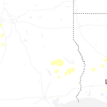
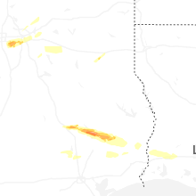
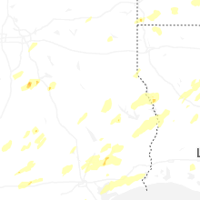


Connect with Interactive Hail Maps