

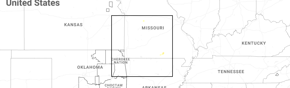
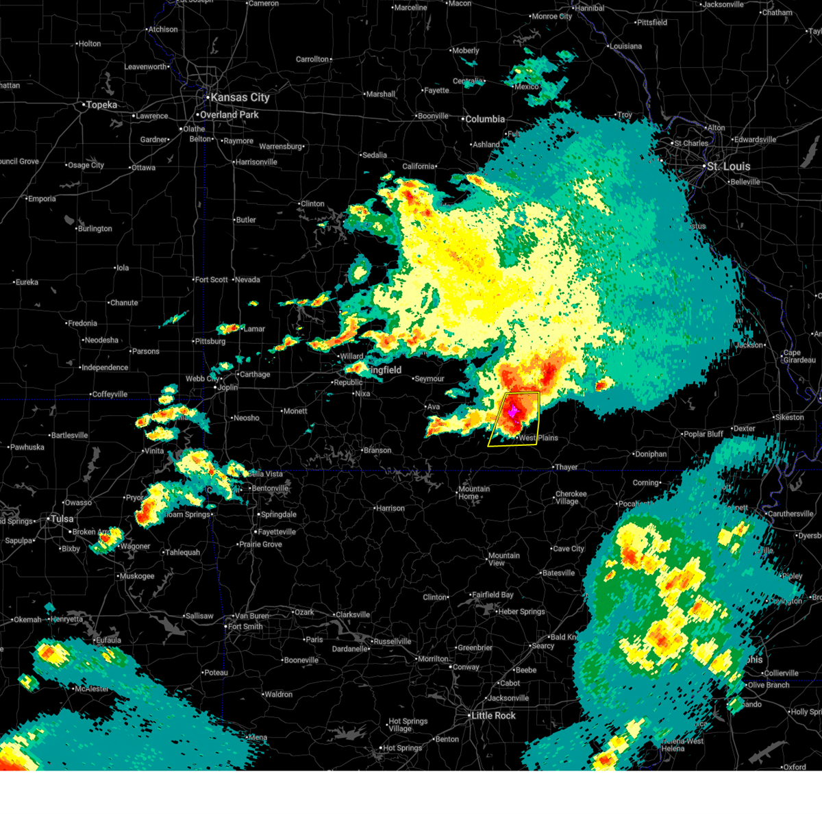
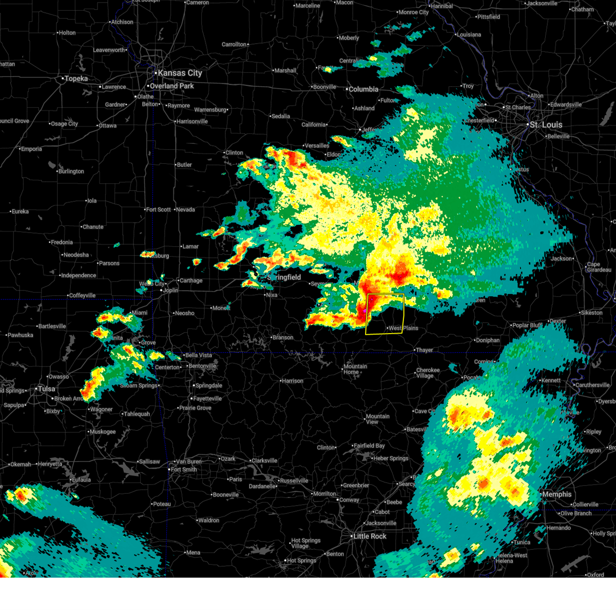
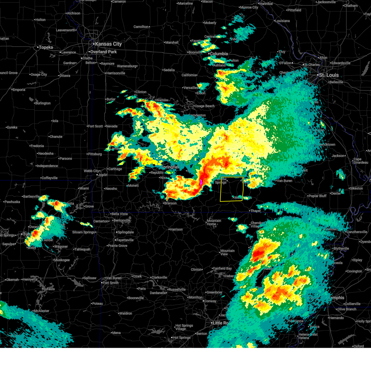
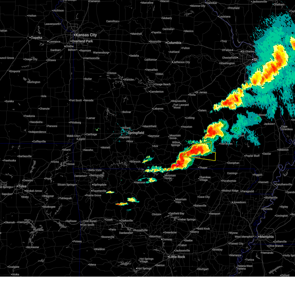
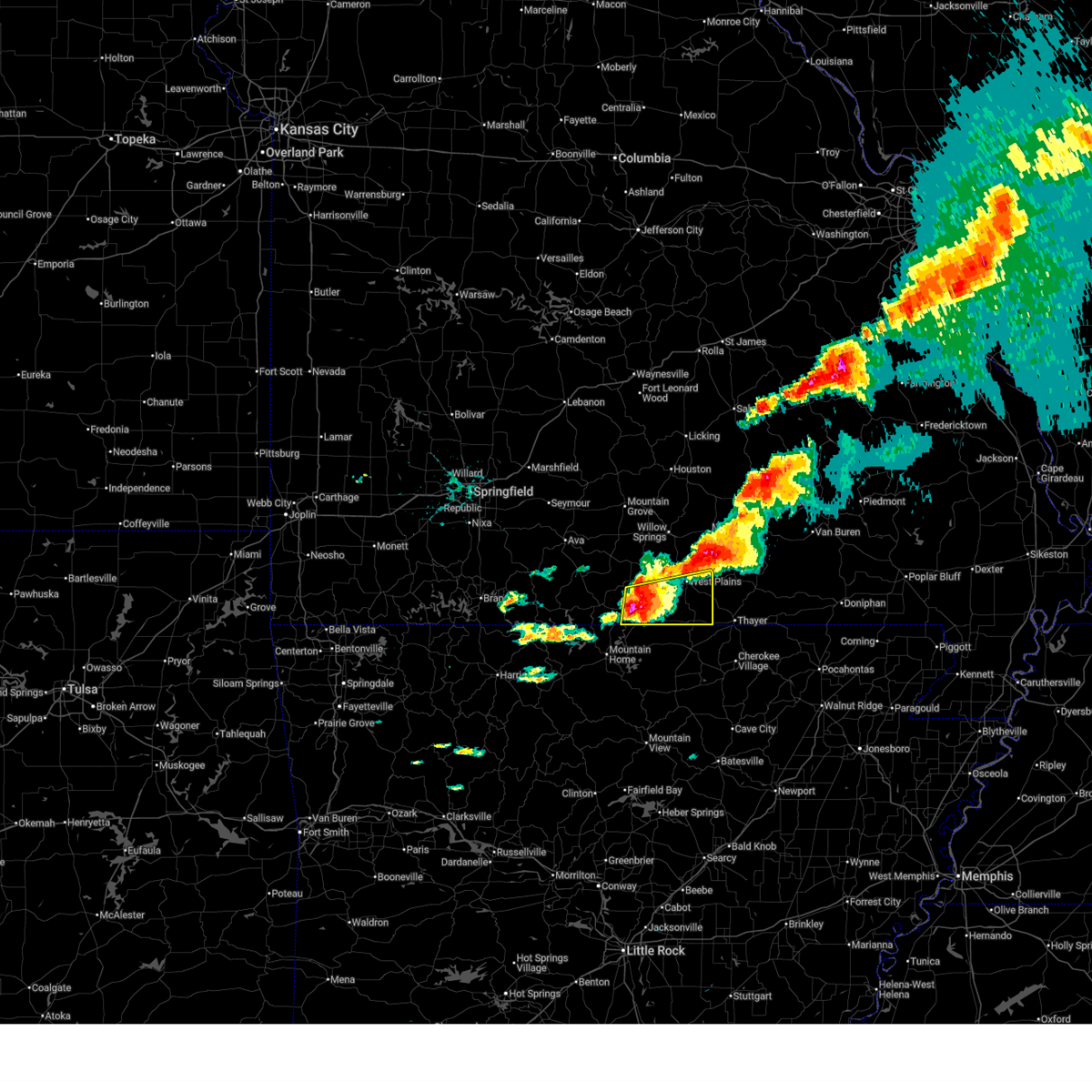
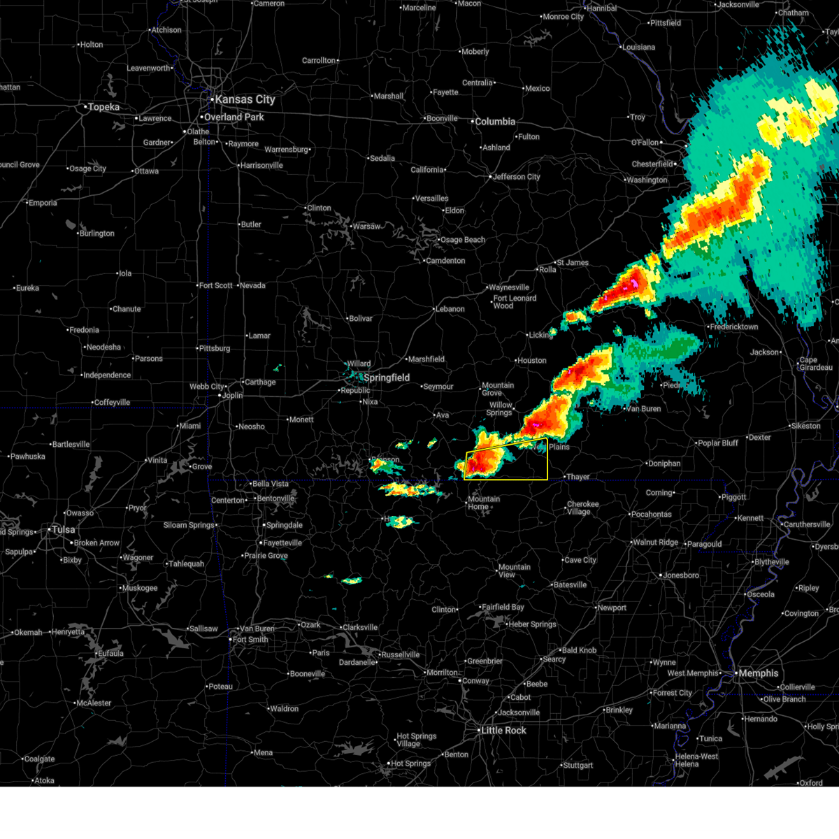
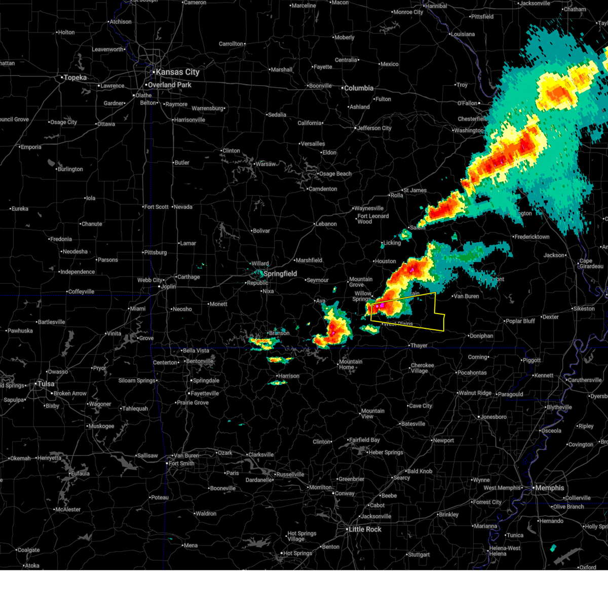
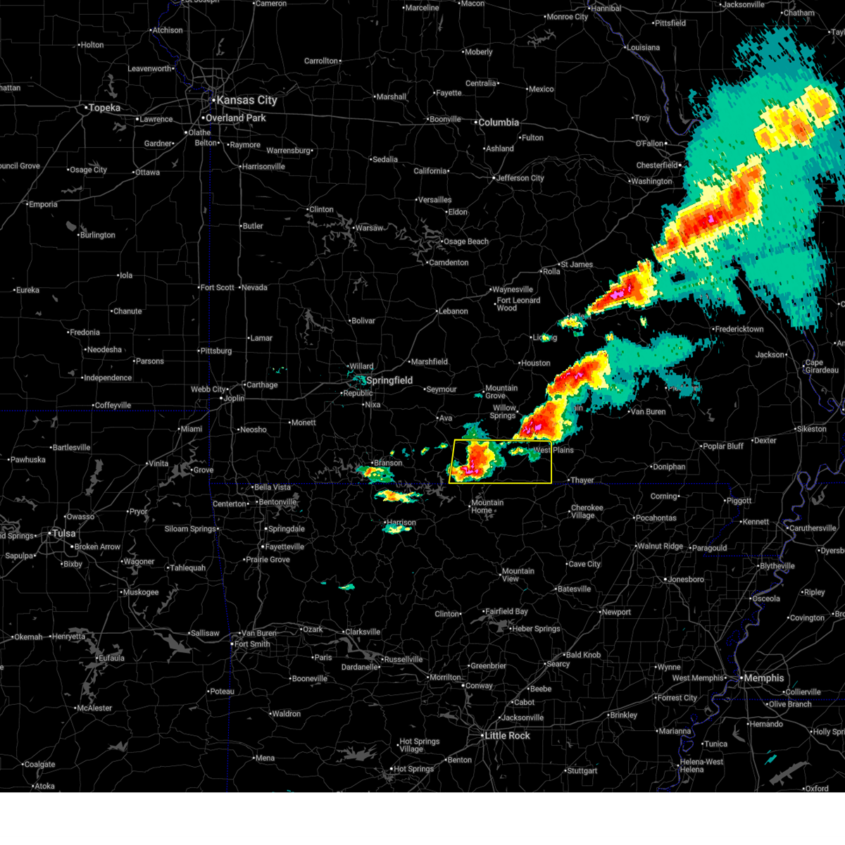
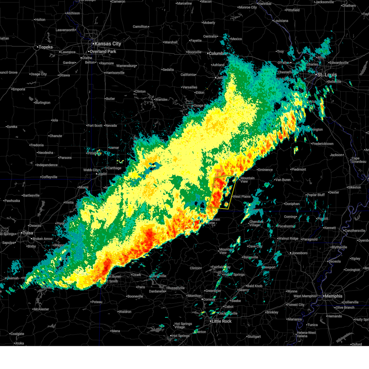
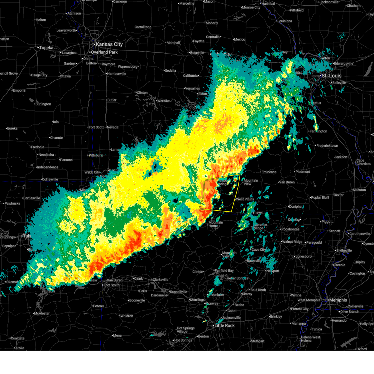
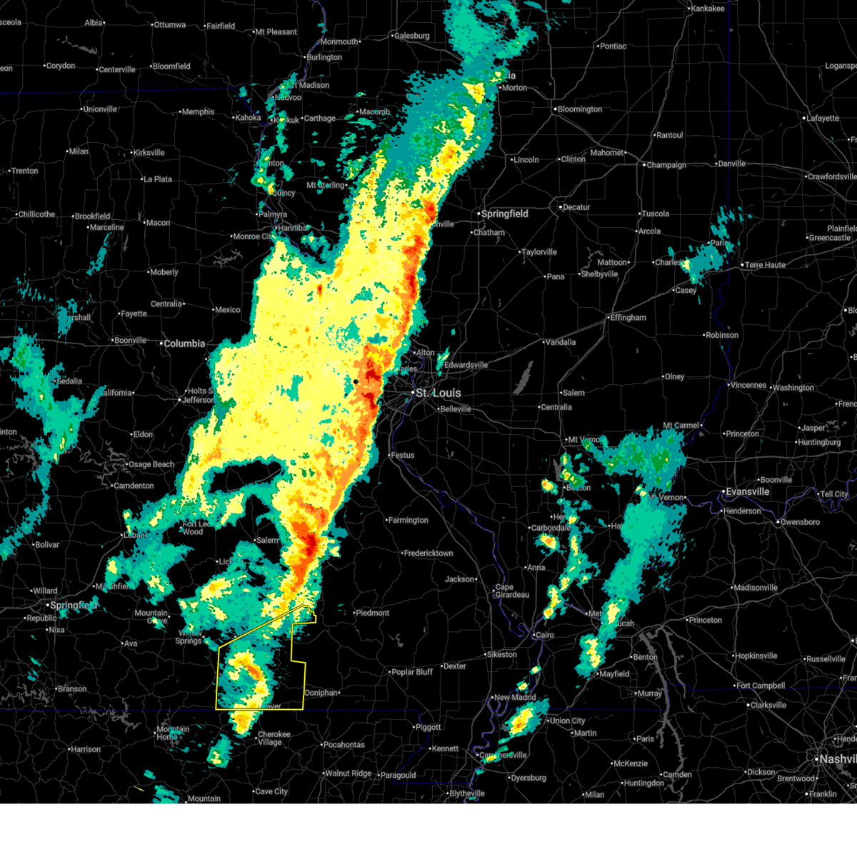
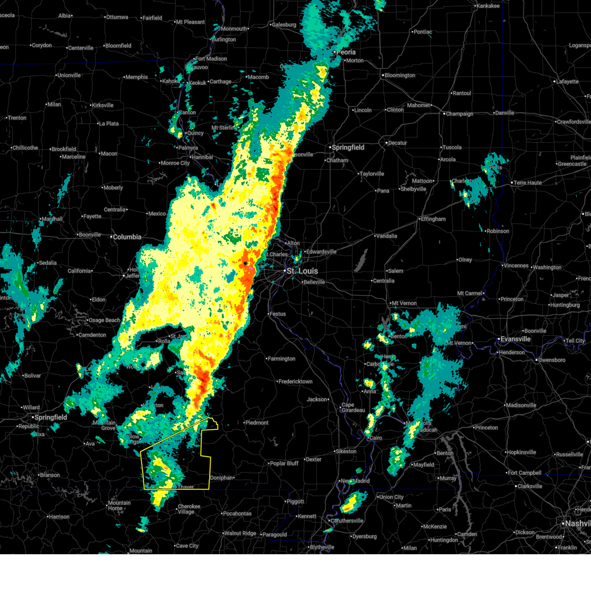
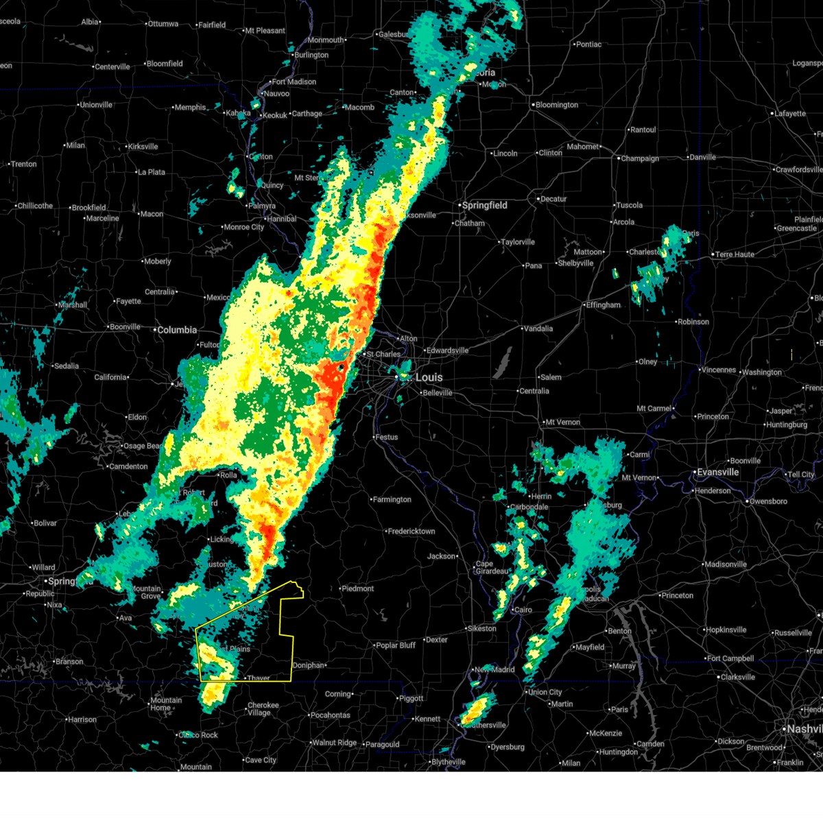
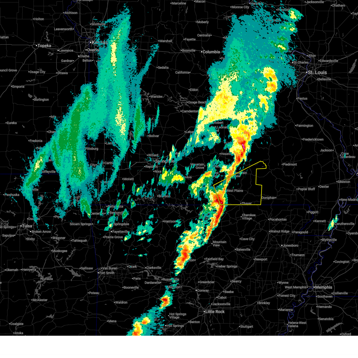
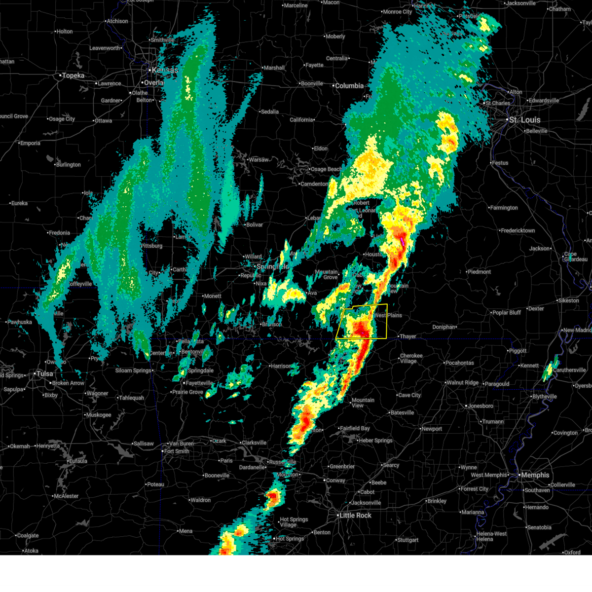
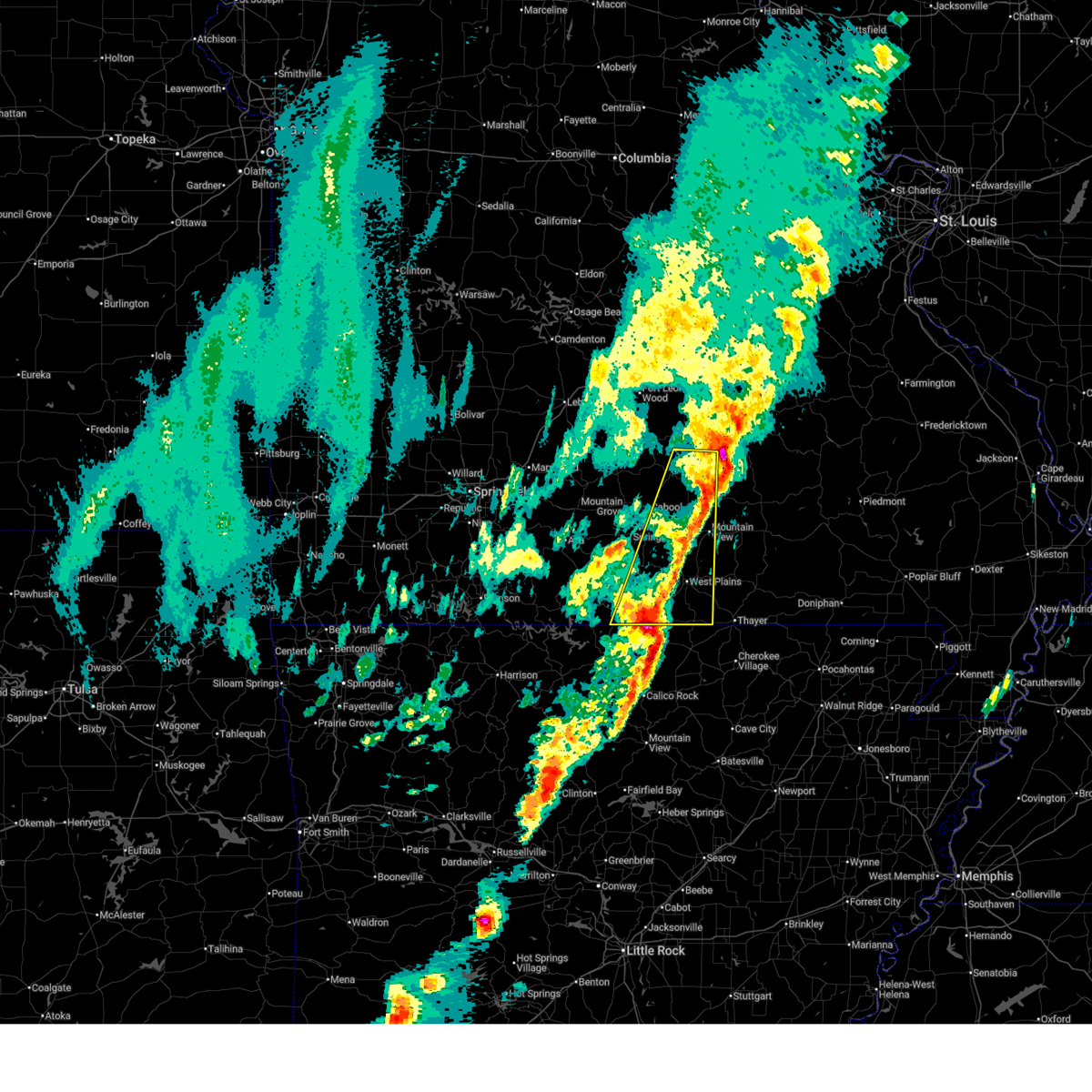
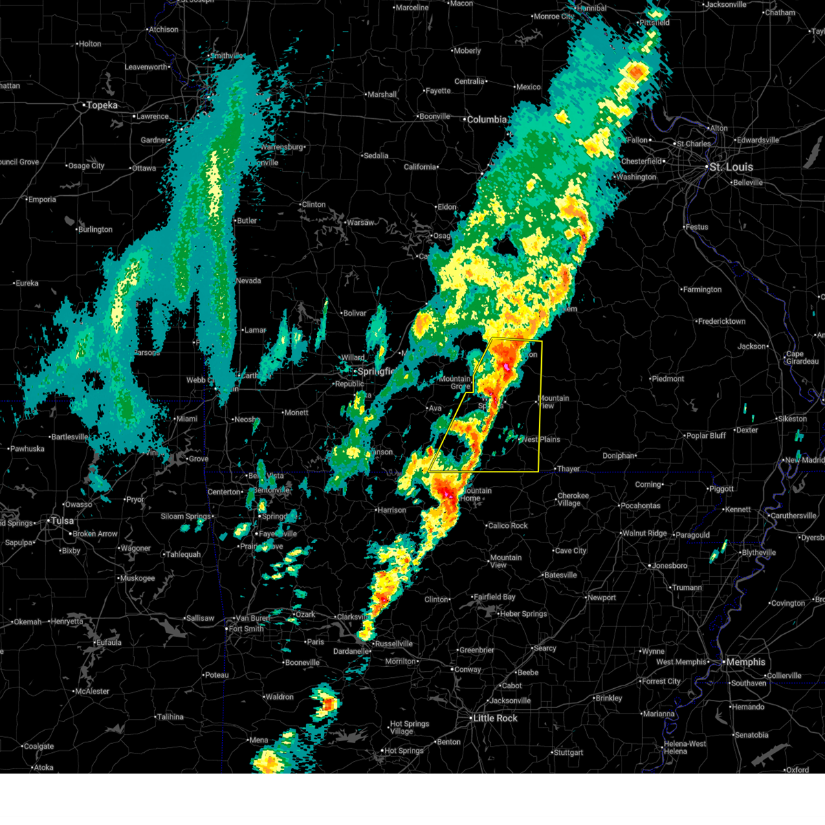
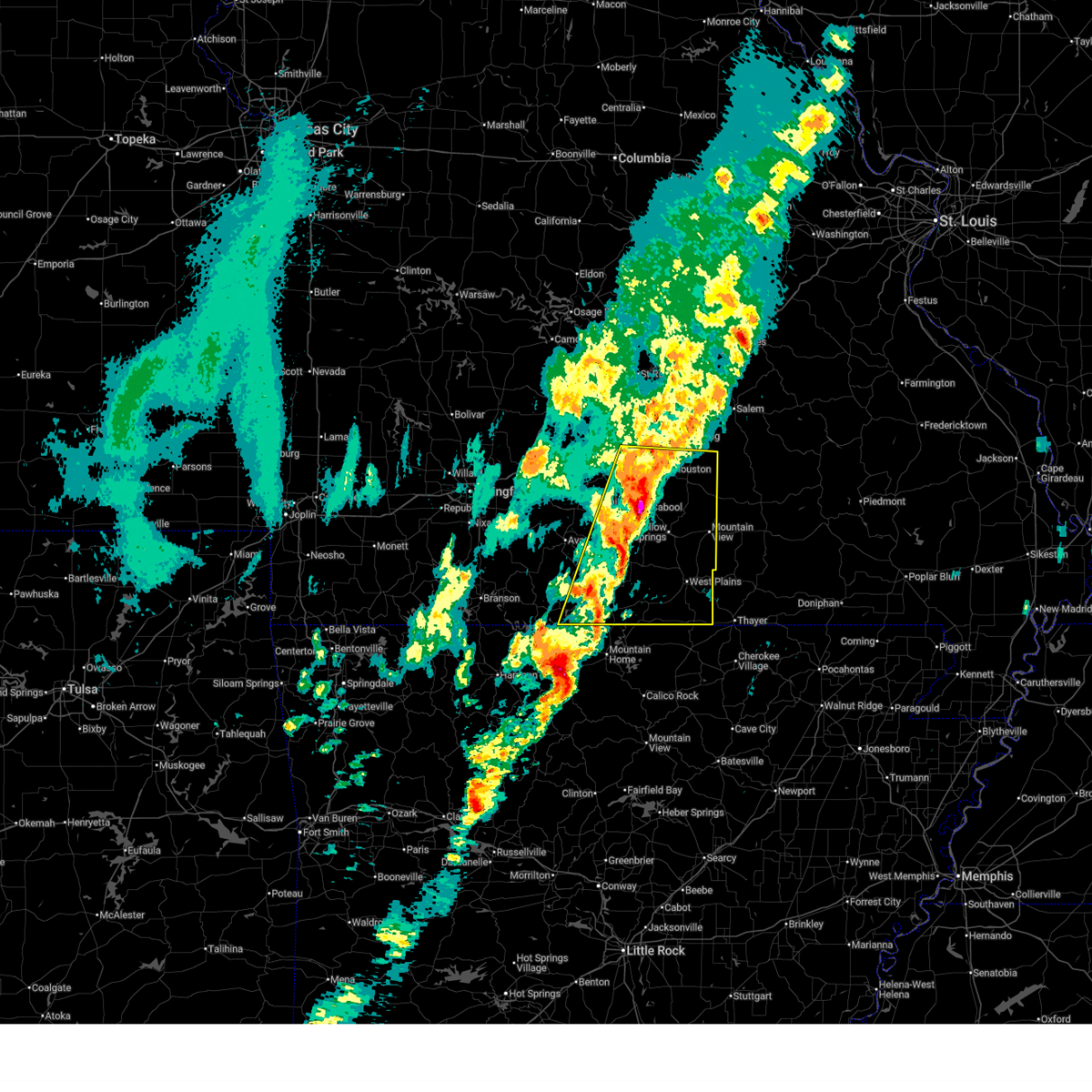
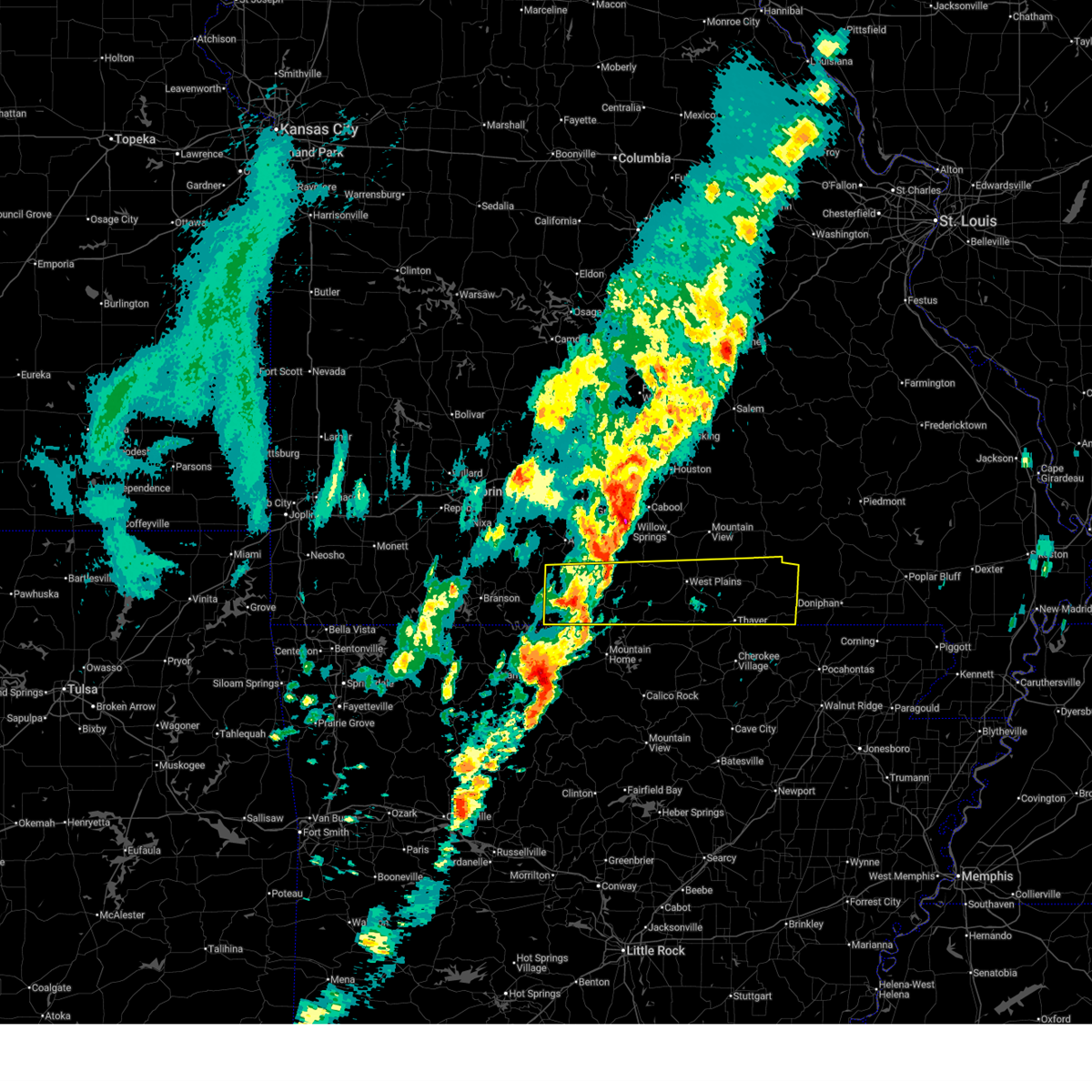
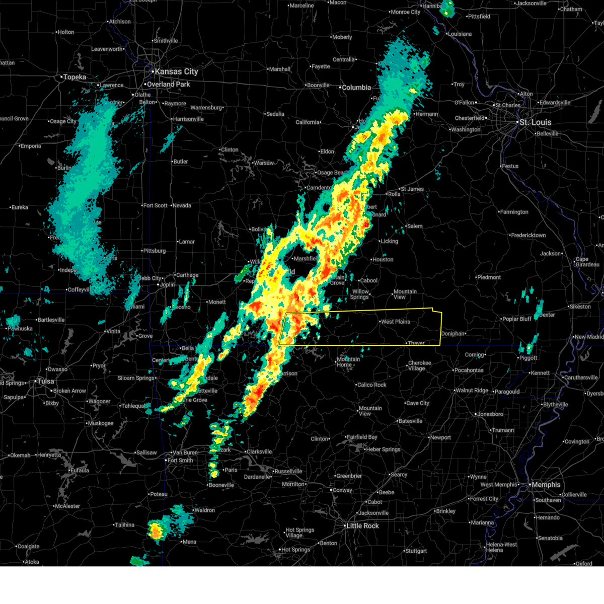
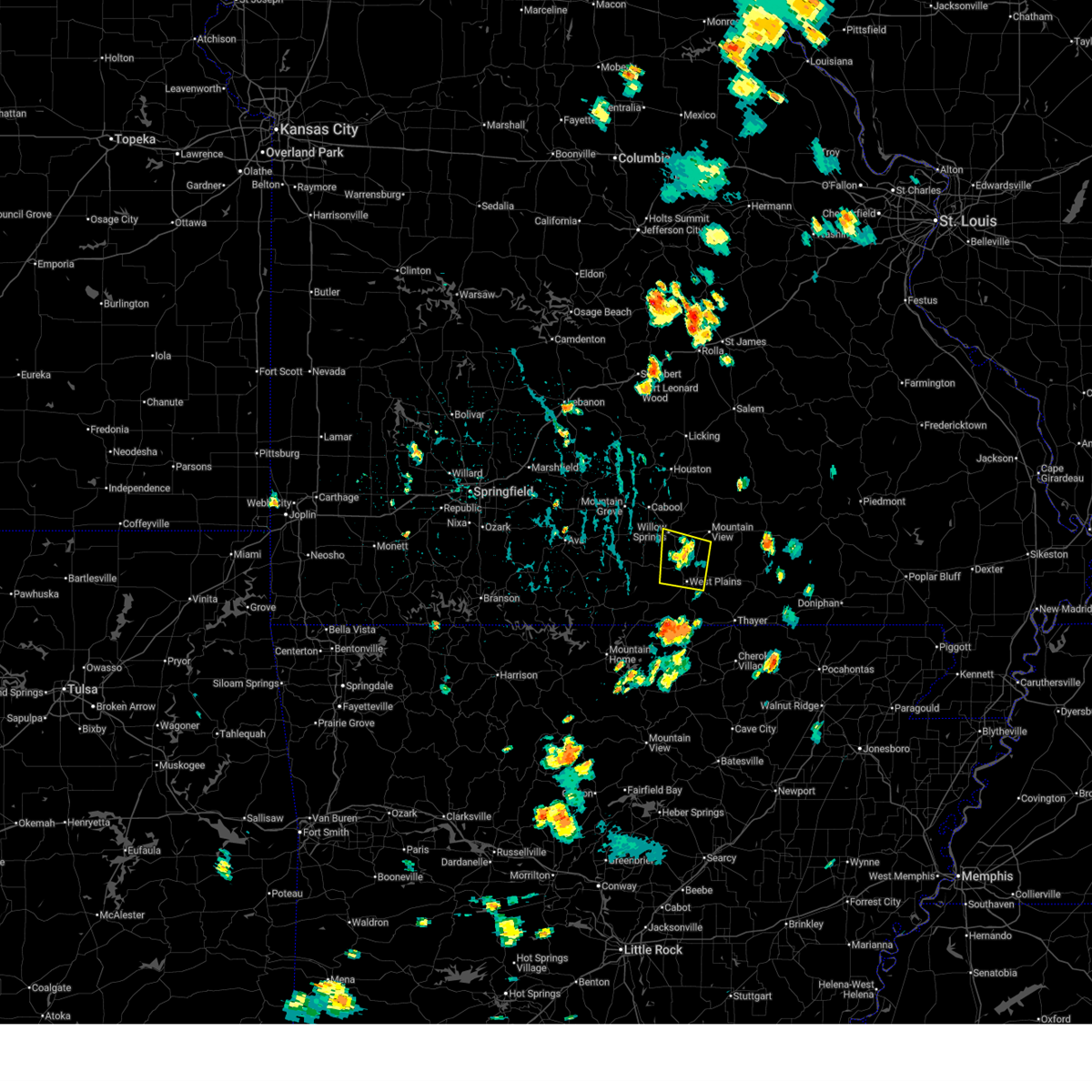
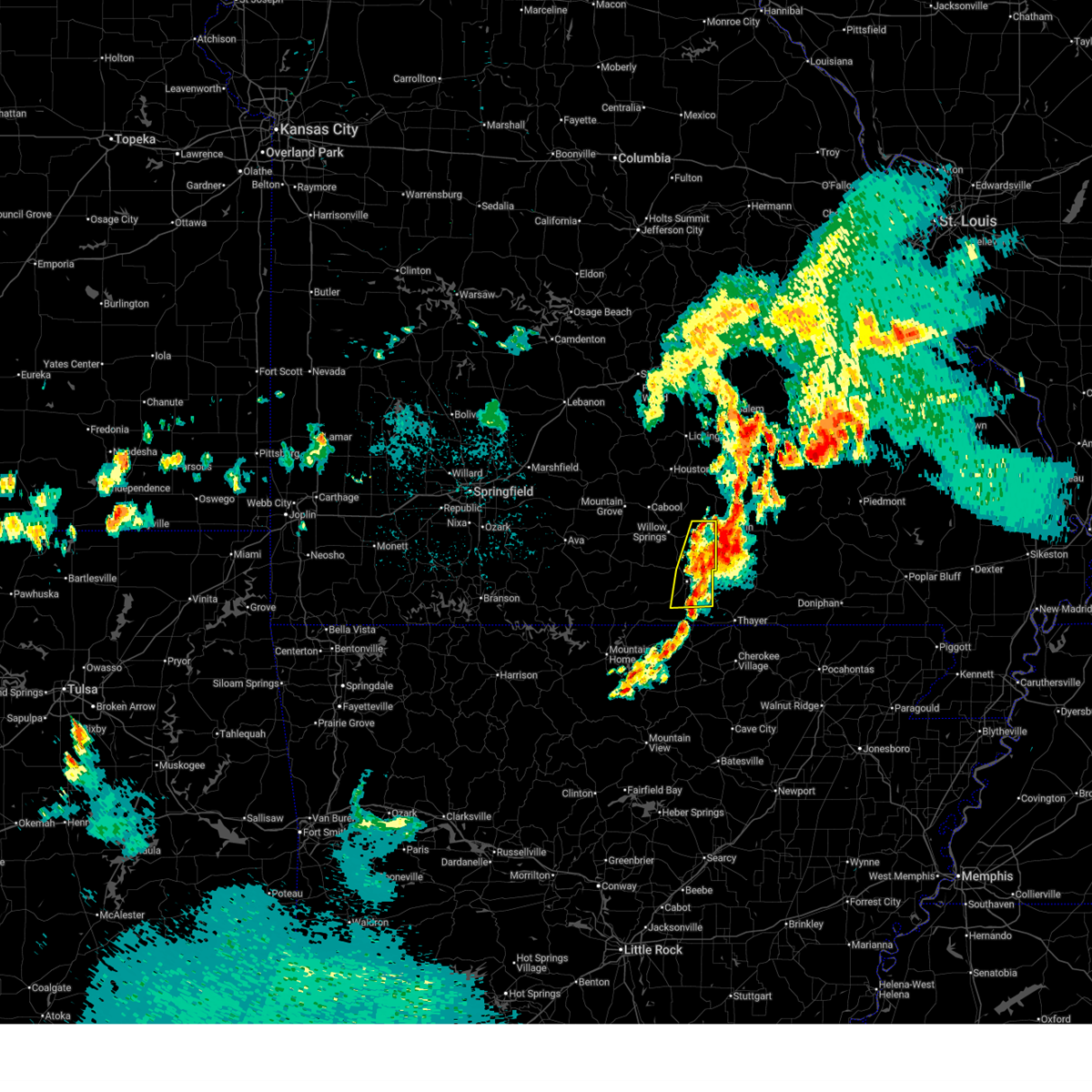
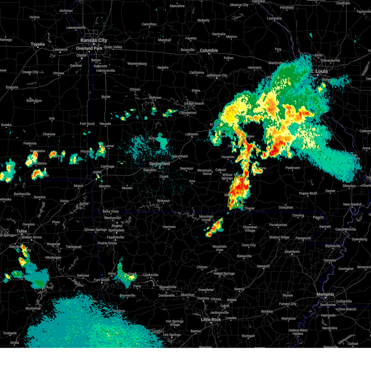
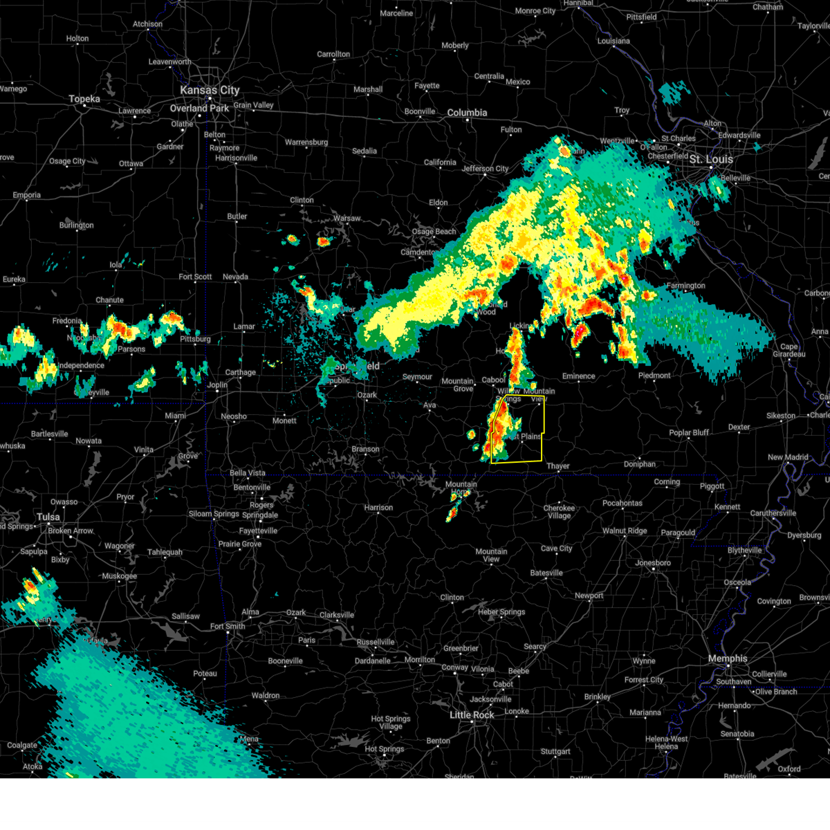
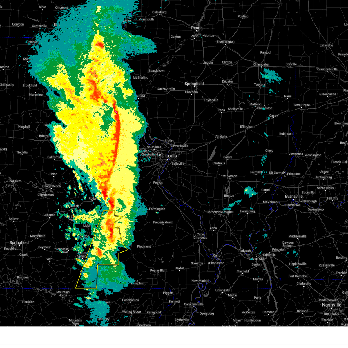
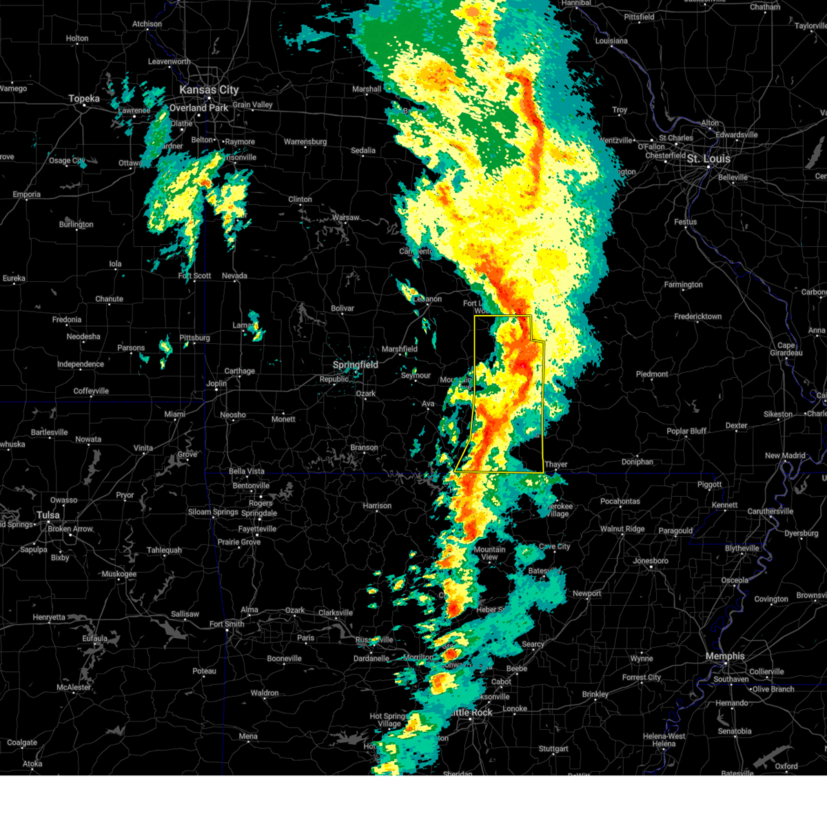
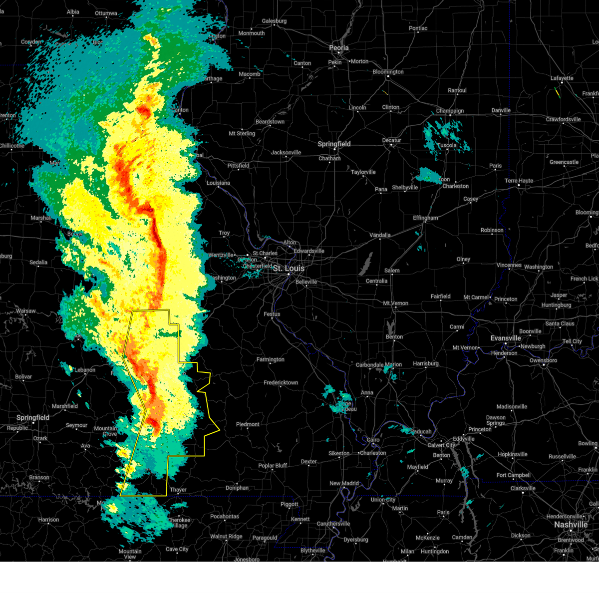
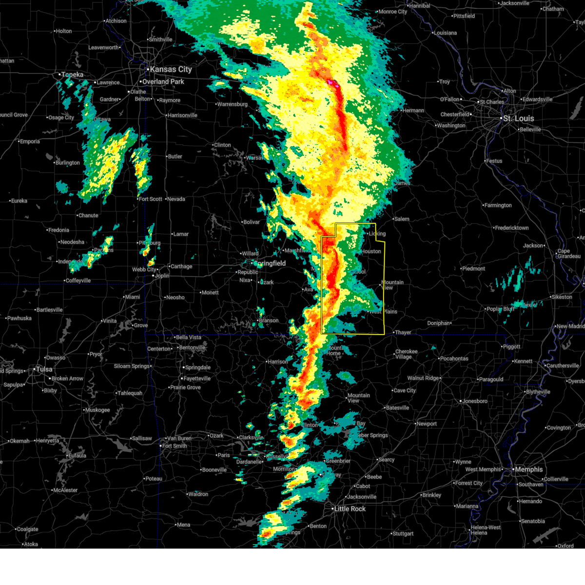
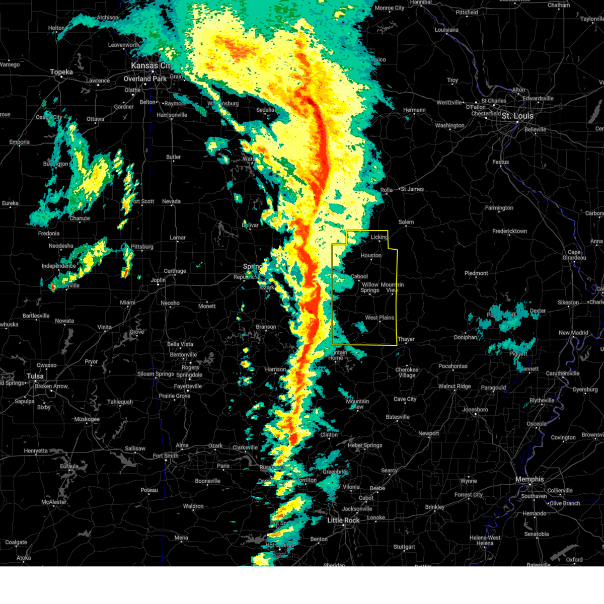
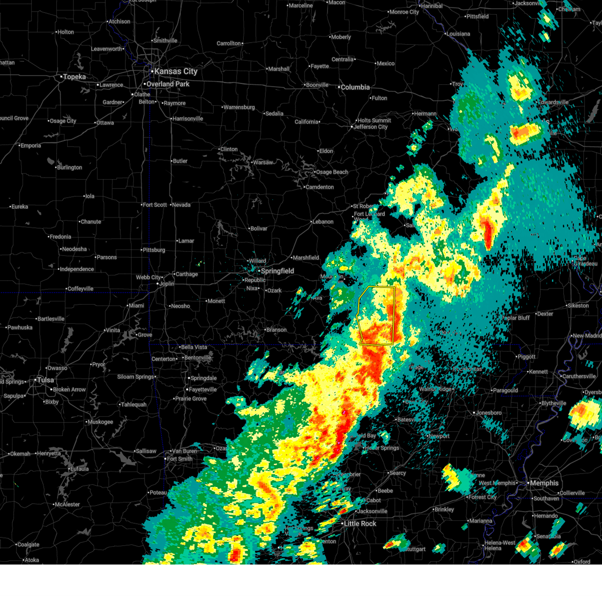
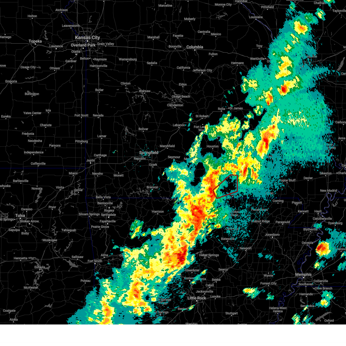
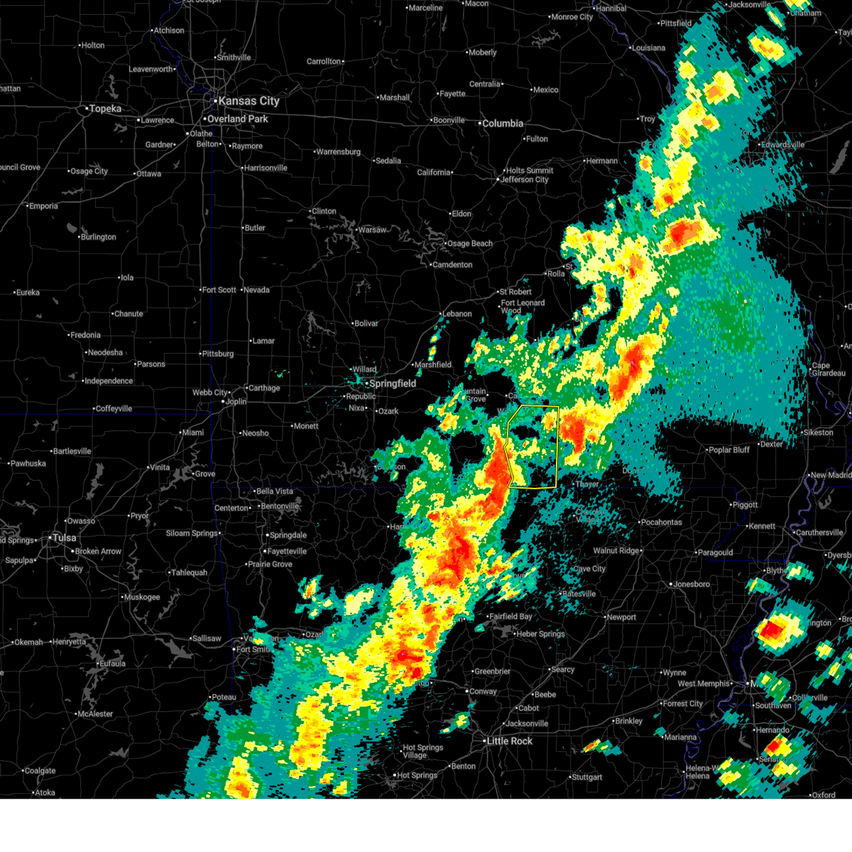
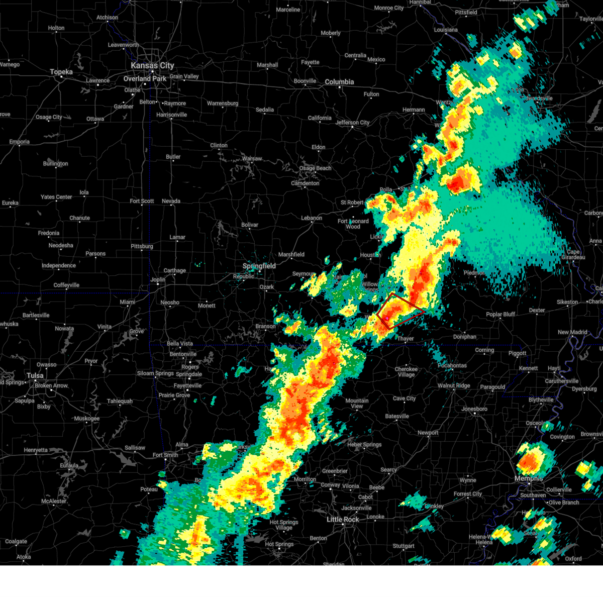
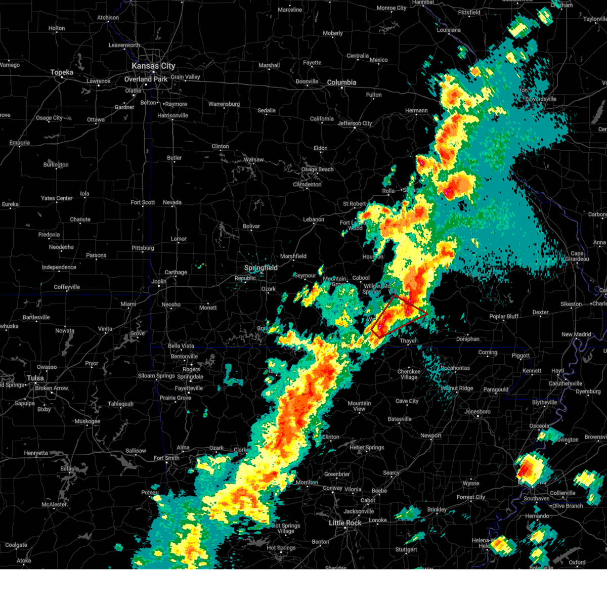
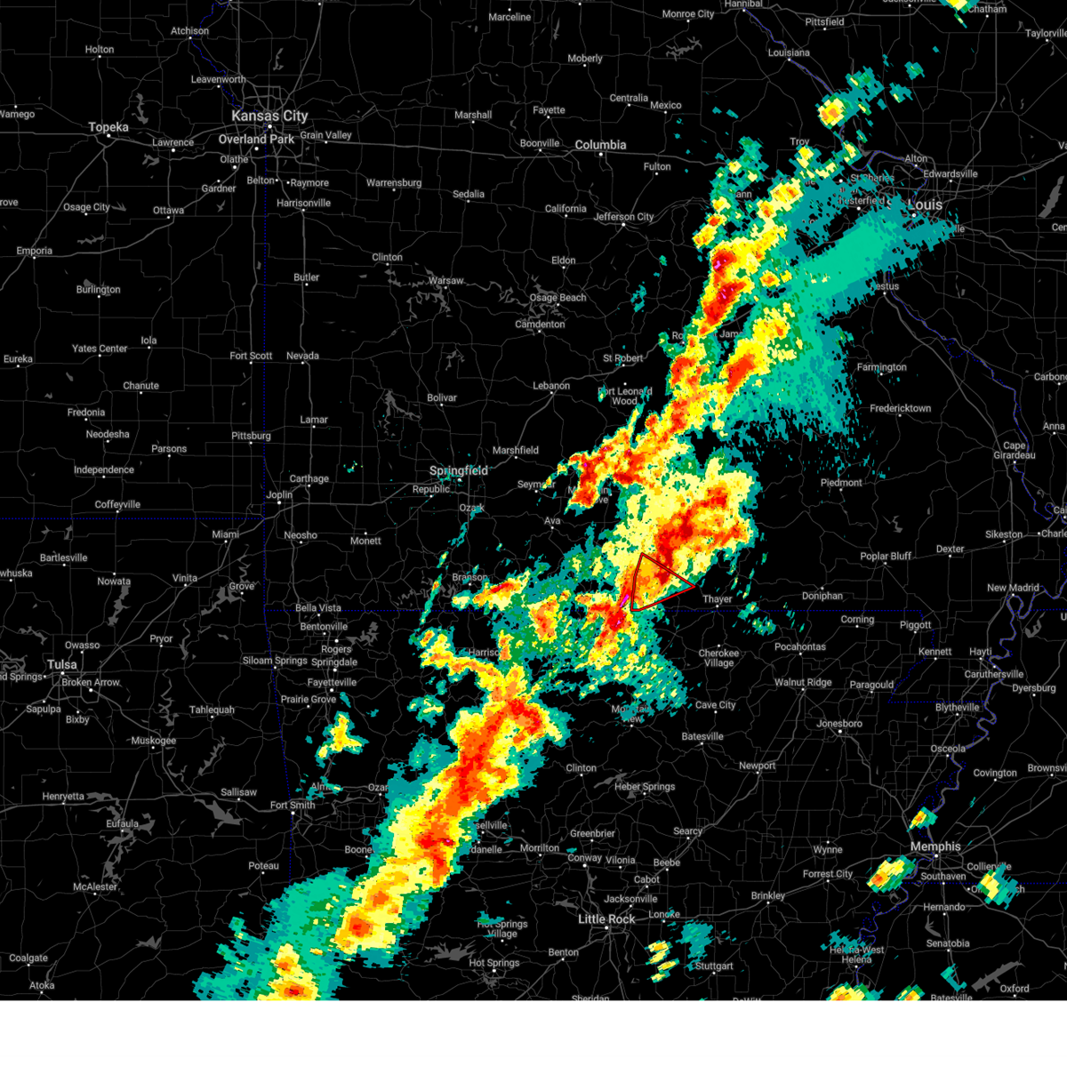
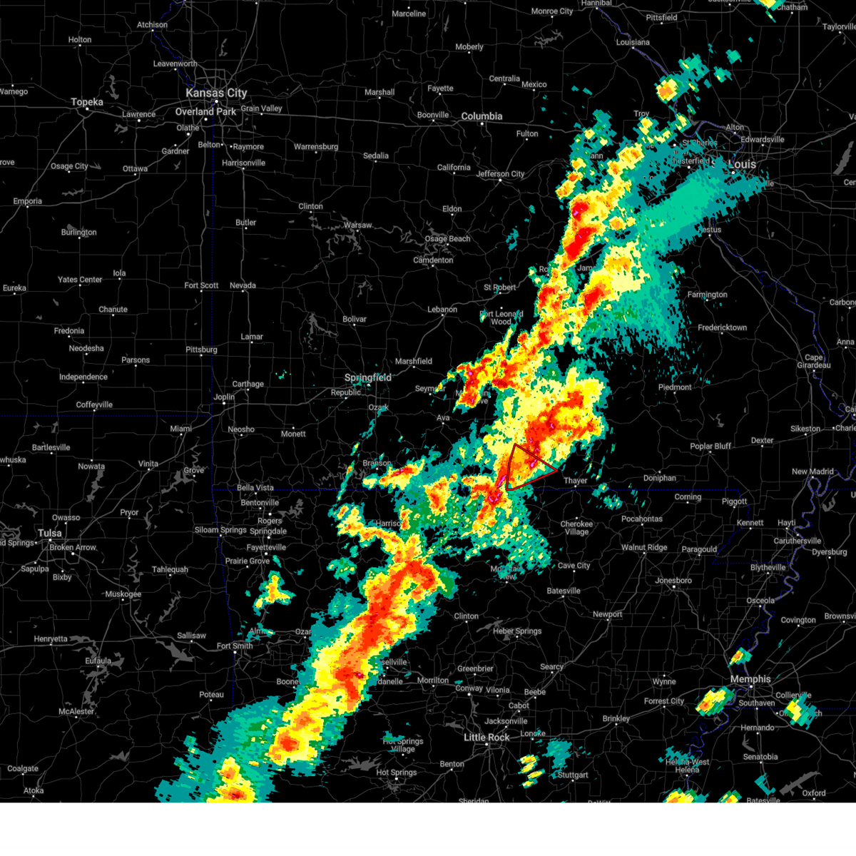
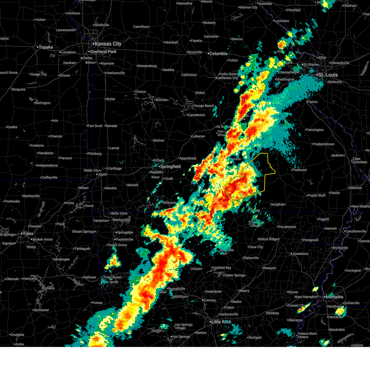
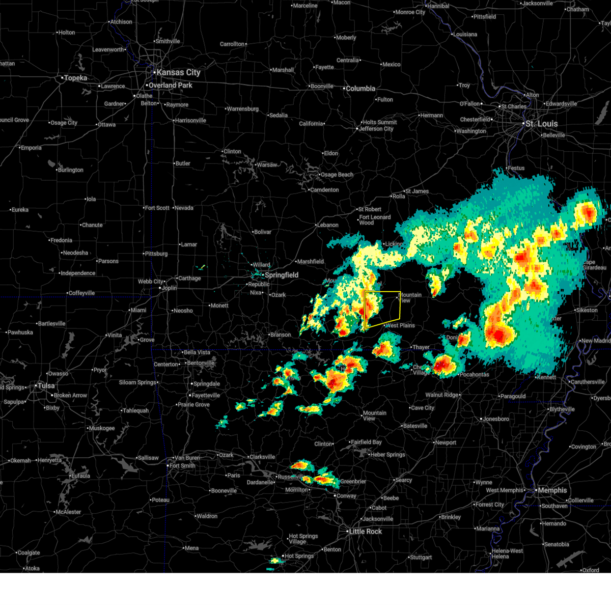
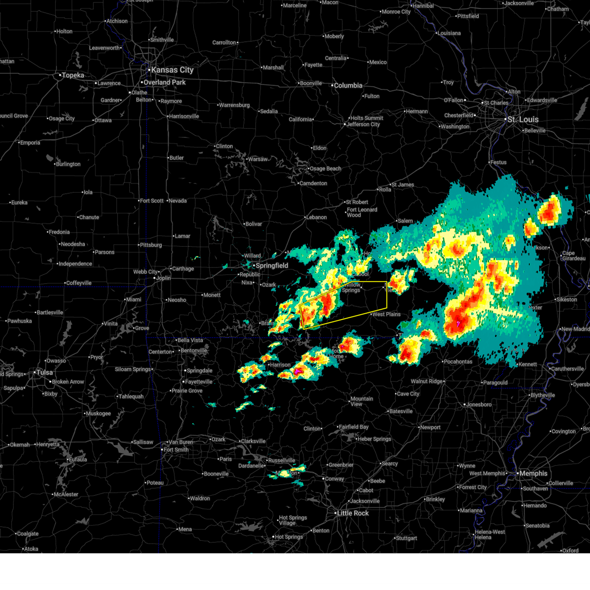
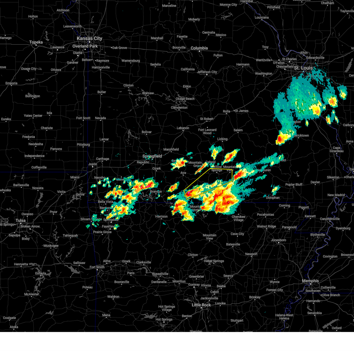
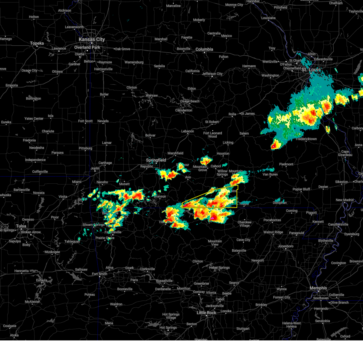
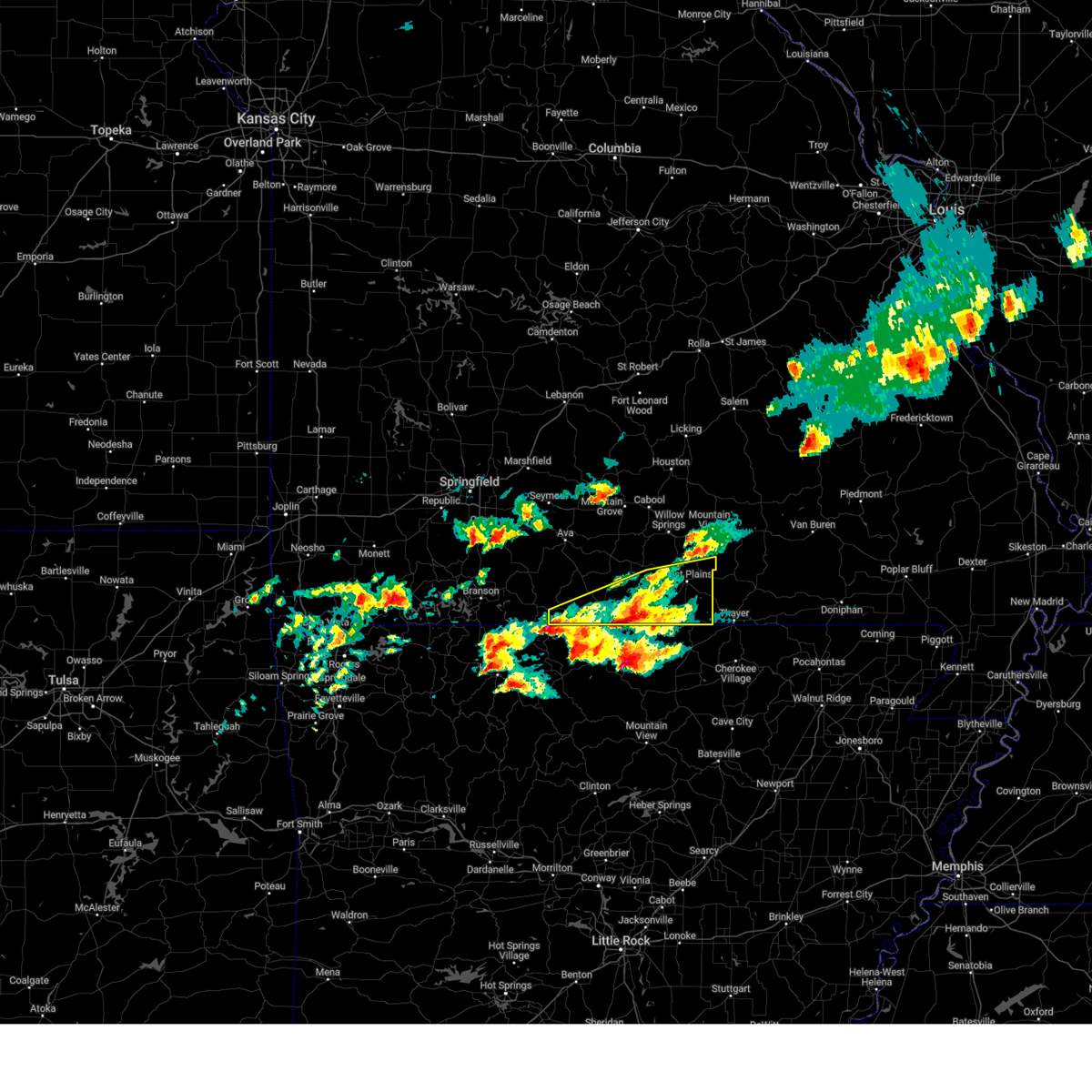
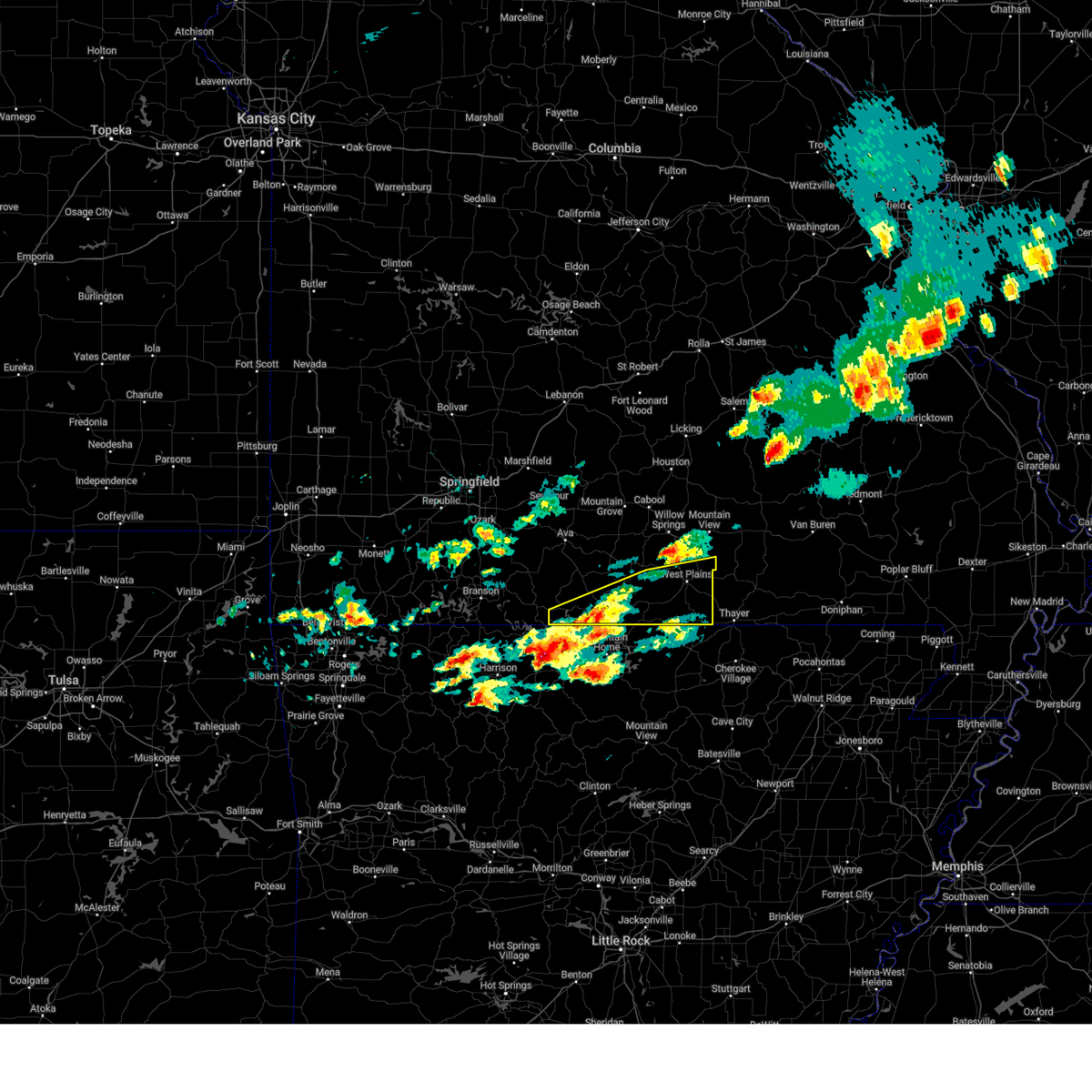
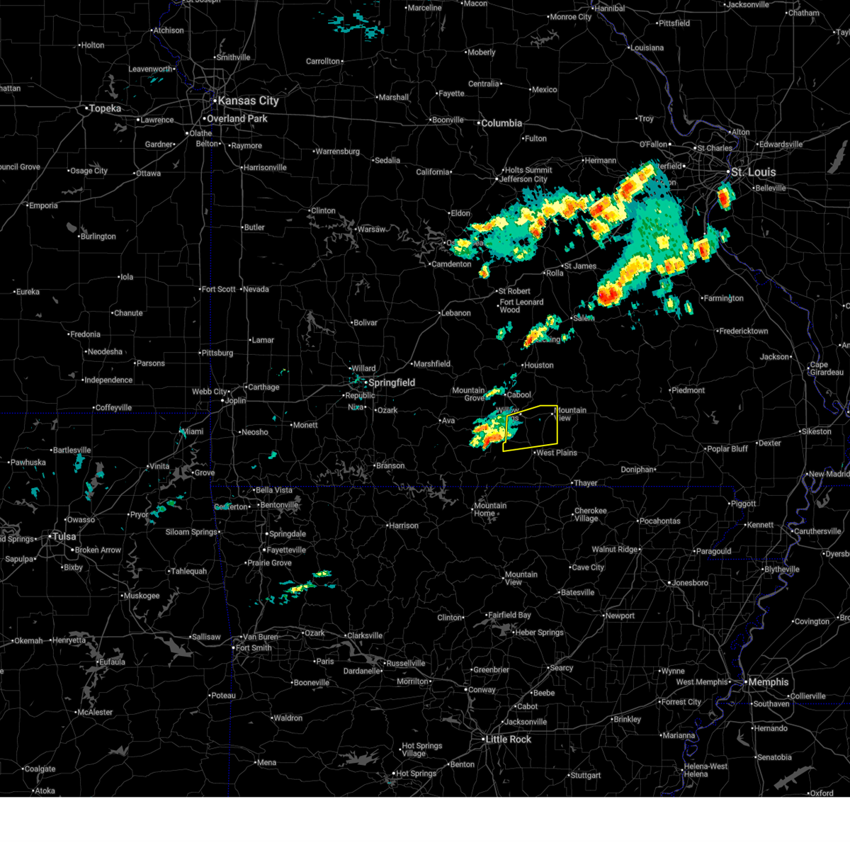
Hail Map for West Plains, MO
The West Plains, MO area has had 40 reports of on-the-ground hail by trained spotters, and has been under severe weather warnings 34 times during the past 12 months. Doppler radar has detected hail at or near West Plains, MO on 67 occasions, including 4 occasions during the past year.
| Name: | West Plains, MO |
| Where Located: | 64.6 miles SSW of Salem, MO |
| Map: | Google Map for West Plains, MO |
| Population: | 11986 |
| Housing Units: | 5509 |
| More Info: | Search Google for West Plains, MO |
1
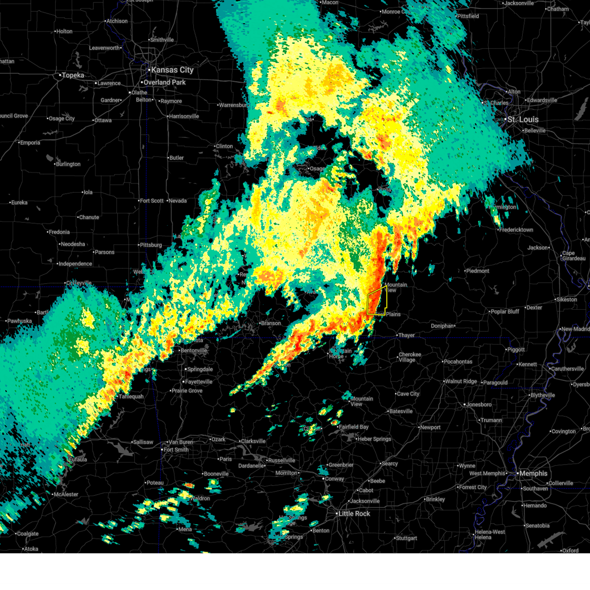
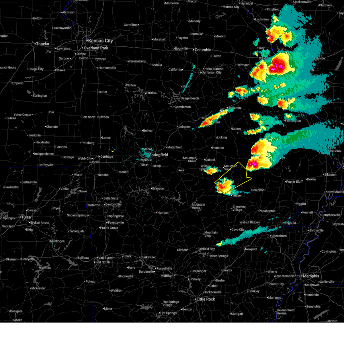
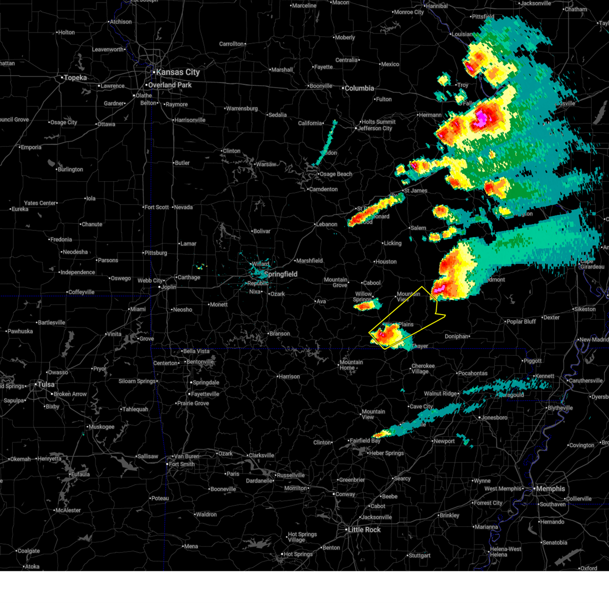
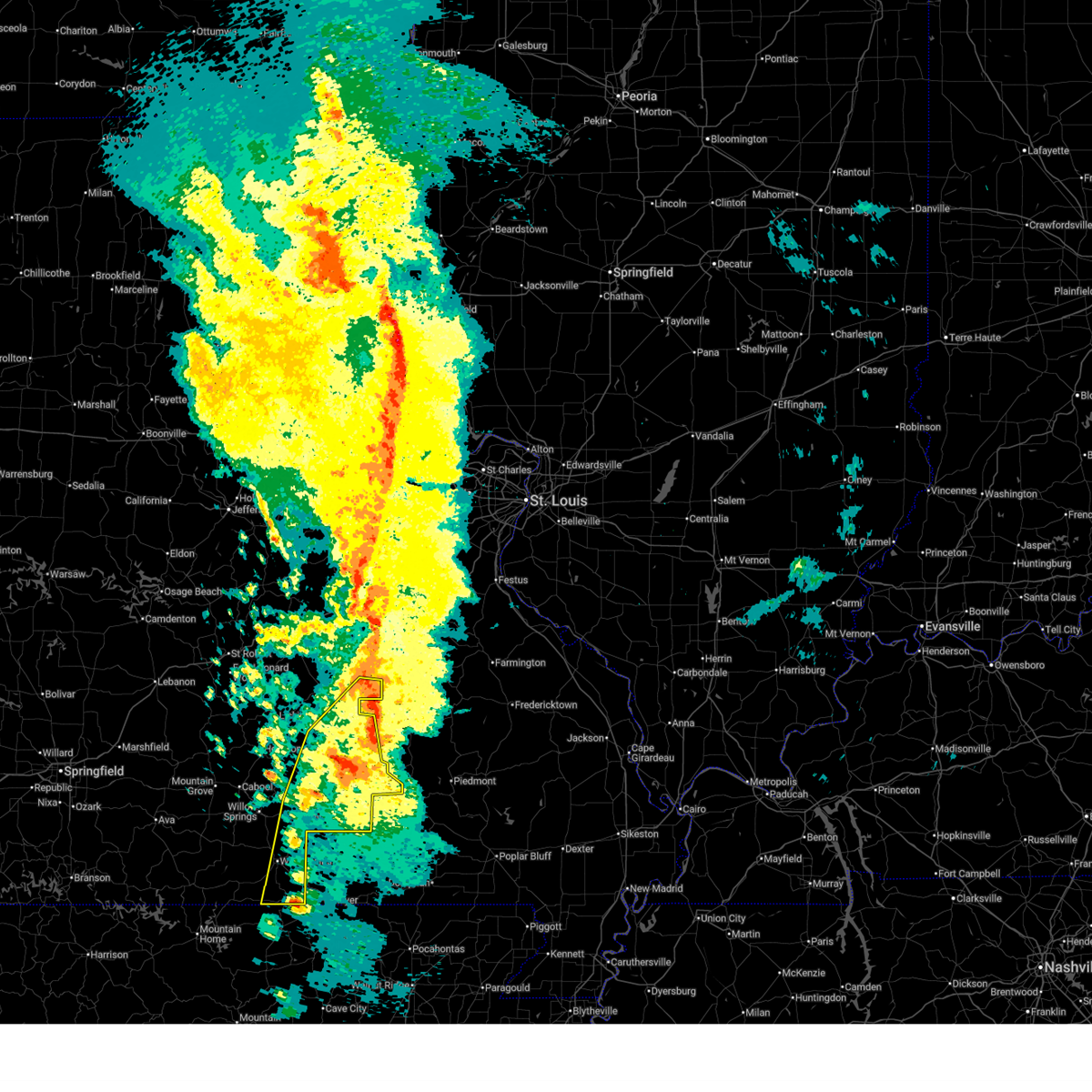
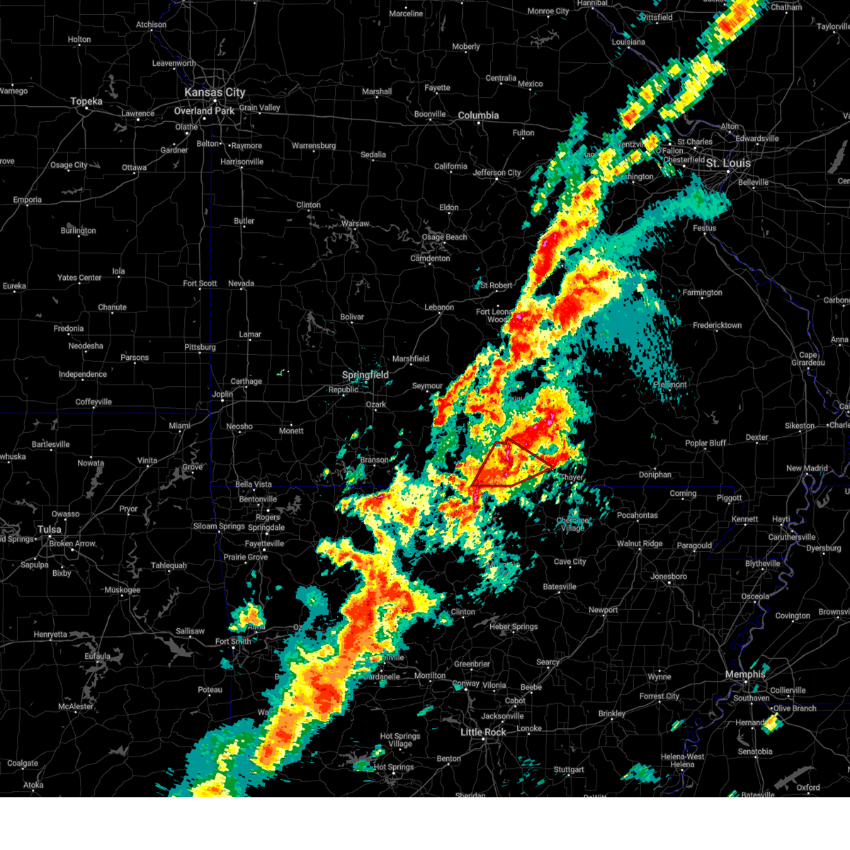
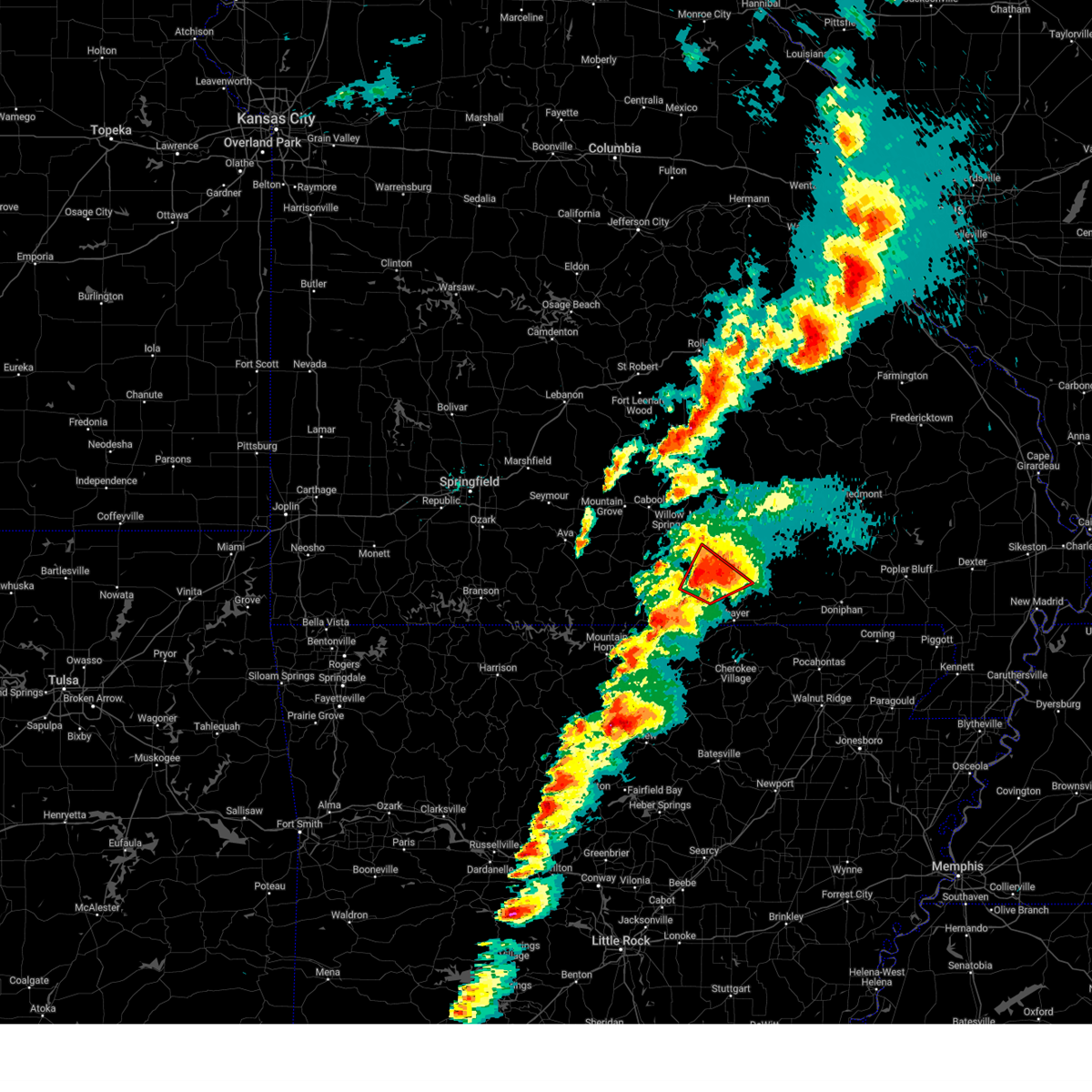
The Top Recent Hail Date for West Plains, MO is Sunday, June 7, 2026 (14th out of 67)
Hail and Wind Damage Spotted near West Plains, MO
| Date / Time | Report Details |
|---|---|
| 6/7/2026 6:09 PM CDT |
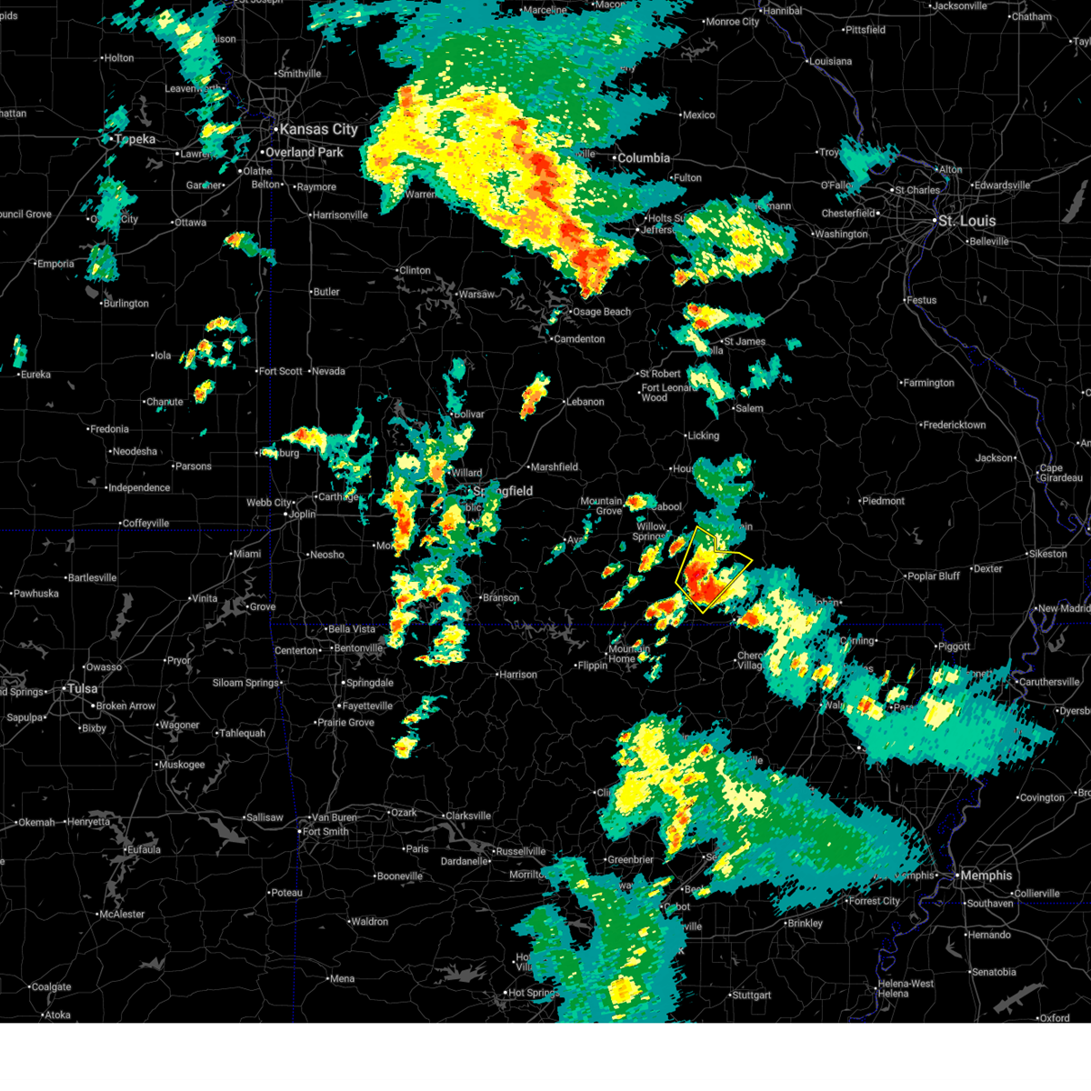 Svrsgf the national weather service in springfield has issued a * severe thunderstorm warning for, eastern howell county in south central missouri, northwestern oregon county in south central missouri, * until 700 pm cdt. * at 608 pm cdt, a severe thunderstorm was located near west plains, moving northeast at 20 mph (radar indicated). Hazards include 60 mph wind gusts and quarter size hail. Hail damage to vehicles is expected. Expect wind damage to roofs, siding, and trees. Svrsgf the national weather service in springfield has issued a * severe thunderstorm warning for, eastern howell county in south central missouri, northwestern oregon county in south central missouri, * until 700 pm cdt. * at 608 pm cdt, a severe thunderstorm was located near west plains, moving northeast at 20 mph (radar indicated). Hazards include 60 mph wind gusts and quarter size hail. Hail damage to vehicles is expected. Expect wind damage to roofs, siding, and trees.
|
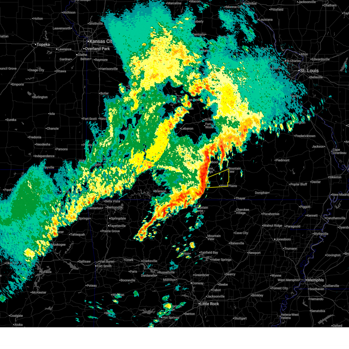
| 4/28/2026 3:50 PM CDT |
 The storm which prompted the warning has moved out of the area. therefore, the warning will be allowed to expire. a severe thunderstorm watch remains in effect until 600 pm cdt for south central missouri. to report severe weather, contact your nearest law enforcement agency. they will relay your report to the national weather service springfield. The storm which prompted the warning has moved out of the area. therefore, the warning will be allowed to expire. a severe thunderstorm watch remains in effect until 600 pm cdt for south central missouri. to report severe weather, contact your nearest law enforcement agency. they will relay your report to the national weather service springfield.
|
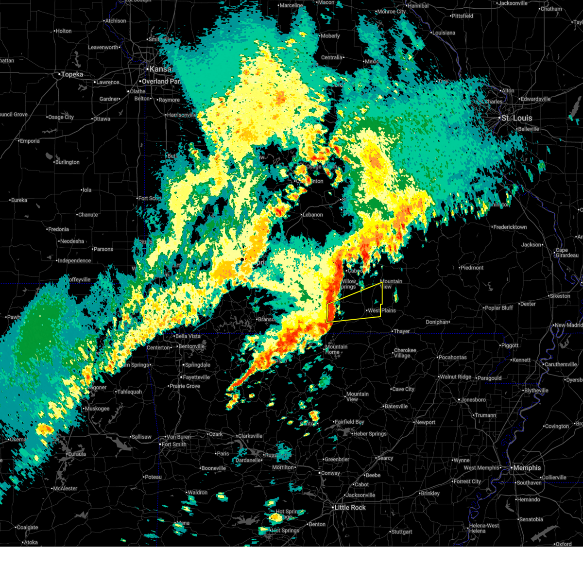
| 4/28/2026 3:39 PM CDT |
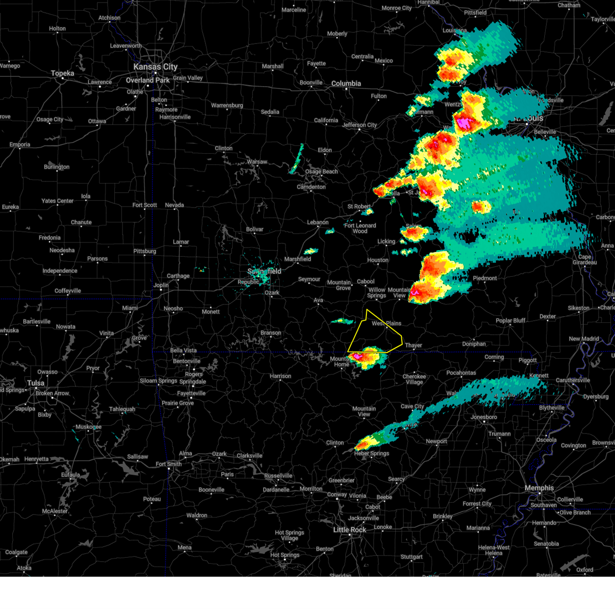
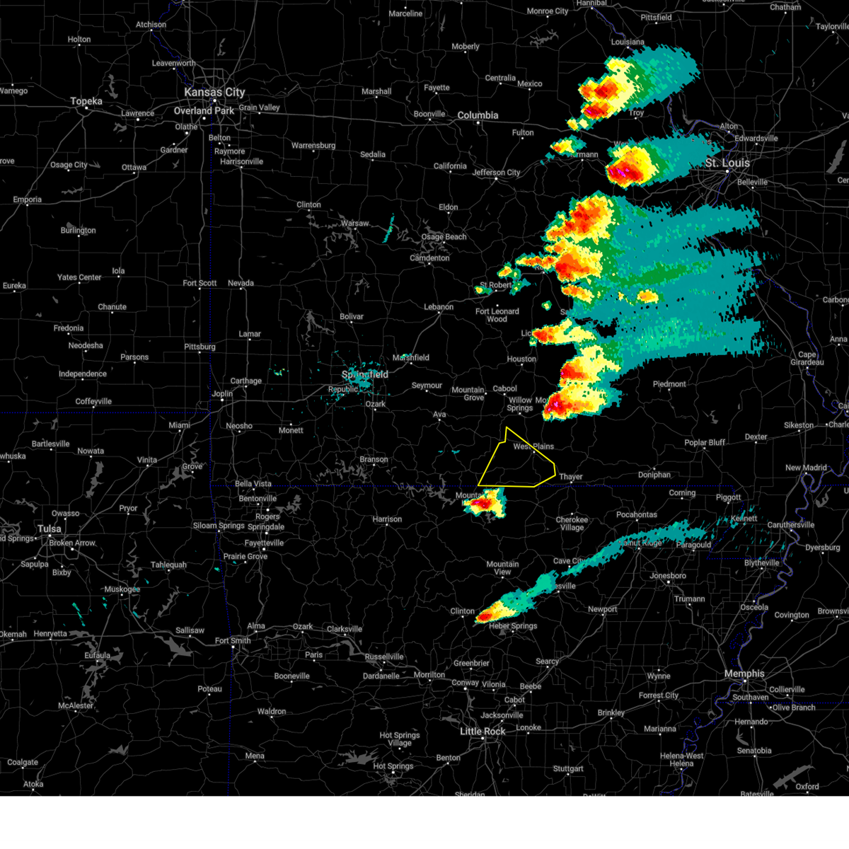
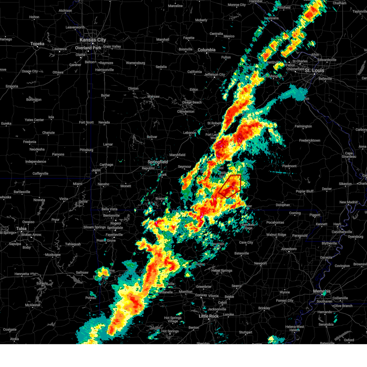
 At 339 pm cdt, a severe thunderstorm capable of producing a tornado was located 9 miles northeast of west plains, moving east at 45 mph (radar indicated rotation). Hazards include tornado and tennis ball size hail. Flying debris will be dangerous to those caught without shelter. mobile homes will be damaged or destroyed. damage to roofs, windows, and vehicles will occur. tree damage is likely. Locations impacted include, alton, thomasville, peace valley, rover, white church, wilderness, and greer. At 339 pm cdt, a severe thunderstorm capable of producing a tornado was located 9 miles northeast of west plains, moving east at 45 mph (radar indicated rotation). Hazards include tornado and tennis ball size hail. Flying debris will be dangerous to those caught without shelter. mobile homes will be damaged or destroyed. damage to roofs, windows, and vehicles will occur. tree damage is likely. Locations impacted include, alton, thomasville, peace valley, rover, white church, wilderness, and greer.
|
| 4/28/2026 3:38 PM CDT | Large trees dow in howell county MO, 5.7 miles SSW of West Plains, MO |
| 4/28/2026 3:37 PM CDT | Golf Ball sized hail reported 5.1 miles SSE of West Plains, MO |
| 4/28/2026 3:36 PM CDT |
 At 336 pm cdt, a severe thunderstorm was located 8 miles north of west plains, moving east at 45 mph (emergency management). Hazards include tennis ball size hail and 70 mph wind gusts. People and animals outdoors will be injured. expect hail damage to roofs, siding, windows, and vehicles. expect considerable tree damage. wind damage is also likely to mobile homes, roofs, and outbuildings. Locations impacted include, west plains, mountain view, willow springs, pomona, peace valley, white church, and pottersville. At 336 pm cdt, a severe thunderstorm was located 8 miles north of west plains, moving east at 45 mph (emergency management). Hazards include tennis ball size hail and 70 mph wind gusts. People and animals outdoors will be injured. expect hail damage to roofs, siding, windows, and vehicles. expect considerable tree damage. wind damage is also likely to mobile homes, roofs, and outbuildings. Locations impacted include, west plains, mountain view, willow springs, pomona, peace valley, white church, and pottersville.
|
| 4/28/2026 3:35 PM CDT | 6-8 inch tree limbs down in west plains at cc and christopher driv in howell county MO, 1.3 miles SE of West Plains, MO |
| 4/28/2026 3:35 PM CDT | Tree fell on house. large branches off of tree in howell county MO, 2.1 miles S of West Plains, MO |
| 4/28/2026 3:30 PM CDT | Large tree dow in howell county MO, 1.3 miles SE of West Plains, MO |
| 4/28/2026 3:30 PM CDT |
 Torsgf the national weather service in springfield has issued a * tornado warning for, east central howell county in south central missouri, northern oregon county in south central missouri, * until 415 pm cdt. * at 329 pm cdt, a severe thunderstorm capable of producing a tornado was located near west plains, moving east at 45 mph (radar indicated rotation). Hazards include tornado and golf ball size hail. Flying debris will be dangerous to those caught without shelter. mobile homes will be damaged or destroyed. damage to roofs, windows, and vehicles will occur. Tree damage is likely. Torsgf the national weather service in springfield has issued a * tornado warning for, east central howell county in south central missouri, northern oregon county in south central missouri, * until 415 pm cdt. * at 329 pm cdt, a severe thunderstorm capable of producing a tornado was located near west plains, moving east at 45 mph (radar indicated rotation). Hazards include tornado and golf ball size hail. Flying debris will be dangerous to those caught without shelter. mobile homes will be damaged or destroyed. damage to roofs, windows, and vehicles will occur. Tree damage is likely.
|
| 4/28/2026 3:23 PM CDT |
 At 323 pm cdt, severe thunderstorms were located along a line extending from near willow springs to 17 miles south of cabool to 13 miles west of west plains, moving east at 45 mph (radar indicated). Hazards include two inch hail and 70 mph wind gusts. People and animals outdoors will be injured. expect hail damage to roofs, siding, windows, and vehicles. expect considerable tree damage. wind damage is also likely to mobile homes, roofs, and outbuildings. Locations impacted include, west plains, mountain view, willow springs, pomona, peace valley, siloam springs, white church, and pottersville. At 323 pm cdt, severe thunderstorms were located along a line extending from near willow springs to 17 miles south of cabool to 13 miles west of west plains, moving east at 45 mph (radar indicated). Hazards include two inch hail and 70 mph wind gusts. People and animals outdoors will be injured. expect hail damage to roofs, siding, windows, and vehicles. expect considerable tree damage. wind damage is also likely to mobile homes, roofs, and outbuildings. Locations impacted include, west plains, mountain view, willow springs, pomona, peace valley, siloam springs, white church, and pottersville.
|
| 4/28/2026 3:07 PM CDT |
 Svrsgf the national weather service in springfield has issued a * severe thunderstorm warning for, howell county in south central missouri, * until 400 pm cdt. * at 306 pm cdt, a severe thunderstorm was located 17 miles southeast of norwood, or 17 miles south of mountain grove, moving east at 45 mph (radar indicated). Hazards include two inch hail and 70 mph wind gusts. People and animals outdoors will be injured. expect hail damage to roofs, siding, windows, and vehicles. expect considerable tree damage. Wind damage is also likely to mobile homes, roofs, and outbuildings. Svrsgf the national weather service in springfield has issued a * severe thunderstorm warning for, howell county in south central missouri, * until 400 pm cdt. * at 306 pm cdt, a severe thunderstorm was located 17 miles southeast of norwood, or 17 miles south of mountain grove, moving east at 45 mph (radar indicated). Hazards include two inch hail and 70 mph wind gusts. People and animals outdoors will be injured. expect hail damage to roofs, siding, windows, and vehicles. expect considerable tree damage. Wind damage is also likely to mobile homes, roofs, and outbuildings.
|
| 4/27/2026 8:15 PM CDT | Hen Egg sized hail reported 1.4 miles WNW of West Plains, MO |
| 4/27/2026 8:13 PM CDT |
 At 813 pm cdt, a severe thunderstorm was located 9 miles west of handy, or 20 miles southwest of van buren, moving east at 60 mph (radar indicated). Hazards include golf ball size hail and 60 mph wind gusts. People and animals outdoors will be injured. expect hail damage to roofs, siding, windows, and vehicles. expect wind damage to roofs, siding, and trees. Locations impacted include, west plains, winona, alton, birch tree, thomasville, peace valley, rover, white church, wilderness, and greer. At 813 pm cdt, a severe thunderstorm was located 9 miles west of handy, or 20 miles southwest of van buren, moving east at 60 mph (radar indicated). Hazards include golf ball size hail and 60 mph wind gusts. People and animals outdoors will be injured. expect hail damage to roofs, siding, windows, and vehicles. expect wind damage to roofs, siding, and trees. Locations impacted include, west plains, winona, alton, birch tree, thomasville, peace valley, rover, white church, wilderness, and greer.
|
| 4/27/2026 8:12 PM CDT |
 At 811 pm cdt, a severe thunderstorm was located 9 miles south of west plains, moving east at 60 mph (radar indicated). Hazards include golf ball size hail and 60 mph wind gusts. People and animals outdoors will be injured. expect hail damage to roofs, siding, windows, and vehicles. expect wind damage to roofs, siding, and trees. Locations impacted include, west plains, bakersfield, south fork, brandsville, lanton, moody, pottersville, and caulfield. At 811 pm cdt, a severe thunderstorm was located 9 miles south of west plains, moving east at 60 mph (radar indicated). Hazards include golf ball size hail and 60 mph wind gusts. People and animals outdoors will be injured. expect hail damage to roofs, siding, windows, and vehicles. expect wind damage to roofs, siding, and trees. Locations impacted include, west plains, bakersfield, south fork, brandsville, lanton, moody, pottersville, and caulfield.
|
| 4/27/2026 7:59 PM CDT |
 At 759 pm cdt, a severe thunderstorm was located 7 miles northeast of bakersfield, or 14 miles southwest of west plains, moving east at 60 mph (radar indicated). Hazards include tennis ball size hail and 60 mph wind gusts. People and animals outdoors will be injured. expect hail damage to roofs, siding, windows, and vehicles. expect wind damage to roofs, siding, and trees. Locations impacted include, west plains, norfork lake, bakersfield, south fork, brandsville, lanton, moody, pottersville, caulfield, and udall. At 759 pm cdt, a severe thunderstorm was located 7 miles northeast of bakersfield, or 14 miles southwest of west plains, moving east at 60 mph (radar indicated). Hazards include tennis ball size hail and 60 mph wind gusts. People and animals outdoors will be injured. expect hail damage to roofs, siding, windows, and vehicles. expect wind damage to roofs, siding, and trees. Locations impacted include, west plains, norfork lake, bakersfield, south fork, brandsville, lanton, moody, pottersville, caulfield, and udall.
|
| 4/27/2026 7:51 PM CDT | Quarter sized hail reported 7.7 miles SW of West Plains, MO |
| 4/27/2026 7:49 PM CDT |
 At 749 pm cdt, a severe thunderstorm was located 8 miles east of gainesville, or 19 miles north of mountain home, moving east at 50 mph (radar indicated). Hazards include two inch hail and 60 mph wind gusts. People and animals outdoors will be injured. expect hail damage to roofs, siding, windows, and vehicles. expect wind damage to roofs, siding, and trees. Locations impacted include, west plains, norfork lake, bakersfield, south fork, brandsville, lanton, tecumseh, pottersville, caulfield, udall, hardenville, moody, sycamore, and zanoni. At 749 pm cdt, a severe thunderstorm was located 8 miles east of gainesville, or 19 miles north of mountain home, moving east at 50 mph (radar indicated). Hazards include two inch hail and 60 mph wind gusts. People and animals outdoors will be injured. expect hail damage to roofs, siding, windows, and vehicles. expect wind damage to roofs, siding, and trees. Locations impacted include, west plains, norfork lake, bakersfield, south fork, brandsville, lanton, tecumseh, pottersville, caulfield, udall, hardenville, moody, sycamore, and zanoni.
|
| 4/27/2026 7:42 PM CDT |
 Svrsgf the national weather service in springfield has issued a * severe thunderstorm warning for, southwestern shannon county in south central missouri, northeastern howell county in south central missouri, northern oregon county in south central missouri, * until 845 pm cdt. * at 742 pm cdt, a severe thunderstorm was located 7 miles north of west plains, moving east at 60 mph. this is a destructive storm for pomona, white church, and peace valley (radar indicated). Hazards include baseball size hail and 60 mph wind gusts. People and animals outdoors will be severely injured. Expect shattered windows, extensive damage to roofs, siding, and vehicles. Svrsgf the national weather service in springfield has issued a * severe thunderstorm warning for, southwestern shannon county in south central missouri, northeastern howell county in south central missouri, northern oregon county in south central missouri, * until 845 pm cdt. * at 742 pm cdt, a severe thunderstorm was located 7 miles north of west plains, moving east at 60 mph. this is a destructive storm for pomona, white church, and peace valley (radar indicated). Hazards include baseball size hail and 60 mph wind gusts. People and animals outdoors will be severely injured. Expect shattered windows, extensive damage to roofs, siding, and vehicles.
|
| 4/27/2026 7:40 PM CDT |
 Svrsgf the national weather service in springfield has issued a * severe thunderstorm warning for, ozark county in southwestern missouri, southern howell county in south central missouri, * until 830 pm cdt. * at 740 pm cdt, a severe thunderstorm was located near gainesville, or 21 miles north of mountain home, moving east at 60 mph (radar indicated). Hazards include 60 mph wind gusts and quarter size hail. Hail damage to vehicles is expected. Expect wind damage to roofs, siding, and trees. Svrsgf the national weather service in springfield has issued a * severe thunderstorm warning for, ozark county in southwestern missouri, southern howell county in south central missouri, * until 830 pm cdt. * at 740 pm cdt, a severe thunderstorm was located near gainesville, or 21 miles north of mountain home, moving east at 60 mph (radar indicated). Hazards include 60 mph wind gusts and quarter size hail. Hail damage to vehicles is expected. Expect wind damage to roofs, siding, and trees.
|
| 4/24/2026 4:47 PM CDT | Tree down over the road. delayed report... time estimated by rada in douglas county MO, 14.6 miles ESE of West Plains, MO |
| 4/24/2026 4:54 AM CDT |
 At 453 am cdt, severe thunderstorms were located along a line extending from near cabool to 9 miles southwest of willow springs to bakersfield, moving east at 40 mph (radar indicated). Hazards include 60 mph wind gusts. Expect damage to roofs, siding, and trees. Locations impacted include, west plains, willow springs, pomona, south fork, siloam springs, sycamore, tecumseh, pottersville, dora, and caulfield. At 453 am cdt, severe thunderstorms were located along a line extending from near cabool to 9 miles southwest of willow springs to bakersfield, moving east at 40 mph (radar indicated). Hazards include 60 mph wind gusts. Expect damage to roofs, siding, and trees. Locations impacted include, west plains, willow springs, pomona, south fork, siloam springs, sycamore, tecumseh, pottersville, dora, and caulfield.
|
| 4/24/2026 4:34 AM CDT |
 Svrsgf the national weather service in springfield has issued a * severe thunderstorm warning for, eastern ozark county in southwestern missouri, eastern douglas county in southwestern missouri, western howell county in south central missouri, south central texas county in south central missouri, * until 515 am cdt. * at 434 am cdt, severe thunderstorms were located along a line extending from 7 miles south of mountain grove to 16 miles northeast of gainesville to 6 miles north of fawn park, moving east at 40 mph (radar indicated). Hazards include 60 mph wind gusts. expect damage to roofs, siding, and trees Svrsgf the national weather service in springfield has issued a * severe thunderstorm warning for, eastern ozark county in southwestern missouri, eastern douglas county in southwestern missouri, western howell county in south central missouri, south central texas county in south central missouri, * until 515 am cdt. * at 434 am cdt, severe thunderstorms were located along a line extending from 7 miles south of mountain grove to 16 miles northeast of gainesville to 6 miles north of fawn park, moving east at 40 mph (radar indicated). Hazards include 60 mph wind gusts. expect damage to roofs, siding, and trees
|
| 4/16/2026 1:52 PM CDT | Quarter sized hail reported 15.6 miles NNW of West Plains, MO, hail to quarters in size reported. |
| 3/15/2026 4:43 PM CDT |
 At 443 pm cdt, a severe thunderstorm was located 7 miles northwest of alton, or 16 miles north of thayer, moving northeast at 50 mph (emergency management). Hazards include 70 mph wind gusts and quarter size hail. Hail damage to vehicles is expected. expect considerable tree damage. wind damage is also likely to mobile homes, roofs, and outbuildings. Locations impacted include, west plains, grand gulf state park, ozark national scenic riverways, thayer, winona, alton, birch tree, koshkonong, brandsville, montier, thomasville, peace valley, lanton, teresita, myrtle, wilderness, couch, rover, white church, and greer. At 443 pm cdt, a severe thunderstorm was located 7 miles northwest of alton, or 16 miles north of thayer, moving northeast at 50 mph (emergency management). Hazards include 70 mph wind gusts and quarter size hail. Hail damage to vehicles is expected. expect considerable tree damage. wind damage is also likely to mobile homes, roofs, and outbuildings. Locations impacted include, west plains, grand gulf state park, ozark national scenic riverways, thayer, winona, alton, birch tree, koshkonong, brandsville, montier, thomasville, peace valley, lanton, teresita, myrtle, wilderness, couch, rover, white church, and greer.
|
| 3/15/2026 4:37 PM CDT |
 At 436 pm cdt, a severe thunderstorm was located 10 miles west of alton, or 14 miles north of thayer, moving northeast at 50 mph (emergency management). Hazards include 70 mph wind gusts and quarter size hail. Hail damage to vehicles is expected. expect considerable tree damage. wind damage is also likely to mobile homes, roofs, and outbuildings. Locations impacted include, west plains, grand gulf state park, ozark national scenic riverways, mountain view, thayer, winona, alton, birch tree, pomona, koshkonong, brandsville, montier, thomasville, peace valley, lanton, teresita, myrtle, wilderness, couch, and rover. At 436 pm cdt, a severe thunderstorm was located 10 miles west of alton, or 14 miles north of thayer, moving northeast at 50 mph (emergency management). Hazards include 70 mph wind gusts and quarter size hail. Hail damage to vehicles is expected. expect considerable tree damage. wind damage is also likely to mobile homes, roofs, and outbuildings. Locations impacted include, west plains, grand gulf state park, ozark national scenic riverways, mountain view, thayer, winona, alton, birch tree, pomona, koshkonong, brandsville, montier, thomasville, peace valley, lanton, teresita, myrtle, wilderness, couch, and rover.
|
| 3/15/2026 4:34 PM CDT |
 At 434 pm cdt, a severe thunderstorm was located 11 miles west of alton, or 14 miles north of thayer, moving northeast at 75 mph (radar indicated). Hazards include 60 mph wind gusts and quarter size hail. Hail damage to vehicles is expected. expect wind damage to roofs, siding, and trees. Locations impacted include, west plains, grand gulf state park, ozark national scenic riverways, mountain view, thayer, winona, alton, birch tree, pomona, koshkonong, brandsville, montier, thomasville, peace valley, lanton, teresita, myrtle, wilderness, couch, and rover. At 434 pm cdt, a severe thunderstorm was located 11 miles west of alton, or 14 miles north of thayer, moving northeast at 75 mph (radar indicated). Hazards include 60 mph wind gusts and quarter size hail. Hail damage to vehicles is expected. expect wind damage to roofs, siding, and trees. Locations impacted include, west plains, grand gulf state park, ozark national scenic riverways, mountain view, thayer, winona, alton, birch tree, pomona, koshkonong, brandsville, montier, thomasville, peace valley, lanton, teresita, myrtle, wilderness, couch, and rover.
|
| 3/15/2026 4:30 PM CDT | Report of wind damage at west plains racetrack. time estimated from rada in howell county MO, 8.7 miles WNW of West Plains, MO |
| 3/15/2026 4:25 PM CDT |
 At 425 pm cdt, a severe thunderstorm was located 7 miles southeast of west plains, moving northeast at 60 mph (radar indicated). Hazards include 60 mph wind gusts and quarter size hail. Hail damage to vehicles is expected. expect wind damage to roofs, siding, and trees. Locations impacted include, west plains, grand gulf state park, ozark national scenic riverways, thayer, winona, alton, birch tree, pomona, south fork, koshkonong, brandsville, montier, thomasville, peace valley, lanton, teresita, myrtle, wilderness, couch, and pottersville. At 425 pm cdt, a severe thunderstorm was located 7 miles southeast of west plains, moving northeast at 60 mph (radar indicated). Hazards include 60 mph wind gusts and quarter size hail. Hail damage to vehicles is expected. expect wind damage to roofs, siding, and trees. Locations impacted include, west plains, grand gulf state park, ozark national scenic riverways, thayer, winona, alton, birch tree, pomona, south fork, koshkonong, brandsville, montier, thomasville, peace valley, lanton, teresita, myrtle, wilderness, couch, and pottersville.
|
| 3/15/2026 4:23 PM CDT |
 Svrsgf the national weather service in springfield has issued a * severe thunderstorm warning for, southern shannon county in south central missouri, howell county in south central missouri, oregon county in south central missouri, * until 515 pm cdt. * at 423 pm cdt, a severe thunderstorm was located 10 miles southeast of west plains, moving northeast at 75 mph (radar indicated). Hazards include 60 mph wind gusts and quarter size hail. Hail damage to vehicles is expected. Expect wind damage to roofs, siding, and trees. Svrsgf the national weather service in springfield has issued a * severe thunderstorm warning for, southern shannon county in south central missouri, howell county in south central missouri, oregon county in south central missouri, * until 515 pm cdt. * at 423 pm cdt, a severe thunderstorm was located 10 miles southeast of west plains, moving northeast at 75 mph (radar indicated). Hazards include 60 mph wind gusts and quarter size hail. Hail damage to vehicles is expected. Expect wind damage to roofs, siding, and trees.
|
| 3/15/2026 4:19 PM CDT |
 the severe thunderstorm warning has been cancelled and is no longer in effect the severe thunderstorm warning has been cancelled and is no longer in effect
|
| 3/15/2026 4:19 PM CDT |
 At 418 pm cdt, severe thunderstorms were located along a line extending from 9 miles south of cherryville to 8 miles north of summersville to near mountain view, moving east at 45 mph (radar indicated). Hazards include 60 mph wind gusts and quarter size hail. Hail damage to vehicles is expected. expect wind damage to roofs, siding, and trees. Locations impacted include, west plains, norfork lake, bakersfield, south fork, brandsville, lanton, siloam springs, moody, pottersville, caulfield, and udall. At 418 pm cdt, severe thunderstorms were located along a line extending from 9 miles south of cherryville to 8 miles north of summersville to near mountain view, moving east at 45 mph (radar indicated). Hazards include 60 mph wind gusts and quarter size hail. Hail damage to vehicles is expected. expect wind damage to roofs, siding, and trees. Locations impacted include, west plains, norfork lake, bakersfield, south fork, brandsville, lanton, siloam springs, moody, pottersville, caulfield, and udall.
|
| 3/15/2026 4:08 PM CDT |
 At 408 pm cdt, severe thunderstorms were located along a line extending from 10 miles northeast of salem to 7 miles north of summersville to 6 miles east of willow springs, moving east at 45 mph (radar indicated). Hazards include 60 mph wind gusts and half dollar size hail. Hail damage to vehicles is expected. expect wind damage to roofs, siding, and trees. Locations impacted include, west plains, norfork lake, mountain view, willow springs, houston, pomona, summersville, raymondville, bakersfield, south fork, brandsville, lanton, tecumseh, pottersville, caulfield, udall, eunice, yukon, clear springs, and solo. At 408 pm cdt, severe thunderstorms were located along a line extending from 10 miles northeast of salem to 7 miles north of summersville to 6 miles east of willow springs, moving east at 45 mph (radar indicated). Hazards include 60 mph wind gusts and half dollar size hail. Hail damage to vehicles is expected. expect wind damage to roofs, siding, and trees. Locations impacted include, west plains, norfork lake, mountain view, willow springs, houston, pomona, summersville, raymondville, bakersfield, south fork, brandsville, lanton, tecumseh, pottersville, caulfield, udall, eunice, yukon, clear springs, and solo.
|
| 3/15/2026 3:52 PM CDT |
 the severe thunderstorm warning has been cancelled and is no longer in effect the severe thunderstorm warning has been cancelled and is no longer in effect
|
| 3/15/2026 3:52 PM CDT |
 At 352 pm cdt, severe thunderstorms were located along a line extending from near salem to 6 miles south of raymondville to near willow springs, moving east at 45 mph (radar indicated). Hazards include 60 mph wind gusts and half dollar size hail. Hail damage to vehicles is expected. expect wind damage to roofs, siding, and trees. Locations impacted include, west plains, bull shoals lake, norfork lake, bryant creek state park, mountain grove, mountain view, willow springs, cabool, houston, gainesville, pomona, summersville, raymondville, bakersfield, south fork, pontiac, brandsville, lanton, brixey, and willhoit. At 352 pm cdt, severe thunderstorms were located along a line extending from near salem to 6 miles south of raymondville to near willow springs, moving east at 45 mph (radar indicated). Hazards include 60 mph wind gusts and half dollar size hail. Hail damage to vehicles is expected. expect wind damage to roofs, siding, and trees. Locations impacted include, west plains, bull shoals lake, norfork lake, bryant creek state park, mountain grove, mountain view, willow springs, cabool, houston, gainesville, pomona, summersville, raymondville, bakersfield, south fork, pontiac, brandsville, lanton, brixey, and willhoit.
|
| 3/15/2026 3:39 PM CDT |
 Svrsgf the national weather service in springfield has issued a * severe thunderstorm warning for, ozark county in southwestern missouri, eastern wright county in southwestern missouri, eastern douglas county in southwestern missouri, howell county in south central missouri, texas county in south central missouri, * until 430 pm cdt. * at 338 pm cdt, severe thunderstorms were located along a line extending from 8 miles west of salem to 7 miles south of houston to 13 miles southwest of willow springs, moving east at 45 mph (radar indicated). Hazards include 60 mph wind gusts and half dollar size hail. Hail damage to vehicles is expected. Expect wind damage to roofs, siding, and trees. Svrsgf the national weather service in springfield has issued a * severe thunderstorm warning for, ozark county in southwestern missouri, eastern wright county in southwestern missouri, eastern douglas county in southwestern missouri, howell county in south central missouri, texas county in south central missouri, * until 430 pm cdt. * at 338 pm cdt, severe thunderstorms were located along a line extending from 8 miles west of salem to 7 miles south of houston to 13 miles southwest of willow springs, moving east at 45 mph (radar indicated). Hazards include 60 mph wind gusts and half dollar size hail. Hail damage to vehicles is expected. Expect wind damage to roofs, siding, and trees.
|
| 3/15/2026 3:30 PM CDT |
 At 330 pm cdt, a severe thunderstorm was located 13 miles northwest of gainesville, or 14 miles southeast of ava, moving east at 45 mph (radar indicated). Hazards include 60 mph wind gusts and penny size hail. Expect damage to roofs, siding, and trees. Locations impacted include, west plains, bull shoals lake, norfork lake, bryant creek state park, grand gulf state park, thayer, alton, gainesville, bakersfield, theodosia, south fork, koshkonong, pontiac, brandsville, wasola, thomasville, sundown, lanton, myrtle, and brixey. At 330 pm cdt, a severe thunderstorm was located 13 miles northwest of gainesville, or 14 miles southeast of ava, moving east at 45 mph (radar indicated). Hazards include 60 mph wind gusts and penny size hail. Expect damage to roofs, siding, and trees. Locations impacted include, west plains, bull shoals lake, norfork lake, bryant creek state park, grand gulf state park, thayer, alton, gainesville, bakersfield, theodosia, south fork, koshkonong, pontiac, brandsville, wasola, thomasville, sundown, lanton, myrtle, and brixey.
|
| 3/15/2026 3:02 PM CDT |
 Svrsgf the national weather service in springfield has issued a * severe thunderstorm warning for, ozark county in southwestern missouri, southern douglas county in southwestern missouri, eastern taney county in southwestern missouri, howell county in south central missouri, oregon county in south central missouri, * until 345 pm cdt. * at 302 pm cdt, a severe thunderstorm was located 8 miles east of taneyville, or 12 miles east of forsyth, moving east at 45 mph (radar indicated). Hazards include 60 mph wind gusts and penny size hail. expect damage to roofs, siding, and trees Svrsgf the national weather service in springfield has issued a * severe thunderstorm warning for, ozark county in southwestern missouri, southern douglas county in southwestern missouri, eastern taney county in southwestern missouri, howell county in south central missouri, oregon county in south central missouri, * until 345 pm cdt. * at 302 pm cdt, a severe thunderstorm was located 8 miles east of taneyville, or 12 miles east of forsyth, moving east at 45 mph (radar indicated). Hazards include 60 mph wind gusts and penny size hail. expect damage to roofs, siding, and trees
|
| 3/7/2026 3:48 AM CST |
 At 347 am cst, severe thunderstorms were located along a line extending from 6 miles southwest of mountain view to near west plains, moving east at 55 mph (radar indicated). Hazards include 60 mph wind gusts. Expect damage to roofs, siding, and trees. Locations impacted include, west plains, mountain view, peace valley, and white church. At 347 am cst, severe thunderstorms were located along a line extending from 6 miles southwest of mountain view to near west plains, moving east at 55 mph (radar indicated). Hazards include 60 mph wind gusts. Expect damage to roofs, siding, and trees. Locations impacted include, west plains, mountain view, peace valley, and white church.
|
| 3/7/2026 3:31 AM CST |
 At 330 am cst, severe thunderstorms were located along a line extending from 9 miles southwest of willow springs to 9 miles west of west plains to 13 miles north of bakersfield, moving east at 50 mph (radar indicated). Hazards include 60 mph wind gusts. Expect damage to roofs, siding, and trees. Locations impacted include, west plains, mountain view, pomona, peace valley, siloam springs, and white church. At 330 am cst, severe thunderstorms were located along a line extending from 9 miles southwest of willow springs to 9 miles west of west plains to 13 miles north of bakersfield, moving east at 50 mph (radar indicated). Hazards include 60 mph wind gusts. Expect damage to roofs, siding, and trees. Locations impacted include, west plains, mountain view, pomona, peace valley, siloam springs, and white church.
|
| 3/7/2026 3:31 AM CST |
 the severe thunderstorm warning has been cancelled and is no longer in effect the severe thunderstorm warning has been cancelled and is no longer in effect
|
| 3/7/2026 3:17 AM CST |
 Svrsgf the national weather service in springfield has issued a * severe thunderstorm warning for, northeastern ozark county in southwestern missouri, southeastern douglas county in southwestern missouri, central howell county in south central missouri, * until 400 am cst. * at 317 am cst, severe thunderstorms were located along a line extending from 19 miles north of bakersfield to 7 miles east of gainesville, moving east at 45 mph (radar indicated). Hazards include 60 mph wind gusts. expect damage to roofs, siding, and trees Svrsgf the national weather service in springfield has issued a * severe thunderstorm warning for, northeastern ozark county in southwestern missouri, southeastern douglas county in southwestern missouri, central howell county in south central missouri, * until 400 am cst. * at 317 am cst, severe thunderstorms were located along a line extending from 19 miles north of bakersfield to 7 miles east of gainesville, moving east at 45 mph (radar indicated). Hazards include 60 mph wind gusts. expect damage to roofs, siding, and trees
|
| 8/17/2025 4:43 PM CDT |
 the severe thunderstorm warning has been cancelled and is no longer in effect the severe thunderstorm warning has been cancelled and is no longer in effect
|
| 8/17/2025 4:28 PM CDT |
 Svrsgf the national weather service in springfield has issued a * severe thunderstorm warning for, central howell county in south central missouri, * until 515 pm cdt. * at 427 pm cdt, a severe thunderstorm was located 8 miles north of west plains, and is nearly stationary (radar indicated). Hazards include 60 mph wind gusts. expect damage to roofs, siding, and trees Svrsgf the national weather service in springfield has issued a * severe thunderstorm warning for, central howell county in south central missouri, * until 515 pm cdt. * at 427 pm cdt, a severe thunderstorm was located 8 miles north of west plains, and is nearly stationary (radar indicated). Hazards include 60 mph wind gusts. expect damage to roofs, siding, and trees
|
| 6/8/2025 11:06 PM CDT |
 The storms which prompted the warning have weakened below severe limits, and have exited the warned area. therefore, the warning will be allowed to expire. to report severe weather, contact your nearest law enforcement agency. they will relay your report to the national weather service springfield. The storms which prompted the warning have weakened below severe limits, and have exited the warned area. therefore, the warning will be allowed to expire. to report severe weather, contact your nearest law enforcement agency. they will relay your report to the national weather service springfield.
|
| 6/8/2025 10:56 PM CDT |
 At 1055 pm cdt, severe thunderstorms were located along a line extending from near mountain view to west plains, moving east at 30 mph (radar indicated). Hazards include quarter size hail. Damage to vehicles is expected. Locations impacted include, west plains, mountain view, brandsville, peace valley, and white church. At 1055 pm cdt, severe thunderstorms were located along a line extending from near mountain view to west plains, moving east at 30 mph (radar indicated). Hazards include quarter size hail. Damage to vehicles is expected. Locations impacted include, west plains, mountain view, brandsville, peace valley, and white church.
|
| 6/8/2025 10:24 PM CDT |
 Svrsgf the national weather service in springfield has issued a * severe thunderstorm warning for, howell county in south central missouri, * until 1115 pm cdt. * at 1024 pm cdt, severe thunderstorms were located along a line extending from near willow springs to 11 miles north of bakersfield, moving northeast at 40 mph (radar indicated). Hazards include 60 mph wind gusts and quarter size hail. Hail damage to vehicles is expected. Expect wind damage to roofs, siding, and trees. Svrsgf the national weather service in springfield has issued a * severe thunderstorm warning for, howell county in south central missouri, * until 1115 pm cdt. * at 1024 pm cdt, severe thunderstorms were located along a line extending from near willow springs to 11 miles north of bakersfield, moving northeast at 40 mph (radar indicated). Hazards include 60 mph wind gusts and quarter size hail. Hail damage to vehicles is expected. Expect wind damage to roofs, siding, and trees.
|
| 5/19/2025 10:59 PM CDT |
 The storms which prompted the warning have moved out of the area. therefore, the warning will be allowed to expire. The storms which prompted the warning have moved out of the area. therefore, the warning will be allowed to expire.
|
| 5/19/2025 10:02 PM CDT |
 Svrsgf the national weather service in springfield has issued a * severe thunderstorm warning for, shannon county in south central missouri, dent county in south central missouri, howell county in south central missouri, eastern texas county in south central missouri, oregon county in south central missouri, * until 1100 pm cdt. * at 1001 pm cdt, severe thunderstorms were located along a line extending from 6 miles northeast of licking to 6 miles north of mountain view to near ott, moving east at 45 mph (radar indicated). Hazards include 60 mph wind gusts. expect damage to roofs, siding, and trees Svrsgf the national weather service in springfield has issued a * severe thunderstorm warning for, shannon county in south central missouri, dent county in south central missouri, howell county in south central missouri, eastern texas county in south central missouri, oregon county in south central missouri, * until 1100 pm cdt. * at 1001 pm cdt, severe thunderstorms were located along a line extending from 6 miles northeast of licking to 6 miles north of mountain view to near ott, moving east at 45 mph (radar indicated). Hazards include 60 mph wind gusts. expect damage to roofs, siding, and trees
|
| 5/19/2025 9:27 PM CDT |
 Svrsgf the national weather service in springfield has issued a * severe thunderstorm warning for, ozark county in southwestern missouri, wright county in southwestern missouri, eastern douglas county in southwestern missouri, howell county in south central missouri, texas county in south central missouri, * until 1015 pm cdt. * at 926 pm cdt, severe thunderstorms were located along a line extending from 14 miles west of houston to 15 miles south of mountain grove to 6 miles south of gainesville, moving east at 55 mph (radar indicated). Hazards include 60 mph wind gusts. expect damage to roofs, siding, and trees Svrsgf the national weather service in springfield has issued a * severe thunderstorm warning for, ozark county in southwestern missouri, wright county in southwestern missouri, eastern douglas county in southwestern missouri, howell county in south central missouri, texas county in south central missouri, * until 1015 pm cdt. * at 926 pm cdt, severe thunderstorms were located along a line extending from 14 miles west of houston to 15 miles south of mountain grove to 6 miles south of gainesville, moving east at 55 mph (radar indicated). Hazards include 60 mph wind gusts. expect damage to roofs, siding, and trees
|
| 5/16/2025 5:22 PM CDT | Quarter sized hail reported 15.6 miles NNW of West Plains, MO, report of quarter sized hail near lanton. time estimated from radar. |
| 5/16/2025 2:29 PM CDT |
 The storm which prompted the warning has moved out of the area. therefore, the warning will be allowed to expire. a tornado watch remains in effect until 700 pm cdt for south central and southwestern missouri. The storm which prompted the warning has moved out of the area. therefore, the warning will be allowed to expire. a tornado watch remains in effect until 700 pm cdt for south central and southwestern missouri.
|
| 5/16/2025 2:26 PM CDT |
 At 225 pm cdt, a severe thunderstorm was located 7 miles southeast of west plains, moving northeast at 60 mph (public. at 224 pm, quarter sized hail was reported 3 miles southeast of west plains). Hazards include 60 mph wind gusts and half dollar size hail. Hail damage to vehicles is expected. expect wind damage to roofs, siding, and trees. Locations impacted include, west plains, winona, alton, birch tree, koshkonong, brandsville, thomasville, rover, and greer. At 225 pm cdt, a severe thunderstorm was located 7 miles southeast of west plains, moving northeast at 60 mph (public. at 224 pm, quarter sized hail was reported 3 miles southeast of west plains). Hazards include 60 mph wind gusts and half dollar size hail. Hail damage to vehicles is expected. expect wind damage to roofs, siding, and trees. Locations impacted include, west plains, winona, alton, birch tree, koshkonong, brandsville, thomasville, rover, and greer.
|
| 5/16/2025 2:23 PM CDT | Quarter sized hail reported 3.9 miles NW of West Plains, MO, report from mping... quarter 1.00 in. |
| 5/16/2025 2:21 PM CDT |
 Svrsgf the national weather service in springfield has issued a * severe thunderstorm warning for, southwestern shannon county in south central missouri, southern howell county in south central missouri, northern oregon county in south central missouri, * until 300 pm cdt. * at 221 pm cdt, a severe thunderstorm was located near west plains, moving northeast at 60 mph (emergency management reported quarter sized hail in south fork). Hazards include 60 mph wind gusts and half dollar size hail. Hail damage to vehicles is expected. Expect wind damage to roofs, siding, and trees. Svrsgf the national weather service in springfield has issued a * severe thunderstorm warning for, southwestern shannon county in south central missouri, southern howell county in south central missouri, northern oregon county in south central missouri, * until 300 pm cdt. * at 221 pm cdt, a severe thunderstorm was located near west plains, moving northeast at 60 mph (emergency management reported quarter sized hail in south fork). Hazards include 60 mph wind gusts and half dollar size hail. Hail damage to vehicles is expected. Expect wind damage to roofs, siding, and trees.
|
| 5/16/2025 2:20 PM CDT | Tree top down... two trees uproote in howell county MO, 0.9 miles NW of West Plains, MO |
| 5/16/2025 2:20 PM CDT | Howell county eoc showed peak wind gusts at 67.6 mph during as the storms passed through west plain in howell county MO, 0.1 miles WSW of West Plains, MO |
| 5/16/2025 2:12 PM CDT | Quarter sized hail reported 9 miles NNE of West Plains, MO |
| 5/16/2025 2:02 PM CDT |
 At 202 pm cdt, a severe thunderstorm was located over bakersfield, or 17 miles northeast of mountain home, moving northeast at 45 mph (radar indicated). Hazards include golf ball size hail and 60 mph wind gusts. People and animals outdoors will be injured. expect hail damage to roofs, siding, windows, and vehicles. expect wind damage to roofs, siding, and trees. Locations impacted include, west plains, norfork lake, bakersfield, south fork, brandsville, ott, lanton, siloam springs, moody, pottersville, caulfield, and udall. At 202 pm cdt, a severe thunderstorm was located over bakersfield, or 17 miles northeast of mountain home, moving northeast at 45 mph (radar indicated). Hazards include golf ball size hail and 60 mph wind gusts. People and animals outdoors will be injured. expect hail damage to roofs, siding, windows, and vehicles. expect wind damage to roofs, siding, and trees. Locations impacted include, west plains, norfork lake, bakersfield, south fork, brandsville, ott, lanton, siloam springs, moody, pottersville, caulfield, and udall.
|
| 5/16/2025 1:52 PM CDT |
 Svrsgf the national weather service in springfield has issued a * severe thunderstorm warning for, eastern ozark county in southwestern missouri, southern howell county in south central missouri, * until 230 pm cdt. * at 151 pm cdt, a severe thunderstorm was located near gamaliel landing, or 8 miles northeast of mountain home, moving northeast at 45 mph (radar indicated). Hazards include ping pong ball size hail and 60 mph wind gusts. People and animals outdoors will be injured. expect hail damage to roofs, siding, windows, and vehicles. Expect wind damage to roofs, siding, and trees. Svrsgf the national weather service in springfield has issued a * severe thunderstorm warning for, eastern ozark county in southwestern missouri, southern howell county in south central missouri, * until 230 pm cdt. * at 151 pm cdt, a severe thunderstorm was located near gamaliel landing, or 8 miles northeast of mountain home, moving northeast at 45 mph (radar indicated). Hazards include ping pong ball size hail and 60 mph wind gusts. People and animals outdoors will be injured. expect hail damage to roofs, siding, windows, and vehicles. Expect wind damage to roofs, siding, and trees.
|
| 4/20/2025 6:40 PM CDT |
 Svrsgf the national weather service in springfield has issued a * severe thunderstorm warning for, shannon county in south central missouri, southeastern dent county in south central missouri, eastern howell county in south central missouri, southeastern texas county in south central missouri, * until 745 pm cdt. * at 639 pm cdt, severe thunderstorms were located along a line extending from bunker to 9 miles northeast of eminence to 8 miles northeast of salem in fulton county, moving east at 35 mph (radar indicated). Hazards include 70 mph wind gusts and nickel size hail. Expect considerable tree damage. Damage is likely to mobile homes, roofs, and outbuildings. Svrsgf the national weather service in springfield has issued a * severe thunderstorm warning for, shannon county in south central missouri, southeastern dent county in south central missouri, eastern howell county in south central missouri, southeastern texas county in south central missouri, * until 745 pm cdt. * at 639 pm cdt, severe thunderstorms were located along a line extending from bunker to 9 miles northeast of eminence to 8 miles northeast of salem in fulton county, moving east at 35 mph (radar indicated). Hazards include 70 mph wind gusts and nickel size hail. Expect considerable tree damage. Damage is likely to mobile homes, roofs, and outbuildings.
|
| 4/20/2025 6:29 PM CDT |
 At 628 pm cdt, severe thunderstorms were located along a line extending from near bland to near cherryville to 9 miles northwest of mountain view, moving northeast at 60 mph (public). Hazards include 70 mph wind gusts and nickel size hail. Expect considerable tree damage. damage is likely to mobile homes, roofs, and outbuildings. Locations impacted include, lanton, teresita, jadwin, howes mill, midridge, current river state park, ozark national scenic riverways, pottersville, gladden, eunice, brandsville, bangert, echo bluff state park, clear springs, winona, round spring, bunker, salem, west plains, and eminence. At 628 pm cdt, severe thunderstorms were located along a line extending from near bland to near cherryville to 9 miles northwest of mountain view, moving northeast at 60 mph (public). Hazards include 70 mph wind gusts and nickel size hail. Expect considerable tree damage. damage is likely to mobile homes, roofs, and outbuildings. Locations impacted include, lanton, teresita, jadwin, howes mill, midridge, current river state park, ozark national scenic riverways, pottersville, gladden, eunice, brandsville, bangert, echo bluff state park, clear springs, winona, round spring, bunker, salem, west plains, and eminence.
|
| 4/20/2025 6:29 PM CDT |
 the severe thunderstorm warning has been cancelled and is no longer in effect the severe thunderstorm warning has been cancelled and is no longer in effect
|
| 4/20/2025 6:01 PM CDT |
 At 600 pm cdt, severe thunderstorms were located along a line extending from near doolittle to 9 miles southwest of salem to 12 miles west of west plains, moving east at 60 mph (public). Hazards include 70 mph wind gusts and nickel size hail. Expect considerable tree damage. damage is likely to mobile homes, roofs, and outbuildings. locations impacted include, lanton, jadwin, beulah, ozark national scenic riverways, caulfield, bakersfield, gladden, anutt, bangert, echo bluff state park, edgar springs, west plains, eminence, akers, pine crest, summersville, rosati, montier, turtle, and pomona. This includes interstate 44 between mile markers 171 and 200. At 600 pm cdt, severe thunderstorms were located along a line extending from near doolittle to 9 miles southwest of salem to 12 miles west of west plains, moving east at 60 mph (public). Hazards include 70 mph wind gusts and nickel size hail. Expect considerable tree damage. damage is likely to mobile homes, roofs, and outbuildings. locations impacted include, lanton, jadwin, beulah, ozark national scenic riverways, caulfield, bakersfield, gladden, anutt, bangert, echo bluff state park, edgar springs, west plains, eminence, akers, pine crest, summersville, rosati, montier, turtle, and pomona. This includes interstate 44 between mile markers 171 and 200.
|
| 4/20/2025 6:01 PM CDT |
 the severe thunderstorm warning has been cancelled and is no longer in effect the severe thunderstorm warning has been cancelled and is no longer in effect
|
| 4/20/2025 5:53 PM CDT |
 the severe thunderstorm warning has been cancelled and is no longer in effect the severe thunderstorm warning has been cancelled and is no longer in effect
|
| 4/20/2025 5:53 PM CDT |
 At 552 pm cdt, severe thunderstorms were located along a line extending from near doolittle to near raymondville to west plains, moving northeast at 60 mph (public). Hazards include 70 mph wind gusts and nickel size hail. Expect considerable tree damage. damage is likely to mobile homes, roofs, and outbuildings. Locations impacted include, lanton, huggins, tecumseh, pottersville, caulfield, bakersfield, udall, success, eunice, brandsville, hardenville, yukon, roby, clear springs, licking, solo, plato, west plains, pine crest, and simmons. At 552 pm cdt, severe thunderstorms were located along a line extending from near doolittle to near raymondville to west plains, moving northeast at 60 mph (public). Hazards include 70 mph wind gusts and nickel size hail. Expect considerable tree damage. damage is likely to mobile homes, roofs, and outbuildings. Locations impacted include, lanton, huggins, tecumseh, pottersville, caulfield, bakersfield, udall, success, eunice, brandsville, hardenville, yukon, roby, clear springs, licking, solo, plato, west plains, pine crest, and simmons.
|
| 4/20/2025 5:48 PM CDT |
 Svrsgf the national weather service in springfield has issued a * severe thunderstorm warning for, maries county in central missouri, southeastern ozark county in southwestern missouri, shannon county in south central missouri, dent county in south central missouri, howell county in south central missouri, eastern pulaski county in central missouri, eastern texas county in south central missouri, phelps county in east central missouri, * until 645 pm cdt. * at 546 pm cdt, severe thunderstorms were located along a line extending from near st. robert to near raymondville to near bakersfield, moving northeast at 65 mph (radar indicated). Hazards include 70 mph wind gusts and nickel size hail. Expect considerable tree damage. Damage is likely to mobile homes, roofs, and outbuildings. Svrsgf the national weather service in springfield has issued a * severe thunderstorm warning for, maries county in central missouri, southeastern ozark county in southwestern missouri, shannon county in south central missouri, dent county in south central missouri, howell county in south central missouri, eastern pulaski county in central missouri, eastern texas county in south central missouri, phelps county in east central missouri, * until 645 pm cdt. * at 546 pm cdt, severe thunderstorms were located along a line extending from near st. robert to near raymondville to near bakersfield, moving northeast at 65 mph (radar indicated). Hazards include 70 mph wind gusts and nickel size hail. Expect considerable tree damage. Damage is likely to mobile homes, roofs, and outbuildings.
|
| 4/20/2025 5:23 PM CDT |
 At 522 pm cdt, severe thunderstorms were located along a line extending from near fort leonard wood to 12 miles south of cabool to near gamaliel landing, moving northeast at 60 mph (trained weather spotter reports a measured 80 mph wind gust around 510 pm cdt). Hazards include 70 mph wind gusts and nickel size hail. Expect considerable tree damage. damage is likely to mobile homes, roofs, and outbuildings. Locations impacted include, lanton, manes, brixey, caulfield, bakersfield, success, hardenville, vanzant, plato, west plains, bryant creek state park, pine crest, simmons, zanoni, summersville, pomona, arroll, gentryville, cabool, and siloam springs. At 522 pm cdt, severe thunderstorms were located along a line extending from near fort leonard wood to 12 miles south of cabool to near gamaliel landing, moving northeast at 60 mph (trained weather spotter reports a measured 80 mph wind gust around 510 pm cdt). Hazards include 70 mph wind gusts and nickel size hail. Expect considerable tree damage. damage is likely to mobile homes, roofs, and outbuildings. Locations impacted include, lanton, manes, brixey, caulfield, bakersfield, success, hardenville, vanzant, plato, west plains, bryant creek state park, pine crest, simmons, zanoni, summersville, pomona, arroll, gentryville, cabool, and siloam springs.
|
| 4/20/2025 4:57 PM CDT |
 Svrsgf the national weather service in springfield has issued a * severe thunderstorm warning for, eastern ozark county in southwestern missouri, eastern wright county in southwestern missouri, eastern douglas county in southwestern missouri, howell county in south central missouri, texas county in south central missouri, southwestern oregon county in south central missouri, * until 600 pm cdt. * at 456 pm cdt, severe thunderstorms were located along a line extending from 9 miles southeast of lebanon to 10 miles southeast of ava to bull shoals state park, moving northeast at 60 mph (trained spotter report of downed trees in ava at 445 pm cdt). Hazards include 70 mph wind gusts and nickel size hail. Expect considerable tree damage. Damage is likely to mobile homes, roofs, and outbuildings. Svrsgf the national weather service in springfield has issued a * severe thunderstorm warning for, eastern ozark county in southwestern missouri, eastern wright county in southwestern missouri, eastern douglas county in southwestern missouri, howell county in south central missouri, texas county in south central missouri, southwestern oregon county in south central missouri, * until 600 pm cdt. * at 456 pm cdt, severe thunderstorms were located along a line extending from 9 miles southeast of lebanon to 10 miles southeast of ava to bull shoals state park, moving northeast at 60 mph (trained spotter report of downed trees in ava at 445 pm cdt). Hazards include 70 mph wind gusts and nickel size hail. Expect considerable tree damage. Damage is likely to mobile homes, roofs, and outbuildings.
|
| 4/2/2025 4:30 PM CDT |
 the severe thunderstorm warning has been cancelled and is no longer in effect the severe thunderstorm warning has been cancelled and is no longer in effect
|
| 4/2/2025 4:09 PM CDT |
 Torsgf the national weather service in springfield has issued a * tornado warning for, southeastern howell county in south central missouri, western oregon county in south central missouri, * until 445 pm cdt. * at 409 pm cdt, a severe thunderstorm capable of producing a tornado was located 8 miles south of west plains, moving northeast at 60 mph (radar indicated rotation). Hazards include tornado. Flying debris will be dangerous to those caught without shelter. mobile homes will be damaged or destroyed. damage to roofs, windows, and vehicles will occur. Tree damage is likely. Torsgf the national weather service in springfield has issued a * tornado warning for, southeastern howell county in south central missouri, western oregon county in south central missouri, * until 445 pm cdt. * at 409 pm cdt, a severe thunderstorm capable of producing a tornado was located 8 miles south of west plains, moving northeast at 60 mph (radar indicated rotation). Hazards include tornado. Flying debris will be dangerous to those caught without shelter. mobile homes will be damaged or destroyed. damage to roofs, windows, and vehicles will occur. Tree damage is likely.
|
| 4/2/2025 3:58 PM CDT |
 Svrsgf the national weather service in springfield has issued a * severe thunderstorm warning for, howell county in south central missouri, * until 445 pm cdt. * at 358 pm cdt, severe thunderstorms were located along a line extending from 11 miles southwest of willow springs to 10 miles northeast of ott to 6 miles west of viola, moving northeast at 55 mph (radar indicated). Hazards include 60 mph wind gusts and quarter size hail. Hail damage to vehicles is expected. Expect wind damage to roofs, siding, and trees. Svrsgf the national weather service in springfield has issued a * severe thunderstorm warning for, howell county in south central missouri, * until 445 pm cdt. * at 358 pm cdt, severe thunderstorms were located along a line extending from 11 miles southwest of willow springs to 10 miles northeast of ott to 6 miles west of viola, moving northeast at 55 mph (radar indicated). Hazards include 60 mph wind gusts and quarter size hail. Hail damage to vehicles is expected. Expect wind damage to roofs, siding, and trees.
|
| 4/2/2025 3:32 PM CDT |
 At 331 pm cdt, a severe thunderstorm capable of producing a tornado was located 8 miles east of west plains, moving northeast at 45 mph (radar indicated rotation). Hazards include tornado and two inch hail. Flying debris will be dangerous to those caught without shelter. mobile homes will be damaged or destroyed. damage to roofs, windows, and vehicles will occur. tree damage is likely. Locations impacted include, peace valley, thomasville, rover, white church, mountain view, and west plains. At 331 pm cdt, a severe thunderstorm capable of producing a tornado was located 8 miles east of west plains, moving northeast at 45 mph (radar indicated rotation). Hazards include tornado and two inch hail. Flying debris will be dangerous to those caught without shelter. mobile homes will be damaged or destroyed. damage to roofs, windows, and vehicles will occur. tree damage is likely. Locations impacted include, peace valley, thomasville, rover, white church, mountain view, and west plains.
|
| 4/2/2025 3:25 PM CDT | Quarter sized hail reported 1.4 miles WNW of West Plains, MO, west plains schools reported 1 inch hail. |
| 4/2/2025 3:20 PM CDT |
 Torsgf the national weather service in springfield has issued a * tornado warning for, southwestern shannon county in south central missouri, southeastern howell county in south central missouri, northwestern oregon county in south central missouri, * until 400 pm cdt. * at 319 pm cdt, a severe thunderstorm capable of producing a tornado was located near west plains, moving northeast at 45 mph (radar indicated rotation). Hazards include tornado and hail up to two inches in diameter. Flying debris will be dangerous to those caught without shelter. mobile homes will be damaged or destroyed. damage to roofs, windows, and vehicles will occur. Tree damage is likely. Torsgf the national weather service in springfield has issued a * tornado warning for, southwestern shannon county in south central missouri, southeastern howell county in south central missouri, northwestern oregon county in south central missouri, * until 400 pm cdt. * at 319 pm cdt, a severe thunderstorm capable of producing a tornado was located near west plains, moving northeast at 45 mph (radar indicated rotation). Hazards include tornado and hail up to two inches in diameter. Flying debris will be dangerous to those caught without shelter. mobile homes will be damaged or destroyed. damage to roofs, windows, and vehicles will occur. Tree damage is likely.
|
| 4/2/2025 3:14 PM CDT | Tennis Ball sized hail reported 9 miles NNE of West Plains, MO, golf ball to tennis ball size hail at southfork... howell county. |
| 4/2/2025 3:06 PM CDT |
 At 305 pm cdt, a severe thunderstorm capable of producing a tornado was located 8 miles northeast of ott, or 11 miles southwest of west plains, moving northeast at 45 mph (radar indicated rotation). Hazards include tornado and golf ball size hail. Flying debris will be dangerous to those caught without shelter. mobile homes will be damaged or destroyed. damage to roofs, windows, and vehicles will occur. tree damage is likely. Locations impacted include, south fork, pottersville, moody, caulfield, and west plains. At 305 pm cdt, a severe thunderstorm capable of producing a tornado was located 8 miles northeast of ott, or 11 miles southwest of west plains, moving northeast at 45 mph (radar indicated rotation). Hazards include tornado and golf ball size hail. Flying debris will be dangerous to those caught without shelter. mobile homes will be damaged or destroyed. damage to roofs, windows, and vehicles will occur. tree damage is likely. Locations impacted include, south fork, pottersville, moody, caulfield, and west plains.
|
| 4/2/2025 3:06 PM CDT |
 the tornado warning has been cancelled and is no longer in effect the tornado warning has been cancelled and is no longer in effect
|
| 4/2/2025 3:00 PM CDT | Hen Egg sized hail reported 5.5 miles N of West Plains, MO, picture via social media. |
| 4/2/2025 2:58 PM CDT |
 At 258 pm cdt, a severe thunderstorm capable of producing a tornado was located near bakersfield, or 17 miles southwest of west plains, moving northeast at 55 mph (radar indicated rotation). Hazards include tornado and ping pong ball size hail. Flying debris will be dangerous to those caught without shelter. mobile homes will be damaged or destroyed. damage to roofs, windows, and vehicles will occur. tree damage is likely. Locations impacted include, south fork, pottersville, moody, caulfield, bakersfield, and west plains. At 258 pm cdt, a severe thunderstorm capable of producing a tornado was located near bakersfield, or 17 miles southwest of west plains, moving northeast at 55 mph (radar indicated rotation). Hazards include tornado and ping pong ball size hail. Flying debris will be dangerous to those caught without shelter. mobile homes will be damaged or destroyed. damage to roofs, windows, and vehicles will occur. tree damage is likely. Locations impacted include, south fork, pottersville, moody, caulfield, bakersfield, and west plains.
|
| 4/2/2025 2:55 PM CDT |
 Svrsgf the national weather service in springfield has issued a * severe thunderstorm warning for, shannon county in south central missouri, northern howell county in south central missouri, northwestern oregon county in south central missouri, * until 400 pm cdt. * at 254 pm cdt, a severe thunderstorm was located near west plains, moving northeast at 65 mph (radar indicated). Hazards include 60 mph wind gusts and half dollar size hail. Hail damage to vehicles is expected. Expect wind damage to roofs, siding, and trees. Svrsgf the national weather service in springfield has issued a * severe thunderstorm warning for, shannon county in south central missouri, northern howell county in south central missouri, northwestern oregon county in south central missouri, * until 400 pm cdt. * at 254 pm cdt, a severe thunderstorm was located near west plains, moving northeast at 65 mph (radar indicated). Hazards include 60 mph wind gusts and half dollar size hail. Hail damage to vehicles is expected. Expect wind damage to roofs, siding, and trees.
|
| 4/2/2025 2:40 PM CDT |
 Torsgf the national weather service in springfield has issued a * tornado warning for, eastern ozark county in southwestern missouri, southern howell county in south central missouri, * until 330 pm cdt. * at 240 pm cdt, a severe thunderstorm capable of producing a tornado was located over fawn park, or near mountain home, moving northeast at 45 mph (radar indicated rotation). Hazards include tornado and quarter size hail. Flying debris will be dangerous to those caught without shelter. mobile homes will be damaged or destroyed. damage to roofs, windows, and vehicles will occur. Tree damage is likely. Torsgf the national weather service in springfield has issued a * tornado warning for, eastern ozark county in southwestern missouri, southern howell county in south central missouri, * until 330 pm cdt. * at 240 pm cdt, a severe thunderstorm capable of producing a tornado was located over fawn park, or near mountain home, moving northeast at 45 mph (radar indicated rotation). Hazards include tornado and quarter size hail. Flying debris will be dangerous to those caught without shelter. mobile homes will be damaged or destroyed. damage to roofs, windows, and vehicles will occur. Tree damage is likely.
|
| 4/2/2025 2:37 PM CDT |
 Torsgf the national weather service in springfield has issued a * tornado warning for, northern howell county in south central missouri, * until 300 pm cdt. * at 237 pm cdt, a severe thunderstorm capable of producing a tornado was located 11 miles west of west plains, moving northeast at 55 mph (radar indicated rotation). Hazards include tornado and quarter size hail. Flying debris will be dangerous to those caught without shelter. mobile homes will be damaged or destroyed. damage to roofs, windows, and vehicles will occur. Tree damage is likely. Torsgf the national weather service in springfield has issued a * tornado warning for, northern howell county in south central missouri, * until 300 pm cdt. * at 237 pm cdt, a severe thunderstorm capable of producing a tornado was located 11 miles west of west plains, moving northeast at 55 mph (radar indicated rotation). Hazards include tornado and quarter size hail. Flying debris will be dangerous to those caught without shelter. mobile homes will be damaged or destroyed. damage to roofs, windows, and vehicles will occur. Tree damage is likely.
|
| 3/30/2025 5:40 PM CDT |
 the severe thunderstorm warning has been cancelled and is no longer in effect the severe thunderstorm warning has been cancelled and is no longer in effect
|
| 3/30/2025 5:35 PM CDT | Quarter sized hail reported 12.5 miles SW of West Plains, MO, quarter size hail in peace valley area. |
| 3/30/2025 5:33 PM CDT |
 At 532 pm cdt, a severe thunderstorm was located 11 miles south of mountain view, moving east at 60 mph (radar indicated). Hazards include quarter size hail. Damage to vehicles is expected. Locations impacted include, peace valley, white church, and mountain view. At 532 pm cdt, a severe thunderstorm was located 11 miles south of mountain view, moving east at 60 mph (radar indicated). Hazards include quarter size hail. Damage to vehicles is expected. Locations impacted include, peace valley, white church, and mountain view.
|
| 3/30/2025 5:31 PM CDT |
 Svrsgf the national weather service in springfield has issued a * severe thunderstorm warning for, southern shannon county in south central missouri, northeastern howell county in south central missouri, northern oregon county in south central missouri, * until 615 pm cdt. * at 530 pm cdt, a severe thunderstorm was located 9 miles northeast of west plains, moving east at 60 mph (radar indicated). Hazards include quarter size hail. damage to vehicles is expected Svrsgf the national weather service in springfield has issued a * severe thunderstorm warning for, southern shannon county in south central missouri, northeastern howell county in south central missouri, northern oregon county in south central missouri, * until 615 pm cdt. * at 530 pm cdt, a severe thunderstorm was located 9 miles northeast of west plains, moving east at 60 mph (radar indicated). Hazards include quarter size hail. damage to vehicles is expected
|
| 3/30/2025 5:16 PM CDT |
 At 515 pm cdt, a severe thunderstorm was located 9 miles southwest of willow springs, moving east at 55 mph (radar indicated). Hazards include quarter size hail. Damage to vehicles is expected. Locations impacted include, peace valley, siloam springs, white church, willow springs, pomona, mountain view, and west plains. At 515 pm cdt, a severe thunderstorm was located 9 miles southwest of willow springs, moving east at 55 mph (radar indicated). Hazards include quarter size hail. Damage to vehicles is expected. Locations impacted include, peace valley, siloam springs, white church, willow springs, pomona, mountain view, and west plains.
|
| 3/30/2025 5:16 PM CDT |
 the severe thunderstorm warning has been cancelled and is no longer in effect the severe thunderstorm warning has been cancelled and is no longer in effect
|
| 3/30/2025 5:01 PM CDT |
 Svrsgf the national weather service in springfield has issued a * severe thunderstorm warning for, northern ozark county in southwestern missouri, southeastern douglas county in southwestern missouri, northern howell county in south central missouri, * until 600 pm cdt. * at 500 pm cdt, a severe thunderstorm was located 14 miles northeast of gainesville, or 22 miles southeast of ava, moving east at 50 mph (radar indicated). Hazards include half dollar size hail. damage to vehicles is expected Svrsgf the national weather service in springfield has issued a * severe thunderstorm warning for, northern ozark county in southwestern missouri, southeastern douglas county in southwestern missouri, northern howell county in south central missouri, * until 600 pm cdt. * at 500 pm cdt, a severe thunderstorm was located 14 miles northeast of gainesville, or 22 miles southeast of ava, moving east at 50 mph (radar indicated). Hazards include half dollar size hail. damage to vehicles is expected
|
| 3/30/2025 3:39 PM CDT |
 Svrsgf the national weather service in springfield has issued a * severe thunderstorm warning for, northwestern ozark county in southwestern missouri, eastern douglas county in southwestern missouri, northern howell county in south central missouri, * until 445 pm cdt. * at 339 pm cdt, a severe thunderstorm was located near gainesville, or 21 miles southeast of ava, moving northeast at 60 mph (radar indicated). Hazards include two inch hail and 60 mph wind gusts. People and animals outdoors will be injured. expect hail damage to roofs, siding, windows, and vehicles. Expect wind damage to roofs, siding, and trees. Svrsgf the national weather service in springfield has issued a * severe thunderstorm warning for, northwestern ozark county in southwestern missouri, eastern douglas county in southwestern missouri, northern howell county in south central missouri, * until 445 pm cdt. * at 339 pm cdt, a severe thunderstorm was located near gainesville, or 21 miles southeast of ava, moving northeast at 60 mph (radar indicated). Hazards include two inch hail and 60 mph wind gusts. People and animals outdoors will be injured. expect hail damage to roofs, siding, windows, and vehicles. Expect wind damage to roofs, siding, and trees.
|
| 3/30/2025 3:21 PM CDT |
 At 320 pm cdt, a severe thunderstorm was located near price place, or 13 miles northwest of bull shoals, moving northeast at 45 mph (radar indicated). Hazards include two inch hail and 60 mph wind gusts. People and animals outdoors will be injured. expect hail damage to roofs, siding, windows, and vehicles. expect wind damage to roofs, siding, and trees. Locations impacted include, lanton, theodosia, south fork, pontiac, sundown, tecumseh, pottersville, caulfield, bakersfield, udall, brandsville, hardenville, siloam springs, gainesville, moody, sycamore, west plains, isabella, zanoni, and bull shoals lake. At 320 pm cdt, a severe thunderstorm was located near price place, or 13 miles northwest of bull shoals, moving northeast at 45 mph (radar indicated). Hazards include two inch hail and 60 mph wind gusts. People and animals outdoors will be injured. expect hail damage to roofs, siding, windows, and vehicles. expect wind damage to roofs, siding, and trees. Locations impacted include, lanton, theodosia, south fork, pontiac, sundown, tecumseh, pottersville, caulfield, bakersfield, udall, brandsville, hardenville, siloam springs, gainesville, moody, sycamore, west plains, isabella, zanoni, and bull shoals lake.
|
| 3/30/2025 3:15 PM CDT |
 At 315 pm cdt, a severe thunderstorm was located near ozark isle, or 11 miles northwest of bull shoals, moving northeast at 45 mph (radar indicated). Hazards include ping pong ball size hail and 60 mph wind gusts. People and animals outdoors will be injured. expect hail damage to roofs, siding, windows, and vehicles. expect wind damage to roofs, siding, and trees. Locations impacted include, lanton, theodosia, south fork, pontiac, sundown, tecumseh, pottersville, caulfield, bakersfield, udall, brandsville, hardenville, siloam springs, gainesville, moody, sycamore, west plains, isabella, zanoni, and bull shoals lake. At 315 pm cdt, a severe thunderstorm was located near ozark isle, or 11 miles northwest of bull shoals, moving northeast at 45 mph (radar indicated). Hazards include ping pong ball size hail and 60 mph wind gusts. People and animals outdoors will be injured. expect hail damage to roofs, siding, windows, and vehicles. expect wind damage to roofs, siding, and trees. Locations impacted include, lanton, theodosia, south fork, pontiac, sundown, tecumseh, pottersville, caulfield, bakersfield, udall, brandsville, hardenville, siloam springs, gainesville, moody, sycamore, west plains, isabella, zanoni, and bull shoals lake.
|
| 3/30/2025 3:02 PM CDT |
 Svrsgf the national weather service in springfield has issued a * severe thunderstorm warning for, ozark county in southwestern missouri, southern howell county in south central missouri, * until 400 pm cdt. * at 302 pm cdt, a severe thunderstorm was located 7 miles northwest of gamaliel landing, or 12 miles north of mountain home, moving northeast at 45 mph (radar indicated). Hazards include 60 mph wind gusts and quarter size hail. Hail damage to vehicles is expected. Expect wind damage to roofs, siding, and trees. Svrsgf the national weather service in springfield has issued a * severe thunderstorm warning for, ozark county in southwestern missouri, southern howell county in south central missouri, * until 400 pm cdt. * at 302 pm cdt, a severe thunderstorm was located 7 miles northwest of gamaliel landing, or 12 miles north of mountain home, moving northeast at 45 mph (radar indicated). Hazards include 60 mph wind gusts and quarter size hail. Hail damage to vehicles is expected. Expect wind damage to roofs, siding, and trees.
|
| 3/30/2025 1:34 PM CDT |
 Svrsgf the national weather service in springfield has issued a * severe thunderstorm warning for, northern howell county in south central missouri, * until 230 pm cdt. * at 134 pm cdt, a severe thunderstorm was located 17 miles southwest of willow springs, moving east at 40 mph (radar indicated). Hazards include half dollar size hail. damage to vehicles is expected Svrsgf the national weather service in springfield has issued a * severe thunderstorm warning for, northern howell county in south central missouri, * until 230 pm cdt. * at 134 pm cdt, a severe thunderstorm was located 17 miles southwest of willow springs, moving east at 40 mph (radar indicated). Hazards include half dollar size hail. damage to vehicles is expected
|
| 3/14/2025 9:14 PM CDT | Several homes reported with significant damage and multiple trees and powerlines dow in oregon county MO, 14 miles W of West Plains, MO |
| 3/14/2025 9:13 PM CDT |
 At 913 pm cdt, a confirmed large and extremely dangerous tornado was located 8 miles east of west plains, moving northeast at 50 mph. this is a particularly dangerous situation. take cover now! (radar confirmed tornado). Hazards include damaging tornado. You are in a life-threatening situation. flying debris may be deadly to those caught without shelter. mobile homes will be destroyed. considerable damage to homes, businesses, and vehicles is likely and complete destruction is possible. Locations impacted include, peace valley, brandsville, thomasville, rover, west plains, and white church. At 913 pm cdt, a confirmed large and extremely dangerous tornado was located 8 miles east of west plains, moving northeast at 50 mph. this is a particularly dangerous situation. take cover now! (radar confirmed tornado). Hazards include damaging tornado. You are in a life-threatening situation. flying debris may be deadly to those caught without shelter. mobile homes will be destroyed. considerable damage to homes, businesses, and vehicles is likely and complete destruction is possible. Locations impacted include, peace valley, brandsville, thomasville, rover, west plains, and white church.
|
| 3/14/2025 9:10 PM CDT | A large tree down across the road on pp highway coming off 63... a quarter of a mile. howell count in howell county MO, 5.2 miles NW of West Plains, MO |
| 3/14/2025 9:06 PM CDT | Public report of debris damage in the area... howell count in howell county MO, 2.7 miles WNW of West Plains, MO |
| 3/14/2025 9:06 PM CDT | Tree limb sticking through roo in howell county MO, 4.4 miles NW of West Plains, MO |
| 3/14/2025 9:06 PM CDT |
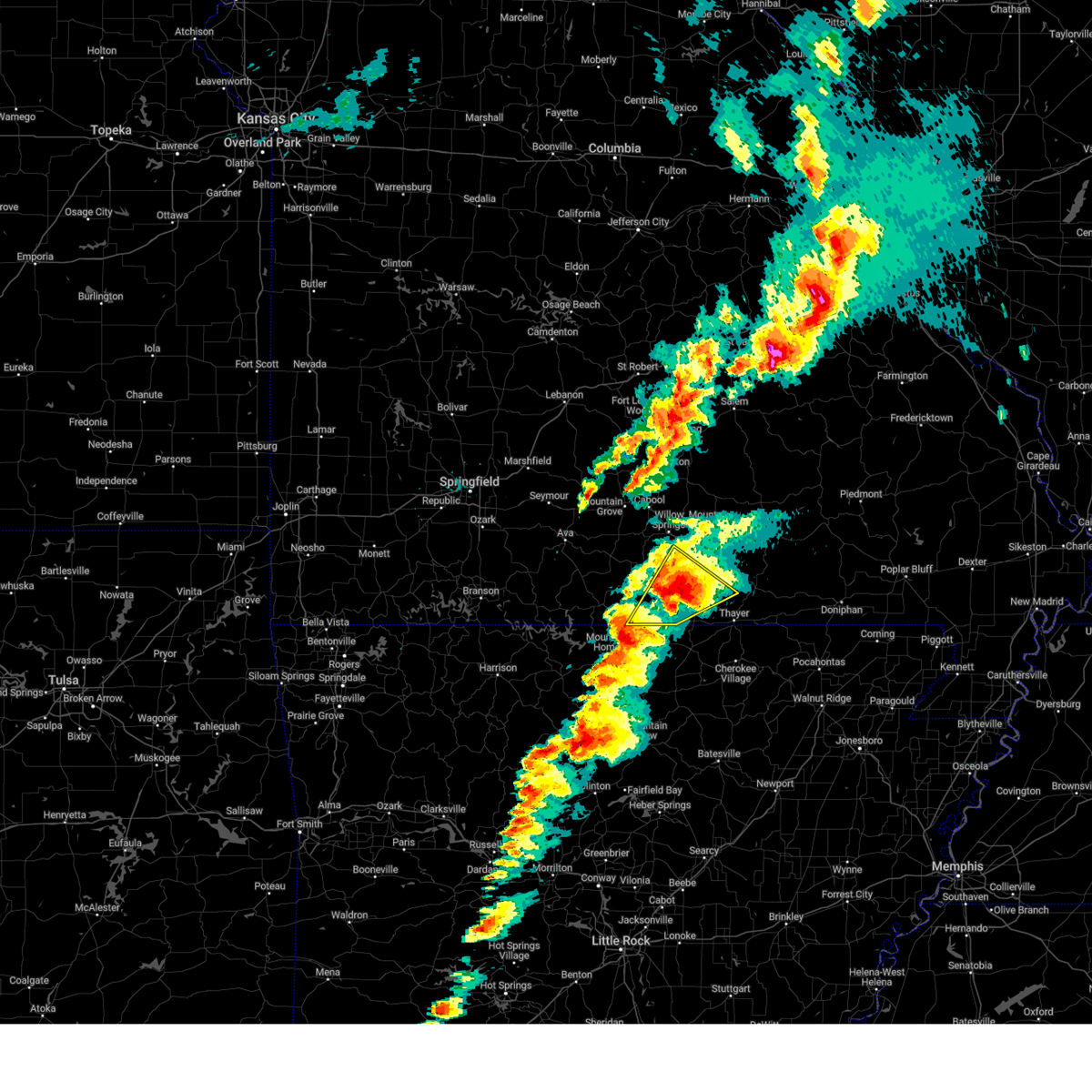 the severe thunderstorm warning has been cancelled and is no longer in effect the severe thunderstorm warning has been cancelled and is no longer in effect
|
| 3/14/2025 9:06 PM CDT |
 At 906 pm cdt, a severe thunderstorm was located over ott, or 18 miles northwest of salem in fulton county, moving northeast at 60 mph (radar indicated). Hazards include golf ball size hail and 70 mph wind gusts. People and animals outdoors will be injured. expect hail damage to roofs, siding, windows, and vehicles. expect considerable tree damage. wind damage is also likely to mobile homes, roofs, and outbuildings. Locations impacted include, brandsville, rover, south fork, moody, pomona, west plains, pottersville, caulfield, and bakersfield. At 906 pm cdt, a severe thunderstorm was located over ott, or 18 miles northwest of salem in fulton county, moving northeast at 60 mph (radar indicated). Hazards include golf ball size hail and 70 mph wind gusts. People and animals outdoors will be injured. expect hail damage to roofs, siding, windows, and vehicles. expect considerable tree damage. wind damage is also likely to mobile homes, roofs, and outbuildings. Locations impacted include, brandsville, rover, south fork, moody, pomona, west plains, pottersville, caulfield, and bakersfield.
|
| 3/14/2025 9:00 PM CDT | Quarter sized hail reported 1.3 miles N of West Plains, MO, report from mping... quarter hail... 1.00 inch. time based on radar. |
| 3/14/2025 8:59 PM CDT |
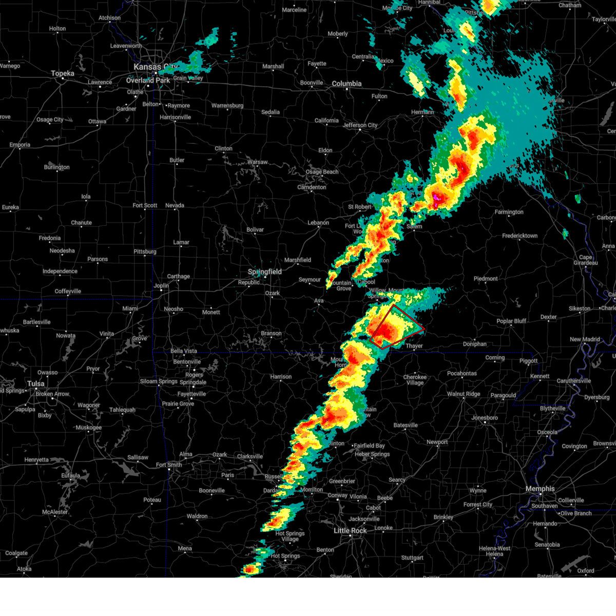 At 858 pm cdt, a confirmed large and extremely dangerous tornado was located 7 miles south of west plains, moving northeast at 50 mph. this is a particularly dangerous situation. take cover now! (radar confirmed tornado). Hazards include damaging tornado. You are in a life-threatening situation. flying debris may be deadly to those caught without shelter. mobile homes will be destroyed. considerable damage to homes, businesses, and vehicles is likely and complete destruction is possible. Locations impacted include, peace valley, brandsville, rover, south fork, white church, thomasville, and west plains. At 858 pm cdt, a confirmed large and extremely dangerous tornado was located 7 miles south of west plains, moving northeast at 50 mph. this is a particularly dangerous situation. take cover now! (radar confirmed tornado). Hazards include damaging tornado. You are in a life-threatening situation. flying debris may be deadly to those caught without shelter. mobile homes will be destroyed. considerable damage to homes, businesses, and vehicles is likely and complete destruction is possible. Locations impacted include, peace valley, brandsville, rover, south fork, white church, thomasville, and west plains.
|
| 3/14/2025 8:59 PM CDT |
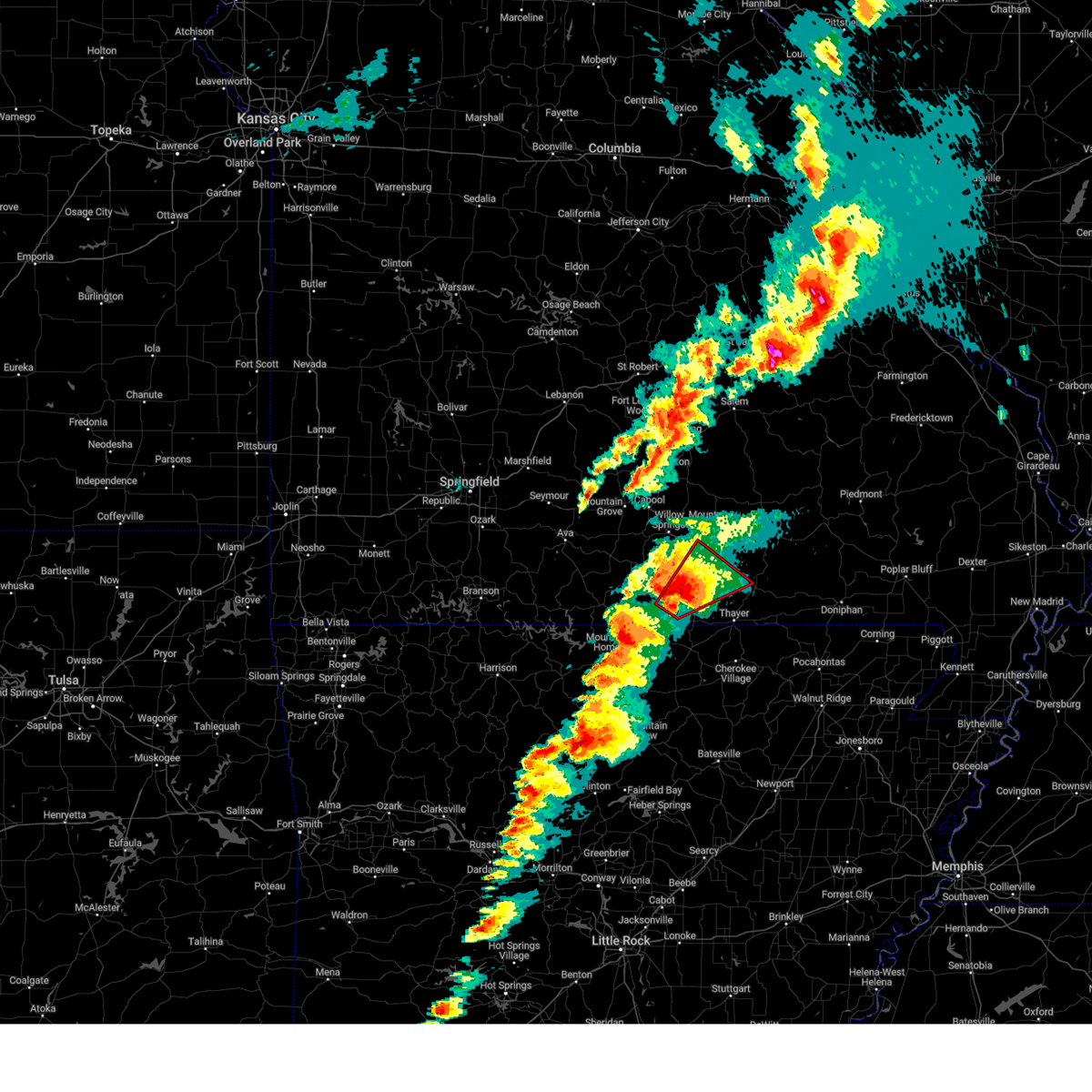 the tornado warning has been cancelled and is no longer in effect the tornado warning has been cancelled and is no longer in effect
|
| 3/14/2025 8:54 PM CDT | House damaged and power lines down. possible to in howell county MO, 8.6 miles NNE of West Plains, MO |
| 3/14/2025 8:50 PM CDT | Power lines down and out buildings destroyed. possible tornad in howell county MO, 11.6 miles NNE of West Plains, MO |
| 3/14/2025 8:44 PM CDT |
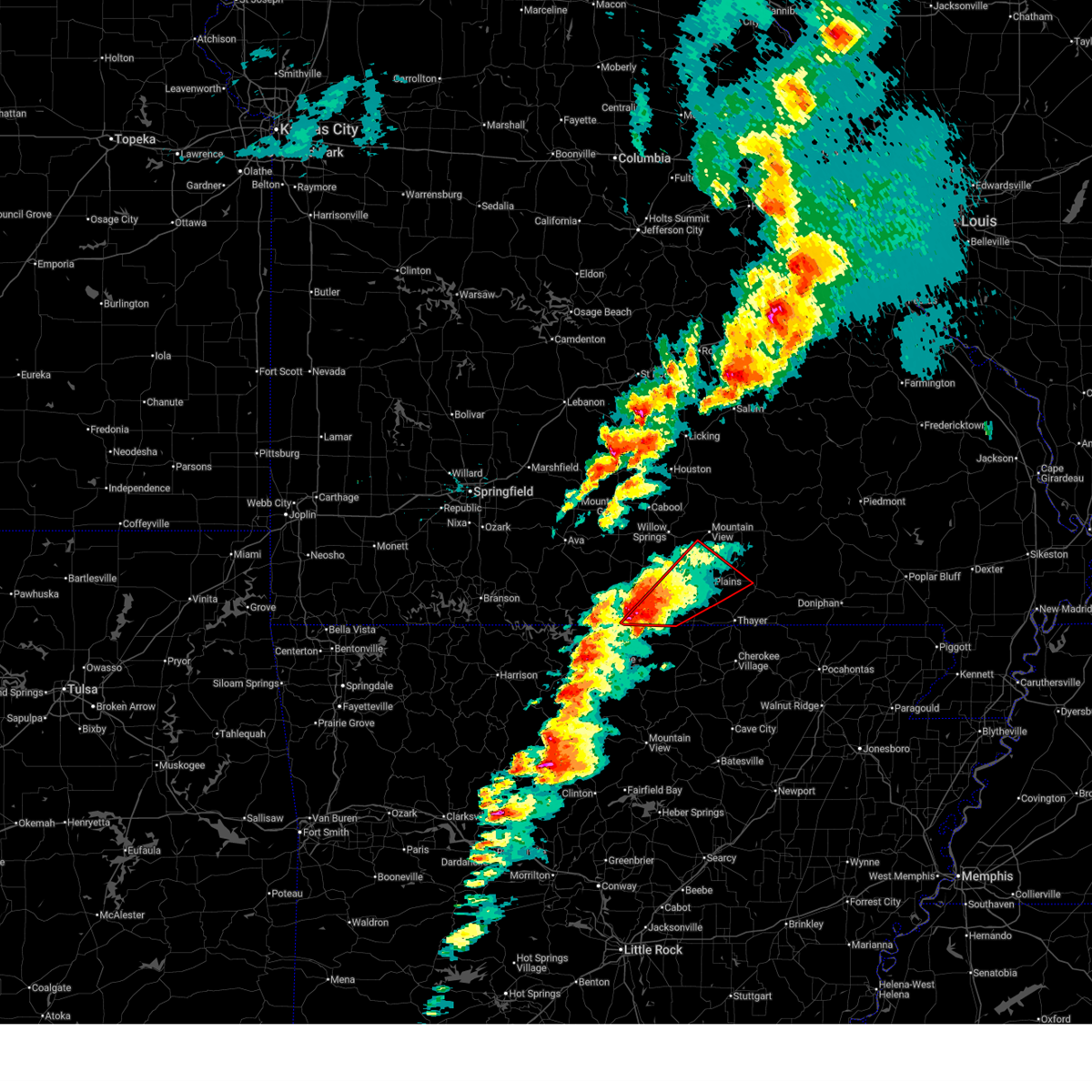 Torsgf the national weather service in springfield has issued a * tornado warning for, southeastern ozark county in southwestern missouri, southeastern howell county in south central missouri, northwestern oregon county in south central missouri, * until 930 pm cdt. * at 843 pm cdt, a confirmed large and extremely dangerous tornado was located over bakersfield, or 19 miles northwest of salem in fulton county, moving northeast at 50 mph. this is a particularly dangerous situation. take cover now! (weather spotters confirmed tornado. at 840 pm a tornado was reported near bakersfield). Hazards include damaging tornado. You are in a life-threatening situation. flying debris may be deadly to those caught without shelter. mobile homes will be destroyed. Considerable damage to homes, businesses, and vehicles is likely and complete destruction is possible. Torsgf the national weather service in springfield has issued a * tornado warning for, southeastern ozark county in southwestern missouri, southeastern howell county in south central missouri, northwestern oregon county in south central missouri, * until 930 pm cdt. * at 843 pm cdt, a confirmed large and extremely dangerous tornado was located over bakersfield, or 19 miles northwest of salem in fulton county, moving northeast at 50 mph. this is a particularly dangerous situation. take cover now! (weather spotters confirmed tornado. at 840 pm a tornado was reported near bakersfield). Hazards include damaging tornado. You are in a life-threatening situation. flying debris may be deadly to those caught without shelter. mobile homes will be destroyed. Considerable damage to homes, businesses, and vehicles is likely and complete destruction is possible.
|
| 3/14/2025 8:12 PM CDT |
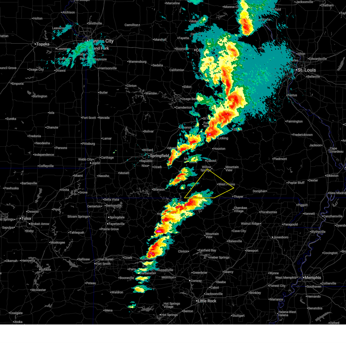 Svrsgf the national weather service in springfield has issued a * severe thunderstorm warning for, eastern ozark county in southwestern missouri, southeastern douglas county in southwestern missouri, howell county in south central missouri, west central oregon county in south central missouri, * until 915 pm cdt. * at 812 pm cdt, a severe thunderstorm was located over arkawana, or near mountain home, moving northeast at 50 mph (radar indicated). Hazards include ping pong ball size hail and 60 mph wind gusts. People and animals outdoors will be injured. expect hail damage to roofs, siding, windows, and vehicles. Expect wind damage to roofs, siding, and trees. Svrsgf the national weather service in springfield has issued a * severe thunderstorm warning for, eastern ozark county in southwestern missouri, southeastern douglas county in southwestern missouri, howell county in south central missouri, west central oregon county in south central missouri, * until 915 pm cdt. * at 812 pm cdt, a severe thunderstorm was located over arkawana, or near mountain home, moving northeast at 50 mph (radar indicated). Hazards include ping pong ball size hail and 60 mph wind gusts. People and animals outdoors will be injured. expect hail damage to roofs, siding, windows, and vehicles. Expect wind damage to roofs, siding, and trees.
|
| 11/18/2024 6:48 PM CST |
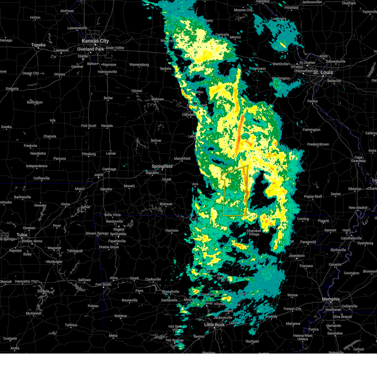 the severe thunderstorm warning has been cancelled and is no longer in effect the severe thunderstorm warning has been cancelled and is no longer in effect
|
| 11/18/2024 6:17 PM CST |
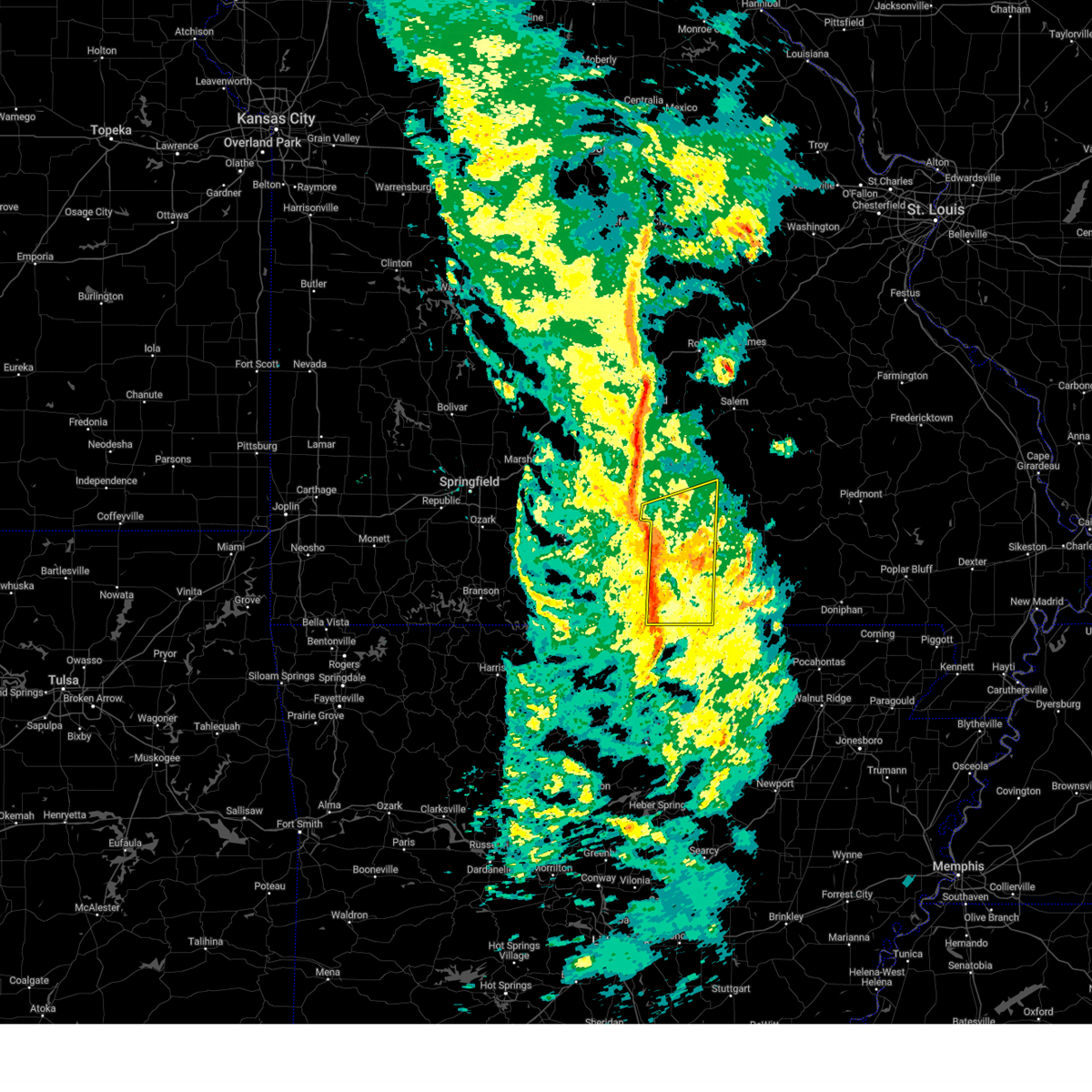 Svrsgf the national weather service in springfield has issued a * severe thunderstorm warning for, howell county in south central missouri, southeastern texas county in south central missouri, * until 700 pm cst. * at 617 pm cst, severe thunderstorms were located along a line extending from near cabool to near west plains to viola, moving east at 55 mph (radar indicated). Hazards include 60 mph wind gusts. expect damage to roofs, siding, and trees Svrsgf the national weather service in springfield has issued a * severe thunderstorm warning for, howell county in south central missouri, southeastern texas county in south central missouri, * until 700 pm cst. * at 617 pm cst, severe thunderstorms were located along a line extending from near cabool to near west plains to viola, moving east at 55 mph (radar indicated). Hazards include 60 mph wind gusts. expect damage to roofs, siding, and trees
|
| 9/20/2024 4:36 PM CDT |
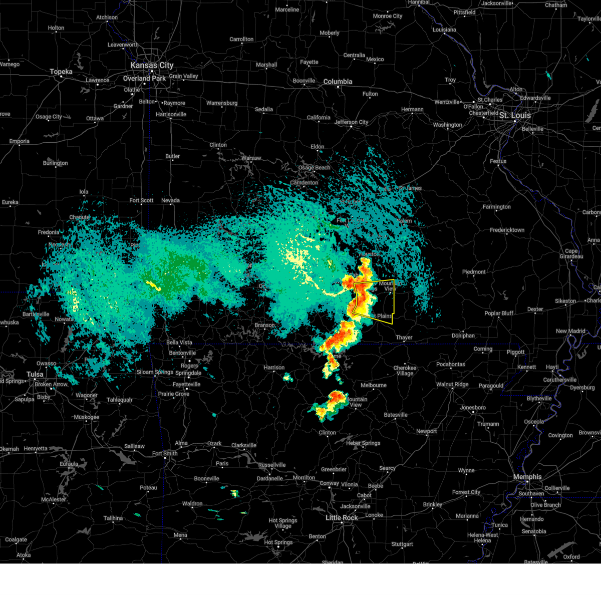 Svrsgf the national weather service in springfield has issued a * severe thunderstorm warning for, eastern douglas county in southwestern missouri, northern howell county in south central missouri, southeastern texas county in south central missouri, * until 515 pm cdt. * at 436 pm cdt, severe thunderstorms were located along a line extending from near cabool to near willow springs to 10 miles northwest of west plains to 16 miles north of bakersfield, moving east at 30 mph (radar indicated). Hazards include 60 mph wind gusts and quarter size hail. Hail damage to vehicles is expected. Expect wind damage to roofs, siding, and trees. Svrsgf the national weather service in springfield has issued a * severe thunderstorm warning for, eastern douglas county in southwestern missouri, northern howell county in south central missouri, southeastern texas county in south central missouri, * until 515 pm cdt. * at 436 pm cdt, severe thunderstorms were located along a line extending from near cabool to near willow springs to 10 miles northwest of west plains to 16 miles north of bakersfield, moving east at 30 mph (radar indicated). Hazards include 60 mph wind gusts and quarter size hail. Hail damage to vehicles is expected. Expect wind damage to roofs, siding, and trees.
|
| 8/15/2024 11:47 PM CDT |
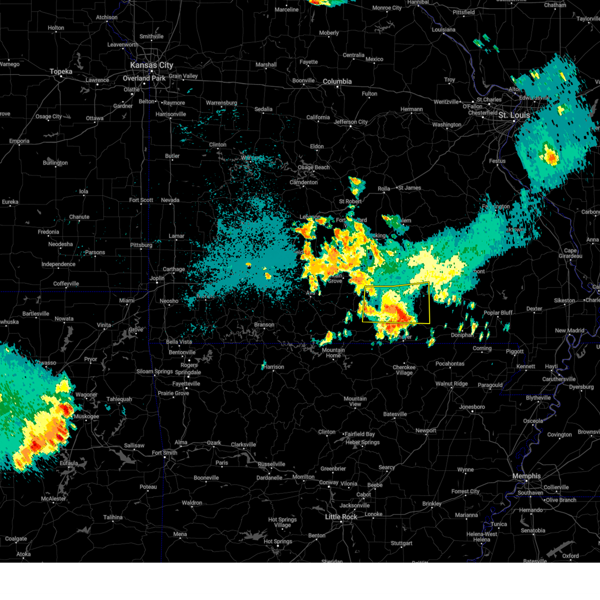 The storm which prompted the warning has weakened below severe limits, and no longer poses an immediate threat to life or property. therefore, the warning has been allowed to expire. however, gusty winds are still possible with this thunderstorm. a severe thunderstorm watch remains in effect until midnight cdt for south central missouri. The storm which prompted the warning has weakened below severe limits, and no longer poses an immediate threat to life or property. therefore, the warning has been allowed to expire. however, gusty winds are still possible with this thunderstorm. a severe thunderstorm watch remains in effect until midnight cdt for south central missouri.
|
| 8/15/2024 11:04 PM CDT |
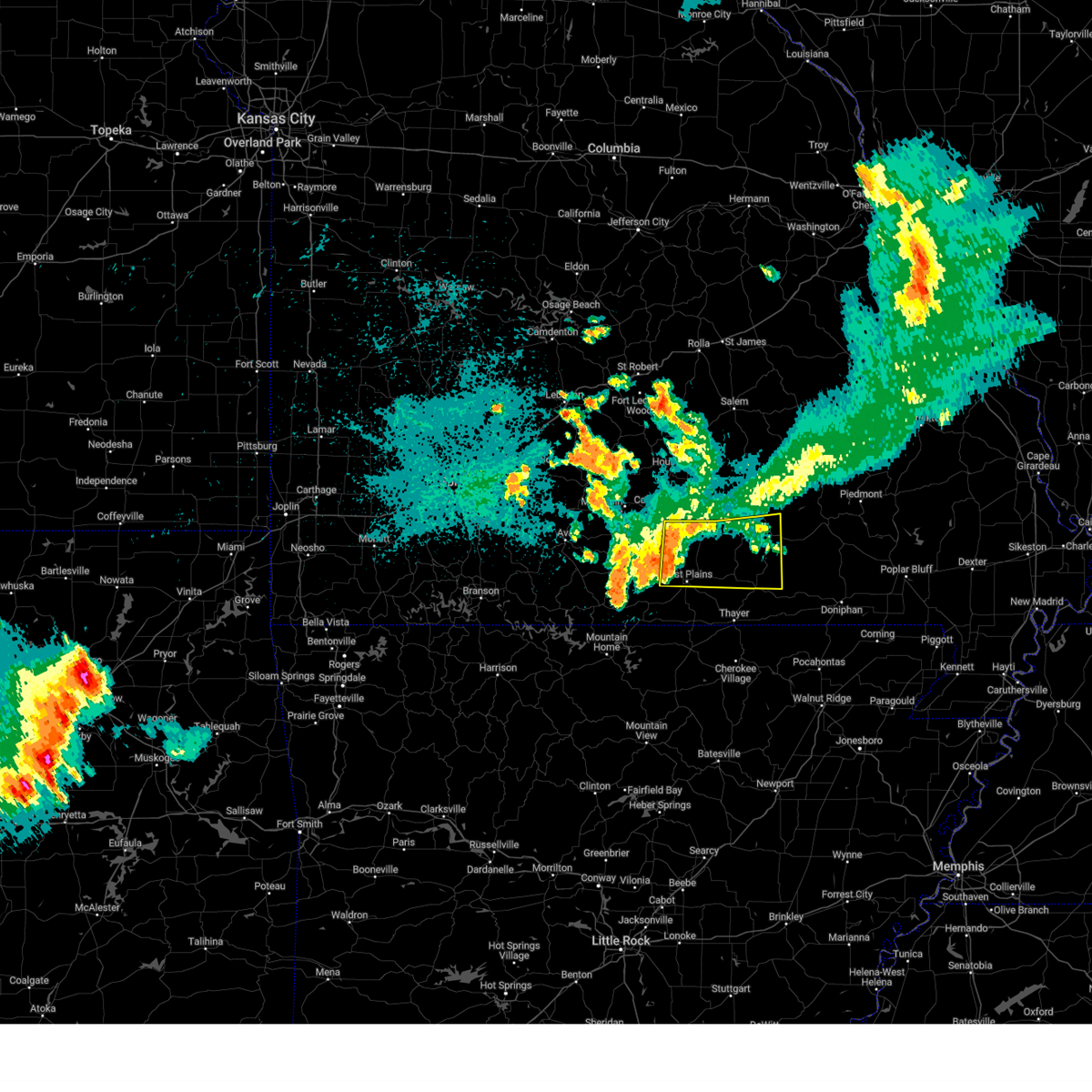 Svrsgf the national weather service in springfield has issued a * severe thunderstorm warning for, southwestern shannon county in south central missouri, northern howell county in south central missouri, northern oregon county in south central missouri, * until 1145 pm cdt. * at 1104 pm cdt, a severe thunderstorm was located near west plains, moving east at 30 mph (radar indicated). Hazards include 60 mph wind gusts. expect damage to roofs, siding, and trees Svrsgf the national weather service in springfield has issued a * severe thunderstorm warning for, southwestern shannon county in south central missouri, northern howell county in south central missouri, northern oregon county in south central missouri, * until 1145 pm cdt. * at 1104 pm cdt, a severe thunderstorm was located near west plains, moving east at 30 mph (radar indicated). Hazards include 60 mph wind gusts. expect damage to roofs, siding, and trees
|
| 6/8/2024 11:05 PM CDT | A large tree was reported down on highway c in howell county MO, 6.1 miles E of West Plains, MO |
| 6/8/2024 10:34 PM CDT |
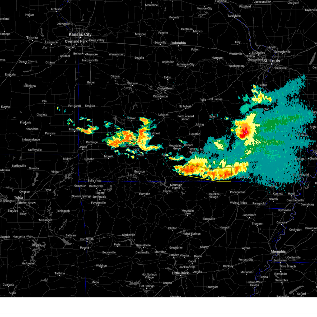 At 1033 pm cdt, severe thunderstorms were located along a line extending from near doniphan to 8 miles west of alton to 15 miles west of west plains, moving east at 30 mph (radar indicated). Hazards include 60 mph wind gusts and quarter size hail. Hail damage to vehicles is expected. expect wind damage to roofs, siding, and trees. Locations impacted include, west plains, grand gulf state park, thayer, alton, south fork, koshkonong, brandsville, myrtle, wilderness, couch, pottersville, caulfield, rover, and siloam springs. At 1033 pm cdt, severe thunderstorms were located along a line extending from near doniphan to 8 miles west of alton to 15 miles west of west plains, moving east at 30 mph (radar indicated). Hazards include 60 mph wind gusts and quarter size hail. Hail damage to vehicles is expected. expect wind damage to roofs, siding, and trees. Locations impacted include, west plains, grand gulf state park, thayer, alton, south fork, koshkonong, brandsville, myrtle, wilderness, couch, pottersville, caulfield, rover, and siloam springs.
|
| 6/8/2024 10:34 PM CDT |
 the severe thunderstorm warning has been cancelled and is no longer in effect the severe thunderstorm warning has been cancelled and is no longer in effect
|
| 6/8/2024 10:23 PM CDT |
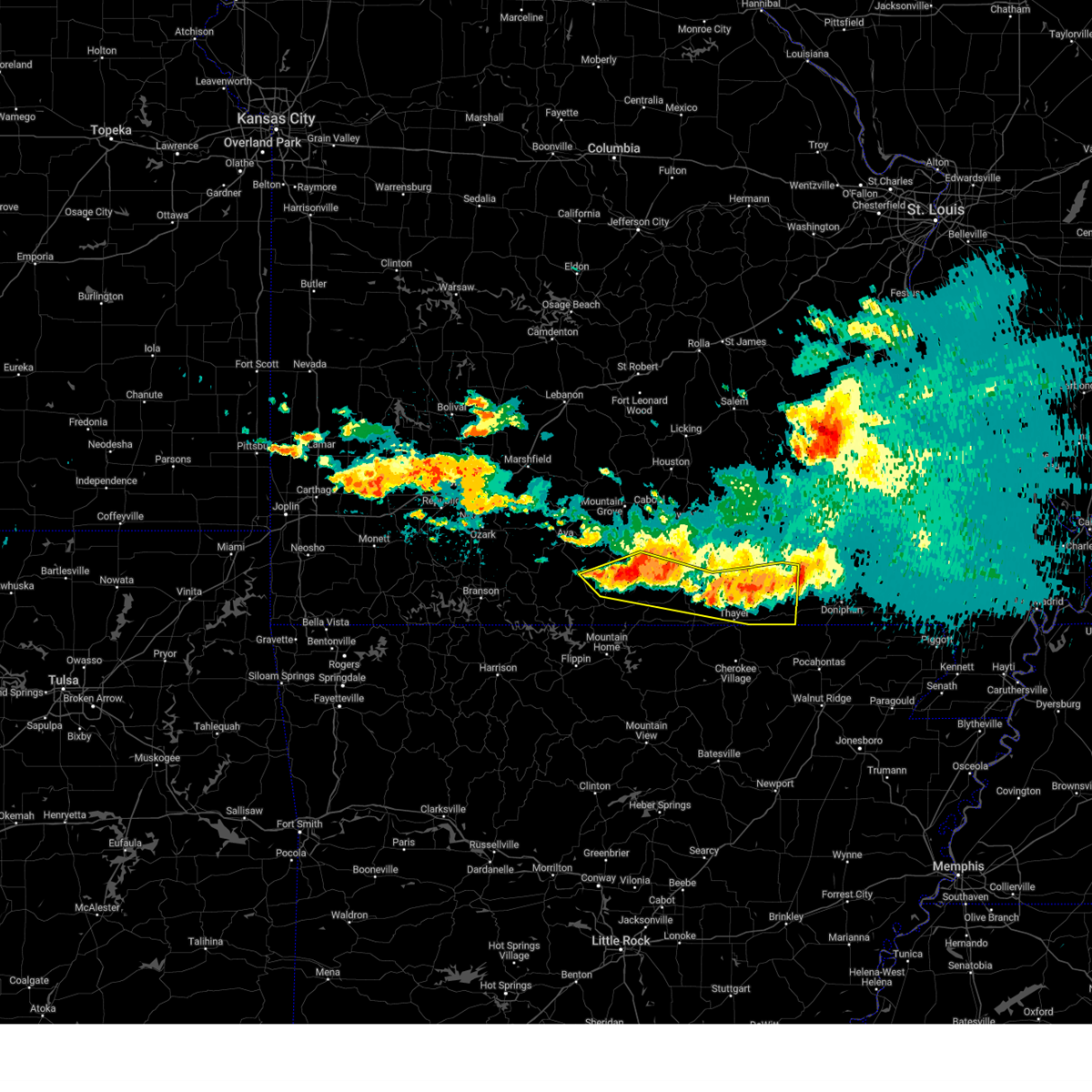 At 1023 pm cdt, severe thunderstorms were located along a line extending from 8 miles northwest of doniphan to 11 miles northwest of thayer to 16 miles northeast of gainesville, moving southeast at 30 mph (radar indicated). Hazards include 60 mph wind gusts and quarter size hail. Hail damage to vehicles is expected. expect wind damage to roofs, siding, and trees. Locations impacted include, west plains, grand gulf state park, bryant creek state park, thayer, alton, south fork, koshkonong, brandsville, thomasville, myrtle, brixey, wilderness, couch, pottersville, caulfield, rover, siloam springs, sycamore, dora, and rockbridge. At 1023 pm cdt, severe thunderstorms were located along a line extending from 8 miles northwest of doniphan to 11 miles northwest of thayer to 16 miles northeast of gainesville, moving southeast at 30 mph (radar indicated). Hazards include 60 mph wind gusts and quarter size hail. Hail damage to vehicles is expected. expect wind damage to roofs, siding, and trees. Locations impacted include, west plains, grand gulf state park, bryant creek state park, thayer, alton, south fork, koshkonong, brandsville, thomasville, myrtle, brixey, wilderness, couch, pottersville, caulfield, rover, siloam springs, sycamore, dora, and rockbridge.
|
| 6/8/2024 10:23 PM CDT |
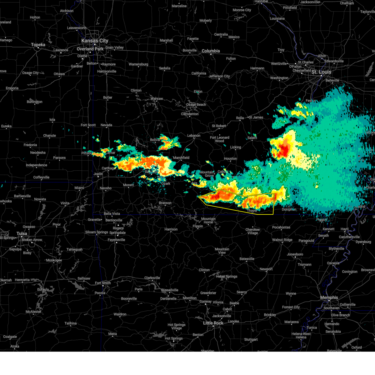 the severe thunderstorm warning has been cancelled and is no longer in effect the severe thunderstorm warning has been cancelled and is no longer in effect
|
| 6/8/2024 10:20 PM CDT |
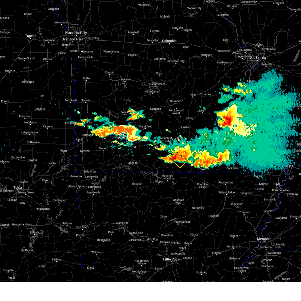 At 1019 pm cdt, a severe thunderstorm was located 10 miles west of west plains, moving southeast at 30 mph (radar indicated). Hazards include 60 mph wind gusts and half dollar size hail. Hail damage to vehicles is expected. expect wind damage to roofs, siding, and trees. Locations impacted include, west plains, dora, siloam springs, pottersville, and caulfield. At 1019 pm cdt, a severe thunderstorm was located 10 miles west of west plains, moving southeast at 30 mph (radar indicated). Hazards include 60 mph wind gusts and half dollar size hail. Hail damage to vehicles is expected. expect wind damage to roofs, siding, and trees. Locations impacted include, west plains, dora, siloam springs, pottersville, and caulfield.
|
| 6/8/2024 10:09 PM CDT |
 At 1008 pm cdt, a severe thunderstorm was located 15 miles southwest of willow springs, moving southeast at 30 mph (radar indicated). Hazards include ping pong ball size hail and 60 mph wind gusts. People and animals outdoors will be injured. expect hail damage to roofs, siding, windows, and vehicles. expect wind damage to roofs, siding, and trees. Locations impacted include, west plains, dora, siloam springs, pottersville, and caulfield. At 1008 pm cdt, a severe thunderstorm was located 15 miles southwest of willow springs, moving southeast at 30 mph (radar indicated). Hazards include ping pong ball size hail and 60 mph wind gusts. People and animals outdoors will be injured. expect hail damage to roofs, siding, windows, and vehicles. expect wind damage to roofs, siding, and trees. Locations impacted include, west plains, dora, siloam springs, pottersville, and caulfield.
|
| 6/8/2024 10:04 PM CDT |
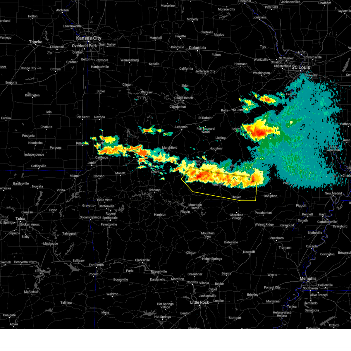 Svrsgf the national weather service in springfield has issued a * severe thunderstorm warning for, northeastern ozark county in southwestern missouri, southwestern shannon county in south central missouri, eastern douglas county in southwestern missouri, howell county in south central missouri, oregon county in south central missouri, * until 1045 pm cdt. * at 1003 pm cdt, severe thunderstorms were located along a line extending from near handy to 6 miles east of west plains to 17 miles north of gainesville, moving southeast at 30 mph (radar indicated). Hazards include 60 mph wind gusts and quarter size hail. Hail damage to vehicles is expected. Expect wind damage to roofs, siding, and trees. Svrsgf the national weather service in springfield has issued a * severe thunderstorm warning for, northeastern ozark county in southwestern missouri, southwestern shannon county in south central missouri, eastern douglas county in southwestern missouri, howell county in south central missouri, oregon county in south central missouri, * until 1045 pm cdt. * at 1003 pm cdt, severe thunderstorms were located along a line extending from near handy to 6 miles east of west plains to 17 miles north of gainesville, moving southeast at 30 mph (radar indicated). Hazards include 60 mph wind gusts and quarter size hail. Hail damage to vehicles is expected. Expect wind damage to roofs, siding, and trees.
|
| 6/8/2024 9:52 PM CDT |
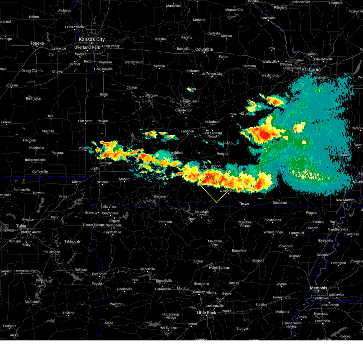 Svrsgf the national weather service in springfield has issued a * severe thunderstorm warning for, northeastern ozark county in southwestern missouri, southeastern douglas county in southwestern missouri, west central howell county in south central missouri, * until 1030 pm cdt. * at 951 pm cdt, a severe thunderstorm was located 15 miles southeast of norwood, or 15 miles south of mountain grove, moving southeast at 30 mph (radar indicated). Hazards include golf ball size hail and 60 mph wind gusts. People and animals outdoors will be injured. expect hail damage to roofs, siding, windows, and vehicles. Expect wind damage to roofs, siding, and trees. Svrsgf the national weather service in springfield has issued a * severe thunderstorm warning for, northeastern ozark county in southwestern missouri, southeastern douglas county in southwestern missouri, west central howell county in south central missouri, * until 1030 pm cdt. * at 951 pm cdt, a severe thunderstorm was located 15 miles southeast of norwood, or 15 miles south of mountain grove, moving southeast at 30 mph (radar indicated). Hazards include golf ball size hail and 60 mph wind gusts. People and animals outdoors will be injured. expect hail damage to roofs, siding, windows, and vehicles. Expect wind damage to roofs, siding, and trees.
|
| 6/8/2024 9:10 PM CDT |
 Svrsgf the national weather service in springfield has issued a * severe thunderstorm warning for, northeastern douglas county in southwestern missouri, northern howell county in south central missouri, southwestern texas county in south central missouri, * until 1000 pm cdt. * at 909 pm cdt, a severe thunderstorm was located near cabool, or 7 miles southeast of mountain grove, moving southeast at 25 mph (trained weather spotters. at 859 pm, a trained spotter reported golf ball size hail near cabool). Hazards include golf ball size hail and 60 mph wind gusts. People and animals outdoors will be injured. expect hail damage to roofs, siding, windows, and vehicles. Expect wind damage to roofs, siding, and trees. Svrsgf the national weather service in springfield has issued a * severe thunderstorm warning for, northeastern douglas county in southwestern missouri, northern howell county in south central missouri, southwestern texas county in south central missouri, * until 1000 pm cdt. * at 909 pm cdt, a severe thunderstorm was located near cabool, or 7 miles southeast of mountain grove, moving southeast at 25 mph (trained weather spotters. at 859 pm, a trained spotter reported golf ball size hail near cabool). Hazards include golf ball size hail and 60 mph wind gusts. People and animals outdoors will be injured. expect hail damage to roofs, siding, windows, and vehicles. Expect wind damage to roofs, siding, and trees.
|
| 5/26/2024 5:39 AM CDT |
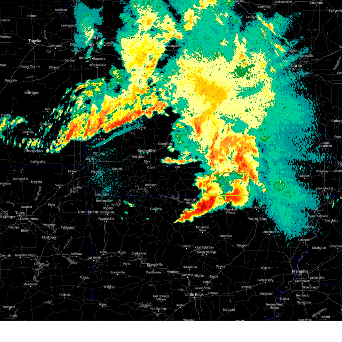 the severe thunderstorm warning has been cancelled and is no longer in effect the severe thunderstorm warning has been cancelled and is no longer in effect
|
| 5/26/2024 5:39 AM CDT |
 At 538 am cdt, severe thunderstorms were located along a line extending from near west plains to 8 miles west of thayer to near byron, moving east at 70 mph (radar indicated). Hazards include 60 mph wind gusts and quarter size hail. Hail damage to vehicles is expected. expect wind damage to roofs, siding, and trees. Locations impacted include, west plains, grand gulf state park, thayer, alton, south fork, koshkonong, brandsville, thomasville, peace valley, lanton, myrtle, wilderness, couch, pottersville, caulfield, rover, siloam springs, white church, moody, and greer. At 538 am cdt, severe thunderstorms were located along a line extending from near west plains to 8 miles west of thayer to near byron, moving east at 70 mph (radar indicated). Hazards include 60 mph wind gusts and quarter size hail. Hail damage to vehicles is expected. expect wind damage to roofs, siding, and trees. Locations impacted include, west plains, grand gulf state park, thayer, alton, south fork, koshkonong, brandsville, thomasville, peace valley, lanton, myrtle, wilderness, couch, pottersville, caulfield, rover, siloam springs, white church, moody, and greer.
|
| 5/26/2024 5:23 AM CDT |
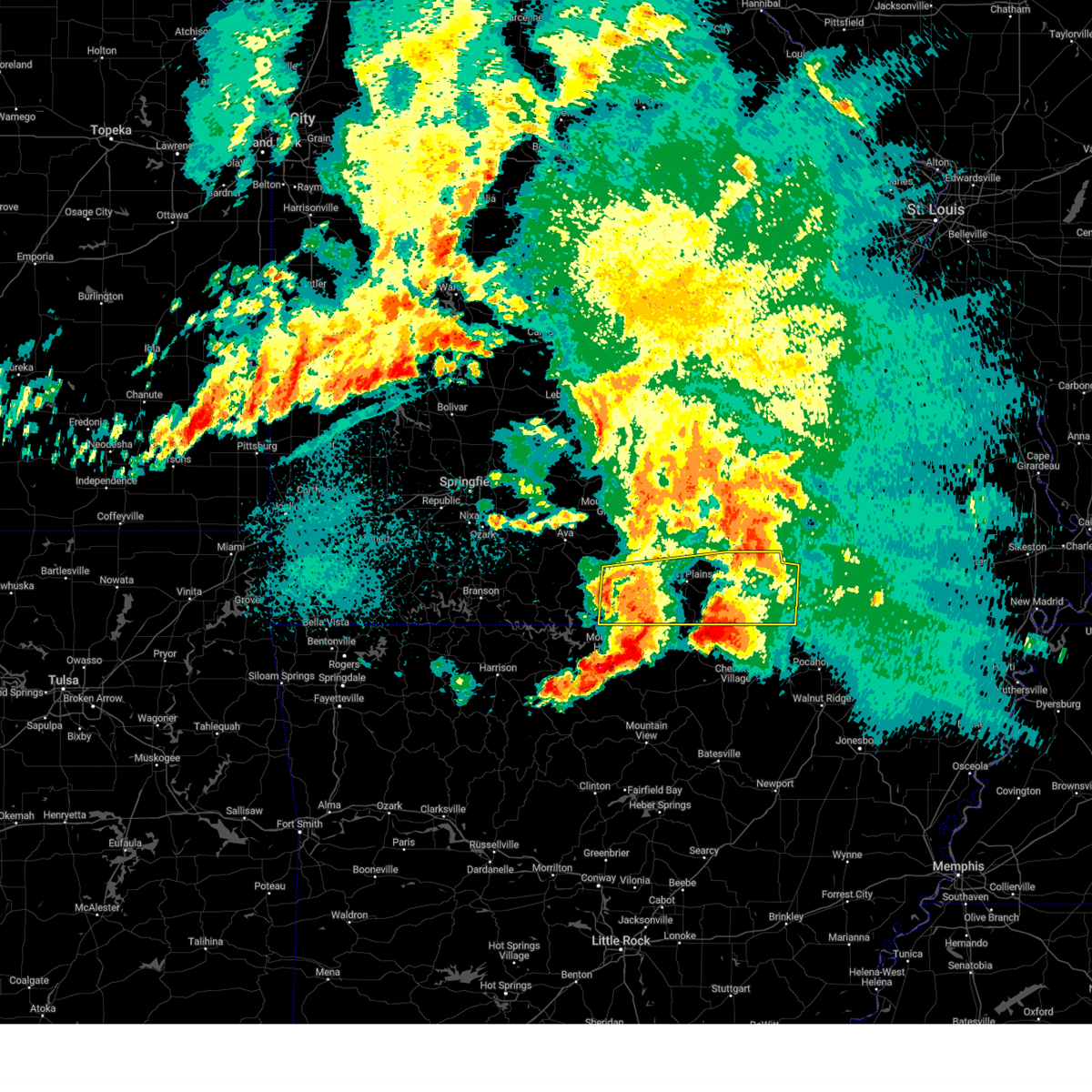 At 522 am cdt, severe thunderstorms were located along a line extending from 13 miles west of west plains to near sturkie to near diamond bay, moving east at 70 mph (radar indicated). Hazards include 60 mph wind gusts and quarter size hail. Hail damage to vehicles is expected. expect wind damage to roofs, siding, and trees. Locations impacted include, west plains, norfork lake, grand gulf state park, bryant creek state park, thayer, alton, gainesville, bakersfield, south fork, koshkonong, brandsville, thomasville, lanton, myrtle, brixey, tecumseh, pottersville, caulfield, udall, and hardenville. At 522 am cdt, severe thunderstorms were located along a line extending from 13 miles west of west plains to near sturkie to near diamond bay, moving east at 70 mph (radar indicated). Hazards include 60 mph wind gusts and quarter size hail. Hail damage to vehicles is expected. expect wind damage to roofs, siding, and trees. Locations impacted include, west plains, norfork lake, grand gulf state park, bryant creek state park, thayer, alton, gainesville, bakersfield, south fork, koshkonong, brandsville, thomasville, lanton, myrtle, brixey, tecumseh, pottersville, caulfield, udall, and hardenville.
|
| 5/26/2024 5:09 AM CDT |
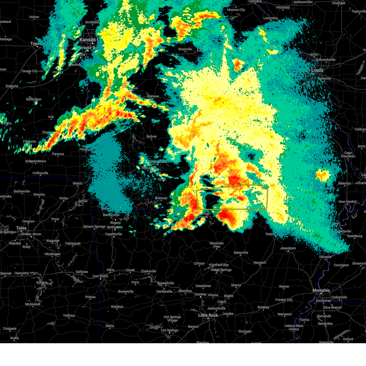 Svrsgf the national weather service in springfield has issued a * severe thunderstorm warning for, eastern ozark county in southwestern missouri, southeastern douglas county in southwestern missouri, howell county in south central missouri, oregon county in south central missouri, * until 615 am cdt. * at 508 am cdt, severe thunderstorms were located along a line extending from 11 miles northeast of gainesville to bakersfield to near colfax, moving east at 70 mph (radar indicated). Hazards include 70 mph wind gusts and half dollar size hail. Hail damage to vehicles is expected. expect considerable tree damage. Wind damage is also likely to mobile homes, roofs, and outbuildings. Svrsgf the national weather service in springfield has issued a * severe thunderstorm warning for, eastern ozark county in southwestern missouri, southeastern douglas county in southwestern missouri, howell county in south central missouri, oregon county in south central missouri, * until 615 am cdt. * at 508 am cdt, severe thunderstorms were located along a line extending from 11 miles northeast of gainesville to bakersfield to near colfax, moving east at 70 mph (radar indicated). Hazards include 70 mph wind gusts and half dollar size hail. Hail damage to vehicles is expected. expect considerable tree damage. Wind damage is also likely to mobile homes, roofs, and outbuildings.
|
| 5/8/2024 8:33 PM CDT |
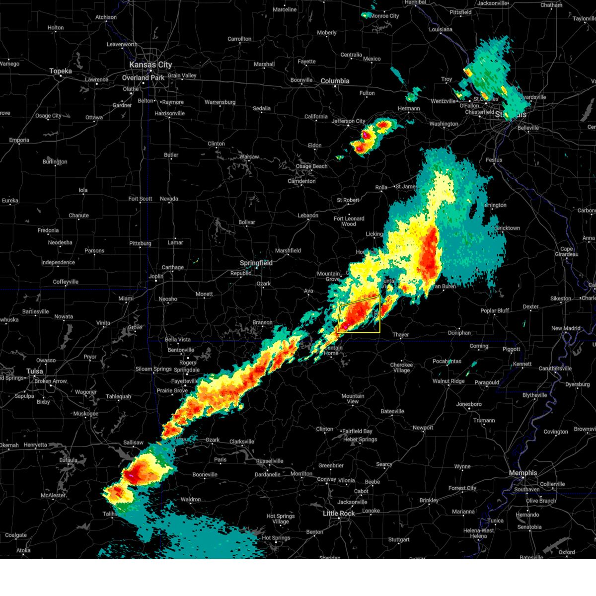 the severe thunderstorm warning has been cancelled and is no longer in effect the severe thunderstorm warning has been cancelled and is no longer in effect
|
| 5/8/2024 8:22 PM CDT |
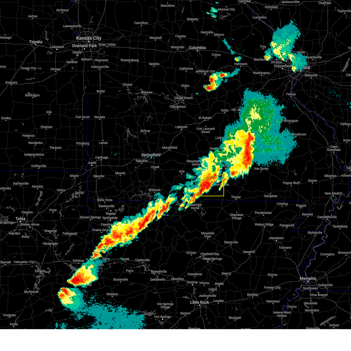 At 821 pm cdt, a severe thunderstorm was located 12 miles west of west plains, moving east at 45 mph (radar indicated). Hazards include 60 mph wind gusts and quarter size hail. Hail damage to vehicles is expected. expect wind damage to roofs, siding, and trees. Locations impacted include, west plains, pomona, south fork, siloam springs, sycamore, tecumseh, dora, pottersville, and caulfield. At 821 pm cdt, a severe thunderstorm was located 12 miles west of west plains, moving east at 45 mph (radar indicated). Hazards include 60 mph wind gusts and quarter size hail. Hail damage to vehicles is expected. expect wind damage to roofs, siding, and trees. Locations impacted include, west plains, pomona, south fork, siloam springs, sycamore, tecumseh, dora, pottersville, and caulfield.
|
| 5/8/2024 8:04 PM CDT |
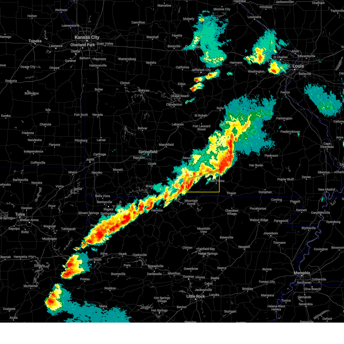 Svrsgf the national weather service in springfield has issued a * severe thunderstorm warning for, northeastern ozark county in southwestern missouri, southeastern douglas county in southwestern missouri, western howell county in south central missouri, * until 845 pm cdt. * at 804 pm cdt, a severe thunderstorm was located 7 miles northeast of gainesville, or 24 miles north of mountain home, moving east at 45 mph (radar indicated). Hazards include 60 mph wind gusts and quarter size hail. Hail damage to vehicles is expected. Expect wind damage to roofs, siding, and trees. Svrsgf the national weather service in springfield has issued a * severe thunderstorm warning for, northeastern ozark county in southwestern missouri, southeastern douglas county in southwestern missouri, western howell county in south central missouri, * until 845 pm cdt. * at 804 pm cdt, a severe thunderstorm was located 7 miles northeast of gainesville, or 24 miles north of mountain home, moving east at 45 mph (radar indicated). Hazards include 60 mph wind gusts and quarter size hail. Hail damage to vehicles is expected. Expect wind damage to roofs, siding, and trees.
|
| 5/7/2024 2:16 AM CDT |
 At 215 am cdt, severe thunderstorms were located along a line extending from hartville to 6 miles north of ava to near taneyville, moving east at 45 mph (radar indicated). Hazards include 60 mph wind gusts. Expect damage to roofs, siding, and trees. locations impacted include, rolla, fort leonard wood, west plains, lake taneycomo, bryant creek state park, montauk state park, waynesville, mountain grove, st. robert, licking, ava, mountain view, willow springs, cabool, houston, richland, mansfield, dawson, norwood, and doolittle. This includes interstate 44 between mile markers 144 and 169, and between mile markers 171 and 192. At 215 am cdt, severe thunderstorms were located along a line extending from hartville to 6 miles north of ava to near taneyville, moving east at 45 mph (radar indicated). Hazards include 60 mph wind gusts. Expect damage to roofs, siding, and trees. locations impacted include, rolla, fort leonard wood, west plains, lake taneycomo, bryant creek state park, montauk state park, waynesville, mountain grove, st. robert, licking, ava, mountain view, willow springs, cabool, houston, richland, mansfield, dawson, norwood, and doolittle. This includes interstate 44 between mile markers 144 and 169, and between mile markers 171 and 192.
|
| 5/7/2024 2:12 AM CDT |
 Svrsgf the national weather service in springfield has issued a * severe thunderstorm warning for, northern ozark county in southwestern missouri, northwestern shannon county in south central missouri, wright county in southwestern missouri, douglas county in southwestern missouri, northeastern taney county in southwestern missouri, western dent county in south central missouri, southeastern laclede county in southwestern missouri, howell county in south central missouri, texas county in south central missouri, pulaski county in central missouri, phelps county in east central missouri, * until 315 am cdt. * at 212 am cdt, severe thunderstorms were located along a line extending from hartville to 6 miles north of ava to near taneyville, moving east at 45 mph (radar indicated). Hazards include 60 mph wind gusts. expect damage to roofs, siding, and trees Svrsgf the national weather service in springfield has issued a * severe thunderstorm warning for, northern ozark county in southwestern missouri, northwestern shannon county in south central missouri, wright county in southwestern missouri, douglas county in southwestern missouri, northeastern taney county in southwestern missouri, western dent county in south central missouri, southeastern laclede county in southwestern missouri, howell county in south central missouri, texas county in south central missouri, pulaski county in central missouri, phelps county in east central missouri, * until 315 am cdt. * at 212 am cdt, severe thunderstorms were located along a line extending from hartville to 6 miles north of ava to near taneyville, moving east at 45 mph (radar indicated). Hazards include 60 mph wind gusts. expect damage to roofs, siding, and trees
|
| 3/14/2024 6:20 PM CDT |
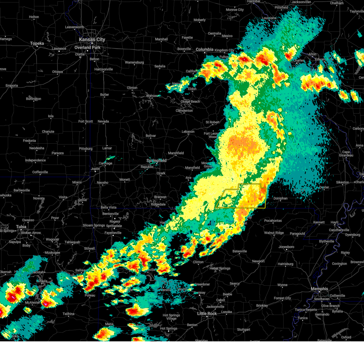 The storms which prompted the warning have moved out of the area. therefore, the warning will be allowed to expire. a tornado watch remains in effect until 900 pm cdt for south central missouri. The storms which prompted the warning have moved out of the area. therefore, the warning will be allowed to expire. a tornado watch remains in effect until 900 pm cdt for south central missouri.
|
| 3/14/2024 5:44 PM CDT |
 the severe thunderstorm warning has been cancelled and is no longer in effect the severe thunderstorm warning has been cancelled and is no longer in effect
|
| 3/14/2024 5:44 PM CDT |
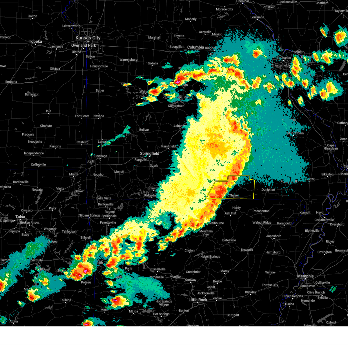 At 544 pm cdt, severe thunderstorms were located along a line extending from 10 miles northwest of alton to 11 miles southeast of west plains to near sturkie, moving east at 50 mph (radar indicated). Hazards include 60 mph wind gusts and quarter size hail. Hail damage to vehicles is expected. expect wind damage to roofs, siding, and trees. Locations impacted include, west plains, grand gulf state park, thayer, alton, south fork, koshkonong, brandsville, thomasville, lanton, myrtle, wilderness, couch, rover, moody, and greer. At 544 pm cdt, severe thunderstorms were located along a line extending from 10 miles northwest of alton to 11 miles southeast of west plains to near sturkie, moving east at 50 mph (radar indicated). Hazards include 60 mph wind gusts and quarter size hail. Hail damage to vehicles is expected. expect wind damage to roofs, siding, and trees. Locations impacted include, west plains, grand gulf state park, thayer, alton, south fork, koshkonong, brandsville, thomasville, lanton, myrtle, wilderness, couch, rover, moody, and greer.
|
| 3/14/2024 5:32 PM CDT |
 the severe thunderstorm warning has been cancelled and is no longer in effect the severe thunderstorm warning has been cancelled and is no longer in effect
|
| 3/14/2024 5:32 PM CDT |
 At 530 pm cdt, severe thunderstorms were located along a line extending from 11 miles southeast of rolla to 10 miles north of eminence to birch tree, moving east at 55 mph (law enforcement. this storm has a history of producing widespread wind damage including downing trees and removing roofs). Hazards include 70 mph wind gusts and half dollar size hail. Hail damage to vehicles is expected. expect considerable tree damage. wind damage is also likely to mobile homes, roofs, and outbuildings. Locations impacted include, west plains, current river state park, ozark national scenic riverways, echo bluff state park, montauk state park, salem, licking, mountain view, willow springs, winona, birch tree, eminence, pomona, summersville, bunker, raymondville, edgar springs, montier, lenox, and montauk. At 530 pm cdt, severe thunderstorms were located along a line extending from 11 miles southeast of rolla to 10 miles north of eminence to birch tree, moving east at 55 mph (law enforcement. this storm has a history of producing widespread wind damage including downing trees and removing roofs). Hazards include 70 mph wind gusts and half dollar size hail. Hail damage to vehicles is expected. expect considerable tree damage. wind damage is also likely to mobile homes, roofs, and outbuildings. Locations impacted include, west plains, current river state park, ozark national scenic riverways, echo bluff state park, montauk state park, salem, licking, mountain view, willow springs, winona, birch tree, eminence, pomona, summersville, bunker, raymondville, edgar springs, montier, lenox, and montauk.
|
| 3/14/2024 5:30 PM CDT | Howell county em reports a tree down across the road near junction hill at state rout 160 and highway 17. time estimated from rada in howell county MO, 4.8 miles WSW of West Plains, MO |
| 3/14/2024 5:30 PM CDT | Report from train spotter of trees down in west plains. time estimated from rada in howell county MO, 1.4 miles WNW of West Plains, MO |
| 3/14/2024 5:26 PM CDT |
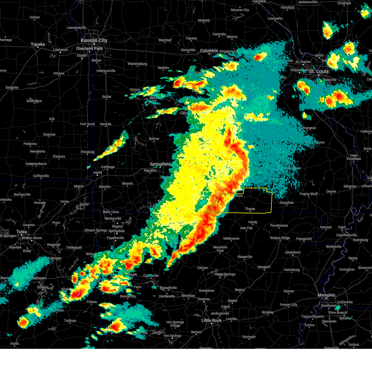 Svrsgf the national weather service in springfield has issued a * severe thunderstorm warning for, southeastern ozark county in southwestern missouri, southern howell county in south central missouri, oregon county in south central missouri, * until 630 pm cdt. * at 525 pm cdt, severe thunderstorms were located along a line extending from 6 miles northeast of west plains to 12 miles north of sturkie to ott, moving east at 50 mph (public. quarter size hail was reported near mountain home, arkansas). Hazards include 60 mph wind gusts and quarter size hail. Hail damage to vehicles is expected. Expect wind damage to roofs, siding, and trees. Svrsgf the national weather service in springfield has issued a * severe thunderstorm warning for, southeastern ozark county in southwestern missouri, southern howell county in south central missouri, oregon county in south central missouri, * until 630 pm cdt. * at 525 pm cdt, severe thunderstorms were located along a line extending from 6 miles northeast of west plains to 12 miles north of sturkie to ott, moving east at 50 mph (public. quarter size hail was reported near mountain home, arkansas). Hazards include 60 mph wind gusts and quarter size hail. Hail damage to vehicles is expected. Expect wind damage to roofs, siding, and trees.
|
| 3/14/2024 5:14 PM CDT |
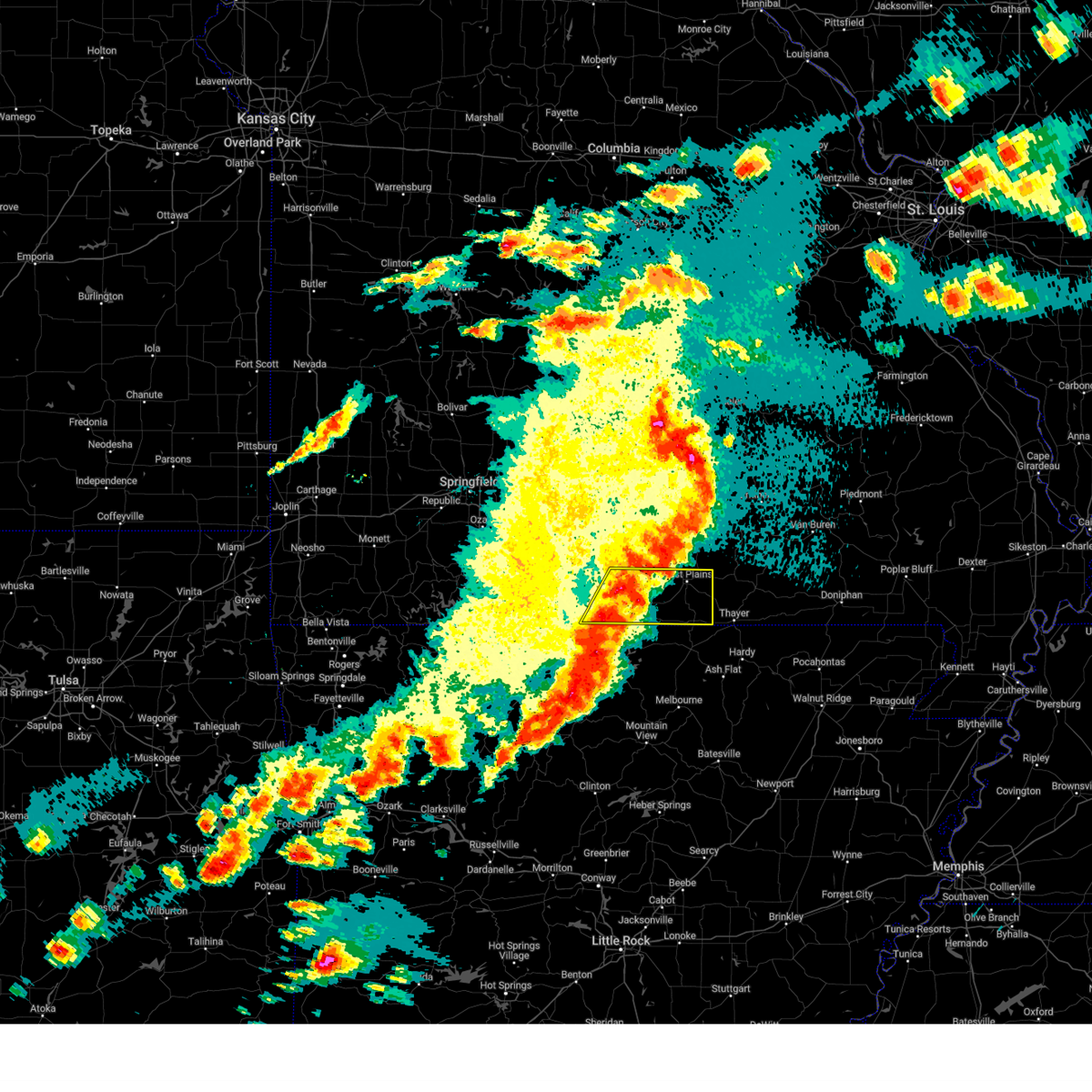 At 514 pm cdt, severe thunderstorms were located along a line extending from 12 miles southwest of mountain view to near west plains to bakersfield, moving east at 50 mph (radar indicated). Hazards include 60 mph wind gusts and half dollar size hail. Hail damage to vehicles is expected. expect wind damage to roofs, siding, and trees. Locations impacted include, west plains, gainesville, bakersfield, south fork, brandsville, lanton, tecumseh, pottersville, caulfield, udall, hardenville, siloam springs, moody, sycamore, dora, and zanoni. At 514 pm cdt, severe thunderstorms were located along a line extending from 12 miles southwest of mountain view to near west plains to bakersfield, moving east at 50 mph (radar indicated). Hazards include 60 mph wind gusts and half dollar size hail. Hail damage to vehicles is expected. expect wind damage to roofs, siding, and trees. Locations impacted include, west plains, gainesville, bakersfield, south fork, brandsville, lanton, tecumseh, pottersville, caulfield, udall, hardenville, siloam springs, moody, sycamore, dora, and zanoni.
|
| 3/14/2024 5:02 PM CDT |
 Svrsgf the national weather service in springfield has issued a * severe thunderstorm warning for, shannon county in south central missouri, dent county in south central missouri, northern howell county in south central missouri, texas county in south central missouri, southeastern pulaski county in central missouri, southern phelps county in east central missouri, * until 600 pm cdt. * at 501 pm cdt, severe thunderstorms were located along a line extending from fort leonard wood to 10 miles south of raymondville to 8 miles south of willow springs, moving east at 55 mph (law enforcement. this storm has a history of producing widespread wind damage including downing trees and removing roofs). Hazards include 70 mph wind gusts and half dollar size hail. Hail damage to vehicles is expected. expect considerable tree damage. Wind damage is also likely to mobile homes, roofs, and outbuildings. Svrsgf the national weather service in springfield has issued a * severe thunderstorm warning for, shannon county in south central missouri, dent county in south central missouri, northern howell county in south central missouri, texas county in south central missouri, southeastern pulaski county in central missouri, southern phelps county in east central missouri, * until 600 pm cdt. * at 501 pm cdt, severe thunderstorms were located along a line extending from fort leonard wood to 10 miles south of raymondville to 8 miles south of willow springs, moving east at 55 mph (law enforcement. this storm has a history of producing widespread wind damage including downing trees and removing roofs). Hazards include 70 mph wind gusts and half dollar size hail. Hail damage to vehicles is expected. expect considerable tree damage. Wind damage is also likely to mobile homes, roofs, and outbuildings.
|
| 3/14/2024 4:50 PM CDT |
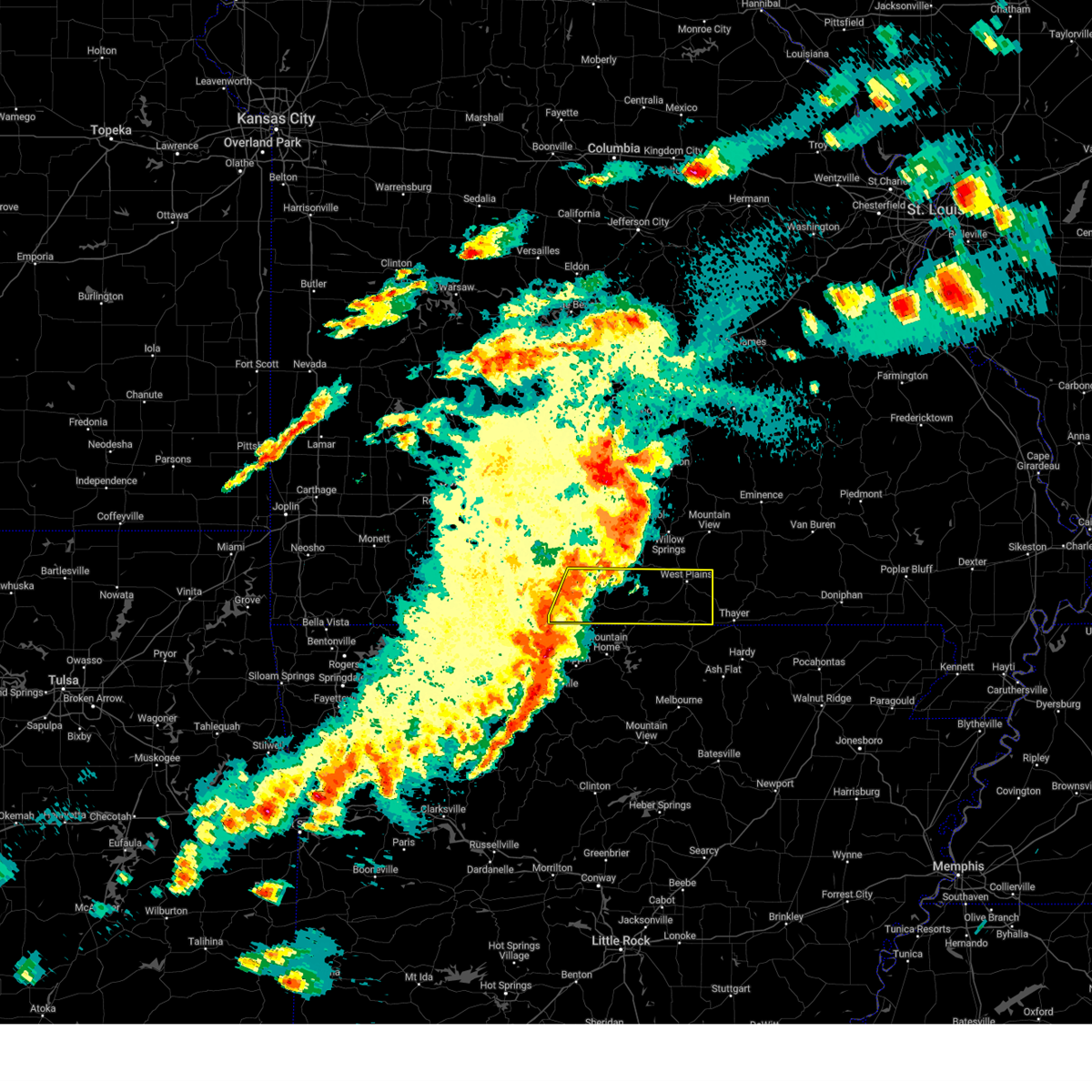 At 450 pm cdt, severe thunderstorms were located along a line extending from 15 miles southwest of willow springs to 11 miles northwest of bakersfield to 6 miles east of price place, moving east at 50 mph (radar indicated). Hazards include 60 mph wind gusts and half dollar size hail. Hail damage to vehicles is expected. expect wind damage to roofs, siding, and trees. Locations impacted include, west plains, bull shoals lake, gainesville, bakersfield, theodosia, south fork, pontiac, brandsville, wasola, sundown, lanton, brixey, willhoit, tecumseh, pottersville, caulfield, udall, hardenville, thornfield, and zanoni. At 450 pm cdt, severe thunderstorms were located along a line extending from 15 miles southwest of willow springs to 11 miles northwest of bakersfield to 6 miles east of price place, moving east at 50 mph (radar indicated). Hazards include 60 mph wind gusts and half dollar size hail. Hail damage to vehicles is expected. expect wind damage to roofs, siding, and trees. Locations impacted include, west plains, bull shoals lake, gainesville, bakersfield, theodosia, south fork, pontiac, brandsville, wasola, sundown, lanton, brixey, willhoit, tecumseh, pottersville, caulfield, udall, hardenville, thornfield, and zanoni.
|
| 3/14/2024 4:50 PM CDT |
 the severe thunderstorm warning has been cancelled and is no longer in effect the severe thunderstorm warning has been cancelled and is no longer in effect
|
| 3/14/2024 4:47 PM CDT |
 the severe thunderstorm warning has been cancelled and is no longer in effect the severe thunderstorm warning has been cancelled and is no longer in effect
|
| 3/14/2024 4:47 PM CDT |
 At 446 pm cdt, severe thunderstorms were located along a line extending from 9 miles north of mountain grove to 11 miles west of willow springs to 17 miles west of west plains, moving east at 50 mph (law enforcement. this storm has a history of producing widespread wind damage including downing trees and removing roofs). Hazards include 70 mph wind gusts and half dollar size hail. Hail damage to vehicles is expected. expect considerable tree damage. wind damage is also likely to mobile homes, roofs, and outbuildings. Locations impacted include, west plains, bryant creek state park, mountain grove, licking, mountain view, willow springs, cabool, houston, dawson, norwood, hartville, pomona, summersville, raymondville, huggins, manes, brushyknob, success, eunice, and yukon. At 446 pm cdt, severe thunderstorms were located along a line extending from 9 miles north of mountain grove to 11 miles west of willow springs to 17 miles west of west plains, moving east at 50 mph (law enforcement. this storm has a history of producing widespread wind damage including downing trees and removing roofs). Hazards include 70 mph wind gusts and half dollar size hail. Hail damage to vehicles is expected. expect considerable tree damage. wind damage is also likely to mobile homes, roofs, and outbuildings. Locations impacted include, west plains, bryant creek state park, mountain grove, licking, mountain view, willow springs, cabool, houston, dawson, norwood, hartville, pomona, summersville, raymondville, huggins, manes, brushyknob, success, eunice, and yukon.
|
| 3/14/2024 4:25 PM CDT |
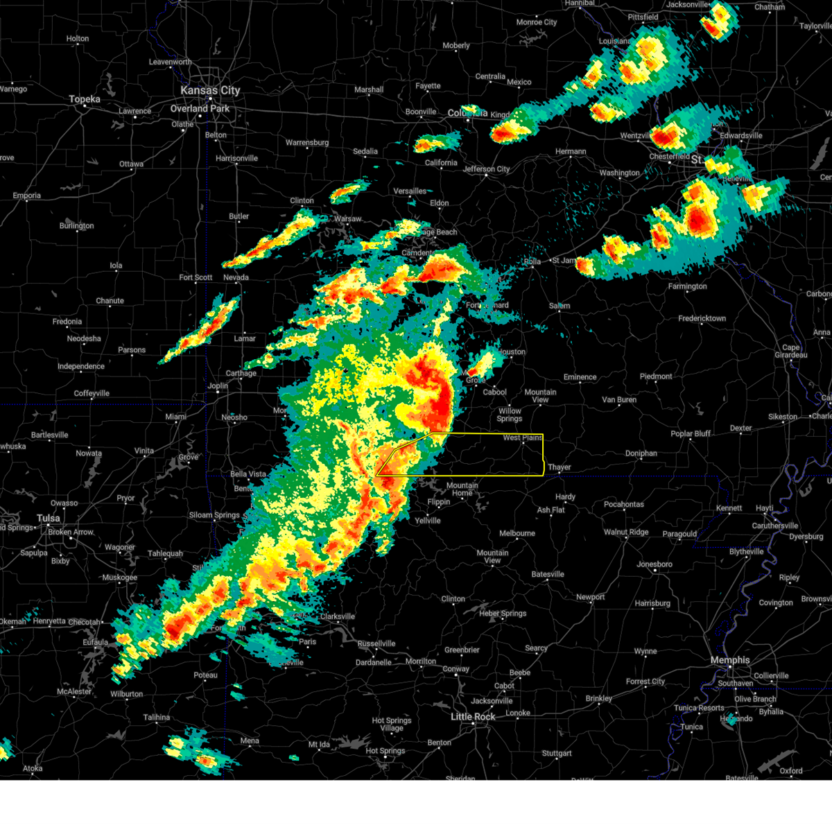 Svrsgf the national weather service in springfield has issued a * severe thunderstorm warning for, ozark county in southwestern missouri, southeastern taney county in southwestern missouri, southern howell county in south central missouri, * until 530 pm cdt. * at 425 pm cdt, severe thunderstorms were located along a line extending from 15 miles southeast of ava to 9 miles west of gainesville to near diamond city, moving east at 50 mph (radar indicated). Hazards include 60 mph wind gusts and half dollar size hail. Hail damage to vehicles is expected. Expect wind damage to roofs, siding, and trees. Svrsgf the national weather service in springfield has issued a * severe thunderstorm warning for, ozark county in southwestern missouri, southeastern taney county in southwestern missouri, southern howell county in south central missouri, * until 530 pm cdt. * at 425 pm cdt, severe thunderstorms were located along a line extending from 15 miles southeast of ava to 9 miles west of gainesville to near diamond city, moving east at 50 mph (radar indicated). Hazards include 60 mph wind gusts and half dollar size hail. Hail damage to vehicles is expected. Expect wind damage to roofs, siding, and trees.
|
| 3/14/2024 4:21 PM CDT |
 Svrsgf the national weather service in springfield has issued a * severe thunderstorm warning for, southeastern webster county in southwestern missouri, wright county in southwestern missouri, douglas county in southwestern missouri, northern howell county in south central missouri, texas county in south central missouri, * until 515 pm cdt. * at 420 pm cdt, severe thunderstorms were located along a line extending from near hartville to 7 miles east of ava to 15 miles northwest of gainesville, moving east at 50 mph (law enforcement. these storms have a history of producing widespread wind damage including removing roofs and downing trees). Hazards include 70 mph wind gusts and half dollar size hail. Hail damage to vehicles is expected. expect considerable tree damage. Wind damage is also likely to mobile homes, roofs, and outbuildings. Svrsgf the national weather service in springfield has issued a * severe thunderstorm warning for, southeastern webster county in southwestern missouri, wright county in southwestern missouri, douglas county in southwestern missouri, northern howell county in south central missouri, texas county in south central missouri, * until 515 pm cdt. * at 420 pm cdt, severe thunderstorms were located along a line extending from near hartville to 7 miles east of ava to 15 miles northwest of gainesville, moving east at 50 mph (law enforcement. these storms have a history of producing widespread wind damage including removing roofs and downing trees). Hazards include 70 mph wind gusts and half dollar size hail. Hail damage to vehicles is expected. expect considerable tree damage. Wind damage is also likely to mobile homes, roofs, and outbuildings.
|
| 9/6/2023 12:58 AM CDT |
 At 1257 am cdt, severe thunderstorms were located along a line extending from near willow springs to near west plains to near ott, moving east at 50 mph (radar indicated). Hazards include 60 mph wind gusts. Expect damage to roofs, siding, and trees. locations impacted include, west plains, mountain view, willow springs, pomona, south fork, brandsville, peace valley, lanton, pottersville, caulfield, siloam springs, white church and moody. hail threat, radar indicated max hail size, <. 75 in wind threat, radar indicated max wind gust, 60 mph. At 1257 am cdt, severe thunderstorms were located along a line extending from near willow springs to near west plains to near ott, moving east at 50 mph (radar indicated). Hazards include 60 mph wind gusts. Expect damage to roofs, siding, and trees. locations impacted include, west plains, mountain view, willow springs, pomona, south fork, brandsville, peace valley, lanton, pottersville, caulfield, siloam springs, white church and moody. hail threat, radar indicated max hail size, <. 75 in wind threat, radar indicated max wind gust, 60 mph.
|
| 9/6/2023 12:29 AM CDT |
 At 1229 am cdt, severe thunderstorms were located along a line extending from 6 miles southeast of norwood to 15 miles northwest of bakersfield to 7 miles south of gainesville, moving east at 50 mph (radar indicated). Hazards include 60 mph wind gusts. expect damage to roofs, siding, and trees At 1229 am cdt, severe thunderstorms were located along a line extending from 6 miles southeast of norwood to 15 miles northwest of bakersfield to 7 miles south of gainesville, moving east at 50 mph (radar indicated). Hazards include 60 mph wind gusts. expect damage to roofs, siding, and trees
|
| 7/29/2023 8:45 PM CDT |
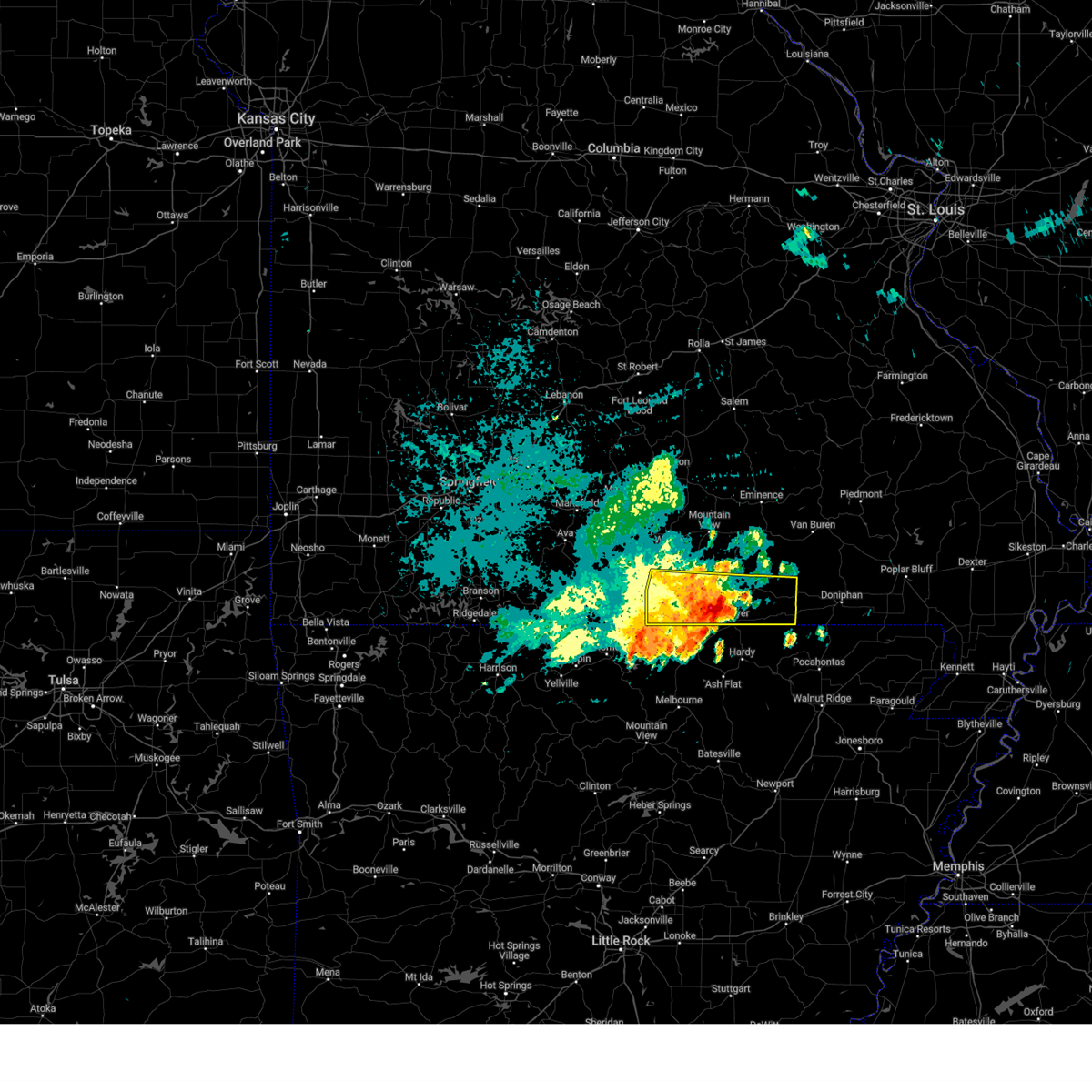 At 844 pm cdt, a severe thunderstorm was located near sturkie, or 12 miles north of salem in fulton county, moving southeast at 40 mph (radar indicated). Hazards include 60 mph wind gusts and penny size hail. expect damage to roofs, siding, and trees At 844 pm cdt, a severe thunderstorm was located near sturkie, or 12 miles north of salem in fulton county, moving southeast at 40 mph (radar indicated). Hazards include 60 mph wind gusts and penny size hail. expect damage to roofs, siding, and trees
|
| 7/29/2023 8:26 PM CDT |
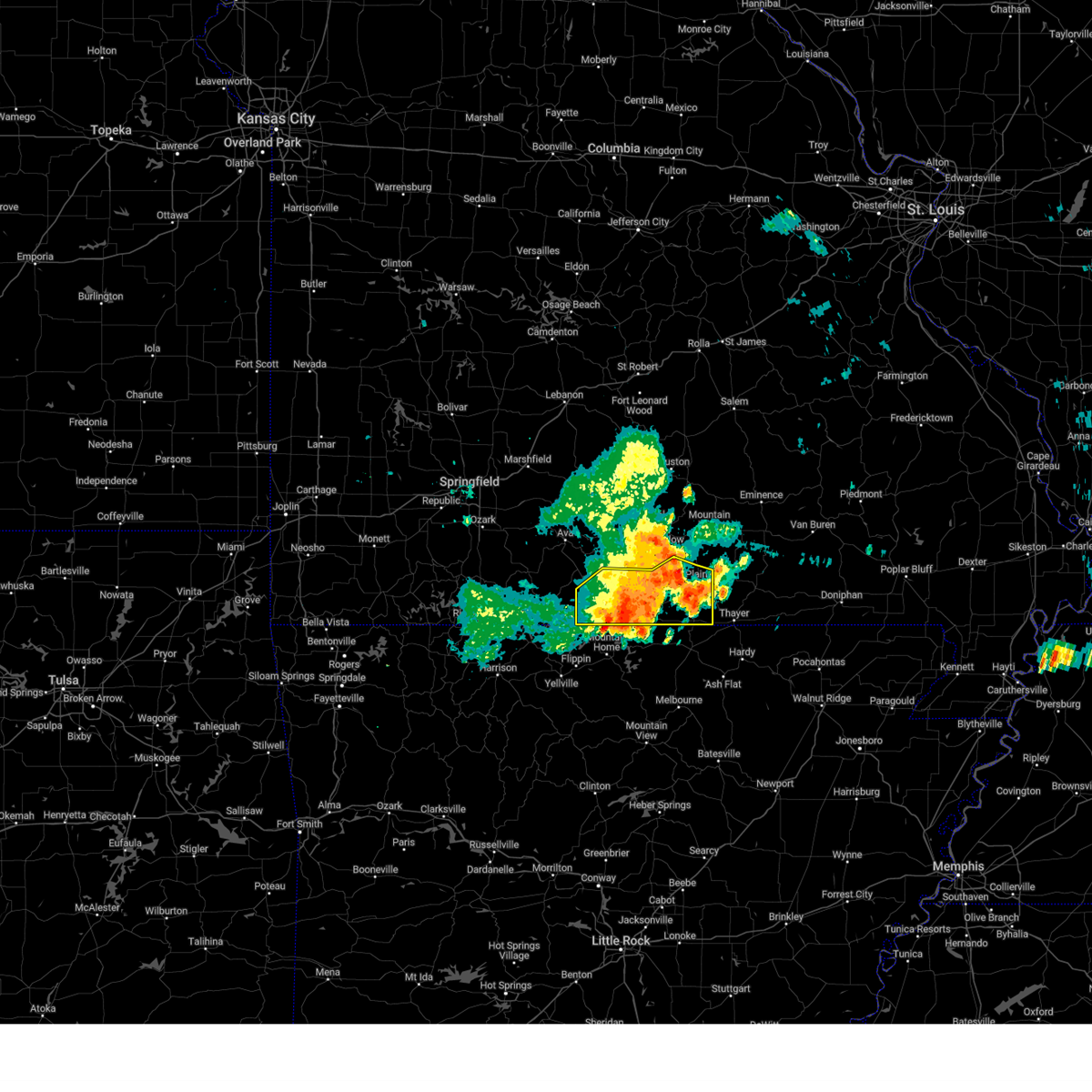 At 826 pm cdt, a severe thunderstorm was located near west plains, moving southeast at 30 mph (emergency management). Hazards include 60 mph wind gusts and nickel size hail. Expect damage to roofs, siding, and trees. locations impacted include, west plains, norfork lake, gainesville, bakersfield, south fork, brandsville, lanton, brixey, willhoit, tecumseh, pottersville, caulfield, udall, hardenville, moody, sycamore, dora, rockbridge and zanoni. hail threat, radar indicated max hail size, 0. 88 in wind threat, observed max wind gust, 60 mph. At 826 pm cdt, a severe thunderstorm was located near west plains, moving southeast at 30 mph (emergency management). Hazards include 60 mph wind gusts and nickel size hail. Expect damage to roofs, siding, and trees. locations impacted include, west plains, norfork lake, gainesville, bakersfield, south fork, brandsville, lanton, brixey, willhoit, tecumseh, pottersville, caulfield, udall, hardenville, moody, sycamore, dora, rockbridge and zanoni. hail threat, radar indicated max hail size, 0. 88 in wind threat, observed max wind gust, 60 mph.
|
| 7/29/2023 8:02 PM CDT |
 At 802 pm cdt, a severe thunderstorm was located 15 miles southwest of willow springs, moving southeast at 30 mph (radar indicated). Hazards include 60 mph wind gusts and nickel size hail. expect damage to roofs, siding, and trees At 802 pm cdt, a severe thunderstorm was located 15 miles southwest of willow springs, moving southeast at 30 mph (radar indicated). Hazards include 60 mph wind gusts and nickel size hail. expect damage to roofs, siding, and trees
|
| 7/13/2023 2:35 AM CDT |
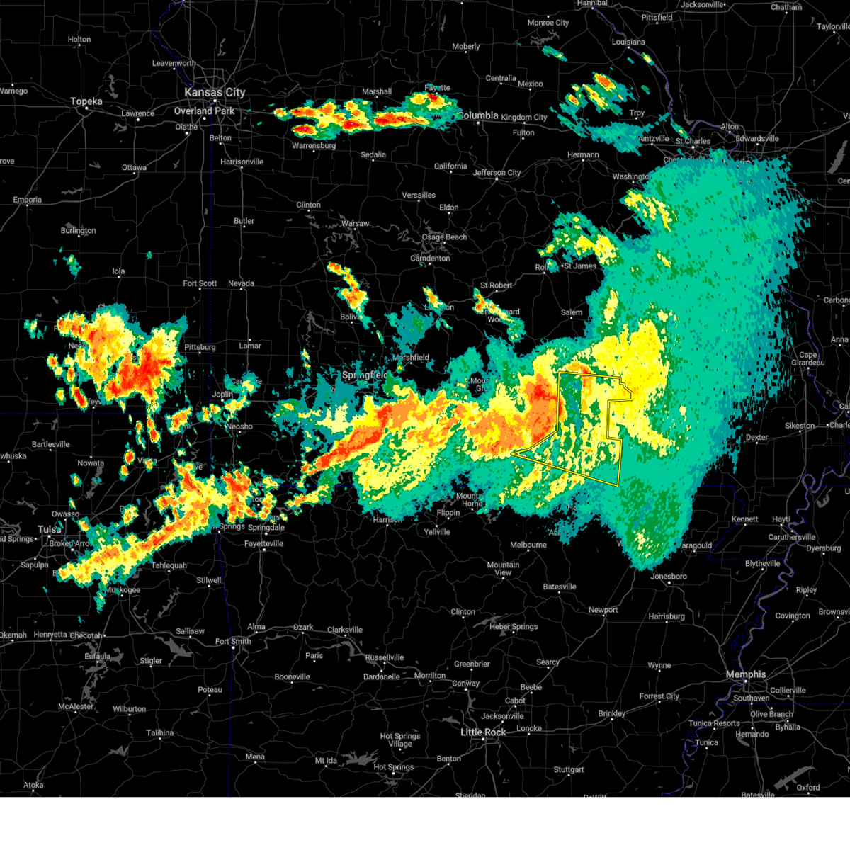 At 234 am cdt, severe thunderstorms were located along a line extending from summersville to near mountain view to 11 miles southwest of birch tree to near west plains, moving east at 50 mph (radar indicated). Hazards include 60 mph wind gusts. expect damage to roofs, siding, and trees At 234 am cdt, severe thunderstorms were located along a line extending from summersville to near mountain view to 11 miles southwest of birch tree to near west plains, moving east at 50 mph (radar indicated). Hazards include 60 mph wind gusts. expect damage to roofs, siding, and trees
|
| 7/13/2023 2:04 AM CDT |
 At 204 am cdt, severe thunderstorms were located along a line extending from 7 miles east of cabool to near willow springs to 12 miles south of mountain grove to 12 miles east of ava, moving southeast at 40 mph (radar indicated). Hazards include 60 mph wind gusts and penny size hail. expect damage to roofs, siding, and trees At 204 am cdt, severe thunderstorms were located along a line extending from 7 miles east of cabool to near willow springs to 12 miles south of mountain grove to 12 miles east of ava, moving southeast at 40 mph (radar indicated). Hazards include 60 mph wind gusts and penny size hail. expect damage to roofs, siding, and trees
|
| 7/1/2023 6:11 PM CDT |
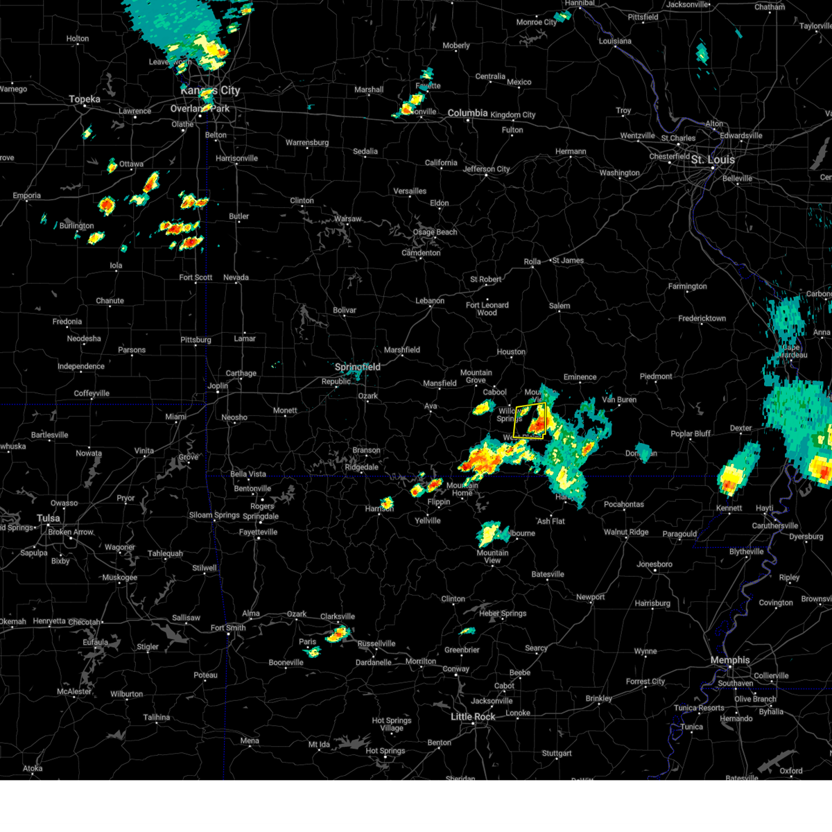 The severe thunderstorm warning for northeastern howell county will expire at 615 pm cdt, the storm which prompted the warning has weakened below severe limits, and has exited the warned area. therefore, the warning will be allowed to expire. a severe thunderstorm watch remains in effect until 900 pm cdt for south central missouri. The severe thunderstorm warning for northeastern howell county will expire at 615 pm cdt, the storm which prompted the warning has weakened below severe limits, and has exited the warned area. therefore, the warning will be allowed to expire. a severe thunderstorm watch remains in effect until 900 pm cdt for south central missouri.
|
| 7/1/2023 6:09 PM CDT |
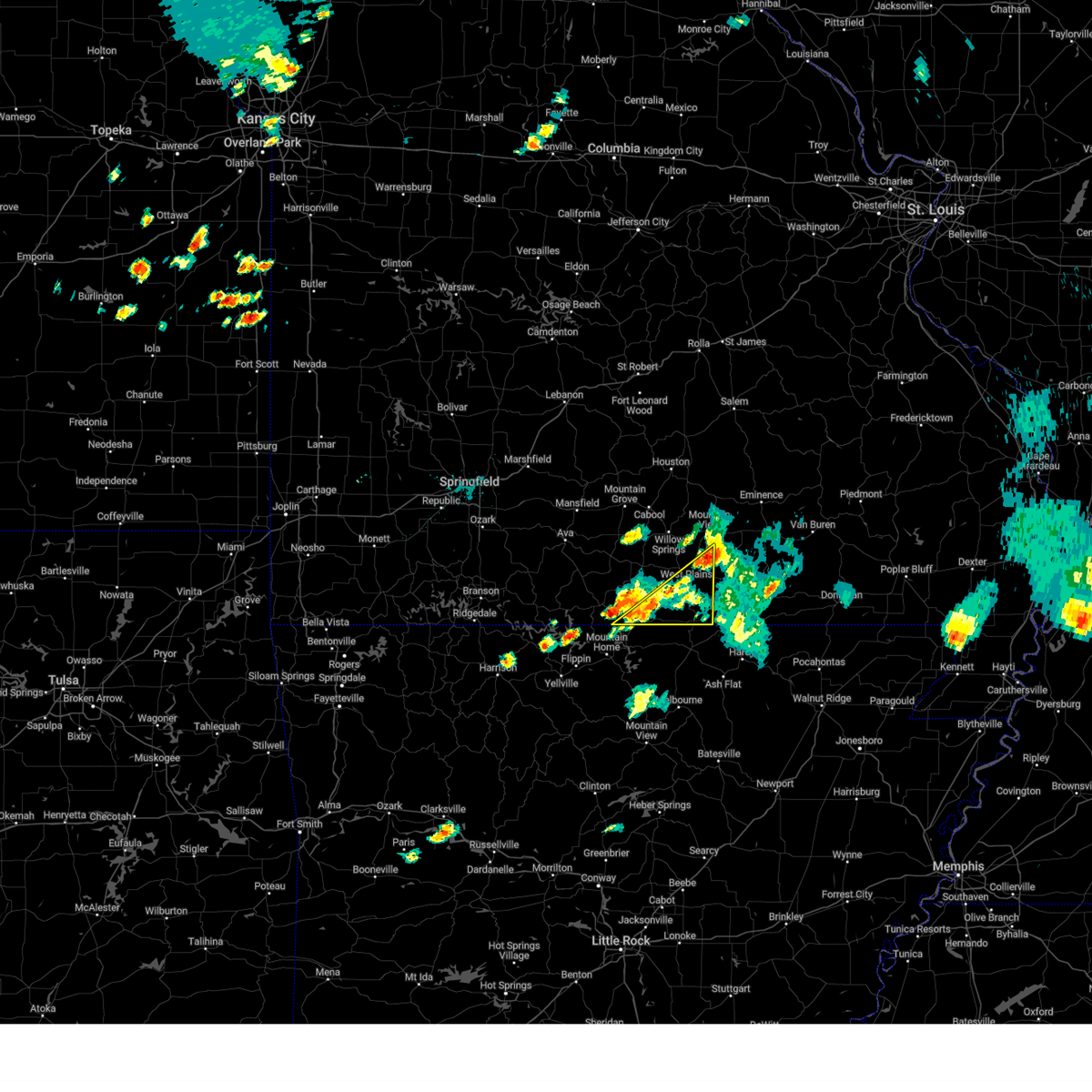 The severe thunderstorm warning for southeastern ozark and southern howell counties will expire at 615 pm cdt, the storm which prompted the warning has weakened below severe limits, and no longer poses an immediate threat to life or property. therefore, the warning will be allowed to expire. however gusty winds and heavy rain are still possible with this thunderstorm. a severe thunderstorm watch remains in effect until 900 pm cdt for south central and southwestern missouri. to report severe weather, contact your nearest law enforcement agency. they will relay your report to the national weather service springfield. remember, a severe thunderstorm warning still remains in effect for portions of south central missouri until 9 pm this evening. The severe thunderstorm warning for southeastern ozark and southern howell counties will expire at 615 pm cdt, the storm which prompted the warning has weakened below severe limits, and no longer poses an immediate threat to life or property. therefore, the warning will be allowed to expire. however gusty winds and heavy rain are still possible with this thunderstorm. a severe thunderstorm watch remains in effect until 900 pm cdt for south central and southwestern missouri. to report severe weather, contact your nearest law enforcement agency. they will relay your report to the national weather service springfield. remember, a severe thunderstorm warning still remains in effect for portions of south central missouri until 9 pm this evening.
|
| 7/1/2023 5:51 PM CDT |
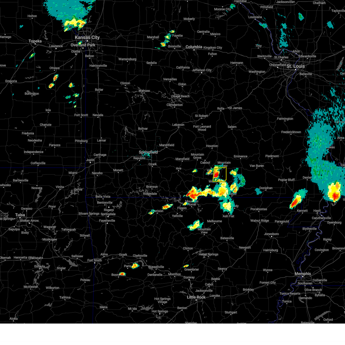 At 551 pm cdt, a severe thunderstorm was located 9 miles southeast of willow springs, moving east at 40 mph (radar indicated). Hazards include 60 mph wind gusts and quarter size hail. Hail damage to vehicles is expected. expect wind damage to roofs, siding, and trees. locations impacted include, west plains, mountain view, pomona, peace valley and white church. hail threat, radar indicated max hail size, 1. 00 in wind threat, radar indicated max wind gust, 60 mph. At 551 pm cdt, a severe thunderstorm was located 9 miles southeast of willow springs, moving east at 40 mph (radar indicated). Hazards include 60 mph wind gusts and quarter size hail. Hail damage to vehicles is expected. expect wind damage to roofs, siding, and trees. locations impacted include, west plains, mountain view, pomona, peace valley and white church. hail threat, radar indicated max hail size, 1. 00 in wind threat, radar indicated max wind gust, 60 mph.
|
| 7/1/2023 5:34 PM CDT |
 At 534 pm cdt, a severe thunderstorm was located 9 miles southwest of willow springs, moving east at 40 mph (radar indicated). Hazards include 60 mph wind gusts and quarter size hail. Hail damage to vehicles is expected. Expect wind damage to roofs, siding, and trees. At 534 pm cdt, a severe thunderstorm was located 9 miles southwest of willow springs, moving east at 40 mph (radar indicated). Hazards include 60 mph wind gusts and quarter size hail. Hail damage to vehicles is expected. Expect wind damage to roofs, siding, and trees.
|
| 7/1/2023 5:14 PM CDT |
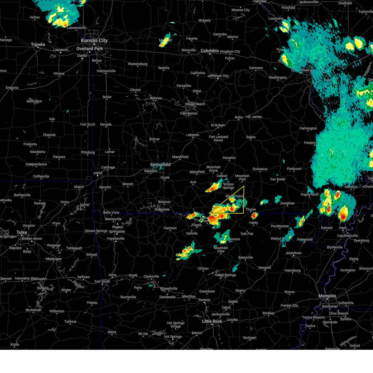 At 513 pm cdt, a severe thunderstorm was located near gamaliel landing, or 10 miles northeast of mountain home, moving northeast at 45 mph (radar indicated). Hazards include 60 mph wind gusts and quarter size hail. Hail damage to vehicles is expected. Expect wind damage to roofs, siding, and trees. At 513 pm cdt, a severe thunderstorm was located near gamaliel landing, or 10 miles northeast of mountain home, moving northeast at 45 mph (radar indicated). Hazards include 60 mph wind gusts and quarter size hail. Hail damage to vehicles is expected. Expect wind damage to roofs, siding, and trees.
|
| 7/1/2023 1:35 PM CDT | Golf Ball sized hail reported 0.9 miles NW of West Plains, MO, corrects previous hail report from west plains. house windows broken from hail. |
| 7/1/2023 1:35 PM CDT | Corrects previous tstm wnd dmg report from west plains. thunderstorm winds downed tree limbs 6 to 8 inches in diamete in howell county MO, 0.9 miles NW of West Plains, MO |
| 7/1/2023 1:33 PM CDT |
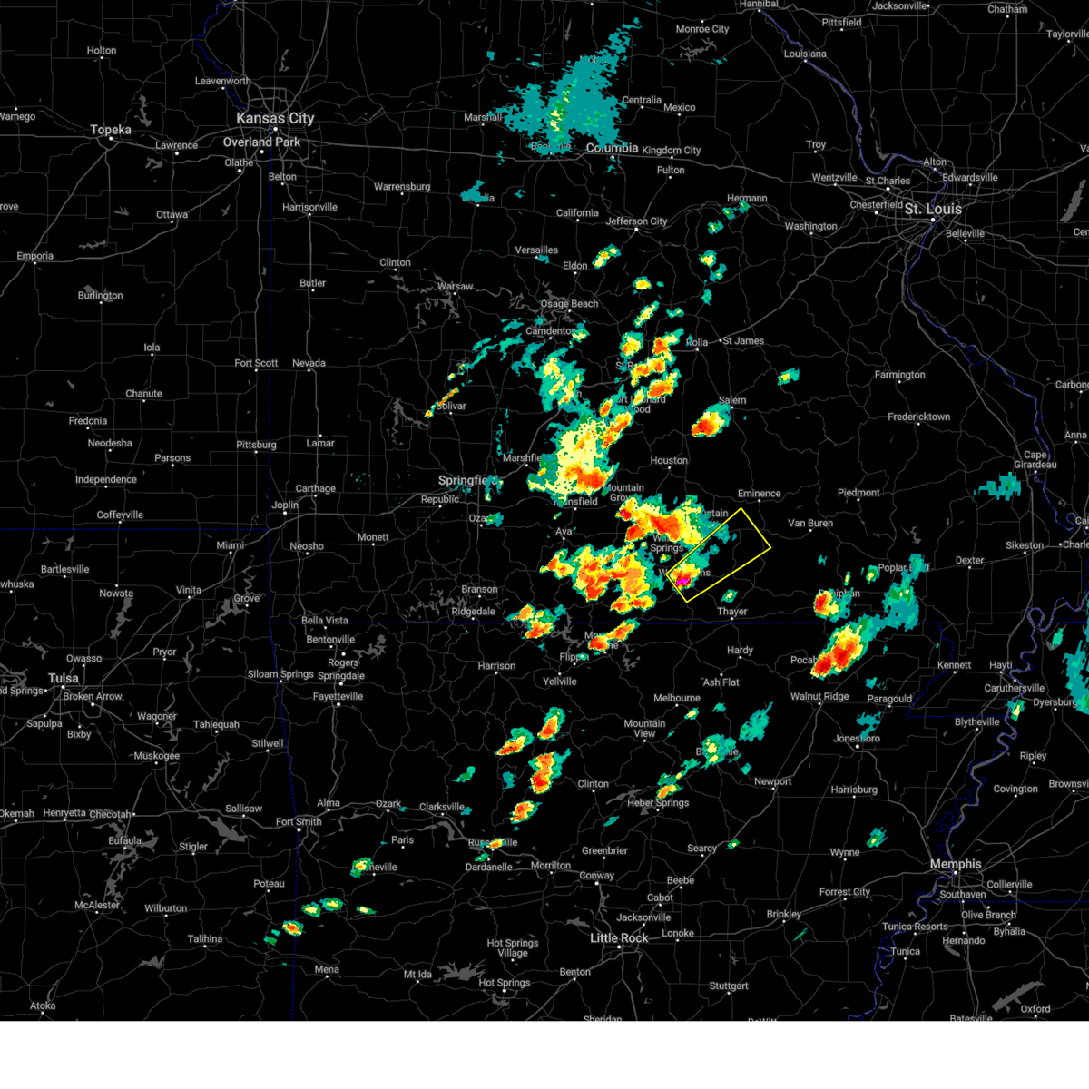 At 132 pm cdt, a severe thunderstorm was located over west plains, moving northeast at 35 mph. quarter size hail was observed with this storm in west plains (radar indicated). Hazards include 60 mph wind gusts and quarter size hail. Hail damage to vehicles is expected. Expect wind damage to roofs, siding, and trees. At 132 pm cdt, a severe thunderstorm was located over west plains, moving northeast at 35 mph. quarter size hail was observed with this storm in west plains (radar indicated). Hazards include 60 mph wind gusts and quarter size hail. Hail damage to vehicles is expected. Expect wind damage to roofs, siding, and trees.
|
| 7/1/2023 1:32 PM CDT | Quarter sized hail reported 1.4 miles NNE of West Plains, MO |
| 7/1/2023 1:32 PM CDT | Golf Ball sized hail reported 0.9 miles NW of West Plains, MO, house windows broken from hail. |
| 7/1/2023 1:32 PM CDT | Thunderstorm winds downed tree limbs 6 to 8 inches in diamete in howell county MO, 0.9 miles NW of West Plains, MO |
| 7/1/2023 1:30 PM CDT | Reports of powerlines down and tree downed causing damage to a house and barn on county rd 6540 southwest of west plain in howell county MO, 2.6 miles NE of West Plains, MO |
| 7/1/2023 1:09 PM CDT |
 At 109 pm cdt, a severe thunderstorm was located 11 miles southwest of willow springs, moving northeast at 35 mph (radar indicated). Hazards include 60 mph wind gusts and quarter size hail. Hail damage to vehicles is expected. expect wind damage to roofs, siding, and trees. locations impacted include, west plains, mountain view, willow springs, pomona, peace valley, siloam springs, white church, dora and pottersville. hail threat, radar indicated max hail size, 1. 00 in wind threat, radar indicated max wind gust, 60 mph. At 109 pm cdt, a severe thunderstorm was located 11 miles southwest of willow springs, moving northeast at 35 mph (radar indicated). Hazards include 60 mph wind gusts and quarter size hail. Hail damage to vehicles is expected. expect wind damage to roofs, siding, and trees. locations impacted include, west plains, mountain view, willow springs, pomona, peace valley, siloam springs, white church, dora and pottersville. hail threat, radar indicated max hail size, 1. 00 in wind threat, radar indicated max wind gust, 60 mph.
|
| 7/1/2023 12:53 PM CDT |
 At 1253 pm cdt, a severe thunderstorm was located 15 miles northeast of gainesville, or 18 miles west of west plains, moving northeast at 35 mph (radar indicated). Hazards include 60 mph wind gusts and half dollar size hail. Hail damage to vehicles is expected. Expect wind damage to roofs, siding, and trees. At 1253 pm cdt, a severe thunderstorm was located 15 miles northeast of gainesville, or 18 miles west of west plains, moving northeast at 35 mph (radar indicated). Hazards include 60 mph wind gusts and half dollar size hail. Hail damage to vehicles is expected. Expect wind damage to roofs, siding, and trees.
|
| 6/16/2023 3:25 PM CDT |
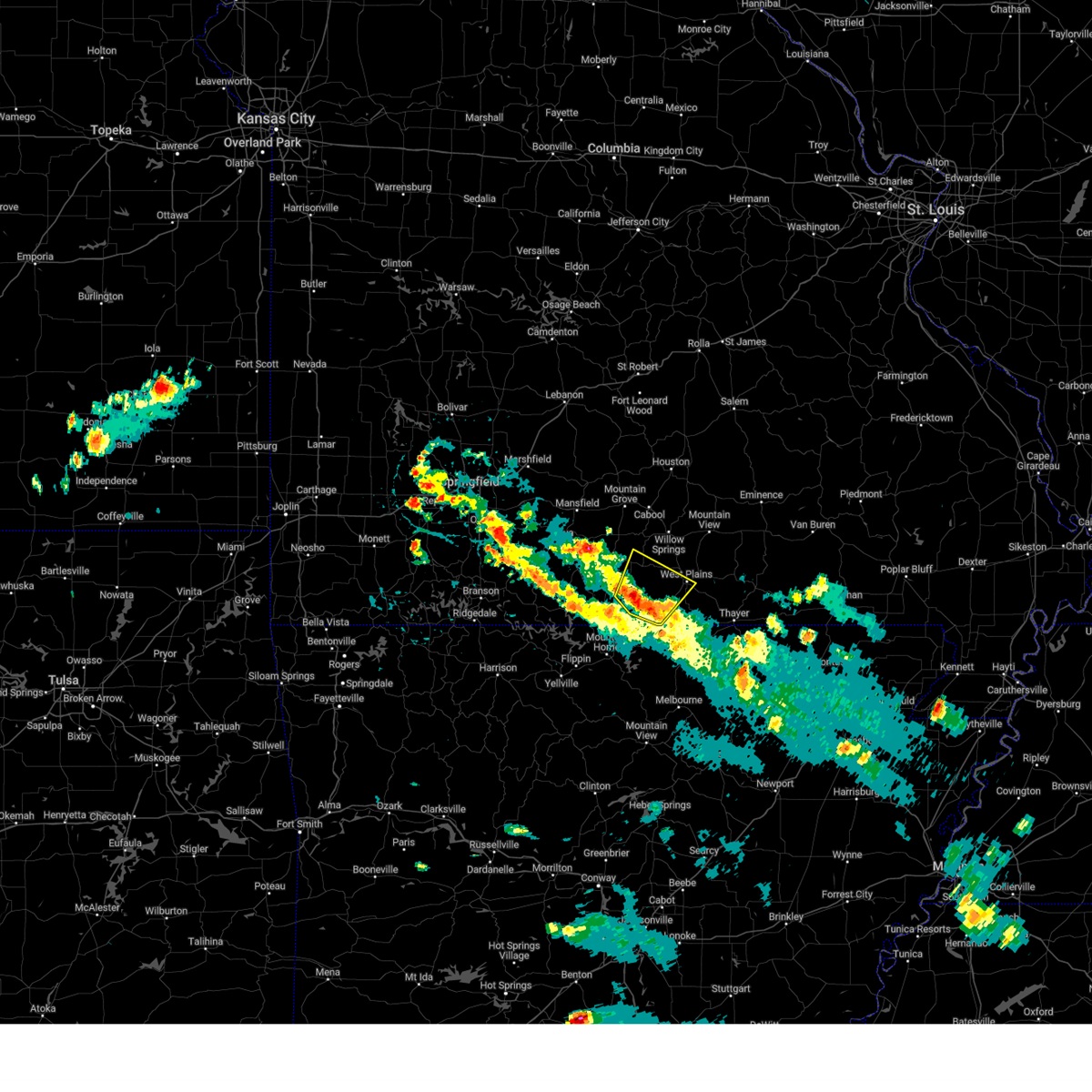 At 325 pm cdt, a severe thunderstorm was located 8 miles north of bakersfield, or 18 miles west of west plains, moving northeast at 5 mph (radar indicated). Hazards include 60 mph wind gusts and quarter size hail. Hail damage to vehicles is expected. Expect wind damage to roofs, siding, and trees. At 325 pm cdt, a severe thunderstorm was located 8 miles north of bakersfield, or 18 miles west of west plains, moving northeast at 5 mph (radar indicated). Hazards include 60 mph wind gusts and quarter size hail. Hail damage to vehicles is expected. Expect wind damage to roofs, siding, and trees.
|
| 6/16/2023 2:57 PM CDT |
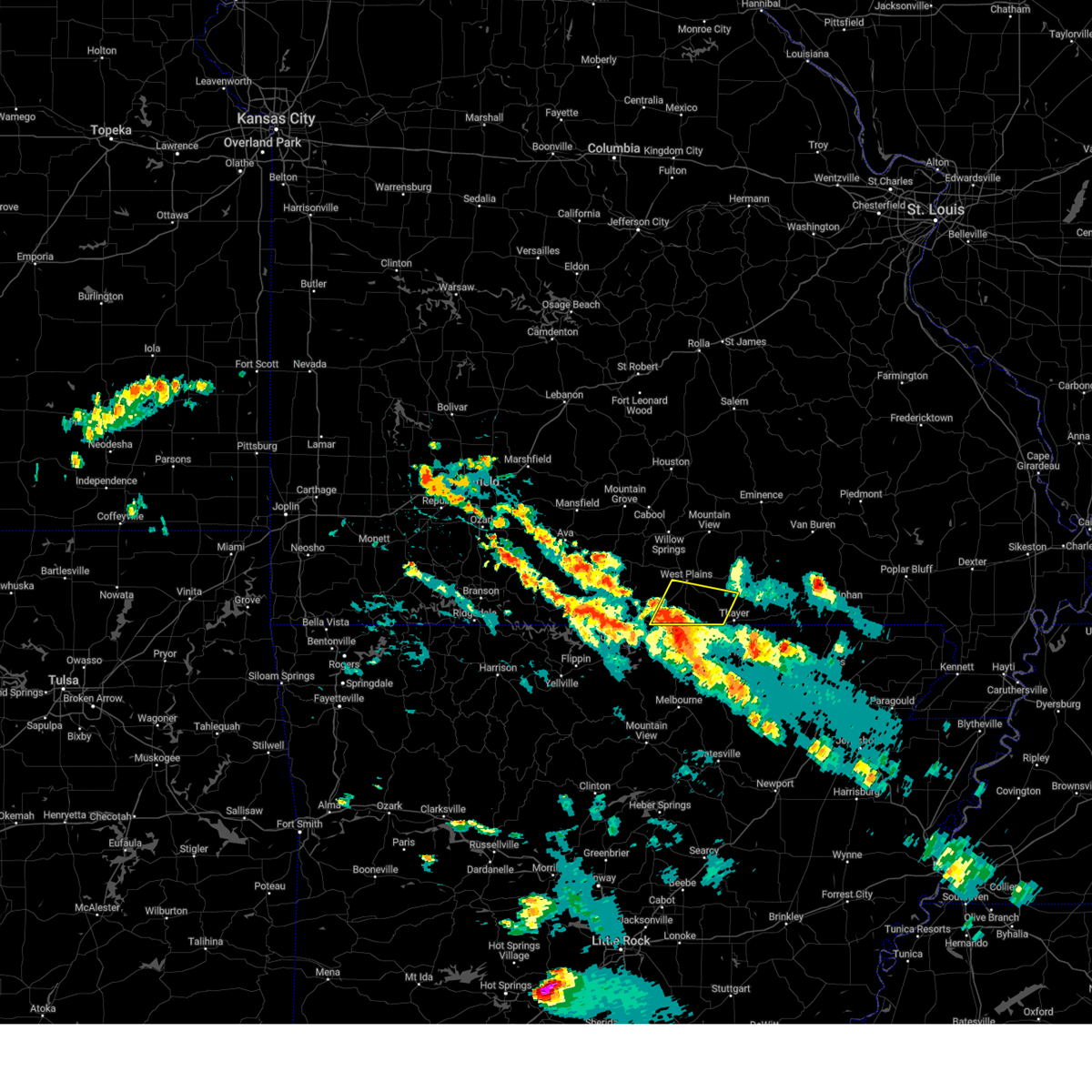 At 257 pm cdt, a severe thunderstorm was located near sturkie, or 10 miles north of salem in fulton county, moving north at 5 mph (radar indicated). Hazards include 60 mph wind gusts and quarter size hail. Hail damage to vehicles is expected. expect wind damage to roofs, siding, and trees. locations impacted include, west plains, grand gulf state park, south fork, koshkonong, brandsville, lanton and moody. hail threat, radar indicated max hail size, 1. 00 in wind threat, radar indicated max wind gust, 60 mph. At 257 pm cdt, a severe thunderstorm was located near sturkie, or 10 miles north of salem in fulton county, moving north at 5 mph (radar indicated). Hazards include 60 mph wind gusts and quarter size hail. Hail damage to vehicles is expected. expect wind damage to roofs, siding, and trees. locations impacted include, west plains, grand gulf state park, south fork, koshkonong, brandsville, lanton and moody. hail threat, radar indicated max hail size, 1. 00 in wind threat, radar indicated max wind gust, 60 mph.
|
| 6/16/2023 2:33 PM CDT |
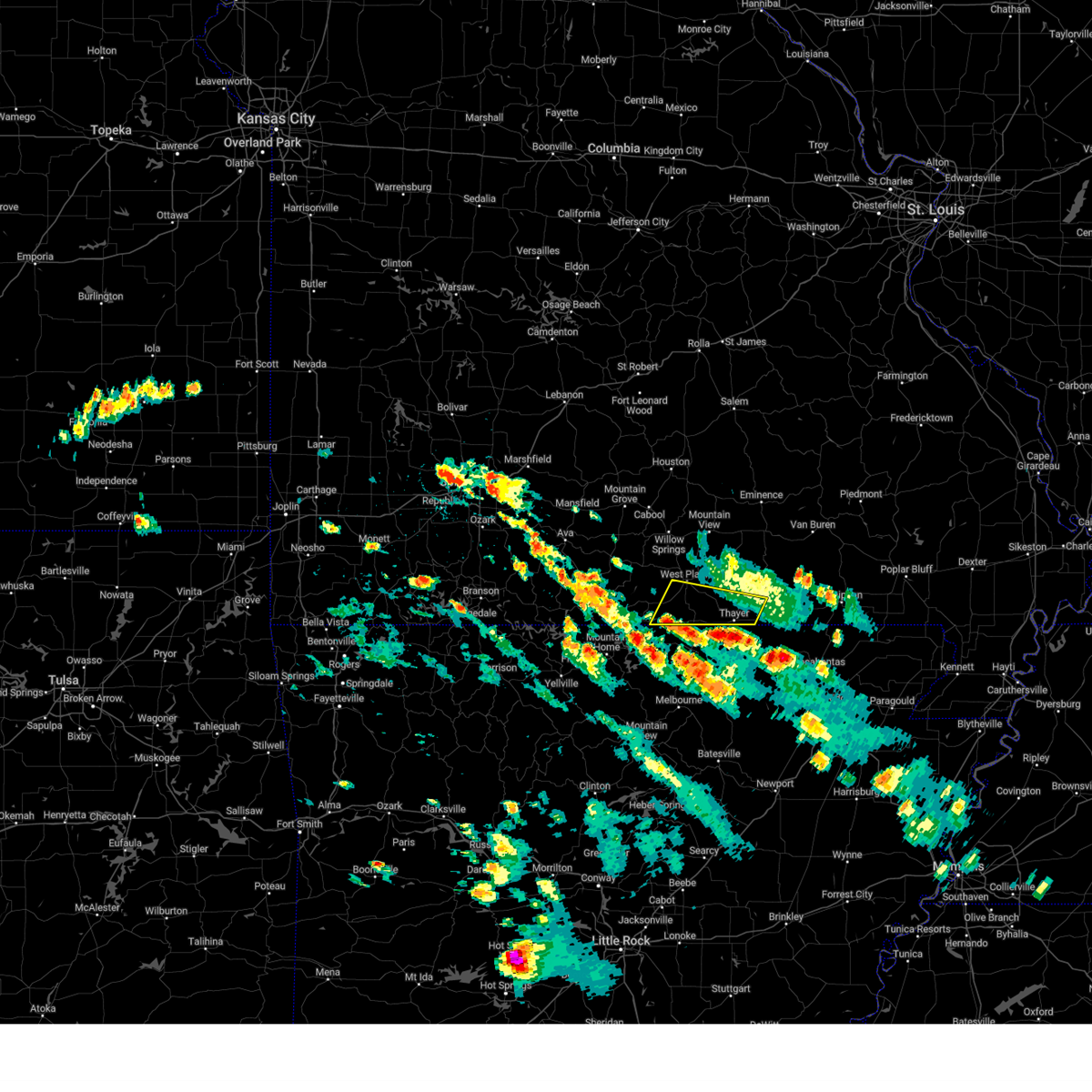 At 233 pm cdt, a severe thunderstorm was located over mammoth spring, moving north at 5 mph (radar indicated). Hazards include 60 mph wind gusts and quarter size hail. Hail damage to vehicles is expected. Expect wind damage to roofs, siding, and trees. At 233 pm cdt, a severe thunderstorm was located over mammoth spring, moving north at 5 mph (radar indicated). Hazards include 60 mph wind gusts and quarter size hail. Hail damage to vehicles is expected. Expect wind damage to roofs, siding, and trees.
|
| 5/8/2023 10:30 PM CDT | Nearly 100 power outages in the peace valley area. time estimated via rada in howell county MO, 12 miles SW of West Plains, MO |
| 5/8/2023 9:48 PM CDT |
 At 948 pm cdt, severe thunderstorms were located along a line extending from near mountain view to near willow springs, moving southeast at 25 mph (radar indicated). Hazards include 60 mph wind gusts and half dollar size hail. Hail damage to vehicles is expected. expect wind damage to roofs, siding, and trees. locations impacted include, west plains, mountain view, willow springs, birch tree, pomona, montier, peace valley, white church and teresita. hail threat, radar indicated max hail size, 1. 25 in wind threat, radar indicated max wind gust, 60 mph. At 948 pm cdt, severe thunderstorms were located along a line extending from near mountain view to near willow springs, moving southeast at 25 mph (radar indicated). Hazards include 60 mph wind gusts and half dollar size hail. Hail damage to vehicles is expected. expect wind damage to roofs, siding, and trees. locations impacted include, west plains, mountain view, willow springs, birch tree, pomona, montier, peace valley, white church and teresita. hail threat, radar indicated max hail size, 1. 25 in wind threat, radar indicated max wind gust, 60 mph.
|
| 5/8/2023 9:20 PM CDT |
 At 919 pm cdt, severe thunderstorms were located along a line extending from near summersville to 10 miles northwest of mountain view to near willow springs, moving southeast at 20 mph (radar indicated). Hazards include 60 mph wind gusts and half dollar size hail. Hail damage to vehicles is expected. Expect wind damage to roofs, siding, and trees. At 919 pm cdt, severe thunderstorms were located along a line extending from near summersville to 10 miles northwest of mountain view to near willow springs, moving southeast at 20 mph (radar indicated). Hazards include 60 mph wind gusts and half dollar size hail. Hail damage to vehicles is expected. Expect wind damage to roofs, siding, and trees.
|
| 4/20/2023 6:10 PM CDT |
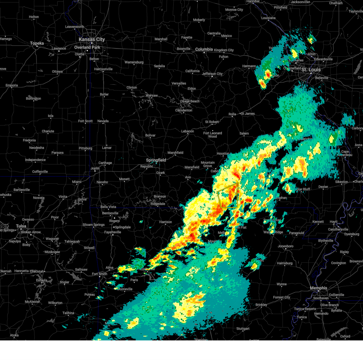 The severe thunderstorm warning for southern howell county will expire at 615 pm cdt, the storm which prompted the warning has weakened below severe limits, and no longer poses an immediate threat to life or property. therefore, the warning will be allowed to expire. however heavy rain is still possible with this thunderstorm. a severe thunderstorm watch remains in effect until 800 pm cdt for south central missouri. to report severe weather, contact your nearest law enforcement agency. they will relay your report to the national weather service springfield. The severe thunderstorm warning for southern howell county will expire at 615 pm cdt, the storm which prompted the warning has weakened below severe limits, and no longer poses an immediate threat to life or property. therefore, the warning will be allowed to expire. however heavy rain is still possible with this thunderstorm. a severe thunderstorm watch remains in effect until 800 pm cdt for south central missouri. to report severe weather, contact your nearest law enforcement agency. they will relay your report to the national weather service springfield.
|
| 4/20/2023 5:55 PM CDT |
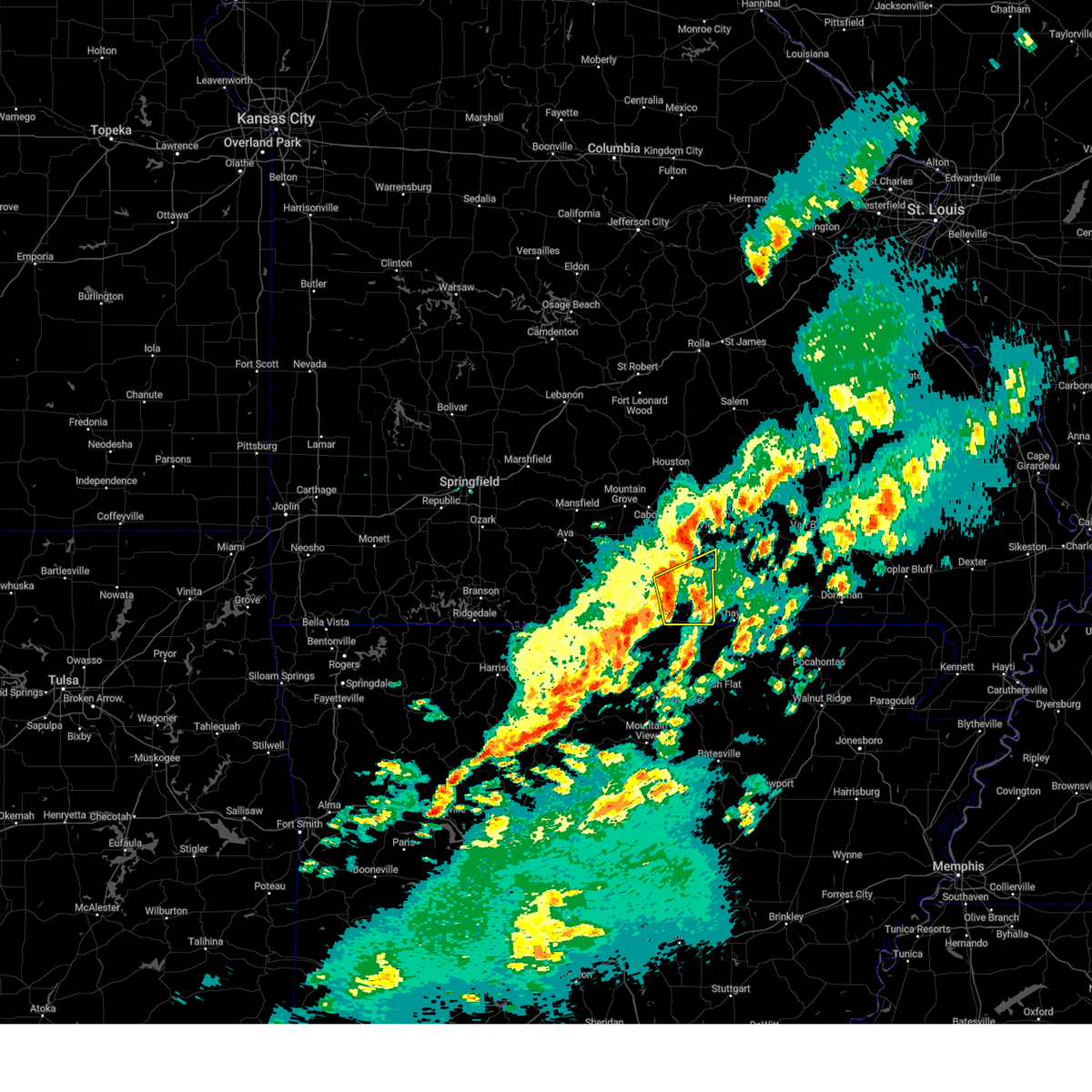 At 554 pm cdt, a severe thunderstorm was located near west plains, moving east at 40 mph (radar indicated). Hazards include 60 mph wind gusts and quarter size hail. Hail damage to vehicles is expected. expect wind damage to roofs, siding, and trees. this severe storm will be near, west plains around 600 pm cdt. other locations impacted by this severe thunderstorm include south fork, brandsville, lanton, white church, moody, pottersville and peace valley. hail threat, radar indicated max hail size, 1. 00 in wind threat, radar indicated max wind gust, 60 mph. At 554 pm cdt, a severe thunderstorm was located near west plains, moving east at 40 mph (radar indicated). Hazards include 60 mph wind gusts and quarter size hail. Hail damage to vehicles is expected. expect wind damage to roofs, siding, and trees. this severe storm will be near, west plains around 600 pm cdt. other locations impacted by this severe thunderstorm include south fork, brandsville, lanton, white church, moody, pottersville and peace valley. hail threat, radar indicated max hail size, 1. 00 in wind threat, radar indicated max wind gust, 60 mph.
|
| 4/20/2023 5:35 PM CDT |
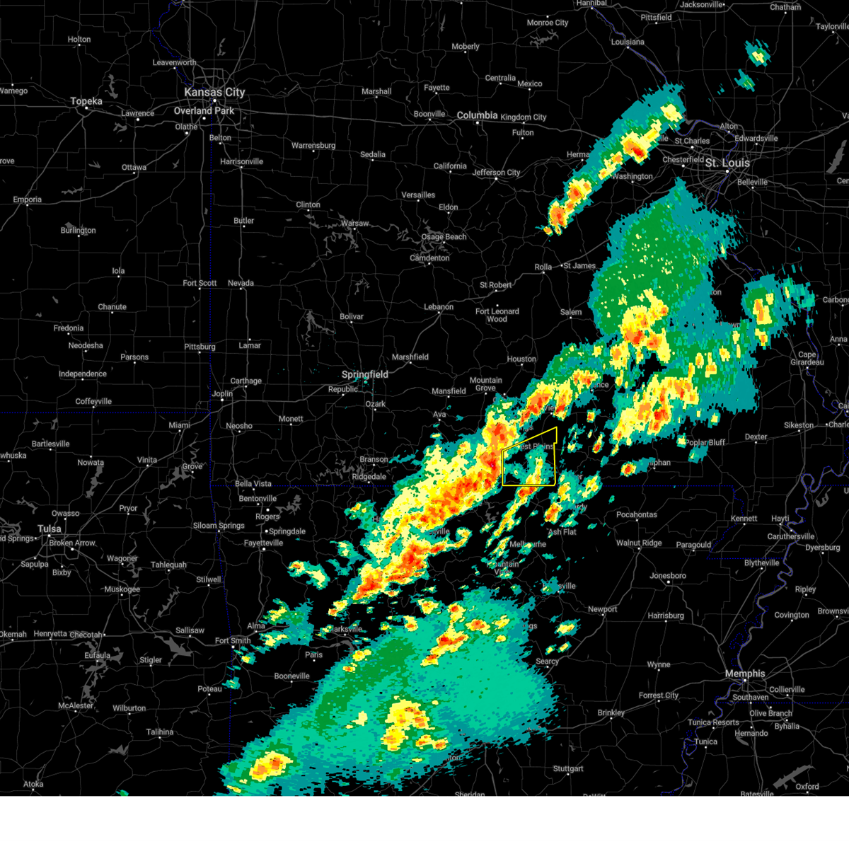 At 535 pm cdt, a severe thunderstorm was located 7 miles north of bakersfield, or 16 miles southwest of west plains, moving east at 55 mph (radar indicated). Hazards include 60 mph wind gusts and half dollar size hail. Hail damage to vehicles is expected. expect wind damage to roofs, siding, and trees. this severe thunderstorm will remain over mainly rural areas of southern howell county, including the following locations, south fork, brandsville, peace valley, lanton, white church, moody, pottersville and caulfield. hail threat, radar indicated max hail size, 1. 25 in wind threat, radar indicated max wind gust, 60 mph. At 535 pm cdt, a severe thunderstorm was located 7 miles north of bakersfield, or 16 miles southwest of west plains, moving east at 55 mph (radar indicated). Hazards include 60 mph wind gusts and half dollar size hail. Hail damage to vehicles is expected. expect wind damage to roofs, siding, and trees. this severe thunderstorm will remain over mainly rural areas of southern howell county, including the following locations, south fork, brandsville, peace valley, lanton, white church, moody, pottersville and caulfield. hail threat, radar indicated max hail size, 1. 25 in wind threat, radar indicated max wind gust, 60 mph.
|
| 4/15/2023 5:30 PM CDT |
 At 530 pm cdt, severe thunderstorms were located along a line extending from 6 miles south of houston to 7 miles south of willow springs to 10 miles west of west plains, moving east at 65 mph (radar indicated). Hazards include 70 mph wind gusts and ping pong ball size hail. People and animals outdoors will be injured. expect hail damage to roofs, siding, windows, and vehicles. expect considerable tree damage. Wind damage is also likely to mobile homes, roofs, and outbuildings. At 530 pm cdt, severe thunderstorms were located along a line extending from 6 miles south of houston to 7 miles south of willow springs to 10 miles west of west plains, moving east at 65 mph (radar indicated). Hazards include 70 mph wind gusts and ping pong ball size hail. People and animals outdoors will be injured. expect hail damage to roofs, siding, windows, and vehicles. expect considerable tree damage. Wind damage is also likely to mobile homes, roofs, and outbuildings.
|
| 3/31/2023 12:47 PM CDT | Quarter sized hail reported 3 miles SSE of West Plains, MO, report from mping: quarter (1.00 in.). |
| 11/4/2022 10:41 PM CDT |
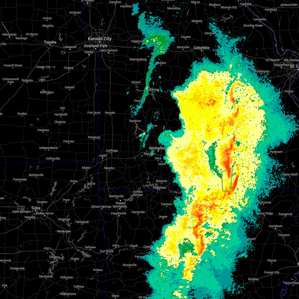 The severe thunderstorm warning for southeastern howell county will expire at 1045 pm cdt, the storms which prompted the warning have moved out of the area. therefore, the warning will be allowed to expire. a severe thunderstorm watch remains in effect until 100 am cdt for south central missouri. The severe thunderstorm warning for southeastern howell county will expire at 1045 pm cdt, the storms which prompted the warning have moved out of the area. therefore, the warning will be allowed to expire. a severe thunderstorm watch remains in effect until 100 am cdt for south central missouri.
|
| 11/4/2022 10:33 PM CDT |
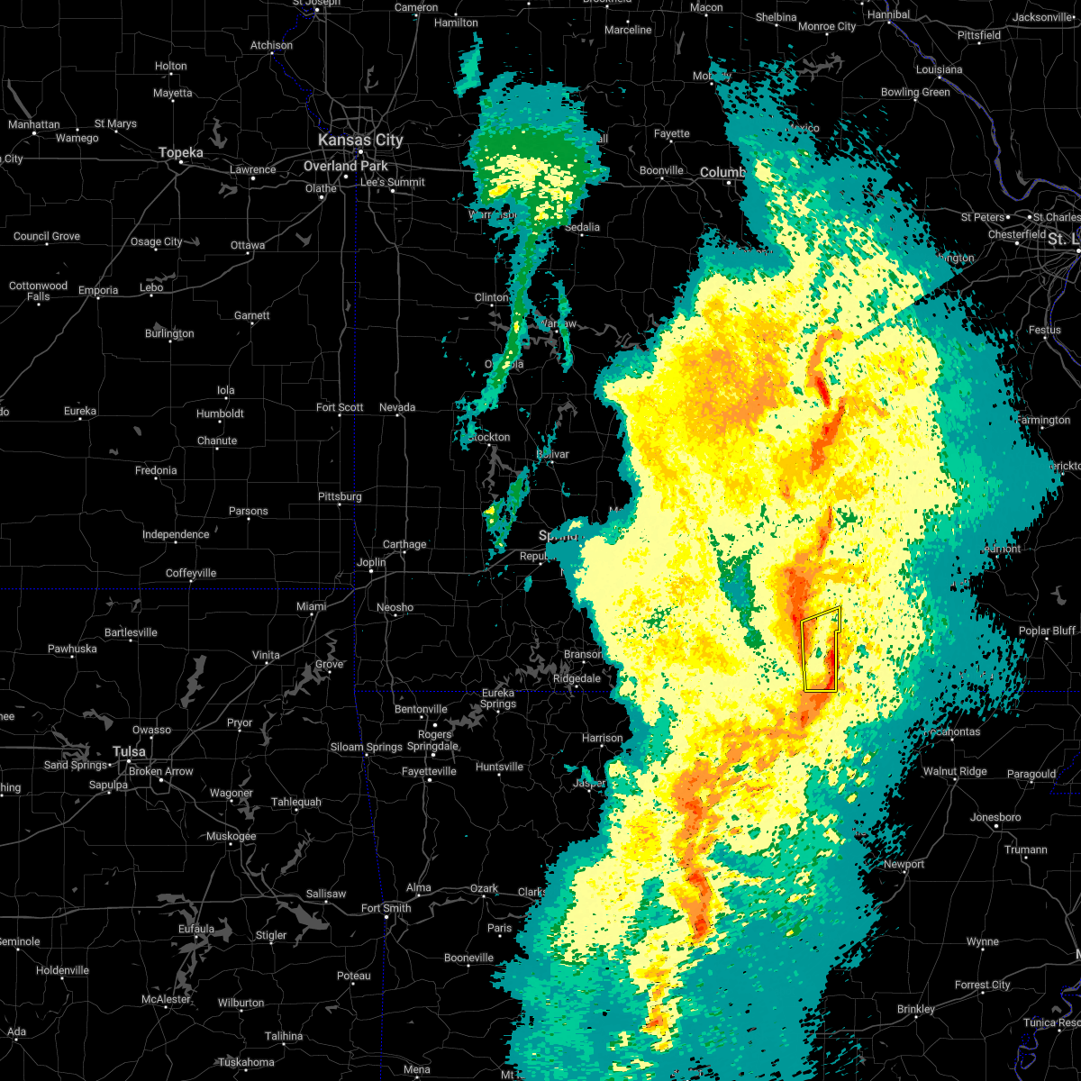 At 1032 pm cdt, severe thunderstorms were located along a line extending from 6 miles southwest of mountain view to 7 miles southeast of west plains to near sturkie, moving northeast at 50 mph (radar indicated). Hazards include 60 mph wind gusts. Expect damage to roofs, siding, and trees. locations impacted include, west plains, brandsville, peace valley, lanton and white church. hail threat, radar indicated max hail size, <. 75 in wind threat, radar indicated max wind gust, 60 mph. At 1032 pm cdt, severe thunderstorms were located along a line extending from 6 miles southwest of mountain view to 7 miles southeast of west plains to near sturkie, moving northeast at 50 mph (radar indicated). Hazards include 60 mph wind gusts. Expect damage to roofs, siding, and trees. locations impacted include, west plains, brandsville, peace valley, lanton and white church. hail threat, radar indicated max hail size, <. 75 in wind threat, radar indicated max wind gust, 60 mph.
|
| 11/4/2022 10:01 PM CDT |
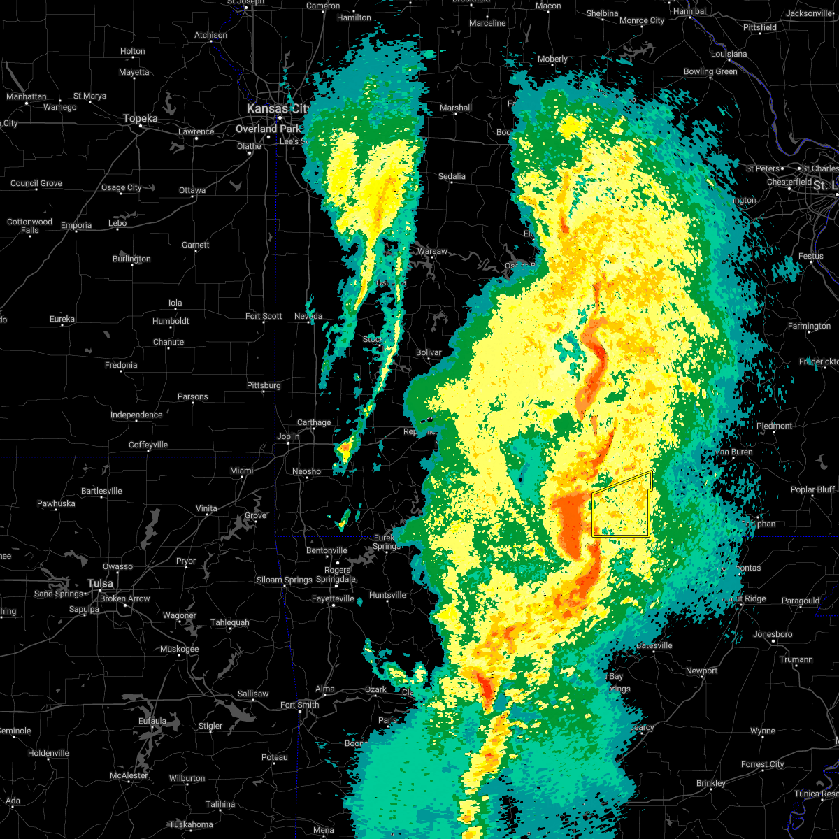 At 1000 pm cdt, severe thunderstorms were located along a line extending from 7 miles northeast of bakersfield to viola to near pineville, moving east at 45 mph (radar indicated). Hazards include 60 mph wind gusts. Expect damage to roofs, siding, and trees. Locations impacted include, west plains, south fork, brandsville, peace valley, lanton, white church, moody, pottersville and caulfield. At 1000 pm cdt, severe thunderstorms were located along a line extending from 7 miles northeast of bakersfield to viola to near pineville, moving east at 45 mph (radar indicated). Hazards include 60 mph wind gusts. Expect damage to roofs, siding, and trees. Locations impacted include, west plains, south fork, brandsville, peace valley, lanton, white church, moody, pottersville and caulfield.
|
| 11/4/2022 9:49 PM CDT |
 At 948 pm cdt, severe thunderstorms were located along a line extending from near gamaliel landing to rodney to near culp, moving northeast at 60 mph (radar indicated). Hazards include 60 mph wind gusts. expect damage to roofs, siding, and trees At 948 pm cdt, severe thunderstorms were located along a line extending from near gamaliel landing to rodney to near culp, moving northeast at 60 mph (radar indicated). Hazards include 60 mph wind gusts. expect damage to roofs, siding, and trees
|
| 8/20/2022 9:59 PM CDT |
 At 959 pm cdt, a severe thunderstorm was located 8 miles south of willow springs, moving southeast at 30 mph (radar indicated). Hazards include 60 mph wind gusts and penny size hail. Expect damage to roofs, siding, and trees. this severe thunderstorm will be near, west plains around 1020 pm cdt. other locations impacted by this severe thunderstorm include pomona and white church. hail threat, radar indicated max hail size, 0. 75 in wind threat, radar indicated max wind gust, 60 mph. At 959 pm cdt, a severe thunderstorm was located 8 miles south of willow springs, moving southeast at 30 mph (radar indicated). Hazards include 60 mph wind gusts and penny size hail. Expect damage to roofs, siding, and trees. this severe thunderstorm will be near, west plains around 1020 pm cdt. other locations impacted by this severe thunderstorm include pomona and white church. hail threat, radar indicated max hail size, 0. 75 in wind threat, radar indicated max wind gust, 60 mph.
|
| 7/27/2022 7:54 PM CDT |
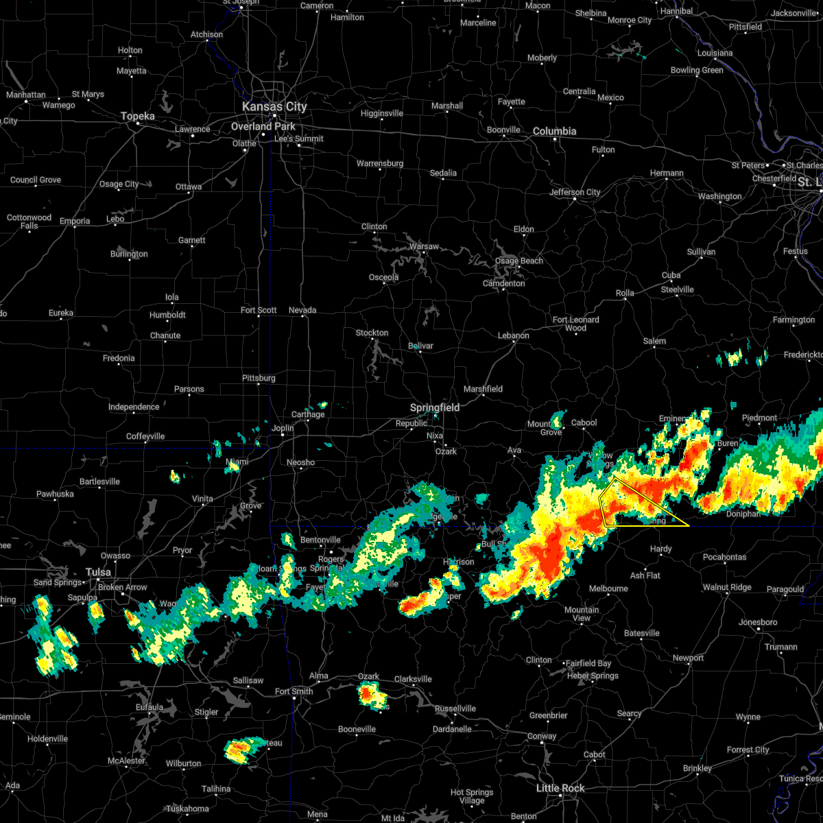 The severe thunderstorm warning for southeastern howell and southwestern oregon counties will expire at 800 pm cdt, the storm which prompted the warning has weakened below severe limits, and no longer poses an immediate threat to life or property. therefore, the warning will be allowed to expire. however heavy rain is still possible with this thunderstorm. The severe thunderstorm warning for southeastern howell and southwestern oregon counties will expire at 800 pm cdt, the storm which prompted the warning has weakened below severe limits, and no longer poses an immediate threat to life or property. therefore, the warning will be allowed to expire. however heavy rain is still possible with this thunderstorm.
|
| 7/27/2022 7:35 PM CDT | Severe thunderstorm wind gusts downed a tree across county road 9370 near its intersection with highway 6 in howell county MO, 8.3 miles NW of West Plains, MO |
| 7/27/2022 7:10 PM CDT |
 At 710 pm cdt, a severe thunderstorm was located over west plains, moving southeast at 30 mph (radar indicated). Hazards include 60 mph wind gusts. expect damage to roofs, siding, and trees At 710 pm cdt, a severe thunderstorm was located over west plains, moving southeast at 30 mph (radar indicated). Hazards include 60 mph wind gusts. expect damage to roofs, siding, and trees
|
| 7/17/2022 7:16 PM CDT |
 At 715 pm cdt, severe thunderstorms were located along a line extending from 6 miles south of handy to 6 miles northwest of sturkie, moving southeast at 35 mph (public. power line was reported down in west plains). Hazards include 60 mph wind gusts and penny size hail. Expect damage to roofs, siding, and trees. locations impacted include, grand gulf state park, thayer, mammoth spring, alton, south fork, koshkonong, brandsville, thomasville, mammoth spring state park, lanton, myrtle, wilderness, couch, rover, greer, hail threat, radar indicated max hail size, 0. 75 in wind threat, observed max wind gust, 60 mph. At 715 pm cdt, severe thunderstorms were located along a line extending from 6 miles south of handy to 6 miles northwest of sturkie, moving southeast at 35 mph (public. power line was reported down in west plains). Hazards include 60 mph wind gusts and penny size hail. Expect damage to roofs, siding, and trees. locations impacted include, grand gulf state park, thayer, mammoth spring, alton, south fork, koshkonong, brandsville, thomasville, mammoth spring state park, lanton, myrtle, wilderness, couch, rover, greer, hail threat, radar indicated max hail size, 0. 75 in wind threat, observed max wind gust, 60 mph.
|
| 7/17/2022 6:46 PM CDT | Power line dow in howell county MO, 0.1 miles WSW of West Plains, MO |
| 7/17/2022 6:44 PM CDT |
 At 644 pm cdt, severe thunderstorms were located along a line extending from near fremont to near west plains, moving southeast at 30 mph (radar indicated). Hazards include 60 mph wind gusts and penny size hail. expect damage to roofs, siding, and trees At 644 pm cdt, severe thunderstorms were located along a line extending from near fremont to near west plains, moving southeast at 30 mph (radar indicated). Hazards include 60 mph wind gusts and penny size hail. expect damage to roofs, siding, and trees
|
| 5/13/2022 7:51 PM CDT | Quarter sized hail reported 6.3 miles N of West Plains, MO, report from mping: quarter (1.00 in.). |
| 5/13/2022 7:46 PM CDT |
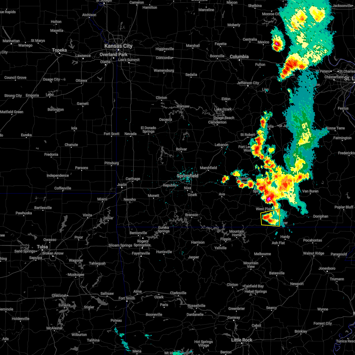 At 745 pm cdt, a severe thunderstorm was located 7 miles south of west plains, moving east at 5 mph (radar indicated). Hazards include 60 mph wind gusts and quarter size hail. Hail damage to vehicles is expected. Expect wind damage to roofs, siding, and trees. At 745 pm cdt, a severe thunderstorm was located 7 miles south of west plains, moving east at 5 mph (radar indicated). Hazards include 60 mph wind gusts and quarter size hail. Hail damage to vehicles is expected. Expect wind damage to roofs, siding, and trees.
|
| 4/15/2022 7:31 PM CDT | Baseball sized hail reported 11.3 miles NNE of West Plains, MO, report from mping: baseball (2.75 in.). |
| 4/15/2022 6:55 PM CDT | Baseball sized hail reported 11.3 miles NNE of West Plains, MO, corrects previous hail report from 4 se south fork. report from mping: baseball (2.75 in.). |
| 4/13/2022 11:28 AM CDT |
 At 1128 am cdt, severe thunderstorms were located along a line extending from near mountain view to near ott, moving northeast at 60 mph (radar indicated). Hazards include 60 mph wind gusts. expect damage to roofs, siding, and trees At 1128 am cdt, severe thunderstorms were located along a line extending from near mountain view to near ott, moving northeast at 60 mph (radar indicated). Hazards include 60 mph wind gusts. expect damage to roofs, siding, and trees
|
| 4/13/2022 11:21 AM CDT |
 At 1121 am cdt, severe thunderstorms were located along a line extending from near willow springs to bakersfield, moving northeast at 50 mph (radar indicated). Hazards include 60 mph wind gusts. Expect damage to roofs, siding, and trees. locations impacted include, west plains, mountain view, willow springs, pomona, summersville, south fork, peace valley, arroll, pottersville, caulfield, udall, siloam springs, white church, hartshorn, clear springs, hail threat, radar indicated max hail size, <. 75 in wind threat, radar indicated max wind gust, 60 mph. At 1121 am cdt, severe thunderstorms were located along a line extending from near willow springs to bakersfield, moving northeast at 50 mph (radar indicated). Hazards include 60 mph wind gusts. Expect damage to roofs, siding, and trees. locations impacted include, west plains, mountain view, willow springs, pomona, summersville, south fork, peace valley, arroll, pottersville, caulfield, udall, siloam springs, white church, hartshorn, clear springs, hail threat, radar indicated max hail size, <. 75 in wind threat, radar indicated max wind gust, 60 mph.
|
| 4/13/2022 10:52 AM CDT |
 At 1051 am cdt, severe thunderstorms were located along a line extending from 7 miles southwest of houston to price place, moving northeast at 90 mph (radar indicated). Hazards include 60 mph wind gusts and penny size hail. Expect damage to roofs, siding, and trees. Locations impacted include, west plains, bull shoals lake, mountain view, willow springs, cabool, houston, gainesville, pomona, summersville, raymondville, theodosia, south fork, pontiac, sundown, price place, brixey, willhoit, tecumseh, pottersville, caulfield,. At 1051 am cdt, severe thunderstorms were located along a line extending from 7 miles southwest of houston to price place, moving northeast at 90 mph (radar indicated). Hazards include 60 mph wind gusts and penny size hail. Expect damage to roofs, siding, and trees. Locations impacted include, west plains, bull shoals lake, mountain view, willow springs, cabool, houston, gainesville, pomona, summersville, raymondville, theodosia, south fork, pontiac, sundown, price place, brixey, willhoit, tecumseh, pottersville, caulfield,.
|
| 4/13/2022 10:30 AM CDT |
 At 1029 am cdt, severe thunderstorms were located along a line extending from 8 miles east of ava to 6 miles north of lakeway, moving northeast at 90 mph (radar indicated). Hazards include 60 mph wind gusts and penny size hail. expect damage to roofs, siding, and trees At 1029 am cdt, severe thunderstorms were located along a line extending from 8 miles east of ava to 6 miles north of lakeway, moving northeast at 90 mph (radar indicated). Hazards include 60 mph wind gusts and penny size hail. expect damage to roofs, siding, and trees
|
| 3/6/2022 10:36 PM CST |
 At 1035 pm cst, severe thunderstorms were located along a line extending from 7 miles east of summersville to 8 miles west of eminence to birch tree to 6 miles south of west plains, moving northeast at 45 mph (radar indicated). Hazards include 60 mph wind gusts and penny size hail. Expect damage to roofs, siding, and trees. Locations impacted include, west plains, ozark national scenic riverways, echo bluff state park, mountain view, winona, alton, birch tree, eminence, south fork, koshkonong, brandsville, montier, thomasville, teresita, midridge, pottersville, rover, round spring, peace valley, alley spring,. At 1035 pm cst, severe thunderstorms were located along a line extending from 7 miles east of summersville to 8 miles west of eminence to birch tree to 6 miles south of west plains, moving northeast at 45 mph (radar indicated). Hazards include 60 mph wind gusts and penny size hail. Expect damage to roofs, siding, and trees. Locations impacted include, west plains, ozark national scenic riverways, echo bluff state park, mountain view, winona, alton, birch tree, eminence, south fork, koshkonong, brandsville, montier, thomasville, teresita, midridge, pottersville, rover, round spring, peace valley, alley spring,.
|
| 3/6/2022 10:11 PM CST |
 At 1010 pm cst, severe thunderstorms were located along a line extending from 9 miles northwest of mountain view to 6 miles east of willow springs to 7 miles north of west plains to near bakersfield, moving northeast at 55 mph (radar indicated). Hazards include 60 mph wind gusts. expect damage to roofs, siding, and trees At 1010 pm cst, severe thunderstorms were located along a line extending from 9 miles northwest of mountain view to 6 miles east of willow springs to 7 miles north of west plains to near bakersfield, moving northeast at 55 mph (radar indicated). Hazards include 60 mph wind gusts. expect damage to roofs, siding, and trees
|
| 3/6/2022 10:05 PM CST |
 At 1005 pm cst, severe thunderstorms were located along a line extending from 9 miles northeast of willow springs to 6 miles west of mountain view to 9 miles north of west plains to near bakersfield, moving northeast at 140 mph (radar indicated). Hazards include 60 mph wind gusts. expect damage to roofs, siding, and trees At 1005 pm cst, severe thunderstorms were located along a line extending from 9 miles northeast of willow springs to 6 miles west of mountain view to 9 miles north of west plains to near bakersfield, moving northeast at 140 mph (radar indicated). Hazards include 60 mph wind gusts. expect damage to roofs, siding, and trees
|
| 3/6/2022 9:33 PM CST |
 At 933 pm cst, severe thunderstorms were located along a line extending from 11 miles west of willow springs to 17 miles northeast of gainesville to near price place, moving east at 60 mph (radar indicated). Hazards include 60 mph wind gusts and penny size hail. expect damage to roofs, siding, and trees At 933 pm cst, severe thunderstorms were located along a line extending from 11 miles west of willow springs to 17 miles northeast of gainesville to near price place, moving east at 60 mph (radar indicated). Hazards include 60 mph wind gusts and penny size hail. expect damage to roofs, siding, and trees
|
| 2/22/2022 1:54 AM CST |
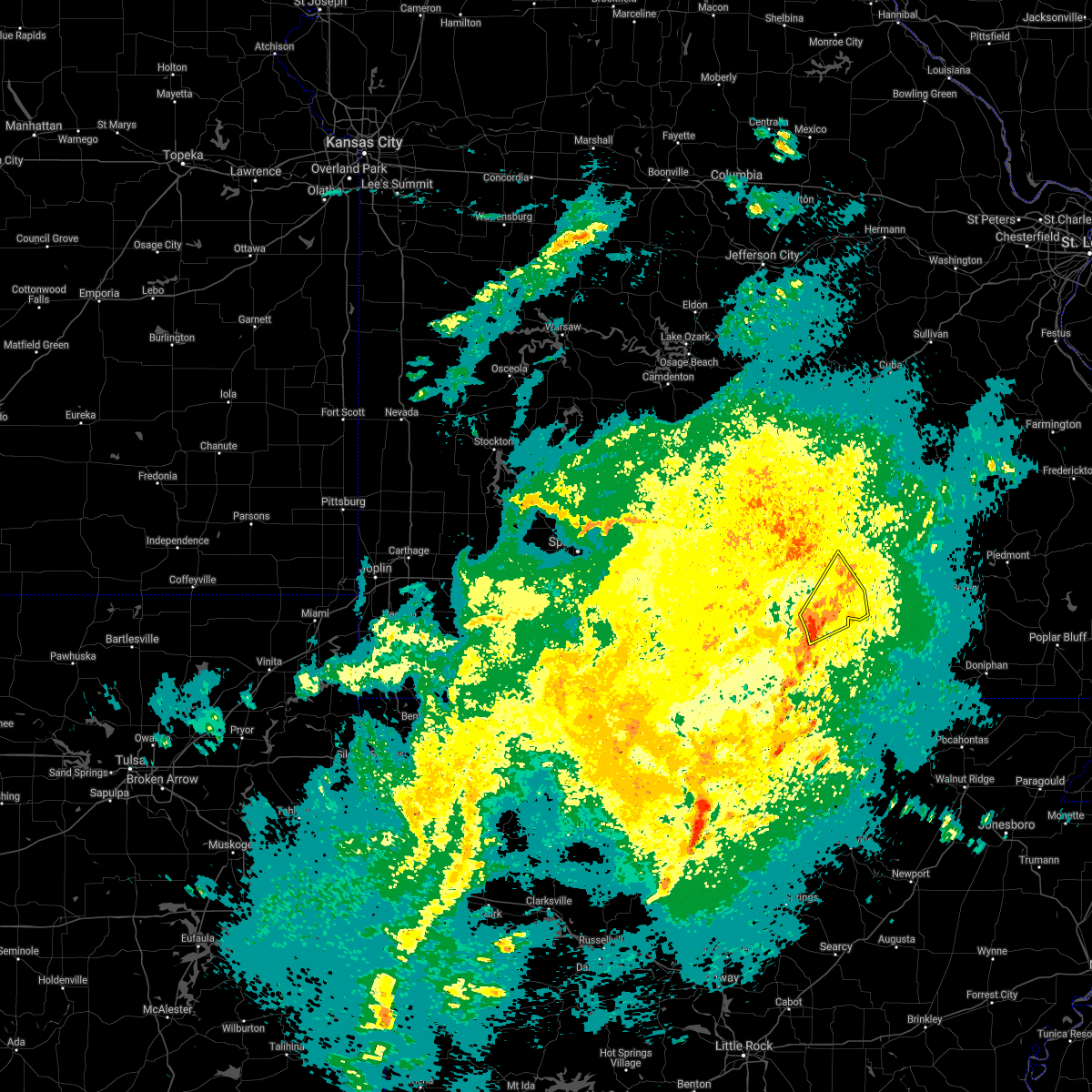 At 154 am cst, severe thunderstorms were located along a line extending from 6 miles southeast of willow springs to near west plains, moving northeast at 45 mph (radar indicated). Hazards include 60 mph wind gusts and penny size hail. expect damage to roofs, siding, and trees At 154 am cst, severe thunderstorms were located along a line extending from 6 miles southeast of willow springs to near west plains, moving northeast at 45 mph (radar indicated). Hazards include 60 mph wind gusts and penny size hail. expect damage to roofs, siding, and trees
|
| 10/24/2021 10:11 PM CDT |
 The severe thunderstorm warning for eastern ozark, southwestern shannon, howell and western oregon counties will expire at 1015 pm cdt, the storms which prompted the warning have weakened below severe limits, and no longer pose an immediate threat to life or property. therefore, the warning will be allowed to expire. however small hail and gusty winds are still possible with these thunderstorms. a tornado watch remains in effect until 1100 pm cdt for south central and southwestern missouri, and southwestern missouri. The severe thunderstorm warning for eastern ozark, southwestern shannon, howell and western oregon counties will expire at 1015 pm cdt, the storms which prompted the warning have weakened below severe limits, and no longer pose an immediate threat to life or property. therefore, the warning will be allowed to expire. however small hail and gusty winds are still possible with these thunderstorms. a tornado watch remains in effect until 1100 pm cdt for south central and southwestern missouri, and southwestern missouri.
|
| 10/24/2021 9:18 PM CDT |
 At 917 pm cdt, severe thunderstorms were located along a line extending from near willow springs to near price place, moving east at 40 mph (radar indicated). Hazards include 60 mph wind gusts. expect damage to roofs, siding, and trees At 917 pm cdt, severe thunderstorms were located along a line extending from near willow springs to near price place, moving east at 40 mph (radar indicated). Hazards include 60 mph wind gusts. expect damage to roofs, siding, and trees
|
| 9/4/2021 7:17 PM CDT |
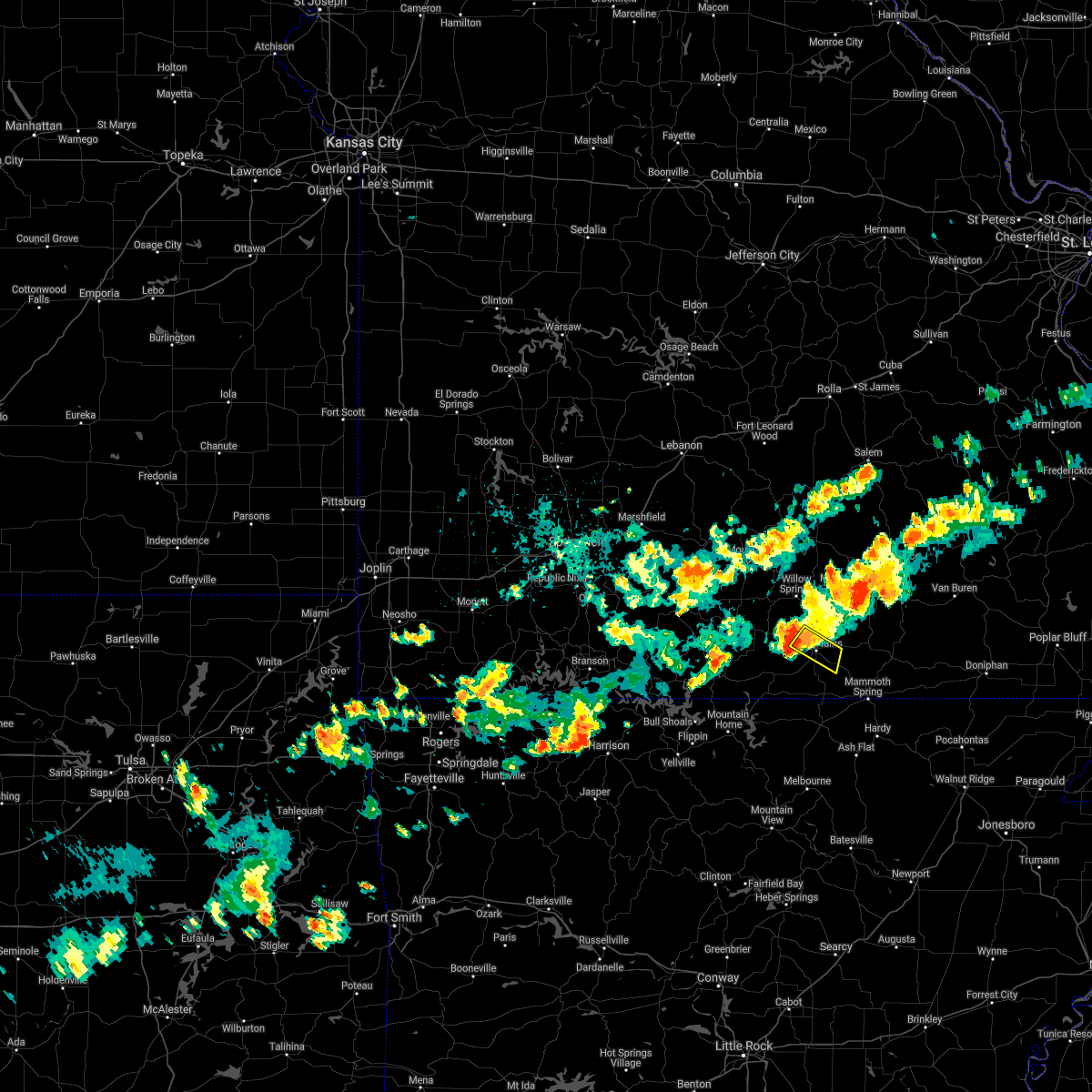 At 717 pm cdt, a severe thunderstorm was located over west plains, moving southeast at 20 mph (radar indicated). Hazards include 60 mph wind gusts. Expect damage to roofs, siding, and trees. locations impacted include, west plains, hail threat, radar indicated max hail size, <. 75 in wind threat, radar indicated max wind gust, 60 mph. At 717 pm cdt, a severe thunderstorm was located over west plains, moving southeast at 20 mph (radar indicated). Hazards include 60 mph wind gusts. Expect damage to roofs, siding, and trees. locations impacted include, west plains, hail threat, radar indicated max hail size, <. 75 in wind threat, radar indicated max wind gust, 60 mph.
|
| 9/4/2021 6:45 PM CDT |
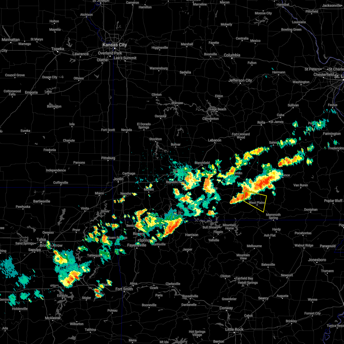 At 644 pm cdt, a severe thunderstorm was located 9 miles southwest of willow springs, moving east at 25 mph (radar indicated). Hazards include 60 mph wind gusts. expect damage to roofs, siding, and trees At 644 pm cdt, a severe thunderstorm was located 9 miles southwest of willow springs, moving east at 25 mph (radar indicated). Hazards include 60 mph wind gusts. expect damage to roofs, siding, and trees
|
| 7/31/2021 9:36 PM CDT |
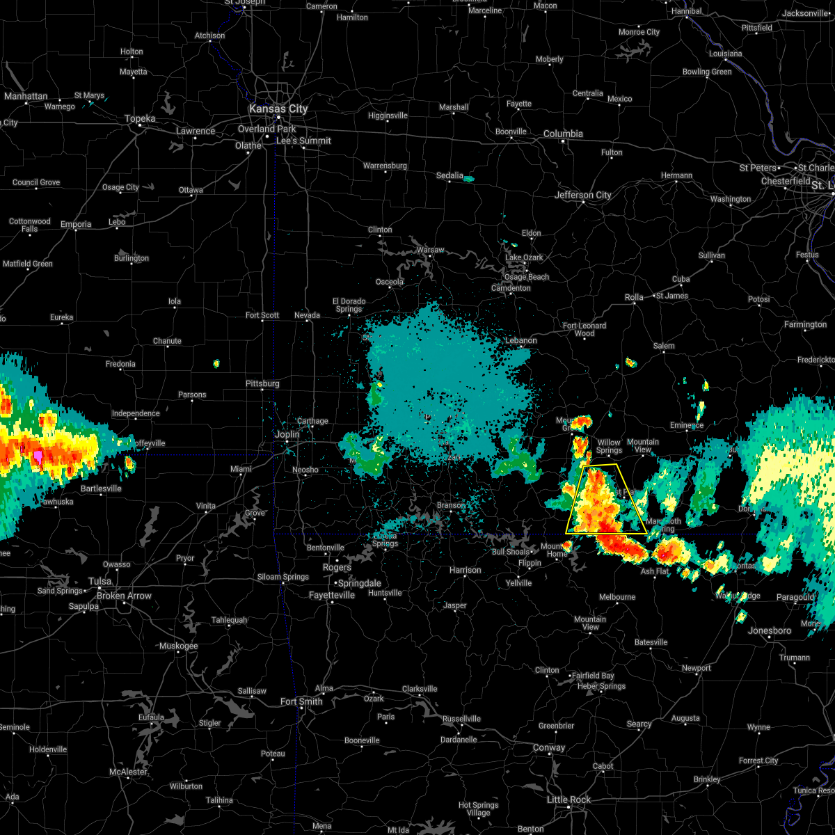 At 935 pm cdt, severe thunderstorms were located along a line extending from 8 miles west of thayer to near arkawana, moving southeast at 30 mph (trained weather spotters. tree down over road across highway 95 southbound one mile from the highway 5 intersection). Hazards include 60 mph wind gusts and penny size hail. Expect damage to roofs, siding, and trees. Locations impacted include, west plains, norfork lake, pomona, bakersfield, south fork, lanton, siloam springs, moody, dora, pottersville, caulfield, udall,. At 935 pm cdt, severe thunderstorms were located along a line extending from 8 miles west of thayer to near arkawana, moving southeast at 30 mph (trained weather spotters. tree down over road across highway 95 southbound one mile from the highway 5 intersection). Hazards include 60 mph wind gusts and penny size hail. Expect damage to roofs, siding, and trees. Locations impacted include, west plains, norfork lake, pomona, bakersfield, south fork, lanton, siloam springs, moody, dora, pottersville, caulfield, udall,.
|
| 7/31/2021 9:05 PM CDT |
 At 905 pm cdt, severe thunderstorms were located along a line extending from near west plains to 9 miles north of price place, moving southeast at 30 mph (radar indicated). Hazards include 60 mph wind gusts and penny size hail. expect damage to roofs, siding, and trees At 905 pm cdt, severe thunderstorms were located along a line extending from near west plains to 9 miles north of price place, moving southeast at 30 mph (radar indicated). Hazards include 60 mph wind gusts and penny size hail. expect damage to roofs, siding, and trees
|
| 7/31/2021 8:54 PM CDT |
 At 854 pm cdt, severe thunderstorms were located along a line extending from 11 miles south of mountain view to 14 miles east of taneyville, moving southeast at 15 mph (radar indicated). Hazards include 60 mph wind gusts and penny size hail. Expect damage to roofs, siding, and trees. Locations impacted include, west plains, bull shoals lake, gainesville, pomona, theodosia, south fork, brandsville, wasola, sundown, brixey, willhoit, tecumseh, pottersville, caulfield, hardenville, thornfield, zanoni, peace valley, noble, siloam springs,. At 854 pm cdt, severe thunderstorms were located along a line extending from 11 miles south of mountain view to 14 miles east of taneyville, moving southeast at 15 mph (radar indicated). Hazards include 60 mph wind gusts and penny size hail. Expect damage to roofs, siding, and trees. Locations impacted include, west plains, bull shoals lake, gainesville, pomona, theodosia, south fork, brandsville, wasola, sundown, brixey, willhoit, tecumseh, pottersville, caulfield, hardenville, thornfield, zanoni, peace valley, noble, siloam springs,.
|
| 7/31/2021 8:37 PM CDT |
 At 836 pm cdt, severe thunderstorms were located along a line extending from 6 miles south of mountain view to 12 miles east of taneyville, moving southeast at 15 mph (radar indicated). Hazards include 60 mph wind gusts and penny size hail. expect damage to roofs, siding, and trees At 836 pm cdt, severe thunderstorms were located along a line extending from 6 miles south of mountain view to 12 miles east of taneyville, moving southeast at 15 mph (radar indicated). Hazards include 60 mph wind gusts and penny size hail. expect damage to roofs, siding, and trees
|
| 7/9/2021 8:24 PM CDT |
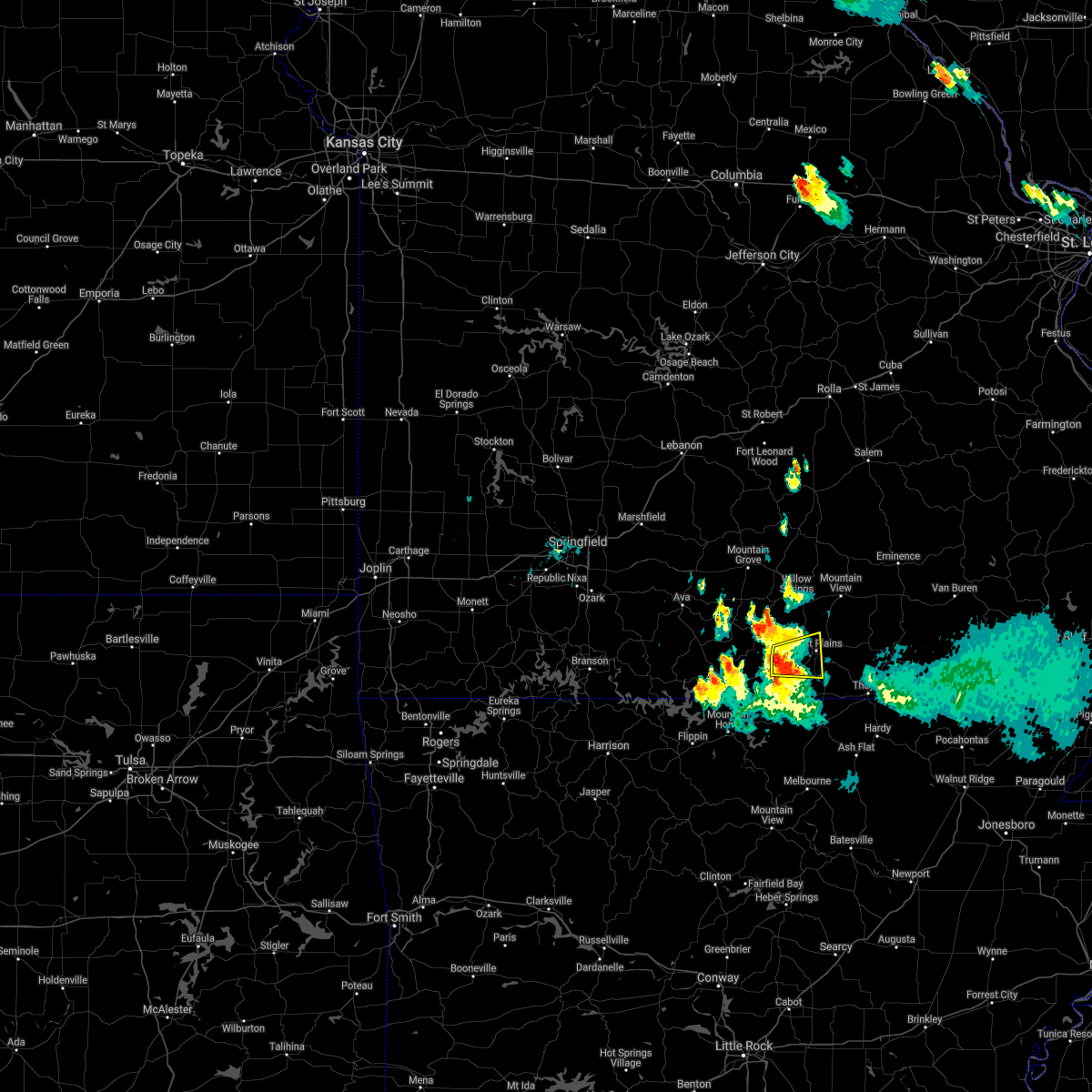 At 824 pm cdt, a severe thunderstorm was located 11 miles west of west plains, moving east at 15 mph (radar indicated). Hazards include 60 mph wind gusts and half dollar size hail. Hail damage to vehicles is expected. expect wind damage to roofs, siding, and trees. Locations impacted include, west plains, south fork, pottersville, caulfield,. At 824 pm cdt, a severe thunderstorm was located 11 miles west of west plains, moving east at 15 mph (radar indicated). Hazards include 60 mph wind gusts and half dollar size hail. Hail damage to vehicles is expected. expect wind damage to roofs, siding, and trees. Locations impacted include, west plains, south fork, pottersville, caulfield,.
|
| 7/9/2021 8:15 PM CDT |
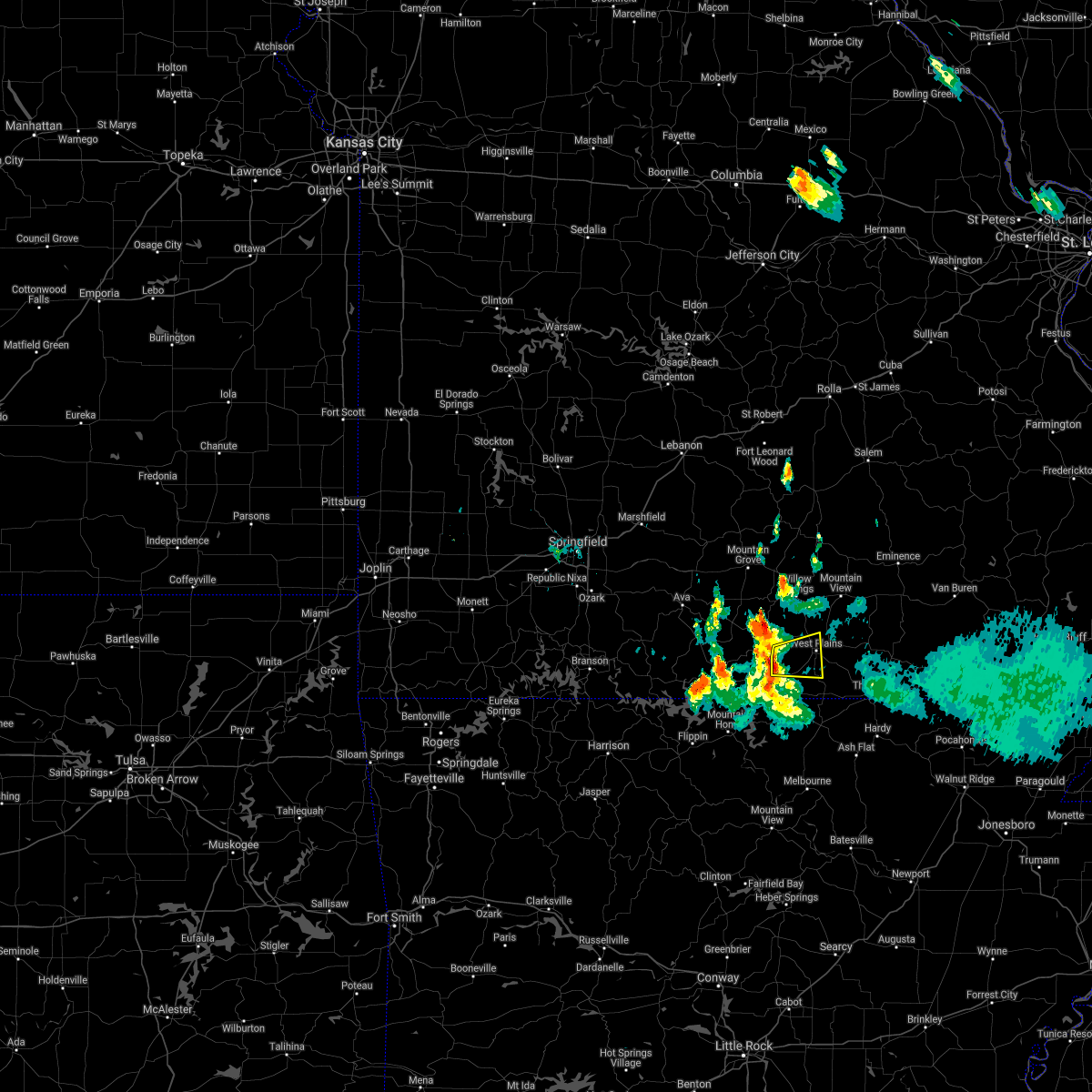 At 815 pm cdt, a severe thunderstorm was located 10 miles north of bakersfield, or 12 miles southwest of west plains, moving east at 20 mph (radar indicated). Hazards include 60 mph wind gusts and quarter size hail. Hail damage to vehicles is expected. Expect wind damage to roofs, siding, and trees. At 815 pm cdt, a severe thunderstorm was located 10 miles north of bakersfield, or 12 miles southwest of west plains, moving east at 20 mph (radar indicated). Hazards include 60 mph wind gusts and quarter size hail. Hail damage to vehicles is expected. Expect wind damage to roofs, siding, and trees.
|
| 5/27/2021 3:41 PM CDT |
 The severe thunderstorm warning for howell county will expire at 345 pm cdt, the storms which prompted the warning have moved out of the area. therefore, the warning will be allowed to expire. however heavy rain is still possible with these thunderstorms. a severe thunderstorm watch remains in effect until 700 pm cdt for south central and southwestern missouri. The severe thunderstorm warning for howell county will expire at 345 pm cdt, the storms which prompted the warning have moved out of the area. therefore, the warning will be allowed to expire. however heavy rain is still possible with these thunderstorms. a severe thunderstorm watch remains in effect until 700 pm cdt for south central and southwestern missouri.
|
| 5/27/2021 3:02 PM CDT |
 At 302 pm cdt, severe thunderstorms were located along a line extending from 7 miles southwest of willow springs to 9 miles west of west plains to near ott, moving east at 35 mph (radar indicated). Hazards include 60 mph wind gusts and penny size hail. expect damage to roofs, siding, and trees At 302 pm cdt, severe thunderstorms were located along a line extending from 7 miles southwest of willow springs to 9 miles west of west plains to near ott, moving east at 35 mph (radar indicated). Hazards include 60 mph wind gusts and penny size hail. expect damage to roofs, siding, and trees
|
| 5/4/2021 1:19 AM CDT |
 At 119 am cdt, a severe thunderstorm was located 9 miles southeast of west plains, moving northeast at 45 mph (radar indicated). Hazards include 60 mph wind gusts and penny size hail. expect damage to roofs, siding, and trees At 119 am cdt, a severe thunderstorm was located 9 miles southeast of west plains, moving northeast at 45 mph (radar indicated). Hazards include 60 mph wind gusts and penny size hail. expect damage to roofs, siding, and trees
|
| 4/28/2021 12:02 PM CDT |
 At 1202 pm cdt, a severe thunderstorm capable of producing a tornado was located 8 miles northeast of west plains, moving northeast at 30 mph (radar indicated rotation). Hazards include tornado. Flying debris will be dangerous to those caught without shelter. mobile homes will be damaged or destroyed. damage to roofs, windows, and vehicles will occur. Tree damage is likely. At 1202 pm cdt, a severe thunderstorm capable of producing a tornado was located 8 miles northeast of west plains, moving northeast at 30 mph (radar indicated rotation). Hazards include tornado. Flying debris will be dangerous to those caught without shelter. mobile homes will be damaged or destroyed. damage to roofs, windows, and vehicles will occur. Tree damage is likely.
|
| 4/28/2021 11:49 AM CDT |
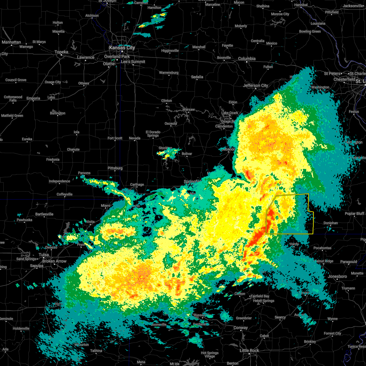 At 1149 am cdt, severe thunderstorms were located along a line extending from near west plains to 17 miles northeast of bakersfield to 7 miles northwest of sturkie to 6 miles south of ott, moving northeast at 45 mph (radar indicated). Hazards include 60 mph wind gusts and penny size hail. expect damage to roofs, siding, and trees At 1149 am cdt, severe thunderstorms were located along a line extending from near west plains to 17 miles northeast of bakersfield to 7 miles northwest of sturkie to 6 miles south of ott, moving northeast at 45 mph (radar indicated). Hazards include 60 mph wind gusts and penny size hail. expect damage to roofs, siding, and trees
|
| 4/9/2021 4:25 PM CDT |
 The severe thunderstorm warning for southern howell and oregon counties will expire at 430 pm cdt, the storms which prompted the warning have moved out of the warned area. therefore, the warning will be allowed to expire. a severe thunderstorm watch remains in effect until 800 pm cdt for south central missouri. The severe thunderstorm warning for southern howell and oregon counties will expire at 430 pm cdt, the storms which prompted the warning have moved out of the warned area. therefore, the warning will be allowed to expire. a severe thunderstorm watch remains in effect until 800 pm cdt for south central missouri.
|
| 4/9/2021 4:24 PM CDT | Electric company reported hundreds of outages due to high winds across the howell-oregon county electric area. several public weather stations reported measured wind gu in howell county MO, 11.8 miles WNW of West Plains, MO |
| 4/9/2021 3:58 PM CDT |
 A severe thunderstorm warning remains in effect until 430 pm cdt for southern howell and oregon counties. at 358 pm cdt, severe thunderstorms were located along a line extending from bakersfield to 6 miles east of sturkie to 7 miles north of cherokee village, moving north at 35 mph. hazard. 60 mph wind gusts and half dollar size hail. A severe thunderstorm warning remains in effect until 430 pm cdt for southern howell and oregon counties. at 358 pm cdt, severe thunderstorms were located along a line extending from bakersfield to 6 miles east of sturkie to 7 miles north of cherokee village, moving north at 35 mph. hazard. 60 mph wind gusts and half dollar size hail.
|
| 4/9/2021 3:41 PM CDT |
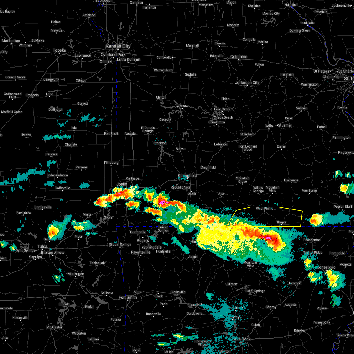 At 340 pm cdt, severe thunderstorms were located along a line extending from gamaliel landing to near salem in fulton county to ballard, moving north at 35 mph (radar indicated). Hazards include 60 mph wind gusts and half dollar size hail. Hail damage to vehicles is expected. Expect wind damage to roofs, siding, and trees. At 340 pm cdt, severe thunderstorms were located along a line extending from gamaliel landing to near salem in fulton county to ballard, moving north at 35 mph (radar indicated). Hazards include 60 mph wind gusts and half dollar size hail. Hail damage to vehicles is expected. Expect wind damage to roofs, siding, and trees.
|
| 11/14/2020 10:14 PM CST |
 At 1014 pm cst, severe thunderstorms were located along a line extending from 8 miles northwest of eminence to 7 miles northeast of west plains to 13 miles northeast of gainesville, moving east at 55 mph (radar indicated). Hazards include 70 mph wind gusts and quarter size hail. Hail damage to vehicles is expected. expect considerable tree damage. wind damage is also likely to mobile homes, roofs, and outbuildings. Locations impacted include, west plains, mountain view, willow springs, pomona, summersville, brandsville, montier, peace valley, teresita, arroll, pottersville, siloam springs, white church, hartshorn, sycamore, clear springs, dora, pine crest, zanoni,. At 1014 pm cst, severe thunderstorms were located along a line extending from 8 miles northwest of eminence to 7 miles northeast of west plains to 13 miles northeast of gainesville, moving east at 55 mph (radar indicated). Hazards include 70 mph wind gusts and quarter size hail. Hail damage to vehicles is expected. expect considerable tree damage. wind damage is also likely to mobile homes, roofs, and outbuildings. Locations impacted include, west plains, mountain view, willow springs, pomona, summersville, brandsville, montier, peace valley, teresita, arroll, pottersville, siloam springs, white church, hartshorn, sycamore, clear springs, dora, pine crest, zanoni,.
|
| 11/14/2020 9:58 PM CST |
 At 958 pm cst, severe thunderstorms were located along a line extending from 6 miles northwest of summersville to 12 miles northwest of west plains to 8 miles northwest of gainesville, moving east at 55 mph (radar indicated). Hazards include 60 mph wind gusts and quarter size hail. Hail damage to vehicles is expected. Expect wind damage to roofs, siding, and trees. At 958 pm cst, severe thunderstorms were located along a line extending from 6 miles northwest of summersville to 12 miles northwest of west plains to 8 miles northwest of gainesville, moving east at 55 mph (radar indicated). Hazards include 60 mph wind gusts and quarter size hail. Hail damage to vehicles is expected. Expect wind damage to roofs, siding, and trees.
|
| 7/1/2020 12:00 PM CDT |
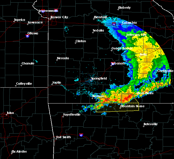 At 1200 pm cdt, severe thunderstorms were located along a line extending from 7 miles northeast of diamond city to near bakersfield to near west plains, moving southeast at 30 mph (radar indicated). Hazards include 60 mph wind gusts and quarter size hail. Hail damage to vehicles is expected. Expect wind damage to roofs, siding, and trees. At 1200 pm cdt, severe thunderstorms were located along a line extending from 7 miles northeast of diamond city to near bakersfield to near west plains, moving southeast at 30 mph (radar indicated). Hazards include 60 mph wind gusts and quarter size hail. Hail damage to vehicles is expected. Expect wind damage to roofs, siding, and trees.
|
| 6/3/2020 4:03 PM CDT |
 At 403 pm cdt, a severe thunderstorm was located near west plains, moving east at 20 mph (radar indicated). Hazards include 60 mph wind gusts and quarter size hail. Hail damage to vehicles is expected. expect wind damage to roofs, siding, and trees. Locations impacted include, west plains, brandsville, lanton,. At 403 pm cdt, a severe thunderstorm was located near west plains, moving east at 20 mph (radar indicated). Hazards include 60 mph wind gusts and quarter size hail. Hail damage to vehicles is expected. expect wind damage to roofs, siding, and trees. Locations impacted include, west plains, brandsville, lanton,.
|
| 6/3/2020 3:43 PM CDT |
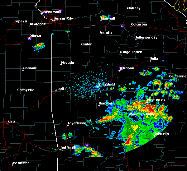 At 343 pm cdt, a severe thunderstorm was located near west plains, moving east at 15 mph (radar indicated). Hazards include 60 mph wind gusts and quarter size hail. Hail damage to vehicles is expected. Expect wind damage to roofs, siding, and trees. At 343 pm cdt, a severe thunderstorm was located near west plains, moving east at 15 mph (radar indicated). Hazards include 60 mph wind gusts and quarter size hail. Hail damage to vehicles is expected. Expect wind damage to roofs, siding, and trees.
|
| 6/3/2020 3:34 PM CDT | Quarter sized hail reported 15.6 miles NNW of West Plains, MO |
| 5/4/2020 1:34 PM CDT |
 At 133 pm cdt, a severe thunderstorm was located 12 miles south of mountain grove, moving east at 75 mph (radar indicated). Hazards include 60 mph wind gusts and quarter size hail. Hail damage to vehicles is expected. Expect wind damage to roofs, siding, and trees. At 133 pm cdt, a severe thunderstorm was located 12 miles south of mountain grove, moving east at 75 mph (radar indicated). Hazards include 60 mph wind gusts and quarter size hail. Hail damage to vehicles is expected. Expect wind damage to roofs, siding, and trees.
|
| 5/3/2020 12:12 PM CDT |
 At 1212 pm cdt, a severe thunderstorm was located 8 miles southwest of west plains, moving east at 30 mph (radar indicated). Hazards include 60 mph wind gusts and quarter size hail. Hail damage to vehicles is expected. Expect wind damage to roofs, siding, and trees. At 1212 pm cdt, a severe thunderstorm was located 8 miles southwest of west plains, moving east at 30 mph (radar indicated). Hazards include 60 mph wind gusts and quarter size hail. Hail damage to vehicles is expected. Expect wind damage to roofs, siding, and trees.
|
| 5/3/2020 12:11 PM CDT |
 The severe thunderstorm warning for howell and southeastern texas counties will expire at 1215 pm cdt, the storms which prompted the warning have weakened below severe limits, and no longer pose an immediate threat to life or property. therefore, the warning will be allowed to expire. a severe thunderstorm watch remains in effect until 400 pm cdt for south central and southwestern missouri. The severe thunderstorm warning for howell and southeastern texas counties will expire at 1215 pm cdt, the storms which prompted the warning have weakened below severe limits, and no longer pose an immediate threat to life or property. therefore, the warning will be allowed to expire. a severe thunderstorm watch remains in effect until 400 pm cdt for south central and southwestern missouri.
|
| 5/3/2020 11:47 AM CDT |
 At 1147 am cdt, severe thunderstorms were located along a line extending from 6 miles north of houston to 8 miles northeast of willow springs to near west plains, moving east at 45 mph (radar indicated). Hazards include 60 mph wind gusts and quarter size hail. Hail damage to vehicles is expected. expect wind damage to roofs, siding, and trees. Locations impacted include, west plains, mountain view, willow springs, cabool, houston, pomona, summersville, raymondville, south fork, brandsville, lanton, pottersville, caulfield, eunice, yukon, clear springs, solo, pine crest, simmons, peace valley,. At 1147 am cdt, severe thunderstorms were located along a line extending from 6 miles north of houston to 8 miles northeast of willow springs to near west plains, moving east at 45 mph (radar indicated). Hazards include 60 mph wind gusts and quarter size hail. Hail damage to vehicles is expected. expect wind damage to roofs, siding, and trees. Locations impacted include, west plains, mountain view, willow springs, cabool, houston, pomona, summersville, raymondville, south fork, brandsville, lanton, pottersville, caulfield, eunice, yukon, clear springs, solo, pine crest, simmons, peace valley,.
|
| 5/3/2020 11:35 AM CDT |
 At 1134 am cdt, severe thunderstorms were located along a line extending from 12 miles northwest of houston to 6 miles southwest of cabool to 13 miles north of bakersfield, moving east at 45 mph (radar indicated). Hazards include 60 mph wind gusts and quarter size hail. Hail damage to vehicles is expected. Expect wind damage to roofs, siding, and trees. At 1134 am cdt, severe thunderstorms were located along a line extending from 12 miles northwest of houston to 6 miles southwest of cabool to 13 miles north of bakersfield, moving east at 45 mph (radar indicated). Hazards include 60 mph wind gusts and quarter size hail. Hail damage to vehicles is expected. Expect wind damage to roofs, siding, and trees.
|
| 4/28/2020 9:12 PM CDT |
 The severe thunderstorm warning for howell and southeastern texas counties will expire at 915 pm cdt, the storms which prompted the warning have moved out of the area. therefore, the warning will be allowed to expire. a severe thunderstorm watch remains in effect until 1100 pm cdt for south central and southwestern missouri. The severe thunderstorm warning for howell and southeastern texas counties will expire at 915 pm cdt, the storms which prompted the warning have moved out of the area. therefore, the warning will be allowed to expire. a severe thunderstorm watch remains in effect until 1100 pm cdt for south central and southwestern missouri.
|
| 4/28/2020 8:56 PM CDT |
 At 855 pm cdt, severe thunderstorms were located along a line extending from 10 miles east of cabool to 6 miles southwest of mountain view to near west plains to near ott, moving east at 55 mph (emergency management. 71 mph wind gust was measured in west plains). Hazards include 70 mph wind gusts. Expect considerable tree damage. damage is likely to mobile homes, roofs, and outbuildings. Locations impacted include, west plains, mountain view, willow springs, pomona, summersville, south fork, brandsville, peace valley, lanton, arroll, pottersville, eunice, yukon, white church, moody, hartshorn, clear springs, pine crest,. At 855 pm cdt, severe thunderstorms were located along a line extending from 10 miles east of cabool to 6 miles southwest of mountain view to near west plains to near ott, moving east at 55 mph (emergency management. 71 mph wind gust was measured in west plains). Hazards include 70 mph wind gusts. Expect considerable tree damage. damage is likely to mobile homes, roofs, and outbuildings. Locations impacted include, west plains, mountain view, willow springs, pomona, summersville, south fork, brandsville, peace valley, lanton, arroll, pottersville, eunice, yukon, white church, moody, hartshorn, clear springs, pine crest,.
|
| 4/28/2020 8:55 PM CDT |
 At 854 pm cdt, severe thunderstorms were located along a line extending from 7 miles south of houston to 6 miles west of mountain view to near west plains to near ott, moving east at 50 mph (emergency management. 71 mph wind gust was measured in west plains). Hazards include 70 mph wind gusts. Expect considerable tree damage. damage is likely to mobile homes, roofs, and outbuildings. Locations impacted include, current river state park, echo bluff state park, grand gulf state park, mountain view, thayer, winona, alton, birch tree, eminence, summersville, koshkonong, brandsville, montier, thomasville, lanton, teresita, myrtle, midridge, rover, round spring,. At 854 pm cdt, severe thunderstorms were located along a line extending from 7 miles south of houston to 6 miles west of mountain view to near west plains to near ott, moving east at 50 mph (emergency management. 71 mph wind gust was measured in west plains). Hazards include 70 mph wind gusts. Expect considerable tree damage. damage is likely to mobile homes, roofs, and outbuildings. Locations impacted include, current river state park, echo bluff state park, grand gulf state park, mountain view, thayer, winona, alton, birch tree, eminence, summersville, koshkonong, brandsville, montier, thomasville, lanton, teresita, myrtle, midridge, rover, round spring,.
|
| 4/28/2020 8:52 PM CDT |
 At 851 pm cdt, severe thunderstorms were located along a line extending from 8 miles northeast of cabool to 7 miles southeast of willow springs to near west plains to near ott, moving east at 55 mph (radar indicated. this line of storms has a history of producing 60 to 70 mph wind gust). Hazards include 70 mph wind gusts. Expect considerable tree damage. damage is likely to mobile homes, roofs, and outbuildings. Locations impacted include, west plains, mountain view, willow springs, pomona, summersville, raymondville, south fork, brandsville, peace valley, lanton, arroll, pottersville, caulfield, eunice, yukon, siloam springs, white church, moody, hartshorn, clear springs,. At 851 pm cdt, severe thunderstorms were located along a line extending from 8 miles northeast of cabool to 7 miles southeast of willow springs to near west plains to near ott, moving east at 55 mph (radar indicated. this line of storms has a history of producing 60 to 70 mph wind gust). Hazards include 70 mph wind gusts. Expect considerable tree damage. damage is likely to mobile homes, roofs, and outbuildings. Locations impacted include, west plains, mountain view, willow springs, pomona, summersville, raymondville, south fork, brandsville, peace valley, lanton, arroll, pottersville, caulfield, eunice, yukon, siloam springs, white church, moody, hartshorn, clear springs,.
|
| 4/28/2020 8:50 PM CDT | Recorded at howell county eo in howell county MO, 0.9 miles NW of West Plains, MO |
| 4/28/2020 8:47 PM CDT |
 At 846 pm cdt, severe thunderstorms were located along a line extending from 8 miles north of cabool to near willow springs to 6 miles northwest of west plains to near bakersfield, moving east at 55 mph (radar indicated. this line of storms has a history of producing 60 to 70 mph wind gust). Hazards include 70 mph wind gusts. Expect considerable tree damage. Damage is likely to mobile homes, roofs, and outbuildings. At 846 pm cdt, severe thunderstorms were located along a line extending from 8 miles north of cabool to near willow springs to 6 miles northwest of west plains to near bakersfield, moving east at 55 mph (radar indicated. this line of storms has a history of producing 60 to 70 mph wind gust). Hazards include 70 mph wind gusts. Expect considerable tree damage. Damage is likely to mobile homes, roofs, and outbuildings.
|
| 4/28/2020 8:34 PM CDT |
 At 833 pm cdt, severe thunderstorms were located along a line extending from 12 miles northeast of hartville to 8 miles west of willow springs to 13 miles north of bakersfield to near gainesville, moving east at 55 mph (trained weather spotters). Hazards include 70 mph wind gusts. 65 mph wind gust was reported in mountain grove. Expect considerable tree damage. damage is likely to mobile homes, roofs, and outbuildings. Locations impacted include, west plains, bull shoals lake, mountain grove, licking, mountain view, willow springs, cabool, houston, gainesville, pomona, summersville, raymondville, bakersfield, theodosia, south fork, pontiac, brandsville, huggins, sundown, lanton,. At 833 pm cdt, severe thunderstorms were located along a line extending from 12 miles northeast of hartville to 8 miles west of willow springs to 13 miles north of bakersfield to near gainesville, moving east at 55 mph (trained weather spotters). Hazards include 70 mph wind gusts. 65 mph wind gust was reported in mountain grove. Expect considerable tree damage. damage is likely to mobile homes, roofs, and outbuildings. Locations impacted include, west plains, bull shoals lake, mountain grove, licking, mountain view, willow springs, cabool, houston, gainesville, pomona, summersville, raymondville, bakersfield, theodosia, south fork, pontiac, brandsville, huggins, sundown, lanton,.
|
| 4/28/2020 8:08 PM CDT |
 At 808 pm cdt, severe thunderstorms were located along a line extending from 7 miles north of hartville to near norwood to 13 miles north of gainesville to 8 miles north of price place, moving east at 50 mph (radar indicated). Hazards include 70 mph wind gusts. Expect considerable tree damage. Damage is likely to mobile homes, roofs, and outbuildings. At 808 pm cdt, severe thunderstorms were located along a line extending from 7 miles north of hartville to near norwood to 13 miles north of gainesville to 8 miles north of price place, moving east at 50 mph (radar indicated). Hazards include 70 mph wind gusts. Expect considerable tree damage. Damage is likely to mobile homes, roofs, and outbuildings.
|
| 4/20/2020 4:26 PM CDT | Quarter sized hail reported 1.4 miles WNW of West Plains, MO, one inch hail lasted 5 mins. via social media. |
| 4/20/2020 4:24 PM CDT |
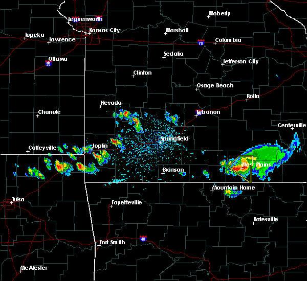 The national weather service in springfield has issued a * severe thunderstorm warning for. southern howell county in south central missouri. oregon county in south central missouri. until 530 pm cdt. At 424 pm cdt, severe thunderstorms were located along a line. The national weather service in springfield has issued a * severe thunderstorm warning for. southern howell county in south central missouri. oregon county in south central missouri. until 530 pm cdt. At 424 pm cdt, severe thunderstorms were located along a line.
|
| 4/20/2020 4:13 PM CDT |
 At 413 pm cdt, a severe thunderstorm was located near west plains, moving southeast at 40 mph (radar indicated). Hazards include 60 mph wind gusts and quarter size hail. Hail damage to vehicles is expected. expect wind damage to roofs, siding, and trees. this severe storm will be near, west plains around 420 pm cdt. Other locations impacted by this severe thunderstorm include pomona, brandsville, peace valley and white church. At 413 pm cdt, a severe thunderstorm was located near west plains, moving southeast at 40 mph (radar indicated). Hazards include 60 mph wind gusts and quarter size hail. Hail damage to vehicles is expected. expect wind damage to roofs, siding, and trees. this severe storm will be near, west plains around 420 pm cdt. Other locations impacted by this severe thunderstorm include pomona, brandsville, peace valley and white church.
|
| 4/20/2020 4:03 PM CDT |
 At 402 pm cdt, a severe thunderstorm was located 8 miles south of willow springs, moving southeast at 40 mph (radar indicated). Hazards include 60 mph wind gusts and nickel size hail. Expect damage to roofs, siding, and trees. this severe storm will be near, west plains around 415 pm cdt. Other locations impacted by this severe thunderstorm include pomona, brandsville, peace valley, siloam springs and white church. At 402 pm cdt, a severe thunderstorm was located 8 miles south of willow springs, moving southeast at 40 mph (radar indicated). Hazards include 60 mph wind gusts and nickel size hail. Expect damage to roofs, siding, and trees. this severe storm will be near, west plains around 415 pm cdt. Other locations impacted by this severe thunderstorm include pomona, brandsville, peace valley, siloam springs and white church.
|
| 4/20/2020 3:50 PM CDT |
 At 350 pm cdt, a severe thunderstorm was located 9 miles west of willow springs, moving southeast at 40 mph (radar indicated). Hazards include 60 mph wind gusts and quarter size hail. Hail damage to vehicles is expected. expect wind damage to roofs, siding, and trees. this severe thunderstorm will be near, willow springs around 355 pm cdt. west plains around 415 pm cdt. Other locations impacted by this severe thunderstorm include pomona, brandsville, peace valley, siloam springs and white church. At 350 pm cdt, a severe thunderstorm was located 9 miles west of willow springs, moving southeast at 40 mph (radar indicated). Hazards include 60 mph wind gusts and quarter size hail. Hail damage to vehicles is expected. expect wind damage to roofs, siding, and trees. this severe thunderstorm will be near, willow springs around 355 pm cdt. west plains around 415 pm cdt. Other locations impacted by this severe thunderstorm include pomona, brandsville, peace valley, siloam springs and white church.
|
| 4/8/2020 5:37 PM CDT | Golf Ball sized hail reported 15.1 miles N of West Plains, MO |
| 4/8/2020 5:32 PM CDT | Golf Ball sized hail reported 15.1 miles N of West Plains, MO, corrects previous hail report from 5 w lanton. |
| 3/19/2020 9:40 PM CDT | Severe thunderstorm wind gusts downed a tree along county road 839 in howell county MO, 8.9 miles N of West Plains, MO |
| 3/19/2020 9:31 PM CDT |
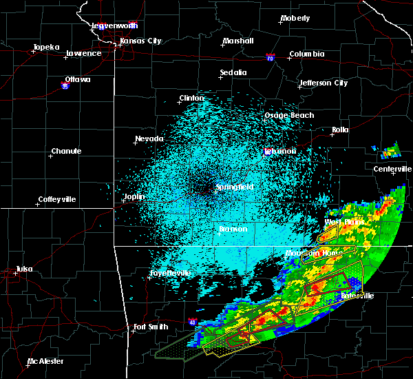 At 931 pm cdt, a severe thunderstorm was located 9 miles south of west plains, moving northeast at 35 mph (radar indicated). Hazards include 60 mph wind gusts and penny size hail. Expect damage to roofs, siding, and trees. Locations impacted include, brandsville,. At 931 pm cdt, a severe thunderstorm was located 9 miles south of west plains, moving northeast at 35 mph (radar indicated). Hazards include 60 mph wind gusts and penny size hail. Expect damage to roofs, siding, and trees. Locations impacted include, brandsville,.
|
| 3/19/2020 9:11 PM CDT |
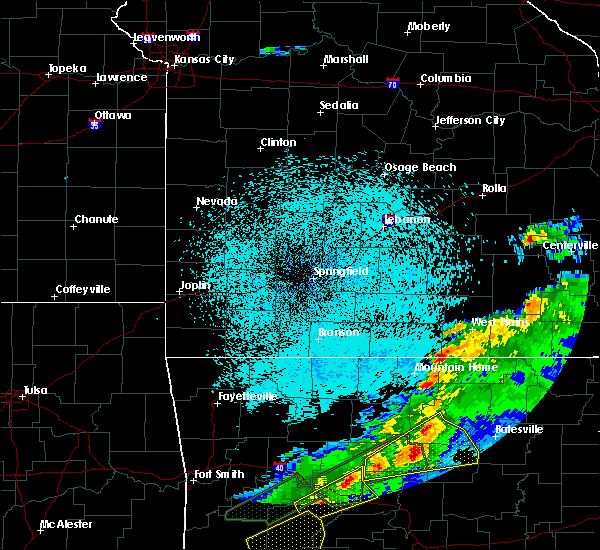 At 911 pm cdt, a severe thunderstorm was located 3 miles east of bakersfield, moving northeast at 50 mph (radar indicated). Hazards include 60 mph wind gusts and quarter size hail. Hail damage to vehicles is expected. Expect wind damage to roofs, siding, and trees. At 911 pm cdt, a severe thunderstorm was located 3 miles east of bakersfield, moving northeast at 50 mph (radar indicated). Hazards include 60 mph wind gusts and quarter size hail. Hail damage to vehicles is expected. Expect wind damage to roofs, siding, and trees.
|
| 3/19/2020 8:37 PM CDT |
 The severe thunderstorm warning for southeastern howell county will expire at 845 pm cdt, the storm which prompted the warning has weakened below severe limits, and no longer poses an immediate threat to life or property. therefore, the warning will be allowed to expire. however heavy rain is still possible with this thunderstorm. The severe thunderstorm warning for southeastern howell county will expire at 845 pm cdt, the storm which prompted the warning has weakened below severe limits, and no longer poses an immediate threat to life or property. therefore, the warning will be allowed to expire. however heavy rain is still possible with this thunderstorm.
|
| 3/19/2020 8:22 PM CDT | Report of a tree knocked onto a house off highway jj... southeast of south for in howell county MO, 10.4 miles N of West Plains, MO |
| 3/19/2020 8:22 PM CDT | Severe thunderstorm wind gusts downed a tree at the china union churc in howell county MO, 9 miles N of West Plains, MO |
| 3/19/2020 8:18 PM CDT |
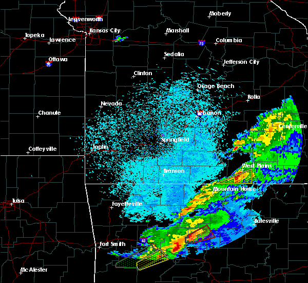 At 818 pm cdt, a severe thunderstorm was located 8 miles northeast of ott, or 12 miles southwest of west plains, moving east at 40 mph (radar indicated). Hazards include 60 mph wind gusts and penny size hail. Expect damage to roofs, siding, and trees. Locations impacted include, south fork, brandsville, lanton, moody,. At 818 pm cdt, a severe thunderstorm was located 8 miles northeast of ott, or 12 miles southwest of west plains, moving east at 40 mph (radar indicated). Hazards include 60 mph wind gusts and penny size hail. Expect damage to roofs, siding, and trees. Locations impacted include, south fork, brandsville, lanton, moody,.
|
| 3/19/2020 7:52 PM CDT |
 At 751 pm cdt, a severe thunderstorm was located over gamaliel landing, or 9 miles northeast of mountain home, moving northeast at 50 mph (radar indicated). Hazards include 60 mph wind gusts and penny size hail. expect damage to roofs, siding, and trees At 751 pm cdt, a severe thunderstorm was located over gamaliel landing, or 9 miles northeast of mountain home, moving northeast at 50 mph (radar indicated). Hazards include 60 mph wind gusts and penny size hail. expect damage to roofs, siding, and trees
|
| 3/2/2020 6:54 PM CST |
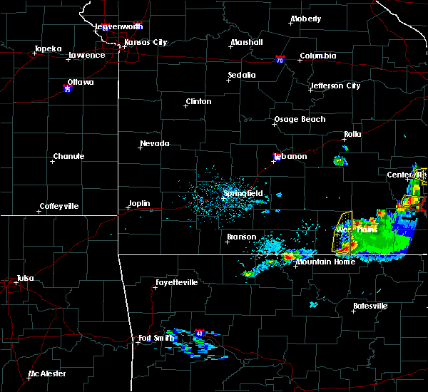 The severe thunderstorm warning for eastern howell county will expire at 700 pm cst, the storm which prompted the warning has weakened below severe limits, and no longer poses an immediate threat to life or property. therefore, the warning will be allowed to expire. however small hail, gusty winds and heavy rain are still possible with this thunderstorm. a tornado watch remains in effect until 100 am cst for south central missouri. to report severe weather, contact your nearest law enforcement agency. they will relay your report to the national weather service springfield. The severe thunderstorm warning for eastern howell county will expire at 700 pm cst, the storm which prompted the warning has weakened below severe limits, and no longer poses an immediate threat to life or property. therefore, the warning will be allowed to expire. however small hail, gusty winds and heavy rain are still possible with this thunderstorm. a tornado watch remains in effect until 100 am cst for south central missouri. to report severe weather, contact your nearest law enforcement agency. they will relay your report to the national weather service springfield.
|
| 3/2/2020 6:45 PM CST |
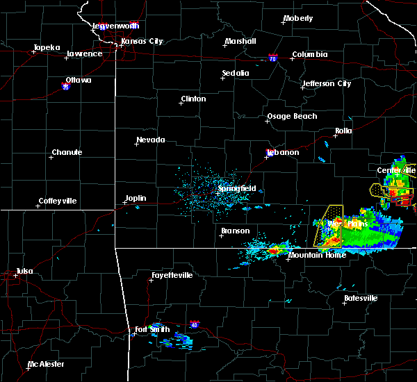 At 644 pm cst, a severe thunderstorms were located from peace valley to 10 miles south of west plains, moving northeast at 40 mph (radar indicated). Hazards include 60 mph wind gusts and quarter size hail. Hail damage to vehicles is expected. expect wind damage to roofs, siding, and trees. Locations impacted include, west plains, mountain view, brandsville, peace valley, white church,. At 644 pm cst, a severe thunderstorms were located from peace valley to 10 miles south of west plains, moving northeast at 40 mph (radar indicated). Hazards include 60 mph wind gusts and quarter size hail. Hail damage to vehicles is expected. expect wind damage to roofs, siding, and trees. Locations impacted include, west plains, mountain view, brandsville, peace valley, white church,.
|
| 3/2/2020 6:34 PM CST |
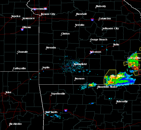 At 633 pm cst, a severe thunderstorm was located near west plains, moving east at 35 mph (radar indicated). Hazards include 60 mph wind gusts and quarter size hail. Hail damage to vehicles is expected. expect wind damage to roofs, siding, and trees. Locations impacted include, west plains, mountain view, pomona, south fork, brandsville, peace valley, lanton, white church, moody,. At 633 pm cst, a severe thunderstorm was located near west plains, moving east at 35 mph (radar indicated). Hazards include 60 mph wind gusts and quarter size hail. Hail damage to vehicles is expected. expect wind damage to roofs, siding, and trees. Locations impacted include, west plains, mountain view, pomona, south fork, brandsville, peace valley, lanton, white church, moody,.
|
| 3/2/2020 6:04 PM CST |
 At 603 pm cst, a severe thunderstorm was located 7 miles north of bakersfield, or 16 miles southwest of west plains, moving east at 35 mph (radar indicated). Hazards include 60 mph wind gusts and half dollar size hail. Hail damage to vehicles is expected. Expect wind damage to roofs, siding, and trees. At 603 pm cst, a severe thunderstorm was located 7 miles north of bakersfield, or 16 miles southwest of west plains, moving east at 35 mph (radar indicated). Hazards include 60 mph wind gusts and half dollar size hail. Hail damage to vehicles is expected. Expect wind damage to roofs, siding, and trees.
|
| 1/10/2020 10:56 PM CST |
 The severe thunderstorm warning for southeastern douglas and howell counties will expire at 1100 pm cst, the storms which prompted the warning have moved out of the area. therefore, the warning will be allowed to expire. however heavy rain is still possible with these thunderstorms. a tornado watch remains in effect until 200 am cst for south central missouri. The severe thunderstorm warning for southeastern douglas and howell counties will expire at 1100 pm cst, the storms which prompted the warning have moved out of the area. therefore, the warning will be allowed to expire. however heavy rain is still possible with these thunderstorms. a tornado watch remains in effect until 200 am cst for south central missouri.
|
| 1/10/2020 10:44 PM CST | Report of 60 mph wind gust in peace valle in howell county MO, 9.7 miles SW of West Plains, MO |
| 1/10/2020 10:17 PM CST |
 At 1017 pm cst, a severe thunderstorm capable of producing a tornado was located near gamaliel landing, or 14 miles northeast of mountain home, moving northeast at 55 mph (radar indicated rotation). Hazards include tornado and quarter size hail. Flying debris will be dangerous to those caught without shelter. mobile homes will be damaged or destroyed. damage to roofs, windows, and vehicles will occur. Tree damage is likely. At 1017 pm cst, a severe thunderstorm capable of producing a tornado was located near gamaliel landing, or 14 miles northeast of mountain home, moving northeast at 55 mph (radar indicated rotation). Hazards include tornado and quarter size hail. Flying debris will be dangerous to those caught without shelter. mobile homes will be damaged or destroyed. damage to roofs, windows, and vehicles will occur. Tree damage is likely.
|
| 1/10/2020 10:06 PM CST |
 At 1005 pm cst, severe thunderstorms were located along a line extending from 15 miles north of gainesville to near bakersfield, moving northeast at 60 mph (radar indicated). Hazards include 60 mph wind gusts and penny size hail. expect damage to roofs, siding, and trees At 1005 pm cst, severe thunderstorms were located along a line extending from 15 miles north of gainesville to near bakersfield, moving northeast at 60 mph (radar indicated). Hazards include 60 mph wind gusts and penny size hail. expect damage to roofs, siding, and trees
|
| 12/28/2019 10:57 PM CST |
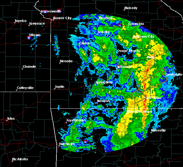 At 1056 pm cst, a severe thunderstorm was located 8 miles south of west plains, moving northeast at 30 mph (radar indicated). Hazards include 60 mph wind gusts. expect damage to roofs, siding, and trees At 1056 pm cst, a severe thunderstorm was located 8 miles south of west plains, moving northeast at 30 mph (radar indicated). Hazards include 60 mph wind gusts. expect damage to roofs, siding, and trees
|
| 12/28/2019 10:54 PM CST | Two trees across highway. time based on rada in howell county MO, 11.2 miles NNW of West Plains, MO |
| 12/28/2019 10:30 PM CST |
 At 1030 pm cst, a severe thunderstorm was located 9 miles southwest of willow springs, moving northeast at 50 mph (radar indicated). Hazards include 60 mph wind gusts. Expect damage to roofs, siding, and trees. Locations impacted include, west plains, willow springs, pomona, siloam springs, pottersville,. At 1030 pm cst, a severe thunderstorm was located 9 miles southwest of willow springs, moving northeast at 50 mph (radar indicated). Hazards include 60 mph wind gusts. Expect damage to roofs, siding, and trees. Locations impacted include, west plains, willow springs, pomona, siloam springs, pottersville,.
|
| 12/28/2019 10:09 PM CST |
 At 1009 pm cst, a severe thunderstorm was located 10 miles northeast of gainesville, or 24 miles southeast of ava, moving northeast at 30 mph (radar indicated). Hazards include 60 mph wind gusts. expect damage to roofs, siding, and trees At 1009 pm cst, a severe thunderstorm was located 10 miles northeast of gainesville, or 24 miles southeast of ava, moving northeast at 30 mph (radar indicated). Hazards include 60 mph wind gusts. expect damage to roofs, siding, and trees
|
| 11/29/2019 11:08 PM CST | Quarter sized hail reported 5.2 miles NW of West Plains, MO, public report via social media of nickel to quarter size hail. |
| 11/29/2019 11:06 PM CST |
 At 1106 pm cst, a severe thunderstorm was located near west plains, moving northeast at 55 mph (radar indicated). Hazards include quarter size hail. damage to vehicles is expected At 1106 pm cst, a severe thunderstorm was located near west plains, moving northeast at 55 mph (radar indicated). Hazards include quarter size hail. damage to vehicles is expected
|
| 10/21/2019 2:49 AM CDT |
 At 249 am cdt, a severe thunderstorm was located near west plains, moving east at 60 mph (radar indicated). Hazards include 60 mph wind gusts and quarter size hail. Hail damage to vehicles is expected. Expect wind damage to roofs, siding, and trees. At 249 am cdt, a severe thunderstorm was located near west plains, moving east at 60 mph (radar indicated). Hazards include 60 mph wind gusts and quarter size hail. Hail damage to vehicles is expected. Expect wind damage to roofs, siding, and trees.
|
| 10/21/2019 2:44 AM CDT |
 At 244 am cdt, a severe squall line capable of producing both tornadoes and extensive straight line wind damage was located near mountain view, moving east at 60 mph (radar indicated rotation). Hazards include tornado. Flying debris will be dangerous to those caught without shelter. mobile homes will be damaged or destroyed. damage to roofs, windows, and vehicles will occur. tree damage is likely. Locations impacted include, west plains, mountain view, willow springs, birch tree, pomona, montier, peace valley, white church, teresita,. At 244 am cdt, a severe squall line capable of producing both tornadoes and extensive straight line wind damage was located near mountain view, moving east at 60 mph (radar indicated rotation). Hazards include tornado. Flying debris will be dangerous to those caught without shelter. mobile homes will be damaged or destroyed. damage to roofs, windows, and vehicles will occur. tree damage is likely. Locations impacted include, west plains, mountain view, willow springs, birch tree, pomona, montier, peace valley, white church, teresita,.
|
| 10/21/2019 2:39 AM CDT | Quarter sized hail reported 4.5 miles SSE of West Plains, MO |
| 10/21/2019 2:29 AM CDT |
 At 229 am cdt, severe thunderstorms capable of producing both tornadoes and extensive straight line wind damage were located 8 miles southwest of willow springs, moving east at 60 mph (radar indicated rotation). Hazards include tornado. Flying debris will be dangerous to those caught without shelter. mobile homes will be damaged or destroyed. damage to roofs, windows, and vehicles will occur. Tree damage is likely. At 229 am cdt, severe thunderstorms capable of producing both tornadoes and extensive straight line wind damage were located 8 miles southwest of willow springs, moving east at 60 mph (radar indicated rotation). Hazards include tornado. Flying debris will be dangerous to those caught without shelter. mobile homes will be damaged or destroyed. damage to roofs, windows, and vehicles will occur. Tree damage is likely.
|
| 10/21/2019 2:10 AM CDT |
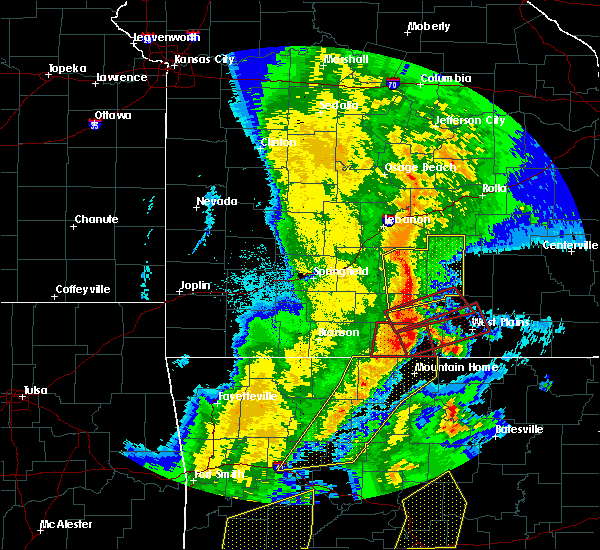 At 210 am cdt, a severe thunderstorm capable of producing a tornado was located 7 miles northeast of gainesville, or 24 miles southeast of ava, moving east at 65 mph (radar indicated rotation). Hazards include tornado. Flying debris will be dangerous to those caught without shelter. mobile homes will be damaged or destroyed. damage to roofs, windows, and vehicles will occur. Tree damage is likely. At 210 am cdt, a severe thunderstorm capable of producing a tornado was located 7 miles northeast of gainesville, or 24 miles southeast of ava, moving east at 65 mph (radar indicated rotation). Hazards include tornado. Flying debris will be dangerous to those caught without shelter. mobile homes will be damaged or destroyed. damage to roofs, windows, and vehicles will occur. Tree damage is likely.
|
| 8/27/2019 1:20 AM CDT |
 The severe thunderstorm warning for southern howell county will expire at 130 am cdt, the storms which prompted the warning have moved out of the area. therefore, the warning will be allowed to expire. however gusty winds are still possible with these thunderstorms. a severe thunderstorm watch remains in effect until 600 am cdt for south central and southwestern missouri. The severe thunderstorm warning for southern howell county will expire at 130 am cdt, the storms which prompted the warning have moved out of the area. therefore, the warning will be allowed to expire. however gusty winds are still possible with these thunderstorms. a severe thunderstorm watch remains in effect until 600 am cdt for south central and southwestern missouri.
|
| 8/27/2019 1:15 AM CDT |
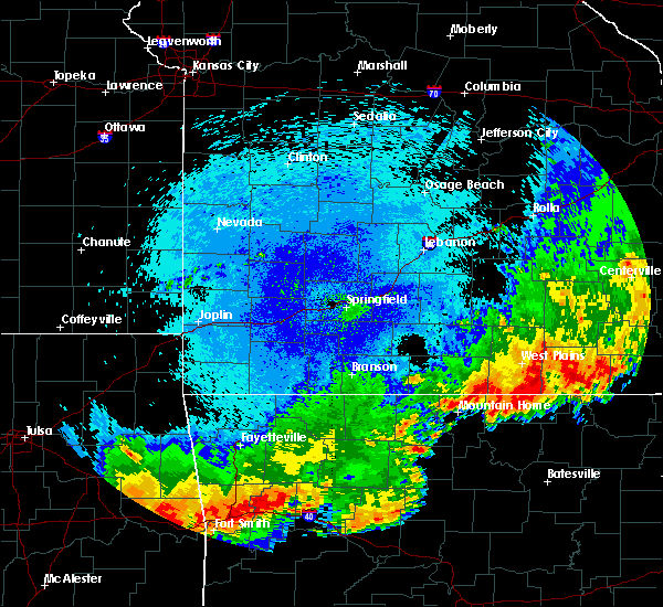 At 115 am cdt, severe thunderstorms were located along a line extending from 8 miles east of west plains to 9 miles west of thayer to 9 miles north of salem in fulton county to near sturkie, moving east at 45 mph (radar indicated). Hazards include 60 mph wind gusts and penny size hail. Expect damage to roofs, siding, and trees. Locations impacted include, west plains, south fork, brandsville, lanton, moody, caulfield,. At 115 am cdt, severe thunderstorms were located along a line extending from 8 miles east of west plains to 9 miles west of thayer to 9 miles north of salem in fulton county to near sturkie, moving east at 45 mph (radar indicated). Hazards include 60 mph wind gusts and penny size hail. Expect damage to roofs, siding, and trees. Locations impacted include, west plains, south fork, brandsville, lanton, moody, caulfield,.
|
| 8/27/2019 1:00 AM CDT | Severe thunderstorm wind gusts caused tree damage in west plain in howell county MO, 1.4 miles WNW of West Plains, MO |
| 8/27/2019 12:55 AM CDT |
 At 1255 am cdt, severe thunderstorms were located along a line extending from 6 miles west of west plains to 12 miles northwest of sturkie to near ott to near bakersfield, moving east at 55 mph (radar indicated). Hazards include 70 mph wind gusts and penny size hail. Expect considerable tree damage. damage is likely to mobile homes, roofs, and outbuildings. Locations impacted include, west plains, south fork, brandsville, lanton, moody, pottersville, caulfield,. At 1255 am cdt, severe thunderstorms were located along a line extending from 6 miles west of west plains to 12 miles northwest of sturkie to near ott to near bakersfield, moving east at 55 mph (radar indicated). Hazards include 70 mph wind gusts and penny size hail. Expect considerable tree damage. damage is likely to mobile homes, roofs, and outbuildings. Locations impacted include, west plains, south fork, brandsville, lanton, moody, pottersville, caulfield,.
|
| 8/27/2019 12:48 AM CDT |
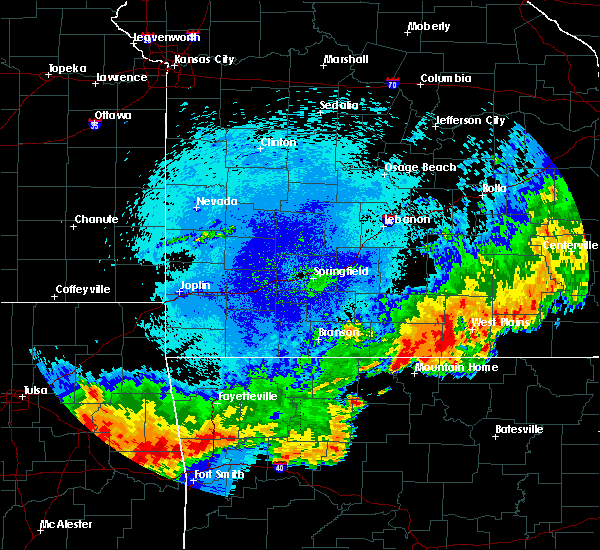 At 1248 am cdt, severe thunderstorms were located along a line extending from 12 miles west of west plains to 9 miles north of ott to near bakersfield to 6 miles northwest of gamaliel landing, moving east at 50 mph (radar indicated). Hazards include 70 mph wind gusts and nickel size hail. Expect considerable tree damage. damage is likely to mobile homes, roofs, and outbuildings. Locations impacted include, west plains, south fork, brandsville, lanton, siloam springs, moody, pottersville, caulfield,. At 1248 am cdt, severe thunderstorms were located along a line extending from 12 miles west of west plains to 9 miles north of ott to near bakersfield to 6 miles northwest of gamaliel landing, moving east at 50 mph (radar indicated). Hazards include 70 mph wind gusts and nickel size hail. Expect considerable tree damage. damage is likely to mobile homes, roofs, and outbuildings. Locations impacted include, west plains, south fork, brandsville, lanton, siloam springs, moody, pottersville, caulfield,.
|
| 8/27/2019 12:34 AM CDT |
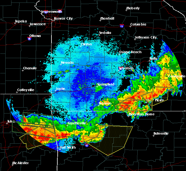 At 1234 am cdt, severe thunderstorms were located along a line extending from 19 miles southeast of norwood to 14 miles northwest of bakersfield to near gainesville, moving east at 45 mph (radar indicated). Hazards include 70 mph wind gusts and quarter size hail. Hail damage to vehicles is expected. expect considerable tree damage. Wind damage is also likely to mobile homes, roofs, and outbuildings. At 1234 am cdt, severe thunderstorms were located along a line extending from 19 miles southeast of norwood to 14 miles northwest of bakersfield to near gainesville, moving east at 45 mph (radar indicated). Hazards include 70 mph wind gusts and quarter size hail. Hail damage to vehicles is expected. expect considerable tree damage. Wind damage is also likely to mobile homes, roofs, and outbuildings.
|
| 8/7/2019 1:31 PM CDT |
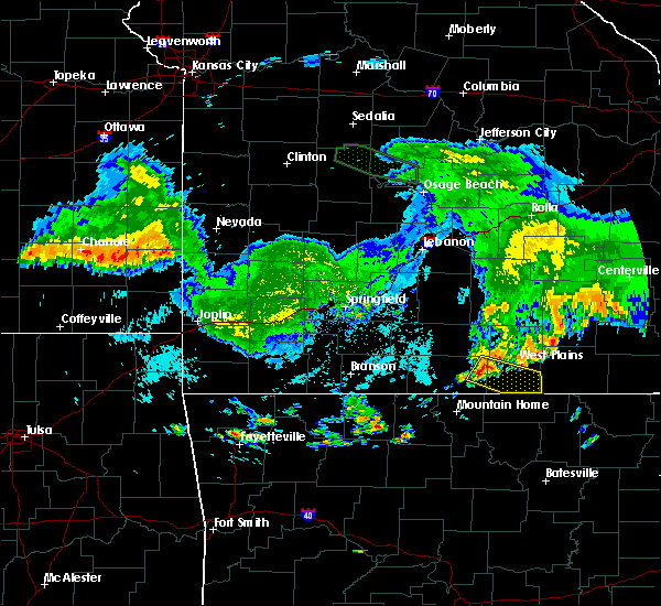 At 131 pm cdt, a severe thunderstorm was located 10 miles southwest of west plains, moving southeast at 25 mph (radar indicated). Hazards include 60 mph wind gusts and quarter size hail. Hail damage to vehicles is expected. expect wind damage to roofs, siding, and trees. Locations impacted include, west plains, south fork, brandsville, lanton, moody, pottersville, caulfield,. At 131 pm cdt, a severe thunderstorm was located 10 miles southwest of west plains, moving southeast at 25 mph (radar indicated). Hazards include 60 mph wind gusts and quarter size hail. Hail damage to vehicles is expected. expect wind damage to roofs, siding, and trees. Locations impacted include, west plains, south fork, brandsville, lanton, moody, pottersville, caulfield,.
|
| 8/7/2019 1:10 PM CDT |
 At 110 pm cdt, a severe thunderstorm was located 13 miles north of bakersfield, or 17 miles west of west plains, moving southeast at 25 mph (radar indicated). Hazards include 60 mph wind gusts and quarter size hail. Hail damage to vehicles is expected. Expect wind damage to roofs, siding, and trees. At 110 pm cdt, a severe thunderstorm was located 13 miles north of bakersfield, or 17 miles west of west plains, moving southeast at 25 mph (radar indicated). Hazards include 60 mph wind gusts and quarter size hail. Hail damage to vehicles is expected. Expect wind damage to roofs, siding, and trees.
|
| 6/23/2019 12:34 PM CDT | Corrects previous tstm wnd dmg report from west plains to add more information. reports of tops of trees broken off many yards. power lines down. wendy time radar estim in howell county MO, 0.9 miles NW of West Plains, MO |
| 6/21/2019 3:25 PM CDT | Power lines down in west plains. west plains asos reported at 3:19 pm 41 mph gust. time estimate in howell county MO, 1.4 miles WNW of West Plains, MO |
| 6/4/2019 4:44 PM CDT |
 At 444 pm cdt, a severe thunderstorm was located 7 miles north of sturkie, or 10 miles south of west plains, moving northeast at 20 mph (radar indicated). Hazards include 60 mph wind gusts and quarter size hail. Hail damage to vehicles is expected. expect wind damage to roofs, siding, and trees. Locations impacted include, west plains, brandsville, lanton, moody,. At 444 pm cdt, a severe thunderstorm was located 7 miles north of sturkie, or 10 miles south of west plains, moving northeast at 20 mph (radar indicated). Hazards include 60 mph wind gusts and quarter size hail. Hail damage to vehicles is expected. expect wind damage to roofs, siding, and trees. Locations impacted include, west plains, brandsville, lanton, moody,.
|
| 6/4/2019 4:24 PM CDT |
 At 424 pm cdt, a severe thunderstorm was located near ott, or 14 miles northwest of salem in fulton county, moving northeast at 20 mph (radar indicated). Hazards include 60 mph wind gusts and quarter size hail. Hail damage to vehicles is expected. Expect wind damage to roofs, siding, and trees. At 424 pm cdt, a severe thunderstorm was located near ott, or 14 miles northwest of salem in fulton county, moving northeast at 20 mph (radar indicated). Hazards include 60 mph wind gusts and quarter size hail. Hail damage to vehicles is expected. Expect wind damage to roofs, siding, and trees.
|
| 6/4/2019 3:42 PM CDT |
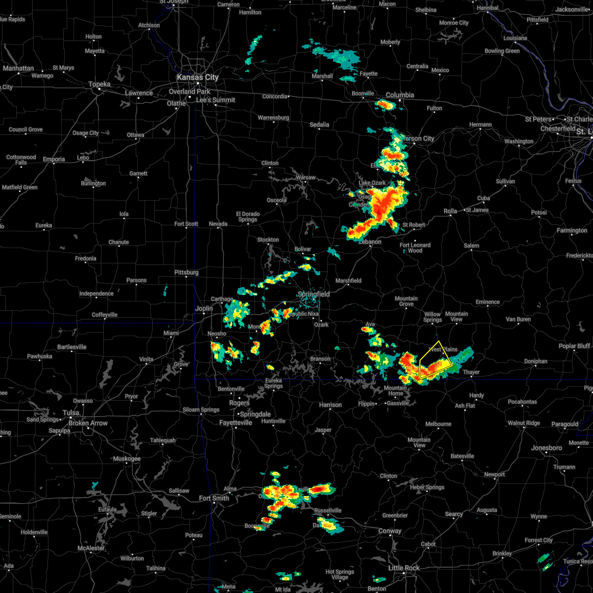 The severe thunderstorm warning for southern howell county will expire at 345 pm cdt, the storm which prompted the warning has weakened below severe limits, and no longer poses an immediate threat to life or property. therefore, the warning will be allowed to expire. however small hail and gusty winds are still possible with this thunderstorm. a severe thunderstorm watch remains in effect until 900 pm cdt for south central and southwestern missouri. The severe thunderstorm warning for southern howell county will expire at 345 pm cdt, the storm which prompted the warning has weakened below severe limits, and no longer poses an immediate threat to life or property. therefore, the warning will be allowed to expire. however small hail and gusty winds are still possible with this thunderstorm. a severe thunderstorm watch remains in effect until 900 pm cdt for south central and southwestern missouri.
|
| 6/4/2019 3:04 PM CDT |
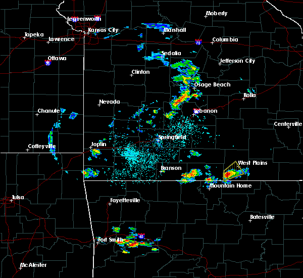 At 303 pm cdt, a severe thunderstorm was located 9 miles northeast of bakersfield, or 12 miles southwest of west plains, moving northeast at 15 mph. quarter sized hail was observed in caulfield (public). Hazards include 60 mph wind gusts and quarter size hail. Hail damage to vehicles is expected. expect wind damage to roofs, siding, and trees. Locations impacted include, west plains, south fork, pottersville, caulfield,. At 303 pm cdt, a severe thunderstorm was located 9 miles northeast of bakersfield, or 12 miles southwest of west plains, moving northeast at 15 mph. quarter sized hail was observed in caulfield (public). Hazards include 60 mph wind gusts and quarter size hail. Hail damage to vehicles is expected. expect wind damage to roofs, siding, and trees. Locations impacted include, west plains, south fork, pottersville, caulfield,.
|
| 6/4/2019 2:53 PM CDT |
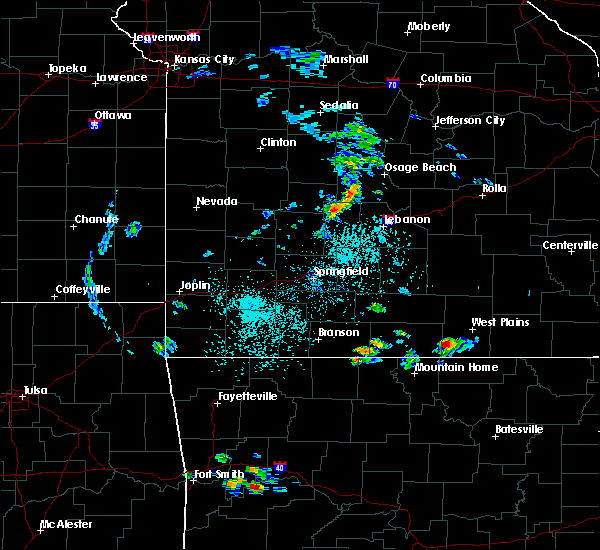 At 252 pm cdt, a severe thunderstorm was located 7 miles northeast of bakersfield, or 14 miles southwest of west plains, moving northeast at 15 mph (radar indicated). Hazards include 60 mph wind gusts and quarter size hail. Hail damage to vehicles is expected. Expect wind damage to roofs, siding, and trees. At 252 pm cdt, a severe thunderstorm was located 7 miles northeast of bakersfield, or 14 miles southwest of west plains, moving northeast at 15 mph (radar indicated). Hazards include 60 mph wind gusts and quarter size hail. Hail damage to vehicles is expected. Expect wind damage to roofs, siding, and trees.
|
| 5/29/2019 3:28 PM CDT | Tree fell onto power lines and is on fire off of hwy 160 about 5 miles southwest of west plain in howell county MO, 6.1 miles NNE of West Plains, MO |
| 5/21/2019 4:21 PM CDT |
 At 421 pm cdt, severe thunderstorms were located along a line extending from near licking to near sturkie, moving east at 45 mph (radar indicated). Hazards include 60 mph wind gusts and nickel size hail. Expect damage to roofs, siding, and trees. Locations impacted include, west plains, licking, mountain view, willow springs, cabool, houston, pomona, summersville, raymondville, south fork, brandsville, lanton, pottersville, success, eunice, yukon, clear springs, solo, pine crest, simmons,. At 421 pm cdt, severe thunderstorms were located along a line extending from near licking to near sturkie, moving east at 45 mph (radar indicated). Hazards include 60 mph wind gusts and nickel size hail. Expect damage to roofs, siding, and trees. Locations impacted include, west plains, licking, mountain view, willow springs, cabool, houston, pomona, summersville, raymondville, south fork, brandsville, lanton, pottersville, success, eunice, yukon, clear springs, solo, pine crest, simmons,.
|
| 5/21/2019 4:16 PM CDT | 911 reporting tree on a structure on 11587 co road 6690 across from e highway... west plains m in howell county MO, 9 miles NNE of West Plains, MO |
| 5/21/2019 4:15 PM CDT | Trees down on power lines just west of timberland pallet... 10 miles west of west plains mo on 160 highwa in howell county MO, 8.8 miles E of West Plains, MO |
| 5/21/2019 4:12 PM CDT |
 The tornado warning for northern howell county will expire at 415 pm cdt, the storm which prompted the warning has weakened below severe limits, and no longer appears capable of producing a tornado. therefore, the warning will be allowed to expire. a tornado watch remains in effect until 700 pm cdt for south central and southwestern missouri. The tornado warning for northern howell county will expire at 415 pm cdt, the storm which prompted the warning has weakened below severe limits, and no longer appears capable of producing a tornado. therefore, the warning will be allowed to expire. a tornado watch remains in effect until 700 pm cdt for south central and southwestern missouri.
|
| 5/21/2019 4:10 PM CDT |
 At 410 pm cdt, severe thunderstorms were located along a line extending from 9 miles northwest of houston to near ott, moving east at 40 mph (radar indicated). Hazards include 60 mph wind gusts and nickel size hail. expect damage to roofs, siding, and trees At 410 pm cdt, severe thunderstorms were located along a line extending from 9 miles northwest of houston to near ott, moving east at 40 mph (radar indicated). Hazards include 60 mph wind gusts and nickel size hail. expect damage to roofs, siding, and trees
|
| 5/21/2019 4:09 PM CDT | Two trees down on cc highway 13 miles out of west plains... m in howell county MO, 11.6 miles E of West Plains, MO |
| 5/21/2019 4:05 PM CDT |
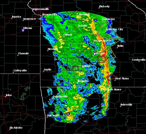 At 404 pm cdt, a severe thunderstorm capable of producing a tornado was located 11 miles northwest of west plains, moving northeast at 50 mph (radar indicated rotation). Hazards include tornado and quarter size hail. Flying debris will be dangerous to those caught without shelter. mobile homes will be damaged or destroyed. damage to roofs, windows, and vehicles will occur. tree damage is likely. Locations impacted include, pomona, white church, siloam springs,. At 404 pm cdt, a severe thunderstorm capable of producing a tornado was located 11 miles northwest of west plains, moving northeast at 50 mph (radar indicated rotation). Hazards include tornado and quarter size hail. Flying debris will be dangerous to those caught without shelter. mobile homes will be damaged or destroyed. damage to roofs, windows, and vehicles will occur. tree damage is likely. Locations impacted include, pomona, white church, siloam springs,.
|
| 5/21/2019 3:50 PM CDT |
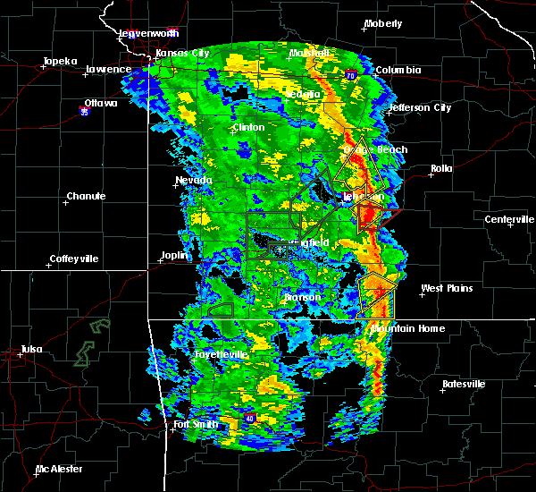 At 350 pm cdt, a severe thunderstorm capable of producing a tornado was located 11 miles north of bakersfield, or 18 miles west of west plains, moving northeast at 50 mph (radar indicated rotation). Hazards include tornado and quarter size hail. Flying debris will be dangerous to those caught without shelter. mobile homes will be damaged or destroyed. damage to roofs, windows, and vehicles will occur. Tree damage is likely. At 350 pm cdt, a severe thunderstorm capable of producing a tornado was located 11 miles north of bakersfield, or 18 miles west of west plains, moving northeast at 50 mph (radar indicated rotation). Hazards include tornado and quarter size hail. Flying debris will be dangerous to those caught without shelter. mobile homes will be damaged or destroyed. damage to roofs, windows, and vehicles will occur. Tree damage is likely.
|
| 5/21/2019 2:54 AM CDT |
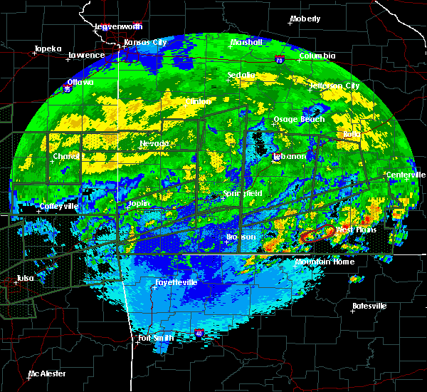 At 254 am cdt, a severe thunderstorm capable of producing a tornado was located 13 miles north of bakersfield, or 20 miles west of west plains, moving northeast at 35 mph (radar indicated rotation). Hazards include tornado and half dollar size hail. Flying debris will be dangerous to those caught without shelter. mobile homes will be damaged or destroyed. damage to roofs, windows, and vehicles will occur. tree damage is likely. Locations impacted include, west plains, pottersville, siloam springs, sycamore,. At 254 am cdt, a severe thunderstorm capable of producing a tornado was located 13 miles north of bakersfield, or 20 miles west of west plains, moving northeast at 35 mph (radar indicated rotation). Hazards include tornado and half dollar size hail. Flying debris will be dangerous to those caught without shelter. mobile homes will be damaged or destroyed. damage to roofs, windows, and vehicles will occur. tree damage is likely. Locations impacted include, west plains, pottersville, siloam springs, sycamore,.
|
| 5/21/2019 2:45 AM CDT |
 At 245 am cdt, a severe thunderstorm capable of producing a tornado was located 8 miles northeast of gainesville, or 22 miles north of mountain home, moving northeast at 35 mph (radar indicated rotation). Hazards include tornado and half dollar size hail. Flying debris will be dangerous to those caught without shelter. mobile homes will be damaged or destroyed. damage to roofs, windows, and vehicles will occur. Tree damage is likely. At 245 am cdt, a severe thunderstorm capable of producing a tornado was located 8 miles northeast of gainesville, or 22 miles north of mountain home, moving northeast at 35 mph (radar indicated rotation). Hazards include tornado and half dollar size hail. Flying debris will be dangerous to those caught without shelter. mobile homes will be damaged or destroyed. damage to roofs, windows, and vehicles will occur. Tree damage is likely.
|
| 5/18/2019 5:36 PM CDT |
 At 536 pm cdt, severe thunderstorms were located along a line extending from 6 miles east of st. robert to 7 miles northwest of summersville to 6 miles west of thayer, moving east at 35 mph (trained weather spotters). Hazards include 60 mph wind gusts. Expect damage to roofs, siding, and trees. locations impacted include, rolla, northeastern fort leonard wood, west plains, ozark national scenic riverways, echo bluff state park, current river state park, grand gulf state park, montauk state park, salem, st. robert, st. James, licking, mountain view, thayer, winona, alton, birch tree, doolittle, eminence, summersville, this includes interstate 44 between mile markers 161 and 169, and between mile markers 179 and 199. At 536 pm cdt, severe thunderstorms were located along a line extending from 6 miles east of st. robert to 7 miles northwest of summersville to 6 miles west of thayer, moving east at 35 mph (trained weather spotters). Hazards include 60 mph wind gusts. Expect damage to roofs, siding, and trees. locations impacted include, rolla, northeastern fort leonard wood, west plains, ozark national scenic riverways, echo bluff state park, current river state park, grand gulf state park, montauk state park, salem, st. robert, st. James, licking, mountain view, thayer, winona, alton, birch tree, doolittle, eminence, summersville, this includes interstate 44 between mile markers 161 and 169, and between mile markers 179 and 199.
|
| 5/18/2019 5:15 PM CDT |
 At 515 pm cdt, severe thunderstorms were located along a line extending from near waynesville to 7 miles south of houston to near sturkie, moving east at 35 mph (trained weather spotters). Hazards include 60 mph wind gusts. expect damage to roofs, siding, and trees At 515 pm cdt, severe thunderstorms were located along a line extending from near waynesville to 7 miles south of houston to near sturkie, moving east at 35 mph (trained weather spotters). Hazards include 60 mph wind gusts. expect damage to roofs, siding, and trees
|
| 5/18/2019 5:04 PM CDT |
 At 503 pm cdt, severe thunderstorms were located along a line extending from 18 miles northeast of hartville to near ott, moving east at 30 mph (trained weather spotters. these storms have a history of producing damaging winds in the ava and lebanon areas). Hazards include 60 mph wind gusts. Expect damage to roofs, siding, and trees. Locations impacted include, southwestern fort leonard wood, west plains, mountain grove, willow springs, cabool, houston, dawson, pomona, bakersfield, south fork, brandsville, huggins, plato, competition, manes, pottersville, lynchburg, caulfield, falcon, udall, this includes interstate 44 between mile markers 144 and 152. At 503 pm cdt, severe thunderstorms were located along a line extending from 18 miles northeast of hartville to near ott, moving east at 30 mph (trained weather spotters. these storms have a history of producing damaging winds in the ava and lebanon areas). Hazards include 60 mph wind gusts. Expect damage to roofs, siding, and trees. Locations impacted include, southwestern fort leonard wood, west plains, mountain grove, willow springs, cabool, houston, dawson, pomona, bakersfield, south fork, brandsville, huggins, plato, competition, manes, pottersville, lynchburg, caulfield, falcon, udall, this includes interstate 44 between mile markers 144 and 152.
|
| 5/18/2019 4:52 PM CDT |
 At 449 pm cdt, severe thunderstorms were located along a line extending from 16 miles north of hartville to near bakersfield, moving east at 45 mph (radar indicated). Hazards include 60 mph wind gusts. an area of rotation and possible tornado potential exists near mountain grove moving into texas county. Expect damage to roofs, siding, and trees. Locations impacted include, southwestern fort leonard wood, west plains, mountain grove, willow springs, cabool, houston, dawson, norwood, hartville, pomona, bakersfield, south fork, brandsville, huggins, plato, twin bridges, competition, manes, tecumseh, pottersville, this includes interstate 44 between mile markers 133 and 152. At 449 pm cdt, severe thunderstorms were located along a line extending from 16 miles north of hartville to near bakersfield, moving east at 45 mph (radar indicated). Hazards include 60 mph wind gusts. an area of rotation and possible tornado potential exists near mountain grove moving into texas county. Expect damage to roofs, siding, and trees. Locations impacted include, southwestern fort leonard wood, west plains, mountain grove, willow springs, cabool, houston, dawson, norwood, hartville, pomona, bakersfield, south fork, brandsville, huggins, plato, twin bridges, competition, manes, tecumseh, pottersville, this includes interstate 44 between mile markers 133 and 152.
|
| 5/18/2019 4:25 PM CDT |
 At 425 pm cdt, severe thunderstorms were located along a line extending from near conway to near gainesville, moving east at 30 mph (radar indicated). Hazards include 60 mph wind gusts. expect damage to roofs, siding, and trees At 425 pm cdt, severe thunderstorms were located along a line extending from near conway to near gainesville, moving east at 30 mph (radar indicated). Hazards include 60 mph wind gusts. expect damage to roofs, siding, and trees
|
| 2/7/2019 5:13 AM CST |
 At 512 am cst, a severe thunderstorm was located 8 miles southeast of west plains, moving northeast at 70 mph (radar indicated). Hazards include 60 mph wind gusts. expect damage to roofs, siding, and trees At 512 am cst, a severe thunderstorm was located 8 miles southeast of west plains, moving northeast at 70 mph (radar indicated). Hazards include 60 mph wind gusts. expect damage to roofs, siding, and trees
|
| 12/1/2018 1:33 AM CST |
 At 132 am cst, severe thunderstorms were located along a line extending from near niangua to near mansfield to 15 miles northeast of gainesville to near bakersfield, moving east at 55 mph (law enforcement. these storms have a long history of producing wind damage across southern missouri). Hazards include 70 mph wind gusts. Expect considerable tree damage. Damage is likely to mobile homes, roofs, and outbuildings. At 132 am cst, severe thunderstorms were located along a line extending from near niangua to near mansfield to 15 miles northeast of gainesville to near bakersfield, moving east at 55 mph (law enforcement. these storms have a long history of producing wind damage across southern missouri). Hazards include 70 mph wind gusts. Expect considerable tree damage. Damage is likely to mobile homes, roofs, and outbuildings.
|
| 8/20/2018 1:00 PM CDT |
 At 100 pm cdt, a severe thunderstorm was located 1 mile west of west plains, moving east at 30 mph (radar indicated). Hazards include 60 mph wind gusts and quarter size hail. Hail damage to vehicles is expected. expect wind damage to roofs, siding, and trees. Locations impacted include, west plains,. At 100 pm cdt, a severe thunderstorm was located 1 mile west of west plains, moving east at 30 mph (radar indicated). Hazards include 60 mph wind gusts and quarter size hail. Hail damage to vehicles is expected. expect wind damage to roofs, siding, and trees. Locations impacted include, west plains,.
|
| 8/20/2018 12:47 PM CDT |
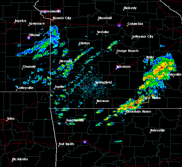 At 1244 pm cdt, a severe thunderstorm was located 10 miles west of west plains, moving east at 30 mph (radar indicated). Hazards include 60 mph wind gusts and quarter size hail. Hail damage to vehicles is expected. Expect wind damage to roofs, siding, and trees. At 1244 pm cdt, a severe thunderstorm was located 10 miles west of west plains, moving east at 30 mph (radar indicated). Hazards include 60 mph wind gusts and quarter size hail. Hail damage to vehicles is expected. Expect wind damage to roofs, siding, and trees.
|
| 7/19/2018 8:32 PM CDT |
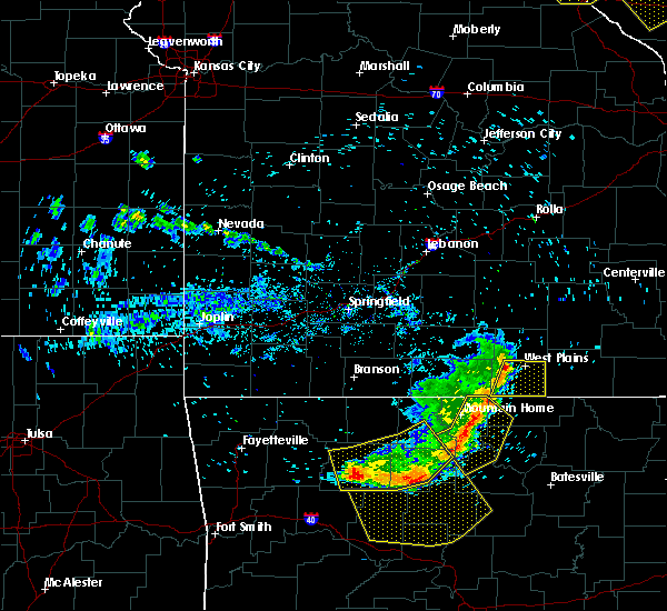 At 832 pm cdt, severe thunderstorms were located along a line extending from 6 miles northwest of west plains to ott, moving east at 40 mph (radar indicated). Hazards include 60 mph wind gusts. Expect damage to roofs, siding, and trees. Locations impacted include, west plains, south fork, brandsville, lanton, pottersville, moody,. At 832 pm cdt, severe thunderstorms were located along a line extending from 6 miles northwest of west plains to ott, moving east at 40 mph (radar indicated). Hazards include 60 mph wind gusts. Expect damage to roofs, siding, and trees. Locations impacted include, west plains, south fork, brandsville, lanton, pottersville, moody,.
|
| 7/19/2018 8:20 PM CDT |
 At 820 pm cdt, severe thunderstorms were located along a line extending from 7 miles southwest of willow springs to 13 miles west of west plains, moving east at 35 mph (radar indicated). Hazards include 60 mph wind gusts. Expect damage to roofs, siding, and trees. Locations impacted include, west plains, pomona, white church,. At 820 pm cdt, severe thunderstorms were located along a line extending from 7 miles southwest of willow springs to 13 miles west of west plains, moving east at 35 mph (radar indicated). Hazards include 60 mph wind gusts. Expect damage to roofs, siding, and trees. Locations impacted include, west plains, pomona, white church,.
|
| 7/19/2018 8:14 PM CDT |
 At 814 pm cdt, severe thunderstorms were located along a line extending from 10 miles southwest of willow springs to 6 miles northwest of gamaliel landing, moving east at 45 mph (radar indicated). Hazards include 60 mph wind gusts. expect damage to roofs, siding, and trees At 814 pm cdt, severe thunderstorms were located along a line extending from 10 miles southwest of willow springs to 6 miles northwest of gamaliel landing, moving east at 45 mph (radar indicated). Hazards include 60 mph wind gusts. expect damage to roofs, siding, and trees
|
| 7/19/2018 8:04 PM CDT |
 At 803 pm cdt, severe thunderstorms were located along a line extending from 6 miles south of mountain grove to 13 miles north of gainesville, moving east at 30 mph (radar indicated). Hazards include 60 mph wind gusts. Expect damage to roofs, siding, and trees. Locations impacted include, west plains, mountain view, willow springs, pomona, peace valley, siloam springs, white church, vanzant, drury, gentryville,. At 803 pm cdt, severe thunderstorms were located along a line extending from 6 miles south of mountain grove to 13 miles north of gainesville, moving east at 30 mph (radar indicated). Hazards include 60 mph wind gusts. Expect damage to roofs, siding, and trees. Locations impacted include, west plains, mountain view, willow springs, pomona, peace valley, siloam springs, white church, vanzant, drury, gentryville,.
|
| 7/19/2018 7:47 PM CDT |
 At 745 pm cdt, severe thunderstorms were located along a line extending from near norwood to 13 miles southeast of ava, moving east at 35 mph (radar indicated). Hazards include 60 mph wind gusts. Expect damage to roofs, siding, and trees. Locations impacted include, west plains, mountain view, willow springs, cabool, norwood, pomona, peace valley, arroll, gentryville, siloam springs, white church, vanzant, clear springs, pine crest, drury,. At 745 pm cdt, severe thunderstorms were located along a line extending from near norwood to 13 miles southeast of ava, moving east at 35 mph (radar indicated). Hazards include 60 mph wind gusts. Expect damage to roofs, siding, and trees. Locations impacted include, west plains, mountain view, willow springs, cabool, norwood, pomona, peace valley, arroll, gentryville, siloam springs, white church, vanzant, clear springs, pine crest, drury,.
|
| 7/19/2018 7:31 PM CDT |
 At 730 pm cdt, severe thunderstorms were located along a line extending from near mansfield to 10 miles south of ava, moving east at 30 mph (radar indicated). Hazards include 60 mph wind gusts. expect damage to roofs, siding, and trees At 730 pm cdt, severe thunderstorms were located along a line extending from near mansfield to 10 miles south of ava, moving east at 30 mph (radar indicated). Hazards include 60 mph wind gusts. expect damage to roofs, siding, and trees
|
| 7/16/2018 4:05 PM CDT |
 At 351 pm cdt, severe thunderstorms were located along a line extending from near mountain view to 8 miles southwest of willow springs, moving southeast at 15 mph (radar indicated). Hazards include 60 mph wind gusts. Expect damage to roofs, siding, and trees. Locations impacted include, west plains, pomona, peace valley, siloam springs, white church,. At 351 pm cdt, severe thunderstorms were located along a line extending from near mountain view to 8 miles southwest of willow springs, moving southeast at 15 mph (radar indicated). Hazards include 60 mph wind gusts. Expect damage to roofs, siding, and trees. Locations impacted include, west plains, pomona, peace valley, siloam springs, white church,.
|
| 7/16/2018 3:51 PM CDT |
 At 351 pm cdt, severe thunderstorms were located along a line extending from near mountain view to 8 miles southwest of willow springs, moving southeast at 15 mph (radar indicated). Hazards include 60 mph wind gusts. Expect damage to roofs, siding, and trees. Locations impacted include, west plains, pomona, peace valley, siloam springs, white church,. At 351 pm cdt, severe thunderstorms were located along a line extending from near mountain view to 8 miles southwest of willow springs, moving southeast at 15 mph (radar indicated). Hazards include 60 mph wind gusts. Expect damage to roofs, siding, and trees. Locations impacted include, west plains, pomona, peace valley, siloam springs, white church,.
|
| 7/16/2018 3:34 PM CDT |
 At 334 pm cdt, severe thunderstorms were located along a line extending from near mountain view to 10 miles southwest of willow springs, moving southeast at 15 mph (radar indicated). Hazards include 60 mph wind gusts. expect damage to roofs, siding, and trees At 334 pm cdt, severe thunderstorms were located along a line extending from near mountain view to 10 miles southwest of willow springs, moving southeast at 15 mph (radar indicated). Hazards include 60 mph wind gusts. expect damage to roofs, siding, and trees
|
| 6/26/2018 7:06 PM CDT |
 At 706 pm cdt, severe thunderstorms were located along a line extending from 11 miles northwest of bunker to near birch tree to 7 miles north of ott, moving east at 40 mph (radar indicated). Hazards include 60 mph wind gusts and nickel size hail. Expect damage to roofs, siding, and trees. Locations impacted include, west plains, current river state park, grand gulf state park, mountain view, thayer, willow springs, winona, alton, birch tree, eminence, pomona, bunker, south fork, koshkonong, brandsville, montier, thomasville, lanton, teresita, myrtle,. At 706 pm cdt, severe thunderstorms were located along a line extending from 11 miles northwest of bunker to near birch tree to 7 miles north of ott, moving east at 40 mph (radar indicated). Hazards include 60 mph wind gusts and nickel size hail. Expect damage to roofs, siding, and trees. Locations impacted include, west plains, current river state park, grand gulf state park, mountain view, thayer, willow springs, winona, alton, birch tree, eminence, pomona, bunker, south fork, koshkonong, brandsville, montier, thomasville, lanton, teresita, myrtle,.
|
| 6/26/2018 6:58 PM CDT |
 At 658 pm cdt, severe thunderstorms were located along a line extending from 9 miles southeast of salem to birch tree to near bakersfield, moving east at 55 mph (radar indicated). Hazards include 60 mph wind gusts and nickel size hail. Expect damage to roofs, siding, and trees. Locations impacted include, west plains, current river state park, grand gulf state park, montauk state park, mountain view, thayer, willow springs, winona, alton, birch tree, eminence, pomona, summersville, bunker, bakersfield, south fork, koshkonong, brandsville, montier, thomasville,. At 658 pm cdt, severe thunderstorms were located along a line extending from 9 miles southeast of salem to birch tree to near bakersfield, moving east at 55 mph (radar indicated). Hazards include 60 mph wind gusts and nickel size hail. Expect damage to roofs, siding, and trees. Locations impacted include, west plains, current river state park, grand gulf state park, montauk state park, mountain view, thayer, willow springs, winona, alton, birch tree, eminence, pomona, summersville, bunker, bakersfield, south fork, koshkonong, brandsville, montier, thomasville,.
|
| 6/26/2018 6:45 PM CDT |
 At 645 pm cdt, severe thunderstorms were located along a line extending from near licking to near mountain view to 7 miles north of fawn park, moving east at 40 mph (radar indicated). Hazards include 60 mph wind gusts and nickel size hail. Expect damage to roofs, siding, and trees. Locations impacted include, west plains, norfork lake, current river state park, grand gulf state park, montauk state park, mountain view, thayer, willow springs, winona, alton, birch tree, eminence, pomona, summersville, bunker, raymondville, bakersfield, south fork, koshkonong, brandsville,. At 645 pm cdt, severe thunderstorms were located along a line extending from near licking to near mountain view to 7 miles north of fawn park, moving east at 40 mph (radar indicated). Hazards include 60 mph wind gusts and nickel size hail. Expect damage to roofs, siding, and trees. Locations impacted include, west plains, norfork lake, current river state park, grand gulf state park, montauk state park, mountain view, thayer, willow springs, winona, alton, birch tree, eminence, pomona, summersville, bunker, raymondville, bakersfield, south fork, koshkonong, brandsville,.
|
| 6/26/2018 6:29 PM CDT |
 At 629 pm cdt, severe thunderstorms were located along a line extending from 9 miles northwest of licking to near willow springs to near price place, moving east at 40 mph (radar indicated). Hazards include 60 mph wind gusts and nickel size hail. expect damage to roofs, siding, and trees At 629 pm cdt, severe thunderstorms were located along a line extending from 9 miles northwest of licking to near willow springs to near price place, moving east at 40 mph (radar indicated). Hazards include 60 mph wind gusts and nickel size hail. expect damage to roofs, siding, and trees
|
| 5/31/2018 5:01 PM CDT |
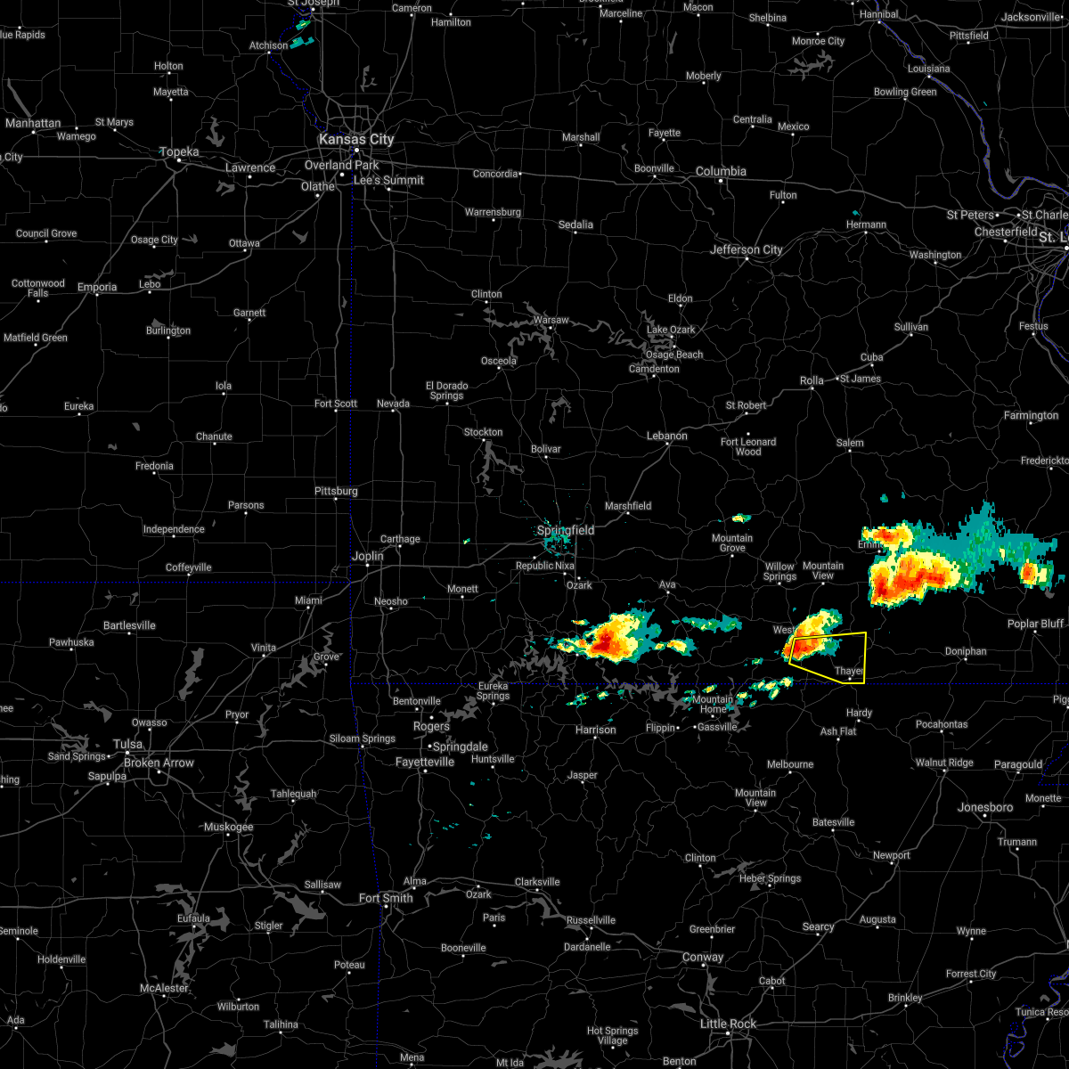 At 501 pm cdt, a severe thunderstorm was located near west plains, moving east at 20 mph (radar indicated). Hazards include 60 mph wind gusts and half dollar size hail. Hail damage to vehicles is expected. Expect wind damage to roofs, siding, and trees. At 501 pm cdt, a severe thunderstorm was located near west plains, moving east at 20 mph (radar indicated). Hazards include 60 mph wind gusts and half dollar size hail. Hail damage to vehicles is expected. Expect wind damage to roofs, siding, and trees.
|
| 5/31/2018 4:52 PM CDT |
 At 452 pm cdt, a severe thunderstorm was located over west plains, moving east at 20 mph (radar indicated). Hazards include tennis ball size hail and 60 mph wind gusts. People and animals outdoors will be injured. expect hail damage to roofs, siding, windows, and vehicles. expect wind damage to roofs, siding, and trees. Locations impacted include, west plains, brandsville, white church, a tornado watch remains in effect until 800 pm cdt for south central missouri. At 452 pm cdt, a severe thunderstorm was located over west plains, moving east at 20 mph (radar indicated). Hazards include tennis ball size hail and 60 mph wind gusts. People and animals outdoors will be injured. expect hail damage to roofs, siding, windows, and vehicles. expect wind damage to roofs, siding, and trees. Locations impacted include, west plains, brandsville, white church, a tornado watch remains in effect until 800 pm cdt for south central missouri.
|
| 5/31/2018 4:45 PM CDT | Quarter sized hail reported 2.1 miles NNW of West Plains, MO, social media report. |
| 5/31/2018 4:38 PM CDT |
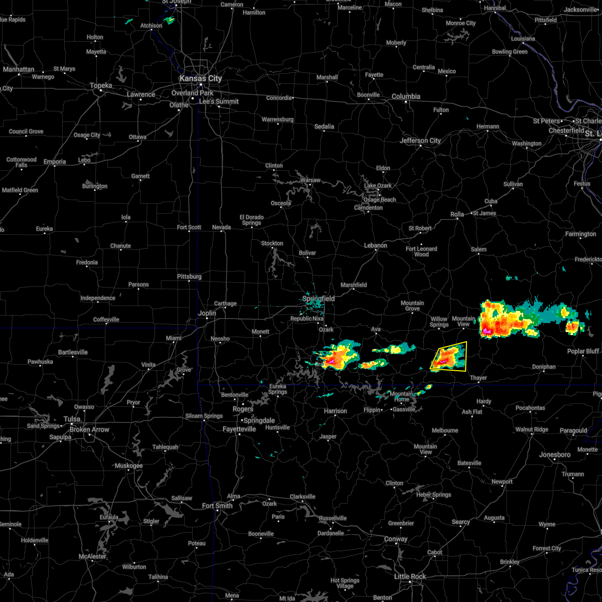 At 438 pm cdt, a severe thunderstorm was located near west plains, moving east at 25 mph (radar indicated). Hazards include golf ball size hail and 60 mph wind gusts. People and animals outdoors will be injured. expect hail damage to roofs, siding, windows, and vehicles. expect wind damage to roofs, siding, and trees. Locations impacted include, west plains, brandsville, pottersville, white church, a tornado watch remains in effect until 800 pm cdt for south central missouri. At 438 pm cdt, a severe thunderstorm was located near west plains, moving east at 25 mph (radar indicated). Hazards include golf ball size hail and 60 mph wind gusts. People and animals outdoors will be injured. expect hail damage to roofs, siding, windows, and vehicles. expect wind damage to roofs, siding, and trees. Locations impacted include, west plains, brandsville, pottersville, white church, a tornado watch remains in effect until 800 pm cdt for south central missouri.
|
| 5/31/2018 4:31 PM CDT |
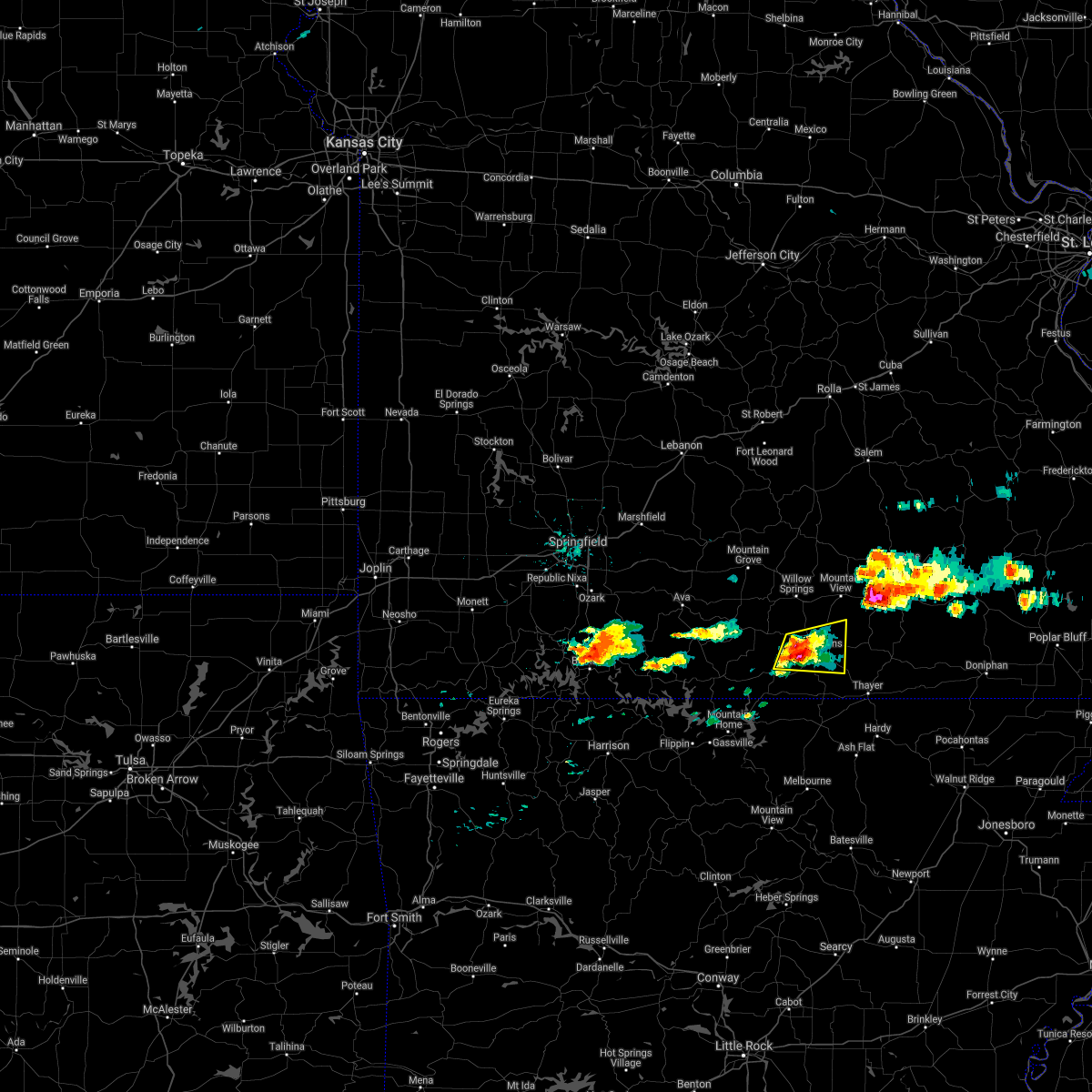 At 431 pm cdt, a severe thunderstorm was located near west plains, moving east at 25 mph (radar indicated). Hazards include 60 mph wind gusts and half dollar size hail. Hail damage to vehicles is expected. expect wind damage to roofs, siding, and trees. Locations impacted include, west plains, brandsville, pottersville, white church, a tornado watch remains in effect until 800 pm cdt for south central missouri. At 431 pm cdt, a severe thunderstorm was located near west plains, moving east at 25 mph (radar indicated). Hazards include 60 mph wind gusts and half dollar size hail. Hail damage to vehicles is expected. expect wind damage to roofs, siding, and trees. Locations impacted include, west plains, brandsville, pottersville, white church, a tornado watch remains in effect until 800 pm cdt for south central missouri.
|
| 5/31/2018 4:22 PM CDT |
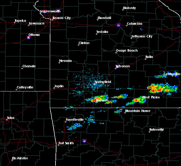 At 422 pm cdt, a severe thunderstorm was located 10 miles west of west plains, moving east at 25 mph (radar indicated). Hazards include 60 mph wind gusts and quarter size hail. Hail damage to vehicles is expected. Expect wind damage to roofs, siding, and trees. At 422 pm cdt, a severe thunderstorm was located 10 miles west of west plains, moving east at 25 mph (radar indicated). Hazards include 60 mph wind gusts and quarter size hail. Hail damage to vehicles is expected. Expect wind damage to roofs, siding, and trees.
|
| 5/19/2018 3:53 PM CDT |
 At 353 pm cdt, a severe thunderstorm was located 7 miles east of west plains, moving east at 15 mph (radar indicated). Hazards include golf ball size hail and 60 mph wind gusts. People and animals outdoors will be injured. expect hail damage to roofs, siding, windows, and vehicles. expect wind damage to roofs, siding, and trees. Locations impacted include, west plains, alton, koshkonong, brandsville, thomasville, peace valley, rover, white church, wilderness, couch, greer,. At 353 pm cdt, a severe thunderstorm was located 7 miles east of west plains, moving east at 15 mph (radar indicated). Hazards include golf ball size hail and 60 mph wind gusts. People and animals outdoors will be injured. expect hail damage to roofs, siding, windows, and vehicles. expect wind damage to roofs, siding, and trees. Locations impacted include, west plains, alton, koshkonong, brandsville, thomasville, peace valley, rover, white church, wilderness, couch, greer,.
|
| 5/19/2018 3:47 PM CDT |
 At 346 pm cdt, a severe thunderstorm was located near west plains, moving east at 20 mph (emergency management). Hazards include 60 mph wind gusts and quarter size hail. Hail damage to vehicles is expected. Expect wind damage to roofs, siding, and trees. At 346 pm cdt, a severe thunderstorm was located near west plains, moving east at 20 mph (emergency management). Hazards include 60 mph wind gusts and quarter size hail. Hail damage to vehicles is expected. Expect wind damage to roofs, siding, and trees.
|
| 5/19/2018 3:15 PM CDT | Half Dollar sized hail reported 8.2 miles ESE of West Plains, MO |
| 5/19/2018 3:10 PM CDT | Quarter sized hail reported 11 miles ESE of West Plains, MO |
| 5/19/2018 3:09 PM CDT |
 At 308 pm cdt, a severe thunderstorm was located 11 miles northwest of west plains, moving east at 30 mph (emergency management. this storm has a long history of producing hail up to the size of golf balls). Hazards include ping pong ball size hail and 60 mph wind gusts. People and animals outdoors will be injured. expect hail damage to roofs, siding, windows, and vehicles. expect wind damage to roofs, siding, and trees. Locations impacted include, west plains, mountain view, willow springs, pomona, brandsville, peace valley, siloam springs, white church, pottersville,. At 308 pm cdt, a severe thunderstorm was located 11 miles northwest of west plains, moving east at 30 mph (emergency management. this storm has a long history of producing hail up to the size of golf balls). Hazards include ping pong ball size hail and 60 mph wind gusts. People and animals outdoors will be injured. expect hail damage to roofs, siding, windows, and vehicles. expect wind damage to roofs, siding, and trees. Locations impacted include, west plains, mountain view, willow springs, pomona, brandsville, peace valley, siloam springs, white church, pottersville,.
|
| 5/19/2018 2:40 PM CDT |
 The national weather service in springfield has issued a * severe thunderstorm warning for. northeastern ozark county in southwestern missouri. eastern douglas county in southwestern missouri. howell county in south central missouri. Until 345 pm cdt. The national weather service in springfield has issued a * severe thunderstorm warning for. northeastern ozark county in southwestern missouri. eastern douglas county in southwestern missouri. howell county in south central missouri. Until 345 pm cdt.
|
| 5/3/2018 3:49 AM CDT |
 At 348 am cdt, severe thunderstorms were located along a line extending from 7 miles northwest of mountain view to near west plains to near sturkie, moving east at 45 mph (radar indicated). Hazards include 60 mph wind gusts and penny size hail. Expect damage to roofs, siding, and trees. Locations impacted include, west plains, mountain view, willow springs, pomona, south fork, brandsville, peace valley, lanton, pottersville, caulfield, siloam springs, white church, moody,. At 348 am cdt, severe thunderstorms were located along a line extending from 7 miles northwest of mountain view to near west plains to near sturkie, moving east at 45 mph (radar indicated). Hazards include 60 mph wind gusts and penny size hail. Expect damage to roofs, siding, and trees. Locations impacted include, west plains, mountain view, willow springs, pomona, south fork, brandsville, peace valley, lanton, pottersville, caulfield, siloam springs, white church, moody,.
|
| 5/3/2018 3:12 AM CDT |
 At 311 am cdt, severe thunderstorms were located along a line extending from 6 miles south of mountain grove to 12 miles northeast of gainesville to 7 miles north of arkawana, moving east at 40 mph (radar indicated). Hazards include 60 mph wind gusts and penny size hail. expect damage to roofs, siding, and trees At 311 am cdt, severe thunderstorms were located along a line extending from 6 miles south of mountain grove to 12 miles northeast of gainesville to 7 miles north of arkawana, moving east at 40 mph (radar indicated). Hazards include 60 mph wind gusts and penny size hail. expect damage to roofs, siding, and trees
|
| 4/13/2018 9:30 PM CDT |
 At 930 pm cdt, severe thunderstorms were located along a line extending from near mountain view to near west plains to 6 miles northeast of sturkie, moving northeast at 35 mph (radar indicated). Hazards include 60 mph wind gusts. expect damage to roofs, siding, and trees At 930 pm cdt, severe thunderstorms were located along a line extending from near mountain view to near west plains to 6 miles northeast of sturkie, moving northeast at 35 mph (radar indicated). Hazards include 60 mph wind gusts. expect damage to roofs, siding, and trees
|
| 4/13/2018 9:16 PM CDT |
 A severe thunderstorm warning remains in effect until 930 pm cdt for howell county. at 916 pm cdt, severe thunderstorms were located along a line extending from near summersville to near mountain view to near sturkie to near west plains, moving northeast at 40 mph. hazard. 60 mph wind gusts and nickel size hail. A severe thunderstorm warning remains in effect until 930 pm cdt for howell county. at 916 pm cdt, severe thunderstorms were located along a line extending from near summersville to near mountain view to near sturkie to near west plains, moving northeast at 40 mph. hazard. 60 mph wind gusts and nickel size hail.
|
| 4/13/2018 9:09 PM CDT |
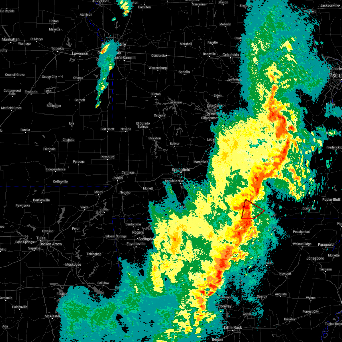 At 908 pm cdt, a severe thunderstorm capable of producing a tornado was located near ott, or 16 miles southwest of west plains, moving northeast at 30 mph. a funnel cloud was reported west of bakersfield earlier with this storm (radar indicated rotation). Hazards include tornado. Flying debris will be dangerous to those caught without shelter. mobile homes will be damaged or destroyed. damage to roofs, windows, and vehicles will occur. tree damage is likely. Locations impacted include, west plains, south fork, pottersville, moody,. At 908 pm cdt, a severe thunderstorm capable of producing a tornado was located near ott, or 16 miles southwest of west plains, moving northeast at 30 mph. a funnel cloud was reported west of bakersfield earlier with this storm (radar indicated rotation). Hazards include tornado. Flying debris will be dangerous to those caught without shelter. mobile homes will be damaged or destroyed. damage to roofs, windows, and vehicles will occur. tree damage is likely. Locations impacted include, west plains, south fork, pottersville, moody,.
|
| 4/13/2018 9:05 PM CDT |
 At 904 pm cdt, severe thunderstorms were located along a line extending from 8 miles west of summersville to near mountain view to 9 miles northeast of bakersfield, moving northeast at 40 mph (radar indicated). Hazards include 60 mph wind gusts and nickel size hail. Expect damage to roofs, siding, and trees. Locations impacted include, west plains, norfork lake, mountain view, willow springs, pomona, bakersfield, south fork, brandsville, peace valley, lanton, tecumseh, pottersville, caulfield, udall, siloam springs, white church, moody, a tornado watch remains in effect until 100 am cdt for south central and southwestern missouri. At 904 pm cdt, severe thunderstorms were located along a line extending from 8 miles west of summersville to near mountain view to 9 miles northeast of bakersfield, moving northeast at 40 mph (radar indicated). Hazards include 60 mph wind gusts and nickel size hail. Expect damage to roofs, siding, and trees. Locations impacted include, west plains, norfork lake, mountain view, willow springs, pomona, bakersfield, south fork, brandsville, peace valley, lanton, tecumseh, pottersville, caulfield, udall, siloam springs, white church, moody, a tornado watch remains in effect until 100 am cdt for south central and southwestern missouri.
|
| 4/13/2018 8:49 PM CDT |
 At 848 pm cdt, a severe thunderstorm capable of producing a tornado was located over gamaliel landing, or 10 miles northeast of mountain home, moving northeast at 30 mph (radar indicated rotation). Hazards include tornado. Flying debris will be dangerous to those caught without shelter. mobile homes will be damaged or destroyed. damage to roofs, windows, and vehicles will occur. Tree damage is likely. At 848 pm cdt, a severe thunderstorm capable of producing a tornado was located over gamaliel landing, or 10 miles northeast of mountain home, moving northeast at 30 mph (radar indicated rotation). Hazards include tornado. Flying debris will be dangerous to those caught without shelter. mobile homes will be damaged or destroyed. damage to roofs, windows, and vehicles will occur. Tree damage is likely.
|
| 4/13/2018 8:36 PM CDT |
 At 834 pm cdt, severe thunderstorms were located along a line extending from near cabool to 12 miles southwest of willow springs to 7 miles west of bakersfield, moving northeast at 40 mph. additional severe thunderstorms south of the missouri and arkansas state line will also move into the area (radar indicated). Hazards include 60 mph wind gusts and nickel size hail. expect damage to roofs, siding, and trees At 834 pm cdt, severe thunderstorms were located along a line extending from near cabool to 12 miles southwest of willow springs to 7 miles west of bakersfield, moving northeast at 40 mph. additional severe thunderstorms south of the missouri and arkansas state line will also move into the area (radar indicated). Hazards include 60 mph wind gusts and nickel size hail. expect damage to roofs, siding, and trees
|
| 4/3/2018 3:14 PM CDT |
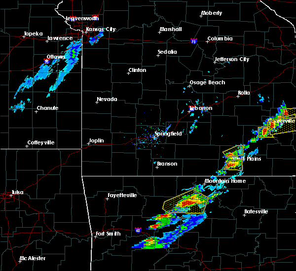 At 314 pm cdt, a severe thunderstorm was located near west plains, moving east at 50 mph (emergency management). Hazards include 60 mph wind gusts and quarter size hail. Hail damage to vehicles is expected. expect wind damage to roofs, siding, and trees. Locations impacted include, west plains, south fork, brandsville, a tornado watch remains in effect until 800 pm cdt for south central missouri. At 314 pm cdt, a severe thunderstorm was located near west plains, moving east at 50 mph (emergency management). Hazards include 60 mph wind gusts and quarter size hail. Hail damage to vehicles is expected. expect wind damage to roofs, siding, and trees. Locations impacted include, west plains, south fork, brandsville, a tornado watch remains in effect until 800 pm cdt for south central missouri.
|
| 4/3/2018 3:11 PM CDT | Quarter sized hail reported 4.4 miles NNE of West Plains, MO |
| 4/3/2018 3:04 PM CDT |
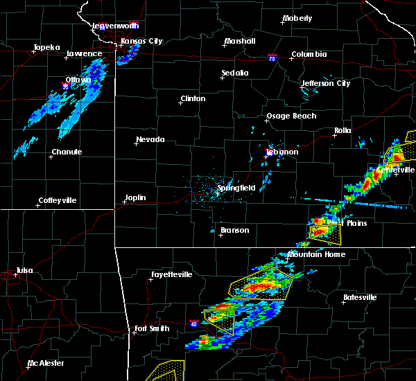 At 302 pm cdt, a severe thunderstorm was located 9 miles southwest of west plains, moving east at 50 mph (emergency management. golf ball size hail was reported northwest of caulfield with this storm). Hazards include golf ball size hail and 60 mph wind gusts. People and animals outdoors will be injured. expect hail damage to roofs, siding, windows, and vehicles. expect wind damage to roofs, siding, and trees. Locations impacted include, west plains, south fork, brandsville, pottersville, a tornado watch remains in effect until 800 pm cdt for south central missouri. At 302 pm cdt, a severe thunderstorm was located 9 miles southwest of west plains, moving east at 50 mph (emergency management. golf ball size hail was reported northwest of caulfield with this storm). Hazards include golf ball size hail and 60 mph wind gusts. People and animals outdoors will be injured. expect hail damage to roofs, siding, windows, and vehicles. expect wind damage to roofs, siding, and trees. Locations impacted include, west plains, south fork, brandsville, pottersville, a tornado watch remains in effect until 800 pm cdt for south central missouri.
|
| 4/3/2018 2:59 PM CDT |
 At 259 pm cdt, a severe thunderstorm was located 11 miles north of bakersfield, or 12 miles west of west plains, moving east at 50 mph (radar indicated). Hazards include 60 mph wind gusts and quarter size hail. Hail damage to vehicles is expected. Expect wind damage to roofs, siding, and trees. At 259 pm cdt, a severe thunderstorm was located 11 miles north of bakersfield, or 12 miles west of west plains, moving east at 50 mph (radar indicated). Hazards include 60 mph wind gusts and quarter size hail. Hail damage to vehicles is expected. Expect wind damage to roofs, siding, and trees.
|
| 2/24/2018 3:21 PM CST |
 The severe thunderstorm warning for southeastern howell county will expire at 330 pm cst, the storms which prompted the warning have weakened below severe limits, and have exited the warned area. therefore the warning will be allowed to expire. however heavy rain is still possible with these thunderstorms. The severe thunderstorm warning for southeastern howell county will expire at 330 pm cst, the storms which prompted the warning have weakened below severe limits, and have exited the warned area. therefore the warning will be allowed to expire. however heavy rain is still possible with these thunderstorms.
|
| 2/24/2018 3:12 PM CST |
 At 312 pm cst, severe thunderstorms were located along a line extending from near west plains to 8 miles northeast of sturkie, moving northeast at 50 mph (radar indicated). Hazards include 60 mph wind gusts. Expect damage to roofs, siding, and trees. Locations impacted include, west plains, brandsville, peace valley, lanton, white church,. At 312 pm cst, severe thunderstorms were located along a line extending from near west plains to 8 miles northeast of sturkie, moving northeast at 50 mph (radar indicated). Hazards include 60 mph wind gusts. Expect damage to roofs, siding, and trees. Locations impacted include, west plains, brandsville, peace valley, lanton, white church,.
|
| 2/24/2018 3:01 PM CST |
 At 301 pm cst, severe thunderstorms were located along a line extending from 10 miles west of west plains to near sturkie, moving northeast at 60 mph (radar indicated). Hazards include 60 mph wind gusts. Expect damage to roofs, siding, and trees. Locations impacted include, west plains, south fork, brandsville, peace valley, lanton, white church, moody, pottersville,. At 301 pm cst, severe thunderstorms were located along a line extending from 10 miles west of west plains to near sturkie, moving northeast at 60 mph (radar indicated). Hazards include 60 mph wind gusts. Expect damage to roofs, siding, and trees. Locations impacted include, west plains, south fork, brandsville, peace valley, lanton, white church, moody, pottersville,.
|
| 2/24/2018 2:46 PM CST |
 At 245 pm cst, severe thunderstorms were located along a line extending from 6 miles northwest of gamaliel landing to near rodney, moving northeast at 50 mph (radar indicated). Hazards include 60 mph wind gusts. expect damage to roofs, siding, and trees At 245 pm cst, severe thunderstorms were located along a line extending from 6 miles northwest of gamaliel landing to near rodney, moving northeast at 50 mph (radar indicated). Hazards include 60 mph wind gusts. expect damage to roofs, siding, and trees
|
| 1/22/2018 12:06 AM CST |
 At 1206 am cst, severe thunderstorms were located along a line extending from near mountain grove to 12 miles west of willow springs to 17 miles west of west plains, moving northeast at 55 mph (radar indicated). Hazards include 60 mph wind gusts. Expect damage to roofs, siding, and trees. Locations impacted include, west plains, mountain view, willow springs, pomona, peace valley, siloam springs, white church,. At 1206 am cst, severe thunderstorms were located along a line extending from near mountain grove to 12 miles west of willow springs to 17 miles west of west plains, moving northeast at 55 mph (radar indicated). Hazards include 60 mph wind gusts. Expect damage to roofs, siding, and trees. Locations impacted include, west plains, mountain view, willow springs, pomona, peace valley, siloam springs, white church,.
|
| 1/21/2018 11:47 PM CST |
 At 1147 pm cst, severe thunderstorms were located along a line extending from 13 miles southeast of ava to 17 miles northwest of bakersfield to near gainesville, moving northeast at 55 mph (radar indicated). Hazards include 60 mph wind gusts. expect damage to roofs, siding, and trees At 1147 pm cst, severe thunderstorms were located along a line extending from 13 miles southeast of ava to 17 miles northwest of bakersfield to near gainesville, moving northeast at 55 mph (radar indicated). Hazards include 60 mph wind gusts. expect damage to roofs, siding, and trees
|
| 10/22/2017 3:45 AM CDT |
 At 345 am cdt, severe thunderstorms were located along a line extending from 7 miles northeast of licking to 9 miles north of summersville to near sturkie, moving east at 30 mph (radar indicated). Hazards include 60 mph wind gusts. Expect damage to roofs, siding, and trees. Locations impacted include, west plains, grand gulf state park, montauk state park, current river state park, salem, licking, mountain view, thayer, willow springs, birch tree, pomona, summersville, raymondville, south fork, koshkonong, brandsville, montier, thomasville, lenox, lanton,. At 345 am cdt, severe thunderstorms were located along a line extending from 7 miles northeast of licking to 9 miles north of summersville to near sturkie, moving east at 30 mph (radar indicated). Hazards include 60 mph wind gusts. Expect damage to roofs, siding, and trees. Locations impacted include, west plains, grand gulf state park, montauk state park, current river state park, salem, licking, mountain view, thayer, willow springs, birch tree, pomona, summersville, raymondville, south fork, koshkonong, brandsville, montier, thomasville, lenox, lanton,.
|
| 10/22/2017 3:33 AM CDT | Tree down on e hwy just north of moody in howell count in howell county MO, 14.1 miles NNE of West Plains, MO |
| 10/22/2017 3:11 AM CDT |
 At 309 am cdt, severe thunderstorms were located along a line extending from 8 miles southeast of fort leonard wood to 6 miles south of houston to near bakersfield, moving east at 30 mph (radar indicated). Hazards include 60 mph wind gusts. expect damage to roofs, siding, and trees At 309 am cdt, severe thunderstorms were located along a line extending from 8 miles southeast of fort leonard wood to 6 miles south of houston to near bakersfield, moving east at 30 mph (radar indicated). Hazards include 60 mph wind gusts. expect damage to roofs, siding, and trees
|
| 9/24/2017 6:55 PM CDT | Severe thunderstorm wind gusts destroyed the roof of a downtown building in west plains. several awnings were also destroyed along with a large tree. numerous limbs wer in howell county MO, 1.4 miles WNW of West Plains, MO |
| 7/7/2017 9:10 PM CDT |
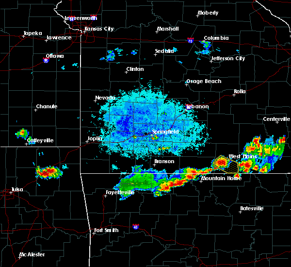 At 910 pm cdt, a severe thunderstorm was located near west plains, moving southeast at 25 mph (radar indicated). Hazards include 60 mph wind gusts and quarter size hail. Hail damage to vehicles is expected. expect wind damage to roofs, siding, and trees. Locations impacted include, west plains, south fork, brandsville, lanton, pottersville,. At 910 pm cdt, a severe thunderstorm was located near west plains, moving southeast at 25 mph (radar indicated). Hazards include 60 mph wind gusts and quarter size hail. Hail damage to vehicles is expected. expect wind damage to roofs, siding, and trees. Locations impacted include, west plains, south fork, brandsville, lanton, pottersville,.
|
| 7/7/2017 8:55 PM CDT |
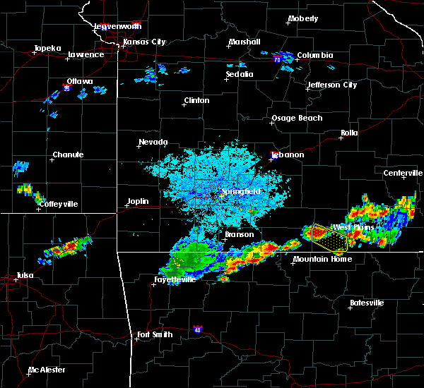 At 855 pm cdt, a severe thunderstorm was located 9 miles west of west plains, moving southeast at 25 mph (radar indicated). Hazards include ping pong ball size hail and 60 mph wind gusts. People and animals outdoors will be injured. expect hail damage to roofs, siding, windows, and vehicles. expect wind damage to roofs, siding, and trees. Locations impacted include, west plains, south fork, brandsville, lanton, siloam springs, pottersville,. At 855 pm cdt, a severe thunderstorm was located 9 miles west of west plains, moving southeast at 25 mph (radar indicated). Hazards include ping pong ball size hail and 60 mph wind gusts. People and animals outdoors will be injured. expect hail damage to roofs, siding, windows, and vehicles. expect wind damage to roofs, siding, and trees. Locations impacted include, west plains, south fork, brandsville, lanton, siloam springs, pottersville,.
|
| 7/7/2017 8:50 PM CDT |
 At 850 pm cdt, a severe thunderstorm was located 11 miles west of west plains, moving southeast at 25 mph (radar indicated). Hazards include 60 mph wind gusts and quarter size hail. Hail damage to vehicles is expected. Expect wind damage to roofs, siding, and trees. At 850 pm cdt, a severe thunderstorm was located 11 miles west of west plains, moving southeast at 25 mph (radar indicated). Hazards include 60 mph wind gusts and quarter size hail. Hail damage to vehicles is expected. Expect wind damage to roofs, siding, and trees.
|
| 6/23/2017 2:12 PM CDT |
 At 212 pm cdt, severe thunderstorms were located along a line extending from near west plains to near fawn park, moving southeast at 35 mph (radar indicated). Hazards include 60 mph wind gusts. Expect damage to roofs, siding, and trees. Locations impacted include, west plains, willow springs, pomona, bakersfield, south fork, brandsville, lanton, tecumseh, pottersville, caulfield, udall, hardenville, siloam springs, moody,. At 212 pm cdt, severe thunderstorms were located along a line extending from near west plains to near fawn park, moving southeast at 35 mph (radar indicated). Hazards include 60 mph wind gusts. Expect damage to roofs, siding, and trees. Locations impacted include, west plains, willow springs, pomona, bakersfield, south fork, brandsville, lanton, tecumseh, pottersville, caulfield, udall, hardenville, siloam springs, moody,.
|
| 6/23/2017 1:52 PM CDT |
 At 151 pm cdt, severe thunderstorms were located along a line extending from 8 miles south of mountain grove to 6 miles west of price place, moving southeast at 30 mph (radar indicated). Hazards include 60 mph wind gusts. Expect damage to roofs, siding, and trees. Locations impacted include, west plains, bull shoals lake, willow springs, gainesville, pomona, bakersfield, theodosia, south fork, pontiac, brandsville, wasola, sundown, lanton, brixey, willhoit, tecumseh, pottersville, caulfield, udall, hardenville,. At 151 pm cdt, severe thunderstorms were located along a line extending from 8 miles south of mountain grove to 6 miles west of price place, moving southeast at 30 mph (radar indicated). Hazards include 60 mph wind gusts. Expect damage to roofs, siding, and trees. Locations impacted include, west plains, bull shoals lake, willow springs, gainesville, pomona, bakersfield, theodosia, south fork, pontiac, brandsville, wasola, sundown, lanton, brixey, willhoit, tecumseh, pottersville, caulfield, udall, hardenville,.
|
| 6/23/2017 1:30 PM CDT |
 At 129 pm cdt, severe thunderstorms were located along a line extending from 8 miles south of norwood to near omaha, moving southeast at 40 mph (radar indicated). Hazards include 60 mph wind gusts. expect damage to roofs, siding, and trees At 129 pm cdt, severe thunderstorms were located along a line extending from 8 miles south of norwood to near omaha, moving southeast at 40 mph (radar indicated). Hazards include 60 mph wind gusts. expect damage to roofs, siding, and trees
|
| 5/27/2017 8:36 PM CDT |
 At 836 pm cdt, severe thunderstorms were located along a line extending from garwood to 8 miles east of alton to ballard, moving southeast at 55 mph (radar indicated). Hazards include 60 mph wind gusts and quarter size hail. Hail damage to vehicles is expected. expect wind damage to roofs, siding, and trees. Locations impacted include, west plains, grand gulf state park, thayer, winona, alton, birch tree, eminence, south fork, koshkonong, brandsville, montier, thomasville, peace valley, lanton, myrtle, wilderness, midridge, couch, rover, alley spring, a tornado watch remains in effect until 200 am cdt for south central missouri. At 836 pm cdt, severe thunderstorms were located along a line extending from garwood to 8 miles east of alton to ballard, moving southeast at 55 mph (radar indicated). Hazards include 60 mph wind gusts and quarter size hail. Hail damage to vehicles is expected. expect wind damage to roofs, siding, and trees. Locations impacted include, west plains, grand gulf state park, thayer, winona, alton, birch tree, eminence, south fork, koshkonong, brandsville, montier, thomasville, peace valley, lanton, myrtle, wilderness, midridge, couch, rover, alley spring, a tornado watch remains in effect until 200 am cdt for south central missouri.
|
| 5/27/2017 8:10 PM CDT | Quarter sized hail reported 5.3 miles WSW of West Plains, MO, mping report of quarter size hail northeast of west plains. |
| 5/27/2017 8:08 PM CDT |
 At 807 pm cdt, severe thunderstorms were located along a line extending from 10 miles west of summersville to near west plains to near gainesville, moving east at 40 mph (radar indicated). Hazards include 60 mph wind gusts and quarter size hail. Hail damage to vehicles is expected. expect wind damage to roofs, siding, and trees. Locations impacted include, west plains, bull shoals lake, norfork lake, mountain view, willow springs, gainesville, pomona, summersville, bakersfield, south fork, pontiac, sundown, brixey, willhoit, tecumseh, pottersville, caulfield, udall, hardenville, clear springs, a tornado watch remains in effect until 200 am cdt for south central and southwestern missouri. At 807 pm cdt, severe thunderstorms were located along a line extending from 10 miles west of summersville to near west plains to near gainesville, moving east at 40 mph (radar indicated). Hazards include 60 mph wind gusts and quarter size hail. Hail damage to vehicles is expected. expect wind damage to roofs, siding, and trees. Locations impacted include, west plains, bull shoals lake, norfork lake, mountain view, willow springs, gainesville, pomona, summersville, bakersfield, south fork, pontiac, sundown, brixey, willhoit, tecumseh, pottersville, caulfield, udall, hardenville, clear springs, a tornado watch remains in effect until 200 am cdt for south central and southwestern missouri.
|
| 5/27/2017 8:06 PM CDT |
 At 806 pm cdt, a severe thunderstorm capable of producing a tornado was located 10 miles south of mountain view, moving east at 60 mph (radar indicated rotation). Hazards include tornado. Flying debris will be dangerous to those caught without shelter. mobile homes will be damaged or destroyed. damage to roofs, windows, and vehicles will occur. tree damage is likely. Locations impacted include, mountain view, willow springs, birch tree, pomona, montier, peace valley, rover, white church, teresita,. At 806 pm cdt, a severe thunderstorm capable of producing a tornado was located 10 miles south of mountain view, moving east at 60 mph (radar indicated rotation). Hazards include tornado. Flying debris will be dangerous to those caught without shelter. mobile homes will be damaged or destroyed. damage to roofs, windows, and vehicles will occur. tree damage is likely. Locations impacted include, mountain view, willow springs, birch tree, pomona, montier, peace valley, rover, white church, teresita,.
|
| 5/27/2017 7:59 PM CDT |
 At 758 pm cdt, severe thunderstorms were located along a line extending from 12 miles southwest of bunker to near mountain view to bakersfield, moving southeast at 55 mph (radar indicated). Hazards include 60 mph wind gusts and quarter size hail. Hail damage to vehicles is expected. Expect wind damage to roofs, siding, and trees. At 758 pm cdt, severe thunderstorms were located along a line extending from 12 miles southwest of bunker to near mountain view to bakersfield, moving southeast at 55 mph (radar indicated). Hazards include 60 mph wind gusts and quarter size hail. Hail damage to vehicles is expected. Expect wind damage to roofs, siding, and trees.
|
| 5/27/2017 7:48 PM CDT |
 At 748 pm cdt, a severe thunderstorm capable of producing a tornado was located near willow springs, moving east at 60 mph (radar indicated rotation). Hazards include tornado. Flying debris will be dangerous to those caught without shelter. mobile homes will be damaged or destroyed. damage to roofs, windows, and vehicles will occur. Tree damage is likely. At 748 pm cdt, a severe thunderstorm capable of producing a tornado was located near willow springs, moving east at 60 mph (radar indicated rotation). Hazards include tornado. Flying debris will be dangerous to those caught without shelter. mobile homes will be damaged or destroyed. damage to roofs, windows, and vehicles will occur. Tree damage is likely.
|
| 5/27/2017 7:30 PM CDT |
 At 729 pm cdt, severe thunderstorms were located along a line extending from 10 miles north of cabool to 17 miles south of norwood to 14 miles east of taneyville, moving east at 30 mph (radar indicated). Hazards include 60 mph wind gusts and quarter size hail. Hail damage to vehicles is expected. Expect wind damage to roofs, siding, and trees. At 729 pm cdt, severe thunderstorms were located along a line extending from 10 miles north of cabool to 17 miles south of norwood to 14 miles east of taneyville, moving east at 30 mph (radar indicated). Hazards include 60 mph wind gusts and quarter size hail. Hail damage to vehicles is expected. Expect wind damage to roofs, siding, and trees.
|
| 5/27/2017 7:00 PM CDT | Pictures on social media showed minor roof damage to a businesses in downtown west plain in howell county MO, 1.4 miles WNW of West Plains, MO |
| 5/27/2017 3:44 AM CDT |
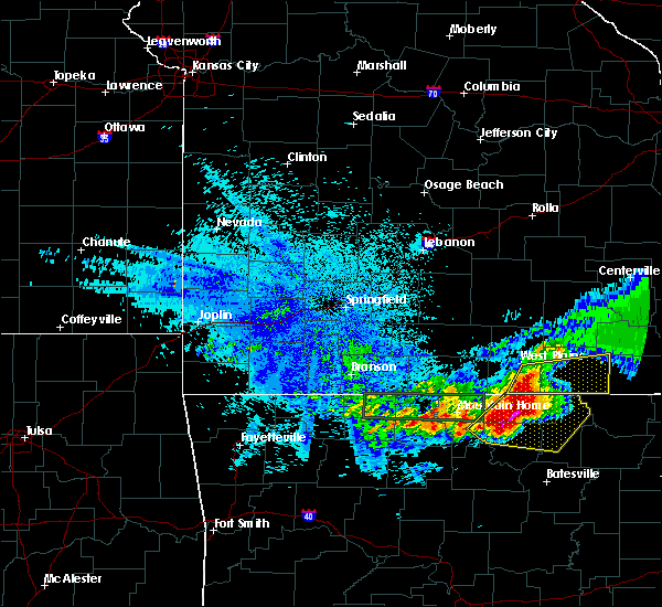 At 343 am cdt, severe thunderstorms were located along a line extending from 7 miles southeast of west plains to 7 miles northeast of salem in fulton county, moving east at 40 mph (radar indicated). Hazards include 60 mph wind gusts and quarter size hail. Hail damage to vehicles is expected. Expect wind damage to roofs, siding, and trees. At 343 am cdt, severe thunderstorms were located along a line extending from 7 miles southeast of west plains to 7 miles northeast of salem in fulton county, moving east at 40 mph (radar indicated). Hazards include 60 mph wind gusts and quarter size hail. Hail damage to vehicles is expected. Expect wind damage to roofs, siding, and trees.
|
| 5/27/2017 3:23 AM CDT |
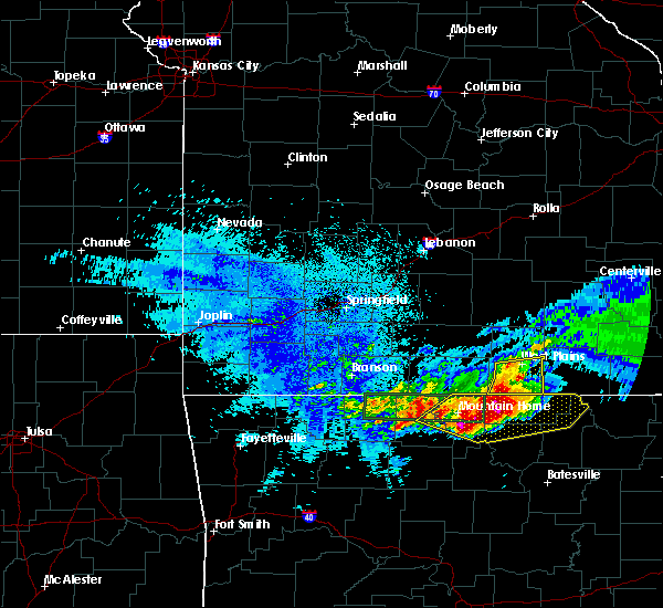 At 323 am cdt, severe thunderstorms were located along a line extending from 7 miles southwest of west plains to near ott, moving east at 45 mph (radar indicated). Hazards include 60 mph wind gusts and half dollar size hail. Hail damage to vehicles is expected. expect wind damage to roofs, siding, and trees. Locations impacted include, west plains, south fork, brandsville, lanton, pottersville, moody,. At 323 am cdt, severe thunderstorms were located along a line extending from 7 miles southwest of west plains to near ott, moving east at 45 mph (radar indicated). Hazards include 60 mph wind gusts and half dollar size hail. Hail damage to vehicles is expected. expect wind damage to roofs, siding, and trees. Locations impacted include, west plains, south fork, brandsville, lanton, pottersville, moody,.
|
| 5/27/2017 3:03 AM CDT |
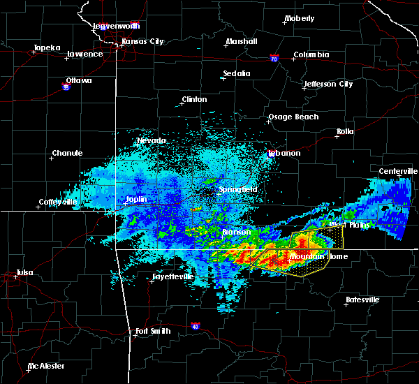 At 303 am cdt, severe thunderstorms were located along a line extending from 12 miles northwest of ott to 6 miles west of bakersfield, moving east at 30 mph (radar indicated). Hazards include 60 mph wind gusts and half dollar size hail. Hail damage to vehicles is expected. expect wind damage to roofs, siding, and trees. Locations impacted include, west plains, norfork lake, bakersfield, south fork, brandsville, lanton, tecumseh, pottersville, caulfield, udall, moody, sycamore, zanoni,. At 303 am cdt, severe thunderstorms were located along a line extending from 12 miles northwest of ott to 6 miles west of bakersfield, moving east at 30 mph (radar indicated). Hazards include 60 mph wind gusts and half dollar size hail. Hail damage to vehicles is expected. expect wind damage to roofs, siding, and trees. Locations impacted include, west plains, norfork lake, bakersfield, south fork, brandsville, lanton, tecumseh, pottersville, caulfield, udall, moody, sycamore, zanoni,.
|
| 5/27/2017 2:41 AM CDT |
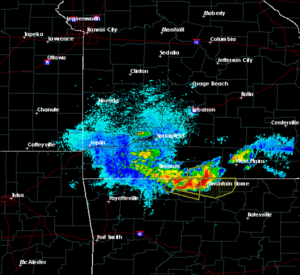 At 240 am cdt, severe thunderstorms were located along a line extending from near gainesville to 8 miles north of fawn park, moving east at 45 mph (radar indicated). Hazards include 60 mph wind gusts and quarter size hail. Hail damage to vehicles is expected. Expect wind damage to roofs, siding, and trees. At 240 am cdt, severe thunderstorms were located along a line extending from near gainesville to 8 miles north of fawn park, moving east at 45 mph (radar indicated). Hazards include 60 mph wind gusts and quarter size hail. Hail damage to vehicles is expected. Expect wind damage to roofs, siding, and trees.
|
| 5/19/2017 7:50 PM CDT |
 The severe thunderstorm warning for southeastern howell and northwestern oregon counties will expire at 800 pm cdt, the storm which prompted the warning has weakened below severe limits, and no longer poses an immediate threat to life or property. therefore the warning will be allowed to expire. a tornado watch remains in effect until 1000 pm cdt for south central missouri. to report severe weather, contact your nearest law enforcement agency. they will relay your report to the national weather service springfield. The severe thunderstorm warning for southeastern howell and northwestern oregon counties will expire at 800 pm cdt, the storm which prompted the warning has weakened below severe limits, and no longer poses an immediate threat to life or property. therefore the warning will be allowed to expire. a tornado watch remains in effect until 1000 pm cdt for south central missouri. to report severe weather, contact your nearest law enforcement agency. they will relay your report to the national weather service springfield.
|
| 5/19/2017 7:33 PM CDT |
 At 732 pm cdt, a severe thunderstorm was located near west plains, moving north at 30 mph (public. this storm produced quarter sized hail in the town of lanton). Hazards include quarter size hail. Damage to vehicles is expected. Locations impacted include, west plains, pomona, brandsville, peace valley, rover, white church, a tornado watch remains in effect until 1000 pm cdt for south central missouri. At 732 pm cdt, a severe thunderstorm was located near west plains, moving north at 30 mph (public. this storm produced quarter sized hail in the town of lanton). Hazards include quarter size hail. Damage to vehicles is expected. Locations impacted include, west plains, pomona, brandsville, peace valley, rover, white church, a tornado watch remains in effect until 1000 pm cdt for south central missouri.
|
| 5/19/2017 7:16 PM CDT |
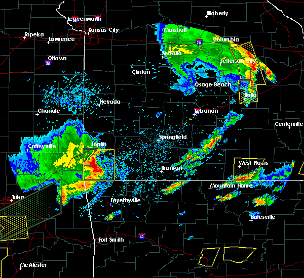 At 715 pm cdt, a severe thunderstorm was located 8 miles northeast of sturkie, or 12 miles north of salem in fulton county, moving north at 30 mph (public. quarter size hail was reported in lanton with this storm. this storm has a history of producing hail up to the size of golf balls). Hazards include 60 mph wind gusts and half dollar size hail. Hail damage to vehicles is expected. expect wind damage to roofs, siding, and trees. Locations impacted include, west plains, grand gulf state park, pomona, koshkonong, brandsville, thomasville, peace valley, lanton, rover, white church, a tornado watch remains in effect until 1000 pm cdt for south central missouri. At 715 pm cdt, a severe thunderstorm was located 8 miles northeast of sturkie, or 12 miles north of salem in fulton county, moving north at 30 mph (public. quarter size hail was reported in lanton with this storm. this storm has a history of producing hail up to the size of golf balls). Hazards include 60 mph wind gusts and half dollar size hail. Hail damage to vehicles is expected. expect wind damage to roofs, siding, and trees. Locations impacted include, west plains, grand gulf state park, pomona, koshkonong, brandsville, thomasville, peace valley, lanton, rover, white church, a tornado watch remains in effect until 1000 pm cdt for south central missouri.
|
| 5/19/2017 7:10 PM CDT | Quarter sized hail reported 16.3 miles NNW of West Plains, MO, quarter size hail reported at a local business near lanton. |
| 5/19/2017 7:01 PM CDT |
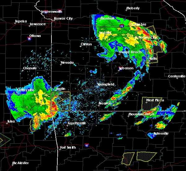 At 701 pm cdt, a severe thunderstorm was located near sturkie, or near salem in fulton county, moving north at 30 mph (trained weather spotters. this storm has produced golf ball sized hail in northern fulton county, arkansas). Hazards include ping pong ball size hail and 60 mph wind gusts. People and animals outdoors will be injured. expect hail damage to roofs, siding, windows, and vehicles. Expect wind damage to roofs, siding, and trees. At 701 pm cdt, a severe thunderstorm was located near sturkie, or near salem in fulton county, moving north at 30 mph (trained weather spotters. this storm has produced golf ball sized hail in northern fulton county, arkansas). Hazards include ping pong ball size hail and 60 mph wind gusts. People and animals outdoors will be injured. expect hail damage to roofs, siding, windows, and vehicles. Expect wind damage to roofs, siding, and trees.
|
| 5/19/2017 3:08 AM CDT |
 The tornado warning for eastern ozark, eastern douglas, northeastern wright, howell and southwestern texas counties will expire at 315 am cdt, the storms which prompted the warning have moved out of the area. therefore the warning will be allowed to expire. however heavy rain is still possible with these thunderstorms. a tornado watch remains in effect until 600 am cdt for south central and southwestern missouri. The tornado warning for eastern ozark, eastern douglas, northeastern wright, howell and southwestern texas counties will expire at 315 am cdt, the storms which prompted the warning have moved out of the area. therefore the warning will be allowed to expire. however heavy rain is still possible with these thunderstorms. a tornado watch remains in effect until 600 am cdt for south central and southwestern missouri.
|
| 5/19/2017 2:28 AM CDT |
 At 228 am cdt, severe thunderstorms capable of producing both tornadoes and extensive straight line wind damage were located along a line extending from diggins to 6 miles northeast of ava to 11 miles north of gainesville to 7 miles northwest of gamaliel landing, moving northeast at 45 mph (radar indicated rotation). Hazards include tornado. Flying debris will be dangerous to those caught without shelter. mobile homes will be damaged or destroyed. damage to roofs, windows, and vehicles will occur. Tree damage is likely. At 228 am cdt, severe thunderstorms capable of producing both tornadoes and extensive straight line wind damage were located along a line extending from diggins to 6 miles northeast of ava to 11 miles north of gainesville to 7 miles northwest of gamaliel landing, moving northeast at 45 mph (radar indicated rotation). Hazards include tornado. Flying debris will be dangerous to those caught without shelter. mobile homes will be damaged or destroyed. damage to roofs, windows, and vehicles will occur. Tree damage is likely.
|
| 5/11/2017 6:20 PM CDT |
 At 619 pm cdt, a severe thunderstorm was located near west plains, moving east at 25 mph (radar indicated). Hazards include 60 mph wind gusts and quarter size hail. Hail damage to vehicles is expected. Expect wind damage to roofs, siding, and trees. At 619 pm cdt, a severe thunderstorm was located near west plains, moving east at 25 mph (radar indicated). Hazards include 60 mph wind gusts and quarter size hail. Hail damage to vehicles is expected. Expect wind damage to roofs, siding, and trees.
|
| 4/29/2017 5:05 PM CDT |
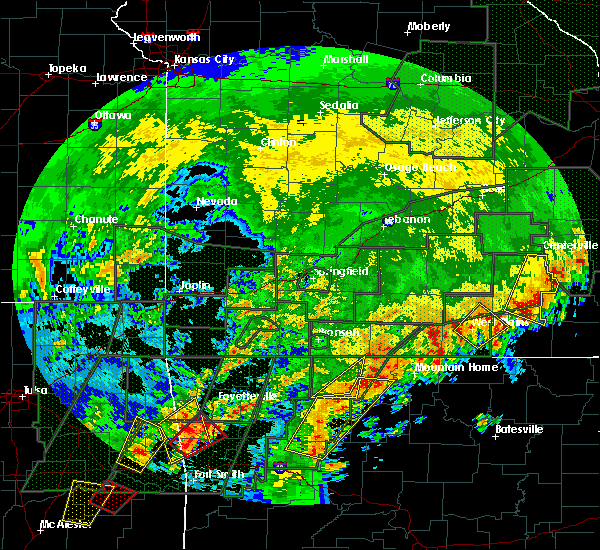 The severe thunderstorm warning for eastern howell and northwestern oregon counties will expire at 515 pm cdt, the storm which prompted the warning has weakened below severe limits, and has exited the warned area. therefore, the warning will be allowed to expire. The severe thunderstorm warning for eastern howell and northwestern oregon counties will expire at 515 pm cdt, the storm which prompted the warning has weakened below severe limits, and has exited the warned area. therefore, the warning will be allowed to expire.
|
| 4/29/2017 4:32 PM CDT |
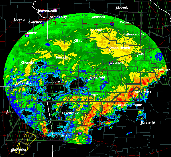 At 431 pm cdt, a severe thunderstorm was located over west plains, moving northeast at 35 mph (radar indicated). Hazards include 60 mph wind gusts and quarter size hail. Hail damage to vehicles is expected. Expect wind damage to roofs, siding, and trees. At 431 pm cdt, a severe thunderstorm was located over west plains, moving northeast at 35 mph (radar indicated). Hazards include 60 mph wind gusts and quarter size hail. Hail damage to vehicles is expected. Expect wind damage to roofs, siding, and trees.
|
| 4/26/2017 10:13 AM CDT |
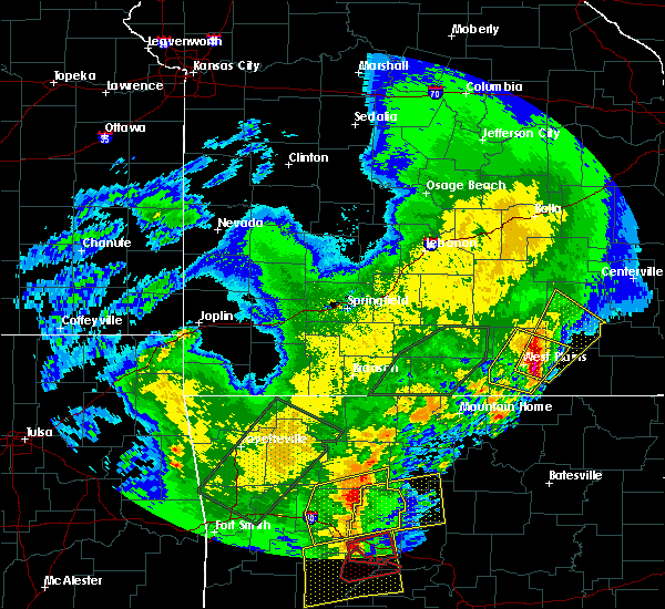 At 1012 am cdt, a severe thunderstorm was located 7 miles east of west plains, moving northeast at 40 mph (emergency management). Hazards include 60 mph wind gusts and quarter size hail. Hail damage to vehicles is expected. Expect wind damage to roofs, siding, and trees. At 1012 am cdt, a severe thunderstorm was located 7 miles east of west plains, moving northeast at 40 mph (emergency management). Hazards include 60 mph wind gusts and quarter size hail. Hail damage to vehicles is expected. Expect wind damage to roofs, siding, and trees.
|
| 4/26/2017 10:05 AM CDT | Tree down across state highway z in howell county MO, 4.5 miles WNW of West Plains, MO |
| 4/26/2017 10:03 AM CDT | Trees down at west plains municipal golf cours in howell county MO, 1.9 miles WSW of West Plains, MO |
| 4/26/2017 10:03 AM CDT |
 At 1002 am cdt, a severe thunderstorm was located near west plains, moving northeast at 45 mph (trained weather spotters). Hazards include 60 mph wind gusts and quarter size hail. Hail damage to vehicles is expected. expect wind damage to roofs, siding, and trees. Locations impacted include, west plains, willow springs, pomona, south fork, brandsville, peace valley, lanton, rover, white church, pottersville, caulfield,. At 1002 am cdt, a severe thunderstorm was located near west plains, moving northeast at 45 mph (trained weather spotters). Hazards include 60 mph wind gusts and quarter size hail. Hail damage to vehicles is expected. expect wind damage to roofs, siding, and trees. Locations impacted include, west plains, willow springs, pomona, south fork, brandsville, peace valley, lanton, rover, white church, pottersville, caulfield,.
|
| 4/26/2017 10:02 AM CDT | Tower fell onto conservation building on east side of west plain in howell county MO, 1.4 miles WNW of West Plains, MO |
| 4/26/2017 10:00 AM CDT | Power poles blown over in west plain in howell county MO, 1.4 miles WNW of West Plains, MO |
| 4/26/2017 9:58 AM CDT | Quarter sized hail reported 1.4 miles WNW of West Plains, MO |
| 4/26/2017 9:53 AM CDT |
 At 952 am cdt, a severe thunderstorm was located near west plains, moving northeast at 50 mph (trained weather spotters). Hazards include 60 mph wind gusts and quarter size hail. Hail damage to vehicles is expected. expect wind damage to roofs, siding, and trees. Locations impacted include, west plains, willow springs, pomona, south fork, brandsville, peace valley, lanton, rover, white church, pottersville, caulfield,. At 952 am cdt, a severe thunderstorm was located near west plains, moving northeast at 50 mph (trained weather spotters). Hazards include 60 mph wind gusts and quarter size hail. Hail damage to vehicles is expected. expect wind damage to roofs, siding, and trees. Locations impacted include, west plains, willow springs, pomona, south fork, brandsville, peace valley, lanton, rover, white church, pottersville, caulfield,.
|
| 4/26/2017 9:35 AM CDT |
 At 935 am cdt, a severe thunderstorm was located over bakersfield, or 19 miles northeast of mountain home, moving northeast at 45 mph (radar indicated). Hazards include 60 mph wind gusts and quarter size hail. Hail damage to vehicles is expected. Expect wind damage to roofs, siding, and trees. At 935 am cdt, a severe thunderstorm was located over bakersfield, or 19 miles northeast of mountain home, moving northeast at 45 mph (radar indicated). Hazards include 60 mph wind gusts and quarter size hail. Hail damage to vehicles is expected. Expect wind damage to roofs, siding, and trees.
|
| 4/26/2017 9:31 AM CDT |
 At 931 am cdt, a severe thunderstorm was located 11 miles northwest of bakersfield, or 21 miles west of west plains, moving northeast at 60 mph (radar indicated). Hazards include 60 mph wind gusts and quarter size hail. Hail damage to vehicles is expected. expect wind damage to roofs, siding, and trees. Locations impacted include, west plains, norfork lake, gainesville, pomona, hardenville, siloam springs, sycamore, tecumseh, dora, pottersville, zanoni, udall,. At 931 am cdt, a severe thunderstorm was located 11 miles northwest of bakersfield, or 21 miles west of west plains, moving northeast at 60 mph (radar indicated). Hazards include 60 mph wind gusts and quarter size hail. Hail damage to vehicles is expected. expect wind damage to roofs, siding, and trees. Locations impacted include, west plains, norfork lake, gainesville, pomona, hardenville, siloam springs, sycamore, tecumseh, dora, pottersville, zanoni, udall,.
|
| 4/26/2017 9:11 AM CDT |
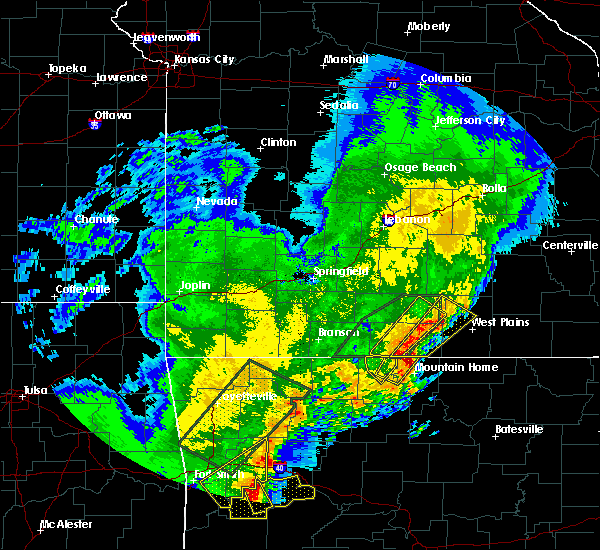 At 910 am cdt, a severe thunderstorm was located near arkawana, or 8 miles northeast of bull shoals, moving northeast at 55 mph (radar indicated). Hazards include 60 mph wind gusts and quarter size hail. Hail damage to vehicles is expected. Expect wind damage to roofs, siding, and trees. At 910 am cdt, a severe thunderstorm was located near arkawana, or 8 miles northeast of bull shoals, moving northeast at 55 mph (radar indicated). Hazards include 60 mph wind gusts and quarter size hail. Hail damage to vehicles is expected. Expect wind damage to roofs, siding, and trees.
|
| 4/4/2017 11:50 PM CDT |
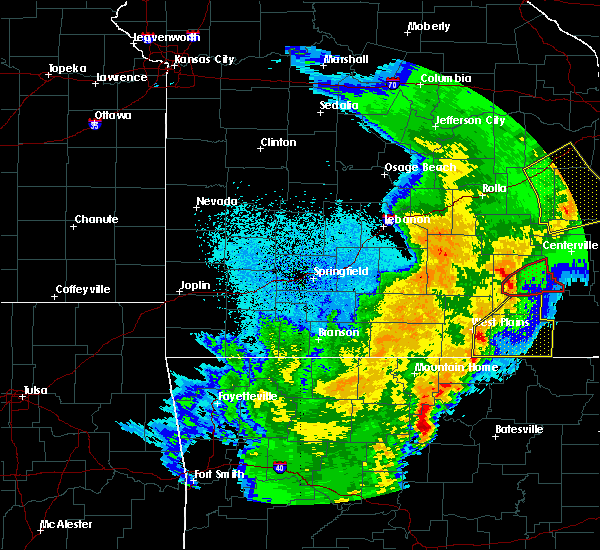 At 1150 pm cdt, severe thunderstorms were located along a line extending from 8 miles northeast of west plains to 7 miles northeast of sturkie, moving northeast at 70 mph (radar indicated). Hazards include 60 mph wind gusts and quarter size hail. Hail damage to vehicles is expected. Expect wind damage to roofs, siding, and trees. At 1150 pm cdt, severe thunderstorms were located along a line extending from 8 miles northeast of west plains to 7 miles northeast of sturkie, moving northeast at 70 mph (radar indicated). Hazards include 60 mph wind gusts and quarter size hail. Hail damage to vehicles is expected. Expect wind damage to roofs, siding, and trees.
|
| 4/4/2017 10:42 PM CDT |
 At 1041 pm cdt, a severe thunderstorm capable of producing a tornado was located near dora, or 18 miles southwest of willow springs, moving northeast at 50 mph (radar indicated rotation). Hazards include tornado and quarter size hail. Flying debris will be dangerous to those caught without shelter. mobile homes will be damaged or destroyed. damage to roofs, windows, and vehicles will occur. tree damage is likely. Locations impacted include, willow springs, pomona, dora, siloam springs,. At 1041 pm cdt, a severe thunderstorm capable of producing a tornado was located near dora, or 18 miles southwest of willow springs, moving northeast at 50 mph (radar indicated rotation). Hazards include tornado and quarter size hail. Flying debris will be dangerous to those caught without shelter. mobile homes will be damaged or destroyed. damage to roofs, windows, and vehicles will occur. tree damage is likely. Locations impacted include, willow springs, pomona, dora, siloam springs,.
|
| 4/4/2017 10:25 PM CDT |
 At 1025 pm cdt, a severe thunderstorm capable of producing a tornado was located near gainesville, or 22 miles northeast of bull shoals, moving northeast at 50 mph (radar indicated rotation). Hazards include tornado and quarter size hail. Flying debris will be dangerous to those caught without shelter. mobile homes will be damaged or destroyed. damage to roofs, windows, and vehicles will occur. Tree damage is likely. At 1025 pm cdt, a severe thunderstorm capable of producing a tornado was located near gainesville, or 22 miles northeast of bull shoals, moving northeast at 50 mph (radar indicated rotation). Hazards include tornado and quarter size hail. Flying debris will be dangerous to those caught without shelter. mobile homes will be damaged or destroyed. damage to roofs, windows, and vehicles will occur. Tree damage is likely.
|
| 3/24/2017 11:24 PM CDT |
 The severe thunderstorm warning for howell and southeastern texas counties will expire at 1130 pm cdt, the storms which prompted the warning have weakened below severe limits, and no longer pose an immediate threat to life or property. therefore, the warning will be allowed to expire. however gusty winds are still possible with these thunderstorms. The severe thunderstorm warning for howell and southeastern texas counties will expire at 1130 pm cdt, the storms which prompted the warning have weakened below severe limits, and no longer pose an immediate threat to life or property. therefore, the warning will be allowed to expire. however gusty winds are still possible with these thunderstorms.
|
| 3/24/2017 11:03 PM CDT |
 At 1103 pm cdt, severe thunderstorms were located along a line extending from cabool to 9 miles southwest of west plains, moving northeast at 30 mph (radar indicated). Hazards include 60 mph wind gusts. Expect damage to roofs, siding, and trees. Locations impacted include, west plains, mountain view, willow springs, cabool, pomona, summersville, south fork, brandsville, peace valley, arroll, eunice, yukon, white church, hartshorn, clear springs, elk creek,. At 1103 pm cdt, severe thunderstorms were located along a line extending from cabool to 9 miles southwest of west plains, moving northeast at 30 mph (radar indicated). Hazards include 60 mph wind gusts. Expect damage to roofs, siding, and trees. Locations impacted include, west plains, mountain view, willow springs, cabool, pomona, summersville, south fork, brandsville, peace valley, arroll, eunice, yukon, white church, hartshorn, clear springs, elk creek,.
|
| 3/24/2017 10:49 PM CDT |
 At 1048 pm cdt, severe thunderstorms were located along a line extending from 6 miles south of mountain grove to near ott, moving northeast at 30 mph (radar indicated). Hazards include 60 mph wind gusts. expect damage to roofs, siding, and trees At 1048 pm cdt, severe thunderstorms were located along a line extending from 6 miles south of mountain grove to near ott, moving northeast at 30 mph (radar indicated). Hazards include 60 mph wind gusts. expect damage to roofs, siding, and trees
|
| 3/9/2017 7:26 PM CST |
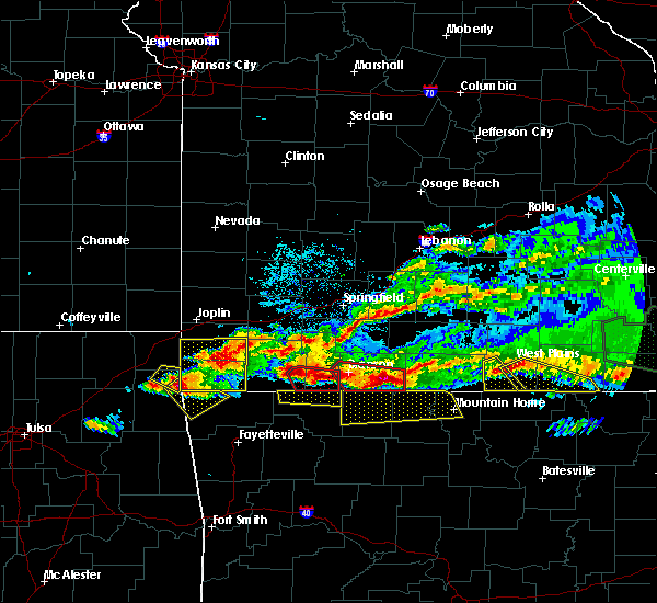 At 726 pm cst, a severe thunderstorm was located over west plains, moving southeast at 35 mph (radar indicated). Hazards include 60 mph wind gusts and quarter size hail. Hail damage to vehicles is expected. expect wind damage to roofs, siding, and trees. Locations impacted include, west plains, grand gulf state park, thayer, mammoth spring, koshkonong, brandsville, mammoth spring state park, lanton, myrtle, couch,. At 726 pm cst, a severe thunderstorm was located over west plains, moving southeast at 35 mph (radar indicated). Hazards include 60 mph wind gusts and quarter size hail. Hail damage to vehicles is expected. expect wind damage to roofs, siding, and trees. Locations impacted include, west plains, grand gulf state park, thayer, mammoth spring, koshkonong, brandsville, mammoth spring state park, lanton, myrtle, couch,.
|
| 3/9/2017 7:25 PM CST | Quarter sized hail reported 1.4 miles WNW of West Plains, MO, nickel to quarter size hail reported on social media with a picture. time was estimated. |
| 3/9/2017 7:12 PM CST |
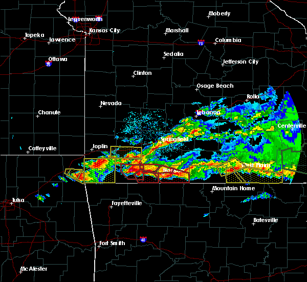 At 711 pm cst, a severe thunderstorm was located near west plains, moving southeast at 30 mph (radar indicated). Hazards include 60 mph wind gusts and quarter size hail. Hail damage to vehicles is expected. expect wind damage to roofs, siding, and trees. Locations impacted include, west plains, grand gulf state park, thayer, mammoth spring, alton, koshkonong, brandsville, mammoth spring state park, lanton, myrtle, couch, rover,. At 711 pm cst, a severe thunderstorm was located near west plains, moving southeast at 30 mph (radar indicated). Hazards include 60 mph wind gusts and quarter size hail. Hail damage to vehicles is expected. expect wind damage to roofs, siding, and trees. Locations impacted include, west plains, grand gulf state park, thayer, mammoth spring, alton, koshkonong, brandsville, mammoth spring state park, lanton, myrtle, couch, rover,.
|
| 3/9/2017 6:58 PM CST |
 At 658 pm cst, a severe thunderstorm was located 15 miles southwest of willow springs, moving southeast at 40 mph (radar indicated). Hazards include 60 mph wind gusts and half dollar size hail. Hail damage to vehicles is expected. expect wind damage to roofs, siding, and trees. Locations impacted include, west plains, pomona, dora, siloam springs, pottersville,. At 658 pm cst, a severe thunderstorm was located 15 miles southwest of willow springs, moving southeast at 40 mph (radar indicated). Hazards include 60 mph wind gusts and half dollar size hail. Hail damage to vehicles is expected. expect wind damage to roofs, siding, and trees. Locations impacted include, west plains, pomona, dora, siloam springs, pottersville,.
|
| 3/9/2017 6:53 PM CST |
 At 653 pm cst, a severe thunderstorm was located over west plains, moving east at 55 mph (radar indicated). Hazards include 60 mph wind gusts and half dollar size hail. Hail damage to vehicles is expected. Expect wind damage to roofs, siding, and trees. At 653 pm cst, a severe thunderstorm was located over west plains, moving east at 55 mph (radar indicated). Hazards include 60 mph wind gusts and half dollar size hail. Hail damage to vehicles is expected. Expect wind damage to roofs, siding, and trees.
|
| 3/9/2017 6:46 PM CST |
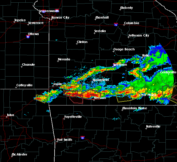 At 646 pm cst, severe thunderstorms were located along a line extending from 7 miles south of willow springs to 16 miles northeast of gainesville to 10 miles southeast of ava, moving southeast at 15 mph (radar indicated). Hazards include 60 mph wind gusts and quarter size hail. Hail damage to vehicles is expected. expect wind damage to roofs, siding, and trees. Locations impacted include, west plains, gainesville, pomona, brixey, willhoit, pottersville, gentryville, siloam springs, sycamore, dora, rockbridge, drury, zanoni,. At 646 pm cst, severe thunderstorms were located along a line extending from 7 miles south of willow springs to 16 miles northeast of gainesville to 10 miles southeast of ava, moving southeast at 15 mph (radar indicated). Hazards include 60 mph wind gusts and quarter size hail. Hail damage to vehicles is expected. expect wind damage to roofs, siding, and trees. Locations impacted include, west plains, gainesville, pomona, brixey, willhoit, pottersville, gentryville, siloam springs, sycamore, dora, rockbridge, drury, zanoni,.
|
| 3/9/2017 6:25 PM CST |
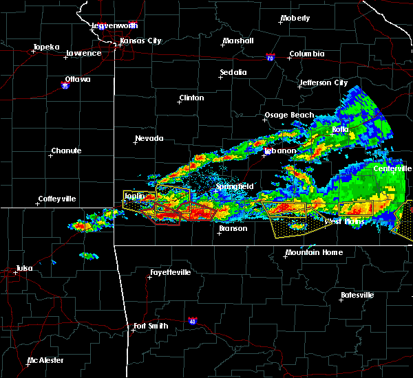 At 625 pm cst, a severe thunderstorm was located 11 miles south of norwood, or 12 miles east of ava, moving southeast at 30 mph (radar indicated). Hazards include 60 mph wind gusts and quarter size hail. Hail damage to vehicles is expected. Expect wind damage to roofs, siding, and trees. At 625 pm cst, a severe thunderstorm was located 11 miles south of norwood, or 12 miles east of ava, moving southeast at 30 mph (radar indicated). Hazards include 60 mph wind gusts and quarter size hail. Hail damage to vehicles is expected. Expect wind damage to roofs, siding, and trees.
|
| 3/7/2017 1:24 AM CST |
 The severe thunderstorm warning for ozark, eastern douglas and howell counties will expire at 130 am cst, the storms which prompted the warning have weakened below severe limits, and no longer pose an immediate threat to life or property. therefore, the warning will be allowed to expire. a tornado watch remains in effect until 300 am cst for south central and southwestern missouri. The severe thunderstorm warning for ozark, eastern douglas and howell counties will expire at 130 am cst, the storms which prompted the warning have weakened below severe limits, and no longer pose an immediate threat to life or property. therefore, the warning will be allowed to expire. a tornado watch remains in effect until 300 am cst for south central and southwestern missouri.
|
| 3/7/2017 1:05 AM CST |
 At 105 am cst, severe thunderstorms were located along a line extending from near mountain view to near gamaliel landing, moving east at 40 mph (radar indicated). Hazards include 60 mph wind gusts and nickel size hail. Expect damage to roofs, siding, and trees. Locations impacted include, west plains, bull shoals lake, mountain view, willow springs, gainesville, pomona, bakersfield, theodosia, south fork, pontiac, brandsville, wasola, sundown, lanton, brixey, willhoit, tecumseh, pottersville, caulfield, udall, a tornado watch remains in effect until 300 am cst for south central and southwestern missouri. At 105 am cst, severe thunderstorms were located along a line extending from near mountain view to near gamaliel landing, moving east at 40 mph (radar indicated). Hazards include 60 mph wind gusts and nickel size hail. Expect damage to roofs, siding, and trees. Locations impacted include, west plains, bull shoals lake, mountain view, willow springs, gainesville, pomona, bakersfield, theodosia, south fork, pontiac, brandsville, wasola, sundown, lanton, brixey, willhoit, tecumseh, pottersville, caulfield, udall, a tornado watch remains in effect until 300 am cst for south central and southwestern missouri.
|
| 3/7/2017 12:44 AM CST |
 At 1243 am cst, a severe thunderstorm capable of producing a tornado was located 9 miles south of mountain view, moving east at 50 mph (weather spotters reported a funnel cloud near west plains. wind damage has been reported with this storm near west plains). Hazards include tornado and ping pong ball size hail. Flying debris will be dangerous to those caught without shelter. mobile homes will be damaged or destroyed. damage to roofs, windows, and vehicles will occur. tree damage is likely. Locations impacted include, west plains, mountain view, peace valley, white church,. At 1243 am cst, a severe thunderstorm capable of producing a tornado was located 9 miles south of mountain view, moving east at 50 mph (weather spotters reported a funnel cloud near west plains. wind damage has been reported with this storm near west plains). Hazards include tornado and ping pong ball size hail. Flying debris will be dangerous to those caught without shelter. mobile homes will be damaged or destroyed. damage to roofs, windows, and vehicles will occur. tree damage is likely. Locations impacted include, west plains, mountain view, peace valley, white church,.
|
| 3/7/2017 12:35 AM CST |
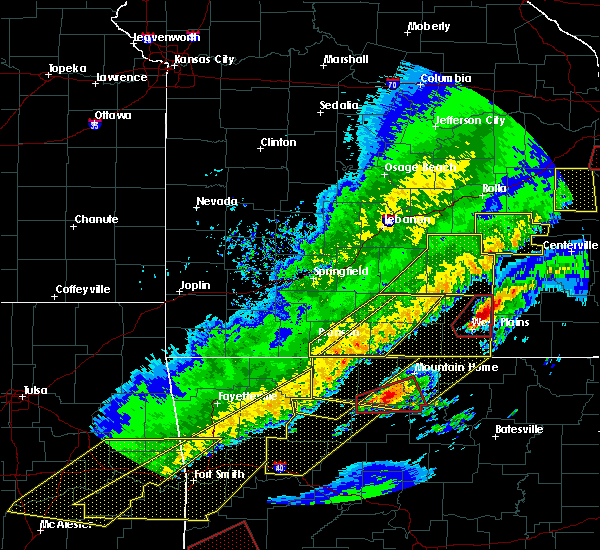 At 1234 am cst, a severe thunderstorm capable of producing a tornado was located 7 miles north of west plains, moving northeast at 50 mph (weather spotters reported a funnel cloud. a funnel cloud has been reported by spotters and relateyed to police northwest of west plains). Hazards include tornado and ping pong ball size hail. Flying debris will be dangerous to those caught without shelter. mobile homes will be damaged or destroyed. damage to roofs, windows, and vehicles will occur. tree damage is likely. Locations impacted include, west plains, mountain view, pomona, peace valley, white church,. At 1234 am cst, a severe thunderstorm capable of producing a tornado was located 7 miles north of west plains, moving northeast at 50 mph (weather spotters reported a funnel cloud. a funnel cloud has been reported by spotters and relateyed to police northwest of west plains). Hazards include tornado and ping pong ball size hail. Flying debris will be dangerous to those caught without shelter. mobile homes will be damaged or destroyed. damage to roofs, windows, and vehicles will occur. tree damage is likely. Locations impacted include, west plains, mountain view, pomona, peace valley, white church,.
|
| 3/7/2017 12:34 AM CST |
 At 1234 am cst, severe thunderstorms were located along a line extending from near cabool to price place, moving east at 40 mph (radar indicated). Hazards include 60 mph wind gusts and nickel size hail. expect damage to roofs, siding, and trees At 1234 am cst, severe thunderstorms were located along a line extending from near cabool to price place, moving east at 40 mph (radar indicated). Hazards include 60 mph wind gusts and nickel size hail. expect damage to roofs, siding, and trees
|
| 3/7/2017 12:19 AM CST |
 At 1219 am cst, a severe thunderstorm capable of producing a tornado was located 9 miles west of west plains, moving northeast at 50 mph (radar indicated rotation). Hazards include tornado and ping pong ball size hail. Flying debris will be dangerous to those caught without shelter. mobile homes will be damaged or destroyed. damage to roofs, windows, and vehicles will occur. Tree damage is likely. At 1219 am cst, a severe thunderstorm capable of producing a tornado was located 9 miles west of west plains, moving northeast at 50 mph (radar indicated rotation). Hazards include tornado and ping pong ball size hail. Flying debris will be dangerous to those caught without shelter. mobile homes will be damaged or destroyed. damage to roofs, windows, and vehicles will occur. Tree damage is likely.
|
| 3/1/2017 2:38 AM CST |
 At 238 am cst, a severe thunderstorm was located near ott, or 17 miles southwest of west plains, moving east at 55 mph (radar indicated). Hazards include 60 mph wind gusts and quarter size hail. Hail damage to vehicles is expected. expect wind damage to roofs, siding, and trees. this severe thunderstorm will be near, thayer around 310 am cst. alton around 320 am cst. other locations impacted by this severe thunderstorm include grand gulf state park, south fork, koshkonong, brandsville, thomasville, lanton, rover, moody, myrtle and wilderness. A tornado watch remains in effect until 400 am cst for south central and southwestern missouri. At 238 am cst, a severe thunderstorm was located near ott, or 17 miles southwest of west plains, moving east at 55 mph (radar indicated). Hazards include 60 mph wind gusts and quarter size hail. Hail damage to vehicles is expected. expect wind damage to roofs, siding, and trees. this severe thunderstorm will be near, thayer around 310 am cst. alton around 320 am cst. other locations impacted by this severe thunderstorm include grand gulf state park, south fork, koshkonong, brandsville, thomasville, lanton, rover, moody, myrtle and wilderness. A tornado watch remains in effect until 400 am cst for south central and southwestern missouri.
|
| 7/29/2016 2:42 PM CDT |
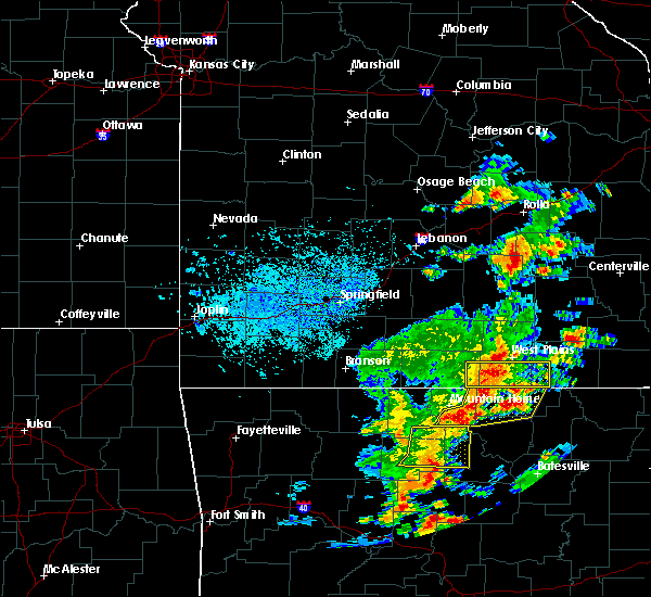 At 241 pm cdt, severe thunderstorms were located along a line extending from 10 miles southwest of west plains to 8 miles east of bakersfield to ott, moving east at 25 mph (radar indicated). Hazards include 60 mph wind gusts. Expect damage to roofs. siding. and trees. Locations impacted include, west plains, grand gulf state park, thayer, south fork, koshkonong, brandsville, moody, lanton, pottersville,. At 241 pm cdt, severe thunderstorms were located along a line extending from 10 miles southwest of west plains to 8 miles east of bakersfield to ott, moving east at 25 mph (radar indicated). Hazards include 60 mph wind gusts. Expect damage to roofs. siding. and trees. Locations impacted include, west plains, grand gulf state park, thayer, south fork, koshkonong, brandsville, moody, lanton, pottersville,.
|
| 7/29/2016 2:28 PM CDT |
 At 228 pm cdt, severe thunderstorms were located along a line extending from 11 miles northwest of ott to near bakersfield, moving east at 20 mph (radar indicated). Hazards include 60 mph wind gusts. Expect damage to roofs. siding. And trees. At 228 pm cdt, severe thunderstorms were located along a line extending from 11 miles northwest of ott to near bakersfield, moving east at 20 mph (radar indicated). Hazards include 60 mph wind gusts. Expect damage to roofs. siding. And trees.
|
| 7/8/2016 3:47 PM CDT |
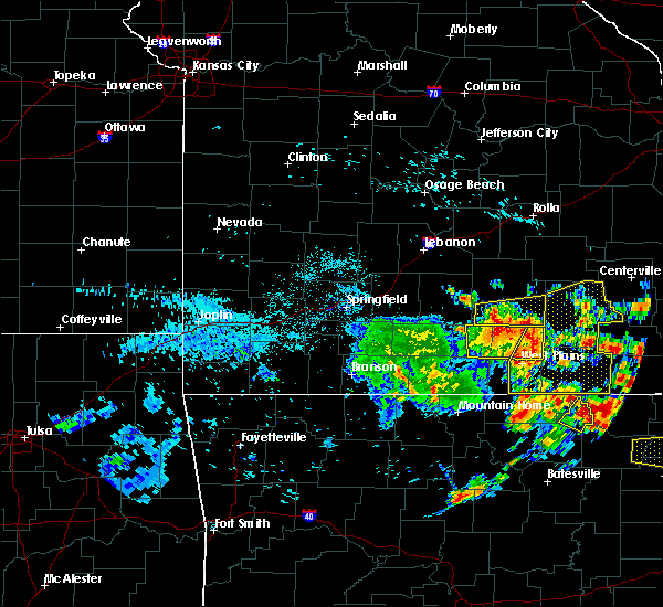 At 344 pm cdt, severe thunderstorms were located along a line extending from 6 miles northeast of cabool to near mountain view to near sturkie, moving east at 30 mph (law enforcement. estimated 60 mph winds at troop g headquarters. these storms also have a history of downing trees across portion of western taney county and portions of douglas county when the storms passed through those locations). Hazards include 60 mph wind gusts. Expect damage to roofs. siding. And trees. At 344 pm cdt, severe thunderstorms were located along a line extending from 6 miles northeast of cabool to near mountain view to near sturkie, moving east at 30 mph (law enforcement. estimated 60 mph winds at troop g headquarters. these storms also have a history of downing trees across portion of western taney county and portions of douglas county when the storms passed through those locations). Hazards include 60 mph wind gusts. Expect damage to roofs. siding. And trees.
|
| 7/8/2016 2:59 PM CDT |
 At 258 pm cdt, a severe thunderstorm was located 11 miles south of norwood, or 14 miles east of ava, moving east at 35 mph (radar indicated). Hazards include 60 mph wind gusts. Expect damage to roofs. siding. And trees. At 258 pm cdt, a severe thunderstorm was located 11 miles south of norwood, or 14 miles east of ava, moving east at 35 mph (radar indicated). Hazards include 60 mph wind gusts. Expect damage to roofs. siding. And trees.
|
| 7/6/2016 10:55 AM CDT | Numerous 2-3 inch tree limbs down in brandsville in howell county MO, 11.8 miles WNW of West Plains, MO |
| 7/6/2016 10:53 AM CDT |
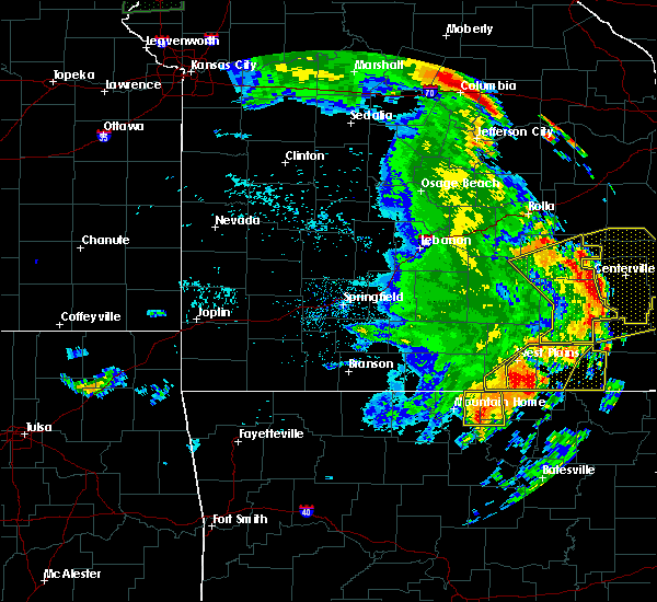 At 1053 am cdt, a severe thunderstorm was located 7 miles south of west plains, moving east at 45 mph (radar indicated). Hazards include 60 mph wind gusts and quarter size hail. Hail damage to vehicles is expected. Expect wind damage to roofs, siding, and trees. At 1053 am cdt, a severe thunderstorm was located 7 miles south of west plains, moving east at 45 mph (radar indicated). Hazards include 60 mph wind gusts and quarter size hail. Hail damage to vehicles is expected. Expect wind damage to roofs, siding, and trees.
|
| 7/6/2016 10:49 AM CDT |
 At 1049 am cdt, a severe thunderstorm was located 8 miles south of west plains, moving east at 40 mph (radar indicated). Hazards include 60 mph wind gusts and half dollar size hail. Hail damage to vehicles is expected. expect wind damage to roofs, siding, and trees. Locations impacted include, west plains, grand gulf state park, thayer, alton, south fork, koshkonong, brandsville, thomasville, moody, peace valley, lanton, greer, caulfield, white church, rover,. At 1049 am cdt, a severe thunderstorm was located 8 miles south of west plains, moving east at 40 mph (radar indicated). Hazards include 60 mph wind gusts and half dollar size hail. Hail damage to vehicles is expected. expect wind damage to roofs, siding, and trees. Locations impacted include, west plains, grand gulf state park, thayer, alton, south fork, koshkonong, brandsville, thomasville, moody, peace valley, lanton, greer, caulfield, white church, rover,.
|
| 7/6/2016 10:26 AM CDT |
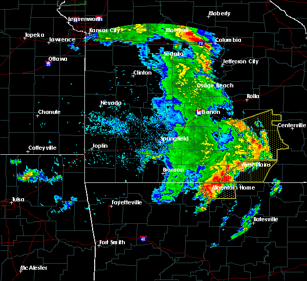 At 1026 am cdt, severe thunderstorms were located along a line extending from 8 miles northeast of west plains to 6 miles northeast of bakersfield to salesville, moving east at 55 mph (radar indicated). Hazards include 60 mph wind gusts and nickel size hail. Expect damage to roofs. siding. And trees. At 1026 am cdt, severe thunderstorms were located along a line extending from 8 miles northeast of west plains to 6 miles northeast of bakersfield to salesville, moving east at 55 mph (radar indicated). Hazards include 60 mph wind gusts and nickel size hail. Expect damage to roofs. siding. And trees.
|
| 6/26/2016 8:19 PM CDT |
 At 818 pm cdt, a severe thunderstorm was located 8 miles southwest of west plains, moving southeast at 5 mph (radar indicated). Hazards include 60 mph wind gusts. Expect damage to roofs. siding. And trees. At 818 pm cdt, a severe thunderstorm was located 8 miles southwest of west plains, moving southeast at 5 mph (radar indicated). Hazards include 60 mph wind gusts. Expect damage to roofs. siding. And trees.
|
| 6/26/2016 7:56 PM CDT |
 At 756 pm cdt, severe thunderstorms were located along a line extending from 10 miles south of mountain view to 10 miles northeast of bakersfield, moving south at 20 mph (radar indicated). Hazards include 60 mph wind gusts. Expect damage to roofs. siding. and trees. These severe thunderstorms will remain over mainly rural areas of central howell county, including the following locations: south fork, brandsville, pottersville and white church. At 756 pm cdt, severe thunderstorms were located along a line extending from 10 miles south of mountain view to 10 miles northeast of bakersfield, moving south at 20 mph (radar indicated). Hazards include 60 mph wind gusts. Expect damage to roofs. siding. and trees. These severe thunderstorms will remain over mainly rural areas of central howell county, including the following locations: south fork, brandsville, pottersville and white church.
|
| 6/26/2016 7:34 PM CDT |
 At 733 pm cdt, a severe thunderstorm was located 9 miles south of willow springs, moving southeast at 5 mph (radar indicated). Hazards include 60 mph wind gusts. Expect damage to roofs. siding. and trees. this severe thunderstorm will be near, west plains around 815 pm cdt. Other locations impacted by this severe thunderstorm include pomona, south fork, brandsville, peace valley, pottersville and white church. At 733 pm cdt, a severe thunderstorm was located 9 miles south of willow springs, moving southeast at 5 mph (radar indicated). Hazards include 60 mph wind gusts. Expect damage to roofs. siding. and trees. this severe thunderstorm will be near, west plains around 815 pm cdt. Other locations impacted by this severe thunderstorm include pomona, south fork, brandsville, peace valley, pottersville and white church.
|
| 5/24/2016 3:07 PM CDT | Emergency management director reported trees down east of south for in howell county MO, 8.4 miles NNE of West Plains, MO |
| 5/24/2016 3:07 PM CDT | Nws survey crew determined intermittent wind damage occurred in a 3/4 - 1 mile swath starting around 1 mile north of south fork and extended east southeast to around ro in howell county MO, 8.2 miles NNE of West Plains, MO |
| 5/9/2016 6:38 PM CDT | Quarter sized hail reported 9 miles NNE of West Plains, MO, emd reported quarter sized hail in south fork. |
| 4/30/2016 6:46 PM CDT |
 At 646 pm cdt, severe thunderstorms were located along a line extending from 6 miles north of willow springs to 17 miles south of cabool to near gainesville, moving east at 10 mph (radar indicated). Hazards include quarter size hail. damage to vehicles is expected At 646 pm cdt, severe thunderstorms were located along a line extending from 6 miles north of willow springs to 17 miles south of cabool to near gainesville, moving east at 10 mph (radar indicated). Hazards include quarter size hail. damage to vehicles is expected
|
| 4/27/2016 5:54 PM CDT |
 The severe thunderstorm warning for northwestern howell county will expire at 600 pm cdt, the storm which prompted the warning has weakened below severe limits, and no longer pose an immediate threat to life or property. therefore the warning will be allowed to expire. however small hail is still possible with this thunderstorm. The severe thunderstorm warning for northwestern howell county will expire at 600 pm cdt, the storm which prompted the warning has weakened below severe limits, and no longer pose an immediate threat to life or property. therefore the warning will be allowed to expire. however small hail is still possible with this thunderstorm.
|
| 4/27/2016 5:40 PM CDT |
 At 539 pm cdt, a severe thunderstorm was located 9 miles northwest of west plains, moving northeast at 35 mph (radar indicated). Hazards include quarter size hail. Damage to vehicles is expected. Locations impacted include, pomona, white church,. At 539 pm cdt, a severe thunderstorm was located 9 miles northwest of west plains, moving northeast at 35 mph (radar indicated). Hazards include quarter size hail. Damage to vehicles is expected. Locations impacted include, pomona, white church,.
|
| 12/23/2015 8:50 AM CST | Delayed storm report - a large tree was blown down on to an outdoor patio structure and outbuildings. a couple outbuildings were heavily damaged. a brick wall was compl in howell county MO, 3 miles NNW of West Plains, MO |
| 12/23/2015 6:24 AM CST |
 The severe thunderstorm warning for howell, southwestern texas, eastern douglas and eastern ozark counties will expire at 630 am cst, the storms which prompted the warning have weakened below severe limits, and no longer pose an immediate threat to life or property. therefore the warning will be allowed to expire. however gusty winds are still possible with these thunderstorms. The severe thunderstorm warning for howell, southwestern texas, eastern douglas and eastern ozark counties will expire at 630 am cst, the storms which prompted the warning have weakened below severe limits, and no longer pose an immediate threat to life or property. therefore the warning will be allowed to expire. however gusty winds are still possible with these thunderstorms.
|
| 12/23/2015 6:08 AM CST |
 At 607 am cst, severe thunderstorms were located along a line extending from 8 miles north of cabool to 18 miles northeast of gainesville to near bakersfield, moving northeast at 65 mph (radar indicated). Hazards include 60 mph wind gusts. Expect damage to roofs. siding and trees. Locations impacted include, west plains, willow springs, cabool, houston, pomona, bakersfield, south fork, moody, siloam springs, dora, zanoni, udall, tecumseh, simmons, elk creek, pottersville, sycamore, caulfield, solo,. At 607 am cst, severe thunderstorms were located along a line extending from 8 miles north of cabool to 18 miles northeast of gainesville to near bakersfield, moving northeast at 65 mph (radar indicated). Hazards include 60 mph wind gusts. Expect damage to roofs. siding and trees. Locations impacted include, west plains, willow springs, cabool, houston, pomona, bakersfield, south fork, moody, siloam springs, dora, zanoni, udall, tecumseh, simmons, elk creek, pottersville, sycamore, caulfield, solo,.
|
| 12/23/2015 5:46 AM CST |
 At 546 am cst, severe thunderstorms were located along a line extending from near norwood to 6 miles west of gainesville to arkawana, moving northeast at 60 mph (radar indicated). Hazards include 60 mph wind gusts. Expect damage to roofs. Siding and trees. At 546 am cst, severe thunderstorms were located along a line extending from near norwood to 6 miles west of gainesville to arkawana, moving northeast at 60 mph (radar indicated). Hazards include 60 mph wind gusts. Expect damage to roofs. Siding and trees.
|
| 8/10/2015 5:57 AM CDT | The severe thunderstorm warning for howell and oregon counties will expire at 600 am cdt. the storms which prompted the warning have weakened below severe limits. and are exiting the warned area. Therefore the warning will be allowed to expire. |
| 8/10/2015 5:30 AM CDT |
 At 530 am cdt, severe thunderstorms were located along a line extending from 6 miles southwest of handy to 17 miles northwest of thayer to near west plains, moving southeast at 40 mph (radar indicated). Hazards include 60 mph wind gusts and penny size hail. Expect damage to roofs. siding and trees. Locations impacted include, west plains, grand gulf state park, thayer, alton, pomona, south fork, koshkonong, brandsville, thomasville, moody, peace valley, couch, lanton, pottersville, myrtle, greer, wilderness, white church, rover,. At 530 am cdt, severe thunderstorms were located along a line extending from 6 miles southwest of handy to 17 miles northwest of thayer to near west plains, moving southeast at 40 mph (radar indicated). Hazards include 60 mph wind gusts and penny size hail. Expect damage to roofs. siding and trees. Locations impacted include, west plains, grand gulf state park, thayer, alton, pomona, south fork, koshkonong, brandsville, thomasville, moody, peace valley, couch, lanton, pottersville, myrtle, greer, wilderness, white church, rover,.
|
| 8/10/2015 5:13 AM CDT |
 At 512 am cdt, severe thunderstorms were located along a line extending from 10 miles south of winona to 8 miles north of west plains to 15 miles south of willow springs, moving southeast at 40 mph (radar indicated). Hazards include 60 mph wind gusts and penny size hail. Expect damage to roofs. siding and trees. Locations impacted include, west plains, grand gulf state park, mountain view, thayer, willow springs, winona, alton, birch tree, pomona, south fork, koshkonong, brandsville, montier, thomasville, moody, siloam springs, peace valley, lanton, myrtle, couch,. At 512 am cdt, severe thunderstorms were located along a line extending from 10 miles south of winona to 8 miles north of west plains to 15 miles south of willow springs, moving southeast at 40 mph (radar indicated). Hazards include 60 mph wind gusts and penny size hail. Expect damage to roofs. siding and trees. Locations impacted include, west plains, grand gulf state park, mountain view, thayer, willow springs, winona, alton, birch tree, pomona, south fork, koshkonong, brandsville, montier, thomasville, moody, siloam springs, peace valley, lanton, myrtle, couch,.
|
| 8/10/2015 4:55 AM CDT |
 At 454 am cdt, severe thunderstorms were located along a line extending from birch tree to near willow springs to 17 miles south of cabool, moving southeast at 40 mph (radar indicated). Hazards include 60 mph wind gusts and penny size hail. Expect damage to roofs. Siding and trees. At 454 am cdt, severe thunderstorms were located along a line extending from birch tree to near willow springs to 17 miles south of cabool, moving southeast at 40 mph (radar indicated). Hazards include 60 mph wind gusts and penny size hail. Expect damage to roofs. Siding and trees.
|
| 7/20/2015 8:06 PM CDT |
 At 802 pm cdt, severe thunderstorms were located along a line extending from 19 miles east of alton to 13 miles southwest of bakersfield, and moving southeast at 25 mph (law enforcement. a tree was reported down near thomasville at 740 pm). Hazards include 60 mph wind gusts. Expect damage to roofs. siding and trees. locations impacted include, alton, bakersfield, brandsville, caulfield, couch, greer, koshkonong, lanton, moody, myrtle, rover, south fork, thayer, thomasville and wilderness. This warning also includes grand gulf state park. At 802 pm cdt, severe thunderstorms were located along a line extending from 19 miles east of alton to 13 miles southwest of bakersfield, and moving southeast at 25 mph (law enforcement. a tree was reported down near thomasville at 740 pm). Hazards include 60 mph wind gusts. Expect damage to roofs. siding and trees. locations impacted include, alton, bakersfield, brandsville, caulfield, couch, greer, koshkonong, lanton, moody, myrtle, rover, south fork, thayer, thomasville and wilderness. This warning also includes grand gulf state park.
|
| 7/20/2015 7:38 PM CDT |
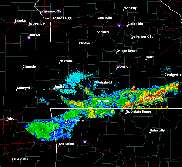 At 737 pm cdt, severe thunderstorms were located along a line extending from 18 miles northeast of alton to 11 miles west of bakersfield, and moving southeast at 25 mph (radar indicated). Hazards include 60 mph wind gusts. Expect damage to roofs. Siding and trees. At 737 pm cdt, severe thunderstorms were located along a line extending from 18 miles northeast of alton to 11 miles west of bakersfield, and moving southeast at 25 mph (radar indicated). Hazards include 60 mph wind gusts. Expect damage to roofs. Siding and trees.
|
| 7/20/2015 7:34 PM CDT |
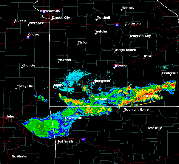 At 732 pm cdt, severe thunderstorms were located along a line extending from 8 miles south of winona to 15 miles southwest of west plains, and moving southeast at 20 mph (radar indicated). Hazards include 60 mph wind gusts. Expect damage to roofs. siding and trees. Locations impacted include, alton, brandsville, caulfield, greer, moody, rover, south fork, thomasville, west plains and winona. At 732 pm cdt, severe thunderstorms were located along a line extending from 8 miles south of winona to 15 miles southwest of west plains, and moving southeast at 20 mph (radar indicated). Hazards include 60 mph wind gusts. Expect damage to roofs. siding and trees. Locations impacted include, alton, brandsville, caulfield, greer, moody, rover, south fork, thomasville, west plains and winona.
|
| 7/20/2015 7:21 PM CDT |
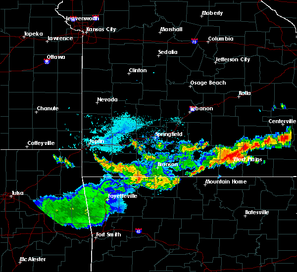 At 719 pm cdt, severe thunderstorms were located along a line extending from winona to 15 miles west of west plains, and moving southeast at 20 mph (radar indicated). Hazards include 60 mph wind gusts. Expect damage to roofs. Siding and trees. At 719 pm cdt, severe thunderstorms were located along a line extending from winona to 15 miles west of west plains, and moving southeast at 20 mph (radar indicated). Hazards include 60 mph wind gusts. Expect damage to roofs. Siding and trees.
|
| 7/20/2015 7:20 PM CDT | Tree down. bb hw in howell county MO, 1.9 miles WSW of West Plains, MO |
| 7/14/2015 1:32 PM CDT |
 At 130 pm cdt, severe thunderstorms were located along a line extending from 8 miles northwest of alton to west plains to 17 miles southwest of west plains, and moving southeast at 45 mph (trained weather spotters. large trees have been reported down in white church). Hazards include 60 mph wind gusts. Expect damage to roofs. siding and trees. locations impacted include, alton, brandsville, couch, greer, koshkonong, lanton, moody, myrtle, rover, south fork, thayer, thomasville, west plains, white church and wilderness. this warning also includes grand gulf state park. A severe thunderstorm watch remains in effect until 700 pm cdt tuesday evening for southwestern missouri. At 130 pm cdt, severe thunderstorms were located along a line extending from 8 miles northwest of alton to west plains to 17 miles southwest of west plains, and moving southeast at 45 mph (trained weather spotters. large trees have been reported down in white church). Hazards include 60 mph wind gusts. Expect damage to roofs. siding and trees. locations impacted include, alton, brandsville, couch, greer, koshkonong, lanton, moody, myrtle, rover, south fork, thayer, thomasville, west plains, white church and wilderness. this warning also includes grand gulf state park. A severe thunderstorm watch remains in effect until 700 pm cdt tuesday evening for southwestern missouri.
|
| 7/14/2015 1:25 PM CDT |
 At 122 pm cdt, severe thunderstorms were located along a line extending from 14 miles northwest of alton to 6 miles north of west plains to 16 miles southwest of west plains, and moving southeast at 45 mph (radar indicated. these storms have a history of producing widespread wind damage). Hazards include 60 mph wind gusts. Expect damage to roofs. Siding and trees. At 122 pm cdt, severe thunderstorms were located along a line extending from 14 miles northwest of alton to 6 miles north of west plains to 16 miles southwest of west plains, and moving southeast at 45 mph (radar indicated. these storms have a history of producing widespread wind damage). Hazards include 60 mph wind gusts. Expect damage to roofs. Siding and trees.
|
| 7/14/2015 1:19 PM CDT |
 At 117 pm cdt, severe thunderstorms were located along a line extending from 11 miles north of mountain view to west plains, and moving east at 50 mph (radar indicated). Hazards include 60 mph wind gusts and nickel size hail. Expect damage to roofs. siding and trees. locations impacted include, brandsville, caulfield, koshkonong, montier, mountain view, peace valley, pomona, pottersville, rover, siloam springs, south fork, teresita, west plains, white church and willow springs. this warning also includes grand gulf state park. A severe thunderstorm watch remains in effect until 700 pm cdt tuesday evening for southwestern missouri. At 117 pm cdt, severe thunderstorms were located along a line extending from 11 miles north of mountain view to west plains, and moving east at 50 mph (radar indicated). Hazards include 60 mph wind gusts and nickel size hail. Expect damage to roofs. siding and trees. locations impacted include, brandsville, caulfield, koshkonong, montier, mountain view, peace valley, pomona, pottersville, rover, siloam springs, south fork, teresita, west plains, white church and willow springs. this warning also includes grand gulf state park. A severe thunderstorm watch remains in effect until 700 pm cdt tuesday evening for southwestern missouri.
|
| 7/14/2015 1:03 PM CDT |
 At 101 pm cdt, severe thunderstorms were located along a line extending from 13 miles northeast of cabool to 13 miles west of west plains, and moving east at 50 mph (trained weather spotters. these storms have a long history of producing wind damage, including trees down in the willow springs area). Hazards include 60 mph wind gusts and nickel size hail. Expect damage to roofs. siding and trees. locations impacted include, arroll, birch tree, brandsville, cabool, caulfield, clear springs, dora, drury, elk creek, koshkonong, montier, mountain view, peace valley, pine crest, pomona, pottersville, rover, siloam springs, simmons, south fork, teresita, vanzant, west plains, white church and willow springs. this warning also includes grand gulf state park. A severe thunderstorm watch remains in effect until 700 pm cdt tuesday evening for southwestern missouri. At 101 pm cdt, severe thunderstorms were located along a line extending from 13 miles northeast of cabool to 13 miles west of west plains, and moving east at 50 mph (trained weather spotters. these storms have a long history of producing wind damage, including trees down in the willow springs area). Hazards include 60 mph wind gusts and nickel size hail. Expect damage to roofs. siding and trees. locations impacted include, arroll, birch tree, brandsville, cabool, caulfield, clear springs, dora, drury, elk creek, koshkonong, montier, mountain view, peace valley, pine crest, pomona, pottersville, rover, siloam springs, simmons, south fork, teresita, vanzant, west plains, white church and willow springs. this warning also includes grand gulf state park. A severe thunderstorm watch remains in effect until 700 pm cdt tuesday evening for southwestern missouri.
|
| 7/14/2015 12:40 PM CDT |
 At 1238 pm cdt, severe thunderstorms were located along a line extending from 12 miles north of mountain grove to 18 miles south of norwood, and moving east at 50 mph (trained weather spotters. this cluster of thunderstorms has resulted in multiple trees down along its path. winds have been estimated to be around 60 mph). Hazards include 60 mph wind gusts and nickel size hail. Expect damage to roofs. Siding and trees. At 1238 pm cdt, severe thunderstorms were located along a line extending from 12 miles north of mountain grove to 18 miles south of norwood, and moving east at 50 mph (trained weather spotters. this cluster of thunderstorms has resulted in multiple trees down along its path. winds have been estimated to be around 60 mph). Hazards include 60 mph wind gusts and nickel size hail. Expect damage to roofs. Siding and trees.
|
| 7/9/2015 4:10 PM CDT | Tree down on ab highwa in howell county MO, 2.9 miles NNE of West Plains, MO |
| 7/8/2015 5:17 PM CDT |
 At 514 pm cdt, a severe squall line capable of producing tornadoes that may not be visible due to heavy rain was located along a line extending from west plains to 8 miles southeast of west plains to 11 miles southeast of west plains to 15 miles south of west plains, and moving northeast at 45 mph (radar indicated rotation). Hazards include tornado. Flying debris will be dangerous to those caught without shelter. mobile homes will be damaged or destroyed. damage to roofs, windows and vehicles will occur. tree damage is likely. Locations impacted include, brandsville and west plains. At 514 pm cdt, a severe squall line capable of producing tornadoes that may not be visible due to heavy rain was located along a line extending from west plains to 8 miles southeast of west plains to 11 miles southeast of west plains to 15 miles south of west plains, and moving northeast at 45 mph (radar indicated rotation). Hazards include tornado. Flying debris will be dangerous to those caught without shelter. mobile homes will be damaged or destroyed. damage to roofs, windows and vehicles will occur. tree damage is likely. Locations impacted include, brandsville and west plains.
|
| 7/8/2015 5:08 PM CDT |
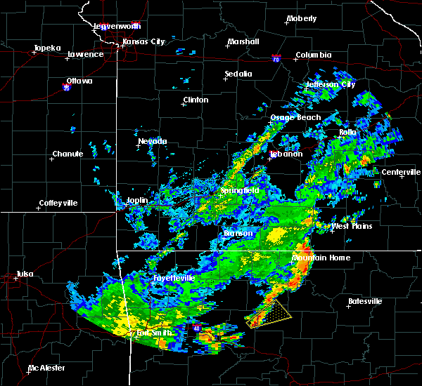 At 506 pm cdt, a severe squall line capable of producing tornadoes that may not be visible due to heavy rain was located along a line extending from 9 miles southwest of west plains to 8 miles south of west plains to 10 miles south of west plains to 14 miles south of west plains to 16 miles south of west plains, and moving northeast at 40 mph (radar indicated rotation). Hazards include tornado. Flying debris will be dangerous to those caught without shelter. mobile homes will be damaged or destroyed. damage to roofs, windows and vehicles will occur. Tree damage is likely. At 506 pm cdt, a severe squall line capable of producing tornadoes that may not be visible due to heavy rain was located along a line extending from 9 miles southwest of west plains to 8 miles south of west plains to 10 miles south of west plains to 14 miles south of west plains to 16 miles south of west plains, and moving northeast at 40 mph (radar indicated rotation). Hazards include tornado. Flying debris will be dangerous to those caught without shelter. mobile homes will be damaged or destroyed. damage to roofs, windows and vehicles will occur. Tree damage is likely.
|
| 7/8/2015 5:04 PM CDT |
 At 501 pm cdt, severe thunderstorms were located along a line extending from 12 miles southwest of west plains to 16 miles south of west plains to 18 miles south of west plains to 24 miles south of west plains, and moving northeast at 40 mph (radar indicated). Hazards include 60 mph wind gusts. Expect damage to roofs. siding and trees. Locations impacted include, brandsville, lanton, moody, south fork and west plains. At 501 pm cdt, severe thunderstorms were located along a line extending from 12 miles southwest of west plains to 16 miles south of west plains to 18 miles south of west plains to 24 miles south of west plains, and moving northeast at 40 mph (radar indicated). Hazards include 60 mph wind gusts. Expect damage to roofs. siding and trees. Locations impacted include, brandsville, lanton, moody, south fork and west plains.
|
| 7/8/2015 4:57 PM CDT |
 At 455 pm cdt, severe thunderstorms were located along a line extending from 17 miles southwest of west plains to 16 miles southwest of west plains to 22 miles southwest of west plains to 28 miles southwest of west plains, and moving northeast at 40 mph (radar indicated). Hazards include 60 mph wind gusts. Expect damage to roofs. Siding and trees. At 455 pm cdt, severe thunderstorms were located along a line extending from 17 miles southwest of west plains to 16 miles southwest of west plains to 22 miles southwest of west plains to 28 miles southwest of west plains, and moving northeast at 40 mph (radar indicated). Hazards include 60 mph wind gusts. Expect damage to roofs. Siding and trees.
|
| 5/27/2015 6:59 PM CDT | At 657 pm cdt, a severe thunderstorm was located 10 miles northeast of west plains, and moving southeast at 10 mph (radar indicated). Hazards include 60 mph wind gusts and quarter size hail. Hail damage to vehicles is expected. Expect wind damage to roofs, siding and trees. |
| 5/24/2015 6:28 PM CDT | At 626 pm cdt, severe thunderstorms were located along a line extending from 6 miles east of ava to 9 miles southwest of west plains, and moving northeast at 60 mph (radar indicated). Hazards include 60 mph wind gusts. Expect damage to roofs. Siding and trees. |
| 5/24/2015 5:43 PM CDT | At 540 pm cdt, severe thunderstorms were located along a line extending from 25 miles west of gainesville to 17 miles south of gainesville, and moving northeast at 65 mph (radar indicated). Hazards include 60 mph wind gusts. Expect damage to roofs. siding and trees. severe thunderstorms will be near, brownbranch, bradleyville, thornfield and gainesville around 550 pm cdt. rome, goodhope, willhoit and udall around 555 pm cdt. zanoni, wasola, sycamore and rockbridge around 600 pm cdt. ava, dogwood, dora and south fork around 605 pm cdt. pottersville, gentryville, drury and brushyknob around 610 pm cdt. this warning also includes bull shoals lake. A tornado watch remains in effect until 800 pm cdt sunday evening for southern missouri. |
| 5/17/2015 4:11 AM CDT | At 410 am cdt, severe thunderstorms were located along a line extending from 11 miles northwest of licking to 7 miles northeast of cabool to 18 miles southwest of willow springs, and moving east at 45 mph (radar indicated). Hazards include 60 mph wind gusts. Expect damage to roofs. siding and trees. locations impacted include, cabool, extreme southwestern fort leonard wood, houston, licking, mountain grove, mountain view, raymondville and willow springs. a severe thunderstorm watch remains in effect until 700 am cdt sunday morning for southern missouri. 75in. |
| 5/17/2015 3:35 AM CDT | At 331 am cdt, severe thunderstorms were located along a line extending from 15 miles north of hartville to 6 miles north of norwood to squires, and moving east at 45 mph (radar indicated). Hazards include 60 mph wind gusts and penny size hail. Expect damage to roofs. Siding and trees. |
| 4/3/2015 2:02 AM CDT | A severe thunderstorm warning remains in effect for southeastern howell county until 215 am cdt. at 200 am cdt. severe thunderstorms were located along a line extending from east central howell county to extreme south central howell county. and moving east at 50 mph. hazard. 60 mph wind gusts and quarter size hail. |
| 4/3/2015 1:28 AM CDT | The national weather service in springfield has issued a * severe thunderstorm warning for. howell county in south central missouri. until 215 am cdt * at 126 am cdt. Severe thunderstorms were located along a line extending from eastern ozark county to southeastern ozark county. |
| 3/25/2015 8:04 PM CDT | A severe thunderstorm warning remains in effect for southern howell county until 845 pm cdt. at 803 pm cdt. a severe thunderstorm was located 9 miles southwest of west plains. and moving east at 30 mph. hazard. golf ball size hail and 60 mph wind gusts. source. law enforcement. Golf ball sized hail was reported in. |
| 3/25/2015 7:43 PM CDT | The national weather service in springfield has issued a * severe thunderstorm warning for. southern howell county in south central missouri. until 845 pm cdt * at 741 pm cdt. a severe thunderstorm was located 19 miles southwest of west plains. And moving east at 30 mph. |
| 6/28/2013 3:30 AM CDT | 6 inch diameter limb snapped off of a healthy tree. report via espotte in howell county MO, 4 miles W of West Plains, MO |
| 6/22/2013 5:29 PM CDT | Microburst hit the western side of west plains. trees and power lines down across the parking lot at crossroads convenience stor in howell county MO, 1.4 miles WNW of West Plains, MO |
| 6/22/2013 5:29 PM CDT | Large tree down near highway cc and country club drive. report received via twitte in howell county MO, 0.5 miles E of West Plains, MO |
| 6/22/2013 5:29 PM CDT | Roof blown off of a building in howell county MO, 0.8 miles NE of West Plains, MO |
| 6/22/2013 5:29 PM CDT | Several power lines and large trees down on the west side of west plain in howell county MO, 1.2 miles ENE of West Plains, MO |
| 9/7/2012 4:38 PM CDT | A couple of power lines reported down in west plain in howell county MO, 1.4 miles WNW of West Plains, MO |
| 9/7/2012 4:38 PM CDT | A couple of power lines reported down in west plains. roof of building in town was also damage in howell county MO, 1.4 miles WNW of West Plains, MO |
| 7/26/2012 4:10 PM CDT | A tree was blown down on a roadway near highway 6 in howell county MO, 1.2 miles W of West Plains, MO |
| 7/26/2012 4:08 PM CDT | Power line pole blown dow in howell county MO, 1.4 miles WNW of West Plains, MO |
| 7/7/2012 5:30 PM CDT | Couple of trees dow in howell county MO, 7.3 miles NNW of West Plains, MO |
| 6/11/2012 11:41 AM CDT | Power poles and trees dow in howell county MO, 1.4 miles WNW of West Plains, MO |
| 1/1/0001 12:00 AM | Storm damage reported in howell county MO, 1.4 miles WNW of West Plains, MO |
| 1/1/0001 12:00 AM | Power pole down in howell county MO, 1.4 miles WNW of West Plains, MO |
| 1/1/0001 12:00 AM | Trees reported down on powerlines and on a ca in howell county MO, 1.4 miles WNW of West Plains, MO |
| 1/1/0001 12:00 AM | Power lines dow in howell county MO, 0.8 miles S of West Plains, MO |
| 1/1/0001 12:00 AM | Quarter sized hail reported 1.4 miles WNW of West Plains, MO |
| 1/1/0001 12:00 AM | Quarter sized hail reported 1.4 miles WNW of West Plains, MO |
| 1/1/0001 12:00 AM | Several trees down on a home and cars along cr 6420 near hwy ad. trees estimated to be 3 ft in diameter. time estimated from rada in howell county MO, 6 miles E of West Plains, MO |
| 1/1/0001 12:00 AM | Several trees down on a home and cars near hwy ad and cr 6420. trees estimated to be 3 feet in diamete in howell county MO, 6 miles E of West Plains, MO |
| 1/1/0001 12:00 AM | Golf Ball sized hail reported 12 miles SW of West Plains, MO, golf ball sized hail near intersection of hwy 17 and ee. |
| 1/1/0001 12:00 AM | Quarter sized hail reported 1.4 miles WNW of West Plains, MO, one inch hail observed downtown west plains. |
| 1/1/0001 12:00 AM | Ping Pong Ball sized hail reported 1.4 miles WNW of West Plains, MO, relayed by media. |
| 1/1/0001 12:00 AM | Hen Egg sized hail reported 12 miles SW of West Plains, MO, relayed by media. |
Hail Maps for West Plains, MO


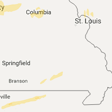
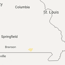


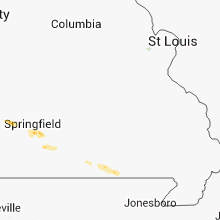

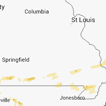


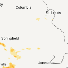


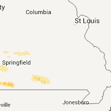


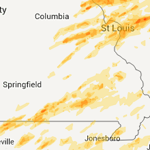
Connect with Interactive Hail Maps