

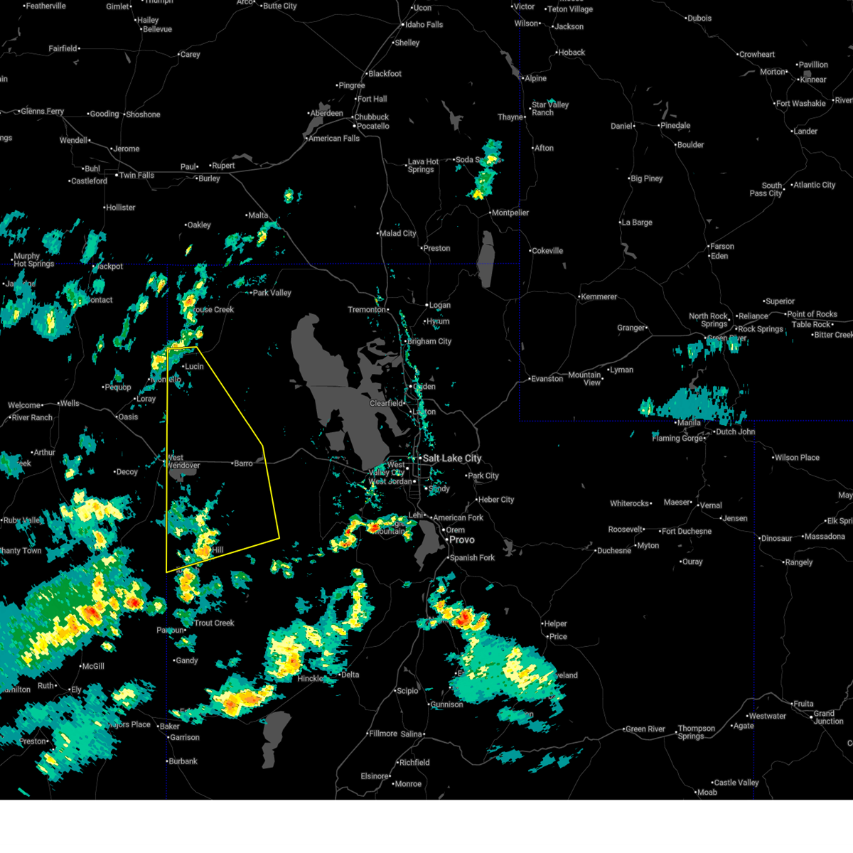
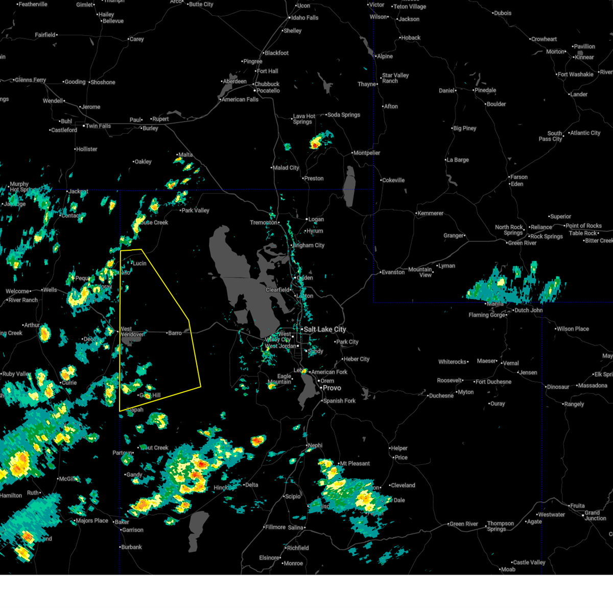
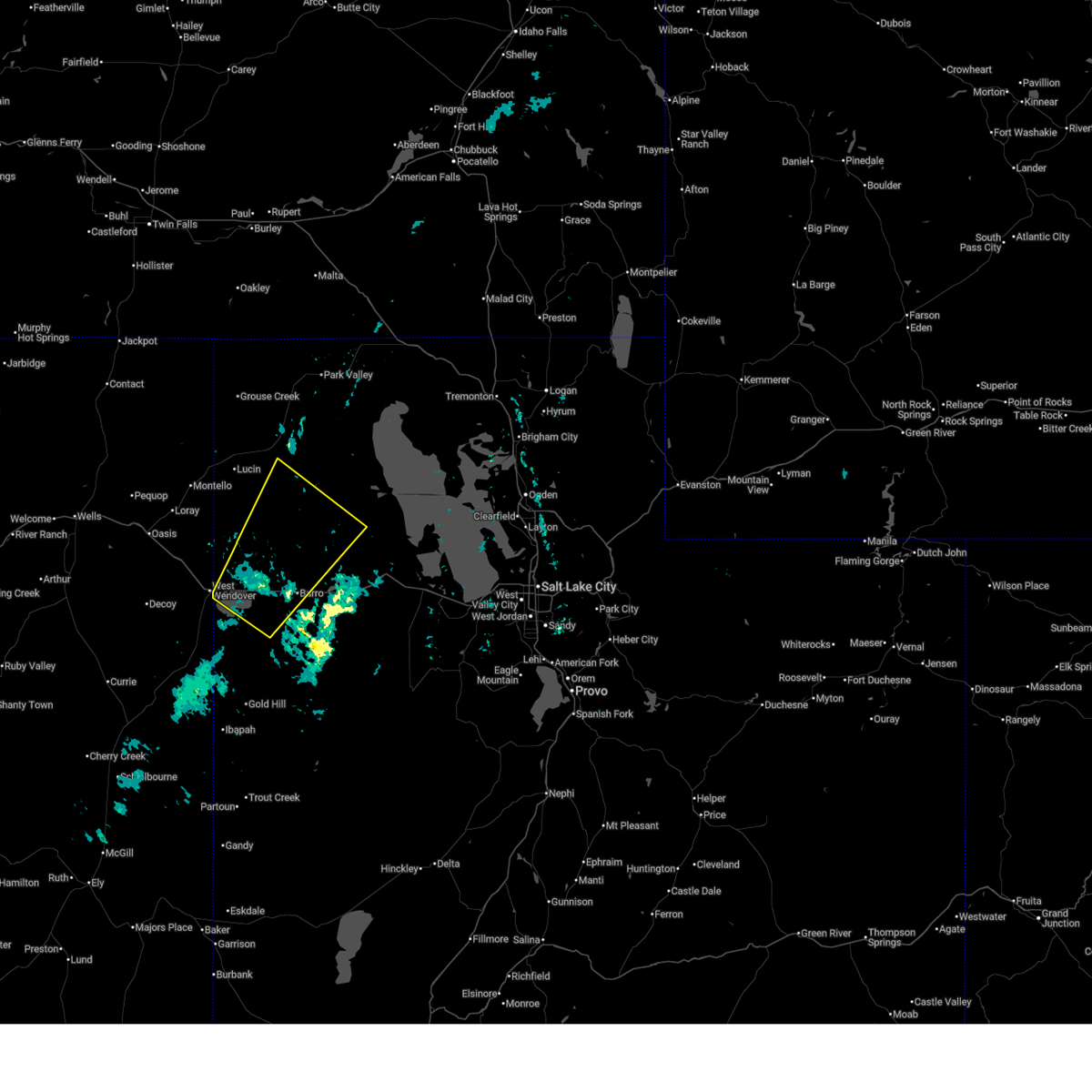
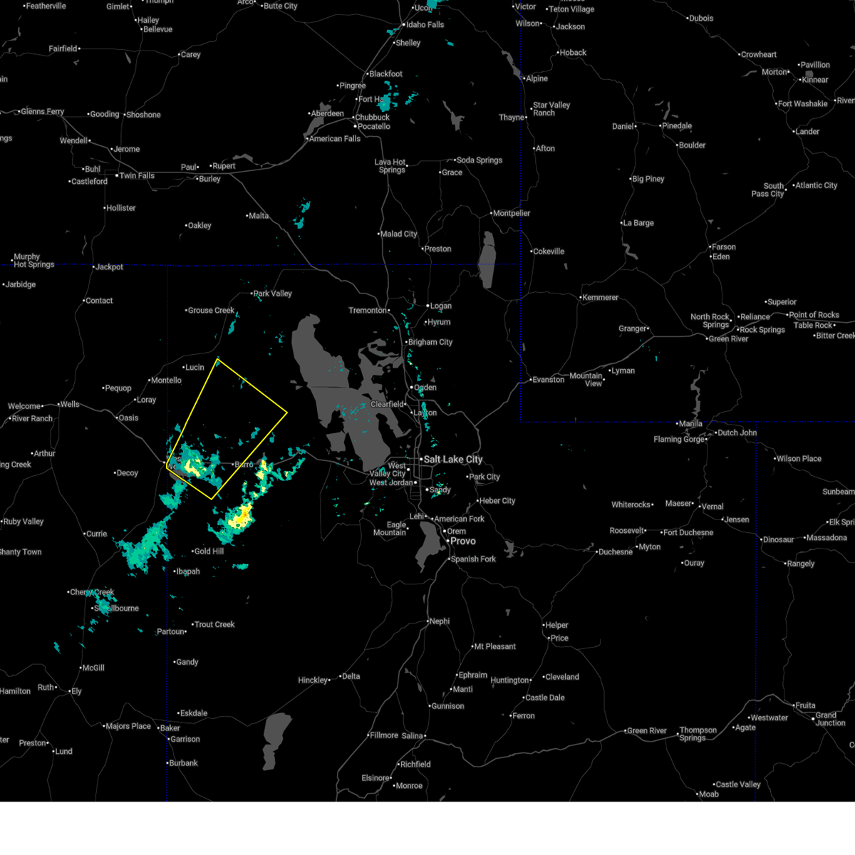
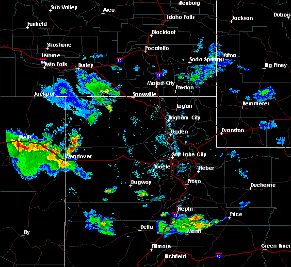
Hail Map for West Wendover, NV
The West Wendover, NV area has had 0 reports of on-the-ground hail by trained spotters, and has been under severe weather warnings 4 times during the past 12 months. Doppler radar has detected hail at or near West Wendover, NV on 2 occasions.
| Name: | West Wendover, NV |
| Where Located: | 89.6 miles E of Elko, NV |
| Map: | Google Map for West Wendover, NV |
| Population: | 4410 |
| Housing Units: | 1504 |
| More Info: | Search Google for West Wendover, NV |
0
The Top Recent Hail Date for West Wendover, NV is Monday, June 13, 2016 (2nd out of 2)

Hail and Wind Damage Spotted near West Wendover, NV
| Date / Time | Report Details |
|---|---|
| 6/24/2026 4:14 PM MDT |
 The storms which prompted the warning have weakened below severe limits, and no longer pose an immediate threat to life or property. therefore, the warning will be allowed to expire. however gusty winds are still possible with these thunderstorms. The storms which prompted the warning have weakened below severe limits, and no longer pose an immediate threat to life or property. therefore, the warning will be allowed to expire. however gusty winds are still possible with these thunderstorms.
|
| 6/24/2026 3:36 PM MDT |
 Svrslc the national weather service in salt lake city has issued a * severe thunderstorm warning for, southwestern box elder county in northern utah, western tooele county in northern utah, * until 415 pm mdt. * at 336 pm mdt, severe thunderstorms were located along a line extending from 14 miles northeast of west wendover to 8 miles northwest of dugway proving ground test range, moving northeast at 20 mph (radar indicated). Hazards include 60 mph wind gusts. expect damage to roofs, siding, and trees Svrslc the national weather service in salt lake city has issued a * severe thunderstorm warning for, southwestern box elder county in northern utah, western tooele county in northern utah, * until 415 pm mdt. * at 336 pm mdt, severe thunderstorms were located along a line extending from 14 miles northeast of west wendover to 8 miles northwest of dugway proving ground test range, moving northeast at 20 mph (radar indicated). Hazards include 60 mph wind gusts. expect damage to roofs, siding, and trees
|
| 6/6/2026 6:24 PM MDT |
 At 624 pm mdt, severe thunderstorms were located along a line extending from 14 miles northeast of wendover to 13 miles west of knolls, moving northeast at 40 mph (radar indicated). Hazards include 60 mph wind gusts. Expect damage to roofs, siding, and trees. locations impacted include, wendover, utah test and training range north, utah test and training range south, and bonneville salt flats. This includes interstate 80 in utah between mile markers 0 and 33. At 624 pm mdt, severe thunderstorms were located along a line extending from 14 miles northeast of wendover to 13 miles west of knolls, moving northeast at 40 mph (radar indicated). Hazards include 60 mph wind gusts. Expect damage to roofs, siding, and trees. locations impacted include, wendover, utah test and training range north, utah test and training range south, and bonneville salt flats. This includes interstate 80 in utah between mile markers 0 and 33.
|
| 6/6/2026 6:07 PM MDT |
 Svrslc the national weather service in salt lake city has issued a * severe thunderstorm warning for, southwestern box elder county in northern utah, northwestern tooele county in northern utah, * until 645 pm mdt. * at 607 pm mdt, severe thunderstorms were located along a line extending from near wendover to 7 miles northwest of utah test and training range south, moving northeast at 40 mph (radar indicated). Hazards include 60 mph wind gusts. expect damage to roofs, siding, and trees Svrslc the national weather service in salt lake city has issued a * severe thunderstorm warning for, southwestern box elder county in northern utah, northwestern tooele county in northern utah, * until 645 pm mdt. * at 607 pm mdt, severe thunderstorms were located along a line extending from near wendover to 7 miles northwest of utah test and training range south, moving northeast at 40 mph (radar indicated). Hazards include 60 mph wind gusts. expect damage to roofs, siding, and trees
|
| 8/15/2025 2:53 PM PDT | Station id: up994 name: ola elevation: 4408 fee in elko county NV, 1.5 miles ENE of West Wendover, NV |
| 7/17/2024 4:35 PM PDT | Upr ola (up994)... elevation 4408 fee in elko county NV, 1.5 miles ENE of West Wendover, NV |
| 9/3/2023 2:49 PM MDT |
 At 249 pm mdt, a severe thunderstorm was located 10 miles southeast of wendover, moving northeast at 30 mph (radar indicated). Hazards include 60 mph wind gusts and half dollar size hail. Hail damage to vehicles is expected. expect wind damage to roofs, siding, and trees. locations impacted include, wendover and bonneville salt flats. this includes interstate 80 in utah between mile markers 0 and 21. hail threat, radar indicated max hail size, 1. 25 in wind threat, radar indicated max wind gust, 60 mph. At 249 pm mdt, a severe thunderstorm was located 10 miles southeast of wendover, moving northeast at 30 mph (radar indicated). Hazards include 60 mph wind gusts and half dollar size hail. Hail damage to vehicles is expected. expect wind damage to roofs, siding, and trees. locations impacted include, wendover and bonneville salt flats. this includes interstate 80 in utah between mile markers 0 and 21. hail threat, radar indicated max hail size, 1. 25 in wind threat, radar indicated max wind gust, 60 mph.
|
| 9/3/2023 2:46 PM MDT |
 At 246 pm mdt, a severe thunderstorm was located 10 miles southeast of wendover, moving northeast at 35 mph (radar indicated). Hazards include 60 mph wind gusts and quarter size hail. Hail damage to vehicles is expected. expect wind damage to roofs, siding, and trees. locations impacted include, wendover and bonneville salt flats. this includes interstate 80 in utah between mile markers 0 and 21. hail threat, radar indicated max hail size, 1. 00 in wind threat, radar indicated max wind gust, 60 mph. At 246 pm mdt, a severe thunderstorm was located 10 miles southeast of wendover, moving northeast at 35 mph (radar indicated). Hazards include 60 mph wind gusts and quarter size hail. Hail damage to vehicles is expected. expect wind damage to roofs, siding, and trees. locations impacted include, wendover and bonneville salt flats. this includes interstate 80 in utah between mile markers 0 and 21. hail threat, radar indicated max hail size, 1. 00 in wind threat, radar indicated max wind gust, 60 mph.
|
| 9/3/2023 2:37 PM MDT |
 At 237 pm mdt, a severe thunderstorm was located 10 miles south of wendover, moving north at 20 mph (radar indicated). Hazards include 60 mph wind gusts and quarter size hail. Hail damage to vehicles is expected. Expect wind damage to roofs, siding, and trees. At 237 pm mdt, a severe thunderstorm was located 10 miles south of wendover, moving north at 20 mph (radar indicated). Hazards include 60 mph wind gusts and quarter size hail. Hail damage to vehicles is expected. Expect wind damage to roofs, siding, and trees.
|
| 6/6/2023 3:19 PM PDT | Mesonet station up994 3.1 se west wendover (upr in elko county NV, 1.5 miles ENE of West Wendover, NV |
| 5/4/2023 3:11 PM PDT | I-80 pilot station... pprnv. elevation 4651 fee in elko county NV, 10.8 miles SE of West Wendover, NV |
| 8/1/2019 2:13 PM PDT |
 The severe thunderstorm warning for southeastern elko county will expire at 215 pm pdt, the storm which prompted the warning has weakened below severe limits, and no longer poses an immediate threat to life or property. therefore, the warning will be allowed to expire. however small hail and gusty winds are still possible with this thunderstorm. The severe thunderstorm warning for southeastern elko county will expire at 215 pm pdt, the storm which prompted the warning has weakened below severe limits, and no longer poses an immediate threat to life or property. therefore, the warning will be allowed to expire. however small hail and gusty winds are still possible with this thunderstorm.
|
| 8/1/2019 2:06 PM PDT |
 At 206 pm pdt, a severe thunderstorm was located 9 miles southwest of west wendover, moving east at 25 mph (radar indicated). Hazards include 60 mph wind gusts and penny size hail. Expect damage to roofs, siding, and trees. Locations impacted include, west wendover. At 206 pm pdt, a severe thunderstorm was located 9 miles southwest of west wendover, moving east at 25 mph (radar indicated). Hazards include 60 mph wind gusts and penny size hail. Expect damage to roofs, siding, and trees. Locations impacted include, west wendover.
|
| 8/1/2019 1:50 PM PDT |
 At 149 pm pdt, a severe thunderstorm was located 14 miles southwest of west wendover, moving east at 25 mph (radar indicated). Hazards include 60 mph wind gusts and penny size hail. expect damage to roofs, siding, and trees At 149 pm pdt, a severe thunderstorm was located 14 miles southwest of west wendover, moving east at 25 mph (radar indicated). Hazards include 60 mph wind gusts and penny size hail. expect damage to roofs, siding, and trees
|
| 8/9/2017 3:46 PM PDT |
 At 346 pm pdt, a severe thunderstorm was located 10 miles southwest of wendover, moving northeast at 15 mph (radar indicated). Hazards include 60 mph wind gusts. Expect damage to roofs, siding, and trees. Locations impacted include, west wendover. At 346 pm pdt, a severe thunderstorm was located 10 miles southwest of wendover, moving northeast at 15 mph (radar indicated). Hazards include 60 mph wind gusts. Expect damage to roofs, siding, and trees. Locations impacted include, west wendover.
|
| 8/9/2017 3:32 PM PDT |
 At 330 pm pdt, a severe thunderstorm was located 14 miles south of west wendover, moving northeast at 15 mph (radar indicated). Hazards include 60 mph wind gusts and penny size hail. Expect minor damage to roofs, siding, and trees. Locations impacted include, west wendover. At 330 pm pdt, a severe thunderstorm was located 14 miles south of west wendover, moving northeast at 15 mph (radar indicated). Hazards include 60 mph wind gusts and penny size hail. Expect minor damage to roofs, siding, and trees. Locations impacted include, west wendover.
|
| 8/9/2017 3:12 PM PDT |
 At 310 pm pdt, a severe thunderstorm was located 18 miles south of west wendover, moving northeast at 15 mph (radar indicated). Hazards include 60 mph wind gusts and quarter size hail. Hail damage to vehicles is expected. Expect wind damage to roofs, siding, and trees. At 310 pm pdt, a severe thunderstorm was located 18 miles south of west wendover, moving northeast at 15 mph (radar indicated). Hazards include 60 mph wind gusts and quarter size hail. Hail damage to vehicles is expected. Expect wind damage to roofs, siding, and trees.
|
| 10/18/2015 3:12 PM MDT |
 At 312 pm mdt, doppler radar indicated a severe thunderstorm capable of producing damaging winds in excess of 60 mph. this storm was located near wendover, and moving north at 30 mph. At 312 pm mdt, doppler radar indicated a severe thunderstorm capable of producing damaging winds in excess of 60 mph. this storm was located near wendover, and moving north at 30 mph.
|
| 7/8/2015 8:54 PM MDT |
 The severe thunderstorm warning for southwestern box elder and central tooele counties will expire at 900 pm mdt, the line of storms which prompted the warning have weakened below severe limits, so the warning will be allowed to expire. however gusty winds of 40 to 55 mph are still possible across interstate 80 with these thunderstorms. The severe thunderstorm warning for southwestern box elder and central tooele counties will expire at 900 pm mdt, the line of storms which prompted the warning have weakened below severe limits, so the warning will be allowed to expire. however gusty winds of 40 to 55 mph are still possible across interstate 80 with these thunderstorms.
|
| 7/8/2015 8:22 PM MDT |
 At 806 pm mdt, doppler radar indicated a line of severe thunderstorms capable of producing damaging winds in excess of 60 mph. these storms were located along a line extending from near wendover to 21 miles west of dugway, and moving north at 15 mph. this thunderstorm will produce strong crosswinds on interstate 80 between wendover and 70 miles east of wendover. At 806 pm mdt, doppler radar indicated a line of severe thunderstorms capable of producing damaging winds in excess of 60 mph. these storms were located along a line extending from near wendover to 21 miles west of dugway, and moving north at 15 mph. this thunderstorm will produce strong crosswinds on interstate 80 between wendover and 70 miles east of wendover.
|
| 7/8/2015 8:07 PM MDT |
 At 806 pm mdt, doppler radar indicated a line of severe thunderstorms capable of producing damaging winds in excess of 60 mph. these storms were located along a line extending from near wendover to 21 miles west of dugway, and moving north at 15 mph. this thunderstorm will produce strong crosswinds on interstate 80 between wendover and 70 miles east of wendover. At 806 pm mdt, doppler radar indicated a line of severe thunderstorms capable of producing damaging winds in excess of 60 mph. these storms were located along a line extending from near wendover to 21 miles west of dugway, and moving north at 15 mph. this thunderstorm will produce strong crosswinds on interstate 80 between wendover and 70 miles east of wendover.
|
| 7/8/2015 4:09 PM PDT |
 At 408 pm pdt, doppler radar indicated a severe thunderstorm capable of producing quarter size hail and damaging winds in excess of 60 mph. this storm was located 12 miles southeast of oasis, and moving northeast at 20 mph. At 408 pm pdt, doppler radar indicated a severe thunderstorm capable of producing quarter size hail and damaging winds in excess of 60 mph. this storm was located 12 miles southeast of oasis, and moving northeast at 20 mph.
|
| 8/6/2014 6:57 PM PDT | 59 mph gust at the pilot peak junction ndot statio in elko county NV, 10.3 miles SE of West Wendover, NV |
| 8/29/2013 2:20 PM PDT | Wendover awos reported a wind gust to 62 mp in elko county NV, 1 miles NW of West Wendover, NV |
| 8/21/2013 6:19 PM PDT | Pilot peak junction mesowest site measured a thunderstorm wind gust to 60 mp in elko county NV, 13.1 miles E of West Wendover, NV |
| 8/21/2013 6:00 PM PDT | Co-op observer estimated winds 60 mph causing some siding to come off a stru in elko county NV, 13.1 miles E of West Wendover, NV |
| 6/12/2013 7:41 PM PDT | Mesonet site at spring gulc in elko county NV, 12.9 miles NE of West Wendover, NV |
| 8/31/2012 6:28 PM PDT | Pilot peak junctio in elko county NV, 10.3 miles SE of West Wendover, NV |
| 4/26/2012 6:41 PM PDT | Spring gulch raws-5470 ft amsl in elko county NV, 12.9 miles NE of West Wendover, NV |
| 1/1/0001 12:00 AM | Pilot peak junction ndot sit in elko county NV, 10.3 miles SE of West Wendover, NV |
Hail Maps for West Wendover, NV


Connect with Interactive Hail Maps