

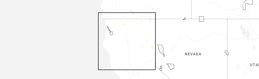
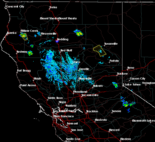
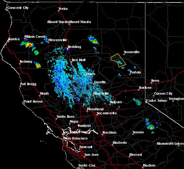
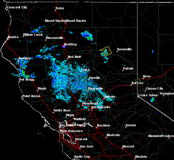
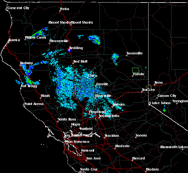
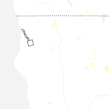
Hail Map for Westwood, CA
The Westwood, CA area has had 0 reports of on-the-ground hail by trained spotters, and has been under severe weather warnings 4 times during the past 12 months. Doppler radar has detected hail at or near Westwood, CA on 9 occasions, including 2 occasions during the past year.
| Name: | Westwood, CA |
| Where Located: | 76 miles ESE of Redding, CA |
| Map: | Google Map for Westwood, CA |
| Population: | 1647 |
| Housing Units: | 1005 |
| More Info: | Search Google for Westwood, CA |
0
The Top Recent Hail Date for Westwood, CA is Thursday, July 24, 2025 (5th out of 9)
Hail and Wind Damage Spotted near Westwood, CA
| Date / Time | Report Details |
|---|---|
| 7/25/2025 2:52 PM PDT |
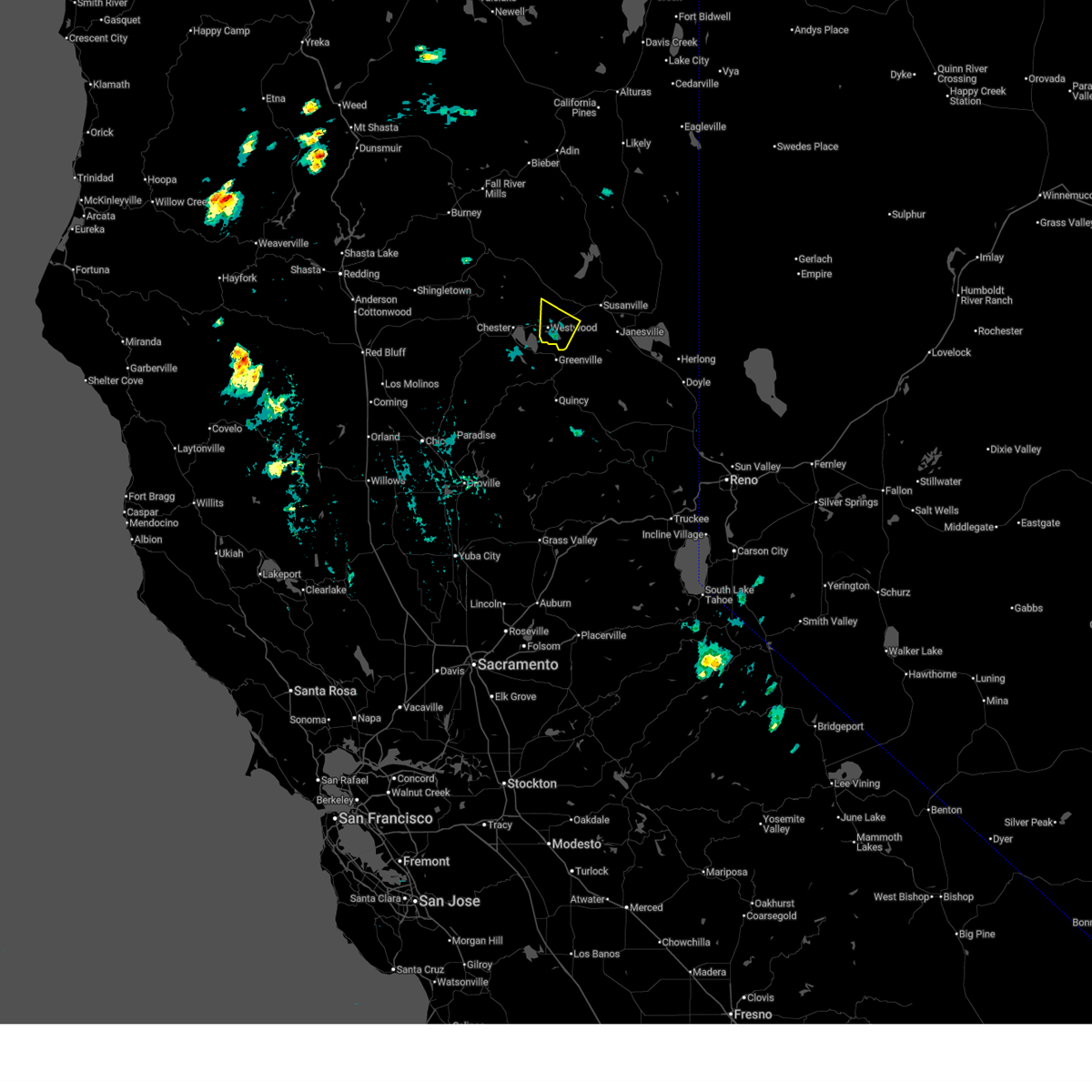 Svrrev the national weather service in reno has issued a * severe thunderstorm warning for, plumas county in northern california, west central lassen county in northern california, * until 315 pm pdt. * at 252 pm pdt, a severe thunderstorm was located near westwood, or 14 miles east of chester, moving northwest at 15 mph (radar indicated). Hazards include quarter size hail. damage to vehicles is expected Svrrev the national weather service in reno has issued a * severe thunderstorm warning for, plumas county in northern california, west central lassen county in northern california, * until 315 pm pdt. * at 252 pm pdt, a severe thunderstorm was located near westwood, or 14 miles east of chester, moving northwest at 15 mph (radar indicated). Hazards include quarter size hail. damage to vehicles is expected
|
| 7/24/2025 3:51 PM PDT |
 The severe thunderstorm which prompted the warning has slowed progression and therefore out of the warned area. therefore, the warning will be allowed to expire. The severe thunderstorm which prompted the warning has slowed progression and therefore out of the warned area. therefore, the warning will be allowed to expire.
|
| 7/24/2025 3:49 PM PDT |
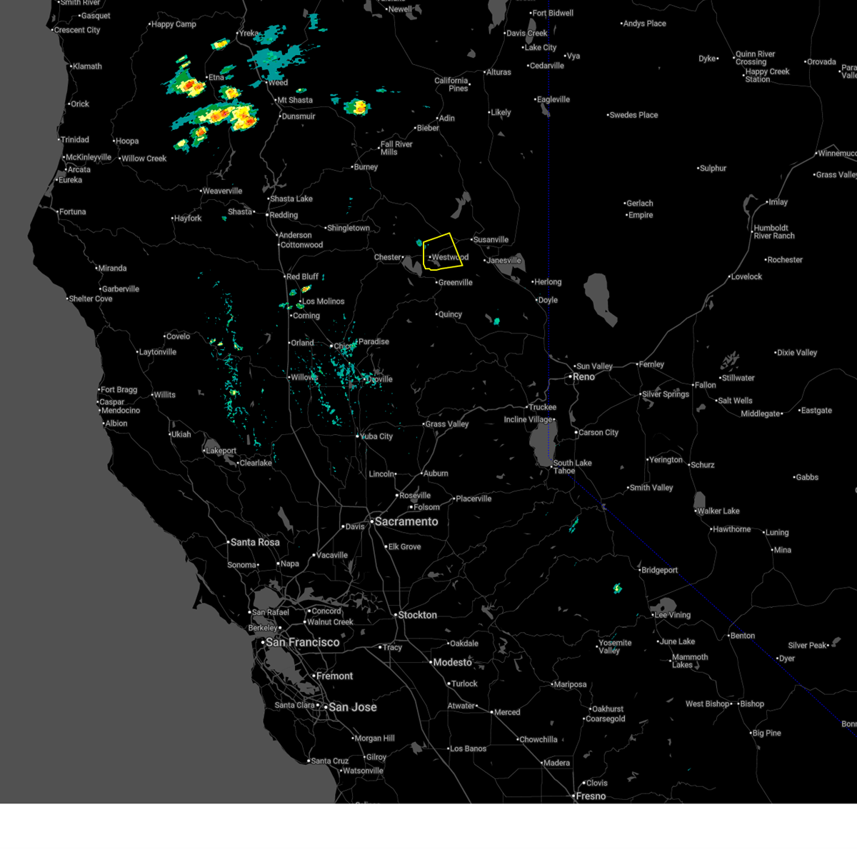 At 346 pm pdt, a severe thunderstorm was located near westwood, or 16 miles east of chester, moving south at 15 mph (radar indicated). Hazards include 60 mph wind gusts and quarter size hail. Hail damage to vehicles is expected. expect wind damage to roofs, siding, fencing and trees. Locations impacted include, westwood, ca 36 at plumas-lassen co line, and fredonyer pass. At 346 pm pdt, a severe thunderstorm was located near westwood, or 16 miles east of chester, moving south at 15 mph (radar indicated). Hazards include 60 mph wind gusts and quarter size hail. Hail damage to vehicles is expected. expect wind damage to roofs, siding, fencing and trees. Locations impacted include, westwood, ca 36 at plumas-lassen co line, and fredonyer pass.
|
| 7/24/2025 3:33 PM PDT |
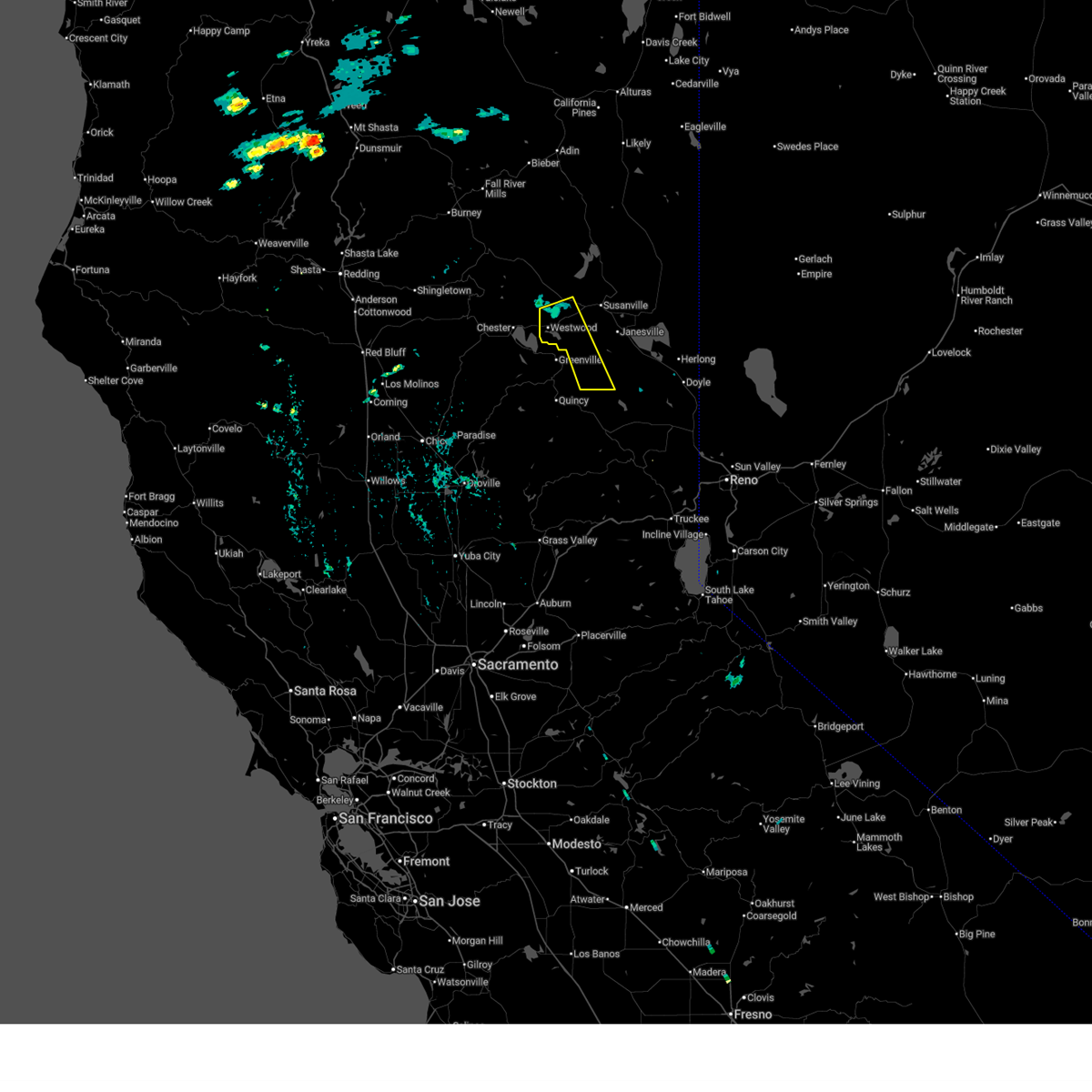 Svrrev the national weather service in reno has issued a * severe thunderstorm warning for, plumas county in northern california, west central lassen county in northern california, * until 400 pm pdt. * at 333 pm pdt, a severe thunderstorm was located near westwood, or 17 miles east of chester, moving south at 50 mph (radar indicated). Hazards include 60 mph wind gusts and quarter size hail. Hail damage to vehicles is expected. Expect wind damage to roofs, siding, fencing and trees. Svrrev the national weather service in reno has issued a * severe thunderstorm warning for, plumas county in northern california, west central lassen county in northern california, * until 400 pm pdt. * at 333 pm pdt, a severe thunderstorm was located near westwood, or 17 miles east of chester, moving south at 50 mph (radar indicated). Hazards include 60 mph wind gusts and quarter size hail. Hail damage to vehicles is expected. Expect wind damage to roofs, siding, fencing and trees.
|
| 9/6/2017 4:59 PM PDT |
 At 459 pm pdt, a severe thunderstorm was located 8 miles northeast of crescent mills, or 19 miles north of quincy, moving northwest at 15 mph (radar indicated). Hazards include 60 mph wind gusts and nickel size hail. Expect damage to roofs, siding, fencing, and trees. dust storms resulting in serious accidents. Locations impacted include, westwood, ca 36 at plumas-lassen co line and fredonyer pass. At 459 pm pdt, a severe thunderstorm was located 8 miles northeast of crescent mills, or 19 miles north of quincy, moving northwest at 15 mph (radar indicated). Hazards include 60 mph wind gusts and nickel size hail. Expect damage to roofs, siding, fencing, and trees. dust storms resulting in serious accidents. Locations impacted include, westwood, ca 36 at plumas-lassen co line and fredonyer pass.
|
| 9/6/2017 4:43 PM PDT |
 At 438 pm pdt, a severe thunderstorm was located near genesee, or 16 miles northeast of quincy, moving northwest at 20 mph (radar indicated). Hazards include 60 mph wind gusts and nickel size hail. Expect damage to roofs, siding, fencing, and trees. Dust storms resulting in serious accidents. At 438 pm pdt, a severe thunderstorm was located near genesee, or 16 miles northeast of quincy, moving northwest at 20 mph (radar indicated). Hazards include 60 mph wind gusts and nickel size hail. Expect damage to roofs, siding, fencing, and trees. Dust storms resulting in serious accidents.
|
| 7/3/2015 4:25 PM PDT | The severe thunderstorm warning for plumas and west central lassen counties will expire at 430 pm pdt, the storm which prompted the warning has moved out of the area. therefore the warning will be allowed to expire. |
| 7/3/2015 4:16 PM PDT |
 At 415 pm pdt, doppler radar indicated a severe thunderstorm capable of producing quarter size hail and damaging winds in excess of 60 mph. this storm was located near westwood. this storm is moving northwest at 10 mph. locations impacted include, westwood, ca 36 at plumas-lassen co line and fredonyer pass. At 415 pm pdt, doppler radar indicated a severe thunderstorm capable of producing quarter size hail and damaging winds in excess of 60 mph. this storm was located near westwood. this storm is moving northwest at 10 mph. locations impacted include, westwood, ca 36 at plumas-lassen co line and fredonyer pass.
|
| 7/3/2015 4:04 PM PDT |
 At 403 pm pdt, doppler radar indicated a severe thunderstorm capable of producing damaging winds in excess of 60 mph. this storm was located near westwood, or 13 miles east of chester, and moving northwest at 10 mph. hail to one inch in diameter may also accompany the damaging winds. At 403 pm pdt, doppler radar indicated a severe thunderstorm capable of producing damaging winds in excess of 60 mph. this storm was located near westwood, or 13 miles east of chester, and moving northwest at 10 mph. hail to one inch in diameter may also accompany the damaging winds.
|
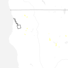
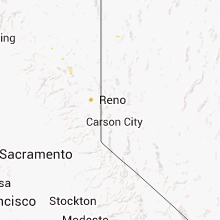
Hail Maps for Westwood, CA


Connect with Interactive Hail Maps