

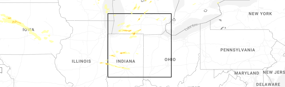
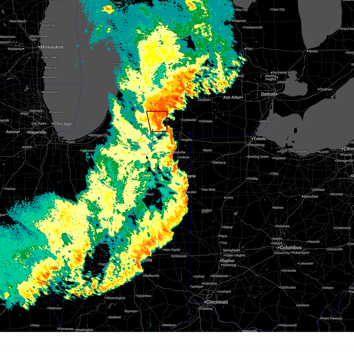
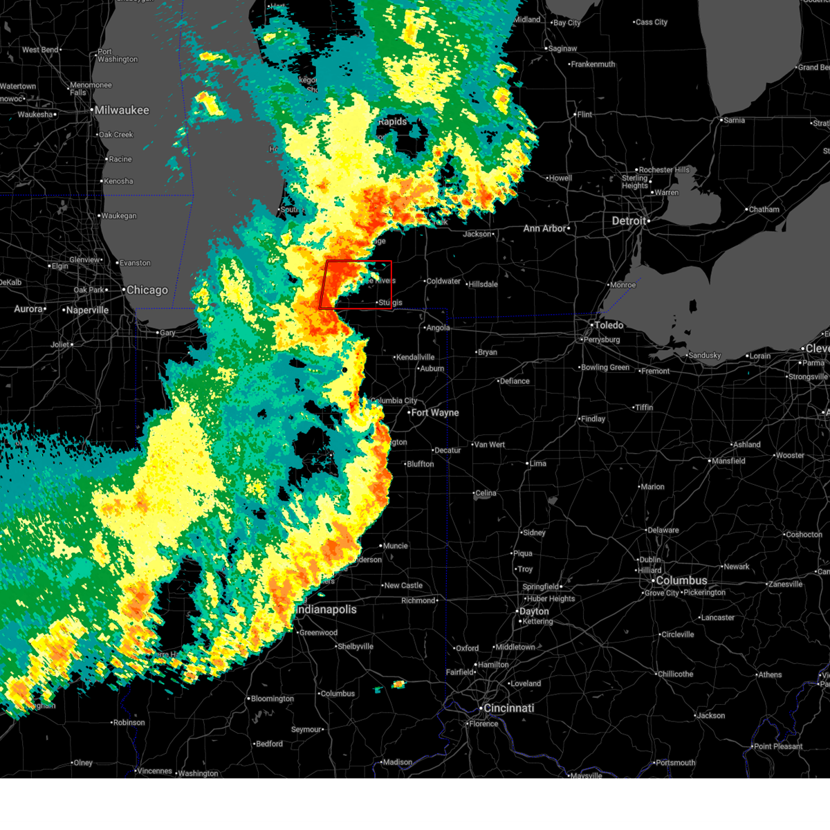
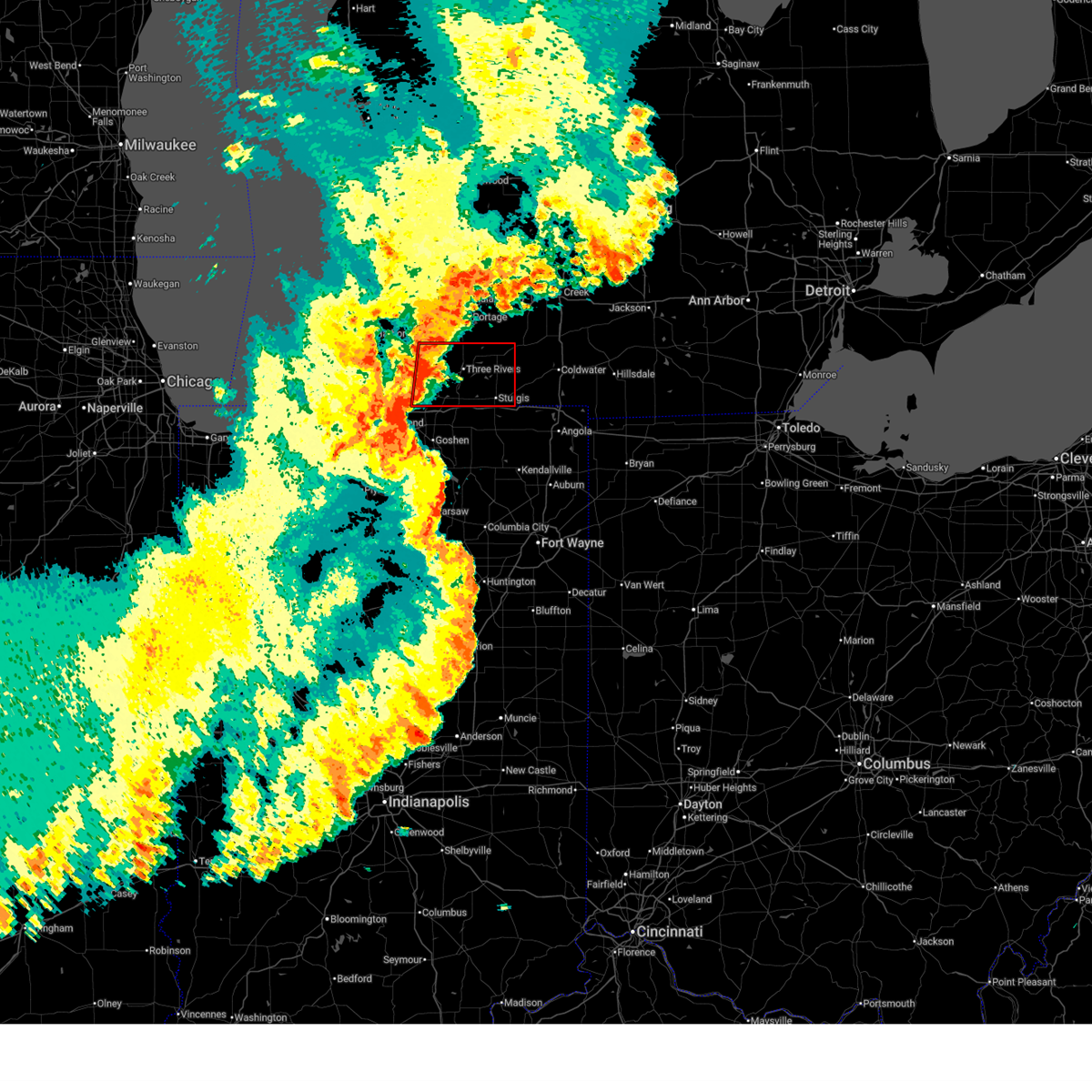
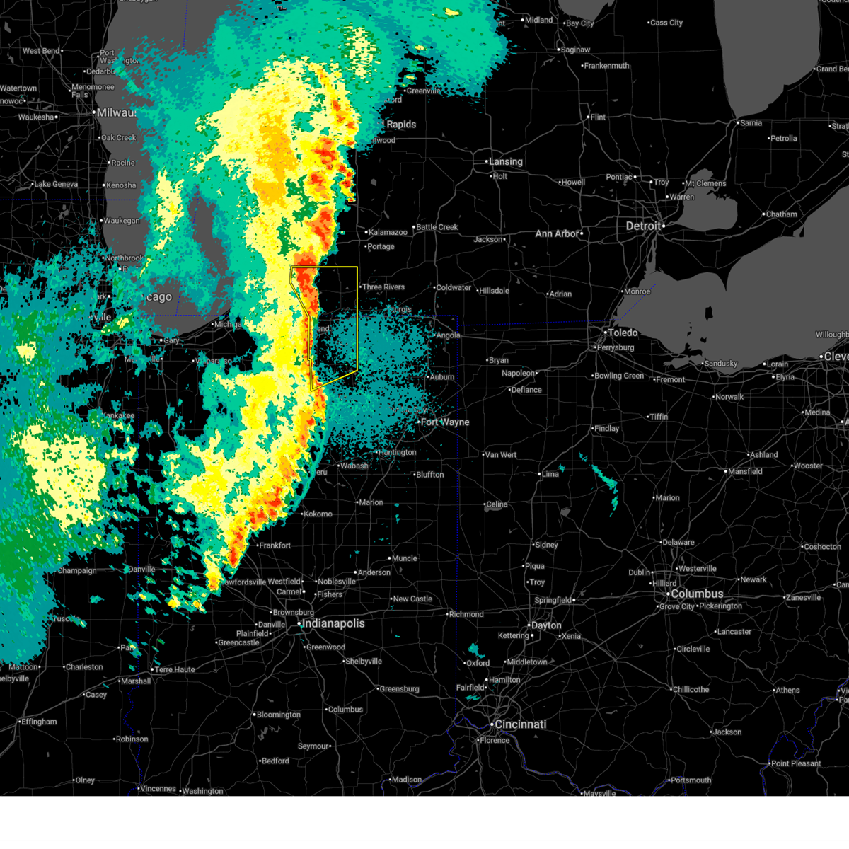
Hail Map for White Pigeon, MI
The White Pigeon, MI area has had 3 reports of on-the-ground hail by trained spotters, and has been under severe weather warnings 17 times during the past 12 months. Doppler radar has detected hail at or near White Pigeon, MI on 43 occasions, including 1 occasion during the past year.
| Name: | White Pigeon, MI |
| Where Located: | 57.2 miles NNW of Fort Wayne, IN |
| Map: | Google Map for White Pigeon, MI |
| Population: | 1522 |
| Housing Units: | 724 |
| More Info: | Search Google for White Pigeon, MI |
5
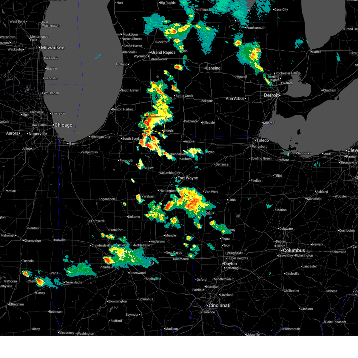
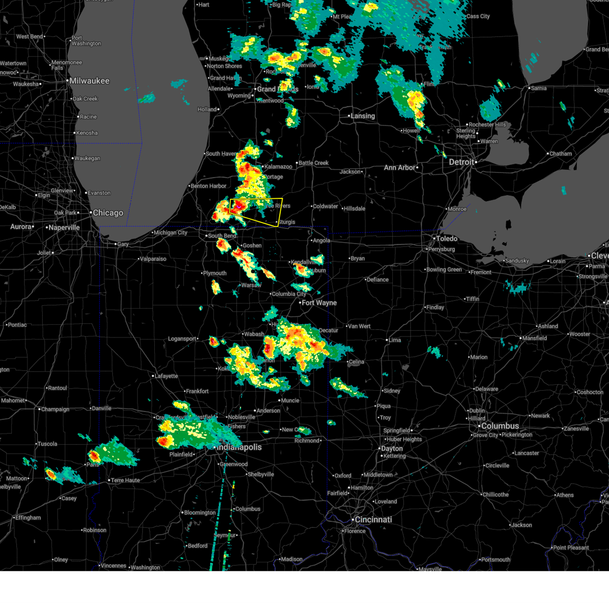
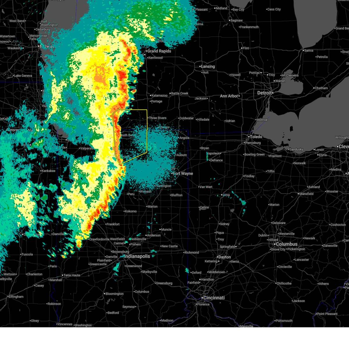
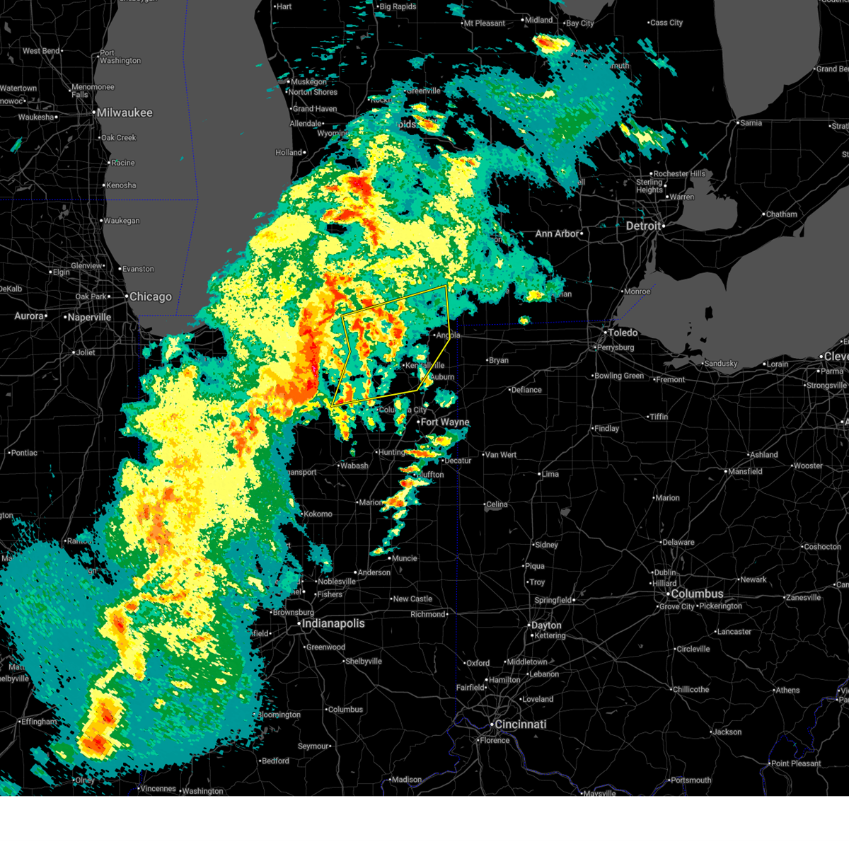
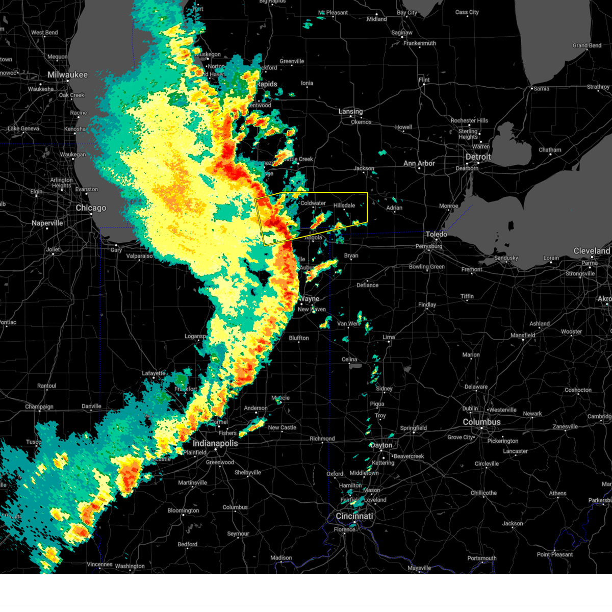
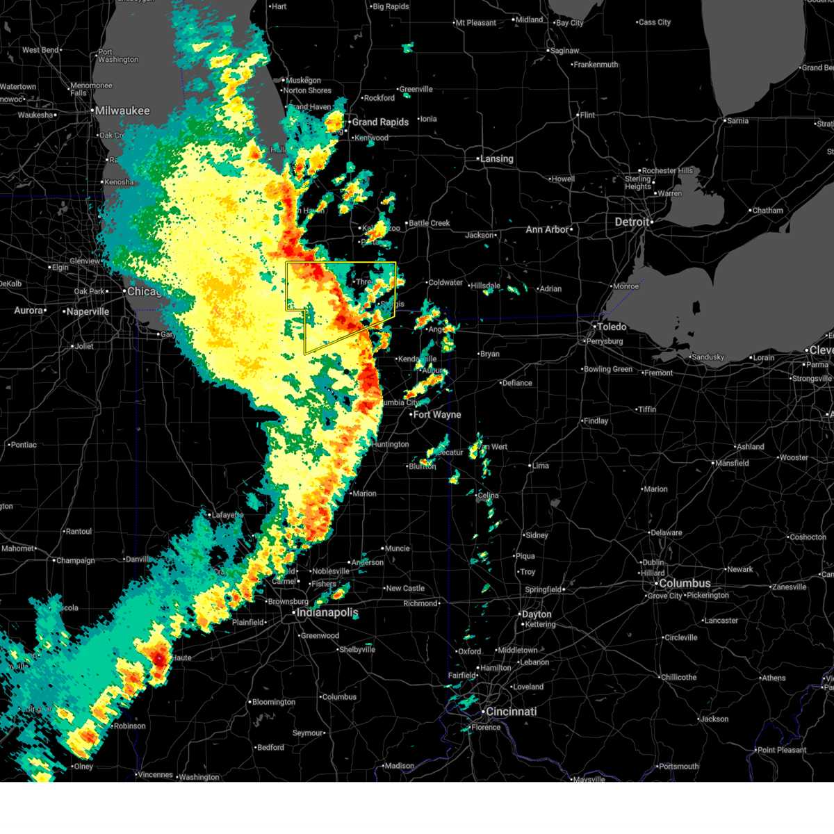
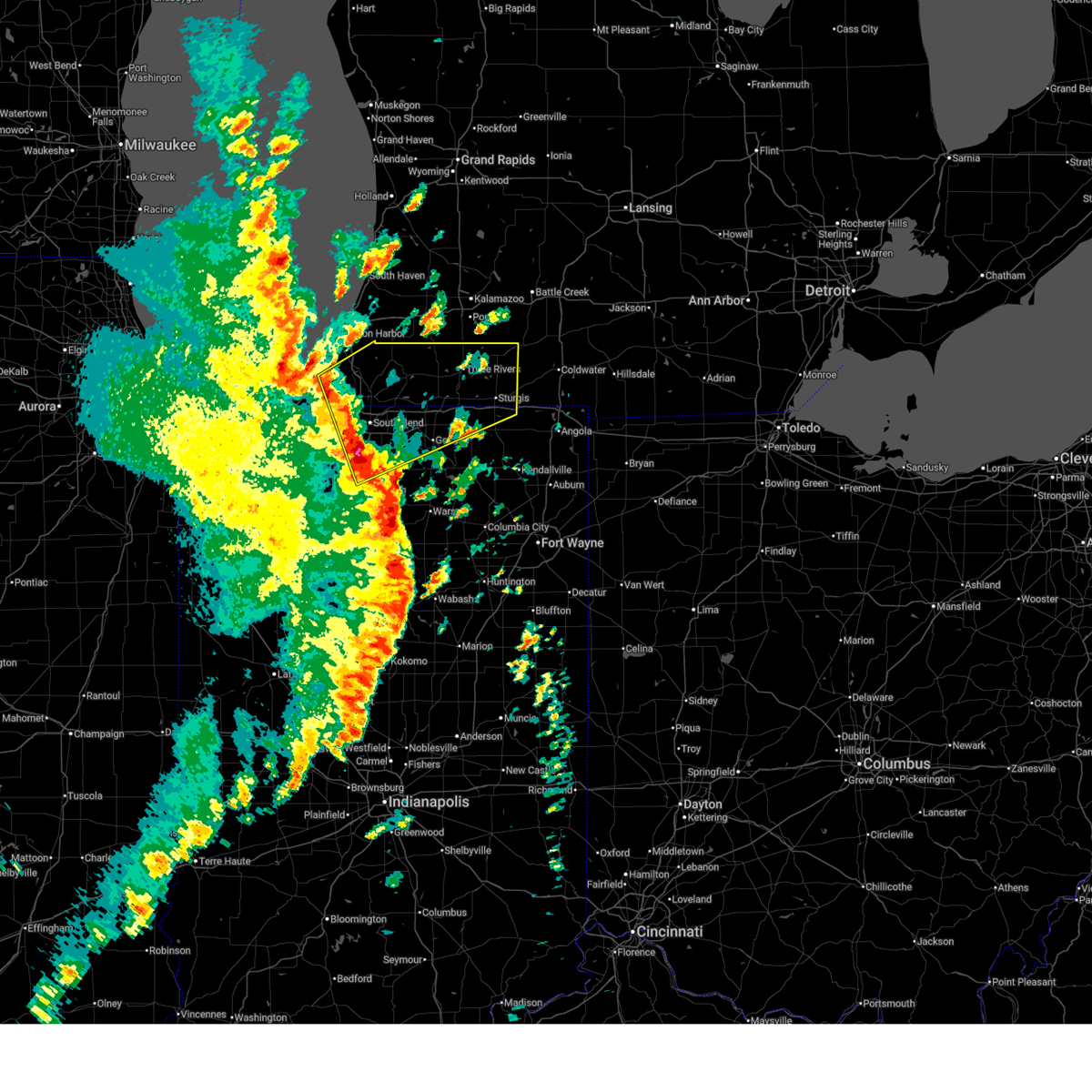
The Top Recent Hail Date for White Pigeon, MI is Tuesday, June 16, 2026 (1st out of 43)
Hail and Wind Damage Spotted near White Pigeon, MI
| Date / Time | Report Details |
|---|---|
| 6/16/2026 7:29 PM EDT |
 At 729 pm edt, a severe thunderstorm was located near three rivers, moving east at 20 mph (radar indicated). Hazards include 60 mph wind gusts and quarter size hail. Hail damage to vehicles is expected. expect wind damage to roofs, siding, and trees. Locations impacted include, sturgis, three rivers, constantine, white pigeon, centreville, nottawa, mendon, klinger lake, fishers lake, fairfax, jones, corey lake, wasepi, and clear lake. At 729 pm edt, a severe thunderstorm was located near three rivers, moving east at 20 mph (radar indicated). Hazards include 60 mph wind gusts and quarter size hail. Hail damage to vehicles is expected. expect wind damage to roofs, siding, and trees. Locations impacted include, sturgis, three rivers, constantine, white pigeon, centreville, nottawa, mendon, klinger lake, fishers lake, fairfax, jones, corey lake, wasepi, and clear lake.
|
| 6/16/2026 7:06 PM EDT |
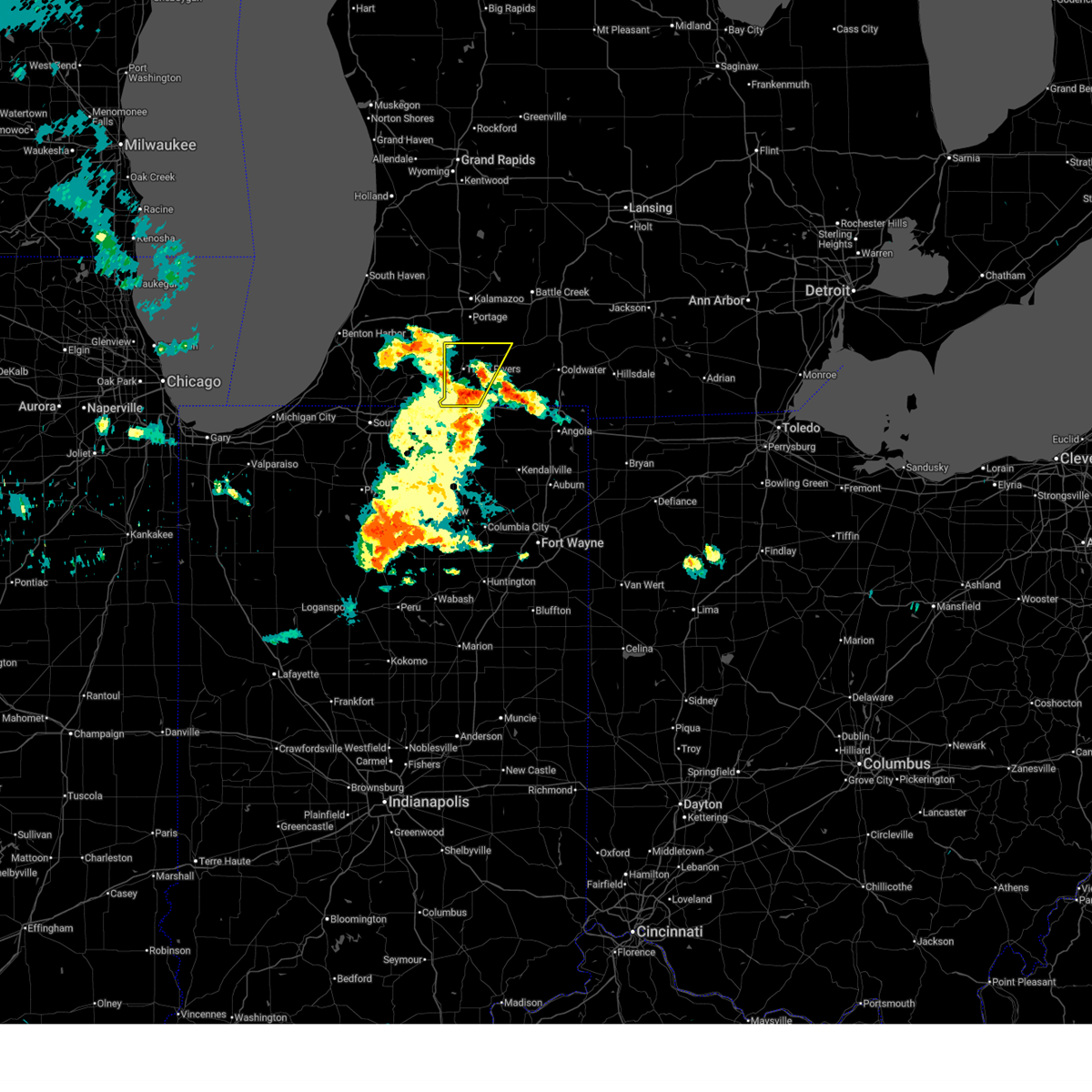
 Svriwx the national weather service in northern indiana has issued a * severe thunderstorm warning for, northeastern cass county in southwestern michigan, central st. joseph county in southwestern michigan, * until 745 pm edt. * at 706 pm edt, a severe thunderstorm was located near cassopolis, or 12 miles east of dowagiac, moving east at 35 mph (radar indicated). Hazards include 60 mph wind gusts and quarter size hail. Hail damage to vehicles is expected. Expect wind damage to roofs, siding, and trees. Svriwx the national weather service in northern indiana has issued a * severe thunderstorm warning for, northeastern cass county in southwestern michigan, central st. joseph county in southwestern michigan, * until 745 pm edt. * at 706 pm edt, a severe thunderstorm was located near cassopolis, or 12 miles east of dowagiac, moving east at 35 mph (radar indicated). Hazards include 60 mph wind gusts and quarter size hail. Hail damage to vehicles is expected. Expect wind damage to roofs, siding, and trees.
|
| 6/11/2026 11:27 PM EDT |
 The storms which prompted the warning have weakened below severe limits, and no longer appear capable of producing a tornado. therefore, the warning will be allowed to expire. a tornado watch remains in effect until 200 am edt for northeastern indiana, and southwestern michigan. to report severe weather, contact your nearest law enforcement agency. they will relay your report to the national weather service northern indiana. The storms which prompted the warning have weakened below severe limits, and no longer appear capable of producing a tornado. therefore, the warning will be allowed to expire. a tornado watch remains in effect until 200 am edt for northeastern indiana, and southwestern michigan. to report severe weather, contact your nearest law enforcement agency. they will relay your report to the national weather service northern indiana.
|
| 6/11/2026 11:13 PM EDT |
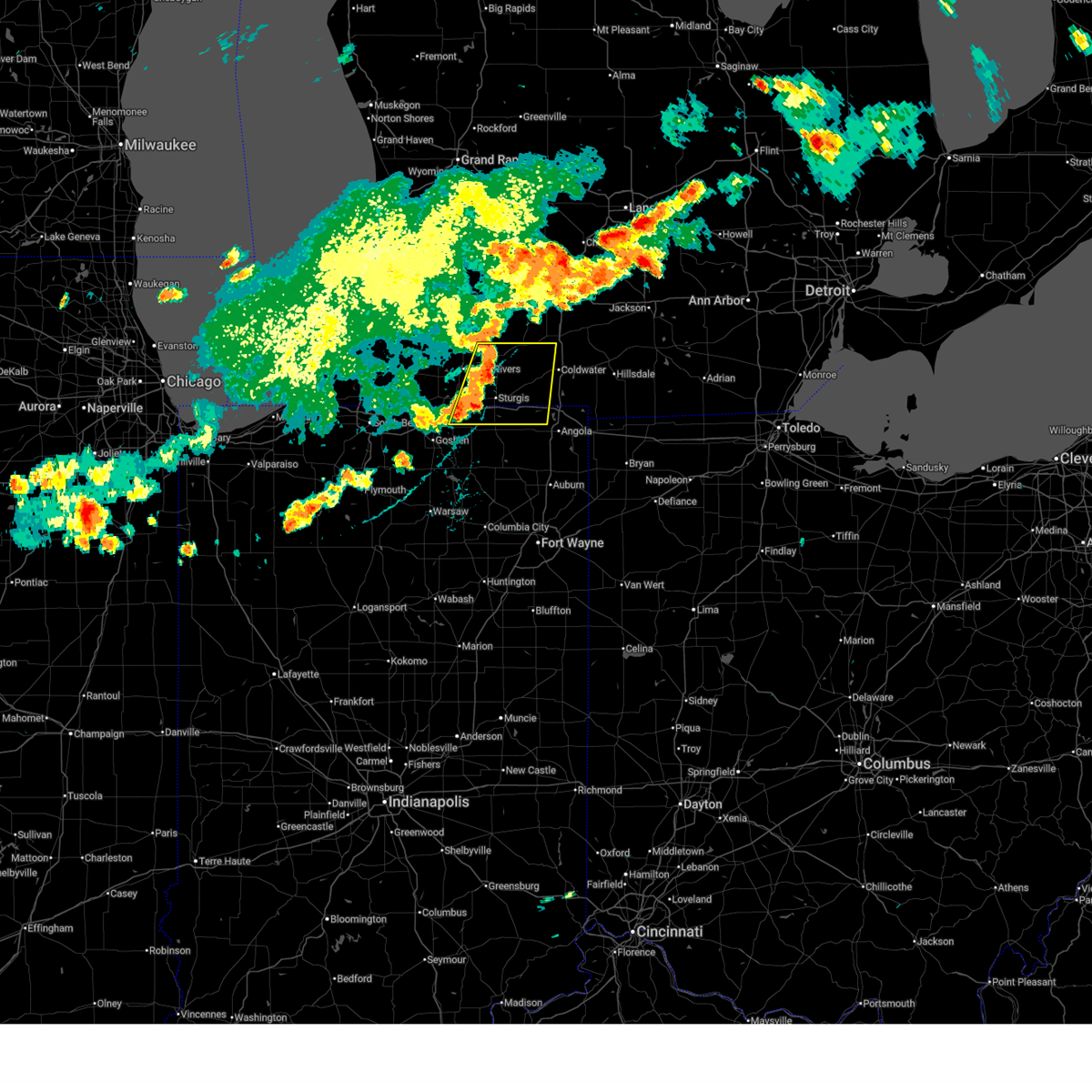
 At 1113 pm edt, severe thunderstorms capable of producing tornadoes were located along a line extending from 7 miles northwest of colon to near sturgis, moving east at 50 mph (radar indicated rotation). Hazards include tornado. Flying debris will be dangerous to those caught without shelter. mobile homes will be damaged or destroyed. damage to roofs, windows, and vehicles will occur. tree damage is likely. these dangerous storms will be near, sturgis and colon around 1120 pm edt. Other locations impacted by these tornadic storms include fawn river, leonidas, nottawa, moore park, flowerfield, wasepi, burr oak, findley, klinger lake, and mendon. At 1113 pm edt, severe thunderstorms capable of producing tornadoes were located along a line extending from 7 miles northwest of colon to near sturgis, moving east at 50 mph (radar indicated rotation). Hazards include tornado. Flying debris will be dangerous to those caught without shelter. mobile homes will be damaged or destroyed. damage to roofs, windows, and vehicles will occur. tree damage is likely. these dangerous storms will be near, sturgis and colon around 1120 pm edt. Other locations impacted by these tornadic storms include fawn river, leonidas, nottawa, moore park, flowerfield, wasepi, burr oak, findley, klinger lake, and mendon.
|
| 6/11/2026 10:59 PM EDT |
 At 1058 pm edt, severe thunderstorms capable of producing tornadoes were located along a line extending from near vicksburg to near white pigeon, moving east at 35 mph (radar indicated rotation). Hazards include tornado. Flying debris will be dangerous to those caught without shelter. mobile homes will be damaged or destroyed. damage to roofs, windows, and vehicles will occur. tree damage is likely. these dangerous storms will be near, constantine, white pigeon, and centreville around 1105 pm edt. sturgis and colon around 1115 pm edt. Other locations impacted by these tornadic storms include nottawa, moore park, burr oak, klinger lake, mendon, fishers lake, fairfax, union, jones, and fawn river. At 1058 pm edt, severe thunderstorms capable of producing tornadoes were located along a line extending from near vicksburg to near white pigeon, moving east at 35 mph (radar indicated rotation). Hazards include tornado. Flying debris will be dangerous to those caught without shelter. mobile homes will be damaged or destroyed. damage to roofs, windows, and vehicles will occur. tree damage is likely. these dangerous storms will be near, constantine, white pigeon, and centreville around 1105 pm edt. sturgis and colon around 1115 pm edt. Other locations impacted by these tornadic storms include nottawa, moore park, burr oak, klinger lake, mendon, fishers lake, fairfax, union, jones, and fawn river.
|
| 6/11/2026 10:55 PM EDT | Truck blown off the roa in st. joseph county MI, 0.7 miles ESE of White Pigeon, MI |
| 6/11/2026 10:42 PM EDT |
 Toriwx the national weather service in northern indiana has issued a * tornado warning for, eastern cass county in southwestern michigan, st. joseph county in southwestern michigan, * until 1130 pm edt. * at 1042 pm edt, severe thunderstorms capable of producing a tornado were located along a line extending from near marcellus to near simonton lake, moving northeast at 45 mph (radar indicated rotation). Hazards include tornado. Flying debris will be dangerous to those caught without shelter. mobile homes will be damaged or destroyed. damage to roofs, windows, and vehicles will occur. tree damage is likely. these dangerous storms will be near, three rivers and constantine around 1050 pm edt. white pigeon around 1055 pm edt. centreville around 1100 pm edt. colon around 1115 pm edt. Other locations impacted by these tornadic storms include vandalia, nottawa, klinger lake, donnell lake, fishers lake, union, jones, fawn river, leonidas, and corey lake. Toriwx the national weather service in northern indiana has issued a * tornado warning for, eastern cass county in southwestern michigan, st. joseph county in southwestern michigan, * until 1130 pm edt. * at 1042 pm edt, severe thunderstorms capable of producing a tornado were located along a line extending from near marcellus to near simonton lake, moving northeast at 45 mph (radar indicated rotation). Hazards include tornado. Flying debris will be dangerous to those caught without shelter. mobile homes will be damaged or destroyed. damage to roofs, windows, and vehicles will occur. tree damage is likely. these dangerous storms will be near, three rivers and constantine around 1050 pm edt. white pigeon around 1055 pm edt. centreville around 1100 pm edt. colon around 1115 pm edt. Other locations impacted by these tornadic storms include vandalia, nottawa, klinger lake, donnell lake, fishers lake, union, jones, fawn river, leonidas, and corey lake.
|
| 5/18/2026 2:23 PM EDT |
 At 222 pm edt, severe thunderstorms were located along a line extending from westwood to three rivers to near middlebury, moving northeast at 30 mph (radar indicated). Hazards include 60 mph wind gusts and penny size hail. Expect damage to roofs, siding, and trees. locations impacted include, three rivers, middlebury, constantine, white pigeon, marcellus, mottville, corey lake, howardsville, and clear lake. This includes interstate 80 in indiana between mile markers 102 and 108. At 222 pm edt, severe thunderstorms were located along a line extending from westwood to three rivers to near middlebury, moving northeast at 30 mph (radar indicated). Hazards include 60 mph wind gusts and penny size hail. Expect damage to roofs, siding, and trees. locations impacted include, three rivers, middlebury, constantine, white pigeon, marcellus, mottville, corey lake, howardsville, and clear lake. This includes interstate 80 in indiana between mile markers 102 and 108.
|
| 5/18/2026 2:14 PM EDT |
 Svriwx the national weather service in northern indiana has issued a * severe thunderstorm warning for, lagrange county in northeastern indiana, st. joseph county in southwestern michigan, western branch county in southwestern michigan, * until 300 pm edt. * at 213 pm edt, severe thunderstorms were located along a line extending from near marcellus to constantine to near millersburg, moving northeast at 45 mph (radar indicated). Hazards include 60 mph wind gusts and penny size hail. expect damage to roofs, siding, and trees Svriwx the national weather service in northern indiana has issued a * severe thunderstorm warning for, lagrange county in northeastern indiana, st. joseph county in southwestern michigan, western branch county in southwestern michigan, * until 300 pm edt. * at 213 pm edt, severe thunderstorms were located along a line extending from near marcellus to constantine to near millersburg, moving northeast at 45 mph (radar indicated). Hazards include 60 mph wind gusts and penny size hail. expect damage to roofs, siding, and trees
|
| 5/18/2026 2:02 PM EDT |
 At 202 pm edt, severe thunderstorms were located along a line extending from near mattawan to near constantine to near goshen, moving northeast at 45 mph (radar indicated). Hazards include 60 mph wind gusts and penny size hail. Expect damage to roofs, siding, and trees. locations impacted include, elkhart, goshen, three rivers, simonton lake, dunlap, middlebury, constantine, cassopolis, wakarusa, bristol, white pigeon, marcellus, union, penn, mottville, vandalia, la grange, adamsville, juno lake, and donnell lake. This includes interstate 80 in indiana between mile markers 88 and 108. At 202 pm edt, severe thunderstorms were located along a line extending from near mattawan to near constantine to near goshen, moving northeast at 45 mph (radar indicated). Hazards include 60 mph wind gusts and penny size hail. Expect damage to roofs, siding, and trees. locations impacted include, elkhart, goshen, three rivers, simonton lake, dunlap, middlebury, constantine, cassopolis, wakarusa, bristol, white pigeon, marcellus, union, penn, mottville, vandalia, la grange, adamsville, juno lake, and donnell lake. This includes interstate 80 in indiana between mile markers 88 and 108.
|
| 5/18/2026 1:44 PM EDT |
 Svriwx the national weather service in northern indiana has issued a * severe thunderstorm warning for, elkhart county in north central indiana, eastern st. joseph county in north central indiana, cass county in southwestern michigan, western st. joseph county in southwestern michigan, * until 230 pm edt. * at 144 pm edt, severe thunderstorms were located along a line extending from near hartford to edwardsburg to near bremen, moving northeast at 30 mph (radar indicated). Hazards include 60 mph wind gusts and penny size hail. expect damage to roofs, siding, and trees Svriwx the national weather service in northern indiana has issued a * severe thunderstorm warning for, elkhart county in north central indiana, eastern st. joseph county in north central indiana, cass county in southwestern michigan, western st. joseph county in southwestern michigan, * until 230 pm edt. * at 144 pm edt, severe thunderstorms were located along a line extending from near hartford to edwardsburg to near bremen, moving northeast at 30 mph (radar indicated). Hazards include 60 mph wind gusts and penny size hail. expect damage to roofs, siding, and trees
|
| 4/18/2026 1:29 AM EDT |
 At 129 am edt, severe thunderstorms were located along a line extending from lawton to near goshen to near syracuse, moving northeast at 45 mph (radar indicated). Hazards include 60 mph wind gusts. Expect damage to roofs, siding, and trees. locations impacted include, elkhart, goshen, dunlap, simonton lake, middlebury, constantine, bristol, white pigeon, marcellus, millersburg, new paris, benton, union, mottville, vandalia, paradise lake, donnell lake, jones, corey lake, and shavehead lake. This includes interstate 80 in indiana between mile markers 93 and 108. At 129 am edt, severe thunderstorms were located along a line extending from lawton to near goshen to near syracuse, moving northeast at 45 mph (radar indicated). Hazards include 60 mph wind gusts. Expect damage to roofs, siding, and trees. locations impacted include, elkhart, goshen, dunlap, simonton lake, middlebury, constantine, bristol, white pigeon, marcellus, millersburg, new paris, benton, union, mottville, vandalia, paradise lake, donnell lake, jones, corey lake, and shavehead lake. This includes interstate 80 in indiana between mile markers 93 and 108.
|
| 4/18/2026 1:11 AM EDT |
 At 111 am edt, severe thunderstorms were located along a line extending from near dowagiac to near wakarusa to near bourbon, moving northeast at 55 mph (radar indicated). Hazards include 60 mph wind gusts. Expect damage to roofs, siding, and trees. locations impacted include, elkhart, goshen, nappanee, dowagiac, syracuse, dunlap, simonton lake, granger, middlebury, osceola, constantine, cassopolis, wakarusa, bristol, milford, white pigeon, edwardsburg, marcellus, millersburg, and new paris. This includes interstate 80 in indiana between mile markers 87 and 108. At 111 am edt, severe thunderstorms were located along a line extending from near dowagiac to near wakarusa to near bourbon, moving northeast at 55 mph (radar indicated). Hazards include 60 mph wind gusts. Expect damage to roofs, siding, and trees. locations impacted include, elkhart, goshen, nappanee, dowagiac, syracuse, dunlap, simonton lake, granger, middlebury, osceola, constantine, cassopolis, wakarusa, bristol, milford, white pigeon, edwardsburg, marcellus, millersburg, and new paris. This includes interstate 80 in indiana between mile markers 87 and 108.
|
| 4/18/2026 12:59 AM EDT |
 Svriwx the national weather service in northern indiana has issued a * severe thunderstorm warning for, elkhart county in north central indiana, st. joseph county in north central indiana, northern kosciusko county in north central indiana, eastern marshall county in north central indiana, cass county in southwestern michigan, western st. joseph county in southwestern michigan, southeastern berrien county in southwestern michigan, * until 145 am edt. * at 1259 am edt, severe thunderstorms were located along a line extending from near berrien springs to near bremen to near argos, moving northeast at 50 mph (radar indicated). Hazards include 60 mph wind gusts. expect damage to roofs, siding, and trees Svriwx the national weather service in northern indiana has issued a * severe thunderstorm warning for, elkhart county in north central indiana, st. joseph county in north central indiana, northern kosciusko county in north central indiana, eastern marshall county in north central indiana, cass county in southwestern michigan, western st. joseph county in southwestern michigan, southeastern berrien county in southwestern michigan, * until 145 am edt. * at 1259 am edt, severe thunderstorms were located along a line extending from near berrien springs to near bremen to near argos, moving northeast at 50 mph (radar indicated). Hazards include 60 mph wind gusts. expect damage to roofs, siding, and trees
|
| 4/13/2026 5:56 PM EDT |
 At 555 pm edt, a severe thunderstorm was located over constantine, or near three rivers, moving northeast at 20 mph (radar indicated). Hazards include 70 mph wind gusts and quarter size hail. Hail damage to vehicles is expected. expect considerable tree damage. wind damage is also likely to mobile homes, roofs, and outbuildings. Locations impacted include, three rivers, constantine, white pigeon, centreville, nottawa, flowerfield, mottville, leonidas, mendon, moore park, klinger lake, fishers lake, corey lake, howardsville, wasepi, and clear lake. At 555 pm edt, a severe thunderstorm was located over constantine, or near three rivers, moving northeast at 20 mph (radar indicated). Hazards include 70 mph wind gusts and quarter size hail. Hail damage to vehicles is expected. expect considerable tree damage. wind damage is also likely to mobile homes, roofs, and outbuildings. Locations impacted include, three rivers, constantine, white pigeon, centreville, nottawa, flowerfield, mottville, leonidas, mendon, moore park, klinger lake, fishers lake, corey lake, howardsville, wasepi, and clear lake.
|
| 4/13/2026 5:56 PM EDT |
 the severe thunderstorm warning has been cancelled and is no longer in effect the severe thunderstorm warning has been cancelled and is no longer in effect
|
| 4/13/2026 5:44 PM EDT |
 Svriwx the national weather service in northern indiana has issued a * severe thunderstorm warning for, southeastern cass county in southwestern michigan, st. joseph county in southwestern michigan, * until 645 pm edt. * at 544 pm edt, a severe thunderstorm was located over white pigeon, or 11 miles south of three rivers, moving northeast at 20 mph (radar indicated). Hazards include 60 mph wind gusts and quarter size hail. Hail damage to vehicles is expected. Expect wind damage to roofs, siding, and trees. Svriwx the national weather service in northern indiana has issued a * severe thunderstorm warning for, southeastern cass county in southwestern michigan, st. joseph county in southwestern michigan, * until 645 pm edt. * at 544 pm edt, a severe thunderstorm was located over white pigeon, or 11 miles south of three rivers, moving northeast at 20 mph (radar indicated). Hazards include 60 mph wind gusts and quarter size hail. Hail damage to vehicles is expected. Expect wind damage to roofs, siding, and trees.
|
| 7/24/2025 6:35 PM EDT |
 Svriwx the national weather service in northern indiana has issued a * severe thunderstorm warning for, northwestern steuben county in northeastern indiana, northeastern elkhart county in north central indiana, northern lagrange county in northeastern indiana, st. joseph county in southwestern michigan, western branch county in southwestern michigan, * until 700 pm edt. * at 635 pm edt, severe thunderstorms were located along a line extending from 8 miles northwest of colon to 6 miles southeast of white pigeon, moving east at 55 mph (radar indicated). Hazards include 60 mph wind gusts. expect damage to roofs, siding, and trees Svriwx the national weather service in northern indiana has issued a * severe thunderstorm warning for, northwestern steuben county in northeastern indiana, northeastern elkhart county in north central indiana, northern lagrange county in northeastern indiana, st. joseph county in southwestern michigan, western branch county in southwestern michigan, * until 700 pm edt. * at 635 pm edt, severe thunderstorms were located along a line extending from 8 miles northwest of colon to 6 miles southeast of white pigeon, moving east at 55 mph (radar indicated). Hazards include 60 mph wind gusts. expect damage to roofs, siding, and trees
|
| 5/15/2025 11:28 PM EDT |
 Svriwx the national weather service in northern indiana has issued a * severe thunderstorm warning for, st. joseph county in southwestern michigan, branch county in southwestern michigan, * until 1215 am edt. * at 1127 pm edt, severe thunderstorms were located along a line extending from 6 miles north of centreville to near constantine, moving east at 45 mph (radar indicated). Hazards include 60 mph wind gusts and nickel size hail. expect damage to roofs, siding, and trees Svriwx the national weather service in northern indiana has issued a * severe thunderstorm warning for, st. joseph county in southwestern michigan, branch county in southwestern michigan, * until 1215 am edt. * at 1127 pm edt, severe thunderstorms were located along a line extending from 6 miles north of centreville to near constantine, moving east at 45 mph (radar indicated). Hazards include 60 mph wind gusts and nickel size hail. expect damage to roofs, siding, and trees
|
| 4/2/2025 8:15 PM EDT |
 Svriwx the national weather service in northern indiana has issued a * severe thunderstorm warning for, steuben county in northeastern indiana, eastern elkhart county in north central indiana, noble county in northeastern indiana, northern whitley county in northeastern indiana, western de kalb county in northeastern indiana, northeastern kosciusko county in north central indiana, lagrange county in northeastern indiana, southeastern st. joseph county in southwestern michigan, southern branch county in southwestern michigan, * until 930 pm edt. * at 814 pm edt, severe thunderstorms were located along a line extending from near simonton lake to 6 miles southeast of nappanee to near mentone, moving east at 60 mph (radar indicated). Hazards include 70 mph wind gusts and quarter size hail. Hail damage to vehicles is expected. expect considerable tree damage. Wind damage is also likely to mobile homes, roofs, and outbuildings. Svriwx the national weather service in northern indiana has issued a * severe thunderstorm warning for, steuben county in northeastern indiana, eastern elkhart county in north central indiana, noble county in northeastern indiana, northern whitley county in northeastern indiana, western de kalb county in northeastern indiana, northeastern kosciusko county in north central indiana, lagrange county in northeastern indiana, southeastern st. joseph county in southwestern michigan, southern branch county in southwestern michigan, * until 930 pm edt. * at 814 pm edt, severe thunderstorms were located along a line extending from near simonton lake to 6 miles southeast of nappanee to near mentone, moving east at 60 mph (radar indicated). Hazards include 70 mph wind gusts and quarter size hail. Hail damage to vehicles is expected. expect considerable tree damage. Wind damage is also likely to mobile homes, roofs, and outbuildings.
|
| 3/30/2025 5:23 PM EDT |
 The storms which prompted the warning have moved out of the area. therefore, the warning will be allowed to expire. a tornado watch remains in effect until 800 pm edt for north central and northeastern indiana, and southwestern michigan. remember, a severe thunderstorm warning still remains in effect for lagrange county, in and st joseph county, mi until 615 pm edt. The storms which prompted the warning have moved out of the area. therefore, the warning will be allowed to expire. a tornado watch remains in effect until 800 pm edt for north central and northeastern indiana, and southwestern michigan. remember, a severe thunderstorm warning still remains in effect for lagrange county, in and st joseph county, mi until 615 pm edt.
|
| 3/30/2025 5:20 PM EDT |
 Svriwx the national weather service in northern indiana has issued a * severe thunderstorm warning for, northern steuben county in northeastern indiana, northern lagrange county in northeastern indiana, st. joseph county in southwestern michigan, branch county in southwestern michigan, hillsdale county in southeastern michigan, * until 615 pm edt. * at 520 pm edt, severe thunderstorms were located along a line extending from three rivers to near white pigeon, moving east at 75 mph (radar indicated). Hazards include 60 mph wind gusts and nickel size hail. expect damage to roofs, siding, and trees Svriwx the national weather service in northern indiana has issued a * severe thunderstorm warning for, northern steuben county in northeastern indiana, northern lagrange county in northeastern indiana, st. joseph county in southwestern michigan, branch county in southwestern michigan, hillsdale county in southeastern michigan, * until 615 pm edt. * at 520 pm edt, severe thunderstorms were located along a line extending from three rivers to near white pigeon, moving east at 75 mph (radar indicated). Hazards include 60 mph wind gusts and nickel size hail. expect damage to roofs, siding, and trees
|
| 3/30/2025 5:14 PM EDT |
 At 513 pm edt, severe thunderstorms were located along a line extending from near decatur to near middlebury, moving northeast at 80 mph (radar indicated). Hazards include 70 mph wind gusts and nickel size hail. Expect considerable tree damage. damage is likely to mobile homes, roofs, and outbuildings. locations impacted include, dewey lake, vandalia, dowagiac, nottawa, cassopolis, adamsville, klinger lake, juno lake, donnell lake, fishers lake, sturgis, elkhart, leonidas, diamond lake, corey lake, bristol, howe, three rivers, middlebury, and wakelee. This includes interstate 80 in indiana between mile markers 88 and 128. At 513 pm edt, severe thunderstorms were located along a line extending from near decatur to near middlebury, moving northeast at 80 mph (radar indicated). Hazards include 70 mph wind gusts and nickel size hail. Expect considerable tree damage. damage is likely to mobile homes, roofs, and outbuildings. locations impacted include, dewey lake, vandalia, dowagiac, nottawa, cassopolis, adamsville, klinger lake, juno lake, donnell lake, fishers lake, sturgis, elkhart, leonidas, diamond lake, corey lake, bristol, howe, three rivers, middlebury, and wakelee. This includes interstate 80 in indiana between mile markers 88 and 128.
|
| 3/30/2025 5:14 PM EDT |
 the severe thunderstorm warning has been cancelled and is no longer in effect the severe thunderstorm warning has been cancelled and is no longer in effect
|
| 3/30/2025 4:41 PM EDT |
 Svriwx the national weather service in northern indiana has issued a * severe thunderstorm warning for, elkhart county in north central indiana, st. joseph county in north central indiana, northwestern lagrange county in northeastern indiana, northeastern marshall county in north central indiana, cass county in southwestern michigan, st. joseph county in southwestern michigan, western branch county in southwestern michigan, southeastern berrien county in southwestern michigan, * until 530 pm edt. * at 440 pm edt, severe thunderstorms were located along a line extending from near bridgman to near lakeville, moving northeast at 55 mph (radar indicated). Hazards include 70 mph wind gusts and nickel size hail. Expect considerable tree damage. Damage is likely to mobile homes, roofs, and outbuildings. Svriwx the national weather service in northern indiana has issued a * severe thunderstorm warning for, elkhart county in north central indiana, st. joseph county in north central indiana, northwestern lagrange county in northeastern indiana, northeastern marshall county in north central indiana, cass county in southwestern michigan, st. joseph county in southwestern michigan, western branch county in southwestern michigan, southeastern berrien county in southwestern michigan, * until 530 pm edt. * at 440 pm edt, severe thunderstorms were located along a line extending from near bridgman to near lakeville, moving northeast at 55 mph (radar indicated). Hazards include 70 mph wind gusts and nickel size hail. Expect considerable tree damage. Damage is likely to mobile homes, roofs, and outbuildings.
|
| 7/16/2024 12:35 AM EDT |
 At 1234 am edt, severe thunderstorms were located along a line extending from near middlebury to near millersburg to north webster to pierceton, moving northeast at 55 mph (radar indicated). Hazards include 70 mph wind gusts. Expect considerable tree damage. damage is likely to mobile homes, roofs, and outbuildings. these severe storms will be near, ligonier, white pigeon, and topeka around 1240 am edt. sturgis, lagrange, tri-lakes, albion, and rome city around 1245 am edt. kendallville around 1255 am edt. other locations impacted by these severe thunderstorms include honeyville, blue lake, klinger lake, larwill, big long lake, lake wawasee, howe, plato, little chapman lake, and mongo. This includes interstate 80 in indiana between mile markers 97 and 132. At 1234 am edt, severe thunderstorms were located along a line extending from near middlebury to near millersburg to north webster to pierceton, moving northeast at 55 mph (radar indicated). Hazards include 70 mph wind gusts. Expect considerable tree damage. damage is likely to mobile homes, roofs, and outbuildings. these severe storms will be near, ligonier, white pigeon, and topeka around 1240 am edt. sturgis, lagrange, tri-lakes, albion, and rome city around 1245 am edt. kendallville around 1255 am edt. other locations impacted by these severe thunderstorms include honeyville, blue lake, klinger lake, larwill, big long lake, lake wawasee, howe, plato, little chapman lake, and mongo. This includes interstate 80 in indiana between mile markers 97 and 132.
|
| 7/16/2024 12:13 AM EDT |
 Svriwx the national weather service in northern indiana has issued a * severe thunderstorm warning for, eastern elkhart county in north central indiana, noble county in northeastern indiana, whitley county in northeastern indiana, kosciusko county in north central indiana, lagrange county in northeastern indiana, southern st. joseph county in southwestern michigan, southwestern branch county in southwestern michigan, * until 100 am edt. * at 1212 am edt, severe thunderstorms were located along a line extending from near osceola to near nappanee to near mentone to near akron, moving northeast at 55 mph (radar indicated). Hazards include 70 mph wind gusts. Expect considerable tree damage. damage is likely to mobile homes, roofs, and outbuildings. severe thunderstorms will be near, goshen, warsaw, winona lake, dunlap, milford, and new paris around 1220 am edt. syracuse, middlebury, bristol, north webster, and millersburg around 1225 am edt. pierceton around 1230 am edt. ligonier, white pigeon, and topeka around 1235 am edt. sturgis, lagrange, tri-lakes, albion, and rome city around 1245 am edt. other locations impacted by these severe thunderstorms include honeyville, blue lake, klinger lake, larwill, big long lake, lake wawasee, howe, plato, little chapman lake, and mongo. This includes interstate 80 in indiana between mile markers 97 and 132. Svriwx the national weather service in northern indiana has issued a * severe thunderstorm warning for, eastern elkhart county in north central indiana, noble county in northeastern indiana, whitley county in northeastern indiana, kosciusko county in north central indiana, lagrange county in northeastern indiana, southern st. joseph county in southwestern michigan, southwestern branch county in southwestern michigan, * until 100 am edt. * at 1212 am edt, severe thunderstorms were located along a line extending from near osceola to near nappanee to near mentone to near akron, moving northeast at 55 mph (radar indicated). Hazards include 70 mph wind gusts. Expect considerable tree damage. damage is likely to mobile homes, roofs, and outbuildings. severe thunderstorms will be near, goshen, warsaw, winona lake, dunlap, milford, and new paris around 1220 am edt. syracuse, middlebury, bristol, north webster, and millersburg around 1225 am edt. pierceton around 1230 am edt. ligonier, white pigeon, and topeka around 1235 am edt. sturgis, lagrange, tri-lakes, albion, and rome city around 1245 am edt. other locations impacted by these severe thunderstorms include honeyville, blue lake, klinger lake, larwill, big long lake, lake wawasee, howe, plato, little chapman lake, and mongo. This includes interstate 80 in indiana between mile markers 97 and 132.
|
| 6/25/2024 8:16 AM EDT |
 At 814 am edt, doppler radar indicated thunderstorms located along a line extending from 6 miles southwest of marcellus to centreville to near coldwater, moving south at 35 mph (observed). Hazards include 60 mph wind gusts and small hail. Expect damage to roofs, siding, and trees. locations impacted include, sturgis, coldwater, three rivers, bronson, constantine, quincy, union city, white pigeon, centreville, marcellus, colon, union, nottawa, girard, flowerfield, fawn river, mottville, batavia, leonidas, and mendon. This includes interstate 69 in michigan between mile markers 4 and 21. At 814 am edt, doppler radar indicated thunderstorms located along a line extending from 6 miles southwest of marcellus to centreville to near coldwater, moving south at 35 mph (observed). Hazards include 60 mph wind gusts and small hail. Expect damage to roofs, siding, and trees. locations impacted include, sturgis, coldwater, three rivers, bronson, constantine, quincy, union city, white pigeon, centreville, marcellus, colon, union, nottawa, girard, flowerfield, fawn river, mottville, batavia, leonidas, and mendon. This includes interstate 69 in michigan between mile markers 4 and 21.
|
| 6/25/2024 7:50 AM EDT |
 Svriwx the national weather service in northern indiana has issued a * severe thunderstorm warning for, eastern cass county in southwestern michigan, st. joseph county in southwestern michigan, branch county in southwestern michigan, * until 830 am edt. * at 749 am edt, severe thunderstorms were located along a line extending from lawton to vicksburg to near marshall, moving south at 50 mph (observed). Hazards include 60 mph wind gusts. expect damage to roofs, siding, and trees Svriwx the national weather service in northern indiana has issued a * severe thunderstorm warning for, eastern cass county in southwestern michigan, st. joseph county in southwestern michigan, branch county in southwestern michigan, * until 830 am edt. * at 749 am edt, severe thunderstorms were located along a line extending from lawton to vicksburg to near marshall, moving south at 50 mph (observed). Hazards include 60 mph wind gusts. expect damage to roofs, siding, and trees
|
| 6/17/2024 12:41 AM EDT |
 the severe thunderstorm warning has been cancelled and is no longer in effect the severe thunderstorm warning has been cancelled and is no longer in effect
|
| 6/17/2024 12:41 AM EDT |
 At 1240 am edt, a severe thunderstorm was located over constantine, or near three rivers, moving northeast at 40 mph (radar indicated). Hazards include 60 mph wind gusts and quarter size hail. Hail damage to vehicles is expected. expect wind damage to roofs, siding, and trees. Locations impacted include, three rivers, constantine, white pigeon, centreville, flowerfield, mendon, moore park, and fishers lake. At 1240 am edt, a severe thunderstorm was located over constantine, or near three rivers, moving northeast at 40 mph (radar indicated). Hazards include 60 mph wind gusts and quarter size hail. Hail damage to vehicles is expected. expect wind damage to roofs, siding, and trees. Locations impacted include, three rivers, constantine, white pigeon, centreville, flowerfield, mendon, moore park, and fishers lake.
|
| 6/17/2024 12:30 AM EDT | Quarter sized hail reported 6.8 miles E of White Pigeon, MI, nickle to quarter sized hail. |
| 6/17/2024 12:29 AM EDT |
 Svriwx the national weather service in northern indiana has issued a * severe thunderstorm warning for, southeastern cass county in southwestern michigan, western st. joseph county in southwestern michigan, * until 100 am edt. * at 1229 am edt, a severe thunderstorm was located near bristol, or 9 miles east of simonton lake, moving northeast at 45 mph (radar indicated). Hazards include 60 mph wind gusts and quarter size hail. Hail damage to vehicles is expected. Expect wind damage to roofs, siding, and trees. Svriwx the national weather service in northern indiana has issued a * severe thunderstorm warning for, southeastern cass county in southwestern michigan, western st. joseph county in southwestern michigan, * until 100 am edt. * at 1229 am edt, a severe thunderstorm was located near bristol, or 9 miles east of simonton lake, moving northeast at 45 mph (radar indicated). Hazards include 60 mph wind gusts and quarter size hail. Hail damage to vehicles is expected. Expect wind damage to roofs, siding, and trees.
|
| 6/13/2024 6:00 PM EDT |
 the severe thunderstorm warning has been cancelled and is no longer in effect the severe thunderstorm warning has been cancelled and is no longer in effect
|
| 6/13/2024 5:51 PM EDT |
 At 550 pm edt, a severe thunderstorm was located near bristol, or 9 miles northeast of dunlap, moving east at 40 mph (radar indicated). Hazards include 60 mph wind gusts. Expect damage to roofs, siding, and trees. locations impacted include, elkhart, goshen, dunlap, simonton lake, middlebury, bristol, white pigeon, and jimtown. This includes interstate 80 in indiana between mile markers 92 and 108. At 550 pm edt, a severe thunderstorm was located near bristol, or 9 miles northeast of dunlap, moving east at 40 mph (radar indicated). Hazards include 60 mph wind gusts. Expect damage to roofs, siding, and trees. locations impacted include, elkhart, goshen, dunlap, simonton lake, middlebury, bristol, white pigeon, and jimtown. This includes interstate 80 in indiana between mile markers 92 and 108.
|
| 6/13/2024 5:51 PM EDT |
 the severe thunderstorm warning has been cancelled and is no longer in effect the severe thunderstorm warning has been cancelled and is no longer in effect
|
| 6/13/2024 5:38 PM EDT |
 Svriwx the national weather service in northern indiana has issued a * severe thunderstorm warning for, northern elkhart county in north central indiana, northeastern st. joseph county in north central indiana, southeastern cass county in southwestern michigan, southwestern st. joseph county in southwestern michigan, * until 615 pm edt. * at 538 pm edt, a severe thunderstorm was located near simonton lake, moving east at 40 mph (radar indicated). Hazards include 60 mph wind gusts. expect damage to roofs, siding, and trees Svriwx the national weather service in northern indiana has issued a * severe thunderstorm warning for, northern elkhart county in north central indiana, northeastern st. joseph county in north central indiana, southeastern cass county in southwestern michigan, southwestern st. joseph county in southwestern michigan, * until 615 pm edt. * at 538 pm edt, a severe thunderstorm was located near simonton lake, moving east at 40 mph (radar indicated). Hazards include 60 mph wind gusts. expect damage to roofs, siding, and trees
|
| 5/7/2024 5:33 PM EDT |
 Toriwx the national weather service in northern indiana has issued a * tornado warning for, central st. joseph county in southwestern michigan, * until 630 pm edt. * at 533 pm edt, a severe thunderstorm capable of producing a tornado was located over constantine, or near three rivers, moving east at 25 mph (radar indicated rotation). Hazards include tornado and ping pong ball size hail. Flying debris will be dangerous to those caught without shelter. mobile homes will be damaged or destroyed. damage to roofs, windows, and vehicles will occur. tree damage is likely. this dangerous storm will be near, centreville around 540 pm edt. colon around 610 pm edt. Other locations impacted by this tornadic thunderstorm include nottawa, leonidas, wasepi, findley, burr oak, klinger lake, fairfax, and mendon. Toriwx the national weather service in northern indiana has issued a * tornado warning for, central st. joseph county in southwestern michigan, * until 630 pm edt. * at 533 pm edt, a severe thunderstorm capable of producing a tornado was located over constantine, or near three rivers, moving east at 25 mph (radar indicated rotation). Hazards include tornado and ping pong ball size hail. Flying debris will be dangerous to those caught without shelter. mobile homes will be damaged or destroyed. damage to roofs, windows, and vehicles will occur. tree damage is likely. this dangerous storm will be near, centreville around 540 pm edt. colon around 610 pm edt. Other locations impacted by this tornadic thunderstorm include nottawa, leonidas, wasepi, findley, burr oak, klinger lake, fairfax, and mendon.
|
| 5/7/2024 5:27 PM EDT |
 At 526 pm edt, a severe thunderstorm was located near three rivers, moving north at 30 mph (radar indicated). Hazards include 60 mph wind gusts and quarter size hail. Hail damage to vehicles is expected. expect wind damage to roofs, siding, and trees. Locations impacted include, three rivers, constantine, white pigeon, flowerfield, jones, moore park, corey lake, howardsville, clear lake, and fishers lake. At 526 pm edt, a severe thunderstorm was located near three rivers, moving north at 30 mph (radar indicated). Hazards include 60 mph wind gusts and quarter size hail. Hail damage to vehicles is expected. expect wind damage to roofs, siding, and trees. Locations impacted include, three rivers, constantine, white pigeon, flowerfield, jones, moore park, corey lake, howardsville, clear lake, and fishers lake.
|
| 5/7/2024 5:14 PM EDT |
 Svriwx the national weather service in northern indiana has issued a * severe thunderstorm warning for, eastern cass county in southwestern michigan, western st. joseph county in southwestern michigan, * until 545 pm edt. * at 513 pm edt, a severe thunderstorm was located 7 miles west of constantine, or 10 miles southwest of three rivers, moving north at 45 mph (radar indicated). Hazards include 60 mph wind gusts. expect damage to roofs, siding, and trees Svriwx the national weather service in northern indiana has issued a * severe thunderstorm warning for, eastern cass county in southwestern michigan, western st. joseph county in southwestern michigan, * until 545 pm edt. * at 513 pm edt, a severe thunderstorm was located 7 miles west of constantine, or 10 miles southwest of three rivers, moving north at 45 mph (radar indicated). Hazards include 60 mph wind gusts. expect damage to roofs, siding, and trees
|
| 8/24/2023 9:43 PM EDT |
 At 943 pm edt, a severe thunderstorm was located near centreville, or 7 miles southeast of three rivers, moving southeast at 40 mph (radar indicated). Hazards include 60 mph wind gusts. Expect damage to roofs, siding, and trees. this severe thunderstorm will be near, sturgis around 950 pm edt. other locations impacted by this severe thunderstorm include nottawa, fawn river, brighton, mongo, howe, wasepi, brushy prairie, findley, burr oak, and klinger lake. hail threat, radar indicated max hail size, <. 75 in wind threat, radar indicated max wind gust, 60 mph. At 943 pm edt, a severe thunderstorm was located near centreville, or 7 miles southeast of three rivers, moving southeast at 40 mph (radar indicated). Hazards include 60 mph wind gusts. Expect damage to roofs, siding, and trees. this severe thunderstorm will be near, sturgis around 950 pm edt. other locations impacted by this severe thunderstorm include nottawa, fawn river, brighton, mongo, howe, wasepi, brushy prairie, findley, burr oak, and klinger lake. hail threat, radar indicated max hail size, <. 75 in wind threat, radar indicated max wind gust, 60 mph.
|
| 7/26/2023 8:41 PM EDT |
 The severe thunderstorm warning for southeastern cass and southwestern st. joseph counties will expire at 845 pm edt, the storm which prompted the warning has weakened below severe limits, and no longer poses an immediate threat to life or property. therefore, the warning will be allowed to expire. The severe thunderstorm warning for southeastern cass and southwestern st. joseph counties will expire at 845 pm edt, the storm which prompted the warning has weakened below severe limits, and no longer poses an immediate threat to life or property. therefore, the warning will be allowed to expire.
|
| 7/26/2023 8:27 PM EDT |
 At 827 pm edt, a severe thunderstorm was located 7 miles west of constantine, or 10 miles northeast of simonton lake, moving southeast at 25 mph (radar indicated). Hazards include 60 mph wind gusts. Expect damage to roofs, siding, and trees. this severe storm will be near, white pigeon around 840 pm edt. other locations impacted by this severe thunderstorm include jones, vandalia, diamond lake, shavehead lake, paradise lake, calvin center, donnell lake, mottville, and union. hail threat, radar indicated max hail size, <. 75 in wind threat, radar indicated max wind gust, 60 mph. At 827 pm edt, a severe thunderstorm was located 7 miles west of constantine, or 10 miles northeast of simonton lake, moving southeast at 25 mph (radar indicated). Hazards include 60 mph wind gusts. Expect damage to roofs, siding, and trees. this severe storm will be near, white pigeon around 840 pm edt. other locations impacted by this severe thunderstorm include jones, vandalia, diamond lake, shavehead lake, paradise lake, calvin center, donnell lake, mottville, and union. hail threat, radar indicated max hail size, <. 75 in wind threat, radar indicated max wind gust, 60 mph.
|
| 7/26/2023 7:57 PM EDT |
 At 757 pm edt, a severe thunderstorm was located near cassopolis, or near dowagiac, moving southeast at 30 mph (radar indicated). Hazards include 60 mph wind gusts. Expect damage to roofs, siding, and trees. this severe thunderstorm will be near, cassopolis around 800 pm edt. white pigeon around 840 pm edt. Other locations impacted by this severe thunderstorm include penn, jones, vandalia, diamond lake, shavehead lake, la grange, paradise lake, calvin center, donnell lake, and mottville. At 757 pm edt, a severe thunderstorm was located near cassopolis, or near dowagiac, moving southeast at 30 mph (radar indicated). Hazards include 60 mph wind gusts. Expect damage to roofs, siding, and trees. this severe thunderstorm will be near, cassopolis around 800 pm edt. white pigeon around 840 pm edt. Other locations impacted by this severe thunderstorm include penn, jones, vandalia, diamond lake, shavehead lake, la grange, paradise lake, calvin center, donnell lake, and mottville.
|
| 7/26/2023 6:45 PM EDT |
 At 645 pm edt, a severe thunderstorm was located near centreville, or 7 miles northwest of sturgis, moving east at 45 mph (radar indicated). Hazards include 60 mph wind gusts and penny size hail. Expect damage to roofs, siding, and trees. this severe thunderstorm will be near, sturgis around 650 pm edt. bronson around 705 pm edt. Other locations impacted by this severe thunderstorm include nottawa, east gilead, nevada mills, burr oak, klinger lake, california, fairfax, fawn river, kinderhook, and batavia. At 645 pm edt, a severe thunderstorm was located near centreville, or 7 miles northwest of sturgis, moving east at 45 mph (radar indicated). Hazards include 60 mph wind gusts and penny size hail. Expect damage to roofs, siding, and trees. this severe thunderstorm will be near, sturgis around 650 pm edt. bronson around 705 pm edt. Other locations impacted by this severe thunderstorm include nottawa, east gilead, nevada mills, burr oak, klinger lake, california, fairfax, fawn river, kinderhook, and batavia.
|
| 7/20/2023 2:48 PM EDT |
 At 247 pm edt, a severe thunderstorm was located over constantine, or near three rivers, moving southeast at 25 mph (radar indicated). Hazards include two inch hail and 60 mph wind gusts. People and animals outdoors will be injured. expect hail damage to roofs, siding, windows, and vehicles. Expect wind damage to roofs, siding, and trees. At 247 pm edt, a severe thunderstorm was located over constantine, or near three rivers, moving southeast at 25 mph (radar indicated). Hazards include two inch hail and 60 mph wind gusts. People and animals outdoors will be injured. expect hail damage to roofs, siding, windows, and vehicles. Expect wind damage to roofs, siding, and trees.
|
| 6/25/2023 3:54 PM EDT |
 At 354 pm edt, a severe thunderstorm was located over constantine, or near three rivers, moving east at 40 mph (radar indicated). Hazards include 60 mph wind gusts and quarter size hail. Hail damage to vehicles is expected. expect wind damage to roofs, siding, and trees. this severe storm will be near, centreville around 405 pm edt. colon around 420 pm edt. other locations impacted by this severe thunderstorm include nottawa, corey lake, wasepi, clear lake, findley, fairfax, burr oak and mendon. hail threat, radar indicated max hail size, 1. 00 in wind threat, radar indicated max wind gust, 60 mph. At 354 pm edt, a severe thunderstorm was located over constantine, or near three rivers, moving east at 40 mph (radar indicated). Hazards include 60 mph wind gusts and quarter size hail. Hail damage to vehicles is expected. expect wind damage to roofs, siding, and trees. this severe storm will be near, centreville around 405 pm edt. colon around 420 pm edt. other locations impacted by this severe thunderstorm include nottawa, corey lake, wasepi, clear lake, findley, fairfax, burr oak and mendon. hail threat, radar indicated max hail size, 1. 00 in wind threat, radar indicated max wind gust, 60 mph.
|
| 6/25/2023 3:33 PM EDT |
 At 333 pm edt, a severe thunderstorm was located 7 miles northeast of simonton lake, moving northeast at 30 mph (radar indicated). Hazards include 60 mph wind gusts and quarter size hail. Hail damage to vehicles is expected. expect wind damage to roofs, siding, and trees. this severe thunderstorm will be near, white pigeon around 350 pm edt. constantine around 355 pm edt. three rivers around 400 pm edt. centreville around 410 pm edt. colon around 430 pm edt. other locations impacted by this severe thunderstorm include nottawa, moore park, mendon, fishers lake, fairfax, jones, leonidas, corey lake, wasepi and clear lake. hail threat, radar indicated max hail size, 1. 00 in wind threat, radar indicated max wind gust, 60 mph. At 333 pm edt, a severe thunderstorm was located 7 miles northeast of simonton lake, moving northeast at 30 mph (radar indicated). Hazards include 60 mph wind gusts and quarter size hail. Hail damage to vehicles is expected. expect wind damage to roofs, siding, and trees. this severe thunderstorm will be near, white pigeon around 350 pm edt. constantine around 355 pm edt. three rivers around 400 pm edt. centreville around 410 pm edt. colon around 430 pm edt. other locations impacted by this severe thunderstorm include nottawa, moore park, mendon, fishers lake, fairfax, jones, leonidas, corey lake, wasepi and clear lake. hail threat, radar indicated max hail size, 1. 00 in wind threat, radar indicated max wind gust, 60 mph.
|
| 4/5/2023 11:21 AM EDT |
 The severe thunderstorm warning for elkhart, east central st. joseph, western lagrange, eastern cass and western st. joseph counties will expire at 1130 am edt, the storms which prompted the warning have weakened below severe limits, and no longer pose an immediate threat to life or property. therefore, the warning will be allowed to expire. a tornado watch remains in effect until 400 pm edt for north central and northeastern indiana, and southwestern michigan. The severe thunderstorm warning for elkhart, east central st. joseph, western lagrange, eastern cass and western st. joseph counties will expire at 1130 am edt, the storms which prompted the warning have weakened below severe limits, and no longer pose an immediate threat to life or property. therefore, the warning will be allowed to expire. a tornado watch remains in effect until 400 pm edt for north central and northeastern indiana, and southwestern michigan.
|
| 4/5/2023 11:16 AM EDT |
 At 1115 am edt, severe thunderstorms were located along a line extending from richland to 6 miles southeast of cassopolis to near bremen, moving east at 50 mph (radar indicated). Hazards include 60 mph wind gusts and penny size hail. Expect damage to roofs, siding, and trees. locations impacted include, elkhart, goshen, three rivers, simonton lake, dunlap, middlebury, osceola, constantine, wakarusa, bristol, white pigeon, marcellus, millersburg, new paris, benton, union, flowerfield, mottville, vandalia and adamsville. this includes interstate 80 in indiana between mile markers 89 and 111. hail threat, radar indicated max hail size, 0. 75 in wind threat, radar indicated max wind gust, 60 mph. At 1115 am edt, severe thunderstorms were located along a line extending from richland to 6 miles southeast of cassopolis to near bremen, moving east at 50 mph (radar indicated). Hazards include 60 mph wind gusts and penny size hail. Expect damage to roofs, siding, and trees. locations impacted include, elkhart, goshen, three rivers, simonton lake, dunlap, middlebury, osceola, constantine, wakarusa, bristol, white pigeon, marcellus, millersburg, new paris, benton, union, flowerfield, mottville, vandalia and adamsville. this includes interstate 80 in indiana between mile markers 89 and 111. hail threat, radar indicated max hail size, 0. 75 in wind threat, radar indicated max wind gust, 60 mph.
|
| 4/5/2023 11:07 AM EDT |
 At 1106 am edt, severe thunderstorms were located along a line extending from near westwood to near edwardsburg to near lakeville, moving east at 50 mph (radar indicated). Hazards include 60 mph wind gusts and penny size hail. Expect damage to roofs, siding, and trees. locations impacted include, south bend, elkhart, mishawaka, goshen, warsaw, plymouth, three rivers, nappanee, winona lake, bremen, syracuse, gulivoire park, granger, dunlap, simonton lake, middlebury, osceola, constantine, bourbon and cassopolis. this includes interstate 80 in indiana between mile markers 79 and 111. hail threat, radar indicated max hail size, 0. 75 in wind threat, radar indicated max wind gust, 60 mph. At 1106 am edt, severe thunderstorms were located along a line extending from near westwood to near edwardsburg to near lakeville, moving east at 50 mph (radar indicated). Hazards include 60 mph wind gusts and penny size hail. Expect damage to roofs, siding, and trees. locations impacted include, south bend, elkhart, mishawaka, goshen, warsaw, plymouth, three rivers, nappanee, winona lake, bremen, syracuse, gulivoire park, granger, dunlap, simonton lake, middlebury, osceola, constantine, bourbon and cassopolis. this includes interstate 80 in indiana between mile markers 79 and 111. hail threat, radar indicated max hail size, 0. 75 in wind threat, radar indicated max wind gust, 60 mph.
|
| 4/5/2023 10:54 AM EDT |
 At 1054 am edt/954 am cdt/, severe thunderstorms were located along a line extending from near mattawan to near niles to koontz lake, moving east at 50 mph (radar indicated). Hazards include 60 mph wind gusts and penny size hail. Expect damage to roofs, siding, and trees. locations impacted include, elkhart, simonton lake, cassopolis, lakeville, bremen, wakarusa, white pigeon, three rivers, constantine, dunlap, new paris, goshen, middlebury and millersburg. this includes interstate 80 in indiana between mile markers 74 and 111. hail threat, radar indicated max hail size, 0. 75 in wind threat, radar indicated max wind gust, 60 mph. At 1054 am edt/954 am cdt/, severe thunderstorms were located along a line extending from near mattawan to near niles to koontz lake, moving east at 50 mph (radar indicated). Hazards include 60 mph wind gusts and penny size hail. Expect damage to roofs, siding, and trees. locations impacted include, elkhart, simonton lake, cassopolis, lakeville, bremen, wakarusa, white pigeon, three rivers, constantine, dunlap, new paris, goshen, middlebury and millersburg. this includes interstate 80 in indiana between mile markers 74 and 111. hail threat, radar indicated max hail size, 0. 75 in wind threat, radar indicated max wind gust, 60 mph.
|
| 4/5/2023 10:36 AM EDT |
 At 1035 am edt/935 am cdt/, severe thunderstorms were located along a line extending from near hartford to new carlisle to 7 miles east of la crosse, moving east at 50 mph (radar indicated). Hazards include 60 mph wind gusts and penny size hail. Expect damage to roofs, siding, and trees. severe thunderstorms will be near, south bend around 1045 am edt. georgetown and roseland around 1050 am edt. mishawaka, niles, walkerton and koontz lake around 1055 am edt. other locations in the path of these severe thunderstorms include plymouth, granger, north liberty, edwardsburg, elkhart, simonton lake, cassopolis, lakeville, bremen, nappanee, wakarusa and white pigeon. this includes interstate 80 in indiana between mile markers 72 and 111. hail threat, radar indicated max hail size, 0. 75 in wind threat, radar indicated max wind gust, 60 mph. At 1035 am edt/935 am cdt/, severe thunderstorms were located along a line extending from near hartford to new carlisle to 7 miles east of la crosse, moving east at 50 mph (radar indicated). Hazards include 60 mph wind gusts and penny size hail. Expect damage to roofs, siding, and trees. severe thunderstorms will be near, south bend around 1045 am edt. georgetown and roseland around 1050 am edt. mishawaka, niles, walkerton and koontz lake around 1055 am edt. other locations in the path of these severe thunderstorms include plymouth, granger, north liberty, edwardsburg, elkhart, simonton lake, cassopolis, lakeville, bremen, nappanee, wakarusa and white pigeon. this includes interstate 80 in indiana between mile markers 72 and 111. hail threat, radar indicated max hail size, 0. 75 in wind threat, radar indicated max wind gust, 60 mph.
|
| 8/29/2022 4:07 PM EDT |
 At 407 pm edt, severe thunderstorms were located along a line extending from 6 miles north of centreville to millersburg, moving east at 55 mph (radar indicated). Hazards include 60 mph wind gusts. expect damage to roofs, siding, and trees At 407 pm edt, severe thunderstorms were located along a line extending from 6 miles north of centreville to millersburg, moving east at 55 mph (radar indicated). Hazards include 60 mph wind gusts. expect damage to roofs, siding, and trees
|
| 8/29/2022 4:02 PM EDT |
 At 401 pm edt, severe thunderstorms were located along a line extending from three rivers to near wakarusa, moving east at 45 mph (radar indicated). Hazards include 60 mph wind gusts. Expect damage to roofs, siding, and trees. locations impacted include, elkhart, goshen, three rivers, nappanee, simonton lake, dunlap, middlebury, constantine, wakarusa, bristol, white pigeon, marcellus, millersburg, new paris, benton, locke, union, mottville, vandalia and donnell lake. this includes interstate 80 in indiana between mile markers 92 and 109. hail threat, radar indicated max hail size, <. 75 in wind threat, radar indicated max wind gust, 60 mph. At 401 pm edt, severe thunderstorms were located along a line extending from three rivers to near wakarusa, moving east at 45 mph (radar indicated). Hazards include 60 mph wind gusts. Expect damage to roofs, siding, and trees. locations impacted include, elkhart, goshen, three rivers, nappanee, simonton lake, dunlap, middlebury, constantine, wakarusa, bristol, white pigeon, marcellus, millersburg, new paris, benton, locke, union, mottville, vandalia and donnell lake. this includes interstate 80 in indiana between mile markers 92 and 109. hail threat, radar indicated max hail size, <. 75 in wind threat, radar indicated max wind gust, 60 mph.
|
| 8/29/2022 3:37 PM EDT |
 At 336 pm edt, severe thunderstorms were located along a line extending from cassopolis to lakeville, moving east at 45 mph (radar indicated). Hazards include 60 mph wind gusts. expect damage to roofs, siding, and trees At 336 pm edt, severe thunderstorms were located along a line extending from cassopolis to lakeville, moving east at 45 mph (radar indicated). Hazards include 60 mph wind gusts. expect damage to roofs, siding, and trees
|
| 8/3/2022 5:39 PM EDT |
 At 539 pm edt, severe thunderstorms were located along a line extending from near union city to near sturgis, moving east at 35 mph (radar indicated). Hazards include 60 mph wind gusts. Expect damage to roofs, siding, and trees. locations impacted include, sturgis, coldwater, bronson, constantine, quincy, union city, white pigeon, centreville, colon, nottawa, girard, fawn river, batavia, leonidas, mendon, burr oak, gilead, sherwood, klinger lake and matteson lake. this includes interstate 69 in michigan between mile markers 5 and 21. hail threat, radar indicated max hail size, <. 75 in wind threat, radar indicated max wind gust, 60 mph. At 539 pm edt, severe thunderstorms were located along a line extending from near union city to near sturgis, moving east at 35 mph (radar indicated). Hazards include 60 mph wind gusts. Expect damage to roofs, siding, and trees. locations impacted include, sturgis, coldwater, bronson, constantine, quincy, union city, white pigeon, centreville, colon, nottawa, girard, fawn river, batavia, leonidas, mendon, burr oak, gilead, sherwood, klinger lake and matteson lake. this includes interstate 69 in michigan between mile markers 5 and 21. hail threat, radar indicated max hail size, <. 75 in wind threat, radar indicated max wind gust, 60 mph.
|
| 8/3/2022 5:09 PM EDT |
 At 509 pm edt, severe thunderstorms were located along a line extending from near vicksburg to bristol, moving east at 45 mph (radar indicated). Hazards include 60 mph wind gusts. expect damage to roofs, siding, and trees At 509 pm edt, severe thunderstorms were located along a line extending from near vicksburg to bristol, moving east at 45 mph (radar indicated). Hazards include 60 mph wind gusts. expect damage to roofs, siding, and trees
|
| 8/3/2022 4:19 PM EDT |
 At 419 pm edt, severe thunderstorms were located along a line extending from near hartford to 7 miles northwest of dowagiac to near new carlisle, moving east at 45 mph (radar indicated). Hazards include 60 mph wind gusts. expect damage to roofs, siding, and trees At 419 pm edt, severe thunderstorms were located along a line extending from near hartford to 7 miles northwest of dowagiac to near new carlisle, moving east at 45 mph (radar indicated). Hazards include 60 mph wind gusts. expect damage to roofs, siding, and trees
|
| 7/23/2022 7:05 AM EDT |
 At 705 am edt, severe thunderstorms were located along a line extending from near edwardsburg to near osceola to near bremen, moving east at 50 mph (radar indicated). Hazards include 70 mph wind gusts and penny size hail. Expect considerable tree damage. damage is likely to mobile homes, roofs, and outbuildings. locations impacted include, south bend, elkhart, mishawaka, goshen, niles, sturgis, nappanee, bremen, ligonier, georgetown, syracuse, lagrange, gulivoire park, granger, dunlap, simonton lake, middlebury, osceola, constantine and wakarusa. this includes interstate 80 in indiana between mile markers 72 and 121. thunderstorm damage threat, considerable hail threat, radar indicated max hail size, 0. 75 in wind threat, radar indicated max wind gust, 70 mph. At 705 am edt, severe thunderstorms were located along a line extending from near edwardsburg to near osceola to near bremen, moving east at 50 mph (radar indicated). Hazards include 70 mph wind gusts and penny size hail. Expect considerable tree damage. damage is likely to mobile homes, roofs, and outbuildings. locations impacted include, south bend, elkhart, mishawaka, goshen, niles, sturgis, nappanee, bremen, ligonier, georgetown, syracuse, lagrange, gulivoire park, granger, dunlap, simonton lake, middlebury, osceola, constantine and wakarusa. this includes interstate 80 in indiana between mile markers 72 and 121. thunderstorm damage threat, considerable hail threat, radar indicated max hail size, 0. 75 in wind threat, radar indicated max wind gust, 70 mph.
|
| 7/23/2022 6:57 AM EDT |
 At 657 am edt, severe thunderstorms were located along a line extending from near edwardsburg to near osceola to near bremen, moving east at 50 mph (radar indicated). Hazards include 60 mph wind gusts and penny size hail. expect damage to roofs, siding, and trees At 657 am edt, severe thunderstorms were located along a line extending from near edwardsburg to near osceola to near bremen, moving east at 50 mph (radar indicated). Hazards include 60 mph wind gusts and penny size hail. expect damage to roofs, siding, and trees
|
| 7/21/2022 9:45 PM EDT |
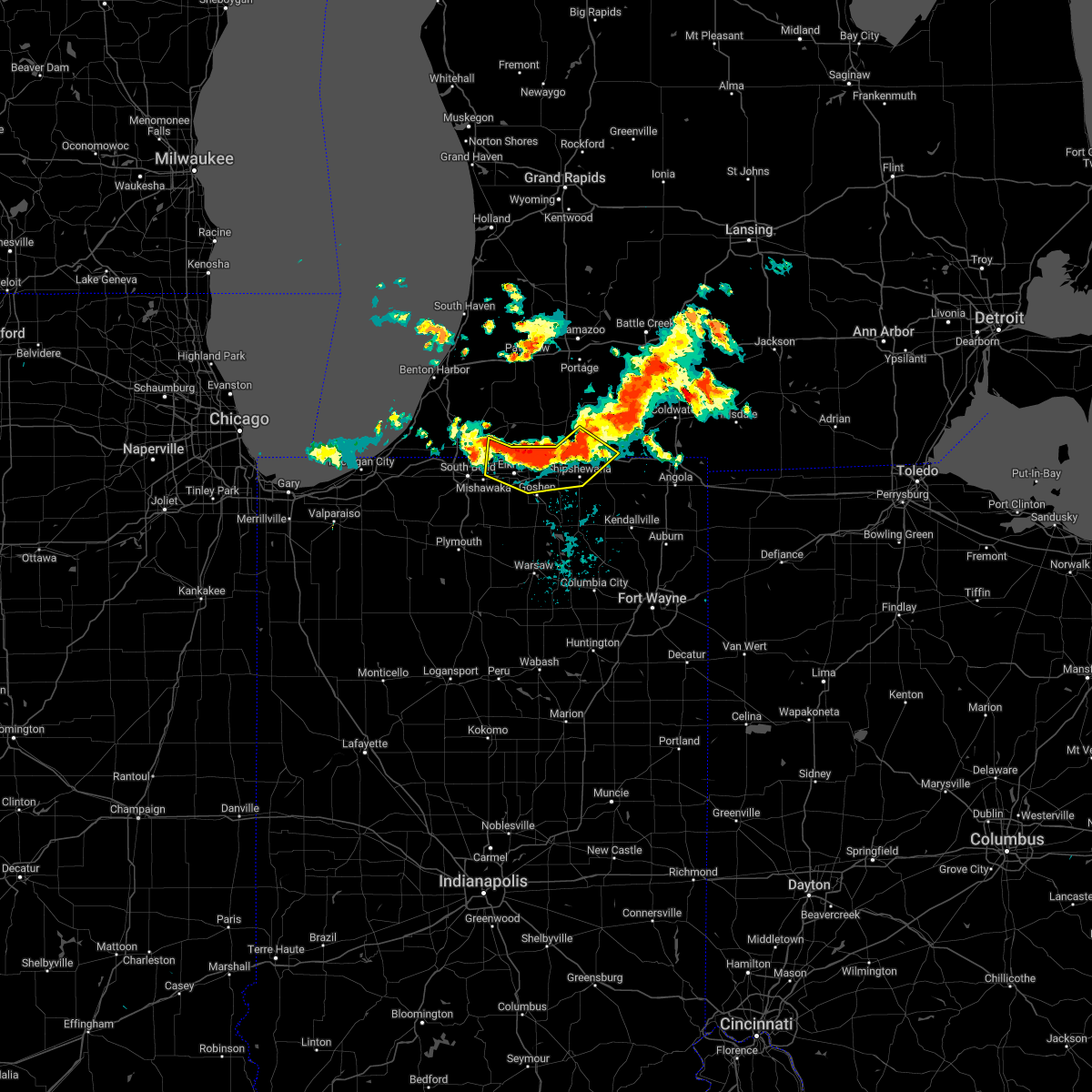 At 944 pm edt, severe thunderstorms were located along a line extending from 6 miles west of sturgis to near middlebury to elkhart to near niles, moving southeast at 10 mph (radar indicated). Hazards include 60 mph wind gusts and penny size hail. expect damage to roofs, siding, and trees At 944 pm edt, severe thunderstorms were located along a line extending from 6 miles west of sturgis to near middlebury to elkhart to near niles, moving southeast at 10 mph (radar indicated). Hazards include 60 mph wind gusts and penny size hail. expect damage to roofs, siding, and trees
|
| 6/13/2022 8:11 PM EDT | Wind gust report of 70-75 mph from social media near white pigeon in st. joseph county michiga in st. joseph county MI, 0.6 miles SW of White Pigeon, MI |
| 5/25/2022 7:13 PM EDT |
 At 713 pm edt, a severe thunderstorm was located near bristol, or 9 miles east of simonton lake, moving north at 50 mph (radar indicated). Hazards include 60 mph wind gusts and penny size hail. expect damage to roofs, siding, and trees At 713 pm edt, a severe thunderstorm was located near bristol, or 9 miles east of simonton lake, moving north at 50 mph (radar indicated). Hazards include 60 mph wind gusts and penny size hail. expect damage to roofs, siding, and trees
|
| 9/14/2021 5:28 PM EDT |
 The severe thunderstorm warning for st. joseph county will expire at 530 pm edt, the storm which prompted the warning has weakened below severe limits, and has exited the warned area. therefore, the warning will be allowed to expire. however gusty winds are still possible. a severe thunderstorm watch remains in effect until 1100 pm edt for southwestern michigan. The severe thunderstorm warning for st. joseph county will expire at 530 pm edt, the storm which prompted the warning has weakened below severe limits, and has exited the warned area. therefore, the warning will be allowed to expire. however gusty winds are still possible. a severe thunderstorm watch remains in effect until 1100 pm edt for southwestern michigan.
|
| 9/14/2021 5:02 PM EDT |
 At 501 pm edt, a severe thunderstorm was located over three rivers, moving northeast at 45 mph (radar indicated). Hazards include 60 mph wind gusts and penny size hail. Expect damage to roofs, siding, and trees. locations impacted include, three rivers, constantine, white pigeon, centreville, colon, nottawa, flowerfield, mottville, leonidas, mendon, moore park, fishers lake, fairfax, corey lake, howardsville, wasepi, clear lake and findley. hail threat, radar indicated max hail size, 0. 75 in wind threat, radar indicated max wind gust, 60 mph. At 501 pm edt, a severe thunderstorm was located over three rivers, moving northeast at 45 mph (radar indicated). Hazards include 60 mph wind gusts and penny size hail. Expect damage to roofs, siding, and trees. locations impacted include, three rivers, constantine, white pigeon, centreville, colon, nottawa, flowerfield, mottville, leonidas, mendon, moore park, fishers lake, fairfax, corey lake, howardsville, wasepi, clear lake and findley. hail threat, radar indicated max hail size, 0. 75 in wind threat, radar indicated max wind gust, 60 mph.
|
| 9/14/2021 4:28 PM EDT |
 At 427 pm edt, a severe thunderstorm was located over edwardsburg, moving northeast at 45 mph (radar indicated). Hazards include 60 mph wind gusts and quarter size hail. Hail damage to vehicles is expected. Expect wind damage to roofs, siding, and trees. At 427 pm edt, a severe thunderstorm was located over edwardsburg, moving northeast at 45 mph (radar indicated). Hazards include 60 mph wind gusts and quarter size hail. Hail damage to vehicles is expected. Expect wind damage to roofs, siding, and trees.
|
| 8/24/2021 9:35 PM EDT |
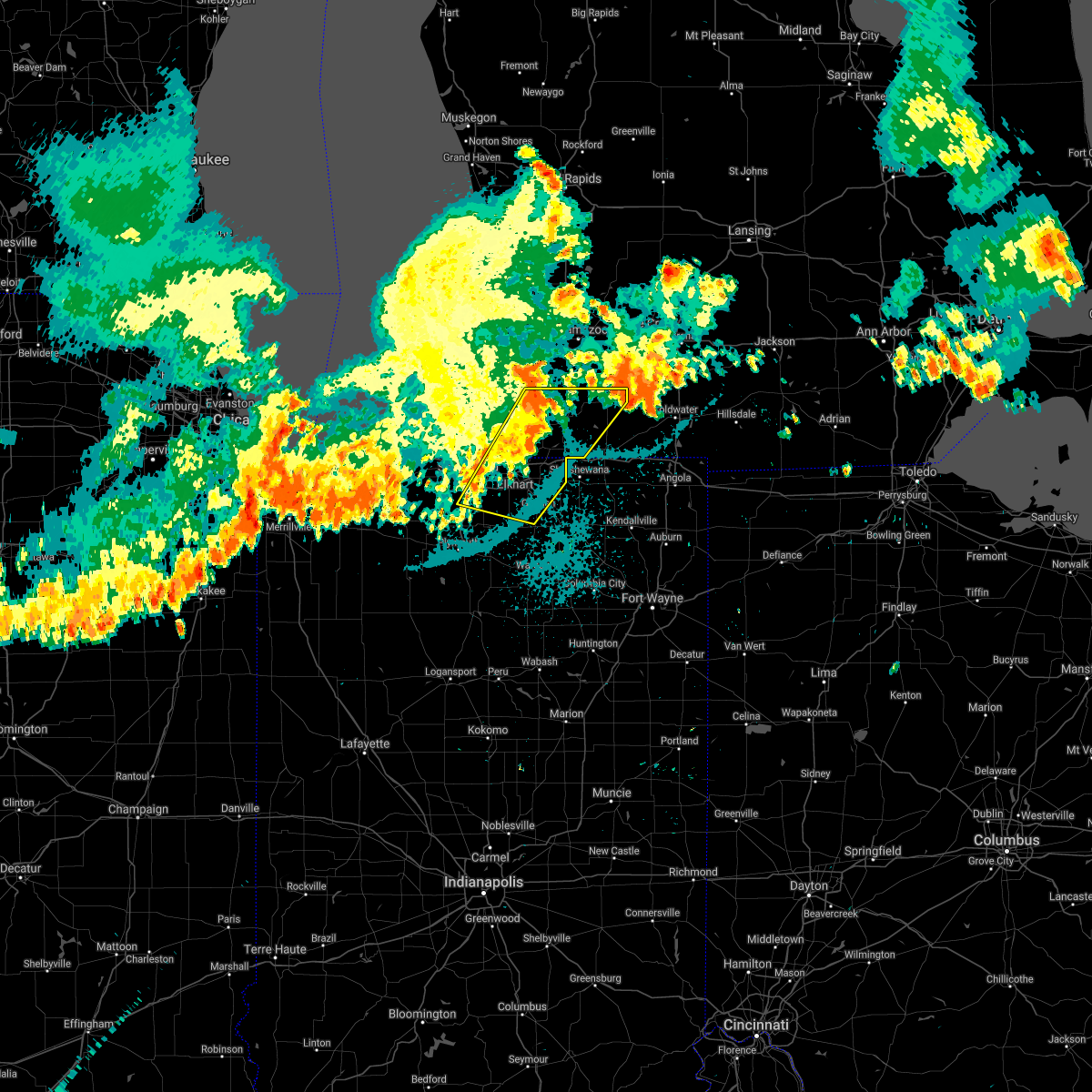 At 934 pm edt, severe thunderstorms were located along a line extending from near marcellus to near gulivoire park, moving east at 20 mph (radar indicated). Hazards include 60 mph wind gusts. Expect damage to roofs, siding, and trees. locations impacted include, south bend, elkhart, mishawaka, goshen, three rivers, gulivoire park, granger, dunlap, simonton lake, middlebury, osceola, constantine, cassopolis, wakarusa, bristol, white pigeon, centreville, edwardsburg, marcellus and new paris. this includes interstate 80 in indiana between mile markers 81 and 108. hail threat, radar indicated max hail size, <. 75 in wind threat, radar indicated max wind gust, 60 mph. At 934 pm edt, severe thunderstorms were located along a line extending from near marcellus to near gulivoire park, moving east at 20 mph (radar indicated). Hazards include 60 mph wind gusts. Expect damage to roofs, siding, and trees. locations impacted include, south bend, elkhart, mishawaka, goshen, three rivers, gulivoire park, granger, dunlap, simonton lake, middlebury, osceola, constantine, cassopolis, wakarusa, bristol, white pigeon, centreville, edwardsburg, marcellus and new paris. this includes interstate 80 in indiana between mile markers 81 and 108. hail threat, radar indicated max hail size, <. 75 in wind threat, radar indicated max wind gust, 60 mph.
|
| 8/24/2021 9:02 PM EDT |
 At 901 pm edt, severe thunderstorms were located along a line extending from 6 miles south of decatur to near lakeville, moving east at 40 mph (radar indicated). Hazards include 60 mph wind gusts. expect damage to roofs, siding, and trees At 901 pm edt, severe thunderstorms were located along a line extending from 6 miles south of decatur to near lakeville, moving east at 40 mph (radar indicated). Hazards include 60 mph wind gusts. expect damage to roofs, siding, and trees
|
| 8/11/2021 1:25 PM EDT | 1 to 2 inch limbs down. winds estimated at 55 mp in st. joseph county MI, 0.4 miles SSE of White Pigeon, MI |
| 8/11/2021 1:25 PM EDT | Trees and powerlines dow in st. joseph county MI, 0.6 miles SW of White Pigeon, MI |
| 8/10/2021 11:23 PM EDT |
 The severe thunderstorm warning for elkhart, northwestern noble, southeastern st. joseph, lagrange, eastern cass and st. joseph counties will expire at 1130 pm edt, the storms which prompted the warning have weakened below severe limits, and no longer pose an immediate threat to life or property. therefore, the warning will be allowed to expire. a severe thunderstorm watch remains in effect until 300 am edt for north central and northeastern indiana, and southwestern michigan. The severe thunderstorm warning for elkhart, northwestern noble, southeastern st. joseph, lagrange, eastern cass and st. joseph counties will expire at 1130 pm edt, the storms which prompted the warning have weakened below severe limits, and no longer pose an immediate threat to life or property. therefore, the warning will be allowed to expire. a severe thunderstorm watch remains in effect until 300 am edt for north central and northeastern indiana, and southwestern michigan.
|
| 8/10/2021 10:45 PM EDT |
 At 1044 pm edt, severe thunderstorms were located along a line extending from near marcellus to elkhart to near bremen, moving northeast at 50 mph (radar indicated). Hazards include 70 mph wind gusts and penny size hail. Expect considerable tree damage. Damage is likely to mobile homes, roofs, and outbuildings. At 1044 pm edt, severe thunderstorms were located along a line extending from near marcellus to elkhart to near bremen, moving northeast at 50 mph (radar indicated). Hazards include 70 mph wind gusts and penny size hail. Expect considerable tree damage. Damage is likely to mobile homes, roofs, and outbuildings.
|
| 8/10/2021 10:42 PM EDT |
 At 1041 pm edt, severe thunderstorms were located along a line extending from near cassopolis to near south bend to koontz lake, moving east at 70 mph (radar indicated). Hazards include 60 mph wind gusts and penny size hail. expect damage to roofs, siding, and trees At 1041 pm edt, severe thunderstorms were located along a line extending from near cassopolis to near south bend to koontz lake, moving east at 70 mph (radar indicated). Hazards include 60 mph wind gusts and penny size hail. expect damage to roofs, siding, and trees
|
| 6/26/2021 8:36 PM EDT |
 The severe thunderstorm warning for northeastern cass and st. joseph counties will expire at 845 pm edt, the storms which prompted the warning are weakening and likely below severe limits, and will soon exit the warned area. therefore, the warning will be allowed to expire. a tornado watch remains in effect until 1000 pm edt for southwestern michigan. The severe thunderstorm warning for northeastern cass and st. joseph counties will expire at 845 pm edt, the storms which prompted the warning are weakening and likely below severe limits, and will soon exit the warned area. therefore, the warning will be allowed to expire. a tornado watch remains in effect until 1000 pm edt for southwestern michigan.
|
| 6/26/2021 8:23 PM EDT |
 At 822 pm edt, severe thunderstorms were located along a line extending from near decatur to 6 miles southwest of marcellus to near constantine, moving northeast at 50 mph (radar indicated). Hazards include 60 mph wind gusts. Expect damage to roofs, siding, and trees. these severe storms will be near, three rivers around 830 pm edt. centreville around 835 pm edt. Other locations impacted by these severe thunderstorms include vandalia, nottawa, moore park, la grange, paradise lake, mendon, klinger lake, donnell lake, fishers lake and fairfax. At 822 pm edt, severe thunderstorms were located along a line extending from near decatur to 6 miles southwest of marcellus to near constantine, moving northeast at 50 mph (radar indicated). Hazards include 60 mph wind gusts. Expect damage to roofs, siding, and trees. these severe storms will be near, three rivers around 830 pm edt. centreville around 835 pm edt. Other locations impacted by these severe thunderstorms include vandalia, nottawa, moore park, la grange, paradise lake, mendon, klinger lake, donnell lake, fishers lake and fairfax.
|
| 6/26/2021 8:11 PM EDT |
 At 810 pm edt, severe thunderstorms were located along a line extending from near dowagiac to near cassopolis to near simonton lake, moving northeast at 55 mph (radar indicated). Hazards include 60 mph wind gusts. Expect damage to roofs, siding, and trees. these severe storms will be near, white pigeon around 820 pm edt. constantine and marcellus around 825 pm edt. three rivers around 830 pm edt. centreville around 835 pm edt. Other locations impacted by these severe thunderstorms include magician lake, dewey lake, vandalia, nottawa, la grange, adamsville, klinger lake, juno lake, indian lake and donnell lake. At 810 pm edt, severe thunderstorms were located along a line extending from near dowagiac to near cassopolis to near simonton lake, moving northeast at 55 mph (radar indicated). Hazards include 60 mph wind gusts. Expect damage to roofs, siding, and trees. these severe storms will be near, white pigeon around 820 pm edt. constantine and marcellus around 825 pm edt. three rivers around 830 pm edt. centreville around 835 pm edt. Other locations impacted by these severe thunderstorms include magician lake, dewey lake, vandalia, nottawa, la grange, adamsville, klinger lake, juno lake, indian lake and donnell lake.
|
| 6/26/2021 7:53 PM EDT |
 At 752 pm edt, severe thunderstorms were located along a line extending from near berrien springs to near roseland to near mishawaka, moving northeast at 50 mph (radar indicated). Hazards include 60 mph wind gusts. Expect damage to roofs, siding, and trees. severe thunderstorms will be near, dowagiac around 800 pm edt. elkhart, simonton lake and edwardsburg around 805 pm edt. bristol around 810 pm edt. cassopolis around 815 pm edt. constantine and white pigeon around 825 pm edt. three rivers and marcellus around 830 pm edt. centreville around 835 pm edt. colon around 845 pm edt. other locations impacted by these severe thunderstorms include magician lake, dewey lake, vandalia, nottawa, la grange, adamsville, klinger lake, juno lake, indian lake and donnell lake. This includes interstate 80 in indiana between mile markers 81 and 108. At 752 pm edt, severe thunderstorms were located along a line extending from near berrien springs to near roseland to near mishawaka, moving northeast at 50 mph (radar indicated). Hazards include 60 mph wind gusts. Expect damage to roofs, siding, and trees. severe thunderstorms will be near, dowagiac around 800 pm edt. elkhart, simonton lake and edwardsburg around 805 pm edt. bristol around 810 pm edt. cassopolis around 815 pm edt. constantine and white pigeon around 825 pm edt. three rivers and marcellus around 830 pm edt. centreville around 835 pm edt. colon around 845 pm edt. other locations impacted by these severe thunderstorms include magician lake, dewey lake, vandalia, nottawa, la grange, adamsville, klinger lake, juno lake, indian lake and donnell lake. This includes interstate 80 in indiana between mile markers 81 and 108.
|
| 6/20/2021 7:38 PM EDT |
 At 737 pm edt, severe thunderstorms were located along a line extending from near constantine to 6 miles east of middlebury to near millersburg, moving northeast at 40 mph (radar indicated). Hazards include 60 mph wind gusts and quarter size hail. Hail damage to vehicles is expected. expect wind damage to roofs, siding, and trees. Locations impacted include, sturgis, kendallville, ligonier, syracuse, lagrange, middlebury, constantine, white pigeon, rome city, colon, topeka, millersburg, benton, scott, fawn river, wolcottville, burr oak, shipshewana, brimfield and honeyville. At 737 pm edt, severe thunderstorms were located along a line extending from near constantine to 6 miles east of middlebury to near millersburg, moving northeast at 40 mph (radar indicated). Hazards include 60 mph wind gusts and quarter size hail. Hail damage to vehicles is expected. expect wind damage to roofs, siding, and trees. Locations impacted include, sturgis, kendallville, ligonier, syracuse, lagrange, middlebury, constantine, white pigeon, rome city, colon, topeka, millersburg, benton, scott, fawn river, wolcottville, burr oak, shipshewana, brimfield and honeyville.
|
| 6/20/2021 7:19 PM EDT |
 At 719 pm edt, severe thunderstorms were located along a line extending from near bristol to near goshen to new paris, moving northeast at 40 mph (public reported wind damage and golf ball sized hail in the greater mishawaka area). Hazards include 60 mph wind gusts and quarter size hail. Hail damage to vehicles is expected. Expect wind damage to roofs, siding, and trees. At 719 pm edt, severe thunderstorms were located along a line extending from near bristol to near goshen to new paris, moving northeast at 40 mph (public reported wind damage and golf ball sized hail in the greater mishawaka area). Hazards include 60 mph wind gusts and quarter size hail. Hail damage to vehicles is expected. Expect wind damage to roofs, siding, and trees.
|
| 6/19/2021 8:42 PM EDT |
 At 842 pm edt, severe thunderstorms were located along a line extending from 8 miles west of constantine to near elkhart, moving southeast at 25 mph (radar indicated). Hazards include 60 mph wind gusts and quarter size hail. Hail damage to vehicles is expected. expect wind damage to roofs, siding, and trees. Locations impacted include, elkhart, mishawaka, goshen, granger, dunlap, simonton lake, middlebury, cassopolis, bristol, white pigeon, edwardsburg, union, scott, mottville, shipshewana, honeyville, calvin center, adamsville, juno lake and shavehead lake. At 842 pm edt, severe thunderstorms were located along a line extending from 8 miles west of constantine to near elkhart, moving southeast at 25 mph (radar indicated). Hazards include 60 mph wind gusts and quarter size hail. Hail damage to vehicles is expected. expect wind damage to roofs, siding, and trees. Locations impacted include, elkhart, mishawaka, goshen, granger, dunlap, simonton lake, middlebury, cassopolis, bristol, white pigeon, edwardsburg, union, scott, mottville, shipshewana, honeyville, calvin center, adamsville, juno lake and shavehead lake.
|
| 6/19/2021 8:20 PM EDT |
 At 820 pm edt, a severe thunderstorm was located over simonton lake, moving southeast at 30 mph (radar indicated). Hazards include 60 mph wind gusts and quarter size hail. Hail damage to vehicles is expected. Expect wind damage to roofs, siding, and trees. At 820 pm edt, a severe thunderstorm was located over simonton lake, moving southeast at 30 mph (radar indicated). Hazards include 60 mph wind gusts and quarter size hail. Hail damage to vehicles is expected. Expect wind damage to roofs, siding, and trees.
|
| 8/29/2020 1:23 AM EDT |
 The severe thunderstorm warning for northern elkhart, northeastern st. joseph, southern cass, southwestern st. joseph and southeastern berrien counties will expire at 130 am edt, the storms which prompted the warning have weakened below severe limits. therefore, the warning will be allowed to expire at 130 am edt. however gusty winds of 40 to 50 mph are still possible with these thunderstorms as they track southeast across st. joseph indiana and elkhart counties. The severe thunderstorm warning for northern elkhart, northeastern st. joseph, southern cass, southwestern st. joseph and southeastern berrien counties will expire at 130 am edt, the storms which prompted the warning have weakened below severe limits. therefore, the warning will be allowed to expire at 130 am edt. however gusty winds of 40 to 50 mph are still possible with these thunderstorms as they track southeast across st. joseph indiana and elkhart counties.
|
| 8/29/2020 1:02 AM EDT |
 At 101 am edt, severe thunderstorms were located along a line extending from centreville to near bristol to near roseland, moving east at 45 mph (radar indicated). Hazards include 60 mph wind gusts. Expect damage to roofs, siding, and trees. Locations impacted include, south bend, elkhart, mishawaka, niles, three rivers, buchanan, georgetown, simonton lake, granger, constantine, cassopolis, bristol, white pigeon, centreville, edwardsburg, roseland, shorewood-tower hills-harbert, union, bertrand and pokagon. At 101 am edt, severe thunderstorms were located along a line extending from centreville to near bristol to near roseland, moving east at 45 mph (radar indicated). Hazards include 60 mph wind gusts. Expect damage to roofs, siding, and trees. Locations impacted include, south bend, elkhart, mishawaka, niles, three rivers, buchanan, georgetown, simonton lake, granger, constantine, cassopolis, bristol, white pigeon, centreville, edwardsburg, roseland, shorewood-tower hills-harbert, union, bertrand and pokagon.
|
| 8/29/2020 12:39 AM EDT |
 At 1239 am edt, severe thunderstorms were located along a line extending from marcellus to near edwardsburg to near three oaks, moving east at 45 mph (radar indicated). Hazards include 60 mph wind gusts. expect damage to roofs, siding, and trees At 1239 am edt, severe thunderstorms were located along a line extending from marcellus to near edwardsburg to near three oaks, moving east at 45 mph (radar indicated). Hazards include 60 mph wind gusts. expect damage to roofs, siding, and trees
|
| 8/10/2020 7:18 PM EDT |
 At 717 pm edt, severe thunderstorms were located along a line extending from near colon to 6 miles northwest of lagrange to ligonier to near tri-lakes, moving east at 45 mph (trained weather spotters have reported several trees and branches down). Hazards include 70 mph wind gusts and penny size hail. Expect considerable tree damage. damage is likely to mobile homes, roofs, and outbuildings. these severe storms will be near, sturgis, lagrange, albion and colon around 725 pm edt. rome city around 730 pm edt. Other locations impacted by these severe thunderstorms include honeyville, nottawa, klinger lake, fishers lake, larwill, leonidas, corey lake, lake wawasee, howe and james lake. At 717 pm edt, severe thunderstorms were located along a line extending from near colon to 6 miles northwest of lagrange to ligonier to near tri-lakes, moving east at 45 mph (trained weather spotters have reported several trees and branches down). Hazards include 70 mph wind gusts and penny size hail. Expect considerable tree damage. damage is likely to mobile homes, roofs, and outbuildings. these severe storms will be near, sturgis, lagrange, albion and colon around 725 pm edt. rome city around 730 pm edt. Other locations impacted by these severe thunderstorms include honeyville, nottawa, klinger lake, fishers lake, larwill, leonidas, corey lake, lake wawasee, howe and james lake.
|
| 8/10/2020 7:07 PM EDT |
 At 706 pm edt, severe thunderstorms were located along a line extending from near three rivers to middlebury to near syracuse to near pierceton, moving east at 45 mph (trained weather spotters have reported several trees and branches down across the area). Hazards include 70 mph wind gusts and penny size hail. Expect considerable tree damage. damage is likely to mobile homes, roofs, and outbuildings. these severe storms will be near, three rivers and centreville around 710 pm edt. ligonier and topeka around 715 pm edt. columbia city and tri-lakes around 720 pm edt. sturgis, lagrange, albion and colon around 725 pm edt. rome city around 730 pm edt. Other locations impacted by these severe thunderstorms include vandalia, honeyville, nottawa, klinger lake, donnell lake, fishers lake, larwill, leonidas, corey lake and lake wawasee. At 706 pm edt, severe thunderstorms were located along a line extending from near three rivers to middlebury to near syracuse to near pierceton, moving east at 45 mph (trained weather spotters have reported several trees and branches down across the area). Hazards include 70 mph wind gusts and penny size hail. Expect considerable tree damage. damage is likely to mobile homes, roofs, and outbuildings. these severe storms will be near, three rivers and centreville around 710 pm edt. ligonier and topeka around 715 pm edt. columbia city and tri-lakes around 720 pm edt. sturgis, lagrange, albion and colon around 725 pm edt. rome city around 730 pm edt. Other locations impacted by these severe thunderstorms include vandalia, honeyville, nottawa, klinger lake, donnell lake, fishers lake, larwill, leonidas, corey lake and lake wawasee.
|
| 8/10/2020 6:47 PM EDT |
 At 647 pm edt, severe thunderstorms were located along a line extending from near marcellus to elkhart to nappanee to near warsaw, moving east at 45 mph. these are very dangerous storms (radar indicated). Hazards include 80 mph wind gusts and quarter size hail. Flying debris will be dangerous to those caught without shelter. mobile homes will be heavily damaged. expect considerable damage to roofs, windows, and vehicles. extensive tree damage and power outages are likely. these severe storms will be near, marcellus around 650 pm edt. warsaw, winona lake, bristol and milford around 655 pm edt. goshen, three rivers and new paris around 700 pm edt. syracuse, middlebury, north webster, pierceton and millersburg around 705 pm edt. centreville around 710 pm edt. columbia city, ligonier and topeka around 715 pm edt. tri-lakes around 720 pm edt. sturgis, lagrange, albion and colon around 725 pm edt. Other locations impacted by these severe thunderstorms include honeyville, nottawa, atwood, juno lake, fishers lake, diamond lake, corey lake, howe, locke and wakelee. At 647 pm edt, severe thunderstorms were located along a line extending from near marcellus to elkhart to nappanee to near warsaw, moving east at 45 mph. these are very dangerous storms (radar indicated). Hazards include 80 mph wind gusts and quarter size hail. Flying debris will be dangerous to those caught without shelter. mobile homes will be heavily damaged. expect considerable damage to roofs, windows, and vehicles. extensive tree damage and power outages are likely. these severe storms will be near, marcellus around 650 pm edt. warsaw, winona lake, bristol and milford around 655 pm edt. goshen, three rivers and new paris around 700 pm edt. syracuse, middlebury, north webster, pierceton and millersburg around 705 pm edt. centreville around 710 pm edt. columbia city, ligonier and topeka around 715 pm edt. tri-lakes around 720 pm edt. sturgis, lagrange, albion and colon around 725 pm edt. Other locations impacted by these severe thunderstorms include honeyville, nottawa, atwood, juno lake, fishers lake, diamond lake, corey lake, howe, locke and wakelee.
|
| 8/10/2020 6:24 PM EDT |
 At 623 pm edt, severe thunderstorms were located along a line extending from near dowagiac to near south bend to near plymouth to argos, moving east at 45 mph. these are very dangerous storms (radar indicated). Hazards include 80 mph wind gusts and quarter size hail. Flying debris will be dangerous to those caught without shelter. mobile homes will be heavily damaged. expect considerable damage to roofs, windows, and vehicles. extensive tree damage and power outages are likely. severe thunderstorms will be near, mishawaka and dowagiac around 630 pm edt. bremen, granger, bourbon and cassopolis around 635 pm edt. osceola and mentone around 640 pm edt. elkhart, simonton lake, wakarusa and marcellus around 645 pm edt. nappanee and dunlap around 650 pm edt. warsaw, winona lake, bristol, milford and new paris around 655 pm edt. goshen, three rivers, syracuse and pierceton around 700 pm edt. middlebury, centreville, north webster and millersburg around 705 pm edt. This includes interstate 80 in indiana between mile markers 73 and 124. At 623 pm edt, severe thunderstorms were located along a line extending from near dowagiac to near south bend to near plymouth to argos, moving east at 45 mph. these are very dangerous storms (radar indicated). Hazards include 80 mph wind gusts and quarter size hail. Flying debris will be dangerous to those caught without shelter. mobile homes will be heavily damaged. expect considerable damage to roofs, windows, and vehicles. extensive tree damage and power outages are likely. severe thunderstorms will be near, mishawaka and dowagiac around 630 pm edt. bremen, granger, bourbon and cassopolis around 635 pm edt. osceola and mentone around 640 pm edt. elkhart, simonton lake, wakarusa and marcellus around 645 pm edt. nappanee and dunlap around 650 pm edt. warsaw, winona lake, bristol, milford and new paris around 655 pm edt. goshen, three rivers, syracuse and pierceton around 700 pm edt. middlebury, centreville, north webster and millersburg around 705 pm edt. This includes interstate 80 in indiana between mile markers 73 and 124.
|
| 6/26/2020 9:56 PM EDT |
 At 956 pm edt, severe thunderstorms were located along a line extending from near cassopolis to gulivoire park, moving east at 60 mph (radar indicated). Hazards include 60 mph wind gusts. Expect damage to roofs, siding, and trees. these severe storms will be near, osceola around 1005 pm edt. wakarusa around 1010 pm edt. constantine and white pigeon around 1015 pm edt. goshen around 1020 pm edt. Other locations impacted by these severe thunderstorms include vandalia, dailey, la grange, paradise lake, barron lake, calvin center, adamsville, sumnerville, juno lake and donnell lake. At 956 pm edt, severe thunderstorms were located along a line extending from near cassopolis to gulivoire park, moving east at 60 mph (radar indicated). Hazards include 60 mph wind gusts. Expect damage to roofs, siding, and trees. these severe storms will be near, osceola around 1005 pm edt. wakarusa around 1010 pm edt. constantine and white pigeon around 1015 pm edt. goshen around 1020 pm edt. Other locations impacted by these severe thunderstorms include vandalia, dailey, la grange, paradise lake, barron lake, calvin center, adamsville, sumnerville, juno lake and donnell lake.
|
| 6/26/2020 9:34 PM EDT |
 At 934 pm edt, severe thunderstorms were located along a line extending from berrien springs to 6 miles southwest of new carlisle, moving east at 45 mph (radar indicated). Hazards include 70 mph wind gusts. Expect considerable tree damage. damage is likely to mobile homes, roofs, and outbuildings. severe thunderstorms will be near, niles and dowagiac around 945 pm edt. cassopolis and edwardsburg around 955 pm edt. elkhart and simonton lake around 1000 pm edt. bristol around 1010 pm edt. constantine, wakarusa and white pigeon around 1015 pm edt. other locations impacted by these severe thunderstorms include vandalia, dailey, la grange, paradise lake, barron lake, calvin center, adamsville, sumnerville, juno lake and donnell lake. This includes interstate 80 in indiana between mile markers 79 and 107. At 934 pm edt, severe thunderstorms were located along a line extending from berrien springs to 6 miles southwest of new carlisle, moving east at 45 mph (radar indicated). Hazards include 70 mph wind gusts. Expect considerable tree damage. damage is likely to mobile homes, roofs, and outbuildings. severe thunderstorms will be near, niles and dowagiac around 945 pm edt. cassopolis and edwardsburg around 955 pm edt. elkhart and simonton lake around 1000 pm edt. bristol around 1010 pm edt. constantine, wakarusa and white pigeon around 1015 pm edt. other locations impacted by these severe thunderstorms include vandalia, dailey, la grange, paradise lake, barron lake, calvin center, adamsville, sumnerville, juno lake and donnell lake. This includes interstate 80 in indiana between mile markers 79 and 107.
|
| 6/10/2020 1:40 PM EDT |
 At 140 pm edt, a severe thunderstorm was located over constantine, or near three rivers, moving northeast at 65 mph (radar indicated). Hazards include 70 mph wind gusts and quarter size hail. Hail damage to vehicles is expected. expect considerable tree damage. wind damage is also likely to mobile homes, roofs, and outbuildings. this severe storm will be near, three rivers and centreville around 145 pm edt. Other locations impacted by this severe thunderstorm include moore park, fishers lake and flowerfield. At 140 pm edt, a severe thunderstorm was located over constantine, or near three rivers, moving northeast at 65 mph (radar indicated). Hazards include 70 mph wind gusts and quarter size hail. Hail damage to vehicles is expected. expect considerable tree damage. wind damage is also likely to mobile homes, roofs, and outbuildings. this severe storm will be near, three rivers and centreville around 145 pm edt. Other locations impacted by this severe thunderstorm include moore park, fishers lake and flowerfield.
|
| 6/10/2020 1:23 PM EDT |
 At 123 pm edt, a severe thunderstorm was located near bristol, or near simonton lake, moving north at 65 mph (radar indicated). Hazards include 70 mph wind gusts and quarter size hail. Hail damage to vehicles is expected. expect considerable tree damage. wind damage is also likely to mobile homes, roofs, and outbuildings. this severe storm will be near, three rivers and marcellus around 140 pm edt. Other locations impacted by this severe thunderstorm include jones, moore park, corey lake, shavehead lake, howardsville, flowerfield, clear lake, mottville, fishers lake and union. At 123 pm edt, a severe thunderstorm was located near bristol, or near simonton lake, moving north at 65 mph (radar indicated). Hazards include 70 mph wind gusts and quarter size hail. Hail damage to vehicles is expected. expect considerable tree damage. wind damage is also likely to mobile homes, roofs, and outbuildings. this severe storm will be near, three rivers and marcellus around 140 pm edt. Other locations impacted by this severe thunderstorm include jones, moore park, corey lake, shavehead lake, howardsville, flowerfield, clear lake, mottville, fishers lake and union.
|
| 6/10/2020 1:10 PM EDT |
 At 110 pm edt, a severe thunderstorm was located over constantine, or 8 miles south of three rivers, moving north at 50 mph (radar indicated). Hazards include 70 mph wind gusts and quarter size hail. Hail damage to vehicles is expected. expect considerable tree damage. wind damage is also likely to mobile homes, roofs, and outbuildings. Locations impacted include, three rivers, middlebury, constantine, bristol, white pigeon, centreville, colon, nottawa, scott, flowerfield, mottville, leonidas, mendon, moore park, klinger lake, fishers lake, fairfax, jones, corey lake and howardsville. At 110 pm edt, a severe thunderstorm was located over constantine, or 8 miles south of three rivers, moving north at 50 mph (radar indicated). Hazards include 70 mph wind gusts and quarter size hail. Hail damage to vehicles is expected. expect considerable tree damage. wind damage is also likely to mobile homes, roofs, and outbuildings. Locations impacted include, three rivers, middlebury, constantine, bristol, white pigeon, centreville, colon, nottawa, scott, flowerfield, mottville, leonidas, mendon, moore park, klinger lake, fishers lake, fairfax, jones, corey lake and howardsville.
|
| 6/10/2020 1:08 PM EDT |
 At 108 pm edt, a severe thunderstorm was located over wakarusa, or near dunlap, moving north at 65 mph (radar indicated). Hazards include 70 mph wind gusts and quarter size hail. Hail damage to vehicles is expected. expect considerable tree damage. wind damage is also likely to mobile homes, roofs, and outbuildings. this severe thunderstorm will be near, elkhart, simonton lake and bristol around 120 pm edt. three rivers and marcellus around 140 pm edt. other locations impacted by this severe thunderstorm include vandalia, moore park, paradise lake, calvin center, donnell lake, fishers lake, union, penn, jones and southwest. This includes interstate 80 in indiana between mile markers 91 and 108. At 108 pm edt, a severe thunderstorm was located over wakarusa, or near dunlap, moving north at 65 mph (radar indicated). Hazards include 70 mph wind gusts and quarter size hail. Hail damage to vehicles is expected. expect considerable tree damage. wind damage is also likely to mobile homes, roofs, and outbuildings. this severe thunderstorm will be near, elkhart, simonton lake and bristol around 120 pm edt. three rivers and marcellus around 140 pm edt. other locations impacted by this severe thunderstorm include vandalia, moore park, paradise lake, calvin center, donnell lake, fishers lake, union, penn, jones and southwest. This includes interstate 80 in indiana between mile markers 91 and 108.
|
| 6/10/2020 1:07 PM EDT |
 At 107 pm edt, a severe thunderstorm was located near constantine, or near three rivers, moving north at 60 mph (radar indicated). Hazards include 60 mph wind gusts and quarter size hail. Hail damage to vehicles is expected. expect wind damage to roofs, siding, and trees. Locations impacted include, constantine, bristol, white pigeon and mottville. At 107 pm edt, a severe thunderstorm was located near constantine, or near three rivers, moving north at 60 mph (radar indicated). Hazards include 60 mph wind gusts and quarter size hail. Hail damage to vehicles is expected. expect wind damage to roofs, siding, and trees. Locations impacted include, constantine, bristol, white pigeon and mottville.
|
| 6/10/2020 12:56 PM EDT |
 At 1255 pm edt, a severe thunderstorm was located over middlebury, or near goshen, moving north at 50 mph (radar indicated). Hazards include 70 mph wind gusts and quarter size hail. Hail damage to vehicles is expected. expect considerable tree damage. Wind damage is also likely to mobile homes, roofs, and outbuildings. At 1255 pm edt, a severe thunderstorm was located over middlebury, or near goshen, moving north at 50 mph (radar indicated). Hazards include 70 mph wind gusts and quarter size hail. Hail damage to vehicles is expected. expect considerable tree damage. Wind damage is also likely to mobile homes, roofs, and outbuildings.
|
| 6/10/2020 12:40 PM EDT |
 At 1239 pm edt, a severe thunderstorm was located near new paris, or near nappanee, moving north at 60 mph (radar indicated). Hazards include 70 mph wind gusts and quarter size hail. Hail damage to vehicles is expected. expect considerable tree damage. Wind damage is also likely to mobile homes, roofs, and outbuildings. At 1239 pm edt, a severe thunderstorm was located near new paris, or near nappanee, moving north at 60 mph (radar indicated). Hazards include 70 mph wind gusts and quarter size hail. Hail damage to vehicles is expected. expect considerable tree damage. Wind damage is also likely to mobile homes, roofs, and outbuildings.
|
| 5/27/2020 3:24 PM EDT |
 The severe thunderstorm warning for northeastern elkhart, southeastern cass and southwestern st. joseph counties will expire at 330 pm edt, the storm which prompted the warning has weakened below severe limits, and no longer poses an immediate threat to life or property. therefore, the warning will be allowed to expire. however gusty winds and heavy rain are still possible with this thunderstorm. The severe thunderstorm warning for northeastern elkhart, southeastern cass and southwestern st. joseph counties will expire at 330 pm edt, the storm which prompted the warning has weakened below severe limits, and no longer poses an immediate threat to life or property. therefore, the warning will be allowed to expire. however gusty winds and heavy rain are still possible with this thunderstorm.
|
| 5/27/2020 3:13 PM EDT |
 At 311 pm edt, a severe thunderstorm was located near bristol, or 7 miles northeast of dunlap, moving north at 10 mph (radar indicated). Hazards include 60 mph wind gusts and quarter size hail. Hail damage to vehicles is expected. expect wind damage to roofs, siding, and trees. Locations impacted include, middlebury, bristol, white pigeon, union and mottville. At 311 pm edt, a severe thunderstorm was located near bristol, or 7 miles northeast of dunlap, moving north at 10 mph (radar indicated). Hazards include 60 mph wind gusts and quarter size hail. Hail damage to vehicles is expected. expect wind damage to roofs, siding, and trees. Locations impacted include, middlebury, bristol, white pigeon, union and mottville.
|
| 5/27/2020 2:55 PM EDT |
 At 254 pm edt, a severe thunderstorm was located near middlebury, or near goshen, moving north at 10 mph (radar indicated). Hazards include 60 mph wind gusts and quarter size hail. Hail damage to vehicles is expected. Expect wind damage to roofs, siding, and trees. At 254 pm edt, a severe thunderstorm was located near middlebury, or near goshen, moving north at 10 mph (radar indicated). Hazards include 60 mph wind gusts and quarter size hail. Hail damage to vehicles is expected. Expect wind damage to roofs, siding, and trees.
|
| 9/12/2019 6:30 PM EDT |
 At 630 pm edt, a severe thunderstorm was located near millersburg, or 7 miles east of goshen, moving northeast at 30 mph (radar indicated). Hazards include 60 mph wind gusts and nickel size hail. expect damage to roofs, siding, and trees At 630 pm edt, a severe thunderstorm was located near millersburg, or 7 miles east of goshen, moving northeast at 30 mph (radar indicated). Hazards include 60 mph wind gusts and nickel size hail. expect damage to roofs, siding, and trees
|
| 7/20/2019 2:56 AM EDT |
 At 255 am edt, severe thunderstorms were located along a line extending from near leslie to near battle creek to near mattawan, moving southeast at 65 mph (radar indicated). Hazards include 60 mph wind gusts. expect damage to roofs, siding, and trees At 255 am edt, severe thunderstorms were located along a line extending from near leslie to near battle creek to near mattawan, moving southeast at 65 mph (radar indicated). Hazards include 60 mph wind gusts. expect damage to roofs, siding, and trees
|
| 7/11/2019 12:01 AM EDT |
 At 1142 pm edt, a severe thunderstorm was located over elkhart, moving east at 25 mph (radar indicated). Hazards include 60 mph wind gusts and quarter size hail. Hail damage to vehicles is expected. Expect wind damage to roofs, siding, and trees. At 1142 pm edt, a severe thunderstorm was located over elkhart, moving east at 25 mph (radar indicated). Hazards include 60 mph wind gusts and quarter size hail. Hail damage to vehicles is expected. Expect wind damage to roofs, siding, and trees.
|
| 7/10/2019 11:42 PM EDT |
 At 1142 pm edt, a severe thunderstorm was located over elkhart, moving east at 25 mph (radar indicated). Hazards include 60 mph wind gusts and quarter size hail. Hail damage to vehicles is expected. Expect wind damage to roofs, siding, and trees. At 1142 pm edt, a severe thunderstorm was located over elkhart, moving east at 25 mph (radar indicated). Hazards include 60 mph wind gusts and quarter size hail. Hail damage to vehicles is expected. Expect wind damage to roofs, siding, and trees.
|
| 6/25/2019 8:37 PM EDT |
 The severe thunderstorm warning for northeastern elkhart, western lagrange and southeastern st. joseph counties will expire at 845 pm edt, the storm which prompted the warning has weakened below severe limits, and no longer poses an immediate threat to life or property. therefore, the warning will be allowed to expire. a severe thunderstorm watch remains in effect until 1000 pm edt for north central and northeastern indiana, and southwestern michigan. The severe thunderstorm warning for northeastern elkhart, western lagrange and southeastern st. joseph counties will expire at 845 pm edt, the storm which prompted the warning has weakened below severe limits, and no longer poses an immediate threat to life or property. therefore, the warning will be allowed to expire. a severe thunderstorm watch remains in effect until 1000 pm edt for north central and northeastern indiana, and southwestern michigan.
|
| 6/25/2019 8:21 PM EDT |
 At 821 pm edt, a severe thunderstorm was located 7 miles southeast of white pigeon, or 8 miles northwest of lagrange, moving east at 40 mph (radar indicated). Hazards include 60 mph wind gusts. Expect damage to roofs, siding, and trees. Locations impacted include, sturgis, lagrange, middlebury, white pigeon, scott, fawn river, shipshewana, brighton, howe, klinger lake, ontario and emma. At 821 pm edt, a severe thunderstorm was located 7 miles southeast of white pigeon, or 8 miles northwest of lagrange, moving east at 40 mph (radar indicated). Hazards include 60 mph wind gusts. Expect damage to roofs, siding, and trees. Locations impacted include, sturgis, lagrange, middlebury, white pigeon, scott, fawn river, shipshewana, brighton, howe, klinger lake, ontario and emma.
|
| 6/25/2019 8:07 PM EDT |
 At 806 pm edt, a severe thunderstorm was located near bristol, or 11 miles east of simonton lake, moving east at 40 mph (radar indicated). Hazards include 60 mph wind gusts. expect damage to roofs, siding, and trees At 806 pm edt, a severe thunderstorm was located near bristol, or 11 miles east of simonton lake, moving east at 40 mph (radar indicated). Hazards include 60 mph wind gusts. expect damage to roofs, siding, and trees
|
| 6/25/2019 7:58 PM EDT |
 At 744 pm edt, a severe thunderstorm was located near edwardsburg, or near simonton lake, moving southeast at 35 mph (radar indicated). Hazards include 60 mph wind gusts. expect damage to roofs, siding, and trees At 744 pm edt, a severe thunderstorm was located near edwardsburg, or near simonton lake, moving southeast at 35 mph (radar indicated). Hazards include 60 mph wind gusts. expect damage to roofs, siding, and trees
|
| 6/25/2019 7:58 PM EDT |
 At 758 pm edt, a severe thunderstorm was located near bristol, or near simonton lake, moving southeast at 35 mph (radar indicated). Hazards include 60 mph wind gusts. Expect damage to roofs, siding, and trees. Locations impacted include, elkhart, simonton lake, middlebury, constantine, bristol, white pigeon, union, mottville, vandalia, paradise lake, calvin center, adamsville, juno lake, donnell lake, jones and shavehead lake. At 758 pm edt, a severe thunderstorm was located near bristol, or near simonton lake, moving southeast at 35 mph (radar indicated). Hazards include 60 mph wind gusts. Expect damage to roofs, siding, and trees. Locations impacted include, elkhart, simonton lake, middlebury, constantine, bristol, white pigeon, union, mottville, vandalia, paradise lake, calvin center, adamsville, juno lake, donnell lake, jones and shavehead lake.
|
| 6/25/2019 7:44 PM EDT |
 At 744 pm edt, a severe thunderstorm was located near edwardsburg, or near simonton lake, moving southeast at 35 mph (radar indicated). Hazards include 60 mph wind gusts. expect damage to roofs, siding, and trees At 744 pm edt, a severe thunderstorm was located near edwardsburg, or near simonton lake, moving southeast at 35 mph (radar indicated). Hazards include 60 mph wind gusts. expect damage to roofs, siding, and trees
|
| 6/1/2019 8:27 PM EDT |
 At 827 pm edt, a severe thunderstorm was located near white pigeon, or 7 miles west of sturgis, moving east at 20 mph (radar indicated). Hazards include 60 mph wind gusts and quarter size hail. Hail damage to vehicles is expected. Expect wind damage to roofs, siding, and trees. At 827 pm edt, a severe thunderstorm was located near white pigeon, or 7 miles west of sturgis, moving east at 20 mph (radar indicated). Hazards include 60 mph wind gusts and quarter size hail. Hail damage to vehicles is expected. Expect wind damage to roofs, siding, and trees.
|
| 6/1/2019 5:06 PM EDT |
 At 506 pm edt, a severe thunderstorm was located near goshen, moving east at 30 mph (radar indicated). Hazards include 60 mph wind gusts and half dollar size hail. Hail damage to vehicles is expected. Expect wind damage to roofs, siding, and trees. At 506 pm edt, a severe thunderstorm was located near goshen, moving east at 30 mph (radar indicated). Hazards include 60 mph wind gusts and half dollar size hail. Hail damage to vehicles is expected. Expect wind damage to roofs, siding, and trees.
|
| 5/27/2019 7:14 PM EDT |
 At 713 pm edt, a severe thunderstorm was located near white pigeon, or 12 miles east of simonton lake, moving east at 35 mph (radar indicated). Hazards include 60 mph wind gusts and quarter size hail. Hail damage to vehicles is expected. expect wind damage to roofs, siding, and trees. Locations impacted include, elkhart, dunlap, middlebury, constantine, bristol, white pigeon, union, scott, mottville and shipshewana. At 713 pm edt, a severe thunderstorm was located near white pigeon, or 12 miles east of simonton lake, moving east at 35 mph (radar indicated). Hazards include 60 mph wind gusts and quarter size hail. Hail damage to vehicles is expected. expect wind damage to roofs, siding, and trees. Locations impacted include, elkhart, dunlap, middlebury, constantine, bristol, white pigeon, union, scott, mottville and shipshewana.
|
| 5/27/2019 6:50 PM EDT |
 At 649 pm edt, a severe thunderstorm was located over elkhart, moving east at 35 mph (radar indicated). Hazards include 60 mph wind gusts and quarter size hail. Hail damage to vehicles is expected. Expect wind damage to roofs, siding, and trees. At 649 pm edt, a severe thunderstorm was located over elkhart, moving east at 35 mph (radar indicated). Hazards include 60 mph wind gusts and quarter size hail. Hail damage to vehicles is expected. Expect wind damage to roofs, siding, and trees.
|
| 3/14/2019 4:31 PM EDT |
 At 431 pm edt, a severe thunderstorm was located over mishawaka, moving northeast at 70 mph (radar indicated). Hazards include 60 mph wind gusts and quarter size hail. Hail damage to vehicles is expected. Expect wind damage to roofs, siding, and trees. At 431 pm edt, a severe thunderstorm was located over mishawaka, moving northeast at 70 mph (radar indicated). Hazards include 60 mph wind gusts and quarter size hail. Hail damage to vehicles is expected. Expect wind damage to roofs, siding, and trees.
|
| 9/20/2018 5:36 PM EDT |
 At 535 pm edt, a severe thunderstorm was located over middlebury, or 7 miles northeast of goshen, moving east at 40 mph (public. between 500 and 515 pm edt, there have been several reports of trees and branches down in the greater south bend area). Hazards include 60 mph wind gusts. Expect damage to roofs, siding, and trees. Locations impacted include, elkhart, dunlap, simonton lake, middlebury, bristol, white pigeon, union and mottville. At 535 pm edt, a severe thunderstorm was located over middlebury, or 7 miles northeast of goshen, moving east at 40 mph (public. between 500 and 515 pm edt, there have been several reports of trees and branches down in the greater south bend area). Hazards include 60 mph wind gusts. Expect damage to roofs, siding, and trees. Locations impacted include, elkhart, dunlap, simonton lake, middlebury, bristol, white pigeon, union and mottville.
|
| 9/20/2018 5:18 PM EDT |
 At 518 pm edt, a severe thunderstorm was located over dunlap, moving east at 40 mph. between 500 and 515 pm edt, there have been several reports of trees and branches down in the greater south bend area (public). Hazards include 60 mph wind gusts. expect damage to roofs, siding, and trees At 518 pm edt, a severe thunderstorm was located over dunlap, moving east at 40 mph. between 500 and 515 pm edt, there have been several reports of trees and branches down in the greater south bend area (public). Hazards include 60 mph wind gusts. expect damage to roofs, siding, and trees
|
| 9/3/2018 3:53 PM EDT | Wires down and arcing at teasdale lake street and hebron roa in cass county MI, 7.2 miles ESE of White Pigeon, MI |
| 8/9/2018 5:50 PM EDT | Reports of several large downed tree limbs (one of 12 to 14 inches) and arcing power line in st. joseph county MI, 2.7 miles WSW of White Pigeon, MI |
| 7/20/2018 3:03 PM EDT |
 At 302 pm edt, a severe thunderstorm was located from near cassopolis michigan ligonier indiana moving northeast at 35 mph (radar indicated). Hazards include 60 mph wind gusts and penny size hail. Expect damage to roofs, siding, and trees. locations impacted include, ligonier, constantine, cassopolis, white pigeon, marcellus, topeka, penn, mottville, shipshewana, vandalia, honeyville, dailey, paradise lake, calvin center, donnell lake, jones, diamond lake, corey lake, shavehead lake and clear lake. A tornado watch remains in effect until 600 pm edt for north central and northeastern indiana, and southwestern michigan. At 302 pm edt, a severe thunderstorm was located from near cassopolis michigan ligonier indiana moving northeast at 35 mph (radar indicated). Hazards include 60 mph wind gusts and penny size hail. Expect damage to roofs, siding, and trees. locations impacted include, ligonier, constantine, cassopolis, white pigeon, marcellus, topeka, penn, mottville, shipshewana, vandalia, honeyville, dailey, paradise lake, calvin center, donnell lake, jones, diamond lake, corey lake, shavehead lake and clear lake. A tornado watch remains in effect until 600 pm edt for north central and northeastern indiana, and southwestern michigan.
|
| 7/20/2018 2:43 PM EDT |
 At 242 pm edt, a severe thunderstorm was located over middlebury, or 9 miles northeast of goshen, moving northeast at 45 mph (radar indicated). Hazards include 70 mph wind gusts and quarter size hail. Hail damage to vehicles is expected. expect considerable tree damage. wind damage is also likely to mobile homes, roofs, and outbuildings. locations impacted include, elkhart, goshen, niles, ligonier, syracuse, simonton lake, dunlap, middlebury, constantine, cassopolis, bristol, milford, white pigeon, edwardsburg, marcellus, topeka, millersburg, new paris, benton and union. A tornado watch remains in effect until 600 pm edt for north central and northeastern indiana, and southwestern michigan. At 242 pm edt, a severe thunderstorm was located over middlebury, or 9 miles northeast of goshen, moving northeast at 45 mph (radar indicated). Hazards include 70 mph wind gusts and quarter size hail. Hail damage to vehicles is expected. expect considerable tree damage. wind damage is also likely to mobile homes, roofs, and outbuildings. locations impacted include, elkhart, goshen, niles, ligonier, syracuse, simonton lake, dunlap, middlebury, constantine, cassopolis, bristol, milford, white pigeon, edwardsburg, marcellus, topeka, millersburg, new paris, benton and union. A tornado watch remains in effect until 600 pm edt for north central and northeastern indiana, and southwestern michigan.
|
| 7/20/2018 2:24 PM EDT |
 At 223 pm edt, a line of severe thunderstorms was located near from near south bend tp nappanee moving northeast at 40 mph (radar indicated). Hazards include 70 mph wind gusts and quarter size hail. Hail damage to vehicles is expected. expect considerable tree damage. Wind damage is also likely to mobile homes, roofs, and outbuildings. At 223 pm edt, a line of severe thunderstorms was located near from near south bend tp nappanee moving northeast at 40 mph (radar indicated). Hazards include 70 mph wind gusts and quarter size hail. Hail damage to vehicles is expected. expect considerable tree damage. Wind damage is also likely to mobile homes, roofs, and outbuildings.
|
| 5/2/2018 8:28 PM EDT | Power poles dow in st. joseph county MI, 5.8 miles E of White Pigeon, MI |
| 5/2/2018 8:28 PM EDT |
 At 828 pm edt, a severe thunderstorm was located near simonton lake, moving east at 35 mph (radar indicated). Hazards include 70 mph wind gusts. Expect considerable tree damage. Damage is likely to mobile homes, roofs, and outbuildings. At 828 pm edt, a severe thunderstorm was located near simonton lake, moving east at 35 mph (radar indicated). Hazards include 70 mph wind gusts. Expect considerable tree damage. Damage is likely to mobile homes, roofs, and outbuildings.
|
| 7/7/2017 4:46 AM EDT |
 At 446 am edt, severe thunderstorms were located along a line extending from near union city to near wakarusa, moving southeast at 40 mph (radar indicated). Hazards include 60 mph wind gusts and quarter size hail. Hail damage to vehicles is expected. Expect wind damage to roofs, siding, and trees. At 446 am edt, severe thunderstorms were located along a line extending from near union city to near wakarusa, moving southeast at 40 mph (radar indicated). Hazards include 60 mph wind gusts and quarter size hail. Hail damage to vehicles is expected. Expect wind damage to roofs, siding, and trees.
|
| 7/7/2017 4:24 AM EDT |
 At 424 am edt, severe thunderstorms were located along a line extending from near marcellus to near edwardsburg, moving southeast at 40 mph (radar indicated). Hazards include 60 mph wind gusts and penny size hail. Expect damage to roofs, siding, and trees. Locations impacted include, elkhart, three rivers, simonton lake, dunlap, constantine, cassopolis, bristol, white pigeon, centreville, edwardsburg, marcellus, union, nottawa, penn, flowerfield, mottville, vandalia, la grange, adamsville and juno lake. At 424 am edt, severe thunderstorms were located along a line extending from near marcellus to near edwardsburg, moving southeast at 40 mph (radar indicated). Hazards include 60 mph wind gusts and penny size hail. Expect damage to roofs, siding, and trees. Locations impacted include, elkhart, three rivers, simonton lake, dunlap, constantine, cassopolis, bristol, white pigeon, centreville, edwardsburg, marcellus, union, nottawa, penn, flowerfield, mottville, vandalia, la grange, adamsville and juno lake.
|
| 7/7/2017 3:59 AM EDT |
 At 359 am edt, severe thunderstorms were located along a line extending from near decatur to near berrien springs, moving southeast at 40 mph (radar indicated). Hazards include 60 mph wind gusts. expect damage to roofs, siding, and trees At 359 am edt, severe thunderstorms were located along a line extending from near decatur to near berrien springs, moving southeast at 40 mph (radar indicated). Hazards include 60 mph wind gusts. expect damage to roofs, siding, and trees
|
| 4/20/2017 4:06 PM EDT |
 At 406 pm edt, a severe thunderstorm was located 7 miles west of three rivers, moving east at 35 mph (radar indicated). Hazards include 60 mph wind gusts and quarter size hail. Hail damage to vehicles is expected. Expect wind damage to roofs, siding, and trees. At 406 pm edt, a severe thunderstorm was located 7 miles west of three rivers, moving east at 35 mph (radar indicated). Hazards include 60 mph wind gusts and quarter size hail. Hail damage to vehicles is expected. Expect wind damage to roofs, siding, and trees.
|
| 3/1/2017 1:35 AM EST |
 At 134 am est, severe thunderstorms were located along a line extending from near schoolcraft to near simonton lake, moving east at 60 mph (radar indicated). Hazards include 60 mph wind gusts and penny size hail. expect damage to roofs, siding, and trees At 134 am est, severe thunderstorms were located along a line extending from near schoolcraft to near simonton lake, moving east at 60 mph (radar indicated). Hazards include 60 mph wind gusts and penny size hail. expect damage to roofs, siding, and trees
|
| 2/28/2017 10:32 PM EST |
 At 1032 pm est, a severe thunderstorm was located near sturgis, moving east at 50 mph (radar indicated). Hazards include 60 mph wind gusts. Expect damage to roofs, siding, and trees. Locations impacted include, sturgis, white pigeon, colon, fawn river, burr oak, findley and klinger lake. At 1032 pm est, a severe thunderstorm was located near sturgis, moving east at 50 mph (radar indicated). Hazards include 60 mph wind gusts. Expect damage to roofs, siding, and trees. Locations impacted include, sturgis, white pigeon, colon, fawn river, burr oak, findley and klinger lake.
|
| 2/28/2017 9:59 PM EST |
 At 959 pm est, a severe thunderstorm was located near simonton lake, moving east at 50 mph (radar indicated). Hazards include quarter size hail. damage to vehicles is expected At 959 pm est, a severe thunderstorm was located near simonton lake, moving east at 50 mph (radar indicated). Hazards include quarter size hail. damage to vehicles is expected
|
| 2/28/2017 9:21 PM EST |
 At 919 pm est, severe thunderstorms were located along a line extending from near schoolcraft to near constantine to near elkhart, moving east at 50 mph (radar indicated). Hazards include 60 mph wind gusts and nickel size hail. Expect damage to roofs, siding, and trees. locations impacted include, elkhart, mishawaka, sturgis, three rivers, simonton lake, granger, constantine, bristol, white pigeon, centreville, edwardsburg, marcellus, union, nottawa, flowerfield, mottville, mendon, vandalia, adamsville and klinger lake. This includes interstate 80 in indiana between mile markers 81 and 108. At 919 pm est, severe thunderstorms were located along a line extending from near schoolcraft to near constantine to near elkhart, moving east at 50 mph (radar indicated). Hazards include 60 mph wind gusts and nickel size hail. Expect damage to roofs, siding, and trees. locations impacted include, elkhart, mishawaka, sturgis, three rivers, simonton lake, granger, constantine, bristol, white pigeon, centreville, edwardsburg, marcellus, union, nottawa, flowerfield, mottville, mendon, vandalia, adamsville and klinger lake. This includes interstate 80 in indiana between mile markers 81 and 108.
|
| 2/28/2017 9:06 PM EST |
 At 906 pm est/806 pm cst/, severe thunderstorms were located along a line extending from near marcellus to 6 miles north of simonton lake to near south bend, moving east at 50 mph (radar indicated). Hazards include 60 mph wind gusts and nickel size hail. Expect damage to roofs, siding, and trees. locations impacted include, south bend, elkhart, mishawaka, la porte, niles, sturgis, three rivers, dowagiac, buchanan, georgetown, granger, simonton lake, constantine, new carlisle, cassopolis, bristol, white pigeon, centreville, edwardsburg and marcellus. This includes interstate 80 in indiana between mile markers 66 and 108. At 906 pm est/806 pm cst/, severe thunderstorms were located along a line extending from near marcellus to 6 miles north of simonton lake to near south bend, moving east at 50 mph (radar indicated). Hazards include 60 mph wind gusts and nickel size hail. Expect damage to roofs, siding, and trees. locations impacted include, south bend, elkhart, mishawaka, la porte, niles, sturgis, three rivers, dowagiac, buchanan, georgetown, granger, simonton lake, constantine, new carlisle, cassopolis, bristol, white pigeon, centreville, edwardsburg and marcellus. This includes interstate 80 in indiana between mile markers 66 and 108.
|
| 2/28/2017 8:52 PM EST |
 At 852 pm est/752 pm cst/, severe thunderstorms were located along a line extending from near dowagiac to near edwardsburg to near roseland, moving east at 50 mph (radar indicated). Hazards include 60 mph wind gusts and quarter size hail. Hail damage to vehicles is expected. expect wind damage to roofs, siding, and trees. These thunderstorms have a history of producing quarter sized hail and wind gusts to 60 mph. At 852 pm est/752 pm cst/, severe thunderstorms were located along a line extending from near dowagiac to near edwardsburg to near roseland, moving east at 50 mph (radar indicated). Hazards include 60 mph wind gusts and quarter size hail. Hail damage to vehicles is expected. expect wind damage to roofs, siding, and trees. These thunderstorms have a history of producing quarter sized hail and wind gusts to 60 mph.
|
| 7/21/2016 2:42 PM EDT |
 At 242 pm edt, severe thunderstorms were located along a line extending from constantine to elkhart, moving southeast at 30 mph (radar indicated). Hazards include 60 mph wind gusts and penny size hail. Expect damage to roofs. Siding and trees. At 242 pm edt, severe thunderstorms were located along a line extending from constantine to elkhart, moving southeast at 30 mph (radar indicated). Hazards include 60 mph wind gusts and penny size hail. Expect damage to roofs. Siding and trees.
|
| 3/24/2016 3:55 PM EDT |
 At 354 pm edt, a line of showers producing wind damage were located along a line extending from near schoolcraft to near white pigeon to near millersburg, moving east at 45 mph (radar indicated). Hazards include 60 mph wind gusts. Expect damage to roofs. Siding and trees. At 354 pm edt, a line of showers producing wind damage were located along a line extending from near schoolcraft to near white pigeon to near millersburg, moving east at 45 mph (radar indicated). Hazards include 60 mph wind gusts. Expect damage to roofs. Siding and trees.
|
| 8/3/2015 12:10 AM EDT |
 At 1209 am edt, severe thunderstorms were located along a line extending from 8 miles south of marcellus to bristol to near osceola, moving southeast at 65 mph (radar indicated). Hazards include 60 mph wind gusts and quarter size hail. Hail damage to vehicles is expected. Expect wind damage to roofs, siding and trees. At 1209 am edt, severe thunderstorms were located along a line extending from 8 miles south of marcellus to bristol to near osceola, moving southeast at 65 mph (radar indicated). Hazards include 60 mph wind gusts and quarter size hail. Hail damage to vehicles is expected. Expect wind damage to roofs, siding and trees.
|
| 7/18/2015 7:33 PM EDT |
 At 731 pm edt, severe thunderstorms were located along a line extending from near vicksburg to 6 miles east of middlebury, moving east at 35 mph (trained weather spotters. at 720 pm edt...numerous downed trees were reported east southeast of white pigeon, with estimated wind gusts to 65 mph). Hazards include 70 mph wind gusts. Expect considerable tree damage. damage is likely to mobile homes, roofs and outbuildings. locations impacted include, sturgis, coldwater, three rivers, middlebury, bronson, constantine, quincy, union city, white pigeon, centreville, colon, nottawa, girard, scott, kinderhook, fawn river, batavia, leonidas, california and mendon. this includes the following highways, interstate 69 in michigan between mile markers 1 and 21. interstate 80 in indiana between mile markers 104 and 132. A tornado watch remains in effect until midnight edt for northeastern indiana and southwestern michigan. At 731 pm edt, severe thunderstorms were located along a line extending from near vicksburg to 6 miles east of middlebury, moving east at 35 mph (trained weather spotters. at 720 pm edt...numerous downed trees were reported east southeast of white pigeon, with estimated wind gusts to 65 mph). Hazards include 70 mph wind gusts. Expect considerable tree damage. damage is likely to mobile homes, roofs and outbuildings. locations impacted include, sturgis, coldwater, three rivers, middlebury, bronson, constantine, quincy, union city, white pigeon, centreville, colon, nottawa, girard, scott, kinderhook, fawn river, batavia, leonidas, california and mendon. this includes the following highways, interstate 69 in michigan between mile markers 1 and 21. interstate 80 in indiana between mile markers 104 and 132. A tornado watch remains in effect until midnight edt for northeastern indiana and southwestern michigan.
|
| 7/18/2015 7:20 PM EDT | Tree down onto trailer on fawn river roa in st. joseph county MI, 0.6 miles SW of White Pigeon, MI |
| 7/18/2015 7:20 PM EDT | 65 mph estiimated winds and numerous trees down in st. joseph county MI, 4.2 miles WNW of White Pigeon, MI |
| 7/18/2015 7:14 PM EDT |
 At 714 pm edt, severe thunderstorms were located along a line extending from near schoolcraft to near middlebury, moving east at 35 mph (radar indicated). Hazards include 60 mph wind gusts. Expect damage to roofs. Siding and trees. At 714 pm edt, severe thunderstorms were located along a line extending from near schoolcraft to near middlebury, moving east at 35 mph (radar indicated). Hazards include 60 mph wind gusts. Expect damage to roofs. Siding and trees.
|
| 7/18/2015 6:51 PM EDT |
 At 651 pm edt, severe thunderstorms were located along a line extending from lawton to edwardsburg, moving east at 40 mph (radar indicated). Hazards include 60 mph wind gusts. Expect damage to roofs. siding and trees. locations impacted include, three rivers, dowagiac, constantine, cassopolis, white pigeon, centreville, edwardsburg, marcellus, union, penn, flowerfield, mottville, vandalia, moore park, klinger lake, clear lake, donnell lake, juno lake, shavehead lake and calvin center. A tornado watch remains in effect until midnight edt for north central indiana and southwestern michigan. At 651 pm edt, severe thunderstorms were located along a line extending from lawton to edwardsburg, moving east at 40 mph (radar indicated). Hazards include 60 mph wind gusts. Expect damage to roofs. siding and trees. locations impacted include, three rivers, dowagiac, constantine, cassopolis, white pigeon, centreville, edwardsburg, marcellus, union, penn, flowerfield, mottville, vandalia, moore park, klinger lake, clear lake, donnell lake, juno lake, shavehead lake and calvin center. A tornado watch remains in effect until midnight edt for north central indiana and southwestern michigan.
|
| 7/18/2015 6:28 PM EDT |
 At 627 pm edt, severe thunderstorms were located along a line extending from near hartford to near buchanan, moving east at 35 mph (emergency management). Hazards include 60 mph wind gusts. Expect damage to roofs. Siding and trees. At 627 pm edt, severe thunderstorms were located along a line extending from near hartford to near buchanan, moving east at 35 mph (emergency management). Hazards include 60 mph wind gusts. Expect damage to roofs. Siding and trees.
|
| 7/13/2015 9:20 AM EDT | Delayed report. trees and power line down. time estimated by rada in st. joseph county MI, 0.6 miles SW of White Pigeon, MI |
| 7/13/2015 9:20 AM EDT | A tree down in st. joseph county MI, 5.9 miles WNW of White Pigeon, MI |
| 7/13/2015 8:57 AM EDT |
 At 857 am edt, a severe thunderstorm was located near niles, moving east southeast at 55 mph (radar indicated). Hazards include 60 mph wind gusts. Expect damage to roofs. siding and trees. this severe storm will be near, granger around 900 am edt. cassopolis and edwardsburg around 905 am edt. elkhart and simonton lake around 910 am edt. bristol around 920 am edt. middlebury, constantine and white pigeon around 925 am edt. other locations impacted by this severe thunderstorm include paradise lake, klinger lake, eagle lake, clear lake, diamond lake, adamsville, mottville, donnell lake, juno lake and shavehead lake. This includes interstate 80 in indiana between mile markers 74 and 113. At 857 am edt, a severe thunderstorm was located near niles, moving east southeast at 55 mph (radar indicated). Hazards include 60 mph wind gusts. Expect damage to roofs. siding and trees. this severe storm will be near, granger around 900 am edt. cassopolis and edwardsburg around 905 am edt. elkhart and simonton lake around 910 am edt. bristol around 920 am edt. middlebury, constantine and white pigeon around 925 am edt. other locations impacted by this severe thunderstorm include paradise lake, klinger lake, eagle lake, clear lake, diamond lake, adamsville, mottville, donnell lake, juno lake and shavehead lake. This includes interstate 80 in indiana between mile markers 74 and 113.
|
| 7/13/2015 8:45 AM EDT |
 At 845 am edt, a severe thunderstorm was located near buchanan, moving east southeast at 55 mph (radar indicated). Hazards include 60 mph wind gusts. Expect damage to roofs. siding and trees. this severe thunderstorm will be near, niles and georgetown around 855 am edt. granger and edwardsburg around 900 am edt. elkhart, simonton lake and cassopolis around 905 am edt. bristol around 915 am edt. middlebury, constantine and white pigeon around 925 am edt. other locations impacted by this severe thunderstorm include klinger lake, clear lake, donnell lake, juno lake, shavehead lake, sumnerville, bertrand, waterford mills, calvin center and lydick. This includes interstate 80 in indiana between mile markers 68 and 113. At 845 am edt, a severe thunderstorm was located near buchanan, moving east southeast at 55 mph (radar indicated). Hazards include 60 mph wind gusts. Expect damage to roofs. siding and trees. this severe thunderstorm will be near, niles and georgetown around 855 am edt. granger and edwardsburg around 900 am edt. elkhart, simonton lake and cassopolis around 905 am edt. bristol around 915 am edt. middlebury, constantine and white pigeon around 925 am edt. other locations impacted by this severe thunderstorm include klinger lake, clear lake, donnell lake, juno lake, shavehead lake, sumnerville, bertrand, waterford mills, calvin center and lydick. This includes interstate 80 in indiana between mile markers 68 and 113.
|
| 6/25/2015 4:56 PM EDT |
 At 456 pm edt, a severe thunderstorm was located over white pigeon, or 10 miles south of three rivers, moving southeast at 20 mph (radar indicated). Hazards include 60 mph wind gusts and quarter size hail. Hail damage to vehicles is expected. Expect wind damage to roofs, siding and trees. At 456 pm edt, a severe thunderstorm was located over white pigeon, or 10 miles south of three rivers, moving southeast at 20 mph (radar indicated). Hazards include 60 mph wind gusts and quarter size hail. Hail damage to vehicles is expected. Expect wind damage to roofs, siding and trees.
|
| 6/23/2014 6:25 PM EDT | Report of a branch down onto wires on us 12 near klinger lak in st. joseph county MI, 5.6 miles W of White Pigeon, MI |
| 6/23/2014 6:20 PM EDT | Report of power lines down in white pigeon. time estimated from rada in st. joseph county MI, 0.6 miles SW of White Pigeon, MI |
| 1/29/2013 2:40 AM EST | Quarter sized hail reported 2.9 miles NE of White Pigeon, MI |
| 1/1/0001 12:00 AM | Quarter sized hail reported 1.1 miles NNW of White Pigeon, MI |
Hail Maps for White Pigeon, MI
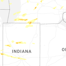

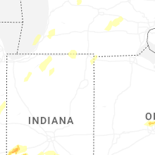


Connect with Interactive Hail Maps