

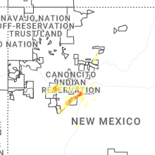
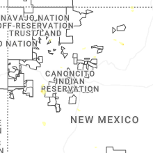
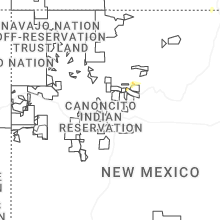
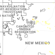
Hail Map for White Rock, NM
The White Rock, NM area has had 0 reports of on-the-ground hail by trained spotters, and has been under severe weather warnings 0 times during the past 12 months. Doppler radar has detected hail at or near White Rock, NM on 29 occasions, including 3 occasions during the past year.
| Name: | White Rock, NM |
| Where Located: | 54.5 miles SW of Taos, NM |
| Map: | Google Map for White Rock, NM |
| Population: | 5725 |
| Housing Units: | 2390 |
| More Info: | Search Google for White Rock, NM |
1
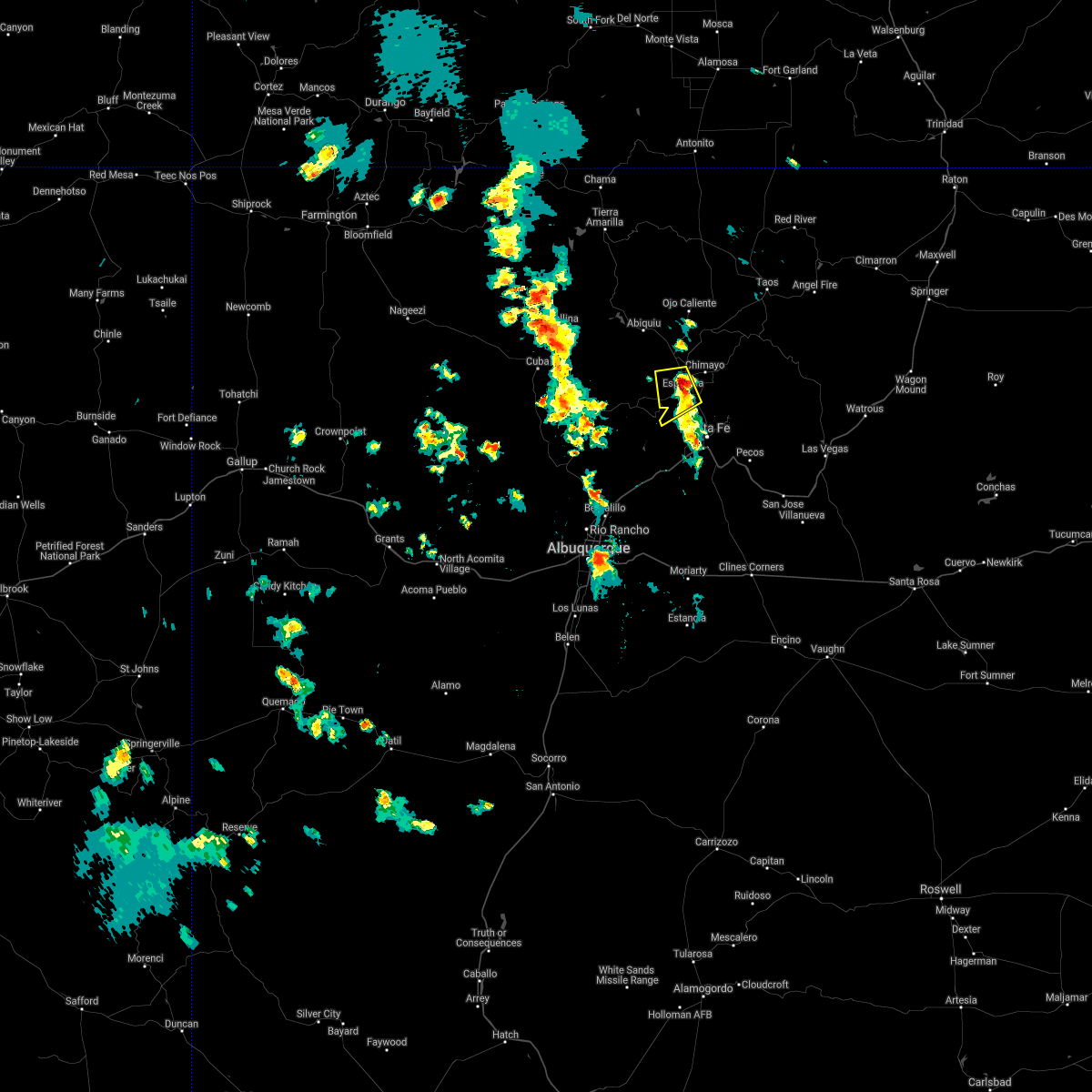
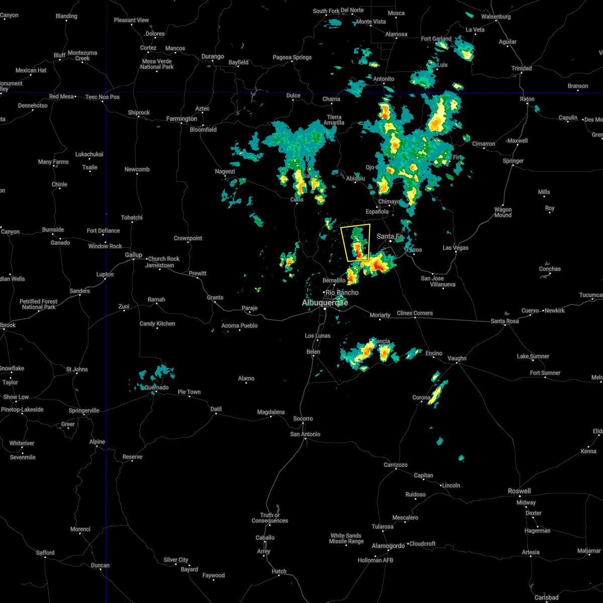
The Top Recent Hail Date for White Rock, NM is Sunday, September 28, 2025 (7th out of 29)
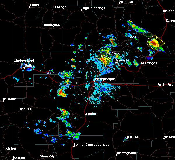
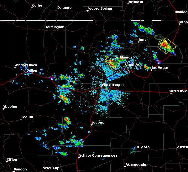
Hail and Wind Damage Spotted near White Rock, NM
| Date / Time | Report Details |
|---|---|
| 5/26/2025 2:04 PM MDT |
 the severe thunderstorm warning has been cancelled and is no longer in effect the severe thunderstorm warning has been cancelled and is no longer in effect
|
| 5/26/2025 1:52 PM MDT |
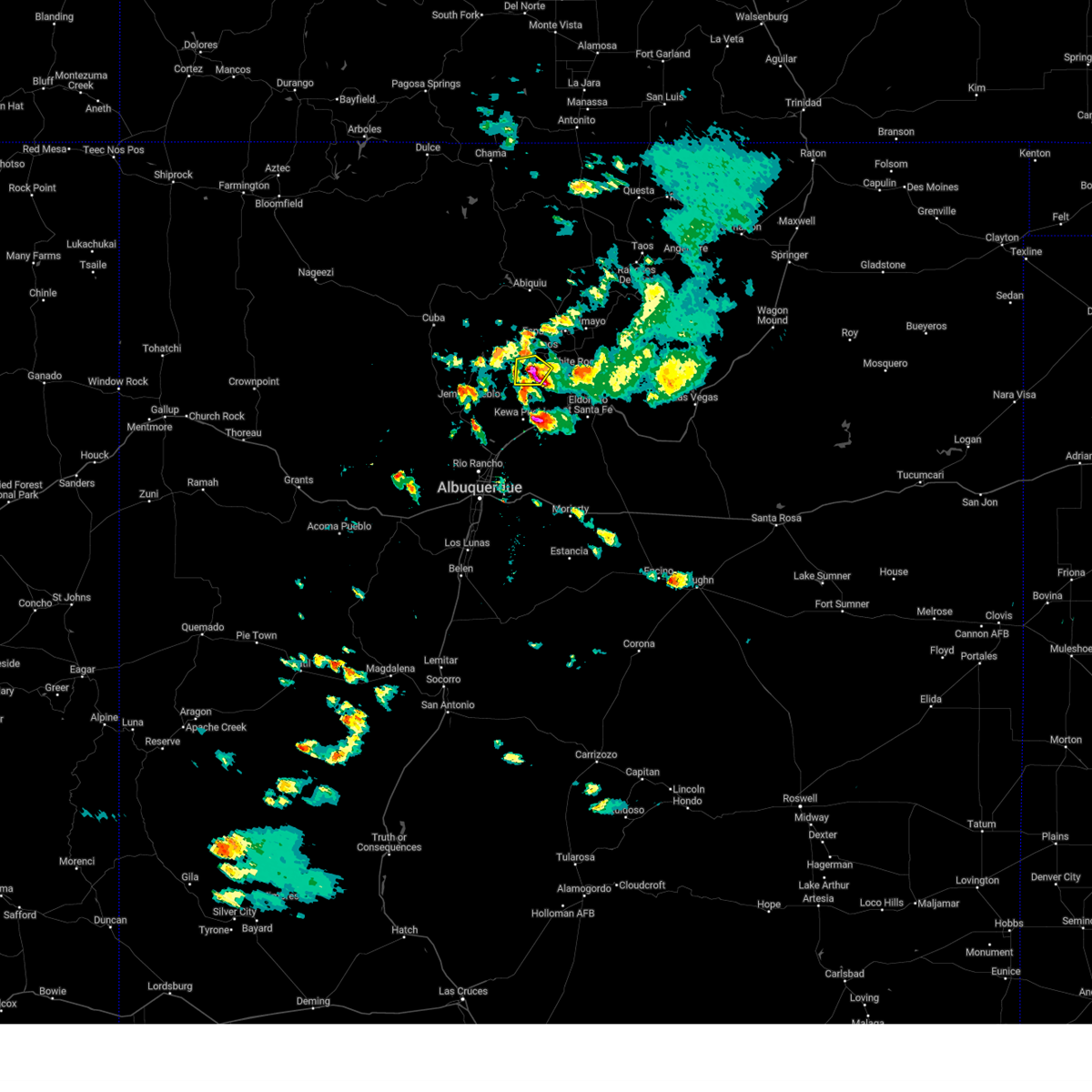
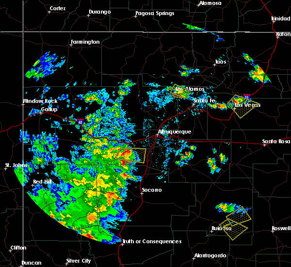
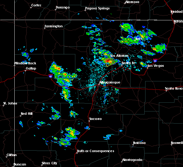
 At 152 pm mdt, a severe thunderstorm was located near frijoles, or 12 miles south of los alamos, moving east at 20 mph (radar indicated). Hazards include 60 mph wind gusts and quarter size hail. Hail damage to vehicles is expected. expect wind damage to roofs, siding, and trees. Locations impacted include, white rock, frijoles, bandelier national monument and cochiti lake. At 152 pm mdt, a severe thunderstorm was located near frijoles, or 12 miles south of los alamos, moving east at 20 mph (radar indicated). Hazards include 60 mph wind gusts and quarter size hail. Hail damage to vehicles is expected. expect wind damage to roofs, siding, and trees. Locations impacted include, white rock, frijoles, bandelier national monument and cochiti lake.
|
| 5/26/2025 1:41 PM MDT |
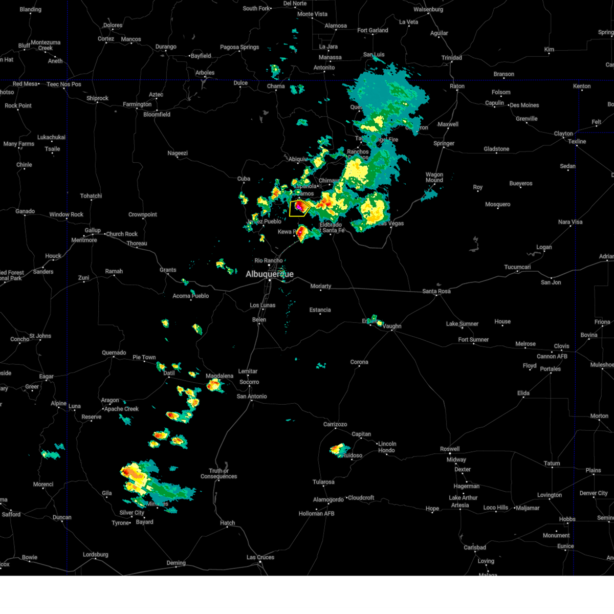
 Svrabq the national weather service in albuquerque has issued a * severe thunderstorm warning for, southern los alamos county in north central new mexico, east central sandoval county in north central new mexico, northwestern santa fe county in north central new mexico, * until 230 pm mdt. * at 141 pm mdt, a severe thunderstorm was located 8 miles north of cochiti lake, or 11 miles southwest of los alamos, moving east at 10 mph (radar indicated). Hazards include 60 mph wind gusts and quarter size hail. Hail damage to vehicles is expected. Expect wind damage to roofs, siding, and trees. Svrabq the national weather service in albuquerque has issued a * severe thunderstorm warning for, southern los alamos county in north central new mexico, east central sandoval county in north central new mexico, northwestern santa fe county in north central new mexico, * until 230 pm mdt. * at 141 pm mdt, a severe thunderstorm was located 8 miles north of cochiti lake, or 11 miles southwest of los alamos, moving east at 10 mph (radar indicated). Hazards include 60 mph wind gusts and quarter size hail. Hail damage to vehicles is expected. Expect wind damage to roofs, siding, and trees.
|
| 5/4/2025 3:10 PM MDT |
 the severe thunderstorm warning has been cancelled and is no longer in effect the severe thunderstorm warning has been cancelled and is no longer in effect
|
| 5/4/2025 3:00 PM MDT |
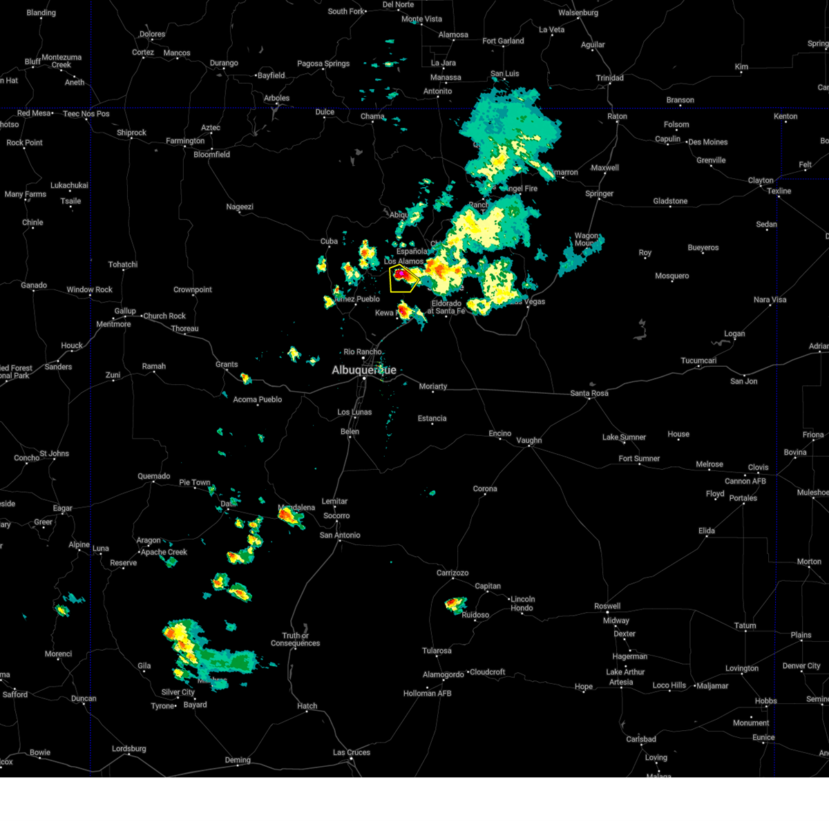
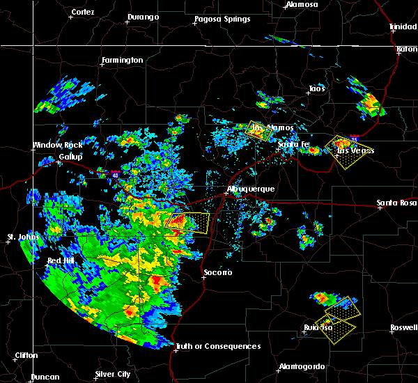
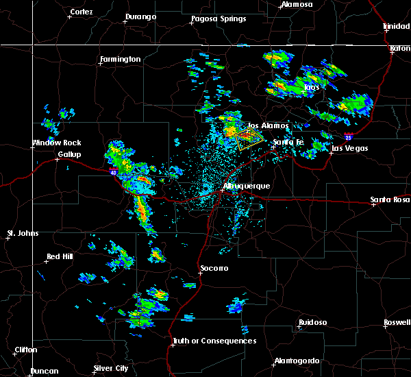
 At 300 pm mdt, a severe thunderstorm was located near los alamos, moving north at 35 mph (radar indicated). Hazards include 60 mph wind gusts and quarter size hail. Hail damage to vehicles is expected. expect wind damage to roofs, siding, and trees. Locations impacted include, los alamos and white rock. At 300 pm mdt, a severe thunderstorm was located near los alamos, moving north at 35 mph (radar indicated). Hazards include 60 mph wind gusts and quarter size hail. Hail damage to vehicles is expected. expect wind damage to roofs, siding, and trees. Locations impacted include, los alamos and white rock.
|
| 5/4/2025 2:44 PM MDT |
 Svrabq the national weather service in albuquerque has issued a * severe thunderstorm warning for, los alamos county in north central new mexico, southeastern rio arriba county in north central new mexico, east central sandoval county in north central new mexico, northwestern santa fe county in north central new mexico, * until 330 pm mdt. * at 244 pm mdt, a severe thunderstorm was located over frijoles, or 8 miles south of los alamos, moving north at 40 mph (radar indicated). Hazards include 60 mph wind gusts and quarter size hail. Hail damage to vehicles is expected. Expect wind damage to roofs, siding, and trees. Svrabq the national weather service in albuquerque has issued a * severe thunderstorm warning for, los alamos county in north central new mexico, southeastern rio arriba county in north central new mexico, east central sandoval county in north central new mexico, northwestern santa fe county in north central new mexico, * until 330 pm mdt. * at 244 pm mdt, a severe thunderstorm was located over frijoles, or 8 miles south of los alamos, moving north at 40 mph (radar indicated). Hazards include 60 mph wind gusts and quarter size hail. Hail damage to vehicles is expected. Expect wind damage to roofs, siding, and trees.
|
| 9/17/2024 3:42 PM MDT |
 The storm which prompted the warning has weakened below severe limits, and no longer poses an immediate threat to life or property. therefore, the warning will be allowed to expire. however, gusty winds are still possible with this thunderstorm. a severe thunderstorm watch remains in effect until 700 pm mdt for north central and northeastern new mexico. The storm which prompted the warning has weakened below severe limits, and no longer poses an immediate threat to life or property. therefore, the warning will be allowed to expire. however, gusty winds are still possible with this thunderstorm. a severe thunderstorm watch remains in effect until 700 pm mdt for north central and northeastern new mexico.
|
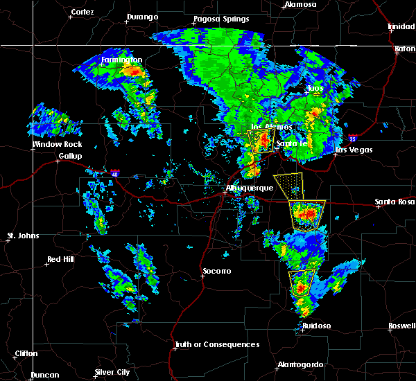
| 9/17/2024 3:21 PM MDT |
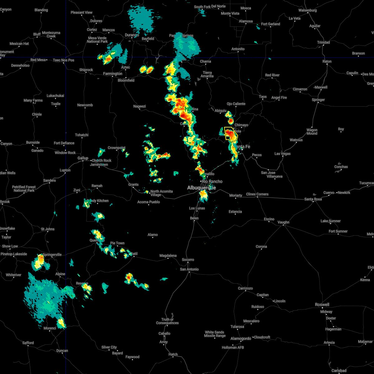
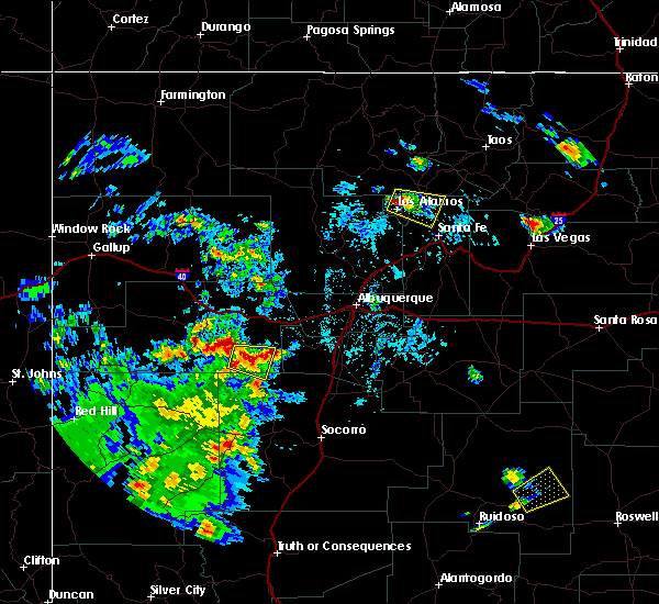
 At 320 pm mdt, a severe thunderstorm was located over pojoaque pueblo, or 7 miles south of espanola, moving northeast at 50 mph (radar indicated). Hazards include 60 mph wind gusts. Expect damage to roofs, siding, and trees. Locations impacted include, espanola, chimayo, white rock, pojoaque, santa clara pueblo, cuartelez, nambe pueblo, rio chiquito, embudo, and cundiyo. At 320 pm mdt, a severe thunderstorm was located over pojoaque pueblo, or 7 miles south of espanola, moving northeast at 50 mph (radar indicated). Hazards include 60 mph wind gusts. Expect damage to roofs, siding, and trees. Locations impacted include, espanola, chimayo, white rock, pojoaque, santa clara pueblo, cuartelez, nambe pueblo, rio chiquito, embudo, and cundiyo.
|
| 9/17/2024 3:21 PM MDT |
 the severe thunderstorm warning has been cancelled and is no longer in effect the severe thunderstorm warning has been cancelled and is no longer in effect
|
| 9/17/2024 3:08 PM MDT | Mesonet station twrn5 frijoles (tower in sandoval county NM, 4.4 miles ENE of White Rock, NM |
| 9/17/2024 3:02 PM MDT |
 Svrabq the national weather service in albuquerque has issued a * severe thunderstorm warning for, los alamos county in north central new mexico, northwestern san miguel county in northeastern new mexico, southeastern rio arriba county in north central new mexico, east central sandoval county in north central new mexico, northern santa fe county in north central new mexico, west central mora county in northeastern new mexico, * until 345 pm mdt. * at 301 pm mdt, a severe thunderstorm was located over white rock, or 7 miles south of los alamos, moving northeast at 45 mph (radar indicated). Hazards include 60 mph wind gusts and penny size hail. expect damage to roofs, siding, and trees Svrabq the national weather service in albuquerque has issued a * severe thunderstorm warning for, los alamos county in north central new mexico, northwestern san miguel county in northeastern new mexico, southeastern rio arriba county in north central new mexico, east central sandoval county in north central new mexico, northern santa fe county in north central new mexico, west central mora county in northeastern new mexico, * until 345 pm mdt. * at 301 pm mdt, a severe thunderstorm was located over white rock, or 7 miles south of los alamos, moving northeast at 45 mph (radar indicated). Hazards include 60 mph wind gusts and penny size hail. expect damage to roofs, siding, and trees
|
| 9/17/2024 12:11 PM MDT |
 Svrabq the national weather service in albuquerque has issued a * severe thunderstorm warning for, southwestern taos county in north central new mexico, eastern los alamos county in north central new mexico, northwestern san miguel county in northeastern new mexico, southeastern rio arriba county in north central new mexico, northern santa fe county in north central new mexico, west central mora county in northeastern new mexico, * until 115 pm mdt. * at 1210 pm mdt, severe thunderstorms were located along a line extending from near los alamos to la bajada, moving northeast at 45 mph (radar indicated). Hazards include 60 mph wind gusts. expect damage to roofs, siding, and trees Svrabq the national weather service in albuquerque has issued a * severe thunderstorm warning for, southwestern taos county in north central new mexico, eastern los alamos county in north central new mexico, northwestern san miguel county in northeastern new mexico, southeastern rio arriba county in north central new mexico, northern santa fe county in north central new mexico, west central mora county in northeastern new mexico, * until 115 pm mdt. * at 1210 pm mdt, severe thunderstorms were located along a line extending from near los alamos to la bajada, moving northeast at 45 mph (radar indicated). Hazards include 60 mph wind gusts. expect damage to roofs, siding, and trees
|
| 9/5/2024 4:29 PM MDT |
 The storm which prompted the warning has weakened below severe limits, and no longer poses an immediate threat to life or property. therefore, the warning will be allowed to expire. however, small hail, gusty winds and heavy rain are still possible with this thunderstorm. The storm which prompted the warning has weakened below severe limits, and no longer poses an immediate threat to life or property. therefore, the warning will be allowed to expire. however, small hail, gusty winds and heavy rain are still possible with this thunderstorm.
|
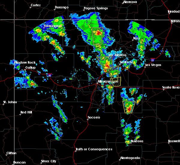
| 9/5/2024 4:17 PM MDT |
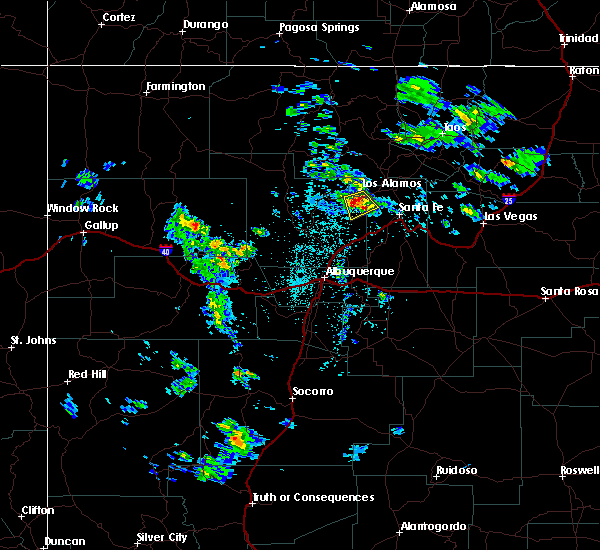
 At 417 pm mdt, a severe thunderstorm was located near frijoles, or 11 miles south of los alamos, moving southeast at 5 mph (radar indicated). Hazards include 60 mph wind gusts and penny size hail. Expect damage to roofs, siding, and trees. Locations impacted include, white rock, bandelier national monument, and frijoles. At 417 pm mdt, a severe thunderstorm was located near frijoles, or 11 miles south of los alamos, moving southeast at 5 mph (radar indicated). Hazards include 60 mph wind gusts and penny size hail. Expect damage to roofs, siding, and trees. Locations impacted include, white rock, bandelier national monument, and frijoles.
|
| 9/5/2024 4:04 PM MDT |
 At 404 pm mdt, a severe thunderstorm was located over frijoles, or 9 miles south of los alamos, moving southeast at 5 mph (radar indicated). Hazards include ping pong ball size hail and 60 mph wind gusts. People and animals outdoors will be injured. expect hail damage to roofs, siding, windows, and vehicles. expect wind damage to roofs, siding, and trees. Locations impacted include, white rock, bandelier national monument, and frijoles. At 404 pm mdt, a severe thunderstorm was located over frijoles, or 9 miles south of los alamos, moving southeast at 5 mph (radar indicated). Hazards include ping pong ball size hail and 60 mph wind gusts. People and animals outdoors will be injured. expect hail damage to roofs, siding, windows, and vehicles. expect wind damage to roofs, siding, and trees. Locations impacted include, white rock, bandelier national monument, and frijoles.
|
| 9/5/2024 3:52 PM MDT |
 At 352 pm mdt, a severe thunderstorm was located over frijoles, or 8 miles south of los alamos, moving southeast at 5 mph (radar indicated). Hazards include 60 mph wind gusts and half dollar size hail. Hail damage to vehicles is expected. expect wind damage to roofs, siding, and trees. Locations impacted include, los alamos, white rock, bandelier national monument, and frijoles. At 352 pm mdt, a severe thunderstorm was located over frijoles, or 8 miles south of los alamos, moving southeast at 5 mph (radar indicated). Hazards include 60 mph wind gusts and half dollar size hail. Hail damage to vehicles is expected. expect wind damage to roofs, siding, and trees. Locations impacted include, los alamos, white rock, bandelier national monument, and frijoles.
|
| 9/5/2024 3:40 PM MDT |
 Svrabq the national weather service in albuquerque has issued a * severe thunderstorm warning for, southern los alamos county in north central new mexico, east central sandoval county in north central new mexico, northwestern santa fe county in north central new mexico, * until 430 pm mdt. * at 340 pm mdt, a severe thunderstorm was located near los alamos, moving southeast at 5 mph (radar indicated). Hazards include 60 mph wind gusts and quarter size hail. Hail damage to vehicles is expected. Expect wind damage to roofs, siding, and trees. Svrabq the national weather service in albuquerque has issued a * severe thunderstorm warning for, southern los alamos county in north central new mexico, east central sandoval county in north central new mexico, northwestern santa fe county in north central new mexico, * until 430 pm mdt. * at 340 pm mdt, a severe thunderstorm was located near los alamos, moving southeast at 5 mph (radar indicated). Hazards include 60 mph wind gusts and quarter size hail. Hail damage to vehicles is expected. Expect wind damage to roofs, siding, and trees.
|
| 6/29/2024 10:19 PM MDT |
 The storm which prompted the warning has moved out of the area. therefore, the warning has been allowed to expire. however, heavy rain and flash flooding is still possible within the area. The storm which prompted the warning has moved out of the area. therefore, the warning has been allowed to expire. however, heavy rain and flash flooding is still possible within the area.
|
| 6/29/2024 9:30 PM MDT |
 Svrabq the national weather service in albuquerque has issued a * severe thunderstorm warning for, east central sandoval county in north central new mexico, west central santa fe county in north central new mexico, * until 1015 pm mdt. * at 929 pm mdt, a severe thunderstorm was located near kewa pueblo, or 18 miles northeast of bernalillo, moving north at 25 mph (radar indicated). Hazards include 60 mph wind gusts. expect damage to roofs, siding, and trees Svrabq the national weather service in albuquerque has issued a * severe thunderstorm warning for, east central sandoval county in north central new mexico, west central santa fe county in north central new mexico, * until 1015 pm mdt. * at 929 pm mdt, a severe thunderstorm was located near kewa pueblo, or 18 miles northeast of bernalillo, moving north at 25 mph (radar indicated). Hazards include 60 mph wind gusts. expect damage to roofs, siding, and trees
|
| 6/19/2024 4:02 PM MDT |
 the severe thunderstorm warning has been cancelled and is no longer in effect the severe thunderstorm warning has been cancelled and is no longer in effect
|
| 6/19/2024 3:44 PM MDT |
 At 344 pm mdt, a severe thunderstorm was located near white rock, or 10 miles southeast of los alamos, moving north at 40 mph (radar indicated). Hazards include 60 mph wind gusts and quarter size hail. Hail damage to vehicles is expected. expect wind damage to roofs, siding, and trees. Locations impacted include, northern santa fe, los alamos, espanola, chimayo, white rock, pojoaque, santa clara pueblo, cuartelez, nambe pueblo, and rio chiquito. At 344 pm mdt, a severe thunderstorm was located near white rock, or 10 miles southeast of los alamos, moving north at 40 mph (radar indicated). Hazards include 60 mph wind gusts and quarter size hail. Hail damage to vehicles is expected. expect wind damage to roofs, siding, and trees. Locations impacted include, northern santa fe, los alamos, espanola, chimayo, white rock, pojoaque, santa clara pueblo, cuartelez, nambe pueblo, and rio chiquito.
|
| 6/19/2024 3:28 PM MDT |
 Svrabq the national weather service in albuquerque has issued a * severe thunderstorm warning for, los alamos county in north central new mexico, southeastern rio arriba county in north central new mexico, east central sandoval county in north central new mexico, northwestern santa fe county in north central new mexico, * until 430 pm mdt. * at 327 pm mdt, a severe thunderstorm was located near la cienega, or 9 miles west of santa fe, moving north at 45 mph (radar indicated). Hazards include 60 mph wind gusts and quarter size hail. Hail damage to vehicles is expected. Expect wind damage to roofs, siding, and trees. Svrabq the national weather service in albuquerque has issued a * severe thunderstorm warning for, los alamos county in north central new mexico, southeastern rio arriba county in north central new mexico, east central sandoval county in north central new mexico, northwestern santa fe county in north central new mexico, * until 430 pm mdt. * at 327 pm mdt, a severe thunderstorm was located near la cienega, or 9 miles west of santa fe, moving north at 45 mph (radar indicated). Hazards include 60 mph wind gusts and quarter size hail. Hail damage to vehicles is expected. Expect wind damage to roofs, siding, and trees.
|
| 6/14/2024 6:37 PM MDT |
 At 636 pm mdt, a severe thunderstorm was located near santa fe, moving northeast at 40 mph (radar indicated). Hazards include 60 mph wind gusts. Expect damage to roofs, siding, and trees. Locations impacted include, santa fe, los alamos, white rock, pojoaque, eldorado at santa fe, cerrillos hills state park, canada de los alamos, glorieta, frijoles, and bandelier national monument. At 636 pm mdt, a severe thunderstorm was located near santa fe, moving northeast at 40 mph (radar indicated). Hazards include 60 mph wind gusts. Expect damage to roofs, siding, and trees. Locations impacted include, santa fe, los alamos, white rock, pojoaque, eldorado at santa fe, cerrillos hills state park, canada de los alamos, glorieta, frijoles, and bandelier national monument.
|
| 6/14/2024 5:50 PM MDT |
 Svrabq the national weather service in albuquerque has issued a * severe thunderstorm warning for, southeastern los alamos county in north central new mexico, east central sandoval county in north central new mexico, central santa fe county in north central new mexico, * until 645 pm mdt. * at 550 pm mdt, a severe thunderstorm was located over san felipe pueblo, or 10 miles northeast of bernalillo, moving east at 55 mph (radar indicated). Hazards include 60 mph wind gusts. expect damage to roofs, siding, and trees Svrabq the national weather service in albuquerque has issued a * severe thunderstorm warning for, southeastern los alamos county in north central new mexico, east central sandoval county in north central new mexico, central santa fe county in north central new mexico, * until 645 pm mdt. * at 550 pm mdt, a severe thunderstorm was located over san felipe pueblo, or 10 miles northeast of bernalillo, moving east at 55 mph (radar indicated). Hazards include 60 mph wind gusts. expect damage to roofs, siding, and trees
|
| 7/20/2021 4:33 PM MDT |
 At 432 pm mdt, a severe thunderstorm was located near santa clara pueblo, or 7 miles southwest of espanola, moving west at 15 mph (radar indicated). Hazards include 60 mph wind gusts and quarter size hail. Hail damage to vehicles is expected. expect wind damage to roofs, siding, and trees. Locations impacted include, pojoaque, santa clara pueblo, pojoaque pueblo, san ildefonso pueblo, el rancho, jaconita and jacona. At 432 pm mdt, a severe thunderstorm was located near santa clara pueblo, or 7 miles southwest of espanola, moving west at 15 mph (radar indicated). Hazards include 60 mph wind gusts and quarter size hail. Hail damage to vehicles is expected. expect wind damage to roofs, siding, and trees. Locations impacted include, pojoaque, santa clara pueblo, pojoaque pueblo, san ildefonso pueblo, el rancho, jaconita and jacona.
|
| 7/20/2021 4:21 PM MDT |
 At 421 pm mdt, a severe thunderstorm was located over santa clara pueblo, or near espanola, moving west at 10 mph (radar indicated). Hazards include 60 mph wind gusts and quarter size hail. Hail damage to vehicles is expected. Expect wind damage to roofs, siding, and trees. At 421 pm mdt, a severe thunderstorm was located over santa clara pueblo, or near espanola, moving west at 10 mph (radar indicated). Hazards include 60 mph wind gusts and quarter size hail. Hail damage to vehicles is expected. Expect wind damage to roofs, siding, and trees.
|
| 5/22/2021 3:34 PM MDT |
 At 334 pm mdt, a severe thunderstorm was located near white rock, or near los alamos, moving north at 20 mph (radar indicated). Hazards include 60 mph wind gusts and half dollar size hail. Hail damage to vehicles is expected. Expect wind damage to roofs, siding, and trees. At 334 pm mdt, a severe thunderstorm was located near white rock, or near los alamos, moving north at 20 mph (radar indicated). Hazards include 60 mph wind gusts and half dollar size hail. Hail damage to vehicles is expected. Expect wind damage to roofs, siding, and trees.
|
| 5/17/2021 12:52 PM MDT |
 At 1252 pm mdt, a severe thunderstorm was located over cochiti pueblo, or 20 miles west of santa fe, moving north at 10 mph (radar indicated). Hazards include 60 mph wind gusts and quarter size hail. Hail damage to vehicles is expected. Expect wind damage to roofs, siding, and trees. At 1252 pm mdt, a severe thunderstorm was located over cochiti pueblo, or 20 miles west of santa fe, moving north at 10 mph (radar indicated). Hazards include 60 mph wind gusts and quarter size hail. Hail damage to vehicles is expected. Expect wind damage to roofs, siding, and trees.
|
| 6/23/2020 1:54 PM MDT |
 At 154 pm mdt, severe thunderstorms were located along a line extending from 9 miles west of frijoles to near cochiti lake, moving south at 10 mph (radar indicated). Hazards include 60 mph wind gusts and quarter size hail. Hail damage to vehicles is expected. expect wind damage to roofs, siding, and trees. Locations impacted include, white rock, bandelier national monument, cochiti lake and frijoles. At 154 pm mdt, severe thunderstorms were located along a line extending from 9 miles west of frijoles to near cochiti lake, moving south at 10 mph (radar indicated). Hazards include 60 mph wind gusts and quarter size hail. Hail damage to vehicles is expected. expect wind damage to roofs, siding, and trees. Locations impacted include, white rock, bandelier national monument, cochiti lake and frijoles.
|
| 6/23/2020 1:33 PM MDT |
 At 132 pm mdt, severe thunderstorms were located along a line extending from 6 miles southwest of los alamos to near frijoles, moving southeast at 10 mph (radar indicated). Hazards include 60 mph wind gusts and quarter size hail. Hail damage to vehicles is expected. Expect wind damage to roofs, siding, and trees. At 132 pm mdt, severe thunderstorms were located along a line extending from 6 miles southwest of los alamos to near frijoles, moving southeast at 10 mph (radar indicated). Hazards include 60 mph wind gusts and quarter size hail. Hail damage to vehicles is expected. Expect wind damage to roofs, siding, and trees.
|
| 8/18/2018 12:57 PM MDT |
 At 1257 pm mdt, a severe thunderstorm was located over frijoles, or near los alamos, moving southeast at 20 mph (radar indicated). Hazards include 60 mph wind gusts and quarter size hail. Hail damage to vehicles is expected. Expect wind damage to roofs, siding, and trees. At 1257 pm mdt, a severe thunderstorm was located over frijoles, or near los alamos, moving southeast at 20 mph (radar indicated). Hazards include 60 mph wind gusts and quarter size hail. Hail damage to vehicles is expected. Expect wind damage to roofs, siding, and trees.
|
| 5/21/2018 4:23 PM MDT |
 The severe thunderstorm warning for south central taos, eastern los alamos, southeastern rio arriba and northern santa fe counties will expire at 430 pm mdt, the storms which prompted the warning have weakened below severe limits, and no longer pose an immediate threat to life or property. therefore the warning will be allowed to expire. however gusty winds are still possible with these thunderstorms. a severe thunderstorm watch remains in effect until 700 pm mdt for north central new mexico. The severe thunderstorm warning for south central taos, eastern los alamos, southeastern rio arriba and northern santa fe counties will expire at 430 pm mdt, the storms which prompted the warning have weakened below severe limits, and no longer pose an immediate threat to life or property. therefore the warning will be allowed to expire. however gusty winds are still possible with these thunderstorms. a severe thunderstorm watch remains in effect until 700 pm mdt for north central new mexico.
|
| 5/21/2018 4:07 PM MDT |
 At 407 pm mdt, severe thunderstorms were located along a line extending from 7 miles north of los alamos to near rio en medio in santa fe county, moving northeast at 35 mph (radar indicated). Hazards include 60 mph wind gusts. Expect damage to roofs, siding, and trees. locations impacted include, santa fe, los alamos, espanola, white rock, pojoaque, chimayo, santa clara pueblo, cuartelez, nambe pueblo and rio chiquito. this includes the following highways, interstate 25 between mile markers 268 and 281. Highway 285 between mile markers 337 and 349. At 407 pm mdt, severe thunderstorms were located along a line extending from 7 miles north of los alamos to near rio en medio in santa fe county, moving northeast at 35 mph (radar indicated). Hazards include 60 mph wind gusts. Expect damage to roofs, siding, and trees. locations impacted include, santa fe, los alamos, espanola, white rock, pojoaque, chimayo, santa clara pueblo, cuartelez, nambe pueblo and rio chiquito. this includes the following highways, interstate 25 between mile markers 268 and 281. Highway 285 between mile markers 337 and 349.
|
| 5/21/2018 3:44 PM MDT |
 At 344 pm mdt, severe thunderstorms were located along a line extending from 7 miles southwest of los alamos to 8 miles southeast of white rock, moving northeast at 45 mph (radar indicated). Hazards include 60 mph wind gusts and quarter size hail. Hail damage to vehicles is expected. Expect wind damage to roofs, siding, and trees. At 344 pm mdt, severe thunderstorms were located along a line extending from 7 miles southwest of los alamos to 8 miles southeast of white rock, moving northeast at 45 mph (radar indicated). Hazards include 60 mph wind gusts and quarter size hail. Hail damage to vehicles is expected. Expect wind damage to roofs, siding, and trees.
|
| 6/25/2017 5:27 PM MDT |
 At 526 pm mdt, a severe thunderstorm was located near cochiti lake, or 12 miles south of los alamos, moving south at 45 mph (radar indicated). Hazards include 60 mph wind gusts and quarter size hail. Hail damage to vehicles is expected. Expect wind damage to roofs, siding, and trees. At 526 pm mdt, a severe thunderstorm was located near cochiti lake, or 12 miles south of los alamos, moving south at 45 mph (radar indicated). Hazards include 60 mph wind gusts and quarter size hail. Hail damage to vehicles is expected. Expect wind damage to roofs, siding, and trees.
|
| 6/25/2017 4:36 PM MDT |
 At 436 pm mdt, a severe thunderstorm was located near frijoles, or 13 miles southeast of los alamos, moving southeast at 20 mph (radar indicated). Hazards include 60 mph wind gusts and half dollar size hail. Hail damage to vehicles is expected. Expect wind damage to roofs, siding, and trees. At 436 pm mdt, a severe thunderstorm was located near frijoles, or 13 miles southeast of los alamos, moving southeast at 20 mph (radar indicated). Hazards include 60 mph wind gusts and half dollar size hail. Hail damage to vehicles is expected. Expect wind damage to roofs, siding, and trees.
|
| 6/25/2017 3:40 PM MDT |
 The severe thunderstorm warning for northeastern los alamos, south central rio arriba, east central sandoval and northwestern santa fe counties will expire at 345 pm mdt, the storm which prompted the warning has weakened below severe limits, and no longer pose an immediate threat to life or property. therefore the warning will be allowed to expire. however small hail and gusty winds are still possible with this thunderstorm. a severe thunderstorm watch remains in effect until 1000 pm mdt for north central new mexico. The severe thunderstorm warning for northeastern los alamos, south central rio arriba, east central sandoval and northwestern santa fe counties will expire at 345 pm mdt, the storm which prompted the warning has weakened below severe limits, and no longer pose an immediate threat to life or property. therefore the warning will be allowed to expire. however small hail and gusty winds are still possible with this thunderstorm. a severe thunderstorm watch remains in effect until 1000 pm mdt for north central new mexico.
|
| 6/25/2017 3:34 PM MDT |
 At 334 pm mdt, a severe thunderstorm was located near santa clara pueblo, or near espanola, moving east at 15 mph (radar indicated). Hazards include 60 mph wind gusts and quarter size hail. Hail damage to vehicles is expected. expect wind damage to roofs, siding, and trees. Locations impacted include, los alamos, white rock, san ildefonso pueblo and el rancho. At 334 pm mdt, a severe thunderstorm was located near santa clara pueblo, or near espanola, moving east at 15 mph (radar indicated). Hazards include 60 mph wind gusts and quarter size hail. Hail damage to vehicles is expected. expect wind damage to roofs, siding, and trees. Locations impacted include, los alamos, white rock, san ildefonso pueblo and el rancho.
|
| 6/25/2017 3:03 PM MDT |
 At 303 pm mdt, a severe thunderstorm was located near los alamos, moving east at 15 mph (radar indicated). Hazards include ping pong ball size hail and 60 mph wind gusts. People and animals outdoors will be injured. expect hail damage to roofs, siding, windows, and vehicles. Expect wind damage to roofs, siding, and trees. At 303 pm mdt, a severe thunderstorm was located near los alamos, moving east at 15 mph (radar indicated). Hazards include ping pong ball size hail and 60 mph wind gusts. People and animals outdoors will be injured. expect hail damage to roofs, siding, windows, and vehicles. Expect wind damage to roofs, siding, and trees.
|
| 6/6/2017 1:08 PM MDT |
 The severe thunderstorm warning for southern los alamos, east central sandoval and northwestern santa fe counties will expire at 115 pm mdt, the storm which prompted the warning has weakened below severe limits, and no longer pose an immediate threat to life or property. therefore the warning will be allowed to expire. however small hail and gusty winds are still possible with this thunderstorm. The severe thunderstorm warning for southern los alamos, east central sandoval and northwestern santa fe counties will expire at 115 pm mdt, the storm which prompted the warning has weakened below severe limits, and no longer pose an immediate threat to life or property. therefore the warning will be allowed to expire. however small hail and gusty winds are still possible with this thunderstorm.
|
| 6/6/2017 1:02 PM MDT |
 At 101 pm mdt, a severe thunderstorm was located near frijoles, or near los alamos, and is nearly stationary (radar indicated). Hazards include 60 mph wind gusts and quarter size hail. Hail damage to vehicles is expected. expect wind damage to roofs, siding, and trees. Locations impacted include, los alamos, white rock, bandelier national monument and frijoles. At 101 pm mdt, a severe thunderstorm was located near frijoles, or near los alamos, and is nearly stationary (radar indicated). Hazards include 60 mph wind gusts and quarter size hail. Hail damage to vehicles is expected. expect wind damage to roofs, siding, and trees. Locations impacted include, los alamos, white rock, bandelier national monument and frijoles.
|
| 6/6/2017 12:48 PM MDT |
 At 1247 pm mdt, a severe thunderstorm was located near bandelier national monument, or near los alamos, and is nearly stationary (radar indicated). Hazards include 60 mph wind gusts and quarter size hail. Hail damage to vehicles is expected. Expect wind damage to roofs, siding, and trees. At 1247 pm mdt, a severe thunderstorm was located near bandelier national monument, or near los alamos, and is nearly stationary (radar indicated). Hazards include 60 mph wind gusts and quarter size hail. Hail damage to vehicles is expected. Expect wind damage to roofs, siding, and trees.
|
| 5/9/2017 1:50 PM MDT |
 The severe thunderstorm warning for southern los alamos, east central sandoval and northwestern santa fe counties will expire at 200 pm mdt, the storm which prompted the warning has weakened below severe limits, and no longer pose an immediate threat to life or property. therefore the warning will be allowed to expire. however heavy rain and small hail is still possible with this thunderstorm. a severe thunderstorm watch remains in effect until 600 pm mdt for north central new mexico. to report severe weather, contact your nearest law enforcement agency. they will relay your report to the national weather service albuquerque. The severe thunderstorm warning for southern los alamos, east central sandoval and northwestern santa fe counties will expire at 200 pm mdt, the storm which prompted the warning has weakened below severe limits, and no longer pose an immediate threat to life or property. therefore the warning will be allowed to expire. however heavy rain and small hail is still possible with this thunderstorm. a severe thunderstorm watch remains in effect until 600 pm mdt for north central new mexico. to report severe weather, contact your nearest law enforcement agency. they will relay your report to the national weather service albuquerque.
|
| 5/9/2017 1:34 PM MDT |
 At 134 pm mdt, a severe thunderstorm was located near white rock, or 11 miles southeast of los alamos, moving north at 35 mph (radar indicated). Hazards include 60 mph wind gusts and quarter size hail. Hail damage to vehicles is expected. expect wind damage to roofs, siding, and trees. Locations impacted include, white rock, bandelier national monument and frijoles. At 134 pm mdt, a severe thunderstorm was located near white rock, or 11 miles southeast of los alamos, moving north at 35 mph (radar indicated). Hazards include 60 mph wind gusts and quarter size hail. Hail damage to vehicles is expected. expect wind damage to roofs, siding, and trees. Locations impacted include, white rock, bandelier national monument and frijoles.
|
| 5/9/2017 1:17 PM MDT |
 At 117 pm mdt, a severe thunderstorm was located near la bajada, or 14 miles west of santa fe, moving north at 35 mph (radar indicated). Hazards include 60 mph wind gusts and quarter size hail. Hail damage to vehicles is expected. Expect wind damage to roofs, siding, and trees. At 117 pm mdt, a severe thunderstorm was located near la bajada, or 14 miles west of santa fe, moving north at 35 mph (radar indicated). Hazards include 60 mph wind gusts and quarter size hail. Hail damage to vehicles is expected. Expect wind damage to roofs, siding, and trees.
|
| 5/9/2017 12:47 PM MDT |
 At 1247 pm mdt, a severe thunderstorm was located near white rock, or 11 miles southeast of los alamos, moving north at 35 mph (radar indicated). Hazards include 60 mph wind gusts and quarter size hail. Hail damage to vehicles is expected. expect wind damage to roofs, siding, and trees. Locations impacted include, los alamos, white rock, pojoaque, frijoles, bandelier national monument, pojoaque pueblo, san ildefonso pueblo, el rancho, cuyamungue and jaconita. At 1247 pm mdt, a severe thunderstorm was located near white rock, or 11 miles southeast of los alamos, moving north at 35 mph (radar indicated). Hazards include 60 mph wind gusts and quarter size hail. Hail damage to vehicles is expected. expect wind damage to roofs, siding, and trees. Locations impacted include, los alamos, white rock, pojoaque, frijoles, bandelier national monument, pojoaque pueblo, san ildefonso pueblo, el rancho, cuyamungue and jaconita.
|
| 5/9/2017 12:13 PM MDT |
 At 1212 pm mdt, a severe thunderstorm was located near la cienega, or 13 miles southwest of santa fe, moving north at 30 mph (radar indicated). Hazards include 60 mph wind gusts and quarter size hail. Hail damage to vehicles is expected. Expect wind damage to roofs, siding, and trees. At 1212 pm mdt, a severe thunderstorm was located near la cienega, or 13 miles southwest of santa fe, moving north at 30 mph (radar indicated). Hazards include 60 mph wind gusts and quarter size hail. Hail damage to vehicles is expected. Expect wind damage to roofs, siding, and trees.
|
| 5/9/2017 11:32 AM MDT |
 At 1132 am mdt, a severe thunderstorm was located near cochiti pueblo, or 19 miles west of santa fe, moving north at 35 mph (radar indicated). Hazards include 60 mph wind gusts and half dollar size hail. Hail damage to vehicles is expected. Expect wind damage to roofs, siding, and trees. At 1132 am mdt, a severe thunderstorm was located near cochiti pueblo, or 19 miles west of santa fe, moving north at 35 mph (radar indicated). Hazards include 60 mph wind gusts and half dollar size hail. Hail damage to vehicles is expected. Expect wind damage to roofs, siding, and trees.
|
| 6/4/2016 7:37 PM MDT |
 The severe thunderstorm warning for northwestern santa fe county will expire at 745 pm mdt, the storm which prompted the warning has weakened below severe limits. therefore the warning will be allowed to expire. however small hail, .gusty winds, heavy rain, and flooding are still possible with this thunderstorm. The severe thunderstorm warning for northwestern santa fe county will expire at 745 pm mdt, the storm which prompted the warning has weakened below severe limits. therefore the warning will be allowed to expire. however small hail, .gusty winds, heavy rain, and flooding are still possible with this thunderstorm.
|
| 6/4/2016 7:23 PM MDT |
 At 723 pm mdt, a severe thunderstorm was located near pojoaque, or 10 miles south of espanola, moving south at 10 mph (radar indicated). Hazards include 60 mph wind gusts and penny size hail. Expect damage to roofs. siding. and trees. locations impacted include, white rock, pojoaque, pojoaque pueblo, nambe lake, el rancho, jacona, jaconita, cuyamungue and san ildefonso pueblo. other locations affected include the following location buckman river white rock canyon. T At 723 pm mdt, a severe thunderstorm was located near pojoaque, or 10 miles south of espanola, moving south at 10 mph (radar indicated). Hazards include 60 mph wind gusts and penny size hail. Expect damage to roofs. siding. and trees. locations impacted include, white rock, pojoaque, pojoaque pueblo, nambe lake, el rancho, jacona, jaconita, cuyamungue and san ildefonso pueblo. other locations affected include the following location buckman river white rock canyon. T
|
| 6/4/2016 6:59 PM MDT |
 At 659 pm mdt, a severe thunderstorm was located over pojoaque, or 6 miles south of espanola, moving south at 10 mph (radar indicated). Hazards include quarter size hail and 60 mph wind gusts. Hail damage to vehicles is expected. Expect wind damage to roofs, siding, and trees. At 659 pm mdt, a severe thunderstorm was located over pojoaque, or 6 miles south of espanola, moving south at 10 mph (radar indicated). Hazards include quarter size hail and 60 mph wind gusts. Hail damage to vehicles is expected. Expect wind damage to roofs, siding, and trees.
|
| 5/15/2016 3:22 PM MDT |
 At 322 pm mdt, a severe thunderstorm was located near white rock, or 7 miles east of los alamos, moving northeast at 30 mph (radar indicated). Hazards include quarter size hail and 60 mph wind gusts. Hail damage to vehicles is expected. expect wind damage to roofs, siding and trees. this severe thunderstorm will be near, san ildefonso pueblo around 330 pm mdt. el rancho, jaconita and jacona around 335 pm mdt. pojoaque, pojoaque pueblo, santa clara pueblo, nambe lake and cuyamungue around 340 pm mdt. Espanola, chimayo, sombrillo, cuartelez, la puebla, santa cruz, cundiyo, nambe pueblo, rio chiquito and ohkay owingeh pueblo around 345 pm mdt. At 322 pm mdt, a severe thunderstorm was located near white rock, or 7 miles east of los alamos, moving northeast at 30 mph (radar indicated). Hazards include quarter size hail and 60 mph wind gusts. Hail damage to vehicles is expected. expect wind damage to roofs, siding and trees. this severe thunderstorm will be near, san ildefonso pueblo around 330 pm mdt. el rancho, jaconita and jacona around 335 pm mdt. pojoaque, pojoaque pueblo, santa clara pueblo, nambe lake and cuyamungue around 340 pm mdt. Espanola, chimayo, sombrillo, cuartelez, la puebla, santa cruz, cundiyo, nambe pueblo, rio chiquito and ohkay owingeh pueblo around 345 pm mdt.
|
| 10/20/2015 2:35 PM MDT |
 At 235 pm mdt, a severe thunderstorm was located 6 miles north of white rock, or 6 miles east of los alamos, moving north at 35 mph (radar indicated). Hazards include 60 mph wind gusts and quarter size hail. Hail damage to vehicles is expected. expect wind damage to roofs, siding and trees. locations impacted include, los alamos, white rock and san ildefonso pueblo. Other locations affected include buckman river white rock canyon. At 235 pm mdt, a severe thunderstorm was located 6 miles north of white rock, or 6 miles east of los alamos, moving north at 35 mph (radar indicated). Hazards include 60 mph wind gusts and quarter size hail. Hail damage to vehicles is expected. expect wind damage to roofs, siding and trees. locations impacted include, los alamos, white rock and san ildefonso pueblo. Other locations affected include buckman river white rock canyon.
|
| 10/20/2015 2:23 PM MDT |
 At 222 pm mdt, a severe thunderstorm was located over white rock, or 7 miles southeast of los alamos, moving north at 35 mph (radar indicated). Hazards include quarter size hail and 60 mph wind gusts. Hail damage to vehicles is expected. Expect wind damage to roofs, siding and trees. At 222 pm mdt, a severe thunderstorm was located over white rock, or 7 miles southeast of los alamos, moving north at 35 mph (radar indicated). Hazards include quarter size hail and 60 mph wind gusts. Hail damage to vehicles is expected. Expect wind damage to roofs, siding and trees.
|
| 8/5/2013 6:00 PM MDT | Large pine tree blown over on garver lan in los alamos county NM, 1.4 miles SSE of White Rock, NM |
| 6/7/2013 3:45 PM MDT | White roc in santa fe county NM, 2.3 miles SE of White Rock, NM |
Hail Maps for White Rock, NM


Connect with Interactive Hail Maps