

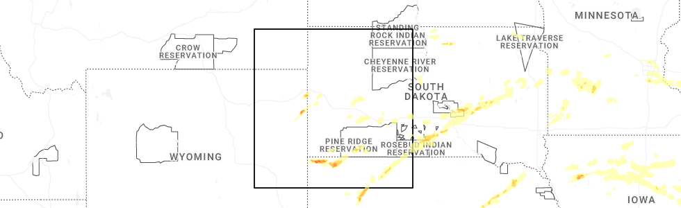
Hail Map for Whitewood, SD
The Whitewood, SD area has had 12 reports of on-the-ground hail by trained spotters, and has been under severe weather warnings 23 times during the past 12 months. Doppler radar has detected hail at or near Whitewood, SD on 96 occasions, including 11 occasions during the past year.
| Name: | Whitewood, SD |
| Where Located: | 33 miles NW of Rapid City, SD |
| Map: | Google Map for Whitewood, SD |
| Population: | 927 |
| Housing Units: | 392 |
| More Info: | Search Google for Whitewood, SD |
1
The Top Recent Hail Date for Whitewood, SD is Friday, August 15, 2025 (30th out of 96)
Hail and Wind Damage Spotted near Whitewood, SD
| Date / Time | Report Details |
|---|---|
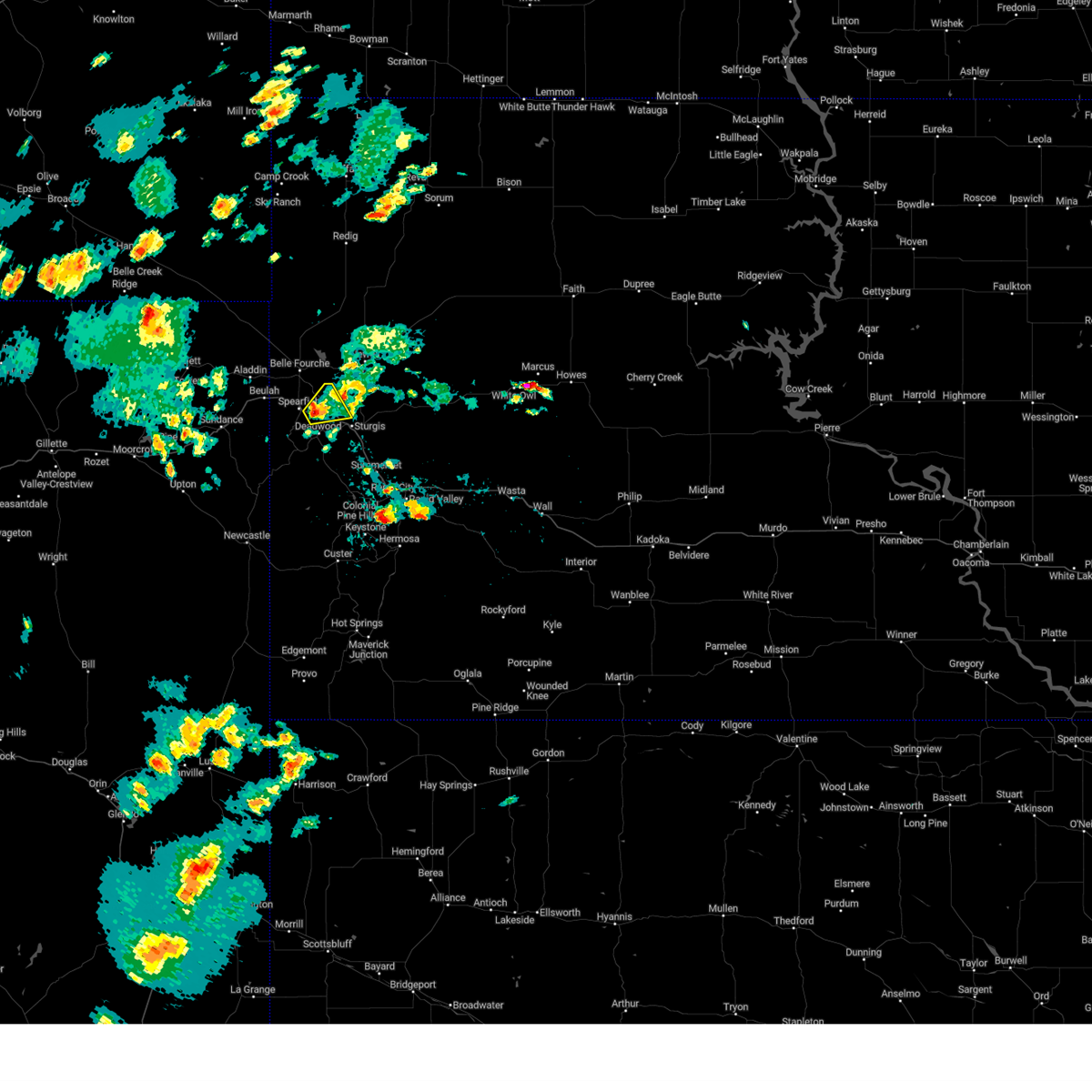
| 8/16/2025 10:17 PM MDT |
 Svrunr the national weather service in rapid city has issued a * severe thunderstorm warning for, southeastern harding county in northwestern south dakota, western butte county in northwestern south dakota, northern lawrence county in west central south dakota, * until 1045 pm mdt. * at 1017 pm mdt, severe thunderstorms were located along a line extending from 8 miles northeast of redig to 2 miles northwest of spearfish, moving northeast at 25 mph (radar indicated). Hazards include ping pong ball size hail and 60 mph wind gusts. People and animals outdoors will be injured. expect hail damage to roofs, siding, windows, and vehicles. Expect wind damage to roofs, siding, and trees. Svrunr the national weather service in rapid city has issued a * severe thunderstorm warning for, southeastern harding county in northwestern south dakota, western butte county in northwestern south dakota, northern lawrence county in west central south dakota, * until 1045 pm mdt. * at 1017 pm mdt, severe thunderstorms were located along a line extending from 8 miles northeast of redig to 2 miles northwest of spearfish, moving northeast at 25 mph (radar indicated). Hazards include ping pong ball size hail and 60 mph wind gusts. People and animals outdoors will be injured. expect hail damage to roofs, siding, windows, and vehicles. Expect wind damage to roofs, siding, and trees.
|
| 8/13/2025 4:04 PM MDT |
 At 403 pm mdt, severe thunderstorms were located along a line extending from 8 miles northeast of aladdin to 3 miles southeast of cheyenne crossing to 6 miles south of moon, moving east at 45 mph (radar indicated). Hazards include 60 to 70 mph wind gusts and localized quarter size hail. Expect considerable tree damage. damage is likely to mobile homes, roofs, and outbuildings. locations impacted include, spearfish, sturgis, belle fourche, lead, hill city, summerset, deadwood, whitewood, johnson siding, newell, nemo, keystone, nisland, piedmont, saint onge, vale, central city, hisega, silver city, and fruitdale. This includes interstate 90 in south dakota between mile markers 1 and 49. At 403 pm mdt, severe thunderstorms were located along a line extending from 8 miles northeast of aladdin to 3 miles southeast of cheyenne crossing to 6 miles south of moon, moving east at 45 mph (radar indicated). Hazards include 60 to 70 mph wind gusts and localized quarter size hail. Expect considerable tree damage. damage is likely to mobile homes, roofs, and outbuildings. locations impacted include, spearfish, sturgis, belle fourche, lead, hill city, summerset, deadwood, whitewood, johnson siding, newell, nemo, keystone, nisland, piedmont, saint onge, vale, central city, hisega, silver city, and fruitdale. This includes interstate 90 in south dakota between mile markers 1 and 49.
|
| 8/13/2025 4:04 PM MDT |
 the severe thunderstorm warning has been cancelled and is no longer in effect the severe thunderstorm warning has been cancelled and is no longer in effect
|
| 8/13/2025 3:43 PM MDT |
 Svrunr the national weather service in rapid city has issued a * severe thunderstorm warning for, southwestern butte county in northwestern south dakota, southwestern meade county in west central south dakota, lawrence county in west central south dakota, southwestern pennington county in west central south dakota, northeastern weston county in northeastern wyoming, eastern crook county in northeastern wyoming, * until 445 pm mdt. * at 342 pm mdt, severe thunderstorms were located along a line extending from 8 miles north of bear lodge campground to 5 miles northwest of o'neil pass to 3 miles west of newcastle, moving east at 50 mph (radar indicated). Hazards include 60 to 70 mph wind gusts. Expect considerable tree damage. Damage is likely to mobile homes, roofs, and outbuildings. Svrunr the national weather service in rapid city has issued a * severe thunderstorm warning for, southwestern butte county in northwestern south dakota, southwestern meade county in west central south dakota, lawrence county in west central south dakota, southwestern pennington county in west central south dakota, northeastern weston county in northeastern wyoming, eastern crook county in northeastern wyoming, * until 445 pm mdt. * at 342 pm mdt, severe thunderstorms were located along a line extending from 8 miles north of bear lodge campground to 5 miles northwest of o'neil pass to 3 miles west of newcastle, moving east at 50 mph (radar indicated). Hazards include 60 to 70 mph wind gusts. Expect considerable tree damage. Damage is likely to mobile homes, roofs, and outbuildings.
|
| 8/1/2025 7:40 PM MDT |
 the severe thunderstorm warning has been cancelled and is no longer in effect the severe thunderstorm warning has been cancelled and is no longer in effect
|
| 8/1/2025 7:31 PM MDT |
 At 731 pm mdt, a severe thunderstorm was located over terry peak, or over lead, moving north at 15 mph (radar indicated). Hazards include quarter size hail. Damage to vehicles is expected. locations impacted include, southeastern spearfish, lead, deadwood, whitewood, central city, brownsville, cheyenne crossing, galena, iron creek lake, apple springs, roubaix lake, roughlock falls, savoy, bridal veil falls, terry peak, and spearfish canyon. This includes interstate 90 in south dakota between mile markers 22 and 27. At 731 pm mdt, a severe thunderstorm was located over terry peak, or over lead, moving north at 15 mph (radar indicated). Hazards include quarter size hail. Damage to vehicles is expected. locations impacted include, southeastern spearfish, lead, deadwood, whitewood, central city, brownsville, cheyenne crossing, galena, iron creek lake, apple springs, roubaix lake, roughlock falls, savoy, bridal veil falls, terry peak, and spearfish canyon. This includes interstate 90 in south dakota between mile markers 22 and 27.
|
| 8/1/2025 7:08 PM MDT |
 Svrunr the national weather service in rapid city has issued a * severe thunderstorm warning for, lawrence county in west central south dakota, * until 815 pm mdt. * at 708 pm mdt, a severe thunderstorm was located 3 miles west of brownsville, or 6 miles south of lead, moving north at 15 mph (radar indicated). Hazards include quarter size hail. damage to vehicles is expected Svrunr the national weather service in rapid city has issued a * severe thunderstorm warning for, lawrence county in west central south dakota, * until 815 pm mdt. * at 708 pm mdt, a severe thunderstorm was located 3 miles west of brownsville, or 6 miles south of lead, moving north at 15 mph (radar indicated). Hazards include quarter size hail. damage to vehicles is expected
|
| 7/29/2025 10:41 PM MDT |
 the severe thunderstorm warning has been cancelled and is no longer in effect the severe thunderstorm warning has been cancelled and is no longer in effect
|
| 7/29/2025 10:26 PM MDT |
 At 1026 pm mdt, severe thunderstorms were located along a line extending from near sturgis to 5 miles north of o'neil pass, moving southeast at 25 mph (radar indicated). Hazards include 60 mph wind gusts and half dollar size hail. Hail damage to vehicles is expected. expect wind damage to roofs, siding, and trees. locations impacted include, southeastern spearfish, sturgis, lead, deadwood, whitewood, central city, brownsville, tilford, cheyenne crossing, galena, iron creek lake, apple springs, roughlock falls, savoy, bridal veil falls, fort meade, terry peak, and spearfish canyon. This includes interstate 90 in south dakota between mile markers 14 and 41. At 1026 pm mdt, severe thunderstorms were located along a line extending from near sturgis to 5 miles north of o'neil pass, moving southeast at 25 mph (radar indicated). Hazards include 60 mph wind gusts and half dollar size hail. Hail damage to vehicles is expected. expect wind damage to roofs, siding, and trees. locations impacted include, southeastern spearfish, sturgis, lead, deadwood, whitewood, central city, brownsville, tilford, cheyenne crossing, galena, iron creek lake, apple springs, roughlock falls, savoy, bridal veil falls, fort meade, terry peak, and spearfish canyon. This includes interstate 90 in south dakota between mile markers 14 and 41.
|
| 7/29/2025 10:26 PM MDT |
 the severe thunderstorm warning has been cancelled and is no longer in effect the severe thunderstorm warning has been cancelled and is no longer in effect
|
| 7/29/2025 10:16 PM MDT |
 Svrunr the national weather service in rapid city has issued a * severe thunderstorm warning for, western meade county in west central south dakota, lawrence county in west central south dakota, eastern crook county in northeastern wyoming, * until 1100 pm mdt. * at 1016 pm mdt, severe thunderstorms were located along a line extending from near whitewood to 2 miles southwest of cement ridge lookout, moving southeast at 20 mph (radar indicated). Hazards include 60 mph wind gusts and half dollar size hail. Hail damage to vehicles is expected. Expect wind damage to roofs, siding, and trees. Svrunr the national weather service in rapid city has issued a * severe thunderstorm warning for, western meade county in west central south dakota, lawrence county in west central south dakota, eastern crook county in northeastern wyoming, * until 1100 pm mdt. * at 1016 pm mdt, severe thunderstorms were located along a line extending from near whitewood to 2 miles southwest of cement ridge lookout, moving southeast at 20 mph (radar indicated). Hazards include 60 mph wind gusts and half dollar size hail. Hail damage to vehicles is expected. Expect wind damage to roofs, siding, and trees.
|
| 7/21/2025 6:27 PM MDT |
 At 627 pm mdt, a severe thunderstorm was located 6 miles northeast of whitewood, or 10 miles north of sturgis, moving east at 30 mph (radar indicated). Hazards include 60 mph wind gusts and quarter size hail. Hail damage to vehicles is expected. expect wind damage to roofs, siding, and trees. locations impacted include, sturgis, whitewood, saint onge, apple springs, bear butte state park, and fort meade. This includes interstate 90 in south dakota between mile markers 19 and 35. At 627 pm mdt, a severe thunderstorm was located 6 miles northeast of whitewood, or 10 miles north of sturgis, moving east at 30 mph (radar indicated). Hazards include 60 mph wind gusts and quarter size hail. Hail damage to vehicles is expected. expect wind damage to roofs, siding, and trees. locations impacted include, sturgis, whitewood, saint onge, apple springs, bear butte state park, and fort meade. This includes interstate 90 in south dakota between mile markers 19 and 35.
|
| 7/21/2025 6:15 PM MDT |
 At 615 pm mdt, a severe thunderstorm was located near whitewood, or 8 miles east of spearfish, moving east at 30 mph (radar indicated). Hazards include ping pong ball size hail and 60 mph wind gusts. People and animals outdoors will be injured. expect hail damage to roofs, siding, windows, and vehicles. expect wind damage to roofs, siding, and trees. locations impacted include, spearfish, sturgis, lead, deadwood, whitewood, saint onge, central city, bear butte state park, fort meade, apple springs, and northern spearfish canyon. This includes interstate 90 in south dakota between mile markers 10 and 37. At 615 pm mdt, a severe thunderstorm was located near whitewood, or 8 miles east of spearfish, moving east at 30 mph (radar indicated). Hazards include ping pong ball size hail and 60 mph wind gusts. People and animals outdoors will be injured. expect hail damage to roofs, siding, windows, and vehicles. expect wind damage to roofs, siding, and trees. locations impacted include, spearfish, sturgis, lead, deadwood, whitewood, saint onge, central city, bear butte state park, fort meade, apple springs, and northern spearfish canyon. This includes interstate 90 in south dakota between mile markers 10 and 37.
|
| 7/21/2025 6:09 PM MDT |
 Svrunr the national weather service in rapid city has issued a * severe thunderstorm warning for, southwestern meade county in west central south dakota, northern lawrence county in west central south dakota, * until 715 pm mdt. * at 609 pm mdt, a severe thunderstorm was located 4 miles east of spearfish, moving east at 30 mph (radar indicated). Hazards include 60 mph wind gusts and quarter size hail. Hail damage to vehicles is expected. Expect wind damage to roofs, siding, and trees. Svrunr the national weather service in rapid city has issued a * severe thunderstorm warning for, southwestern meade county in west central south dakota, northern lawrence county in west central south dakota, * until 715 pm mdt. * at 609 pm mdt, a severe thunderstorm was located 4 miles east of spearfish, moving east at 30 mph (radar indicated). Hazards include 60 mph wind gusts and quarter size hail. Hail damage to vehicles is expected. Expect wind damage to roofs, siding, and trees.
|
| 7/5/2025 8:15 PM MDT |
 At 815 pm mdt, severe thunderstorms were located along a line extending from 3 miles southeast of newell lake to 5 miles east of bear butte state park to 2 miles east of spearfish canyon, moving southeast at 40 mph (radar indicated). Hazards include 60 mph wind gusts. Expect damage to roofs, siding, and trees. locations impacted include, spearfish, sturgis, belle fourche, lead, summerset, deadwood, whitewood, newell, nisland, piedmont, saint onge, vale, central city, fruitdale, galena, tilford, bear butte state park, owl butte, fort meade, and belle fourche reservoir. This includes interstate 90 in south dakota between mile markers 6 and 49. At 815 pm mdt, severe thunderstorms were located along a line extending from 3 miles southeast of newell lake to 5 miles east of bear butte state park to 2 miles east of spearfish canyon, moving southeast at 40 mph (radar indicated). Hazards include 60 mph wind gusts. Expect damage to roofs, siding, and trees. locations impacted include, spearfish, sturgis, belle fourche, lead, summerset, deadwood, whitewood, newell, nisland, piedmont, saint onge, vale, central city, fruitdale, galena, tilford, bear butte state park, owl butte, fort meade, and belle fourche reservoir. This includes interstate 90 in south dakota between mile markers 6 and 49.
|
| 7/5/2025 8:02 PM MDT |
 At 801 pm mdt, severe thunderstorms were located along a line extending from 5 miles north of arpan to 5 miles south of nisland to 3 miles southwest of crow peak, moving southeast at 35 mph. trained weather spotters 10 miles north of belle fourche recently reported multiple rounds of wind gusts of 60 to 70 mph during and after the line of storms (trained weather spotters). Hazards include 70 mph wind gusts and penny size hail. Expect considerable tree damage. damage is likely to mobile homes, roofs, and outbuildings. locations impacted include, spearfish, sturgis, belle fourche, lead, summerset, deadwood, whitewood, newell, nemo, nisland, piedmont, saint onge, vale, central city, fruitdale, galena, tilford, bear butte state park, owl butte, and fort meade. This includes interstate 90 in south dakota between mile markers 1 and 49. At 801 pm mdt, severe thunderstorms were located along a line extending from 5 miles north of arpan to 5 miles south of nisland to 3 miles southwest of crow peak, moving southeast at 35 mph. trained weather spotters 10 miles north of belle fourche recently reported multiple rounds of wind gusts of 60 to 70 mph during and after the line of storms (trained weather spotters). Hazards include 70 mph wind gusts and penny size hail. Expect considerable tree damage. damage is likely to mobile homes, roofs, and outbuildings. locations impacted include, spearfish, sturgis, belle fourche, lead, summerset, deadwood, whitewood, newell, nemo, nisland, piedmont, saint onge, vale, central city, fruitdale, galena, tilford, bear butte state park, owl butte, and fort meade. This includes interstate 90 in south dakota between mile markers 1 and 49.
|
| 7/5/2025 7:54 PM MDT |
 At 752 pm mdt, severe thunderstorms were located along a line extending from 3 miles north of arpan to 3 miles northeast of saint onge to crow peak, moving southeast at 40 mph. automated observations recently recorded 65 to 70 mph wind gusts from 13 miles northwest of belle fourche to near beulah (automated observations indicated). Hazards include 70 mph wind gusts and quarter size hail. Hail damage to vehicles is expected. expect considerable tree damage. wind damage is also likely to mobile homes, roofs, and outbuildings. locations impacted include, spearfish, sturgis, belle fourche, lead, summerset, deadwood, whitewood, newell, nemo, nisland, piedmont, saint onge, vale, central city, fruitdale, galena, tilford, bear butte state park, owl butte, and fort meade. This includes interstate 90 in south dakota between mile markers 1 and 49. At 752 pm mdt, severe thunderstorms were located along a line extending from 3 miles north of arpan to 3 miles northeast of saint onge to crow peak, moving southeast at 40 mph. automated observations recently recorded 65 to 70 mph wind gusts from 13 miles northwest of belle fourche to near beulah (automated observations indicated). Hazards include 70 mph wind gusts and quarter size hail. Hail damage to vehicles is expected. expect considerable tree damage. wind damage is also likely to mobile homes, roofs, and outbuildings. locations impacted include, spearfish, sturgis, belle fourche, lead, summerset, deadwood, whitewood, newell, nemo, nisland, piedmont, saint onge, vale, central city, fruitdale, galena, tilford, bear butte state park, owl butte, and fort meade. This includes interstate 90 in south dakota between mile markers 1 and 49.
|
| 7/5/2025 7:45 PM MDT |
 Svrunr the national weather service in rapid city has issued a * severe thunderstorm warning for, southern butte county in northwestern south dakota, southwestern meade county in west central south dakota, northeastern lawrence county in west central south dakota, * until 845 pm mdt. * at 744 pm mdt, severe thunderstorms were located along a line extending from 8 miles northwest of arpan to 3 miles northwest of fruitdale to 3 miles east of beulah, moving southeast at 35 mph (radar indicated). Hazards include 70 mph wind gusts and ping pong ball size hail. People and animals outdoors will be injured. expect hail damage to roofs, siding, windows, and vehicles. expect considerable tree damage. Wind damage is also likely to mobile homes, roofs, and outbuildings. Svrunr the national weather service in rapid city has issued a * severe thunderstorm warning for, southern butte county in northwestern south dakota, southwestern meade county in west central south dakota, northeastern lawrence county in west central south dakota, * until 845 pm mdt. * at 744 pm mdt, severe thunderstorms were located along a line extending from 8 miles northwest of arpan to 3 miles northwest of fruitdale to 3 miles east of beulah, moving southeast at 35 mph (radar indicated). Hazards include 70 mph wind gusts and ping pong ball size hail. People and animals outdoors will be injured. expect hail damage to roofs, siding, windows, and vehicles. expect considerable tree damage. Wind damage is also likely to mobile homes, roofs, and outbuildings.
|
| 6/15/2025 7:52 PM MDT |
 At 752 pm mdt, a severe thunderstorm was located 5 miles northeast of whitewood, or 8 miles north of sturgis, moving northeast at 40 mph (radar indicated). Hazards include half dollar size hail. Damage to vehicles is expected. locations impacted include, whitewood and bear butte state park. This includes interstate 90 in south dakota between mile markers 23 and 27. At 752 pm mdt, a severe thunderstorm was located 5 miles northeast of whitewood, or 8 miles north of sturgis, moving northeast at 40 mph (radar indicated). Hazards include half dollar size hail. Damage to vehicles is expected. locations impacted include, whitewood and bear butte state park. This includes interstate 90 in south dakota between mile markers 23 and 27.
|
| 6/15/2025 7:46 PM MDT | Quarter sized hail reported 5.1 miles SSE of Whitewood, SD |
| 6/15/2025 7:38 PM MDT |
 At 738 pm mdt, a severe thunderstorm was located 3 miles southwest of apple springs, or 5 miles east of lead, moving northeast at 35 mph (radar indicated). Hazards include half dollar size hail. Damage to vehicles is expected. locations impacted include, southeastern spearfish, sturgis, lead, deadwood, whitewood, central city, galena, brownsville, tilford, fort meade, apple springs, and bear butte state park. This includes interstate 90 in south dakota between mile markers 17 and 43. At 738 pm mdt, a severe thunderstorm was located 3 miles southwest of apple springs, or 5 miles east of lead, moving northeast at 35 mph (radar indicated). Hazards include half dollar size hail. Damage to vehicles is expected. locations impacted include, southeastern spearfish, sturgis, lead, deadwood, whitewood, central city, galena, brownsville, tilford, fort meade, apple springs, and bear butte state park. This includes interstate 90 in south dakota between mile markers 17 and 43.
|
| 6/15/2025 7:33 PM MDT |
 At 733 pm mdt, a severe thunderstorm was located over deadwood, or near lead, moving northeast at 25 mph (radar indicated). Hazards include ping pong ball size hail. People and animals outdoors will be injured. expect damage to roofs, siding, windows, and vehicles. locations impacted include, sturgis, whitewood, galena, apple springs, fort meade, bear butte state park and tilford. This includes interstate 90 in south dakota between mile markers 16 and 43. At 733 pm mdt, a severe thunderstorm was located over deadwood, or near lead, moving northeast at 25 mph (radar indicated). Hazards include ping pong ball size hail. People and animals outdoors will be injured. expect damage to roofs, siding, windows, and vehicles. locations impacted include, sturgis, whitewood, galena, apple springs, fort meade, bear butte state park and tilford. This includes interstate 90 in south dakota between mile markers 16 and 43.
|
| 6/15/2025 7:19 PM MDT |
 At 719 pm mdt, a severe thunderstorm was located over terry peak, or near lead, moving northeast at 35 mph (radar indicated). Hazards include golf ball size hail. People and animals outdoors will be injured. expect damage to roofs, siding, windows, and vehicles. this severe storm will be near, southeastern spearfish, sturgis, lead, deadwood, whitewood, central city, brownsville, galena, apple springs, and fort meade around 725 pm mdt. tilford and bear butte state park around 735 pm mdt. This includes interstate 90 in south dakota between mile markers 16 and 43. At 719 pm mdt, a severe thunderstorm was located over terry peak, or near lead, moving northeast at 35 mph (radar indicated). Hazards include golf ball size hail. People and animals outdoors will be injured. expect damage to roofs, siding, windows, and vehicles. this severe storm will be near, southeastern spearfish, sturgis, lead, deadwood, whitewood, central city, brownsville, galena, apple springs, and fort meade around 725 pm mdt. tilford and bear butte state park around 735 pm mdt. This includes interstate 90 in south dakota between mile markers 16 and 43.
|
| 6/15/2025 7:15 PM MDT |
 Svrunr the national weather service in rapid city has issued a * severe thunderstorm warning for, southwestern meade county in west central south dakota, central lawrence county in west central south dakota, * until 800 pm mdt. * at 715 pm mdt, a severe thunderstorm was located over terry peak, or 4 miles west of lead, moving northeast at 35 mph (radar indicated). Hazards include ping pong ball size hail. People and animals outdoors will be injured. expect damage to roofs, siding, windows, and vehicles. this severe thunderstorm will be near, southeastern spearfish, sturgis, lead, deadwood, whitewood, central city, brownsville, galena, apple springs, and spearfish canyon around 720 pm mdt. fort meade around 725 pm mdt. bear butte state park around 735 pm mdt. tilford around 740 pm mdt. This includes interstate 90 in south dakota between mile markers 17 and 43. Svrunr the national weather service in rapid city has issued a * severe thunderstorm warning for, southwestern meade county in west central south dakota, central lawrence county in west central south dakota, * until 800 pm mdt. * at 715 pm mdt, a severe thunderstorm was located over terry peak, or 4 miles west of lead, moving northeast at 35 mph (radar indicated). Hazards include ping pong ball size hail. People and animals outdoors will be injured. expect damage to roofs, siding, windows, and vehicles. this severe thunderstorm will be near, southeastern spearfish, sturgis, lead, deadwood, whitewood, central city, brownsville, galena, apple springs, and spearfish canyon around 720 pm mdt. fort meade around 725 pm mdt. bear butte state park around 735 pm mdt. tilford around 740 pm mdt. This includes interstate 90 in south dakota between mile markers 17 and 43.
|
| 8/19/2024 7:56 PM MDT |
 Svrunr the national weather service in rapid city has issued a * severe thunderstorm warning for, southwestern meade county in west central south dakota, southeastern lawrence county in west central south dakota, * until 900 pm mdt. * at 756 pm mdt, severe thunderstorms were located along a line extending from 3 miles northeast of whitewood to apple springs to brownsville, moving east at 20 mph (radar indicated). Hazards include 60 mph wind gusts and hail up to half dollar size. Hail damage to vehicles is expected. expect wind damage to roofs, siding, and trees. severe thunderstorms will be near, sturgis, tilford, brownsville, galena, apple springs, dalton lake, fort meade, and bear butte state park around 800 pm mdt. piedmont around 805 pm mdt. summerset around 810 pm mdt. This includes interstate 90 in south dakota between mile markers 25 and 48. Svrunr the national weather service in rapid city has issued a * severe thunderstorm warning for, southwestern meade county in west central south dakota, southeastern lawrence county in west central south dakota, * until 900 pm mdt. * at 756 pm mdt, severe thunderstorms were located along a line extending from 3 miles northeast of whitewood to apple springs to brownsville, moving east at 20 mph (radar indicated). Hazards include 60 mph wind gusts and hail up to half dollar size. Hail damage to vehicles is expected. expect wind damage to roofs, siding, and trees. severe thunderstorms will be near, sturgis, tilford, brownsville, galena, apple springs, dalton lake, fort meade, and bear butte state park around 800 pm mdt. piedmont around 805 pm mdt. summerset around 810 pm mdt. This includes interstate 90 in south dakota between mile markers 25 and 48.
|
| 8/19/2024 7:44 PM MDT |
 At 743 pm mdt, severe thunderstorms were located along a line extending from 2 miles northwest of whitewood to near deadwood to 3 miles southeast of cheyenne crossing, moving east at 25 mph (radar indicated). Hazards include ping pong ball size hail and 60 mph wind gusts. People and animals outdoors will be injured. expect hail damage to roofs, siding, windows, and vehicles. expect wind damage to roofs, siding, and trees. locations impacted include, lead, deadwood, whitewood, brownsville, galena and apple springs. This includes interstate 90 in south dakota between mile markers 17 and 28. At 743 pm mdt, severe thunderstorms were located along a line extending from 2 miles northwest of whitewood to near deadwood to 3 miles southeast of cheyenne crossing, moving east at 25 mph (radar indicated). Hazards include ping pong ball size hail and 60 mph wind gusts. People and animals outdoors will be injured. expect hail damage to roofs, siding, windows, and vehicles. expect wind damage to roofs, siding, and trees. locations impacted include, lead, deadwood, whitewood, brownsville, galena and apple springs. This includes interstate 90 in south dakota between mile markers 17 and 28.
|
| 8/19/2024 7:26 PM MDT |
 At 726 pm mdt, severe thunderstorms were located along a line extending from 4 miles east of spearfish to near central city to 2 miles southwest of cheyenne crossing, moving east at 25 mph (radar indicated). Hazards include 60 mph wind gusts and half dollar size hail. Hail damage to vehicles is expected. expect wind damage to roofs, siding, and trees. these severe storms will be near, lead, deadwood, whitewood, central city, brownsville, cheyenne crossing, galena, terry peak, apple springs, and southern spearfish canyon around 730 pm mdt. This includes interstate 90 in south dakota between mile markers 10 and 28. At 726 pm mdt, severe thunderstorms were located along a line extending from 4 miles east of spearfish to near central city to 2 miles southwest of cheyenne crossing, moving east at 25 mph (radar indicated). Hazards include 60 mph wind gusts and half dollar size hail. Hail damage to vehicles is expected. expect wind damage to roofs, siding, and trees. these severe storms will be near, lead, deadwood, whitewood, central city, brownsville, cheyenne crossing, galena, terry peak, apple springs, and southern spearfish canyon around 730 pm mdt. This includes interstate 90 in south dakota between mile markers 10 and 28.
|
| 8/19/2024 7:14 PM MDT |
 At 714 pm mdt, severe thunderstorms were located along a line extending from spearfish to spearfish canyon to near cement ridge lookout, moving east at 30 mph (radar indicated). Hazards include 60 mph wind gusts and quarter size hail. Hail damage to vehicles is expected. expect wind damage to roofs, siding, and trees. locations impacted include, spearfish, lead, deadwood, whitewood, central city, brownsville, cheyenne crossing, galena, terry peak and apple springs. This includes interstate 90 in south dakota between mile markers 7 and 28. At 714 pm mdt, severe thunderstorms were located along a line extending from spearfish to spearfish canyon to near cement ridge lookout, moving east at 30 mph (radar indicated). Hazards include 60 mph wind gusts and quarter size hail. Hail damage to vehicles is expected. expect wind damage to roofs, siding, and trees. locations impacted include, spearfish, lead, deadwood, whitewood, central city, brownsville, cheyenne crossing, galena, terry peak and apple springs. This includes interstate 90 in south dakota between mile markers 7 and 28.
|
| 8/19/2024 7:14 PM MDT |
 the severe thunderstorm warning has been cancelled and is no longer in effect the severe thunderstorm warning has been cancelled and is no longer in effect
|
| 8/19/2024 6:54 PM MDT |
 Svrunr the national weather service in rapid city has issued a * severe thunderstorm warning for, lawrence county in west central south dakota, southeastern crook county in northeastern wyoming, * until 800 pm mdt. * at 654 pm mdt, severe thunderstorms were located along a line extending from 3 miles northeast of beulah to 5 miles north of cement ridge lookout to 6 miles north of moskee, moving east at 30 mph (radar indicated). Hazards include 60 mph wind gusts and half dollar size hail. Hail damage to vehicles is expected. expect wind damage to roofs, siding, and trees. severe thunderstorms will be near, spearfish, lead, central city, cheyenne crossing, terry peak, savoy, bridal veil falls, crow peak, roughlock falls, and cement ridge lookout around 700 pm mdt. deadwood and saint onge around 705 pm mdt. other locations in the path of these severe thunderstorms include whitewood, brownsville, galena and apple springs. this includes, interstate 90 in south dakota between mile markers 1 and 27. Interstate 90 in wyoming between mile markers 204 and 207. Svrunr the national weather service in rapid city has issued a * severe thunderstorm warning for, lawrence county in west central south dakota, southeastern crook county in northeastern wyoming, * until 800 pm mdt. * at 654 pm mdt, severe thunderstorms were located along a line extending from 3 miles northeast of beulah to 5 miles north of cement ridge lookout to 6 miles north of moskee, moving east at 30 mph (radar indicated). Hazards include 60 mph wind gusts and half dollar size hail. Hail damage to vehicles is expected. expect wind damage to roofs, siding, and trees. severe thunderstorms will be near, spearfish, lead, central city, cheyenne crossing, terry peak, savoy, bridal veil falls, crow peak, roughlock falls, and cement ridge lookout around 700 pm mdt. deadwood and saint onge around 705 pm mdt. other locations in the path of these severe thunderstorms include whitewood, brownsville, galena and apple springs. this includes, interstate 90 in south dakota between mile markers 1 and 27. Interstate 90 in wyoming between mile markers 204 and 207.
|
| 7/28/2024 7:52 PM MDT |
 The storm which prompted the warning has weakened below severe limits, and no longer poses an immediate threat to life or property. therefore, the warning will be allowed to expire. however, gusty winds are still possible with thunderstorms in the area. The storm which prompted the warning has weakened below severe limits, and no longer poses an immediate threat to life or property. therefore, the warning will be allowed to expire. however, gusty winds are still possible with thunderstorms in the area.
|
| 7/28/2024 7:33 PM MDT | Storm damage reported in lawrence county SD, 3.5 miles ESE of Whitewood, SD |
| 7/28/2024 7:24 PM MDT |
 Svrunr the national weather service in rapid city has issued a * severe thunderstorm warning for, west central meade county in west central south dakota, northeastern lawrence county in west central south dakota, * until 800 pm mdt. * at 724 pm mdt, a severe thunderstorm was located over whitewood, or 8 miles northwest of sturgis, moving northeast at 45 mph (radar indicated). Hazards include 60 mph wind gusts. expect damage to roofs, siding, and trees Svrunr the national weather service in rapid city has issued a * severe thunderstorm warning for, west central meade county in west central south dakota, northeastern lawrence county in west central south dakota, * until 800 pm mdt. * at 724 pm mdt, a severe thunderstorm was located over whitewood, or 8 miles northwest of sturgis, moving northeast at 45 mph (radar indicated). Hazards include 60 mph wind gusts. expect damage to roofs, siding, and trees
|
| 7/11/2024 5:42 PM MDT |
 The storm which prompted the warning has weakened below severe limits, and no longer poses an immediate threat to life or property. therefore, the warning will be allowed to expire. however, gusty winds are still possible with this thunderstorm. The storm which prompted the warning has weakened below severe limits, and no longer poses an immediate threat to life or property. therefore, the warning will be allowed to expire. however, gusty winds are still possible with this thunderstorm.
|
| 7/11/2024 5:34 PM MDT |
 At 534 pm mdt, a severe thunderstorm was located 3 miles northwest of sturgis, moving southeast at 25 mph (radar indicated). Hazards include 60 mph wind gusts and penny size hail. Expect damage to roofs, siding, and trees. this severe storm will be near, sturgis, fort meade, and bear butte state park around 540 pm mdt. This includes interstate 90 in south dakota between mile markers 22 and 35. At 534 pm mdt, a severe thunderstorm was located 3 miles northwest of sturgis, moving southeast at 25 mph (radar indicated). Hazards include 60 mph wind gusts and penny size hail. Expect damage to roofs, siding, and trees. this severe storm will be near, sturgis, fort meade, and bear butte state park around 540 pm mdt. This includes interstate 90 in south dakota between mile markers 22 and 35.
|
| 7/11/2024 5:21 PM MDT |
 At 521 pm mdt, a severe thunderstorm was located near whitewood, or 8 miles northwest of sturgis, moving southeast at 30 mph (radar indicated). Hazards include 60 mph wind gusts and nickel size hail. Expect damage to roofs, siding, and trees. this severe storm will be near, sturgis, whitewood, galena, fort meade, bear butte state park, and apple springs around 525 pm mdt. This includes interstate 90 in south dakota between mile markers 16 and 35. At 521 pm mdt, a severe thunderstorm was located near whitewood, or 8 miles northwest of sturgis, moving southeast at 30 mph (radar indicated). Hazards include 60 mph wind gusts and nickel size hail. Expect damage to roofs, siding, and trees. this severe storm will be near, sturgis, whitewood, galena, fort meade, bear butte state park, and apple springs around 525 pm mdt. This includes interstate 90 in south dakota between mile markers 16 and 35.
|
| 7/11/2024 5:21 PM MDT |
 the severe thunderstorm warning has been cancelled and is no longer in effect the severe thunderstorm warning has been cancelled and is no longer in effect
|
| 7/11/2024 5:05 PM MDT |
 Svrunr the national weather service in rapid city has issued a * severe thunderstorm warning for, south central butte county in northwestern south dakota, west central meade county in west central south dakota, northeastern lawrence county in west central south dakota, * until 545 pm mdt. * at 505 pm mdt, a severe thunderstorm was located 3 miles north of saint onge, or 7 miles southeast of belle fourche, moving southeast at 30 mph (radar indicated). Hazards include 60 mph wind gusts and nickel size hail. Expect damage to roofs, siding, and trees. this severe thunderstorm will be near, sturgis, deadwood, whitewood, saint onge, and apple springs around 510 pm mdt. fort meade and bear butte state park around 515 pm mdt. galena around 520 pm mdt. This includes interstate 90 in south dakota between mile markers 16 and 35. Svrunr the national weather service in rapid city has issued a * severe thunderstorm warning for, south central butte county in northwestern south dakota, west central meade county in west central south dakota, northeastern lawrence county in west central south dakota, * until 545 pm mdt. * at 505 pm mdt, a severe thunderstorm was located 3 miles north of saint onge, or 7 miles southeast of belle fourche, moving southeast at 30 mph (radar indicated). Hazards include 60 mph wind gusts and nickel size hail. Expect damage to roofs, siding, and trees. this severe thunderstorm will be near, sturgis, deadwood, whitewood, saint onge, and apple springs around 510 pm mdt. fort meade and bear butte state park around 515 pm mdt. galena around 520 pm mdt. This includes interstate 90 in south dakota between mile markers 16 and 35.
|
| 6/17/2024 10:28 PM MDT |
 The storm which prompted the warning has weakened below severe limits, and no longer poses an immediate threat to life or property. therefore, the warning will be allowed to expire. however, small hail and heavy rain are still possible with this thunderstorm. The storm which prompted the warning has weakened below severe limits, and no longer poses an immediate threat to life or property. therefore, the warning will be allowed to expire. however, small hail and heavy rain are still possible with this thunderstorm.
|
| 6/17/2024 10:02 PM MDT |
 Svrunr the national weather service in rapid city has issued a * severe thunderstorm warning for, west central meade county in west central south dakota, central lawrence county in west central south dakota, * until 1030 pm mdt. * at 1002 pm mdt, a severe thunderstorm was located 3 miles southwest of cheyenne crossing, or 9 miles southwest of lead, moving northeast at 55 mph (radar indicated). Hazards include ping pong ball size hail. People and animals outdoors will be injured. Expect damage to roofs, siding, windows, and vehicles. Svrunr the national weather service in rapid city has issued a * severe thunderstorm warning for, west central meade county in west central south dakota, central lawrence county in west central south dakota, * until 1030 pm mdt. * at 1002 pm mdt, a severe thunderstorm was located 3 miles southwest of cheyenne crossing, or 9 miles southwest of lead, moving northeast at 55 mph (radar indicated). Hazards include ping pong ball size hail. People and animals outdoors will be injured. Expect damage to roofs, siding, windows, and vehicles.
|
| 5/29/2024 5:43 PM MDT |
 Svrunr the national weather service in rapid city has issued a * severe thunderstorm warning for, eastern butte county in northwestern south dakota, western meade county in west central south dakota, northeastern lawrence county in west central south dakota, * until 630 pm mdt. * at 543 pm mdt, severe thunderstorms were located along a line extending from 8 miles east of hoover to 10 miles southeast of owl butte to 4 miles east of galena, moving east at 15 mph (radar indicated). Hazards include 60 mph wind gusts and quarter size hail. Hail damage to vehicles is expected. expect wind damage to roofs, siding, and trees. severe thunderstorms will be near, sturgis, whitewood, vale, hoover, tilford, galena, owl butte, dears ears butte, fort meade, and bear butte state park around 550 pm mdt. This includes interstate 90 in south dakota between mile markers 25 and 43. Svrunr the national weather service in rapid city has issued a * severe thunderstorm warning for, eastern butte county in northwestern south dakota, western meade county in west central south dakota, northeastern lawrence county in west central south dakota, * until 630 pm mdt. * at 543 pm mdt, severe thunderstorms were located along a line extending from 8 miles east of hoover to 10 miles southeast of owl butte to 4 miles east of galena, moving east at 15 mph (radar indicated). Hazards include 60 mph wind gusts and quarter size hail. Hail damage to vehicles is expected. expect wind damage to roofs, siding, and trees. severe thunderstorms will be near, sturgis, whitewood, vale, hoover, tilford, galena, owl butte, dears ears butte, fort meade, and bear butte state park around 550 pm mdt. This includes interstate 90 in south dakota between mile markers 25 and 43.
|
| 5/29/2024 5:23 PM MDT |
 At 523 pm mdt, severe thunderstorms were located along a line extending from 5 miles east of owl butte to 2 miles northwest of sturgis, moving east at 15 mph (radar indicated). Hazards include 60 mph wind gusts and half dollar size hail. Hail damage to vehicles is expected. expect wind damage to roofs, siding, and trees. locations impacted include, sturgis, whitewood, vale, bear butte state park, and fort meade. This includes interstate 90 in south dakota between mile markers 23 and 33. At 523 pm mdt, severe thunderstorms were located along a line extending from 5 miles east of owl butte to 2 miles northwest of sturgis, moving east at 15 mph (radar indicated). Hazards include 60 mph wind gusts and half dollar size hail. Hail damage to vehicles is expected. expect wind damage to roofs, siding, and trees. locations impacted include, sturgis, whitewood, vale, bear butte state park, and fort meade. This includes interstate 90 in south dakota between mile markers 23 and 33.
|
| 5/29/2024 5:12 PM MDT |
 At 512 pm mdt, severe thunderstorms were located along a line extending from near owl butte to near brownsville, moving east at 30 mph (radar indicated). Hazards include golf ball size hail and 60 mph wind gusts. People and animals outdoors will be injured. expect hail damage to roofs, siding, windows, and vehicles. expect wind damage to roofs, siding, and trees. locations impacted include, sturgis, deadwood, whitewood, vale, tilford, brownsville, galena, fort meade, bear butte state park and apple springs. This includes interstate 90 in south dakota between mile markers 23 and 44. At 512 pm mdt, severe thunderstorms were located along a line extending from near owl butte to near brownsville, moving east at 30 mph (radar indicated). Hazards include golf ball size hail and 60 mph wind gusts. People and animals outdoors will be injured. expect hail damage to roofs, siding, windows, and vehicles. expect wind damage to roofs, siding, and trees. locations impacted include, sturgis, deadwood, whitewood, vale, tilford, brownsville, galena, fort meade, bear butte state park and apple springs. This includes interstate 90 in south dakota between mile markers 23 and 44.
|
| 5/29/2024 4:59 PM MDT |
 Svrunr the national weather service in rapid city has issued a * severe thunderstorm warning for, southeastern butte county in northwestern south dakota, southwestern meade county in west central south dakota, central lawrence county in west central south dakota, * until 545 pm mdt. * at 459 pm mdt, severe thunderstorms were located along a line extending from 4 miles west of owl butte to 4 miles southwest of brownsville, moving east at 45 mph (radar indicated). Hazards include 60 mph wind gusts and half dollar size hail. Hail damage to vehicles is expected. expect wind damage to roofs, siding, and trees. severe thunderstorms will be near, sturgis, deadwood, whitewood, vale, tilford, brownsville, galena, dalton lake, roubaix lake, and fort meade around 505 pm mdt. summerset and piedmont around 510 pm mdt. This includes interstate 90 in south dakota between mile markers 21 and 47. Svrunr the national weather service in rapid city has issued a * severe thunderstorm warning for, southeastern butte county in northwestern south dakota, southwestern meade county in west central south dakota, central lawrence county in west central south dakota, * until 545 pm mdt. * at 459 pm mdt, severe thunderstorms were located along a line extending from 4 miles west of owl butte to 4 miles southwest of brownsville, moving east at 45 mph (radar indicated). Hazards include 60 mph wind gusts and half dollar size hail. Hail damage to vehicles is expected. expect wind damage to roofs, siding, and trees. severe thunderstorms will be near, sturgis, deadwood, whitewood, vale, tilford, brownsville, galena, dalton lake, roubaix lake, and fort meade around 505 pm mdt. summerset and piedmont around 510 pm mdt. This includes interstate 90 in south dakota between mile markers 21 and 47.
|
| 4/15/2024 6:51 PM MDT |
 The storm which prompted the warning has weakened below severe limits, and no longer poses an immediate threat to life or property. therefore, the warning will be allowed to expire. however, small hail, gusty winds and heavy rain are still possible with this thunderstorm. a severe thunderstorm watch remains in effect until 1000 pm mdt for northwestern and west central south dakota. The storm which prompted the warning has weakened below severe limits, and no longer poses an immediate threat to life or property. therefore, the warning will be allowed to expire. however, small hail, gusty winds and heavy rain are still possible with this thunderstorm. a severe thunderstorm watch remains in effect until 1000 pm mdt for northwestern and west central south dakota.
|
| 4/15/2024 6:01 PM MDT |
 Svrunr the national weather service in rapid city has issued a * severe thunderstorm warning for, south central butte county in northwestern south dakota, southwestern meade county in west central south dakota, northeastern lawrence county in west central south dakota, * until 700 pm mdt. * at 600 pm mdt, a severe thunderstorm was located 3 miles northeast of piedmont, or 13 miles north of rapid city, moving north at 35 mph (radar indicated). Hazards include 60 mph wind gusts and half dollar size hail. Hail damage to vehicles is expected. expect wind damage to roofs, siding, and trees. this severe thunderstorm will be near, sturgis, tilford, fort meade, and bear butte state park around 605 pm mdt. apple springs around 615 pm mdt. whitewood around 620 pm mdt. vale around 625 pm mdt. nisland around 635 pm mdt. saint onge around 645 pm mdt. This includes interstate 90 in south dakota between mile markers 21 and 50. Svrunr the national weather service in rapid city has issued a * severe thunderstorm warning for, south central butte county in northwestern south dakota, southwestern meade county in west central south dakota, northeastern lawrence county in west central south dakota, * until 700 pm mdt. * at 600 pm mdt, a severe thunderstorm was located 3 miles northeast of piedmont, or 13 miles north of rapid city, moving north at 35 mph (radar indicated). Hazards include 60 mph wind gusts and half dollar size hail. Hail damage to vehicles is expected. expect wind damage to roofs, siding, and trees. this severe thunderstorm will be near, sturgis, tilford, fort meade, and bear butte state park around 605 pm mdt. apple springs around 615 pm mdt. whitewood around 620 pm mdt. vale around 625 pm mdt. nisland around 635 pm mdt. saint onge around 645 pm mdt. This includes interstate 90 in south dakota between mile markers 21 and 50.
|
| 8/12/2023 5:16 PM MDT |
 At 516 pm mdt, a severe thunderstorm was located 3 miles northwest of whitewood, or 8 miles east of spearfish, moving northeast at 30 mph (radar indicated). Hazards include quarter size hail. Damage to vehicles is expected. this severe storm will be near, whitewood around 520 pm mdt. other locations in the path of this severe thunderstorm include vale. this includes interstate 90 in south dakota between mile markers 18 and 24. hail threat, radar indicated max hail size, 1. 00 in wind threat, radar indicated max wind gust, <50 mph. At 516 pm mdt, a severe thunderstorm was located 3 miles northwest of whitewood, or 8 miles east of spearfish, moving northeast at 30 mph (radar indicated). Hazards include quarter size hail. Damage to vehicles is expected. this severe storm will be near, whitewood around 520 pm mdt. other locations in the path of this severe thunderstorm include vale. this includes interstate 90 in south dakota between mile markers 18 and 24. hail threat, radar indicated max hail size, 1. 00 in wind threat, radar indicated max wind gust, <50 mph.
|
| 8/12/2023 5:03 PM MDT |
 At 503 pm mdt, a severe thunderstorm was located over southeastern spearfish, moving east at 30 mph (radar indicated). Hazards include quarter size hail. Damage to vehicles is expected. this severe thunderstorm will be near, saint onge around 510 pm mdt. whitewood around 515 pm mdt. this includes interstate 90 in south dakota between mile markers 13 and 26. hail threat, radar indicated max hail size, 1. 00 in wind threat, radar indicated max wind gust, <50 mph. At 503 pm mdt, a severe thunderstorm was located over southeastern spearfish, moving east at 30 mph (radar indicated). Hazards include quarter size hail. Damage to vehicles is expected. this severe thunderstorm will be near, saint onge around 510 pm mdt. whitewood around 515 pm mdt. this includes interstate 90 in south dakota between mile markers 13 and 26. hail threat, radar indicated max hail size, 1. 00 in wind threat, radar indicated max wind gust, <50 mph.
|
| 7/21/2023 5:50 PM MDT |
 At 550 pm mdt, a severe thunderstorm was located over whitewood, or 6 miles west of sturgis, moving southeast at 15 mph (radar indicated). Hazards include half dollar size hail. Damage to vehicles is expected. this severe thunderstorm will be near, sturgis around 605 pm mdt. apple springs around 610 pm mdt. other locations in the path of this severe thunderstorm include galena and fort meade. this includes interstate 90 in south dakota between mile markers 23 and 38. hail threat, radar indicated max hail size, 1. 25 in wind threat, radar indicated max wind gust, <50 mph. At 550 pm mdt, a severe thunderstorm was located over whitewood, or 6 miles west of sturgis, moving southeast at 15 mph (radar indicated). Hazards include half dollar size hail. Damage to vehicles is expected. this severe thunderstorm will be near, sturgis around 605 pm mdt. apple springs around 610 pm mdt. other locations in the path of this severe thunderstorm include galena and fort meade. this includes interstate 90 in south dakota between mile markers 23 and 38. hail threat, radar indicated max hail size, 1. 25 in wind threat, radar indicated max wind gust, <50 mph.
|
| 7/11/2023 9:28 PM MDT |
 At 927 pm mdt, severe thunderstorms were located along a line extending from 2 miles northeast of whitewood to 3 miles northeast of crooks tower to 5 miles southwest of inyan kara mountain, moving east at 30 mph (radar indicated). Hazards include half dollar size hail. Damage to vehicles is expected. locations impacted include, sturgis, whitewood, cheyenne crossing, black fox campground, apple springs, bear butte state park, fort meade, rochford, brownsville, roubaix lake, four corners, buckhorn, mallo camp, nemo, dalton lake, o`neil pass and redbank spring campground. this includes interstate 90 in south dakota between mile markers 12 and 41. hail threat, radar indicated max hail size, 1. 25 in wind threat, radar indicated max wind gust, <50 mph. At 927 pm mdt, severe thunderstorms were located along a line extending from 2 miles northeast of whitewood to 3 miles northeast of crooks tower to 5 miles southwest of inyan kara mountain, moving east at 30 mph (radar indicated). Hazards include half dollar size hail. Damage to vehicles is expected. locations impacted include, sturgis, whitewood, cheyenne crossing, black fox campground, apple springs, bear butte state park, fort meade, rochford, brownsville, roubaix lake, four corners, buckhorn, mallo camp, nemo, dalton lake, o`neil pass and redbank spring campground. this includes interstate 90 in south dakota between mile markers 12 and 41. hail threat, radar indicated max hail size, 1. 25 in wind threat, radar indicated max wind gust, <50 mph.
|
| 7/11/2023 9:07 PM MDT |
 At 907 pm mdt, severe thunderstorms were located along a line extending from 5 miles south of belle fourche to 4 miles northwest of o`neil pass to 6 miles northeast of upton, moving east at 25 mph (radar indicated). Hazards include 60 mph wind gusts and half dollar size hail. Hail damage to vehicles is expected. expect wind damage to roofs, siding, and trees. severe thunderstorms will be near, cement ridge lookout around 910 pm mdt. spearfish, o`neil pass, roughlock falls and savoy around 915 pm mdt. saint onge around 920 pm mdt. cheyenne crossing, inyan kara mountain and crooks tower around 925 pm mdt. other locations in the path of these severe thunderstorms include terry peak, whitewood, black fox campground, sturgis, rochford, brownsville and roubaix lake. this includes, interstate 90 in south dakota between mile markers 1 and 41. interstate 90 in wyoming between mile markers 205 and 207. hail threat, radar indicated max hail size, 1. 25 in wind threat, radar indicated max wind gust, 60 mph. At 907 pm mdt, severe thunderstorms were located along a line extending from 5 miles south of belle fourche to 4 miles northwest of o`neil pass to 6 miles northeast of upton, moving east at 25 mph (radar indicated). Hazards include 60 mph wind gusts and half dollar size hail. Hail damage to vehicles is expected. expect wind damage to roofs, siding, and trees. severe thunderstorms will be near, cement ridge lookout around 910 pm mdt. spearfish, o`neil pass, roughlock falls and savoy around 915 pm mdt. saint onge around 920 pm mdt. cheyenne crossing, inyan kara mountain and crooks tower around 925 pm mdt. other locations in the path of these severe thunderstorms include terry peak, whitewood, black fox campground, sturgis, rochford, brownsville and roubaix lake. this includes, interstate 90 in south dakota between mile markers 1 and 41. interstate 90 in wyoming between mile markers 205 and 207. hail threat, radar indicated max hail size, 1. 25 in wind threat, radar indicated max wind gust, 60 mph.
|
| 6/27/2023 3:58 PM MDT |
 At 358 pm mdt, a severe thunderstorm was located near cement ridge lookout, or 13 miles west of lead, moving east at 25 mph (radar indicated). Hazards include 60 mph wind gusts and quarter size hail. Hail damage to vehicles is expected. expect wind damage to roofs, siding, and trees. this severe thunderstorm will be near, iron creek lake around 405 pm mdt. roughlock falls and savoy around 410 pm mdt. other locations in the path of this severe thunderstorm include cheyenne crossing, bridal veil falls, spearfish canyon, terry peak, lead, deadwood, central city, brownsville, whitewood, galena and apple springs. this includes interstate 90 in south dakota between mile markers 23 and 26. hail threat, radar indicated max hail size, 1. 00 in wind threat, radar indicated max wind gust, 60 mph. At 358 pm mdt, a severe thunderstorm was located near cement ridge lookout, or 13 miles west of lead, moving east at 25 mph (radar indicated). Hazards include 60 mph wind gusts and quarter size hail. Hail damage to vehicles is expected. expect wind damage to roofs, siding, and trees. this severe thunderstorm will be near, iron creek lake around 405 pm mdt. roughlock falls and savoy around 410 pm mdt. other locations in the path of this severe thunderstorm include cheyenne crossing, bridal veil falls, spearfish canyon, terry peak, lead, deadwood, central city, brownsville, whitewood, galena and apple springs. this includes interstate 90 in south dakota between mile markers 23 and 26. hail threat, radar indicated max hail size, 1. 00 in wind threat, radar indicated max wind gust, 60 mph.
|
| 6/23/2023 7:13 PM MDT |
 At 712 pm mdt, severe thunderstorms were located along a line extending from 11 miles northeast of colony to 6 miles west of belle fourche to 4 miles northwest of cement ridge lookout, moving east at 40 mph. 60 mph wind gusts were recently observed 7 miles southwest of aladdin (public). Hazards include 60 mph wind gusts and penny size hail. Expect damage to roofs, siding, and trees. locations impacted include, belle fourche, antelope butte, belle fourche reservoir, fruitdale, northern spearfish canyon, bridal veil falls, spearfish, arpan, two top butte, saint onge, whitewood and apple springs. this includes, interstate 90 in south dakota between mile markers 1 and 28. interstate 90 in wyoming between mile markers 200 and 207. hail threat, radar indicated max hail size, 0. 75 in wind threat, observed max wind gust, 60 mph. At 712 pm mdt, severe thunderstorms were located along a line extending from 11 miles northeast of colony to 6 miles west of belle fourche to 4 miles northwest of cement ridge lookout, moving east at 40 mph. 60 mph wind gusts were recently observed 7 miles southwest of aladdin (public). Hazards include 60 mph wind gusts and penny size hail. Expect damage to roofs, siding, and trees. locations impacted include, belle fourche, antelope butte, belle fourche reservoir, fruitdale, northern spearfish canyon, bridal veil falls, spearfish, arpan, two top butte, saint onge, whitewood and apple springs. this includes, interstate 90 in south dakota between mile markers 1 and 28. interstate 90 in wyoming between mile markers 200 and 207. hail threat, radar indicated max hail size, 0. 75 in wind threat, observed max wind gust, 60 mph.
|
| 6/23/2023 6:42 PM MDT |
 At 641 pm mdt, severe thunderstorms were located along a line extending from 6 miles southeast of alzada to 3 miles southwest of bear lodge campground to 7 miles southwest of sundance, moving east at 30 mph (radar indicated). Hazards include 60 mph wind gusts and penny size hail. Expect damage to roofs, siding, and trees. severe thunderstorms will be near, bear lodge campground around 645 pm mdt. colony around 655 pm mdt. vore buffalo jump and aladdin around 700 pm mdt. other locations in the path of these severe thunderstorms include beulah, moskee, cement ridge lookout, belle fourche, antelope butte, iron creek lake, roughlock falls, crow peak and savoy. this includes, interstate 90 in south dakota between mile markers 1 and 28. interstate 90 in wyoming between mile markers 170 and 207. hail threat, radar indicated max hail size, 0. 75 in wind threat, radar indicated max wind gust, 60 mph. At 641 pm mdt, severe thunderstorms were located along a line extending from 6 miles southeast of alzada to 3 miles southwest of bear lodge campground to 7 miles southwest of sundance, moving east at 30 mph (radar indicated). Hazards include 60 mph wind gusts and penny size hail. Expect damage to roofs, siding, and trees. severe thunderstorms will be near, bear lodge campground around 645 pm mdt. colony around 655 pm mdt. vore buffalo jump and aladdin around 700 pm mdt. other locations in the path of these severe thunderstorms include beulah, moskee, cement ridge lookout, belle fourche, antelope butte, iron creek lake, roughlock falls, crow peak and savoy. this includes, interstate 90 in south dakota between mile markers 1 and 28. interstate 90 in wyoming between mile markers 170 and 207. hail threat, radar indicated max hail size, 0. 75 in wind threat, radar indicated max wind gust, 60 mph.
|
| 6/23/2023 3:48 PM MDT |
 At 348 pm mdt, a severe thunderstorm was located over northeastern spearfish canyon, or 5 miles south of spearfish, moving east at 10 mph (radar indicated). Hazards include golf ball size hail. People and animals outdoors will be injured. expect damage to roofs, siding, windows, and vehicles. locations impacted include, spearfish and whitewood. this includes interstate 90 in south dakota between mile markers 9 and 22, and near mile marker 28. thunderstorm damage threat, considerable hail threat, radar indicated max hail size, 1. 75 in wind threat, radar indicated max wind gust, <50 mph. At 348 pm mdt, a severe thunderstorm was located over northeastern spearfish canyon, or 5 miles south of spearfish, moving east at 10 mph (radar indicated). Hazards include golf ball size hail. People and animals outdoors will be injured. expect damage to roofs, siding, windows, and vehicles. locations impacted include, spearfish and whitewood. this includes interstate 90 in south dakota between mile markers 9 and 22, and near mile marker 28. thunderstorm damage threat, considerable hail threat, radar indicated max hail size, 1. 75 in wind threat, radar indicated max wind gust, <50 mph.
|
| 6/23/2023 3:32 PM MDT |
 At 332 pm mdt, a severe thunderstorm was located near spearfish canyon, or 8 miles southwest of spearfish, moving northeast at 10 mph (radar indicated). Hazards include golf ball size hail. People and animals outdoors will be injured. expect damage to roofs, siding, windows, and vehicles. this severe thunderstorm will be near, bridal veil falls around 350 pm mdt. other locations in the path of this severe thunderstorm include central city, deadwood, spearfish and whitewood. this includes interstate 90 in south dakota between mile markers 8 and 22, and near mile marker 28. thunderstorm damage threat, considerable hail threat, radar indicated max hail size, 1. 75 in wind threat, radar indicated max wind gust, <50 mph. At 332 pm mdt, a severe thunderstorm was located near spearfish canyon, or 8 miles southwest of spearfish, moving northeast at 10 mph (radar indicated). Hazards include golf ball size hail. People and animals outdoors will be injured. expect damage to roofs, siding, windows, and vehicles. this severe thunderstorm will be near, bridal veil falls around 350 pm mdt. other locations in the path of this severe thunderstorm include central city, deadwood, spearfish and whitewood. this includes interstate 90 in south dakota between mile markers 8 and 22, and near mile marker 28. thunderstorm damage threat, considerable hail threat, radar indicated max hail size, 1. 75 in wind threat, radar indicated max wind gust, <50 mph.
|
| 5/30/2023 3:50 PM MDT |
 The severe thunderstorm warning for west central meade and northeastern lawrence counties will expire at 400 pm mdt, the storm which prompted the warning has weakened below severe limits, and has exited the warned area. therefore, the warning will be allowed to expire. The severe thunderstorm warning for west central meade and northeastern lawrence counties will expire at 400 pm mdt, the storm which prompted the warning has weakened below severe limits, and has exited the warned area. therefore, the warning will be allowed to expire.
|
| 5/30/2023 3:21 PM MDT |
 At 321 pm mdt, a severe thunderstorm was located 4 miles south of saint onge, or 5 miles east of spearfish, moving northeast at 15 mph (radar indicated). Hazards include quarter size hail. Damage to vehicles is expected. locations impacted include, southeastern spearfish, whitewood and saint onge. this includes interstate 90 in south dakota between mile markers 14 and 27. hail threat, radar indicated max hail size, 1. 00 in wind threat, radar indicated max wind gust, <50 mph. At 321 pm mdt, a severe thunderstorm was located 4 miles south of saint onge, or 5 miles east of spearfish, moving northeast at 15 mph (radar indicated). Hazards include quarter size hail. Damage to vehicles is expected. locations impacted include, southeastern spearfish, whitewood and saint onge. this includes interstate 90 in south dakota between mile markers 14 and 27. hail threat, radar indicated max hail size, 1. 00 in wind threat, radar indicated max wind gust, <50 mph.
|
| 5/30/2023 3:01 PM MDT |
 At 301 pm mdt, a severe thunderstorm was located near spearfish, moving northeast at 15 mph (radar indicated). Hazards include quarter size hail. damage to vehicles is expected At 301 pm mdt, a severe thunderstorm was located near spearfish, moving northeast at 15 mph (radar indicated). Hazards include quarter size hail. damage to vehicles is expected
|
| 5/27/2023 6:25 PM MDT |
 The severe thunderstorm warning for south central butte, northwestern custer, lawrence and southwestern pennington counties will expire at 630 pm mdt, the storms which prompted the warning have weakened below severe limits, and no longer pose an immediate threat to life or property. therefore, the warning will be allowed to expire. however gusty winds and heavy rain are still possible with these thunderstorms. a severe thunderstorm watch remains in effect until 900 pm mdt for southwestern, northwestern and west central south dakota. The severe thunderstorm warning for south central butte, northwestern custer, lawrence and southwestern pennington counties will expire at 630 pm mdt, the storms which prompted the warning have weakened below severe limits, and no longer pose an immediate threat to life or property. therefore, the warning will be allowed to expire. however gusty winds and heavy rain are still possible with these thunderstorms. a severe thunderstorm watch remains in effect until 900 pm mdt for southwestern, northwestern and west central south dakota.
|
| 5/27/2023 6:09 PM MDT |
 At 609 pm mdt, severe thunderstorms were located along a line extending from near crow peak to 3 miles southwest of brownsville to 2 miles east of medicine mountain, moving northeast at 40 mph (radar indicated). Hazards include 60 mph wind gusts. Expect damage to roofs, siding, and trees. locations impacted include, lead, deadwood, central city, brownsville, roubaix lake, spearfish, galena, saint onge and apple springs. this includes interstate 90 in south dakota between mile markers 1 and 28. hail threat, radar indicated max hail size, <. 75 in wind threat, radar indicated max wind gust, 60 mph. At 609 pm mdt, severe thunderstorms were located along a line extending from near crow peak to 3 miles southwest of brownsville to 2 miles east of medicine mountain, moving northeast at 40 mph (radar indicated). Hazards include 60 mph wind gusts. Expect damage to roofs, siding, and trees. locations impacted include, lead, deadwood, central city, brownsville, roubaix lake, spearfish, galena, saint onge and apple springs. this includes interstate 90 in south dakota between mile markers 1 and 28. hail threat, radar indicated max hail size, <. 75 in wind threat, radar indicated max wind gust, 60 mph.
|
| 5/27/2023 5:46 PM MDT |
 At 546 pm mdt, severe thunderstorms were located along a line extending from 2 miles southwest of moskee to 4 miles northeast of mallo camp to 2 miles northeast of elk mountain lookout, moving northeast at 45 mph (radar indicated). Hazards include 60 mph wind gusts. Expect damage to roofs, siding, and trees. severe thunderstorms will be near, moskee, buckhorn, crooks tower and o`neil pass around 550 pm mdt. black fox campground around 555 pm mdt. cement ridge lookout and iron creek lake around 600 pm mdt. cheyenne crossing, terry peak, bear mountain lookout, savoy and roughlock falls around 605 pm mdt. other locations in the path of these severe thunderstorms include lead, deadwood, central city, brownsville, crow peak, medicine mountain, spearfish canyon, bridal veil falls, deerfield, galena, flag mountain, deerfield reservoir, spearfish, apple springs, whitewood, saint onge, silver city, rochford and mystic. this includes interstate 90 in south dakota between mile markers 1 and 28. hail threat, radar indicated max hail size, <. 75 in wind threat, radar indicated max wind gust, 60 mph. At 546 pm mdt, severe thunderstorms were located along a line extending from 2 miles southwest of moskee to 4 miles northeast of mallo camp to 2 miles northeast of elk mountain lookout, moving northeast at 45 mph (radar indicated). Hazards include 60 mph wind gusts. Expect damage to roofs, siding, and trees. severe thunderstorms will be near, moskee, buckhorn, crooks tower and o`neil pass around 550 pm mdt. black fox campground around 555 pm mdt. cement ridge lookout and iron creek lake around 600 pm mdt. cheyenne crossing, terry peak, bear mountain lookout, savoy and roughlock falls around 605 pm mdt. other locations in the path of these severe thunderstorms include lead, deadwood, central city, brownsville, crow peak, medicine mountain, spearfish canyon, bridal veil falls, deerfield, galena, flag mountain, deerfield reservoir, spearfish, apple springs, whitewood, saint onge, silver city, rochford and mystic. this includes interstate 90 in south dakota between mile markers 1 and 28. hail threat, radar indicated max hail size, <. 75 in wind threat, radar indicated max wind gust, 60 mph.
|
| 5/7/2023 6:39 PM MDT |
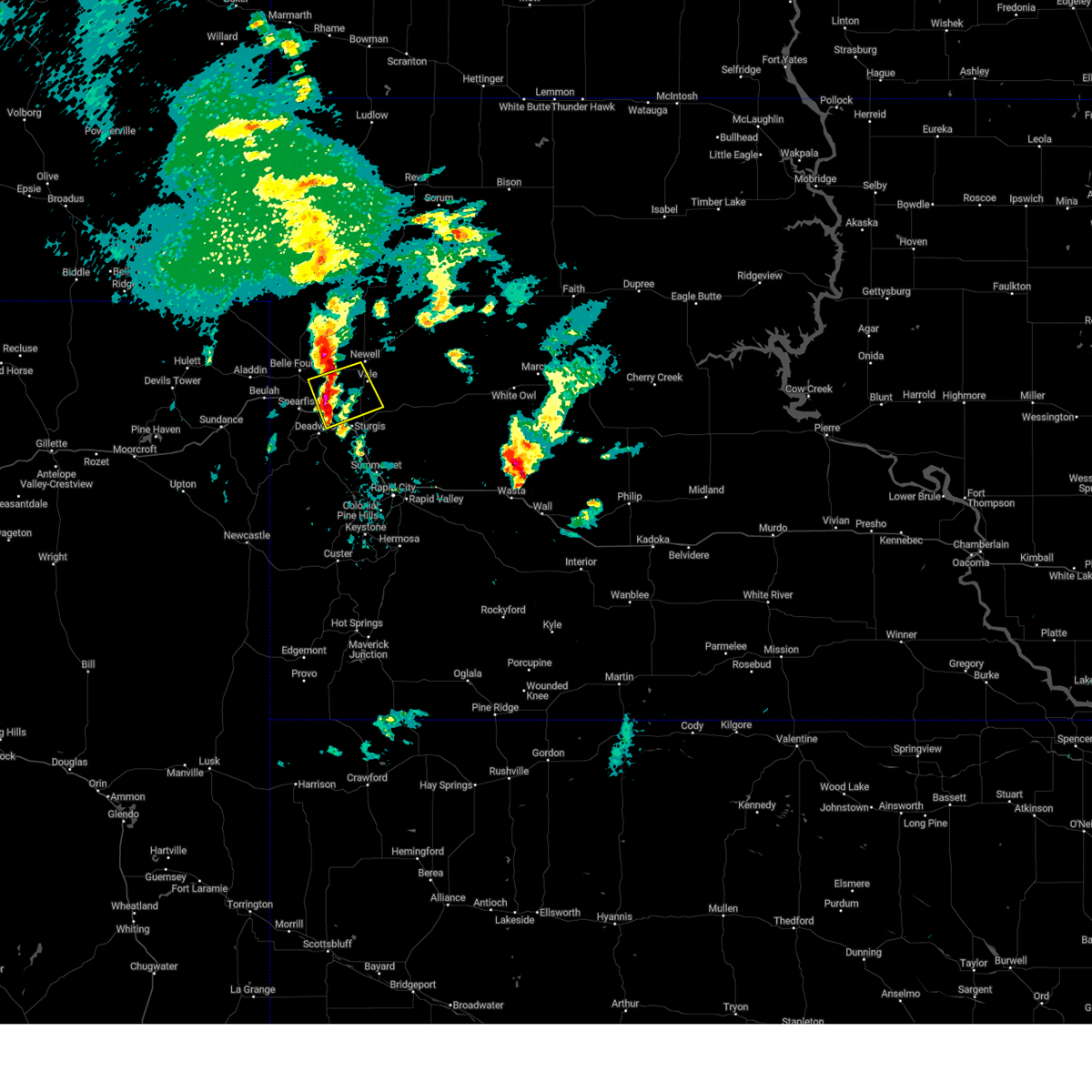 At 638 pm mdt, a severe thunderstorm was located 4 miles east of saint onge, or 11 miles northwest of sturgis, moving northeast at 20 mph (radar indicated). Hazards include half dollar size hail. Damage to vehicles is expected. locations impacted include, nisland and vale. this includes interstate 90 in south dakota between mile markers 20 and 28. hail threat, radar indicated max hail size, 1. 25 in wind threat, radar indicated max wind gust, <50 mph. At 638 pm mdt, a severe thunderstorm was located 4 miles east of saint onge, or 11 miles northwest of sturgis, moving northeast at 20 mph (radar indicated). Hazards include half dollar size hail. Damage to vehicles is expected. locations impacted include, nisland and vale. this includes interstate 90 in south dakota between mile markers 20 and 28. hail threat, radar indicated max hail size, 1. 25 in wind threat, radar indicated max wind gust, <50 mph.
|
| 5/7/2023 6:27 PM MDT |
 At 627 pm mdt, a severe thunderstorm was located over saint onge, or 7 miles east of spearfish, moving northeast at 20 mph (radar indicated). Hazards include quarter size hail. Damage to vehicles is expected. this severe thunderstorm will be near, whitewood around 630 pm mdt. other locations in the path of this severe thunderstorm include nisland and vale. this includes interstate 90 in south dakota between mile markers 16 and 27. hail threat, radar indicated max hail size, 1. 00 in wind threat, radar indicated max wind gust, <50 mph. At 627 pm mdt, a severe thunderstorm was located over saint onge, or 7 miles east of spearfish, moving northeast at 20 mph (radar indicated). Hazards include quarter size hail. Damage to vehicles is expected. this severe thunderstorm will be near, whitewood around 630 pm mdt. other locations in the path of this severe thunderstorm include nisland and vale. this includes interstate 90 in south dakota between mile markers 16 and 27. hail threat, radar indicated max hail size, 1. 00 in wind threat, radar indicated max wind gust, <50 mph.
|
| 8/26/2022 7:14 PM MDT | At 713 pm mdt, a severe thunderstorm was located 6 miles southwest of vale, or 10 miles north of sturgis, moving east at 35 mph (radar indicated). Hazards include 70 mph wind gusts and quarter size hail. Hail damage to vehicles is expected. expect considerable tree damage. wind damage is also likely to mobile homes, roofs, and outbuildings. locations impacted include, vale and union center. This includes interstate 90 in south dakota between mile markers 16 and 39. |
| 8/26/2022 7:07 PM MDT | At 706 pm mdt, severe thunderstorms were located along a line extending from 4 miles east of belle fourche reservoir to 4 miles southwest of nisland to 2 miles east of saint onge, moving east at 45 mph (radar indicated). Hazards include 70 mph wind gusts and penny size hail. Expect considerable tree damage. damage is likely to mobile homes, roofs, and outbuildings. locations impacted include, spearfish, whitewood, nisland, saint onge, fruitdale, apple springs, belle fourche reservoir and northern spearfish canyon. This includes interstate 90 in south dakota between mile markers 11 and 28. |
| 8/26/2022 6:56 PM MDT | At 655 pm mdt, a severe thunderstorm was located over saint onge, or 9 miles northeast of spearfish, moving east at 50 mph. this is a destructive storm for saint onge and bear butte state park (radar indicated). Hazards include 80 mph wind gusts and penny size hail. Flying debris will be dangerous to those caught without shelter. mobile homes will be heavily damaged. expect considerable damage to roofs, windows, and vehicles. extensive tree damage and power outages are likely. this severe thunderstorm will be near, sturgis around 705 pm mdt. vale and bear butte state park around 710 pm mdt. other locations in the path of this severe thunderstorm include hereford. This includes interstate 90 in south dakota between mile markers 11 and 39. |
| 8/26/2022 6:27 PM MDT | At 626 pm mdt, severe thunderstorms were located along a line extending from 9 miles southeast of colony to 2 miles south of aladdin to 6 miles southeast of cook lake, moving east at 40 mph (radar indicated). Hazards include 70 mph wind gusts and quarter size hail. Hail damage to vehicles is expected. expect considerable tree damage. wind damage is also likely to mobile homes, roofs, and outbuildings. locations impacted include, beulah, belle fourche, belle fourche reservoir, fruitdale, crow peak, arpan, iron creek lake, bridal veil falls, savoy, spearfish, nisland, saint onge, spearfish canyon, whitewood, central city, lead and deadwood. this includes, interstate 90 in south dakota between mile markers 1 and 28. Interstate 90 in wyoming between mile markers 193 and 207. |
| 8/26/2022 6:27 PM MDT | At 626 pm mdt, severe thunderstorms were located along a line extending from 9 miles southeast of colony to 2 miles south of aladdin to 6 miles southeast of cook lake, moving east at 40 mph (radar indicated). Hazards include 70 mph wind gusts and quarter size hail. Hail damage to vehicles is expected. expect considerable tree damage. wind damage is also likely to mobile homes, roofs, and outbuildings. locations impacted include, beulah, belle fourche, belle fourche reservoir, fruitdale, crow peak, arpan, iron creek lake, bridal veil falls, savoy, spearfish, nisland, saint onge, spearfish canyon, whitewood, central city, lead and deadwood. this includes, interstate 90 in south dakota between mile markers 1 and 28. Interstate 90 in wyoming between mile markers 193 and 207. |
| 8/26/2022 6:12 PM MDT | At 611 pm mdt, severe thunderstorms were located along a line extending from 2 miles southwest of colony to near bear lodge campground to 7 miles west of cook lake, moving southeast at 35 mph (radar indicated). Hazards include 70 mph wind gusts and quarter size hail. Hail damage to vehicles is expected. expect considerable tree damage. wind damage is also likely to mobile homes, roofs, and outbuildings. severe thunderstorms will be near, colony around 615 pm mdt. aladdin around 620 pm mdt. warren peak around 625 pm mdt. other locations in the path of these severe thunderstorms include sundance, beulah, belle fourche, crow peak, fruitdale, bridal veil falls, spearfish, saint onge, cement ridge lookout and spearfish canyon. this includes, interstate 90 in south dakota between mile markers 1 and 28. interstate 90 in wyoming between mile markers 185 and 207. thunderstorm damage threat, considerable hail threat, radar indicated max hail size, 1. 00 in wind threat, radar indicated max wind gust, 70 mph. |
| 8/26/2022 6:12 PM MDT | At 611 pm mdt, severe thunderstorms were located along a line extending from 2 miles southwest of colony to near bear lodge campground to 7 miles west of cook lake, moving southeast at 35 mph (radar indicated). Hazards include 70 mph wind gusts and quarter size hail. Hail damage to vehicles is expected. expect considerable tree damage. wind damage is also likely to mobile homes, roofs, and outbuildings. severe thunderstorms will be near, colony around 615 pm mdt. aladdin around 620 pm mdt. warren peak around 625 pm mdt. other locations in the path of these severe thunderstorms include sundance, beulah, belle fourche, crow peak, fruitdale, bridal veil falls, spearfish, saint onge, cement ridge lookout and spearfish canyon. this includes, interstate 90 in south dakota between mile markers 1 and 28. interstate 90 in wyoming between mile markers 185 and 207. thunderstorm damage threat, considerable hail threat, radar indicated max hail size, 1. 00 in wind threat, radar indicated max wind gust, 70 mph. |
| 8/17/2022 2:44 PM MDT |
 At 244 pm mdt, a severe thunderstorm was located 10 miles east of colony, or 12 miles northwest of belle fourche, moving southeast at 30 mph (radar indicated). Hazards include 70 mph wind gusts and half dollar size hail. Hail damage to vehicles is expected. expect considerable tree damage. Wind damage is also likely to mobile homes, roofs, and outbuildings. At 244 pm mdt, a severe thunderstorm was located 10 miles east of colony, or 12 miles northwest of belle fourche, moving southeast at 30 mph (radar indicated). Hazards include 70 mph wind gusts and half dollar size hail. Hail damage to vehicles is expected. expect considerable tree damage. Wind damage is also likely to mobile homes, roofs, and outbuildings.
|
| 7/10/2022 9:55 PM MDT |
 At 954 pm mdt, severe thunderstorms were located along a line extending from 3 miles northeast of spearfish to spearfish canyon, moving east at 55 mph (radar indicated). Hazards include two inch hail and 60 mph wind gusts. People and animals outdoors will be injured. expect hail damage to roofs, siding, windows, and vehicles. expect wind damage to roofs, siding, and trees. these severe storms will be near, lead and deadwood around 1000 pm mdt. whitewood, brownsville and galena around 1005 pm mdt. other locations in the path of these severe thunderstorms include sturgis, apple springs, nemo, bear butte state park, fort meade, tilford and dalton lake. this includes interstate 90 in south dakota between mile markers 3 and 41. thunderstorm damage threat, considerable hail threat, radar indicated max hail size, 2. 00 in wind threat, radar indicated max wind gust, 60 mph. At 954 pm mdt, severe thunderstorms were located along a line extending from 3 miles northeast of spearfish to spearfish canyon, moving east at 55 mph (radar indicated). Hazards include two inch hail and 60 mph wind gusts. People and animals outdoors will be injured. expect hail damage to roofs, siding, windows, and vehicles. expect wind damage to roofs, siding, and trees. these severe storms will be near, lead and deadwood around 1000 pm mdt. whitewood, brownsville and galena around 1005 pm mdt. other locations in the path of these severe thunderstorms include sturgis, apple springs, nemo, bear butte state park, fort meade, tilford and dalton lake. this includes interstate 90 in south dakota between mile markers 3 and 41. thunderstorm damage threat, considerable hail threat, radar indicated max hail size, 2. 00 in wind threat, radar indicated max wind gust, 60 mph.
|
| 7/10/2022 9:48 PM MDT |
 At 947 pm mdt, severe thunderstorms were located along a line extending from 5 miles north of spearfish to 2 miles southwest of roughlock falls, moving east at 55 mph (radar indicated). Hazards include golf ball size hail and 60 mph wind gusts. People and animals outdoors will be injured. expect hail damage to roofs, siding, windows, and vehicles. expect wind damage to roofs, siding, and trees. locations impacted include, saint onge, terry peak, lead, deadwood, whitewood, central city, sturgis, brownsville, galena, apple springs, bear butte state park, fort meade, nemo, tilford and dalton lake. this includes, interstate 90 in south dakota between mile markers 1 and 41. interstate 90 in wyoming near mile marker 207. thunderstorm damage threat, considerable hail threat, radar indicated max hail size, 1. 75 in wind threat, radar indicated max wind gust, 60 mph. At 947 pm mdt, severe thunderstorms were located along a line extending from 5 miles north of spearfish to 2 miles southwest of roughlock falls, moving east at 55 mph (radar indicated). Hazards include golf ball size hail and 60 mph wind gusts. People and animals outdoors will be injured. expect hail damage to roofs, siding, windows, and vehicles. expect wind damage to roofs, siding, and trees. locations impacted include, saint onge, terry peak, lead, deadwood, whitewood, central city, sturgis, brownsville, galena, apple springs, bear butte state park, fort meade, nemo, tilford and dalton lake. this includes, interstate 90 in south dakota between mile markers 1 and 41. interstate 90 in wyoming near mile marker 207. thunderstorm damage threat, considerable hail threat, radar indicated max hail size, 1. 75 in wind threat, radar indicated max wind gust, 60 mph.
|
| 7/10/2022 9:30 PM MDT |
 At 928 pm mdt, severe thunderstorms were located along a line extending from 3 miles northwest of aladdin to 3 miles northeast of sundance, moving east at 55 mph (radar indicated). Hazards include ping pong ball size hail and 60 mph wind gusts. People and animals outdoors will be injured. expect hail damage to roofs, siding, windows, and vehicles. expect wind damage to roofs, siding, and trees. locations impacted include, spearfish, sturgis, belle fourche, lead, sundance, deadwood, whitewood, nemo, saint onge, vale, central city, beulah, aladdin, brownsville, galena, tilford, cheyenne crossing, iron creek lake, bear butte state park and roughlock falls. this includes, interstate 90 in south dakota between mile markers 1 and 41. interstate 90 in wyoming between mile markers 188 and 207. hail threat, radar indicated max hail size, 1. 50 in wind threat, radar indicated max wind gust, 60 mph. At 928 pm mdt, severe thunderstorms were located along a line extending from 3 miles northwest of aladdin to 3 miles northeast of sundance, moving east at 55 mph (radar indicated). Hazards include ping pong ball size hail and 60 mph wind gusts. People and animals outdoors will be injured. expect hail damage to roofs, siding, windows, and vehicles. expect wind damage to roofs, siding, and trees. locations impacted include, spearfish, sturgis, belle fourche, lead, sundance, deadwood, whitewood, nemo, saint onge, vale, central city, beulah, aladdin, brownsville, galena, tilford, cheyenne crossing, iron creek lake, bear butte state park and roughlock falls. this includes, interstate 90 in south dakota between mile markers 1 and 41. interstate 90 in wyoming between mile markers 188 and 207. hail threat, radar indicated max hail size, 1. 50 in wind threat, radar indicated max wind gust, 60 mph.
|
| 7/10/2022 9:15 PM MDT |
 At 915 pm mdt, severe thunderstorms were located along a line extending from 2 miles east of alva to 4 miles northwest of warren peak, moving east-southeast at 55 mph (radar indicated). Hazards include 60 mph wind gusts and half dollar size hail. Hail damage to vehicles is expected. expect wind damage to roofs, siding, and trees. severe thunderstorms will be near, bear lodge campground around 920 pm mdt. sundance around 925 pm mdt. aladdin around 930 pm mdt. beulah around 935 pm mdt. other locations in the path of these severe thunderstorms include cement ridge lookout, belle fourche, iron creek lake, crow peak, spearfish, savoy, roughlock falls, bridal veil falls, spearfish canyon, saint onge, central city, cheyenne crossing and terry peak. this includes, interstate 90 in south dakota between mile markers 1 and 41. interstate 90 in wyoming between mile markers 188 and 207. hail threat, radar indicated max hail size, 1. 25 in wind threat, radar indicated max wind gust, 60 mph. At 915 pm mdt, severe thunderstorms were located along a line extending from 2 miles east of alva to 4 miles northwest of warren peak, moving east-southeast at 55 mph (radar indicated). Hazards include 60 mph wind gusts and half dollar size hail. Hail damage to vehicles is expected. expect wind damage to roofs, siding, and trees. severe thunderstorms will be near, bear lodge campground around 920 pm mdt. sundance around 925 pm mdt. aladdin around 930 pm mdt. beulah around 935 pm mdt. other locations in the path of these severe thunderstorms include cement ridge lookout, belle fourche, iron creek lake, crow peak, spearfish, savoy, roughlock falls, bridal veil falls, spearfish canyon, saint onge, central city, cheyenne crossing and terry peak. this includes, interstate 90 in south dakota between mile markers 1 and 41. interstate 90 in wyoming between mile markers 188 and 207. hail threat, radar indicated max hail size, 1. 25 in wind threat, radar indicated max wind gust, 60 mph.
|
| 6/29/2022 3:27 PM MDT |
 The severe thunderstorm warning for southeastern butte, western meade and central lawrence counties will expire at 330 pm mdt, the storms which prompted the warning have weakened below severe limits and no longer pose an immediate threat to life or property. therefore, the warning will be allowed to expire. however, gusty winds are still possible with these thunderstorms. a severe thunderstorm watch remains in effect until 800 pm mdt for northwestern and west central south dakota. The severe thunderstorm warning for southeastern butte, western meade and central lawrence counties will expire at 330 pm mdt, the storms which prompted the warning have weakened below severe limits and no longer pose an immediate threat to life or property. therefore, the warning will be allowed to expire. however, gusty winds are still possible with these thunderstorms. a severe thunderstorm watch remains in effect until 800 pm mdt for northwestern and west central south dakota.
|
| 6/29/2022 3:13 PM MDT |
 At 312 pm mdt, severe thunderstorms were located along a line extending from 2 miles northeast of crooks tower to near galena to 10 miles west of hereford, moving northeast at 30 mph (radar indicated). Hazards include 60 mph wind gusts. Expect damage to roofs, siding, and trees. locations impacted include, sturgis, lead, ellsworth air force base, northern box elder, summerset, black hawk, deadwood, whitewood, newell, nemo, nisland, piedmont, saint onge, vale, central city, brownsville, galena, tilford, cheyenne crossing and hereford. this includes interstate 90 in south dakota between mile markers 17 and 53. hail threat, radar indicated max hail size, <. 75 in wind threat, radar indicated max wind gust, 60 mph. At 312 pm mdt, severe thunderstorms were located along a line extending from 2 miles northeast of crooks tower to near galena to 10 miles west of hereford, moving northeast at 30 mph (radar indicated). Hazards include 60 mph wind gusts. Expect damage to roofs, siding, and trees. locations impacted include, sturgis, lead, ellsworth air force base, northern box elder, summerset, black hawk, deadwood, whitewood, newell, nemo, nisland, piedmont, saint onge, vale, central city, brownsville, galena, tilford, cheyenne crossing and hereford. this includes interstate 90 in south dakota between mile markers 17 and 53. hail threat, radar indicated max hail size, <. 75 in wind threat, radar indicated max wind gust, 60 mph.
|
| 6/29/2022 2:55 PM MDT | At 255 pm mdt, severe thunderstorms were located along a line extending from 4 miles west of sundance to 5 miles east of moskee to near deerfield reservoir, moving east at 45 mph (radar indicated). Hazards include 60 mph wind gusts. Expect damage to roofs, siding, and trees. locations impacted include, spearfish, sturgis, belle fourche, lead, sundance, ellsworth air force base, northern box elder, summerset, black hawk, deadwood, whitewood, newell, nemo, nisland, piedmont, saint onge, vale, central city, colony and beulah. this includes, interstate 90 in south dakota between mile markers 1 and 53. interstate 90 in wyoming between mile markers 179 and 207. hail threat, radar indicated max hail size, <. 75 in wind threat, radar indicated max wind gust, 60 mph. |
| 6/29/2022 2:55 PM MDT | At 255 pm mdt, severe thunderstorms were located along a line extending from 4 miles west of sundance to 5 miles east of moskee to near deerfield reservoir, moving east at 45 mph (radar indicated). Hazards include 60 mph wind gusts. Expect damage to roofs, siding, and trees. locations impacted include, spearfish, sturgis, belle fourche, lead, sundance, ellsworth air force base, northern box elder, summerset, black hawk, deadwood, whitewood, newell, nemo, nisland, piedmont, saint onge, vale, central city, colony and beulah. this includes, interstate 90 in south dakota between mile markers 1 and 53. interstate 90 in wyoming between mile markers 179 and 207. hail threat, radar indicated max hail size, <. 75 in wind threat, radar indicated max wind gust, 60 mph. |
| 6/29/2022 2:34 PM MDT | At 233 pm mdt, severe thunderstorms were located along a line extending from 7 miles southwest of colony to 7 miles southwest of beulah to 4 miles northwest of buckhorn, moving east at 50 mph (radar indicated). Hazards include 60 mph wind gusts. Expect damage to roofs, siding, and trees. severe thunderstorms will be near, colony and beulah around 240 pm mdt. crow peak and crooks tower around 245 pm mdt. cheyenne crossing, roughlock falls and savoy around 250 pm mdt. other locations in the path of these severe thunderstorms include spearfish, belle fourche, terry peak, lead, deadwood, saint onge, central city, brownsville, fruitdale, galena, antelope butte, apple springs, sturgis, nisland, tilford, two top butte and fort meade. this includes, interstate 90 in south dakota between mile markers 1 and 53. interstate 90 in wyoming between mile markers 175 and 207. hail threat, radar indicated max hail size, <. 75 in wind threat, radar indicated max wind gust, 60 mph. |
| 6/29/2022 2:34 PM MDT | At 233 pm mdt, severe thunderstorms were located along a line extending from 7 miles southwest of colony to 7 miles southwest of beulah to 4 miles northwest of buckhorn, moving east at 50 mph (radar indicated). Hazards include 60 mph wind gusts. Expect damage to roofs, siding, and trees. severe thunderstorms will be near, colony and beulah around 240 pm mdt. crow peak and crooks tower around 245 pm mdt. cheyenne crossing, roughlock falls and savoy around 250 pm mdt. other locations in the path of these severe thunderstorms include spearfish, belle fourche, terry peak, lead, deadwood, saint onge, central city, brownsville, fruitdale, galena, antelope butte, apple springs, sturgis, nisland, tilford, two top butte and fort meade. this includes, interstate 90 in south dakota between mile markers 1 and 53. interstate 90 in wyoming between mile markers 175 and 207. hail threat, radar indicated max hail size, <. 75 in wind threat, radar indicated max wind gust, 60 mph. |
| 6/12/2022 6:23 PM MDT |
 At 623 pm mdt, a severe thunderstorm was located over apple springs, or 5 miles west of sturgis, moving east at 45 mph (radar indicated). Hazards include golf ball size hail and 70 mph wind gusts. People and animals outdoors will be injured. expect hail damage to roofs, siding, windows, and vehicles. expect considerable tree damage. wind damage is also likely to mobile homes, roofs, and outbuildings. this severe thunderstorm will be near, sturgis and fort meade around 630 pm mdt. bear butte state park around 635 pm mdt. this includes interstate 90 in south dakota between mile markers 14 and 41. thunderstorm damage threat, considerable hail threat, radar indicated max hail size, 1. 75 in wind threat, radar indicated max wind gust, 70 mph. At 623 pm mdt, a severe thunderstorm was located over apple springs, or 5 miles west of sturgis, moving east at 45 mph (radar indicated). Hazards include golf ball size hail and 70 mph wind gusts. People and animals outdoors will be injured. expect hail damage to roofs, siding, windows, and vehicles. expect considerable tree damage. wind damage is also likely to mobile homes, roofs, and outbuildings. this severe thunderstorm will be near, sturgis and fort meade around 630 pm mdt. bear butte state park around 635 pm mdt. this includes interstate 90 in south dakota between mile markers 14 and 41. thunderstorm damage threat, considerable hail threat, radar indicated max hail size, 1. 75 in wind threat, radar indicated max wind gust, 70 mph.
|
| 6/12/2022 5:56 PM MDT | Golf Ball sized hail reported 2.6 miles SW of Whitewood, SD |
| 6/12/2022 5:55 PM MDT |
 At 555 pm mdt, a severe thunderstorm was located 3 miles north of sturgis, moving east at 35 mph (radar indicated). Hazards include two inch hail and 60 mph wind gusts. People and animals outdoors will be injured. expect hail damage to roofs, siding, windows, and vehicles. expect wind damage to roofs, siding, and trees. this severe storm will be near, bear butte state park around 605 pm mdt. this includes interstate 90 in south dakota between mile markers 23 and 35. thunderstorm damage threat, considerable hail threat, radar indicated max hail size, 2. 00 in wind threat, radar indicated max wind gust, 60 mph. At 555 pm mdt, a severe thunderstorm was located 3 miles north of sturgis, moving east at 35 mph (radar indicated). Hazards include two inch hail and 60 mph wind gusts. People and animals outdoors will be injured. expect hail damage to roofs, siding, windows, and vehicles. expect wind damage to roofs, siding, and trees. this severe storm will be near, bear butte state park around 605 pm mdt. this includes interstate 90 in south dakota between mile markers 23 and 35. thunderstorm damage threat, considerable hail threat, radar indicated max hail size, 2. 00 in wind threat, radar indicated max wind gust, 60 mph.
|
| 6/12/2022 5:50 PM MDT |
 At 550 pm mdt, a severe thunderstorm was located near whitewood, or 5 miles northwest of sturgis, moving east at 35 mph (radar indicated). Hazards include ping pong ball size hail and 60 mph wind gusts. People and animals outdoors will be injured. expect hail damage to roofs, siding, windows, and vehicles. expect wind damage to roofs, siding, and trees. this severe thunderstorm will be near, sturgis and fort meade around 555 pm mdt. bear butte state park around 600 pm mdt. this includes interstate 90 in south dakota between mile markers 21 and 35. hail threat, radar indicated max hail size, 1. 50 in wind threat, radar indicated max wind gust, 60 mph. At 550 pm mdt, a severe thunderstorm was located near whitewood, or 5 miles northwest of sturgis, moving east at 35 mph (radar indicated). Hazards include ping pong ball size hail and 60 mph wind gusts. People and animals outdoors will be injured. expect hail damage to roofs, siding, windows, and vehicles. expect wind damage to roofs, siding, and trees. this severe thunderstorm will be near, sturgis and fort meade around 555 pm mdt. bear butte state park around 600 pm mdt. this includes interstate 90 in south dakota between mile markers 21 and 35. hail threat, radar indicated max hail size, 1. 50 in wind threat, radar indicated max wind gust, 60 mph.
|
| 5/28/2022 4:38 PM MDT |
 At 438 pm mdt, a severe thunderstorm was located 7 miles northeast of beulah, or 8 miles west of belle fourche, moving northeast at 40 mph (radar indicated). Hazards include 60 mph wind gusts and quarter size hail. Hail damage to vehicles is expected. expect wind damage to roofs, siding, and trees. this severe thunderstorm will be near, belle fourche around 450 pm mdt. other locations in the path of this severe thunderstorm include northwestern belle fourche reservoir. this includes, interstate 90 in south dakota between mile markers 1 and 29. interstate 90 in wyoming between mile markers 206 and 207. hail threat, radar indicated max hail size, 1. 00 in wind threat, radar indicated max wind gust, 60 mph. At 438 pm mdt, a severe thunderstorm was located 7 miles northeast of beulah, or 8 miles west of belle fourche, moving northeast at 40 mph (radar indicated). Hazards include 60 mph wind gusts and quarter size hail. Hail damage to vehicles is expected. expect wind damage to roofs, siding, and trees. this severe thunderstorm will be near, belle fourche around 450 pm mdt. other locations in the path of this severe thunderstorm include northwestern belle fourche reservoir. this includes, interstate 90 in south dakota between mile markers 1 and 29. interstate 90 in wyoming between mile markers 206 and 207. hail threat, radar indicated max hail size, 1. 00 in wind threat, radar indicated max wind gust, 60 mph.
|
| 5/27/2022 4:42 PM MDT |
 At 442 pm mdt, severe thunderstorms were located along a line extending from 4 miles south of nisland to near whitewood to 2 miles south of cheyenne crossing, moving east at 30 mph (radar indicated). Hazards include 60 mph wind gusts and half dollar size hail. Hail damage to vehicles is expected. expect wind damage to roofs, siding, and trees. severe thunderstorms will be near, whitewood and apple springs around 445 pm mdt. sturgis and deadwood around 450 pm mdt. vale and fort meade around 455 pm mdt. galena and bear butte state park around 500 pm mdt. other locations in the path of these severe thunderstorms include tilford, dalton lake, piedmont and summerset. this includes interstate 90 in south dakota between mile markers 22 and 48. hail threat, radar indicated max hail size, 1. 25 in wind threat, radar indicated max wind gust, 60 mph. At 442 pm mdt, severe thunderstorms were located along a line extending from 4 miles south of nisland to near whitewood to 2 miles south of cheyenne crossing, moving east at 30 mph (radar indicated). Hazards include 60 mph wind gusts and half dollar size hail. Hail damage to vehicles is expected. expect wind damage to roofs, siding, and trees. severe thunderstorms will be near, whitewood and apple springs around 445 pm mdt. sturgis and deadwood around 450 pm mdt. vale and fort meade around 455 pm mdt. galena and bear butte state park around 500 pm mdt. other locations in the path of these severe thunderstorms include tilford, dalton lake, piedmont and summerset. this includes interstate 90 in south dakota between mile markers 22 and 48. hail threat, radar indicated max hail size, 1. 25 in wind threat, radar indicated max wind gust, 60 mph.
|
| 5/27/2022 4:26 PM MDT |
 At 425 pm mdt, a severe thunderstorm was located 3 miles northeast of spearfish, moving east at 30 mph (trained weather spotters). Hazards include 60 mph wind gusts and half dollar size hail. Hail damage to vehicles is expected. expect wind damage to roofs, siding, and trees. locations impacted include, spearfish, belle fourche, whitewood, saint onge, fruitdale, crow peak, southeastern belle fourche reservoir and northern spearfish canyon. this includes interstate 90 in south dakota between mile markers 5 and 27. hail threat, radar indicated max hail size, 1. 25 in wind threat, radar indicated max wind gust, 60 mph. At 425 pm mdt, a severe thunderstorm was located 3 miles northeast of spearfish, moving east at 30 mph (trained weather spotters). Hazards include 60 mph wind gusts and half dollar size hail. Hail damage to vehicles is expected. expect wind damage to roofs, siding, and trees. locations impacted include, spearfish, belle fourche, whitewood, saint onge, fruitdale, crow peak, southeastern belle fourche reservoir and northern spearfish canyon. this includes interstate 90 in south dakota between mile markers 5 and 27. hail threat, radar indicated max hail size, 1. 25 in wind threat, radar indicated max wind gust, 60 mph.
|
| 5/27/2022 4:15 PM MDT |
 At 415 pm mdt, a severe thunderstorm was located 4 miles northwest of spearfish, moving east at 30 mph (trained weather spotters). Hazards include 60 mph wind gusts and half dollar size hail. Hail damage to vehicles is expected. expect wind damage to roofs, siding, and trees. locations impacted include, spearfish, belle fourche, whitewood, saint onge, fruitdale, crow peak, arpan, belle fourche reservoir and northern spearfish canyon. this includes, interstate 90 in south dakota between mile markers 1 and 27. interstate 90 in wyoming between mile markers 206 and 207. hail threat, radar indicated max hail size, 1. 25 in wind threat, radar indicated max wind gust, 60 mph. At 415 pm mdt, a severe thunderstorm was located 4 miles northwest of spearfish, moving east at 30 mph (trained weather spotters). Hazards include 60 mph wind gusts and half dollar size hail. Hail damage to vehicles is expected. expect wind damage to roofs, siding, and trees. locations impacted include, spearfish, belle fourche, whitewood, saint onge, fruitdale, crow peak, arpan, belle fourche reservoir and northern spearfish canyon. this includes, interstate 90 in south dakota between mile markers 1 and 27. interstate 90 in wyoming between mile markers 206 and 207. hail threat, radar indicated max hail size, 1. 25 in wind threat, radar indicated max wind gust, 60 mph.
|
| 5/27/2022 3:49 PM MDT |
 At 348 pm mdt, a severe thunderstorm was located 3 miles southeast of aladdin, or 14 miles west of belle fourche, moving east at 30 mph (radar indicated). Hazards include 60 mph wind gusts and quarter size hail. Hail damage to vehicles is expected. Expect wind damage to roofs, siding, and trees. At 348 pm mdt, a severe thunderstorm was located 3 miles southeast of aladdin, or 14 miles west of belle fourche, moving east at 30 mph (radar indicated). Hazards include 60 mph wind gusts and quarter size hail. Hail damage to vehicles is expected. Expect wind damage to roofs, siding, and trees.
|
| 5/12/2022 12:56 AM MDT |
 At 1255 am mdt, severe thunderstorms were located along a line extending from 2 miles southeast of galena to 2 miles south of black hawk, moving northeast at 40 mph (radar indicated). Hazards include 60 mph wind gusts and quarter size hail. Hail damage to vehicles is expected. expect wind damage to roofs, siding, and trees. locations impacted include, western rapid city, sturgis, black hawk, summerset, johnson siding, nemo, piedmont, silver city, hisega, tilford, brownsville, galena, pactola reservoir, dalton lake, bear butte state park, apple springs, roubaix lake and fort meade. this includes interstate 90 in south dakota between mile markers 25 and 56. hail threat, radar indicated max hail size, 1. 00 in wind threat, radar indicated max wind gust, 60 mph. At 1255 am mdt, severe thunderstorms were located along a line extending from 2 miles southeast of galena to 2 miles south of black hawk, moving northeast at 40 mph (radar indicated). Hazards include 60 mph wind gusts and quarter size hail. Hail damage to vehicles is expected. expect wind damage to roofs, siding, and trees. locations impacted include, western rapid city, sturgis, black hawk, summerset, johnson siding, nemo, piedmont, silver city, hisega, tilford, brownsville, galena, pactola reservoir, dalton lake, bear butte state park, apple springs, roubaix lake and fort meade. this includes interstate 90 in south dakota between mile markers 25 and 56. hail threat, radar indicated max hail size, 1. 00 in wind threat, radar indicated max wind gust, 60 mph.
|
| 5/12/2022 12:40 AM MDT |
 At 1240 am mdt, severe thunderstorms were located along a line extending from 2 miles north of rochford to near pactola reservoir, moving northeast at 40 mph (radar indicated). Hazards include 60 mph wind gusts and quarter size hail. Hail damage to vehicles is expected. expect wind damage to roofs, siding, and trees. severe thunderstorms will be near, nemo and brownsville around 1250 am mdt. black hawk and dalton lake around 1255 am mdt. summerset, piedmont and galena around 100 am mdt. other locations in the path of these severe thunderstorms include tilford, apple springs, sturgis, whitewood, fort meade and bear butte state park. this includes interstate 90 in south dakota between mile markers 25 and 55. hail threat, radar indicated max hail size, 1. 00 in wind threat, radar indicated max wind gust, 60 mph. At 1240 am mdt, severe thunderstorms were located along a line extending from 2 miles north of rochford to near pactola reservoir, moving northeast at 40 mph (radar indicated). Hazards include 60 mph wind gusts and quarter size hail. Hail damage to vehicles is expected. expect wind damage to roofs, siding, and trees. severe thunderstorms will be near, nemo and brownsville around 1250 am mdt. black hawk and dalton lake around 1255 am mdt. summerset, piedmont and galena around 100 am mdt. other locations in the path of these severe thunderstorms include tilford, apple springs, sturgis, whitewood, fort meade and bear butte state park. this includes interstate 90 in south dakota between mile markers 25 and 55. hail threat, radar indicated max hail size, 1. 00 in wind threat, radar indicated max wind gust, 60 mph.
|
| 7/13/2021 10:11 PM MDT |
 The severe thunderstorm warning for southeastern butte, west central meade and lawrence counties will expire at 1015 pm mdt, the storms which prompted the warning have moved out of butte county and are now in southern lawrence and southwestern meade counties. therefore, this warning will be allowed to expire. however, gusty winds and heavy rain are still possible with these thunderstorms. a severe thunderstorm watch remains in effect until 1100 pm mdt for northwestern and west central south dakota, and northeastern wyoming. remember, a severe thunderstorm warning still remains in effect for southwestern meade county and southern lawrence county. The severe thunderstorm warning for southeastern butte, west central meade and lawrence counties will expire at 1015 pm mdt, the storms which prompted the warning have moved out of butte county and are now in southern lawrence and southwestern meade counties. therefore, this warning will be allowed to expire. however, gusty winds and heavy rain are still possible with these thunderstorms. a severe thunderstorm watch remains in effect until 1100 pm mdt for northwestern and west central south dakota, and northeastern wyoming. remember, a severe thunderstorm warning still remains in effect for southwestern meade county and southern lawrence county.
|
| 7/13/2021 9:30 PM MDT |
 At 929 pm mdt, severe thunderstorms were located along a line extending from 3 miles southwest of newell to 4 miles north of o`neil pass, moving southeast at 25 mph (radar indicated). Hazards include 60 mph wind gusts. Expect damage to roofs, siding, and trees. locations impacted include, newell, nisland, terry peak, vale, owl butte, black fox campground, brownsville and roubaix lake. This includes interstate 90 in south dakota between mile markers 3 and 36. At 929 pm mdt, severe thunderstorms were located along a line extending from 3 miles southwest of newell to 4 miles north of o`neil pass, moving southeast at 25 mph (radar indicated). Hazards include 60 mph wind gusts. Expect damage to roofs, siding, and trees. locations impacted include, newell, nisland, terry peak, vale, owl butte, black fox campground, brownsville and roubaix lake. This includes interstate 90 in south dakota between mile markers 3 and 36.
|
| 7/13/2021 9:12 PM MDT |
 At 911 pm mdt, severe thunderstorms were located along a line extending from 3 miles southeast of arpan to 3 miles southwest of cement ridge lookout, moving southeast at 25 mph (radar indicated). Hazards include 60 mph wind gusts. Expect damage to roofs, siding, and trees. severe thunderstorms will be near, fruitdale and arpan around 915 pm mdt. nisland and savoy around 925 pm mdt. o`neil pass around 930 pm mdt. other locations in the path of these severe thunderstorms include newell, cheyenne crossing, terry peak, vale, crooks tower, owl butte and black fox campground. This includes interstate 90 in south dakota between mile markers 1 and 36. At 911 pm mdt, severe thunderstorms were located along a line extending from 3 miles southeast of arpan to 3 miles southwest of cement ridge lookout, moving southeast at 25 mph (radar indicated). Hazards include 60 mph wind gusts. Expect damage to roofs, siding, and trees. severe thunderstorms will be near, fruitdale and arpan around 915 pm mdt. nisland and savoy around 925 pm mdt. o`neil pass around 930 pm mdt. other locations in the path of these severe thunderstorms include newell, cheyenne crossing, terry peak, vale, crooks tower, owl butte and black fox campground. This includes interstate 90 in south dakota between mile markers 1 and 36.
|
| 6/19/2021 5:48 PM MDT |
 At 547 pm mdt, a severe thunderstorm was located over bear butte state park, or 5 miles northeast of sturgis, moving southeast at 25 mph (trained weather spotters. at 540 pm mdt, a trained spotter reported golf ball size hail 3 miles east northeast of whitewood). Hazards include golf ball size hail. People and animals outdoors will be injured. expect damage to roofs, siding, windows, and vehicles. this severe thunderstorm will remain over mainly rural areas of west central meade and east central lawrence counties. This includes interstate 90 in south dakota near mile marker 25. At 547 pm mdt, a severe thunderstorm was located over bear butte state park, or 5 miles northeast of sturgis, moving southeast at 25 mph (trained weather spotters. at 540 pm mdt, a trained spotter reported golf ball size hail 3 miles east northeast of whitewood). Hazards include golf ball size hail. People and animals outdoors will be injured. expect damage to roofs, siding, windows, and vehicles. this severe thunderstorm will remain over mainly rural areas of west central meade and east central lawrence counties. This includes interstate 90 in south dakota near mile marker 25.
|
| 6/19/2021 5:46 PM MDT |
 At 546 pm mdt, a severe thunderstorm was located over apple springs, or 3 miles southwest of sturgis, moving east at 30 mph (radar indicated). Hazards include golf ball size hail. People and animals outdoors will be injured. expect damage to roofs, siding, windows, and vehicles. locations impacted include, sturgis, whitewood, piedmont, tilford, apple springs and fort meade. This includes interstate 90 in south dakota between mile markers 25 and 46. At 546 pm mdt, a severe thunderstorm was located over apple springs, or 3 miles southwest of sturgis, moving east at 30 mph (radar indicated). Hazards include golf ball size hail. People and animals outdoors will be injured. expect damage to roofs, siding, windows, and vehicles. locations impacted include, sturgis, whitewood, piedmont, tilford, apple springs and fort meade. This includes interstate 90 in south dakota between mile markers 25 and 46.
|
| 6/19/2021 5:40 PM MDT | Golf Ball sized hail reported 2.8 miles WSW of Whitewood, SD |
| 6/19/2021 5:35 PM MDT | Golf Ball sized hail reported 0.3 miles E of Whitewood, SD |
| 6/19/2021 5:35 PM MDT |
 At 534 pm mdt, a severe thunderstorm was located 5 miles northeast of whitewood, or 7 miles north of sturgis, moving southeast at 25 mph (radar indicated). Hazards include quarter size hail. Damage to vehicles is expected. this severe thunderstorm will be near, bear butte state park around 550 pm mdt. This includes interstate 90 in south dakota between mile markers 21 and 24. At 534 pm mdt, a severe thunderstorm was located 5 miles northeast of whitewood, or 7 miles north of sturgis, moving southeast at 25 mph (radar indicated). Hazards include quarter size hail. Damage to vehicles is expected. this severe thunderstorm will be near, bear butte state park around 550 pm mdt. This includes interstate 90 in south dakota between mile markers 21 and 24.
|
| 6/19/2021 5:33 PM MDT |
 At 532 pm mdt, a severe thunderstorm was located 3 miles north of deadwood, or 5 miles northeast of lead, moving east at 30 mph (radar indicated). Hazards include golf ball size hail. People and animals outdoors will be injured. expect damage to roofs, siding, windows, and vehicles. locations impacted include, sturgis, lead, deadwood, whitewood, piedmont, central city, galena, tilford, fort meade and apple springs. This includes interstate 90 in south dakota between mile markers 17 and 18, and between mile markers 24 and 46. At 532 pm mdt, a severe thunderstorm was located 3 miles north of deadwood, or 5 miles northeast of lead, moving east at 30 mph (radar indicated). Hazards include golf ball size hail. People and animals outdoors will be injured. expect damage to roofs, siding, windows, and vehicles. locations impacted include, sturgis, lead, deadwood, whitewood, piedmont, central city, galena, tilford, fort meade and apple springs. This includes interstate 90 in south dakota between mile markers 17 and 18, and between mile markers 24 and 46.
|
| 6/19/2021 5:23 PM MDT |
 At 522 pm mdt, a severe thunderstorm was located 3 miles east of bridal veil falls, or 4 miles southeast of spearfish, moving east at 30 mph (radar indicated). Hazards include golf ball size hail. People and animals outdoors will be injured. expect damage to roofs, siding, windows, and vehicles. locations impacted include, deadwood, whitewood, galena, sturgis, apple springs, fort meade, tilford and piedmont. This includes interstate 90 in south dakota between mile markers 12 and 19, near mile marker 22, and between mile markers 24 and 46. At 522 pm mdt, a severe thunderstorm was located 3 miles east of bridal veil falls, or 4 miles southeast of spearfish, moving east at 30 mph (radar indicated). Hazards include golf ball size hail. People and animals outdoors will be injured. expect damage to roofs, siding, windows, and vehicles. locations impacted include, deadwood, whitewood, galena, sturgis, apple springs, fort meade, tilford and piedmont. This includes interstate 90 in south dakota between mile markers 12 and 19, near mile marker 22, and between mile markers 24 and 46.
|
| 6/19/2021 5:11 PM MDT |
 At 511 pm mdt, a severe thunderstorm was located near crow peak, or 3 miles southwest of spearfish, moving east at 35 mph (radar indicated). Hazards include 60 mph wind gusts and quarter size hail. Hail damage to vehicles is expected. expect wind damage to roofs, siding, and trees. this severe thunderstorm will be near, bridal veil falls around 515 pm mdt. spearfish and northern spearfish canyon around 520 pm mdt. lead, deadwood and central city around 530 pm mdt. other locations in the path of this severe thunderstorm include whitewood, galena, apple springs, sturgis, fort meade and tilford. This includes interstate 90 in south dakota near mile marker 7, between mile markers 11 and 19, near mile marker 22, and between mile markers 24 and 46. At 511 pm mdt, a severe thunderstorm was located near crow peak, or 3 miles southwest of spearfish, moving east at 35 mph (radar indicated). Hazards include 60 mph wind gusts and quarter size hail. Hail damage to vehicles is expected. expect wind damage to roofs, siding, and trees. this severe thunderstorm will be near, bridal veil falls around 515 pm mdt. spearfish and northern spearfish canyon around 520 pm mdt. lead, deadwood and central city around 530 pm mdt. other locations in the path of this severe thunderstorm include whitewood, galena, apple springs, sturgis, fort meade and tilford. This includes interstate 90 in south dakota near mile marker 7, between mile markers 11 and 19, near mile marker 22, and between mile markers 24 and 46.
|
| 6/10/2021 9:09 PM MDT |
 At 909 pm mdt, a severe thunderstorm was located over nisland, or 15 miles east of belle fourche, moving northeast at 40 mph (radar indicated). Hazards include 70 mph wind gusts and ping pong ball size hail. People and animals outdoors will be injured. expect hail damage to roofs, siding, windows, and vehicles. expect considerable tree damage. wind damage is also likely to mobile homes, roofs, and outbuildings. locations impacted include, vale and newell. This includes interstate 90 in south dakota between mile markers 17 and 25. At 909 pm mdt, a severe thunderstorm was located over nisland, or 15 miles east of belle fourche, moving northeast at 40 mph (radar indicated). Hazards include 70 mph wind gusts and ping pong ball size hail. People and animals outdoors will be injured. expect hail damage to roofs, siding, windows, and vehicles. expect considerable tree damage. wind damage is also likely to mobile homes, roofs, and outbuildings. locations impacted include, vale and newell. This includes interstate 90 in south dakota between mile markers 17 and 25.
|
| 6/10/2021 8:44 PM MDT |
 At 844 pm mdt, a severe thunderstorm was located 5 miles south of belle fourche, moving northeast at 35 mph (radar indicated). Hazards include 60 mph wind gusts and half dollar size hail. Hail damage to vehicles is expected. expect wind damage to roofs, siding, and trees. this severe thunderstorm will be near, belle fourche around 850 pm mdt. saint onge around 855 pm mdt. other locations in the path of this severe thunderstorm include fruitdale, nisland, arpan and newell. This includes interstate 90 in south dakota between mile markers 3 and 25. At 844 pm mdt, a severe thunderstorm was located 5 miles south of belle fourche, moving northeast at 35 mph (radar indicated). Hazards include 60 mph wind gusts and half dollar size hail. Hail damage to vehicles is expected. expect wind damage to roofs, siding, and trees. this severe thunderstorm will be near, belle fourche around 850 pm mdt. saint onge around 855 pm mdt. other locations in the path of this severe thunderstorm include fruitdale, nisland, arpan and newell. This includes interstate 90 in south dakota between mile markers 3 and 25.
|
| 6/10/2021 7:59 PM MDT |
 At 758 pm mdt, a severe thunderstorm was located over saint onge, or 6 miles northeast of spearfish, moving northeast at 40 mph (radar indicated). Hazards include 60 mph wind gusts and half dollar size hail. Hail damage to vehicles is expected. expect wind damage to roofs, siding, and trees. locations impacted include, fruitdale, nisland, vale, newell, newell lake and owl butte. this includes, interstate 90 in south dakota between mile markers 1 and 27. Interstate 90 in wyoming between mile markers 196 and 207. At 758 pm mdt, a severe thunderstorm was located over saint onge, or 6 miles northeast of spearfish, moving northeast at 40 mph (radar indicated). Hazards include 60 mph wind gusts and half dollar size hail. Hail damage to vehicles is expected. expect wind damage to roofs, siding, and trees. locations impacted include, fruitdale, nisland, vale, newell, newell lake and owl butte. this includes, interstate 90 in south dakota between mile markers 1 and 27. Interstate 90 in wyoming between mile markers 196 and 207.
|
| 6/10/2021 7:44 PM MDT |
 At 744 pm mdt, a severe thunderstorm was located 4 miles northwest of spearfish, moving northeast at 45 mph (radar indicated). Hazards include 60 mph wind gusts and nickel size hail. Expect damage to roofs, siding, and trees. this severe thunderstorm will be near, belle fourche and saint onge around 755 pm mdt. fruitdale around 800 pm mdt. other locations in the path of this severe thunderstorm include belle fourche reservoir, nisland, arpan, newell, newell lake and castle rock. this includes, interstate 90 in south dakota between mile markers 1 and 27. Interstate 90 in wyoming between mile markers 196 and 207. At 744 pm mdt, a severe thunderstorm was located 4 miles northwest of spearfish, moving northeast at 45 mph (radar indicated). Hazards include 60 mph wind gusts and nickel size hail. Expect damage to roofs, siding, and trees. this severe thunderstorm will be near, belle fourche and saint onge around 755 pm mdt. fruitdale around 800 pm mdt. other locations in the path of this severe thunderstorm include belle fourche reservoir, nisland, arpan, newell, newell lake and castle rock. this includes, interstate 90 in south dakota between mile markers 1 and 27. Interstate 90 in wyoming between mile markers 196 and 207.
|
| 6/8/2021 8:44 PM MDT |
 At 844 pm mdt, severe thunderstorms were located along a line extending from 3 miles north of newell lake to 7 miles northeast of bear butte state park to 5 miles east of black hawk, moving northeast at 35 mph (radar indicated). Hazards include 60 mph wind gusts and penny size hail. Expect damage to roofs, siding, and trees. severe thunderstorms will be near, castle rock around 850 pm mdt. other locations in the path of these severe thunderstorms include dears ears butte, viewfield, hereford, curlew lake, mud butte and fairpoint. This includes interstate 90 in south dakota between mile markers 23 and 53. At 844 pm mdt, severe thunderstorms were located along a line extending from 3 miles north of newell lake to 7 miles northeast of bear butte state park to 5 miles east of black hawk, moving northeast at 35 mph (radar indicated). Hazards include 60 mph wind gusts and penny size hail. Expect damage to roofs, siding, and trees. severe thunderstorms will be near, castle rock around 850 pm mdt. other locations in the path of these severe thunderstorms include dears ears butte, viewfield, hereford, curlew lake, mud butte and fairpoint. This includes interstate 90 in south dakota between mile markers 23 and 53.
|
| 6/8/2021 8:24 PM MDT |
 At 823 pm mdt, severe thunderstorms were located along a line extending from 6 miles south of two top butte to 3 miles southeast of nisland to 3 miles northwest of dalton lake, moving east at 25 mph (radar indicated). Hazards include 60 mph wind gusts. Expect damage to roofs, siding, and trees. locations impacted include, spearfish, sturgis, belle fourche, lead, ellsworth air force base, summerset, black hawk, deadwood, whitewood, newell, nemo, nisland, piedmont, saint onge, vale, central city, fruitdale, brownsville, castle rock and galena. This includes interstate 90 in south dakota between mile markers 10 and 53. At 823 pm mdt, severe thunderstorms were located along a line extending from 6 miles south of two top butte to 3 miles southeast of nisland to 3 miles northwest of dalton lake, moving east at 25 mph (radar indicated). Hazards include 60 mph wind gusts. Expect damage to roofs, siding, and trees. locations impacted include, spearfish, sturgis, belle fourche, lead, ellsworth air force base, summerset, black hawk, deadwood, whitewood, newell, nemo, nisland, piedmont, saint onge, vale, central city, fruitdale, brownsville, castle rock and galena. This includes interstate 90 in south dakota between mile markers 10 and 53.
|
| 6/8/2021 8:15 PM MDT | Also had pea to marble size hai in lawrence county SD, 2.6 miles SW of Whitewood, SD |
| 6/8/2021 8:03 PM MDT |
 At 803 pm mdt, severe thunderstorms were located along a line extending from 11 miles southwest of antelope butte to near fruitdale to 2 miles southeast of brownsville, moving east at 35 mph (radar indicated). Hazards include 60 mph wind gusts. Expect damage to roofs, siding, and trees. locations impacted include, nemo, nisland, dalton lake, tilford, arpan, fort meade, summerset, newell, piedmont, vale, two top butte, owl butte, castle rock and newell lake. This includes interstate 90 in south dakota between mile markers 1 and 53. At 803 pm mdt, severe thunderstorms were located along a line extending from 11 miles southwest of antelope butte to near fruitdale to 2 miles southeast of brownsville, moving east at 35 mph (radar indicated). Hazards include 60 mph wind gusts. Expect damage to roofs, siding, and trees. locations impacted include, nemo, nisland, dalton lake, tilford, arpan, fort meade, summerset, newell, piedmont, vale, two top butte, owl butte, castle rock and newell lake. This includes interstate 90 in south dakota between mile markers 1 and 53.
|
| 6/8/2021 7:48 PM MDT |
 At 748 pm mdt, severe thunderstorms were located along a line extending from 5 miles southeast of colony to 4 miles southwest of belle fourche to 5 miles north of black fox campground, moving east at 35 mph (radar indicated). Hazards include 60 mph wind gusts. Expect damage to roofs, siding, and trees. severe thunderstorms will be near, belle fourche around 755 pm mdt. saint onge, brownsville and roubaix lake around 800 pm mdt. fruitdale and galena around 805 pm mdt. other locations in the path of these severe thunderstorms include nemo, belle fourche reservoir, nisland, dalton lake, piedmont, tilford, arpan, fort meade, summerset, two top butte, newell and vale. this includes, interstate 90 in south dakota between mile markers 1 and 53. Interstate 90 in wyoming between mile markers 200 and 207. At 748 pm mdt, severe thunderstorms were located along a line extending from 5 miles southeast of colony to 4 miles southwest of belle fourche to 5 miles north of black fox campground, moving east at 35 mph (radar indicated). Hazards include 60 mph wind gusts. Expect damage to roofs, siding, and trees. severe thunderstorms will be near, belle fourche around 755 pm mdt. saint onge, brownsville and roubaix lake around 800 pm mdt. fruitdale and galena around 805 pm mdt. other locations in the path of these severe thunderstorms include nemo, belle fourche reservoir, nisland, dalton lake, piedmont, tilford, arpan, fort meade, summerset, two top butte, newell and vale. this includes, interstate 90 in south dakota between mile markers 1 and 53. Interstate 90 in wyoming between mile markers 200 and 207.
|
| 8/27/2020 8:12 PM MDT |
 The tornado warning for west central meade and northeastern lawrence counties will expire at 815 pm mdt, the tornado threat has diminished, and the tornado warning has been cancelled. however, large hail and damaging winds remain likely, and a severe thunderstorm warning remains in effect for the area. a severe thunderstorm watch remains in effect until 100 am mdt for west central south dakota. to report severe weather, contact your nearest law enforcement agency. they will relay your report to the national weather service rapid city. The tornado warning for west central meade and northeastern lawrence counties will expire at 815 pm mdt, the tornado threat has diminished, and the tornado warning has been cancelled. however, large hail and damaging winds remain likely, and a severe thunderstorm warning remains in effect for the area. a severe thunderstorm watch remains in effect until 100 am mdt for west central south dakota. to report severe weather, contact your nearest law enforcement agency. they will relay your report to the national weather service rapid city.
|
| 8/27/2020 8:10 PM MDT |
 At 810 pm mdt, a severe thunderstorm was located 5 miles northeast of whitewood, or 7 miles north of sturgis, moving east at 35 mph (radar indicated). Hazards include golf ball size hail and 70 mph wind gusts. People and animals outdoors will be injured. expect hail damage to roofs, siding, windows, and vehicles. expect considerable tree damage. wind damage is also likely to mobile homes, roofs, and outbuildings. this severe thunderstorm will be near, sturgis around 815 pm mdt. bear butte state park and fort meade around 820 pm mdt. hereford around 910 pm mdt. curlew lake around 925 pm mdt. This includes interstate 90 in south dakota between mile markers 20 and 43, and between mile markers 72 and 84. At 810 pm mdt, a severe thunderstorm was located 5 miles northeast of whitewood, or 7 miles north of sturgis, moving east at 35 mph (radar indicated). Hazards include golf ball size hail and 70 mph wind gusts. People and animals outdoors will be injured. expect hail damage to roofs, siding, windows, and vehicles. expect considerable tree damage. wind damage is also likely to mobile homes, roofs, and outbuildings. this severe thunderstorm will be near, sturgis around 815 pm mdt. bear butte state park and fort meade around 820 pm mdt. hereford around 910 pm mdt. curlew lake around 925 pm mdt. This includes interstate 90 in south dakota between mile markers 20 and 43, and between mile markers 72 and 84.
|
| 8/27/2020 8:02 PM MDT |
 At 801 pm mdt, a severe thunderstorm capable of producing a tornado was located over whitewood, or 6 miles northwest of sturgis, moving east at 35 mph (radar indicated rotation). Hazards include tornado and ping pong ball size hail. Flying debris will be dangerous to those caught without shelter. mobile homes will be damaged or destroyed. damage to roofs, windows, and vehicles will occur. tree damage is likely. this dangerous storm will be near, sturgis around 810 pm mdt. fort meade and bear butte state park around 815 pm mdt. This includes interstate 90 in south dakota between mile markers 22 and 38. At 801 pm mdt, a severe thunderstorm capable of producing a tornado was located over whitewood, or 6 miles northwest of sturgis, moving east at 35 mph (radar indicated rotation). Hazards include tornado and ping pong ball size hail. Flying debris will be dangerous to those caught without shelter. mobile homes will be damaged or destroyed. damage to roofs, windows, and vehicles will occur. tree damage is likely. this dangerous storm will be near, sturgis around 810 pm mdt. fort meade and bear butte state park around 815 pm mdt. This includes interstate 90 in south dakota between mile markers 22 and 38.
|
| 8/27/2020 8:00 PM MDT | Storm damage reported in lawrence county SD, 3.3 miles E of Whitewood, SD |
| 8/27/2020 7:55 PM MDT |
 At 755 pm mdt, severe thunderstorms were located along a line extending from 2 miles west of owl butte to 3 miles northeast of saint onge to 4 miles east of spearfish, moving southeast at 35 mph. these are very dangerous storms (radar indicated). Hazards include 80 mph wind gusts and ping pong ball size hail. Flying debris will be dangerous to those caught without shelter. mobile homes will be heavily damaged. expect considerable damage to roofs, windows, and vehicles. extensive tree damage and power outages are likely. locations impacted include, spearfish, sturgis, deadwood, whitewood, newell, nisland, saint onge, vale, tilford, bear butte state park, apple springs, owl butte, fort meade and northern spearfish canyon. This includes interstate 90 in south dakota between mile markers 11 and 40. At 755 pm mdt, severe thunderstorms were located along a line extending from 2 miles west of owl butte to 3 miles northeast of saint onge to 4 miles east of spearfish, moving southeast at 35 mph. these are very dangerous storms (radar indicated). Hazards include 80 mph wind gusts and ping pong ball size hail. Flying debris will be dangerous to those caught without shelter. mobile homes will be heavily damaged. expect considerable damage to roofs, windows, and vehicles. extensive tree damage and power outages are likely. locations impacted include, spearfish, sturgis, deadwood, whitewood, newell, nisland, saint onge, vale, tilford, bear butte state park, apple springs, owl butte, fort meade and northern spearfish canyon. This includes interstate 90 in south dakota between mile markers 11 and 40.
|
| 8/27/2020 7:48 PM MDT |
 At 748 pm mdt, a severe thunderstorm capable of producing a tornado was located over saint onge, or 7 miles east of spearfish, moving southeast at 35 mph (radar indicated rotation). Hazards include tornado and ping pong ball size hail. Flying debris will be dangerous to those caught without shelter. mobile homes will be damaged or destroyed. damage to roofs, windows, and vehicles will occur. tree damage is likely. this dangerous storm will be near, whitewood around 800 pm mdt. sturgis around 805 pm mdt. bear butte state park around 810 pm mdt. fort meade around 815 pm mdt. This includes interstate 90 in south dakota between mile markers 19 and 38. At 748 pm mdt, a severe thunderstorm capable of producing a tornado was located over saint onge, or 7 miles east of spearfish, moving southeast at 35 mph (radar indicated rotation). Hazards include tornado and ping pong ball size hail. Flying debris will be dangerous to those caught without shelter. mobile homes will be damaged or destroyed. damage to roofs, windows, and vehicles will occur. tree damage is likely. this dangerous storm will be near, whitewood around 800 pm mdt. sturgis around 805 pm mdt. bear butte state park around 810 pm mdt. fort meade around 815 pm mdt. This includes interstate 90 in south dakota between mile markers 19 and 38.
|
| 8/27/2020 7:42 PM MDT |
 At 741 pm mdt, severe thunderstorms were located along a line extending from 2 miles southeast of newell to 2 miles west of fruitdale to 3 miles northeast of crow peak, moving southeast at 25 mph (radar indicated). Hazards include golf ball size hail and 70 mph wind gusts. People and animals outdoors will be injured. expect hail damage to roofs, siding, windows, and vehicles. expect considerable tree damage. wind damage is also likely to mobile homes, roofs, and outbuildings. locations impacted include, spearfish, sturgis, belle fourche, deadwood, whitewood, newell, nisland, saint onge, vale, fruitdale, tilford, bear butte state park, apple springs, owl butte, crow peak, fort meade, belle fourche reservoir and northern spearfish canyon. This includes interstate 90 in south dakota between mile markers 2 and 40. At 741 pm mdt, severe thunderstorms were located along a line extending from 2 miles southeast of newell to 2 miles west of fruitdale to 3 miles northeast of crow peak, moving southeast at 25 mph (radar indicated). Hazards include golf ball size hail and 70 mph wind gusts. People and animals outdoors will be injured. expect hail damage to roofs, siding, windows, and vehicles. expect considerable tree damage. wind damage is also likely to mobile homes, roofs, and outbuildings. locations impacted include, spearfish, sturgis, belle fourche, deadwood, whitewood, newell, nisland, saint onge, vale, fruitdale, tilford, bear butte state park, apple springs, owl butte, crow peak, fort meade, belle fourche reservoir and northern spearfish canyon. This includes interstate 90 in south dakota between mile markers 2 and 40.
|
| 8/27/2020 7:29 PM MDT |
 At 729 pm mdt, severe thunderstorms were located along a line extending from 4 miles north of nisland to 3 miles northwest of belle fourche to 3 miles northeast of beulah, moving east at 30 mph (radar indicated). Hazards include 70 mph wind gusts and ping pong ball size hail. People and animals outdoors will be injured. expect hail damage to roofs, siding, windows, and vehicles. expect considerable tree damage. wind damage is also likely to mobile homes, roofs, and outbuildings. locations impacted include, spearfish, sturgis, belle fourche, deadwood, whitewood, newell, nisland, saint onge, vale, beulah, fruitdale, aladdin, tilford, bear butte state park, arpan, apple springs, owl butte, crow peak, fort meade and belle fourche reservoir. this includes, interstate 90 in south dakota between mile markers 1 and 40. Interstate 90 in wyoming between mile markers 199 and 207. At 729 pm mdt, severe thunderstorms were located along a line extending from 4 miles north of nisland to 3 miles northwest of belle fourche to 3 miles northeast of beulah, moving east at 30 mph (radar indicated). Hazards include 70 mph wind gusts and ping pong ball size hail. People and animals outdoors will be injured. expect hail damage to roofs, siding, windows, and vehicles. expect considerable tree damage. wind damage is also likely to mobile homes, roofs, and outbuildings. locations impacted include, spearfish, sturgis, belle fourche, deadwood, whitewood, newell, nisland, saint onge, vale, beulah, fruitdale, aladdin, tilford, bear butte state park, arpan, apple springs, owl butte, crow peak, fort meade and belle fourche reservoir. this includes, interstate 90 in south dakota between mile markers 1 and 40. Interstate 90 in wyoming between mile markers 199 and 207.
|
| 8/27/2020 7:09 PM MDT |
 At 709 pm mdt, severe thunderstorms were located along a line extending from belle fourche reservoir to 6 miles northeast of bear lodge campground, moving east at 35 mph (radar indicated). Hazards include 70 mph wind gusts and half dollar size hail. Hail damage to vehicles is expected. expect considerable tree damage. wind damage is also likely to mobile homes, roofs, and outbuildings. severe thunderstorms will be near, arpan around 715 pm mdt. nisland around 720 pm mdt. newell around 730 pm mdt. belle fourche and owl butte around 745 pm mdt. saint onge and fruitdale around 755 pm mdt. vale around 815 pm mdt. this includes, interstate 90 in south dakota between mile markers 1 and 40. Interstate 90 in wyoming between mile markers 199 and 207. At 709 pm mdt, severe thunderstorms were located along a line extending from belle fourche reservoir to 6 miles northeast of bear lodge campground, moving east at 35 mph (radar indicated). Hazards include 70 mph wind gusts and half dollar size hail. Hail damage to vehicles is expected. expect considerable tree damage. wind damage is also likely to mobile homes, roofs, and outbuildings. severe thunderstorms will be near, arpan around 715 pm mdt. nisland around 720 pm mdt. newell around 730 pm mdt. belle fourche and owl butte around 745 pm mdt. saint onge and fruitdale around 755 pm mdt. vale around 815 pm mdt. this includes, interstate 90 in south dakota between mile markers 1 and 40. Interstate 90 in wyoming between mile markers 199 and 207.
|
| 7/10/2020 3:59 PM MDT |
 The national weather service in rapid city has issued a * severe thunderstorm warning for. southwestern meade county in west central south dakota. eastern lawrence county in west central south dakota. central pennington county in west central south dakota. Until 500 pm mdt. The national weather service in rapid city has issued a * severe thunderstorm warning for. southwestern meade county in west central south dakota. eastern lawrence county in west central south dakota. central pennington county in west central south dakota. Until 500 pm mdt.
|
| 7/10/2020 3:53 PM MDT |
 At 353 pm mdt, a severe thunderstorm was located near central city, or 3 miles northwest of lead, moving east at 50 mph. this is a very dangerous storm (radar indicated). Hazards include 80 mph wind gusts and baseball size hail. Flying debris will be dangerous to those caught without shelter. mobile homes will be heavily damaged. expect considerable damage to roofs, windows, and vehicles. extensive tree damage and power outages are likely. this severe storm will be near, whitewood around 400 pm mdt. sturgis, galena, brownsville and apple springs around 405 pm mdt. fort meade around 410 pm mdt. This includes interstate 90 in south dakota between mile markers 7 and 34. At 353 pm mdt, a severe thunderstorm was located near central city, or 3 miles northwest of lead, moving east at 50 mph. this is a very dangerous storm (radar indicated). Hazards include 80 mph wind gusts and baseball size hail. Flying debris will be dangerous to those caught without shelter. mobile homes will be heavily damaged. expect considerable damage to roofs, windows, and vehicles. extensive tree damage and power outages are likely. this severe storm will be near, whitewood around 400 pm mdt. sturgis, galena, brownsville and apple springs around 405 pm mdt. fort meade around 410 pm mdt. This includes interstate 90 in south dakota between mile markers 7 and 34.
|
| 7/10/2020 3:44 PM MDT |
 At 344 pm mdt, a severe thunderstorm was located 3 miles north of iron creek lake, or 7 miles southwest of spearfish, moving southeast at 40 mph. this is a very dangerous storm (radar indicated). Hazards include 80 mph wind gusts and baseball size hail. Flying debris will be dangerous to those caught without shelter. mobile homes will be heavily damaged. expect considerable damage to roofs, windows, and vehicles. extensive tree damage and power outages are likely. this severe storm will be near, cheyenne crossing and terry peak around 355 pm mdt. lead, deadwood and central city around 400 pm mdt. brownsville and galena around 405 pm mdt. This includes interstate 90 in south dakota between mile markers 4 and 34. At 344 pm mdt, a severe thunderstorm was located 3 miles north of iron creek lake, or 7 miles southwest of spearfish, moving southeast at 40 mph. this is a very dangerous storm (radar indicated). Hazards include 80 mph wind gusts and baseball size hail. Flying debris will be dangerous to those caught without shelter. mobile homes will be heavily damaged. expect considerable damage to roofs, windows, and vehicles. extensive tree damage and power outages are likely. this severe storm will be near, cheyenne crossing and terry peak around 355 pm mdt. lead, deadwood and central city around 400 pm mdt. brownsville and galena around 405 pm mdt. This includes interstate 90 in south dakota between mile markers 4 and 34.
|
| 7/10/2020 3:37 PM MDT |
 At 337 pm mdt, a severe thunderstorm was located 3 miles west of crow peak, or 8 miles west of spearfish, moving southeast at 50 mph. golf ball sized hail and winds of at least 70 mph were recently observed 6 miles west of beulah along interstate 90. this is a very dangerous storm (trained weather spotters). Hazards include 80 mph wind gusts and baseball size hail. Flying debris will be dangerous to those caught without shelter. mobile homes will be heavily damaged. expect considerable damage to roofs, windows, and vehicles. extensive tree damage and power outages are likely. this severe storm will be near, crow peak around 340 pm mdt. bridal veil falls, spearfish canyon, savoy, iron creek lake and roughlock falls around 345 pm mdt. spearfish, cheyenne crossing and terry peak around 350 pm mdt. lead, deadwood and central city around 355 pm mdt. galena, brownsville and apple springs around 400 pm mdt. This includes interstate 90 in south dakota between mile markers 4 and 34. At 337 pm mdt, a severe thunderstorm was located 3 miles west of crow peak, or 8 miles west of spearfish, moving southeast at 50 mph. golf ball sized hail and winds of at least 70 mph were recently observed 6 miles west of beulah along interstate 90. this is a very dangerous storm (trained weather spotters). Hazards include 80 mph wind gusts and baseball size hail. Flying debris will be dangerous to those caught without shelter. mobile homes will be heavily damaged. expect considerable damage to roofs, windows, and vehicles. extensive tree damage and power outages are likely. this severe storm will be near, crow peak around 340 pm mdt. bridal veil falls, spearfish canyon, savoy, iron creek lake and roughlock falls around 345 pm mdt. spearfish, cheyenne crossing and terry peak around 350 pm mdt. lead, deadwood and central city around 355 pm mdt. galena, brownsville and apple springs around 400 pm mdt. This includes interstate 90 in south dakota between mile markers 4 and 34.
|
| 7/10/2020 3:31 PM MDT |
 At 331 pm mdt, a severe thunderstorm was located 3 miles southwest of beulah, or 13 miles northeast of sundance, moving southeast at 40 mph. this is a very dangerous storm (radar indicated). Hazards include baseball size hail and 70 mph wind gusts. People and animals outdoors will be severely injured. expect shattered windows, extensive damage to roofs, siding, and vehicles. this severe storm will be near, crow peak and cement ridge lookout around 345 pm mdt. iron creek lake around 350 pm mdt. savoy, roughlock falls, bridal veil falls and spearfish canyon around 355 pm mdt. cheyenne crossing and terry peak around 400 pm mdt. lead, deadwood and central city around 405 pm mdt. galena around 410 pm mdt. brownsville around 415 pm mdt. this includes, interstate 90 in south dakota between mile markers 4 and 34. Interstate 90 in wyoming between mile markers 190 and 194. At 331 pm mdt, a severe thunderstorm was located 3 miles southwest of beulah, or 13 miles northeast of sundance, moving southeast at 40 mph. this is a very dangerous storm (radar indicated). Hazards include baseball size hail and 70 mph wind gusts. People and animals outdoors will be severely injured. expect shattered windows, extensive damage to roofs, siding, and vehicles. this severe storm will be near, crow peak and cement ridge lookout around 345 pm mdt. iron creek lake around 350 pm mdt. savoy, roughlock falls, bridal veil falls and spearfish canyon around 355 pm mdt. cheyenne crossing and terry peak around 400 pm mdt. lead, deadwood and central city around 405 pm mdt. galena around 410 pm mdt. brownsville around 415 pm mdt. this includes, interstate 90 in south dakota between mile markers 4 and 34. Interstate 90 in wyoming between mile markers 190 and 194.
|
| 7/10/2020 3:21 PM MDT |
 At 321 pm mdt, a severe thunderstorm was located 5 miles southwest of aladdin, or 12 miles northeast of sundance, moving southeast at 35 mph. this is a very dangerous storm (radar indicated). Hazards include baseball size hail and 70 mph wind gusts. People and animals outdoors will be severely injured. expect shattered windows, extensive damage to roofs, siding, and vehicles. this severe thunderstorm will be near, crow peak and cement ridge lookout around 350 pm mdt. bridal veil falls and iron creek lake around 355 pm mdt. spearfish, savoy, spearfish canyon and roughlock falls around 400 pm mdt. cheyenne crossing and terry peak around 405 pm mdt. lead, deadwood and central city around 410 pm mdt. brownsville and galena around 415 pm mdt. this includes, interstate 90 in south dakota between mile markers 4 and 34. Interstate 90 in wyoming between mile markers 189 and 194. At 321 pm mdt, a severe thunderstorm was located 5 miles southwest of aladdin, or 12 miles northeast of sundance, moving southeast at 35 mph. this is a very dangerous storm (radar indicated). Hazards include baseball size hail and 70 mph wind gusts. People and animals outdoors will be severely injured. expect shattered windows, extensive damage to roofs, siding, and vehicles. this severe thunderstorm will be near, crow peak and cement ridge lookout around 350 pm mdt. bridal veil falls and iron creek lake around 355 pm mdt. spearfish, savoy, spearfish canyon and roughlock falls around 400 pm mdt. cheyenne crossing and terry peak around 405 pm mdt. lead, deadwood and central city around 410 pm mdt. brownsville and galena around 415 pm mdt. this includes, interstate 90 in south dakota between mile markers 4 and 34. Interstate 90 in wyoming between mile markers 189 and 194.
|
| 7/9/2020 11:17 PM MDT |
 At 1117 pm mdt, severe thunderstorms were located along a line extending from 2 miles east of belle fourche reservoir to 5 miles south of nisland to 5 miles east of whitewood to 3 miles south of sturgis, moving east at 35 mph (radar indicated). Hazards include 60 mph wind gusts. Expect damage to roofs, siding, and trees. locations impacted include, sturgis, lead, deadwood, whitewood, nisland, saint onge, central city, fruitdale, galena, bear butte state park, arpan, apple springs, fort meade and belle fourche reservoir. This includes interstate 90 in south dakota between mile markers 18 and 35. At 1117 pm mdt, severe thunderstorms were located along a line extending from 2 miles east of belle fourche reservoir to 5 miles south of nisland to 5 miles east of whitewood to 3 miles south of sturgis, moving east at 35 mph (radar indicated). Hazards include 60 mph wind gusts. Expect damage to roofs, siding, and trees. locations impacted include, sturgis, lead, deadwood, whitewood, nisland, saint onge, central city, fruitdale, galena, bear butte state park, arpan, apple springs, fort meade and belle fourche reservoir. This includes interstate 90 in south dakota between mile markers 18 and 35.
|
| 7/9/2020 11:02 PM MDT |
 At 1101 pm mdt, severe thunderstorms were located along a line extending from 3 miles north of belle fourche to 2 miles north of saint onge to 3 miles northwest of whitewood to deadwood, moving east at 40 mph (radar indicated). Hazards include 60 mph wind gusts and penny size hail. Expect damage to roofs, siding, and trees. locations impacted include, spearfish, sturgis, belle fourche, lead, deadwood, whitewood, nisland, saint onge, central city, fruitdale, galena, bear butte state park, arpan, apple springs, roughlock falls, savoy, bridal veil falls, crow peak, fort meade and belle fourche reservoir. This includes interstate 90 in south dakota between mile markers 5 and 35. At 1101 pm mdt, severe thunderstorms were located along a line extending from 3 miles north of belle fourche to 2 miles north of saint onge to 3 miles northwest of whitewood to deadwood, moving east at 40 mph (radar indicated). Hazards include 60 mph wind gusts and penny size hail. Expect damage to roofs, siding, and trees. locations impacted include, spearfish, sturgis, belle fourche, lead, deadwood, whitewood, nisland, saint onge, central city, fruitdale, galena, bear butte state park, arpan, apple springs, roughlock falls, savoy, bridal veil falls, crow peak, fort meade and belle fourche reservoir. This includes interstate 90 in south dakota between mile markers 5 and 35.
|
| 7/9/2020 10:52 PM MDT |
 At 1052 pm mdt, severe thunderstorms were located along a line extending from 9 miles northeast of aladdin to 3 miles southwest of belle fourche to 5 miles north of spearfish to near terry peak, moving east at 40 mph (radar indicated). Hazards include 60 mph wind gusts and quarter size hail. Hail damage to vehicles is expected. expect wind damage to roofs, siding, and trees. locations impacted include, spearfish, sturgis, belle fourche, lead, deadwood, whitewood, nisland, saint onge, central city, beulah, fruitdale, brownsville, galena, cheyenne crossing, iron creek lake, bear butte state park, roughlock falls, savoy, fort meade and belle fourche reservoir. this includes, interstate 90 in south dakota between mile markers 1 and 35. Interstate 90 in wyoming between mile markers 206 and 207. At 1052 pm mdt, severe thunderstorms were located along a line extending from 9 miles northeast of aladdin to 3 miles southwest of belle fourche to 5 miles north of spearfish to near terry peak, moving east at 40 mph (radar indicated). Hazards include 60 mph wind gusts and quarter size hail. Hail damage to vehicles is expected. expect wind damage to roofs, siding, and trees. locations impacted include, spearfish, sturgis, belle fourche, lead, deadwood, whitewood, nisland, saint onge, central city, beulah, fruitdale, brownsville, galena, cheyenne crossing, iron creek lake, bear butte state park, roughlock falls, savoy, fort meade and belle fourche reservoir. this includes, interstate 90 in south dakota between mile markers 1 and 35. Interstate 90 in wyoming between mile markers 206 and 207.
|
| 7/9/2020 10:41 PM MDT |
 At 1041 pm mdt, severe thunderstorms were located along a line extending from 6 miles northeast of bear lodge campground to 2 miles northeast of beulah to 2 miles south of cement ridge lookout, moving east at 40 mph (radar indicated). Hazards include 60 mph wind gusts and penny size hail. Expect damage to roofs, siding, and trees. locations impacted include, spearfish, sturgis, belle fourche, lead, deadwood, whitewood, nisland, saint onge, central city, beulah, fruitdale, aladdin, brownsville, galena, cheyenne crossing, iron creek lake, bear butte state park, roughlock falls, savoy and fort meade. this includes, interstate 90 in south dakota between mile markers 1 and 35. Interstate 90 in wyoming between mile markers 201 and 207. At 1041 pm mdt, severe thunderstorms were located along a line extending from 6 miles northeast of bear lodge campground to 2 miles northeast of beulah to 2 miles south of cement ridge lookout, moving east at 40 mph (radar indicated). Hazards include 60 mph wind gusts and penny size hail. Expect damage to roofs, siding, and trees. locations impacted include, spearfish, sturgis, belle fourche, lead, deadwood, whitewood, nisland, saint onge, central city, beulah, fruitdale, aladdin, brownsville, galena, cheyenne crossing, iron creek lake, bear butte state park, roughlock falls, savoy and fort meade. this includes, interstate 90 in south dakota between mile markers 1 and 35. Interstate 90 in wyoming between mile markers 201 and 207.
|
| 7/9/2020 10:29 PM MDT |
 At 1029 pm mdt, severe thunderstorms were located along a line extending from 2 miles north of bear lodge campground to 7 miles southwest of beulah to 5 miles south of sundance, moving east at 30 mph (radar indicated). Hazards include 60 mph wind gusts and quarter size hail. Hail damage to vehicles is expected. Expect wind damage to roofs, siding, and trees. At 1029 pm mdt, severe thunderstorms were located along a line extending from 2 miles north of bear lodge campground to 7 miles southwest of beulah to 5 miles south of sundance, moving east at 30 mph (radar indicated). Hazards include 60 mph wind gusts and quarter size hail. Hail damage to vehicles is expected. Expect wind damage to roofs, siding, and trees.
|
| 7/5/2020 8:47 PM MDT |
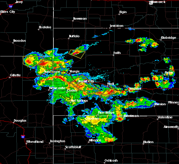 At 847 pm mdt, a severe thunderstorm was located over brownsville, or 5 miles south of lead, moving northeast at 20 mph (radar indicated). Hazards include 60 mph wind gusts and quarter size hail. Hail damage to vehicles is expected. expect wind damage to roofs, siding, and trees. this severe thunderstorm will be near, brownsville around 850 pm mdt. lead and deadwood around 900 pm mdt. galena around 905 pm mdt. sturgis and whitewood around 925 pm mdt. fort meade around 930 pm mdt. This includes interstate 90 in south dakota between mile markers 20 and 40. At 847 pm mdt, a severe thunderstorm was located over brownsville, or 5 miles south of lead, moving northeast at 20 mph (radar indicated). Hazards include 60 mph wind gusts and quarter size hail. Hail damage to vehicles is expected. expect wind damage to roofs, siding, and trees. this severe thunderstorm will be near, brownsville around 850 pm mdt. lead and deadwood around 900 pm mdt. galena around 905 pm mdt. sturgis and whitewood around 925 pm mdt. fort meade around 930 pm mdt. This includes interstate 90 in south dakota between mile markers 20 and 40.
|
| 6/29/2020 7:09 PM MDT |
 The severe thunderstorm warning for western meade and central lawrence counties will expire at 715 pm mdt, the storm which prompted the warning has weakened below severe limits, and no longer poses an immediate threat to life or property. therefore, the warning will be allowed to expire. however small hail is still possible with this thunderstorm. a tornado watch remains in effect until midnight mdt for west central south dakota. The severe thunderstorm warning for western meade and central lawrence counties will expire at 715 pm mdt, the storm which prompted the warning has weakened below severe limits, and no longer poses an immediate threat to life or property. therefore, the warning will be allowed to expire. however small hail is still possible with this thunderstorm. a tornado watch remains in effect until midnight mdt for west central south dakota.
|
| 6/29/2020 6:44 PM MDT |
 At 643 pm mdt, a severe thunderstorm was located near deadwood, or 3 miles east of lead, moving north at 25 mph (radar indicated). Hazards include half dollar size hail. Damage to vehicles is expected. locations impacted include, southeastern spearfish, northwestern sturgis, lead, deadwood, whitewood, saint onge, central city, galena, brownsville, apple springs and terry peak. This includes interstate 90 in south dakota between mile markers 14 and 30. At 643 pm mdt, a severe thunderstorm was located near deadwood, or 3 miles east of lead, moving north at 25 mph (radar indicated). Hazards include half dollar size hail. Damage to vehicles is expected. locations impacted include, southeastern spearfish, northwestern sturgis, lead, deadwood, whitewood, saint onge, central city, galena, brownsville, apple springs and terry peak. This includes interstate 90 in south dakota between mile markers 14 and 30.
|
| 6/29/2020 6:32 PM MDT |
 At 632 pm mdt, a severe thunderstorm was located near brownsville, or 4 miles southeast of lead, moving north at 30 mph (radar indicated). Hazards include half dollar size hail. damage to vehicles is expected At 632 pm mdt, a severe thunderstorm was located near brownsville, or 4 miles southeast of lead, moving north at 30 mph (radar indicated). Hazards include half dollar size hail. damage to vehicles is expected
|
| 6/29/2020 6:12 PM MDT |
 The severe thunderstorm warning for southeastern lawrence county will expire at 615 pm mdt, the storm which prompted the warning has weakened below severe limits, and no longer poses an immediate threat to life or property. therefore, the warning will be allowed to expire. however small hail and heavy rain are still possible with this thunderstorm. a tornado watch remains in effect until midnight mdt for west central south dakota. The severe thunderstorm warning for southeastern lawrence county will expire at 615 pm mdt, the storm which prompted the warning has weakened below severe limits, and no longer poses an immediate threat to life or property. therefore, the warning will be allowed to expire. however small hail and heavy rain are still possible with this thunderstorm. a tornado watch remains in effect until midnight mdt for west central south dakota.
|
| 6/29/2020 5:44 PM MDT |
 At 543 pm mdt, a severe thunderstorm was located near brownsville, or 6 miles south of lead, moving northeast at 15 mph (radar indicated). Hazards include quarter size hail. damage to vehicles is expected At 543 pm mdt, a severe thunderstorm was located near brownsville, or 6 miles south of lead, moving northeast at 15 mph (radar indicated). Hazards include quarter size hail. damage to vehicles is expected
|
| 6/28/2020 5:09 PM MDT |
 At 509 pm mdt, a severe thunderstorm was located near spearfish, moving east at 45 mph (radar indicated). Hazards include 60 mph wind gusts. Expect damage to roofs, siding, and trees. this severe storm will be near, saint onge around 520 pm mdt. whitewood around 525 pm mdt. This includes interstate 90 in south dakota between mile markers 1 and 28. At 509 pm mdt, a severe thunderstorm was located near spearfish, moving east at 45 mph (radar indicated). Hazards include 60 mph wind gusts. Expect damage to roofs, siding, and trees. this severe storm will be near, saint onge around 520 pm mdt. whitewood around 525 pm mdt. This includes interstate 90 in south dakota between mile markers 1 and 28.
|
| 6/28/2020 4:46 PM MDT |
 At 446 pm mdt, a severe thunderstorm was located 5 miles east of sundance, moving northeast at 35 mph (radar indicated). Hazards include 60 mph wind gusts and quarter size hail. Hail damage to vehicles is expected. expect wind damage to roofs, siding, and trees. this severe thunderstorm will be near, cement ridge lookout around 500 pm mdt. crow peak around 510 pm mdt. spearfish canyon around 515 pm mdt. spearfish around 525 pm mdt. whitewood and saint onge around 535 pm mdt. this includes, interstate 90 in south dakota between mile markers 1 and 28. Interstate 90 in wyoming between mile markers 186 and 196, and near mile marker 207. At 446 pm mdt, a severe thunderstorm was located 5 miles east of sundance, moving northeast at 35 mph (radar indicated). Hazards include 60 mph wind gusts and quarter size hail. Hail damage to vehicles is expected. expect wind damage to roofs, siding, and trees. this severe thunderstorm will be near, cement ridge lookout around 500 pm mdt. crow peak around 510 pm mdt. spearfish canyon around 515 pm mdt. spearfish around 525 pm mdt. whitewood and saint onge around 535 pm mdt. this includes, interstate 90 in south dakota between mile markers 1 and 28. Interstate 90 in wyoming between mile markers 186 and 196, and near mile marker 207.
|
| 6/6/2020 6:58 PM MDT |
 At 657 pm mdt, severe thunderstorms were located along a line extending from 6 miles southeast of gustave to 3 miles northwest of castle rock to 3 miles east of owl butte, moving northeast at 60 mph. these are very dangerous storms (radar indicated). Hazards include 80 mph wind gusts and penny size hail. Flying debris will be dangerous to those caught without shelter. mobile homes will be heavily damaged. expect considerable damage to roofs, windows, and vehicles. extensive tree damage and power outages are likely. these severe storms will be near, harding and hoover around 710 pm mdt. mud butte around 725 pm mdt. buffalo around 730 pm mdt. This includes interstate 90 in south dakota between mile markers 21 and 36. At 657 pm mdt, severe thunderstorms were located along a line extending from 6 miles southeast of gustave to 3 miles northwest of castle rock to 3 miles east of owl butte, moving northeast at 60 mph. these are very dangerous storms (radar indicated). Hazards include 80 mph wind gusts and penny size hail. Flying debris will be dangerous to those caught without shelter. mobile homes will be heavily damaged. expect considerable damage to roofs, windows, and vehicles. extensive tree damage and power outages are likely. these severe storms will be near, harding and hoover around 710 pm mdt. mud butte around 725 pm mdt. buffalo around 730 pm mdt. This includes interstate 90 in south dakota between mile markers 21 and 36.
|
| 6/6/2020 6:40 PM MDT |
 At 639 pm mdt, severe thunderstorms were located along a line extending from 8 miles northeast of colony to 2 miles southeast of arpan to 5 miles southeast of bear butte state park, moving northeast at 55 mph (radar indicated). Hazards include 70 mph wind gusts and penny size hail. Expect considerable tree damage. damage is likely to mobile homes, roofs, and outbuildings. severe thunderstorms will be near, newell lake around 650 pm mdt. castle rock and antelope butte around 655 pm mdt. fairpoint, redig and crow buttes around 715 pm mdt. zeona around 730 pm mdt. opal around 735 pm mdt. This includes interstate 90 in south dakota between mile markers 16 and 37. At 639 pm mdt, severe thunderstorms were located along a line extending from 8 miles northeast of colony to 2 miles southeast of arpan to 5 miles southeast of bear butte state park, moving northeast at 55 mph (radar indicated). Hazards include 70 mph wind gusts and penny size hail. Expect considerable tree damage. damage is likely to mobile homes, roofs, and outbuildings. severe thunderstorms will be near, newell lake around 650 pm mdt. castle rock and antelope butte around 655 pm mdt. fairpoint, redig and crow buttes around 715 pm mdt. zeona around 730 pm mdt. opal around 735 pm mdt. This includes interstate 90 in south dakota between mile markers 16 and 37.
|
| 6/6/2020 6:32 PM MDT |
 At 631 pm mdt, severe thunderstorms were located along a line extending from 5 miles north of alzada to 10 miles east of colony to 2 miles southwest of bear butte state park, moving north at 60 mph. these are very dangerous storms (radar indicated). Hazards include 80 mph wind gusts. Flying debris will be dangerous to those caught without shelter. mobile homes will be heavily damaged. expect considerable damage to roofs, windows, and vehicles. extensive tree damage and power outages are likely. these severe storms will be near, nisland, vale and antelope butte around 645 pm mdt. newell and owl butte around 650 pm mdt. newell lake around 700 pm mdt. castle rock around 705 pm mdt. this includes, interstate 90 in south dakota between mile markers 1 and 35. Interstate 90 in wyoming between mile markers 192 and 207. At 631 pm mdt, severe thunderstorms were located along a line extending from 5 miles north of alzada to 10 miles east of colony to 2 miles southwest of bear butte state park, moving north at 60 mph. these are very dangerous storms (radar indicated). Hazards include 80 mph wind gusts. Flying debris will be dangerous to those caught without shelter. mobile homes will be heavily damaged. expect considerable damage to roofs, windows, and vehicles. extensive tree damage and power outages are likely. these severe storms will be near, nisland, vale and antelope butte around 645 pm mdt. newell and owl butte around 650 pm mdt. newell lake around 700 pm mdt. castle rock around 705 pm mdt. this includes, interstate 90 in south dakota between mile markers 1 and 35. Interstate 90 in wyoming between mile markers 192 and 207.
|
| 6/6/2020 6:09 PM MDT |
 At 608 pm mdt, severe thunderstorms were located along a line extending from 13 miles northeast of new haven to 4 miles south of beulah to 2 miles north of rochford, moving north at 70 mph (radar indicated). Hazards include 70 mph wind gusts. Expect considerable tree damage. damage is likely to mobile homes, roofs, and outbuildings. severe thunderstorms will be near, spearfish, sturgis, whitewood and apple springs around 625 pm mdt. saint onge and colony around 630 pm mdt. nisland and fruitdale around 640 pm mdt. this includes, interstate 90 in south dakota between mile markers 1 and 35. Interstate 90 in wyoming between mile markers 192 and 207. At 608 pm mdt, severe thunderstorms were located along a line extending from 13 miles northeast of new haven to 4 miles south of beulah to 2 miles north of rochford, moving north at 70 mph (radar indicated). Hazards include 70 mph wind gusts. Expect considerable tree damage. damage is likely to mobile homes, roofs, and outbuildings. severe thunderstorms will be near, spearfish, sturgis, whitewood and apple springs around 625 pm mdt. saint onge and colony around 630 pm mdt. nisland and fruitdale around 640 pm mdt. this includes, interstate 90 in south dakota between mile markers 1 and 35. Interstate 90 in wyoming between mile markers 192 and 207.
|
| 6/4/2020 5:56 PM MDT |
 At 556 pm mdt, a severe thunderstorm was located near apple springs, or 6 miles northeast of lead, moving southeast at 45 mph. this is a very dangerous storm (radar indicated). Hazards include baseball size hail and 70 mph wind gusts. People and animals outdoors will be severely injured. expect shattered windows, extensive damage to roofs, siding, and vehicles. this severe thunderstorm will be near, sturgis around 600 pm mdt. summerset and piedmont around 620 pm mdt. rapid valley and ellsworth air force base around 640 pm mdt. box elder around 645 pm mdt. rapid city airport around 650 pm mdt. This includes interstate 90 in south dakota between mile markers 22 and 86. At 556 pm mdt, a severe thunderstorm was located near apple springs, or 6 miles northeast of lead, moving southeast at 45 mph. this is a very dangerous storm (radar indicated). Hazards include baseball size hail and 70 mph wind gusts. People and animals outdoors will be severely injured. expect shattered windows, extensive damage to roofs, siding, and vehicles. this severe thunderstorm will be near, sturgis around 600 pm mdt. summerset and piedmont around 620 pm mdt. rapid valley and ellsworth air force base around 640 pm mdt. box elder around 645 pm mdt. rapid city airport around 650 pm mdt. This includes interstate 90 in south dakota between mile markers 22 and 86.
|
| 6/4/2020 5:44 PM MDT |
 At 542 pm mdt, a severe thunderstorm was located near spearfish, moving southeast at 40 mph. this is a very dangerous storm (radar indicated and spotter confirmed. this storm has a history or producing large hail). Hazards include baseball size hail and 70 mph wind gusts. People and animals outdoors will be severely injured. expect shattered windows, extensive damage to roofs, siding, and vehicles. this severe storm will be near, central city around 550 pm mdt. lead, deadwood and whitewood around 555 pm mdt. sturgis, galena and apple springs around 600 pm mdt. piedmont around 620 pm mdt. This includes interstate 90 in south dakota between mile markers 5 and 45. At 542 pm mdt, a severe thunderstorm was located near spearfish, moving southeast at 40 mph. this is a very dangerous storm (radar indicated and spotter confirmed. this storm has a history or producing large hail). Hazards include baseball size hail and 70 mph wind gusts. People and animals outdoors will be severely injured. expect shattered windows, extensive damage to roofs, siding, and vehicles. this severe storm will be near, central city around 550 pm mdt. lead, deadwood and whitewood around 555 pm mdt. sturgis, galena and apple springs around 600 pm mdt. piedmont around 620 pm mdt. This includes interstate 90 in south dakota between mile markers 5 and 45.
|
| 6/4/2020 5:30 PM MDT |
 At 529 pm mdt, a severe thunderstorm was located 4 miles north of spearfish, moving southeast at 50 mph. this is a very dangerous storm (radar indicated). Hazards include baseball size hail and 70 mph wind gusts. People and animals outdoors will be severely injured. expect shattered windows, extensive damage to roofs, siding, and vehicles. this severe storm will be near, saint onge around 540 pm mdt. lead, deadwood, and central city around 545 pm mdt. sturgis around 550 pm mdt. piedmont around 610 pm mdt. This includes interstate 90 in south dakota between mile markers 1 and 45. At 529 pm mdt, a severe thunderstorm was located 4 miles north of spearfish, moving southeast at 50 mph. this is a very dangerous storm (radar indicated). Hazards include baseball size hail and 70 mph wind gusts. People and animals outdoors will be severely injured. expect shattered windows, extensive damage to roofs, siding, and vehicles. this severe storm will be near, saint onge around 540 pm mdt. lead, deadwood, and central city around 545 pm mdt. sturgis around 550 pm mdt. piedmont around 610 pm mdt. This includes interstate 90 in south dakota between mile markers 1 and 45.
|
| 6/4/2020 5:09 PM MDT |
 At 508 pm mdt, a severe thunderstorm was located 5 miles northeast of aladdin, or 13 miles west of belle fourche, moving southeast at 55 mph (radar indicated). Hazards include tennis ball size hail and 70 mph wind gusts. People and animals outdoors will be injured. expect hail damage to roofs, siding, windows, and vehicles. expect considerable tree damage. wind damage is also likely to mobile homes, roofs, and outbuildings. this severe storm will be near, belle fourche around 520 pm mdt. spearfish and saint onge around 530 pm mdt. whitewood around 540 pm mdt. sturgis, around 545 pm mdt. this includes, interstate 90 in south dakota between mile markers 1 and 45. Interstate 90 in wyoming between mile markers 204 and 207. At 508 pm mdt, a severe thunderstorm was located 5 miles northeast of aladdin, or 13 miles west of belle fourche, moving southeast at 55 mph (radar indicated). Hazards include tennis ball size hail and 70 mph wind gusts. People and animals outdoors will be injured. expect hail damage to roofs, siding, windows, and vehicles. expect considerable tree damage. wind damage is also likely to mobile homes, roofs, and outbuildings. this severe storm will be near, belle fourche around 520 pm mdt. spearfish and saint onge around 530 pm mdt. whitewood around 540 pm mdt. sturgis, around 545 pm mdt. this includes, interstate 90 in south dakota between mile markers 1 and 45. Interstate 90 in wyoming between mile markers 204 and 207.
|
| 6/4/2020 5:06 PM MDT |
 At 506 pm mdt, a severe thunderstorm was located 4 miles north of aladdin, or 15 miles west of belle fourche, moving southeast at 55 mph (radar indicated). Hazards include tennis ball size hail and 70 mph wind gusts. People and animals outdoors will be injured. expect hail damage to roofs, siding, windows, and vehicles. expect considerable tree damage. wind damage is also likely to mobile homes, roofs, and outbuildings. this severe thunderstorm will be near, beulah around 515 pm mdt. belle fourche around 520 pm mdt. crow peak around 525 pm mdt. spearfish, saint onge and northern spearfish canyon around 530 pm mdt. whitewood around 540 pm mdt. sturgis, galena, apple springs and bear butte state park around 545 pm mdt. fort meade around 550 pm mdt. tilford around 555 pm mdt. this includes, interstate 90 in south dakota between mile markers 1 and 45. Interstate 90 in wyoming between mile markers 204 and 207. At 506 pm mdt, a severe thunderstorm was located 4 miles north of aladdin, or 15 miles west of belle fourche, moving southeast at 55 mph (radar indicated). Hazards include tennis ball size hail and 70 mph wind gusts. People and animals outdoors will be injured. expect hail damage to roofs, siding, windows, and vehicles. expect considerable tree damage. wind damage is also likely to mobile homes, roofs, and outbuildings. this severe thunderstorm will be near, beulah around 515 pm mdt. belle fourche around 520 pm mdt. crow peak around 525 pm mdt. spearfish, saint onge and northern spearfish canyon around 530 pm mdt. whitewood around 540 pm mdt. sturgis, galena, apple springs and bear butte state park around 545 pm mdt. fort meade around 550 pm mdt. tilford around 555 pm mdt. this includes, interstate 90 in south dakota between mile markers 1 and 45. Interstate 90 in wyoming between mile markers 204 and 207.
|
| 5/20/2020 6:47 PM MDT |
 At 646 pm mdt, severe thunderstorms were located along a line extending from 8 miles southeast of colony to whitewood to 2 miles south of piedmont, moving northeast at 45 mph (radar indicated). Hazards include 60 mph wind gusts and nickel size hail. Expect damage to roofs, siding, and trees. locations impacted include, spearfish, sturgis, belle fourche, lead, deadwood, whitewood, nemo, piedmont, saint onge, central city, fruitdale, tilford, galena, dalton lake, bear butte state park, apple springs, fort meade, southeastern belle fourche reservoir and northeastern spearfish canyon. This includes interstate 90 in south dakota between mile markers 3 and 45. At 646 pm mdt, severe thunderstorms were located along a line extending from 8 miles southeast of colony to whitewood to 2 miles south of piedmont, moving northeast at 45 mph (radar indicated). Hazards include 60 mph wind gusts and nickel size hail. Expect damage to roofs, siding, and trees. locations impacted include, spearfish, sturgis, belle fourche, lead, deadwood, whitewood, nemo, piedmont, saint onge, central city, fruitdale, tilford, galena, dalton lake, bear butte state park, apple springs, fort meade, southeastern belle fourche reservoir and northeastern spearfish canyon. This includes interstate 90 in south dakota between mile markers 3 and 45.
|
| 5/20/2020 6:30 PM MDT |
 At 630 pm mdt, severe thunderstorms were located along a line extending from near aladdin to near lead to pactola reservoir, moving northeast at 45 mph (radar indicated). Hazards include 60 mph wind gusts. Expect damage to roofs, siding, and trees. these severe storms will be near, deadwood and galena around 635 pm mdt. spearfish and apple springs around 640 pm mdt. sturgis, black hawk, whitewood and dalton lake around 645 pm mdt. summerset, piedmont, saint onge and tilford around 650 pm mdt. this includes, interstate 90 in south dakota between mile markers 1 and 55. Interstate 90 in wyoming between mile markers 198 and 207. At 630 pm mdt, severe thunderstorms were located along a line extending from near aladdin to near lead to pactola reservoir, moving northeast at 45 mph (radar indicated). Hazards include 60 mph wind gusts. Expect damage to roofs, siding, and trees. these severe storms will be near, deadwood and galena around 635 pm mdt. spearfish and apple springs around 640 pm mdt. sturgis, black hawk, whitewood and dalton lake around 645 pm mdt. summerset, piedmont, saint onge and tilford around 650 pm mdt. this includes, interstate 90 in south dakota between mile markers 1 and 55. Interstate 90 in wyoming between mile markers 198 and 207.
|
| 5/20/2020 6:17 PM MDT |
 At 616 pm mdt, severe thunderstorms were located along a line extending from 7 miles east of warren peak to 4 miles south of cheyenne crossing to 4 miles south of mystic, moving northeast at 45 mph (radar indicated). Hazards include 60 mph wind gusts. expect damage to roofs, siding, and trees At 616 pm mdt, severe thunderstorms were located along a line extending from 7 miles east of warren peak to 4 miles south of cheyenne crossing to 4 miles south of mystic, moving northeast at 45 mph (radar indicated). Hazards include 60 mph wind gusts. expect damage to roofs, siding, and trees
|
| 5/3/2020 2:57 PM MDT |
 At 256 pm mdt, a severe thunderstorm was located over apple springs, or 4 miles west of sturgis, moving east at 15 mph (trained weather spotters reported half dollar sized hail 3 miles east-northeast of deadwood). Hazards include 60 mph wind gusts and half dollar size hail. Hail damage to vehicles is expected. expect wind damage to roofs, siding, and trees. this severe storm will be near, sturgis around 305 pm mdt. fort meade around 320 pm mdt. This includes interstate 90 in south dakota between mile markers 26 and 44. At 256 pm mdt, a severe thunderstorm was located over apple springs, or 4 miles west of sturgis, moving east at 15 mph (trained weather spotters reported half dollar sized hail 3 miles east-northeast of deadwood). Hazards include 60 mph wind gusts and half dollar size hail. Hail damage to vehicles is expected. expect wind damage to roofs, siding, and trees. this severe storm will be near, sturgis around 305 pm mdt. fort meade around 320 pm mdt. This includes interstate 90 in south dakota between mile markers 26 and 44.
|
| 5/3/2020 2:45 PM MDT |
 At 244 pm mdt, a severe thunderstorm was located near apple springs, or 6 miles northeast of lead, moving southeast at 25 mph (radar indicated). Hazards include 60 mph wind gusts and quarter size hail. Hail damage to vehicles is expected. expect wind damage to roofs, siding, and trees. this severe thunderstorm will be near, galena and apple springs around 250 pm mdt. sturgis around 255 pm mdt. fort meade around 305 pm mdt. tilford and dalton lake around 315 pm mdt. This includes interstate 90 in south dakota between mile markers 26 and 44. At 244 pm mdt, a severe thunderstorm was located near apple springs, or 6 miles northeast of lead, moving southeast at 25 mph (radar indicated). Hazards include 60 mph wind gusts and quarter size hail. Hail damage to vehicles is expected. expect wind damage to roofs, siding, and trees. this severe thunderstorm will be near, galena and apple springs around 250 pm mdt. sturgis around 255 pm mdt. fort meade around 305 pm mdt. tilford and dalton lake around 315 pm mdt. This includes interstate 90 in south dakota between mile markers 26 and 44.
|
| 9/29/2019 10:37 PM MDT |
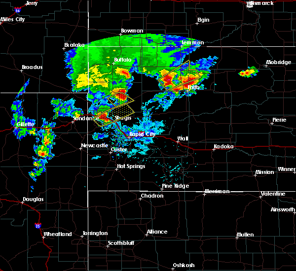 At 1037 pm mdt, a severe thunderstorm was located 3 miles north of whitewood, or 9 miles northwest of sturgis, moving northeast at 45 mph (radar indicated). Hazards include quarter size hail. Damage to vehicles is expected. locations impacted include, whitewood, newell, nisland, saint onge, vale, bear butte state park and owl butte. This includes interstate 90 in south dakota between mile markers 18 and 28. At 1037 pm mdt, a severe thunderstorm was located 3 miles north of whitewood, or 9 miles northwest of sturgis, moving northeast at 45 mph (radar indicated). Hazards include quarter size hail. Damage to vehicles is expected. locations impacted include, whitewood, newell, nisland, saint onge, vale, bear butte state park and owl butte. This includes interstate 90 in south dakota between mile markers 18 and 28.
|
| 9/29/2019 10:26 PM MDT |
 At 1025 pm mdt, a severe thunderstorm was located 3 miles north of central city, or 5 miles north of lead, moving northeast at 45 mph (radar indicated). Hazards include half dollar size hail. Damage to vehicles is expected. locations impacted include, spearfish, northwestern sturgis, lead, deadwood, whitewood, newell, nisland, saint onge, vale, central city, bear butte state park, apple springs, owl butte, bridal veil falls and northeastern spearfish canyon. This includes interstate 90 in south dakota between mile markers 11 and 30. At 1025 pm mdt, a severe thunderstorm was located 3 miles north of central city, or 5 miles north of lead, moving northeast at 45 mph (radar indicated). Hazards include half dollar size hail. Damage to vehicles is expected. locations impacted include, spearfish, northwestern sturgis, lead, deadwood, whitewood, newell, nisland, saint onge, vale, central city, bear butte state park, apple springs, owl butte, bridal veil falls and northeastern spearfish canyon. This includes interstate 90 in south dakota between mile markers 11 and 30.
|
| 9/29/2019 10:12 PM MDT |
 At 1011 pm mdt, a severe thunderstorm was located over southwestern spearfish canyon, or 9 miles west of lead, moving northeast at 45 mph (radar indicated). Hazards include quarter size hail. damage to vehicles is expected At 1011 pm mdt, a severe thunderstorm was located over southwestern spearfish canyon, or 9 miles west of lead, moving northeast at 45 mph (radar indicated). Hazards include quarter size hail. damage to vehicles is expected
|
| 9/29/2019 8:42 PM MDT |
 At 842 pm mdt, a severe thunderstorm was located 4 miles east of spearfish, moving northeast at 40 mph (radar indicated). Hazards include quarter size hail. Damage to vehicles is expected. locations impacted include, spearfish, whitewood, saint onge and northeastern spearfish canyon. This includes interstate 90 in south dakota between mile markers 9 and 27. At 842 pm mdt, a severe thunderstorm was located 4 miles east of spearfish, moving northeast at 40 mph (radar indicated). Hazards include quarter size hail. Damage to vehicles is expected. locations impacted include, spearfish, whitewood, saint onge and northeastern spearfish canyon. This includes interstate 90 in south dakota between mile markers 9 and 27.
|
| 9/29/2019 8:34 PM MDT |
 At 833 pm mdt, a severe thunderstorm was located over bridal veil falls, or 5 miles south of spearfish, moving northeast at 40 mph (radar indicated). Hazards include golf ball size hail and 60 mph wind gusts. People and animals outdoors will be injured. expect hail damage to roofs, siding, windows, and vehicles. expect wind damage to roofs, siding, and trees. locations impacted include, spearfish, lead, deadwood, whitewood, saint onge, central city, crow peak, roughlock falls, savoy, bridal veil falls and spearfish canyon. This includes interstate 90 in south dakota between mile markers 9 and 27. At 833 pm mdt, a severe thunderstorm was located over bridal veil falls, or 5 miles south of spearfish, moving northeast at 40 mph (radar indicated). Hazards include golf ball size hail and 60 mph wind gusts. People and animals outdoors will be injured. expect hail damage to roofs, siding, windows, and vehicles. expect wind damage to roofs, siding, and trees. locations impacted include, spearfish, lead, deadwood, whitewood, saint onge, central city, crow peak, roughlock falls, savoy, bridal veil falls and spearfish canyon. This includes interstate 90 in south dakota between mile markers 9 and 27.
|
| 9/29/2019 8:23 PM MDT |
 At 822 pm mdt, a severe thunderstorm was located over roughlock falls, or 8 miles west of lead, moving northeast at 40 mph. this is a very dangerous storm (radar indicated). Hazards include baseball size hail and 60 mph wind gusts. People and animals outdoors will be severely injured. expect shattered windows, extensive damage to roofs, siding, and vehicles. locations impacted include, spearfish, lead, deadwood, whitewood, saint onge, central city, iron creek lake, roughlock falls, cement ridge lookout, savoy, bridal veil falls, crow peak, terry peak and spearfish canyon. This includes interstate 90 in south dakota between mile markers 9 and 27. At 822 pm mdt, a severe thunderstorm was located over roughlock falls, or 8 miles west of lead, moving northeast at 40 mph. this is a very dangerous storm (radar indicated). Hazards include baseball size hail and 60 mph wind gusts. People and animals outdoors will be severely injured. expect shattered windows, extensive damage to roofs, siding, and vehicles. locations impacted include, spearfish, lead, deadwood, whitewood, saint onge, central city, iron creek lake, roughlock falls, cement ridge lookout, savoy, bridal veil falls, crow peak, terry peak and spearfish canyon. This includes interstate 90 in south dakota between mile markers 9 and 27.
|
| 9/29/2019 8:20 PM MDT |
 At 820 pm mdt, a severe thunderstorm was located over iron creek lake, or 10 miles west of lead, moving northeast at 40 mph (radar indicated). Hazards include golf ball size hail and 60 mph wind gusts. People and animals outdoors will be injured. expect hail damage to roofs, siding, windows, and vehicles. expect wind damage to roofs, siding, and trees. locations impacted include, spearfish, lead, deadwood, whitewood, saint onge, central city, iron creek lake, roughlock falls, cement ridge lookout, savoy, bridal veil falls, crow peak, terry peak and spearfish canyon. This includes interstate 90 in south dakota between mile markers 9 and 27. At 820 pm mdt, a severe thunderstorm was located over iron creek lake, or 10 miles west of lead, moving northeast at 40 mph (radar indicated). Hazards include golf ball size hail and 60 mph wind gusts. People and animals outdoors will be injured. expect hail damage to roofs, siding, windows, and vehicles. expect wind damage to roofs, siding, and trees. locations impacted include, spearfish, lead, deadwood, whitewood, saint onge, central city, iron creek lake, roughlock falls, cement ridge lookout, savoy, bridal veil falls, crow peak, terry peak and spearfish canyon. This includes interstate 90 in south dakota between mile markers 9 and 27.
|
| 9/29/2019 8:10 PM MDT |
 At 810 pm mdt, a severe thunderstorm was located 4 miles east of moskee, or 15 miles southeast of sundance, moving northeast at 40 mph (radar indicated). Hazards include 60 mph wind gusts and quarter size hail. Hail damage to vehicles is expected. Expect wind damage to roofs, siding, and trees. At 810 pm mdt, a severe thunderstorm was located 4 miles east of moskee, or 15 miles southeast of sundance, moving northeast at 40 mph (radar indicated). Hazards include 60 mph wind gusts and quarter size hail. Hail damage to vehicles is expected. Expect wind damage to roofs, siding, and trees.
|
| 8/17/2019 11:11 AM MDT |
 At 1110 am mdt, a severe thunderstorm was located over deadwood, or 3 miles east of lead, moving southeast at 15 mph. ping pong ball size hail was reported in deadwood at 1109 am (trained weather spotters). Hazards include ping pong ball size hail. People and animals outdoors will be injured. expect damage to roofs, siding, windows, and vehicles. locations impacted include, sturgis, lead, deadwood, whitewood, central city, galena, brownsville, fort meade and apple springs. This includes interstate 90 in south dakota between mile markers 26 and 37. At 1110 am mdt, a severe thunderstorm was located over deadwood, or 3 miles east of lead, moving southeast at 15 mph. ping pong ball size hail was reported in deadwood at 1109 am (trained weather spotters). Hazards include ping pong ball size hail. People and animals outdoors will be injured. expect damage to roofs, siding, windows, and vehicles. locations impacted include, sturgis, lead, deadwood, whitewood, central city, galena, brownsville, fort meade and apple springs. This includes interstate 90 in south dakota between mile markers 26 and 37.
|
| 8/17/2019 11:05 AM MDT |
 The national weather service in rapid city has issued a * severe thunderstorm warning for. southwestern meade county in west central south dakota. southeastern lawrence county in west central south dakota. until noon mdt. At 1105 am mdt, a severe thunderstorm was located over deadwood, or. The national weather service in rapid city has issued a * severe thunderstorm warning for. southwestern meade county in west central south dakota. southeastern lawrence county in west central south dakota. until noon mdt. At 1105 am mdt, a severe thunderstorm was located over deadwood, or.
|
| 8/14/2019 10:23 PM MDT |
 At 1023 pm mdt, a severe thunderstorm was located 3 miles north of iron creek lake, or 7 miles southwest of spearfish, moving southeast at 35 mph (radar indicated). Hazards include ping pong ball size hail. People and animals outdoors will be injured. expect damage to roofs, siding, windows, and vehicles. locations impacted include, spearfish, lead, whitewood, central city, cheyenne crossing, iron creek lake, roughlock falls, cement ridge lookout, savoy, bridal veil falls, crow peak, terry peak, spearfish canyon and o`neil pass. This includes interstate 90 in south dakota between mile markers 3 and 19. At 1023 pm mdt, a severe thunderstorm was located 3 miles north of iron creek lake, or 7 miles southwest of spearfish, moving southeast at 35 mph (radar indicated). Hazards include ping pong ball size hail. People and animals outdoors will be injured. expect damage to roofs, siding, windows, and vehicles. locations impacted include, spearfish, lead, whitewood, central city, cheyenne crossing, iron creek lake, roughlock falls, cement ridge lookout, savoy, bridal veil falls, crow peak, terry peak, spearfish canyon and o`neil pass. This includes interstate 90 in south dakota between mile markers 3 and 19.
|
| 8/14/2019 10:06 PM MDT |
 At 1006 pm mdt, a severe thunderstorm was located over beulah, or 11 miles west of spearfish, moving southeast at 35 mph (radar indicated). Hazards include golf ball size hail. People and animals outdoors will be injured. expect damage to roofs, siding, windows, and vehicles. locations impacted include, spearfish, lead, whitewood, central city, beulah, aladdin, cheyenne crossing, iron creek lake, o`neil pass, roughlock falls, cement ridge lookout, savoy, bridal veil falls, crow peak, terry peak and spearfish canyon. this includes, interstate 90 in south dakota between mile markers 1 and 25. Interstate 90 in wyoming between mile markers 197 and 207. At 1006 pm mdt, a severe thunderstorm was located over beulah, or 11 miles west of spearfish, moving southeast at 35 mph (radar indicated). Hazards include golf ball size hail. People and animals outdoors will be injured. expect damage to roofs, siding, windows, and vehicles. locations impacted include, spearfish, lead, whitewood, central city, beulah, aladdin, cheyenne crossing, iron creek lake, o`neil pass, roughlock falls, cement ridge lookout, savoy, bridal veil falls, crow peak, terry peak and spearfish canyon. this includes, interstate 90 in south dakota between mile markers 1 and 25. Interstate 90 in wyoming between mile markers 197 and 207.
|
| 8/14/2019 9:44 PM MDT |
 At 944 pm mdt, a severe thunderstorm was located 3 miles west of aladdin, or 18 miles north of sundance, moving southeast at 35 mph (radar indicated). Hazards include ping pong ball size hail. People and animals outdoors will be injured. Expect damage to roofs, siding, windows, and vehicles. At 944 pm mdt, a severe thunderstorm was located 3 miles west of aladdin, or 18 miles north of sundance, moving southeast at 35 mph (radar indicated). Hazards include ping pong ball size hail. People and animals outdoors will be injured. Expect damage to roofs, siding, windows, and vehicles.
|
| 8/9/2019 3:28 PM MDT | Quarter sized hail reported 9.3 miles WSW of Whitewood, SD |
| 7/31/2019 9:48 PM MDT |
 At 948 pm mdt, a severe thunderstorm was located 7 miles south of nisland, or 10 miles north of sturgis, moving east at 35 mph (radar indicated). Hazards include 60 mph wind gusts and quarter size hail. Hail damage to vehicles is expected. Expect wind damage to roofs, siding, and trees. At 948 pm mdt, a severe thunderstorm was located 7 miles south of nisland, or 10 miles north of sturgis, moving east at 35 mph (radar indicated). Hazards include 60 mph wind gusts and quarter size hail. Hail damage to vehicles is expected. Expect wind damage to roofs, siding, and trees.
|
| 7/30/2019 11:54 PM MDT |
 At 1154 pm mdt, a severe thunderstorm was located near galena, or 4 miles east of lead, moving east at 20 mph (radar indicated). Hazards include ping pong ball size hail and 60 mph wind gusts. People and animals outdoors will be injured. expect hail damage to roofs, siding, windows, and vehicles. Expect wind damage to roofs, siding, and trees. At 1154 pm mdt, a severe thunderstorm was located near galena, or 4 miles east of lead, moving east at 20 mph (radar indicated). Hazards include ping pong ball size hail and 60 mph wind gusts. People and animals outdoors will be injured. expect hail damage to roofs, siding, windows, and vehicles. Expect wind damage to roofs, siding, and trees.
|
| 7/17/2019 6:18 PM MDT |
 At 618 pm mdt, a severe thunderstorm was located over bridal veil falls, or 6 miles south of spearfish, moving east at 25 mph (satellite and lightning indicated). Hazards include two inch hail and 60 mph wind gusts. People and animals outdoors will be injured. expect hail damage to roofs, siding, windows, and vehicles. expect wind damage to roofs, siding, and trees. locations impacted include, spearfish, northwestern sturgis, lead, deadwood, whitewood, central city, brownsville, cheyenne crossing, galena, iron creek lake, apple springs, roughlock falls, cement ridge lookout, savoy, bridal veil falls, crow peak, terry peak and spearfish canyon. this includes, interstate 90 in south dakota between mile markers 1 and 29. Interstate 90 in wyoming near mile marker 207. At 618 pm mdt, a severe thunderstorm was located over bridal veil falls, or 6 miles south of spearfish, moving east at 25 mph (satellite and lightning indicated). Hazards include two inch hail and 60 mph wind gusts. People and animals outdoors will be injured. expect hail damage to roofs, siding, windows, and vehicles. expect wind damage to roofs, siding, and trees. locations impacted include, spearfish, northwestern sturgis, lead, deadwood, whitewood, central city, brownsville, cheyenne crossing, galena, iron creek lake, apple springs, roughlock falls, cement ridge lookout, savoy, bridal veil falls, crow peak, terry peak and spearfish canyon. this includes, interstate 90 in south dakota between mile markers 1 and 29. Interstate 90 in wyoming near mile marker 207.
|
| 7/17/2019 6:07 PM MDT |
 At 606 pm mdt, a severe thunderstorm was located 3 miles south of crow peak, or 7 miles southwest of spearfish, moving east at 25 mph (law enforcement). Hazards include tennis ball size hail and 60 mph wind gusts. People and animals outdoors will be injured. expect hail damage to roofs, siding, windows, and vehicles. expect wind damage to roofs, siding, and trees. locations impacted include, spearfish, northwestern sturgis, lead, deadwood, whitewood, central city, beulah, brownsville, cheyenne crossing, galena, iron creek lake, apple springs, roughlock falls, cement ridge lookout, savoy, bridal veil falls, crow peak, terry peak and spearfish canyon. this includes, interstate 90 in south dakota between mile markers 1 and 29. Interstate 90 in wyoming between mile markers 190 and 207. At 606 pm mdt, a severe thunderstorm was located 3 miles south of crow peak, or 7 miles southwest of spearfish, moving east at 25 mph (law enforcement). Hazards include tennis ball size hail and 60 mph wind gusts. People and animals outdoors will be injured. expect hail damage to roofs, siding, windows, and vehicles. expect wind damage to roofs, siding, and trees. locations impacted include, spearfish, northwestern sturgis, lead, deadwood, whitewood, central city, beulah, brownsville, cheyenne crossing, galena, iron creek lake, apple springs, roughlock falls, cement ridge lookout, savoy, bridal veil falls, crow peak, terry peak and spearfish canyon. this includes, interstate 90 in south dakota between mile markers 1 and 29. Interstate 90 in wyoming between mile markers 190 and 207.
|
| 7/17/2019 5:59 PM MDT |
 The national weather service in rapid city has issued a * severe thunderstorm warning for. western meade county in west central south dakota. lawrence county in west central south dakota. east central crook county in northeastern wyoming. Until 700 pm mdt. The national weather service in rapid city has issued a * severe thunderstorm warning for. western meade county in west central south dakota. lawrence county in west central south dakota. east central crook county in northeastern wyoming. Until 700 pm mdt.
|
| 7/17/2019 5:59 PM MDT |
 At 558 pm mdt, a severe thunderstorm was located 4 miles southwest of crow peak, or 9 miles southwest of spearfish, moving east at 25 mph (radar indicated). Hazards include two inch hail and 60 mph wind gusts. People and animals outdoors will be injured. expect hail damage to roofs, siding, windows, and vehicles. Expect wind damage to roofs, siding, and trees. At 558 pm mdt, a severe thunderstorm was located 4 miles southwest of crow peak, or 9 miles southwest of spearfish, moving east at 25 mph (radar indicated). Hazards include two inch hail and 60 mph wind gusts. People and animals outdoors will be injured. expect hail damage to roofs, siding, windows, and vehicles. Expect wind damage to roofs, siding, and trees.
|
| 7/16/2019 8:28 PM MDT |
 At 827 pm mdt, a severe thunderstorm was located 4 miles southeast of arpan, or 13 miles east of belle fourche, moving northeast at 30 mph (radar indicated. at 800 pm, golfball sized hail was reported 1 mile south of downtown spearfish). Hazards include tennis ball size hail and 60 mph wind gusts. People and animals outdoors will be injured. expect hail damage to roofs, siding, windows, and vehicles. expect wind damage to roofs, siding, and trees. locations impacted include, belle fourche, newell, nisland, saint onge, vale, fruitdale, antelope butte, arpan and belle fourche reservoir. This includes interstate 90 in south dakota between mile markers 19 and 24. At 827 pm mdt, a severe thunderstorm was located 4 miles southeast of arpan, or 13 miles east of belle fourche, moving northeast at 30 mph (radar indicated. at 800 pm, golfball sized hail was reported 1 mile south of downtown spearfish). Hazards include tennis ball size hail and 60 mph wind gusts. People and animals outdoors will be injured. expect hail damage to roofs, siding, windows, and vehicles. expect wind damage to roofs, siding, and trees. locations impacted include, belle fourche, newell, nisland, saint onge, vale, fruitdale, antelope butte, arpan and belle fourche reservoir. This includes interstate 90 in south dakota between mile markers 19 and 24.
|
| 7/16/2019 8:06 PM MDT |
 At 806 pm mdt, a severe thunderstorm was located 3 miles southwest of fruitdale, or 5 miles east of belle fourche, moving northeast at 30 mph (radar indicated). Hazards include 60 mph wind gusts and half dollar size hail. Hail damage to vehicles is expected. Expect wind damage to roofs, siding, and trees. At 806 pm mdt, a severe thunderstorm was located 3 miles southwest of fruitdale, or 5 miles east of belle fourche, moving northeast at 30 mph (radar indicated). Hazards include 60 mph wind gusts and half dollar size hail. Hail damage to vehicles is expected. Expect wind damage to roofs, siding, and trees.
|
| 7/5/2019 4:56 PM MDT |
 The severe thunderstorm warning for west central meade, southeastern lawrence, west central pennington and northeastern weston counties will expire at 500 pm mdt, the storms which prompted the warning have weakened below severe limits or have exited the warned area. therefore, the warning will be allowed to expire. however, heavy rain is still possible with these thunderstorms. a severe thunderstorm watch remains in effect until 900 pm mdt for northwestern and west central south dakota, and northeastern wyoming. remember, a severe thunderstorm warning still remains in effect for southwestern meade county until 545 pm mdt. The severe thunderstorm warning for west central meade, southeastern lawrence, west central pennington and northeastern weston counties will expire at 500 pm mdt, the storms which prompted the warning have weakened below severe limits or have exited the warned area. therefore, the warning will be allowed to expire. however, heavy rain is still possible with these thunderstorms. a severe thunderstorm watch remains in effect until 900 pm mdt for northwestern and west central south dakota, and northeastern wyoming. remember, a severe thunderstorm warning still remains in effect for southwestern meade county until 545 pm mdt.
|
| 7/5/2019 4:56 PM MDT |
 At 424 pm mdt, severe thunderstorms were located along a line extending from 4 miles southwest of vale to near apple springs to 2 miles west of crooks tower, moving east at 35 mph (radar indicated). Hazards include golf ball size hail and 60 mph wind gusts. People and animals outdoors will be injured. expect hail damage to roofs, siding, windows, and vehicles. expect wind damage to roofs, siding, and trees. locations impacted include, sturgis, lead, deadwood, whitewood, brownsville, four corners, buckhorn, galena, bear butte state park, apple springs, o`neil pass, roubaix lake, crooks tower, fort meade, mallo camp and black fox campground. This includes interstate 90 in south dakota between mile markers 23 and 38. At 424 pm mdt, severe thunderstorms were located along a line extending from 4 miles southwest of vale to near apple springs to 2 miles west of crooks tower, moving east at 35 mph (radar indicated). Hazards include golf ball size hail and 60 mph wind gusts. People and animals outdoors will be injured. expect hail damage to roofs, siding, windows, and vehicles. expect wind damage to roofs, siding, and trees. locations impacted include, sturgis, lead, deadwood, whitewood, brownsville, four corners, buckhorn, galena, bear butte state park, apple springs, o`neil pass, roubaix lake, crooks tower, fort meade, mallo camp and black fox campground. This includes interstate 90 in south dakota between mile markers 23 and 38.
|
| 7/5/2019 4:24 PM MDT |
 At 424 pm mdt, severe thunderstorms were located along a line extending from 4 miles southwest of vale to near apple springs to 2 miles west of crooks tower, moving east at 35 mph (radar indicated). Hazards include golf ball size hail and 60 mph wind gusts. People and animals outdoors will be injured. expect hail damage to roofs, siding, windows, and vehicles. expect wind damage to roofs, siding, and trees. locations impacted include, sturgis, lead, deadwood, whitewood, brownsville, four corners, buckhorn, galena, bear butte state park, apple springs, o`neil pass, roubaix lake, crooks tower, fort meade, mallo camp and black fox campground. This includes interstate 90 in south dakota between mile markers 23 and 38. At 424 pm mdt, severe thunderstorms were located along a line extending from 4 miles southwest of vale to near apple springs to 2 miles west of crooks tower, moving east at 35 mph (radar indicated). Hazards include golf ball size hail and 60 mph wind gusts. People and animals outdoors will be injured. expect hail damage to roofs, siding, windows, and vehicles. expect wind damage to roofs, siding, and trees. locations impacted include, sturgis, lead, deadwood, whitewood, brownsville, four corners, buckhorn, galena, bear butte state park, apple springs, o`neil pass, roubaix lake, crooks tower, fort meade, mallo camp and black fox campground. This includes interstate 90 in south dakota between mile markers 23 and 38.
|
| 7/5/2019 3:54 PM MDT |
 At 353 pm mdt, severe thunderstorms were located along a line extending from 5 miles south of belle fourche to 3 miles northeast of cement ridge lookout to 3 miles southwest of inyan kara mountain, moving east at 30 mph (trained weather spotters). Hazards include golf ball size hail and 60 mph wind gusts. People and animals outdoors will be injured. expect hail damage to roofs, siding, windows, and vehicles. Expect wind damage to roofs, siding, and trees. At 353 pm mdt, severe thunderstorms were located along a line extending from 5 miles south of belle fourche to 3 miles northeast of cement ridge lookout to 3 miles southwest of inyan kara mountain, moving east at 30 mph (trained weather spotters). Hazards include golf ball size hail and 60 mph wind gusts. People and animals outdoors will be injured. expect hail damage to roofs, siding, windows, and vehicles. Expect wind damage to roofs, siding, and trees.
|
| 7/2/2019 7:17 PM MDT |
 At 717 pm mdt, a severe thunderstorm was located over whitewood, or 6 miles northwest of sturgis, moving east at 35 mph (radar indicated). Hazards include 60 mph wind gusts. Expect damage to roofs, siding, and trees. locations impacted include, southeastern spearfish, sturgis, lead, summerset, deadwood, whitewood, piedmont, saint onge, central city, brownsville, tilford, galena, bear butte state park, apple springs and fort meade. This includes interstate 90 in south dakota between mile markers 16 and 46. At 717 pm mdt, a severe thunderstorm was located over whitewood, or 6 miles northwest of sturgis, moving east at 35 mph (radar indicated). Hazards include 60 mph wind gusts. Expect damage to roofs, siding, and trees. locations impacted include, southeastern spearfish, sturgis, lead, summerset, deadwood, whitewood, piedmont, saint onge, central city, brownsville, tilford, galena, bear butte state park, apple springs and fort meade. This includes interstate 90 in south dakota between mile markers 16 and 46.
|
| 7/2/2019 6:55 PM MDT |
 At 654 pm mdt, a severe thunderstorm was located over southern spearfish canyon, or 7 miles west of lead, moving east at 40 mph (radar indicated). Hazards include 60 mph wind gusts. expect damage to roofs, siding, and trees At 654 pm mdt, a severe thunderstorm was located over southern spearfish canyon, or 7 miles west of lead, moving east at 40 mph (radar indicated). Hazards include 60 mph wind gusts. expect damage to roofs, siding, and trees
|
| 6/26/2019 10:01 PM MDT |
 At 1001 pm mdt, severe thunderstorms were located along a line extending from 2 miles northeast of alzada to 5 miles north of aladdin to 3 miles south of sundance, moving east at 40 mph (radar indicated). Hazards include 70 mph wind gusts and quarter size hail. Hail damage to vehicles is expected. expect considerable tree damage. Wind damage is also likely to mobile homes, roofs, and outbuildings. At 1001 pm mdt, severe thunderstorms were located along a line extending from 2 miles northeast of alzada to 5 miles north of aladdin to 3 miles south of sundance, moving east at 40 mph (radar indicated). Hazards include 70 mph wind gusts and quarter size hail. Hail damage to vehicles is expected. expect considerable tree damage. Wind damage is also likely to mobile homes, roofs, and outbuildings.
|
| 6/25/2019 9:38 PM MDT |
 At 938 pm mdt, severe thunderstorms were located along a line extending from 3 miles east of whitewood to 3 miles east of brownsville, moving east at 35 mph (radar indicated). Hazards include quarter size hail. damage to vehicles is expected At 938 pm mdt, severe thunderstorms were located along a line extending from 3 miles east of whitewood to 3 miles east of brownsville, moving east at 35 mph (radar indicated). Hazards include quarter size hail. damage to vehicles is expected
|
| 6/25/2019 9:03 PM MDT |
 At 903 pm mdt, a severe thunderstorm was located 4 miles northwest of saint onge, or 6 miles north of spearfish, moving east at 40 mph (radar indicated). Hazards include 60 mph wind gusts and half dollar size hail. Hail damage to vehicles is expected. expect wind damage to roofs, siding, and trees. locations impacted include, spearfish, belle fourche, whitewood, saint onge, fruitdale, arpan, belle fourche reservoir and northeastern spearfish canyon. This includes interstate 90 in south dakota between mile markers 1 and 28. At 903 pm mdt, a severe thunderstorm was located 4 miles northwest of saint onge, or 6 miles north of spearfish, moving east at 40 mph (radar indicated). Hazards include 60 mph wind gusts and half dollar size hail. Hail damage to vehicles is expected. expect wind damage to roofs, siding, and trees. locations impacted include, spearfish, belle fourche, whitewood, saint onge, fruitdale, arpan, belle fourche reservoir and northeastern spearfish canyon. This includes interstate 90 in south dakota between mile markers 1 and 28.
|
| 6/25/2019 8:52 PM MDT |
 At 851 pm mdt, a severe thunderstorm was located 6 miles north of beulah, or 10 miles west of belle fourche, moving east at 40 mph (radar indicated. at 850 pm mdt, golf ball size hail was reported 3 miles north aladdin). Hazards include golf ball size hail and 60 mph wind gusts. People and animals outdoors will be injured. expect hail damage to roofs, siding, windows, and vehicles. expect wind damage to roofs, siding, and trees. locations impacted include, spearfish, belle fourche, whitewood, saint onge, beulah, fruitdale, aladdin, arpan, belle fourche reservoir and northeastern spearfish canyon. this includes, interstate 90 in south dakota between mile markers 1 and 28. Interstate 90 in wyoming between mile markers 201 and 207. At 851 pm mdt, a severe thunderstorm was located 6 miles north of beulah, or 10 miles west of belle fourche, moving east at 40 mph (radar indicated. at 850 pm mdt, golf ball size hail was reported 3 miles north aladdin). Hazards include golf ball size hail and 60 mph wind gusts. People and animals outdoors will be injured. expect hail damage to roofs, siding, windows, and vehicles. expect wind damage to roofs, siding, and trees. locations impacted include, spearfish, belle fourche, whitewood, saint onge, beulah, fruitdale, aladdin, arpan, belle fourche reservoir and northeastern spearfish canyon. this includes, interstate 90 in south dakota between mile markers 1 and 28. Interstate 90 in wyoming between mile markers 201 and 207.
|
| 6/25/2019 8:46 PM MDT |
 At 846 pm mdt, a severe thunderstorm was located 3 miles east of aladdin, or 13 miles west of belle fourche, moving east at 35 mph (radar indicated). Hazards include golf ball size hail and 60 mph wind gusts. People and animals outdoors will be injured. expect hail damage to roofs, siding, windows, and vehicles. expect wind damage to roofs, siding, and trees. locations impacted include, spearfish, belle fourche, whitewood, saint onge, beulah, fruitdale, aladdin, arpan, belle fourche reservoir and northeastern spearfish canyon. this includes, interstate 90 in south dakota between mile markers 1 and 28. Interstate 90 in wyoming between mile markers 201 and 207. At 846 pm mdt, a severe thunderstorm was located 3 miles east of aladdin, or 13 miles west of belle fourche, moving east at 35 mph (radar indicated). Hazards include golf ball size hail and 60 mph wind gusts. People and animals outdoors will be injured. expect hail damage to roofs, siding, windows, and vehicles. expect wind damage to roofs, siding, and trees. locations impacted include, spearfish, belle fourche, whitewood, saint onge, beulah, fruitdale, aladdin, arpan, belle fourche reservoir and northeastern spearfish canyon. this includes, interstate 90 in south dakota between mile markers 1 and 28. Interstate 90 in wyoming between mile markers 201 and 207.
|
| 6/25/2019 8:38 PM MDT |
 At 837 pm mdt, a severe thunderstorm was located over aladdin, or 17 miles west of belle fourche, moving east at 40 mph (radar indicated). Hazards include golf ball size hail and 60 mph wind gusts. People and animals outdoors will be injured. expect hail damage to roofs, siding, windows, and vehicles. Expect wind damage to roofs, siding, and trees. At 837 pm mdt, a severe thunderstorm was located over aladdin, or 17 miles west of belle fourche, moving east at 40 mph (radar indicated). Hazards include golf ball size hail and 60 mph wind gusts. People and animals outdoors will be injured. expect hail damage to roofs, siding, windows, and vehicles. Expect wind damage to roofs, siding, and trees.
|
| 6/7/2019 5:57 PM MDT |
 At 557 pm mdt, a severe thunderstorm was located 3 miles northwest of deadwood, or 4 miles north of lead, moving northeast at 35 mph (radar indicated). Hazards include half dollar size hail. damage to vehicles is expected At 557 pm mdt, a severe thunderstorm was located 3 miles northwest of deadwood, or 4 miles north of lead, moving northeast at 35 mph (radar indicated). Hazards include half dollar size hail. damage to vehicles is expected
|
| 8/3/2018 8:58 PM MDT |
 At 857 pm mdt, severe thunderstorms were located along a line extending from 5 miles northeast of newell lake to 10 miles northeast of piedmont to near hermosa, moving east at 40 mph (radar indicated). Hazards include 70 mph wind gusts. Expect considerable tree damage. damage is likely to mobile homes, roofs, and outbuildings. locations impacted include, rapid city, sturgis, lead, hill city, rapid valley, ellsworth air force base, box elder, summerset, black hawk, deadwood, whitewood, johnson siding, newell, nemo, keystone, nisland, piedmont, saint onge, vale and hisega. This includes interstate 90 in south dakota between mile markers 17 and 72. At 857 pm mdt, severe thunderstorms were located along a line extending from 5 miles northeast of newell lake to 10 miles northeast of piedmont to near hermosa, moving east at 40 mph (radar indicated). Hazards include 70 mph wind gusts. Expect considerable tree damage. damage is likely to mobile homes, roofs, and outbuildings. locations impacted include, rapid city, sturgis, lead, hill city, rapid valley, ellsworth air force base, box elder, summerset, black hawk, deadwood, whitewood, johnson siding, newell, nemo, keystone, nisland, piedmont, saint onge, vale and hisega. This includes interstate 90 in south dakota between mile markers 17 and 72.
|
| 8/3/2018 8:43 PM MDT |
 At 823 pm mdt, severe thunderstorms were located along a line extending from 12 miles north of belle fourche to 3 miles west of brownsville to 6 miles northwest of jewel cave national monument, moving east at 40 mph (radar indicated). Hazards include 70 mph wind gusts. Expect considerable tree damage. Damage is likely to mobile homes, roofs, and outbuildings. At 823 pm mdt, severe thunderstorms were located along a line extending from 12 miles north of belle fourche to 3 miles west of brownsville to 6 miles northwest of jewel cave national monument, moving east at 40 mph (radar indicated). Hazards include 70 mph wind gusts. Expect considerable tree damage. Damage is likely to mobile homes, roofs, and outbuildings.
|
| 8/3/2018 8:24 PM MDT |
 At 823 pm mdt, severe thunderstorms were located along a line extending from 12 miles north of belle fourche to 3 miles west of brownsville to 6 miles northwest of jewel cave national monument, moving east at 40 mph (radar indicated). Hazards include 70 mph wind gusts. Expect considerable tree damage. Damage is likely to mobile homes, roofs, and outbuildings. At 823 pm mdt, severe thunderstorms were located along a line extending from 12 miles north of belle fourche to 3 miles west of brownsville to 6 miles northwest of jewel cave national monument, moving east at 40 mph (radar indicated). Hazards include 70 mph wind gusts. Expect considerable tree damage. Damage is likely to mobile homes, roofs, and outbuildings.
|
| 7/29/2018 2:57 PM MDT |
 At 257 pm mdt, a severe thunderstorm was located 3 miles north of deadwood, or 5 miles north of lead, moving southeast at 30 mph (emergency management). Hazards include golf ball size hail and 60 mph wind gusts. People and animals outdoors will be injured. expect hail damage to roofs, siding, windows, and vehicles. expect wind damage to roofs, siding, and trees. locations impacted include, southeastern spearfish, sturgis, lead, deadwood, whitewood, central city, galena, brownsville, fort meade, apple springs and bear butte state park. This includes interstate 90 in south dakota between mile markers 15 and 35. At 257 pm mdt, a severe thunderstorm was located 3 miles north of deadwood, or 5 miles north of lead, moving southeast at 30 mph (emergency management). Hazards include golf ball size hail and 60 mph wind gusts. People and animals outdoors will be injured. expect hail damage to roofs, siding, windows, and vehicles. expect wind damage to roofs, siding, and trees. locations impacted include, southeastern spearfish, sturgis, lead, deadwood, whitewood, central city, galena, brownsville, fort meade, apple springs and bear butte state park. This includes interstate 90 in south dakota between mile markers 15 and 35.
|
| 7/29/2018 2:42 PM MDT |
 At 242 pm mdt, a severe thunderstorm was located 3 miles northeast of spearfish, moving southeast at 35 mph (emergency management). Hazards include golf ball size hail and 60 mph wind gusts. People and animals outdoors will be injured. expect hail damage to roofs, siding, windows, and vehicles. expect wind damage to roofs, siding, and trees. locations impacted include, spearfish, sturgis, lead, deadwood, whitewood, saint onge, central city, brownsville, galena, bear butte state park, apple springs, fort meade and northeastern spearfish canyon. This includes interstate 90 in south dakota between mile markers 9 and 35. At 242 pm mdt, a severe thunderstorm was located 3 miles northeast of spearfish, moving southeast at 35 mph (emergency management). Hazards include golf ball size hail and 60 mph wind gusts. People and animals outdoors will be injured. expect hail damage to roofs, siding, windows, and vehicles. expect wind damage to roofs, siding, and trees. locations impacted include, spearfish, sturgis, lead, deadwood, whitewood, saint onge, central city, brownsville, galena, bear butte state park, apple springs, fort meade and northeastern spearfish canyon. This includes interstate 90 in south dakota between mile markers 9 and 35.
|
| 7/29/2018 2:26 PM MDT |
 At 226 pm mdt, a severe thunderstorm was located near belle fourche, moving southeast at 30 mph (radar indicated). Hazards include 60 mph wind gusts and half dollar size hail. Hail damage to vehicles is expected. Expect wind damage to roofs, siding, and trees. At 226 pm mdt, a severe thunderstorm was located near belle fourche, moving southeast at 30 mph (radar indicated). Hazards include 60 mph wind gusts and half dollar size hail. Hail damage to vehicles is expected. Expect wind damage to roofs, siding, and trees.
|
| 7/27/2018 4:44 PM MDT |
 At 443 pm mdt, a severe thunderstorm was located near spearfish canyon, or 5 miles northwest of lead, moving southeast at 30 mph (radar indicated). Hazards include golf ball size hail and 70 mph wind gusts. People and animals outdoors will be injured. expect hail damage to roofs, siding, windows, and vehicles. expect considerable tree damage. Wind damage is also likely to mobile homes, roofs, and outbuildings. At 443 pm mdt, a severe thunderstorm was located near spearfish canyon, or 5 miles northwest of lead, moving southeast at 30 mph (radar indicated). Hazards include golf ball size hail and 70 mph wind gusts. People and animals outdoors will be injured. expect hail damage to roofs, siding, windows, and vehicles. expect considerable tree damage. Wind damage is also likely to mobile homes, roofs, and outbuildings.
|
| 7/24/2018 10:33 PM MDT |
 At 1033 pm mdt, a severe thunderstorm was located 3 miles south of bear butte state park, or 3 miles northeast of sturgis, moving east at 45 mph (radar indicated). Hazards include 60 mph wind gusts and quarter size hail. Hail damage to vehicles is expected. expect wind damage to roofs, siding, and trees. locations impacted include, southeastern spearfish, sturgis, summerset, whitewood, piedmont, saint onge, tilford, bear butte state park, and fort meade. This includes interstate 90 in south dakota between mile markers 16 and 47. At 1033 pm mdt, a severe thunderstorm was located 3 miles south of bear butte state park, or 3 miles northeast of sturgis, moving east at 45 mph (radar indicated). Hazards include 60 mph wind gusts and quarter size hail. Hail damage to vehicles is expected. expect wind damage to roofs, siding, and trees. locations impacted include, southeastern spearfish, sturgis, summerset, whitewood, piedmont, saint onge, tilford, bear butte state park, and fort meade. This includes interstate 90 in south dakota between mile markers 16 and 47.
|
| 7/24/2018 10:12 PM MDT |
 At 1011 pm mdt, a severe thunderstorm was located 4 miles west of whitewood, or 6 miles east of spearfish, moving east at 40 mph (radar indicated). Hazards include 60 mph wind gusts and quarter size hail. Hail damage to vehicles is expected. Expect wind damage to roofs, siding, and trees. At 1011 pm mdt, a severe thunderstorm was located 4 miles west of whitewood, or 6 miles east of spearfish, moving east at 40 mph (radar indicated). Hazards include 60 mph wind gusts and quarter size hail. Hail damage to vehicles is expected. Expect wind damage to roofs, siding, and trees.
|
| 7/9/2018 8:31 PM MDT |
 At 830 pm mdt, a severe thunderstorm was located over saint onge, or 7 miles northeast of spearfish, moving east at 25 mph (radar indicated). Hazards include 60 mph wind gusts and penny size hail. Expect damage to roofs, siding, and trees. locations impacted include, spearfish, belle fourche, whitewood, newell, nisland, saint onge, vale, fruitdale, bear butte state park, northeastern spearfish canyon and southeastern belle fourche reservoir. This includes interstate 90 in south dakota between mile markers 8 and 27. At 830 pm mdt, a severe thunderstorm was located over saint onge, or 7 miles northeast of spearfish, moving east at 25 mph (radar indicated). Hazards include 60 mph wind gusts and penny size hail. Expect damage to roofs, siding, and trees. locations impacted include, spearfish, belle fourche, whitewood, newell, nisland, saint onge, vale, fruitdale, bear butte state park, northeastern spearfish canyon and southeastern belle fourche reservoir. This includes interstate 90 in south dakota between mile markers 8 and 27.
|
| 7/9/2018 8:12 PM MDT |
 At 811 pm mdt, a severe thunderstorm was located 3 miles northwest of spearfish, moving east at 35 mph (radar indicated). Hazards include 60 mph wind gusts and quarter size hail. Hail damage to vehicles is expected. Expect wind damage to roofs, siding, and trees. At 811 pm mdt, a severe thunderstorm was located 3 miles northwest of spearfish, moving east at 35 mph (radar indicated). Hazards include 60 mph wind gusts and quarter size hail. Hail damage to vehicles is expected. Expect wind damage to roofs, siding, and trees.
|
| 7/3/2018 9:07 PM MDT |
 At 906 pm mdt, a severe thunderstorm was located over saint onge, or 7 miles east of spearfish, moving northeast at 45 mph (radar indicated). Hazards include 60 mph wind gusts. Expect damage to roofs, siding, and trees. locations impacted include, spearfish, belle fourche, whitewood, nisland, saint onge, fruitdale, arpan, belle fourche reservoir and northeastern spearfish canyon. This includes interstate 90 in south dakota between mile markers 2 and 26. At 906 pm mdt, a severe thunderstorm was located over saint onge, or 7 miles east of spearfish, moving northeast at 45 mph (radar indicated). Hazards include 60 mph wind gusts. Expect damage to roofs, siding, and trees. locations impacted include, spearfish, belle fourche, whitewood, nisland, saint onge, fruitdale, arpan, belle fourche reservoir and northeastern spearfish canyon. This includes interstate 90 in south dakota between mile markers 2 and 26.
|
| 7/3/2018 8:52 PM MDT |
 At 852 pm mdt, a severe thunderstorm was located over spearfish canyon, or 6 miles southwest of spearfish, moving northeast at 45 mph (radar indicated). Hazards include 70 mph wind gusts. Expect considerable tree damage. damage is likely to mobile homes, roofs, and outbuildings. locations impacted include, spearfish, sturgis, belle fourche, lead, deadwood, whitewood, nisland, saint onge, central city, beulah, fruitdale, galena, cheyenne crossing, iron creek lake, bear butte state park, roughlock falls, savoy, fort meade, belle fourche reservoir and terry peak. this includes, interstate 90 in south dakota between mile markers 1 and 34. Interstate 90 in wyoming between mile markers 202 and 207. At 852 pm mdt, a severe thunderstorm was located over spearfish canyon, or 6 miles southwest of spearfish, moving northeast at 45 mph (radar indicated). Hazards include 70 mph wind gusts. Expect considerable tree damage. damage is likely to mobile homes, roofs, and outbuildings. locations impacted include, spearfish, sturgis, belle fourche, lead, deadwood, whitewood, nisland, saint onge, central city, beulah, fruitdale, galena, cheyenne crossing, iron creek lake, bear butte state park, roughlock falls, savoy, fort meade, belle fourche reservoir and terry peak. this includes, interstate 90 in south dakota between mile markers 1 and 34. Interstate 90 in wyoming between mile markers 202 and 207.
|
| 7/3/2018 8:32 PM MDT |
 At 832 pm mdt, a severe thunderstorm was located over moskee, or 12 miles southeast of sundance, moving northeast at 45 mph (radar indicated). Hazards include 70 mph wind gusts. Expect considerable tree damage. Damage is likely to mobile homes, roofs, and outbuildings. At 832 pm mdt, a severe thunderstorm was located over moskee, or 12 miles southeast of sundance, moving northeast at 45 mph (radar indicated). Hazards include 70 mph wind gusts. Expect considerable tree damage. Damage is likely to mobile homes, roofs, and outbuildings.
|
| 6/29/2018 5:01 PM MDT | Ping Pong Ball sized hail reported 2.6 miles SW of Whitewood, SD |
| 6/29/2018 4:58 PM MDT |
 At 457 pm mdt, a severe thunderstorm was located 3 miles southeast of apple springs, or 3 miles southwest of sturgis, moving east at 45 mph. the largest hail with this storm will be impacting i-90 between sturgis and tilford in the next ten minutes (radar indicated). Hazards include tennis ball size hail and 70 mph wind gusts. People and animals outdoors will be injured. expect hail damage to roofs, siding, windows, and vehicles. expect considerable tree damage. wind damage is also likely to mobile homes, roofs, and outbuildings. locations impacted include, sturgis, whitewood, tilford, apple springs, bear butte state park and fort meade. This includes interstate 90 in south dakota between mile markers 24 and 43. At 457 pm mdt, a severe thunderstorm was located 3 miles southeast of apple springs, or 3 miles southwest of sturgis, moving east at 45 mph. the largest hail with this storm will be impacting i-90 between sturgis and tilford in the next ten minutes (radar indicated). Hazards include tennis ball size hail and 70 mph wind gusts. People and animals outdoors will be injured. expect hail damage to roofs, siding, windows, and vehicles. expect considerable tree damage. wind damage is also likely to mobile homes, roofs, and outbuildings. locations impacted include, sturgis, whitewood, tilford, apple springs, bear butte state park and fort meade. This includes interstate 90 in south dakota between mile markers 24 and 43.
|
| 6/29/2018 4:49 PM MDT |
 At 448 pm mdt, a severe thunderstorm was located near galena, or 5 miles east of lead, moving east at 50 mph. hail larger than golf balls was recently reported near lead and deadwood (trained weather spotters). Hazards include tennis ball size hail and 70 mph wind gusts. People and animals outdoors will be injured. expect hail damage to roofs, siding, windows, and vehicles. expect considerable tree damage. wind damage is also likely to mobile homes, roofs, and outbuildings. locations impacted include, sturgis, lead, deadwood, whitewood, central city, galena, tilford, bear butte state park, fort meade and apple springs. This includes interstate 90 in south dakota between mile markers 17 and 43. At 448 pm mdt, a severe thunderstorm was located near galena, or 5 miles east of lead, moving east at 50 mph. hail larger than golf balls was recently reported near lead and deadwood (trained weather spotters). Hazards include tennis ball size hail and 70 mph wind gusts. People and animals outdoors will be injured. expect hail damage to roofs, siding, windows, and vehicles. expect considerable tree damage. wind damage is also likely to mobile homes, roofs, and outbuildings. locations impacted include, sturgis, lead, deadwood, whitewood, central city, galena, tilford, bear butte state park, fort meade and apple springs. This includes interstate 90 in south dakota between mile markers 17 and 43.
|
| 6/29/2018 4:45 PM MDT |
 At 445 pm mdt, a severe thunderstorm was located over apple springs, or 5 miles southwest of sturgis, moving east at 40 mph (radar indicated). Hazards include two inch hail and 70 mph wind gusts. People and animals outdoors will be injured. expect hail damage to roofs, siding, windows, and vehicles. expect considerable tree damage. wind damage is also likely to mobile homes, roofs, and outbuildings. locations impacted include, southeastern spearfish, sturgis, lead, deadwood, whitewood, central city, galena, tilford, bear butte state park, fort meade, apple springs and terry peak. This includes interstate 90 in south dakota between mile markers 15 and 43. At 445 pm mdt, a severe thunderstorm was located over apple springs, or 5 miles southwest of sturgis, moving east at 40 mph (radar indicated). Hazards include two inch hail and 70 mph wind gusts. People and animals outdoors will be injured. expect hail damage to roofs, siding, windows, and vehicles. expect considerable tree damage. wind damage is also likely to mobile homes, roofs, and outbuildings. locations impacted include, southeastern spearfish, sturgis, lead, deadwood, whitewood, central city, galena, tilford, bear butte state park, fort meade, apple springs and terry peak. This includes interstate 90 in south dakota between mile markers 15 and 43.
|
| 6/29/2018 4:21 PM MDT |
 At 421 pm mdt, a severe thunderstorm was located 3 miles northwest of iron creek lake, or 10 miles southwest of spearfish, moving east at 45 mph. this is a very dangerous storm (radar indicated). Hazards include baseball size hail and 70 mph wind gusts. People and animals outdoors will be severely injured. Expect shattered windows, extensive damage to roofs, siding, and vehicles. At 421 pm mdt, a severe thunderstorm was located 3 miles northwest of iron creek lake, or 10 miles southwest of spearfish, moving east at 45 mph. this is a very dangerous storm (radar indicated). Hazards include baseball size hail and 70 mph wind gusts. People and animals outdoors will be severely injured. Expect shattered windows, extensive damage to roofs, siding, and vehicles.
|
| 6/10/2018 5:27 PM MDT |
 At 526 pm mdt, a severe thunderstorm was located near galena, or 8 miles southwest of sturgis, moving northeast at 30 mph (radar indicated). Hazards include quarter size hail. Damage to vehicles is expected. locations impacted include, sturgis, whitewood, galena, tilford, bear butte state park, fort meade and apple springs. this includes interstate 90 in south dakota between mile markers 24 and 41. A tornado watch remains in effect until 1000 pm mdt for west central south dakota. At 526 pm mdt, a severe thunderstorm was located near galena, or 8 miles southwest of sturgis, moving northeast at 30 mph (radar indicated). Hazards include quarter size hail. Damage to vehicles is expected. locations impacted include, sturgis, whitewood, galena, tilford, bear butte state park, fort meade and apple springs. this includes interstate 90 in south dakota between mile markers 24 and 41. A tornado watch remains in effect until 1000 pm mdt for west central south dakota.
|
| 6/10/2018 5:08 PM MDT |
 At 508 pm mdt, a severe thunderstorm was located near roubaix lake, or 10 miles south of lead, moving northeast at 30 mph (radar indicated). Hazards include half dollar size hail. damage to vehicles is expected At 508 pm mdt, a severe thunderstorm was located near roubaix lake, or 10 miles south of lead, moving northeast at 30 mph (radar indicated). Hazards include half dollar size hail. damage to vehicles is expected
|
| 8/26/2017 4:17 PM MDT | Quarter sized hail reported 0.7 miles SSE of Whitewood, SD |
| 8/26/2017 4:05 PM MDT |
 At 405 pm mdt, a severe thunderstorm was located over saint onge, or 8 miles east of spearfish, moving southeast at 30 mph (radar indicated). Hazards include quarter size hail. damage to vehicles is expected At 405 pm mdt, a severe thunderstorm was located over saint onge, or 8 miles east of spearfish, moving southeast at 30 mph (radar indicated). Hazards include quarter size hail. damage to vehicles is expected
|
| 8/26/2017 3:45 PM MDT |
 At 344 pm mdt, a severe thunderstorm was located over whitewood, or near sturgis, moving southeast at 25 mph (radar indicated). Hazards include quarter size hail. Damage to vehicles is expected. Locations impacted include, spearfish, sturgis, deadwood, whitewood, saint onge, galena, tilford, dalton lake, bear butte state park, fort meade, apple springs and northeastern spearfish canyon. At 344 pm mdt, a severe thunderstorm was located over whitewood, or near sturgis, moving southeast at 25 mph (radar indicated). Hazards include quarter size hail. Damage to vehicles is expected. Locations impacted include, spearfish, sturgis, deadwood, whitewood, saint onge, galena, tilford, dalton lake, bear butte state park, fort meade, apple springs and northeastern spearfish canyon.
|
| 8/26/2017 3:14 PM MDT |
 At 313 pm mdt, a severe thunderstorm was located near saint onge, or near spearfish, moving southeast at 35 mph (radar indicated). Hazards include quarter size hail. damage to vehicles is expected At 313 pm mdt, a severe thunderstorm was located near saint onge, or near spearfish, moving southeast at 35 mph (radar indicated). Hazards include quarter size hail. damage to vehicles is expected
|
| 7/11/2017 9:28 PM MDT |
 At 928 pm mdt, a severe thunderstorm was located over roubaix lake, or 9 miles southeast of lead, moving east at 40 mph (radar indicated). Hazards include 60 mph wind gusts and penny size hail. Expect damage to roofs, siding, and trees. Locations impacted include, southern spearfish, sturgis, lead, hill city, deadwood, whitewood, nemo, piedmont, central city, silver city, rochford, mystic, brownsville, galena, tilford, cheyenne crossing, flag mountain, deerfield reservoir, pactola reservoir, and roughlock falls. At 928 pm mdt, a severe thunderstorm was located over roubaix lake, or 9 miles southeast of lead, moving east at 40 mph (radar indicated). Hazards include 60 mph wind gusts and penny size hail. Expect damage to roofs, siding, and trees. Locations impacted include, southern spearfish, sturgis, lead, hill city, deadwood, whitewood, nemo, piedmont, central city, silver city, rochford, mystic, brownsville, galena, tilford, cheyenne crossing, flag mountain, deerfield reservoir, pactola reservoir, and roughlock falls.
|
| 7/11/2017 9:02 PM MDT |
 At 902 pm mdt, a severe thunderstorm was located near iron creek lake, or 12 miles west of lead, moving east at 45 mph (radar indicated). Hazards include 60 mph wind gusts and quarter size hail. Hail damage to vehicles is expected. Expect wind damage to roofs, siding, and trees. At 902 pm mdt, a severe thunderstorm was located near iron creek lake, or 12 miles west of lead, moving east at 45 mph (radar indicated). Hazards include 60 mph wind gusts and quarter size hail. Hail damage to vehicles is expected. Expect wind damage to roofs, siding, and trees.
|
| 6/11/2017 1:05 AM MDT |
 At 104 am mdt, a severe thunderstorm was located near brownsville, or near lead, moving northeast at 55 mph (radar indicated). Hazards include quarter size hail. damage to vehicles is expected At 104 am mdt, a severe thunderstorm was located near brownsville, or near lead, moving northeast at 55 mph (radar indicated). Hazards include quarter size hail. damage to vehicles is expected
|
| 4/17/2017 9:00 PM MDT |
 At 859 pm mdt, severe thunderstorms were located along a line extending from 6 miles northeast of newell lake to 9 miles east of bear butte state park to tilford, moving east at 55 mph (radar indicated. this line of storms has a history of producing wind gusts around 60 mph). Hazards include 60 mph wind gusts. Expect damage to roofs, siding, and trees. Locations impacted include, sturgis, summerset, whitewood, newell, union center, nisland, piedmont, vale, enning, maurine, stoneville, opal, fairpoint, castle rock, galena, red owl, tilford, mud butte, hereford and bear butte state park. At 859 pm mdt, severe thunderstorms were located along a line extending from 6 miles northeast of newell lake to 9 miles east of bear butte state park to tilford, moving east at 55 mph (radar indicated. this line of storms has a history of producing wind gusts around 60 mph). Hazards include 60 mph wind gusts. Expect damage to roofs, siding, and trees. Locations impacted include, sturgis, summerset, whitewood, newell, union center, nisland, piedmont, vale, enning, maurine, stoneville, opal, fairpoint, castle rock, galena, red owl, tilford, mud butte, hereford and bear butte state park.
|
| 4/17/2017 8:40 PM MDT |
 At 840 pm mdt, severe thunderstorms were located along a line extending from near castle rock to near whitewood to roubaix lake, moving east at 55 mph (radar indicated). Hazards include 60 mph wind gusts. expect damage to roofs, siding, and trees At 840 pm mdt, severe thunderstorms were located along a line extending from near castle rock to near whitewood to roubaix lake, moving east at 55 mph (radar indicated). Hazards include 60 mph wind gusts. expect damage to roofs, siding, and trees
|
| 8/26/2016 4:34 PM MDT |
 At 432 pm mdt, a severe thunderstorm was located near whitewood, or 7 miles east of spearfish, moving east at 35 mph (trained weather spotters. at 425 pm mdt...a 60 mph wind gust was reported 2 miles east-southeast of downtown spearfish). Hazards include 60 mph wind gusts and quarter size hail. Hail damage to vehicles is expected. expect wind damage to roofs, siding, and trees. Locations impacted include, spearfish, sturgis, deadwood, whitewood, saint onge, tilford, apple springs, fort meade, bear butte state park and northeastern spearfish canyon. At 432 pm mdt, a severe thunderstorm was located near whitewood, or 7 miles east of spearfish, moving east at 35 mph (trained weather spotters. at 425 pm mdt...a 60 mph wind gust was reported 2 miles east-southeast of downtown spearfish). Hazards include 60 mph wind gusts and quarter size hail. Hail damage to vehicles is expected. expect wind damage to roofs, siding, and trees. Locations impacted include, spearfish, sturgis, deadwood, whitewood, saint onge, tilford, apple springs, fort meade, bear butte state park and northeastern spearfish canyon.
|
| 8/26/2016 4:16 PM MDT |
 At 415 pm mdt, a severe thunderstorm was located over crow peak, or west of spearfish, moving east at 35 mph (radar indicated). Hazards include 60 mph wind gusts and quarter size hail. Hail damage to vehicles is expected. Expect wind damage to roofs, siding, and trees. At 415 pm mdt, a severe thunderstorm was located over crow peak, or west of spearfish, moving east at 35 mph (radar indicated). Hazards include 60 mph wind gusts and quarter size hail. Hail damage to vehicles is expected. Expect wind damage to roofs, siding, and trees.
|
| 8/2/2016 7:50 PM MDT |
 The severe thunderstorm warning for western meade, southeastern butte and northeastern lawrence counties will expire at 800 pm mdt, the storms which prompted the warning have weakened below severe limits, and no longer pose an immediate threat to life or property. therefore the warning will be allowed to expire. however small hail, gusty winds and heavy rain are still possible with these thunderstorms. The severe thunderstorm warning for western meade, southeastern butte and northeastern lawrence counties will expire at 800 pm mdt, the storms which prompted the warning have weakened below severe limits, and no longer pose an immediate threat to life or property. therefore the warning will be allowed to expire. however small hail, gusty winds and heavy rain are still possible with these thunderstorms.
|
| 8/2/2016 7:25 PM MDT |
 At 725 pm mdt, severe thunderstorms were located along a line extending from 9 miles southeast of hoover to 10 miles southeast of vale to near tilford, moving east at 30 mph (radar indicated). Hazards include 60 mph wind gusts and penny size hail. Expect damage to roofs. siding. and trees. Locations impacted include, northeastern sturgis, whitewood, newell, vale, mud butte, castle rock, fort meade and bear butte state park. At 725 pm mdt, severe thunderstorms were located along a line extending from 9 miles southeast of hoover to 10 miles southeast of vale to near tilford, moving east at 30 mph (radar indicated). Hazards include 60 mph wind gusts and penny size hail. Expect damage to roofs. siding. and trees. Locations impacted include, northeastern sturgis, whitewood, newell, vale, mud butte, castle rock, fort meade and bear butte state park.
|
| 8/2/2016 6:59 PM MDT |
 At 658 pm mdt, severe thunderstorms were located along a line extending from near castle rock to near vale to near whitewood, moving east at 30 mph (radar indicated). Hazards include 70 mph wind gusts and quarter size hail. Expect considerable tree damage. Wind damage is also likely to mobile homes, roofs, and outbuildings. At 658 pm mdt, severe thunderstorms were located along a line extending from near castle rock to near vale to near whitewood, moving east at 30 mph (radar indicated). Hazards include 70 mph wind gusts and quarter size hail. Expect considerable tree damage. Wind damage is also likely to mobile homes, roofs, and outbuildings.
|
| 8/2/2016 6:51 PM MDT |
 At 650 pm mdt, a severe thunderstorm was located near saint onge, or 11 miles north of sturgis, moving east at 25 mph (radar indicated). Hazards include 70 mph wind gusts and quarter size hail. Hail damage to vehicles is expected. expect considerable tree damage. wind damage is also likely to mobile homes, roofs, and outbuildings. Locations impacted include, sturgis, whitewood, nisland, saint onge, vale, fruitdale, tilford, bear butte state park and southeastern belle fourche reservoir. At 650 pm mdt, a severe thunderstorm was located near saint onge, or 11 miles north of sturgis, moving east at 25 mph (radar indicated). Hazards include 70 mph wind gusts and quarter size hail. Hail damage to vehicles is expected. expect considerable tree damage. wind damage is also likely to mobile homes, roofs, and outbuildings. Locations impacted include, sturgis, whitewood, nisland, saint onge, vale, fruitdale, tilford, bear butte state park and southeastern belle fourche reservoir.
|
| 8/2/2016 6:27 PM MDT |
 At 627 pm mdt, a severe thunderstorm was located over saint onge, or 8 miles southeast of belle fourche, moving east at 35 mph (radar indicated). Hazards include 60 mph wind gusts and half dollar size hail. Hail damage to vehicles is expected. expect wind damage to roofs, siding, and trees. Locations impacted include, spearfish, sturgis, belle fourche, deadwood, whitewood, saint onge, vale, fruitdale, tilford, fort meade, bear butte state park and northeastern spearfish canyon. At 627 pm mdt, a severe thunderstorm was located over saint onge, or 8 miles southeast of belle fourche, moving east at 35 mph (radar indicated). Hazards include 60 mph wind gusts and half dollar size hail. Hail damage to vehicles is expected. expect wind damage to roofs, siding, and trees. Locations impacted include, spearfish, sturgis, belle fourche, deadwood, whitewood, saint onge, vale, fruitdale, tilford, fort meade, bear butte state park and northeastern spearfish canyon.
|
| 8/2/2016 6:13 PM MDT |
 At 613 pm mdt, a severe thunderstorm was located near belle fourche, moving east at 45 mph (radar indicated). Hazards include 60 mph wind gusts. Expect damage to roofs. siding. And trees. At 613 pm mdt, a severe thunderstorm was located near belle fourche, moving east at 45 mph (radar indicated). Hazards include 60 mph wind gusts. Expect damage to roofs. siding. And trees.
|
| 7/30/2016 7:41 PM MDT | The severe thunderstorm warning for southwestern meade, southeastern butte and central lawrence counties will expire at 745 pm mdt, the storms which prompted the warning have weakened below severe limits, and no longer pose an immediate threat to life or property. therefore the warning will be allowed to expire. however gusty winds and heavy rain are still possible with these thunderstorms. |
| 7/30/2016 7:19 PM MDT |
 At 718 pm mdt, severe thunderstorms were located along a line extending from near newell to brownsville, moving east at 40 mph (trained weather spotters. at 646 pm mdt...a 63 mph wind gust was reported 5 miles west of spearfish). Hazards include 60 mph wind gusts and penny size hail. Expect damage to roofs. siding. and trees. Locations impacted include, southeastern spearfish, sturgis, lead, summerset, black hawk, deadwood, whitewood, newell, nemo, nisland, piedmont, saint onge, vale, central city, fruitdale, brownsville, tilford, galena, cheyenne crossing and dalton lake. At 718 pm mdt, severe thunderstorms were located along a line extending from near newell to brownsville, moving east at 40 mph (trained weather spotters. at 646 pm mdt...a 63 mph wind gust was reported 5 miles west of spearfish). Hazards include 60 mph wind gusts and penny size hail. Expect damage to roofs. siding. and trees. Locations impacted include, southeastern spearfish, sturgis, lead, summerset, black hawk, deadwood, whitewood, newell, nemo, nisland, piedmont, saint onge, vale, central city, fruitdale, brownsville, tilford, galena, cheyenne crossing and dalton lake.
|
| 7/30/2016 6:59 PM MDT |
 At 659 pm mdt, severe thunderstorms were located along a line extending from belle fourche reservoir to spearfish canyon, moving east at 40 mph (radar indicated). Hazards include 60 mph wind gusts and quarter size hail. Hail damage to vehicles is expected. expect wind damage to roofs, siding, and trees. Locations impacted include, spearfish, sturgis, belle fourche, lead, summerset, black hawk, deadwood, whitewood, newell, nemo, nisland, piedmont, saint onge, vale, central city, fruitdale, tilford, brownsville, galena and cheyenne crossing. At 659 pm mdt, severe thunderstorms were located along a line extending from belle fourche reservoir to spearfish canyon, moving east at 40 mph (radar indicated). Hazards include 60 mph wind gusts and quarter size hail. Hail damage to vehicles is expected. expect wind damage to roofs, siding, and trees. Locations impacted include, spearfish, sturgis, belle fourche, lead, summerset, black hawk, deadwood, whitewood, newell, nemo, nisland, piedmont, saint onge, vale, central city, fruitdale, tilford, brownsville, galena and cheyenne crossing.
|
| 7/30/2016 6:45 PM MDT |
 At 645 pm mdt, severe thunderstorms were located along a line extending from near belle fourche to cement ridge lookout, moving east at 40 mph (radar indicated). Hazards include 60 mph wind gusts and quarter size hail. Hail damage to vehicles is expected. Expect wind damage to roofs, siding, and trees. At 645 pm mdt, severe thunderstorms were located along a line extending from near belle fourche to cement ridge lookout, moving east at 40 mph (radar indicated). Hazards include 60 mph wind gusts and quarter size hail. Hail damage to vehicles is expected. Expect wind damage to roofs, siding, and trees.
|
| 7/6/2016 2:01 AM MDT |
 At 200 am mdt, a severe thunderstorm was located near vale, or 10 miles north of sturgis, moving east at 35 mph (radar indicated). Hazards include golf ball size hail and 60 mph wind gusts. People and animals outdoors will be injured. expect hail damage to roofs, siding, windows, and vehicles. expect wind damage to roofs, siding, and trees. Locations impacted include, northeastern sturgis, nisland, vale, bear butte state park and fort meade. At 200 am mdt, a severe thunderstorm was located near vale, or 10 miles north of sturgis, moving east at 35 mph (radar indicated). Hazards include golf ball size hail and 60 mph wind gusts. People and animals outdoors will be injured. expect hail damage to roofs, siding, windows, and vehicles. expect wind damage to roofs, siding, and trees. Locations impacted include, northeastern sturgis, nisland, vale, bear butte state park and fort meade.
|
| 7/6/2016 1:46 AM MDT |
 At 146 am mdt, a severe thunderstorm was located near fruitdale, or 10 miles southeast of belle fourche, moving east at 35 mph (radar indicated). Hazards include ping pong ball size hail and 60 mph wind gusts. People and animals outdoors will be injured. expect hail damage to roofs, siding, windows, and vehicles. expect wind damage to roofs, siding, and trees. Locations impacted include, northeastern sturgis, whitewood, nisland, saint onge, vale, fruitdale, bear butte state park, fort meade and southeastern belle fourche reservoir. At 146 am mdt, a severe thunderstorm was located near fruitdale, or 10 miles southeast of belle fourche, moving east at 35 mph (radar indicated). Hazards include ping pong ball size hail and 60 mph wind gusts. People and animals outdoors will be injured. expect hail damage to roofs, siding, windows, and vehicles. expect wind damage to roofs, siding, and trees. Locations impacted include, northeastern sturgis, whitewood, nisland, saint onge, vale, fruitdale, bear butte state park, fort meade and southeastern belle fourche reservoir.
|
| 7/6/2016 1:32 AM MDT |
 At 132 am mdt, a severe thunderstorm was located over belle fourche, moving east at 30 mph (radar indicated). Hazards include ping pong ball size hail and 60 mph wind gusts. People and animals outdoors will be injured. expect hail damage to roofs, siding, windows, and vehicles. expect wind damage to roofs, siding, and trees. Locations impacted include, northeastern sturgis, belle fourche, whitewood, nisland, saint onge, vale, fruitdale, bear butte state park, fort meade and southeastern belle fourche reservoir. At 132 am mdt, a severe thunderstorm was located over belle fourche, moving east at 30 mph (radar indicated). Hazards include ping pong ball size hail and 60 mph wind gusts. People and animals outdoors will be injured. expect hail damage to roofs, siding, windows, and vehicles. expect wind damage to roofs, siding, and trees. Locations impacted include, northeastern sturgis, belle fourche, whitewood, nisland, saint onge, vale, fruitdale, bear butte state park, fort meade and southeastern belle fourche reservoir.
|
| 7/6/2016 1:19 AM MDT |
 At 119 am mdt, a severe thunderstorm was located 7 miles northeast of beulah, or 7 miles southwest of belle fourche, moving east at 30 mph (radar indicated). Hazards include ping pong ball size hail and 60 mph wind gusts. People and animals outdoors will be injured. expect hail damage to roofs, siding, windows, and vehicles. Expect wind damage to roofs, siding, and trees. At 119 am mdt, a severe thunderstorm was located 7 miles northeast of beulah, or 7 miles southwest of belle fourche, moving east at 30 mph (radar indicated). Hazards include ping pong ball size hail and 60 mph wind gusts. People and animals outdoors will be injured. expect hail damage to roofs, siding, windows, and vehicles. Expect wind damage to roofs, siding, and trees.
|
| 8/8/2015 3:48 PM MDT |
 At 348 pm mdt, a severe thunderstorm was located over sturgis, moving east at 20 mph (radar indicated). Hazards include 60 mph wind gusts and half dollar size hail. Hail damage to vehicles is expected. expect wind damage to roofs, siding and trees. locations impacted include, sturgis, whitewood, fort meade and bear butte state park. This includes interstate 90 in south dakota between mile markers 24 and 37. At 348 pm mdt, a severe thunderstorm was located over sturgis, moving east at 20 mph (radar indicated). Hazards include 60 mph wind gusts and half dollar size hail. Hail damage to vehicles is expected. expect wind damage to roofs, siding and trees. locations impacted include, sturgis, whitewood, fort meade and bear butte state park. This includes interstate 90 in south dakota between mile markers 24 and 37.
|
| 8/8/2015 3:39 PM MDT |
 At 337 pm mdt, a severe thunderstorm was located over whitewood, or near sturgis, moving east at 20 mph (radar indicated and public report: half dollar size hail was reported four miles west of whitewood at 330pm mdt). Hazards include 60 mph wind gusts and half dollar size hail. Hail damage to vehicles is expected. expect wind damage to roofs, siding and trees. locations impacted include, sturgis, lead, deadwood, whitewood, central city, fort meade and bear butte state park. This includes interstate 90 in south dakota between mile markers 17 and 37. At 337 pm mdt, a severe thunderstorm was located over whitewood, or near sturgis, moving east at 20 mph (radar indicated and public report: half dollar size hail was reported four miles west of whitewood at 330pm mdt). Hazards include 60 mph wind gusts and half dollar size hail. Hail damage to vehicles is expected. expect wind damage to roofs, siding and trees. locations impacted include, sturgis, lead, deadwood, whitewood, central city, fort meade and bear butte state park. This includes interstate 90 in south dakota between mile markers 17 and 37.
|
| 8/8/2015 3:21 PM MDT |
 At 321 pm mdt, a severe thunderstorm was located over whitewood, or 7 miles northeast of lead, moving east at 40 mph (radar indicated). Hazards include 60 mph wind gusts and half dollar size hail. Hail damage to vehicles is expected. expect wind damage to roofs, siding and trees. locations impacted include, spearfish, sturgis, lead, deadwood, whitewood, saint onge, central city, fort meade, bear butte state park and northeastern spearfish canyon. This includes interstate 90 in south dakota between mile markers 10 and 37. At 321 pm mdt, a severe thunderstorm was located over whitewood, or 7 miles northeast of lead, moving east at 40 mph (radar indicated). Hazards include 60 mph wind gusts and half dollar size hail. Hail damage to vehicles is expected. expect wind damage to roofs, siding and trees. locations impacted include, spearfish, sturgis, lead, deadwood, whitewood, saint onge, central city, fort meade, bear butte state park and northeastern spearfish canyon. This includes interstate 90 in south dakota between mile markers 10 and 37.
|
| 8/8/2015 3:05 PM MDT |
 At 304 pm mdt, a severe thunderstorm was located over northeastern spearfish canyon, or near spearfish, moving east- northeast at 30 mph (radar indicated). Hazards include ping pong ball size hail and 60 mph wind gusts. People and animals outdoors will be injured. expect hail damage to roofs, siding, windows and vehicles. Expect wind damage to roofs, siding and trees. At 304 pm mdt, a severe thunderstorm was located over northeastern spearfish canyon, or near spearfish, moving east- northeast at 30 mph (radar indicated). Hazards include ping pong ball size hail and 60 mph wind gusts. People and animals outdoors will be injured. expect hail damage to roofs, siding, windows and vehicles. Expect wind damage to roofs, siding and trees.
|
| 8/3/2015 10:39 PM MDT |
 At 1039 pm mdt, a severe thunderstorm was located over sturgis, moving northeast at 15 mph (radar indicated). Hazards include 60 mph wind gusts and nickel size hail. Expect damage to roofs. Siding and trees. At 1039 pm mdt, a severe thunderstorm was located over sturgis, moving northeast at 15 mph (radar indicated). Hazards include 60 mph wind gusts and nickel size hail. Expect damage to roofs. Siding and trees.
|
| 7/27/2015 2:53 PM MDT |
 At 253 pm mdt, a severe thunderstorm was located over southeastern sturgis, moving northeast at 30 mph (radar indicated). Hazards include 70 mph wind gusts and ping pong ball size hail. People and animals outdoors will be injured. expect hail damage to roofs, siding, windows and vehicles. expect considerable tree damage. wind damage is also likely to mobile homes, roofs and outbuildings. locations impacted include, sturgis, whitewood, vale, fort meade and bear butte state park. This includes interstate 90 in south dakota between mile markers 22 and 37. At 253 pm mdt, a severe thunderstorm was located over southeastern sturgis, moving northeast at 30 mph (radar indicated). Hazards include 70 mph wind gusts and ping pong ball size hail. People and animals outdoors will be injured. expect hail damage to roofs, siding, windows and vehicles. expect considerable tree damage. wind damage is also likely to mobile homes, roofs and outbuildings. locations impacted include, sturgis, whitewood, vale, fort meade and bear butte state park. This includes interstate 90 in south dakota between mile markers 22 and 37.
|
| 7/27/2015 2:44 PM MDT |
 At 243 pm mdt, a severe thunderstorm was located near galena, or near sturgis, moving northeast at 30 mph (radar indicated). Hazards include tennis ball size hail and 70 mph wind gusts. People and animals outdoors will be injured. expect hail damage to roofs, siding, windows and vehicles. expect considerable tree damage. wind damage is also likely to mobile homes, roofs and outbuildings. locations impacted include, southeastern spearfish, sturgis, whitewood, newell, nisland, saint onge, vale, galena, fort meade and bear butte state park. This includes interstate 90 in south dakota between mile markers 16 and 36. At 243 pm mdt, a severe thunderstorm was located near galena, or near sturgis, moving northeast at 30 mph (radar indicated). Hazards include tennis ball size hail and 70 mph wind gusts. People and animals outdoors will be injured. expect hail damage to roofs, siding, windows and vehicles. expect considerable tree damage. wind damage is also likely to mobile homes, roofs and outbuildings. locations impacted include, southeastern spearfish, sturgis, whitewood, newell, nisland, saint onge, vale, galena, fort meade and bear butte state park. This includes interstate 90 in south dakota between mile markers 16 and 36.
|
| 7/27/2015 2:33 PM MDT |
 At 233 pm mdt, a severe thunderstorm was located over deadwood, or near lead, moving northeast at 35 mph (radar indicated). Hazards include golf ball size hail and 60 mph wind gusts. People and animals outdoors will be injured. expect hail damage to roofs, siding, windows and vehicles. Expect wind damage to roofs, siding and trees. At 233 pm mdt, a severe thunderstorm was located over deadwood, or near lead, moving northeast at 35 mph (radar indicated). Hazards include golf ball size hail and 60 mph wind gusts. People and animals outdoors will be injured. expect hail damage to roofs, siding, windows and vehicles. Expect wind damage to roofs, siding and trees.
|
| 6/24/2015 1:32 PM MDT |
 At 132 pm mdt, a severe thunderstorm was located near whitewood, or near lead, moving southeast at 35 mph (radar indicated). Hazards include 60 mph wind gusts and quarter size hail. Hail damage to vehicles is expected. expect wind damage to roofs, siding and trees. locations impacted include, spearfish, lead, deadwood, whitewood, saint onge, central city and northeastern spearfish canyon. This includes interstate 90 in south dakota between mile markers 11 and 27. At 132 pm mdt, a severe thunderstorm was located near whitewood, or near lead, moving southeast at 35 mph (radar indicated). Hazards include 60 mph wind gusts and quarter size hail. Hail damage to vehicles is expected. expect wind damage to roofs, siding and trees. locations impacted include, spearfish, lead, deadwood, whitewood, saint onge, central city and northeastern spearfish canyon. This includes interstate 90 in south dakota between mile markers 11 and 27.
|
| 6/24/2015 1:09 PM MDT |
 At 109 pm mdt, a severe thunderstorm was located near spearfish, moving southeast at 35 mph (radar indicated). Hazards include golf ball size hail and 60 mph wind gusts. People and animals outdoors will be injured. expect hail damage to roofs, siding, windows and vehicles. expect wind damage to roofs, siding and trees. locations impacted include, spearfish, lead, deadwood, whitewood, saint onge, central city, galena, northeastern spearfish canyon and terry peak. This includes interstate 90 in south dakota between mile markers 1 and 27. At 109 pm mdt, a severe thunderstorm was located near spearfish, moving southeast at 35 mph (radar indicated). Hazards include golf ball size hail and 60 mph wind gusts. People and animals outdoors will be injured. expect hail damage to roofs, siding, windows and vehicles. expect wind damage to roofs, siding and trees. locations impacted include, spearfish, lead, deadwood, whitewood, saint onge, central city, galena, northeastern spearfish canyon and terry peak. This includes interstate 90 in south dakota between mile markers 1 and 27.
|
| 6/24/2015 12:45 PM MDT |
 At 1245 pm mdt, a severe thunderstorm was located over aladdin, or 16 miles west of belle fourche, moving southeast at 35 mph (radar indicated). Hazards include two inch hail and 60 mph wind gusts. People and animals outdoors will be injured. expect hail damage to roofs, siding, windows and vehicles. Expect wind damage to roofs, siding and trees. At 1245 pm mdt, a severe thunderstorm was located over aladdin, or 16 miles west of belle fourche, moving southeast at 35 mph (radar indicated). Hazards include two inch hail and 60 mph wind gusts. People and animals outdoors will be injured. expect hail damage to roofs, siding, windows and vehicles. Expect wind damage to roofs, siding and trees.
|
| 6/22/2015 12:08 AM MDT |
 At 1207 am mdt, severe thunderstorms were located along a line extending from near galena to near mystic, moving east at 60 mph (radar indicated). Hazards include quarter size hail. damage to vehicles is expected At 1207 am mdt, severe thunderstorms were located along a line extending from near galena to near mystic, moving east at 60 mph (radar indicated). Hazards include quarter size hail. damage to vehicles is expected
|
| 6/21/2015 11:53 PM MDT |
 The severe thunderstorm warning for northwestern lawrence and southwestern butte counties will expire at 1200 am mdt, the severe thunderstorm which prompted the warning has moved out of the warned area. therefore the warning will be allowed to expire. a severe thunderstorm watch remains in effect until 400 am mdt for northwestern south dakota. The severe thunderstorm warning for northwestern lawrence and southwestern butte counties will expire at 1200 am mdt, the severe thunderstorm which prompted the warning has moved out of the warned area. therefore the warning will be allowed to expire. a severe thunderstorm watch remains in effect until 400 am mdt for northwestern south dakota.
|
| 6/21/2015 11:44 PM MDT |
 At 1142 pm mdt, a severe thunderstorm was located near whitewood, or 8 miles north of sturgis, moving east at 55 mph. another severe storm was located near newell, moving east at 55 mph. the gust front from these storms is well to the east of these storms across southeastern butte county and southwestern meade county. expect 60 mph wind gusts with this gust front (radar indicated). Hazards include 60 mph wind gusts and half dollar size hail. Hail damage to vehicles is expected. expect wind damage to roofs, siding and trees. locations impacted include, spearfish, sturgis, summerset, black hawk, whitewood, newell, nisland, piedmont, saint onge, vale, fruitdale, tilford, bear butte state park, belle fourche reservoir, fort meade and northeastern spearfish canyon. This includes interstate 90 in south dakota between mile markers 9 and 52. At 1142 pm mdt, a severe thunderstorm was located near whitewood, or 8 miles north of sturgis, moving east at 55 mph. another severe storm was located near newell, moving east at 55 mph. the gust front from these storms is well to the east of these storms across southeastern butte county and southwestern meade county. expect 60 mph wind gusts with this gust front (radar indicated). Hazards include 60 mph wind gusts and half dollar size hail. Hail damage to vehicles is expected. expect wind damage to roofs, siding and trees. locations impacted include, spearfish, sturgis, summerset, black hawk, whitewood, newell, nisland, piedmont, saint onge, vale, fruitdale, tilford, bear butte state park, belle fourche reservoir, fort meade and northeastern spearfish canyon. This includes interstate 90 in south dakota between mile markers 9 and 52.
|
| 6/21/2015 11:25 PM MDT |
 At 1124 pm mdt, a severe thunderstorm was located near beulah, or 9 miles northwest of spearfish, moving east at 45 mph (radar indicated). Hazards include half dollar size hail. damage to vehicles is expected At 1124 pm mdt, a severe thunderstorm was located near beulah, or 9 miles northwest of spearfish, moving east at 45 mph (radar indicated). Hazards include half dollar size hail. damage to vehicles is expected
|
| 6/21/2015 11:16 PM MDT |
 At 1116 pm mdt, a severe thunderstorm was located near fruitdale, or 9 miles southeast of belle fourche, moving east at 55 mph (radar indicated). Hazards include 60 mph wind gusts. Expect damage to roofs. Siding and trees. At 1116 pm mdt, a severe thunderstorm was located near fruitdale, or 9 miles southeast of belle fourche, moving east at 55 mph (radar indicated). Hazards include 60 mph wind gusts. Expect damage to roofs. Siding and trees.
|
| 6/20/2015 6:41 PM MDT |
 The severe thunderstorm warning for lawrence, southwestern meade, west central pennington, south central butte and southeastern crook counties will expire at 645 pm mdt, the storm which prompted the warning has weakened below severe limits, and no longer pose an immediate threat to life or property. therefore the warning will be allowed to expire. however small hail and heavy rain are still possible with this thunderstorm. The severe thunderstorm warning for lawrence, southwestern meade, west central pennington, south central butte and southeastern crook counties will expire at 645 pm mdt, the storm which prompted the warning has weakened below severe limits, and no longer pose an immediate threat to life or property. therefore the warning will be allowed to expire. however small hail and heavy rain are still possible with this thunderstorm.
|
| 6/20/2015 6:03 PM MDT |
 At 602 pm mdt, a severe thunderstorm was located near cheyenne crossing, or 9 miles southwest of lead, moving northeast at 35 mph (radar indicated). Hazards include ping pong ball size hail and 60 mph wind gusts. People and animals outdoors will be injured. expect hail damage to roofs, siding, windows and vehicles. expect wind damage to roofs, siding and trees. locations impacted include, southeastern spearfish, sturgis, lead, summerset, deadwood, whitewood, nemo, piedmont, saint onge, central city, rochford, brownsville, tilford, galena, cheyenne crossing, spearfish canyon, roubaix lake, bear butte state park, terry peak and o`neil pass. This includes interstate 90 in south dakota between mile markers 14 and 50. At 602 pm mdt, a severe thunderstorm was located near cheyenne crossing, or 9 miles southwest of lead, moving northeast at 35 mph (radar indicated). Hazards include ping pong ball size hail and 60 mph wind gusts. People and animals outdoors will be injured. expect hail damage to roofs, siding, windows and vehicles. expect wind damage to roofs, siding and trees. locations impacted include, southeastern spearfish, sturgis, lead, summerset, deadwood, whitewood, nemo, piedmont, saint onge, central city, rochford, brownsville, tilford, galena, cheyenne crossing, spearfish canyon, roubaix lake, bear butte state park, terry peak and o`neil pass. This includes interstate 90 in south dakota between mile markers 14 and 50.
|
| 6/20/2015 5:45 PM MDT |
 At 544 pm mdt, a severe thunderstorm was located over buckhorn, or 19 miles southwest of lead, moving northeast at 40 mph (radar indicated). Hazards include ping pong ball size hail and 60 mph wind gusts. People and animals outdoors will be injured. expect hail damage to roofs, siding, windows and vehicles. Expect wind damage to roofs, siding and trees. At 544 pm mdt, a severe thunderstorm was located over buckhorn, or 19 miles southwest of lead, moving northeast at 40 mph (radar indicated). Hazards include ping pong ball size hail and 60 mph wind gusts. People and animals outdoors will be injured. expect hail damage to roofs, siding, windows and vehicles. Expect wind damage to roofs, siding and trees.
|
| 6/19/2015 9:16 PM MDT |
 At 916 pm mdt, severe thunderstorms were located along a line extending from near spearfish to near inyan kara mountain, moving east at 50 mph (radar indicated). Hazards include golf ball size hail and 70 mph wind gusts. People and animals outdoors will be injured. expect hail damage to roofs, siding, windows and vehicles. expect considerable tree damage. wind damage is also likely to mobile homes, roofs and outbuildings. locations impacted include, spearfish, northwestern sturgis, belle fourche, lead, deadwood, whitewood, saint onge, central city, moskee, cheyenne crossing, spearfish canyon, terry peak, o`neil pass, inyan kara mountain and bear butte state park. this includes interstate 90 in south dakota between mile markers 2 and 29. A tornado watch remains in effect until 1000 pm mdt for northwestern south dakota and northeastern wyoming. At 916 pm mdt, severe thunderstorms were located along a line extending from near spearfish to near inyan kara mountain, moving east at 50 mph (radar indicated). Hazards include golf ball size hail and 70 mph wind gusts. People and animals outdoors will be injured. expect hail damage to roofs, siding, windows and vehicles. expect considerable tree damage. wind damage is also likely to mobile homes, roofs and outbuildings. locations impacted include, spearfish, northwestern sturgis, belle fourche, lead, deadwood, whitewood, saint onge, central city, moskee, cheyenne crossing, spearfish canyon, terry peak, o`neil pass, inyan kara mountain and bear butte state park. this includes interstate 90 in south dakota between mile markers 2 and 29. A tornado watch remains in effect until 1000 pm mdt for northwestern south dakota and northeastern wyoming.
|
| 6/19/2015 9:04 PM MDT |
 At 843 pm mdt, severe thunderstorms were located along a line extending from 6 miles west of aladdin to near carlile, moving east at 55 mph (radar indicated). Hazards include golf ball size hail and 70 mph wind gusts. People and animals outdoors will be injured. expect hail damage to roofs, siding, windows and vehicles. expect considerable tree damage. Wind damage is also likely to mobile homes, roofs and outbuildings. At 843 pm mdt, severe thunderstorms were located along a line extending from 6 miles west of aladdin to near carlile, moving east at 55 mph (radar indicated). Hazards include golf ball size hail and 70 mph wind gusts. People and animals outdoors will be injured. expect hail damage to roofs, siding, windows and vehicles. expect considerable tree damage. Wind damage is also likely to mobile homes, roofs and outbuildings.
|
| 6/19/2015 8:58 PM MDT |
 At 858 pm mdt, a severe thunderstorm was located 8 miles northwest of belle fourche, moving east at 55 mph (radar indicated). Hazards include 70 mph wind gusts and ping pong ball size hail. People and animals outdoors will be injured. expect hail damage to roofs, siding, windows and vehicles. expect considerable tree damage. wind damage is also likely to mobile homes, roofs and outbuildings. locations impacted include, spearfish, belle fourche, whitewood, nisland, saint onge, fruitdale, aladdin and belle fourche reservoir. this includes interstate 90 in south dakota between mile markers 3 and 12, and between mile markers 15 and 25. A tornado watch remains in effect until 1000 pm mdt for northwestern south dakota and northeastern wyoming. At 858 pm mdt, a severe thunderstorm was located 8 miles northwest of belle fourche, moving east at 55 mph (radar indicated). Hazards include 70 mph wind gusts and ping pong ball size hail. People and animals outdoors will be injured. expect hail damage to roofs, siding, windows and vehicles. expect considerable tree damage. wind damage is also likely to mobile homes, roofs and outbuildings. locations impacted include, spearfish, belle fourche, whitewood, nisland, saint onge, fruitdale, aladdin and belle fourche reservoir. this includes interstate 90 in south dakota between mile markers 3 and 12, and between mile markers 15 and 25. A tornado watch remains in effect until 1000 pm mdt for northwestern south dakota and northeastern wyoming.
|
| 6/19/2015 8:44 PM MDT |
 At 843 pm mdt, severe thunderstorms were located along a line extending from 6 miles west of aladdin to near carlile, moving east at 55 mph (radar indicated). Hazards include golf ball size hail and 70 mph wind gusts. People and animals outdoors will be injured. expect hail damage to roofs, siding, windows and vehicles. expect considerable tree damage. Wind damage is also likely to mobile homes, roofs and outbuildings. At 843 pm mdt, severe thunderstorms were located along a line extending from 6 miles west of aladdin to near carlile, moving east at 55 mph (radar indicated). Hazards include golf ball size hail and 70 mph wind gusts. People and animals outdoors will be injured. expect hail damage to roofs, siding, windows and vehicles. expect considerable tree damage. Wind damage is also likely to mobile homes, roofs and outbuildings.
|
| 6/19/2015 8:30 PM MDT |
 At 829 pm mdt, a severe thunderstorm was located near spearfish, moving east at 50 mph (radar indicated). Hazards include two inch hail and 70 mph wind gusts. People and animals outdoors will be injured. expect hail damage to roofs, siding, windows and vehicles. expect considerable tree damage. wind damage is also likely to mobile homes, roofs and outbuildings. locations impacted include, spearfish, sturgis, belle fourche, whitewood, saint onge, fruitdale, tilford, fort meade, bear butte state park and northeastern spearfish canyon. this includes interstate 90 in south dakota between mile markers 5 and 43. A tornado watch remains in effect until 1000 pm mdt for northwestern south dakota. At 829 pm mdt, a severe thunderstorm was located near spearfish, moving east at 50 mph (radar indicated). Hazards include two inch hail and 70 mph wind gusts. People and animals outdoors will be injured. expect hail damage to roofs, siding, windows and vehicles. expect considerable tree damage. wind damage is also likely to mobile homes, roofs and outbuildings. locations impacted include, spearfish, sturgis, belle fourche, whitewood, saint onge, fruitdale, tilford, fort meade, bear butte state park and northeastern spearfish canyon. this includes interstate 90 in south dakota between mile markers 5 and 43. A tornado watch remains in effect until 1000 pm mdt for northwestern south dakota.
|
| 6/19/2015 8:30 PM MDT |
 At 829 pm mdt, a severe thunderstorm was located 7 miles southwest of colony, or 23 miles northwest of belle fourche, moving east at 60 mph. this is a very dangerous storm (radar indicated). Hazards include baseball size hail and 70 mph wind gusts. People and animals outdoors will be severely injured. Expect shattered windows, extensive damage to roofs, siding and vehicles. At 829 pm mdt, a severe thunderstorm was located 7 miles southwest of colony, or 23 miles northwest of belle fourche, moving east at 60 mph. this is a very dangerous storm (radar indicated). Hazards include baseball size hail and 70 mph wind gusts. People and animals outdoors will be severely injured. Expect shattered windows, extensive damage to roofs, siding and vehicles.
|
| 6/19/2015 8:15 PM MDT |
 At 815 pm mdt, a severe thunderstorm was located near beulah, or 10 miles west of belle fourche, moving east at 50 mph (radar indicated). Hazards include two inch hail and 70 mph wind gusts. People and animals outdoors will be injured. expect hail damage to roofs, siding, windows and vehicles. expect considerable tree damage. Wind damage is also likely to mobile homes, roofs and outbuildings. At 815 pm mdt, a severe thunderstorm was located near beulah, or 10 miles west of belle fourche, moving east at 50 mph (radar indicated). Hazards include two inch hail and 70 mph wind gusts. People and animals outdoors will be injured. expect hail damage to roofs, siding, windows and vehicles. expect considerable tree damage. Wind damage is also likely to mobile homes, roofs and outbuildings.
|
| 6/17/2015 10:18 PM MDT |
 At 1017 pm mdt, a severe thunderstorm was located over piedmont, or 11 miles northwest of rapid city, moving east at 30 mph (radar indicated). Hazards include 60 mph wind gusts and quarter size hail. Hail damage to vehicles is expected. expect wind damage to roofs, siding and trees. locations impacted include, rapid city, sturgis, rapid valley, ellsworth air force base, box elder, summerset, black hawk, johnson siding, nemo, piedmont, tilford, galena, caputa, hereford, roubaix lake, rapid city airport, bear butte state park, fort meade and pactola reservoir. This includes interstate 90 in south dakota between mile markers 25 and 75. At 1017 pm mdt, a severe thunderstorm was located over piedmont, or 11 miles northwest of rapid city, moving east at 30 mph (radar indicated). Hazards include 60 mph wind gusts and quarter size hail. Hail damage to vehicles is expected. expect wind damage to roofs, siding and trees. locations impacted include, rapid city, sturgis, rapid valley, ellsworth air force base, box elder, summerset, black hawk, johnson siding, nemo, piedmont, tilford, galena, caputa, hereford, roubaix lake, rapid city airport, bear butte state park, fort meade and pactola reservoir. This includes interstate 90 in south dakota between mile markers 25 and 75.
|
| 6/17/2015 9:41 PM MDT |
 At 941 pm mdt, a severe thunderstorm was located near sturgis, moving east at 40 mph (radar indicated). Hazards include 70 mph wind gusts and quarter size hail. Hail damage to vehicles is expected. expect considerable tree damage. Wind damage is also likely to mobile homes, roofs and outbuildings. At 941 pm mdt, a severe thunderstorm was located near sturgis, moving east at 40 mph (radar indicated). Hazards include 70 mph wind gusts and quarter size hail. Hail damage to vehicles is expected. expect considerable tree damage. Wind damage is also likely to mobile homes, roofs and outbuildings.
|
| 6/17/2015 8:43 PM MDT |
 At 842 pm mdt, severe thunderstorms were located along a line extending from 9 miles east of alzada to 9 miles south of pine haven, moving east at 50 mph (radar indicated). Hazards include 70 mph wind gusts and quarter size hail. Hail damage to vehicles is expected. expect considerable tree damage. Wind damage is also likely to mobile homes, roofs and outbuildings. At 842 pm mdt, severe thunderstorms were located along a line extending from 9 miles east of alzada to 9 miles south of pine haven, moving east at 50 mph (radar indicated). Hazards include 70 mph wind gusts and quarter size hail. Hail damage to vehicles is expected. expect considerable tree damage. Wind damage is also likely to mobile homes, roofs and outbuildings.
|
| 9/25/2013 8:47 PM MDT | Half Dollar sized hail reported 2.6 miles SW of Whitewood, SD |
| 9/25/2013 8:42 PM MDT | Golf Ball sized hail reported 0.9 miles SW of Whitewood, SD |
| 8/10/2013 10:15 PM MDT | Storm damage reported in lawrence county SD, 3 miles SW of Whitewood, SD |
| 1/1/0001 12:00 AM | Half Dollar sized hail reported 5.3 miles NE of Whitewood, SD |
| 1/1/0001 12:00 AM | Quarter sized hail reported 5.3 miles NE of Whitewood, SD |
| 1/1/0001 12:00 AM | Quarter sized hail reported 0.3 miles E of Whitewood, SD, most of the hail that covered the ground was dime size |
Hail Maps for Whitewood, SD
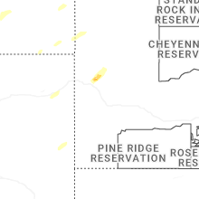
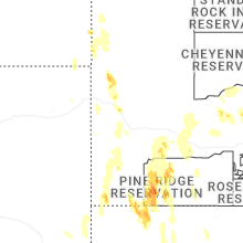
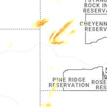
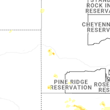
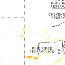
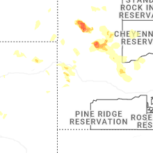
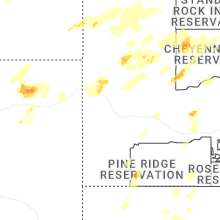
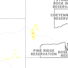
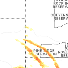
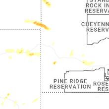
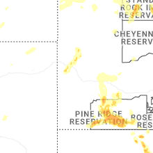


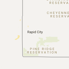


Connect with Interactive Hail Maps