

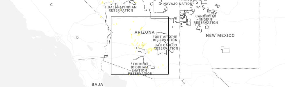
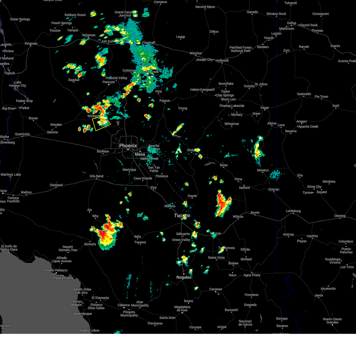
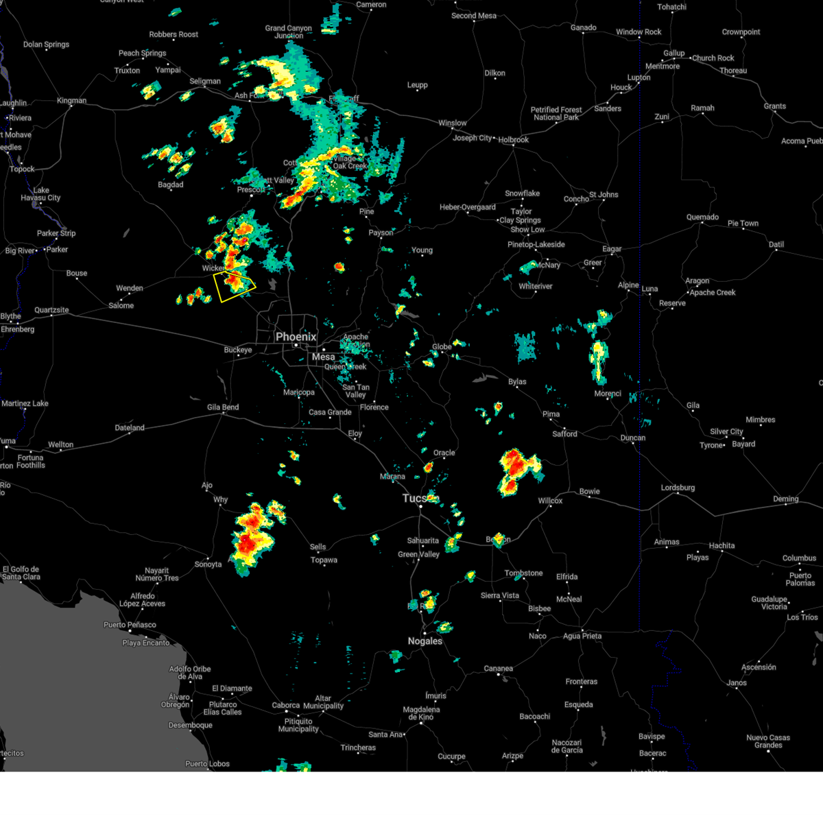
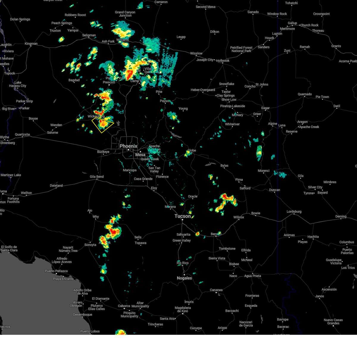
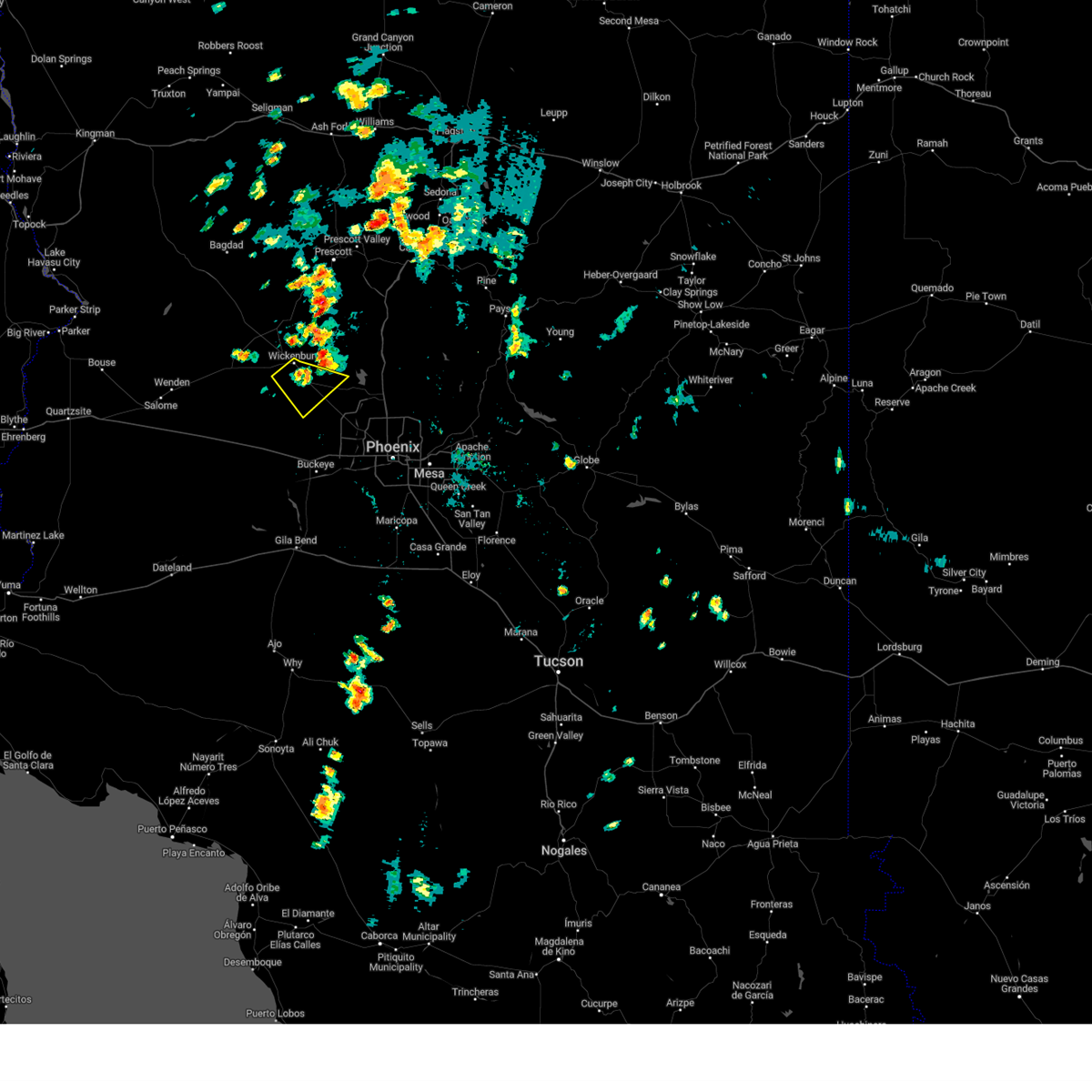
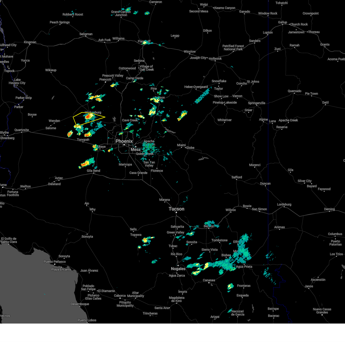
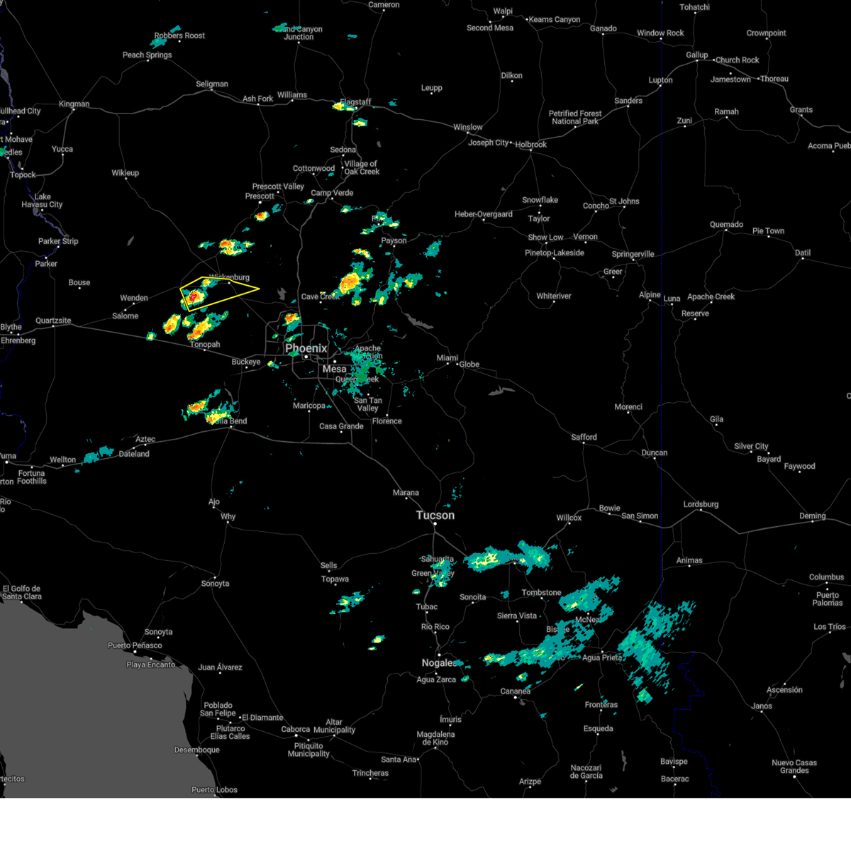
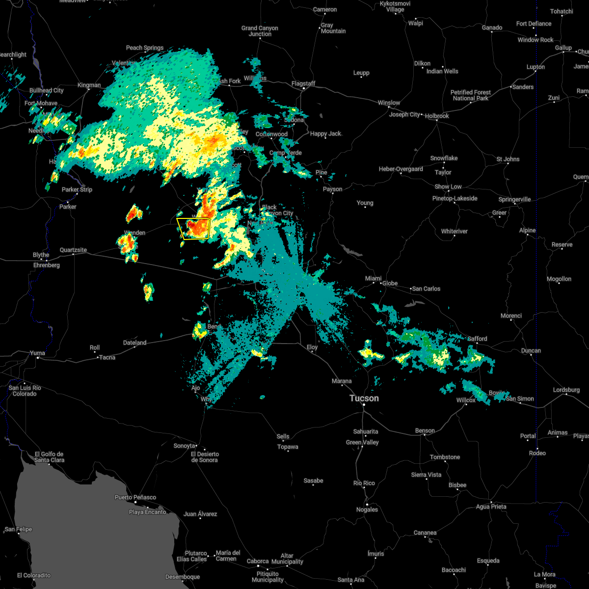
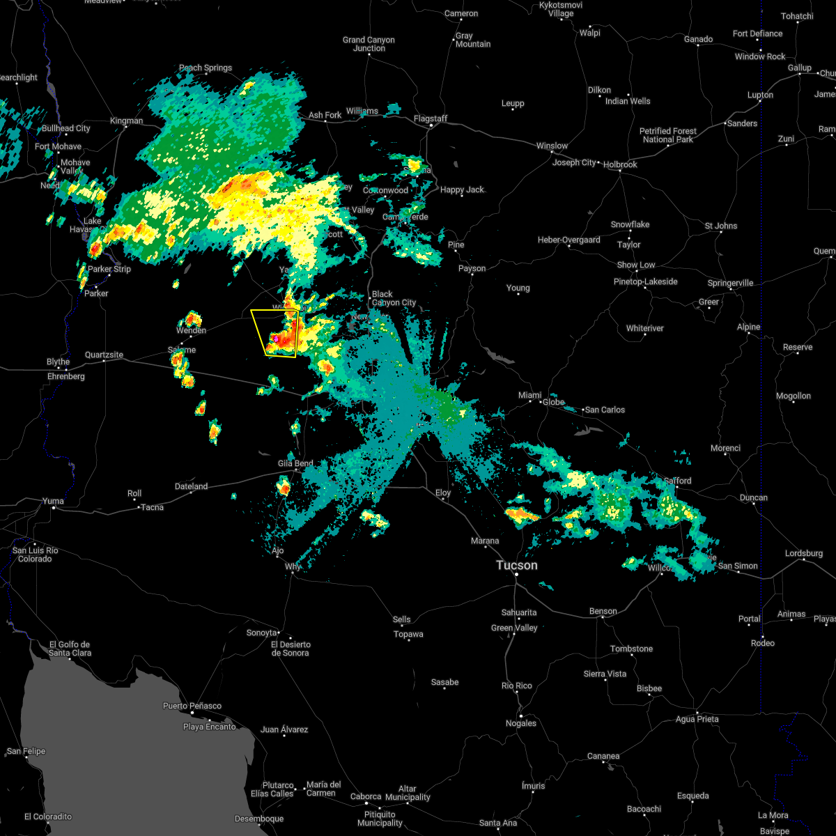
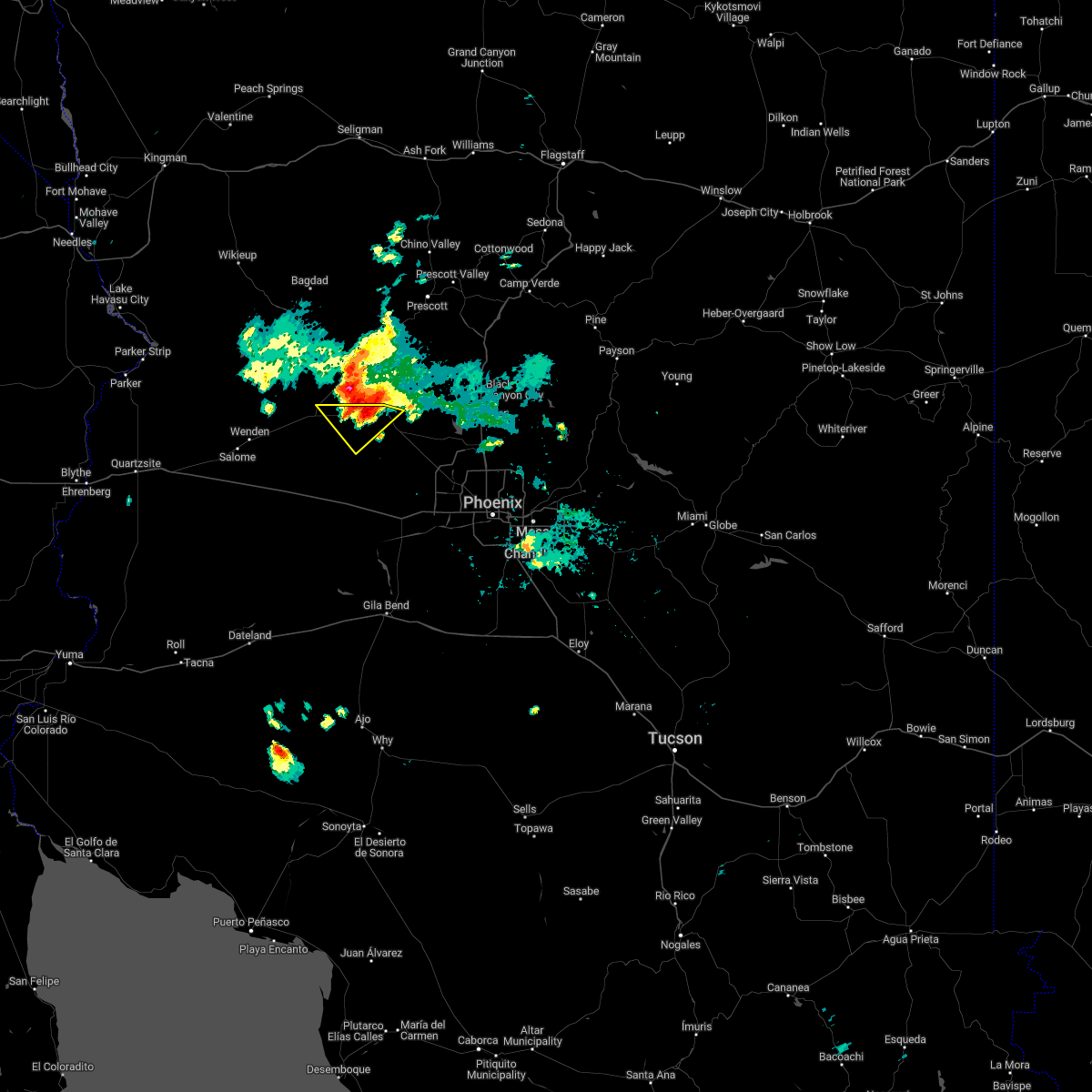
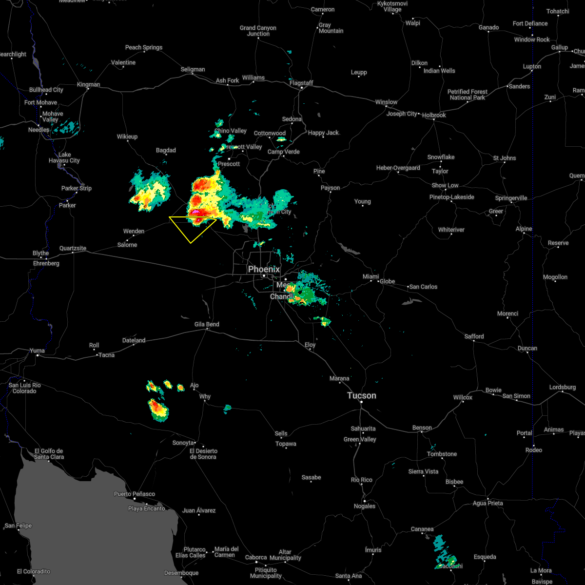
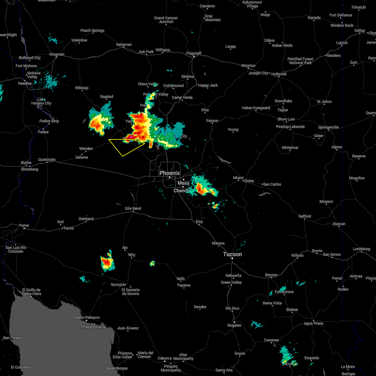
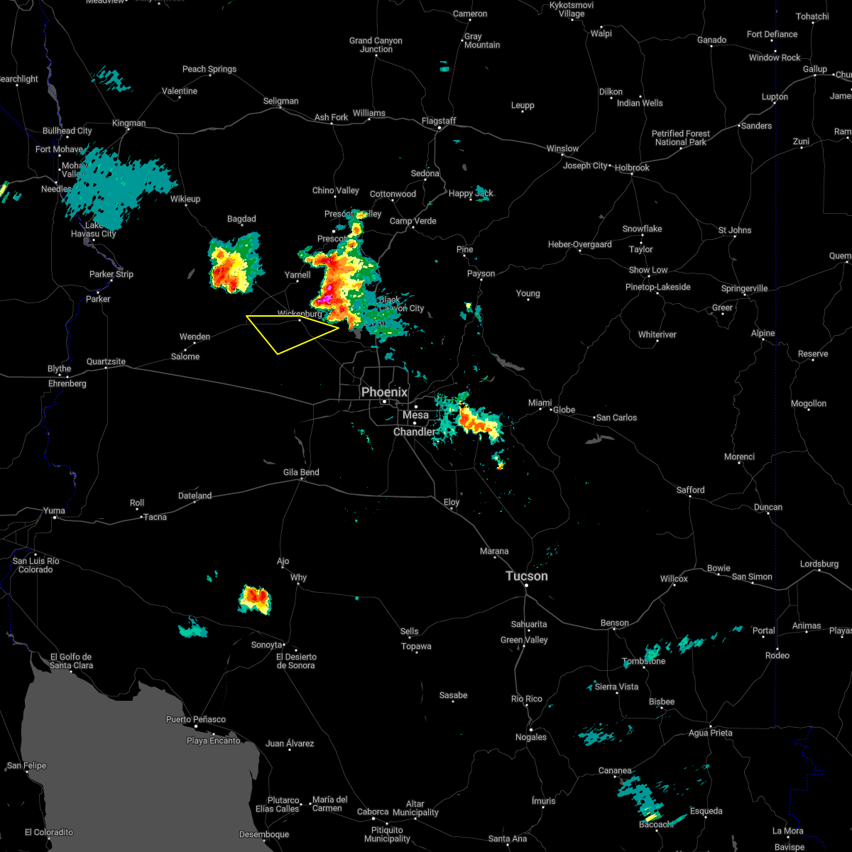
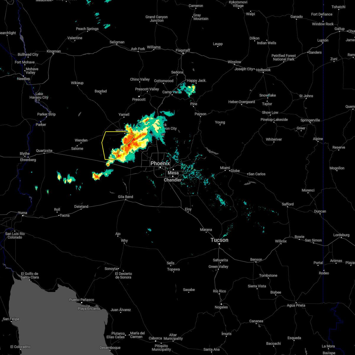
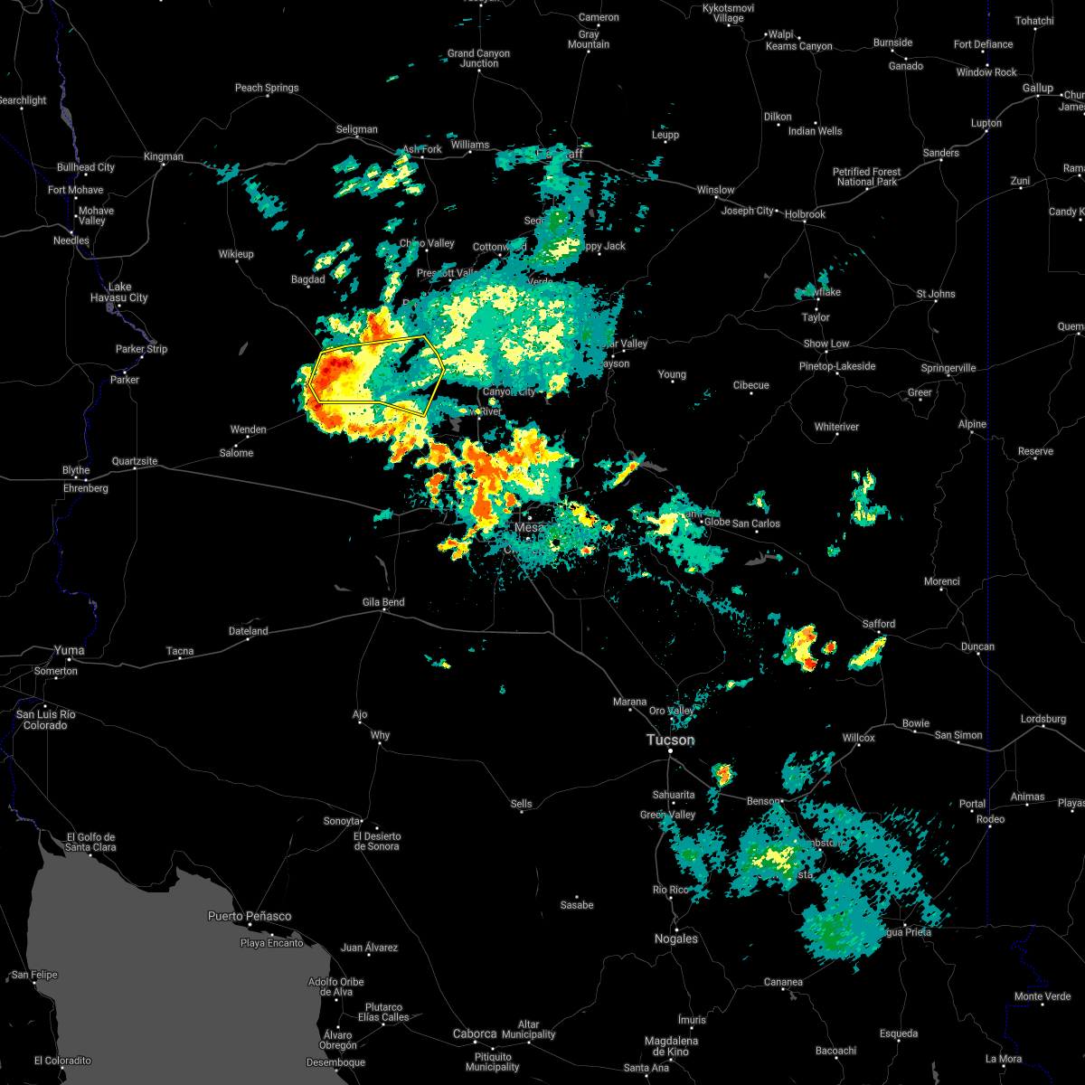
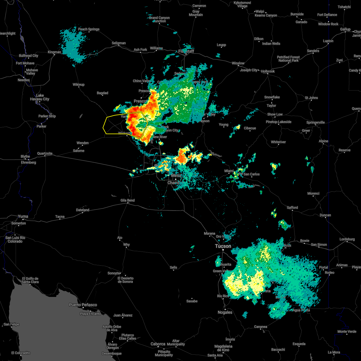
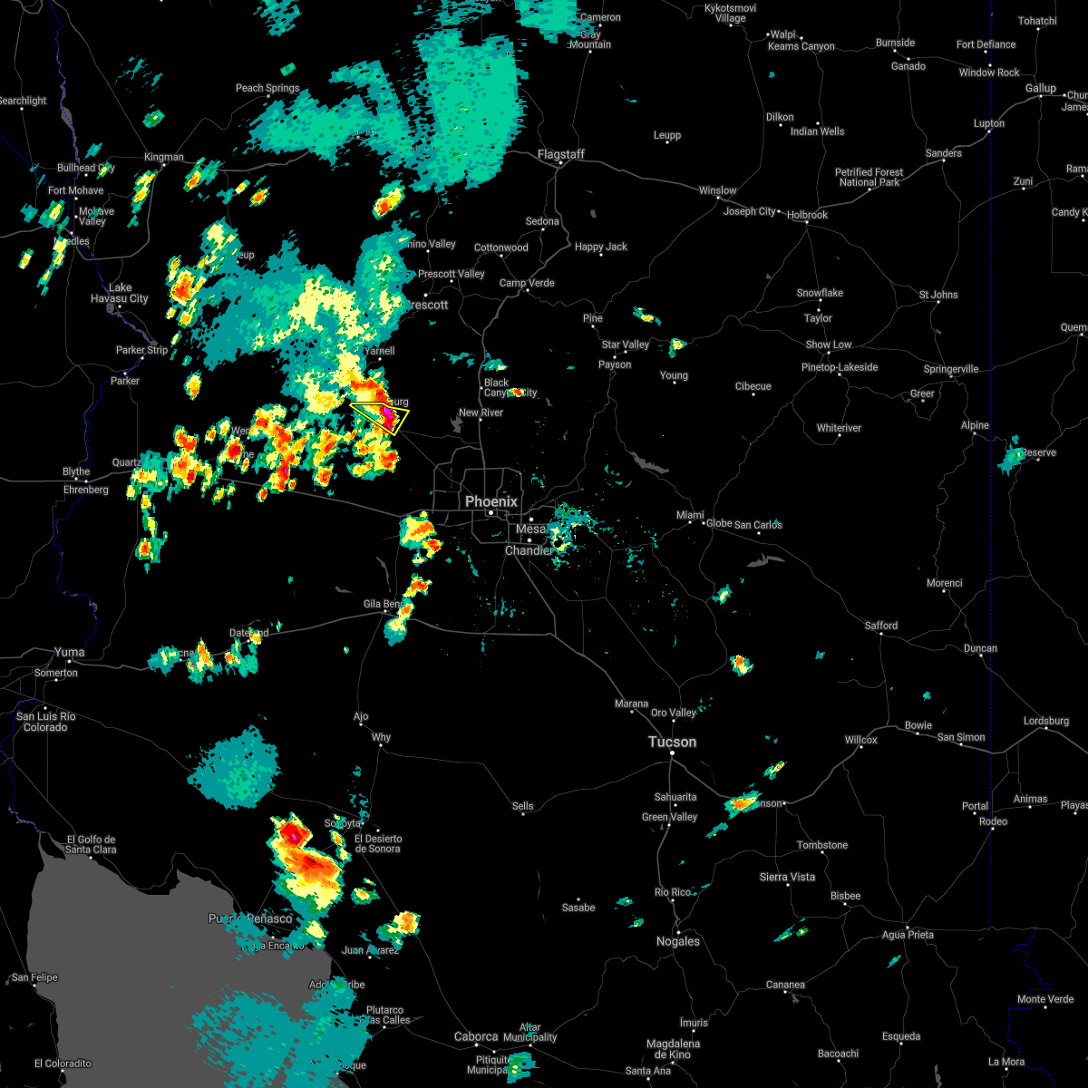
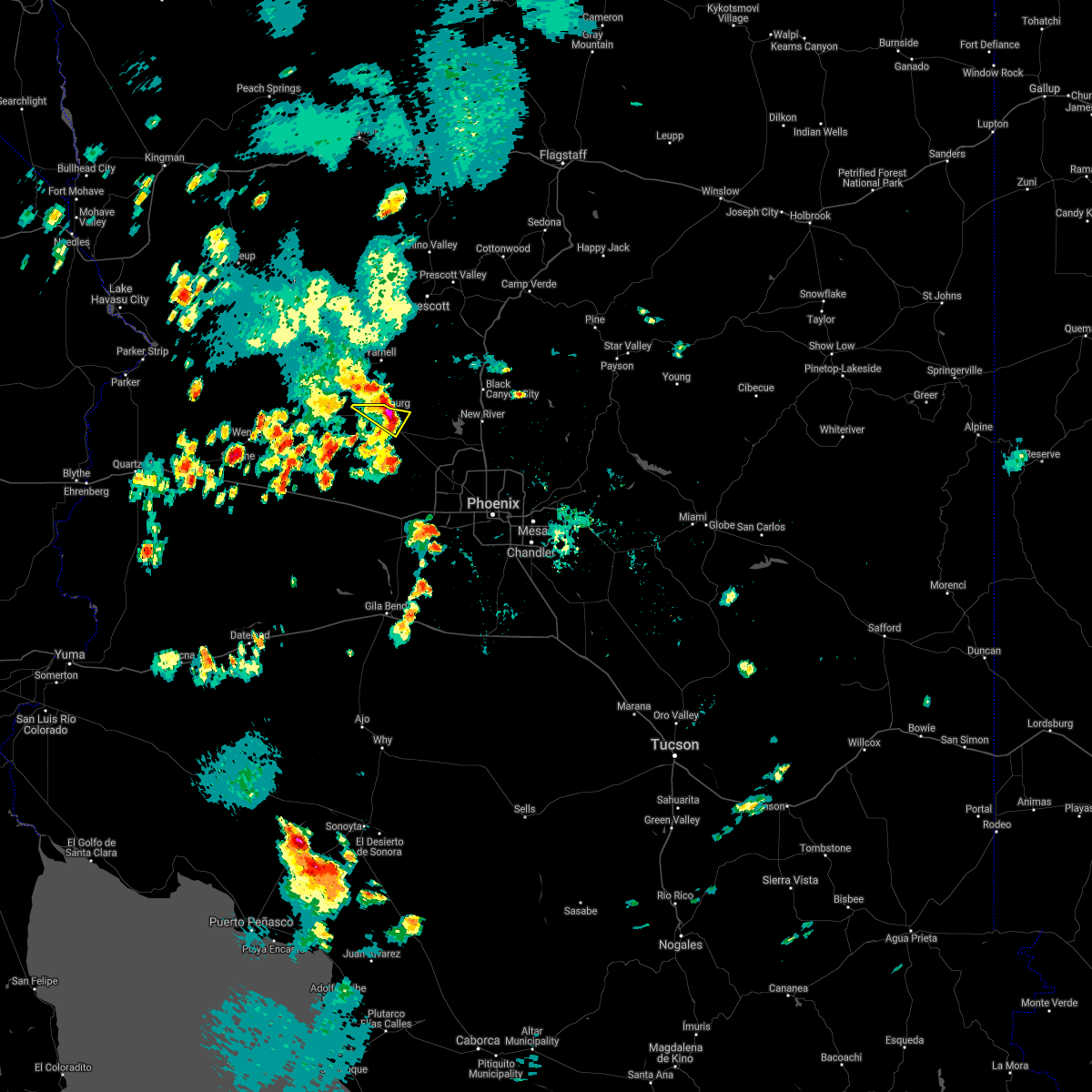
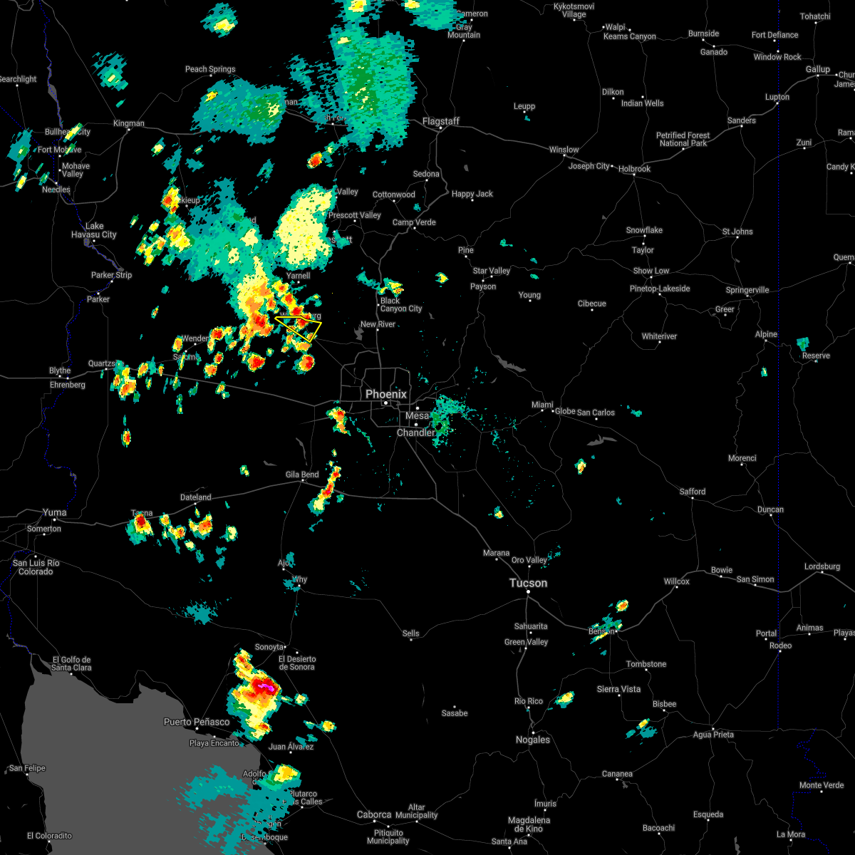
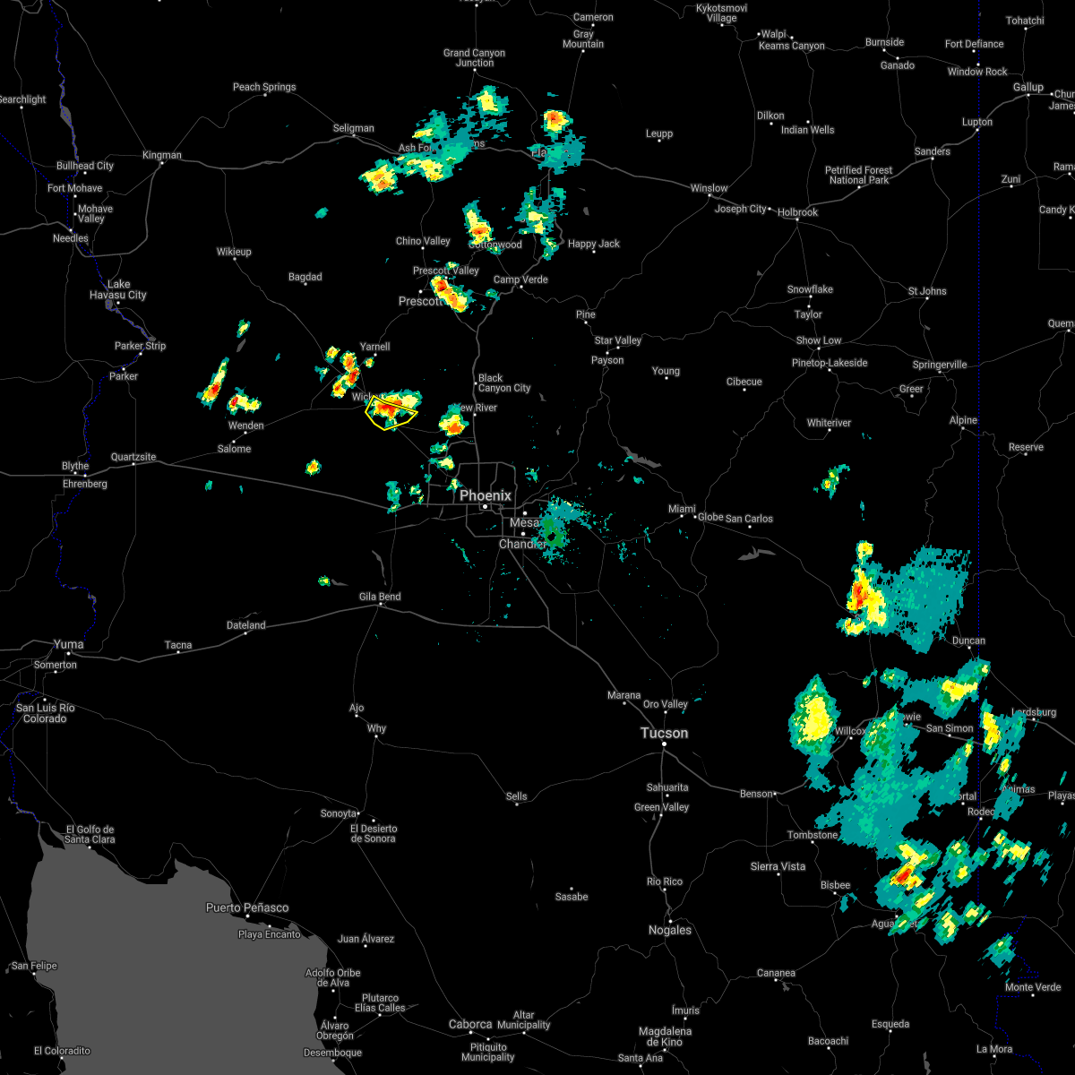
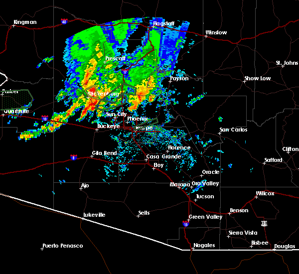
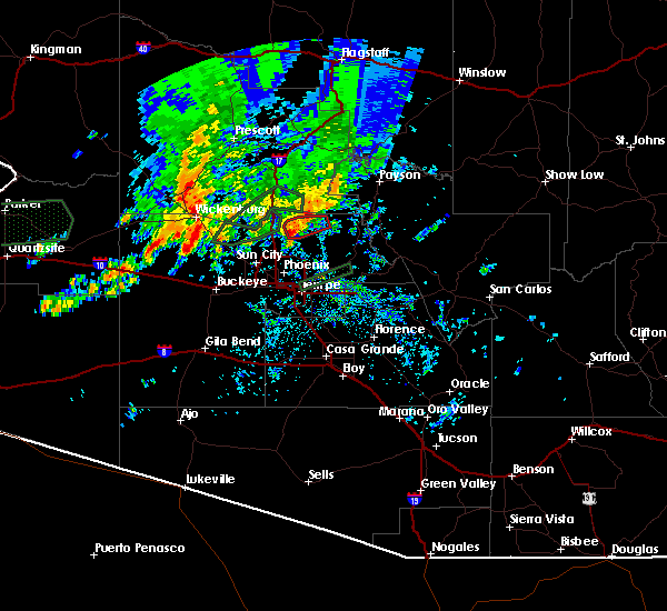
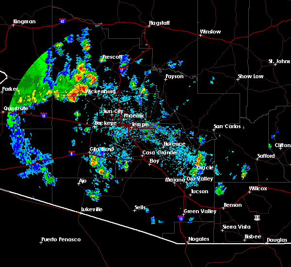
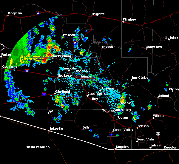
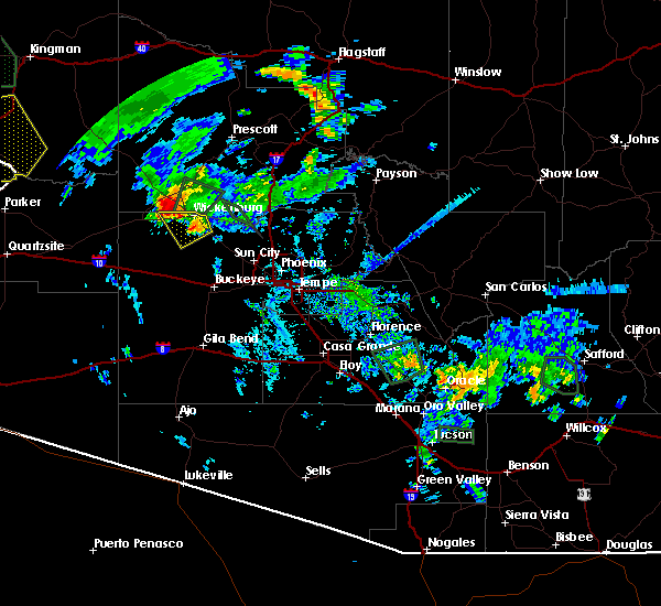
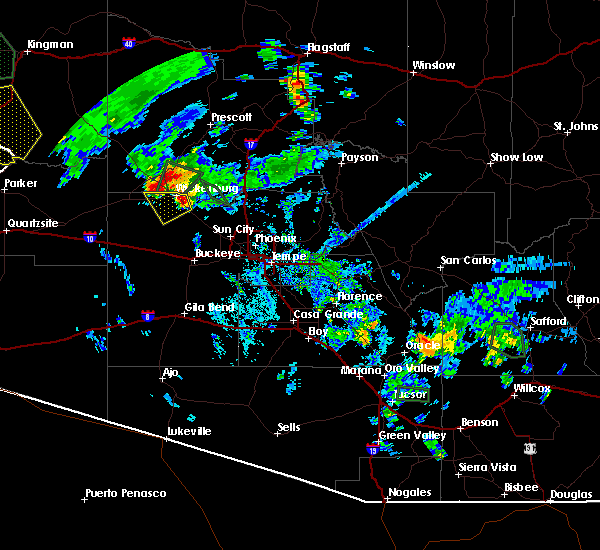
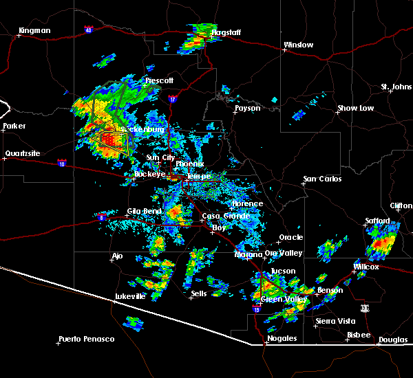
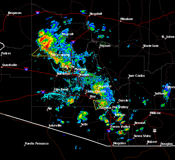
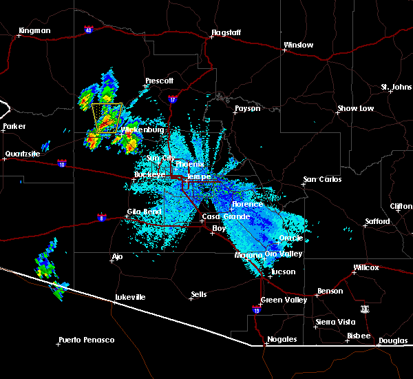
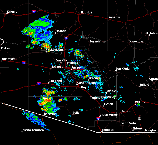
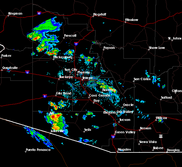
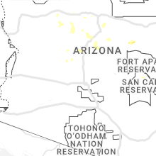
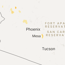
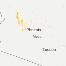
Hail Map for Wickenburg, AZ
The Wickenburg, AZ area has had 1 report of on-the-ground hail by trained spotters, and has been under severe weather warnings 1 time during the past 12 months. Doppler radar has detected hail at or near Wickenburg, AZ on 18 occasions, including 1 occasion during the past year.
| Name: | Wickenburg, AZ |
| Where Located: | 53.3 miles NW of Phoenix, AZ |
| Map: | Google Map for Wickenburg, AZ |
| Population: | 6363 |
| Housing Units: | 3619 |
| More Info: | Search Google for Wickenburg, AZ |
0
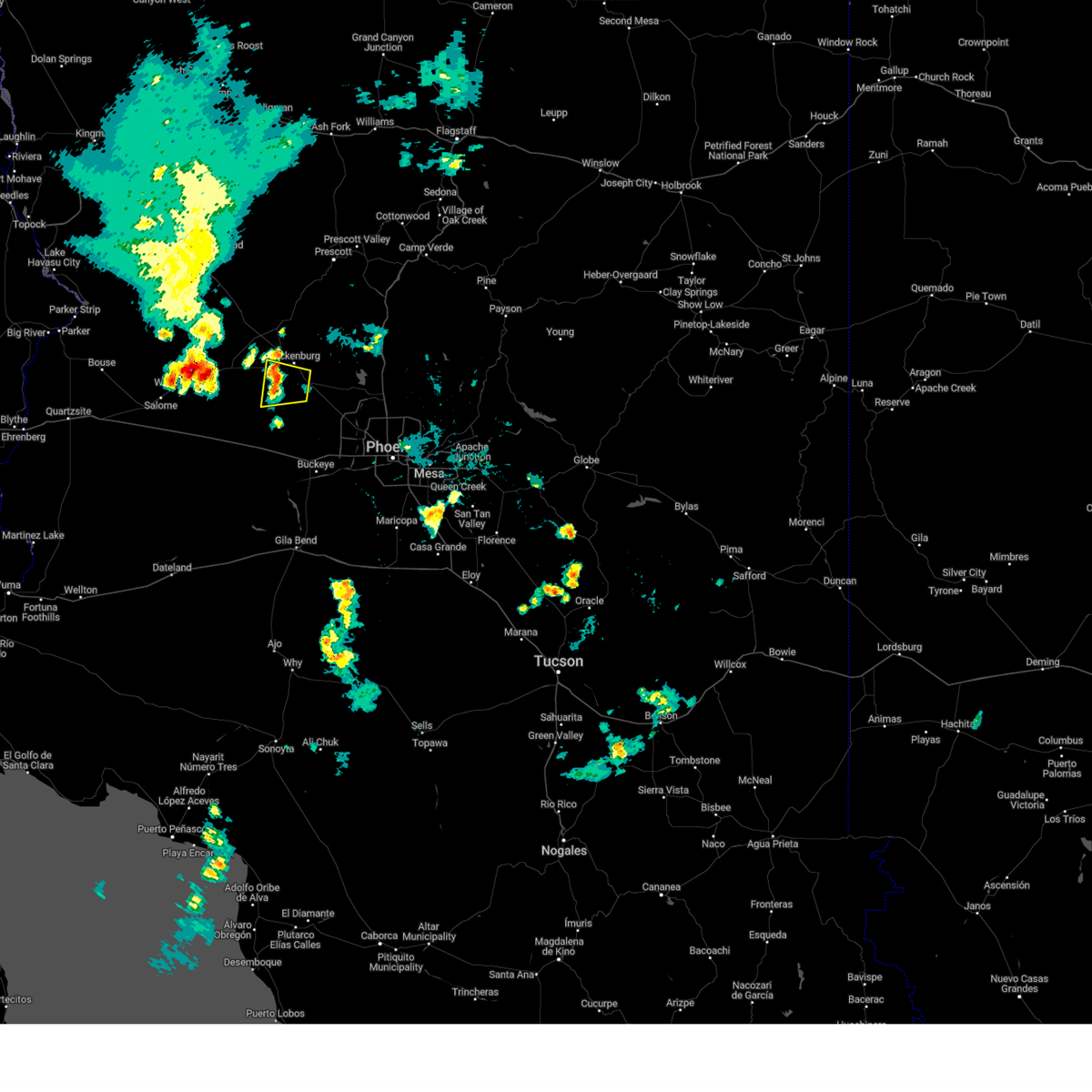
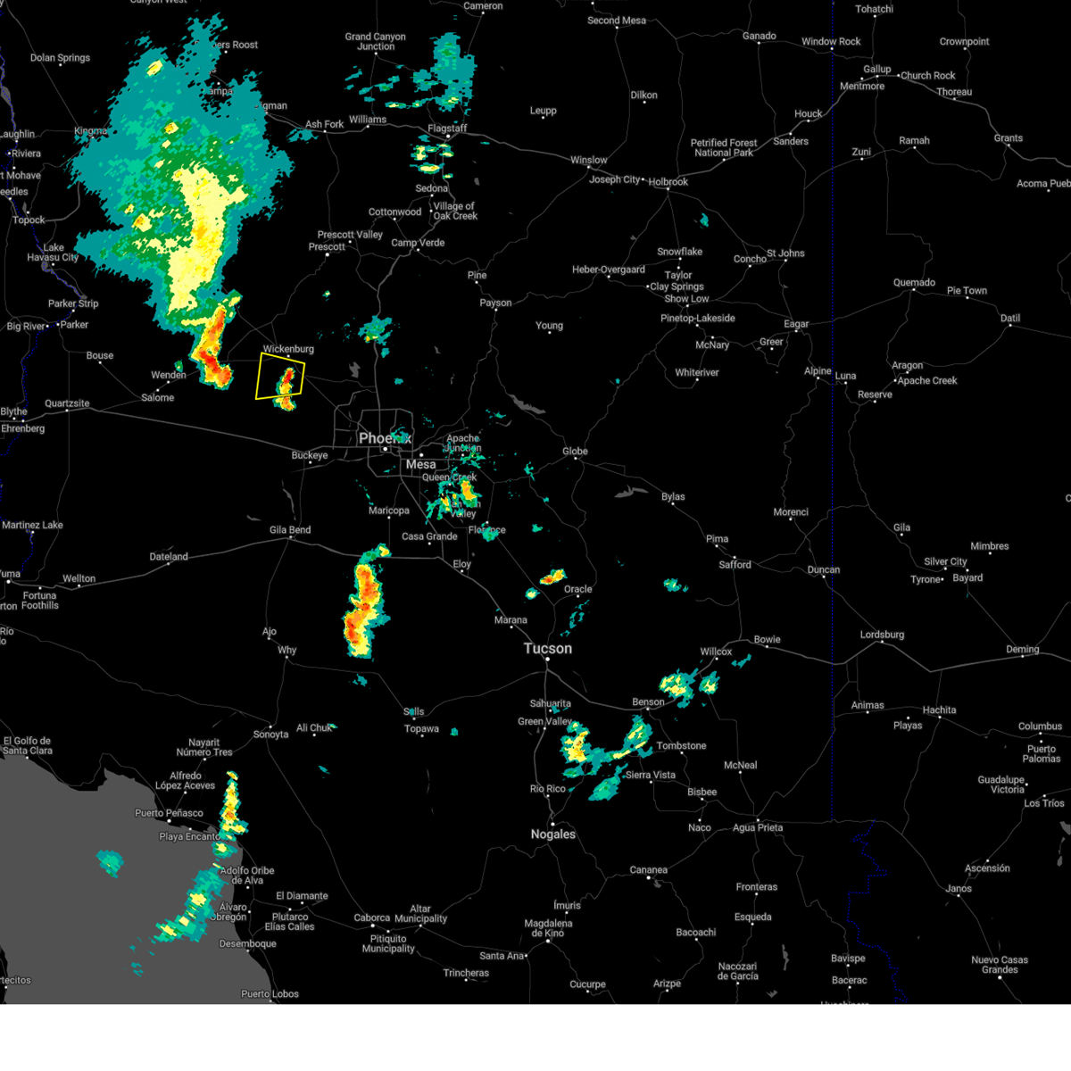
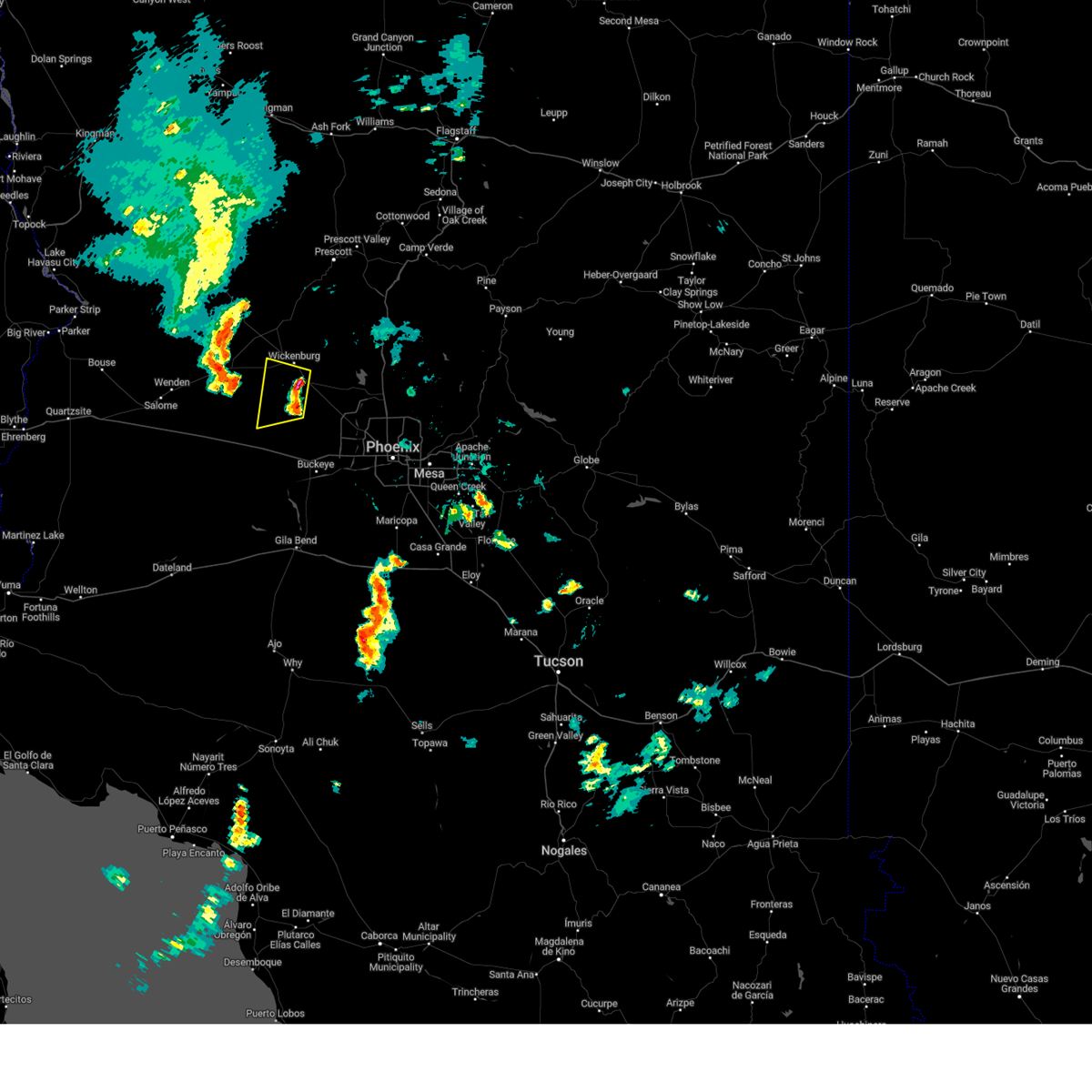
The Top Recent Hail Date for Wickenburg, AZ is Friday, September 26, 2025 (12th out of 18)
Hail and Wind Damage Spotted near Wickenburg, AZ
| Date / Time | Report Details |
|---|---|
| 9/26/2025 10:03 AM MST | Svrfgz the national weather service in flagstaff has issued a * severe thunderstorm warning for, yavapai county in west central arizona, * until 1045 am mst. * at 1003 am mst, a severe thunderstorm was located 6 miles northeast of wickenburg ranch, or 36 miles south of prescott, moving north at 25 mph (radar indicated). Hazards include ping pong ball size hail and 60 mph wind gusts. People and animals outdoors will be injured. expect hail damage to roofs, siding, windows, and vehicles. Expect wind damage to roofs, siding, and trees. |
| 7/2/2025 7:50 PM MST | Time estimated based on rada in maricopa county AZ, 22.7 miles NNE of Wickenburg, AZ |
| 8/6/2024 8:17 PM MST |
 The storm which prompted the warning has weakened below severe limits, and no longer poses an immediate threat to life or property. therefore, the warning has been allowed to expire. The storm which prompted the warning has weakened below severe limits, and no longer poses an immediate threat to life or property. therefore, the warning has been allowed to expire.
|
| 8/6/2024 7:51 PM MST |
 At 750 pm mst, a severe thunderstorm was located 7 miles south of wickenburg, moving west at 15 mph (radar indicated). Hazards include 60 mph wind gusts. Expect damage to roofs, siding, and trees. this severe thunderstorm will remain over mainly rural areas of maricopa county. This includes us highway 60 between mile markers 100 and 107, and between mile markers 113 and 120. At 750 pm mst, a severe thunderstorm was located 7 miles south of wickenburg, moving west at 15 mph (radar indicated). Hazards include 60 mph wind gusts. Expect damage to roofs, siding, and trees. this severe thunderstorm will remain over mainly rural areas of maricopa county. This includes us highway 60 between mile markers 100 and 107, and between mile markers 113 and 120.
|
| 8/6/2024 7:37 PM MST |
 Svrpsr the national weather service in phoenix has issued a * severe thunderstorm warning for, maricopa county in south central arizona, * until 815 pm mst. * at 737 pm mst, a severe thunderstorm was located near morristown, or 7 miles west of circle city, moving west at 15 mph (radar indicated). Hazards include 60 mph wind gusts. Expect damage to roofs, siding, and trees. this severe thunderstorm will remain over mainly rural areas of maricopa county. This includes us highway 60 between mile markers 99 and 108, and between mile markers 113 and 120. Svrpsr the national weather service in phoenix has issued a * severe thunderstorm warning for, maricopa county in south central arizona, * until 815 pm mst. * at 737 pm mst, a severe thunderstorm was located near morristown, or 7 miles west of circle city, moving west at 15 mph (radar indicated). Hazards include 60 mph wind gusts. Expect damage to roofs, siding, and trees. this severe thunderstorm will remain over mainly rural areas of maricopa county. This includes us highway 60 between mile markers 99 and 108, and between mile markers 113 and 120.
|
| 7/25/2024 4:33 PM MST |
 the severe thunderstorm warning has been cancelled and is no longer in effect the severe thunderstorm warning has been cancelled and is no longer in effect
|
| 7/25/2024 4:15 PM MST |
 Svrpsr the national weather service in phoenix has issued a * severe thunderstorm warning for, maricopa county in south central arizona, * until 500 pm mst. * at 415 pm mst, a severe thunderstorm was located near morristown, or near wickenburg, and is nearly stationary (radar indicated). Hazards include 60 mph wind gusts and penny size hail. expect damage to roofs, siding, and trees Svrpsr the national weather service in phoenix has issued a * severe thunderstorm warning for, maricopa county in south central arizona, * until 500 pm mst. * at 415 pm mst, a severe thunderstorm was located near morristown, or near wickenburg, and is nearly stationary (radar indicated). Hazards include 60 mph wind gusts and penny size hail. expect damage to roofs, siding, and trees
|
| 7/25/2024 3:55 PM MST |
 At 355 pm mst, a severe thunderstorm was located near morristown, or near wickenburg, moving southeast at 5 mph (radar indicated). Hazards include 60 mph wind gusts and penny size hail. Expect damage to roofs, siding, and trees. locations impacted include, wickenburg, circle city, and morristown. this includes the following highways, us highway 60 between mile markers 107 and 127. Az route 74 between mile markers 1 and 9. At 355 pm mst, a severe thunderstorm was located near morristown, or near wickenburg, moving southeast at 5 mph (radar indicated). Hazards include 60 mph wind gusts and penny size hail. Expect damage to roofs, siding, and trees. locations impacted include, wickenburg, circle city, and morristown. this includes the following highways, us highway 60 between mile markers 107 and 127. Az route 74 between mile markers 1 and 9.
|
| 7/25/2024 3:25 PM MST |
 Svrpsr the national weather service in phoenix has issued a * severe thunderstorm warning for, maricopa county in south central arizona, * until 415 pm mst. * at 325 pm mst, a severe thunderstorm was located near wickenburg, moving southeast at 5 mph (radar indicated). Hazards include 60 mph wind gusts and penny size hail. expect damage to roofs, siding, and trees Svrpsr the national weather service in phoenix has issued a * severe thunderstorm warning for, maricopa county in south central arizona, * until 415 pm mst. * at 325 pm mst, a severe thunderstorm was located near wickenburg, moving southeast at 5 mph (radar indicated). Hazards include 60 mph wind gusts and penny size hail. expect damage to roofs, siding, and trees
|
| 9/12/2023 6:37 PM MST |
 The severe thunderstorm warning for maricopa county will expire at 645 pm mst, the storm which prompted the warning has weakened below severe limits, and no longer poses an immediate threat to life or property. therefore, the warning will be allowed to expire. however gusty winds and heavy rain are still possible with this thunderstorm. The severe thunderstorm warning for maricopa county will expire at 645 pm mst, the storm which prompted the warning has weakened below severe limits, and no longer poses an immediate threat to life or property. therefore, the warning will be allowed to expire. however gusty winds and heavy rain are still possible with this thunderstorm.
|
| 9/12/2023 6:15 PM MST |
 At 615 pm mst, a severe thunderstorm was located 10 miles east of aguila, or 14 miles west of wickenburg, moving east at 40 mph (radar indicated). Hazards include 60 mph wind gusts and penny size hail. expect damage to roofs, siding, and trees At 615 pm mst, a severe thunderstorm was located 10 miles east of aguila, or 14 miles west of wickenburg, moving east at 40 mph (radar indicated). Hazards include 60 mph wind gusts and penny size hail. expect damage to roofs, siding, and trees
|
| 9/12/2022 3:23 AM MST |
 At 323 am mst, a severe thunderstorm was located 8 miles west of wickenburg, moving north at 45 mph (radar indicated). Hazards include 60 mph wind gusts and quarter size hail. Hail damage to vehicles is expected. expect wind damage to roofs, siding, and trees. locations impacted include, wickenburg. this includes us highway 60 between mile markers 92 and 112. hail threat, radar indicated max hail size, 1. 00 in wind threat, radar indicated max wind gust, 60 mph. At 323 am mst, a severe thunderstorm was located 8 miles west of wickenburg, moving north at 45 mph (radar indicated). Hazards include 60 mph wind gusts and quarter size hail. Hail damage to vehicles is expected. expect wind damage to roofs, siding, and trees. locations impacted include, wickenburg. this includes us highway 60 between mile markers 92 and 112. hail threat, radar indicated max hail size, 1. 00 in wind threat, radar indicated max wind gust, 60 mph.
|
| 9/12/2022 3:06 AM MST |
 At 306 am mst, a severe thunderstorm was located 13 miles southwest of wickenburg, moving north at 15 mph (radar indicated). Hazards include 60 mph wind gusts and quarter size hail. Hail damage to vehicles is expected. Expect wind damage to roofs, siding, and trees. At 306 am mst, a severe thunderstorm was located 13 miles southwest of wickenburg, moving north at 15 mph (radar indicated). Hazards include 60 mph wind gusts and quarter size hail. Hail damage to vehicles is expected. Expect wind damage to roofs, siding, and trees.
|
| 9/2/2022 6:59 PM MST | Corrects previous tstm wnd dmg report from 12 sse congress. spotter c190 tweeted there was a couple miles... maybe more... of downed power lines starting about 3.5 mile in yavapai county AZ, 2.8 miles SSE of Wickenburg, AZ |
| 9/2/2022 6:41 PM MST |
 The severe thunderstorm warning for maricopa county will expire at 645 pm mst, the storm which prompted the warning has weakened below severe limits, and no longer poses an immediate threat to life or property. therefore, the warning will be allowed to expire. very heavy rain is still falling with this thunderstorm. a severe thunderstorm watch remains in effect until 1100 pm mst for south central arizona. The severe thunderstorm warning for maricopa county will expire at 645 pm mst, the storm which prompted the warning has weakened below severe limits, and no longer poses an immediate threat to life or property. therefore, the warning will be allowed to expire. very heavy rain is still falling with this thunderstorm. a severe thunderstorm watch remains in effect until 1100 pm mst for south central arizona.
|
| 9/2/2022 6:32 PM MST |
 At 631 pm mst, a severe thunderstorm was located 8 miles west of wickenburg, moving west at 20 mph (trained weather spotters. at 625 pm mst, quarter size hail was reported near wickenburg). Hazards include 60 mph wind gusts and quarter size hail. Hail damage to vehicles is expected. expect wind damage to roofs, siding, and trees. locations impacted include, wickenburg. this includes us highway 60 between mile markers 90 and 115. hail threat, observed max hail size, 1. 00 in wind threat, radar indicated max wind gust, 60 mph. At 631 pm mst, a severe thunderstorm was located 8 miles west of wickenburg, moving west at 20 mph (trained weather spotters. at 625 pm mst, quarter size hail was reported near wickenburg). Hazards include 60 mph wind gusts and quarter size hail. Hail damage to vehicles is expected. expect wind damage to roofs, siding, and trees. locations impacted include, wickenburg. this includes us highway 60 between mile markers 90 and 115. hail threat, observed max hail size, 1. 00 in wind threat, radar indicated max wind gust, 60 mph.
|
| 9/2/2022 6:25 PM MST | Quarter sized hail reported 3.6 miles SE of Wickenburg, AZ, lsr from phoenix spotter maa010 showing 1 1/8 inch hail with a picture included. big hail spike on radar was at 6:09 p.m. |
| 9/2/2022 6:14 PM MST |
 At 614 pm mst, a severe thunderstorm was located over wickenburg, moving southwest at 15 mph (radar indicated). Hazards include 60 mph wind gusts and half dollar size hail. Hail damage to vehicles is expected. expect wind damage to roofs, siding, and trees. locations impacted include, wickenburg. this includes us highway 60 between mile markers 90 and 119. hail threat, radar indicated max hail size, 1. 25 in wind threat, radar indicated max wind gust, 60 mph. At 614 pm mst, a severe thunderstorm was located over wickenburg, moving southwest at 15 mph (radar indicated). Hazards include 60 mph wind gusts and half dollar size hail. Hail damage to vehicles is expected. expect wind damage to roofs, siding, and trees. locations impacted include, wickenburg. this includes us highway 60 between mile markers 90 and 119. hail threat, radar indicated max hail size, 1. 25 in wind threat, radar indicated max wind gust, 60 mph.
|
| 9/2/2022 5:56 PM MST |
 At 556 pm mst, a severe thunderstorm was located 7 miles northeast of wickenburg, moving west at 20 mph (radar indicated). Hazards include 60 mph wind gusts and nickel size hail. expect damage to roofs, siding, and trees At 556 pm mst, a severe thunderstorm was located 7 miles northeast of wickenburg, moving west at 20 mph (radar indicated). Hazards include 60 mph wind gusts and nickel size hail. expect damage to roofs, siding, and trees
|
| 8/23/2022 6:36 PM MST | At 635 pm mst, severe thunderstorms were located along a line extending from 8 miles southeast of aguila to 15 miles southwest of morristown to 7 miles northeast of wintersburg, moving southwest at 10 mph (radar indicated). Hazards include 60 mph wind gusts and quarter size hail. Hail damage to vehicles is expected. expect wind damage to roofs, siding, and trees. locations impacted include, surprise, buckeye, wittmann, circle city and morristown. this includes the following highways, az interstate 10 between mile markers 96 and 109. us highway 60 between mile markers 85 and 103, and between mile markers 117 and 132. az route 74 between mile markers 1 and 9. hail threat, radar indicated max hail size, 1. 00 in wind threat, radar indicated max wind gust, 60 mph. |
| 8/23/2022 5:58 PM MST | At 558 pm mst, severe thunderstorms were located along a line extending from 9 miles east of aguila to 10 miles southwest of morristown to 10 miles west of white tank mountain park, moving southwest at 10 mph (radar indicated). Hazards include 60 mph wind gusts and quarter size hail. Hail damage to vehicles is expected. Expect wind damage to roofs, siding, and trees. |
| 8/23/2022 5:16 PM MST | At 516 pm mst, severe thunderstorms were located along a line extending from 8 miles northwest of congress to 7 miles south of yarnell to 8 miles west of castle hot springs, moving southwest at 25 mph (radar indicated). Hazards include 60 mph wind gusts. expect damage to roofs, siding, and trees |
| 8/21/2022 7:24 PM MST | The severe thunderstorm warning for southern yavapai county will expire at 730 pm mst, the storm which prompted the warning north of wickenburg has weakened below severe limits, and has exited the warned area. therefore, the warning will be allowed to expire. however, gusty winds and heavy rain are still possible with additional thunderstorms in the area. continue to practice caution, and avoid traveling if possible. |
| 8/21/2022 6:53 PM MST | At 653 pm mst, a severe thunderstorm was located 8 miles northeast of wickenburg, moving southwest at 10 mph (radar indicated). Hazards include 60 mph wind gusts. expect damage to roofs, siding, and trees |
| 8/21/2022 6:45 PM MST | At 644 pm mst, a severe thunderstorm was located 8 miles northeast of wickenburg, moving southwest at 15 mph (radar indicated). Hazards include 60 mph wind gusts, penny size hail, and heavy rainfall. Expect damage to roofs, siding, and trees. this severe thunderstorm will remain over mainly rural areas of yavapai county. hail threat, radar indicated max hail size, 0. 75 in wind threat, radar indicated max wind gust, 60 mph. |
| 8/20/2022 8:29 PM MST |
 At 828 pm mst, a severe thunderstorm was located over wittmann, moving south at 10 mph (radar indicated). Hazards include 60 mph wind gusts. Expect damage to roofs, siding, and trees. locations impacted include, peoria, surprise, wittmann, sun city west, circle city, sun city, surprise stadium, white tank mountain park, morristown, beardsley and vistancia. this includes the following highways, us highway 60 between mile markers 110 and 144. az route 74 between mile markers 1 and 21. az route 303 between mile markers 112 and 132. hail threat, radar indicated max hail size, <. 75 in wind threat, radar indicated max wind gust, 60 mph. At 828 pm mst, a severe thunderstorm was located over wittmann, moving south at 10 mph (radar indicated). Hazards include 60 mph wind gusts. Expect damage to roofs, siding, and trees. locations impacted include, peoria, surprise, wittmann, sun city west, circle city, sun city, surprise stadium, white tank mountain park, morristown, beardsley and vistancia. this includes the following highways, us highway 60 between mile markers 110 and 144. az route 74 between mile markers 1 and 21. az route 303 between mile markers 112 and 132. hail threat, radar indicated max hail size, <. 75 in wind threat, radar indicated max wind gust, 60 mph.
|
| 8/20/2022 8:09 PM MST |
 At 809 pm mst, a severe thunderstorm was located over wittmann, moving south at 10 mph (radar indicated). Hazards include 60 mph wind gusts. Expect damage to roofs, siding, and trees. locations impacted include, peoria, surprise, wittmann, sun city west, circle city, sun city, surprise stadium, white tank mountain park, morristown, beardsley and vistancia. this includes the following highways, us highway 60 between mile markers 110 and 144. az route 74 between mile markers 1 and 21. az route 303 between mile markers 112 and 132. hail threat, radar indicated max hail size, <. 75 in wind threat, radar indicated max wind gust, 60 mph. At 809 pm mst, a severe thunderstorm was located over wittmann, moving south at 10 mph (radar indicated). Hazards include 60 mph wind gusts. Expect damage to roofs, siding, and trees. locations impacted include, peoria, surprise, wittmann, sun city west, circle city, sun city, surprise stadium, white tank mountain park, morristown, beardsley and vistancia. this includes the following highways, us highway 60 between mile markers 110 and 144. az route 74 between mile markers 1 and 21. az route 303 between mile markers 112 and 132. hail threat, radar indicated max hail size, <. 75 in wind threat, radar indicated max wind gust, 60 mph.
|
| 8/20/2022 7:53 PM MST |
 At 752 pm mst, a severe thunderstorm was located 7 miles northeast of wittmann, moving south at 5 mph (radar indicated). Hazards include 60 mph wind gusts. expect damage to roofs, siding, and trees At 752 pm mst, a severe thunderstorm was located 7 miles northeast of wittmann, moving south at 5 mph (radar indicated). Hazards include 60 mph wind gusts. expect damage to roofs, siding, and trees
|
| 8/17/2022 2:29 PM MST | Storm damage reported in maricopa county AZ, 2.5 miles ENE of Wickenburg, AZ |
| 8/14/2022 3:43 PM MST |
 At 343 pm mst, a severe thunderstorm was located near morristown, or 7 miles north of circle city, moving northeast at 5 mph (radar indicated). Hazards include 60 mph wind gusts and penny size hail. Expect damage to roofs, siding, and trees. locations impacted include, surprise, wickenburg, wittmann, sun city west, circle city, lake pleasant, morristown, beardsley and vistancia. this includes the following highways, us highway 60 between mile markers 93 and 141. az route 74 between mile markers 1 and 24. az route 303 between mile markers 117 and 132. hail threat, radar indicated max hail size, 0. 75 in wind threat, radar indicated max wind gust, 60 mph. At 343 pm mst, a severe thunderstorm was located near morristown, or 7 miles north of circle city, moving northeast at 5 mph (radar indicated). Hazards include 60 mph wind gusts and penny size hail. Expect damage to roofs, siding, and trees. locations impacted include, surprise, wickenburg, wittmann, sun city west, circle city, lake pleasant, morristown, beardsley and vistancia. this includes the following highways, us highway 60 between mile markers 93 and 141. az route 74 between mile markers 1 and 24. az route 303 between mile markers 117 and 132. hail threat, radar indicated max hail size, 0. 75 in wind threat, radar indicated max wind gust, 60 mph.
|
| 8/14/2022 3:23 PM MST |
 At 323 pm mst, a severe thunderstorm was located near morristown, or near circle city, moving northeast at 5 mph (radar indicated). Hazards include 60 mph wind gusts. expect damage to roofs, siding, and trees At 323 pm mst, a severe thunderstorm was located near morristown, or near circle city, moving northeast at 5 mph (radar indicated). Hazards include 60 mph wind gusts. expect damage to roofs, siding, and trees
|
| 7/17/2022 10:58 PM MST |
 The severe thunderstorm warning for maricopa county will expire at 1100 pm mst, the storms which prompted the warning have weakened below severe limits, and no longer pose an immediate threat to life or property. therefore, the warning will be allowed to expire. however gusty winds are still possible with these thunderstorms. The severe thunderstorm warning for maricopa county will expire at 1100 pm mst, the storms which prompted the warning have weakened below severe limits, and no longer pose an immediate threat to life or property. therefore, the warning will be allowed to expire. however gusty winds are still possible with these thunderstorms.
|
| 7/17/2022 10:49 PM MST |
 At 1049 pm mst, severe thunderstorms were located along a line extending from near yarnell to 8 miles west of wickenburg to 18 miles southeast of aguila to 8 miles north of tonopah, moving northwest at 35 mph (radar indicated). Hazards include 60 mph wind gusts. Expect damage to roofs, siding, and trees. locations impacted include, wickenburg. this includes the following highways, us highway 60 between mile markers 88 and 121. az route 74 near mile marker 1. hail threat, radar indicated max hail size, <. 75 in wind threat, radar indicated max wind gust, 60 mph. At 1049 pm mst, severe thunderstorms were located along a line extending from near yarnell to 8 miles west of wickenburg to 18 miles southeast of aguila to 8 miles north of tonopah, moving northwest at 35 mph (radar indicated). Hazards include 60 mph wind gusts. Expect damage to roofs, siding, and trees. locations impacted include, wickenburg. this includes the following highways, us highway 60 between mile markers 88 and 121. az route 74 near mile marker 1. hail threat, radar indicated max hail size, <. 75 in wind threat, radar indicated max wind gust, 60 mph.
|
| 7/17/2022 10:40 PM MST |
 At 1040 pm mst, severe thunderstorms were located along a line extending from 7 miles southwest of wagoner to near wickenburg to 19 miles southwest of morristown to 6 miles northeast of tonopah, moving northwest at 35 mph (radar indicated). Hazards include 60 mph wind gusts. Expect damage to roofs, siding, and trees. locations impacted include, wickenburg, wittmann, tonopah, circle city and morristown. this includes the following highways, az interstate 10 between mile markers 85 and 96. us highway 60 between mile markers 88 and 128. az route 74 between mile markers 1 and 9. hail threat, radar indicated max hail size, <. 75 in wind threat, radar indicated max wind gust, 60 mph. At 1040 pm mst, severe thunderstorms were located along a line extending from 7 miles southwest of wagoner to near wickenburg to 19 miles southwest of morristown to 6 miles northeast of tonopah, moving northwest at 35 mph (radar indicated). Hazards include 60 mph wind gusts. Expect damage to roofs, siding, and trees. locations impacted include, wickenburg, wittmann, tonopah, circle city and morristown. this includes the following highways, az interstate 10 between mile markers 85 and 96. us highway 60 between mile markers 88 and 128. az route 74 between mile markers 1 and 9. hail threat, radar indicated max hail size, <. 75 in wind threat, radar indicated max wind gust, 60 mph.
|
| 7/17/2022 10:12 PM MST |
 At 1012 pm mst, severe thunderstorms were located along a line extending from near castle hot springs to near circle city to 9 miles west of white tank mountain park to near buckeye, moving northwest at 35 mph (radar indicated). Hazards include 60 mph wind gusts. expect damage to roofs, siding, and trees At 1012 pm mst, severe thunderstorms were located along a line extending from near castle hot springs to near circle city to 9 miles west of white tank mountain park to near buckeye, moving northwest at 35 mph (radar indicated). Hazards include 60 mph wind gusts. expect damage to roofs, siding, and trees
|
| 8/16/2021 12:49 AM MST |
 At 1248 am mst, a severe thunderstorm was located near aguila, or 19 miles west of wickenburg, moving southwest at 40 mph (radar indicated). Hazards include 60 mph wind gusts and penny size hail. expect damage to roofs, siding, and trees At 1248 am mst, a severe thunderstorm was located near aguila, or 19 miles west of wickenburg, moving southwest at 40 mph (radar indicated). Hazards include 60 mph wind gusts and penny size hail. expect damage to roofs, siding, and trees
|
| 8/13/2021 10:28 PM MST |
 The severe thunderstorm warning for yavapai county will expire at 1030 pm mst, the storm over southern yavapai county which prompted the warning has weakened. therefore, the warning will be allowed to expire. wind gusts to 30 to 40 mph will still be possible through 1130 pm mst. a severe thunderstorm watch remains in effect until 300 am mst for west central arizona. The severe thunderstorm warning for yavapai county will expire at 1030 pm mst, the storm over southern yavapai county which prompted the warning has weakened. therefore, the warning will be allowed to expire. wind gusts to 30 to 40 mph will still be possible through 1130 pm mst. a severe thunderstorm watch remains in effect until 300 am mst for west central arizona.
|
| 8/13/2021 10:08 PM MST |
 At 1007 pm mst, severe thunderstorms were located along a line extending from near congress to near wickenburg to near morristown, moving east at 35 mph (radar indicated). Hazards include 60 mph wind gusts and nickel size hail. Expect damage to roofs, siding, and trees. locations impacted include, wickenburg, wittmann, circle city, morristown and aguila. this includes the following highways, us highway 60 between mile markers 83 and 131. az route 74 between mile markers 1 and 10. hail threat, radar indicated max hail size, 0. 88 in wind threat, radar indicated max wind gust, 60 mph. At 1007 pm mst, severe thunderstorms were located along a line extending from near congress to near wickenburg to near morristown, moving east at 35 mph (radar indicated). Hazards include 60 mph wind gusts and nickel size hail. Expect damage to roofs, siding, and trees. locations impacted include, wickenburg, wittmann, circle city, morristown and aguila. this includes the following highways, us highway 60 between mile markers 83 and 131. az route 74 between mile markers 1 and 10. hail threat, radar indicated max hail size, 0. 88 in wind threat, radar indicated max wind gust, 60 mph.
|
| 8/13/2021 9:43 PM MST |
 At 943 pm mst, a severe thunderstorm was located near yarnell, or 13 miles north of wickenburg, moving west at 40 mph (radar indicated). Hazards include 60 mph wind gusts. expect damage to roofs, siding, and trees At 943 pm mst, a severe thunderstorm was located near yarnell, or 13 miles north of wickenburg, moving west at 40 mph (radar indicated). Hazards include 60 mph wind gusts. expect damage to roofs, siding, and trees
|
| 8/13/2021 9:38 PM MST |
 At 938 pm mst, severe thunderstorms were located along a line extending from near walnut grove to 11 miles west of castle hot springs to 6 miles west of lake pleasant, moving west at 35 mph (radar indicated). Hazards include 60 mph wind gusts and nickel size hail. expect damage to roofs, siding, and trees At 938 pm mst, severe thunderstorms were located along a line extending from near walnut grove to 11 miles west of castle hot springs to 6 miles west of lake pleasant, moving west at 35 mph (radar indicated). Hazards include 60 mph wind gusts and nickel size hail. expect damage to roofs, siding, and trees
|
| 8/10/2021 5:08 PM MST |
 At 506 pm mst, a severe thunderstorm was located near wickenburg, moving southwest at 10 mph (radar indicated). Hazards include 60 mph wind gusts. small hail. Expect damage to roofs, siding, and trees. locations impacted include, wickenburg, circle city and morristown. this includes the following highways, us highway 60 between mile markers 100 and 127. Az route 74 between mile markers 1 and 7. At 506 pm mst, a severe thunderstorm was located near wickenburg, moving southwest at 10 mph (radar indicated). Hazards include 60 mph wind gusts. small hail. Expect damage to roofs, siding, and trees. locations impacted include, wickenburg, circle city and morristown. this includes the following highways, us highway 60 between mile markers 100 and 127. Az route 74 between mile markers 1 and 7.
|
| 8/10/2021 4:56 PM MST |
 At 456 pm mst, a severe thunderstorm was located near wickenburg, moving southwest at 10 mph (radar indicated). Hazards include 60 mph wind gusts. small hail. expect damage to roofs, siding, and trees At 456 pm mst, a severe thunderstorm was located near wickenburg, moving southwest at 10 mph (radar indicated). Hazards include 60 mph wind gusts. small hail. expect damage to roofs, siding, and trees
|
| 7/21/2021 4:21 PM MST |
 At 420 pm mst, a severe thunderstorm was located near wickenburg, moving east at 10 mph (radar indicated). Hazards include 70 mph wind gusts and nickel size hail. Expect considerable tree damage. damage is likely to mobile homes, roofs, and outbuildings. locations impacted include, wickenburg. This includes us highway 60 between mile markers 103 and 119. At 420 pm mst, a severe thunderstorm was located near wickenburg, moving east at 10 mph (radar indicated). Hazards include 70 mph wind gusts and nickel size hail. Expect considerable tree damage. damage is likely to mobile homes, roofs, and outbuildings. locations impacted include, wickenburg. This includes us highway 60 between mile markers 103 and 119.
|
| 7/21/2021 4:18 PM MST |
 At 417 pm mst, a severe thunderstorm was located over wickenburg, moving northwest at 10 mph (radar indicated). Hazards include 60 mph wind gusts and penny size hail. Expect damage to roofs, siding, and trees. locations impacted include, wickenburg. This includes us highway 60 between mile markers 103 and 119. At 417 pm mst, a severe thunderstorm was located over wickenburg, moving northwest at 10 mph (radar indicated). Hazards include 60 mph wind gusts and penny size hail. Expect damage to roofs, siding, and trees. locations impacted include, wickenburg. This includes us highway 60 between mile markers 103 and 119.
|
| 7/21/2021 4:01 PM MST |
 At 401 pm mst, a severe thunderstorm was located over wickenburg, moving northwest at 10 mph (radar indicated). Hazards include 60 mph wind gusts. expect damage to roofs, siding, and trees At 401 pm mst, a severe thunderstorm was located over wickenburg, moving northwest at 10 mph (radar indicated). Hazards include 60 mph wind gusts. expect damage to roofs, siding, and trees
|
| 7/15/2021 4:26 PM MST |
 At 426 pm mst, a severe thunderstorm was located near wickenburg, and is nearly stationary (radar indicated). Hazards include 60 mph wind gusts. expect damage to roofs, siding, and trees At 426 pm mst, a severe thunderstorm was located near wickenburg, and is nearly stationary (radar indicated). Hazards include 60 mph wind gusts. expect damage to roofs, siding, and trees
|
| 8/30/2020 5:10 PM MST |
 The severe thunderstorm warning for yavapai county will expire at 515 pm mst, the severe thunderstorm which prompted the warning has weakened below severe limits. therefore, the warning will be allowed to expire. The severe thunderstorm warning for yavapai county will expire at 515 pm mst, the severe thunderstorm which prompted the warning has weakened below severe limits. therefore, the warning will be allowed to expire.
|
| 8/30/2020 4:43 PM MST |
 At 442 pm mst, a severe thunderstorm was located 11 miles northeast of wickenburg, moving east at 20 mph (radar indicated). Hazards include 60 mph wind gusts and quarter size hail. Hail damage to vehicles is expected. Expect wind damage to roofs, siding, and trees. At 442 pm mst, a severe thunderstorm was located 11 miles northeast of wickenburg, moving east at 20 mph (radar indicated). Hazards include 60 mph wind gusts and quarter size hail. Hail damage to vehicles is expected. Expect wind damage to roofs, siding, and trees.
|
| 11/29/2019 2:34 AM MST |
 At 234 am mst, severe thunderstorms were located along a line extending from near wickenburg to morristown to 8 miles southwest of white tank mountain park, moving northeast at 50 mph (radar indicated). Hazards include 60 mph wind gusts. expect damage to roofs, siding, and trees At 234 am mst, severe thunderstorms were located along a line extending from near wickenburg to morristown to 8 miles southwest of white tank mountain park, moving northeast at 50 mph (radar indicated). Hazards include 60 mph wind gusts. expect damage to roofs, siding, and trees
|
| 9/23/2019 12:47 PM MST |
 At 1246 pm mst, a severe thunderstorm was located near wickenburg, moving east at 20 mph (radar indicated). Hazards include 70 mph wind gusts and quarter size hail. Hail damage to vehicles is expected. expect considerable tree damage. wind damage is also likely to mobile homes, roofs, and outbuildings. This severe thunderstorm will remain over mainly rural areas of yavapai county. At 1246 pm mst, a severe thunderstorm was located near wickenburg, moving east at 20 mph (radar indicated). Hazards include 70 mph wind gusts and quarter size hail. Hail damage to vehicles is expected. expect considerable tree damage. wind damage is also likely to mobile homes, roofs, and outbuildings. This severe thunderstorm will remain over mainly rural areas of yavapai county.
|
| 9/23/2019 12:37 PM MST |
 At 1237 pm mst, a severe thunderstorm was located near wickenburg, moving east at 10 mph (radar indicated). Hazards include 70 mph wind gusts and half dollar size hail. Hail damage to vehicles is expected. expect considerable tree damage. wind damage is also likely to mobile homes, roofs, and outbuildings. This severe thunderstorm will remain over mainly rural areas of yavapai county. At 1237 pm mst, a severe thunderstorm was located near wickenburg, moving east at 10 mph (radar indicated). Hazards include 70 mph wind gusts and half dollar size hail. Hail damage to vehicles is expected. expect considerable tree damage. wind damage is also likely to mobile homes, roofs, and outbuildings. This severe thunderstorm will remain over mainly rural areas of yavapai county.
|
| 8/7/2019 3:28 PM MST |
 At 327 pm mst, a strong to severe thunderstorm was located 8 miles west of wickenburg, and is nearly stationary. this storm has been weakening, but strong wind gusts are still possible (radar indicated). Hazards include 60 mph wind gusts. Expect damage to roofs, siding, and trees. locations impacted include, wickenburg and aguila. This includes us highway 60 between mile markers 85 and 112. At 327 pm mst, a strong to severe thunderstorm was located 8 miles west of wickenburg, and is nearly stationary. this storm has been weakening, but strong wind gusts are still possible (radar indicated). Hazards include 60 mph wind gusts. Expect damage to roofs, siding, and trees. locations impacted include, wickenburg and aguila. This includes us highway 60 between mile markers 85 and 112.
|
| 8/7/2019 3:13 PM MST |
 At 313 pm mst, a severe thunderstorm was located 10 miles west of wickenburg, moving northeast at 15 mph (radar indicated). Hazards include 60 mph wind gusts. expect damage to roofs, siding, and trees At 313 pm mst, a severe thunderstorm was located 10 miles west of wickenburg, moving northeast at 15 mph (radar indicated). Hazards include 60 mph wind gusts. expect damage to roofs, siding, and trees
|
| 8/1/2017 6:07 PM MST |
 At 605 pm mst, a severe thunderstorm was located near wickenburg, moving west at 15 mph (radar indicated). Hazards include 60 mph wind gusts. Expect damage to roofs, siding, and trees as well as very heavy rain. Locations impacted include, wickenburg, morristown, highway 60, and the carefree highway. At 605 pm mst, a severe thunderstorm was located near wickenburg, moving west at 15 mph (radar indicated). Hazards include 60 mph wind gusts. Expect damage to roofs, siding, and trees as well as very heavy rain. Locations impacted include, wickenburg, morristown, highway 60, and the carefree highway.
|
| 8/1/2017 5:45 PM MST |
 At 545 pm mst, a severe thunderstorm was located near wickenburg, moving west at 15 mph (radar indicated). Hazards include 60 mph wind gusts. expect damage to roofs, siding, and trees At 545 pm mst, a severe thunderstorm was located near wickenburg, moving west at 15 mph (radar indicated). Hazards include 60 mph wind gusts. expect damage to roofs, siding, and trees
|
| 7/15/2017 6:21 PM MST |
 At 620 pm mst, a severe thunderstorm was located 12 miles southwest of wickenburg, moving southwest at 30 mph (radar indicated). Hazards include 60 mph wind gusts and quarter size hail. Hail damage to vehicles is expected. expect wind damage to roofs, siding, and trees. Locations impacted include, wickenburg. At 620 pm mst, a severe thunderstorm was located 12 miles southwest of wickenburg, moving southwest at 30 mph (radar indicated). Hazards include 60 mph wind gusts and quarter size hail. Hail damage to vehicles is expected. expect wind damage to roofs, siding, and trees. Locations impacted include, wickenburg.
|
| 7/15/2017 6:10 PM MST | Report of 40 foot tall tree fallen... blocking us6 in maricopa county AZ, 1.1 miles W of Wickenburg, AZ |
| 7/15/2017 5:55 PM MST |
 At 554 pm mst, a severe thunderstorm was located over wickenburg, moving southwest at 30 mph (radar indicated). Hazards include 60 mph wind gusts and quarter size hail. Hail damage to vehicles is expected. Expect wind damage to roofs, siding, and trees. At 554 pm mst, a severe thunderstorm was located over wickenburg, moving southwest at 30 mph (radar indicated). Hazards include 60 mph wind gusts and quarter size hail. Hail damage to vehicles is expected. Expect wind damage to roofs, siding, and trees.
|
| 7/15/2017 5:34 PM MST |
 At 533 pm mst, severe thunderstorms were located along a line extending from 9 miles northwest of congress to 9 miles northeast of morristown, moving southwest at 25 mph (radar indicated). Hazards include 60 mph wind gusts and quarter size hail. Hail damage to vehicles is expected. Expect wind damage to roofs, siding, and trees. At 533 pm mst, severe thunderstorms were located along a line extending from 9 miles northwest of congress to 9 miles northeast of morristown, moving southwest at 25 mph (radar indicated). Hazards include 60 mph wind gusts and quarter size hail. Hail damage to vehicles is expected. Expect wind damage to roofs, siding, and trees.
|
| 10/19/2015 9:52 PM MST |
 At 951 pm mst, doppler radar indicated a severe thunderstorm capable of producing quarter size hail and damaging winds in excess of 60 mph. this storm was located 8 miles northeast of wickenburg, and moving north at 30 mph. * this severe thunderstorm will remain over mainly rural areas of southern yavapai county. At 951 pm mst, doppler radar indicated a severe thunderstorm capable of producing quarter size hail and damaging winds in excess of 60 mph. this storm was located 8 miles northeast of wickenburg, and moving north at 30 mph. * this severe thunderstorm will remain over mainly rural areas of southern yavapai county.
|
| 10/19/2015 6:08 PM MST |
 The severe thunderstorm warning for northwestern maricopa county will expire at 615 pm mst, the severe thunderstorm which prompted the warning has weakened considerably. therefore, the warning will be allowed to expire at 615 pm. brief heavy rain and gusty winds can still be expected with this storm over the next 15 minutes as it moves over wickenburg and the surrounding area. The severe thunderstorm warning for northwestern maricopa county will expire at 615 pm mst, the severe thunderstorm which prompted the warning has weakened considerably. therefore, the warning will be allowed to expire at 615 pm. brief heavy rain and gusty winds can still be expected with this storm over the next 15 minutes as it moves over wickenburg and the surrounding area.
|
| 10/19/2015 5:48 PM MST |
 At 543 pm mst, doppler radar indicated the severe thunderstorm had weakened. this storm still has the potential to rapidly strengthen again, and is capable of producing quarter size hail and damaging winds in excess of 60 mph. this storm is currently located south of wickenburg. locations impacted include, wickenburg, wittmann, and the vulture mine road. At 543 pm mst, doppler radar indicated the severe thunderstorm had weakened. this storm still has the potential to rapidly strengthen again, and is capable of producing quarter size hail and damaging winds in excess of 60 mph. this storm is currently located south of wickenburg. locations impacted include, wickenburg, wittmann, and the vulture mine road.
|
| 10/19/2015 5:24 PM MST |
 At 522 pm mst, doppler radar indicated a severe thunderstorm capable of producing quarter size hail and damaging winds in excess of 60 mph. this storm was located 14 miles northeast of tonopah, and moving quickly northeast toward wickenburg. At 522 pm mst, doppler radar indicated a severe thunderstorm capable of producing quarter size hail and damaging winds in excess of 60 mph. this storm was located 14 miles northeast of tonopah, and moving quickly northeast toward wickenburg.
|
| 9/12/2015 5:05 PM MST |
 The severe thunderstorm warning for south central yavapai county will expire at 515 pm mst, the storm which prompted the warning has weakened below severe limits, and no longer poses an immediate threat to life or property. therefore the warning will be allowed to expire. however heavy rain is still possible with this thunderstorm. The severe thunderstorm warning for south central yavapai county will expire at 515 pm mst, the storm which prompted the warning has weakened below severe limits, and no longer poses an immediate threat to life or property. therefore the warning will be allowed to expire. however heavy rain is still possible with this thunderstorm.
|
| 9/12/2015 4:51 PM MST |
 At 450 pm mst, doppler radar indicated a severe thunderstorm capable of producing damaging winds in excess of 60 mph. this storm was located 8 miles southeast of yarnell, or 11 miles north of wickenburg, and moving southwest at 5 mph. penny size hail may also accompany the damaging winds. At 450 pm mst, doppler radar indicated a severe thunderstorm capable of producing damaging winds in excess of 60 mph. this storm was located 8 miles southeast of yarnell, or 11 miles north of wickenburg, and moving southwest at 5 mph. penny size hail may also accompany the damaging winds.
|
| 6/29/2015 7:58 PM MST |
 At 756 pm mst, trained weather spotters reported severe thunderstorms producing damaging winds in excess of 60 mph. these storms were centered over wickenburg, and moving west at 10 mph. penny size hail may also accompany the damaging winds. At 756 pm mst, trained weather spotters reported severe thunderstorms producing damaging winds in excess of 60 mph. these storms were centered over wickenburg, and moving west at 10 mph. penny size hail may also accompany the damaging winds.
|
| 6/29/2015 7:45 PM MST |
 At 740 pm mst, weather spotters just north of wickenburg reported wind gusts to 72 mph that produced property damage. doppler radar continued to indicate a cluster of severe thunderstorms capable of producing nickel size hail and destructive winds in excess of 70 mph. these storms were located in far south-central yavapai county, roughly from near wickenburg and points west through east along the southern yavapai county line. these storms were moving west-southwest at 10 to 15 mph. locations impacted include, castle hot springs, north wickenburg, wickenburg, lake pleasant. At 740 pm mst, weather spotters just north of wickenburg reported wind gusts to 72 mph that produced property damage. doppler radar continued to indicate a cluster of severe thunderstorms capable of producing nickel size hail and destructive winds in excess of 70 mph. these storms were located in far south-central yavapai county, roughly from near wickenburg and points west through east along the southern yavapai county line. these storms were moving west-southwest at 10 to 15 mph. locations impacted include, castle hot springs, north wickenburg, wickenburg, lake pleasant.
|
| 6/29/2015 7:30 PM MST |
 At 727 pm mst, doppler radar indicated a cluster of severe thunderstorms capable of producing quarter size hail and destructive winds in excess of 70 mph. these storms were located in far south-central yavapai county, roughly from near wickenburg and extending north and west to just west of black canyon city. these storms were moving west at 10 to 15 mph. At 727 pm mst, doppler radar indicated a cluster of severe thunderstorms capable of producing quarter size hail and destructive winds in excess of 70 mph. these storms were located in far south-central yavapai county, roughly from near wickenburg and extending north and west to just west of black canyon city. these storms were moving west at 10 to 15 mph.
|
| 6/29/2015 7:11 PM MST |
 At 707 pm mst, national weather service meteorologists detected severe thunderstorms capable of producing damaging winds in excess of 60 mph. these storms were located near wickenburg and castle hot springs moving slowly southwest. At 707 pm mst, national weather service meteorologists detected severe thunderstorms capable of producing damaging winds in excess of 60 mph. these storms were located near wickenburg and castle hot springs moving slowly southwest.
|
| 6/29/2015 6:59 PM MST |
 At 657 pm mst, doppler radar indicated three severe thunderstorms each capable of producing destructive winds in excess of 70 mph. these storms were located north and west of wickenburg and were moving west west at 20 mph. penny size hail may also accompany the damaging winds. At 657 pm mst, doppler radar indicated three severe thunderstorms each capable of producing destructive winds in excess of 70 mph. these storms were located north and west of wickenburg and were moving west west at 20 mph. penny size hail may also accompany the damaging winds.
|
| 8/3/2014 5:44 PM MST | Roof damage in downtown area in maricopa county AZ, 0.5 miles W of Wickenburg, AZ |
| 7/6/2014 3:50 PM MST | Two 6 in. trees down. time estimate in maricopa county AZ, 0.5 miles W of Wickenburg, AZ |
| 1/1/0001 12:00 AM | 70 mph wnds estimated by law enforcement. power poles downed and area closed to traffic in maricopa county AZ, 1.5 miles SSE of Wickenburg, AZ |
Hail Maps for Wickenburg, AZ


Connect with Interactive Hail Maps