

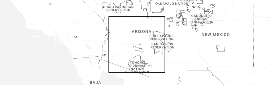
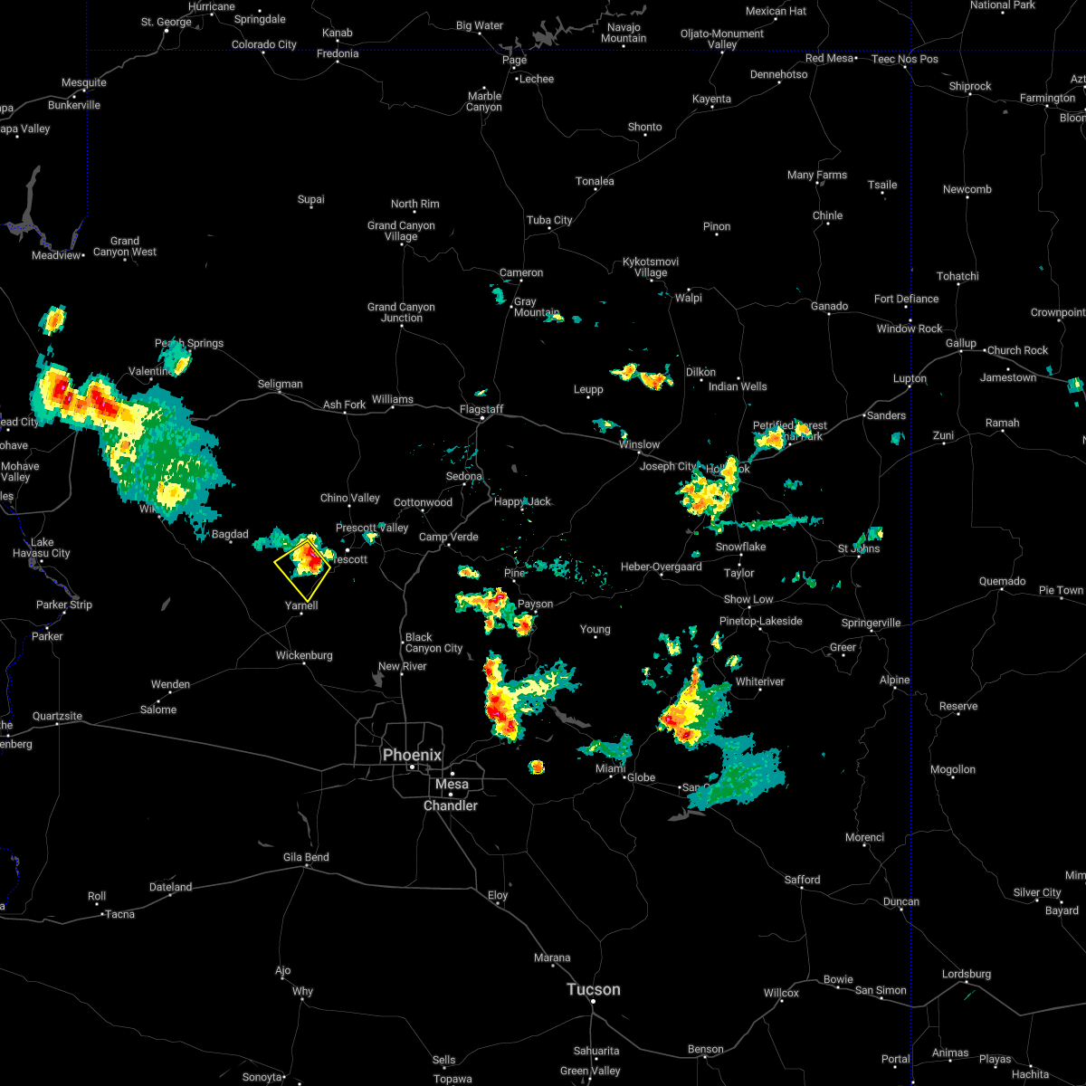
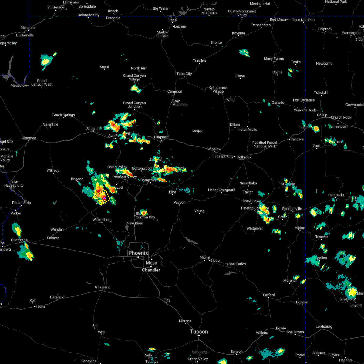
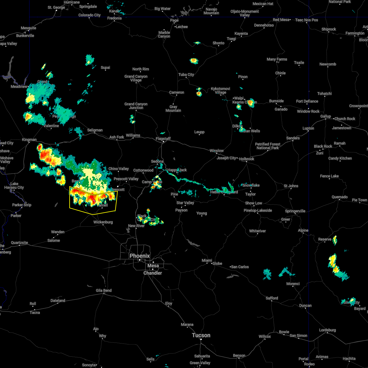
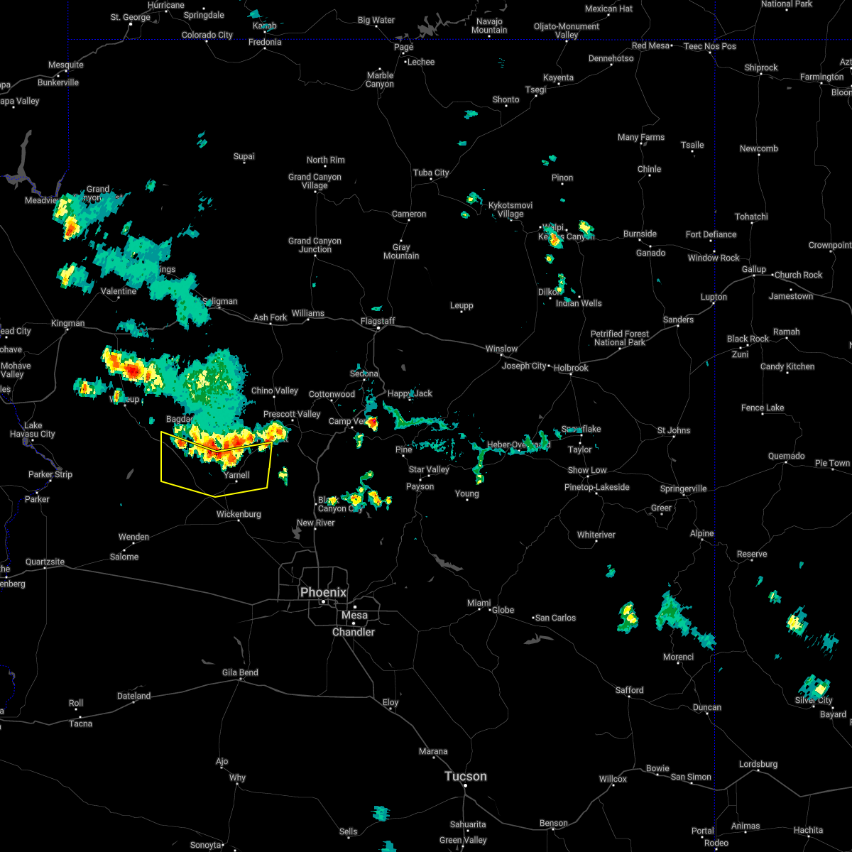
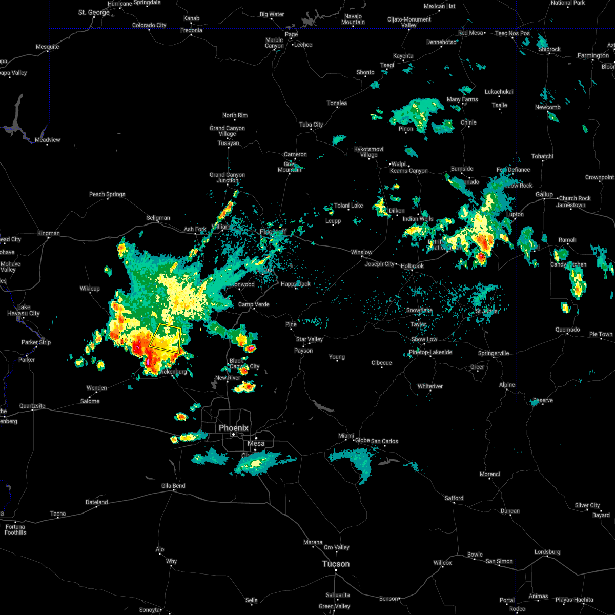
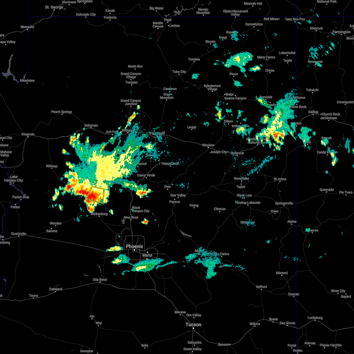
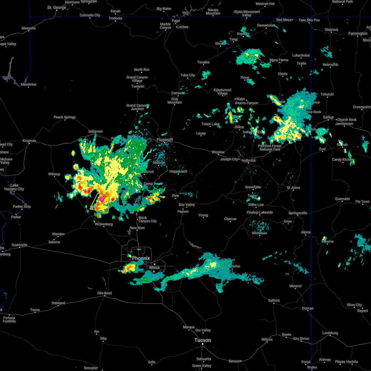
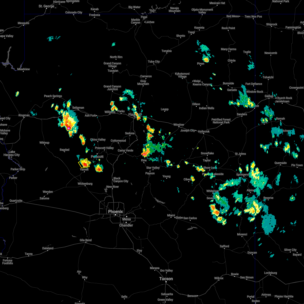
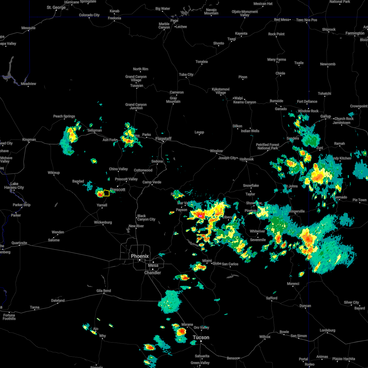
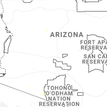
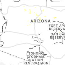
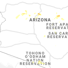
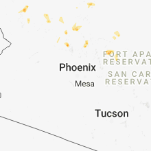
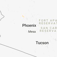
Hail Map for Wilhoit, AZ
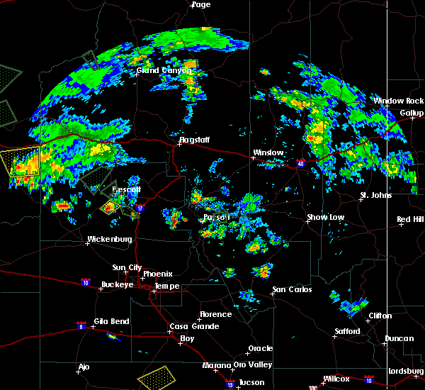
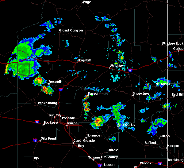
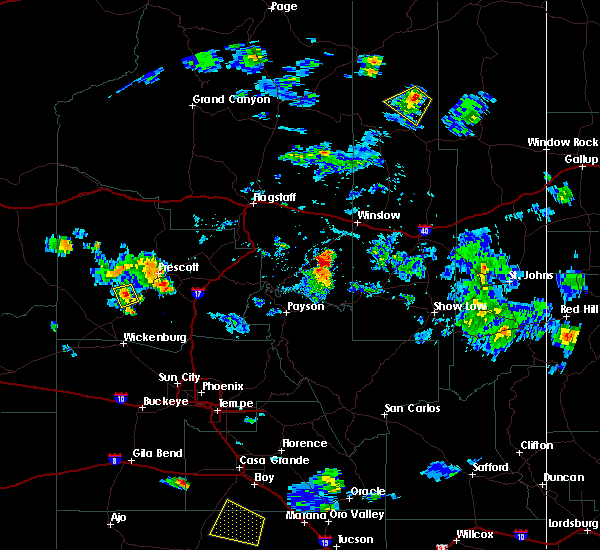
The Wilhoit, AZ area has had 0 reports of on-the-ground hail by trained spotters, and has been under severe weather warnings 4 times during the past 12 months. Doppler radar has detected hail at or near Wilhoit, AZ on 44 occasions, including 2 occasions during the past year.
| Name: | Wilhoit, AZ |
| Where Located: | 73.1 miles NNW of Phoenix, AZ |
| Map: | Google Map for Wilhoit, AZ |
| Population: | 868 |
| Housing Units: | 483 |
| More Info: | Search Google for Wilhoit, AZ |
3
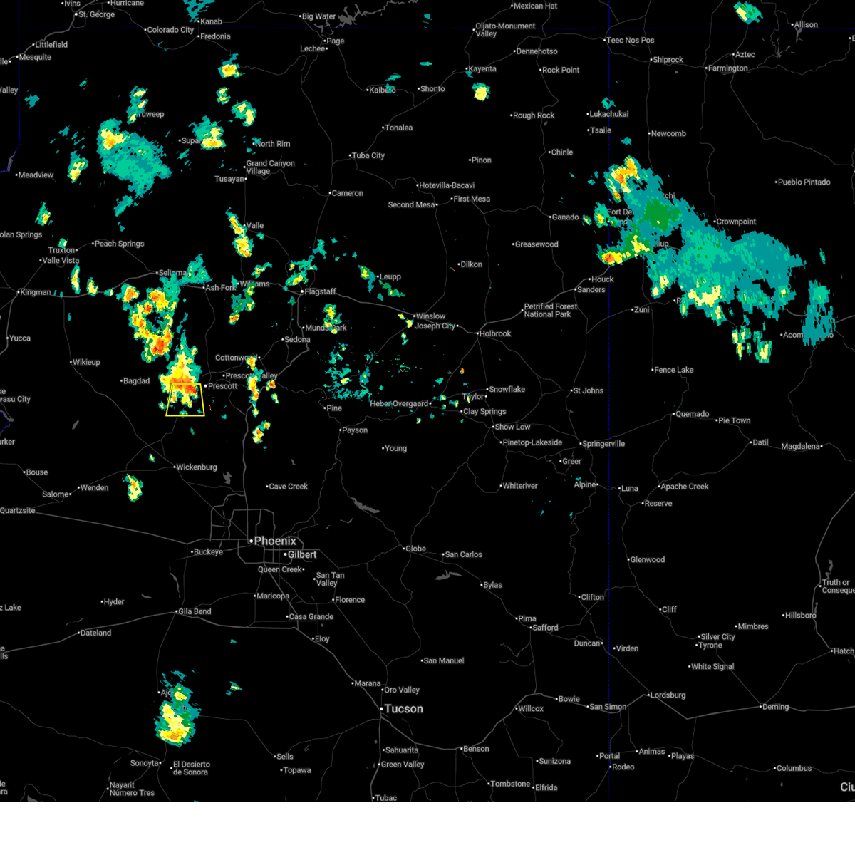
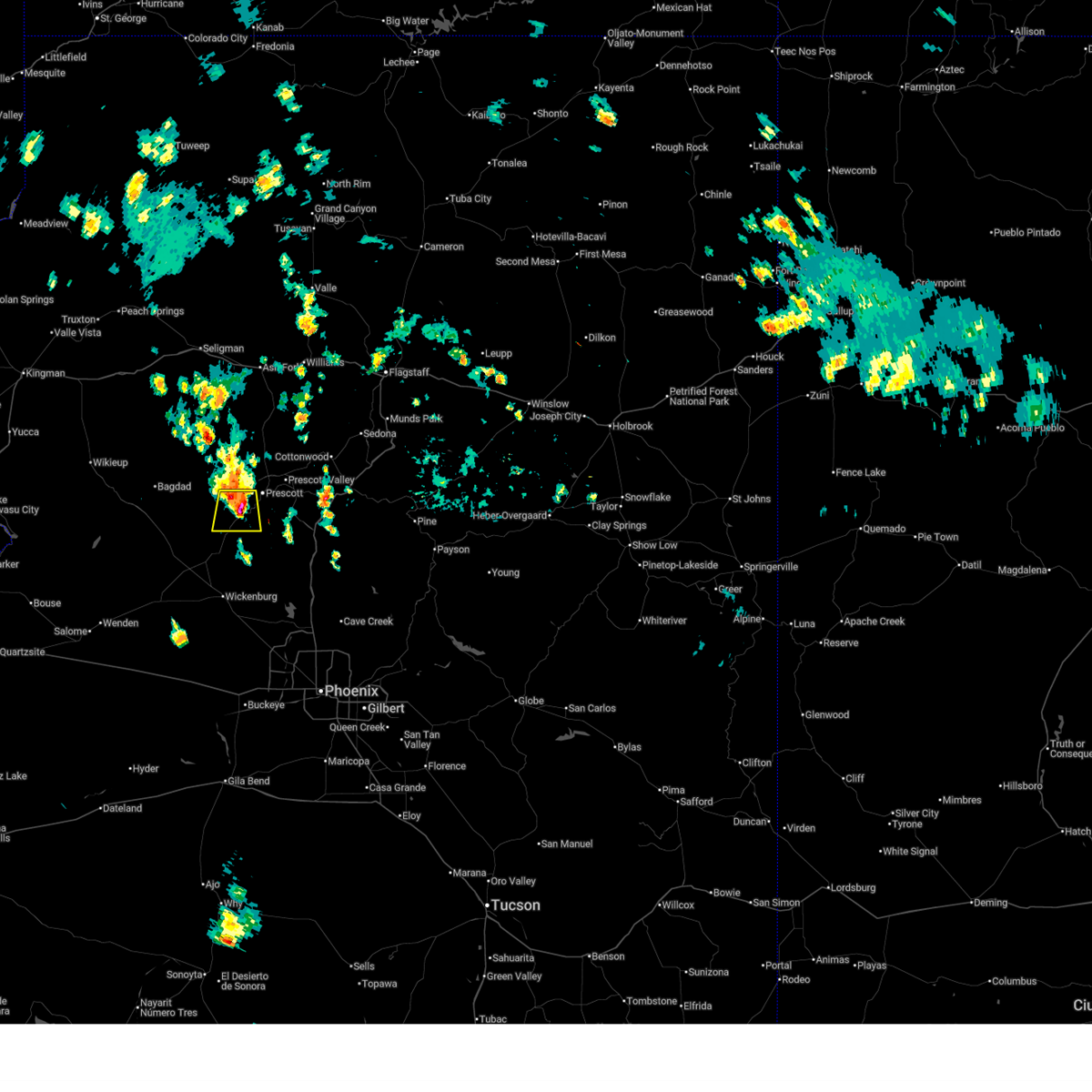
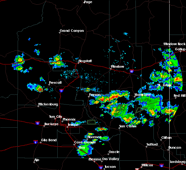
The Top Recent Hail Date for Wilhoit, AZ is Sunday, August 24, 2025 (5th out of 44)
Hail and Wind Damage Spotted near Wilhoit, AZ
| Date / Time | Report Details |
|---|---|
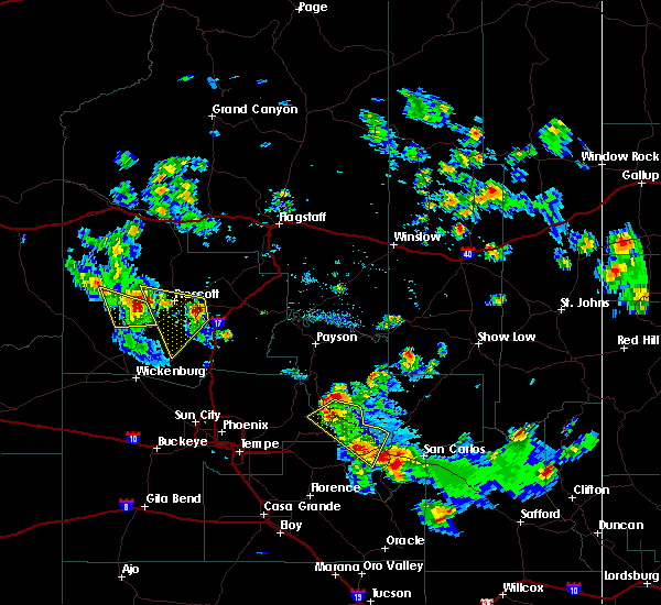
| 9/26/2025 10:22 AM MST | At 1022 am mst, a severe thunderstorm was located over yarnell, or 28 miles southwest of prescott, moving north at 30 mph (radar indicated). Hazards include 60 mph wind gusts and quarter size hail. Hail damage to vehicles is expected. expect wind damage to roofs, siding, and trees. locations impacted include, yarnell, peeples valley, weaver peak, congress, escapees north ranch, hawkins, wilhoit, stanton, granite mountain hotshots memorial state park, piedmont, hassayampa river canyon wilderness, walnut grove and date. This includes state route 89 between mile markers 268 and 288. |
| 9/26/2025 10:03 AM MST | Svrfgz the national weather service in flagstaff has issued a * severe thunderstorm warning for, yavapai county in west central arizona, * until 1045 am mst. * at 1003 am mst, a severe thunderstorm was located 6 miles northeast of wickenburg ranch, or 36 miles south of prescott, moving north at 25 mph (radar indicated). Hazards include ping pong ball size hail and 60 mph wind gusts. People and animals outdoors will be injured. expect hail damage to roofs, siding, windows, and vehicles. Expect wind damage to roofs, siding, and trees. |
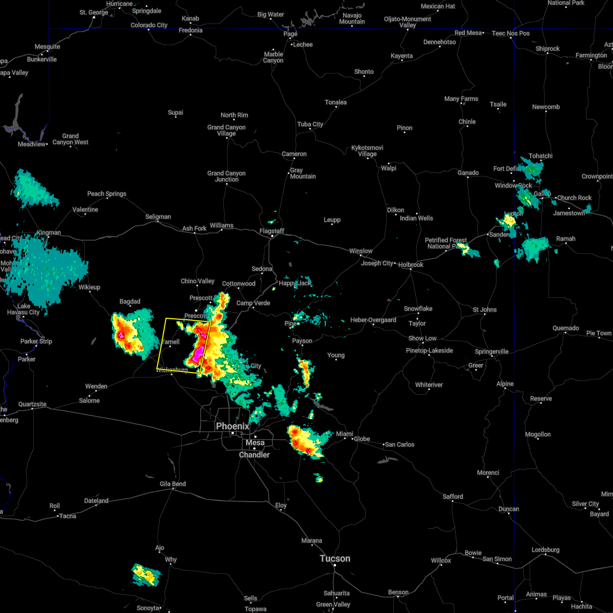
| 8/24/2025 2:38 PM MST |
 The storm which prompted the warning has weakened below severe limits, and no longer poses an immediate threat to life or property. therefore, the warning will be allowed to expire. however, small hail, gusty winds, and heavy rain are still possible with this thunderstorm. The storm which prompted the warning has weakened below severe limits, and no longer poses an immediate threat to life or property. therefore, the warning will be allowed to expire. however, small hail, gusty winds, and heavy rain are still possible with this thunderstorm.
|
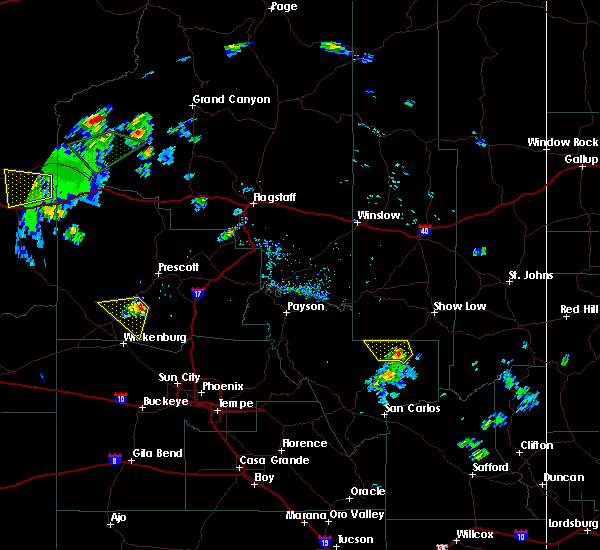
| 8/24/2025 2:23 PM MST |
 Svrfgz the national weather service in flagstaff has issued a * severe thunderstorm warning for, yavapai county in west central arizona, * until 245 pm mst. * at 223 pm mst, a severe thunderstorm was located over wilhoit, or 12 miles southwest of prescott. this storm was stationary (radar indicated). Hazards include 60 mph wind gusts and quarter size hail. Hail damage to vehicles is expected. Expect wind damage to roofs, siding, and trees. Svrfgz the national weather service in flagstaff has issued a * severe thunderstorm warning for, yavapai county in west central arizona, * until 245 pm mst. * at 223 pm mst, a severe thunderstorm was located over wilhoit, or 12 miles southwest of prescott. this storm was stationary (radar indicated). Hazards include 60 mph wind gusts and quarter size hail. Hail damage to vehicles is expected. Expect wind damage to roofs, siding, and trees.
|
| 7/11/2024 3:14 PM MST |
 The severe thunderstorm over prescott has weakened below severe limits and no longer poses an immediate threat to life or property. therefore, the warning will be allowed to expire. however, small hail, heavy rain and minor street flooding are still possible with this thunderstorm. The severe thunderstorm over prescott has weakened below severe limits and no longer poses an immediate threat to life or property. therefore, the warning will be allowed to expire. however, small hail, heavy rain and minor street flooding are still possible with this thunderstorm.
|
| 7/11/2024 2:52 PM MST |
 At 251 pm mst, a severe thunderstorm was located over the greater prescott area and was moving southwest at 10 to 15 mph (radar indicated). Hazards include 60 mph wind gusts and quarter size hail. Hail damage to vehicles is expected. expect wind damage to roofs, siding, and trees. locations impacted include, quartz mountain, thumbe butte, rancho vista estates, willow creek reservoir, poland junction, prescott gateway mall, iron springs, embry-riddle aeronautical university, acker park, prescott valley, goldwater lake park, wildwood estates, fain lake, alto pit ohv, courthouse plaza, wilhoit, prescott regional airport, goldwater lake, lynx lake, and potato patch. this includes the following highways, state route 89 between mile markers 293 and 322. state route 89a between mile markers 318 and 325. State route 69 between mile markers 275 and 276, and between mile markers 286 and 296. At 251 pm mst, a severe thunderstorm was located over the greater prescott area and was moving southwest at 10 to 15 mph (radar indicated). Hazards include 60 mph wind gusts and quarter size hail. Hail damage to vehicles is expected. expect wind damage to roofs, siding, and trees. locations impacted include, quartz mountain, thumbe butte, rancho vista estates, willow creek reservoir, poland junction, prescott gateway mall, iron springs, embry-riddle aeronautical university, acker park, prescott valley, goldwater lake park, wildwood estates, fain lake, alto pit ohv, courthouse plaza, wilhoit, prescott regional airport, goldwater lake, lynx lake, and potato patch. this includes the following highways, state route 89 between mile markers 293 and 322. state route 89a between mile markers 318 and 325. State route 69 between mile markers 275 and 276, and between mile markers 286 and 296.
|
| 7/11/2024 2:34 PM MST |
 Svrfgz the national weather service in flagstaff has issued a * severe thunderstorm warning for, yavapai county in west central arizona, * until 315 pm mst. * at 233 pm mst, a severe thunderstorm was located over central prescott, moving southwest at 10 to 15 mph (radar indicated). Hazards include 60 mph wind gusts and quarter size hail. Hail damage to vehicles is expected. Expect wind damage to roofs, siding, and trees. Svrfgz the national weather service in flagstaff has issued a * severe thunderstorm warning for, yavapai county in west central arizona, * until 315 pm mst. * at 233 pm mst, a severe thunderstorm was located over central prescott, moving southwest at 10 to 15 mph (radar indicated). Hazards include 60 mph wind gusts and quarter size hail. Hail damage to vehicles is expected. Expect wind damage to roofs, siding, and trees.
|
| 7/10/2024 3:25 PM MST |
 The storm near wilhoit which prompted the warning has weakened below severe limits, and no longer poses an immediate threat to life or property. therefore, the warning will be allowed to expire. however, small hail, gusty winds and heavy rain are still possible with this thunderstorm. remember, a severe thunderstorm warning still remains in effect for the prescott area from prescott to dewey-humboldt to walker. The storm near wilhoit which prompted the warning has weakened below severe limits, and no longer poses an immediate threat to life or property. therefore, the warning will be allowed to expire. however, small hail, gusty winds and heavy rain are still possible with this thunderstorm. remember, a severe thunderstorm warning still remains in effect for the prescott area from prescott to dewey-humboldt to walker.
|
| 7/10/2024 3:07 PM MST |
 Svrfgz the national weather service in flagstaff has issued a * severe thunderstorm warning for, yavapai county in west central arizona, * until 330 pm mst. * at 307 pm mst, a severe thunderstorm was located over copper basin, or near prescott, moving southeast at 15 mph (radar indicated). Hazards include 60 mph wind gusts and penny size hail. expect damage to roofs, siding, and trees Svrfgz the national weather service in flagstaff has issued a * severe thunderstorm warning for, yavapai county in west central arizona, * until 330 pm mst. * at 307 pm mst, a severe thunderstorm was located over copper basin, or near prescott, moving southeast at 15 mph (radar indicated). Hazards include 60 mph wind gusts and penny size hail. expect damage to roofs, siding, and trees
|
| 9/2/2022 5:49 PM MST |
 At 548 pm mst, severe thunderstorms were located along a line extending from near walker to 8 miles northwest of castle hot springs, moving west at 25 mph (radar indicated). Hazards include 60 mph wind gusts and quarter size hail. Hail damage to vehicles is expected. Expect wind damage to roofs, siding, and trees. At 548 pm mst, severe thunderstorms were located along a line extending from near walker to 8 miles northwest of castle hot springs, moving west at 25 mph (radar indicated). Hazards include 60 mph wind gusts and quarter size hail. Hail damage to vehicles is expected. Expect wind damage to roofs, siding, and trees.
|
| 9/2/2022 3:52 PM MST |
 At 351 pm mst, a severe thunderstorm was located over skull valley, or 10 miles west of prescott, moving southwest at 15 mph (radar indicated). Hazards include 60 mph wind gusts and quarter size hail. Hail damage to vehicles is expected. Expect wind damage to roofs, siding, and trees. At 351 pm mst, a severe thunderstorm was located over skull valley, or 10 miles west of prescott, moving southwest at 15 mph (radar indicated). Hazards include 60 mph wind gusts and quarter size hail. Hail damage to vehicles is expected. Expect wind damage to roofs, siding, and trees.
|
| 8/23/2022 4:06 PM MST | At 406 pm mst, a severe thunderstorm was located over walker, or 10 miles southeast of prescott, moving southwest at 10 mph (radar indicated). Hazards include 60 mph wind gusts and quarter size hail. Hail damage to vehicles is expected. Expect wind damage to roofs, siding, and trees. |
| 8/9/2022 12:31 PM MST |
 At 1230 pm mst, a severe thunderstorm was located between kirkland and peeples valley, moving north at 15 mph (radar indicated). Hazards include 60 mph wind gusts and quarter size hail. Hail damage to vehicles is expected. Expect wind damage to roofs, siding, and trees. At 1230 pm mst, a severe thunderstorm was located between kirkland and peeples valley, moving north at 15 mph (radar indicated). Hazards include 60 mph wind gusts and quarter size hail. Hail damage to vehicles is expected. Expect wind damage to roofs, siding, and trees.
|
| 6/28/2022 6:41 PM MST |
 At 641 pm mst, severe thunderstorms were located along a line extending from 16 miles south of bagdad to 6 miles northwest of congress to walnut grove, moving south at 20 mph (radar indicated). Hazards include 60 mph wind gusts and penny size hail. Expect damage to roofs, siding, and trees. locations impacted include, congress, wilhoit, walnut grove, kirkland, wagoner, yarnell, peeples valley and glen ilah. hail threat, radar indicated max hail size, 0. 75 in wind threat, radar indicated max wind gust, 60 mph. At 641 pm mst, severe thunderstorms were located along a line extending from 16 miles south of bagdad to 6 miles northwest of congress to walnut grove, moving south at 20 mph (radar indicated). Hazards include 60 mph wind gusts and penny size hail. Expect damage to roofs, siding, and trees. locations impacted include, congress, wilhoit, walnut grove, kirkland, wagoner, yarnell, peeples valley and glen ilah. hail threat, radar indicated max hail size, 0. 75 in wind threat, radar indicated max wind gust, 60 mph.
|
| 6/28/2022 6:12 PM MST |
 At 611 pm mst, severe thunderstorms were located along a line extending from 7 miles south of bagdad to 7 miles south of yava to wilhoit, moving south at 20 mph (radar indicated). Hazards include 60 mph wind gusts and penny size hail. expect damage to roofs, siding, and trees At 611 pm mst, severe thunderstorms were located along a line extending from 7 miles south of bagdad to 7 miles south of yava to wilhoit, moving south at 20 mph (radar indicated). Hazards include 60 mph wind gusts and penny size hail. expect damage to roofs, siding, and trees
|
| 6/28/2022 6:00 PM MST | Trained spotter measured 60 mph wind gus in yavapai county AZ, 6.3 miles E of Wilhoit, AZ |
| 8/16/2021 12:42 AM MST |
 The severe thunderstorm warning for yavapai county will expire at 1245 am mst, the storm which prompted the warning has moved out of the area. therefore, the warning will be allowed to expire. however gusty winds and heavy rain are still possible with this thunderstorm. The severe thunderstorm warning for yavapai county will expire at 1245 am mst, the storm which prompted the warning has moved out of the area. therefore, the warning will be allowed to expire. however gusty winds and heavy rain are still possible with this thunderstorm.
|
| 8/16/2021 12:25 AM MST |
 At 1225 am mst, a severe thunderstorm was located 8 miles north of congress, or 22 miles north of wickenburg, moving southwest at 30 mph (radar indicated). Hazards include ping pong ball size hail and 60 mph wind gusts. People and animals outdoors will be injured. expect hail damage to roofs, siding, windows, and vehicles. expect wind damage to roofs, siding, and trees. locations impacted include, peeples valley, yarnell and glen ilah. hail threat, radar indicated max hail size, 1. 50 in wind threat, radar indicated max wind gust, 60 mph. At 1225 am mst, a severe thunderstorm was located 8 miles north of congress, or 22 miles north of wickenburg, moving southwest at 30 mph (radar indicated). Hazards include ping pong ball size hail and 60 mph wind gusts. People and animals outdoors will be injured. expect hail damage to roofs, siding, windows, and vehicles. expect wind damage to roofs, siding, and trees. locations impacted include, peeples valley, yarnell and glen ilah. hail threat, radar indicated max hail size, 1. 50 in wind threat, radar indicated max wind gust, 60 mph.
|
| 8/16/2021 12:08 AM MST |
 At 1207 am mst, a severe thunderstorm was located near kirkland, or 25 miles southwest of prescott valley, moving south at 20 mph (radar indicated). Hazards include ping pong ball size hail and 60 mph wind gusts. People and animals outdoors will be injured. expect hail damage to roofs, siding, windows, and vehicles. Expect wind damage to roofs, siding, and trees. At 1207 am mst, a severe thunderstorm was located near kirkland, or 25 miles southwest of prescott valley, moving south at 20 mph (radar indicated). Hazards include ping pong ball size hail and 60 mph wind gusts. People and animals outdoors will be injured. expect hail damage to roofs, siding, windows, and vehicles. Expect wind damage to roofs, siding, and trees.
|
| 8/13/2021 9:03 PM MST |
 At 902 pm mst, a severe thunderstorm was located 8 miles south of walker, moving west at 35 mph (radar indicated). Hazards include 60 mph wind gusts. expect damage to roofs, siding, and trees At 902 pm mst, a severe thunderstorm was located 8 miles south of walker, moving west at 35 mph (radar indicated). Hazards include 60 mph wind gusts. expect damage to roofs, siding, and trees
|
| 8/23/2020 2:08 PM MST |
 At 207 pm mst, a severe thunderstorm was located near kirkland, or 24 miles southwest of prescott valley, and is nearly stationary (radar indicated). Hazards include 60 mph wind gusts and quarter size hail. Hail damage to vehicles is expected. Expect wind damage to roofs, siding, and trees. At 207 pm mst, a severe thunderstorm was located near kirkland, or 24 miles southwest of prescott valley, and is nearly stationary (radar indicated). Hazards include 60 mph wind gusts and quarter size hail. Hail damage to vehicles is expected. Expect wind damage to roofs, siding, and trees.
|
| 9/1/2019 3:12 PM MST |
 The severe thunderstorm warning for yavapai county will expire at 315 pm mst, the severe thunderstorm near kirkland which prompted the warning has weakened. therefore, the warning will be allowed to expire. The severe thunderstorm warning for yavapai county will expire at 315 pm mst, the severe thunderstorm near kirkland which prompted the warning has weakened. therefore, the warning will be allowed to expire.
|
| 9/1/2019 2:48 PM MST |
 At 247 pm mst, a severe thunderstorm was located near kirkland, or 17 miles southwest of prescott valley, moving southwest at 10 mph (radar indicated). Hazards include 60 mph wind gusts and half dollar size hail. Hail damage to vehicles is expected. Expect wind damage to roofs, siding, and trees. At 247 pm mst, a severe thunderstorm was located near kirkland, or 17 miles southwest of prescott valley, moving southwest at 10 mph (radar indicated). Hazards include 60 mph wind gusts and half dollar size hail. Hail damage to vehicles is expected. Expect wind damage to roofs, siding, and trees.
|
| 8/12/2018 4:54 PM MST |
 The severe thunderstorm warning for yavapai county will expire at 500 pm mst, the storm which prompted the warning has weakened below severe limits, and no longer pose an immediate threat to life or property. therefore the warning will be allowed to expire. however small hail and heavy rain are still possible with this thunderstorm. a severe thunderstorm watch remains in effect until 1100 pm mst for west central arizona. The severe thunderstorm warning for yavapai county will expire at 500 pm mst, the storm which prompted the warning has weakened below severe limits, and no longer pose an immediate threat to life or property. therefore the warning will be allowed to expire. however small hail and heavy rain are still possible with this thunderstorm. a severe thunderstorm watch remains in effect until 1100 pm mst for west central arizona.
|
| 8/12/2018 4:16 PM MST |
 At 416 pm mst, a severe thunderstorm was located near yava, or 24 miles west of prescott valley, moving west at 15 mph (radar indicated). Hazards include 60 mph wind gusts and half dollar size hail. Hail damage to vehicles is expected. expect wind damage to roofs, siding, and trees. locations impacted include, wilhoit, yava, skull valley and kirkland. this includes the following highways, state route 89 between mile markers 292 and 294. State route 96 near mile marker 21. At 416 pm mst, a severe thunderstorm was located near yava, or 24 miles west of prescott valley, moving west at 15 mph (radar indicated). Hazards include 60 mph wind gusts and half dollar size hail. Hail damage to vehicles is expected. expect wind damage to roofs, siding, and trees. locations impacted include, wilhoit, yava, skull valley and kirkland. this includes the following highways, state route 89 between mile markers 292 and 294. State route 96 near mile marker 21.
|
| 8/12/2018 4:14 PM MST |
 At 414 pm mst, a severe thunderstorm was located over dewey-humboldt, or 7 miles southeast of prescott valley, moving west at 30 mph (radar indicated). Hazards include 60 mph wind gusts and quarter size hail. Hail damage to vehicles is expected. Expect wind damage to roofs, siding, and trees. At 414 pm mst, a severe thunderstorm was located over dewey-humboldt, or 7 miles southeast of prescott valley, moving west at 30 mph (radar indicated). Hazards include 60 mph wind gusts and quarter size hail. Hail damage to vehicles is expected. Expect wind damage to roofs, siding, and trees.
|
| 8/12/2018 3:54 PM MST |
 At 354 pm mst, a severe thunderstorm was located over skull valley, or 19 miles west of prescott valley, moving northwest at 15 mph (radar indicated). Hazards include 60 mph wind gusts and quarter size hail. Hail damage to vehicles is expected. Expect wind damage to roofs, siding, and trees. At 354 pm mst, a severe thunderstorm was located over skull valley, or 19 miles west of prescott valley, moving northwest at 15 mph (radar indicated). Hazards include 60 mph wind gusts and quarter size hail. Hail damage to vehicles is expected. Expect wind damage to roofs, siding, and trees.
|
| 8/12/2018 3:28 PM MST |
 The severe thunderstorm warning for yavapai county will expire at 330 pm mst, the storm which prompted the warning has weakened below severe limits, and no longer pose an immediate threat to life or property. therefore the warning will be allowed to expire. however small hail, gusty winds and heavy rain are still possible with this thunderstorm. The severe thunderstorm warning for yavapai county will expire at 330 pm mst, the storm which prompted the warning has weakened below severe limits, and no longer pose an immediate threat to life or property. therefore the warning will be allowed to expire. however small hail, gusty winds and heavy rain are still possible with this thunderstorm.
|
| 8/12/2018 3:18 PM MST |
 At 318 pm mst, a severe thunderstorm was located over wilhoit, or 14 miles southwest of prescott valley, moving southwest at 10 mph (radar indicated). Hazards include 60 mph wind gusts and quarter size hail. Hail damage to vehicles is expected. expect wind damage to roofs, siding, and trees. locations impacted include, wilhoit, walnut grove, wagoner, skull valley, ponderosa park and kirkland. This includes state route 89 between mile markers 285 and 307. At 318 pm mst, a severe thunderstorm was located over wilhoit, or 14 miles southwest of prescott valley, moving southwest at 10 mph (radar indicated). Hazards include 60 mph wind gusts and quarter size hail. Hail damage to vehicles is expected. expect wind damage to roofs, siding, and trees. locations impacted include, wilhoit, walnut grove, wagoner, skull valley, ponderosa park and kirkland. This includes state route 89 between mile markers 285 and 307.
|
| 8/12/2018 2:52 PM MST |
 At 252 pm mst, a severe thunderstorm was located over ponderosa park, or 9 miles southwest of prescott valley, moving southwest at 10 mph (radar indicated). Hazards include 60 mph wind gusts and quarter size hail. Hail damage to vehicles is expected. Expect wind damage to roofs, siding, and trees. At 252 pm mst, a severe thunderstorm was located over ponderosa park, or 9 miles southwest of prescott valley, moving southwest at 10 mph (radar indicated). Hazards include 60 mph wind gusts and quarter size hail. Hail damage to vehicles is expected. Expect wind damage to roofs, siding, and trees.
|
| 8/11/2018 4:19 PM MST |
 At 419 pm mst, a severe thunderstorm was located near peeples valley, or 22 miles north of wickenburg, moving southwest at 15 mph (radar indicated). Hazards include 60 mph wind gusts and quarter size hail. Hail damage to vehicles is expected. Expect wind damage to roofs, siding, and trees. At 419 pm mst, a severe thunderstorm was located near peeples valley, or 22 miles north of wickenburg, moving southwest at 15 mph (radar indicated). Hazards include 60 mph wind gusts and quarter size hail. Hail damage to vehicles is expected. Expect wind damage to roofs, siding, and trees.
|
| 8/2/2018 4:18 PM MST |
 At 417 pm mst, a severe thunderstorm was located near wilhoit, or 14 miles southwest of prescott valley, moving northeast at 5 mph (radar indicated). Hazards include 60 mph wind gusts and quarter size hail. Hail damage to vehicles is expected. Expect wind damage to roofs, siding, and trees. At 417 pm mst, a severe thunderstorm was located near wilhoit, or 14 miles southwest of prescott valley, moving northeast at 5 mph (radar indicated). Hazards include 60 mph wind gusts and quarter size hail. Hail damage to vehicles is expected. Expect wind damage to roofs, siding, and trees.
|
| 8/2/2018 1:39 PM MST |
 At 139 pm mst, a severe thunderstorm was located over yavapai campground, or 8 miles west of prescott valley, moving northeast at 15 mph (radar indicated). Hazards include 60 mph wind gusts and quarter size hail. Hail damage to vehicles is expected. Expect wind damage to roofs, siding, and trees. At 139 pm mst, a severe thunderstorm was located over yavapai campground, or 8 miles west of prescott valley, moving northeast at 15 mph (radar indicated). Hazards include 60 mph wind gusts and quarter size hail. Hail damage to vehicles is expected. Expect wind damage to roofs, siding, and trees.
|
| 7/14/2018 12:57 PM MST |
 The severe thunderstorm warning for yavapai county will expire at 100 pm mst, the storm which prompted the warning has weakened below severe limits, and no longer pose an immediate threat of severe winds or hail. therefore the warning will be allowed to expire. however heavy rain is still occurring with this thunderstorm. The severe thunderstorm warning for yavapai county will expire at 100 pm mst, the storm which prompted the warning has weakened below severe limits, and no longer pose an immediate threat of severe winds or hail. therefore the warning will be allowed to expire. however heavy rain is still occurring with this thunderstorm.
|
| 7/14/2018 12:35 PM MST |
 At 1234 pm mst, a severe thunderstorm was located over downtown prescott, or near prescott valley, moving south at 10 mph (radar indicated). Hazards include 60 mph wind gusts. Expect damage to roofs, siding, and trees. locations impacted include, prescott valley, prescott, groom creek subdivision, walker, prescott gateway mall, downtown prescott, ponderosa park, indian hill west prescott, oak knoll village, lower wolf creek campground, lynx lake dam, upper wolf creek group campground and white spar campground. this includes the following highways, state route 89 between mile markers 296 and 316. State route 69 between mile markers 290 and 296. At 1234 pm mst, a severe thunderstorm was located over downtown prescott, or near prescott valley, moving south at 10 mph (radar indicated). Hazards include 60 mph wind gusts. Expect damage to roofs, siding, and trees. locations impacted include, prescott valley, prescott, groom creek subdivision, walker, prescott gateway mall, downtown prescott, ponderosa park, indian hill west prescott, oak knoll village, lower wolf creek campground, lynx lake dam, upper wolf creek group campground and white spar campground. this includes the following highways, state route 89 between mile markers 296 and 316. State route 69 between mile markers 290 and 296.
|
| 7/14/2018 12:21 PM MST |
 At 1221 pm mst, a severe thunderstorm was located over downtown prescott, or near prescott valley, moving south at 10 mph (radar indicated). Hazards include 60 mph wind gusts and penny size hail. expect damage to roofs, siding, and trees At 1221 pm mst, a severe thunderstorm was located over downtown prescott, or near prescott valley, moving south at 10 mph (radar indicated). Hazards include 60 mph wind gusts and penny size hail. expect damage to roofs, siding, and trees
|
| 7/28/2016 4:49 PM MST |
 At 446 pm mst, doppler radar indicated a severe thunderstorm capable of producing quarter size hail and damaging winds in excess of 60 mph. this storm was located over ponderosa park, moving west at 15 mph. this includes state highway 89 between wilhoit and mile post 305. locations impacted include, wilhoit and ponderosa park. At 446 pm mst, doppler radar indicated a severe thunderstorm capable of producing quarter size hail and damaging winds in excess of 60 mph. this storm was located over ponderosa park, moving west at 15 mph. this includes state highway 89 between wilhoit and mile post 305. locations impacted include, wilhoit and ponderosa park.
|
| 7/28/2016 4:38 PM MST |
 At 437 pm mst, doppler radar indicated a severe thunderstorm capable of producing quarter size hail and damaging winds in excess of 60 mph. this storm was located over groom creek subdivision south of prescott, and moving west at 15 mph. At 437 pm mst, doppler radar indicated a severe thunderstorm capable of producing quarter size hail and damaging winds in excess of 60 mph. this storm was located over groom creek subdivision south of prescott, and moving west at 15 mph.
|
| 6/29/2015 5:34 PM MST |
 At 533 pm mst, doppler radar indicated a severe thunderstorm capable of producing damaging winds in excess of 60 mph. this storm was located over kirkland, or 20 miles southwest of prescott, and moving southwest at 10 mph. penny size hail may also accompany the damaging winds. At 533 pm mst, doppler radar indicated a severe thunderstorm capable of producing damaging winds in excess of 60 mph. this storm was located over kirkland, or 20 miles southwest of prescott, and moving southwest at 10 mph. penny size hail may also accompany the damaging winds.
|
Hail Maps for Wilhoit, AZ


Connect with Interactive Hail Maps