

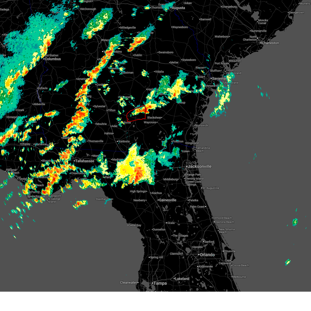
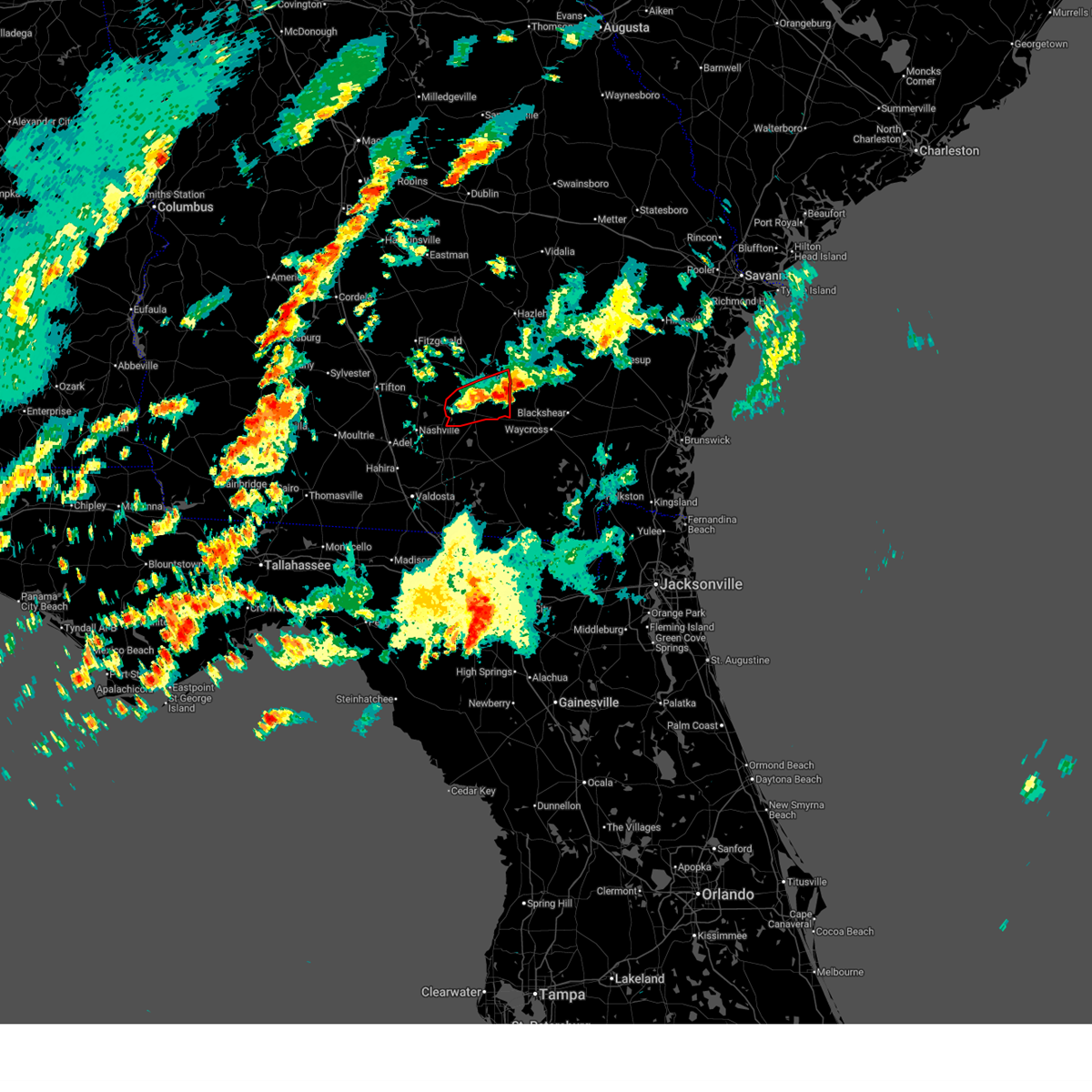
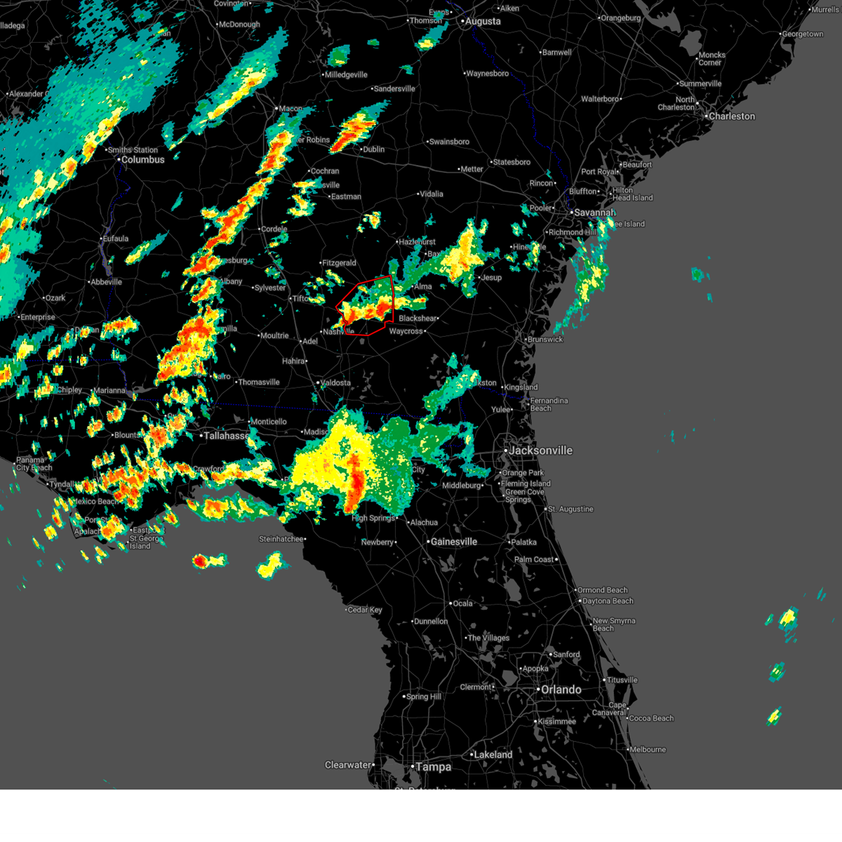
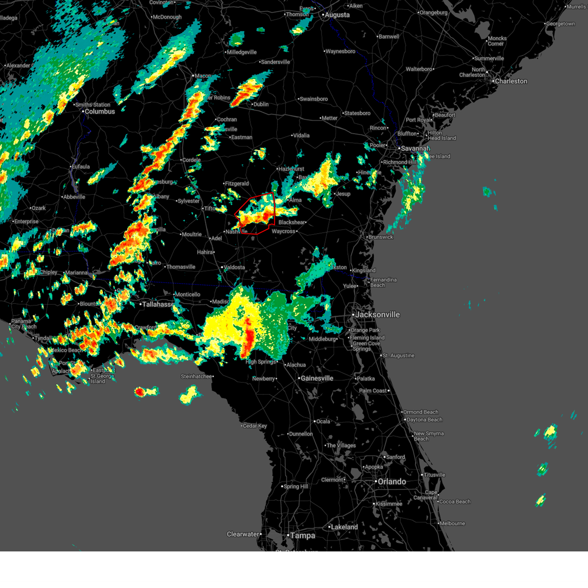
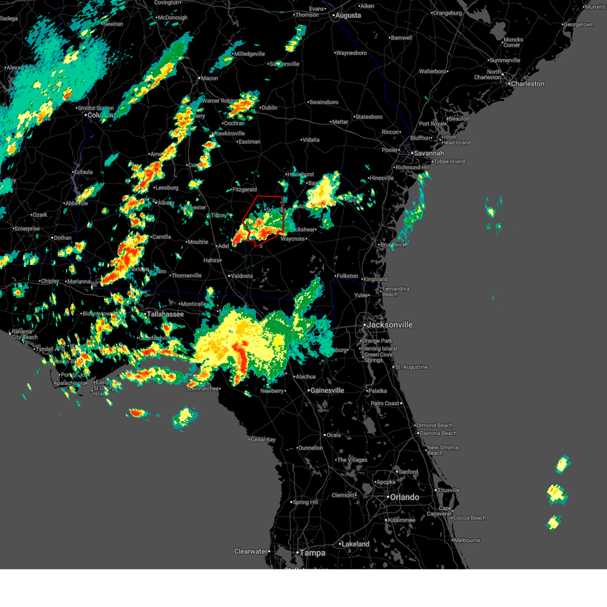
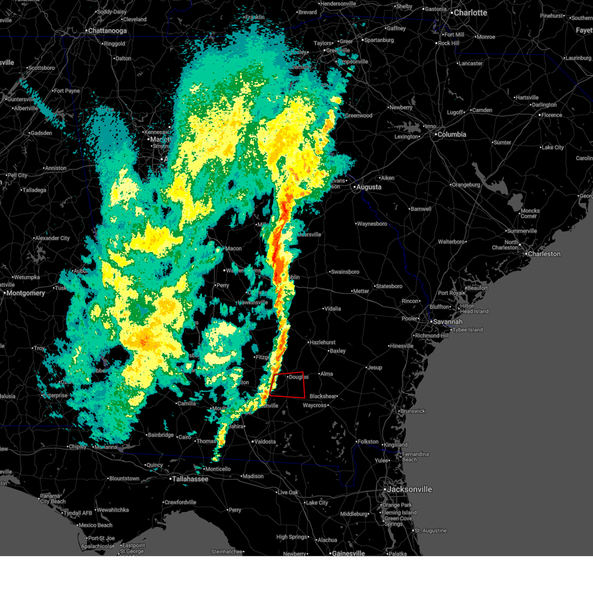
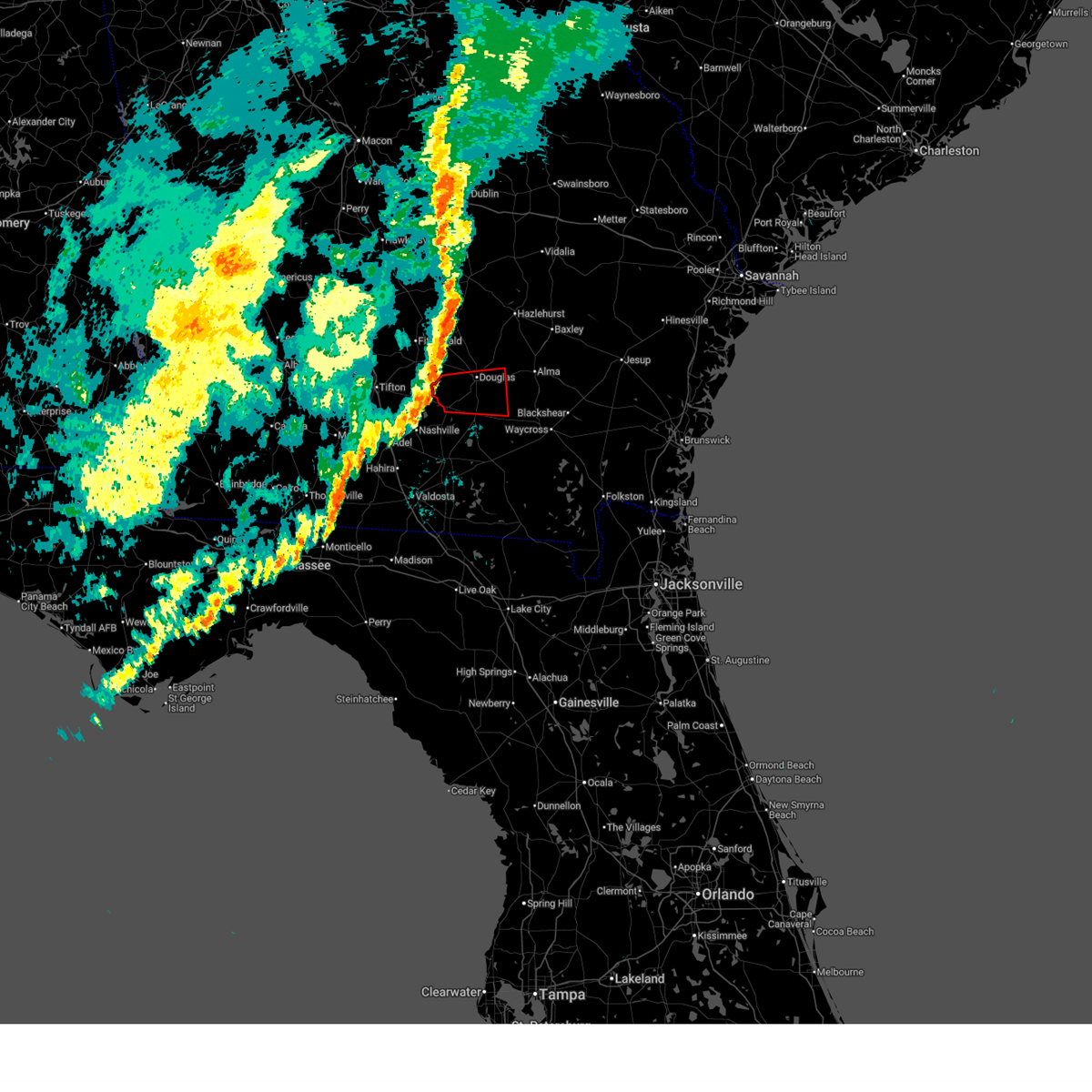
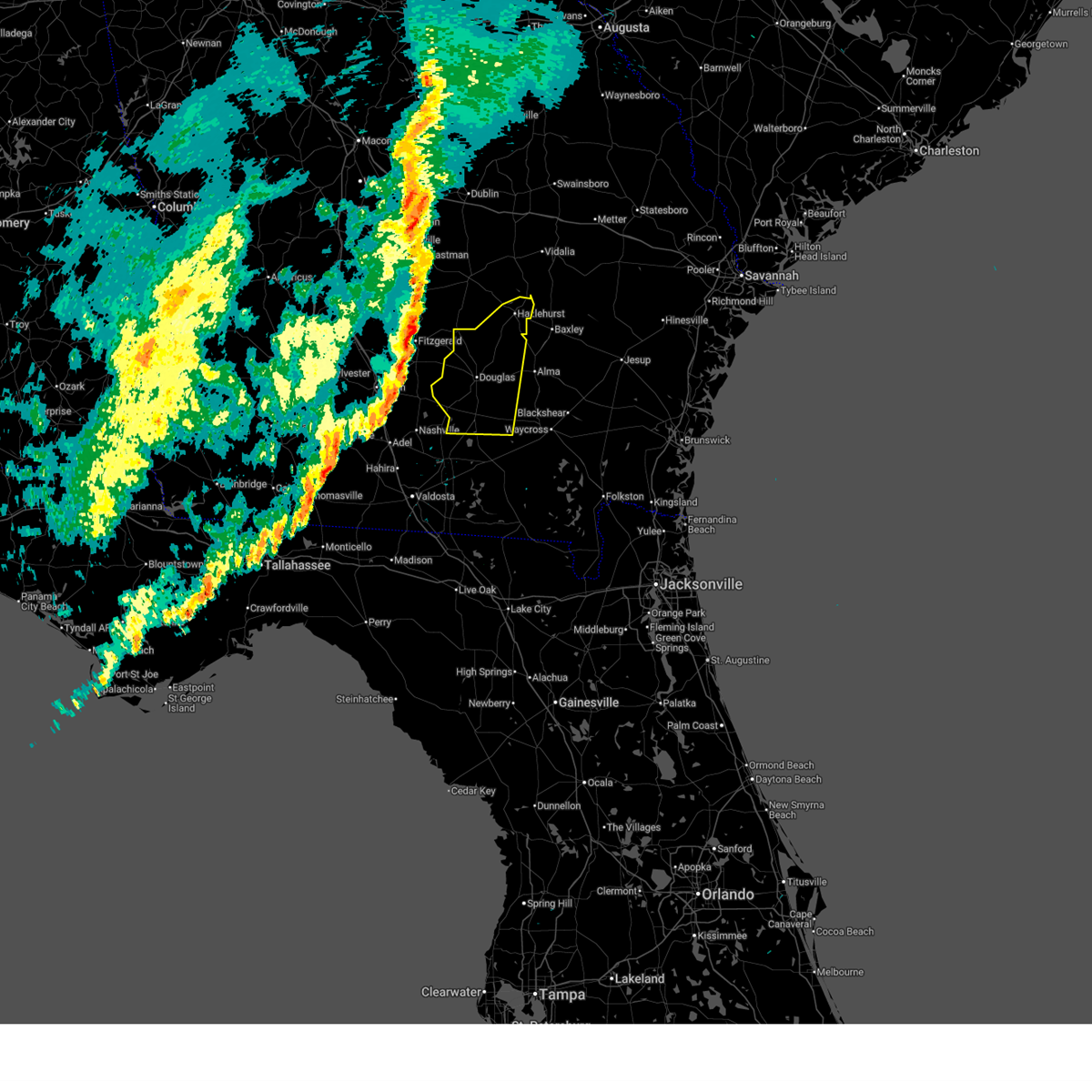
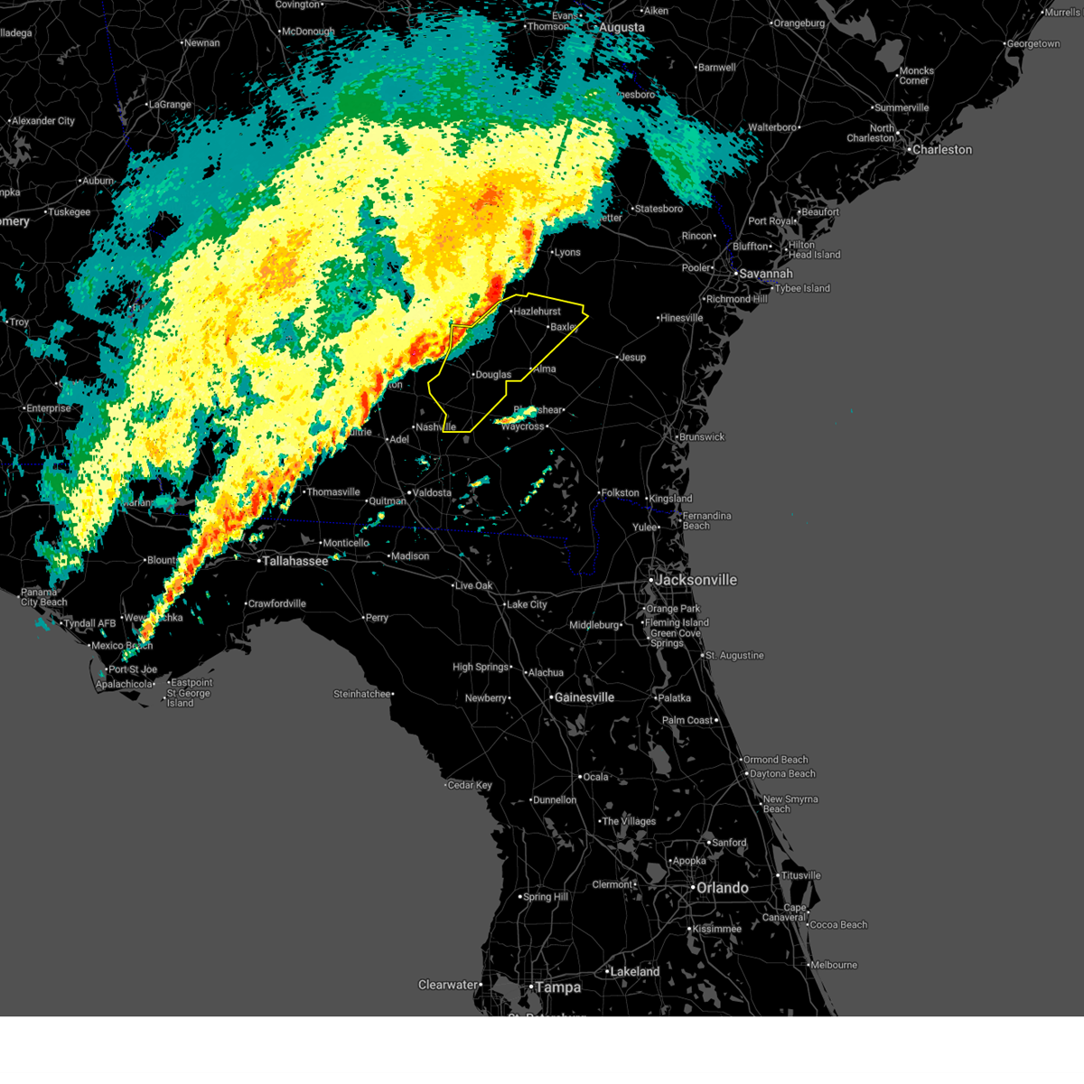
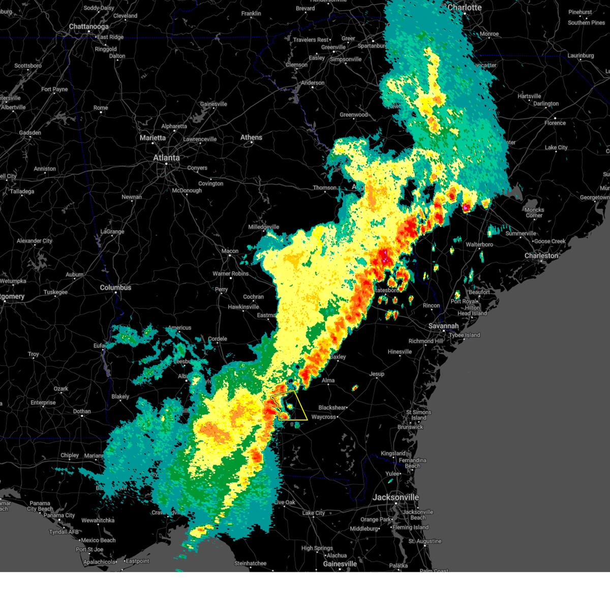
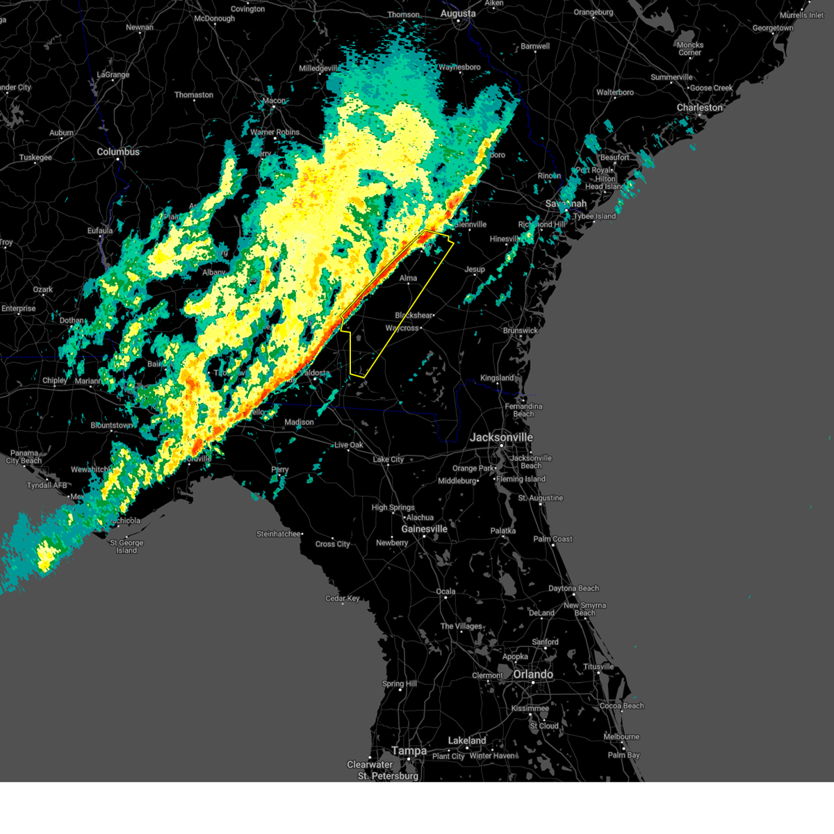
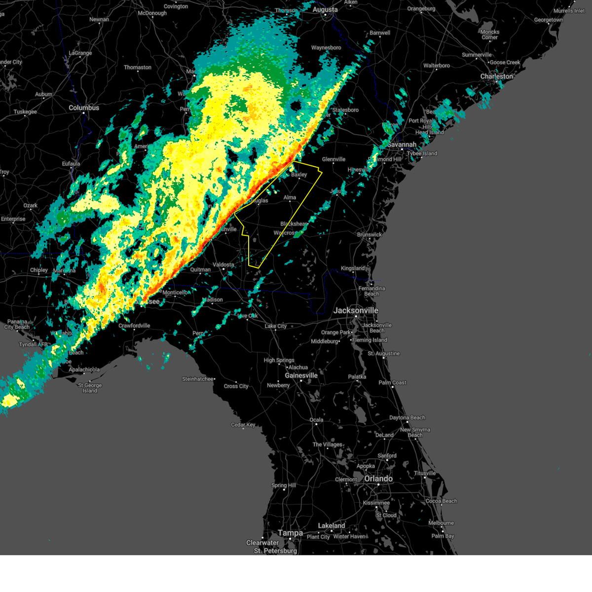
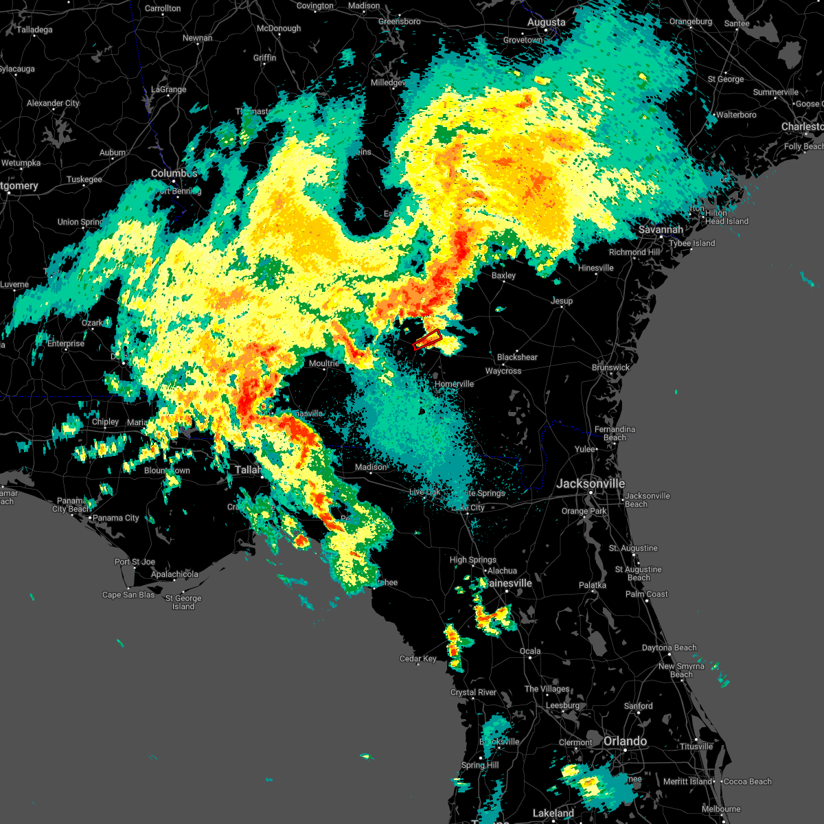
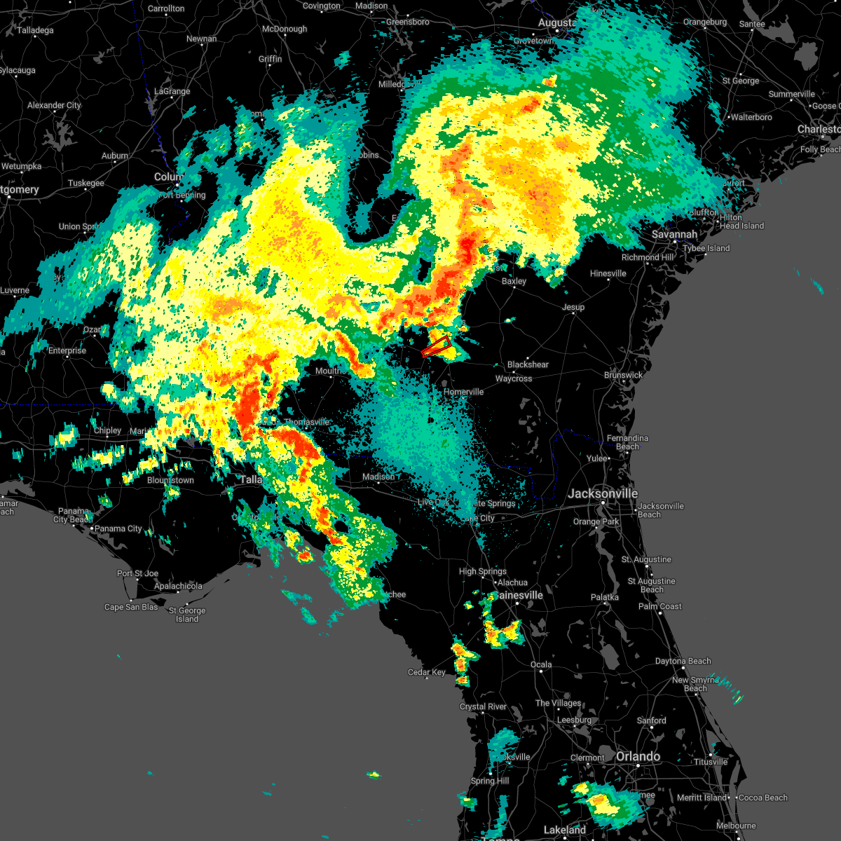
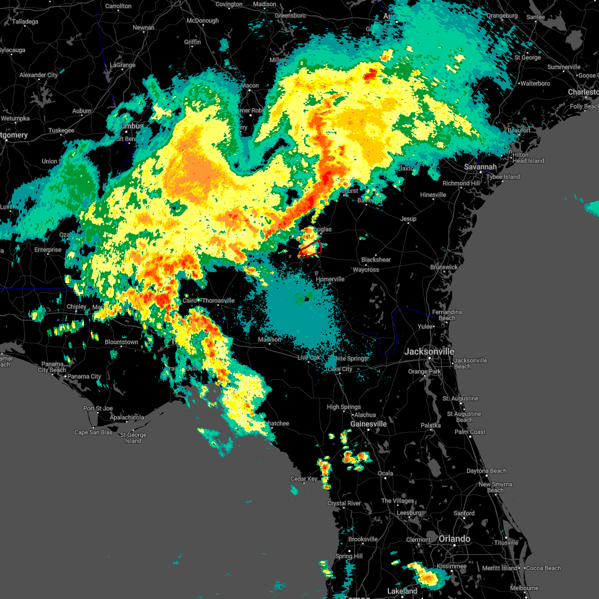
Hail Map for Willacoochee, GA
The Willacoochee, GA area has had 4 reports of on-the-ground hail by trained spotters, and has been under severe weather warnings 9 times during the past 12 months. Doppler radar has detected hail at or near Willacoochee, GA on 60 occasions, including 2 occasions during the past year.
| Name: | Willacoochee, GA |
| Where Located: | 16.5 miles SW of Douglas, GA |
| Map: | Google Map for Willacoochee, GA |
| Population: | 1391 |
| Housing Units: | 643 |
| More Info: | Search Google for Willacoochee, GA |
0
The Top Recent Hail Date for Willacoochee, GA is Friday, May 22, 2026 (36th out of 60)

Hail and Wind Damage Spotted near Willacoochee, GA
| Date / Time | Report Details |
|---|---|
| 3/16/2026 6:32 AM EDT |
 the tornado warning has been cancelled and is no longer in effect the tornado warning has been cancelled and is no longer in effect
|
| 3/16/2026 6:21 AM EDT |
 At 620 am edt, a severe thunderstorm capable of producing a tornado was located near pearson, moving northeast at 35 mph (radar indicated rotation). Hazards include tornado and quarter size hail. Flying debris will be dangerous to those caught without shelter. mobile homes will be damaged or destroyed. damage to roofs, windows, and vehicles will occur. tree damage is likely. this dangerous storm will be near, nicholls around 635 am edt. Other locations impacted by this tornadic thunderstorm include axson. At 620 am edt, a severe thunderstorm capable of producing a tornado was located near pearson, moving northeast at 35 mph (radar indicated rotation). Hazards include tornado and quarter size hail. Flying debris will be dangerous to those caught without shelter. mobile homes will be damaged or destroyed. damage to roofs, windows, and vehicles will occur. tree damage is likely. this dangerous storm will be near, nicholls around 635 am edt. Other locations impacted by this tornadic thunderstorm include axson.
|
| 3/16/2026 6:12 AM EDT |
 the tornado warning has been cancelled and is no longer in effect the tornado warning has been cancelled and is no longer in effect
|
| 3/16/2026 6:12 AM EDT |
 At 611 am edt, a severe thunderstorm capable of producing a tornado was located near willacoochee, moving northeast at 30 mph (radar indicated rotation). Hazards include tornado and quarter size hail. Flying debris will be dangerous to those caught without shelter. mobile homes will be damaged or destroyed. damage to roofs, windows, and vehicles will occur. tree damage is likely. this dangerous storm will be near, willacoochee around 615 am edt. douglas around 640 am edt. nicholls around 655 am edt. Other locations impacted by this tornadic thunderstorm include axson. At 611 am edt, a severe thunderstorm capable of producing a tornado was located near willacoochee, moving northeast at 30 mph (radar indicated rotation). Hazards include tornado and quarter size hail. Flying debris will be dangerous to those caught without shelter. mobile homes will be damaged or destroyed. damage to roofs, windows, and vehicles will occur. tree damage is likely. this dangerous storm will be near, willacoochee around 615 am edt. douglas around 640 am edt. nicholls around 655 am edt. Other locations impacted by this tornadic thunderstorm include axson.
|
| 3/16/2026 5:56 AM EDT |
 Torjax the national weather service in jacksonville has issued a * tornado warning for, coffee county in southeastern georgia, atkinson county in southeastern georgia, northwestern clinch county in southeastern georgia, * until 645 am edt. * at 556 am edt, a severe thunderstorm capable of producing a tornado was located 7 miles northeast of ray city, or 7 miles southeast of nashville, moving east at 25 mph (radar indicated rotation). Hazards include tornado and quarter size hail. Flying debris will be dangerous to those caught without shelter. mobile homes will be damaged or destroyed. damage to roofs, windows, and vehicles will occur. tree damage is likely. this dangerous storm will be near, pearson around 630 am edt. Other locations impacted by this tornadic thunderstorm include axson. Torjax the national weather service in jacksonville has issued a * tornado warning for, coffee county in southeastern georgia, atkinson county in southeastern georgia, northwestern clinch county in southeastern georgia, * until 645 am edt. * at 556 am edt, a severe thunderstorm capable of producing a tornado was located 7 miles northeast of ray city, or 7 miles southeast of nashville, moving east at 25 mph (radar indicated rotation). Hazards include tornado and quarter size hail. Flying debris will be dangerous to those caught without shelter. mobile homes will be damaged or destroyed. damage to roofs, windows, and vehicles will occur. tree damage is likely. this dangerous storm will be near, pearson around 630 am edt. Other locations impacted by this tornadic thunderstorm include axson.
|
| 3/12/2026 8:04 AM EDT |
 At 804 am edt, a severe thunderstorm capable of producing a tornado was located near willacoochee, moving east at 45 mph (radar indicated rotation). Hazards include tornado. Flying debris will be dangerous to those caught without shelter. mobile homes will be damaged or destroyed. damage to roofs, windows, and vehicles will occur. tree damage is likely. This tornadic thunderstorm will remain over mainly rural areas of southern coffee and northern atkinson counties. At 804 am edt, a severe thunderstorm capable of producing a tornado was located near willacoochee, moving east at 45 mph (radar indicated rotation). Hazards include tornado. Flying debris will be dangerous to those caught without shelter. mobile homes will be damaged or destroyed. damage to roofs, windows, and vehicles will occur. tree damage is likely. This tornadic thunderstorm will remain over mainly rural areas of southern coffee and northern atkinson counties.
|
| 3/12/2026 7:54 AM EDT |
 Torjax the national weather service in jacksonville has issued a * tornado warning for, southern coffee county in southeastern georgia, northern atkinson county in southeastern georgia, * until 830 am edt. * at 754 am edt, a severe thunderstorm capable of producing a tornado was located near willacoochee, moving east at 45 mph (radar indicated rotation). Hazards include tornado. Flying debris will be dangerous to those caught without shelter. mobile homes will be damaged or destroyed. damage to roofs, windows, and vehicles will occur. tree damage is likely. This dangerous storm will be near, douglas around 810 am edt. Torjax the national weather service in jacksonville has issued a * tornado warning for, southern coffee county in southeastern georgia, northern atkinson county in southeastern georgia, * until 830 am edt. * at 754 am edt, a severe thunderstorm capable of producing a tornado was located near willacoochee, moving east at 45 mph (radar indicated rotation). Hazards include tornado. Flying debris will be dangerous to those caught without shelter. mobile homes will be damaged or destroyed. damage to roofs, windows, and vehicles will occur. tree damage is likely. This dangerous storm will be near, douglas around 810 am edt.
|
| 3/12/2026 7:37 AM EDT |
 Svrjax the national weather service in jacksonville has issued a * severe thunderstorm warning for, coffee county in southeastern georgia, atkinson county in southeastern georgia, northwestern ware county in southeastern georgia, northwestern bacon county in southeastern georgia, jeff davis county in southeastern georgia, * until 830 am edt. * at 737 am edt, severe thunderstorms were located along a line extending from near rhine to near lenox, moving east at 45 mph (radar indicated). Hazards include 60 mph wind gusts. expect damage to roofs, siding, and trees Svrjax the national weather service in jacksonville has issued a * severe thunderstorm warning for, coffee county in southeastern georgia, atkinson county in southeastern georgia, northwestern ware county in southeastern georgia, northwestern bacon county in southeastern georgia, jeff davis county in southeastern georgia, * until 830 am edt. * at 737 am edt, severe thunderstorms were located along a line extending from near rhine to near lenox, moving east at 45 mph (radar indicated). Hazards include 60 mph wind gusts. expect damage to roofs, siding, and trees
|
| 1/25/2026 5:28 PM EST |
 Svrjax the national weather service in jacksonville has issued a * severe thunderstorm warning for, coffee county in southeastern georgia, atkinson county in southeastern georgia, western bacon county in southeastern georgia, jeff davis county in southeastern georgia, appling county in southeastern georgia, * until 615 pm est. * at 528 pm est, severe thunderstorms were located along a line extending from near lumber city to near alapaha, moving east at 50 mph (radar indicated). Hazards include 60 mph wind gusts and penny size hail. expect damage to roofs, siding, and trees Svrjax the national weather service in jacksonville has issued a * severe thunderstorm warning for, coffee county in southeastern georgia, atkinson county in southeastern georgia, western bacon county in southeastern georgia, jeff davis county in southeastern georgia, appling county in southeastern georgia, * until 615 pm est. * at 528 pm est, severe thunderstorms were located along a line extending from near lumber city to near alapaha, moving east at 50 mph (radar indicated). Hazards include 60 mph wind gusts and penny size hail. expect damage to roofs, siding, and trees
|
| 6/5/2025 8:06 PM EDT |
 the severe thunderstorm warning has been cancelled and is no longer in effect the severe thunderstorm warning has been cancelled and is no longer in effect
|
| 6/5/2025 7:45 PM EDT |
 Svrjax the national weather service in jacksonville has issued a * severe thunderstorm warning for, southwestern coffee county in southeastern georgia, atkinson county in southeastern georgia, * until 830 pm edt. * at 743 pm edt, a severe thunderstorm was located near ambrose, moving south at 25 mph (radar indicated). Hazards include 60 mph wind gusts. expect damage to roofs, siding, and trees Svrjax the national weather service in jacksonville has issued a * severe thunderstorm warning for, southwestern coffee county in southeastern georgia, atkinson county in southeastern georgia, * until 830 pm edt. * at 743 pm edt, a severe thunderstorm was located near ambrose, moving south at 25 mph (radar indicated). Hazards include 60 mph wind gusts. expect damage to roofs, siding, and trees
|
| 3/31/2025 5:04 PM EDT |
 At 504 pm edt, a severe thunderstorm was located 9 miles southwest of pearson, moving east at 40 mph (radar indicated). Hazards include 60 mph wind gusts and nickel size hail. Expect damage to roofs, siding, and trees. Locations impacted include, pearson and willacoochee. At 504 pm edt, a severe thunderstorm was located 9 miles southwest of pearson, moving east at 40 mph (radar indicated). Hazards include 60 mph wind gusts and nickel size hail. Expect damage to roofs, siding, and trees. Locations impacted include, pearson and willacoochee.
|
| 3/31/2025 4:45 PM EDT |
 Svrjax the national weather service in jacksonville has issued a * severe thunderstorm warning for, southwestern coffee county in southeastern georgia, atkinson county in southeastern georgia, * until 515 pm edt. * at 445 pm edt, a severe thunderstorm was located near willacoochee, moving east at 35 mph (radar indicated). Hazards include 60 mph wind gusts and nickel size hail. expect damage to roofs, siding, and trees Svrjax the national weather service in jacksonville has issued a * severe thunderstorm warning for, southwestern coffee county in southeastern georgia, atkinson county in southeastern georgia, * until 515 pm edt. * at 445 pm edt, a severe thunderstorm was located near willacoochee, moving east at 35 mph (radar indicated). Hazards include 60 mph wind gusts and nickel size hail. expect damage to roofs, siding, and trees
|
| 2/16/2025 8:35 AM EST |
 At 834 am est, severe thunderstorms were located along a line extending from near nevils to 6 miles north of pearson to near hahira, moving east at 60 mph (radar indicated). Hazards include 60 mph wind gusts. Expect damage to roofs, siding, and trees. Locations impacted include, douglas, baxley, alma, homerville, pearson, surrency, nicholls, du pont, cogdell, and dixie union. At 834 am est, severe thunderstorms were located along a line extending from near nevils to 6 miles north of pearson to near hahira, moving east at 60 mph (radar indicated). Hazards include 60 mph wind gusts. Expect damage to roofs, siding, and trees. Locations impacted include, douglas, baxley, alma, homerville, pearson, surrency, nicholls, du pont, cogdell, and dixie union.
|
| 2/16/2025 8:10 AM EST |
 Svrjax the national weather service in jacksonville has issued a * severe thunderstorm warning for, coffee county in southeastern georgia, atkinson county in southeastern georgia, northwestern ware county in southeastern georgia, bacon county in southeastern georgia, northwestern clinch county in southeastern georgia, southeastern jeff davis county in southeastern georgia, appling county in southeastern georgia, * until 900 am est. * at 809 am est, severe thunderstorms were located along a line extending from 6 miles northwest of gordonia altamaha state park to near alapaha to 6 miles northwest of boston, moving east at 60 mph (radar indicated). Hazards include 60 mph wind gusts. expect damage to roofs, siding, and trees Svrjax the national weather service in jacksonville has issued a * severe thunderstorm warning for, coffee county in southeastern georgia, atkinson county in southeastern georgia, northwestern ware county in southeastern georgia, bacon county in southeastern georgia, northwestern clinch county in southeastern georgia, southeastern jeff davis county in southeastern georgia, appling county in southeastern georgia, * until 900 am est. * at 809 am est, severe thunderstorms were located along a line extending from 6 miles northwest of gordonia altamaha state park to near alapaha to 6 miles northwest of boston, moving east at 60 mph (radar indicated). Hazards include 60 mph wind gusts. expect damage to roofs, siding, and trees
|
| 5/27/2024 7:43 PM EDT |
 Svrjax the national weather service in jacksonville has issued a * severe thunderstorm warning for, southeastern coffee county in southeastern georgia, atkinson county in southeastern georgia, northwestern ware county in southeastern georgia, northwestern clinch county in southeastern georgia, * until 830 pm edt. * at 743 pm edt, severe thunderstorms were located along a line extending from douglas to near pearson to ray city, moving southeast at 30 mph (radar indicated). Hazards include 70 mph wind gusts and ping pong ball size hail. People and animals outdoors will be injured. expect hail damage to roofs, siding, windows, and vehicles. expect considerable tree damage. Wind damage is also likely to mobile homes, roofs, and outbuildings. Svrjax the national weather service in jacksonville has issued a * severe thunderstorm warning for, southeastern coffee county in southeastern georgia, atkinson county in southeastern georgia, northwestern ware county in southeastern georgia, northwestern clinch county in southeastern georgia, * until 830 pm edt. * at 743 pm edt, severe thunderstorms were located along a line extending from douglas to near pearson to ray city, moving southeast at 30 mph (radar indicated). Hazards include 70 mph wind gusts and ping pong ball size hail. People and animals outdoors will be injured. expect hail damage to roofs, siding, windows, and vehicles. expect considerable tree damage. Wind damage is also likely to mobile homes, roofs, and outbuildings.
|
| 5/27/2024 7:38 PM EDT | Trees down and powerlines down by mora rd. and bridgetown rd. time estimated by rada in coffee county GA, 6 miles S of Willacoochee, GA |
| 5/27/2024 7:38 PM EDT | Trees down and powerlines down by bridgetown rd and old columbus rd. time estimated by rada in coffee county GA, 7.4 miles S of Willacoochee, GA |
| 5/27/2024 7:35 PM EDT | Tree down on home off of bostwick st. time estimated by rada in atkinson county GA, 0.6 miles SE of Willacoochee, GA |
| 5/27/2024 7:32 PM EDT |
 At 732 pm edt, severe thunderstorms were located along a line extending from 6 miles west of douglas to near willacoochee to near nashville, moving east at 30 mph (radar indicated). Hazards include 70 mph wind gusts and ping pong ball size hail. People and animals outdoors will be injured. expect hail damage to roofs, siding, windows, and vehicles. expect considerable tree damage. wind damage is also likely to mobile homes, roofs, and outbuildings. Locations impacted include, pearson, willacoochee, and axson. At 732 pm edt, severe thunderstorms were located along a line extending from 6 miles west of douglas to near willacoochee to near nashville, moving east at 30 mph (radar indicated). Hazards include 70 mph wind gusts and ping pong ball size hail. People and animals outdoors will be injured. expect hail damage to roofs, siding, windows, and vehicles. expect considerable tree damage. wind damage is also likely to mobile homes, roofs, and outbuildings. Locations impacted include, pearson, willacoochee, and axson.
|
| 5/27/2024 7:23 PM EDT |
 At 723 pm edt, severe thunderstorms were located along a line extending from 6 miles south of ambrose to willacoochee to near nashville, moving east at 30 mph (radar indicated). Hazards include 70 mph wind gusts and ping pong ball size hail. People and animals outdoors will be injured. expect hail damage to roofs, siding, windows, and vehicles. expect considerable tree damage. wind damage is also likely to mobile homes, roofs, and outbuildings. Locations impacted include, pearson, willacoochee, and axson. At 723 pm edt, severe thunderstorms were located along a line extending from 6 miles south of ambrose to willacoochee to near nashville, moving east at 30 mph (radar indicated). Hazards include 70 mph wind gusts and ping pong ball size hail. People and animals outdoors will be injured. expect hail damage to roofs, siding, windows, and vehicles. expect considerable tree damage. wind damage is also likely to mobile homes, roofs, and outbuildings. Locations impacted include, pearson, willacoochee, and axson.
|
| 5/27/2024 7:11 PM EDT |
 At 710 pm edt, severe thunderstorms were located along a line extending from 7 miles southwest of ambrose to near willacoochee to near nashville, moving east at 35 mph. these are destructive storms for these are destructive storms for far southern coffee and atkinson counties, including willacoochee and pearson (radar indicated). Hazards include 80 mph wind gusts and ping pong ball size hail. Flying debris will be dangerous to those caught without shelter. mobile homes will be heavily damaged. expect considerable damage to roofs, windows, and vehicles. extensive tree damage and power outages are likely. Locations impacted include, pearson, willacoochee, and axson. At 710 pm edt, severe thunderstorms were located along a line extending from 7 miles southwest of ambrose to near willacoochee to near nashville, moving east at 35 mph. these are destructive storms for these are destructive storms for far southern coffee and atkinson counties, including willacoochee and pearson (radar indicated). Hazards include 80 mph wind gusts and ping pong ball size hail. Flying debris will be dangerous to those caught without shelter. mobile homes will be heavily damaged. expect considerable damage to roofs, windows, and vehicles. extensive tree damage and power outages are likely. Locations impacted include, pearson, willacoochee, and axson.
|
| 5/27/2024 7:00 PM EDT |
 Svrjax the national weather service in jacksonville has issued a * severe thunderstorm warning for, southern coffee county in southeastern georgia, atkinson county in southeastern georgia, * until 745 pm edt. * at 659 pm edt, severe thunderstorms were located along a line extending from near ocilla to alapaha to near lenox, moving east at 35 mph (radar indicated). Hazards include 70 mph wind gusts and ping pong ball size hail. People and animals outdoors will be injured. expect hail damage to roofs, siding, windows, and vehicles. expect considerable tree damage. Wind damage is also likely to mobile homes, roofs, and outbuildings. Svrjax the national weather service in jacksonville has issued a * severe thunderstorm warning for, southern coffee county in southeastern georgia, atkinson county in southeastern georgia, * until 745 pm edt. * at 659 pm edt, severe thunderstorms were located along a line extending from near ocilla to alapaha to near lenox, moving east at 35 mph (radar indicated). Hazards include 70 mph wind gusts and ping pong ball size hail. People and animals outdoors will be injured. expect hail damage to roofs, siding, windows, and vehicles. expect considerable tree damage. Wind damage is also likely to mobile homes, roofs, and outbuildings.
|
| 5/17/2024 8:54 PM EDT |
 The storm which prompted the warning has weakened below severe limits, and has exited the warned area. therefore, the warning will be allowed to expire. however, gusty winds are still possible with this thunderstorm. a tornado watch remains in effect until 100 am edt for southeastern georgia. The storm which prompted the warning has weakened below severe limits, and has exited the warned area. therefore, the warning will be allowed to expire. however, gusty winds are still possible with this thunderstorm. a tornado watch remains in effect until 100 am edt for southeastern georgia.
|
| 5/17/2024 8:10 PM EDT |
 Svrjax the national weather service in jacksonville has issued a * severe thunderstorm warning for, southwestern coffee county in southeastern georgia, atkinson county in southeastern georgia, northwestern clinch county in southeastern georgia, * until 900 pm edt. * at 810 pm edt, a severe thunderstorm was located near nashville, moving east at 25 mph (radar indicated). Hazards include 60 mph wind gusts and penny size hail. expect damage to roofs, siding, and trees Svrjax the national weather service in jacksonville has issued a * severe thunderstorm warning for, southwestern coffee county in southeastern georgia, atkinson county in southeastern georgia, northwestern clinch county in southeastern georgia, * until 900 pm edt. * at 810 pm edt, a severe thunderstorm was located near nashville, moving east at 25 mph (radar indicated). Hazards include 60 mph wind gusts and penny size hail. expect damage to roofs, siding, and trees
|
| 5/10/2024 7:40 AM EDT |
 The storm which prompted the warning has moved out of the area. therefore, the warning will be allowed to expire. a severe thunderstorm watch remains in effect until noon edt for southeastern georgia. The storm which prompted the warning has moved out of the area. therefore, the warning will be allowed to expire. a severe thunderstorm watch remains in effect until noon edt for southeastern georgia.
|
| 5/10/2024 7:03 AM EDT |
 Svrjax the national weather service in jacksonville has issued a * severe thunderstorm warning for, coffee county in southeastern georgia, atkinson county in southeastern georgia, northwestern ware county in southeastern georgia, southwestern bacon county in southeastern georgia, northwestern clinch county in southeastern georgia, * until 745 am edt. * at 703 am edt, a severe thunderstorm was located near alapaha, or 7 miles west of willacoochee, moving east at 60 mph (radar indicated). Hazards include 60 mph wind gusts and quarter size hail. Hail damage to vehicles is expected. Expect wind damage to roofs, siding, and trees. Svrjax the national weather service in jacksonville has issued a * severe thunderstorm warning for, coffee county in southeastern georgia, atkinson county in southeastern georgia, northwestern ware county in southeastern georgia, southwestern bacon county in southeastern georgia, northwestern clinch county in southeastern georgia, * until 745 am edt. * at 703 am edt, a severe thunderstorm was located near alapaha, or 7 miles west of willacoochee, moving east at 60 mph (radar indicated). Hazards include 60 mph wind gusts and quarter size hail. Hail damage to vehicles is expected. Expect wind damage to roofs, siding, and trees.
|
| 4/3/2024 8:09 AM EDT |
 At 808 am edt, severe thunderstorms were located along a line extending from near alma to 10 miles southwest of nicholls to 8 miles south of willacoochee, moving east at 45 mph (radar indicated). Hazards include 60 mph wind gusts and penny size hail. Expect damage to roofs, siding, and trees. Locations impacted include, alma, pearson, nicholls, new lacy, millwood, axson, and bickley. At 808 am edt, severe thunderstorms were located along a line extending from near alma to 10 miles southwest of nicholls to 8 miles south of willacoochee, moving east at 45 mph (radar indicated). Hazards include 60 mph wind gusts and penny size hail. Expect damage to roofs, siding, and trees. Locations impacted include, alma, pearson, nicholls, new lacy, millwood, axson, and bickley.
|
| 4/3/2024 7:57 AM EDT |
 Svrjax the national weather service in jacksonville has issued a * severe thunderstorm warning for, southeastern coffee county in southeastern georgia, atkinson county in southeastern georgia, northwestern ware county in southeastern georgia, bacon county in southeastern georgia, central appling county in southeastern georgia, * until 830 am edt. * at 757 am edt, severe thunderstorms were located along a line extending from near nicholls to 8 miles northeast of pearson to 9 miles southeast of willacoochee, moving east at 75 mph (radar indicated). Hazards include 60 mph wind gusts and penny size hail. expect damage to roofs, siding, and trees Svrjax the national weather service in jacksonville has issued a * severe thunderstorm warning for, southeastern coffee county in southeastern georgia, atkinson county in southeastern georgia, northwestern ware county in southeastern georgia, bacon county in southeastern georgia, central appling county in southeastern georgia, * until 830 am edt. * at 757 am edt, severe thunderstorms were located along a line extending from near nicholls to 8 miles northeast of pearson to 9 miles southeast of willacoochee, moving east at 75 mph (radar indicated). Hazards include 60 mph wind gusts and penny size hail. expect damage to roofs, siding, and trees
|
| 4/3/2024 7:45 AM EDT |
 At 745 am edt, severe thunderstorms were located along a line extending from near douglas to near pearson to near adel, moving east at 55 mph (radar indicated). Hazards include 60 mph wind gusts. Expect damage to roofs, siding, and trees. Locations impacted include, douglas, pearson, willacoochee, nicholls, and axson. At 745 am edt, severe thunderstorms were located along a line extending from near douglas to near pearson to near adel, moving east at 55 mph (radar indicated). Hazards include 60 mph wind gusts. Expect damage to roofs, siding, and trees. Locations impacted include, douglas, pearson, willacoochee, nicholls, and axson.
|
| 4/3/2024 7:26 AM EDT |
 Svrjax the national weather service in jacksonville has issued a * severe thunderstorm warning for, southern coffee county in southeastern georgia, atkinson county in southeastern georgia, northwestern clinch county in southeastern georgia, * until 800 am edt. * at 725 am edt, severe thunderstorms were located along a line extending from 9 miles southwest of ambrose to near nashville to 10 miles west of sparks, moving east at 55 mph (radar indicated). Hazards include 60 mph wind gusts. expect damage to roofs, siding, and trees Svrjax the national weather service in jacksonville has issued a * severe thunderstorm warning for, southern coffee county in southeastern georgia, atkinson county in southeastern georgia, northwestern clinch county in southeastern georgia, * until 800 am edt. * at 725 am edt, severe thunderstorms were located along a line extending from 9 miles southwest of ambrose to near nashville to 10 miles west of sparks, moving east at 55 mph (radar indicated). Hazards include 60 mph wind gusts. expect damage to roofs, siding, and trees
|
| 3/26/2024 5:44 PM EDT | Quarter sized hail reported 7.7 miles SW of Willacoochee, GA, public reports of hail up to quarter size... pictures on social media. |
| 3/26/2024 5:37 PM EDT |
 At 537 pm edt, a severe thunderstorm was located near willacoochee, moving northeast at 50 mph (radar indicated). Hazards include half dollar size hail. Damage to vehicles is expected. Locations impacted include, douglas and willacoochee. At 537 pm edt, a severe thunderstorm was located near willacoochee, moving northeast at 50 mph (radar indicated). Hazards include half dollar size hail. Damage to vehicles is expected. Locations impacted include, douglas and willacoochee.
|
| 3/26/2024 5:22 PM EDT |
 Svrjax the national weather service in jacksonville has issued a * severe thunderstorm warning for, southern coffee county in southeastern georgia, northern atkinson county in southeastern georgia, * until 600 pm edt. * at 522 pm edt, a severe thunderstorm was located near alapaha, or 7 miles west of willacoochee, moving northeast at 50 mph (radar indicated). Hazards include quarter size hail. damage to vehicles is expected Svrjax the national weather service in jacksonville has issued a * severe thunderstorm warning for, southern coffee county in southeastern georgia, northern atkinson county in southeastern georgia, * until 600 pm edt. * at 522 pm edt, a severe thunderstorm was located near alapaha, or 7 miles west of willacoochee, moving northeast at 50 mph (radar indicated). Hazards include quarter size hail. damage to vehicles is expected
|
| 1/12/2024 7:15 PM EST |
 At 714 pm est, a severe thunderstorm was located 7 miles south of ambrose, moving northeast at 55 mph (radar indicated). Hazards include 60 mph wind gusts. expect damage to roofs, siding, and trees At 714 pm est, a severe thunderstorm was located 7 miles south of ambrose, moving northeast at 55 mph (radar indicated). Hazards include 60 mph wind gusts. expect damage to roofs, siding, and trees
|
| 1/9/2024 12:41 PM EST |
 At 1240 pm est, severe thunderstorms were located along a line extending from near douglas to near pearson to 7 miles east of lakeland, moving northeast at 70 mph. these are destructive storms for atkinson, coffee, jeff davis (radar indicated). Hazards include 80 mph wind gusts and penny size hail. Flying debris will be dangerous to those caught without shelter. mobile homes will be heavily damaged. expect considerable damage to roofs, windows, and vehicles. Extensive tree damage and power outages are likely. At 1240 pm est, severe thunderstorms were located along a line extending from near douglas to near pearson to 7 miles east of lakeland, moving northeast at 70 mph. these are destructive storms for atkinson, coffee, jeff davis (radar indicated). Hazards include 80 mph wind gusts and penny size hail. Flying debris will be dangerous to those caught without shelter. mobile homes will be heavily damaged. expect considerable damage to roofs, windows, and vehicles. Extensive tree damage and power outages are likely.
|
| 1/9/2024 12:24 PM EST |
 At 1223 pm est, severe thunderstorms were located along a line extending from mcrae to near ambrose to near i-75 at exit 16, moving east at 40 mph (radar indicated). Hazards include 70 mph wind gusts and penny size hail. Expect considerable tree damage. damage is likely to mobile homes, roofs, and outbuildings. Locations impacted include, douglas, pearson, willacoochee, broxton, ambrose, statenville, du pont, pridgen, mayday, and west green. At 1223 pm est, severe thunderstorms were located along a line extending from mcrae to near ambrose to near i-75 at exit 16, moving east at 40 mph (radar indicated). Hazards include 70 mph wind gusts and penny size hail. Expect considerable tree damage. damage is likely to mobile homes, roofs, and outbuildings. Locations impacted include, douglas, pearson, willacoochee, broxton, ambrose, statenville, du pont, pridgen, mayday, and west green.
|
| 1/9/2024 11:52 AM EST |
 At 1151 am est, severe thunderstorms were located along a line extending from 9 miles southeast of rochelle to near lenox to 7 miles southwest of quitman, moving northeast at 65 mph (radar indicated). Hazards include 70 mph wind gusts and penny size hail. Expect considerable tree damage. Damage is likely to mobile homes, roofs, and outbuildings. At 1151 am est, severe thunderstorms were located along a line extending from 9 miles southeast of rochelle to near lenox to 7 miles southwest of quitman, moving northeast at 65 mph (radar indicated). Hazards include 70 mph wind gusts and penny size hail. Expect considerable tree damage. Damage is likely to mobile homes, roofs, and outbuildings.
|
| 8/8/2023 7:08 PM EDT |
 At 708 pm edt, severe thunderstorms were located along a line extending from 10 miles northeast of surrency to 6 miles southwest of lake park, moving east at 15 mph (radar indicated). Hazards include 60 mph wind gusts and quarter size hail. Hail damage to vehicles is expected. Expect wind damage to roofs, siding, and trees. At 708 pm edt, severe thunderstorms were located along a line extending from 10 miles northeast of surrency to 6 miles southwest of lake park, moving east at 15 mph (radar indicated). Hazards include 60 mph wind gusts and quarter size hail. Hail damage to vehicles is expected. Expect wind damage to roofs, siding, and trees.
|
| 8/8/2023 6:21 PM EDT |
 At 621 pm edt, severe thunderstorms were located along a line extending from near lumber city to near nashville, moving southeast at 35 mph (radar indicated). Hazards include 60 mph wind gusts and penny size hail. expect damage to roofs, siding, and trees At 621 pm edt, severe thunderstorms were located along a line extending from near lumber city to near nashville, moving southeast at 35 mph (radar indicated). Hazards include 60 mph wind gusts and penny size hail. expect damage to roofs, siding, and trees
|
| 8/6/2023 8:06 PM EDT |
 At 806 pm edt, severe thunderstorms were located along a line extending from near jacksonville ga to near willacoochee ga, moving east at 35 mph (radar indicated). Hazards include 60 mph wind gusts. Expect damage to roofs, siding, and trees. locations impacted include, douglas, willacoochee, broxton, ambrose, pridgen and snipesville. hail threat, radar indicated max hail size, <. 75 in wind threat, radar indicated max wind gust, 60 mph. At 806 pm edt, severe thunderstorms were located along a line extending from near jacksonville ga to near willacoochee ga, moving east at 35 mph (radar indicated). Hazards include 60 mph wind gusts. Expect damage to roofs, siding, and trees. locations impacted include, douglas, willacoochee, broxton, ambrose, pridgen and snipesville. hail threat, radar indicated max hail size, <. 75 in wind threat, radar indicated max wind gust, 60 mph.
|
| 8/6/2023 7:45 PM EDT |
 At 744 pm edt, severe thunderstorms were located along a line extending from near jacksonville ga to near alapaha ga, moving east at 20 mph (radar indicated). Hazards include 60 mph wind gusts. expect damage to roofs, siding, and trees At 744 pm edt, severe thunderstorms were located along a line extending from near jacksonville ga to near alapaha ga, moving east at 20 mph (radar indicated). Hazards include 60 mph wind gusts. expect damage to roofs, siding, and trees
|
| 7/30/2023 6:38 PM EDT |
 At 638 pm edt, severe thunderstorms were located along a line extending from near surrency to pearson, moving southeast at 25 mph (radar indicated). Hazards include 60 mph wind gusts and quarter size hail. Hail damage to vehicles is expected. Expect wind damage to roofs, siding, and trees. At 638 pm edt, severe thunderstorms were located along a line extending from near surrency to pearson, moving southeast at 25 mph (radar indicated). Hazards include 60 mph wind gusts and quarter size hail. Hail damage to vehicles is expected. Expect wind damage to roofs, siding, and trees.
|
| 7/30/2023 6:17 PM EDT |
 At 617 pm edt, a severe thunderstorm was located near willacoochee, moving east at 10 mph (radar indicated). Hazards include 60 mph wind gusts and quarter size hail. Hail damage to vehicles is expected. Expect wind damage to roofs, siding, and trees. At 617 pm edt, a severe thunderstorm was located near willacoochee, moving east at 10 mph (radar indicated). Hazards include 60 mph wind gusts and quarter size hail. Hail damage to vehicles is expected. Expect wind damage to roofs, siding, and trees.
|
| 7/22/2023 2:15 PM EDT |
 At 214 pm edt, severe thunderstorms were located along a line extending from douglas to near willacoochee, moving east at 10 mph (radar indicated). Hazards include 60 mph wind gusts and quarter size hail. Hail damage to vehicles is expected. Expect wind damage to roofs, siding, and trees. At 214 pm edt, severe thunderstorms were located along a line extending from douglas to near willacoochee, moving east at 10 mph (radar indicated). Hazards include 60 mph wind gusts and quarter size hail. Hail damage to vehicles is expected. Expect wind damage to roofs, siding, and trees.
|
| 7/22/2023 2:10 PM EDT | Tree down on a power line on red mckinnon rd. time estimated by rada in coffee county GA, 10.8 miles SW of Willacoochee, GA |
| 7/22/2023 2:05 PM EDT | Trees down on mora rd. time of damage estimated by rada in coffee county GA, 6.3 miles SSW of Willacoochee, GA |
| 7/22/2023 2:00 PM EDT | Report of a tree down on jesse nugent rd. time estimated by rada in atkinson county GA, 6.3 miles SW of Willacoochee, GA |
| 7/22/2023 2:00 PM EDT | Tree down on ga highway 135n. time estimated by rada in atkinson county GA, 1.8 miles SW of Willacoochee, GA |
| 7/22/2023 1:44 PM EDT |
 At 144 pm edt, severe thunderstorms were located along a line extending from 8 miles southwest of ambrose to near alapaha to near lenox, moving southeast at 40 mph (radar indicated). Hazards include 70 mph wind gusts and nickel size hail. Expect considerable tree damage. Damage is likely to mobile homes, roofs, and outbuildings. At 144 pm edt, severe thunderstorms were located along a line extending from 8 miles southwest of ambrose to near alapaha to near lenox, moving southeast at 40 mph (radar indicated). Hazards include 70 mph wind gusts and nickel size hail. Expect considerable tree damage. Damage is likely to mobile homes, roofs, and outbuildings.
|
| 7/21/2023 11:47 PM EDT |
 At 1147 pm edt, severe thunderstorms were located along a line extending from broxton to 7 miles northeast of alapaha to unionville, moving southeast at 35 mph (radar indicated). Hazards include 60 mph wind gusts and penny size hail. Expect damage to roofs, siding, and trees. locations impacted include, douglas, willacoochee, broxton and ambrose. hail threat, radar indicated max hail size, 0. 75 in wind threat, radar indicated max wind gust, 60 mph. At 1147 pm edt, severe thunderstorms were located along a line extending from broxton to 7 miles northeast of alapaha to unionville, moving southeast at 35 mph (radar indicated). Hazards include 60 mph wind gusts and penny size hail. Expect damage to roofs, siding, and trees. locations impacted include, douglas, willacoochee, broxton and ambrose. hail threat, radar indicated max hail size, 0. 75 in wind threat, radar indicated max wind gust, 60 mph.
|
| 7/21/2023 11:35 PM EDT |
 At 1134 pm edt, severe thunderstorms were located along a line extending from near pridgen to near ocilla to ty ty, moving southeast at 30 mph (radar indicated). Hazards include 60 mph wind gusts and penny size hail. expect damage to roofs, siding, and trees At 1134 pm edt, severe thunderstorms were located along a line extending from near pridgen to near ocilla to ty ty, moving southeast at 30 mph (radar indicated). Hazards include 60 mph wind gusts and penny size hail. expect damage to roofs, siding, and trees
|
| 6/15/2023 10:51 AM EDT |
 The severe thunderstorm warning for coffee and northern atkinson counties will expire at 1100 am edt, the storms which prompted the warning have weakened below severe limits, and are exiting the warned area. therefore, the warning will be allowed to expire. The severe thunderstorm warning for coffee and northern atkinson counties will expire at 1100 am edt, the storms which prompted the warning have weakened below severe limits, and are exiting the warned area. therefore, the warning will be allowed to expire.
|
| 6/15/2023 10:22 AM EDT |
 At 1021 am edt, severe thunderstorms were located along a line extending from near pridgen to near enigma, moving east at 55 mph (radar indicated). Hazards include 60 mph wind gusts and penny size hail. expect damage to roofs, siding, and trees At 1021 am edt, severe thunderstorms were located along a line extending from near pridgen to near enigma, moving east at 55 mph (radar indicated). Hazards include 60 mph wind gusts and penny size hail. expect damage to roofs, siding, and trees
|
| 6/14/2023 7:12 PM EDT |
 The tornado warning for atkinson county will expire at 715 pm edt, the storm which prompted the warning has weakened below severe limits, and no longer appears capable of producing a tornado. therefore, the warning will be allowed to expire. however hail and gusty winds are still possible with this thunderstorm. a severe thunderstorm warning will replace the tornado warning! a tornado watch remains in effect until 1000 pm edt for southeastern georgia. The tornado warning for atkinson county will expire at 715 pm edt, the storm which prompted the warning has weakened below severe limits, and no longer appears capable of producing a tornado. therefore, the warning will be allowed to expire. however hail and gusty winds are still possible with this thunderstorm. a severe thunderstorm warning will replace the tornado warning! a tornado watch remains in effect until 1000 pm edt for southeastern georgia.
|
| 6/14/2023 7:07 PM EDT |
 At 707 pm edt, a severe thunderstorm capable of producing a tornado was located 8 miles south of pearson, moving east at 45 mph (radar indicated rotation). Hazards include tornado. Flying debris will be dangerous to those caught without shelter. mobile homes will be damaged or destroyed. damage to roofs, windows, and vehicles will occur. tree damage is likely. This tornadic thunderstorm will remain over mainly rural areas of atkinson county, including the following locations, axson. At 707 pm edt, a severe thunderstorm capable of producing a tornado was located 8 miles south of pearson, moving east at 45 mph (radar indicated rotation). Hazards include tornado. Flying debris will be dangerous to those caught without shelter. mobile homes will be damaged or destroyed. damage to roofs, windows, and vehicles will occur. tree damage is likely. This tornadic thunderstorm will remain over mainly rural areas of atkinson county, including the following locations, axson.
|
| 6/14/2023 7:03 PM EDT |
 At 701 pm edt, a severe thunderstorm capable of producing a tornado was located 8 miles southwest of pearson, moving east at 15 mph. based on radar it appears a new, second tornado may have formed in the southern part of the county and the northern funnel may be weakening (radar indicated rotation). Hazards include tornado. Flying debris will be dangerous to those caught without shelter. mobile homes will be damaged or destroyed. damage to roofs, windows, and vehicles will occur. tree damage is likely. this dangerous storm will be near, pearson around 730 pm edt. Other locations impacted by this tornadic thunderstorm include axson. At 701 pm edt, a severe thunderstorm capable of producing a tornado was located 8 miles southwest of pearson, moving east at 15 mph. based on radar it appears a new, second tornado may have formed in the southern part of the county and the northern funnel may be weakening (radar indicated rotation). Hazards include tornado. Flying debris will be dangerous to those caught without shelter. mobile homes will be damaged or destroyed. damage to roofs, windows, and vehicles will occur. tree damage is likely. this dangerous storm will be near, pearson around 730 pm edt. Other locations impacted by this tornadic thunderstorm include axson.
|
| 6/14/2023 7:00 PM EDT | Emergency manager reports power outage in willacoochee due to thunderstorm wind in atkinson county GA, 0.6 miles SE of Willacoochee, GA |
| 6/14/2023 6:51 PM EDT |
 At 651 pm edt, a severe thunderstorm capable of producing a tornado was located near willacoochee, moving east at 45 mph (radar indicated rotation). Hazards include tornado. Flying debris will be dangerous to those caught without shelter. mobile homes will be damaged or destroyed. damage to roofs, windows, and vehicles will occur. tree damage is likely. this dangerous storm will be near, pearson around 705 pm edt. Other locations impacted by this tornadic thunderstorm include axson. At 651 pm edt, a severe thunderstorm capable of producing a tornado was located near willacoochee, moving east at 45 mph (radar indicated rotation). Hazards include tornado. Flying debris will be dangerous to those caught without shelter. mobile homes will be damaged or destroyed. damage to roofs, windows, and vehicles will occur. tree damage is likely. this dangerous storm will be near, pearson around 705 pm edt. Other locations impacted by this tornadic thunderstorm include axson.
|
| 6/14/2023 6:45 PM EDT |
 At 644 pm edt, a tornado producing storm was located near willacoochee, moving east at 35 mph (radar confirmed tornado). Hazards include damaging tornado and ping pong ball size hail. Flying debris will be dangerous to those caught without shelter. mobile homes will be damaged or destroyed. damage to roofs, windows, and vehicles will occur. tree damage is likely. this tornadic storm will be near, willacoochee around 650 pm edt. pearson around 710 pm edt. Other locations impacted by this tornadic thunderstorm include pearson and axson. At 644 pm edt, a tornado producing storm was located near willacoochee, moving east at 35 mph (radar confirmed tornado). Hazards include damaging tornado and ping pong ball size hail. Flying debris will be dangerous to those caught without shelter. mobile homes will be damaged or destroyed. damage to roofs, windows, and vehicles will occur. tree damage is likely. this tornadic storm will be near, willacoochee around 650 pm edt. pearson around 710 pm edt. Other locations impacted by this tornadic thunderstorm include pearson and axson.
|
| 6/14/2023 6:39 PM EDT |
 At 639 pm edt, a severe thunderstorm capable of producing a tornado was located over willacoochee, moving east at 35 mph (radar indicated rotation). Hazards include tornado and half dollar size hail. Flying debris will be dangerous to those caught without shelter. mobile homes will be damaged or destroyed. damage to roofs, windows, and vehicles will occur. tree damage is likely. This dangerous storm will be near, pearson around 655 pm edt. At 639 pm edt, a severe thunderstorm capable of producing a tornado was located over willacoochee, moving east at 35 mph (radar indicated rotation). Hazards include tornado and half dollar size hail. Flying debris will be dangerous to those caught without shelter. mobile homes will be damaged or destroyed. damage to roofs, windows, and vehicles will occur. tree damage is likely. This dangerous storm will be near, pearson around 655 pm edt.
|
| 6/14/2023 6:29 PM EDT |
 At 627 pm edt, a severe thunderstorm capable of producing a tornado was located near willacoochee, moving east at 35 mph (radar indicated rotation). Hazards include tornado and half dollar size hail. Flying debris will be dangerous to those caught without shelter. mobile homes will be damaged or destroyed. damage to roofs, windows, and vehicles will occur. tree damage is likely. this dangerous storm will be near, willacoochee around 640 pm edt. Pearson around 700 pm edt. At 627 pm edt, a severe thunderstorm capable of producing a tornado was located near willacoochee, moving east at 35 mph (radar indicated rotation). Hazards include tornado and half dollar size hail. Flying debris will be dangerous to those caught without shelter. mobile homes will be damaged or destroyed. damage to roofs, windows, and vehicles will occur. tree damage is likely. this dangerous storm will be near, willacoochee around 640 pm edt. Pearson around 700 pm edt.
|
| 6/14/2023 6:19 PM EDT |
 At 619 pm edt, a severe thunderstorm capable of producing a tornado was located near alapaha, or near nashville, moving east at 35 mph (radar indicated rotation). Hazards include tornado and half dollar size hail. Flying debris will be dangerous to those caught without shelter. mobile homes will be damaged or destroyed. damage to roofs, windows, and vehicles will occur. tree damage is likely. This dangerous storm will be near, willacoochee around 640 pm edt. At 619 pm edt, a severe thunderstorm capable of producing a tornado was located near alapaha, or near nashville, moving east at 35 mph (radar indicated rotation). Hazards include tornado and half dollar size hail. Flying debris will be dangerous to those caught without shelter. mobile homes will be damaged or destroyed. damage to roofs, windows, and vehicles will occur. tree damage is likely. This dangerous storm will be near, willacoochee around 640 pm edt.
|
| 6/13/2023 5:23 PM EDT |
 At 523 pm edt, a severe thunderstorm was located near nashville, moving east at 55 mph (radar indicated). Hazards include 70 mph wind gusts and nickel size hail. Expect considerable tree damage. Damage is likely to mobile homes, roofs, and outbuildings. At 523 pm edt, a severe thunderstorm was located near nashville, moving east at 55 mph (radar indicated). Hazards include 70 mph wind gusts and nickel size hail. Expect considerable tree damage. Damage is likely to mobile homes, roofs, and outbuildings.
|
| 3/27/2023 5:09 PM EDT |
 The severe thunderstorm warning for western atkinson county will expire at 515 pm edt, the storm which prompted the warning has weakened below severe limits, and no longer poses an immediate threat to life or property. therefore, the warning will be allowed to expire. however gusty winds and heavy rain are still possible with this thunderstorm. a severe thunderstorm watch remains in effect until 600 pm edt for southeastern georgia. The severe thunderstorm warning for western atkinson county will expire at 515 pm edt, the storm which prompted the warning has weakened below severe limits, and no longer poses an immediate threat to life or property. therefore, the warning will be allowed to expire. however gusty winds and heavy rain are still possible with this thunderstorm. a severe thunderstorm watch remains in effect until 600 pm edt for southeastern georgia.
|
| 3/27/2023 4:58 PM EDT |
 At 458 pm edt, a severe thunderstorm was located near willacoochee, moving east at 35 mph (radar indicated). Hazards include 60 mph wind gusts and quarter size hail. Hail damage to vehicles is expected. expect wind damage to roofs, siding, and trees. locations impacted include, pearson and willacoochee. hail threat, radar indicated max hail size, 1. 00 in wind threat, radar indicated max wind gust, 60 mph. At 458 pm edt, a severe thunderstorm was located near willacoochee, moving east at 35 mph (radar indicated). Hazards include 60 mph wind gusts and quarter size hail. Hail damage to vehicles is expected. expect wind damage to roofs, siding, and trees. locations impacted include, pearson and willacoochee. hail threat, radar indicated max hail size, 1. 00 in wind threat, radar indicated max wind gust, 60 mph.
|
| 3/27/2023 4:44 PM EDT |
 At 444 pm edt, a severe thunderstorm was located 7 miles southeast of alapaha, or 7 miles northeast of nashville, moving east at 30 mph (radar indicated). Hazards include golf ball size hail and 60 mph wind gusts. People and animals outdoors will be injured. expect hail damage to roofs, siding, windows, and vehicles. expect wind damage to roofs, siding, and trees. locations impacted include, pearson and willacoochee. thunderstorm damage threat, considerable hail threat, radar indicated max hail size, 1. 75 in wind threat, radar indicated max wind gust, 60 mph. At 444 pm edt, a severe thunderstorm was located 7 miles southeast of alapaha, or 7 miles northeast of nashville, moving east at 30 mph (radar indicated). Hazards include golf ball size hail and 60 mph wind gusts. People and animals outdoors will be injured. expect hail damage to roofs, siding, windows, and vehicles. expect wind damage to roofs, siding, and trees. locations impacted include, pearson and willacoochee. thunderstorm damage threat, considerable hail threat, radar indicated max hail size, 1. 75 in wind threat, radar indicated max wind gust, 60 mph.
|
| 3/27/2023 4:37 PM EDT |
 At 437 pm edt, a severe thunderstorm was located near alapaha, or near nashville, moving east at 30 mph (radar indicated). Hazards include 60 mph wind gusts and quarter size hail. Hail damage to vehicles is expected. Expect wind damage to roofs, siding, and trees. At 437 pm edt, a severe thunderstorm was located near alapaha, or near nashville, moving east at 30 mph (radar indicated). Hazards include 60 mph wind gusts and quarter size hail. Hail damage to vehicles is expected. Expect wind damage to roofs, siding, and trees.
|
| 3/12/2023 3:30 PM EDT |
 At 330 pm edt, severe thunderstorms were located along a line extending from 9 miles south of willacoochee to near valdosta, moving east at 40 mph (radar indicated). Hazards include 60 mph wind gusts and quarter size hail. Hail damage to vehicles is expected. Expect wind damage to roofs, siding, and trees. At 330 pm edt, severe thunderstorms were located along a line extending from 9 miles south of willacoochee to near valdosta, moving east at 40 mph (radar indicated). Hazards include 60 mph wind gusts and quarter size hail. Hail damage to vehicles is expected. Expect wind damage to roofs, siding, and trees.
|
| 1/22/2023 5:52 PM EST |
 At 551 pm est, a severe thunderstorm capable of producing a tornado was located over willacoochee, moving northeast at 55 mph (radar indicated rotation). Hazards include tornado. Flying debris will be dangerous to those caught without shelter. mobile homes will be damaged or destroyed. damage to roofs, windows, and vehicles will occur. Tree damage is likely. At 551 pm est, a severe thunderstorm capable of producing a tornado was located over willacoochee, moving northeast at 55 mph (radar indicated rotation). Hazards include tornado. Flying debris will be dangerous to those caught without shelter. mobile homes will be damaged or destroyed. damage to roofs, windows, and vehicles will occur. Tree damage is likely.
|
| 1/22/2023 5:27 PM EST |
 At 526 pm est, a severe thunderstorm was located near sparks, or near adel, moving northeast at 45 mph (radar indicated). Hazards include 60 mph wind gusts. expect damage to roofs, siding, and trees At 526 pm est, a severe thunderstorm was located near sparks, or near adel, moving northeast at 45 mph (radar indicated). Hazards include 60 mph wind gusts. expect damage to roofs, siding, and trees
|
| 1/12/2023 9:21 PM EST |
 The severe thunderstorm warning for western coffee, western atkinson, western bacon and southwestern jeff davis counties will expire at 930 pm est, the storms which prompted the warning have weakened below severe limits, and have exited the warned area. therefore, the warning will be allowed to expire. The severe thunderstorm warning for western coffee, western atkinson, western bacon and southwestern jeff davis counties will expire at 930 pm est, the storms which prompted the warning have weakened below severe limits, and have exited the warned area. therefore, the warning will be allowed to expire.
|
| 1/12/2023 8:42 PM EST |
 At 841 pm est, severe thunderstorms were located along a line extending from 6 miles east of fitzgerald to near enigma to near lenox, moving east at 40 mph (radar indicated). Hazards include 60 mph wind gusts and quarter size hail. Hail damage to vehicles is expected. Expect wind damage to roofs, siding, and trees. At 841 pm est, severe thunderstorms were located along a line extending from 6 miles east of fitzgerald to near enigma to near lenox, moving east at 40 mph (radar indicated). Hazards include 60 mph wind gusts and quarter size hail. Hail damage to vehicles is expected. Expect wind damage to roofs, siding, and trees.
|
| 1/4/2023 11:42 AM EST |
 At 1142 am est, a severe thunderstorm was located near lakeland, moving northeast at 45 mph (radar indicated). Hazards include 60 mph wind gusts and quarter size hail. Hail damage to vehicles is expected. Expect wind damage to roofs, siding, and trees. At 1142 am est, a severe thunderstorm was located near lakeland, moving northeast at 45 mph (radar indicated). Hazards include 60 mph wind gusts and quarter size hail. Hail damage to vehicles is expected. Expect wind damage to roofs, siding, and trees.
|
| 10/12/2022 9:40 PM EDT |
 The severe thunderstorm warning for south central coffee and northwestern atkinson counties will expire at 945 pm edt, the storm which prompted the warning has weakened below severe limits, and no longer poses an immediate threat to life or property. therefore, the warning will be allowed to expire. however gusty winds are still possible with this thunderstorm. The severe thunderstorm warning for south central coffee and northwestern atkinson counties will expire at 945 pm edt, the storm which prompted the warning has weakened below severe limits, and no longer poses an immediate threat to life or property. therefore, the warning will be allowed to expire. however gusty winds are still possible with this thunderstorm.
|
| 10/12/2022 9:38 PM EDT |
 The tornado warning for south central coffee and northwestern atkinson counties will expire at 945 pm edt, the tornado threat has diminished and the tornado warning has been cancelled. however, large hail and damaging winds remain likely and a severe thunderstorm warning remains in effect for the area. The tornado warning for south central coffee and northwestern atkinson counties will expire at 945 pm edt, the tornado threat has diminished and the tornado warning has been cancelled. however, large hail and damaging winds remain likely and a severe thunderstorm warning remains in effect for the area.
|
| 10/12/2022 9:33 PM EDT |
 At 933 pm edt, a severe thunderstorm was located near willacoochee, moving northeast at 15 mph (radar indicated). Hazards include 60 mph wind gusts and quarter size hail. Hail damage to vehicles is expected. expect wind damage to roofs, siding, and trees. Locations impacted include, willacoochee. At 933 pm edt, a severe thunderstorm was located near willacoochee, moving northeast at 15 mph (radar indicated). Hazards include 60 mph wind gusts and quarter size hail. Hail damage to vehicles is expected. expect wind damage to roofs, siding, and trees. Locations impacted include, willacoochee.
|
| 10/12/2022 9:29 PM EDT |
 At 929 pm edt, a severe thunderstorm capable of producing a tornado was located over willacoochee, moving northeast at 15 mph (radar indicated rotation). Hazards include tornado. Flying debris will be dangerous to those caught without shelter. mobile homes will be damaged or destroyed. damage to roofs, windows, and vehicles will occur. tree damage is likely. This tornadic thunderstorm will remain over mainly rural areas of south central coffee and northwestern atkinson counties. At 929 pm edt, a severe thunderstorm capable of producing a tornado was located over willacoochee, moving northeast at 15 mph (radar indicated rotation). Hazards include tornado. Flying debris will be dangerous to those caught without shelter. mobile homes will be damaged or destroyed. damage to roofs, windows, and vehicles will occur. tree damage is likely. This tornadic thunderstorm will remain over mainly rural areas of south central coffee and northwestern atkinson counties.
|
| 10/12/2022 9:22 PM EDT |
 At 922 pm edt, a severe thunderstorm capable of producing a tornado was located over willacoochee, moving northeast at 15 mph (radar indicated rotation). Hazards include tornado. Flying debris will be dangerous to those caught without shelter. mobile homes will be damaged or destroyed. damage to roofs, windows, and vehicles will occur. tree damage is likely. This dangerous storm will be near, willacoochee around 925 pm edt. At 922 pm edt, a severe thunderstorm capable of producing a tornado was located over willacoochee, moving northeast at 15 mph (radar indicated rotation). Hazards include tornado. Flying debris will be dangerous to those caught without shelter. mobile homes will be damaged or destroyed. damage to roofs, windows, and vehicles will occur. tree damage is likely. This dangerous storm will be near, willacoochee around 925 pm edt.
|
| 10/12/2022 9:15 PM EDT |
 At 914 pm edt, a severe thunderstorm was located over willacoochee, moving northeast at 15 mph (radar indicated). Hazards include 60 mph wind gusts and quarter size hail. Hail damage to vehicles is expected. Expect wind damage to roofs, siding, and trees. At 914 pm edt, a severe thunderstorm was located over willacoochee, moving northeast at 15 mph (radar indicated). Hazards include 60 mph wind gusts and quarter size hail. Hail damage to vehicles is expected. Expect wind damage to roofs, siding, and trees.
|
| 8/10/2022 4:57 PM EDT |
 At 456 pm edt, severe thunderstorms were located along a line extending from near ambrose to near homerville, moving northeast at 20 mph (radar indicated). Hazards include 60 mph wind gusts and nickel size hail. Expect damage to roofs, siding, and trees. locations impacted include, homerville, pearson, ambrose, argyle, cogdell and axson. hail threat, radar indicated max hail size, 0. 88 in wind threat, radar indicated max wind gust, 60 mph. At 456 pm edt, severe thunderstorms were located along a line extending from near ambrose to near homerville, moving northeast at 20 mph (radar indicated). Hazards include 60 mph wind gusts and nickel size hail. Expect damage to roofs, siding, and trees. locations impacted include, homerville, pearson, ambrose, argyle, cogdell and axson. hail threat, radar indicated max hail size, 0. 88 in wind threat, radar indicated max wind gust, 60 mph.
|
| 8/10/2022 4:46 PM EDT |
 At 446 pm edt, severe thunderstorms were located along a line extending from 6 miles south of ambrose to near homerville, moving northeast at 20 mph (radar indicated). Hazards include 60 mph wind gusts and nickel size hail. expect damage to roofs, siding, and trees At 446 pm edt, severe thunderstorms were located along a line extending from 6 miles south of ambrose to near homerville, moving northeast at 20 mph (radar indicated). Hazards include 60 mph wind gusts and nickel size hail. expect damage to roofs, siding, and trees
|
| 6/29/2022 4:07 PM EDT |
 At 407 pm edt, a severe thunderstorm was located near willacoochee, moving southeast at 10 mph (radar indicated). Hazards include 60 mph wind gusts. expect damage to roofs, siding, and trees At 407 pm edt, a severe thunderstorm was located near willacoochee, moving southeast at 10 mph (radar indicated). Hazards include 60 mph wind gusts. expect damage to roofs, siding, and trees
|
| 5/23/2022 3:40 PM EDT |
 The severe thunderstorm warning for south central coffee and northwestern atkinson counties will expire at 345 pm edt, the storm which prompted the warning has weakened below severe limits, and has exited the warned area. therefore, the warning will be allowed to expire. however gusty winds and heavy rain are still possible with this thunderstorm. The severe thunderstorm warning for south central coffee and northwestern atkinson counties will expire at 345 pm edt, the storm which prompted the warning has weakened below severe limits, and has exited the warned area. therefore, the warning will be allowed to expire. however gusty winds and heavy rain are still possible with this thunderstorm.
|
| 5/23/2022 3:24 PM EDT |
 At 323 pm edt, a severe thunderstorm was located near willacoochee, moving north at 20 mph (radar indicated). Hazards include 60 mph wind gusts and quarter size hail. Hail damage to vehicles is expected. expect wind damage to roofs, siding, and trees. locations impacted include, douglas and willacoochee. hail threat, radar indicated max hail size, 1. 00 in wind threat, radar indicated max wind gust, 60 mph. At 323 pm edt, a severe thunderstorm was located near willacoochee, moving north at 20 mph (radar indicated). Hazards include 60 mph wind gusts and quarter size hail. Hail damage to vehicles is expected. expect wind damage to roofs, siding, and trees. locations impacted include, douglas and willacoochee. hail threat, radar indicated max hail size, 1. 00 in wind threat, radar indicated max wind gust, 60 mph.
|
| 5/23/2022 3:09 PM EDT |
 At 308 pm edt, a severe thunderstorm was located over willacoochee, moving north at 20 mph (radar indicated). Hazards include 60 mph wind gusts and quarter size hail. Hail damage to vehicles is expected. Expect wind damage to roofs, siding, and trees. At 308 pm edt, a severe thunderstorm was located over willacoochee, moving north at 20 mph (radar indicated). Hazards include 60 mph wind gusts and quarter size hail. Hail damage to vehicles is expected. Expect wind damage to roofs, siding, and trees.
|
| 5/3/2022 7:17 PM EDT |
 At 717 pm edt, a severe thunderstorm was located near pearson, moving south at 15 mph (radar indicated). Hazards include golf ball size hail and 60 mph wind gusts. People and animals outdoors will be injured. expect hail damage to roofs, siding, windows, and vehicles. Expect wind damage to roofs, siding, and trees. At 717 pm edt, a severe thunderstorm was located near pearson, moving south at 15 mph (radar indicated). Hazards include golf ball size hail and 60 mph wind gusts. People and animals outdoors will be injured. expect hail damage to roofs, siding, windows, and vehicles. Expect wind damage to roofs, siding, and trees.
|
| 5/3/2022 6:46 PM EDT |
 At 646 pm edt, a severe thunderstorm was located 7 miles south of douglas, moving northeast at 10 mph (radar indicated). Hazards include golf ball size hail and 60 mph wind gusts. People and animals outdoors will be injured. expect hail damage to roofs, siding, windows, and vehicles. expect wind damage to roofs, siding, and trees. locations impacted include, douglas, pearson, willacoochee and axson. thunderstorm damage threat, considerable hail threat, radar indicated max hail size, 1. 75 in wind threat, radar indicated max wind gust, 60 mph. At 646 pm edt, a severe thunderstorm was located 7 miles south of douglas, moving northeast at 10 mph (radar indicated). Hazards include golf ball size hail and 60 mph wind gusts. People and animals outdoors will be injured. expect hail damage to roofs, siding, windows, and vehicles. expect wind damage to roofs, siding, and trees. locations impacted include, douglas, pearson, willacoochee and axson. thunderstorm damage threat, considerable hail threat, radar indicated max hail size, 1. 75 in wind threat, radar indicated max wind gust, 60 mph.
|
| 5/3/2022 6:35 PM EDT |
 At 635 pm edt, a severe thunderstorm was located near pearson, moving northeast at 10 mph (radar indicated). Hazards include golf ball size hail and 60 mph wind gusts. People and animals outdoors will be injured. expect hail damage to roofs, siding, windows, and vehicles. Expect wind damage to roofs, siding, and trees. At 635 pm edt, a severe thunderstorm was located near pearson, moving northeast at 10 mph (radar indicated). Hazards include golf ball size hail and 60 mph wind gusts. People and animals outdoors will be injured. expect hail damage to roofs, siding, windows, and vehicles. Expect wind damage to roofs, siding, and trees.
|
| 5/3/2022 6:30 PM EDT | Quarter sized hail reported 6.3 miles SW of Willacoochee, GA, 1.5 hour delayed report. size estimated from photo on twitter. |
| 4/5/2022 5:53 PM EDT |
 At 552 pm edt, severe thunderstorms were located along a line extending from near plant hatch to near baxley to near pearson, moving east at 65 mph (radar indicated). Hazards include 60 mph wind gusts. Expect damage to roofs, siding, and trees. Locations impacted include, douglas, baxley, alma, willacoochee, graham, surrency, plant hatch, nicholls, west green and pine grove. At 552 pm edt, severe thunderstorms were located along a line extending from near plant hatch to near baxley to near pearson, moving east at 65 mph (radar indicated). Hazards include 60 mph wind gusts. Expect damage to roofs, siding, and trees. Locations impacted include, douglas, baxley, alma, willacoochee, graham, surrency, plant hatch, nicholls, west green and pine grove.
|
| 4/5/2022 5:41 PM EDT |
 At 541 pm edt, severe thunderstorms were located along a line extending from hazlehurst to 8 miles southeast of snipesville to near willacoochee, moving east at 65 mph (radar indicated). Hazards include 70 mph wind gusts. Expect considerable tree damage. damage is likely to mobile homes, roofs, and outbuildings. Locations impacted include, douglas, baxley, hazlehurst, alma, willacoochee, broxton, graham, surrency, plant hatch and nicholls. At 541 pm edt, severe thunderstorms were located along a line extending from hazlehurst to 8 miles southeast of snipesville to near willacoochee, moving east at 65 mph (radar indicated). Hazards include 70 mph wind gusts. Expect considerable tree damage. damage is likely to mobile homes, roofs, and outbuildings. Locations impacted include, douglas, baxley, hazlehurst, alma, willacoochee, broxton, graham, surrency, plant hatch and nicholls.
|
| 4/5/2022 5:30 PM EDT |
 At 530 pm edt, severe thunderstorms were located along a line extending from near snipesville to near west green to 6 miles southwest of alapaha, moving east at 65 mph (radar indicated). Hazards include 70 mph wind gusts. Expect considerable tree damage. Damage is likely to mobile homes, roofs, and outbuildings. At 530 pm edt, severe thunderstorms were located along a line extending from near snipesville to near west green to 6 miles southwest of alapaha, moving east at 65 mph (radar indicated). Hazards include 70 mph wind gusts. Expect considerable tree damage. Damage is likely to mobile homes, roofs, and outbuildings.
|
| 3/31/2022 11:31 AM EDT |
 At 1130 am edt, a severe thunderstorm was located near willacoochee, moving northeast at 35 mph (radar indicated). Hazards include 60 mph wind gusts. Expect damage to roofs, siding, and trees. locations impacted include, douglas, willacoochee, broxton, ambrose and pridgen. hail threat, radar indicated max hail size, <. 75 in wind threat, radar indicated max wind gust, 60 mph. At 1130 am edt, a severe thunderstorm was located near willacoochee, moving northeast at 35 mph (radar indicated). Hazards include 60 mph wind gusts. Expect damage to roofs, siding, and trees. locations impacted include, douglas, willacoochee, broxton, ambrose and pridgen. hail threat, radar indicated max hail size, <. 75 in wind threat, radar indicated max wind gust, 60 mph.
|
| 3/31/2022 11:13 AM EDT |
 At 1112 am edt, a severe thunderstorm was located near alapaha, or 7 miles west of willacoochee, moving northeast at 55 mph (radar indicated). Hazards include 60 mph wind gusts. expect damage to roofs, siding, and trees At 1112 am edt, a severe thunderstorm was located near alapaha, or 7 miles west of willacoochee, moving northeast at 55 mph (radar indicated). Hazards include 60 mph wind gusts. expect damage to roofs, siding, and trees
|
| 3/19/2022 5:24 PM EDT |
 At 524 pm edt, severe thunderstorms were located along a line extending from 9 miles south of willacoochee to near valdosta, moving east at 35 mph (radar indicated). Hazards include 60 mph wind gusts and half dollar size hail. Hail damage to vehicles is expected. expect wind damage to roofs, siding, and trees. Locations impacted include, homerville, pearson, willacoochee, argyle, du pont, mayday, manor, cogdell, needham and millwood. At 524 pm edt, severe thunderstorms were located along a line extending from 9 miles south of willacoochee to near valdosta, moving east at 35 mph (radar indicated). Hazards include 60 mph wind gusts and half dollar size hail. Hail damage to vehicles is expected. expect wind damage to roofs, siding, and trees. Locations impacted include, homerville, pearson, willacoochee, argyle, du pont, mayday, manor, cogdell, needham and millwood.
|
| 3/19/2022 5:12 PM EDT |
 At 512 pm edt, severe thunderstorms were located along a line extending from near nashville to 7 miles southwest of hahira, moving east at 30 mph (radar indicated). Hazards include 60 mph wind gusts and half dollar size hail. Hail damage to vehicles is expected. Expect wind damage to roofs, siding, and trees. At 512 pm edt, severe thunderstorms were located along a line extending from near nashville to 7 miles southwest of hahira, moving east at 30 mph (radar indicated). Hazards include 60 mph wind gusts and half dollar size hail. Hail damage to vehicles is expected. Expect wind damage to roofs, siding, and trees.
|
| 1/2/2022 10:02 PM EST |
 At 1002 pm est, severe thunderstorms were located along a line extending from graham to near douglas, moving east at 25 mph (radar indicated). Hazards include 60 mph wind gusts and penny size hail. Expect damage to roofs, siding, and trees. Locations impacted include, douglas, baxley, alma, pearson, willacoochee, graham, surrency, plant hatch, nicholls and west green. At 1002 pm est, severe thunderstorms were located along a line extending from graham to near douglas, moving east at 25 mph (radar indicated). Hazards include 60 mph wind gusts and penny size hail. Expect damage to roofs, siding, and trees. Locations impacted include, douglas, baxley, alma, pearson, willacoochee, graham, surrency, plant hatch, nicholls and west green.
|
| 1/2/2022 9:38 PM EST |
 At 937 pm est, severe thunderstorms were located along a line extending from near hazlehurst to near douglas, moving east at 25 mph (radar indicated). Hazards include 60 mph wind gusts and penny size hail. expect damage to roofs, siding, and trees At 937 pm est, severe thunderstorms were located along a line extending from near hazlehurst to near douglas, moving east at 25 mph (radar indicated). Hazards include 60 mph wind gusts and penny size hail. expect damage to roofs, siding, and trees
|
| 10/8/2021 8:30 AM EDT |
 At 829 am edt, severe thunderstorms were located along a line extending from near baxley to near willacoochee, and are nearly stationary (radar indicated). Hazards include 60 mph wind gusts and penny size hail. Expect damage to roofs, siding, and trees. locations impacted include, douglas, baxley, alma, willacoochee and nicholls. hail threat, radar indicated max hail size, 0. 75 in wind threat, radar indicated max wind gust, 60 mph. At 829 am edt, severe thunderstorms were located along a line extending from near baxley to near willacoochee, and are nearly stationary (radar indicated). Hazards include 60 mph wind gusts and penny size hail. Expect damage to roofs, siding, and trees. locations impacted include, douglas, baxley, alma, willacoochee and nicholls. hail threat, radar indicated max hail size, 0. 75 in wind threat, radar indicated max wind gust, 60 mph.
|
| 10/8/2021 7:53 AM EDT |
 At 753 am edt, severe thunderstorms were located along a line extending from 10 miles northeast of west green to 6 miles northeast of alapaha, moving east at 30 mph (radar indicated). Hazards include 60 mph wind gusts and quarter size hail. Hail damage to vehicles is expected. Expect wind damage to roofs, siding, and trees. At 753 am edt, severe thunderstorms were located along a line extending from 10 miles northeast of west green to 6 miles northeast of alapaha, moving east at 30 mph (radar indicated). Hazards include 60 mph wind gusts and quarter size hail. Hail damage to vehicles is expected. Expect wind damage to roofs, siding, and trees.
|
| 7/28/2021 6:40 PM EDT |
 At 639 pm edt, a severe thunderstorm was located near willacoochee, moving south at 25 mph (radar indicated). Hazards include 60 mph wind gusts and penny size hail. Expect damage to roofs, siding, and trees. Locations impacted include, pearson, willacoochee and axson. At 639 pm edt, a severe thunderstorm was located near willacoochee, moving south at 25 mph (radar indicated). Hazards include 60 mph wind gusts and penny size hail. Expect damage to roofs, siding, and trees. Locations impacted include, pearson, willacoochee and axson.
|
| 7/28/2021 6:28 PM EDT |
 At 628 pm edt, a severe thunderstorm was located over willacoochee, moving south at 35 mph (radar indicated). Hazards include 60 mph wind gusts and penny size hail. expect damage to roofs, siding, and trees At 628 pm edt, a severe thunderstorm was located over willacoochee, moving south at 35 mph (radar indicated). Hazards include 60 mph wind gusts and penny size hail. expect damage to roofs, siding, and trees
|
| 6/12/2021 7:47 PM EDT |
 At 747 pm edt, a severe thunderstorm was located near willacoochee, moving southeast at 10 mph (radar indicated). Hazards include 60 mph wind gusts and quarter size hail. Hail damage to vehicles is expected. expect wind damage to roofs, siding, and trees. Locations impacted include, pearson and willacoochee. At 747 pm edt, a severe thunderstorm was located near willacoochee, moving southeast at 10 mph (radar indicated). Hazards include 60 mph wind gusts and quarter size hail. Hail damage to vehicles is expected. expect wind damage to roofs, siding, and trees. Locations impacted include, pearson and willacoochee.
|
| 6/12/2021 7:37 PM EDT | 911 call center reported a tree down along north highway 135 near us8 in atkinson county GA, 0.6 miles SE of Willacoochee, GA |
| 6/12/2021 7:33 PM EDT |
 At 733 pm edt, a severe thunderstorm was located 7 miles north of willacoochee, moving southeast at 10 mph (radar indicated). Hazards include 60 mph wind gusts and quarter size hail. Hail damage to vehicles is expected. expect wind damage to roofs, siding, and trees. Locations impacted include, pearson and willacoochee. At 733 pm edt, a severe thunderstorm was located 7 miles north of willacoochee, moving southeast at 10 mph (radar indicated). Hazards include 60 mph wind gusts and quarter size hail. Hail damage to vehicles is expected. expect wind damage to roofs, siding, and trees. Locations impacted include, pearson and willacoochee.
|
| 6/12/2021 7:21 PM EDT |
 At 721 pm edt, a severe thunderstorm was located 8 miles south of ambrose, moving southeast at 10 mph (radar indicated). Hazards include 60 mph wind gusts and quarter size hail. Hail damage to vehicles is expected. Expect wind damage to roofs, siding, and trees. At 721 pm edt, a severe thunderstorm was located 8 miles south of ambrose, moving southeast at 10 mph (radar indicated). Hazards include 60 mph wind gusts and quarter size hail. Hail damage to vehicles is expected. Expect wind damage to roofs, siding, and trees.
|
| 5/4/2021 11:38 PM EDT |
 At 1138 pm edt, severe thunderstorms were located along a line extending from near willacoochee to near douglas to near lumber city, moving east around 35 mph (radar indicated). Hazards include 60 mph wind gusts. expect damage to roofs, siding, and trees At 1138 pm edt, severe thunderstorms were located along a line extending from near willacoochee to near douglas to near lumber city, moving east around 35 mph (radar indicated). Hazards include 60 mph wind gusts. expect damage to roofs, siding, and trees
|
| 5/4/2021 11:28 PM EDT |
 At 1127 pm edt, severe thunderstorms were located along a line extending from near snipesville to douglas to 6 miles southwest of willacoochee, moving east at 50 mph. these storms have had a history of producing wind damage (radar indicated). Hazards include 60 mph wind gusts. Expect damage to roofs, siding, and trees. Locations impacted include, douglas, pearson, willacoochee, broxton, ambrose, nicholls, pridgen, west green, snipesville and denton. At 1127 pm edt, severe thunderstorms were located along a line extending from near snipesville to douglas to 6 miles southwest of willacoochee, moving east at 50 mph. these storms have had a history of producing wind damage (radar indicated). Hazards include 60 mph wind gusts. Expect damage to roofs, siding, and trees. Locations impacted include, douglas, pearson, willacoochee, broxton, ambrose, nicholls, pridgen, west green, snipesville and denton.
|
| 5/4/2021 11:12 PM EDT |
 At 1112 pm edt, severe thunderstorms were located along a line extending from near jacksonville to 6 miles southwest of ambrose to near enigma, moving east at 45 mph (radar indicated). Hazards include 60 mph wind gusts. Expect damage to roofs, siding, and trees. Locations impacted include, douglas, pearson, willacoochee, broxton, ambrose, nicholls, pridgen, west green, snipesville and denton. At 1112 pm edt, severe thunderstorms were located along a line extending from near jacksonville to 6 miles southwest of ambrose to near enigma, moving east at 45 mph (radar indicated). Hazards include 60 mph wind gusts. Expect damage to roofs, siding, and trees. Locations impacted include, douglas, pearson, willacoochee, broxton, ambrose, nicholls, pridgen, west green, snipesville and denton.
|
| 5/4/2021 10:54 PM EDT |
 At 1053 pm edt, severe thunderstorms were located along a line extending from 8 miles west of jacksonville to near unionville, moving east at 50 mph (radar indicated). Hazards include 60 mph wind gusts. expect damage to roofs, siding, and trees At 1053 pm edt, severe thunderstorms were located along a line extending from 8 miles west of jacksonville to near unionville, moving east at 50 mph (radar indicated). Hazards include 60 mph wind gusts. expect damage to roofs, siding, and trees
|
| 4/24/2021 7:13 PM EDT |
 The severe thunderstorm warning for coffee and northern atkinson counties will expire at 715 pm edt, this warning has been replaced by another a severe thunderstorm warning. The severe thunderstorm warning for coffee and northern atkinson counties will expire at 715 pm edt, this warning has been replaced by another a severe thunderstorm warning.
|
| 4/24/2021 7:12 PM EDT |
 At 712 pm edt, a severe thunderstorm was located 9 miles southeast of douglas, moving east at 60 mph (radar indicated). Hazards include quarter size hail. damage to vehicles is expected At 712 pm edt, a severe thunderstorm was located 9 miles southeast of douglas, moving east at 60 mph (radar indicated). Hazards include quarter size hail. damage to vehicles is expected
|
| 4/24/2021 6:39 PM EDT |
 At 638 pm edt, a severe thunderstorm was located near alapaha, or 8 miles northwest of willacoochee, moving east at 50 mph (radar indicated). Hazards include quarter size hail. damage to vehicles is expected At 638 pm edt, a severe thunderstorm was located near alapaha, or 8 miles northwest of willacoochee, moving east at 50 mph (radar indicated). Hazards include quarter size hail. damage to vehicles is expected
|
| 4/24/2021 11:15 AM EDT | Northwest part of atkinson counties had multiple trees knocked dow in atkinson county GA, 3.3 miles SSE of Willacoochee, GA |
| 4/24/2021 11:15 AM EDT | Quarter sized hail reported 3.3 miles SSE of Willacoochee, GA, atkinson county ema reported numerous hail reports across the nw part of the county with quarter size hail. |
| 4/24/2021 10:57 AM EDT |
 The national weather service in jacksonville has issued a * severe thunderstorm warning for. atkinson county in southeastern georgia. northwestern clinch county in southeastern georgia. until 1145 am edt. At 1057 am edt, a severe thunderstorm was located near. The national weather service in jacksonville has issued a * severe thunderstorm warning for. atkinson county in southeastern georgia. northwestern clinch county in southeastern georgia. until 1145 am edt. At 1057 am edt, a severe thunderstorm was located near.
|
| 11/30/2020 3:52 AM EST |
 At 352 am est, a severe thunderstorm was located near willacoochee, moving northeast at 40 mph (radar indicated). Hazards include 60 mph wind gusts. expect damage to roofs, siding, and trees At 352 am est, a severe thunderstorm was located near willacoochee, moving northeast at 40 mph (radar indicated). Hazards include 60 mph wind gusts. expect damage to roofs, siding, and trees
|
| 8/18/2020 7:13 PM EDT |
 The severe thunderstorm warning for southern coffee and northern atkinson counties will expire at 715 pm edt, the storm which prompted the warning has weakened below severe limits, and has exited the warned area. therefore, the warning will be allowed to expire. The severe thunderstorm warning for southern coffee and northern atkinson counties will expire at 715 pm edt, the storm which prompted the warning has weakened below severe limits, and has exited the warned area. therefore, the warning will be allowed to expire.
|
| 8/18/2020 6:54 PM EDT |
 At 654 pm edt, a severe thunderstorm was located near willacoochee, moving east at 15 mph (radar indicated). Hazards include ping pong ball size hail and 60 mph wind gusts. People and animals outdoors will be injured. expect hail damage to roofs, siding, windows, and vehicles. expect wind damage to roofs, siding, and trees. Locations impacted include, douglas and willacoochee. At 654 pm edt, a severe thunderstorm was located near willacoochee, moving east at 15 mph (radar indicated). Hazards include ping pong ball size hail and 60 mph wind gusts. People and animals outdoors will be injured. expect hail damage to roofs, siding, windows, and vehicles. expect wind damage to roofs, siding, and trees. Locations impacted include, douglas and willacoochee.
|
| 8/18/2020 6:34 PM EDT |
 The national weather service in jacksonville has issued a * severe thunderstorm warning for. southern coffee county in southeastern georgia. northern atkinson county in southeastern georgia. until 715 pm edt. At 633 pm edt, a severe thunderstorm was located near willacoochee,. The national weather service in jacksonville has issued a * severe thunderstorm warning for. southern coffee county in southeastern georgia. northern atkinson county in southeastern georgia. until 715 pm edt. At 633 pm edt, a severe thunderstorm was located near willacoochee,.
|
| 4/23/2020 1:24 PM EDT |
 At 123 pm edt, a confirmed large and extremely dangerous tornado was located near ray city, or near nashville, moving east at 45 mph. this is a particularly dangerous situation. take cover now! (radar confirmed tornado). Hazards include damaging tornado. You are in a life-threatening situation. flying debris may be deadly to those caught without shelter. mobile homes will be destroyed. considerable damage to homes, businesses, and vehicles is likely and complete destruction is possible. the tornado will be near, homerville around 155 pm edt. cogdell around 200 pm edt. Other locations impacted by this tornadic thunderstorm include axson. At 123 pm edt, a confirmed large and extremely dangerous tornado was located near ray city, or near nashville, moving east at 45 mph. this is a particularly dangerous situation. take cover now! (radar confirmed tornado). Hazards include damaging tornado. You are in a life-threatening situation. flying debris may be deadly to those caught without shelter. mobile homes will be destroyed. considerable damage to homes, businesses, and vehicles is likely and complete destruction is possible. the tornado will be near, homerville around 155 pm edt. cogdell around 200 pm edt. Other locations impacted by this tornadic thunderstorm include axson.
|
| 4/23/2020 1:12 PM EDT |
 At 112 pm edt, a tornado producing storm was located near nashville, moving east at 45 mph (radar confirmed tornado). Hazards include damaging tornado and ping pong ball size hail. Flying debris will be dangerous to those caught without shelter. mobile homes will be damaged or destroyed. damage to roofs, windows, and vehicles will occur. tree damage is likely. this tornadic storm will be near, homerville around 155 pm edt. cogdell around 200 pm edt. Other locations impacted by this tornadic thunderstorm include axson. At 112 pm edt, a tornado producing storm was located near nashville, moving east at 45 mph (radar confirmed tornado). Hazards include damaging tornado and ping pong ball size hail. Flying debris will be dangerous to those caught without shelter. mobile homes will be damaged or destroyed. damage to roofs, windows, and vehicles will occur. tree damage is likely. this tornadic storm will be near, homerville around 155 pm edt. cogdell around 200 pm edt. Other locations impacted by this tornadic thunderstorm include axson.
|
| 4/23/2020 12:52 PM EDT |
 At 1252 pm edt, severe thunderstorms were located along a line extending from near unionville to near boston, moving east at 50 mph (radar indicated). Hazards include 70 mph wind gusts and quarter size hail. Hail damage to vehicles is expected. expect considerable tree damage. Wind damage is also likely to mobile homes, roofs, and outbuildings. At 1252 pm edt, severe thunderstorms were located along a line extending from near unionville to near boston, moving east at 50 mph (radar indicated). Hazards include 70 mph wind gusts and quarter size hail. Hail damage to vehicles is expected. expect considerable tree damage. Wind damage is also likely to mobile homes, roofs, and outbuildings.
|
| 4/20/2020 3:17 AM EDT |
 At 317 am edt, severe thunderstorms were located along a line extending from 7 miles north of jacksonville to near ambrose to near alapaha to 7 miles west of willacoochee to nashville to 6 miles northwest of hahira, moving east at 40 mph (radar indicated). Hazards include 60 mph wind gusts. expect damage to roofs, siding, and trees At 317 am edt, severe thunderstorms were located along a line extending from 7 miles north of jacksonville to near ambrose to near alapaha to 7 miles west of willacoochee to nashville to 6 miles northwest of hahira, moving east at 40 mph (radar indicated). Hazards include 60 mph wind gusts. expect damage to roofs, siding, and trees
|
| 4/19/2020 4:29 PM EDT |
 At 429 pm edt, a severe thunderstorm was located over willacoochee, moving east at 40 mph (radar indicated). Hazards include 60 mph wind gusts and quarter size hail. Hail damage to vehicles is expected. expect wind damage to roofs, siding, and trees. Locations impacted include, douglas, pearson, willacoochee, nicholls and axson. At 429 pm edt, a severe thunderstorm was located over willacoochee, moving east at 40 mph (radar indicated). Hazards include 60 mph wind gusts and quarter size hail. Hail damage to vehicles is expected. expect wind damage to roofs, siding, and trees. Locations impacted include, douglas, pearson, willacoochee, nicholls and axson.
|
| 4/19/2020 4:15 PM EDT |
 At 414 pm edt, a severe thunderstorm was located near alapaha, or 7 miles northeast of nashville, moving east at 40 mph (radar indicated). Hazards include 60 mph wind gusts and quarter size hail. Hail damage to vehicles is expected. Expect wind damage to roofs, siding, and trees. At 414 pm edt, a severe thunderstorm was located near alapaha, or 7 miles northeast of nashville, moving east at 40 mph (radar indicated). Hazards include 60 mph wind gusts and quarter size hail. Hail damage to vehicles is expected. Expect wind damage to roofs, siding, and trees.
|
| 4/13/2020 7:08 AM EDT |
 At 708 am edt, severe thunderstorms were located along a line extending from 7 miles east of plant hatch to near alma to 6 miles south of willacoochee, moving east at 45 mph (radar indicated). Hazards include 60 mph wind gusts. Expect damage to roofs, siding, and trees. Locations impacted include, baxley, alma, pearson, surrency, plant hatch, nicholls, odum, pebble hill, jamestown and bristol. At 708 am edt, severe thunderstorms were located along a line extending from 7 miles east of plant hatch to near alma to 6 miles south of willacoochee, moving east at 45 mph (radar indicated). Hazards include 60 mph wind gusts. Expect damage to roofs, siding, and trees. Locations impacted include, baxley, alma, pearson, surrency, plant hatch, nicholls, odum, pebble hill, jamestown and bristol.
|
| 4/13/2020 6:50 AM EDT |
 At 649 am edt, severe thunderstorms were located along a line extending from near plant hatch to near alma to near willacoochee, moving east at 50 mph (radar indicated). Hazards include 60 mph wind gusts. Expect damage to roofs, siding, and trees. Locations impacted include, douglas, baxley, alma, pearson, willacoochee, graham, surrency, plant hatch, nicholls and odum. At 649 am edt, severe thunderstorms were located along a line extending from near plant hatch to near alma to near willacoochee, moving east at 50 mph (radar indicated). Hazards include 60 mph wind gusts. Expect damage to roofs, siding, and trees. Locations impacted include, douglas, baxley, alma, pearson, willacoochee, graham, surrency, plant hatch, nicholls and odum.
|
| 4/13/2020 6:35 AM EDT |
 At 635 am edt, severe thunderstorms were located along a line extending from near uvalda to near willacoochee, moving east at 50 mph (radar indicated). Hazards include 60 mph wind gusts. expect damage to roofs, siding, and trees At 635 am edt, severe thunderstorms were located along a line extending from near uvalda to near willacoochee, moving east at 50 mph (radar indicated). Hazards include 60 mph wind gusts. expect damage to roofs, siding, and trees
|
| 4/13/2020 5:50 AM EDT |
 At 549 am edt, severe thunderstorms were located along a line extending from near mystic to near omega, moving east at 50 mph (radar indicated). Hazards include 60 mph wind gusts. expect damage to roofs, siding, and trees At 549 am edt, severe thunderstorms were located along a line extending from near mystic to near omega, moving east at 50 mph (radar indicated). Hazards include 60 mph wind gusts. expect damage to roofs, siding, and trees
|
| 6/20/2019 7:30 PM EDT |
 At 730 pm edt, severe thunderstorms were located along a line extending from near surrency to near lakeland, moving southeast at 45 mph (radar indicated). Hazards include 60 mph wind gusts. Expect damage to roofs, siding, and trees. Locations impacted include, douglas, baxley, alma, homerville, pearson, willacoochee, graham, surrency, plant hatch and nicholls. At 730 pm edt, severe thunderstorms were located along a line extending from near surrency to near lakeland, moving southeast at 45 mph (radar indicated). Hazards include 60 mph wind gusts. Expect damage to roofs, siding, and trees. Locations impacted include, douglas, baxley, alma, homerville, pearson, willacoochee, graham, surrency, plant hatch and nicholls.
|
| 6/20/2019 7:20 PM EDT |
 At 719 pm edt, severe thunderstorms were located along a line extending from near baxley to near lakeland, moving southeast at 45 mph (radar indicated). Hazards include 60 mph wind gusts. Expect damage to roofs, siding, and trees. Locations impacted include, douglas, baxley, alma, homerville, pearson, willacoochee, graham, surrency, plant hatch and nicholls. At 719 pm edt, severe thunderstorms were located along a line extending from near baxley to near lakeland, moving southeast at 45 mph (radar indicated). Hazards include 60 mph wind gusts. Expect damage to roofs, siding, and trees. Locations impacted include, douglas, baxley, alma, homerville, pearson, willacoochee, graham, surrency, plant hatch and nicholls.
|
| 6/20/2019 7:10 PM EDT | Trees and powerlines reported down in willacoochee are in atkinson county GA, 0.6 miles SE of Willacoochee, GA |
| 6/20/2019 7:08 PM EDT | Multiple power lines down in atkinson county... with 2 trees reported down near willacoche in atkinson county GA, 0.6 miles SE of Willacoochee, GA |
| 6/20/2019 7:07 PM EDT |
 At 706 pm edt, severe thunderstorms were located along a line extending from near plant hatch to near nashville, moving southeast at 45 mph (radar indicated). Hazards include 60 mph wind gusts. Expect damage to roofs, siding, and trees. Locations impacted include, douglas, baxley, hazlehurst, alma, homerville, pearson, willacoochee, broxton, graham and surrency. At 706 pm edt, severe thunderstorms were located along a line extending from near plant hatch to near nashville, moving southeast at 45 mph (radar indicated). Hazards include 60 mph wind gusts. Expect damage to roofs, siding, and trees. Locations impacted include, douglas, baxley, hazlehurst, alma, homerville, pearson, willacoochee, broxton, graham and surrency.
|
| 6/20/2019 6:49 PM EDT |
 The national weather service in jacksonville has issued a * severe thunderstorm warning for. coffee county in southeastern georgia. north central echols county in southeastern georgia. atkinson county in southeastern georgia. Northwestern ware county in southeastern georgia. The national weather service in jacksonville has issued a * severe thunderstorm warning for. coffee county in southeastern georgia. north central echols county in southeastern georgia. atkinson county in southeastern georgia. Northwestern ware county in southeastern georgia.
|
| 6/20/2019 6:39 PM EDT |
 At 639 pm edt, severe thunderstorms were located along a line extending from near uvalda to near phillipsburg, moving southeast at 40 mph (radar indicated). Hazards include 60 mph wind gusts. Expect damage to roofs, siding, and trees. Locations impacted include, douglas, hazlehurst, pearson, willacoochee, broxton, ambrose, nicholls, pridgen, west green and snipesville. At 639 pm edt, severe thunderstorms were located along a line extending from near uvalda to near phillipsburg, moving southeast at 40 mph (radar indicated). Hazards include 60 mph wind gusts. Expect damage to roofs, siding, and trees. Locations impacted include, douglas, hazlehurst, pearson, willacoochee, broxton, ambrose, nicholls, pridgen, west green and snipesville.
|
| 6/20/2019 6:21 PM EDT |
 At 621 pm edt, severe thunderstorms were located along a line extending from near glenwood to near ty ty, moving east at 40 mph (radar indicated). Hazards include 60 mph wind gusts. Expect damage to roofs, siding, and trees. Locations impacted include, douglas, hazlehurst, pearson, willacoochee, broxton, ambrose, nicholls, pridgen, west green and snipesville. At 621 pm edt, severe thunderstorms were located along a line extending from near glenwood to near ty ty, moving east at 40 mph (radar indicated). Hazards include 60 mph wind gusts. Expect damage to roofs, siding, and trees. Locations impacted include, douglas, hazlehurst, pearson, willacoochee, broxton, ambrose, nicholls, pridgen, west green and snipesville.
|
| 6/20/2019 6:02 PM EDT |
 At 602 pm edt, severe thunderstorms were located along a line extending from near helena to near sylvester, moving southeast at 40 mph (radar indicated). Hazards include 60 mph wind gusts. expect damage to roofs, siding, and trees At 602 pm edt, severe thunderstorms were located along a line extending from near helena to near sylvester, moving southeast at 40 mph (radar indicated). Hazards include 60 mph wind gusts. expect damage to roofs, siding, and trees
|
| 5/12/2019 3:00 PM EDT |
 At 259 pm edt, severe thunderstorms were located along a line extending from broxton to near lakeland, moving northeast at 50 mph (radar indicated). Hazards include 60 mph wind gusts and penny size hail. Expect damage to roofs, siding, and trees. Locations impacted include, douglas, hazlehurst, homerville, pearson, willacoochee, broxton, ambrose, argyle, nicholls and du pont. At 259 pm edt, severe thunderstorms were located along a line extending from broxton to near lakeland, moving northeast at 50 mph (radar indicated). Hazards include 60 mph wind gusts and penny size hail. Expect damage to roofs, siding, and trees. Locations impacted include, douglas, hazlehurst, homerville, pearson, willacoochee, broxton, ambrose, argyle, nicholls and du pont.
|
| 5/12/2019 2:40 PM EDT |
 At 240 pm edt, severe thunderstorms were located along a line extending from 7 miles southwest of ambrose to near valdosta, moving northeast near 50 mph (radar indicated). Hazards include 60 mph wind gusts and penny size hail. expect damage to roofs, siding, and trees At 240 pm edt, severe thunderstorms were located along a line extending from 7 miles southwest of ambrose to near valdosta, moving northeast near 50 mph (radar indicated). Hazards include 60 mph wind gusts and penny size hail. expect damage to roofs, siding, and trees
|
| 5/11/2019 5:58 PM EDT |
 The severe thunderstorm warning for coffee, northern atkinson, northwestern bacon, west central appling and jeff davis counties will expire at 600 pm edt, the storms which prompted the warning have weakened below severe limits, and no longer pose an immediate threat to life or property. therefore, the warning will be allowed to expire. however gusty winds are still possible with these thunderstorms. The severe thunderstorm warning for coffee, northern atkinson, northwestern bacon, west central appling and jeff davis counties will expire at 600 pm edt, the storms which prompted the warning have weakened below severe limits, and no longer pose an immediate threat to life or property. therefore, the warning will be allowed to expire. however gusty winds are still possible with these thunderstorms.
|
| 5/11/2019 5:32 PM EDT |
 At 532 pm edt, severe thunderstorms were located along a line extending from near snipesville to near pearson, moving east at 20 mph (radar indicated). Hazards include 60 mph wind gusts and penny size hail. Expect damage to roofs, siding, and trees. Locations impacted include, douglas, hazlehurst, willacoochee, broxton, ambrose, graham, nicholls, pridgen, west green and snipesville. At 532 pm edt, severe thunderstorms were located along a line extending from near snipesville to near pearson, moving east at 20 mph (radar indicated). Hazards include 60 mph wind gusts and penny size hail. Expect damage to roofs, siding, and trees. Locations impacted include, douglas, hazlehurst, willacoochee, broxton, ambrose, graham, nicholls, pridgen, west green and snipesville.
|
| 5/11/2019 5:12 PM EDT |
 At 511 pm edt, severe thunderstorms were located along a line extending from jacksonville georgia to near willacoochee georgia, moving east at 30 mph (radar indicated). Hazards include 60 mph wind gusts and penny size hail. expect damage to roofs, siding, and trees At 511 pm edt, severe thunderstorms were located along a line extending from jacksonville georgia to near willacoochee georgia, moving east at 30 mph (radar indicated). Hazards include 60 mph wind gusts and penny size hail. expect damage to roofs, siding, and trees
|
| 4/19/2019 10:01 AM EDT |
 At 1001 am edt, severe thunderstorms were located along a line extending from near pridgen to near du pont, moving northeast at 55 mph (radar indicated). Hazards include 70 mph wind gusts. Expect considerable tree damage. Damage is likely to mobile homes, roofs, and outbuildings. At 1001 am edt, severe thunderstorms were located along a line extending from near pridgen to near du pont, moving northeast at 55 mph (radar indicated). Hazards include 70 mph wind gusts. Expect considerable tree damage. Damage is likely to mobile homes, roofs, and outbuildings.
|
| 4/14/2019 4:40 PM EDT |
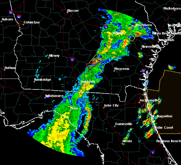 The tornado warning for western atkinson county will expire at 445 pm edt, the storm which prompted the warning has moved out of the area. therefore, the warning will be allowed to expire. a tornado watch remains in effect until 700 pm edt for southeastern georgia. The tornado warning for western atkinson county will expire at 445 pm edt, the storm which prompted the warning has moved out of the area. therefore, the warning will be allowed to expire. a tornado watch remains in effect until 700 pm edt for southeastern georgia.
|
| 4/14/2019 4:22 PM EDT |
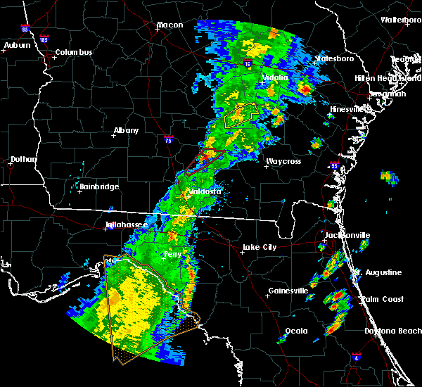 At 422 pm edt, a severe thunderstorm capable of producing a tornado was located near willacoochee, moving northeast at 45 mph (radar indicated rotation). Hazards include tornado. Flying debris will be dangerous to those caught without shelter. mobile homes will be damaged or destroyed. damage to roofs, windows, and vehicles will occur. tree damage is likely. This dangerous storm will be near, willacoochee around 430 pm edt. At 422 pm edt, a severe thunderstorm capable of producing a tornado was located near willacoochee, moving northeast at 45 mph (radar indicated rotation). Hazards include tornado. Flying debris will be dangerous to those caught without shelter. mobile homes will be damaged or destroyed. damage to roofs, windows, and vehicles will occur. tree damage is likely. This dangerous storm will be near, willacoochee around 430 pm edt.
|
| 4/14/2019 4:12 PM EDT |
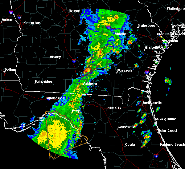 At 412 pm edt, a severe thunderstorm capable of producing a tornado was located near nashville, moving northeast at 45 mph (radar indicated rotation). Hazards include tornado. Flying debris will be dangerous to those caught without shelter. mobile homes will be damaged or destroyed. damage to roofs, windows, and vehicles will occur. tree damage is likely. This dangerous storm will be near, willacoochee around 430 pm edt. At 412 pm edt, a severe thunderstorm capable of producing a tornado was located near nashville, moving northeast at 45 mph (radar indicated rotation). Hazards include tornado. Flying debris will be dangerous to those caught without shelter. mobile homes will be damaged or destroyed. damage to roofs, windows, and vehicles will occur. tree damage is likely. This dangerous storm will be near, willacoochee around 430 pm edt.
|
| 12/2/2018 2:06 PM EST |
 At 206 pm est, a severe thunderstorm was located over willacoochee, moving east at 30 mph (radar indicated). Hazards include 60 mph wind gusts. expect damage to roofs, siding, and trees At 206 pm est, a severe thunderstorm was located over willacoochee, moving east at 30 mph (radar indicated). Hazards include 60 mph wind gusts. expect damage to roofs, siding, and trees
|
| 11/7/2018 3:57 PM EST |
 At 356 pm est, a severe thunderstorm was located near alapaha, or near willacoochee, moving northeast at 20 mph (radar indicated). Hazards include 60 mph wind gusts. expect damage to roofs, siding, and trees At 356 pm est, a severe thunderstorm was located near alapaha, or near willacoochee, moving northeast at 20 mph (radar indicated). Hazards include 60 mph wind gusts. expect damage to roofs, siding, and trees
|
| 8/8/2018 6:45 PM EDT | Trees down southwest of douglas. time given was based on rada in coffee county GA, 8.5 miles SSW of Willacoochee, GA |
| 8/8/2018 6:43 PM EDT |
 At 643 pm edt, a severe thunderstorm was located near pearson, moving northeast at 25 mph (radar indicated). Hazards include 60 mph wind gusts. Expect damage to roofs, siding, and trees. Locations impacted include, pearson, willacoochee, bickley, millwood and axson. At 643 pm edt, a severe thunderstorm was located near pearson, moving northeast at 25 mph (radar indicated). Hazards include 60 mph wind gusts. Expect damage to roofs, siding, and trees. Locations impacted include, pearson, willacoochee, bickley, millwood and axson.
|
| 8/8/2018 6:21 PM EDT |
 At 621 pm edt, a severe thunderstorm was located 8 miles west of cogdell, or 8 miles south of pearson, moving northeast at 15 mph (radar indicated). Hazards include 60 mph wind gusts. Expect damage to roofs, siding, and trees. Locations impacted include, pearson, willacoochee, cogdell, bickley, millwood and axson. At 621 pm edt, a severe thunderstorm was located 8 miles west of cogdell, or 8 miles south of pearson, moving northeast at 15 mph (radar indicated). Hazards include 60 mph wind gusts. Expect damage to roofs, siding, and trees. Locations impacted include, pearson, willacoochee, cogdell, bickley, millwood and axson.
|
| 8/8/2018 6:20 PM EDT | Trees down near willacoochee. time given was based on rada in atkinson county GA, 2.5 miles S of Willacoochee, GA |
| 8/8/2018 6:08 PM EDT |
 At 608 pm edt, a severe thunderstorm was located 9 miles north of du pont, or 9 miles northwest of homerville, moving northeast at 15 mph (radar indicated). Hazards include 60 mph wind gusts. expect damage to roofs, siding, and trees At 608 pm edt, a severe thunderstorm was located 9 miles north of du pont, or 9 miles northwest of homerville, moving northeast at 15 mph (radar indicated). Hazards include 60 mph wind gusts. expect damage to roofs, siding, and trees
|
| 7/22/2018 9:24 PM EDT |
 At 924 pm edt, severe thunderstorms were located along a line extending from 11 miles north of cogdell to pearson to near willacoochee, moving southeast at 30 mph (radar indicated). Hazards include 60 mph wind gusts and nickel size hail. Expect damage to roofs, siding, and trees. Locations impacted include, pearson, willacoochee and axson. At 924 pm edt, severe thunderstorms were located along a line extending from 11 miles north of cogdell to pearson to near willacoochee, moving southeast at 30 mph (radar indicated). Hazards include 60 mph wind gusts and nickel size hail. Expect damage to roofs, siding, and trees. Locations impacted include, pearson, willacoochee and axson.
|
| 7/22/2018 9:13 PM EDT |
 At 911 pm edt, severe thunderstorms were located along a line extending from 6 miles south of douglas to near pearson to near willacoochee, moving southeast at 30 mph (radar indicated). Hazards include 60 mph wind gusts and quarter size hail. Hail damage to vehicles is expected. Expect wind damage to roofs, siding, and trees. At 911 pm edt, severe thunderstorms were located along a line extending from 6 miles south of douglas to near pearson to near willacoochee, moving southeast at 30 mph (radar indicated). Hazards include 60 mph wind gusts and quarter size hail. Hail damage to vehicles is expected. Expect wind damage to roofs, siding, and trees.
|
| 7/22/2018 8:50 PM EDT |
 At 849 pm edt, a severe thunderstorm was located 7 miles south of ambrose, moving southeast at 40 mph (radar indicated). Hazards include 60 mph wind gusts and quarter size hail. Hail damage to vehicles is expected. Expect wind damage to roofs, siding, and trees. At 849 pm edt, a severe thunderstorm was located 7 miles south of ambrose, moving southeast at 40 mph (radar indicated). Hazards include 60 mph wind gusts and quarter size hail. Hail damage to vehicles is expected. Expect wind damage to roofs, siding, and trees.
|
| 5/28/2018 3:25 PM EDT |
 At 325 pm edt, severe thunderstorms were located along a line extending from 8 miles northeast of alapaha to 7 miles west of dixie union, moving north at 40 mph (radar indicated). Hazards include 60 mph wind gusts. Expect damage to roofs, siding, and trees. Locations impacted include, douglas, pearson, willacoochee, broxton, ambrose, nicholls, pridgen, west green and axson. At 325 pm edt, severe thunderstorms were located along a line extending from 8 miles northeast of alapaha to 7 miles west of dixie union, moving north at 40 mph (radar indicated). Hazards include 60 mph wind gusts. Expect damage to roofs, siding, and trees. Locations impacted include, douglas, pearson, willacoochee, broxton, ambrose, nicholls, pridgen, west green and axson.
|
| 5/28/2018 3:23 PM EDT |
 The severe thunderstorm warning for atkinson, west central ware and northwestern clinch counties will expire at 330 pm edt, the severe thunderstorm warning has been replaced by and new warning through 4 p.m. edt. The severe thunderstorm warning for atkinson, west central ware and northwestern clinch counties will expire at 330 pm edt, the severe thunderstorm warning has been replaced by and new warning through 4 p.m. edt.
|
| 5/28/2018 3:22 PM EDT |
 At 321 pm edt, severe thunderstorms were located along a line extending from near alapaha to 9 miles west of dixie union, moving north at 30 mph (radar indicated). Hazards include 60 mph wind gusts. expect damage to roofs, siding, and trees At 321 pm edt, severe thunderstorms were located along a line extending from near alapaha to 9 miles west of dixie union, moving north at 30 mph (radar indicated). Hazards include 60 mph wind gusts. expect damage to roofs, siding, and trees
|
| 5/28/2018 3:02 PM EDT |
 At 301 pm edt, severe thunderstorms were located along a line extending from near willacoochee to near cogdell to 7 miles southeast of manor, moving north at 30 mph (radar indicated). Hazards include 60 mph wind gusts. Expect damage to roofs, siding, and trees. Locations impacted include, pearson, willacoochee, argyle, cogdell and axson. At 301 pm edt, severe thunderstorms were located along a line extending from near willacoochee to near cogdell to 7 miles southeast of manor, moving north at 30 mph (radar indicated). Hazards include 60 mph wind gusts. Expect damage to roofs, siding, and trees. Locations impacted include, pearson, willacoochee, argyle, cogdell and axson.
|
| 5/28/2018 3:00 PM EDT | Three trees were blown on highway 135 one of which was blocking the roa in atkinson county GA, 0.9 miles WSW of Willacoochee, GA |
| 5/28/2018 2:45 PM EDT |
 At 244 pm edt, a severe thunderstorm was located 7 miles southeast of du pont, or 7 miles south of homerville, moving north at 45 mph (radar indicated). Hazards include 60 mph wind gusts. expect damage to roofs, siding, and trees At 244 pm edt, a severe thunderstorm was located 7 miles southeast of du pont, or 7 miles south of homerville, moving north at 45 mph (radar indicated). Hazards include 60 mph wind gusts. expect damage to roofs, siding, and trees
|
| 4/15/2018 10:36 AM EDT |
 At 1035 am edt, severe thunderstorms were located along a line extending from 8 miles east of fitzgerald to 8 miles north of willacoochee to 6 miles south of lakeland, moving northeast at 45 mph (radar indicated). Hazards include 60 mph wind gusts. Expect damage to roofs, siding, and trees. locations impacted include, douglas, pearson, willacoochee, broxton, ambrose, pridgen, west green, snipesville, denton and axson. A tornado watch remains in effect until 600 pm edt for southeastern georgia. At 1035 am edt, severe thunderstorms were located along a line extending from 8 miles east of fitzgerald to 8 miles north of willacoochee to 6 miles south of lakeland, moving northeast at 45 mph (radar indicated). Hazards include 60 mph wind gusts. Expect damage to roofs, siding, and trees. locations impacted include, douglas, pearson, willacoochee, broxton, ambrose, pridgen, west green, snipesville, denton and axson. A tornado watch remains in effect until 600 pm edt for southeastern georgia.
|
| 4/15/2018 10:14 AM EDT |
 At 1013 am edt, severe thunderstorms were located along a line extending from near mystic to near alapaha to near moody air force base, moving northeast at 45 mph (radar indicated). Hazards include 60 mph wind gusts. expect damage to roofs, siding, and trees At 1013 am edt, severe thunderstorms were located along a line extending from near mystic to near alapaha to near moody air force base, moving northeast at 45 mph (radar indicated). Hazards include 60 mph wind gusts. expect damage to roofs, siding, and trees
|
| 8/30/2017 5:45 PM EDT | Power lines reported down across the road on highway 13 in atkinson county GA, 4.5 miles SW of Willacoochee, GA |
| 8/30/2017 5:44 PM EDT | Power lines were blown down in the area between douglas and willacooche in coffee county GA, 7.8 miles SSW of Willacoochee, GA |
| 8/30/2017 5:24 PM EDT |
 At 524 pm edt, a severe thunderstorm was located over willacoochee, moving northeast at 20 mph (radar indicated). Hazards include 60 mph wind gusts. possible tornado. expect damage to roofs, siding, and trees At 524 pm edt, a severe thunderstorm was located over willacoochee, moving northeast at 20 mph (radar indicated). Hazards include 60 mph wind gusts. possible tornado. expect damage to roofs, siding, and trees
|
| 8/25/2017 8:58 PM EDT |
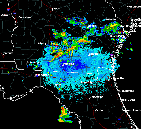 At 858 pm edt, a severe thunderstorm was located near willacoochee, moving south at 10 mph (radar indicated). Hazards include 60 mph wind gusts. expect damage to roofs, siding, and trees At 858 pm edt, a severe thunderstorm was located near willacoochee, moving south at 10 mph (radar indicated). Hazards include 60 mph wind gusts. expect damage to roofs, siding, and trees
|
| 7/13/2017 5:40 PM EDT |
 At 540 pm edt, severe thunderstorms were located along a line extending from near snipesville to alapaha, moving west at 25 mph (radar indicated). Hazards include 60 mph wind gusts and nickel size hail. Expect damage to roofs, siding, and trees. Locations impacted include, douglas, broxton, ambrose, pridgen, west green, snipesville and denton. At 540 pm edt, severe thunderstorms were located along a line extending from near snipesville to alapaha, moving west at 25 mph (radar indicated). Hazards include 60 mph wind gusts and nickel size hail. Expect damage to roofs, siding, and trees. Locations impacted include, douglas, broxton, ambrose, pridgen, west green, snipesville and denton.
|
| 7/13/2017 5:28 PM EDT |
 At 528 pm edt, severe thunderstorms were located along a line extending from 7 miles northeast of west green to near alapaha, moving west at 25 mph (radar indicated). Hazards include 60 mph wind gusts and nickel size hail. expect damage to roofs, siding, and trees At 528 pm edt, severe thunderstorms were located along a line extending from 7 miles northeast of west green to near alapaha, moving west at 25 mph (radar indicated). Hazards include 60 mph wind gusts and nickel size hail. expect damage to roofs, siding, and trees
|
| 5/23/2017 4:39 PM EDT |
 The severe thunderstorm warning for southern coffee and northwestern atkinson counties will expire at 445 pm edt, the storm which prompted the warning has moved out of the area. therefore the warning will be allowed to expire. however heavy rain is still possible with this thunderstorm. a tornado watch remains in effect until 1100 pm edt for southeastern georgia. The severe thunderstorm warning for southern coffee and northwestern atkinson counties will expire at 445 pm edt, the storm which prompted the warning has moved out of the area. therefore the warning will be allowed to expire. however heavy rain is still possible with this thunderstorm. a tornado watch remains in effect until 1100 pm edt for southeastern georgia.
|
| 5/23/2017 4:05 PM EDT |
 At 405 pm edt, a severe thunderstorm capable of producing a tornado was located over willacoochee, moving northeast at 40 mph (radar indicated rotation). Hazards include tornado. Flying debris will be dangerous to those caught without shelter. mobile homes will be damaged or destroyed. damage to roofs, windows, and vehicles will occur. tree damage is likely. This dangerous storm will be near, douglas around 430 pm edt. At 405 pm edt, a severe thunderstorm capable of producing a tornado was located over willacoochee, moving northeast at 40 mph (radar indicated rotation). Hazards include tornado. Flying debris will be dangerous to those caught without shelter. mobile homes will be damaged or destroyed. damage to roofs, windows, and vehicles will occur. tree damage is likely. This dangerous storm will be near, douglas around 430 pm edt.
|
| 5/23/2017 3:57 PM EDT |
 At 356 pm edt, a severe thunderstorm was located over willacoochee, moving northeast at 40 mph (radar indicated). Hazards include 60 mph wind gusts and quarter size hail. possible tornado. Hail damage to vehicles is expected. Expect wind damage to roofs, siding, and trees. At 356 pm edt, a severe thunderstorm was located over willacoochee, moving northeast at 40 mph (radar indicated). Hazards include 60 mph wind gusts and quarter size hail. possible tornado. Hail damage to vehicles is expected. Expect wind damage to roofs, siding, and trees.
|
| 5/4/2017 1:20 PM EDT |
 At 120 pm edt, a severe thunderstorm was located near willacoochee, moving northeast at 40 mph (radar indicated). Hazards include 60 mph wind gusts. Expect damage to roofs, siding, and trees. Locations impacted include, douglas, pearson, willacoochee, nicholls and west green. At 120 pm edt, a severe thunderstorm was located near willacoochee, moving northeast at 40 mph (radar indicated). Hazards include 60 mph wind gusts. Expect damage to roofs, siding, and trees. Locations impacted include, douglas, pearson, willacoochee, nicholls and west green.
|
| 5/4/2017 1:08 PM EDT |
 At 108 pm edt, a severe thunderstorm was located near willacoochee, moving northeast at 35 mph (radar indicated). Hazards include 60 mph wind gusts. expect damage to roofs, siding, and trees At 108 pm edt, a severe thunderstorm was located near willacoochee, moving northeast at 35 mph (radar indicated). Hazards include 60 mph wind gusts. expect damage to roofs, siding, and trees
|
| 4/5/2017 6:55 PM EDT |
 At 654 pm edt, severe thunderstorms were located along a line extending from near snipesville to near douglas to near willacoochee, moving east at 40 mph (radar indicated). Hazards include 60 mph wind gusts and quarter size hail. Hail damage to vehicles is expected. expect wind damage to roofs, siding, and trees. locations impacted include, douglas, pearson, willacoochee, broxton, nicholls and west green. A tornado watch remains in effect until 800 pm edt for southeastern georgia. At 654 pm edt, severe thunderstorms were located along a line extending from near snipesville to near douglas to near willacoochee, moving east at 40 mph (radar indicated). Hazards include 60 mph wind gusts and quarter size hail. Hail damage to vehicles is expected. expect wind damage to roofs, siding, and trees. locations impacted include, douglas, pearson, willacoochee, broxton, nicholls and west green. A tornado watch remains in effect until 800 pm edt for southeastern georgia.
|
| 4/5/2017 6:33 PM EDT |
 At 633 pm edt, severe thunderstorms were located along a line extending from near ambrose to near willacoochee to near nashville, moving east at 40 mph (radar indicated). Hazards include 60 mph wind gusts and half dollar size hail. Hail damage to vehicles is expected. Expect wind damage to roofs, siding, and trees. At 633 pm edt, severe thunderstorms were located along a line extending from near ambrose to near willacoochee to near nashville, moving east at 40 mph (radar indicated). Hazards include 60 mph wind gusts and half dollar size hail. Hail damage to vehicles is expected. Expect wind damage to roofs, siding, and trees.
|
| 2/7/2017 8:04 PM EST |
 At 802 pm est, severe thunderstorms were located along a line extending from near alapaha to moody air force base to near madison, moving east at 45 mph (radar indicated). Hazards include 60 mph wind gusts. expect damage to roofs, siding, and trees At 802 pm est, severe thunderstorms were located along a line extending from near alapaha to moody air force base to near madison, moving east at 45 mph (radar indicated). Hazards include 60 mph wind gusts. expect damage to roofs, siding, and trees
|
| 1/22/2017 5:00 PM EST | Single wide trailer home flipped over... 2 chicken houses destroyed... 1 chicken house damaged... trees down... and irrigation pivot turned upside down near hebron chur in coffee county GA, 6.5 miles SSW of Willacoochee, GA |
| 1/22/2017 4:40 PM EST |
 At 439 pm est, severe thunderstorms were located along a line extending from 9 miles northeast of alapaha to 6 miles southeast of willacoochee to 6 miles south of lakeland, moving north at near 70 mph (radar indicated). Hazards include 70 mph wind gusts and nickel size hail. Expect considerable tree damage. damage is likely to mobile homes, roofs, and outbuildings. locations impacted include, douglas, pearson, willacoochee, broxton, ambrose, nicholls, du pont, west green, snipesville and pridgen. A tornado watch remains in effect until 800 pm est for southeastern georgia. At 439 pm est, severe thunderstorms were located along a line extending from 9 miles northeast of alapaha to 6 miles southeast of willacoochee to 6 miles south of lakeland, moving north at near 70 mph (radar indicated). Hazards include 70 mph wind gusts and nickel size hail. Expect considerable tree damage. damage is likely to mobile homes, roofs, and outbuildings. locations impacted include, douglas, pearson, willacoochee, broxton, ambrose, nicholls, du pont, west green, snipesville and pridgen. A tornado watch remains in effect until 800 pm est for southeastern georgia.
|
| 1/22/2017 4:33 PM EST |
 At 433 pm est, a cluster of severes thunderstorms were located 9 miles southwest of pearson, moving northeast around 60 mph (radar indicated). Hazards include 60 mph wind gusts and nickel size hail. expect damage to roofs, siding, and trees At 433 pm est, a cluster of severes thunderstorms were located 9 miles southwest of pearson, moving northeast around 60 mph (radar indicated). Hazards include 60 mph wind gusts and nickel size hail. expect damage to roofs, siding, and trees
|
| 1/22/2017 7:09 AM EST |
 At 709 am est, a severe thunderstorm was located near douglas, moving northeast at 30 mph (radar indicated). Hazards include 60 mph wind gusts and quarter size hail. Hail damage to vehicles is expected. expect wind damage to roofs, siding, and trees. locations impacted include, alma, pearson, nicholls, cogdell, millwood, bickley and axson. A tornado watch remains in effect until 1000 am est for southeastern georgia. At 709 am est, a severe thunderstorm was located near douglas, moving northeast at 30 mph (radar indicated). Hazards include 60 mph wind gusts and quarter size hail. Hail damage to vehicles is expected. expect wind damage to roofs, siding, and trees. locations impacted include, alma, pearson, nicholls, cogdell, millwood, bickley and axson. A tornado watch remains in effect until 1000 am est for southeastern georgia.
|
| 1/22/2017 6:43 AM EST |
 At 643 am est, a severe thunderstorm was located over willacoochee, moving northeast at 30 mph (radar indicated). Hazards include 60 mph wind gusts and quarter size hail. Hail damage to vehicles is expected. Expect wind damage to roofs, siding, and trees. At 643 am est, a severe thunderstorm was located over willacoochee, moving northeast at 30 mph (radar indicated). Hazards include 60 mph wind gusts and quarter size hail. Hail damage to vehicles is expected. Expect wind damage to roofs, siding, and trees.
|
| 1/22/2017 4:17 AM EST |
 At 416 am est, a severe thunderstorm capable of producing a tornado was located near pearson, moving east at 50 mph (radar indicated rotation). Hazards include tornado and quarter size hail. Flying debris will be dangerous to those caught without shelter. mobile homes will be damaged or destroyed. damage to roofs, windows, and vehicles will occur. tree damage is likely. this dangerous storm will be near, pearson around 425 am est. Other locations impacted by this tornadic thunderstorm include millwood, bickley and axson. At 416 am est, a severe thunderstorm capable of producing a tornado was located near pearson, moving east at 50 mph (radar indicated rotation). Hazards include tornado and quarter size hail. Flying debris will be dangerous to those caught without shelter. mobile homes will be damaged or destroyed. damage to roofs, windows, and vehicles will occur. tree damage is likely. this dangerous storm will be near, pearson around 425 am est. Other locations impacted by this tornadic thunderstorm include millwood, bickley and axson.
|
| 1/22/2017 4:00 AM EST |
 At 359 am est, a severe thunderstorm capable of producing a tornado was located near nashville, moving east at 50 mph (radar indicated rotation). Hazards include tornado and quarter size hail. Flying debris will be dangerous to those caught without shelter. mobile homes will be damaged or destroyed. damage to roofs, windows, and vehicles will occur. tree damage is likely. this dangerous storm will be near, willacoochee around 410 am est. pearson around 425 am est. Other locations impacted by this tornadic thunderstorm include millwood, bickley and axson. At 359 am est, a severe thunderstorm capable of producing a tornado was located near nashville, moving east at 50 mph (radar indicated rotation). Hazards include tornado and quarter size hail. Flying debris will be dangerous to those caught without shelter. mobile homes will be damaged or destroyed. damage to roofs, windows, and vehicles will occur. tree damage is likely. this dangerous storm will be near, willacoochee around 410 am est. pearson around 425 am est. Other locations impacted by this tornadic thunderstorm include millwood, bickley and axson.
|
| 1/21/2017 2:15 PM EST |
 At 215 pm est, a severe thunderstorm was located over willacoochee, moving northeast at 40 mph (radar indicated). Hazards include 60 mph wind gusts and penny size hail. expect damage to roofs, siding, and trees At 215 pm est, a severe thunderstorm was located over willacoochee, moving northeast at 40 mph (radar indicated). Hazards include 60 mph wind gusts and penny size hail. expect damage to roofs, siding, and trees
|
| 1/2/2017 11:51 PM EST |
 At 1150 pm est, severe thunderstorms were located along a line extending from 6 miles north of snipesville to 7 miles southeast of lakeland, moving east at 45 mph (radar indicated). Hazards include 70 mph wind gusts. Expect considerable tree damage. damage is likely to mobile homes, roofs, and outbuildings. locations impacted include, douglas, baxley, hazlehurst, alma, homerville, pearson, willacoochee, broxton, ambrose and graham. A tornado watch remains in effect until 300 am est for southeastern georgia. At 1150 pm est, severe thunderstorms were located along a line extending from 6 miles north of snipesville to 7 miles southeast of lakeland, moving east at 45 mph (radar indicated). Hazards include 70 mph wind gusts. Expect considerable tree damage. damage is likely to mobile homes, roofs, and outbuildings. locations impacted include, douglas, baxley, hazlehurst, alma, homerville, pearson, willacoochee, broxton, ambrose and graham. A tornado watch remains in effect until 300 am est for southeastern georgia.
|
| 1/2/2017 11:15 PM EST |
 At 1113 pm est, severe thunderstorms were located along a line extending from 8 miles north of fitzgerald to 7 miles southwest of hahira, moving east at 45 mph (radar indicated). Hazards include 70 mph wind gusts. Expect considerable tree damage. Damage is likely to mobile homes, roofs, and outbuildings. At 1113 pm est, severe thunderstorms were located along a line extending from 8 miles north of fitzgerald to 7 miles southwest of hahira, moving east at 45 mph (radar indicated). Hazards include 70 mph wind gusts. Expect considerable tree damage. Damage is likely to mobile homes, roofs, and outbuildings.
|
| 7/19/2016 5:39 PM EDT |
 The severe thunderstorm warning for western atkinson county will expire at 545 pm edt, the storm which prompted the warning has weakened below severe limits, and no longer pose an immediate threat to life or property. therefore, the warning will be allowed to expire. however small hail and gusty winds are still possible with this thunderstorm. a significant weather alert for this storm will be issued shortly. The severe thunderstorm warning for western atkinson county will expire at 545 pm edt, the storm which prompted the warning has weakened below severe limits, and no longer pose an immediate threat to life or property. therefore, the warning will be allowed to expire. however small hail and gusty winds are still possible with this thunderstorm. a significant weather alert for this storm will be issued shortly.
|
| 7/19/2016 5:27 PM EDT |
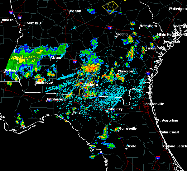 At 526 pm edt, a severe thunderstorm was located over willacoochee, moving south at 10 mph (radar indicated). Hazards include 60 mph wind gusts and quarter size hail. Hail damage to vehicles is expected. expect wind damage to roofs, siding, and trees. Locations impacted include, willacoochee. At 526 pm edt, a severe thunderstorm was located over willacoochee, moving south at 10 mph (radar indicated). Hazards include 60 mph wind gusts and quarter size hail. Hail damage to vehicles is expected. expect wind damage to roofs, siding, and trees. Locations impacted include, willacoochee.
|
| 7/19/2016 5:19 PM EDT |
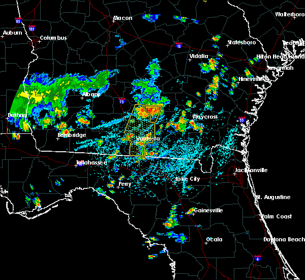 At 518 pm edt, a severe thunderstorm was located over willacoochee, moving south at 25 mph (radar indicated). Hazards include 60 mph wind gusts and quarter size hail. Hail damage to vehicles is expected. expect wind damage to roofs, siding, and trees. Locations impacted include, willacoochee. At 518 pm edt, a severe thunderstorm was located over willacoochee, moving south at 25 mph (radar indicated). Hazards include 60 mph wind gusts and quarter size hail. Hail damage to vehicles is expected. expect wind damage to roofs, siding, and trees. Locations impacted include, willacoochee.
|
| 7/19/2016 5:08 PM EDT |
 At 508 pm edt, a severe thunderstorm was located over willacoochee, moving south at 30 mph (radar indicated). Hazards include 60 mph wind gusts and quarter size hail. Hail damage to vehicles is expected. Expect wind damage to roofs, siding, and trees. At 508 pm edt, a severe thunderstorm was located over willacoochee, moving south at 30 mph (radar indicated). Hazards include 60 mph wind gusts and quarter size hail. Hail damage to vehicles is expected. Expect wind damage to roofs, siding, and trees.
|
| 7/17/2016 6:16 PM EDT | Broadcast media relayed a report of trees and powerlines down on coochee creek roa in atkinson county GA, 6.4 miles SE of Willacoochee, GA |
| 6/17/2016 9:45 PM EDT |
 At 944 pm edt, a severe thunderstorm was located over ambrose, moving south at 25 mph (radar indicated). Hazards include 60 mph wind gusts. Expect damage to roofs. siding. And trees. At 944 pm edt, a severe thunderstorm was located over ambrose, moving south at 25 mph (radar indicated). Hazards include 60 mph wind gusts. Expect damage to roofs. siding. And trees.
|
| 5/31/2016 7:24 PM EDT |
 At 724 pm edt, a severe thunderstorm was located over argyle, moving southeast at 10 mph (radar indicated). Hazards include 60 mph wind gusts. Expect damage to roofs. siding. and trees. Locations impacted include, homerville, pearson, willacoochee, argyle, cogdell and axson. At 724 pm edt, a severe thunderstorm was located over argyle, moving southeast at 10 mph (radar indicated). Hazards include 60 mph wind gusts. Expect damage to roofs. siding. and trees. Locations impacted include, homerville, pearson, willacoochee, argyle, cogdell and axson.
|
| 5/31/2016 7:00 PM EDT |
 At 659 pm edt, a severe thunderstorm was located over cogdell, or near homerville, moving southeast at 10 mph (radar indicated). Hazards include 60 mph wind gusts and penny size hail. Expect damage to roofs. siding. And trees. At 659 pm edt, a severe thunderstorm was located over cogdell, or near homerville, moving southeast at 10 mph (radar indicated). Hazards include 60 mph wind gusts and penny size hail. Expect damage to roofs. siding. And trees.
|
| 4/1/2016 4:57 PM EDT |
 At 456 pm edt, severe thunderstorms were located along a line extending from near ray city to 9 miles southeast of quitman, moving east at 45 mph (radar indicated). Hazards include 60 mph wind gusts. Expect damage to roofs. siding. And trees. At 456 pm edt, severe thunderstorms were located along a line extending from near ray city to 9 miles southeast of quitman, moving east at 45 mph (radar indicated). Hazards include 60 mph wind gusts. Expect damage to roofs. siding. And trees.
|
| 4/1/2016 4:36 PM EDT |
 At 435 pm edt, severe thunderstorms were located along a line extending from near ambrose to 6 miles north of quitman, moving northeast at 40 mph (radar indicated). Hazards include 60 mph wind gusts. Expect damage to roofs. siding. And trees. At 435 pm edt, severe thunderstorms were located along a line extending from near ambrose to 6 miles north of quitman, moving northeast at 40 mph (radar indicated). Hazards include 60 mph wind gusts. Expect damage to roofs. siding. And trees.
|
| 2/3/2016 3:06 PM EST |
 At 305 pm est, a severe thunderstorm was located near pearson, moving northeast at 40 mph (radar indicated). Hazards include 60 mph wind gusts. Expect damage to roofs. Siding and trees. At 305 pm est, a severe thunderstorm was located near pearson, moving northeast at 40 mph (radar indicated). Hazards include 60 mph wind gusts. Expect damage to roofs. Siding and trees.
|
| 8/28/2015 3:27 PM EDT |
 At 326 pm edt, doppler radar indicated a severe thunderstorm capable of producing damaging winds near 60 mph. this storm was located near willacoochee, moving north at 15 mph. locations impacted include, willacoochee. At 326 pm edt, doppler radar indicated a severe thunderstorm capable of producing damaging winds near 60 mph. this storm was located near willacoochee, moving north at 15 mph. locations impacted include, willacoochee.
|
| 8/28/2015 3:09 PM EDT |
 At 309 pm edt, doppler radar indicated a severe thunderstorm capable of producing damaging winds in excess of 60 mph. this storm was located over willacoochee, and moving north at 15 mph. nickel size hail may also accompany the damaging winds. At 309 pm edt, doppler radar indicated a severe thunderstorm capable of producing damaging winds in excess of 60 mph. this storm was located over willacoochee, and moving north at 15 mph. nickel size hail may also accompany the damaging winds.
|
| 7/19/2015 7:45 PM EDT |
 At 745 pm edt, doppler radar indicated a severe thunderstorm capable of producing quarter size hail and damaging winds in excess of 60 mph. this storm was located near douglas, moving south at 15 mph. locations impacted include, douglas, pearson, willacoochee, broxton, nicholls and west green. At 745 pm edt, doppler radar indicated a severe thunderstorm capable of producing quarter size hail and damaging winds in excess of 60 mph. this storm was located near douglas, moving south at 15 mph. locations impacted include, douglas, pearson, willacoochee, broxton, nicholls and west green.
|
| 7/19/2015 7:24 PM EDT |
 At 724 pm edt, doppler radar indicated a severe thunderstorm capable of producing quarter size hail and damaging winds in excess of 60 mph. this storm was located over west green, or 7 miles northeast of douglas, and moving south at 15 mph. At 724 pm edt, doppler radar indicated a severe thunderstorm capable of producing quarter size hail and damaging winds in excess of 60 mph. this storm was located over west green, or 7 miles northeast of douglas, and moving south at 15 mph.
|
| 7/15/2015 6:21 PM EDT |
 The severe thunderstorm warning for atkinson county will expire at 630 pm edt, the storm which prompted the warning has weakened below severe limits, and no longer poses an immediate threat to life or property. therefore the warning will be allowed to expire. however, gusty winds are still expected with this thunderstorm. The severe thunderstorm warning for atkinson county will expire at 630 pm edt, the storm which prompted the warning has weakened below severe limits, and no longer poses an immediate threat to life or property. therefore the warning will be allowed to expire. however, gusty winds are still expected with this thunderstorm.
|
| 7/15/2015 6:09 PM EDT |
 At 609 pm edt, doppler radar indicated a severe thunderstorm capable of producing damaging winds in excess of 60 mph. this storm was located near willacoochee, moving south at 25 mph. locations impacted include, pearson and willacoochee. At 609 pm edt, doppler radar indicated a severe thunderstorm capable of producing damaging winds in excess of 60 mph. this storm was located near willacoochee, moving south at 25 mph. locations impacted include, pearson and willacoochee.
|
| 7/15/2015 6:05 PM EDT | Atkinson county 911/dispatch reports a tree downed over a road near the intersection of ice plant road and talmadge mckinnon road north of willacoochee. time of damage in atkinson county GA, 5.6 miles SSW of Willacoochee, GA |
| 7/15/2015 5:55 PM EDT |
 At 554 pm edt, doppler radar indicated a severe thunderstorm capable of producing damaging winds in excess of 60 mph. this storm was located near willacoochee, and moving south at 25 mph. At 554 pm edt, doppler radar indicated a severe thunderstorm capable of producing damaging winds in excess of 60 mph. this storm was located near willacoochee, and moving south at 25 mph.
|
| 7/14/2015 4:37 PM EDT |
 The severe thunderstorm warning for northern atkinson and southern coffee counties will expire at 445 pm edt, the storm which prompted the warning has weakened below severe limits, and no longer poses an immediate threat to life or property. therefore the warning will be allowed to expire. however gusty winds are still possible with this thunderstorm. The severe thunderstorm warning for northern atkinson and southern coffee counties will expire at 445 pm edt, the storm which prompted the warning has weakened below severe limits, and no longer poses an immediate threat to life or property. therefore the warning will be allowed to expire. however gusty winds are still possible with this thunderstorm.
|
| 7/14/2015 3:53 PM EDT |
 At 353 pm edt, doppler radar indicated a severe thunderstorm capable of producing quarter size hail and damaging winds in excess of 60 mph. this storm was located near broxton, and moving east at 15 mph. At 353 pm edt, doppler radar indicated a severe thunderstorm capable of producing quarter size hail and damaging winds in excess of 60 mph. this storm was located near broxton, and moving east at 15 mph.
|
| 7/2/2015 4:39 PM EDT |
 At 437 pm edt, doppler radar indicated a line of severe thunderstorms capable of producing damaging winds in excess of 60 mph. these storms were located along a line extending from 7 miles north of jacksonville to near ambrose to 11 miles northeast of alapaha to near willacoochee to near lakeland, and moving east at 40 mph. At 437 pm edt, doppler radar indicated a line of severe thunderstorms capable of producing damaging winds in excess of 60 mph. these storms were located along a line extending from 7 miles north of jacksonville to near ambrose to 11 miles northeast of alapaha to near willacoochee to near lakeland, and moving east at 40 mph.
|
| 6/17/2015 4:52 PM EDT |
 At 452 pm edt, doppler radar indicated a severe thunderstorm capable of producing damaging winds in excess of 60 mph. this storm was located near willacoochee, and moving northeast at 10 mph. nickel size hail may also accompany the damaging winds. At 452 pm edt, doppler radar indicated a severe thunderstorm capable of producing damaging winds in excess of 60 mph. this storm was located near willacoochee, and moving northeast at 10 mph. nickel size hail may also accompany the damaging winds.
|
| 6/12/2015 8:35 PM EDT | Couple of trees down around highway 135 in berrien county GA, 6 miles NNE of Willacoochee, GA |
| 6/3/2015 8:01 PM EDT | At 801 pm edt, doppler radar indicated a line of severe thunderstorms capable of producing half dollar size hail and damaging winds in excess of 60 mph. these storms were located along a line extending from 11 miles southwest of pearson to 7 miles southeast of lakeland, moving east at 20 mph. locations impacted include, homerville, pearson, willacoochee, du pont, mayday, cogdell and axson. |
| 6/3/2015 7:38 PM EDT | At 738 pm edt, doppler radar indicated a line of severe thunderstorms capable of producing half dollar size hail and damaging winds in excess of 60 mph. these storms were located along a line extending from 8 miles east of nashville to near moody afb, and moving east at 15 mph. |
| 5/26/2015 6:13 PM EDT | The severe thunderstorm warning for northwestern atkinson and southwestern coffee counties will expire at 615 pm edt, the storm which prompted the warning has moved out of the area. therefore the warning will be allowed to expire. however gusty winds and heavy rain are still possible with this thunderstorm. |
| 5/26/2015 6:00 PM EDT | At 600 pm edt, doppler radar indicated a severe thunderstorm capable of producing quarter size hail and damaging winds in excess of 60 mph. this storm was located near willacoochee, moving north at 20 mph. locations impacted include, willacoochee. |
| 5/26/2015 5:46 PM EDT | At 546 pm edt, doppler radar indicated a severe thunderstorm capable of producing quarter size hail and damaging winds in excess of 60 mph. this storm was located near willacoochee, moving north at 25 mph. locations impacted include, willacoochee. |
| 5/26/2015 5:44 PM EDT | Tree down in the city of willacooche in atkinson county GA, 0.6 miles SE of Willacoochee, GA |
| 5/26/2015 5:31 PM EDT | At 530 pm edt, doppler radar indicated a severe thunderstorm capable of producing quarter size hail and damaging winds in excess of 60 mph. this storm was located near willacoochee, and moving north at 20 mph. |
| 4/25/2015 8:23 PM EDT | At 822 pm edt, doppler radar indicated a severe thunderstorm capable of producing quarter size hail and damaging winds in excess of 60 mph. this storm was located 8 miles north of willacoochee, and moving east at 55 mph. |
| 5/21/2013 7:45 PM EDT | The law enforcement in willacoochee reported trees down. the time given was based on rada in atkinson county GA, 0.6 miles SE of Willacoochee, GA |
| 3/23/2013 11:30 AM EDT | Golf Ball sized hail reported 0.6 miles SE of Willacoochee, GA, emergency manager reported golf ball sized hail in willacoochee. |
| 7/3/2012 8:55 PM EDT | Trees and large limbs were blown down in willcoochee. one large limb landed on a car. the cost of damage unknown. the time of damage was estimated based on radar imager in atkinson county GA, 0.5 miles SSW of Willacoochee, GA |
| 7/3/2012 8:25 PM EDT | Trees down along bridgetown road in coffee county GA, 8.7 miles S of Willacoochee, GA |
| 5/22/2012 7:30 PM EDT | A tree was reported down on highway 82 in willacoochee. time of event estimated by rada in atkinson county GA, 0.6 miles SE of Willacoochee, GA |
| 1/1/0001 12:00 AM | Emergency manager reported straight line wind event on antioch church road that knocked several trees onto a power substation. this event knocked power out to a large p in atkinson county GA, 5.6 miles W of Willacoochee, GA |
| 1/1/0001 12:00 AM | 911 center relayed public report of structural damage to residential home along with downed trees. time estimated by doppler rada in atkinson county GA, 3.9 miles WNW of Willacoochee, GA |
| 1/1/0001 12:00 AM | Trees were blown down along mora road and bridgetown roa in coffee county GA, 6 miles S of Willacoochee, GA |
Hail Maps for Willacoochee, GA
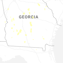
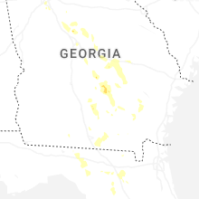
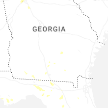
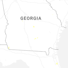
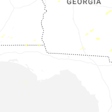


Connect with Interactive Hail Maps