

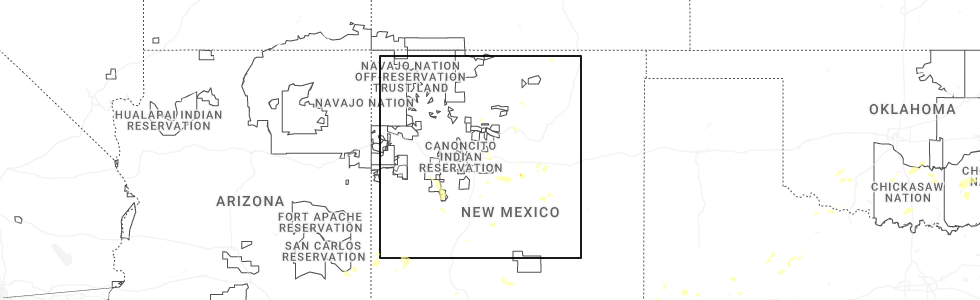
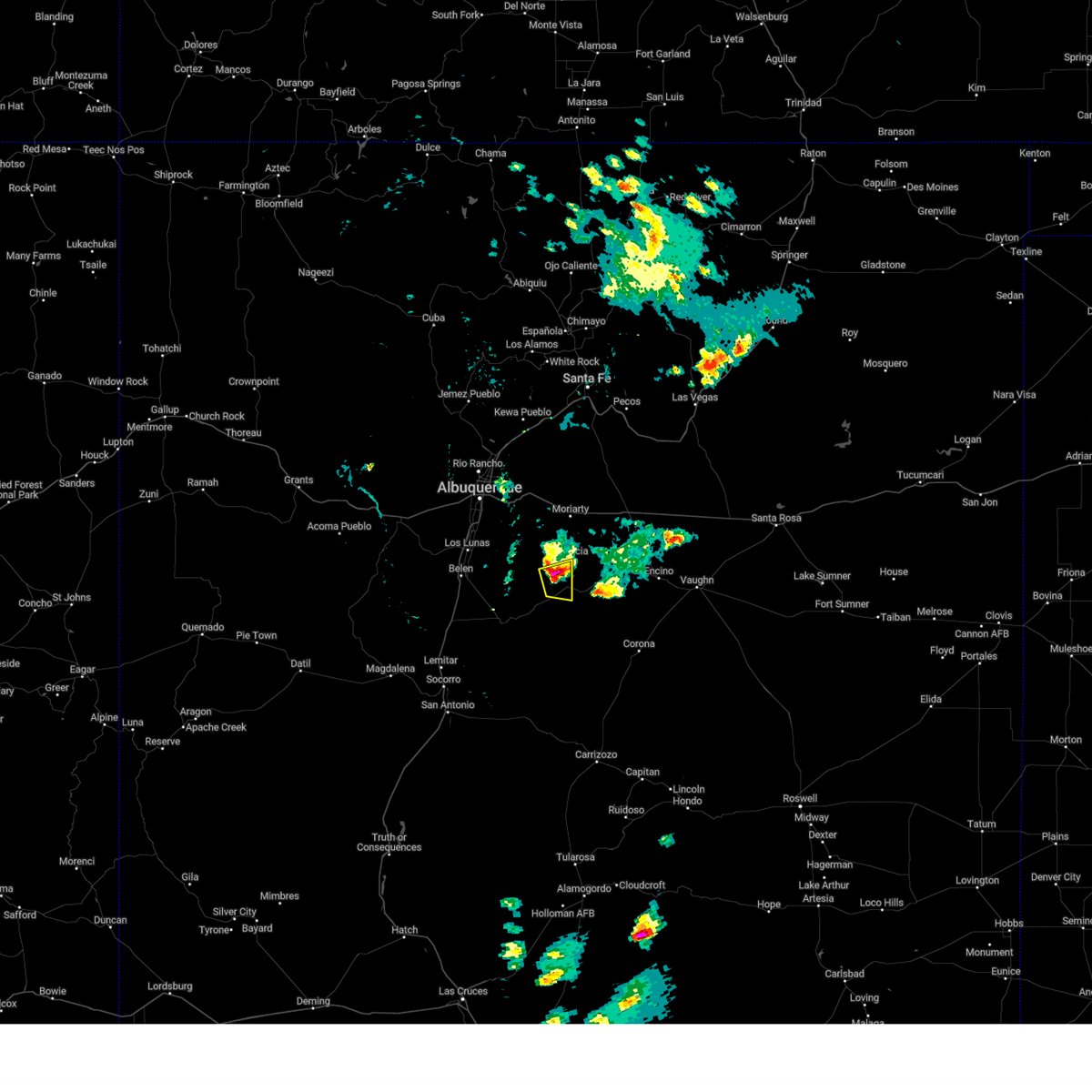
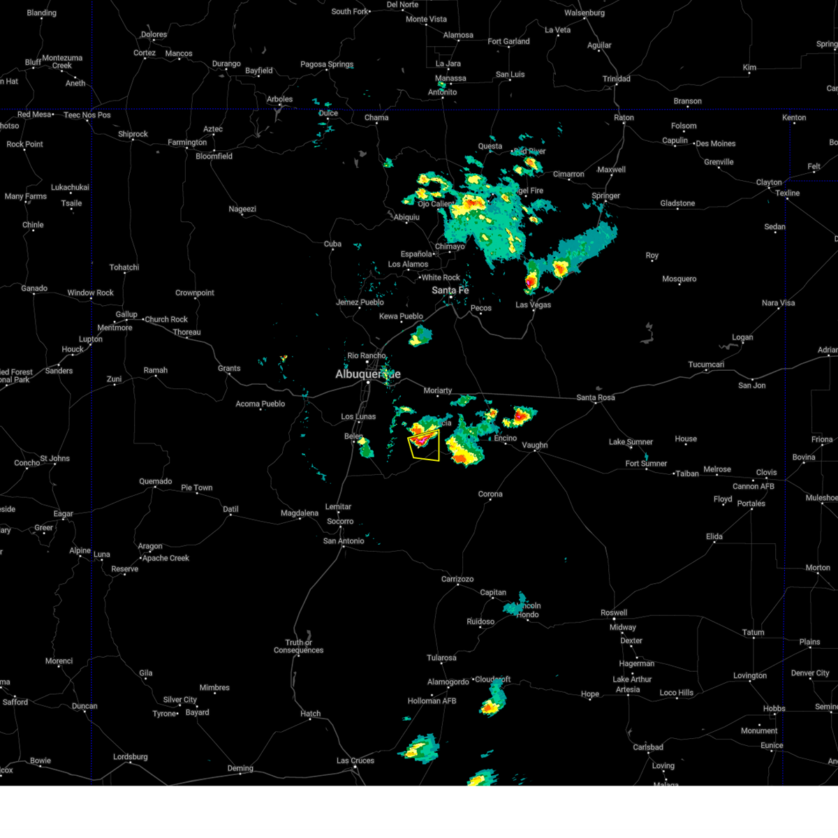
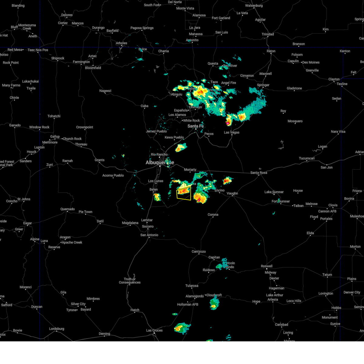
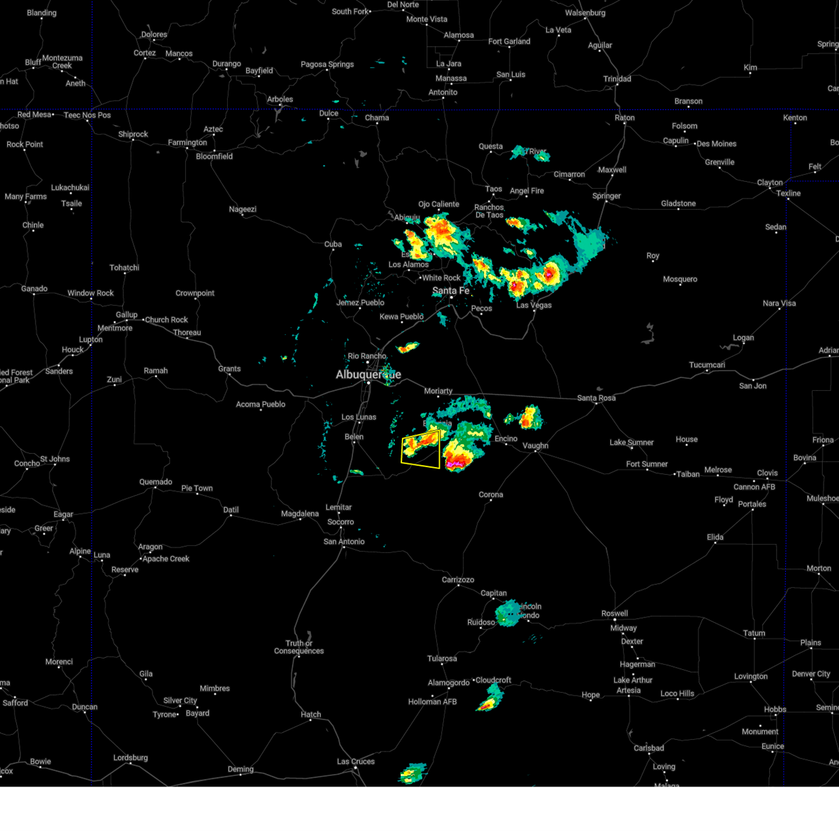
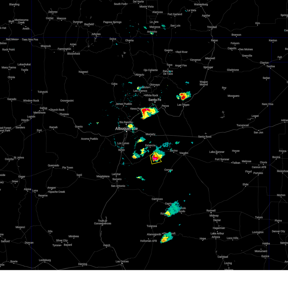
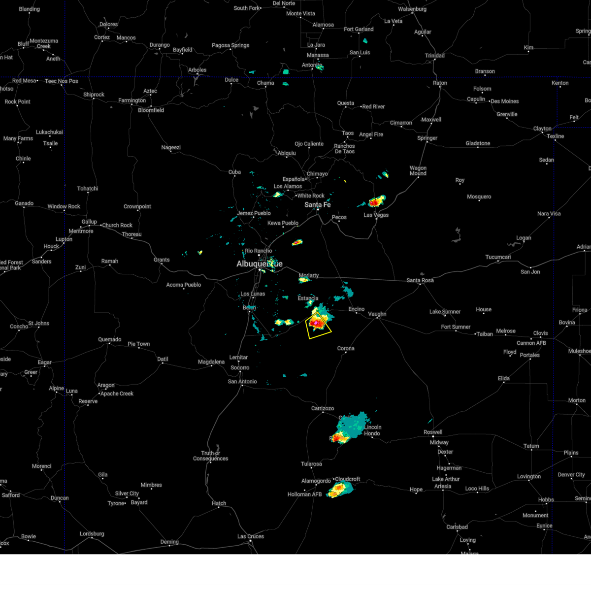
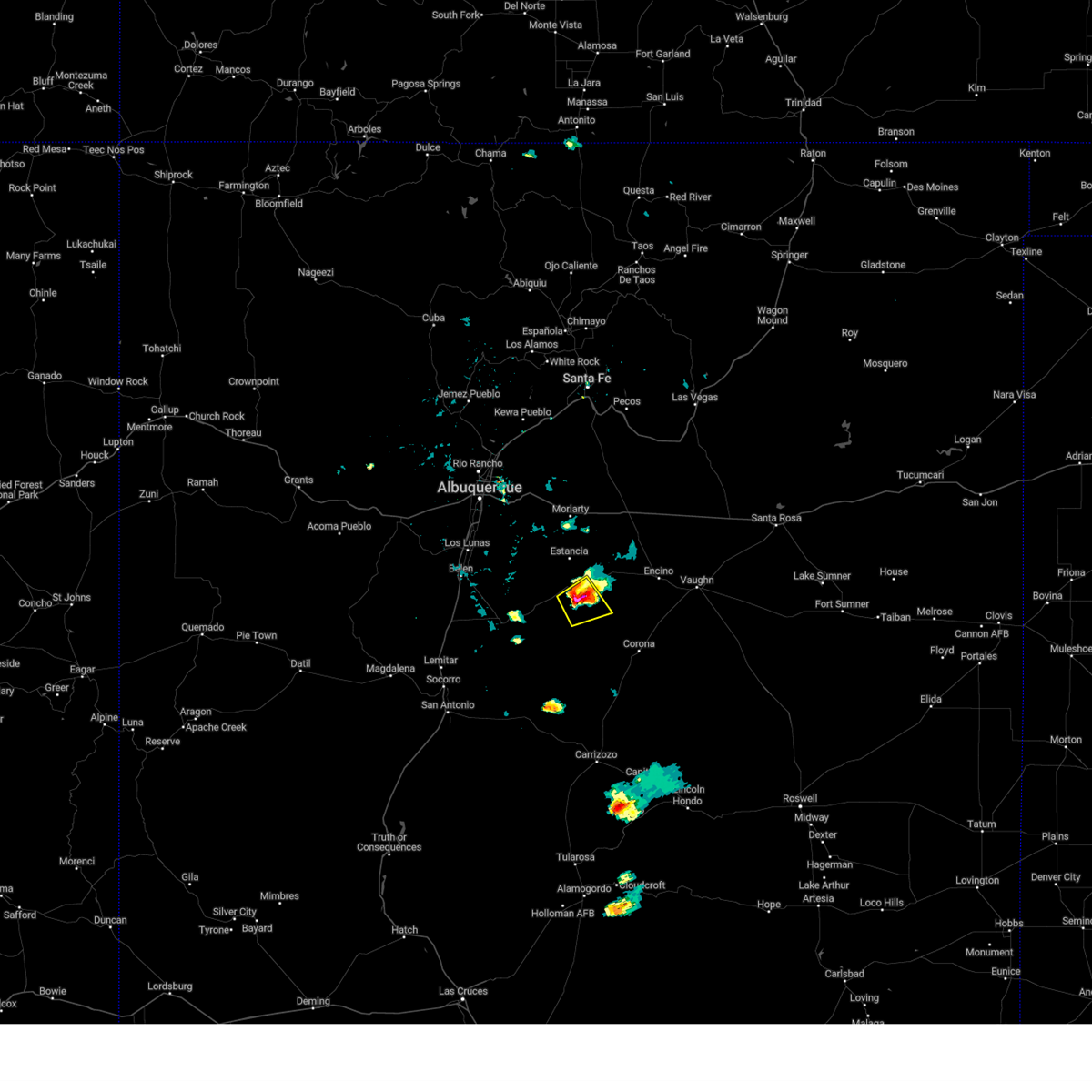
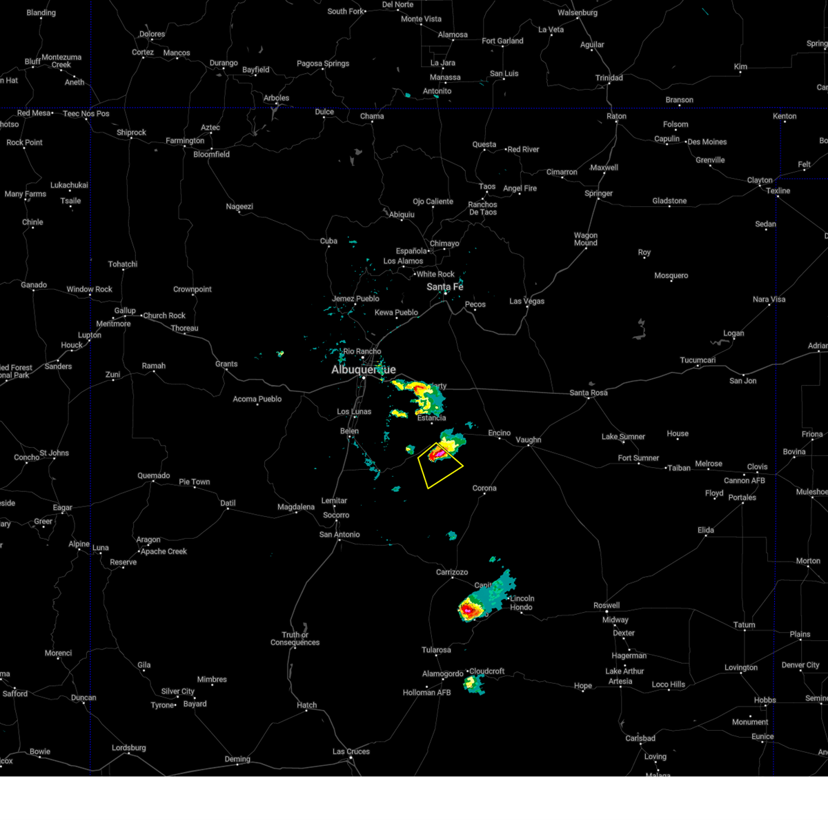
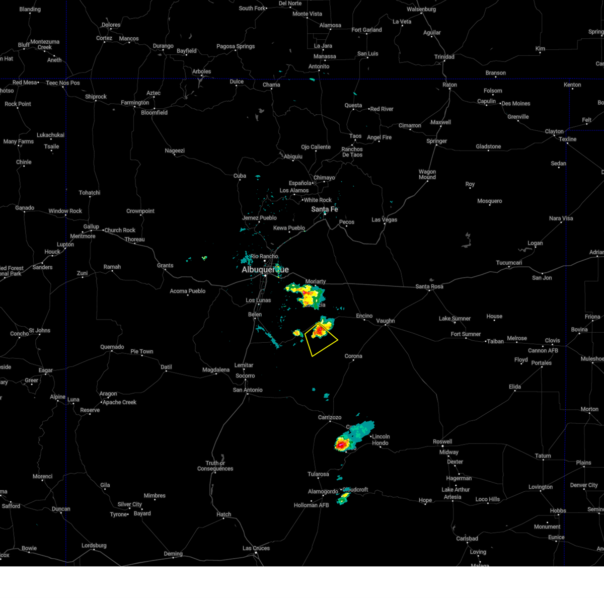
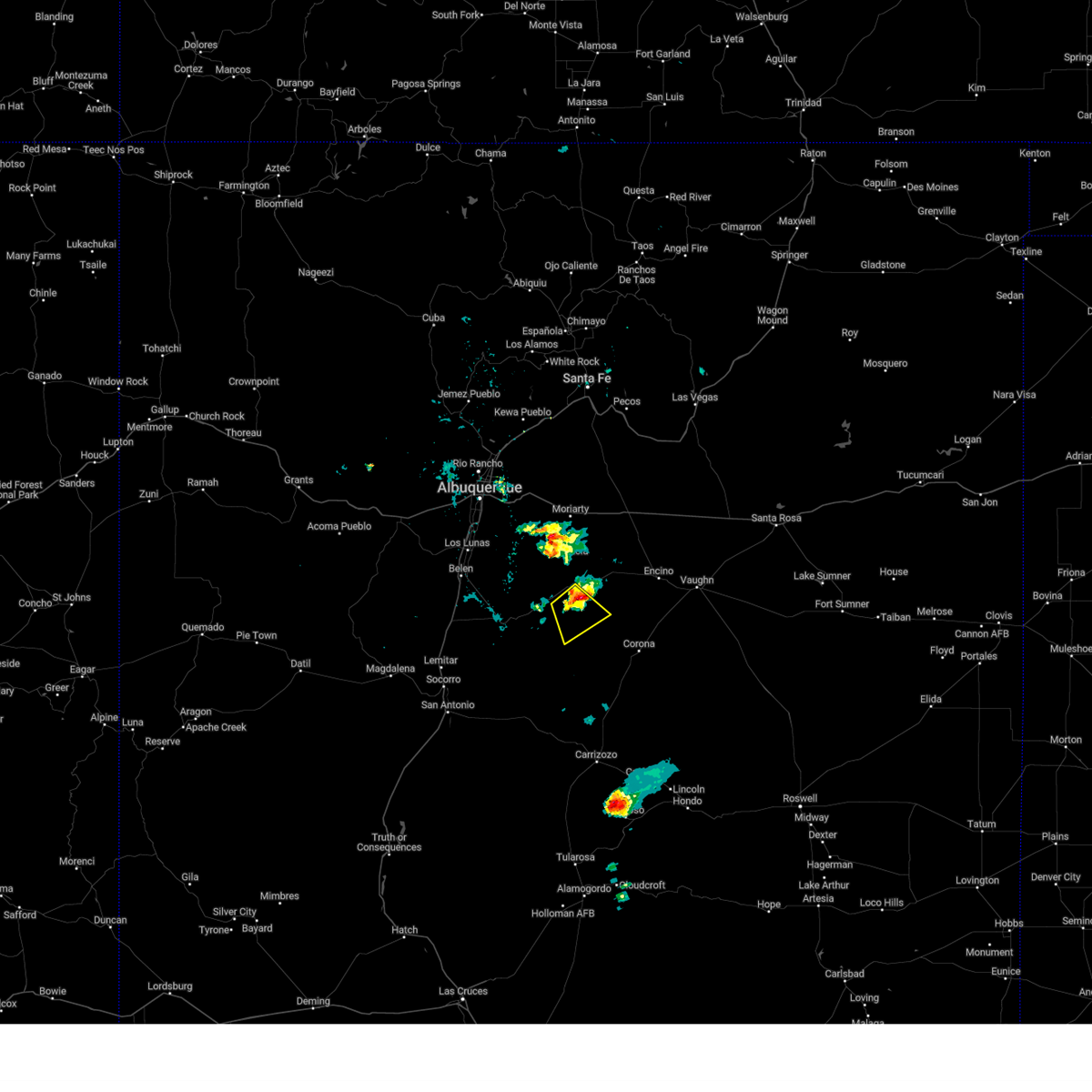
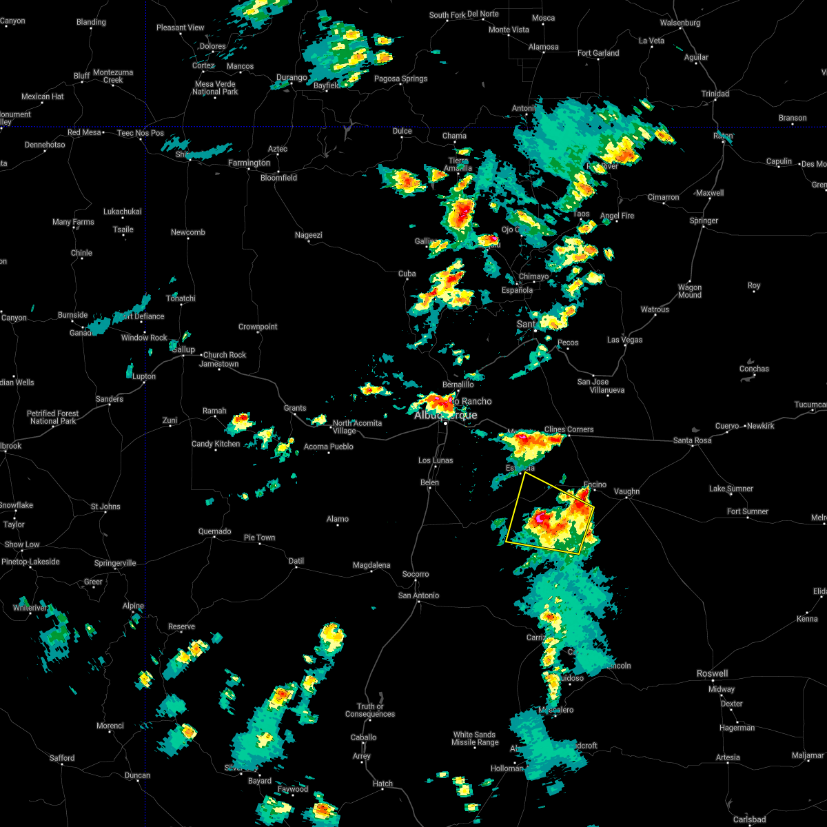
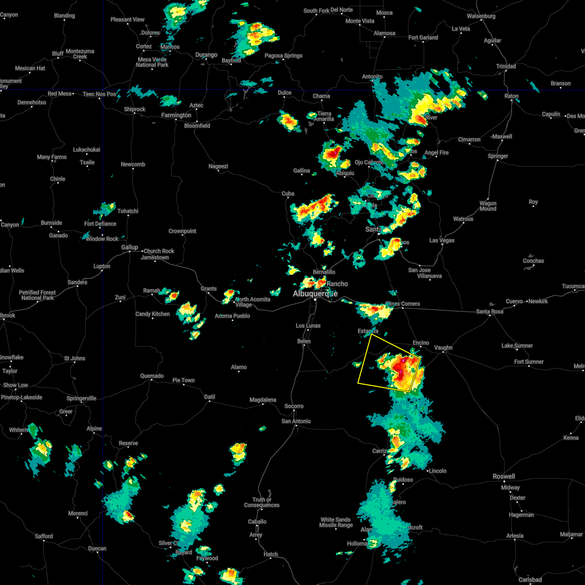
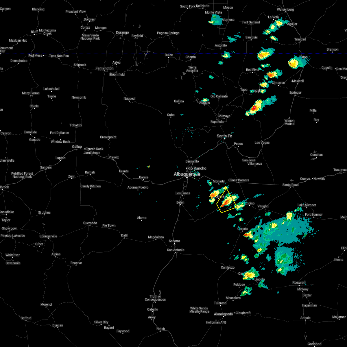
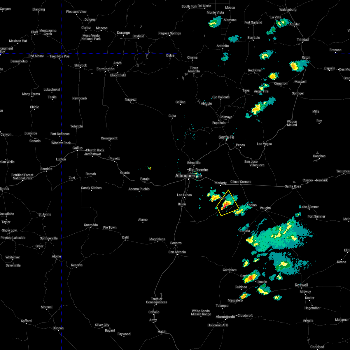
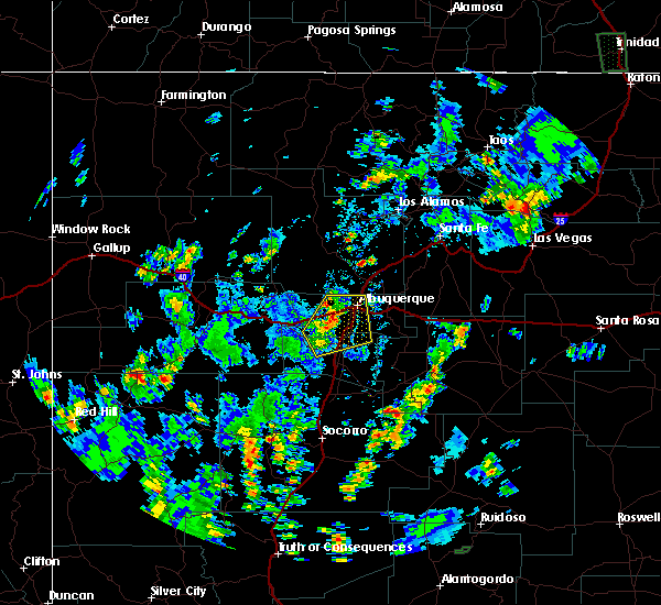
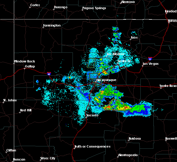
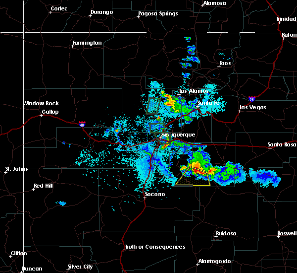
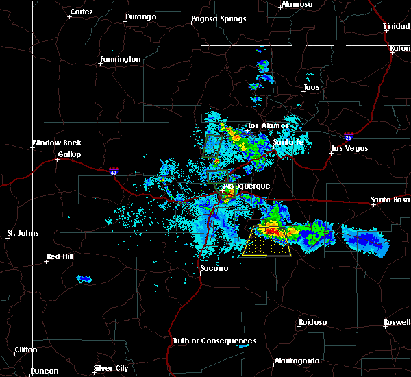
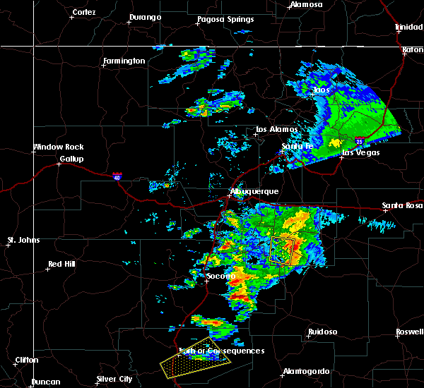
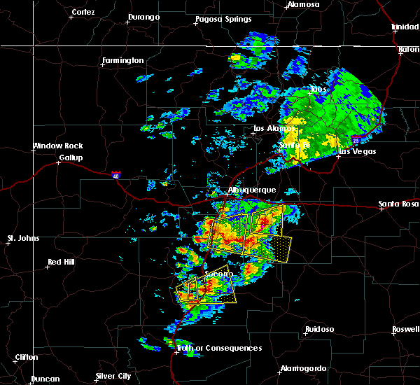
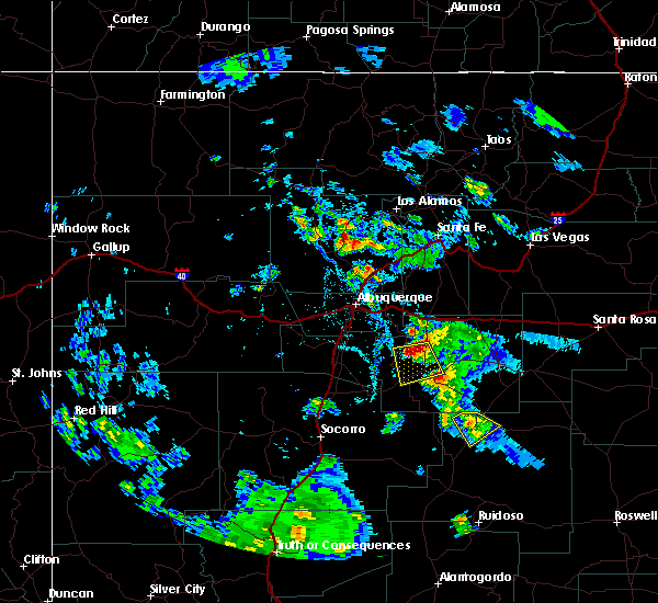
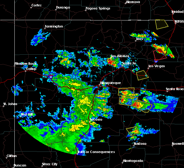
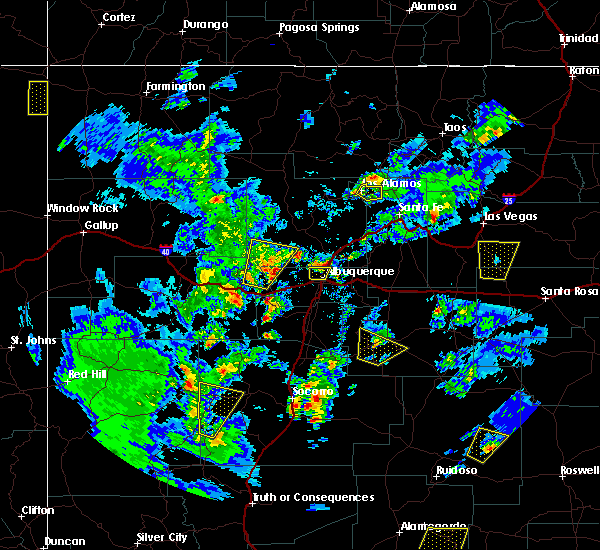
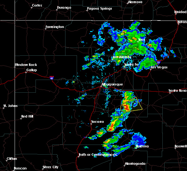
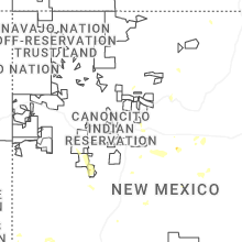
Hail Map for Willard, NM
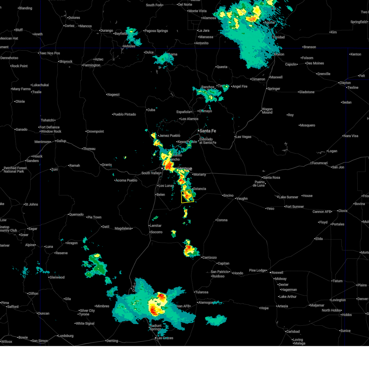
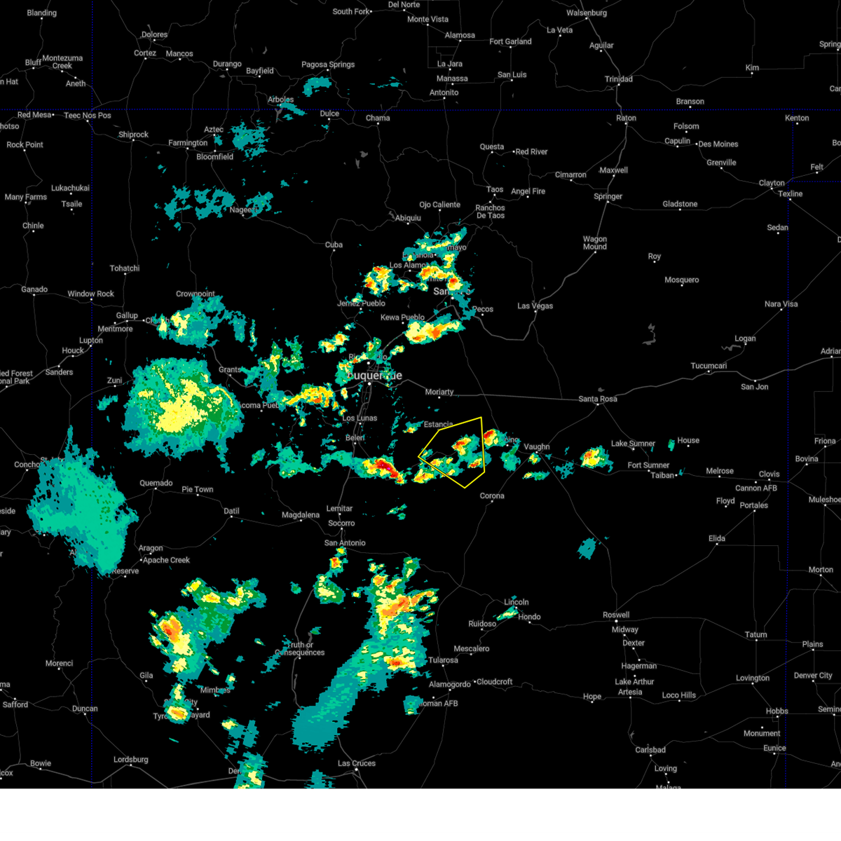
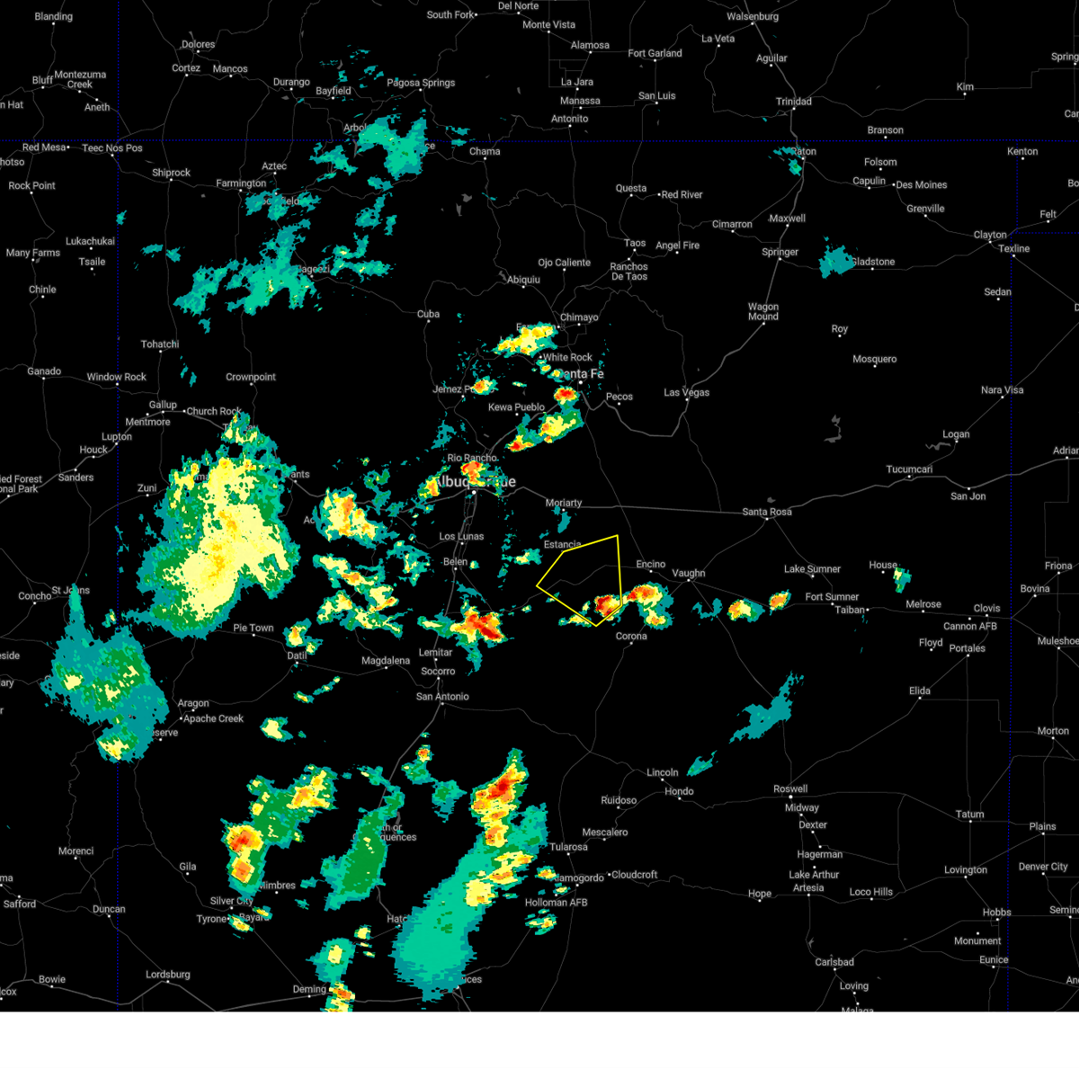
The Willard, NM area has had 3 reports of on-the-ground hail by trained spotters, and has been under severe weather warnings 1 time during the past 12 months. Doppler radar has detected hail at or near Willard, NM on 24 occasions.
| Name: | Willard, NM |
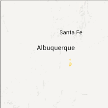
| Where Located: | 48.8 miles SE of Albuquerque, NM |
| Map: | Google Map for Willard, NM |
| Population: | 253 |
| Housing Units: | 124 |
| More Info: | Search Google for Willard, NM |
0
The Top Recent Hail Date for Willard, NM is Monday, June 30, 2025 (13th out of 24)
Hail and Wind Damage Spotted near Willard, NM
| Date / Time | Report Details |
|---|---|
| 7/12/2025 6:36 PM MDT |
 Svrabq the national weather service in albuquerque has issued a * severe thunderstorm warning for, west central torrance county in central new mexico, * until 715 pm mdt. * at 636 pm mdt, a severe thunderstorm was located 8 miles northeast of mountainair, or 13 miles southwest of estancia, moving south at 5 mph (radar indicated). Hazards include 60 mph wind gusts and quarter size hail. Hail damage to vehicles is expected. Expect wind damage to roofs, siding, and trees. Svrabq the national weather service in albuquerque has issued a * severe thunderstorm warning for, west central torrance county in central new mexico, * until 715 pm mdt. * at 636 pm mdt, a severe thunderstorm was located 8 miles northeast of mountainair, or 13 miles southwest of estancia, moving south at 5 mph (radar indicated). Hazards include 60 mph wind gusts and quarter size hail. Hail damage to vehicles is expected. Expect wind damage to roofs, siding, and trees.
|
| 6/29/2024 7:25 PM MDT |
 The storm which prompted the warning has weakened below severe limits, and no longer poses an immediate threat to life or property. therefore, the warning will be allowed to expire. The storm which prompted the warning has weakened below severe limits, and no longer poses an immediate threat to life or property. therefore, the warning will be allowed to expire.
|
| 6/29/2024 6:48 PM MDT |
 Svrabq the national weather service in albuquerque has issued a * severe thunderstorm warning for, central torrance county in central new mexico, * until 730 pm mdt. * at 647 pm mdt, a severe thunderstorm was located 9 miles northwest of cedarvale, or 20 miles northwest of corona, moving northwest at 20 mph (radar indicated). Hazards include 60 mph wind gusts and quarter size hail. Hail damage to vehicles is expected. Expect wind damage to roofs, siding, and trees. Svrabq the national weather service in albuquerque has issued a * severe thunderstorm warning for, central torrance county in central new mexico, * until 730 pm mdt. * at 647 pm mdt, a severe thunderstorm was located 9 miles northwest of cedarvale, or 20 miles northwest of corona, moving northwest at 20 mph (radar indicated). Hazards include 60 mph wind gusts and quarter size hail. Hail damage to vehicles is expected. Expect wind damage to roofs, siding, and trees.
|
| 6/19/2024 5:22 PM MDT |
 At 522 pm mdt, a severe thunderstorm was located near willard, or 11 miles southwest of estancia, moving east at 5 mph (radar indicated). Hazards include golf ball size hail and 60 mph wind gusts. People and animals outdoors will be injured. expect hail damage to roofs, siding, windows, and vehicles. expect wind damage to roofs, siding, and trees. Locations impacted include, willard. At 522 pm mdt, a severe thunderstorm was located near willard, or 11 miles southwest of estancia, moving east at 5 mph (radar indicated). Hazards include golf ball size hail and 60 mph wind gusts. People and animals outdoors will be injured. expect hail damage to roofs, siding, windows, and vehicles. expect wind damage to roofs, siding, and trees. Locations impacted include, willard.
|
| 6/19/2024 5:01 PM MDT |
 Svrabq the national weather service in albuquerque has issued a * severe thunderstorm warning for, west central torrance county in central new mexico, * until 600 pm mdt. * at 501 pm mdt, a severe thunderstorm was located 8 miles north of mountainair, or 13 miles southwest of estancia, moving east at 5 mph (radar indicated). Hazards include two inch hail and 60 mph wind gusts. People and animals outdoors will be injured. expect hail damage to roofs, siding, windows, and vehicles. Expect wind damage to roofs, siding, and trees. Svrabq the national weather service in albuquerque has issued a * severe thunderstorm warning for, west central torrance county in central new mexico, * until 600 pm mdt. * at 501 pm mdt, a severe thunderstorm was located 8 miles north of mountainair, or 13 miles southwest of estancia, moving east at 5 mph (radar indicated). Hazards include two inch hail and 60 mph wind gusts. People and animals outdoors will be injured. expect hail damage to roofs, siding, windows, and vehicles. Expect wind damage to roofs, siding, and trees.
|
| 6/19/2024 4:54 PM MDT |
 At 453 pm mdt, a severe thunderstorm was located 7 miles north of mountainair, or 13 miles southwest of estancia, moving east at 5 mph (radar indicated). Hazards include 60 mph wind gusts and quarter size hail. Hail damage to vehicles is expected. expect wind damage to roofs, siding, and trees. Locations impacted include, willard. At 453 pm mdt, a severe thunderstorm was located 7 miles north of mountainair, or 13 miles southwest of estancia, moving east at 5 mph (radar indicated). Hazards include 60 mph wind gusts and quarter size hail. Hail damage to vehicles is expected. expect wind damage to roofs, siding, and trees. Locations impacted include, willard.
|
| 6/19/2024 4:29 PM MDT |
 Svrabq the national weather service in albuquerque has issued a * severe thunderstorm warning for, west central torrance county in central new mexico, * until 515 pm mdt. * at 429 pm mdt, a severe thunderstorm was located near manzano mountain state park, or 16 miles southwest of estancia, moving east at 5 mph (radar indicated). Hazards include 60 mph wind gusts and half dollar size hail. Hail damage to vehicles is expected. Expect wind damage to roofs, siding, and trees. Svrabq the national weather service in albuquerque has issued a * severe thunderstorm warning for, west central torrance county in central new mexico, * until 515 pm mdt. * at 429 pm mdt, a severe thunderstorm was located near manzano mountain state park, or 16 miles southwest of estancia, moving east at 5 mph (radar indicated). Hazards include 60 mph wind gusts and half dollar size hail. Hail damage to vehicles is expected. Expect wind damage to roofs, siding, and trees.
|
| 6/19/2024 3:20 PM MDT |
 At 320 pm mdt, a severe thunderstorm was located 7 miles southeast of willard, or 17 miles south of estancia, and is nearly stationary (radar indicated). Hazards include two inch hail and 60 mph wind gusts. People and animals outdoors will be injured. expect hail damage to roofs, siding, windows, and vehicles. expect wind damage to roofs, siding, and trees. Locations impacted include, willard. At 320 pm mdt, a severe thunderstorm was located 7 miles southeast of willard, or 17 miles south of estancia, and is nearly stationary (radar indicated). Hazards include two inch hail and 60 mph wind gusts. People and animals outdoors will be injured. expect hail damage to roofs, siding, windows, and vehicles. expect wind damage to roofs, siding, and trees. Locations impacted include, willard.
|
| 6/19/2024 3:00 PM MDT |
 At 300 pm mdt, a severe thunderstorm was located 7 miles southeast of willard, or 18 miles south of estancia, moving east at 5 mph (radar indicated). Hazards include golf ball size hail and 60 mph wind gusts. People and animals outdoors will be injured. expect hail damage to roofs, siding, windows, and vehicles. expect wind damage to roofs, siding, and trees. Locations impacted include, willard. At 300 pm mdt, a severe thunderstorm was located 7 miles southeast of willard, or 18 miles south of estancia, moving east at 5 mph (radar indicated). Hazards include golf ball size hail and 60 mph wind gusts. People and animals outdoors will be injured. expect hail damage to roofs, siding, windows, and vehicles. expect wind damage to roofs, siding, and trees. Locations impacted include, willard.
|
| 6/19/2024 2:50 PM MDT | Hen Egg sized hail reported 8.7 miles NW of Willard, NM, location and time estimated. hail accumulated to six inches in depth and continued from 250pm and 430pm mdt. |
| 6/19/2024 2:41 PM MDT |
 Svrabq the national weather service in albuquerque has issued a * severe thunderstorm warning for, south central torrance county in central new mexico, * until 345 pm mdt. * at 240 pm mdt, a severe thunderstorm was located near willard, or 17 miles south of estancia, and is nearly stationary (radar indicated). Hazards include two inch hail and 60 mph wind gusts. People and animals outdoors will be injured. expect hail damage to roofs, siding, windows, and vehicles. Expect wind damage to roofs, siding, and trees. Svrabq the national weather service in albuquerque has issued a * severe thunderstorm warning for, south central torrance county in central new mexico, * until 345 pm mdt. * at 240 pm mdt, a severe thunderstorm was located near willard, or 17 miles south of estancia, and is nearly stationary (radar indicated). Hazards include two inch hail and 60 mph wind gusts. People and animals outdoors will be injured. expect hail damage to roofs, siding, windows, and vehicles. Expect wind damage to roofs, siding, and trees.
|
| 6/19/2024 2:24 PM MDT |
 At 223 pm mdt, a severe thunderstorm was located near willard, or 18 miles south of estancia, and is nearly stationary. this is a destructive storm for the area just south of willard including highway 42 (radar indicated). Hazards include baseball size hail and 60 mph wind gusts. People and animals outdoors will be severely injured. expect shattered windows, extensive damage to roofs, siding, and vehicles. Locations impacted include, willard. At 223 pm mdt, a severe thunderstorm was located near willard, or 18 miles south of estancia, and is nearly stationary. this is a destructive storm for the area just south of willard including highway 42 (radar indicated). Hazards include baseball size hail and 60 mph wind gusts. People and animals outdoors will be severely injured. expect shattered windows, extensive damage to roofs, siding, and vehicles. Locations impacted include, willard.
|
| 6/19/2024 2:18 PM MDT |
 At 217 pm mdt, a severe thunderstorm was located near willard, or 18 miles south of estancia, and is nearly stationary (radar indicated). Hazards include golf ball size hail and 60 mph wind gusts. People and animals outdoors will be injured. expect hail damage to roofs, siding, windows, and vehicles. expect wind damage to roofs, siding, and trees. Locations impacted include, willard. At 217 pm mdt, a severe thunderstorm was located near willard, or 18 miles south of estancia, and is nearly stationary (radar indicated). Hazards include golf ball size hail and 60 mph wind gusts. People and animals outdoors will be injured. expect hail damage to roofs, siding, windows, and vehicles. expect wind damage to roofs, siding, and trees. Locations impacted include, willard.
|
| 6/19/2024 2:07 PM MDT |
 Svrabq the national weather service in albuquerque has issued a * severe thunderstorm warning for, south central torrance county in central new mexico, * until 245 pm mdt. * at 207 pm mdt, a severe thunderstorm was located near willard, or 18 miles south of estancia, and is nearly stationary (radar indicated). Hazards include 60 mph wind gusts and quarter size hail. Hail damage to vehicles is expected. Expect wind damage to roofs, siding, and trees. Svrabq the national weather service in albuquerque has issued a * severe thunderstorm warning for, south central torrance county in central new mexico, * until 245 pm mdt. * at 207 pm mdt, a severe thunderstorm was located near willard, or 18 miles south of estancia, and is nearly stationary (radar indicated). Hazards include 60 mph wind gusts and quarter size hail. Hail damage to vehicles is expected. Expect wind damage to roofs, siding, and trees.
|
| 6/2/2022 5:30 PM MDT | Quarter sized hail reported 14.5 miles NNW of Willard, NM |
| 7/23/2021 3:15 PM MDT |
 At 314 pm mdt, a severe thunderstorm was located 7 miles south of willard, or 18 miles south of estancia, moving west at 25 mph (radar indicated). Hazards include 60 mph wind gusts and half dollar size hail. Hail damage to vehicles is expected. Expect wind damage to roofs, siding, and trees. At 314 pm mdt, a severe thunderstorm was located 7 miles south of willard, or 18 miles south of estancia, moving west at 25 mph (radar indicated). Hazards include 60 mph wind gusts and half dollar size hail. Hail damage to vehicles is expected. Expect wind damage to roofs, siding, and trees.
|
| 7/23/2021 2:52 PM MDT |
 At 251 pm mdt, a severe thunderstorm was located 10 miles northwest of cedarvale, or 20 miles northwest of corona, moving west at 25 mph (radar indicated). Hazards include 60 mph wind gusts and quarter size hail. Hail damage to vehicles is expected. expect wind damage to roofs, siding, and trees. locations impacted include, estancia, willard, corona and cedarvale. This includes highway 60 between mile markers 216 and 234. At 251 pm mdt, a severe thunderstorm was located 10 miles northwest of cedarvale, or 20 miles northwest of corona, moving west at 25 mph (radar indicated). Hazards include 60 mph wind gusts and quarter size hail. Hail damage to vehicles is expected. expect wind damage to roofs, siding, and trees. locations impacted include, estancia, willard, corona and cedarvale. This includes highway 60 between mile markers 216 and 234.
|
| 7/23/2021 2:27 PM MDT |
 At 227 pm mdt, a severe thunderstorm was located near cedarvale, or 13 miles northwest of corona, moving west at 25 mph (radar indicated). Hazards include 60 mph wind gusts and quarter size hail. Hail damage to vehicles is expected. Expect wind damage to roofs, siding, and trees. At 227 pm mdt, a severe thunderstorm was located near cedarvale, or 13 miles northwest of corona, moving west at 25 mph (radar indicated). Hazards include 60 mph wind gusts and quarter size hail. Hail damage to vehicles is expected. Expect wind damage to roofs, siding, and trees.
|
| 5/30/2021 12:32 PM MDT |
 At 1231 pm mdt, a severe thunderstorm was located 7 miles northeast of willard, or 9 miles southeast of estancia, moving northeast at 10 mph (radar indicated). Hazards include 60 mph wind gusts and quarter size hail. Hail damage to vehicles is expected. expect wind damage to roofs, siding, and trees. locations impacted include, estancia and willard. This includes highway 60 between mile markers 218 and 237. At 1231 pm mdt, a severe thunderstorm was located 7 miles northeast of willard, or 9 miles southeast of estancia, moving northeast at 10 mph (radar indicated). Hazards include 60 mph wind gusts and quarter size hail. Hail damage to vehicles is expected. expect wind damage to roofs, siding, and trees. locations impacted include, estancia and willard. This includes highway 60 between mile markers 218 and 237.
|
| 5/30/2021 12:15 PM MDT |
 At 1214 pm mdt, a severe thunderstorm was located near willard, or 8 miles southeast of estancia, moving northeast at 10 mph (radar indicated). Hazards include 60 mph wind gusts and quarter size hail. Hail damage to vehicles is expected. Expect wind damage to roofs, siding, and trees. At 1214 pm mdt, a severe thunderstorm was located near willard, or 8 miles southeast of estancia, moving northeast at 10 mph (radar indicated). Hazards include 60 mph wind gusts and quarter size hail. Hail damage to vehicles is expected. Expect wind damage to roofs, siding, and trees.
|
| 7/26/2020 3:16 PM MDT |
 At 315 pm mdt, a severe thunderstorm was located 9 miles south of willard, or 21 miles south of estancia, moving northeast at 15 mph (radar indicated). Hazards include 60 mph wind gusts and quarter size hail. Hail damage to vehicles is expected. Expect wind damage to roofs, siding, and trees. At 315 pm mdt, a severe thunderstorm was located 9 miles south of willard, or 21 miles south of estancia, moving northeast at 15 mph (radar indicated). Hazards include 60 mph wind gusts and quarter size hail. Hail damage to vehicles is expected. Expect wind damage to roofs, siding, and trees.
|
| 7/31/2018 9:50 PM MDT |
 The severe thunderstorm warning for southwestern torrance county will expire at 1000 pm mdt, the storms which prompted the warning have weakened below severe limits, and no longer pose an immediate threat to life or property. therefore the warning will be allowed to expire. however small hail is still possible with these thunderstorms. The severe thunderstorm warning for southwestern torrance county will expire at 1000 pm mdt, the storms which prompted the warning have weakened below severe limits, and no longer pose an immediate threat to life or property. therefore the warning will be allowed to expire. however small hail is still possible with these thunderstorms.
|
| 7/31/2018 9:26 PM MDT |
 At 925 pm mdt, severe thunderstorms were located along a line extending from near willard to 15 miles northwest of cedarvale, moving south at 30 mph (radar indicated). Hazards include 60 mph wind gusts and quarter size hail. Hail damage to vehicles is expected. expect wind damage to roofs, siding, and trees. Locations impacted include, willard. At 925 pm mdt, severe thunderstorms were located along a line extending from near willard to 15 miles northwest of cedarvale, moving south at 30 mph (radar indicated). Hazards include 60 mph wind gusts and quarter size hail. Hail damage to vehicles is expected. expect wind damage to roofs, siding, and trees. Locations impacted include, willard.
|
| 7/31/2018 9:13 PM MDT |
 At 912 pm mdt, severe thunderstorms were located along a line extending from near willard to 14 miles southeast of estancia, moving south at 30 mph (radar indicated). Hazards include 60 mph wind gusts and quarter size hail. Hail damage to vehicles is expected. Expect wind damage to roofs, siding, and trees. At 912 pm mdt, severe thunderstorms were located along a line extending from near willard to 14 miles southeast of estancia, moving south at 30 mph (radar indicated). Hazards include 60 mph wind gusts and quarter size hail. Hail damage to vehicles is expected. Expect wind damage to roofs, siding, and trees.
|
| 6/3/2018 5:17 PM MDT |
 At 517 pm mdt, a severe thunderstorm was located 11 miles southeast of willard, or 21 miles southeast of estancia, moving east at 35 mph (radar indicated). Hazards include 60 mph wind gusts and half dollar size hail. Hail damage to vehicles is expected. expect wind damage to roofs, siding, and trees. Locations impacted include, willard. At 517 pm mdt, a severe thunderstorm was located 11 miles southeast of willard, or 21 miles southeast of estancia, moving east at 35 mph (radar indicated). Hazards include 60 mph wind gusts and half dollar size hail. Hail damage to vehicles is expected. expect wind damage to roofs, siding, and trees. Locations impacted include, willard.
|
| 6/3/2018 4:27 PM MDT |
 At 426 pm mdt, a severe thunderstorm was located near abo, or 23 miles southwest of estancia, moving east at 25 mph (radar indicated). Hazards include ping pong ball size hail and 60 mph wind gusts. People and animals outdoors will be injured. expect hail damage to roofs, siding, windows, and vehicles. Expect wind damage to roofs, siding, and trees. At 426 pm mdt, a severe thunderstorm was located near abo, or 23 miles southwest of estancia, moving east at 25 mph (radar indicated). Hazards include ping pong ball size hail and 60 mph wind gusts. People and animals outdoors will be injured. expect hail damage to roofs, siding, windows, and vehicles. Expect wind damage to roofs, siding, and trees.
|
| 5/21/2018 4:55 PM MDT |
 At 455 pm mdt, severe thunderstorms were located along a line extending from near willard to 6 miles east of gran quivira, moving east at 20 mph (radar indicated). Hazards include ping pong ball size hail and 60 mph wind gusts. People and animals outdoors will be injured. expect hail damage to roofs, siding, windows, and vehicles. Expect wind damage to roofs, siding, and trees. At 455 pm mdt, severe thunderstorms were located along a line extending from near willard to 6 miles east of gran quivira, moving east at 20 mph (radar indicated). Hazards include ping pong ball size hail and 60 mph wind gusts. People and animals outdoors will be injured. expect hail damage to roofs, siding, windows, and vehicles. Expect wind damage to roofs, siding, and trees.
|
| 6/26/2017 5:41 PM MDT |
 At 541 pm mdt, a severe thunderstorm was located 7 miles northwest of willard, or 7 miles southwest of estancia, moving south at 20 mph (radar indicated). Hazards include golf ball size hail and 70 mph wind gusts. People and animals outdoors will be injured. expect hail damage to roofs, siding, windows, and vehicles. expect considerable tree damage. wind damage is also likely to mobile homes, roofs, and outbuildings. Locations impacted include, estancia, mountainair, willard and torreon. At 541 pm mdt, a severe thunderstorm was located 7 miles northwest of willard, or 7 miles southwest of estancia, moving south at 20 mph (radar indicated). Hazards include golf ball size hail and 70 mph wind gusts. People and animals outdoors will be injured. expect hail damage to roofs, siding, windows, and vehicles. expect considerable tree damage. wind damage is also likely to mobile homes, roofs, and outbuildings. Locations impacted include, estancia, mountainair, willard and torreon.
|
| 6/26/2017 5:30 PM MDT |
 At 530 pm mdt, a severe thunderstorm was located near estancia, moving south at 15 mph (radar indicated). Hazards include 60 mph wind gusts and quarter size hail. Hail damage to vehicles is expected. Expect wind damage to roofs, siding, and trees. At 530 pm mdt, a severe thunderstorm was located near estancia, moving south at 15 mph (radar indicated). Hazards include 60 mph wind gusts and quarter size hail. Hail damage to vehicles is expected. Expect wind damage to roofs, siding, and trees.
|
| 6/25/2017 5:16 PM MDT |
 At 516 pm mdt, a severe thunderstorm was located near willard, or 9 miles southeast of estancia, moving east at 25 mph (radar indicated). Hazards include ping pong ball size hail and 60 mph wind gusts. People and animals outdoors will be injured. expect hail damage to roofs, siding, windows, and vehicles. Expect wind damage to roofs, siding, and trees. At 516 pm mdt, a severe thunderstorm was located near willard, or 9 miles southeast of estancia, moving east at 25 mph (radar indicated). Hazards include ping pong ball size hail and 60 mph wind gusts. People and animals outdoors will be injured. expect hail damage to roofs, siding, windows, and vehicles. Expect wind damage to roofs, siding, and trees.
|
| 10/20/2015 2:46 PM MDT |
 At 246 pm mdt, a severe thunderstorm was located near mountainair, or 15 miles south of estancia, moving northeast at 30 mph (radar indicated). Hazards include quarter size hail and 60 mph wind gusts. Hail damage to vehicles is expected. Expect wind damage to roofs, siding and trees. At 246 pm mdt, a severe thunderstorm was located near mountainair, or 15 miles south of estancia, moving northeast at 30 mph (radar indicated). Hazards include quarter size hail and 60 mph wind gusts. Hail damage to vehicles is expected. Expect wind damage to roofs, siding and trees.
|
| 10/3/2015 2:25 PM MDT |
 At 225 pm mdt, a severe thunderstorm was located 8 miles southeast of willard, or 17 miles southeast of estancia, moving northeast at 50 mph (radar indicated). Hazards include quarter size hail and 60 mph wind gusts. Hail damage to vehicles is expected. Expect wind damage to roofs, siding and trees. At 225 pm mdt, a severe thunderstorm was located 8 miles southeast of willard, or 17 miles southeast of estancia, moving northeast at 50 mph (radar indicated). Hazards include quarter size hail and 60 mph wind gusts. Hail damage to vehicles is expected. Expect wind damage to roofs, siding and trees.
|
| 5/13/2012 2:08 PM MDT | Quarter sized hail reported 14.5 miles NNW of Willard, NM |
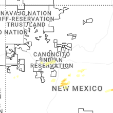
Hail Maps for Willard, NM


Connect with Interactive Hail Maps