

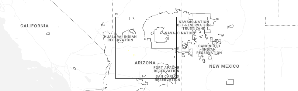
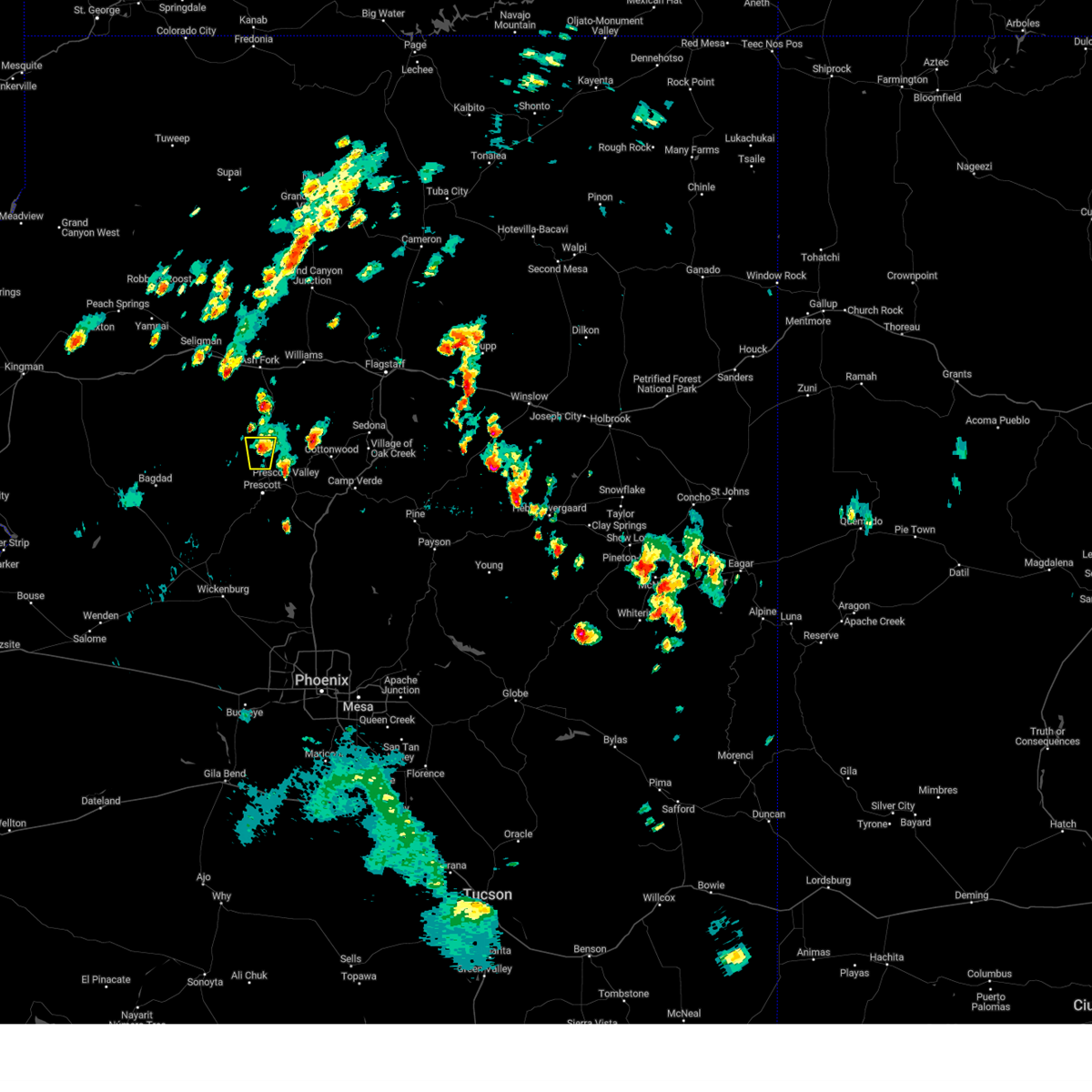
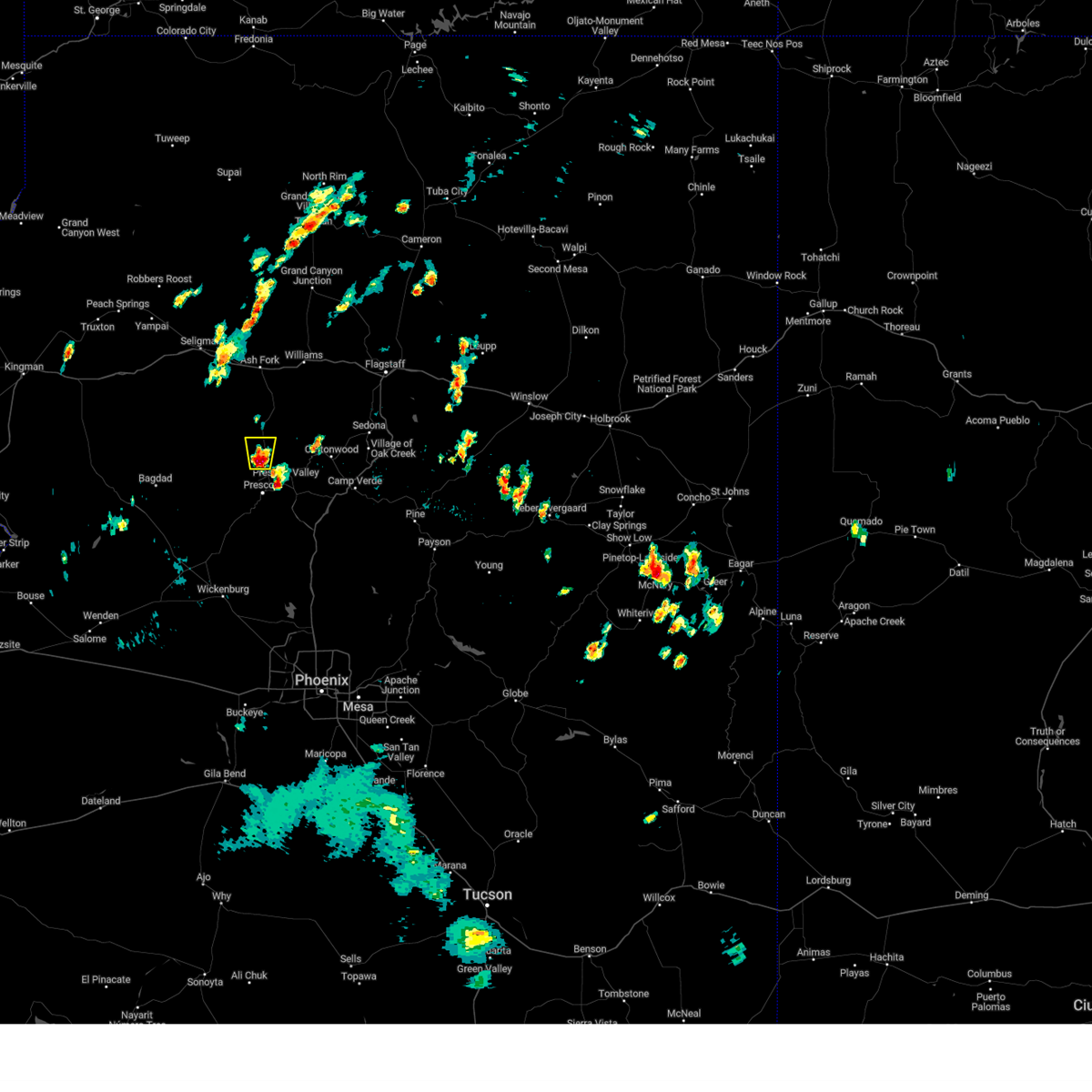
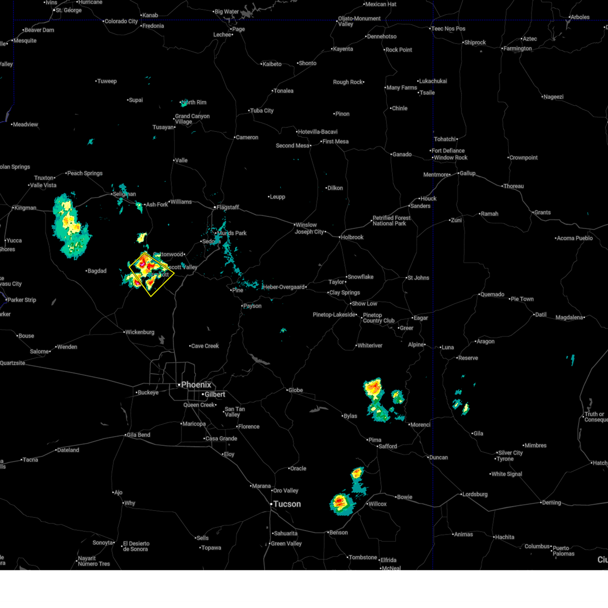
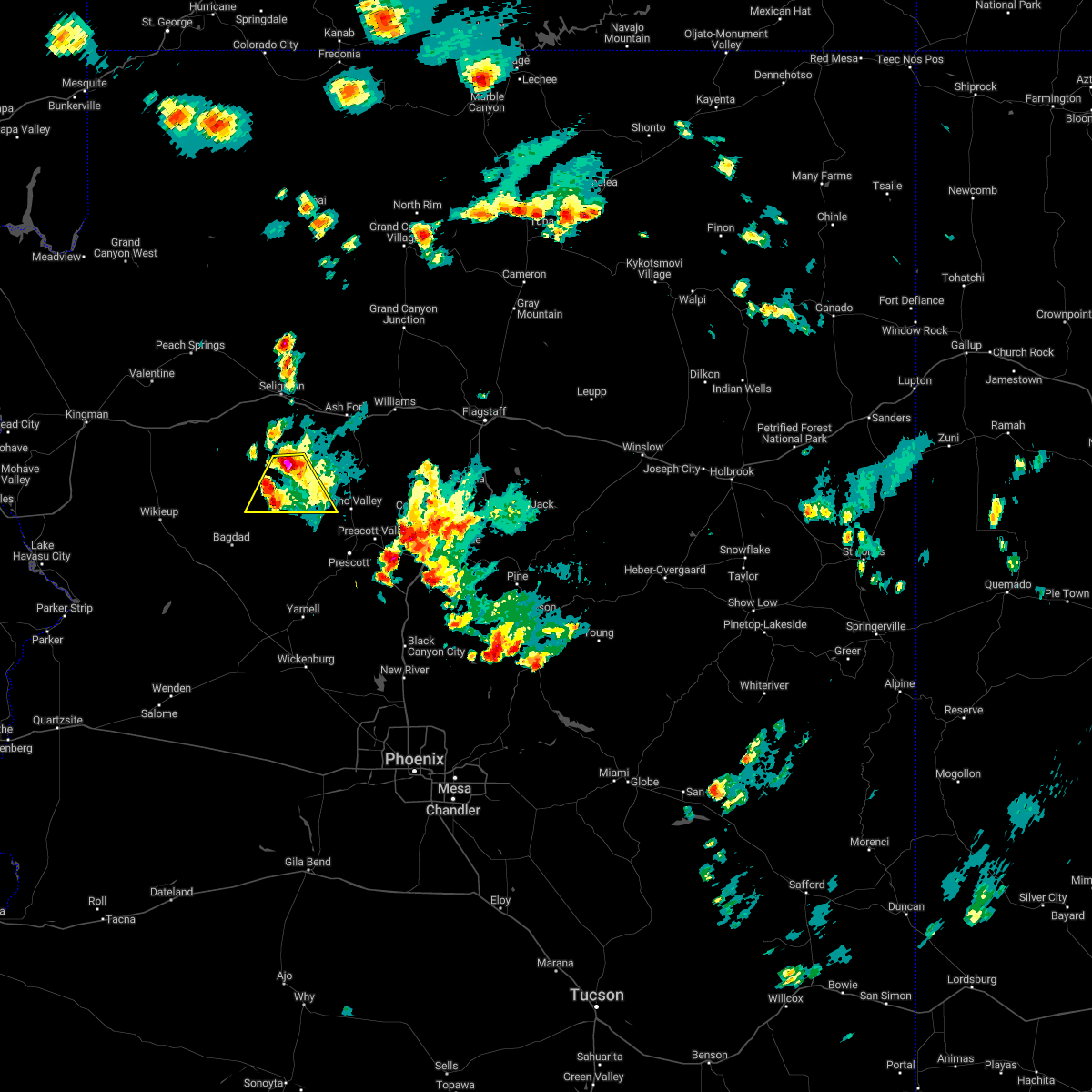
Hail Map for Williamson, AZ
The Williamson, AZ area has had 0 reports of on-the-ground hail by trained spotters, and has been under severe weather warnings 0 times during the past 12 months. Doppler radar has detected hail at or near Williamson, AZ on 53 occasions, including 2 occasions during the past year.
| Name: | Williamson, AZ |
| Where Located: | 61 miles SW of Flagstaff, AZ |
| Map: | Google Map for Williamson, AZ |
| Population: | 5438 |
| Housing Units: | 2779 |
| More Info: | Search Google for Williamson, AZ |
1
The Top Recent Hail Date for Williamson, AZ is Tuesday, July 1, 2025 (9th out of 53)
Hail and Wind Damage Spotted near Williamson, AZ
| Date / Time | Report Details |
|---|---|
| 8/21/2024 12:29 PM MST |
 The storm which prompted the warning near chino valley has weakened below severe limits, and no longer poses an immediate threat to life or property. therefore, the warning will be allowed to expire. The storm which prompted the warning near chino valley has weakened below severe limits, and no longer poses an immediate threat to life or property. therefore, the warning will be allowed to expire.
|
| 8/21/2024 12:01 PM MST |
 Svrfgz the national weather service in flagstaff has issued a * severe thunderstorm warning for, yavapai county in west central arizona, * until 1230 pm mst. * at 1200 pm mst, a severe thunderstorm was located over chino valley, moving north at 10 mph (radar indicated). Hazards include quarter size hail and winds up to 40 mph. damage to vehicles is expected Svrfgz the national weather service in flagstaff has issued a * severe thunderstorm warning for, yavapai county in west central arizona, * until 1230 pm mst. * at 1200 pm mst, a severe thunderstorm was located over chino valley, moving north at 10 mph (radar indicated). Hazards include quarter size hail and winds up to 40 mph. damage to vehicles is expected
|
| 7/11/2024 3:14 PM MST |
 The severe thunderstorm over prescott has weakened below severe limits and no longer poses an immediate threat to life or property. therefore, the warning will be allowed to expire. however, small hail, heavy rain and minor street flooding are still possible with this thunderstorm. The severe thunderstorm over prescott has weakened below severe limits and no longer poses an immediate threat to life or property. therefore, the warning will be allowed to expire. however, small hail, heavy rain and minor street flooding are still possible with this thunderstorm.
|
| 7/11/2024 2:52 PM MST |
 At 251 pm mst, a severe thunderstorm was located over the greater prescott area and was moving southwest at 10 to 15 mph (radar indicated). Hazards include 60 mph wind gusts and quarter size hail. Hail damage to vehicles is expected. expect wind damage to roofs, siding, and trees. locations impacted include, quartz mountain, thumbe butte, rancho vista estates, willow creek reservoir, poland junction, prescott gateway mall, iron springs, embry-riddle aeronautical university, acker park, prescott valley, goldwater lake park, wildwood estates, fain lake, alto pit ohv, courthouse plaza, wilhoit, prescott regional airport, goldwater lake, lynx lake, and potato patch. this includes the following highways, state route 89 between mile markers 293 and 322. state route 89a between mile markers 318 and 325. State route 69 between mile markers 275 and 276, and between mile markers 286 and 296. At 251 pm mst, a severe thunderstorm was located over the greater prescott area and was moving southwest at 10 to 15 mph (radar indicated). Hazards include 60 mph wind gusts and quarter size hail. Hail damage to vehicles is expected. expect wind damage to roofs, siding, and trees. locations impacted include, quartz mountain, thumbe butte, rancho vista estates, willow creek reservoir, poland junction, prescott gateway mall, iron springs, embry-riddle aeronautical university, acker park, prescott valley, goldwater lake park, wildwood estates, fain lake, alto pit ohv, courthouse plaza, wilhoit, prescott regional airport, goldwater lake, lynx lake, and potato patch. this includes the following highways, state route 89 between mile markers 293 and 322. state route 89a between mile markers 318 and 325. State route 69 between mile markers 275 and 276, and between mile markers 286 and 296.
|
| 7/11/2024 2:34 PM MST |
 Svrfgz the national weather service in flagstaff has issued a * severe thunderstorm warning for, yavapai county in west central arizona, * until 315 pm mst. * at 233 pm mst, a severe thunderstorm was located over central prescott, moving southwest at 10 to 15 mph (radar indicated). Hazards include 60 mph wind gusts and quarter size hail. Hail damage to vehicles is expected. Expect wind damage to roofs, siding, and trees. Svrfgz the national weather service in flagstaff has issued a * severe thunderstorm warning for, yavapai county in west central arizona, * until 315 pm mst. * at 233 pm mst, a severe thunderstorm was located over central prescott, moving southwest at 10 to 15 mph (radar indicated). Hazards include 60 mph wind gusts and quarter size hail. Hail damage to vehicles is expected. Expect wind damage to roofs, siding, and trees.
|
| 7/10/2024 3:44 PM MST |
 The storm which prompted the warning has weakened below severe limits, and no longer poses an immediate threat to life or property. therefore, the warning will be allowed to expire. however, small hail, gusty winds up to 50 mph and heavy rain are still possible with this thunderstorm. The storm which prompted the warning has weakened below severe limits, and no longer poses an immediate threat to life or property. therefore, the warning will be allowed to expire. however, small hail, gusty winds up to 50 mph and heavy rain are still possible with this thunderstorm.
|
| 7/10/2024 3:35 PM MST |
 At 335 pm mst, a severe thunderstorm was located over lynx lake, or near prescott, moving southeast at 15 mph (radar indicated). Hazards include 60 mph wind gusts and penny size hail. Expect damage to roofs, siding, and trees. locations impacted include, quartz mountain, thumbe butte, rancho vista estates, willow creek reservoir, poland junction, prescott gateway mall, iron springs, embry-riddle aeronautical university, acker park, prescott valley, goldwater lake park, wildwood estates, fain lake, alto pit ohv, courthouse plaza, prescott regional airport, goldwater lake, lynx lake, potato patch, and palace station. this includes the following highways, state route 89 between mile markers 302 and 326. state route 89a between mile markers 318 and 325. State route 69 between mile markers 275 and 296. At 335 pm mst, a severe thunderstorm was located over lynx lake, or near prescott, moving southeast at 15 mph (radar indicated). Hazards include 60 mph wind gusts and penny size hail. Expect damage to roofs, siding, and trees. locations impacted include, quartz mountain, thumbe butte, rancho vista estates, willow creek reservoir, poland junction, prescott gateway mall, iron springs, embry-riddle aeronautical university, acker park, prescott valley, goldwater lake park, wildwood estates, fain lake, alto pit ohv, courthouse plaza, prescott regional airport, goldwater lake, lynx lake, potato patch, and palace station. this includes the following highways, state route 89 between mile markers 302 and 326. state route 89a between mile markers 318 and 325. State route 69 between mile markers 275 and 296.
|
| 7/10/2024 3:25 PM MST |
 The storm near wilhoit which prompted the warning has weakened below severe limits, and no longer poses an immediate threat to life or property. therefore, the warning will be allowed to expire. however, small hail, gusty winds and heavy rain are still possible with this thunderstorm. remember, a severe thunderstorm warning still remains in effect for the prescott area from prescott to dewey-humboldt to walker. The storm near wilhoit which prompted the warning has weakened below severe limits, and no longer poses an immediate threat to life or property. therefore, the warning will be allowed to expire. however, small hail, gusty winds and heavy rain are still possible with this thunderstorm. remember, a severe thunderstorm warning still remains in effect for the prescott area from prescott to dewey-humboldt to walker.
|
| 7/10/2024 3:21 PM MST |
 Svrfgz the national weather service in flagstaff has issued a * severe thunderstorm warning for, yavapai county in west central arizona, * until 345 pm mst. * at 320 pm mst, a severe thunderstorm was located over embry-riddle aeronautical university, or near prescott, moving southeast at 15 mph (radar indicated). Hazards include 60 mph wind gusts and penny size hail. expect damage to roofs, siding, and trees Svrfgz the national weather service in flagstaff has issued a * severe thunderstorm warning for, yavapai county in west central arizona, * until 345 pm mst. * at 320 pm mst, a severe thunderstorm was located over embry-riddle aeronautical university, or near prescott, moving southeast at 15 mph (radar indicated). Hazards include 60 mph wind gusts and penny size hail. expect damage to roofs, siding, and trees
|
| 7/10/2024 3:07 PM MST |
 Svrfgz the national weather service in flagstaff has issued a * severe thunderstorm warning for, yavapai county in west central arizona, * until 330 pm mst. * at 307 pm mst, a severe thunderstorm was located over copper basin, or near prescott, moving southeast at 15 mph (radar indicated). Hazards include 60 mph wind gusts and penny size hail. expect damage to roofs, siding, and trees Svrfgz the national weather service in flagstaff has issued a * severe thunderstorm warning for, yavapai county in west central arizona, * until 330 pm mst. * at 307 pm mst, a severe thunderstorm was located over copper basin, or near prescott, moving southeast at 15 mph (radar indicated). Hazards include 60 mph wind gusts and penny size hail. expect damage to roofs, siding, and trees
|
| 7/31/2023 2:52 PM MST |
 At 251 pm mst, a severe thunderstorm was located over prescott, moving northeast at 15 mph (radar indicated). Hazards include 60 mph wind gusts and quarter size hail. Hail damage to vehicles is expected. Expect wind damage to roofs, siding, and trees. At 251 pm mst, a severe thunderstorm was located over prescott, moving northeast at 15 mph (radar indicated). Hazards include 60 mph wind gusts and quarter size hail. Hail damage to vehicles is expected. Expect wind damage to roofs, siding, and trees.
|
| 7/28/2023 11:30 AM MST |
 At 1130 am mst, a severe thunderstorm was located near prescott valley, moving north at 10 mph (radar indicated). Hazards include 60 mph wind gusts and quarter size hail. Hail damage to vehicles is expected. Expect wind damage to roofs, siding, and trees. At 1130 am mst, a severe thunderstorm was located near prescott valley, moving north at 10 mph (radar indicated). Hazards include 60 mph wind gusts and quarter size hail. Hail damage to vehicles is expected. Expect wind damage to roofs, siding, and trees.
|
| 7/28/2023 10:50 AM MST |
 At 1049 am mst, a severe thunderstorm was located near yavapai campground, or near prescott, moving northeast at 5 mph (radar indicated). Hazards include 60 mph wind gusts and quarter size hail. Hail damage to vehicles is expected. Expect wind damage to roofs, siding, and trees. At 1049 am mst, a severe thunderstorm was located near yavapai campground, or near prescott, moving northeast at 5 mph (radar indicated). Hazards include 60 mph wind gusts and quarter size hail. Hail damage to vehicles is expected. Expect wind damage to roofs, siding, and trees.
|
| 7/22/2023 6:35 PM MST |
 At 634 pm mst, a severe thunderstorm was located over prescott gateway mall, or near prescott valley, moving west at 10 mph (radar indicated). Hazards include 60 mph wind gusts and penny size hail. Expect damage to roofs, siding, and trees. locations impacted include, prescott valley, prescott, yavapai campground, prescott airport, prescott gateway mall, iron springs, and prescott valley event center. this includes the following highways, state route 89 between mile markers 312 and 324. state route 89a between mile markers 318 and 325. state route 69 between mile markers 286 and 296. hail threat, radar indicated max hail size, 0. 75 in wind threat, radar indicated max wind gust, 60 mph. At 634 pm mst, a severe thunderstorm was located over prescott gateway mall, or near prescott valley, moving west at 10 mph (radar indicated). Hazards include 60 mph wind gusts and penny size hail. Expect damage to roofs, siding, and trees. locations impacted include, prescott valley, prescott, yavapai campground, prescott airport, prescott gateway mall, iron springs, and prescott valley event center. this includes the following highways, state route 89 between mile markers 312 and 324. state route 89a between mile markers 318 and 325. state route 69 between mile markers 286 and 296. hail threat, radar indicated max hail size, 0. 75 in wind threat, radar indicated max wind gust, 60 mph.
|
| 7/22/2023 6:24 PM MST |
 At 624 pm mst, a severe thunderstorm was located over prescott valley, moving west at 10 mph (radar indicated). Hazards include 60 mph wind gusts and penny size hail. Expect damage to roofs, siding, and trees. locations impacted include, chino valley, prescott valley, prescott, yavapai county fairgrounds, yavapai campground, prescott airport, prescott gateway mall, iron springs, and prescott valley event center. this includes the following highways, state route 89 between mile markers 312 and 330. state route 89a between mile markers 318 and 328. state route 69 between mile markers 286 and 296. hail threat, radar indicated max hail size, 0. 75 in wind threat, radar indicated max wind gust, 60 mph. At 624 pm mst, a severe thunderstorm was located over prescott valley, moving west at 10 mph (radar indicated). Hazards include 60 mph wind gusts and penny size hail. Expect damage to roofs, siding, and trees. locations impacted include, chino valley, prescott valley, prescott, yavapai county fairgrounds, yavapai campground, prescott airport, prescott gateway mall, iron springs, and prescott valley event center. this includes the following highways, state route 89 between mile markers 312 and 330. state route 89a between mile markers 318 and 328. state route 69 between mile markers 286 and 296. hail threat, radar indicated max hail size, 0. 75 in wind threat, radar indicated max wind gust, 60 mph.
|
| 7/22/2023 6:12 PM MST |
 At 611 pm mst, a severe thunderstorm was located over prescott valley, moving northwest at 10 mph (radar indicated). Hazards include 60 mph wind gusts and penny size hail. expect damage to roofs, siding, and trees At 611 pm mst, a severe thunderstorm was located over prescott valley, moving northwest at 10 mph (radar indicated). Hazards include 60 mph wind gusts and penny size hail. expect damage to roofs, siding, and trees
|
| 10/3/2022 2:39 PM MST |
 The severe thunderstorm warning for yavapai county will expire at 245 pm mst, the storm which prompted the warning has weakened below severe limits, and no longer poses an immediate threat to life or property. therefore, the warning will be allowed to expire. The severe thunderstorm warning for yavapai county will expire at 245 pm mst, the storm which prompted the warning has weakened below severe limits, and no longer poses an immediate threat to life or property. therefore, the warning will be allowed to expire.
|
| 10/3/2022 2:02 PM MST |
 At 202 pm mst, a severe thunderstorm was located over prescott, moving east at 20 mph (radar indicated). Hazards include 60 mph wind gusts and quarter size hail. Hail damage to vehicles is expected. Expect wind damage to roofs, siding, and trees. At 202 pm mst, a severe thunderstorm was located over prescott, moving east at 20 mph (radar indicated). Hazards include 60 mph wind gusts and quarter size hail. Hail damage to vehicles is expected. Expect wind damage to roofs, siding, and trees.
|
| 9/13/2022 10:27 AM MST |
 At 1027 am mst, a severe thunderstorm was located near paulden, or near chino valley, moving north at 5 mph (radar indicated). Hazards include quarter size hail. damage to vehicles is expected At 1027 am mst, a severe thunderstorm was located near paulden, or near chino valley, moving north at 5 mph (radar indicated). Hazards include quarter size hail. damage to vehicles is expected
|
| 8/23/2022 3:15 PM MST | At 314 pm mst, a severe thunderstorm was located near iron springs, or 9 miles northwest of prescott, moving southwest at 10 mph (radar indicated). Hazards include 60 mph wind gusts and quarter size hail. Hail damage to vehicles is expected. Expect wind damage to roofs, siding, and trees. |
| 8/21/2022 4:27 PM MST |
 At 426 pm mst, a severe thunderstorm was located 21 miles west of paulden, or 24 miles northwest of chino valley, moving south at 10 to 15 mph (radar indicated). Hazards include up to 60 mph wind gusts, quarter size hail, and heavy rainfall. Hail damage to vehicles is expected. Expect wind damage to roofs, siding, and trees. At 426 pm mst, a severe thunderstorm was located 21 miles west of paulden, or 24 miles northwest of chino valley, moving south at 10 to 15 mph (radar indicated). Hazards include up to 60 mph wind gusts, quarter size hail, and heavy rainfall. Hail damage to vehicles is expected. Expect wind damage to roofs, siding, and trees.
|
| 8/20/2022 5:54 PM MST |
 The severe thunderstorm warning for yavapai county will expire at 600 pm mst, the storm which prompted the warning has weakened below severe limits and no longer poses an immediate threat to life or property. therefore, the warning will be allowed to expire. however, additional strong thunderstorms have formed in the area, producing heavy rain and small hail. please continue to practice caution near thunderstorms. when thunder roars, go indoors. The severe thunderstorm warning for yavapai county will expire at 600 pm mst, the storm which prompted the warning has weakened below severe limits and no longer poses an immediate threat to life or property. therefore, the warning will be allowed to expire. however, additional strong thunderstorms have formed in the area, producing heavy rain and small hail. please continue to practice caution near thunderstorms. when thunder roars, go indoors.
|
| 8/20/2022 5:41 PM MST |
 At 535 pm mst, a severe thunderstorm was located over iron springs and has now moved east-southeast. the thunderstorm is showing signs of weakening. additional strong thunderstorms continue to impact areas southwest and west of prescott (radar indicated). Hazards include up to quarter size hail, up to 40 mph winds, and heavy rainfall. Damage to vehicles is expected. locations impacted include, prescott, yavapai campground, downtown prescott, ponderosa park, indian hill west prescott, iron springs and white spar campground. hail threat, radar indicated max hail size, 1. 00 in wind threat, radar indicated max wind gust, <50 mph. At 535 pm mst, a severe thunderstorm was located over iron springs and has now moved east-southeast. the thunderstorm is showing signs of weakening. additional strong thunderstorms continue to impact areas southwest and west of prescott (radar indicated). Hazards include up to quarter size hail, up to 40 mph winds, and heavy rainfall. Damage to vehicles is expected. locations impacted include, prescott, yavapai campground, downtown prescott, ponderosa park, indian hill west prescott, iron springs and white spar campground. hail threat, radar indicated max hail size, 1. 00 in wind threat, radar indicated max wind gust, <50 mph.
|
| 8/20/2022 5:17 PM MST |
 At 516 pm mst, a severe thunderstorm was located over iron springs, or west of prescott, moving east at 5 to 10 mph (radar indicated). Hazards include quarter size hail, winds up to 45 mph, and heavy rainfall. damage to vehicles is expected At 516 pm mst, a severe thunderstorm was located over iron springs, or west of prescott, moving east at 5 to 10 mph (radar indicated). Hazards include quarter size hail, winds up to 45 mph, and heavy rainfall. damage to vehicles is expected
|
| 8/8/2022 5:13 PM MST |
 At 512 pm mst, a severe thunderstorm was located near prescott, moving south at 10 mph (radar indicated). Hazards include 60 mph wind gusts, half inch to penny size hail, and heavy rainfall. Expect damage to roofs, siding, and trees. locations impacted include, prescott valley, prescott, groom creek subdivision, prescott airport, walker, prescott gateway mall, yavapai campground, downtown prescott, ponderosa park, indian hill west prescott, oak knoll village, lynx lake dam, prescott valley event center and white spar campground. hail threat, radar indicated max hail size, 0. 75 in wind threat, radar indicated max wind gust, 60 mph. At 512 pm mst, a severe thunderstorm was located near prescott, moving south at 10 mph (radar indicated). Hazards include 60 mph wind gusts, half inch to penny size hail, and heavy rainfall. Expect damage to roofs, siding, and trees. locations impacted include, prescott valley, prescott, groom creek subdivision, prescott airport, walker, prescott gateway mall, yavapai campground, downtown prescott, ponderosa park, indian hill west prescott, oak knoll village, lynx lake dam, prescott valley event center and white spar campground. hail threat, radar indicated max hail size, 0. 75 in wind threat, radar indicated max wind gust, 60 mph.
|
| 8/8/2022 5:10 PM MST |
 The severe thunderstorm warning for yavapai county will expire at 515 pm mst, the storm which prompted the warning near chino valley has moved out of the area and towards prescott. therefore, this warning will be allowed to expire. however gusty winds and heavy rain are still possible with this thunderstorm. The severe thunderstorm warning for yavapai county will expire at 515 pm mst, the storm which prompted the warning near chino valley has moved out of the area and towards prescott. therefore, this warning will be allowed to expire. however gusty winds and heavy rain are still possible with this thunderstorm.
|
| 8/8/2022 5:02 PM MST |
 At 501 pm mst, a severe thunderstorm was located over prescott airport, or near prescott, moving south at 10 mph (radar indicated). Hazards include 60 mph wind gusts, quarter size hail, and heavy rainfall. Hail damage to vehicles is expected. Expect wind damage to roofs, siding, and trees. At 501 pm mst, a severe thunderstorm was located over prescott airport, or near prescott, moving south at 10 mph (radar indicated). Hazards include 60 mph wind gusts, quarter size hail, and heavy rainfall. Hail damage to vehicles is expected. Expect wind damage to roofs, siding, and trees.
|
| 8/8/2022 4:54 PM MST |
 At 453 pm mst, a severe thunderstorm was located over prescott airport, or near chino valley, moving southwest at 10 mph (radar indicated). Hazards include 60 mph wind gusts, penny size hail, and heavy rainfall. Expect damage to roofs, siding, and trees. locations impacted include, chino valley, prescott valley, prescott airport and williamson valley. hail threat, radar indicated max hail size, 0. 75 in wind threat, radar indicated max wind gust, 60 mph. At 453 pm mst, a severe thunderstorm was located over prescott airport, or near chino valley, moving southwest at 10 mph (radar indicated). Hazards include 60 mph wind gusts, penny size hail, and heavy rainfall. Expect damage to roofs, siding, and trees. locations impacted include, chino valley, prescott valley, prescott airport and williamson valley. hail threat, radar indicated max hail size, 0. 75 in wind threat, radar indicated max wind gust, 60 mph.
|
| 8/8/2022 4:30 PM MST |
 At 430 pm mst, a severe thunderstorm was located near prescott airport, or near chino valley, moving southwest at 10 mph (radar indicated). Hazards include 60 mph wind gusts and quarter size hail. Hail damage to vehicles is expected. Expect wind damage to roofs, siding, and trees. At 430 pm mst, a severe thunderstorm was located near prescott airport, or near chino valley, moving southwest at 10 mph (radar indicated). Hazards include 60 mph wind gusts and quarter size hail. Hail damage to vehicles is expected. Expect wind damage to roofs, siding, and trees.
|
| 8/7/2022 3:14 PM MST |
 At 313 pm mst, a severe thunderstorm was located near perkinsville, or 13 miles northeast of chino valley, moving southwest at 10 mph (radar indicated). Hazards include 60 mph wind gusts and half dollar size hail. Hail damage to vehicles is expected. Expect wind damage to roofs, siding, and trees. At 313 pm mst, a severe thunderstorm was located near perkinsville, or 13 miles northeast of chino valley, moving southwest at 10 mph (radar indicated). Hazards include 60 mph wind gusts and half dollar size hail. Hail damage to vehicles is expected. Expect wind damage to roofs, siding, and trees.
|
| 6/28/2022 5:26 PM MST |
 At 524 pm mst, a severe thunderstorm was located over downtown prescott, or near prescott valley, moving south at 5 mph (radar indicated). Hazards include 60 mph wind gusts and quarter size hail. Hail damage to vehicles is expected. expect wind damage to roofs, siding, and trees. locations impacted include, prescott, yavapai campground, downtown prescott, ponderosa park, groom creek subdivision, indian hill west prescott, oak knoll village, prescott gateway mall, lower wolf creek campground, upper wolf creek group campground and white spar campground. hail threat, radar indicated max hail size, 1. 00 in wind threat, radar indicated max wind gust, 60 mph. At 524 pm mst, a severe thunderstorm was located over downtown prescott, or near prescott valley, moving south at 5 mph (radar indicated). Hazards include 60 mph wind gusts and quarter size hail. Hail damage to vehicles is expected. expect wind damage to roofs, siding, and trees. locations impacted include, prescott, yavapai campground, downtown prescott, ponderosa park, groom creek subdivision, indian hill west prescott, oak knoll village, prescott gateway mall, lower wolf creek campground, upper wolf creek group campground and white spar campground. hail threat, radar indicated max hail size, 1. 00 in wind threat, radar indicated max wind gust, 60 mph.
|
| 6/28/2022 5:11 PM MST |
 At 511 pm mst, a severe thunderstorm was located over downtown prescott, moving south at 5 mph (radar indicated). Hazards include 60 mph wind gusts and quarter size hail. Hail damage to vehicles is expected. Expect wind damage to roofs, siding, and trees. At 511 pm mst, a severe thunderstorm was located over downtown prescott, moving south at 5 mph (radar indicated). Hazards include 60 mph wind gusts and quarter size hail. Hail damage to vehicles is expected. Expect wind damage to roofs, siding, and trees.
|
| 8/15/2021 11:44 PM MST |
 At 1143 pm mst, a severe thunderstorm was located near yavapai campground, or 10 miles southwest of chino valley, moving southwest at 30 mph (radar indicated). Hazards include 60 mph wind gusts and quarter size hail. Hail damage to vehicles is expected. expect wind damage to roofs, siding, and trees. locations impacted include, prescott, yavapai campground and williamson valley. hail threat, radar indicated max hail size, 1. 00 in wind threat, radar indicated max wind gust, 60 mph. At 1143 pm mst, a severe thunderstorm was located near yavapai campground, or 10 miles southwest of chino valley, moving southwest at 30 mph (radar indicated). Hazards include 60 mph wind gusts and quarter size hail. Hail damage to vehicles is expected. expect wind damage to roofs, siding, and trees. locations impacted include, prescott, yavapai campground and williamson valley. hail threat, radar indicated max hail size, 1. 00 in wind threat, radar indicated max wind gust, 60 mph.
|
| 8/15/2021 11:27 PM MST |
 At 1127 pm mst, a severe thunderstorm was located over chino valley, moving southwest at 30 mph (radar indicated). Hazards include 60 mph wind gusts and quarter size hail. Hail damage to vehicles is expected. Expect wind damage to roofs, siding, and trees. At 1127 pm mst, a severe thunderstorm was located over chino valley, moving southwest at 30 mph (radar indicated). Hazards include 60 mph wind gusts and quarter size hail. Hail damage to vehicles is expected. Expect wind damage to roofs, siding, and trees.
|
| 8/15/2021 11:13 PM MST |
 At 1113 pm mst, a severe thunderstorm was located near paulden, or near chino valley, moving southwest at 30 mph (radar indicated). Hazards include ping pong ball size hail. People and animals outdoors will be injured. expect damage to roofs, siding, windows, and vehicles. locations impacted include, chino valley and paulden. hail threat, radar indicated max hail size, 1. 50 in wind threat, radar indicated max wind gust, <50 mph. At 1113 pm mst, a severe thunderstorm was located near paulden, or near chino valley, moving southwest at 30 mph (radar indicated). Hazards include ping pong ball size hail. People and animals outdoors will be injured. expect damage to roofs, siding, windows, and vehicles. locations impacted include, chino valley and paulden. hail threat, radar indicated max hail size, 1. 50 in wind threat, radar indicated max wind gust, <50 mph.
|
| 8/15/2021 11:06 PM MST |
 At 1106 pm mst, a severe thunderstorm was located over paulden, or 9 miles north of chino valley, moving southwest at 30 mph (radar indicated). Hazards include half dollar size hail. damage to vehicles is expected At 1106 pm mst, a severe thunderstorm was located over paulden, or 9 miles north of chino valley, moving southwest at 30 mph (radar indicated). Hazards include half dollar size hail. damage to vehicles is expected
|
| 8/10/2021 3:09 PM MST |
 The severe thunderstorm warning near prescott in yavapai county will expire at 315 pm mst, the storm which prompted the warning has weakened below severe limits, and no longer poses an immediate threat to life or property. therefore, the warning will be allowed to expire. however heavy rain is still possible with this thunderstorm. The severe thunderstorm warning near prescott in yavapai county will expire at 315 pm mst, the storm which prompted the warning has weakened below severe limits, and no longer poses an immediate threat to life or property. therefore, the warning will be allowed to expire. however heavy rain is still possible with this thunderstorm.
|
| 8/10/2021 3:01 PM MST |
 At 301 pm mst, a severe thunderstorm was located over downtown prescott, or near prescott valley, and is nearly stationary (radar indicated). Hazards include 60 mph wind gusts and quarter size hail. Hail damage to vehicles is expected. expect wind damage to roofs, siding, and trees. locations impacted include, prescott valley, prescott, groom creek subdivision, walker, iron springs, yavapai campground, ponderosa park, indian hill west prescott, oak knoll village, lower wolf creek campground, lynx lake dam, upper wolf creek group campground and white spar campground. hail threat, radar indicated max hail size, 1. 00 in wind threat, radar indicated max wind gust, 60 mph. At 301 pm mst, a severe thunderstorm was located over downtown prescott, or near prescott valley, and is nearly stationary (radar indicated). Hazards include 60 mph wind gusts and quarter size hail. Hail damage to vehicles is expected. expect wind damage to roofs, siding, and trees. locations impacted include, prescott valley, prescott, groom creek subdivision, walker, iron springs, yavapai campground, ponderosa park, indian hill west prescott, oak knoll village, lower wolf creek campground, lynx lake dam, upper wolf creek group campground and white spar campground. hail threat, radar indicated max hail size, 1. 00 in wind threat, radar indicated max wind gust, 60 mph.
|
| 8/10/2021 2:35 PM MST |
 At 234 pm mst, a severe thunderstorm was located over indian hill west prescott, or near prescott valley, and is nearly stationary (radar indicated). Hazards include 60 mph wind gusts and quarter size hail. Hail damage to vehicles is expected. Expect wind damage to roofs, siding, and trees. At 234 pm mst, a severe thunderstorm was located over indian hill west prescott, or near prescott valley, and is nearly stationary (radar indicated). Hazards include 60 mph wind gusts and quarter size hail. Hail damage to vehicles is expected. Expect wind damage to roofs, siding, and trees.
|
| 7/23/2021 1:31 PM MST |
 At 131 pm mst, a severe thunderstorm was located near chino valley, moving southeast at 25 mph (radar indicated). Hazards include 60 mph wind gusts and quarter size hail. Hail damage to vehicles is expected. Expect wind damage to roofs, siding, and trees. At 131 pm mst, a severe thunderstorm was located near chino valley, moving southeast at 25 mph (radar indicated). Hazards include 60 mph wind gusts and quarter size hail. Hail damage to vehicles is expected. Expect wind damage to roofs, siding, and trees.
|
| 7/18/2021 11:21 AM MST |
 At 1120 am mst, a severe thunderstorm was located near prescott and is nearly stationary (radar indicated). Hazards include 60 mph wind gusts and quarter size hail. Hail damage to vehicles is expected. expect wind damage to roofs, siding, and trees. Locations impacted include, chino valley, prescott valley, prescott, yavapai campground, downtown prescott, prescott airport, oak knoll village, prescott gateway mall, lynx lake dam and prescott valley event center. At 1120 am mst, a severe thunderstorm was located near prescott and is nearly stationary (radar indicated). Hazards include 60 mph wind gusts and quarter size hail. Hail damage to vehicles is expected. expect wind damage to roofs, siding, and trees. Locations impacted include, chino valley, prescott valley, prescott, yavapai campground, downtown prescott, prescott airport, oak knoll village, prescott gateway mall, lynx lake dam and prescott valley event center.
|
| 7/18/2021 10:58 AM MST |
 At 1058 am mst, a severe thunderstorm was located over prescott valley, and is nearly stationary (radar indicated). Hazards include 60 mph wind gusts and quarter size hail. Hail damage to vehicles is expected. Expect wind damage to roofs, siding, and trees. At 1058 am mst, a severe thunderstorm was located over prescott valley, and is nearly stationary (radar indicated). Hazards include 60 mph wind gusts and quarter size hail. Hail damage to vehicles is expected. Expect wind damage to roofs, siding, and trees.
|
| 7/11/2021 4:40 PM MST |
 At 440 pm mst, a severe thunderstorm was located over yavapai campground, or 8 miles northwest of prescott valley, moving west at 10 mph (trained weather spotters). Hazards include 70 mph wind gusts and quarter size hail. Hail damage to vehicles is expected. expect considerable tree damage. wind damage is also likely to mobile homes, roofs, and outbuildings. Locations impacted include, chino valley, prescott, yavapai campground, williamson valley and iron springs. At 440 pm mst, a severe thunderstorm was located over yavapai campground, or 8 miles northwest of prescott valley, moving west at 10 mph (trained weather spotters). Hazards include 70 mph wind gusts and quarter size hail. Hail damage to vehicles is expected. expect considerable tree damage. wind damage is also likely to mobile homes, roofs, and outbuildings. Locations impacted include, chino valley, prescott, yavapai campground, williamson valley and iron springs.
|
| 7/11/2021 4:25 PM MST |
 At 424 pm mst, a severe thunderstorm was located near prescott airport, or near prescott valley, moving west at 10 mph (trained spotters and automated observations). Hazards include 70 mph wind gusts and half dollar size hail. Hail damage to vehicles is expected. expect considerable tree damage. Wind damage is also likely to mobile homes, roofs, and outbuildings. At 424 pm mst, a severe thunderstorm was located near prescott airport, or near prescott valley, moving west at 10 mph (trained spotters and automated observations). Hazards include 70 mph wind gusts and half dollar size hail. Hail damage to vehicles is expected. expect considerable tree damage. Wind damage is also likely to mobile homes, roofs, and outbuildings.
|
| 7/11/2021 4:02 PM MST |
 At 401 pm mst, a severe thunderstorm was located near yavapai campground, or near prescott valley, moving west at 10 mph (trained weather spotters). Hazards include 60 mph wind gusts and half dollar size hail. Hail damage to vehicles is expected. expect wind damage to roofs, siding, and trees. Locations impacted include, prescott, yavapai campground and prescott airport. At 401 pm mst, a severe thunderstorm was located near yavapai campground, or near prescott valley, moving west at 10 mph (trained weather spotters). Hazards include 60 mph wind gusts and half dollar size hail. Hail damage to vehicles is expected. expect wind damage to roofs, siding, and trees. Locations impacted include, prescott, yavapai campground and prescott airport.
|
| 7/11/2021 3:58 PM MST |
 At 357 pm mst, a severe thunderstorm was located near ponderosa park, or 11 miles southwest of prescott valley, moving southwest at 55 mph (trained weather spotters). Hazards include 60 mph wind gusts and half dollar size hail. Hail damage to vehicles is expected. expect wind damage to roofs, siding, and trees. Locations impacted include, prescott valley, prescott, yavapai campground and prescott airport. At 357 pm mst, a severe thunderstorm was located near ponderosa park, or 11 miles southwest of prescott valley, moving southwest at 55 mph (trained weather spotters). Hazards include 60 mph wind gusts and half dollar size hail. Hail damage to vehicles is expected. expect wind damage to roofs, siding, and trees. Locations impacted include, prescott valley, prescott, yavapai campground and prescott airport.
|
| 7/11/2021 3:49 PM MST |
 At 348 pm mst, a severe thunderstorm was located over downtown prescott, or near prescott valley, moving southwest at 55 mph (trained weather spotters). Hazards include 60 mph wind gusts and quarter size hail. Hail damage to vehicles is expected. Expect wind damage to roofs, siding, and trees. At 348 pm mst, a severe thunderstorm was located over downtown prescott, or near prescott valley, moving southwest at 55 mph (trained weather spotters). Hazards include 60 mph wind gusts and quarter size hail. Hail damage to vehicles is expected. Expect wind damage to roofs, siding, and trees.
|
| 7/9/2021 3:33 PM MST |
 At 332 pm mst, a severe thunderstorm was located over downtown prescott, or near prescott valley, moving southwest at 10 mph (radar indicated). Hazards include 60 mph wind gusts and quarter size hail. Hail damage to vehicles is expected. Expect wind damage to roofs, siding, and trees. At 332 pm mst, a severe thunderstorm was located over downtown prescott, or near prescott valley, moving southwest at 10 mph (radar indicated). Hazards include 60 mph wind gusts and quarter size hail. Hail damage to vehicles is expected. Expect wind damage to roofs, siding, and trees.
|
| 8/12/2018 4:54 PM MST |
 The severe thunderstorm warning for yavapai county will expire at 500 pm mst, the storm which prompted the warning has weakened below severe limits, and no longer pose an immediate threat to life or property. therefore the warning will be allowed to expire. however small hail and heavy rain are still possible with this thunderstorm. a severe thunderstorm watch remains in effect until 1100 pm mst for west central arizona. The severe thunderstorm warning for yavapai county will expire at 500 pm mst, the storm which prompted the warning has weakened below severe limits, and no longer pose an immediate threat to life or property. therefore the warning will be allowed to expire. however small hail and heavy rain are still possible with this thunderstorm. a severe thunderstorm watch remains in effect until 1100 pm mst for west central arizona.
|
| 8/12/2018 4:14 PM MST |
 At 414 pm mst, a severe thunderstorm was located over dewey-humboldt, or 7 miles southeast of prescott valley, moving west at 30 mph (radar indicated). Hazards include 60 mph wind gusts and quarter size hail. Hail damage to vehicles is expected. Expect wind damage to roofs, siding, and trees. At 414 pm mst, a severe thunderstorm was located over dewey-humboldt, or 7 miles southeast of prescott valley, moving west at 30 mph (radar indicated). Hazards include 60 mph wind gusts and quarter size hail. Hail damage to vehicles is expected. Expect wind damage to roofs, siding, and trees.
|
| 8/2/2018 2:26 PM MST |
 At 201 pm mst, a severe thunderstorm was located near prescott airport, or near chino valley, moving northeast at 15 mph (radar indicated). Hazards include 60 mph wind gusts and quarter size hail. Hail damage to vehicles is expected. expect wind damage to roofs, siding, and trees. locations impacted include, chino valley, prescott valley, prescott, prescott airport, williamson valley, prescott gateway mall, iron springs, yavapai campground, downtown prescott, indian hill west prescott, oak knoll village, prescott valley event center and white spar campground. this includes the following highways, state route 89 between mile markers 308 and 326. state route 89a between mile markers 318 and 321. State route 69 between mile markers 287 and 296. At 201 pm mst, a severe thunderstorm was located near prescott airport, or near chino valley, moving northeast at 15 mph (radar indicated). Hazards include 60 mph wind gusts and quarter size hail. Hail damage to vehicles is expected. expect wind damage to roofs, siding, and trees. locations impacted include, chino valley, prescott valley, prescott, prescott airport, williamson valley, prescott gateway mall, iron springs, yavapai campground, downtown prescott, indian hill west prescott, oak knoll village, prescott valley event center and white spar campground. this includes the following highways, state route 89 between mile markers 308 and 326. state route 89a between mile markers 318 and 321. State route 69 between mile markers 287 and 296.
|
| 8/2/2018 2:01 PM MST |
 At 201 pm mst, a severe thunderstorm was located near prescott airport, or near chino valley, moving northeast at 15 mph (radar indicated). Hazards include 60 mph wind gusts and quarter size hail. Hail damage to vehicles is expected. expect wind damage to roofs, siding, and trees. locations impacted include, chino valley, prescott valley, prescott, prescott airport, williamson valley, prescott gateway mall, iron springs, yavapai campground, downtown prescott, indian hill west prescott, oak knoll village, prescott valley event center and white spar campground. this includes the following highways, state route 89 between mile markers 308 and 326. state route 89a between mile markers 318 and 321. State route 69 between mile markers 287 and 296. At 201 pm mst, a severe thunderstorm was located near prescott airport, or near chino valley, moving northeast at 15 mph (radar indicated). Hazards include 60 mph wind gusts and quarter size hail. Hail damage to vehicles is expected. expect wind damage to roofs, siding, and trees. locations impacted include, chino valley, prescott valley, prescott, prescott airport, williamson valley, prescott gateway mall, iron springs, yavapai campground, downtown prescott, indian hill west prescott, oak knoll village, prescott valley event center and white spar campground. this includes the following highways, state route 89 between mile markers 308 and 326. state route 89a between mile markers 318 and 321. State route 69 between mile markers 287 and 296.
|
| 8/2/2018 1:39 PM MST |
 At 139 pm mst, a severe thunderstorm was located over yavapai campground, or 8 miles west of prescott valley, moving northeast at 15 mph (radar indicated). Hazards include 60 mph wind gusts and quarter size hail. Hail damage to vehicles is expected. Expect wind damage to roofs, siding, and trees. At 139 pm mst, a severe thunderstorm was located over yavapai campground, or 8 miles west of prescott valley, moving northeast at 15 mph (radar indicated). Hazards include 60 mph wind gusts and quarter size hail. Hail damage to vehicles is expected. Expect wind damage to roofs, siding, and trees.
|
| 7/18/2018 2:39 PM MST |
 The severe thunderstorm warning for yavapai county will expire at 245 pm mst, the severe thunderstorm over east prescott has weakened and is no longer severe. very heavy rain and small hail are still occurring in the area. The severe thunderstorm warning for yavapai county will expire at 245 pm mst, the severe thunderstorm over east prescott has weakened and is no longer severe. very heavy rain and small hail are still occurring in the area.
|
| 7/18/2018 2:15 PM MST |
 At 214 pm mst, a severe thunderstorm was located over prescott valley, moving southwest at 10 mph (radar indicated). Hazards include 60 mph wind gusts and quarter size hail. Hail damage to vehicles is expected. Expect wind damage to roofs, siding, and trees. At 214 pm mst, a severe thunderstorm was located over prescott valley, moving southwest at 10 mph (radar indicated). Hazards include 60 mph wind gusts and quarter size hail. Hail damage to vehicles is expected. Expect wind damage to roofs, siding, and trees.
|
| 7/14/2018 12:21 PM MST |
 At 1221 pm mst, a severe thunderstorm was located over downtown prescott, or near prescott valley, moving south at 10 mph (radar indicated). Hazards include 60 mph wind gusts and penny size hail. expect damage to roofs, siding, and trees At 1221 pm mst, a severe thunderstorm was located over downtown prescott, or near prescott valley, moving south at 10 mph (radar indicated). Hazards include 60 mph wind gusts and penny size hail. expect damage to roofs, siding, and trees
|
| 7/14/2018 12:16 PM MST |
 At 1215 pm mst, a severe thunderstorm was located over north prescott, or 7 miles northwest of prescott valley, moving south at 5 mph (radar indicated). Hazards include 60 mph wind gusts and penny size hail. expect damage to roofs, siding, and trees At 1215 pm mst, a severe thunderstorm was located over north prescott, or 7 miles northwest of prescott valley, moving south at 5 mph (radar indicated). Hazards include 60 mph wind gusts and penny size hail. expect damage to roofs, siding, and trees
|
| 7/17/2017 3:36 PM MST |
 At 335 pm mst, a severe thunderstorm was located near paulden, or just north of chino valley, moving south at 20 mph (radar indicated). Hazards include 60 mph wind gusts and quarter size hail. Hail damage to vehicles is expected. expect wind damage to roofs, siding, and trees. locations impacted include, chino valley and paulden. This includes state route 89 between mile markers 332 and 338. At 335 pm mst, a severe thunderstorm was located near paulden, or just north of chino valley, moving south at 20 mph (radar indicated). Hazards include 60 mph wind gusts and quarter size hail. Hail damage to vehicles is expected. expect wind damage to roofs, siding, and trees. locations impacted include, chino valley and paulden. This includes state route 89 between mile markers 332 and 338.
|
| 7/17/2017 3:20 PM MST |
 At 318 pm mst, a severe thunderstorm was located near paulden, or 11 miles north of chino valley, moving south at 20 mph (radar indicated). Hazards include 60 mph wind gusts and quarter size hail. Hail damage to vehicles is expected. Expect wind damage to roofs, siding, and trees. At 318 pm mst, a severe thunderstorm was located near paulden, or 11 miles north of chino valley, moving south at 20 mph (radar indicated). Hazards include 60 mph wind gusts and quarter size hail. Hail damage to vehicles is expected. Expect wind damage to roofs, siding, and trees.
|
| 7/16/2017 2:45 PM MST |
 At 244 pm mst, a severe thunderstorm was located over yavapai campground, or 8 miles west of prescott valley, moving southwest at 20 mph (trained weather spotters). Hazards include ping pong ball size hail and 60 mph wind gusts. People and animals outdoors will be injured. expect hail damage to roofs, siding, windows, and vehicles. expect wind damage to roofs, siding, and trees. Locations impacted include, prescott, yavapai campground and iron springs. At 244 pm mst, a severe thunderstorm was located over yavapai campground, or 8 miles west of prescott valley, moving southwest at 20 mph (trained weather spotters). Hazards include ping pong ball size hail and 60 mph wind gusts. People and animals outdoors will be injured. expect hail damage to roofs, siding, windows, and vehicles. expect wind damage to roofs, siding, and trees. Locations impacted include, prescott, yavapai campground and iron springs.
|
| 7/16/2017 2:27 PM MST |
 At 226 pm mst, a severe thunderstorm was located over prescott airport, or near chino valley, moving southwest at 15 mph (radar indicated). Hazards include 60 mph wind gusts and quarter size hail. Hail damage to vehicles is expected. Expect wind damage to roofs, siding, and trees. At 226 pm mst, a severe thunderstorm was located over prescott airport, or near chino valley, moving southwest at 15 mph (radar indicated). Hazards include 60 mph wind gusts and quarter size hail. Hail damage to vehicles is expected. Expect wind damage to roofs, siding, and trees.
|
| 8/20/2016 1:28 PM MST |
 At 127 pm mst, trained weather spotters reported a severe thunderstorm producing half dollar size hail. these storms were located from the south side of prescott to southwest of mayer, and were nearly stationary. locations impacted include, prescott, ponderosa park, walker, indian hill west prescott, groom creek subdivision, yavapai county courthouse prescott, oak knoll village, lower wolf creek campground, white spar campground and upper wolf creek group campground. At 127 pm mst, trained weather spotters reported a severe thunderstorm producing half dollar size hail. these storms were located from the south side of prescott to southwest of mayer, and were nearly stationary. locations impacted include, prescott, ponderosa park, walker, indian hill west prescott, groom creek subdivision, yavapai county courthouse prescott, oak knoll village, lower wolf creek campground, white spar campground and upper wolf creek group campground.
|
| 8/20/2016 1:21 PM MST |
 At 120 pm mst, doppler radar indicated a line of severe thunderstorms capable of producing quarter size hail. these storms were located from just south of prescott to west of mayer, and were nearly stationary. At 120 pm mst, doppler radar indicated a line of severe thunderstorms capable of producing quarter size hail. these storms were located from just south of prescott to west of mayer, and were nearly stationary.
|
| 8/2/2015 2:39 PM MST |
 The severe thunderstorm warning for northern yavapai county will expire at 245 pm mst, the storm which prompted the warning has weakened below severe limits, and no longer poses an immediate threat to life or property. therefore the warning will be allowed to expire. other strong to severe thunderstorms may develop in the general area this afternoon. The severe thunderstorm warning for northern yavapai county will expire at 245 pm mst, the storm which prompted the warning has weakened below severe limits, and no longer poses an immediate threat to life or property. therefore the warning will be allowed to expire. other strong to severe thunderstorms may develop in the general area this afternoon.
|
| 8/2/2015 2:17 PM MST |
 At 217 pm mst, doppler radar indicated a severe thunderstorm capable of producing quarter size hail. this storm was located near paulden, or near chino valley, and moving east at 15 mph. At 217 pm mst, doppler radar indicated a severe thunderstorm capable of producing quarter size hail. this storm was located near paulden, or near chino valley, and moving east at 15 mph.
|
| 6/29/2015 4:49 PM MST |
 At 448 pm mst, doppler radar indicated a severe thunderstorm capable of producing quarter size hail and damaging winds in excess of 60 mph. this storm was located over prescott valley, and moving southwest at 20 mph. At 448 pm mst, doppler radar indicated a severe thunderstorm capable of producing quarter size hail and damaging winds in excess of 60 mph. this storm was located over prescott valley, and moving southwest at 20 mph.
|
Hail Maps for Williamson, AZ


Connect with Interactive Hail Maps