

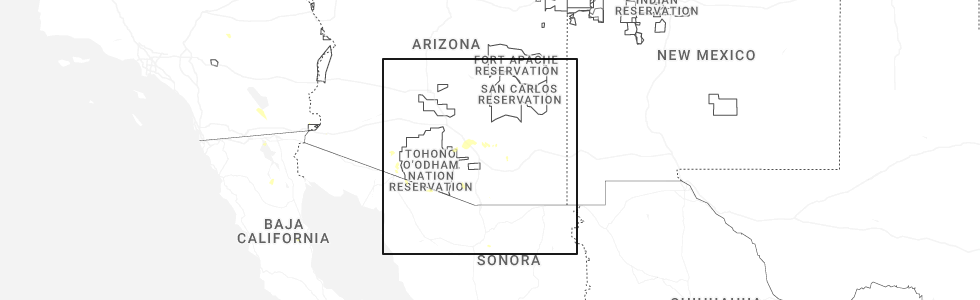
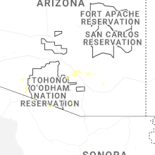
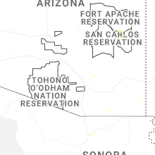
Hail Map for Willow Canyon, AZ
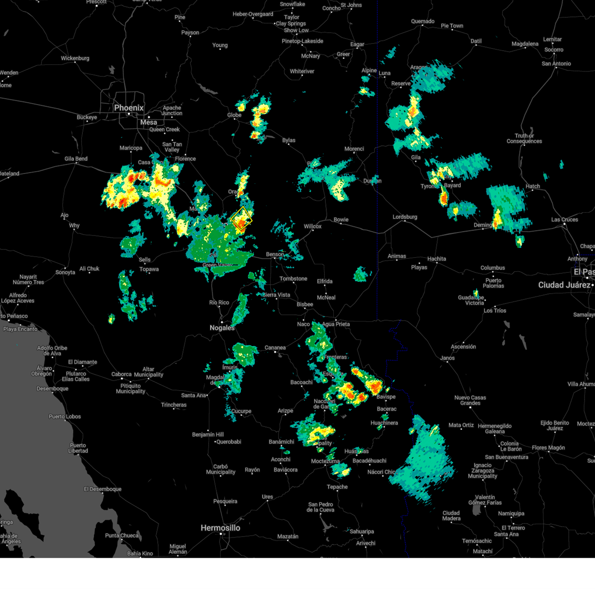
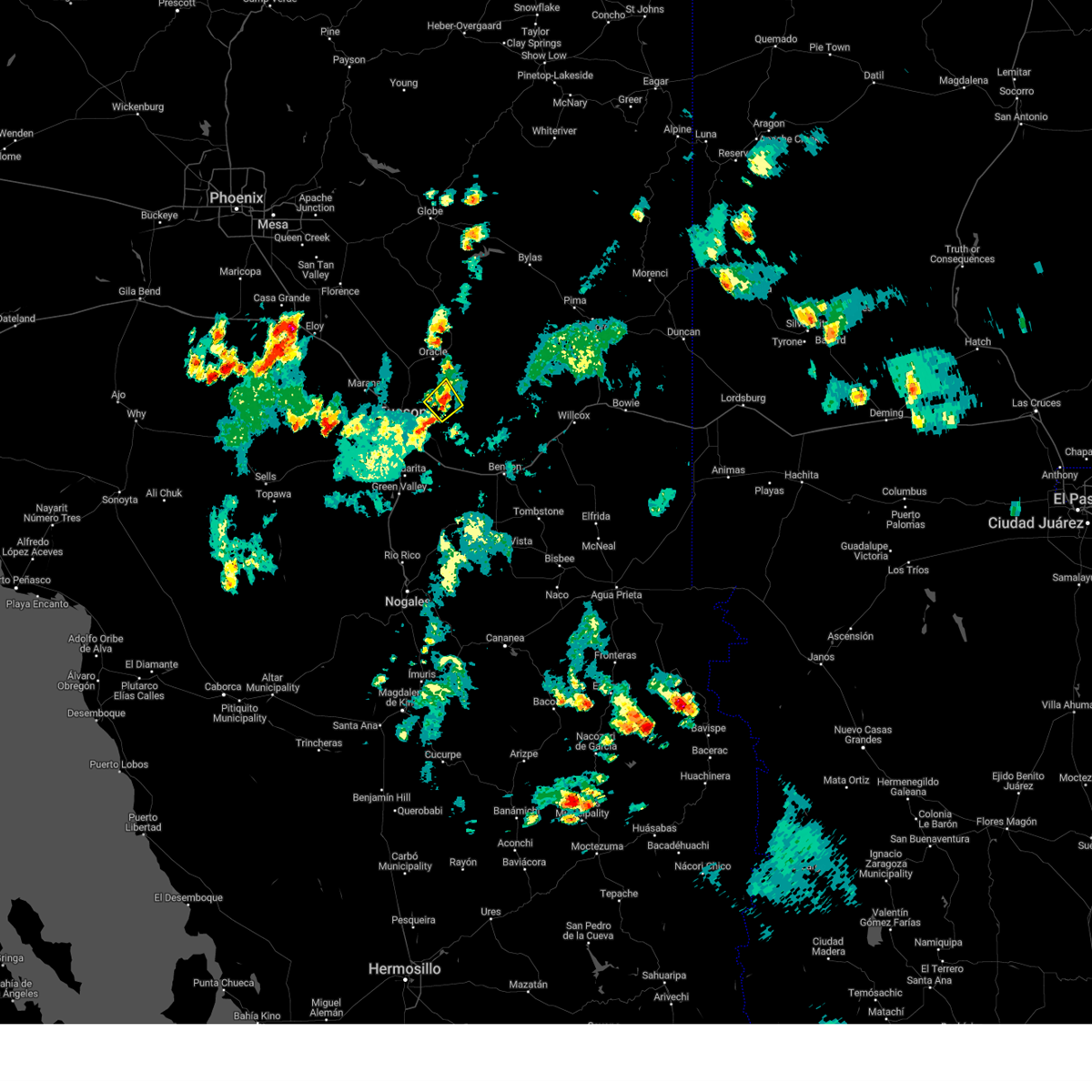
The Willow Canyon, AZ area has had 0 reports of on-the-ground hail by trained spotters, and has been under severe weather warnings 5 times during the past 12 months. Doppler radar has detected hail at or near Willow Canyon, AZ on 43 occasions, including 2 occasions during the past year.
| Name: | Willow Canyon, AZ |
| Where Located: | 19.6 miles NE of Tucson, AZ |
| Map: | Google Map for Willow Canyon, AZ |
| Population: | 1 |
| Housing Units: | 68 |
| More Info: | Search Google for Willow Canyon, AZ |
0
The Top Recent Hail Date for Willow Canyon, AZ is Monday, August 25, 2025 (24th out of 43)
Hail and Wind Damage Spotted near Willow Canyon, AZ
| Date / Time | Report Details |
|---|---|
| 10/11/2025 6:41 PM MST | Svrtwc the national weather service in tucson has issued a * severe thunderstorm warning for, southwestern graham county in southeastern arizona, northeastern pima county in southeastern arizona, southeastern pinal county in southeastern arizona, * until 730 pm mst. * at 641 pm mst, a severe thunderstorm was located near mount lemmon/summerhaven, moving northeast at 30 mph (radar indicated). Hazards include 60 mph wind gusts and quarter size hail. Hail damage to vehicles is expected. Expect wind damage to roofs, siding, and trees. |
| 10/11/2025 5:36 PM MST | At 536 pm mst, a severe thunderstorm was located near mount lemmon/summerhaven, moving northeast at 20 mph (radar indicated). Hazards include 60 mph wind gusts and quarter size hail. Hail damage to vehicles is expected. expect wind damage to roofs, siding, and trees. locations impacted include, tucson, catalina, oro valley, marana, oracle, casas adobes, flowing wells, saddlebrooke, san manuel, tortolita, mount lemmon/summerhaven, sabino canyon recreation area, catalina state park, catalina foothills and campo bonito. this includes route 77 between mile markers 71 and 86. This includes the following flash flood prone locations, 1st ave north of fort lowell rd, overton rd at canada del oro and e wilds rd at the canada del oro. |
| 10/11/2025 5:09 PM MST | Svrtwc the national weather service in tucson has issued a * severe thunderstorm warning for, northeastern pima county in southeastern arizona, southeastern pinal county in southeastern arizona, * until 600 pm mst. * at 509 pm mst, a severe thunderstorm was located over catalina state park, moving northeast at 20 mph (radar indicated). Hazards include 60 mph wind gusts and quarter size hail. Hail damage to vehicles is expected. Expect wind damage to roofs, siding, and trees. |
| 10/11/2025 3:37 PM MST | The storm which prompted the warning has weakened below severe limits, and no longer poses an immediate threat to life or property. therefore, the warning has been allowed to expire. however, gusty winds and heavy rain are still possible with this thunderstorm. |
| 10/11/2025 2:52 PM MST | Svrtwc the national weather service in tucson has issued a * severe thunderstorm warning for, east central pima county in southeastern arizona, * until 330 pm mst. * at 252 pm mst, a severe thunderstorm was located near davis-monthan air force base, moving northeast at 30 mph (radar indicated). Hazards include 60 mph wind gusts and quarter size hail. Hail damage to vehicles is expected. Expect wind damage to roofs, siding, and trees. |
| 7/28/2024 4:53 PM MST |
 The storm which prompted the warning has weakened below severe limits, and no longer poses an immediate threat to life or property. therefore, the warning will be allowed to expire. however, heavy rain is still possible with this thunderstorm. The storm which prompted the warning has weakened below severe limits, and no longer poses an immediate threat to life or property. therefore, the warning will be allowed to expire. however, heavy rain is still possible with this thunderstorm.
|
| 7/28/2024 4:21 PM MST |
 Svrtwc the national weather service in tucson has issued a * severe thunderstorm warning for, northeastern pima county in southeastern arizona, * until 500 pm mst. * at 420 pm mst, a severe thunderstorm was located near mount lemmon/summerhaven, or 13 miles southeast of catalina, moving northeast at 5 mph (radar indicated). Hazards include 60 mph wind gusts and quarter size hail. Hail damage to vehicles is expected. Expect wind damage to roofs, siding, and trees. Svrtwc the national weather service in tucson has issued a * severe thunderstorm warning for, northeastern pima county in southeastern arizona, * until 500 pm mst. * at 420 pm mst, a severe thunderstorm was located near mount lemmon/summerhaven, or 13 miles southeast of catalina, moving northeast at 5 mph (radar indicated). Hazards include 60 mph wind gusts and quarter size hail. Hail damage to vehicles is expected. Expect wind damage to roofs, siding, and trees.
|
| 7/25/2024 7:42 PM MST |
 The storm which prompted the warning has weakened below severe limits, and no longer poses an immediate threat to life or property. therefore, the warning will be allowed to expire. however, gusty winds and heavy rain are still possible with this thunderstorm. remember, a flash flood warning still remains in effect for tucson and surrounding areas of the metro this evening. The storm which prompted the warning has weakened below severe limits, and no longer poses an immediate threat to life or property. therefore, the warning will be allowed to expire. however, gusty winds and heavy rain are still possible with this thunderstorm. remember, a flash flood warning still remains in effect for tucson and surrounding areas of the metro this evening.
|
| 7/25/2024 7:12 PM MST |
 At 712 pm mst, a severe thunderstorm was located near tucson mountain park, or 10 miles west of tucson, moving southwest at 10 mph (radar indicated). Hazards include 60 mph wind gusts and penny size hail. Expect damage to roofs, siding, and trees. locations impacted include, tucson, oro valley, marana, davis-monthan air force base, casas adobes, drexel heights, flowing wells, tanque verde, south tucson, pascua pueblo yaqui reservation, san xavier community, sabino canyon recreation area, catalina foothills, valencia west, tucson international airport, tucson mountain park, tucson estates, saguaro national park west, saguaro national park east, and san xavier mission. this includes the following highways, interstate 10 between mile markers 247 and 270. interstate 19 between mile markers 57 and 63. route 77 between mile markers 70 and 78. Route 86 between mile markers 163 and 171. At 712 pm mst, a severe thunderstorm was located near tucson mountain park, or 10 miles west of tucson, moving southwest at 10 mph (radar indicated). Hazards include 60 mph wind gusts and penny size hail. Expect damage to roofs, siding, and trees. locations impacted include, tucson, oro valley, marana, davis-monthan air force base, casas adobes, drexel heights, flowing wells, tanque verde, south tucson, pascua pueblo yaqui reservation, san xavier community, sabino canyon recreation area, catalina foothills, valencia west, tucson international airport, tucson mountain park, tucson estates, saguaro national park west, saguaro national park east, and san xavier mission. this includes the following highways, interstate 10 between mile markers 247 and 270. interstate 19 between mile markers 57 and 63. route 77 between mile markers 70 and 78. Route 86 between mile markers 163 and 171.
|
| 7/25/2024 6:48 PM MST |
 Svrtwc the national weather service in tucson has issued a * severe thunderstorm warning for, northeastern pima county in southeastern arizona, * until 745 pm mst. * at 648 pm mst, a severe thunderstorm was located near flowing wells, or 8 miles northwest of tucson, moving southwest at 10 mph (radar indicated). Hazards include 60 mph wind gusts and quarter size hail. Hail damage to vehicles is expected. Expect wind damage to roofs, siding, and trees. Svrtwc the national weather service in tucson has issued a * severe thunderstorm warning for, northeastern pima county in southeastern arizona, * until 745 pm mst. * at 648 pm mst, a severe thunderstorm was located near flowing wells, or 8 miles northwest of tucson, moving southwest at 10 mph (radar indicated). Hazards include 60 mph wind gusts and quarter size hail. Hail damage to vehicles is expected. Expect wind damage to roofs, siding, and trees.
|
| 7/20/2024 5:25 PM MST |
 The storms which prompted the warning east of tucson have weakened below severe limits. therefore, the warning will be allowed to expire. however, gusty winds and heavy rain are still possible with these thunderstorms. The storms which prompted the warning east of tucson have weakened below severe limits. therefore, the warning will be allowed to expire. however, gusty winds and heavy rain are still possible with these thunderstorms.
|
| 7/20/2024 4:43 PM MST |
 Svrtwc the national weather service in tucson has issued a * severe thunderstorm warning for, northeastern pima county in southeastern arizona, northwestern cochise county in southeastern arizona, * until 530 pm mst. * at 442 pm mst, severe thunderstorms were located along a line extending from 10 miles northeast of saguaro national park east to 6 miles northwest of kartchner caverns state park, moving west at 10 mph (radar indicated). Hazards include 60 mph wind gusts and penny size hail. expect damage to roofs, siding, and trees Svrtwc the national weather service in tucson has issued a * severe thunderstorm warning for, northeastern pima county in southeastern arizona, northwestern cochise county in southeastern arizona, * until 530 pm mst. * at 442 pm mst, severe thunderstorms were located along a line extending from 10 miles northeast of saguaro national park east to 6 miles northwest of kartchner caverns state park, moving west at 10 mph (radar indicated). Hazards include 60 mph wind gusts and penny size hail. expect damage to roofs, siding, and trees
|
| 7/18/2024 8:36 PM MST |
 The storm which prompted the warning near summerhaven has weakened below severe limits. therefore, the warning will be allowed to expire. however, heavy rain is still expected with this thunderstorm. an urban and small stream flood advisory remains in effect until 1115 pm mst. The storm which prompted the warning near summerhaven has weakened below severe limits. therefore, the warning will be allowed to expire. however, heavy rain is still expected with this thunderstorm. an urban and small stream flood advisory remains in effect until 1115 pm mst.
|
| 7/18/2024 8:03 PM MST |
 Svrtwc the national weather service in tucson has issued a * severe thunderstorm warning for, northeastern pima county in southeastern arizona, * until 845 pm mst. * at 802 pm mst, a severe thunderstorm was located near mount lemmon/summerhaven, or 8 miles southeast of catalina, moving southwest at 10 mph (radar indicated). Hazards include 60 mph wind gusts. expect damage to roofs, siding, and trees Svrtwc the national weather service in tucson has issued a * severe thunderstorm warning for, northeastern pima county in southeastern arizona, * until 845 pm mst. * at 802 pm mst, a severe thunderstorm was located near mount lemmon/summerhaven, or 8 miles southeast of catalina, moving southwest at 10 mph (radar indicated). Hazards include 60 mph wind gusts. expect damage to roofs, siding, and trees
|
| 7/18/2024 6:03 PM MST |
 At 602 pm mst, severe thunderstorms were located along a line extending from near mount lemmon/summerhaven to near tanque verde to near saguaro national park east, moving southwest at 10 mph (radar indicated). Hazards include 60 mph wind gusts and penny size hail. Expect damage to roofs, siding, and trees. locations impacted include, east tucson, tanque verde, vail, mount lemmon/summerhaven, sabino canyon recreation area, saguaro national park east, catalina foothills, rita ranch. This includes interstate 10 between mile markers 275 and 277. At 602 pm mst, severe thunderstorms were located along a line extending from near mount lemmon/summerhaven to near tanque verde to near saguaro national park east, moving southwest at 10 mph (radar indicated). Hazards include 60 mph wind gusts and penny size hail. Expect damage to roofs, siding, and trees. locations impacted include, east tucson, tanque verde, vail, mount lemmon/summerhaven, sabino canyon recreation area, saguaro national park east, catalina foothills, rita ranch. This includes interstate 10 between mile markers 275 and 277.
|
| 7/18/2024 5:48 PM MST |
 Svrtwc the national weather service in tucson has issued a * severe thunderstorm warning for, northeastern pima county in southeastern arizona, northwestern cochise county in southeastern arizona, * until 630 pm mst. * at 547 pm mst, severe thunderstorms were located along a line extending from near mount lemmon/summerhaven to near saguaro national park east, moving southwest at 5 to 10 mph (radar indicated). Hazards include 60 mph wind gusts and penny size hail. expect damage to roofs, siding, and trees Svrtwc the national weather service in tucson has issued a * severe thunderstorm warning for, northeastern pima county in southeastern arizona, northwestern cochise county in southeastern arizona, * until 630 pm mst. * at 547 pm mst, severe thunderstorms were located along a line extending from near mount lemmon/summerhaven to near saguaro national park east, moving southwest at 5 to 10 mph (radar indicated). Hazards include 60 mph wind gusts and penny size hail. expect damage to roofs, siding, and trees
|
| 7/14/2024 6:34 PM MST |
 At 634 pm mst, severe thunderstorms were located through northwest tucson along a line extending from near mount lemmon/summerhaven to tortolita to near tucson mountain park, moving northwest at 15 mph (radar indicated). Hazards include 80 mph wind gusts and quarter size hail. Flying debris will be dangerous to those caught without shelter. mobile homes will be heavily damaged. expect considerable damage to roofs, windows, and vehicles. extensive tree damage and power outages are likely. locations impacted include, tucson, catalina, oro valley, marana, casas adobes, drexel heights, flowing wells, saddlebrooke, south tucson, tortolita, san xavier community, mount lemmon/summerhaven, catalina state park, tucson estates, saguaro national park west, catalina foothills, tucson mountain park, valencia west, picture rocks, and campo bonito. this includes the following highways, interstate 10 between mile markers 237 and 261. interstate 19 between mile markers 61 and 63. route 77 between mile markers 70 and 90. Route 86 between mile markers 162 and 171. At 634 pm mst, severe thunderstorms were located through northwest tucson along a line extending from near mount lemmon/summerhaven to tortolita to near tucson mountain park, moving northwest at 15 mph (radar indicated). Hazards include 80 mph wind gusts and quarter size hail. Flying debris will be dangerous to those caught without shelter. mobile homes will be heavily damaged. expect considerable damage to roofs, windows, and vehicles. extensive tree damage and power outages are likely. locations impacted include, tucson, catalina, oro valley, marana, casas adobes, drexel heights, flowing wells, saddlebrooke, south tucson, tortolita, san xavier community, mount lemmon/summerhaven, catalina state park, tucson estates, saguaro national park west, catalina foothills, tucson mountain park, valencia west, picture rocks, and campo bonito. this includes the following highways, interstate 10 between mile markers 237 and 261. interstate 19 between mile markers 61 and 63. route 77 between mile markers 70 and 90. Route 86 between mile markers 162 and 171.
|
| 7/14/2024 6:16 PM MST |
 At 615 pm mst, severe thunderstorms were located along a line extending from near mount lemmon/summerhaven to oro valley to near tucson mountain park, moving northwest at 15 mph (radar indicated). Hazards include 75 mph wind gusts and quarter size hail. Hail damage to vehicles is expected. expect considerable tree damage. wind damage is also likely to mobile homes, roofs, and outbuildings. locations impacted include, tucson, catalina, oro valley, marana, casas adobes, drexel heights, flowing wells, tanque verde, saddlebrooke, south tucson, pascua pueblo yaqui reservation, tortolita, san xavier community, mount lemmon/summerhaven, sabino canyon recreation area, tucson estates, saguaro national park west, valencia west, and catalina state park. this includes the following highways, interstate 10 between mile markers 237 and 266. interstate 19 between mile markers 57 and 63. route 77 between mile markers 70 and 90. Route 86 between mile markers 160 and 171. At 615 pm mst, severe thunderstorms were located along a line extending from near mount lemmon/summerhaven to oro valley to near tucson mountain park, moving northwest at 15 mph (radar indicated). Hazards include 75 mph wind gusts and quarter size hail. Hail damage to vehicles is expected. expect considerable tree damage. wind damage is also likely to mobile homes, roofs, and outbuildings. locations impacted include, tucson, catalina, oro valley, marana, casas adobes, drexel heights, flowing wells, tanque verde, saddlebrooke, south tucson, pascua pueblo yaqui reservation, tortolita, san xavier community, mount lemmon/summerhaven, sabino canyon recreation area, tucson estates, saguaro national park west, valencia west, and catalina state park. this includes the following highways, interstate 10 between mile markers 237 and 266. interstate 19 between mile markers 57 and 63. route 77 between mile markers 70 and 90. Route 86 between mile markers 160 and 171.
|
| 7/14/2024 6:16 PM MST |
 the severe thunderstorm warning has been cancelled and is no longer in effect the severe thunderstorm warning has been cancelled and is no longer in effect
|
| 7/14/2024 5:49 PM MST |
 At 548 pm mst, severe thunderstorms were located across tucson along a line extending from 7 miles east of mount lemmon/summerhaven to near catalina foothills to drexel heights, moving northwest at 20 mph (radar indicated). Hazards include 70 mph wind gusts and penny size hail. Expect considerable tree damage. damage is likely to mobile homes, roofs, and outbuildings. locations impacted include, tucson, catalina, oro valley, marana, davis-monthan air force base, casas adobes, drexel heights, flowing wells, tanque verde, saddlebrooke, south tucson, pascua pueblo yaqui reservation, tortolita, san xavier community, mount lemmon/summerhaven, sabino canyon recreation area, summit, tucson estates, saguaro national park west, and valencia west. this includes the following highways, interstate 10 between mile markers 237 and 271. interstate 19 between mile markers 52 and 63. route 77 between mile markers 70 and 90. Route 86 between mile markers 157 and 171. At 548 pm mst, severe thunderstorms were located across tucson along a line extending from 7 miles east of mount lemmon/summerhaven to near catalina foothills to drexel heights, moving northwest at 20 mph (radar indicated). Hazards include 70 mph wind gusts and penny size hail. Expect considerable tree damage. damage is likely to mobile homes, roofs, and outbuildings. locations impacted include, tucson, catalina, oro valley, marana, davis-monthan air force base, casas adobes, drexel heights, flowing wells, tanque verde, saddlebrooke, south tucson, pascua pueblo yaqui reservation, tortolita, san xavier community, mount lemmon/summerhaven, sabino canyon recreation area, summit, tucson estates, saguaro national park west, and valencia west. this includes the following highways, interstate 10 between mile markers 237 and 271. interstate 19 between mile markers 52 and 63. route 77 between mile markers 70 and 90. Route 86 between mile markers 157 and 171.
|
| 7/14/2024 5:39 PM MST |
 Svrtwc the national weather service in tucson has issued a * severe thunderstorm warning for, northeastern pima county in southeastern arizona, northwestern cochise county in southeastern arizona, southeastern pinal county in southeastern arizona, * until 645 pm mst. * at 538 pm mst, severe thunderstorms were located along a line extending from 13 miles east of mount lemmon/summerhaven to sabino canyon recreation area to near tucson international airport, moving northwest at 10 mph (radar indicated). Hazards include 60 mph wind gusts and penny size hail. expect damage to roofs, siding, and trees Svrtwc the national weather service in tucson has issued a * severe thunderstorm warning for, northeastern pima county in southeastern arizona, northwestern cochise county in southeastern arizona, southeastern pinal county in southeastern arizona, * until 645 pm mst. * at 538 pm mst, severe thunderstorms were located along a line extending from 13 miles east of mount lemmon/summerhaven to sabino canyon recreation area to near tucson international airport, moving northwest at 10 mph (radar indicated). Hazards include 60 mph wind gusts and penny size hail. expect damage to roofs, siding, and trees
|
| 7/11/2024 5:58 PM MST |
 The storms which prompted the warning for the greater tucson area have weakened below severe limits. therefore, the warning will be allowed to expire. heavy rain has caused flooding in some locations with a flash flood warning in effect for portions of the metro area until 730 pm mst. The storms which prompted the warning for the greater tucson area have weakened below severe limits. therefore, the warning will be allowed to expire. heavy rain has caused flooding in some locations with a flash flood warning in effect for portions of the metro area until 730 pm mst.
|
| 7/11/2024 5:41 PM MST |
 At 539 pm mst, several severe thunderstorms were occurring across the greater tucson area. the strongest storms were noted over west tucson, moving southwest at 10 mph (radar indicated). Hazards include 65 mph wind gusts. Expect damage to roofs, siding, and trees. locations impacted include, tucson, catalina, oro valley, marana, davis-monthan air force base, casas adobes, drexel heights, flowing wells, tanque verde, vail, corona de tucson, south tucson, pascua pueblo yaqui reservation, tortolita, san xavier community, sabino canyon recreation area, summit, tucson estates, valencia west, and saguaro national park east. this includes the following highways, interstate 10 between mile markers 244 and 287. interstate 19 between mile markers 53 and 63. route 77 between mile markers 70 and 84. route 83 between mile markers 51 and 58. Route 86 between mile markers 159 and 171. At 539 pm mst, several severe thunderstorms were occurring across the greater tucson area. the strongest storms were noted over west tucson, moving southwest at 10 mph (radar indicated). Hazards include 65 mph wind gusts. Expect damage to roofs, siding, and trees. locations impacted include, tucson, catalina, oro valley, marana, davis-monthan air force base, casas adobes, drexel heights, flowing wells, tanque verde, vail, corona de tucson, south tucson, pascua pueblo yaqui reservation, tortolita, san xavier community, sabino canyon recreation area, summit, tucson estates, valencia west, and saguaro national park east. this includes the following highways, interstate 10 between mile markers 244 and 287. interstate 19 between mile markers 53 and 63. route 77 between mile markers 70 and 84. route 83 between mile markers 51 and 58. Route 86 between mile markers 159 and 171.
|
| 7/11/2024 5:23 PM MST |
 At 522 pm mst, several severe thunderstorms were occurring across the greater tucson area. the strongest storms were noted over northern and northwest tucson, and east tucson, moving southwest at 10 mph (radar indicated). Hazards include 60 mph wind gusts. Expect damage to roofs, siding, and trees. locations impacted include, tucson, catalina, oro valley, marana, davis-monthan air force base, casas adobes, drexel heights, flowing wells, tanque verde, vail, corona de tucson, south tucson, pascua pueblo yaqui reservation, tortolita, san xavier community, mount lemmon/summerhaven, sabino canyon recreation area, summit, tucson estates, and valencia west. this includes the following highways, interstate 10 between mile markers 244 and 295. interstate 19 between mile markers 53 and 63. route 77 between mile markers 70 and 86. route 83 between mile markers 51 and 58. Route 86 between mile markers 159 and 171. At 522 pm mst, several severe thunderstorms were occurring across the greater tucson area. the strongest storms were noted over northern and northwest tucson, and east tucson, moving southwest at 10 mph (radar indicated). Hazards include 60 mph wind gusts. Expect damage to roofs, siding, and trees. locations impacted include, tucson, catalina, oro valley, marana, davis-monthan air force base, casas adobes, drexel heights, flowing wells, tanque verde, vail, corona de tucson, south tucson, pascua pueblo yaqui reservation, tortolita, san xavier community, mount lemmon/summerhaven, sabino canyon recreation area, summit, tucson estates, and valencia west. this includes the following highways, interstate 10 between mile markers 244 and 295. interstate 19 between mile markers 53 and 63. route 77 between mile markers 70 and 86. route 83 between mile markers 51 and 58. Route 86 between mile markers 159 and 171.
|
| 7/11/2024 4:58 PM MST |
 Svrtwc the national weather service in tucson has issued a * severe thunderstorm warning for, northeastern pima county in southeastern arizona, * until 600 pm mst. * at 457 pm mst, a large area of severe thunderstorms were developing along multiple thunderstorm outflows across the greater tucson area. storm movement is to the southwest at 10 mph (radar indicated). Hazards include 60 mph wind gusts. expect damage to roofs, siding, and trees Svrtwc the national weather service in tucson has issued a * severe thunderstorm warning for, northeastern pima county in southeastern arizona, * until 600 pm mst. * at 457 pm mst, a large area of severe thunderstorms were developing along multiple thunderstorm outflows across the greater tucson area. storm movement is to the southwest at 10 mph (radar indicated). Hazards include 60 mph wind gusts. expect damage to roofs, siding, and trees
|
| 7/9/2024 7:11 PM MST |
 The storm which prompted the warning near far northeast and east tucson has weakened below severe limits, and no longer poses an immediate threat to life or property. therefore, the warning will be allowed to expire. however, gusty winds are still possible with this thunderstorm. The storm which prompted the warning near far northeast and east tucson has weakened below severe limits, and no longer poses an immediate threat to life or property. therefore, the warning will be allowed to expire. however, gusty winds are still possible with this thunderstorm.
|
| 7/9/2024 6:37 PM MST |
 Svrtwc the national weather service in tucson has issued a * severe thunderstorm warning for, northeastern pima county in southeastern arizona, western cochise county in southeastern arizona, * until 715 pm mst. * at 636 pm mst, a severe thunderstorm was located near redington, or about 8 miles northeast of saguaro national park east, moving south at 15 to 20 mph (radar indicated). Hazards include 60 mph wind gusts and penny size hail. expect damage to roofs, siding, and trees Svrtwc the national weather service in tucson has issued a * severe thunderstorm warning for, northeastern pima county in southeastern arizona, western cochise county in southeastern arizona, * until 715 pm mst. * at 636 pm mst, a severe thunderstorm was located near redington, or about 8 miles northeast of saguaro national park east, moving south at 15 to 20 mph (radar indicated). Hazards include 60 mph wind gusts and penny size hail. expect damage to roofs, siding, and trees
|
| 10/24/2023 12:40 PM MST |
 The severe thunderstorm warning for northeastern pima and southeastern pinal counties will expire at 1245 pm mst, the storm which prompted the warning has weakened below severe limits, and has exited the warned area. therefore, the warning will be allowed to expire. The severe thunderstorm warning for northeastern pima and southeastern pinal counties will expire at 1245 pm mst, the storm which prompted the warning has weakened below severe limits, and has exited the warned area. therefore, the warning will be allowed to expire.
|
| 10/24/2023 12:28 PM MST |
 At 1224 pm mst, a severe thunderstorm was located near mount lemmon/summerhaven, or 9 miles southeast of oracle, moving northeast at 10 mph and is over the northeast slopes of the catalina. this storm continues to show severe traits with large hail and strong winds as it moves out over the valley (radar indicated). Hazards include 60 mph wind gusts and quarter size hail. Hail damage to vehicles is expected. expect wind damage to roofs, siding, and trees. locations impacted include, mount lemmon/summerhaven and campo bonito. hail threat, radar indicated max hail size, 1. 00 in wind threat, radar indicated max wind gust, 60 mph. At 1224 pm mst, a severe thunderstorm was located near mount lemmon/summerhaven, or 9 miles southeast of oracle, moving northeast at 10 mph and is over the northeast slopes of the catalina. this storm continues to show severe traits with large hail and strong winds as it moves out over the valley (radar indicated). Hazards include 60 mph wind gusts and quarter size hail. Hail damage to vehicles is expected. expect wind damage to roofs, siding, and trees. locations impacted include, mount lemmon/summerhaven and campo bonito. hail threat, radar indicated max hail size, 1. 00 in wind threat, radar indicated max wind gust, 60 mph.
|
| 10/24/2023 12:05 PM MST |
 At 1205 pm mst, a severe thunderstorm was located near mount lemmon/summerhaven, or 13 miles east of catalina, moving north at 15 mph (radar indicated). Hazards include quarter size hail. damage to vehicles is expected At 1205 pm mst, a severe thunderstorm was located near mount lemmon/summerhaven, or 13 miles east of catalina, moving north at 15 mph (radar indicated). Hazards include quarter size hail. damage to vehicles is expected
|
| 9/13/2023 1:33 PM MST |
 At 132 pm mst, a severe thunderstorm was located over davis-monthan air force base, moving northeast at 40 mph (radar indicated). Hazards include 60 mph wind gusts. expect damage to roofs, siding, and trees At 132 pm mst, a severe thunderstorm was located over davis-monthan air force base, moving northeast at 40 mph (radar indicated). Hazards include 60 mph wind gusts. expect damage to roofs, siding, and trees
|
| 9/13/2023 12:41 PM MST |
 At 1241 pm mst, a severe thunderstorm was located near vail, or 9 miles southeast of davis-monthan air force base, moving northeast at 10 mph (radar indicated). Hazards include 60 mph wind gusts and penny size hail. expect damage to roofs, siding, and trees At 1241 pm mst, a severe thunderstorm was located near vail, or 9 miles southeast of davis-monthan air force base, moving northeast at 10 mph (radar indicated). Hazards include 60 mph wind gusts and penny size hail. expect damage to roofs, siding, and trees
|
| 8/31/2023 5:27 PM MST |
 The severe thunderstorm warning for northeastern pima and southern pinal counties will expire at 530 pm mst, the storm which prompted the warning has weakened below severe limits, and no longer poses an immediate threat to life or property. therefore, the warning will be allowed to expire. however gusty winds and heavy rain are still possible with this thunderstorm. The severe thunderstorm warning for northeastern pima and southern pinal counties will expire at 530 pm mst, the storm which prompted the warning has weakened below severe limits, and no longer poses an immediate threat to life or property. therefore, the warning will be allowed to expire. however gusty winds and heavy rain are still possible with this thunderstorm.
|
| 8/31/2023 5:09 PM MST |
 At 508 pm mst, a severe thunderstorm was located over mount lemmon/summerhaven, or 7 miles southeast of catalina, moving west at 10 mph (radar indicated). Hazards include 60 mph wind gusts and quarter size hail. Hail damage to vehicles is expected. expect wind damage to roofs, siding, and trees. locations impacted include, catalina, saddlebrooke, mount lemmon/summerhaven, sabino canyon recreation area, catalina foothills and seven falls. hail threat, radar indicated max hail size, 1. 00 in wind threat, radar indicated max wind gust, 60 mph. At 508 pm mst, a severe thunderstorm was located over mount lemmon/summerhaven, or 7 miles southeast of catalina, moving west at 10 mph (radar indicated). Hazards include 60 mph wind gusts and quarter size hail. Hail damage to vehicles is expected. expect wind damage to roofs, siding, and trees. locations impacted include, catalina, saddlebrooke, mount lemmon/summerhaven, sabino canyon recreation area, catalina foothills and seven falls. hail threat, radar indicated max hail size, 1. 00 in wind threat, radar indicated max wind gust, 60 mph.
|
| 8/31/2023 4:46 PM MST |
 At 446 pm mst, a severe thunderstorm was located over mount lemmon/summerhaven, or 10 miles southeast of catalina, moving west at 10 mph (radar indicated). Hazards include 60 mph wind gusts and quarter size hail. Hail damage to vehicles is expected. Expect wind damage to roofs, siding, and trees. At 446 pm mst, a severe thunderstorm was located over mount lemmon/summerhaven, or 10 miles southeast of catalina, moving west at 10 mph (radar indicated). Hazards include 60 mph wind gusts and quarter size hail. Hail damage to vehicles is expected. Expect wind damage to roofs, siding, and trees.
|
| 7/28/2023 4:55 PM MST |
 At 454 pm mst, the leading edge of a cluster of severe thunderstorms extended from 9 miles east of mount lemmon/summerhaven to 11 miles east of saguaro national park east, moving southwest at 10 mph (radar indicated). Hazards include 60 mph wind gusts and quarter size hail. Hail damage to vehicles is expected. expect wind damage to roofs, siding, and trees. was located along a line locations impacted include, oracle, tanque verde, san manuel, mount lemmon/summerhaven, saguaro national park east, campo bonito, redington and cascabel. hail threat, radar indicated max hail size, 1. 00 in wind threat, radar indicated max wind gust, 60 mph. At 454 pm mst, the leading edge of a cluster of severe thunderstorms extended from 9 miles east of mount lemmon/summerhaven to 11 miles east of saguaro national park east, moving southwest at 10 mph (radar indicated). Hazards include 60 mph wind gusts and quarter size hail. Hail damage to vehicles is expected. expect wind damage to roofs, siding, and trees. was located along a line locations impacted include, oracle, tanque verde, san manuel, mount lemmon/summerhaven, saguaro national park east, campo bonito, redington and cascabel. hail threat, radar indicated max hail size, 1. 00 in wind threat, radar indicated max wind gust, 60 mph.
|
| 7/28/2023 4:26 PM MST |
 At 426 pm mst, severe thunderstorms were located along a line extending from 14 miles east of san manuel to 18 miles east of saguaro national park east, moving west at 10 mph (radar indicated). Hazards include 60 mph wind gusts and quarter size hail. Hail damage to vehicles is expected. Expect wind damage to roofs, siding, and trees. At 426 pm mst, severe thunderstorms were located along a line extending from 14 miles east of san manuel to 18 miles east of saguaro national park east, moving west at 10 mph (radar indicated). Hazards include 60 mph wind gusts and quarter size hail. Hail damage to vehicles is expected. Expect wind damage to roofs, siding, and trees.
|
| 7/26/2023 5:49 PM MST |
 At 549 pm mst, severe thunderstorms were located along a line extending from near sabino canyon recreation area to near saguaro national park east to 8 miles east of vail, moving southwest at 10 mph (radar indicated). Hazards include 60 mph wind gusts and quarter size hail. Hail damage to vehicles is expected. expect wind damage to roofs, siding, and trees. locations impacted include, east tucson, davis-monthan air force base, tanque verde, vail, sabino canyon recreation area, corona de tucson, saguaro national park east, catalina foothills, rita ranch and seven falls. hail threat, radar indicated max hail size, 1. 00 in wind threat, radar indicated max wind gust, 60 mph. At 549 pm mst, severe thunderstorms were located along a line extending from near sabino canyon recreation area to near saguaro national park east to 8 miles east of vail, moving southwest at 10 mph (radar indicated). Hazards include 60 mph wind gusts and quarter size hail. Hail damage to vehicles is expected. expect wind damage to roofs, siding, and trees. locations impacted include, east tucson, davis-monthan air force base, tanque verde, vail, sabino canyon recreation area, corona de tucson, saguaro national park east, catalina foothills, rita ranch and seven falls. hail threat, radar indicated max hail size, 1. 00 in wind threat, radar indicated max wind gust, 60 mph.
|
| 7/26/2023 5:30 PM MST |
 At 529 pm mst, severe thunderstorms were located along a line extending from near mount lemmon/summerhaven to near saguaro national park east to 10 miles northeast of vail, moving southwest at 5 to 10 mph (radar indicated). Hazards include 60 mph wind gusts and quarter size hail. Hail damage to vehicles is expected. Expect wind damage to roofs, siding, and trees. At 529 pm mst, severe thunderstorms were located along a line extending from near mount lemmon/summerhaven to near saguaro national park east to 10 miles northeast of vail, moving southwest at 5 to 10 mph (radar indicated). Hazards include 60 mph wind gusts and quarter size hail. Hail damage to vehicles is expected. Expect wind damage to roofs, siding, and trees.
|
| 7/31/2022 6:38 PM MST |
 The severe thunderstorm warning for northeastern pima county will expire at 645 pm mst, the storms which prompted the warning have weakened below severe limits, and have exited the warned area. therefore, the warning will be allowed to expire. however gusty winds and heavy rain are still possible with these thunderstorms. to report severe weather, contact your nearest law enforcement agency. they will relay your report to the national weather service tucson. The severe thunderstorm warning for northeastern pima county will expire at 645 pm mst, the storms which prompted the warning have weakened below severe limits, and have exited the warned area. therefore, the warning will be allowed to expire. however gusty winds and heavy rain are still possible with these thunderstorms. to report severe weather, contact your nearest law enforcement agency. they will relay your report to the national weather service tucson.
|
| 7/31/2022 6:14 PM MST |
 At 614 pm mst, severe thunderstorms were located along a line extending from near catalina foothills to near mount lemmon/summerhaven to 11 miles south of san manuel, moving north at 25 mph (radar indicated). Hazards include 60 mph wind gusts and quarter size hail. Hail damage to vehicles is expected. expect wind damage to roofs, siding, and trees. locations impacted include, tucson, oro valley, marana, casas adobes, tanque verde, mount lemmon/summerhaven, sabino canyon recreation area, catalina foothills, catalina state park and seven falls. hail threat, radar indicated max hail size, 1. 00 in wind threat, radar indicated max wind gust, 60 mph. At 614 pm mst, severe thunderstorms were located along a line extending from near catalina foothills to near mount lemmon/summerhaven to 11 miles south of san manuel, moving north at 25 mph (radar indicated). Hazards include 60 mph wind gusts and quarter size hail. Hail damage to vehicles is expected. expect wind damage to roofs, siding, and trees. locations impacted include, tucson, oro valley, marana, casas adobes, tanque verde, mount lemmon/summerhaven, sabino canyon recreation area, catalina foothills, catalina state park and seven falls. hail threat, radar indicated max hail size, 1. 00 in wind threat, radar indicated max wind gust, 60 mph.
|
| 7/31/2022 5:58 PM MST |
 At 557 pm mst, a severe thunderstorm was located near tanque verde, or near davis-monthan air force base, moving northwest at 15 mph (radar indicated). Hazards include 60 mph wind gusts and quarter size hail. Hail damage to vehicles is expected. Expect wind damage to roofs, siding, and trees. At 557 pm mst, a severe thunderstorm was located near tanque verde, or near davis-monthan air force base, moving northwest at 15 mph (radar indicated). Hazards include 60 mph wind gusts and quarter size hail. Hail damage to vehicles is expected. Expect wind damage to roofs, siding, and trees.
|
| 10/5/2021 4:21 PM MST |
 The severe thunderstorm warning for northeastern pima county will expire at 430 pm mst, the storm which prompted the warning near eastern tucson has weakened below severe limits, and has exited the warned area. therefore, the warning will be allowed to expire. The severe thunderstorm warning for northeastern pima county will expire at 430 pm mst, the storm which prompted the warning near eastern tucson has weakened below severe limits, and has exited the warned area. therefore, the warning will be allowed to expire.
|
| 10/5/2021 4:00 PM MST |
 At 357 pm mst, a severe thunderstorm was located near eastern and northeastern tucson, moving northeast at 20 mph (radar indicated). Hazards include 60 mph wind gusts and quarter size hail. Hail damage to vehicles is expected. expect wind damage to roofs, siding, and trees. locations impacted include, tucson, catalina, tanque verde, mount lemmon/summerhaven, sabino canyon recreation area, catalina foothills, saguaro national park east, seven falls and redington. hail threat, radar indicated max hail size, 1. 00 in wind threat, radar indicated max wind gust, 60 mph. At 357 pm mst, a severe thunderstorm was located near eastern and northeastern tucson, moving northeast at 20 mph (radar indicated). Hazards include 60 mph wind gusts and quarter size hail. Hail damage to vehicles is expected. expect wind damage to roofs, siding, and trees. locations impacted include, tucson, catalina, tanque verde, mount lemmon/summerhaven, sabino canyon recreation area, catalina foothills, saguaro national park east, seven falls and redington. hail threat, radar indicated max hail size, 1. 00 in wind threat, radar indicated max wind gust, 60 mph.
|
| 10/5/2021 3:38 PM MST |
 At 338 pm mst, a severe thunderstorm was located near and southwest of davis-monthan air force base, moving northeast at 25 mph (radar indicated). Hazards include 60 mph wind gusts and quarter size hail. Hail damage to vehicles is expected. Expect wind damage to roofs, siding, and trees. At 338 pm mst, a severe thunderstorm was located near and southwest of davis-monthan air force base, moving northeast at 25 mph (radar indicated). Hazards include 60 mph wind gusts and quarter size hail. Hail damage to vehicles is expected. Expect wind damage to roofs, siding, and trees.
|
| 9/5/2021 5:28 PM MST |
 The severe thunderstorm warning for northeastern pima county will expire at 530 pm mst, the storm which prompted the warning has weakened below severe limits, and no longer poses an immediate threat to life or property. therefore, the warning will be allowed to expire. however heavy rain is still possible with this thunderstorm. The severe thunderstorm warning for northeastern pima county will expire at 530 pm mst, the storm which prompted the warning has weakened below severe limits, and no longer poses an immediate threat to life or property. therefore, the warning will be allowed to expire. however heavy rain is still possible with this thunderstorm.
|
| 9/5/2021 5:15 PM MST |
 At 513 pm mst, a severe thunderstorm was located near mount lemmon/summerhaven, moving south at 15 mph (radar indicated). Hazards include 60 mph wind gusts. Expect damage to roofs, siding, and trees. locations impacted include, tucson, catalina, casas adobes, flowing wells, tanque verde, mount lemmon/summerhaven, sabino canyon recreation area, catalina foothills, catalina state park, saguaro national park east and seven falls. hail threat, radar indicated max hail size, <. 75 in wind threat, radar indicated max wind gust, 60 mph. At 513 pm mst, a severe thunderstorm was located near mount lemmon/summerhaven, moving south at 15 mph (radar indicated). Hazards include 60 mph wind gusts. Expect damage to roofs, siding, and trees. locations impacted include, tucson, catalina, casas adobes, flowing wells, tanque verde, mount lemmon/summerhaven, sabino canyon recreation area, catalina foothills, catalina state park, saguaro national park east and seven falls. hail threat, radar indicated max hail size, <. 75 in wind threat, radar indicated max wind gust, 60 mph.
|
| 9/5/2021 4:47 PM MST |
 At 446 pm mst, a severe thunderstorm was located near mount lemmon/summerhaven, or near catalina, moving south at 15 mph (radar indicated). Hazards include 60 mph wind gusts. expect damage to roofs, siding, and trees At 446 pm mst, a severe thunderstorm was located near mount lemmon/summerhaven, or near catalina, moving south at 15 mph (radar indicated). Hazards include 60 mph wind gusts. expect damage to roofs, siding, and trees
|
| 9/5/2021 4:14 PM MST |
 At 413 pm mst, a severe thunderstorm was located near catalina foothills, or near tucson, moving west at 15 mph (radar indicated). Hazards include 60 mph wind gusts and penny size hail. Expect damage to roofs, siding, and trees. locations impacted include, tucson, catalina, oro valley, marana, davis-monthan air force base, casas adobes, drexel heights, flowing wells, tanque verde, south tucson, tortolita, mount lemmon/summerhaven, sabino canyon recreation area, catalina state park, catalina foothills, saguaro national park west, tucson estates, picture rocks, dove mountain and seven falls. hail threat, radar indicated max hail size, 0. 75 in wind threat, radar indicated max wind gust, 60 mph. At 413 pm mst, a severe thunderstorm was located near catalina foothills, or near tucson, moving west at 15 mph (radar indicated). Hazards include 60 mph wind gusts and penny size hail. Expect damage to roofs, siding, and trees. locations impacted include, tucson, catalina, oro valley, marana, davis-monthan air force base, casas adobes, drexel heights, flowing wells, tanque verde, south tucson, tortolita, mount lemmon/summerhaven, sabino canyon recreation area, catalina state park, catalina foothills, saguaro national park west, tucson estates, picture rocks, dove mountain and seven falls. hail threat, radar indicated max hail size, 0. 75 in wind threat, radar indicated max wind gust, 60 mph.
|
| 9/5/2021 3:52 PM MST |
 At 351 pm mst, a severe thunderstorm was located near tanque verde, or 10 miles northeast of davis-monthan air force base, moving west at 15 to 20 mph (radar indicated). Hazards include 60 mph wind gusts and penny size hail. expect damage to roofs, siding, and trees At 351 pm mst, a severe thunderstorm was located near tanque verde, or 10 miles northeast of davis-monthan air force base, moving west at 15 to 20 mph (radar indicated). Hazards include 60 mph wind gusts and penny size hail. expect damage to roofs, siding, and trees
|
| 7/23/2021 12:20 AM MST |
 At 1217 am mst, an area of severe thunderstorms with extremely heavy rainfall was located near northwest tucson and marana, moving northwest at 15 mph (radar indicated). Hazards include 60 mph wind gusts, torrential downpours. Expect damage to roofs, siding, and trees. locations impacted include, northwest tucson, catalina, oro valley, marana, sahuarita, casas adobes, drexel heights, flowing wells, three points, avra valley, tortolita, east sahuarita, sabino canyon recreation area, summit and tucson estates. this includes the following highways, interstate 10 between mile markers 233 and 280. interstate 19 between mile markers 45 and 63. route 77 between mile markers 70 and 86. route 86 between mile markers 150 and 171. Route 286 between mile markers 44 and 45. At 1217 am mst, an area of severe thunderstorms with extremely heavy rainfall was located near northwest tucson and marana, moving northwest at 15 mph (radar indicated). Hazards include 60 mph wind gusts, torrential downpours. Expect damage to roofs, siding, and trees. locations impacted include, northwest tucson, catalina, oro valley, marana, sahuarita, casas adobes, drexel heights, flowing wells, three points, avra valley, tortolita, east sahuarita, sabino canyon recreation area, summit and tucson estates. this includes the following highways, interstate 10 between mile markers 233 and 280. interstate 19 between mile markers 45 and 63. route 77 between mile markers 70 and 86. route 86 between mile markers 150 and 171. Route 286 between mile markers 44 and 45.
|
| 7/22/2021 11:45 PM MST |
 At 1144 pm mst, an area of severe thunderstorms was located over tucson, moving northwest at 15 mph (radar indicated). Hazards include 60 mph wind gusts. expect damage to roofs, siding, and trees At 1144 pm mst, an area of severe thunderstorms was located over tucson, moving northwest at 15 mph (radar indicated). Hazards include 60 mph wind gusts. expect damage to roofs, siding, and trees
|
| 7/20/2021 8:46 PM MST |
 At 845 pm mst, a severe thunderstorm was located near mount lemmon/summerhaven, or 11 miles southeast of oracle, moving west at 10 mph (radar indicated). Hazards include 60 mph wind gusts and quarter size hail. Hail damage to vehicles is expected. Expect wind damage to roofs, siding, and trees. At 845 pm mst, a severe thunderstorm was located near mount lemmon/summerhaven, or 11 miles southeast of oracle, moving west at 10 mph (radar indicated). Hazards include 60 mph wind gusts and quarter size hail. Hail damage to vehicles is expected. Expect wind damage to roofs, siding, and trees.
|
| 7/10/2021 8:12 PM MST |
 At 811 pm mst, a number of severe thunderstorms with strong winds are located over the tucson metro, moving west at 20 mph (radar indicated). Hazards include 60 mph wind gusts. expect damage to roofs, siding, and trees At 811 pm mst, a number of severe thunderstorms with strong winds are located over the tucson metro, moving west at 20 mph (radar indicated). Hazards include 60 mph wind gusts. expect damage to roofs, siding, and trees
|
| 7/10/2021 7:48 PM MST |
 At 748 pm mst, a severe thunderstorm was located over south tucson, or over tucson, moving west at 10 mph (radar indicated). Hazards include 60 mph wind gusts. Expect damage to roofs, siding, and trees. locations impacted include, tucson, catalina, oro valley, marana, davis-monthan air force base, casas adobes, drexel heights, flowing wells, tanque verde, south tucson, avra valley, pascua pueblo yaqui reservation, tortolita, mount lemmon/summerhaven, sabino canyon recreation area, tucson estates, saguaro national park west, valencia west, catalina state park and catalina foothills. this includes the following highways, interstate 10 between mile markers 233 and 277. interstate 19 between mile markers 54 and 63. route 77 between mile markers 70 and 86. Route 86 between mile markers 158 and 171. At 748 pm mst, a severe thunderstorm was located over south tucson, or over tucson, moving west at 10 mph (radar indicated). Hazards include 60 mph wind gusts. Expect damage to roofs, siding, and trees. locations impacted include, tucson, catalina, oro valley, marana, davis-monthan air force base, casas adobes, drexel heights, flowing wells, tanque verde, south tucson, avra valley, pascua pueblo yaqui reservation, tortolita, mount lemmon/summerhaven, sabino canyon recreation area, tucson estates, saguaro national park west, valencia west, catalina state park and catalina foothills. this includes the following highways, interstate 10 between mile markers 233 and 277. interstate 19 between mile markers 54 and 63. route 77 between mile markers 70 and 86. Route 86 between mile markers 158 and 171.
|
| 7/10/2021 7:40 PM MST |
 The severe thunderstorm warning for east central pima and northwestern cochise counties will expire at 745 pm mst, the storms that prompted this warning had moved farther west and has been replaced with a new severe thunderstorm warning. remember, a severe thunderstorm watch remains in effect until midnight mst for southeastern arizona. The severe thunderstorm warning for east central pima and northwestern cochise counties will expire at 745 pm mst, the storms that prompted this warning had moved farther west and has been replaced with a new severe thunderstorm warning. remember, a severe thunderstorm watch remains in effect until midnight mst for southeastern arizona.
|
| 7/10/2021 7:14 PM MST |
 At 714 pm mst, a severe thunderstorm was located over tucson, moving west at 10 mph (radar indicated). Hazards include 60 mph wind gusts. expect damage to roofs, siding, and trees At 714 pm mst, a severe thunderstorm was located over tucson, moving west at 10 mph (radar indicated). Hazards include 60 mph wind gusts. expect damage to roofs, siding, and trees
|
| 7/10/2021 7:06 PM MST |
 At 705 pm mst, a severe thunderstorm was located 13 miles northeast of saguaro national park east, or 25 miles north of benson, moving west at 25 mph (radar indicated). Hazards include 60 mph wind gusts and quarter size hail. Hail damage to vehicles is expected. Expect wind damage to roofs, siding, and trees. At 705 pm mst, a severe thunderstorm was located 13 miles northeast of saguaro national park east, or 25 miles north of benson, moving west at 25 mph (radar indicated). Hazards include 60 mph wind gusts and quarter size hail. Hail damage to vehicles is expected. Expect wind damage to roofs, siding, and trees.
|
| 7/11/2020 8:28 PM MST |
 The severe thunderstorm warning for northeastern pima county will expire at 830 pm mst, the storm which prompted the warning over tucson has moved northwest and prompted a new warning near marana. therefore, this warning will be allowed to expire. however gusty winds are still possible. The severe thunderstorm warning for northeastern pima county will expire at 830 pm mst, the storm which prompted the warning over tucson has moved northwest and prompted a new warning near marana. therefore, this warning will be allowed to expire. however gusty winds are still possible.
|
| 7/11/2020 7:39 PM MST |
 At 737 pm mst, a severe thunderstorm was located over tanque verde, or 8 miles northeast of davis-monthan air force base, moving west at 15 mph (radar indicated). Hazards include 60 mph wind gusts, small hail, dense blowing dust, and heavy rain. expect damage to roofs, siding, and trees At 737 pm mst, a severe thunderstorm was located over tanque verde, or 8 miles northeast of davis-monthan air force base, moving west at 15 mph (radar indicated). Hazards include 60 mph wind gusts, small hail, dense blowing dust, and heavy rain. expect damage to roofs, siding, and trees
|
| 11/29/2019 7:30 AM MST |
 At 729 am mst, severe thunderstorms were located along a line extending from 9 miles east of aravaipa canyon wilderness to near green valley, including the tucson metro area, moving east at 35 mph (radar indicated). Hazards include 60 mph wind gusts. expect damage to roofs, siding, and trees At 729 am mst, severe thunderstorms were located along a line extending from 9 miles east of aravaipa canyon wilderness to near green valley, including the tucson metro area, moving east at 35 mph (radar indicated). Hazards include 60 mph wind gusts. expect damage to roofs, siding, and trees
|
| 11/29/2019 6:58 AM MST |
 At 656 am mst, a line of scattered showers and thunderstorms extended across portions of the area, moving east at 40 mph (radar indicated). Hazards include 60 mph wind gusts. expect damage to roofs, siding, and trees At 656 am mst, a line of scattered showers and thunderstorms extended across portions of the area, moving east at 40 mph (radar indicated). Hazards include 60 mph wind gusts. expect damage to roofs, siding, and trees
|
| 7/25/2019 4:41 PM MST |
 The severe thunderstorm warning for northeastern pima county will expire at 445 pm mst, the storm which prompted the warning near sabino canyon and seven falls has weakened and moved out of the area. therefore, the warning will be allowed to expire. however heavy rain is still possible with this thunderstorm. The severe thunderstorm warning for northeastern pima county will expire at 445 pm mst, the storm which prompted the warning near sabino canyon and seven falls has weakened and moved out of the area. therefore, the warning will be allowed to expire. however heavy rain is still possible with this thunderstorm.
|
| 7/25/2019 4:18 PM MST |
 At 417 pm mst, a severe thunderstorm was located over sabino canyon recreation area, or 11 miles northeast of tucson, moving west at 10 mph (radar indicated). Hazards include 60 mph wind gusts and penny size hail along with heavy rain. Expect damage to roofs, siding, and trees. Locations impacted include, tanque verde, saguaro national park east and seven falls. At 417 pm mst, a severe thunderstorm was located over sabino canyon recreation area, or 11 miles northeast of tucson, moving west at 10 mph (radar indicated). Hazards include 60 mph wind gusts and penny size hail along with heavy rain. Expect damage to roofs, siding, and trees. Locations impacted include, tanque verde, saguaro national park east and seven falls.
|
| 7/25/2019 3:55 PM MST |
 At 354 pm mst, a severe thunderstorm was located near tanque verde, or 14 miles northeast of davis-monthan air force base, moving west at 10 mph (radar indicated). Hazards include 60 mph wind gusts and penny size hail along with heavy rain. expect damage to roofs, siding, and trees At 354 pm mst, a severe thunderstorm was located near tanque verde, or 14 miles northeast of davis-monthan air force base, moving west at 10 mph (radar indicated). Hazards include 60 mph wind gusts and penny size hail along with heavy rain. expect damage to roofs, siding, and trees
|
| 7/22/2017 5:30 PM MST |
 At 529 pm mst, a severe thunderstorm was located near tanque verde, or 18 miles east of tucson, moving southwest at 15 mph (radar indicated). Hazards include 60 mph wind gusts and quarter size hail. Hail damage to vehicles is expected. Expect wind damage to roofs, siding, and trees. At 529 pm mst, a severe thunderstorm was located near tanque verde, or 18 miles east of tucson, moving southwest at 15 mph (radar indicated). Hazards include 60 mph wind gusts and quarter size hail. Hail damage to vehicles is expected. Expect wind damage to roofs, siding, and trees.
|
| 9/29/2016 6:20 PM MST |
 The severe thunderstorm warning for northeastern pima county will expire at 630 pm mst, the storm which prompted the warning has weakened below severe limits and exited the warned area. therefore the warning will be allowed to expire. residual urban and small stream flooding remains possible across the area. The severe thunderstorm warning for northeastern pima county will expire at 630 pm mst, the storm which prompted the warning has weakened below severe limits and exited the warned area. therefore the warning will be allowed to expire. residual urban and small stream flooding remains possible across the area.
|
| 9/29/2016 6:00 PM MST |
 At 600 pm mst, doppler radar indicated a severe thunderstorm capable of producing quarter size hail and damaging winds in excess of 60 mph. this storm was located near tucson, moving north at 15 mph. locations impacted include, tucson, littletown, drexel-alvernon, tanque verde, south tucson, seven falls, rita ranch, catalina foothills, davis-monthan air force base, sabino canyon, tucson international airport and saguaro national park east. At 600 pm mst, doppler radar indicated a severe thunderstorm capable of producing quarter size hail and damaging winds in excess of 60 mph. this storm was located near tucson, moving north at 15 mph. locations impacted include, tucson, littletown, drexel-alvernon, tanque verde, south tucson, seven falls, rita ranch, catalina foothills, davis-monthan air force base, sabino canyon, tucson international airport and saguaro national park east.
|
| 9/29/2016 5:46 PM MST |
 At 546 pm mst, doppler radar indicated a severe thunderstorm capable of producing quarter size hail and damaging winds in excess of 60 mph. this storm was located over drexel-alvernon, or near tucson, and moving northeast at 15 mph. At 546 pm mst, doppler radar indicated a severe thunderstorm capable of producing quarter size hail and damaging winds in excess of 60 mph. this storm was located over drexel-alvernon, or near tucson, and moving northeast at 15 mph.
|
| 7/29/2016 7:13 PM MST |
 The severe thunderstorm warning for northeastern pima county will expire at 715 pm mst, the storms which prompted the warning have weakened below severe limits and exited the warned area to the west. therefore the warning will be allowed to expire. however gusty winds and heavy rain are still possible with these thunderstorms. The severe thunderstorm warning for northeastern pima county will expire at 715 pm mst, the storms which prompted the warning have weakened below severe limits and exited the warned area to the west. therefore the warning will be allowed to expire. however gusty winds and heavy rain are still possible with these thunderstorms.
|
| 7/29/2016 6:01 PM MST |
 At 559 pm mst, doppler radar indicated a severe thunderstorm capable of producing quarter size hail and damaging winds in excess of 60 mph. this storm was located over tanque verde, or 12 miles east of tucson, and moving west at 15 mph. in addition to the strong and gusty winds and hail, expect blowing dust to accompany this storm as well. motorists should travel with caution if encountering reduced visibilities due to blowing dust. At 559 pm mst, doppler radar indicated a severe thunderstorm capable of producing quarter size hail and damaging winds in excess of 60 mph. this storm was located over tanque verde, or 12 miles east of tucson, and moving west at 15 mph. in addition to the strong and gusty winds and hail, expect blowing dust to accompany this storm as well. motorists should travel with caution if encountering reduced visibilities due to blowing dust.
|
| 7/29/2016 5:16 PM MST |
 At 515 pm mst, doppler radar indicated a severe thunderstorm capable of producing quarter size hail and damaging winds in excess of 60 mph. this storm was located 9 miles northeast of tanque verde, or 20 miles northeast of tucson, and moving west at 15 mph. At 515 pm mst, doppler radar indicated a severe thunderstorm capable of producing quarter size hail and damaging winds in excess of 60 mph. this storm was located 9 miles northeast of tanque verde, or 20 miles northeast of tucson, and moving west at 15 mph.
|
| 7/27/2016 6:20 PM MST |
 At 613 pm mst, doppler radar indicated an area of severe thunderstorms capable of producing damaging winds in excess of 60 mph. these storms were immediately north and east of tucson, moving southwest at 20 mph. a very strong outflow will precede these storms with areas of blowing dust. locations impacted include, tucson, oro valley, marana, flowing wells, tanque verde, casas adobes, tortolita, catalina foothills, mount lemmon/summerhaven, rita ranch, vail, davis-monthan air force base and sabino canyon. At 613 pm mst, doppler radar indicated an area of severe thunderstorms capable of producing damaging winds in excess of 60 mph. these storms were immediately north and east of tucson, moving southwest at 20 mph. a very strong outflow will precede these storms with areas of blowing dust. locations impacted include, tucson, oro valley, marana, flowing wells, tanque verde, casas adobes, tortolita, catalina foothills, mount lemmon/summerhaven, rita ranch, vail, davis-monthan air force base and sabino canyon.
|
| 7/27/2016 6:00 PM MST |
 At 557 pm mst, doppler radar indicated a line of severe thunderstorms capable of producing damaging winds in excess of 60 mph. these storms were located just north and northeast of tucson from near oracle through the tanque verde area and the rincons, and moving southwest at 20 mph. At 557 pm mst, doppler radar indicated a line of severe thunderstorms capable of producing damaging winds in excess of 60 mph. these storms were located just north and northeast of tucson from near oracle through the tanque verde area and the rincons, and moving southwest at 20 mph.
|
| 10/6/2015 1:07 PM MST |
 The severe thunderstorm warning for northeastern pima county will expire at 115 pm mst, the storm which prompted the warning has weakened below severe limits and exited the warned area. therefore the warning will be allowed to expire. The severe thunderstorm warning for northeastern pima county will expire at 115 pm mst, the storm which prompted the warning has weakened below severe limits and exited the warned area. therefore the warning will be allowed to expire.
|
| 10/6/2015 12:50 PM MST |
 At 1250 pm mst, doppler radar indicated a severe thunderstorm capable of producing quarter size hail and damaging winds in excess of 60 mph. this storm was located near seven falls, moving northeast at 35 mph. locations impacted include, tucson, oro valley, flowing wells, tanque verde, drexel-alvernon, casas adobes, drexel heights, tortolita, tucson estates, south tucson, catalina foothills, mount lemmon/summerhaven, seven falls, catalina state park, davis-monthan air force base, sabino canyon and catalina. At 1250 pm mst, doppler radar indicated a severe thunderstorm capable of producing quarter size hail and damaging winds in excess of 60 mph. this storm was located near seven falls, moving northeast at 35 mph. locations impacted include, tucson, oro valley, flowing wells, tanque verde, drexel-alvernon, casas adobes, drexel heights, tortolita, tucson estates, south tucson, catalina foothills, mount lemmon/summerhaven, seven falls, catalina state park, davis-monthan air force base, sabino canyon and catalina.
|
| 10/6/2015 12:39 PM MST |
 At 1239 pm mst, doppler radar indicated a severe thunderstorm capable of producing quarter size hail and damaging winds in excess of 60 mph. this storm was located over tucson, moving northeast at 40 mph. locations impacted include, tucson, oro valley, marana, flowing wells, littletown, drexel-alvernon, casas adobes, drexel heights, valencia west, tanque verde, tucson estates, summit, tortolita, south tucson, catalina foothills, mount lemmon/summerhaven, seven falls, san xavier mission, catalina state park and davis-monthan air force base. At 1239 pm mst, doppler radar indicated a severe thunderstorm capable of producing quarter size hail and damaging winds in excess of 60 mph. this storm was located over tucson, moving northeast at 40 mph. locations impacted include, tucson, oro valley, marana, flowing wells, littletown, drexel-alvernon, casas adobes, drexel heights, valencia west, tanque verde, tucson estates, summit, tortolita, south tucson, catalina foothills, mount lemmon/summerhaven, seven falls, san xavier mission, catalina state park and davis-monthan air force base.
|
| 10/6/2015 12:26 PM MST |
 At 1226 pm mst, doppler radar indicated a severe thunderstorm capable of producing quarter size hail and damaging winds in excess of 60 mph. this storm was located over drexel heights, and moving northeast at 40 mph. At 1226 pm mst, doppler radar indicated a severe thunderstorm capable of producing quarter size hail and damaging winds in excess of 60 mph. this storm was located over drexel heights, and moving northeast at 40 mph.
|
| 6/24/2015 1:01 PM MST |
 At 100 pm mst, doppler radar indicated a severe thunderstorm capable of producing quarter size hail and damaging winds in excess of 60 mph. this storm was located near mount lemmon. this storm was nearly stationary. locations impacted include, seven falls, mount lemmon/summerhaven, sabino canyon and catalina foothills. At 100 pm mst, doppler radar indicated a severe thunderstorm capable of producing quarter size hail and damaging winds in excess of 60 mph. this storm was located near mount lemmon. this storm was nearly stationary. locations impacted include, seven falls, mount lemmon/summerhaven, sabino canyon and catalina foothills.
|
| 6/24/2015 12:47 PM MST |
 At 1247 pm mst, doppler radar indicated a severe thunderstorm capable of producing quarter size hail and damaging winds in excess of 60 mph. this storm was located near mt. lemmon. this storm was nearly stationary. At 1247 pm mst, doppler radar indicated a severe thunderstorm capable of producing quarter size hail and damaging winds in excess of 60 mph. this storm was located near mt. lemmon. this storm was nearly stationary.
|
Hail Maps for Willow Canyon, AZ


Connect with Interactive Hail Maps