

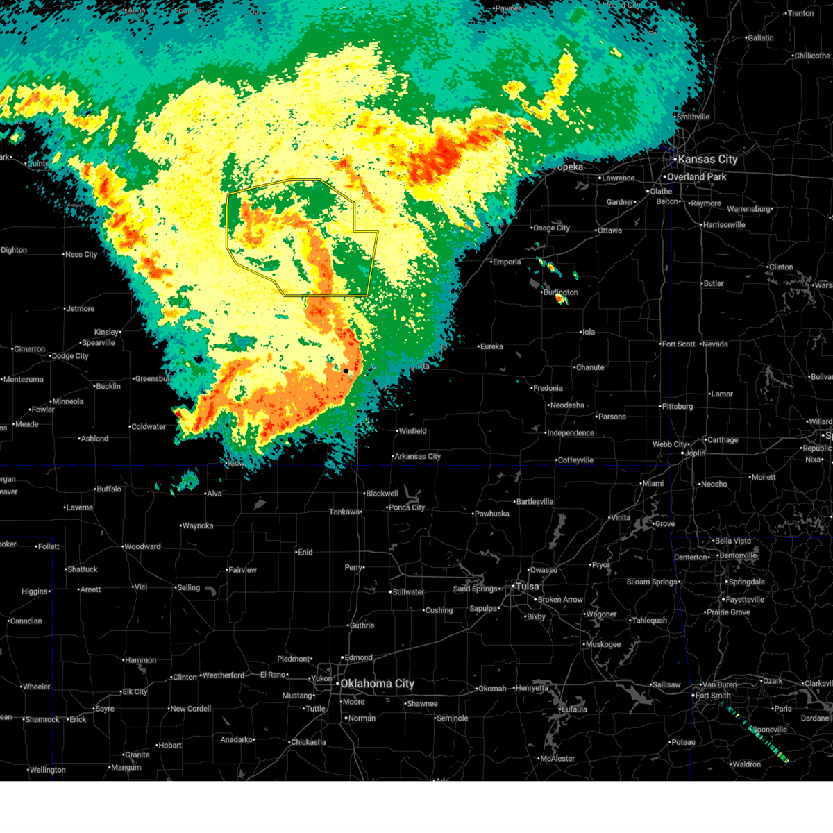
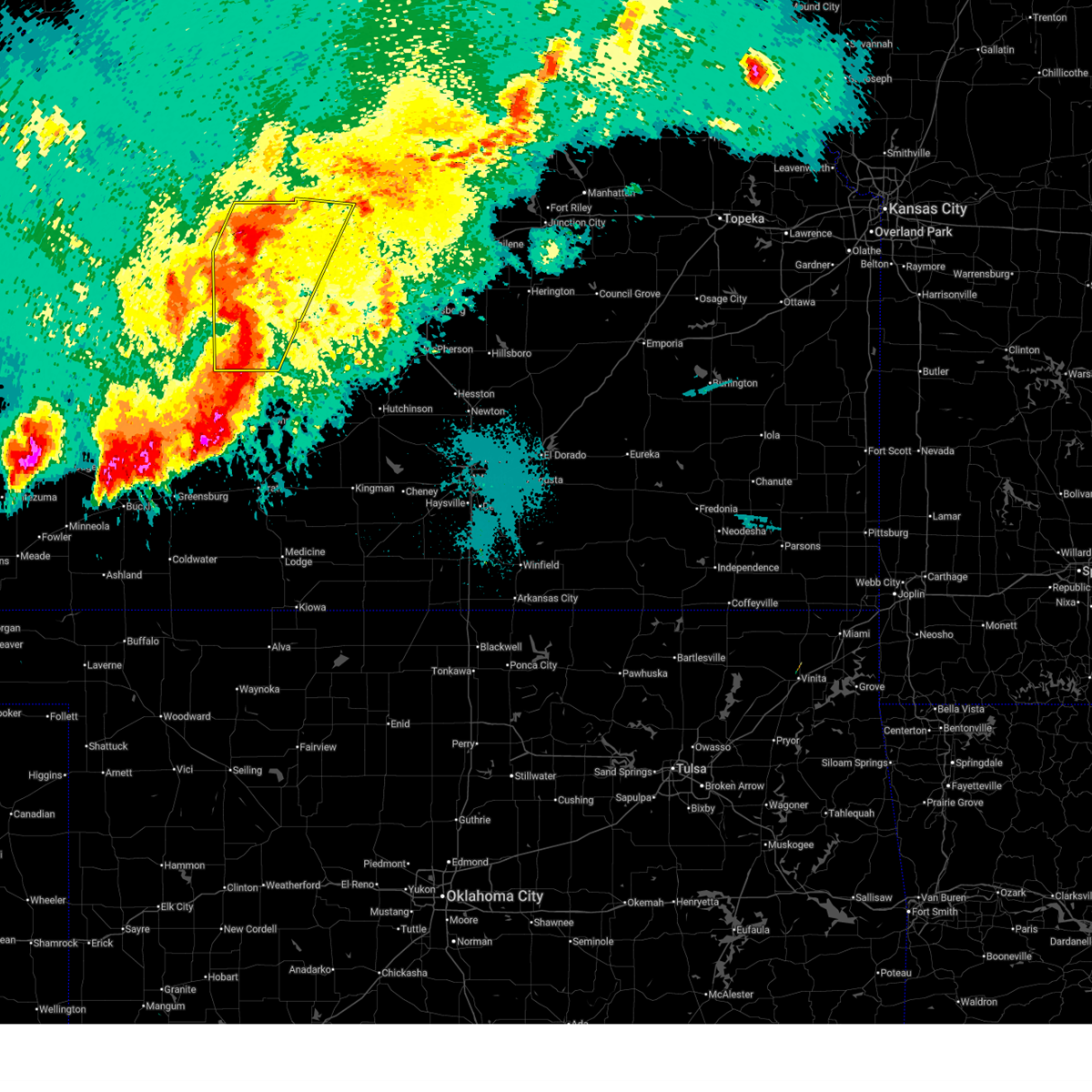
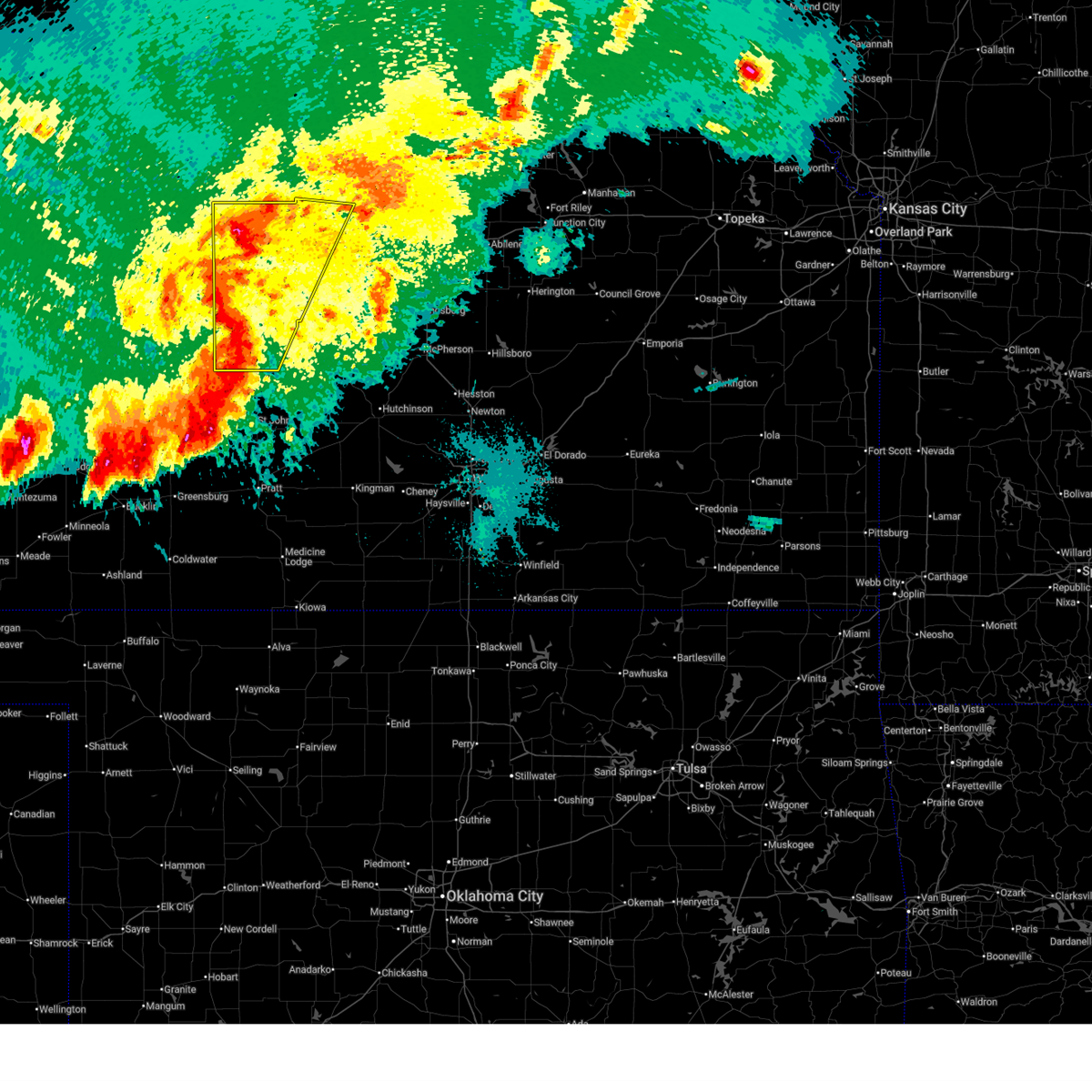
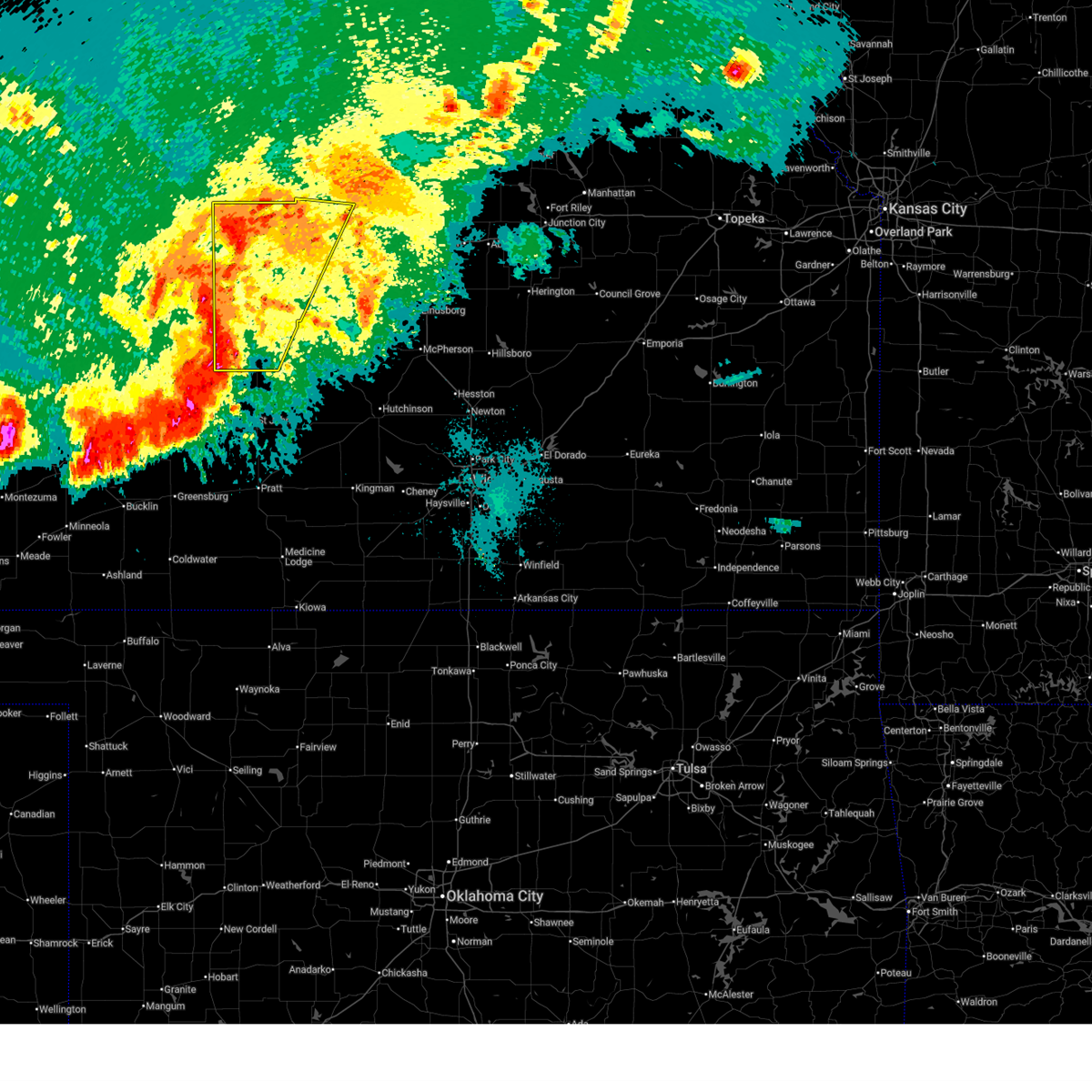
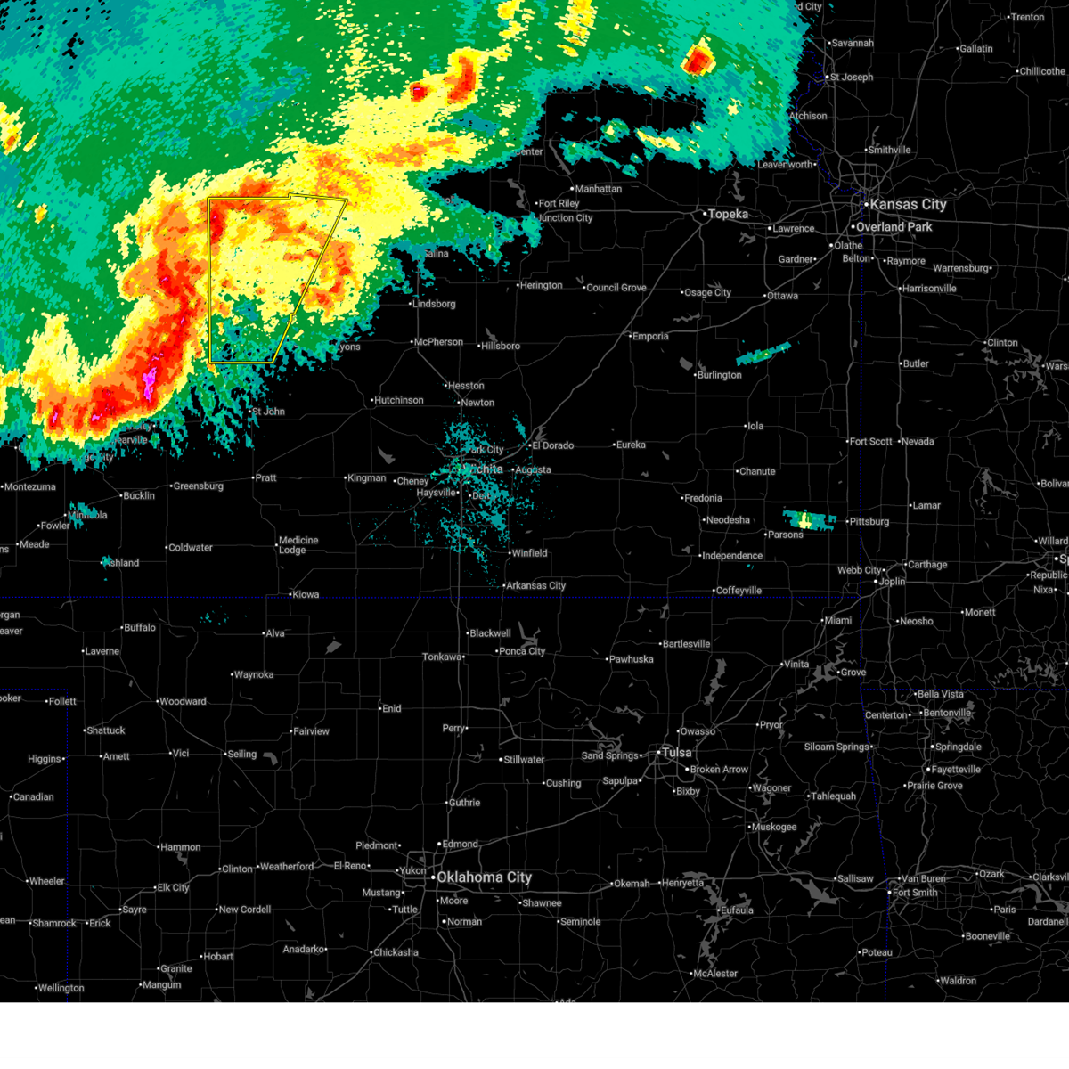
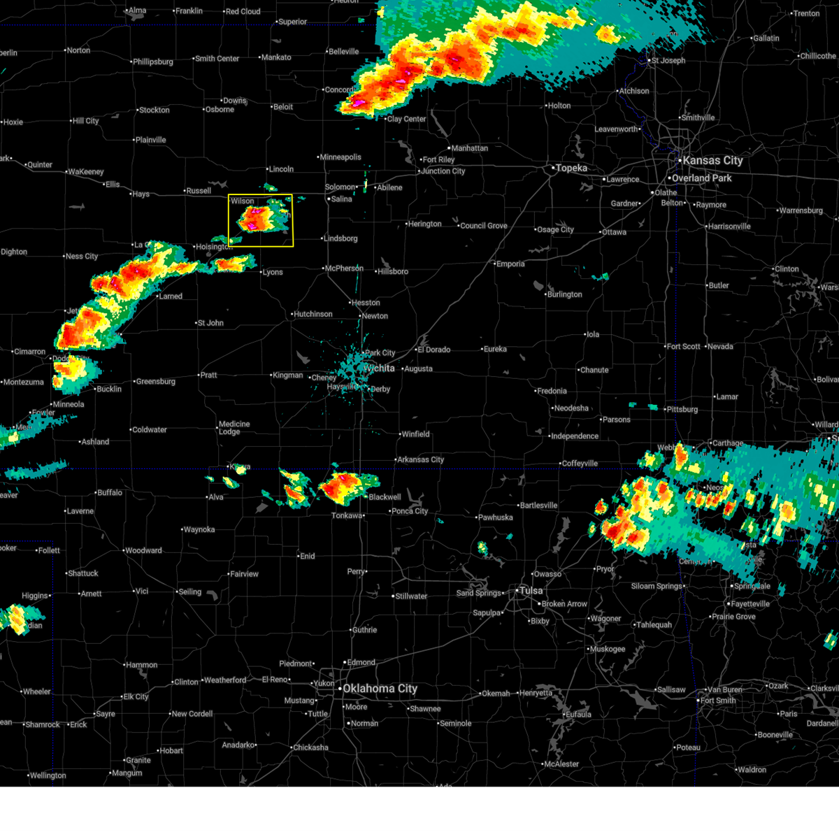
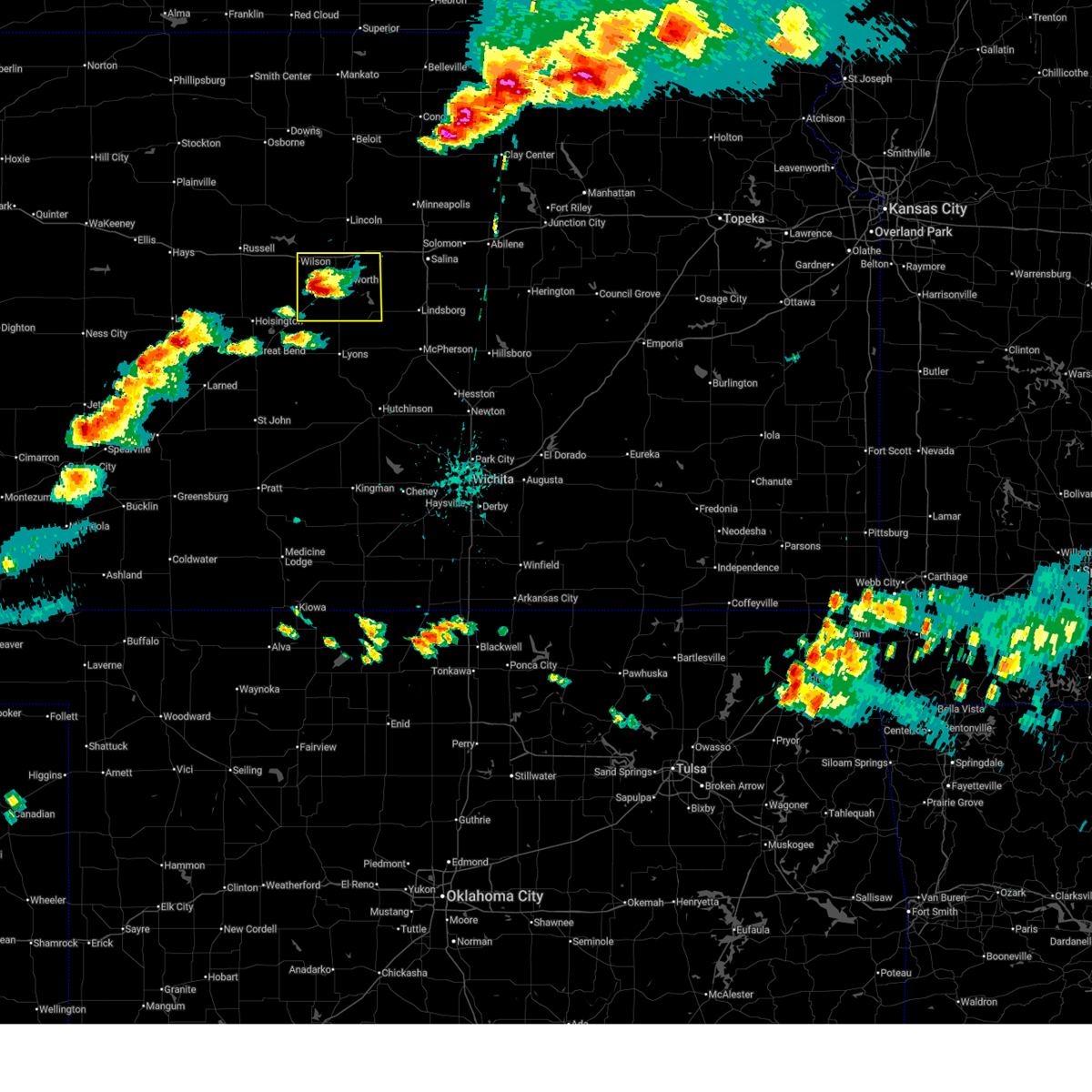
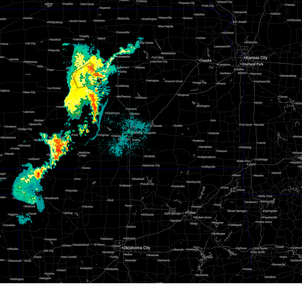
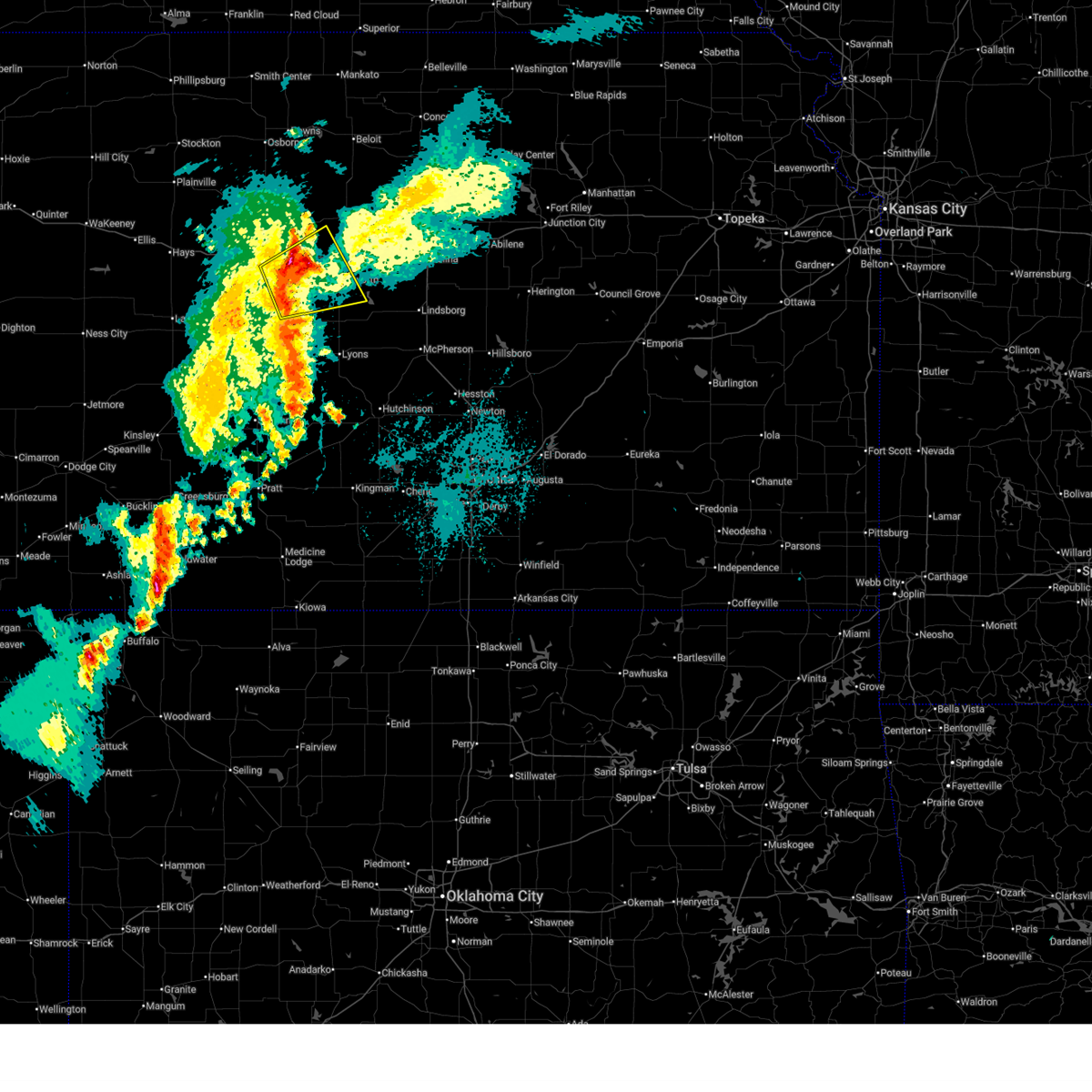
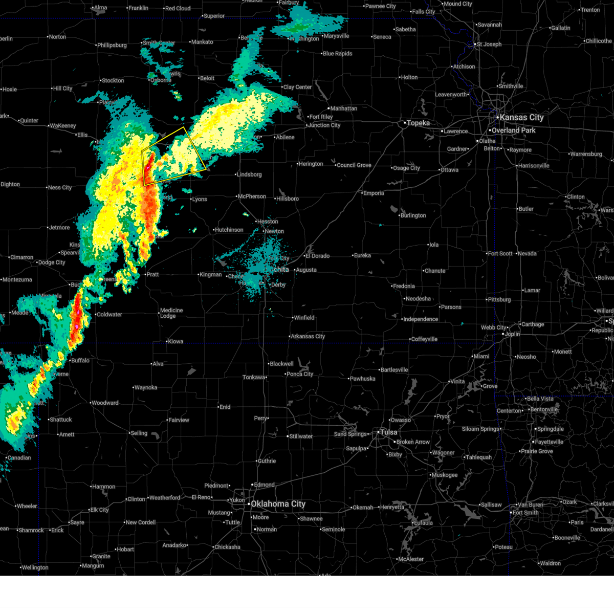
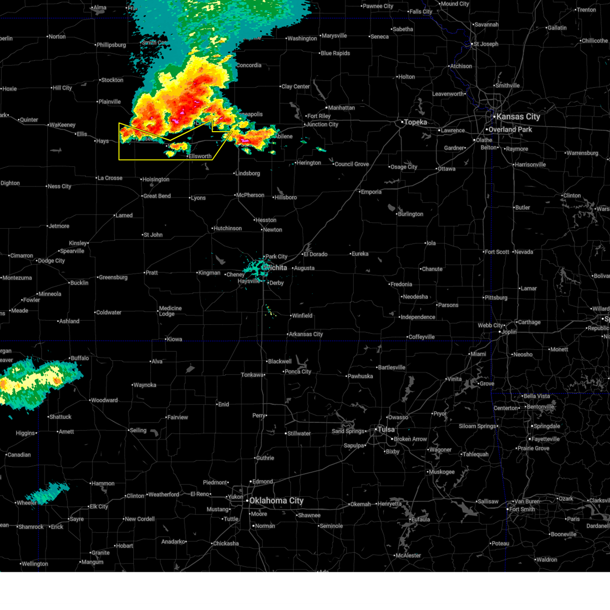
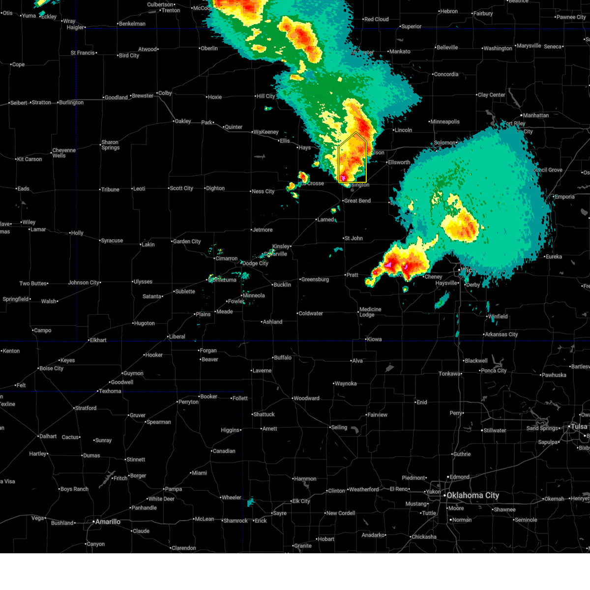
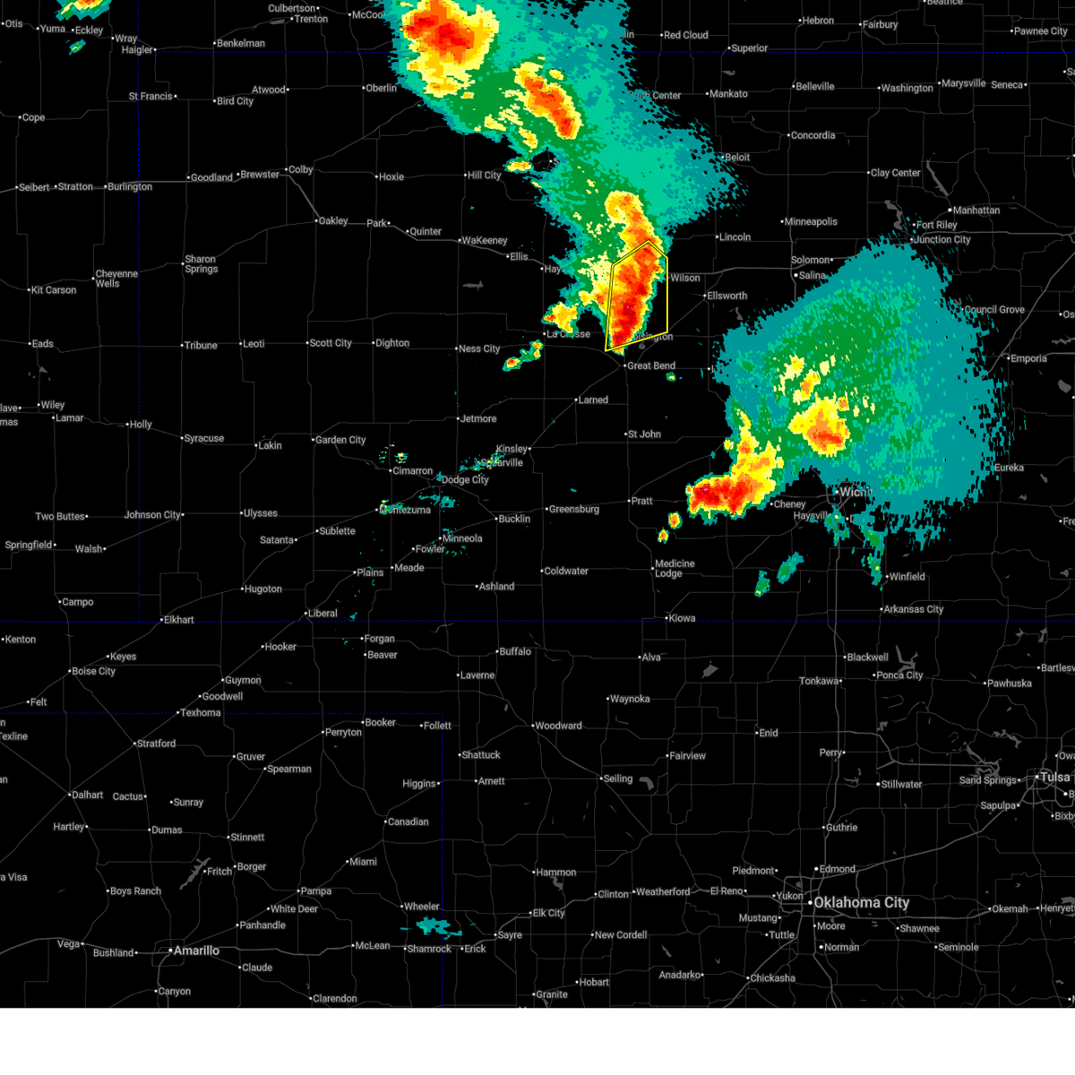
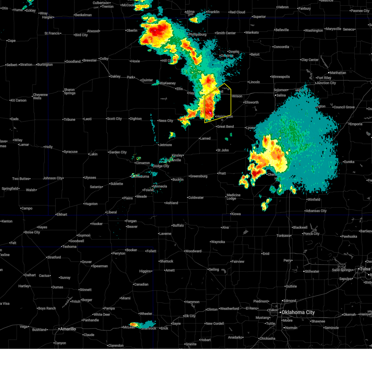
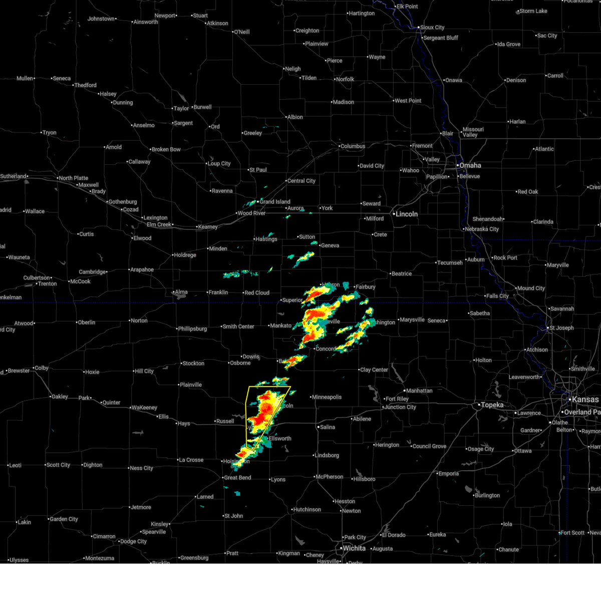
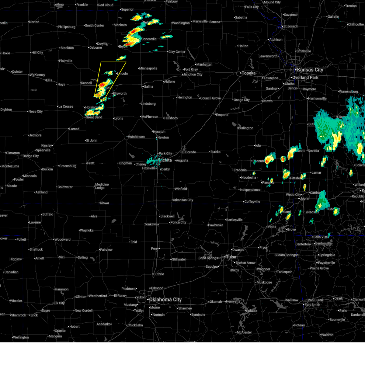
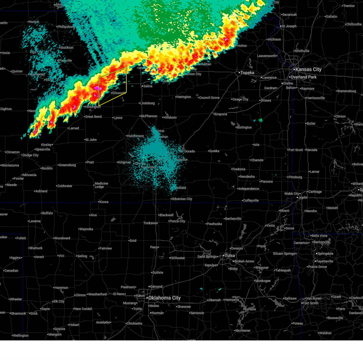
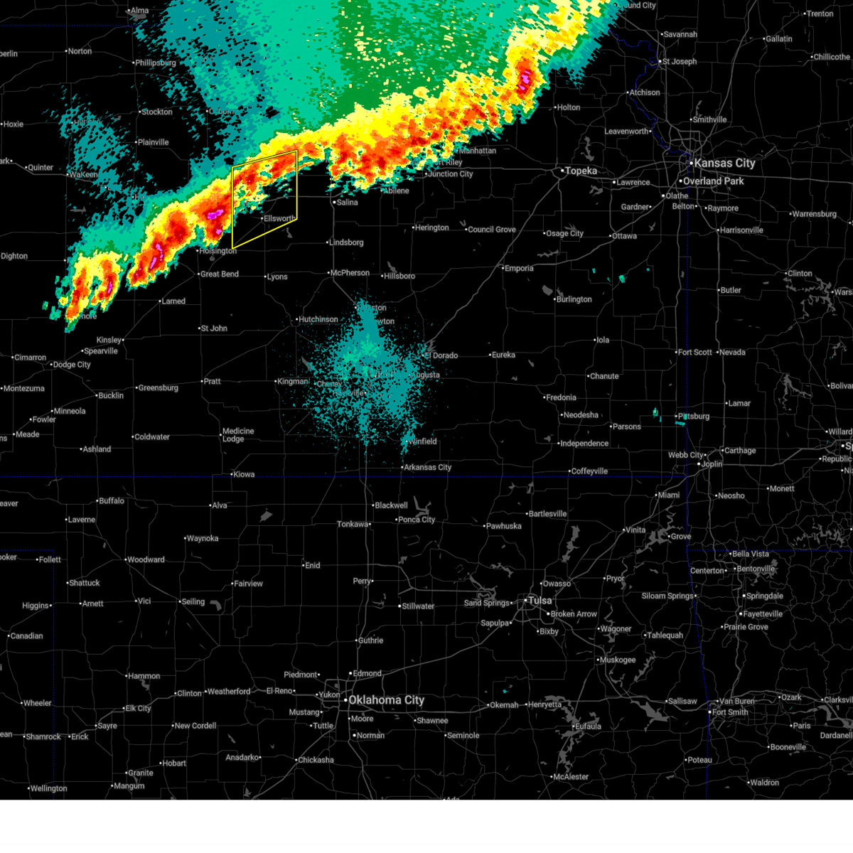
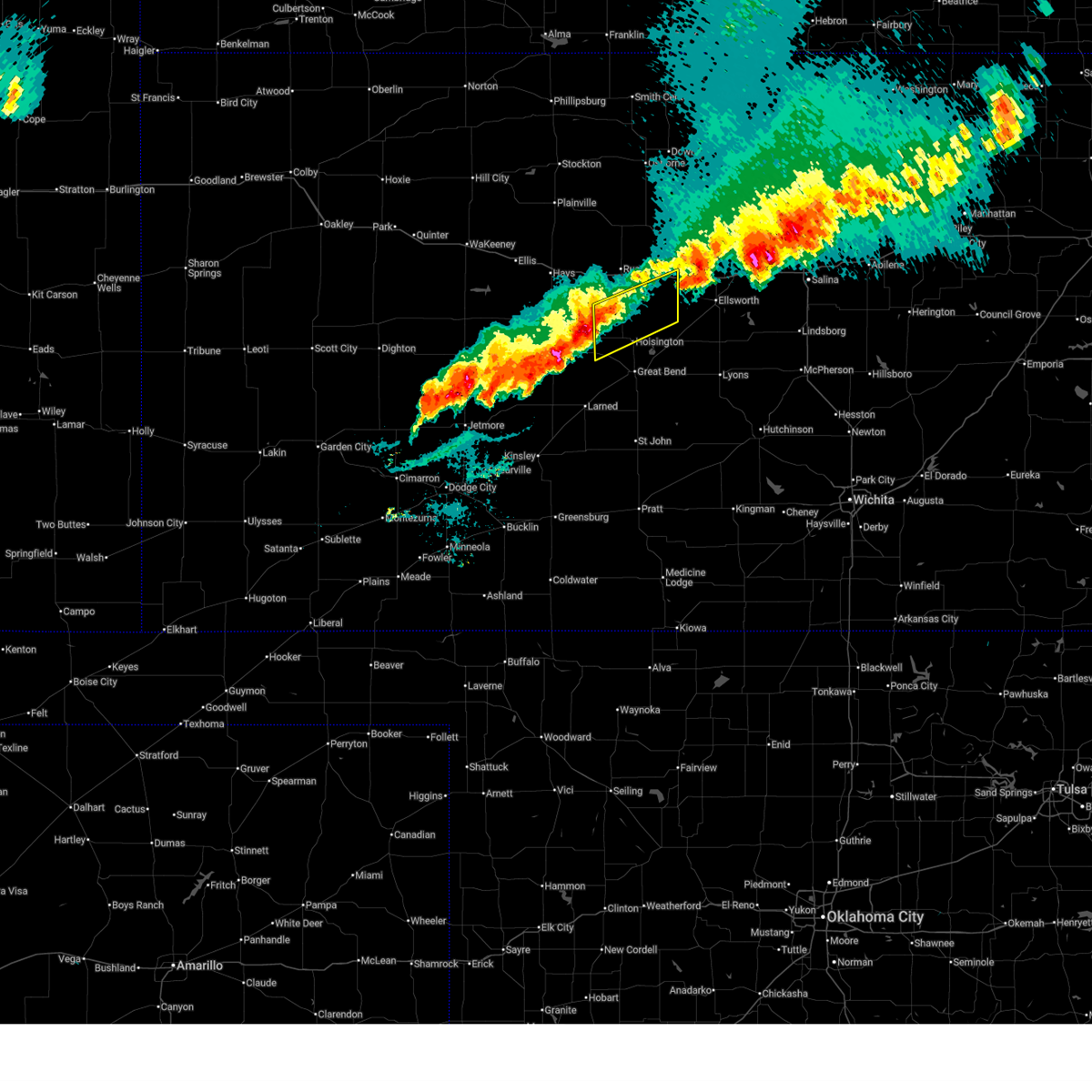
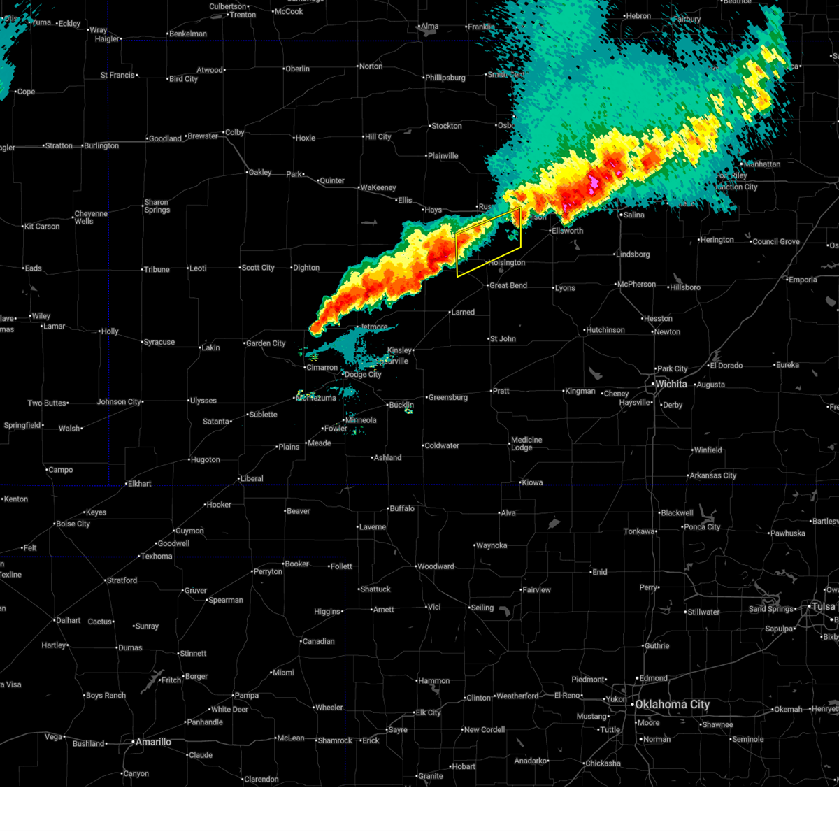
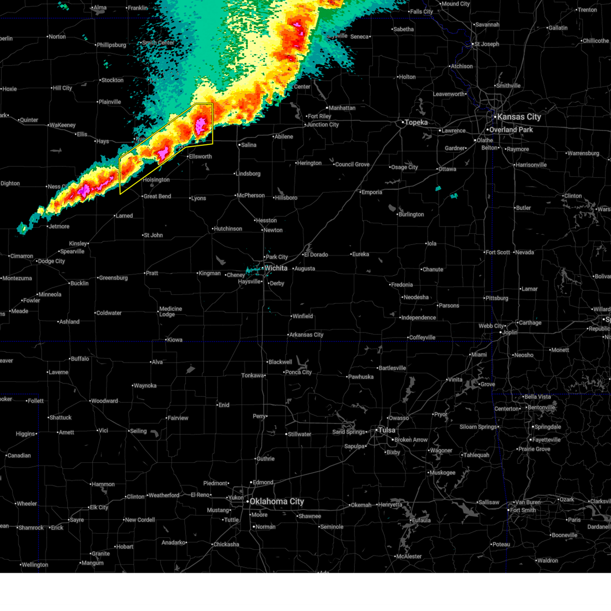
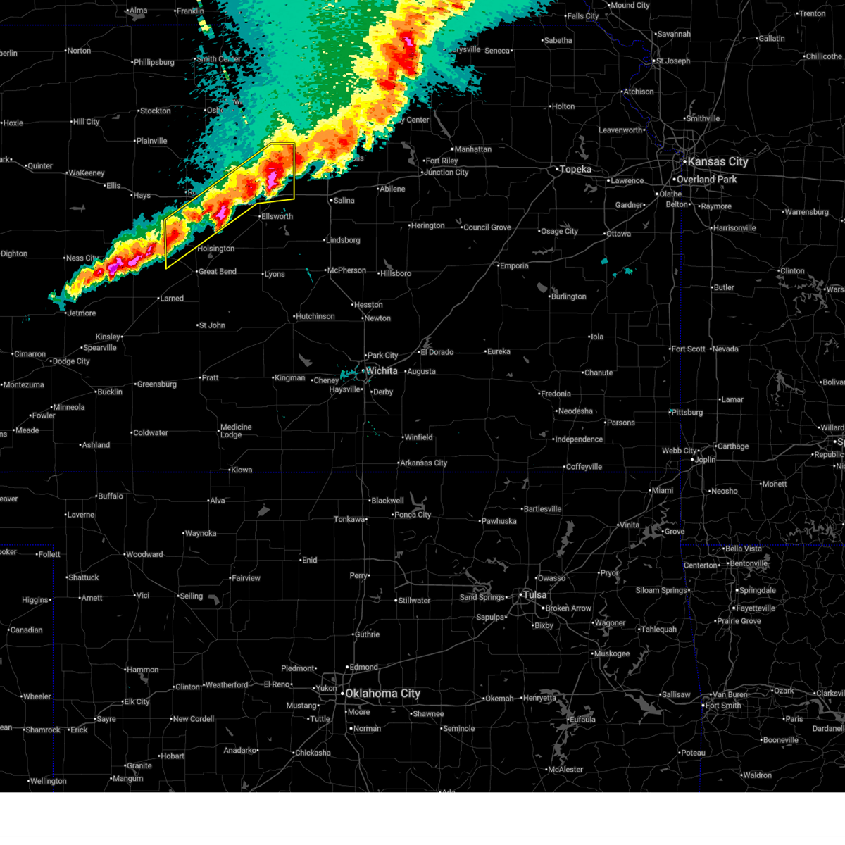
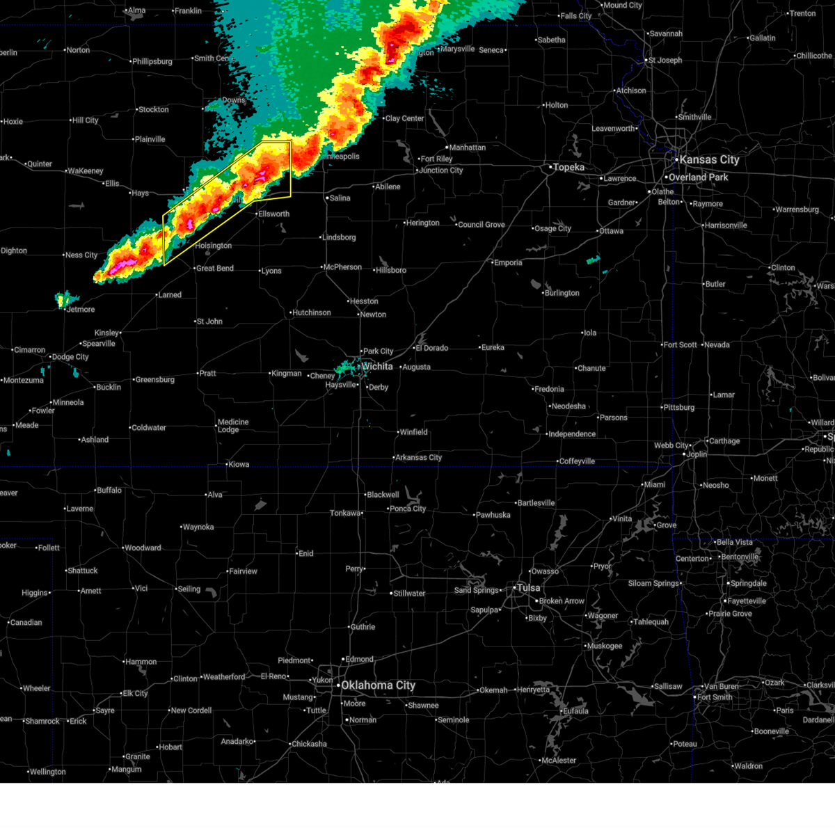
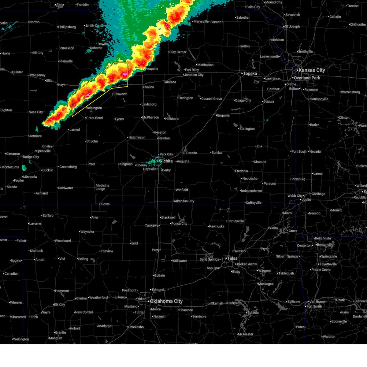
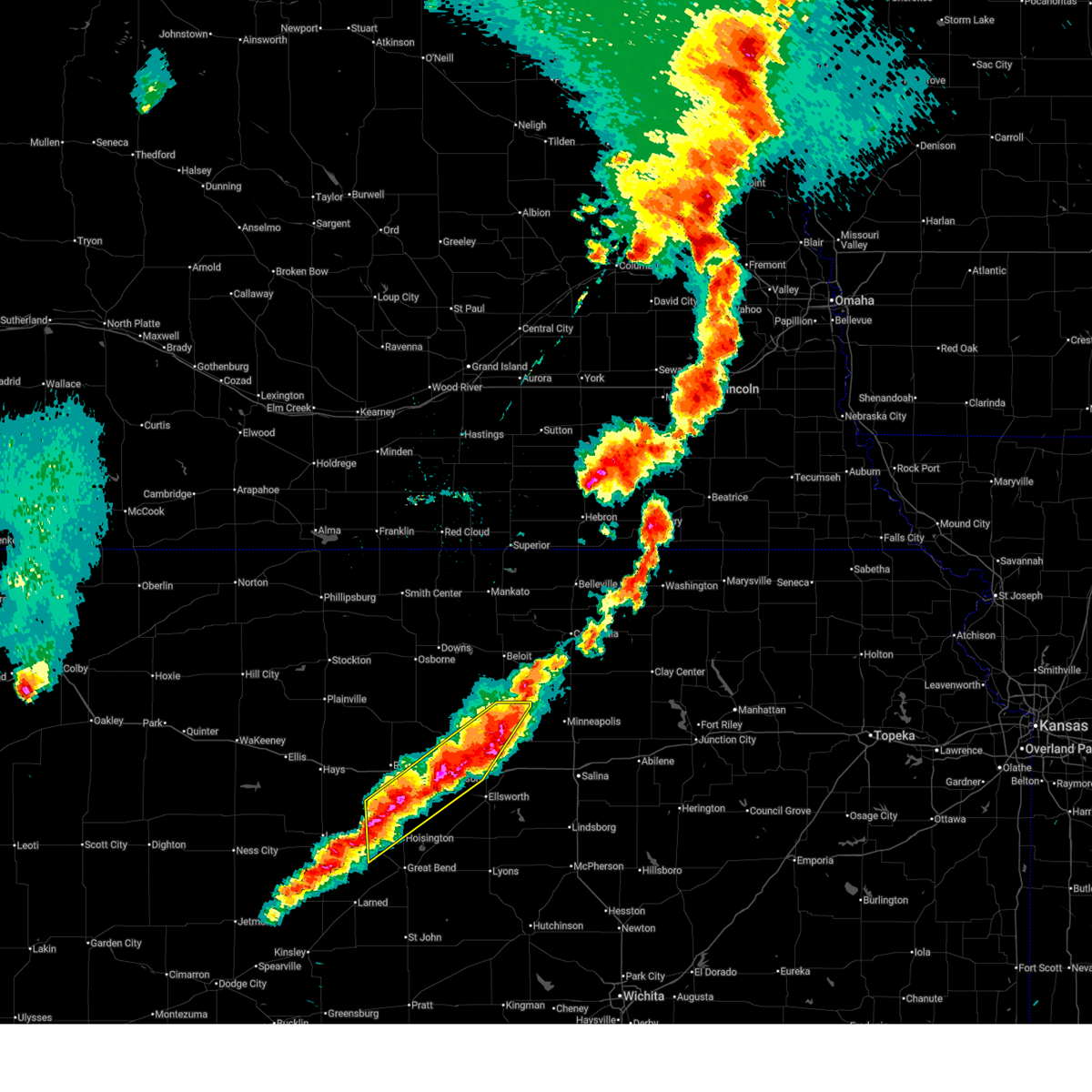
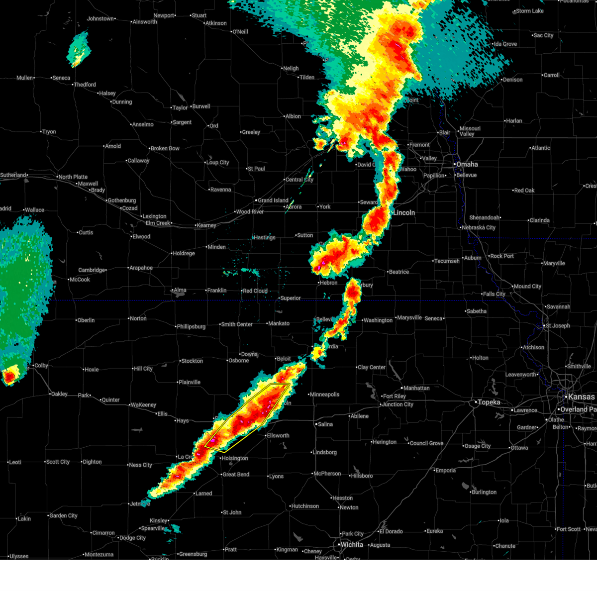
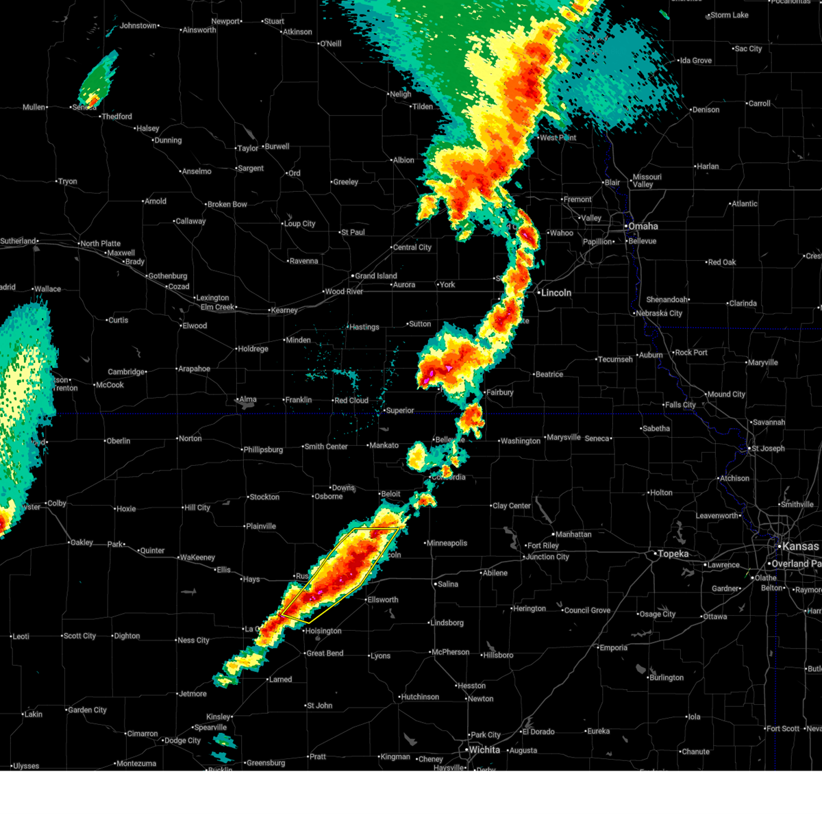
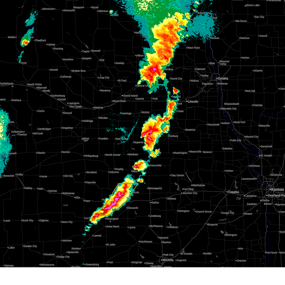
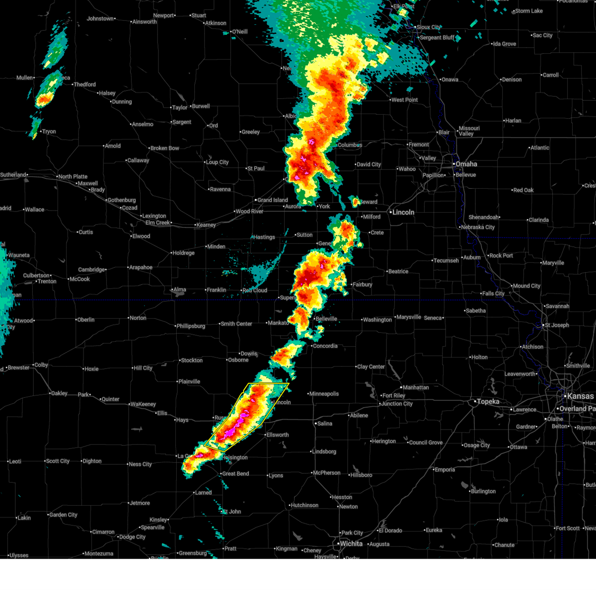
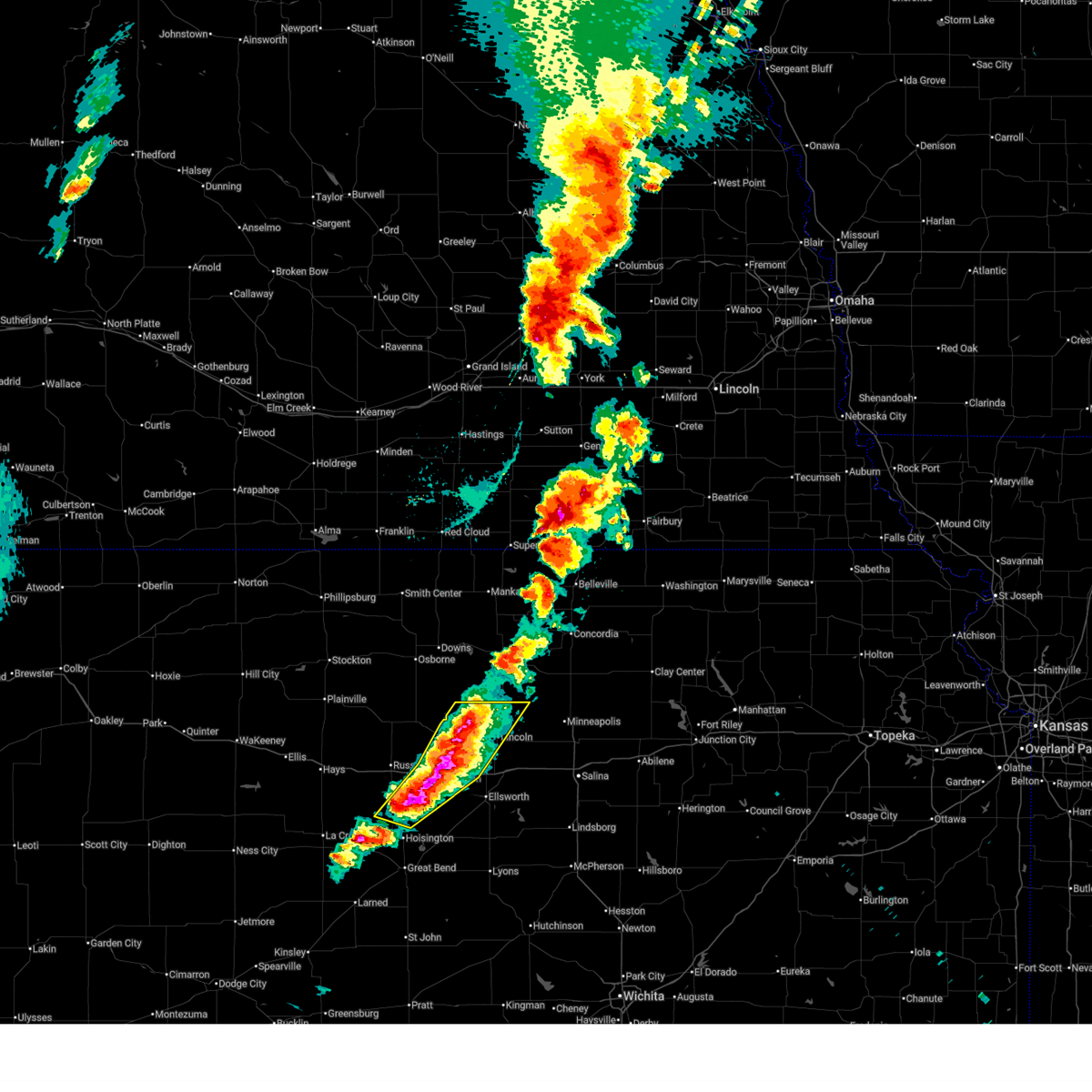
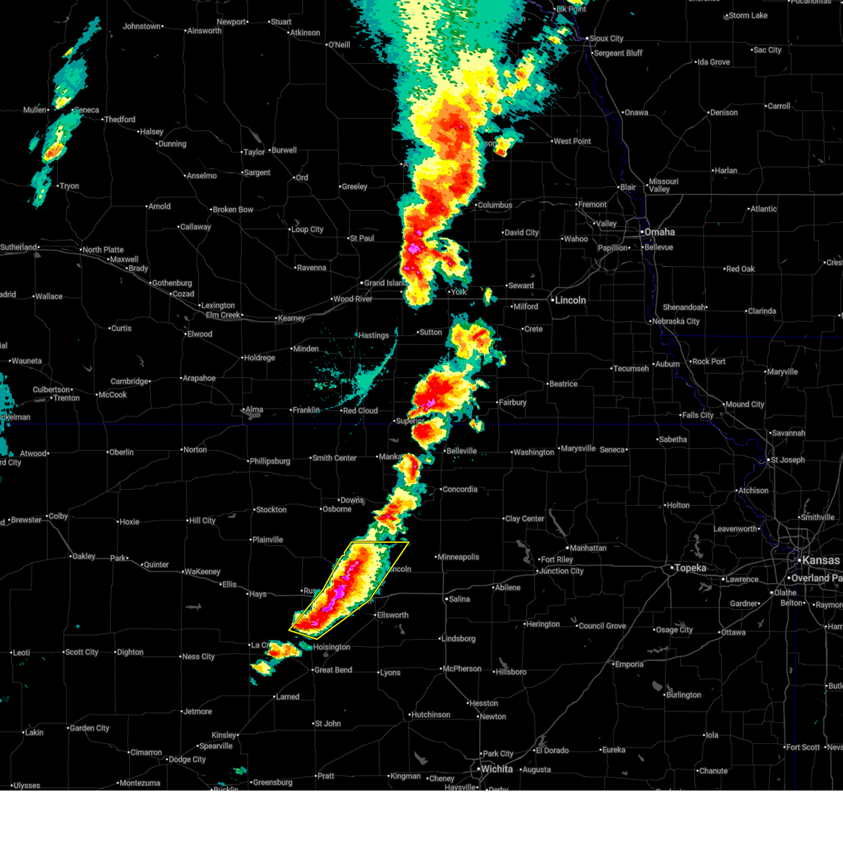
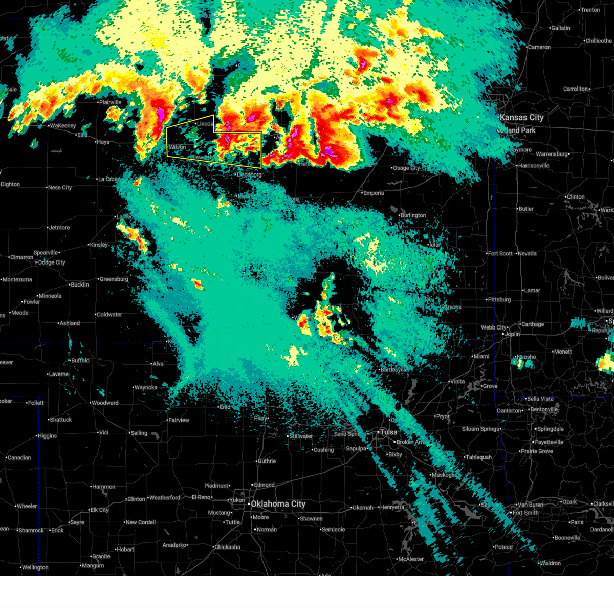
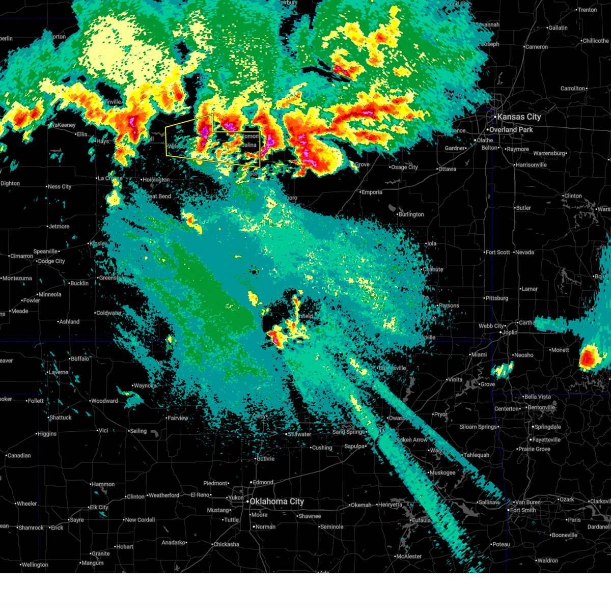
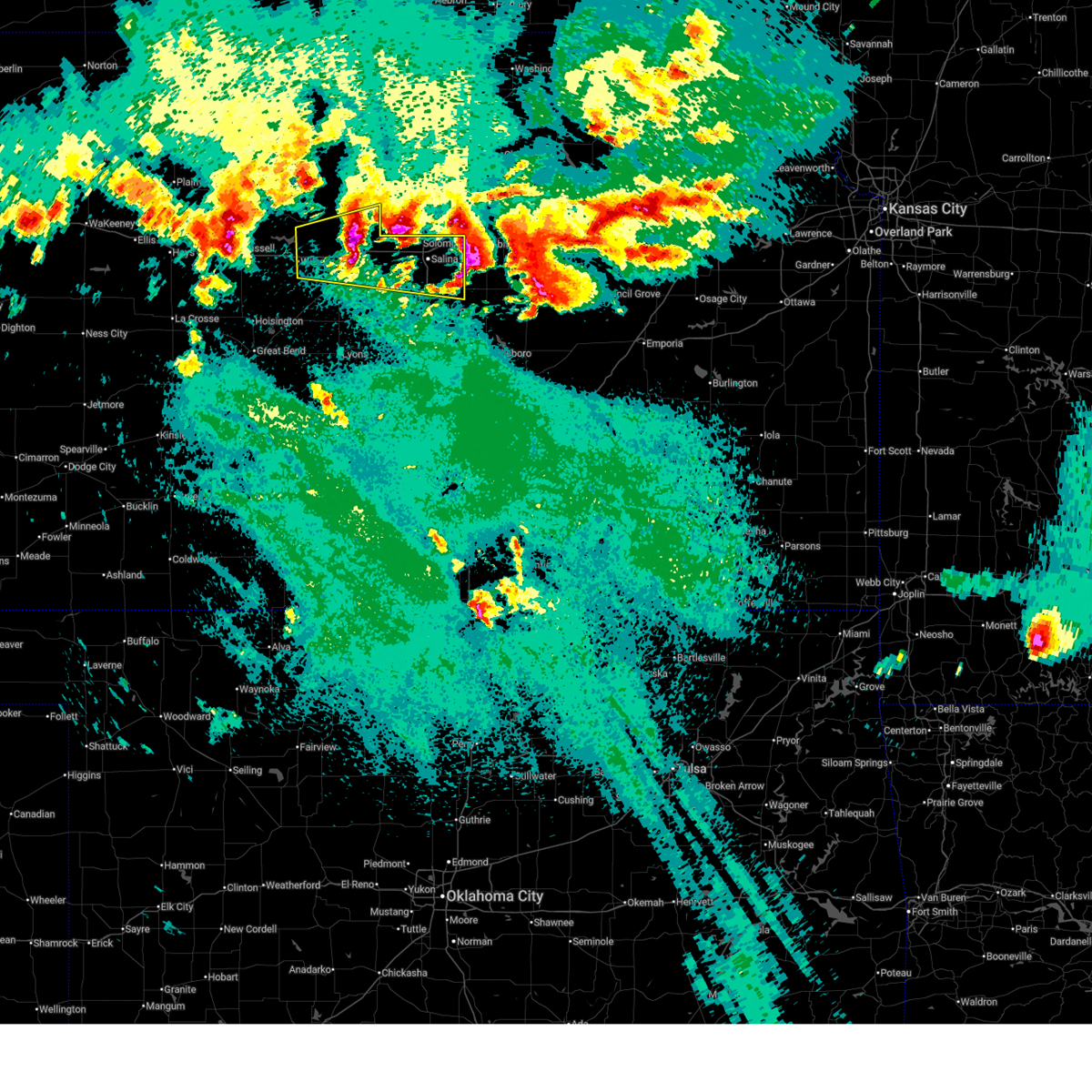
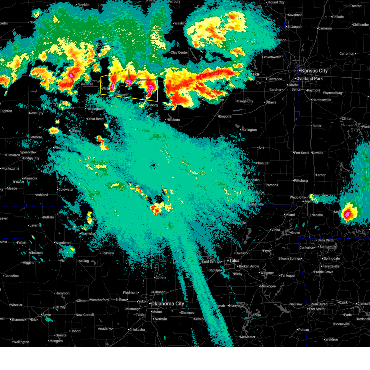
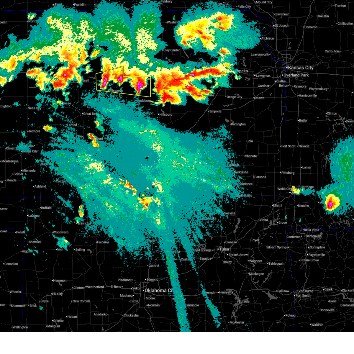
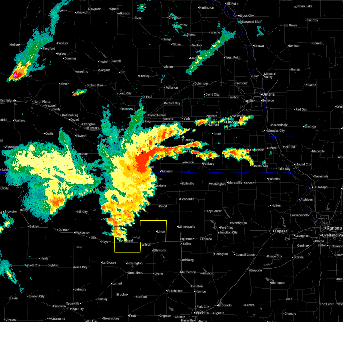
Hail Map for Wilson, KS
The Wilson, KS area has had 11 reports of on-the-ground hail by trained spotters, and has been under severe weather warnings 63 times during the past 12 months. Doppler radar has detected hail at or near Wilson, KS on 120 occasions, including 8 occasions during the past year.
| Name: | Wilson, KS |
| Where Located: | 46.3 miles E of Hays, KS |
| Map: | Google Map for Wilson, KS |
| Population: | 781 |
| Housing Units: | 405 |
| More Info: | Search Google for Wilson, KS |
5
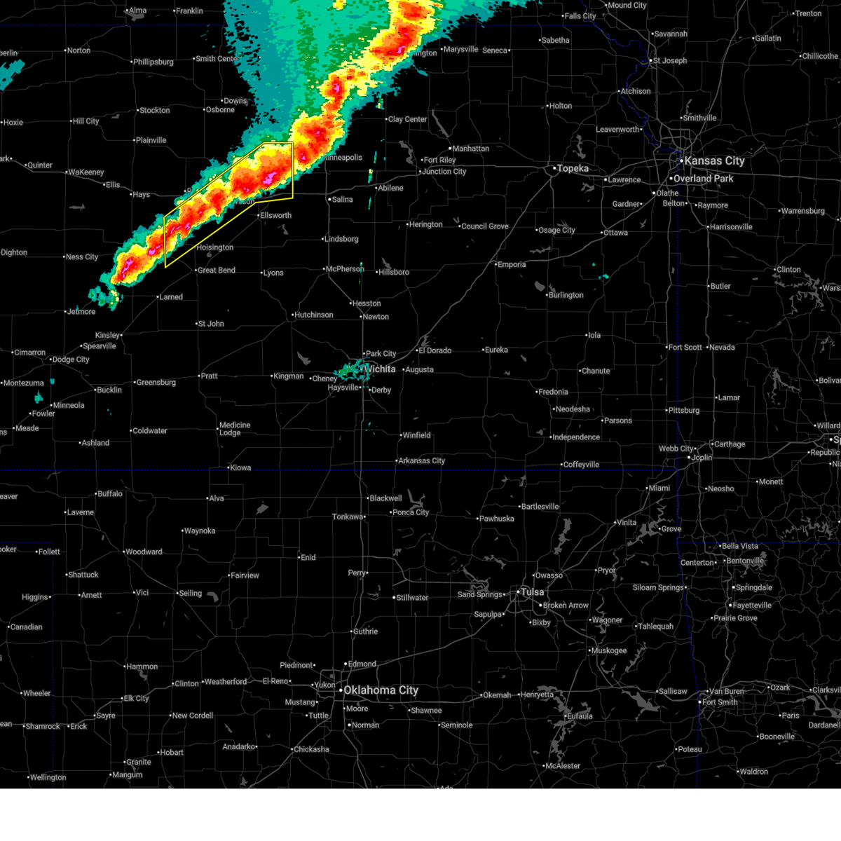
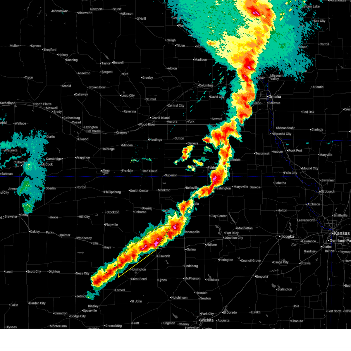
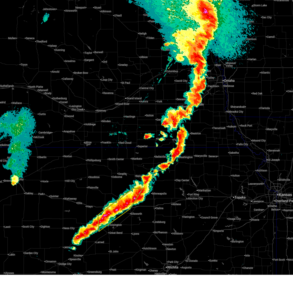
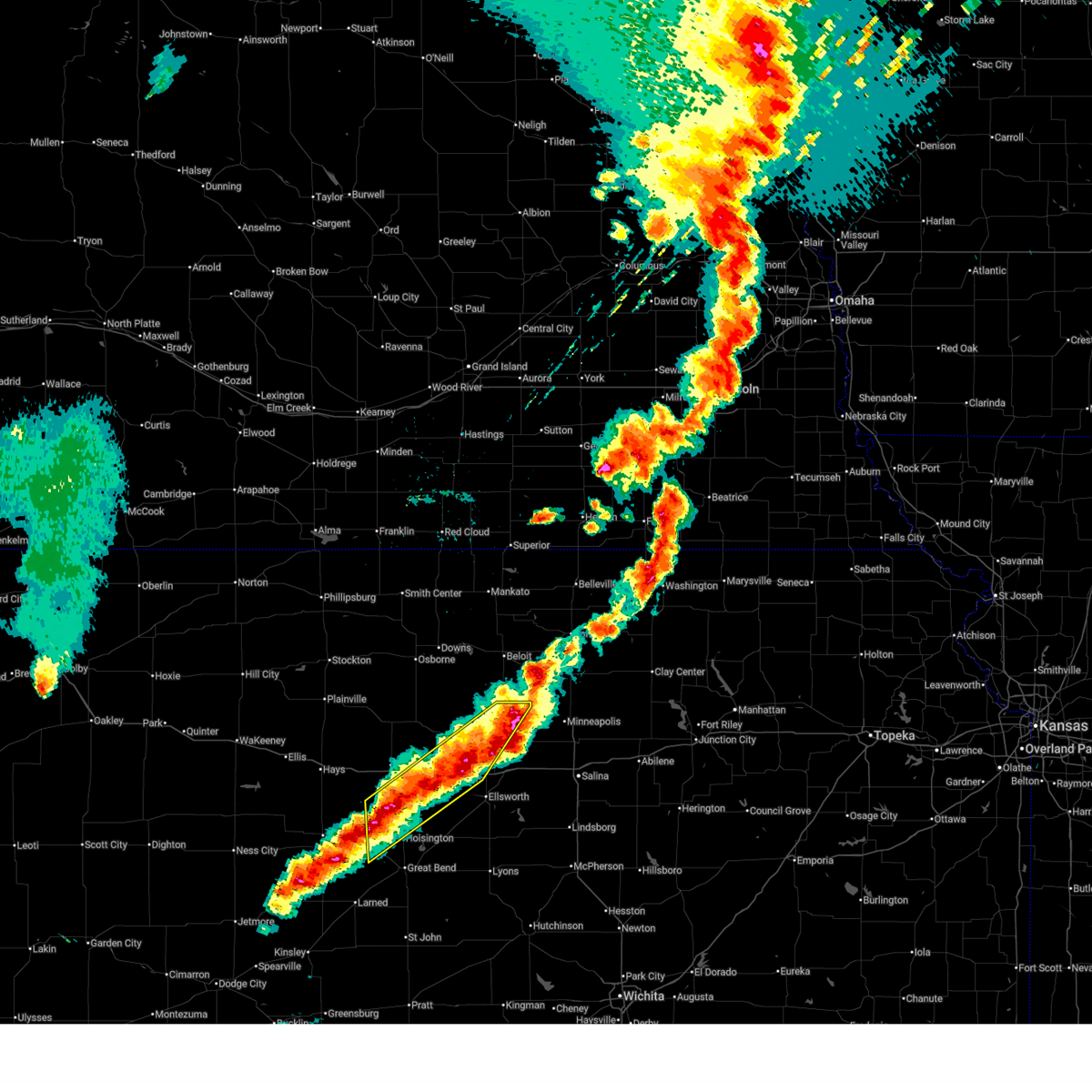
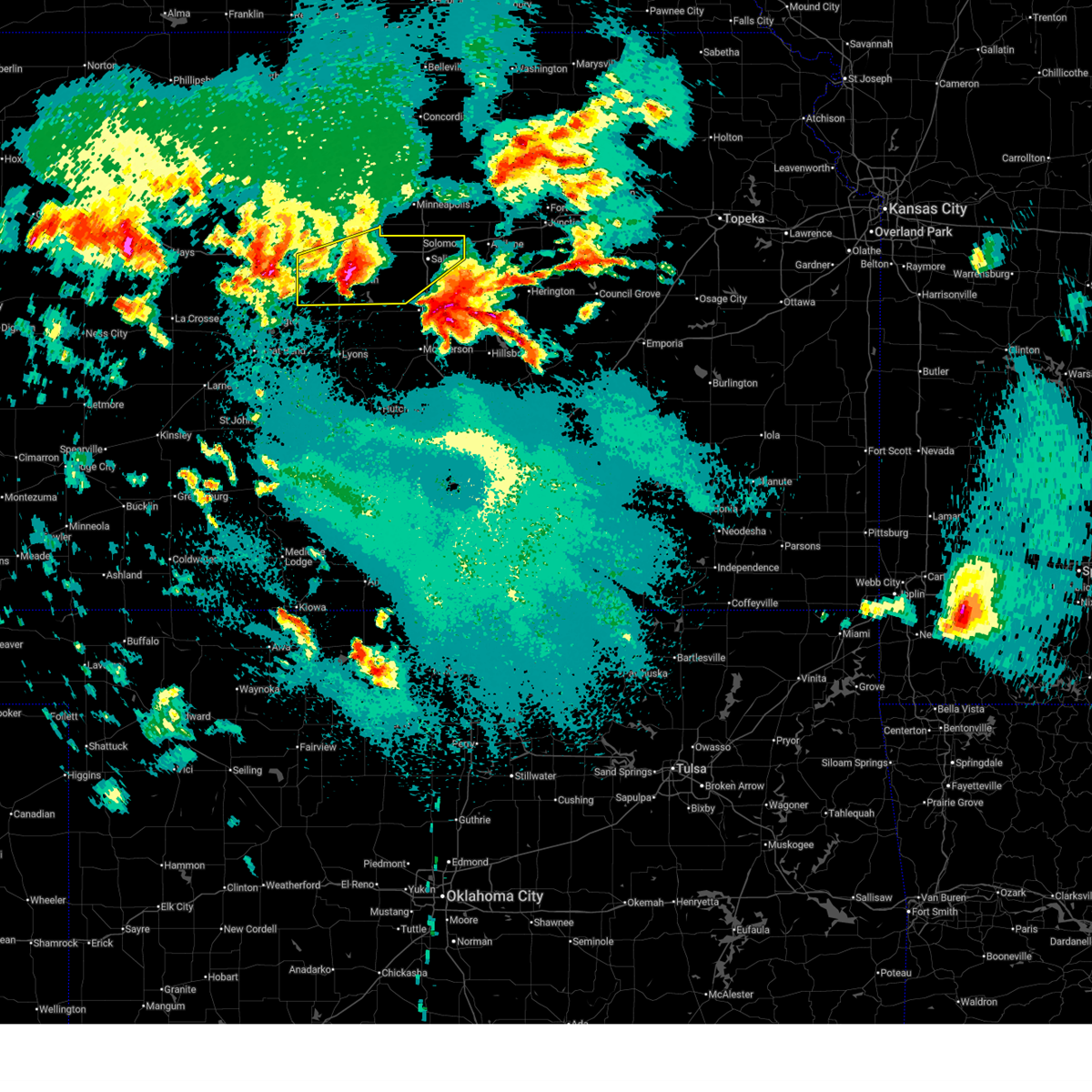
The Top Recent Hail Date for Wilson, KS is Sunday, May 17, 2026 (2nd out of 120)
Hail and Wind Damage Spotted near Wilson, KS
| Date / Time | Report Details |
|---|---|
| 7/10/2026 12:55 AM CDT |
 The storm which prompted the warning has weakened below severe limits, and no longer poses an immediate threat to life or property. therefore, the warning will be allowed to expire. however, gusty winds and heavy rain are still possible with this thunderstorm. a severe thunderstorm watch remains in effect until 300 am cdt for central kansas. The storm which prompted the warning has weakened below severe limits, and no longer poses an immediate threat to life or property. therefore, the warning will be allowed to expire. however, gusty winds and heavy rain are still possible with this thunderstorm. a severe thunderstorm watch remains in effect until 300 am cdt for central kansas.
|
| 7/10/2026 12:41 AM CDT |
 Svrict the national weather service in wichita has issued a * severe thunderstorm warning for, southwestern lincoln county in central kansas, northwestern ellsworth county in central kansas, * until 100 am cdt. * at 1241 am cdt, a severe thunderstorm was located 8 miles northwest of ellsworth, moving east at 25 mph (radar indicated). Hazards include 60 mph wind gusts and nickel size hail. expect damage to roofs, siding, and trees Svrict the national weather service in wichita has issued a * severe thunderstorm warning for, southwestern lincoln county in central kansas, northwestern ellsworth county in central kansas, * until 100 am cdt. * at 1241 am cdt, a severe thunderstorm was located 8 miles northwest of ellsworth, moving east at 25 mph (radar indicated). Hazards include 60 mph wind gusts and nickel size hail. expect damage to roofs, siding, and trees
|
| 6/30/2026 10:20 PM CDT |
 Svrict the national weather service in wichita has issued a * severe thunderstorm warning for, lincoln county in central kansas, northwestern ellsworth county in central kansas, eastern russell county in central kansas, * until 1115 pm cdt. * at 1019 pm cdt, severe thunderstorms were located along a line extending from 9 miles south of luray to 10 miles east of milberger, moving east at 35 mph (radar indicated). Hazards include 60 mph wind gusts. expect damage to roofs, siding, and trees Svrict the national weather service in wichita has issued a * severe thunderstorm warning for, lincoln county in central kansas, northwestern ellsworth county in central kansas, eastern russell county in central kansas, * until 1115 pm cdt. * at 1019 pm cdt, severe thunderstorms were located along a line extending from 9 miles south of luray to 10 miles east of milberger, moving east at 35 mph (radar indicated). Hazards include 60 mph wind gusts. expect damage to roofs, siding, and trees
|
| 6/21/2026 1:09 AM CDT |
 At 109 am cdt, severe thunderstorms were located along a line extending from near ellsworth to near brookville to near smolan to 6 miles east of lindsborg to galva to near moundridge, moving east at 35 mph (radar indicated). Hazards include 60 mph wind gusts. Expect damage to roofs, siding, and trees. locations impacted include, salina, mcpherson, lyons, lindsborg, ellsworth, moundridge, inman, galva, wilson, canton, kanopolis, marquette, little river, goessel, holyrood, assaria, gypsum, bushton, geneseo, and brookville. this includes the following highways, interstate 135 between mile markers 43 and 95. Interstate 70 between mile markers 206 and 256. At 109 am cdt, severe thunderstorms were located along a line extending from near ellsworth to near brookville to near smolan to 6 miles east of lindsborg to galva to near moundridge, moving east at 35 mph (radar indicated). Hazards include 60 mph wind gusts. Expect damage to roofs, siding, and trees. locations impacted include, salina, mcpherson, lyons, lindsborg, ellsworth, moundridge, inman, galva, wilson, canton, kanopolis, marquette, little river, goessel, holyrood, assaria, gypsum, bushton, geneseo, and brookville. this includes the following highways, interstate 135 between mile markers 43 and 95. Interstate 70 between mile markers 206 and 256.
|
| 6/21/2026 12:38 AM CDT |
 Svrict the national weather service in wichita has issued a * severe thunderstorm warning for, mcpherson county in central kansas, southern lincoln county in central kansas, rice county in central kansas, ellsworth county in central kansas, southeastern russell county in central kansas, western marion county in central kansas, saline county in central kansas, * until 200 am cdt. * at 1237 am cdt, severe thunderstorms were located along a line extending from near wilson to near ellsworth to 10 miles northeast of geneseo to 5 miles south of marquette to near windom to 8 miles east of nickerson, moving east at 35 mph (radar indicated). Hazards include 60 mph wind gusts. expect damage to roofs, siding, and trees Svrict the national weather service in wichita has issued a * severe thunderstorm warning for, mcpherson county in central kansas, southern lincoln county in central kansas, rice county in central kansas, ellsworth county in central kansas, southeastern russell county in central kansas, western marion county in central kansas, saline county in central kansas, * until 200 am cdt. * at 1237 am cdt, severe thunderstorms were located along a line extending from near wilson to near ellsworth to 10 miles northeast of geneseo to 5 miles south of marquette to near windom to 8 miles east of nickerson, moving east at 35 mph (radar indicated). Hazards include 60 mph wind gusts. expect damage to roofs, siding, and trees
|
| 6/21/2026 12:02 AM CDT |
 At 1201 am cdt, severe thunderstorms were located along a line extending from 5 miles east of sylvan grove to 6 miles south of lucas to near dorrance to 8 miles northwest of holyrood to bushton, moving east at 25 mph (radar indicated). Hazards include 60 mph wind gusts. Expect damage to roofs, siding, and trees. locations impacted include, ellsworth, wilson, claflin, kanopolis, lincoln, holyrood, lucas, sylvan grove, geneseo, dorrance, lorraine, bunker hill, ellsworth airport, kanopolis lake, wilson state park, wilson lake, odin, and kanopolis state park. This includes interstate 70 between mile markers 188 and 223. At 1201 am cdt, severe thunderstorms were located along a line extending from 5 miles east of sylvan grove to 6 miles south of lucas to near dorrance to 8 miles northwest of holyrood to bushton, moving east at 25 mph (radar indicated). Hazards include 60 mph wind gusts. Expect damage to roofs, siding, and trees. locations impacted include, ellsworth, wilson, claflin, kanopolis, lincoln, holyrood, lucas, sylvan grove, geneseo, dorrance, lorraine, bunker hill, ellsworth airport, kanopolis lake, wilson state park, wilson lake, odin, and kanopolis state park. This includes interstate 70 between mile markers 188 and 223.
|
| 6/20/2026 11:42 PM CDT |
 Svrict the national weather service in wichita has issued a * severe thunderstorm warning for, southern lincoln county in central kansas, ellsworth county in central kansas, southeastern russell county in central kansas, northeastern barton county in central kansas, * until 100 am cdt. * at 1142 pm cdt, severe thunderstorms were located along a line extending from sylvan grove to 8 miles southwest of lucas to 6 miles northwest of dorrance to near claflin, moving east at 20 mph (radar indicated). Hazards include 60 mph wind gusts. expect damage to roofs, siding, and trees Svrict the national weather service in wichita has issued a * severe thunderstorm warning for, southern lincoln county in central kansas, ellsworth county in central kansas, southeastern russell county in central kansas, northeastern barton county in central kansas, * until 100 am cdt. * at 1142 pm cdt, severe thunderstorms were located along a line extending from sylvan grove to 8 miles southwest of lucas to 6 miles northwest of dorrance to near claflin, moving east at 20 mph (radar indicated). Hazards include 60 mph wind gusts. expect damage to roofs, siding, and trees
|
| 6/20/2026 11:36 PM CDT |
 At 1135 pm cdt, severe thunderstorms were located along a line extending from sylvan grove to 5 miles east of ellinwood to 8 miles south of st. john, moving east at 35 mph (radar indicated). Hazards include 60 mph wind gusts. Expect damage to roofs, siding, and trees. locations impacted include, great bend, russell, hoisington, ellinwood, wilson, claflin, lincoln, lucas, sylvan grove, dorrance, bunker hill, susank, russell airport, cheyenne bottoms, wilson state park, wilson lake, and odin. This includes interstate 70 between mile markers 184 and 216. At 1135 pm cdt, severe thunderstorms were located along a line extending from sylvan grove to 5 miles east of ellinwood to 8 miles south of st. john, moving east at 35 mph (radar indicated). Hazards include 60 mph wind gusts. Expect damage to roofs, siding, and trees. locations impacted include, great bend, russell, hoisington, ellinwood, wilson, claflin, lincoln, lucas, sylvan grove, dorrance, bunker hill, susank, russell airport, cheyenne bottoms, wilson state park, wilson lake, and odin. This includes interstate 70 between mile markers 184 and 216.
|
| 6/20/2026 11:11 PM CDT |
 At 1110 pm cdt, severe thunderstorms were located along a line extending from 5 miles southwest of lucas to near great bend to near macksville, moving east at 35 mph (automated weather sensors. at 11:07 pm the russell asos reported a wind gust of 72 mph). Hazards include 70 mph wind gusts. Expect considerable tree damage. damage is likely to mobile homes, roofs, and outbuildings. locations impacted include, great bend, russell, hoisington, ellinwood, wilson, wilson state park, claflin, lincoln, lucas, gorham, sylvan grove, pawnee rock, luray, dorrance, albert, olmitz, milberger, bunker hill, galatia, susank, and waldo. This includes interstate 70 between mile markers 175 and 216. At 1110 pm cdt, severe thunderstorms were located along a line extending from 5 miles southwest of lucas to near great bend to near macksville, moving east at 35 mph (automated weather sensors. at 11:07 pm the russell asos reported a wind gust of 72 mph). Hazards include 70 mph wind gusts. Expect considerable tree damage. damage is likely to mobile homes, roofs, and outbuildings. locations impacted include, great bend, russell, hoisington, ellinwood, wilson, wilson state park, claflin, lincoln, lucas, gorham, sylvan grove, pawnee rock, luray, dorrance, albert, olmitz, milberger, bunker hill, galatia, susank, and waldo. This includes interstate 70 between mile markers 175 and 216.
|
| 6/20/2026 11:04 PM CDT |
 At 1103 pm cdt, severe thunderstorms were located along a line extending from 7 miles south of luray to great bend to near belpre, moving east at 35 mph (automated weather sensors. at 10:59 pm the russell asos reported a wind gust of 63 mph). Hazards include 70 mph wind gusts. Expect considerable tree damage. damage is likely to mobile homes, roofs, and outbuildings. locations impacted include, great bend, russell, hoisington, ellinwood, wilson, wilson state park, claflin, lincoln, lucas, gorham, sylvan grove, pawnee rock, luray, dorrance, albert, olmitz, milberger, bunker hill, paradise, galatia, and susank. This includes interstate 70 between mile markers 176 and 216. At 1103 pm cdt, severe thunderstorms were located along a line extending from 7 miles south of luray to great bend to near belpre, moving east at 35 mph (automated weather sensors. at 10:59 pm the russell asos reported a wind gust of 63 mph). Hazards include 70 mph wind gusts. Expect considerable tree damage. damage is likely to mobile homes, roofs, and outbuildings. locations impacted include, great bend, russell, hoisington, ellinwood, wilson, wilson state park, claflin, lincoln, lucas, gorham, sylvan grove, pawnee rock, luray, dorrance, albert, olmitz, milberger, bunker hill, paradise, galatia, and susank. This includes interstate 70 between mile markers 176 and 216.
|
| 6/20/2026 10:59 PM CDT |
 At 1057 pm cdt, severe thunderstorms were located along a line extending from 7 miles southwest of luray to near great bend to near belpre, moving east at 40 mph (automated weather sensors. at 11:58pm the russell asos reported a wind gust of 62 mph). Hazards include 70 mph wind gusts. Expect considerable tree damage. damage is likely to mobile homes, roofs, and outbuildings. locations impacted include, great bend, russell, hoisington, ellinwood, wilson, wilson state park, claflin, lincoln, lucas, gorham, sylvan grove, pawnee rock, luray, dorrance, albert, olmitz, milberger, bunker hill, paradise, galatia, and susank. This includes interstate 70 between mile markers 176 and 216. At 1057 pm cdt, severe thunderstorms were located along a line extending from 7 miles southwest of luray to near great bend to near belpre, moving east at 40 mph (automated weather sensors. at 11:58pm the russell asos reported a wind gust of 62 mph). Hazards include 70 mph wind gusts. Expect considerable tree damage. damage is likely to mobile homes, roofs, and outbuildings. locations impacted include, great bend, russell, hoisington, ellinwood, wilson, wilson state park, claflin, lincoln, lucas, gorham, sylvan grove, pawnee rock, luray, dorrance, albert, olmitz, milberger, bunker hill, paradise, galatia, and susank. This includes interstate 70 between mile markers 176 and 216.
|
| 6/20/2026 10:35 PM CDT |
 Svrict the national weather service in wichita has issued a * severe thunderstorm warning for, southwestern lincoln county in central kansas, western ellsworth county in central kansas, russell county in central kansas, barton county in central kansas, * until 1145 pm cdt. * at 1032 pm cdt, severe thunderstorms were located along a line extending from 9 miles southwest of luray to 9 miles south of rozel, moving east at 35 mph (radar indicated). Hazards include 60 mph wind gusts. expect damage to roofs, siding, and trees Svrict the national weather service in wichita has issued a * severe thunderstorm warning for, southwestern lincoln county in central kansas, western ellsworth county in central kansas, russell county in central kansas, barton county in central kansas, * until 1145 pm cdt. * at 1032 pm cdt, severe thunderstorms were located along a line extending from 9 miles southwest of luray to 9 miles south of rozel, moving east at 35 mph (radar indicated). Hazards include 60 mph wind gusts. expect damage to roofs, siding, and trees
|
| 6/13/2026 6:08 PM CDT |
 At 608 pm cdt, a severe thunderstorm was located near kanopolis, moving east to southeast at 20 mph (radar indicated). Hazards include ping pong ball size hail and 60 mph wind gusts. People and animals outdoors will be injured. expect hail damage to roofs, siding, windows, and vehicles. expect wind damage to roofs, siding, and trees. locations impacted include, ellsworth, wilson, kanopolis, holyrood, geneseo, lorraine, kanopolis lake, kanopolis state park, and ellsworth airport. This includes interstate 70 between mile markers 206 and 228. At 608 pm cdt, a severe thunderstorm was located near kanopolis, moving east to southeast at 20 mph (radar indicated). Hazards include ping pong ball size hail and 60 mph wind gusts. People and animals outdoors will be injured. expect hail damage to roofs, siding, windows, and vehicles. expect wind damage to roofs, siding, and trees. locations impacted include, ellsworth, wilson, kanopolis, holyrood, geneseo, lorraine, kanopolis lake, kanopolis state park, and ellsworth airport. This includes interstate 70 between mile markers 206 and 228.
|
| 6/13/2026 5:55 PM CDT |
 At 555 pm cdt, a severe thunderstorm was located near kanopolis, moving east at 25 mph (radar indicated). Hazards include 60 mph wind gusts and quarter size hail. Hail damage to vehicles is expected. expect wind damage to roofs, siding, and trees. locations impacted include, ellsworth, wilson, kanopolis, holyrood, geneseo, lorraine, kanopolis lake, kanopolis state park, and ellsworth airport. This includes interstate 70 between mile markers 206 and 228. At 555 pm cdt, a severe thunderstorm was located near kanopolis, moving east at 25 mph (radar indicated). Hazards include 60 mph wind gusts and quarter size hail. Hail damage to vehicles is expected. expect wind damage to roofs, siding, and trees. locations impacted include, ellsworth, wilson, kanopolis, holyrood, geneseo, lorraine, kanopolis lake, kanopolis state park, and ellsworth airport. This includes interstate 70 between mile markers 206 and 228.
|
| 6/13/2026 5:43 PM CDT |
 Svrict the national weather service in wichita has issued a * severe thunderstorm warning for, ellsworth county in central kansas, * until 645 pm cdt. * at 543 pm cdt, a severe thunderstorm was located 6 miles southwest of ellsworth, moving east to southeast at 30 mph (radar indicated). Hazards include 60 mph wind gusts and quarter size hail. Hail damage to vehicles is expected. Expect wind damage to roofs, siding, and trees. Svrict the national weather service in wichita has issued a * severe thunderstorm warning for, ellsworth county in central kansas, * until 645 pm cdt. * at 543 pm cdt, a severe thunderstorm was located 6 miles southwest of ellsworth, moving east to southeast at 30 mph (radar indicated). Hazards include 60 mph wind gusts and quarter size hail. Hail damage to vehicles is expected. Expect wind damage to roofs, siding, and trees.
|
| 6/9/2026 10:35 PM CDT |
 The storm which prompted the warning has moved out of the area. therefore, the warning will be allowed to expire. however, gusty winds are still possible with this thunderstorm. a severe thunderstorm watch remains in effect until midnight cdt for central kansas. The storm which prompted the warning has moved out of the area. therefore, the warning will be allowed to expire. however, gusty winds are still possible with this thunderstorm. a severe thunderstorm watch remains in effect until midnight cdt for central kansas.
|
| 6/9/2026 10:24 PM CDT | Semi flipped over on i-70 at mile marker 20 in russell county KS, 2.5 miles SE of Wilson, KS |
| 6/9/2026 10:07 PM CDT |
 At 1007 pm cdt, a severe thunderstorm was located near wilson, moving northeast at 30 mph (radar indicated). Hazards include 60 mph wind gusts and nickel size hail. Expect damage to roofs, siding, and trees. locations impacted include, ellsworth, wilson, kanopolis, holyrood, dorrance, ellsworth airport, odin, and wilson state park. This includes interstate 70 between mile markers 198 and 221. At 1007 pm cdt, a severe thunderstorm was located near wilson, moving northeast at 30 mph (radar indicated). Hazards include 60 mph wind gusts and nickel size hail. Expect damage to roofs, siding, and trees. locations impacted include, ellsworth, wilson, kanopolis, holyrood, dorrance, ellsworth airport, odin, and wilson state park. This includes interstate 70 between mile markers 198 and 221.
|
| 6/9/2026 9:49 PM CDT |
 Svrict the national weather service in wichita has issued a * severe thunderstorm warning for, southwestern lincoln county in central kansas, ellsworth county in central kansas, southeastern russell county in central kansas, northeastern barton county in central kansas, * until 1045 pm cdt. * at 949 pm cdt, a severe thunderstorm was located 11 miles northwest of claflin, moving northeast at 25 mph (radar indicated). Hazards include 60 mph wind gusts and nickel size hail. expect damage to roofs, siding, and trees Svrict the national weather service in wichita has issued a * severe thunderstorm warning for, southwestern lincoln county in central kansas, ellsworth county in central kansas, southeastern russell county in central kansas, northeastern barton county in central kansas, * until 1045 pm cdt. * at 949 pm cdt, a severe thunderstorm was located 11 miles northwest of claflin, moving northeast at 25 mph (radar indicated). Hazards include 60 mph wind gusts and nickel size hail. expect damage to roofs, siding, and trees
|
| 6/8/2026 8:58 PM CDT |
 At 858 pm cdt, severe thunderstorms were located along a line extending from minneapolis to 6 miles northeast of kanopolis to 8 miles east of milberger, moving southeast at 25 mph (radar indicated). Hazards include 70 mph wind gusts and quarter size hail. Hail damage to vehicles is expected. expect considerable tree damage. wind damage is also likely to mobile homes, roofs, and outbuildings. locations impacted include, ellsworth, wilson, kanopolis, brookville, dorrance, beverly, milberger, glendale, bunker hill, westfall, and ellsworth airport. This includes interstate 70 between mile markers 187 and 243. At 858 pm cdt, severe thunderstorms were located along a line extending from minneapolis to 6 miles northeast of kanopolis to 8 miles east of milberger, moving southeast at 25 mph (radar indicated). Hazards include 70 mph wind gusts and quarter size hail. Hail damage to vehicles is expected. expect considerable tree damage. wind damage is also likely to mobile homes, roofs, and outbuildings. locations impacted include, ellsworth, wilson, kanopolis, brookville, dorrance, beverly, milberger, glendale, bunker hill, westfall, and ellsworth airport. This includes interstate 70 between mile markers 187 and 243.
|
| 6/8/2026 8:44 PM CDT |
 At 844 pm cdt, severe thunderstorms were located along a line extending from 5 miles northwest of minneapolis to 6 miles north of kanopolis to 5 miles east of milberger, moving southeast at 30 mph (radar indicated). Hazards include 70 mph wind gusts and quarter size hail. Hail damage to vehicles is expected. expect considerable tree damage. wind damage is also likely to mobile homes, roofs, and outbuildings. locations impacted include, ellsworth, wilson, kanopolis, brookville, dorrance, beverly, milberger, glendale, bunker hill, westfall, and ellsworth airport. This includes interstate 70 between mile markers 187 and 243. At 844 pm cdt, severe thunderstorms were located along a line extending from 5 miles northwest of minneapolis to 6 miles north of kanopolis to 5 miles east of milberger, moving southeast at 30 mph (radar indicated). Hazards include 70 mph wind gusts and quarter size hail. Hail damage to vehicles is expected. expect considerable tree damage. wind damage is also likely to mobile homes, roofs, and outbuildings. locations impacted include, ellsworth, wilson, kanopolis, brookville, dorrance, beverly, milberger, glendale, bunker hill, westfall, and ellsworth airport. This includes interstate 70 between mile markers 187 and 243.
|
| 6/8/2026 8:32 PM CDT |
 At 832 pm cdt, severe thunderstorms were located along a line extending from near delphos to 9 miles south of lincoln to near russell, moving southeast at 20 mph (radar indicated). Hazards include 70 mph wind gusts and quarter size hail. Hail damage to vehicles is expected. expect considerable tree damage. wind damage is also likely to mobile homes, roofs, and outbuildings. locations impacted include, russell, ellsworth, wilson, kanopolis, gorham, brookville, dorrance, beverly, milberger, glendale, bunker hill, westfall, ellsworth airport, and russell airport. This includes interstate 70 between mile markers 175 and 243. At 832 pm cdt, severe thunderstorms were located along a line extending from near delphos to 9 miles south of lincoln to near russell, moving southeast at 20 mph (radar indicated). Hazards include 70 mph wind gusts and quarter size hail. Hail damage to vehicles is expected. expect considerable tree damage. wind damage is also likely to mobile homes, roofs, and outbuildings. locations impacted include, russell, ellsworth, wilson, kanopolis, gorham, brookville, dorrance, beverly, milberger, glendale, bunker hill, westfall, ellsworth airport, and russell airport. This includes interstate 70 between mile markers 175 and 243.
|
| 6/8/2026 8:15 PM CDT |
 Svrict the national weather service in wichita has issued a * severe thunderstorm warning for, southern lincoln county in central kansas, northern ellsworth county in central kansas, russell county in central kansas, northwestern saline county in central kansas, * until 930 pm cdt. * at 815 pm cdt, severe thunderstorms were located along a line extending from asherville to 6 miles east of sylvan grove to near gorham, moving southeast at 25 mph (radar indicated). Hazards include 70 mph wind gusts and half dollar size hail. Hail damage to vehicles is expected. expect considerable tree damage. Wind damage is also likely to mobile homes, roofs, and outbuildings. Svrict the national weather service in wichita has issued a * severe thunderstorm warning for, southern lincoln county in central kansas, northern ellsworth county in central kansas, russell county in central kansas, northwestern saline county in central kansas, * until 930 pm cdt. * at 815 pm cdt, severe thunderstorms were located along a line extending from asherville to 6 miles east of sylvan grove to near gorham, moving southeast at 25 mph (radar indicated). Hazards include 70 mph wind gusts and half dollar size hail. Hail damage to vehicles is expected. expect considerable tree damage. Wind damage is also likely to mobile homes, roofs, and outbuildings.
|
| 5/30/2026 6:55 PM CDT |
 At 654 pm cdt, severe thunderstorms were located along a line extending from near wilson to 6 miles north of hoisington, moving northeast at 25 mph (trained weather spotters). Hazards include 60 mph wind gusts and quarter size hail. Hail damage to vehicles is expected. expect wind damage to roofs, siding, and trees. locations impacted include, russell, wilson, dorrance, bunker hill, susank, wilson state park, wilson lake, russell airport, and odin. This includes interstate 70 between mile markers 187 and 205. At 654 pm cdt, severe thunderstorms were located along a line extending from near wilson to 6 miles north of hoisington, moving northeast at 25 mph (trained weather spotters). Hazards include 60 mph wind gusts and quarter size hail. Hail damage to vehicles is expected. expect wind damage to roofs, siding, and trees. locations impacted include, russell, wilson, dorrance, bunker hill, susank, wilson state park, wilson lake, russell airport, and odin. This includes interstate 70 between mile markers 187 and 205.
|
| 5/30/2026 6:38 PM CDT |
 At 637 pm cdt, severe thunderstorms were located along a line extending from 5 miles southwest of lucas to hoisington, moving northeast at 30 mph (trained weather spotters. at 636 pm cdt, quarter size hail was reported in hoisington). Hazards include 60 mph wind gusts and quarter size hail. Hail damage to vehicles is expected. expect wind damage to roofs, siding, and trees. locations impacted include, russell, hoisington, wilson, claflin, dorrance, bunker hill, susank, wilson state park, wilson lake, russell airport, and odin. This includes interstate 70 between mile markers 186 and 205. At 637 pm cdt, severe thunderstorms were located along a line extending from 5 miles southwest of lucas to hoisington, moving northeast at 30 mph (trained weather spotters. at 636 pm cdt, quarter size hail was reported in hoisington). Hazards include 60 mph wind gusts and quarter size hail. Hail damage to vehicles is expected. expect wind damage to roofs, siding, and trees. locations impacted include, russell, hoisington, wilson, claflin, dorrance, bunker hill, susank, wilson state park, wilson lake, russell airport, and odin. This includes interstate 70 between mile markers 186 and 205.
|
| 5/30/2026 6:11 PM CDT |
 Svrict the national weather service in wichita has issued a * severe thunderstorm warning for, southern russell county in central kansas, northern barton county in central kansas, * until 715 pm cdt. * at 610 pm cdt, a severe thunderstorm was located near olmitz, or 6 miles northwest of hoisington, moving northeast at 30 mph (radar indicated). Hazards include 60 mph wind gusts and nickel size hail. expect damage to roofs, siding, and trees Svrict the national weather service in wichita has issued a * severe thunderstorm warning for, southern russell county in central kansas, northern barton county in central kansas, * until 715 pm cdt. * at 610 pm cdt, a severe thunderstorm was located near olmitz, or 6 miles northwest of hoisington, moving northeast at 30 mph (radar indicated). Hazards include 60 mph wind gusts and nickel size hail. expect damage to roofs, siding, and trees
|
| 5/18/2026 1:37 PM CDT |
 At 137 pm cdt, a severe thunderstorm was located 7 miles southeast of sylvan grove, or 9 miles southwest of lincoln, moving northeast at 55 mph (radar indicated). Hazards include 70 mph wind gusts and half dollar size hail. Hail damage to vehicles is expected. expect considerable tree damage. wind damage is also likely to mobile homes, roofs, and outbuildings. locations impacted include, wilson, lincoln, sylvan grove, barnard, and ash grove. This includes interstate 70 between mile markers 206 and 218. At 137 pm cdt, a severe thunderstorm was located 7 miles southeast of sylvan grove, or 9 miles southwest of lincoln, moving northeast at 55 mph (radar indicated). Hazards include 70 mph wind gusts and half dollar size hail. Hail damage to vehicles is expected. expect considerable tree damage. wind damage is also likely to mobile homes, roofs, and outbuildings. locations impacted include, wilson, lincoln, sylvan grove, barnard, and ash grove. This includes interstate 70 between mile markers 206 and 218.
|
| 5/18/2026 1:18 PM CDT |
 Svrict the national weather service in wichita has issued a * severe thunderstorm warning for, lincoln county in central kansas, northwestern ellsworth county in central kansas, southeastern russell county in central kansas, * until 200 pm cdt. * at 117 pm cdt, a severe thunderstorm was located near wilson, moving northeast at 50 mph (radar indicated). Hazards include 70 mph wind gusts and half dollar size hail. Hail damage to vehicles is expected. expect considerable tree damage. Wind damage is also likely to mobile homes, roofs, and outbuildings. Svrict the national weather service in wichita has issued a * severe thunderstorm warning for, lincoln county in central kansas, northwestern ellsworth county in central kansas, southeastern russell county in central kansas, * until 200 pm cdt. * at 117 pm cdt, a severe thunderstorm was located near wilson, moving northeast at 50 mph (radar indicated). Hazards include 70 mph wind gusts and half dollar size hail. Hail damage to vehicles is expected. expect considerable tree damage. Wind damage is also likely to mobile homes, roofs, and outbuildings.
|
| 5/17/2026 11:18 PM CDT |
 At 1118 pm cdt, a severe thunderstorm was located near kanopolis, moving east at 35 mph (radar indicated). Hazards include ping pong ball size hail and 60 mph wind gusts. People and animals outdoors will be injured. expect hail damage to roofs, siding, windows, and vehicles. expect wind damage to roofs, siding, and trees. locations impacted include, ellsworth, wilson, kanopolis, holyrood, ellsworth airport, and westfall. This includes interstate 70 between mile markers 206 and 235. At 1118 pm cdt, a severe thunderstorm was located near kanopolis, moving east at 35 mph (radar indicated). Hazards include ping pong ball size hail and 60 mph wind gusts. People and animals outdoors will be injured. expect hail damage to roofs, siding, windows, and vehicles. expect wind damage to roofs, siding, and trees. locations impacted include, ellsworth, wilson, kanopolis, holyrood, ellsworth airport, and westfall. This includes interstate 70 between mile markers 206 and 235.
|
| 5/17/2026 11:07 PM CDT |
 At 1107 pm cdt, a severe thunderstorm was located over ellsworth, moving east at 35 mph (radar indicated). Hazards include golf ball size hail and 60 mph wind gusts. People and animals outdoors will be injured. expect hail damage to roofs, siding, windows, and vehicles. expect wind damage to roofs, siding, and trees. locations impacted include, ellsworth, wilson, kanopolis, holyrood, beverly, westfall, and ellsworth airport. This includes interstate 70 between mile markers 206 and 235. At 1107 pm cdt, a severe thunderstorm was located over ellsworth, moving east at 35 mph (radar indicated). Hazards include golf ball size hail and 60 mph wind gusts. People and animals outdoors will be injured. expect hail damage to roofs, siding, windows, and vehicles. expect wind damage to roofs, siding, and trees. locations impacted include, ellsworth, wilson, kanopolis, holyrood, beverly, westfall, and ellsworth airport. This includes interstate 70 between mile markers 206 and 235.
|
| 5/17/2026 10:58 PM CDT |
 At 1056 pm cdt, a severe thunderstorm was located near wilson, moving east at 35 mph (law enforcement reported golf ball size hail in wilson at 1053 pm). Hazards include two inch hail and 60 mph wind gusts. People and animals outdoors will be injured. expect hail damage to roofs, siding, windows, and vehicles. expect wind damage to roofs, siding, and trees. locations impacted include, ellsworth, wilson, kanopolis, lincoln, holyrood, beverly, westfall, and ellsworth airport. This includes interstate 70 between mile markers 206 and 235. At 1056 pm cdt, a severe thunderstorm was located near wilson, moving east at 35 mph (law enforcement reported golf ball size hail in wilson at 1053 pm). Hazards include two inch hail and 60 mph wind gusts. People and animals outdoors will be injured. expect hail damage to roofs, siding, windows, and vehicles. expect wind damage to roofs, siding, and trees. locations impacted include, ellsworth, wilson, kanopolis, lincoln, holyrood, beverly, westfall, and ellsworth airport. This includes interstate 70 between mile markers 206 and 235.
|
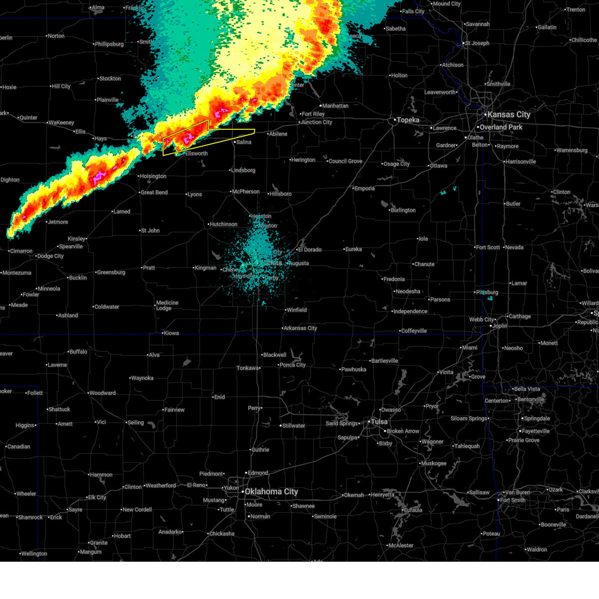
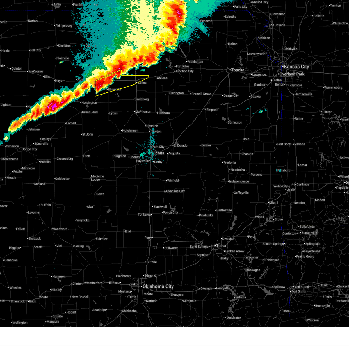
| 5/17/2026 10:53 PM CDT | Golf Ball sized hail reported 0.3 miles SW of Wilson, KS |
| 5/17/2026 10:52 PM CDT |
 At 1051 pm cdt, a severe thunderstorm was located near wilson, moving east at 45 mph (radar indicated). Hazards include two inch hail and 60 mph wind gusts. People and animals outdoors will be injured. expect hail damage to roofs, siding, windows, and vehicles. expect wind damage to roofs, siding, and trees. locations impacted include, ellsworth, wilson, kanopolis, lincoln, holyrood, beverly, westfall, and ellsworth airport. This includes interstate 70 between mile markers 206 and 235. At 1051 pm cdt, a severe thunderstorm was located near wilson, moving east at 45 mph (radar indicated). Hazards include two inch hail and 60 mph wind gusts. People and animals outdoors will be injured. expect hail damage to roofs, siding, windows, and vehicles. expect wind damage to roofs, siding, and trees. locations impacted include, ellsworth, wilson, kanopolis, lincoln, holyrood, beverly, westfall, and ellsworth airport. This includes interstate 70 between mile markers 206 and 235.
|
| 5/17/2026 10:38 PM CDT |
 Svrict the national weather service in wichita has issued a * severe thunderstorm warning for, lincoln county in central kansas, ellsworth county in central kansas, * until 1145 pm cdt. * at 1037 pm cdt, a severe thunderstorm was located near dorrance, or 6 miles southwest of wilson, moving east at 45 mph (radar indicated). Hazards include two inch hail and 60 mph wind gusts. People and animals outdoors will be injured. expect hail damage to roofs, siding, windows, and vehicles. Expect wind damage to roofs, siding, and trees. Svrict the national weather service in wichita has issued a * severe thunderstorm warning for, lincoln county in central kansas, ellsworth county in central kansas, * until 1145 pm cdt. * at 1037 pm cdt, a severe thunderstorm was located near dorrance, or 6 miles southwest of wilson, moving east at 45 mph (radar indicated). Hazards include two inch hail and 60 mph wind gusts. People and animals outdoors will be injured. expect hail damage to roofs, siding, windows, and vehicles. Expect wind damage to roofs, siding, and trees.
|
| 5/17/2026 9:54 PM CDT |
 At 954 pm cdt, a severe thunderstorm was located 6 miles north of otis, moving northeast at 35 mph (radar indicated). Hazards include golf ball size hail and 70 mph wind gusts. People and animals outdoors will be injured. expect hail damage to roofs, siding, windows, and vehicles. expect considerable tree damage. wind damage is also likely to mobile homes, roofs, and outbuildings. locations impacted include, hoisington, wilson, dorrance, albert, olmitz, milberger, galatia, and susank. This includes interstate 70 between mile markers 200 and 205. At 954 pm cdt, a severe thunderstorm was located 6 miles north of otis, moving northeast at 35 mph (radar indicated). Hazards include golf ball size hail and 70 mph wind gusts. People and animals outdoors will be injured. expect hail damage to roofs, siding, windows, and vehicles. expect considerable tree damage. wind damage is also likely to mobile homes, roofs, and outbuildings. locations impacted include, hoisington, wilson, dorrance, albert, olmitz, milberger, galatia, and susank. This includes interstate 70 between mile markers 200 and 205.
|
| 5/17/2026 9:39 PM CDT |
 At 939 pm cdt, a severe thunderstorm was located over otis, moving northeast at 30 mph (radar indicated). Hazards include golf ball size hail and 70 mph wind gusts. People and animals outdoors will be injured. expect hail damage to roofs, siding, windows, and vehicles. expect considerable tree damage. wind damage is also likely to mobile homes, roofs, and outbuildings. locations impacted include, hoisington, wilson, dorrance, albert, olmitz, milberger, galatia, and susank. This includes interstate 70 between mile markers 200 and 205. At 939 pm cdt, a severe thunderstorm was located over otis, moving northeast at 30 mph (radar indicated). Hazards include golf ball size hail and 70 mph wind gusts. People and animals outdoors will be injured. expect hail damage to roofs, siding, windows, and vehicles. expect considerable tree damage. wind damage is also likely to mobile homes, roofs, and outbuildings. locations impacted include, hoisington, wilson, dorrance, albert, olmitz, milberger, galatia, and susank. This includes interstate 70 between mile markers 200 and 205.
|
| 5/17/2026 9:30 PM CDT |
 At 929 pm cdt, a severe thunderstorm was located 9 miles north of kanopolis, moving northeast at 40 mph (radar indicated). Hazards include 60 mph wind gusts and half dollar size hail. Hail damage to vehicles is expected. expect wind damage to roofs, siding, and trees. locations impacted include, wilson, beverly, glendale, and westfall. This includes interstate 70 between mile markers 206 and 252, between mile markers 254 and 261, and between mile markers 264 and 266. At 929 pm cdt, a severe thunderstorm was located 9 miles north of kanopolis, moving northeast at 40 mph (radar indicated). Hazards include 60 mph wind gusts and half dollar size hail. Hail damage to vehicles is expected. expect wind damage to roofs, siding, and trees. locations impacted include, wilson, beverly, glendale, and westfall. This includes interstate 70 between mile markers 206 and 252, between mile markers 254 and 261, and between mile markers 264 and 266.
|
| 5/17/2026 9:28 PM CDT |
 At 928 pm cdt, a severe thunderstorm was located over bison, moving northeast at 30 mph (radar indicated). Hazards include tennis ball size hail and 70 mph wind gusts. People and animals outdoors will be injured. expect hail damage to roofs, siding, windows, and vehicles. expect considerable tree damage. wind damage is also likely to mobile homes, roofs, and outbuildings. locations impacted include, hoisington, wilson, dorrance, albert, olmitz, milberger, galatia, and susank. This includes interstate 70 between mile markers 200 and 205. At 928 pm cdt, a severe thunderstorm was located over bison, moving northeast at 30 mph (radar indicated). Hazards include tennis ball size hail and 70 mph wind gusts. People and animals outdoors will be injured. expect hail damage to roofs, siding, windows, and vehicles. expect considerable tree damage. wind damage is also likely to mobile homes, roofs, and outbuildings. locations impacted include, hoisington, wilson, dorrance, albert, olmitz, milberger, galatia, and susank. This includes interstate 70 between mile markers 200 and 205.
|
| 5/17/2026 9:16 PM CDT |
 Svrict the national weather service in wichita has issued a * severe thunderstorm warning for, southern russell county in central kansas, northern barton county in central kansas, * until 1015 pm cdt. * at 916 pm cdt, a severe thunderstorm was located over rush center, moving northeast at 30 mph (radar indicated). Hazards include two inch hail and 70 mph wind gusts. People and animals outdoors will be injured. expect hail damage to roofs, siding, windows, and vehicles. expect considerable tree damage. Wind damage is also likely to mobile homes, roofs, and outbuildings. Svrict the national weather service in wichita has issued a * severe thunderstorm warning for, southern russell county in central kansas, northern barton county in central kansas, * until 1015 pm cdt. * at 916 pm cdt, a severe thunderstorm was located over rush center, moving northeast at 30 mph (radar indicated). Hazards include two inch hail and 70 mph wind gusts. People and animals outdoors will be injured. expect hail damage to roofs, siding, windows, and vehicles. expect considerable tree damage. Wind damage is also likely to mobile homes, roofs, and outbuildings.
|
| 5/17/2026 9:10 PM CDT |
 Svrict the national weather service in wichita has issued a * severe thunderstorm warning for, southeastern lincoln county in central kansas, northern ellsworth county in central kansas, northern saline county in central kansas, * until 1015 pm cdt. * at 909 pm cdt, a severe thunderstorm was located 8 miles south of wilson, moving east at 35 mph. a second severe thunderstorm was located near westfall, moving east at 35 mph (radar indicated). Hazards include two inch hail and 70 mph wind gusts. People and animals outdoors will be injured. expect hail damage to roofs, siding, windows, and vehicles. expect considerable tree damage. Wind damage is also likely to mobile homes, roofs, and outbuildings. Svrict the national weather service in wichita has issued a * severe thunderstorm warning for, southeastern lincoln county in central kansas, northern ellsworth county in central kansas, northern saline county in central kansas, * until 1015 pm cdt. * at 909 pm cdt, a severe thunderstorm was located 8 miles south of wilson, moving east at 35 mph. a second severe thunderstorm was located near westfall, moving east at 35 mph (radar indicated). Hazards include two inch hail and 70 mph wind gusts. People and animals outdoors will be injured. expect hail damage to roofs, siding, windows, and vehicles. expect considerable tree damage. Wind damage is also likely to mobile homes, roofs, and outbuildings.
|
| 5/17/2026 9:02 PM CDT |
 At 901 pm cdt, severe thunderstorms were located along a line extending from lincoln to near dorrance, moving east at 45 mph (trained weather spotters). Hazards include two inch hail and 70 mph wind gusts. People and animals outdoors will be injured. expect hail damage to roofs, siding, windows, and vehicles. expect considerable tree damage. wind damage is also likely to mobile homes, roofs, and outbuildings. locations impacted include, hoisington, wilson, lincoln, sylvan grove, dorrance, albert, beverly, olmitz, barnard, milberger, bunker hill, galatia, susank, westfall, wilson state park, and wilson lake. This includes interstate 70 between mile markers 190 and 235. At 901 pm cdt, severe thunderstorms were located along a line extending from lincoln to near dorrance, moving east at 45 mph (trained weather spotters). Hazards include two inch hail and 70 mph wind gusts. People and animals outdoors will be injured. expect hail damage to roofs, siding, windows, and vehicles. expect considerable tree damage. wind damage is also likely to mobile homes, roofs, and outbuildings. locations impacted include, hoisington, wilson, lincoln, sylvan grove, dorrance, albert, beverly, olmitz, barnard, milberger, bunker hill, galatia, susank, westfall, wilson state park, and wilson lake. This includes interstate 70 between mile markers 190 and 235.
|
| 5/17/2026 8:56 PM CDT |
 At 855 pm cdt, severe thunderstorms were located along a line extending from near lincoln to near dorrance, moving northeast at 40 mph (trained weather spotters). Hazards include 70 mph wind gusts and half dollar size hail. Hail damage to vehicles is expected. expect considerable tree damage. wind damage is also likely to mobile homes, roofs, and outbuildings. locations impacted include, hoisington, wilson, lincoln, sylvan grove, dorrance, albert, beverly, olmitz, barnard, milberger, bunker hill, galatia, susank, westfall, wilson state park, and wilson lake. This includes interstate 70 between mile markers 190 and 235. At 855 pm cdt, severe thunderstorms were located along a line extending from near lincoln to near dorrance, moving northeast at 40 mph (trained weather spotters). Hazards include 70 mph wind gusts and half dollar size hail. Hail damage to vehicles is expected. expect considerable tree damage. wind damage is also likely to mobile homes, roofs, and outbuildings. locations impacted include, hoisington, wilson, lincoln, sylvan grove, dorrance, albert, beverly, olmitz, barnard, milberger, bunker hill, galatia, susank, westfall, wilson state park, and wilson lake. This includes interstate 70 between mile markers 190 and 235.
|
| 5/17/2026 8:38 PM CDT |
 At 838 pm cdt, severe thunderstorms were located along a line extending from minneapolis to 11 miles northeast of hoisington, moving east at 45 mph (trained weather spotters). Hazards include 70 mph wind gusts and half dollar size hail. Hail damage to vehicles is expected. expect considerable tree damage. wind damage is also likely to mobile homes, roofs, and outbuildings. locations impacted include, hoisington, wilson, lincoln, sylvan grove, dorrance, albert, beverly, olmitz, barnard, milberger, bunker hill, galatia, susank, westfall, wilson state park, and wilson lake. This includes interstate 70 between mile markers 188 and 235. At 838 pm cdt, severe thunderstorms were located along a line extending from minneapolis to 11 miles northeast of hoisington, moving east at 45 mph (trained weather spotters). Hazards include 70 mph wind gusts and half dollar size hail. Hail damage to vehicles is expected. expect considerable tree damage. wind damage is also likely to mobile homes, roofs, and outbuildings. locations impacted include, hoisington, wilson, lincoln, sylvan grove, dorrance, albert, beverly, olmitz, barnard, milberger, bunker hill, galatia, susank, westfall, wilson state park, and wilson lake. This includes interstate 70 between mile markers 188 and 235.
|
| 5/17/2026 8:22 PM CDT |
 At 821 pm cdt, severe thunderstorms were located along a line extending from near ada to 6 miles northeast of olmitz, moving northeast at 45 mph (trained weather spotters reported quarter size hail 1 mile east of beverly at 820 pm). Hazards include 70 mph wind gusts and ping pong ball size hail. People and animals outdoors will be injured. expect hail damage to roofs, siding, windows, and vehicles. expect considerable tree damage. wind damage is also likely to mobile homes, roofs, and outbuildings. locations impacted include, hoisington, wilson, lincoln, sylvan grove, dorrance, albert, beverly, olmitz, barnard, milberger, bunker hill, galatia, susank, westfall, wilson state park, and wilson lake. This includes interstate 70 between mile markers 188 and 235. At 821 pm cdt, severe thunderstorms were located along a line extending from near ada to 6 miles northeast of olmitz, moving northeast at 45 mph (trained weather spotters reported quarter size hail 1 mile east of beverly at 820 pm). Hazards include 70 mph wind gusts and ping pong ball size hail. People and animals outdoors will be injured. expect hail damage to roofs, siding, windows, and vehicles. expect considerable tree damage. wind damage is also likely to mobile homes, roofs, and outbuildings. locations impacted include, hoisington, wilson, lincoln, sylvan grove, dorrance, albert, beverly, olmitz, barnard, milberger, bunker hill, galatia, susank, westfall, wilson state park, and wilson lake. This includes interstate 70 between mile markers 188 and 235.
|
| 5/17/2026 8:09 PM CDT |
 Svrict the national weather service in wichita has issued a * severe thunderstorm warning for, lincoln county in central kansas, northern ellsworth county in central kansas, southern russell county in central kansas, northern barton county in central kansas, * until 915 pm cdt. * at 808 pm cdt, severe thunderstorms were located along a line extending from near lincoln to otis, moving northeast at 45 mph (radar indicated). Hazards include 70 mph wind gusts and ping pong ball size hail. People and animals outdoors will be injured. expect hail damage to roofs, siding, windows, and vehicles. expect considerable tree damage. Wind damage is also likely to mobile homes, roofs, and outbuildings. Svrict the national weather service in wichita has issued a * severe thunderstorm warning for, lincoln county in central kansas, northern ellsworth county in central kansas, southern russell county in central kansas, northern barton county in central kansas, * until 915 pm cdt. * at 808 pm cdt, severe thunderstorms were located along a line extending from near lincoln to otis, moving northeast at 45 mph (radar indicated). Hazards include 70 mph wind gusts and ping pong ball size hail. People and animals outdoors will be injured. expect hail damage to roofs, siding, windows, and vehicles. expect considerable tree damage. Wind damage is also likely to mobile homes, roofs, and outbuildings.
|
| 5/17/2026 7:55 PM CDT |
 At 755 pm cdt, severe thunderstorms were located along a line extending from 5 miles east of barnard to 5 miles east of milberger, moving northeast at 30 mph (radar indicated). Hazards include 70 mph wind gusts and ping pong ball size hail. People and animals outdoors will be injured. expect hail damage to roofs, siding, windows, and vehicles. expect considerable tree damage. wind damage is also likely to mobile homes, roofs, and outbuildings. locations impacted include, hoisington, wilson, lincoln, sylvan grove, dorrance, albert, olmitz, barnard, milberger, bunker hill, galatia, susank, wilson state park, and wilson lake. This includes interstate 70 between mile markers 190 and 218. At 755 pm cdt, severe thunderstorms were located along a line extending from 5 miles east of barnard to 5 miles east of milberger, moving northeast at 30 mph (radar indicated). Hazards include 70 mph wind gusts and ping pong ball size hail. People and animals outdoors will be injured. expect hail damage to roofs, siding, windows, and vehicles. expect considerable tree damage. wind damage is also likely to mobile homes, roofs, and outbuildings. locations impacted include, hoisington, wilson, lincoln, sylvan grove, dorrance, albert, olmitz, barnard, milberger, bunker hill, galatia, susank, wilson state park, and wilson lake. This includes interstate 70 between mile markers 190 and 218.
|
| 5/17/2026 7:46 PM CDT |
 At 745 pm cdt, severe thunderstorms were located along a line extending from near barnard to 5 miles southeast of milberger, moving northeast at 30 mph (radar indicated). Hazards include golf ball size hail and 70 mph wind gusts. People and animals outdoors will be injured. expect hail damage to roofs, siding, windows, and vehicles. expect considerable tree damage. wind damage is also likely to mobile homes, roofs, and outbuildings. locations impacted include, hoisington, wilson, lincoln, sylvan grove, dorrance, albert, olmitz, barnard, milberger, bunker hill, galatia, susank, wilson state park, and wilson lake. This includes interstate 70 between mile markers 190 and 218. At 745 pm cdt, severe thunderstorms were located along a line extending from near barnard to 5 miles southeast of milberger, moving northeast at 30 mph (radar indicated). Hazards include golf ball size hail and 70 mph wind gusts. People and animals outdoors will be injured. expect hail damage to roofs, siding, windows, and vehicles. expect considerable tree damage. wind damage is also likely to mobile homes, roofs, and outbuildings. locations impacted include, hoisington, wilson, lincoln, sylvan grove, dorrance, albert, olmitz, barnard, milberger, bunker hill, galatia, susank, wilson state park, and wilson lake. This includes interstate 70 between mile markers 190 and 218.
|
| 5/17/2026 7:37 PM CDT |
 At 737 pm cdt, severe thunderstorms were located along a line extending from near barnard to 6 miles north of olmitz, moving east at 30 mph (radar indicated). Hazards include golf ball size hail and 70 mph wind gusts. People and animals outdoors will be injured. expect hail damage to roofs, siding, windows, and vehicles. expect considerable tree damage. wind damage is also likely to mobile homes, roofs, and outbuildings. locations impacted include, hoisington, wilson, lincoln, sylvan grove, dorrance, albert, olmitz, barnard, milberger, bunker hill, galatia, susank, wilson state park, and wilson lake. This includes interstate 70 between mile markers 190 and 218. At 737 pm cdt, severe thunderstorms were located along a line extending from near barnard to 6 miles north of olmitz, moving east at 30 mph (radar indicated). Hazards include golf ball size hail and 70 mph wind gusts. People and animals outdoors will be injured. expect hail damage to roofs, siding, windows, and vehicles. expect considerable tree damage. wind damage is also likely to mobile homes, roofs, and outbuildings. locations impacted include, hoisington, wilson, lincoln, sylvan grove, dorrance, albert, olmitz, barnard, milberger, bunker hill, galatia, susank, wilson state park, and wilson lake. This includes interstate 70 between mile markers 190 and 218.
|
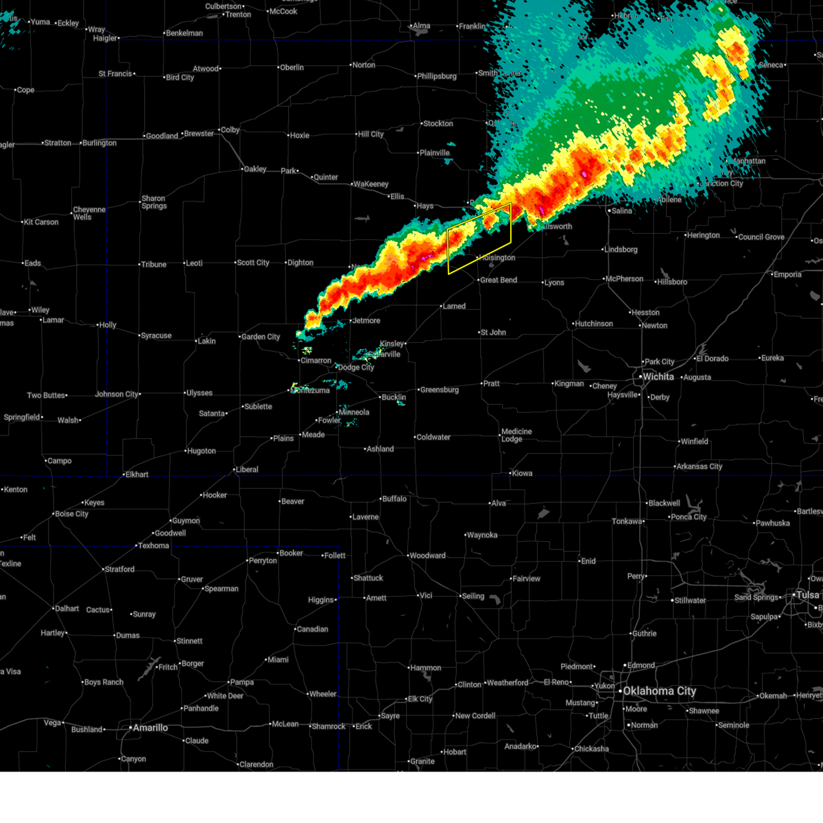
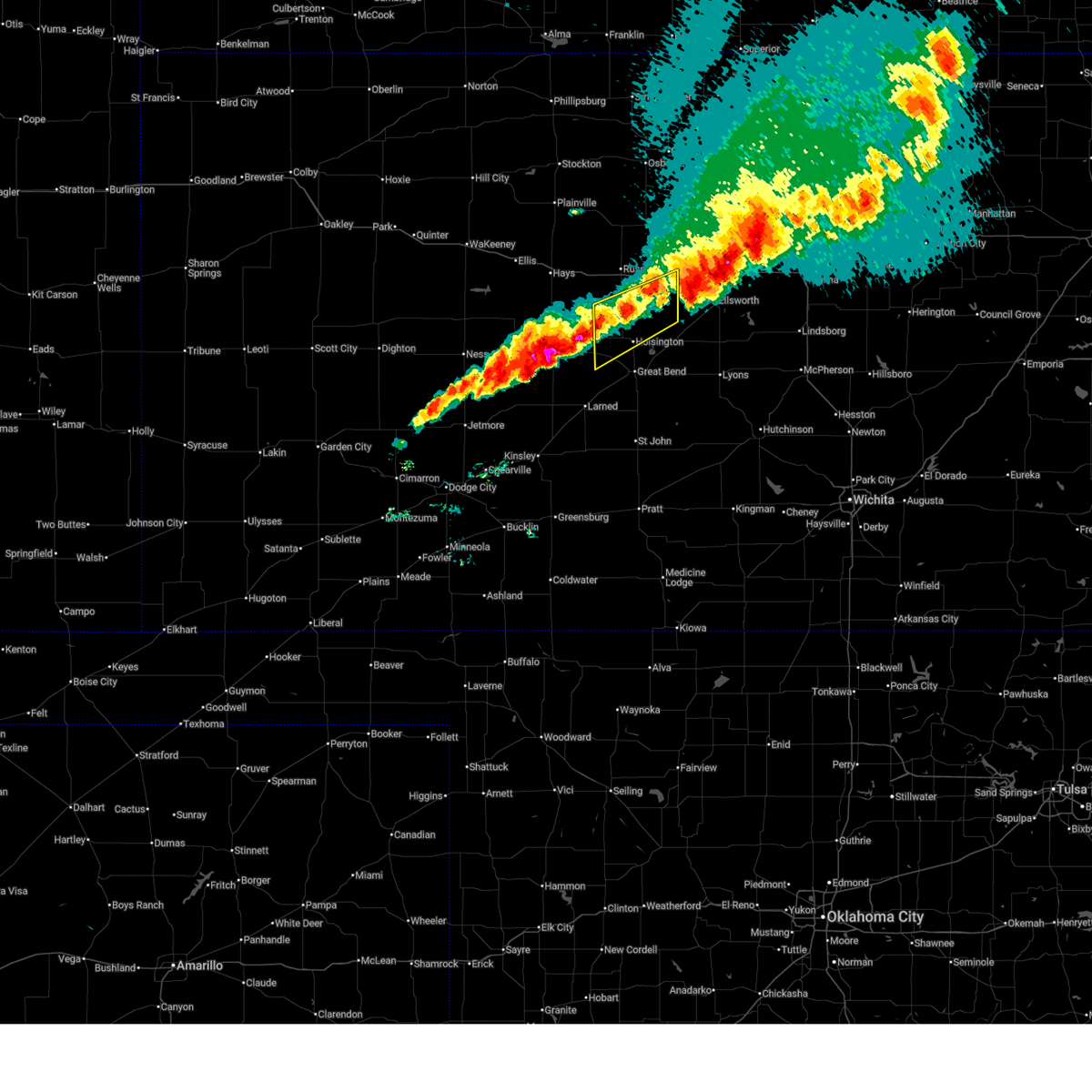
| 5/17/2026 7:28 PM CDT | Half Dollar sized hail reported 3 miles E of Wilson, KS |
| 5/17/2026 7:28 PM CDT |
 Svrict the national weather service in wichita has issued a * severe thunderstorm warning for, lincoln county in central kansas, northwestern ellsworth county in central kansas, southern russell county in central kansas, northern barton county in central kansas, * until 815 pm cdt. * at 727 pm cdt, severe thunderstorms were located along a line extending from near lincoln to near otis, moving northeast at 35 mph (radar indicated). Hazards include golf ball size hail and 70 mph wind gusts. People and animals outdoors will be injured. expect hail damage to roofs, siding, windows, and vehicles. expect considerable tree damage. Wind damage is also likely to mobile homes, roofs, and outbuildings. Svrict the national weather service in wichita has issued a * severe thunderstorm warning for, lincoln county in central kansas, northwestern ellsworth county in central kansas, southern russell county in central kansas, northern barton county in central kansas, * until 815 pm cdt. * at 727 pm cdt, severe thunderstorms were located along a line extending from near lincoln to near otis, moving northeast at 35 mph (radar indicated). Hazards include golf ball size hail and 70 mph wind gusts. People and animals outdoors will be injured. expect hail damage to roofs, siding, windows, and vehicles. expect considerable tree damage. Wind damage is also likely to mobile homes, roofs, and outbuildings.
|
| 5/17/2026 7:20 PM CDT |
 At 719 pm cdt, severe thunderstorms were located along a line extending from barnard to 5 miles south of sylvan grove, moving northeast at 40 mph (trained weather spotters). Hazards include golf ball size hail and 70 mph wind gusts. People and animals outdoors will be injured. expect hail damage to roofs, siding, windows, and vehicles. expect considerable tree damage. wind damage is also likely to mobile homes, roofs, and outbuildings. locations impacted include, wilson, lincoln, sylvan grove, dorrance, barnard, bunker hill, galatia, susank, wilson state park, and wilson lake. This includes interstate 70 between mile markers 192 and 216. At 719 pm cdt, severe thunderstorms were located along a line extending from barnard to 5 miles south of sylvan grove, moving northeast at 40 mph (trained weather spotters). Hazards include golf ball size hail and 70 mph wind gusts. People and animals outdoors will be injured. expect hail damage to roofs, siding, windows, and vehicles. expect considerable tree damage. wind damage is also likely to mobile homes, roofs, and outbuildings. locations impacted include, wilson, lincoln, sylvan grove, dorrance, barnard, bunker hill, galatia, susank, wilson state park, and wilson lake. This includes interstate 70 between mile markers 192 and 216.
|
| 5/17/2026 7:09 PM CDT |
 At 709 pm cdt, severe thunderstorms were located along a line extending from 5 miles north of lincoln to near wilson, moving northeast at 40 mph (trained weather spotters). Hazards include golf ball size hail and 70 mph wind gusts. People and animals outdoors will be injured. expect hail damage to roofs, siding, windows, and vehicles. expect considerable tree damage. wind damage is also likely to mobile homes, roofs, and outbuildings. locations impacted include, wilson, lincoln, sylvan grove, dorrance, barnard, bunker hill, galatia, susank, ash grove, wilson state park, and wilson lake. This includes interstate 70 between mile markers 192 and 216. At 709 pm cdt, severe thunderstorms were located along a line extending from 5 miles north of lincoln to near wilson, moving northeast at 40 mph (trained weather spotters). Hazards include golf ball size hail and 70 mph wind gusts. People and animals outdoors will be injured. expect hail damage to roofs, siding, windows, and vehicles. expect considerable tree damage. wind damage is also likely to mobile homes, roofs, and outbuildings. locations impacted include, wilson, lincoln, sylvan grove, dorrance, barnard, bunker hill, galatia, susank, ash grove, wilson state park, and wilson lake. This includes interstate 70 between mile markers 192 and 216.
|
| 5/17/2026 6:55 PM CDT |
 At 654 pm cdt, severe thunderstorms were located along a line extending from near sylvan grove to near dorrance, moving northeast at 40 mph (trained weather spotters). Hazards include tennis ball size hail and 70 mph wind gusts. People and animals outdoors will be injured. expect hail damage to roofs, siding, windows, and vehicles. expect considerable tree damage. wind damage is also likely to mobile homes, roofs, and outbuildings. locations impacted include, wilson, lincoln, lucas, sylvan grove, dorrance, barnard, bunker hill, galatia, susank, ash grove, wilson state park, and wilson lake. This includes interstate 70 between mile markers 192 and 216. At 654 pm cdt, severe thunderstorms were located along a line extending from near sylvan grove to near dorrance, moving northeast at 40 mph (trained weather spotters). Hazards include tennis ball size hail and 70 mph wind gusts. People and animals outdoors will be injured. expect hail damage to roofs, siding, windows, and vehicles. expect considerable tree damage. wind damage is also likely to mobile homes, roofs, and outbuildings. locations impacted include, wilson, lincoln, lucas, sylvan grove, dorrance, barnard, bunker hill, galatia, susank, ash grove, wilson state park, and wilson lake. This includes interstate 70 between mile markers 192 and 216.
|
| 5/17/2026 6:39 PM CDT |
 At 639 pm cdt, severe thunderstorms were located along a line extending from 5 miles southwest of sylvan grove to 8 miles east of milberger, moving northeast at 25 mph (trained weather spotters reported golf ball size hail in dorrance at 638 pm). Hazards include tennis ball size hail and 70 mph wind gusts. People and animals outdoors will be injured. expect hail damage to roofs, siding, windows, and vehicles. expect considerable tree damage. wind damage is also likely to mobile homes, roofs, and outbuildings. locations impacted include, wilson, lincoln, lucas, sylvan grove, dorrance, barnard, bunker hill, galatia, susank, ash grove, wilson state park, and wilson lake. This includes interstate 70 between mile markers 192 and 216. At 639 pm cdt, severe thunderstorms were located along a line extending from 5 miles southwest of sylvan grove to 8 miles east of milberger, moving northeast at 25 mph (trained weather spotters reported golf ball size hail in dorrance at 638 pm). Hazards include tennis ball size hail and 70 mph wind gusts. People and animals outdoors will be injured. expect hail damage to roofs, siding, windows, and vehicles. expect considerable tree damage. wind damage is also likely to mobile homes, roofs, and outbuildings. locations impacted include, wilson, lincoln, lucas, sylvan grove, dorrance, barnard, bunker hill, galatia, susank, ash grove, wilson state park, and wilson lake. This includes interstate 70 between mile markers 192 and 216.
|
| 5/17/2026 6:35 PM CDT |
 At 635 pm cdt, severe thunderstorms were located along a line extending from 7 miles northeast of sylvan grove to near dorrance, moving northeast at 40 mph (radar indicated). Hazards include tennis ball size hail and 70 mph wind gusts. People and animals outdoors will be injured. expect hail damage to roofs, siding, windows, and vehicles. expect considerable tree damage. wind damage is also likely to mobile homes, roofs, and outbuildings. locations impacted include, wilson, lincoln, lucas, sylvan grove, dorrance, barnard, bunker hill, galatia, susank, ash grove, wilson state park, and wilson lake. This includes interstate 70 between mile markers 192 and 216. At 635 pm cdt, severe thunderstorms were located along a line extending from 7 miles northeast of sylvan grove to near dorrance, moving northeast at 40 mph (radar indicated). Hazards include tennis ball size hail and 70 mph wind gusts. People and animals outdoors will be injured. expect hail damage to roofs, siding, windows, and vehicles. expect considerable tree damage. wind damage is also likely to mobile homes, roofs, and outbuildings. locations impacted include, wilson, lincoln, lucas, sylvan grove, dorrance, barnard, bunker hill, galatia, susank, ash grove, wilson state park, and wilson lake. This includes interstate 70 between mile markers 192 and 216.
|
| 5/17/2026 6:29 PM CDT |
 Svrict the national weather service in wichita has issued a * severe thunderstorm warning for, lincoln county in central kansas, northwestern ellsworth county in central kansas, eastern russell county in central kansas, northwestern barton county in central kansas, * until 730 pm cdt. * at 628 pm cdt, severe thunderstorms were located along a line extending from near sylvan grove to near dorrance, moving northeast at 40 mph (radar indicated). Hazards include two inch hail and 70 mph wind gusts. People and animals outdoors will be injured. expect hail damage to roofs, siding, windows, and vehicles. expect considerable tree damage. Wind damage is also likely to mobile homes, roofs, and outbuildings. Svrict the national weather service in wichita has issued a * severe thunderstorm warning for, lincoln county in central kansas, northwestern ellsworth county in central kansas, eastern russell county in central kansas, northwestern barton county in central kansas, * until 730 pm cdt. * at 628 pm cdt, severe thunderstorms were located along a line extending from near sylvan grove to near dorrance, moving northeast at 40 mph (radar indicated). Hazards include two inch hail and 70 mph wind gusts. People and animals outdoors will be injured. expect hail damage to roofs, siding, windows, and vehicles. expect considerable tree damage. Wind damage is also likely to mobile homes, roofs, and outbuildings.
|
| 4/27/2026 1:11 AM CDT |
 At 111 am cdt, severe thunderstorms were located along a line extending from near culver to 8 miles northeast of brookville, moving east at 50 mph (radar indicated). Hazards include quarter size hail. Damage to vehicles is expected. locations impacted include, salina, ellsworth, wilson, kanopolis, lincoln, assaria, gypsum, sylvan grove, brookville, smolan, beverly, new cambria, falun, glendale, westfall, salina airport, ellsworth airport, and kipp. this includes the following highways, interstate 135 between mile markers 81 and 95. Interstate 70 between mile markers 206 and 266. At 111 am cdt, severe thunderstorms were located along a line extending from near culver to 8 miles northeast of brookville, moving east at 50 mph (radar indicated). Hazards include quarter size hail. Damage to vehicles is expected. locations impacted include, salina, ellsworth, wilson, kanopolis, lincoln, assaria, gypsum, sylvan grove, brookville, smolan, beverly, new cambria, falun, glendale, westfall, salina airport, ellsworth airport, and kipp. this includes the following highways, interstate 135 between mile markers 81 and 95. Interstate 70 between mile markers 206 and 266.
|
| 4/27/2026 12:58 AM CDT |
 At 1257 am cdt, severe thunderstorms were located along a line extending from near beverly to 5 miles northwest of brookville, moving east at 45 mph (radar indicated). Hazards include golf ball size hail. People and animals outdoors will be injured. expect damage to roofs, siding, windows, and vehicles. locations impacted include, salina, ellsworth, wilson, kanopolis, lincoln, assaria, gypsum, sylvan grove, brookville, smolan, beverly, new cambria, falun, glendale, westfall, salina airport, ellsworth airport, and kipp. this includes the following highways, interstate 135 between mile markers 81 and 95. Interstate 70 between mile markers 206 and 266. At 1257 am cdt, severe thunderstorms were located along a line extending from near beverly to 5 miles northwest of brookville, moving east at 45 mph (radar indicated). Hazards include golf ball size hail. People and animals outdoors will be injured. expect damage to roofs, siding, windows, and vehicles. locations impacted include, salina, ellsworth, wilson, kanopolis, lincoln, assaria, gypsum, sylvan grove, brookville, smolan, beverly, new cambria, falun, glendale, westfall, salina airport, ellsworth airport, and kipp. this includes the following highways, interstate 135 between mile markers 81 and 95. Interstate 70 between mile markers 206 and 266.
|
| 4/27/2026 12:47 AM CDT |
 At 1247 am cdt, a severe thunderstorm was located 8 miles southwest of beverly, or 9 miles southeast of lincoln, moving east to northeast at 40 mph (radar indicated). Hazards include golf ball size hail. People and animals outdoors will be injured. expect damage to roofs, siding, windows, and vehicles. locations impacted include, salina, ellsworth, wilson, kanopolis, lincoln, assaria, gypsum, sylvan grove, brookville, smolan, beverly, new cambria, falun, glendale, westfall, salina airport, ellsworth airport, and kipp. this includes the following highways, interstate 135 between mile markers 81 and 95. Interstate 70 between mile markers 206 and 266. At 1247 am cdt, a severe thunderstorm was located 8 miles southwest of beverly, or 9 miles southeast of lincoln, moving east to northeast at 40 mph (radar indicated). Hazards include golf ball size hail. People and animals outdoors will be injured. expect damage to roofs, siding, windows, and vehicles. locations impacted include, salina, ellsworth, wilson, kanopolis, lincoln, assaria, gypsum, sylvan grove, brookville, smolan, beverly, new cambria, falun, glendale, westfall, salina airport, ellsworth airport, and kipp. this includes the following highways, interstate 135 between mile markers 81 and 95. Interstate 70 between mile markers 206 and 266.
|
| 4/27/2026 12:40 AM CDT |
 At 1239 am cdt, a severe thunderstorm was located 6 miles southeast of new cambria, or 10 miles east of salina, moving east at 50 mph (trained weather spotters. numerous reports of large hail with this storm). Hazards include two inch hail. People and animals outdoors will be injured. expect damage to roofs, siding, windows, and vehicles. locations impacted include, salina, ellsworth, wilson, kanopolis, lincoln, assaria, gypsum, sylvan grove, brookville, smolan, beverly, new cambria, falun, glendale, westfall, salina airport, ellsworth airport, and kipp. this includes the following highways, interstate 135 between mile markers 81 and 95. Interstate 70 between mile markers 206 and 266. At 1239 am cdt, a severe thunderstorm was located 6 miles southeast of new cambria, or 10 miles east of salina, moving east at 50 mph (trained weather spotters. numerous reports of large hail with this storm). Hazards include two inch hail. People and animals outdoors will be injured. expect damage to roofs, siding, windows, and vehicles. locations impacted include, salina, ellsworth, wilson, kanopolis, lincoln, assaria, gypsum, sylvan grove, brookville, smolan, beverly, new cambria, falun, glendale, westfall, salina airport, ellsworth airport, and kipp. this includes the following highways, interstate 135 between mile markers 81 and 95. Interstate 70 between mile markers 206 and 266.
|
| 4/27/2026 12:33 AM CDT |
 Svrict the national weather service in wichita has issued a * severe thunderstorm warning for, southern lincoln county in central kansas, northern ellsworth county in central kansas, saline county in central kansas, * until 145 am cdt. * at 1232 am cdt, a severe thunderstorm was located near salina, moving east at 50 mph (trained weather spotters. this storm has a history of producing two inch diameter hail). Hazards include tennis ball size hail. People and animals outdoors will be injured. Expect damage to roofs, siding, windows, and vehicles. Svrict the national weather service in wichita has issued a * severe thunderstorm warning for, southern lincoln county in central kansas, northern ellsworth county in central kansas, saline county in central kansas, * until 145 am cdt. * at 1232 am cdt, a severe thunderstorm was located near salina, moving east at 50 mph (trained weather spotters. this storm has a history of producing two inch diameter hail). Hazards include tennis ball size hail. People and animals outdoors will be injured. Expect damage to roofs, siding, windows, and vehicles.
|
| 4/26/2026 11:54 PM CDT |
 At 1153 pm cdt, a severe thunderstorm was located 6 miles northeast of kanopolis, moving east to northeast at 50 mph (trained weather spotters reported ping pong ball size hail in ellsworth). Hazards include ping pong ball size hail. People and animals outdoors will be injured. expect damage to roofs, siding, windows, and vehicles. locations impacted include, salina, ellsworth, wilson, kanopolis, brookville, smolan, new cambria, falun, glendale, westfall, salina airport, ellsworth airport, kanopolis lake, and kanopolis state park. this includes the following highways, interstate 135 between mile markers 83 and 95. Interstate 70 between mile markers 206 and 266. At 1153 pm cdt, a severe thunderstorm was located 6 miles northeast of kanopolis, moving east to northeast at 50 mph (trained weather spotters reported ping pong ball size hail in ellsworth). Hazards include ping pong ball size hail. People and animals outdoors will be injured. expect damage to roofs, siding, windows, and vehicles. locations impacted include, salina, ellsworth, wilson, kanopolis, brookville, smolan, new cambria, falun, glendale, westfall, salina airport, ellsworth airport, kanopolis lake, and kanopolis state park. this includes the following highways, interstate 135 between mile markers 83 and 95. Interstate 70 between mile markers 206 and 266.
|
| 4/26/2026 11:43 PM CDT |
 Svrict the national weather service in wichita has issued a * severe thunderstorm warning for, southeastern lincoln county in central kansas, ellsworth county in central kansas, saline county in central kansas, * until 1245 am cdt. * at 1143 pm cdt, a severe thunderstorm was located over kanopolis, moving northeast at 45 mph (radar indicated). Hazards include quarter size hail. damage to vehicles is expected Svrict the national weather service in wichita has issued a * severe thunderstorm warning for, southeastern lincoln county in central kansas, ellsworth county in central kansas, saline county in central kansas, * until 1245 am cdt. * at 1143 pm cdt, a severe thunderstorm was located over kanopolis, moving northeast at 45 mph (radar indicated). Hazards include quarter size hail. damage to vehicles is expected
|
| 8/10/2025 12:56 AM CDT |
 At 1256 am cdt, severe thunderstorms were located along a line extending from glasco to 9 miles southwest of lincoln, moving east at 35 mph (radar indicated). Hazards include 70 mph wind gusts. Expect considerable tree damage. damage is likely to mobile homes, roofs, and outbuildings. locations impacted include, lincoln, lucas, sylvan grove, luray, dorrance, beverly, barnard, bunker hill, ash grove, westfall, wilson state park, and wilson lake. This includes interstate 70 between mile markers 192 and 205, and between mile markers 229 and 234. At 1256 am cdt, severe thunderstorms were located along a line extending from glasco to 9 miles southwest of lincoln, moving east at 35 mph (radar indicated). Hazards include 70 mph wind gusts. Expect considerable tree damage. damage is likely to mobile homes, roofs, and outbuildings. locations impacted include, lincoln, lucas, sylvan grove, luray, dorrance, beverly, barnard, bunker hill, ash grove, westfall, wilson state park, and wilson lake. This includes interstate 70 between mile markers 192 and 205, and between mile markers 229 and 234.
|
| 8/10/2025 12:42 AM CDT |
 At 1242 am cdt, severe thunderstorms were located along a line extending from asherville to near sylvan grove, moving east at 45 mph (radar indicated). Hazards include 70 mph wind gusts. Expect considerable tree damage. damage is likely to mobile homes, roofs, and outbuildings. locations impacted include, russell, lincoln, lucas, gorham, sylvan grove, luray, dorrance, beverly, barnard, milberger, bunker hill, paradise, waldo, ash grove, westfall, russell airport, wilson state park, and wilson lake. This includes interstate 70 between mile markers 176 and 205, and between mile markers 229 and 234. At 1242 am cdt, severe thunderstorms were located along a line extending from asherville to near sylvan grove, moving east at 45 mph (radar indicated). Hazards include 70 mph wind gusts. Expect considerable tree damage. damage is likely to mobile homes, roofs, and outbuildings. locations impacted include, russell, lincoln, lucas, gorham, sylvan grove, luray, dorrance, beverly, barnard, milberger, bunker hill, paradise, waldo, ash grove, westfall, russell airport, wilson state park, and wilson lake. This includes interstate 70 between mile markers 176 and 205, and between mile markers 229 and 234.
|
| 8/10/2025 12:25 AM CDT |
 Svrict the national weather service in wichita has issued a * severe thunderstorm warning for, lincoln county in central kansas, russell county in central kansas, * until 130 am cdt. * at 1225 am cdt, severe thunderstorms were located along a line extending from 5 miles southeast of glen elder to 6 miles north of russell, moving east at 35 mph (radar indicated). Hazards include 70 mph wind gusts. Expect considerable tree damage. Damage is likely to mobile homes, roofs, and outbuildings. Svrict the national weather service in wichita has issued a * severe thunderstorm warning for, lincoln county in central kansas, russell county in central kansas, * until 130 am cdt. * at 1225 am cdt, severe thunderstorms were located along a line extending from 5 miles southeast of glen elder to 6 miles north of russell, moving east at 35 mph (radar indicated). Hazards include 70 mph wind gusts. Expect considerable tree damage. Damage is likely to mobile homes, roofs, and outbuildings.
|
| 7/21/2025 7:44 PM CDT |
 At 743 pm cdt, a severe thunderstorm was located near kanopolis, moving southeast at 25 mph (equipment indicated. at 635 pm, 60 mph winds were reported at ellsworth municipal airport). Hazards include 70 mph wind gusts and half dollar size hail. Hail damage to vehicles is expected. expect considerable tree damage. wind damage is also likely to mobile homes, roofs, and outbuildings. locations impacted include, salina, ellsworth, wilson, kanopolis, sylvan grove, brookville, smolan, beverly, falun, glendale, westfall, salina airport, ellsworth airport, kanopolis state park, and kanopolis lake. this includes the following highways, interstate 135 near mile marker 94. Interstate 70 between mile markers 206 and 250. At 743 pm cdt, a severe thunderstorm was located near kanopolis, moving southeast at 25 mph (equipment indicated. at 635 pm, 60 mph winds were reported at ellsworth municipal airport). Hazards include 70 mph wind gusts and half dollar size hail. Hail damage to vehicles is expected. expect considerable tree damage. wind damage is also likely to mobile homes, roofs, and outbuildings. locations impacted include, salina, ellsworth, wilson, kanopolis, sylvan grove, brookville, smolan, beverly, falun, glendale, westfall, salina airport, ellsworth airport, kanopolis state park, and kanopolis lake. this includes the following highways, interstate 135 near mile marker 94. Interstate 70 between mile markers 206 and 250.
|
| 7/21/2025 7:34 PM CDT |
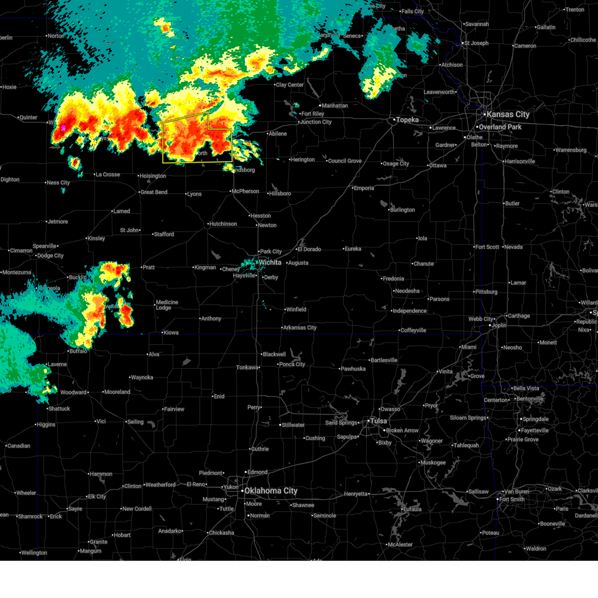 At 733 pm cdt, a severe thunderstorm was located near kanopolis, moving southeast at 25 mph (trained weather spotters. at 730 pm, 60 mph winds were reported 6 miles northeast of ellsworth). Hazards include 70 mph wind gusts and half dollar size hail. Hail damage to vehicles is expected. expect considerable tree damage. wind damage is also likely to mobile homes, roofs, and outbuildings. locations impacted include, salina, ellsworth, wilson, kanopolis, lincoln, sylvan grove, brookville, smolan, beverly, falun, glendale, westfall, salina airport, ellsworth airport, kanopolis state park, and kanopolis lake. this includes the following highways, interstate 135 near mile marker 94. Interstate 70 between mile markers 206 and 250. At 733 pm cdt, a severe thunderstorm was located near kanopolis, moving southeast at 25 mph (trained weather spotters. at 730 pm, 60 mph winds were reported 6 miles northeast of ellsworth). Hazards include 70 mph wind gusts and half dollar size hail. Hail damage to vehicles is expected. expect considerable tree damage. wind damage is also likely to mobile homes, roofs, and outbuildings. locations impacted include, salina, ellsworth, wilson, kanopolis, lincoln, sylvan grove, brookville, smolan, beverly, falun, glendale, westfall, salina airport, ellsworth airport, kanopolis state park, and kanopolis lake. this includes the following highways, interstate 135 near mile marker 94. Interstate 70 between mile markers 206 and 250.
|
| 7/21/2025 7:24 PM CDT |
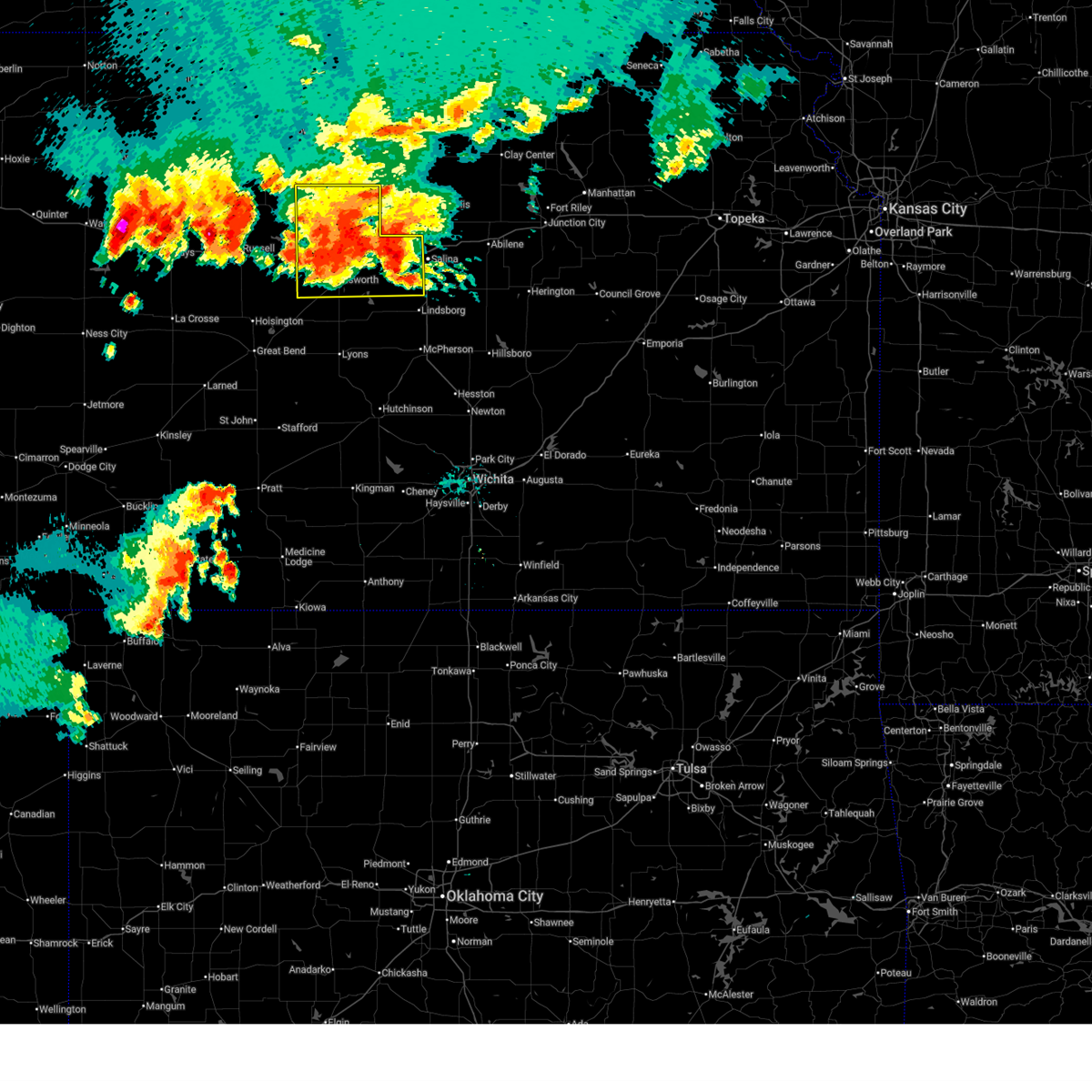 At 723 pm cdt, a severe thunderstorm was located near ellsworth, moving southeast at 25 mph (trained weather spotters. at 722 pm, 75 mph winds were reported south of westfall on interstate 70). Hazards include 70 mph wind gusts and half dollar size hail. Hail damage to vehicles is expected. expect considerable tree damage. wind damage is also likely to mobile homes, roofs, and outbuildings. locations impacted include, salina, ellsworth, wilson, kanopolis, lincoln, sylvan grove, brookville, smolan, beverly, barnard, falun, glendale, ash grove, westfall, salina airport, ellsworth airport, kanopolis state park, and kanopolis lake. this includes the following highways, interstate 135 near mile marker 94. Interstate 70 between mile markers 206 and 250. At 723 pm cdt, a severe thunderstorm was located near ellsworth, moving southeast at 25 mph (trained weather spotters. at 722 pm, 75 mph winds were reported south of westfall on interstate 70). Hazards include 70 mph wind gusts and half dollar size hail. Hail damage to vehicles is expected. expect considerable tree damage. wind damage is also likely to mobile homes, roofs, and outbuildings. locations impacted include, salina, ellsworth, wilson, kanopolis, lincoln, sylvan grove, brookville, smolan, beverly, barnard, falun, glendale, ash grove, westfall, salina airport, ellsworth airport, kanopolis state park, and kanopolis lake. this includes the following highways, interstate 135 near mile marker 94. Interstate 70 between mile markers 206 and 250.
|
| 7/21/2025 6:59 PM CDT |
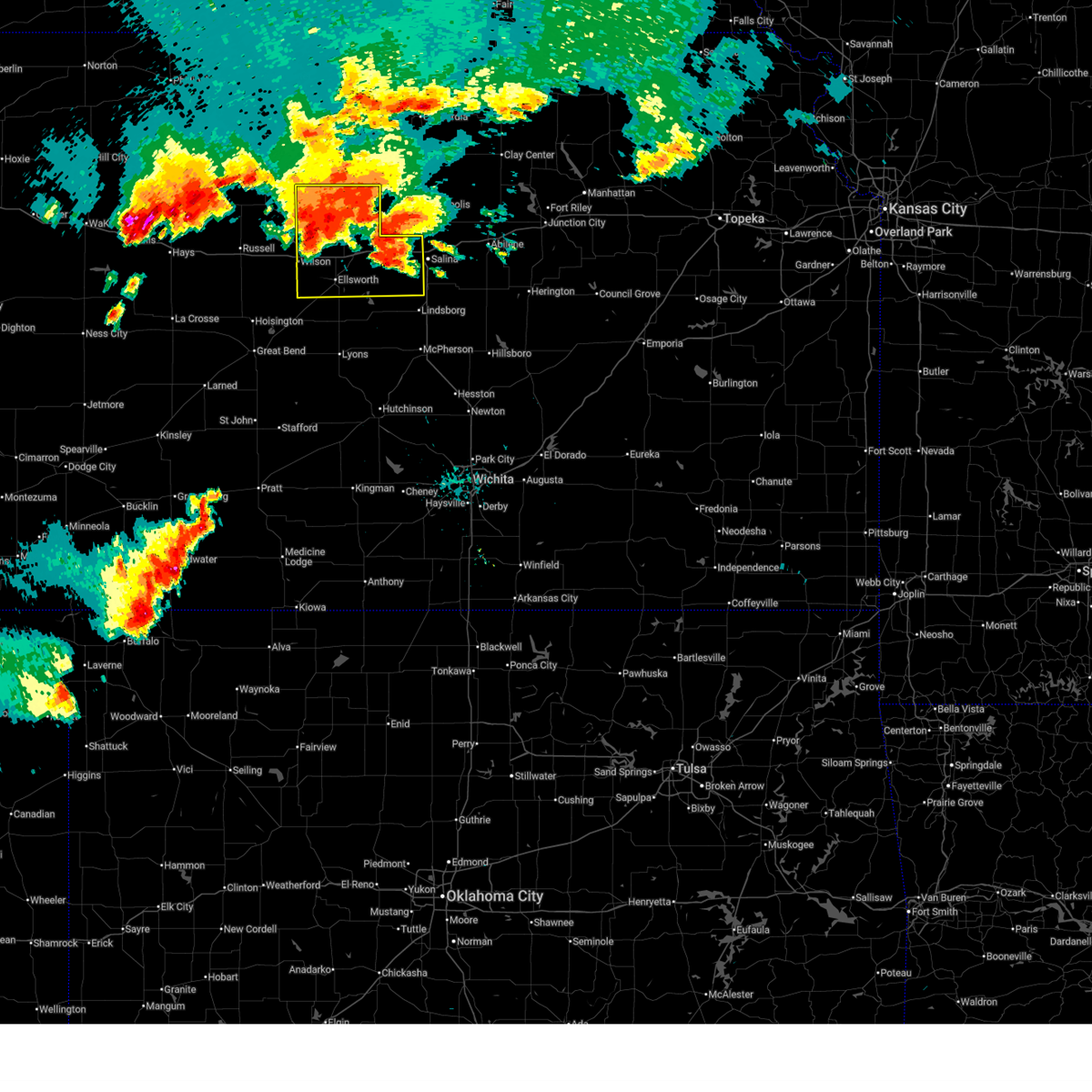 Svrict the national weather service in wichita has issued a * severe thunderstorm warning for, lincoln county in central kansas, ellsworth county in central kansas, western saline county in central kansas, * until 815 pm cdt. * at 656 pm cdt, a cluster of severe thunderstorms was located across portions of lincoln, saline, and northern ellsworth counties, moving southeast at 20 mph (radar indicated). Hazards include 70 mph wind gusts and half dollar size hail. Hail damage to vehicles is expected. expect considerable tree damage. Wind damage is also likely to mobile homes, roofs, and outbuildings. Svrict the national weather service in wichita has issued a * severe thunderstorm warning for, lincoln county in central kansas, ellsworth county in central kansas, western saline county in central kansas, * until 815 pm cdt. * at 656 pm cdt, a cluster of severe thunderstorms was located across portions of lincoln, saline, and northern ellsworth counties, moving southeast at 20 mph (radar indicated). Hazards include 70 mph wind gusts and half dollar size hail. Hail damage to vehicles is expected. expect considerable tree damage. Wind damage is also likely to mobile homes, roofs, and outbuildings.
|
| 6/30/2025 5:22 AM CDT |
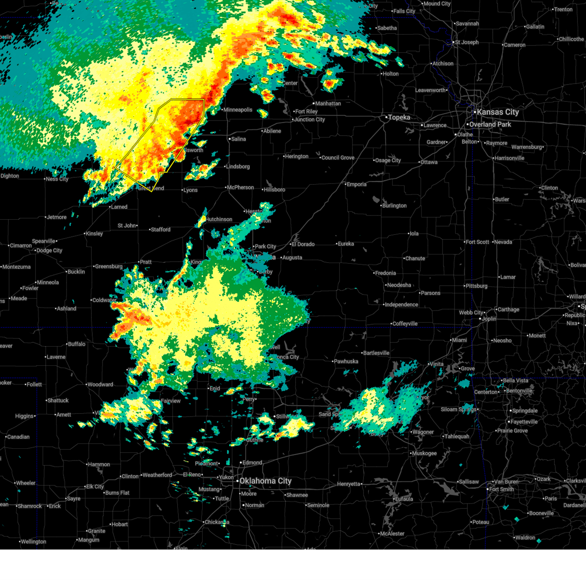 The storms which prompted the warning have moved out of the area. therefore, the warning will be allowed to expire. however, gusty winds are still possible with these thunderstorms. The storms which prompted the warning have moved out of the area. therefore, the warning will be allowed to expire. however, gusty winds are still possible with these thunderstorms.
|
| 6/30/2025 5:11 AM CDT |
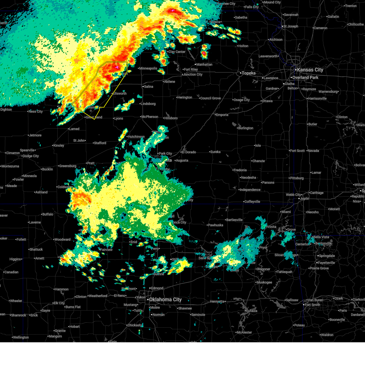 At 511 am cdt, severe thunderstorms were located along a line extending from barnard to 8 miles southeast of sylvan grove to 5 miles north of claflin, moving southeast at 45 mph (radar indicated). Hazards include 60 mph wind gusts. Expect damage to roofs, siding, and trees. locations impacted include, ellsworth, hoisington, ellinwood, wilson, claflin, lincoln, holyrood, sylvan grove, dorrance, beverly, olmitz, barnard, bunker hill, susank, ash grove, ellsworth airport, cheyenne bottoms, wilson state park, wilson lake, and odin. This includes interstate 70 between mile markers 193 and 226. At 511 am cdt, severe thunderstorms were located along a line extending from barnard to 8 miles southeast of sylvan grove to 5 miles north of claflin, moving southeast at 45 mph (radar indicated). Hazards include 60 mph wind gusts. Expect damage to roofs, siding, and trees. locations impacted include, ellsworth, hoisington, ellinwood, wilson, claflin, lincoln, holyrood, sylvan grove, dorrance, beverly, olmitz, barnard, bunker hill, susank, ash grove, ellsworth airport, cheyenne bottoms, wilson state park, wilson lake, and odin. This includes interstate 70 between mile markers 193 and 226.
|
| 6/30/2025 4:52 AM CDT |
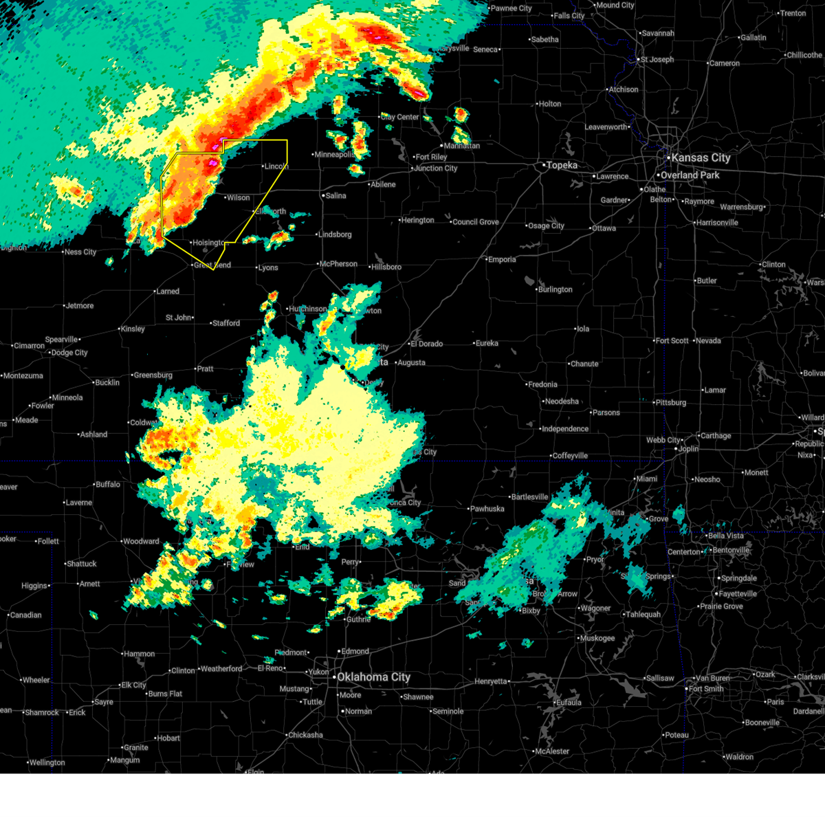 At 452 am cdt, severe thunderstorms were located along a line extending from near victor to near lucas to 9 miles east of milberger, moving southeast at 45 mph (radar indicated). Hazards include 60 mph wind gusts and penny size hail. Expect damage to roofs, siding, and trees. locations impacted include, russell, ellsworth, hoisington, ellinwood, wilson, claflin, lincoln, holyrood, lucas, gorham, sylvan grove, luray, dorrance, beverly, olmitz, barnard, milberger, bunker hill, paradise, and galatia. This includes interstate 70 between mile markers 176 and 226. At 452 am cdt, severe thunderstorms were located along a line extending from near victor to near lucas to 9 miles east of milberger, moving southeast at 45 mph (radar indicated). Hazards include 60 mph wind gusts and penny size hail. Expect damage to roofs, siding, and trees. locations impacted include, russell, ellsworth, hoisington, ellinwood, wilson, claflin, lincoln, holyrood, lucas, gorham, sylvan grove, luray, dorrance, beverly, olmitz, barnard, milberger, bunker hill, paradise, and galatia. This includes interstate 70 between mile markers 176 and 226.
|
| 6/30/2025 4:34 AM CDT |
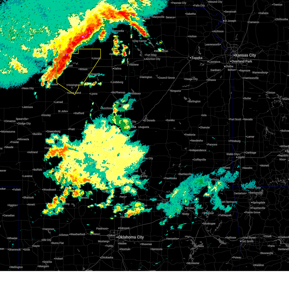 At 434 am cdt, severe thunderstorms were located along a line extending from near tipton to luray to near milberger, moving southeast at 45 mph (radar indicated). Hazards include 60 mph wind gusts and penny size hail. Expect damage to roofs, siding, and trees. locations impacted include, russell, ellsworth, hoisington, ellinwood, wilson, claflin, lincoln, holyrood, lucas, gorham, sylvan grove, luray, dorrance, beverly, olmitz, barnard, milberger, bunker hill, paradise, and galatia. This includes interstate 70 between mile markers 176 and 226. At 434 am cdt, severe thunderstorms were located along a line extending from near tipton to luray to near milberger, moving southeast at 45 mph (radar indicated). Hazards include 60 mph wind gusts and penny size hail. Expect damage to roofs, siding, and trees. locations impacted include, russell, ellsworth, hoisington, ellinwood, wilson, claflin, lincoln, holyrood, lucas, gorham, sylvan grove, luray, dorrance, beverly, olmitz, barnard, milberger, bunker hill, paradise, and galatia. This includes interstate 70 between mile markers 176 and 226.
|
| 6/30/2025 4:23 AM CDT |
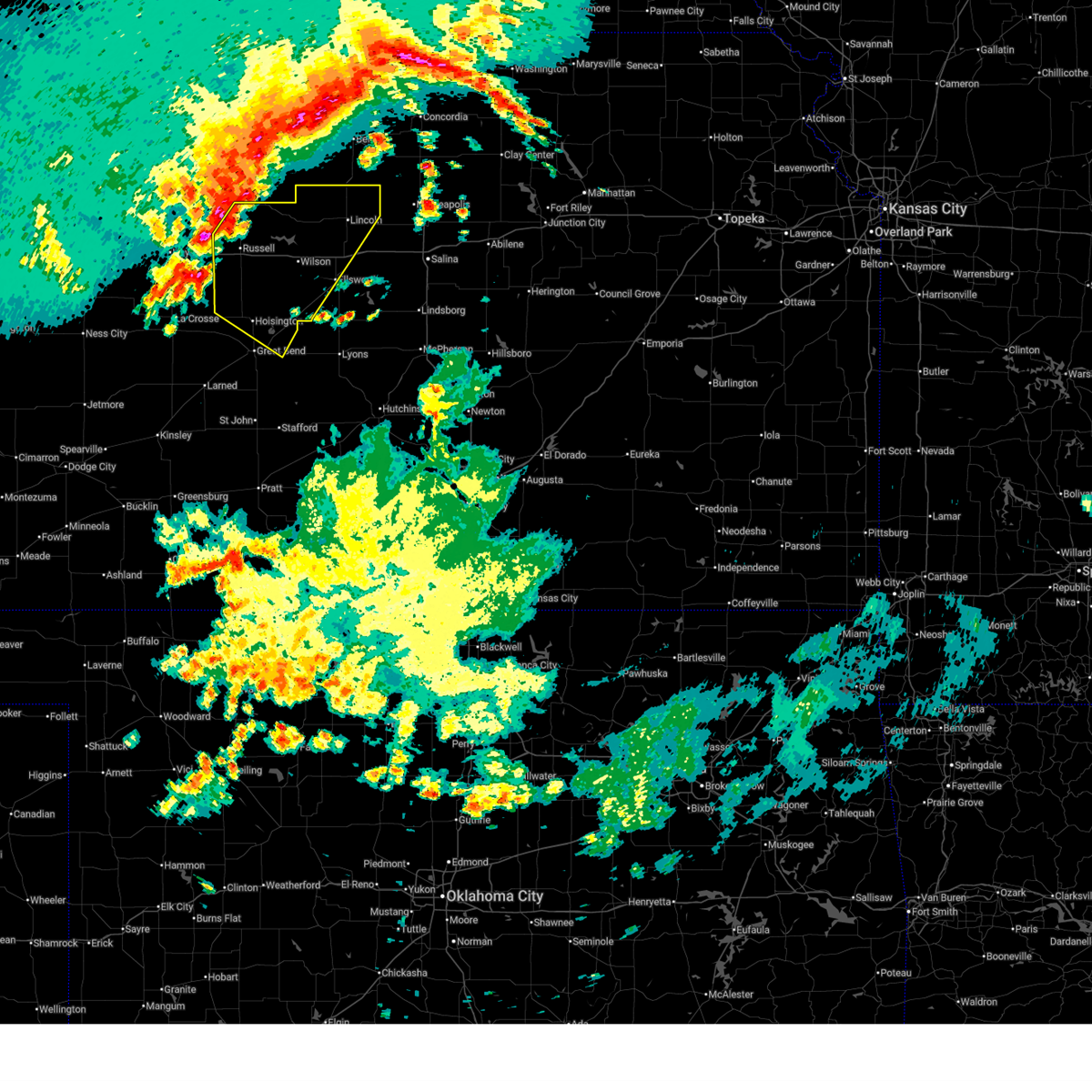 Svrict the national weather service in wichita has issued a * severe thunderstorm warning for, lincoln county in central kansas, western ellsworth county in central kansas, russell county in central kansas, northeastern barton county in central kansas, * until 530 am cdt. * at 423 am cdt, severe thunderstorms were located along a line extending from cawker city to 6 miles north of luray to near walker, moving southeast at 45 mph (radar indicated). Hazards include 60 mph wind gusts. expect damage to roofs, siding, and trees Svrict the national weather service in wichita has issued a * severe thunderstorm warning for, lincoln county in central kansas, western ellsworth county in central kansas, russell county in central kansas, northeastern barton county in central kansas, * until 530 am cdt. * at 423 am cdt, severe thunderstorms were located along a line extending from cawker city to 6 miles north of luray to near walker, moving southeast at 45 mph (radar indicated). Hazards include 60 mph wind gusts. expect damage to roofs, siding, and trees
|
| 6/17/2025 3:55 AM CDT |
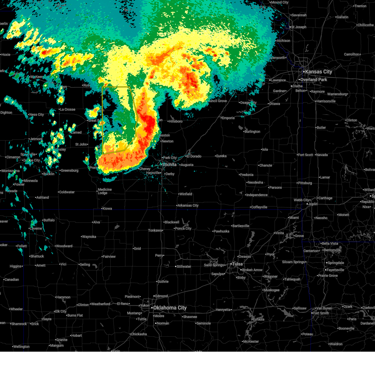 Svrict the national weather service in wichita has issued a * severe thunderstorm warning for, western mcpherson county in central kansas, northern reno county in south central kansas, rice county in central kansas, ellsworth county in central kansas, southwestern saline county in central kansas, * until 500 am cdt. * at 354 am cdt, strong winds were continuing behind the line of storms with several reports of 70 mph winds (radar indicated). Hazards include 70 mph wind gusts. Expect considerable tree damage. Damage is likely to mobile homes, roofs, and outbuildings. Svrict the national weather service in wichita has issued a * severe thunderstorm warning for, western mcpherson county in central kansas, northern reno county in south central kansas, rice county in central kansas, ellsworth county in central kansas, southwestern saline county in central kansas, * until 500 am cdt. * at 354 am cdt, strong winds were continuing behind the line of storms with several reports of 70 mph winds (radar indicated). Hazards include 70 mph wind gusts. Expect considerable tree damage. Damage is likely to mobile homes, roofs, and outbuildings.
|
| 6/17/2025 2:30 AM CDT |
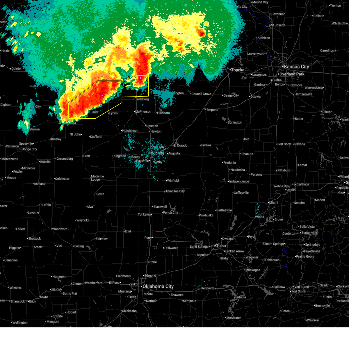 the severe thunderstorm warning has been cancelled and is no longer in effect the severe thunderstorm warning has been cancelled and is no longer in effect
|
| 6/17/2025 2:30 AM CDT |
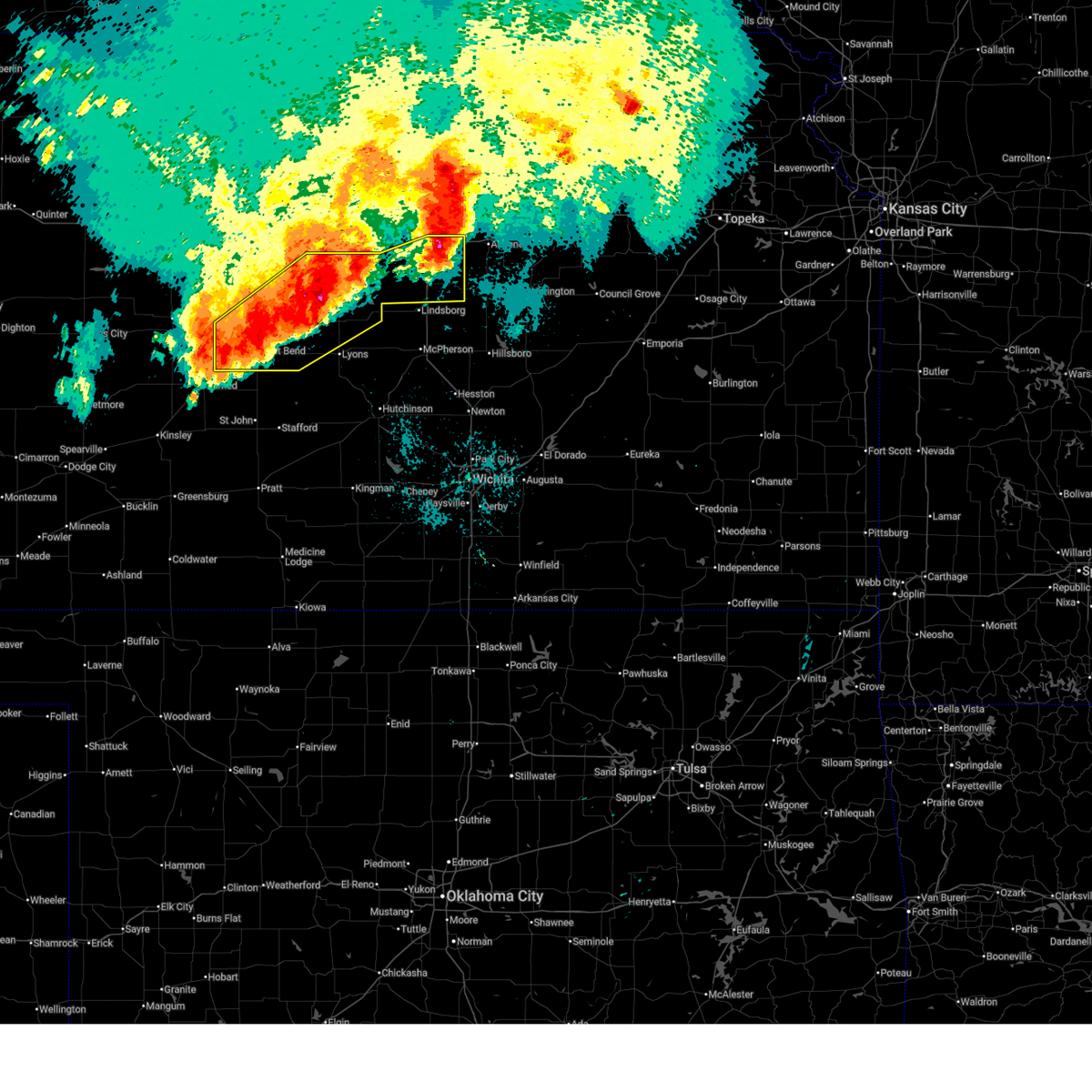 At 230 am cdt, severe thunderstorms were located along a line extending from near new cambria to 5 miles southwest of ellsworth to 5 miles southwest of great bend, moving southeast at 35 mph (radar indicated). Hazards include 70 mph wind gusts. Expect considerable tree damage. damage is likely to mobile homes, roofs, and outbuildings. locations impacted include, salina, great bend, ellsworth, hoisington, ellinwood, wilson, claflin, kanopolis, chase, holyrood, assaria, gypsum, bushton, geneseo, brookville, pawnee rock, smolan, albert, lorraine, and new cambria. this includes the following highways, interstate 135 between mile markers 78 and 95. Interstate 70 between mile markers 207 and 228, and between mile markers 237 and 266. At 230 am cdt, severe thunderstorms were located along a line extending from near new cambria to 5 miles southwest of ellsworth to 5 miles southwest of great bend, moving southeast at 35 mph (radar indicated). Hazards include 70 mph wind gusts. Expect considerable tree damage. damage is likely to mobile homes, roofs, and outbuildings. locations impacted include, salina, great bend, ellsworth, hoisington, ellinwood, wilson, claflin, kanopolis, chase, holyrood, assaria, gypsum, bushton, geneseo, brookville, pawnee rock, smolan, albert, lorraine, and new cambria. this includes the following highways, interstate 135 between mile markers 78 and 95. Interstate 70 between mile markers 207 and 228, and between mile markers 237 and 266.
|
| 6/17/2025 2:08 AM CDT |
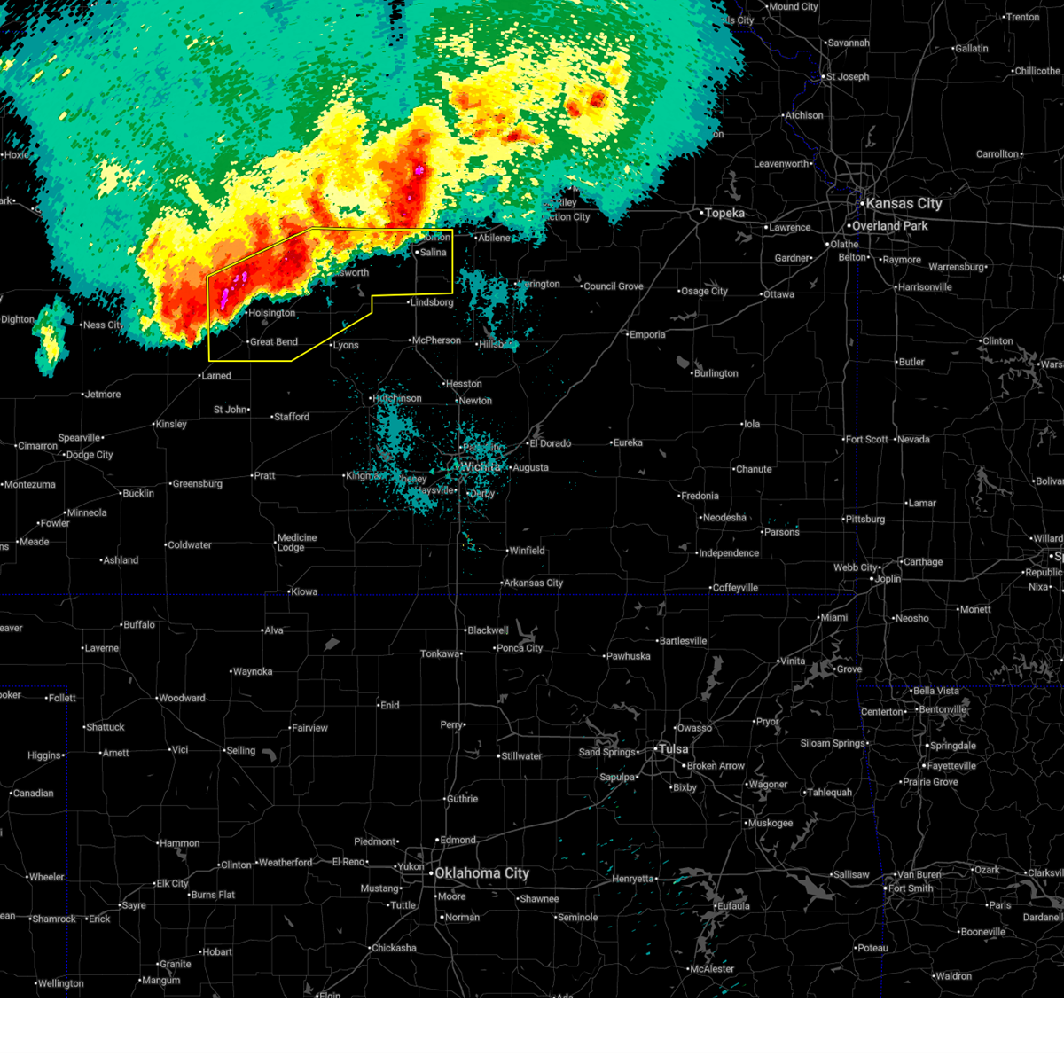 At 208 am cdt, severe thunderstorms were located along a line extending from near tescott to 6 miles south of milberger, moving southeast at 35 mph (radar indicated). Hazards include 70 mph wind gusts. Expect considerable tree damage. damage is likely to mobile homes, roofs, and outbuildings. locations impacted include, salina, great bend, ellsworth, hoisington, ellinwood, wilson, claflin, kanopolis, chase, holyrood, assaria, gypsum, bushton, geneseo, brookville, pawnee rock, smolan, dorrance, albert, and lorraine. this includes the following highways, interstate 135 between mile markers 78 and 95. Interstate 70 between mile markers 197 and 266. At 208 am cdt, severe thunderstorms were located along a line extending from near tescott to 6 miles south of milberger, moving southeast at 35 mph (radar indicated). Hazards include 70 mph wind gusts. Expect considerable tree damage. damage is likely to mobile homes, roofs, and outbuildings. locations impacted include, salina, great bend, ellsworth, hoisington, ellinwood, wilson, claflin, kanopolis, chase, holyrood, assaria, gypsum, bushton, geneseo, brookville, pawnee rock, smolan, dorrance, albert, and lorraine. this includes the following highways, interstate 135 between mile markers 78 and 95. Interstate 70 between mile markers 197 and 266.
|
| 6/17/2025 2:00 AM CDT |
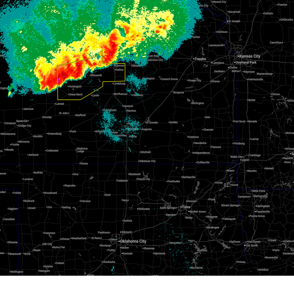 At 200 am cdt, severe thunderstorms were located along a line extending from near beverly to 5 miles southwest of milberger, moving southeast at 30 mph (radar indicated). Hazards include 70 mph wind gusts. Expect considerable tree damage. damage is likely to mobile homes, roofs, and outbuildings. locations impacted include, salina, great bend, russell, ellsworth, hoisington, ellinwood, wilson, claflin, kanopolis, lincoln, chase, holyrood, assaria, gypsum, gorham, bushton, sylvan grove, geneseo, brookville, and pawnee rock. this includes the following highways, interstate 135 between mile markers 78 and 95. Interstate 70 between mile markers 175 and 266. At 200 am cdt, severe thunderstorms were located along a line extending from near beverly to 5 miles southwest of milberger, moving southeast at 30 mph (radar indicated). Hazards include 70 mph wind gusts. Expect considerable tree damage. damage is likely to mobile homes, roofs, and outbuildings. locations impacted include, salina, great bend, russell, ellsworth, hoisington, ellinwood, wilson, claflin, kanopolis, lincoln, chase, holyrood, assaria, gypsum, gorham, bushton, sylvan grove, geneseo, brookville, and pawnee rock. this includes the following highways, interstate 135 between mile markers 78 and 95. Interstate 70 between mile markers 175 and 266.
|
| 6/17/2025 1:41 AM CDT |
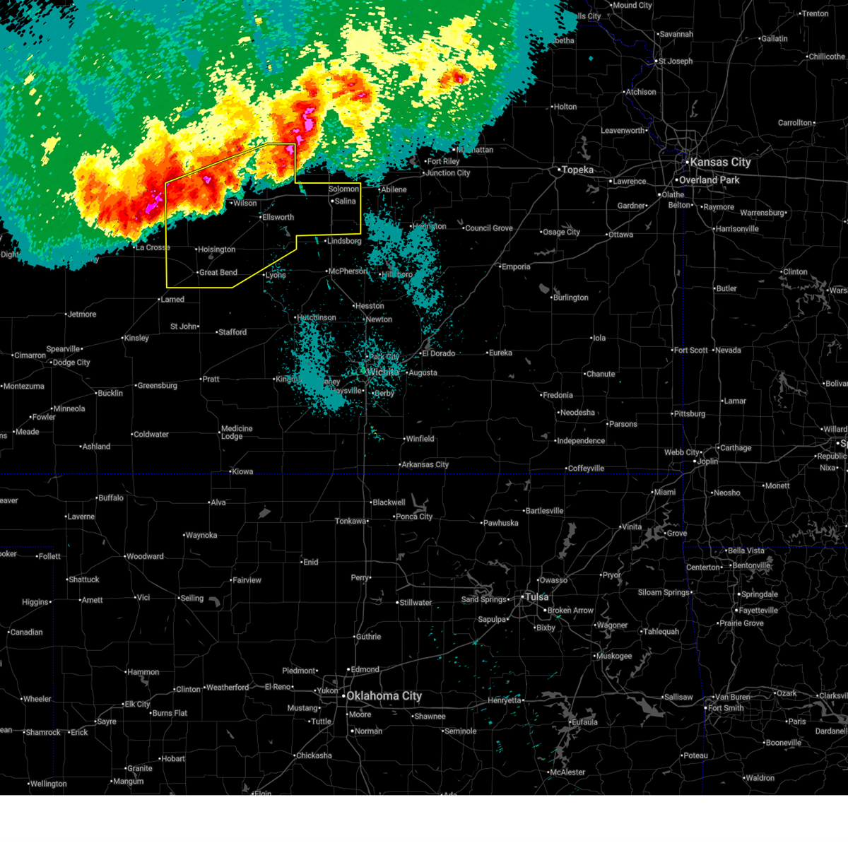 Svrict the national weather service in wichita has issued a * severe thunderstorm warning for, lincoln county in central kansas, northern rice county in central kansas, ellsworth county in central kansas, russell county in central kansas, barton county in central kansas, saline county in central kansas, * until 245 am cdt. * at 140 am cdt, severe thunderstorms were located along a line extending from near tescott to near milberger, moving southeast at 35 mph (several weather stations and trained weather spotter reports). Hazards include 70 mph wind gusts. Expect considerable tree damage. Damage is likely to mobile homes, roofs, and outbuildings. Svrict the national weather service in wichita has issued a * severe thunderstorm warning for, lincoln county in central kansas, northern rice county in central kansas, ellsworth county in central kansas, russell county in central kansas, barton county in central kansas, saline county in central kansas, * until 245 am cdt. * at 140 am cdt, severe thunderstorms were located along a line extending from near tescott to near milberger, moving southeast at 35 mph (several weather stations and trained weather spotter reports). Hazards include 70 mph wind gusts. Expect considerable tree damage. Damage is likely to mobile homes, roofs, and outbuildings.
|
| 6/17/2025 1:30 AM CDT |
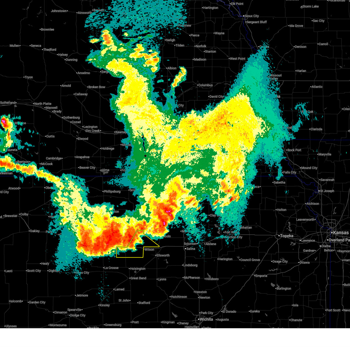 At 130 am cdt, severe thunderstorms were located along a line extending from near lincoln to near russell, moving southeast at 25 mph (asos weather station). Hazards include 60 mph wind gusts and quarter size hail. Hail damage to vehicles is expected. expect wind damage to roofs, siding, and trees. locations impacted include, lucas, sylvan grove, dorrance, milberger, bunker hill, wilson state park, wilson lake, and russell airport. This includes interstate 70 between mile markers 175 and 182, and between mile markers 187 and 205. At 130 am cdt, severe thunderstorms were located along a line extending from near lincoln to near russell, moving southeast at 25 mph (asos weather station). Hazards include 60 mph wind gusts and quarter size hail. Hail damage to vehicles is expected. expect wind damage to roofs, siding, and trees. locations impacted include, lucas, sylvan grove, dorrance, milberger, bunker hill, wilson state park, wilson lake, and russell airport. This includes interstate 70 between mile markers 175 and 182, and between mile markers 187 and 205.
|
| 6/17/2025 1:14 AM CDT |
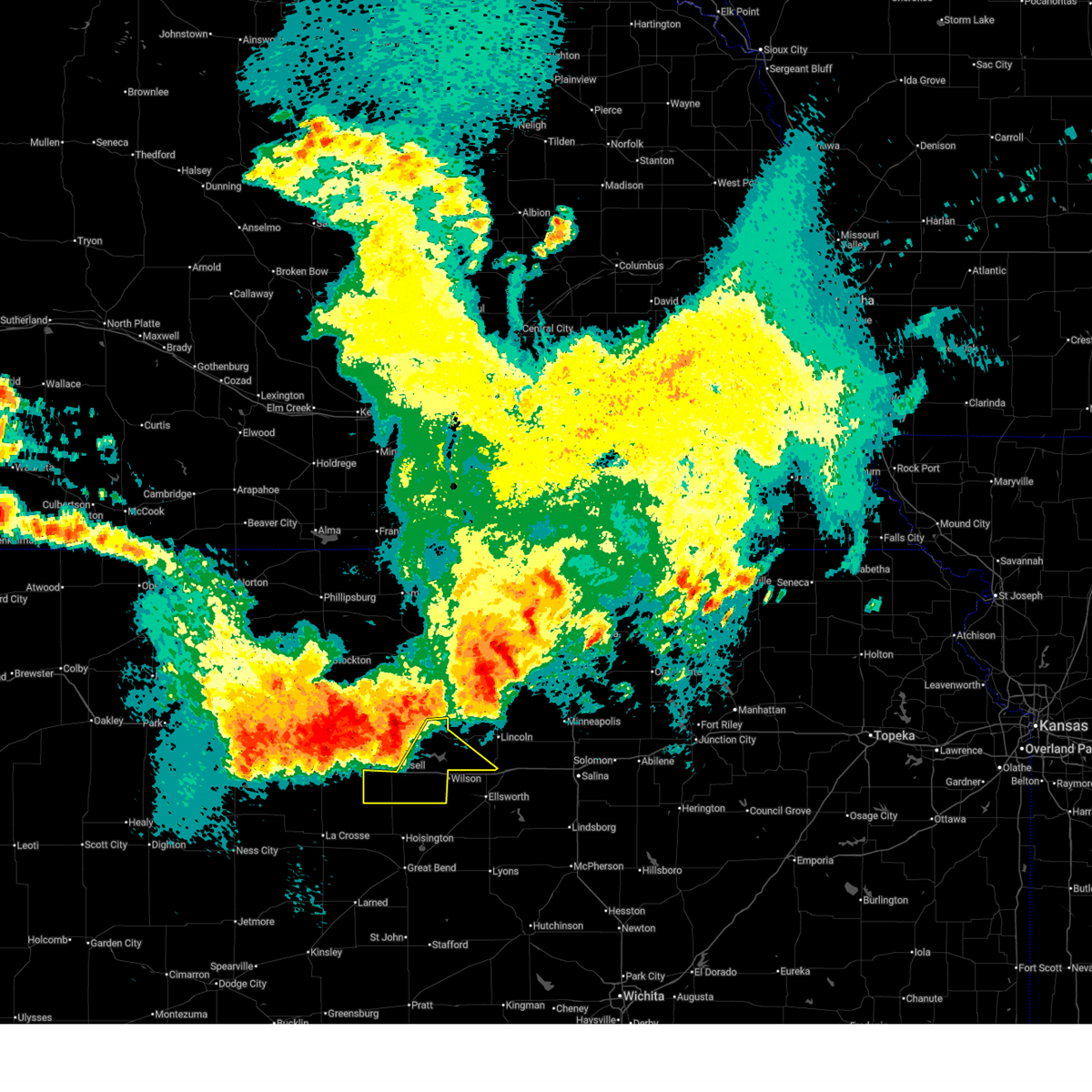 Svrict the national weather service in wichita has issued a * severe thunderstorm warning for, southwestern lincoln county in central kansas, russell county in central kansas, * until 145 am cdt. * at 113 am cdt, severe thunderstorms were located along a line extending from 7 miles southeast of victor to near russell, moving southeast at 25 mph (radar indicated). Hazards include 60 mph wind gusts and quarter size hail. Hail damage to vehicles is expected. Expect wind damage to roofs, siding, and trees. Svrict the national weather service in wichita has issued a * severe thunderstorm warning for, southwestern lincoln county in central kansas, russell county in central kansas, * until 145 am cdt. * at 113 am cdt, severe thunderstorms were located along a line extending from 7 miles southeast of victor to near russell, moving southeast at 25 mph (radar indicated). Hazards include 60 mph wind gusts and quarter size hail. Hail damage to vehicles is expected. Expect wind damage to roofs, siding, and trees.
|
| 5/18/2025 9:05 PM CDT |
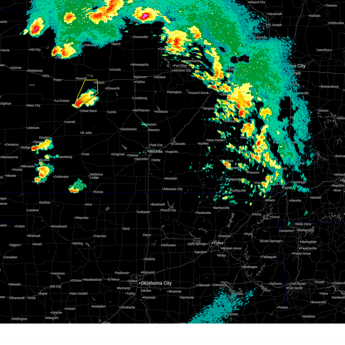 Svrict the national weather service in wichita has issued a * severe thunderstorm warning for, northwestern ellsworth county in central kansas, southeastern russell county in central kansas, northeastern barton county in central kansas, * until 945 pm cdt. * at 905 pm cdt, a severe thunderstorm was located near hoisington, moving northeast at 35 mph (radar indicated). Hazards include half dollar size hail. damage to vehicles is expected Svrict the national weather service in wichita has issued a * severe thunderstorm warning for, northwestern ellsworth county in central kansas, southeastern russell county in central kansas, northeastern barton county in central kansas, * until 945 pm cdt. * at 905 pm cdt, a severe thunderstorm was located near hoisington, moving northeast at 35 mph (radar indicated). Hazards include half dollar size hail. damage to vehicles is expected
|
| 5/18/2025 5:28 PM CDT |
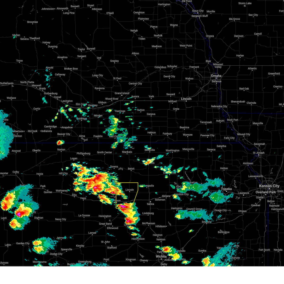 Svrict the national weather service in wichita has issued a * severe thunderstorm warning for, lincoln county in central kansas, northern ellsworth county in central kansas, * until 630 pm cdt. * at 528 pm cdt, a severe thunderstorm was located near ellsworth, moving north at 65 mph (trained weather spotters). Hazards include two inch hail. People and animals outdoors will be injured. Expect damage to roofs, siding, windows, and vehicles. Svrict the national weather service in wichita has issued a * severe thunderstorm warning for, lincoln county in central kansas, northern ellsworth county in central kansas, * until 630 pm cdt. * at 528 pm cdt, a severe thunderstorm was located near ellsworth, moving north at 65 mph (trained weather spotters). Hazards include two inch hail. People and animals outdoors will be injured. Expect damage to roofs, siding, windows, and vehicles.
|
| 5/18/2025 5:22 PM CDT |
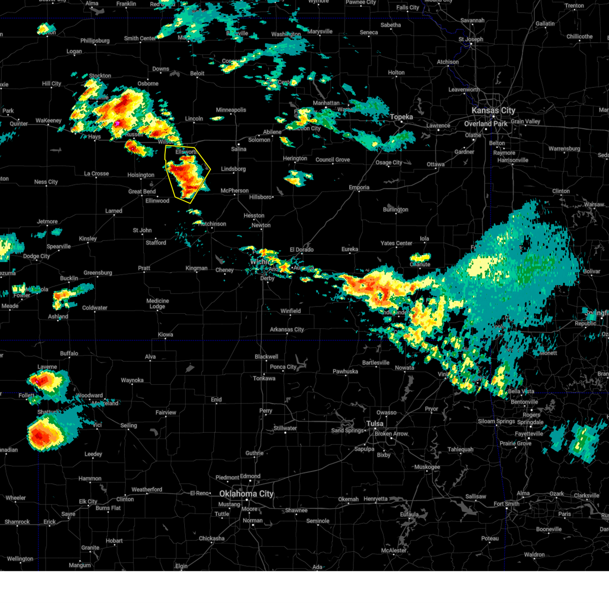 At 522 pm cdt, a severe thunderstorm was located over lorraine, or 10 miles southwest of ellsworth, moving northeast at 45 mph (trained weather spotters. at 520 pm cdt, 2-inch hail was reported in holyrood). Hazards include two inch hail. People and animals outdoors will be injured. expect damage to roofs, siding, windows, and vehicles. Locations impacted include, lyons, ellsworth, wilson, kanopolis, chase, holyrood, bushton, geneseo, lorraine, frederick, ellsworth airport, kanopolis lake, and kanopolis state park. At 522 pm cdt, a severe thunderstorm was located over lorraine, or 10 miles southwest of ellsworth, moving northeast at 45 mph (trained weather spotters. at 520 pm cdt, 2-inch hail was reported in holyrood). Hazards include two inch hail. People and animals outdoors will be injured. expect damage to roofs, siding, windows, and vehicles. Locations impacted include, lyons, ellsworth, wilson, kanopolis, chase, holyrood, bushton, geneseo, lorraine, frederick, ellsworth airport, kanopolis lake, and kanopolis state park.
|
| 5/18/2025 5:11 PM CDT |
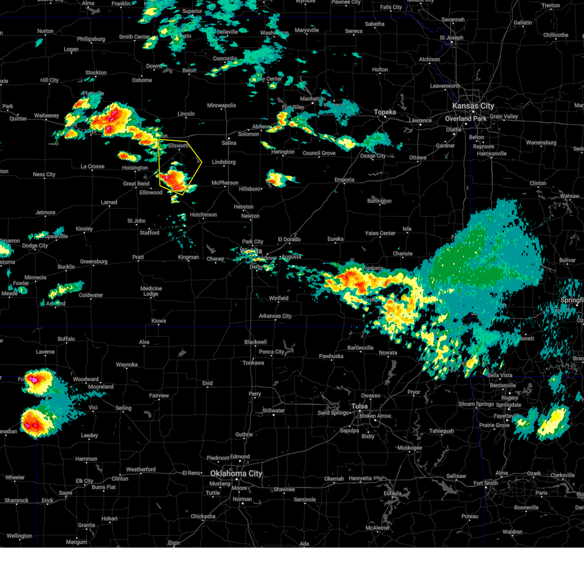 At 511 pm cdt, a severe thunderstorm was located near bushton, or 9 miles southeast of claflin, moving north at 50 mph (radar indicated). Hazards include two inch hail. People and animals outdoors will be injured. expect damage to roofs, siding, windows, and vehicles. Locations impacted include, lyons, ellsworth, wilson, kanopolis, chase, holyrood, bushton, geneseo, lorraine, frederick, ellsworth airport, kanopolis lake, and kanopolis state park. At 511 pm cdt, a severe thunderstorm was located near bushton, or 9 miles southeast of claflin, moving north at 50 mph (radar indicated). Hazards include two inch hail. People and animals outdoors will be injured. expect damage to roofs, siding, windows, and vehicles. Locations impacted include, lyons, ellsworth, wilson, kanopolis, chase, holyrood, bushton, geneseo, lorraine, frederick, ellsworth airport, kanopolis lake, and kanopolis state park.
|
| 5/18/2025 5:01 PM CDT |
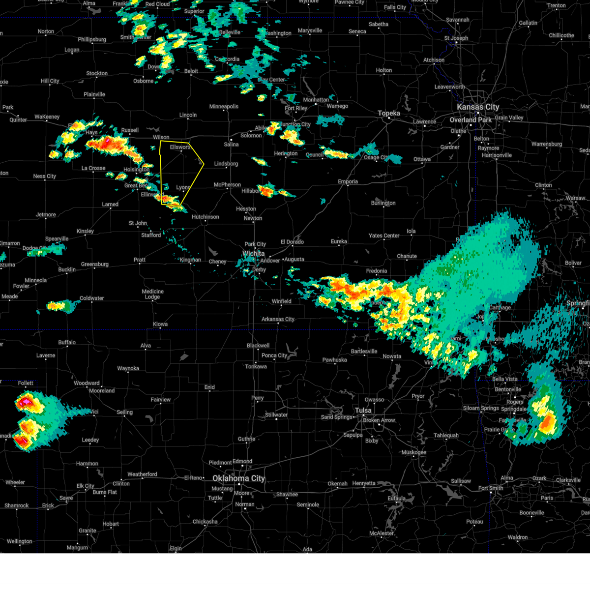 Svrict the national weather service in wichita has issued a * severe thunderstorm warning for, western rice county in central kansas, ellsworth county in central kansas, * until 545 pm cdt. * at 500 pm cdt, a severe thunderstorm was located near chase, or 8 miles east of ellinwood, moving northeast at 45 mph (radar indicated). Hazards include quarter size hail. damage to vehicles is expected Svrict the national weather service in wichita has issued a * severe thunderstorm warning for, western rice county in central kansas, ellsworth county in central kansas, * until 545 pm cdt. * at 500 pm cdt, a severe thunderstorm was located near chase, or 8 miles east of ellinwood, moving northeast at 45 mph (radar indicated). Hazards include quarter size hail. damage to vehicles is expected
|
| 3/27/2025 6:54 PM CDT |
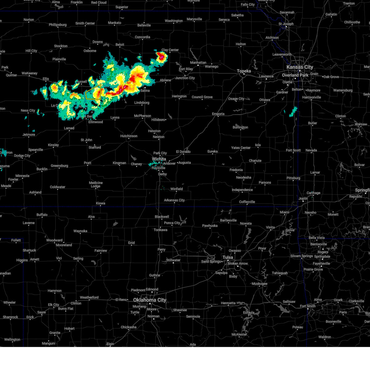 the severe thunderstorm warning has been cancelled and is no longer in effect the severe thunderstorm warning has been cancelled and is no longer in effect
|
| 3/27/2025 6:33 PM CDT |
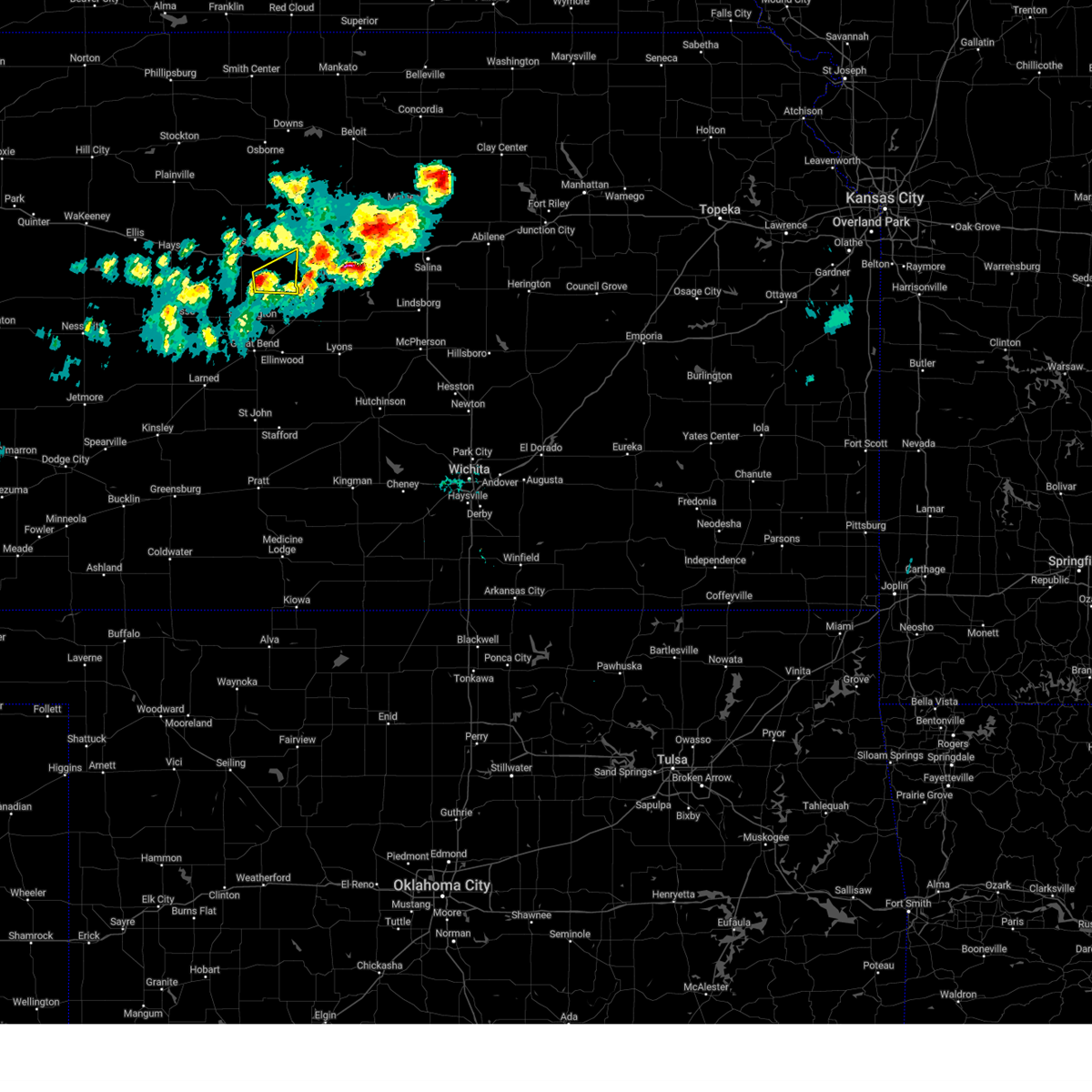 Svrict the national weather service in wichita has issued a * severe thunderstorm warning for, southeastern russell county in central kansas, northeastern barton county in central kansas, * until 715 pm cdt. * at 633 pm cdt, a severe thunderstorm was located 9 miles southwest of dorrance, or 13 miles southeast of russell, moving east at 30 mph (radar indicated). Hazards include 60 mph wind gusts and half dollar size hail. Hail damage to vehicles is expected. Expect wind damage to roofs, siding, and trees. Svrict the national weather service in wichita has issued a * severe thunderstorm warning for, southeastern russell county in central kansas, northeastern barton county in central kansas, * until 715 pm cdt. * at 633 pm cdt, a severe thunderstorm was located 9 miles southwest of dorrance, or 13 miles southeast of russell, moving east at 30 mph (radar indicated). Hazards include 60 mph wind gusts and half dollar size hail. Hail damage to vehicles is expected. Expect wind damage to roofs, siding, and trees.
|
| 7/31/2024 7:39 PM CDT |
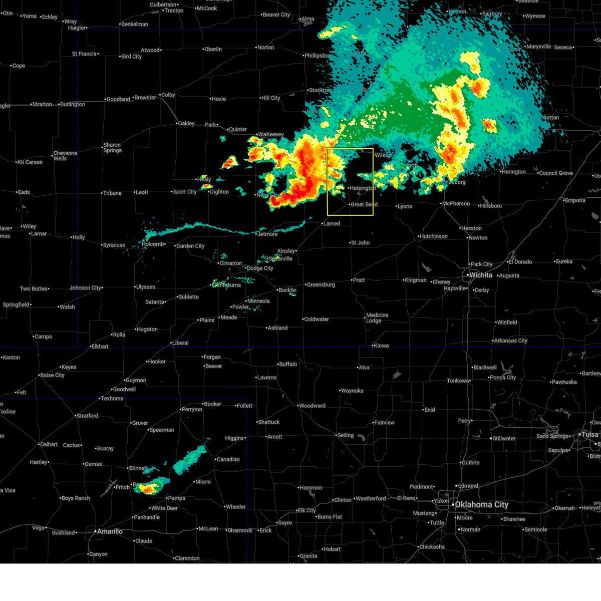 Svrict the national weather service in wichita has issued a * severe thunderstorm warning for, southern russell county in central kansas, barton county in central kansas, * until 845 pm cdt. * at 738 pm cdt, severe thunderstorms were located along a line extending from walker to timken to 7 miles south of bazine, moving east at 40 mph (radar indicated). Hazards include 60 mph wind gusts and quarter size hail. Hail damage to vehicles is expected. Expect wind damage to roofs, siding, and trees. Svrict the national weather service in wichita has issued a * severe thunderstorm warning for, southern russell county in central kansas, barton county in central kansas, * until 845 pm cdt. * at 738 pm cdt, severe thunderstorms were located along a line extending from walker to timken to 7 miles south of bazine, moving east at 40 mph (radar indicated). Hazards include 60 mph wind gusts and quarter size hail. Hail damage to vehicles is expected. Expect wind damage to roofs, siding, and trees.
|
| 7/31/2024 6:22 PM CDT |
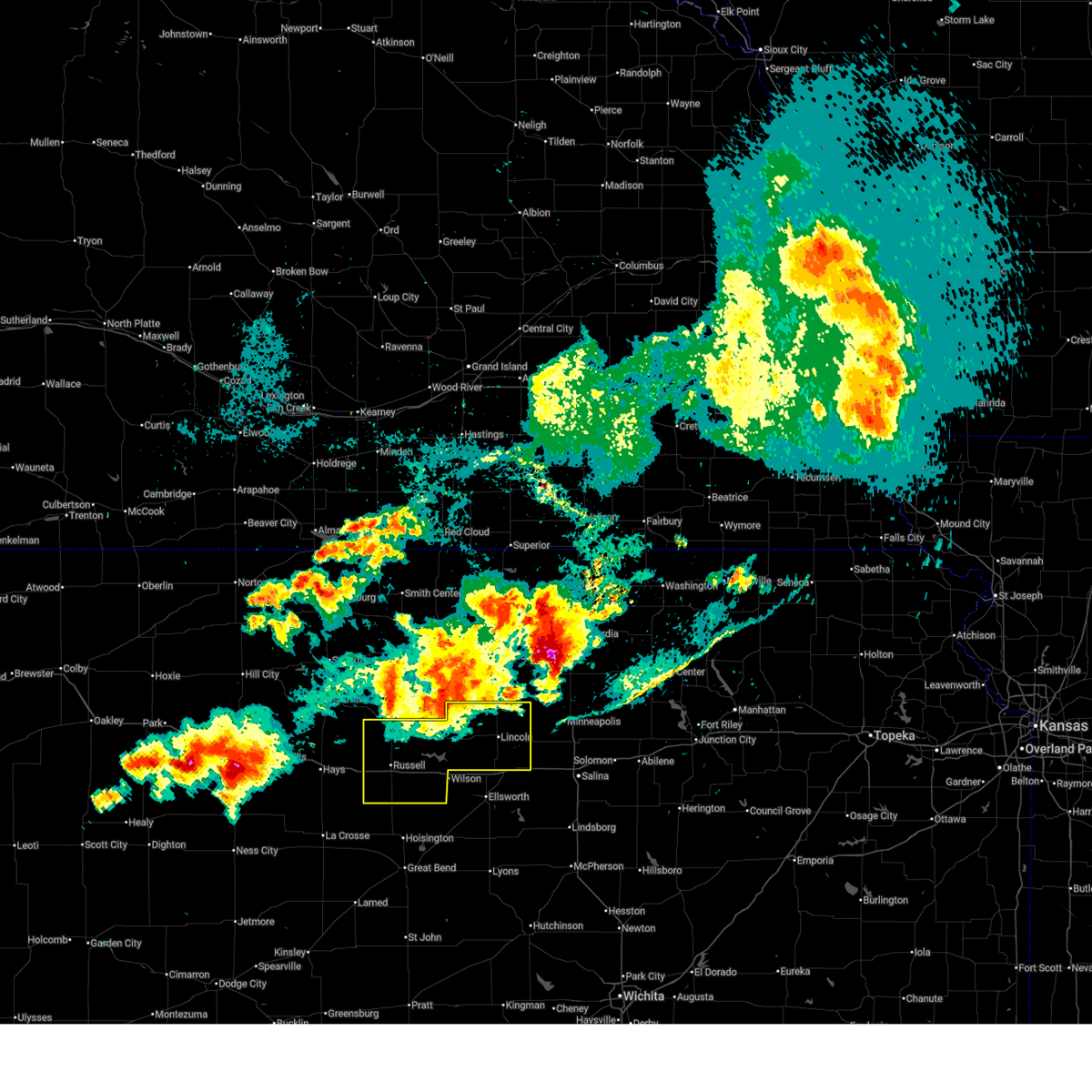 At 620 pm cdt, severe thunderstorms were located along a line extending from 7 miles southwest of asherville to 8 miles northeast of russell, moving southeast at 55 mph (kansas state mesonet. at 614 pm cdt, a 64 mph wind gust was recorded at bunker hill). Hazards include 60 mph wind gusts. Expect damage to roofs, siding, and trees. Locations impacted include, russell, lincoln, lucas, gorham, sylvan grove, luray, dorrance, beverly, barnard, milberger, bunker hill, paradise, waldo, ash grove, westfall, russell airport, wilson state park, and wilson lake. At 620 pm cdt, severe thunderstorms were located along a line extending from 7 miles southwest of asherville to 8 miles northeast of russell, moving southeast at 55 mph (kansas state mesonet. at 614 pm cdt, a 64 mph wind gust was recorded at bunker hill). Hazards include 60 mph wind gusts. Expect damage to roofs, siding, and trees. Locations impacted include, russell, lincoln, lucas, gorham, sylvan grove, luray, dorrance, beverly, barnard, milberger, bunker hill, paradise, waldo, ash grove, westfall, russell airport, wilson state park, and wilson lake.
|
| 7/31/2024 6:12 PM CDT |
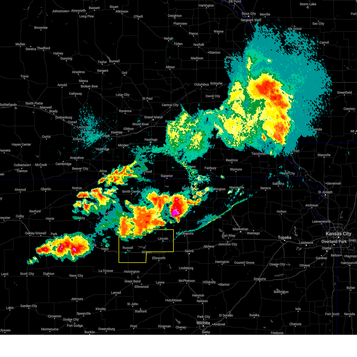 Svrict the national weather service in wichita has issued a * severe thunderstorm warning for, lincoln county in central kansas, russell county in central kansas, * until 715 pm cdt. * at 611 pm cdt, severe thunderstorms were located along a line extending from 8 miles south of beloit to 10 miles north of russell, moving southeast at 55 mph (radar indicated). Hazards include 60 mph wind gusts and penny size hail. expect damage to roofs, siding, and trees Svrict the national weather service in wichita has issued a * severe thunderstorm warning for, lincoln county in central kansas, russell county in central kansas, * until 715 pm cdt. * at 611 pm cdt, severe thunderstorms were located along a line extending from 8 miles south of beloit to 10 miles north of russell, moving southeast at 55 mph (radar indicated). Hazards include 60 mph wind gusts and penny size hail. expect damage to roofs, siding, and trees
|
| 7/16/2024 4:45 AM CDT |
 At 444 am cdt, a severe thunderstorm was located near beverly, or 12 miles southeast of lincoln, moving east at 40 mph. this is a destructive storm for primarily lincoln county (radar indicated). Hazards include 80 mph wind gusts and penny size hail. Flying debris will be dangerous to those caught without shelter. mobile homes will be heavily damaged. expect considerable damage to roofs, windows, and vehicles. extensive tree damage and power outages are likely. Locations impacted include, wilson, lincoln, sylvan grove, beverly, barnard, ash grove, and westfall. At 444 am cdt, a severe thunderstorm was located near beverly, or 12 miles southeast of lincoln, moving east at 40 mph. this is a destructive storm for primarily lincoln county (radar indicated). Hazards include 80 mph wind gusts and penny size hail. Flying debris will be dangerous to those caught without shelter. mobile homes will be heavily damaged. expect considerable damage to roofs, windows, and vehicles. extensive tree damage and power outages are likely. Locations impacted include, wilson, lincoln, sylvan grove, beverly, barnard, ash grove, and westfall.
|
| 7/16/2024 4:19 AM CDT |
 At 416 am cdt, a severe thunderstorm was located 7 miles southeast of sylvan grove, or 10 miles southwest of lincoln, moving east at 40 mph. this is a destructive storm for lincoln and northern ellsworth counties (radar indicated). Hazards include 80 mph wind gusts and penny size hail. Flying debris will be dangerous to those caught without shelter. mobile homes will be heavily damaged. expect considerable damage to roofs, windows, and vehicles. extensive tree damage and power outages are likely. Locations impacted include, ellsworth, wilson, kanopolis, lincoln, sylvan grove, beverly, barnard, ash grove, westfall, and ellsworth airport. At 416 am cdt, a severe thunderstorm was located 7 miles southeast of sylvan grove, or 10 miles southwest of lincoln, moving east at 40 mph. this is a destructive storm for lincoln and northern ellsworth counties (radar indicated). Hazards include 80 mph wind gusts and penny size hail. Flying debris will be dangerous to those caught without shelter. mobile homes will be heavily damaged. expect considerable damage to roofs, windows, and vehicles. extensive tree damage and power outages are likely. Locations impacted include, ellsworth, wilson, kanopolis, lincoln, sylvan grove, beverly, barnard, ash grove, westfall, and ellsworth airport.
|
| 7/16/2024 4:04 AM CDT |
 Svrict the national weather service in wichita has issued a * severe thunderstorm warning for, lincoln county in central kansas, northern ellsworth county in central kansas, * until 515 am cdt. * at 403 am cdt, a severe thunderstorm was located 6 miles southwest of sylvan grove, or 7 miles north of wilson, moving east at 40 mph. this is a destructive storm for lincoln and the northern half of ellsworth counties (radar indicated). Hazards include 80 mph wind gusts and penny size hail. Flying debris will be dangerous to those caught without shelter. mobile homes will be heavily damaged. expect considerable damage to roofs, windows, and vehicles. Extensive tree damage and power outages are likely. Svrict the national weather service in wichita has issued a * severe thunderstorm warning for, lincoln county in central kansas, northern ellsworth county in central kansas, * until 515 am cdt. * at 403 am cdt, a severe thunderstorm was located 6 miles southwest of sylvan grove, or 7 miles north of wilson, moving east at 40 mph. this is a destructive storm for lincoln and the northern half of ellsworth counties (radar indicated). Hazards include 80 mph wind gusts and penny size hail. Flying debris will be dangerous to those caught without shelter. mobile homes will be heavily damaged. expect considerable damage to roofs, windows, and vehicles. Extensive tree damage and power outages are likely.
|
| 7/4/2024 12:23 AM CDT |
 The storm which prompted the warning has moved out of the area. therefore, the warning will be allowed to expire. The storm which prompted the warning has moved out of the area. therefore, the warning will be allowed to expire.
|
| 7/4/2024 12:01 AM CDT |
 At 1201 am cdt, a severe thunderstorm was located 11 miles south of lincoln, moving east at 60 mph (radar indicated). Hazards include 70 mph wind gusts and penny size hail. Expect considerable tree damage. damage is likely to mobile homes, roofs, and outbuildings. Locations impacted include, ellsworth, wilson, kanopolis, lincoln, sylvan grove, beverly, barnard, ash grove, westfall, and ellsworth airport. At 1201 am cdt, a severe thunderstorm was located 11 miles south of lincoln, moving east at 60 mph (radar indicated). Hazards include 70 mph wind gusts and penny size hail. Expect considerable tree damage. damage is likely to mobile homes, roofs, and outbuildings. Locations impacted include, ellsworth, wilson, kanopolis, lincoln, sylvan grove, beverly, barnard, ash grove, westfall, and ellsworth airport.
|
| 7/3/2024 11:51 PM CDT | Storm damage reported in ellsworth county KS, 3.7 miles WNW of Wilson, KS |
| 7/3/2024 11:36 PM CDT |
 Svrict the national weather service in wichita has issued a * severe thunderstorm warning for, lincoln county in central kansas, northern ellsworth county in central kansas, * until 1230 am cdt. * at 1136 pm cdt, a severe thunderstorm was located 6 miles south of lucas, or 11 miles northwest of wilson, moving east at 55 mph (radar indicated). Hazards include 70 mph wind gusts and penny size hail. Expect considerable tree damage. Damage is likely to mobile homes, roofs, and outbuildings. Svrict the national weather service in wichita has issued a * severe thunderstorm warning for, lincoln county in central kansas, northern ellsworth county in central kansas, * until 1230 am cdt. * at 1136 pm cdt, a severe thunderstorm was located 6 miles south of lucas, or 11 miles northwest of wilson, moving east at 55 mph (radar indicated). Hazards include 70 mph wind gusts and penny size hail. Expect considerable tree damage. Damage is likely to mobile homes, roofs, and outbuildings.
|
| 6/18/2024 8:28 PM CDT |
 The storms which prompted the warning have moved out of the area. therefore, the warning will be allowed to expire. however, gusty winds are still possible with these thunderstorms. a severe thunderstorm watch remains in effect until 1000 pm cdt for central kansas. The storms which prompted the warning have moved out of the area. therefore, the warning will be allowed to expire. however, gusty winds are still possible with these thunderstorms. a severe thunderstorm watch remains in effect until 1000 pm cdt for central kansas.
|
| 6/18/2024 8:18 PM CDT |
 the severe thunderstorm warning has been cancelled and is no longer in effect the severe thunderstorm warning has been cancelled and is no longer in effect
|
| 6/18/2024 8:18 PM CDT |
 At 818 pm cdt, severe thunderstorms were located along a line extending from 7 miles south of sylvan grove to ellsworth to near lorraine, moving east at 30 mph (radar indicated). Hazards include 60 mph wind gusts and penny size hail. Expect damage to roofs, siding, and trees. Locations impacted include, ellsworth, wilson, claflin, kanopolis, holyrood, lorraine, and ellsworth airport. At 818 pm cdt, severe thunderstorms were located along a line extending from 7 miles south of sylvan grove to ellsworth to near lorraine, moving east at 30 mph (radar indicated). Hazards include 60 mph wind gusts and penny size hail. Expect damage to roofs, siding, and trees. Locations impacted include, ellsworth, wilson, claflin, kanopolis, holyrood, lorraine, and ellsworth airport.
|
| 6/18/2024 8:10 PM CDT | Strong winds making for difficult driving conditions. winds estimated around 60 mp in ellsworth county KS, 6.9 miles NW of Wilson, KS |
| 6/18/2024 8:06 PM CDT |
 At 806 pm cdt, severe thunderstorms were located along a line extending from near wilson to near ellsworth to bushton, moving east at 40 mph (radar indicated). Hazards include 65 mph wind gusts and penny size hail. Expect damage to roofs, siding, and trees. Locations impacted include, ellsworth, wilson, claflin, kanopolis, holyrood, dorrance, lorraine, bunker hill, wilson state park, ellsworth airport, odin, and wilson lake. At 806 pm cdt, severe thunderstorms were located along a line extending from near wilson to near ellsworth to bushton, moving east at 40 mph (radar indicated). Hazards include 65 mph wind gusts and penny size hail. Expect damage to roofs, siding, and trees. Locations impacted include, ellsworth, wilson, claflin, kanopolis, holyrood, dorrance, lorraine, bunker hill, wilson state park, ellsworth airport, odin, and wilson lake.
|
| 6/18/2024 7:44 PM CDT |
 Svrict the national weather service in wichita has issued a * severe thunderstorm warning for, southwestern lincoln county in central kansas, ellsworth county in central kansas, southeastern russell county in central kansas, northeastern barton county in central kansas, * until 830 pm cdt. * at 744 pm cdt, severe thunderstorms were located along a line extending from 5 miles west of dorrance to 9 miles northwest of holyrood to 5 miles northeast of great bend, moving east at 30 mph (radar indicated). Hazards include 60 mph wind gusts and nickel size hail. expect damage to roofs, siding, and trees Svrict the national weather service in wichita has issued a * severe thunderstorm warning for, southwestern lincoln county in central kansas, ellsworth county in central kansas, southeastern russell county in central kansas, northeastern barton county in central kansas, * until 830 pm cdt. * at 744 pm cdt, severe thunderstorms were located along a line extending from 5 miles west of dorrance to 9 miles northwest of holyrood to 5 miles northeast of great bend, moving east at 30 mph (radar indicated). Hazards include 60 mph wind gusts and nickel size hail. expect damage to roofs, siding, and trees
|
| 6/7/2024 10:14 PM CDT |
 the severe thunderstorm warning has been cancelled and is no longer in effect the severe thunderstorm warning has been cancelled and is no longer in effect
|
| 6/7/2024 10:14 PM CDT |
 At 1013 pm cdt, a severe thunderstorm was located 6 miles northeast of kanopolis, moving east at 50 mph. this is a destructive storm! (trained weather spotters). Hazards include 80 mph wind gusts and penny size hail. Flying debris will be dangerous to those caught without shelter. mobile homes will be heavily damaged. expect considerable damage to roofs, windows, and vehicles. extensive tree damage and power outages are likely. Locations impacted include, ellsworth, wilson, kanopolis, lincoln, holyrood, sylvan grove, beverly, lorraine, westfall, kanopolis lake, kanopolis state park, and ellsworth airport. At 1013 pm cdt, a severe thunderstorm was located 6 miles northeast of kanopolis, moving east at 50 mph. this is a destructive storm! (trained weather spotters). Hazards include 80 mph wind gusts and penny size hail. Flying debris will be dangerous to those caught without shelter. mobile homes will be heavily damaged. expect considerable damage to roofs, windows, and vehicles. extensive tree damage and power outages are likely. Locations impacted include, ellsworth, wilson, kanopolis, lincoln, holyrood, sylvan grove, beverly, lorraine, westfall, kanopolis lake, kanopolis state park, and ellsworth airport.
|
| 6/7/2024 10:06 PM CDT |
 At 1006 pm cdt, a severe thunderstorm was located 6 miles north of ellsworth, moving east at 55 mph (radar indicated). Hazards include 70 mph wind gusts and penny size hail. Expect considerable tree damage. damage is likely to mobile homes, roofs, and outbuildings. Locations impacted include, ellsworth, wilson, claflin, kanopolis, lincoln, holyrood, sylvan grove, beverly, lorraine, barnard, ash grove, westfall, ellsworth airport, kanopolis lake, kanopolis state park, odin, and wilson state park. At 1006 pm cdt, a severe thunderstorm was located 6 miles north of ellsworth, moving east at 55 mph (radar indicated). Hazards include 70 mph wind gusts and penny size hail. Expect considerable tree damage. damage is likely to mobile homes, roofs, and outbuildings. Locations impacted include, ellsworth, wilson, claflin, kanopolis, lincoln, holyrood, sylvan grove, beverly, lorraine, barnard, ash grove, westfall, ellsworth airport, kanopolis lake, kanopolis state park, odin, and wilson state park.
|
| 6/7/2024 9:48 PM CDT |
 Svrict the national weather service in wichita has issued a * severe thunderstorm warning for, lincoln county in central kansas, ellsworth county in central kansas, northern barton county in central kansas, * until 1115 pm cdt. * at 947 pm cdt, a severe thunderstorm was located over dorrance, or near wilson, moving east at 45 mph. an 81 mph gust was observed at russell airport. this is a destructive storm! (radar indicated). Hazards include 80 mph wind gusts. Flying debris will be dangerous to those caught without shelter. mobile homes will be heavily damaged. expect considerable damage to roofs, windows, and vehicles. Extensive tree damage and power outages are likely. Svrict the national weather service in wichita has issued a * severe thunderstorm warning for, lincoln county in central kansas, ellsworth county in central kansas, northern barton county in central kansas, * until 1115 pm cdt. * at 947 pm cdt, a severe thunderstorm was located over dorrance, or near wilson, moving east at 45 mph. an 81 mph gust was observed at russell airport. this is a destructive storm! (radar indicated). Hazards include 80 mph wind gusts. Flying debris will be dangerous to those caught without shelter. mobile homes will be heavily damaged. expect considerable damage to roofs, windows, and vehicles. Extensive tree damage and power outages are likely.
|
| 6/4/2024 2:22 PM CDT |
 The storm which prompted the warning has weakened below severe limits, and has exited the warned area. therefore, the warning will be allowed to expire. The storm which prompted the warning has weakened below severe limits, and has exited the warned area. therefore, the warning will be allowed to expire.
|
| 6/4/2024 1:57 PM CDT |
 At 157 pm cdt, a severe thunderstorm was located over sylvan grove, or 11 miles northeast of wilson, moving east at 25 mph (radar indicated). Hazards include ping pong ball size hail. People and animals outdoors will be injured. expect damage to roofs, siding, windows, and vehicles. Locations impacted include, wilson, sylvan grove, and ash grove. At 157 pm cdt, a severe thunderstorm was located over sylvan grove, or 11 miles northeast of wilson, moving east at 25 mph (radar indicated). Hazards include ping pong ball size hail. People and animals outdoors will be injured. expect damage to roofs, siding, windows, and vehicles. Locations impacted include, wilson, sylvan grove, and ash grove.
|
| 6/4/2024 1:57 PM CDT |
 the severe thunderstorm warning has been cancelled and is no longer in effect the severe thunderstorm warning has been cancelled and is no longer in effect
|
| 6/4/2024 1:45 PM CDT |
 At 144 pm cdt, a severe thunderstorm was located near sylvan grove, or 9 miles north of wilson, moving east at 25 mph (radar indicated). Hazards include golf ball size hail. People and animals outdoors will be injured. expect damage to roofs, siding, windows, and vehicles. Locations impacted include, wilson, lucas, sylvan grove, dorrance, ash grove, wilson state park, and wilson lake. At 144 pm cdt, a severe thunderstorm was located near sylvan grove, or 9 miles north of wilson, moving east at 25 mph (radar indicated). Hazards include golf ball size hail. People and animals outdoors will be injured. expect damage to roofs, siding, windows, and vehicles. Locations impacted include, wilson, lucas, sylvan grove, dorrance, ash grove, wilson state park, and wilson lake.
|
| 6/4/2024 1:30 PM CDT |
 Svrict the national weather service in wichita has issued a * severe thunderstorm warning for, western lincoln county in central kansas, northwestern ellsworth county in central kansas, eastern russell county in central kansas, * until 230 pm cdt. * at 129 pm cdt, a severe thunderstorm was located 7 miles southwest of lucas, or 11 miles northwest of wilson, moving east at 25 mph (radar indicated). Hazards include ping pong ball size hail. People and animals outdoors will be injured. Expect damage to roofs, siding, windows, and vehicles. Svrict the national weather service in wichita has issued a * severe thunderstorm warning for, western lincoln county in central kansas, northwestern ellsworth county in central kansas, eastern russell county in central kansas, * until 230 pm cdt. * at 129 pm cdt, a severe thunderstorm was located 7 miles southwest of lucas, or 11 miles northwest of wilson, moving east at 25 mph (radar indicated). Hazards include ping pong ball size hail. People and animals outdoors will be injured. Expect damage to roofs, siding, windows, and vehicles.
|
| 5/19/2024 7:40 PM CDT |
 The storms which prompted the warning have moved out of the area. therefore, the warning will be allowed to expire. however, gusty winds and heavy rain are still possible with these thunderstorms. a severe thunderstorm watch remains in effect until 1000 pm cdt for central and south central kansas. to report severe weather, contact your nearest law enforcement agency. they will relay your report to the national weather service wichita. The storms which prompted the warning have moved out of the area. therefore, the warning will be allowed to expire. however, gusty winds and heavy rain are still possible with these thunderstorms. a severe thunderstorm watch remains in effect until 1000 pm cdt for central and south central kansas. to report severe weather, contact your nearest law enforcement agency. they will relay your report to the national weather service wichita.
|
| 5/19/2024 7:23 PM CDT |
 At 723 pm cdt, severe thunderstorms were located along a line extending from 7 miles north of ellsworth to near geneseo to near lyons, moving northeast at 40 mph (radar indicated). Hazards include 60 mph wind gusts and quarter size hail. Hail damage to vehicles is expected. expect wind damage to roofs, siding, and trees. Locations impacted include, lyons, ellsworth, sterling, wilson, kanopolis, little river, chase, holyrood, bushton, geneseo, alden, lorraine, raymond, frederick, ellsworth airport, silica, kanopolis lake, and kanopolis state park. At 723 pm cdt, severe thunderstorms were located along a line extending from 7 miles north of ellsworth to near geneseo to near lyons, moving northeast at 40 mph (radar indicated). Hazards include 60 mph wind gusts and quarter size hail. Hail damage to vehicles is expected. expect wind damage to roofs, siding, and trees. Locations impacted include, lyons, ellsworth, sterling, wilson, kanopolis, little river, chase, holyrood, bushton, geneseo, alden, lorraine, raymond, frederick, ellsworth airport, silica, kanopolis lake, and kanopolis state park.
|
| 5/19/2024 7:23 PM CDT |
 the severe thunderstorm warning has been cancelled and is no longer in effect the severe thunderstorm warning has been cancelled and is no longer in effect
|
| 5/19/2024 7:08 PM CDT |
 At 707 pm cdt, severe thunderstorms were located along a line extending from 6 miles southeast of wilson to near lorraine to near raymond, moving east at 65 mph (radar indicated). Hazards include 60 mph wind gusts and quarter size hail. Hail damage to vehicles is expected. expect wind damage to roofs, siding, and trees. Locations impacted include, great bend, lyons, ellsworth, hoisington, sterling, ellinwood, wilson, claflin, kanopolis, little river, chase, holyrood, bushton, geneseo, pawnee rock, dorrance, albert, alden, lorraine, and olmitz. At 707 pm cdt, severe thunderstorms were located along a line extending from 6 miles southeast of wilson to near lorraine to near raymond, moving east at 65 mph (radar indicated). Hazards include 60 mph wind gusts and quarter size hail. Hail damage to vehicles is expected. expect wind damage to roofs, siding, and trees. Locations impacted include, great bend, lyons, ellsworth, hoisington, sterling, ellinwood, wilson, claflin, kanopolis, little river, chase, holyrood, bushton, geneseo, pawnee rock, dorrance, albert, alden, lorraine, and olmitz.
|
| 5/19/2024 6:46 PM CDT |
 Svrict the national weather service in wichita has issued a * severe thunderstorm warning for, rice county in central kansas, ellsworth county in central kansas, southern russell county in central kansas, barton county in central kansas, * until 745 pm cdt. * at 646 pm cdt, severe thunderstorms were located along a line extending from near milberger to near olmitz to near pawnee rock, moving northeast at 40 mph (radar indicated). Hazards include 70 mph wind gusts and quarter size hail. Hail damage to vehicles is expected. expect considerable tree damage. Wind damage is also likely to mobile homes, roofs, and outbuildings. Svrict the national weather service in wichita has issued a * severe thunderstorm warning for, rice county in central kansas, ellsworth county in central kansas, southern russell county in central kansas, barton county in central kansas, * until 745 pm cdt. * at 646 pm cdt, severe thunderstorms were located along a line extending from near milberger to near olmitz to near pawnee rock, moving northeast at 40 mph (radar indicated). Hazards include 70 mph wind gusts and quarter size hail. Hail damage to vehicles is expected. expect considerable tree damage. Wind damage is also likely to mobile homes, roofs, and outbuildings.
|
| 5/19/2024 5:54 PM CDT |
 The storm which prompted the warning has moved out of the area. therefore, the warning will be allowed to expire. a severe thunderstorm watch remains in effect until 1000 pm cdt for central kansas. The storm which prompted the warning has moved out of the area. therefore, the warning will be allowed to expire. a severe thunderstorm watch remains in effect until 1000 pm cdt for central kansas.
|
| 5/19/2024 5:45 PM CDT |
 At 545 pm cdt, a severe thunderstorm was located 6 miles north of ellsworth, moving east at 60 mph (radar indicated). Hazards include 60 mph wind gusts and quarter size hail. Hail damage to vehicles is expected. expect wind damage to roofs, siding, and trees. Locations impacted include, wilson and westfall. At 545 pm cdt, a severe thunderstorm was located 6 miles north of ellsworth, moving east at 60 mph (radar indicated). Hazards include 60 mph wind gusts and quarter size hail. Hail damage to vehicles is expected. expect wind damage to roofs, siding, and trees. Locations impacted include, wilson and westfall.
|
| 5/19/2024 5:29 PM CDT |
 Svrict the national weather service in wichita has issued a * severe thunderstorm warning for, russell county in central kansas, * until 615 pm cdt. * at 528 pm cdt, a severe thunderstorm was located near dorrance, or 8 miles west of wilson, moving east at 35 mph (radar indicated). Hazards include golf ball size hail and 70 mph wind gusts. People and animals outdoors will be injured. expect hail damage to roofs, siding, windows, and vehicles. expect considerable tree damage. Wind damage is also likely to mobile homes, roofs, and outbuildings. Svrict the national weather service in wichita has issued a * severe thunderstorm warning for, russell county in central kansas, * until 615 pm cdt. * at 528 pm cdt, a severe thunderstorm was located near dorrance, or 8 miles west of wilson, moving east at 35 mph (radar indicated). Hazards include golf ball size hail and 70 mph wind gusts. People and animals outdoors will be injured. expect hail damage to roofs, siding, windows, and vehicles. expect considerable tree damage. Wind damage is also likely to mobile homes, roofs, and outbuildings.
|
| 5/19/2024 5:14 PM CDT | Quarter sized hail reported 0.3 miles SW of Wilson, KS |
| 5/19/2024 4:59 PM CDT |
 Svrict the national weather service in wichita has issued a * severe thunderstorm warning for, lincoln county in central kansas, northern ellsworth county in central kansas, * until 600 pm cdt. * at 458 pm cdt, a severe thunderstorm was located 6 miles southwest of beverly, or 7 miles southeast of lincoln, moving east at 40 mph (radar indicated). Hazards include 80 mph wind gusts and two inch hail. Flying debris will be dangerous to those caught without shelter. mobile homes will be heavily damaged. expect considerable damage to roofs, windows, and vehicles. Extensive tree damage and power outages are likely. Svrict the national weather service in wichita has issued a * severe thunderstorm warning for, lincoln county in central kansas, northern ellsworth county in central kansas, * until 600 pm cdt. * at 458 pm cdt, a severe thunderstorm was located 6 miles southwest of beverly, or 7 miles southeast of lincoln, moving east at 40 mph (radar indicated). Hazards include 80 mph wind gusts and two inch hail. Flying debris will be dangerous to those caught without shelter. mobile homes will be heavily damaged. expect considerable damage to roofs, windows, and vehicles. Extensive tree damage and power outages are likely.
|
| 5/19/2024 4:37 PM CDT |
 At 436 pm cdt, a severe thunderstorm capable of producing a tornado was located 9 miles southeast of sylvan grove, or 10 miles northeast of wilson, moving east at 30 mph (radar indicated rotation). Hazards include tornado and baseball size hail. Flying debris will be dangerous to those caught without shelter. mobile homes will be damaged or destroyed. damage to roofs, windows, and vehicles will occur. tree damage is likely. Locations impacted include, wilson, lincoln, sylvan grove, beverly, barnard, ash grove, and westfall. At 436 pm cdt, a severe thunderstorm capable of producing a tornado was located 9 miles southeast of sylvan grove, or 10 miles northeast of wilson, moving east at 30 mph (radar indicated rotation). Hazards include tornado and baseball size hail. Flying debris will be dangerous to those caught without shelter. mobile homes will be damaged or destroyed. damage to roofs, windows, and vehicles will occur. tree damage is likely. Locations impacted include, wilson, lincoln, sylvan grove, beverly, barnard, ash grove, and westfall.
|
| 5/19/2024 4:19 PM CDT | Golf Ball sized hail reported 0.6 miles NNW of Wilson, KS |
| 5/19/2024 4:18 PM CDT |
 At 417 pm cdt, a confirmed tornado was located near wilson, moving east at 35 mph (weather spotters confirmed tornado). Hazards include damaging tornado and baseball size hail. Flying debris will be dangerous to those caught without shelter. mobile homes will be damaged or destroyed. damage to roofs, windows, and vehicles will occur. tree damage is likely. This tornadic thunderstorm will remain over mainly rural areas of lincoln and northern ellsworth counties, including the following locations, ash grove and westfall. At 417 pm cdt, a confirmed tornado was located near wilson, moving east at 35 mph (weather spotters confirmed tornado). Hazards include damaging tornado and baseball size hail. Flying debris will be dangerous to those caught without shelter. mobile homes will be damaged or destroyed. damage to roofs, windows, and vehicles will occur. tree damage is likely. This tornadic thunderstorm will remain over mainly rural areas of lincoln and northern ellsworth counties, including the following locations, ash grove and westfall.
|
| 5/19/2024 4:08 PM CDT |
 Torict the national weather service in wichita has issued a * tornado warning for, lincoln county in central kansas, northern ellsworth county in central kansas, * until 500 pm cdt. * at 407 pm cdt, a severe thunderstorm capable of producing a tornado was located 6 miles north of dorrance, or 10 miles northwest of wilson, moving east at 30 mph (radar indicated rotation). Hazards include tornado and baseball size hail. Flying debris will be dangerous to those caught without shelter. mobile homes will be damaged or destroyed. damage to roofs, windows, and vehicles will occur. tree damage is likely. this dangerous storm will be near, sylvan grove around 425 pm cdt. lincoln around 450 pm cdt. other locations impacted by this tornadic thunderstorm include ash grove and westfall. This includes interstate 70 between mile markers 206 and 235. Torict the national weather service in wichita has issued a * tornado warning for, lincoln county in central kansas, northern ellsworth county in central kansas, * until 500 pm cdt. * at 407 pm cdt, a severe thunderstorm capable of producing a tornado was located 6 miles north of dorrance, or 10 miles northwest of wilson, moving east at 30 mph (radar indicated rotation). Hazards include tornado and baseball size hail. Flying debris will be dangerous to those caught without shelter. mobile homes will be damaged or destroyed. damage to roofs, windows, and vehicles will occur. tree damage is likely. this dangerous storm will be near, sylvan grove around 425 pm cdt. lincoln around 450 pm cdt. other locations impacted by this tornadic thunderstorm include ash grove and westfall. This includes interstate 70 between mile markers 206 and 235.
|
| 8/5/2023 10:51 PM CDT |
 The severe thunderstorm warning for northwestern ellsworth and eastern barton counties will expire at 1100 pm cdt, the storms which prompted the warning have moved out of the area. therefore, the warning will be allowed to expire. however gusty winds are still possible with these thunderstorms. a severe thunderstorm watch remains in effect until 300 am cdt for central kansas. The severe thunderstorm warning for northwestern ellsworth and eastern barton counties will expire at 1100 pm cdt, the storms which prompted the warning have moved out of the area. therefore, the warning will be allowed to expire. however gusty winds are still possible with these thunderstorms. a severe thunderstorm watch remains in effect until 300 am cdt for central kansas.
|
| 8/5/2023 10:36 PM CDT |
 At 1036 pm cdt, severe thunderstorms were located along a line extending from 7 miles southeast of wilson to 6 miles south of ellinwood, moving east at 45 mph (radar indicated). Hazards include 60 mph wind gusts and nickel size hail. Expect damage to roofs, siding, and trees. locations impacted include, great bend, hoisington, ellinwood, wilson, claflin, cheyenne bottoms and odin. hail threat, radar indicated max hail size, 0. 88 in wind threat, radar indicated max wind gust, 60 mph. At 1036 pm cdt, severe thunderstorms were located along a line extending from 7 miles southeast of wilson to 6 miles south of ellinwood, moving east at 45 mph (radar indicated). Hazards include 60 mph wind gusts and nickel size hail. Expect damage to roofs, siding, and trees. locations impacted include, great bend, hoisington, ellinwood, wilson, claflin, cheyenne bottoms and odin. hail threat, radar indicated max hail size, 0. 88 in wind threat, radar indicated max wind gust, 60 mph.
|
| 8/5/2023 10:27 PM CDT |
 At 1025 pm cdt, severe thunderstorms were located along a line extending from near wilson to near great bend, moving east at 45 mph. these storms produced wind gusts around 60 mph at hoisington and the great bend airport (radar indicated). Hazards include 60 mph wind gusts and nickel size hail. Expect damage to roofs, siding, and trees. locations impacted include, great bend, hoisington, ellinwood, wilson, claflin, pawnee rock, dorrance, albert, olmitz, milberger, galatia, susank, great bend airport, cheyenne bottoms and odin. hail threat, radar indicated max hail size, 0. 88 in wind threat, radar indicated max wind gust, 60 mph. At 1025 pm cdt, severe thunderstorms were located along a line extending from near wilson to near great bend, moving east at 45 mph. these storms produced wind gusts around 60 mph at hoisington and the great bend airport (radar indicated). Hazards include 60 mph wind gusts and nickel size hail. Expect damage to roofs, siding, and trees. locations impacted include, great bend, hoisington, ellinwood, wilson, claflin, pawnee rock, dorrance, albert, olmitz, milberger, galatia, susank, great bend airport, cheyenne bottoms and odin. hail threat, radar indicated max hail size, 0. 88 in wind threat, radar indicated max wind gust, 60 mph.
|
| 8/5/2023 10:10 PM CDT |
 At 1010 pm cdt, a severe thunderstorm was located near olmitz, or 7 miles northwest of hoisington, moving east at 35 mph (radar indicated). Hazards include 60 mph wind gusts and quarter size hail. Hail damage to vehicles is expected. Expect wind damage to roofs, siding, and trees. At 1010 pm cdt, a severe thunderstorm was located near olmitz, or 7 miles northwest of hoisington, moving east at 35 mph (radar indicated). Hazards include 60 mph wind gusts and quarter size hail. Hail damage to vehicles is expected. Expect wind damage to roofs, siding, and trees.
|
| 7/16/2023 5:32 PM CDT |
 At 530 pm cdt, a severe thunderstorm was located 10 miles south of dorrance, or 10 miles southwest of wilson, moving southeast at 35 mph. this storm has produced widespread wind damage! this is a destructive storm for winds to 80 mph and baseball size hail! (radar indicated). Hazards include 80 mph wind gusts and baseball size hail. Flying debris will be dangerous to those caught without shelter. mobile homes will be heavily damaged. expect considerable damage to roofs, windows, and vehicles. extensive tree damage and power outages are likely. Locations impacted include, russell, wilson, dorrance, bunker hill, susank, wilson state park, russell airport and wilson lake. At 530 pm cdt, a severe thunderstorm was located 10 miles south of dorrance, or 10 miles southwest of wilson, moving southeast at 35 mph. this storm has produced widespread wind damage! this is a destructive storm for winds to 80 mph and baseball size hail! (radar indicated). Hazards include 80 mph wind gusts and baseball size hail. Flying debris will be dangerous to those caught without shelter. mobile homes will be heavily damaged. expect considerable damage to roofs, windows, and vehicles. extensive tree damage and power outages are likely. Locations impacted include, russell, wilson, dorrance, bunker hill, susank, wilson state park, russell airport and wilson lake.
|
| 7/16/2023 5:07 PM CDT |
 At 506 pm cdt, a severe thunderstorm was located 6 miles northwest of dorrance, or 8 miles east of russell, moving south at 35 mph. this is a destructive storm for baseball size hail and destructive winds to 80 mph (radar indicated). Hazards include 80 mph wind gusts and baseball size hail. Flying debris will be dangerous to those caught without shelter. mobile homes will be heavily damaged. expect considerable damage to roofs, windows, and vehicles. Extensive tree damage and power outages are likely. At 506 pm cdt, a severe thunderstorm was located 6 miles northwest of dorrance, or 8 miles east of russell, moving south at 35 mph. this is a destructive storm for baseball size hail and destructive winds to 80 mph (radar indicated). Hazards include 80 mph wind gusts and baseball size hail. Flying debris will be dangerous to those caught without shelter. mobile homes will be heavily damaged. expect considerable damage to roofs, windows, and vehicles. Extensive tree damage and power outages are likely.
|
| 6/30/2023 9:03 PM CDT |
 At 903 pm cdt, a severe thunderstorm was located 8 miles northeast of wilson, moving northeast at 35 mph (radar indicated). Hazards include 70 mph wind gusts and quarter size hail. Hail damage to vehicles is expected. expect considerable tree damage. wind damage is also likely to mobile homes, roofs, and outbuildings. locations impacted include, wilson, lucas, sylvan grove, wilson lake and wilson state park. thunderstorm damage threat, considerable hail threat, radar indicated max hail size, 1. 00 in wind threat, radar indicated max wind gust, 70 mph. At 903 pm cdt, a severe thunderstorm was located 8 miles northeast of wilson, moving northeast at 35 mph (radar indicated). Hazards include 70 mph wind gusts and quarter size hail. Hail damage to vehicles is expected. expect considerable tree damage. wind damage is also likely to mobile homes, roofs, and outbuildings. locations impacted include, wilson, lucas, sylvan grove, wilson lake and wilson state park. thunderstorm damage threat, considerable hail threat, radar indicated max hail size, 1. 00 in wind threat, radar indicated max wind gust, 70 mph.
|
| 6/30/2023 8:48 PM CDT |
 At 848 pm cdt, a severe thunderstorm was located near dorrance, or near wilson, moving northeast at 20 mph (radar indicated). Hazards include 60 mph wind gusts and quarter size hail. Hail damage to vehicles is expected. Expect wind damage to roofs, siding, and trees. At 848 pm cdt, a severe thunderstorm was located near dorrance, or near wilson, moving northeast at 20 mph (radar indicated). Hazards include 60 mph wind gusts and quarter size hail. Hail damage to vehicles is expected. Expect wind damage to roofs, siding, and trees.
|
| 6/30/2023 1:29 AM CDT |
 At 128 am cdt, a severe thunderstorm was located near sylvan grove, or 11 miles north of wilson, moving northeast at 50 mph (radar indicated). Hazards include 60 mph wind gusts and quarter size hail. Hail damage to vehicles is expected. expect wind damage to roofs, siding, and trees. locations impacted include, wilson, lincoln, lucas, sylvan grove, dorrance, beverly, barnard, bunker hill, westfall, ash grove, wilson state park and wilson lake. hail threat, radar indicated max hail size, 1. 00 in wind threat, radar indicated max wind gust, 60 mph. At 128 am cdt, a severe thunderstorm was located near sylvan grove, or 11 miles north of wilson, moving northeast at 50 mph (radar indicated). Hazards include 60 mph wind gusts and quarter size hail. Hail damage to vehicles is expected. expect wind damage to roofs, siding, and trees. locations impacted include, wilson, lincoln, lucas, sylvan grove, dorrance, beverly, barnard, bunker hill, westfall, ash grove, wilson state park and wilson lake. hail threat, radar indicated max hail size, 1. 00 in wind threat, radar indicated max wind gust, 60 mph.
|
| 6/30/2023 1:19 AM CDT |
 At 119 am cdt, a severe thunderstorm was located 7 miles northeast of dorrance, or 7 miles north of wilson, moving northeast at 45 mph (radar indicated). Hazards include 60 mph wind gusts and quarter size hail. Hail damage to vehicles is expected. expect wind damage to roofs, siding, and trees. locations impacted include, russell, wilson, lincoln, lucas, sylvan grove, luray, dorrance, beverly, barnard, bunker hill, westfall, ash grove, russell airport, wilson state park and wilson lake. hail threat, radar indicated max hail size, 1. 00 in wind threat, radar indicated max wind gust, 60 mph. At 119 am cdt, a severe thunderstorm was located 7 miles northeast of dorrance, or 7 miles north of wilson, moving northeast at 45 mph (radar indicated). Hazards include 60 mph wind gusts and quarter size hail. Hail damage to vehicles is expected. expect wind damage to roofs, siding, and trees. locations impacted include, russell, wilson, lincoln, lucas, sylvan grove, luray, dorrance, beverly, barnard, bunker hill, westfall, ash grove, russell airport, wilson state park and wilson lake. hail threat, radar indicated max hail size, 1. 00 in wind threat, radar indicated max wind gust, 60 mph.
|
| 6/30/2023 12:57 AM CDT |
 At 1257 am cdt, a severe thunderstorm was located 6 miles southeast of russell, moving northeast at 55 mph (radar indicated). Hazards include 60 mph wind gusts and nickel size hail. expect damage to roofs, siding, and trees At 1257 am cdt, a severe thunderstorm was located 6 miles southeast of russell, moving northeast at 55 mph (radar indicated). Hazards include 60 mph wind gusts and nickel size hail. expect damage to roofs, siding, and trees
|
| 6/10/2023 11:19 PM CDT |
 At 1119 pm cdt, severe thunderstorms were located along a line extending from near brookville to kanopolis to 7 miles west of ellsworth, moving southeast at 45 mph (radar indicated). Hazards include 60 mph wind gusts and penny size hail. Expect damage to roofs, siding, and trees. locations impacted include, salina, ellsworth, wilson, kanopolis, holyrood, brookville, smolan, beverly, lorraine, falun, glendale, westfall, salina airport, ellsworth airport, kanopolis lake and kanopolis state park. hail threat, radar indicated max hail size, 0. 75 in wind threat, radar indicated max wind gust, 60 mph. At 1119 pm cdt, severe thunderstorms were located along a line extending from near brookville to kanopolis to 7 miles west of ellsworth, moving southeast at 45 mph (radar indicated). Hazards include 60 mph wind gusts and penny size hail. Expect damage to roofs, siding, and trees. locations impacted include, salina, ellsworth, wilson, kanopolis, holyrood, brookville, smolan, beverly, lorraine, falun, glendale, westfall, salina airport, ellsworth airport, kanopolis lake and kanopolis state park. hail threat, radar indicated max hail size, 0. 75 in wind threat, radar indicated max wind gust, 60 mph.
|
| 6/10/2023 11:05 PM CDT |
 At 1105 pm cdt, severe thunderstorms were located along a line extending from 5 miles south of beverly to 6 miles northwest of ellsworth to wilson, moving southeast at 45 mph (radar indicated). Hazards include 60 mph wind gusts and penny size hail. expect damage to roofs, siding, and trees At 1105 pm cdt, severe thunderstorms were located along a line extending from 5 miles south of beverly to 6 miles northwest of ellsworth to wilson, moving southeast at 45 mph (radar indicated). Hazards include 60 mph wind gusts and penny size hail. expect damage to roofs, siding, and trees
|
| 6/9/2023 5:06 PM CDT |
 At 506 pm cdt, a severe thunderstorm was located 12 miles northeast of hoisington, and is nearly stationary (radar indicated). Hazards include 60 mph wind gusts and quarter size hail. Hail damage to vehicles is expected. expect wind damage to roofs, siding, and trees. locations impacted include, dorrance and wilson state park. hail threat, radar indicated max hail size, 1. 00 in wind threat, radar indicated max wind gust, 60 mph. At 506 pm cdt, a severe thunderstorm was located 12 miles northeast of hoisington, and is nearly stationary (radar indicated). Hazards include 60 mph wind gusts and quarter size hail. Hail damage to vehicles is expected. expect wind damage to roofs, siding, and trees. locations impacted include, dorrance and wilson state park. hail threat, radar indicated max hail size, 1. 00 in wind threat, radar indicated max wind gust, 60 mph.
|
| 6/9/2023 4:38 PM CDT |
 At 437 pm cdt, a severe thunderstorm was located 9 miles southwest of dorrance, or 12 miles southwest of wilson, moving northeast at 15 mph (radar indicated). Hazards include 60 mph wind gusts and quarter size hail. Hail damage to vehicles is expected. Expect wind damage to roofs, siding, and trees. At 437 pm cdt, a severe thunderstorm was located 9 miles southwest of dorrance, or 12 miles southwest of wilson, moving northeast at 15 mph (radar indicated). Hazards include 60 mph wind gusts and quarter size hail. Hail damage to vehicles is expected. Expect wind damage to roofs, siding, and trees.
|
| 5/9/2023 2:02 PM CDT |
 At 202 pm cdt, severe thunderstorms were located along a line extending from new cambria to near ellsworth to 9 miles northwest of claflin, moving east at 30 mph (radar indicated). Hazards include 60 mph wind gusts and nickel size hail. Expect damage to roofs, siding, and trees. locations impacted include, salina, ellsworth, wilson, claflin, kanopolis, holyrood, assaria, brookville, smolan, lorraine, new cambria, falun, glendale, susank, salina airport, ellsworth airport, kanopolis lake, kanopolis state park, kipp and odin. hail threat, radar indicated max hail size, 0. 88 in wind threat, radar indicated max wind gust, 60 mph. At 202 pm cdt, severe thunderstorms were located along a line extending from new cambria to near ellsworth to 9 miles northwest of claflin, moving east at 30 mph (radar indicated). Hazards include 60 mph wind gusts and nickel size hail. Expect damage to roofs, siding, and trees. locations impacted include, salina, ellsworth, wilson, claflin, kanopolis, holyrood, assaria, brookville, smolan, lorraine, new cambria, falun, glendale, susank, salina airport, ellsworth airport, kanopolis lake, kanopolis state park, kipp and odin. hail threat, radar indicated max hail size, 0. 88 in wind threat, radar indicated max wind gust, 60 mph.
|
| 5/9/2023 1:46 PM CDT |
 At 145 pm cdt, severe thunderstorms were located along a line extending from 6 miles south of culver to 5 miles southeast of wilson to 10 miles east of milberger, moving east at 45 mph. quarter sized hail has been reported with this storm (radar indicated). Hazards include 70 mph wind gusts and half dollar size hail. Hail damage to vehicles is expected. expect considerable tree damage. wind damage is also likely to mobile homes, roofs, and outbuildings. Locations impacted include, salina, ellsworth, wilson, claflin, kanopolis, holyrood, assaria, brookville, smolan, dorrance, lorraine, new cambria, milberger, falun, glendale, galatia, susank, westfall, salina airport and ellsworth airport. At 145 pm cdt, severe thunderstorms were located along a line extending from 6 miles south of culver to 5 miles southeast of wilson to 10 miles east of milberger, moving east at 45 mph. quarter sized hail has been reported with this storm (radar indicated). Hazards include 70 mph wind gusts and half dollar size hail. Hail damage to vehicles is expected. expect considerable tree damage. wind damage is also likely to mobile homes, roofs, and outbuildings. Locations impacted include, salina, ellsworth, wilson, claflin, kanopolis, holyrood, assaria, brookville, smolan, dorrance, lorraine, new cambria, milberger, falun, glendale, galatia, susank, westfall, salina airport and ellsworth airport.
|
| 5/9/2023 1:21 PM CDT |
 At 120 pm cdt, severe thunderstorms were located along a line extending from tescott to 7 miles northeast of ellsworth to near milberger, moving east at 35 mph (radar indicated). Hazards include 70 mph wind gusts and ping pong ball size hail. People and animals outdoors will be injured. expect hail damage to roofs, siding, windows, and vehicles. expect considerable tree damage. Wind damage is also likely to mobile homes, roofs, and outbuildings. At 120 pm cdt, severe thunderstorms were located along a line extending from tescott to 7 miles northeast of ellsworth to near milberger, moving east at 35 mph (radar indicated). Hazards include 70 mph wind gusts and ping pong ball size hail. People and animals outdoors will be injured. expect hail damage to roofs, siding, windows, and vehicles. expect considerable tree damage. Wind damage is also likely to mobile homes, roofs, and outbuildings.
|
| 5/9/2023 12:49 PM CDT |
 At 1249 pm cdt, severe thunderstorms were located along a line extending from near lincoln to 5 miles southwest of sylvan grove to gorham, moving east at 35 mph (radar indicated). Hazards include 70 mph wind gusts and ping pong ball size hail. People and animals outdoors will be injured. expect hail damage to roofs, siding, windows, and vehicles. expect considerable tree damage. wind damage is also likely to mobile homes, roofs, and outbuildings. Locations impacted include, russell, wilson, lincoln, lucas, gorham, sylvan grove, luray, dorrance, beverly, barnard, milberger, bunker hill, paradise, waldo, ash grove, russell airport, wilson state park and wilson lake. At 1249 pm cdt, severe thunderstorms were located along a line extending from near lincoln to 5 miles southwest of sylvan grove to gorham, moving east at 35 mph (radar indicated). Hazards include 70 mph wind gusts and ping pong ball size hail. People and animals outdoors will be injured. expect hail damage to roofs, siding, windows, and vehicles. expect considerable tree damage. wind damage is also likely to mobile homes, roofs, and outbuildings. Locations impacted include, russell, wilson, lincoln, lucas, gorham, sylvan grove, luray, dorrance, beverly, barnard, milberger, bunker hill, paradise, waldo, ash grove, russell airport, wilson state park and wilson lake.
|
| 5/9/2023 12:29 PM CDT |
 At 1229 pm cdt, a severe thunderstorm was located near lucas, or 19 miles north of wilson, moving east to southeast at 35 mph (radar indicated). Hazards include golf ball size hail and 70 mph wind gusts. People and animals outdoors will be injured. expect hail damage to roofs, siding, windows, and vehicles. expect considerable tree damage. Wind damage is also likely to mobile homes, roofs, and outbuildings. At 1229 pm cdt, a severe thunderstorm was located near lucas, or 19 miles north of wilson, moving east to southeast at 35 mph (radar indicated). Hazards include golf ball size hail and 70 mph wind gusts. People and animals outdoors will be injured. expect hail damage to roofs, siding, windows, and vehicles. expect considerable tree damage. Wind damage is also likely to mobile homes, roofs, and outbuildings.
|
| 4/20/2023 1:45 AM CDT |
 At 145 am cdt, severe thunderstorms were located along a line extending from near ellsworth to great bend, moving east-northeast at 35 mph (trained weather spotters). Hazards include 60 mph wind gusts and quarter size hail. Hail damage to vehicles is expected. expect wind damage to roofs, siding, and trees. locations impacted include, great bend, ellsworth, hoisington, ellinwood, wilson, claflin, kanopolis, chase, holyrood, bushton, geneseo, pawnee rock, lorraine, frederick, westfall, great bend airport, ellsworth airport, cheyenne bottoms, silica and kanopolis lake. hail threat, radar indicated max hail size, 1. 00 in wind threat, radar indicated max wind gust, 60 mph. At 145 am cdt, severe thunderstorms were located along a line extending from near ellsworth to great bend, moving east-northeast at 35 mph (trained weather spotters). Hazards include 60 mph wind gusts and quarter size hail. Hail damage to vehicles is expected. expect wind damage to roofs, siding, and trees. locations impacted include, great bend, ellsworth, hoisington, ellinwood, wilson, claflin, kanopolis, chase, holyrood, bushton, geneseo, pawnee rock, lorraine, frederick, westfall, great bend airport, ellsworth airport, cheyenne bottoms, silica and kanopolis lake. hail threat, radar indicated max hail size, 1. 00 in wind threat, radar indicated max wind gust, 60 mph.
|
| 4/20/2023 1:30 AM CDT |
 At 130 am cdt, severe thunderstorms were located along a line extending from just northwest of ellsworth to 5 miles northeast of pawnee rock, moving east at 35 mph (radar indicated). Hazards include 60 mph wind gusts and quarter size hail. Hail damage to vehicles is expected. Expect wind damage to roofs, siding, and trees. At 130 am cdt, severe thunderstorms were located along a line extending from just northwest of ellsworth to 5 miles northeast of pawnee rock, moving east at 35 mph (radar indicated). Hazards include 60 mph wind gusts and quarter size hail. Hail damage to vehicles is expected. Expect wind damage to roofs, siding, and trees.
|
| 4/14/2023 5:04 PM CDT |
 At 503 pm cdt, a severe thunderstorm was located 6 miles north of holyrood, or 10 miles south of wilson, moving northeast at 40 mph (radar indicated). Hazards include 60 mph wind gusts and nickel size hail. Expect damage to roofs, siding, and trees. locations impacted include, ellsworth and wilson. hail threat, radar indicated max hail size, 0. 88 in wind threat, radar indicated max wind gust, 60 mph. At 503 pm cdt, a severe thunderstorm was located 6 miles north of holyrood, or 10 miles south of wilson, moving northeast at 40 mph (radar indicated). Hazards include 60 mph wind gusts and nickel size hail. Expect damage to roofs, siding, and trees. locations impacted include, ellsworth and wilson. hail threat, radar indicated max hail size, 0. 88 in wind threat, radar indicated max wind gust, 60 mph.
|
| 4/14/2023 4:58 PM CDT |
 At 458 pm cdt, a severe thunderstorm was located near holyrood, or 7 miles northeast of claflin, moving northeast at 40 mph (radar indicated). Hazards include 60 mph wind gusts and quarter size hail. Hail damage to vehicles is expected. expect wind damage to roofs, siding, and trees. locations impacted include, ellsworth, wilson and holyrood. hail threat, radar indicated max hail size, 1. 00 in wind threat, radar indicated max wind gust, 60 mph. At 458 pm cdt, a severe thunderstorm was located near holyrood, or 7 miles northeast of claflin, moving northeast at 40 mph (radar indicated). Hazards include 60 mph wind gusts and quarter size hail. Hail damage to vehicles is expected. expect wind damage to roofs, siding, and trees. locations impacted include, ellsworth, wilson and holyrood. hail threat, radar indicated max hail size, 1. 00 in wind threat, radar indicated max wind gust, 60 mph.
|
| 4/14/2023 4:50 PM CDT |
 At 450 pm cdt, a severe thunderstorm was located over claflin, moving northeast at 40 mph (radar indicated). Hazards include 60 mph wind gusts and quarter size hail. Hail damage to vehicles is expected. Expect wind damage to roofs, siding, and trees. At 450 pm cdt, a severe thunderstorm was located over claflin, moving northeast at 40 mph (radar indicated). Hazards include 60 mph wind gusts and quarter size hail. Hail damage to vehicles is expected. Expect wind damage to roofs, siding, and trees.
|
| 6/23/2022 6:20 PM CDT |
 At 620 pm cdt, a severe thunderstorm capable of producing a tornado was located 6 miles northeast of wilson, moving east at 30 mph (radar indicated rotation. this storm has a history of producing several brief tornadoes). Hazards include tornado and ping pong ball size hail. Flying debris will be dangerous to those caught without shelter. mobile homes will be damaged or destroyed. damage to roofs, windows, and vehicles will occur. Tree damage is likely. At 620 pm cdt, a severe thunderstorm capable of producing a tornado was located 6 miles northeast of wilson, moving east at 30 mph (radar indicated rotation. this storm has a history of producing several brief tornadoes). Hazards include tornado and ping pong ball size hail. Flying debris will be dangerous to those caught without shelter. mobile homes will be damaged or destroyed. damage to roofs, windows, and vehicles will occur. Tree damage is likely.
|
| 6/23/2022 6:02 PM CDT |
 At 601 pm cdt, a severe thunderstorm capable of producing a tornado was located near dorrance, or 6 miles northwest of wilson, moving east at 20 mph (radar indicated rotation. this storm has a history of producing several brief tornadoes). Hazards include tornado and two inch hail. Flying debris will be dangerous to those caught without shelter. mobile homes will be damaged or destroyed. damage to roofs, windows, and vehicles will occur. tree damage is likely. Locations impacted include, wilson, sylvan grove, wilson lake and wilson state park. At 601 pm cdt, a severe thunderstorm capable of producing a tornado was located near dorrance, or 6 miles northwest of wilson, moving east at 20 mph (radar indicated rotation. this storm has a history of producing several brief tornadoes). Hazards include tornado and two inch hail. Flying debris will be dangerous to those caught without shelter. mobile homes will be damaged or destroyed. damage to roofs, windows, and vehicles will occur. tree damage is likely. Locations impacted include, wilson, sylvan grove, wilson lake and wilson state park.
|
| 6/23/2022 5:46 PM CDT |
 At 546 pm cdt, a severe thunderstorm capable of producing a tornado was located near dorrance, or 8 miles northwest of wilson, moving east at 15 mph (radar indicated rotation). Hazards include tornado and two inch hail. Flying debris will be dangerous to those caught without shelter. mobile homes will be damaged or destroyed. damage to roofs, windows, and vehicles will occur. tree damage is likely. Locations impacted include, wilson, lucas, sylvan grove, dorrance, bunker hill, wilson state park and wilson lake. At 546 pm cdt, a severe thunderstorm capable of producing a tornado was located near dorrance, or 8 miles northwest of wilson, moving east at 15 mph (radar indicated rotation). Hazards include tornado and two inch hail. Flying debris will be dangerous to those caught without shelter. mobile homes will be damaged or destroyed. damage to roofs, windows, and vehicles will occur. tree damage is likely. Locations impacted include, wilson, lucas, sylvan grove, dorrance, bunker hill, wilson state park and wilson lake.
|
| 6/23/2022 5:41 PM CDT |
 At 540 pm cdt, a severe thunderstorm capable of producing a tornado was located near dorrance, or 9 miles west of wilson, moving east at 15 mph (radar indicated rotation. this storm has a history of producing brief tornadoes). Hazards include tornado and hail up to two inches in diameter. Flying debris will be dangerous to those caught without shelter. mobile homes will be damaged or destroyed. damage to roofs, windows, and vehicles will occur. Tree damage is likely. At 540 pm cdt, a severe thunderstorm capable of producing a tornado was located near dorrance, or 9 miles west of wilson, moving east at 15 mph (radar indicated rotation. this storm has a history of producing brief tornadoes). Hazards include tornado and hail up to two inches in diameter. Flying debris will be dangerous to those caught without shelter. mobile homes will be damaged or destroyed. damage to roofs, windows, and vehicles will occur. Tree damage is likely.
|
| 6/10/2022 12:31 AM CDT |
 At 1231 am cdt, a severe thunderstorm was located near wilson, moving east at 15 mph (radar indicated). Hazards include 60 mph wind gusts and quarter size hail. Hail damage to vehicles is expected. Expect wind damage to roofs, siding, and trees. At 1231 am cdt, a severe thunderstorm was located near wilson, moving east at 15 mph (radar indicated). Hazards include 60 mph wind gusts and quarter size hail. Hail damage to vehicles is expected. Expect wind damage to roofs, siding, and trees.
|
| 6/7/2022 11:50 PM CDT |
 The severe thunderstorm warning for lincoln, northern ellsworth, russell and northern saline counties will expire at midnight cdt, the storms which prompted the warning have weakened below severe limits, and no longer pose an immediate threat to life or property. therefore, the warning will be allowed to expire. however gusty winds and heavy rain are still possible with these thunderstorms. a severe thunderstorm watch remains in effect until 500 am cdt for central kansas. The severe thunderstorm warning for lincoln, northern ellsworth, russell and northern saline counties will expire at midnight cdt, the storms which prompted the warning have weakened below severe limits, and no longer pose an immediate threat to life or property. therefore, the warning will be allowed to expire. however gusty winds and heavy rain are still possible with these thunderstorms. a severe thunderstorm watch remains in effect until 500 am cdt for central kansas.
|
| 6/7/2022 11:25 PM CDT |
 At 1125 pm cdt, severe thunderstorms were located along a line extending from barnard to 5 miles northeast of lucas to 6 miles northeast of natoma, moving southeast at 50 mph (radar indicated). Hazards include 60 mph wind gusts and nickel size hail. Expect damage to roofs, siding, and trees. locations impacted include, russell, wilson, lincoln, lucas, gorham, sylvan grove, luray, dorrance, beverly, new cambria, barnard, milberger, glendale, bunker hill, paradise, waldo, ash grove, westfall, russell airport and wilson state park. hail threat, radar indicated max hail size, 0. 88 in wind threat, radar indicated max wind gust, 60 mph. At 1125 pm cdt, severe thunderstorms were located along a line extending from barnard to 5 miles northeast of lucas to 6 miles northeast of natoma, moving southeast at 50 mph (radar indicated). Hazards include 60 mph wind gusts and nickel size hail. Expect damage to roofs, siding, and trees. locations impacted include, russell, wilson, lincoln, lucas, gorham, sylvan grove, luray, dorrance, beverly, new cambria, barnard, milberger, glendale, bunker hill, paradise, waldo, ash grove, westfall, russell airport and wilson state park. hail threat, radar indicated max hail size, 0. 88 in wind threat, radar indicated max wind gust, 60 mph.
|
| 6/7/2022 11:02 PM CDT |
 At 1058 pm cdt, severe thunderstorms were located along a line extending from asherville to near codell, moving southeast at 45 mph (radar indicated). Hazards include 60 mph wind gusts and nickel size hail. expect damage to roofs, siding, and trees At 1058 pm cdt, severe thunderstorms were located along a line extending from asherville to near codell, moving southeast at 45 mph (radar indicated). Hazards include 60 mph wind gusts and nickel size hail. expect damage to roofs, siding, and trees
|
| 6/6/2022 11:40 PM CDT |
 At 1140 pm cdt, a severe thunderstorm was located 6 miles south of hunter, or 14 miles northwest of lincoln, moving east at 20 mph (radar indicated). Hazards include 60 mph wind gusts and quarter size hail. Hail damage to vehicles is expected. Expect wind damage to roofs, siding, and trees. At 1140 pm cdt, a severe thunderstorm was located 6 miles south of hunter, or 14 miles northwest of lincoln, moving east at 20 mph (radar indicated). Hazards include 60 mph wind gusts and quarter size hail. Hail damage to vehicles is expected. Expect wind damage to roofs, siding, and trees.
|
| 6/5/2022 8:24 PM CDT |
 The severe thunderstorm warning for western ellsworth, southeastern russell and northeastern barton counties will expire at 830 pm cdt, the storm which prompted the warning has weakened below severe limits, and no longer poses an immediate threat to life or property. therefore, the warning will be allowed to expire. however gusty winds and heavy rain are still possible with this thunderstorm. a severe thunderstorm watch remains in effect until 1000 pm cdt for central kansas. The severe thunderstorm warning for western ellsworth, southeastern russell and northeastern barton counties will expire at 830 pm cdt, the storm which prompted the warning has weakened below severe limits, and no longer poses an immediate threat to life or property. therefore, the warning will be allowed to expire. however gusty winds and heavy rain are still possible with this thunderstorm. a severe thunderstorm watch remains in effect until 1000 pm cdt for central kansas.
|
| 6/5/2022 8:13 PM CDT |
 At 812 pm cdt, a severe thunderstorm was located 6 miles northwest of holyrood, or 10 miles south of wilson, moving east at 30 mph (radar indicated). Hazards include 60 mph wind gusts and quarter size hail. Hail damage to vehicles is expected. expect wind damage to roofs, siding, and trees. locations impacted include, wilson and holyrood. hail threat, radar indicated max hail size, 1. 00 in wind threat, radar indicated max wind gust, 60 mph. At 812 pm cdt, a severe thunderstorm was located 6 miles northwest of holyrood, or 10 miles south of wilson, moving east at 30 mph (radar indicated). Hazards include 60 mph wind gusts and quarter size hail. Hail damage to vehicles is expected. expect wind damage to roofs, siding, and trees. locations impacted include, wilson and holyrood. hail threat, radar indicated max hail size, 1. 00 in wind threat, radar indicated max wind gust, 60 mph.
|
| 6/5/2022 7:59 PM CDT |
 At 759 pm cdt, a severe thunderstorm was located 11 miles south of dorrance, or 11 miles southwest of wilson, moving east at 35 mph (radar indicated). Hazards include 60 mph wind gusts and quarter size hail. Hail damage to vehicles is expected. expect wind damage to roofs, siding, and trees. locations impacted include, wilson, holyrood, dorrance, wilson state park and wilson lake. hail threat, radar indicated max hail size, 1. 00 in wind threat, radar indicated max wind gust, 60 mph. At 759 pm cdt, a severe thunderstorm was located 11 miles south of dorrance, or 11 miles southwest of wilson, moving east at 35 mph (radar indicated). Hazards include 60 mph wind gusts and quarter size hail. Hail damage to vehicles is expected. expect wind damage to roofs, siding, and trees. locations impacted include, wilson, holyrood, dorrance, wilson state park and wilson lake. hail threat, radar indicated max hail size, 1. 00 in wind threat, radar indicated max wind gust, 60 mph.
|
| 6/5/2022 7:36 PM CDT |
 At 735 pm cdt, a severe thunderstorm was located 9 miles east of milberger, or 10 miles southeast of russell, moving east at 25 mph (radar indicated). Hazards include 60 mph wind gusts and quarter size hail. Hail damage to vehicles is expected. Expect wind damage to roofs, siding, and trees. At 735 pm cdt, a severe thunderstorm was located 9 miles east of milberger, or 10 miles southeast of russell, moving east at 25 mph (radar indicated). Hazards include 60 mph wind gusts and quarter size hail. Hail damage to vehicles is expected. Expect wind damage to roofs, siding, and trees.
|
| 6/5/2022 1:38 AM CDT |
 The severe thunderstorm warning for western rice, southwestern ellsworth, southern russell and barton counties will expire at 145 am cdt, the storms which prompted the warning have weakened below severe limits, and have exited the warned area. therefore, the warning will be allowed to expire. however gusty winds are still possible with these thunderstorms. a severe thunderstorm watch remains in effect until 300 am cdt for central kansas. The severe thunderstorm warning for western rice, southwestern ellsworth, southern russell and barton counties will expire at 145 am cdt, the storms which prompted the warning have weakened below severe limits, and have exited the warned area. therefore, the warning will be allowed to expire. however gusty winds are still possible with these thunderstorms. a severe thunderstorm watch remains in effect until 300 am cdt for central kansas.
|
| 6/5/2022 1:03 AM CDT |
 At 103 am cdt, severe thunderstorms were located along a line extending from 7 miles east of milberger to near great bend to near frizell, moving southeast at 35 mph (radar indicated). Hazards include 70 mph wind gusts and quarter size hail. Hail damage to vehicles is expected. expect considerable tree damage. wind damage is also likely to mobile homes, roofs, and outbuildings. locations impacted include, great bend, russell, lyons, ellsworth, hoisington, ellinwood, wilson, claflin, kanopolis, chase, holyrood, gorham, bushton, geneseo, pawnee rock, dorrance, albert, alden, lorraine and olmitz. thunderstorm damage threat, considerable hail threat, radar indicated max hail size, 1. 00 in wind threat, radar indicated max wind gust, 70 mph. At 103 am cdt, severe thunderstorms were located along a line extending from 7 miles east of milberger to near great bend to near frizell, moving southeast at 35 mph (radar indicated). Hazards include 70 mph wind gusts and quarter size hail. Hail damage to vehicles is expected. expect considerable tree damage. wind damage is also likely to mobile homes, roofs, and outbuildings. locations impacted include, great bend, russell, lyons, ellsworth, hoisington, ellinwood, wilson, claflin, kanopolis, chase, holyrood, gorham, bushton, geneseo, pawnee rock, dorrance, albert, alden, lorraine and olmitz. thunderstorm damage threat, considerable hail threat, radar indicated max hail size, 1. 00 in wind threat, radar indicated max wind gust, 70 mph.
|
| 6/5/2022 12:49 AM CDT |
 At 1248 am cdt, a severe thunderstorm was located near sylvan grove, or 11 miles northeast of wilson, moving southeast at 25 mph (radar indicated). Hazards include 60 mph wind gusts and nickel size hail. Expect damage to roofs, siding, and trees. locations impacted include, wilson, lincoln, lucas, sylvan grove, barnard, ash grove, wilson state park, ellsworth airport and wilson lake. hail threat, radar indicated max hail size, 0. 88 in wind threat, radar indicated max wind gust, 60 mph. At 1248 am cdt, a severe thunderstorm was located near sylvan grove, or 11 miles northeast of wilson, moving southeast at 25 mph (radar indicated). Hazards include 60 mph wind gusts and nickel size hail. Expect damage to roofs, siding, and trees. locations impacted include, wilson, lincoln, lucas, sylvan grove, barnard, ash grove, wilson state park, ellsworth airport and wilson lake. hail threat, radar indicated max hail size, 0. 88 in wind threat, radar indicated max wind gust, 60 mph.
|
| 6/5/2022 12:36 AM CDT |
 At 1236 am cdt, severe thunderstorms were located along a line extending from near gorham to otis to 6 miles south of nekoma, moving southeast at 35 mph (radar indicated). Hazards include 70 mph wind gusts and quarter size hail. Hail damage to vehicles is expected. expect considerable tree damage. Wind damage is also likely to mobile homes, roofs, and outbuildings. At 1236 am cdt, severe thunderstorms were located along a line extending from near gorham to otis to 6 miles south of nekoma, moving southeast at 35 mph (radar indicated). Hazards include 70 mph wind gusts and quarter size hail. Hail damage to vehicles is expected. expect considerable tree damage. Wind damage is also likely to mobile homes, roofs, and outbuildings.
|
| 6/5/2022 12:31 AM CDT |
 At 1231 am cdt, a severe thunderstorm was located near lucas, or 13 miles north of wilson, moving east at 30 mph (radar indicated). Hazards include 60 mph wind gusts and nickel size hail. expect damage to roofs, siding, and trees At 1231 am cdt, a severe thunderstorm was located near lucas, or 13 miles north of wilson, moving east at 30 mph (radar indicated). Hazards include 60 mph wind gusts and nickel size hail. expect damage to roofs, siding, and trees
|
| 5/17/2022 10:04 PM CDT |
 At 1003 pm cdt, a severe thunderstorm was located over brookville, or 12 miles west of salina, moving southeast at 35 mph (trained weather spotters). Hazards include 70 mph wind gusts and nickel size hail. Expect considerable tree damage. damage is likely to mobile homes, roofs, and outbuildings. locations impacted include, salina, ellsworth, wilson, kanopolis, holyrood, assaria, gypsum, geneseo, brookville, smolan, lorraine, new cambria, falun, glendale, salina airport, ellsworth airport, bridgeport, kanopolis lake, kanopolis state park and kipp. thunderstorm damage threat, considerable hail threat, radar indicated max hail size, 0. 88 in wind threat, observed max wind gust, 70 mph. At 1003 pm cdt, a severe thunderstorm was located over brookville, or 12 miles west of salina, moving southeast at 35 mph (trained weather spotters). Hazards include 70 mph wind gusts and nickel size hail. Expect considerable tree damage. damage is likely to mobile homes, roofs, and outbuildings. locations impacted include, salina, ellsworth, wilson, kanopolis, holyrood, assaria, gypsum, geneseo, brookville, smolan, lorraine, new cambria, falun, glendale, salina airport, ellsworth airport, bridgeport, kanopolis lake, kanopolis state park and kipp. thunderstorm damage threat, considerable hail threat, radar indicated max hail size, 0. 88 in wind threat, observed max wind gust, 70 mph.
|
| 5/17/2022 9:48 PM CDT |
 At 947 pm cdt, a severe thunderstorm was located 7 miles northwest of brookville, or 11 miles northeast of kanopolis, moving southeast at 40 mph (61 mph winds have been reported at the ellsworth airport). Hazards include 70 mph wind gusts and nickel size hail. Expect considerable tree damage. damage is likely to mobile homes, roofs, and outbuildings. locations impacted include, salina, ellsworth, wilson, kanopolis, lincoln, holyrood, assaria, gypsum, sylvan grove, geneseo, brookville, smolan, beverly, lorraine, new cambria, falun, glendale, westfall, salina airport and ellsworth airport. thunderstorm damage threat, considerable hail threat, radar indicated max hail size, 0. 88 in wind threat, observed max wind gust, 70 mph. At 947 pm cdt, a severe thunderstorm was located 7 miles northwest of brookville, or 11 miles northeast of kanopolis, moving southeast at 40 mph (61 mph winds have been reported at the ellsworth airport). Hazards include 70 mph wind gusts and nickel size hail. Expect considerable tree damage. damage is likely to mobile homes, roofs, and outbuildings. locations impacted include, salina, ellsworth, wilson, kanopolis, lincoln, holyrood, assaria, gypsum, sylvan grove, geneseo, brookville, smolan, beverly, lorraine, new cambria, falun, glendale, westfall, salina airport and ellsworth airport. thunderstorm damage threat, considerable hail threat, radar indicated max hail size, 0. 88 in wind threat, observed max wind gust, 70 mph.
|
| 5/17/2022 9:33 PM CDT |
 At 932 pm cdt, a severe thunderstorm was located 8 miles south of lincoln, moving southeast at 40 mph (trained weather spotters have reported 60 mph winds in northern ellsworth county). Hazards include 70 mph wind gusts and nickel size hail. Expect considerable tree damage. damage is likely to mobile homes, roofs, and outbuildings. locations impacted include, salina, ellsworth, wilson, kanopolis, lincoln, holyrood, assaria, gypsum, sylvan grove, geneseo, brookville, smolan, beverly, lorraine, new cambria, falun, glendale, westfall, salina airport and ellsworth airport. thunderstorm damage threat, considerable hail threat, radar indicated max hail size, 0. 88 in wind threat, observed max wind gust, 70 mph. At 932 pm cdt, a severe thunderstorm was located 8 miles south of lincoln, moving southeast at 40 mph (trained weather spotters have reported 60 mph winds in northern ellsworth county). Hazards include 70 mph wind gusts and nickel size hail. Expect considerable tree damage. damage is likely to mobile homes, roofs, and outbuildings. locations impacted include, salina, ellsworth, wilson, kanopolis, lincoln, holyrood, assaria, gypsum, sylvan grove, geneseo, brookville, smolan, beverly, lorraine, new cambria, falun, glendale, westfall, salina airport and ellsworth airport. thunderstorm damage threat, considerable hail threat, radar indicated max hail size, 0. 88 in wind threat, observed max wind gust, 70 mph.
|
| 5/17/2022 9:22 PM CDT |
 At 921 pm cdt, a severe thunderstorm was located near lincoln, moving southeast at 35 mph (75 mph have been reported at the russell airport). Hazards include 70 mph wind gusts and nickel size hail. Expect considerable tree damage. Damage is likely to mobile homes, roofs, and outbuildings. At 921 pm cdt, a severe thunderstorm was located near lincoln, moving southeast at 35 mph (75 mph have been reported at the russell airport). Hazards include 70 mph wind gusts and nickel size hail. Expect considerable tree damage. Damage is likely to mobile homes, roofs, and outbuildings.
|
| 5/17/2022 9:16 PM CDT |
 At 914 pm cdt, a severe thunderstorm was located 6 miles northeast of sylvan grove, or 7 miles west of lincoln, moving southeast at 35 mph (75 mph winds have been reported at the russell airport). Hazards include 70 mph wind gusts and nickel size hail. Expect considerable tree damage. Damage is likely to mobile homes, roofs, and outbuildings. At 914 pm cdt, a severe thunderstorm was located 6 miles northeast of sylvan grove, or 7 miles west of lincoln, moving southeast at 35 mph (75 mph winds have been reported at the russell airport). Hazards include 70 mph wind gusts and nickel size hail. Expect considerable tree damage. Damage is likely to mobile homes, roofs, and outbuildings.
|
| 5/17/2022 9:06 PM CDT |
 At 904 pm cdt, a severe thunderstorm was located near lucas, or 17 miles north of wilson, moving southeast at 40 mph. this is a destructive storm for russell and wilson lake (75 mph winds have been reported at the russell airport). Hazards include 80 mph wind gusts and quarter size hail. Flying debris will be dangerous to those caught without shelter. mobile homes will be heavily damaged. expect considerable damage to roofs, windows, and vehicles. extensive tree damage and power outages are likely. locations impacted include, russell, lincoln, lucas, sylvan grove, luray, dorrance, beverly, barnard, bunker hill, paradise, waldo, ash grove, westfall, russell airport, wilson state park and wilson lake. thunderstorm damage threat, destructive hail threat, radar indicated max hail size, 1. 00 in wind threat, observed max wind gust, 80 mph. At 904 pm cdt, a severe thunderstorm was located near lucas, or 17 miles north of wilson, moving southeast at 40 mph. this is a destructive storm for russell and wilson lake (75 mph winds have been reported at the russell airport). Hazards include 80 mph wind gusts and quarter size hail. Flying debris will be dangerous to those caught without shelter. mobile homes will be heavily damaged. expect considerable damage to roofs, windows, and vehicles. extensive tree damage and power outages are likely. locations impacted include, russell, lincoln, lucas, sylvan grove, luray, dorrance, beverly, barnard, bunker hill, paradise, waldo, ash grove, westfall, russell airport, wilson state park and wilson lake. thunderstorm damage threat, destructive hail threat, radar indicated max hail size, 1. 00 in wind threat, observed max wind gust, 80 mph.
|
| 5/17/2022 8:34 PM CDT |
 At 832 pm cdt, a severe thunderstorm was located 9 miles south of osborne, or 30 miles north of russell, moving east at 45 mph (radar indicated). Hazards include 60 mph wind gusts and quarter size hail. Hail damage to vehicles is expected. Expect wind damage to roofs, siding, and trees. At 832 pm cdt, a severe thunderstorm was located 9 miles south of osborne, or 30 miles north of russell, moving east at 45 mph (radar indicated). Hazards include 60 mph wind gusts and quarter size hail. Hail damage to vehicles is expected. Expect wind damage to roofs, siding, and trees.
|
| 5/12/2022 11:50 PM CDT |
 The severe thunderstorm warning for southwestern lincoln, northwestern ellsworth and southeastern russell counties will expire at midnight cdt, the storm which prompted the warning has weakened below severe limits, and no longer poses an immediate threat to life or property. therefore, the warning will be allowed to expire. The severe thunderstorm warning for southwestern lincoln, northwestern ellsworth and southeastern russell counties will expire at midnight cdt, the storm which prompted the warning has weakened below severe limits, and no longer poses an immediate threat to life or property. therefore, the warning will be allowed to expire.
|
| 5/12/2022 11:43 PM CDT |
 At 1142 pm cdt, a severe thunderstorm was located over dorrance, or near wilson, moving northeast at 25 mph (radar indicated). Hazards include 60 mph wind gusts and quarter size hail. Hail damage to vehicles is expected. expect wind damage to roofs, siding, and trees. locations impacted include, wilson, lucas, sylvan grove, dorrance, wilson lake and wilson state park. hail threat, radar indicated max hail size, 1. 00 in wind threat, radar indicated max wind gust, 60 mph. At 1142 pm cdt, a severe thunderstorm was located over dorrance, or near wilson, moving northeast at 25 mph (radar indicated). Hazards include 60 mph wind gusts and quarter size hail. Hail damage to vehicles is expected. expect wind damage to roofs, siding, and trees. locations impacted include, wilson, lucas, sylvan grove, dorrance, wilson lake and wilson state park. hail threat, radar indicated max hail size, 1. 00 in wind threat, radar indicated max wind gust, 60 mph.
|
| 5/12/2022 11:31 PM CDT |
 At 1131 pm cdt, a severe thunderstorm was located near dorrance, or near wilson, moving northeast at 35 mph (radar indicated). Hazards include 60 mph wind gusts and quarter size hail. Hail damage to vehicles is expected. expect wind damage to roofs, siding, and trees. locations impacted include, wilson, lucas, sylvan grove, dorrance, bunker hill, wilson state park and wilson lake. hail threat, radar indicated max hail size, 1. 00 in wind threat, radar indicated max wind gust, 60 mph. At 1131 pm cdt, a severe thunderstorm was located near dorrance, or near wilson, moving northeast at 35 mph (radar indicated). Hazards include 60 mph wind gusts and quarter size hail. Hail damage to vehicles is expected. expect wind damage to roofs, siding, and trees. locations impacted include, wilson, lucas, sylvan grove, dorrance, bunker hill, wilson state park and wilson lake. hail threat, radar indicated max hail size, 1. 00 in wind threat, radar indicated max wind gust, 60 mph.
|
| 5/12/2022 11:19 PM CDT |
 At 1119 pm cdt, a severe thunderstorm was located near dorrance, or 9 miles west of wilson, moving northeast at 30 mph (radar indicated). Hazards include 60 mph wind gusts and quarter size hail. Hail damage to vehicles is expected. expect wind damage to roofs, siding, and trees. locations impacted include, wilson, lucas, sylvan grove, dorrance, milberger, bunker hill, wilson state park and wilson lake. hail threat, radar indicated max hail size, 1. 00 in wind threat, radar indicated max wind gust, 60 mph. At 1119 pm cdt, a severe thunderstorm was located near dorrance, or 9 miles west of wilson, moving northeast at 30 mph (radar indicated). Hazards include 60 mph wind gusts and quarter size hail. Hail damage to vehicles is expected. expect wind damage to roofs, siding, and trees. locations impacted include, wilson, lucas, sylvan grove, dorrance, milberger, bunker hill, wilson state park and wilson lake. hail threat, radar indicated max hail size, 1. 00 in wind threat, radar indicated max wind gust, 60 mph.
|
| 5/12/2022 11:09 PM CDT |
 At 1108 pm cdt, a severe thunderstorm was located 7 miles southwest of dorrance, or 10 miles southeast of russell, moving northeast at 35 mph (radar indicated). Hazards include 60 mph wind gusts and quarter size hail. Hail damage to vehicles is expected. expect wind damage to roofs, siding, and trees. locations impacted include, wilson, lucas, sylvan grove, dorrance, milberger, bunker hill, wilson state park and wilson lake. hail threat, radar indicated max hail size, 1. 00 in wind threat, radar indicated max wind gust, 60 mph. At 1108 pm cdt, a severe thunderstorm was located 7 miles southwest of dorrance, or 10 miles southeast of russell, moving northeast at 35 mph (radar indicated). Hazards include 60 mph wind gusts and quarter size hail. Hail damage to vehicles is expected. expect wind damage to roofs, siding, and trees. locations impacted include, wilson, lucas, sylvan grove, dorrance, milberger, bunker hill, wilson state park and wilson lake. hail threat, radar indicated max hail size, 1. 00 in wind threat, radar indicated max wind gust, 60 mph.
|
| 5/12/2022 10:58 PM CDT |
 At 1058 pm cdt, a severe thunderstorm was located 6 miles east of milberger, or 11 miles south of russell, moving northeast at 35 mph (radar indicated). Hazards include 60 mph wind gusts and quarter size hail. Hail damage to vehicles is expected. Expect wind damage to roofs, siding, and trees. At 1058 pm cdt, a severe thunderstorm was located 6 miles east of milberger, or 11 miles south of russell, moving northeast at 35 mph (radar indicated). Hazards include 60 mph wind gusts and quarter size hail. Hail damage to vehicles is expected. Expect wind damage to roofs, siding, and trees.
|
| 5/12/2022 5:24 PM CDT |
 At 524 pm cdt, a severe thunderstorm was located near lincoln, moving northeast at 40 mph (radar indicated). Hazards include 70 mph wind gusts and ping pong ball size hail. People and animals outdoors will be injured. expect hail damage to roofs, siding, windows, and vehicles. expect considerable tree damage. wind damage is also likely to mobile homes, roofs, and outbuildings. locations impacted include, wilson, lincoln, sylvan grove, barnard and ash grove. thunderstorm damage threat, considerable hail threat, radar indicated max hail size, 1. 50 in wind threat, radar indicated max wind gust, 70 mph. At 524 pm cdt, a severe thunderstorm was located near lincoln, moving northeast at 40 mph (radar indicated). Hazards include 70 mph wind gusts and ping pong ball size hail. People and animals outdoors will be injured. expect hail damage to roofs, siding, windows, and vehicles. expect considerable tree damage. wind damage is also likely to mobile homes, roofs, and outbuildings. locations impacted include, wilson, lincoln, sylvan grove, barnard and ash grove. thunderstorm damage threat, considerable hail threat, radar indicated max hail size, 1. 50 in wind threat, radar indicated max wind gust, 70 mph.
|
| 5/12/2022 5:09 PM CDT |
 At 508 pm cdt, a severe thunderstorm was located near wilson, moving northeast at 20 mph (radar indicated). Hazards include 60 mph wind gusts and quarter size hail. Hail damage to vehicles is expected. Expect wind damage to roofs, siding, and trees. At 508 pm cdt, a severe thunderstorm was located near wilson, moving northeast at 20 mph (radar indicated). Hazards include 60 mph wind gusts and quarter size hail. Hail damage to vehicles is expected. Expect wind damage to roofs, siding, and trees.
|
| 4/23/2022 3:31 AM CDT |
 At 330 am cdt, severe thunderstorms were located along a line extending from near codell to near pfeifer to 8 miles south of alexander, moving east at 45 mph (radar indicated). Hazards include 60 to 70 mph wind gusts. Expect considerable tree damage. Damage is likely to mobile homes, roofs, and outbuildings. At 330 am cdt, severe thunderstorms were located along a line extending from near codell to near pfeifer to 8 miles south of alexander, moving east at 45 mph (radar indicated). Hazards include 60 to 70 mph wind gusts. Expect considerable tree damage. Damage is likely to mobile homes, roofs, and outbuildings.
|
| 12/15/2021 2:05 PM CST |
 At 204 pm cst, severe thunderstorms were located along a line extending from near victor to near bushton, moving northeast at 50 mph. these are destructive storms (radar indicated). Hazards include 70 to 80 mph wind gusts. Flying debris will be dangerous to those caught without shelter. mobile homes will be heavily damaged. expect considerable damage to roofs, windows, and vehicles. extensive tree damage and power outages are likely. locations impacted include, lyons, ellsworth, sterling, wilson, kanopolis, lincoln, little river, chase, holyrood, sylvan grove, bushton, geneseo, beverly, alden, lorraine, raymond, barnard, frederick, ash grove and westfall. thunderstorm damage threat, destructive hail threat, radar indicated max hail size, <. 75 in wind threat, radar indicated max wind gust, 80 mph. At 204 pm cst, severe thunderstorms were located along a line extending from near victor to near bushton, moving northeast at 50 mph. these are destructive storms (radar indicated). Hazards include 70 to 80 mph wind gusts. Flying debris will be dangerous to those caught without shelter. mobile homes will be heavily damaged. expect considerable damage to roofs, windows, and vehicles. extensive tree damage and power outages are likely. locations impacted include, lyons, ellsworth, sterling, wilson, kanopolis, lincoln, little river, chase, holyrood, sylvan grove, bushton, geneseo, beverly, alden, lorraine, raymond, barnard, frederick, ash grove and westfall. thunderstorm damage threat, destructive hail threat, radar indicated max hail size, <. 75 in wind threat, radar indicated max wind gust, 80 mph.
|
| 12/15/2021 1:51 PM CST |
 At 150 pm cst, severe thunderstorms were located along a line extending from 5 miles south of hunter to near ellinwood, moving east at 45 mph. these are destructive storms! (radar indicated). Hazards include 80 to 90 mph wind gusts. You are in a life-threatening situation. flying debris may be deadly to those caught without shelter. mobile homes will be heavily damaged or destroyed. homes and businesses will have substantial roof and window damage. expect extensive tree damage and power outages. locations impacted include, great bend, russell, lyons, ellsworth, hoisington, sterling, ellinwood, wilson, claflin, kanopolis, lincoln, little river, chase, holyrood, lucas, gorham, bushton, sylvan grove, geneseo and pawnee rock. thunderstorm damage threat, destructive hail threat, radar indicated max hail size, <. 75 in wind threat, radar indicated max wind gust, 90 mph. At 150 pm cst, severe thunderstorms were located along a line extending from 5 miles south of hunter to near ellinwood, moving east at 45 mph. these are destructive storms! (radar indicated). Hazards include 80 to 90 mph wind gusts. You are in a life-threatening situation. flying debris may be deadly to those caught without shelter. mobile homes will be heavily damaged or destroyed. homes and businesses will have substantial roof and window damage. expect extensive tree damage and power outages. locations impacted include, great bend, russell, lyons, ellsworth, hoisington, sterling, ellinwood, wilson, claflin, kanopolis, lincoln, little river, chase, holyrood, lucas, gorham, bushton, sylvan grove, geneseo and pawnee rock. thunderstorm damage threat, destructive hail threat, radar indicated max hail size, <. 75 in wind threat, radar indicated max wind gust, 90 mph.
|
| 12/15/2021 1:33 PM CST |
 At 131 pm cst, severe thunderstorms were located along a line extending from near luray to near great bend, moving northeast at 50 mph. this line of storms is producing destructive winds! (radar indicated). Hazards include 80 to 90 mph wind gusts. You are in a life-threatening situation. flying debris may be deadly to those caught without shelter. mobile homes will be heavily damaged or destroyed. homes and businesses will have substantial roof and window damage. Expect extensive tree damage and power outages. At 131 pm cst, severe thunderstorms were located along a line extending from near luray to near great bend, moving northeast at 50 mph. this line of storms is producing destructive winds! (radar indicated). Hazards include 80 to 90 mph wind gusts. You are in a life-threatening situation. flying debris may be deadly to those caught without shelter. mobile homes will be heavily damaged or destroyed. homes and businesses will have substantial roof and window damage. Expect extensive tree damage and power outages.
|
| 10/13/2021 12:24 AM CDT |
 The severe thunderstorm warning for russell and barton counties will expire at 1230 am cdt, the storms which prompted the warning have weakened below severe limits, and no longer pose an immediate threat to life or property. therefore, the warning will be allowed to expire. however gusty winds of 45 to 55 mph are still possible with these thunderstorms. a tornado watch remains in effect until 500 am cdt for central kansas. The severe thunderstorm warning for russell and barton counties will expire at 1230 am cdt, the storms which prompted the warning have weakened below severe limits, and no longer pose an immediate threat to life or property. therefore, the warning will be allowed to expire. however gusty winds of 45 to 55 mph are still possible with these thunderstorms. a tornado watch remains in effect until 500 am cdt for central kansas.
|
| 10/12/2021 11:49 PM CDT |
 At 1148 pm cdt, severe thunderstorms were located along a line extending from 9 miles southeast of natoma to 6 miles north of olmitz to 5 miles east of larned, moving east at 30 mph (radar indicated). Hazards include 70 mph wind gusts and quarter size hail. Hail damage to vehicles is expected. expect considerable tree damage. wind damage is also likely to mobile homes, roofs, and outbuildings. Locations impacted include, great bend, russell, hoisington, ellinwood, wilson, claflin, lucas, gorham, pawnee rock, luray, dorrance, albert, olmitz, milberger, bunker hill, paradise, galatia, susank, waldo and great bend airport. At 1148 pm cdt, severe thunderstorms were located along a line extending from 9 miles southeast of natoma to 6 miles north of olmitz to 5 miles east of larned, moving east at 30 mph (radar indicated). Hazards include 70 mph wind gusts and quarter size hail. Hail damage to vehicles is expected. expect considerable tree damage. wind damage is also likely to mobile homes, roofs, and outbuildings. Locations impacted include, great bend, russell, hoisington, ellinwood, wilson, claflin, lucas, gorham, pawnee rock, luray, dorrance, albert, olmitz, milberger, bunker hill, paradise, galatia, susank, waldo and great bend airport.
|
| 10/12/2021 11:20 PM CDT |
 At 1119 pm cdt, severe thunderstorms were located along a line extending from 7 miles south of codell to near loretta to near frizell, moving east at 45 mph (radar indicated). Hazards include 70 mph wind gusts and quarter size hail. Hail damage to vehicles is expected. expect considerable tree damage. Wind damage is also likely to mobile homes, roofs, and outbuildings. At 1119 pm cdt, severe thunderstorms were located along a line extending from 7 miles south of codell to near loretta to near frizell, moving east at 45 mph (radar indicated). Hazards include 70 mph wind gusts and quarter size hail. Hail damage to vehicles is expected. expect considerable tree damage. Wind damage is also likely to mobile homes, roofs, and outbuildings.
|
| 9/14/2021 8:58 PM CDT |
 At 857 pm cdt, a severe thunderstorm was located 6 miles northeast of hoisington, moving northeast at 20 mph (radar indicated). Hazards include golf ball size hail and 60 mph wind gusts. People and animals outdoors will be injured. expect hail damage to roofs, siding, windows, and vehicles. Expect wind damage to roofs, siding, and trees. At 857 pm cdt, a severe thunderstorm was located 6 miles northeast of hoisington, moving northeast at 20 mph (radar indicated). Hazards include golf ball size hail and 60 mph wind gusts. People and animals outdoors will be injured. expect hail damage to roofs, siding, windows, and vehicles. Expect wind damage to roofs, siding, and trees.
|
| 9/2/2021 5:30 PM CDT |
 At 530 pm cdt, severe thunderstorms were located along a line extending from 6 miles east of sylvan grove to 5 miles north of ellsworth to 5 miles north of lorraine, moving east at 45 mph (radar indicated). Hazards include 70 mph wind gusts and nickel size hail. Expect considerable tree damage. damage is likely to mobile homes, roofs, and outbuildings. Locations impacted include, ellsworth, wilson, kanopolis, lincoln, holyrood, sylvan grove, beverly, westfall, ellsworth airport and kanopolis lake. At 530 pm cdt, severe thunderstorms were located along a line extending from 6 miles east of sylvan grove to 5 miles north of ellsworth to 5 miles north of lorraine, moving east at 45 mph (radar indicated). Hazards include 70 mph wind gusts and nickel size hail. Expect considerable tree damage. damage is likely to mobile homes, roofs, and outbuildings. Locations impacted include, ellsworth, wilson, kanopolis, lincoln, holyrood, sylvan grove, beverly, westfall, ellsworth airport and kanopolis lake.
|
| 9/2/2021 5:19 PM CDT |
 At 518 pm cdt, severe thunderstorms were located along a line extending from 5 miles southwest of sylvan grove to 6 miles southeast of wilson to near holyrood, moving east-northeasr at 50 mph (radar indicated). Hazards include 80 mph wind gusts and quarter size hail. Flying debris will be dangerous to those caught without shelter. mobile homes will be heavily damaged. expect considerable damage to roofs, windows, and vehicles. extensive tree damage and power outages are likely. Locations impacted include, ellsworth, wilson, kanopolis, lincoln, holyrood, sylvan grove, beverly, westfall, wilson state park, ellsworth airport, wilson lake and kanopolis lake. At 518 pm cdt, severe thunderstorms were located along a line extending from 5 miles southwest of sylvan grove to 6 miles southeast of wilson to near holyrood, moving east-northeasr at 50 mph (radar indicated). Hazards include 80 mph wind gusts and quarter size hail. Flying debris will be dangerous to those caught without shelter. mobile homes will be heavily damaged. expect considerable damage to roofs, windows, and vehicles. extensive tree damage and power outages are likely. Locations impacted include, ellsworth, wilson, kanopolis, lincoln, holyrood, sylvan grove, beverly, westfall, wilson state park, ellsworth airport, wilson lake and kanopolis lake.
|
| 9/2/2021 5:16 PM CDT | Storm damage reported in ellsworth county KS, 0.3 miles SW of Wilson, KS |
| 9/2/2021 5:07 PM CDT |
 At 506 pm cdt, severe thunderstorms were located along a line extending from near wilson to 5 miles northwest of claflin, moving east-northeast at 45 mph (radar indicated). Hazards include 60 mph wind gusts and nickel size hail. expect damage to roofs, siding, and trees At 506 pm cdt, severe thunderstorms were located along a line extending from near wilson to 5 miles northwest of claflin, moving east-northeast at 45 mph (radar indicated). Hazards include 60 mph wind gusts and nickel size hail. expect damage to roofs, siding, and trees
|
| 8/7/2021 8:15 PM CDT |
 At 814 pm cdt, severe thunderstorms were located along a line extending from near barnard to 5 miles north of ellsworth to great bend, moving east at 40 mph (radar indicated). Hazards include 70 mph wind gusts and nickel size hail. Expect considerable tree damage. damage is likely to mobile homes, roofs, and outbuildings. locations impacted include, great bend, ellsworth, hoisington, ellinwood, wilson, claflin, kanopolis, lincoln, holyrood, sylvan grove, bushton, pawnee rock, beverly, lorraine, olmitz, barnard, galatia, susank, ash grove and westfall. thunderstorm damage threat, considerable hail threat, radar indicated max hail size, 0. 88 in wind threat, radar indicated max wind gust, 70 mph. At 814 pm cdt, severe thunderstorms were located along a line extending from near barnard to 5 miles north of ellsworth to great bend, moving east at 40 mph (radar indicated). Hazards include 70 mph wind gusts and nickel size hail. Expect considerable tree damage. damage is likely to mobile homes, roofs, and outbuildings. locations impacted include, great bend, ellsworth, hoisington, ellinwood, wilson, claflin, kanopolis, lincoln, holyrood, sylvan grove, bushton, pawnee rock, beverly, lorraine, olmitz, barnard, galatia, susank, ash grove and westfall. thunderstorm damage threat, considerable hail threat, radar indicated max hail size, 0. 88 in wind threat, radar indicated max wind gust, 70 mph.
|
| 8/7/2021 7:54 PM CDT |
 At 753 pm cdt, severe thunderstorms were located along a line extending from 7 miles southeast of hunter to near wilson to 5 miles northwest of pawnee rock, moving east-northeast at 45 mph (radar indicated). Hazards include 70 mph wind gusts and quarter size hail. Hail damage to vehicles is expected. expect considerable tree damage. wind damage is also likely to mobile homes, roofs, and outbuildings. locations impacted include, great bend, russell, ellsworth, hoisington, ellinwood, wilson, claflin, kanopolis, lincoln, holyrood, lucas, bushton, sylvan grove, pawnee rock, luray, dorrance, albert, beverly, lorraine and olmitz. thunderstorm damage threat, considerable hail threat, radar indicated max hail size, 1. 00 in wind threat, radar indicated max wind gust, 70 mph. At 753 pm cdt, severe thunderstorms were located along a line extending from 7 miles southeast of hunter to near wilson to 5 miles northwest of pawnee rock, moving east-northeast at 45 mph (radar indicated). Hazards include 70 mph wind gusts and quarter size hail. Hail damage to vehicles is expected. expect considerable tree damage. wind damage is also likely to mobile homes, roofs, and outbuildings. locations impacted include, great bend, russell, ellsworth, hoisington, ellinwood, wilson, claflin, kanopolis, lincoln, holyrood, lucas, bushton, sylvan grove, pawnee rock, luray, dorrance, albert, beverly, lorraine and olmitz. thunderstorm damage threat, considerable hail threat, radar indicated max hail size, 1. 00 in wind threat, radar indicated max wind gust, 70 mph.
|
| 8/7/2021 7:33 PM CDT |
 At 732 pm cdt, severe thunderstorms were located along a line extending from near luray to near milberger to near ash valley, moving east-northeast at 40 mph (radar indicated). Hazards include 70 mph wind gusts and quarter size hail. Hail damage to vehicles is expected. expect considerable tree damage. Wind damage is also likely to mobile homes, roofs, and outbuildings. At 732 pm cdt, severe thunderstorms were located along a line extending from near luray to near milberger to near ash valley, moving east-northeast at 40 mph (radar indicated). Hazards include 70 mph wind gusts and quarter size hail. Hail damage to vehicles is expected. expect considerable tree damage. Wind damage is also likely to mobile homes, roofs, and outbuildings.
|
| 6/25/2021 1:09 AM CDT |
 At 109 am cdt, a severe thunderstorm was located near holyrood, or 7 miles northeast of claflin, moving east at 35 mph (radar indicated). Hazards include 60 mph wind gusts. Expect damage to roofs, siding, and trees. this severe thunderstorm will be near, bushton around 120 am cdt. lorraine around 125 am cdt. other locations in the path of this severe thunderstorm include geneseo and little river. This includes interstate 70 between mile markers 207 and 226. At 109 am cdt, a severe thunderstorm was located near holyrood, or 7 miles northeast of claflin, moving east at 35 mph (radar indicated). Hazards include 60 mph wind gusts. Expect damage to roofs, siding, and trees. this severe thunderstorm will be near, bushton around 120 am cdt. lorraine around 125 am cdt. other locations in the path of this severe thunderstorm include geneseo and little river. This includes interstate 70 between mile markers 207 and 226.
|
| 5/26/2021 5:27 PM CDT |
 At 526 pm cdt, a severe thunderstorm was located near wilson, moving east at 25 mph. another severe storm was located 10 miles south of lincoln, moving north-northeast at 10 mph (radar indicated). Hazards include 70 mph wind gusts and half dollar size hail. Hail damage to vehicles is expected. expect considerable tree damage. wind damage is also likely to mobile homes, roofs, and outbuildings. Locations impacted include, ellsworth. At 526 pm cdt, a severe thunderstorm was located near wilson, moving east at 25 mph. another severe storm was located 10 miles south of lincoln, moving north-northeast at 10 mph (radar indicated). Hazards include 70 mph wind gusts and half dollar size hail. Hail damage to vehicles is expected. expect considerable tree damage. wind damage is also likely to mobile homes, roofs, and outbuildings. Locations impacted include, ellsworth.
|
| 5/26/2021 4:58 PM CDT |
 At 457 pm cdt, a severe thunderstorm was located near dorrance, or 9 miles west of wilson, moving east at 25 mph. another severe storm was located on i-70 in north central ellsworth county, moving north-northeast at 15 mph (radar indicated). Hazards include 70 mph wind gusts and half dollar size hail. Hail damage to vehicles is expected. expect considerable tree damage. wind damage is also likely to mobile homes, roofs, and outbuildings. this severe thunderstorm will be near, dorrance around 505 pm cdt. other locations in the path of this severe thunderstorm include wilson and ellsworth. This includes interstate 70 between mile markers 192 and 226. At 457 pm cdt, a severe thunderstorm was located near dorrance, or 9 miles west of wilson, moving east at 25 mph. another severe storm was located on i-70 in north central ellsworth county, moving north-northeast at 15 mph (radar indicated). Hazards include 70 mph wind gusts and half dollar size hail. Hail damage to vehicles is expected. expect considerable tree damage. wind damage is also likely to mobile homes, roofs, and outbuildings. this severe thunderstorm will be near, dorrance around 505 pm cdt. other locations in the path of this severe thunderstorm include wilson and ellsworth. This includes interstate 70 between mile markers 192 and 226.
|
| 5/26/2021 4:47 PM CDT |
 At 446 pm cdt, a severe thunderstorm was located just north of ellsworth, moving northeast at 20 mph (radar indicated). Hazards include 70 mph wind gusts and half dollar size hail. Hail damage to vehicles is expected. expect considerable tree damage. wind damage is also likely to mobile homes, roofs, and outbuildings. This severe thunderstorm will remain over mainly rural areas of northwestern ellsworth county, including the following locations, ellsworth airport. At 446 pm cdt, a severe thunderstorm was located just north of ellsworth, moving northeast at 20 mph (radar indicated). Hazards include 70 mph wind gusts and half dollar size hail. Hail damage to vehicles is expected. expect considerable tree damage. wind damage is also likely to mobile homes, roofs, and outbuildings. This severe thunderstorm will remain over mainly rural areas of northwestern ellsworth county, including the following locations, ellsworth airport.
|
| 5/26/2021 4:28 PM CDT |
 At 428 pm cdt, a severe thunderstorm was located 6 miles west of ellsworth, moving east-northeast at 20 mph (radar indicated). Hazards include 70 mph wind gusts and half dollar size hail. Hail damage to vehicles is expected. expect considerable tree damage. wind damage is also likely to mobile homes, roofs, and outbuildings. this severe thunderstorm will be near, ellsworth around 445 pm cdt. other locations in the path of this severe thunderstorm include kanopolis. This includes interstate 70 between mile markers 206 and 225. At 428 pm cdt, a severe thunderstorm was located 6 miles west of ellsworth, moving east-northeast at 20 mph (radar indicated). Hazards include 70 mph wind gusts and half dollar size hail. Hail damage to vehicles is expected. expect considerable tree damage. wind damage is also likely to mobile homes, roofs, and outbuildings. this severe thunderstorm will be near, ellsworth around 445 pm cdt. other locations in the path of this severe thunderstorm include kanopolis. This includes interstate 70 between mile markers 206 and 225.
|
| 5/26/2021 4:13 PM CDT |
 At 413 pm cdt, a severe thunderstorm was located 8 miles north of holyrood, or 8 miles south of wilson, moving east at 15 mph (radar indicated). Hazards include 70 mph wind gusts and half dollar size hail. Hail damage to vehicles is expected. expect considerable tree damage. wind damage is also likely to mobile homes, roofs, and outbuildings. Locations impacted include, wilson. At 413 pm cdt, a severe thunderstorm was located 8 miles north of holyrood, or 8 miles south of wilson, moving east at 15 mph (radar indicated). Hazards include 70 mph wind gusts and half dollar size hail. Hail damage to vehicles is expected. expect considerable tree damage. wind damage is also likely to mobile homes, roofs, and outbuildings. Locations impacted include, wilson.
|
| 5/26/2021 3:49 PM CDT |
 At 348 pm cdt, a severe thunderstorm was located 8 miles northwest of holyrood, or 10 miles north of claflin, moving northeast at 20 mph (radar indicated). Hazards include 60 mph wind gusts and half dollar size hail. Hail damage to vehicles is expected. Expect wind damage to roofs, siding, and trees. At 348 pm cdt, a severe thunderstorm was located 8 miles northwest of holyrood, or 10 miles north of claflin, moving northeast at 20 mph (radar indicated). Hazards include 60 mph wind gusts and half dollar size hail. Hail damage to vehicles is expected. Expect wind damage to roofs, siding, and trees.
|
| 5/2/2021 11:16 PM CDT |
 At 1115 pm cdt, severe thunderstorms were located along a line extending from near lucas to 5 miles east of wilson to bushton to near ellinwood, moving east to southeast at 40 mph (radar indicated). Hazards include 60 mph wind gusts. Expect damage to roofs, siding, and trees. locations impacted include, great bend, russell, lyons, ellsworth, hoisington, sterling, ellinwood, wilson, claflin, kanopolis, lincoln, little river, chase, holyrood, lucas, gorham, bushton, sylvan grove, geneseo and pawnee rock. This storm has a history of producing damaging winds. At 1115 pm cdt, severe thunderstorms were located along a line extending from near lucas to 5 miles east of wilson to bushton to near ellinwood, moving east to southeast at 40 mph (radar indicated). Hazards include 60 mph wind gusts. Expect damage to roofs, siding, and trees. locations impacted include, great bend, russell, lyons, ellsworth, hoisington, sterling, ellinwood, wilson, claflin, kanopolis, lincoln, little river, chase, holyrood, lucas, gorham, bushton, sylvan grove, geneseo and pawnee rock. This storm has a history of producing damaging winds.
|
| 5/2/2021 10:59 PM CDT |
 At 1057 pm cdt, severe thunderstorms were located along a line extending from luray to near wilson to near claflin to near great bend, moving east to southeast at 40 mph (radar indicated). Hazards include 60 to 70 mph wind gusts. Expect considerable tree damage. Damage is likely to mobile homes, roofs, and outbuildings. At 1057 pm cdt, severe thunderstorms were located along a line extending from luray to near wilson to near claflin to near great bend, moving east to southeast at 40 mph (radar indicated). Hazards include 60 to 70 mph wind gusts. Expect considerable tree damage. Damage is likely to mobile homes, roofs, and outbuildings.
|
| 5/2/2021 10:43 PM CDT |
 At 1043 pm cdt, severe thunderstorms were located along a line extending from 5 miles southwest of luray to 6 miles southwest of dorrance to 5 miles southeast of olmitz to 5 miles east of ash valley, moving east to southeast at 45 mph (radar indicated). Hazards include 70 mph wind gusts. Expect considerable tree damage. damage is likely to mobile homes, roofs, and outbuildings. Locations impacted include, great bend, russell, hoisington, ellinwood, wilson, claflin, lucas, gorham, pawnee rock, luray, dorrance, albert, olmitz, milberger, bunker hill, paradise, galatia, susank, waldo and great bend airport. At 1043 pm cdt, severe thunderstorms were located along a line extending from 5 miles southwest of luray to 6 miles southwest of dorrance to 5 miles southeast of olmitz to 5 miles east of ash valley, moving east to southeast at 45 mph (radar indicated). Hazards include 70 mph wind gusts. Expect considerable tree damage. damage is likely to mobile homes, roofs, and outbuildings. Locations impacted include, great bend, russell, hoisington, ellinwood, wilson, claflin, lucas, gorham, pawnee rock, luray, dorrance, albert, olmitz, milberger, bunker hill, paradise, galatia, susank, waldo and great bend airport.
|
| 5/2/2021 10:31 PM CDT |
 At 1031 pm cdt, severe thunderstorms were located along a line extending from 8 miles southeast of natoma, to 5 miles southeast of russell, to near olmitz, to near ash valley, moving southeast at 45 mph (radar indicated). Hazards include 60 mph wind gusts. Expect damage to roofs, siding, and trees. Locations impacted include, great bend, russell, hoisington, ellinwood, wilson, claflin, lucas, gorham, pawnee rock, luray, dorrance, albert, olmitz, milberger, bunker hill, paradise, galatia, susank, waldo and great bend airport. At 1031 pm cdt, severe thunderstorms were located along a line extending from 8 miles southeast of natoma, to 5 miles southeast of russell, to near olmitz, to near ash valley, moving southeast at 45 mph (radar indicated). Hazards include 60 mph wind gusts. Expect damage to roofs, siding, and trees. Locations impacted include, great bend, russell, hoisington, ellinwood, wilson, claflin, lucas, gorham, pawnee rock, luray, dorrance, albert, olmitz, milberger, bunker hill, paradise, galatia, susank, waldo and great bend airport.
|
| 5/2/2021 10:01 PM CDT |
 At 1000 pm cdt, severe thunderstorms were located along a line extending from near emmeram to hargrave to 8 miles southeast of ness city, moving southeast at 45 mph (radar indicated). Hazards include 60 mph wind gusts. expect damage to roofs, siding, and trees At 1000 pm cdt, severe thunderstorms were located along a line extending from near emmeram to hargrave to 8 miles southeast of ness city, moving southeast at 45 mph (radar indicated). Hazards include 60 mph wind gusts. expect damage to roofs, siding, and trees
|
| 4/6/2021 8:58 PM CDT |
 At 858 pm cdt, a severe thunderstorm was located over lincoln, moving northeast at 25 mph (trained weather spotters reported 60 mph near sylvan grove). Hazards include 60 mph wind gusts and quarter size hail. Hail damage to vehicles is expected. expect wind damage to roofs, siding, and trees. Locations impacted include, ellsworth, wilson, kanopolis, lincoln, beverly, barnard, westfall and ellsworth airport. At 858 pm cdt, a severe thunderstorm was located over lincoln, moving northeast at 25 mph (trained weather spotters reported 60 mph near sylvan grove). Hazards include 60 mph wind gusts and quarter size hail. Hail damage to vehicles is expected. expect wind damage to roofs, siding, and trees. Locations impacted include, ellsworth, wilson, kanopolis, lincoln, beverly, barnard, westfall and ellsworth airport.
|
| 4/6/2021 8:39 PM CDT |
 At 839 pm cdt, a severe thunderstorm was located 8 miles southeast of sylvan grove, or 10 miles southwest of lincoln, moving northeast at 25 mph (trained weather spotters have reported 65 mph winds near sylvan grove). Hazards include 70 mph wind gusts and quarter size hail. Hail damage to vehicles is expected. expect considerable tree damage. wind damage is also likely to mobile homes, roofs, and outbuildings. Locations impacted include, ellsworth, wilson, kanopolis, lincoln, sylvan grove, beverly, barnard, ash grove, westfall and ellsworth airport. At 839 pm cdt, a severe thunderstorm was located 8 miles southeast of sylvan grove, or 10 miles southwest of lincoln, moving northeast at 25 mph (trained weather spotters have reported 65 mph winds near sylvan grove). Hazards include 70 mph wind gusts and quarter size hail. Hail damage to vehicles is expected. expect considerable tree damage. wind damage is also likely to mobile homes, roofs, and outbuildings. Locations impacted include, ellsworth, wilson, kanopolis, lincoln, sylvan grove, beverly, barnard, ash grove, westfall and ellsworth airport.
|
| 4/6/2021 8:27 PM CDT |
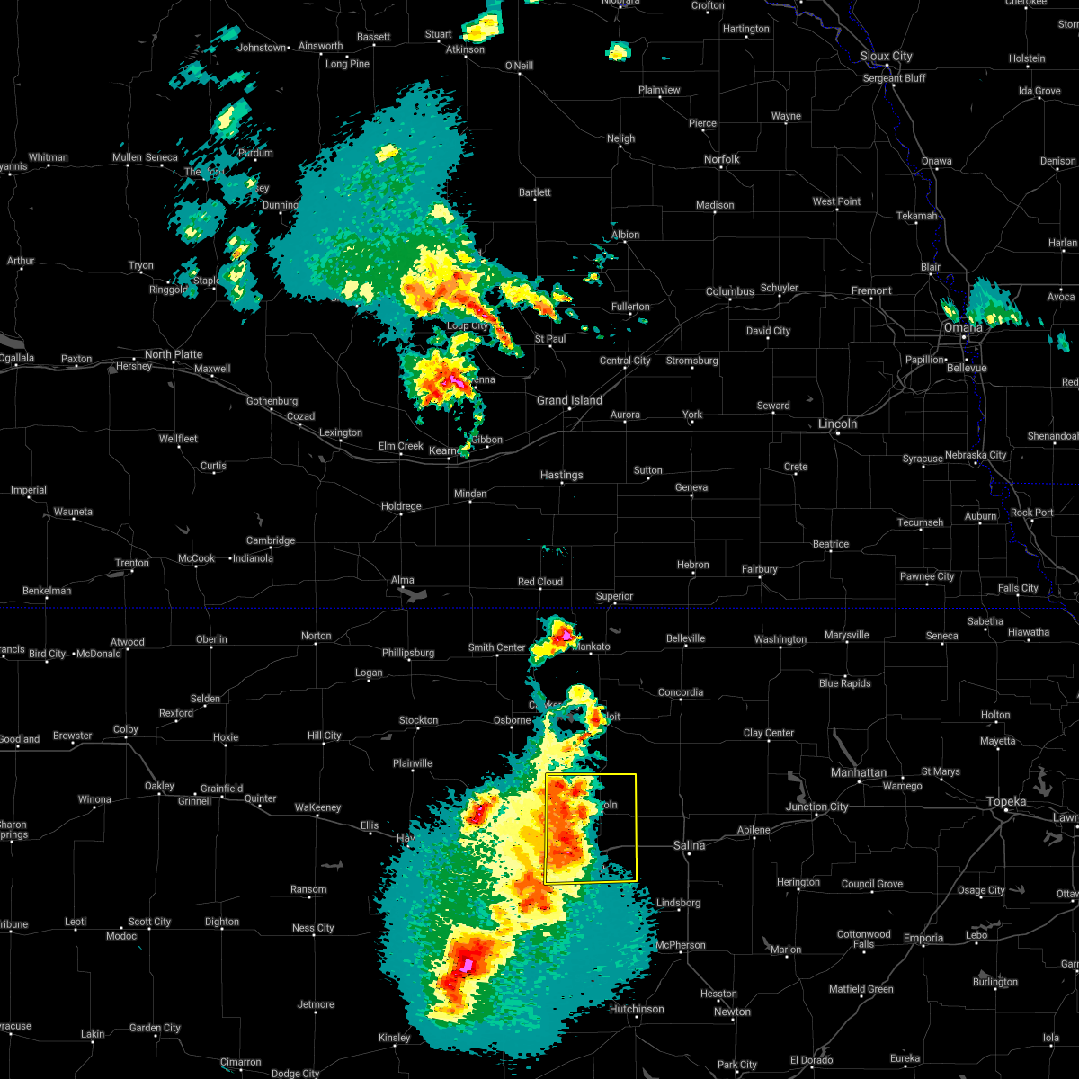 At 827 pm cdt, a severe thunderstorm was located 7 miles northeast of wilson, moving northeast at 25 mph (radar indicated). Hazards include 70 mph wind gusts and quarter size hail. Hail damage to vehicles is expected. expect considerable tree damage. Wind damage is also likely to mobile homes, roofs, and outbuildings. At 827 pm cdt, a severe thunderstorm was located 7 miles northeast of wilson, moving northeast at 25 mph (radar indicated). Hazards include 70 mph wind gusts and quarter size hail. Hail damage to vehicles is expected. expect considerable tree damage. Wind damage is also likely to mobile homes, roofs, and outbuildings.
|
| 4/6/2021 8:01 PM CDT |
 At 737 pm cdt, a severe thunderstorm was located over olmitz, or 7 miles west of hoisington, moving northeast at 40 mph (trained weather spotters have reported nickel hail with this storm. wind threat remains the greatest threat with this storm). Hazards include 60 mph wind gusts and nickel size hail. Expect damage to roofs, siding, and trees. Locations impacted include, great bend, russell, hoisington, wilson, claflin, lucas, pawnee rock, dorrance, albert, olmitz, milberger, bunker hill, galatia, susank, great bend airport, russell airport, cheyenne bottoms, wilson state park, wilson lake and odin. At 737 pm cdt, a severe thunderstorm was located over olmitz, or 7 miles west of hoisington, moving northeast at 40 mph (trained weather spotters have reported nickel hail with this storm. wind threat remains the greatest threat with this storm). Hazards include 60 mph wind gusts and nickel size hail. Expect damage to roofs, siding, and trees. Locations impacted include, great bend, russell, hoisington, wilson, claflin, lucas, pawnee rock, dorrance, albert, olmitz, milberger, bunker hill, galatia, susank, great bend airport, russell airport, cheyenne bottoms, wilson state park, wilson lake and odin.
|
| 4/6/2021 7:38 PM CDT |
 At 737 pm cdt, a severe thunderstorm was located over olmitz, or 7 miles west of hoisington, moving northeast at 40 mph (trained weather spotters have reported nickel hail with this storm. wind threat remains the greatest threat with this storm). Hazards include 60 mph wind gusts and nickel size hail. Expect damage to roofs, siding, and trees. Locations impacted include, great bend, russell, hoisington, wilson, claflin, lucas, pawnee rock, dorrance, albert, olmitz, milberger, bunker hill, galatia, susank, great bend airport, russell airport, cheyenne bottoms, wilson state park, wilson lake and odin. At 737 pm cdt, a severe thunderstorm was located over olmitz, or 7 miles west of hoisington, moving northeast at 40 mph (trained weather spotters have reported nickel hail with this storm. wind threat remains the greatest threat with this storm). Hazards include 60 mph wind gusts and nickel size hail. Expect damage to roofs, siding, and trees. Locations impacted include, great bend, russell, hoisington, wilson, claflin, lucas, pawnee rock, dorrance, albert, olmitz, milberger, bunker hill, galatia, susank, great bend airport, russell airport, cheyenne bottoms, wilson state park, wilson lake and odin.
|
| 4/6/2021 7:21 PM CDT |
 At 720 pm cdt, a severe thunderstorm was located over bison, moving northeast at 25 mph (quarter sized hail has been report in ash grove in rush county with this storm). Hazards include 60 mph wind gusts and quarter size hail. Hail damage to vehicles is expected. Expect wind damage to roofs, siding, and trees. At 720 pm cdt, a severe thunderstorm was located over bison, moving northeast at 25 mph (quarter sized hail has been report in ash grove in rush county with this storm). Hazards include 60 mph wind gusts and quarter size hail. Hail damage to vehicles is expected. Expect wind damage to roofs, siding, and trees.
|
| 8/14/2020 10:59 PM CDT |
 At 1058 pm cdt, a severe thunderstorm was located 7 miles south of dorrance, or 10 miles southwest of wilson, moving south at 20 mph (radar indicated). Hazards include golf ball size hail and 70 mph wind gusts. People and animals outdoors will be injured. expect hail damage to roofs, siding, windows, and vehicles. expect considerable tree damage. Wind damage is also likely to mobile homes, roofs, and outbuildings. At 1058 pm cdt, a severe thunderstorm was located 7 miles south of dorrance, or 10 miles southwest of wilson, moving south at 20 mph (radar indicated). Hazards include golf ball size hail and 70 mph wind gusts. People and animals outdoors will be injured. expect hail damage to roofs, siding, windows, and vehicles. expect considerable tree damage. Wind damage is also likely to mobile homes, roofs, and outbuildings.
|
| 8/14/2020 10:50 PM CDT |
 At 1049 pm cdt, a severe thunderstorm was located near dorrance, or 8 miles southwest of wilson, moving southeast at 25 mph (radar indicated). Hazards include golf ball size hail and 70 mph wind gusts. People and animals outdoors will be injured. expect hail damage to roofs, siding, windows, and vehicles. expect considerable tree damage. wind damage is also likely to mobile homes, roofs, and outbuildings. Locations impacted include, ellsworth, wilson, dorrance, bunker hill and ellsworth airport. At 1049 pm cdt, a severe thunderstorm was located near dorrance, or 8 miles southwest of wilson, moving southeast at 25 mph (radar indicated). Hazards include golf ball size hail and 70 mph wind gusts. People and animals outdoors will be injured. expect hail damage to roofs, siding, windows, and vehicles. expect considerable tree damage. wind damage is also likely to mobile homes, roofs, and outbuildings. Locations impacted include, ellsworth, wilson, dorrance, bunker hill and ellsworth airport.
|
| 8/14/2020 10:35 PM CDT | Large tree branch dow in ellsworth county KS, 0.3 miles SW of Wilson, KS |
| 8/14/2020 10:20 PM CDT |
 At 1019 pm cdt, a severe thunderstorm was located 7 miles south of lucas, or 10 miles northwest of wilson, moving southeast at 25 mph (radar indicated). Hazards include two inch hail and 70 mph wind gusts. People and animals outdoors will be injured. expect hail damage to roofs, siding, windows, and vehicles. expect considerable tree damage. wind damage is also likely to mobile homes, roofs, and outbuildings. Locations impacted include, ellsworth, wilson, kanopolis, lincoln, lucas, sylvan grove, dorrance, bunker hill, wilson state park, ellsworth airport and wilson lake. At 1019 pm cdt, a severe thunderstorm was located 7 miles south of lucas, or 10 miles northwest of wilson, moving southeast at 25 mph (radar indicated). Hazards include two inch hail and 70 mph wind gusts. People and animals outdoors will be injured. expect hail damage to roofs, siding, windows, and vehicles. expect considerable tree damage. wind damage is also likely to mobile homes, roofs, and outbuildings. Locations impacted include, ellsworth, wilson, kanopolis, lincoln, lucas, sylvan grove, dorrance, bunker hill, wilson state park, ellsworth airport and wilson lake.
|
| 8/14/2020 9:58 PM CDT |
 At 957 pm cdt, a severe thunderstorm was located near lucas, or 18 miles north of wilson, moving southeast at 30 mph (radar indicated). Hazards include golf ball size hail and 60 mph wind gusts. People and animals outdoors will be injured. expect hail damage to roofs, siding, windows, and vehicles. Expect wind damage to roofs, siding, and trees. At 957 pm cdt, a severe thunderstorm was located near lucas, or 18 miles north of wilson, moving southeast at 30 mph (radar indicated). Hazards include golf ball size hail and 60 mph wind gusts. People and animals outdoors will be injured. expect hail damage to roofs, siding, windows, and vehicles. Expect wind damage to roofs, siding, and trees.
|
| 7/30/2020 3:13 AM CDT |
 The severe thunderstorm warning for rice and ellsworth counties will expire at 315 am cdt, the storms which prompted the warning have moved out of the area. therefore, the warning will be allowed to expire. however gusty winds are still possible with these thunderstorms. The severe thunderstorm warning for rice and ellsworth counties will expire at 315 am cdt, the storms which prompted the warning have moved out of the area. therefore, the warning will be allowed to expire. however gusty winds are still possible with these thunderstorms.
|
| 7/30/2020 2:30 AM CDT |
 At 229 am cdt, severe thunderstorms were located along a line extending from 8 miles northeast of kanopolis to near lyons, moving southeast at 50 mph (radar indicated). Hazards include 60 mph wind gusts and penny size hail. Expect damage to roofs, siding, and trees. Locations impacted include, lyons, ellsworth, wilson, kanopolis, little river, chase, holyrood, bushton, geneseo, lorraine, frederick, ellsworth airport, silica, kanopolis lake and kanopolis state park. At 229 am cdt, severe thunderstorms were located along a line extending from 8 miles northeast of kanopolis to near lyons, moving southeast at 50 mph (radar indicated). Hazards include 60 mph wind gusts and penny size hail. Expect damage to roofs, siding, and trees. Locations impacted include, lyons, ellsworth, wilson, kanopolis, little river, chase, holyrood, bushton, geneseo, lorraine, frederick, ellsworth airport, silica, kanopolis lake and kanopolis state park.
|
| 7/30/2020 2:13 AM CDT |
 At 213 am cdt, severe thunderstorms were located along a line extending from 7 miles north of ellsworth to near chase, moving southeast at 50 mph (radar indicated). Hazards include 60 mph wind gusts and penny size hail. expect damage to roofs, siding, and trees At 213 am cdt, severe thunderstorms were located along a line extending from 7 miles north of ellsworth to near chase, moving southeast at 50 mph (radar indicated). Hazards include 60 mph wind gusts and penny size hail. expect damage to roofs, siding, and trees
|
| 7/6/2020 4:08 PM CDT |
 The severe thunderstorm warning for western ellsworth, southeastern russell and northeastern barton counties will expire at 415 pm cdt, the storm which prompted the warning has weakened below severe limits, and no longer poses an immediate threat to life or property. therefore, the warning will be allowed to expire. however heavy rain is still possible with this thunderstorm. The severe thunderstorm warning for western ellsworth, southeastern russell and northeastern barton counties will expire at 415 pm cdt, the storm which prompted the warning has weakened below severe limits, and no longer poses an immediate threat to life or property. therefore, the warning will be allowed to expire. however heavy rain is still possible with this thunderstorm.
|
| 7/6/2020 3:31 PM CDT |
 At 331 pm cdt, a severe thunderstorm was located over wilson, moving south at 10 mph (radar indicated). Hazards include 60 mph wind gusts and half dollar size hail. Hail damage to vehicles is expected. Expect wind damage to roofs, siding, and trees. At 331 pm cdt, a severe thunderstorm was located over wilson, moving south at 10 mph (radar indicated). Hazards include 60 mph wind gusts and half dollar size hail. Hail damage to vehicles is expected. Expect wind damage to roofs, siding, and trees.
|
| 7/2/2020 10:39 PM CDT |
 At 1039 pm cdt, a severe thunderstorm was located near milberger, or 11 miles northeast of otis, moving southeast at 55 mph (trained weather spotters). Hazards include 60 mph wind gusts and penny size hail. Expect damage to roofs, siding, and trees. Locations impacted include, hoisington, wilson, claflin, dorrance, olmitz, milberger, bunker hill, galatia, susank, russell airport and odin. At 1039 pm cdt, a severe thunderstorm was located near milberger, or 11 miles northeast of otis, moving southeast at 55 mph (trained weather spotters). Hazards include 60 mph wind gusts and penny size hail. Expect damage to roofs, siding, and trees. Locations impacted include, hoisington, wilson, claflin, dorrance, olmitz, milberger, bunker hill, galatia, susank, russell airport and odin.
|
| 7/2/2020 10:32 PM CDT |
 At 1031 pm cdt, a severe thunderstorm was located near dorrance, or 6 miles northwest of wilson, moving east at 35 mph (60 mph winds have been reported in russell). Hazards include 60 mph wind gusts and penny size hail. Expect damage to roofs, siding, and trees. Locations impacted include, russell, hoisington, wilson, claflin, lucas, gorham, luray, dorrance, olmitz, milberger, bunker hill, paradise, galatia, susank, waldo, russell airport, wilson state park, wilson lake and odin. At 1031 pm cdt, a severe thunderstorm was located near dorrance, or 6 miles northwest of wilson, moving east at 35 mph (60 mph winds have been reported in russell). Hazards include 60 mph wind gusts and penny size hail. Expect damage to roofs, siding, and trees. Locations impacted include, russell, hoisington, wilson, claflin, lucas, gorham, luray, dorrance, olmitz, milberger, bunker hill, paradise, galatia, susank, waldo, russell airport, wilson state park, wilson lake and odin.
|
| 7/2/2020 10:30 PM CDT |
 At 1030 pm cdt, a severe thunderstorm was located 8 miles southeast of sylvan grove, or 10 miles southwest of lincoln, moving east at 35 mph (60 mph winds have been reported in sylvan grove). Hazards include 60 mph wind gusts and penny size hail. expect damage to roofs, siding, and trees At 1030 pm cdt, a severe thunderstorm was located 8 miles southeast of sylvan grove, or 10 miles southwest of lincoln, moving east at 35 mph (60 mph winds have been reported in sylvan grove). Hazards include 60 mph wind gusts and penny size hail. expect damage to roofs, siding, and trees
|
| 7/2/2020 10:10 PM CDT |
 At 1010 pm cdt, a severe thunderstorm was located near russell, moving east at 35 mph (68 mph winds have been reported at the russell airport). Hazards include 60 mph wind gusts and penny size hail. expect damage to roofs, siding, and trees At 1010 pm cdt, a severe thunderstorm was located near russell, moving east at 35 mph (68 mph winds have been reported at the russell airport). Hazards include 60 mph wind gusts and penny size hail. expect damage to roofs, siding, and trees
|
| 7/2/2020 10:08 PM CDT |
 At 1006 pm cdt, severe thunderstorms were located along a line extending from hunter to 5 miles southwest of dorrance, moving east at 45 mph (spotters have reported 60 mph winds in sylvan grove). Hazards include 60 mph wind gusts and nickel size hail. Expect damage to roofs, siding, and trees. Locations impacted include, ellsworth, wilson, kanopolis, lincoln, holyrood, sylvan grove, geneseo, beverly, lorraine, barnard, ash grove, westfall, ellsworth airport, kanopolis lake and kanopolis state park. At 1006 pm cdt, severe thunderstorms were located along a line extending from hunter to 5 miles southwest of dorrance, moving east at 45 mph (spotters have reported 60 mph winds in sylvan grove). Hazards include 60 mph wind gusts and nickel size hail. Expect damage to roofs, siding, and trees. Locations impacted include, ellsworth, wilson, kanopolis, lincoln, holyrood, sylvan grove, geneseo, beverly, lorraine, barnard, ash grove, westfall, ellsworth airport, kanopolis lake and kanopolis state park.
|
| 7/2/2020 9:38 PM CDT |
 The national weather service in wichita has issued a * severe thunderstorm warning for. lincoln county in central kansas. ellsworth county in central kansas. until 1030 pm cdt. At 936 pm cdt, severe thunderstorms were located along a line. The national weather service in wichita has issued a * severe thunderstorm warning for. lincoln county in central kansas. ellsworth county in central kansas. until 1030 pm cdt. At 936 pm cdt, severe thunderstorms were located along a line.
|
| 6/21/2020 6:41 PM CDT |
 The severe thunderstorm warning for western rice, southwestern lincoln, western ellsworth, southern russell and barton counties will expire at 645 pm cdt, the storms which prompted the warning have weakened below severe limits, and no longer pose an immediate threat to life or property. therefore, the warning will be allowed to expire. a severe thunderstorm watch remains in effect until 1000 pm cdt for central and south central kansas. The severe thunderstorm warning for western rice, southwestern lincoln, western ellsworth, southern russell and barton counties will expire at 645 pm cdt, the storms which prompted the warning have weakened below severe limits, and no longer pose an immediate threat to life or property. therefore, the warning will be allowed to expire. a severe thunderstorm watch remains in effect until 1000 pm cdt for central and south central kansas.
|
| 6/21/2020 6:02 PM CDT |
 At 601 pm cdt, severe thunderstorms were located along a line extending from 8 miles southeast of milberger to near great bend, moving southeast at 15 mph. multiple reports of 80 mph winds with this storm. these are very dangerous storms (public). Hazards include 80 mph wind gusts and quarter size hail. Flying debris will be dangerous to those caught without shelter. mobile homes will be heavily damaged. expect considerable damage to roofs, windows, and vehicles. extensive tree damage and power outages are likely. Locations impacted include, great bend, ellsworth, hoisington, ellinwood, wilson, claflin, chase, holyrood, bushton, pawnee rock, dorrance, albert, alden, lorraine, olmitz, raymond, milberger, bunker hill, galatia and susank. At 601 pm cdt, severe thunderstorms were located along a line extending from 8 miles southeast of milberger to near great bend, moving southeast at 15 mph. multiple reports of 80 mph winds with this storm. these are very dangerous storms (public). Hazards include 80 mph wind gusts and quarter size hail. Flying debris will be dangerous to those caught without shelter. mobile homes will be heavily damaged. expect considerable damage to roofs, windows, and vehicles. extensive tree damage and power outages are likely. Locations impacted include, great bend, ellsworth, hoisington, ellinwood, wilson, claflin, chase, holyrood, bushton, pawnee rock, dorrance, albert, alden, lorraine, olmitz, raymond, milberger, bunker hill, galatia and susank.
|
| 6/21/2020 5:49 PM CDT |
 At 549 pm cdt, severe thunderstorms were located along a line extending from near milberger to near great bend, moving southeast at 15 mph (radar indicated). Hazards include 60 mph wind gusts and quarter size hail. Hail damage to vehicles is expected. Expect wind damage to roofs, siding, and trees. At 549 pm cdt, severe thunderstorms were located along a line extending from near milberger to near great bend, moving southeast at 15 mph (radar indicated). Hazards include 60 mph wind gusts and quarter size hail. Hail damage to vehicles is expected. Expect wind damage to roofs, siding, and trees.
|
| 6/21/2020 5:16 PM CDT |
 At 516 pm cdt, severe thunderstorms were located along a line extending from near milberger to 6 miles south of dorrance, moving north at 10 mph (radar indicated). Hazards include 60 mph wind gusts and quarter size hail. Hail damage to vehicles is expected. expect wind damage to roofs, siding, and trees. Locations impacted include, wilson, dorrance, milberger, galatia and susank. At 516 pm cdt, severe thunderstorms were located along a line extending from near milberger to 6 miles south of dorrance, moving north at 10 mph (radar indicated). Hazards include 60 mph wind gusts and quarter size hail. Hail damage to vehicles is expected. expect wind damage to roofs, siding, and trees. Locations impacted include, wilson, dorrance, milberger, galatia and susank.
|
| 6/21/2020 4:48 PM CDT |
 At 447 pm cdt, a severe thunderstorm was located near milberger, or 10 miles southeast of walker, moving southeast at 10 mph. a second thunderstorm was located about 4 miles south of dorrance and moving east at 10 mph (radar indicated). Hazards include ping pong ball size hail and 60 mph wind gusts. People and animals outdoors will be injured. expect hail damage to roofs, siding, windows, and vehicles. Expect wind damage to roofs, siding, and trees. At 447 pm cdt, a severe thunderstorm was located near milberger, or 10 miles southeast of walker, moving southeast at 10 mph. a second thunderstorm was located about 4 miles south of dorrance and moving east at 10 mph (radar indicated). Hazards include ping pong ball size hail and 60 mph wind gusts. People and animals outdoors will be injured. expect hail damage to roofs, siding, windows, and vehicles. Expect wind damage to roofs, siding, and trees.
|
| 6/21/2020 4:19 PM CDT |
 At 418 pm cdt, a severe thunderstorm was located over holyrood, or 9 miles northeast of claflin, moving southeast at 20 mph (radar indicated). Hazards include golf ball size hail and 60 mph wind gusts. People and animals outdoors will be injured. expect hail damage to roofs, siding, windows, and vehicles. expect wind damage to roofs, siding, and trees. Locations impacted include, ellsworth, wilson, kanopolis, holyrood, geneseo, lorraine and ellsworth airport. At 418 pm cdt, a severe thunderstorm was located over holyrood, or 9 miles northeast of claflin, moving southeast at 20 mph (radar indicated). Hazards include golf ball size hail and 60 mph wind gusts. People and animals outdoors will be injured. expect hail damage to roofs, siding, windows, and vehicles. expect wind damage to roofs, siding, and trees. Locations impacted include, ellsworth, wilson, kanopolis, holyrood, geneseo, lorraine and ellsworth airport.
|
| 6/21/2020 3:52 PM CDT |
 At 352 pm cdt, a severe thunderstorm was located 8 miles south of wilson, moving southeast at 25 mph (radar indicated). Hazards include golf ball size hail and 60 mph wind gusts. People and animals outdoors will be injured. expect hail damage to roofs, siding, windows, and vehicles. expect wind damage to roofs, siding, and trees. Locations impacted include, ellsworth, hoisington, wilson, claflin, kanopolis, holyrood, geneseo, albert, lorraine, olmitz, galatia, susank, ellsworth airport, cheyenne bottoms and odin. At 352 pm cdt, a severe thunderstorm was located 8 miles south of wilson, moving southeast at 25 mph (radar indicated). Hazards include golf ball size hail and 60 mph wind gusts. People and animals outdoors will be injured. expect hail damage to roofs, siding, windows, and vehicles. expect wind damage to roofs, siding, and trees. Locations impacted include, ellsworth, hoisington, wilson, claflin, kanopolis, holyrood, geneseo, albert, lorraine, olmitz, galatia, susank, ellsworth airport, cheyenne bottoms and odin.
|
| 6/21/2020 3:31 PM CDT |
 At 331 pm cdt, a severe thunderstorm was located 8 miles south of dorrance, or 9 miles southwest of wilson, moving southeast at 25 mph (radar indicated). Hazards include ping pong ball size hail and 60 mph wind gusts. People and animals outdoors will be injured. expect hail damage to roofs, siding, windows, and vehicles. Expect wind damage to roofs, siding, and trees. At 331 pm cdt, a severe thunderstorm was located 8 miles south of dorrance, or 9 miles southwest of wilson, moving southeast at 25 mph (radar indicated). Hazards include ping pong ball size hail and 60 mph wind gusts. People and animals outdoors will be injured. expect hail damage to roofs, siding, windows, and vehicles. Expect wind damage to roofs, siding, and trees.
|
| 6/21/2020 2:37 PM CDT |
 At 236 pm cdt, a severe thunderstorm was located near wilson, moving east at 10 mph (radar indicated). Hazards include ping pong ball size hail and 60 mph wind gusts. People and animals outdoors will be injured. expect hail damage to roofs, siding, windows, and vehicles. expect wind damage to roofs, siding, and trees. Locations impacted include, ellsworth, wilson, kanopolis, dorrance, bunker hill, wilson state park, ellsworth airport and wilson lake. At 236 pm cdt, a severe thunderstorm was located near wilson, moving east at 10 mph (radar indicated). Hazards include ping pong ball size hail and 60 mph wind gusts. People and animals outdoors will be injured. expect hail damage to roofs, siding, windows, and vehicles. expect wind damage to roofs, siding, and trees. Locations impacted include, ellsworth, wilson, kanopolis, dorrance, bunker hill, wilson state park, ellsworth airport and wilson lake.
|
| 6/21/2020 2:30 PM CDT | Ping Pong Ball sized hail reported 0.6 miles NNW of Wilson, KS, report via ksn of pea to ping pong ball sized hail. time is approximated from radar. |
| 6/21/2020 2:16 PM CDT |
 At 216 pm cdt, a severe thunderstorm was located over wilson, moving northeast at 10 mph (radar indicated). Hazards include 60 mph wind gusts and half dollar size hail. Hail damage to vehicles is expected. expect wind damage to roofs, siding, and trees. Locations impacted include, ellsworth, wilson, kanopolis, holyrood, dorrance, lorraine, bunker hill, westfall, ellsworth airport, kanopolis lake, wilson state park, kanopolis state park and wilson lake. At 216 pm cdt, a severe thunderstorm was located over wilson, moving northeast at 10 mph (radar indicated). Hazards include 60 mph wind gusts and half dollar size hail. Hail damage to vehicles is expected. expect wind damage to roofs, siding, and trees. Locations impacted include, ellsworth, wilson, kanopolis, holyrood, dorrance, lorraine, bunker hill, westfall, ellsworth airport, kanopolis lake, wilson state park, kanopolis state park and wilson lake.
|
| 6/21/2020 2:01 PM CDT |
 At 200 pm cdt, a severe thunderstorm was located near wilson, moving east at 10 mph (radar indicated). Hazards include 60 mph wind gusts and half dollar size hail. Hail damage to vehicles is expected. Expect wind damage to roofs, siding, and trees. At 200 pm cdt, a severe thunderstorm was located near wilson, moving east at 10 mph (radar indicated). Hazards include 60 mph wind gusts and half dollar size hail. Hail damage to vehicles is expected. Expect wind damage to roofs, siding, and trees.
|
| 5/24/2020 10:26 PM CDT |
 The severe thunderstorm warning for lincoln, northern ellsworth and northwestern saline counties will expire at 1030 pm cdt, the storm which prompted the warning has weakened below severe limits, and no longer poses an immediate threat to life or property. therefore, the warning will be allowed to expire. however small hail, gusty winds and heavy rain are still possible with this thunderstorm. a severe thunderstorm watch remains in effect until midnight cdt for central kansas. The severe thunderstorm warning for lincoln, northern ellsworth and northwestern saline counties will expire at 1030 pm cdt, the storm which prompted the warning has weakened below severe limits, and no longer poses an immediate threat to life or property. therefore, the warning will be allowed to expire. however small hail, gusty winds and heavy rain are still possible with this thunderstorm. a severe thunderstorm watch remains in effect until midnight cdt for central kansas.
|
| 5/24/2020 9:53 PM CDT |
 At 953 pm cdt, a severe thunderstorm was located 7 miles south of culver, or 9 miles west of salina, moving north at 15 mph (radar indicated). Hazards include 60 mph wind gusts and half dollar size hail. Hail damage to vehicles is expected. expect wind damage to roofs, siding, and trees. Locations impacted include, salina, ellsworth, wilson, lincoln, sylvan grove, brookville, beverly, barnard, glendale, ash grove, westfall, salina airport and ellsworth airport. At 953 pm cdt, a severe thunderstorm was located 7 miles south of culver, or 9 miles west of salina, moving north at 15 mph (radar indicated). Hazards include 60 mph wind gusts and half dollar size hail. Hail damage to vehicles is expected. expect wind damage to roofs, siding, and trees. Locations impacted include, salina, ellsworth, wilson, lincoln, sylvan grove, brookville, beverly, barnard, glendale, ash grove, westfall, salina airport and ellsworth airport.
|
| 5/24/2020 9:25 PM CDT |
 At 924 pm cdt, a severe thunderstorm was located near brookville, or 10 miles west of salina, moving northwest at 40 mph. additional clusters of storms were located throughout the warned area (radar indicated). Hazards include 60 mph wind gusts and half dollar size hail. Hail damage to vehicles is expected. Expect wind damage to roofs, siding, and trees. At 924 pm cdt, a severe thunderstorm was located near brookville, or 10 miles west of salina, moving northwest at 40 mph. additional clusters of storms were located throughout the warned area (radar indicated). Hazards include 60 mph wind gusts and half dollar size hail. Hail damage to vehicles is expected. Expect wind damage to roofs, siding, and trees.
|
| 5/24/2020 9:19 PM CDT |
 At 918 pm cdt, a severe thunderstorm was located 6 miles southwest of lincoln, moving northwest at 45 mph (radar indicated). Hazards include 60 mph wind gusts and quarter size hail. Hail damage to vehicles is expected. expect wind damage to roofs, siding, and trees. Locations impacted include, ellsworth, wilson, sylvan grove and ellsworth airport. At 918 pm cdt, a severe thunderstorm was located 6 miles southwest of lincoln, moving northwest at 45 mph (radar indicated). Hazards include 60 mph wind gusts and quarter size hail. Hail damage to vehicles is expected. expect wind damage to roofs, siding, and trees. Locations impacted include, ellsworth, wilson, sylvan grove and ellsworth airport.
|
| 5/24/2020 8:47 PM CDT |
 At 847 pm cdt, a severe thunderstorm was located near sylvan grove, or 10 miles north of wilson, moving north at 20 mph (radar indicated). Hazards include ping pong ball size hail and 60 mph wind gusts. People and animals outdoors will be injured. expect hail damage to roofs, siding, windows, and vehicles. Expect wind damage to roofs, siding, and trees. At 847 pm cdt, a severe thunderstorm was located near sylvan grove, or 10 miles north of wilson, moving north at 20 mph (radar indicated). Hazards include ping pong ball size hail and 60 mph wind gusts. People and animals outdoors will be injured. expect hail damage to roofs, siding, windows, and vehicles. Expect wind damage to roofs, siding, and trees.
|
| 5/24/2020 6:57 PM CDT |
 At 657 pm cdt, a severe thunderstorm was located near wilson, moving northeast at 20 mph (radar indicated). Hazards include 60 mph wind gusts and half dollar size hail. Hail damage to vehicles is expected. Expect wind damage to roofs, siding, and trees. At 657 pm cdt, a severe thunderstorm was located near wilson, moving northeast at 20 mph (radar indicated). Hazards include 60 mph wind gusts and half dollar size hail. Hail damage to vehicles is expected. Expect wind damage to roofs, siding, and trees.
|
| 5/4/2020 7:03 AM CDT |
 At 703 am cdt, a severe thunderstorm was located 10 miles southeast of sylvan grove, or 11 miles southwest of lincoln, moving east at 40 mph (radar indicated). Hazards include golf ball size hail. People and animals outdoors will be injured. expect damage to roofs, siding, windows, and vehicles. Locations impacted include, wilson, lincoln, sylvan grove, beverly and westfall. At 703 am cdt, a severe thunderstorm was located 10 miles southeast of sylvan grove, or 11 miles southwest of lincoln, moving east at 40 mph (radar indicated). Hazards include golf ball size hail. People and animals outdoors will be injured. expect damage to roofs, siding, windows, and vehicles. Locations impacted include, wilson, lincoln, sylvan grove, beverly and westfall.
|
| 5/4/2020 6:52 AM CDT |
 At 652 am cdt, a severe thunderstorm was located near wilson, moving east at 35 mph (radar indicated). Hazards include half dollar size hail. damage to vehicles is expected At 652 am cdt, a severe thunderstorm was located near wilson, moving east at 35 mph (radar indicated). Hazards include half dollar size hail. damage to vehicles is expected
|
| 5/4/2020 6:39 AM CDT |
 At 623 am cdt, a severe thunderstorm was located 9 miles southwest of dorrance, or 10 miles southeast of russell, moving northeast at 35 mph (radar indicated). Hazards include quarter size hail. damage to vehicles is expected At 623 am cdt, a severe thunderstorm was located 9 miles southwest of dorrance, or 10 miles southeast of russell, moving northeast at 35 mph (radar indicated). Hazards include quarter size hail. damage to vehicles is expected
|
| 5/4/2020 6:24 AM CDT |
 At 623 am cdt, a severe thunderstorm was located 9 miles southwest of dorrance, or 10 miles southeast of russell, moving northeast at 35 mph (radar indicated). Hazards include quarter size hail. damage to vehicles is expected At 623 am cdt, a severe thunderstorm was located 9 miles southwest of dorrance, or 10 miles southeast of russell, moving northeast at 35 mph (radar indicated). Hazards include quarter size hail. damage to vehicles is expected
|
| 9/21/2019 8:58 PM CDT |
 At 857 pm cdt, a severe thunderstorm was located near dorrance, or near wilson, moving northeast at 40 mph (radar indicated). Hazards include 60 mph wind gusts and nickel size hail. Expect damage to roofs, siding, and trees. Locations impacted include, lucas, luray, dorrance, wilson lake and wilson state park. At 857 pm cdt, a severe thunderstorm was located near dorrance, or near wilson, moving northeast at 40 mph (radar indicated). Hazards include 60 mph wind gusts and nickel size hail. Expect damage to roofs, siding, and trees. Locations impacted include, lucas, luray, dorrance, wilson lake and wilson state park.
|
| 9/21/2019 8:56 PM CDT |
 At 855 pm cdt, a severe thunderstorm was located near sylvan grove, or 8 miles north of wilson, moving northeast at 40 mph (radar indicated). Hazards include 60 mph wind gusts and nickel size hail. expect damage to roofs, siding, and trees At 855 pm cdt, a severe thunderstorm was located near sylvan grove, or 8 miles north of wilson, moving northeast at 40 mph (radar indicated). Hazards include 60 mph wind gusts and nickel size hail. expect damage to roofs, siding, and trees
|
| 9/21/2019 8:33 PM CDT |
 At 830 pm cdt, a severe thunderstorm was located near russell, moving east at 35 mph. russell municipal airport recorded an observed 75mph wind gust at 827 pm cdt (radar indicated). Hazards include 70 mph wind gusts and quarter size hail. Hail damage to vehicles is expected. expect considerable tree damage. wind damage is also likely to mobile homes, roofs, and outbuildings. Locations impacted include, russell, lucas, gorham, luray, dorrance, milberger, bunker hill, paradise, galatia, susank, waldo, russell airport, wilson state park and wilson lake. At 830 pm cdt, a severe thunderstorm was located near russell, moving east at 35 mph. russell municipal airport recorded an observed 75mph wind gust at 827 pm cdt (radar indicated). Hazards include 70 mph wind gusts and quarter size hail. Hail damage to vehicles is expected. expect considerable tree damage. wind damage is also likely to mobile homes, roofs, and outbuildings. Locations impacted include, russell, lucas, gorham, luray, dorrance, milberger, bunker hill, paradise, galatia, susank, waldo, russell airport, wilson state park and wilson lake.
|
| 9/21/2019 7:50 PM CDT |
 At 750 pm cdt, a severe thunderstorm was located near walker, moving northeast at 20 mph (radar indicated). Hazards include 60 mph wind gusts and quarter size hail. Hail damage to vehicles is expected. Expect wind damage to roofs, siding, and trees. At 750 pm cdt, a severe thunderstorm was located near walker, moving northeast at 20 mph (radar indicated). Hazards include 60 mph wind gusts and quarter size hail. Hail damage to vehicles is expected. Expect wind damage to roofs, siding, and trees.
|
| 8/29/2019 10:36 PM CDT |
 At 1036 pm cdt, severe thunderstorms were located along a line extending from 7 miles west of lincoln to 5 miles west of ellsworth to near hoisington, moving southeast at 40 mph (radar indicated). Hazards include 70 mph wind gusts and quarter size hail. Hail damage to vehicles is expected. expect considerable tree damage. wind damage is also likely to mobile homes, roofs, and outbuildings. Locations impacted include, great bend, ellsworth, hoisington, ellinwood, wilson, claflin, lincoln, holyrood, sylvan grove, pawnee rock, dorrance, albert, beverly, olmitz, barnard, milberger, galatia, susank, great bend airport and wilson state park. At 1036 pm cdt, severe thunderstorms were located along a line extending from 7 miles west of lincoln to 5 miles west of ellsworth to near hoisington, moving southeast at 40 mph (radar indicated). Hazards include 70 mph wind gusts and quarter size hail. Hail damage to vehicles is expected. expect considerable tree damage. wind damage is also likely to mobile homes, roofs, and outbuildings. Locations impacted include, great bend, ellsworth, hoisington, ellinwood, wilson, claflin, lincoln, holyrood, sylvan grove, pawnee rock, dorrance, albert, beverly, olmitz, barnard, milberger, galatia, susank, great bend airport and wilson state park.
|
| 8/29/2019 10:24 PM CDT |
 At 1023 pm cdt, severe thunderstorms were located along a line extending from 7 miles south of hunter to near wilson to near olmitz, moving southeast at 40 mph (radar indicated). Hazards include 70 mph wind gusts and quarter size hail. Hail damage to vehicles is expected. expect considerable tree damage. wind damage is also likely to mobile homes, roofs, and outbuildings. Locations impacted include, great bend, russell, ellsworth, hoisington, ellinwood, wilson, claflin, lincoln, holyrood, lucas, gorham, sylvan grove, pawnee rock, luray, dorrance, albert, beverly, olmitz, barnard and milberger. At 1023 pm cdt, severe thunderstorms were located along a line extending from 7 miles south of hunter to near wilson to near olmitz, moving southeast at 40 mph (radar indicated). Hazards include 70 mph wind gusts and quarter size hail. Hail damage to vehicles is expected. expect considerable tree damage. wind damage is also likely to mobile homes, roofs, and outbuildings. Locations impacted include, great bend, russell, ellsworth, hoisington, ellinwood, wilson, claflin, lincoln, holyrood, lucas, gorham, sylvan grove, pawnee rock, luray, dorrance, albert, beverly, olmitz, barnard and milberger.
|
| 8/29/2019 9:37 PM CDT |
 At 936 pm cdt, severe thunderstorms were located along a line extending from near natoma to near hays, moving southeast at 40 mph (radar indicated). Hazards include 70 mph wind gusts and quarter size hail. Hail damage to vehicles is expected. expect considerable tree damage. Wind damage is also likely to mobile homes, roofs, and outbuildings. At 936 pm cdt, severe thunderstorms were located along a line extending from near natoma to near hays, moving southeast at 40 mph (radar indicated). Hazards include 70 mph wind gusts and quarter size hail. Hail damage to vehicles is expected. expect considerable tree damage. Wind damage is also likely to mobile homes, roofs, and outbuildings.
|
| 8/25/2019 12:16 AM CDT |
 At 1215 am cdt, severe thunderstorms were located along a line extending from 6 miles east of wilson to 5 miles west of claflin to near shaffer, moving southeast at 40 mph (radar indicated). Hazards include 70 mph wind gusts and nickel size hail. Expect considerable tree damage. damage is likely to mobile homes, roofs, and outbuildings. Locations impacted include, great bend, lyons, ellsworth, hoisington, ellinwood, wilson, claflin, kanopolis, lincoln, chase, holyrood, bushton, geneseo, pawnee rock, albert, lorraine, olmitz, raymond, frederick and great bend airport. At 1215 am cdt, severe thunderstorms were located along a line extending from 6 miles east of wilson to 5 miles west of claflin to near shaffer, moving southeast at 40 mph (radar indicated). Hazards include 70 mph wind gusts and nickel size hail. Expect considerable tree damage. damage is likely to mobile homes, roofs, and outbuildings. Locations impacted include, great bend, lyons, ellsworth, hoisington, ellinwood, wilson, claflin, kanopolis, lincoln, chase, holyrood, bushton, geneseo, pawnee rock, albert, lorraine, olmitz, raymond, frederick and great bend airport.
|
| 8/24/2019 11:58 PM CDT |
 At 1158 pm cdt, severe thunderstorms were located along a line extending from near sylvan grove to 10 miles east of milberger to bison, moving southeast at 35 mph (radar indicated). Hazards include 70 mph wind gusts and nickel size hail. Expect considerable tree damage. Damage is likely to mobile homes, roofs, and outbuildings. At 1158 pm cdt, severe thunderstorms were located along a line extending from near sylvan grove to 10 miles east of milberger to bison, moving southeast at 35 mph (radar indicated). Hazards include 70 mph wind gusts and nickel size hail. Expect considerable tree damage. Damage is likely to mobile homes, roofs, and outbuildings.
|
| 8/24/2019 9:03 PM CDT | Quarter sized hail reported 6.4 miles NNE of Wilson, KS, 55 to 70 mph winds also reported. |
| 8/18/2019 12:05 AM CDT |
 The severe thunderstorm warning for russell county will expire at 1215 am cdt. the storm which prompted the warning has weakened below severe limits, and no longer poses an immediate threat to life or property. therefore, the warning will be allowed to expire. however gusty winds and heavy rain are still possible with this thunderstorm. A The severe thunderstorm warning for russell county will expire at 1215 am cdt. the storm which prompted the warning has weakened below severe limits, and no longer poses an immediate threat to life or property. therefore, the warning will be allowed to expire. however gusty winds and heavy rain are still possible with this thunderstorm. A
|
| 8/17/2019 11:14 PM CDT |
 The national weather service in wichita has issued a * severe thunderstorm warning for. russell county in central kansas. until 1215 am cdt. At 1114 pm cdt, a severe thunderstorm was located over russell, moving east at 30 mph. The national weather service in wichita has issued a * severe thunderstorm warning for. russell county in central kansas. until 1215 am cdt. At 1114 pm cdt, a severe thunderstorm was located over russell, moving east at 30 mph.
|
| 8/17/2019 10:32 PM CDT |
 At 955 pm cdt, a severe thunderstorm was located near dorrance, or 7 miles west of wilson, moving east at 45 mph (radar indicated). Hazards include 70 mph wind gusts and quarter size hail. Hail damage to vehicles is expected. expect considerable tree damage. Wind damage is also likely to mobile homes, roofs, and outbuildings. At 955 pm cdt, a severe thunderstorm was located near dorrance, or 7 miles west of wilson, moving east at 45 mph (radar indicated). Hazards include 70 mph wind gusts and quarter size hail. Hail damage to vehicles is expected. expect considerable tree damage. Wind damage is also likely to mobile homes, roofs, and outbuildings.
|
| 8/17/2019 10:26 PM CDT |
 The severe thunderstorm warning for southeastern russell and northeastern barton counties will expire at 1030 pm cdt, the storm which prompted the warning has moved out of the area. therefore, the warning will be allowed to expire. a severe thunderstorm watch remains in effect until 300 am cdt for central kansas. to report severe weather, contact your nearest law enforcement agency. they will relay your report to the national weather service wichita. The severe thunderstorm warning for southeastern russell and northeastern barton counties will expire at 1030 pm cdt, the storm which prompted the warning has moved out of the area. therefore, the warning will be allowed to expire. a severe thunderstorm watch remains in effect until 300 am cdt for central kansas. to report severe weather, contact your nearest law enforcement agency. they will relay your report to the national weather service wichita.
|
| 8/17/2019 10:16 PM CDT |
 At 1016 pm cdt, a severe thunderstorm was located near ellsworth, moving east at 45 mph (radar indicated). Hazards include 70 mph wind gusts and quarter size hail. Hail damage to vehicles is expected. expect considerable tree damage. wind damage is also likely to mobile homes, roofs, and outbuildings. Locations impacted include, wilson, claflin, dorrance, susank, wilson state park, wilson lake, odin and cheyenne bottoms. At 1016 pm cdt, a severe thunderstorm was located near ellsworth, moving east at 45 mph (radar indicated). Hazards include 70 mph wind gusts and quarter size hail. Hail damage to vehicles is expected. expect considerable tree damage. wind damage is also likely to mobile homes, roofs, and outbuildings. Locations impacted include, wilson, claflin, dorrance, susank, wilson state park, wilson lake, odin and cheyenne bottoms.
|
| 8/17/2019 10:01 PM CDT |
 At 1001 pm cdt, a severe thunderstorm was located near wilson, moving southeast at 45 mph (radar indicated). Hazards include 70 mph wind gusts and quarter size hail. Hail damage to vehicles is expected. expect considerable tree damage. wind damage is also likely to mobile homes, roofs, and outbuildings. Locations impacted include, wilson, claflin, lucas, luray, dorrance, bunker hill, galatia, susank, waldo, wilson state park, wilson lake, odin and cheyenne bottoms. At 1001 pm cdt, a severe thunderstorm was located near wilson, moving southeast at 45 mph (radar indicated). Hazards include 70 mph wind gusts and quarter size hail. Hail damage to vehicles is expected. expect considerable tree damage. wind damage is also likely to mobile homes, roofs, and outbuildings. Locations impacted include, wilson, claflin, lucas, luray, dorrance, bunker hill, galatia, susank, waldo, wilson state park, wilson lake, odin and cheyenne bottoms.
|
| 8/17/2019 9:55 PM CDT |
 At 955 pm cdt, a severe thunderstorm was located near dorrance, or 7 miles west of wilson, moving east at 45 mph (radar indicated). Hazards include 70 mph wind gusts and quarter size hail. Hail damage to vehicles is expected. expect considerable tree damage. Wind damage is also likely to mobile homes, roofs, and outbuildings. At 955 pm cdt, a severe thunderstorm was located near dorrance, or 7 miles west of wilson, moving east at 45 mph (radar indicated). Hazards include 70 mph wind gusts and quarter size hail. Hail damage to vehicles is expected. expect considerable tree damage. Wind damage is also likely to mobile homes, roofs, and outbuildings.
|
| 8/17/2019 9:49 PM CDT |
 At 949 pm cdt, a severe thunderstorm was located near dorrance, or 10 miles east of russell, moving east at 45 mph. this is a very dangerous storm (radar indicated). Hazards include 80 mph wind gusts and quarter size hail. Flying debris will be dangerous to those caught without shelter. mobile homes will be heavily damaged. expect considerable damage to roofs, windows, and vehicles. extensive tree damage and power outages are likely. Locations impacted include, russell, wilson, claflin, lucas, gorham, luray, dorrance, milberger, bunker hill, paradise, galatia, susank, waldo, russell airport, wilson state park, wilson lake, odin and cheyenne bottoms. At 949 pm cdt, a severe thunderstorm was located near dorrance, or 10 miles east of russell, moving east at 45 mph. this is a very dangerous storm (radar indicated). Hazards include 80 mph wind gusts and quarter size hail. Flying debris will be dangerous to those caught without shelter. mobile homes will be heavily damaged. expect considerable damage to roofs, windows, and vehicles. extensive tree damage and power outages are likely. Locations impacted include, russell, wilson, claflin, lucas, gorham, luray, dorrance, milberger, bunker hill, paradise, galatia, susank, waldo, russell airport, wilson state park, wilson lake, odin and cheyenne bottoms.
|
| 8/17/2019 9:35 PM CDT |
 At 934 pm cdt, a severe thunderstorm was located over russell, moving east at 45 mph. this is a very dangerous storm (radar indicated). Hazards include 80 mph wind gusts and half dollar size hail. Flying debris will be dangerous to those caught without shelter. mobile homes will be heavily damaged. expect considerable damage to roofs, windows, and vehicles. extensive tree damage and power outages are likely. Locations impacted include, russell, hoisington, wilson, claflin, lucas, gorham, luray, dorrance, milberger, bunker hill, paradise, galatia, susank, waldo, russell airport, cheyenne bottoms, wilson state park, wilson lake and odin. At 934 pm cdt, a severe thunderstorm was located over russell, moving east at 45 mph. this is a very dangerous storm (radar indicated). Hazards include 80 mph wind gusts and half dollar size hail. Flying debris will be dangerous to those caught without shelter. mobile homes will be heavily damaged. expect considerable damage to roofs, windows, and vehicles. extensive tree damage and power outages are likely. Locations impacted include, russell, hoisington, wilson, claflin, lucas, gorham, luray, dorrance, milberger, bunker hill, paradise, galatia, susank, waldo, russell airport, cheyenne bottoms, wilson state park, wilson lake and odin.
|
| 8/17/2019 9:18 PM CDT |
 At 917 pm cdt, a severe thunderstorm was located over emmeram, moving east at 45 mph (radar indicated). Hazards include 70 mph wind gusts and half dollar size hail. Hail damage to vehicles is expected. expect considerable tree damage. wind damage is also likely to mobile homes, roofs, and outbuildings. Locations impacted include, russell, hoisington, wilson, claflin, lucas, gorham, luray, dorrance, milberger, bunker hill, paradise, galatia, susank, waldo, russell airport, cheyenne bottoms, wilson state park, wilson lake and odin. At 917 pm cdt, a severe thunderstorm was located over emmeram, moving east at 45 mph (radar indicated). Hazards include 70 mph wind gusts and half dollar size hail. Hail damage to vehicles is expected. expect considerable tree damage. wind damage is also likely to mobile homes, roofs, and outbuildings. Locations impacted include, russell, hoisington, wilson, claflin, lucas, gorham, luray, dorrance, milberger, bunker hill, paradise, galatia, susank, waldo, russell airport, cheyenne bottoms, wilson state park, wilson lake and odin.
|
| 8/17/2019 9:11 PM CDT |
 At 910 pm cdt, a severe thunderstorm was located over catherine, moving east at 45 mph (radar indicated). Hazards include 70 mph wind gusts and half dollar size hail. Hail damage to vehicles is expected. expect considerable tree damage. Wind damage is also likely to mobile homes, roofs, and outbuildings. At 910 pm cdt, a severe thunderstorm was located over catherine, moving east at 45 mph (radar indicated). Hazards include 70 mph wind gusts and half dollar size hail. Hail damage to vehicles is expected. expect considerable tree damage. Wind damage is also likely to mobile homes, roofs, and outbuildings.
|
| 8/17/2019 1:57 AM CDT |
 The severe thunderstorm warning for southwestern lincoln. northwestern ellsworth and southeastern russell counties will expire at 200 am cdt. the storm which prompted the warning has weakened below severe limits, and has exited the warned area. therefore, the warning will be allowed to expire. However gusty winds and heavy rain are still. The severe thunderstorm warning for southwestern lincoln. northwestern ellsworth and southeastern russell counties will expire at 200 am cdt. the storm which prompted the warning has weakened below severe limits, and has exited the warned area. therefore, the warning will be allowed to expire. However gusty winds and heavy rain are still.
|
| 8/17/2019 1:45 AM CDT |
 A severe thunderstorm warning remains in effect until 200 am cdt for southwestern lincoln. northwestern ellsworth and southeastern russell counties. at 145 am cdt, a severe thunderstorm was located over wilson, moving east at 40 mph. hazard. 60 mph wind gusts and nickel size hail. A severe thunderstorm warning remains in effect until 200 am cdt for southwestern lincoln. northwestern ellsworth and southeastern russell counties. at 145 am cdt, a severe thunderstorm was located over wilson, moving east at 40 mph. hazard. 60 mph wind gusts and nickel size hail.
|
| 8/17/2019 1:18 AM CDT |
 At 118 am cdt, a severe thunderstorm was located over dorrance, or 7 miles west of wilson, moving east at 25 mph (radar indicated). Hazards include 70 mph wind gusts and quarter size hail. Hail damage to vehicles is expected. expect considerable tree damage. Wind damage is also likely to mobile homes, roofs, and outbuildings. At 118 am cdt, a severe thunderstorm was located over dorrance, or 7 miles west of wilson, moving east at 25 mph (radar indicated). Hazards include 70 mph wind gusts and quarter size hail. Hail damage to vehicles is expected. expect considerable tree damage. Wind damage is also likely to mobile homes, roofs, and outbuildings.
|
| 7/31/2019 7:10 PM CDT |
 At 708 pm cdt, a severe thunderstorm was located 8 miles south of dorrance, or 8 miles southwest of wilson, moving southeast at 10 mph (radar indicated). Hazards include 60 mph wind gusts and quarter size hail. Hail damage to vehicles is expected. expect wind damage to roofs, siding, and trees. Locations impacted include, wilson and dorrance. At 708 pm cdt, a severe thunderstorm was located 8 miles south of dorrance, or 8 miles southwest of wilson, moving southeast at 10 mph (radar indicated). Hazards include 60 mph wind gusts and quarter size hail. Hail damage to vehicles is expected. expect wind damage to roofs, siding, and trees. Locations impacted include, wilson and dorrance.
|
| 7/31/2019 6:48 PM CDT |
 At 647 pm cdt, a severe thunderstorm was located near dorrance, or 7 miles southwest of wilson, moving east at 20 mph (radar indicated). Hazards include 60 mph wind gusts and quarter size hail. Hail damage to vehicles is expected. Expect wind damage to roofs, siding, and trees. At 647 pm cdt, a severe thunderstorm was located near dorrance, or 7 miles southwest of wilson, moving east at 20 mph (radar indicated). Hazards include 60 mph wind gusts and quarter size hail. Hail damage to vehicles is expected. Expect wind damage to roofs, siding, and trees.
|
| 6/25/2019 11:48 PM CDT |
 At 1147 pm cdt, a severe thunderstorm was located near sylvan grove, or 8 miles north of wilson, and is nearly stationary (radar indicated). Hazards include two inch hail and 60 mph wind gusts. People and animals outdoors will be injured. expect hail damage to roofs, siding, windows, and vehicles. expect wind damage to roofs, siding, and trees. Locations impacted include, wilson, lincoln, sylvan grove, wilson state park and wilson lake. At 1147 pm cdt, a severe thunderstorm was located near sylvan grove, or 8 miles north of wilson, and is nearly stationary (radar indicated). Hazards include two inch hail and 60 mph wind gusts. People and animals outdoors will be injured. expect hail damage to roofs, siding, windows, and vehicles. expect wind damage to roofs, siding, and trees. Locations impacted include, wilson, lincoln, sylvan grove, wilson state park and wilson lake.
|
| 6/25/2019 11:30 PM CDT |
 At 1130 pm cdt, a severe thunderstorm was located over sylvan grove, or 10 miles north of wilson, moving southeast at 10 mph (radar indicated). Hazards include ping pong ball size hail and 60 mph wind gusts. People and animals outdoors will be injured. expect hail damage to roofs, siding, windows, and vehicles. Expect wind damage to roofs, siding, and trees. At 1130 pm cdt, a severe thunderstorm was located over sylvan grove, or 10 miles north of wilson, moving southeast at 10 mph (radar indicated). Hazards include ping pong ball size hail and 60 mph wind gusts. People and animals outdoors will be injured. expect hail damage to roofs, siding, windows, and vehicles. Expect wind damage to roofs, siding, and trees.
|
| 6/23/2019 6:33 PM CDT |
 At 633 pm cdt, a severe thunderstorm was located over wilson, moving east at 40 mph (radar indicated). Hazards include ping pong ball size hail and 60 mph wind gusts. People and animals outdoors will be injured. expect hail damage to roofs, siding, windows, and vehicles. Expect wind damage to roofs, siding, and trees. At 633 pm cdt, a severe thunderstorm was located over wilson, moving east at 40 mph (radar indicated). Hazards include ping pong ball size hail and 60 mph wind gusts. People and animals outdoors will be injured. expect hail damage to roofs, siding, windows, and vehicles. Expect wind damage to roofs, siding, and trees.
|
| 6/22/2019 4:44 PM CDT |
 At 443 pm cdt, a severe thunderstorm was located 7 miles southwest of ellsworth, moving northeast at 40 mph (radar indicated). Hazards include golf ball size hail and 60 mph wind gusts. People and animals outdoors will be injured. expect hail damage to roofs, siding, windows, and vehicles. Expect wind damage to roofs, siding, and trees. At 443 pm cdt, a severe thunderstorm was located 7 miles southwest of ellsworth, moving northeast at 40 mph (radar indicated). Hazards include golf ball size hail and 60 mph wind gusts. People and animals outdoors will be injured. expect hail damage to roofs, siding, windows, and vehicles. Expect wind damage to roofs, siding, and trees.
|
| 6/22/2019 4:15 PM CDT |
 At 414 pm cdt, clusters of severe thunderstorm were located in the ellsworth vicinity, moving north at 35 mph (trained weather spotters. half dollar size hail was reported at 409 pm near ellsworth). Hazards include ping pong ball size hail and 60 mph wind gusts. People and animals outdoors will be injured. expect hail damage to roofs, siding, windows, and vehicles. expect wind damage to roofs, siding, and trees. this severe storm will be near, ellsworth around 430 pm cdt. Other locations impacted by this severe thunderstorm include frederick, kanopolis lake, wilson state park, susank, kanopolis state park, ellsworth airport, wilson lake, bunker hill and odin. At 414 pm cdt, clusters of severe thunderstorm were located in the ellsworth vicinity, moving north at 35 mph (trained weather spotters. half dollar size hail was reported at 409 pm near ellsworth). Hazards include ping pong ball size hail and 60 mph wind gusts. People and animals outdoors will be injured. expect hail damage to roofs, siding, windows, and vehicles. expect wind damage to roofs, siding, and trees. this severe storm will be near, ellsworth around 430 pm cdt. Other locations impacted by this severe thunderstorm include frederick, kanopolis lake, wilson state park, susank, kanopolis state park, ellsworth airport, wilson lake, bunker hill and odin.
|
| 6/22/2019 4:06 PM CDT |
 At 405 pm cdt, a severe thunderstorm was located over bushton, or 7 miles east of claflin, moving north at 35 mph (radar indicated). Hazards include 60 mph wind gusts and quarter size hail. Hail damage to vehicles is expected. expect wind damage to roofs, siding, and trees. this severe storm will be near, holyrood and lorraine around 410 pm cdt. ellsworth around 430 pm cdt. wilson around 440 pm cdt. Other locations impacted by this severe thunderstorm include frederick, kanopolis lake, wilson state park, susank, kanopolis state park, ellsworth airport, wilson lake, bunker hill, cheyenne bottoms and odin. At 405 pm cdt, a severe thunderstorm was located over bushton, or 7 miles east of claflin, moving north at 35 mph (radar indicated). Hazards include 60 mph wind gusts and quarter size hail. Hail damage to vehicles is expected. expect wind damage to roofs, siding, and trees. this severe storm will be near, holyrood and lorraine around 410 pm cdt. ellsworth around 430 pm cdt. wilson around 440 pm cdt. Other locations impacted by this severe thunderstorm include frederick, kanopolis lake, wilson state park, susank, kanopolis state park, ellsworth airport, wilson lake, bunker hill, cheyenne bottoms and odin.
|
| 6/22/2019 3:52 PM CDT |
 At 351 pm cdt, a severe thunderstorm was located 6 miles west of claflin, moving north at 35 mph. there are other storms rapidly developing near kanopolis in ellsworth county and bushton in rice county. these storms are also expected to become severe (radar indicated). Hazards include 60 mph wind gusts and quarter size hail. Hail damage to vehicles is expected. expect wind damage to roofs, siding, and trees. this severe thunderstorm will be near, dorrance around 425 pm cdt. wilson around 430 pm cdt. other locations impacted by this severe thunderstorm include frederick, kanopolis lake, wilson state park, susank, kanopolis state park, ellsworth airport, wilson lake, bunker hill, cheyenne bottoms and odin. This includes interstate 70 between mile markers 192 and 230. At 351 pm cdt, a severe thunderstorm was located 6 miles west of claflin, moving north at 35 mph. there are other storms rapidly developing near kanopolis in ellsworth county and bushton in rice county. these storms are also expected to become severe (radar indicated). Hazards include 60 mph wind gusts and quarter size hail. Hail damage to vehicles is expected. expect wind damage to roofs, siding, and trees. this severe thunderstorm will be near, dorrance around 425 pm cdt. wilson around 430 pm cdt. other locations impacted by this severe thunderstorm include frederick, kanopolis lake, wilson state park, susank, kanopolis state park, ellsworth airport, wilson lake, bunker hill, cheyenne bottoms and odin. This includes interstate 70 between mile markers 192 and 230.
|
| 6/9/2019 2:50 AM CDT |
 At 249 am cdt, severe thunderstorms were located along a line extending from near ellsworth to 5 miles north of lyons to near alden to 9 miles east of hudson, moving east at 45 mph (radar indicated). Hazards include 60 mph wind gusts and nickel size hail. Expect damage to roofs, siding, and trees. Locations impacted include, lyons, ellsworth, wilson, kanopolis, chase, holyrood, bushton, geneseo, alden, lorraine, raymond, frederick, ellsworth airport, silica, kanopolis lake and kanopolis state park. At 249 am cdt, severe thunderstorms were located along a line extending from near ellsworth to 5 miles north of lyons to near alden to 9 miles east of hudson, moving east at 45 mph (radar indicated). Hazards include 60 mph wind gusts and nickel size hail. Expect damage to roofs, siding, and trees. Locations impacted include, lyons, ellsworth, wilson, kanopolis, chase, holyrood, bushton, geneseo, alden, lorraine, raymond, frederick, ellsworth airport, silica, kanopolis lake and kanopolis state park.
|
| 6/9/2019 2:20 AM CDT |
 At 218 am cdt, severe thunderstorms were located along a line extending from near dorrance to claflin to near ellinwood to near radium, moving southeast at 50 mph (public and asos reported 60 mph wind gusts). Hazards include 60 mph wind gusts and quarter size hail. Hail damage to vehicles is expected. expect wind damage to roofs, siding, and trees. Locations impacted include, great bend, russell, lyons, ellsworth, hoisington, ellinwood, wilson, claflin, kanopolis, chase, holyrood, gorham, bushton, geneseo, pawnee rock, dorrance, albert, alden, lorraine and olmitz. At 218 am cdt, severe thunderstorms were located along a line extending from near dorrance to claflin to near ellinwood to near radium, moving southeast at 50 mph (public and asos reported 60 mph wind gusts). Hazards include 60 mph wind gusts and quarter size hail. Hail damage to vehicles is expected. expect wind damage to roofs, siding, and trees. Locations impacted include, great bend, russell, lyons, ellsworth, hoisington, ellinwood, wilson, claflin, kanopolis, chase, holyrood, gorham, bushton, geneseo, pawnee rock, dorrance, albert, alden, lorraine and olmitz.
|
| 6/9/2019 1:57 AM CDT |
 At 157 am cdt, severe thunderstorms were located along a line extending from near russell to 7 miles northwest of hoisington to near albert to near ash valley, moving southeast at 45 mph (radar indicated). Hazards include 60 mph wind gusts and quarter size hail. Hail damage to vehicles is expected. expect wind damage to roofs, siding, and trees. Locations impacted include, great bend, russell, lyons, ellsworth, hoisington, ellinwood, wilson, claflin, kanopolis, chase, holyrood, gorham, bushton, geneseo, pawnee rock, dorrance, albert, alden, lorraine and olmitz. At 157 am cdt, severe thunderstorms were located along a line extending from near russell to 7 miles northwest of hoisington to near albert to near ash valley, moving southeast at 45 mph (radar indicated). Hazards include 60 mph wind gusts and quarter size hail. Hail damage to vehicles is expected. expect wind damage to roofs, siding, and trees. Locations impacted include, great bend, russell, lyons, ellsworth, hoisington, ellinwood, wilson, claflin, kanopolis, chase, holyrood, gorham, bushton, geneseo, pawnee rock, dorrance, albert, alden, lorraine and olmitz.
|
| 6/9/2019 1:31 AM CDT |
 At 130 am cdt, severe thunderstorms were located along a line extending from 7 miles south of codell to victoria to near liebenthal to near bazine, moving east at 45 mph (radar indicated). Hazards include 60 mph wind gusts and quarter size hail. Hail damage to vehicles is expected. Expect wind damage to roofs, siding, and trees. At 130 am cdt, severe thunderstorms were located along a line extending from 7 miles south of codell to victoria to near liebenthal to near bazine, moving east at 45 mph (radar indicated). Hazards include 60 mph wind gusts and quarter size hail. Hail damage to vehicles is expected. Expect wind damage to roofs, siding, and trees.
|
| 5/27/2019 1:26 AM CDT |
 The severe thunderstorm warning for southwestern mcpherson, rice, southwestern lincoln, ellsworth and southeastern russell counties will expire at 130 am cdt, the storms which prompted the warning have moved out of the area. therefore, the warning will be allowed to expire. however gusty winds are still possible with these thunderstorms. a severe thunderstorm watch remains in effect until 500 am cdt for central and south central kansas. The severe thunderstorm warning for southwestern mcpherson, rice, southwestern lincoln, ellsworth and southeastern russell counties will expire at 130 am cdt, the storms which prompted the warning have moved out of the area. therefore, the warning will be allowed to expire. however gusty winds are still possible with these thunderstorms. a severe thunderstorm watch remains in effect until 500 am cdt for central and south central kansas.
|
| 5/27/2019 1:18 AM CDT |
 At 118 am cdt, severe thunderstorms were located along a line extending from beverly to 5 miles northwest of lindsborg to 5 miles northeast of inman, moving east at 60 mph (radar indicated). Hazards include 70 mph wind gusts and nickel size hail. Expect considerable tree damage. damage is likely to mobile homes, roofs, and outbuildings. Locations impacted include, lyons, ellsworth, sterling, inman, wilson, kanopolis, little river, holyrood, sylvan grove, bushton, geneseo, dorrance, lorraine, windom, frederick, ellsworth airport, kanopolis lake, wilson state park and wilson lake. At 118 am cdt, severe thunderstorms were located along a line extending from beverly to 5 miles northwest of lindsborg to 5 miles northeast of inman, moving east at 60 mph (radar indicated). Hazards include 70 mph wind gusts and nickel size hail. Expect considerable tree damage. damage is likely to mobile homes, roofs, and outbuildings. Locations impacted include, lyons, ellsworth, sterling, inman, wilson, kanopolis, little river, holyrood, sylvan grove, bushton, geneseo, dorrance, lorraine, windom, frederick, ellsworth airport, kanopolis lake, wilson state park and wilson lake.
|
| 5/27/2019 12:58 AM CDT |
 At 1258 am cdt, severe thunderstorms were located along a line extending from 6 miles southeast of sylvan grove to near geneseo to 5 miles northeast of nickerson, moving east at 60 mph (radar indicated). Hazards include 70 mph wind gusts and nickel size hail. Expect considerable tree damage. Damage is likely to mobile homes, roofs, and outbuildings. At 1258 am cdt, severe thunderstorms were located along a line extending from 6 miles southeast of sylvan grove to near geneseo to 5 miles northeast of nickerson, moving east at 60 mph (radar indicated). Hazards include 70 mph wind gusts and nickel size hail. Expect considerable tree damage. Damage is likely to mobile homes, roofs, and outbuildings.
|
| 5/27/2019 12:19 AM CDT |
 At 1219 am cdt, severe thunderstorms were located along a line extending from 5 miles northeast of milberger to 8 miles southwest of raymond to near cairo, moving northeast at 60 mph (radar indicated). Hazards include 70 mph wind gusts and nickel size hail. Expect considerable tree damage. damage is likely to mobile homes, roofs, and outbuildings. Locations impacted include, hutchinson, great bend, russell, lyons, ellsworth, hoisington, south hutchinson, sterling, ellinwood, inman, buhler, haven, nickerson, wilson, pretty prairie, claflin, kanopolis, little river, chase and arlington. At 1219 am cdt, severe thunderstorms were located along a line extending from 5 miles northeast of milberger to 8 miles southwest of raymond to near cairo, moving northeast at 60 mph (radar indicated). Hazards include 70 mph wind gusts and nickel size hail. Expect considerable tree damage. damage is likely to mobile homes, roofs, and outbuildings. Locations impacted include, hutchinson, great bend, russell, lyons, ellsworth, hoisington, south hutchinson, sterling, ellinwood, inman, buhler, haven, nickerson, wilson, pretty prairie, claflin, kanopolis, little river, chase and arlington.
|
| 5/26/2019 11:40 PM CDT |
 At 1139 pm cdt, severe thunderstorms were located along a line extending from near nekoma to near lewis to near wilmore, moving northeast at 60 mph (radar indicated). Hazards include 70 mph wind gusts and quarter size hail. Hail damage to vehicles is expected. expect considerable tree damage. Wind damage is also likely to mobile homes, roofs, and outbuildings. At 1139 pm cdt, severe thunderstorms were located along a line extending from near nekoma to near lewis to near wilmore, moving northeast at 60 mph (radar indicated). Hazards include 70 mph wind gusts and quarter size hail. Hail damage to vehicles is expected. expect considerable tree damage. Wind damage is also likely to mobile homes, roofs, and outbuildings.
|
| 5/26/2019 8:27 PM CDT |
 At 826 pm cdt, a severe thunderstorm was located 6 miles north of holyrood, or 10 miles southwest of ellsworth, moving northeast at 40 mph (radar indicated). Hazards include 60 mph wind gusts and quarter size hail. Hail damage to vehicles is expected. expect wind damage to roofs, siding, and trees. Locations impacted include, ellsworth, wilson, holyrood and ellsworth airport. At 826 pm cdt, a severe thunderstorm was located 6 miles north of holyrood, or 10 miles southwest of ellsworth, moving northeast at 40 mph (radar indicated). Hazards include 60 mph wind gusts and quarter size hail. Hail damage to vehicles is expected. expect wind damage to roofs, siding, and trees. Locations impacted include, ellsworth, wilson, holyrood and ellsworth airport.
|
| 5/26/2019 8:19 PM CDT |
 At 819 pm cdt, a severe thunderstorm was located near holyrood, or 9 miles northeast of claflin, moving northeast at 50 mph (radar indicated). Hazards include 60 mph wind gusts and quarter size hail. Hail damage to vehicles is expected. expect wind damage to roofs, siding, and trees. Locations impacted include, ellsworth, wilson, claflin, holyrood, dorrance, wilson state park, ellsworth airport, wilson lake, odin and cheyenne bottoms. At 819 pm cdt, a severe thunderstorm was located near holyrood, or 9 miles northeast of claflin, moving northeast at 50 mph (radar indicated). Hazards include 60 mph wind gusts and quarter size hail. Hail damage to vehicles is expected. expect wind damage to roofs, siding, and trees. Locations impacted include, ellsworth, wilson, claflin, holyrood, dorrance, wilson state park, ellsworth airport, wilson lake, odin and cheyenne bottoms.
|
| 5/26/2019 8:14 PM CDT |
 At 814 pm cdt, a severe thunderstorm was located near holyrood, or near claflin, moving northeast at 50 mph (radar indicated). Hazards include 60 mph wind gusts and half dollar size hail. Hail damage to vehicles is expected. expect wind damage to roofs, siding, and trees. Locations impacted include, ellsworth, hoisington, wilson, claflin, holyrood, bushton, dorrance, lorraine, ellsworth airport, cheyenne bottoms, wilson state park, wilson lake and odin. At 814 pm cdt, a severe thunderstorm was located near holyrood, or near claflin, moving northeast at 50 mph (radar indicated). Hazards include 60 mph wind gusts and half dollar size hail. Hail damage to vehicles is expected. expect wind damage to roofs, siding, and trees. Locations impacted include, ellsworth, hoisington, wilson, claflin, holyrood, bushton, dorrance, lorraine, ellsworth airport, cheyenne bottoms, wilson state park, wilson lake and odin.
|
| 5/26/2019 8:03 PM CDT |
 At 803 pm cdt, a severe thunderstorm was located near claflin, moving northeast at 50 mph (radar indicated). Hazards include 60 mph wind gusts and half dollar size hail. Hail damage to vehicles is expected. Expect wind damage to roofs, siding, and trees. At 803 pm cdt, a severe thunderstorm was located near claflin, moving northeast at 50 mph (radar indicated). Hazards include 60 mph wind gusts and half dollar size hail. Hail damage to vehicles is expected. Expect wind damage to roofs, siding, and trees.
|
| 5/24/2019 2:37 AM CDT |
 The severe thunderstorm warning for lincoln, ellsworth and northwestern saline counties will expire at 245 am cdt, the storm which prompted the warning has moved out of the area. therefore, the warning will be allowed to expire. however gusty winds and heavy rain are still possible as additional thunderstorms move into the area. a tornado watch remains in effect until 800 am cdt for central kansas. The severe thunderstorm warning for lincoln, ellsworth and northwestern saline counties will expire at 245 am cdt, the storm which prompted the warning has moved out of the area. therefore, the warning will be allowed to expire. however gusty winds and heavy rain are still possible as additional thunderstorms move into the area. a tornado watch remains in effect until 800 am cdt for central kansas.
|
| 5/24/2019 1:47 AM CDT |
 At 147 am cdt, a severe thunderstorm was located over dorrance, or near wilson, moving northeast at 55 mph (radar indicated). Hazards include 70 mph wind gusts and half dollar size hail. Hail damage to vehicles is expected. expect considerable tree damage. Wind damage is also likely to mobile homes, roofs, and outbuildings. At 147 am cdt, a severe thunderstorm was located over dorrance, or near wilson, moving northeast at 55 mph (radar indicated). Hazards include 70 mph wind gusts and half dollar size hail. Hail damage to vehicles is expected. expect considerable tree damage. Wind damage is also likely to mobile homes, roofs, and outbuildings.
|
| 5/17/2019 10:32 PM CDT |
 The national weather service in wichita has issued a * severe thunderstorm warning for. lincoln county in central kansas. northwestern ellsworth county in central kansas. eastern russell county in central kansas. Until 1130 pm cdt. The national weather service in wichita has issued a * severe thunderstorm warning for. lincoln county in central kansas. northwestern ellsworth county in central kansas. eastern russell county in central kansas. Until 1130 pm cdt.
|
| 5/17/2019 10:24 PM CDT |
 At 1024 pm cdt, severe thunderstorms were located along a line extending from near lucas to near dorrance to 6 miles southwest of wilson, moving northeast at 55 mph (radar indicated). Hazards include 70 mph wind gusts and penny size hail. Expect considerable tree damage. damage is likely to mobile homes, roofs, and outbuildings. Locations impacted include, russell, lucas, luray, dorrance, bunker hill, wilson state park, wilson lake and russell airport. At 1024 pm cdt, severe thunderstorms were located along a line extending from near lucas to near dorrance to 6 miles southwest of wilson, moving northeast at 55 mph (radar indicated). Hazards include 70 mph wind gusts and penny size hail. Expect considerable tree damage. damage is likely to mobile homes, roofs, and outbuildings. Locations impacted include, russell, lucas, luray, dorrance, bunker hill, wilson state park, wilson lake and russell airport.
|
| 4/28/2019 10:48 PM CDT |
 At 1048 pm cdt, severe thunderstorms were located along a line extending from near dorrance to near great bend to near radium, moving southeast at 45 mph (radar indicated). Hazards include 70 mph wind gusts and half dollar size hail. Hail damage to vehicles is expected. expect considerable tree damage. wind damage is also likely to mobile homes, roofs, and outbuildings. Locations impacted include, great bend, russell, hoisington, ellinwood, wilson, claflin, gorham, pawnee rock, dorrance, albert, olmitz, milberger, bunker hill, galatia, susank, great bend airport, russell airport, cheyenne bottoms, wilson state park and wilson lake. At 1048 pm cdt, severe thunderstorms were located along a line extending from near dorrance to near great bend to near radium, moving southeast at 45 mph (radar indicated). Hazards include 70 mph wind gusts and half dollar size hail. Hail damage to vehicles is expected. expect considerable tree damage. wind damage is also likely to mobile homes, roofs, and outbuildings. Locations impacted include, great bend, russell, hoisington, ellinwood, wilson, claflin, gorham, pawnee rock, dorrance, albert, olmitz, milberger, bunker hill, galatia, susank, great bend airport, russell airport, cheyenne bottoms, wilson state park and wilson lake.
|
| 4/28/2019 10:22 PM CDT |
 At 1022 pm cdt, severe thunderstorms were located along a line extending from near milberger to 6 miles south of olmitz to near larned, moving east at 35 mph. these are very dangerous storms (radar indicated). Hazards include 80 mph wind gusts and ping pong ball size hail. Flying debris will be dangerous to those caught without shelter. mobile homes will be heavily damaged. expect considerable damage to roofs, windows, and vehicles. extensive tree damage and power outages are likely. Locations impacted include, great bend, russell, hoisington, ellinwood, wilson, claflin, gorham, pawnee rock, dorrance, albert, olmitz, milberger, bunker hill, galatia, susank, great bend airport, russell airport, cheyenne bottoms, wilson state park and wilson lake. At 1022 pm cdt, severe thunderstorms were located along a line extending from near milberger to 6 miles south of olmitz to near larned, moving east at 35 mph. these are very dangerous storms (radar indicated). Hazards include 80 mph wind gusts and ping pong ball size hail. Flying debris will be dangerous to those caught without shelter. mobile homes will be heavily damaged. expect considerable damage to roofs, windows, and vehicles. extensive tree damage and power outages are likely. Locations impacted include, great bend, russell, hoisington, ellinwood, wilson, claflin, gorham, pawnee rock, dorrance, albert, olmitz, milberger, bunker hill, galatia, susank, great bend airport, russell airport, cheyenne bottoms, wilson state park and wilson lake.
|
| 4/28/2019 10:00 PM CDT |
 At 1000 pm cdt, severe thunderstorms were located along a line extending from pfeifer to near timken to near sanford, moving east at 40 mph. these are very dangerous storms (radar indicated). Hazards include 80 mph wind gusts and ping pong ball size hail. Flying debris will be dangerous to those caught without shelter. mobile homes will be heavily damaged. expect considerable damage to roofs, windows, and vehicles. Extensive tree damage and power outages are likely. At 1000 pm cdt, severe thunderstorms were located along a line extending from pfeifer to near timken to near sanford, moving east at 40 mph. these are very dangerous storms (radar indicated). Hazards include 80 mph wind gusts and ping pong ball size hail. Flying debris will be dangerous to those caught without shelter. mobile homes will be heavily damaged. expect considerable damage to roofs, windows, and vehicles. Extensive tree damage and power outages are likely.
|
| 9/20/2018 7:09 PM CDT |
 The severe thunderstorm warning for lincoln and northern ellsworth counties will expire at 715 pm cdt, the storms which prompted the warning have moved out of the area. therefore, the warning will be allowed to expire. The severe thunderstorm warning for lincoln and northern ellsworth counties will expire at 715 pm cdt, the storms which prompted the warning have moved out of the area. therefore, the warning will be allowed to expire.
|
| 9/20/2018 6:51 PM CDT |
 At 651 pm cdt, severe thunderstorms were located along a line extending from victor to 5 miles southwest of ellsworth, moving east at 50 mph (radar indicated). Hazards include 60 mph wind gusts. Expect damage to roofs, siding, and trees. Locations impacted include, ellsworth, wilson, lincoln, sylvan grove, beverly, barnard, ash grove, westfall and ellsworth airport. At 651 pm cdt, severe thunderstorms were located along a line extending from victor to 5 miles southwest of ellsworth, moving east at 50 mph (radar indicated). Hazards include 60 mph wind gusts. Expect damage to roofs, siding, and trees. Locations impacted include, ellsworth, wilson, lincoln, sylvan grove, beverly, barnard, ash grove, westfall and ellsworth airport.
|
| 9/20/2018 6:28 PM CDT |
 At 628 pm cdt, severe thunderstorms were located along a line extending from 5 miles northeast of luray to 6 miles northwest of claflin, moving east at 45 mph (radar indicated). Hazards include 60 mph wind gusts. Expect damage to roofs, siding, and trees. Locations impacted include, russell, hoisington, wilson, lucas, gorham, luray, dorrance, albert, olmitz, milberger, bunker hill, paradise, galatia, susank, waldo, russell airport, wilson state park, wilson lake and odin. At 628 pm cdt, severe thunderstorms were located along a line extending from 5 miles northeast of luray to 6 miles northwest of claflin, moving east at 45 mph (radar indicated). Hazards include 60 mph wind gusts. Expect damage to roofs, siding, and trees. Locations impacted include, russell, hoisington, wilson, lucas, gorham, luray, dorrance, albert, olmitz, milberger, bunker hill, paradise, galatia, susank, waldo, russell airport, wilson state park, wilson lake and odin.
|
| 9/20/2018 6:25 PM CDT |
 At 625 pm cdt, severe thunderstorms were located along a line extending from luray to 8 miles northeast of hoisington, moving east at 50 mph (radar indicated). Hazards include 60 mph wind gusts. expect damage to roofs, siding, and trees At 625 pm cdt, severe thunderstorms were located along a line extending from luray to 8 miles northeast of hoisington, moving east at 50 mph (radar indicated). Hazards include 60 mph wind gusts. expect damage to roofs, siding, and trees
|
| 9/20/2018 6:09 PM CDT |
 At 608 pm cdt, severe thunderstorms were located along a line extending from 7 miles south of natoma to near olmitz, moving northeast at 50 mph (radar indicated). Hazards include 60 mph wind gusts. expect damage to roofs, siding, and trees At 608 pm cdt, severe thunderstorms were located along a line extending from 7 miles south of natoma to near olmitz, moving northeast at 50 mph (radar indicated). Hazards include 60 mph wind gusts. expect damage to roofs, siding, and trees
|
| 9/2/2018 5:55 PM CDT |
 The severe thunderstorm warning for southern lincoln and ellsworth counties will expire at 600 pm cdt, the storm which prompted the warning has weakened below severe limits, and no longer poses an immediate threat to life or property. therefore, the warning will be allowed to expire. a severe thunderstorm watch remains in effect until 1100 pm cdt for central kansas. to report severe weather, contact your nearest law enforcement agency. they will relay your report to the national weather service wichita. The severe thunderstorm warning for southern lincoln and ellsworth counties will expire at 600 pm cdt, the storm which prompted the warning has weakened below severe limits, and no longer poses an immediate threat to life or property. therefore, the warning will be allowed to expire. a severe thunderstorm watch remains in effect until 1100 pm cdt for central kansas. to report severe weather, contact your nearest law enforcement agency. they will relay your report to the national weather service wichita.
|
| 9/2/2018 5:30 PM CDT |
 At 528 pm cdt, a severe thunderstorm was located 7 miles west of ellsworth, moving north at 15 mph. a 58 mph gust was measured at ellsworth airport at 522 pm cdt (radar indicated). Hazards include 70 mph wind gusts and nickel size hail. Expect considerable tree damage. damage is likely to mobile homes, roofs, and outbuildings. Locations impacted include, ellsworth, wilson, kanopolis, holyrood, beverly, lorraine, westfall, kanopolis lake, kanopolis state park and ellsworth airport. At 528 pm cdt, a severe thunderstorm was located 7 miles west of ellsworth, moving north at 15 mph. a 58 mph gust was measured at ellsworth airport at 522 pm cdt (radar indicated). Hazards include 70 mph wind gusts and nickel size hail. Expect considerable tree damage. damage is likely to mobile homes, roofs, and outbuildings. Locations impacted include, ellsworth, wilson, kanopolis, holyrood, beverly, lorraine, westfall, kanopolis lake, kanopolis state park and ellsworth airport.
|
| 9/2/2018 5:18 PM CDT |
 At 518 pm cdt, a severe thunderstorm was located 7 miles north of holyrood, or 8 miles southwest of ellsworth, moving north at 15 mph (radar indicated). Hazards include 70 mph wind gusts and nickel size hail. Expect considerable tree damage. damage is likely to mobile homes, roofs, and outbuildings. Locations impacted include, ellsworth, wilson, kanopolis, holyrood, beverly, lorraine, westfall, kanopolis lake, kanopolis state park and ellsworth airport. At 518 pm cdt, a severe thunderstorm was located 7 miles north of holyrood, or 8 miles southwest of ellsworth, moving north at 15 mph (radar indicated). Hazards include 70 mph wind gusts and nickel size hail. Expect considerable tree damage. damage is likely to mobile homes, roofs, and outbuildings. Locations impacted include, ellsworth, wilson, kanopolis, holyrood, beverly, lorraine, westfall, kanopolis lake, kanopolis state park and ellsworth airport.
|
| 9/2/2018 5:06 PM CDT |
 The national weather service in wichita has issued a * severe thunderstorm warning for. southern lincoln county in central kansas. ellsworth county in central kansas. until 600 pm cdt. At 506 pm cdt, a severe thunderstorm was located near holyrood, or. The national weather service in wichita has issued a * severe thunderstorm warning for. southern lincoln county in central kansas. ellsworth county in central kansas. until 600 pm cdt. At 506 pm cdt, a severe thunderstorm was located near holyrood, or.
|
| 7/29/2018 1:19 AM CDT |
 At 119 am cdt, a severe thunderstorm was located 9 miles southeast of russell, moving southeast at 30 mph (radar indicated). Hazards include 60 mph wind gusts and quarter size hail. Hail damage to vehicles is expected. Expect wind damage to roofs, siding, and trees. At 119 am cdt, a severe thunderstorm was located 9 miles southeast of russell, moving southeast at 30 mph (radar indicated). Hazards include 60 mph wind gusts and quarter size hail. Hail damage to vehicles is expected. Expect wind damage to roofs, siding, and trees.
|
| 6/30/2018 11:35 PM CDT |
 At 1133 pm cdt, severe thunderstorms were located along a line extending from luray to near russell to near milberger, moving east at 45 mph (radar indicated). Hazards include 70 mph winds and penny size hail. Expect considerable tree damage. damage is likely to mobile homes, roofs, and outbuildings. Locations impacted include, russell, wilson, lucas, gorham, sylvan grove, luray, dorrance, milberger, bunker hill, paradise, waldo, ash grove, russell airport, wilson state park and wilson lake. At 1133 pm cdt, severe thunderstorms were located along a line extending from luray to near russell to near milberger, moving east at 45 mph (radar indicated). Hazards include 70 mph winds and penny size hail. Expect considerable tree damage. damage is likely to mobile homes, roofs, and outbuildings. Locations impacted include, russell, wilson, lucas, gorham, sylvan grove, luray, dorrance, milberger, bunker hill, paradise, waldo, ash grove, russell airport, wilson state park and wilson lake.
|
| 6/30/2018 11:20 PM CDT |
 At 1118 pm cdt, a severe thunderstorm was located near russell, moving east at 45 mph (radar indicated). Hazards include 70 mph winds. Expect considerable tree damage. damage is likely to mobile homes, roofs, and outbuildings. Locations impacted include, russell, wilson, lucas, gorham, sylvan grove, luray, dorrance, milberger, bunker hill, paradise, waldo, ash grove, russell airport, wilson state park and wilson lake. At 1118 pm cdt, a severe thunderstorm was located near russell, moving east at 45 mph (radar indicated). Hazards include 70 mph winds. Expect considerable tree damage. damage is likely to mobile homes, roofs, and outbuildings. Locations impacted include, russell, wilson, lucas, gorham, sylvan grove, luray, dorrance, milberger, bunker hill, paradise, waldo, ash grove, russell airport, wilson state park and wilson lake.
|
| 6/30/2018 11:11 PM CDT |
 The national weather service in wichita has issued a * severe thunderstorm warning for. western lincoln county in central kansas. northwestern ellsworth county in central kansas. russell county in central kansas. Northeastern barton county in central kansas. The national weather service in wichita has issued a * severe thunderstorm warning for. western lincoln county in central kansas. northwestern ellsworth county in central kansas. russell county in central kansas. Northeastern barton county in central kansas.
|
| 6/20/2018 12:39 AM CDT |
 At 1238 am cdt, severe thunderstorms were located along a line extending from 7 miles southwest of beverly to 5 miles northeast of geneseo to near sterling, moving east at 40 mph (radar indicated. the storm has a history of producing damaging winds). Hazards include 60 mph wind gusts. Expect damage to roofs, siding, and trees. Locations impacted include, lyons, ellsworth, sterling, wilson, kanopolis, little river, chase, holyrood, sylvan grove, bushton, geneseo, beverly, alden, lorraine, raymond, frederick, westfall, ellsworth airport, silica and kanopolis lake. At 1238 am cdt, severe thunderstorms were located along a line extending from 7 miles southwest of beverly to 5 miles northeast of geneseo to near sterling, moving east at 40 mph (radar indicated. the storm has a history of producing damaging winds). Hazards include 60 mph wind gusts. Expect damage to roofs, siding, and trees. Locations impacted include, lyons, ellsworth, sterling, wilson, kanopolis, little river, chase, holyrood, sylvan grove, bushton, geneseo, beverly, alden, lorraine, raymond, frederick, westfall, ellsworth airport, silica and kanopolis lake.
|
| 6/19/2018 11:59 PM CDT |
 At 1157 pm cdt, severe thunderstorms were located along a line extending from near dorrance, to near claflin, to 5 miles south of ellinwood, moving east to southeast at 40 mph (radar indicated. this storm has a history of producing damaging winds). Hazards include 60 mph wind gusts. expect damage to roofs, siding, and trees At 1157 pm cdt, severe thunderstorms were located along a line extending from near dorrance, to near claflin, to 5 miles south of ellinwood, moving east to southeast at 40 mph (radar indicated. this storm has a history of producing damaging winds). Hazards include 60 mph wind gusts. expect damage to roofs, siding, and trees
|
| 6/19/2018 11:49 PM CDT |
 At 1149 pm cdt, severe thunderstorms were located along a line extending from near dorrance, to near claflin, to near seward, moving east to southeast at 40 mph (radar indicated. the storm has a history of producing damaging winds). Hazards include 60 mph wind gusts. Expect damage to roofs, siding, and trees. Locations impacted include, great bend, russell, hoisington, ellinwood, wilson, claflin, lucas, gorham, pawnee rock, luray, dorrance, albert, olmitz, milberger, bunker hill, paradise, galatia, susank, waldo and great bend airport. At 1149 pm cdt, severe thunderstorms were located along a line extending from near dorrance, to near claflin, to near seward, moving east to southeast at 40 mph (radar indicated. the storm has a history of producing damaging winds). Hazards include 60 mph wind gusts. Expect damage to roofs, siding, and trees. Locations impacted include, great bend, russell, hoisington, ellinwood, wilson, claflin, lucas, gorham, pawnee rock, luray, dorrance, albert, olmitz, milberger, bunker hill, paradise, galatia, susank, waldo and great bend airport.
|
| 6/19/2018 11:23 PM CDT |
 At 1122 pm cdt, severe thunderstorms were located along a line extending from near gorham, to near olmitz, to near pawnee rock, moving east to southeast at 40 mph (radar indicated. this storm has a history of producing damaging winds). Hazards include 60 mph wind gusts and penny size hail. Expect damage to roofs, siding, and trees. Locations impacted include, great bend, russell, hoisington, ellinwood, wilson, claflin, lucas, gorham, pawnee rock, luray, dorrance, albert, olmitz, milberger, bunker hill, paradise, galatia, susank, waldo and great bend airport. At 1122 pm cdt, severe thunderstorms were located along a line extending from near gorham, to near olmitz, to near pawnee rock, moving east to southeast at 40 mph (radar indicated. this storm has a history of producing damaging winds). Hazards include 60 mph wind gusts and penny size hail. Expect damage to roofs, siding, and trees. Locations impacted include, great bend, russell, hoisington, ellinwood, wilson, claflin, lucas, gorham, pawnee rock, luray, dorrance, albert, olmitz, milberger, bunker hill, paradise, galatia, susank, waldo and great bend airport.
|
| 6/19/2018 11:01 PM CDT |
 At 1059 pm cdt, severe thunderstorms were located along a line extending from 6 miles north of emmeram, to near loretta, to near ash valley, moving east at 40 mph (radar indicated. this storm has a history of producing damaging winds). Hazards include 60 mph wind gusts. expect damage to roofs, siding, and trees At 1059 pm cdt, severe thunderstorms were located along a line extending from 6 miles north of emmeram, to near loretta, to near ash valley, moving east at 40 mph (radar indicated. this storm has a history of producing damaging winds). Hazards include 60 mph wind gusts. expect damage to roofs, siding, and trees
|
| 5/3/2018 6:54 PM CDT |
 The severe thunderstorm warning for southwestern lincoln, northwestern ellsworth and southeastern russell counties will expire at 700 pm cdt, the severe thunderstorm which prompted the warning has weakened. therefore, the warning will be allowed to expire. however small hail and gusty winds are still possible with this thunderstorm. The severe thunderstorm warning for southwestern lincoln, northwestern ellsworth and southeastern russell counties will expire at 700 pm cdt, the severe thunderstorm which prompted the warning has weakened. therefore, the warning will be allowed to expire. however small hail and gusty winds are still possible with this thunderstorm.
|
| 5/3/2018 6:48 PM CDT |
 At 648 pm cdt, a severe thunderstorm was located near wilson, moving east at 40 mph (radar indicated). Hazards include dime to quarter size hail and winds up to 50 mph.. Damage to vehicles is expected. Locations impacted include, ellsworth, wilson, kanopolis, dorrance, bunker hill, wilson state park, ellsworth airport and wilson lake. At 648 pm cdt, a severe thunderstorm was located near wilson, moving east at 40 mph (radar indicated). Hazards include dime to quarter size hail and winds up to 50 mph.. Damage to vehicles is expected. Locations impacted include, ellsworth, wilson, kanopolis, dorrance, bunker hill, wilson state park, ellsworth airport and wilson lake.
|
| 5/3/2018 6:33 PM CDT |
 At 632 pm cdt, a severe thunderstorm was located near dorrance, or 8 miles east of russell, moving east at 35 mph (radar indicated). Hazards include dime to quarter size hail and winds up to 50 mph. Damage to vehicles is expected. Locations impacted include, ellsworth, wilson, kanopolis, dorrance, bunker hill, wilson state park, ellsworth airport and wilson lake. At 632 pm cdt, a severe thunderstorm was located near dorrance, or 8 miles east of russell, moving east at 35 mph (radar indicated). Hazards include dime to quarter size hail and winds up to 50 mph. Damage to vehicles is expected. Locations impacted include, ellsworth, wilson, kanopolis, dorrance, bunker hill, wilson state park, ellsworth airport and wilson lake.
|
| 5/3/2018 6:21 PM CDT |
 At 621 pm cdt, a severe thunderstorm was located near russell, moving east at 40 mph (radar indicated). Hazards include quarter size hail. damage to vehicles is expected At 621 pm cdt, a severe thunderstorm was located near russell, moving east at 40 mph (radar indicated). Hazards include quarter size hail. damage to vehicles is expected
|
| 5/2/2018 3:17 PM CDT |
 At 316 pm cdt, a severe thunderstorm was located near claflin, moving northeast at 40 mph (radar indicated). Hazards include 70 mph wind gusts and quarter size hail. Hail damage to vehicles is expected. expect considerable tree damage. Wind damage is also likely to mobile homes, roofs, and outbuildings. At 316 pm cdt, a severe thunderstorm was located near claflin, moving northeast at 40 mph (radar indicated). Hazards include 70 mph wind gusts and quarter size hail. Hail damage to vehicles is expected. expect considerable tree damage. Wind damage is also likely to mobile homes, roofs, and outbuildings.
|
| 5/1/2018 6:51 PM CDT |
 At 650 pm cdt, a severe thunderstorm with a new rotation circulation capable of producing a tornado was located over wilson, moving northeast at 35 mph (radar indicated rotation). Hazards include tornado and ping pong ball size hail. Flying debris will be dangerous to those caught without shelter. mobile homes will be damaged or destroyed. damage to roofs, windows, and vehicles will occur. tree damage is likely. Locations impacted include, wilson, lincoln and ellsworth airport. At 650 pm cdt, a severe thunderstorm with a new rotation circulation capable of producing a tornado was located over wilson, moving northeast at 35 mph (radar indicated rotation). Hazards include tornado and ping pong ball size hail. Flying debris will be dangerous to those caught without shelter. mobile homes will be damaged or destroyed. damage to roofs, windows, and vehicles will occur. tree damage is likely. Locations impacted include, wilson, lincoln and ellsworth airport.
|
| 5/1/2018 6:35 PM CDT |
 At 633 pm cdt, a severe thunderstorm capable of producing a tornado was located over wilson, moving northeast at 25 mph (radar indicated rotation. at 626 pm...a semi-truck was overturned on i-70 at mile post 205. eastbound lanes were reported closed). Hazards include tornado and ping pong ball size hail. Flying debris will be dangerous to those caught without shelter. mobile homes will be damaged or destroyed. damage to roofs, windows, and vehicles will occur. tree damage is likely. Locations impacted include, wilson, lincoln and ellsworth airport. At 633 pm cdt, a severe thunderstorm capable of producing a tornado was located over wilson, moving northeast at 25 mph (radar indicated rotation. at 626 pm...a semi-truck was overturned on i-70 at mile post 205. eastbound lanes were reported closed). Hazards include tornado and ping pong ball size hail. Flying debris will be dangerous to those caught without shelter. mobile homes will be damaged or destroyed. damage to roofs, windows, and vehicles will occur. tree damage is likely. Locations impacted include, wilson, lincoln and ellsworth airport.
|
| 5/1/2018 6:28 PM CDT | Ping Pong Ball sized hail reported 1.8 miles SSW of Wilson, KS, hail reproted at mile marker 206 on i-70. |
| 5/1/2018 6:26 PM CDT | Khp reporting jack knifed semi near mile post 20 in ellsworth county KS, 2.1 miles SW of Wilson, KS |
| 5/1/2018 6:24 PM CDT |
 At 624 pm cdt, a severe thunderstorm capable of producing a tornado was located over wilson, moving northeast at 35 mph (radar indicated rotation). Hazards include tornado and ping pong ball size hail. Flying debris will be dangerous to those caught without shelter. mobile homes will be damaged or destroyed. damage to roofs, windows, and vehicles will occur. tree damage is likely. Locations impacted include, ellsworth, wilson, lincoln and ellsworth airport. At 624 pm cdt, a severe thunderstorm capable of producing a tornado was located over wilson, moving northeast at 35 mph (radar indicated rotation). Hazards include tornado and ping pong ball size hail. Flying debris will be dangerous to those caught without shelter. mobile homes will be damaged or destroyed. damage to roofs, windows, and vehicles will occur. tree damage is likely. Locations impacted include, ellsworth, wilson, lincoln and ellsworth airport.
|
| 5/1/2018 6:09 PM CDT |
 At 608 pm cdt, a severe thunderstorm capable of producing a tornado was located near wilson, moving northeast at 50 mph (radar indicated rotation). Hazards include tornado and hail up to two inches in diameter. Flying debris will be dangerous to those caught without shelter. mobile homes will be damaged or destroyed. damage to roofs, windows, and vehicles will occur. Tree damage is likely. At 608 pm cdt, a severe thunderstorm capable of producing a tornado was located near wilson, moving northeast at 50 mph (radar indicated rotation). Hazards include tornado and hail up to two inches in diameter. Flying debris will be dangerous to those caught without shelter. mobile homes will be damaged or destroyed. damage to roofs, windows, and vehicles will occur. Tree damage is likely.
|
| 8/16/2017 5:55 AM CDT |
 The severe thunderstorm warning for northwestern rice, ellsworth and eastern barton counties will expire at 600 am cdt, the storms which prompted the warning have moved out of the area. therefore the warning will be allowed to expire. however gusty winds are still possible with these thunderstorms. The severe thunderstorm warning for northwestern rice, ellsworth and eastern barton counties will expire at 600 am cdt, the storms which prompted the warning have moved out of the area. therefore the warning will be allowed to expire. however gusty winds are still possible with these thunderstorms.
|
| 8/16/2017 5:43 AM CDT |
 At 543 am cdt, severe thunderstorms were located along a line extending from near wilson to near chase, moving east at 30 mph (radar indicated). Hazards include 60 mph wind gusts and penny size hail. Expect damage to roofs, siding, and trees. Locations impacted include, ellsworth, ellinwood, wilson, claflin, kanopolis, chase, holyrood, bushton, lorraine, raymond, frederick, ellsworth airport, silica and odin. At 543 am cdt, severe thunderstorms were located along a line extending from near wilson to near chase, moving east at 30 mph (radar indicated). Hazards include 60 mph wind gusts and penny size hail. Expect damage to roofs, siding, and trees. Locations impacted include, ellsworth, ellinwood, wilson, claflin, kanopolis, chase, holyrood, bushton, lorraine, raymond, frederick, ellsworth airport, silica and odin.
|
| 8/16/2017 5:02 AM CDT |
 The national weather service in wichita has issued a * severe thunderstorm warning for. northwestern rice county in central kansas. ellsworth county in central kansas. barton county in central kansas. Until 600 am cdt. The national weather service in wichita has issued a * severe thunderstorm warning for. northwestern rice county in central kansas. ellsworth county in central kansas. barton county in central kansas. Until 600 am cdt.
|
| 6/15/2017 4:00 PM CDT |
 At 359 pm cdt, a severe thunderstorm was located 7 miles south of sylvan grove, or 9 miles northeast of wilson, moving east at 25 mph (radar indicated). Hazards include golf ball size hail and 70 mph wind gusts. People and animals outdoors will be injured. expect hail damage to roofs, siding, windows, and vehicles. expect considerable tree damage. wind damage is also likely to mobile homes, roofs, and outbuildings. Locations impacted include, ellsworth, wilson, kanopolis, lincoln, sylvan grove and ellsworth airport. At 359 pm cdt, a severe thunderstorm was located 7 miles south of sylvan grove, or 9 miles northeast of wilson, moving east at 25 mph (radar indicated). Hazards include golf ball size hail and 70 mph wind gusts. People and animals outdoors will be injured. expect hail damage to roofs, siding, windows, and vehicles. expect considerable tree damage. wind damage is also likely to mobile homes, roofs, and outbuildings. Locations impacted include, ellsworth, wilson, kanopolis, lincoln, sylvan grove and ellsworth airport.
|
| 6/15/2017 3:44 PM CDT |
 At 344 pm cdt, a severe thunderstorm was located near wilson, moving east at 20 mph (radar indicated). Hazards include golf ball size hail and 70 mph wind gusts. People and animals outdoors will be injured. expect hail damage to roofs, siding, windows, and vehicles. expect considerable tree damage. wind damage is also likely to mobile homes, roofs, and outbuildings. Locations impacted include, ellsworth, wilson, kanopolis, lincoln, sylvan grove, dorrance, wilson state park, ellsworth airport and wilson lake. At 344 pm cdt, a severe thunderstorm was located near wilson, moving east at 20 mph (radar indicated). Hazards include golf ball size hail and 70 mph wind gusts. People and animals outdoors will be injured. expect hail damage to roofs, siding, windows, and vehicles. expect considerable tree damage. wind damage is also likely to mobile homes, roofs, and outbuildings. Locations impacted include, ellsworth, wilson, kanopolis, lincoln, sylvan grove, dorrance, wilson state park, ellsworth airport and wilson lake.
|
| 6/15/2017 3:29 PM CDT |
 At 329 pm cdt, a severe thunderstorm was located near dorrance, or near wilson, moving east at 25 mph (radar indicated). Hazards include 60 mph wind gusts and half dollar size hail. Hail damage to vehicles is expected. Expect wind damage to roofs, siding, and trees. At 329 pm cdt, a severe thunderstorm was located near dorrance, or near wilson, moving east at 25 mph (radar indicated). Hazards include 60 mph wind gusts and half dollar size hail. Hail damage to vehicles is expected. Expect wind damage to roofs, siding, and trees.
|
| 5/27/2017 4:05 AM CDT |
 At 405 am cdt, a severe thunderstorm was located near claflin, moving east at 45 mph (radar indicated). Hazards include 60 mph wind gusts and quarter size hail. Hail damage to vehicles is expected. Expect wind damage to roofs, siding, and trees. At 405 am cdt, a severe thunderstorm was located near claflin, moving east at 45 mph (radar indicated). Hazards include 60 mph wind gusts and quarter size hail. Hail damage to vehicles is expected. Expect wind damage to roofs, siding, and trees.
|
| 5/25/2017 10:29 PM CDT |
 At 1029 pm cdt, severe thunderstorms were located along a line extending from 6 miles south of barnard, to near beverly, to 9 miles northeast of kanopolis, moving east at 45 mph (radar indicated). Hazards include 60 mph wind gusts and half dollar size hail. Hail damage to vehicles is expected. expect wind damage to roofs, siding, and trees. Locations impacted include, wilson, lincoln, sylvan grove, beverly and westfall. At 1029 pm cdt, severe thunderstorms were located along a line extending from 6 miles south of barnard, to near beverly, to 9 miles northeast of kanopolis, moving east at 45 mph (radar indicated). Hazards include 60 mph wind gusts and half dollar size hail. Hail damage to vehicles is expected. expect wind damage to roofs, siding, and trees. Locations impacted include, wilson, lincoln, sylvan grove, beverly and westfall.
|
| 5/25/2017 10:20 PM CDT |
 At 1018 pm cdt, severe thunderstorms were located along a line extending from near lincoln, to 11 miles southwest of beverly, to near ellsworth, moving east at 45 mph (radar indicated). Hazards include 70 mph wind gusts and ping pong ball size hail. People and animals outdoors will be injured. expect hail damage to roofs, siding, windows, and vehicles. expect considerable tree damage. wind damage is also likely to mobile homes, roofs, and outbuildings. Locations impacted include, ellsworth, wilson, kanopolis, lincoln, sylvan grove, beverly, westfall, kanopolis lake, kanopolis state park and ellsworth airport. At 1018 pm cdt, severe thunderstorms were located along a line extending from near lincoln, to 11 miles southwest of beverly, to near ellsworth, moving east at 45 mph (radar indicated). Hazards include 70 mph wind gusts and ping pong ball size hail. People and animals outdoors will be injured. expect hail damage to roofs, siding, windows, and vehicles. expect considerable tree damage. wind damage is also likely to mobile homes, roofs, and outbuildings. Locations impacted include, ellsworth, wilson, kanopolis, lincoln, sylvan grove, beverly, westfall, kanopolis lake, kanopolis state park and ellsworth airport.
|
| 5/25/2017 10:08 PM CDT |
 At 1007 pm cdt, severe thunderstorms were located along a line extending from 5 miles northeast of sylvan grove, to 7 miles east of wilson, to 8 miles west of ellsworth, moving east at 40 mph (radar indicated). Hazards include 70 mph wind gusts and ping pong ball size hail. People and animals outdoors will be injured. expect hail damage to roofs, siding, windows, and vehicles. expect considerable tree damage. wind damage is also likely to mobile homes, roofs, and outbuildings. Locations impacted include, ellsworth, wilson, kanopolis, lincoln, holyrood, lucas, sylvan grove, geneseo, beverly, lorraine, westfall, ellsworth airport, kanopolis lake, wilson state park, kanopolis state park and wilson lake. At 1007 pm cdt, severe thunderstorms were located along a line extending from 5 miles northeast of sylvan grove, to 7 miles east of wilson, to 8 miles west of ellsworth, moving east at 40 mph (radar indicated). Hazards include 70 mph wind gusts and ping pong ball size hail. People and animals outdoors will be injured. expect hail damage to roofs, siding, windows, and vehicles. expect considerable tree damage. wind damage is also likely to mobile homes, roofs, and outbuildings. Locations impacted include, ellsworth, wilson, kanopolis, lincoln, holyrood, lucas, sylvan grove, geneseo, beverly, lorraine, westfall, ellsworth airport, kanopolis lake, wilson state park, kanopolis state park and wilson lake.
|
| 5/25/2017 9:52 PM CDT |
 At 951 pm cdt, severe thunderstorms were located along a line extending from near lucas, to near dorrance, to 10 miles southwest of wilson, moving east at 45 mph (radar indicated). Hazards include golf ball size hail and 70 mph wind gusts. People and animals outdoors will be injured. expect hail damage to roofs, siding, windows, and vehicles. expect considerable tree damage. wind damage is also likely to mobile homes, roofs, and outbuildings. Locations impacted include, ellsworth, wilson, claflin, kanopolis, lincoln, holyrood, lucas, sylvan grove, geneseo, dorrance, beverly, lorraine, westfall, ellsworth airport, kanopolis lake, wilson state park, kanopolis state park, wilson lake and odin. At 951 pm cdt, severe thunderstorms were located along a line extending from near lucas, to near dorrance, to 10 miles southwest of wilson, moving east at 45 mph (radar indicated). Hazards include golf ball size hail and 70 mph wind gusts. People and animals outdoors will be injured. expect hail damage to roofs, siding, windows, and vehicles. expect considerable tree damage. wind damage is also likely to mobile homes, roofs, and outbuildings. Locations impacted include, ellsworth, wilson, claflin, kanopolis, lincoln, holyrood, lucas, sylvan grove, geneseo, dorrance, beverly, lorraine, westfall, ellsworth airport, kanopolis lake, wilson state park, kanopolis state park, wilson lake and odin.
|
| 5/25/2017 9:42 PM CDT |
 At 941 pm cdt, severe thunderstorms were located along a line extending from 5 miles southwest of lucas, to near dorrance, to 10 miles east of milberger, moving east to southeast at 45 mph (radar indicated). Hazards include golf ball size hail and 70 mph wind gusts. People and animals outdoors will be injured. expect hail damage to roofs, siding, windows, and vehicles. expect considerable tree damage. Wind damage is also likely to mobile homes, roofs, and outbuildings. At 941 pm cdt, severe thunderstorms were located along a line extending from 5 miles southwest of lucas, to near dorrance, to 10 miles east of milberger, moving east to southeast at 45 mph (radar indicated). Hazards include golf ball size hail and 70 mph wind gusts. People and animals outdoors will be injured. expect hail damage to roofs, siding, windows, and vehicles. expect considerable tree damage. Wind damage is also likely to mobile homes, roofs, and outbuildings.
|
| 5/16/2017 9:07 PM CDT |
 The tornado warning for southeastern russell county will expire at 915 pm cdt, the storm which prompted the warning has moved out of the area. therefore the warning will be allowed to expire. a tornado watch remains in effect until 1000 pm cdt for central kansas. a severe thunderstorm watch remains in effect until midnight cdt for central kansas. The tornado warning for southeastern russell county will expire at 915 pm cdt, the storm which prompted the warning has moved out of the area. therefore the warning will be allowed to expire. a tornado watch remains in effect until 1000 pm cdt for central kansas. a severe thunderstorm watch remains in effect until midnight cdt for central kansas.
|
| 5/16/2017 8:57 PM CDT |
 At 857 pm cdt, a severe thunderstorm capable of producing a tornado was located southwest of dorrance, or 10 miles west of wilson, moving northeast at 40 mph (radar indicated rotation). Hazards include tornado. Flying debris will be dangerous to those caught without shelter. mobile homes will be damaged or destroyed. damage to roofs, windows, and vehicles will occur. tree damage is likely. This dangerous storm will be near, dorrance around 905 pm cdt. At 857 pm cdt, a severe thunderstorm capable of producing a tornado was located southwest of dorrance, or 10 miles west of wilson, moving northeast at 40 mph (radar indicated rotation). Hazards include tornado. Flying debris will be dangerous to those caught without shelter. mobile homes will be damaged or destroyed. damage to roofs, windows, and vehicles will occur. tree damage is likely. This dangerous storm will be near, dorrance around 905 pm cdt.
|
| 5/16/2017 8:47 PM CDT |
 At 846 pm cdt, a severe thunderstorm capable of producing a tornado was located 9 miles north of hoisington, moving northeast at 45 mph (radar indicated rotation). Hazards include tornado. Flying debris will be dangerous to those caught without shelter. mobile homes will be damaged or destroyed. damage to roofs, windows, and vehicles will occur. tree damage is likely. this dangerous storm will be near, dorrance around 910 pm cdt. This includes interstate 70 between mile markers 194 and 204. At 846 pm cdt, a severe thunderstorm capable of producing a tornado was located 9 miles north of hoisington, moving northeast at 45 mph (radar indicated rotation). Hazards include tornado. Flying debris will be dangerous to those caught without shelter. mobile homes will be damaged or destroyed. damage to roofs, windows, and vehicles will occur. tree damage is likely. this dangerous storm will be near, dorrance around 910 pm cdt. This includes interstate 70 between mile markers 194 and 204.
|
| 5/16/2017 6:28 PM CDT |
 The severe thunderstorm warning for southern russell and barton counties will expire at 630 pm cdt, the storm which prompted the warning has weakened below severe limits, and no longer poses an immediate threat to life or property. therefore the warning will be allowed to expire. however gusty winds are still possible with this thunderstorm. a tornado watch remains in effect until 1000 pm cdt. The severe thunderstorm warning for southern russell and barton counties will expire at 630 pm cdt, the storm which prompted the warning has weakened below severe limits, and no longer poses an immediate threat to life or property. therefore the warning will be allowed to expire. however gusty winds are still possible with this thunderstorm. a tornado watch remains in effect until 1000 pm cdt.
|
| 5/16/2017 6:18 PM CDT |
 At 617 pm cdt, a severe thunderstorm was located just west of hoisington, moving northeast at 50 mph (radar indicated). Hazards include 60 mph wind gusts and quarter size hail. Hail damage to vehicles is expected. expect wind damage to roofs, siding, and trees. locations impacted include, russell, hoisington, wilson, gorham, dorrance, albert, olmitz, milberger, bunker hill, galatia, susank, russell airport, wilson state park, odin and wilson lake. A tornado watch remains in effect until 1000 pm cdt for central kansas. At 617 pm cdt, a severe thunderstorm was located just west of hoisington, moving northeast at 50 mph (radar indicated). Hazards include 60 mph wind gusts and quarter size hail. Hail damage to vehicles is expected. expect wind damage to roofs, siding, and trees. locations impacted include, russell, hoisington, wilson, gorham, dorrance, albert, olmitz, milberger, bunker hill, galatia, susank, russell airport, wilson state park, odin and wilson lake. A tornado watch remains in effect until 1000 pm cdt for central kansas.
|
| 5/16/2017 6:06 PM CDT |
 At 605 pm cdt, a severe thunderstorm was located near albert, or 8 miles southeast of shaffer, moving northeast at 40 mph. another severe storm was located 5 miles southwest of russell (radar indicated). Hazards include 70 mph wind gusts and half dollar size hail. Hail damage to vehicles is expected. expect considerable tree damage. wind damage is also likely to mobile homes, roofs, and outbuildings. locations impacted include, russell, hoisington, wilson, gorham, dorrance, albert, olmitz, milberger, bunker hill, galatia, susank, russell airport, wilson state park, odin and wilson lake. A tornado watch remains in effect until 1000 pm cdt for central kansas. At 605 pm cdt, a severe thunderstorm was located near albert, or 8 miles southeast of shaffer, moving northeast at 40 mph. another severe storm was located 5 miles southwest of russell (radar indicated). Hazards include 70 mph wind gusts and half dollar size hail. Hail damage to vehicles is expected. expect considerable tree damage. wind damage is also likely to mobile homes, roofs, and outbuildings. locations impacted include, russell, hoisington, wilson, gorham, dorrance, albert, olmitz, milberger, bunker hill, galatia, susank, russell airport, wilson state park, odin and wilson lake. A tornado watch remains in effect until 1000 pm cdt for central kansas.
|
| 5/16/2017 5:58 PM CDT |
 At 558 pm cdt, severe thunderstorms were located along a line extending from near milberger to 5 miles north of pawnee rock, moving northeast at 45 mph (radar indicated). Hazards include 60 mph wind gusts and quarter size hail. Hail damage to vehicles is expected. expect wind damage to roofs, siding, and trees. locations impacted include, russell, hoisington, wilson, gorham, dorrance, albert, olmitz, milberger, bunker hill, galatia, susank, russell airport, wilson state park, odin and wilson lake. A tornado watch remains in effect until 1000 pm cdt for central kansas. At 558 pm cdt, severe thunderstorms were located along a line extending from near milberger to 5 miles north of pawnee rock, moving northeast at 45 mph (radar indicated). Hazards include 60 mph wind gusts and quarter size hail. Hail damage to vehicles is expected. expect wind damage to roofs, siding, and trees. locations impacted include, russell, hoisington, wilson, gorham, dorrance, albert, olmitz, milberger, bunker hill, galatia, susank, russell airport, wilson state park, odin and wilson lake. A tornado watch remains in effect until 1000 pm cdt for central kansas.
|
| 5/16/2017 5:50 PM CDT |
 At 550 pm cdt, a severe thunderstorm was located near otis, moving northeast at 60 mph (radar indicated). Hazards include 70 mph wind gusts and half dollar size hail. Hail damage to vehicles is expected. expect considerable tree damage. wind damage is also likely to mobile homes, roofs, and outbuildings. locations impacted include, russell, hoisington, wilson, gorham, dorrance, albert, olmitz, milberger, bunker hill, galatia, susank, russell airport, wilson state park, odin and wilson lake. A tornado watch remains in effect until 1000 pm cdt for central kansas. At 550 pm cdt, a severe thunderstorm was located near otis, moving northeast at 60 mph (radar indicated). Hazards include 70 mph wind gusts and half dollar size hail. Hail damage to vehicles is expected. expect considerable tree damage. wind damage is also likely to mobile homes, roofs, and outbuildings. locations impacted include, russell, hoisington, wilson, gorham, dorrance, albert, olmitz, milberger, bunker hill, galatia, susank, russell airport, wilson state park, odin and wilson lake. A tornado watch remains in effect until 1000 pm cdt for central kansas.
|
| 5/16/2017 5:42 PM CDT |
 At 542 pm cdt, a severe thunderstorm was located over shaffer, moving northeast at 60 mph (radar indicated). Hazards include 70 mph wind gusts and half dollar size hail. Hail damage to vehicles is expected. expect considerable tree damage. wind damage is also likely to mobile homes, roofs, and outbuildings. locations impacted include, russell, hoisington, wilson, gorham, dorrance, albert, olmitz, milberger, bunker hill, galatia, susank, russell airport, wilson state park, odin and wilson lake. A tornado watch remains in effect until 1000 pm cdt for central kansas. At 542 pm cdt, a severe thunderstorm was located over shaffer, moving northeast at 60 mph (radar indicated). Hazards include 70 mph wind gusts and half dollar size hail. Hail damage to vehicles is expected. expect considerable tree damage. wind damage is also likely to mobile homes, roofs, and outbuildings. locations impacted include, russell, hoisington, wilson, gorham, dorrance, albert, olmitz, milberger, bunker hill, galatia, susank, russell airport, wilson state park, odin and wilson lake. A tornado watch remains in effect until 1000 pm cdt for central kansas.
|
| 5/16/2017 5:32 PM CDT |
 At 531 pm cdt, a severe thunderstorm was located over ash valley, moving northeast at 55 mph (radar indicated). Hazards include 70 mph wind gusts and half dollar size hail. Hail damage to vehicles is expected. expect considerable tree damage. Wind damage is also likely to mobile homes, roofs, and outbuildings. At 531 pm cdt, a severe thunderstorm was located over ash valley, moving northeast at 55 mph (radar indicated). Hazards include 70 mph wind gusts and half dollar size hail. Hail damage to vehicles is expected. expect considerable tree damage. Wind damage is also likely to mobile homes, roofs, and outbuildings.
|
| 4/19/2017 6:50 PM CDT |
 At 647 pm cdt, severe thunderstorms were located along a line extending from near minneapolis to 6 miles southeast of wilson, moving east at 30 mph (trained weather spotters have reported 2 inch hail 5 miles northwest of ellsworth). Hazards include two inch hail and 60 mph wind gusts. People and animals outdoors will be injured. expect hail damage to roofs, siding, windows, and vehicles. expect wind damage to roofs, siding, and trees. Locations impacted include, salina, ellsworth, wilson, kanopolis, lincoln, assaria, brookville, smolan, beverly, new cambria, falun, glendale, westfall, salina airport, ellsworth airport, kanopolis state park, kipp and kanopolis lake. At 647 pm cdt, severe thunderstorms were located along a line extending from near minneapolis to 6 miles southeast of wilson, moving east at 30 mph (trained weather spotters have reported 2 inch hail 5 miles northwest of ellsworth). Hazards include two inch hail and 60 mph wind gusts. People and animals outdoors will be injured. expect hail damage to roofs, siding, windows, and vehicles. expect wind damage to roofs, siding, and trees. Locations impacted include, salina, ellsworth, wilson, kanopolis, lincoln, assaria, brookville, smolan, beverly, new cambria, falun, glendale, westfall, salina airport, ellsworth airport, kanopolis state park, kipp and kanopolis lake.
|
| 4/19/2017 6:40 PM CDT |
 At 638 pm cdt, severe thunderstorms were located along a line extending from near minneapolis to near wilson, moving east at 30 mph (trained weather spotters have reported 1 and a quarter inch hail near beverly. ). Hazards include 60 mph wind gusts and half dollar size hail. Hail damage to vehicles is expected. Expect wind damage to roofs, siding, and trees. At 638 pm cdt, severe thunderstorms were located along a line extending from near minneapolis to near wilson, moving east at 30 mph (trained weather spotters have reported 1 and a quarter inch hail near beverly. ). Hazards include 60 mph wind gusts and half dollar size hail. Hail damage to vehicles is expected. Expect wind damage to roofs, siding, and trees.
|
| 4/19/2017 6:30 PM CDT |
 At 627 pm cdt, severe thunderstorms were located along a line extending from near aurora to 10 miles south of lincoln, moving east at 30 mph (trained weather spotters have reported near lincoln). Hazards include 70 mph wind gusts and quarter size hail. Hail damage to vehicles is expected. expect considerable tree damage. wind damage is also likely to mobile homes, roofs, and outbuildings. Locations impacted include, ellsworth, wilson, kanopolis, lincoln, sylvan grove, dorrance, beverly, barnard, bunker hill, westfall, ellsworth airport, wilson state park and wilson lake. At 627 pm cdt, severe thunderstorms were located along a line extending from near aurora to 10 miles south of lincoln, moving east at 30 mph (trained weather spotters have reported near lincoln). Hazards include 70 mph wind gusts and quarter size hail. Hail damage to vehicles is expected. expect considerable tree damage. wind damage is also likely to mobile homes, roofs, and outbuildings. Locations impacted include, ellsworth, wilson, kanopolis, lincoln, sylvan grove, dorrance, beverly, barnard, bunker hill, westfall, ellsworth airport, wilson state park and wilson lake.
|
| 4/19/2017 6:18 PM CDT |
 At 617 pm cdt, severe thunderstorms were located along a line extending from 5 miles southwest of aurora to 8 miles southeast of sylvan grove, moving east at 30 mph (trained weather spotters have reported quarter sized hail just to the west of lincoln). Hazards include 70 mph wind gusts and quarter size hail. Hail damage to vehicles is expected. expect considerable tree damage. wind damage is also likely to mobile homes, roofs, and outbuildings. Locations impacted include, ellsworth, wilson, kanopolis, lincoln, lucas, sylvan grove, luray, dorrance, beverly, barnard, bunker hill, westfall, ash grove, ellsworth airport, wilson state park and wilson lake. At 617 pm cdt, severe thunderstorms were located along a line extending from 5 miles southwest of aurora to 8 miles southeast of sylvan grove, moving east at 30 mph (trained weather spotters have reported quarter sized hail just to the west of lincoln). Hazards include 70 mph wind gusts and quarter size hail. Hail damage to vehicles is expected. expect considerable tree damage. wind damage is also likely to mobile homes, roofs, and outbuildings. Locations impacted include, ellsworth, wilson, kanopolis, lincoln, lucas, sylvan grove, luray, dorrance, beverly, barnard, bunker hill, westfall, ash grove, ellsworth airport, wilson state park and wilson lake.
|
| 4/19/2017 5:51 PM CDT |
 At 549 pm cdt, severe thunderstorms were located along a line extending from 5 miles northeast of simpson to 6 miles north of dorrance, moving east at 30 mph (trained weather spotters have reported quarter sized hail 9 miles north of sylvan grove). Hazards include 70 mph wind gusts and quarter size hail. Hail damage to vehicles is expected. expect considerable tree damage. Wind damage is also likely to mobile homes, roofs, and outbuildings. At 549 pm cdt, severe thunderstorms were located along a line extending from 5 miles northeast of simpson to 6 miles north of dorrance, moving east at 30 mph (trained weather spotters have reported quarter sized hail 9 miles north of sylvan grove). Hazards include 70 mph wind gusts and quarter size hail. Hail damage to vehicles is expected. expect considerable tree damage. Wind damage is also likely to mobile homes, roofs, and outbuildings.
|
| 12/25/2016 12:22 PM CST |
 At 1222 pm cst, severe thunderstorms were located along a line extending from near holyrood to 6 miles southwest of alden, moving northeast at 40 mph (radar indicated). Hazards include 60 mph wind gusts. expect damage to roofs, siding, and trees At 1222 pm cst, severe thunderstorms were located along a line extending from near holyrood to 6 miles southwest of alden, moving northeast at 40 mph (radar indicated). Hazards include 60 mph wind gusts. expect damage to roofs, siding, and trees
|
| 7/28/2016 6:24 PM CDT |
 At 623 pm cdt, severe thunderstorms were located along a line extending from near lincoln to 10 miles northwest of claflin, moving southeast at 40 mph (radar indicated). Hazards include 70 mph wind gusts and quarter size hail. Hail damage to vehicles is expected. expect considerable tree damage. Wind damage is also likely to mobile homes, roofs, and outbuildings. At 623 pm cdt, severe thunderstorms were located along a line extending from near lincoln to 10 miles northwest of claflin, moving southeast at 40 mph (radar indicated). Hazards include 70 mph wind gusts and quarter size hail. Hail damage to vehicles is expected. expect considerable tree damage. Wind damage is also likely to mobile homes, roofs, and outbuildings.
|
| 7/28/2016 6:13 PM CDT |
 At 612 pm cdt, severe thunderstorms were located along a line extending from near lucas to 8 miles south of dorrance, moving east at 45 mph. another severe storm was located 6 miles northeast of wilson near i-70 (radar indicated). Hazards include 70 mph wind gusts and quarter size hail. Hail damage to vehicles is expected. expect considerable tree damage. wind damage is also likely to mobile homes, roofs, and outbuildings. Locations impacted include, russell, ellsworth, wilson, kanopolis, lincoln, lucas, sylvan grove, luray, dorrance, bunker hill, wilson state park, wilson lake, ellsworth airport and russell airport. At 612 pm cdt, severe thunderstorms were located along a line extending from near lucas to 8 miles south of dorrance, moving east at 45 mph. another severe storm was located 6 miles northeast of wilson near i-70 (radar indicated). Hazards include 70 mph wind gusts and quarter size hail. Hail damage to vehicles is expected. expect considerable tree damage. wind damage is also likely to mobile homes, roofs, and outbuildings. Locations impacted include, russell, ellsworth, wilson, kanopolis, lincoln, lucas, sylvan grove, luray, dorrance, bunker hill, wilson state park, wilson lake, ellsworth airport and russell airport.
|
| 7/28/2016 6:00 PM CDT |
 At 600 pm cdt, severe thunderstorms were located along a line extending from near sylvan grove to 9 miles southwest of luray, moving east at 35 mph (radar indicated). Hazards include 60 mph wind gusts and quarter size hail. Hail damage to vehicles is expected. expect wind damage to roofs, siding, and trees. Locations impacted include, russell, ellsworth, wilson, kanopolis, lincoln, lucas, gorham, sylvan grove, luray, dorrance, bunker hill, paradise, waldo, wilson state park, wilson lake, ellsworth airport and russell airport. At 600 pm cdt, severe thunderstorms were located along a line extending from near sylvan grove to 9 miles southwest of luray, moving east at 35 mph (radar indicated). Hazards include 60 mph wind gusts and quarter size hail. Hail damage to vehicles is expected. expect wind damage to roofs, siding, and trees. Locations impacted include, russell, ellsworth, wilson, kanopolis, lincoln, lucas, gorham, sylvan grove, luray, dorrance, bunker hill, paradise, waldo, wilson state park, wilson lake, ellsworth airport and russell airport.
|
| 7/28/2016 5:52 PM CDT |
 At 552 pm cdt, severe thunderstorms were located along a line extending from 5 miles north of sylvan grove to 10 miles southeast of natoma, moving east at 35 mph (radar indicated). Hazards include 60 mph wind gusts and quarter size hail. Hail damage to vehicles is expected. Expect wind damage to roofs, siding, and trees. At 552 pm cdt, severe thunderstorms were located along a line extending from 5 miles north of sylvan grove to 10 miles southeast of natoma, moving east at 35 mph (radar indicated). Hazards include 60 mph wind gusts and quarter size hail. Hail damage to vehicles is expected. Expect wind damage to roofs, siding, and trees.
|
| 7/13/2016 7:23 AM CDT |
 The severe thunderstorm warning for lincoln, northwestern rice and ellsworth counties will expire at 730 am cdt, the storms which prompted the warning have moved out of the area. therefore the warning will be allowed to expire. however gusty winds of 45 to 55 mph are still possible with these thunderstorms across eastern sections of lincoln and ellsworth counties. a severe thunderstorm watch remains in effect until 1000 am cdt for central kansas. The severe thunderstorm warning for lincoln, northwestern rice and ellsworth counties will expire at 730 am cdt, the storms which prompted the warning have moved out of the area. therefore the warning will be allowed to expire. however gusty winds of 45 to 55 mph are still possible with these thunderstorms across eastern sections of lincoln and ellsworth counties. a severe thunderstorm watch remains in effect until 1000 am cdt for central kansas.
|
| 7/13/2016 7:14 AM CDT |
 At 714 am cdt, severe thunderstorms were located along a line extending from near lincoln to 8 miles northwest of brookville to 8 miles southeast of kanopolis, moving east at 40 mph (radar indicated). Hazards include 70 mph wind gusts. Expect considerable tree damage. damage is likely to mobile homes, roofs, and outbuildings. Locations impacted include, ellsworth, wilson, kanopolis, lincoln, holyrood, sylvan grove, bushton, geneseo, beverly, lorraine, barnard, frederick, ash grove, ellsworth airport, kanopolis state park, westfall and kanopolis lake. At 714 am cdt, severe thunderstorms were located along a line extending from near lincoln to 8 miles northwest of brookville to 8 miles southeast of kanopolis, moving east at 40 mph (radar indicated). Hazards include 70 mph wind gusts. Expect considerable tree damage. damage is likely to mobile homes, roofs, and outbuildings. Locations impacted include, ellsworth, wilson, kanopolis, lincoln, holyrood, sylvan grove, bushton, geneseo, beverly, lorraine, barnard, frederick, ash grove, ellsworth airport, kanopolis state park, westfall and kanopolis lake.
|
| 7/13/2016 7:06 AM CDT |
 The severe thunderstorm warning for barton and russell counties will expire at 715 am cdt, the storms which prompted the warning have moved out of the area. therefore the warning will be allowed to expire. however gusty north winds of 40 to 50 mph are still possible on the back side of these thunderstorms. a severe thunderstorm watch remains in effect until 1000 am cdt for central kansas. The severe thunderstorm warning for barton and russell counties will expire at 715 am cdt, the storms which prompted the warning have moved out of the area. therefore the warning will be allowed to expire. however gusty north winds of 40 to 50 mph are still possible on the back side of these thunderstorms. a severe thunderstorm watch remains in effect until 1000 am cdt for central kansas.
|
| 7/13/2016 6:55 AM CDT |
 At 654 am cdt, severe thunderstorms were located along a line extending from near sylvan grove to near wilson to near claflin, moving east at 45 mph (radar indicated). Hazards include 60 mph wind gusts are still occurring on the backside of these storms across the warned area. Expect damage to roofs. siding. and trees. Locations impacted include, great bend, russell, hoisington, ellinwood, wilson, claflin, lucas, gorham, pawnee rock, luray, dorrance, albert, olmitz, milberger, bunker hill, paradise, galatia, susank, waldo and wilson state park. At 654 am cdt, severe thunderstorms were located along a line extending from near sylvan grove to near wilson to near claflin, moving east at 45 mph (radar indicated). Hazards include 60 mph wind gusts are still occurring on the backside of these storms across the warned area. Expect damage to roofs. siding. and trees. Locations impacted include, great bend, russell, hoisington, ellinwood, wilson, claflin, lucas, gorham, pawnee rock, luray, dorrance, albert, olmitz, milberger, bunker hill, paradise, galatia, susank, waldo and wilson state park.
|
| 7/13/2016 6:46 AM CDT | Storm damage reported in ellsworth county KS, 0.3 miles SW of Wilson, KS |
| 7/13/2016 6:44 AM CDT |
 At 643 am cdt, severe thunderstorms were located along a line extending from 7 miles southwest of sylvan grove to 7 miles west of ellsworth to near bushton, moving east at 50 mph. these are very dangerous storms (radar indicated). Hazards include 80 mph wind gusts. Flying debris will be dangerous to those caught without shelter. mobile homes will be heavily damaged. expect considerable damage to roofs, windows, and vehicles. extensive tree damage and power outages are likely. Locations impacted include, ellsworth, wilson, kanopolis, lincoln, holyrood, sylvan grove, bushton, geneseo, beverly, lorraine, barnard, frederick, ash grove, ellsworth airport, kanopolis state park, westfall and kanopolis lake. At 643 am cdt, severe thunderstorms were located along a line extending from 7 miles southwest of sylvan grove to 7 miles west of ellsworth to near bushton, moving east at 50 mph. these are very dangerous storms (radar indicated). Hazards include 80 mph wind gusts. Flying debris will be dangerous to those caught without shelter. mobile homes will be heavily damaged. expect considerable damage to roofs, windows, and vehicles. extensive tree damage and power outages are likely. Locations impacted include, ellsworth, wilson, kanopolis, lincoln, holyrood, sylvan grove, bushton, geneseo, beverly, lorraine, barnard, frederick, ash grove, ellsworth airport, kanopolis state park, westfall and kanopolis lake.
|
| 7/13/2016 6:38 AM CDT |
 At 637 am cdt, severe thunderstorms were located along a line extending from 7 miles north of dorrance to near wilson to near hoisington, moving east at 45 mph. these are very dangerous storms (radar indicated). Hazards include 80 mph wind gusts. Flying debris will be dangerous to those caught without shelter. mobile homes will be heavily damaged. expect considerable damage to roofs, windows, and vehicles. extensive tree damage and power outages are likely. Locations impacted include, ellsworth, wilson, kanopolis, lincoln, holyrood, sylvan grove, bushton, geneseo, beverly, lorraine, barnard, frederick, ash grove, ellsworth airport, kanopolis state park, westfall and kanopolis lake. At 637 am cdt, severe thunderstorms were located along a line extending from 7 miles north of dorrance to near wilson to near hoisington, moving east at 45 mph. these are very dangerous storms (radar indicated). Hazards include 80 mph wind gusts. Flying debris will be dangerous to those caught without shelter. mobile homes will be heavily damaged. expect considerable damage to roofs, windows, and vehicles. extensive tree damage and power outages are likely. Locations impacted include, ellsworth, wilson, kanopolis, lincoln, holyrood, sylvan grove, bushton, geneseo, beverly, lorraine, barnard, frederick, ash grove, ellsworth airport, kanopolis state park, westfall and kanopolis lake.
|
| 7/13/2016 6:29 AM CDT |
 At 628 am cdt, severe thunderstorms were located along a line extending from 7 miles northeast of russell to 5 miles southwest of dorrance to near olmitz, moving east at 40 mph. these are very dangerous storms (radar indicated). Hazards include 80 mph wind gusts. Flying debris will be dangerous to those caught without shelter. mobile homes will be heavily damaged. expect considerable damage to roofs, windows, and vehicles. Extensive tree damage and power outages are likely. At 628 am cdt, severe thunderstorms were located along a line extending from 7 miles northeast of russell to 5 miles southwest of dorrance to near olmitz, moving east at 40 mph. these are very dangerous storms (radar indicated). Hazards include 80 mph wind gusts. Flying debris will be dangerous to those caught without shelter. mobile homes will be heavily damaged. expect considerable damage to roofs, windows, and vehicles. Extensive tree damage and power outages are likely.
|
| 7/13/2016 6:25 AM CDT |
 At 624 am cdt, severe thunderstorms were located along a line extending from 5 miles north of russell to 8 miles west of dorrance to olmitz, moving east at 40 mph. these are very dangerous storms (radar indicated). Hazards include 80 mph wind gusts and penny size hail. Flying debris will be dangerous to those caught without shelter. mobile homes will be heavily damaged. expect considerable damage to roofs, windows, and vehicles. extensive tree damage and power outages are likely. Locations impacted include, great bend, russell, hoisington, ellinwood, wilson, claflin, lucas, gorham, pawnee rock, luray, dorrance, albert, olmitz, milberger, bunker hill, paradise, galatia, susank, waldo and wilson state park. At 624 am cdt, severe thunderstorms were located along a line extending from 5 miles north of russell to 8 miles west of dorrance to olmitz, moving east at 40 mph. these are very dangerous storms (radar indicated). Hazards include 80 mph wind gusts and penny size hail. Flying debris will be dangerous to those caught without shelter. mobile homes will be heavily damaged. expect considerable damage to roofs, windows, and vehicles. extensive tree damage and power outages are likely. Locations impacted include, great bend, russell, hoisington, ellinwood, wilson, claflin, lucas, gorham, pawnee rock, luray, dorrance, albert, olmitz, milberger, bunker hill, paradise, galatia, susank, waldo and wilson state park.
|
| 7/13/2016 6:16 AM CDT |
 At 616 am cdt, severe thunderstorms were located along a line extending from 6 miles northwest of russell to 7 miles northeast of milberger to near albert, moving east at 45 mph (radar indicated). Hazards include 70 mph wind gusts and penny size hail. Expect considerable tree damage. damage is likely to mobile homes, roofs, and outbuildings. Locations impacted include, great bend, russell, hoisington, ellinwood, wilson, claflin, lucas, gorham, pawnee rock, luray, dorrance, albert, olmitz, milberger, bunker hill, paradise, galatia, susank, waldo and wilson state park. At 616 am cdt, severe thunderstorms were located along a line extending from 6 miles northwest of russell to 7 miles northeast of milberger to near albert, moving east at 45 mph (radar indicated). Hazards include 70 mph wind gusts and penny size hail. Expect considerable tree damage. damage is likely to mobile homes, roofs, and outbuildings. Locations impacted include, great bend, russell, hoisington, ellinwood, wilson, claflin, lucas, gorham, pawnee rock, luray, dorrance, albert, olmitz, milberger, bunker hill, paradise, galatia, susank, waldo and wilson state park.
|
| 7/13/2016 5:55 AM CDT |
 At 554 am cdt, severe thunderstorms were located along a line extending from near catherine to near la crosse, moving east at 40 mph (radar indicated). Hazards include 60 to 70 mph wind gusts. Expect considerable tree damage. Damage is likely to mobile homes, roofs, and outbuildings. At 554 am cdt, severe thunderstorms were located along a line extending from near catherine to near la crosse, moving east at 40 mph (radar indicated). Hazards include 60 to 70 mph wind gusts. Expect considerable tree damage. Damage is likely to mobile homes, roofs, and outbuildings.
|
| 7/6/2016 1:32 AM CDT |
 At 132 am cdt, severe thunderstorms were located along a line extending from near tescott to near arlington, moving east at 45 mph (radar indicated). Hazards include 70 mph wind gusts and quarter size hail. Hail damage to vehicles is expected. expect considerable tree damage. wind damage is also likely to mobile homes, roofs, and outbuildings. Locations impacted include, hutchinson, lyons, ellsworth, south hutchinson, sterling, nickerson, wilson, pretty prairie, kanopolis, lincoln, little river, chase, arlington, holyrood, turon, bushton, geneseo, brookville, partridge and sylvia. At 132 am cdt, severe thunderstorms were located along a line extending from near tescott to near arlington, moving east at 45 mph (radar indicated). Hazards include 70 mph wind gusts and quarter size hail. Hail damage to vehicles is expected. expect considerable tree damage. wind damage is also likely to mobile homes, roofs, and outbuildings. Locations impacted include, hutchinson, lyons, ellsworth, south hutchinson, sterling, nickerson, wilson, pretty prairie, kanopolis, lincoln, little river, chase, arlington, holyrood, turon, bushton, geneseo, brookville, partridge and sylvia.
|
| 7/6/2016 1:18 AM CDT |
 At 117 am cdt, severe thunderstorms were located along a line extending from 5 miles southeast of lincoln to 5 miles north of turon, moving east at 50 mph (radar indicated). Hazards include 70 mph wind gusts and quarter size hail. Hail damage to vehicles is expected. expect considerable tree damage. wind damage is also likely to mobile homes, roofs, and outbuildings. locations impacted include, hutchinson, lyons, ellsworth, south hutchinson, sterling, nickerson, wilson, pretty prairie, kanopolis, lincoln, little river, chase, arlington, holyrood, turon, bushton, geneseo, brookville, partridge and sylvia. These storms have a history of severe wind gusts of 60 mph or greater. At 117 am cdt, severe thunderstorms were located along a line extending from 5 miles southeast of lincoln to 5 miles north of turon, moving east at 50 mph (radar indicated). Hazards include 70 mph wind gusts and quarter size hail. Hail damage to vehicles is expected. expect considerable tree damage. wind damage is also likely to mobile homes, roofs, and outbuildings. locations impacted include, hutchinson, lyons, ellsworth, south hutchinson, sterling, nickerson, wilson, pretty prairie, kanopolis, lincoln, little river, chase, arlington, holyrood, turon, bushton, geneseo, brookville, partridge and sylvia. These storms have a history of severe wind gusts of 60 mph or greater.
|
| 7/6/2016 1:00 AM CDT |
 At 1259 am cdt, severe thunderstorms were located along a line extending from sylvan grove to near stafford, moving east at 40 mph (radar indicated). Hazards include 70 mph wind gusts and quarter size hail. Hail damage to vehicles is expected. expect considerable tree damage. Wind damage is also likely to mobile homes, roofs, and outbuildings. At 1259 am cdt, severe thunderstorms were located along a line extending from sylvan grove to near stafford, moving east at 40 mph (radar indicated). Hazards include 70 mph wind gusts and quarter size hail. Hail damage to vehicles is expected. expect considerable tree damage. Wind damage is also likely to mobile homes, roofs, and outbuildings.
|
| 6/15/2016 6:13 PM CDT |
 At 612 pm cdt, a severe thunderstorm was located over wilson, moving northeast at 25 mph (radar indicated). Hazards include 60 mph wind gusts and half dollar size hail. Hail damage to vehicles is expected. Expect wind damage to roofs, siding, and trees. At 612 pm cdt, a severe thunderstorm was located over wilson, moving northeast at 25 mph (radar indicated). Hazards include 60 mph wind gusts and half dollar size hail. Hail damage to vehicles is expected. Expect wind damage to roofs, siding, and trees.
|
| 6/15/2016 5:31 PM CDT |
 At 531 pm cdt, a severe thunderstorm was located near holyrood, or 9 miles southwest of ellsworth, moving north at 15 mph (radar indicated). Hazards include 60 mph wind gusts and half dollar size hail. Hail damage to vehicles is expected. expect wind damage to roofs, siding, and trees. Locations impacted include, ellsworth, wilson, kanopolis, holyrood, lorraine, kanopolis lake, ellsworth airport and kanopolis state park. At 531 pm cdt, a severe thunderstorm was located near holyrood, or 9 miles southwest of ellsworth, moving north at 15 mph (radar indicated). Hazards include 60 mph wind gusts and half dollar size hail. Hail damage to vehicles is expected. expect wind damage to roofs, siding, and trees. Locations impacted include, ellsworth, wilson, kanopolis, holyrood, lorraine, kanopolis lake, ellsworth airport and kanopolis state park.
|
| 6/15/2016 5:10 PM CDT |
 At 510 pm cdt, a severe thunderstorm was located over lorraine, or 9 miles east of claflin, moving northeast at 15 mph (radar indicated). Hazards include 60 mph wind gusts and quarter size hail. Hail damage to vehicles is expected. Expect wind damage to roofs, siding, and trees. At 510 pm cdt, a severe thunderstorm was located over lorraine, or 9 miles east of claflin, moving northeast at 15 mph (radar indicated). Hazards include 60 mph wind gusts and quarter size hail. Hail damage to vehicles is expected. Expect wind damage to roofs, siding, and trees.
|
| 5/26/2016 3:31 PM CDT |
 At 329 pm cdt, a severe thunderstorm was located over russell, moving northeast at 50 mph (radar indicated). Hazards include 60 mph wind gusts and quarter size hail. Hail damage to vehicles is expected. expect wind damage to roofs, siding, and trees. locations impacted include, russell, gorham, dorrance, bunker hill, paradise, milberger, russell airport and wilson lake. A tornado watch remains in effect until 1000 pm cdt for central kansas. At 329 pm cdt, a severe thunderstorm was located over russell, moving northeast at 50 mph (radar indicated). Hazards include 60 mph wind gusts and quarter size hail. Hail damage to vehicles is expected. expect wind damage to roofs, siding, and trees. locations impacted include, russell, gorham, dorrance, bunker hill, paradise, milberger, russell airport and wilson lake. A tornado watch remains in effect until 1000 pm cdt for central kansas.
|
| 5/26/2016 3:19 PM CDT |
 At 318 pm cdt, a severe thunderstorm was located 9 miles south of russell, moving northeast at 55 mph (radar indicated). Hazards include 60 mph wind gusts and quarter size hail. Hail damage to vehicles is expected. expect wind damage to roofs, siding, and trees. locations impacted include, russell, wilson, gorham, dorrance, olmitz, bunker hill, paradise, galatia, susank, milberger, russell airport and wilson lake. A tornado watch remains in effect until 1000 pm cdt for central kansas. At 318 pm cdt, a severe thunderstorm was located 9 miles south of russell, moving northeast at 55 mph (radar indicated). Hazards include 60 mph wind gusts and quarter size hail. Hail damage to vehicles is expected. expect wind damage to roofs, siding, and trees. locations impacted include, russell, wilson, gorham, dorrance, olmitz, bunker hill, paradise, galatia, susank, milberger, russell airport and wilson lake. A tornado watch remains in effect until 1000 pm cdt for central kansas.
|
| 5/26/2016 3:09 PM CDT |
 At 309 pm cdt, a severe thunderstorm was located 12 miles north of olmitz, or 16 miles southwest of russell, moving northeast at 45 mph (radar indicated). Hazards include 60 mph wind gusts and half dollar size hail. Hail damage to vehicles is expected. Expect wind damage to roofs, siding, and trees. At 309 pm cdt, a severe thunderstorm was located 12 miles north of olmitz, or 16 miles southwest of russell, moving northeast at 45 mph (radar indicated). Hazards include 60 mph wind gusts and half dollar size hail. Hail damage to vehicles is expected. Expect wind damage to roofs, siding, and trees.
|
| 5/24/2016 8:08 PM CDT |
 At 807 pm cdt, severe thunderstorms were located along a line extending from gorham to 8 miles south of russell to 7 miles northwest of ellinwood, moving northeast at 45 mph (radar indicated). Hazards include 60 mph wind gusts and quarter size hail. Hail damage to vehicles is expected. expect wind damage to roofs, siding, and trees. locations impacted include, great bend, russell, hoisington, lucas, gorham, luray, dorrance, albert, olmitz, odin, bunker hill, paradise, galatia, susank, waldo, cheyenne bottoms, great bend airport, milberger, wilson lake and russell airport. A tornado watch remains in effect until 200 am cdt for central kansas. At 807 pm cdt, severe thunderstorms were located along a line extending from gorham to 8 miles south of russell to 7 miles northwest of ellinwood, moving northeast at 45 mph (radar indicated). Hazards include 60 mph wind gusts and quarter size hail. Hail damage to vehicles is expected. expect wind damage to roofs, siding, and trees. locations impacted include, great bend, russell, hoisington, lucas, gorham, luray, dorrance, albert, olmitz, odin, bunker hill, paradise, galatia, susank, waldo, cheyenne bottoms, great bend airport, milberger, wilson lake and russell airport. A tornado watch remains in effect until 200 am cdt for central kansas.
|
| 5/11/2016 3:11 AM CDT |
 At 311 am cdt, severe thunderstorms were located along a line extending from 10 miles north of kanopolis to 5 miles southwest of bushton, moving northeast at 45 mph (radar indicated). Hazards include 70 mph wind gusts and quarter size hail. Hail damage to vehicles is expected. expect considerable tree damage. Wind damage is also likely to mobile homes, roofs, and outbuildings. At 311 am cdt, severe thunderstorms were located along a line extending from 10 miles north of kanopolis to 5 miles southwest of bushton, moving northeast at 45 mph (radar indicated). Hazards include 70 mph wind gusts and quarter size hail. Hail damage to vehicles is expected. expect considerable tree damage. Wind damage is also likely to mobile homes, roofs, and outbuildings.
|
| 5/11/2016 3:00 AM CDT | Delayed report in ellsworth county KS, 4.3 miles NW of Wilson, KS |
| 4/24/2016 3:52 PM CDT |
 At 352 pm cdt, a severe thunderstorm was located 9 miles northwest of holyrood, or 9 miles north of claflin, moving northeast at 35 mph (radar indicated). Hazards include ping pong ball size hail and 60 mph wind gusts. People and animals outdoors will be injured. expect hail damage to roofs, siding, windows, and vehicles. expect wind damage to roofs, siding, and trees. locations impacted include, hoisington, wilson, claflin, sylvan grove, dorrance, odin, wilson lake, cheyenne bottoms and wilson state park. A tornado watch remains in effect until 1100 pm cdt for central kansas. At 352 pm cdt, a severe thunderstorm was located 9 miles northwest of holyrood, or 9 miles north of claflin, moving northeast at 35 mph (radar indicated). Hazards include ping pong ball size hail and 60 mph wind gusts. People and animals outdoors will be injured. expect hail damage to roofs, siding, windows, and vehicles. expect wind damage to roofs, siding, and trees. locations impacted include, hoisington, wilson, claflin, sylvan grove, dorrance, odin, wilson lake, cheyenne bottoms and wilson state park. A tornado watch remains in effect until 1100 pm cdt for central kansas.
|
| 4/24/2016 3:34 PM CDT |
 At 333 pm cdt, a severe thunderstorm was located 9 miles northwest of claflin, moving northeast at 45 mph (radar indicated). Hazards include ping pong ball size hail and 60 mph wind gusts. People and animals outdoors will be injured. expect hail damage to roofs, siding, windows, and vehicles. expect wind damage to roofs, siding, and trees. locations impacted include, hoisington, wilson, claflin, lucas, sylvan grove, dorrance, odin, bunker hill, susank, wilson lake, cheyenne bottoms and wilson state park. A tornado watch remains in effect until 1100 pm cdt for central kansas. At 333 pm cdt, a severe thunderstorm was located 9 miles northwest of claflin, moving northeast at 45 mph (radar indicated). Hazards include ping pong ball size hail and 60 mph wind gusts. People and animals outdoors will be injured. expect hail damage to roofs, siding, windows, and vehicles. expect wind damage to roofs, siding, and trees. locations impacted include, hoisington, wilson, claflin, lucas, sylvan grove, dorrance, odin, bunker hill, susank, wilson lake, cheyenne bottoms and wilson state park. A tornado watch remains in effect until 1100 pm cdt for central kansas.
|
| 4/24/2016 3:21 PM CDT |
 At 320 pm cdt, a severe thunderstorm was located over hoisington, moving northeast at 45 mph (radar indicated). Hazards include ping pong ball size hail and 60 mph wind gusts. People and animals outdoors will be injured. expect hail damage to roofs, siding, windows, and vehicles. Expect wind damage to roofs, siding, and trees. At 320 pm cdt, a severe thunderstorm was located over hoisington, moving northeast at 45 mph (radar indicated). Hazards include ping pong ball size hail and 60 mph wind gusts. People and animals outdoors will be injured. expect hail damage to roofs, siding, windows, and vehicles. Expect wind damage to roofs, siding, and trees.
|
| 8/8/2015 6:18 PM CDT |
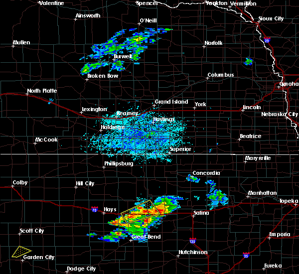 At 617 pm cdt, a severe thunderstorm was located near russell, moving east at 20 mph (radar indicated). Hazards include 60 mph wind gusts and quarter size hail. Hail damage to vehicles is expected. expect wind damage to roofs, siding and trees. Locations impacted include, russell, wilson, lucas, sylvan grove, dorrance, bunker hill, wilson state park, wilson lake and russell airport. At 617 pm cdt, a severe thunderstorm was located near russell, moving east at 20 mph (radar indicated). Hazards include 60 mph wind gusts and quarter size hail. Hail damage to vehicles is expected. expect wind damage to roofs, siding and trees. Locations impacted include, russell, wilson, lucas, sylvan grove, dorrance, bunker hill, wilson state park, wilson lake and russell airport.
|
| 8/8/2015 5:56 PM CDT |
 At 554 pm cdt, a severe thunderstorm was located 5 miles south and southwest of russell, moving northeast at 25 mph (radar indicated). Hazards include 60 mph wind gusts and quarter size hail. Hail damage to vehicles is expected. Expect wind damage to roofs, siding and trees. At 554 pm cdt, a severe thunderstorm was located 5 miles south and southwest of russell, moving northeast at 25 mph (radar indicated). Hazards include 60 mph wind gusts and quarter size hail. Hail damage to vehicles is expected. Expect wind damage to roofs, siding and trees.
|
| 7/15/2015 4:06 AM CDT |
 The severe thunderstorm warning for western lincoln and northwestern ellsworth counties will expire at 415 am cdt, the storm which prompted the warning has moved out of the area. therefore the warning will be allowed to expire. The severe thunderstorm warning for western lincoln and northwestern ellsworth counties will expire at 415 am cdt, the storm which prompted the warning has moved out of the area. therefore the warning will be allowed to expire.
|
| 7/15/2015 4:01 AM CDT |
 At 401 am cdt, a severe thunderstorm was located 9 miles south of lincoln, moving east at 30 mph (radar indicated). Hazards include 60 mph wind gusts. Expect damage to roofs. siding and trees. Locations impacted include, wilson, sylvan grove, ash grove, wilson state park and wilson lake. At 401 am cdt, a severe thunderstorm was located 9 miles south of lincoln, moving east at 30 mph (radar indicated). Hazards include 60 mph wind gusts. Expect damage to roofs. siding and trees. Locations impacted include, wilson, sylvan grove, ash grove, wilson state park and wilson lake.
|
| 7/15/2015 3:42 AM CDT |
 At 342 am cdt, a severe thunderstorm was located 6 miles northeast of wilson, moving east at 30 mph (radar indicated). Hazards include 70 mph wind gusts and penny size hail. Expect considerable tree damage. damage is likely to mobile homes, roofs and outbuildings. Locations impacted include, wilson, lucas, sylvan grove, luray, dorrance, bunker hill, ash grove, wilson state park and wilson lake. At 342 am cdt, a severe thunderstorm was located 6 miles northeast of wilson, moving east at 30 mph (radar indicated). Hazards include 70 mph wind gusts and penny size hail. Expect considerable tree damage. damage is likely to mobile homes, roofs and outbuildings. Locations impacted include, wilson, lucas, sylvan grove, luray, dorrance, bunker hill, ash grove, wilson state park and wilson lake.
|
| 7/15/2015 3:24 AM CDT |
 At 324 am cdt, a severe thunderstorm was located near dorrance, or 6 miles northwest of wilson, moving east at 30 mph (radar indicated). Hazards include 70 mph wind gusts and penny size hail. Expect considerable tree damage. damage is likely to mobile homes, roofs and outbuildings. Locations impacted include, russell, wilson, lucas, sylvan grove, luray, dorrance, bunker hill, waldo, ash grove, wilson state park, wilson lake and russell airport. At 324 am cdt, a severe thunderstorm was located near dorrance, or 6 miles northwest of wilson, moving east at 30 mph (radar indicated). Hazards include 70 mph wind gusts and penny size hail. Expect considerable tree damage. damage is likely to mobile homes, roofs and outbuildings. Locations impacted include, russell, wilson, lucas, sylvan grove, luray, dorrance, bunker hill, waldo, ash grove, wilson state park, wilson lake and russell airport.
|
| 7/15/2015 3:08 AM CDT |
 At 308 am cdt, a severe thunderstorm was located 7 miles east of russell, moving east at 30 mph (radar indicated). Hazards include 70 mph wind gusts and penny size hail. Expect considerable tree damage. Damage is likely to mobile homes, roofs and outbuildings. At 308 am cdt, a severe thunderstorm was located 7 miles east of russell, moving east at 30 mph (radar indicated). Hazards include 70 mph wind gusts and penny size hail. Expect considerable tree damage. Damage is likely to mobile homes, roofs and outbuildings.
|
| 5/28/2015 8:41 PM CDT | At 841 pm cdt, severe thunderstorms were located along a line extending from 6 miles northwest of dorrance to near hoisington, moving east at 30 mph (radar indicated). Hazards include 60 mph wind gusts and dime size hail. Expect damage to roofs. siding and trees. Locations impacted include, great bend, russell, hoisington, ellinwood, wilson, claflin, lucas, gorham, pawnee rock, dorrance, albert, olmitz, milberger, bunker hill, galatia, susank, wilson state park, wilson lake, odin and great bend airport. |
| 5/28/2015 8:26 PM CDT | At 825 pm cdt, severe thunderstorms were located along a line extending from russell to near olmitz, moving northeast at 35 mph (radar indicated). Hazards include 60 mph wind gusts and penny size hail. Expect damage to roofs. Siding and trees. |
| 4/24/2015 7:15 PM CDT | Golf Ball sized hail reported 3 miles S of Wilson, KS |
| 4/24/2015 7:15 PM CDT | Tennis Ball sized hail reported 3 miles S of Wilson, KS, correction to previous report |
| 9/28/2013 2:00 AM CDT | Delayed report of a camping trailer overturned at otoe park in russell county KS, 7.2 miles S of Wilson, KS |
| 1/1/0001 12:00 AM | Spotter estimates between 60 to 70 mph winds on mile marker 204 on i-7 in russell county KS, 1.2 miles SE of Wilson, KS |
| 1/1/0001 12:00 AM | Trained spotter estimates 50 to 60 mph winds which sustained for at least 10 minute in lincoln county KS, 7.1 miles S of Wilson, KS |
| 1/1/0001 12:00 AM | Storm damage reported in ellsworth county KS, 3.6 miles WSW of Wilson, KS |
| 1/1/0001 12:00 AM | Quarter sized hail reported 1.2 miles SW of Wilson, KS |
| 1/1/0001 12:00 AM | Quarter sized hail reported 1.6 miles S of Wilson, KS |
| 1/1/0001 12:00 AM | Storm damage reported in ellsworth county KS, 3.6 miles WSW of Wilson, KS |
Hail Maps for Wilson, KS
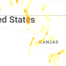
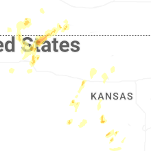
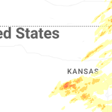
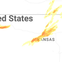

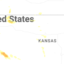
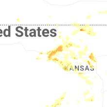
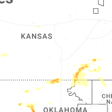
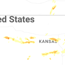


Connect with Interactive Hail Maps