

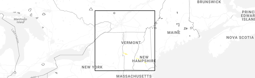
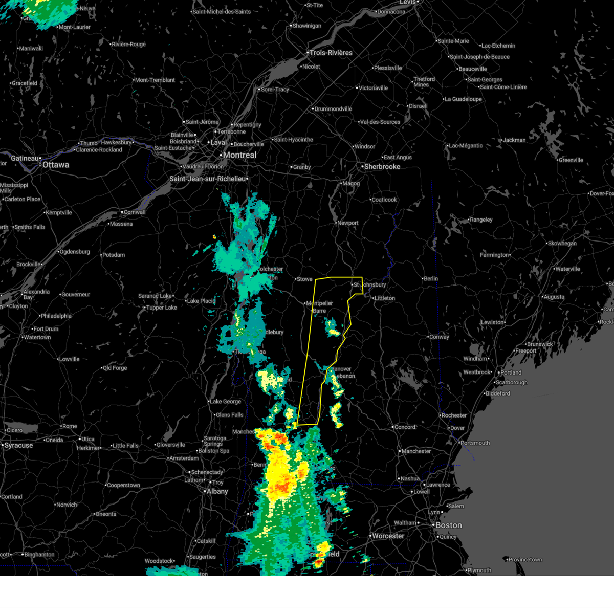
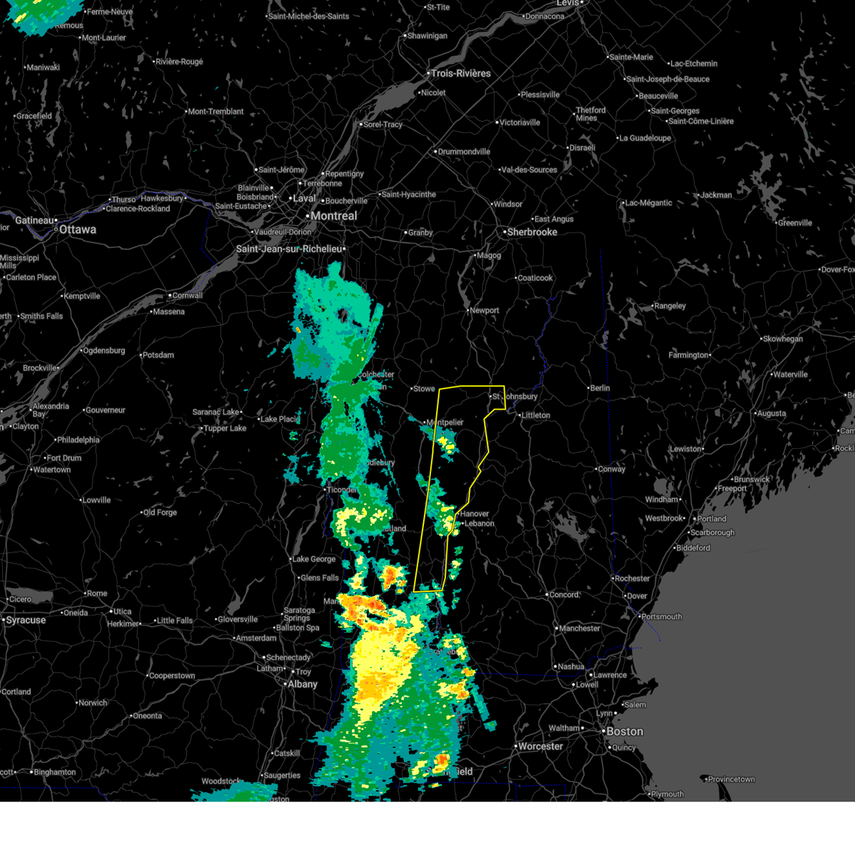
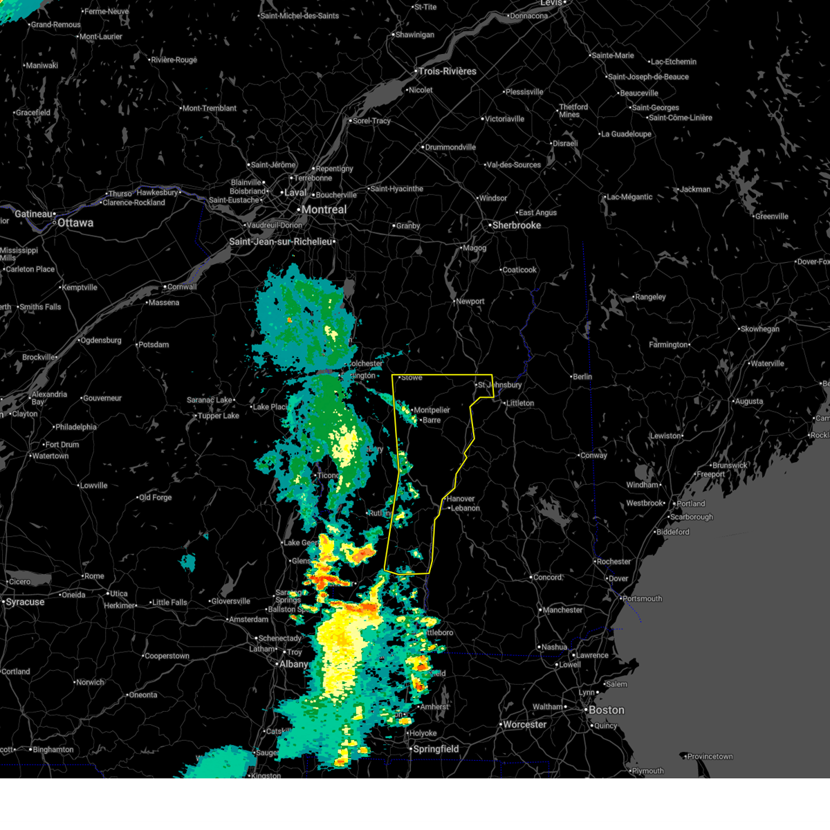
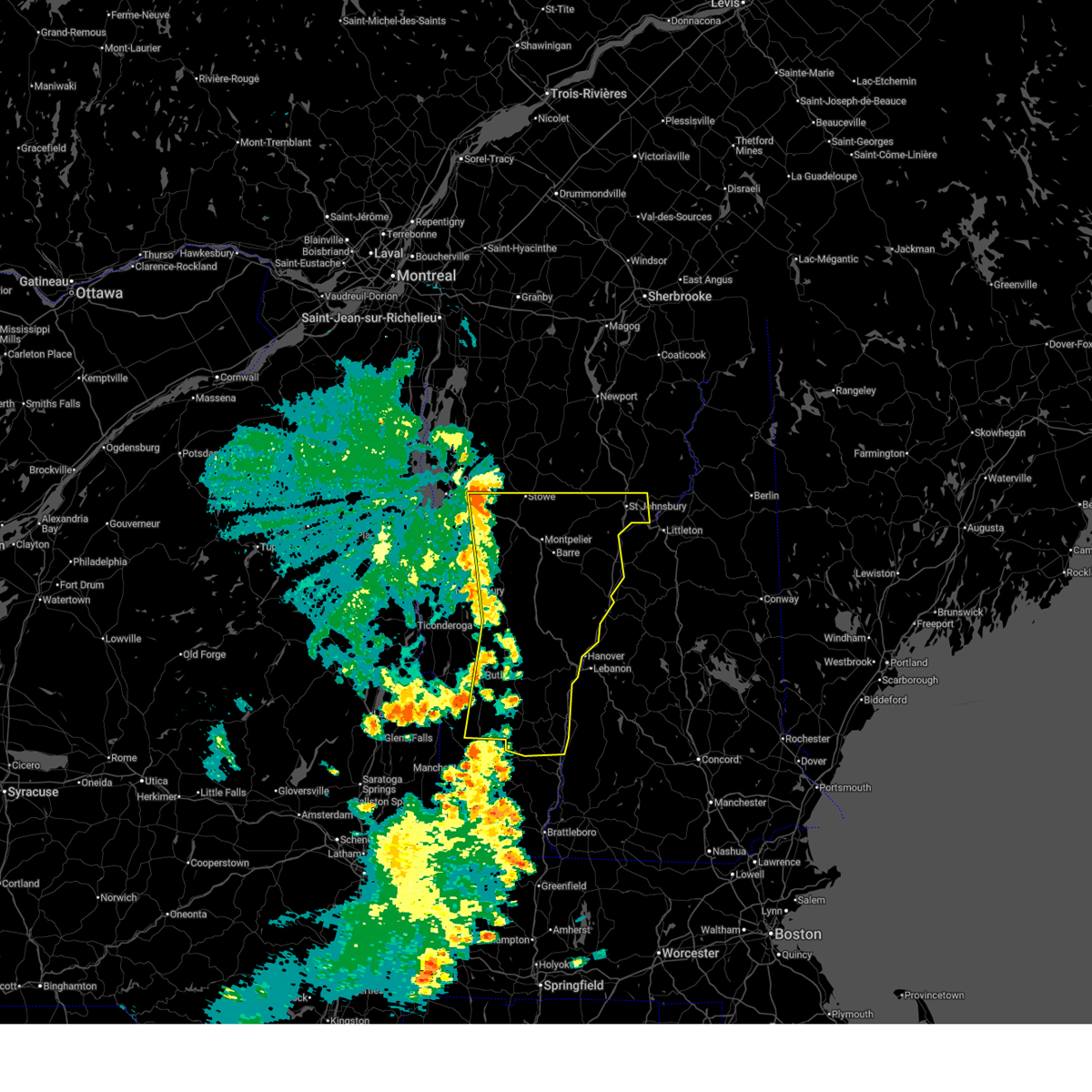
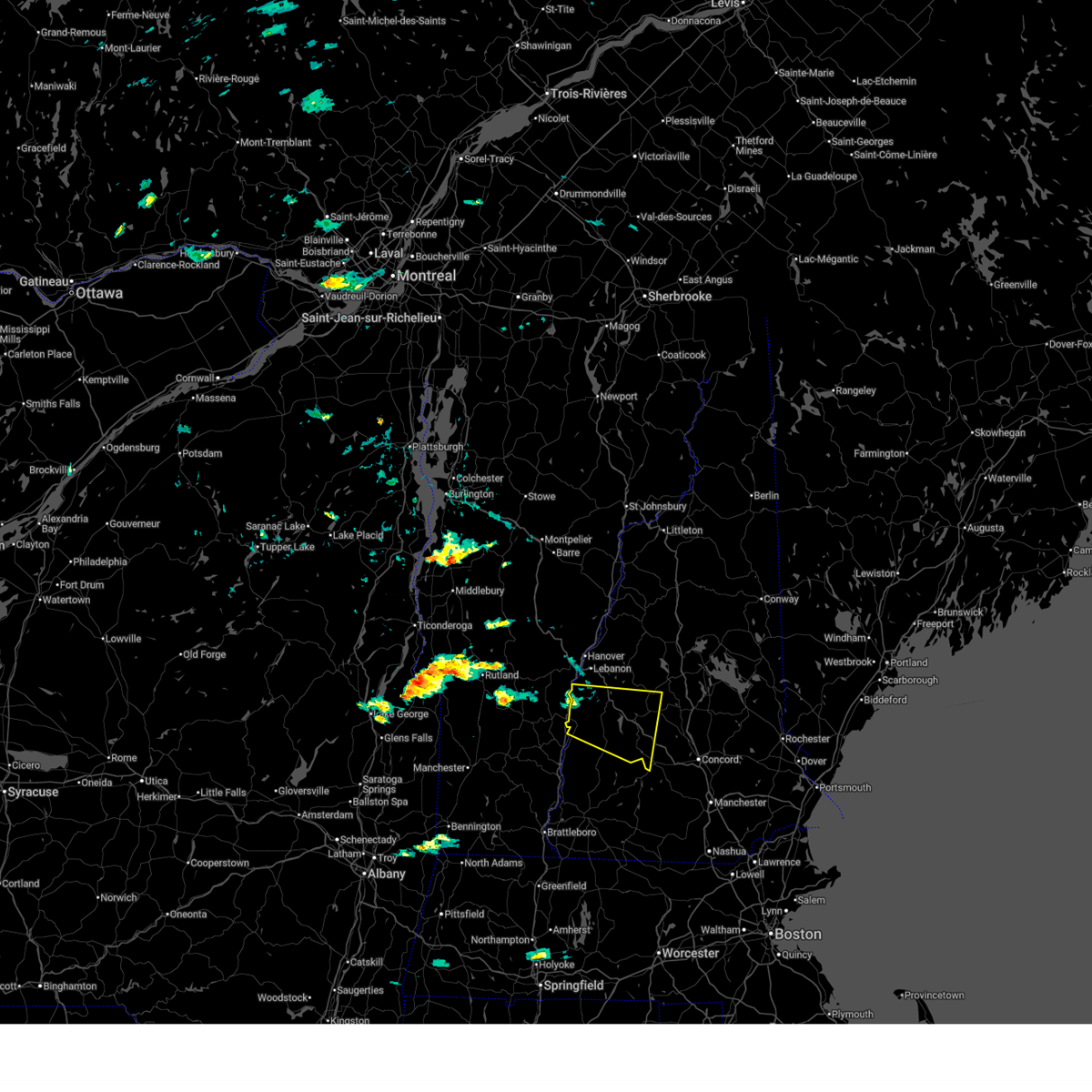
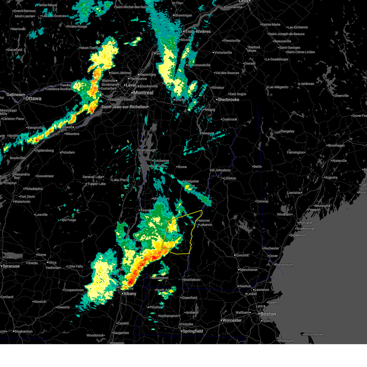
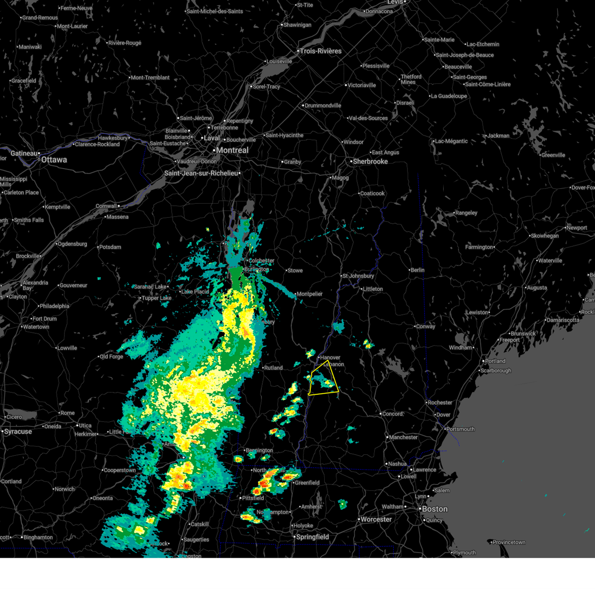
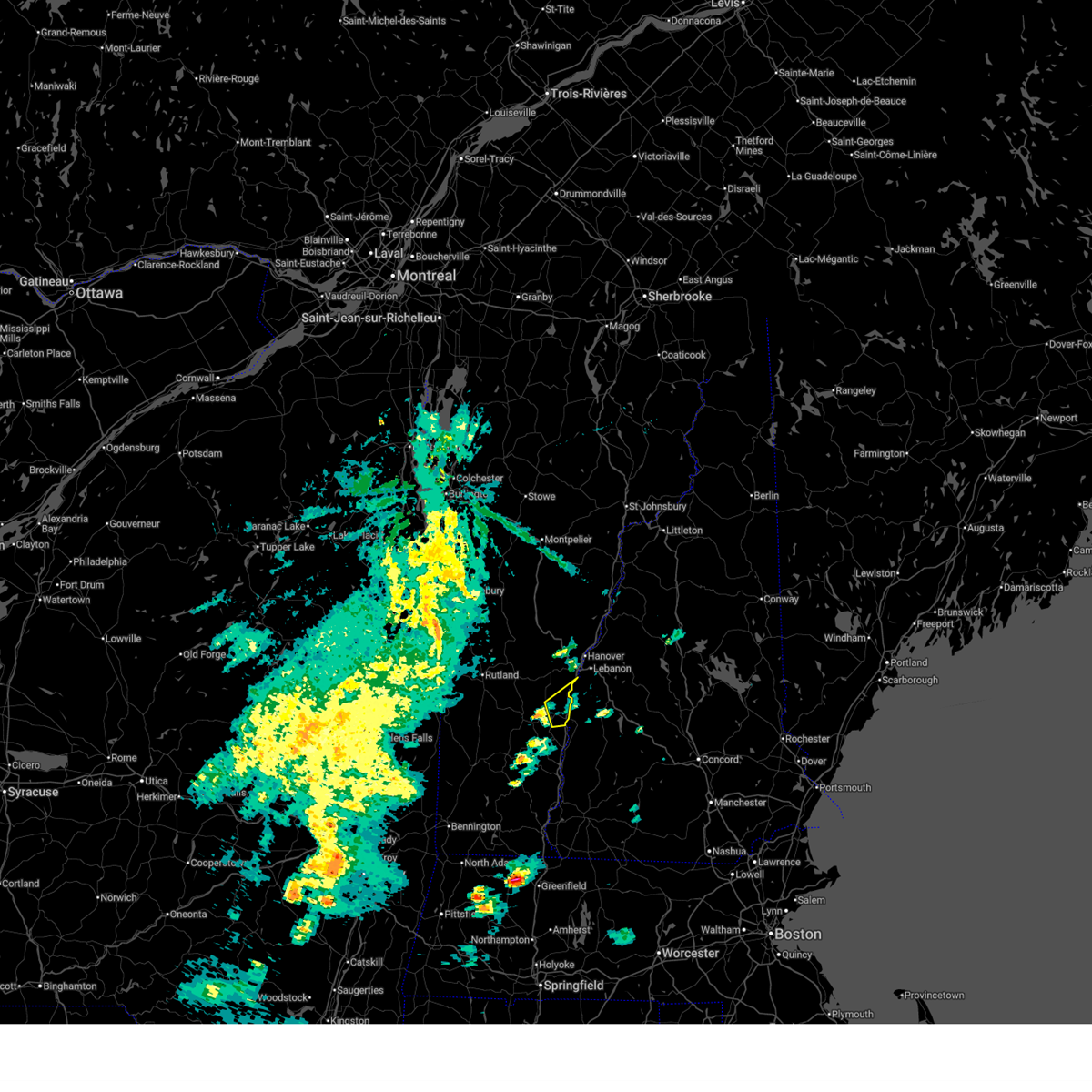
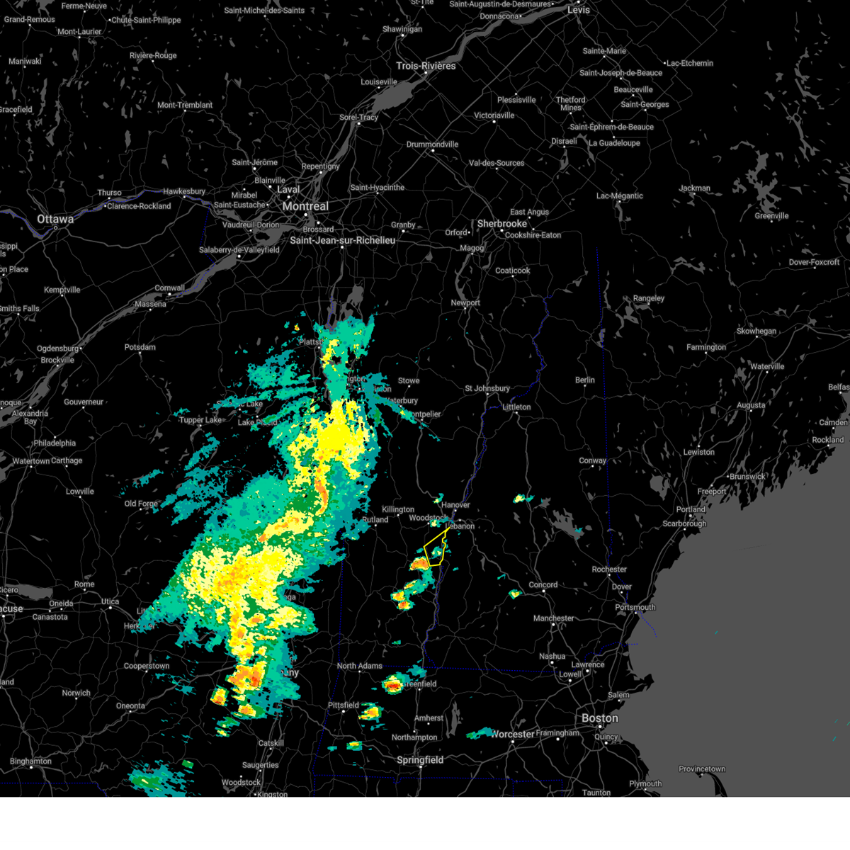
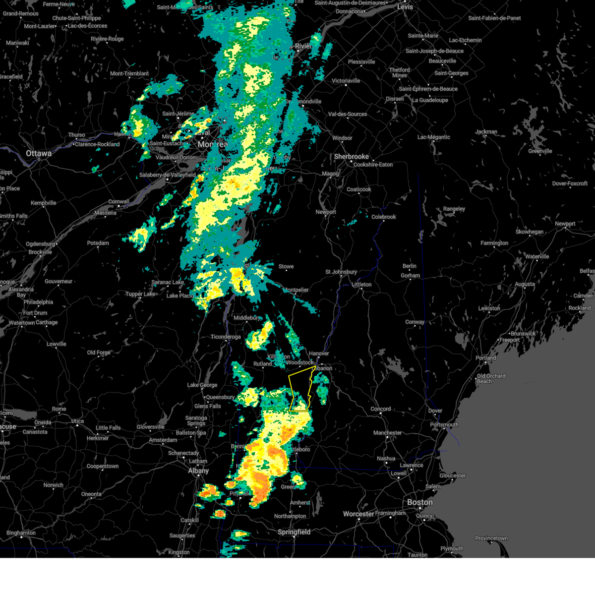
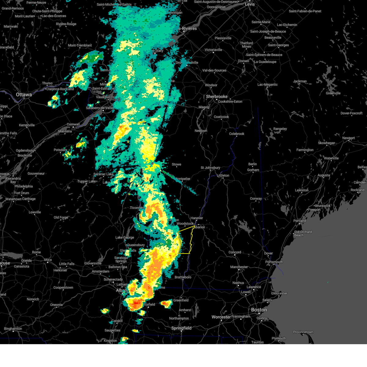
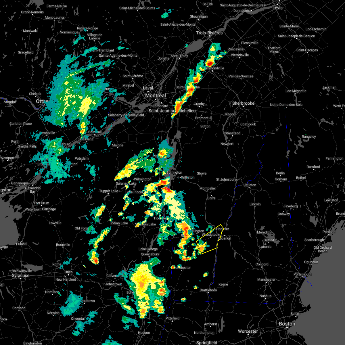
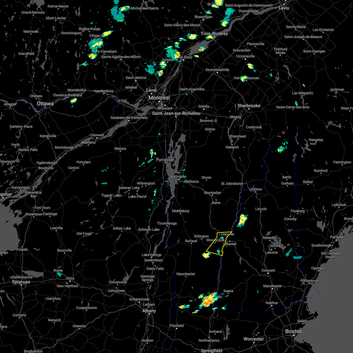
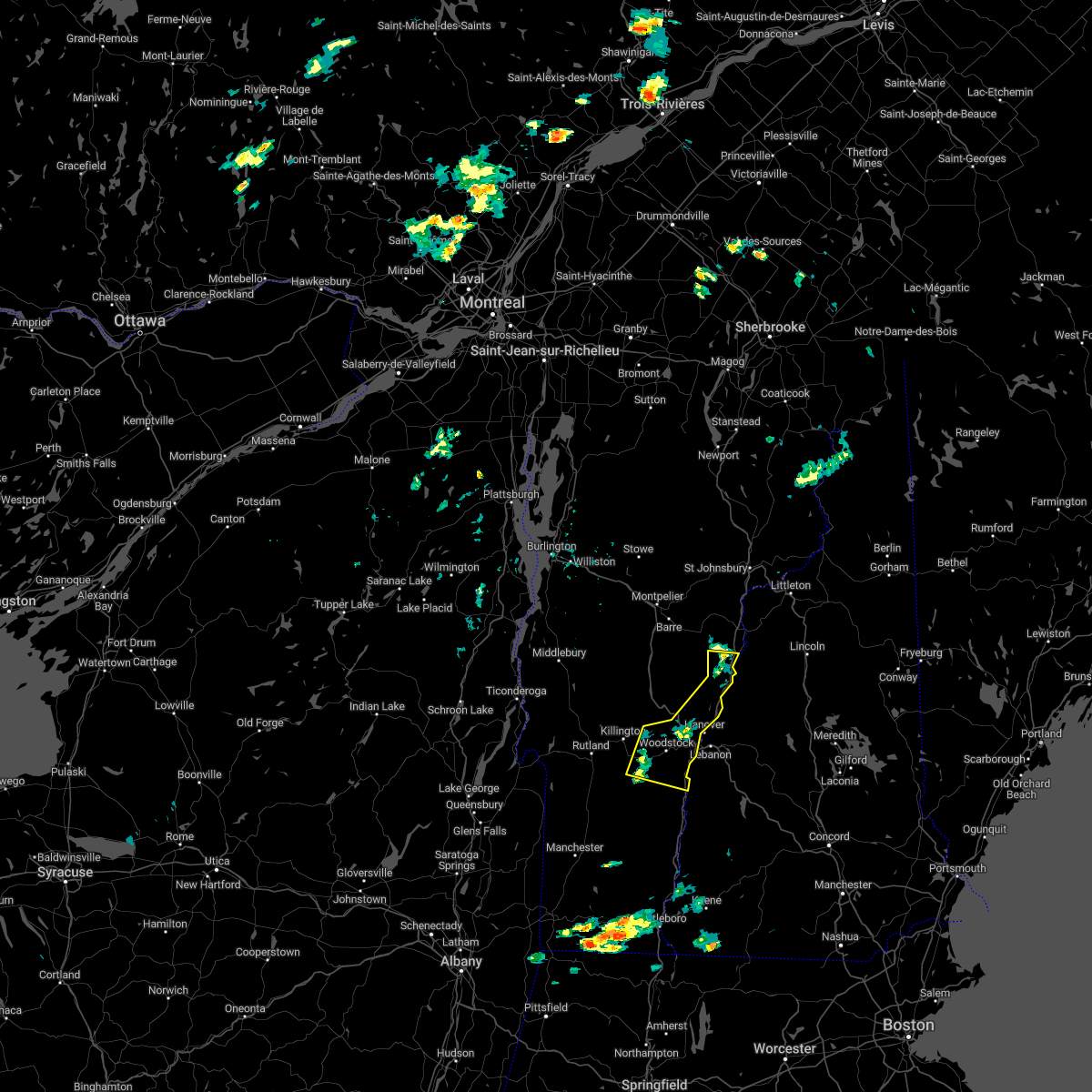
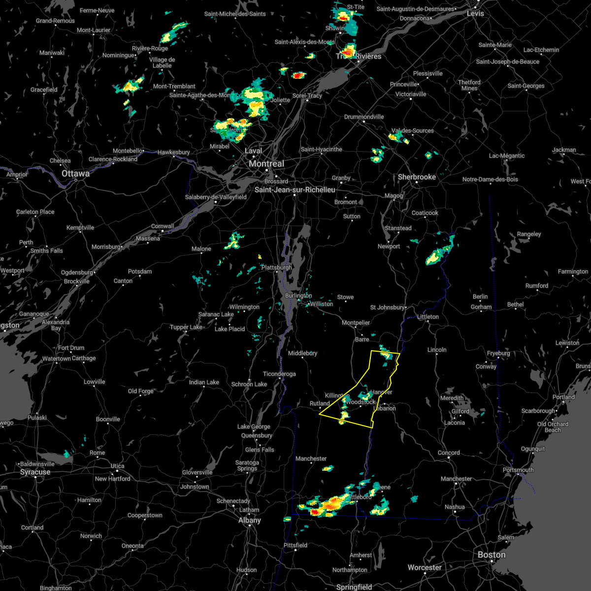
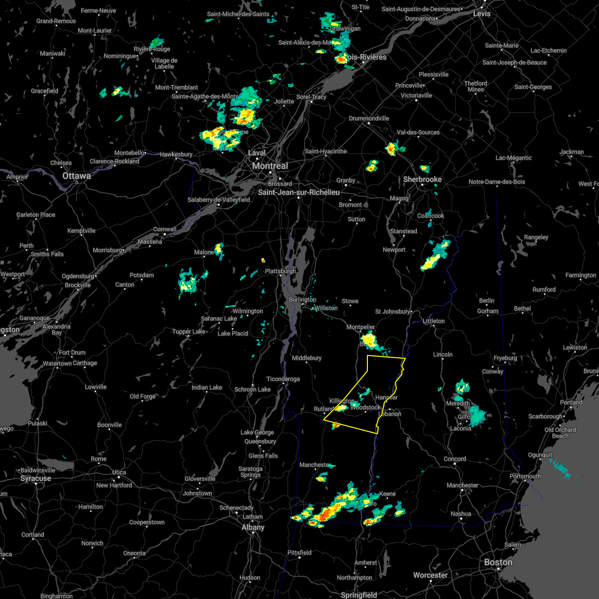
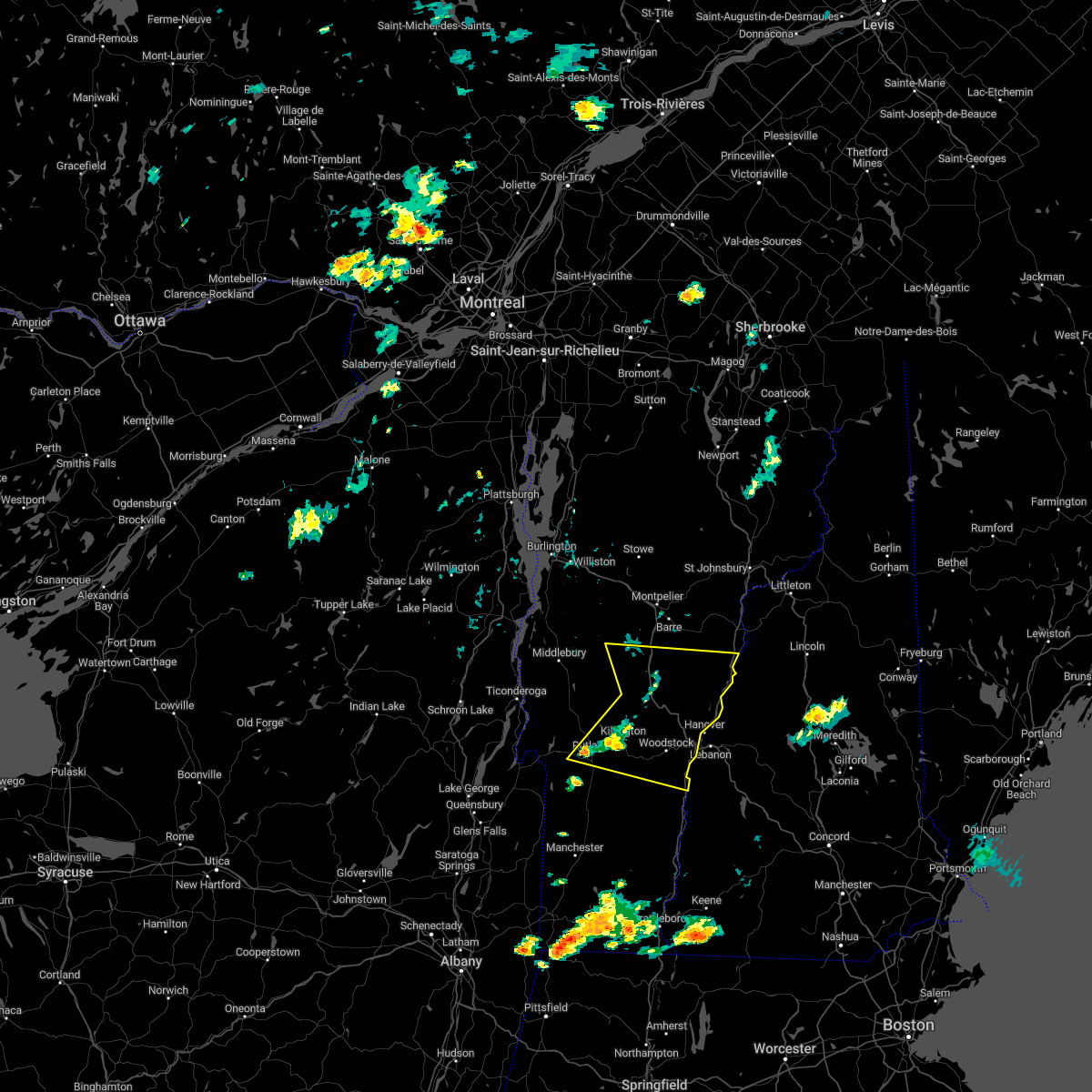
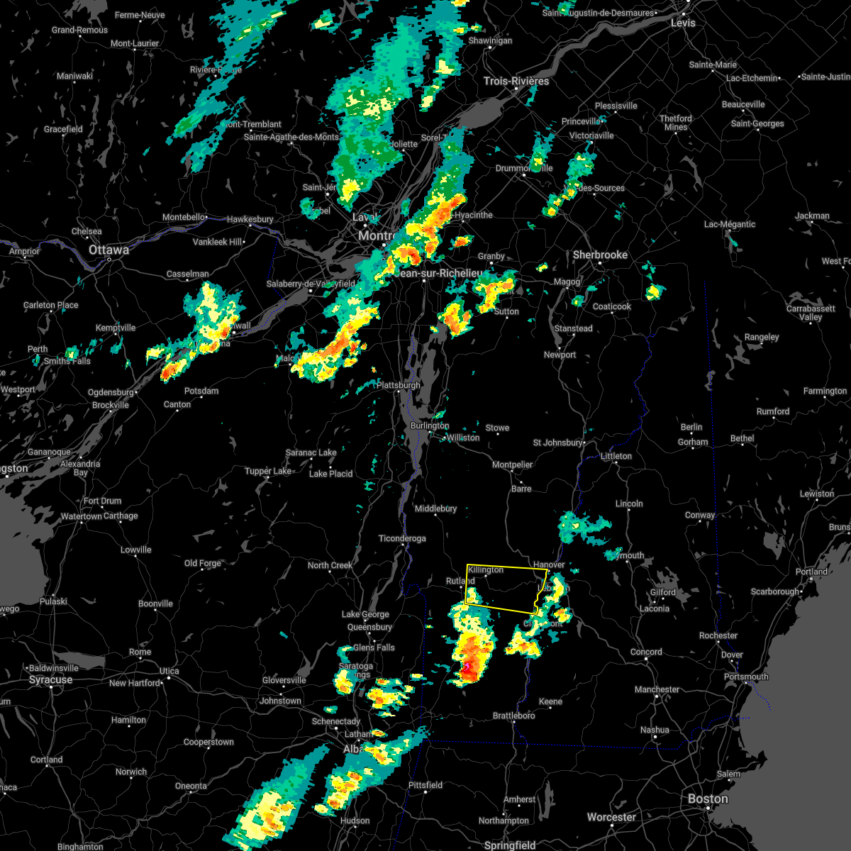
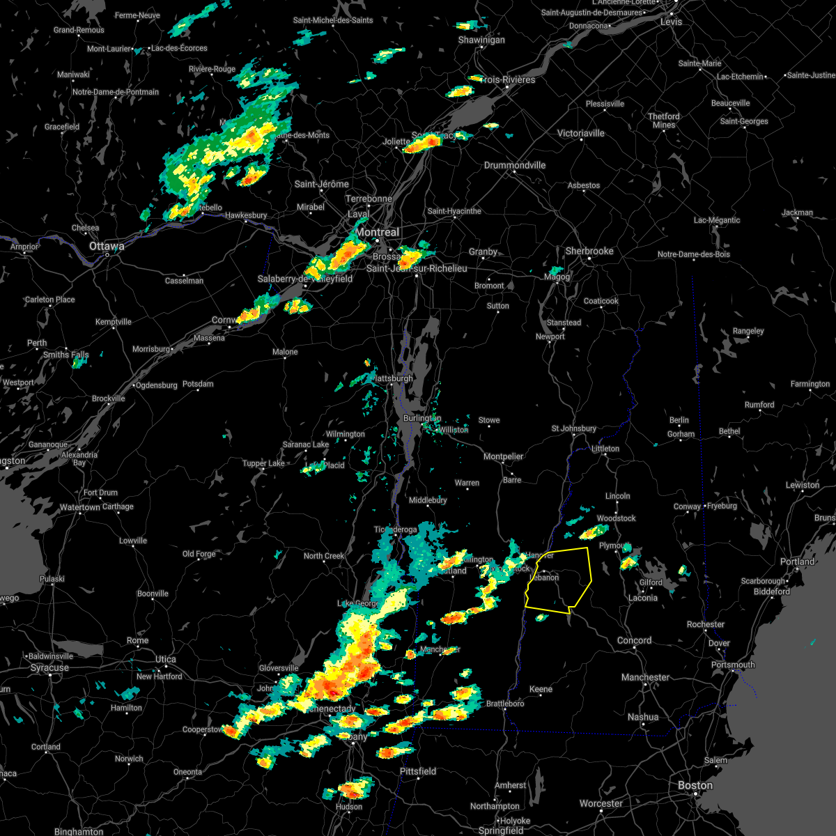
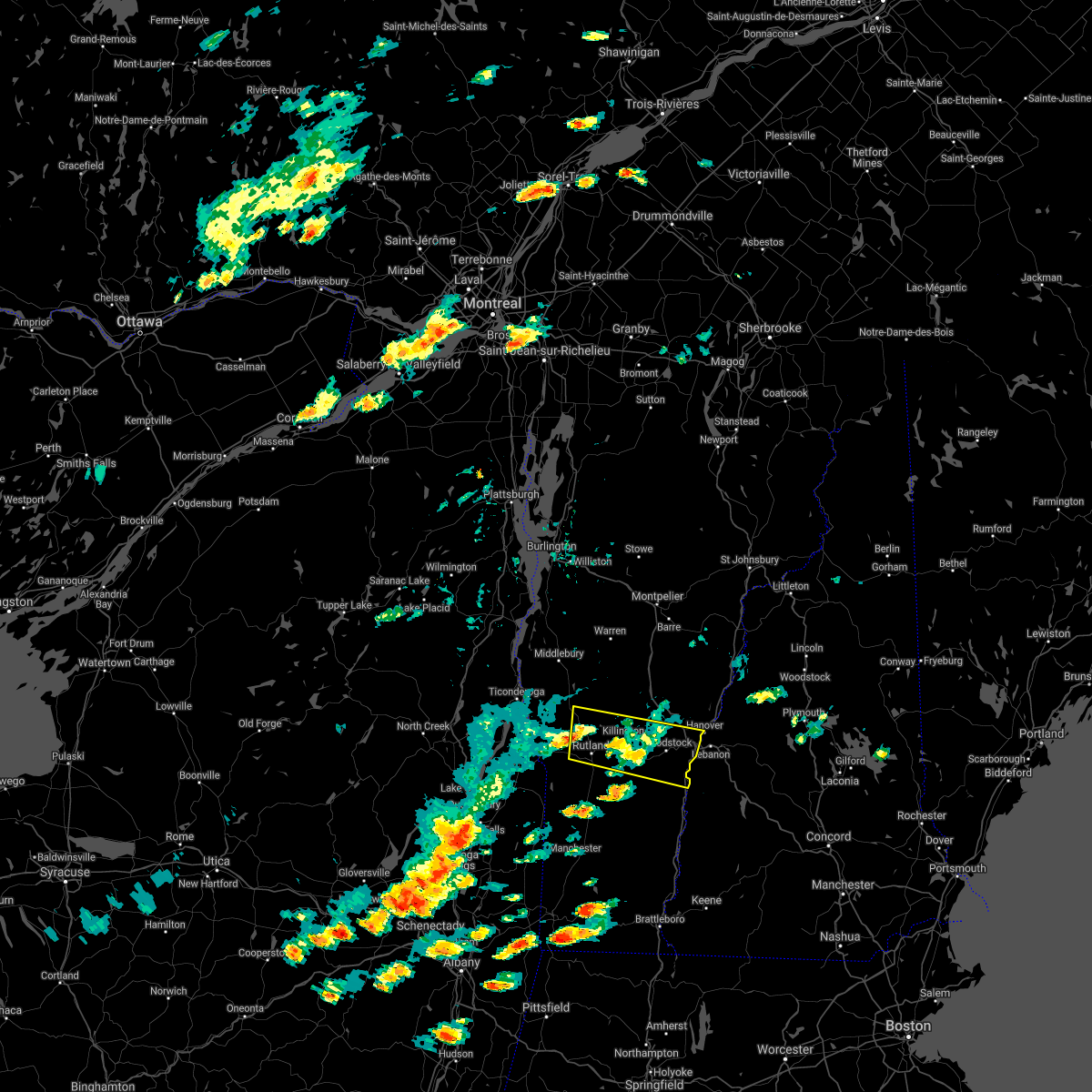
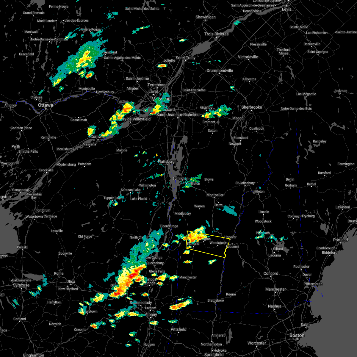
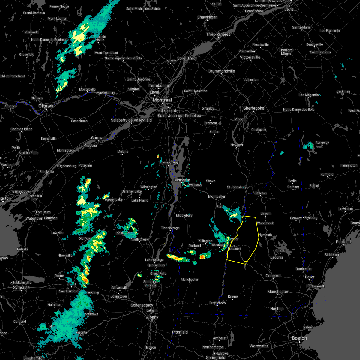
Hail Map for Windsor, VT
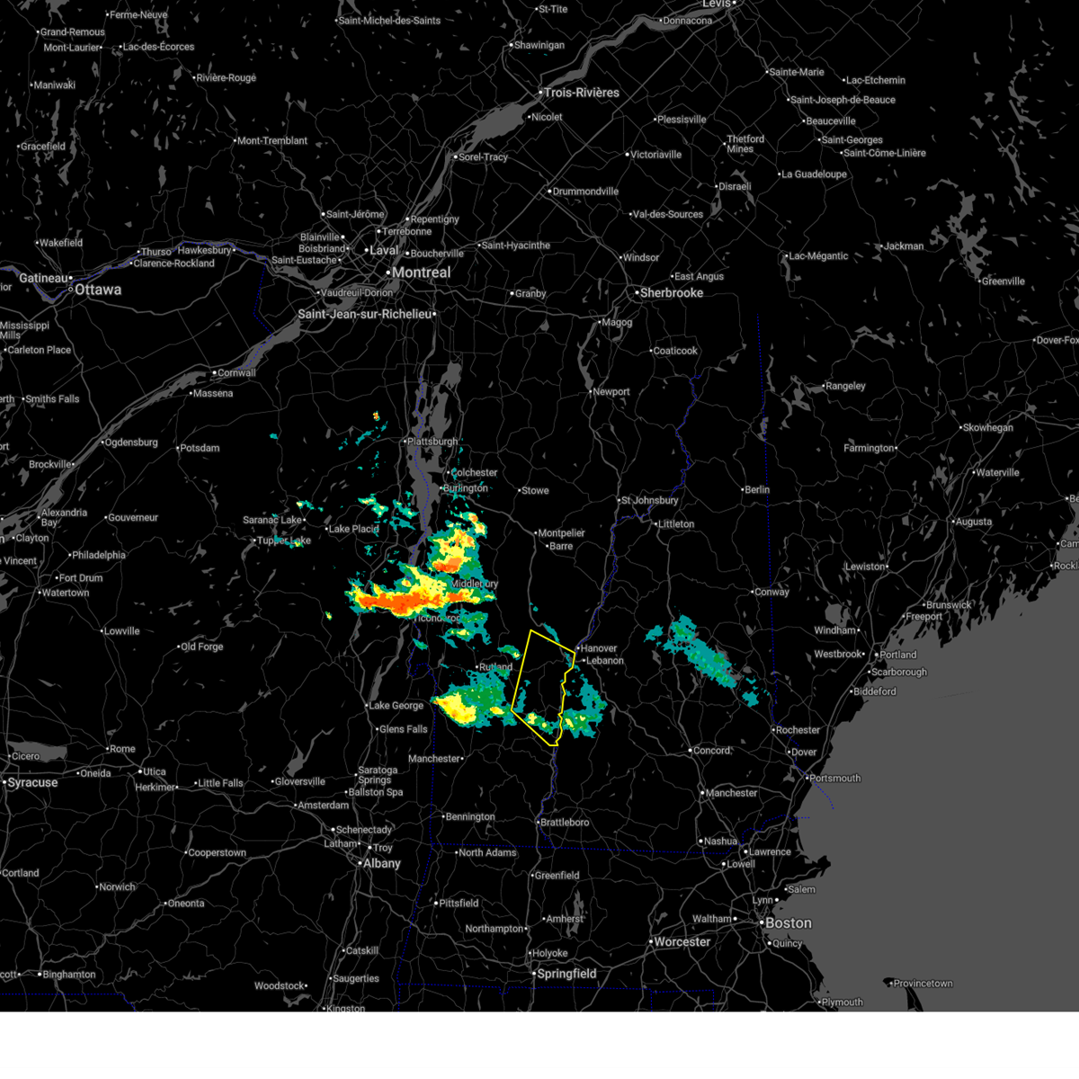
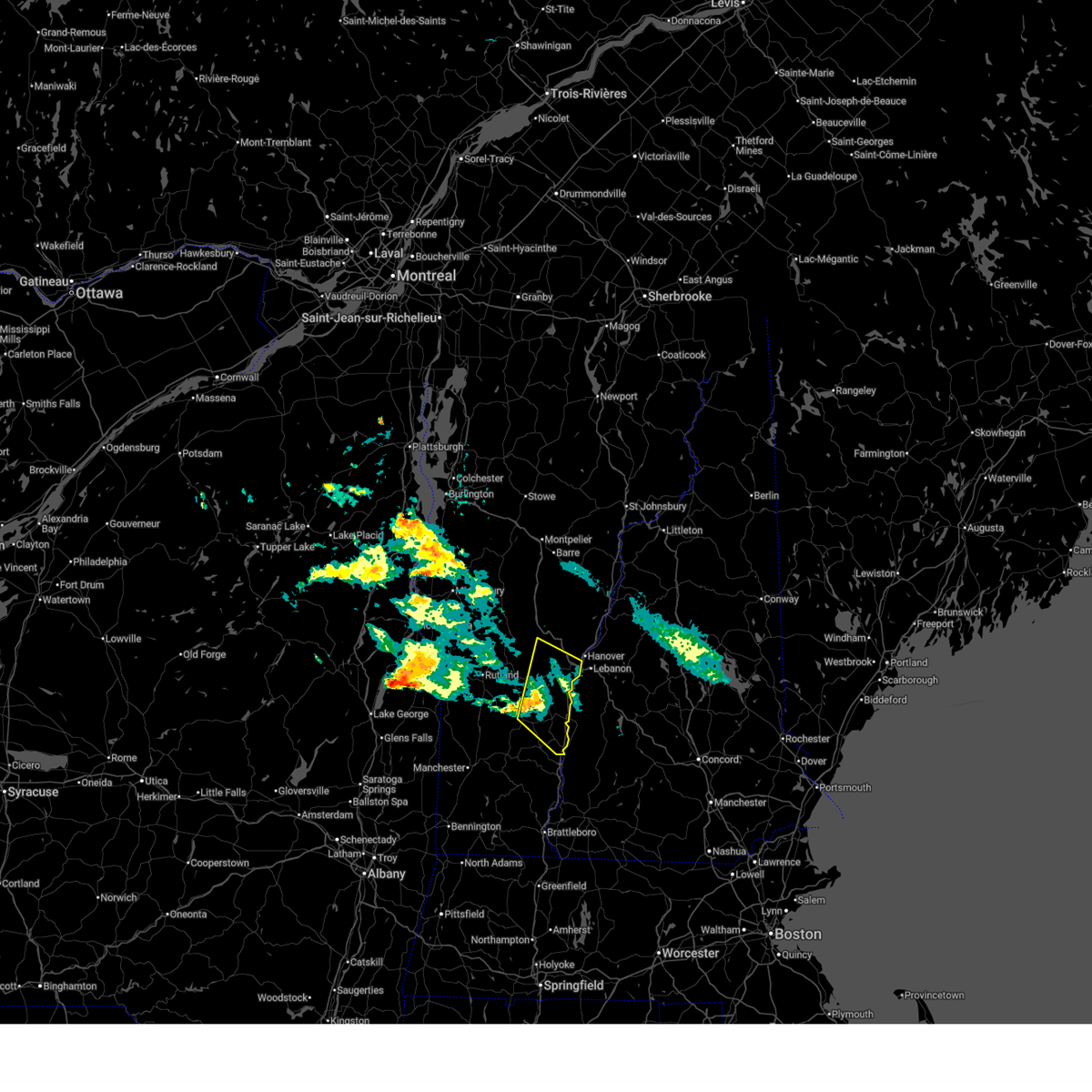
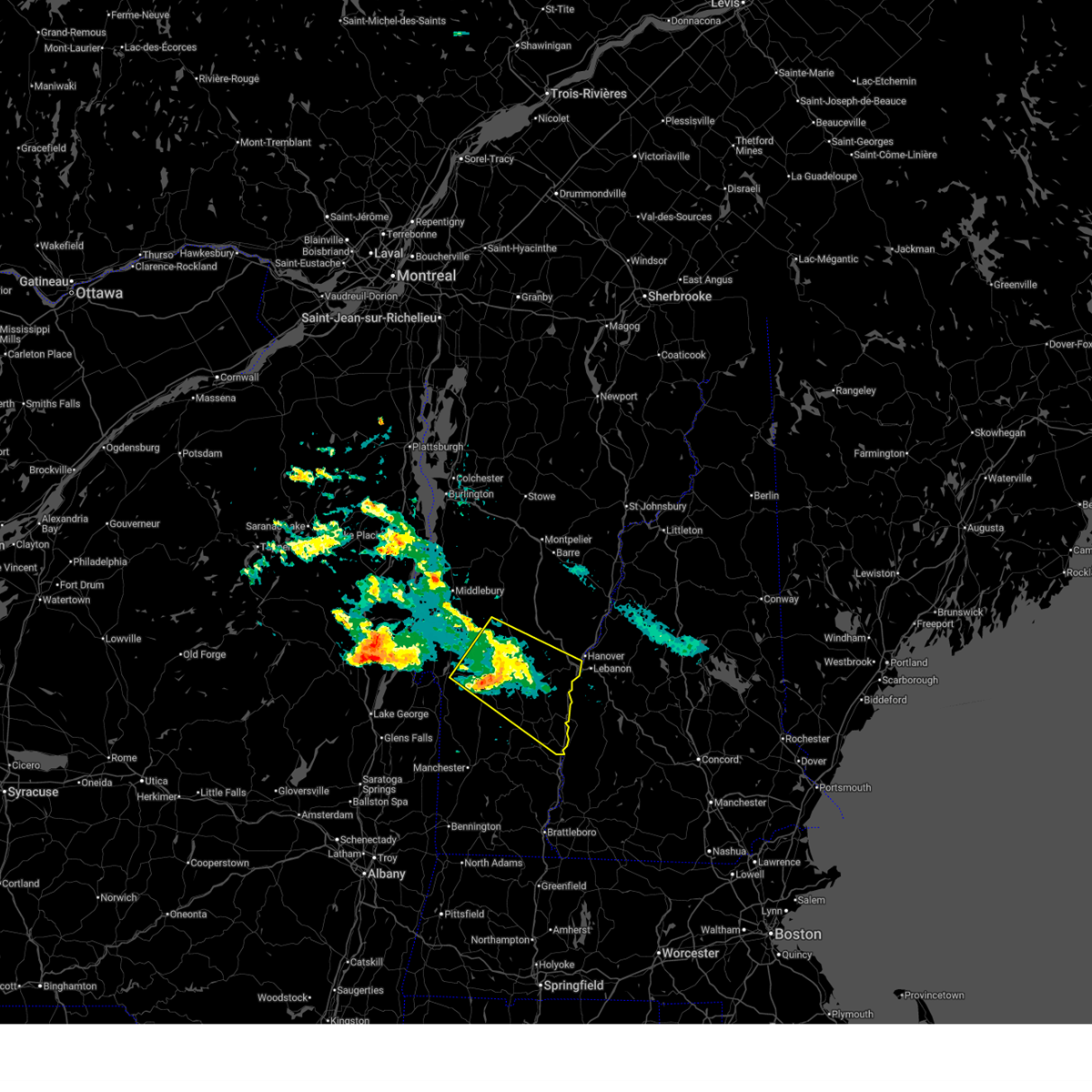
The Windsor, VT area has had 4 reports of on-the-ground hail by trained spotters, and has been under severe weather warnings 15 times during the past 12 months. Doppler radar has detected hail at or near Windsor, VT on 8 occasions, including 1 occasion during the past year.
| Name: | Windsor, VT |
| Where Located: | 79.8 miles SSE of Burlington, VT |
| Map: | Google Map for Windsor, VT |
| Population: | 2066 |
| Housing Units: | 1070 |
| More Info: | Search Google for Windsor, VT |
0
The Top Recent Hail Date for Windsor, VT is Friday, June 26, 2026 (8th out of 8)
Hail and Wind Damage Spotted near Windsor, VT
| Date / Time | Report Details |
|---|---|
| 7/15/2026 3:29 AM EDT |
 The storm which prompted the warning has moved out of the area. therefore, the warning will be allowed to expire. however, heavy rain is still possible with this thunderstorm. a severe thunderstorm watch remains in effect until 700 am edt for southern vermont. The storm which prompted the warning has moved out of the area. therefore, the warning will be allowed to expire. however, heavy rain is still possible with this thunderstorm. a severe thunderstorm watch remains in effect until 700 am edt for southern vermont.
|
| 7/15/2026 3:11 AM EDT |
 At 311 am edt, a severe thunderstorm was located over ascutney state park, moving southeast at 65 mph (public). Hazards include 70 mph wind gusts and quarter size hail. Minor hail damage to vehicles is possible. expect considerable tree damage. wind damage is also likely to mobile homes, roofs, and outbuildings. locations impacted include, woodstock, white river junction, chester, hartland four corners, cavendish, ludlow village, perkinsville village, pomfret, hartland, barnard, windsor, woodstock village, ludlow, quechee, ascutney, reading, baltimore, springfield, weathersfield, and hartford. this includes the following highways, interstate 89 between mile markers 1 and 7. Interstate 91 between mile markers 39 and 65, and between mile markers 68 and 73. At 311 am edt, a severe thunderstorm was located over ascutney state park, moving southeast at 65 mph (public). Hazards include 70 mph wind gusts and quarter size hail. Minor hail damage to vehicles is possible. expect considerable tree damage. wind damage is also likely to mobile homes, roofs, and outbuildings. locations impacted include, woodstock, white river junction, chester, hartland four corners, cavendish, ludlow village, perkinsville village, pomfret, hartland, barnard, windsor, woodstock village, ludlow, quechee, ascutney, reading, baltimore, springfield, weathersfield, and hartford. this includes the following highways, interstate 89 between mile markers 1 and 7. Interstate 91 between mile markers 39 and 65, and between mile markers 68 and 73.
|
| 7/15/2026 3:11 AM EDT |
 the severe thunderstorm warning has been cancelled and is no longer in effect the severe thunderstorm warning has been cancelled and is no longer in effect
|
| 7/15/2026 3:05 AM EDT |
 Svrgyx the national weather service in gray maine has issued a * severe thunderstorm warning for, sullivan county in central new hampshire, north central cheshire county in southern new hampshire, west central merrimack county in central new hampshire, * until 345 am edt. * at 305 am edt, a severe thunderstorm was located 13 miles northwest of claremont, moving southeast at 60 mph (radar indicated). Hazards include 70 mph wind gusts and ping pong ball size hail. People and animals outdoors will be injured. expect hail damage to roofs, siding, windows, and vehicles. expect considerable tree damage. Wind damage is also likely to mobile homes, roofs, and outbuildings. Svrgyx the national weather service in gray maine has issued a * severe thunderstorm warning for, sullivan county in central new hampshire, north central cheshire county in southern new hampshire, west central merrimack county in central new hampshire, * until 345 am edt. * at 305 am edt, a severe thunderstorm was located 13 miles northwest of claremont, moving southeast at 60 mph (radar indicated). Hazards include 70 mph wind gusts and ping pong ball size hail. People and animals outdoors will be injured. expect hail damage to roofs, siding, windows, and vehicles. expect considerable tree damage. Wind damage is also likely to mobile homes, roofs, and outbuildings.
|
| 7/15/2026 2:51 AM EDT |
 Svrbtv the national weather service in burlington has issued a * severe thunderstorm warning for, southeastern addison county in central vermont, northeastern rutland county in southern vermont, windsor county in southern vermont, * until 330 am edt. * at 251 am edt, a severe thunderstorm was located over mendon, moving southeast at 65 mph (public). Hazards include 70 mph wind gusts and quarter size hail. Minor hail damage to vehicles is possible. expect considerable tree damage. Wind damage is also likely to mobile homes, roofs, and outbuildings. Svrbtv the national weather service in burlington has issued a * severe thunderstorm warning for, southeastern addison county in central vermont, northeastern rutland county in southern vermont, windsor county in southern vermont, * until 330 am edt. * at 251 am edt, a severe thunderstorm was located over mendon, moving southeast at 65 mph (public). Hazards include 70 mph wind gusts and quarter size hail. Minor hail damage to vehicles is possible. expect considerable tree damage. Wind damage is also likely to mobile homes, roofs, and outbuildings.
|
| 7/2/2026 12:07 AM EDT |
 The storms which prompted the warning have moved out of the area. therefore, the warning will be allowed to expire. The storms which prompted the warning have moved out of the area. therefore, the warning will be allowed to expire.
|
| 7/1/2026 11:57 PM EDT |
 At 1156 pm edt, severe thunderstorms were located along a line extending from near maple corner to near south tunbridge to near springfield, moving east at 45 mph (radar indicated). Hazards include 60 mph wind gusts. Expect damage to trees and powerlines. locations impacted include, chester, st. johnsbury, woodstock, bradford, orange, thetford hill state park, websterville, pomfret, thetford, hartland, marshfield, cabot village, fairlee, tunbridge, sharon, corinth corners, washington, ryegate, woodbury, and cabot. this includes the following highways, interstate 89 between mile markers 1 and 20. interstate 91 between mile markers 39 and 71, near mile marker 73, between mile markers 75 and 91, between mile markers 94 and 116, near mile marker 118, and between mile markers 120 and 134. Interstate 93 between mile markers 1 and 11. At 1156 pm edt, severe thunderstorms were located along a line extending from near maple corner to near south tunbridge to near springfield, moving east at 45 mph (radar indicated). Hazards include 60 mph wind gusts. Expect damage to trees and powerlines. locations impacted include, chester, st. johnsbury, woodstock, bradford, orange, thetford hill state park, websterville, pomfret, thetford, hartland, marshfield, cabot village, fairlee, tunbridge, sharon, corinth corners, washington, ryegate, woodbury, and cabot. this includes the following highways, interstate 89 between mile markers 1 and 20. interstate 91 between mile markers 39 and 71, near mile marker 73, between mile markers 75 and 91, between mile markers 94 and 116, near mile marker 118, and between mile markers 120 and 134. Interstate 93 between mile markers 1 and 11.
|
| 7/1/2026 11:57 PM EDT |
 the severe thunderstorm warning has been cancelled and is no longer in effect the severe thunderstorm warning has been cancelled and is no longer in effect
|
| 7/1/2026 11:36 PM EDT |
 At 1136 pm edt, severe thunderstorms were located along a line extending from near moscow to near bethel to near mt. tabor, moving east at 45 mph (radar indicated). Hazards include 60 mph wind gusts. Expect damage to trees and powerlines. locations impacted include, barre, chester, st. johnsbury, woodstock, montpelier, braintree hill, bradford, websterville, pomfret, hartland, worcester, middlesex, marshfield, cabot village, fairlee, sharon, washington, woodbury, newbury, and williamstown. this includes the following highways, interstate 89 between mile markers 1 and 62. interstate 91 between mile markers 39 and 71, near mile marker 73, between mile markers 75 and 91, between mile markers 94 and 116, near mile marker 118, and between mile markers 120 and 134. Interstate 93 between mile markers 1 and 11. At 1136 pm edt, severe thunderstorms were located along a line extending from near moscow to near bethel to near mt. tabor, moving east at 45 mph (radar indicated). Hazards include 60 mph wind gusts. Expect damage to trees and powerlines. locations impacted include, barre, chester, st. johnsbury, woodstock, montpelier, braintree hill, bradford, websterville, pomfret, hartland, worcester, middlesex, marshfield, cabot village, fairlee, sharon, washington, woodbury, newbury, and williamstown. this includes the following highways, interstate 89 between mile markers 1 and 62. interstate 91 between mile markers 39 and 71, near mile marker 73, between mile markers 75 and 91, between mile markers 94 and 116, near mile marker 118, and between mile markers 120 and 134. Interstate 93 between mile markers 1 and 11.
|
| 7/1/2026 11:13 PM EDT |
 Svrbtv the national weather service in burlington has issued a * severe thunderstorm warning for, southern lamoille county in northwestern vermont, orange county in central vermont, southern caledonia county in northeastern vermont, eastern addison county in central vermont, southwestern essex county in northeastern vermont, southeastern chittenden county in northwestern vermont, eastern rutland county in southern vermont, windsor county in southern vermont, washington county in central vermont, * until 1215 am edt. * at 1112 pm edt, severe thunderstorms were located along a line extending from near richmond to near hancock to 6 miles south of danby four corners, moving east at 45 mph (radar indicated). Hazards include 60 mph wind gusts. expect damage to trees and powerlines Svrbtv the national weather service in burlington has issued a * severe thunderstorm warning for, southern lamoille county in northwestern vermont, orange county in central vermont, southern caledonia county in northeastern vermont, eastern addison county in central vermont, southwestern essex county in northeastern vermont, southeastern chittenden county in northwestern vermont, eastern rutland county in southern vermont, windsor county in southern vermont, washington county in central vermont, * until 1215 am edt. * at 1112 pm edt, severe thunderstorms were located along a line extending from near richmond to near hancock to 6 miles south of danby four corners, moving east at 45 mph (radar indicated). Hazards include 60 mph wind gusts. expect damage to trees and powerlines
|
| 6/26/2026 4:40 PM EDT | Ping Pong Ball sized hail reported 1.7 miles NNW of Windsor, VT, some stones larger than half dollars left dents in a few cars. |
| 6/26/2026 4:37 PM EDT |
 Svrgyx the national weather service in gray maine has issued a * severe thunderstorm warning for, sullivan county in central new hampshire, south central grafton county in northern new hampshire, northwestern merrimack county in central new hampshire, * until 530 pm edt. * at 437 pm edt, a severe thunderstorm was located near claremont, moving east at 30 mph (radar indicated). Hazards include 60 mph wind gusts and quarter size hail. Hail damage to vehicles is expected. Expect wind damage to roofs, siding, and trees. Svrgyx the national weather service in gray maine has issued a * severe thunderstorm warning for, sullivan county in central new hampshire, south central grafton county in northern new hampshire, northwestern merrimack county in central new hampshire, * until 530 pm edt. * at 437 pm edt, a severe thunderstorm was located near claremont, moving east at 30 mph (radar indicated). Hazards include 60 mph wind gusts and quarter size hail. Hail damage to vehicles is expected. Expect wind damage to roofs, siding, and trees.
|
| 6/18/2026 3:20 PM EDT |
 The storm which prompted the warning has moved out of the area. therefore, the warning will be allowed to expire. however, gusty winds and heavy rain are still possible with this thunderstorm. a tornado watch remains in effect until 500 pm edt for central and southern vermont. to report severe weather, contact your nearest law enforcement agency. they will relay your report to the national weather service burlington. The storm which prompted the warning has moved out of the area. therefore, the warning will be allowed to expire. however, gusty winds and heavy rain are still possible with this thunderstorm. a tornado watch remains in effect until 500 pm edt for central and southern vermont. to report severe weather, contact your nearest law enforcement agency. they will relay your report to the national weather service burlington.
|
| 6/18/2026 2:55 PM EDT |
 At 254 pm edt, a severe thunderstorm was located over west hartford, moving east at 35 mph (radar indicated). Hazards include 60 mph wind gusts and quarter size hail. Minor hail damage to vehicles is possible. expect wind damage to trees and powerlines. locations impacted include, woodstock, chester, hartland four corners, cavendish, thetford hill state park, ludlow village, perkinsville village, pomfret, thetford, hartland, barnard, windsor, woodstock village, ludlow, sharon, andover, thetford center, quechee, norwich, and bridgewater. this includes the following highways, interstate 89 between mile markers 1 and 14. Interstate 91 between mile markers 39 and 49, between mile markers 51 and 61, between mile markers 63 and 71, near mile marker 73, and between mile markers 75 and 86. At 254 pm edt, a severe thunderstorm was located over west hartford, moving east at 35 mph (radar indicated). Hazards include 60 mph wind gusts and quarter size hail. Minor hail damage to vehicles is possible. expect wind damage to trees and powerlines. locations impacted include, woodstock, chester, hartland four corners, cavendish, thetford hill state park, ludlow village, perkinsville village, pomfret, thetford, hartland, barnard, windsor, woodstock village, ludlow, sharon, andover, thetford center, quechee, norwich, and bridgewater. this includes the following highways, interstate 89 between mile markers 1 and 14. Interstate 91 between mile markers 39 and 49, between mile markers 51 and 61, between mile markers 63 and 71, near mile marker 73, and between mile markers 75 and 86.
|
| 6/18/2026 2:39 PM EDT |
 Svrgyx the national weather service in gray maine has issued a * severe thunderstorm warning for, sullivan county in central new hampshire, southern grafton county in northern new hampshire, northwestern merrimack county in central new hampshire, * until 345 pm edt. * at 239 pm edt, severe thunderstorms were located along a line extending from near lebanon to 20 miles west of charlestown, moving east at 55 mph (radar indicated). Hazards include 60 mph wind gusts. expect damage to roofs, siding, and trees Svrgyx the national weather service in gray maine has issued a * severe thunderstorm warning for, sullivan county in central new hampshire, southern grafton county in northern new hampshire, northwestern merrimack county in central new hampshire, * until 345 pm edt. * at 239 pm edt, severe thunderstorms were located along a line extending from near lebanon to 20 miles west of charlestown, moving east at 55 mph (radar indicated). Hazards include 60 mph wind gusts. expect damage to roofs, siding, and trees
|
| 6/18/2026 2:27 PM EDT |
 Svrbtv the national weather service in burlington has issued a * severe thunderstorm warning for, south central orange county in central vermont, southeastern rutland county in southern vermont, windsor county in southern vermont, * until 330 pm edt. * at 227 pm edt, a severe thunderstorm was located over bridgewater, moving east at 35 mph (radar indicated). Hazards include 60 mph wind gusts and quarter size hail. Minor hail damage to vehicles is possible. Expect wind damage to trees and powerlines. Svrbtv the national weather service in burlington has issued a * severe thunderstorm warning for, south central orange county in central vermont, southeastern rutland county in southern vermont, windsor county in southern vermont, * until 330 pm edt. * at 227 pm edt, a severe thunderstorm was located over bridgewater, moving east at 35 mph (radar indicated). Hazards include 60 mph wind gusts and quarter size hail. Minor hail damage to vehicles is possible. Expect wind damage to trees and powerlines.
|
| 6/6/2025 3:42 PM EDT |
 The storm which prompted the warning has weakened below severe limits, and no longer poses an immediate threat to life or property. therefore, the warning will be allowed to expire. however, heavy rain is still possible with this thunderstorm. The storm which prompted the warning has weakened below severe limits, and no longer poses an immediate threat to life or property. therefore, the warning will be allowed to expire. however, heavy rain is still possible with this thunderstorm.
|
| 6/6/2025 3:26 PM EDT |
 The storm which prompted the warning will continue to move out of the area. therefore, the warning will be allowed to expire. however, heavy rain is still possible with this thunderstorm. The storm which prompted the warning will continue to move out of the area. therefore, the warning will be allowed to expire. however, heavy rain is still possible with this thunderstorm.
|
| 6/6/2025 3:20 PM EDT | Power line down into route 5... blocking traffi in windsor county VT, 1.9 miles SSE of Windsor, VT |
| 6/6/2025 3:15 PM EDT | 2 trees down on nh-12a... partially blocking road. time estimated by rada in sullivan county NH, 1.6 miles N of Windsor, VT |
| 6/6/2025 3:12 PM EDT | Observed 10 inch diameter tree down on wilson rd near beaman dr in cornish. time estimated by rada in sullivan county NH, 1.3 miles SSW of Windsor, VT |
| 6/6/2025 3:09 PM EDT |
 Svrbtv the national weather service in burlington has issued a * severe thunderstorm warning for, southeastern windsor county in southern vermont, * until 330 pm edt. * at 309 pm edt, a severe thunderstorm was located over ascutney state park, moving east at 15 mph (radar indicated). Hazards include 60 mph wind gusts and quarter size hail. Minor hail damage to vehicles is possible. Expect wind damage to trees and powerlines. Svrbtv the national weather service in burlington has issued a * severe thunderstorm warning for, southeastern windsor county in southern vermont, * until 330 pm edt. * at 309 pm edt, a severe thunderstorm was located over ascutney state park, moving east at 15 mph (radar indicated). Hazards include 60 mph wind gusts and quarter size hail. Minor hail damage to vehicles is possible. Expect wind damage to trees and powerlines.
|
| 6/6/2025 3:05 PM EDT |
 Svrgyx the national weather service in gray maine has issued a * severe thunderstorm warning for, northern sullivan county in central new hampshire, southwestern grafton county in northern new hampshire, * until 345 pm edt. * at 305 pm edt, a severe thunderstorm was located near claremont, moving northeast at 15 mph (radar indicated). Hazards include 60 mph wind gusts and quarter size hail. Hail damage to vehicles is expected. Expect wind damage to roofs, siding, and trees. Svrgyx the national weather service in gray maine has issued a * severe thunderstorm warning for, northern sullivan county in central new hampshire, southwestern grafton county in northern new hampshire, * until 345 pm edt. * at 305 pm edt, a severe thunderstorm was located near claremont, moving northeast at 15 mph (radar indicated). Hazards include 60 mph wind gusts and quarter size hail. Hail damage to vehicles is expected. Expect wind damage to roofs, siding, and trees.
|
| 7/16/2024 6:50 PM EDT |
 The storms which prompted the warning have moved out of the area. therefore, the warning will be allowed to expire. The storms which prompted the warning have moved out of the area. therefore, the warning will be allowed to expire.
|
| 7/16/2024 6:38 PM EDT |
 At 638 pm edt, severe thunderstorms were located along a line extending from 9 miles southwest of lebanon to near claremont to charlestown to 11 miles west of westmoreland, moving east at 50 mph (radar indicated). Hazards include 70 mph wind gusts. Expect considerable tree damage. damage is likely to mobile homes, roofs, and outbuildings. locations impacted include, claremont, lebanon, henniker, new london, grafton, hanover, charlestown, enfield, canaan, bradford, danbury, groton, newport, gilsum, walpole, warner, alstead, marlow, stoddard, and surry. this also includes, mount kearsage and mount sunapee. This includes interstate 89 between mile markers 16 and 60. At 638 pm edt, severe thunderstorms were located along a line extending from 9 miles southwest of lebanon to near claremont to charlestown to 11 miles west of westmoreland, moving east at 50 mph (radar indicated). Hazards include 70 mph wind gusts. Expect considerable tree damage. damage is likely to mobile homes, roofs, and outbuildings. locations impacted include, claremont, lebanon, henniker, new london, grafton, hanover, charlestown, enfield, canaan, bradford, danbury, groton, newport, gilsum, walpole, warner, alstead, marlow, stoddard, and surry. this also includes, mount kearsage and mount sunapee. This includes interstate 89 between mile markers 16 and 60.
|
| 7/16/2024 6:25 PM EDT |
 Svrgyx the national weather service in gray maine has issued a * severe thunderstorm warning for, sullivan county in central new hampshire, southwestern grafton county in northern new hampshire, northwestern cheshire county in southern new hampshire, northwestern merrimack county in central new hampshire, * until 715 pm edt. * at 624 pm edt, severe thunderstorms were located along a line extending from 18 miles southwest of lebanon to 6 miles west of claremont to 7 miles southwest of charlestown to 20 miles west of chesterfield, moving east at 55 mph (radar indicated). Hazards include 70 mph wind gusts. Expect considerable tree damage. Damage is likely to mobile homes, roofs, and outbuildings. Svrgyx the national weather service in gray maine has issued a * severe thunderstorm warning for, sullivan county in central new hampshire, southwestern grafton county in northern new hampshire, northwestern cheshire county in southern new hampshire, northwestern merrimack county in central new hampshire, * until 715 pm edt. * at 624 pm edt, severe thunderstorms were located along a line extending from 18 miles southwest of lebanon to 6 miles west of claremont to 7 miles southwest of charlestown to 20 miles west of chesterfield, moving east at 55 mph (radar indicated). Hazards include 70 mph wind gusts. Expect considerable tree damage. Damage is likely to mobile homes, roofs, and outbuildings.
|
| 7/16/2024 6:23 PM EDT |
 Svrbtv the national weather service in burlington has issued a * severe thunderstorm warning for, southeastern windsor county in southern vermont, * until 700 pm edt. * at 622 pm edt, severe thunderstorms were located along a line extending from reading to perkinsville village to near north chester, moving east at 50 mph (radar indicated). Hazards include 60 mph wind gusts. expect damage to trees and powerlines Svrbtv the national weather service in burlington has issued a * severe thunderstorm warning for, southeastern windsor county in southern vermont, * until 700 pm edt. * at 622 pm edt, severe thunderstorms were located along a line extending from reading to perkinsville village to near north chester, moving east at 50 mph (radar indicated). Hazards include 60 mph wind gusts. expect damage to trees and powerlines
|
| 6/23/2024 3:45 PM EDT |
 Svrgyx the national weather service in gray maine has issued a * severe thunderstorm warning for, sullivan county in central new hampshire, * until 445 pm edt. * at 343 pm edt, a severe thunderstorm was located 13 miles west of claremont, moving east at 50 mph (radar indicated). Hazards include 60 mph wind gusts and penny size hail. expect damage to roofs, siding, and trees Svrgyx the national weather service in gray maine has issued a * severe thunderstorm warning for, sullivan county in central new hampshire, * until 445 pm edt. * at 343 pm edt, a severe thunderstorm was located 13 miles west of claremont, moving east at 50 mph (radar indicated). Hazards include 60 mph wind gusts and penny size hail. expect damage to roofs, siding, and trees
|
| 6/23/2024 3:45 PM EDT |
 At 345 pm edt, a severe thunderstorm was located over weston, moving east at 45 mph (law enforcement). Hazards include 60 mph wind gusts. Expect damage to trees and powerlines. locations impacted include, chester, cavendish, ludlow village, perkinsville village, wallingford, mt. holly, mt. Tabor, windsor, pawlet, mount holly, ludlow, mount tabor, andover, weston, danby, baltimore, springfield, weathersfield, west windsor, and reading. At 345 pm edt, a severe thunderstorm was located over weston, moving east at 45 mph (law enforcement). Hazards include 60 mph wind gusts. Expect damage to trees and powerlines. locations impacted include, chester, cavendish, ludlow village, perkinsville village, wallingford, mt. holly, mt. Tabor, windsor, pawlet, mount holly, ludlow, mount tabor, andover, weston, danby, baltimore, springfield, weathersfield, west windsor, and reading.
|
| 6/23/2024 3:00 PM EDT |
 Svrbtv the national weather service in burlington has issued a * severe thunderstorm warning for, southeastern rutland county in southern vermont, southwestern windsor county in southern vermont, * until 400 pm edt. * at 259 pm edt, a severe thunderstorm was located 13 miles southwest of west pawlet, moving east at 40 mph (radar indicated). Hazards include 60 mph wind gusts and penny size hail. expect damage to trees and powerlines Svrbtv the national weather service in burlington has issued a * severe thunderstorm warning for, southeastern rutland county in southern vermont, southwestern windsor county in southern vermont, * until 400 pm edt. * at 259 pm edt, a severe thunderstorm was located 13 miles southwest of west pawlet, moving east at 40 mph (radar indicated). Hazards include 60 mph wind gusts and penny size hail. expect damage to trees and powerlines
|
| 6/19/2024 3:20 PM EDT |
 Svrgyx the national weather service in gray maine has issued a * severe thunderstorm warning for, northern sullivan county in central new hampshire, southwestern grafton county in northern new hampshire, northwestern merrimack county in central new hampshire, * until 400 pm edt. * at 319 pm edt, a severe thunderstorm was located 7 miles south of lebanon, moving east at 15 mph (radar indicated). Hazards include 60 mph wind gusts and quarter size hail. Hail damage to vehicles is expected. Expect wind damage to roofs, siding, and trees. Svrgyx the national weather service in gray maine has issued a * severe thunderstorm warning for, northern sullivan county in central new hampshire, southwestern grafton county in northern new hampshire, northwestern merrimack county in central new hampshire, * until 400 pm edt. * at 319 pm edt, a severe thunderstorm was located 7 miles south of lebanon, moving east at 15 mph (radar indicated). Hazards include 60 mph wind gusts and quarter size hail. Hail damage to vehicles is expected. Expect wind damage to roofs, siding, and trees.
|
| 9/8/2023 5:50 PM EDT |
 The severe thunderstorm warning for sullivan county will expire at 600 pm edt, the storms which prompted the warning have moved out of the area. therefore, the warning will be allowed to expire. a severe thunderstorm watch remains in effect until 1100 pm edt for central new hampshire. The severe thunderstorm warning for sullivan county will expire at 600 pm edt, the storms which prompted the warning have moved out of the area. therefore, the warning will be allowed to expire. a severe thunderstorm watch remains in effect until 1100 pm edt for central new hampshire.
|
| 9/8/2023 5:10 PM EDT |
 At 509 pm edt, severe thunderstorms were located along a line extending from 9 miles west of charlestown to near newport, moving east at 15 mph (radar indicated). Hazards include 60 mph wind gusts and quarter size hail. Hail damage to vehicles is expected. Expect wind damage to roofs, siding, and trees. At 509 pm edt, severe thunderstorms were located along a line extending from 9 miles west of charlestown to near newport, moving east at 15 mph (radar indicated). Hazards include 60 mph wind gusts and quarter size hail. Hail damage to vehicles is expected. Expect wind damage to roofs, siding, and trees.
|
| 9/7/2023 10:18 PM EDT |
 At 1018 pm edt, severe thunderstorms were located along a line extending from 17 miles northwest of hanover to near charlestown, moving north at 85 mph (radar indicated). Hazards include 60 mph wind gusts and quarter size hail. Expect wind damage to trees and power lines. Minor hail damage to vehicles is possible. At 1018 pm edt, severe thunderstorms were located along a line extending from 17 miles northwest of hanover to near charlestown, moving north at 85 mph (radar indicated). Hazards include 60 mph wind gusts and quarter size hail. Expect wind damage to trees and power lines. Minor hail damage to vehicles is possible.
|
| 7/13/2023 8:03 PM EDT |
 At 803 pm edt, a severe thunderstorm was located over cavendish, moving east at 50 mph (radar indicated). Hazards include 60 mph wind gusts and penny size hail. expect damage to trees and powerlines At 803 pm edt, a severe thunderstorm was located over cavendish, moving east at 50 mph (radar indicated). Hazards include 60 mph wind gusts and penny size hail. expect damage to trees and powerlines
|
| 7/13/2023 8:02 PM EDT |
 At 802 pm edt, severe thunderstorms were located along a line extending from 11 miles west of littleton to 9 miles southwest of lebanon, moving northeast at 65 mph (radar indicated). Hazards include 60 mph wind gusts. expect damage to roofs, siding, and trees At 802 pm edt, severe thunderstorms were located along a line extending from 11 miles west of littleton to 9 miles southwest of lebanon, moving northeast at 65 mph (radar indicated). Hazards include 60 mph wind gusts. expect damage to roofs, siding, and trees
|
| 7/13/2023 7:37 PM EDT |
 The severe thunderstorm warning for orange, south central caledonia, east central rutland, windsor and southeastern washington counties will expire at 745 pm edt, the storms which prompted the warning have weakened. therefore, the warning will be allowed to expire. a severe thunderstorm watch remains in effect until 1000 pm edt for central, southern and northeastern vermont. The severe thunderstorm warning for orange, south central caledonia, east central rutland, windsor and southeastern washington counties will expire at 745 pm edt, the storms which prompted the warning have weakened. therefore, the warning will be allowed to expire. a severe thunderstorm watch remains in effect until 1000 pm edt for central, southern and northeastern vermont.
|
| 7/13/2023 6:57 PM EDT |
 At 657 pm edt, severe thunderstorms were located along a line extending from near irasville to near south wallingford, moving east at 55 mph (radar indicated). Hazards include 60 mph wind gusts and quarter size hail. Minor hail damage to vehicles is possible. Expect wind damage to trees and powerlines. At 657 pm edt, severe thunderstorms were located along a line extending from near irasville to near south wallingford, moving east at 55 mph (radar indicated). Hazards include 60 mph wind gusts and quarter size hail. Minor hail damage to vehicles is possible. Expect wind damage to trees and powerlines.
|
| 7/4/2023 8:51 PM EDT |
 The severe thunderstorm warning for south central windsor county will expire at 900 pm edt, the storm which prompted the warning has weakened below severe limits, and has exited the warned area. therefore, the warning will be allowed to expire. The severe thunderstorm warning for south central windsor county will expire at 900 pm edt, the storm which prompted the warning has weakened below severe limits, and has exited the warned area. therefore, the warning will be allowed to expire.
|
| 7/4/2023 8:34 PM EDT |
 At 834 pm edt, a severe thunderstorm was located over north hartland, moving southeast at 20 mph (radar indicated). Hazards include 60 mph wind gusts and quarter size hail. Minor hail damage to vehicles is possible. expect wind damage to trees and powerlines. locations impacted include, windsor, weathersfield, west windsor, ascutney, springfield, hartland, ascutney state park, amsden, brownsville, and wilgus state park. hail threat, radar indicated max hail size, 1. 00 in wind threat, radar indicated max wind gust, 60 mph. At 834 pm edt, a severe thunderstorm was located over north hartland, moving southeast at 20 mph (radar indicated). Hazards include 60 mph wind gusts and quarter size hail. Minor hail damage to vehicles is possible. expect wind damage to trees and powerlines. locations impacted include, windsor, weathersfield, west windsor, ascutney, springfield, hartland, ascutney state park, amsden, brownsville, and wilgus state park. hail threat, radar indicated max hail size, 1. 00 in wind threat, radar indicated max wind gust, 60 mph.
|
| 7/4/2023 8:30 PM EDT | Quarter sized hail reported 0.9 miles N of Windsor, VT, time estimated by radar. |
| 7/4/2023 8:30 PM EDT | Quarter sized hail reported 1.3 miles SSW of Windsor, VT, reported by amateur radio. |
| 7/4/2023 8:20 PM EDT |
 At 819 pm edt, a severe thunderstorm was located over queechee state park, moving southeast at 20 mph (radar indicated). Hazards include 60 mph wind gusts and quarter size hail. Minor hail damage to vehicles is possible. expect wind damage to trees and powerlines. locations impacted include, white river junction, woodstock, hartland four corners, windsor, woodstock village, hartland, weathersfield, west windsor, hartford, quechee, ascutney, springfield, reading, pomfret, queechee state park, taftsville, amsden, brownsville, north hartland dam recreation area, and west woodstock. hail threat, radar indicated max hail size, 1. 00 in wind threat, radar indicated max wind gust, 60 mph. At 819 pm edt, a severe thunderstorm was located over queechee state park, moving southeast at 20 mph (radar indicated). Hazards include 60 mph wind gusts and quarter size hail. Minor hail damage to vehicles is possible. expect wind damage to trees and powerlines. locations impacted include, white river junction, woodstock, hartland four corners, windsor, woodstock village, hartland, weathersfield, west windsor, hartford, quechee, ascutney, springfield, reading, pomfret, queechee state park, taftsville, amsden, brownsville, north hartland dam recreation area, and west woodstock. hail threat, radar indicated max hail size, 1. 00 in wind threat, radar indicated max wind gust, 60 mph.
|
| 7/4/2023 8:10 PM EDT |
 At 810 pm edt, a severe thunderstorm was located over quechee, moving southeast at 20 mph (radar indicated). Hazards include 60 mph wind gusts and quarter size hail. Minor hail damage to vehicles is possible. Expect wind damage to trees and powerlines. At 810 pm edt, a severe thunderstorm was located over quechee, moving southeast at 20 mph (radar indicated). Hazards include 60 mph wind gusts and quarter size hail. Minor hail damage to vehicles is possible. Expect wind damage to trees and powerlines.
|
| 8/30/2022 4:46 PM EDT |
 At 446 pm edt, a severe thunderstorm was located over south woodstock, moving northeast at 35 mph (radar indicated). Hazards include 60 mph wind gusts and penny size hail. expect damage to trees and powerlines At 446 pm edt, a severe thunderstorm was located over south woodstock, moving northeast at 35 mph (radar indicated). Hazards include 60 mph wind gusts and penny size hail. expect damage to trees and powerlines
|
| 8/26/2022 12:54 PM EDT | The severe thunderstorm warning for south central orange and northeastern windsor counties will expire at 100 pm edt, the storms which prompted the warning have weakened below severe limits, and have exited the warned area. therefore, the warning will be allowed to expire. to report severe weather, contact your nearest law enforcement agency. they will relay your report to the national weather service burlington. |
| 8/26/2022 12:53 PM EDT | At 1252 pm edt, severe thunderstorms were located along a line extending from near hanover to 11 miles northwest of claremont, moving east at 20 mph (radar indicated). Hazards include 60 mph wind gusts and quarter size hail. Hail damage to vehicles is expected. Expect wind damage to roofs, siding, and trees. |
| 8/26/2022 12:40 PM EDT | At 1240 pm edt, severe thunderstorms were located along a line extending from norwich to white river junction to west windsor, moving east at 25 mph (radar indicated). Hazards include 60 mph wind gusts and quarter size hail. Minor hail damage to vehicles is possible. expect wind damage to trees and powerlines. locations impacted include, white river junction, woodstock, hartland four corners, woodstock village, thetford hill state park, thetford center, quechee, norwich, hartland, reading, west windsor, hartford, windsor, thetford, sharon, pomfret, queechee state park, north thetford, north hartland dam recreation area and north hartland. hail threat, radar indicated max hail size, 1. 00 in wind threat, radar indicated max wind gust, 60 mph. |
| 8/26/2022 12:17 PM EDT | At 1216 pm edt, severe thunderstorms were located along a line extending from near sharon to south reading, moving east at 25 mph (radar indicated). Hazards include 60 mph wind gusts and penny size hail. expect damage to trees and powerlines |
| 8/4/2022 7:10 PM EDT |
 At 710 pm edt, severe thunderstorms were located along a line extending from 6 miles southwest of lebanon to 8 miles northeast of claremont to newport to marlow, moving east at 30 mph (radar indicated). Hazards include 60 mph wind gusts. Expect damage to roofs, siding, and trees. locations impacted include, claremont, new london, grafton, charlestown, enfield, bradford, danbury, newport, warner, grantham, andover, cornish, lempster, hill, acworth, goshen, croydon, plainfield, newbury and wilmot. this includes interstate 89 between mile markers 20 and 48. hail threat, radar indicated max hail size, <. 75 in wind threat, radar indicated max wind gust, 60 mph. At 710 pm edt, severe thunderstorms were located along a line extending from 6 miles southwest of lebanon to 8 miles northeast of claremont to newport to marlow, moving east at 30 mph (radar indicated). Hazards include 60 mph wind gusts. Expect damage to roofs, siding, and trees. locations impacted include, claremont, new london, grafton, charlestown, enfield, bradford, danbury, newport, warner, grantham, andover, cornish, lempster, hill, acworth, goshen, croydon, plainfield, newbury and wilmot. this includes interstate 89 between mile markers 20 and 48. hail threat, radar indicated max hail size, <. 75 in wind threat, radar indicated max wind gust, 60 mph.
|
| 8/4/2022 6:56 PM EDT |
 At 656 pm edt, severe thunderstorms were located along a line extending from 13 miles southwest of lebanon to 10 miles northwest of newport to near claremont to 6 miles north of alstead to near walpole, moving east at 30 mph (radar indicated). Hazards include 60 mph wind gusts. Expect damage to roofs, siding, and trees. locations impacted include, claremont, henniker, new london, grafton, charlestown, enfield, bradford, danbury, newport, warner, marlow, alstead, hillsborough, grantham, andover, cornish, lempster, hill, acworth and goshen. this includes interstate 89 between mile markers 18 and 48. hail threat, radar indicated max hail size, <. 75 in wind threat, radar indicated max wind gust, 60 mph. At 656 pm edt, severe thunderstorms were located along a line extending from 13 miles southwest of lebanon to 10 miles northwest of newport to near claremont to 6 miles north of alstead to near walpole, moving east at 30 mph (radar indicated). Hazards include 60 mph wind gusts. Expect damage to roofs, siding, and trees. locations impacted include, claremont, henniker, new london, grafton, charlestown, enfield, bradford, danbury, newport, warner, marlow, alstead, hillsborough, grantham, andover, cornish, lempster, hill, acworth and goshen. this includes interstate 89 between mile markers 18 and 48. hail threat, radar indicated max hail size, <. 75 in wind threat, radar indicated max wind gust, 60 mph.
|
| 8/4/2022 6:29 PM EDT |
 At 629 pm edt, severe thunderstorms were located along a line extending from 26 miles west of lebanon to 13 miles west of claremont to 8 miles northwest of charlestown to 8 miles northwest of walpole to 9 miles northwest of westmoreland, moving east at 30 mph (radar indicated). Hazards include 60 mph wind gusts. expect damage to roofs, siding, and trees At 629 pm edt, severe thunderstorms were located along a line extending from 26 miles west of lebanon to 13 miles west of claremont to 8 miles northwest of charlestown to 8 miles northwest of walpole to 9 miles northwest of westmoreland, moving east at 30 mph (radar indicated). Hazards include 60 mph wind gusts. expect damage to roofs, siding, and trees
|
| 7/28/2022 5:51 PM EDT |
 At 551 pm edt, a severe thunderstorm was located over baltimore, moving east at 25 mph (radar indicated). Hazards include 60 mph wind gusts and quarter size hail. Minor hail damage to vehicles is possible. Expect wind damage to trees and powerlines. At 551 pm edt, a severe thunderstorm was located over baltimore, moving east at 25 mph (radar indicated). Hazards include 60 mph wind gusts and quarter size hail. Minor hail damage to vehicles is possible. Expect wind damage to trees and powerlines.
|
| 7/21/2022 6:38 PM EDT |
 At 638 pm edt, severe thunderstorms were located along a line extending from 9 miles southeast of south newbury to 12 miles east of north thetford to 10 miles southeast of pompanoosuc to near north hartland, moving east at 30 mph (radar indicated). Hazards include 60 mph wind gusts. Expect damage to trees and powerlines. locations impacted include, woodstock, hartland four corners, windsor, woodstock village, quechee, norwich, hartland, reading, west windsor, hartford, pomfret, sharon, plymouth, queechee state park, brownsville, north hartland dam recreation area, west woodstock, north hartland, hammondsville and south woodstock. hail threat, radar indicated max hail size, <. 75 in wind threat, radar indicated max wind gust, 60 mph. At 638 pm edt, severe thunderstorms were located along a line extending from 9 miles southeast of south newbury to 12 miles east of north thetford to 10 miles southeast of pompanoosuc to near north hartland, moving east at 30 mph (radar indicated). Hazards include 60 mph wind gusts. Expect damage to trees and powerlines. locations impacted include, woodstock, hartland four corners, windsor, woodstock village, quechee, norwich, hartland, reading, west windsor, hartford, pomfret, sharon, plymouth, queechee state park, brownsville, north hartland dam recreation area, west woodstock, north hartland, hammondsville and south woodstock. hail threat, radar indicated max hail size, <. 75 in wind threat, radar indicated max wind gust, 60 mph.
|
| 7/21/2022 6:14 PM EDT |
 At 614 pm edt, severe thunderstorms were located along a line extending from bradford to north thetford to wilder to woodstock, moving east at 30 mph (radar indicated). Hazards include 60 mph wind gusts. Expect damage to trees and powerlines. locations impacted include, woodstock, hartland four corners, bradford, thetford hill state park, pomfret, plymouth, thetford, hartland, fairlee, west fairlee, barnard, windsor, woodstock village, sharon, thetford center, quechee, norwich, bridgewater, reading and west windsor. hail threat, radar indicated max hail size, <. 75 in wind threat, radar indicated max wind gust, 60 mph. At 614 pm edt, severe thunderstorms were located along a line extending from bradford to north thetford to wilder to woodstock, moving east at 30 mph (radar indicated). Hazards include 60 mph wind gusts. Expect damage to trees and powerlines. locations impacted include, woodstock, hartland four corners, bradford, thetford hill state park, pomfret, plymouth, thetford, hartland, fairlee, west fairlee, barnard, windsor, woodstock village, sharon, thetford center, quechee, norwich, bridgewater, reading and west windsor. hail threat, radar indicated max hail size, <. 75 in wind threat, radar indicated max wind gust, 60 mph.
|
| 7/21/2022 6:08 PM EDT |
 At 608 pm edt, severe thunderstorms were located along a line extending from near bradford center to near post mills to near hartford to woodstock, moving east at 30 mph (radar indicated). Hazards include 60 mph wind gusts. Expect damage to trees and powerlines. locations impacted include, woodstock, rutland, hartland four corners, bradford, killington, thetford hill state park, corinth, strafford, pomfret, plymouth, thetford, hartland, fairlee, west fairlee, barnard, windsor, woodstock village, sharon, vershire and corinth corners. hail threat, radar indicated max hail size, <. 75 in wind threat, radar indicated max wind gust, 60 mph. At 608 pm edt, severe thunderstorms were located along a line extending from near bradford center to near post mills to near hartford to woodstock, moving east at 30 mph (radar indicated). Hazards include 60 mph wind gusts. Expect damage to trees and powerlines. locations impacted include, woodstock, rutland, hartland four corners, bradford, killington, thetford hill state park, corinth, strafford, pomfret, plymouth, thetford, hartland, fairlee, west fairlee, barnard, windsor, woodstock village, sharon, vershire and corinth corners. hail threat, radar indicated max hail size, <. 75 in wind threat, radar indicated max wind gust, 60 mph.
|
| 7/21/2022 5:58 PM EDT |
 At 558 pm edt, severe thunderstorms were located along a line extending from near east orange to near strafford to east barnard to south sherburne, moving northeast at 25 mph (radar indicated). Hazards include 60 mph wind gusts and quarter size hail. Minor hail damage to vehicles is possible. expect wind damage to trees and powerlines. locations impacted include, woodstock, rutland, hartland four corners, bradford, killington, thetford hill state park, chelsea, corinth, strafford, pomfret, plymouth, thetford, hartland, fairlee, west fairlee, barnard, windsor, woodstock village, tunbridge and sharon. hail threat, radar indicated max hail size, 1. 00 in wind threat, radar indicated max wind gust, 60 mph. At 558 pm edt, severe thunderstorms were located along a line extending from near east orange to near strafford to east barnard to south sherburne, moving northeast at 25 mph (radar indicated). Hazards include 60 mph wind gusts and quarter size hail. Minor hail damage to vehicles is possible. expect wind damage to trees and powerlines. locations impacted include, woodstock, rutland, hartland four corners, bradford, killington, thetford hill state park, chelsea, corinth, strafford, pomfret, plymouth, thetford, hartland, fairlee, west fairlee, barnard, windsor, woodstock village, tunbridge and sharon. hail threat, radar indicated max hail size, 1. 00 in wind threat, radar indicated max wind gust, 60 mph.
|
| 7/21/2022 5:45 PM EDT |
 At 544 pm edt, severe thunderstorms were located along a line extending from allis state park to south randolph to west bridgewater, moving east at 25 mph (radar indicated). Hazards include 60 mph wind gusts and quarter size hail. Minor hail damage to vehicles is possible. expect wind damage to trees and powerlines. locations impacted include, rutland, woodstock, braintree hill, bradford, killington, thetford hill state park, rutland city, pomfret, plymouth, thetford, hartland, fairlee, tunbridge, sharon, corinth corners, bridgewater, west windsor, hartland four corners, chelsea and bethel. hail threat, radar indicated max hail size, 1. 00 in wind threat, radar indicated max wind gust, 60 mph. At 544 pm edt, severe thunderstorms were located along a line extending from allis state park to south randolph to west bridgewater, moving east at 25 mph (radar indicated). Hazards include 60 mph wind gusts and quarter size hail. Minor hail damage to vehicles is possible. expect wind damage to trees and powerlines. locations impacted include, rutland, woodstock, braintree hill, bradford, killington, thetford hill state park, rutland city, pomfret, plymouth, thetford, hartland, fairlee, tunbridge, sharon, corinth corners, bridgewater, west windsor, hartland four corners, chelsea and bethel. hail threat, radar indicated max hail size, 1. 00 in wind threat, radar indicated max wind gust, 60 mph.
|
| 7/21/2022 5:36 PM EDT |
 At 536 pm edt, severe thunderstorms were located along a line extending from allis state park to south randolph to west bridgewater, moving east at 25 mph (radar indicated). Hazards include 60 mph wind gusts and quarter size hail. Minor hail damage to vehicles is possible. expect wind damage to trees and powerlines. locations impacted include, rutland, woodstock, braintree hill, bradford, killington, thetford hill state park, rutland city, pomfret, plymouth, thetford, hartland, west rutland, granville, fairlee, tunbridge, sharon, corinth corners, bridgewater, pittsfield and west windsor. hail threat, radar indicated max hail size, 1. 00 in wind threat, radar indicated max wind gust, 60 mph. At 536 pm edt, severe thunderstorms were located along a line extending from allis state park to south randolph to west bridgewater, moving east at 25 mph (radar indicated). Hazards include 60 mph wind gusts and quarter size hail. Minor hail damage to vehicles is possible. expect wind damage to trees and powerlines. locations impacted include, rutland, woodstock, braintree hill, bradford, killington, thetford hill state park, rutland city, pomfret, plymouth, thetford, hartland, west rutland, granville, fairlee, tunbridge, sharon, corinth corners, bridgewater, pittsfield and west windsor. hail threat, radar indicated max hail size, 1. 00 in wind threat, radar indicated max wind gust, 60 mph.
|
| 7/21/2022 5:19 PM EDT |
 At 519 pm edt, severe thunderstorms were located along a line extending from granville to rochester to north clarendon, moving east at 30 mph (radar indicated). Hazards include 60 mph wind gusts and quarter size hail. Minor hail damage to vehicles is possible. Expect wind damage to trees and powerlines. At 519 pm edt, severe thunderstorms were located along a line extending from granville to rochester to north clarendon, moving east at 30 mph (radar indicated). Hazards include 60 mph wind gusts and quarter size hail. Minor hail damage to vehicles is possible. Expect wind damage to trees and powerlines.
|
| 7/21/2022 1:37 PM EDT |
 At 137 pm edt, a severe thunderstorm was located 8 miles north of newport, or 10 miles northwest of new london, moving east at 30 mph (radar indicated). Hazards include 60 mph wind gusts and quarter size hail. Hail damage to vehicles is expected. expect wind damage to roofs, siding, and trees. locations impacted include, claremont, lebanon, franklin, new london, plymouth, grafton, enfield, canaan, danbury, groton, newport, bristol, grantham, andover, cornish, hill, croydon, hebron, plainfield and orange. This includes interstate 89 between mile markers 31 and 51. At 137 pm edt, a severe thunderstorm was located 8 miles north of newport, or 10 miles northwest of new london, moving east at 30 mph (radar indicated). Hazards include 60 mph wind gusts and quarter size hail. Hail damage to vehicles is expected. expect wind damage to roofs, siding, and trees. locations impacted include, claremont, lebanon, franklin, new london, plymouth, grafton, enfield, canaan, danbury, groton, newport, bristol, grantham, andover, cornish, hill, croydon, hebron, plainfield and orange. This includes interstate 89 between mile markers 31 and 51.
|
| 7/21/2022 1:33 PM EDT |
 At 132 pm edt, a severe thunderstorm was located 7 miles north of newport, or 8 miles northeast of claremont, moving east at 30 mph (radar indicated). Hazards include 60 mph wind gusts and quarter size hail. Hail damage to vehicles is expected. Expect wind damage to roofs, siding, and trees. At 132 pm edt, a severe thunderstorm was located 7 miles north of newport, or 8 miles northeast of claremont, moving east at 30 mph (radar indicated). Hazards include 60 mph wind gusts and quarter size hail. Hail damage to vehicles is expected. Expect wind damage to roofs, siding, and trees.
|
| 7/21/2022 1:15 PM EDT | Trees and power lines down in windsor county VT, 1.4 miles E of Windsor, VT |
| 7/12/2022 3:54 PM EDT |
 The severe thunderstorm warning for northeastern rutland and central windsor counties will expire at 400 pm edt, the storm which prompted the warning has moved out of the area. therefore, the warning will be allowed to expire. a severe thunderstorm watch remains in effect until 700 pm edt for southern vermont. remember, a severe thunderstorm warning still remains in effect for southern rutland and windsor counties!. The severe thunderstorm warning for northeastern rutland and central windsor counties will expire at 400 pm edt, the storm which prompted the warning has moved out of the area. therefore, the warning will be allowed to expire. a severe thunderstorm watch remains in effect until 700 pm edt for southern vermont. remember, a severe thunderstorm warning still remains in effect for southern rutland and windsor counties!.
|
| 7/12/2022 3:46 PM EDT |
 At 345 pm edt, severe thunderstorms were located along a line extending from 10 miles southwest of piermont to near charlestown, moving east at 40 mph (radar indicated). Hazards include 60 mph wind gusts and quarter size hail. Hail damage to vehicles is expected. expect wind damage to roofs, siding, and trees. locations impacted include, claremont, lebanon, henniker, new london, plymouth, grafton, hanover, charlestown, enfield, canaan, holderness, ashland, bradford, danbury, groton, newport, warner, marlow, piermont and alstead. this includes the following highways, interstate 89 between mile markers 19 and 60. interstate 93 between mile markers 78 and 93. hail threat, radar indicated max hail size, 1. 00 in wind threat, radar indicated max wind gust, 60 mph. At 345 pm edt, severe thunderstorms were located along a line extending from 10 miles southwest of piermont to near charlestown, moving east at 40 mph (radar indicated). Hazards include 60 mph wind gusts and quarter size hail. Hail damage to vehicles is expected. expect wind damage to roofs, siding, and trees. locations impacted include, claremont, lebanon, henniker, new london, plymouth, grafton, hanover, charlestown, enfield, canaan, holderness, ashland, bradford, danbury, groton, newport, warner, marlow, piermont and alstead. this includes the following highways, interstate 89 between mile markers 19 and 60. interstate 93 between mile markers 78 and 93. hail threat, radar indicated max hail size, 1. 00 in wind threat, radar indicated max wind gust, 60 mph.
|
| 7/12/2022 3:32 PM EDT |
 At 331 pm edt, severe thunderstorms were located along a line extending from 13 miles northwest of hanover to 11 miles west of charlestown, moving east at 40 mph (radar indicated). Hazards include 60 mph wind gusts and nickel size hail. expect damage to roofs, siding, and trees At 331 pm edt, severe thunderstorms were located along a line extending from 13 miles northwest of hanover to 11 miles west of charlestown, moving east at 40 mph (radar indicated). Hazards include 60 mph wind gusts and nickel size hail. expect damage to roofs, siding, and trees
|
| 7/12/2022 3:14 PM EDT |
 At 314 pm edt, a severe thunderstorm was located over south sherburne, moving east at 50 mph (radar indicated). Hazards include 60 mph wind gusts and quarter size hail. Minor hail damage to vehicles is possible. Expect wind damage to trees and powerlines. At 314 pm edt, a severe thunderstorm was located over south sherburne, moving east at 50 mph (radar indicated). Hazards include 60 mph wind gusts and quarter size hail. Minor hail damage to vehicles is possible. Expect wind damage to trees and powerlines.
|
| 5/16/2022 6:50 PM EDT |
 At 649 pm edt, a severe thunderstorm was located 7 miles south of lebanon, moving northeast at 35 mph (radar indicated). Hazards include 60 mph wind gusts and penny size hail. Expect damage to roofs, siding, and trees. locations impacted include, claremont, lebanon, new london, grafton, hanover, enfield, canaan, danbury, newport, grantham, andover, cornish, croydon, dorchester, plainfield, wilmot, orange, sunapee, springfield and sulton. This includes interstate 89 between mile markers 30 and 60. At 649 pm edt, a severe thunderstorm was located 7 miles south of lebanon, moving northeast at 35 mph (radar indicated). Hazards include 60 mph wind gusts and penny size hail. Expect damage to roofs, siding, and trees. locations impacted include, claremont, lebanon, new london, grafton, hanover, enfield, canaan, danbury, newport, grantham, andover, cornish, croydon, dorchester, plainfield, wilmot, orange, sunapee, springfield and sulton. This includes interstate 89 between mile markers 30 and 60.
|
| 5/16/2022 6:36 PM EDT |
 At 636 pm edt, a severe thunderstorm was located over claremont, moving northeast at 30 mph (radar indicated). Hazards include 60 mph wind gusts and penny size hail. expect damage to roofs, siding, and trees At 636 pm edt, a severe thunderstorm was located over claremont, moving northeast at 30 mph (radar indicated). Hazards include 60 mph wind gusts and penny size hail. expect damage to roofs, siding, and trees
|
| 9/15/2021 3:21 PM EDT |
 The severe thunderstorm warning for south central windsor county will expire at 330 pm edt, the storm which prompted the warning has moved out of the area. therefore, the warning will be allowed to expire. a severe thunderstorm watch remains in effect until 800 pm edt for southern vermont. The severe thunderstorm warning for south central windsor county will expire at 330 pm edt, the storm which prompted the warning has moved out of the area. therefore, the warning will be allowed to expire. a severe thunderstorm watch remains in effect until 800 pm edt for southern vermont.
|
| 9/15/2021 3:02 PM EDT |
 At 302 pm edt, a severe thunderstorm was located over weathersfield, moving east at 40 mph (radar indicated). Hazards include ping pong ball size hail and 60 mph wind gusts. People and animals outdoors will be injured. expect hail damage to roofs, siding, windows, and vehicles. Expect wind damage to trees and powerlines. At 302 pm edt, a severe thunderstorm was located over weathersfield, moving east at 40 mph (radar indicated). Hazards include ping pong ball size hail and 60 mph wind gusts. People and animals outdoors will be injured. expect hail damage to roofs, siding, windows, and vehicles. Expect wind damage to trees and powerlines.
|
| 7/27/2021 4:07 PM EDT |
 At 406 pm edt, a severe thunderstorm was located over east wallingford, moving east at 30 mph (radar indicated). Hazards include 60 mph wind gusts and penny size hail. Expect damage to trees and powerlines. locations impacted include, chester, windsor, mount holly, ludlow, cavendish, andover, mount tabor, weston, tinmouth, ludlow village, perkinsville village, wallingford, mt. Holly, baltimore, weathersfield, west windsor, reading, clarendon, shrewsbury and plymouth. At 406 pm edt, a severe thunderstorm was located over east wallingford, moving east at 30 mph (radar indicated). Hazards include 60 mph wind gusts and penny size hail. Expect damage to trees and powerlines. locations impacted include, chester, windsor, mount holly, ludlow, cavendish, andover, mount tabor, weston, tinmouth, ludlow village, perkinsville village, wallingford, mt. Holly, baltimore, weathersfield, west windsor, reading, clarendon, shrewsbury and plymouth.
|
| 7/27/2021 3:46 PM EDT |
 At 346 pm edt, a severe thunderstorm was located over chippenhook, moving east at 30 mph (radar indicated). Hazards include 60 mph wind gusts and penny size hail. expect damage to trees and powerlines At 346 pm edt, a severe thunderstorm was located over chippenhook, moving east at 30 mph (radar indicated). Hazards include 60 mph wind gusts and penny size hail. expect damage to trees and powerlines
|
| 7/20/2021 9:31 PM EDT |
 At 929 pm edt, a line of severe thunderstorms was over portions of rutland and windsor counties in vermont generally located along a line extending from near white river junction to felchville to 6 miles south of danby, moving southeast at 30 mph (radar indicated). Hazards include 60 mph wind gusts and quarter size hail. Expect wind damage to trees and powerlines. minor hail damage to vehicles is possible. locations impacted include, woodstock, chester, hartland four corners, cavendish, ludlow village, perkinsville village, wallingford, mt. holly, mt. Tabor, pomfret, plymouth, hartland, windsor, woodstock village, pawlet, mount holly, ludlow, sharon, andover and mount tabor. At 929 pm edt, a line of severe thunderstorms was over portions of rutland and windsor counties in vermont generally located along a line extending from near white river junction to felchville to 6 miles south of danby, moving southeast at 30 mph (radar indicated). Hazards include 60 mph wind gusts and quarter size hail. Expect wind damage to trees and powerlines. minor hail damage to vehicles is possible. locations impacted include, woodstock, chester, hartland four corners, cavendish, ludlow village, perkinsville village, wallingford, mt. holly, mt. Tabor, pomfret, plymouth, hartland, windsor, woodstock village, pawlet, mount holly, ludlow, sharon, andover and mount tabor.
|
| 7/20/2021 9:24 PM EDT |
 At 924 pm edt, severe thunderstorms were located along a line extending from near lebanon to 8 miles northwest of claremont, moving east at 50 mph (radar indicated). Hazards include 60 mph wind gusts and quarter size hail. Hail damage to vehicles is expected. Expect wind damage to roofs, siding, and trees. At 924 pm edt, severe thunderstorms were located along a line extending from near lebanon to 8 miles northwest of claremont, moving east at 50 mph (radar indicated). Hazards include 60 mph wind gusts and quarter size hail. Hail damage to vehicles is expected. Expect wind damage to roofs, siding, and trees.
|
| 7/20/2021 8:54 PM EDT |
 At 852 pm edt, a line of severe thunderstorms over south central vermont was located along a line extending from near south strafford to west bridgewater to near north pawlet, moving southeast at 30 mph (radar indicated). Hazards include 60 mph wind gusts and quarter size hail. Expect wind damage to trees and powerlines. Minor hail damage to vehicles is possible. At 852 pm edt, a line of severe thunderstorms over south central vermont was located along a line extending from near south strafford to west bridgewater to near north pawlet, moving southeast at 30 mph (radar indicated). Hazards include 60 mph wind gusts and quarter size hail. Expect wind damage to trees and powerlines. Minor hail damage to vehicles is possible.
|
| 6/30/2021 3:23 PM EDT |
 The severe thunderstorm warning for central windsor county will expire at 330 pm edt, the storm which prompted the warning has moved out of the area. therefore, the warning will be allowed to expire. a severe thunderstorm watch remains in effect until 700 pm edt for southern vermont. The severe thunderstorm warning for central windsor county will expire at 330 pm edt, the storm which prompted the warning has moved out of the area. therefore, the warning will be allowed to expire. a severe thunderstorm watch remains in effect until 700 pm edt for southern vermont.
|
| 6/30/2021 3:05 PM EDT |
 At 304 pm edt, a severe thunderstorm was located over north hartland, moving east at 35 mph (law enforcement). Hazards include 60 mph wind gusts and half dollar size hail. Minor hail damage to vehicles is possible. expect wind damage to trees and powerlines. law enforcement reported damaging winds in brandon around 2 pm. Locations impacted include, white river junction, woodstock, barnard, hartland four corners, windsor, woodstock village, quechee, pomfret, hartland, bridgewater, hartford, west windsor, plymouth, reading, norwich, sharon, plymouth union, queechee state park, north hartland dam recreation area and west woodstock. At 304 pm edt, a severe thunderstorm was located over north hartland, moving east at 35 mph (law enforcement). Hazards include 60 mph wind gusts and half dollar size hail. Minor hail damage to vehicles is possible. expect wind damage to trees and powerlines. law enforcement reported damaging winds in brandon around 2 pm. Locations impacted include, white river junction, woodstock, barnard, hartland four corners, windsor, woodstock village, quechee, pomfret, hartland, bridgewater, hartford, west windsor, plymouth, reading, norwich, sharon, plymouth union, queechee state park, north hartland dam recreation area and west woodstock.
|
| 6/30/2021 3:02 PM EDT |
 At 302 pm edt, a severe thunderstorm was located 9 miles southwest of hanover, or 9 miles west of lebanon, moving east at 40 mph (radar indicated). Hazards include 60 mph wind gusts and quarter size hail. Hail damage to vehicles is expected. Expect wind damage to roofs, siding, and trees. At 302 pm edt, a severe thunderstorm was located 9 miles southwest of hanover, or 9 miles west of lebanon, moving east at 40 mph (radar indicated). Hazards include 60 mph wind gusts and quarter size hail. Hail damage to vehicles is expected. Expect wind damage to roofs, siding, and trees.
|
| 6/30/2021 2:47 PM EDT |
 At 247 pm edt, a severe thunderstorm was located over south pomfret, moving east at 35 mph (radar indicated). Hazards include 60 mph wind gusts and half dollar size hail. Minor hail damage to vehicles is possible. expect wind damage to trees and powerlines. Locations impacted include, woodstock, rutland, white river junction, hartland four corners, killington, rutland city, pomfret, plymouth, hartland, chittenden, west rutland, barnard, windsor, woodstock village, quechee, stockbridge, proctor, brandon, bridgewater and mendon. At 247 pm edt, a severe thunderstorm was located over south pomfret, moving east at 35 mph (radar indicated). Hazards include 60 mph wind gusts and half dollar size hail. Minor hail damage to vehicles is possible. expect wind damage to trees and powerlines. Locations impacted include, woodstock, rutland, white river junction, hartland four corners, killington, rutland city, pomfret, plymouth, hartland, chittenden, west rutland, barnard, windsor, woodstock village, quechee, stockbridge, proctor, brandon, bridgewater and mendon.
|
| 6/30/2021 2:24 PM EDT |
 At 223 pm edt, a severe thunderstorm was located near chittenden, moving east at 30 mph (radar indicated). Hazards include 60 mph wind gusts and half dollar size hail. Minor hail damage to vehicles is possible. Expect wind damage to trees and powerlines. At 223 pm edt, a severe thunderstorm was located near chittenden, moving east at 30 mph (radar indicated). Hazards include 60 mph wind gusts and half dollar size hail. Minor hail damage to vehicles is possible. Expect wind damage to trees and powerlines.
|
| 6/21/2021 7:07 PM EDT |
 At 707 pm edt, severe thunderstorms were located along a line extending from thetford to hartland four corners, moving east at 20 mph (radar indicated). Hazards include 60 mph wind gusts and quarter size hail. Minor hail damage to vehicles is possible. expect wind damage to trees and powerlines. Locations impacted include, woodstock, hartland four corners, windsor, thetford hill state park, thetford center, quechee, ascutney, strafford, norwich, thetford, hartland, hartford, west windsor, sharon, reading, fairlee, pomfret, west fairlee, weathersfield and queechee state park. At 707 pm edt, severe thunderstorms were located along a line extending from thetford to hartland four corners, moving east at 20 mph (radar indicated). Hazards include 60 mph wind gusts and quarter size hail. Minor hail damage to vehicles is possible. expect wind damage to trees and powerlines. Locations impacted include, woodstock, hartland four corners, windsor, thetford hill state park, thetford center, quechee, ascutney, strafford, norwich, thetford, hartland, hartford, west windsor, sharon, reading, fairlee, pomfret, west fairlee, weathersfield and queechee state park.
|
| 6/21/2021 6:56 PM EDT |
 At 655 pm edt, severe thunderstorms were located along a line extending from 10 miles west of piermont to 11 miles north of lebanon to near hanover to 11 miles north of claremont, moving east at 25 mph (radar indicated). Hazards include 60 mph wind gusts and quarter size hail. Hail damage to vehicles is expected. Expect wind damage to roofs, siding, and trees. At 655 pm edt, severe thunderstorms were located along a line extending from 10 miles west of piermont to 11 miles north of lebanon to near hanover to 11 miles north of claremont, moving east at 25 mph (radar indicated). Hazards include 60 mph wind gusts and quarter size hail. Hail damage to vehicles is expected. Expect wind damage to roofs, siding, and trees.
|
| 6/21/2021 6:47 PM EDT |
 At 647 pm edt, severe thunderstorms were located along a line extending from near strafford to south woodstock, moving east at 20 mph (radar indicated). Hazards include 60 mph wind gusts and quarter size hail. Minor hail damage to vehicles is possible. Expect wind damage to trees and powerlines. At 647 pm edt, severe thunderstorms were located along a line extending from near strafford to south woodstock, moving east at 20 mph (radar indicated). Hazards include 60 mph wind gusts and quarter size hail. Minor hail damage to vehicles is possible. Expect wind damage to trees and powerlines.
|
| 5/26/2021 5:24 PM EDT | Several trees dow in sullivan county NH, 1.9 miles NW of Windsor, VT |
| 5/26/2021 5:07 PM EDT |
 At 507 pm edt, severe thunderstorms were located along a line extending from near hanover to 6 miles west of claremont, moving east at 50 mph (radar indicated). Hazards include 60 mph wind gusts. expect damage to roofs, siding, and trees At 507 pm edt, severe thunderstorms were located along a line extending from near hanover to 6 miles west of claremont, moving east at 50 mph (radar indicated). Hazards include 60 mph wind gusts. expect damage to roofs, siding, and trees
|
| 8/23/2020 8:40 PM EDT |
 At 840 pm edt, severe thunderstorms were located along a line extending from 17 miles southwest of lebanon to 6 miles west of claremont to near charlestown, moving northeast at 25 mph (radar indicated). Hazards include 60 mph wind gusts and penny size hail. expect damage to roofs, siding, and trees At 840 pm edt, severe thunderstorms were located along a line extending from 17 miles southwest of lebanon to 6 miles west of claremont to near charlestown, moving northeast at 25 mph (radar indicated). Hazards include 60 mph wind gusts and penny size hail. expect damage to roofs, siding, and trees
|
| 8/23/2020 8:30 PM EDT |
 At 829 pm edt, severe thunderstorms were located along a line extending from bridgewater corners to near north chester, moving east at 30 mph (radar indicated). Hazards include 60 mph wind gusts and quarter size hail. Minor hail damage to vehicles is possible. Expect wind damage to trees and powerlines. At 829 pm edt, severe thunderstorms were located along a line extending from bridgewater corners to near north chester, moving east at 30 mph (radar indicated). Hazards include 60 mph wind gusts and quarter size hail. Minor hail damage to vehicles is possible. Expect wind damage to trees and powerlines.
|
| 8/21/2020 4:57 PM EDT |
 The severe thunderstorm warning for southeastern rutland and southwestern windsor counties will expire at 500 pm edt, the storm which prompted the warning has weakened below severe limits, and has exited the warned area. therefore, the warning will be allowed to expire. however gusty winds and heavy rain are still possible with this thunderstorm. The severe thunderstorm warning for southeastern rutland and southwestern windsor counties will expire at 500 pm edt, the storm which prompted the warning has weakened below severe limits, and has exited the warned area. therefore, the warning will be allowed to expire. however gusty winds and heavy rain are still possible with this thunderstorm.
|
| 8/21/2020 4:32 PM EDT |
 At 430 pm edt, a severe thunderstorm was located over andover, moving east at 45 mph (law enforcement). Hazards include 60 mph wind gusts and quarter size hail. Trees and powerlines down throughout wells and middletown springs, vermont. minor hail damage to vehicles is possible. expect wind damage to trees and powerlines. locations impacted include, chester, cavendish, ludlow village, perkinsville village, wallingford, mt. holly, mt. Tabor, rutland - southern vermont airport, clarendon, windsor, mount holly, ludlow, andover, mount tabor, weston, danby, reading, baltimore, springfield and weathersfield. At 430 pm edt, a severe thunderstorm was located over andover, moving east at 45 mph (law enforcement). Hazards include 60 mph wind gusts and quarter size hail. Trees and powerlines down throughout wells and middletown springs, vermont. minor hail damage to vehicles is possible. expect wind damage to trees and powerlines. locations impacted include, chester, cavendish, ludlow village, perkinsville village, wallingford, mt. holly, mt. Tabor, rutland - southern vermont airport, clarendon, windsor, mount holly, ludlow, andover, mount tabor, weston, danby, reading, baltimore, springfield and weathersfield.
|
| 8/21/2020 4:01 PM EDT |
 At 401 pm edt, a severe thunderstorm was located over east wells, moving east at 45 mph (radar indicated). Hazards include 60 mph wind gusts and quarter size hail. Minor hail damage to vehicles is possible. Expect wind damage to trees and powerlines. At 401 pm edt, a severe thunderstorm was located over east wells, moving east at 45 mph (radar indicated). Hazards include 60 mph wind gusts and quarter size hail. Minor hail damage to vehicles is possible. Expect wind damage to trees and powerlines.
|
| 8/4/2020 3:23 PM EDT |
 At 323 pm edt, a severe thunderstorm capable of producing a tornado was located over claremont, moving northwest at 35 mph (radar indicated rotation). Hazards include tornado. Flying debris will be dangerous to those caught without shelter. mobile homes will be damaged or destroyed. damage to roofs, windows, and vehicles will occur. tree damage is likely. This tornadic thunderstorm will remain over mainly rural areas of northwestern sullivan county, including the following locations, plainfield and cornish. At 323 pm edt, a severe thunderstorm capable of producing a tornado was located over claremont, moving northwest at 35 mph (radar indicated rotation). Hazards include tornado. Flying debris will be dangerous to those caught without shelter. mobile homes will be damaged or destroyed. damage to roofs, windows, and vehicles will occur. tree damage is likely. This tornadic thunderstorm will remain over mainly rural areas of northwestern sullivan county, including the following locations, plainfield and cornish.
|
| 8/4/2020 3:11 PM EDT |
 At 311 pm edt, a severe thunderstorm capable of producing a tornado was located 7 miles southwest of newport, or 8 miles southeast of claremont, moving northwest at 35 mph (radar indicated rotation). Hazards include tornado. Flying debris will be dangerous to those caught without shelter. mobile homes will be damaged or destroyed. damage to roofs, windows, and vehicles will occur. tree damage is likely. this dangerous storm will be near, charlestown around 315 pm edt. claremont around 330 pm edt. Other locations impacted by this tornadic thunderstorm include acworth, cornish, unity, lempster, plainfield and croydon. At 311 pm edt, a severe thunderstorm capable of producing a tornado was located 7 miles southwest of newport, or 8 miles southeast of claremont, moving northwest at 35 mph (radar indicated rotation). Hazards include tornado. Flying debris will be dangerous to those caught without shelter. mobile homes will be damaged or destroyed. damage to roofs, windows, and vehicles will occur. tree damage is likely. this dangerous storm will be near, charlestown around 315 pm edt. claremont around 330 pm edt. Other locations impacted by this tornadic thunderstorm include acworth, cornish, unity, lempster, plainfield and croydon.
|
| 6/20/2020 3:38 PM EDT |
 At 338 pm edt, a severe thunderstorm was located near newport, or near claremont, and is nearly stationary (radar indicated). Hazards include 60 mph wind gusts and quarter size hail. Hail damage to vehicles is expected. Expect wind damage to roofs, siding, and trees. At 338 pm edt, a severe thunderstorm was located near newport, or near claremont, and is nearly stationary (radar indicated). Hazards include 60 mph wind gusts and quarter size hail. Hail damage to vehicles is expected. Expect wind damage to roofs, siding, and trees.
|
| 5/15/2020 7:56 PM EDT |
 The severe thunderstorm warning for sullivan, southern grafton and northwestern merrimack counties will expire at 800 pm edt, the storms which prompted the warning have moved out of the area. therefore, the warning will be allowed to expire. however gusty winds and heavy rain are still possible with these thunderstorms. a tornado watch remains in effect until 1000 pm edt for central and northern new hampshire. The severe thunderstorm warning for sullivan, southern grafton and northwestern merrimack counties will expire at 800 pm edt, the storms which prompted the warning have moved out of the area. therefore, the warning will be allowed to expire. however gusty winds and heavy rain are still possible with these thunderstorms. a tornado watch remains in effect until 1000 pm edt for central and northern new hampshire.
|
| 5/15/2020 7:16 PM EDT |
 At 715 pm edt, severe thunderstorms were located along a line extending from 9 miles northeast of hanover to 10 miles northwest of claremont, moving east at 50 mph (radar indicated). Hazards include 60 mph wind gusts and penny size hail. expect damage to roofs, siding, and trees At 715 pm edt, severe thunderstorms were located along a line extending from 9 miles northeast of hanover to 10 miles northwest of claremont, moving east at 50 mph (radar indicated). Hazards include 60 mph wind gusts and penny size hail. expect damage to roofs, siding, and trees
|
| 5/15/2020 7:08 PM EDT | Tree down on powerline along tinkham hill road. time estimated by rada in windsor county VT, 3.2 miles SE of Windsor, VT |
| 8/17/2019 7:43 PM EDT |
 The severe thunderstorm warning for southeastern orange and eastern windsor counties will expire at 745 pm edt, the storms which prompted the warning have moved out of the warned area. therefore, the warning will be allowed to expire. The severe thunderstorm warning for southeastern orange and eastern windsor counties will expire at 745 pm edt, the storms which prompted the warning have moved out of the warned area. therefore, the warning will be allowed to expire.
|
| 8/17/2019 7:31 PM EDT |
 At 731 pm edt, severe thunderstorms were located along a line extending from west norwich to near springfield, moving east at 40 mph (radar indicated). Hazards include 60 mph wind gusts. Expect damage to trees and powerlines. Locations impacted include, woodstock, chester, hartland four corners, windsor, sharon, thetford hill state park, perkinsville village, thetford center, quechee, strafford, norwich, thetford, hartland, springfield, weathersfield, hartford, west windsor, pomfret, baltimore and fairlee. At 731 pm edt, severe thunderstorms were located along a line extending from west norwich to near springfield, moving east at 40 mph (radar indicated). Hazards include 60 mph wind gusts. Expect damage to trees and powerlines. Locations impacted include, woodstock, chester, hartland four corners, windsor, sharon, thetford hill state park, perkinsville village, thetford center, quechee, strafford, norwich, thetford, hartland, springfield, weathersfield, hartford, west windsor, pomfret, baltimore and fairlee.
|
| 8/17/2019 7:27 PM EDT | Many trees down with some on power lines. over 1000 people without power due to the trees down on power line in windsor county VT, 1.4 miles E of Windsor, VT |
| 8/17/2019 7:26 PM EDT |
 At 726 pm edt, severe thunderstorms were located along a line extending from 10 miles southwest of piermont to near hanover to 8 miles north of claremont to charlestown, moving northeast at 45 mph (radar indicated). Hazards include 60 mph wind gusts. expect damage to roofs, siding, and trees At 726 pm edt, severe thunderstorms were located along a line extending from 10 miles southwest of piermont to near hanover to 8 miles north of claremont to charlestown, moving northeast at 45 mph (radar indicated). Hazards include 60 mph wind gusts. expect damage to roofs, siding, and trees
|
| 8/17/2019 7:16 PM EDT |
 The national weather service in burlington has issued a * severe thunderstorm warning for. southeastern orange county in central vermont. eastern windsor county in southern vermont. until 745 pm edt. At 716 pm edt, severe thunderstorms were located along a line. The national weather service in burlington has issued a * severe thunderstorm warning for. southeastern orange county in central vermont. eastern windsor county in southern vermont. until 745 pm edt. At 716 pm edt, severe thunderstorms were located along a line.
|
| 6/20/2019 2:51 PM EDT |
 The severe thunderstorm warning for southeastern orange, southeastern rutland and windsor counties will expire at 300 pm edt, the storm which prompted the warning has weakened below severe limits, and no longer poses an immediate threat to life or property. therefore, the warning will be allowed to expire. however heavy rain is still possible with this thunderstorm. The severe thunderstorm warning for southeastern orange, southeastern rutland and windsor counties will expire at 300 pm edt, the storm which prompted the warning has weakened below severe limits, and no longer poses an immediate threat to life or property. therefore, the warning will be allowed to expire. however heavy rain is still possible with this thunderstorm.
|
| 6/20/2019 2:27 PM EDT |
 At 224 pm edt, a severe thunderstorm was located over west hartford, moving east at 45 mph (trees down and power outages were reported in the rutland area around 145 pm). Hazards include 60 mph wind gusts. Expect damage to trees and powerlines. Locations impacted include, rutland, woodstock, chester, killington, ludlow village, rutland city, wallingford, rutland - southern vermont airport, pomfret, plymouth, hartland, mount holly, sharon, shrewsbury, bridgewater, baltimore, west windsor, hartland four corners, cavendish and perkinsville village. At 224 pm edt, a severe thunderstorm was located over west hartford, moving east at 45 mph (trees down and power outages were reported in the rutland area around 145 pm). Hazards include 60 mph wind gusts. Expect damage to trees and powerlines. Locations impacted include, rutland, woodstock, chester, killington, ludlow village, rutland city, wallingford, rutland - southern vermont airport, pomfret, plymouth, hartland, mount holly, sharon, shrewsbury, bridgewater, baltimore, west windsor, hartland four corners, cavendish and perkinsville village.
|
| 6/20/2019 1:54 PM EDT |
 At 153 pm edt, a severe thunderstorm was located near north clarendon, moving east at 50 mph (radar indicated). Hazards include 60 mph wind gusts. expect damage to trees and powerlines At 153 pm edt, a severe thunderstorm was located near north clarendon, moving east at 50 mph (radar indicated). Hazards include 60 mph wind gusts. expect damage to trees and powerlines
|
| 6/20/2019 1:37 PM EDT |
 At 137 pm edt, a severe thunderstorm was located over ira, moving east at 45 mph (radar indicated). Hazards include 60 mph wind gusts. expect damage to trees and powerlines At 137 pm edt, a severe thunderstorm was located over ira, moving east at 45 mph (radar indicated). Hazards include 60 mph wind gusts. expect damage to trees and powerlines
|
| 9/6/2018 12:42 PM EDT |
 At 1222 pm edt, a severe thunderstorm was located over calvin coolidge state park, moving east at 40 mph (radar indicated). Hazards include 60 mph wind gusts and quarter size hail. Minor hail damage to vehicles is possible. expect wind damage to trees and powerlines. locations impacted include, woodstock, rutland, chester, hartland four corners, cavendish, killington, ludlow village, rutland city, perkinsville village, mt. Holly, rutland - southern vermont airport, plymouth, hartland, clarendon, west rutland, ira, windsor, woodstock village, mount holly and ludlow. At 1222 pm edt, a severe thunderstorm was located over calvin coolidge state park, moving east at 40 mph (radar indicated). Hazards include 60 mph wind gusts and quarter size hail. Minor hail damage to vehicles is possible. expect wind damage to trees and powerlines. locations impacted include, woodstock, rutland, chester, hartland four corners, cavendish, killington, ludlow village, rutland city, perkinsville village, mt. Holly, rutland - southern vermont airport, plymouth, hartland, clarendon, west rutland, ira, windsor, woodstock village, mount holly and ludlow.
|
| 9/6/2018 12:22 PM EDT |
 At 1222 pm edt, a severe thunderstorm was located over calvin coolidge state park, moving east at 40 mph (radar indicated). Hazards include 60 mph wind gusts and quarter size hail. Minor hail damage to vehicles is possible. expect wind damage to trees and powerlines. locations impacted include, woodstock, rutland, chester, hartland four corners, cavendish, killington, ludlow village, rutland city, perkinsville village, mt. Holly, rutland - southern vermont airport, plymouth, hartland, clarendon, west rutland, ira, windsor, woodstock village, mount holly and ludlow. At 1222 pm edt, a severe thunderstorm was located over calvin coolidge state park, moving east at 40 mph (radar indicated). Hazards include 60 mph wind gusts and quarter size hail. Minor hail damage to vehicles is possible. expect wind damage to trees and powerlines. locations impacted include, woodstock, rutland, chester, hartland four corners, cavendish, killington, ludlow village, rutland city, perkinsville village, mt. Holly, rutland - southern vermont airport, plymouth, hartland, clarendon, west rutland, ira, windsor, woodstock village, mount holly and ludlow.
|
| 9/6/2018 11:44 AM EDT |
 At 1144 am edt, a severe thunderstorm was located over bomoseen, moving east at 40 mph (radar indicated). Hazards include 60 mph wind gusts and quarter size hail. Minor hail damage to vehicles is possible. Expect wind damage to trees and powerlines. At 1144 am edt, a severe thunderstorm was located over bomoseen, moving east at 40 mph (radar indicated). Hazards include 60 mph wind gusts and quarter size hail. Minor hail damage to vehicles is possible. Expect wind damage to trees and powerlines.
|
| 7/27/2018 3:11 PM EDT |
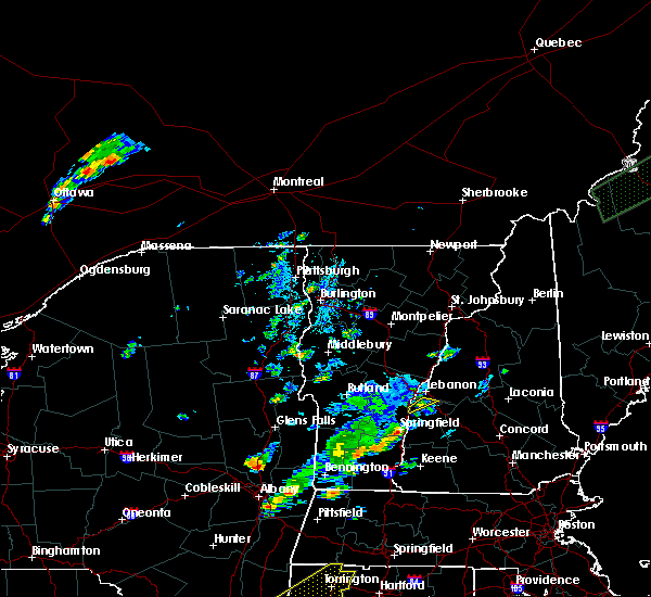 At 311 pm edt, a severe thunderstorm was located 9 miles north of claremont, moving northeast at 10 mph (radar indicated). Hazards include 60 mph wind gusts and quarter size hail. Hail damage to vehicles is expected. expect wind damage to roofs, siding, and trees. locations impacted include, grantham, cornish and plainfield. This includes interstate 89 between mile markers 47 and 48. At 311 pm edt, a severe thunderstorm was located 9 miles north of claremont, moving northeast at 10 mph (radar indicated). Hazards include 60 mph wind gusts and quarter size hail. Hail damage to vehicles is expected. expect wind damage to roofs, siding, and trees. locations impacted include, grantham, cornish and plainfield. This includes interstate 89 between mile markers 47 and 48.
|
| 7/27/2018 3:08 PM EDT |
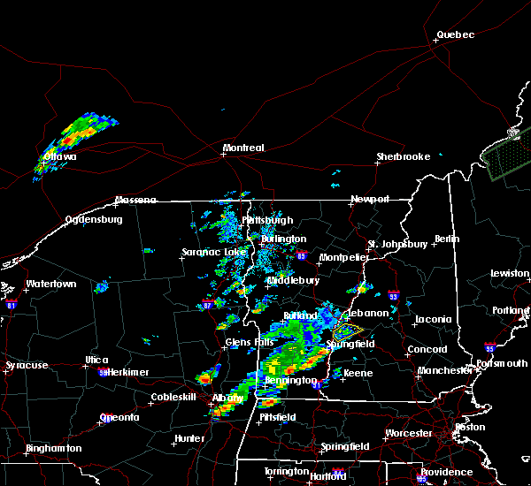 At 308 pm edt, a severe thunderstorm was located 9 miles north of claremont, moving northeast at 25 mph (radar indicated). Hazards include 60 mph wind gusts and quarter size hail. Hail damage to vehicles is expected. expect wind damage to roofs, siding, and trees. locations impacted include, claremont, enfield, grantham, cornish, croydon, plainfield and springfield. This includes interstate 89 between mile markers 42 and 48. At 308 pm edt, a severe thunderstorm was located 9 miles north of claremont, moving northeast at 25 mph (radar indicated). Hazards include 60 mph wind gusts and quarter size hail. Hail damage to vehicles is expected. expect wind damage to roofs, siding, and trees. locations impacted include, claremont, enfield, grantham, cornish, croydon, plainfield and springfield. This includes interstate 89 between mile markers 42 and 48.
|
| 7/27/2018 2:41 PM EDT |
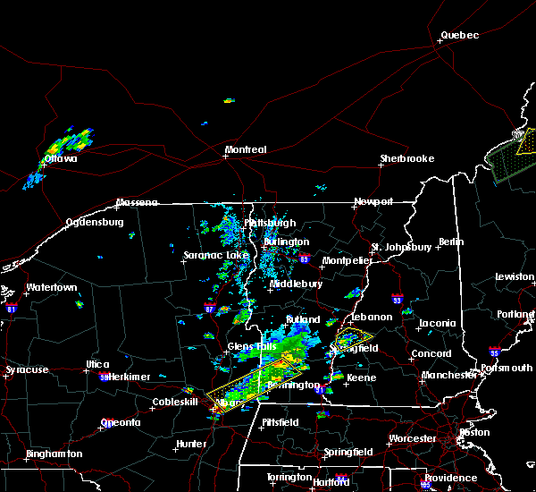 At 241 pm edt, a severe thunderstorm was located near claremont, moving northeast at 10 mph (radar indicated). Hazards include 60 mph wind gusts and quarter size hail. Hail damage to vehicles is expected. Expect wind damage to roofs, siding, and trees. At 241 pm edt, a severe thunderstorm was located near claremont, moving northeast at 10 mph (radar indicated). Hazards include 60 mph wind gusts and quarter size hail. Hail damage to vehicles is expected. Expect wind damage to roofs, siding, and trees.
|
| 6/18/2018 4:55 PM EDT | Tree trunk snapped on wire in windsor county VT, 3.8 miles SSE of Windsor, VT |
| 5/4/2018 9:12 PM EDT | Tree down in windsor county VT, 5.4 miles NNE of Windsor, VT |
| 5/4/2018 9:09 PM EDT |
 At 908 pm edt, severe thunderstorms were located along a line extending from 17 miles west of hanover to 8 miles northwest of charlestown to 7 miles west of westmoreland to 8 miles west of hinsdale, moving east at 55 mph (radar indicated). Hazards include 60 mph wind gusts. expect damage to roofs, siding, and trees At 908 pm edt, severe thunderstorms were located along a line extending from 17 miles west of hanover to 8 miles northwest of charlestown to 7 miles west of westmoreland to 8 miles west of hinsdale, moving east at 55 mph (radar indicated). Hazards include 60 mph wind gusts. expect damage to roofs, siding, and trees
|
| 5/4/2018 9:08 PM EDT |
 A severe thunderstorm warning remains in effect until 930 pm edt for south central windsor county. at 908 pm edt, severe thunderstorms were located along a line extending from near reading to near chester, moving east at 45 mph. hazard. 60 mph wind gusts and quarter size hail. source. Radar indicated. A severe thunderstorm warning remains in effect until 930 pm edt for south central windsor county. at 908 pm edt, severe thunderstorms were located along a line extending from near reading to near chester, moving east at 45 mph. hazard. 60 mph wind gusts and quarter size hail. source. Radar indicated.
|
| 5/4/2018 8:45 PM EDT | Tree down in windsor county VT, 5.1 miles N of Windsor, VT |
| 5/4/2018 8:36 PM EDT |
 At 836 pm edt, a severe thunderstorm was located over tinmouth, moving east at 50 mph (radar indicated). Hazards include 60 mph wind gusts and quarter size hail. Minor hail damage to vehicles is possible. Expect wind damage to trees and powerlines. At 836 pm edt, a severe thunderstorm was located over tinmouth, moving east at 50 mph (radar indicated). Hazards include 60 mph wind gusts and quarter size hail. Minor hail damage to vehicles is possible. Expect wind damage to trees and powerlines.
|
| 8/22/2017 9:51 PM EDT |
 The severe thunderstorm warning for southeastern rutland and southwestern windsor counties will expire at 1000 pm edt, the storm which prompted the warning has moved out of the area. therefore the warning will be allowed to expire. a severe thunderstorm watch remains in effect until midnight edt for southern vermont. The severe thunderstorm warning for southeastern rutland and southwestern windsor counties will expire at 1000 pm edt, the storm which prompted the warning has moved out of the area. therefore the warning will be allowed to expire. a severe thunderstorm watch remains in effect until midnight edt for southern vermont.
|
| 8/22/2017 9:20 PM EDT |
 At 920 pm edt, severe thunderstorms were located along a line extending from 10 miles west of hanover to 6 miles west of claremont to 17 miles west of hinsdale, moving east at 45 mph (radar indicated). Hazards include 60 mph wind gusts. expect damage to trees, and power lines At 920 pm edt, severe thunderstorms were located along a line extending from 10 miles west of hanover to 6 miles west of claremont to 17 miles west of hinsdale, moving east at 45 mph (radar indicated). Hazards include 60 mph wind gusts. expect damage to trees, and power lines
|
| 8/22/2017 9:06 PM EDT |
 At 906 pm edt, a severe thunderstorm was located over andover, moving east at 45 mph (radar indicated). Hazards include 60 mph wind gusts. expect damage to trees and powerlines At 906 pm edt, a severe thunderstorm was located over andover, moving east at 45 mph (radar indicated). Hazards include 60 mph wind gusts. expect damage to trees and powerlines
|
| 7/17/2017 7:10 PM EDT |
 The severe thunderstorm warning for south central windsor county will expire at 715 pm edt, the storm which prompted the warning has weakened below severe limits, and have exited the warned area. therefore the warning will be allowed to expire. The severe thunderstorm warning for south central windsor county will expire at 715 pm edt, the storm which prompted the warning has weakened below severe limits, and have exited the warned area. therefore the warning will be allowed to expire.
|
| 7/17/2017 6:35 PM EDT |
 At 635 pm edt, a severe thunderstorm was located over brownsville, moving northeast at 20 mph (public). Hazards include 60 mph wind gusts and quarter size hail. Minor hail damage to vehicles is possible. expect wind damage to trees and powerlines. Locations impacted include, chester, windsor, cavendish, perkinsville village, ascutney, baltimore, weathersfield, west windsor, andover, springfield, ludlow, hartland, reading, perkinsville, felchville, brownsville, north chester, ascutney state park, north springfield lake recreation area and proctorsville. At 635 pm edt, a severe thunderstorm was located over brownsville, moving northeast at 20 mph (public). Hazards include 60 mph wind gusts and quarter size hail. Minor hail damage to vehicles is possible. expect wind damage to trees and powerlines. Locations impacted include, chester, windsor, cavendish, perkinsville village, ascutney, baltimore, weathersfield, west windsor, andover, springfield, ludlow, hartland, reading, perkinsville, felchville, brownsville, north chester, ascutney state park, north springfield lake recreation area and proctorsville.
|
| 7/17/2017 6:13 PM EDT |
 At 612 pm edt, a severe thunderstorm was located over whitesville, moving northeast at 20 mph (trained weather spotters). Hazards include 60 mph wind gusts and quarter size hail. Minor hail damage to vehicles is possible. Expect wind damage to trees and powerlines. At 612 pm edt, a severe thunderstorm was located over whitesville, moving northeast at 20 mph (trained weather spotters). Hazards include 60 mph wind gusts and quarter size hail. Minor hail damage to vehicles is possible. Expect wind damage to trees and powerlines.
|
| 7/17/2017 5:18 PM EDT |
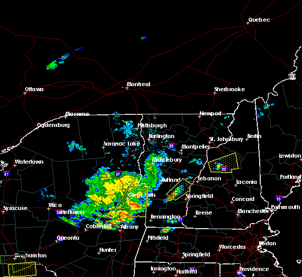 At 518 pm edt, a severe thunderstorm was located over ludlow, moving northeast at 20 mph (radar indicated). Hazards include 60 mph wind gusts and quarter size hail. Minor hail damage to vehicles is possible. Expect wind damage to trees and powerlines. At 518 pm edt, a severe thunderstorm was located over ludlow, moving northeast at 20 mph (radar indicated). Hazards include 60 mph wind gusts and quarter size hail. Minor hail damage to vehicles is possible. Expect wind damage to trees and powerlines.
|
| 7/1/2017 7:43 PM EDT |
 At 743 pm edt, severe thunderstorms were located along a line extending from 8 miles north of claremont to 8 miles north of marlow to near westmoreland, moving east at 35 mph (radar indicated). Hazards include 60 mph wind gusts. Expect damage to trees, and power lines. locations impacted include, claremont, lebanon, henniker, new london, grafton, enfield, canaan, antrim, bradford, bennington, nelson, newport, gilsum, windsor, warner, hillsborough, alstead, marlow, sullivan and surry. this also includes, mount kearsage and mount sunapee. This includes interstate 89 between mile markers 17 and 55. At 743 pm edt, severe thunderstorms were located along a line extending from 8 miles north of claremont to 8 miles north of marlow to near westmoreland, moving east at 35 mph (radar indicated). Hazards include 60 mph wind gusts. Expect damage to trees, and power lines. locations impacted include, claremont, lebanon, henniker, new london, grafton, enfield, canaan, antrim, bradford, bennington, nelson, newport, gilsum, windsor, warner, hillsborough, alstead, marlow, sullivan and surry. this also includes, mount kearsage and mount sunapee. This includes interstate 89 between mile markers 17 and 55.
|
| 7/1/2017 7:16 PM EDT |
 At 716 pm edt, severe thunderstorms were located along a line extending from 15 miles west of claremont to near charlestown to 9 miles west of chesterfield, moving east at 35 mph (radar indicated). Hazards include 60 mph wind gusts. expect damage to trees, and power lines At 716 pm edt, severe thunderstorms were located along a line extending from 15 miles west of claremont to near charlestown to 9 miles west of chesterfield, moving east at 35 mph (radar indicated). Hazards include 60 mph wind gusts. expect damage to trees, and power lines
|
| 7/1/2017 5:04 PM EDT |
 At 504 pm edt, severe thunderstorms were located along a line extending from near hanover to 7 miles northwest of charlestown, moving east at 35 mph (radar indicated). Hazards include 60 mph wind gusts and penny size hail. expect damage to trees, and power lines At 504 pm edt, severe thunderstorms were located along a line extending from near hanover to 7 miles northwest of charlestown, moving east at 35 mph (radar indicated). Hazards include 60 mph wind gusts and penny size hail. expect damage to trees, and power lines
|
| 7/1/2017 5:00 PM EDT | 3 trees down at mount ascutney state park in windsor county VT, 3.5 miles NNE of Windsor, VT |
| 7/1/2017 4:56 PM EDT |
 At 456 pm edt, severe thunderstorms were located along a line extending from near south woodstock to near mt. tabor, moving southeast at 20 mph (radar indicated). Hazards include 60 mph wind gusts and nickel size hail. Expect damage to trees and powerlines. locations impacted include, woodstock, chester, hartland four corners, windsor, woodstock village, mount holly, ludlow, cavendish, andover, weston, ludlow village, perkinsville village, mt. Holly, hartland, reading, baltimore, springfield, weathersfield, west windsor and plymouth. At 456 pm edt, severe thunderstorms were located along a line extending from near south woodstock to near mt. tabor, moving southeast at 20 mph (radar indicated). Hazards include 60 mph wind gusts and nickel size hail. Expect damage to trees and powerlines. locations impacted include, woodstock, chester, hartland four corners, windsor, woodstock village, mount holly, ludlow, cavendish, andover, weston, ludlow village, perkinsville village, mt. Holly, hartland, reading, baltimore, springfield, weathersfield, west windsor and plymouth.
|
| 7/1/2017 4:13 PM EDT |
 At 413 pm edt, a severe thunderstorm was located over south wallingford, moving northeast at 35 mph (radar indicated). Hazards include 60 mph wind gusts and nickel size hail. expect damage to trees and powerlines At 413 pm edt, a severe thunderstorm was located over south wallingford, moving northeast at 35 mph (radar indicated). Hazards include 60 mph wind gusts and nickel size hail. expect damage to trees and powerlines
|
| 7/1/2017 3:47 PM EDT |
 At 347 pm edt, a severe thunderstorm was located over plymouth, moving northeast at 30 mph (radar indicated). Hazards include 60 mph wind gusts and nickel size hail. expect damage to trees and powerlines At 347 pm edt, a severe thunderstorm was located over plymouth, moving northeast at 30 mph (radar indicated). Hazards include 60 mph wind gusts and nickel size hail. expect damage to trees and powerlines
|
| 5/18/2017 9:25 PM EDT |
 At 925 pm edt, severe thunderstorms were located along a line extending from 6 miles northeast of claremont to near marlow to marlborough to 9 miles south of winchester, moving east at 50 mph (radar indicated). Hazards include 60 mph wind gusts. Expect damage to trees, and power lines. locations impacted include, keene, claremont, jaffrey, henniker, new london, swanzey, peterborough, charlestown, winchester, antrim, greenfield, lyndeborough, bradford, dublin, francestown, bennington, danbury, richmond, harrisville and nelson. This includes interstate 89 between mile markers 19 and 40. At 925 pm edt, severe thunderstorms were located along a line extending from 6 miles northeast of claremont to near marlow to marlborough to 9 miles south of winchester, moving east at 50 mph (radar indicated). Hazards include 60 mph wind gusts. Expect damage to trees, and power lines. locations impacted include, keene, claremont, jaffrey, henniker, new london, swanzey, peterborough, charlestown, winchester, antrim, greenfield, lyndeborough, bradford, dublin, francestown, bennington, danbury, richmond, harrisville and nelson. This includes interstate 89 between mile markers 19 and 40.
|
| 5/18/2017 8:42 PM EDT |
 At 841 pm edt, severe thunderstorms were located along a line extending from 24 miles west of charlestown to 13 miles west of westmoreland to 13 miles west of hinsdale to 36 miles southwest of winchester, moving east at 50 mph (radar indicated). Hazards include 60 mph wind gusts. expect damage to trees, and power lines At 841 pm edt, severe thunderstorms were located along a line extending from 24 miles west of charlestown to 13 miles west of westmoreland to 13 miles west of hinsdale to 36 miles southwest of winchester, moving east at 50 mph (radar indicated). Hazards include 60 mph wind gusts. expect damage to trees, and power lines
|
| 8/13/2016 8:41 PM EDT |
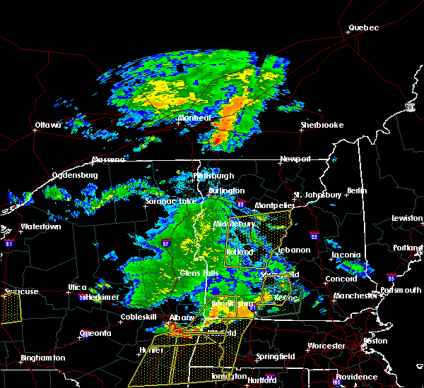 The severe thunderstorm warning for windsor, orange, southern washington, southeastern addison, south central caledonia and northeastern rutland counties will expire at 845 pm edt, the ling of storms which prompted the warning has weakened below severe limits, and no longer pose an immediate threat to life or property. therefore the warning will be allowed to expire. a severe thunderstorm watch remains in effect until 100 am edt for southern vermont. The severe thunderstorm warning for windsor, orange, southern washington, southeastern addison, south central caledonia and northeastern rutland counties will expire at 845 pm edt, the ling of storms which prompted the warning has weakened below severe limits, and no longer pose an immediate threat to life or property. therefore the warning will be allowed to expire. a severe thunderstorm watch remains in effect until 100 am edt for southern vermont.
|
| 8/13/2016 8:19 PM EDT |
 At 818 pm edt, severe thunderstorms were located along a line extending from roxbury to north shrewsbury vermont, moving east at 35 to 40 mph (radar indicated). Hazards include 60 mph wind gusts and quarter size hail. Hail damage to vehicles is expected. expect wind damage to roofs, siding, and trees. Locations impacted include, barre, chelsea, chittenden, orange, hartford, randolph, norwich, hartland, williamstown, berlin, bradford, royalton, clarendon, bethel, warren, sharon, corinth, brookfield, tunbridge and topsham. At 818 pm edt, severe thunderstorms were located along a line extending from roxbury to north shrewsbury vermont, moving east at 35 to 40 mph (radar indicated). Hazards include 60 mph wind gusts and quarter size hail. Hail damage to vehicles is expected. expect wind damage to roofs, siding, and trees. Locations impacted include, barre, chelsea, chittenden, orange, hartford, randolph, norwich, hartland, williamstown, berlin, bradford, royalton, clarendon, bethel, warren, sharon, corinth, brookfield, tunbridge and topsham.
|
| 8/13/2016 7:51 PM EDT |
 At 750 pm edt, severe thunderstorms were located along a line extending from new haven mills to east poultney, moving east at 35 mph (radar indicated). Hazards include 60 mph wind gusts and quarter size hail. Hail damage to vehicles is expected. Expect wind damage to roofs, siding, and trees. At 750 pm edt, severe thunderstorms were located along a line extending from new haven mills to east poultney, moving east at 35 mph (radar indicated). Hazards include 60 mph wind gusts and quarter size hail. Hail damage to vehicles is expected. Expect wind damage to roofs, siding, and trees.
|
| 7/1/2016 7:26 PM EDT |
 At 726 pm edt, severe thunderstorms were located along a line extending from hanover to near claremont to near townshend, moving east at 15 mph (radar indicated). Hazards include 60 mph wind gusts. Expect damage to roofs. siding. And trees. At 726 pm edt, severe thunderstorms were located along a line extending from hanover to near claremont to near townshend, moving east at 15 mph (radar indicated). Hazards include 60 mph wind gusts. Expect damage to roofs. siding. And trees.
|
| 7/1/2016 6:29 PM EDT |
 At 628 pm edt, a severe thunderstorm was located over andover, moving northeast at 40 mph (radar indicated). Hazards include 60 mph wind gusts and penny size hail. Expect damage to roofs. siding. And trees. At 628 pm edt, a severe thunderstorm was located over andover, moving northeast at 40 mph (radar indicated). Hazards include 60 mph wind gusts and penny size hail. Expect damage to roofs. siding. And trees.
|
| 8/3/2015 5:59 PM EDT | Trees down in sullivan county NH, 3.6 miles W of Windsor, VT |
| 8/3/2015 5:30 PM EDT | Trees down. corrected time from earlier report in sullivan county NH, 3.6 miles W of Windsor, VT |
| 8/3/2015 5:29 PM EDT |
 At 528 pm edt, doppler radar indicated a line of severe thunderstorms capable of producing damaging winds in excess of 60 mph. these storms were located along a line extending from lebanon to 8 miles north of newport to near claremont to westminster to near guilford center, moving northeast at 35 mph. locations impacted include, keene, claremont, southwestern lebanon, jaffrey, new london, swanzey, charlestown, enfield, winchester, hinsdale, chesterfield, antrim, marlborough, fitzwilliam, troy, westmoreland, bradford, dublin, danbury and richmond. At 528 pm edt, doppler radar indicated a line of severe thunderstorms capable of producing damaging winds in excess of 60 mph. these storms were located along a line extending from lebanon to 8 miles north of newport to near claremont to westminster to near guilford center, moving northeast at 35 mph. locations impacted include, keene, claremont, southwestern lebanon, jaffrey, new london, swanzey, charlestown, enfield, winchester, hinsdale, chesterfield, antrim, marlborough, fitzwilliam, troy, westmoreland, bradford, dublin, danbury and richmond.
|
| 8/3/2015 5:08 PM EDT |
 At 508 pm edt, doppler radar indicated a line of severe thunderstorms capable of producing damaging winds in excess of 60 mph. these storms were located along a line extending from near hartland to near claremont to near charlestown to near putney to near heath, and moving northeast at 35 mph. At 508 pm edt, doppler radar indicated a line of severe thunderstorms capable of producing damaging winds in excess of 60 mph. these storms were located along a line extending from near hartland to near claremont to near charlestown to near putney to near heath, and moving northeast at 35 mph.
|
| 5/27/2015 5:17 PM EDT | At 516 pm edt, doppler radar indicated a line of severe thunderstorms capable of producing damaging winds in excess of 60 mph. these storms were located along a line extending from lebanon to 6 miles southeast of hartland, and moving east at 55 mph. |
| 9/11/2013 8:25 PM EDT | Trees down and poles snapped on route 12 in sullivan county NH, 3.6 miles W of Windsor, VT |
| 1/1/0001 12:00 AM | Quarter sized hail reported 3.6 miles W of Windsor, VT |
| 1/1/0001 12:00 AM | Storm damage reported in windsor county VT, 2.1 miles ENE of Windsor, VT |
Hail Maps for Windsor, VT
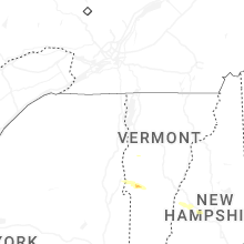


Connect with Interactive Hail Maps