

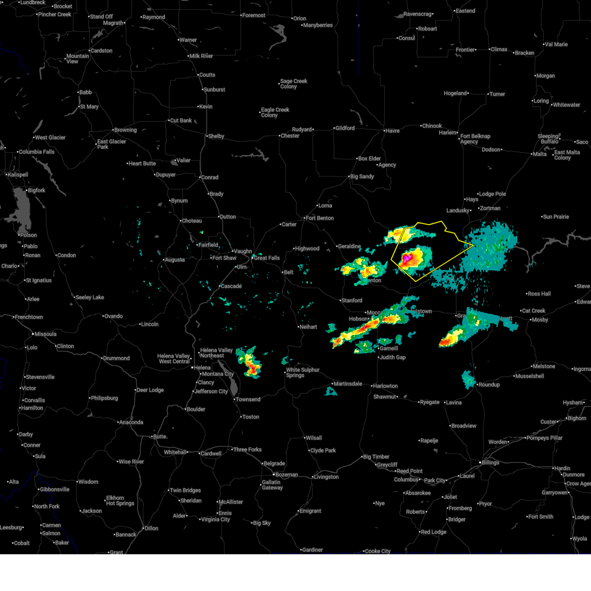
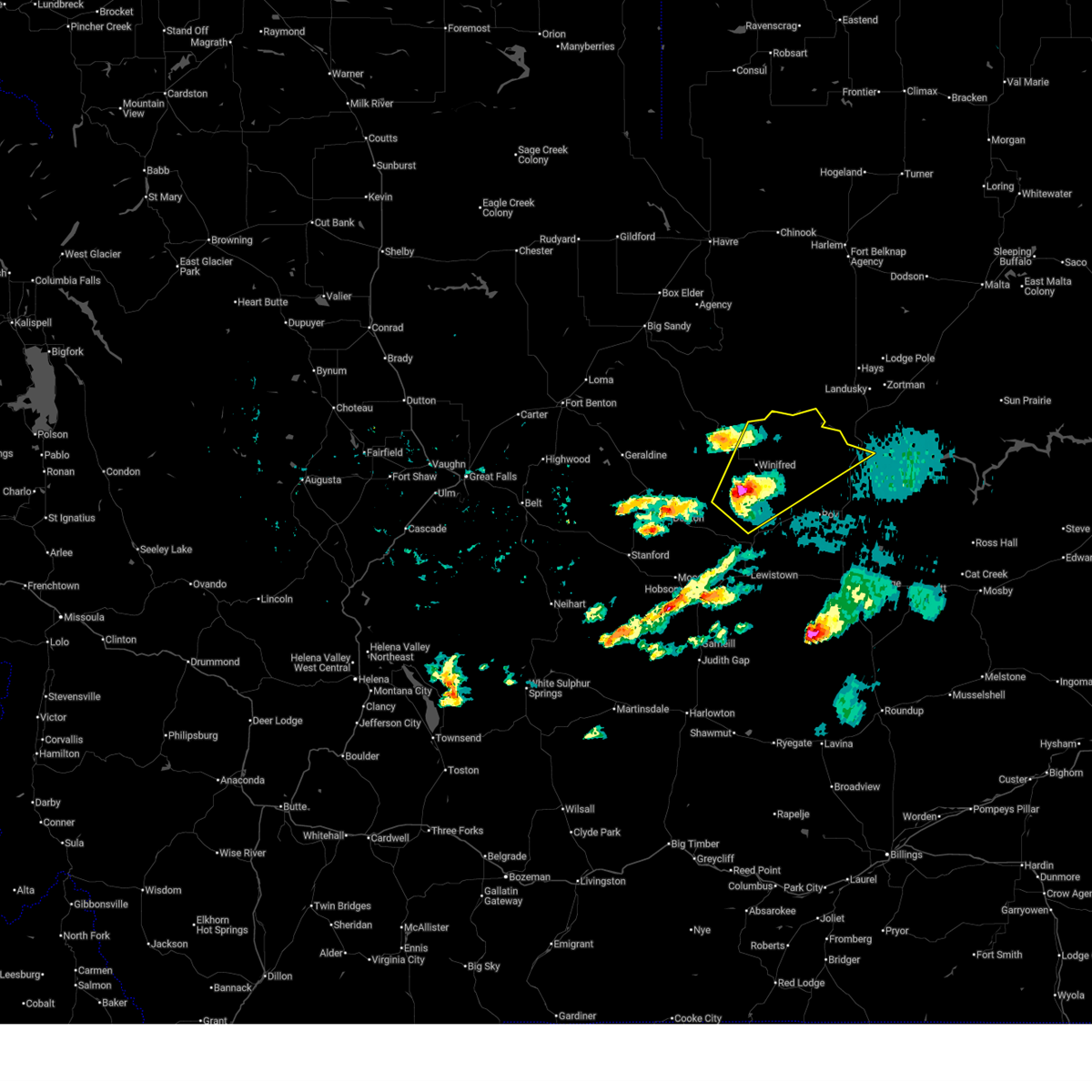
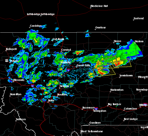
Hail Map for Winifred, MT
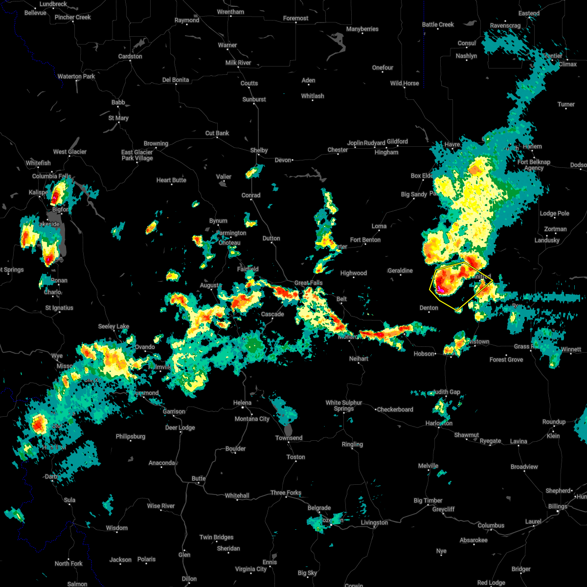
The Winifred, MT area has had 13 reports of on-the-ground hail by trained spotters, and has been under severe weather warnings 18 times during the past 12 months. Doppler radar has detected hail at or near Winifred, MT on 17 occasions, including 1 occasion during the past year.
| Name: | Winifred, MT |
| Where Located: | 69.8 miles S of Havre, MT |
| Map: | Google Map for Winifred, MT |
| Population: | 208 |
| Housing Units: | 116 |
| More Info: | Search Google for Winifred, MT |
0
The Top Recent Hail Date for Winifred, MT is Saturday, July 26, 2025 (15th out of 17)
Hail and Wind Damage Spotted near Winifred, MT
| Date / Time | Report Details |
|---|---|
| 5/13/2026 4:08 PM MDT |
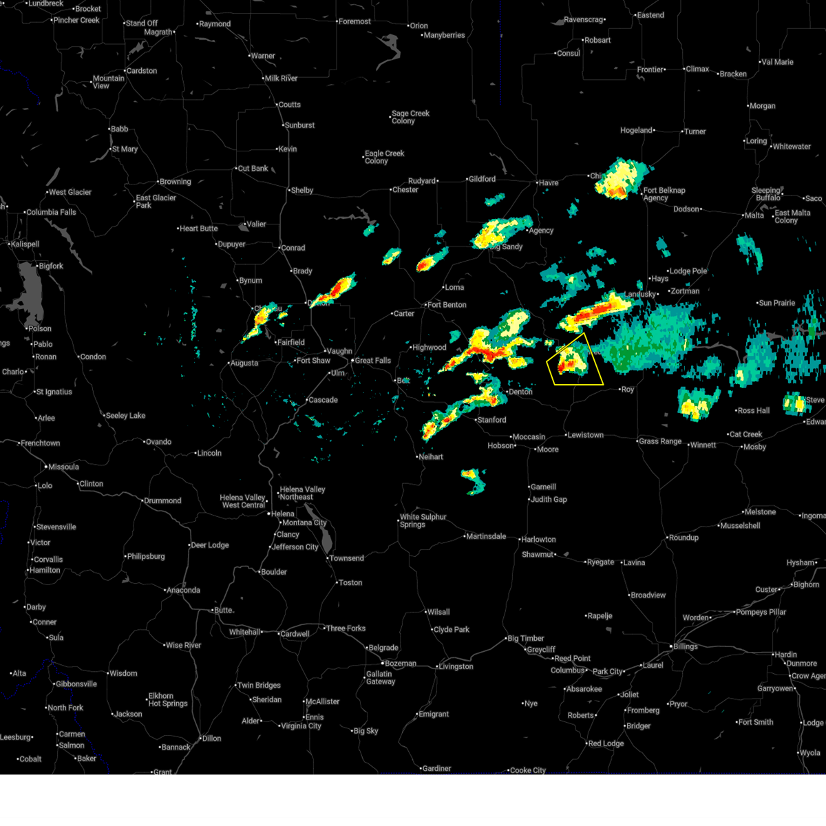
 Svrtfx the national weather service in great falls has issued a * severe thunderstorm warning for, liberty county in north central montana, northwestern fergus county in central montana, blaine county in north central montana, hill county in north central montana, northeastern chouteau county in north central montana, * until 545 pm mdt. * at 408 pm mdt, severe thunderstorms were located along a line extending from 15 miles southeast of chester to big sandy to 24 miles south of parker school to 12 miles southwest of winifred, moving northeast at 55 mph (radar indicated). Hazards include 70 mph wind gusts. Expect considerable tree damage. damage is likely to mobile homes, roofs, and outbuildings. Blowing dust may reduce visibility down to one mile. Svrtfx the national weather service in great falls has issued a * severe thunderstorm warning for, liberty county in north central montana, northwestern fergus county in central montana, blaine county in north central montana, hill county in north central montana, northeastern chouteau county in north central montana, * until 545 pm mdt. * at 408 pm mdt, severe thunderstorms were located along a line extending from 15 miles southeast of chester to big sandy to 24 miles south of parker school to 12 miles southwest of winifred, moving northeast at 55 mph (radar indicated). Hazards include 70 mph wind gusts. Expect considerable tree damage. damage is likely to mobile homes, roofs, and outbuildings. Blowing dust may reduce visibility down to one mile.
|
| 5/13/2026 3:46 PM MDT |
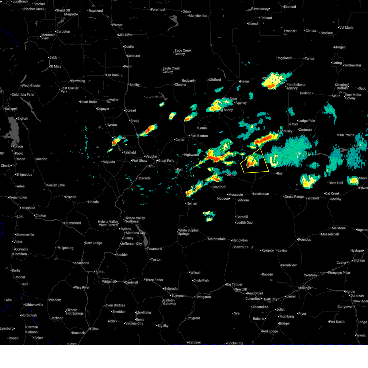
 At 343 pm mdt, severe thunderstorms were located along a line extending from 8 miles southeast of the knees to 9 miles northeast of fort benton to 14 miles east of geraldine to 8 miles north of hobson, moving northeast at 50 mph (radar indicated). Hazards include 70 mph wind gusts. Expect considerable tree damage. damage is likely to mobile homes, roofs, and outbuildings. blowing dust may reduce visibility to less than one mile. brief landspout tornadoes are possible. locations impacted include, fort benton, big sandy, geraldine, denton, hobson, winifred, the knees, box elder, st. Pierre, carter, floweree, danvers, loma, kenilworth, hilger, iliad, virgelle, moccasin, ackley lake state park, and coffee creek. At 343 pm mdt, severe thunderstorms were located along a line extending from 8 miles southeast of the knees to 9 miles northeast of fort benton to 14 miles east of geraldine to 8 miles north of hobson, moving northeast at 50 mph (radar indicated). Hazards include 70 mph wind gusts. Expect considerable tree damage. damage is likely to mobile homes, roofs, and outbuildings. blowing dust may reduce visibility to less than one mile. brief landspout tornadoes are possible. locations impacted include, fort benton, big sandy, geraldine, denton, hobson, winifred, the knees, box elder, st. Pierre, carter, floweree, danvers, loma, kenilworth, hilger, iliad, virgelle, moccasin, ackley lake state park, and coffee creek.
|
| 5/13/2026 3:28 PM MDT |
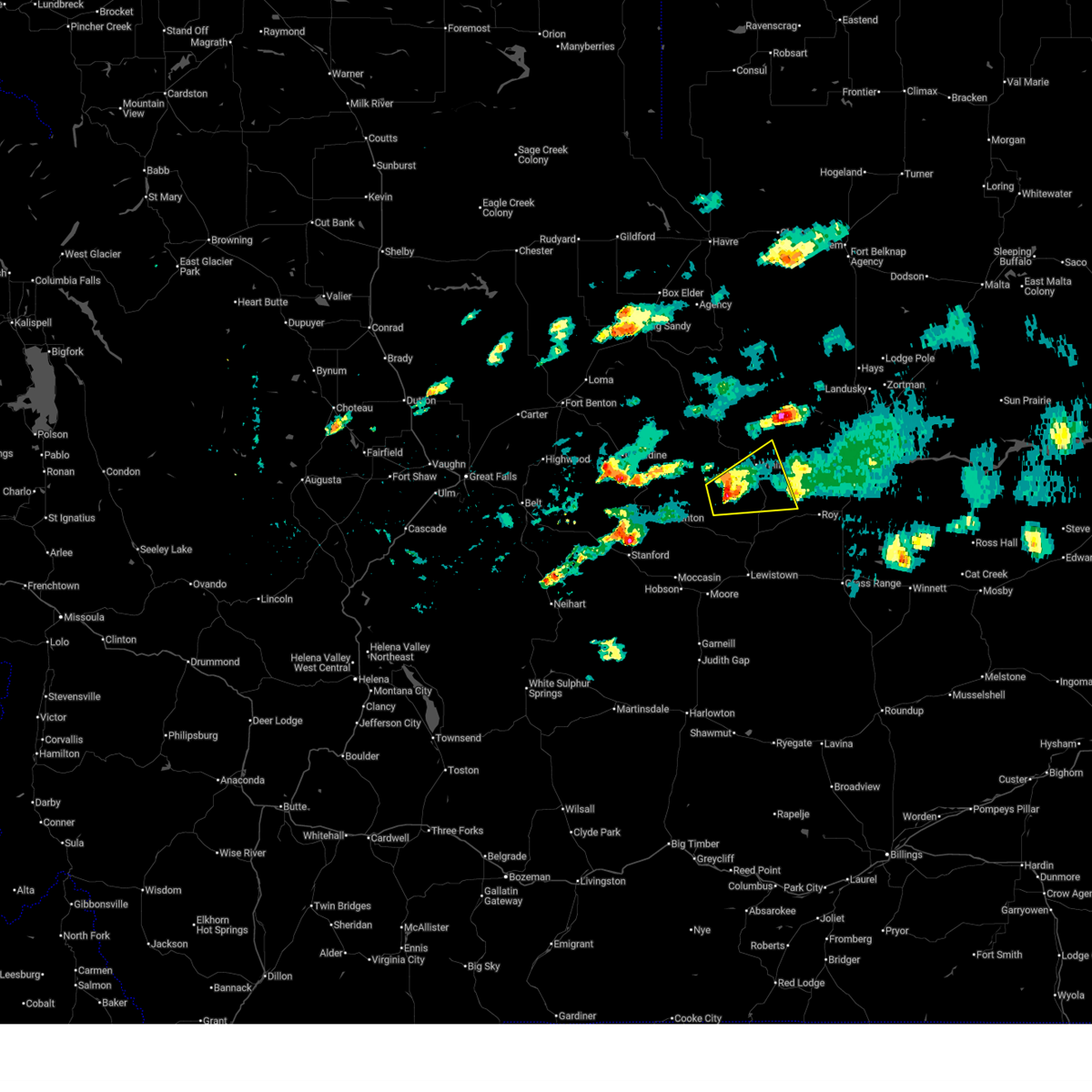
 Svrtfx the national weather service in great falls has issued a * severe thunderstorm warning for, northeastern judith basin county in central montana, southeastern liberty county in north central montana, northwestern fergus county in central montana, southwestern blaine county in north central montana, southwestern hill county in north central montana, chouteau county in north central montana, northeastern cascade county in central montana, * until 415 pm mdt. * at 328 pm mdt, severe thunderstorms were located along a line extending from 10 miles south of the knees to near fort benton to 11 miles northwest of denton to near hobson, moving northeast at 50 mph (radar indicated). Hazards include 70 mph wind gusts. Expect considerable tree damage. Damage is likely to mobile homes, roofs, and outbuildings. Svrtfx the national weather service in great falls has issued a * severe thunderstorm warning for, northeastern judith basin county in central montana, southeastern liberty county in north central montana, northwestern fergus county in central montana, southwestern blaine county in north central montana, southwestern hill county in north central montana, chouteau county in north central montana, northeastern cascade county in central montana, * until 415 pm mdt. * at 328 pm mdt, severe thunderstorms were located along a line extending from 10 miles south of the knees to near fort benton to 11 miles northwest of denton to near hobson, moving northeast at 50 mph (radar indicated). Hazards include 70 mph wind gusts. Expect considerable tree damage. Damage is likely to mobile homes, roofs, and outbuildings.
|
| 8/20/2025 6:25 PM MDT |
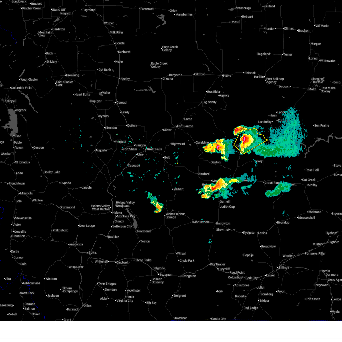
 At 625 pm mdt, a severe thunderstorm was located 14 miles south of winifred, or 21 miles north of lewistown, moving east at 25 mph (radar indicated). Hazards include 70 mph wind gusts and quarter size hail. Hail damage to vehicles is expected. expect considerable tree damage. wind damage is also likely to mobile homes, roofs, and outbuildings. Locations impacted include, winifred, grass range, roy, fergus, suffolk, hilger, and christina. At 625 pm mdt, a severe thunderstorm was located 14 miles south of winifred, or 21 miles north of lewistown, moving east at 25 mph (radar indicated). Hazards include 70 mph wind gusts and quarter size hail. Hail damage to vehicles is expected. expect considerable tree damage. wind damage is also likely to mobile homes, roofs, and outbuildings. Locations impacted include, winifred, grass range, roy, fergus, suffolk, hilger, and christina.
|
| 8/20/2025 6:12 PM MDT |
 This severe thunderstorm warning will be replaced with a new warning. hail and strong, gusty winds are still a threat with this thunderstorm. This severe thunderstorm warning will be replaced with a new warning. hail and strong, gusty winds are still a threat with this thunderstorm.
|
| 8/20/2025 6:09 PM MDT |
 Svrtfx the national weather service in great falls has issued a * severe thunderstorm warning for, eastern fergus county in central montana, * until 730 pm mdt. * at 608 pm mdt, a severe thunderstorm was located 11 miles southwest of winifred, or 24 miles north of lewistown, moving east southeast at 45 mph (radar indicated). Hazards include 60 mph wind gusts and quarter size hail. Hail damage to vehicles is expected. Expect wind damage to roofs, siding, and trees. Svrtfx the national weather service in great falls has issued a * severe thunderstorm warning for, eastern fergus county in central montana, * until 730 pm mdt. * at 608 pm mdt, a severe thunderstorm was located 11 miles southwest of winifred, or 24 miles north of lewistown, moving east southeast at 45 mph (radar indicated). Hazards include 60 mph wind gusts and quarter size hail. Hail damage to vehicles is expected. Expect wind damage to roofs, siding, and trees.
|
| 8/20/2025 6:07 PM MDT |
 At 606 pm mdt, a severe thunderstorm was located 10 miles southwest of winifred, or 27 miles north of lewistown, moving east southeast at 40 mph (radar indicated). Hazards include 60 mph wind gusts and quarter size hail. Hail damage to vehicles is expected. expect wind damage to roofs, siding, and trees. Locations impacted include, winifred, suffolk, and christina. At 606 pm mdt, a severe thunderstorm was located 10 miles southwest of winifred, or 27 miles north of lewistown, moving east southeast at 40 mph (radar indicated). Hazards include 60 mph wind gusts and quarter size hail. Hail damage to vehicles is expected. expect wind damage to roofs, siding, and trees. Locations impacted include, winifred, suffolk, and christina.
|
| 8/20/2025 6:02 PM MDT |
 At 602 pm mdt, a severe thunderstorm was located 13 miles southwest of winifred, or 27 miles north of lewistown, moving east southeast at 30 mph (radar indicated). Hazards include 60 mph wind gusts and quarter size hail. Hail damage to vehicles is expected. expect wind damage to roofs, siding, and trees. Locations impacted include, winifred, suffolk, and christina. At 602 pm mdt, a severe thunderstorm was located 13 miles southwest of winifred, or 27 miles north of lewistown, moving east southeast at 30 mph (radar indicated). Hazards include 60 mph wind gusts and quarter size hail. Hail damage to vehicles is expected. expect wind damage to roofs, siding, and trees. Locations impacted include, winifred, suffolk, and christina.
|
| 8/20/2025 5:51 PM MDT |
 the severe thunderstorm warning has been cancelled and is no longer in effect the severe thunderstorm warning has been cancelled and is no longer in effect
|
| 8/20/2025 5:51 PM MDT |
 At 549 pm mdt, a severe thunderstorm was located 11 miles west of winifred, or 36 miles north of lewistown, moving east at 35 mph (radar indicated). Hazards include 60 mph wind gusts. Expect damage to roofs, siding, and trees. Locations impacted include, winifred, suffolk, and christina. At 549 pm mdt, a severe thunderstorm was located 11 miles west of winifred, or 36 miles north of lewistown, moving east at 35 mph (radar indicated). Hazards include 60 mph wind gusts. Expect damage to roofs, siding, and trees. Locations impacted include, winifred, suffolk, and christina.
|
| 8/20/2025 5:41 PM MDT |
 At 541 pm mdt, a severe thunderstorm was located 17 miles northeast of denton, or 34 miles northeast of stanford, moving east at 40 mph (radar indicated). Hazards include 60 mph wind gusts. Expect damage to roofs, siding, and trees. Locations impacted include, winifred, judith landing, suffolk, and christina. At 541 pm mdt, a severe thunderstorm was located 17 miles northeast of denton, or 34 miles northeast of stanford, moving east at 40 mph (radar indicated). Hazards include 60 mph wind gusts. Expect damage to roofs, siding, and trees. Locations impacted include, winifred, judith landing, suffolk, and christina.
|
| 8/20/2025 5:23 PM MDT |
 At 522 pm mdt, a severe thunderstorm was located 11 miles southeast of geraldine, or 24 miles north of stanford, moving east at 35 mph (radar indicated). Hazards include 60 mph wind gusts and quarter size hail. Hail damage to vehicles is expected. expect wind damage to roofs, siding, and trees. Locations impacted include, winifred, coffee creek, suffolk, square butte, judith landing, christina, and iliad. At 522 pm mdt, a severe thunderstorm was located 11 miles southeast of geraldine, or 24 miles north of stanford, moving east at 35 mph (radar indicated). Hazards include 60 mph wind gusts and quarter size hail. Hail damage to vehicles is expected. expect wind damage to roofs, siding, and trees. Locations impacted include, winifred, coffee creek, suffolk, square butte, judith landing, christina, and iliad.
|
| 8/20/2025 5:11 PM MDT |
 Svrtfx the national weather service in great falls has issued a * severe thunderstorm warning for, northwestern fergus county in central montana, southeastern chouteau county in north central montana, * until 615 pm mdt. * at 511 pm mdt, a severe thunderstorm was located 8 miles south of geraldine, or 22 miles north of stanford, moving east northeast at 40 mph (radar indicated). Hazards include 60 mph wind gusts and quarter size hail. Hail damage to vehicles is expected. Expect wind damage to roofs, siding, and trees. Svrtfx the national weather service in great falls has issued a * severe thunderstorm warning for, northwestern fergus county in central montana, southeastern chouteau county in north central montana, * until 615 pm mdt. * at 511 pm mdt, a severe thunderstorm was located 8 miles south of geraldine, or 22 miles north of stanford, moving east northeast at 40 mph (radar indicated). Hazards include 60 mph wind gusts and quarter size hail. Hail damage to vehicles is expected. Expect wind damage to roofs, siding, and trees.
|
| 7/17/2025 7:11 PM MDT |
 The storm which prompted the warning is moving out of the area. therefore, the warning will be allowed to expire. however, small hail and gusty winds are still possible with this thunderstorm. a severe thunderstorm watch remains in effect until 1000 pm mdt for central and north central montana. The storm which prompted the warning is moving out of the area. therefore, the warning will be allowed to expire. however, small hail and gusty winds are still possible with this thunderstorm. a severe thunderstorm watch remains in effect until 1000 pm mdt for central and north central montana.
|
| 7/17/2025 6:49 PM MDT |
 the severe thunderstorm warning has been cancelled and is no longer in effect the severe thunderstorm warning has been cancelled and is no longer in effect
|
| 7/17/2025 6:49 PM MDT |
 At 648 pm mdt, a severe thunderstorm was located 14 miles northeast of denton, or 31 miles northeast of stanford, moving southeast at 35 mph (radar indicated). Hazards include 60 mph wind gusts and quarter size hail. Hail damage to vehicles is expected. expect wind damage to roofs, siding, and trees. Locations impacted include, winifred, suffolk, and christina. At 648 pm mdt, a severe thunderstorm was located 14 miles northeast of denton, or 31 miles northeast of stanford, moving southeast at 35 mph (radar indicated). Hazards include 60 mph wind gusts and quarter size hail. Hail damage to vehicles is expected. expect wind damage to roofs, siding, and trees. Locations impacted include, winifred, suffolk, and christina.
|
| 7/17/2025 6:35 PM MDT |
 At 635 pm mdt, a severe thunderstorm was located 13 miles east of geraldine, or 32 miles north of stanford, moving east at 40 mph (radar indicated). Hazards include 60 mph wind gusts and quarter size hail. Hail damage to vehicles is expected. expect wind damage to roofs, siding, and trees. Locations impacted include, winifred, judith landing, suffolk, and christina. At 635 pm mdt, a severe thunderstorm was located 13 miles east of geraldine, or 32 miles north of stanford, moving east at 40 mph (radar indicated). Hazards include 60 mph wind gusts and quarter size hail. Hail damage to vehicles is expected. expect wind damage to roofs, siding, and trees. Locations impacted include, winifred, judith landing, suffolk, and christina.
|
| 7/17/2025 6:19 PM MDT |
 Svrtfx the national weather service in great falls has issued a * severe thunderstorm warning for, northwestern fergus county in central montana, southeastern chouteau county in north central montana, * until 715 pm mdt. * at 619 pm mdt, a severe thunderstorm was located near geraldine, or 24 miles southeast of fort benton, moving east at 40 mph (radar indicated). Hazards include 60 mph wind gusts and quarter size hail. Hail damage to vehicles is expected. Expect wind damage to roofs, siding, and trees. Svrtfx the national weather service in great falls has issued a * severe thunderstorm warning for, northwestern fergus county in central montana, southeastern chouteau county in north central montana, * until 715 pm mdt. * at 619 pm mdt, a severe thunderstorm was located near geraldine, or 24 miles southeast of fort benton, moving east at 40 mph (radar indicated). Hazards include 60 mph wind gusts and quarter size hail. Hail damage to vehicles is expected. Expect wind damage to roofs, siding, and trees.
|
| 6/15/2025 5:29 PM MDT |
 Svrtfx the national weather service in great falls has issued a * severe thunderstorm warning for, northeastern judith basin county in central montana, northwestern fergus county in central montana, southeastern chouteau county in north central montana, * until 630 pm mdt. * at 529 pm mdt, severe thunderstorms were located along a line extending from 13 miles north of denton to 10 miles north of stanford, moving east at 30 mph (radar indicated). Hazards include 60 mph wind gusts and quarter size hail. Hail damage to vehicles is expected. Expect wind damage to roofs, siding, and trees. Svrtfx the national weather service in great falls has issued a * severe thunderstorm warning for, northeastern judith basin county in central montana, northwestern fergus county in central montana, southeastern chouteau county in north central montana, * until 630 pm mdt. * at 529 pm mdt, severe thunderstorms were located along a line extending from 13 miles north of denton to 10 miles north of stanford, moving east at 30 mph (radar indicated). Hazards include 60 mph wind gusts and quarter size hail. Hail damage to vehicles is expected. Expect wind damage to roofs, siding, and trees.
|
| 6/15/2025 4:57 PM MDT |
 Svrtfx the national weather service in great falls has issued a * severe thunderstorm warning for, northwestern fergus county in central montana, southwestern blaine county in north central montana, southeastern chouteau county in north central montana, * until 530 pm mdt. * at 457 pm mdt, severe thunderstorms were located along a line extending from 8 miles southeast of fort benton to near geraldine to 17 miles east of highwood, moving east at 40 mph (radar indicated). Hazards include golf ball size hail and 60 mph wind gusts. People and animals outdoors will be injured. expect hail damage to roofs, siding, windows, and vehicles. Expect wind damage to roofs, siding, and trees. Svrtfx the national weather service in great falls has issued a * severe thunderstorm warning for, northwestern fergus county in central montana, southwestern blaine county in north central montana, southeastern chouteau county in north central montana, * until 530 pm mdt. * at 457 pm mdt, severe thunderstorms were located along a line extending from 8 miles southeast of fort benton to near geraldine to 17 miles east of highwood, moving east at 40 mph (radar indicated). Hazards include golf ball size hail and 60 mph wind gusts. People and animals outdoors will be injured. expect hail damage to roofs, siding, windows, and vehicles. Expect wind damage to roofs, siding, and trees.
|
| 6/15/2025 1:59 AM MDT |
 the severe thunderstorm warning has been cancelled and is no longer in effect the severe thunderstorm warning has been cancelled and is no longer in effect
|
| 6/15/2025 1:46 AM MDT |
 At 145 am mdt, a severe thunderstorm was located near winifred, or 29 miles north of lewistown, moving northeast at 20 mph (radar indicated). Hazards include quarter size hail. Damage to vehicles is expected. Locations impacted include, winifred and suffolk. At 145 am mdt, a severe thunderstorm was located near winifred, or 29 miles north of lewistown, moving northeast at 20 mph (radar indicated). Hazards include quarter size hail. Damage to vehicles is expected. Locations impacted include, winifred and suffolk.
|
| 6/15/2025 1:34 AM MDT |
 At 133 am mdt, a severe thunderstorm was located 10 miles southwest of winifred, or 25 miles north of lewistown, moving east northeast at 20 mph (radar indicated). Hazards include quarter size hail. Damage to vehicles is expected. Locations impacted include, winifred, suffolk, and christina. At 133 am mdt, a severe thunderstorm was located 10 miles southwest of winifred, or 25 miles north of lewistown, moving east northeast at 20 mph (radar indicated). Hazards include quarter size hail. Damage to vehicles is expected. Locations impacted include, winifred, suffolk, and christina.
|
| 6/15/2025 1:24 AM MDT |
 At 124 am mdt, a severe thunderstorm was located 12 miles southwest of winifred, or 25 miles north of lewistown, moving east northeast at 20 mph (radar indicated). Hazards include half dollar size hail. Damage to vehicles is expected. Locations impacted include, winifred, suffolk, and christina. At 124 am mdt, a severe thunderstorm was located 12 miles southwest of winifred, or 25 miles north of lewistown, moving east northeast at 20 mph (radar indicated). Hazards include half dollar size hail. Damage to vehicles is expected. Locations impacted include, winifred, suffolk, and christina.
|
| 6/15/2025 1:17 AM MDT |
 Svrtfx the national weather service in great falls has issued a * severe thunderstorm warning for, north central fergus county in central montana, * until 215 am mdt. * at 117 am mdt, a severe thunderstorm was located 14 miles southwest of winifred, or 25 miles north of lewistown, moving east northeast at 20 mph (radar indicated). Hazards include half dollar size hail. damage to vehicles is expected Svrtfx the national weather service in great falls has issued a * severe thunderstorm warning for, north central fergus county in central montana, * until 215 am mdt. * at 117 am mdt, a severe thunderstorm was located 14 miles southwest of winifred, or 25 miles north of lewistown, moving east northeast at 20 mph (radar indicated). Hazards include half dollar size hail. damage to vehicles is expected
|
| 6/14/2025 8:28 PM MDT |
 At 828 pm mdt, a severe thunderstorm was located near winifred, or 36 miles north of lewistown, moving northeast at 30 mph (radar indicated). Hazards include 60 mph wind gusts and half dollar size hail. Hail damage to vehicles is expected. expect wind damage to roofs, siding, and trees. Locations impacted include, winifred. At 828 pm mdt, a severe thunderstorm was located near winifred, or 36 miles north of lewistown, moving northeast at 30 mph (radar indicated). Hazards include 60 mph wind gusts and half dollar size hail. Hail damage to vehicles is expected. expect wind damage to roofs, siding, and trees. Locations impacted include, winifred.
|
| 6/14/2025 8:12 PM MDT |
 At 811 pm mdt, a severe thunderstorm was located near winifred, or 29 miles north of lewistown, moving northeast at 30 mph (radar indicated). Hazards include golf ball size hail and 60 mph wind gusts. People and animals outdoors will be injured. expect hail damage to roofs, siding, windows, and vehicles. expect wind damage to roofs, siding, and trees. Locations impacted include, winifred, suffolk, christina, and fred robinson bridge. At 811 pm mdt, a severe thunderstorm was located near winifred, or 29 miles north of lewistown, moving northeast at 30 mph (radar indicated). Hazards include golf ball size hail and 60 mph wind gusts. People and animals outdoors will be injured. expect hail damage to roofs, siding, windows, and vehicles. expect wind damage to roofs, siding, and trees. Locations impacted include, winifred, suffolk, christina, and fred robinson bridge.
|
| 6/14/2025 7:56 PM MDT |
 Svrtfx the national weather service in great falls has issued a * severe thunderstorm warning for, northeastern fergus county in central montana, south central blaine county in north central montana, * until 900 pm mdt. * at 755 pm mdt, a severe thunderstorm was located 12 miles southwest of winifred, or 23 miles north of lewistown, moving northeast at 30 mph (trained weather spotters). Hazards include two inch hail and 60 mph wind gusts. People and animals outdoors will be injured. expect hail damage to roofs, siding, windows, and vehicles. Expect wind damage to roofs, siding, and trees. Svrtfx the national weather service in great falls has issued a * severe thunderstorm warning for, northeastern fergus county in central montana, south central blaine county in north central montana, * until 900 pm mdt. * at 755 pm mdt, a severe thunderstorm was located 12 miles southwest of winifred, or 23 miles north of lewistown, moving northeast at 30 mph (trained weather spotters). Hazards include two inch hail and 60 mph wind gusts. People and animals outdoors will be injured. expect hail damage to roofs, siding, windows, and vehicles. Expect wind damage to roofs, siding, and trees.
|
| 6/14/2025 7:55 PM MDT | Corrects previous tstm wnd gst report from 8 wsw suffol in fergus county MT, 11.8 miles NE of Winifred, MT |
| 5/11/2025 5:58 PM MDT |
 The storms which prompted the warning have moved out of the area. therefore, the warning will be allowed to expire. remember, a severe thunderstorm warning still remains in effect for eastern chouteau, northern fergus, southeast hill, and southwest blaine counties. The storms which prompted the warning have moved out of the area. therefore, the warning will be allowed to expire. remember, a severe thunderstorm warning still remains in effect for eastern chouteau, northern fergus, southeast hill, and southwest blaine counties.
|
| 5/11/2025 5:56 PM MDT |
 Svrtfx the national weather service in great falls has issued a * severe thunderstorm warning for, northern fergus county in central montana, blaine county in north central montana, southeastern hill county in north central montana, northeastern chouteau county in north central montana, * until 730 pm mdt. * at 554 pm mdt, severe thunderstorms were located along a line extending from 19 miles northwest of chinook to 21 miles northeast of roy, moving northeast at 30 mph (radar indicated). Hazards include 60 mph wind gusts. expect damage to roofs, siding, and trees Svrtfx the national weather service in great falls has issued a * severe thunderstorm warning for, northern fergus county in central montana, blaine county in north central montana, southeastern hill county in north central montana, northeastern chouteau county in north central montana, * until 730 pm mdt. * at 554 pm mdt, severe thunderstorms were located along a line extending from 19 miles northwest of chinook to 21 miles northeast of roy, moving northeast at 30 mph (radar indicated). Hazards include 60 mph wind gusts. expect damage to roofs, siding, and trees
|
| 5/11/2025 5:15 PM MDT |
 At 512 pm mdt, severe thunderstorms were located along a line extending from azure to 10 miles northeast of winifred, moving east at 40 mph (11 sse big sandy, montana mesonet station big sandy se reported a 59 mph wind gust). Hazards include 60 mph wind gusts. Expect damage to roofs, siding, and trees. locations impacted include, azure, parker school, beaver creek, agency, st. Pierre, rocky boy, lohman, big sandy, cleveland, laredo, hays, havre, chinook, sangrey, kenilworth, boneau, winifred, box elder, lloyd, and judith landing. At 512 pm mdt, severe thunderstorms were located along a line extending from azure to 10 miles northeast of winifred, moving east at 40 mph (11 sse big sandy, montana mesonet station big sandy se reported a 59 mph wind gust). Hazards include 60 mph wind gusts. Expect damage to roofs, siding, and trees. locations impacted include, azure, parker school, beaver creek, agency, st. Pierre, rocky boy, lohman, big sandy, cleveland, laredo, hays, havre, chinook, sangrey, kenilworth, boneau, winifred, box elder, lloyd, and judith landing.
|
| 5/11/2025 4:27 PM MDT |
 Svrtfx the national weather service in great falls has issued a * severe thunderstorm warning for, northwestern fergus county in central montana, southwestern blaine county in north central montana, southeastern hill county in north central montana, eastern chouteau county in north central montana, * until 600 pm mdt. * at 427 pm mdt, severe thunderstorms were located along a line extending from 14 miles west of big sandy to 16 miles northeast of denton, moving east at 40 mph (radar indicated). Hazards include 60 mph wind gusts. expect damage to roofs, siding, and trees Svrtfx the national weather service in great falls has issued a * severe thunderstorm warning for, northwestern fergus county in central montana, southwestern blaine county in north central montana, southeastern hill county in north central montana, eastern chouteau county in north central montana, * until 600 pm mdt. * at 427 pm mdt, severe thunderstorms were located along a line extending from 14 miles west of big sandy to 16 miles northeast of denton, moving east at 40 mph (radar indicated). Hazards include 60 mph wind gusts. expect damage to roofs, siding, and trees
|
| 5/10/2025 6:14 PM MDT |
 this warning will be replaced by new warning this warning will be replaced by new warning
|
| 5/10/2025 6:03 PM MDT |
 At 603 pm mdt, severe thunderstorms were located along a line extending from 31 miles northwest of roy to 11 miles south of winifred, moving northeast at 40 mph (radar indicated). Hazards include 60 mph wind gusts. Expect damage to roofs, siding, and trees. Locations impacted include, winifred, suffolk, roy, fergus, and christina. At 603 pm mdt, severe thunderstorms were located along a line extending from 31 miles northwest of roy to 11 miles south of winifred, moving northeast at 40 mph (radar indicated). Hazards include 60 mph wind gusts. Expect damage to roofs, siding, and trees. Locations impacted include, winifred, suffolk, roy, fergus, and christina.
|
| 5/10/2025 5:50 PM MDT | Montana mesonet station woodhawk (acewinif) measured a 60 mph gus in fergus county MT, 14.3 miles SW of Winifred, MT |
| 5/10/2025 5:41 PM MDT | Ambient sensor hilltop0 measured a 66 mph gus in fergus county MT, 9 miles NNE of Winifred, MT |
| 5/10/2025 5:39 PM MDT |
 At 538 pm mdt, severe thunderstorms were located along a line extending from 10 miles west of winifred to 15 miles east of denton, moving northeast at 55 mph (radar indicated). Hazards include 60 mph wind gusts. Expect damage to roofs, siding, and trees. Locations impacted include, danvers, suffolk, fergus, giltedge, winifred, roy, hilger, and christina. At 538 pm mdt, severe thunderstorms were located along a line extending from 10 miles west of winifred to 15 miles east of denton, moving northeast at 55 mph (radar indicated). Hazards include 60 mph wind gusts. Expect damage to roofs, siding, and trees. Locations impacted include, danvers, suffolk, fergus, giltedge, winifred, roy, hilger, and christina.
|
| 5/10/2025 5:39 PM MDT |
 the severe thunderstorm warning has been cancelled and is no longer in effect the severe thunderstorm warning has been cancelled and is no longer in effect
|
| 5/10/2025 5:21 PM MDT |
 Svrtfx the national weather service in great falls has issued a * severe thunderstorm warning for, northeastern judith basin county in central montana, central fergus county in central montana, south central blaine county in north central montana, southeastern chouteau county in north central montana, * until 615 pm mdt. * at 520 pm mdt, severe thunderstorms were located along a line extending from 18 miles north of denton to 6 miles north of hobson, moving northeast at 40 mph (radar indicated). Hazards include 60 mph wind gusts. expect damage to roofs, siding, and trees Svrtfx the national weather service in great falls has issued a * severe thunderstorm warning for, northeastern judith basin county in central montana, central fergus county in central montana, south central blaine county in north central montana, southeastern chouteau county in north central montana, * until 615 pm mdt. * at 520 pm mdt, severe thunderstorms were located along a line extending from 18 miles north of denton to 6 miles north of hobson, moving northeast at 40 mph (radar indicated). Hazards include 60 mph wind gusts. expect damage to roofs, siding, and trees
|
| 8/23/2024 6:22 PM MDT |
 The storms which prompted the warning have moved out of the area. therefore, the warning will be allowed to expire. a severe thunderstorm watch remains in effect until 900 pm mdt for central and north central montana. The storms which prompted the warning have moved out of the area. therefore, the warning will be allowed to expire. a severe thunderstorm watch remains in effect until 900 pm mdt for central and north central montana.
|
| 8/23/2024 6:16 PM MDT |
 Svrtfx the national weather service in great falls has issued a * severe thunderstorm warning for, eastern fergus county in central montana, southern blaine county in north central montana, southeastern hill county in north central montana, east central chouteau county in north central montana, * until 715 pm mdt. * at 615 pm mdt, severe thunderstorms were located along a line extending from 20 miles northwest of winifred to 16 miles southwest of grass range, moving northeast at 40 mph (radar indicated). Hazards include 60 mph wind gusts. expect damage to roofs, siding, and trees Svrtfx the national weather service in great falls has issued a * severe thunderstorm warning for, eastern fergus county in central montana, southern blaine county in north central montana, southeastern hill county in north central montana, east central chouteau county in north central montana, * until 715 pm mdt. * at 615 pm mdt, severe thunderstorms were located along a line extending from 20 miles northwest of winifred to 16 miles southwest of grass range, moving northeast at 40 mph (radar indicated). Hazards include 60 mph wind gusts. expect damage to roofs, siding, and trees
|
| 8/23/2024 6:02 PM MDT |
 At 601 pm mdt, severe thunderstorms were located along a line extending from near fort benton to near denton to 25 miles south of lewistown, moving east at 30 mph (radar indicated). Hazards include 70 mph wind gusts. Expect considerable tree damage. damage is likely to mobile homes, roofs, and outbuildings. Locations impacted include, lewistown, fort benton, geraldine, denton, winifred, moore, grass range, forestgrove, glengarry, danvers, loma, suffolk, square butte, giltedge, judith landing, hilger, heath, christina, iliad, and virgelle. At 601 pm mdt, severe thunderstorms were located along a line extending from near fort benton to near denton to 25 miles south of lewistown, moving east at 30 mph (radar indicated). Hazards include 70 mph wind gusts. Expect considerable tree damage. damage is likely to mobile homes, roofs, and outbuildings. Locations impacted include, lewistown, fort benton, geraldine, denton, winifred, moore, grass range, forestgrove, glengarry, danvers, loma, suffolk, square butte, giltedge, judith landing, hilger, heath, christina, iliad, and virgelle.
|
| 8/23/2024 6:02 PM MDT |
 the severe thunderstorm warning has been cancelled and is no longer in effect the severe thunderstorm warning has been cancelled and is no longer in effect
|
| 8/23/2024 5:43 PM MDT |
 At 542 pm mdt, severe thunderstorms were located along a line extending from 7 miles northwest of fort benton to 7 miles west of denton to 20 miles southeast of moore, moving east at 30 mph (radar indicated). Hazards include 70 mph wind gusts. Expect considerable tree damage. damage is likely to mobile homes, roofs, and outbuildings. Locations impacted include, lewistown, fort benton, stanford, geraldine, denton, hobson, winifred, moore, grass range, highwood, carter, floweree, windham, forestgrove, shonkin, danvers, loma, hilger, iliad, and virgelle. At 542 pm mdt, severe thunderstorms were located along a line extending from 7 miles northwest of fort benton to 7 miles west of denton to 20 miles southeast of moore, moving east at 30 mph (radar indicated). Hazards include 70 mph wind gusts. Expect considerable tree damage. damage is likely to mobile homes, roofs, and outbuildings. Locations impacted include, lewistown, fort benton, stanford, geraldine, denton, hobson, winifred, moore, grass range, highwood, carter, floweree, windham, forestgrove, shonkin, danvers, loma, hilger, iliad, and virgelle.
|
| 8/23/2024 5:23 PM MDT |
 Svrtfx the national weather service in great falls has issued a * severe thunderstorm warning for, judith basin county in central montana, fergus county in central montana, southwestern blaine county in north central montana, chouteau county in north central montana, northeastern cascade county in central montana, * until 630 pm mdt. * at 523 pm mdt, severe thunderstorms were located along a line extending from 15 miles southeast of the knees to 8 miles east of geyser to 16 miles south of moore, moving east at 30 mph (radar indicated). Hazards include 70 mph wind gusts. Expect considerable tree damage. Damage is likely to mobile homes, roofs, and outbuildings. Svrtfx the national weather service in great falls has issued a * severe thunderstorm warning for, judith basin county in central montana, fergus county in central montana, southwestern blaine county in north central montana, chouteau county in north central montana, northeastern cascade county in central montana, * until 630 pm mdt. * at 523 pm mdt, severe thunderstorms were located along a line extending from 15 miles southeast of the knees to 8 miles east of geyser to 16 miles south of moore, moving east at 30 mph (radar indicated). Hazards include 70 mph wind gusts. Expect considerable tree damage. Damage is likely to mobile homes, roofs, and outbuildings.
|
| 8/4/2022 4:05 PM MDT | At 403 pm mdt, severe thunderstorms were located along a line extending from 15 miles west of hays to 10 miles south of grass range, moving northeast at 60 mph. however, a few additional storms were also moving over northwestern and southwestern fergus county (radar indicated). Hazards include 60 mph wind gusts. Expect damage to roofs, siding, and trees. locations impacted include, lewistown, winifred, grass range, hays, roy, fergus, forestgrove, fred robinson bridge, lodge pole, suffolk, giltedge, judith landing, hilger, heath and christina. hail threat, radar indicated max hail size, <. 75 in wind threat, observed max wind gust, 60 mph. |
| 8/4/2022 3:41 PM MDT | At 340 pm mdt, severe thunderstorms were located along a line extending from 19 miles north of winifred to 24 miles southeast of lewistown, moving northeast at 60 mph (radar indicated). Hazards include 60 mph wind gusts. expect damage to roofs, siding, and trees |
| 7/15/2022 4:58 AM MDT | Awos station k1em echo. no lightning was observed at the time of gus in fergus county MT, 7.9 miles NNE of Winifred, MT |
| 7/9/2022 7:35 PM MDT |
 At 734 pm mdt, severe thunderstorms were located along a line extending from 26 miles north of winifred to 15 miles northeast of denton, moving northeast at 40 mph (radar indicated). Hazards include 60 mph wind gusts and penny size hail. Expect damage to roofs, siding, and trees. locations impacted include, winifred, hays, roy, suffolk, fred robinson bridge, judith landing and christina. hail threat, radar indicated max hail size, 0. 75 in wind threat, radar indicated max wind gust, 60 mph. At 734 pm mdt, severe thunderstorms were located along a line extending from 26 miles north of winifred to 15 miles northeast of denton, moving northeast at 40 mph (radar indicated). Hazards include 60 mph wind gusts and penny size hail. Expect damage to roofs, siding, and trees. locations impacted include, winifred, hays, roy, suffolk, fred robinson bridge, judith landing and christina. hail threat, radar indicated max hail size, 0. 75 in wind threat, radar indicated max wind gust, 60 mph.
|
| 7/9/2022 7:29 PM MDT | Wind gust of 58 mph recorded at an ambient weather station in winifre in fergus county MT, 0.1 miles NE of Winifred, MT |
| 7/9/2022 7:06 PM MDT |
 At 706 pm mdt, severe thunderstorms were located along a line extending from 21 miles south of st. pierre to stanford, moving east at 45 mph (radar indicated). Hazards include 70 mph wind gusts. Expect considerable tree damage. Damage is likely to mobile homes, roofs, and outbuildings. At 706 pm mdt, severe thunderstorms were located along a line extending from 21 miles south of st. pierre to stanford, moving east at 45 mph (radar indicated). Hazards include 70 mph wind gusts. Expect considerable tree damage. Damage is likely to mobile homes, roofs, and outbuildings.
|
| 7/7/2022 8:27 PM MDT |
 At 826 pm mdt, a severe thunderstorm was located 14 miles northeast of denton, or 31 miles northeast of stanford, moving east at 15 mph (radar indicated). Hazards include two inch hail and 60 mph wind gusts. People and animals outdoors will be injured. expect hail damage to roofs, siding, windows, and vehicles. expect wind damage to roofs, siding, and trees. locations impacted include, winifred. thunderstorm damage threat, considerable hail threat, radar indicated max hail size, 2. 00 in wind threat, radar indicated max wind gust, 60 mph. At 826 pm mdt, a severe thunderstorm was located 14 miles northeast of denton, or 31 miles northeast of stanford, moving east at 15 mph (radar indicated). Hazards include two inch hail and 60 mph wind gusts. People and animals outdoors will be injured. expect hail damage to roofs, siding, windows, and vehicles. expect wind damage to roofs, siding, and trees. locations impacted include, winifred. thunderstorm damage threat, considerable hail threat, radar indicated max hail size, 2. 00 in wind threat, radar indicated max wind gust, 60 mph.
|
| 7/7/2022 8:20 PM MDT |
 At 820 pm mdt, a severe thunderstorm was located 13 miles northeast of denton, or 30 miles northeast of stanford, moving southeast at 15 mph (radar indicated). Hazards include golf ball size hail and 60 mph wind gusts. People and animals outdoors will be injured. expect hail damage to roofs, siding, windows, and vehicles. expect wind damage to roofs, siding, and trees. locations impacted include, winifred. thunderstorm damage threat, considerable hail threat, radar indicated max hail size, 1. 75 in wind threat, radar indicated max wind gust, 60 mph. At 820 pm mdt, a severe thunderstorm was located 13 miles northeast of denton, or 30 miles northeast of stanford, moving southeast at 15 mph (radar indicated). Hazards include golf ball size hail and 60 mph wind gusts. People and animals outdoors will be injured. expect hail damage to roofs, siding, windows, and vehicles. expect wind damage to roofs, siding, and trees. locations impacted include, winifred. thunderstorm damage threat, considerable hail threat, radar indicated max hail size, 1. 75 in wind threat, radar indicated max wind gust, 60 mph.
|
| 7/7/2022 8:13 PM MDT |
 At 812 pm mdt, a severe thunderstorm was located 14 miles north of denton, or 30 miles northeast of stanford, moving east at 15 mph (radar indicated). Hazards include 60 mph wind gusts and half dollar size hail. Hail damage to vehicles is expected. Expect wind damage to roofs, siding, and trees. At 812 pm mdt, a severe thunderstorm was located 14 miles north of denton, or 30 miles northeast of stanford, moving east at 15 mph (radar indicated). Hazards include 60 mph wind gusts and half dollar size hail. Hail damage to vehicles is expected. Expect wind damage to roofs, siding, and trees.
|
| 12/23/2021 7:30 PM MST |
 At 728 pm mst, severe thunderstorms were located along a line extending from 24 miles north of winifred to 9 miles south of stanford, moving east at 55 mph (radar indicated). Hazards include 60 mph wind gusts. expect damage to roofs, siding, and trees At 728 pm mst, severe thunderstorms were located along a line extending from 24 miles north of winifred to 9 miles south of stanford, moving east at 55 mph (radar indicated). Hazards include 60 mph wind gusts. expect damage to roofs, siding, and trees
|
| 7/7/2020 3:39 PM MDT |
 At 338 pm mdt, a severe thunderstorm was located 7 miles northwest of u l bend rec area, or 34 miles southeast of zortman, moving northeast at 50 mph (radar indicated). Hazards include ping pong ball size hail and 60 mph wind gusts. People and animals outdoors will be injured. expect hail damage to roofs, siding, windows, and vehicles. expect wind damage to roofs, siding, and trees. Locations impacted include, winifred, grass range, roy, fergus, suffolk, forestgrove and christina. At 338 pm mdt, a severe thunderstorm was located 7 miles northwest of u l bend rec area, or 34 miles southeast of zortman, moving northeast at 50 mph (radar indicated). Hazards include ping pong ball size hail and 60 mph wind gusts. People and animals outdoors will be injured. expect hail damage to roofs, siding, windows, and vehicles. expect wind damage to roofs, siding, and trees. Locations impacted include, winifred, grass range, roy, fergus, suffolk, forestgrove and christina.
|
| 7/7/2020 3:23 PM MDT |
 At 321 pm mdt, a severe thunderstorm was located 13 miles west of crooked creek rec area, or 32 miles north of winnett, moving northeast at 50 mph (radar indicated). Hazards include ping pong ball size hail and 60 mph wind gusts. People and animals outdoors will be injured. expect hail damage to roofs, siding, windows, and vehicles. expect wind damage to roofs, siding, and trees. Locations impacted include, lewistown, winifred, grass range, roy, fergus, suffolk, forestgrove, giltedge, glengarry, heath, hilger and christina. At 321 pm mdt, a severe thunderstorm was located 13 miles west of crooked creek rec area, or 32 miles north of winnett, moving northeast at 50 mph (radar indicated). Hazards include ping pong ball size hail and 60 mph wind gusts. People and animals outdoors will be injured. expect hail damage to roofs, siding, windows, and vehicles. expect wind damage to roofs, siding, and trees. Locations impacted include, lewistown, winifred, grass range, roy, fergus, suffolk, forestgrove, giltedge, glengarry, heath, hilger and christina.
|
| 7/7/2020 3:13 PM MDT |
 At 312 pm mdt, a broken line of severe thunderstorms were located over western and central fergus county, moving east northeast at 50 mph (radar indicated). Hazards include ping pong ball size hail and 60 mph wind gusts. People and animals outdoors will be injured. expect hail damage to roofs, siding, windows, and vehicles. Expect wind damage to roofs, siding, and trees. At 312 pm mdt, a broken line of severe thunderstorms were located over western and central fergus county, moving east northeast at 50 mph (radar indicated). Hazards include ping pong ball size hail and 60 mph wind gusts. People and animals outdoors will be injured. expect hail damage to roofs, siding, windows, and vehicles. Expect wind damage to roofs, siding, and trees.
|
| 7/7/2020 3:08 PM MDT |
 At 307 pm mdt, a line severe thunderstorms were located over western fergus county, moving east northeast at 50 mph (radar indicated). Hazards include 60 mph wind gusts and quarter size hail. Hail damage to vehicles is expected. expect wind damage to roofs, siding, and trees. Locations impacted include, lewistown, denton, winifred, moore, glengarry, garneill, danvers, suffolk, giltedge, heath, hilger, christina and buffalo. At 307 pm mdt, a line severe thunderstorms were located over western fergus county, moving east northeast at 50 mph (radar indicated). Hazards include 60 mph wind gusts and quarter size hail. Hail damage to vehicles is expected. expect wind damage to roofs, siding, and trees. Locations impacted include, lewistown, denton, winifred, moore, glengarry, garneill, danvers, suffolk, giltedge, heath, hilger, christina and buffalo.
|
| 7/7/2020 2:43 PM MDT |
 At 241 pm mdt, a line of severe thunderstorms were located along a line from loma to harlowton, moving east northeast at 50 mph (radar indicated). Hazards include 60 mph wind gusts and quarter size hail. Hail damage to vehicles is expected. Expect wind damage to roofs, siding, and trees. At 241 pm mdt, a line of severe thunderstorms were located along a line from loma to harlowton, moving east northeast at 50 mph (radar indicated). Hazards include 60 mph wind gusts and quarter size hail. Hail damage to vehicles is expected. Expect wind damage to roofs, siding, and trees.
|
| 7/3/2020 4:57 PM MDT |
 The national weather service in great falls has issued a * severe thunderstorm warning for. north central fergus county in central montana. until 545 pm mdt. At 456 pm mdt, a severe thunderstorm was located near winifred, or 29 miles north of lewistown, moving northeast at 30 mph. The national weather service in great falls has issued a * severe thunderstorm warning for. north central fergus county in central montana. until 545 pm mdt. At 456 pm mdt, a severe thunderstorm was located near winifred, or 29 miles north of lewistown, moving northeast at 30 mph.
|
| 7/14/2019 6:13 PM MDT |
 At 612 pm mdt, severe thunderstorms were located along a line extending from near winifred to 9 miles northwest of roy to 14 miles west of grass range to 23 miles southeast of lewistown, moving east at 55 mph (radar indicated). Hazards include 70 mph wind gusts and nickel size hail. Expect considerable tree damage. damage is likely to mobile homes, roofs, and outbuildings. Locations impacted include, lewistown, winifred, grass range, roy, fergus, suffolk, forestgrove, fred robinson bridge, giltedge, heath, hilger and christina. At 612 pm mdt, severe thunderstorms were located along a line extending from near winifred to 9 miles northwest of roy to 14 miles west of grass range to 23 miles southeast of lewistown, moving east at 55 mph (radar indicated). Hazards include 70 mph wind gusts and nickel size hail. Expect considerable tree damage. damage is likely to mobile homes, roofs, and outbuildings. Locations impacted include, lewistown, winifred, grass range, roy, fergus, suffolk, forestgrove, fred robinson bridge, giltedge, heath, hilger and christina.
|
| 7/14/2019 5:51 PM MDT |
 At 551 pm mdt, severe thunderstorms were located along a line extending from 20 miles northeast of denton to 15 miles south of winifred to near lewistown to 17 miles southeast of moore to 21 miles northeast of harlowton, moving east at 55 mph (radar indicated). Hazards include 60 mph wind gusts and nickel size hail. expect damage to roofs, siding, and trees At 551 pm mdt, severe thunderstorms were located along a line extending from 20 miles northeast of denton to 15 miles south of winifred to near lewistown to 17 miles southeast of moore to 21 miles northeast of harlowton, moving east at 55 mph (radar indicated). Hazards include 60 mph wind gusts and nickel size hail. expect damage to roofs, siding, and trees
|
| 6/28/2019 7:03 PM MDT |
 At 703 pm mdt, severe thunderstorms were located along a line extending from winifred to 13 miles northwest of roy, moving northeast at 55 mph (observing equipment). Hazards include 70 mph wind gusts and nickel size hail. Expect considerable tree damage. Damage is likely to mobile homes, roofs, and outbuildings. At 703 pm mdt, severe thunderstorms were located along a line extending from winifred to 13 miles northwest of roy, moving northeast at 55 mph (observing equipment). Hazards include 70 mph wind gusts and nickel size hail. Expect considerable tree damage. Damage is likely to mobile homes, roofs, and outbuildings.
|
| 6/28/2019 6:58 PM MDT | Awos station k1em echo. time is estimate in fergus county MT, 7.9 miles NNE of Winifred, MT |
| 6/27/2019 6:19 PM MDT |
 The national weather service in great falls has issued a * severe thunderstorm warning for. northeastern fergus county in central montana. southern blaine county in north central montana. southeastern hill county in north central montana. Eastern chouteau county in north central montana. The national weather service in great falls has issued a * severe thunderstorm warning for. northeastern fergus county in central montana. southern blaine county in north central montana. southeastern hill county in north central montana. Eastern chouteau county in north central montana.
|
| 6/27/2019 6:05 PM MDT |
 At 605 pm mdt, severe thunderstorms were located along a line extending from near big sandy to 6 miles south of parker school to 25 miles southeast of agency to 8 miles west of winifred, moving east at 50 mph (radar indicated). Hazards include 70 mph wind gusts and half dollar size hail. Hail damage to vehicles is expected. expect considerable tree damage. wind damage is also likely to mobile homes, roofs, and outbuildings. locations impacted include, big sandy, winifred, azure, parker school, agency, st. Pierre, sangrey, boneau, box elder, rocky boy, cleveland, laredo, lloyd, judith landing and iliad. At 605 pm mdt, severe thunderstorms were located along a line extending from near big sandy to 6 miles south of parker school to 25 miles southeast of agency to 8 miles west of winifred, moving east at 50 mph (radar indicated). Hazards include 70 mph wind gusts and half dollar size hail. Hail damage to vehicles is expected. expect considerable tree damage. wind damage is also likely to mobile homes, roofs, and outbuildings. locations impacted include, big sandy, winifred, azure, parker school, agency, st. Pierre, sangrey, boneau, box elder, rocky boy, cleveland, laredo, lloyd, judith landing and iliad.
|
| 6/27/2019 5:58 PM MDT |
 At 540 pm mdt, severe thunderstorms were located along a line extending from 23 miles southwest of box elder to 8 miles southeast of big sandy to 20 miles south of parker school to 20 miles northwest of winifred to 12 miles north of denton, moving east at 50 mph (radar indicated). Hazards include 70 mph wind gusts and quarter size hail. Hail damage to vehicles is expected. expect considerable tree damage. Wind damage is also likely to mobile homes, roofs, and outbuildings. At 540 pm mdt, severe thunderstorms were located along a line extending from 23 miles southwest of box elder to 8 miles southeast of big sandy to 20 miles south of parker school to 20 miles northwest of winifred to 12 miles north of denton, moving east at 50 mph (radar indicated). Hazards include 70 mph wind gusts and quarter size hail. Hail damage to vehicles is expected. expect considerable tree damage. Wind damage is also likely to mobile homes, roofs, and outbuildings.
|
| 6/27/2019 5:40 PM MDT |
 The national weather service in great falls has issued a * severe thunderstorm warning for. northwestern fergus county in central montana. southwestern blaine county in north central montana. southeastern hill county in north central montana. Eastern chouteau county in north central montana. The national weather service in great falls has issued a * severe thunderstorm warning for. northwestern fergus county in central montana. southwestern blaine county in north central montana. southeastern hill county in north central montana. Eastern chouteau county in north central montana.
|
| 6/12/2017 9:57 PM MDT |
 The severe thunderstorm warning for fergus county will expire at 1000 pm mdt, the storms which prompted the warning have weakened below severe limits, and no longer pose an immediate threat to life or property. therefore the warning will be allowed to expire. however gusty winds and heavy rain are still possible with these thunderstorms. The severe thunderstorm warning for fergus county will expire at 1000 pm mdt, the storms which prompted the warning have weakened below severe limits, and no longer pose an immediate threat to life or property. therefore the warning will be allowed to expire. however gusty winds and heavy rain are still possible with these thunderstorms.
|
| 6/12/2017 9:13 PM MDT |
 At 912 pm mdt, severe thunderstorms were located along a line extending from 12 miles east of denton to near grass range, moving north at 35 mph (wind gusts up to 60 mph were reported at lewistown airport and near grass range as these stormed moved through). Hazards include 60 mph wind gusts and penny size hail. expect damage to roofs, siding, and trees At 912 pm mdt, severe thunderstorms were located along a line extending from 12 miles east of denton to near grass range, moving north at 35 mph (wind gusts up to 60 mph were reported at lewistown airport and near grass range as these stormed moved through). Hazards include 60 mph wind gusts and penny size hail. expect damage to roofs, siding, and trees
|
| 8/10/2016 1:57 AM MDT |
 At 156 am mdt, a severe thunderstorm was located 13 miles north of winifred, or 37 miles west of zortman, moving northeast at 45 mph (radar indicated). Hazards include golf ball size hail and 70 mph wind gusts. People and animals outdoors will be injured. expect hail damage to roofs, siding, windows, and vehicles. expect considerable tree damage. Wind damage is also likely to mobile homes, roofs, and outbuildings. At 156 am mdt, a severe thunderstorm was located 13 miles north of winifred, or 37 miles west of zortman, moving northeast at 45 mph (radar indicated). Hazards include golf ball size hail and 70 mph wind gusts. People and animals outdoors will be injured. expect hail damage to roofs, siding, windows, and vehicles. expect considerable tree damage. Wind damage is also likely to mobile homes, roofs, and outbuildings.
|
| 8/10/2016 1:44 AM MDT |
 At 143 am mdt, severe thunderstorms were located along a line extending from 7 miles south of big sandy to 14 miles south of winifred, moving east at 45 mph (radar indicated). Hazards include 70 mph wind gusts and ping pong ball size hail. People and animals outdoors will be injured. expect hail damage to roofs, siding, windows, and vehicles. expect considerable tree damage. wind damage is also likely to mobile homes, roofs, and outbuildings. Locations impacted include, winifred, iliad and judith landing. At 143 am mdt, severe thunderstorms were located along a line extending from 7 miles south of big sandy to 14 miles south of winifred, moving east at 45 mph (radar indicated). Hazards include 70 mph wind gusts and ping pong ball size hail. People and animals outdoors will be injured. expect hail damage to roofs, siding, windows, and vehicles. expect considerable tree damage. wind damage is also likely to mobile homes, roofs, and outbuildings. Locations impacted include, winifred, iliad and judith landing.
|
| 8/10/2016 1:30 AM MDT |
 At 129 am mdt, severe thunderstorms were located along a line extending from 14 miles southwest of big sandy to 13 miles northeast of denton, moving northeast at 45 mph (radar indicated). Hazards include 70 mph wind gusts and ping pong ball size hail. People and animals outdoors will be injured. expect hail damage to roofs, siding, windows, and vehicles. expect considerable tree damage. Wind damage is also likely to mobile homes, roofs, and outbuildings. At 129 am mdt, severe thunderstorms were located along a line extending from 14 miles southwest of big sandy to 13 miles northeast of denton, moving northeast at 45 mph (radar indicated). Hazards include 70 mph wind gusts and ping pong ball size hail. People and animals outdoors will be injured. expect hail damage to roofs, siding, windows, and vehicles. expect considerable tree damage. Wind damage is also likely to mobile homes, roofs, and outbuildings.
|
| 8/9/2016 9:06 PM MDT |
 The severe thunderstorm warning for south central blaine and northeastern fergus counties will expire at 915 pm mdt, the storms which prompted the warning are moving out of the area. therefore, the warning will be allowed to expire at 9:15 pm this evening. a severe thunderstorm watch remains in effect until midnight mdt for north central and central montana. The severe thunderstorm warning for south central blaine and northeastern fergus counties will expire at 915 pm mdt, the storms which prompted the warning are moving out of the area. therefore, the warning will be allowed to expire at 9:15 pm this evening. a severe thunderstorm watch remains in effect until midnight mdt for north central and central montana.
|
| 8/9/2016 8:44 PM MDT |
 At 841 pm mdt, severe thunderstorms were located along a line extending from 15 miles northeast of winifred to 19 miles northeast of roy, moving northeast at 30 mph (at 9:40 pm mdt, a trained spotter reported half dollar-size hail 18 miles northeast of roy. per radar, these storms are still capable of producing hail up to the size of ping pong balls). Hazards include ping pong ball size hail and 60 mph wind gusts. People and animals outdoors will be injured. expect hail damage to roofs, siding, windows, and vehicles. expect wind damage to roofs, siding, and trees. Locations impacted include, winifred, suffolk, christina and fred robinson bridge. At 841 pm mdt, severe thunderstorms were located along a line extending from 15 miles northeast of winifred to 19 miles northeast of roy, moving northeast at 30 mph (at 9:40 pm mdt, a trained spotter reported half dollar-size hail 18 miles northeast of roy. per radar, these storms are still capable of producing hail up to the size of ping pong balls). Hazards include ping pong ball size hail and 60 mph wind gusts. People and animals outdoors will be injured. expect hail damage to roofs, siding, windows, and vehicles. expect wind damage to roofs, siding, and trees. Locations impacted include, winifred, suffolk, christina and fred robinson bridge.
|
| 8/9/2016 8:08 PM MDT |
 At 808 pm mdt, severe thunderstorms were located along a line extending from near winifred to 8 miles north of roy, moving northeast at 30 mph (radar indicated). Hazards include ping pong ball size hail and 60 mph wind gusts. People and animals outdoors will be injured. expect hail damage to roofs, siding, windows, and vehicles. Expect wind damage to roofs, siding, and trees. At 808 pm mdt, severe thunderstorms were located along a line extending from near winifred to 8 miles north of roy, moving northeast at 30 mph (radar indicated). Hazards include ping pong ball size hail and 60 mph wind gusts. People and animals outdoors will be injured. expect hail damage to roofs, siding, windows, and vehicles. Expect wind damage to roofs, siding, and trees.
|
| 8/9/2016 8:03 PM MDT | Quarter sized hail reported 0.9 miles NNW of Winifred, MT |
| 8/9/2016 8:01 PM MDT |
 At 801 pm mdt, a severe thunderstorm was located over winifred, or 36 miles north of lewistown, moving east at 30 mph (radar indicated). Hazards include 60 mph wind gusts and half dollar size hail. Hail damage to vehicles is expected. expect wind damage to roofs, siding, and trees. Locations impacted include, winifred and suffolk. At 801 pm mdt, a severe thunderstorm was located over winifred, or 36 miles north of lewistown, moving east at 30 mph (radar indicated). Hazards include 60 mph wind gusts and half dollar size hail. Hail damage to vehicles is expected. expect wind damage to roofs, siding, and trees. Locations impacted include, winifred and suffolk.
|
| 8/9/2016 7:39 PM MDT |
 At 739 pm mdt, a severe thunderstorm was located 12 miles west of winifred, or 32 miles north of lewistown, moving northeast at 25 mph (radar indicated). Hazards include 60 mph wind gusts and half dollar size hail. Hail damage to vehicles is expected. Expect wind damage to roofs, siding, and trees. At 739 pm mdt, a severe thunderstorm was located 12 miles west of winifred, or 32 miles north of lewistown, moving northeast at 25 mph (radar indicated). Hazards include 60 mph wind gusts and half dollar size hail. Hail damage to vehicles is expected. Expect wind damage to roofs, siding, and trees.
|
| 7/18/2016 9:13 PM MDT |
 At 911 pm mdt, a severe thunderstorm was located 7 miles east of winifred, or 36 miles north of lewistown, moving east at 40 mph. this storm has a history of producing damaging winds and large hail across northern fergus county (trained weather spotters). Hazards include 60 mph wind gusts and quarter size hail. Hail damage to vehicles is expected. Expect wind damage to roofs, siding, and trees. At 911 pm mdt, a severe thunderstorm was located 7 miles east of winifred, or 36 miles north of lewistown, moving east at 40 mph. this storm has a history of producing damaging winds and large hail across northern fergus county (trained weather spotters). Hazards include 60 mph wind gusts and quarter size hail. Hail damage to vehicles is expected. Expect wind damage to roofs, siding, and trees.
|
| 7/18/2016 9:02 PM MDT | 58 mph wind gust when the storm went throug in fergus county MT, 0.8 miles N of Winifred, MT |
| 7/18/2016 9:01 PM MDT |
 At 859 pm mdt, a severe thunderstorm was located over winifred, or 32 miles north of lewistown, moving east at 40 mph. this storm has a history of producing large hail and damaging winds across northwestern fergus county (trained weather spotters). Hazards include 70 mph wind gusts and ping pong ball size hail. People and animals outdoors will be injured. expect hail damage to roofs, siding, windows, and vehicles. expect considerable tree damage. wind damage is also likely to mobile homes, roofs, and outbuildings. Locations impacted include, winifred and suffolk. At 859 pm mdt, a severe thunderstorm was located over winifred, or 32 miles north of lewistown, moving east at 40 mph. this storm has a history of producing large hail and damaging winds across northwestern fergus county (trained weather spotters). Hazards include 70 mph wind gusts and ping pong ball size hail. People and animals outdoors will be injured. expect hail damage to roofs, siding, windows, and vehicles. expect considerable tree damage. wind damage is also likely to mobile homes, roofs, and outbuildings. Locations impacted include, winifred and suffolk.
|
| 7/18/2016 8:58 PM MDT | 60 mph wind gust with the storm as it moved throug in fergus county MT, 7.9 miles NNE of Winifred, MT |
| 7/18/2016 8:47 PM MDT |
 At 846 pm mdt, a severe thunderstorm was located 10 miles west of winifred, or 31 miles north of lewistown, moving northeast at 40 mph. at 838 pm, trained spotters reported wind damage in denton. in addition, this storm has a history of producing large hail up to ping pong size. this is a very dangerous storm (trained weather spotters). Hazards include 80 mph wind gusts and ping pong ball size hail. Flying debris will be dangerous to those caught without shelter. mobile homes will be heavily damaged. expect considerable damage to roofs, windows, and vehicles. extensive tree damage and power outages are likely. Locations impacted include, winifred, suffolk and judith landing. At 846 pm mdt, a severe thunderstorm was located 10 miles west of winifred, or 31 miles north of lewistown, moving northeast at 40 mph. at 838 pm, trained spotters reported wind damage in denton. in addition, this storm has a history of producing large hail up to ping pong size. this is a very dangerous storm (trained weather spotters). Hazards include 80 mph wind gusts and ping pong ball size hail. Flying debris will be dangerous to those caught without shelter. mobile homes will be heavily damaged. expect considerable damage to roofs, windows, and vehicles. extensive tree damage and power outages are likely. Locations impacted include, winifred, suffolk and judith landing.
|
| 7/18/2016 8:30 PM MDT |
 At 829 pm mdt, a severe thunderstorm was located 10 miles northeast of denton, or 27 miles northeast of stanford, moving northeast at 35 mph. at 816 pm, a mesonet site in denton reported a wind gust of 66 mph. this storm will be capable of wind gusts up to 80 mph. this is a very dangerous storm (trained weather spotters). Hazards include 80 mph wind gusts and golf ball size hail. Flying debris will be dangerous to those caught without shelter. mobile homes will be heavily damaged. expect considerable damage to roofs, windows, and vehicles. Extensive tree damage and power outages are likely. At 829 pm mdt, a severe thunderstorm was located 10 miles northeast of denton, or 27 miles northeast of stanford, moving northeast at 35 mph. at 816 pm, a mesonet site in denton reported a wind gust of 66 mph. this storm will be capable of wind gusts up to 80 mph. this is a very dangerous storm (trained weather spotters). Hazards include 80 mph wind gusts and golf ball size hail. Flying debris will be dangerous to those caught without shelter. mobile homes will be heavily damaged. expect considerable damage to roofs, windows, and vehicles. Extensive tree damage and power outages are likely.
|
| 6/10/2016 10:02 PM MDT |
 At 1002 pm mdt, a severe thunderstorm was located 8 miles west of winifred, or 31 miles north of lewistown, moving northeast at 40 mph (radar indicated). Hazards include 60 mph wind gusts and quarter size hail. Hail damage to vehicles is expected. expect wind damage to roofs, siding, and trees. Locations impacted include, winifred. At 1002 pm mdt, a severe thunderstorm was located 8 miles west of winifred, or 31 miles north of lewistown, moving northeast at 40 mph (radar indicated). Hazards include 60 mph wind gusts and quarter size hail. Hail damage to vehicles is expected. expect wind damage to roofs, siding, and trees. Locations impacted include, winifred.
|
| 6/10/2016 9:43 PM MDT |
 At 942 pm mdt, a severe thunderstorm was located 10 miles northeast of denton, or 27 miles northeast of stanford, moving northeast at 45 mph (radar indicated). Hazards include 60 mph wind gusts and quarter size hail. Hail damage to vehicles is expected. Expect wind damage to roofs, siding, and trees. At 942 pm mdt, a severe thunderstorm was located 10 miles northeast of denton, or 27 miles northeast of stanford, moving northeast at 45 mph (radar indicated). Hazards include 60 mph wind gusts and quarter size hail. Hail damage to vehicles is expected. Expect wind damage to roofs, siding, and trees.
|
| 6/10/2016 9:15 PM MDT |
 At 914 pm mdt, a severe thunderstorm was located 7 miles northwest of denton, or 20 miles northeast of stanford, moving northeast at 50 mph (radar indicated). Hazards include 60 mph wind gusts and quarter size hail. Hail damage to vehicles is expected. Expect wind damage to roofs, siding, and trees. At 914 pm mdt, a severe thunderstorm was located 7 miles northwest of denton, or 20 miles northeast of stanford, moving northeast at 50 mph (radar indicated). Hazards include 60 mph wind gusts and quarter size hail. Hail damage to vehicles is expected. Expect wind damage to roofs, siding, and trees.
|
| 6/10/2016 8:28 PM MDT |
 At 828 pm mdt, a severe thunderstorm was located near denton, or 20 miles northeast of stanford, moving northeast at 40 mph (radar indicated). Hazards include 60 mph wind gusts and quarter size hail. Hail damage to vehicles is expected. Expect wind damage to roofs, siding, and trees. At 828 pm mdt, a severe thunderstorm was located near denton, or 20 miles northeast of stanford, moving northeast at 40 mph (radar indicated). Hazards include 60 mph wind gusts and quarter size hail. Hail damage to vehicles is expected. Expect wind damage to roofs, siding, and trees.
|
| 6/10/2016 7:58 PM MDT |
 At 757 pm mdt, a line of severe thunderstorms was located over and near winifred, or 34 miles north of lewistown, moving northeast at 45 mph (radar indicated). Hazards include 60 mph wind gusts and quarter size hail. Hail damage to vehicles is expected. expect wind damage to roofs, siding, and trees. Locations impacted include, winifred, roy, fergus, suffolk and christina. At 757 pm mdt, a line of severe thunderstorms was located over and near winifred, or 34 miles north of lewistown, moving northeast at 45 mph (radar indicated). Hazards include 60 mph wind gusts and quarter size hail. Hail damage to vehicles is expected. expect wind damage to roofs, siding, and trees. Locations impacted include, winifred, roy, fergus, suffolk and christina.
|
| 6/10/2016 7:37 PM MDT |
 At 735 pm mdt, a line of severe thunderstorms was located 11 miles southwest of winifred, or 25 miles north of lewistown, moving east at 45 mph. these storms have a history of producing quarter size hail and damaging wind gusts up to 60 mph (radar indicated). Hazards include 60 mph wind gusts and quarter size hail. Hail damage to vehicles is expected. expect wind damage to roofs, siding, and trees. Locations impacted include, winifred, roy, fergus, suffolk, christina and hilger. At 735 pm mdt, a line of severe thunderstorms was located 11 miles southwest of winifred, or 25 miles north of lewistown, moving east at 45 mph. these storms have a history of producing quarter size hail and damaging wind gusts up to 60 mph (radar indicated). Hazards include 60 mph wind gusts and quarter size hail. Hail damage to vehicles is expected. expect wind damage to roofs, siding, and trees. Locations impacted include, winifred, roy, fergus, suffolk, christina and hilger.
|
| 6/10/2016 7:16 PM MDT |
 At 716 pm mdt, a severe thunderstorm was located 10 miles northeast of denton, or 27 miles northwest of lewistown, moving east at 55 mph (radar indicated). Hazards include 60 mph wind gusts and quarter size hail. Hail damage to vehicles is expected. Expect wind damage to roofs, siding, and trees. At 716 pm mdt, a severe thunderstorm was located 10 miles northeast of denton, or 27 miles northwest of lewistown, moving east at 55 mph (radar indicated). Hazards include 60 mph wind gusts and quarter size hail. Hail damage to vehicles is expected. Expect wind damage to roofs, siding, and trees.
|
| 6/10/2016 6:31 PM MDT |
 At 630 pm mdt, a severe thunderstorm was located 11 miles west of roy, or 24 miles northeast of lewistown, moving east at 45 mph (trained spotters. at 623pm...trained spotters reported hen egg size hail near christina). Hazards include golf ball size hail and 70 mph wind gusts. People and animals outdoors will be injured. expect hail damage to roofs, siding, windows, and vehicles. expect considerable tree damage. Wind damage is also likely to mobile homes, roofs, and outbuildings. At 630 pm mdt, a severe thunderstorm was located 11 miles west of roy, or 24 miles northeast of lewistown, moving east at 45 mph (trained spotters. at 623pm...trained spotters reported hen egg size hail near christina). Hazards include golf ball size hail and 70 mph wind gusts. People and animals outdoors will be injured. expect hail damage to roofs, siding, windows, and vehicles. expect considerable tree damage. Wind damage is also likely to mobile homes, roofs, and outbuildings.
|
| 6/10/2016 6:23 PM MDT | Hen Egg sized hail reported 11.5 miles NNW of Winifred, MT |
| 6/10/2016 6:00 PM MDT |
 At 600 pm mdt, a severe thunderstorm was located 12 miles east of denton, or 21 miles northwest of lewistown, moving northeast at 40 mph (radar indicated). Hazards include 70 mph wind gusts and half dollar size hail. Hail damage to vehicles is expected. expect considerable tree damage. Wind damage is also likely to mobile homes, roofs, and outbuildings. At 600 pm mdt, a severe thunderstorm was located 12 miles east of denton, or 21 miles northwest of lewistown, moving northeast at 40 mph (radar indicated). Hazards include 70 mph wind gusts and half dollar size hail. Hail damage to vehicles is expected. expect considerable tree damage. Wind damage is also likely to mobile homes, roofs, and outbuildings.
|
| 6/10/2016 5:57 PM MDT | Hen Egg sized hail reported 6.4 miles N of Winifred, MT |
| 6/10/2016 5:49 PM MDT |
 At 548 pm mdt, a severe thunderstorm was located 11 miles northeast of winifred, or 35 miles southwest of zortman, moving east at 35 mph. this storm has a history of producing large hail across northern fergus county (trained weather spotters). Hazards include 60 mph wind gusts and half dollar size hail. Hail damage to vehicles is expected. expect wind damage to roofs, siding, and trees. Locations impacted include, winifred. At 548 pm mdt, a severe thunderstorm was located 11 miles northeast of winifred, or 35 miles southwest of zortman, moving east at 35 mph. this storm has a history of producing large hail across northern fergus county (trained weather spotters). Hazards include 60 mph wind gusts and half dollar size hail. Hail damage to vehicles is expected. expect wind damage to roofs, siding, and trees. Locations impacted include, winifred.
|
| 6/10/2016 5:37 PM MDT | Hen Egg sized hail reported 6.4 miles N of Winifred, MT |
| 6/10/2016 5:17 PM MDT |
 At 517 pm mdt, a severe thunderstorm was located 8 miles west of winifred, or 37 miles north of lewistown, moving east at 35 mph. this storm has a history of producing large hail (trained weather spotters). Hazards include 60 mph wind gusts and half dollar size hail. Hail damage to vehicles is expected. Expect wind damage to roofs, siding, and trees. At 517 pm mdt, a severe thunderstorm was located 8 miles west of winifred, or 37 miles north of lewistown, moving east at 35 mph. this storm has a history of producing large hail (trained weather spotters). Hazards include 60 mph wind gusts and half dollar size hail. Hail damage to vehicles is expected. Expect wind damage to roofs, siding, and trees.
|
| 6/9/2016 3:30 PM MDT | Golf Ball sized hail reported 13.9 miles N of Winifred, MT |
| 6/9/2016 3:10 PM MDT | Quarter sized hail reported 0.9 miles NNW of Winifred, MT, estimated quarter-sized hail. smaller hail covered ground. nearly calm wind. |
| 6/9/2016 3:04 PM MDT |
 At 304 pm mdt, severe thunderstorms were located along a line extending from near winifred to 17 miles east of denton, moving east at 40 mph (radar indicated). Hazards include 60 mph wind gusts and quarter size hail. Hail damage to vehicles is expected. expect wind damage to roofs, siding, and trees. Locations impacted include, winifred, roy, fergus, suffolk, christina and hilger. At 304 pm mdt, severe thunderstorms were located along a line extending from near winifred to 17 miles east of denton, moving east at 40 mph (radar indicated). Hazards include 60 mph wind gusts and quarter size hail. Hail damage to vehicles is expected. expect wind damage to roofs, siding, and trees. Locations impacted include, winifred, roy, fergus, suffolk, christina and hilger.
|
| 6/9/2016 2:51 PM MDT |
 At 250 pm mdt, severe thunderstorms were located along a line extending from 9 miles west of winifred to 10 miles east of denton, moving east at 40 mph (radar indicated). Hazards include 60 mph wind gusts and quarter size hail. Hail damage to vehicles is expected. Expect wind damage to roofs, siding, and trees. At 250 pm mdt, severe thunderstorms were located along a line extending from 9 miles west of winifred to 10 miles east of denton, moving east at 40 mph (radar indicated). Hazards include 60 mph wind gusts and quarter size hail. Hail damage to vehicles is expected. Expect wind damage to roofs, siding, and trees.
|
| 6/9/2016 1:30 PM MDT | Golf Ball sized hail reported 13.9 miles N of Winifred, MT |
| 7/5/2015 12:45 AM MDT |
 At 1245 am mdt, a severe thunderstorm was located 16 miles north of winifred, or 39 miles southeast of big sandy, moving east at 40 mph (radar indicated). Hazards include 60 mph wind gusts and quarter size hail. Hail damage to vehicles is expected. Expect wind damage to roofs, siding and trees. At 1245 am mdt, a severe thunderstorm was located 16 miles north of winifred, or 39 miles southeast of big sandy, moving east at 40 mph (radar indicated). Hazards include 60 mph wind gusts and quarter size hail. Hail damage to vehicles is expected. Expect wind damage to roofs, siding and trees.
|
| 1/1/0001 12:00 AM | Wind gust of 63 mph measured at the judith peak raw in fergus county MT, 9.7 miles NW of Winifred, MT |
| 1/1/0001 12:00 AM | Quarter sized hail reported 4.5 miles SW of Winifred, MT, hail stopped 1 inch of rain as well |
| 1/1/0001 12:00 AM | Golf Ball sized hail reported 0.9 miles NNW of Winifred, MT, a few golf ball sized hail stones...mostly pea sized |
| 1/1/0001 12:00 AM | Quarter sized hail reported 4.5 miles SW of Winifred, MT |
| 1/1/0001 12:00 AM | Quarter sized hail reported 16.9 miles SW of Winifred, MT, also reported a half-inch of rain in a half-hour |
| 1/1/0001 12:00 AM | Quarter sized hail reported 5.2 miles ESE of Winifred, MT, dime and quarter sized hail. 0.3 to 0.4 inches of rainfall estimated. |
| 1/1/0001 12:00 AM | Golf Ball sized hail reported 5 miles W of Winifred, MT |
Hail Maps for Winifred, MT
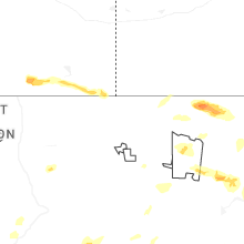
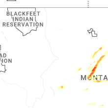


Connect with Interactive Hail Maps