

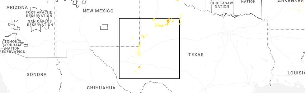
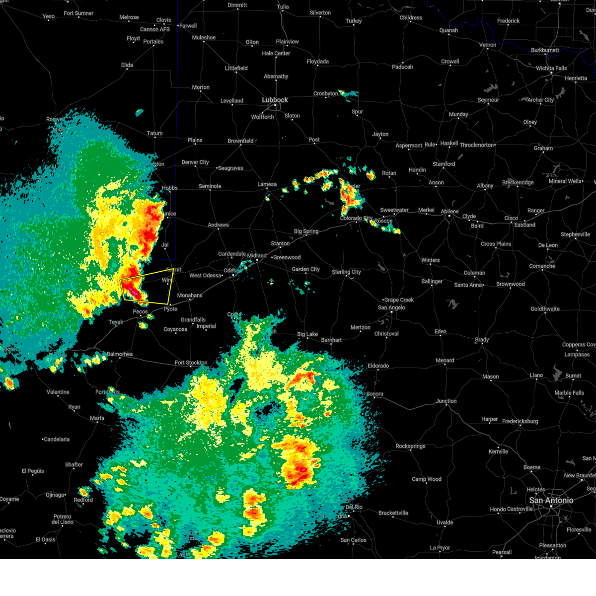
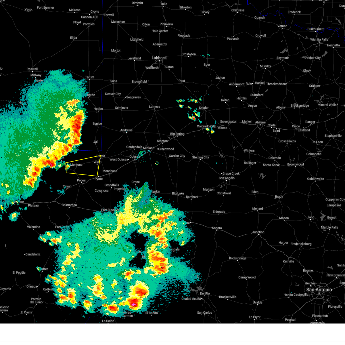
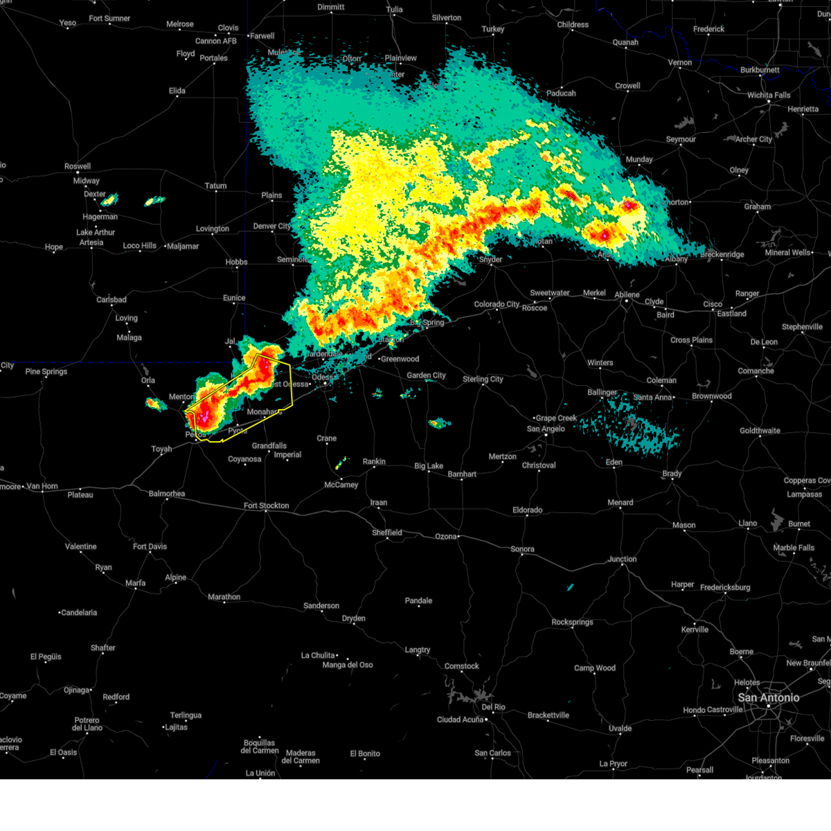
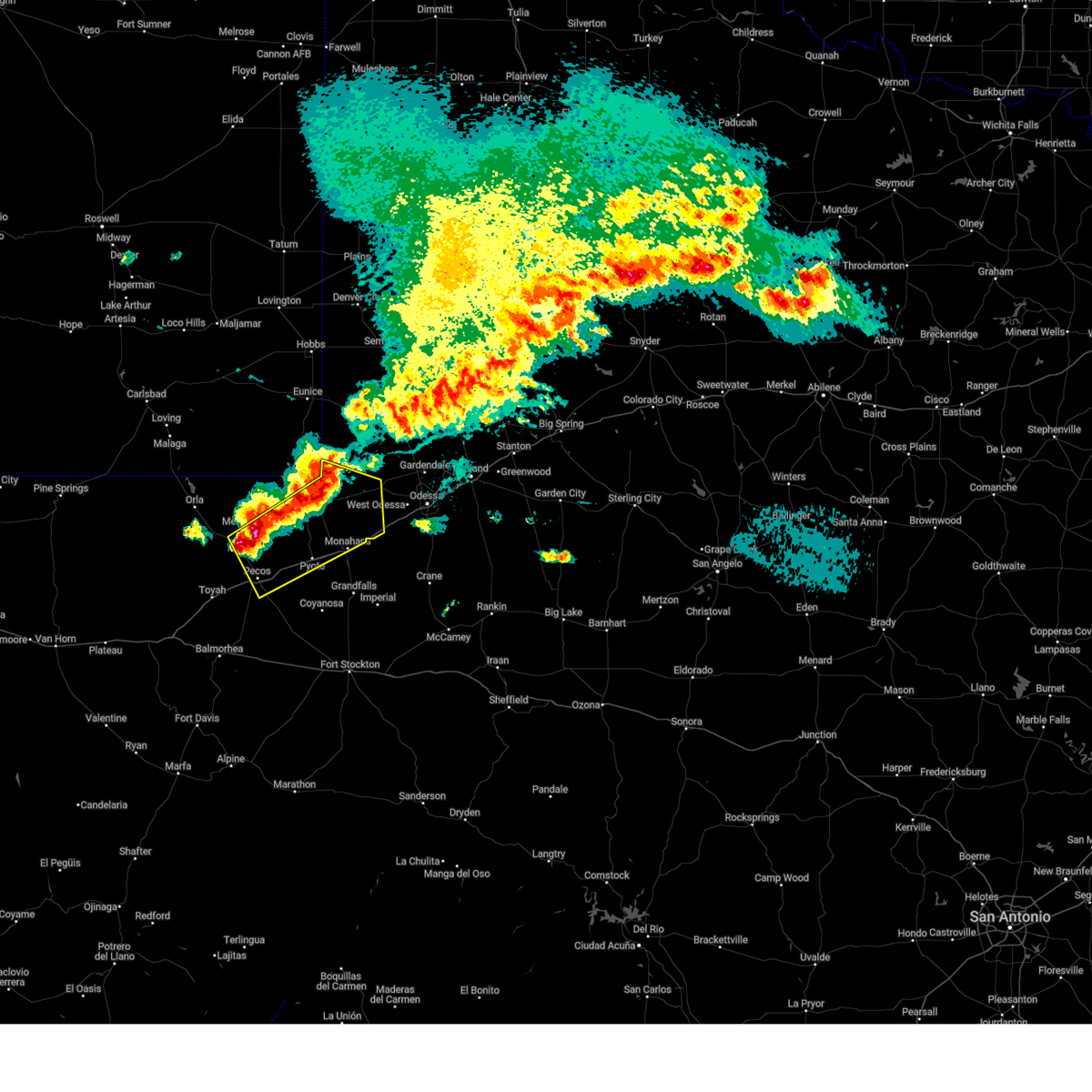
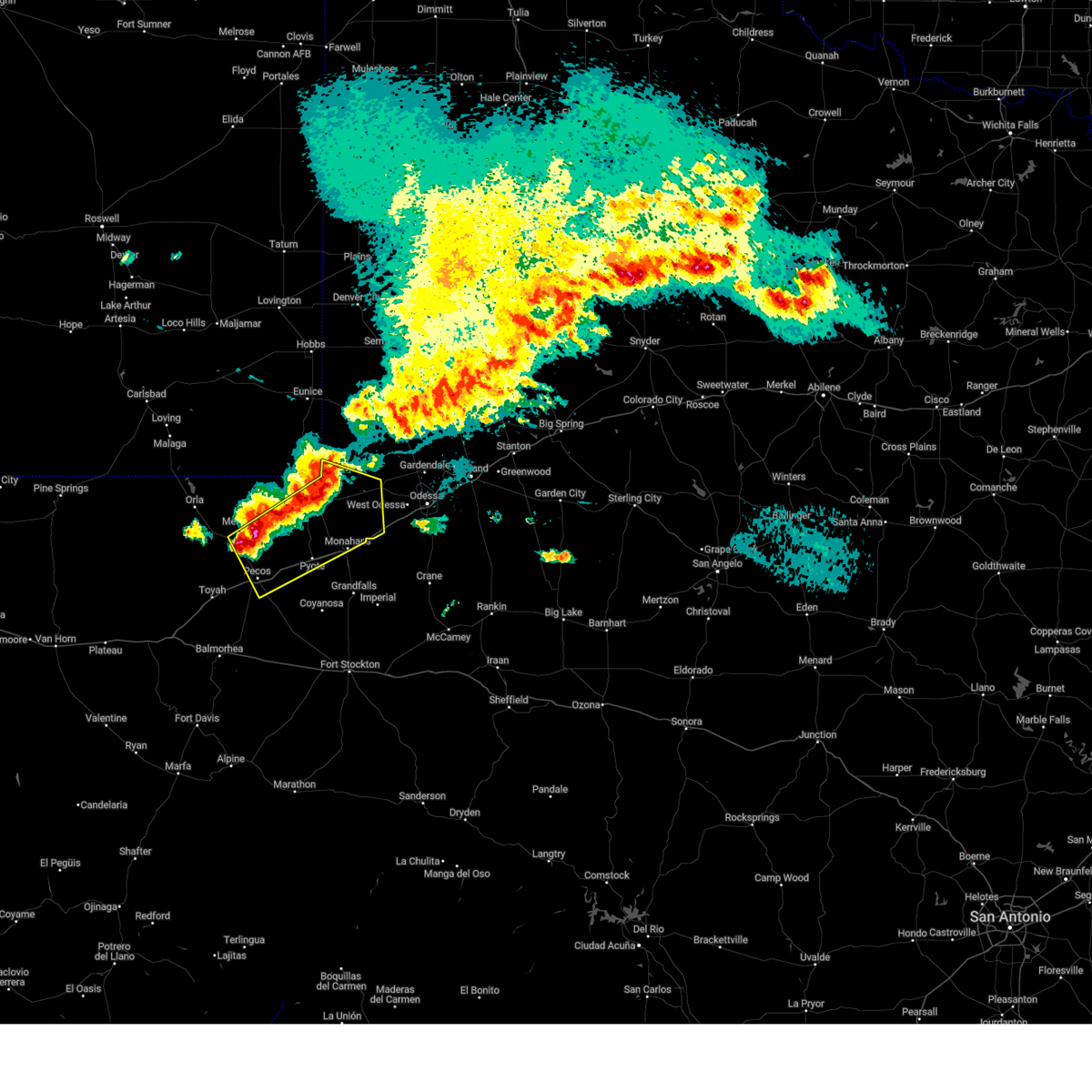
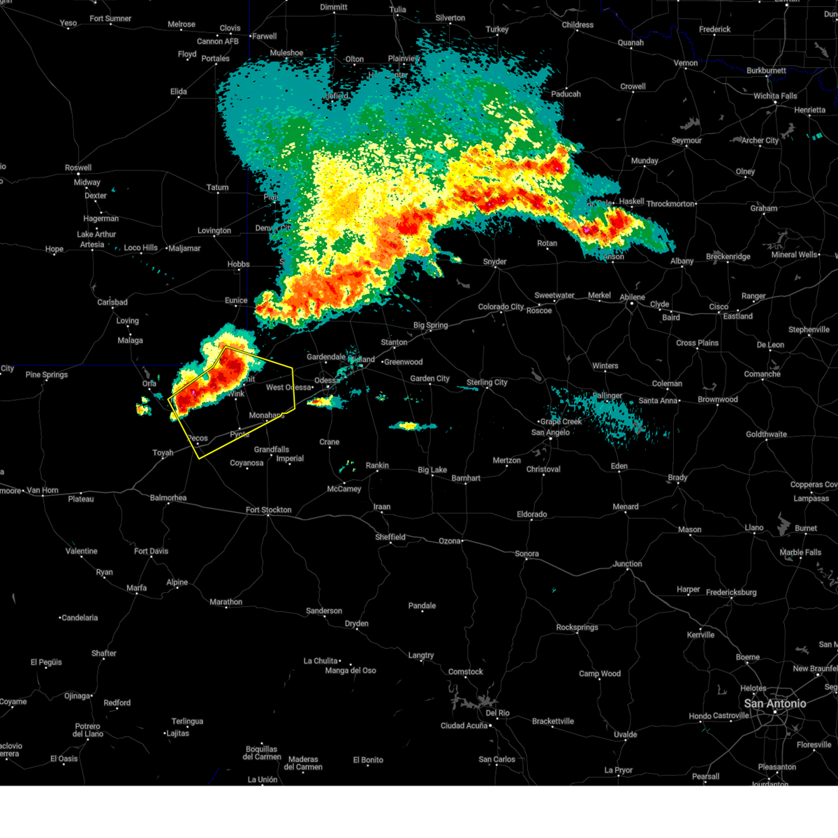
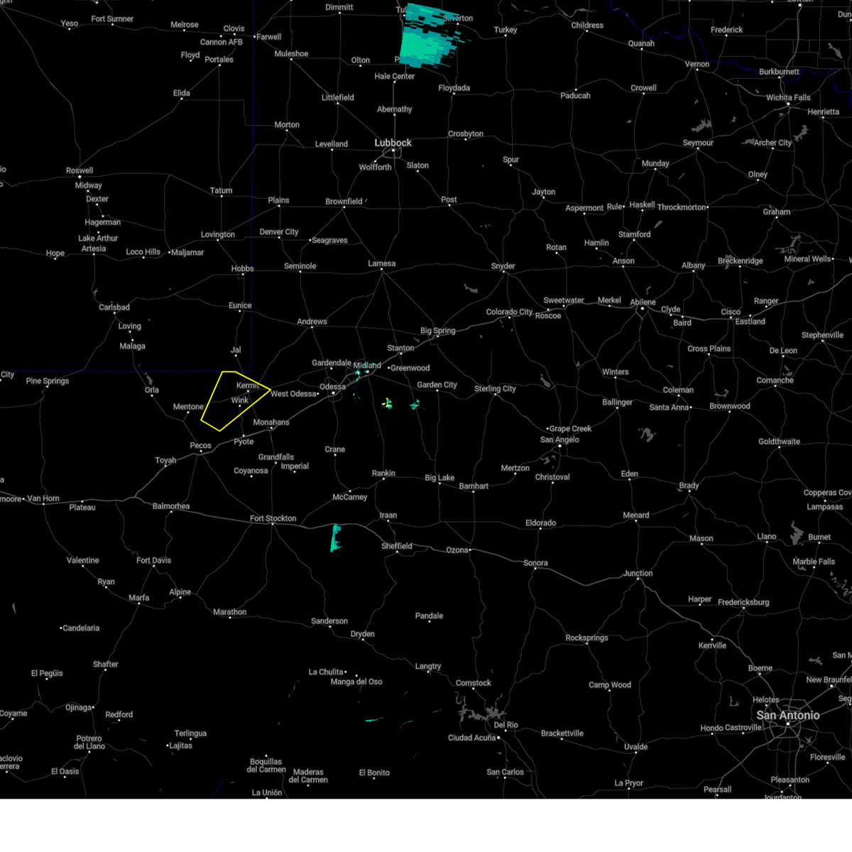
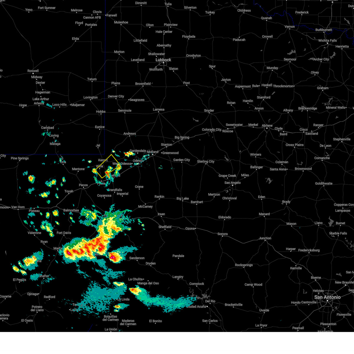
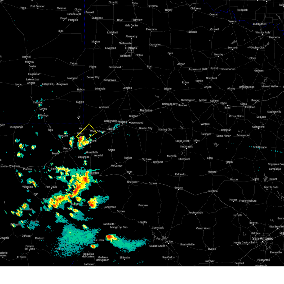
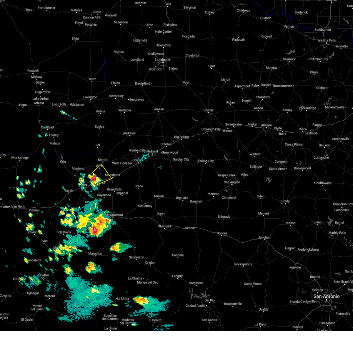
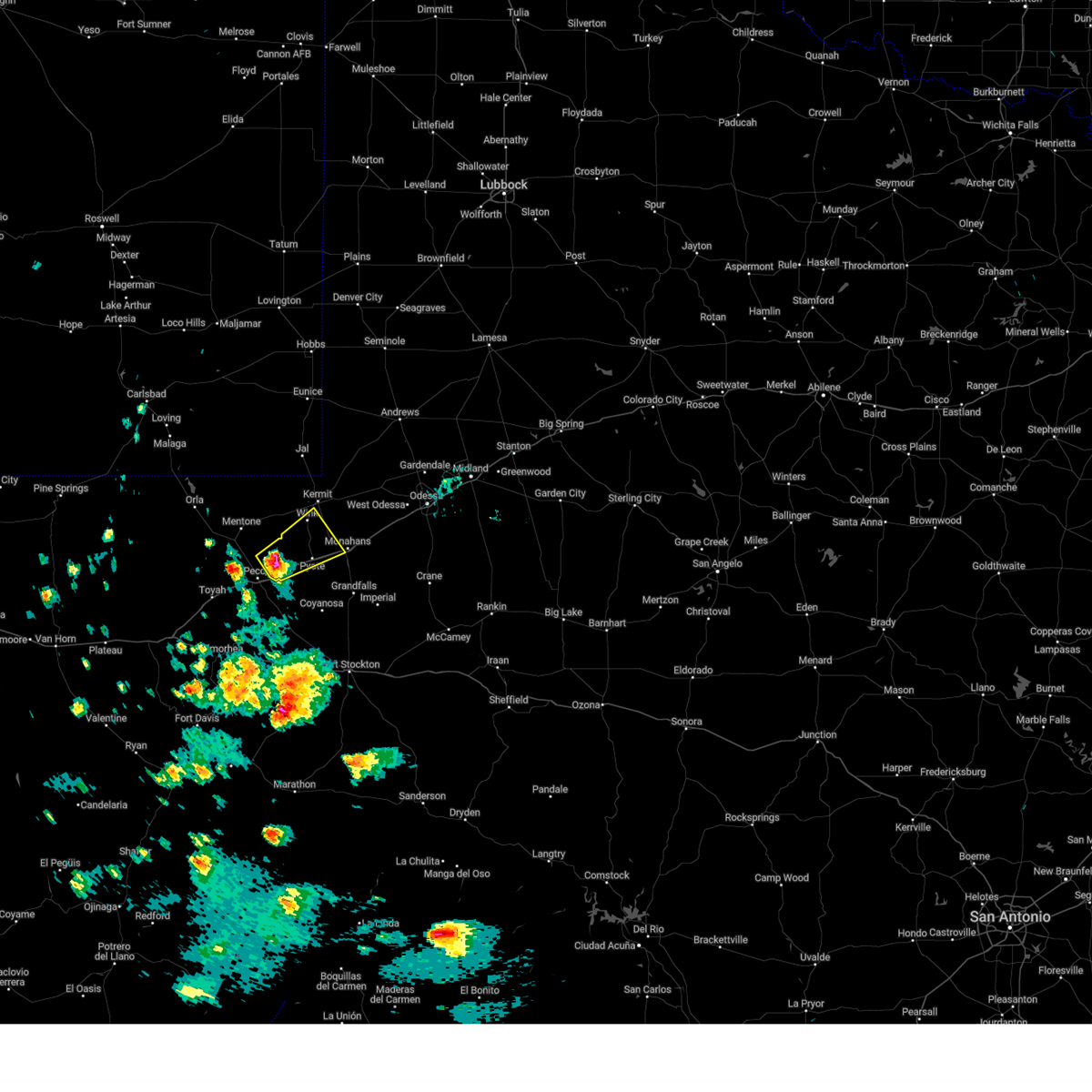
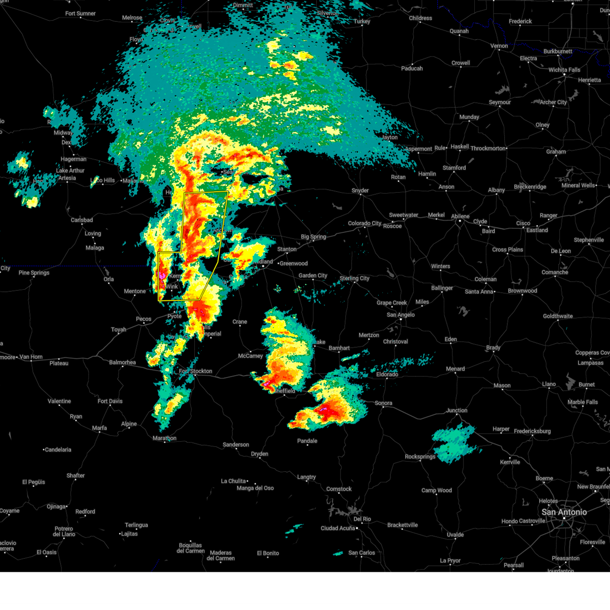
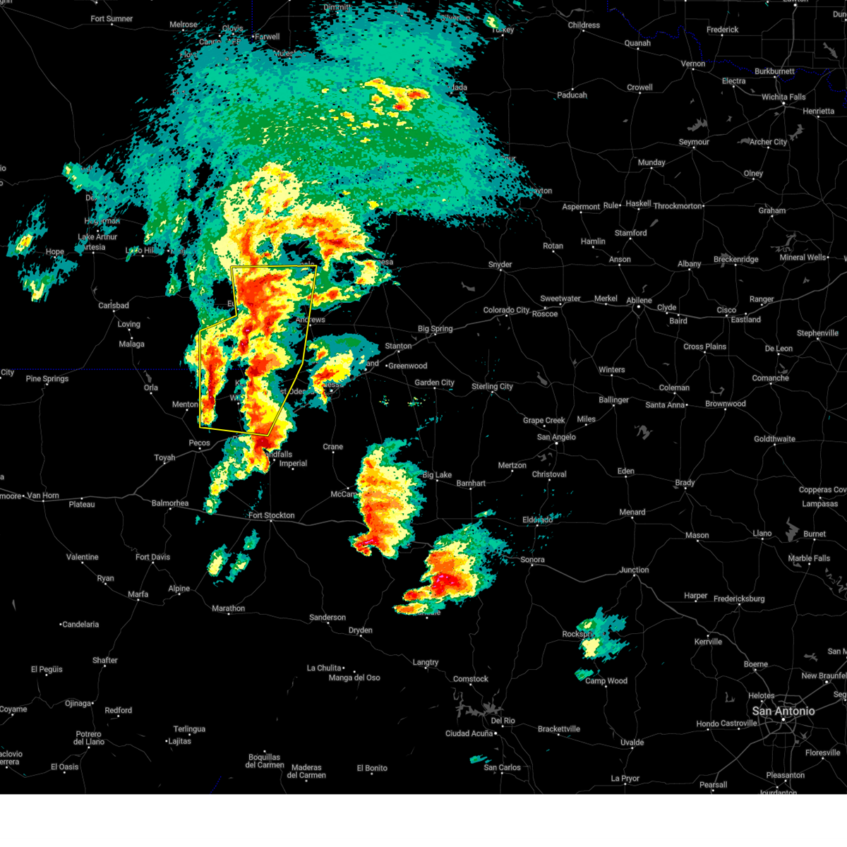
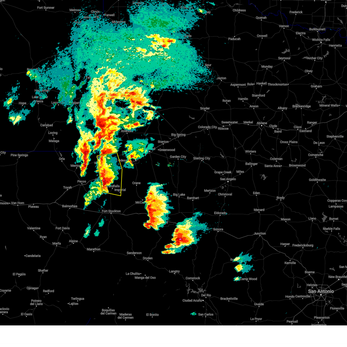
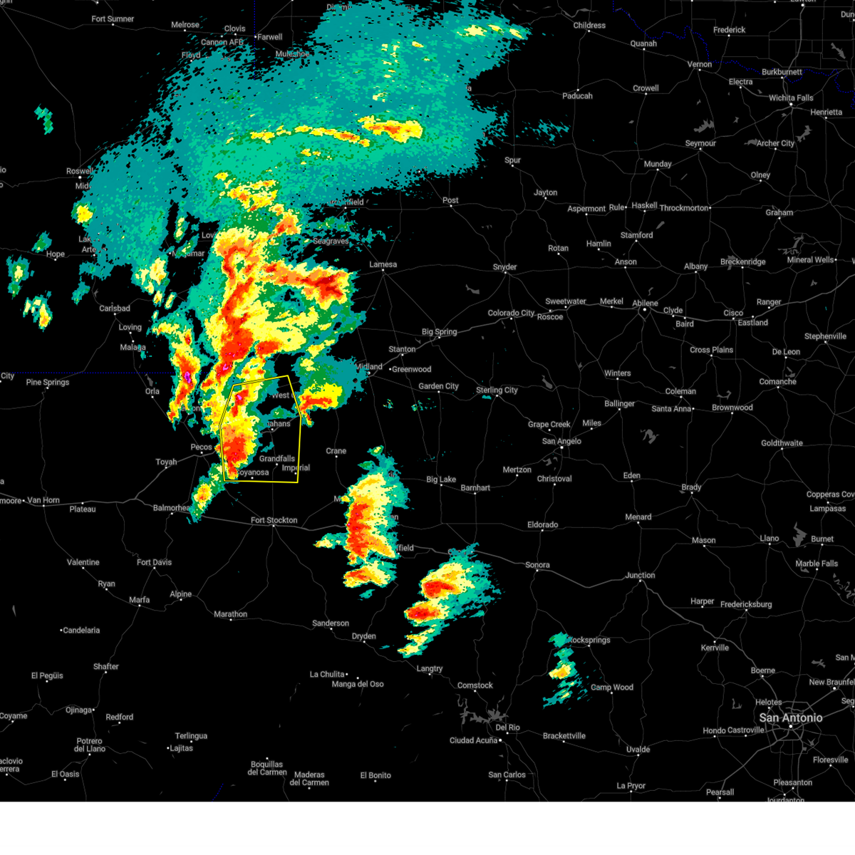
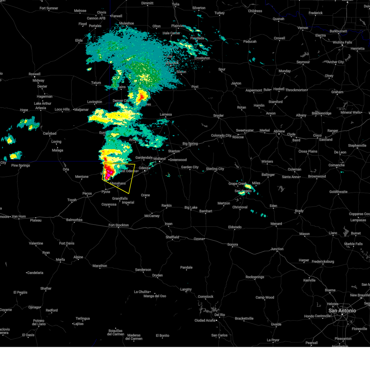
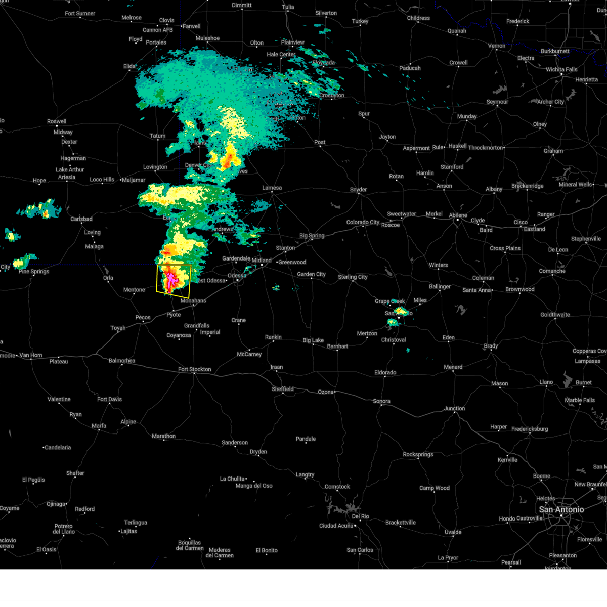
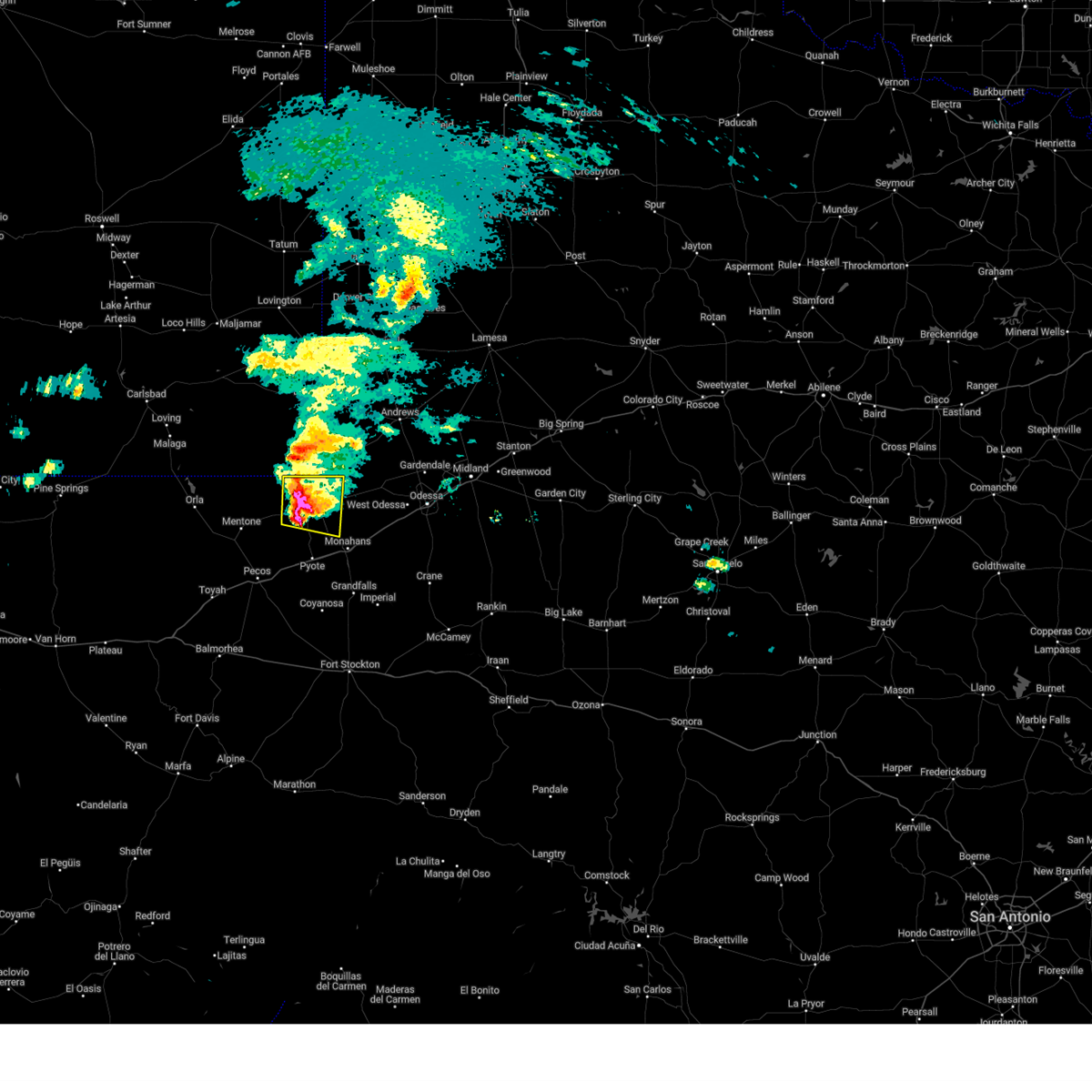
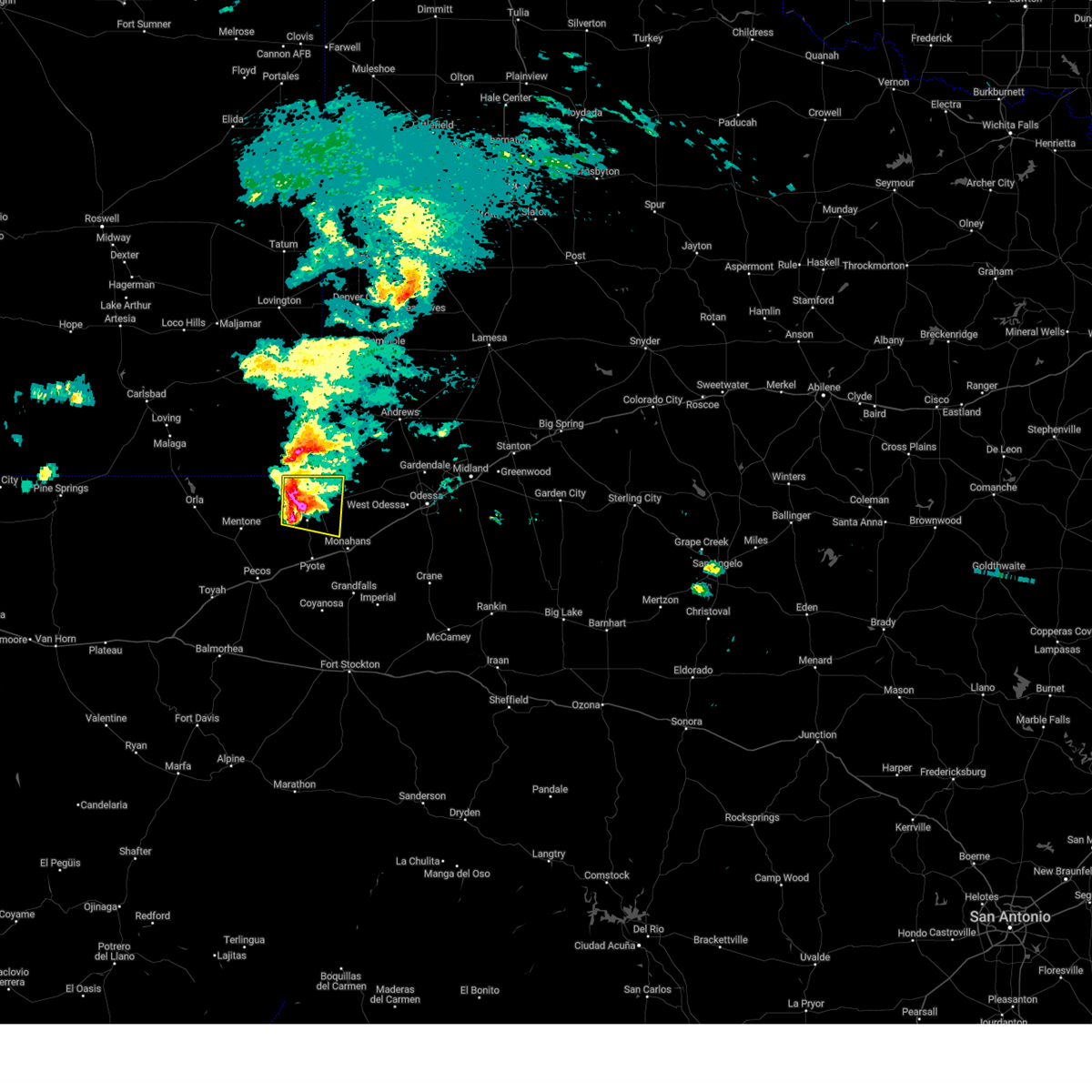
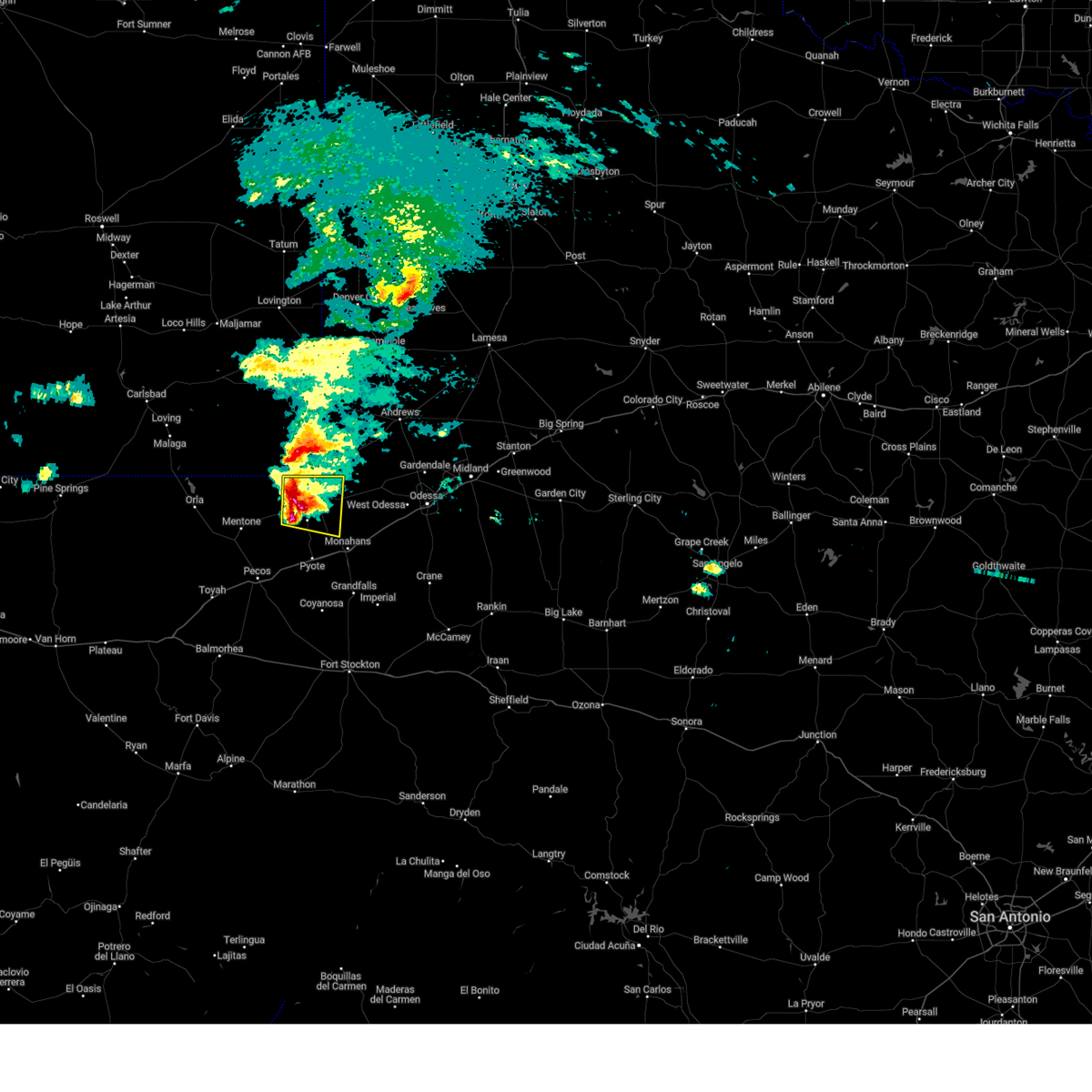
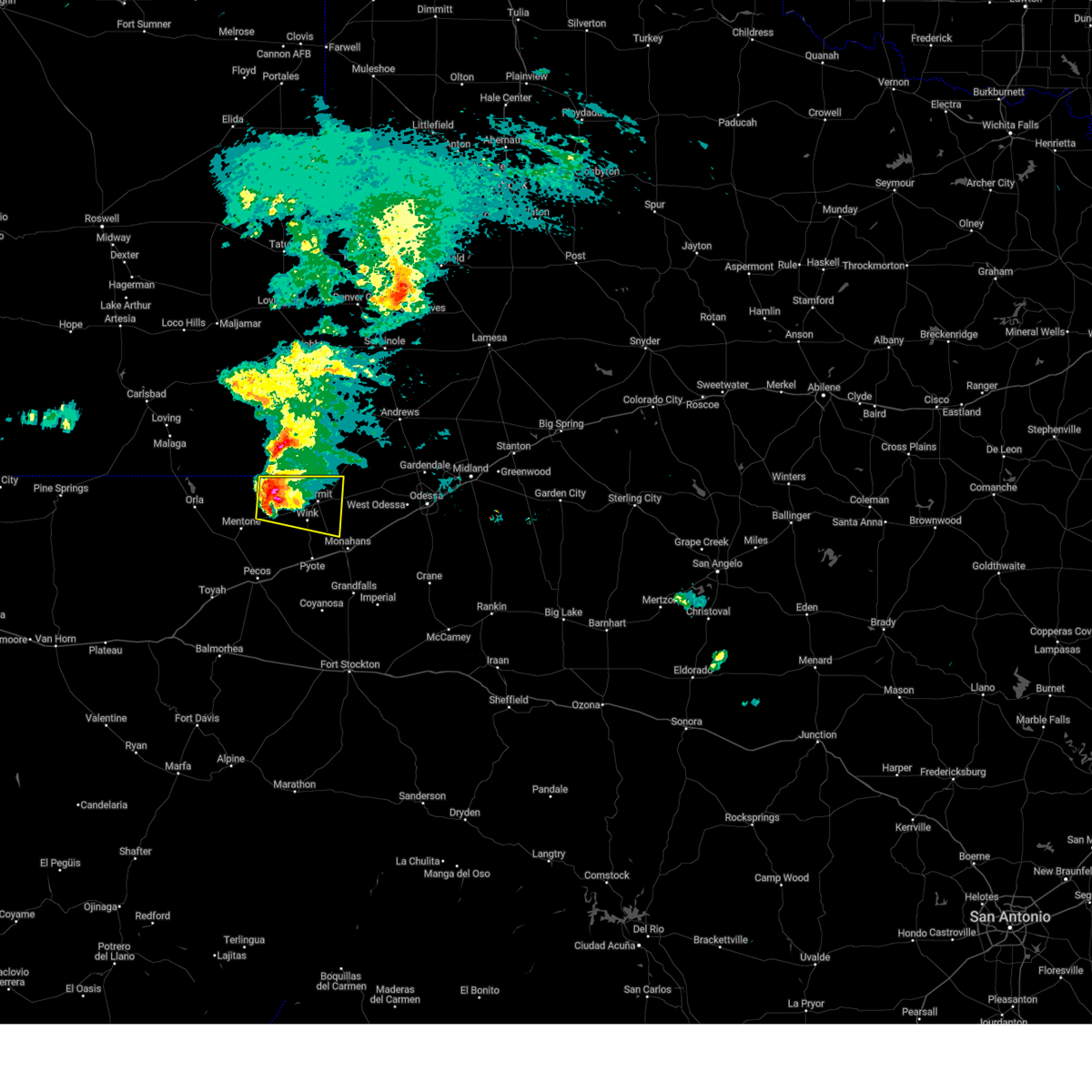
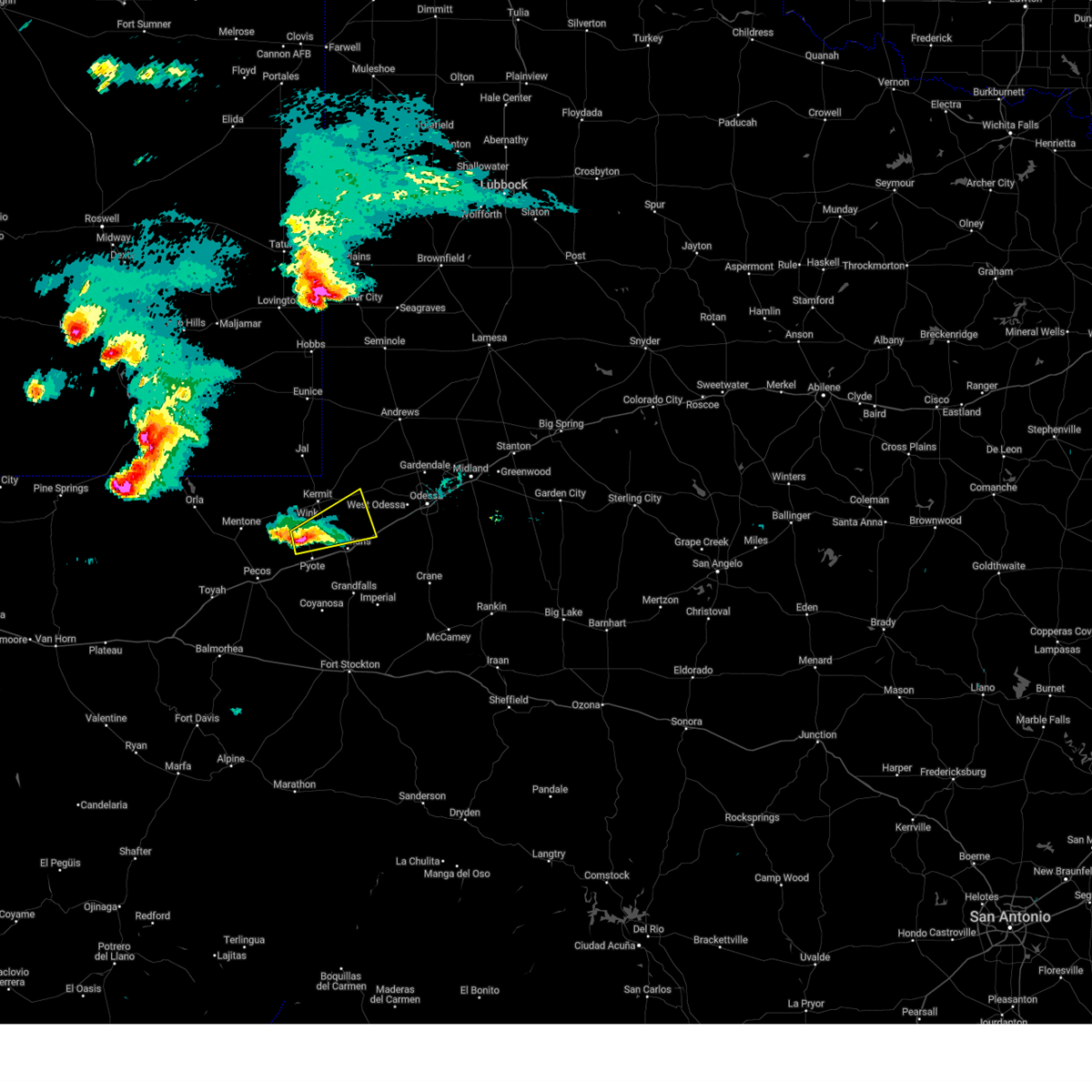
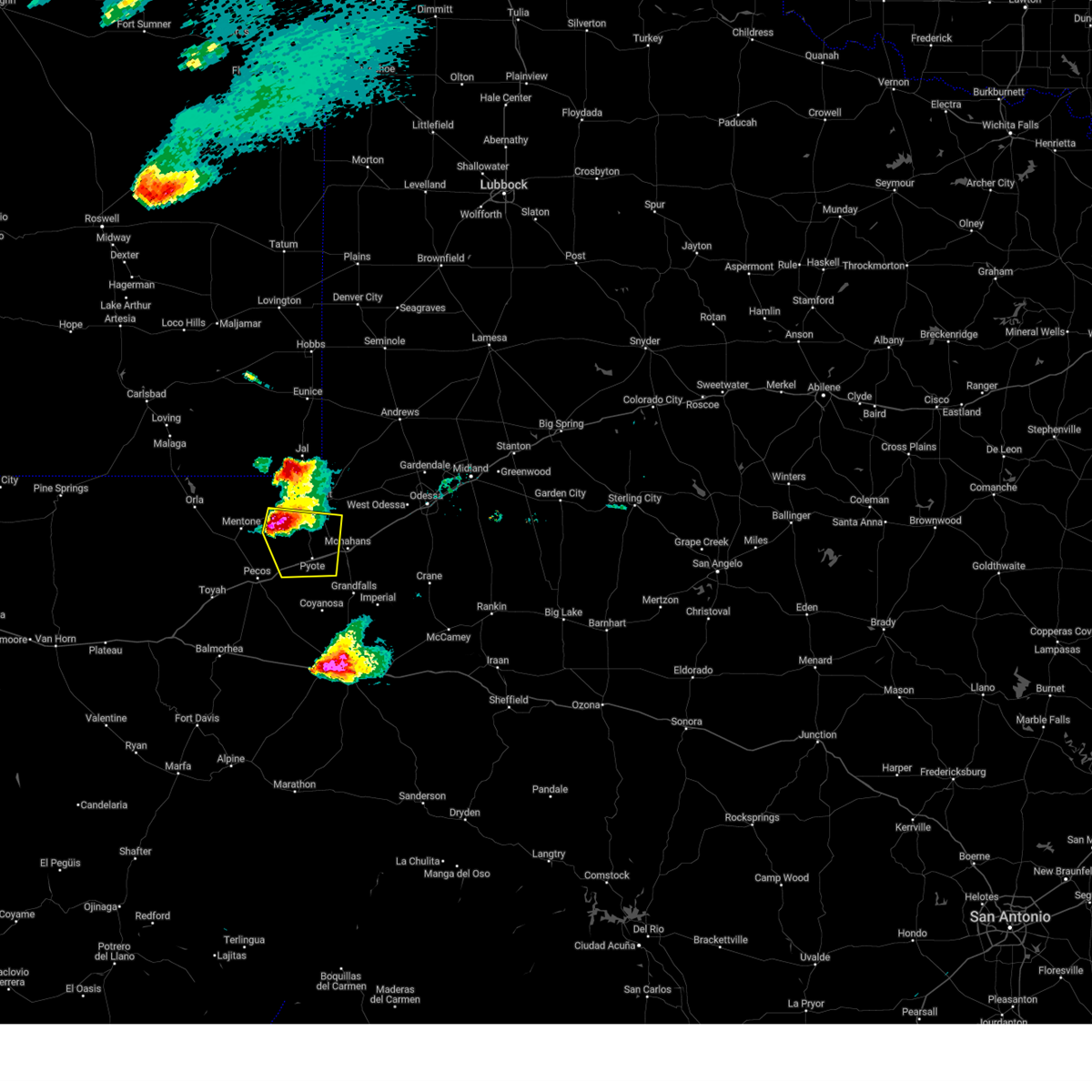
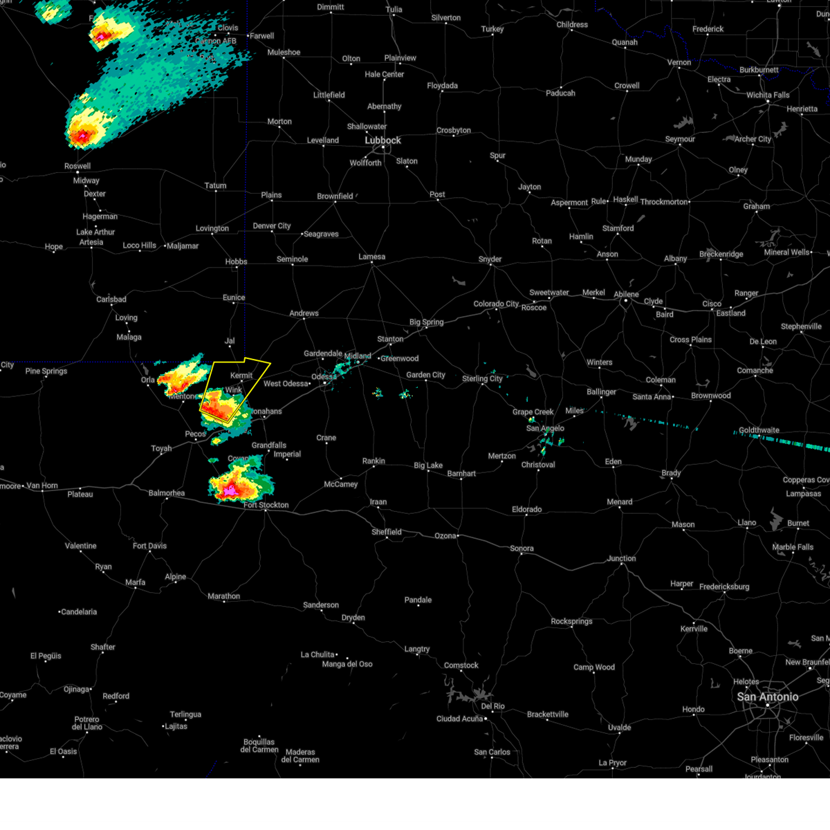
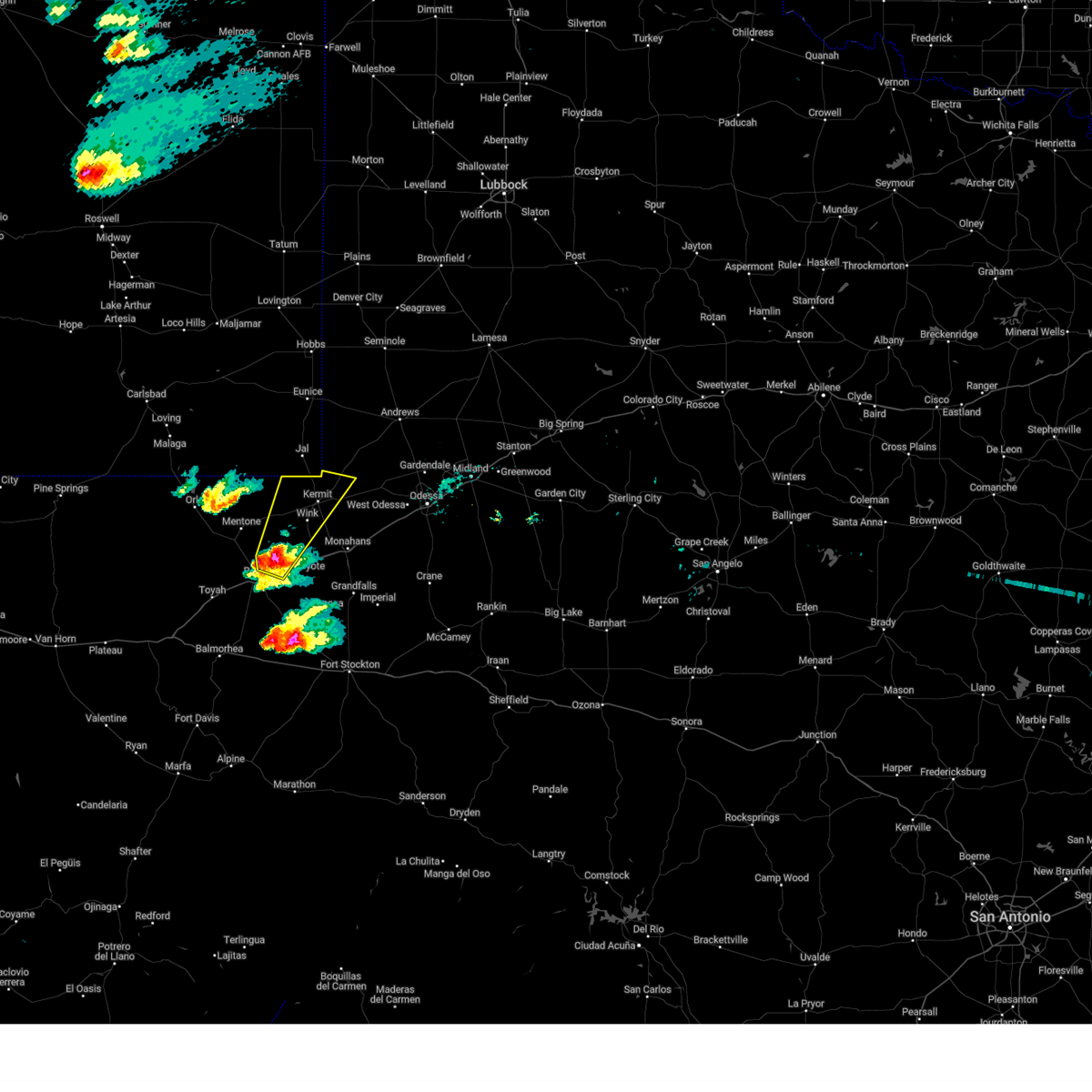
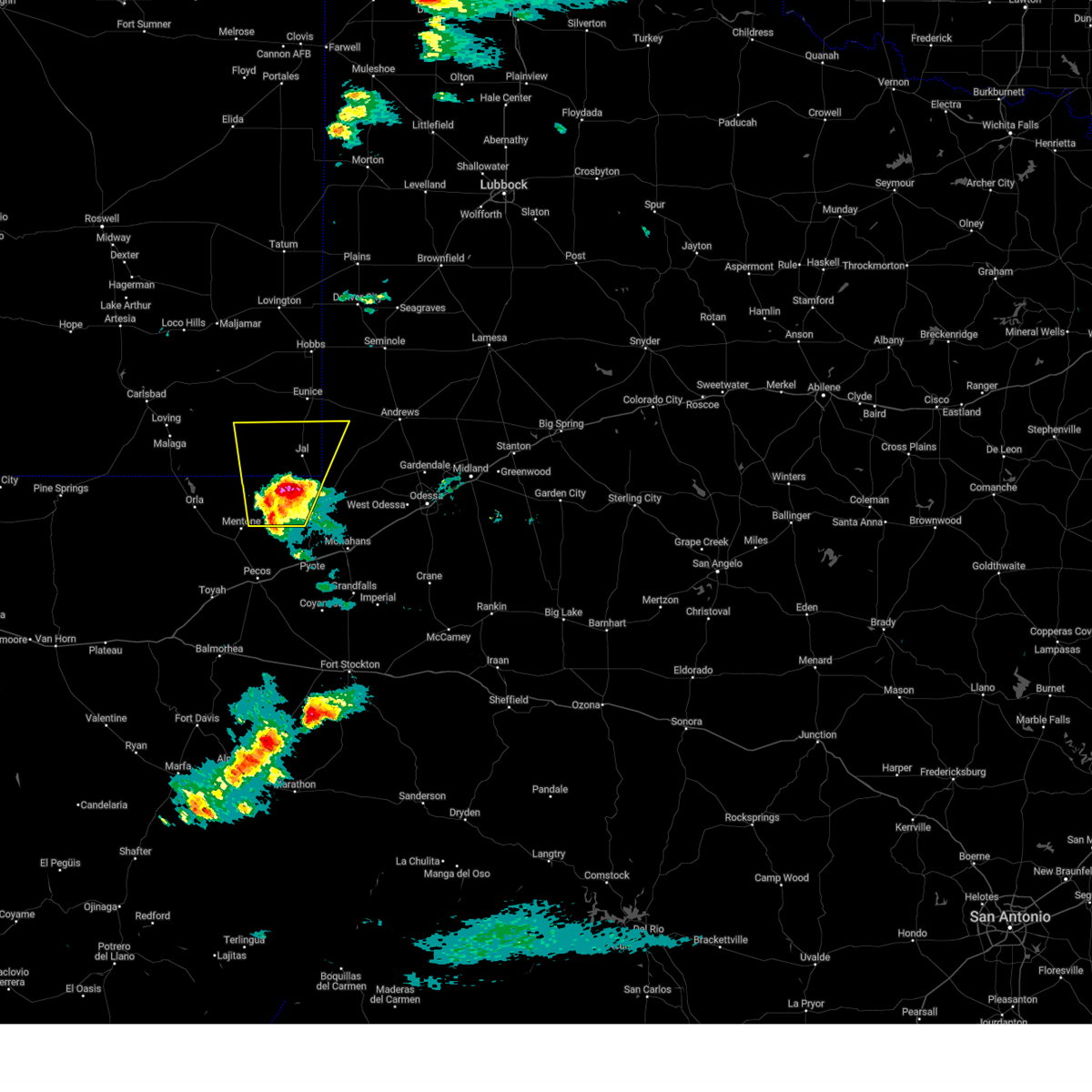
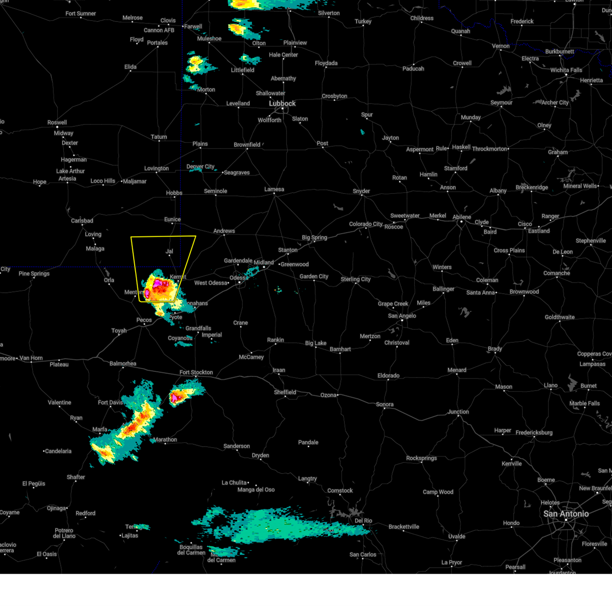
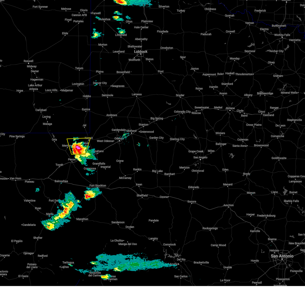
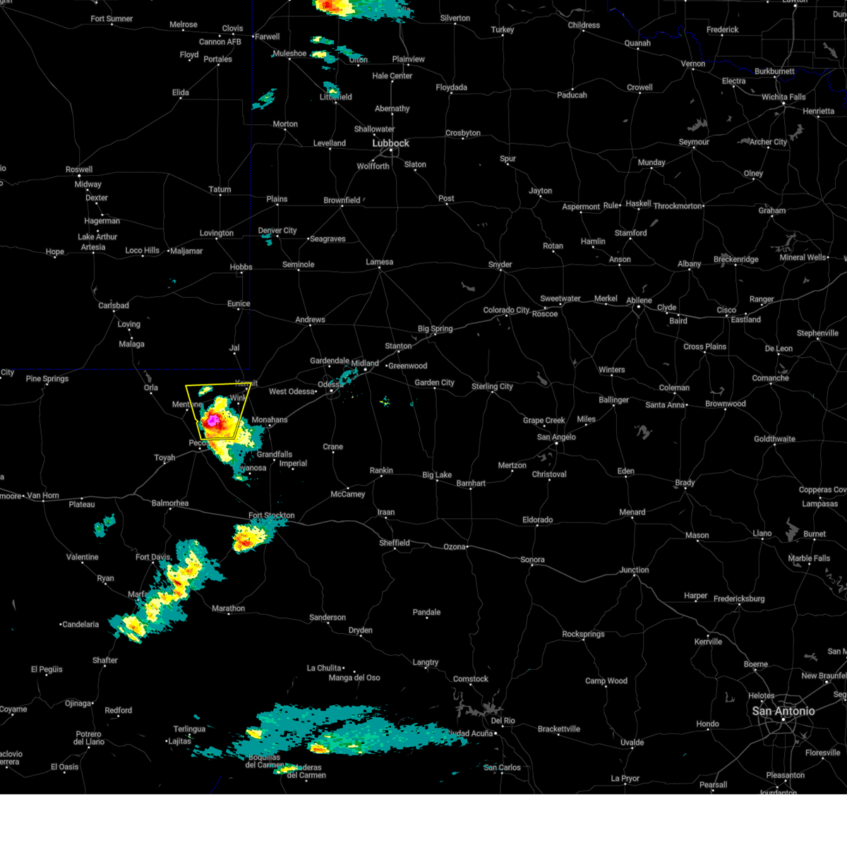
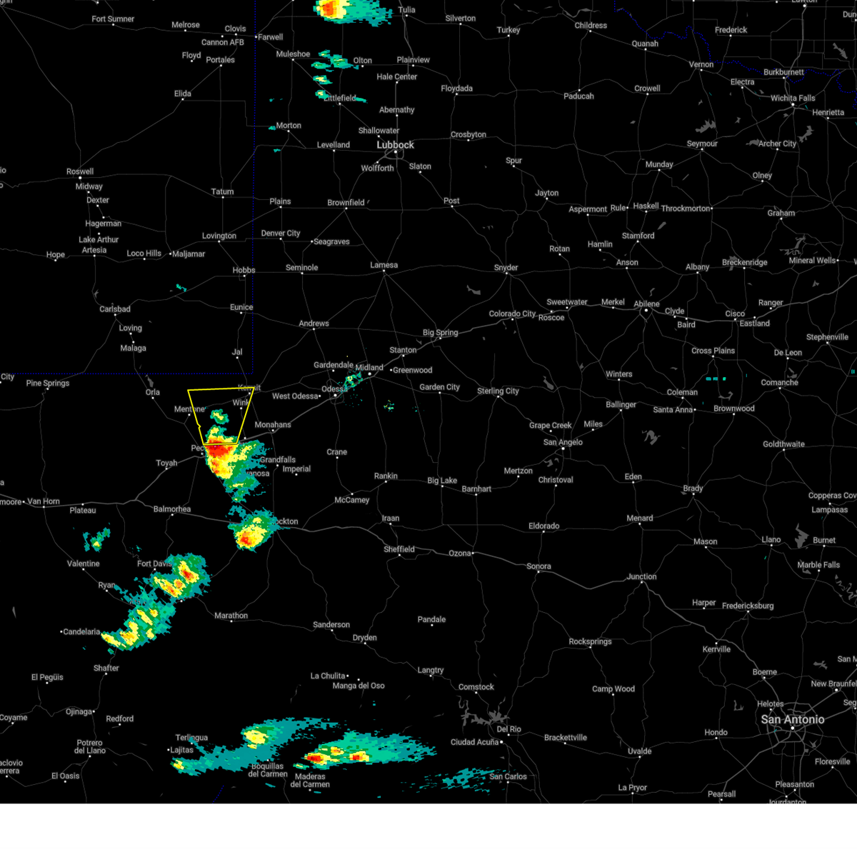
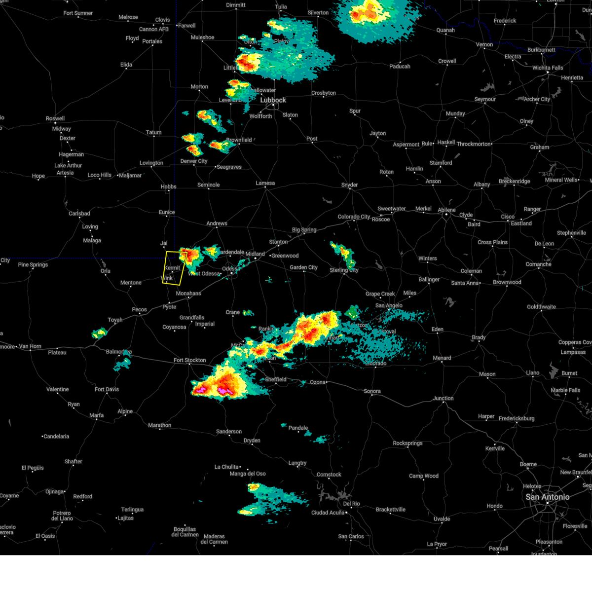
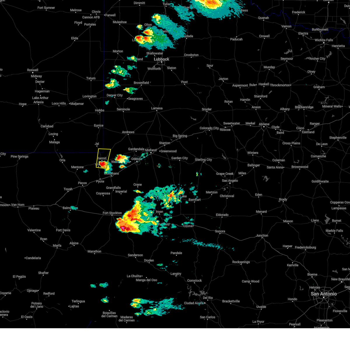
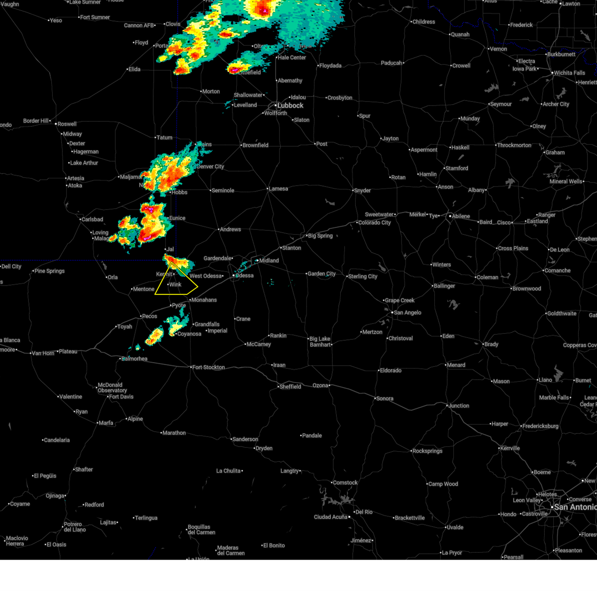
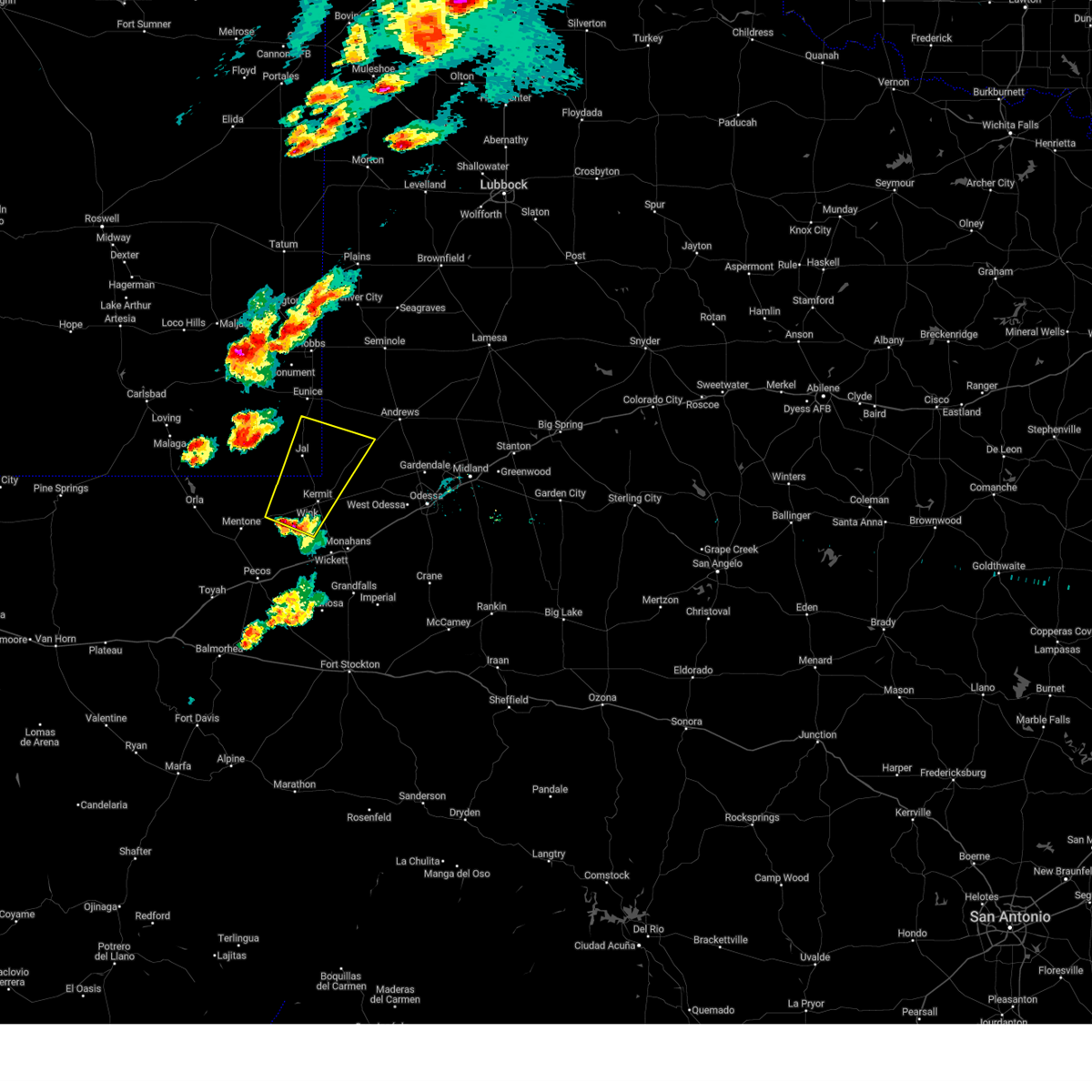
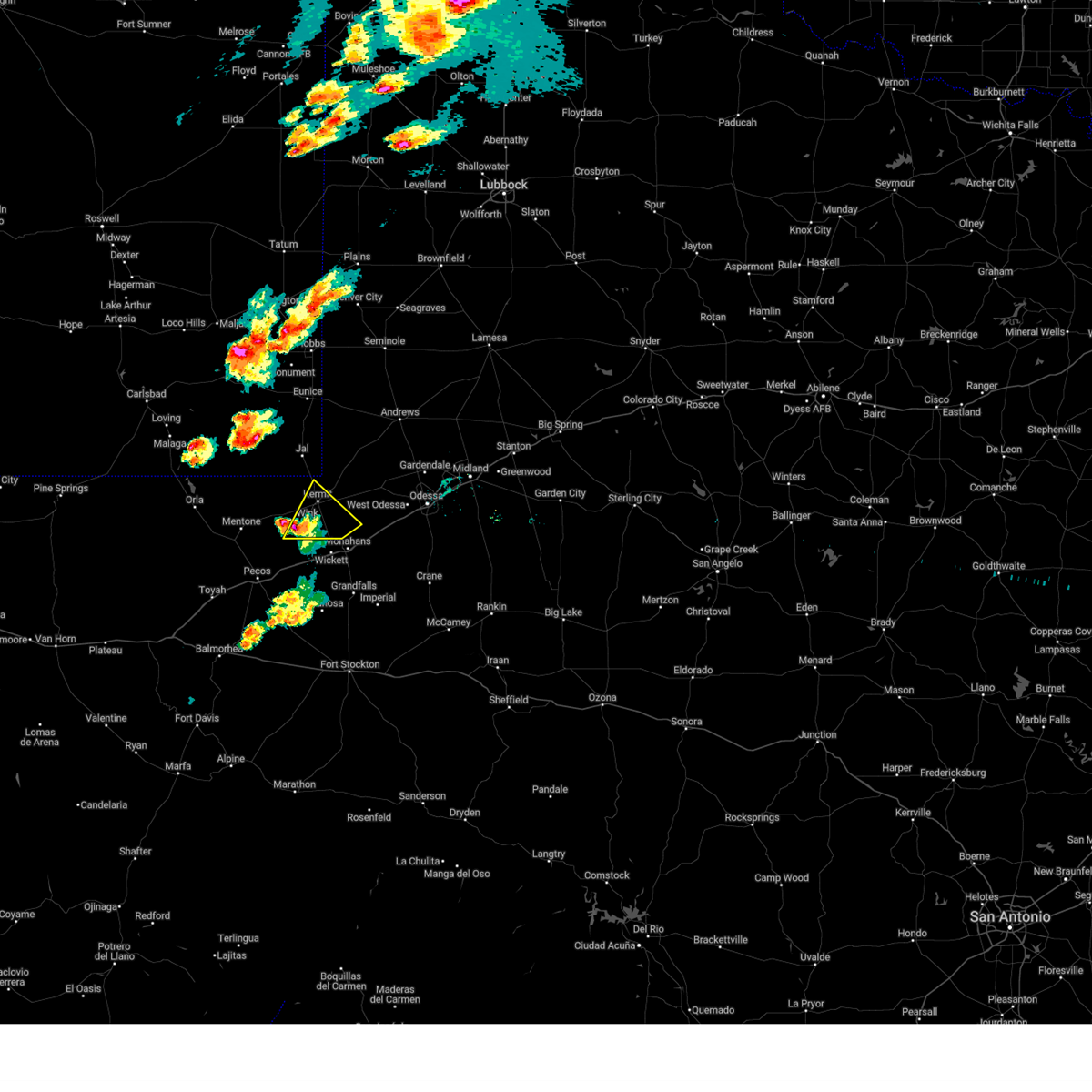
Hail Map for Wink, TX
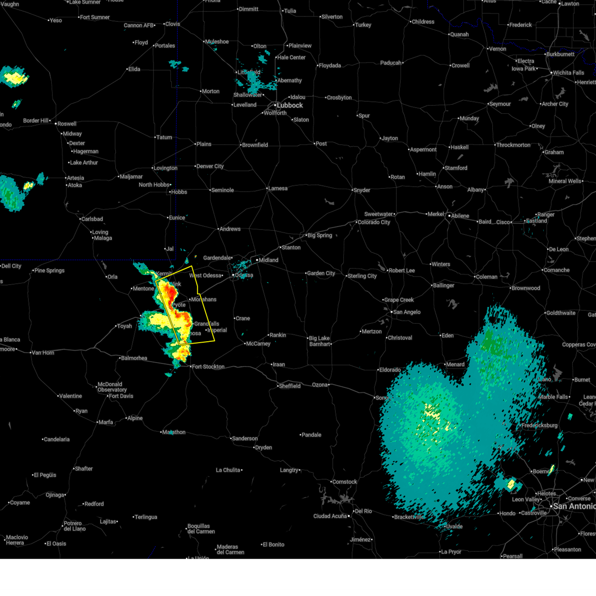
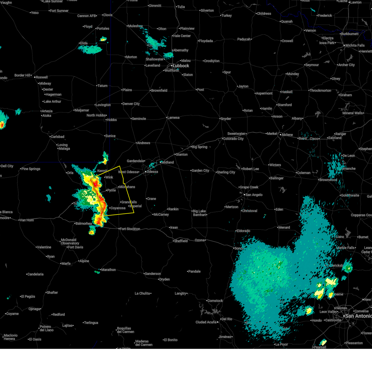
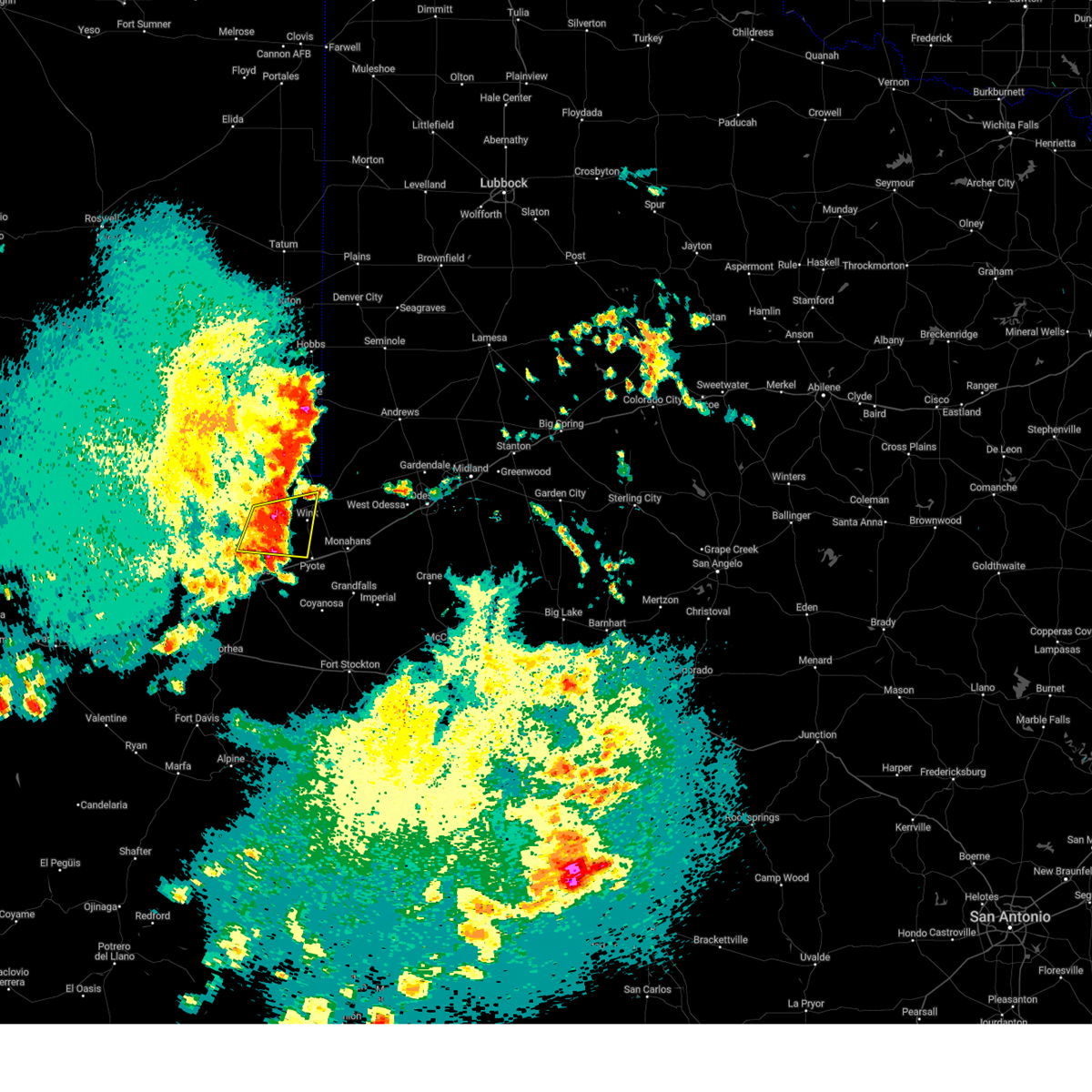
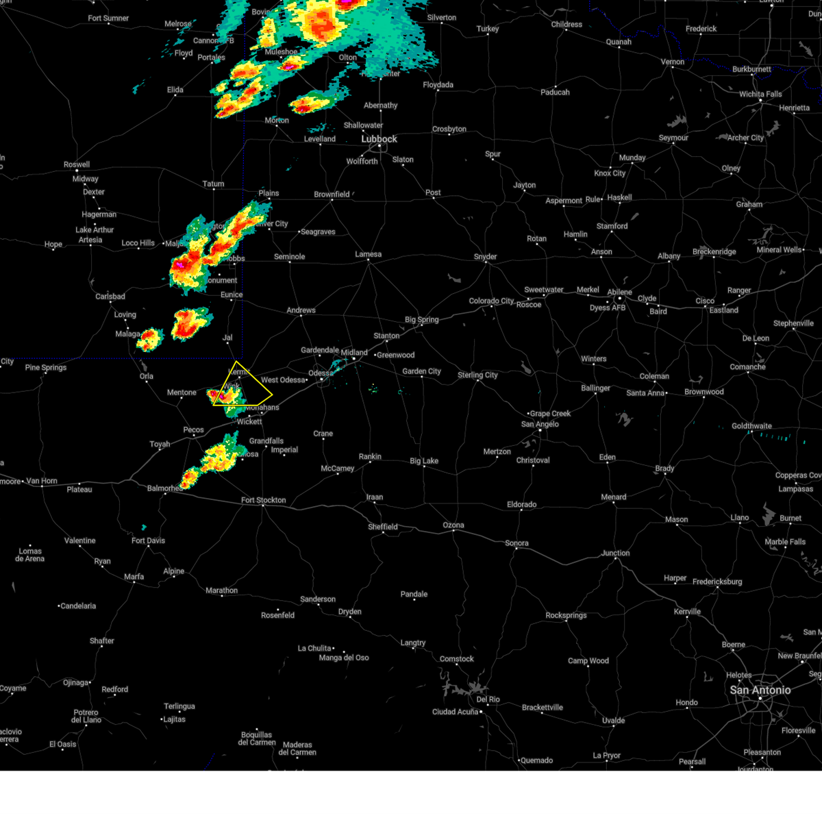
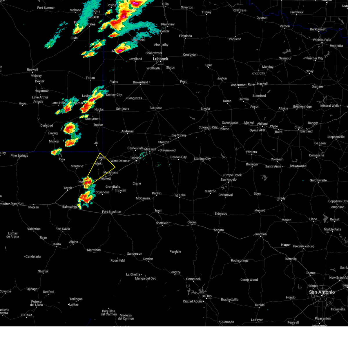
The Wink, TX area has had 8 reports of on-the-ground hail by trained spotters, and has been under severe weather warnings 9 times during the past 12 months. Doppler radar has detected hail at or near Wink, TX on 62 occasions, including 4 occasions during the past year.
| Name: | Wink, TX |
| Where Located: | 46.5 miles W of Odessa, TX |
| Map: | Google Map for Wink, TX |
| Population: | 940 |
| Housing Units: | 405 |
| More Info: | Search Google for Wink, TX |
1
The Top Recent Hail Date for Wink, TX is Sunday, May 31, 2026 (15th out of 62)
Hail and Wind Damage Spotted near Wink, TX
| Date / Time | Report Details |
|---|---|
| 5/26/2026 9:30 PM CDT |
 At 929 pm cdt, a severe thunderstorm was located near wink, moving east at 30 mph (radar indicated). Hazards include 60 mph wind gusts and nickel size hail. Expect damage to roofs, siding, and trees. locations impacted include, monahans, kermit, wink, thorntonville, grandfalls, pyote, wickett, coyanosa, imperial reservoir, roy hurd memorial airport, monahans sandhills state park, royalty, imperial, and winkler county airport. This includes interstate 20 between mile markers 62 and 89. At 929 pm cdt, a severe thunderstorm was located near wink, moving east at 30 mph (radar indicated). Hazards include 60 mph wind gusts and nickel size hail. Expect damage to roofs, siding, and trees. locations impacted include, monahans, kermit, wink, thorntonville, grandfalls, pyote, wickett, coyanosa, imperial reservoir, roy hurd memorial airport, monahans sandhills state park, royalty, imperial, and winkler county airport. This includes interstate 20 between mile markers 62 and 89.
|
| 5/26/2026 9:02 PM CDT |
 Svrmaf the national weather service in midland has issued a * severe thunderstorm warning for, north central pecos county in southwestern texas, east central reeves county in southwestern texas, ward county in western texas, southern winkler county in western texas, west central crane county in western texas, southeastern loving county in western texas, * until 1000 pm cdt. * at 902 pm cdt, a severe thunderstorm was located 10 miles southwest of wink, moving east at 30 mph (radar indicated). Hazards include 60 mph wind gusts and nickel size hail. expect damage to roofs, siding, and trees Svrmaf the national weather service in midland has issued a * severe thunderstorm warning for, north central pecos county in southwestern texas, east central reeves county in southwestern texas, ward county in western texas, southern winkler county in western texas, west central crane county in western texas, southeastern loving county in western texas, * until 1000 pm cdt. * at 902 pm cdt, a severe thunderstorm was located 10 miles southwest of wink, moving east at 30 mph (radar indicated). Hazards include 60 mph wind gusts and nickel size hail. expect damage to roofs, siding, and trees
|
| 10/23/2025 8:32 PM CDT | the severe thunderstorm warning has been cancelled and is no longer in effect |
| 10/23/2025 8:10 PM CDT | At 809 pm cdt, a severe thunderstorm was located 8 miles southeast of wink, moving east at 25 mph (radar indicated). Hazards include 60 mph wind gusts and quarter size hail. Hail damage to vehicles is expected. expect wind damage to roofs, siding, and trees. This severe thunderstorm will remain over mainly rural areas of northern ward and south central winkler counties. |
| 10/23/2025 7:50 PM CDT | Svrmaf the national weather service in midland has issued a * severe thunderstorm warning for, southwestern ector county in western texas, northeastern ward county in western texas, southern winkler county in western texas, * until 845 pm cdt. * at 749 pm cdt, a severe thunderstorm was located 7 miles northwest of pyote, or 8 miles south of wink, moving east at 20 mph. a 63 mph gust was recorded at a mesonet station northwest of pyote at 730 pm cdt (radar indicated). Hazards include two inch hail and 70 mph wind gusts. People and animals outdoors will be injured. expect hail damage to roofs, siding, windows, and vehicles. expect considerable tree damage. Wind damage is also likely to mobile homes, roofs, and outbuildings. |
| 10/23/2025 7:37 PM CDT | At 737 pm cdt, a severe thunderstorm was located 7 miles southwest of wink, moving east at 30 mph (radar indicated). Hazards include two inch hail and 60 mph wind gusts. People and animals outdoors will be injured. expect hail damage to roofs, siding, windows, and vehicles. expect wind damage to roofs, siding, and trees. Locations impacted include, kermit, wink, and winkler county airport. |
| 10/23/2025 7:37 PM CDT | the severe thunderstorm warning has been cancelled and is no longer in effect |
| 10/23/2025 7:27 PM CDT | Svrmaf the national weather service in midland has issued a * severe thunderstorm warning for, north central ward county in western texas, western winkler county in western texas, southeastern loving county in western texas, * until 830 pm cdt. * at 727 pm cdt, a severe thunderstorm was located 7 miles west of wink, moving northeast at 30 mph (radar indicated). Hazards include 60 mph wind gusts and quarter size hail. Hail damage to vehicles is expected. Expect wind damage to roofs, siding, and trees. |
| 10/23/2025 6:57 PM CDT | Svrmaf the national weather service in midland has issued a * severe thunderstorm warning for, northwestern ector county in western texas, eastern winkler county in western texas, * until 800 pm cdt. * at 657 pm cdt, a severe thunderstorm was located over kermit, moving northeast at 20 mph (radar indicated). Hazards include 60 mph wind gusts and quarter size hail. Hail damage to vehicles is expected. Expect wind damage to roofs, siding, and trees. |
| 6/10/2025 6:49 PM CDT |
 At 649 pm cdt, a severe thunderstorm was located 10 miles east of mentone, moving east at 25 mph (radar indicated). Hazards include 60 mph wind gusts and quarter size hail. Hail damage to vehicles is expected. expect wind damage to roofs, siding, and trees. Locations impacted include, kermit, wink, and winkler county airport. At 649 pm cdt, a severe thunderstorm was located 10 miles east of mentone, moving east at 25 mph (radar indicated). Hazards include 60 mph wind gusts and quarter size hail. Hail damage to vehicles is expected. expect wind damage to roofs, siding, and trees. Locations impacted include, kermit, wink, and winkler county airport.
|
| 6/10/2025 6:37 PM CDT |
 At 636 pm cdt, a severe thunderstorm was located near mentone, moving east at 25 mph (radar indicated). Hazards include ping pong ball size hail and 60 mph wind gusts. People and animals outdoors will be injured. expect hail damage to roofs, siding, windows, and vehicles. expect wind damage to roofs, siding, and trees. Locations impacted include, kermit, wink, mentone, and winkler county airport. At 636 pm cdt, a severe thunderstorm was located near mentone, moving east at 25 mph (radar indicated). Hazards include ping pong ball size hail and 60 mph wind gusts. People and animals outdoors will be injured. expect hail damage to roofs, siding, windows, and vehicles. expect wind damage to roofs, siding, and trees. Locations impacted include, kermit, wink, mentone, and winkler county airport.
|
| 6/10/2025 6:04 PM CDT |
 Svrmaf the national weather service in midland has issued a * severe thunderstorm warning for, north central reeves county in southwestern texas, northwestern ward county in western texas, southwestern winkler county in western texas, southeastern loving county in western texas, * until 700 pm cdt. * at 604 pm cdt, a severe thunderstorm was located 7 miles west of mentone, moving east at 25 mph (radar indicated). Hazards include ping pong ball size hail and 60 mph wind gusts. People and animals outdoors will be injured. expect hail damage to roofs, siding, windows, and vehicles. Expect wind damage to roofs, siding, and trees. Svrmaf the national weather service in midland has issued a * severe thunderstorm warning for, north central reeves county in southwestern texas, northwestern ward county in western texas, southwestern winkler county in western texas, southeastern loving county in western texas, * until 700 pm cdt. * at 604 pm cdt, a severe thunderstorm was located 7 miles west of mentone, moving east at 25 mph (radar indicated). Hazards include ping pong ball size hail and 60 mph wind gusts. People and animals outdoors will be injured. expect hail damage to roofs, siding, windows, and vehicles. Expect wind damage to roofs, siding, and trees.
|
| 6/10/2025 2:29 AM CDT |
 At 229 am cdt, severe thunderstorms were located along a line extending from 6 miles west of goldsmith to 17 miles east of kermit to near barstow, moving east at 45 mph (radar indicated). Hazards include 60 mph wind gusts and quarter size hail. Hail damage to vehicles is expected. expect wind damage to roofs, siding, and trees. locations impacted include, monahans, kermit, wink, thorntonville, barstow, pyote, wickett, notrees, roy hurd memorial airport, winkler county airport, and monahans sandhills state park. This includes interstate 20 between mile markers 48 and 80, between mile markers 83 and 88, and between mile markers 91 and 97. At 229 am cdt, severe thunderstorms were located along a line extending from 6 miles west of goldsmith to 17 miles east of kermit to near barstow, moving east at 45 mph (radar indicated). Hazards include 60 mph wind gusts and quarter size hail. Hail damage to vehicles is expected. expect wind damage to roofs, siding, and trees. locations impacted include, monahans, kermit, wink, thorntonville, barstow, pyote, wickett, notrees, roy hurd memorial airport, winkler county airport, and monahans sandhills state park. This includes interstate 20 between mile markers 48 and 80, between mile markers 83 and 88, and between mile markers 91 and 97.
|
| 6/10/2025 2:29 AM CDT |
 the severe thunderstorm warning has been cancelled and is no longer in effect the severe thunderstorm warning has been cancelled and is no longer in effect
|
| 6/10/2025 2:10 AM CDT |
 the severe thunderstorm warning has been cancelled and is no longer in effect the severe thunderstorm warning has been cancelled and is no longer in effect
|
| 6/10/2025 2:10 AM CDT |
 At 209 am cdt, severe thunderstorms were located along a line extending from 12 miles southeast of jal airport to near kermit to near mentone, moving southeast at 25 mph (radar indicated). Hazards include 60 mph wind gusts and quarter size hail. Hail damage to vehicles is expected. expect wind damage to roofs, siding, and trees. locations impacted include, pecos, monahans, kermit, wink, mentone, thorntonville, barstow, pyote, wickett, pecos municipal airport, roy hurd memorial airport, monahans sandhills state park, notrees, and winkler county airport. This includes interstate 20 between mile markers 39 and 80, between mile markers 83 and 88, and between mile markers 91 and 97. At 209 am cdt, severe thunderstorms were located along a line extending from 12 miles southeast of jal airport to near kermit to near mentone, moving southeast at 25 mph (radar indicated). Hazards include 60 mph wind gusts and quarter size hail. Hail damage to vehicles is expected. expect wind damage to roofs, siding, and trees. locations impacted include, pecos, monahans, kermit, wink, mentone, thorntonville, barstow, pyote, wickett, pecos municipal airport, roy hurd memorial airport, monahans sandhills state park, notrees, and winkler county airport. This includes interstate 20 between mile markers 39 and 80, between mile markers 83 and 88, and between mile markers 91 and 97.
|
| 6/10/2025 1:55 AM CDT |
 Svrmaf the national weather service in midland has issued a * severe thunderstorm warning for, southeastern lea county in southeastern new mexico, southwestern ector county in western texas, central reeves county in southwestern texas, northern ward county in western texas, winkler county in western texas, eastern loving county in western texas, * until 300 am cdt/200 am mdt/. * at 155 am cdt/1255 am mdt/, severe thunderstorms were located along a line extending from near jal airport to near kermit to mentone, moving southeast at 25 mph (radar indicated). Hazards include 60 mph wind gusts and quarter size hail. Hail damage to vehicles is expected. Expect wind damage to roofs, siding, and trees. Svrmaf the national weather service in midland has issued a * severe thunderstorm warning for, southeastern lea county in southeastern new mexico, southwestern ector county in western texas, central reeves county in southwestern texas, northern ward county in western texas, winkler county in western texas, eastern loving county in western texas, * until 300 am cdt/200 am mdt/. * at 155 am cdt/1255 am mdt/, severe thunderstorms were located along a line extending from near jal airport to near kermit to mentone, moving southeast at 25 mph (radar indicated). Hazards include 60 mph wind gusts and quarter size hail. Hail damage to vehicles is expected. Expect wind damage to roofs, siding, and trees.
|
| 6/6/2025 8:16 PM CDT |
 Svrmaf the national weather service in midland has issued a * severe thunderstorm warning for, central winkler county in western texas, northeastern loving county in western texas, * until 915 pm cdt. * at 816 pm cdt, a severe thunderstorm was located 11 miles west of kermit, moving east at 20 mph (radar indicated). Hazards include tennis ball size hail and 70 mph wind gusts. People and animals outdoors will be injured. expect hail damage to roofs, siding, windows, and vehicles. expect considerable tree damage. Wind damage is also likely to mobile homes, roofs, and outbuildings. Svrmaf the national weather service in midland has issued a * severe thunderstorm warning for, central winkler county in western texas, northeastern loving county in western texas, * until 915 pm cdt. * at 816 pm cdt, a severe thunderstorm was located 11 miles west of kermit, moving east at 20 mph (radar indicated). Hazards include tennis ball size hail and 70 mph wind gusts. People and animals outdoors will be injured. expect hail damage to roofs, siding, windows, and vehicles. expect considerable tree damage. Wind damage is also likely to mobile homes, roofs, and outbuildings.
|
| 6/5/2025 5:35 PM CDT |
 At 535 pm cdt, a severe thunderstorm was located 12 miles west of wink, moving northeast at 30 mph (radar indicated). Hazards include 60 mph wind gusts and quarter size hail. Hail damage to vehicles is expected. expect wind damage to roofs, siding, and trees. Locations impacted include, kermit, wink, and winkler county airport. At 535 pm cdt, a severe thunderstorm was located 12 miles west of wink, moving northeast at 30 mph (radar indicated). Hazards include 60 mph wind gusts and quarter size hail. Hail damage to vehicles is expected. expect wind damage to roofs, siding, and trees. Locations impacted include, kermit, wink, and winkler county airport.
|
| 6/5/2025 5:35 PM CDT |
 the severe thunderstorm warning has been cancelled and is no longer in effect the severe thunderstorm warning has been cancelled and is no longer in effect
|
| 6/5/2025 5:25 PM CDT |
 At 525 pm cdt, a severe thunderstorm was located 13 miles east of mentone, moving northeast at 35 mph (radar indicated). Hazards include 60 mph wind gusts and quarter size hail. Hail damage to vehicles is expected. expect wind damage to roofs, siding, and trees. Locations impacted include, kermit, wink, and winkler county airport. At 525 pm cdt, a severe thunderstorm was located 13 miles east of mentone, moving northeast at 35 mph (radar indicated). Hazards include 60 mph wind gusts and quarter size hail. Hail damage to vehicles is expected. expect wind damage to roofs, siding, and trees. Locations impacted include, kermit, wink, and winkler county airport.
|
| 6/5/2025 5:25 PM CDT |
 the severe thunderstorm warning has been cancelled and is no longer in effect the severe thunderstorm warning has been cancelled and is no longer in effect
|
| 6/5/2025 5:09 PM CDT | Svrmaf the national weather service in midland has issued a * severe thunderstorm warning for, central reeves county in southwestern texas, northwestern ward county in western texas, winkler county in western texas, southeastern loving county in western texas, * until 600 pm cdt. * at 509 pm cdt, a severe thunderstorm was located 9 miles north of barstow, or 11 miles southeast of mentone, moving northeast at 35 mph (public). Hazards include golf ball size hail and 60 mph wind gusts. People and animals outdoors will be injured. expect hail damage to roofs, siding, windows, and vehicles. Expect wind damage to roofs, siding, and trees. |
| 5/23/2025 6:02 PM CDT |
 the severe thunderstorm warning has been cancelled and is no longer in effect the severe thunderstorm warning has been cancelled and is no longer in effect
|
| 5/23/2025 5:41 PM CDT |
 Svrmaf the national weather service in midland has issued a * severe thunderstorm warning for, western ector county in western texas, northern ward county in western texas, southeastern winkler county in western texas, * until 630 pm cdt. * at 541 pm cdt, a severe thunderstorm was located near wink, moving northeast at 25 mph (radar indicated). Hazards include 60 mph wind gusts and quarter size hail. Hail damage to vehicles is expected. Expect wind damage to roofs, siding, and trees. Svrmaf the national weather service in midland has issued a * severe thunderstorm warning for, western ector county in western texas, northern ward county in western texas, southeastern winkler county in western texas, * until 630 pm cdt. * at 541 pm cdt, a severe thunderstorm was located near wink, moving northeast at 25 mph (radar indicated). Hazards include 60 mph wind gusts and quarter size hail. Hail damage to vehicles is expected. Expect wind damage to roofs, siding, and trees.
|
| 5/23/2025 5:17 PM CDT |
 At 517 pm cdt, a severe thunderstorm was located near pyote, or 11 miles south of wink, moving northeast at 25 mph (radar indicated). Hazards include 60 mph wind gusts and quarter size hail. Hail damage to vehicles is expected. expect wind damage to roofs, siding, and trees. locations impacted include, wink, thorntonville, pyote, and wickett. This includes interstate 20 between mile markers 57 and 79. At 517 pm cdt, a severe thunderstorm was located near pyote, or 11 miles south of wink, moving northeast at 25 mph (radar indicated). Hazards include 60 mph wind gusts and quarter size hail. Hail damage to vehicles is expected. expect wind damage to roofs, siding, and trees. locations impacted include, wink, thorntonville, pyote, and wickett. This includes interstate 20 between mile markers 57 and 79.
|
| 5/23/2025 4:57 PM CDT |
 Svrmaf the national weather service in midland has issued a * severe thunderstorm warning for, northern ward county in western texas, southwestern winkler county in western texas, * until 545 pm cdt. * at 456 pm cdt, a severe thunderstorm was located near barstow, or 12 miles northeast of pecos, moving northeast at 25 mph (radar indicated). Hazards include 60 mph wind gusts and quarter size hail. Hail damage to vehicles is expected. Expect wind damage to roofs, siding, and trees. Svrmaf the national weather service in midland has issued a * severe thunderstorm warning for, northern ward county in western texas, southwestern winkler county in western texas, * until 545 pm cdt. * at 456 pm cdt, a severe thunderstorm was located near barstow, or 12 miles northeast of pecos, moving northeast at 25 mph (radar indicated). Hazards include 60 mph wind gusts and quarter size hail. Hail damage to vehicles is expected. Expect wind damage to roofs, siding, and trees.
|
| 5/6/2025 12:55 AM CDT |
 the severe thunderstorm warning has been cancelled and is no longer in effect the severe thunderstorm warning has been cancelled and is no longer in effect
|
| 5/6/2025 12:55 AM CDT |
 At 1255 am cdt/1155 pm mdt/, severe thunderstorms were located along a line extending from 13 miles west of gaines county airport to 13 miles southeast of jal airport to 9 miles southwest of wink, moving east at 40 mph (radar indicated). Hazards include 60 mph wind gusts and quarter size hail. Hail damage to vehicles is expected. expect wind damage to roofs, siding, and trees. Locations impacted include, andrews, seminole, kermit, jal, wink, jal airport, gaines county airport, florey, notrees, bennett, frankel city, paynes corner, winkler county airport, and monahans sandhills state park. At 1255 am cdt/1155 pm mdt/, severe thunderstorms were located along a line extending from 13 miles west of gaines county airport to 13 miles southeast of jal airport to 9 miles southwest of wink, moving east at 40 mph (radar indicated). Hazards include 60 mph wind gusts and quarter size hail. Hail damage to vehicles is expected. expect wind damage to roofs, siding, and trees. Locations impacted include, andrews, seminole, kermit, jal, wink, jal airport, gaines county airport, florey, notrees, bennett, frankel city, paynes corner, winkler county airport, and monahans sandhills state park.
|
| 5/6/2025 12:39 AM CDT |
 Svrmaf the national weather service in midland has issued a * severe thunderstorm warning for, southeastern lea county in southeastern new mexico, northwestern ector county in western texas, western andrews county in western texas, northern ward county in western texas, southwestern gaines county in western texas, winkler county in western texas, eastern loving county in western texas, * until 145 am cdt/1245 am mdt/. * at 1239 am cdt/1139 pm mdt/, severe thunderstorms were located along a line extending from near nadine to near jal to 9 miles north of barstow, moving east at 20 mph (radar indicated). Hazards include 60 mph wind gusts and quarter size hail. Hail damage to vehicles is expected. Expect wind damage to roofs, siding, and trees. Svrmaf the national weather service in midland has issued a * severe thunderstorm warning for, southeastern lea county in southeastern new mexico, northwestern ector county in western texas, western andrews county in western texas, northern ward county in western texas, southwestern gaines county in western texas, winkler county in western texas, eastern loving county in western texas, * until 145 am cdt/1245 am mdt/. * at 1239 am cdt/1139 pm mdt/, severe thunderstorms were located along a line extending from near nadine to near jal to 9 miles north of barstow, moving east at 20 mph (radar indicated). Hazards include 60 mph wind gusts and quarter size hail. Hail damage to vehicles is expected. Expect wind damage to roofs, siding, and trees.
|
| 5/6/2025 12:34 AM CDT |
 At 1234 am cdt, severe thunderstorms were located along a line extending from near kermit to near thorntonville to 6 miles west of grandfalls, moving northeast at 25 mph (coyanosa mesonet measured a 63 mph wind gust). Hazards include 60 mph wind gusts and quarter size hail. Hail damage to vehicles is expected. expect wind damage to roofs, siding, and trees. locations impacted include, monahans, kermit, thorntonville, grandfalls, wickett, royalty, notrees, imperial reservoir, roy hurd memorial airport, imperial, and monahans sandhills state park. This includes interstate 20 between mile markers 67 and 96. At 1234 am cdt, severe thunderstorms were located along a line extending from near kermit to near thorntonville to 6 miles west of grandfalls, moving northeast at 25 mph (coyanosa mesonet measured a 63 mph wind gust). Hazards include 60 mph wind gusts and quarter size hail. Hail damage to vehicles is expected. expect wind damage to roofs, siding, and trees. locations impacted include, monahans, kermit, thorntonville, grandfalls, wickett, royalty, notrees, imperial reservoir, roy hurd memorial airport, imperial, and monahans sandhills state park. This includes interstate 20 between mile markers 67 and 96.
|
| 5/6/2025 12:11 AM CDT |
 the severe thunderstorm warning has been cancelled and is no longer in effect the severe thunderstorm warning has been cancelled and is no longer in effect
|
| 5/6/2025 12:11 AM CDT |
 At 1210 am cdt, severe thunderstorms were located along a line extending from near wink to pyote to 19 miles southeast of barstow, moving northeast at 55 mph (radar indicated). Hazards include 60 mph wind gusts and half dollar size hail. Hail damage to vehicles is expected. expect wind damage to roofs, siding, and trees. locations impacted include, monahans, kermit, wink, thorntonville, grandfalls, pyote, wickett, coyanosa, imperial reservoir, roy hurd memorial airport, monahans sandhills state park, royalty, notrees, b f goodrich testing track, imperial, and winkler county airport. This includes interstate 20 between mile markers 54 and 96. At 1210 am cdt, severe thunderstorms were located along a line extending from near wink to pyote to 19 miles southeast of barstow, moving northeast at 55 mph (radar indicated). Hazards include 60 mph wind gusts and half dollar size hail. Hail damage to vehicles is expected. expect wind damage to roofs, siding, and trees. locations impacted include, monahans, kermit, wink, thorntonville, grandfalls, pyote, wickett, coyanosa, imperial reservoir, roy hurd memorial airport, monahans sandhills state park, royalty, notrees, b f goodrich testing track, imperial, and winkler county airport. This includes interstate 20 between mile markers 54 and 96.
|
| 5/5/2025 11:58 PM CDT |
 Svrmaf the national weather service in midland has issued a * severe thunderstorm warning for, northwestern pecos county in southwestern texas, southwestern ector county in western texas, east central reeves county in southwestern texas, ward county in western texas, winkler county in western texas, northwestern crane county in western texas, southeastern loving county in western texas, * until 1245 am cdt. * at 1158 pm cdt, severe thunderstorms were located along a line extending from 11 miles west of wink to 6 miles east of barstow to 19 miles southeast of pecos, moving northeast at 55 mph (radar indicated). Hazards include 60 mph wind gusts and half dollar size hail. Hail damage to vehicles is expected. Expect wind damage to roofs, siding, and trees. Svrmaf the national weather service in midland has issued a * severe thunderstorm warning for, northwestern pecos county in southwestern texas, southwestern ector county in western texas, east central reeves county in southwestern texas, ward county in western texas, winkler county in western texas, northwestern crane county in western texas, southeastern loving county in western texas, * until 1245 am cdt. * at 1158 pm cdt, severe thunderstorms were located along a line extending from 11 miles west of wink to 6 miles east of barstow to 19 miles southeast of pecos, moving northeast at 55 mph (radar indicated). Hazards include 60 mph wind gusts and half dollar size hail. Hail damage to vehicles is expected. Expect wind damage to roofs, siding, and trees.
|
| 5/5/2025 11:19 PM CDT |
 Svrmaf the national weather service in midland has issued a * severe thunderstorm warning for, southeastern lea county in southeastern new mexico, west central ector county in western texas, southwestern andrews county in western texas, central winkler county in western texas, * until 1215 am cdt/1115 pm mdt/. * at 1119 pm cdt/1019 pm mdt/, a severe thunderstorm was located near wink, moving northeast at 25 mph (radar indicated). Hazards include ping pong ball size hail and 60 mph wind gusts. People and animals outdoors will be injured. expect hail damage to roofs, siding, windows, and vehicles. Expect wind damage to roofs, siding, and trees. Svrmaf the national weather service in midland has issued a * severe thunderstorm warning for, southeastern lea county in southeastern new mexico, west central ector county in western texas, southwestern andrews county in western texas, central winkler county in western texas, * until 1215 am cdt/1115 pm mdt/. * at 1119 pm cdt/1019 pm mdt/, a severe thunderstorm was located near wink, moving northeast at 25 mph (radar indicated). Hazards include ping pong ball size hail and 60 mph wind gusts. People and animals outdoors will be injured. expect hail damage to roofs, siding, windows, and vehicles. Expect wind damage to roofs, siding, and trees.
|
| 5/4/2025 8:54 PM CDT |
 At 852 pm cdt, a severe thunderstorm was located 7 miles southeast of kermit, moving east at 25 mph. this is a destructive storm for locations near and east of kermit (radar indicated). Hazards include 80 mph wind gusts and ping pong ball size hail. Flying debris will be dangerous to those caught without shelter. mobile homes will be heavily damaged. expect considerable damage to roofs, windows, and vehicles. extensive tree damage and power outages are likely. Locations impacted include, kermit and wink. At 852 pm cdt, a severe thunderstorm was located 7 miles southeast of kermit, moving east at 25 mph. this is a destructive storm for locations near and east of kermit (radar indicated). Hazards include 80 mph wind gusts and ping pong ball size hail. Flying debris will be dangerous to those caught without shelter. mobile homes will be heavily damaged. expect considerable damage to roofs, windows, and vehicles. extensive tree damage and power outages are likely. Locations impacted include, kermit and wink.
|
| 5/4/2025 8:49 PM CDT |
 Svrmaf the national weather service in midland has issued a * severe thunderstorm warning for, southwestern ector county in western texas, northeastern ward county in western texas, southeastern winkler county in western texas, northwestern crane county in western texas, * until 945 pm cdt. * at 847 pm cdt, a severe thunderstorm was located near kermit, moving east at 25 mph. this is a destructive storm for rural portions of eastern winkler, western ector, northeastern ward, and northwestern crane counties (radar indicated). Hazards include 80 mph wind gusts and ping pong ball size hail. Flying debris will be dangerous to those caught without shelter. mobile homes will be heavily damaged. expect considerable damage to roofs, windows, and vehicles. Extensive tree damage and power outages are likely. Svrmaf the national weather service in midland has issued a * severe thunderstorm warning for, southwestern ector county in western texas, northeastern ward county in western texas, southeastern winkler county in western texas, northwestern crane county in western texas, * until 945 pm cdt. * at 847 pm cdt, a severe thunderstorm was located near kermit, moving east at 25 mph. this is a destructive storm for rural portions of eastern winkler, western ector, northeastern ward, and northwestern crane counties (radar indicated). Hazards include 80 mph wind gusts and ping pong ball size hail. Flying debris will be dangerous to those caught without shelter. mobile homes will be heavily damaged. expect considerable damage to roofs, windows, and vehicles. Extensive tree damage and power outages are likely.
|
| 5/4/2025 8:42 PM CDT |
 At 837 pm cdt, the public reported ping pong ball sized hail near kermit. at 841 pm cdt, a severe thunderstorm was located over kermit, moving east at 25 mph. this is a destructive storm for kermit texas (radar indicated). Hazards include 80 mph wind gusts and ping pong ball size hail. Flying debris will be dangerous to those caught without shelter. mobile homes will be heavily damaged. expect considerable damage to roofs, windows, and vehicles. extensive tree damage and power outages are likely. Locations impacted include, kermit, wink, and winkler county airport. At 837 pm cdt, the public reported ping pong ball sized hail near kermit. at 841 pm cdt, a severe thunderstorm was located over kermit, moving east at 25 mph. this is a destructive storm for kermit texas (radar indicated). Hazards include 80 mph wind gusts and ping pong ball size hail. Flying debris will be dangerous to those caught without shelter. mobile homes will be heavily damaged. expect considerable damage to roofs, windows, and vehicles. extensive tree damage and power outages are likely. Locations impacted include, kermit, wink, and winkler county airport.
|
| 5/4/2025 8:34 PM CDT |
 At 833 pm cdt, a severe thunderstorm was located near wink, moving east at 25 mph. this is a destructive storm for wink and kermit texas. at 831 pm cdt, the winkler county airport gusted to 77 mph (radar indicated). Hazards include 80 mph wind gusts and quarter size hail. Flying debris will be dangerous to those caught without shelter. mobile homes will be heavily damaged. expect considerable damage to roofs, windows, and vehicles. extensive tree damage and power outages are likely. Locations impacted include, kermit, wink, and winkler county airport. At 833 pm cdt, a severe thunderstorm was located near wink, moving east at 25 mph. this is a destructive storm for wink and kermit texas. at 831 pm cdt, the winkler county airport gusted to 77 mph (radar indicated). Hazards include 80 mph wind gusts and quarter size hail. Flying debris will be dangerous to those caught without shelter. mobile homes will be heavily damaged. expect considerable damage to roofs, windows, and vehicles. extensive tree damage and power outages are likely. Locations impacted include, kermit, wink, and winkler county airport.
|
| 5/4/2025 8:31 PM CDT | Asos station kink win in winkler county TX, 3.2 miles SE of Wink, TX |
| 5/4/2025 8:31 PM CDT |
 the severe thunderstorm warning has been cancelled and is no longer in effect the severe thunderstorm warning has been cancelled and is no longer in effect
|
| 5/4/2025 8:31 PM CDT |
 At 830 pm cdt, a severe thunderstorm was located near wink, moving east at 30 mph (radar indicated). Hazards include 60 mph wind gusts and quarter size hail. Hail damage to vehicles is expected. expect wind damage to roofs, siding, and trees. Locations impacted include, kermit, wink, and winkler county airport. At 830 pm cdt, a severe thunderstorm was located near wink, moving east at 30 mph (radar indicated). Hazards include 60 mph wind gusts and quarter size hail. Hail damage to vehicles is expected. expect wind damage to roofs, siding, and trees. Locations impacted include, kermit, wink, and winkler county airport.
|
| 5/4/2025 8:12 PM CDT |
 Svrmaf the national weather service in midland has issued a * severe thunderstorm warning for, central winkler county in western texas, northeastern loving county in western texas, * until 915 pm cdt. * at 812 pm cdt, a severe thunderstorm was located 12 miles northwest of wink, moving east at 25 mph (radar indicated). Hazards include 60 mph wind gusts and quarter size hail. Hail damage to vehicles is expected. Expect wind damage to roofs, siding, and trees. Svrmaf the national weather service in midland has issued a * severe thunderstorm warning for, central winkler county in western texas, northeastern loving county in western texas, * until 915 pm cdt. * at 812 pm cdt, a severe thunderstorm was located 12 miles northwest of wink, moving east at 25 mph (radar indicated). Hazards include 60 mph wind gusts and quarter size hail. Hail damage to vehicles is expected. Expect wind damage to roofs, siding, and trees.
|
| 5/4/2025 6:07 PM CDT |
 Svrmaf the national weather service in midland has issued a * severe thunderstorm warning for, southwestern ector county in western texas, northeastern ward county in western texas, southeastern winkler county in western texas, * until 700 pm cdt. * at 607 pm cdt, a severe thunderstorm was located 7 miles south of wink, moving east at 20 mph (radar indicated). Hazards include 60 mph wind gusts and quarter size hail. Hail damage to vehicles is expected. Expect wind damage to roofs, siding, and trees. Svrmaf the national weather service in midland has issued a * severe thunderstorm warning for, southwestern ector county in western texas, northeastern ward county in western texas, southeastern winkler county in western texas, * until 700 pm cdt. * at 607 pm cdt, a severe thunderstorm was located 7 miles south of wink, moving east at 20 mph (radar indicated). Hazards include 60 mph wind gusts and quarter size hail. Hail damage to vehicles is expected. Expect wind damage to roofs, siding, and trees.
|
| 4/26/2025 7:19 PM CDT |
 Svrmaf the national weather service in midland has issued a * severe thunderstorm warning for, northeastern ward county in western texas, southwestern winkler county in western texas, southeastern loving county in western texas, * until 815 pm cdt. * at 718 pm cdt, a severe thunderstorm was located 11 miles west of wink, moving southeast at 15 mph. this is a destructive storm for pyote and travelers on i-20 (radar indicated). Hazards include baseball size hail and 70 mph wind gusts. People and animals outdoors will be severely injured. Expect shattered windows, extensive damage to roofs, siding, and vehicles. Svrmaf the national weather service in midland has issued a * severe thunderstorm warning for, northeastern ward county in western texas, southwestern winkler county in western texas, southeastern loving county in western texas, * until 815 pm cdt. * at 718 pm cdt, a severe thunderstorm was located 11 miles west of wink, moving southeast at 15 mph. this is a destructive storm for pyote and travelers on i-20 (radar indicated). Hazards include baseball size hail and 70 mph wind gusts. People and animals outdoors will be severely injured. Expect shattered windows, extensive damage to roofs, siding, and vehicles.
|
| 4/26/2025 6:36 PM CDT | Quarter sized hail reported 12.1 miles E of Wink, TX, quarter size hail reported on state hwy 302 per spotter network. |
| 4/26/2025 6:22 PM CDT |
 At 622 pm cdt, a severe thunderstorm was located 10 miles southwest of wink, moving northeast at 30 mph (radar indicated). Hazards include ping pong ball size hail and 60 mph wind gusts. People and animals outdoors will be injured. expect hail damage to roofs, siding, windows, and vehicles. expect wind damage to roofs, siding, and trees. Locations impacted include, kermit, wink, and winkler county airport. At 622 pm cdt, a severe thunderstorm was located 10 miles southwest of wink, moving northeast at 30 mph (radar indicated). Hazards include ping pong ball size hail and 60 mph wind gusts. People and animals outdoors will be injured. expect hail damage to roofs, siding, windows, and vehicles. expect wind damage to roofs, siding, and trees. Locations impacted include, kermit, wink, and winkler county airport.
|
| 4/26/2025 6:03 PM CDT |
 Svrmaf the national weather service in midland has issued a * severe thunderstorm warning for, northwestern ward county in western texas, winkler county in western texas, southeastern loving county in western texas, * until 700 pm cdt. * at 603 pm cdt, a severe thunderstorm was located 7 miles north of barstow, or 13 miles northeast of pecos, moving northeast at 35 mph (broadcast media shared many reports of larger than golf ball size hail in pecos). Hazards include two inch hail and 70 mph wind gusts. People and animals outdoors will be injured. expect hail damage to roofs, siding, windows, and vehicles. expect considerable tree damage. Wind damage is also likely to mobile homes, roofs, and outbuildings. Svrmaf the national weather service in midland has issued a * severe thunderstorm warning for, northwestern ward county in western texas, winkler county in western texas, southeastern loving county in western texas, * until 700 pm cdt. * at 603 pm cdt, a severe thunderstorm was located 7 miles north of barstow, or 13 miles northeast of pecos, moving northeast at 35 mph (broadcast media shared many reports of larger than golf ball size hail in pecos). Hazards include two inch hail and 70 mph wind gusts. People and animals outdoors will be injured. expect hail damage to roofs, siding, windows, and vehicles. expect considerable tree damage. Wind damage is also likely to mobile homes, roofs, and outbuildings.
|
| 4/23/2025 5:21 PM MDT |
 At 620 pm cdt/520 pm mdt/, a severe thunderstorm was located 8 miles southwest of jal, moving north at 40 mph (radar indicated). Hazards include golf ball size hail and 70 mph wind gusts. People and animals outdoors will be injured. expect hail damage to roofs, siding, windows, and vehicles. expect considerable tree damage. wind damage is also likely to mobile homes, roofs, and outbuildings. Locations impacted include, jal airport, jal, bennett, winkler county airport, and wink. At 620 pm cdt/520 pm mdt/, a severe thunderstorm was located 8 miles southwest of jal, moving north at 40 mph (radar indicated). Hazards include golf ball size hail and 70 mph wind gusts. People and animals outdoors will be injured. expect hail damage to roofs, siding, windows, and vehicles. expect considerable tree damage. wind damage is also likely to mobile homes, roofs, and outbuildings. Locations impacted include, jal airport, jal, bennett, winkler county airport, and wink.
|
| 4/23/2025 6:04 PM CDT |
 Svrmaf the national weather service in midland has issued a * severe thunderstorm warning for, southeastern lea county in southeastern new mexico, southwestern andrews county in western texas, western winkler county in western texas, eastern loving county in western texas, * until 645 pm cdt/545 pm mdt/. * at 603 pm cdt/503 pm mdt/, a severe thunderstorm was located 10 miles northwest of wink, moving north at 40 mph (radar indicated). Hazards include tennis ball size hail and 70 mph wind gusts. People and animals outdoors will be injured. expect hail damage to roofs, siding, windows, and vehicles. expect considerable tree damage. Wind damage is also likely to mobile homes, roofs, and outbuildings. Svrmaf the national weather service in midland has issued a * severe thunderstorm warning for, southeastern lea county in southeastern new mexico, southwestern andrews county in western texas, western winkler county in western texas, eastern loving county in western texas, * until 645 pm cdt/545 pm mdt/. * at 603 pm cdt/503 pm mdt/, a severe thunderstorm was located 10 miles northwest of wink, moving north at 40 mph (radar indicated). Hazards include tennis ball size hail and 70 mph wind gusts. People and animals outdoors will be injured. expect hail damage to roofs, siding, windows, and vehicles. expect considerable tree damage. Wind damage is also likely to mobile homes, roofs, and outbuildings.
|
| 4/23/2025 5:55 PM CDT |
 At 554 pm cdt, a severe thunderstorm was located 12 miles east of mentone, moving north at 40 mph (radar indicated). Hazards include two inch hail and 70 mph wind gusts. People and animals outdoors will be injured. expect hail damage to roofs, siding, windows, and vehicles. expect considerable tree damage. wind damage is also likely to mobile homes, roofs, and outbuildings. Locations impacted include, kermit, winkler county airport, and wink. At 554 pm cdt, a severe thunderstorm was located 12 miles east of mentone, moving north at 40 mph (radar indicated). Hazards include two inch hail and 70 mph wind gusts. People and animals outdoors will be injured. expect hail damage to roofs, siding, windows, and vehicles. expect considerable tree damage. wind damage is also likely to mobile homes, roofs, and outbuildings. Locations impacted include, kermit, winkler county airport, and wink.
|
| 4/23/2025 5:43 PM CDT |
 At 541 pm cdt, a severe thunderstorm was located 12 miles north of barstow, or 13 miles east of mentone, moving north at 35 mph. this is a destructive storm for locations across eastern loving county (radar indicated). Hazards include baseball size hail and 70 mph wind gusts. People and animals outdoors will be severely injured. expect shattered windows, extensive damage to roofs, siding, and vehicles. locations impacted include, kermit, winkler county airport, and wink. This includes interstate 20 between mile markers 59 and 61. At 541 pm cdt, a severe thunderstorm was located 12 miles north of barstow, or 13 miles east of mentone, moving north at 35 mph. this is a destructive storm for locations across eastern loving county (radar indicated). Hazards include baseball size hail and 70 mph wind gusts. People and animals outdoors will be severely injured. expect shattered windows, extensive damage to roofs, siding, and vehicles. locations impacted include, kermit, winkler county airport, and wink. This includes interstate 20 between mile markers 59 and 61.
|
| 4/23/2025 5:29 PM CDT |
 Svrmaf the national weather service in midland has issued a * severe thunderstorm warning for, northwestern ward county in western texas, southwestern winkler county in western texas, southeastern loving county in western texas, * until 615 pm cdt. * at 528 pm cdt, a severe thunderstorm was located near barstow, or 11 miles northeast of pecos, moving north at 30 mph (radar indicated). Hazards include 60 mph wind gusts and half dollar size hail. Hail damage to vehicles is expected. Expect wind damage to roofs, siding, and trees. Svrmaf the national weather service in midland has issued a * severe thunderstorm warning for, northwestern ward county in western texas, southwestern winkler county in western texas, southeastern loving county in western texas, * until 615 pm cdt. * at 528 pm cdt, a severe thunderstorm was located near barstow, or 11 miles northeast of pecos, moving north at 30 mph (radar indicated). Hazards include 60 mph wind gusts and half dollar size hail. Hail damage to vehicles is expected. Expect wind damage to roofs, siding, and trees.
|
| 4/22/2025 6:50 PM CDT |
 the severe thunderstorm warning has been cancelled and is no longer in effect the severe thunderstorm warning has been cancelled and is no longer in effect
|
| 4/22/2025 6:05 PM CDT |
 Svrmaf the national weather service in midland has issued a * severe thunderstorm warning for, southeastern lea county in southeastern new mexico, central winkler county in western texas, * until 700 pm cdt/600 pm mdt/. * at 604 pm cdt/504 pm mdt/, a severe thunderstorm was located near kermit, moving north at 25 mph (radar indicated). Hazards include ping pong ball size hail and 60 mph wind gusts. People and animals outdoors will be injured. expect hail damage to roofs, siding, windows, and vehicles. Expect wind damage to roofs, siding, and trees. Svrmaf the national weather service in midland has issued a * severe thunderstorm warning for, southeastern lea county in southeastern new mexico, central winkler county in western texas, * until 700 pm cdt/600 pm mdt/. * at 604 pm cdt/504 pm mdt/, a severe thunderstorm was located near kermit, moving north at 25 mph (radar indicated). Hazards include ping pong ball size hail and 60 mph wind gusts. People and animals outdoors will be injured. expect hail damage to roofs, siding, windows, and vehicles. Expect wind damage to roofs, siding, and trees.
|
| 9/21/2024 7:19 PM CDT |
 the severe thunderstorm warning has been cancelled and is no longer in effect the severe thunderstorm warning has been cancelled and is no longer in effect
|
| 9/21/2024 6:50 PM CDT |
 Svrmaf the national weather service in midland has issued a * severe thunderstorm warning for, southeastern lea county in southeastern new mexico, southwestern andrews county in western texas, winkler county in western texas, northeastern loving county in western texas, * until 745 pm cdt/645 pm mdt/. * at 649 pm cdt/549 pm mdt/, a severe thunderstorm was located 7 miles west of wink, moving northeast at 45 mph (radar indicated). Hazards include 60 mph wind gusts and half dollar size hail. Hail damage to vehicles is expected. Expect wind damage to roofs, siding, and trees. Svrmaf the national weather service in midland has issued a * severe thunderstorm warning for, southeastern lea county in southeastern new mexico, southwestern andrews county in western texas, winkler county in western texas, northeastern loving county in western texas, * until 745 pm cdt/645 pm mdt/. * at 649 pm cdt/549 pm mdt/, a severe thunderstorm was located 7 miles west of wink, moving northeast at 45 mph (radar indicated). Hazards include 60 mph wind gusts and half dollar size hail. Hail damage to vehicles is expected. Expect wind damage to roofs, siding, and trees.
|
| 9/21/2024 6:47 PM CDT |
 At 647 pm cdt, a severe thunderstorm was located near wink, moving northeast at 45 mph (radar indicated). Hazards include 60 mph wind gusts and quarter size hail. Hail damage to vehicles is expected. expect wind damage to roofs, siding, and trees. Locations impacted include, kermit, wink, and winkler county airport. At 647 pm cdt, a severe thunderstorm was located near wink, moving northeast at 45 mph (radar indicated). Hazards include 60 mph wind gusts and quarter size hail. Hail damage to vehicles is expected. expect wind damage to roofs, siding, and trees. Locations impacted include, kermit, wink, and winkler county airport.
|
| 9/21/2024 6:47 PM CDT |
 the severe thunderstorm warning has been cancelled and is no longer in effect the severe thunderstorm warning has been cancelled and is no longer in effect
|
| 9/21/2024 6:23 PM CDT |
 Svrmaf the national weather service in midland has issued a * severe thunderstorm warning for, central reeves county in southwestern texas, northwestern ward county in western texas, southern winkler county in western texas, * until 730 pm cdt. * at 623 pm cdt, a severe thunderstorm was located 7 miles northeast of barstow, or 14 miles northeast of pecos, moving northeast at 50 mph (radar indicated). Hazards include 60 mph wind gusts and half dollar size hail. Hail damage to vehicles is expected. Expect wind damage to roofs, siding, and trees. Svrmaf the national weather service in midland has issued a * severe thunderstorm warning for, central reeves county in southwestern texas, northwestern ward county in western texas, southern winkler county in western texas, * until 730 pm cdt. * at 623 pm cdt, a severe thunderstorm was located 7 miles northeast of barstow, or 14 miles northeast of pecos, moving northeast at 50 mph (radar indicated). Hazards include 60 mph wind gusts and half dollar size hail. Hail damage to vehicles is expected. Expect wind damage to roofs, siding, and trees.
|
| 6/9/2024 4:53 PM CDT | Asos station kink win in winkler county TX, 3.2 miles SE of Wink, TX |
| 5/16/2024 5:53 PM CDT | Asos station kink win in winkler county TX, 3.2 miles SE of Wink, TX |
| 5/4/2024 4:54 PM CDT |
 At 454 pm cdt, a severe thunderstorm was located near wink, moving north at 30 mph (radar indicated). Hazards include 60 mph wind gusts and quarter size hail. Hail damage to vehicles is expected. expect wind damage to roofs, siding, and trees. locations impacted include, kermit, wink, and wickett. This includes interstate 20 between mile markers 73 and 76. At 454 pm cdt, a severe thunderstorm was located near wink, moving north at 30 mph (radar indicated). Hazards include 60 mph wind gusts and quarter size hail. Hail damage to vehicles is expected. expect wind damage to roofs, siding, and trees. locations impacted include, kermit, wink, and wickett. This includes interstate 20 between mile markers 73 and 76.
|
| 5/4/2024 4:33 PM CDT |
 Svrmaf the national weather service in midland has issued a * severe thunderstorm warning for, western ector county in western texas, north central ward county in western texas, southern winkler county in western texas, * until 530 pm cdt. * at 433 pm cdt, a severe thunderstorm was located near pyote, or 10 miles south of wink, moving north at 30 mph (radar indicated). Hazards include 60 mph wind gusts and half dollar size hail. Hail damage to vehicles is expected. Expect wind damage to roofs, siding, and trees. Svrmaf the national weather service in midland has issued a * severe thunderstorm warning for, western ector county in western texas, north central ward county in western texas, southern winkler county in western texas, * until 530 pm cdt. * at 433 pm cdt, a severe thunderstorm was located near pyote, or 10 miles south of wink, moving north at 30 mph (radar indicated). Hazards include 60 mph wind gusts and half dollar size hail. Hail damage to vehicles is expected. Expect wind damage to roofs, siding, and trees.
|
| 5/4/2024 3:52 PM CDT | Asos station kink win in winkler county TX, 3.2 miles SE of Wink, TX |
| 5/4/2024 3:47 PM CDT |
 At 347 pm cdt, a severe thunderstorm was located near kermit, moving east at 15 mph (radar indicated). Hazards include golf ball size hail and 60 mph wind gusts. People and animals outdoors will be injured. expect hail damage to roofs, siding, windows, and vehicles. expect wind damage to roofs, siding, and trees. Locations impacted include, kermit, wink, and winkler county airport. At 347 pm cdt, a severe thunderstorm was located near kermit, moving east at 15 mph (radar indicated). Hazards include golf ball size hail and 60 mph wind gusts. People and animals outdoors will be injured. expect hail damage to roofs, siding, windows, and vehicles. expect wind damage to roofs, siding, and trees. Locations impacted include, kermit, wink, and winkler county airport.
|
| 5/4/2024 3:41 PM CDT |
 Tormaf the national weather service in midland has issued a * tornado warning for, central winkler county in western texas, * until 430 pm cdt. * at 340 pm cdt, a confirmed tornado was located near kermit, moving east at 30 mph (weather spotters confirmed tornado. near the winkler county airport, trained spotters reported a brief touch- down and lifting of a tornado. another tornado may occur). Hazards include damaging tornado and hail up to two inches in diameter. Flying debris will be dangerous to those caught without shelter. mobile homes will be damaged or destroyed. damage to roofs, windows, and vehicles will occur. tree damage is likely. the tornado will be near, kermit around 345 pm cdt. Other locations impacted by this tornadic thunderstorm include winkler county airport. Tormaf the national weather service in midland has issued a * tornado warning for, central winkler county in western texas, * until 430 pm cdt. * at 340 pm cdt, a confirmed tornado was located near kermit, moving east at 30 mph (weather spotters confirmed tornado. near the winkler county airport, trained spotters reported a brief touch- down and lifting of a tornado. another tornado may occur). Hazards include damaging tornado and hail up to two inches in diameter. Flying debris will be dangerous to those caught without shelter. mobile homes will be damaged or destroyed. damage to roofs, windows, and vehicles will occur. tree damage is likely. the tornado will be near, kermit around 345 pm cdt. Other locations impacted by this tornadic thunderstorm include winkler county airport.
|
| 5/4/2024 3:31 PM CDT |
 the severe thunderstorm warning has been cancelled and is no longer in effect the severe thunderstorm warning has been cancelled and is no longer in effect
|
| 5/4/2024 3:31 PM CDT |
 At 330 pm cdt, a severe thunderstorm was located 11 miles west of kermit, moving east at 15 mph (radar indicated). Hazards include tennis ball size hail and 70 mph wind gusts. People and animals outdoors will be injured. expect hail damage to roofs, siding, windows, and vehicles. expect considerable tree damage. wind damage is also likely to mobile homes, roofs, and outbuildings. Locations impacted include, kermit, wink, and winkler county airport. At 330 pm cdt, a severe thunderstorm was located 11 miles west of kermit, moving east at 15 mph (radar indicated). Hazards include tennis ball size hail and 70 mph wind gusts. People and animals outdoors will be injured. expect hail damage to roofs, siding, windows, and vehicles. expect considerable tree damage. wind damage is also likely to mobile homes, roofs, and outbuildings. Locations impacted include, kermit, wink, and winkler county airport.
|
| 5/4/2024 3:21 PM CDT |
 At 321 pm cdt, a severe thunderstorm was located 13 miles northwest of wink, moving east at 15 mph (radar indicated). Hazards include tennis ball size hail and 70 mph wind gusts. People and animals outdoors will be injured. expect hail damage to roofs, siding, windows, and vehicles. expect considerable tree damage. wind damage is also likely to mobile homes, roofs, and outbuildings. Locations impacted include, kermit, wink, and winkler county airport. At 321 pm cdt, a severe thunderstorm was located 13 miles northwest of wink, moving east at 15 mph (radar indicated). Hazards include tennis ball size hail and 70 mph wind gusts. People and animals outdoors will be injured. expect hail damage to roofs, siding, windows, and vehicles. expect considerable tree damage. wind damage is also likely to mobile homes, roofs, and outbuildings. Locations impacted include, kermit, wink, and winkler county airport.
|
| 5/4/2024 3:09 PM CDT |
 Svrmaf the national weather service in midland has issued a * severe thunderstorm warning for, western winkler county in western texas, northeastern loving county in western texas, * until 415 pm cdt. * at 309 pm cdt, a severe thunderstorm was located 16 miles northwest of wink, moving east at 15 mph (radar indicated). Hazards include ping pong ball size hail and 60 mph wind gusts. People and animals outdoors will be injured. expect hail damage to roofs, siding, windows, and vehicles. Expect wind damage to roofs, siding, and trees. Svrmaf the national weather service in midland has issued a * severe thunderstorm warning for, western winkler county in western texas, northeastern loving county in western texas, * until 415 pm cdt. * at 309 pm cdt, a severe thunderstorm was located 16 miles northwest of wink, moving east at 15 mph (radar indicated). Hazards include ping pong ball size hail and 60 mph wind gusts. People and animals outdoors will be injured. expect hail damage to roofs, siding, windows, and vehicles. Expect wind damage to roofs, siding, and trees.
|
| 10/2/2023 9:43 PM CDT |
 At 943 pm cdt, a severe thunderstorm was located near wink, moving east at 20 mph (radar indicated). Hazards include two inch hail and 70 mph wind gusts. People and animals outdoors will be injured. expect hail damage to roofs, siding, windows, and vehicles. expect considerable tree damage. Wind damage is also likely to mobile homes, roofs, and outbuildings. At 943 pm cdt, a severe thunderstorm was located near wink, moving east at 20 mph (radar indicated). Hazards include two inch hail and 70 mph wind gusts. People and animals outdoors will be injured. expect hail damage to roofs, siding, windows, and vehicles. expect considerable tree damage. Wind damage is also likely to mobile homes, roofs, and outbuildings.
|
| 10/2/2023 9:22 PM CDT |
 At 922 pm cdt, a severe thunderstorm was located near wink, moving east at 20 mph (radar indicated). Hazards include two inch hail and 70 mph wind gusts. People and animals outdoors will be injured. expect hail damage to roofs, siding, windows, and vehicles. expect considerable tree damage. wind damage is also likely to mobile homes, roofs, and outbuildings. locations impacted include, wink and winkler county airport. thunderstorm damage threat, considerable hail threat, radar indicated max hail size, 2. 00 in wind threat, radar indicated max wind gust, 70 mph. At 922 pm cdt, a severe thunderstorm was located near wink, moving east at 20 mph (radar indicated). Hazards include two inch hail and 70 mph wind gusts. People and animals outdoors will be injured. expect hail damage to roofs, siding, windows, and vehicles. expect considerable tree damage. wind damage is also likely to mobile homes, roofs, and outbuildings. locations impacted include, wink and winkler county airport. thunderstorm damage threat, considerable hail threat, radar indicated max hail size, 2. 00 in wind threat, radar indicated max wind gust, 70 mph.
|
| 10/2/2023 8:50 PM CDT |
 At 850 pm cdt, a severe thunderstorm was located 11 miles east of mentone, moving east at 20 mph (radar indicated). Hazards include two inch hail and 70 mph wind gusts. People and animals outdoors will be injured. expect hail damage to roofs, siding, windows, and vehicles. expect considerable tree damage. Wind damage is also likely to mobile homes, roofs, and outbuildings. At 850 pm cdt, a severe thunderstorm was located 11 miles east of mentone, moving east at 20 mph (radar indicated). Hazards include two inch hail and 70 mph wind gusts. People and animals outdoors will be injured. expect hail damage to roofs, siding, windows, and vehicles. expect considerable tree damage. Wind damage is also likely to mobile homes, roofs, and outbuildings.
|
| 9/11/2023 9:36 PM CDT |
 At 935 pm cdt, a severe thunderstorm was located over wink, moving southeast at 40 mph (68 mph wind gust was observed at wink asos at 929 pm cdt). Hazards include 70 mph wind gusts. Expect considerable tree damage. Damage is likely to mobile homes, roofs, and outbuildings. At 935 pm cdt, a severe thunderstorm was located over wink, moving southeast at 40 mph (68 mph wind gust was observed at wink asos at 929 pm cdt). Hazards include 70 mph wind gusts. Expect considerable tree damage. Damage is likely to mobile homes, roofs, and outbuildings.
|
| 9/11/2023 9:29 PM CDT | Asos station kink win in winkler county TX, 3.2 miles SE of Wink, TX |
| 7/1/2023 5:14 PM CDT |
 At 514 pm cdt/414 pm mdt/, a severe thunderstorm was located 17 miles southwest of jal, and is nearly stationary (radar indicated). Hazards include 70 mph wind gusts and half dollar size hail. Hail damage to vehicles is expected. expect considerable tree damage. Wind damage is also likely to mobile homes, roofs, and outbuildings. At 514 pm cdt/414 pm mdt/, a severe thunderstorm was located 17 miles southwest of jal, and is nearly stationary (radar indicated). Hazards include 70 mph wind gusts and half dollar size hail. Hail damage to vehicles is expected. expect considerable tree damage. Wind damage is also likely to mobile homes, roofs, and outbuildings.
|
| 6/30/2023 5:16 PM CDT |
 At 516 pm cdt, a severe thunderstorm was located near wink, moving northeast at 15 mph (radar indicated). Hazards include 70 mph wind gusts and quarter size hail. Hail damage to vehicles is expected. expect considerable tree damage. wind damage is also likely to mobile homes, roofs, and outbuildings. locations impacted include, kermit, wink and winkler county airport. thunderstorm damage threat, considerable hail threat, radar indicated max hail size, 1. 00 in wind threat, radar indicated max wind gust, 70 mph. At 516 pm cdt, a severe thunderstorm was located near wink, moving northeast at 15 mph (radar indicated). Hazards include 70 mph wind gusts and quarter size hail. Hail damage to vehicles is expected. expect considerable tree damage. wind damage is also likely to mobile homes, roofs, and outbuildings. locations impacted include, kermit, wink and winkler county airport. thunderstorm damage threat, considerable hail threat, radar indicated max hail size, 1. 00 in wind threat, radar indicated max wind gust, 70 mph.
|
| 6/30/2023 4:59 PM CDT |
 At 459 pm cdt, a severe thunderstorm was located near wink, moving northeast at 15 mph (radar indicated). Hazards include 70 mph wind gusts and quarter size hail. Hail damage to vehicles is expected. expect considerable tree damage. Wind damage is also likely to mobile homes, roofs, and outbuildings. At 459 pm cdt, a severe thunderstorm was located near wink, moving northeast at 15 mph (radar indicated). Hazards include 70 mph wind gusts and quarter size hail. Hail damage to vehicles is expected. expect considerable tree damage. Wind damage is also likely to mobile homes, roofs, and outbuildings.
|
| 6/3/2023 8:37 PM CDT |
 At 837 pm cdt, a severe thunderstorm was located 8 miles west of wink, moving southeast at 25 mph (radar indicated). Hazards include 60 mph wind gusts and quarter size hail. Hail damage to vehicles is expected. Expect wind damage to roofs, siding, and trees. At 837 pm cdt, a severe thunderstorm was located 8 miles west of wink, moving southeast at 25 mph (radar indicated). Hazards include 60 mph wind gusts and quarter size hail. Hail damage to vehicles is expected. Expect wind damage to roofs, siding, and trees.
|
| 5/24/2023 7:31 PM CDT | Golf Ball sized hail reported 0.3 miles NE of Wink, TX, winkler co. emc reports golf ball size hail at 113 airport rd in wink. |
| 5/24/2023 7:30 PM CDT |
 At 729 pm cdt, a severe thunderstorm was located near wink, moving northeast at 25 mph (radar indicated). Hazards include 60 mph wind gusts and quarter size hail. Hail damage to vehicles is expected. expect wind damage to roofs, siding, and trees. locations impacted include, kermit, wink and winkler county airport. hail threat, radar indicated max hail size, 1. 00 in wind threat, radar indicated max wind gust, 60 mph. At 729 pm cdt, a severe thunderstorm was located near wink, moving northeast at 25 mph (radar indicated). Hazards include 60 mph wind gusts and quarter size hail. Hail damage to vehicles is expected. expect wind damage to roofs, siding, and trees. locations impacted include, kermit, wink and winkler county airport. hail threat, radar indicated max hail size, 1. 00 in wind threat, radar indicated max wind gust, 60 mph.
|
| 5/24/2023 7:20 PM CDT |
 At 720 pm cdt/620 pm mdt/, a severe thunderstorm was located near wink, moving northeast at 25 mph (radar indicated). Hazards include ping pong ball size hail and 60 mph wind gusts. People and animals outdoors will be injured. expect hail damage to roofs, siding, windows, and vehicles. expect wind damage to roofs, siding, and trees. locations impacted include, kermit, wink, notrees and winkler county airport. hail threat, radar indicated max hail size, 1. 50 in wind threat, radar indicated max wind gust, 60 mph. At 720 pm cdt/620 pm mdt/, a severe thunderstorm was located near wink, moving northeast at 25 mph (radar indicated). Hazards include ping pong ball size hail and 60 mph wind gusts. People and animals outdoors will be injured. expect hail damage to roofs, siding, windows, and vehicles. expect wind damage to roofs, siding, and trees. locations impacted include, kermit, wink, notrees and winkler county airport. hail threat, radar indicated max hail size, 1. 50 in wind threat, radar indicated max wind gust, 60 mph.
|
| 5/24/2023 7:13 PM CDT |
 At 713 pm cdt/613 pm mdt/, a severe thunderstorm was located 7 miles north of pyote, or 8 miles south of wink, moving northeast at 25 mph (radar indicated). Hazards include 60 mph wind gusts and quarter size hail. Hail damage to vehicles is expected. Expect wind damage to roofs, siding, and trees. At 713 pm cdt/613 pm mdt/, a severe thunderstorm was located 7 miles north of pyote, or 8 miles south of wink, moving northeast at 25 mph (radar indicated). Hazards include 60 mph wind gusts and quarter size hail. Hail damage to vehicles is expected. Expect wind damage to roofs, siding, and trees.
|
| 8/28/2022 9:28 PM CDT | At 927 pm cdt, a severe thunderstorm was located near thorntonville, or near monahans, moving south at 10 mph (radar indicated). Hazards include golf ball size hail and 60 mph wind gusts. People and animals outdoors will be injured. expect hail damage to roofs, siding, windows, and vehicles. expect wind damage to roofs, siding, and trees. locations impacted include, monahans, wink, thorntonville, pyote, wickett, roy hurd memorial airport, winkler county airport and monahans sandhills state park. this includes interstate 20 between mile markers 67 and 87. thunderstorm damage threat, considerable hail threat, radar indicated max hail size, 1. 75 in wind threat, radar indicated max wind gust, 60 mph. |
| 8/28/2022 9:19 PM CDT | At 918 pm cdt, a severe thunderstorm was located 8 miles north of monahans, moving south at 10 mph (radar indicated). Hazards include 60 mph wind gusts and half dollar size hail. Hail damage to vehicles is expected. Expect wind damage to roofs, siding, and trees. |
| 6/14/2022 7:50 PM CDT |
 At 750 pm cdt, a severe thunderstorm was located 8 miles east of kermit, moving northeast at 20 mph (radar indicated). Hazards include 70 mph wind gusts and quarter size hail. Hail damage to vehicles is expected. expect considerable tree damage. wind damage is also likely to mobile homes, roofs, and outbuildings. locations impacted include, kermit and monahans sandhills state park. thunderstorm damage threat, considerable hail threat, radar indicated max hail size, 1. 00 in wind threat, radar indicated max wind gust, 70 mph. At 750 pm cdt, a severe thunderstorm was located 8 miles east of kermit, moving northeast at 20 mph (radar indicated). Hazards include 70 mph wind gusts and quarter size hail. Hail damage to vehicles is expected. expect considerable tree damage. wind damage is also likely to mobile homes, roofs, and outbuildings. locations impacted include, kermit and monahans sandhills state park. thunderstorm damage threat, considerable hail threat, radar indicated max hail size, 1. 00 in wind threat, radar indicated max wind gust, 70 mph.
|
| 6/14/2022 7:23 PM CDT | Corrects previous tstm wnd dmg report from 4 ene wink. time of damage is estimated from radar. damage was on highway 18 five miles south of kermit. powerlines dow in winkler county TX, 4.3 miles WSW of Wink, TX |
| 6/14/2022 7:14 PM CDT | Asos station kink win in winkler county TX, 3.2 miles SE of Wink, TX |
| 6/14/2022 7:14 PM CDT |
 At 714 pm cdt, a severe thunderstorm was located near wink, moving northeast at 10 mph (radar indicated). Hazards include 60 mph wind gusts and half dollar size hail. Hail damage to vehicles is expected. Expect wind damage to roofs, siding, and trees. At 714 pm cdt, a severe thunderstorm was located near wink, moving northeast at 10 mph (radar indicated). Hazards include 60 mph wind gusts and half dollar size hail. Hail damage to vehicles is expected. Expect wind damage to roofs, siding, and trees.
|
| 6/14/2022 7:04 PM CDT | Asos station kink win in winkler county TX, 3.2 miles SE of Wink, TX |
| 6/3/2022 9:29 PM CDT |
 At 928 pm cdt, a severe thunderstorm was located 7 miles northwest of thorntonville, or 9 miles west of monahans, moving southeast at 25 mph (radar indicated). Hazards include 60 mph wind gusts and quarter size hail. Hail damage to vehicles is expected. expect wind damage to roofs, siding, and trees. locations impacted include, monahans, kermit, wink, thorntonville, wickett, roy hurd memorial airport, monahans sandhills state park and winkler county airport. this includes interstate 20 between mile markers 68 and 88. hail threat, radar indicated max hail size, 1. 00 in wind threat, radar indicated max wind gust, 60 mph. At 928 pm cdt, a severe thunderstorm was located 7 miles northwest of thorntonville, or 9 miles west of monahans, moving southeast at 25 mph (radar indicated). Hazards include 60 mph wind gusts and quarter size hail. Hail damage to vehicles is expected. expect wind damage to roofs, siding, and trees. locations impacted include, monahans, kermit, wink, thorntonville, wickett, roy hurd memorial airport, monahans sandhills state park and winkler county airport. this includes interstate 20 between mile markers 68 and 88. hail threat, radar indicated max hail size, 1. 00 in wind threat, radar indicated max wind gust, 60 mph.
|
| 6/3/2022 9:11 PM CDT |
 At 911 pm cdt, a severe thunderstorm was located over wink, moving southeast at 15 mph (radar indicated). Hazards include golf ball size hail and 60 mph wind gusts. People and animals outdoors will be injured. expect hail damage to roofs, siding, windows, and vehicles. Expect wind damage to roofs, siding, and trees. At 911 pm cdt, a severe thunderstorm was located over wink, moving southeast at 15 mph (radar indicated). Hazards include golf ball size hail and 60 mph wind gusts. People and animals outdoors will be injured. expect hail damage to roofs, siding, windows, and vehicles. Expect wind damage to roofs, siding, and trees.
|
| 6/3/2022 9:01 PM CDT | Storm damage reported in winkler county TX, 3.2 miles SE of Wink, TX |
| 6/3/2022 8:58 PM CDT |
 At 858 pm cdt, a severe thunderstorm capable of producing a tornado was located over wink, moving southeast at 25 mph (weather spotters reported a funnel cloud). Hazards include tornado and tennis ball size hail. Flying debris will be dangerous to those caught without shelter. mobile homes will be damaged or destroyed. damage to roofs, windows, and vehicles will occur. tree damage is likely. This tornadic thunderstorm will remain over mainly rural areas of north central ward and southwestern winkler counties, including the following locations, winkler county airport. At 858 pm cdt, a severe thunderstorm capable of producing a tornado was located over wink, moving southeast at 25 mph (weather spotters reported a funnel cloud). Hazards include tornado and tennis ball size hail. Flying debris will be dangerous to those caught without shelter. mobile homes will be damaged or destroyed. damage to roofs, windows, and vehicles will occur. tree damage is likely. This tornadic thunderstorm will remain over mainly rural areas of north central ward and southwestern winkler counties, including the following locations, winkler county airport.
|
| 6/3/2022 8:48 PM CDT |
 At 847 pm cdt, a severe thunderstorm was located near wink, moving southeast at 30 mph (radar indicated). Hazards include tennis ball size hail and 70 mph wind gusts. People and animals outdoors will be injured. expect hail damage to roofs, siding, windows, and vehicles. expect considerable tree damage. wind damage is also likely to mobile homes, roofs, and outbuildings. Locations impacted include, kermit, wink and winkler county airport. At 847 pm cdt, a severe thunderstorm was located near wink, moving southeast at 30 mph (radar indicated). Hazards include tennis ball size hail and 70 mph wind gusts. People and animals outdoors will be injured. expect hail damage to roofs, siding, windows, and vehicles. expect considerable tree damage. wind damage is also likely to mobile homes, roofs, and outbuildings. Locations impacted include, kermit, wink and winkler county airport.
|
| 6/3/2022 8:47 PM CDT |
 At 847 pm cdt, a severe thunderstorm capable of producing a tornado was located near wink, moving southeast at 45 mph (weather spotters reported funnel cloud). Hazards include tornado and tennis ball size hail. Flying debris will be dangerous to those caught without shelter. mobile homes will be damaged or destroyed. damage to roofs, windows, and vehicles will occur. tree damage is likely. this dangerous storm will be near, wink around 855 pm cdt. Other locations impacted by this tornadic thunderstorm include winkler county airport. At 847 pm cdt, a severe thunderstorm capable of producing a tornado was located near wink, moving southeast at 45 mph (weather spotters reported funnel cloud). Hazards include tornado and tennis ball size hail. Flying debris will be dangerous to those caught without shelter. mobile homes will be damaged or destroyed. damage to roofs, windows, and vehicles will occur. tree damage is likely. this dangerous storm will be near, wink around 855 pm cdt. Other locations impacted by this tornadic thunderstorm include winkler county airport.
|
| 6/3/2022 8:28 PM CDT |
 At 828 pm cdt/728 pm mdt/, a severe thunderstorm was located 13 miles northwest of wink, moving southeast at 30 mph (radar indicated). Hazards include tennis ball size hail and 70 mph wind gusts. People and animals outdoors will be injured. expect hail damage to roofs, siding, windows, and vehicles. expect considerable tree damage. wind damage is also likely to mobile homes, roofs, and outbuildings. Locations impacted include, kermit, wink and winkler county airport. At 828 pm cdt/728 pm mdt/, a severe thunderstorm was located 13 miles northwest of wink, moving southeast at 30 mph (radar indicated). Hazards include tennis ball size hail and 70 mph wind gusts. People and animals outdoors will be injured. expect hail damage to roofs, siding, windows, and vehicles. expect considerable tree damage. wind damage is also likely to mobile homes, roofs, and outbuildings. Locations impacted include, kermit, wink and winkler county airport.
|
| 6/3/2022 8:13 PM CDT |
 At 813 pm cdt/713 pm mdt/, a severe thunderstorm was located 15 miles southwest of jal, moving southeast at 30 mph (radar indicated). Hazards include 70 mph wind gusts and half dollar size hail. Hail damage to vehicles is expected. expect considerable tree damage. Wind damage is also likely to mobile homes, roofs, and outbuildings. At 813 pm cdt/713 pm mdt/, a severe thunderstorm was located 15 miles southwest of jal, moving southeast at 30 mph (radar indicated). Hazards include 70 mph wind gusts and half dollar size hail. Hail damage to vehicles is expected. expect considerable tree damage. Wind damage is also likely to mobile homes, roofs, and outbuildings.
|
| 6/1/2022 6:15 PM CDT |
 At 615 pm cdt, a severe thunderstorm was located 8 miles west of wink, moving southeast at 20 mph (radar indicated). Hazards include 60 mph wind gusts and quarter size hail. Hail damage to vehicles is expected. expect wind damage to roofs, siding, and trees. locations impacted include, wink and winkler county airport. hail threat, radar indicated max hail size, 1. 00 in wind threat, radar indicated max wind gust, 60 mph. At 615 pm cdt, a severe thunderstorm was located 8 miles west of wink, moving southeast at 20 mph (radar indicated). Hazards include 60 mph wind gusts and quarter size hail. Hail damage to vehicles is expected. expect wind damage to roofs, siding, and trees. locations impacted include, wink and winkler county airport. hail threat, radar indicated max hail size, 1. 00 in wind threat, radar indicated max wind gust, 60 mph.
|
| 6/1/2022 5:52 PM CDT |
 At 552 pm cdt, a severe thunderstorm was located 13 miles northeast of mentone, moving southeast at 20 mph (radar indicated). Hazards include 60 mph wind gusts and quarter size hail. Hail damage to vehicles is expected. Expect wind damage to roofs, siding, and trees. At 552 pm cdt, a severe thunderstorm was located 13 miles northeast of mentone, moving southeast at 20 mph (radar indicated). Hazards include 60 mph wind gusts and quarter size hail. Hail damage to vehicles is expected. Expect wind damage to roofs, siding, and trees.
|
| 7/2/2021 8:26 PM CDT |
 At 826 pm cdt, a severe thunderstorm was located over kermit, moving south at 5 mph (radar indicated). Hazards include ping pong ball size hail and 60 mph wind gusts. People and animals outdoors will be injured. expect hail damage to roofs, siding, windows, and vehicles. Expect wind damage to roofs, siding, and trees. At 826 pm cdt, a severe thunderstorm was located over kermit, moving south at 5 mph (radar indicated). Hazards include ping pong ball size hail and 60 mph wind gusts. People and animals outdoors will be injured. expect hail damage to roofs, siding, windows, and vehicles. Expect wind damage to roofs, siding, and trees.
|
| 6/2/2021 8:32 PM CDT |
 At 832 pm cdt, a severe thunderstorm was located near wink, moving east at 20 mph (radar indicated). Hazards include 60 mph wind gusts and quarter size hail. Hail damage to vehicles is expected. Expect wind damage to roofs, siding, and trees. At 832 pm cdt, a severe thunderstorm was located near wink, moving east at 20 mph (radar indicated). Hazards include 60 mph wind gusts and quarter size hail. Hail damage to vehicles is expected. Expect wind damage to roofs, siding, and trees.
|
| 6/2/2021 6:30 PM CDT |
 At 629 pm cdt, a severe thunderstorm was located 12 miles southeast of kermit, moving southwest at 25 mph (radar indicated). Hazards include golf ball size hail and 60 mph wind gusts. People and animals outdoors will be injured. expect hail damage to roofs, siding, windows, and vehicles. expect wind damage to roofs, siding, and trees. locations impacted include, monahans, kermit, wink, thorntonville, pyote, wickett, roy hurd memorial airport and monahans sandhills state park. This includes interstate 20 between mile markers 63 and 90. At 629 pm cdt, a severe thunderstorm was located 12 miles southeast of kermit, moving southwest at 25 mph (radar indicated). Hazards include golf ball size hail and 60 mph wind gusts. People and animals outdoors will be injured. expect hail damage to roofs, siding, windows, and vehicles. expect wind damage to roofs, siding, and trees. locations impacted include, monahans, kermit, wink, thorntonville, pyote, wickett, roy hurd memorial airport and monahans sandhills state park. This includes interstate 20 between mile markers 63 and 90.
|
| 6/2/2021 6:17 PM CDT |
 At 617 pm cdt, a severe thunderstorm was located 13 miles east of kermit, moving southwest at 25 mph (radar indicated). Hazards include ping pong ball size hail and 60 mph wind gusts. People and animals outdoors will be injured. expect hail damage to roofs, siding, windows, and vehicles. Expect wind damage to roofs, siding, and trees. At 617 pm cdt, a severe thunderstorm was located 13 miles east of kermit, moving southwest at 25 mph (radar indicated). Hazards include ping pong ball size hail and 60 mph wind gusts. People and animals outdoors will be injured. expect hail damage to roofs, siding, windows, and vehicles. Expect wind damage to roofs, siding, and trees.
|
| 5/31/2021 4:03 PM CDT |
 At 351 pm cdt/251 pm mdt/, severe thunderstorms were located along a line extending from 16 miles west of wink to 10 miles southwest of mentone, moving southeast at 30 mph (radar indicated). Hazards include golf ball size hail and 70 mph wind gusts. People and animals outdoors will be injured. expect hail damage to roofs, siding, windows, and vehicles. expect considerable tree damage. wind damage is also likely to mobile homes, roofs, and outbuildings. locations impacted include, pecos, wink, mentone, barstow, pecos municipal airport, slash ranch and winkler county airport. This includes interstate 20 between mile markers 30 and 46, and between mile markers 51 and 53. At 351 pm cdt/251 pm mdt/, severe thunderstorms were located along a line extending from 16 miles west of wink to 10 miles southwest of mentone, moving southeast at 30 mph (radar indicated). Hazards include golf ball size hail and 70 mph wind gusts. People and animals outdoors will be injured. expect hail damage to roofs, siding, windows, and vehicles. expect considerable tree damage. wind damage is also likely to mobile homes, roofs, and outbuildings. locations impacted include, pecos, wink, mentone, barstow, pecos municipal airport, slash ranch and winkler county airport. This includes interstate 20 between mile markers 30 and 46, and between mile markers 51 and 53.
|
| 5/31/2021 3:51 PM CDT |
 At 351 pm cdt/251 pm mdt/, severe thunderstorms were located along a line extending from 16 miles west of wink to 10 miles southwest of mentone, moving southeast at 30 mph (radar indicated). Hazards include golf ball size hail and 70 mph wind gusts. People and animals outdoors will be injured. expect hail damage to roofs, siding, windows, and vehicles. expect considerable tree damage. wind damage is also likely to mobile homes, roofs, and outbuildings. locations impacted include, pecos, wink, mentone, barstow, pecos municipal airport, slash ranch and winkler county airport. This includes interstate 20 between mile markers 30 and 46, and between mile markers 51 and 53. At 351 pm cdt/251 pm mdt/, severe thunderstorms were located along a line extending from 16 miles west of wink to 10 miles southwest of mentone, moving southeast at 30 mph (radar indicated). Hazards include golf ball size hail and 70 mph wind gusts. People and animals outdoors will be injured. expect hail damage to roofs, siding, windows, and vehicles. expect considerable tree damage. wind damage is also likely to mobile homes, roofs, and outbuildings. locations impacted include, pecos, wink, mentone, barstow, pecos municipal airport, slash ranch and winkler county airport. This includes interstate 20 between mile markers 30 and 46, and between mile markers 51 and 53.
|
| 5/31/2021 3:31 PM CDT |
 At 330 pm cdt/230 pm mdt/, severe thunderstorms were located along a line extending from 13 miles north of mentone to 12 miles southeast of orla, moving southeast at 30 mph (radar indicated). Hazards include tennis ball size hail and 70 mph wind gusts. People and animals outdoors will be injured. expect hail damage to roofs, siding, windows, and vehicles. expect considerable tree damage. wind damage is also likely to mobile homes, roofs, and outbuildings. locations impacted include, pecos, wink, mentone, barstow, pecos municipal airport, slash ranch and winkler county airport. This includes interstate 20 between mile markers 27 and 45, and between mile markers 51 and 52. At 330 pm cdt/230 pm mdt/, severe thunderstorms were located along a line extending from 13 miles north of mentone to 12 miles southeast of orla, moving southeast at 30 mph (radar indicated). Hazards include tennis ball size hail and 70 mph wind gusts. People and animals outdoors will be injured. expect hail damage to roofs, siding, windows, and vehicles. expect considerable tree damage. wind damage is also likely to mobile homes, roofs, and outbuildings. locations impacted include, pecos, wink, mentone, barstow, pecos municipal airport, slash ranch and winkler county airport. This includes interstate 20 between mile markers 27 and 45, and between mile markers 51 and 52.
|
| 5/31/2021 3:17 PM CDT |
 At 317 pm cdt/217 pm mdt/, severe thunderstorms were located along a line extending from 15 miles north of mentone to 8 miles southeast of orla, moving southeast at 30 mph. these are very dangerous storms (radar indicated). Hazards include baseball size hail and 60 mph wind gusts. People and animals outdoors will be severely injured. Expect shattered windows, extensive damage to roofs, siding, and vehicles. At 317 pm cdt/217 pm mdt/, severe thunderstorms were located along a line extending from 15 miles north of mentone to 8 miles southeast of orla, moving southeast at 30 mph. these are very dangerous storms (radar indicated). Hazards include baseball size hail and 60 mph wind gusts. People and animals outdoors will be severely injured. Expect shattered windows, extensive damage to roofs, siding, and vehicles.
|
| 5/28/2021 11:27 PM CDT |
 At 1127 pm cdt/1027 pm mdt/, a severe thunderstorm was located 12 miles west of red bluff reservoir, or 33 miles west of mentone, moving south at 25 mph (radar indicated). Hazards include ping pong ball size hail and 60 mph wind gusts. People and animals outdoors will be injured. expect hail damage to roofs, siding, windows, and vehicles. expect wind damage to roofs, siding, and trees. Locations impacted include, kermit, eunice, jal, wink, mentone, loving, malaga, jal airport, red bluff reservoir, orla, whites city, carlsbad caverns national park, slash ranch, bennett, red bluff and winkler county airport. At 1127 pm cdt/1027 pm mdt/, a severe thunderstorm was located 12 miles west of red bluff reservoir, or 33 miles west of mentone, moving south at 25 mph (radar indicated). Hazards include ping pong ball size hail and 60 mph wind gusts. People and animals outdoors will be injured. expect hail damage to roofs, siding, windows, and vehicles. expect wind damage to roofs, siding, and trees. Locations impacted include, kermit, eunice, jal, wink, mentone, loving, malaga, jal airport, red bluff reservoir, orla, whites city, carlsbad caverns national park, slash ranch, bennett, red bluff and winkler county airport.
|
| 5/28/2021 11:14 PM CDT |
 At 1114 pm cdt/1014 pm mdt/, a severe thunderstorm was located 11 miles west of red bluff reservoir, or 30 miles south of carlsbad, moving southeast at 20 mph (radar indicated). Hazards include 60 mph wind gusts and half dollar size hail. Hail damage to vehicles is expected. expect wind damage to roofs, siding, and trees. Locations impacted include, kermit, eunice, jal, wink, mentone, loving, malaga, jal airport, red bluff reservoir, orla, whites city, carlsbad caverns national park, slash ranch, bennett, red bluff and winkler county airport. At 1114 pm cdt/1014 pm mdt/, a severe thunderstorm was located 11 miles west of red bluff reservoir, or 30 miles south of carlsbad, moving southeast at 20 mph (radar indicated). Hazards include 60 mph wind gusts and half dollar size hail. Hail damage to vehicles is expected. expect wind damage to roofs, siding, and trees. Locations impacted include, kermit, eunice, jal, wink, mentone, loving, malaga, jal airport, red bluff reservoir, orla, whites city, carlsbad caverns national park, slash ranch, bennett, red bluff and winkler county airport.
|
| 5/28/2021 9:40 PM MDT |
 At 1039 pm cdt/939 pm mdt/, a severe thunderstorm was located over loving, or 9 miles southeast of carlsbad, moving southeast at 25 mph (radar indicated). Hazards include 60 mph wind gusts and half dollar size hail. Hail damage to vehicles is expected. Expect wind damage to roofs, siding, and trees. At 1039 pm cdt/939 pm mdt/, a severe thunderstorm was located over loving, or 9 miles southeast of carlsbad, moving southeast at 25 mph (radar indicated). Hazards include 60 mph wind gusts and half dollar size hail. Hail damage to vehicles is expected. Expect wind damage to roofs, siding, and trees.
|
| 5/28/2021 8:58 PM CDT |
 At 858 pm cdt, a severe thunderstorm was located near barstow, or 9 miles northeast of pecos, moving southeast at 15 mph (radar indicated). Hazards include 60 mph wind gusts and half dollar size hail. Hail damage to vehicles is expected. expect wind damage to roofs, siding, and trees. locations impacted include, pecos, wink, barstow, winkler county airport and pecos municipal airport. This includes interstate 20 between mile markers 39 and 53. At 858 pm cdt, a severe thunderstorm was located near barstow, or 9 miles northeast of pecos, moving southeast at 15 mph (radar indicated). Hazards include 60 mph wind gusts and half dollar size hail. Hail damage to vehicles is expected. expect wind damage to roofs, siding, and trees. locations impacted include, pecos, wink, barstow, winkler county airport and pecos municipal airport. This includes interstate 20 between mile markers 39 and 53.
|
| 5/28/2021 8:37 PM CDT |
 At 837 pm cdt, a severe thunderstorm was located 9 miles north of barstow, or 11 miles southeast of mentone, moving southeast at 15 mph (radar indicated). Hazards include 60 mph wind gusts and half dollar size hail. Hail damage to vehicles is expected. expect wind damage to roofs, siding, and trees. locations impacted include, pecos, wink, barstow, winkler county airport and pecos municipal airport. This includes interstate 20 between mile markers 39 and 53. At 837 pm cdt, a severe thunderstorm was located 9 miles north of barstow, or 11 miles southeast of mentone, moving southeast at 15 mph (radar indicated). Hazards include 60 mph wind gusts and half dollar size hail. Hail damage to vehicles is expected. expect wind damage to roofs, siding, and trees. locations impacted include, pecos, wink, barstow, winkler county airport and pecos municipal airport. This includes interstate 20 between mile markers 39 and 53.
|
| 5/28/2021 8:30 PM CDT |
 At 830 pm cdt, a severe thunderstorm was located 10 miles southeast of mentone, moving southeast at 25 mph (radar indicated). Hazards include 60 mph wind gusts and quarter size hail. Hail damage to vehicles is expected. expect wind damage to roofs, siding, and trees. locations impacted include, pecos, wink, barstow, winkler county airport and pecos municipal airport. This includes interstate 20 between mile markers 39 and 53. At 830 pm cdt, a severe thunderstorm was located 10 miles southeast of mentone, moving southeast at 25 mph (radar indicated). Hazards include 60 mph wind gusts and quarter size hail. Hail damage to vehicles is expected. expect wind damage to roofs, siding, and trees. locations impacted include, pecos, wink, barstow, winkler county airport and pecos municipal airport. This includes interstate 20 between mile markers 39 and 53.
|
| 5/28/2021 7:27 PM CDT |
 At 727 pm cdt, a severe thunderstorm was located 8 miles southwest of wink, moving southeast at 30 mph (radar indicated). Hazards include two inch hail and 70 mph wind gusts. People and animals outdoors will be injured. expect hail damage to roofs, siding, windows, and vehicles. expect considerable tree damage. Wind damage is also likely to mobile homes, roofs, and outbuildings. At 727 pm cdt, a severe thunderstorm was located 8 miles southwest of wink, moving southeast at 30 mph (radar indicated). Hazards include two inch hail and 70 mph wind gusts. People and animals outdoors will be injured. expect hail damage to roofs, siding, windows, and vehicles. expect considerable tree damage. Wind damage is also likely to mobile homes, roofs, and outbuildings.
|
| 5/28/2021 6:14 PM MDT |
 At 713 pm cdt/613 pm mdt/, a severe thunderstorm was located 13 miles west of wink, moving southeast at 20 mph. a second severe storm was located 17 miles northwest of jal (radar indicated). Hazards include tennis ball size hail and 70 mph wind gusts. People and animals outdoors will be injured. expect hail damage to roofs, siding, windows, and vehicles. expect considerable tree damage. wind damage is also likely to mobile homes, roofs, and outbuildings. Locations impacted include, eunice, jal, wink, mentone, jal airport, wickett, bennett, slash ranch and winkler county airport. At 713 pm cdt/613 pm mdt/, a severe thunderstorm was located 13 miles west of wink, moving southeast at 20 mph. a second severe storm was located 17 miles northwest of jal (radar indicated). Hazards include tennis ball size hail and 70 mph wind gusts. People and animals outdoors will be injured. expect hail damage to roofs, siding, windows, and vehicles. expect considerable tree damage. wind damage is also likely to mobile homes, roofs, and outbuildings. Locations impacted include, eunice, jal, wink, mentone, jal airport, wickett, bennett, slash ranch and winkler county airport.
|
| 5/28/2021 5:58 PM MDT |
 At 657 pm cdt/557 pm mdt/, a severe thunderstorm was located 10 miles northeast of mentone, moving southeast at 20 mph (radar indicated). Hazards include golf ball size hail and 70 mph wind gusts. People and animals outdoors will be injured. expect hail damage to roofs, siding, windows, and vehicles. expect considerable tree damage. wind damage is also likely to mobile homes, roofs, and outbuildings. Locations impacted include, kermit, eunice, jal, wink, mentone, jal airport, wickett, bennett, slash ranch and winkler county airport. At 657 pm cdt/557 pm mdt/, a severe thunderstorm was located 10 miles northeast of mentone, moving southeast at 20 mph (radar indicated). Hazards include golf ball size hail and 70 mph wind gusts. People and animals outdoors will be injured. expect hail damage to roofs, siding, windows, and vehicles. expect considerable tree damage. wind damage is also likely to mobile homes, roofs, and outbuildings. Locations impacted include, kermit, eunice, jal, wink, mentone, jal airport, wickett, bennett, slash ranch and winkler county airport.
|
| 5/28/2021 5:32 PM MDT |
 At 632 pm cdt/532 pm mdt/, a severe thunderstorm was located 23 miles west of jal, moving east at 30 mph (radar indicated). Hazards include 60 mph wind gusts and half dollar size hail. Hail damage to vehicles is expected. Expect wind damage to roofs, siding, and trees. At 632 pm cdt/532 pm mdt/, a severe thunderstorm was located 23 miles west of jal, moving east at 30 mph (radar indicated). Hazards include 60 mph wind gusts and half dollar size hail. Hail damage to vehicles is expected. Expect wind damage to roofs, siding, and trees.
|
| 5/26/2021 5:52 PM CDT |
 At 552 pm cdt, a severe thunderstorm was located near pyote, or 14 miles south of wink, moving northeast at 20 mph (radar indicated). Hazards include ping pong ball size hail and 60 mph wind gusts. People and animals outdoors will be injured. expect hail damage to roofs, siding, windows, and vehicles. Expect wind damage to roofs, siding, and trees. At 552 pm cdt, a severe thunderstorm was located near pyote, or 14 miles south of wink, moving northeast at 20 mph (radar indicated). Hazards include ping pong ball size hail and 60 mph wind gusts. People and animals outdoors will be injured. expect hail damage to roofs, siding, windows, and vehicles. Expect wind damage to roofs, siding, and trees.
|
| 5/24/2021 9:26 PM CDT |
 At 926 pm cdt/826 pm mdt/, severe thunderstorms were located along a line extending from 12 miles northwest of jal airport to jal to 14 miles northwest of wink, moving northeast at 30 mph (radar indicated). Hazards include 60 mph wind gusts and nickel size hail. Expect damage to roofs, siding, and trees. Locations impacted include, kermit, jal, wink, mentone, jal airport, bennett and winkler county airport. At 926 pm cdt/826 pm mdt/, severe thunderstorms were located along a line extending from 12 miles northwest of jal airport to jal to 14 miles northwest of wink, moving northeast at 30 mph (radar indicated). Hazards include 60 mph wind gusts and nickel size hail. Expect damage to roofs, siding, and trees. Locations impacted include, kermit, jal, wink, mentone, jal airport, bennett and winkler county airport.
|
| 5/24/2021 9:09 PM CDT |
 At 909 pm cdt/809 pm mdt/, severe thunderstorms were located along a line extending from 19 miles west of jal airport to 10 miles southwest of jal to 6 miles northeast of mentone, moving east at 25 mph (radar indicated). Hazards include 70 mph wind gusts and quarter size hail. Hail damage to vehicles is expected. expect considerable tree damage. Wind damage is also likely to mobile homes, roofs, and outbuildings. At 909 pm cdt/809 pm mdt/, severe thunderstorms were located along a line extending from 19 miles west of jal airport to 10 miles southwest of jal to 6 miles northeast of mentone, moving east at 25 mph (radar indicated). Hazards include 70 mph wind gusts and quarter size hail. Hail damage to vehicles is expected. expect considerable tree damage. Wind damage is also likely to mobile homes, roofs, and outbuildings.
|
| 4/10/2020 7:07 PM CDT |
 At 705 pm cdt, a severe thunderstorm was located 9 miles east of kermit, moving north at 30 mph. this storm was crossing state hwy 302 (radar indicated). Hazards include 60 mph wind gusts and quarter size hail. Hail damage to vehicles is expected. expect wind damage to roofs, siding, and trees. locations impacted include, kermit, wink, thorntonville, pyote, wickett and winkler county airport. This includes interstate 20 between mile markers 62 and 78. At 705 pm cdt, a severe thunderstorm was located 9 miles east of kermit, moving north at 30 mph. this storm was crossing state hwy 302 (radar indicated). Hazards include 60 mph wind gusts and quarter size hail. Hail damage to vehicles is expected. expect wind damage to roofs, siding, and trees. locations impacted include, kermit, wink, thorntonville, pyote, wickett and winkler county airport. This includes interstate 20 between mile markers 62 and 78.
|
| 4/10/2020 6:50 PM CDT |
 At 650 pm cdt, a severe thunderstorm was located 8 miles southeast of kermit, moving north at 30 mph (radar indicated). Hazards include ping pong ball size hail and 60 mph wind gusts. People and animals outdoors will be injured. expect hail damage to roofs, siding, windows, and vehicles. expect wind damage to roofs, siding, and trees. locations impacted include, kermit, wink, thorntonville, pyote, wickett and winkler county airport. This includes interstate 20 between mile markers 62 and 78. At 650 pm cdt, a severe thunderstorm was located 8 miles southeast of kermit, moving north at 30 mph (radar indicated). Hazards include ping pong ball size hail and 60 mph wind gusts. People and animals outdoors will be injured. expect hail damage to roofs, siding, windows, and vehicles. expect wind damage to roofs, siding, and trees. locations impacted include, kermit, wink, thorntonville, pyote, wickett and winkler county airport. This includes interstate 20 between mile markers 62 and 78.
|
| 4/10/2020 6:35 PM CDT |
 At 635 pm cdt, a severe thunderstorm was located 8 miles southeast of wink, moving north at 30 mph (radar indicated). Hazards include 60 mph wind gusts and quarter size hail. Hail damage to vehicles is expected. Expect wind damage to roofs, siding, and trees. At 635 pm cdt, a severe thunderstorm was located 8 miles southeast of wink, moving north at 30 mph (radar indicated). Hazards include 60 mph wind gusts and quarter size hail. Hail damage to vehicles is expected. Expect wind damage to roofs, siding, and trees.
|
| 3/13/2020 8:55 PM CDT |
 At 855 pm cdt, a severe thunderstorm was located over kermit, moving east at 30 mph (radar indicated). Hazards include 60 mph wind gusts and quarter size hail. Hail damage to vehicles is expected. expect wind damage to roofs, siding, and trees. Locations impacted include, kermit, wink and winkler county airport. At 855 pm cdt, a severe thunderstorm was located over kermit, moving east at 30 mph (radar indicated). Hazards include 60 mph wind gusts and quarter size hail. Hail damage to vehicles is expected. expect wind damage to roofs, siding, and trees. Locations impacted include, kermit, wink and winkler county airport.
|
| 3/13/2020 8:33 PM CDT |
 At 831 pm cdt, a severe thunderstorm was located 8 miles west of wink, moving east at 30 mph (radar indicated). Hazards include 60 mph wind gusts and quarter size hail. Hail damage to vehicles is expected. Expect wind damage to roofs, siding, and trees. At 831 pm cdt, a severe thunderstorm was located 8 miles west of wink, moving east at 30 mph (radar indicated). Hazards include 60 mph wind gusts and quarter size hail. Hail damage to vehicles is expected. Expect wind damage to roofs, siding, and trees.
|
| 9/29/2019 8:58 PM CDT | Measured at the winkler county airpor in winkler county TX, 3.2 miles SE of Wink, TX |
| 9/29/2019 5:31 PM CDT | Storm damage reported in winkler county TX, 3.2 miles SE of Wink, TX |
| 8/27/2019 7:23 PM CDT |
 At 722 pm cdt, a cluster of severe thunderstorms was located over portions of ward and winkler counties, moving south at 10 mph (radar indicated). Hazards include 60 mph wind gusts and half dollar size hail. Hail damage to vehicles is expected. Expect wind damage to roofs, siding, and trees. At 722 pm cdt, a cluster of severe thunderstorms was located over portions of ward and winkler counties, moving south at 10 mph (radar indicated). Hazards include 60 mph wind gusts and half dollar size hail. Hail damage to vehicles is expected. Expect wind damage to roofs, siding, and trees.
|
| 6/18/2019 4:25 PM CDT |
 At 425 pm cdt, a severe thunderstorm was located 9 miles southeast of barstow, or 12 miles east of pecos, moving northeast at 25 mph (radar indicated). Hazards include 60 mph wind gusts and quarter size hail. Hail damage to vehicles is expected. expect wind damage to roofs, siding, and trees. locations impacted include, pecos, monahans, wink, thorntonville, barstow, pyote, wickett, toyah lake, b f goodrich testing track, pecos municipal airport, roy hurd memorial airport and winkler county airport. This includes interstate 20 between mile markers 39 and 82. At 425 pm cdt, a severe thunderstorm was located 9 miles southeast of barstow, or 12 miles east of pecos, moving northeast at 25 mph (radar indicated). Hazards include 60 mph wind gusts and quarter size hail. Hail damage to vehicles is expected. expect wind damage to roofs, siding, and trees. locations impacted include, pecos, monahans, wink, thorntonville, barstow, pyote, wickett, toyah lake, b f goodrich testing track, pecos municipal airport, roy hurd memorial airport and winkler county airport. This includes interstate 20 between mile markers 39 and 82.
|
| 6/18/2019 4:10 PM CDT |
 At 410 pm cdt, a severe thunderstorm was located 8 miles south of barstow, or 8 miles southeast of pecos, moving northeast at 35 mph (radar indicated). Hazards include ping pong ball size hail and 60 mph wind gusts. People and animals outdoors will be injured. expect hail damage to roofs, siding, windows, and vehicles. Expect wind damage to roofs, siding, and trees. At 410 pm cdt, a severe thunderstorm was located 8 miles south of barstow, or 8 miles southeast of pecos, moving northeast at 35 mph (radar indicated). Hazards include ping pong ball size hail and 60 mph wind gusts. People and animals outdoors will be injured. expect hail damage to roofs, siding, windows, and vehicles. Expect wind damage to roofs, siding, and trees.
|
| 6/5/2019 6:30 PM CDT |
 At 630 pm cdt, a severe thunderstorm was located near pyote, or 11 miles south of wink, moving east at 30 mph (radar indicated). Hazards include 70 mph wind gusts and ping pong ball size hail. People and animals outdoors will be injured. expect hail damage to roofs, siding, windows, and vehicles. expect considerable tree damage. wind damage is also likely to mobile homes, roofs, and outbuildings. locations impacted include, monahans, wink, thorntonville, pyote, wickett, roy hurd memorial airport and monahans sandhills state park. This includes interstate 20 between mile markers 61 and 90. At 630 pm cdt, a severe thunderstorm was located near pyote, or 11 miles south of wink, moving east at 30 mph (radar indicated). Hazards include 70 mph wind gusts and ping pong ball size hail. People and animals outdoors will be injured. expect hail damage to roofs, siding, windows, and vehicles. expect considerable tree damage. wind damage is also likely to mobile homes, roofs, and outbuildings. locations impacted include, monahans, wink, thorntonville, pyote, wickett, roy hurd memorial airport and monahans sandhills state park. This includes interstate 20 between mile markers 61 and 90.
|
| 6/5/2019 6:19 PM CDT |
 The national weather service in midland has issued a * severe thunderstorm warning for. southwestern ector county in western texas. northeastern ward county in western texas. southern winkler county in western texas. Northwestern crane county in western texas. The national weather service in midland has issued a * severe thunderstorm warning for. southwestern ector county in western texas. northeastern ward county in western texas. southern winkler county in western texas. Northwestern crane county in western texas.
|
| 6/1/2019 10:01 PM CDT |
 At 1001 pm cdt, a severe thunderstorm was located 10 miles west of wink, moving southeast at 25 mph (radar indicated). Hazards include 60 mph wind gusts and quarter size hail. Hail damage to vehicles is expected. expect wind damage to roofs, siding, and trees. locations impacted include, pecos, monahans, wink, mentone, thorntonville, barstow, pyote, wickett, toyah lake, winkler county airport and monahans sandhills state park. This includes interstate 20 between mile markers 42 and 77. At 1001 pm cdt, a severe thunderstorm was located 10 miles west of wink, moving southeast at 25 mph (radar indicated). Hazards include 60 mph wind gusts and quarter size hail. Hail damage to vehicles is expected. expect wind damage to roofs, siding, and trees. locations impacted include, pecos, monahans, wink, mentone, thorntonville, barstow, pyote, wickett, toyah lake, winkler county airport and monahans sandhills state park. This includes interstate 20 between mile markers 42 and 77.
|
| 6/1/2019 9:42 PM CDT |
 At 941 pm cdt, a severe thunderstorm was located 8 miles northeast of mentone, moving southeast at 25 mph (radar indicated). Hazards include ping pong ball size hail and 60 mph wind gusts. People and animals outdoors will be injured. expect hail damage to roofs, siding, windows, and vehicles. Expect wind damage to roofs, siding, and trees. At 941 pm cdt, a severe thunderstorm was located 8 miles northeast of mentone, moving southeast at 25 mph (radar indicated). Hazards include ping pong ball size hail and 60 mph wind gusts. People and animals outdoors will be injured. expect hail damage to roofs, siding, windows, and vehicles. Expect wind damage to roofs, siding, and trees.
|
| 5/25/2019 2:16 PM MDT |
 At 316 pm cdt/216 pm mdt/, a severe thunderstorm was located over jal, moving north at 45 mph (radar indicated). Hazards include two inch hail and 60 mph wind gusts. People and animals outdoors will be injured. expect hail damage to roofs, siding, windows, and vehicles. expect wind damage to roofs, siding, and trees. Locations impacted include, kermit, eunice, jal, wink, nadine, jal airport, monument, eunice airport, bennett, frankel city, oil center and winkler county airport. At 316 pm cdt/216 pm mdt/, a severe thunderstorm was located over jal, moving north at 45 mph (radar indicated). Hazards include two inch hail and 60 mph wind gusts. People and animals outdoors will be injured. expect hail damage to roofs, siding, windows, and vehicles. expect wind damage to roofs, siding, and trees. Locations impacted include, kermit, eunice, jal, wink, nadine, jal airport, monument, eunice airport, bennett, frankel city, oil center and winkler county airport.
|
| 5/25/2019 1:51 PM MDT |
 At 250 pm cdt/150 pm mdt/, a severe thunderstorm was located near wink, moving north at 40 mph (radar indicated). Hazards include golf ball size hail and 60 mph wind gusts. People and animals outdoors will be injured. expect hail damage to roofs, siding, windows, and vehicles. Expect wind damage to roofs, siding, and trees. At 250 pm cdt/150 pm mdt/, a severe thunderstorm was located near wink, moving north at 40 mph (radar indicated). Hazards include golf ball size hail and 60 mph wind gusts. People and animals outdoors will be injured. expect hail damage to roofs, siding, windows, and vehicles. Expect wind damage to roofs, siding, and trees.
|
| 5/25/2019 2:21 PM CDT |
 At 221 pm cdt, a severe thunderstorm was located 8 miles southwest of pyote, or 15 miles east of pecos, moving north at 35 mph (radar indicated). Hazards include golf ball size hail and 60 mph wind gusts. People and animals outdoors will be injured. expect hail damage to roofs, siding, windows, and vehicles. expect wind damage to roofs, siding, and trees. locations impacted include, monahans, wink, thorntonville, pyote, wickett, b f goodrich testing track, roy hurd memorial airport, winkler county airport and monahans sandhills state park. This includes interstate 20 between mile markers 49 and 79. At 221 pm cdt, a severe thunderstorm was located 8 miles southwest of pyote, or 15 miles east of pecos, moving north at 35 mph (radar indicated). Hazards include golf ball size hail and 60 mph wind gusts. People and animals outdoors will be injured. expect hail damage to roofs, siding, windows, and vehicles. expect wind damage to roofs, siding, and trees. locations impacted include, monahans, wink, thorntonville, pyote, wickett, b f goodrich testing track, roy hurd memorial airport, winkler county airport and monahans sandhills state park. This includes interstate 20 between mile markers 49 and 79.
|
| 5/25/2019 2:03 PM CDT |
 At 203 pm cdt, a severe thunderstorm was located 11 miles southeast of barstow, or 13 miles southeast of pecos, moving north at 35 mph (radar indicated). Hazards include ping pong ball size hail and 60 mph wind gusts. People and animals outdoors will be injured. expect hail damage to roofs, siding, windows, and vehicles. Expect wind damage to roofs, siding, and trees. At 203 pm cdt, a severe thunderstorm was located 11 miles southeast of barstow, or 13 miles southeast of pecos, moving north at 35 mph (radar indicated). Hazards include ping pong ball size hail and 60 mph wind gusts. People and animals outdoors will be injured. expect hail damage to roofs, siding, windows, and vehicles. Expect wind damage to roofs, siding, and trees.
|
| 5/7/2019 4:24 PM CDT |
 At 424 pm cdt/324 pm mdt/, a severe thunderstorm was located over wink, moving northeast at 40 mph (radar indicated). Hazards include ping pong ball size hail and 60 mph wind gusts. People and animals outdoors will be injured. expect hail damage to roofs, siding, windows, and vehicles. Expect wind damage to roofs, siding, and trees. At 424 pm cdt/324 pm mdt/, a severe thunderstorm was located over wink, moving northeast at 40 mph (radar indicated). Hazards include ping pong ball size hail and 60 mph wind gusts. People and animals outdoors will be injured. expect hail damage to roofs, siding, windows, and vehicles. Expect wind damage to roofs, siding, and trees.
|
| 4/29/2019 8:12 PM CDT |
 At 812 pm cdt, a severe thunderstorm was located over wink, moving east at 15 mph (radar indicated). Hazards include 60 mph wind gusts and quarter size hail. Hail damage to vehicles is expected. Expect wind damage to roofs, siding, and trees. At 812 pm cdt, a severe thunderstorm was located over wink, moving east at 15 mph (radar indicated). Hazards include 60 mph wind gusts and quarter size hail. Hail damage to vehicles is expected. Expect wind damage to roofs, siding, and trees.
|
| 4/29/2019 8:03 PM CDT |
 At 803 pm cdt, a severe thunderstorm was located near wink, moving east at 20 mph (radar indicated). Hazards include 60 mph wind gusts and quarter size hail. Hail damage to vehicles is expected. expect wind damage to roofs, siding, and trees. Locations impacted include, kermit, wink and winkler county airport. At 803 pm cdt, a severe thunderstorm was located near wink, moving east at 20 mph (radar indicated). Hazards include 60 mph wind gusts and quarter size hail. Hail damage to vehicles is expected. expect wind damage to roofs, siding, and trees. Locations impacted include, kermit, wink and winkler county airport.
|
| 4/29/2019 7:52 PM CDT |
 The national weather service in midland has issued a * severe thunderstorm warning for. southwestern winkler county in western texas. until 815 pm cdt. At 752 pm cdt, a severe thunderstorm was located near wink, moving east at 20 mph. The national weather service in midland has issued a * severe thunderstorm warning for. southwestern winkler county in western texas. until 815 pm cdt. At 752 pm cdt, a severe thunderstorm was located near wink, moving east at 20 mph.
|
| 4/29/2019 7:09 PM CDT |
 At 709 pm cdt, a severe thunderstorm was located over kermit, moving east at 10 mph (radar indicated). Hazards include two inch hail and 70 mph wind gusts. People and animals outdoors will be injured. expect hail damage to roofs, siding, windows, and vehicles. expect considerable tree damage. wind damage is also likely to mobile homes, roofs, and outbuildings. Locations impacted include, kermit, wink and winkler county airport. At 709 pm cdt, a severe thunderstorm was located over kermit, moving east at 10 mph (radar indicated). Hazards include two inch hail and 70 mph wind gusts. People and animals outdoors will be injured. expect hail damage to roofs, siding, windows, and vehicles. expect considerable tree damage. wind damage is also likely to mobile homes, roofs, and outbuildings. Locations impacted include, kermit, wink and winkler county airport.
|
| 4/29/2019 6:57 PM CDT | Hen Egg sized hail reported 0.6 miles SW of Wink, TX, golfball to egg size hail. |
| 4/29/2019 6:44 PM CDT | Quarter sized hail reported 0.6 miles SW of Wink, TX |
| 4/29/2019 6:41 PM CDT |
 At 641 pm cdt, a severe thunderstorm was located near wink, moving northeast at 10 mph (radar indicated). Hazards include golf ball size hail and 70 mph wind gusts. People and animals outdoors will be injured. expect hail damage to roofs, siding, windows, and vehicles. expect considerable tree damage. wind damage is also likely to mobile homes, roofs, and outbuildings. Locations impacted include, kermit, wink and winkler county airport. At 641 pm cdt, a severe thunderstorm was located near wink, moving northeast at 10 mph (radar indicated). Hazards include golf ball size hail and 70 mph wind gusts. People and animals outdoors will be injured. expect hail damage to roofs, siding, windows, and vehicles. expect considerable tree damage. wind damage is also likely to mobile homes, roofs, and outbuildings. Locations impacted include, kermit, wink and winkler county airport.
|
| 4/29/2019 6:34 PM CDT |
 At 634 pm cdt, a severe thunderstorm was located over wink, moving northeast at 10 mph (radar indicated). Hazards include 60 mph wind gusts and quarter size hail. Hail damage to vehicles is expected. Expect wind damage to roofs, siding, and trees. At 634 pm cdt, a severe thunderstorm was located over wink, moving northeast at 10 mph (radar indicated). Hazards include 60 mph wind gusts and quarter size hail. Hail damage to vehicles is expected. Expect wind damage to roofs, siding, and trees.
|
| 6/16/2018 5:46 PM CDT |
 At 545 pm cdt/445 pm mdt/, a severe thunderstorm was located 12 miles east of kermit, moving northeast at 20 mph (radar indicated). Hazards include 60 mph wind gusts and nickel size hail. Expect damage to roofs, siding, and trees. locations impacted include, kermit, wink, notrees and monahans sandhills state park. This includes interstate 20 between mile markers 94 and 95. At 545 pm cdt/445 pm mdt/, a severe thunderstorm was located 12 miles east of kermit, moving northeast at 20 mph (radar indicated). Hazards include 60 mph wind gusts and nickel size hail. Expect damage to roofs, siding, and trees. locations impacted include, kermit, wink, notrees and monahans sandhills state park. This includes interstate 20 between mile markers 94 and 95.
|
| 6/16/2018 5:33 PM CDT |
 At 532 pm cdt/432 pm mdt/, a severe thunderstorm was located near kermit, moving northeast at 25 mph. wind will be the main concern (radar indicated). Hazards include 60 mph wind gusts and nickel size hail. expect damage to roofs, siding, and trees At 532 pm cdt/432 pm mdt/, a severe thunderstorm was located near kermit, moving northeast at 25 mph. wind will be the main concern (radar indicated). Hazards include 60 mph wind gusts and nickel size hail. expect damage to roofs, siding, and trees
|
| 6/3/2018 11:43 PM CDT |
 At 1143 pm cdt, severe thunderstorms were located along a line extending from 14 miles east of kermit to 14 miles east of monahans to 14 miles southeast of grandfalls to 10 miles northwest of fort stockton, moving east at 25 mph (radar indicated). Hazards include 60 mph wind gusts and quarter size hail. Hail damage to vehicles is expected. expect wind damage to roofs, siding, and trees. locations impacted include, monahans, crane, wink, thorntonville, grandfalls, pyote, west odessa, wickett, coyanosa, imperial reservoir, crane county airport, roy hurd memorial airport, monahans sandhills state park, royalty, b f goodrich testing track, penwell, imperial and cordona lake. This includes interstate 20 between mile markers 60 and 109. At 1143 pm cdt, severe thunderstorms were located along a line extending from 14 miles east of kermit to 14 miles east of monahans to 14 miles southeast of grandfalls to 10 miles northwest of fort stockton, moving east at 25 mph (radar indicated). Hazards include 60 mph wind gusts and quarter size hail. Hail damage to vehicles is expected. expect wind damage to roofs, siding, and trees. locations impacted include, monahans, crane, wink, thorntonville, grandfalls, pyote, west odessa, wickett, coyanosa, imperial reservoir, crane county airport, roy hurd memorial airport, monahans sandhills state park, royalty, b f goodrich testing track, penwell, imperial and cordona lake. This includes interstate 20 between mile markers 60 and 109.
|
| 6/3/2018 11:28 PM CDT |
 At 1128 pm cdt, severe thunderstorms were located along a line extending from 8 miles east of kermit to 9 miles southeast of monahans to 12 miles south of grandfalls to 12 miles northwest of fort stockton, moving east at 20 mph (radar indicated). Hazards include 60 mph wind gusts and quarter size hail. Hail damage to vehicles is expected. Expect wind damage to roofs, siding, and trees. At 1128 pm cdt, severe thunderstorms were located along a line extending from 8 miles east of kermit to 9 miles southeast of monahans to 12 miles south of grandfalls to 12 miles northwest of fort stockton, moving east at 20 mph (radar indicated). Hazards include 60 mph wind gusts and quarter size hail. Hail damage to vehicles is expected. Expect wind damage to roofs, siding, and trees.
|
| 6/3/2018 11:09 PM CDT |
 At 1108 pm cdt, severe thunderstorms were located along a line extending from near wink to 10 miles southeast of pyote to 19 miles southwest of grandfalls, moving east at 40 mph (radar indicated). Hazards include 70 mph wind gusts and quarter size hail. Hail damage to vehicles is expected. expect considerable tree damage. wind damage is also likely to mobile homes, roofs, and outbuildings. locations impacted include, monahans, wink, thorntonville, barstow, pyote, wickett, royalty, coyanosa, b f goodrich testing track, roy hurd memorial airport, toyah lake and monahans sandhills state park. This includes interstate 20 between mile markers 49 and 84. At 1108 pm cdt, severe thunderstorms were located along a line extending from near wink to 10 miles southeast of pyote to 19 miles southwest of grandfalls, moving east at 40 mph (radar indicated). Hazards include 70 mph wind gusts and quarter size hail. Hail damage to vehicles is expected. expect considerable tree damage. wind damage is also likely to mobile homes, roofs, and outbuildings. locations impacted include, monahans, wink, thorntonville, barstow, pyote, wickett, royalty, coyanosa, b f goodrich testing track, roy hurd memorial airport, toyah lake and monahans sandhills state park. This includes interstate 20 between mile markers 49 and 84.
|
| 6/3/2018 10:59 PM CDT |
 At 1040 pm cdt/940 pm mdt/, severe thunderstorms were located along a line extending from 6 miles northeast of humble city to 11 miles east of eunice to 15 miles east of jal airport to near kermit, moving east at 40 mph (trained weather spotters). Hazards include 70 mph wind gusts and half dollar size hail. Hail damage to vehicles is expected. expect considerable tree damage. Wind damage is also likely to mobile homes, roofs, and outbuildings. At 1040 pm cdt/940 pm mdt/, severe thunderstorms were located along a line extending from 6 miles northeast of humble city to 11 miles east of eunice to 15 miles east of jal airport to near kermit, moving east at 40 mph (trained weather spotters). Hazards include 70 mph wind gusts and half dollar size hail. Hail damage to vehicles is expected. expect considerable tree damage. Wind damage is also likely to mobile homes, roofs, and outbuildings.
|
| 6/3/2018 10:59 PM CDT |
 At 1058 pm cdt/958 pm mdt/, severe thunderstorms were located along a line extending from near denver city to 7 miles south of gaines county airport to 8 miles south of andrews, moving northeast at 40 mph (trained weather spotters). Hazards include 70 mph wind gusts and half dollar size hail. Hail damage to vehicles is expected. expect considerable tree damage. wind damage is also likely to mobile homes, roofs, and outbuildings. Locations impacted include, hobbs, andrews, seminole, kermit, eunice, wink, goldsmith, monument, humble city, nadine, jal airport, gaines county airport, west odessa, florey, knowles, notrees, frankel city, lea county regional airport, industrial airpark and paynes corner. At 1058 pm cdt/958 pm mdt/, severe thunderstorms were located along a line extending from near denver city to 7 miles south of gaines county airport to 8 miles south of andrews, moving northeast at 40 mph (trained weather spotters). Hazards include 70 mph wind gusts and half dollar size hail. Hail damage to vehicles is expected. expect considerable tree damage. wind damage is also likely to mobile homes, roofs, and outbuildings. Locations impacted include, hobbs, andrews, seminole, kermit, eunice, wink, goldsmith, monument, humble city, nadine, jal airport, gaines county airport, west odessa, florey, knowles, notrees, frankel city, lea county regional airport, industrial airpark and paynes corner.
|
| 6/3/2018 10:44 PM CDT |
 At 1044 pm cdt, severe thunderstorms were located along a line extending from 13 miles northeast of mentone to near barstow to 15 miles southeast of pecos, moving east at 35 mph (radar indicated). Hazards include 70 mph wind gusts and quarter size hail. Hail damage to vehicles is expected. expect considerable tree damage. Wind damage is also likely to mobile homes, roofs, and outbuildings. At 1044 pm cdt, severe thunderstorms were located along a line extending from 13 miles northeast of mentone to near barstow to 15 miles southeast of pecos, moving east at 35 mph (radar indicated). Hazards include 70 mph wind gusts and quarter size hail. Hail damage to vehicles is expected. expect considerable tree damage. Wind damage is also likely to mobile homes, roofs, and outbuildings.
|
| 6/3/2018 10:40 PM CDT |
 At 1040 pm cdt/940 pm mdt/, severe thunderstorms were located along a line extending from 6 miles northeast of humble city to 11 miles east of eunice to 15 miles east of jal airport to near kermit, moving east at 40 mph (trained weather spotters). Hazards include 70 mph wind gusts and half dollar size hail. Hail damage to vehicles is expected. expect considerable tree damage. Wind damage is also likely to mobile homes, roofs, and outbuildings. At 1040 pm cdt/940 pm mdt/, severe thunderstorms were located along a line extending from 6 miles northeast of humble city to 11 miles east of eunice to 15 miles east of jal airport to near kermit, moving east at 40 mph (trained weather spotters). Hazards include 70 mph wind gusts and half dollar size hail. Hail damage to vehicles is expected. expect considerable tree damage. Wind damage is also likely to mobile homes, roofs, and outbuildings.
|
| 6/3/2018 10:39 PM CDT | Storm damage reported in winkler county TX, 4.2 miles SE of Wink, TX |
| 6/3/2018 9:38 PM CDT |
 At 938 pm cdt, severe thunderstorms were located along a line extending from 11 miles southeast of mentone to near pyote, moving north at 25 mph (radar indicated). Hazards include tennis ball size hail and 60 mph wind gusts. People and animals outdoors will be injured. expect hail damage to roofs, siding, windows, and vehicles. Expect wind damage to roofs, siding, and trees. At 938 pm cdt, severe thunderstorms were located along a line extending from 11 miles southeast of mentone to near pyote, moving north at 25 mph (radar indicated). Hazards include tennis ball size hail and 60 mph wind gusts. People and animals outdoors will be injured. expect hail damage to roofs, siding, windows, and vehicles. Expect wind damage to roofs, siding, and trees.
|
| 5/17/2018 4:50 PM CDT |
 At 449 pm cdt, a severe thunderstorm was located near wink, moving east at 25 mph (radar indicated). Hazards include 60 mph wind gusts and quarter size hail. Hail damage to vehicles is expected. expect wind damage to roofs, siding, and trees. locations impacted include, kermit, wink, thorntonville, wickett, roy hurd memorial airport and winkler county airport. This includes interstate 20 between mile markers 69 and 79. At 449 pm cdt, a severe thunderstorm was located near wink, moving east at 25 mph (radar indicated). Hazards include 60 mph wind gusts and quarter size hail. Hail damage to vehicles is expected. expect wind damage to roofs, siding, and trees. locations impacted include, kermit, wink, thorntonville, wickett, roy hurd memorial airport and winkler county airport. This includes interstate 20 between mile markers 69 and 79.
|
| 5/17/2018 4:21 PM CDT |
 At 420 pm cdt, a severe thunderstorm was located 7 miles west of wink, moving east at 35 mph (radar indicated). Hazards include 70 mph wind gusts and ping pong ball size hail. People and animals outdoors will be injured. expect hail damage to roofs, siding, windows, and vehicles. locations impacted include, monahans, kermit, wink, thorntonville, wickett, roy hurd memorial airport and winkler county airport. This includes interstate 20 between mile markers 69 and 79. At 420 pm cdt, a severe thunderstorm was located 7 miles west of wink, moving east at 35 mph (radar indicated). Hazards include 70 mph wind gusts and ping pong ball size hail. People and animals outdoors will be injured. expect hail damage to roofs, siding, windows, and vehicles. locations impacted include, monahans, kermit, wink, thorntonville, wickett, roy hurd memorial airport and winkler county airport. This includes interstate 20 between mile markers 69 and 79.
|
| 5/17/2018 4:11 PM CDT |
 At 410 pm cdt, a severe thunderstorm was located 11 miles west of wink, moving east at 40 mph (radar indicated). Hazards include 60 mph wind gusts and quarter size hail. Hail damage to vehicles is expected. Expect wind damage to roofs, siding, and trees. At 410 pm cdt, a severe thunderstorm was located 11 miles west of wink, moving east at 40 mph (radar indicated). Hazards include 60 mph wind gusts and quarter size hail. Hail damage to vehicles is expected. Expect wind damage to roofs, siding, and trees.
|
| 9/25/2017 6:06 PM CDT |
 The severe thunderstorm warning for southeastern lea and central winkler counties will expire at 615 pm cdt/515 pm mdt/, the storm which prompted the warning has weakened below severe limits, and no longer poses an immediate threat to life or property. therefore the warning will be allowed to expire. The severe thunderstorm warning for southeastern lea and central winkler counties will expire at 615 pm cdt/515 pm mdt/, the storm which prompted the warning has weakened below severe limits, and no longer poses an immediate threat to life or property. therefore the warning will be allowed to expire.
|
| 9/25/2017 5:53 PM CDT |
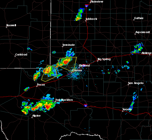 At 552 pm cdt/452 pm mdt/, a severe thunderstorm was located near kermit, moving northeast at 35 mph (radar indicated). Hazards include 60 mph wind gusts and half dollar size hail. Hail damage to vehicles is expected. expect wind damage to roofs, siding, and trees. Locations impacted include, kermit, wink and winkler county airport. At 552 pm cdt/452 pm mdt/, a severe thunderstorm was located near kermit, moving northeast at 35 mph (radar indicated). Hazards include 60 mph wind gusts and half dollar size hail. Hail damage to vehicles is expected. expect wind damage to roofs, siding, and trees. Locations impacted include, kermit, wink and winkler county airport.
|
| 9/25/2017 5:18 PM CDT |
 At 517 pm cdt/417 pm mdt/, a severe thunderstorm was located 9 miles south of winkler county airport, or 9 miles southwest of wink, moving northeast at 35 mph (radar indicated). Hazards include golf ball size hail and 60 mph wind gusts. People and animals outdoors will be injured. expect hail damage to roofs, siding, windows, and vehicles. Expect wind damage to roofs, siding, and trees. At 517 pm cdt/417 pm mdt/, a severe thunderstorm was located 9 miles south of winkler county airport, or 9 miles southwest of wink, moving northeast at 35 mph (radar indicated). Hazards include golf ball size hail and 60 mph wind gusts. People and animals outdoors will be injured. expect hail damage to roofs, siding, windows, and vehicles. Expect wind damage to roofs, siding, and trees.
|
| 9/23/2017 8:02 PM CDT |
 At 800 pm cdt, a severe thunderstorm was located near pyote, or 14 miles south of wink, moving east at 20 mph (radar indicated). Hazards include 60 mph wind gusts and half dollar size hail. Hail damage to vehicles is expected. expect wind damage to roofs, siding, and trees. Locations impacted include, wink and winkler county airport. At 800 pm cdt, a severe thunderstorm was located near pyote, or 14 miles south of wink, moving east at 20 mph (radar indicated). Hazards include 60 mph wind gusts and half dollar size hail. Hail damage to vehicles is expected. expect wind damage to roofs, siding, and trees. Locations impacted include, wink and winkler county airport.
|
| 9/23/2017 7:38 PM CDT |
 At 738 pm cdt, a severe thunderstorm was located 7 miles north of barstow, or 14 miles northeast of pecos, moving northeast at 25 mph (radar indicated). Hazards include 60 mph wind gusts and half dollar size hail. Hail damage to vehicles is expected. Expect wind damage to roofs, siding, and trees. At 738 pm cdt, a severe thunderstorm was located 7 miles north of barstow, or 14 miles northeast of pecos, moving northeast at 25 mph (radar indicated). Hazards include 60 mph wind gusts and half dollar size hail. Hail damage to vehicles is expected. Expect wind damage to roofs, siding, and trees.
|
| 8/6/2017 10:22 PM CDT | Trees down and roofs damaged in wink. power is out to in winkler county TX, 0.6 miles SW of Wink, TX |
| 8/6/2017 10:01 PM CDT | Storm damage reported in winkler county TX, 3.2 miles SE of Wink, TX |
| 7/4/2017 11:58 PM CDT |
 At 1157 pm cdt, a severe thunderstorm was located near notrees, or 17 miles northeast of kermit, moving southeast at 20 mph (radar indicated). Hazards include 60 mph wind gusts and quarter size hail. Hail damage to vehicles is expected. expect wind damage to roofs, siding, and trees. locations impacted include, monahans, kermit, wink, west odessa, wickett, thorntonville, barstow, goldsmith, pyote, monahans sandhills state park, notrees, penwell, winkler county airport, roy hurd memorial airport and north cowden. This includes interstate 20 between mile markers 48 and 112. At 1157 pm cdt, a severe thunderstorm was located near notrees, or 17 miles northeast of kermit, moving southeast at 20 mph (radar indicated). Hazards include 60 mph wind gusts and quarter size hail. Hail damage to vehicles is expected. expect wind damage to roofs, siding, and trees. locations impacted include, monahans, kermit, wink, west odessa, wickett, thorntonville, barstow, goldsmith, pyote, monahans sandhills state park, notrees, penwell, winkler county airport, roy hurd memorial airport and north cowden. This includes interstate 20 between mile markers 48 and 112.
|
| 7/4/2017 11:28 PM CDT |
 At 1125 pm cdt, severe thunderstorm were located 7 miles north of notrees to kermit. the storms were moving to the southeast at 25 mph (radar indicated). Hazards include 60 mph wind gusts and quarter size hail. Hail damage to vehicles is expected. Expect wind damage to roofs, siding, and trees. At 1125 pm cdt, severe thunderstorm were located 7 miles north of notrees to kermit. the storms were moving to the southeast at 25 mph (radar indicated). Hazards include 60 mph wind gusts and quarter size hail. Hail damage to vehicles is expected. Expect wind damage to roofs, siding, and trees.
|
| 7/4/2017 11:07 PM CDT | Storm damage reported in winkler county TX, 3.2 miles SE of Wink, TX |
| 6/23/2017 6:11 PM CDT |
 At 611 pm cdt/511 pm mdt/, a severe thunderstorm was located 10 miles southwest of notrees, or 11 miles east of kermit, moving south at 20 mph (radar indicated). Hazards include 70 mph wind gusts and quarter size hail. Hail damage to vehicles is expected. expect considerable tree damage. wind damage is also likely to mobile homes, roofs, and outbuildings. Locations impacted include, kermit, jal, wink, jal airport, notrees, winkler county airport, monahans sandhills state park and bennett. At 611 pm cdt/511 pm mdt/, a severe thunderstorm was located 10 miles southwest of notrees, or 11 miles east of kermit, moving south at 20 mph (radar indicated). Hazards include 70 mph wind gusts and quarter size hail. Hail damage to vehicles is expected. expect considerable tree damage. wind damage is also likely to mobile homes, roofs, and outbuildings. Locations impacted include, kermit, jal, wink, jal airport, notrees, winkler county airport, monahans sandhills state park and bennett.
|
| 6/23/2017 5:51 PM CDT |
 At 550 pm cdt/450 pm mdt/, a severe thunderstorm was located 8 miles west of notrees, or 12 miles northeast of kermit, moving south at 20 mph (radar indicated). Hazards include 70 mph wind gusts and quarter size hail. Hail damage to vehicles is expected. expect considerable tree damage. Wind damage is also likely to mobile homes, roofs, and outbuildings. At 550 pm cdt/450 pm mdt/, a severe thunderstorm was located 8 miles west of notrees, or 12 miles northeast of kermit, moving south at 20 mph (radar indicated). Hazards include 70 mph wind gusts and quarter size hail. Hail damage to vehicles is expected. expect considerable tree damage. Wind damage is also likely to mobile homes, roofs, and outbuildings.
|
| 5/22/2017 9:23 PM CDT |
 At 922 pm cdt, a severe thunderstorm was located 8 miles southeast of penwell, or 10 miles south of west odessa, moving southeast at 55 mph (radar indicated). Hazards include 70 mph wind gusts and quarter size hail. Hail damage to vehicles is expected. expect considerable tree damage. wind damage is also likely to mobile homes, roofs, and outbuildings. locations impacted include, midland, odessa, monahans, crane, wink, grandfalls, west odessa, wickett, thorntonville, goldsmith, pyote, cotton flat, monahans sandhills state park, midland international air and space port, royalty, penwell, midkiff, notrees, tubbs corner and crane county airport. This includes interstate 20 between mile markers 67 and 135. At 922 pm cdt, a severe thunderstorm was located 8 miles southeast of penwell, or 10 miles south of west odessa, moving southeast at 55 mph (radar indicated). Hazards include 70 mph wind gusts and quarter size hail. Hail damage to vehicles is expected. expect considerable tree damage. wind damage is also likely to mobile homes, roofs, and outbuildings. locations impacted include, midland, odessa, monahans, crane, wink, grandfalls, west odessa, wickett, thorntonville, goldsmith, pyote, cotton flat, monahans sandhills state park, midland international air and space port, royalty, penwell, midkiff, notrees, tubbs corner and crane county airport. This includes interstate 20 between mile markers 67 and 135.
|
| 5/22/2017 9:05 PM CDT |
 At 904 pm cdt, a severe thunderstorm was located near goldsmith, or 9 miles northwest of west odessa, moving southeast at 55 mph (winkler asos reported a gust of 54 knots). Hazards include 70 mph wind gusts and quarter size hail. Hail damage to vehicles is expected. expect considerable tree damage. Wind damage is also likely to mobile homes, roofs, and outbuildings. At 904 pm cdt, a severe thunderstorm was located near goldsmith, or 9 miles northwest of west odessa, moving southeast at 55 mph (winkler asos reported a gust of 54 knots). Hazards include 70 mph wind gusts and quarter size hail. Hail damage to vehicles is expected. expect considerable tree damage. Wind damage is also likely to mobile homes, roofs, and outbuildings.
|
| 5/22/2017 8:39 PM CDT | 62 mph thunderstorm wind gust recorded at the winkler county airport in winkler county TX, 3.2 miles SE of Wink, TX |
| 5/22/2017 8:32 PM CDT | 62 mph thunderstorm wind gust recorded at the winkler county airport in winkler county TX, 3.2 miles SE of Wink, TX |
| 4/12/2017 2:43 PM CDT |
 At 243 pm cdt, a severe thunderstorm was located near wink, moving east at 15 mph (radar indicated). Hazards include 60 mph wind gusts and quarter size hail. Hail damage to vehicles is expected. expect wind damage to roofs, siding, and trees. Locations impacted include, kermit, wink and winkler county airport. At 243 pm cdt, a severe thunderstorm was located near wink, moving east at 15 mph (radar indicated). Hazards include 60 mph wind gusts and quarter size hail. Hail damage to vehicles is expected. expect wind damage to roofs, siding, and trees. Locations impacted include, kermit, wink and winkler county airport.
|
| 4/12/2017 2:31 PM CDT |
 At 231 pm cdt, a severe thunderstorm was located near kermit, moving northeast at 25 mph (radar indicated). Hazards include 60 mph wind gusts and quarter size hail. Hail damage to vehicles is expected. expect wind damage to roofs, siding, and trees. Locations impacted include, kermit, wink and winkler county airport. At 231 pm cdt, a severe thunderstorm was located near kermit, moving northeast at 25 mph (radar indicated). Hazards include 60 mph wind gusts and quarter size hail. Hail damage to vehicles is expected. expect wind damage to roofs, siding, and trees. Locations impacted include, kermit, wink and winkler county airport.
|
| 4/12/2017 2:13 PM CDT |
 At 213 pm cdt, a severe thunderstorm was located over wink, moving east at 25 mph (radar indicated). Hazards include 60 mph wind gusts and quarter size hail. Hail damage to vehicles is expected. Expect wind damage to roofs, siding, and trees. At 213 pm cdt, a severe thunderstorm was located over wink, moving east at 25 mph (radar indicated). Hazards include 60 mph wind gusts and quarter size hail. Hail damage to vehicles is expected. Expect wind damage to roofs, siding, and trees.
|
| 1/1/2017 6:05 PM MST |
 At 704 pm cst/604 pm mst/, severe thunderstorms were located along a line extending from near buckeye to 13 miles east of red bluff reservoir to 14 miles northwest of balmorhea, moving east at 45 mph (radar indicated). Hazards include 60 mph wind gusts and penny size hail. Expect damage to roofs, siding, and trees. locations impacted include, hobbs, lovington, pecos, eunice, jal, wink, tatum, toyah, orla, mentone, barstow, monument, humble city, maljamar, eunice airport, nadine, jal airport, mcdonald, buckeye and halfway. this includes the following highways, interstate 10 between mile markers 186 and 189. Interstate 20 between mile markers 0 and 63. At 704 pm cst/604 pm mst/, severe thunderstorms were located along a line extending from near buckeye to 13 miles east of red bluff reservoir to 14 miles northwest of balmorhea, moving east at 45 mph (radar indicated). Hazards include 60 mph wind gusts and penny size hail. Expect damage to roofs, siding, and trees. locations impacted include, hobbs, lovington, pecos, eunice, jal, wink, tatum, toyah, orla, mentone, barstow, monument, humble city, maljamar, eunice airport, nadine, jal airport, mcdonald, buckeye and halfway. this includes the following highways, interstate 10 between mile markers 186 and 189. Interstate 20 between mile markers 0 and 63.
|
| 1/1/2017 5:43 PM MST |
 At 642 pm cst/542 pm mst/, severe thunderstorms were located along a line extending from near loco hills to near red bluff reservoir to kent, moving east at 55 mph (radar indicated). Hazards include 60 mph wind gusts and penny size hail. expect damage to roofs, siding, and trees At 642 pm cst/542 pm mst/, severe thunderstorms were located along a line extending from near loco hills to near red bluff reservoir to kent, moving east at 55 mph (radar indicated). Hazards include 60 mph wind gusts and penny size hail. expect damage to roofs, siding, and trees
|
| 6/15/2016 7:09 PM CDT |
 At 708 pm cdt, a severe thunderstorm was located over wink, or 8 miles southwest of kermit, moving east at 20 mph (radar indicated). Hazards include 60 mph wind gusts and quarter size hail. Hail damage to vehicles is expected. expect wind damage to roofs, siding, and trees. Locations impacted include, kermit, wink and winkler county airport. At 708 pm cdt, a severe thunderstorm was located over wink, or 8 miles southwest of kermit, moving east at 20 mph (radar indicated). Hazards include 60 mph wind gusts and quarter size hail. Hail damage to vehicles is expected. expect wind damage to roofs, siding, and trees. Locations impacted include, kermit, wink and winkler county airport.
|
| 6/15/2016 6:44 PM CDT |
 At 644 pm cdt, a severe thunderstorm was located over winkler county airport, or 10 miles southwest of kermit, moving east at 25 mph (radar indicated). Hazards include 60 mph wind gusts. Expect damage to roofs. siding. And trees. At 644 pm cdt, a severe thunderstorm was located over winkler county airport, or 10 miles southwest of kermit, moving east at 25 mph (radar indicated). Hazards include 60 mph wind gusts. Expect damage to roofs. siding. And trees.
|
| 5/21/2016 5:57 PM CDT | Reported by the wink asos in winkler county TX, 3.2 miles SE of Wink, TX |
| 4/9/2016 1:42 AM CDT |
 At 142 am cdt, a severe thunderstorm was located 11 miles northwest of pyote, or 18 miles northeast of pecos, moving east at 30 mph (radar indicated). Hazards include 60 mph wind gusts and quarter size hail. Hail damage to vehicles is expected. expect wind damage to roofs, siding, and trees. locations impacted include, wink, wickett, pyote and winkler county airport. This includes interstate 20 between mile markers 58 and 74. At 142 am cdt, a severe thunderstorm was located 11 miles northwest of pyote, or 18 miles northeast of pecos, moving east at 30 mph (radar indicated). Hazards include 60 mph wind gusts and quarter size hail. Hail damage to vehicles is expected. expect wind damage to roofs, siding, and trees. locations impacted include, wink, wickett, pyote and winkler county airport. This includes interstate 20 between mile markers 58 and 74.
|
| 4/9/2016 1:10 AM CDT |
 At 110 am cdt, a severe thunderstorm was located 8 miles north of pecos, moving east at 25 mph (radar indicated). Hazards include 60 mph wind gusts and half dollar size hail. Hail damage to vehicles is expected. Expect wind damage to roofs, siding, and trees. At 110 am cdt, a severe thunderstorm was located 8 miles north of pecos, moving east at 25 mph (radar indicated). Hazards include 60 mph wind gusts and half dollar size hail. Hail damage to vehicles is expected. Expect wind damage to roofs, siding, and trees.
|
| 10/22/2015 12:10 AM CDT |
 At 1209 am cdt/1109 pm mdt/, severe thunderstorms were located along a line extending from 8 miles southwest of paynes corner to 6 miles north of kermit, moving northeast at 35 mph (radar indicated). Hazards include 60 mph wind gusts and quarter size hail. Hail damage to vehicles is expected. expect wind damage to roofs, siding and trees. locations impacted include, andrews, kermit, west odessa, eunice, jal, wink, goldsmith, andrews county airport, winkler county airport, frankel city, florey, penwell, notrees, oil center, north cowden, jal airport, eunice airport and bennett. This includes interstate 20 between mile markers 100 and 111. At 1209 am cdt/1109 pm mdt/, severe thunderstorms were located along a line extending from 8 miles southwest of paynes corner to 6 miles north of kermit, moving northeast at 35 mph (radar indicated). Hazards include 60 mph wind gusts and quarter size hail. Hail damage to vehicles is expected. expect wind damage to roofs, siding and trees. locations impacted include, andrews, kermit, west odessa, eunice, jal, wink, goldsmith, andrews county airport, winkler county airport, frankel city, florey, penwell, notrees, oil center, north cowden, jal airport, eunice airport and bennett. This includes interstate 20 between mile markers 100 and 111.
|
| 10/21/2015 10:39 PM MDT |
 At 1138 pm cdt/1038 pm mdt/, doppler radar indicated a line of severe thunderstorms capable of producing quarter size hail and damaging winds in excess of 60 mph. these storms were located along a line extending from near eunice to 7 miles west of winkler county airport, and moving northeast at 35 mph. At 1138 pm cdt/1038 pm mdt/, doppler radar indicated a line of severe thunderstorms capable of producing quarter size hail and damaging winds in excess of 60 mph. these storms were located along a line extending from near eunice to 7 miles west of winkler county airport, and moving northeast at 35 mph.
|
| 5/14/2015 7:42 PM CDT | At 739 pm cdt, severe thunderstorms were located along a line extending from 9 miles east of kermit to royalty, and moving east at 25 mph (radar indicated). Hazards include 60 mph wind gusts and quarter size hail. Hail damage to vehicles is expected. expect wind damage to roofs, siding and trees. locations impacted include, royalty, monahans sand hills state park, notrees, tubbs corner and grandfalls. 1. 00in. |
| 5/14/2015 7:20 PM CDT | At 716 pm cdt, severe thunderstorms were located along a line extending from kermit to 10 miles southeast of pyote, and moving east at 25 mph (radar indicated). Hazards include golf ball size hail and 60 mph wind gusts. People and animals outdoors will be injured. expect hail damage to roofs, siding, windows and vehicles. Expect wind damage to roofs, siding and trees. |
| 5/14/2015 4:40 PM CDT | At 435 pm cdt, a severe thunderstorm was located near wink, and moving northeast at 30 mph (public reported). Hazards include 60 mph wind gusts and quarter size hail. Hail damage to vehicles is expected. Expect wind damage to roofs, siding and trees. |
| 5/14/2015 4:36 PM CDT | Quarter sized hail reported 0.6 miles SW of Wink, TX, quarter size hail reported |
| 8/22/2014 6:39 PM CDT | Storm damage reported in winkler county TX, 0.6 miles SW of Wink, TX |
| 5/21/2014 4:55 PM CDT | Quarter sized hail reported 1 miles W of Wink, TX |
| 9/2/2013 4:58 PM CDT | Storm damage reported in winkler county TX, 3.2 miles SE of Wink, TX |
| 6/21/2013 7:06 PM CDT | Golf Ball sized hail reported 0.6 miles SW of Wink, TX |
| 6/21/2013 7:00 PM CDT | Quarter sized hail reported 0.6 miles SW of Wink, TX |
Hail Maps for Wink, TX
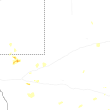
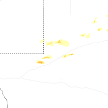
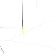
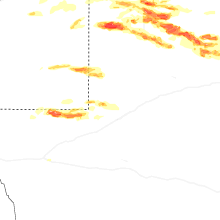
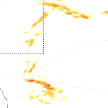
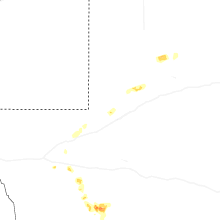
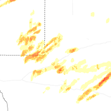
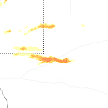
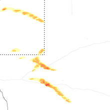
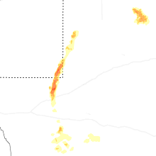
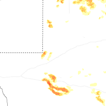


Connect with Interactive Hail Maps