

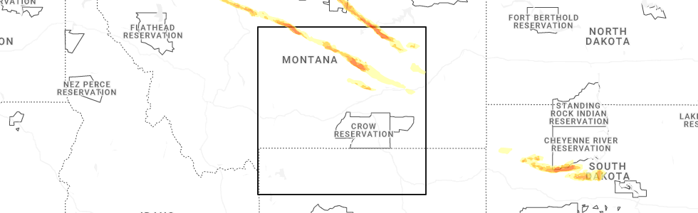
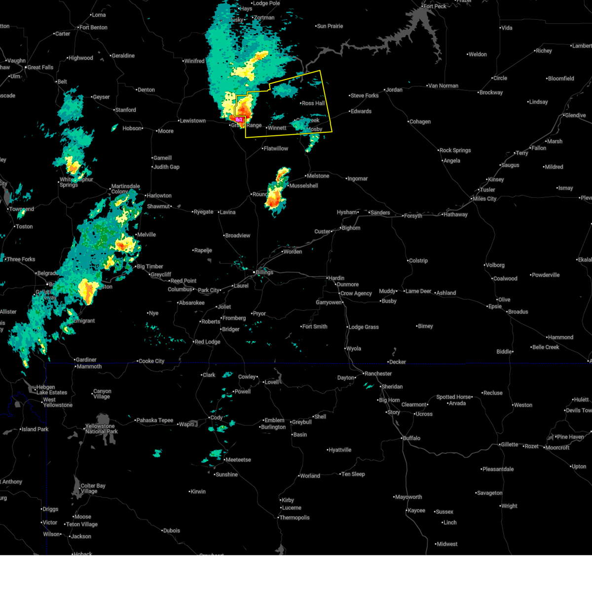
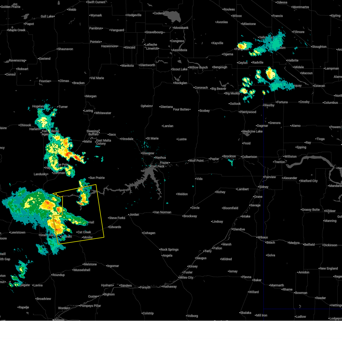
Hail Map for Winnett, MT
The Winnett, MT area has had 41 reports of on-the-ground hail by trained spotters, and has been under severe weather warnings 19 times during the past 12 months. Doppler radar has detected hail at or near Winnett, MT on 28 occasions, including 4 occasions during the past year.
| Name: | Winnett, MT |
| Where Located: | 84.7 miles N of Billings, MT |
| Map: | Google Map for Winnett, MT |
| Population: | 182 |
| Housing Units: | 132 |
| More Info: | Search Google for Winnett, MT |
1
The Top Recent Hail Date for Winnett, MT is Thursday, July 17, 2025 (4th out of 28)
Hail and Wind Damage Spotted near Winnett, MT
| Date / Time | Report Details |
|---|---|
| 7/3/2026 3:00 PM MDT |
 Svrggw the national weather service in glasgow has issued a * severe thunderstorm warning for, petroleum county in northeastern montana, * until 400 pm mdt. * at 259 pm mdt, a severe thunderstorm was located 8 miles east of grass range, or 13 miles west of winnett, moving northeast at 40 mph (radar indicated). Hazards include 60 mph wind gusts and quarter size hail. Hail damage to vehicles is expected. Expect wind damage to roofs, siding, and trees. Svrggw the national weather service in glasgow has issued a * severe thunderstorm warning for, petroleum county in northeastern montana, * until 400 pm mdt. * at 259 pm mdt, a severe thunderstorm was located 8 miles east of grass range, or 13 miles west of winnett, moving northeast at 40 mph (radar indicated). Hazards include 60 mph wind gusts and quarter size hail. Hail damage to vehicles is expected. Expect wind damage to roofs, siding, and trees.
|
| 7/2/2026 7:15 PM MDT | Jitney road montana mesonet statio in petroleum county MT, 12.4 miles WSW of Winnett, MT |
| 7/2/2026 7:09 PM MDT |
 Svrggw the national weather service in glasgow has issued a * severe thunderstorm warning for, petroleum county in northeastern montana, southwestern garfield county in northeastern montana, * until 815 pm mdt. * at 709 pm mdt, a severe thunderstorm was located 14 miles northeast of winnett, moving northeast at 40 mph (radar indicated). Hazards include 60 mph wind gusts and quarter size hail. Hail damage to vehicles is expected. Expect wind damage to roofs, siding, and trees. Svrggw the national weather service in glasgow has issued a * severe thunderstorm warning for, petroleum county in northeastern montana, southwestern garfield county in northeastern montana, * until 815 pm mdt. * at 709 pm mdt, a severe thunderstorm was located 14 miles northeast of winnett, moving northeast at 40 mph (radar indicated). Hazards include 60 mph wind gusts and quarter size hail. Hail damage to vehicles is expected. Expect wind damage to roofs, siding, and trees.
|
| 7/2/2026 7:00 PM MDT | Storm damage reported in petroleum county MT, 0.6 miles SE of Winnett, MT |
| 5/13/2026 10:59 PM MDT |
 The storm which prompted the warning has weakened below severe limits, and no longer poses an immediate threat to life or property. therefore, the warning will be allowed to expire. however, gusty winds are still possible with this thunderstorm. The storm which prompted the warning has weakened below severe limits, and no longer poses an immediate threat to life or property. therefore, the warning will be allowed to expire. however, gusty winds are still possible with this thunderstorm.
|
| 5/13/2026 10:35 PM MDT | Mosby nw mesonet mobm in petroleum county MT, 13.1 miles WSW of Winnett, MT |
| 5/13/2026 10:32 PM MDT |
 At 1031 pm mdt, a severe thunderstorm was located 16 miles east of zortman, moving east at 50 mph (radar indicated). Hazards include 60 mph wind gusts. Expect damage to roofs, siding, and trees. Locations impacted include, winnett, zortman, sand springs, fourchette, u l bend rec area, crooked creek rec area, flatwillow, devils creek rec area, edwards, mosby, phillips, petrolia lake, fred robinson bridge, tiegen, landusky, content, sun prairie, and cat creek. At 1031 pm mdt, a severe thunderstorm was located 16 miles east of zortman, moving east at 50 mph (radar indicated). Hazards include 60 mph wind gusts. Expect damage to roofs, siding, and trees. Locations impacted include, winnett, zortman, sand springs, fourchette, u l bend rec area, crooked creek rec area, flatwillow, devils creek rec area, edwards, mosby, phillips, petrolia lake, fred robinson bridge, tiegen, landusky, content, sun prairie, and cat creek.
|
| 5/13/2026 10:25 PM MDT | Valentine east mesonet vltm in petroleum county MT, 24.6 miles SSW of Winnett, MT |
| 5/13/2026 10:15 PM MDT | Corrects previous non-tstm wnd gst report from 1 nnw winnett. mesonet station mtwin winnett mt-200 mp 136. in petroleum county MT, 0.6 miles SE of Winnett, MT |
| 5/13/2026 10:03 PM MDT |
 Svrggw the national weather service in glasgow has issued a * severe thunderstorm warning for, southern phillips county in northeastern montana, petroleum county in northeastern montana, southwestern garfield county in northeastern montana, * until 1100 pm mdt. * at 1002 pm mdt, a severe thunderstorm was located 8 miles southwest of zortman, moving east at 50 mph (radar indicated). Hazards include 60 mph wind gusts. expect damage to roofs, siding, and trees Svrggw the national weather service in glasgow has issued a * severe thunderstorm warning for, southern phillips county in northeastern montana, petroleum county in northeastern montana, southwestern garfield county in northeastern montana, * until 1100 pm mdt. * at 1002 pm mdt, a severe thunderstorm was located 8 miles southwest of zortman, moving east at 50 mph (radar indicated). Hazards include 60 mph wind gusts. expect damage to roofs, siding, and trees
|
| 5/13/2026 10:00 PM MDT | Winnett sw mesonet wiem in petroleum county MT, 7.3 miles ENE of Winnett, MT |
| 5/13/2026 6:41 PM MDT | Dry blood creek raw in petroleum county MT, 16.3 miles S of Winnett, MT |
| 5/13/2026 6:27 PM MDT |
 Svrggw the national weather service in glasgow has issued a * severe thunderstorm warning for, phillips county in northeastern montana, petroleum county in northeastern montana, garfield county in northeastern montana, southwestern valley county in northeastern montana, * until 730 pm mdt. * at 627 pm mdt, severe thunderstorms were located along a line extending from 10 miles north of hays to 10 miles southeast of mosby, moving northeast at 50 mph (radar indicated). Hazards include 70 mph wind gusts and quarter size hail. Hail damage to vehicles is expected. expect considerable tree damage. Wind damage is also likely to mobile homes, roofs, and outbuildings. Svrggw the national weather service in glasgow has issued a * severe thunderstorm warning for, phillips county in northeastern montana, petroleum county in northeastern montana, garfield county in northeastern montana, southwestern valley county in northeastern montana, * until 730 pm mdt. * at 627 pm mdt, severe thunderstorms were located along a line extending from 10 miles north of hays to 10 miles southeast of mosby, moving northeast at 50 mph (radar indicated). Hazards include 70 mph wind gusts and quarter size hail. Hail damage to vehicles is expected. expect considerable tree damage. Wind damage is also likely to mobile homes, roofs, and outbuildings.
|
| 5/13/2026 6:00 PM MDT | Mesonet station mtwin winnett mt-200 mp 136. in petroleum county MT, 0.6 miles SE of Winnett, MT |
| 5/13/2026 5:59 PM MDT |
 At 559 pm mdt, severe thunderstorms were located along a line extending from 11 miles southeast of zortman to 11 miles west of mosby, moving northeast at 60 mph (radar indicated). Hazards include 70 mph wind gusts. Expect considerable tree damage. damage is likely to mobile homes, roofs, and outbuildings. Locations impacted include, winnett, flatwillow, sand springs, devils creek rec area, u l bend rec area, edwards, mosby, crooked creek rec area, petrolia lake, cat creek, and tiegen. At 559 pm mdt, severe thunderstorms were located along a line extending from 11 miles southeast of zortman to 11 miles west of mosby, moving northeast at 60 mph (radar indicated). Hazards include 70 mph wind gusts. Expect considerable tree damage. damage is likely to mobile homes, roofs, and outbuildings. Locations impacted include, winnett, flatwillow, sand springs, devils creek rec area, u l bend rec area, edwards, mosby, crooked creek rec area, petrolia lake, cat creek, and tiegen.
|
| 5/13/2026 5:55 PM MDT | Winnett sw station (wiem8 in petroleum county MT, 7.5 miles ENE of Winnett, MT |
| 5/13/2026 5:26 PM MDT |
 Svrggw the national weather service in glasgow has issued a * severe thunderstorm warning for, southeastern phillips county in northeastern montana, petroleum county in northeastern montana, southwestern garfield county in northeastern montana, * until 630 pm mdt. * at 524 pm mdt, severe thunderstorms were located along a line extending from 11 miles north of roy to 15 miles northwest of roundup, moving northeast at 60 mph (radar indicated). Hazards include 70 mph wind gusts. Expect considerable tree damage. Damage is likely to mobile homes, roofs, and outbuildings. Svrggw the national weather service in glasgow has issued a * severe thunderstorm warning for, southeastern phillips county in northeastern montana, petroleum county in northeastern montana, southwestern garfield county in northeastern montana, * until 630 pm mdt. * at 524 pm mdt, severe thunderstorms were located along a line extending from 11 miles north of roy to 15 miles northwest of roundup, moving northeast at 60 mph (radar indicated). Hazards include 70 mph wind gusts. Expect considerable tree damage. Damage is likely to mobile homes, roofs, and outbuildings.
|
| 4/11/2026 6:15 PM MDT | Winnett mt dot surface statio in petroleum county MT, 0.6 miles SE of Winnett, MT |
| 8/17/2025 7:00 PM MDT | Dovetail hydromet site from the montana climate office mesone in petroleum county MT, 25.1 miles SSW of Winnett, MT |
| 8/17/2025 6:55 PM MDT | Mosby nw hydromet site from the montana climate office mesone in petroleum county MT, 12.4 miles WSW of Winnett, MT |
| 8/17/2025 6:45 PM MDT | Winnett dot sit in petroleum county MT, 0.6 miles SE of Winnett, MT |
| 8/17/2025 6:34 PM MDT |
 At 629 pm mdt, severe thunderstorms were located along a line extending from 22 miles south of zortman to 6 miles west of flatwillow, moving east at 40 mph (observed wind gust of 61 mph at 6:30 pm mdt at war horse nw mesonet in west central petroleum county). Hazards include 60 mph wind gusts. Expect damage to roofs, siding, and trees. Locations impacted include, winnett, flatwillow, petrolia lake, fred robinson bridge, valentine, cat creek, and tiegen. At 629 pm mdt, severe thunderstorms were located along a line extending from 22 miles south of zortman to 6 miles west of flatwillow, moving east at 40 mph (observed wind gust of 61 mph at 6:30 pm mdt at war horse nw mesonet in west central petroleum county). Hazards include 60 mph wind gusts. Expect damage to roofs, siding, and trees. Locations impacted include, winnett, flatwillow, petrolia lake, fred robinson bridge, valentine, cat creek, and tiegen.
|
| 8/17/2025 6:06 PM MDT |
 Svrggw the national weather service in glasgow has issued a * severe thunderstorm warning for, southwestern phillips county in northeastern montana, petroleum county in northeastern montana, * until 700 pm mdt. * at 605 pm mdt, severe thunderstorms were located along a line extending from 14 miles east of winifred to 16 miles south of grass range, moving east at 30 mph (observed gusts of around 60 mph in fergus county). Hazards include 60 mph wind gusts. expect damage to roofs, siding, and trees Svrggw the national weather service in glasgow has issued a * severe thunderstorm warning for, southwestern phillips county in northeastern montana, petroleum county in northeastern montana, * until 700 pm mdt. * at 605 pm mdt, severe thunderstorms were located along a line extending from 14 miles east of winifred to 16 miles south of grass range, moving east at 30 mph (observed gusts of around 60 mph in fergus county). Hazards include 60 mph wind gusts. expect damage to roofs, siding, and trees
|
| 8/7/2025 3:59 PM MDT |
 At 358 pm mdt, a severe thunderstorm was located 17 miles southwest of crooked creek rec area, or 18 miles northeast of winnett, moving east at 40 mph (radar indicated). Hazards include 60 mph wind gusts and half dollar size hail. Hail damage to vehicles is expected. expect wind damage to roofs, siding, and trees. Locations impacted include, winnett, mosby, crooked creek rec area, petrolia lake, cat creek, and valentine. At 358 pm mdt, a severe thunderstorm was located 17 miles southwest of crooked creek rec area, or 18 miles northeast of winnett, moving east at 40 mph (radar indicated). Hazards include 60 mph wind gusts and half dollar size hail. Hail damage to vehicles is expected. expect wind damage to roofs, siding, and trees. Locations impacted include, winnett, mosby, crooked creek rec area, petrolia lake, cat creek, and valentine.
|
| 8/7/2025 3:28 PM MDT |
 Svrggw the national weather service in glasgow has issued a * severe thunderstorm warning for, central petroleum county in northeastern montana, southwestern garfield county in northeastern montana, * until 430 pm mdt. * at 328 pm mdt, a severe thunderstorm was located 13 miles northeast of grass range, or 13 miles northwest of winnett, moving east at 40 mph (radar indicated). Hazards include 60 mph wind gusts and half dollar size hail. Hail damage to vehicles is expected. Expect wind damage to roofs, siding, and trees. Svrggw the national weather service in glasgow has issued a * severe thunderstorm warning for, central petroleum county in northeastern montana, southwestern garfield county in northeastern montana, * until 430 pm mdt. * at 328 pm mdt, a severe thunderstorm was located 13 miles northeast of grass range, or 13 miles northwest of winnett, moving east at 40 mph (radar indicated). Hazards include 60 mph wind gusts and half dollar size hail. Hail damage to vehicles is expected. Expect wind damage to roofs, siding, and trees.
|
| 8/5/2025 6:20 AM MDT |
 the severe thunderstorm warning has been cancelled and is no longer in effect the severe thunderstorm warning has been cancelled and is no longer in effect
|
| 8/5/2025 6:15 AM MDT | Trees swayed significantly... estimated 50-60 mph wind gusts with pea sized hai in petroleum county MT, 5.4 miles SSW of Winnett, MT |
| 8/5/2025 6:09 AM MDT |
 At 609 am mdt, a severe thunderstorm was located 8 miles east of winnett, moving east at 40 mph (radar indicated). Hazards include 60 mph wind gusts and quarter size hail. Hail damage to vehicles is expected. expect wind damage to roofs, siding, and trees. Locations impacted include, winnett, mosby, petrolia lake, cat creek, and tiegen. At 609 am mdt, a severe thunderstorm was located 8 miles east of winnett, moving east at 40 mph (radar indicated). Hazards include 60 mph wind gusts and quarter size hail. Hail damage to vehicles is expected. expect wind damage to roofs, siding, and trees. Locations impacted include, winnett, mosby, petrolia lake, cat creek, and tiegen.
|
| 8/5/2025 5:26 AM MDT |
 Svrggw the national weather service in glasgow has issued a * severe thunderstorm warning for, petroleum county in northeastern montana, * until 630 am mdt. * at 526 am mdt, a severe thunderstorm was located 9 miles south of grass range, or 21 miles west of winnett, moving east at 40 mph (radar indicated). Hazards include 60 mph wind gusts and quarter size hail. Hail damage to vehicles is expected. Expect wind damage to roofs, siding, and trees. Svrggw the national weather service in glasgow has issued a * severe thunderstorm warning for, petroleum county in northeastern montana, * until 630 am mdt. * at 526 am mdt, a severe thunderstorm was located 9 miles south of grass range, or 21 miles west of winnett, moving east at 40 mph (radar indicated). Hazards include 60 mph wind gusts and quarter size hail. Hail damage to vehicles is expected. Expect wind damage to roofs, siding, and trees.
|
| 7/26/2025 6:59 PM MDT |
 Svrggw the national weather service in glasgow has issued a * severe thunderstorm warning for, southwestern phillips county in northeastern montana, petroleum county in northeastern montana, southwestern garfield county in northeastern montana, * until 800 pm mdt. * at 659 pm mdt, severe thunderstorms were located along a line extending from 22 miles southwest of hays to near winnett, moving east at 45 mph (radar indicated). Hazards include 60 mph wind gusts and penny size hail. expect damage to roofs, siding, and trees Svrggw the national weather service in glasgow has issued a * severe thunderstorm warning for, southwestern phillips county in northeastern montana, petroleum county in northeastern montana, southwestern garfield county in northeastern montana, * until 800 pm mdt. * at 659 pm mdt, severe thunderstorms were located along a line extending from 22 miles southwest of hays to near winnett, moving east at 45 mph (radar indicated). Hazards include 60 mph wind gusts and penny size hail. expect damage to roofs, siding, and trees
|
| 7/17/2025 9:00 PM MDT | Mosby s (hydromet) statio in petroleum county MT, 25.6 miles NW of Winnett, MT |
| 7/17/2025 8:50 PM MDT | Golf Ball sized hail reported 12.9 miles WNW of Winnett, MT |
| 7/17/2025 8:50 PM MDT | Storm damage reported in petroleum county MT, 12.9 miles WNW of Winnett, MT |
| 7/17/2025 8:30 PM MDT | Mdt dot site in mt 200 at mp 13 in petroleum county MT, 1.1 miles S of Winnett, MT |
| 7/17/2025 8:30 PM MDT | Storm damage reported in petroleum county MT, 8.1 miles NW of Winnett, MT |
| 7/17/2025 8:20 PM MDT | Hen Egg sized hail reported 6.6 miles N of Winnett, MT |
| 7/17/2025 8:17 PM MDT |
 At 816 pm mdt, a severe thunderstorm was located over winnett, moving east at 55 mph (radar indicated). Hazards include 60 mph wind gusts and half dollar size hail. Hail damage to vehicles is expected. expect wind damage to roofs, siding, and trees. Locations impacted include, winnett, flatwillow, mosby, petrolia lake, cat creek, and tiegen. At 816 pm mdt, a severe thunderstorm was located over winnett, moving east at 55 mph (radar indicated). Hazards include 60 mph wind gusts and half dollar size hail. Hail damage to vehicles is expected. expect wind damage to roofs, siding, and trees. Locations impacted include, winnett, flatwillow, mosby, petrolia lake, cat creek, and tiegen.
|
| 7/17/2025 7:47 PM MDT |
 Svrggw the national weather service in glasgow has issued a * severe thunderstorm warning for, petroleum county in northeastern montana, southwestern garfield county in northeastern montana, * until 845 pm mdt. * at 747 pm mdt, a severe thunderstorm was located 9 miles north of grass range, or 20 miles northwest of winnett, moving east at 65 mph (radar indicated). Hazards include 60 mph wind gusts and half dollar size hail. Hail damage to vehicles is expected. Expect wind damage to roofs, siding, and trees. Svrggw the national weather service in glasgow has issued a * severe thunderstorm warning for, petroleum county in northeastern montana, southwestern garfield county in northeastern montana, * until 845 pm mdt. * at 747 pm mdt, a severe thunderstorm was located 9 miles north of grass range, or 20 miles northwest of winnett, moving east at 65 mph (radar indicated). Hazards include 60 mph wind gusts and half dollar size hail. Hail damage to vehicles is expected. Expect wind damage to roofs, siding, and trees.
|
| 7/5/2025 2:57 PM MDT |
 Svrggw the national weather service in glasgow has issued a * severe thunderstorm warning for, southeastern petroleum county in northeastern montana, southwestern garfield county in northeastern montana, * until 400 pm mdt. * at 256 pm mdt, severe thunderstorms were located along a line extending from 7 miles north of winnett to near melstone, moving northeast at 55 mph (radar indicated). Hazards include 60 mph wind gusts and penny size hail. expect damage to roofs, siding, and trees Svrggw the national weather service in glasgow has issued a * severe thunderstorm warning for, southeastern petroleum county in northeastern montana, southwestern garfield county in northeastern montana, * until 400 pm mdt. * at 256 pm mdt, severe thunderstorms were located along a line extending from 7 miles north of winnett to near melstone, moving northeast at 55 mph (radar indicated). Hazards include 60 mph wind gusts and penny size hail. expect damage to roofs, siding, and trees
|
| 6/27/2025 4:43 PM MDT |
 At 443 pm mdt, a severe thunderstorm was located 16 miles southwest of crooked creek rec area, or 20 miles north of winnett, moving east at 35 mph (radar indicated). Hazards include 60 mph wind gusts and quarter size hail. Hail damage to vehicles is expected. expect wind damage to roofs, siding, and trees. Locations impacted include, winnett, sand springs, devils creek rec area, u l bend rec area, mosby, crooked creek rec area, petrolia lake, and cat creek. At 443 pm mdt, a severe thunderstorm was located 16 miles southwest of crooked creek rec area, or 20 miles north of winnett, moving east at 35 mph (radar indicated). Hazards include 60 mph wind gusts and quarter size hail. Hail damage to vehicles is expected. expect wind damage to roofs, siding, and trees. Locations impacted include, winnett, sand springs, devils creek rec area, u l bend rec area, mosby, crooked creek rec area, petrolia lake, and cat creek.
|
| 6/27/2025 4:18 PM MDT |
 Svrggw the national weather service in glasgow has issued a * severe thunderstorm warning for, south central phillips county in northeastern montana, petroleum county in northeastern montana, southwestern garfield county in northeastern montana, * until 515 pm mdt. * at 418 pm mdt, a severe thunderstorm was located 17 miles northwest of winnett, moving east at 35 mph (radar indicated). Hazards include 60 mph wind gusts and quarter size hail. Hail damage to vehicles is expected. Expect wind damage to roofs, siding, and trees. Svrggw the national weather service in glasgow has issued a * severe thunderstorm warning for, south central phillips county in northeastern montana, petroleum county in northeastern montana, southwestern garfield county in northeastern montana, * until 515 pm mdt. * at 418 pm mdt, a severe thunderstorm was located 17 miles northwest of winnett, moving east at 35 mph (radar indicated). Hazards include 60 mph wind gusts and quarter size hail. Hail damage to vehicles is expected. Expect wind damage to roofs, siding, and trees.
|
| 6/26/2025 7:50 PM MDT | Winnett southwest (hydromet) statio in petroleum county MT, 7.5 miles ENE of Winnett, MT |
| 6/15/2025 7:01 PM MDT | Tea Cup sized hail reported 7 miles NW of Winnett, MT, large hail about 3.5 inches... lasting for about 15 mins. |
| 6/15/2025 7:00 PM MDT | Tennis Ball sized hail reported 1 miles WSW of Winnett, MT, a storm chaser on x measured multiple hail stones of 2.5 inches in diameter with a ruler. |
| 6/15/2025 6:52 PM MDT | Ping Pong Ball sized hail reported 6.1 miles W of Winnett, MT, broken windows and damage to vehicles. |
| 6/15/2025 6:45 PM MDT | Golf Ball sized hail reported 4.7 miles W of Winnett, MT |
| 6/15/2025 6:39 PM MDT | Golf Ball sized hail reported 0.4 miles S of Winnett, MT, hail up to the size of golf balls with winds 30-40 mph. |
| 6/15/2025 6:32 PM MDT |
 Svrggw the national weather service in glasgow has issued a * severe thunderstorm warning for, southeastern petroleum county in northeastern montana, * until 730 pm mdt. * at 631 pm mdt, a severe thunderstorm was located near winnett, moving east at 25 mph (radar indicated). Hazards include 60 mph wind gusts and quarter size hail. Hail damage to vehicles is expected. Expect wind damage to roofs, siding, and trees. Svrggw the national weather service in glasgow has issued a * severe thunderstorm warning for, southeastern petroleum county in northeastern montana, * until 730 pm mdt. * at 631 pm mdt, a severe thunderstorm was located near winnett, moving east at 25 mph (radar indicated). Hazards include 60 mph wind gusts and quarter size hail. Hail damage to vehicles is expected. Expect wind damage to roofs, siding, and trees.
|
| 6/13/2025 4:20 PM MDT | Quarter sized hail reported 0.6 miles SE of Winnett, MT, quarter (1.00 inch) hail... heavy rain and 70 mph gust... tree branches knocked down... estimated 4:20 pm. |
| 6/13/2025 4:20 PM MDT | Quarter (1.00 inch) hail... heavy rain and 70 mph gust... tree branches knocked down... estimated 4:20 p in petroleum county MT, 0.6 miles SE of Winnett, MT |
| 6/13/2025 4:11 PM MDT |
 At 409 pm mdt, a severe thunderstorm was located near winnett, moving east at 25 mph (radar indicated). Hazards include ping pong ball size hail and 60 mph wind gusts. People and animals outdoors will be injured. expect hail damage to roofs, siding, windows, and vehicles. expect wind damage to roofs, siding, and trees. Locations impacted include, flatwillow, petrolia lake, tiegen, and winnett. At 409 pm mdt, a severe thunderstorm was located near winnett, moving east at 25 mph (radar indicated). Hazards include ping pong ball size hail and 60 mph wind gusts. People and animals outdoors will be injured. expect hail damage to roofs, siding, windows, and vehicles. expect wind damage to roofs, siding, and trees. Locations impacted include, flatwillow, petrolia lake, tiegen, and winnett.
|
| 6/13/2025 3:38 PM MDT |
 Svrggw the national weather service in glasgow has issued a * severe thunderstorm warning for, southwestern petroleum county in northeastern montana, * until 445 pm mdt. * at 338 pm mdt, a severe thunderstorm was located near grass range, or 20 miles west of winnett, moving east at 20 mph (radar indicated). Hazards include half dollar size hail. damage to vehicles is expected Svrggw the national weather service in glasgow has issued a * severe thunderstorm warning for, southwestern petroleum county in northeastern montana, * until 445 pm mdt. * at 338 pm mdt, a severe thunderstorm was located near grass range, or 20 miles west of winnett, moving east at 20 mph (radar indicated). Hazards include half dollar size hail. damage to vehicles is expected
|
| 5/10/2025 8:17 PM MDT |
 At 817 pm mdt, severe thunderstorms were located along a line extending from 22 miles northwest of port of opheim to 20 miles southwest of opheim to 17 miles northwest of the pines rec area to 9 miles south of mosby, moving east at 40 mph (public). Hazards include 60 mph wind gusts. Expect damage to roofs, siding, and trees. locations impacted include, sand springs, vandalia, fourchette, u l bend rec area, park grove, the bentonite plant, duck creek rec area, glasgow, frenchman reservoir, opheim, nashua, hell creek rec area, sun prairie, st. Marie, brusett, winnett, the pines rec area, petrolia lake, tampico, and hinsdale. At 817 pm mdt, severe thunderstorms were located along a line extending from 22 miles northwest of port of opheim to 20 miles southwest of opheim to 17 miles northwest of the pines rec area to 9 miles south of mosby, moving east at 40 mph (public). Hazards include 60 mph wind gusts. Expect damage to roofs, siding, and trees. locations impacted include, sand springs, vandalia, fourchette, u l bend rec area, park grove, the bentonite plant, duck creek rec area, glasgow, frenchman reservoir, opheim, nashua, hell creek rec area, sun prairie, st. Marie, brusett, winnett, the pines rec area, petrolia lake, tampico, and hinsdale.
|
| 5/10/2025 8:05 PM MDT | Mosby nw (hydromet) in central petroleum count in petroleum county MT, 12.4 miles WSW of Winnett, MT |
| 5/10/2025 7:50 PM MDT |
 Svrggw the national weather service in glasgow has issued a * severe thunderstorm warning for, central phillips county in northeastern montana, petroleum county in northeastern montana, western garfield county in northeastern montana, valley county in northeastern montana, northwestern mccone county in northeastern montana, * until 845 pm mdt. * at 750 pm mdt, severe thunderstorms were located along a line extending from 35 miles northeast of port of morgan to 9 miles north of hinsdale to 20 miles northeast of devils creek rec area to 12 miles east of flatwillow, moving northeast at 65 mph (public). Hazards include 60 mph wind gusts. expect damage to roofs, siding, and trees Svrggw the national weather service in glasgow has issued a * severe thunderstorm warning for, central phillips county in northeastern montana, petroleum county in northeastern montana, western garfield county in northeastern montana, valley county in northeastern montana, northwestern mccone county in northeastern montana, * until 845 pm mdt. * at 750 pm mdt, severe thunderstorms were located along a line extending from 35 miles northeast of port of morgan to 9 miles north of hinsdale to 20 miles northeast of devils creek rec area to 12 miles east of flatwillow, moving northeast at 65 mph (public). Hazards include 60 mph wind gusts. expect damage to roofs, siding, and trees
|
| 7/25/2024 6:13 PM MDT |
 The storm which prompted the warning has weakened below severe limits, and no longer poses an immediate threat to life or property. therefore, the warning will be allowed to expire. however, gusty winds are still possible with this thunderstorm. a severe thunderstorm watch remains in effect until 1100 pm mdt for northeastern montana. The storm which prompted the warning has weakened below severe limits, and no longer poses an immediate threat to life or property. therefore, the warning will be allowed to expire. however, gusty winds are still possible with this thunderstorm. a severe thunderstorm watch remains in effect until 1100 pm mdt for northeastern montana.
|
| 7/25/2024 5:10 PM MDT |
 Svrggw the national weather service in glasgow has issued a * severe thunderstorm warning for, south central phillips county in northeastern montana, petroleum county in northeastern montana, west central garfield county in northeastern montana, * until 615 pm mdt. * at 508 pm mdt, a severe thunderstorm was located 12 miles northeast of grass range, or 20 miles northwest of winnett, moving northeast at 45 mph (radar indicated). Hazards include 60 mph wind gusts and quarter size hail. Hail damage to vehicles is expected. Expect wind damage to roofs, siding, and trees. Svrggw the national weather service in glasgow has issued a * severe thunderstorm warning for, south central phillips county in northeastern montana, petroleum county in northeastern montana, west central garfield county in northeastern montana, * until 615 pm mdt. * at 508 pm mdt, a severe thunderstorm was located 12 miles northeast of grass range, or 20 miles northwest of winnett, moving northeast at 45 mph (radar indicated). Hazards include 60 mph wind gusts and quarter size hail. Hail damage to vehicles is expected. Expect wind damage to roofs, siding, and trees.
|
| 6/20/2024 6:20 PM MDT | Measured from the mosby nw mt mesonet sit in petroleum county MT, 12.4 miles WSW of Winnett, MT |
| 7/29/2023 11:00 PM MDT | Quarter sized hail reported 5.9 miles N of Winnett, MT, storm lasted 15 minutes... 1" rain fell. |
| 7/29/2023 10:57 PM MDT |
 At 1056 pm mdt, a severe thunderstorm was located 8 miles east of winnett, moving east at 30 mph (radar indicated). Hazards include ping pong ball size hail and 60 mph wind gusts. People and animals outdoors will be injured. expect hail damage to roofs, siding, windows, and vehicles. expect wind damage to roofs, siding, and trees. locations impacted include, winnett, flatwillow, mosby, petrolia lake and cat creek. hail threat, radar indicated max hail size, 1. 50 in wind threat, radar indicated max wind gust, 60 mph. At 1056 pm mdt, a severe thunderstorm was located 8 miles east of winnett, moving east at 30 mph (radar indicated). Hazards include ping pong ball size hail and 60 mph wind gusts. People and animals outdoors will be injured. expect hail damage to roofs, siding, windows, and vehicles. expect wind damage to roofs, siding, and trees. locations impacted include, winnett, flatwillow, mosby, petrolia lake and cat creek. hail threat, radar indicated max hail size, 1. 50 in wind threat, radar indicated max wind gust, 60 mph.
|
| 7/29/2023 10:36 PM MDT |
 At 1036 pm mdt, a severe thunderstorm was located near winnett, moving east at 30 mph (radar indicated). Hazards include 60 mph wind gusts and quarter size hail. Hail damage to vehicles is expected. Expect wind damage to roofs, siding, and trees. At 1036 pm mdt, a severe thunderstorm was located near winnett, moving east at 30 mph (radar indicated). Hazards include 60 mph wind gusts and quarter size hail. Hail damage to vehicles is expected. Expect wind damage to roofs, siding, and trees.
|
| 7/29/2023 9:25 PM MDT |
 At 925 pm mdt, a severe thunderstorm was located 11 miles north of winnett, moving east at 25 mph (radar indicated). Hazards include 60 mph wind gusts and quarter size hail. Hail damage to vehicles is expected. Expect wind damage to roofs, siding, and trees. At 925 pm mdt, a severe thunderstorm was located 11 miles north of winnett, moving east at 25 mph (radar indicated). Hazards include 60 mph wind gusts and quarter size hail. Hail damage to vehicles is expected. Expect wind damage to roofs, siding, and trees.
|
| 7/28/2023 7:53 PM MDT |
 At 753 pm mdt, a severe thunderstorm was located 11 miles southwest of crooked creek rec area, or 24 miles northeast of winnett, moving east at 30 mph (radar indicated). Hazards include 60 mph wind gusts and quarter size hail. Hail damage to vehicles is expected. Expect wind damage to roofs, siding, and trees. At 753 pm mdt, a severe thunderstorm was located 11 miles southwest of crooked creek rec area, or 24 miles northeast of winnett, moving east at 30 mph (radar indicated). Hazards include 60 mph wind gusts and quarter size hail. Hail damage to vehicles is expected. Expect wind damage to roofs, siding, and trees.
|
| 5/24/2023 4:00 PM MDT |
 At 359 pm mdt, a severe thunderstorm was located near flatwillow, or 7 miles south of winnett, moving east at 20 mph (radar indicated). Hazards include 60 mph wind gusts and quarter size hail. Hail damage to vehicles is expected. expect wind damage to roofs, siding, and trees. locations impacted include, winnett and petrolia lake. hail threat, radar indicated max hail size, 1. 00 in wind threat, radar indicated max wind gust, 60 mph. At 359 pm mdt, a severe thunderstorm was located near flatwillow, or 7 miles south of winnett, moving east at 20 mph (radar indicated). Hazards include 60 mph wind gusts and quarter size hail. Hail damage to vehicles is expected. expect wind damage to roofs, siding, and trees. locations impacted include, winnett and petrolia lake. hail threat, radar indicated max hail size, 1. 00 in wind threat, radar indicated max wind gust, 60 mph.
|
| 5/24/2023 3:33 PM MDT |
 At 332 pm mdt, a severe thunderstorm was located 7 miles west of flatwillow, or 14 miles southwest of winnett, moving east at 20 mph (radar indicated). Hazards include 60 mph wind gusts and quarter size hail. Hail damage to vehicles is expected. Expect wind damage to roofs, siding, and trees. At 332 pm mdt, a severe thunderstorm was located 7 miles west of flatwillow, or 14 miles southwest of winnett, moving east at 20 mph (radar indicated). Hazards include 60 mph wind gusts and quarter size hail. Hail damage to vehicles is expected. Expect wind damage to roofs, siding, and trees.
|
| 7/14/2022 7:55 PM MDT |
 The severe thunderstorm warning for southeastern petroleum county will expire at 800 pm mdt, the storm which prompted the warning has weakened below severe limits, and has exited the warned area. therefore, the warning will be allowed to expire. The severe thunderstorm warning for southeastern petroleum county will expire at 800 pm mdt, the storm which prompted the warning has weakened below severe limits, and has exited the warned area. therefore, the warning will be allowed to expire.
|
| 7/14/2022 7:32 PM MDT |
 At 732 pm mdt, a severe thunderstorm was located near winnett, moving northeast at 30 mph (radar indicated). Hazards include 60 mph wind gusts and quarter size hail. Hail damage to vehicles is expected. expect wind damage to roofs, siding, and trees. locations impacted include, winnett and petrolia lake. hail threat, radar indicated max hail size, 1. 00 in wind threat, radar indicated max wind gust, 60 mph. At 732 pm mdt, a severe thunderstorm was located near winnett, moving northeast at 30 mph (radar indicated). Hazards include 60 mph wind gusts and quarter size hail. Hail damage to vehicles is expected. expect wind damage to roofs, siding, and trees. locations impacted include, winnett and petrolia lake. hail threat, radar indicated max hail size, 1. 00 in wind threat, radar indicated max wind gust, 60 mph.
|
| 7/14/2022 7:25 PM MDT | Quarter sized hail reported 2.8 miles NNW of Winnett, MT |
| 7/14/2022 7:00 PM MDT |
 At 700 pm mdt, a severe thunderstorm was located 9 miles west of flatwillow, or 15 miles southwest of winnett, moving northeast at 25 mph (radar indicated). Hazards include 60 mph wind gusts and quarter size hail. Hail damage to vehicles is expected. Expect wind damage to roofs, siding, and trees. At 700 pm mdt, a severe thunderstorm was located 9 miles west of flatwillow, or 15 miles southwest of winnett, moving northeast at 25 mph (radar indicated). Hazards include 60 mph wind gusts and quarter size hail. Hail damage to vehicles is expected. Expect wind damage to roofs, siding, and trees.
|
| 7/9/2022 9:17 PM MDT |
 At 917 pm mdt, severe thunderstorms were located along a line extending from 13 miles southwest of winnett to near flatwillow to 6 miles north of roundup, moving east at 55 mph (radar indicated). Hazards include 60 mph wind gusts and quarter size hail. Hail damage to vehicles is expected. Expect wind damage to roofs, siding, and trees. At 917 pm mdt, severe thunderstorms were located along a line extending from 13 miles southwest of winnett to near flatwillow to 6 miles north of roundup, moving east at 55 mph (radar indicated). Hazards include 60 mph wind gusts and quarter size hail. Hail damage to vehicles is expected. Expect wind damage to roofs, siding, and trees.
|
| 7/9/2022 8:08 PM MDT |
 At 807 pm mdt, a severe thunderstorm was located 8 miles southeast of flatwillow, or 16 miles south of winnett, moving east at 45 mph (radar indicated). Hazards include golf ball size hail and 60 mph wind gusts. People and animals outdoors will be injured. expect hail damage to roofs, siding, windows, and vehicles. Expect wind damage to roofs, siding, and trees. At 807 pm mdt, a severe thunderstorm was located 8 miles southeast of flatwillow, or 16 miles south of winnett, moving east at 45 mph (radar indicated). Hazards include golf ball size hail and 60 mph wind gusts. People and animals outdoors will be injured. expect hail damage to roofs, siding, windows, and vehicles. Expect wind damage to roofs, siding, and trees.
|
| 7/9/2022 7:20 PM MDT |
 At 719 pm mdt, severe thunderstorms were located along a line extending from 21 miles southeast of lewistown to 17 miles south of grass range to 15 miles northwest of roundup, moving east at 95 mph (trained weather spotters). Hazards include golf ball size hail and 60 mph wind gusts. People and animals outdoors will be injured. expect hail damage to roofs, siding, windows, and vehicles. Expect wind damage to roofs, siding, and trees. At 719 pm mdt, severe thunderstorms were located along a line extending from 21 miles southeast of lewistown to 17 miles south of grass range to 15 miles northwest of roundup, moving east at 95 mph (trained weather spotters). Hazards include golf ball size hail and 60 mph wind gusts. People and animals outdoors will be injured. expect hail damage to roofs, siding, windows, and vehicles. Expect wind damage to roofs, siding, and trees.
|
| 7/8/2022 8:55 PM MDT |
 At 854 pm mdt, a severe thunderstorm was located near flatwillow, or 13 miles south of winnett, moving east at 30 mph (radar indicated). Hazards include 60 mph wind gusts and quarter size hail. Hail damage to vehicles is expected. Expect wind damage to roofs, siding, and trees. At 854 pm mdt, a severe thunderstorm was located near flatwillow, or 13 miles south of winnett, moving east at 30 mph (radar indicated). Hazards include 60 mph wind gusts and quarter size hail. Hail damage to vehicles is expected. Expect wind damage to roofs, siding, and trees.
|
| 7/8/2022 8:22 PM MDT |
 At 821 pm mdt, severe thunderstorms were located along a line extending from 26 miles southeast of parker school to 13 miles east of roy, moving northeast at 30 mph (radar indicated). Hazards include 70 mph wind gusts and nickel size hail. Expect considerable tree damage. Damage is likely to mobile homes, roofs, and outbuildings. At 821 pm mdt, severe thunderstorms were located along a line extending from 26 miles southeast of parker school to 13 miles east of roy, moving northeast at 30 mph (radar indicated). Hazards include 70 mph wind gusts and nickel size hail. Expect considerable tree damage. Damage is likely to mobile homes, roofs, and outbuildings.
|
| 7/5/2022 5:05 PM MDT |
 At 505 pm mdt, severe thunderstorms were located along a line extending from 10 miles southeast of u l bend rec area to 10 miles west of sand springs to 10 miles east of winnett, moving east at 40 mph (radar indicated). Hazards include 70 mph wind gusts and half dollar size hail. Hail damage to vehicles is expected. expect considerable tree damage. wind damage is also likely to mobile homes, roofs, and outbuildings. Locations impacted include, winnett, flatwillow, sand springs, edwards, mosby, petrolia lake, steve fork, cat creek and tiegen. At 505 pm mdt, severe thunderstorms were located along a line extending from 10 miles southeast of u l bend rec area to 10 miles west of sand springs to 10 miles east of winnett, moving east at 40 mph (radar indicated). Hazards include 70 mph wind gusts and half dollar size hail. Hail damage to vehicles is expected. expect considerable tree damage. wind damage is also likely to mobile homes, roofs, and outbuildings. Locations impacted include, winnett, flatwillow, sand springs, edwards, mosby, petrolia lake, steve fork, cat creek and tiegen.
|
| 7/5/2022 4:43 PM MDT |
 At 443 pm mdt, severe thunderstorms were located along a line extending from crooked creek rec area to 10 miles northwest of mosby to near winnett, moving east at 40 mph (radar indicated). Hazards include 70 mph wind gusts and quarter size hail. Hail damage to vehicles is expected. expect considerable tree damage. wind damage is also likely to mobile homes, roofs, and outbuildings. Locations impacted include, winnett, flatwillow, sand springs, edwards, mosby, petrolia lake, steve fork, cat creek and tiegen. At 443 pm mdt, severe thunderstorms were located along a line extending from crooked creek rec area to 10 miles northwest of mosby to near winnett, moving east at 40 mph (radar indicated). Hazards include 70 mph wind gusts and quarter size hail. Hail damage to vehicles is expected. expect considerable tree damage. wind damage is also likely to mobile homes, roofs, and outbuildings. Locations impacted include, winnett, flatwillow, sand springs, edwards, mosby, petrolia lake, steve fork, cat creek and tiegen.
|
| 7/5/2022 4:25 PM MDT |
 The severe thunderstorm warning for south central phillips, petroleum and west central garfield counties will expire at 430 pm mdt, the storms which prompted the warning have moved out of the area. therefore, the warning will be allowed to expire. however heavy rain is still possible with these thunderstorms. a severe thunderstorm watch remains in effect until 1000 pm mdt for northeastern montana. remember, a severe thunderstorm warning still remains in effect for petroleum county until 530 pm. The severe thunderstorm warning for south central phillips, petroleum and west central garfield counties will expire at 430 pm mdt, the storms which prompted the warning have moved out of the area. therefore, the warning will be allowed to expire. however heavy rain is still possible with these thunderstorms. a severe thunderstorm watch remains in effect until 1000 pm mdt for northeastern montana. remember, a severe thunderstorm warning still remains in effect for petroleum county until 530 pm.
|
| 7/5/2022 4:23 PM MDT |
 At 422 pm mdt, severe thunderstorms were located along a line extending from 12 miles west of crooked creek rec area to 11 miles northeast of winnett to 7 miles east of grass range, moving east at 40 mph (radar indicated). Hazards include 70 mph wind gusts and quarter size hail. Hail damage to vehicles is expected. expect considerable tree damage. Wind damage is also likely to mobile homes, roofs, and outbuildings. At 422 pm mdt, severe thunderstorms were located along a line extending from 12 miles west of crooked creek rec area to 11 miles northeast of winnett to 7 miles east of grass range, moving east at 40 mph (radar indicated). Hazards include 70 mph wind gusts and quarter size hail. Hail damage to vehicles is expected. expect considerable tree damage. Wind damage is also likely to mobile homes, roofs, and outbuildings.
|
| 7/5/2022 4:06 PM MDT |
 At 405 pm mdt, severe thunderstorms were located along a line extending from 20 miles southwest of fourchette to 12 miles west of crooked creek rec area to 14 miles northwest of winnett, moving east at 45 mph (radar indicated). Hazards include 60 mph wind gusts and quarter size hail. Hail damage to vehicles is expected. expect wind damage to roofs, siding, and trees. Locations impacted include, winnett, u l bend rec area, mosby, crooked creek rec area, petrolia lake, valentine, cat creek and tiegen. At 405 pm mdt, severe thunderstorms were located along a line extending from 20 miles southwest of fourchette to 12 miles west of crooked creek rec area to 14 miles northwest of winnett, moving east at 45 mph (radar indicated). Hazards include 60 mph wind gusts and quarter size hail. Hail damage to vehicles is expected. expect wind damage to roofs, siding, and trees. Locations impacted include, winnett, u l bend rec area, mosby, crooked creek rec area, petrolia lake, valentine, cat creek and tiegen.
|
| 7/5/2022 3:29 PM MDT |
 At 328 pm mdt, severe thunderstorms were located along a line extending from 9 miles northeast of roy to 27 miles northwest of winnett to 11 miles west of grass range, moving east at 40 mph (radar indicated). Hazards include 60 mph wind gusts and quarter size hail. Hail damage to vehicles is expected. Expect wind damage to roofs, siding, and trees. At 328 pm mdt, severe thunderstorms were located along a line extending from 9 miles northeast of roy to 27 miles northwest of winnett to 11 miles west of grass range, moving east at 40 mph (radar indicated). Hazards include 60 mph wind gusts and quarter size hail. Hail damage to vehicles is expected. Expect wind damage to roofs, siding, and trees.
|
| 7/4/2022 8:45 PM MDT | Quarter sized hail reported 0.3 miles N of Winnett, MT, nickel size hail blown into drifts along trees with wind damage. |
| 7/4/2022 8:20 PM MDT | Hail the size of large peas covering the ground... heavy rainfall observe in petroleum county MT, 0.4 miles S of Winnett, MT |
| 7/4/2022 8:18 PM MDT |
 At 818 pm mdt, a severe thunderstorm was located near winnett, moving east at 30 mph (radar indicated). Hazards include quarter size hail. damage to vehicles is expected At 818 pm mdt, a severe thunderstorm was located near winnett, moving east at 30 mph (radar indicated). Hazards include quarter size hail. damage to vehicles is expected
|
| 6/28/2022 7:20 PM MDT | Wind speed 27g71 mp in petroleum county MT, 16.3 miles S of Winnett, MT |
| 6/28/2022 6:45 PM MDT | 36 inch diameter (and larger) trees blown down all over town. 1 power pole 2 miles south of town snappe in petroleum county MT, 0.3 miles N of Winnett, MT |
| 8/26/2021 5:50 PM MDT | Quarter sized hail reported 1.9 miles W of Winnett, MT, nickel to quarter sized hail on mt-200 2 miles east of winnett. |
| 8/26/2021 5:46 PM MDT |
 At 543 pm mdt, a severe thunderstorm was located 15 miles southwest of crooked creek rec area, or 20 miles northeast of winnett, moving northeast at 25 mph (public. at 5:10pm half dollar size hail was reported 6 miles west of winnett). Hazards include 60 mph wind gusts and half dollar size hail. Hail damage to vehicles is expected. expect wind damage to roofs, siding, and trees. locations impacted include, winnett. hail threat, radar indicated max hail size, 1. 25 in wind threat, radar indicated max wind gust, 60 mph. At 543 pm mdt, a severe thunderstorm was located 15 miles southwest of crooked creek rec area, or 20 miles northeast of winnett, moving northeast at 25 mph (public. at 5:10pm half dollar size hail was reported 6 miles west of winnett). Hazards include 60 mph wind gusts and half dollar size hail. Hail damage to vehicles is expected. expect wind damage to roofs, siding, and trees. locations impacted include, winnett. hail threat, radar indicated max hail size, 1. 25 in wind threat, radar indicated max wind gust, 60 mph.
|
| 8/26/2021 5:31 PM MDT | Quarter sized hail reported 1.9 miles W of Winnett, MT, byz facebook report. |
| 8/26/2021 5:10 PM MDT | Half Dollar sized hail reported 6.3 miles E of Winnett, MT |
| 8/26/2021 4:59 PM MDT |
 At 459 pm mdt, a severe thunderstorm was located near winnett, moving northeast at 25 mph (radar indicated). Hazards include 60 mph wind gusts and quarter size hail. Hail damage to vehicles is expected. Expect wind damage to roofs, siding, and trees. At 459 pm mdt, a severe thunderstorm was located near winnett, moving northeast at 25 mph (radar indicated). Hazards include 60 mph wind gusts and quarter size hail. Hail damage to vehicles is expected. Expect wind damage to roofs, siding, and trees.
|
| 6/14/2021 9:04 PM MDT |
 At 903 pm mdt, a severe thunderstorm was located near flatwillow, or 15 miles south of winnett, moving northeast at 10 mph (radar indicated). Hazards include 60 mph wind gusts and quarter size hail. Hail damage to vehicles is expected. expect wind damage to roofs, siding, and trees. Locations impacted include, winnett, flatwillow, mosby, petrolia lake and cat creek. At 903 pm mdt, a severe thunderstorm was located near flatwillow, or 15 miles south of winnett, moving northeast at 10 mph (radar indicated). Hazards include 60 mph wind gusts and quarter size hail. Hail damage to vehicles is expected. expect wind damage to roofs, siding, and trees. Locations impacted include, winnett, flatwillow, mosby, petrolia lake and cat creek.
|
| 6/14/2021 8:26 PM MDT |
 At 825 pm mdt, a severe thunderstorm was located near flatwillow, or near winnett, moving northeast at 35 mph (radar indicated). Hazards include 60 mph wind gusts and quarter size hail. Hail damage to vehicles is expected. Expect wind damage to roofs, siding, and trees. At 825 pm mdt, a severe thunderstorm was located near flatwillow, or near winnett, moving northeast at 35 mph (radar indicated). Hazards include 60 mph wind gusts and quarter size hail. Hail damage to vehicles is expected. Expect wind damage to roofs, siding, and trees.
|
| 6/10/2021 4:52 PM MDT |
 The severe thunderstorm warning for southwestern garfield and southern petroleum counties will expire at 500 pm mdt, the storms which prompted the warning have weakened below severe limits, and no longer pose an immediate threat to life or property. therefore, the warning will be allowed to expire. a severe thunderstorm watch remains in effect until 1000 pm mdt for northeastern montana. The severe thunderstorm warning for southwestern garfield and southern petroleum counties will expire at 500 pm mdt, the storms which prompted the warning have weakened below severe limits, and no longer pose an immediate threat to life or property. therefore, the warning will be allowed to expire. a severe thunderstorm watch remains in effect until 1000 pm mdt for northeastern montana.
|
| 6/10/2021 4:34 PM MDT |
 At 434 pm mdt, severe thunderstorms were located along a line extending from winnett to 19 miles south of melstone, moving northeast at 35 mph (radar indicated). Hazards include 60 mph wind gusts and quarter size hail. Hail damage to vehicles is expected. expect wind damage to roofs, siding, and trees. Locations impacted include, winnett, flatwillow, sand springs, mosby, petrolia lake and cat creek. At 434 pm mdt, severe thunderstorms were located along a line extending from winnett to 19 miles south of melstone, moving northeast at 35 mph (radar indicated). Hazards include 60 mph wind gusts and quarter size hail. Hail damage to vehicles is expected. expect wind damage to roofs, siding, and trees. Locations impacted include, winnett, flatwillow, sand springs, mosby, petrolia lake and cat creek.
|
| 6/10/2021 4:05 PM MDT |
 At 404 pm mdt, severe thunderstorms were located along a line extending from 11 miles west of flatwillow to 16 miles north of worden, moving northeast at 50 mph (radar indicated). Hazards include 60 mph wind gusts and quarter size hail. Hail damage to vehicles is expected. Expect wind damage to roofs, siding, and trees. At 404 pm mdt, severe thunderstorms were located along a line extending from 11 miles west of flatwillow to 16 miles north of worden, moving northeast at 50 mph (radar indicated). Hazards include 60 mph wind gusts and quarter size hail. Hail damage to vehicles is expected. Expect wind damage to roofs, siding, and trees.
|
| 8/27/2020 2:00 PM MDT | 8-inch diameter elm tree branches broken off. estimated wind speed of 55 mp in petroleum county MT, 12.8 miles N of Winnett, MT |
| 7/7/2020 4:46 PM MDT |
 At 446 pm mdt, severe thunderstorms were located along a line extending from 22 miles southeast of malta to 6 miles east of u l bend rec area to 6 miles northwest of mosby, moving east at 45 mph (radar indicated). Hazards include 70 mph wind gusts and half dollar size hail. Hail damage to vehicles is expected. expect considerable tree damage. Wind damage is also likely to mobile homes, roofs, and outbuildings. At 446 pm mdt, severe thunderstorms were located along a line extending from 22 miles southeast of malta to 6 miles east of u l bend rec area to 6 miles northwest of mosby, moving east at 45 mph (radar indicated). Hazards include 70 mph wind gusts and half dollar size hail. Hail damage to vehicles is expected. expect considerable tree damage. Wind damage is also likely to mobile homes, roofs, and outbuildings.
|
| 7/7/2020 4:28 PM MDT |
 At 428 pm mdt, severe thunderstorms were located along a line extending from 17 miles north of fourchette to near mosby, moving east at 60 mph (radar indicated). Hazards include 70 mph wind gusts and half dollar size hail. Hail damage to vehicles is expected. expect considerable tree damage. wind damage is also likely to mobile homes, roofs, and outbuildings. Locations impacted include, winnett, zortman, sand springs, fourchette, u l bend rec area, crooked creek rec area, flatwillow, devils creek rec area, mosby, petrolia lake, tiegen, content, sun prairie and cat creek. At 428 pm mdt, severe thunderstorms were located along a line extending from 17 miles north of fourchette to near mosby, moving east at 60 mph (radar indicated). Hazards include 70 mph wind gusts and half dollar size hail. Hail damage to vehicles is expected. expect considerable tree damage. wind damage is also likely to mobile homes, roofs, and outbuildings. Locations impacted include, winnett, zortman, sand springs, fourchette, u l bend rec area, crooked creek rec area, flatwillow, devils creek rec area, mosby, petrolia lake, tiegen, content, sun prairie and cat creek.
|
| 7/7/2020 4:25 PM MDT | Half Dollar sized hail reported 2.5 miles NNE of Winnett, MT |
| 7/7/2020 4:22 PM MDT | Mesonet station tr464 lewistown port no. in petroleum county MT, 30.1 miles SSW of Winnett, MT |
| 7/7/2020 4:10 PM MDT |
 At 410 pm mdt, a confirmed tornado was located 10 miles northwest of winnett, moving northeast at 50 mph (law enforcement confirmed tornado). Hazards include damaging tornado and quarter size hail. Flying debris will be dangerous to those caught without shelter. mobile homes will be damaged or destroyed. damage to roofs, windows, and vehicles will occur. tree damage is likely. This tornadic thunderstorm will remain over mainly rural areas of central petroleum county, including the following locations, cat creek and tiegen. At 410 pm mdt, a confirmed tornado was located 10 miles northwest of winnett, moving northeast at 50 mph (law enforcement confirmed tornado). Hazards include damaging tornado and quarter size hail. Flying debris will be dangerous to those caught without shelter. mobile homes will be damaged or destroyed. damage to roofs, windows, and vehicles will occur. tree damage is likely. This tornadic thunderstorm will remain over mainly rural areas of central petroleum county, including the following locations, cat creek and tiegen.
|
| 7/7/2020 3:47 PM MDT |
 The national weather service in glasgow has issued a * severe thunderstorm warning for. southern phillips county in northeastern montana. southwestern garfield county in northeastern montana. petroleum county in northeastern montana. Until 445 pm mdt. The national weather service in glasgow has issued a * severe thunderstorm warning for. southern phillips county in northeastern montana. southwestern garfield county in northeastern montana. petroleum county in northeastern montana. Until 445 pm mdt.
|
| 5/20/2020 3:06 AM MDT |
 The severe thunderstorm warning for southwestern petroleum county will expire at 315 am mdt, the storm which prompted the warning has weakened below severe limits, and no longer poses an immediate threat to life or property. therefore, the warning will be allowed to expire. however small hail is still possible with this thunderstorm. The severe thunderstorm warning for southwestern petroleum county will expire at 315 am mdt, the storm which prompted the warning has weakened below severe limits, and no longer poses an immediate threat to life or property. therefore, the warning will be allowed to expire. however small hail is still possible with this thunderstorm.
|
| 5/20/2020 2:44 AM MDT |
 At 243 am mdt, a severe thunderstorm was located 7 miles west of winnett, moving north at 45 mph (radar indicated). Hazards include 60 mph wind gusts and quarter size hail. Hail damage to vehicles is expected. expect wind damage to roofs, siding, and trees. Locations impacted include, winnett, tiegen and petrolia lake. At 243 am mdt, a severe thunderstorm was located 7 miles west of winnett, moving north at 45 mph (radar indicated). Hazards include 60 mph wind gusts and quarter size hail. Hail damage to vehicles is expected. expect wind damage to roofs, siding, and trees. Locations impacted include, winnett, tiegen and petrolia lake.
|
| 5/20/2020 2:40 AM MDT | Golf Ball sized hail reported 0.3 miles N of Winnett, MT |
| 5/20/2020 2:26 AM MDT |
 At 225 am mdt, a severe thunderstorm was located 10 miles west of flatwillow, or 18 miles southwest of winnett, moving north at 45 mph (radar indicated). Hazards include 60 mph wind gusts and quarter size hail. Hail damage to vehicles is expected. Expect wind damage to roofs, siding, and trees. At 225 am mdt, a severe thunderstorm was located 10 miles west of flatwillow, or 18 miles southwest of winnett, moving north at 45 mph (radar indicated). Hazards include 60 mph wind gusts and quarter size hail. Hail damage to vehicles is expected. Expect wind damage to roofs, siding, and trees.
|
| 8/11/2019 6:10 PM MDT | Golf Ball sized hail reported 8.4 miles WNW of Winnett, MT |
| 8/11/2019 6:10 PM MDT | Tea Cup sized hail reported 8.4 miles WNW of Winnett, MT, correction to earlier report. after seeing facebook pictures of the hail from the spotter... new measurement revealed up to 3 inch diameter hail |
| 8/11/2019 6:01 PM MDT | Quarter sized hail reported 7.3 miles N of Winnett, MT, quarter size hail and heavy rain associated with storm. |
| 8/11/2019 5:53 PM MDT |
 At 553 pm mdt, a severe thunderstorm was located over winnett, moving northeast at 35 mph (public). Hazards include golf ball size hail and 60 mph wind gusts. People and animals outdoors will be injured. expect hail damage to roofs, siding, windows, and vehicles. expect wind damage to roofs, siding, and trees. Locations impacted include, winnett, flatwillow and petrolia lake. At 553 pm mdt, a severe thunderstorm was located over winnett, moving northeast at 35 mph (public). Hazards include golf ball size hail and 60 mph wind gusts. People and animals outdoors will be injured. expect hail damage to roofs, siding, windows, and vehicles. expect wind damage to roofs, siding, and trees. Locations impacted include, winnett, flatwillow and petrolia lake.
|
| 8/11/2019 5:16 PM MDT |
 At 515 pm mdt, a severe thunderstorm was located 13 miles south of grass range, or 23 miles southwest of winnett, moving northeast at 35 mph (radar indicated). Hazards include 60 mph wind gusts and half dollar size hail. Hail damage to vehicles is expected. Expect wind damage to roofs, siding, and trees. At 515 pm mdt, a severe thunderstorm was located 13 miles south of grass range, or 23 miles southwest of winnett, moving northeast at 35 mph (radar indicated). Hazards include 60 mph wind gusts and half dollar size hail. Hail damage to vehicles is expected. Expect wind damage to roofs, siding, and trees.
|
| 7/14/2019 7:30 PM MDT | Measured at the winnett handar ggwwt in petroleum county MT, 0.6 miles SE of Winnett, MT |
| 7/14/2019 7:06 PM MDT | Power lines down. between highway 200 with intersection with road 244 a roof was rip off. trees were downed by wind. time estimated from rada in petroleum county MT, 0.6 miles ENE of Winnett, MT |
| 7/14/2019 7:06 PM MDT |
 At 705 pm mdt, severe thunderstorms were located along a line extending from 10 miles west of fourchette to near crooked creek rec area to 12 miles east of flatwillow, moving east at 50 mph (trained weather spotters). Hazards include 60 mph wind gusts and quarter size hail. Hail damage to vehicles is expected. expect wind damage to roofs, siding, and trees. Locations impacted include, winnett, flatwillow, fourchette, u l bend rec area, mosby, crooked creek rec area, petrolia lake, fred robinson bridge, valentine, cat creek and tiegen. At 705 pm mdt, severe thunderstorms were located along a line extending from 10 miles west of fourchette to near crooked creek rec area to 12 miles east of flatwillow, moving east at 50 mph (trained weather spotters). Hazards include 60 mph wind gusts and quarter size hail. Hail damage to vehicles is expected. expect wind damage to roofs, siding, and trees. Locations impacted include, winnett, flatwillow, fourchette, u l bend rec area, mosby, crooked creek rec area, petrolia lake, fred robinson bridge, valentine, cat creek and tiegen.
|
| 7/14/2019 7:03 PM MDT | Storm damage reported in petroleum county MT, 8 miles S of Winnett, MT |
| 7/14/2019 6:30 PM MDT |
 At 627 pm mdt, severe thunderstorms were located along a line extending from 20 miles southwest of zortman to 18 miles east of roy to 15 miles southwest of flatwillow, moving east at 50 mph (radar indicated). Hazards include 60 mph wind gusts and quarter size hail. Hail damage to vehicles is expected. Expect wind damage to roofs, siding, and trees. At 627 pm mdt, severe thunderstorms were located along a line extending from 20 miles southwest of zortman to 18 miles east of roy to 15 miles southwest of flatwillow, moving east at 50 mph (radar indicated). Hazards include 60 mph wind gusts and quarter size hail. Hail damage to vehicles is expected. Expect wind damage to roofs, siding, and trees.
|
| 7/11/2019 8:30 PM MDT |
 At 830 pm mdt, a severe thunderstorm was located 8 miles southeast of winnett, moving east at 30 mph (radar indicated). Hazards include 60 mph wind gusts and quarter size hail. Hail damage to vehicles is expected. expect wind damage to roofs, siding, and trees. Locations impacted include, winnett, flatwillow and petrolia lake. At 830 pm mdt, a severe thunderstorm was located 8 miles southeast of winnett, moving east at 30 mph (radar indicated). Hazards include 60 mph wind gusts and quarter size hail. Hail damage to vehicles is expected. expect wind damage to roofs, siding, and trees. Locations impacted include, winnett, flatwillow and petrolia lake.
|
| 7/11/2019 7:54 PM MDT |
 At 754 pm mdt, a severe thunderstorm was located near flatwillow, or 12 miles southwest of winnett, moving east at 30 mph (radar indicated). Hazards include 60 mph wind gusts and quarter size hail. Hail damage to vehicles is expected. Expect wind damage to roofs, siding, and trees. At 754 pm mdt, a severe thunderstorm was located near flatwillow, or 12 miles southwest of winnett, moving east at 30 mph (radar indicated). Hazards include 60 mph wind gusts and quarter size hail. Hail damage to vehicles is expected. Expect wind damage to roofs, siding, and trees.
|
| 7/1/2019 5:15 PM MDT |
 At 514 pm mdt, a severe thunderstorm was located near winnett, moving east at 25 mph (radar indicated). Hazards include 60 mph wind gusts and quarter size hail. Hail damage to vehicles is expected. expect wind damage to roofs, siding, and trees. Locations impacted include, winnett, cat creek, tiegen and petrolia lake. At 514 pm mdt, a severe thunderstorm was located near winnett, moving east at 25 mph (radar indicated). Hazards include 60 mph wind gusts and quarter size hail. Hail damage to vehicles is expected. expect wind damage to roofs, siding, and trees. Locations impacted include, winnett, cat creek, tiegen and petrolia lake.
|
| 7/1/2019 4:48 PM MDT |
 At 448 pm mdt, a severe thunderstorm was located 10 miles northwest of winnett, moving east at 25 mph (radar indicated). Hazards include 60 mph wind gusts and quarter size hail. Hail damage to vehicles is expected. Expect wind damage to roofs, siding, and trees. At 448 pm mdt, a severe thunderstorm was located 10 miles northwest of winnett, moving east at 25 mph (radar indicated). Hazards include 60 mph wind gusts and quarter size hail. Hail damage to vehicles is expected. Expect wind damage to roofs, siding, and trees.
|
| 6/14/2019 2:24 PM MDT | Quarter sized hail reported 6.6 miles N of Winnett, MT, estimated up to quarter sized hail still present on the road 20 minutes after storm passed through. |
| 6/28/2018 4:29 PM MDT | Quarter sized hail reported 1 miles ENE of Winnett, MT, accompanied by 45 mph wind gust. |
| 6/28/2018 4:28 PM MDT |
 At 428 pm mdt, a severe thunderstorm was located over winnett, moving east at 30 mph (radar indicated). Hazards include golf ball size hail and 70 mph wind gusts. People and animals outdoors will be injured. expect hail damage to roofs, siding, windows, and vehicles. expect considerable tree damage. Wind damage is also likely to mobile homes, roofs, and outbuildings. At 428 pm mdt, a severe thunderstorm was located over winnett, moving east at 30 mph (radar indicated). Hazards include golf ball size hail and 70 mph wind gusts. People and animals outdoors will be injured. expect hail damage to roofs, siding, windows, and vehicles. expect considerable tree damage. Wind damage is also likely to mobile homes, roofs, and outbuildings.
|
| 6/28/2018 4:18 PM MDT |
 At 418 pm mdt, a severe thunderstorm was located near winnett, moving east at 30 mph (radar indicated). Hazards include two inch hail and 60 mph wind gusts. People and animals outdoors will be injured. expect hail damage to roofs, siding, windows, and vehicles. expect wind damage to roofs, siding, and trees. Locations impacted include, winnett and tiegen. At 418 pm mdt, a severe thunderstorm was located near winnett, moving east at 30 mph (radar indicated). Hazards include two inch hail and 60 mph wind gusts. People and animals outdoors will be injured. expect hail damage to roofs, siding, windows, and vehicles. expect wind damage to roofs, siding, and trees. Locations impacted include, winnett and tiegen.
|
| 6/28/2018 3:59 PM MDT |
 At 359 pm mdt, a severe thunderstorm was located near grass range, or 16 miles west of winnett, moving northeast at 25 mph (radar indicated). Hazards include 60 mph wind gusts and quarter size hail. Hail damage to vehicles is expected. Expect wind damage to roofs, siding, and trees. At 359 pm mdt, a severe thunderstorm was located near grass range, or 16 miles west of winnett, moving northeast at 25 mph (radar indicated). Hazards include 60 mph wind gusts and quarter size hail. Hail damage to vehicles is expected. Expect wind damage to roofs, siding, and trees.
|
| 6/7/2018 10:51 AM MDT |
 The severe thunderstorm warning for southern petroleum county will expire at 1100 am mdt, the storm which prompted the warning has weakened below severe limits, and no longer poses an immediate threat to life or property. therefore the warning will be allowed to expire. however heavy rain is still possible with this thunderstorm. The severe thunderstorm warning for southern petroleum county will expire at 1100 am mdt, the storm which prompted the warning has weakened below severe limits, and no longer poses an immediate threat to life or property. therefore the warning will be allowed to expire. however heavy rain is still possible with this thunderstorm.
|
| 6/7/2018 10:40 AM MDT |
 At 1039 am mdt, a severe thunderstorm was located 10 miles northeast of winnett, moving northeast at 60 mph (radar indicated). Hazards include 60 mph wind gusts and quarter size hail. Hail damage to vehicles is expected. expect wind damage to roofs, siding, and trees. Locations impacted include, winnett, petrolia lake, tiegen and valentine. At 1039 am mdt, a severe thunderstorm was located 10 miles northeast of winnett, moving northeast at 60 mph (radar indicated). Hazards include 60 mph wind gusts and quarter size hail. Hail damage to vehicles is expected. expect wind damage to roofs, siding, and trees. Locations impacted include, winnett, petrolia lake, tiegen and valentine.
|
| 6/7/2018 10:16 AM MDT |
 At 1015 am mdt, a severe thunderstorm was located 9 miles northwest of flatwillow, or 13 miles southwest of winnett, moving northeast at 60 mph (radar indicated). Hazards include 60 mph wind gusts and quarter size hail. Hail damage to vehicles is expected. Expect wind damage to roofs, siding, and trees. At 1015 am mdt, a severe thunderstorm was located 9 miles northwest of flatwillow, or 13 miles southwest of winnett, moving northeast at 60 mph (radar indicated). Hazards include 60 mph wind gusts and quarter size hail. Hail damage to vehicles is expected. Expect wind damage to roofs, siding, and trees.
|
| 6/4/2018 9:00 PM MDT | Quarter sized hail reported 15.7 miles S of Winnett, MT |
| 6/4/2018 8:58 PM MDT | Quarter sized hail reported 14 miles SSE of Winnett, MT |
| 8/1/2017 8:20 PM MDT | Quarter sized hail reported 0.6 miles NW of Winnett, MT, no rain... all hail... and piling up. |
| 8/1/2017 8:17 PM MDT | Quarter sized hail reported 0.6 miles ENE of Winnett, MT, little rain... little wind. |
| 8/1/2017 8:08 PM MDT |
 At 807 pm mdt, a severe thunderstorm was located over winnett, moving east at 25 mph (radar indicated). Hazards include 60 mph wind gusts and quarter size hail. Hail damage to vehicles is expected. Expect wind damage to roofs, siding, and trees. At 807 pm mdt, a severe thunderstorm was located over winnett, moving east at 25 mph (radar indicated). Hazards include 60 mph wind gusts and quarter size hail. Hail damage to vehicles is expected. Expect wind damage to roofs, siding, and trees.
|
| 8/1/2017 7:45 PM MDT |
 At 744 pm mdt, a severe thunderstorm was located 9 miles southeast of winnett, moving east at 35 mph (radar indicated). Hazards include 60 mph wind gusts and quarter size hail. Hail damage to vehicles is expected. expect wind damage to roofs, siding, and trees. Locations impacted include, winnett, flatwillow, mosby, petrolia lake and cat creek. At 744 pm mdt, a severe thunderstorm was located 9 miles southeast of winnett, moving east at 35 mph (radar indicated). Hazards include 60 mph wind gusts and quarter size hail. Hail damage to vehicles is expected. expect wind damage to roofs, siding, and trees. Locations impacted include, winnett, flatwillow, mosby, petrolia lake and cat creek.
|
| 8/1/2017 7:11 PM MDT |
 At 710 pm mdt, a severe thunderstorm was located 11 miles west of flatwillow, or 16 miles southwest of winnett, moving east at 35 mph (radar indicated). Hazards include 60 mph wind gusts and quarter size hail. Hail damage to vehicles is expected. Expect wind damage to roofs, siding, and trees. At 710 pm mdt, a severe thunderstorm was located 11 miles west of flatwillow, or 16 miles southwest of winnett, moving east at 35 mph (radar indicated). Hazards include 60 mph wind gusts and quarter size hail. Hail damage to vehicles is expected. Expect wind damage to roofs, siding, and trees.
|
| 7/10/2017 3:41 PM MDT | Dry blood creek blm raws station reported a 63 mph wind gus in petroleum county MT, 16.3 miles S of Winnett, MT |
| 4/23/2017 4:30 PM MDT | Quarter sized hail reported 12.1 miles N of Winnett, MT, nickel to quarter sized hail reported. |
| 7/9/2016 3:12 PM MDT | Storm damage reported in petroleum county MT, 9.9 miles W of Winnett, MT |
| 7/9/2016 3:01 PM MDT | Quarter sized hail reported 5.4 miles SSW of Winnett, MT |
| 7/9/2016 2:54 PM MDT |
 At 254 pm mdt, a severe thunderstorm was located near winnett, moving east at 40 mph (radar indicated). Hazards include 60 mph wind gusts and quarter size hail. Hail damage to vehicles is expected. expect wind damage to roofs, siding, and trees. Locations impacted include, winnett, tiegen and cat creek. At 254 pm mdt, a severe thunderstorm was located near winnett, moving east at 40 mph (radar indicated). Hazards include 60 mph wind gusts and quarter size hail. Hail damage to vehicles is expected. expect wind damage to roofs, siding, and trees. Locations impacted include, winnett, tiegen and cat creek.
|
| 7/9/2016 2:37 PM MDT |
 At 237 pm mdt, a severe thunderstorm was located 12 miles northwest of winnett, moving east at 45 mph (radar indicated). Hazards include 60 mph wind gusts and quarter size hail. Hail damage to vehicles is expected. Expect wind damage to roofs, siding, and trees. At 237 pm mdt, a severe thunderstorm was located 12 miles northwest of winnett, moving east at 45 mph (radar indicated). Hazards include 60 mph wind gusts and quarter size hail. Hail damage to vehicles is expected. Expect wind damage to roofs, siding, and trees.
|
| 6/24/2016 4:50 PM MDT |
 At 449 pm mdt, a severe thunderstorm was located 11 miles east of flatwillow, or 16 miles southeast of winnett, moving east at 45 mph (radar indicated. at 433 pm...quarter-sized hail was reported 1 mile west of flatwillow). Hazards include 70 mph wind gusts and quarter size hail. Hail damage to vehicles is expected. expect considerable tree damage. wind damage is also likely to mobile homes, roofs, and outbuildings. Locations impacted include, winnett, flatwillow, mosby, cat creek and petrolia lake. At 449 pm mdt, a severe thunderstorm was located 11 miles east of flatwillow, or 16 miles southeast of winnett, moving east at 45 mph (radar indicated. at 433 pm...quarter-sized hail was reported 1 mile west of flatwillow). Hazards include 70 mph wind gusts and quarter size hail. Hail damage to vehicles is expected. expect considerable tree damage. wind damage is also likely to mobile homes, roofs, and outbuildings. Locations impacted include, winnett, flatwillow, mosby, cat creek and petrolia lake.
|
| 6/24/2016 4:40 PM MDT | Half Dollar sized hail reported 10.8 miles N of Winnett, MT, hail covered the ground |
| 6/24/2016 4:19 PM MDT |
 At 419 pm mdt, a severe thunderstorm was located 10 miles southwest of flatwillow, or 20 miles southwest of winnett, moving east at 45 mph (radar indicated). Hazards include 70 mph wind gusts and quarter size hail. Hail damage to vehicles is expected. expect considerable tree damage. Wind damage is also likely to mobile homes, roofs, and outbuildings. At 419 pm mdt, a severe thunderstorm was located 10 miles southwest of flatwillow, or 20 miles southwest of winnett, moving east at 45 mph (radar indicated). Hazards include 70 mph wind gusts and quarter size hail. Hail damage to vehicles is expected. expect considerable tree damage. Wind damage is also likely to mobile homes, roofs, and outbuildings.
|
| 6/10/2016 8:45 PM MDT | Storm damage reported in petroleum county MT, 17.5 miles SSW of Winnett, MT |
| 6/10/2016 8:45 PM MDT | Tennis Ball sized hail reported 17.5 miles SSW of Winnett, MT |
| 6/10/2016 8:41 PM MDT | Dry blood creek raws recored a wind gust at 72 mp in petroleum county MT, 15.6 miles S of Winnett, MT |
| 6/10/2016 8:00 PM MDT | Ping Pong Ball sized hail reported 34.6 miles SSW of Winnett, MT |
| 6/9/2016 6:15 PM MDT | Quarter sized hail reported 9.9 miles W of Winnett, MT |
| 6/9/2016 6:02 PM MDT |
 At 602 pm mdt, a severe thunderstorm was located 10 miles east of winnett, moving east at 60 mph (law enforcement). Hazards include golf ball size hail and 60 mph wind gusts. People and animals outdoors will be injured. expect hail damage to roofs, siding, windows, and vehicles. expect wind damage to roofs, siding, and trees. Locations impacted include, winnett, flatwillow, cat creek and petrolia lake. At 602 pm mdt, a severe thunderstorm was located 10 miles east of winnett, moving east at 60 mph (law enforcement). Hazards include golf ball size hail and 60 mph wind gusts. People and animals outdoors will be injured. expect hail damage to roofs, siding, windows, and vehicles. expect wind damage to roofs, siding, and trees. Locations impacted include, winnett, flatwillow, cat creek and petrolia lake.
|
| 6/9/2016 5:51 PM MDT | Golf Ball sized hail reported 0.3 miles N of Winnett, MT, with wind gusts to 50 mph. |
| 6/9/2016 5:32 PM MDT |
 At 531 pm mdt, a severe thunderstorm was located 7 miles southeast of grass range, or 14 miles west of winnett, moving northeast at 40 mph (radar indicated). Hazards include 60 mph wind gusts and quarter size hail. Hail damage to vehicles is expected. Expect wind damage to roofs, siding, and trees. At 531 pm mdt, a severe thunderstorm was located 7 miles southeast of grass range, or 14 miles west of winnett, moving northeast at 40 mph (radar indicated). Hazards include 60 mph wind gusts and quarter size hail. Hail damage to vehicles is expected. Expect wind damage to roofs, siding, and trees.
|
| 8/3/2013 5:30 PM MDT | Estimated 50 to 60 mph wind gus in petroleum county MT, 10.1 miles NW of Winnett, MT |
| 8/3/2013 4:40 PM MDT | Tennis Ball sized hail reported 5.4 miles SSW of Winnett, MT, had 5 windows and all skylights broken in home by the hail along with 0.62 inches of rain |
| 6/19/2013 8:55 PM MDT | Quarter sized hail reported 8.4 miles WNW of Winnett, MT, estimated wind gusts to 60 mph. |
| 7/21/2012 6:39 PM MDT | Quarter sized hail reported 7.3 miles N of Winnett, MT |
| 6/25/2012 5:50 PM MDT | Golf Ball sized hail reported 5.9 miles N of Winnett, MT |
| 1/1/0001 12:00 AM | Half Dollar sized hail reported 9.5 miles NNE of Winnett, MT |
| 1/1/0001 12:00 AM | Semi blown over as well in petroleum county MT, 3.8 miles W of Winnett, MT |
| 1/1/0001 12:00 AM | Quarter sized hail reported 5.7 miles SE of Winnett, MT, few quarters...mostly pea to penny size hail |
| 1/1/0001 12:00 AM | Quarter sized hail reported 24.2 miles S of Winnett, MT, estimated 1 inch hail. heavy rain. still raining. |
| 1/1/0001 12:00 AM | Quarter sized hail reported 10.9 miles N of Winnett, MT, several pea sized stones with a few larger. the largest stone was 1 inch in diameter. |
| 1/1/0001 12:00 AM | Quarter sized hail reported 19.4 miles NNE of Winnett, MT |
Hail Maps for Winnett, MT
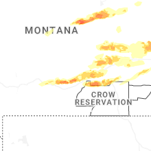
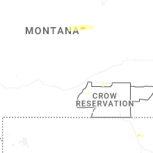
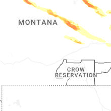
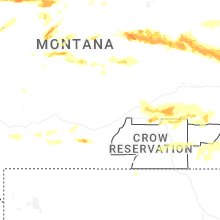


Connect with Interactive Hail Maps