

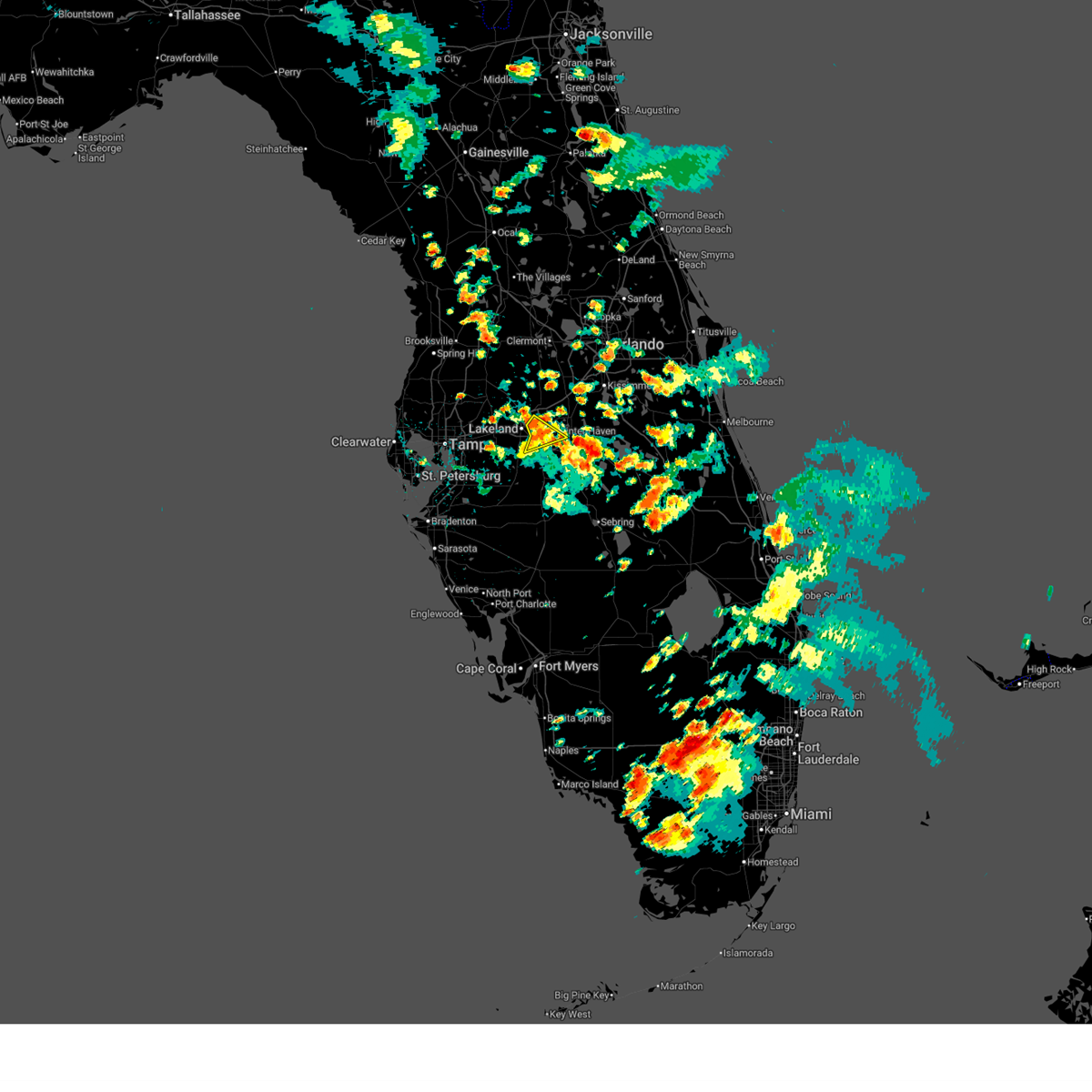
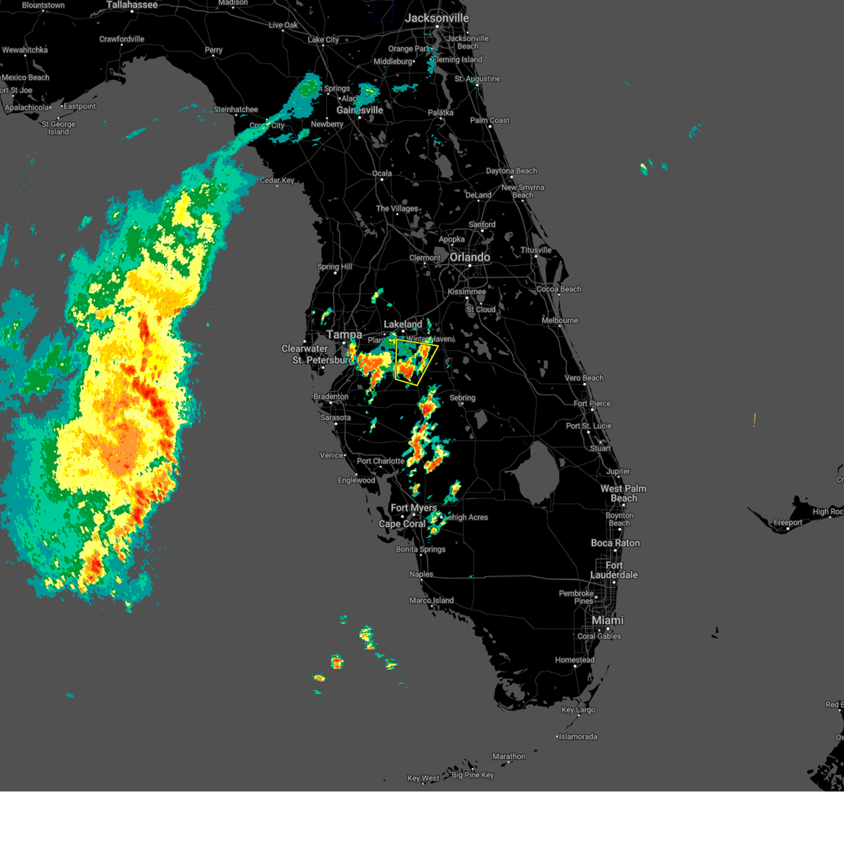
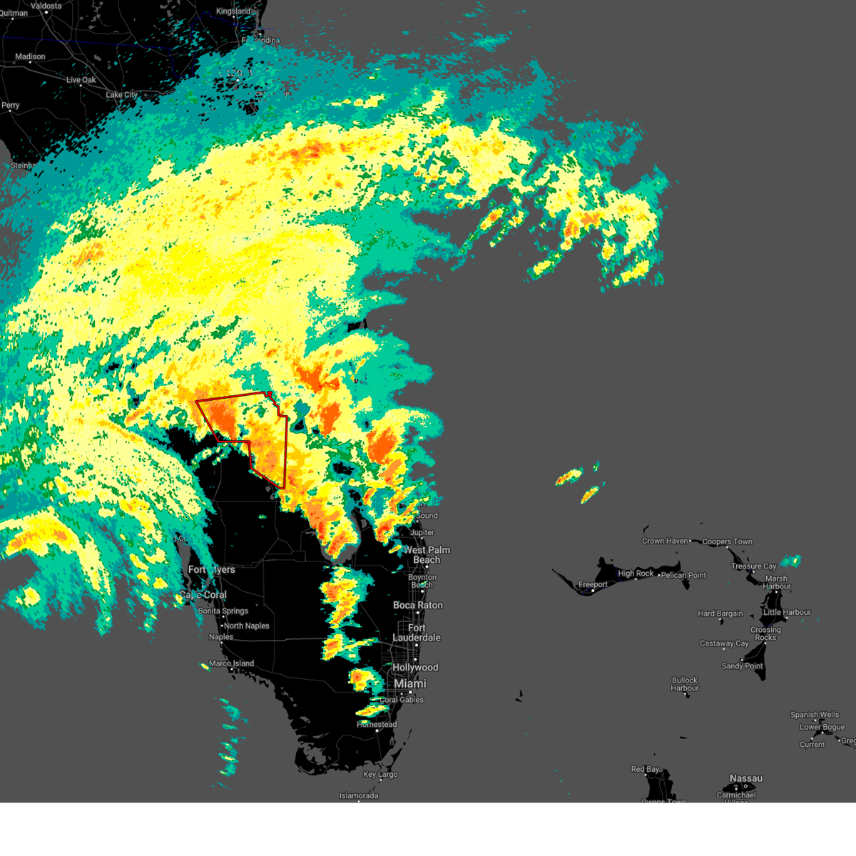
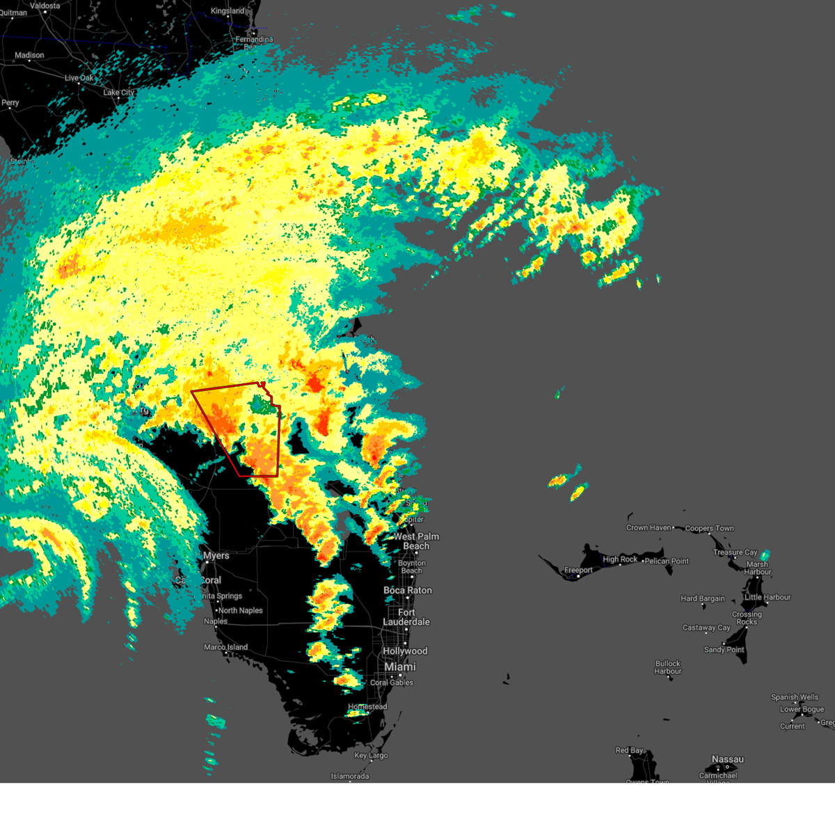
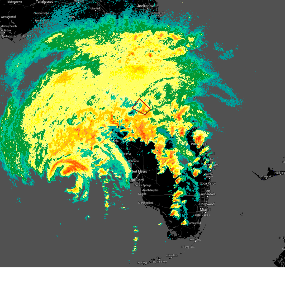
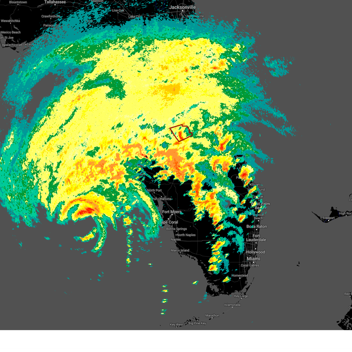
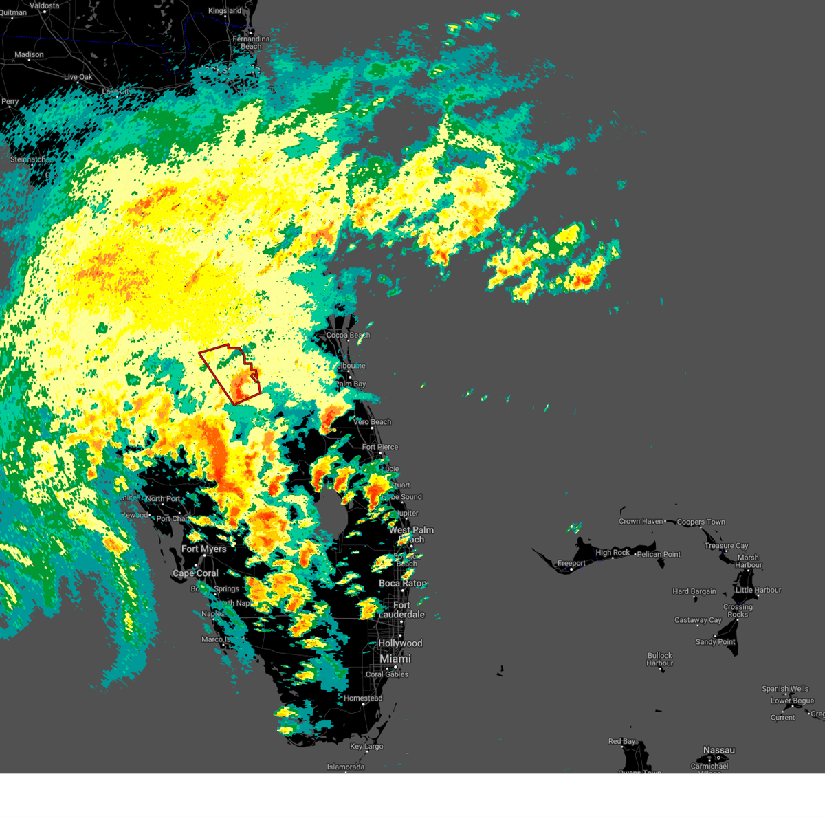
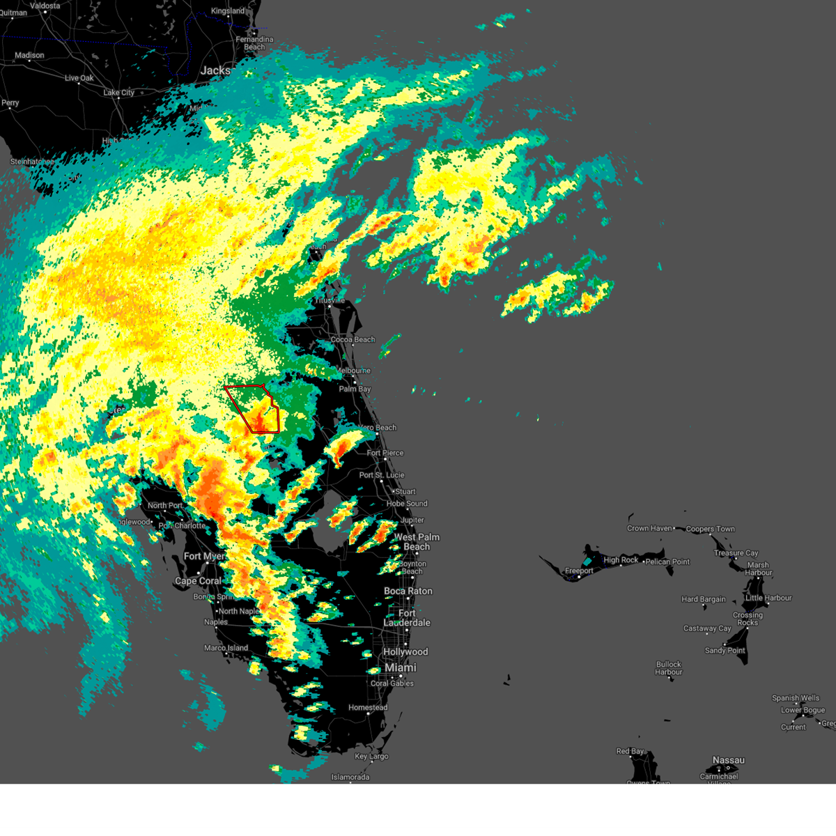
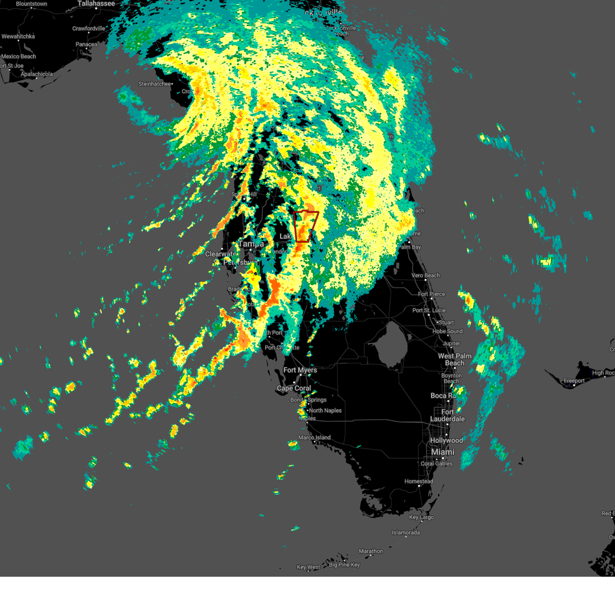
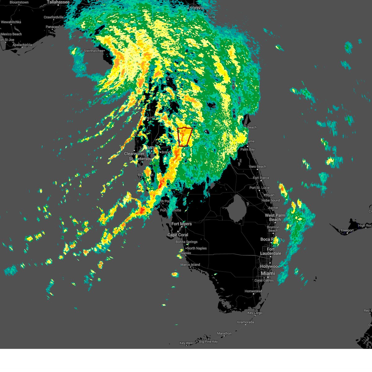
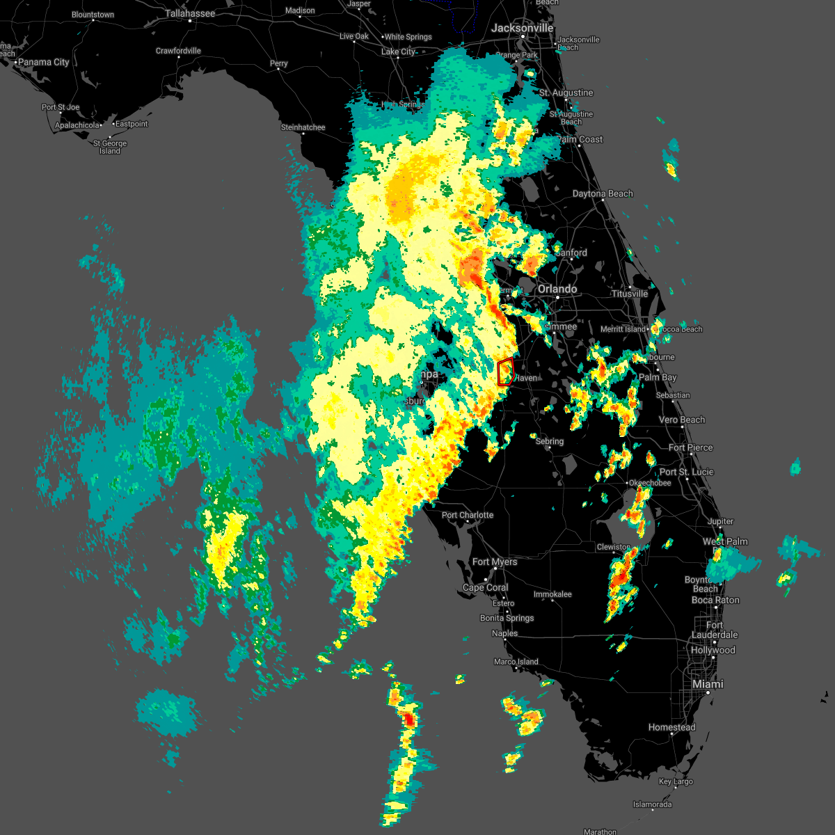
Hail Map for Winter Haven, FL
The Winter Haven, FL area has had 4 reports of on-the-ground hail by trained spotters, and has been under severe weather warnings 0 times during the past 12 months. Doppler radar has detected hail at or near Winter Haven, FL on 105 occasions, including 9 occasions during the past year.
| Name: | Winter Haven, FL |
| Where Located: | 41 miles SSW of Orlando, FL |
| Map: | Google Map for Winter Haven, FL |
| Population: | 33874 |
| Housing Units: | 17037 |
| More Info: | Search Google for Winter Haven, FL |
1
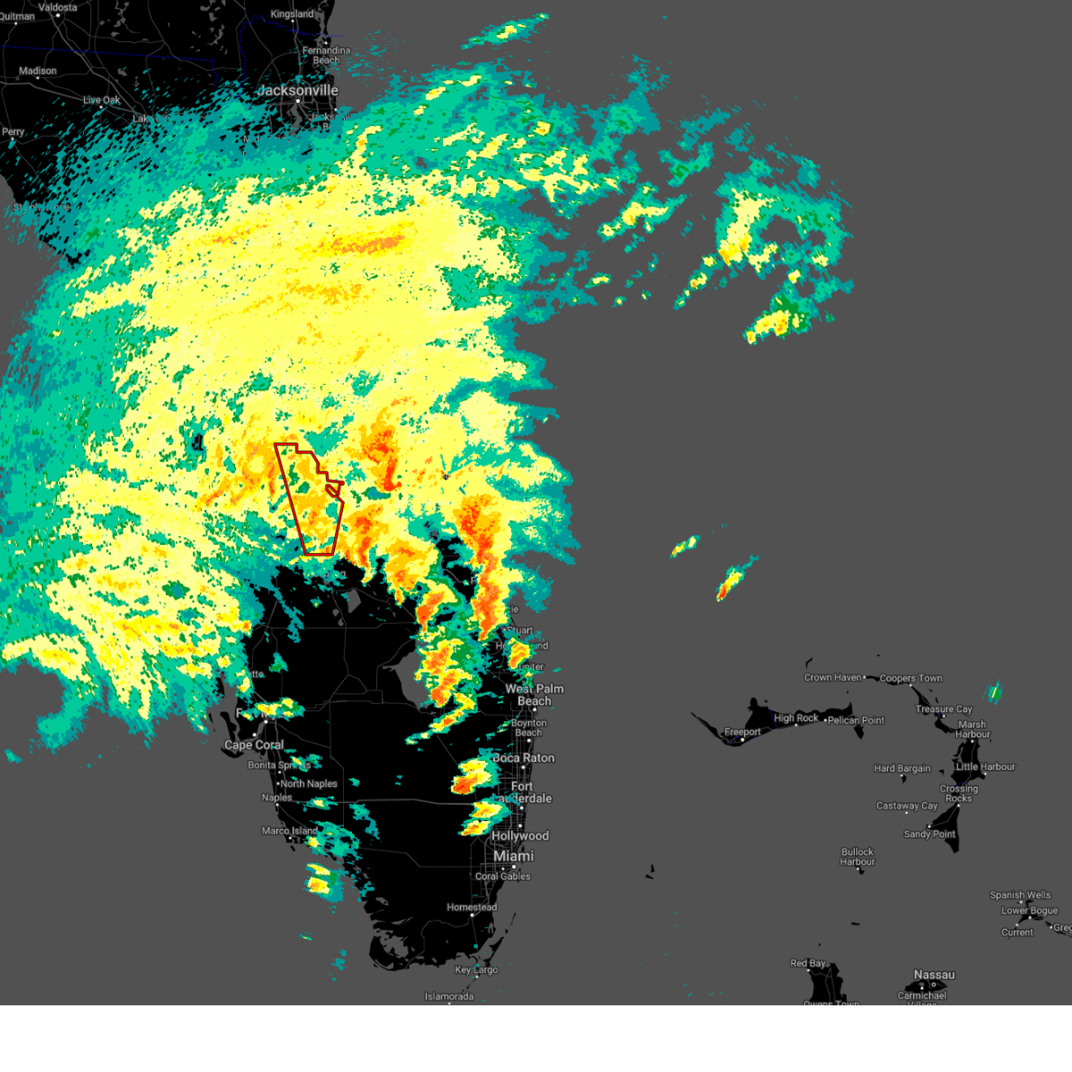
The Top Recent Hail Date for Winter Haven, FL is Tuesday, June 30, 2026 (20th out of 105)

Hail and Wind Damage Spotted near Winter Haven, FL
| Date / Time | Report Details |
|---|---|
| 6/27/2025 3:44 PM EDT |
 the severe thunderstorm warning has been cancelled and is no longer in effect the severe thunderstorm warning has been cancelled and is no longer in effect
|
| 6/27/2025 3:36 PM EDT |
 At 336 pm edt, a severe thunderstorm was located near jan phyl village, or near auburndale, moving northeast at 20 mph (radar indicated). Hazards include 60 mph wind gusts and penny size hail. Expect damage to roofs, siding, and trees. Locations impacted include, inwood, combee settlement, fussels corner, highland city, cypress gardens, jan phyl village, eagle lake, crystal lake, auburndale, and wahneta. At 336 pm edt, a severe thunderstorm was located near jan phyl village, or near auburndale, moving northeast at 20 mph (radar indicated). Hazards include 60 mph wind gusts and penny size hail. Expect damage to roofs, siding, and trees. Locations impacted include, inwood, combee settlement, fussels corner, highland city, cypress gardens, jan phyl village, eagle lake, crystal lake, auburndale, and wahneta.
|
| 6/27/2025 3:26 PM EDT |
 Svrtbw the national weather service in ruskin has issued a * severe thunderstorm warning for, west central polk county in central florida, * until 400 pm edt. * at 326 pm edt, a severe thunderstorm was located near bartow, moving northeast at 20 mph (radar indicated). Hazards include 60 mph wind gusts and penny size hail. expect damage to roofs, siding, and trees Svrtbw the national weather service in ruskin has issued a * severe thunderstorm warning for, west central polk county in central florida, * until 400 pm edt. * at 326 pm edt, a severe thunderstorm was located near bartow, moving northeast at 20 mph (radar indicated). Hazards include 60 mph wind gusts and penny size hail. expect damage to roofs, siding, and trees
|
| 5/10/2025 2:10 PM EDT |
 The storm which prompted the warning has weakened below severe limits, and no longer poses an immediate threat to life or property. therefore, the warning will be allowed to expire. however, small hail is still possible with this thunderstorm. The storm which prompted the warning has weakened below severe limits, and no longer poses an immediate threat to life or property. therefore, the warning will be allowed to expire. however, small hail is still possible with this thunderstorm.
|
| 5/10/2025 1:46 PM EDT |
 Svrtbw the national weather service in ruskin has issued a * severe thunderstorm warning for, northern hardee county in central florida, southwestern polk county in central florida, * until 215 pm edt. * at 146 pm edt, a severe thunderstorm was located 12 miles southwest of bartow, moving north at 25 mph (radar indicated). Hazards include 60 mph wind gusts and half dollar size hail. Hail damage to vehicles is expected. Expect wind damage to roofs, siding, and trees. Svrtbw the national weather service in ruskin has issued a * severe thunderstorm warning for, northern hardee county in central florida, southwestern polk county in central florida, * until 215 pm edt. * at 146 pm edt, a severe thunderstorm was located 12 miles southwest of bartow, moving north at 25 mph (radar indicated). Hazards include 60 mph wind gusts and half dollar size hail. Hail damage to vehicles is expected. Expect wind damage to roofs, siding, and trees.
|
| 10/9/2024 3:52 PM EDT |
 the tornado warning has been cancelled and is no longer in effect the tornado warning has been cancelled and is no longer in effect
|
| 10/9/2024 3:38 PM EDT |
 Tortbw the national weather service in ruskin has issued a * tornado warning for, central polk county in central florida, * until 430 pm edt. * at 338 pm edt, a severe thunderstorm capable of producing a tornado was located 8 miles north of avon park, moving north at 55 mph (radar indicated rotation). Hazards include tornado. Flying debris will be dangerous to those caught without shelter. mobile homes will be damaged or destroyed. damage to roofs, windows, and vehicles will occur. tree damage is likely. this dangerous storm will be near, lake wales around 345 pm edt. winter haven around 355 pm edt. haines city around 400 pm edt. Other locations impacted by this tornadic thunderstorm include highland park, crooked lake park, poinciana, cypress gardens, dundee, lake wales municipal airport, babson park, frostproof, lake hamilton, and waverly. Tortbw the national weather service in ruskin has issued a * tornado warning for, central polk county in central florida, * until 430 pm edt. * at 338 pm edt, a severe thunderstorm capable of producing a tornado was located 8 miles north of avon park, moving north at 55 mph (radar indicated rotation). Hazards include tornado. Flying debris will be dangerous to those caught without shelter. mobile homes will be damaged or destroyed. damage to roofs, windows, and vehicles will occur. tree damage is likely. this dangerous storm will be near, lake wales around 345 pm edt. winter haven around 355 pm edt. haines city around 400 pm edt. Other locations impacted by this tornadic thunderstorm include highland park, crooked lake park, poinciana, cypress gardens, dundee, lake wales municipal airport, babson park, frostproof, lake hamilton, and waverly.
|
| 10/9/2024 3:27 PM EDT |
 The storm which prompted the warning has weakened below severe limits, and no longer appears capable of producing a tornado. therefore, the warning will be allowed to expire. a tornado watch remains in effect until 900 pm edt for south central and central florida. The storm which prompted the warning has weakened below severe limits, and no longer appears capable of producing a tornado. therefore, the warning will be allowed to expire. a tornado watch remains in effect until 900 pm edt for south central and central florida.
|
| 10/9/2024 3:17 PM EDT |
 the tornado warning has been cancelled and is no longer in effect the tornado warning has been cancelled and is no longer in effect
|
| 10/9/2024 3:17 PM EDT |
 At 317 pm edt, a severe thunderstorm capable of producing a tornado was located near avon park, moving north at 55 mph (radar indicated rotation). Hazards include tornado. Flying debris will be dangerous to those caught without shelter. mobile homes will be damaged or destroyed. damage to roofs, windows, and vehicles will occur. tree damage is likely. this dangerous storm will be near, lake wales around 325 pm edt. winter haven around 340 pm edt. Other locations impacted by this tornadic thunderstorm include homeland, alturas, highland park, mulberry, indian lake estates, crooked lake park, highland city, lake wales municipal airport, sebring shores, and babson park. At 317 pm edt, a severe thunderstorm capable of producing a tornado was located near avon park, moving north at 55 mph (radar indicated rotation). Hazards include tornado. Flying debris will be dangerous to those caught without shelter. mobile homes will be damaged or destroyed. damage to roofs, windows, and vehicles will occur. tree damage is likely. this dangerous storm will be near, lake wales around 325 pm edt. winter haven around 340 pm edt. Other locations impacted by this tornadic thunderstorm include homeland, alturas, highland park, mulberry, indian lake estates, crooked lake park, highland city, lake wales municipal airport, sebring shores, and babson park.
|
| 10/9/2024 3:04 PM EDT |
 the tornado warning has been cancelled and is no longer in effect the tornado warning has been cancelled and is no longer in effect
|
| 10/9/2024 2:58 PM EDT |
 Tortbw the national weather service in ruskin has issued a * tornado warning for, northwestern highlands county in south central florida, eastern hardee county in central florida, southern polk county in central florida, northeastern desoto county in south central florida, * until 330 pm edt. * at 258 pm edt, a severe thunderstorm capable of producing a tornado was located near sebring, moving north at 55 mph (radar indicated rotation). Hazards include tornado. Flying debris will be dangerous to those caught without shelter. mobile homes will be damaged or destroyed. damage to roofs, windows, and vehicles will occur. tree damage is likely. this dangerous storm will be near, sebring and avon park around 305 pm edt. Other locations impacted by this tornadic thunderstorm include homeland, alturas, indian lake estates, crooked lake park, frostproof, lake josephine, wahneta, fort meade, lorida, and hillcrest heights. Tortbw the national weather service in ruskin has issued a * tornado warning for, northwestern highlands county in south central florida, eastern hardee county in central florida, southern polk county in central florida, northeastern desoto county in south central florida, * until 330 pm edt. * at 258 pm edt, a severe thunderstorm capable of producing a tornado was located near sebring, moving north at 55 mph (radar indicated rotation). Hazards include tornado. Flying debris will be dangerous to those caught without shelter. mobile homes will be damaged or destroyed. damage to roofs, windows, and vehicles will occur. tree damage is likely. this dangerous storm will be near, sebring and avon park around 305 pm edt. Other locations impacted by this tornadic thunderstorm include homeland, alturas, indian lake estates, crooked lake park, frostproof, lake josephine, wahneta, fort meade, lorida, and hillcrest heights.
|
| 10/9/2024 2:42 PM EDT |
 Tortbw the national weather service in ruskin has issued a * tornado warning for, northwestern polk county in central florida, * until 315 pm edt. * at 242 pm edt, a severe thunderstorm capable of producing a tornado was located over winter haven, moving northwest at 25 mph (radar indicated rotation). Hazards include tornado. Flying debris will be dangerous to those caught without shelter. mobile homes will be damaged or destroyed. damage to roofs, windows, and vehicles will occur. tree damage is likely. this dangerous storm will be near, winter haven, auburndale, fussels corner, and jan phyl village around 245 pm edt. lakeland and combee settlement around 250 pm edt. Other locations impacted by this tornadic thunderstorm include polk city, inwood, lake alfred, winter haven airport, kathleen, gibsonia, eagle lake, cypress gardens, and lake hamilton. Tortbw the national weather service in ruskin has issued a * tornado warning for, northwestern polk county in central florida, * until 315 pm edt. * at 242 pm edt, a severe thunderstorm capable of producing a tornado was located over winter haven, moving northwest at 25 mph (radar indicated rotation). Hazards include tornado. Flying debris will be dangerous to those caught without shelter. mobile homes will be damaged or destroyed. damage to roofs, windows, and vehicles will occur. tree damage is likely. this dangerous storm will be near, winter haven, auburndale, fussels corner, and jan phyl village around 245 pm edt. lakeland and combee settlement around 250 pm edt. Other locations impacted by this tornadic thunderstorm include polk city, inwood, lake alfred, winter haven airport, kathleen, gibsonia, eagle lake, cypress gardens, and lake hamilton.
|
| 10/9/2024 2:33 PM EDT |
 At 233 pm edt, a severe thunderstorm capable of producing a tornado was located over winter haven, moving northwest at 25 mph (radar indicated rotation). Hazards include tornado. Flying debris will be dangerous to those caught without shelter. mobile homes will be damaged or destroyed. damage to roofs, windows, and vehicles will occur. tree damage is likely. this dangerous storm will be near, winter haven and auburndale around 240 pm edt. Other locations impacted by this tornadic thunderstorm include lake hamilton, polk city, inwood, poinciana, loughman, davenport, lake alfred, cypress gardens, winter haven airport, and dundee. At 233 pm edt, a severe thunderstorm capable of producing a tornado was located over winter haven, moving northwest at 25 mph (radar indicated rotation). Hazards include tornado. Flying debris will be dangerous to those caught without shelter. mobile homes will be damaged or destroyed. damage to roofs, windows, and vehicles will occur. tree damage is likely. this dangerous storm will be near, winter haven and auburndale around 240 pm edt. Other locations impacted by this tornadic thunderstorm include lake hamilton, polk city, inwood, poinciana, loughman, davenport, lake alfred, cypress gardens, winter haven airport, and dundee.
|
| 10/9/2024 2:03 PM EDT |
 Tortbw the national weather service in ruskin has issued a * tornado warning for, central polk county in central florida, * until 245 pm edt. * at 202 pm edt, a severe thunderstorm capable of producing a tornado was located near lake wales, moving northwest at 25 mph (radar indicated rotation). Hazards include tornado. Flying debris will be dangerous to those caught without shelter. mobile homes will be damaged or destroyed. damage to roofs, windows, and vehicles will occur. tree damage is likely. this dangerous storm will be near, winter haven, haines city, and lake wales around 210 pm edt. Other locations impacted by this tornadic thunderstorm include highland park, crooked lake park, inwood, poinciana, cypress gardens, dundee, winter haven airport, lake wales municipal airport, lake hamilton, and polk city. Tortbw the national weather service in ruskin has issued a * tornado warning for, central polk county in central florida, * until 245 pm edt. * at 202 pm edt, a severe thunderstorm capable of producing a tornado was located near lake wales, moving northwest at 25 mph (radar indicated rotation). Hazards include tornado. Flying debris will be dangerous to those caught without shelter. mobile homes will be damaged or destroyed. damage to roofs, windows, and vehicles will occur. tree damage is likely. this dangerous storm will be near, winter haven, haines city, and lake wales around 210 pm edt. Other locations impacted by this tornadic thunderstorm include highland park, crooked lake park, inwood, poinciana, cypress gardens, dundee, winter haven airport, lake wales municipal airport, lake hamilton, and polk city.
|
| 10/9/2024 1:24 PM EDT |
 Tortbw the national weather service in ruskin has issued a * tornado warning for, southeastern polk county in central florida, * until 215 pm edt. * at 124 pm edt, a severe thunderstorm capable of producing a tornado was located 10 miles northeast of avon park, moving north at 25 mph (radar indicated rotation). Hazards include tornado. Flying debris will be dangerous to those caught without shelter. mobile homes will be damaged or destroyed. damage to roofs, windows, and vehicles will occur. tree damage is likely. this dangerous storm will be near, lake wales around 150 pm edt. Other locations impacted by this tornadic thunderstorm include highland park, indian lake estates, crooked lake park, waverly, hillcrest heights, lake wales municipal airport, babson park, frostproof, cypress gardens, and dundee. Tortbw the national weather service in ruskin has issued a * tornado warning for, southeastern polk county in central florida, * until 215 pm edt. * at 124 pm edt, a severe thunderstorm capable of producing a tornado was located 10 miles northeast of avon park, moving north at 25 mph (radar indicated rotation). Hazards include tornado. Flying debris will be dangerous to those caught without shelter. mobile homes will be damaged or destroyed. damage to roofs, windows, and vehicles will occur. tree damage is likely. this dangerous storm will be near, lake wales around 150 pm edt. Other locations impacted by this tornadic thunderstorm include highland park, indian lake estates, crooked lake park, waverly, hillcrest heights, lake wales municipal airport, babson park, frostproof, cypress gardens, and dundee.
|
| 8/5/2024 8:03 AM EDT |
 Tortbw the national weather service in ruskin has issued a * tornado warning for, north central polk county in central florida, * until 830 am edt. * at 803 am edt, a severe thunderstorm capable of producing a tornado was located over jan phyl village, or near auburndale, moving northeast at 40 mph (radar indicated rotation). Hazards include tornado. Flying debris will be dangerous to those caught without shelter. mobile homes will be damaged or destroyed. damage to roofs, windows, and vehicles will occur. tree damage is likely. this dangerous storm will be near, winter haven, haines city, auburndale, and fussels corner around 810 am edt. Other locations impacted by this tornadic thunderstorm include davenport, lake alfred, winter haven airport, polk city, inwood, and eagle lake. Tortbw the national weather service in ruskin has issued a * tornado warning for, north central polk county in central florida, * until 830 am edt. * at 803 am edt, a severe thunderstorm capable of producing a tornado was located over jan phyl village, or near auburndale, moving northeast at 40 mph (radar indicated rotation). Hazards include tornado. Flying debris will be dangerous to those caught without shelter. mobile homes will be damaged or destroyed. damage to roofs, windows, and vehicles will occur. tree damage is likely. this dangerous storm will be near, winter haven, haines city, auburndale, and fussels corner around 810 am edt. Other locations impacted by this tornadic thunderstorm include davenport, lake alfred, winter haven airport, polk city, inwood, and eagle lake.
|
| 8/5/2024 6:15 AM EDT |
 the tornado warning has been cancelled and is no longer in effect the tornado warning has been cancelled and is no longer in effect
|
| 8/5/2024 6:01 AM EDT |
 Tortbw the national weather service in ruskin has issued a * tornado warning for, northwestern polk county in central florida, * until 630 am edt. * at 601 am edt, a severe thunderstorm capable of producing a tornado was located over fussels corner, or near auburndale, moving north at 45 mph (radar indicated rotation). Hazards include tornado. Flying debris will be dangerous to those caught without shelter. mobile homes will be damaged or destroyed. damage to roofs, windows, and vehicles will occur. tree damage is likely. this dangerous storm will be near, lakeland and auburndale around 605 am edt. Other locations impacted by this tornadic thunderstorm include withla, polk city, and rockridge. Tortbw the national weather service in ruskin has issued a * tornado warning for, northwestern polk county in central florida, * until 630 am edt. * at 601 am edt, a severe thunderstorm capable of producing a tornado was located over fussels corner, or near auburndale, moving north at 45 mph (radar indicated rotation). Hazards include tornado. Flying debris will be dangerous to those caught without shelter. mobile homes will be damaged or destroyed. damage to roofs, windows, and vehicles will occur. tree damage is likely. this dangerous storm will be near, lakeland and auburndale around 605 am edt. Other locations impacted by this tornadic thunderstorm include withla, polk city, and rockridge.
|
| 5/13/2024 5:21 PM EDT |
 Svrtbw the national weather service in ruskin has issued a * severe thunderstorm warning for, central polk county in central florida, * until 545 pm edt. * at 521 pm edt, a severe thunderstorm was located 7 miles northeast of lake wales, moving east at 30 mph (radar indicated). Hazards include ping pong ball size hail and 60 mph wind gusts. People and animals outdoors will be injured. expect hail damage to roofs, siding, windows, and vehicles. Expect wind damage to roofs, siding, and trees. Svrtbw the national weather service in ruskin has issued a * severe thunderstorm warning for, central polk county in central florida, * until 545 pm edt. * at 521 pm edt, a severe thunderstorm was located 7 miles northeast of lake wales, moving east at 30 mph (radar indicated). Hazards include ping pong ball size hail and 60 mph wind gusts. People and animals outdoors will be injured. expect hail damage to roofs, siding, windows, and vehicles. Expect wind damage to roofs, siding, and trees.
|
| 5/13/2024 4:51 PM EDT |
 The storm which prompted the warning has weakened below severe limits, and no longer poses an immediate threat to life or property. therefore, the warning will be allowed to expire. however, small hail, gusty winds and heavy rain are still possible with this thunderstorm. to report severe weather, contact your nearest law enforcement agency. they will relay your report to the national weather service ruskin. The storm which prompted the warning has weakened below severe limits, and no longer poses an immediate threat to life or property. therefore, the warning will be allowed to expire. however, small hail, gusty winds and heavy rain are still possible with this thunderstorm. to report severe weather, contact your nearest law enforcement agency. they will relay your report to the national weather service ruskin.
|
| 5/13/2024 4:43 PM EDT |
 At 443 pm edt, a severe thunderstorm was located over haines city, moving east at 15 mph (radar indicated). Hazards include ping pong ball size hail and 60 mph wind gusts. People and animals outdoors will be injured. expect hail damage to roofs, siding, windows, and vehicles. expect wind damage to roofs, siding, and trees. Locations impacted include, winter haven, haines city, lake alfred, and davenport. At 443 pm edt, a severe thunderstorm was located over haines city, moving east at 15 mph (radar indicated). Hazards include ping pong ball size hail and 60 mph wind gusts. People and animals outdoors will be injured. expect hail damage to roofs, siding, windows, and vehicles. expect wind damage to roofs, siding, and trees. Locations impacted include, winter haven, haines city, lake alfred, and davenport.
|
| 5/13/2024 4:27 PM EDT |
 At 426 pm edt, a severe thunderstorm was located near auburndale, moving northeast at 15 mph (radar indicated). Hazards include ping pong ball size hail and 60 mph wind gusts. People and animals outdoors will be injured. expect hail damage to roofs, siding, windows, and vehicles. expect wind damage to roofs, siding, and trees. Locations impacted include, winter haven, haines city, lake alfred, davenport, and loughman. At 426 pm edt, a severe thunderstorm was located near auburndale, moving northeast at 15 mph (radar indicated). Hazards include ping pong ball size hail and 60 mph wind gusts. People and animals outdoors will be injured. expect hail damage to roofs, siding, windows, and vehicles. expect wind damage to roofs, siding, and trees. Locations impacted include, winter haven, haines city, lake alfred, davenport, and loughman.
|
| 5/13/2024 4:19 PM EDT |
 Svrtbw the national weather service in ruskin has issued a * severe thunderstorm warning for, north central polk county in central florida, * until 500 pm edt. * at 419 pm edt, a severe thunderstorm was located near auburndale, moving northeast at 15 mph (radar indicated). Hazards include 60 mph wind gusts and quarter size hail. Hail damage to vehicles is expected. Expect wind damage to roofs, siding, and trees. Svrtbw the national weather service in ruskin has issued a * severe thunderstorm warning for, north central polk county in central florida, * until 500 pm edt. * at 419 pm edt, a severe thunderstorm was located near auburndale, moving northeast at 15 mph (radar indicated). Hazards include 60 mph wind gusts and quarter size hail. Hail damage to vehicles is expected. Expect wind damage to roofs, siding, and trees.
|
| 9/11/2023 9:53 PM EDT |
 At 952 pm edt, a severe thunderstorm was located near champions gate, or 8 miles northwest of haines city, and is nearly stationary (radar indicated). Hazards include 60 mph wind gusts and quarter size hail. Hail damage to vehicles is expected. Expect wind damage to roofs, siding, and trees. At 952 pm edt, a severe thunderstorm was located near champions gate, or 8 miles northwest of haines city, and is nearly stationary (radar indicated). Hazards include 60 mph wind gusts and quarter size hail. Hail damage to vehicles is expected. Expect wind damage to roofs, siding, and trees.
|
| 9/8/2023 2:09 PM EDT |
 The severe thunderstorm warning for north central polk county will expire at 215 pm edt, the storm which prompted the warning has weakened below severe limits, and no longer poses an immediate threat to life or property. therefore, the warning will be allowed to expire. however, gusty winds are still possible with this thunderstorm. The severe thunderstorm warning for north central polk county will expire at 215 pm edt, the storm which prompted the warning has weakened below severe limits, and no longer poses an immediate threat to life or property. therefore, the warning will be allowed to expire. however, gusty winds are still possible with this thunderstorm.
|
| 9/8/2023 1:54 PM EDT |
 At 154 pm edt, a severe thunderstorm was located over haines city, moving northeast at 20 mph (radar indicated). Hazards include 60 mph wind gusts and penny size hail. expect damage to roofs, siding, and trees At 154 pm edt, a severe thunderstorm was located over haines city, moving northeast at 20 mph (radar indicated). Hazards include 60 mph wind gusts and penny size hail. expect damage to roofs, siding, and trees
|
| 6/22/2023 2:15 PM EDT |
 At 215 pm edt, severe thunderstorms were located along a line extending from near auburndale to near winter haven to 6 miles southeast of jan phyl village, moving northeast at 30 mph (radar indicated). Hazards include 70 mph wind gusts. Expect considerable tree damage. damage is likely to mobile homes, roofs, and outbuildings. locations impacted include, lakeland, poinciana, winter haven, haines city, lake wales, auburndale, lake alfred, dundee, davenport, and eagle lake. thunderstorm damage threat, considerable hail threat, radar indicated max hail size, <. 75 in wind threat, radar indicated max wind gust, 70 mph. At 215 pm edt, severe thunderstorms were located along a line extending from near auburndale to near winter haven to 6 miles southeast of jan phyl village, moving northeast at 30 mph (radar indicated). Hazards include 70 mph wind gusts. Expect considerable tree damage. damage is likely to mobile homes, roofs, and outbuildings. locations impacted include, lakeland, poinciana, winter haven, haines city, lake wales, auburndale, lake alfred, dundee, davenport, and eagle lake. thunderstorm damage threat, considerable hail threat, radar indicated max hail size, <. 75 in wind threat, radar indicated max wind gust, 70 mph.
|
| 6/22/2023 2:00 PM EDT |
 At 200 pm edt, severe thunderstorms were located along a line extending from fussels corner to jan phyl village to near bartow, moving northeast at 30 mph (radar indicated). Hazards include 60 mph wind gusts. expect damage to roofs, siding, and trees At 200 pm edt, severe thunderstorms were located along a line extending from fussels corner to jan phyl village to near bartow, moving northeast at 30 mph (radar indicated). Hazards include 60 mph wind gusts. expect damage to roofs, siding, and trees
|
| 6/19/2023 8:58 PM EDT |
 At 858 pm edt, a severe thunderstorm was located near winter haven, moving east at 15 mph (radar indicated). Hazards include 60 mph wind gusts and quarter size hail. Hail damage to vehicles is expected. expect wind damage to roofs, siding, and trees. locations impacted include, winter haven, haines city, lake wales, auburndale, lake alfred, dundee, davenport, eagle lake, lake hamilton, and inwood. hail threat, radar indicated max hail size, 1. 00 in wind threat, radar indicated max wind gust, 60 mph. At 858 pm edt, a severe thunderstorm was located near winter haven, moving east at 15 mph (radar indicated). Hazards include 60 mph wind gusts and quarter size hail. Hail damage to vehicles is expected. expect wind damage to roofs, siding, and trees. locations impacted include, winter haven, haines city, lake wales, auburndale, lake alfred, dundee, davenport, eagle lake, lake hamilton, and inwood. hail threat, radar indicated max hail size, 1. 00 in wind threat, radar indicated max wind gust, 60 mph.
|
| 6/19/2023 8:33 PM EDT |
 At 832 pm edt, a severe thunderstorm was located over jan phyl village, or near auburndale, moving east at 15 mph (radar indicated). Hazards include 60 mph wind gusts and quarter size hail. Hail damage to vehicles is expected. Expect wind damage to roofs, siding, and trees. At 832 pm edt, a severe thunderstorm was located over jan phyl village, or near auburndale, moving east at 15 mph (radar indicated). Hazards include 60 mph wind gusts and quarter size hail. Hail damage to vehicles is expected. Expect wind damage to roofs, siding, and trees.
|
| 4/26/2023 9:14 PM EDT |
 At 913 pm edt, a severe thunderstorm was located near lake wales, moving southeast at 20 mph (radar indicated). Hazards include 60 mph wind gusts and quarter size hail. Hail damage to vehicles is expected. Expect wind damage to roofs, siding, and trees. At 913 pm edt, a severe thunderstorm was located near lake wales, moving southeast at 20 mph (radar indicated). Hazards include 60 mph wind gusts and quarter size hail. Hail damage to vehicles is expected. Expect wind damage to roofs, siding, and trees.
|
| 4/26/2023 8:41 PM EDT |
 At 841 pm edt, a severe thunderstorm was located near haines city, moving southeast at 15 mph (radar indicated). Hazards include 60 mph wind gusts and quarter size hail. Hail damage to vehicles is expected. Expect wind damage to roofs, siding, and trees. At 841 pm edt, a severe thunderstorm was located near haines city, moving southeast at 15 mph (radar indicated). Hazards include 60 mph wind gusts and quarter size hail. Hail damage to vehicles is expected. Expect wind damage to roofs, siding, and trees.
|
| 4/26/2023 8:30 PM EDT | Quarter sized hail reported 5.4 miles SW of Winter Haven, FL, 1-inch hail reported near intersection of u.s. hwy 27 and lucerne park rd. time estimated from radar. |
| 4/26/2023 8:17 PM EDT |
 At 817 pm edt, a severe thunderstorm was located near haines city, moving southeast at 20 mph (radar indicated). Hazards include quarter size hail. damage to vehicles is expected At 817 pm edt, a severe thunderstorm was located near haines city, moving southeast at 20 mph (radar indicated). Hazards include quarter size hail. damage to vehicles is expected
|
| 4/26/2023 7:57 PM EDT |
 At 756 pm edt, a severe thunderstorm was located 11 miles west of four corners, or 13 miles north of auburndale, moving southeast at 15 mph (radar indicated). Hazards include quarter size hail. damage to vehicles is expected At 756 pm edt, a severe thunderstorm was located 11 miles west of four corners, or 13 miles north of auburndale, moving southeast at 15 mph (radar indicated). Hazards include quarter size hail. damage to vehicles is expected
|
| 8/2/2022 6:15 PM EDT | A screened porch/patio extension area had cover damage. estimated winds from nearby reports were around 40 mp in polk county FL, 3.4 miles NNW of Winter Haven, FL |
| 6/18/2022 3:38 PM EDT |
 The severe thunderstorm warning for south central polk county will expire at 345 pm edt, the storm which prompted the warning has weakened below severe limits, and no longer poses an immediate threat to life or property. therefore, the warning will be allowed to expire. however small hail and gusty winds are still possible with this thunderstorm. a severe thunderstorm watch remains in effect until 800 pm edt for central florida. The severe thunderstorm warning for south central polk county will expire at 345 pm edt, the storm which prompted the warning has weakened below severe limits, and no longer poses an immediate threat to life or property. therefore, the warning will be allowed to expire. however small hail and gusty winds are still possible with this thunderstorm. a severe thunderstorm watch remains in effect until 800 pm edt for central florida.
|
| 6/18/2022 3:26 PM EDT |
 At 326 pm edt, a severe thunderstorm was located near lake wales, moving southeast at 5 mph (radar indicated). Hazards include 60 mph wind gusts and quarter size hail. Hail damage to vehicles is expected. expect wind damage to roofs, siding, and trees. locations impacted include, winter haven, lake wales, crooked lake park, dundee, hillcrest heights, highland park, alturas, waverly, lake wales municipal airport and babson park. hail threat, radar indicated max hail size, 1. 00 in wind threat, radar indicated max wind gust, 60 mph. At 326 pm edt, a severe thunderstorm was located near lake wales, moving southeast at 5 mph (radar indicated). Hazards include 60 mph wind gusts and quarter size hail. Hail damage to vehicles is expected. expect wind damage to roofs, siding, and trees. locations impacted include, winter haven, lake wales, crooked lake park, dundee, hillcrest heights, highland park, alturas, waverly, lake wales municipal airport and babson park. hail threat, radar indicated max hail size, 1. 00 in wind threat, radar indicated max wind gust, 60 mph.
|
| 6/18/2022 3:16 PM EDT | Golf Ball sized hail reported 1.9 miles NNW of Winter Haven, FL, public report relayed by amateur radio. |
| 6/18/2022 3:13 PM EDT |
 At 313 pm edt, a severe thunderstorm was located near winter haven, and is nearly stationary (radar indicated). Hazards include 60 mph wind gusts and quarter size hail. Hail damage to vehicles is expected. Expect wind damage to roofs, siding, and trees. At 313 pm edt, a severe thunderstorm was located near winter haven, and is nearly stationary (radar indicated). Hazards include 60 mph wind gusts and quarter size hail. Hail damage to vehicles is expected. Expect wind damage to roofs, siding, and trees.
|
| 6/18/2022 2:53 PM EDT |
 The severe thunderstorm warning for north central polk county will expire at 300 pm edt, the storm which prompted the warning has weakened below severe limits, and no longer poses an immediate threat to life or property. therefore, the warning will be allowed to expire. however small hail and gusty winds are still possible with this thunderstorm. a severe thunderstorm watch remains in effect until 800 pm edt for central florida. The severe thunderstorm warning for north central polk county will expire at 300 pm edt, the storm which prompted the warning has weakened below severe limits, and no longer poses an immediate threat to life or property. therefore, the warning will be allowed to expire. however small hail and gusty winds are still possible with this thunderstorm. a severe thunderstorm watch remains in effect until 800 pm edt for central florida.
|
| 6/18/2022 2:40 PM EDT |
 At 240 pm edt, a severe thunderstorm was located near champions gate, or near haines city, moving southeast at 20 mph (radar indicated). Hazards include 60 mph wind gusts and quarter size hail. Hail damage to vehicles is expected. expect wind damage to roofs, siding, and trees. locations impacted include, poinciana, haines city, lake alfred, davenport, lake hamilton and loughman. hail threat, radar indicated max hail size, 1. 00 in wind threat, radar indicated max wind gust, 60 mph. At 240 pm edt, a severe thunderstorm was located near champions gate, or near haines city, moving southeast at 20 mph (radar indicated). Hazards include 60 mph wind gusts and quarter size hail. Hail damage to vehicles is expected. expect wind damage to roofs, siding, and trees. locations impacted include, poinciana, haines city, lake alfred, davenport, lake hamilton and loughman. hail threat, radar indicated max hail size, 1. 00 in wind threat, radar indicated max wind gust, 60 mph.
|
| 6/18/2022 2:29 PM EDT |
 At 229 pm edt, a severe thunderstorm was located near champions gate, or 9 miles northwest of haines city, moving southeast at 20 mph (radar indicated). Hazards include 60 mph wind gusts and quarter size hail. Hail damage to vehicles is expected. Expect wind damage to roofs, siding, and trees. At 229 pm edt, a severe thunderstorm was located near champions gate, or 9 miles northwest of haines city, moving southeast at 20 mph (radar indicated). Hazards include 60 mph wind gusts and quarter size hail. Hail damage to vehicles is expected. Expect wind damage to roofs, siding, and trees.
|
| 5/21/2022 7:37 PM EDT |
 At 736 pm edt, a severe thunderstorm was located near bartow, moving northeast at 35 mph (radar indicated). Hazards include 60 mph wind gusts and quarter size hail. Hail damage to vehicles is expected. Expect wind damage to roofs, siding, and trees. At 736 pm edt, a severe thunderstorm was located near bartow, moving northeast at 35 mph (radar indicated). Hazards include 60 mph wind gusts and quarter size hail. Hail damage to vehicles is expected. Expect wind damage to roofs, siding, and trees.
|
| 5/13/2022 7:49 PM EDT |
 At 749 pm edt, a severe thunderstorm was located over haines city, moving north at 5 mph (radar indicated). Hazards include quarter size hail. damage to vehicles is expected At 749 pm edt, a severe thunderstorm was located over haines city, moving north at 5 mph (radar indicated). Hazards include quarter size hail. damage to vehicles is expected
|
| 3/16/2022 2:42 PM EDT |
 At 242 pm edt, a severe thunderstorm was located near lake wales, moving northeast at 35 mph (radar indicated). Hazards include 60 mph wind gusts and quarter size hail. Hail damage to vehicles is expected. Expect wind damage to roofs, siding, and trees. At 242 pm edt, a severe thunderstorm was located near lake wales, moving northeast at 35 mph (radar indicated). Hazards include 60 mph wind gusts and quarter size hail. Hail damage to vehicles is expected. Expect wind damage to roofs, siding, and trees.
|
| 3/16/2022 2:31 PM EDT |
 At 231 pm edt, a severe thunderstorm was located over lake wales, moving northeast at 45 mph (radar indicated). Hazards include 60 mph wind gusts and quarter size hail. Hail damage to vehicles is expected. Expect wind damage to roofs, siding, and trees. At 231 pm edt, a severe thunderstorm was located over lake wales, moving northeast at 45 mph (radar indicated). Hazards include 60 mph wind gusts and quarter size hail. Hail damage to vehicles is expected. Expect wind damage to roofs, siding, and trees.
|
| 3/12/2022 10:44 AM EST |
 At 1044 am est, severe thunderstorms were located along a line extending from narcoossee to near winter haven to near wauchula to 9 miles southwest of myakka river state park, moving east at 40 mph (radar indicated). Hazards include 60 mph wind gusts. Expect damage to roofs, siding, and trees. locations impacted include, poinciana, winter haven, haines city, bartow, lake wales, auburndale, fort meade, lake alfred, wauchula and crooked lake park. hail threat, radar indicated max hail size, <. 75 in wind threat, radar indicated max wind gust, 60 mph. At 1044 am est, severe thunderstorms were located along a line extending from narcoossee to near winter haven to near wauchula to 9 miles southwest of myakka river state park, moving east at 40 mph (radar indicated). Hazards include 60 mph wind gusts. Expect damage to roofs, siding, and trees. locations impacted include, poinciana, winter haven, haines city, bartow, lake wales, auburndale, fort meade, lake alfred, wauchula and crooked lake park. hail threat, radar indicated max hail size, <. 75 in wind threat, radar indicated max wind gust, 60 mph.
|
| 3/12/2022 10:11 AM EST |
 At 1011 am est, severe thunderstorms were located along a line extending from near four corners to near lakeland to 11 miles east of parrish to 16 miles southwest of south sarasota, moving east at 40 mph (radar indicated). Hazards include 60 mph wind gusts. expect damage to roofs, siding, and trees At 1011 am est, severe thunderstorms were located along a line extending from near four corners to near lakeland to 11 miles east of parrish to 16 miles southwest of south sarasota, moving east at 40 mph (radar indicated). Hazards include 60 mph wind gusts. expect damage to roofs, siding, and trees
|
| 6/21/2021 4:42 PM EDT |
 The severe thunderstorm warning for central polk county will expire at 445 pm edt, the storm which prompted the warning has weakened below severe limits, and no longer poses an immediate threat to life or property. therefore, the warning will be allowed to expire. however, gusty winds are still possible with this thunderstorm. The severe thunderstorm warning for central polk county will expire at 445 pm edt, the storm which prompted the warning has weakened below severe limits, and no longer poses an immediate threat to life or property. therefore, the warning will be allowed to expire. however, gusty winds are still possible with this thunderstorm.
|
| 6/21/2021 4:21 PM EDT |
 At 420 pm edt, a severe thunderstorm was located near lake wales, moving north at 15 mph (radar indicated). Hazards include 60 mph wind gusts and penny size hail. expect damage to roofs, siding, and trees At 420 pm edt, a severe thunderstorm was located near lake wales, moving north at 15 mph (radar indicated). Hazards include 60 mph wind gusts and penny size hail. expect damage to roofs, siding, and trees
|
| 4/11/2021 12:22 PM EDT | Damage to roof due to fallen tree. time estimated by rada in polk county FL, 4.9 miles ENE of Winter Haven, FL |
| 4/11/2021 12:22 PM EDT | Damage to flat roo in polk county FL, 5.4 miles ENE of Winter Haven, FL |
| 4/11/2021 12:22 PM EDT | Tree fell on hom in polk county FL, 4 miles ENE of Winter Haven, FL |
| 4/10/2021 6:15 PM EDT | Awos station kbow bartow municipa in polk county FL, 7.3 miles NE of Winter Haven, FL |
| 12/20/2020 8:55 PM EST |
 At 854 pm est, a severe thunderstorm was located 7 miles southwest of bartow, moving east at 25 mph (radar indicated). Hazards include 60 mph wind gusts. expect damage to roofs, siding, and trees At 854 pm est, a severe thunderstorm was located 7 miles southwest of bartow, moving east at 25 mph (radar indicated). Hazards include 60 mph wind gusts. expect damage to roofs, siding, and trees
|
| 9/29/2020 4:49 PM EDT |
 At 448 pm edt, a severe thunderstorm was located near winter haven, moving northeast at 45 mph (radar indicated). Hazards include 60 mph wind gusts. expect damage to roofs, siding, and trees At 448 pm edt, a severe thunderstorm was located near winter haven, moving northeast at 45 mph (radar indicated). Hazards include 60 mph wind gusts. expect damage to roofs, siding, and trees
|
| 4/20/2020 1:55 PM EDT |
 At 154 pm edt, severe thunderstorms were located along a line extending from near jan phyl village to near bartow to 14 miles southeast of medulla, moving east at 45 mph (radar indicated). Hazards include 60 mph wind gusts and nickel size hail. expect damage to roofs, siding, and trees At 154 pm edt, severe thunderstorms were located along a line extending from near jan phyl village to near bartow to 14 miles southeast of medulla, moving east at 45 mph (radar indicated). Hazards include 60 mph wind gusts and nickel size hail. expect damage to roofs, siding, and trees
|
| 4/20/2020 1:25 PM EDT |
 At 123 pm edt, severe thunderstorms were located along a line extending from near lakeland linder airport to 6 miles south of plant city to near fish hawk, moving east at 45 mph (radar indicated). Hazards include 60 mph wind gusts and nickel size hail. expect damage to roofs, siding, and trees At 123 pm edt, severe thunderstorms were located along a line extending from near lakeland linder airport to 6 miles south of plant city to near fish hawk, moving east at 45 mph (radar indicated). Hazards include 60 mph wind gusts and nickel size hail. expect damage to roofs, siding, and trees
|
| 4/20/2020 1:11 PM EDT |
 At 111 pm edt, severe thunderstorms were located along a line extending from near poinciana to 7 miles southeast of haines city to near plant city, moving east at 35 mph (radar indicated). Hazards include 60 mph wind gusts and nickel size hail. expect damage to roofs, siding, and trees At 111 pm edt, severe thunderstorms were located along a line extending from near poinciana to 7 miles southeast of haines city to near plant city, moving east at 35 mph (radar indicated). Hazards include 60 mph wind gusts and nickel size hail. expect damage to roofs, siding, and trees
|
| 4/20/2020 1:05 PM EDT |
 At 104 pm edt, severe thunderstorms were located along a line extending from near brandon to near riverview to near palm river-clair mel, moving east at 50 mph (radar indicated). Hazards include 60 mph wind gusts and nickel size hail. expect damage to roofs, siding, and trees At 104 pm edt, severe thunderstorms were located along a line extending from near brandon to near riverview to near palm river-clair mel, moving east at 50 mph (radar indicated). Hazards include 60 mph wind gusts and nickel size hail. expect damage to roofs, siding, and trees
|
| 4/20/2020 12:41 PM EDT |
 At 1240 pm edt, severe thunderstorms were located along a line extending from 10 miles southwest of four corners to combee settlement to 6 miles west of plant city, moving east at 40 mph (radar indicated). Hazards include 60 mph wind gusts and nickel size hail. expect damage to roofs, siding, and trees At 1240 pm edt, severe thunderstorms were located along a line extending from 10 miles southwest of four corners to combee settlement to 6 miles west of plant city, moving east at 40 mph (radar indicated). Hazards include 60 mph wind gusts and nickel size hail. expect damage to roofs, siding, and trees
|
| 4/20/2020 12:09 PM EDT |
 The national weather service in ruskin has issued a * severe thunderstorm warning for. southeastern sumter county in central florida. southeastern pasco county in west central florida. northeastern pinellas county in west central florida. Northwestern polk county in central florida. The national weather service in ruskin has issued a * severe thunderstorm warning for. southeastern sumter county in central florida. southeastern pasco county in west central florida. northeastern pinellas county in west central florida. Northwestern polk county in central florida.
|
| 2/7/2020 12:20 AM EST |
 At 1219 am est, severe thunderstorms were located along a line extending from hunters creek to 6 miles west of north port, moving east at 50 mph (radar indicated). Hazards include 60 mph wind gusts. Expect damage to roofs, siding, and trees. Locations impacted include, winter haven, haines city, bartow, lake wales, sebring, avon park, arcadia, wauchula, ona, southeast arcadia, myakka city, jan phyl village, poinciana, sweetwater, fort meade, lake alfred, crooked lake park, dundee, frostproof and bowling green. At 1219 am est, severe thunderstorms were located along a line extending from hunters creek to 6 miles west of north port, moving east at 50 mph (radar indicated). Hazards include 60 mph wind gusts. Expect damage to roofs, siding, and trees. Locations impacted include, winter haven, haines city, bartow, lake wales, sebring, avon park, arcadia, wauchula, ona, southeast arcadia, myakka city, jan phyl village, poinciana, sweetwater, fort meade, lake alfred, crooked lake park, dundee, frostproof and bowling green.
|
| 2/6/2020 11:44 PM EST |
 At 1144 pm est, severe thunderstorms were located along a line extending from 9 miles west of four corners to 18 miles southwest of gulf gate estates, moving east at 50 mph (radar indicated). Hazards include 60 mph wind gusts. expect damage to roofs, siding, and trees At 1144 pm est, severe thunderstorms were located along a line extending from 9 miles west of four corners to 18 miles southwest of gulf gate estates, moving east at 50 mph (radar indicated). Hazards include 60 mph wind gusts. expect damage to roofs, siding, and trees
|
| 6/19/2019 3:39 PM EDT |
 At 338 pm edt, a severe thunderstorm was located near auburndale, moving northeast at 45 mph (radar indicated). Hazards include 60 mph wind gusts. expect damage to roofs, siding, and trees At 338 pm edt, a severe thunderstorm was located near auburndale, moving northeast at 45 mph (radar indicated). Hazards include 60 mph wind gusts. expect damage to roofs, siding, and trees
|
| 5/5/2019 2:40 PM EDT |
 At 229 pm edt, severe thunderstorms were located along a line extending from near orlando international airport to 10 miles northwest of kissimmee prarie preserve, moving east at 55 mph (radar indicated). Hazards include 60 mph wind gusts. Expect damage to roofs, siding, and trees. Locations impacted include, winter haven, haines city, lake wales, poinciana, crooked lake park, dundee, davenport, lake hamilton, hillcrest heights, highland park, lake wales municipal airport, babson park, waverly, loughman and cypress gardens. At 229 pm edt, severe thunderstorms were located along a line extending from near orlando international airport to 10 miles northwest of kissimmee prarie preserve, moving east at 55 mph (radar indicated). Hazards include 60 mph wind gusts. Expect damage to roofs, siding, and trees. Locations impacted include, winter haven, haines city, lake wales, poinciana, crooked lake park, dundee, davenport, lake hamilton, hillcrest heights, highland park, lake wales municipal airport, babson park, waverly, loughman and cypress gardens.
|
| 5/5/2019 2:30 PM EDT |
 At 229 pm edt, severe thunderstorms were located along a line extending from near orlando international airport to 10 miles northwest of kissimmee prarie preserve, moving east at 55 mph (radar indicated). Hazards include 60 mph wind gusts. Expect damage to roofs, siding, and trees. Locations impacted include, winter haven, haines city, lake wales, poinciana, crooked lake park, dundee, davenport, lake hamilton, hillcrest heights, highland park, lake wales municipal airport, babson park, waverly, loughman and cypress gardens. At 229 pm edt, severe thunderstorms were located along a line extending from near orlando international airport to 10 miles northwest of kissimmee prarie preserve, moving east at 55 mph (radar indicated). Hazards include 60 mph wind gusts. Expect damage to roofs, siding, and trees. Locations impacted include, winter haven, haines city, lake wales, poinciana, crooked lake park, dundee, davenport, lake hamilton, hillcrest heights, highland park, lake wales municipal airport, babson park, waverly, loughman and cypress gardens.
|
| 5/5/2019 2:18 PM EDT |
 At 218 pm edt, severe thunderstorms were located along a line extending from wet n wild water park to 10 miles northeast of avon park, moving east at 55 mph (radar indicated). Hazards include 60 mph wind gusts. Expect damage to roofs, siding, and trees. Locations impacted include, winter haven, haines city, lake wales, auburndale, poinciana, lake alfred, crooked lake park, dundee, davenport, eagle lake, lake hamilton, hillcrest heights, highland park, alturas, lake wales municipal airport, cypress gardens, winter haven airport, babson park, bartow municipal airport and wahneta. At 218 pm edt, severe thunderstorms were located along a line extending from wet n wild water park to 10 miles northeast of avon park, moving east at 55 mph (radar indicated). Hazards include 60 mph wind gusts. Expect damage to roofs, siding, and trees. Locations impacted include, winter haven, haines city, lake wales, auburndale, poinciana, lake alfred, crooked lake park, dundee, davenport, eagle lake, lake hamilton, hillcrest heights, highland park, alturas, lake wales municipal airport, cypress gardens, winter haven airport, babson park, bartow municipal airport and wahneta.
|
| 5/5/2019 1:59 PM EDT |
 At 159 pm edt, severe thunderstorms were located along a line extending from near lake louisa to 10 miles northeast of wauchula, moving east at 55 mph (radar indicated). Hazards include 60 mph wind gusts. expect damage to roofs, siding, and trees At 159 pm edt, severe thunderstorms were located along a line extending from near lake louisa to 10 miles northeast of wauchula, moving east at 55 mph (radar indicated). Hazards include 60 mph wind gusts. expect damage to roofs, siding, and trees
|
| 5/5/2019 1:44 PM EDT |
 At 143 pm edt, severe thunderstorms were located along a line extending from 11 miles south of bushnell to 11 miles northwest of wauchula, moving east at 55 mph (radar indicated). Hazards include 60 mph wind gusts. Expect damage to roofs, siding, and trees. Locations impacted include, lakeland, plant city, winter haven, bartow, auburndale, zephyrhills, dade city, fish hawk, hillsborough river state park, zephyrhills south, zephyrhills west, medulla, fussels corner, combee settlement, lakeland linder airport, zephyrhills north, jan phyl village, fort meade, lake alfred and mulberry. At 143 pm edt, severe thunderstorms were located along a line extending from 11 miles south of bushnell to 11 miles northwest of wauchula, moving east at 55 mph (radar indicated). Hazards include 60 mph wind gusts. Expect damage to roofs, siding, and trees. Locations impacted include, lakeland, plant city, winter haven, bartow, auburndale, zephyrhills, dade city, fish hawk, hillsborough river state park, zephyrhills south, zephyrhills west, medulla, fussels corner, combee settlement, lakeland linder airport, zephyrhills north, jan phyl village, fort meade, lake alfred and mulberry.
|
| 5/5/2019 1:28 PM EDT |
 At 127 pm edt, severe thunderstorms were located along a line extending from near hill n dale to 10 miles east of greater sun center, moving east at 55 mph. this line has a history of producing damaging wind gusts (radar indicated). Hazards include 60 mph wind gusts. expect damage to roofs, siding, and trees At 127 pm edt, severe thunderstorms were located along a line extending from near hill n dale to 10 miles east of greater sun center, moving east at 55 mph. this line has a history of producing damaging wind gusts (radar indicated). Hazards include 60 mph wind gusts. expect damage to roofs, siding, and trees
|
| 4/19/2019 3:29 PM EDT |
 At 329 pm edt, severe thunderstorms were located along a line extending from near intercession city to 9 miles northwest of arcadia to 34 miles west of pine island, moving northeast at 60 mph (radar indicated). Hazards include 60 mph wind gusts. expect damage to roofs, siding, and trees At 329 pm edt, severe thunderstorms were located along a line extending from near intercession city to 9 miles northwest of arcadia to 34 miles west of pine island, moving northeast at 60 mph (radar indicated). Hazards include 60 mph wind gusts. expect damage to roofs, siding, and trees
|
| 4/19/2019 3:23 PM EDT |
 The severe thunderstorm warning for northwestern hardee, eastern manatee, western polk, southeastern hillsborough and sarasota counties will expire at 330 pm edt, the storms which prompted the warning have moved out of the area. therefore, the warning will be allowed to expire. additional warnings may be required. a severe thunderstorm watch remains in effect until 1000 pm edt for central and west central florida. The severe thunderstorm warning for northwestern hardee, eastern manatee, western polk, southeastern hillsborough and sarasota counties will expire at 330 pm edt, the storms which prompted the warning have moved out of the area. therefore, the warning will be allowed to expire. additional warnings may be required. a severe thunderstorm watch remains in effect until 1000 pm edt for central and west central florida.
|
| 4/19/2019 2:56 PM EDT |
 At 256 pm edt, severe thunderstorms were located along a line extending from 8 miles south of lake louisa to 25 miles south of gulf gate estates, moving northeast at 50 mph (radar indicated). Hazards include 60 mph wind gusts. Expect damage to roofs, siding, and trees. Locations impacted include, lakeland, north port, sarasota, plant city, winter haven, haines city, bartow, auburndale, fish hawk, south gate ridge, lake sarasota, southgate, gulf gate estates, the meadows, medulla, south sarasota, kensington park, lakewood ranch, fussels corner and sarasota springs. At 256 pm edt, severe thunderstorms were located along a line extending from 8 miles south of lake louisa to 25 miles south of gulf gate estates, moving northeast at 50 mph (radar indicated). Hazards include 60 mph wind gusts. Expect damage to roofs, siding, and trees. Locations impacted include, lakeland, north port, sarasota, plant city, winter haven, haines city, bartow, auburndale, fish hawk, south gate ridge, lake sarasota, southgate, gulf gate estates, the meadows, medulla, south sarasota, kensington park, lakewood ranch, fussels corner and sarasota springs.
|
| 4/19/2019 2:13 PM EDT |
 At 212 pm edt, severe thunderstorms were located along a line extending from zephyrhills west to 34 miles southwest of gulf gate estates, moving northeast at 65 mph (radar indicated). Hazards include 60 mph wind gusts. expect damage to roofs, siding, and trees At 212 pm edt, severe thunderstorms were located along a line extending from zephyrhills west to 34 miles southwest of gulf gate estates, moving northeast at 65 mph (radar indicated). Hazards include 60 mph wind gusts. expect damage to roofs, siding, and trees
|
| 1/24/2019 6:31 AM EST |
 At 630 am est, severe thunderstorms were located along a line extending from jan phyl village to 5 miles west of wauchula to 10 miles southeast of myakka city, moving east at 35 mph (radar indicated). Hazards include 60 mph wind gusts. expect damage to roofs, siding, and trees At 630 am est, severe thunderstorms were located along a line extending from jan phyl village to 5 miles west of wauchula to 10 miles southeast of myakka city, moving east at 35 mph (radar indicated). Hazards include 60 mph wind gusts. expect damage to roofs, siding, and trees
|
| 12/20/2018 12:42 PM EST |
 The severe thunderstorm warning for hardee, central charlotte, southwestern polk and desoto counties will expire at 1245 pm est, the storms which prompted the warning have weakened below severe limits, and no longer pose an immediate threat to life or property. therefore, the warning will be allowed to expire. however gusty winds and heavy rain are still possible with these thunderstorms. a tornado watch remains in effect until 400 pm est for south central, central, southwestern and west central florida. The severe thunderstorm warning for hardee, central charlotte, southwestern polk and desoto counties will expire at 1245 pm est, the storms which prompted the warning have weakened below severe limits, and no longer pose an immediate threat to life or property. therefore, the warning will be allowed to expire. however gusty winds and heavy rain are still possible with these thunderstorms. a tornado watch remains in effect until 400 pm est for south central, central, southwestern and west central florida.
|
| 12/20/2018 12:29 PM EST |
 At 1228 pm est, severe thunderstorms were located along a line extending from near bartow to near punta gorda, moving east at 30 mph (radar indicated). Hazards include 60 mph wind gusts. Expect damage to roofs, siding, and trees. Locations impacted include, winter haven, bartow, punta gorda, lake wales, arcadia, wauchula, port charlotte, ona, babcock webb wma, southeast arcadia, babcock ranch, charlotte county airport, sweetwater, fort meade, crooked lake park, dundee, bowling green, zolfo springs, highland park and homeland. At 1228 pm est, severe thunderstorms were located along a line extending from near bartow to near punta gorda, moving east at 30 mph (radar indicated). Hazards include 60 mph wind gusts. Expect damage to roofs, siding, and trees. Locations impacted include, winter haven, bartow, punta gorda, lake wales, arcadia, wauchula, port charlotte, ona, babcock webb wma, southeast arcadia, babcock ranch, charlotte county airport, sweetwater, fort meade, crooked lake park, dundee, bowling green, zolfo springs, highland park and homeland.
|
| 12/20/2018 12:01 PM EST |
 At 1200 pm est, severe thunderstorms were located along a line extending from 9 miles southeast of fish hawk to 11 miles northwest of pineland, moving east at 25 mph (radar indicated). Hazards include 60 mph wind gusts. expect damage to roofs, siding, and trees At 1200 pm est, severe thunderstorms were located along a line extending from 9 miles southeast of fish hawk to 11 miles northwest of pineland, moving east at 25 mph (radar indicated). Hazards include 60 mph wind gusts. expect damage to roofs, siding, and trees
|
| 12/20/2018 11:13 AM EST |
 At 1113 am est, a severe thunderstorm capable of producing a tornado was located near lake wales, moving northeast at 25 mph (radar indicated rotation). Hazards include tornado. Flying debris will be dangerous to those caught without shelter. mobile homes will be damaged or destroyed. damage to roofs, windows, and vehicles will occur. tree damage is likely. This tornadic thunderstorm will remain over mainly rural areas of central polk county, including the following locations, waverly, poinciana, highland park and dundee. At 1113 am est, a severe thunderstorm capable of producing a tornado was located near lake wales, moving northeast at 25 mph (radar indicated rotation). Hazards include tornado. Flying debris will be dangerous to those caught without shelter. mobile homes will be damaged or destroyed. damage to roofs, windows, and vehicles will occur. tree damage is likely. This tornadic thunderstorm will remain over mainly rural areas of central polk county, including the following locations, waverly, poinciana, highland park and dundee.
|
| 12/20/2018 9:55 AM EST |
 The tornado warning for southeastern polk county will expire at 1000 am est, the storm which prompted the warning has weakened below severe limits, and is exiting the warned area. therefore, the warning will be allowed to expire. a tornado watch remains in effect until 400 pm est for central florida. The tornado warning for southeastern polk county will expire at 1000 am est, the storm which prompted the warning has weakened below severe limits, and is exiting the warned area. therefore, the warning will be allowed to expire. a tornado watch remains in effect until 400 pm est for central florida.
|
| 12/20/2018 9:37 AM EST |
 At 937 am est, a severe thunderstorm capable of producing a tornado was located 7 miles south of lake wales, moving northeast at 50 mph (radar indicated rotation). Hazards include tornado. Flying debris will be dangerous to those caught without shelter. mobile homes will be damaged or destroyed. damage to roofs, windows, and vehicles will occur. tree damage is likely. this dangerous storm will be near, lake wales around 950 am est. Other locations impacted by this tornadic thunderstorm include highland park, crooked lake park, waverly, poinciana, hillcrest heights, lake wales municipal airport, babson park, frostproof and dundee. At 937 am est, a severe thunderstorm capable of producing a tornado was located 7 miles south of lake wales, moving northeast at 50 mph (radar indicated rotation). Hazards include tornado. Flying debris will be dangerous to those caught without shelter. mobile homes will be damaged or destroyed. damage to roofs, windows, and vehicles will occur. tree damage is likely. this dangerous storm will be near, lake wales around 950 am est. Other locations impacted by this tornadic thunderstorm include highland park, crooked lake park, waverly, poinciana, hillcrest heights, lake wales municipal airport, babson park, frostproof and dundee.
|
| 12/20/2018 9:21 AM EST |
 At 920 am est, a severe thunderstorm capable of producing a tornado was located over lake wales, moving north at 35 mph (radar indicated rotation). Hazards include tornado. Flying debris will be dangerous to those caught without shelter. mobile homes will be damaged or destroyed. damage to roofs, windows, and vehicles will occur. tree damage is likely. this dangerous storm will be near, winter haven around 940 am est. haines city around 945 am est. Other locations impacted by this tornadic thunderstorm include highland park, lake hamilton, crooked lake park, waverly, poinciana, lake wales municipal airport, cypress gardens, dundee, babson park and lake alfred. At 920 am est, a severe thunderstorm capable of producing a tornado was located over lake wales, moving north at 35 mph (radar indicated rotation). Hazards include tornado. Flying debris will be dangerous to those caught without shelter. mobile homes will be damaged or destroyed. damage to roofs, windows, and vehicles will occur. tree damage is likely. this dangerous storm will be near, winter haven around 940 am est. haines city around 945 am est. Other locations impacted by this tornadic thunderstorm include highland park, lake hamilton, crooked lake park, waverly, poinciana, lake wales municipal airport, cypress gardens, dundee, babson park and lake alfred.
|
| 12/20/2018 8:58 AM EST |
 At 857 am est, a severe thunderstorm capable of producing a tornado was located 8 miles southeast of bartow, moving north at 35 mph (radar indicated rotation). Hazards include tornado. Flying debris will be dangerous to those caught without shelter. mobile homes will be damaged or destroyed. damage to roofs, windows, and vehicles will occur. tree damage is likely. this dangerous storm will be near, winter haven and lake wales around 915 am est. Other locations impacted by this tornadic thunderstorm include alturas, wahneta, waverly, fort meade, lake wales municipal airport, cypress gardens and dundee. At 857 am est, a severe thunderstorm capable of producing a tornado was located 8 miles southeast of bartow, moving north at 35 mph (radar indicated rotation). Hazards include tornado. Flying debris will be dangerous to those caught without shelter. mobile homes will be damaged or destroyed. damage to roofs, windows, and vehicles will occur. tree damage is likely. this dangerous storm will be near, winter haven and lake wales around 915 am est. Other locations impacted by this tornadic thunderstorm include alturas, wahneta, waverly, fort meade, lake wales municipal airport, cypress gardens and dundee.
|
| 12/20/2018 8:43 AM EST |
 At 843 am est, a severe thunderstorm capable of producing a tornado was located 10 miles north of wauchula, moving northeast at 40 mph (radar indicated rotation). Hazards include tornado. Flying debris will be dangerous to those caught without shelter. mobile homes will be damaged or destroyed. damage to roofs, windows, and vehicles will occur. tree damage is likely. this dangerous storm will be near, winter haven and lake wales around 915 am est. Other locations impacted by this tornadic thunderstorm include highland park, alturas, wahneta, crooked lake park, waverly, fort meade, lake wales municipal airport, cypress gardens and dundee. At 843 am est, a severe thunderstorm capable of producing a tornado was located 10 miles north of wauchula, moving northeast at 40 mph (radar indicated rotation). Hazards include tornado. Flying debris will be dangerous to those caught without shelter. mobile homes will be damaged or destroyed. damage to roofs, windows, and vehicles will occur. tree damage is likely. this dangerous storm will be near, winter haven and lake wales around 915 am est. Other locations impacted by this tornadic thunderstorm include highland park, alturas, wahneta, crooked lake park, waverly, fort meade, lake wales municipal airport, cypress gardens and dundee.
|
| 12/20/2018 8:38 AM EST |
 The tornado warning for southwestern polk county will expire at 845 am est, the storm which prompted the warning has weakened below severe limits, and no longer appears capable of producing a tornado. therefore, the warning will be allowed to expire. a tornado watch remains in effect until 400 pm est for central florida. The tornado warning for southwestern polk county will expire at 845 am est, the storm which prompted the warning has weakened below severe limits, and no longer appears capable of producing a tornado. therefore, the warning will be allowed to expire. a tornado watch remains in effect until 400 pm est for central florida.
|
| 12/20/2018 8:31 AM EST |
 At 830 am est, a severe thunderstorm capable of producing a tornado was located 9 miles south of bartow, moving north at 35 mph (radar indicated rotation). Hazards include tornado. Flying debris will be dangerous to those caught without shelter. mobile homes will be damaged or destroyed. damage to roofs, windows, and vehicles will occur. tree damage is likely. this dangerous storm will be near, bartow around 845 am est. Other locations impacted by this tornadic thunderstorm include homeland, lakeland highlands, mulberry, highland city and fort meade. At 830 am est, a severe thunderstorm capable of producing a tornado was located 9 miles south of bartow, moving north at 35 mph (radar indicated rotation). Hazards include tornado. Flying debris will be dangerous to those caught without shelter. mobile homes will be damaged or destroyed. damage to roofs, windows, and vehicles will occur. tree damage is likely. this dangerous storm will be near, bartow around 845 am est. Other locations impacted by this tornadic thunderstorm include homeland, lakeland highlands, mulberry, highland city and fort meade.
|
| 12/20/2018 8:15 AM EST |
 At 814 am est, a severe thunderstorm capable of producing a tornado was located 9 miles north of ona, or 10 miles northwest of wauchula, moving north at 35 mph (radar indicated rotation). Hazards include tornado. Flying debris will be dangerous to those caught without shelter. mobile homes will be damaged or destroyed. damage to roofs, windows, and vehicles will occur. tree damage is likely. this dangerous storm will be near, bartow and medulla around 845 am est. Other locations impacted by this tornadic thunderstorm include bradley junction, homeland, mulberry, fort meade, lakeland highlands, highland city, fort green, bowling green and willow oak. At 814 am est, a severe thunderstorm capable of producing a tornado was located 9 miles north of ona, or 10 miles northwest of wauchula, moving north at 35 mph (radar indicated rotation). Hazards include tornado. Flying debris will be dangerous to those caught without shelter. mobile homes will be damaged or destroyed. damage to roofs, windows, and vehicles will occur. tree damage is likely. this dangerous storm will be near, bartow and medulla around 845 am est. Other locations impacted by this tornadic thunderstorm include bradley junction, homeland, mulberry, fort meade, lakeland highlands, highland city, fort green, bowling green and willow oak.
|
| 11/2/2018 4:28 PM EDT |
 At 427 pm edt, severe thunderstorms were located along a line extending from 10 miles southwest of lake louisa to near auburndale to 10 miles northwest of wauchula, moving east at 45 mph (radar indicated). Hazards include 60 mph wind gusts. expect damage to roofs, siding, and trees At 427 pm edt, severe thunderstorms were located along a line extending from 10 miles southwest of lake louisa to near auburndale to 10 miles northwest of wauchula, moving east at 45 mph (radar indicated). Hazards include 60 mph wind gusts. expect damage to roofs, siding, and trees
|
| 11/2/2018 4:22 PM EDT |
 At 421 pm edt, a radar indicated tornado was located over jan phyl village, or near auburndale, moving east at 40 mph. a measured wind gust of 65 mph was reported near lakeland linder airport with this thunderstorm (radar indicated rotation). Hazards include tornado. Flying debris will be dangerous to those caught without shelter. mobile homes will be damaged or destroyed. damage to roofs, windows, and vehicles will occur. tree damage is likely. this tornado will be near, auburndale and jan phyl village around 425 pm edt. winter haven around 430 pm edt. Other locations impacted by this tornadic thunderstorm include bartow municipal airport, inwood, winter haven airport, eagle lake, lake alfred, wahneta and cypress gardens. At 421 pm edt, a radar indicated tornado was located over jan phyl village, or near auburndale, moving east at 40 mph. a measured wind gust of 65 mph was reported near lakeland linder airport with this thunderstorm (radar indicated rotation). Hazards include tornado. Flying debris will be dangerous to those caught without shelter. mobile homes will be damaged or destroyed. damage to roofs, windows, and vehicles will occur. tree damage is likely. this tornado will be near, auburndale and jan phyl village around 425 pm edt. winter haven around 430 pm edt. Other locations impacted by this tornadic thunderstorm include bartow municipal airport, inwood, winter haven airport, eagle lake, lake alfred, wahneta and cypress gardens.
|
| 11/2/2018 4:16 PM EDT |
 At 415 pm edt, severe thunderstorms were located along a line extending from 6 miles north of combee settlement to near medulla to 10 miles southeast of greater sun center, moving east at 45 mph (radar indicated). Hazards include 60 mph wind gusts. Expect damage to roofs, siding, and trees. Locations impacted include, lakeland, plant city, winter haven, haines city, bartow, auburndale, ona, fussels corner, combee settlement, lakeland linder airport, medulla, jan phyl village, fort meade, lake alfred, mulberry, eagle lake, homeland, alafia river state park, lake manatee state park and winter haven airport. At 415 pm edt, severe thunderstorms were located along a line extending from 6 miles north of combee settlement to near medulla to 10 miles southeast of greater sun center, moving east at 45 mph (radar indicated). Hazards include 60 mph wind gusts. Expect damage to roofs, siding, and trees. Locations impacted include, lakeland, plant city, winter haven, haines city, bartow, auburndale, ona, fussels corner, combee settlement, lakeland linder airport, medulla, jan phyl village, fort meade, lake alfred, mulberry, eagle lake, homeland, alafia river state park, lake manatee state park and winter haven airport.
|
| 11/2/2018 4:00 PM EDT |
 At 359 pm edt, national weather service meteorologists were tracking a thunderstorm capable of producing a tornado was located near lakeland linder airport, or near plant city, moving east at 40 mph (radar indicated rotation). Hazards include tornado. Flying debris will be dangerous to those caught without shelter. mobile homes will be damaged or destroyed. damage to roofs, windows, and vehicles will occur. tree damage is likely. this dangerous storm will be near, medulla around 405 pm edt. bartow around 415 pm edt. combee settlement around 420 pm edt. auburndale and fussels corner around 425 pm edt. winter haven and jan phyl village around 430 pm edt. Other locations impacted by this tornadic thunderstorm include bartow municipal airport, mulberry, winston, inwood, crystal lake, lakeland highlands, highland city, winter haven airport, willow oak and eagle lake. At 359 pm edt, national weather service meteorologists were tracking a thunderstorm capable of producing a tornado was located near lakeland linder airport, or near plant city, moving east at 40 mph (radar indicated rotation). Hazards include tornado. Flying debris will be dangerous to those caught without shelter. mobile homes will be damaged or destroyed. damage to roofs, windows, and vehicles will occur. tree damage is likely. this dangerous storm will be near, medulla around 405 pm edt. bartow around 415 pm edt. combee settlement around 420 pm edt. auburndale and fussels corner around 425 pm edt. winter haven and jan phyl village around 430 pm edt. Other locations impacted by this tornadic thunderstorm include bartow municipal airport, mulberry, winston, inwood, crystal lake, lakeland highlands, highland city, winter haven airport, willow oak and eagle lake.
|
| 11/2/2018 3:55 PM EDT |
 At 354 pm edt, severe thunderstorms were located along a line extending from near hillsborough river state park to near fish hawk to near parrish, moving east at 40 mph (radar indicated). Hazards include 60 mph wind gusts. expect damage to roofs, siding, and trees At 354 pm edt, severe thunderstorms were located along a line extending from near hillsborough river state park to near fish hawk to near parrish, moving east at 40 mph (radar indicated). Hazards include 60 mph wind gusts. expect damage to roofs, siding, and trees
|
| 4/6/2017 7:46 AM EDT |
 At 745 am edt, a severe thunderstorm was located 7 miles southeast of bartow, moving east at 50 mph (radar indicated). Hazards include 60 mph wind gusts and quarter size hail. Hail damage to vehicles is expected. expect wind damage to roofs, siding, and trees. Locations impacted include, bartow, lake wales, fort meade, crooked lake park, dundee, frostproof, hillcrest heights, highland park, homeland, alturas, lake wales municipal airport, babson park, bartow municipal airport, wahneta and waverly. At 745 am edt, a severe thunderstorm was located 7 miles southeast of bartow, moving east at 50 mph (radar indicated). Hazards include 60 mph wind gusts and quarter size hail. Hail damage to vehicles is expected. expect wind damage to roofs, siding, and trees. Locations impacted include, bartow, lake wales, fort meade, crooked lake park, dundee, frostproof, hillcrest heights, highland park, homeland, alturas, lake wales municipal airport, babson park, bartow municipal airport, wahneta and waverly.
|
| 4/6/2017 7:33 AM EDT |
 At 732 am edt, a severe thunderstorm was located 8 miles southwest of bartow, moving east at 55 mph (radar indicated). Hazards include 60 mph wind gusts and quarter size hail. expect damage to roofs, siding, and trees At 732 am edt, a severe thunderstorm was located 8 miles southwest of bartow, moving east at 55 mph (radar indicated). Hazards include 60 mph wind gusts and quarter size hail. expect damage to roofs, siding, and trees
|
| 6/26/2016 2:21 PM EDT |
 At 221 pm edt, a severe thunderstorm was located over fussels corner, or near auburndale, moving west at 15 mph (radar indicated). Hazards include 60 mph wind gusts and quarter size hail. Hail damage to vehicles is expected. Expect wind damage to roofs, siding, and trees. At 221 pm edt, a severe thunderstorm was located over fussels corner, or near auburndale, moving west at 15 mph (radar indicated). Hazards include 60 mph wind gusts and quarter size hail. Hail damage to vehicles is expected. Expect wind damage to roofs, siding, and trees.
|
| 4/14/2016 7:33 PM EDT |
 At 733 pm edt, a severe thunderstorm was located over lake wales, moving east at 25 mph (radar indicated). Hazards include golf ball size hail and 60 mph wind gusts. People and animals outdoors will be injured. expect hail damage to roofs, siding, windows, and vehicles. expect wind damage to roofs, siding, and trees. Locations impacted include, lake wales, crooked lake park, hillcrest heights, highland park, lake wales municipal airport, babson park and waverly. At 733 pm edt, a severe thunderstorm was located over lake wales, moving east at 25 mph (radar indicated). Hazards include golf ball size hail and 60 mph wind gusts. People and animals outdoors will be injured. expect hail damage to roofs, siding, windows, and vehicles. expect wind damage to roofs, siding, and trees. Locations impacted include, lake wales, crooked lake park, hillcrest heights, highland park, lake wales municipal airport, babson park and waverly.
|
| 4/14/2016 7:27 PM EDT |
 At 727 pm edt, a severe thunderstorm was located near lake wales, moving east at 25 mph (radar indicated). Hazards include 60 mph wind gusts and quarter size hail. Hail damage to vehicles is expected. Expect wind damage to roofs, siding, and trees. At 727 pm edt, a severe thunderstorm was located near lake wales, moving east at 25 mph (radar indicated). Hazards include 60 mph wind gusts and quarter size hail. Hail damage to vehicles is expected. Expect wind damage to roofs, siding, and trees.
|
| 4/14/2016 7:00 PM EDT |
 At 659 pm edt, a severe thunderstorm was located over haines city, moving east at 15 mph (radar indicated). Hazards include 60 mph wind gusts and quarter size hail. Hail damage to vehicles is expected. Expect wind damage to roofs, siding, and trees. At 659 pm edt, a severe thunderstorm was located over haines city, moving east at 15 mph (radar indicated). Hazards include 60 mph wind gusts and quarter size hail. Hail damage to vehicles is expected. Expect wind damage to roofs, siding, and trees.
|
| 4/14/2016 6:35 PM EDT |
 At 634 pm edt, a severe thunderstorm was located near haines city, moving east at 30 mph (radar indicated). Hazards include 60 mph wind gusts and quarter size hail. Hail damage to vehicles is expected. Expect wind damage to roofs, siding, and trees. At 634 pm edt, a severe thunderstorm was located near haines city, moving east at 30 mph (radar indicated). Hazards include 60 mph wind gusts and quarter size hail. Hail damage to vehicles is expected. Expect wind damage to roofs, siding, and trees.
|
| 3/26/2016 5:43 PM EDT |
 At 542 pm edt, a severe thunderstorm was located near champions gate, or 11 miles northwest of haines city, moving northeast at 25 mph (radar indicated). Hazards include 60 mph wind gusts and quarter size hail. Hail damage to vehicles is expected. Expect wind damage to roofs, siding, and trees. At 542 pm edt, a severe thunderstorm was located near champions gate, or 11 miles northwest of haines city, moving northeast at 25 mph (radar indicated). Hazards include 60 mph wind gusts and quarter size hail. Hail damage to vehicles is expected. Expect wind damage to roofs, siding, and trees.
|
| 8/29/2015 5:55 PM EDT |
 At 555 pm edt, doppler radar indicated a severe thunderstorm capable of producing damaging winds in excess of 60 mph. this storm was located over bartow, moving northwest at 20 mph. locations impacted include, lakeland, winter haven, bartow, lake wales, auburndale, jan phyl village, fussels corner, combee settlement, fort meade, lake alfred, mulberry, dundee, eagle lake, lake hamilton, lake wales municipal airport, crystal lake, highland city, homeland, bartow municipal airport and wahneta. At 555 pm edt, doppler radar indicated a severe thunderstorm capable of producing damaging winds in excess of 60 mph. this storm was located over bartow, moving northwest at 20 mph. locations impacted include, lakeland, winter haven, bartow, lake wales, auburndale, jan phyl village, fussels corner, combee settlement, fort meade, lake alfred, mulberry, dundee, eagle lake, lake hamilton, lake wales municipal airport, crystal lake, highland city, homeland, bartow municipal airport and wahneta.
|
| 8/29/2015 5:35 PM EDT |
 At 534 pm edt, doppler radar indicated a severe thunderstorm capable of producing damaging winds in excess of 60 mph. this storm was located 7 miles southwest of lake wales, and moving northwest at 10 mph. penny size hail may also accompany the damaging winds. At 534 pm edt, doppler radar indicated a severe thunderstorm capable of producing damaging winds in excess of 60 mph. this storm was located 7 miles southwest of lake wales, and moving northwest at 10 mph. penny size hail may also accompany the damaging winds.
|
| 7/3/2015 7:08 PM EDT |
 The severe thunderstorm warning for northwestern polk county will expire at 715 pm edt, the storms which prompted the warning have weakened below severe limits, and no longer poses an immediate threat to life or property. therefore the warning will be allowed to expire. however small. The severe thunderstorm warning for northwestern polk county will expire at 715 pm edt, the storms which prompted the warning have weakened below severe limits, and no longer poses an immediate threat to life or property. therefore the warning will be allowed to expire. however small.
|
| 7/3/2015 6:35 PM EDT |
 At 634 pm edt, doppler radar indicated a line of severe thunderstorms capable of producing quarter size hail and damaging winds in excess of 60 mph. these storms were located along a line extending from 6 miles northwest of haines city to near jan phyl village, and moving northeast at 15 mph. At 634 pm edt, doppler radar indicated a line of severe thunderstorms capable of producing quarter size hail and damaging winds in excess of 60 mph. these storms were located along a line extending from 6 miles northwest of haines city to near jan phyl village, and moving northeast at 15 mph.
|
| 6/1/2015 6:07 PM EDT | The severe thunderstorm warning for southwestern polk county will expire at 615 pm edt, the storm which prompted the warning has weakened below severe limits and exited the warned area. therefore the warning will be allowed to expire. however small hail and heavy rain are still possible with this thunderstorm. |
| 6/1/2015 5:31 PM EDT | At 530 pm edt, doppler radar indicated a severe thunderstorm capable of producing quarter size hail and damaging winds in excess of 60 mph. this storm was located near fussels corner, or near lakeland, and moving southeast at 5 mph. |
| 5/22/2015 8:13 PM EDT | At 812 pm edt, doppler radar indicated a severe thunderstorm capable of producing half dollar size hail and damaging winds in excess of 60 mph. this storm was located near auburndale, moving northwest at 15 mph. locations impacted include, winter haven, haines city, lake wales, auburndale, jan phyl village, fussels corner, lake alfred, dundee, eagle lake, lake hamilton, wahneta, waverly, inwood, cypress gardens and winter haven airport. |
| 5/22/2015 8:00 PM EDT | Quarter sized hail reported 3.7 miles S of Winter Haven, FL, quarter sized hail reported in winter haven. |
| 5/22/2015 7:49 PM EDT | At 749 pm edt, doppler radar indicated a severe thunderstorm capable of producing quarter size hail and damaging winds in excess of 60 mph. this storm was located near winter haven, and moving northwest at 15 mph. |
| 6/16/2014 4:55 PM EDT | Large tree snapped at based of trunk in polk county FL, 1.2 miles ESE of Winter Haven, FL |
| 7/22/2013 3:37 PM EDT | Metal roof peeled back on local business. nearby trees and other businesses not impacte in polk county FL, 3.8 miles SE of Winter Haven, FL |
| 1/1/0001 12:00 AM | Asos reported 55 kt...63 mph wind gus in polk county FL, 1.2 miles ESE of Winter Haven, FL |
| 1/1/0001 12:00 AM | Quarter sized hail reported 6.8 miles ESE of Winter Haven, FL, quarter sized hail and strong winds. |
| 1/1/0001 12:00 AM | 63 knot wind gust at kgif aso in polk county FL, 4.2 miles SE of Winter Haven, FL |
Hail Maps for Winter Haven, FL
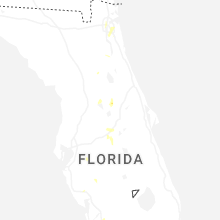
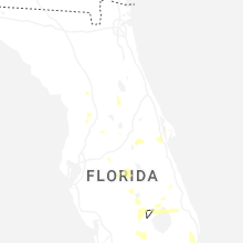
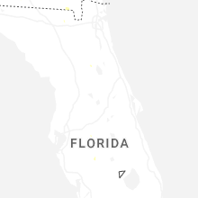
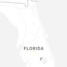
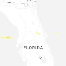

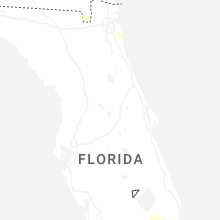
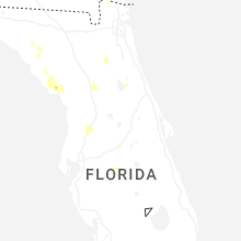
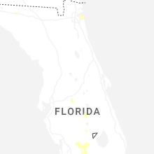
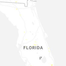
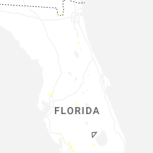
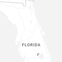
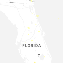

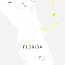
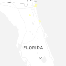
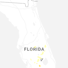


Connect with Interactive Hail Maps