

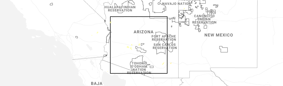
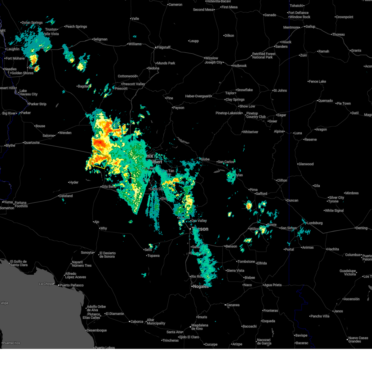
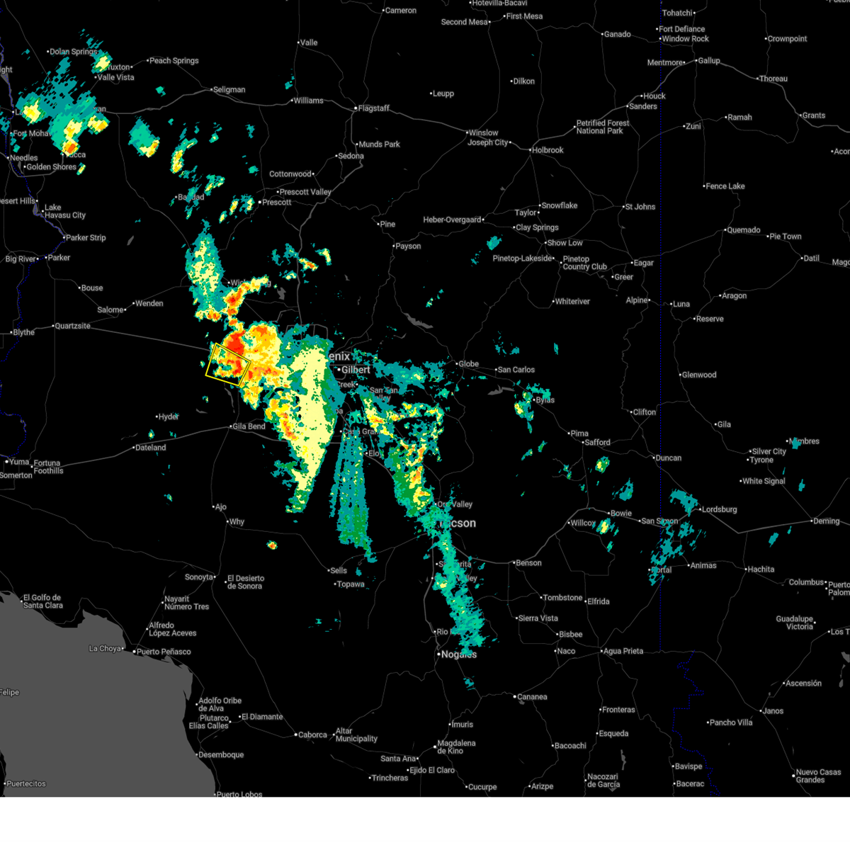
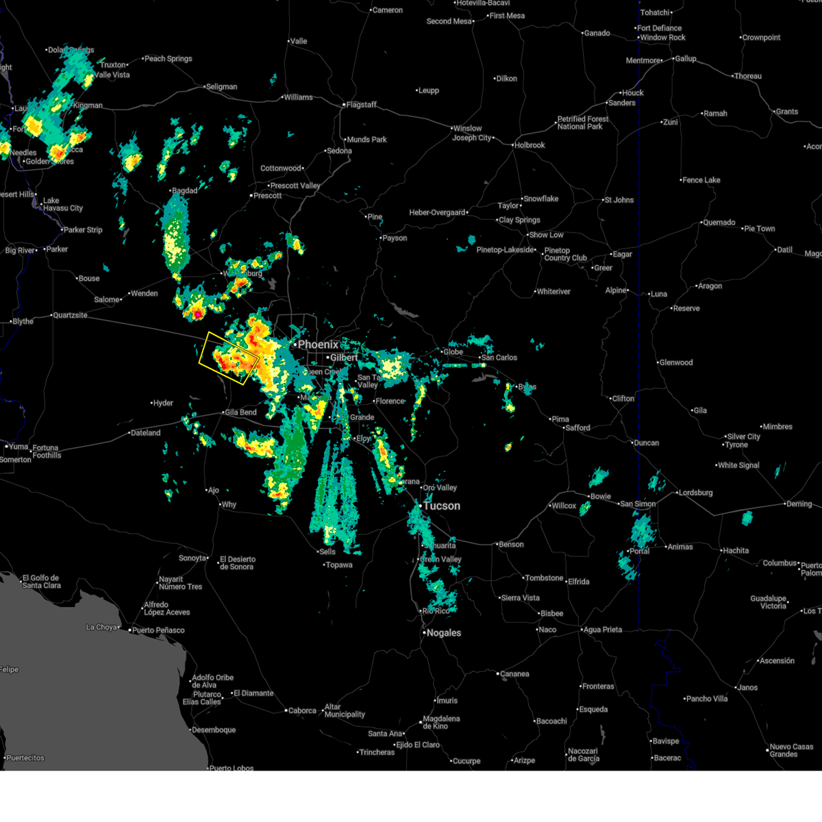
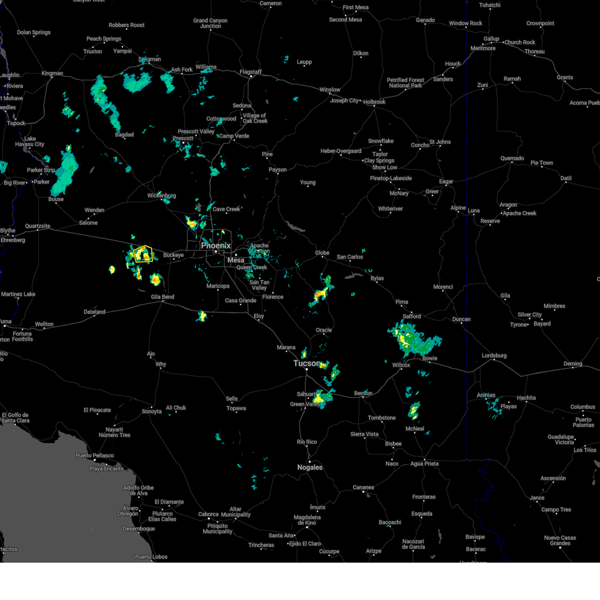
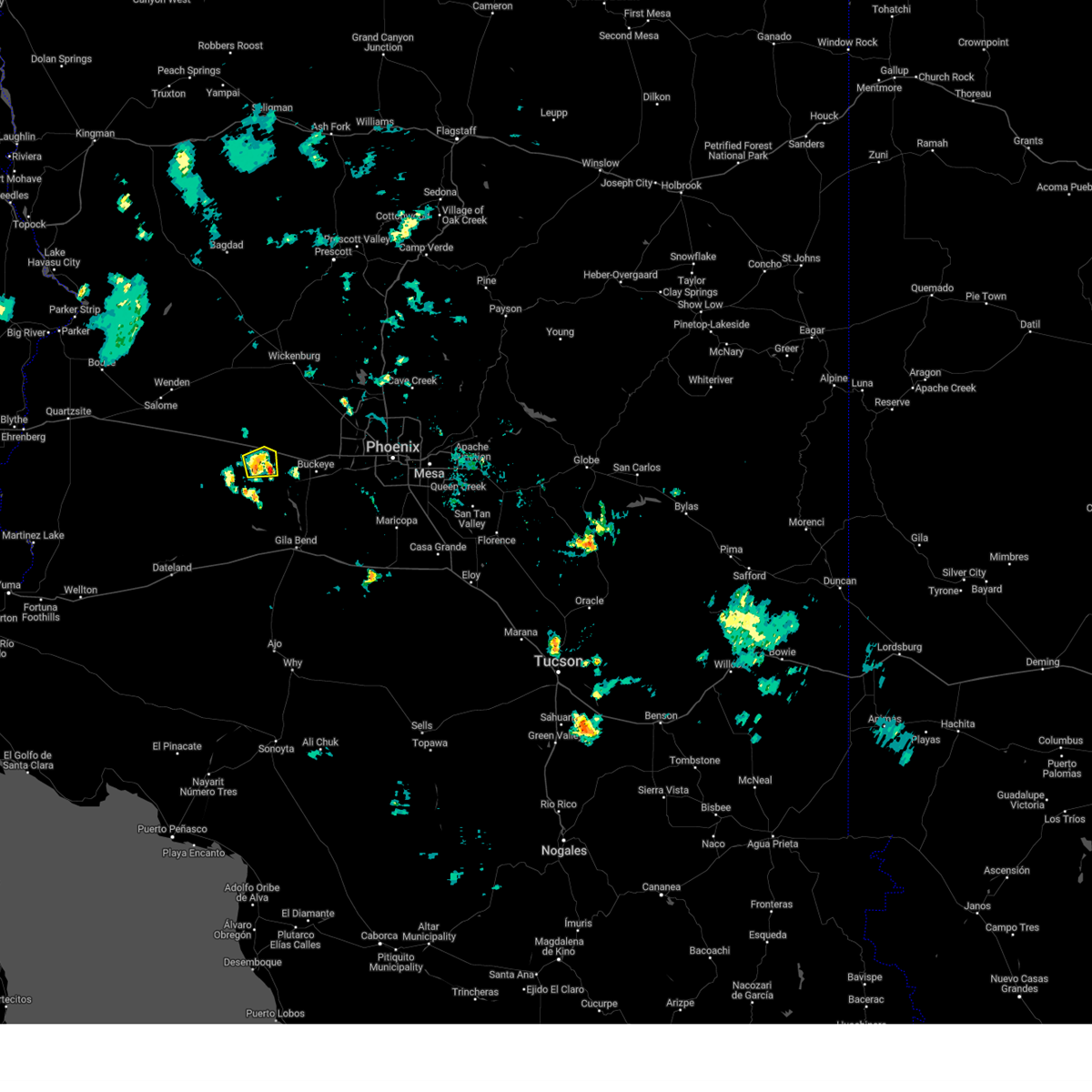
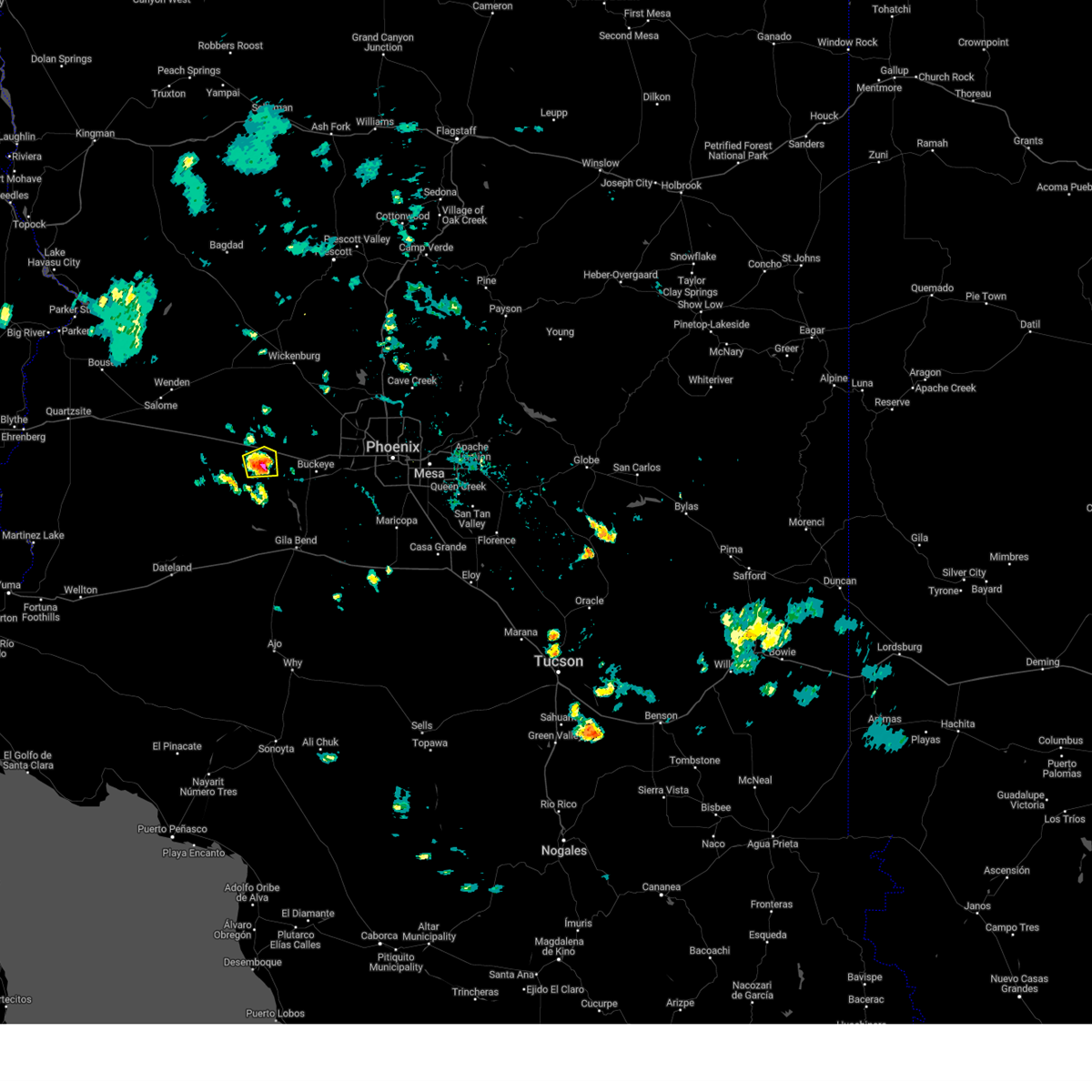
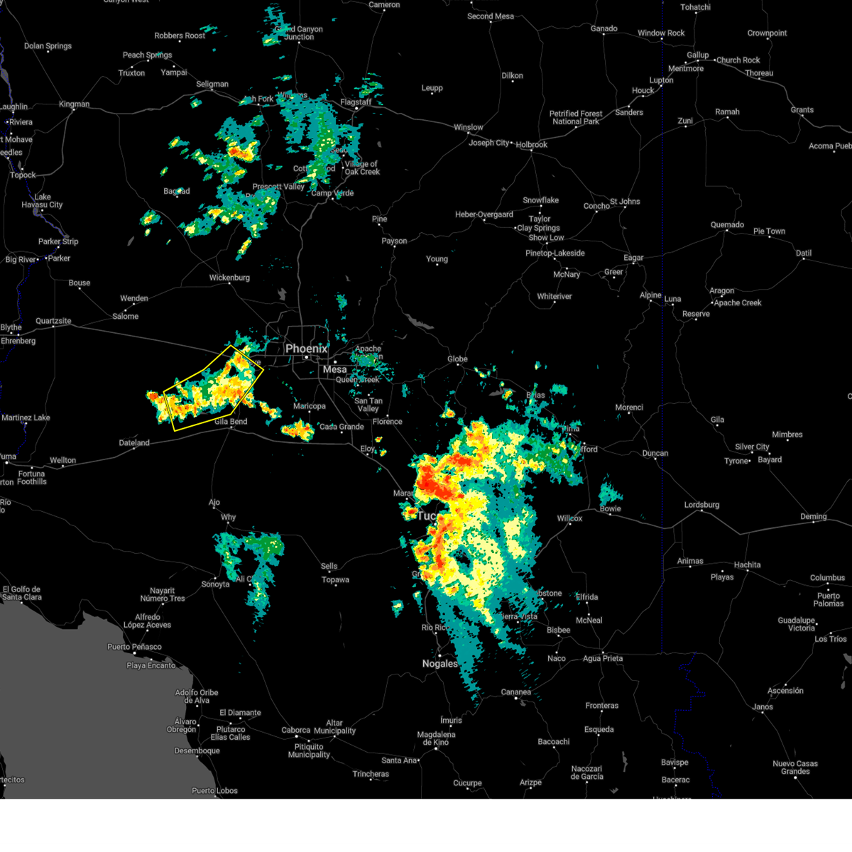
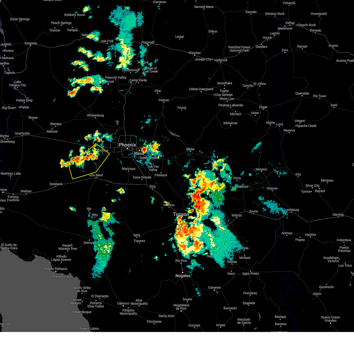
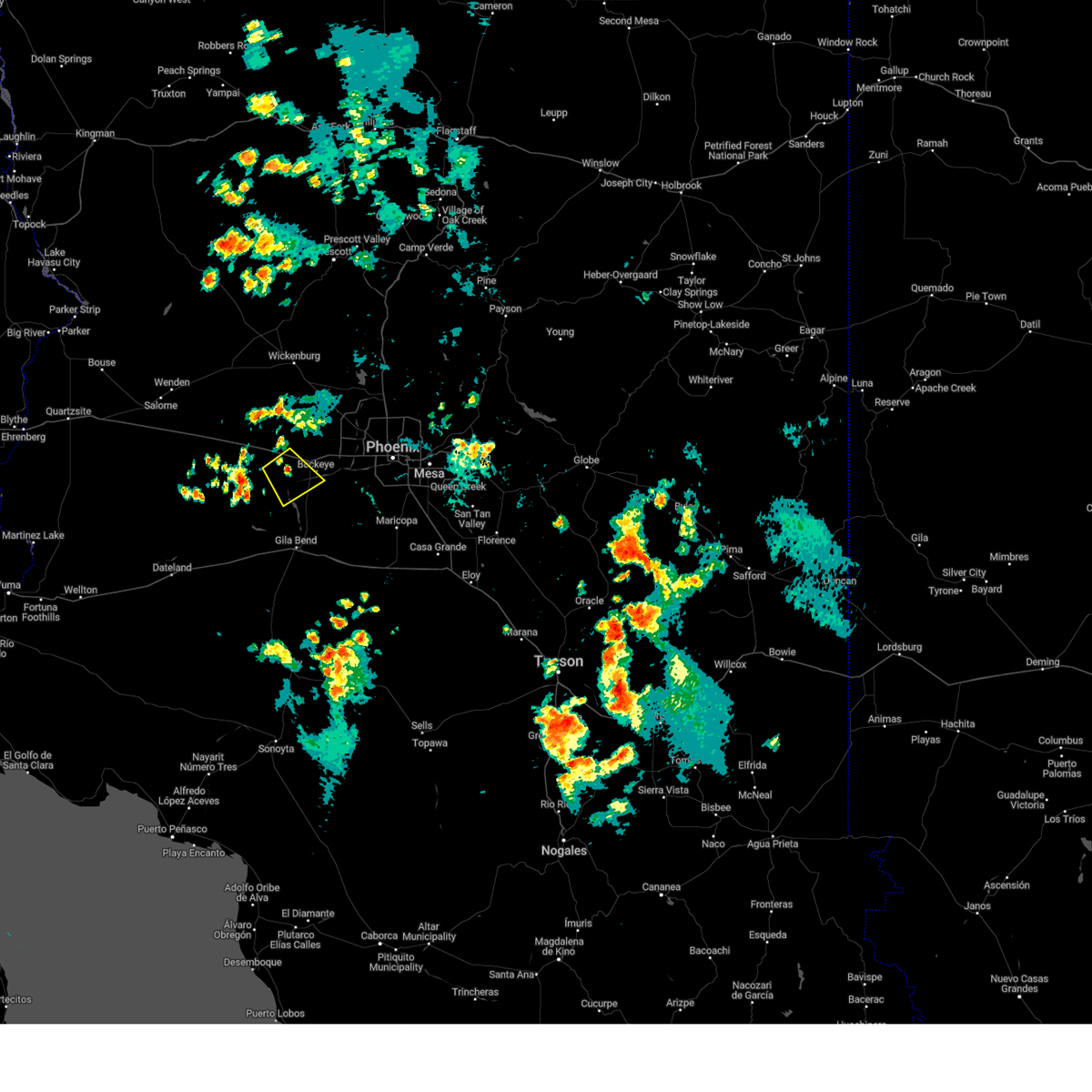
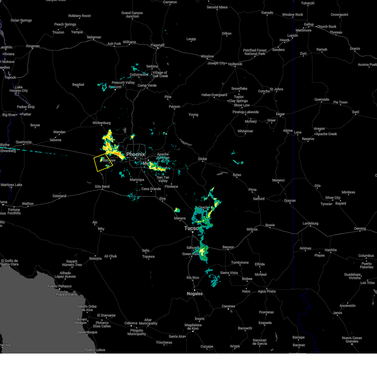
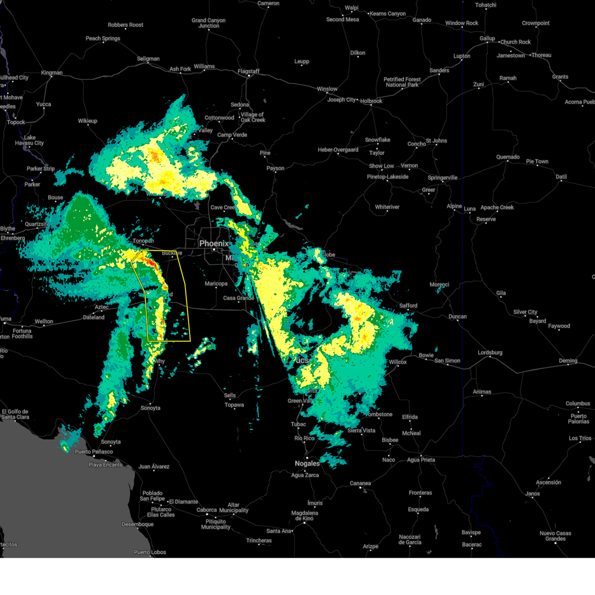
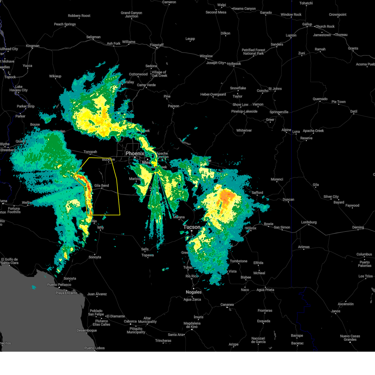
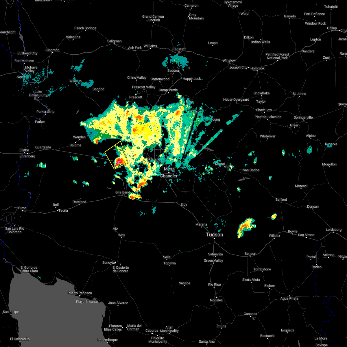
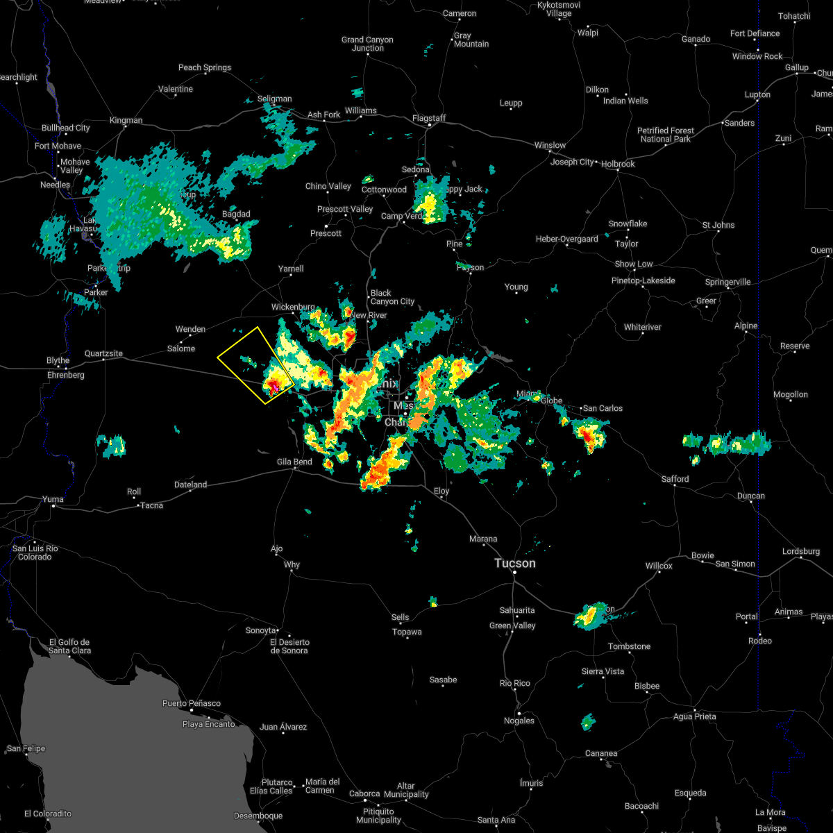
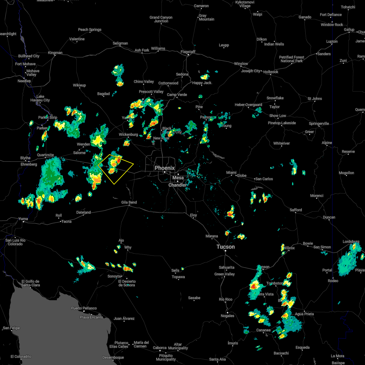
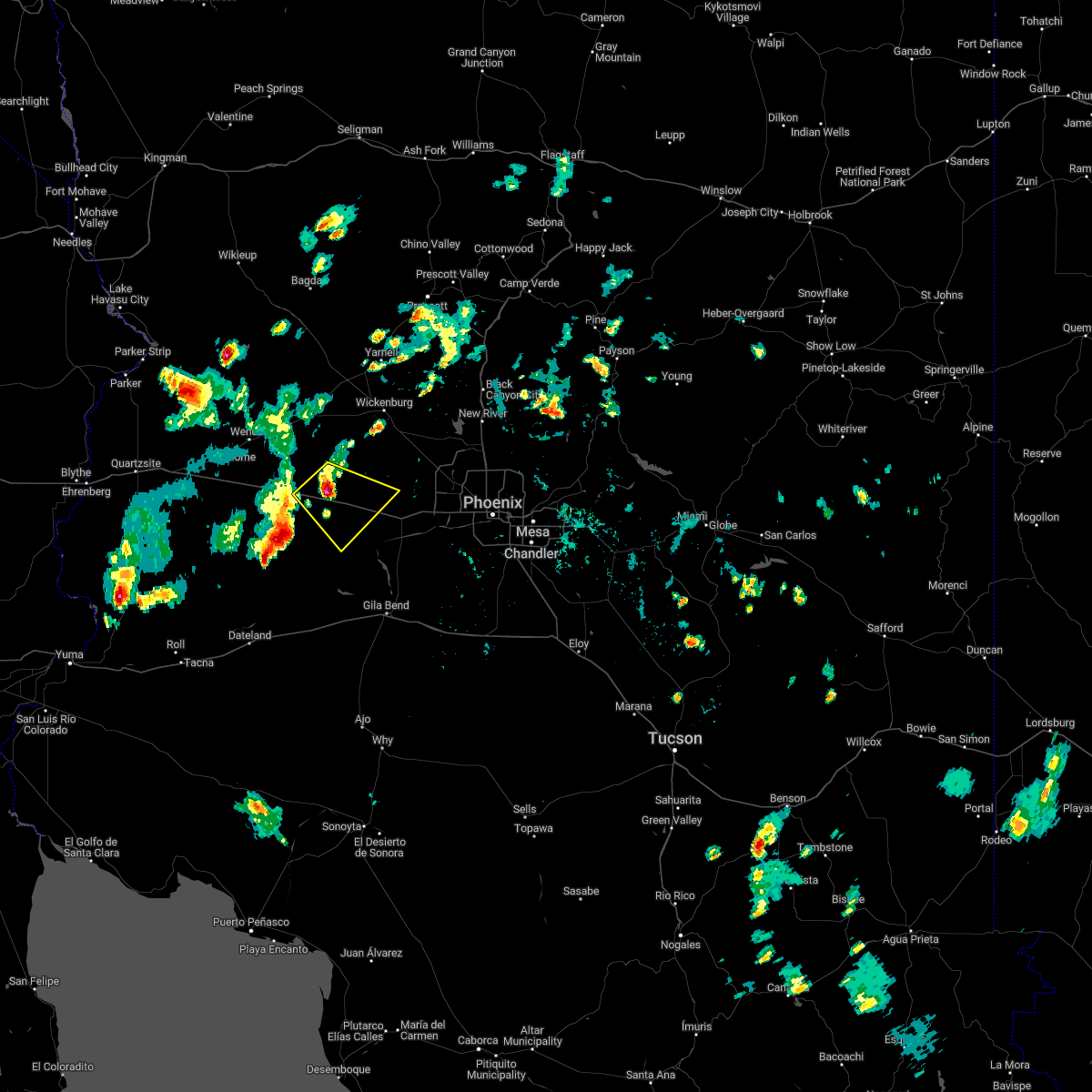
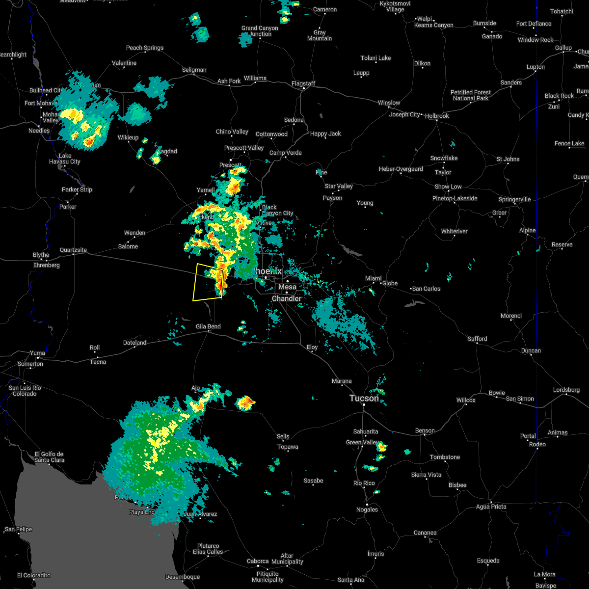
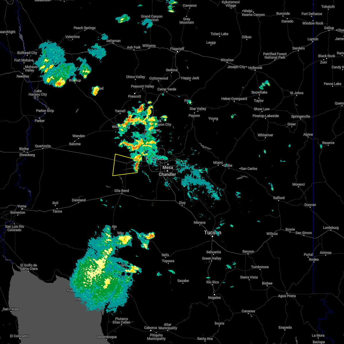
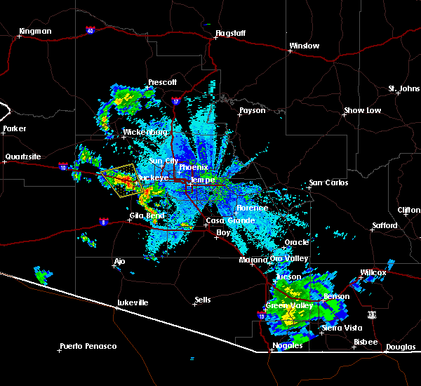
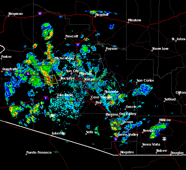
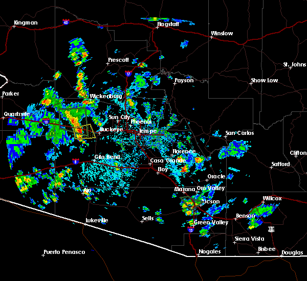
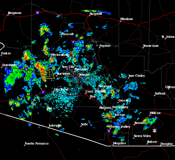
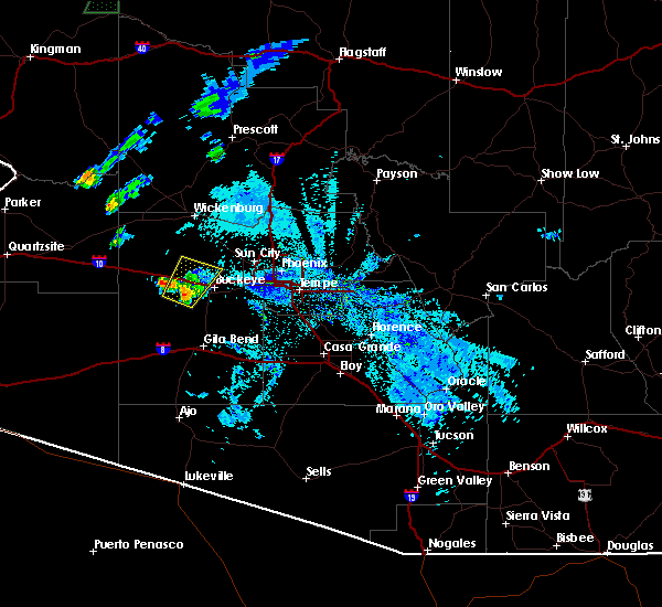
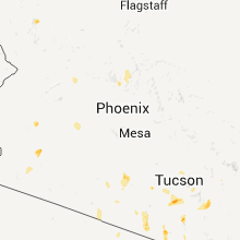
Hail Map for Wintersburg, AZ
The Wintersburg, AZ area has had 0 reports of on-the-ground hail by trained spotters, and has been under severe weather warnings 2 times during the past 12 months. Doppler radar has detected hail at or near Wintersburg, AZ on 8 occasions, including 1 occasion during the past year.
| Name: | Wintersburg, AZ |
| Where Located: | 45.7 miles W of Phoenix, AZ |
| Map: | Google Map for Wintersburg, AZ |
| Population: | 136 |
| Housing Units: | 173 |
| More Info: | Search Google for Wintersburg, AZ |
0
The Top Recent Hail Date for Wintersburg, AZ is Saturday, September 27, 2025 (4th out of 8)
Hail and Wind Damage Spotted near Wintersburg, AZ
| Date / Time | Report Details |
|---|---|
| 9/19/2025 1:36 AM MST | At 136 am mst, a severe thunderstorm was located near buckeye, moving north at 25 mph (radar indicated). Hazards include 60 mph wind gusts and quarter size hail. Hail damage to vehicles is expected. expect wind damage to roofs, siding, and trees. locations impacted include, buckeye and wintersburg. This includes az interstate 10 between mile markers 99 and 112. |
| 9/19/2025 1:22 AM MST | Svrpsr the national weather service in phoenix has issued a * severe thunderstorm warning for, maricopa county in south central arizona, * until 145 am mst. * at 122 am mst, a severe thunderstorm was located 7 miles east of wintersburg, or 8 miles southwest of buckeye, moving north at 25 mph (radar indicated). Hazards include 60 mph wind gusts and quarter size hail. Hail damage to vehicles is expected. Expect wind damage to roofs, siding, and trees. |
| 7/2/2025 8:42 PM MST |
 The storm which prompted the warning has weakened below severe limits, and no longer poses an immediate threat to life or property. therefore, the warning will be allowed to expire. however, gusty winds and heavy rain are still possible with this thunderstorm. The storm which prompted the warning has weakened below severe limits, and no longer poses an immediate threat to life or property. therefore, the warning will be allowed to expire. however, gusty winds and heavy rain are still possible with this thunderstorm.
|
| 7/2/2025 8:22 PM MST |
 At 822 pm mst, a severe thunderstorm was located near palo verde, or 7 miles south of buckeye, moving north at 15 mph (radar indicated). Hazards include 60 mph wind gusts. Expect damage to roofs, siding, and trees. Locations impacted include, buckeye, palo verde, palo verde nuclear generation station, wintersburg, hassayampa, and arlington. At 822 pm mst, a severe thunderstorm was located near palo verde, or 7 miles south of buckeye, moving north at 15 mph (radar indicated). Hazards include 60 mph wind gusts. Expect damage to roofs, siding, and trees. Locations impacted include, buckeye, palo verde, palo verde nuclear generation station, wintersburg, hassayampa, and arlington.
|
| 7/2/2025 7:58 PM MST |
 Svrpsr the national weather service in phoenix has issued a * severe thunderstorm warning for, maricopa county in south central arizona, * until 845 pm mst. * at 758 pm mst, a severe thunderstorm was located near palo verde nuclear generation station, or 12 miles southwest of buckeye, and is nearly stationary (radar indicated). Hazards include 60 mph wind gusts. expect damage to roofs, siding, and trees Svrpsr the national weather service in phoenix has issued a * severe thunderstorm warning for, maricopa county in south central arizona, * until 845 pm mst. * at 758 pm mst, a severe thunderstorm was located near palo verde nuclear generation station, or 12 miles southwest of buckeye, and is nearly stationary (radar indicated). Hazards include 60 mph wind gusts. expect damage to roofs, siding, and trees
|
| 8/30/2024 5:56 PM MST |
 The storm which prompted the warning has weakened below severe limits, and no longer poses an immediate threat to life or property. therefore, the warning will be allowed to expire. The storm which prompted the warning has weakened below severe limits, and no longer poses an immediate threat to life or property. therefore, the warning will be allowed to expire.
|
| 8/30/2024 5:37 PM MST |
 At 537 pm mst, a severe thunderstorm was located 7 miles northwest of painted rock dam, or 15 miles south of tonopah, and is nearly stationary (radar indicated). Hazards include 60 mph wind gusts. Expect damage to roofs, siding, and trees. locations impacted include, tonopah, palo verde nuclear generation station, and wintersburg. This includes az interstate 10 between mile markers 94 and 99. At 537 pm mst, a severe thunderstorm was located 7 miles northwest of painted rock dam, or 15 miles south of tonopah, and is nearly stationary (radar indicated). Hazards include 60 mph wind gusts. Expect damage to roofs, siding, and trees. locations impacted include, tonopah, palo verde nuclear generation station, and wintersburg. This includes az interstate 10 between mile markers 94 and 99.
|
| 8/30/2024 5:15 PM MST |
 Svrpsr the national weather service in phoenix has issued a * severe thunderstorm warning for, maricopa county in south central arizona, * until 600 pm mst. * at 514 pm mst, a severe thunderstorm was located 8 miles west of painted rock dam, or 15 miles south of tonopah, and is nearly stationary (radar indicated). Hazards include 60 mph wind gusts. expect damage to roofs, siding, and trees Svrpsr the national weather service in phoenix has issued a * severe thunderstorm warning for, maricopa county in south central arizona, * until 600 pm mst. * at 514 pm mst, a severe thunderstorm was located 8 miles west of painted rock dam, or 15 miles south of tonopah, and is nearly stationary (radar indicated). Hazards include 60 mph wind gusts. expect damage to roofs, siding, and trees
|
| 7/25/2024 7:26 PM MST |
 The storms which prompted the warning have weakened below severe limits, and have exited the warned area. therefore, the warning will be allowed to expire. however, gusty winds and heavy rain are still possible with these thunderstorms. The storms which prompted the warning have weakened below severe limits, and have exited the warned area. therefore, the warning will be allowed to expire. however, gusty winds and heavy rain are still possible with these thunderstorms.
|
| 7/25/2024 6:43 PM MST |
 Svrpsr the national weather service in phoenix has issued a * severe thunderstorm warning for, maricopa county in south central arizona, * until 730 pm mst. * at 643 pm mst, severe thunderstorms were located along a line extending from 6 miles east of wintersburg to 7 miles west of painted rock dam to near sundad, moving southeast at 15 mph (radar indicated). Hazards include 60 mph wind gusts and penny size hail. expect damage to roofs, siding, and trees Svrpsr the national weather service in phoenix has issued a * severe thunderstorm warning for, maricopa county in south central arizona, * until 730 pm mst. * at 643 pm mst, severe thunderstorms were located along a line extending from 6 miles east of wintersburg to 7 miles west of painted rock dam to near sundad, moving southeast at 15 mph (radar indicated). Hazards include 60 mph wind gusts and penny size hail. expect damage to roofs, siding, and trees
|
| 7/25/2024 6:08 PM MST |
 Svrpsr the national weather service in phoenix has issued a * severe thunderstorm warning for, maricopa county in south central arizona, * until 645 pm mst. * at 608 pm mst, a severe thunderstorm was located near palo verde nuclear generation station, or 12 miles southwest of buckeye, moving southeast at 5 mph (radar indicated). Hazards include 60 mph wind gusts and penny size hail. expect damage to roofs, siding, and trees Svrpsr the national weather service in phoenix has issued a * severe thunderstorm warning for, maricopa county in south central arizona, * until 645 pm mst. * at 608 pm mst, a severe thunderstorm was located near palo verde nuclear generation station, or 12 miles southwest of buckeye, moving southeast at 5 mph (radar indicated). Hazards include 60 mph wind gusts and penny size hail. expect damage to roofs, siding, and trees
|
| 7/24/2024 10:37 PM MST |
 Svrpsr the national weather service in phoenix has issued a * severe thunderstorm warning for, maricopa county in south central arizona, * until 1115 pm mst. * at 1037 pm mst, a severe thunderstorm was located 7 miles northwest of palo verde, or 7 miles southwest of buckeye, moving southeast at 10 mph (radar indicated). Hazards include 60 mph wind gusts. expect damage to roofs, siding, and trees Svrpsr the national weather service in phoenix has issued a * severe thunderstorm warning for, maricopa county in south central arizona, * until 1115 pm mst. * at 1037 pm mst, a severe thunderstorm was located 7 miles northwest of palo verde, or 7 miles southwest of buckeye, moving southeast at 10 mph (radar indicated). Hazards include 60 mph wind gusts. expect damage to roofs, siding, and trees
|
| 12/22/2023 6:24 PM MST |
 At 624 pm mst, severe thunderstorms were located along a line extending from palo verde nuclear generation station to near painted rock dam to near sonoran national monument to 10 miles southeast of gila bend auxiliary field, moving northeast at 45 mph (radar indicated). Hazards include 60 mph wind gusts. Expect damage to roofs, siding, and trees. locations impacted include, buckeye, gila bend, palo verde, painted rock dam, gila bend auxiliary field, bosque, cotton center, sonoran national monument, palo verde nuclear generation station, wintersburg, hassayampa, and arlington. this includes the following highways, az interstate 10 between mile markers 112 and 114. az interstate 8 between mile markers 106 and 135. Az route 238 between mile markers 1 and 17. At 624 pm mst, severe thunderstorms were located along a line extending from palo verde nuclear generation station to near painted rock dam to near sonoran national monument to 10 miles southeast of gila bend auxiliary field, moving northeast at 45 mph (radar indicated). Hazards include 60 mph wind gusts. Expect damage to roofs, siding, and trees. locations impacted include, buckeye, gila bend, palo verde, painted rock dam, gila bend auxiliary field, bosque, cotton center, sonoran national monument, palo verde nuclear generation station, wintersburg, hassayampa, and arlington. this includes the following highways, az interstate 10 between mile markers 112 and 114. az interstate 8 between mile markers 106 and 135. Az route 238 between mile markers 1 and 17.
|
| 12/22/2023 5:54 PM MST |
 At 553 pm mst, severe thunderstorms were located along a line extending from near sundad to 16 miles northwest of gila bend to 11 miles west of gila bend auxiliary field to 15 miles north of ajo, moving northeast at 45 mph (radar indicated). Hazards include 60 mph wind gusts. expect damage to roofs, siding, and trees At 553 pm mst, severe thunderstorms were located along a line extending from near sundad to 16 miles northwest of gila bend to 11 miles west of gila bend auxiliary field to 15 miles north of ajo, moving northeast at 45 mph (radar indicated). Hazards include 60 mph wind gusts. expect damage to roofs, siding, and trees
|
| 1/1/2023 2:11 PM MST |
 The severe thunderstorm warning for maricopa county will expire at 215 pm mst, the storms which prompted the warning have weakened below severe limits, and no longer pose an immediate threat to life or property. therefore, the warning will be allowed to expire. however gusty winds are still possible with these thunderstorms. The severe thunderstorm warning for maricopa county will expire at 215 pm mst, the storms which prompted the warning have weakened below severe limits, and no longer pose an immediate threat to life or property. therefore, the warning will be allowed to expire. however gusty winds are still possible with these thunderstorms.
|
| 1/1/2023 2:04 PM MST |
 At 203 pm mst, severe thunderstorms were located along a line extending from near morristown to near buckeye to 8 miles west of painted rock dam, moving northeast at 50 mph (radar indicated). Hazards include 60 mph wind gusts. Expect damage to roofs, siding, and trees. locations impacted include, surprise, buckeye, wittmann, circle city, white tank mountain park, morristown, palo verde nuclear generation station, wintersburg and hassayampa. this includes the following highways, az interstate 10 between mile markers 95 and 117. us highway 60 between mile markers 115 and 136. az route 74 between mile markers 1 and 14. hail threat, radar indicated max hail size, <. 75 in wind threat, radar indicated max wind gust, 60 mph. At 203 pm mst, severe thunderstorms were located along a line extending from near morristown to near buckeye to 8 miles west of painted rock dam, moving northeast at 50 mph (radar indicated). Hazards include 60 mph wind gusts. Expect damage to roofs, siding, and trees. locations impacted include, surprise, buckeye, wittmann, circle city, white tank mountain park, morristown, palo verde nuclear generation station, wintersburg and hassayampa. this includes the following highways, az interstate 10 between mile markers 95 and 117. us highway 60 between mile markers 115 and 136. az route 74 between mile markers 1 and 14. hail threat, radar indicated max hail size, <. 75 in wind threat, radar indicated max wind gust, 60 mph.
|
| 1/1/2023 1:54 PM MST |
 At 154 pm mst, severe thunderstorms were located along a line extending from near morristown to 7 miles northwest of buckeye to 11 miles southwest of palo verde nuclear generation station, moving northeast at 55 mph (radar indicated). Hazards include 60 mph wind gusts. Expect damage to roofs, siding, and trees. locations impacted include, surprise, buckeye, wittmann, tonopah, circle city, white tank mountain park, morristown, palo verde nuclear generation station, wintersburg and hassayampa. this includes the following highways, az interstate 10 between mile markers 92 and 117. us highway 60 between mile markers 114 and 136. az route 74 between mile markers 1 and 14. hail threat, radar indicated max hail size, <. 75 in wind threat, radar indicated max wind gust, 60 mph. At 154 pm mst, severe thunderstorms were located along a line extending from near morristown to 7 miles northwest of buckeye to 11 miles southwest of palo verde nuclear generation station, moving northeast at 55 mph (radar indicated). Hazards include 60 mph wind gusts. Expect damage to roofs, siding, and trees. locations impacted include, surprise, buckeye, wittmann, tonopah, circle city, white tank mountain park, morristown, palo verde nuclear generation station, wintersburg and hassayampa. this includes the following highways, az interstate 10 between mile markers 92 and 117. us highway 60 between mile markers 114 and 136. az route 74 between mile markers 1 and 14. hail threat, radar indicated max hail size, <. 75 in wind threat, radar indicated max wind gust, 60 mph.
|
| 1/1/2023 1:41 PM MST |
 At 141 pm mst, severe thunderstorms were located along a line extending from 13 miles north of tonopah to near wintersburg to 8 miles southwest of palo verde nuclear generation station, moving northeast at 55 mph (radar indicated). Hazards include 60 mph wind gusts. expect damage to roofs, siding, and trees At 141 pm mst, severe thunderstorms were located along a line extending from 13 miles north of tonopah to near wintersburg to 8 miles southwest of palo verde nuclear generation station, moving northeast at 55 mph (radar indicated). Hazards include 60 mph wind gusts. expect damage to roofs, siding, and trees
|
| 10/15/2022 7:12 PM MST |
 At 712 pm mst, a severe thunderstorm was located near tonopah, moving northwest at 30 mph (radar indicated). Hazards include 70 mph wind gusts and quarter size hail. Hail damage to vehicles is expected. expect considerable tree damage. wind damage is also likely to mobile homes, roofs, and outbuildings. locations impacted include, buckeye, tonopah, palo verde nuclear generation station and wintersburg. This includes az interstate 10 between mile markers 92 and 109. At 712 pm mst, a severe thunderstorm was located near tonopah, moving northwest at 30 mph (radar indicated). Hazards include 70 mph wind gusts and quarter size hail. Hail damage to vehicles is expected. expect considerable tree damage. wind damage is also likely to mobile homes, roofs, and outbuildings. locations impacted include, buckeye, tonopah, palo verde nuclear generation station and wintersburg. This includes az interstate 10 between mile markers 92 and 109.
|
| 10/15/2022 7:04 PM MST |
 At 704 pm mst, a severe thunderstorm was located near tonopah, moving northwest at 30 mph (radar indicated). Hazards include 60 mph wind gusts and quarter size hail. Hail damage to vehicles is expected. expect wind damage to roofs, siding, and trees. locations impacted include, buckeye, tonopah, palo verde nuclear generation station and wintersburg. this includes az interstate 10 between mile markers 92 and 109. hail threat, radar indicated max hail size, 1. 00 in wind threat, radar indicated max wind gust, 60 mph. At 704 pm mst, a severe thunderstorm was located near tonopah, moving northwest at 30 mph (radar indicated). Hazards include 60 mph wind gusts and quarter size hail. Hail damage to vehicles is expected. expect wind damage to roofs, siding, and trees. locations impacted include, buckeye, tonopah, palo verde nuclear generation station and wintersburg. this includes az interstate 10 between mile markers 92 and 109. hail threat, radar indicated max hail size, 1. 00 in wind threat, radar indicated max wind gust, 60 mph.
|
| 10/15/2022 6:49 PM MST |
 At 649 pm mst, a severe thunderstorm was located 7 miles southwest of buckeye, moving northwest at 30 mph (radar indicated). Hazards include ping pong ball size hail and 60 mph wind gusts. People and animals outdoors will be injured. expect hail damage to roofs, siding, windows, and vehicles. Expect wind damage to roofs, siding, and trees. At 649 pm mst, a severe thunderstorm was located 7 miles southwest of buckeye, moving northwest at 30 mph (radar indicated). Hazards include ping pong ball size hail and 60 mph wind gusts. People and animals outdoors will be injured. expect hail damage to roofs, siding, windows, and vehicles. Expect wind damage to roofs, siding, and trees.
|
| 10/15/2022 6:01 PM MST |
 At 600 pm mst, a severe thunderstorm was located over tonopah, moving northwest at 30 mph (radar indicated). Hazards include 60 mph wind gusts and quarter size hail. Hail damage to vehicles is expected. Expect wind damage to roofs, siding, and trees. At 600 pm mst, a severe thunderstorm was located over tonopah, moving northwest at 30 mph (radar indicated). Hazards include 60 mph wind gusts and quarter size hail. Hail damage to vehicles is expected. Expect wind damage to roofs, siding, and trees.
|
| 9/23/2022 3:10 PM MST |
 The severe thunderstorm warning for maricopa county will expire at 315 pm mst, the storm which prompted the warning has weakened below severe limits, and no longer poses an immediate threat to life or property. therefore, the warning will be allowed to expire. The severe thunderstorm warning for maricopa county will expire at 315 pm mst, the storm which prompted the warning has weakened below severe limits, and no longer poses an immediate threat to life or property. therefore, the warning will be allowed to expire.
|
| 9/23/2022 2:32 PM MST |
 At 232 pm mst, a severe thunderstorm was located 8 miles northwest of tonopah, moving southeast at 10 mph (radar indicated). Hazards include 60 mph wind gusts and penny size hail. expect damage to roofs, siding, and trees At 232 pm mst, a severe thunderstorm was located 8 miles northwest of tonopah, moving southeast at 10 mph (radar indicated). Hazards include 60 mph wind gusts and penny size hail. expect damage to roofs, siding, and trees
|
| 7/16/2022 9:05 PM MST |
 At 904 pm mst, a severe thunderstorm was located near palo verde, or near buckeye, moving west at 20 mph (radar indicated). Hazards include 60 mph wind gusts. Expect damage to roofs, siding, and trees. locations impacted include, buckeye, palo verde, palo verde nuclear generation station, hassayampa and arlington. this includes the following highways, az interstate 10 between mile markers 100 and 117. az route 85 between mile markers 143 and 154. hail threat, radar indicated max hail size, <. 75 in wind threat, radar indicated max wind gust, 60 mph. At 904 pm mst, a severe thunderstorm was located near palo verde, or near buckeye, moving west at 20 mph (radar indicated). Hazards include 60 mph wind gusts. Expect damage to roofs, siding, and trees. locations impacted include, buckeye, palo verde, palo verde nuclear generation station, hassayampa and arlington. this includes the following highways, az interstate 10 between mile markers 100 and 117. az route 85 between mile markers 143 and 154. hail threat, radar indicated max hail size, <. 75 in wind threat, radar indicated max wind gust, 60 mph.
|
| 7/16/2022 8:48 PM MST |
 At 848 pm mst, a severe thunderstorm was located over buckeye, moving west at 30 mph (radar indicated). Hazards include 60 mph wind gusts. Expect damage to roofs, siding, and trees. locations impacted include, buckeye, palo verde, perryville, liberty, palo verde nuclear generation station, hassayampa and arlington. this includes the following highways, az interstate 10 between mile markers 100 and 122. az route 85 between mile markers 143 and 154. hail threat, radar indicated max hail size, <. 75 in wind threat, radar indicated max wind gust, 60 mph. At 848 pm mst, a severe thunderstorm was located over buckeye, moving west at 30 mph (radar indicated). Hazards include 60 mph wind gusts. Expect damage to roofs, siding, and trees. locations impacted include, buckeye, palo verde, perryville, liberty, palo verde nuclear generation station, hassayampa and arlington. this includes the following highways, az interstate 10 between mile markers 100 and 122. az route 85 between mile markers 143 and 154. hail threat, radar indicated max hail size, <. 75 in wind threat, radar indicated max wind gust, 60 mph.
|
| 7/16/2022 8:32 PM MST |
 At 832 pm mst, a severe thunderstorm was located near liberty, or near buckeye, moving west at 20 mph (radar indicated). Hazards include 60 mph wind gusts. expect damage to roofs, siding, and trees At 832 pm mst, a severe thunderstorm was located near liberty, or near buckeye, moving west at 20 mph (radar indicated). Hazards include 60 mph wind gusts. expect damage to roofs, siding, and trees
|
| 8/16/2021 11:41 PM MST |
 At 1140 pm mst, severe thunderstorms were located along a line extending from near white tank mountain park to near palo verde to 10 miles northeast of cotton center to near estrella to 11 miles west of chui-chu, moving southwest at 35 mph (radar indicated). Hazards include 70 mph wind gusts and nickel size hail. Expect considerable tree damage. Damage is likely to mobile homes, roofs, and outbuildings. At 1140 pm mst, severe thunderstorms were located along a line extending from near white tank mountain park to near palo verde to 10 miles northeast of cotton center to near estrella to 11 miles west of chui-chu, moving southwest at 35 mph (radar indicated). Hazards include 70 mph wind gusts and nickel size hail. Expect considerable tree damage. Damage is likely to mobile homes, roofs, and outbuildings.
|
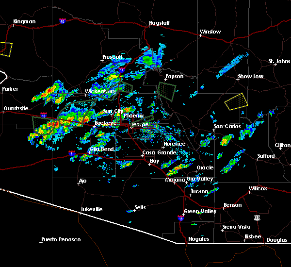
| 9/25/2019 7:53 PM MST |
 At 752 pm mst, a severe thunderstorm was located 7 miles east of wintersburg, or 8 miles northwest of buckeye, moving northwest at 40 mph (radar indicated). Hazards include 60 mph wind gusts and quarter size hail. Hail damage to vehicles is expected. Expect wind damage to roofs, siding, and trees. At 752 pm mst, a severe thunderstorm was located 7 miles east of wintersburg, or 8 miles northwest of buckeye, moving northwest at 40 mph (radar indicated). Hazards include 60 mph wind gusts and quarter size hail. Hail damage to vehicles is expected. Expect wind damage to roofs, siding, and trees.
|
| 9/23/2019 5:11 PM MST |
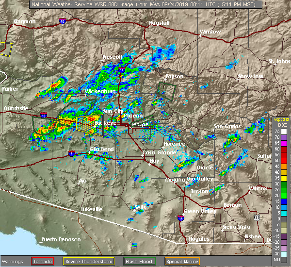 At 511 pm mst, a severe thunderstorm was located near white tank mountain park, or 8 miles north of buckeye, moving east at 25 mph (radar indicated). Hazards include 60 mph wind gusts and quarter size hail. Hail damage to vehicles is expected. expect wind damage to roofs, siding, and trees. locations impacted include, goodyear, buckeye, palo verde, perryville, white tank mountain park, liberty, palo verde nuclear generation station, wintersburg, estrella mountain ranch, hassayampa and arlington. this includes the following highways, az interstate 10 between mile markers 97 and 124. Az route 85 between mile markers 145 and 154. At 511 pm mst, a severe thunderstorm was located near white tank mountain park, or 8 miles north of buckeye, moving east at 25 mph (radar indicated). Hazards include 60 mph wind gusts and quarter size hail. Hail damage to vehicles is expected. expect wind damage to roofs, siding, and trees. locations impacted include, goodyear, buckeye, palo verde, perryville, white tank mountain park, liberty, palo verde nuclear generation station, wintersburg, estrella mountain ranch, hassayampa and arlington. this includes the following highways, az interstate 10 between mile markers 97 and 124. Az route 85 between mile markers 145 and 154.
|
| 9/23/2019 4:51 PM MST |
 At 451 pm mst, a severe thunderstorm was located near wintersburg, or 9 miles east of tonopah, moving east at 25 mph (radar indicated). Hazards include 60 mph wind gusts and quarter size hail. Hail damage to vehicles is expected. Expect wind damage to roofs, siding, and trees. At 451 pm mst, a severe thunderstorm was located near wintersburg, or 9 miles east of tonopah, moving east at 25 mph (radar indicated). Hazards include 60 mph wind gusts and quarter size hail. Hail damage to vehicles is expected. Expect wind damage to roofs, siding, and trees.
|
| 9/16/2019 7:58 PM MST |
 At 757 pm mst, severe thunderstorms were located near buckeye and hassayampa, moving east at 20 mph (radar indicated). Hazards include 60 mph wind gusts and nickel size hail. expect damage to roofs, siding, and trees At 757 pm mst, severe thunderstorms were located near buckeye and hassayampa, moving east at 20 mph (radar indicated). Hazards include 60 mph wind gusts and nickel size hail. expect damage to roofs, siding, and trees
|
| 9/1/2019 7:29 PM MST |
 The national weather service in phoenix has issued a * severe thunderstorm warning for. southeastern la paz county in west central arizona. northeastern yuma county in southwestern arizona. maricopa county in south central arizona. Until 815 pm mst. The national weather service in phoenix has issued a * severe thunderstorm warning for. southeastern la paz county in west central arizona. northeastern yuma county in southwestern arizona. maricopa county in south central arizona. Until 815 pm mst.
|
| 7/30/2018 8:15 PM MST |
 At 813 pm mst, severe thunderstorms were located along a line extending from near tonopah to near chandler city hall, moving west at 30 mph. gusts up to 50 mph have been reported at i-10 and 107th and a 49 mph gust at buckeye municipal airport. gusts up to 60 mph are still possible. small hail will also be possible (radar indicated). Hazards include 60 mph wind gusts. Expect damage to roofs, siding, and trees. locations impacted include, phoenix, tempe, avondale, goodyear, buckeye, tolleson, laveen, cashion, litchfield park, palo verde, perryville, luke afb, south phoenix, arizona state fairgrounds and liberty. this includes the following highways, az interstate 10 between mile markers 102 and 153. az interstate 17 between mile markers 195 and 202. Us highway 60 near mile marker 160. At 813 pm mst, severe thunderstorms were located along a line extending from near tonopah to near chandler city hall, moving west at 30 mph. gusts up to 50 mph have been reported at i-10 and 107th and a 49 mph gust at buckeye municipal airport. gusts up to 60 mph are still possible. small hail will also be possible (radar indicated). Hazards include 60 mph wind gusts. Expect damage to roofs, siding, and trees. locations impacted include, phoenix, tempe, avondale, goodyear, buckeye, tolleson, laveen, cashion, litchfield park, palo verde, perryville, luke afb, south phoenix, arizona state fairgrounds and liberty. this includes the following highways, az interstate 10 between mile markers 102 and 153. az interstate 17 between mile markers 195 and 202. Us highway 60 near mile marker 160.
|
| 7/30/2018 7:46 PM MST |
 At 746 pm mst, severe thunderstorms were located along a line extending from 7 miles west of white tank mountain park to near superstition springs mall, moving west at 30 mph (radar indicated). Hazards include 60 mph wind gusts. expect damage to roofs, siding, and trees At 746 pm mst, severe thunderstorms were located along a line extending from 7 miles west of white tank mountain park to near superstition springs mall, moving west at 30 mph (radar indicated). Hazards include 60 mph wind gusts. expect damage to roofs, siding, and trees
|
| 8/3/2017 3:41 PM MST |
 The severe thunderstorm warning for maricopa county will expire at 345 pm mst, the severe thunderstorm which prompted the warning is now below severe thresholds. therefore, the warning will be allowed to expire. however, storms are still in the area. The severe thunderstorm warning for maricopa county will expire at 345 pm mst, the severe thunderstorm which prompted the warning is now below severe thresholds. therefore, the warning will be allowed to expire. however, storms are still in the area.
|
| 8/3/2017 3:32 PM MST |
 At 332 pm mst, a severe thunderstorm was located near wintersburg, or near tonopah, moving east at 10 mph (radar indicated). Hazards include 60 mph wind gusts. Expect damage to roofs, siding, and trees. Locations impacted include, tonopah, palo verde nuclear generation station, wintersburg and hassayampa. At 332 pm mst, a severe thunderstorm was located near wintersburg, or near tonopah, moving east at 10 mph (radar indicated). Hazards include 60 mph wind gusts. Expect damage to roofs, siding, and trees. Locations impacted include, tonopah, palo verde nuclear generation station, wintersburg and hassayampa.
|
| 8/3/2017 3:20 PM MST |
 At 320 pm mst, a severe thunderstorm was located near tonopah, moving east at 10 mph (radar indicated). Hazards include 60 mph wind gusts. expect damage to roofs, siding, and trees At 320 pm mst, a severe thunderstorm was located near tonopah, moving east at 10 mph (radar indicated). Hazards include 60 mph wind gusts. expect damage to roofs, siding, and trees
|
| 8/9/2016 8:37 PM MST |
 At 836 pm mst, doppler radar indicated a severe thunderstorm capable of producing damaging winds in excess of 60 mph. this storm was located 10 miles west of white tank mountain park, or 13 miles northeast of tonopah, moving northeast at 20 mph. penny size hail may also accompany the damaging winds. this storm reamins at severe levels and another storm is starting to develop within the warned polygon. locations impacted include, buckeye, palo verde nuclear generation station, wintersburg and hassayampa. At 836 pm mst, doppler radar indicated a severe thunderstorm capable of producing damaging winds in excess of 60 mph. this storm was located 10 miles west of white tank mountain park, or 13 miles northeast of tonopah, moving northeast at 20 mph. penny size hail may also accompany the damaging winds. this storm reamins at severe levels and another storm is starting to develop within the warned polygon. locations impacted include, buckeye, palo verde nuclear generation station, wintersburg and hassayampa.
|
| 8/9/2016 8:20 PM MST |
 At 819 pm mst, doppler radar indicated a severe thunderstorm capable of producing damaging winds in excess of 60 mph. this storm was located 8 miles northeast of wintersburg, or 9 miles east of tonopah, and moving northeast at 20 mph. penny size hail may also accompany the damaging winds. At 819 pm mst, doppler radar indicated a severe thunderstorm capable of producing damaging winds in excess of 60 mph. this storm was located 8 miles northeast of wintersburg, or 9 miles east of tonopah, and moving northeast at 20 mph. penny size hail may also accompany the damaging winds.
|
| 7/29/2016 9:39 PM MST |
 The severe thunderstorm warning for west central maricopa county will expire at 945 pm mst, the storm which prompted the warning has moved out of the area. therefore the warning will be allowed to expire. The severe thunderstorm warning for west central maricopa county will expire at 945 pm mst, the storm which prompted the warning has moved out of the area. therefore the warning will be allowed to expire.
|
| 7/29/2016 9:00 PM MST |
 At 859 pm mst, doppler radar continued to indicate a severe thunderstorm capable of producing half dollar size hail and destructive winds in excess of 80 mph. this storm was located near palo verde, or near buckeye, and moving southwest at 10 mph. this storm has been very to slow to move off the interstate 10 and state route 85 interchange. At 859 pm mst, doppler radar continued to indicate a severe thunderstorm capable of producing half dollar size hail and destructive winds in excess of 80 mph. this storm was located near palo verde, or near buckeye, and moving southwest at 10 mph. this storm has been very to slow to move off the interstate 10 and state route 85 interchange.
|
| 7/29/2016 8:43 PM MST |
 At 842 pm mst, doppler radar indicated a severe thunderstorm capable of producing destructive winds in excess of 70 mph. this storm was located over buckeye, moving southwest at 10 mph. nickel size hail and heavy rainfall will also accompany the damaging winds. locations impacted include, goodyear, buckeye, liberty, white tank mountain park, palo verde nuclear generation station, perryville, wintersburg, estrella mountain ranch, palo verde, hassayampa and arlington. At 842 pm mst, doppler radar indicated a severe thunderstorm capable of producing destructive winds in excess of 70 mph. this storm was located over buckeye, moving southwest at 10 mph. nickel size hail and heavy rainfall will also accompany the damaging winds. locations impacted include, goodyear, buckeye, liberty, white tank mountain park, palo verde nuclear generation station, perryville, wintersburg, estrella mountain ranch, palo verde, hassayampa and arlington.
|
| 7/29/2016 8:21 PM MST |
 At 821 pm mst, doppler radar indicated a severe thunderstorm capable of producing destructive winds in excess of 70 mph. this storm was located near buckeye, and moving southwest at 10 mph. penny size hail may also accompany the damaging winds. At 821 pm mst, doppler radar indicated a severe thunderstorm capable of producing destructive winds in excess of 70 mph. this storm was located near buckeye, and moving southwest at 10 mph. penny size hail may also accompany the damaging winds.
|
| 7/1/2016 5:44 PM MST |
 At 543 pm mst, doppler radar indicated severe thunderstorms capable of producing quarter size hail and damaging winds in excess of 60 mph. these storms were located along a line extending from 6 miles northwest of buckeye to 6 miles southwest of palo verde nuclear generation station, moving east at 10 mph. locations impacted include, glendale, avondale, goodyear, buckeye, tolleson, cashion, litchfield park, luke afb, liberty, white tank mountain park, palo verde nuclear generation station, perryville, wintersburg, painted rock dam, palo verde, hassayampa and arlington. At 543 pm mst, doppler radar indicated severe thunderstorms capable of producing quarter size hail and damaging winds in excess of 60 mph. these storms were located along a line extending from 6 miles northwest of buckeye to 6 miles southwest of palo verde nuclear generation station, moving east at 10 mph. locations impacted include, glendale, avondale, goodyear, buckeye, tolleson, cashion, litchfield park, luke afb, liberty, white tank mountain park, palo verde nuclear generation station, perryville, wintersburg, painted rock dam, palo verde, hassayampa and arlington.
|
| 7/1/2016 5:28 PM MST |
 At 528 pm mst, doppler radar indicated a broken line of severe thunderstorms capable of producing damaging winds in excess of 60 mph. these storms were located along a line extending from 7 miles northwest of buckeye to 8 miles southwest of palo verde nuclear generation station, and moving east at 10 mph. nickel size hail may also accompany the damaging winds. At 528 pm mst, doppler radar indicated a broken line of severe thunderstorms capable of producing damaging winds in excess of 60 mph. these storms were located along a line extending from 7 miles northwest of buckeye to 8 miles southwest of palo verde nuclear generation station, and moving east at 10 mph. nickel size hail may also accompany the damaging winds.
|
| 9/3/2015 5:32 PM MST |
 At 532 pm mst, doppler radar indicated a severe thunderstorm capable of producing damaging winds in excess of 60 mph. this storm was located near tonopah, and moving north at 10 mph. At 532 pm mst, doppler radar indicated a severe thunderstorm capable of producing damaging winds in excess of 60 mph. this storm was located near tonopah, and moving north at 10 mph.
|
Hail Maps for Wintersburg, AZ


Connect with Interactive Hail Maps