

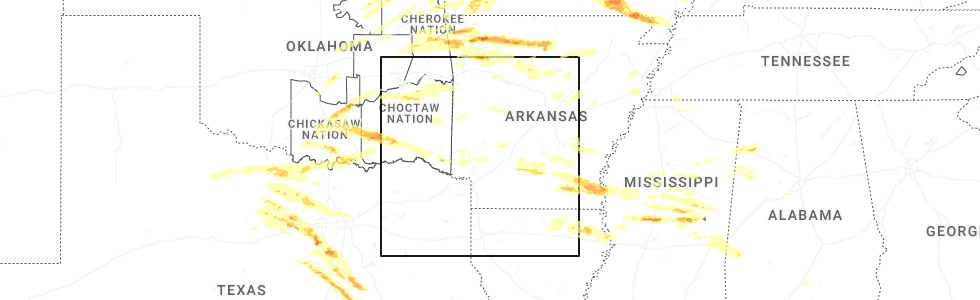
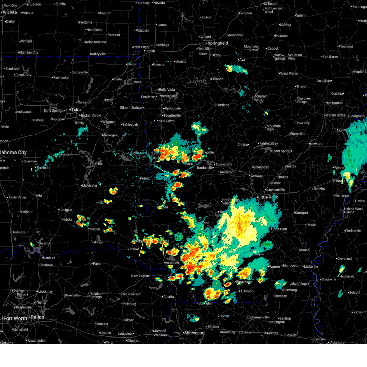
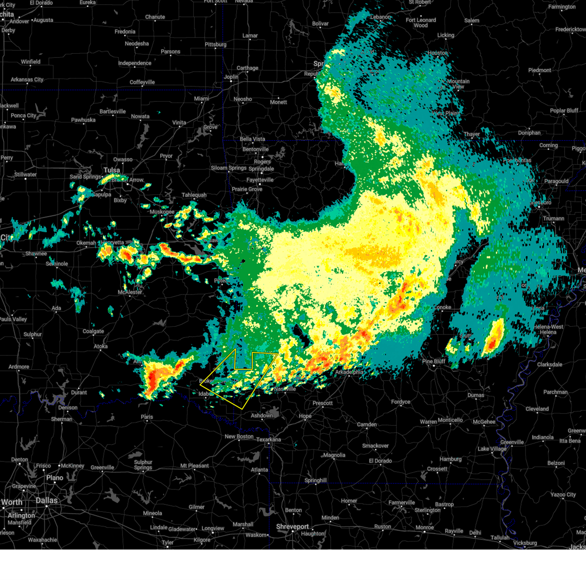
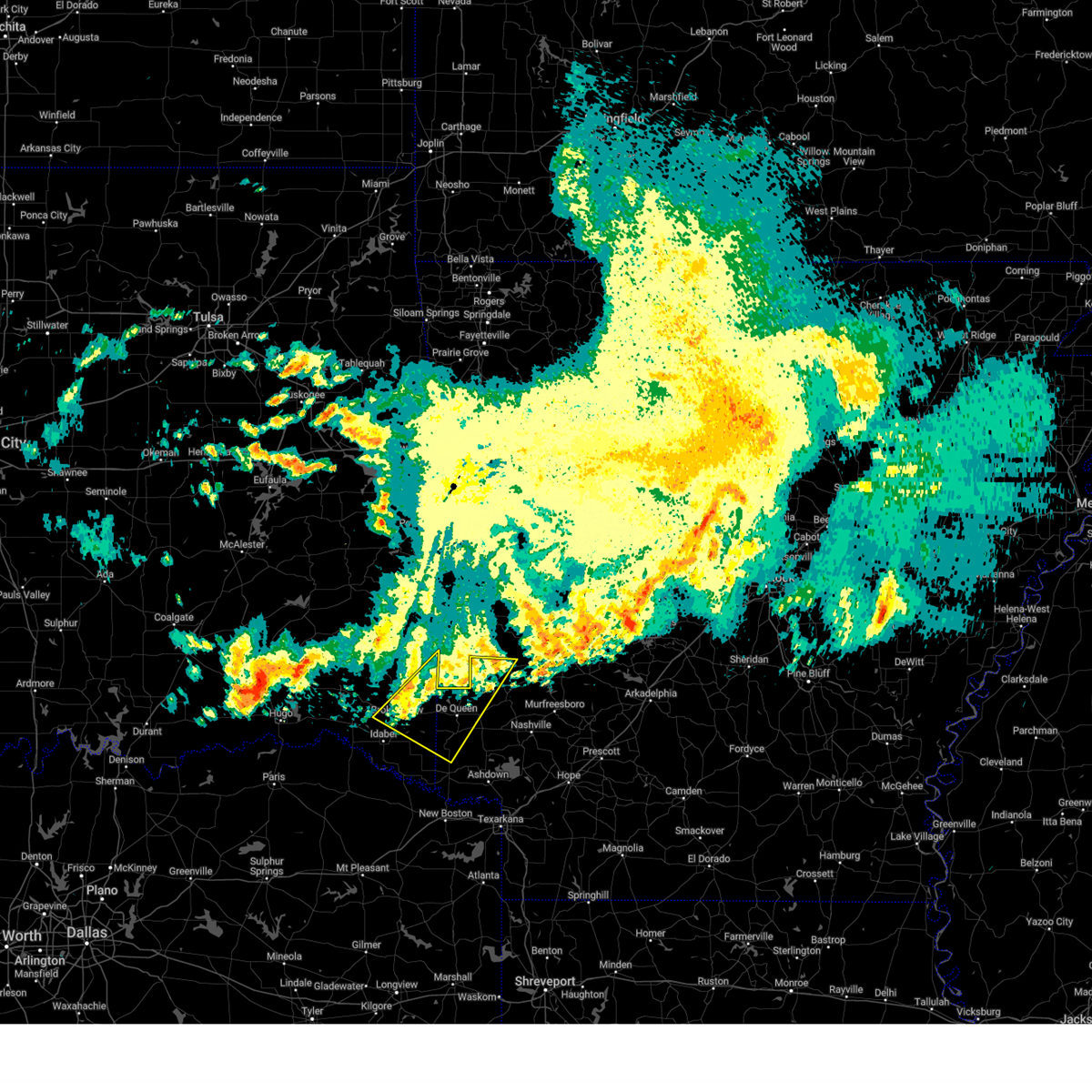
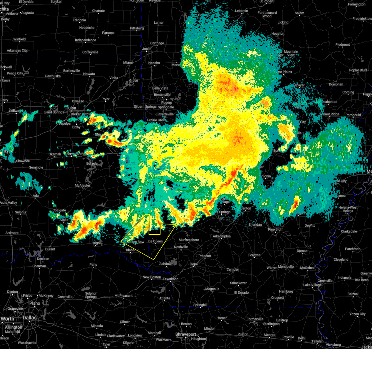
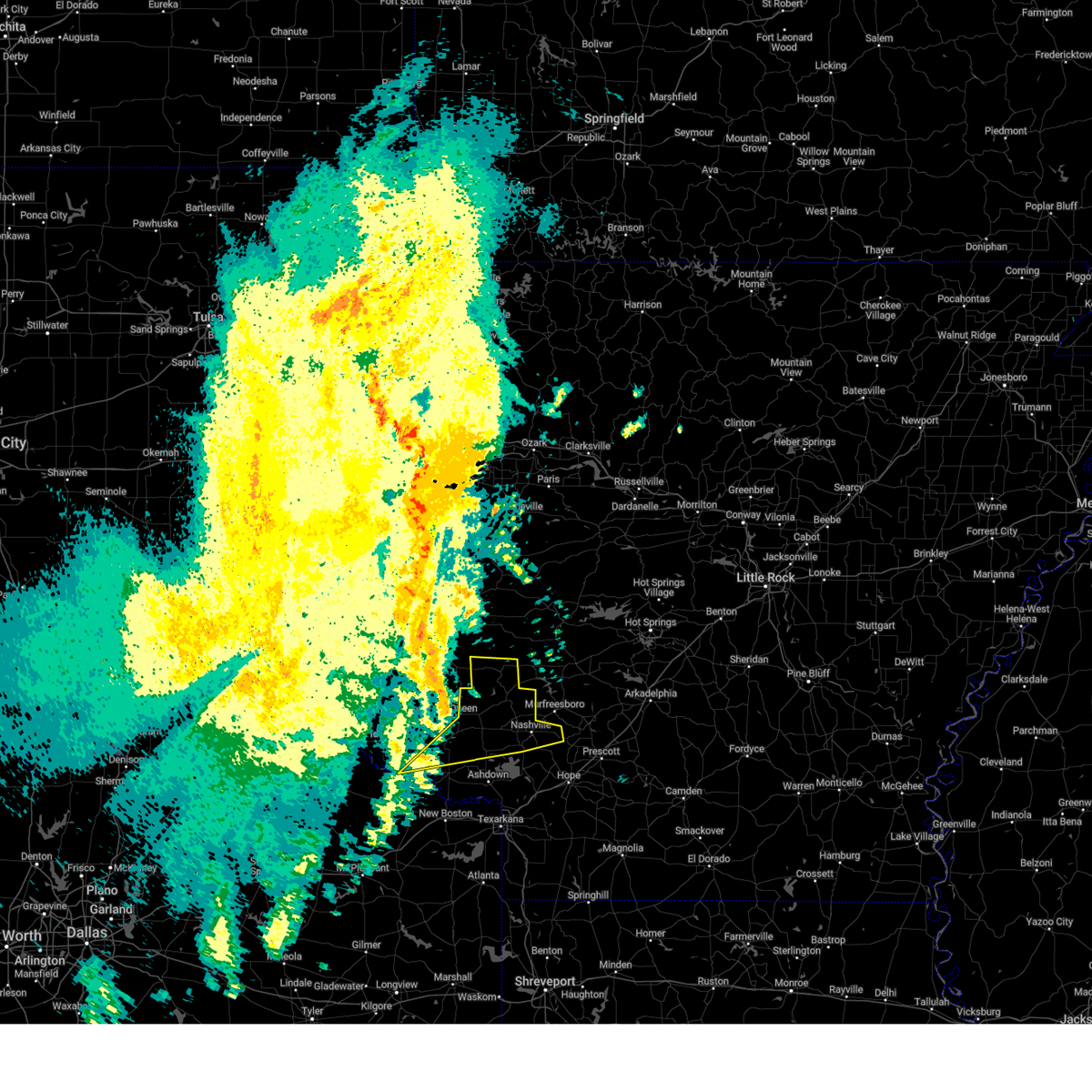
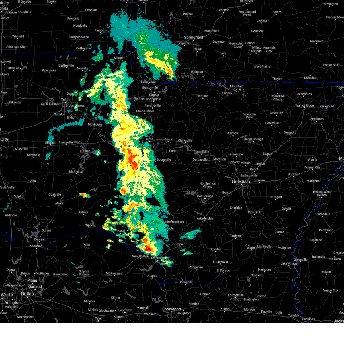
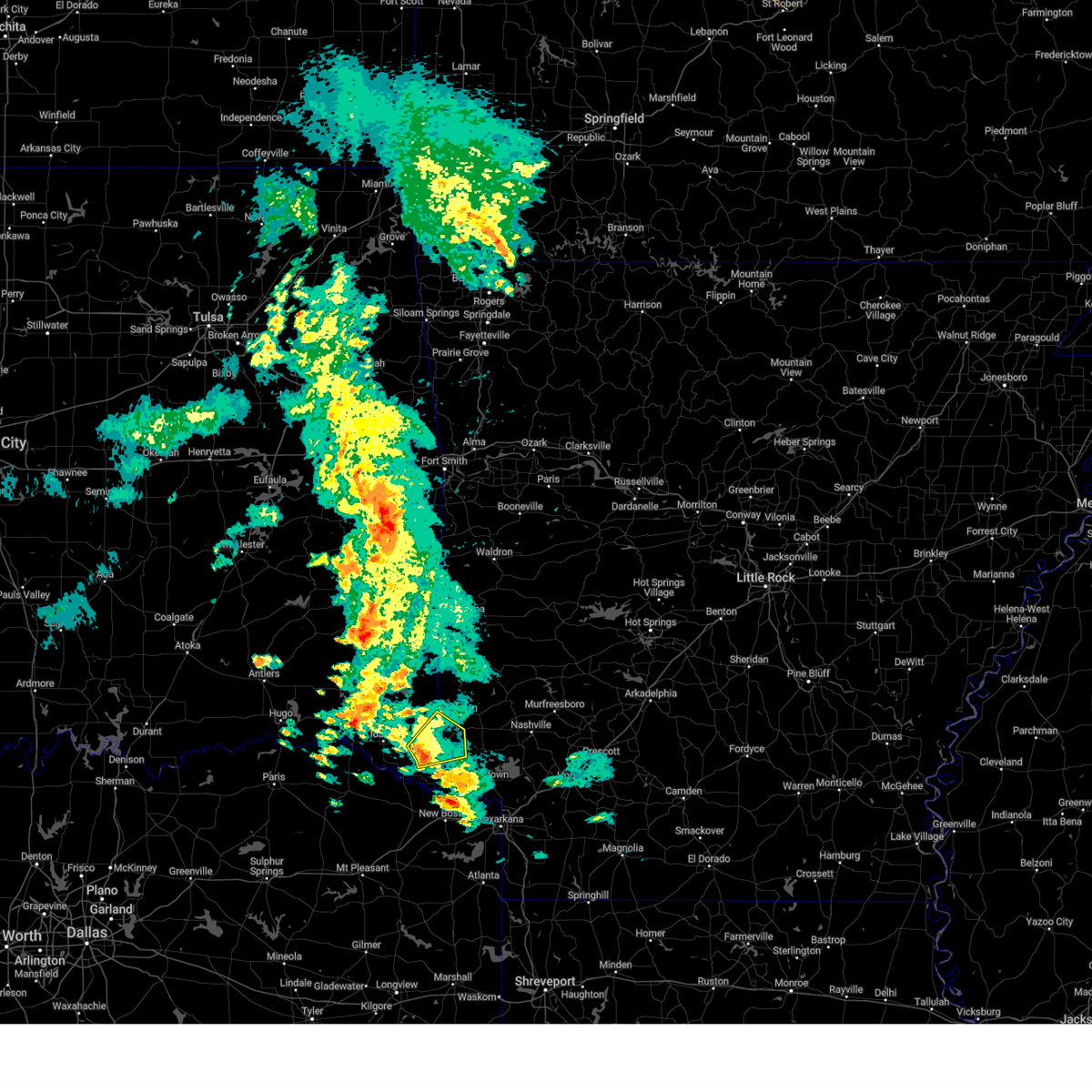
Hail Map for Winthrop, AR
The Winthrop, AR area has had 5 reports of on-the-ground hail by trained spotters, and has been under severe weather warnings 27 times during the past 12 months. Doppler radar has detected hail at or near Winthrop, AR on 55 occasions, including 3 occasions during the past year.
| Name: | Winthrop, AR |
| Where Located: | 30.2 miles WSW of Nashville, AR |
| Map: | Google Map for Winthrop, AR |
| Population: | 192 |
| Housing Units: | 87 |
| More Info: | Search Google for Winthrop, AR |
1
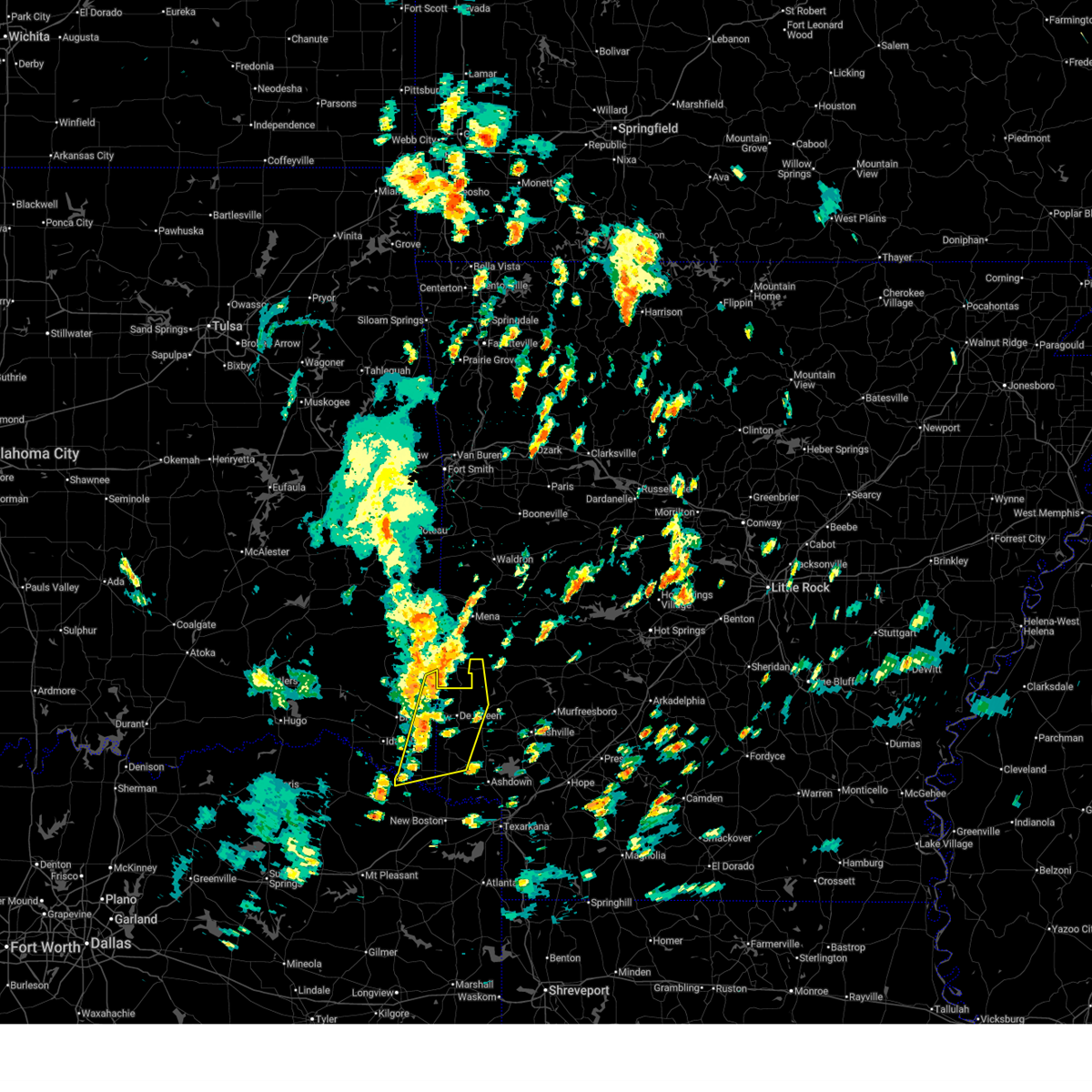
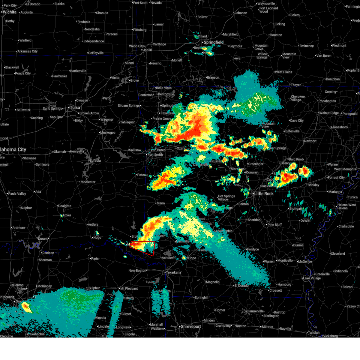
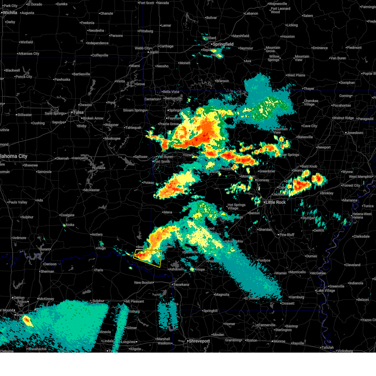
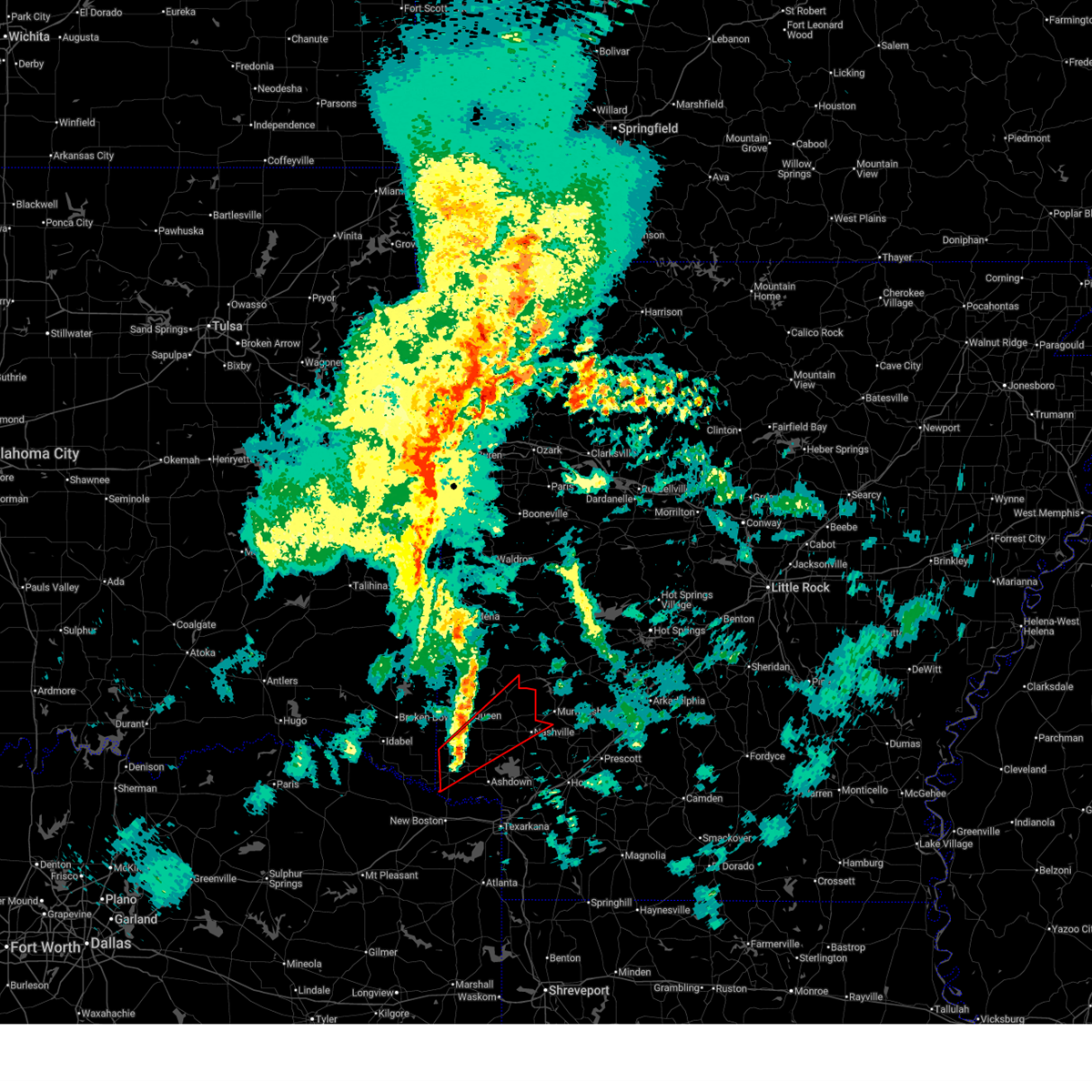
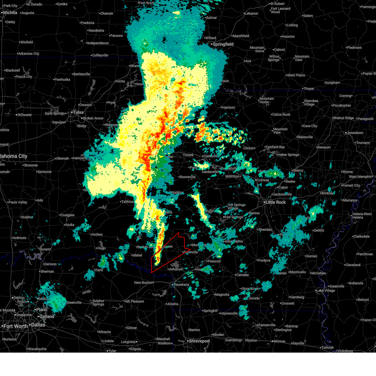
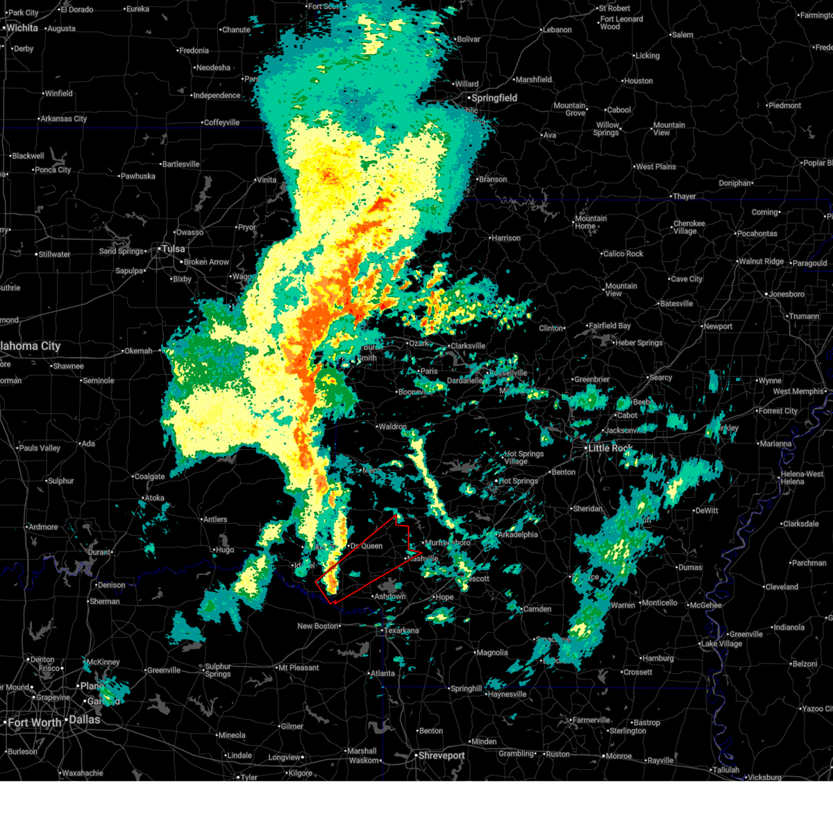
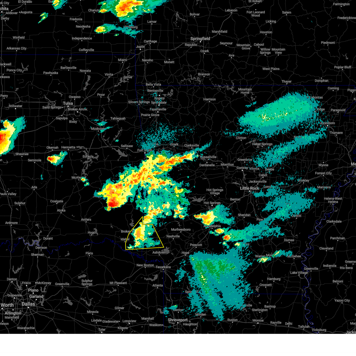
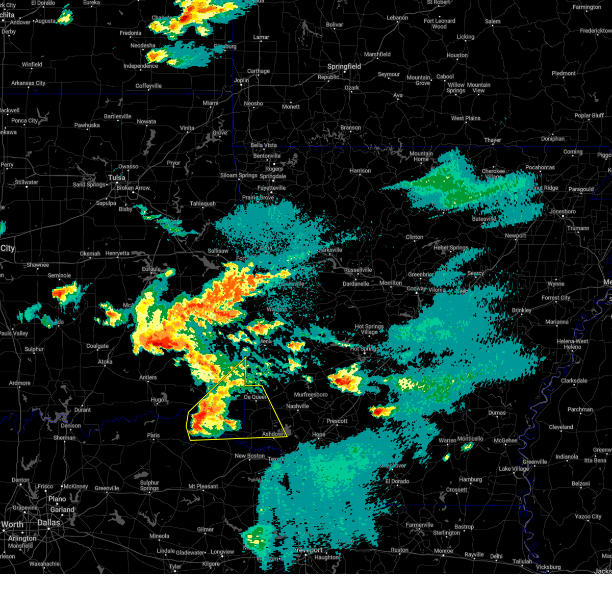
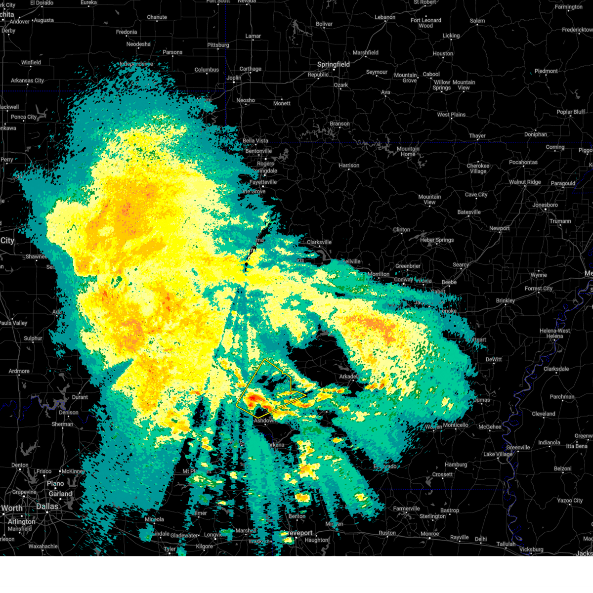
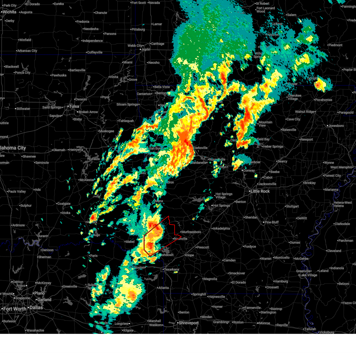
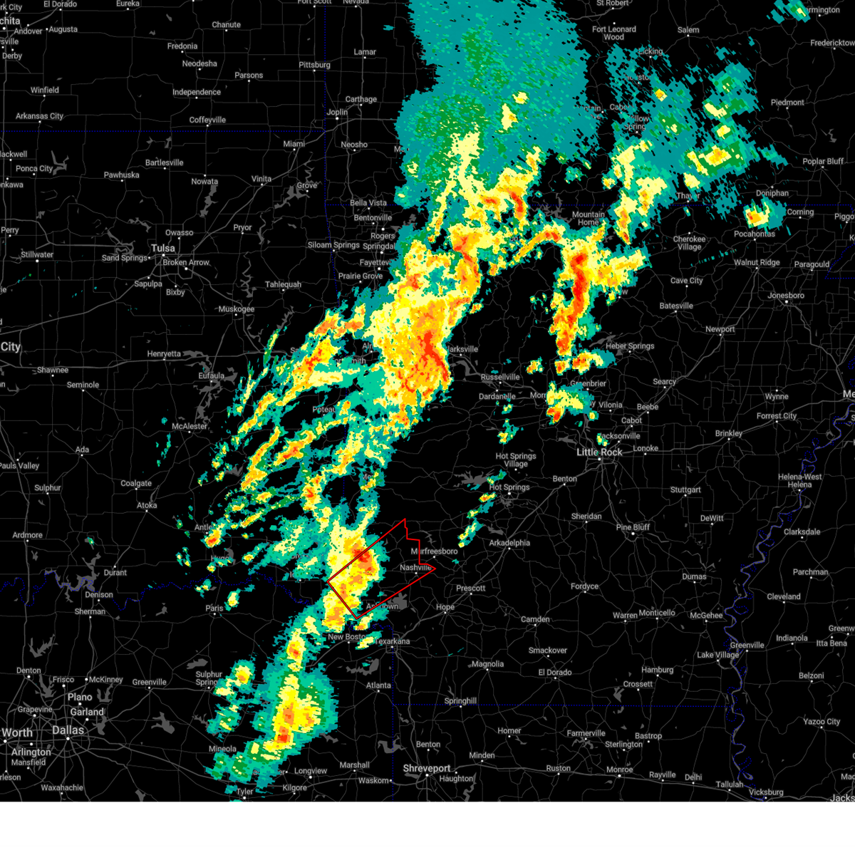
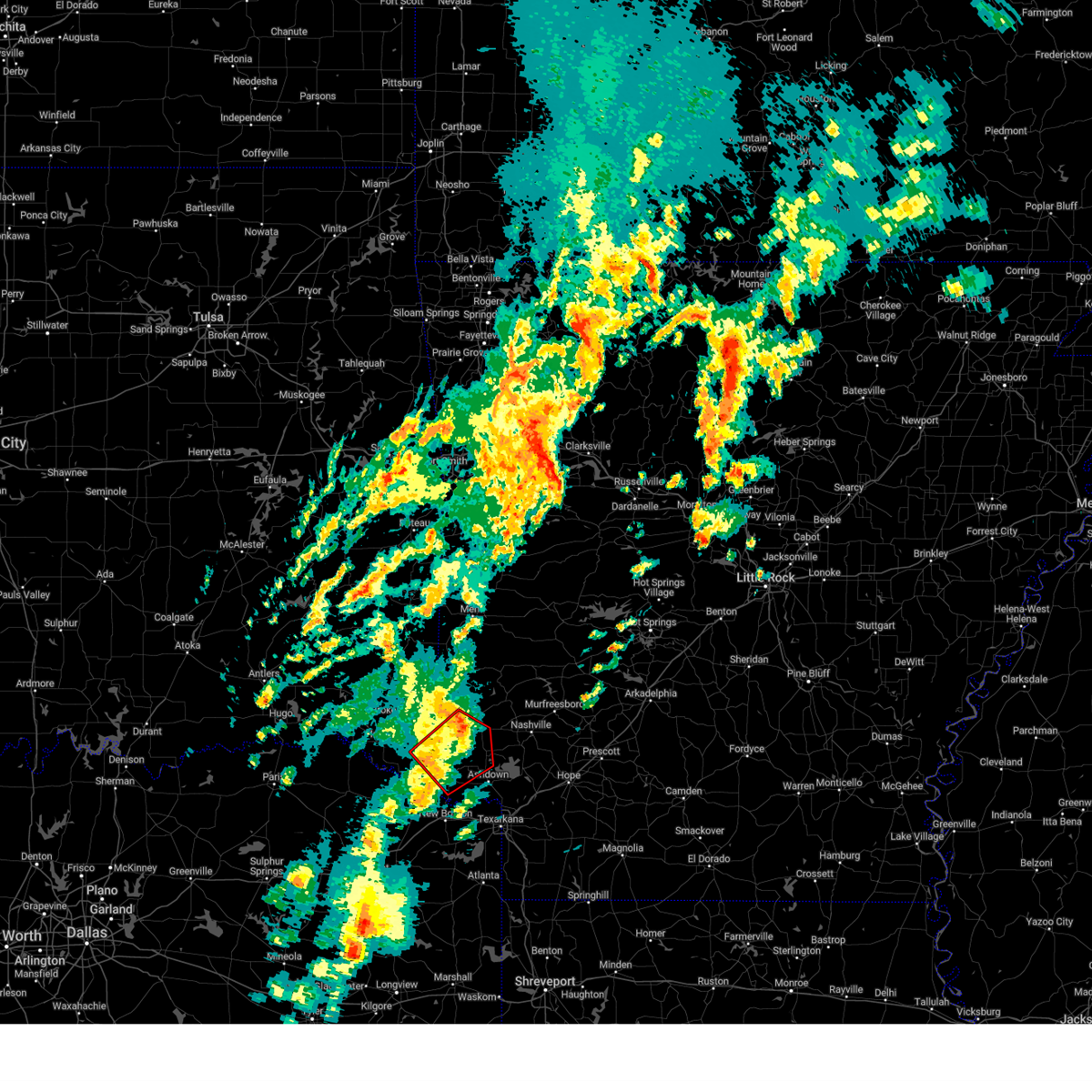
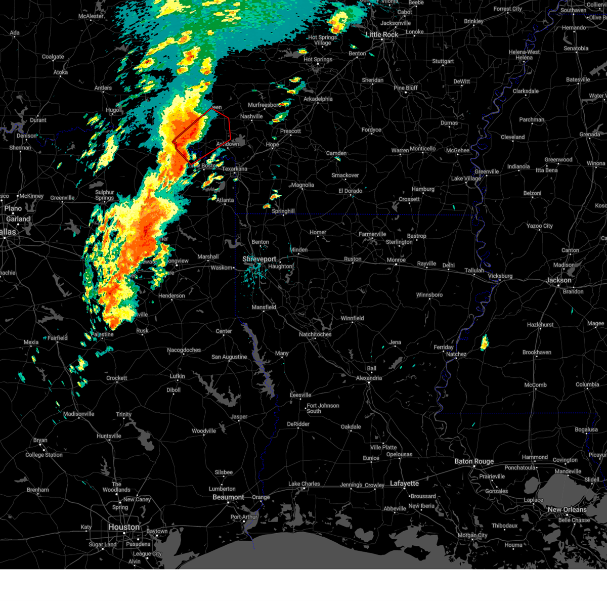
The Top Recent Hail Date for Winthrop, AR is Tuesday, April 28, 2026 (12th out of 55)
Hail and Wind Damage Spotted near Winthrop, AR
| Date / Time | Report Details |
|---|---|
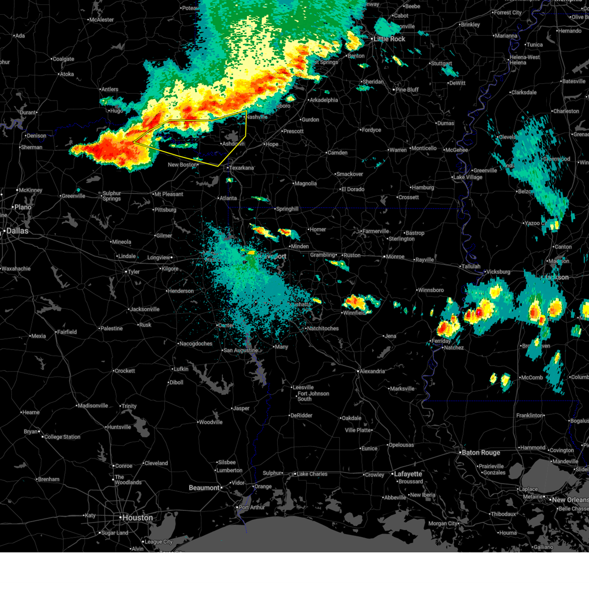
| 6/23/2026 6:58 PM CDT |
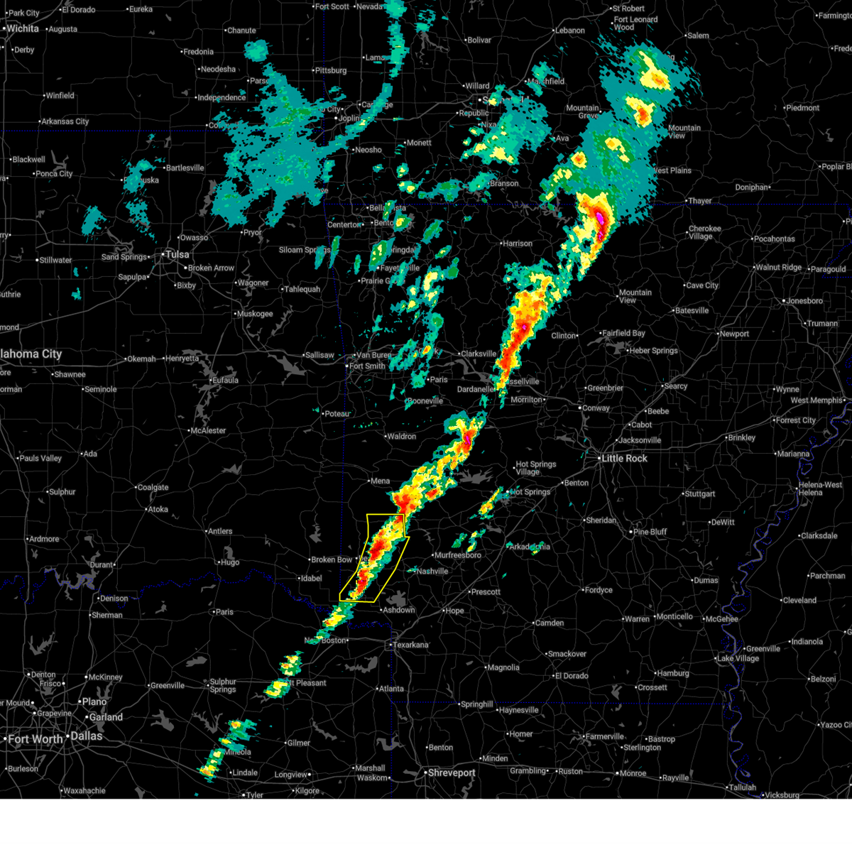
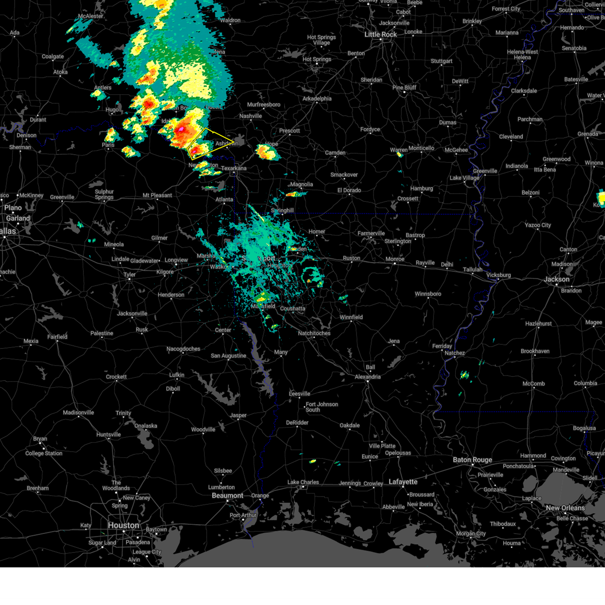
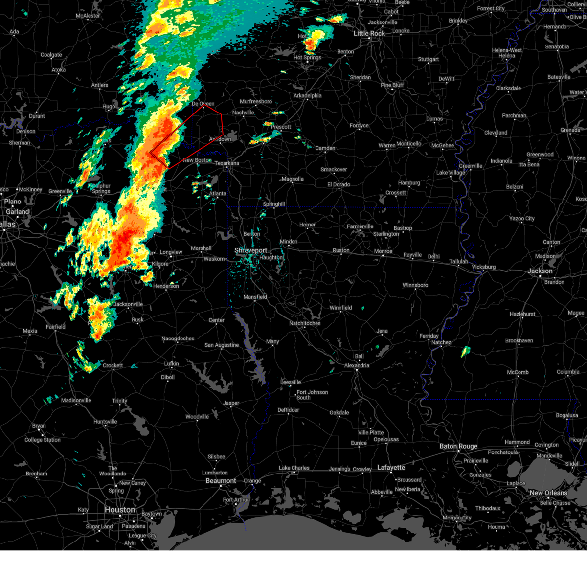
 Svrshv the national weather service in shreveport has issued a * severe thunderstorm warning for, northwestern little river county in southwestern arkansas, northwestern sevier county in southwestern arkansas, southeastern mccurtain county in southeastern oklahoma, east central red river county in northeastern texas, * until 745 pm cdt. * at 658 pm cdt, severe thunderstorms were located along a line from over broken bow to 11 miles south of idabel, or along a line from 25 miles west of de queen to 17 miles northeast of clarksville, moving east at 40 mph (radar indicated). Hazards include 60 mph wind gusts and small hail. expect damage to roofs, siding, and trees Svrshv the national weather service in shreveport has issued a * severe thunderstorm warning for, northwestern little river county in southwestern arkansas, northwestern sevier county in southwestern arkansas, southeastern mccurtain county in southeastern oklahoma, east central red river county in northeastern texas, * until 745 pm cdt. * at 658 pm cdt, severe thunderstorms were located along a line from over broken bow to 11 miles south of idabel, or along a line from 25 miles west of de queen to 17 miles northeast of clarksville, moving east at 40 mph (radar indicated). Hazards include 60 mph wind gusts and small hail. expect damage to roofs, siding, and trees
|
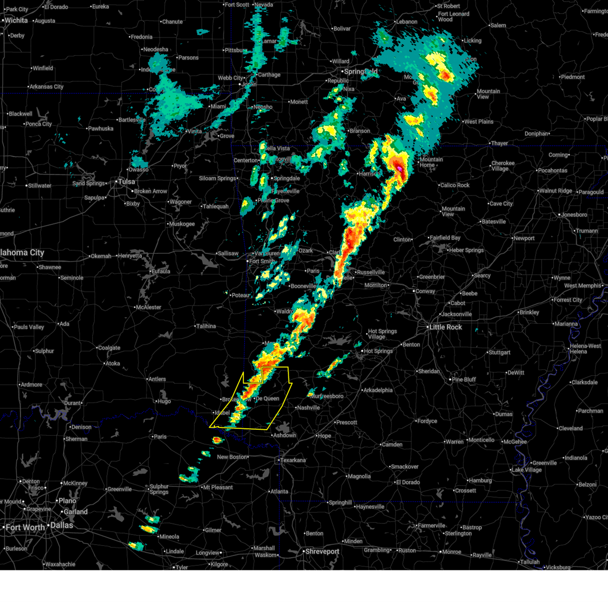
| 6/22/2026 6:24 AM CDT |
 At 624 am cdt, severe thunderstorms were located along a line from 13 miles northeast of corinth to 14 miles west of bagwell, or along a line from 19 miles northeast of nashville to 21 miles west of clarksville, moving southeast at 45 mph (emergency management reported. trees were downed across western and southern mccurtain county oklahoma from these storms). Hazards include 60 mph wind gusts. Expect damage to roofs, siding, and trees. Locations impacted include, de queen, ashdown, nashville, clarksville, mineral springs, dierks, horatio, foreman, boxelder, umpire, hagansport, idabel, broken bow, de kalb, bogata, lockesburg, wilton, tollette, winthrop and gillham. At 624 am cdt, severe thunderstorms were located along a line from 13 miles northeast of corinth to 14 miles west of bagwell, or along a line from 19 miles northeast of nashville to 21 miles west of clarksville, moving southeast at 45 mph (emergency management reported. trees were downed across western and southern mccurtain county oklahoma from these storms). Hazards include 60 mph wind gusts. Expect damage to roofs, siding, and trees. Locations impacted include, de queen, ashdown, nashville, clarksville, mineral springs, dierks, horatio, foreman, boxelder, umpire, hagansport, idabel, broken bow, de kalb, bogata, lockesburg, wilton, tollette, winthrop and gillham.
|
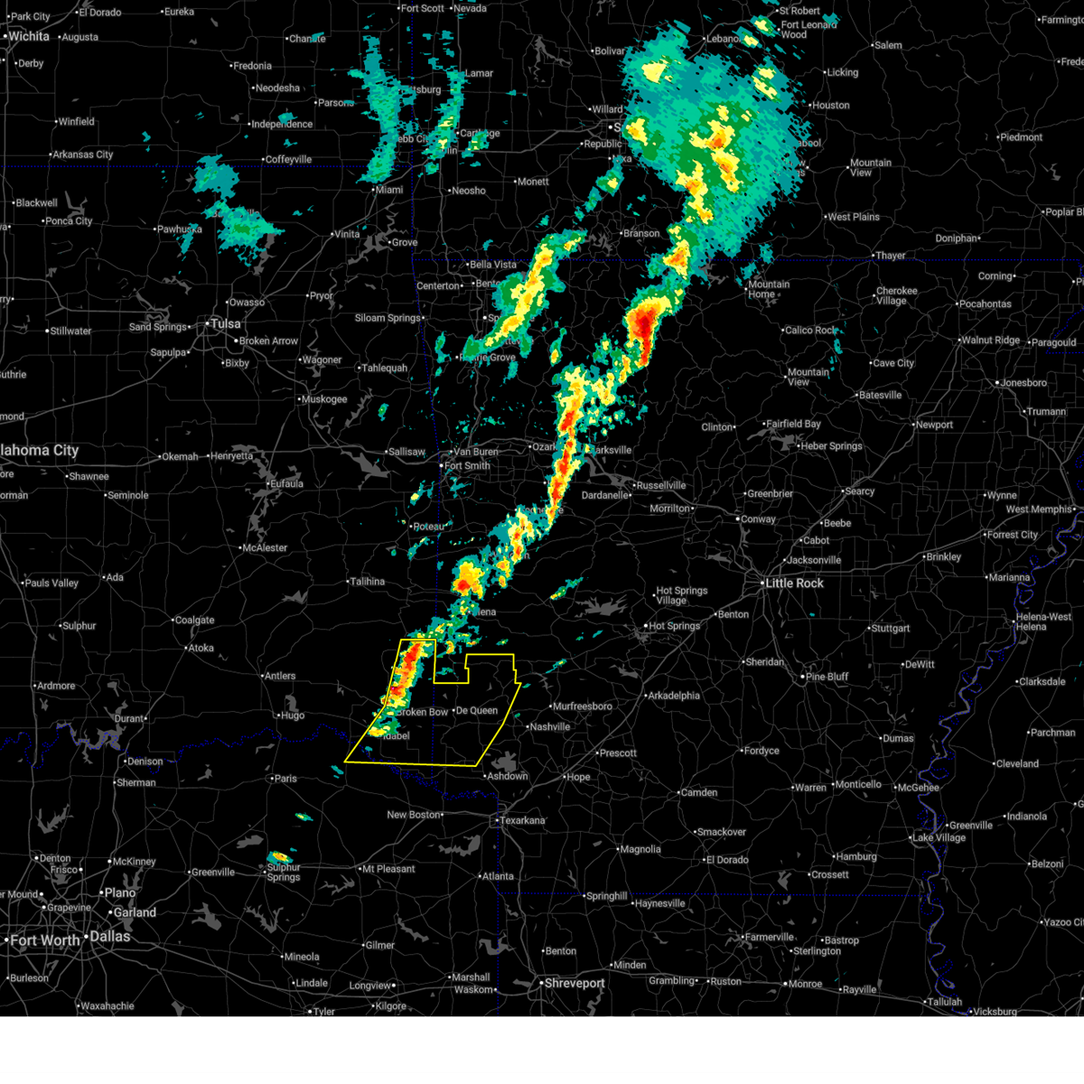
| 6/22/2026 5:46 AM CDT |
 Svrshv the national weather service in shreveport has issued a * severe thunderstorm warning for, northern hempstead county in southwestern arkansas, howard county in southwestern arkansas, little river county in southwestern arkansas, sevier county in southwestern arkansas, mccurtain county in southeastern oklahoma, northern bowie county in northeastern texas, northern franklin county in northeastern texas, red river county in northeastern texas, northern titus county in northeastern texas, * until 645 am cdt. * at 546 am cdt, severe thunderstorms were located along a line from 10 miles northeast of athens to 21 miles west of manchester, or along a line from 12 miles northeast of umpire to 30 miles northwest of clarksville, moving southeast at 45 mph. a 49 mph wind gust was just recorded from the hugo mesonet station in central choctaw county oklahoma. locally higher wind gusts are possible (radar indicated). Hazards include 60 mph wind gusts. expect damage to roofs, siding, and trees Svrshv the national weather service in shreveport has issued a * severe thunderstorm warning for, northern hempstead county in southwestern arkansas, howard county in southwestern arkansas, little river county in southwestern arkansas, sevier county in southwestern arkansas, mccurtain county in southeastern oklahoma, northern bowie county in northeastern texas, northern franklin county in northeastern texas, red river county in northeastern texas, northern titus county in northeastern texas, * until 645 am cdt. * at 546 am cdt, severe thunderstorms were located along a line from 10 miles northeast of athens to 21 miles west of manchester, or along a line from 12 miles northeast of umpire to 30 miles northwest of clarksville, moving southeast at 45 mph. a 49 mph wind gust was just recorded from the hugo mesonet station in central choctaw county oklahoma. locally higher wind gusts are possible (radar indicated). Hazards include 60 mph wind gusts. expect damage to roofs, siding, and trees
|
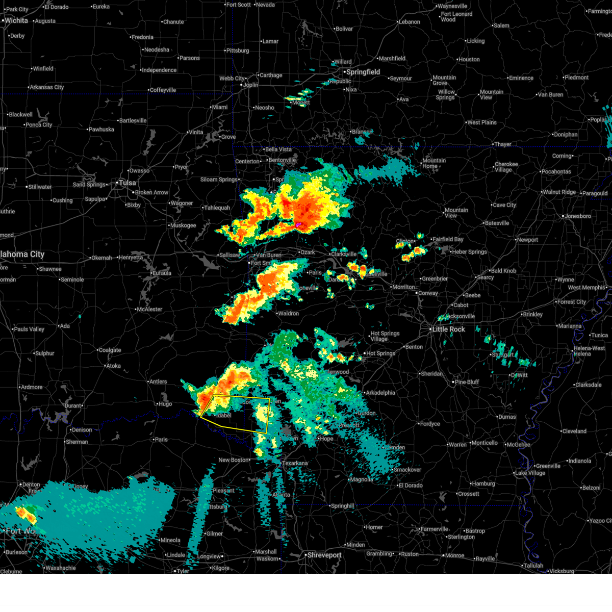
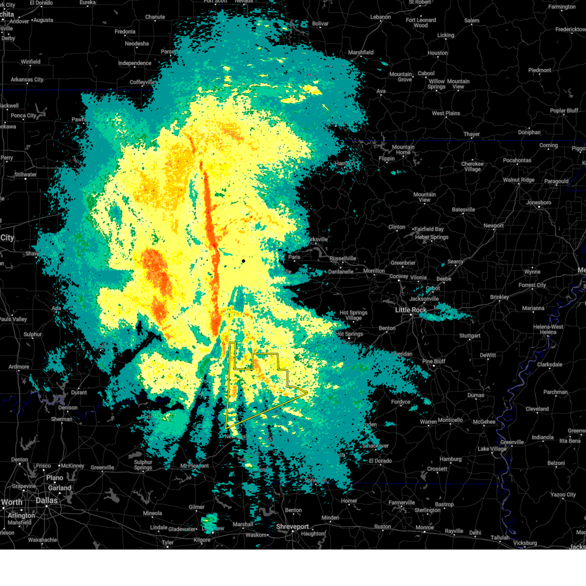
| 6/7/2026 2:02 PM CDT |
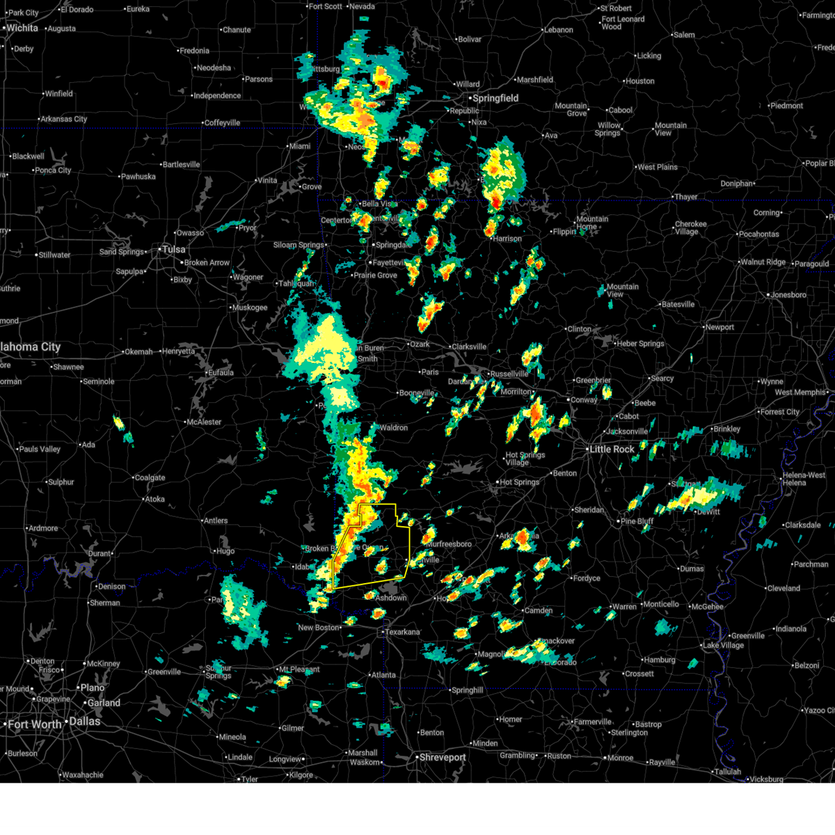 Svrshv the national weather service in shreveport has issued a * severe thunderstorm warning for, howard county in southwestern arkansas, northwestern little river county in southwestern arkansas, sevier county in southwestern arkansas, * until 300 pm cdt. * at 202 pm cdt, severe thunderstorms were located along a line from 13 miles northwest of athens to over winthrop, or along a line from 17 miles northwest of umpire to 7 miles south of horatio, moving east at 30 mph (radar indicated). Hazards include 60 mph wind gusts and small hail. expect damage to roofs, siding, and trees Svrshv the national weather service in shreveport has issued a * severe thunderstorm warning for, howard county in southwestern arkansas, northwestern little river county in southwestern arkansas, sevier county in southwestern arkansas, * until 300 pm cdt. * at 202 pm cdt, severe thunderstorms were located along a line from 13 miles northwest of athens to over winthrop, or along a line from 17 miles northwest of umpire to 7 miles south of horatio, moving east at 30 mph (radar indicated). Hazards include 60 mph wind gusts and small hail. expect damage to roofs, siding, and trees
|
| 6/7/2026 1:28 PM CDT |
 Svrshv the national weather service in shreveport has issued a * severe thunderstorm warning for, northwestern howard county in southwestern arkansas, northwestern little river county in southwestern arkansas, sevier county in southwestern arkansas, southeastern mccurtain county in southeastern oklahoma, northwestern bowie county in northeastern texas, * until 200 pm cdt. * at 128 pm cdt, severe thunderstorms were located along a line from 8 miles west of gillham to 10 miles west of arkinda, or along a line from 12 miles northwest of de queen to 14 miles west of foreman, moving east at 30 mph (radar indicated). Hazards include 60 mph wind gusts and small hail. expect damage to roofs, siding, and trees Svrshv the national weather service in shreveport has issued a * severe thunderstorm warning for, northwestern howard county in southwestern arkansas, northwestern little river county in southwestern arkansas, sevier county in southwestern arkansas, southeastern mccurtain county in southeastern oklahoma, northwestern bowie county in northeastern texas, * until 200 pm cdt. * at 128 pm cdt, severe thunderstorms were located along a line from 8 miles west of gillham to 10 miles west of arkinda, or along a line from 12 miles northwest of de queen to 14 miles west of foreman, moving east at 30 mph (radar indicated). Hazards include 60 mph wind gusts and small hail. expect damage to roofs, siding, and trees
|
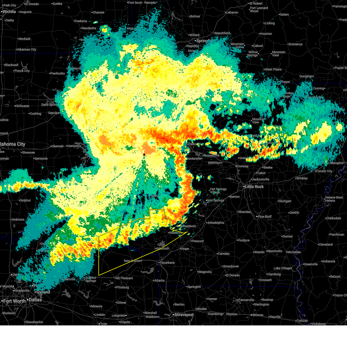
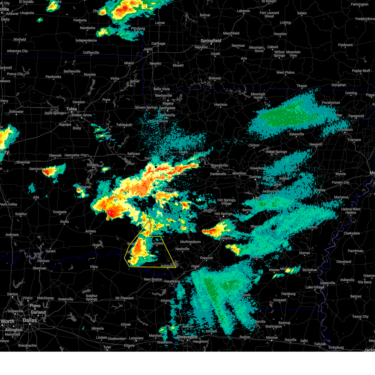
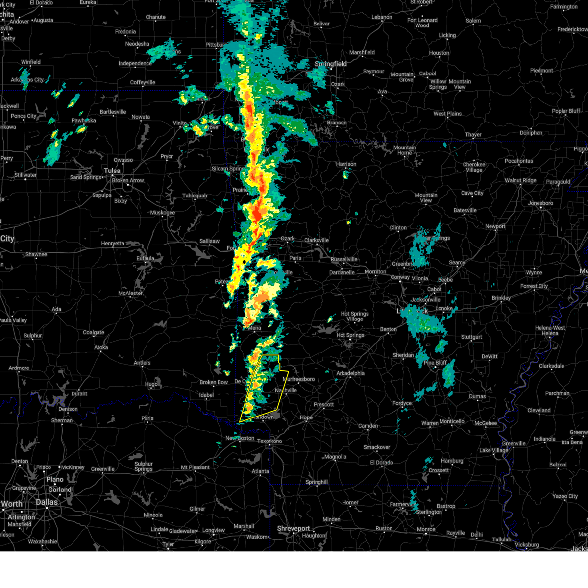
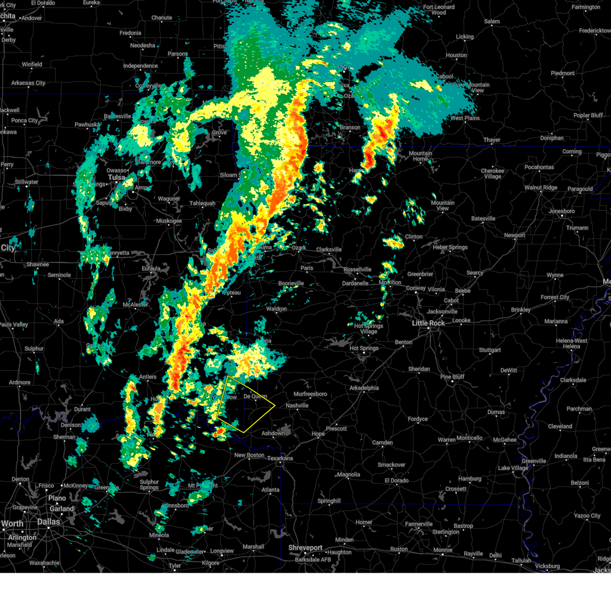
| 4/28/2026 6:45 PM CDT |
 At 645 pm cdt, a severe thunderstorm capable of producing a tornado was located over winthrop, or 7 miles south of horatio, moving east at 35 mph (radar indicated rotation). Hazards include tornado and quarter size hail. Flying debris will be dangerous to those caught without shelter. mobile homes will be damaged or destroyed. damage to roofs, windows and vehicles will occur. tree damage is likely. Locations impacted include, horatio, winthrop, arkinda, west otis and cerrogordo. At 645 pm cdt, a severe thunderstorm capable of producing a tornado was located over winthrop, or 7 miles south of horatio, moving east at 35 mph (radar indicated rotation). Hazards include tornado and quarter size hail. Flying debris will be dangerous to those caught without shelter. mobile homes will be damaged or destroyed. damage to roofs, windows and vehicles will occur. tree damage is likely. Locations impacted include, horatio, winthrop, arkinda, west otis and cerrogordo.
|
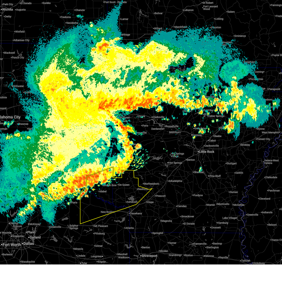
| 4/28/2026 6:27 PM CDT |
 At 627 pm cdt, a severe thunderstorm capable of producing a tornado was located 9 miles northwest of arkinda, or 13 miles west of horatio, moving east at 35 mph (radar indicated rotation). Hazards include tornado and two inch hail. Flying debris will be dangerous to those caught without shelter. mobile homes will be damaged or destroyed. damage to roofs, windows and vehicles will occur. tree damage is likely. Locations impacted include, horatio, winthrop, arkinda, haworth, cerrogordo, shinewell, west otis, america, moon, bokhoma and goodwater. At 627 pm cdt, a severe thunderstorm capable of producing a tornado was located 9 miles northwest of arkinda, or 13 miles west of horatio, moving east at 35 mph (radar indicated rotation). Hazards include tornado and two inch hail. Flying debris will be dangerous to those caught without shelter. mobile homes will be damaged or destroyed. damage to roofs, windows and vehicles will occur. tree damage is likely. Locations impacted include, horatio, winthrop, arkinda, haworth, cerrogordo, shinewell, west otis, america, moon, bokhoma and goodwater.
|
| 4/28/2026 6:18 PM CDT |
 the severe thunderstorm warning has been cancelled and is no longer in effect the severe thunderstorm warning has been cancelled and is no longer in effect
|
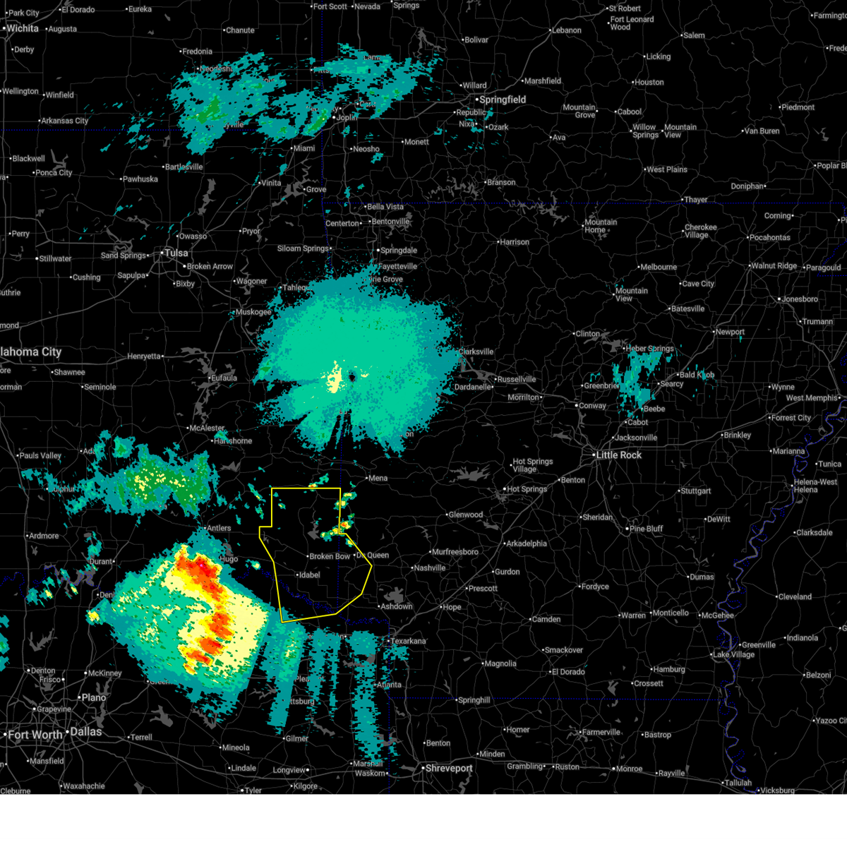
| 4/28/2026 6:17 PM CDT |
 Torshv the national weather service in shreveport has issued a * tornado warning for, northwestern little river county in southwestern arkansas, southwestern sevier county in southwestern arkansas, southeastern mccurtain county in southeastern oklahoma, * until 700 pm cdt. * at 617 pm cdt, a severe thunderstorm capable of producing a tornado was located 10 miles south of broken bow, or 19 miles west of horatio, moving east at 35 mph (radar indicated rotation). Hazards include tornado and quarter size hail. Flying debris will be dangerous to those caught without shelter. mobile homes will be damaged or destroyed. damage to roofs, windows and vehicles will occur. Tree damage is likely. Torshv the national weather service in shreveport has issued a * tornado warning for, northwestern little river county in southwestern arkansas, southwestern sevier county in southwestern arkansas, southeastern mccurtain county in southeastern oklahoma, * until 700 pm cdt. * at 617 pm cdt, a severe thunderstorm capable of producing a tornado was located 10 miles south of broken bow, or 19 miles west of horatio, moving east at 35 mph (radar indicated rotation). Hazards include tornado and quarter size hail. Flying debris will be dangerous to those caught without shelter. mobile homes will be damaged or destroyed. damage to roofs, windows and vehicles will occur. Tree damage is likely.
|
| 4/28/2026 6:13 PM CDT |
 Svrshv the national weather service in shreveport has issued a * severe thunderstorm warning for, northwestern little river county in southwestern arkansas, southwestern sevier county in southwestern arkansas, southeastern mccurtain county in southeastern oklahoma, * until 700 pm cdt. * at 613 pm cdt, a severe thunderstorm was located 6 miles east of idabel, or 21 miles west of horatio, moving east at 35 mph (radar indicated). Hazards include 60 mph wind gusts and half dollar size hail. Hail damage to vehicles is expected. Expect wind damage to roofs, siding, and trees. Svrshv the national weather service in shreveport has issued a * severe thunderstorm warning for, northwestern little river county in southwestern arkansas, southwestern sevier county in southwestern arkansas, southeastern mccurtain county in southeastern oklahoma, * until 700 pm cdt. * at 613 pm cdt, a severe thunderstorm was located 6 miles east of idabel, or 21 miles west of horatio, moving east at 35 mph (radar indicated). Hazards include 60 mph wind gusts and half dollar size hail. Hail damage to vehicles is expected. Expect wind damage to roofs, siding, and trees.
|
| 4/28/2026 5:51 PM CDT |
 Svrshv the national weather service in shreveport has issued a * severe thunderstorm warning for, northwestern little river county in southwestern arkansas, southwestern sevier county in southwestern arkansas, southern mccurtain county in southeastern oklahoma, * until 645 pm cdt. * at 551 pm cdt, a severe thunderstorm was located 5 miles north of idabel, or 26 miles west of horatio, moving east at 50 mph (radar indicated). Hazards include 60 mph wind gusts and quarter size hail. Hail damage to vehicles is expected. Expect wind damage to roofs, siding, and trees. Svrshv the national weather service in shreveport has issued a * severe thunderstorm warning for, northwestern little river county in southwestern arkansas, southwestern sevier county in southwestern arkansas, southern mccurtain county in southeastern oklahoma, * until 645 pm cdt. * at 551 pm cdt, a severe thunderstorm was located 5 miles north of idabel, or 26 miles west of horatio, moving east at 50 mph (radar indicated). Hazards include 60 mph wind gusts and quarter size hail. Hail damage to vehicles is expected. Expect wind damage to roofs, siding, and trees.
|
| 4/24/2026 8:31 PM CDT |
 Svrshv the national weather service in shreveport has issued a * severe thunderstorm warning for, northwestern hempstead county in southwestern arkansas, southeastern howard county in southwestern arkansas, little river county in southwestern arkansas, southern sevier county in southwestern arkansas, southeastern mccurtain county in southeastern oklahoma, northern bowie county in northeastern texas, northern red river county in northeastern texas, * until 930 pm cdt. * at 831 pm cdt, severe thunderstorms were located along a line from 7 miles northwest of arkinda to near clarksville, or along a line from 13 miles southwest of horatio to near clarksville, moving southeast at 40 mph (radar indicated). Hazards include 60 mph wind gusts and quarter size hail. Hail damage to vehicles is expected. Expect wind damage to roofs, siding, and trees. Svrshv the national weather service in shreveport has issued a * severe thunderstorm warning for, northwestern hempstead county in southwestern arkansas, southeastern howard county in southwestern arkansas, little river county in southwestern arkansas, southern sevier county in southwestern arkansas, southeastern mccurtain county in southeastern oklahoma, northern bowie county in northeastern texas, northern red river county in northeastern texas, * until 930 pm cdt. * at 831 pm cdt, severe thunderstorms were located along a line from 7 miles northwest of arkinda to near clarksville, or along a line from 13 miles southwest of horatio to near clarksville, moving southeast at 40 mph (radar indicated). Hazards include 60 mph wind gusts and quarter size hail. Hail damage to vehicles is expected. Expect wind damage to roofs, siding, and trees.
|
| 3/15/2026 4:02 PM CDT |
 At 402 pm cdt, severe thunderstorms were located along a line from over umpire to 6 miles southeast of winthrop, or along a line from over umpire to 6 miles northeast of foreman, moving east at 45 mph (radar indicated). Hazards include 60 mph wind gusts and quarter size hail. Hail damage to vehicles is expected. expect wind damage to roofs, siding, and trees. Locations impacted include, dierks, horatio, umpire, lockesburg, winthrop, ben lomond, athens, arkinda, oak grove, provo, geneva, lebanon, silver ridge, bellview, central and burg. At 402 pm cdt, severe thunderstorms were located along a line from over umpire to 6 miles southeast of winthrop, or along a line from over umpire to 6 miles northeast of foreman, moving east at 45 mph (radar indicated). Hazards include 60 mph wind gusts and quarter size hail. Hail damage to vehicles is expected. expect wind damage to roofs, siding, and trees. Locations impacted include, dierks, horatio, umpire, lockesburg, winthrop, ben lomond, athens, arkinda, oak grove, provo, geneva, lebanon, silver ridge, bellview, central and burg.
|
| 3/15/2026 4:02 PM CDT |
 the severe thunderstorm warning has been cancelled and is no longer in effect the severe thunderstorm warning has been cancelled and is no longer in effect
|
| 3/15/2026 3:41 PM CDT |
 At 341 pm cdt, severe thunderstorms were located along a line from 8 miles north of gillham to 7 miles west of arkinda, or along a line from 17 miles north of de queen to 12 miles west of foreman, moving east at 45 mph (radar indicated). Hazards include 60 mph wind gusts and quarter size hail. Hail damage to vehicles is expected. expect wind damage to roofs, siding, and trees. Locations impacted include, de queen, dierks, horatio, umpire, lockesburg, winthrop, gillham, ben lomond, arkinda, athens, oak grove, haworth, geneva, west otis, central, west line, bellview, cerrogordo and provo. At 341 pm cdt, severe thunderstorms were located along a line from 8 miles north of gillham to 7 miles west of arkinda, or along a line from 17 miles north of de queen to 12 miles west of foreman, moving east at 45 mph (radar indicated). Hazards include 60 mph wind gusts and quarter size hail. Hail damage to vehicles is expected. expect wind damage to roofs, siding, and trees. Locations impacted include, de queen, dierks, horatio, umpire, lockesburg, winthrop, gillham, ben lomond, arkinda, athens, oak grove, haworth, geneva, west otis, central, west line, bellview, cerrogordo and provo.
|
| 3/15/2026 3:41 PM CDT |
 the severe thunderstorm warning has been cancelled and is no longer in effect the severe thunderstorm warning has been cancelled and is no longer in effect
|
| 3/15/2026 3:14 PM CDT |
 Svrshv the national weather service in shreveport has issued a * severe thunderstorm warning for, northern howard county in southwestern arkansas, northwestern little river county in southwestern arkansas, sevier county in southwestern arkansas, eastern mccurtain county in southeastern oklahoma, northeastern red river county in northeastern texas, * until 415 pm cdt. * at 314 pm cdt, severe thunderstorms were located along a line from 20 miles northwest of gillham to 6 miles south of idabel, or along a line from 25 miles northwest of de queen to 19 miles northeast of clarksville, moving east at 45 mph (radar indicated). Hazards include 60 mph wind gusts and quarter size hail. Hail damage to vehicles is expected. Expect wind damage to roofs, siding, and trees. Svrshv the national weather service in shreveport has issued a * severe thunderstorm warning for, northern howard county in southwestern arkansas, northwestern little river county in southwestern arkansas, sevier county in southwestern arkansas, eastern mccurtain county in southeastern oklahoma, northeastern red river county in northeastern texas, * until 415 pm cdt. * at 314 pm cdt, severe thunderstorms were located along a line from 20 miles northwest of gillham to 6 miles south of idabel, or along a line from 25 miles northwest of de queen to 19 miles northeast of clarksville, moving east at 45 mph (radar indicated). Hazards include 60 mph wind gusts and quarter size hail. Hail damage to vehicles is expected. Expect wind damage to roofs, siding, and trees.
|
| 3/11/2026 1:37 AM CDT |
 the tornado warning has been cancelled and is no longer in effect the tornado warning has been cancelled and is no longer in effect
|
| 3/11/2026 1:26 AM CDT |
 the tornado warning has been cancelled and is no longer in effect the tornado warning has been cancelled and is no longer in effect
|
| 3/11/2026 1:26 AM CDT |
 At 126 am cdt, a severe thunderstorm capable of producing a tornado was located near winthrop, or 8 miles southeast of horatio, moving northeast at 50 mph (radar indicated rotation). Hazards include tornado. Flying debris will be dangerous to those caught without shelter. mobile homes will be damaged or destroyed. damage to roofs, windows and vehicles will occur. tree damage is likely. Locations impacted include, nashville, mineral springs, dierks, horatio, foreman, lockesburg, winthrop, ben lomond, corinth, center point, oak grove, silver ridge, bellview, provo, browntown, central, geneva, lebanon, muddy fork and wallace. At 126 am cdt, a severe thunderstorm capable of producing a tornado was located near winthrop, or 8 miles southeast of horatio, moving northeast at 50 mph (radar indicated rotation). Hazards include tornado. Flying debris will be dangerous to those caught without shelter. mobile homes will be damaged or destroyed. damage to roofs, windows and vehicles will occur. tree damage is likely. Locations impacted include, nashville, mineral springs, dierks, horatio, foreman, lockesburg, winthrop, ben lomond, corinth, center point, oak grove, silver ridge, bellview, provo, browntown, central, geneva, lebanon, muddy fork and wallace.
|
| 3/11/2026 1:12 AM CDT |
 Torshv the national weather service in shreveport has issued a * tornado warning for, north central hempstead county in southwestern arkansas, eastern howard county in southwestern arkansas, northwestern little river county in southwestern arkansas, central sevier county in southwestern arkansas, southeastern mccurtain county in southeastern oklahoma, * until 200 am cdt. * at 112 am cdt, a severe thunderstorm capable of producing a tornado was located over arkinda, or near foreman, moving northeast at 55 mph (radar indicated rotation). Hazards include tornado. Flying debris will be dangerous to those caught without shelter. mobile homes will be damaged or destroyed. damage to roofs, windows and vehicles will occur. Tree damage is likely. Torshv the national weather service in shreveport has issued a * tornado warning for, north central hempstead county in southwestern arkansas, eastern howard county in southwestern arkansas, northwestern little river county in southwestern arkansas, central sevier county in southwestern arkansas, southeastern mccurtain county in southeastern oklahoma, * until 200 am cdt. * at 112 am cdt, a severe thunderstorm capable of producing a tornado was located over arkinda, or near foreman, moving northeast at 55 mph (radar indicated rotation). Hazards include tornado. Flying debris will be dangerous to those caught without shelter. mobile homes will be damaged or destroyed. damage to roofs, windows and vehicles will occur. Tree damage is likely.
|
| 9/18/2025 4:36 PM CDT | the severe thunderstorm warning has been cancelled and is no longer in effect |
| 9/18/2025 3:57 PM CDT | Svrshv the national weather service in shreveport has issued a * severe thunderstorm warning for, northwestern little river county in southwestern arkansas, southwestern sevier county in southwestern arkansas, southeastern mccurtain county in southeastern oklahoma, * until 445 pm cdt. * at 357 pm cdt, a severe thunderstorm was located 8 miles north of arkinda, or 10 miles west of horatio, moving east at 10 mph (radar indicated). Hazards include 60 mph wind gusts and quarter size hail. Hail damage to vehicles is expected. Expect wind damage to roofs, siding, and trees. |
| 9/5/2025 11:16 PM CDT |
 the severe thunderstorm warning has been cancelled and is no longer in effect the severe thunderstorm warning has been cancelled and is no longer in effect
|
| 9/5/2025 10:30 PM CDT |
 Svrshv the national weather service in shreveport has issued a * severe thunderstorm warning for, northwestern little river county in southwestern arkansas, western sevier county in southwestern arkansas, mccurtain county in southeastern oklahoma, northwestern bowie county in northeastern texas, northeastern red river county in northeastern texas, * until 1130 pm cdt. * at 1030 pm cdt, severe thunderstorms were located along a line from 28 miles northwest of broken bow to 11 miles west of arkinda, or along a line from 43 miles northwest of de queen to 14 miles west of foreman, moving northeast at 30 mph (radar indicated). Hazards include 60 mph wind gusts and quarter size hail. Hail damage to vehicles is expected. Expect wind damage to roofs, siding, and trees. Svrshv the national weather service in shreveport has issued a * severe thunderstorm warning for, northwestern little river county in southwestern arkansas, western sevier county in southwestern arkansas, mccurtain county in southeastern oklahoma, northwestern bowie county in northeastern texas, northeastern red river county in northeastern texas, * until 1130 pm cdt. * at 1030 pm cdt, severe thunderstorms were located along a line from 28 miles northwest of broken bow to 11 miles west of arkinda, or along a line from 43 miles northwest of de queen to 14 miles west of foreman, moving northeast at 30 mph (radar indicated). Hazards include 60 mph wind gusts and quarter size hail. Hail damage to vehicles is expected. Expect wind damage to roofs, siding, and trees.
|
| 7/31/2025 3:45 PM CDT | The severe thunderstorm warning that was previously in effect has been reissued for little river and sevier counties and is in effect until 430 pm cdt. please refer to that bulletin for the latest severe weather information. |
| 7/31/2025 3:09 PM CDT |
 Svrshv the national weather service in shreveport has issued a * severe thunderstorm warning for, northwestern little river county in southwestern arkansas, southwestern sevier county in southwestern arkansas, southeastern mccurtain county in southeastern oklahoma, * until 345 pm cdt. * at 309 pm cdt, a severe thunderstorm was located over de queen, moving south at 15 mph (radar indicated). Hazards include 60 mph wind gusts and small hail. expect damage to roofs, siding, and trees Svrshv the national weather service in shreveport has issued a * severe thunderstorm warning for, northwestern little river county in southwestern arkansas, southwestern sevier county in southwestern arkansas, southeastern mccurtain county in southeastern oklahoma, * until 345 pm cdt. * at 309 pm cdt, a severe thunderstorm was located over de queen, moving south at 15 mph (radar indicated). Hazards include 60 mph wind gusts and small hail. expect damage to roofs, siding, and trees
|
| 5/25/2025 6:40 PM CDT | Tree down in winthro in little river county AR, 0.3 miles NW of Winthrop, AR |
| 5/24/2025 10:47 AM CDT |
 the severe thunderstorm warning has been cancelled and is no longer in effect the severe thunderstorm warning has been cancelled and is no longer in effect
|
| 5/24/2025 10:30 AM CDT |
 At 1030 am cdt, severe thunderstorms were located along a line extending from near hatfield to 8 miles northwest of idabel, moving southeast at 25 mph (radar indicated). Hazards include 60 mph wind gusts and quarter size hail. Hail damage to vehicles is expected. expect wind damage to roofs, siding, and trees. Locations impacted include, eagletown, broken bow, umpire, cerrogordo, de queen, hochatown, geneva, goodwater, athens, shinewell, burg, gillham, horatio, west line, oak hill, winthrop, golden, and west otis. At 1030 am cdt, severe thunderstorms were located along a line extending from near hatfield to 8 miles northwest of idabel, moving southeast at 25 mph (radar indicated). Hazards include 60 mph wind gusts and quarter size hail. Hail damage to vehicles is expected. expect wind damage to roofs, siding, and trees. Locations impacted include, eagletown, broken bow, umpire, cerrogordo, de queen, hochatown, geneva, goodwater, athens, shinewell, burg, gillham, horatio, west line, oak hill, winthrop, golden, and west otis.
|
| 5/24/2025 10:13 AM CDT |
 Svrshv the national weather service in shreveport has issued a * severe thunderstorm warning for, northwestern little river county in southwestern arkansas, northwestern sevier county in southwestern arkansas, northwestern howard county in southwestern arkansas, northern mccurtain county in southeastern oklahoma, * until 1100 am cdt. * at 1012 am cdt, severe thunderstorms were located along a line extending from near hatfield to 12 miles west of broken bow, moving southeast at 25 mph (radar indicated). Hazards include 60 mph wind gusts and quarter size hail. Hail damage to vehicles is expected. Expect wind damage to roofs, siding, and trees. Svrshv the national weather service in shreveport has issued a * severe thunderstorm warning for, northwestern little river county in southwestern arkansas, northwestern sevier county in southwestern arkansas, northwestern howard county in southwestern arkansas, northern mccurtain county in southeastern oklahoma, * until 1100 am cdt. * at 1012 am cdt, severe thunderstorms were located along a line extending from near hatfield to 12 miles west of broken bow, moving southeast at 25 mph (radar indicated). Hazards include 60 mph wind gusts and quarter size hail. Hail damage to vehicles is expected. Expect wind damage to roofs, siding, and trees.
|
| 5/17/2025 9:46 PM CDT |
 At 945 pm cdt, a severe thunderstorm was located near gillham, or near de queen, moving northeast at 60 mph (radar indicated). Hazards include 60 mph wind gusts and quarter size hail. Hail damage to vehicles is expected. expect wind damage to roofs, siding, and trees. Locations impacted include, bokhoma, eagletown, broken bow, lockesburg, moon, cerrogordo, ben lomond, de queen, oak grove, geneva, central, goodwater, shinewell, arkinda, haworth, america, gillham, horatio, west line, and browntown. At 945 pm cdt, a severe thunderstorm was located near gillham, or near de queen, moving northeast at 60 mph (radar indicated). Hazards include 60 mph wind gusts and quarter size hail. Hail damage to vehicles is expected. expect wind damage to roofs, siding, and trees. Locations impacted include, bokhoma, eagletown, broken bow, lockesburg, moon, cerrogordo, ben lomond, de queen, oak grove, geneva, central, goodwater, shinewell, arkinda, haworth, america, gillham, horatio, west line, and browntown.
|
| 5/17/2025 9:46 PM CDT |
 the severe thunderstorm warning has been cancelled and is no longer in effect the severe thunderstorm warning has been cancelled and is no longer in effect
|
| 5/17/2025 9:31 PM CDT |
 the severe thunderstorm warning has been cancelled and is no longer in effect the severe thunderstorm warning has been cancelled and is no longer in effect
|
| 5/17/2025 9:31 PM CDT |
 At 931 pm cdt, a severe thunderstorm was located 7 miles east of broken bow, or 15 miles west of de queen, moving northeast at 60 mph (radar indicated). Hazards include 60 mph wind gusts and quarter size hail. Hail damage to vehicles is expected. expect wind damage to roofs, siding, and trees. Locations impacted include, eagletown, broken bow, idabel, moon, cerrogordo, hochatown, goodlake, geneva, central, goodwater, shinewell, arkinda, haworth, america, horatio, west line, oak hill, winthrop, bellview, and bokhoma. At 931 pm cdt, a severe thunderstorm was located 7 miles east of broken bow, or 15 miles west of de queen, moving northeast at 60 mph (radar indicated). Hazards include 60 mph wind gusts and quarter size hail. Hail damage to vehicles is expected. expect wind damage to roofs, siding, and trees. Locations impacted include, eagletown, broken bow, idabel, moon, cerrogordo, hochatown, goodlake, geneva, central, goodwater, shinewell, arkinda, haworth, america, horatio, west line, oak hill, winthrop, bellview, and bokhoma.
|
| 5/17/2025 9:14 PM CDT |
 Svrshv the national weather service in shreveport has issued a * severe thunderstorm warning for, northern little river county in southwestern arkansas, sevier county in southwestern arkansas, mccurtain county in southeastern oklahoma, northwestern bowie county in northeastern texas, northeastern red river county in northeastern texas, * until 1000 pm cdt. * at 913 pm cdt, a severe thunderstorm was located near idabel, or 22 miles northeast of clarksville, moving northeast at 60 mph (radar indicated). Hazards include 60 mph wind gusts and quarter size hail. Hail damage to vehicles is expected. Expect wind damage to roofs, siding, and trees. Svrshv the national weather service in shreveport has issued a * severe thunderstorm warning for, northern little river county in southwestern arkansas, sevier county in southwestern arkansas, mccurtain county in southeastern oklahoma, northwestern bowie county in northeastern texas, northeastern red river county in northeastern texas, * until 1000 pm cdt. * at 913 pm cdt, a severe thunderstorm was located near idabel, or 22 miles northeast of clarksville, moving northeast at 60 mph (radar indicated). Hazards include 60 mph wind gusts and quarter size hail. Hail damage to vehicles is expected. Expect wind damage to roofs, siding, and trees.
|
| 5/6/2025 2:05 PM CDT |
 the severe thunderstorm warning has been cancelled and is no longer in effect the severe thunderstorm warning has been cancelled and is no longer in effect
|
| 5/6/2025 1:47 PM CDT |
 Svrshv the national weather service in shreveport has issued a * severe thunderstorm warning for, northwestern little river county in southwestern arkansas, north central hempstead county in southwestern arkansas, sevier county in southwestern arkansas, howard county in southwestern arkansas, * until 230 pm cdt. * at 146 pm cdt, a severe thunderstorm was located near horatio, moving northeast at 40 mph (radar indicated). Hazards include 60 mph wind gusts and quarter size hail. Hail damage to vehicles is expected. Expect wind damage to roofs, siding, and trees. Svrshv the national weather service in shreveport has issued a * severe thunderstorm warning for, northwestern little river county in southwestern arkansas, north central hempstead county in southwestern arkansas, sevier county in southwestern arkansas, howard county in southwestern arkansas, * until 230 pm cdt. * at 146 pm cdt, a severe thunderstorm was located near horatio, moving northeast at 40 mph (radar indicated). Hazards include 60 mph wind gusts and quarter size hail. Hail damage to vehicles is expected. Expect wind damage to roofs, siding, and trees.
|
| 4/30/2025 1:56 PM CDT |
 Svrshv the national weather service in shreveport has issued a * severe thunderstorm warning for, north central hempstead county in southwestern arkansas, howard county in southwestern arkansas, northwestern little river county in southwestern arkansas, sevier county in southwestern arkansas, southeastern mccurtain county in southeastern oklahoma, * until 300 pm cdt. * at 156 pm cdt, severe thunderstorms were located along a line from 16 miles northwest of gillham to 6 miles west of arkinda, or along a line from 22 miles northwest of de queen to 11 miles west of foreman, moving northeast at 25 mph (radar indicated). Hazards include 60 mph wind gusts and small hail. expect damage to roofs, siding, and trees Svrshv the national weather service in shreveport has issued a * severe thunderstorm warning for, north central hempstead county in southwestern arkansas, howard county in southwestern arkansas, northwestern little river county in southwestern arkansas, sevier county in southwestern arkansas, southeastern mccurtain county in southeastern oklahoma, * until 300 pm cdt. * at 156 pm cdt, severe thunderstorms were located along a line from 16 miles northwest of gillham to 6 miles west of arkinda, or along a line from 22 miles northwest of de queen to 11 miles west of foreman, moving northeast at 25 mph (radar indicated). Hazards include 60 mph wind gusts and small hail. expect damage to roofs, siding, and trees
|
| 4/26/2025 6:32 PM CDT |
 the severe thunderstorm warning has been cancelled and is no longer in effect the severe thunderstorm warning has been cancelled and is no longer in effect
|
| 4/26/2025 5:59 PM CDT |
 Svrshv the national weather service in shreveport has issued a * severe thunderstorm warning for, northwestern little river county in southwestern arkansas, southwestern sevier county in southwestern arkansas, southeastern mccurtain county in southeastern oklahoma, * until 645 pm cdt. * at 559 pm cdt, severe thunderstorms were located along a line extending from 12 miles southeast of broken bow to 9 miles west of winthrop to near arkinda, moving northeast at 15 mph (radar indicated. quarter size hail and damaging winds in excess of 60 mph have been reported in haworth from these storms). Hazards include 60 mph wind gusts and quarter size hail. Hail damage to vehicles is expected. Expect wind damage to roofs, siding, and trees. Svrshv the national weather service in shreveport has issued a * severe thunderstorm warning for, northwestern little river county in southwestern arkansas, southwestern sevier county in southwestern arkansas, southeastern mccurtain county in southeastern oklahoma, * until 645 pm cdt. * at 559 pm cdt, severe thunderstorms were located along a line extending from 12 miles southeast of broken bow to 9 miles west of winthrop to near arkinda, moving northeast at 15 mph (radar indicated. quarter size hail and damaging winds in excess of 60 mph have been reported in haworth from these storms). Hazards include 60 mph wind gusts and quarter size hail. Hail damage to vehicles is expected. Expect wind damage to roofs, siding, and trees.
|
| 4/26/2025 5:33 PM CDT |
 Svrshv the national weather service in shreveport has issued a * severe thunderstorm warning for, southwestern little river county in southwestern arkansas, southeastern mccurtain county in southeastern oklahoma, north central bowie county in northeastern texas, * until 630 pm cdt. * at 533 pm cdt, a severe thunderstorm was located 8 miles southwest of foreman, moving northeast at 20 mph (radar indicated). Hazards include 60 mph wind gusts and half dollar size hail. Hail damage to vehicles is expected. Expect wind damage to roofs, siding, and trees. Svrshv the national weather service in shreveport has issued a * severe thunderstorm warning for, southwestern little river county in southwestern arkansas, southeastern mccurtain county in southeastern oklahoma, north central bowie county in northeastern texas, * until 630 pm cdt. * at 533 pm cdt, a severe thunderstorm was located 8 miles southwest of foreman, moving northeast at 20 mph (radar indicated). Hazards include 60 mph wind gusts and half dollar size hail. Hail damage to vehicles is expected. Expect wind damage to roofs, siding, and trees.
|
| 4/20/2025 2:48 PM CDT |
 Svrshv the national weather service in shreveport has issued a * severe thunderstorm warning for, northwestern little river county in southwestern arkansas, sevier county in southwestern arkansas, howard county in southwestern arkansas, * until 345 pm cdt. * at 248 pm cdt, severe thunderstorms were located along a line extending from 7 miles east of gillham to near foreman, moving northeast at 30 mph (radar indicated). Hazards include 60 mph wind gusts and penny size hail. expect damage to roofs, siding, and trees Svrshv the national weather service in shreveport has issued a * severe thunderstorm warning for, northwestern little river county in southwestern arkansas, sevier county in southwestern arkansas, howard county in southwestern arkansas, * until 345 pm cdt. * at 248 pm cdt, severe thunderstorms were located along a line extending from 7 miles east of gillham to near foreman, moving northeast at 30 mph (radar indicated). Hazards include 60 mph wind gusts and penny size hail. expect damage to roofs, siding, and trees
|
| 4/4/2025 8:52 PM CDT |
 Svrshv the national weather service in shreveport has issued a * severe thunderstorm warning for, northwestern little river county in southwestern arkansas, sevier county in southwestern arkansas, southeastern mccurtain county in southeastern oklahoma, northwestern bowie county in northeastern texas, * until 945 pm cdt. * at 852 pm cdt, a severe thunderstorm was located 11 miles north of de kalb, or 12 miles west of foreman, moving northeast at 45 mph (radar indicated). Hazards include 60 mph wind gusts and quarter size hail. Hail damage to vehicles is expected. Expect wind damage to roofs, siding, and trees. Svrshv the national weather service in shreveport has issued a * severe thunderstorm warning for, northwestern little river county in southwestern arkansas, sevier county in southwestern arkansas, southeastern mccurtain county in southeastern oklahoma, northwestern bowie county in northeastern texas, * until 945 pm cdt. * at 852 pm cdt, a severe thunderstorm was located 11 miles north of de kalb, or 12 miles west of foreman, moving northeast at 45 mph (radar indicated). Hazards include 60 mph wind gusts and quarter size hail. Hail damage to vehicles is expected. Expect wind damage to roofs, siding, and trees.
|
| 4/4/2025 5:39 PM CDT |
 the tornado warning has been cancelled and is no longer in effect the tornado warning has been cancelled and is no longer in effect
|
| 4/4/2025 5:39 PM CDT |
 At 539 pm cdt, a severe thunderstorm capable of producing a tornado was located near lockesburg, or 8 miles southwest of dierks, moving northeast at 40 mph (radar indicated rotation). Hazards include tornado and half dollar size hail. Flying debris will be dangerous to those caught without shelter. mobile homes will be damaged or destroyed. damage to roofs, windows, and vehicles will occur. tree damage is likely. this dangerous storm will be near, dierks around 545 pm cdt. Other locations impacted by this tornadic thunderstorm include muddy fork, lebanon, silver ridge, arden, burg, oak grove, geneva, central, provo, and browntown. At 539 pm cdt, a severe thunderstorm capable of producing a tornado was located near lockesburg, or 8 miles southwest of dierks, moving northeast at 40 mph (radar indicated rotation). Hazards include tornado and half dollar size hail. Flying debris will be dangerous to those caught without shelter. mobile homes will be damaged or destroyed. damage to roofs, windows, and vehicles will occur. tree damage is likely. this dangerous storm will be near, dierks around 545 pm cdt. Other locations impacted by this tornadic thunderstorm include muddy fork, lebanon, silver ridge, arden, burg, oak grove, geneva, central, provo, and browntown.
|
| 4/4/2025 5:22 PM CDT |
 Torshv the national weather service in shreveport has issued a * tornado warning for, northwestern little river county in southwestern arkansas, north central hempstead county in southwestern arkansas, sevier county in southwestern arkansas, howard county in southwestern arkansas, east central mccurtain county in southeastern oklahoma, * until 615 pm cdt. * at 522 pm cdt, a severe thunderstorm capable of producing a tornado was located near horatio, moving northeast at 40 mph (radar indicated rotation). Hazards include tornado and half dollar size hail. Flying debris will be dangerous to those caught without shelter. mobile homes will be damaged or destroyed. damage to roofs, windows, and vehicles will occur. tree damage is likely. this dangerous storm will be near, lockesburg around 525 pm cdt. dierks around 545 pm cdt. Other locations impacted by this tornadic thunderstorm include silver ridge, cerrogordo, oak grove, geneva, central, shinewell, muddy fork, lebanon, wallace, and arden. Torshv the national weather service in shreveport has issued a * tornado warning for, northwestern little river county in southwestern arkansas, north central hempstead county in southwestern arkansas, sevier county in southwestern arkansas, howard county in southwestern arkansas, east central mccurtain county in southeastern oklahoma, * until 615 pm cdt. * at 522 pm cdt, a severe thunderstorm capable of producing a tornado was located near horatio, moving northeast at 40 mph (radar indicated rotation). Hazards include tornado and half dollar size hail. Flying debris will be dangerous to those caught without shelter. mobile homes will be damaged or destroyed. damage to roofs, windows, and vehicles will occur. tree damage is likely. this dangerous storm will be near, lockesburg around 525 pm cdt. dierks around 545 pm cdt. Other locations impacted by this tornadic thunderstorm include silver ridge, cerrogordo, oak grove, geneva, central, shinewell, muddy fork, lebanon, wallace, and arden.
|
| 4/4/2025 5:16 PM CDT |
 the tornado warning has been cancelled and is no longer in effect the tornado warning has been cancelled and is no longer in effect
|
| 4/4/2025 5:16 PM CDT |
 At 515 pm cdt, a severe thunderstorm capable of producing a tornado was located over arkinda, or near foreman, moving northeast at 40 mph (radar indicated rotation). Hazards include tornado and half dollar size hail. Flying debris will be dangerous to those caught without shelter. mobile homes will be damaged or destroyed. damage to roofs, windows, and vehicles will occur. tree damage is likely. this dangerous storm will be near, winthrop around 520 pm cdt. horatio around 530 pm cdt. lockesburg around 535 pm cdt. Other locations impacted by this tornadic thunderstorm include bokhoma, moon, cerrogordo, oak grove, geneva, central, shinewell, wallace, arden, and america. At 515 pm cdt, a severe thunderstorm capable of producing a tornado was located over arkinda, or near foreman, moving northeast at 40 mph (radar indicated rotation). Hazards include tornado and half dollar size hail. Flying debris will be dangerous to those caught without shelter. mobile homes will be damaged or destroyed. damage to roofs, windows, and vehicles will occur. tree damage is likely. this dangerous storm will be near, winthrop around 520 pm cdt. horatio around 530 pm cdt. lockesburg around 535 pm cdt. Other locations impacted by this tornadic thunderstorm include bokhoma, moon, cerrogordo, oak grove, geneva, central, shinewell, wallace, arden, and america.
|
| 4/4/2025 4:57 PM CDT |
 the tornado warning has been cancelled and is no longer in effect the tornado warning has been cancelled and is no longer in effect
|
| 4/4/2025 4:57 PM CDT |
 At 456 pm cdt, a severe thunderstorm capable of producing a tornado was located 11 miles southwest of arkinda, or 13 miles west of foreman, moving northeast at 40 mph (radar indicated rotation). Hazards include tornado and half dollar size hail. Flying debris will be dangerous to those caught without shelter. mobile homes will be damaged or destroyed. damage to roofs, windows, and vehicles will occur. tree damage is likely. this dangerous storm will be near, arkinda around 510 pm cdt. winthrop around 520 pm cdt. horatio around 530 pm cdt. lockesburg around 540 pm cdt. Other locations impacted by this tornadic thunderstorm include bokhoma, almont, moon, cerrogordo, beaverdams, goodlake, oak grove, harris, geneva, and central. At 456 pm cdt, a severe thunderstorm capable of producing a tornado was located 11 miles southwest of arkinda, or 13 miles west of foreman, moving northeast at 40 mph (radar indicated rotation). Hazards include tornado and half dollar size hail. Flying debris will be dangerous to those caught without shelter. mobile homes will be damaged or destroyed. damage to roofs, windows, and vehicles will occur. tree damage is likely. this dangerous storm will be near, arkinda around 510 pm cdt. winthrop around 520 pm cdt. horatio around 530 pm cdt. lockesburg around 540 pm cdt. Other locations impacted by this tornadic thunderstorm include bokhoma, almont, moon, cerrogordo, beaverdams, goodlake, oak grove, harris, geneva, and central.
|
| 4/4/2025 4:35 PM CDT |
 Torshv the national weather service in shreveport has issued a * tornado warning for, northwestern little river county in southwestern arkansas, central sevier county in southwestern arkansas, southeastern mccurtain county in southeastern oklahoma, northwestern bowie county in northeastern texas, east central red river county in northeastern texas, * until 530 pm cdt. * at 434 pm cdt, a severe thunderstorm capable of producing a tornado was located near boxelder, moving northeast at 40 mph (radar indicated rotation). Hazards include tornado and half dollar size hail. Flying debris will be dangerous to those caught without shelter. mobile homes will be damaged or destroyed. damage to roofs, windows, and vehicles will occur. tree damage is likely. this dangerous storm will be near, arkinda around 510 pm cdt. winthrop around 520 pm cdt. Other locations impacted by this tornadic thunderstorm include bokhoma, almont, moon, cerrogordo, beaverdams, goodlake, oak grove, lydia, harris, and geneva. Torshv the national weather service in shreveport has issued a * tornado warning for, northwestern little river county in southwestern arkansas, central sevier county in southwestern arkansas, southeastern mccurtain county in southeastern oklahoma, northwestern bowie county in northeastern texas, east central red river county in northeastern texas, * until 530 pm cdt. * at 434 pm cdt, a severe thunderstorm capable of producing a tornado was located near boxelder, moving northeast at 40 mph (radar indicated rotation). Hazards include tornado and half dollar size hail. Flying debris will be dangerous to those caught without shelter. mobile homes will be damaged or destroyed. damage to roofs, windows, and vehicles will occur. tree damage is likely. this dangerous storm will be near, arkinda around 510 pm cdt. winthrop around 520 pm cdt. Other locations impacted by this tornadic thunderstorm include bokhoma, almont, moon, cerrogordo, beaverdams, goodlake, oak grove, lydia, harris, and geneva.
|
| 3/4/2025 8:12 AM CST |
 Svrshv the national weather service in shreveport has issued a * severe thunderstorm warning for, north central hempstead county in southwestern arkansas, howard county in southwestern arkansas, northwestern little river county in southwestern arkansas, sevier county in southwestern arkansas, eastern mccurtain county in southeastern oklahoma, north central bowie county in northeastern texas, * until 900 am cst. * at 812 am cst, severe thunderstorms were located along a line from 15 miles north of gillham to 7 miles south of foreman, or along a line from 21 miles west of umpire to 7 miles south of foreman, moving east at 60 mph (radar indicated). Hazards include 60 mph wind gusts. expect damage to roofs, siding, and trees Svrshv the national weather service in shreveport has issued a * severe thunderstorm warning for, north central hempstead county in southwestern arkansas, howard county in southwestern arkansas, northwestern little river county in southwestern arkansas, sevier county in southwestern arkansas, eastern mccurtain county in southeastern oklahoma, north central bowie county in northeastern texas, * until 900 am cst. * at 812 am cst, severe thunderstorms were located along a line from 15 miles north of gillham to 7 miles south of foreman, or along a line from 21 miles west of umpire to 7 miles south of foreman, moving east at 60 mph (radar indicated). Hazards include 60 mph wind gusts. expect damage to roofs, siding, and trees
|
| 11/4/2024 6:03 PM CST |
 Svrshv the national weather service in shreveport has issued a * severe thunderstorm warning for, northwestern little river county in southwestern arkansas, western sevier county in southwestern arkansas, southeastern mccurtain county in southeastern oklahoma, * until 645 pm cst. * at 603 pm cst, a severe thunderstorm was located 12 miles southeast of idabel, or 18 miles west of foreman, moving northeast at 40 mph (radar indicated). Hazards include 60 mph wind gusts and small hail. expect damage to roofs, siding, and trees Svrshv the national weather service in shreveport has issued a * severe thunderstorm warning for, northwestern little river county in southwestern arkansas, western sevier county in southwestern arkansas, southeastern mccurtain county in southeastern oklahoma, * until 645 pm cst. * at 603 pm cst, a severe thunderstorm was located 12 miles southeast of idabel, or 18 miles west of foreman, moving northeast at 40 mph (radar indicated). Hazards include 60 mph wind gusts and small hail. expect damage to roofs, siding, and trees
|
| 6/26/2024 11:45 AM CDT |
 Svrshv the national weather service in shreveport has issued a * severe thunderstorm warning for, little river county in southwestern arkansas, southwestern miller county in southwestern arkansas, southeastern mccurtain county in southeastern oklahoma, cass county in northeastern texas, northeastern franklin county in northeastern texas, bowie county in northeastern texas, morris county in northeastern texas, titus county in northeastern texas, red river county in northeastern texas, * until 1230 pm cdt. * at 1145 am cdt, severe thunderstorms were located along a line extending from near red lick to 6 miles east of hagansport, moving south at 55 mph (radar indicated). Hazards include 60 mph wind gusts. expect damage to roofs, siding, and trees Svrshv the national weather service in shreveport has issued a * severe thunderstorm warning for, little river county in southwestern arkansas, southwestern miller county in southwestern arkansas, southeastern mccurtain county in southeastern oklahoma, cass county in northeastern texas, northeastern franklin county in northeastern texas, bowie county in northeastern texas, morris county in northeastern texas, titus county in northeastern texas, red river county in northeastern texas, * until 1230 pm cdt. * at 1145 am cdt, severe thunderstorms were located along a line extending from near red lick to 6 miles east of hagansport, moving south at 55 mph (radar indicated). Hazards include 60 mph wind gusts. expect damage to roofs, siding, and trees
|
| 6/26/2024 11:04 AM CDT |
 Svrshv the national weather service in shreveport has issued a * severe thunderstorm warning for, western little river county in southwestern arkansas, western sevier county in southwestern arkansas, mccurtain county in southeastern oklahoma, northwestern cass county in northeastern texas, northeastern franklin county in northeastern texas, bowie county in northeastern texas, northern morris county in northeastern texas, titus county in northeastern texas, red river county in northeastern texas, * until 1145 am cdt. * at 1104 am cdt, a severe thunderstorm was located near idabel, or 18 miles northeast of clarksville, moving south at 55 mph (radar indicated). Hazards include 60 mph wind gusts. expect damage to roofs, siding, and trees Svrshv the national weather service in shreveport has issued a * severe thunderstorm warning for, western little river county in southwestern arkansas, western sevier county in southwestern arkansas, mccurtain county in southeastern oklahoma, northwestern cass county in northeastern texas, northeastern franklin county in northeastern texas, bowie county in northeastern texas, northern morris county in northeastern texas, titus county in northeastern texas, red river county in northeastern texas, * until 1145 am cdt. * at 1104 am cdt, a severe thunderstorm was located near idabel, or 18 miles northeast of clarksville, moving south at 55 mph (radar indicated). Hazards include 60 mph wind gusts. expect damage to roofs, siding, and trees
|
| 6/2/2024 8:08 PM CDT |
 the severe thunderstorm warning has been cancelled and is no longer in effect the severe thunderstorm warning has been cancelled and is no longer in effect
|
| 6/2/2024 8:08 PM CDT |
 At 807 pm cdt, severe thunderstorms were located along a line extending from winthrop to hooks to 8 miles northwest of linden, moving east at 30 mph (radar indicated). Hazards include 60 mph wind gusts and quarter size hail. Hail damage to vehicles is expected. expect wind damage to roofs, siding, and trees. Locations impacted include, texarkana, atlanta, wake village, ashdown, foreman, nash, hooks, queen city, redwater, maud, red lick, wilton, winthrop, ogden, ben lomond, richmond, leary, bloomburg, douglassville, and domino. At 807 pm cdt, severe thunderstorms were located along a line extending from winthrop to hooks to 8 miles northwest of linden, moving east at 30 mph (radar indicated). Hazards include 60 mph wind gusts and quarter size hail. Hail damage to vehicles is expected. expect wind damage to roofs, siding, and trees. Locations impacted include, texarkana, atlanta, wake village, ashdown, foreman, nash, hooks, queen city, redwater, maud, red lick, wilton, winthrop, ogden, ben lomond, richmond, leary, bloomburg, douglassville, and domino.
|
| 6/2/2024 7:51 PM CDT |
 Svrshv the national weather service in shreveport has issued a * severe thunderstorm warning for, little river county in southwestern arkansas, northwestern miller county in southwestern arkansas, southeastern sevier county in southwestern arkansas, southeastern mccurtain county in southeastern oklahoma, northern cass county in northeastern texas, bowie county in northeastern texas, east central morris county in northeastern texas, * until 830 pm cdt. * at 751 pm cdt, severe thunderstorms were located along a line extending from near arkinda to new boston to 6 miles northeast of hughes springs, moving east at 30 mph (radar indicated). Hazards include 60 mph wind gusts and quarter size hail. Hail damage to vehicles is expected. Expect wind damage to roofs, siding, and trees. Svrshv the national weather service in shreveport has issued a * severe thunderstorm warning for, little river county in southwestern arkansas, northwestern miller county in southwestern arkansas, southeastern sevier county in southwestern arkansas, southeastern mccurtain county in southeastern oklahoma, northern cass county in northeastern texas, bowie county in northeastern texas, east central morris county in northeastern texas, * until 830 pm cdt. * at 751 pm cdt, severe thunderstorms were located along a line extending from near arkinda to new boston to 6 miles northeast of hughes springs, moving east at 30 mph (radar indicated). Hazards include 60 mph wind gusts and quarter size hail. Hail damage to vehicles is expected. Expect wind damage to roofs, siding, and trees.
|
| 5/24/2024 8:01 PM CDT |
 At 800 pm cdt, a severe thunderstorm was located near arkinda, or 10 miles northwest of foreman, moving northeast at 45 mph (radar indicated). Hazards include 60 mph wind gusts and quarter size hail. Hail damage to vehicles is expected. expect wind damage to roofs, siding, and trees. Locations impacted include, ashdown, horatio, foreman, winthrop, arkinda, bokhoma, wallace, tom, arden, moon, and america. At 800 pm cdt, a severe thunderstorm was located near arkinda, or 10 miles northwest of foreman, moving northeast at 45 mph (radar indicated). Hazards include 60 mph wind gusts and quarter size hail. Hail damage to vehicles is expected. expect wind damage to roofs, siding, and trees. Locations impacted include, ashdown, horatio, foreman, winthrop, arkinda, bokhoma, wallace, tom, arden, moon, and america.
|
| 5/24/2024 8:01 PM CDT |
 the severe thunderstorm warning has been cancelled and is no longer in effect the severe thunderstorm warning has been cancelled and is no longer in effect
|
| 5/24/2024 8:00 PM CDT |
 the severe thunderstorm warning has been cancelled and is no longer in effect the severe thunderstorm warning has been cancelled and is no longer in effect
|
| 5/24/2024 8:00 PM CDT |
 At 800 pm cdt, a severe thunderstorm was located over arkinda, or near foreman, moving northeast at 50 mph (radar indicated). Hazards include 60 mph wind gusts and quarter size hail. Hail damage to vehicles is expected. expect wind damage to roofs, siding, and trees. Locations impacted include, ashdown, horatio, foreman, winthrop, arkinda, bokhoma, wallace, tom, arden, moon, and america. At 800 pm cdt, a severe thunderstorm was located over arkinda, or near foreman, moving northeast at 50 mph (radar indicated). Hazards include 60 mph wind gusts and quarter size hail. Hail damage to vehicles is expected. expect wind damage to roofs, siding, and trees. Locations impacted include, ashdown, horatio, foreman, winthrop, arkinda, bokhoma, wallace, tom, arden, moon, and america.
|
| 5/24/2024 7:41 PM CDT |
 Svrshv the national weather service in shreveport has issued a * severe thunderstorm warning for, northwestern little river county in southwestern arkansas, southwestern sevier county in southwestern arkansas, southeastern mccurtain county in southeastern oklahoma, northwestern bowie county in northeastern texas, east central red river county in northeastern texas, * until 830 pm cdt. * at 741 pm cdt, a severe thunderstorm was located 12 miles northwest of de kalb, or 15 miles northeast of boxelder, moving northeast at 50 mph (radar indicated). Hazards include 60 mph wind gusts and quarter size hail. Hail damage to vehicles is expected. Expect wind damage to roofs, siding, and trees. Svrshv the national weather service in shreveport has issued a * severe thunderstorm warning for, northwestern little river county in southwestern arkansas, southwestern sevier county in southwestern arkansas, southeastern mccurtain county in southeastern oklahoma, northwestern bowie county in northeastern texas, east central red river county in northeastern texas, * until 830 pm cdt. * at 741 pm cdt, a severe thunderstorm was located 12 miles northwest of de kalb, or 15 miles northeast of boxelder, moving northeast at 50 mph (radar indicated). Hazards include 60 mph wind gusts and quarter size hail. Hail damage to vehicles is expected. Expect wind damage to roofs, siding, and trees.
|
| 5/23/2024 7:27 AM CDT |
 The storms which prompted the warning have moved out of the area. therefore, the warning will be allowed to expire. however, heavy rain is still possible with these thunderstorms. The storms which prompted the warning have moved out of the area. therefore, the warning will be allowed to expire. however, heavy rain is still possible with these thunderstorms.
|
| 5/23/2024 6:43 AM CDT |
 Svrshv the national weather service in shreveport has issued a * severe thunderstorm warning for, northern little river county in southwestern arkansas, northwestern hempstead county in southwestern arkansas, sevier county in southwestern arkansas, howard county in southwestern arkansas, southeastern mccurtain county in southeastern oklahoma, * until 730 am cdt. * at 642 am cdt, severe thunderstorms were located along a line extending from 7 miles southeast of gillham to near lockesburg to 6 miles northwest of ben lomond to near winthrop to near foreman, moving east at 40 mph (radar indicated). Hazards include ping pong ball size hail and 60 mph wind gusts. People and animals outdoors will be injured. expect hail damage to roofs, siding, windows, and vehicles. Expect wind damage to roofs, siding, and trees. Svrshv the national weather service in shreveport has issued a * severe thunderstorm warning for, northern little river county in southwestern arkansas, northwestern hempstead county in southwestern arkansas, sevier county in southwestern arkansas, howard county in southwestern arkansas, southeastern mccurtain county in southeastern oklahoma, * until 730 am cdt. * at 642 am cdt, severe thunderstorms were located along a line extending from 7 miles southeast of gillham to near lockesburg to 6 miles northwest of ben lomond to near winthrop to near foreman, moving east at 40 mph (radar indicated). Hazards include ping pong ball size hail and 60 mph wind gusts. People and animals outdoors will be injured. expect hail damage to roofs, siding, windows, and vehicles. Expect wind damage to roofs, siding, and trees.
|
| 5/8/2024 9:57 PM CDT |
 At 957 pm cdt, a severe thunderstorm was located near foreman, moving east at 60 mph (radar indicated). Hazards include 70 mph wind gusts and half dollar size hail. Hail damage to vehicles is expected. expect considerable tree damage. wind damage is also likely to mobile homes, roofs, and outbuildings. Locations impacted include, ashdown, foreman, hooks, red lick, wilton, winthrop, ben lomond, arkinda, richmond, leary, almont, beaverdams, wallace, tom, arden, red bank, browntown, and pine prairie. At 957 pm cdt, a severe thunderstorm was located near foreman, moving east at 60 mph (radar indicated). Hazards include 70 mph wind gusts and half dollar size hail. Hail damage to vehicles is expected. expect considerable tree damage. wind damage is also likely to mobile homes, roofs, and outbuildings. Locations impacted include, ashdown, foreman, hooks, red lick, wilton, winthrop, ben lomond, arkinda, richmond, leary, almont, beaverdams, wallace, tom, arden, red bank, browntown, and pine prairie.
|
| 5/8/2024 9:32 PM CDT |
 Svrshv the national weather service in shreveport has issued a * severe thunderstorm warning for, little river county in southwestern arkansas, southeastern sevier county in southwestern arkansas, southeastern mccurtain county in southeastern oklahoma, northern bowie county in northeastern texas, * until 1015 pm cdt. * at 932 pm cdt, a severe thunderstorm was located 9 miles southwest of arkinda, or 11 miles west of foreman, moving east at 45 mph (radar indicated). Hazards include 70 mph wind gusts and ping pong ball size hail. People and animals outdoors will be injured. expect hail damage to roofs, siding, windows, and vehicles. expect considerable tree damage. Wind damage is also likely to mobile homes, roofs, and outbuildings. Svrshv the national weather service in shreveport has issued a * severe thunderstorm warning for, little river county in southwestern arkansas, southeastern sevier county in southwestern arkansas, southeastern mccurtain county in southeastern oklahoma, northern bowie county in northeastern texas, * until 1015 pm cdt. * at 932 pm cdt, a severe thunderstorm was located 9 miles southwest of arkinda, or 11 miles west of foreman, moving east at 45 mph (radar indicated). Hazards include 70 mph wind gusts and ping pong ball size hail. People and animals outdoors will be injured. expect hail damage to roofs, siding, windows, and vehicles. expect considerable tree damage. Wind damage is also likely to mobile homes, roofs, and outbuildings.
|
| 4/29/2024 7:08 PM CDT |
 the severe thunderstorm warning has been cancelled and is no longer in effect the severe thunderstorm warning has been cancelled and is no longer in effect
|
| 4/29/2024 7:08 PM CDT |
 At 707 pm cdt, a severe thunderstorm was located over arkinda, or near foreman, moving south at 15 mph (radar indicated). Hazards include golf ball size hail and 60 mph wind gusts. People and animals outdoors will be injured. expect hail damage to roofs, siding, windows, and vehicles. expect wind damage to roofs, siding, and trees. Locations impacted include, foreman, winthrop, arkinda, bokhoma, tom, moon, and america. At 707 pm cdt, a severe thunderstorm was located over arkinda, or near foreman, moving south at 15 mph (radar indicated). Hazards include golf ball size hail and 60 mph wind gusts. People and animals outdoors will be injured. expect hail damage to roofs, siding, windows, and vehicles. expect wind damage to roofs, siding, and trees. Locations impacted include, foreman, winthrop, arkinda, bokhoma, tom, moon, and america.
|
| 4/29/2024 6:39 PM CDT |
 Svrshv the national weather service in shreveport has issued a * severe thunderstorm warning for, northwestern little river county in southwestern arkansas, southwestern sevier county in southwestern arkansas, southeastern mccurtain county in southeastern oklahoma, * until 745 pm cdt. * at 638 pm cdt, a severe thunderstorm was located 7 miles west of horatio, moving south at 15 mph (radar indicated). Hazards include golf ball size hail and 60 mph wind gusts. People and animals outdoors will be injured. expect hail damage to roofs, siding, windows, and vehicles. Expect wind damage to roofs, siding, and trees. Svrshv the national weather service in shreveport has issued a * severe thunderstorm warning for, northwestern little river county in southwestern arkansas, southwestern sevier county in southwestern arkansas, southeastern mccurtain county in southeastern oklahoma, * until 745 pm cdt. * at 638 pm cdt, a severe thunderstorm was located 7 miles west of horatio, moving south at 15 mph (radar indicated). Hazards include golf ball size hail and 60 mph wind gusts. People and animals outdoors will be injured. expect hail damage to roofs, siding, windows, and vehicles. Expect wind damage to roofs, siding, and trees.
|
| 4/29/2024 6:06 PM CDT |
 Svrshv the national weather service in shreveport has issued a * severe thunderstorm warning for, northwestern little river county in southwestern arkansas, southwestern sevier county in southwestern arkansas, east central mccurtain county in southeastern oklahoma, * until 645 pm cdt. * at 606 pm cdt, a severe thunderstorm was located 7 miles west of de queen, moving south at 15 mph (radar indicated). Hazards include 60 mph wind gusts and quarter size hail. Hail damage to vehicles is expected. Expect wind damage to roofs, siding, and trees. Svrshv the national weather service in shreveport has issued a * severe thunderstorm warning for, northwestern little river county in southwestern arkansas, southwestern sevier county in southwestern arkansas, east central mccurtain county in southeastern oklahoma, * until 645 pm cdt. * at 606 pm cdt, a severe thunderstorm was located 7 miles west of de queen, moving south at 15 mph (radar indicated). Hazards include 60 mph wind gusts and quarter size hail. Hail damage to vehicles is expected. Expect wind damage to roofs, siding, and trees.
|
| 1/12/2024 1:36 AM CST |
 At 135 am cst, a severe thunderstorm was located near foreman, moving northeast at 60 mph (radar indicated). Hazards include 60 mph wind gusts and quarter size hail. Hail damage to vehicles is expected. Expect wind damage to roofs, siding, and trees. At 135 am cst, a severe thunderstorm was located near foreman, moving northeast at 60 mph (radar indicated). Hazards include 60 mph wind gusts and quarter size hail. Hail damage to vehicles is expected. Expect wind damage to roofs, siding, and trees.
|
| 9/24/2023 5:10 AM CDT |
 At 510 am cdt, severe thunderstorms were located along a line extending from near winthrop to near foreman to 7 miles northwest of de kalb, moving southeast at 45 mph (radar indicated). Hazards include 60 mph wind gusts and penny size hail. expect damage to roofs, siding, and trees At 510 am cdt, severe thunderstorms were located along a line extending from near winthrop to near foreman to 7 miles northwest of de kalb, moving southeast at 45 mph (radar indicated). Hazards include 60 mph wind gusts and penny size hail. expect damage to roofs, siding, and trees
|
| 9/24/2023 4:38 AM CDT |
 At 438 am cdt, severe thunderstorms were located along a line extending from near lockesburg to near foreman to near de kalb, moving southeast at 30 mph (radar indicated). Hazards include 60 mph wind gusts and penny size hail. expect damage to roofs, siding, and trees At 438 am cdt, severe thunderstorms were located along a line extending from near lockesburg to near foreman to near de kalb, moving southeast at 30 mph (radar indicated). Hazards include 60 mph wind gusts and penny size hail. expect damage to roofs, siding, and trees
|
| 7/16/2023 2:00 PM CDT |
 At 200 pm cdt, severe thunderstorms were located along a line extending from near nashville to near fouke to 7 miles northwest of waskom, moving east at 45 mph (radar indicated). Hazards include 60 mph wind gusts and quarter size hail. Hail damage to vehicles is expected. expect wind damage to roofs, siding, and trees. locations impacted include, texarkana, marshall, atlanta, wake village, ashdown, new boston, horatio, foreman, hallsville, nash, hooks, waskom, jefferson, linden, queen city, redwater, maud, red lick, fouke and wilton. hail threat, radar indicated max hail size, 1. 00 in wind threat, radar indicated max wind gust, 60 mph. At 200 pm cdt, severe thunderstorms were located along a line extending from near nashville to near fouke to 7 miles northwest of waskom, moving east at 45 mph (radar indicated). Hazards include 60 mph wind gusts and quarter size hail. Hail damage to vehicles is expected. expect wind damage to roofs, siding, and trees. locations impacted include, texarkana, marshall, atlanta, wake village, ashdown, new boston, horatio, foreman, hallsville, nash, hooks, waskom, jefferson, linden, queen city, redwater, maud, red lick, fouke and wilton. hail threat, radar indicated max hail size, 1. 00 in wind threat, radar indicated max wind gust, 60 mph.
|
| 7/16/2023 1:09 PM CDT |
 At 108 pm cdt, severe thunderstorms were located along a line extending from 6 miles northwest of arkinda to 9 miles southwest of maud to longview, moving east at 45 mph (radar indicated). Hazards include 60 mph wind gusts and quarter size hail. Hail damage to vehicles is expected. Expect wind damage to roofs, siding, and trees. At 108 pm cdt, severe thunderstorms were located along a line extending from 6 miles northwest of arkinda to 9 miles southwest of maud to longview, moving east at 45 mph (radar indicated). Hazards include 60 mph wind gusts and quarter size hail. Hail damage to vehicles is expected. Expect wind damage to roofs, siding, and trees.
|
| 6/26/2023 4:59 AM CDT |
 At 458 am cdt, a severe thunderstorm was located over arkinda, or near foreman, moving southeast at 20 mph (radar indicated). Hazards include 60 mph wind gusts and quarter size hail. Hail damage to vehicles is expected. Expect wind damage to roofs, siding, and trees. At 458 am cdt, a severe thunderstorm was located over arkinda, or near foreman, moving southeast at 20 mph (radar indicated). Hazards include 60 mph wind gusts and quarter size hail. Hail damage to vehicles is expected. Expect wind damage to roofs, siding, and trees.
|
| 6/18/2023 6:28 AM CDT |
 At 628 am cdt, a severe thunderstorm was located near winthrop, or 8 miles northeast of foreman, moving east at 35 mph (radar indicated). Hazards include 60 mph wind gusts and half dollar size hail. Hail damage to vehicles is expected. expect wind damage to roofs, siding, and trees. locations impacted include, de queen, horatio, lockesburg, wilton, winthrop, ben lomond, arkinda, oak grove, haworth, eagletown, bokhoma, moon, cerrogordo, geneva, central, goodwater, shinewell, america, west line and bellview. hail threat, radar indicated max hail size, 1. 25 in wind threat, radar indicated max wind gust, 60 mph. At 628 am cdt, a severe thunderstorm was located near winthrop, or 8 miles northeast of foreman, moving east at 35 mph (radar indicated). Hazards include 60 mph wind gusts and half dollar size hail. Hail damage to vehicles is expected. expect wind damage to roofs, siding, and trees. locations impacted include, de queen, horatio, lockesburg, wilton, winthrop, ben lomond, arkinda, oak grove, haworth, eagletown, bokhoma, moon, cerrogordo, geneva, central, goodwater, shinewell, america, west line and bellview. hail threat, radar indicated max hail size, 1. 25 in wind threat, radar indicated max wind gust, 60 mph.
|
| 6/18/2023 6:02 AM CDT |
 At 602 am cdt, a severe thunderstorm was located over idabel, or 25 miles west of horatio, moving east at 45 mph (radar indicated). Hazards include 60 mph wind gusts and half dollar size hail. Hail damage to vehicles is expected. Expect wind damage to roofs, siding, and trees. At 602 am cdt, a severe thunderstorm was located over idabel, or 25 miles west of horatio, moving east at 45 mph (radar indicated). Hazards include 60 mph wind gusts and half dollar size hail. Hail damage to vehicles is expected. Expect wind damage to roofs, siding, and trees.
|
| 6/18/2023 1:21 AM CDT |
 At 121 am cdt, severe thunderstorms were located along a line extending from near umpire to mineral springs to richmond, moving east at 70 mph (radar indicated). Hazards include 70 mph wind gusts and quarter size hail. Hail damage to vehicles is expected. expect considerable tree damage. wind damage is also likely to mobile homes, roofs, and outbuildings. locations impacted include, de queen, ashdown, nashville, mineral springs, dierks, horatio, foreman, umpire, lockesburg, wilton, tollette, winthrop, ogden, gillham, ben lomond, corinth, arkinda, center point, saratoga and athens. thunderstorm damage threat, considerable hail threat, radar indicated max hail size, 1. 00 in wind threat, radar indicated max wind gust, 70 mph. At 121 am cdt, severe thunderstorms were located along a line extending from near umpire to mineral springs to richmond, moving east at 70 mph (radar indicated). Hazards include 70 mph wind gusts and quarter size hail. Hail damage to vehicles is expected. expect considerable tree damage. wind damage is also likely to mobile homes, roofs, and outbuildings. locations impacted include, de queen, ashdown, nashville, mineral springs, dierks, horatio, foreman, umpire, lockesburg, wilton, tollette, winthrop, ogden, gillham, ben lomond, corinth, arkinda, center point, saratoga and athens. thunderstorm damage threat, considerable hail threat, radar indicated max hail size, 1. 00 in wind threat, radar indicated max wind gust, 70 mph.
|
| 6/18/2023 1:06 AM CDT | Reports of multiple trees down throughout the count in little river county AR, 0.3 miles NW of Winthrop, AR |
| 6/18/2023 12:49 AM CDT |
 At 1249 am cdt, severe thunderstorms were located along a line extending from 13 miles west of gillham to 13 miles northwest of de kalb, moving east at 50 mph (radar indicated). Hazards include 70 mph wind gusts and nickel size hail. Expect considerable tree damage. Damage is likely to mobile homes, roofs, and outbuildings. At 1249 am cdt, severe thunderstorms were located along a line extending from 13 miles west of gillham to 13 miles northwest of de kalb, moving east at 50 mph (radar indicated). Hazards include 70 mph wind gusts and nickel size hail. Expect considerable tree damage. Damage is likely to mobile homes, roofs, and outbuildings.
|
| 6/13/2023 7:57 PM CDT |
 At 757 pm cdt, a severe thunderstorm was located over horatio, moving east northeast at 55 mph (radar indicated). Hazards include two inch hail. People and animals outdoors will be injured. expect damage to roofs, siding, windows, and vehicles. locations impacted include, nashville, mineral springs, dierks, horatio, lockesburg, winthrop, ben lomond, corinth, center point, oak grove, mccaskill, silver ridge, geneva, central, muddy fork, provo, bellview and west otis. thunderstorm damage threat, considerable hail threat, radar indicated max hail size, 2. 00 in wind threat, radar indicated max wind gust, <50 mph. At 757 pm cdt, a severe thunderstorm was located over horatio, moving east northeast at 55 mph (radar indicated). Hazards include two inch hail. People and animals outdoors will be injured. expect damage to roofs, siding, windows, and vehicles. locations impacted include, nashville, mineral springs, dierks, horatio, lockesburg, winthrop, ben lomond, corinth, center point, oak grove, mccaskill, silver ridge, geneva, central, muddy fork, provo, bellview and west otis. thunderstorm damage threat, considerable hail threat, radar indicated max hail size, 2. 00 in wind threat, radar indicated max wind gust, <50 mph.
|
| 6/13/2023 7:42 PM CDT |
 At 741 pm cdt, a severe thunderstorm was located over haworth, or 12 miles northwest of foreman, moving east northeast at 50 mph (radar indicated). Hazards include golf ball size hail. People and animals outdoors will be injured. Expect damage to roofs, siding, windows, and vehicles. At 741 pm cdt, a severe thunderstorm was located over haworth, or 12 miles northwest of foreman, moving east northeast at 50 mph (radar indicated). Hazards include golf ball size hail. People and animals outdoors will be injured. Expect damage to roofs, siding, windows, and vehicles.
|
| 6/13/2023 5:31 PM CDT | Baseball sized hail reported 0.3 miles NW of Winthrop, AR |
| 6/13/2023 5:09 PM CDT |
 At 509 pm cdt, a severe thunderstorm was located near winthrop, or 5 miles north of foreman, moving east northeast at 60 mph (radar indicated. ping pong ball size hail fell 5 miles south of haworth with this storm). Hazards include ping pong ball size hail. People and animals outdoors will be injured. Expect damage to roofs, siding, windows, and vehicles. At 509 pm cdt, a severe thunderstorm was located near winthrop, or 5 miles north of foreman, moving east northeast at 60 mph (radar indicated. ping pong ball size hail fell 5 miles south of haworth with this storm). Hazards include ping pong ball size hail. People and animals outdoors will be injured. Expect damage to roofs, siding, windows, and vehicles.
|
| 6/13/2023 5:05 PM CDT |
 At 505 pm cdt, a severe thunderstorm was located over arkinda, or near foreman, moving east at 60 mph. ping pong ball size hail fell 5 miles south of haworth with this storm (radar indicated). Hazards include ping pong ball size hail. People and animals outdoors will be injured. expect damage to roofs, siding, windows, and vehicles. Locations impacted include, foreman, winthrop, arkinda, bokhoma, tom, moon, cerrogordo, america and shinewell. At 505 pm cdt, a severe thunderstorm was located over arkinda, or near foreman, moving east at 60 mph. ping pong ball size hail fell 5 miles south of haworth with this storm (radar indicated). Hazards include ping pong ball size hail. People and animals outdoors will be injured. expect damage to roofs, siding, windows, and vehicles. Locations impacted include, foreman, winthrop, arkinda, bokhoma, tom, moon, cerrogordo, america and shinewell.
|
| 6/13/2023 4:36 PM CDT |
 At 436 pm cdt, a severe thunderstorm was located 9 miles east of clarksville, moving east at 60 mph (radar indicated. golfball size hail, possibly larger, has fallen in clarksville with this storm). Hazards include two inch hail. People and animals outdoors will be injured. Expect damage to roofs, siding, windows, and vehicles. At 436 pm cdt, a severe thunderstorm was located 9 miles east of clarksville, moving east at 60 mph (radar indicated. golfball size hail, possibly larger, has fallen in clarksville with this storm). Hazards include two inch hail. People and animals outdoors will be injured. Expect damage to roofs, siding, windows, and vehicles.
|
| 6/11/2023 9:59 PM CDT |
 At 959 pm cdt, a severe thunderstorm was located 7 miles south of idabel, or 20 miles northeast of clarksville, moving east at 35 mph. another severe thunderstorm was indicated just southeast of winthrop in northern little river county, and moving southeast at 30 mph (radar indicated). Hazards include ping pong ball size hail and 60 mph wind gusts. People and animals outdoors will be injured. expect hail damage to roofs, siding, windows, and vehicles. Expect wind damage to roofs, siding, and trees. At 959 pm cdt, a severe thunderstorm was located 7 miles south of idabel, or 20 miles northeast of clarksville, moving east at 35 mph. another severe thunderstorm was indicated just southeast of winthrop in northern little river county, and moving southeast at 30 mph (radar indicated). Hazards include ping pong ball size hail and 60 mph wind gusts. People and animals outdoors will be injured. expect hail damage to roofs, siding, windows, and vehicles. Expect wind damage to roofs, siding, and trees.
|
| 6/10/2023 10:45 AM CDT |
 At 1045 am cdt, severe thunderstorms were located along a line extending from near de queen to de kalb to near wilkerson to 6 miles southeast of hagansport, moving southeast at 25 mph (radar indicated). Hazards include 60 mph wind gusts and quarter size hail. Hail damage to vehicles is expected. Expect wind damage to roofs, siding, and trees. At 1045 am cdt, severe thunderstorms were located along a line extending from near de queen to de kalb to near wilkerson to 6 miles southeast of hagansport, moving southeast at 25 mph (radar indicated). Hazards include 60 mph wind gusts and quarter size hail. Hail damage to vehicles is expected. Expect wind damage to roofs, siding, and trees.
|
| 6/10/2023 10:25 AM CDT |
 At 1025 am cdt, severe thunderstorms were located along a line extending from 8 miles west of de queen to 10 miles northwest of de kalb to near bogata, moving east at 35 mph (radar indicated). Hazards include 60 mph wind gusts and quarter size hail. Hail damage to vehicles is expected. expect wind damage to roofs, siding, and trees. locations impacted include, de queen, clarksville, horatio, foreman, boxelder, idabel, broken bow, de kalb, bogata, lockesburg, winthrop, arkinda, bagwell, detroit, avery, annona, haworth, eagletown, moon and cerrogordo. hail threat, radar indicated max hail size, 1. 00 in wind threat, radar indicated max wind gust, 60 mph. At 1025 am cdt, severe thunderstorms were located along a line extending from 8 miles west of de queen to 10 miles northwest of de kalb to near bogata, moving east at 35 mph (radar indicated). Hazards include 60 mph wind gusts and quarter size hail. Hail damage to vehicles is expected. expect wind damage to roofs, siding, and trees. locations impacted include, de queen, clarksville, horatio, foreman, boxelder, idabel, broken bow, de kalb, bogata, lockesburg, winthrop, arkinda, bagwell, detroit, avery, annona, haworth, eagletown, moon and cerrogordo. hail threat, radar indicated max hail size, 1. 00 in wind threat, radar indicated max wind gust, 60 mph.
|
| 6/10/2023 9:51 AM CDT |
 At 950 am cdt, severe thunderstorms were located along a line extending from 6 miles northwest of broken bow to 6 miles north of clarksville to near pattonville, moving east at 35 mph (radar indicated). Hazards include 60 mph wind gusts and quarter size hail. Hail damage to vehicles is expected. Expect wind damage to roofs, siding, and trees. At 950 am cdt, severe thunderstorms were located along a line extending from 6 miles northwest of broken bow to 6 miles north of clarksville to near pattonville, moving east at 35 mph (radar indicated). Hazards include 60 mph wind gusts and quarter size hail. Hail damage to vehicles is expected. Expect wind damage to roofs, siding, and trees.
|
| 5/8/2023 7:44 PM CDT |
 At 744 pm cdt, a severe thunderstorm was located over horatio, moving west at 10 mph (radar indicated). Hazards include 60 mph wind gusts and quarter size hail. Hail damage to vehicles is expected. Expect wind damage to roofs, siding, and trees. At 744 pm cdt, a severe thunderstorm was located over horatio, moving west at 10 mph (radar indicated). Hazards include 60 mph wind gusts and quarter size hail. Hail damage to vehicles is expected. Expect wind damage to roofs, siding, and trees.
|
| 4/20/2023 4:58 PM CDT |
 At 458 pm cdt, a severe thunderstorm was located 9 miles northwest of arkinda, or 14 miles west of horatio, moving northeast at 15 mph (radar indicated). Hazards include 60 mph wind gusts and quarter size hail. Hail damage to vehicles is expected. expect wind damage to roofs, siding, and trees. Locations impacted include, horatio, winthrop, bokhoma, moon, cerrogordo, america, goodwater, west line, shinewell and west otis. At 458 pm cdt, a severe thunderstorm was located 9 miles northwest of arkinda, or 14 miles west of horatio, moving northeast at 15 mph (radar indicated). Hazards include 60 mph wind gusts and quarter size hail. Hail damage to vehicles is expected. expect wind damage to roofs, siding, and trees. Locations impacted include, horatio, winthrop, bokhoma, moon, cerrogordo, america, goodwater, west line, shinewell and west otis.
|
| 4/20/2023 4:34 PM CDT |
 At 433 pm cdt, a severe thunderstorm was located 10 miles southeast of idabel, or 17 miles northwest of foreman, moving northeast at 10 mph (radar indicated). Hazards include 60 mph wind gusts and quarter size hail. Hail damage to vehicles is expected. Expect wind damage to roofs, siding, and trees. At 433 pm cdt, a severe thunderstorm was located 10 miles southeast of idabel, or 17 miles northwest of foreman, moving northeast at 10 mph (radar indicated). Hazards include 60 mph wind gusts and quarter size hail. Hail damage to vehicles is expected. Expect wind damage to roofs, siding, and trees.
|
| 3/11/2023 11:28 PM CDT |
 At 1027 pm cst, a severe thunderstorm was located over lockesburg, or 8 miles east of horatio, moving east at 35 mph (radar indicated). Hazards include 60 mph wind gusts and half dollar size hail. Hail damage to vehicles is expected. Expect wind damage to roofs, siding, and trees. At 1027 pm cst, a severe thunderstorm was located over lockesburg, or 8 miles east of horatio, moving east at 35 mph (radar indicated). Hazards include 60 mph wind gusts and half dollar size hail. Hail damage to vehicles is expected. Expect wind damage to roofs, siding, and trees.
|
| 3/2/2023 9:43 PM CST |
 At 943 pm cst, severe thunderstorms were located along a line extending from near de queen to near horatio to 6 miles west of richmond to 6 miles south of new boston, moving east at 45 mph (radar indicated. numerous trees and power lines have been downed with these storms across mccurtain county oklahoma. roof damage has been reported as well). Hazards include 70 mph wind gusts and penny size hail. Expect considerable tree damage. Damage is likely to mobile homes, roofs, and outbuildings. At 943 pm cst, severe thunderstorms were located along a line extending from near de queen to near horatio to 6 miles west of richmond to 6 miles south of new boston, moving east at 45 mph (radar indicated. numerous trees and power lines have been downed with these storms across mccurtain county oklahoma. roof damage has been reported as well). Hazards include 70 mph wind gusts and penny size hail. Expect considerable tree damage. Damage is likely to mobile homes, roofs, and outbuildings.
|
| 3/2/2023 9:31 PM CST |
 At 930 pm cst, severe thunderstorms were located along a line extending from 10 miles southeast of octavia to 12 miles northwest of de queen to 10 miles east of broken bow to 7 miles west of horatio to 6 miles southwest of foreman to 9 miles east of dalby springs, moving east at 45 mph (radar indicated). Hazards include 60 mph wind gusts and penny size hail. Expect damage to roofs, siding, and trees. Locations impacted include, de queen, new boston, horatio, foreman, broken bow, de kalb, winthrop, gillham, arkinda, dalby springs, haworth, eagletown, moon, cerrogordo, spring hill, smithville, hochatown, goodlake, watson and goodwater. At 930 pm cst, severe thunderstorms were located along a line extending from 10 miles southeast of octavia to 12 miles northwest of de queen to 10 miles east of broken bow to 7 miles west of horatio to 6 miles southwest of foreman to 9 miles east of dalby springs, moving east at 45 mph (radar indicated). Hazards include 60 mph wind gusts and penny size hail. Expect damage to roofs, siding, and trees. Locations impacted include, de queen, new boston, horatio, foreman, broken bow, de kalb, winthrop, gillham, arkinda, dalby springs, haworth, eagletown, moon, cerrogordo, spring hill, smithville, hochatown, goodlake, watson and goodwater.
|
| 3/2/2023 8:57 PM CST |
 At 857 pm cst, severe thunderstorms were located along a line extending from near octavia to 10 miles northwest of broken bow to 8 miles east of manchester to 7 miles northeast of clarksville to near wilkerson, moving east at 30 mph (radar indicated). Hazards include 60 mph wind gusts and quarter size hail. Hail damage to vehicles is expected. Expect wind damage to roofs, siding, and trees. At 857 pm cst, severe thunderstorms were located along a line extending from near octavia to 10 miles northwest of broken bow to 8 miles east of manchester to 7 miles northeast of clarksville to near wilkerson, moving east at 30 mph (radar indicated). Hazards include 60 mph wind gusts and quarter size hail. Hail damage to vehicles is expected. Expect wind damage to roofs, siding, and trees.
|
| 1/2/2023 8:38 PM CST |
 At 838 pm cst, a severe thunderstorm capable of producing a tornado was located near winthrop, or near horatio, moving northeast at 50 mph (radar indicated rotation). Hazards include tornado. Flying debris will be dangerous to those caught without shelter. mobile homes will be damaged or destroyed. damage to roofs, windows, and vehicles will occur. tree damage is likely. this dangerous storm will be near, lockesburg around 855 pm cst. dierks and center point around 910 pm cst. corinth around 920 pm cst. Other locations impacted by this tornadic thunderstorm include muddy fork, lebanon, silver ridge, geneva, central, provo, bellview, west otis and cerrogordo. At 838 pm cst, a severe thunderstorm capable of producing a tornado was located near winthrop, or near horatio, moving northeast at 50 mph (radar indicated rotation). Hazards include tornado. Flying debris will be dangerous to those caught without shelter. mobile homes will be damaged or destroyed. damage to roofs, windows, and vehicles will occur. tree damage is likely. this dangerous storm will be near, lockesburg around 855 pm cst. dierks and center point around 910 pm cst. corinth around 920 pm cst. Other locations impacted by this tornadic thunderstorm include muddy fork, lebanon, silver ridge, geneva, central, provo, bellview, west otis and cerrogordo.
|
| 1/2/2023 2:00 PM CST |
 At 159 pm cst, severe thunderstorms were located along a line extending from near winthrop to foreman to 8 miles west of richmond to near maud, moving northeast at 30 mph (radar indicated). Hazards include 60 mph wind gusts and quarter size hail. Hail damage to vehicles is expected. Expect wind damage to roofs, siding, and trees. At 159 pm cst, severe thunderstorms were located along a line extending from near winthrop to foreman to 8 miles west of richmond to near maud, moving northeast at 30 mph (radar indicated). Hazards include 60 mph wind gusts and quarter size hail. Hail damage to vehicles is expected. Expect wind damage to roofs, siding, and trees.
|
| 12/13/2022 12:57 PM CST |
 At 1257 pm cst, a severe thunderstorm was located near horatio, moving northeast at 60 mph (radar indicated). Hazards include 60 mph wind gusts and penny size hail. expect damage to roofs, siding, and trees At 1257 pm cst, a severe thunderstorm was located near horatio, moving northeast at 60 mph (radar indicated). Hazards include 60 mph wind gusts and penny size hail. expect damage to roofs, siding, and trees
|
| 11/4/2022 7:50 PM CDT |
 At 750 pm cdt, a severe thunderstorm capable of producing a tornado was located near foreman, moving northeast at 50 mph (radar indicated rotation). Hazards include tornado. Flying debris will be dangerous to those caught without shelter. mobile homes will be damaged or destroyed. damage to roofs, windows, and vehicles will occur. tree damage is likely. this dangerous storm will be near, wilton and winthrop around 805 pm cdt. ben lomond around 810 pm cdt. lockesburg around 815 pm cdt. Other locations impacted by this tornadic thunderstorm include oak grove, wallace, central, browntown, arden and bellview. At 750 pm cdt, a severe thunderstorm capable of producing a tornado was located near foreman, moving northeast at 50 mph (radar indicated rotation). Hazards include tornado. Flying debris will be dangerous to those caught without shelter. mobile homes will be damaged or destroyed. damage to roofs, windows, and vehicles will occur. tree damage is likely. this dangerous storm will be near, wilton and winthrop around 805 pm cdt. ben lomond around 810 pm cdt. lockesburg around 815 pm cdt. Other locations impacted by this tornadic thunderstorm include oak grove, wallace, central, browntown, arden and bellview.
|
| 4/13/2022 1:51 PM CDT |
 At 150 pm cdt, severe thunderstorms were located along a line extending from horatio to near de kalb, moving northeast at 50 mph (radar indicated). Hazards include 60 mph wind gusts and quarter size hail. Hail damage to vehicles is expected. expect wind damage to roofs, siding, and trees. locations impacted include, new boston, foreman, de kalb, winthrop, dalby springs, arkinda, wallace, almont, spring hill and lydia. hail threat, radar indicated max hail size, 1. 00 in wind threat, radar indicated max wind gust, 60 mph. At 150 pm cdt, severe thunderstorms were located along a line extending from horatio to near de kalb, moving northeast at 50 mph (radar indicated). Hazards include 60 mph wind gusts and quarter size hail. Hail damage to vehicles is expected. expect wind damage to roofs, siding, and trees. locations impacted include, new boston, foreman, de kalb, winthrop, dalby springs, arkinda, wallace, almont, spring hill and lydia. hail threat, radar indicated max hail size, 1. 00 in wind threat, radar indicated max wind gust, 60 mph.
|
| 4/13/2022 1:18 PM CDT |
 At 117 pm cdt, severe thunderstorms were located along a line extending from 9 miles south of idabel to wilkerson, moving northeast at 40 mph (radar indicated). Hazards include 60 mph wind gusts and quarter size hail. Hail damage to vehicles is expected. Expect wind damage to roofs, siding, and trees. At 117 pm cdt, severe thunderstorms were located along a line extending from 9 miles south of idabel to wilkerson, moving northeast at 40 mph (radar indicated). Hazards include 60 mph wind gusts and quarter size hail. Hail damage to vehicles is expected. Expect wind damage to roofs, siding, and trees.
|
| 4/5/2022 12:23 AM CDT |
 At 1222 am cdt, severe thunderstorms were located along a line extending from arkinda to near mount pleasant, moving east at 40 mph (radar indicated). Hazards include 60 mph wind gusts and quarter size hail. Hail damage to vehicles is expected. Expect wind damage to roofs, siding, and trees. At 1222 am cdt, severe thunderstorms were located along a line extending from arkinda to near mount pleasant, moving east at 40 mph (radar indicated). Hazards include 60 mph wind gusts and quarter size hail. Hail damage to vehicles is expected. Expect wind damage to roofs, siding, and trees.
|
| 3/21/2022 10:43 PM CDT |
 At 1043 pm cdt, severe thunderstorms were located along a line extending from near bard springs recreation area to near foreman, moving northeast at 60 mph (radar indicated). Hazards include 60 mph wind gusts and penny size hail. Expect damage to roofs, siding, and trees. Locations impacted include, de queen, ashdown, dierks, horatio, foreman, umpire, de kalb, lockesburg, wilton, winthrop, ben lomond, arkinda, center point, athens, richmond, avery, oak grove, silver ridge, moon and cerrogordo. At 1043 pm cdt, severe thunderstorms were located along a line extending from near bard springs recreation area to near foreman, moving northeast at 60 mph (radar indicated). Hazards include 60 mph wind gusts and penny size hail. Expect damage to roofs, siding, and trees. Locations impacted include, de queen, ashdown, dierks, horatio, foreman, umpire, de kalb, lockesburg, wilton, winthrop, ben lomond, arkinda, center point, athens, richmond, avery, oak grove, silver ridge, moon and cerrogordo.
|
| 3/21/2022 10:12 PM CDT |
 At 1011 pm cdt, severe thunderstorms were located along a line extending from 9 miles west of grannis to near boxelder, moving northeast at 60 mph (radar indicated). Hazards include 60 mph wind gusts and penny size hail. expect damage to roofs, siding, and trees At 1011 pm cdt, severe thunderstorms were located along a line extending from 9 miles west of grannis to near boxelder, moving northeast at 60 mph (radar indicated). Hazards include 60 mph wind gusts and penny size hail. expect damage to roofs, siding, and trees
|
| 12/10/2021 7:20 PM CST | Quarter sized hail reported 0.3 miles NW of Winthrop, AR, quarter size and slightly larger reported near and south of winthrop. |
| 10/11/2021 12:26 AM CDT |
 At 1225 am cdt, severe thunderstorms were located along a line extending from near broken bow to 14 miles north of boxelder to 7 miles northeast of mount vernon, moving east at 50 mph (radar indicated). Hazards include 60 mph wind gusts and quarter size hail. Hail damage to vehicles is expected. Expect wind damage to roofs, siding, and trees. At 1225 am cdt, severe thunderstorms were located along a line extending from near broken bow to 14 miles north of boxelder to 7 miles northeast of mount vernon, moving east at 50 mph (radar indicated). Hazards include 60 mph wind gusts and quarter size hail. Hail damage to vehicles is expected. Expect wind damage to roofs, siding, and trees.
|
| 5/18/2021 4:05 PM CDT |
 At 405 pm cdt, severe thunderstorms were located along a line extending from 15 miles west of grannis to near horatio to arkinda to 8 miles southwest of foreman to 7 miles southeast of de kalb, moving east at 45 mph (radar indicated). Hazards include 60 mph wind gusts and quarter size hail. Hail damage to vehicles is expected. expect wind damage to roofs, siding, and trees. Locations impacted include, de queen, ashdown, mineral springs, dierks, horatio, foreman, umpire, idabel, broken bow, lockesburg, wilton, winthrop, gillham, ben lomond, arkinda, athens, richmond, center point, oak grove and haworth. At 405 pm cdt, severe thunderstorms were located along a line extending from 15 miles west of grannis to near horatio to arkinda to 8 miles southwest of foreman to 7 miles southeast of de kalb, moving east at 45 mph (radar indicated). Hazards include 60 mph wind gusts and quarter size hail. Hail damage to vehicles is expected. expect wind damage to roofs, siding, and trees. Locations impacted include, de queen, ashdown, mineral springs, dierks, horatio, foreman, umpire, idabel, broken bow, lockesburg, wilton, winthrop, gillham, ben lomond, arkinda, athens, richmond, center point, oak grove and haworth.
|
| 5/18/2021 3:33 PM CDT |
 At 333 pm cdt, severe thunderstorms were located along a line extending from 17 miles northwest of broken bow to near idabel to 9 miles north of boxelder to near wilkerson, moving east at 45 mph (radar indicated). Hazards include 60 mph wind gusts and quarter size hail. Hail damage to vehicles is expected. Expect wind damage to roofs, siding, and trees. At 333 pm cdt, severe thunderstorms were located along a line extending from 17 miles northwest of broken bow to near idabel to 9 miles north of boxelder to near wilkerson, moving east at 45 mph (radar indicated). Hazards include 60 mph wind gusts and quarter size hail. Hail damage to vehicles is expected. Expect wind damage to roofs, siding, and trees.
|
| 5/4/2021 12:34 AM CDT |
 At 1233 am cdt, severe thunderstorms were located along a line extending from near horatio to near richmond to redwater, moving northeast at 60 mph (radar indicated. trees have been downed across franklin, titus, and bowie counties with these storms). Hazards include 60 mph wind gusts. expect damage to roofs, siding, and trees At 1233 am cdt, severe thunderstorms were located along a line extending from near horatio to near richmond to redwater, moving northeast at 60 mph (radar indicated. trees have been downed across franklin, titus, and bowie counties with these storms). Hazards include 60 mph wind gusts. expect damage to roofs, siding, and trees
|
| 4/24/2021 1:43 AM CDT |
 At 143 am cdt, severe thunderstorms were located along a line extending from near gillham to 6 miles west of ben lomond to hooks, moving east at 45 mph (radar indicated). Hazards include 60 mph wind gusts. expect damage to roofs, siding, and trees At 143 am cdt, severe thunderstorms were located along a line extending from near gillham to 6 miles west of ben lomond to hooks, moving east at 45 mph (radar indicated). Hazards include 60 mph wind gusts. expect damage to roofs, siding, and trees
|
| 4/24/2021 1:36 AM CDT | Tree down at billingsly corner near cerrogordo roa in little river county AR, 7.1 miles SSE of Winthrop, AR |
| 4/24/2021 1:06 AM CDT |
 At 106 am cdt, severe thunderstorms were located along a line extending from 13 miles southwest of octavia to near boxelder, moving east at 55 mph (radar indicated). Hazards include 60 mph wind gusts. expect damage to roofs, siding, and trees At 106 am cdt, severe thunderstorms were located along a line extending from 13 miles southwest of octavia to near boxelder, moving east at 55 mph (radar indicated). Hazards include 60 mph wind gusts. expect damage to roofs, siding, and trees
|
| 4/9/2021 10:48 PM CDT |
 At 1047 pm cdt, severe thunderstorms were located along a line extending from 9 miles northeast of broken bow to near bogata, moving southeast at 50 mph. in addition, severe thunderstorms ahead of this line were located north of dekalb texas to southwest of horatio, moving east near 25 mph (radar indicated). Hazards include 60 mph wind gusts and half dollar size hail. Hail damage to vehicles is expected. Expect wind damage to roofs, siding, and trees. At 1047 pm cdt, severe thunderstorms were located along a line extending from 9 miles northeast of broken bow to near bogata, moving southeast at 50 mph. in addition, severe thunderstorms ahead of this line were located north of dekalb texas to southwest of horatio, moving east near 25 mph (radar indicated). Hazards include 60 mph wind gusts and half dollar size hail. Hail damage to vehicles is expected. Expect wind damage to roofs, siding, and trees.
|
| 3/24/2021 9:51 PM CDT |
 At 951 pm cdt, a severe thunderstorm was located near horatio, moving northeast at 40 mph (radar indicated). Hazards include ping pong ball size hail. People and animals outdoors will be injured. expect damage to roofs, siding, windows, and vehicles. Locations impacted include, nashville, horatio, lockesburg, winthrop, ben lomond, oak grove, silver ridge, geneva, central, provo and bellview. At 951 pm cdt, a severe thunderstorm was located near horatio, moving northeast at 40 mph (radar indicated). Hazards include ping pong ball size hail. People and animals outdoors will be injured. expect damage to roofs, siding, windows, and vehicles. Locations impacted include, nashville, horatio, lockesburg, winthrop, ben lomond, oak grove, silver ridge, geneva, central, provo and bellview.
|
| 3/24/2021 9:37 PM CDT |
 At 936 pm cdt, a severe thunderstorm was located near arkinda, or 4 miles north of foreman, moving northeast at 40 mph (radar indicated). Hazards include half dollar size hail. damage to vehicles is expected At 936 pm cdt, a severe thunderstorm was located near arkinda, or 4 miles north of foreman, moving northeast at 40 mph (radar indicated). Hazards include half dollar size hail. damage to vehicles is expected
|
| 3/17/2021 7:36 AM CDT |
 At 736 am cdt, severe thunderstorms were located along a line extending from near wilton to 6 miles east of naples, moving northeast at 55 mph (radar indicated). Hazards include 70 mph wind gusts and quarter size hail. Hail damage to vehicles is expected. expect considerable tree damage. Wind damage is also likely to mobile homes, roofs, and outbuildings. At 736 am cdt, severe thunderstorms were located along a line extending from near wilton to 6 miles east of naples, moving northeast at 55 mph (radar indicated). Hazards include 70 mph wind gusts and quarter size hail. Hail damage to vehicles is expected. expect considerable tree damage. Wind damage is also likely to mobile homes, roofs, and outbuildings.
|
| 3/14/2021 5:15 PM CDT | Ping Pong Ball sized hail reported 6.9 miles NW of Winthrop, AR, large hail reported in the alleene community. |
| 11/24/2020 10:45 PM CST |
 At 1045 pm cst, severe thunderstorms were located along a line extending from near idabel to 7 miles northwest of wilkerson, moving east at 50 mph (radar indicated). Hazards include 60 mph wind gusts. expect damage to roofs, siding, and trees At 1045 pm cst, severe thunderstorms were located along a line extending from near idabel to 7 miles northwest of wilkerson, moving east at 50 mph (radar indicated). Hazards include 60 mph wind gusts. expect damage to roofs, siding, and trees
|
| 8/29/2020 10:52 PM CDT |
 At 1052 pm cdt, severe thunderstorms were located along a line extending from near horatio to near ben lomond to near fulton to emmet, moving south at 35 mph (radar indicated. numerous trees have been downed across portions of howard and sevier counties with these storms). Hazards include 60 mph wind gusts. expect damage to roofs, siding, and trees At 1052 pm cdt, severe thunderstorms were located along a line extending from near horatio to near ben lomond to near fulton to emmet, moving south at 35 mph (radar indicated. numerous trees have been downed across portions of howard and sevier counties with these storms). Hazards include 60 mph wind gusts. expect damage to roofs, siding, and trees
|
| 7/30/2020 10:51 PM CDT |
 The severe thunderstorm warning for little river, sevier and howard counties will expire at 1100 pm cdt, the storms which prompted the warning have weakened below severe limits, and no longer pose an immediate threat to life or property. therefore, the warning will be allowed to expire. a severe thunderstorm watch remains in effect until 100 am cdt for southwestern arkansas, southeastern oklahoma, and northeastern texas. The severe thunderstorm warning for little river, sevier and howard counties will expire at 1100 pm cdt, the storms which prompted the warning have weakened below severe limits, and no longer pose an immediate threat to life or property. therefore, the warning will be allowed to expire. a severe thunderstorm watch remains in effect until 100 am cdt for southwestern arkansas, southeastern oklahoma, and northeastern texas.
|
| 7/30/2020 10:29 PM CDT |
 At 1027 pm cdt, severe thunderstorms were located along a line extending from near opal to 6 miles northwest of dierks to near arkinda, moving east at 50 mph (radar indicated). Hazards include 60 mph wind gusts and nickel size hail. Expect damage to roofs, siding, and trees. Locations impacted include, de queen, ashdown, dierks, horatio, foreman, umpire, lockesburg, wilton, winthrop, ben lomond, corinth, arkinda, center point, athens, richmond, oak grove, silver ridge, geneva, central and muddy fork. At 1027 pm cdt, severe thunderstorms were located along a line extending from near opal to 6 miles northwest of dierks to near arkinda, moving east at 50 mph (radar indicated). Hazards include 60 mph wind gusts and nickel size hail. Expect damage to roofs, siding, and trees. Locations impacted include, de queen, ashdown, dierks, horatio, foreman, umpire, lockesburg, wilton, winthrop, ben lomond, corinth, arkinda, center point, athens, richmond, oak grove, silver ridge, geneva, central and muddy fork.
|
| 7/30/2020 9:55 PM CDT |
 At 953 pm cdt, severe thunderstorms were located along a line extending from near mountain fork to 12 miles west of grannis to 10 miles northeast of clarksville, moving east at 50 mph (radar indicated). Hazards include 60 mph wind gusts and nickel size hail. expect damage to roofs, siding, and trees At 953 pm cdt, severe thunderstorms were located along a line extending from near mountain fork to 12 miles west of grannis to 10 miles northeast of clarksville, moving east at 50 mph (radar indicated). Hazards include 60 mph wind gusts and nickel size hail. expect damage to roofs, siding, and trees
|
| 5/25/2020 4:19 PM CDT |
 At 419 pm cdt, a severe thunderstorm was located near lockesburg, or 10 miles east of horatio, moving north at 60 mph (radar indicated). Hazards include 60 mph wind gusts and penny size hail. Expect damage to roofs, siding, and trees. Locations impacted include, ashdown, mineral springs, dierks, horatio, lockesburg, wilton, tollette, winthrop, ogden, ben lomond, center point, saratoga, richmond, oak grove, mcnab, bright star, silver ridge, geneva, central and arden. At 419 pm cdt, a severe thunderstorm was located near lockesburg, or 10 miles east of horatio, moving north at 60 mph (radar indicated). Hazards include 60 mph wind gusts and penny size hail. Expect damage to roofs, siding, and trees. Locations impacted include, ashdown, mineral springs, dierks, horatio, lockesburg, wilton, tollette, winthrop, ogden, ben lomond, center point, saratoga, richmond, oak grove, mcnab, bright star, silver ridge, geneva, central and arden.
|
| 5/25/2020 4:07 PM CDT |
 At 406 pm cdt, a severe thunderstorm was located near wilton, or near ashdown, moving north at 60 mph (radar indicated). Hazards include 60 mph wind gusts and penny size hail. Expect damage to roofs, siding, and trees. Locations impacted include, texarkana, wake village, ashdown, mineral springs, dierks, horatio, nash, red lick, lockesburg, wilton, tollette, winthrop, ogden, ben lomond, mandeville, center point, saratoga, richmond, oak grove and mcnab. At 406 pm cdt, a severe thunderstorm was located near wilton, or near ashdown, moving north at 60 mph (radar indicated). Hazards include 60 mph wind gusts and penny size hail. Expect damage to roofs, siding, and trees. Locations impacted include, texarkana, wake village, ashdown, mineral springs, dierks, horatio, nash, red lick, lockesburg, wilton, tollette, winthrop, ogden, ben lomond, mandeville, center point, saratoga, richmond, oak grove and mcnab.
|
| 5/25/2020 3:42 PM CDT |
 At 341 pm cdt, a severe thunderstorm was located over genoa, or near texarkana, moving north at 60 mph (radar indicated). Hazards include 60 mph wind gusts and penny size hail. expect damage to roofs, siding, and trees At 341 pm cdt, a severe thunderstorm was located over genoa, or near texarkana, moving north at 60 mph (radar indicated). Hazards include 60 mph wind gusts and penny size hail. expect damage to roofs, siding, and trees
|
| 5/8/2020 4:27 AM CDT |
 At 426 am cdt, severe thunderstorms were located along a line extending from 6 miles southwest of athens to near richmond to new boston to 6 miles east of dalby springs, moving southeast at 70 mph (radar indicated). Hazards include 60 mph wind gusts and quarter size hail. Hail damage to vehicles is expected. expect wind damage to roofs, siding, and trees. Locations impacted include, texarkana, de queen, atlanta, wake village, ashdown, nashville, new boston, mineral springs, dierks, horatio, foreman, umpire, nash, hooks, linden, de kalb, queen city, redwater, maud and red lick. At 426 am cdt, severe thunderstorms were located along a line extending from 6 miles southwest of athens to near richmond to new boston to 6 miles east of dalby springs, moving southeast at 70 mph (radar indicated). Hazards include 60 mph wind gusts and quarter size hail. Hail damage to vehicles is expected. expect wind damage to roofs, siding, and trees. Locations impacted include, texarkana, de queen, atlanta, wake village, ashdown, nashville, new boston, mineral springs, dierks, horatio, foreman, umpire, nash, hooks, linden, de kalb, queen city, redwater, maud and red lick.
|
| 5/8/2020 4:05 AM CDT |
 At 404 am cdt, severe thunderstorms were located along a line extending from 8 miles west of vandervoort to 11 miles west of arkinda to 8 miles northeast of boxelder, moving southeast at 70 mph (radar indicated). Hazards include 60 mph wind gusts and quarter size hail. Hail damage to vehicles is expected. Expect wind damage to roofs, siding, and trees. At 404 am cdt, severe thunderstorms were located along a line extending from 8 miles west of vandervoort to 11 miles west of arkinda to 8 miles northeast of boxelder, moving southeast at 70 mph (radar indicated). Hazards include 60 mph wind gusts and quarter size hail. Hail damage to vehicles is expected. Expect wind damage to roofs, siding, and trees.
|
| 5/5/2020 5:56 AM CDT |
 At 556 am cdt, a severe thunderstorm was located near lockesburg, or 7 miles east of horatio, moving east at 40 mph (radar indicated). Hazards include 60 mph wind gusts and quarter size hail. Hail damage to vehicles is expected. Expect wind damage to roofs, siding, and trees. At 556 am cdt, a severe thunderstorm was located near lockesburg, or 7 miles east of horatio, moving east at 40 mph (radar indicated). Hazards include 60 mph wind gusts and quarter size hail. Hail damage to vehicles is expected. Expect wind damage to roofs, siding, and trees.
|
| 4/28/2020 10:25 PM CDT |
 At 1025 pm cdt, severe thunderstorms were located along a line extending from near albert pike recreation area to 7 miles northeast of manchester, moving southeast at 60 mph (radar indicated). Hazards include 70 mph wind gusts and quarter size hail. Hail damage to vehicles is expected. expect considerable tree damage. Wind damage is also likely to mobile homes, roofs, and outbuildings. At 1025 pm cdt, severe thunderstorms were located along a line extending from near albert pike recreation area to 7 miles northeast of manchester, moving southeast at 60 mph (radar indicated). Hazards include 70 mph wind gusts and quarter size hail. Hail damage to vehicles is expected. expect considerable tree damage. Wind damage is also likely to mobile homes, roofs, and outbuildings.
|
| 4/22/2020 9:22 PM CDT |
 At 921 pm cdt, severe thunderstorms were located along a line extending from near horatio to winthrop to near arkinda, moving east at 40 mph (radar indicated). Hazards include 70 mph wind gusts and quarter size hail. Hail damage to vehicles is expected. expect considerable tree damage. Wind damage is also likely to mobile homes, roofs, and outbuildings. At 921 pm cdt, severe thunderstorms were located along a line extending from near horatio to winthrop to near arkinda, moving east at 40 mph (radar indicated). Hazards include 70 mph wind gusts and quarter size hail. Hail damage to vehicles is expected. expect considerable tree damage. Wind damage is also likely to mobile homes, roofs, and outbuildings.
|
| 4/22/2020 9:08 PM CDT |
 At 907 pm cdt, severe thunderstorms were located along a line extending from 8 miles east of idabel to 18 miles north of boxelder to clarksville, moving east at 35 mph (radar indicated). Hazards include 60 mph wind gusts and quarter size hail. Hail damage to vehicles is expected. expect wind damage to roofs, siding, and trees. Locations impacted include, clarksville, idabel, winthrop, arkinda, avery, annona, haworth, bokhoma, moon, cerrogordo, beaverdams, goodlake, harris, central, goodwater, shinewell, english, tom, america and bryarly. At 907 pm cdt, severe thunderstorms were located along a line extending from 8 miles east of idabel to 18 miles north of boxelder to clarksville, moving east at 35 mph (radar indicated). Hazards include 60 mph wind gusts and quarter size hail. Hail damage to vehicles is expected. expect wind damage to roofs, siding, and trees. Locations impacted include, clarksville, idabel, winthrop, arkinda, avery, annona, haworth, bokhoma, moon, cerrogordo, beaverdams, goodlake, harris, central, goodwater, shinewell, english, tom, america and bryarly.
|
| 4/22/2020 8:41 PM CDT |
 At 840 pm cdt, severe thunderstorms were located along a line extending from 6 miles west of idabel to near manchester to near blossom, moving east at 35 mph (radar indicated). Hazards include 60 mph wind gusts and quarter size hail. Hail damage to vehicles is expected. Expect wind damage to roofs, siding, and trees. At 840 pm cdt, severe thunderstorms were located along a line extending from 6 miles west of idabel to near manchester to near blossom, moving east at 35 mph (radar indicated). Hazards include 60 mph wind gusts and quarter size hail. Hail damage to vehicles is expected. Expect wind damage to roofs, siding, and trees.
|
| 4/12/2020 6:24 PM CDT |
 At 624 pm cdt, a severe thunderstorm was located 7 miles east of gillham, or 9 miles southwest of umpire, moving east at 35 mph (radar indicated). Hazards include 60 mph wind gusts and quarter size hail. Hail damage to vehicles is expected. Expect wind damage to roofs, siding, and trees. At 624 pm cdt, a severe thunderstorm was located 7 miles east of gillham, or 9 miles southwest of umpire, moving east at 35 mph (radar indicated). Hazards include 60 mph wind gusts and quarter size hail. Hail damage to vehicles is expected. Expect wind damage to roofs, siding, and trees.
|
| 3/19/2020 9:46 PM CDT |
 At 945 pm cdt, severe thunderstorms were located along a line extending from lockesburg to near ben lomond to near foreman, moving northeast at 55 mph (radar indicated). Hazards include 60 mph wind gusts and quarter size hail. Hail damage to vehicles is expected. expect wind damage to roofs, siding, and trees. Locations impacted include, mineral springs, dierks, foreman, lockesburg, wilton, winthrop, ben lomond, center point, oak grove, silver ridge, geneva, central, muddy fork, lebanon, wallace, arden, provo, browntown and bellview. At 945 pm cdt, severe thunderstorms were located along a line extending from lockesburg to near ben lomond to near foreman, moving northeast at 55 mph (radar indicated). Hazards include 60 mph wind gusts and quarter size hail. Hail damage to vehicles is expected. expect wind damage to roofs, siding, and trees. Locations impacted include, mineral springs, dierks, foreman, lockesburg, wilton, winthrop, ben lomond, center point, oak grove, silver ridge, geneva, central, muddy fork, lebanon, wallace, arden, provo, browntown and bellview.
|
| 3/19/2020 9:27 PM CDT |
 At 926 pm cdt, severe thunderstorms were located along a line extending from near winthrop to arkinda to 9 miles southwest of foreman, moving northeast at 55 mph (radar indicated). Hazards include 60 mph wind gusts and quarter size hail. Hail damage to vehicles is expected. Expect wind damage to roofs, siding, and trees. At 926 pm cdt, severe thunderstorms were located along a line extending from near winthrop to arkinda to 9 miles southwest of foreman, moving northeast at 55 mph (radar indicated). Hazards include 60 mph wind gusts and quarter size hail. Hail damage to vehicles is expected. Expect wind damage to roofs, siding, and trees.
|
| 10/21/2019 2:39 AM CDT |
 At 239 am cdt, severe thunderstorms were located along a line extending from 7 miles northeast of dierks to near ben lomond to near foreman, moving east at 50 mph (radar indicated). Hazards include 60 mph wind gusts. expect damage to roofs, siding, and trees At 239 am cdt, severe thunderstorms were located along a line extending from 7 miles northeast of dierks to near ben lomond to near foreman, moving east at 50 mph (radar indicated). Hazards include 60 mph wind gusts. expect damage to roofs, siding, and trees
|
| 10/21/2019 2:18 AM CDT |
 At 218 am cdt, severe thunderstorms were located along a line extending from near gillham to horatio to 10 miles west of arkinda, moving east at 50 mph (radar indicated). Hazards include 60 mph wind gusts and quarter size hail. Hail damage to vehicles is expected. expect wind damage to roofs, siding, and trees. Locations impacted include, de queen, dierks, horatio, foreman, umpire, lockesburg, wilton, winthrop, gillham, ben lomond, arkinda, athens, oak grove, haworth, eagletown, silver ridge, moon, cerrogordo, goodlake and geneva. At 218 am cdt, severe thunderstorms were located along a line extending from near gillham to horatio to 10 miles west of arkinda, moving east at 50 mph (radar indicated). Hazards include 60 mph wind gusts and quarter size hail. Hail damage to vehicles is expected. expect wind damage to roofs, siding, and trees. Locations impacted include, de queen, dierks, horatio, foreman, umpire, lockesburg, wilton, winthrop, gillham, ben lomond, arkinda, athens, oak grove, haworth, eagletown, silver ridge, moon, cerrogordo, goodlake and geneva.
|
| 10/21/2019 1:45 AM CDT |
 At 145 am cdt, severe thunderstorms were located along a line extending from 16 miles north of broken bow to idabel to near manchester, moving east at 50 mph (radar indicated). Hazards include 60 mph wind gusts and quarter size hail. Hail damage to vehicles is expected. Expect wind damage to roofs, siding, and trees. At 145 am cdt, severe thunderstorms were located along a line extending from 16 miles north of broken bow to idabel to near manchester, moving east at 50 mph (radar indicated). Hazards include 60 mph wind gusts and quarter size hail. Hail damage to vehicles is expected. Expect wind damage to roofs, siding, and trees.
|
| 10/21/2019 12:35 AM CDT |
 At 1235 am cdt, severe thunderstorms were located along a line extending from narrows dam to near nashville to 6 miles west of wilton, moving east at 35 mph (radar indicated). Hazards include 60 mph wind gusts. Expect damage to roofs, siding, and trees. Locations impacted include, ashdown, nashville, mineral springs, horatio, foreman, lockesburg, wilton, tollette, winthrop, ben lomond, corinth, center point, saratoga, arkinda, oak grove, mccaskill, ozan, bright star, silver ridge and central. At 1235 am cdt, severe thunderstorms were located along a line extending from narrows dam to near nashville to 6 miles west of wilton, moving east at 35 mph (radar indicated). Hazards include 60 mph wind gusts. Expect damage to roofs, siding, and trees. Locations impacted include, ashdown, nashville, mineral springs, horatio, foreman, lockesburg, wilton, tollette, winthrop, ben lomond, corinth, center point, saratoga, arkinda, oak grove, mccaskill, ozan, bright star, silver ridge and central.
|
| 10/21/2019 12:03 AM CDT |
 At 1203 am cdt, severe thunderstorms were located along a line extending from near umpire to near lockesburg to 9 miles southwest of foreman, moving east at 50 mph (radar indicated). Hazards include 60 mph wind gusts. expect damage to roofs, siding, and trees At 1203 am cdt, severe thunderstorms were located along a line extending from near umpire to near lockesburg to 9 miles southwest of foreman, moving east at 50 mph (radar indicated). Hazards include 60 mph wind gusts. expect damage to roofs, siding, and trees
|
| 10/20/2019 11:45 PM CDT |
 At 1144 pm cdt, severe thunderstorms were located along a line extending from 8 miles northwest of de queen to 8 miles west of horatio to 10 miles southwest of arkinda to 6 miles northwest of wilkerson, moving east at 45 mph (radar indicated). Hazards include 60 mph wind gusts. Expect damage to roofs, siding, and trees. Locations impacted include, de queen, clarksville, horatio, foreman, boxelder, de kalb, bogata, lockesburg, winthrop, arkinda, avery, annona, haworth, eagletown, moon, cerrogordo, beaverdams, lydia, goodlake and geneva. At 1144 pm cdt, severe thunderstorms were located along a line extending from 8 miles northwest of de queen to 8 miles west of horatio to 10 miles southwest of arkinda to 6 miles northwest of wilkerson, moving east at 45 mph (radar indicated). Hazards include 60 mph wind gusts. Expect damage to roofs, siding, and trees. Locations impacted include, de queen, clarksville, horatio, foreman, boxelder, de kalb, bogata, lockesburg, winthrop, arkinda, avery, annona, haworth, eagletown, moon, cerrogordo, beaverdams, lydia, goodlake and geneva.
|
| 10/20/2019 11:16 PM CDT |
 At 1116 pm cdt, severe thunderstorms were located along a line extending from near broken bow to near idabel to near clarksville to 10 miles west of hagansport, moving east at 45 mph (radar indicated. power lines were downed near valliant oklahoma with these storms, and a roof was removed off of a building). Hazards include 60 mph wind gusts. expect damage to roofs, siding, and trees At 1116 pm cdt, severe thunderstorms were located along a line extending from near broken bow to near idabel to near clarksville to 10 miles west of hagansport, moving east at 45 mph (radar indicated. power lines were downed near valliant oklahoma with these storms, and a roof was removed off of a building). Hazards include 60 mph wind gusts. expect damage to roofs, siding, and trees
|
| 10/6/2019 8:13 PM CDT |
 At 813 pm cdt, a severe thunderstorm was located near horatio, moving east at 25 mph (radar indicated). Hazards include 60 mph wind gusts. Expect damage to roofs, siding, and trees. Locations impacted include, horatio, lockesburg, winthrop, ben lomond, oak grove, silver ridge, central and bellview. At 813 pm cdt, a severe thunderstorm was located near horatio, moving east at 25 mph (radar indicated). Hazards include 60 mph wind gusts. Expect damage to roofs, siding, and trees. Locations impacted include, horatio, lockesburg, winthrop, ben lomond, oak grove, silver ridge, central and bellview.
|
| 10/6/2019 8:11 PM CDT |
 At 810 pm cdt, a severe thunderstorm was located 13 miles south of idabel, or 15 miles northeast of clarksville, moving east at 25 mph (radar indicated). Hazards include 60 mph wind gusts and quarter size hail. Hail damage to vehicles is expected. Expect wind damage to roofs, siding, and trees. At 810 pm cdt, a severe thunderstorm was located 13 miles south of idabel, or 15 miles northeast of clarksville, moving east at 25 mph (radar indicated). Hazards include 60 mph wind gusts and quarter size hail. Hail damage to vehicles is expected. Expect wind damage to roofs, siding, and trees.
|
| 10/6/2019 7:42 PM CDT |
 At 742 pm cdt, a severe thunderstorm was located 9 miles west of horatio, moving east at 25 mph (radar indicated). Hazards include 60 mph wind gusts and nickel size hail. expect damage to roofs, siding, and trees At 742 pm cdt, a severe thunderstorm was located 9 miles west of horatio, moving east at 25 mph (radar indicated). Hazards include 60 mph wind gusts and nickel size hail. expect damage to roofs, siding, and trees
|
| 10/6/2019 7:42 PM CDT |
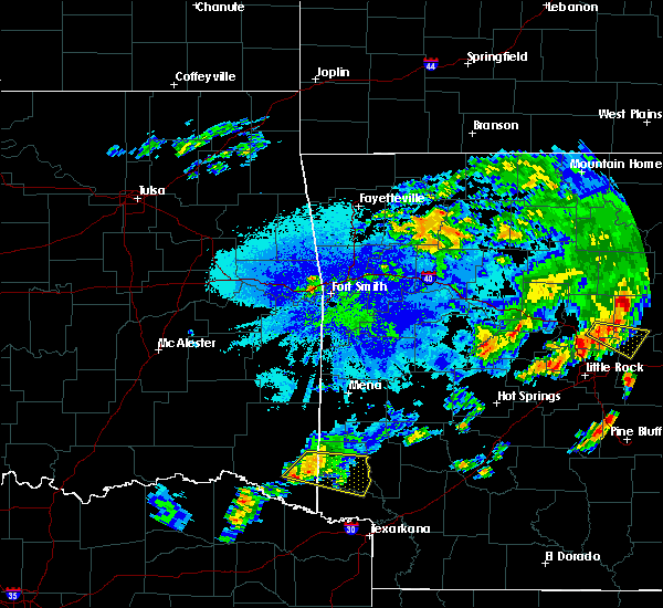 At 742 pm cdt, a severe thunderstorm was located 9 miles west of horatio, moving east at 25 mph (radar indicated). Hazards include 60 mph wind gusts and nickel size hail. expect damage to roofs, siding, and trees At 742 pm cdt, a severe thunderstorm was located 9 miles west of horatio, moving east at 25 mph (radar indicated). Hazards include 60 mph wind gusts and nickel size hail. expect damage to roofs, siding, and trees
|
| 7/10/2019 5:39 PM CDT |
 At 538 pm cdt, severe thunderstorms were located along a line extending from 8 miles northeast of fort towson to near de queen to near okolona, moving south at 40 mph (radar indicated). Hazards include 60 mph wind gusts. Expect damage to roofs, siding, and trees. Locations impacted include, de queen, nashville, prescott, mineral springs, dierks, horatio, foreman, umpire, idabel, broken bow, lockesburg, emmet, wilton, blevins, perrytown, tollette, winthrop, washington, gillham and ben lomond. At 538 pm cdt, severe thunderstorms were located along a line extending from 8 miles northeast of fort towson to near de queen to near okolona, moving south at 40 mph (radar indicated). Hazards include 60 mph wind gusts. Expect damage to roofs, siding, and trees. Locations impacted include, de queen, nashville, prescott, mineral springs, dierks, horatio, foreman, umpire, idabel, broken bow, lockesburg, emmet, wilton, blevins, perrytown, tollette, winthrop, washington, gillham and ben lomond.
|
| 7/10/2019 4:59 PM CDT |
 The national weather service in shreveport has issued a * severe thunderstorm warning for. northern little river county in southwestern arkansas. northern hempstead county in southwestern arkansas. sevier county in southwestern arkansas. Howard county in southwestern arkansas. The national weather service in shreveport has issued a * severe thunderstorm warning for. northern little river county in southwestern arkansas. northern hempstead county in southwestern arkansas. sevier county in southwestern arkansas. Howard county in southwestern arkansas.
|
| 6/23/2019 8:33 PM CDT |
 At 833 pm cdt, severe thunderstorms were located along a line extending from near glenwood to near foreman, moving northeast at 65 mph (radar indicated). Hazards include 60 mph wind gusts and quarter size hail. Hail damage to vehicles is expected. expect wind damage to roofs, siding, and trees. Locations impacted include, de queen, dierks, horatio, foreman, umpire, lockesburg, winthrop, gillham, ben lomond, corinth, athens, center point, oak grove, silver ridge, geneva, central, muddy fork, lebanon, burg and provo. At 833 pm cdt, severe thunderstorms were located along a line extending from near glenwood to near foreman, moving northeast at 65 mph (radar indicated). Hazards include 60 mph wind gusts and quarter size hail. Hail damage to vehicles is expected. expect wind damage to roofs, siding, and trees. Locations impacted include, de queen, dierks, horatio, foreman, umpire, lockesburg, winthrop, gillham, ben lomond, corinth, athens, center point, oak grove, silver ridge, geneva, central, muddy fork, lebanon, burg and provo.
|
| 6/23/2019 7:45 PM CDT |
 At 745 pm cdt, severe thunderstorms were located along a line extending from 7 miles south of albert pike recreation area to 11 miles northeast of cooper lake park doctors creek, moving east at 30 mph (radar indicated). Hazards include 60 mph wind gusts and quarter size hail. Hail damage to vehicles is expected. Expect wind damage to roofs, siding, and trees. At 745 pm cdt, severe thunderstorms were located along a line extending from 7 miles south of albert pike recreation area to 11 miles northeast of cooper lake park doctors creek, moving east at 30 mph (radar indicated). Hazards include 60 mph wind gusts and quarter size hail. Hail damage to vehicles is expected. Expect wind damage to roofs, siding, and trees.
|
| 6/19/2019 6:58 PM CDT |
 At 658 pm cdt, a severe thunderstorm capable of producing a tornado was located near winthrop, or 7 miles north of foreman, moving east at 20 mph (radar indicated rotation). Hazards include tornado and golf ball size hail. Flying debris will be dangerous to those caught without shelter. mobile homes will be damaged or destroyed. damage to roofs, windows, and vehicles will occur. tree damage is likely. This dangerous storm will be near, winthrop around 710 pm cdt. At 658 pm cdt, a severe thunderstorm capable of producing a tornado was located near winthrop, or 7 miles north of foreman, moving east at 20 mph (radar indicated rotation). Hazards include tornado and golf ball size hail. Flying debris will be dangerous to those caught without shelter. mobile homes will be damaged or destroyed. damage to roofs, windows, and vehicles will occur. tree damage is likely. This dangerous storm will be near, winthrop around 710 pm cdt.
|
| 6/19/2019 6:43 PM CDT |
 At 643 pm cdt, a severe thunderstorm capable of producing a tornado was located over arkinda, or 7 miles northwest of foreman, moving east at 20 mph (radar indicated rotation). Hazards include tornado and golf ball size hail. Flying debris will be dangerous to those caught without shelter. mobile homes will be damaged or destroyed. damage to roofs, windows, and vehicles will occur. tree damage is likely. this dangerous storm will be near, winthrop around 710 pm cdt. Other locations impacted by this tornadic thunderstorm include shinewell, cerrogordo and west otis. At 643 pm cdt, a severe thunderstorm capable of producing a tornado was located over arkinda, or 7 miles northwest of foreman, moving east at 20 mph (radar indicated rotation). Hazards include tornado and golf ball size hail. Flying debris will be dangerous to those caught without shelter. mobile homes will be damaged or destroyed. damage to roofs, windows, and vehicles will occur. tree damage is likely. this dangerous storm will be near, winthrop around 710 pm cdt. Other locations impacted by this tornadic thunderstorm include shinewell, cerrogordo and west otis.
|
| 6/19/2019 6:37 PM CDT |
 At 636 pm cdt, a severe thunderstorm capable of producing a tornado was located near arkinda, or 10 miles northwest of foreman, moving east at 30 mph (radar indicated rotation). Hazards include tornado and golf ball size hail. Flying debris will be dangerous to those caught without shelter. mobile homes will be damaged or destroyed. damage to roofs, windows, and vehicles will occur. tree damage is likely. this dangerous storm will be near, arkinda around 640 pm cdt. winthrop around 655 pm cdt. horatio around 700 pm cdt. Other locations impacted by this tornadic thunderstorm include bokhoma, haworth, moon, cerrogordo, america, goodwater, shinewell and west otis. At 636 pm cdt, a severe thunderstorm capable of producing a tornado was located near arkinda, or 10 miles northwest of foreman, moving east at 30 mph (radar indicated rotation). Hazards include tornado and golf ball size hail. Flying debris will be dangerous to those caught without shelter. mobile homes will be damaged or destroyed. damage to roofs, windows, and vehicles will occur. tree damage is likely. this dangerous storm will be near, arkinda around 640 pm cdt. winthrop around 655 pm cdt. horatio around 700 pm cdt. Other locations impacted by this tornadic thunderstorm include bokhoma, haworth, moon, cerrogordo, america, goodwater, shinewell and west otis.
|
| 6/19/2019 6:23 PM CDT |
 At 623 pm cdt, a severe thunderstorm capable of producing a tornado was located 10 miles west of arkinda, or 15 miles northwest of foreman, moving east at 20 mph (radar indicated rotation). Hazards include tornado. Flying debris will be dangerous to those caught without shelter. mobile homes will be damaged or destroyed. damage to roofs, windows, and vehicles will occur. tree damage is likely. this dangerous storm will be near, arkinda around 645 pm cdt. winthrop around 710 pm cdt. horatio around 715 pm cdt. Other locations impacted by this tornadic thunderstorm include bokhoma, haworth, moon, cerrogordo, america, goodwater, shinewell and west otis. At 623 pm cdt, a severe thunderstorm capable of producing a tornado was located 10 miles west of arkinda, or 15 miles northwest of foreman, moving east at 20 mph (radar indicated rotation). Hazards include tornado. Flying debris will be dangerous to those caught without shelter. mobile homes will be damaged or destroyed. damage to roofs, windows, and vehicles will occur. tree damage is likely. this dangerous storm will be near, arkinda around 645 pm cdt. winthrop around 710 pm cdt. horatio around 715 pm cdt. Other locations impacted by this tornadic thunderstorm include bokhoma, haworth, moon, cerrogordo, america, goodwater, shinewell and west otis.
|
| 6/19/2019 6:17 PM CDT |
 At 615 pm cdt, severe thunderstorms were located along a line extending from 7 miles southwest of vandervoort to near winthrop, moving east at 35 mph (radar indicated). Hazards include golf ball size hail and 60 mph wind gusts. People and animals outdoors will be injured. expect hail damage to roofs, siding, windows, and vehicles. Expect wind damage to roofs, siding, and trees. At 615 pm cdt, severe thunderstorms were located along a line extending from 7 miles southwest of vandervoort to near winthrop, moving east at 35 mph (radar indicated). Hazards include golf ball size hail and 60 mph wind gusts. People and animals outdoors will be injured. expect hail damage to roofs, siding, windows, and vehicles. Expect wind damage to roofs, siding, and trees.
|
| 5/18/2019 3:09 PM CDT |
 At 309 pm cdt, severe thunderstorms were located along a line extending from lockesburg to near ben lomond to near wilton to 7 miles south of foreman, moving east at 55 mph. however, strong thunderstorms continue across northwest bowie and southeast mccurtain counties as well (radar indicated). Hazards include 60 mph wind gusts. Expect damage to roofs, siding, and trees. Locations impacted include, horatio, foreman, lockesburg, wilton, winthrop, ben lomond, arkinda, richmond, oak grove, moon, cerrogordo, beaverdams, goodlake, geneva, central, shinewell, arden, america, provo and bellview. At 309 pm cdt, severe thunderstorms were located along a line extending from lockesburg to near ben lomond to near wilton to 7 miles south of foreman, moving east at 55 mph. however, strong thunderstorms continue across northwest bowie and southeast mccurtain counties as well (radar indicated). Hazards include 60 mph wind gusts. Expect damage to roofs, siding, and trees. Locations impacted include, horatio, foreman, lockesburg, wilton, winthrop, ben lomond, arkinda, richmond, oak grove, moon, cerrogordo, beaverdams, goodlake, geneva, central, shinewell, arden, america, provo and bellview.
|
| 5/18/2019 3:09 PM CDT |
 At 240 pm cdt, severe thunderstorms were located along a line extending from 7 miles northwest of arkinda to 9 miles west of foreman to near de kalb, moving east northeast at 35 mph (radar indicated). Hazards include 60 mph wind gusts and penny size hail. expect damage to roofs, siding, and trees At 240 pm cdt, severe thunderstorms were located along a line extending from 7 miles northwest of arkinda to 9 miles west of foreman to near de kalb, moving east northeast at 35 mph (radar indicated). Hazards include 60 mph wind gusts and penny size hail. expect damage to roofs, siding, and trees
|
| 5/18/2019 2:40 PM CDT |
 At 240 pm cdt, severe thunderstorms were located along a line extending from 7 miles northwest of arkinda to 9 miles west of foreman to near de kalb, moving east northeast at 35 mph (radar indicated). Hazards include 60 mph wind gusts and penny size hail. expect damage to roofs, siding, and trees At 240 pm cdt, severe thunderstorms were located along a line extending from 7 miles northwest of arkinda to 9 miles west of foreman to near de kalb, moving east northeast at 35 mph (radar indicated). Hazards include 60 mph wind gusts and penny size hail. expect damage to roofs, siding, and trees
|
| 5/1/2019 9:50 PM CDT |
 At 949 pm cdt, severe thunderstorms were located along a line extending from 10 miles east of broken bow to wilkerson, moving east at 25 mph (radar indicated). Hazards include half dollar size hail. damage to vehicles is expected At 949 pm cdt, severe thunderstorms were located along a line extending from 10 miles east of broken bow to wilkerson, moving east at 25 mph (radar indicated). Hazards include half dollar size hail. damage to vehicles is expected
|
| 3/14/2019 2:19 AM CDT |
 At 219 am cdt, severe thunderstorms were located along a line extending from 7 miles northwest of dierks to near horatio to near winthrop, moving east at 40 mph (radar indicated). Hazards include 60 mph wind gusts and penny size hail. expect damage to roofs, siding, and trees At 219 am cdt, severe thunderstorms were located along a line extending from 7 miles northwest of dierks to near horatio to near winthrop, moving east at 40 mph (radar indicated). Hazards include 60 mph wind gusts and penny size hail. expect damage to roofs, siding, and trees
|
| 3/9/2019 7:46 AM CST |
 At 745 am cst, severe thunderstorms were located along a line extending from 6 miles southeast of gillham to horatio to 6 miles northwest of arkinda, moving northeast at 50 mph (radar indicated). Hazards include 60 mph wind gusts and quarter size hail. Hail damage to vehicles is expected. expect wind damage to roofs, siding, and trees. Locations impacted include, de queen, horatio, lockesburg, winthrop, gillham, ben lomond, oak grove, haworth, bokhoma, eagletown, moon, cerrogordo, geneva, central, goodwater, shinewell, america, west line, bellview and west otis. At 745 am cst, severe thunderstorms were located along a line extending from 6 miles southeast of gillham to horatio to 6 miles northwest of arkinda, moving northeast at 50 mph (radar indicated). Hazards include 60 mph wind gusts and quarter size hail. Hail damage to vehicles is expected. expect wind damage to roofs, siding, and trees. Locations impacted include, de queen, horatio, lockesburg, winthrop, gillham, ben lomond, oak grove, haworth, bokhoma, eagletown, moon, cerrogordo, geneva, central, goodwater, shinewell, america, west line, bellview and west otis.
|
| 3/9/2019 7:26 AM CST |
 At 726 am cst, severe thunderstorms were located along a line extending from 7 miles northwest of de queen to 9 miles west of horatio to 10 miles southeast of idabel to 11 miles east of clarksville, moving east at 60 mph (radar indicated). Hazards include 60 mph wind gusts and quarter size hail. Hail damage to vehicles is expected. expect wind damage to roofs, siding, and trees. Locations impacted include, de queen, clarksville, horatio, idabel, broken bow, lockesburg, winthrop, gillham, ben lomond, arkinda, oak grove, haworth, eagletown, moon, cerrogordo, geneva, central, goodwater, shinewell and america. At 726 am cst, severe thunderstorms were located along a line extending from 7 miles northwest of de queen to 9 miles west of horatio to 10 miles southeast of idabel to 11 miles east of clarksville, moving east at 60 mph (radar indicated). Hazards include 60 mph wind gusts and quarter size hail. Hail damage to vehicles is expected. expect wind damage to roofs, siding, and trees. Locations impacted include, de queen, clarksville, horatio, idabel, broken bow, lockesburg, winthrop, gillham, ben lomond, arkinda, oak grove, haworth, eagletown, moon, cerrogordo, geneva, central, goodwater, shinewell and america.
|
| 3/9/2019 7:08 AM CST |
 At 708 am cst, a severe thunderstorm was located 9 miles north of clarksville, moving northeast at 50 mph (radar indicated). Hazards include 60 mph wind gusts and quarter size hail. Hail damage to vehicles is expected. Expect wind damage to roofs, siding, and trees. At 708 am cst, a severe thunderstorm was located 9 miles north of clarksville, moving northeast at 50 mph (radar indicated). Hazards include 60 mph wind gusts and quarter size hail. Hail damage to vehicles is expected. Expect wind damage to roofs, siding, and trees.
|
| 1/19/2019 12:45 AM CST |
 At 1244 am cst, a severe thunderstorm was located near ben lomond, or 10 miles southeast of horatio, moving northeast at 50 mph (radar indicated). Hazards include quarter size hail and 40 mph winds. damage to vehicles is expected At 1244 am cst, a severe thunderstorm was located near ben lomond, or 10 miles southeast of horatio, moving northeast at 50 mph (radar indicated). Hazards include quarter size hail and 40 mph winds. damage to vehicles is expected
|
| 1/19/2019 12:00 AM CST |
 At 1159 pm cst, a severe thunderstorm was located over boxelder, moving northeast at 55 mph (radar indicated). Hazards include quarter size hail. damage to vehicles is expected At 1159 pm cst, a severe thunderstorm was located over boxelder, moving northeast at 55 mph (radar indicated). Hazards include quarter size hail. damage to vehicles is expected
|
| 4/13/2018 8:53 PM CDT |
 At 853 pm cdt, a severe thunderstorm was located near arkinda, or 8 miles west of foreman, moving northeast at 35 mph (radar indicated). Hazards include 60 mph wind gusts and quarter size hail. Hail damage to vehicles is expected. Expect wind damage to roofs, siding, and trees. At 853 pm cdt, a severe thunderstorm was located near arkinda, or 8 miles west of foreman, moving northeast at 35 mph (radar indicated). Hazards include 60 mph wind gusts and quarter size hail. Hail damage to vehicles is expected. Expect wind damage to roofs, siding, and trees.
|
| 4/13/2018 8:01 PM CDT |
 At 750 pm cdt, a severe thunderstorm capable of producing a tornado was located near foreman, moving northeast at 50 mph (radar indicated rotation). Hazards include tornado and quarter size hail. Flying debris will be dangerous to those caught without shelter. mobile homes will be damaged or destroyed. damage to roofs, windows, and vehicles will occur. Tree damage is likely. At 750 pm cdt, a severe thunderstorm capable of producing a tornado was located near foreman, moving northeast at 50 mph (radar indicated rotation). Hazards include tornado and quarter size hail. Flying debris will be dangerous to those caught without shelter. mobile homes will be damaged or destroyed. damage to roofs, windows, and vehicles will occur. Tree damage is likely.
|
| 4/13/2018 7:55 PM CDT | Tree down across hwy 41 just west of winthro in little river county AR, 2.1 miles E of Winthrop, AR |
| 4/13/2018 7:51 PM CDT |
 At 750 pm cdt, a severe thunderstorm capable of producing a tornado was located near foreman, moving northeast at 50 mph (radar indicated rotation). Hazards include tornado and quarter size hail. Flying debris will be dangerous to those caught without shelter. mobile homes will be damaged or destroyed. damage to roofs, windows, and vehicles will occur. Tree damage is likely. At 750 pm cdt, a severe thunderstorm capable of producing a tornado was located near foreman, moving northeast at 50 mph (radar indicated rotation). Hazards include tornado and quarter size hail. Flying debris will be dangerous to those caught without shelter. mobile homes will be damaged or destroyed. damage to roofs, windows, and vehicles will occur. Tree damage is likely.
|
| 4/13/2018 7:47 PM CDT |
 At 745 pm cdt, severe thunderstorms were located along a line extending from near hartley to near umpire to near lockesburg to winthrop to 8 miles north of de kalb, moving northeast at 50 mph. a second line of thunderstorms was located from hochatown, to broken bow, to idabel. these storms are moving east at 50 mph (radar indicated). Hazards include 60 mph wind gusts and quarter size hail. Hail damage to vehicles is expected. expect wind damage to roofs, siding, and trees. locations impacted include, de queen, ashdown, dierks, horatio, foreman, umpire, broken bow, lockesburg, wilton, winthrop, gillham, ben lomond, arkinda, center point, athens, oak grove, haworth, eagletown, silver ridge and moon. A tornado watch remains in effect until 1000 pm cdt for southwestern arkansas, southeastern oklahoma, and northeastern texas. At 745 pm cdt, severe thunderstorms were located along a line extending from near hartley to near umpire to near lockesburg to winthrop to 8 miles north of de kalb, moving northeast at 50 mph. a second line of thunderstorms was located from hochatown, to broken bow, to idabel. these storms are moving east at 50 mph (radar indicated). Hazards include 60 mph wind gusts and quarter size hail. Hail damage to vehicles is expected. expect wind damage to roofs, siding, and trees. locations impacted include, de queen, ashdown, dierks, horatio, foreman, umpire, broken bow, lockesburg, wilton, winthrop, gillham, ben lomond, arkinda, center point, athens, oak grove, haworth, eagletown, silver ridge and moon. A tornado watch remains in effect until 1000 pm cdt for southwestern arkansas, southeastern oklahoma, and northeastern texas.
|
| 4/13/2018 7:32 PM CDT |
 At 731 pm cdt, severe thunderstorms were located along a line extending from near wickes to near gillham to horatio to 6 miles southwest of arkinda to 7 miles west of de kalb, moving northeast at 50 mph (radar indicated). Hazards include 60 mph wind gusts and quarter size hail. Hail damage to vehicles is expected. expect wind damage to roofs, siding, and trees. locations impacted include, de queen, ashdown, dierks, horatio, foreman, umpire, broken bow, lockesburg, wilton, winthrop, gillham, ben lomond, arkinda, center point, athens, avery, oak grove, annona, haworth and eagletown. A tornado watch remains in effect until 1000 pm cdt for southwestern arkansas, southeastern oklahoma, and northeastern texas. At 731 pm cdt, severe thunderstorms were located along a line extending from near wickes to near gillham to horatio to 6 miles southwest of arkinda to 7 miles west of de kalb, moving northeast at 50 mph (radar indicated). Hazards include 60 mph wind gusts and quarter size hail. Hail damage to vehicles is expected. expect wind damage to roofs, siding, and trees. locations impacted include, de queen, ashdown, dierks, horatio, foreman, umpire, broken bow, lockesburg, wilton, winthrop, gillham, ben lomond, arkinda, center point, athens, avery, oak grove, annona, haworth and eagletown. A tornado watch remains in effect until 1000 pm cdt for southwestern arkansas, southeastern oklahoma, and northeastern texas.
|
| 4/13/2018 6:59 PM CDT |
 The national weather service in shreveport has issued a * severe thunderstorm warning for. little river county in southwestern arkansas. sevier county in southwestern arkansas. howard county in southwestern arkansas. Southeastern mccurtain county in southeastern oklahoma. The national weather service in shreveport has issued a * severe thunderstorm warning for. little river county in southwestern arkansas. sevier county in southwestern arkansas. howard county in southwestern arkansas. Southeastern mccurtain county in southeastern oklahoma.
|
| 4/13/2018 6:59 PM CDT |
 At 658 pm cdt, severe thunderstorms were located along a line extending from 11 miles east of broken bow to 10 miles east of idabel to 13 miles northwest of de kalb to 6 miles northeast of boxelder, moving northeast at 55 mph (radar indicated). Hazards include 60 mph wind gusts and quarter size hail. Hail damage to vehicles is expected. Expect wind damage to roofs, siding, and trees. At 658 pm cdt, severe thunderstorms were located along a line extending from 11 miles east of broken bow to 10 miles east of idabel to 13 miles northwest of de kalb to 6 miles northeast of boxelder, moving northeast at 55 mph (radar indicated). Hazards include 60 mph wind gusts and quarter size hail. Hail damage to vehicles is expected. Expect wind damage to roofs, siding, and trees.
|
| 4/13/2018 6:34 PM CDT |
 At 634 pm cdt, a confirmed tornado was located over winthrop, or near horatio, moving northeast at 45 mph (public confirmed tornado). Hazards include damaging tornado and quarter size hail. Flying debris will be dangerous to those caught without shelter. mobile homes will be damaged or destroyed. damage to roofs, windows, and vehicles will occur. tree damage is likely. this tornado will be near, lockesburg around 650 pm cdt. Other locations impacted by this tornadic thunderstorm include central and bellview. At 634 pm cdt, a confirmed tornado was located over winthrop, or near horatio, moving northeast at 45 mph (public confirmed tornado). Hazards include damaging tornado and quarter size hail. Flying debris will be dangerous to those caught without shelter. mobile homes will be damaged or destroyed. damage to roofs, windows, and vehicles will occur. tree damage is likely. this tornado will be near, lockesburg around 650 pm cdt. Other locations impacted by this tornadic thunderstorm include central and bellview.
|
| 4/13/2018 6:26 PM CDT |
 At 626 pm cdt, a severe thunderstorm capable of producing a tornado was located over arkinda, or near foreman, moving northeast at 40 mph (radar indicated rotation). Hazards include tornado and quarter size hail. Flying debris will be dangerous to those caught without shelter. mobile homes will be damaged or destroyed. damage to roofs, windows, and vehicles will occur. tree damage is likely. this dangerous storm will be near, winthrop around 635 pm cdt. horatio around 645 pm cdt. de queen and lockesburg around 655 pm cdt. Other locations impacted by this tornadic thunderstorm include central and bellview. At 626 pm cdt, a severe thunderstorm capable of producing a tornado was located over arkinda, or near foreman, moving northeast at 40 mph (radar indicated rotation). Hazards include tornado and quarter size hail. Flying debris will be dangerous to those caught without shelter. mobile homes will be damaged or destroyed. damage to roofs, windows, and vehicles will occur. tree damage is likely. this dangerous storm will be near, winthrop around 635 pm cdt. horatio around 645 pm cdt. de queen and lockesburg around 655 pm cdt. Other locations impacted by this tornadic thunderstorm include central and bellview.
|
| 4/6/2018 3:47 PM CDT |
 At 347 pm cdt, a severe thunderstorm was located over idabel, or 25 miles northeast of clarksville, moving east at 25 mph (radar indicated). Hazards include 60 mph wind gusts and quarter size hail. Hail damage to vehicles is expected. Expect wind damage to roofs, siding, and trees. At 347 pm cdt, a severe thunderstorm was located over idabel, or 25 miles northeast of clarksville, moving east at 25 mph (radar indicated). Hazards include 60 mph wind gusts and quarter size hail. Hail damage to vehicles is expected. Expect wind damage to roofs, siding, and trees.
|
| 1/21/2018 10:26 PM CST |
 The tornado warning for west central little river and southwestern sevier counties will expire at 1030 pm cst, the storm which prompted the warning has moved out of the area. therefore the warning will be allowed to expire. a tornado watch remains in effect until 400 am cst for southwestern arkansas. remember, a tornado warning still remains in effect for sevier and howard countgy arkansas until 11 pm cst. The tornado warning for west central little river and southwestern sevier counties will expire at 1030 pm cst, the storm which prompted the warning has moved out of the area. therefore the warning will be allowed to expire. a tornado watch remains in effect until 400 am cst for southwestern arkansas. remember, a tornado warning still remains in effect for sevier and howard countgy arkansas until 11 pm cst.
|
| 1/21/2018 10:04 PM CST |
 At 1002 pm cst, a severe thunderstorm capable of producing a tornado was located near foreman, moving northeast at 45 mph. strong circulation continued (radar indicated rotation). Hazards include tornado and quarter size hail. Flying debris will be dangerous to those caught without shelter. mobile homes will be damaged or destroyed. damage to roofs, windows, and vehicles will occur. tree damage is likely. Locations impacted include, foreman, wilton, winthrop, wallace and arden. At 1002 pm cst, a severe thunderstorm capable of producing a tornado was located near foreman, moving northeast at 45 mph. strong circulation continued (radar indicated rotation). Hazards include tornado and quarter size hail. Flying debris will be dangerous to those caught without shelter. mobile homes will be damaged or destroyed. damage to roofs, windows, and vehicles will occur. tree damage is likely. Locations impacted include, foreman, wilton, winthrop, wallace and arden.
|
| 1/21/2018 9:44 PM CST |
 At 943 pm cst, a severe thunderstorm capable of producing a tornado was located 7 miles northeast of de kalb, or 10 miles northwest of new boston, moving northeast at 45 mph. strong circulation (radar indicated rotation). Hazards include tornado and quarter size hail. Flying debris will be dangerous to those caught without shelter. mobile homes will be damaged or destroyed. damage to roofs, windows, and vehicles will occur. Tree damage is likely. At 943 pm cst, a severe thunderstorm capable of producing a tornado was located 7 miles northeast of de kalb, or 10 miles northwest of new boston, moving northeast at 45 mph. strong circulation (radar indicated rotation). Hazards include tornado and quarter size hail. Flying debris will be dangerous to those caught without shelter. mobile homes will be damaged or destroyed. damage to roofs, windows, and vehicles will occur. Tree damage is likely.
|
| 6/23/2017 9:21 PM CDT |
 A severe thunderstorm warning remains in effect until 945 pm cdt for northwestern little river and southeastern mccurtain counties. at 921 pm cdt, a severe thunderstorm was located just northwest of winthrop, moving south at 15 mph. hazard. 60 mph wind gusts. source. Radar indicated. A severe thunderstorm warning remains in effect until 945 pm cdt for northwestern little river and southeastern mccurtain counties. at 921 pm cdt, a severe thunderstorm was located just northwest of winthrop, moving south at 15 mph. hazard. 60 mph wind gusts. source. Radar indicated.
|
| 6/23/2017 9:21 PM CDT |
 At 921 pm cdt, a severe thunderstorm was located just northwest of winthrop, moving south at 15 mph (radar indicated). Hazards include 60 mph wind gusts. Expect damage to roofs, siding, and trees. Locations impacted include, foreman, winthrop, arkinda, tom and america. At 921 pm cdt, a severe thunderstorm was located just northwest of winthrop, moving south at 15 mph (radar indicated). Hazards include 60 mph wind gusts. Expect damage to roofs, siding, and trees. Locations impacted include, foreman, winthrop, arkinda, tom and america.
|
| 6/23/2017 8:51 PM CDT |
 At 851 pm cdt, a severe thunderstorm was located just northwest of horatio, moving south at 10 to 15 mph (radar indicated). Hazards include 60 mph wind gusts and penny size hail. expect damage to roofs, siding, and trees At 851 pm cdt, a severe thunderstorm was located just northwest of horatio, moving south at 10 to 15 mph (radar indicated). Hazards include 60 mph wind gusts and penny size hail. expect damage to roofs, siding, and trees
|
| 4/26/2017 12:18 PM CDT |
 At 1217 pm cdt, a severe thunderstorm was located over foreman, moving northeast at 55 mph (radar indicated). Hazards include 60 mph wind gusts and quarter size hail. Hail damage to vehicles is expected. Expect wind damage to roofs, siding, and trees. At 1217 pm cdt, a severe thunderstorm was located over foreman, moving northeast at 55 mph (radar indicated). Hazards include 60 mph wind gusts and quarter size hail. Hail damage to vehicles is expected. Expect wind damage to roofs, siding, and trees.
|
| 4/21/2017 11:15 PM CDT |
 At 1113 pm cdt, a severe thunderstorm was located near winthrop, or near horatio, moving east at 30 mph (radar indicated). Hazards include 60 mph wind gusts and quarter size hail. Hail damage to vehicles is expected. expect wind damage to roofs, siding, and trees. locations impacted include, horatio, lockesburg, winthrop, central, bellview, west otis and cerrogordo. A tornado watch remains in effect until 100 am cdt for southwestern arkansas, and southeastern oklahoma. At 1113 pm cdt, a severe thunderstorm was located near winthrop, or near horatio, moving east at 30 mph (radar indicated). Hazards include 60 mph wind gusts and quarter size hail. Hail damage to vehicles is expected. expect wind damage to roofs, siding, and trees. locations impacted include, horatio, lockesburg, winthrop, central, bellview, west otis and cerrogordo. A tornado watch remains in effect until 100 am cdt for southwestern arkansas, and southeastern oklahoma.
|
| 4/21/2017 10:46 PM CDT |
 At 1046 pm cdt, a severe thunderstorm was located near idabel, or 20 miles west of horatio, moving east at 30 mph (radar indicated). Hazards include 60 mph wind gusts and penny size hail. expect damage to roofs, siding, and trees At 1046 pm cdt, a severe thunderstorm was located near idabel, or 20 miles west of horatio, moving east at 30 mph (radar indicated). Hazards include 60 mph wind gusts and penny size hail. expect damage to roofs, siding, and trees
|
| 4/10/2017 4:48 PM CDT |
 At 447 pm cdt, a severe thunderstorm was located 12 miles northeast of boxelder, moving northeast at 55 mph (radar indicated). Hazards include 60 mph wind gusts and quarter size hail. Hail damage to vehicles is expected. Expect wind damage to roofs, siding, and trees. At 447 pm cdt, a severe thunderstorm was located 12 miles northeast of boxelder, moving northeast at 55 mph (radar indicated). Hazards include 60 mph wind gusts and quarter size hail. Hail damage to vehicles is expected. Expect wind damage to roofs, siding, and trees.
|
| 4/4/2017 10:26 PM CDT |
 At 1025 pm cdt, a severe thunderstorm was located 13 miles southeast of idabel, or 18 miles west of foreman, moving northeast at 55 mph (radar indicated). Hazards include half dollar size hail. damage to vehicles is expected At 1025 pm cdt, a severe thunderstorm was located 13 miles southeast of idabel, or 18 miles west of foreman, moving northeast at 55 mph (radar indicated). Hazards include half dollar size hail. damage to vehicles is expected
|
| 3/27/2017 1:13 AM CDT |
 At 112 am cdt, a severe thunderstorm was located near lockesburg, moving northeast at 50 mph (radar indicated). Hazards include 60 mph wind gusts and quarter size hail. Hail damage to vehicles is expected. expect wind damage to roofs, siding, and trees. Locations impacted include, de queen, nashville, mineral springs, dierks, horatio, foreman, lockesburg, wilton, tollette, winthrop, ben lomond, arkinda, center point, saratoga, oak grove, silver ridge, cerrogordo, geneva, central and provo. At 112 am cdt, a severe thunderstorm was located near lockesburg, moving northeast at 50 mph (radar indicated). Hazards include 60 mph wind gusts and quarter size hail. Hail damage to vehicles is expected. expect wind damage to roofs, siding, and trees. Locations impacted include, de queen, nashville, mineral springs, dierks, horatio, foreman, lockesburg, wilton, tollette, winthrop, ben lomond, arkinda, center point, saratoga, oak grove, silver ridge, cerrogordo, geneva, central and provo.
|
| 3/27/2017 12:37 AM CDT |
 At 1236 am cdt, a severe thunderstorm was located 8 miles northwest of arkinda, or 14 miles southwest of horatio, moving northeast at 50 mph (radar indicated). Hazards include 60 mph wind gusts and quarter size hail. Hail damage to vehicles is expected. Expect wind damage to roofs, siding, and trees. At 1236 am cdt, a severe thunderstorm was located 8 miles northwest of arkinda, or 14 miles southwest of horatio, moving northeast at 50 mph (radar indicated). Hazards include 60 mph wind gusts and quarter size hail. Hail damage to vehicles is expected. Expect wind damage to roofs, siding, and trees.
|
| 1/21/2017 6:22 PM CST |
 At 622 pm cst, a severe thunderstorm was located near foreman, moving northeast at 30 mph (radar indicated). Hazards include 60 mph wind gusts and quarter size hail. Hail damage to vehicles is expected. Expect wind damage to roofs, siding, and trees. At 622 pm cst, a severe thunderstorm was located near foreman, moving northeast at 30 mph (radar indicated). Hazards include 60 mph wind gusts and quarter size hail. Hail damage to vehicles is expected. Expect wind damage to roofs, siding, and trees.
|
| 9/17/2016 11:00 PM CDT |
 At 1059 pm cdt, a severe thunderstorm was located near foreman, or just south of winthrop, moving southeast at 40 mph (radar indicated). Hazards include 60 mph wind gusts. Expect damage to roofs. siding. and trees. Locations impacted include, ashdown, foreman, wilton, winthrop, richmond, wallace and arden. At 1059 pm cdt, a severe thunderstorm was located near foreman, or just south of winthrop, moving southeast at 40 mph (radar indicated). Hazards include 60 mph wind gusts. Expect damage to roofs. siding. and trees. Locations impacted include, ashdown, foreman, wilton, winthrop, richmond, wallace and arden.
|
| 9/17/2016 10:27 PM CDT |
 At 1026 pm cdt, a severe thunderstorm was located 8 miles southwest of arkinda, or 11 miles west of foreman, moving southeast at 40 mph (radar indicated. numerous wind damage reports have also been confirmed with this storm). Hazards include 60 mph wind gusts and penny size hail. Expect damage to roofs. siding. And trees. At 1026 pm cdt, a severe thunderstorm was located 8 miles southwest of arkinda, or 11 miles west of foreman, moving southeast at 40 mph (radar indicated. numerous wind damage reports have also been confirmed with this storm). Hazards include 60 mph wind gusts and penny size hail. Expect damage to roofs. siding. And trees.
|
| 7/30/2016 3:18 PM CDT |
 At 317 pm cdt, a severe thunderstorm was located near horatio, moving east at 15 mph (radar indicated). Hazards include 60 mph wind gusts and quarter size hail. Hail damage to vehicles is expected. Expect wind damage to roofs, siding, and trees. At 317 pm cdt, a severe thunderstorm was located near horatio, moving east at 15 mph (radar indicated). Hazards include 60 mph wind gusts and quarter size hail. Hail damage to vehicles is expected. Expect wind damage to roofs, siding, and trees.
|
| 7/30/2016 3:00 PM CDT |
 At 259 pm cdt, a severe thunderstorm was located 7 miles north of arkinda, or 8 miles southwest of horatio, moving east at 15 mph (radar indicated). Hazards include 60 mph wind gusts and quarter size hail. Hail damage to vehicles is expected. expect wind damage to roofs, siding, and trees. Locations impacted include, horatio, winthrop, cerrogordo, america, moon, shinewell, goodwater and west otis. At 259 pm cdt, a severe thunderstorm was located 7 miles north of arkinda, or 8 miles southwest of horatio, moving east at 15 mph (radar indicated). Hazards include 60 mph wind gusts and quarter size hail. Hail damage to vehicles is expected. expect wind damage to roofs, siding, and trees. Locations impacted include, horatio, winthrop, cerrogordo, america, moon, shinewell, goodwater and west otis.
|
| 7/30/2016 2:40 PM CDT |
 At 239 pm cdt, a severe thunderstorm was located 11 miles northwest of arkinda, or 14 miles west of horatio, moving east at 15 mph (radar indicated). Hazards include 60 mph wind gusts and penny size hail. Expect damage to roofs. siding. And trees. At 239 pm cdt, a severe thunderstorm was located 11 miles northwest of arkinda, or 14 miles west of horatio, moving east at 15 mph (radar indicated). Hazards include 60 mph wind gusts and penny size hail. Expect damage to roofs. siding. And trees.
|
| 6/12/2016 9:20 PM CDT |
 At 920 pm cdt, severe thunderstorms were located along a line extending from near winthrop to near wilton, moving northeast at 15 mph (radar indicated). Hazards include 60 mph wind gusts. Expect damage to roofs. siding. And trees. At 920 pm cdt, severe thunderstorms were located along a line extending from near winthrop to near wilton, moving northeast at 15 mph (radar indicated). Hazards include 60 mph wind gusts. Expect damage to roofs. siding. And trees.
|
| 5/9/2016 8:49 PM CDT |
 At 847 pm cdt, a severe thunderstorm was located 12 miles southeast of idabel, or 18 miles west of foreman, moving east at 40 mph (radar indicated). Hazards include 70 mph wind gusts and half dollar size hail. Hail damage to vehicles is expected. expect considerable tree damage. Wind damage is also likely to mobile homes, roofs, and outbuildings. At 847 pm cdt, a severe thunderstorm was located 12 miles southeast of idabel, or 18 miles west of foreman, moving east at 40 mph (radar indicated). Hazards include 70 mph wind gusts and half dollar size hail. Hail damage to vehicles is expected. expect considerable tree damage. Wind damage is also likely to mobile homes, roofs, and outbuildings.
|
| 5/9/2016 7:59 PM CDT |
 At 758 pm cdt, a severe thunderstorm was located near manchester, or 14 miles north of clarksville, moving east at 25 mph (radar indicated). Hazards include 60 mph wind gusts and half dollar size hail. Hail damage to vehicles is expected. Expect wind damage to roofs, siding, and trees. At 758 pm cdt, a severe thunderstorm was located near manchester, or 14 miles north of clarksville, moving east at 25 mph (radar indicated). Hazards include 60 mph wind gusts and half dollar size hail. Hail damage to vehicles is expected. Expect wind damage to roofs, siding, and trees.
|
| 4/29/2016 10:57 PM CDT |
 At 1056 pm cdt, a severe thunderstorm was located near lockesburg, or near horatio, moving northeast at 50 mph (radar indicated). Hazards include 60 mph wind gusts and quarter size hail. Hail damage to vehicles is expected. expect wind damage to roofs, siding, and trees. Locations impacted include, de queen, mineral springs, horatio, foreman, lockesburg, wilton, tollette, winthrop, ben lomond, oak grove, central, browntown, geneva, lebanon, bellview, silver ridge and provo. At 1056 pm cdt, a severe thunderstorm was located near lockesburg, or near horatio, moving northeast at 50 mph (radar indicated). Hazards include 60 mph wind gusts and quarter size hail. Hail damage to vehicles is expected. expect wind damage to roofs, siding, and trees. Locations impacted include, de queen, mineral springs, horatio, foreman, lockesburg, wilton, tollette, winthrop, ben lomond, oak grove, central, browntown, geneva, lebanon, bellview, silver ridge and provo.
|
| 4/29/2016 10:41 PM CDT |
 At 1038 pm cdt, a severe thunderstorm was located near arkinda, or 8 miles southwest of horatio, moving northeast at 45 mph (radar indicated). Hazards include 60 mph wind gusts and quarter size hail. Hail damage to vehicles is expected. expect wind damage to roofs, siding, and trees. Locations impacted include, de queen, mineral springs, horatio, foreman, lockesburg, wilton, tollette, winthrop, gillham, ben lomond, arkinda, oak grove, central, browntown, shinewell, lebanon, west line, silver ridge, west otis and provo. At 1038 pm cdt, a severe thunderstorm was located near arkinda, or 8 miles southwest of horatio, moving northeast at 45 mph (radar indicated). Hazards include 60 mph wind gusts and quarter size hail. Hail damage to vehicles is expected. expect wind damage to roofs, siding, and trees. Locations impacted include, de queen, mineral springs, horatio, foreman, lockesburg, wilton, tollette, winthrop, gillham, ben lomond, arkinda, oak grove, central, browntown, shinewell, lebanon, west line, silver ridge, west otis and provo.
|
| 4/29/2016 10:09 PM CDT |
 At 1009 pm cdt, a severe thunderstorm was located 11 miles southeast of idabel, or 19 miles west of foreman, moving northeast at 45 mph (radar indicated). Hazards include 60 mph wind gusts and quarter size hail. Hail damage to vehicles is expected. Expect wind damage to roofs, siding, and trees. At 1009 pm cdt, a severe thunderstorm was located 11 miles southeast of idabel, or 19 miles west of foreman, moving northeast at 45 mph (radar indicated). Hazards include 60 mph wind gusts and quarter size hail. Hail damage to vehicles is expected. Expect wind damage to roofs, siding, and trees.
|
| 4/29/2016 3:34 AM CDT | Hen Egg sized hail reported 0.3 miles NW of Winthrop, AR, photo of large hail sent to ksla-tv from public. |
| 4/29/2016 3:28 AM CDT |
 At 327 am cdt, a severe thunderstorm was located near winthrop, or near foreman, moving north at 30 mph (radar indicated). Hazards include golf ball size hail and 60 mph wind gusts. People and animals outdoors will be injured. expect hail damage to roofs, siding, windows, and vehicles. Expect wind damage to roofs, siding, and trees. At 327 am cdt, a severe thunderstorm was located near winthrop, or near foreman, moving north at 30 mph (radar indicated). Hazards include golf ball size hail and 60 mph wind gusts. People and animals outdoors will be injured. expect hail damage to roofs, siding, windows, and vehicles. Expect wind damage to roofs, siding, and trees.
|
| 4/11/2016 5:11 PM CDT |
 At 510 pm cdt, a severe thunderstorm was located near foreman, moving east at 45 mph (radar indicated). Hazards include 60 mph wind gusts and nickel size hail. Expect damage to roofs. siding. and trees. Locations impacted include, de queen, ashdown, horatio, foreman, lockesburg, wilton, winthrop, ogden, ben lomond, richmond, oak grove, central, browntown, geneva, wallace, bellview, pine prairie, arden and west otis. At 510 pm cdt, a severe thunderstorm was located near foreman, moving east at 45 mph (radar indicated). Hazards include 60 mph wind gusts and nickel size hail. Expect damage to roofs. siding. and trees. Locations impacted include, de queen, ashdown, horatio, foreman, lockesburg, wilton, winthrop, ogden, ben lomond, richmond, oak grove, central, browntown, geneva, wallace, bellview, pine prairie, arden and west otis.
|
| 4/11/2016 4:44 PM CDT |
 At 443 pm cdt, a severe thunderstorm was located near idabel, or 20 miles northeast of clarksville, moving east at 45 mph (radar indicated). Hazards include 60 mph wind gusts and quarter size hail. Hail damage to vehicles is expected. Expect wind damage to roofs, siding, and trees. At 443 pm cdt, a severe thunderstorm was located near idabel, or 20 miles northeast of clarksville, moving east at 45 mph (radar indicated). Hazards include 60 mph wind gusts and quarter size hail. Hail damage to vehicles is expected. Expect wind damage to roofs, siding, and trees.
|
| 12/27/2015 5:29 PM CST |
 At 528 pm cst, severe thunderstorms were located along a line extending from near arkinda to near richmond to near wake village to near queen city, moving northeast at 35 mph (radar indicated). Hazards include 70 mph wind gusts and quarter size hail. Hail damage to vehicles is expected. expect considerable tree damage. Wind damage is also likely to mobile homes, roofs, and outbuildings. At 528 pm cst, severe thunderstorms were located along a line extending from near arkinda to near richmond to near wake village to near queen city, moving northeast at 35 mph (radar indicated). Hazards include 70 mph wind gusts and quarter size hail. Hail damage to vehicles is expected. expect considerable tree damage. Wind damage is also likely to mobile homes, roofs, and outbuildings.
|
| 12/27/2015 5:21 PM CST |
 At 520 pm cst, severe thunderstorms were located along a line extending from near arkinda to near hooks to near wake village to queen city, moving northeast at 45 mph. widespread wind damage with winds to 70 mph are likely with this line of severe thunderstorms. if you live in the path, take shelter immediately (radar indicated). Hazards include 70 mph wind gusts. Expect considerable tree damage. damage is likely to mobile homes, roofs, and outbuildings. locations impacted include, texarkana, wake village, ashdown, foreman, nash, hooks, red lick, wilton, winthrop, ogden, richmond, arkinda, leary, domino, cerrogordo, moon, tom, shinewell, wallace and america. A tornado watch remains in effect until 1000 pm cst for southwestern arkansas and northeastern texas. At 520 pm cst, severe thunderstorms were located along a line extending from near arkinda to near hooks to near wake village to queen city, moving northeast at 45 mph. widespread wind damage with winds to 70 mph are likely with this line of severe thunderstorms. if you live in the path, take shelter immediately (radar indicated). Hazards include 70 mph wind gusts. Expect considerable tree damage. damage is likely to mobile homes, roofs, and outbuildings. locations impacted include, texarkana, wake village, ashdown, foreman, nash, hooks, red lick, wilton, winthrop, ogden, richmond, arkinda, leary, domino, cerrogordo, moon, tom, shinewell, wallace and america. A tornado watch remains in effect until 1000 pm cst for southwestern arkansas and northeastern texas.
|
| 12/27/2015 4:46 PM CST |
 At 445 pm cst, severe thunderstorms were located along a line extending from 9 miles north of de kalb to 11 miles southwest of maud, moving north at 45 mph (radar indicated). Hazards include 70 mph wind gusts. Expect considerable tree damage. Damage is likely to mobile homes, roofs, and outbuildings. At 445 pm cst, severe thunderstorms were located along a line extending from 9 miles north of de kalb to 11 miles southwest of maud, moving north at 45 mph (radar indicated). Hazards include 70 mph wind gusts. Expect considerable tree damage. Damage is likely to mobile homes, roofs, and outbuildings.
|
| 12/27/2015 4:45 PM CST | Hwy 234 in little river county AR, 0.3 miles NW of Winthrop, AR |
| 11/5/2015 9:54 PM CST |
 At 953 pm cst, a severe thunderstorm was located near horatio, moving east at 45 mph (radar indicated). Hazards include 70 mph wind gusts and nickel size hail. Expect considerable tree damage. damage is likely to mobile homes, roofs and outbuildings. Locations impacted include, horatio, lockesburg, winthrop, ben lomond, oak grove, central, browntown, geneva, lebanon, bellview, silver ridge, west otis and provo. At 953 pm cst, a severe thunderstorm was located near horatio, moving east at 45 mph (radar indicated). Hazards include 70 mph wind gusts and nickel size hail. Expect considerable tree damage. damage is likely to mobile homes, roofs and outbuildings. Locations impacted include, horatio, lockesburg, winthrop, ben lomond, oak grove, central, browntown, geneva, lebanon, bellview, silver ridge, west otis and provo.
|
| 11/5/2015 9:35 PM CST |
 At 935 pm cst, a severe thunderstorm was located near arkinda, or 9 miles southwest of horatio, moving east at 45 mph (radar indicated). Hazards include 70 mph wind gusts and nickel size hail. Expect considerable tree damage. Damage is likely to mobile homes, roofs and outbuildings. At 935 pm cst, a severe thunderstorm was located near arkinda, or 9 miles southwest of horatio, moving east at 45 mph (radar indicated). Hazards include 70 mph wind gusts and nickel size hail. Expect considerable tree damage. Damage is likely to mobile homes, roofs and outbuildings.
|
| 6/21/2015 6:23 PM CDT |
 At 622 pm cdt, a severe thunderstorm was located near lockesburg, or near horatio, moving northeast at 25 mph (trained weather spotters). Hazards include 60 mph wind gusts. Expect damage to roofs. siding and trees. Locations impacted include, de queen, dierks, horatio, foreman, lockesburg, winthrop, gillham, ben lomond, arkinda, center point, oak grove, central, browntown, geneva, lebanon, bellview, west line, silver ridge, west otis and provo. At 622 pm cdt, a severe thunderstorm was located near lockesburg, or near horatio, moving northeast at 25 mph (trained weather spotters). Hazards include 60 mph wind gusts. Expect damage to roofs. siding and trees. Locations impacted include, de queen, dierks, horatio, foreman, lockesburg, winthrop, gillham, ben lomond, arkinda, center point, oak grove, central, browntown, geneva, lebanon, bellview, west line, silver ridge, west otis and provo.
|
| 6/21/2015 6:06 PM CDT |
 At 605 pm cdt, a severe thunderstorm was located near winthrop, or near horatio, moving northeast at 20 mph (radar indicated). Hazards include 60 mph wind gusts. Expect damage to roofs. Siding and trees. At 605 pm cdt, a severe thunderstorm was located near winthrop, or near horatio, moving northeast at 20 mph (radar indicated). Hazards include 60 mph wind gusts. Expect damage to roofs. Siding and trees.
|
| 6/21/2015 6:00 PM CDT |
 At 600 pm cdt, severe thunderstorms were located along a line extending from near winthrop to near foreman to near dalby springs, moving northeast at 30 mph (radar indicated). Hazards include 60 mph wind gusts. Expect damage to roofs. siding and trees. Locations impacted include, new boston, foreman, de kalb, winthrop, dalby springs, arkinda, avery, tom, wallace, america, lydia, almont, spring hill, goodlake and beaverdams. At 600 pm cdt, severe thunderstorms were located along a line extending from near winthrop to near foreman to near dalby springs, moving northeast at 30 mph (radar indicated). Hazards include 60 mph wind gusts. Expect damage to roofs. siding and trees. Locations impacted include, new boston, foreman, de kalb, winthrop, dalby springs, arkinda, avery, tom, wallace, america, lydia, almont, spring hill, goodlake and beaverdams.
|
| 6/21/2015 5:48 PM CDT |
 At 548 pm cdt, severe thunderstorms were located along a line extending from near arkinda to 10 miles north of de kalb to near dalby springs, moving northeast at 40 mph (radar indicated). Hazards include 60 mph wind gusts. Expect damage to roofs. siding and trees. Locations impacted include, new boston, foreman, de kalb, winthrop, us 259 and i 30 intersection, dalby springs, arkinda, avery, tom, wallace, america, lydia, almont, spring hill, goodlake and beaverdams. At 548 pm cdt, severe thunderstorms were located along a line extending from near arkinda to 10 miles north of de kalb to near dalby springs, moving northeast at 40 mph (radar indicated). Hazards include 60 mph wind gusts. Expect damage to roofs. siding and trees. Locations impacted include, new boston, foreman, de kalb, winthrop, us 259 and i 30 intersection, dalby springs, arkinda, avery, tom, wallace, america, lydia, almont, spring hill, goodlake and beaverdams.
|
| 6/21/2015 5:15 PM CDT |
 At 514 pm cdt, severe thunderstorms were located along a line extending from near boxelder to 7 miles northwest of dalby springs to 6 miles northwest of cookville to 6 miles southwest of mount pleasant, moving northeast at 35 mph (radar indicated). Hazards include 60 mph wind gusts. Expect damage to roofs. Siding and trees. At 514 pm cdt, severe thunderstorms were located along a line extending from near boxelder to 7 miles northwest of dalby springs to 6 miles northwest of cookville to 6 miles southwest of mount pleasant, moving northeast at 35 mph (radar indicated). Hazards include 60 mph wind gusts. Expect damage to roofs. Siding and trees.
|
| 5/25/2015 5:42 PM CDT | At 541 pm cdt, severe thunderstorms were located along a line extending from 6 miles west of hatfield to near horatio to 6 miles southwest of arkinda, moving east at 60 mph (radar indicated). Hazards include 60 mph wind gusts and quarter size hail. Hail damage to vehicles is expected. Expect wind damage to roofs, siding and trees. |
| 5/25/2015 5:42 PM CDT | At 541 pm cdt, severe thunderstorms were located along a line extending from 6 miles west of hatfield to near horatio to 6 miles southwest of arkinda, moving east at 60 mph (radar indicated). Hazards include 60 mph wind gusts and quarter size hail. Hail damage to vehicles is expected. Expect wind damage to roofs, siding and trees. |
| 5/25/2015 5:42 PM CDT | At 541 pm cdt, severe thunderstorms were located along a line extending from 6 miles west of hatfield to near horatio to 6 miles southwest of arkinda, moving east at 60 mph (radar indicated). Hazards include 60 mph wind gusts and quarter size hail. Hail damage to vehicles is expected. Expect wind damage to roofs, siding and trees. |
| 5/11/2015 12:46 AM CDT | At 1245 am cdt, a severe thunderstorm capable of producing a tornado was located 8 miles north of de kalb, or 11 miles southwest of foreman, moving northeast at 30 mph (radar indicated rotation). Hazards include tornado. Flying debris will be dangerous to those caught without shelter. mobile homes will be damaged or destroyed. damage to roofs, windows and vehicles will occur. tree damage is likely. this dangerous storm will be near, arkinda around 105 am cdt. foreman around 110 am cdt. winthrop around 125 am cdt. wilton around 130 am cdt. other locations impacted by this tornadic thunderstorm include almont, wallace, arden and beaverdams. Radar indicated. |
| 5/11/2015 12:46 AM CDT | At 1245 am cdt, a severe thunderstorm capable of producing a tornado was located 8 miles north of de kalb, or 11 miles southwest of foreman, moving northeast at 30 mph (radar indicated rotation). Hazards include tornado. Flying debris will be dangerous to those caught without shelter. mobile homes will be damaged or destroyed. damage to roofs, windows and vehicles will occur. tree damage is likely. this dangerous storm will be near, arkinda around 105 am cdt. foreman around 110 am cdt. winthrop around 125 am cdt. wilton around 130 am cdt. other locations impacted by this tornadic thunderstorm include almont, wallace, arden and beaverdams. Radar indicated. |
| 5/11/2015 12:46 AM CDT | At 1245 am cdt, a severe thunderstorm capable of producing a tornado was located 8 miles north of de kalb, or 11 miles southwest of foreman, moving northeast at 30 mph (radar indicated rotation). Hazards include tornado. Flying debris will be dangerous to those caught without shelter. mobile homes will be damaged or destroyed. damage to roofs, windows and vehicles will occur. tree damage is likely. this dangerous storm will be near, arkinda around 105 am cdt. foreman around 110 am cdt. winthrop around 125 am cdt. wilton around 130 am cdt. other locations impacted by this tornadic thunderstorm include almont, wallace, arden and beaverdams. Radar indicated. |
| 5/10/2015 6:18 PM CDT | At 618 pm cdt, a severe thunderstorm capable of producing a tornado was located 14 miles northwest of de kalb, or 16 miles northeast of boxelder, moving northeast at 30 mph (radar indicated rotation). Hazards include tornado and quarter size hail. Flying debris will be dangerous to those caught without shelter. mobile homes will be damaged or destroyed. damage to roofs, windows and vehicles will occur. Tree damage is likely. |
| 5/10/2015 6:18 PM CDT | At 618 pm cdt, a severe thunderstorm capable of producing a tornado was located 14 miles northwest of de kalb, or 16 miles northeast of boxelder, moving northeast at 30 mph (radar indicated rotation). Hazards include tornado and quarter size hail. Flying debris will be dangerous to those caught without shelter. mobile homes will be damaged or destroyed. damage to roofs, windows and vehicles will occur. Tree damage is likely. |
| 5/10/2015 6:18 PM CDT | At 618 pm cdt, a severe thunderstorm capable of producing a tornado was located 14 miles northwest of de kalb, or 16 miles northeast of boxelder, moving northeast at 30 mph (radar indicated rotation). Hazards include tornado and quarter size hail. Flying debris will be dangerous to those caught without shelter. mobile homes will be damaged or destroyed. damage to roofs, windows and vehicles will occur. Tree damage is likely. |
| 5/9/2015 7:53 PM CDT | The tornado warning for western little river, southwestern sevier and north central bowie counties will expire at 800 pm cdt, the storm which prompted the warning has moved out of the area. therefore the warning will be allowed to expire. a tornado watch remains in effect until 1000 pm cdt for southwestern arkansas, southeastern oklahoma and northeastern texas. |
| 5/9/2015 7:53 PM CDT | The tornado warning for western little river, southwestern sevier and north central bowie counties will expire at 800 pm cdt, the storm which prompted the warning has moved out of the area. therefore the warning will be allowed to expire. a tornado watch remains in effect until 1000 pm cdt for southwestern arkansas, southeastern oklahoma and northeastern texas. |
| 5/9/2015 7:47 PM CDT | At 745 pm cdt, a severe thunderstorm was located near new boston, moving northeast at 45 mph (radar indicated). Hazards include 60 mph wind gusts and quarter size hail. Hail damage to vehicles is expected. expect wind damage to roofs, siding and trees. locations impacted include, new boston, foreman, hooks, wilton, winthrop, richmond, leary, red bank, wallace and arden. a tornado watch remains in effect until 1000 pm cdt for southwestern arkansas, southeastern oklahoma and northeastern texas. Possible. |
| 5/9/2015 7:47 PM CDT | At 745 pm cdt, a severe thunderstorm was located near new boston, moving northeast at 45 mph (radar indicated). Hazards include 60 mph wind gusts and quarter size hail. Hail damage to vehicles is expected. expect wind damage to roofs, siding and trees. locations impacted include, new boston, foreman, hooks, wilton, winthrop, richmond, leary, red bank, wallace and arden. a tornado watch remains in effect until 1000 pm cdt for southwestern arkansas, southeastern oklahoma and northeastern texas. Possible. |
| 5/9/2015 7:47 PM CDT | At 745 pm cdt, a severe thunderstorm was located near new boston, moving northeast at 45 mph (radar indicated). Hazards include 60 mph wind gusts and quarter size hail. Hail damage to vehicles is expected. expect wind damage to roofs, siding and trees. locations impacted include, new boston, foreman, hooks, wilton, winthrop, richmond, leary, red bank, wallace and arden. a tornado watch remains in effect until 1000 pm cdt for southwestern arkansas, southeastern oklahoma and northeastern texas. Possible. |
| 5/9/2015 7:16 PM CDT | At 716 pm cdt, a severe thunderstorm capable of producing a tornado was located 8 miles south of foreman along the red river, moving north at 30 mph (radar indicated rotation). Hazards include tornado. Flying debris will be dangerous to those caught without shelter. mobile homes will be damaged or destroyed. damage to roofs, windows and vehicles will occur. tree damage is likely. this dangerous storm will be near, foreman around 735 pm cdt. winthrop around 750 pm cdt. other locations impacted by this tornadic thunderstorm include arden and wallace. Radar indicated. |
| 5/9/2015 7:16 PM CDT | At 716 pm cdt, a severe thunderstorm capable of producing a tornado was located 8 miles south of foreman along the red river, moving north at 30 mph (radar indicated rotation). Hazards include tornado. Flying debris will be dangerous to those caught without shelter. mobile homes will be damaged or destroyed. damage to roofs, windows and vehicles will occur. tree damage is likely. this dangerous storm will be near, foreman around 735 pm cdt. winthrop around 750 pm cdt. other locations impacted by this tornadic thunderstorm include arden and wallace. Radar indicated. |
| 5/9/2015 7:14 PM CDT | At 713 pm cdt, a severe thunderstorm was located 10 miles west of maud, or 12 miles southwest of new boston, moving north at 40 mph (radar indicated). Hazards include 60 mph wind gusts and quarter size hail. Hail damage to vehicles is expected. Expect wind damage to roofs, siding and trees. |
| 5/9/2015 7:14 PM CDT | At 713 pm cdt, a severe thunderstorm was located 10 miles west of maud, or 12 miles southwest of new boston, moving north at 40 mph (radar indicated). Hazards include 60 mph wind gusts and quarter size hail. Hail damage to vehicles is expected. Expect wind damage to roofs, siding and trees. |
| 5/9/2015 7:14 PM CDT | At 713 pm cdt, a severe thunderstorm was located 10 miles west of maud, or 12 miles southwest of new boston, moving north at 40 mph (radar indicated). Hazards include 60 mph wind gusts and quarter size hail. Hail damage to vehicles is expected. Expect wind damage to roofs, siding and trees. |
| 3/26/2015 1:47 AM CDT | The national weather service in shreveport has issued a * severe thunderstorm warning for. northwestern little river county in southwestern arkansas. northwestern howard county in southwestern arkansas. western sevier county in southwestern arkansas. Central mccurtain county in southeastern oklahoma. |
| 3/26/2015 1:47 AM CDT | The national weather service in shreveport has issued a * severe thunderstorm warning for. northwestern little river county in southwestern arkansas. northwestern howard county in southwestern arkansas. western sevier county in southwestern arkansas. Central mccurtain county in southeastern oklahoma. |
| 3/26/2015 1:47 AM CDT | The national weather service in shreveport has issued a * severe thunderstorm warning for. northwestern little river county in southwestern arkansas. northwestern howard county in southwestern arkansas. western sevier county in southwestern arkansas. Central mccurtain county in southeastern oklahoma. |
| 8/17/2012 7:53 PM CDT | Multiple reports trees down in little river county AR, 2.7 miles E of Winthrop, AR |
| 4/2/2012 3:30 PM CDT | Numerous trees down in al in little river county AR, 4 miles WNW of Winthrop, AR |
| 1/1/0001 12:00 AM | Tree down on hwy 41 between winthrop and horati in little river county AR, 1.2 miles S of Winthrop, AR |
| 1/1/0001 12:00 AM | Quarter sized hail reported 0.3 miles NW of Winthrop, AR |
| 1/1/0001 12:00 AM | Tree down blocking highway 41 about 3 miles south of the little river bridg in little river county AR, 5 miles SE of Winthrop, AR |
Hail Maps for Winthrop, AR
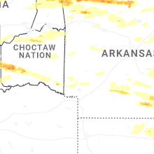

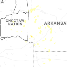


Connect with Interactive Hail Maps