

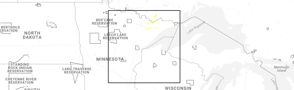
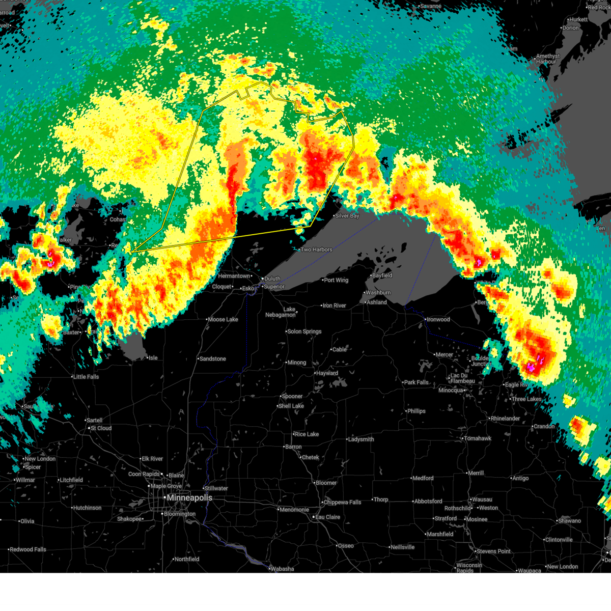
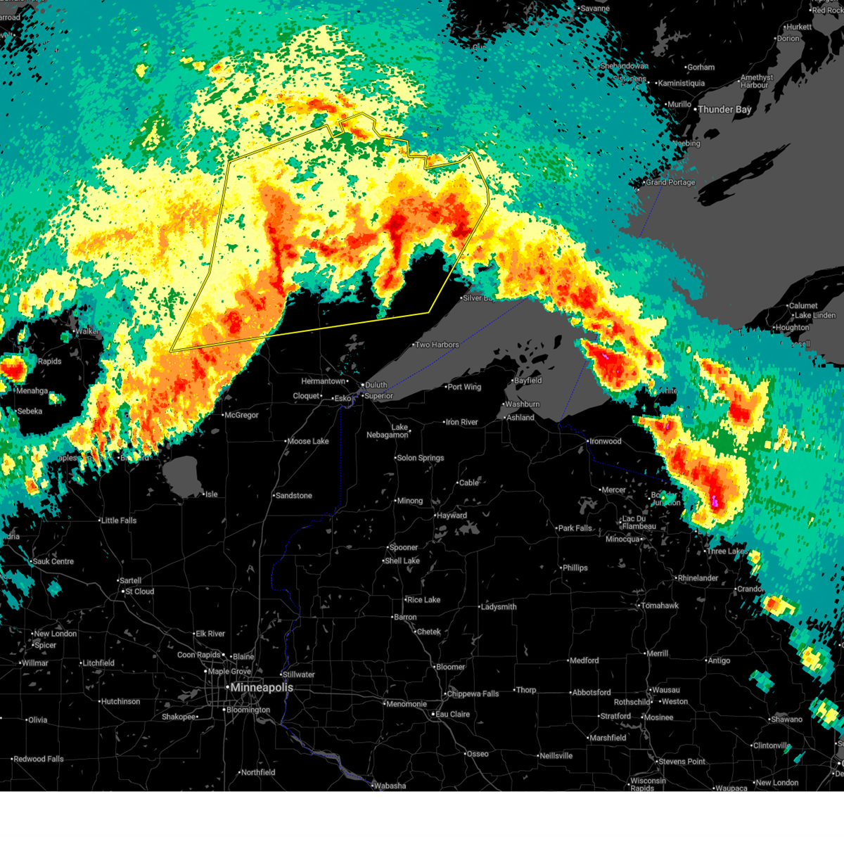
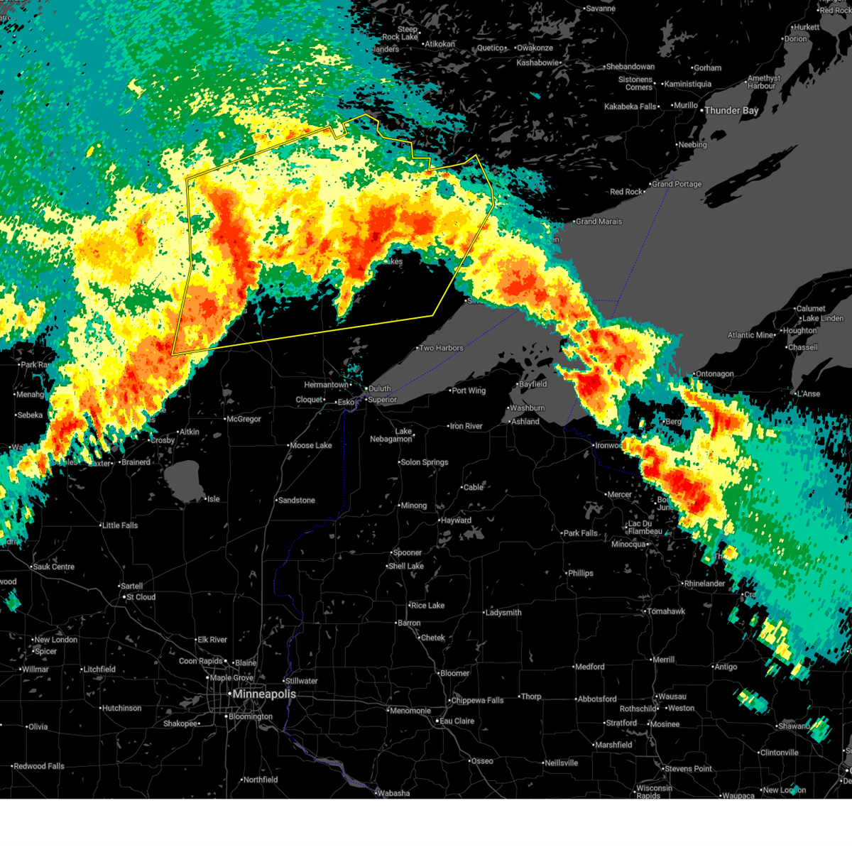
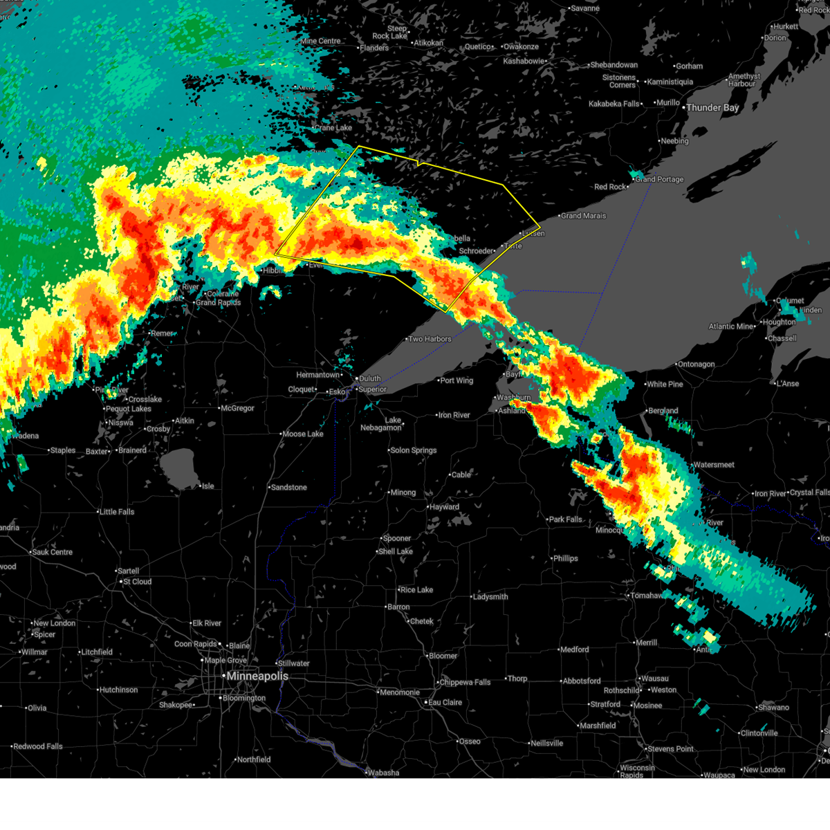
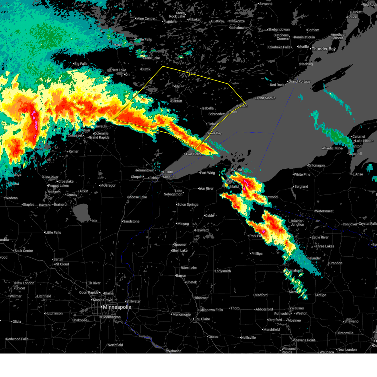
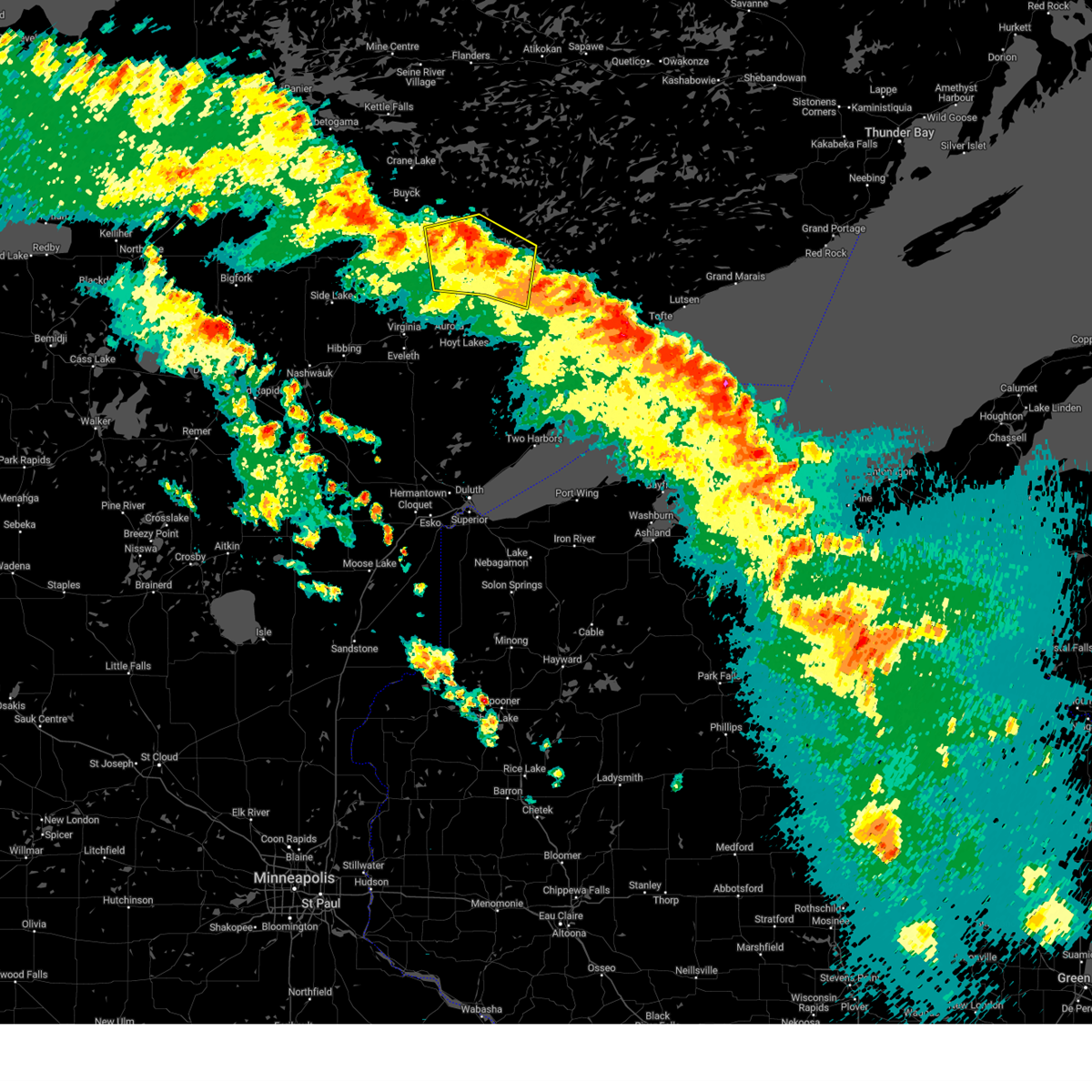
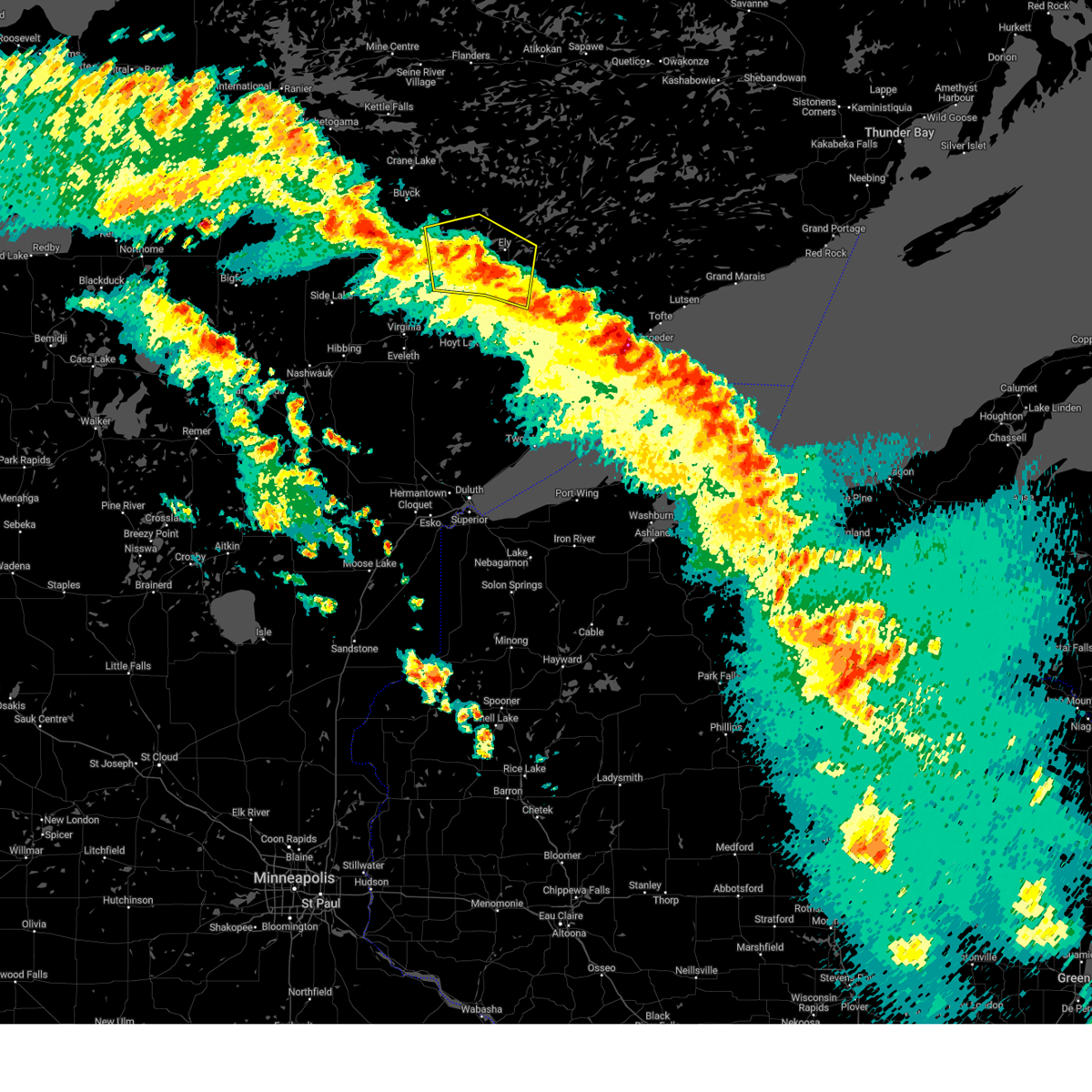
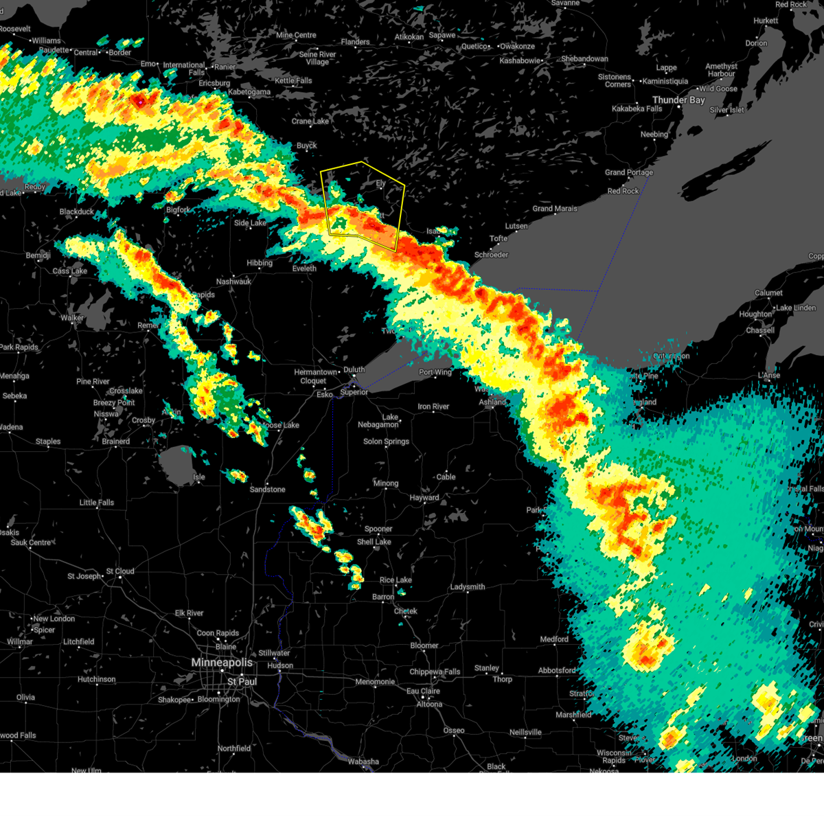
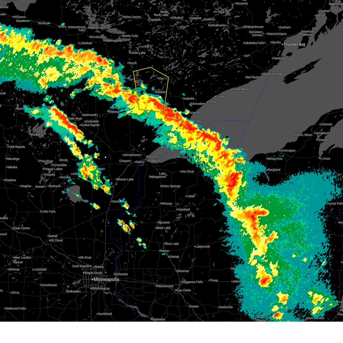
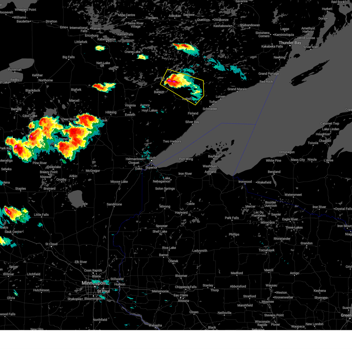
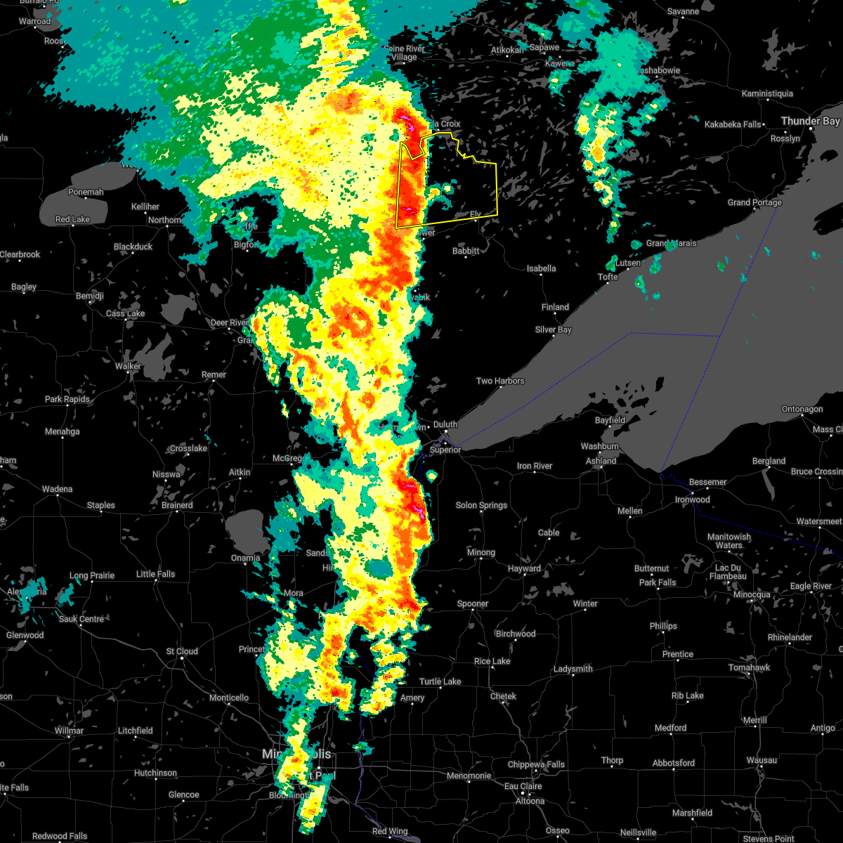
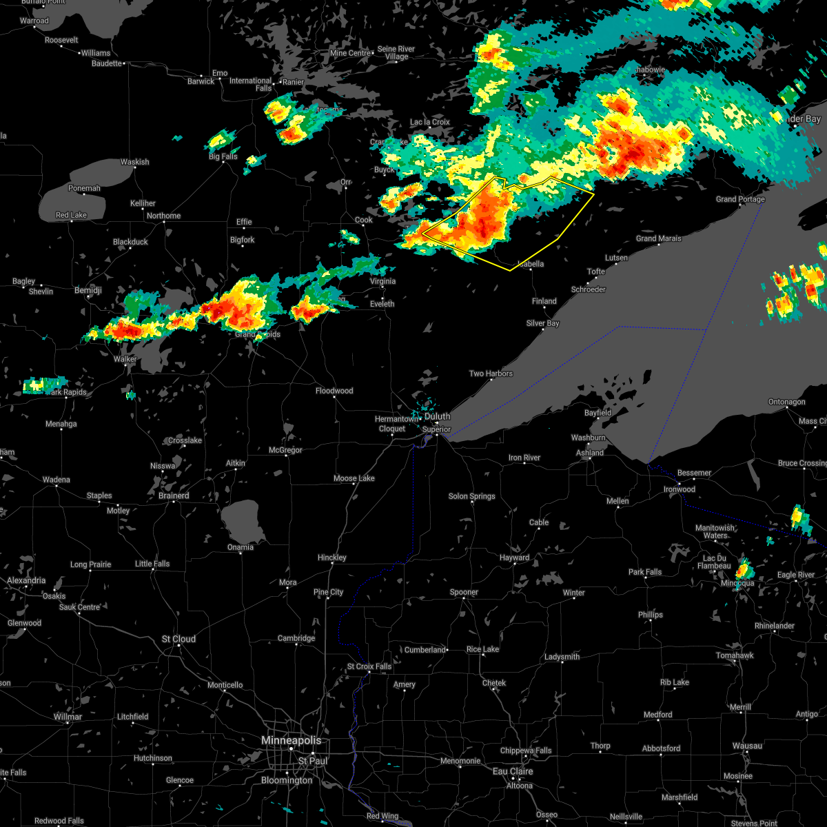
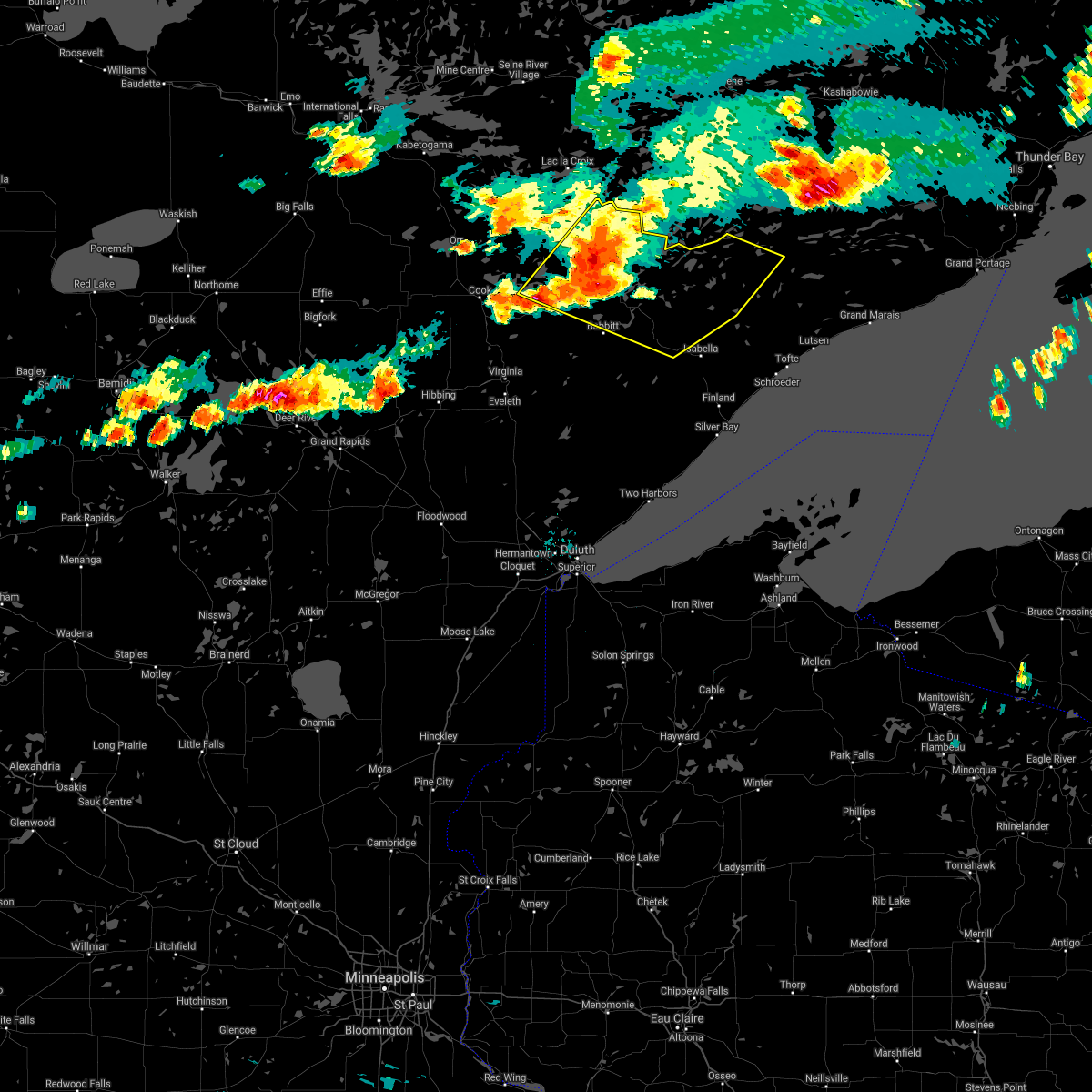
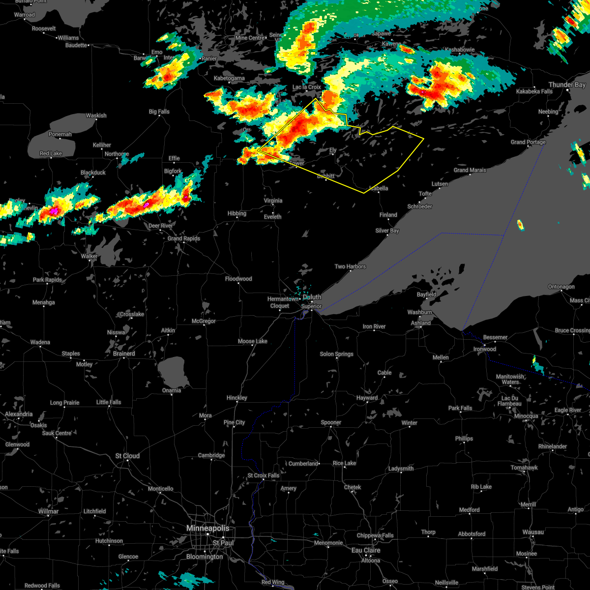
Hail Map for Winton, MN
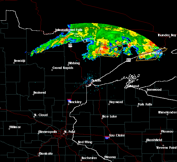
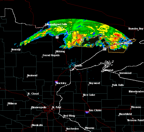
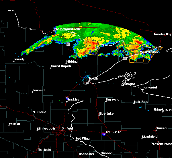
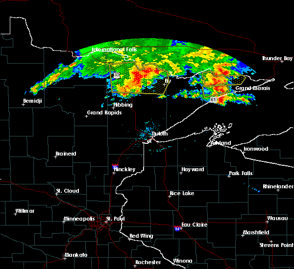
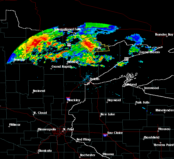
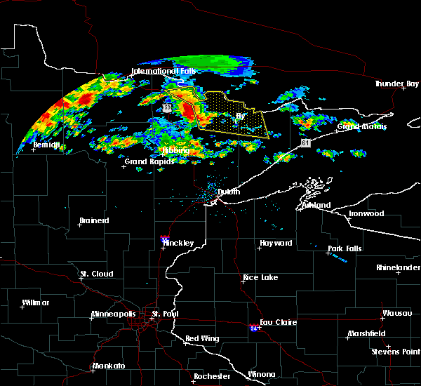
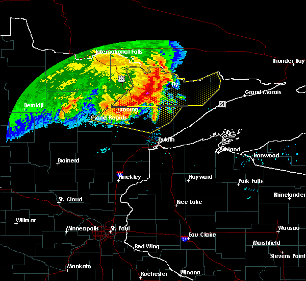
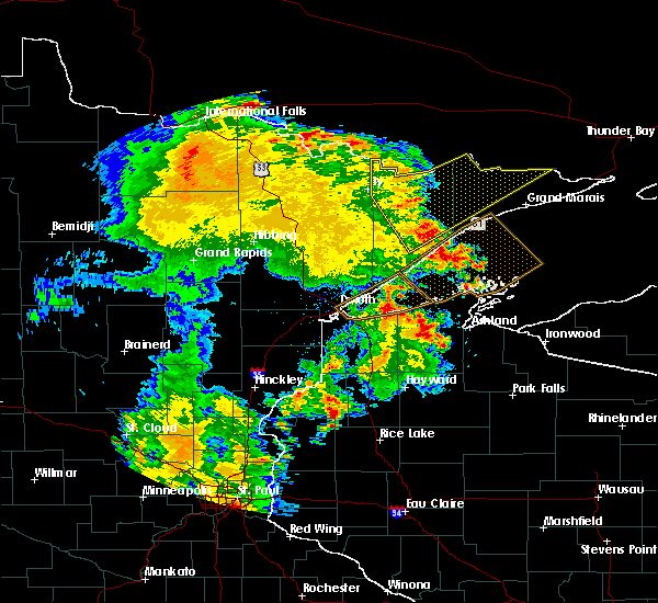
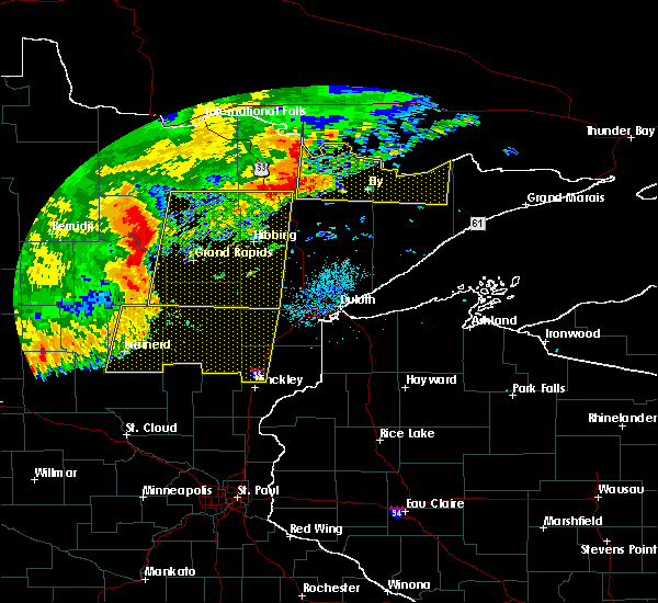
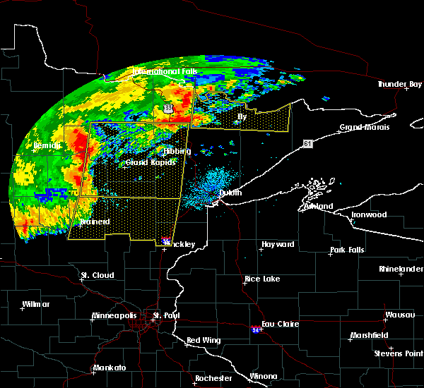
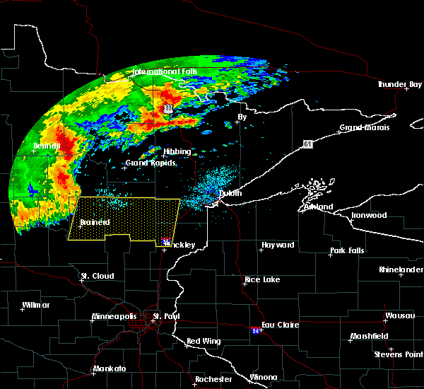
The Winton, MN area has had 0 reports of on-the-ground hail by trained spotters, and has been under severe weather warnings 9 times during the past 12 months. Doppler radar has detected hail at or near Winton, MN on 27 occasions, including 2 occasions during the past year.
| Name: | Winton, MN |
| Where Located: | 80.1 miles N of Duluth, MN |
| Map: | Google Map for Winton, MN |
| Population: | 172 |
| Housing Units: | 110 |
| More Info: | Search Google for Winton, MN |
0
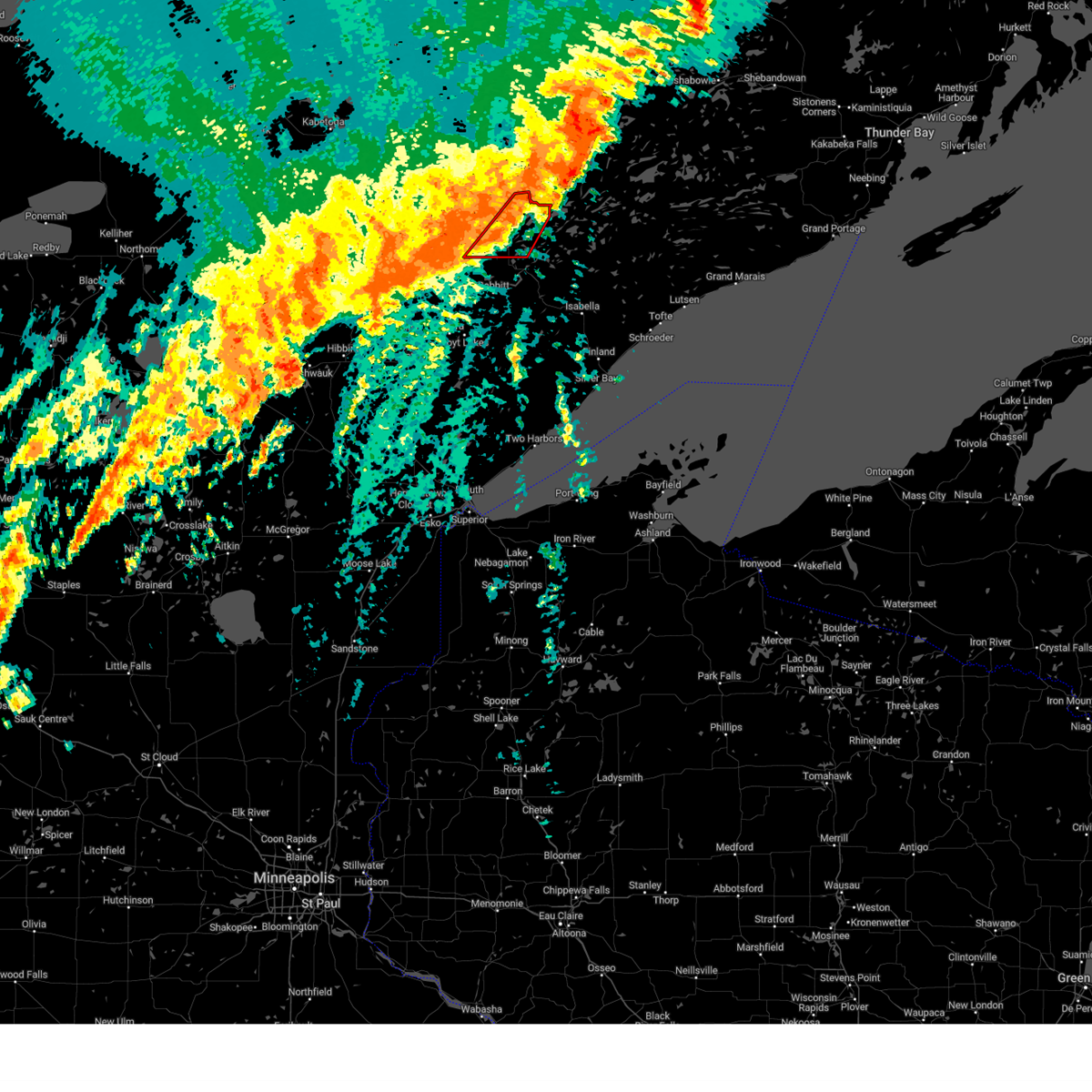
The Top Recent Hail Date for Winton, MN is Tuesday, September 16, 2025 (21st out of 27)
Hail and Wind Damage Spotted near Winton, MN
| Date / Time | Report Details |
|---|---|
| 8/8/2025 10:57 AM CDT |
 the severe thunderstorm warning has been cancelled and is no longer in effect the severe thunderstorm warning has been cancelled and is no longer in effect
|
| 8/8/2025 10:52 AM CDT |
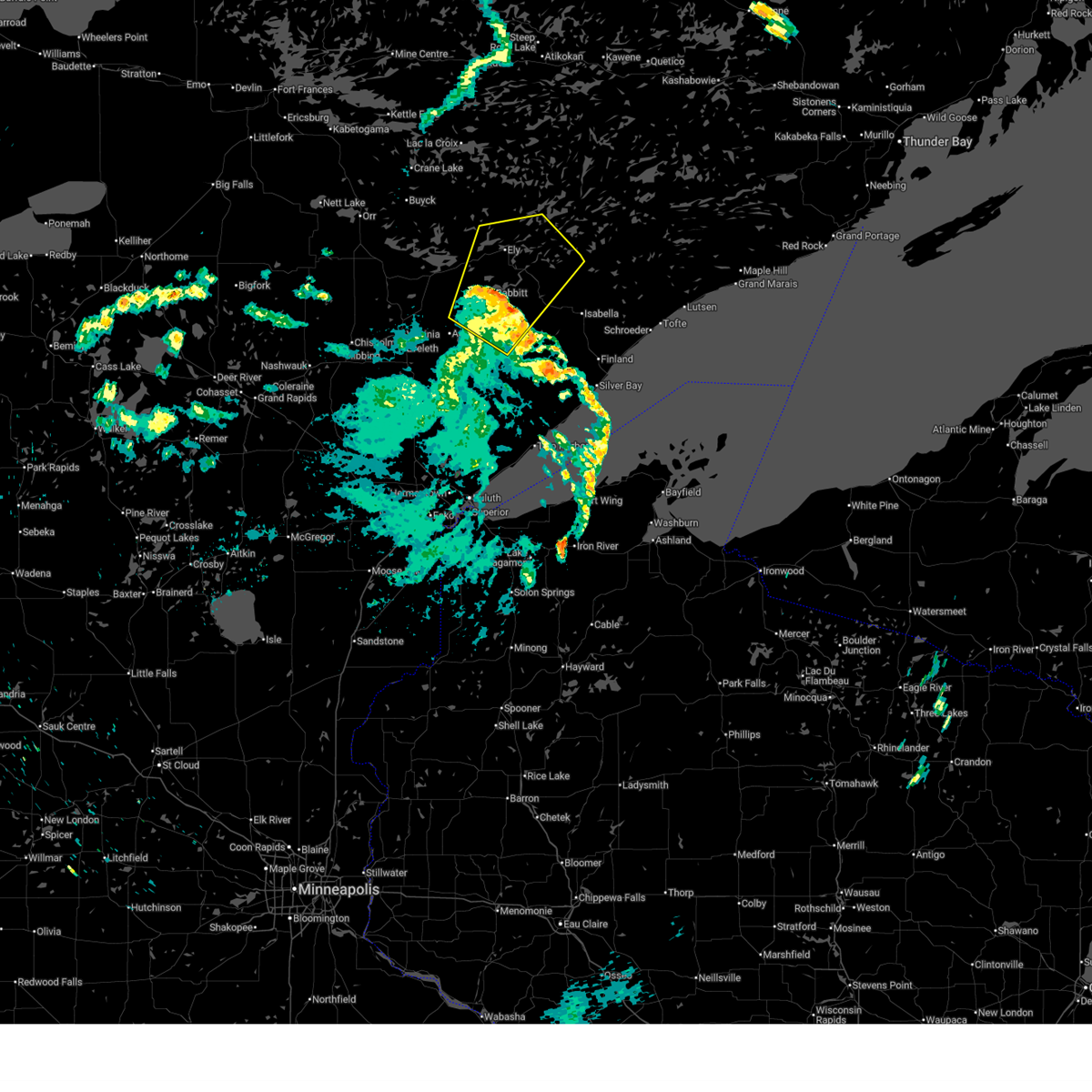
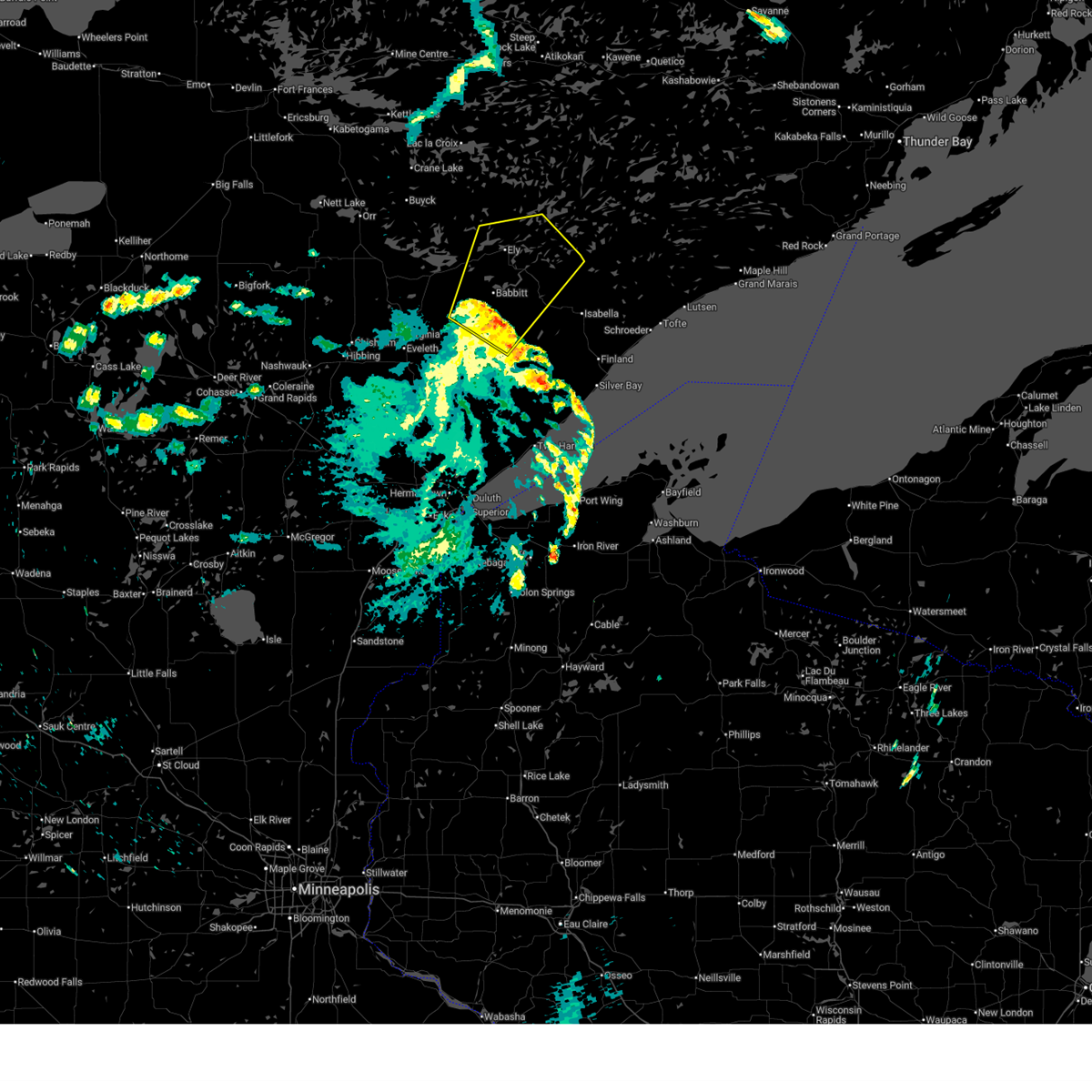 At 1051 am cdt, severe thunderstorms were located along a line extending from near embarrass to near babbitt to 12 miles northwest of whyte, moving northeast at 55 mph (radar indicated). Hazards include 60 mph wind gusts. Expect damage to roofs, siding, and trees. Locations impacted include, ely, hoyt lakes, babbitt, embarrass, winton, fall lake, birch lake, burntside lake, white iron lake, robinson, bear head lake state park, basswood lake, boundary waters canoe area wilderness near trout lake, southern boundary waters canoe area wilderness, bald eagle lake, seven beaver lake, gabbro lake, ojibway lake, farm lake, and bear island lake. At 1051 am cdt, severe thunderstorms were located along a line extending from near embarrass to near babbitt to 12 miles northwest of whyte, moving northeast at 55 mph (radar indicated). Hazards include 60 mph wind gusts. Expect damage to roofs, siding, and trees. Locations impacted include, ely, hoyt lakes, babbitt, embarrass, winton, fall lake, birch lake, burntside lake, white iron lake, robinson, bear head lake state park, basswood lake, boundary waters canoe area wilderness near trout lake, southern boundary waters canoe area wilderness, bald eagle lake, seven beaver lake, gabbro lake, ojibway lake, farm lake, and bear island lake.
|
| 8/8/2025 10:34 AM CDT |
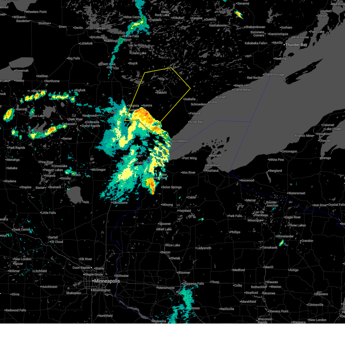 Svrdlh the national weather service in duluth mn has issued a * severe thunderstorm warning for, east central st. louis county in northeastern minnesota, northwestern lake county in northeastern minnesota, * until 1115 am cdt. * at 1034 am cdt, severe thunderstorms were located along a line extending from near gilbert to near aurora to wolf lake, moving northeast at 55 mph (radar indicated). Hazards include 60 mph wind gusts. expect damage to roofs, siding, and trees Svrdlh the national weather service in duluth mn has issued a * severe thunderstorm warning for, east central st. louis county in northeastern minnesota, northwestern lake county in northeastern minnesota, * until 1115 am cdt. * at 1034 am cdt, severe thunderstorms were located along a line extending from near gilbert to near aurora to wolf lake, moving northeast at 55 mph (radar indicated). Hazards include 60 mph wind gusts. expect damage to roofs, siding, and trees
|
| 6/21/2025 2:36 AM CDT |
 At 235 am cdt, severe thunderstorms were located along a line extending from boundary waters canoe area wilderness to near bear head lake state park to 9 miles northwest of whiteface reservoir, moving east at 80 mph (radar indicated). Hazards include 70 mph wind gusts and penny size hail. Expect considerable tree damage. damage is likely to mobile homes, roofs, and outbuildings. Locations impacted include, hibbing, ely, lake vermilion, virginia, chisholm, eveleth, mountain iron, hoyt lakes, gilbert, aurora, babbitt, keewatin, buhl, nashwauk, biwabik, cherry, swan river, embarrass, cook, and tower. At 235 am cdt, severe thunderstorms were located along a line extending from boundary waters canoe area wilderness to near bear head lake state park to 9 miles northwest of whiteface reservoir, moving east at 80 mph (radar indicated). Hazards include 70 mph wind gusts and penny size hail. Expect considerable tree damage. damage is likely to mobile homes, roofs, and outbuildings. Locations impacted include, hibbing, ely, lake vermilion, virginia, chisholm, eveleth, mountain iron, hoyt lakes, gilbert, aurora, babbitt, keewatin, buhl, nashwauk, biwabik, cherry, swan river, embarrass, cook, and tower.
|
| 6/21/2025 2:36 AM CDT |
 the severe thunderstorm warning has been cancelled and is no longer in effect the severe thunderstorm warning has been cancelled and is no longer in effect
|
| 6/21/2025 2:18 AM CDT |
 At 217 am cdt, severe thunderstorms were located along a line extending from near buyck to 8 miles north of biwabik to 7 miles north of toivola, moving east at 80 mph (radar indicated). Hazards include 70 mph wind gusts and penny size hail. Expect considerable tree damage. damage is likely to mobile homes, roofs, and outbuildings. Locations impacted include, lake vermilion, virginia, eveleth, hoyt lakes, gilbert, aurora, biwabik, embarrass, tower, boundary waters canoe area wilderness near trout lake, babbitt, robinson, birch lake, burntside lake, ely, white iron lake, winton, fall lake, basswood lake, snowbank lake, forest center and isabella. At 217 am cdt, severe thunderstorms were located along a line extending from near buyck to 8 miles north of biwabik to 7 miles north of toivola, moving east at 80 mph (radar indicated). Hazards include 70 mph wind gusts and penny size hail. Expect considerable tree damage. damage is likely to mobile homes, roofs, and outbuildings. Locations impacted include, lake vermilion, virginia, eveleth, hoyt lakes, gilbert, aurora, biwabik, embarrass, tower, boundary waters canoe area wilderness near trout lake, babbitt, robinson, birch lake, burntside lake, ely, white iron lake, winton, fall lake, basswood lake, snowbank lake, forest center and isabella.
|
| 6/21/2025 1:55 AM CDT |
 Svrdlh the national weather service in duluth mn has issued a * severe thunderstorm warning for, eastern itasca county in north central minnesota, north central aitkin county in east central minnesota, southeastern koochiching county in north central minnesota, st. louis county in northeastern minnesota, lake county in northeastern minnesota, * until 300 am cdt. * at 155 am cdt, severe thunderstorms were located along a line extending from 9 miles north of togo to near chisholm to near warba, moving east at 80 mph (radar indicated). Hazards include 70 mph wind gusts and penny size hail. Expect considerable tree damage. damage is likely to mobile homes, roofs, and outbuildings. severe thunderstorms will be near, hibbing, chisholm, keewatin, buhl, nashwauk, meadow brook, warba, and pelican lake around 200 am cdt. mountain iron, cook, orr, and gheen around 205 am cdt. lake vermilion, virginia, eveleth, and cherry around 210 am cdt. gilbert, biwabik, and buyck around 215 am cdt. Other locations in the path of these severe thunderstorms include embarrass, tower, boundary waters canoe area wilderness near trout lake, soudan underground mine state park, hoyt lakes, aurora, babbitt, bear head lake state park, robinson, birch lake, burntside lake, ely, winton, white iron lake and fall lake. Svrdlh the national weather service in duluth mn has issued a * severe thunderstorm warning for, eastern itasca county in north central minnesota, north central aitkin county in east central minnesota, southeastern koochiching county in north central minnesota, st. louis county in northeastern minnesota, lake county in northeastern minnesota, * until 300 am cdt. * at 155 am cdt, severe thunderstorms were located along a line extending from 9 miles north of togo to near chisholm to near warba, moving east at 80 mph (radar indicated). Hazards include 70 mph wind gusts and penny size hail. Expect considerable tree damage. damage is likely to mobile homes, roofs, and outbuildings. severe thunderstorms will be near, hibbing, chisholm, keewatin, buhl, nashwauk, meadow brook, warba, and pelican lake around 200 am cdt. mountain iron, cook, orr, and gheen around 205 am cdt. lake vermilion, virginia, eveleth, and cherry around 210 am cdt. gilbert, biwabik, and buyck around 215 am cdt. Other locations in the path of these severe thunderstorms include embarrass, tower, boundary waters canoe area wilderness near trout lake, soudan underground mine state park, hoyt lakes, aurora, babbitt, bear head lake state park, robinson, birch lake, burntside lake, ely, winton, white iron lake and fall lake.
|
| 6/21/2025 1:22 AM CDT |
 At 122 am cdt, severe thunderstorms were located along a line extending from near biwabik to near whyte to 11 miles northwest of devils island, moving east at 45 mph (radar indicated). Hazards include 60 mph wind gusts and quarter size hail. Hail damage to vehicles is expected. expect wind damage to roofs, siding, and trees. Locations impacted include, hoyt lakes, babbitt, biwabik, embarrass, whyte, little marais, illgen city, finland, tettegouche state park, george manitou state park, sugar loaf cove, taconite harbor, isabella, birch lake, temperance river state park, dumbbell lake, clear lake, tofte, lutsen, southern boundary waters canoe area wilderness, forest center and cascade river state park. At 122 am cdt, severe thunderstorms were located along a line extending from near biwabik to near whyte to 11 miles northwest of devils island, moving east at 45 mph (radar indicated). Hazards include 60 mph wind gusts and quarter size hail. Hail damage to vehicles is expected. expect wind damage to roofs, siding, and trees. Locations impacted include, hoyt lakes, babbitt, biwabik, embarrass, whyte, little marais, illgen city, finland, tettegouche state park, george manitou state park, sugar loaf cove, taconite harbor, isabella, birch lake, temperance river state park, dumbbell lake, clear lake, tofte, lutsen, southern boundary waters canoe area wilderness, forest center and cascade river state park.
|
| 6/21/2025 12:56 AM CDT |
 Svrdlh the national weather service in duluth mn has issued a * severe thunderstorm warning for, southwestern cook county in northeastern minnesota, central st. louis county in northeastern minnesota, lake county in northeastern minnesota, * until 200 am cdt. * at 1255 am cdt, severe thunderstorms were located along a line extending from near buhl to near brimson to 7 miles southeast of gooseberry falls state park, moving east at 45 mph (radar indicated). Hazards include 60 mph wind gusts and half dollar size hail. Hail damage to vehicles is expected. expect wind damage to roofs, siding, and trees. severe thunderstorms will be near, virginia, eveleth, mountain iron, gilbert, buhl, fairbanks, whiteface reservoir, split rock lighthouse, gooseberry falls state park, and split rock lighthouse state park around 100 am cdt. hoyt lakes, biwabik, and beaver bay around 105 am cdt. silver bay and aurora around 110 am cdt. whyte and tettegouche state park around 115 am cdt. Other locations in the path of these severe thunderstorms include babbitt, illgen city, finland, embarrass, little marais and george manitou state park. Svrdlh the national weather service in duluth mn has issued a * severe thunderstorm warning for, southwestern cook county in northeastern minnesota, central st. louis county in northeastern minnesota, lake county in northeastern minnesota, * until 200 am cdt. * at 1255 am cdt, severe thunderstorms were located along a line extending from near buhl to near brimson to 7 miles southeast of gooseberry falls state park, moving east at 45 mph (radar indicated). Hazards include 60 mph wind gusts and half dollar size hail. Hail damage to vehicles is expected. expect wind damage to roofs, siding, and trees. severe thunderstorms will be near, virginia, eveleth, mountain iron, gilbert, buhl, fairbanks, whiteface reservoir, split rock lighthouse, gooseberry falls state park, and split rock lighthouse state park around 100 am cdt. hoyt lakes, biwabik, and beaver bay around 105 am cdt. silver bay and aurora around 110 am cdt. whyte and tettegouche state park around 115 am cdt. Other locations in the path of these severe thunderstorms include babbitt, illgen city, finland, embarrass, little marais and george manitou state park.
|
| 5/15/2025 7:21 PM CDT |
 The storms which prompted the warning have weakened below severe limits, and no longer pose an immediate threat to life or property. therefore, the warning will be allowed to expire. however, gusty winds are still possible with these thunderstorms. The storms which prompted the warning have weakened below severe limits, and no longer pose an immediate threat to life or property. therefore, the warning will be allowed to expire. however, gusty winds are still possible with these thunderstorms.
|
| 5/15/2025 7:09 PM CDT |
 At 709 pm cdt, severe thunderstorms were located along a line extending from 7 miles west of isabella to robinson to soudan underground mine state park, moving north at 50 mph (radar indicated). Hazards include 60 mph wind gusts and penny size hail. Expect damage to roofs, siding, and trees. These severe storms will be near, ely, lake vermilion, winton, white iron lake, birch lake, burntside lake, fall lake, and boundary waters canoe area wilderness near trout lake around 715 pm cdt. At 709 pm cdt, severe thunderstorms were located along a line extending from 7 miles west of isabella to robinson to soudan underground mine state park, moving north at 50 mph (radar indicated). Hazards include 60 mph wind gusts and penny size hail. Expect damage to roofs, siding, and trees. These severe storms will be near, ely, lake vermilion, winton, white iron lake, birch lake, burntside lake, fall lake, and boundary waters canoe area wilderness near trout lake around 715 pm cdt.
|
| 5/15/2025 6:56 PM CDT |
 At 655 pm cdt, severe thunderstorms were located along a line extending from near whyte to near bear head lake state park to near embarrass, moving north at 40 mph (radar indicated). Hazards include 60 mph wind gusts and penny size hail. Expect damage to roofs, siding, and trees. these severe storms will be near, lake vermilion, babbitt, tower, birch lake, bear head lake state park, and soudan underground mine state park around 700 pm cdt. robinson and white iron lake around 705 pm cdt. Other locations in the path of these severe thunderstorms include ely, burntside lake, boundary waters canoe area wilderness near trout lake, winton and fall lake. At 655 pm cdt, severe thunderstorms were located along a line extending from near whyte to near bear head lake state park to near embarrass, moving north at 40 mph (radar indicated). Hazards include 60 mph wind gusts and penny size hail. Expect damage to roofs, siding, and trees. these severe storms will be near, lake vermilion, babbitt, tower, birch lake, bear head lake state park, and soudan underground mine state park around 700 pm cdt. robinson and white iron lake around 705 pm cdt. Other locations in the path of these severe thunderstorms include ely, burntside lake, boundary waters canoe area wilderness near trout lake, winton and fall lake.
|
| 5/15/2025 6:45 PM CDT |
 Svrdlh the national weather service in duluth mn has issued a * severe thunderstorm warning for, east central st. louis county in northeastern minnesota, west central lake county in northeastern minnesota, * until 730 pm cdt. * at 645 pm cdt, severe thunderstorms were located along a line extending from near whyte to near babbitt to near embarrass, moving north at 50 mph (radar indicated). Hazards include 60 mph wind gusts and penny size hail. Expect damage to roofs, siding, and trees. severe thunderstorms will be near, babbitt, embarrass, birch lake, and bear head lake state park around 650 pm cdt. lake vermilion, tower, and soudan underground mine state park around 655 pm cdt. robinson around 700 pm cdt. ely, white iron lake, burntside lake, and boundary waters canoe area wilderness near trout lake around 705 pm cdt. Other locations in the path of these severe thunderstorms include winton and fall lake. Svrdlh the national weather service in duluth mn has issued a * severe thunderstorm warning for, east central st. louis county in northeastern minnesota, west central lake county in northeastern minnesota, * until 730 pm cdt. * at 645 pm cdt, severe thunderstorms were located along a line extending from near whyte to near babbitt to near embarrass, moving north at 50 mph (radar indicated). Hazards include 60 mph wind gusts and penny size hail. Expect damage to roofs, siding, and trees. severe thunderstorms will be near, babbitt, embarrass, birch lake, and bear head lake state park around 650 pm cdt. lake vermilion, tower, and soudan underground mine state park around 655 pm cdt. robinson around 700 pm cdt. ely, white iron lake, burntside lake, and boundary waters canoe area wilderness near trout lake around 705 pm cdt. Other locations in the path of these severe thunderstorms include winton and fall lake.
|
| 6/18/2024 3:27 PM CDT |
 The storms which prompted the warning have weakened below severe limits, and no longer appear capable of producing a tornado. therefore, the warning will be allowed to expire. however, heavy rain is still possible with these thunderstorms with a flood watch for flash flooding. a tornado watch remains in effect until 800 pm cdt for northeastern minnesota. The storms which prompted the warning have weakened below severe limits, and no longer appear capable of producing a tornado. therefore, the warning will be allowed to expire. however, heavy rain is still possible with these thunderstorms with a flood watch for flash flooding. a tornado watch remains in effect until 800 pm cdt for northeastern minnesota.
|
| 6/18/2024 3:19 PM CDT |
 At 318 pm cdt, severe thunderstorms capable of producing tornadoes were located along a line extending from near basswood lake to near winton, moving east to northeast at 35 mph (radar indicated rotation). Hazards include tornado. Flying debris will be dangerous to those caught without shelter. mobile homes will be damaged or destroyed. damage to roofs, windows, and vehicles will occur. tree damage is likely. Locations impacted include, boundary waters canoe area wilderness, fall lake and basswood lake. At 318 pm cdt, severe thunderstorms capable of producing tornadoes were located along a line extending from near basswood lake to near winton, moving east to northeast at 35 mph (radar indicated rotation). Hazards include tornado. Flying debris will be dangerous to those caught without shelter. mobile homes will be damaged or destroyed. damage to roofs, windows, and vehicles will occur. tree damage is likely. Locations impacted include, boundary waters canoe area wilderness, fall lake and basswood lake.
|
| 6/18/2024 2:51 PM CDT |
 Tordlh the national weather service in duluth mn has issued a * tornado warning for, east central st. louis county in northeastern minnesota, northwestern lake county in northeastern minnesota, * until 330 pm cdt. * at 251 pm cdt, a line of severe thunderstorms capable of producing both tornadoes were located along a line extending from 6 miles northeast of burntside lake to near robinson, moving northeast at 40 mph (radar indicated rotation). Hazards include tornadoes. Flying debris will be dangerous to those caught without shelter. mobile homes will be damaged or destroyed. damage to roofs, windows, and vehicles will occur. tree damage is likely. these dangerous storms will be near, boundary waters canoe area wilderness and burntside lake around 255 pm cdt. basswood lake around 300 pm cdt. ely around 310 pm cdt. Other locations in the path of these tornadic storms include winton and fall lake. Tordlh the national weather service in duluth mn has issued a * tornado warning for, east central st. louis county in northeastern minnesota, northwestern lake county in northeastern minnesota, * until 330 pm cdt. * at 251 pm cdt, a line of severe thunderstorms capable of producing both tornadoes were located along a line extending from 6 miles northeast of burntside lake to near robinson, moving northeast at 40 mph (radar indicated rotation). Hazards include tornadoes. Flying debris will be dangerous to those caught without shelter. mobile homes will be damaged or destroyed. damage to roofs, windows, and vehicles will occur. tree damage is likely. these dangerous storms will be near, boundary waters canoe area wilderness and burntside lake around 255 pm cdt. basswood lake around 300 pm cdt. ely around 310 pm cdt. Other locations in the path of these tornadic storms include winton and fall lake.
|
| 6/12/2024 5:23 PM CDT |
 At 523 pm cdt, a severe thunderstorm was located over southern boundary waters canoe area wilderness, or 16 miles east of ely, moving southeast at 45 mph (radar indicated). Hazards include golf ball size hail and 60 mph wind gusts. People and animals outdoors will be injured. expect hail damage to roofs, siding, windows, and vehicles. expect wind damage to roofs, siding, and trees. Locations impacted include, ely, clear lake, winton, fall lake, white iron lake, forest center, dumbbell lake, snowbank lake, basswood lake, birch lake, southern boundary waters canoe area wilderness, bald eagle lake, gabbro lake, perent lake, ojibway lake, farm lake, kawishiwi lake, isabella lake, greenstone lake, and silver island lake. At 523 pm cdt, a severe thunderstorm was located over southern boundary waters canoe area wilderness, or 16 miles east of ely, moving southeast at 45 mph (radar indicated). Hazards include golf ball size hail and 60 mph wind gusts. People and animals outdoors will be injured. expect hail damage to roofs, siding, windows, and vehicles. expect wind damage to roofs, siding, and trees. Locations impacted include, ely, clear lake, winton, fall lake, white iron lake, forest center, dumbbell lake, snowbank lake, basswood lake, birch lake, southern boundary waters canoe area wilderness, bald eagle lake, gabbro lake, perent lake, ojibway lake, farm lake, kawishiwi lake, isabella lake, greenstone lake, and silver island lake.
|
| 6/12/2024 5:10 PM CDT |
 At 509 pm cdt, a severe thunderstorm was located near fall lake, or near ely, moving southeast at 45 mph (radar indicated). Hazards include ping pong ball size hail and 60 mph wind gusts. People and animals outdoors will be injured. expect hail damage to roofs, siding, windows, and vehicles. expect wind damage to roofs, siding, and trees. Locations impacted include, southern boundary waters canoe area wilderness, birch lake and forest center. At 509 pm cdt, a severe thunderstorm was located near fall lake, or near ely, moving southeast at 45 mph (radar indicated). Hazards include ping pong ball size hail and 60 mph wind gusts. People and animals outdoors will be injured. expect hail damage to roofs, siding, windows, and vehicles. expect wind damage to roofs, siding, and trees. Locations impacted include, southern boundary waters canoe area wilderness, birch lake and forest center.
|
| 6/12/2024 4:53 PM CDT |
 Svrdlh the national weather service in duluth mn has issued a * severe thunderstorm warning for, east central st. louis county in northeastern minnesota, northern lake county in northeastern minnesota, * until 545 pm cdt. * at 451 pm cdt, a severe thunderstorm was located near burntside lake, or 8 miles northwest of ely, moving southeast at 45 mph (radar indicated. at 420 pm ping pong ball size hail was reported near crane lake). Hazards include ping pong ball size hail and 60 mph wind gusts. People and animals outdoors will be injured. expect hail damage to roofs, siding, windows, and vehicles. expect wind damage to roofs, siding, and trees. this severe thunderstorm will be near, ely and burntside lake around 455 pm cdt. winton, fall lake, and white iron lake around 500 pm cdt. southern boundary waters canoe area wilderness around 505 pm cdt. birch lake around 510 pm cdt. Other locations in the path of this severe thunderstorm include forest center. Svrdlh the national weather service in duluth mn has issued a * severe thunderstorm warning for, east central st. louis county in northeastern minnesota, northern lake county in northeastern minnesota, * until 545 pm cdt. * at 451 pm cdt, a severe thunderstorm was located near burntside lake, or 8 miles northwest of ely, moving southeast at 45 mph (radar indicated. at 420 pm ping pong ball size hail was reported near crane lake). Hazards include ping pong ball size hail and 60 mph wind gusts. People and animals outdoors will be injured. expect hail damage to roofs, siding, windows, and vehicles. expect wind damage to roofs, siding, and trees. this severe thunderstorm will be near, ely and burntside lake around 455 pm cdt. winton, fall lake, and white iron lake around 500 pm cdt. southern boundary waters canoe area wilderness around 505 pm cdt. birch lake around 510 pm cdt. Other locations in the path of this severe thunderstorm include forest center.
|
| 6/20/2022 11:09 PM CDT |
 At 1109 pm cdt, severe thunderstorms were located along a line extending from near basswood lake, to 12 miles northwest of isabella, to 8 miles northeast of thomas lake near brimson, moving east at 45 mph (radar indicated). Hazards include 60 mph wind gusts and penny size hail. Expect damage to roofs, siding, and trees. severe thunderstorms will be near, forest center and snowbank lake around 1125 pm cdt. other locations in the path of these severe thunderstorms include finland, clear lake, alpine lake, little saganaga lake, saganaga lake, sea gull lake and gunflint lake. hail threat, radar indicated max hail size, 0. 75 in wind threat, radar indicated max wind gust, 60 mph. At 1109 pm cdt, severe thunderstorms were located along a line extending from near basswood lake, to 12 miles northwest of isabella, to 8 miles northeast of thomas lake near brimson, moving east at 45 mph (radar indicated). Hazards include 60 mph wind gusts and penny size hail. Expect damage to roofs, siding, and trees. severe thunderstorms will be near, forest center and snowbank lake around 1125 pm cdt. other locations in the path of these severe thunderstorms include finland, clear lake, alpine lake, little saganaga lake, saganaga lake, sea gull lake and gunflint lake. hail threat, radar indicated max hail size, 0. 75 in wind threat, radar indicated max wind gust, 60 mph.
|
| 6/20/2022 11:03 PM CDT |
 At 1103 pm cdt, severe thunderstorms were located along a line extending from 10 miles southeast of kettle falls, to white iron lake, to near highland lake, moving east at 45 mph (radar indicated). Hazards include 60 mph wind gusts and nickel size hail. Expect damage to roofs, siding, and trees. locations impacted include, ely, hoyt lakes, babbitt, winton, fairbanks, wolf lake, basswood lake, fall lake, birch lake, burntside lake, white iron lake, brimson, robinson, whyte, castle danger, thomas lake near brimson, highland lake, snowbank lake, boundary waters canoe area wilderness near trout lake, and western boundary waters canoe area wilderness. hail threat, radar indicated max hail size, 0. 88 in wind threat, radar indicated max wind gust, 60 mph. At 1103 pm cdt, severe thunderstorms were located along a line extending from 10 miles southeast of kettle falls, to white iron lake, to near highland lake, moving east at 45 mph (radar indicated). Hazards include 60 mph wind gusts and nickel size hail. Expect damage to roofs, siding, and trees. locations impacted include, ely, hoyt lakes, babbitt, winton, fairbanks, wolf lake, basswood lake, fall lake, birch lake, burntside lake, white iron lake, brimson, robinson, whyte, castle danger, thomas lake near brimson, highland lake, snowbank lake, boundary waters canoe area wilderness near trout lake, and western boundary waters canoe area wilderness. hail threat, radar indicated max hail size, 0. 88 in wind threat, radar indicated max wind gust, 60 mph.
|
| 6/20/2022 10:45 PM CDT |
 At 1044 pm cdt, severe thunderstorms were located along a line extending from near voyageurs national park, to near robinson, to near whiteface reservoir, moving east at 45 mph (radar indicated). Hazards include 60 mph wind gusts and nickel size hail. Expect damage to roofs, siding, and trees. locations impacted include, robinson, wolf lake, burntside lake, ely, winton, brimson, white iron lake, fall lake, highland lake, thomas lake near brimson, birch lake, western boundary waters canoe area wilderness and castle danger. hail threat, radar indicated max hail size, 0. 88 in wind threat, radar indicated max wind gust, 60 mph. At 1044 pm cdt, severe thunderstorms were located along a line extending from near voyageurs national park, to near robinson, to near whiteface reservoir, moving east at 45 mph (radar indicated). Hazards include 60 mph wind gusts and nickel size hail. Expect damage to roofs, siding, and trees. locations impacted include, robinson, wolf lake, burntside lake, ely, winton, brimson, white iron lake, fall lake, highland lake, thomas lake near brimson, birch lake, western boundary waters canoe area wilderness and castle danger. hail threat, radar indicated max hail size, 0. 88 in wind threat, radar indicated max wind gust, 60 mph.
|
| 6/20/2022 10:27 PM CDT |
 At 1026 pm cdt, severe thunderstorms were located along a line extending from near kabetogama, to near lake vermilion, to 8 miles northeast of cotton, moving east at 45 mph (radar indicated). Hazards include 60 mph wind gusts and nickel size hail. Expect damage to roofs, siding, and trees. severe thunderstorms will be near, whiteface reservoir around 1040 pm cdt. robinson and voyageurs national park around 1045 pm cdt. other locations in the path of these severe thunderstorms include wolf lake, burntside lake, ely, winton, brimson, white iron lake, fall lake, highland lake, thomas lake near brimson, birch lake, western boundary waters canoe area wilderness and castle danger. hail threat, radar indicated max hail size, 0. 88 in wind threat, radar indicated max wind gust, 60 mph. At 1026 pm cdt, severe thunderstorms were located along a line extending from near kabetogama, to near lake vermilion, to 8 miles northeast of cotton, moving east at 45 mph (radar indicated). Hazards include 60 mph wind gusts and nickel size hail. Expect damage to roofs, siding, and trees. severe thunderstorms will be near, whiteface reservoir around 1040 pm cdt. robinson and voyageurs national park around 1045 pm cdt. other locations in the path of these severe thunderstorms include wolf lake, burntside lake, ely, winton, brimson, white iron lake, fall lake, highland lake, thomas lake near brimson, birch lake, western boundary waters canoe area wilderness and castle danger. hail threat, radar indicated max hail size, 0. 88 in wind threat, radar indicated max wind gust, 60 mph.
|
| 5/30/2022 8:42 PM CDT |
 At 842 pm cdt, severe thunderstorms were located along a line extending from boundary waters canoe area wilderness, to near tower, moving northeast at 40 mph (radar indicated). Hazards include 60 mph wind gusts and quarter size hail. Hail damage to vehicles is expected. expect wind damage to roofs, siding, and trees. severe thunderstorms will be near, northwestern boundary waters canoe area wilderness around 845 pm cdt. Burntside lake around 900 pm cdt. At 842 pm cdt, severe thunderstorms were located along a line extending from boundary waters canoe area wilderness, to near tower, moving northeast at 40 mph (radar indicated). Hazards include 60 mph wind gusts and quarter size hail. Hail damage to vehicles is expected. expect wind damage to roofs, siding, and trees. severe thunderstorms will be near, northwestern boundary waters canoe area wilderness around 845 pm cdt. Burntside lake around 900 pm cdt.
|
| 7/23/2021 7:05 PM CDT |
 At 703 pm cdt, severe thunderstorms were located along a line extending from boundary waters canoe area wilderness near ely, to 9 miles southeast of white iron lake, to near birch lake, moving east at 50 mph (radar indicated). Hazards include 70 mph wind gusts and quarter size hail. Hail damage to vehicles is expected. expect considerable tree damage. wind damage is also likely to mobile homes, roofs, and outbuildings. Locations impacted include, snowbank lake and forest center. At 703 pm cdt, severe thunderstorms were located along a line extending from boundary waters canoe area wilderness near ely, to 9 miles southeast of white iron lake, to near birch lake, moving east at 50 mph (radar indicated). Hazards include 70 mph wind gusts and quarter size hail. Hail damage to vehicles is expected. expect considerable tree damage. wind damage is also likely to mobile homes, roofs, and outbuildings. Locations impacted include, snowbank lake and forest center.
|
| 7/23/2021 6:47 PM CDT |
 At 646 pm cdt, severe thunderstorms were located along a line extending from boundary waters canoe area wilderness near ely, to near winton, to burntside lake, to near robinson, moving east at 50 mph (radar indicated). Hazards include 70 mph wind gusts and nickel size hail. Expect considerable tree damage. damage is likely to mobile homes, roofs, and outbuildings. Locations impacted include, ely, winton, white iron lake, fall lake, birch lake, babbitt, basswood lake, snowbank lake and forest center. At 646 pm cdt, severe thunderstorms were located along a line extending from boundary waters canoe area wilderness near ely, to near winton, to burntside lake, to near robinson, moving east at 50 mph (radar indicated). Hazards include 70 mph wind gusts and nickel size hail. Expect considerable tree damage. damage is likely to mobile homes, roofs, and outbuildings. Locations impacted include, ely, winton, white iron lake, fall lake, birch lake, babbitt, basswood lake, snowbank lake and forest center.
|
| 7/23/2021 6:28 PM CDT |
 At 627 pm cdt, severe thunderstorms were located along a line extending from boundary waters canoe area wilderness northwest of ely, to 11 miles northwest of burntside lake, to near lake vermilion, moving east at 50 mph (radar indicated). Hazards include 70 mph wind gusts and nickel size hail. Expect considerable tree damage. damage is likely to mobile homes, roofs, and outbuildings. severe thunderstorms will be near, burntside lake around 645 pm cdt. Other locations in the path of these severe thunderstorms include ely, winton, robinson, white iron lake, fall lake, basswood lake, snowbank lake, birch lake, babbitt, forest center and little saganaga lake. At 627 pm cdt, severe thunderstorms were located along a line extending from boundary waters canoe area wilderness northwest of ely, to 11 miles northwest of burntside lake, to near lake vermilion, moving east at 50 mph (radar indicated). Hazards include 70 mph wind gusts and nickel size hail. Expect considerable tree damage. damage is likely to mobile homes, roofs, and outbuildings. severe thunderstorms will be near, burntside lake around 645 pm cdt. Other locations in the path of these severe thunderstorms include ely, winton, robinson, white iron lake, fall lake, basswood lake, snowbank lake, birch lake, babbitt, forest center and little saganaga lake.
|
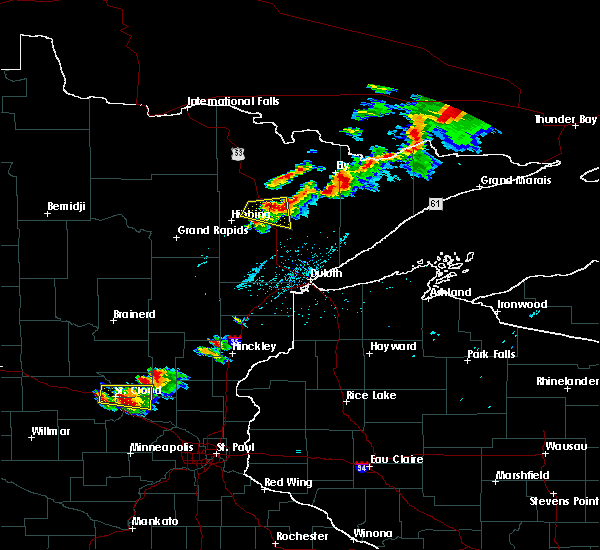
| 7/13/2020 11:18 PM CDT |
 At 1118 pm cdt, severe thunderstorms were located along a line extending from boundary waters canoe area wilderness, to near fall lake, to near birch lake, to 9 miles southwest of white iron lake, to near babbitt, moving east at 45 mph (radar indicated). Hazards include 60 mph wind gusts and nickel size hail. Expect damage to roofs, siding, and trees. Locations impacted include, ely, babbitt, winton, basswood lake, fall lake, birch lake, white iron lake, snowbank lake, southern boundary waters canoe area wilderness, forest center, ensign lake, kekekabic lake, bald eagle lake, gabbro lake, alice lake, ojibway lake, farm lake, bear island lake, disappointment lake, and greenstone lake. At 1118 pm cdt, severe thunderstorms were located along a line extending from boundary waters canoe area wilderness, to near fall lake, to near birch lake, to 9 miles southwest of white iron lake, to near babbitt, moving east at 45 mph (radar indicated). Hazards include 60 mph wind gusts and nickel size hail. Expect damage to roofs, siding, and trees. Locations impacted include, ely, babbitt, winton, basswood lake, fall lake, birch lake, white iron lake, snowbank lake, southern boundary waters canoe area wilderness, forest center, ensign lake, kekekabic lake, bald eagle lake, gabbro lake, alice lake, ojibway lake, farm lake, bear island lake, disappointment lake, and greenstone lake.
|
| 7/13/2020 10:59 PM CDT |
 At 1059 pm cdt, severe thunderstorms were located along a line extending from boundary waters canoe area wilderness, to near burntside lake, to 7 miles southwest of robinson, to near embarrass, moving east at 50 mph (radar indicated). Hazards include 60 mph wind gusts and nickel size hail. Expect damage to roofs, siding, and trees. Locations impacted include, ely, lake vermilion, babbitt, embarrass, tower, winton, basswood lake, fall lake, boundary waters canoe area wilderness near trout lake, birch lake, burntside lake, white iron lake, snowbank lake, southern boundary waters canoe area wilderness, robinson, forest center, ensign lake, kekekabic lake, bald eagle lake, and gabbro lake. At 1059 pm cdt, severe thunderstorms were located along a line extending from boundary waters canoe area wilderness, to near burntside lake, to 7 miles southwest of robinson, to near embarrass, moving east at 50 mph (radar indicated). Hazards include 60 mph wind gusts and nickel size hail. Expect damage to roofs, siding, and trees. Locations impacted include, ely, lake vermilion, babbitt, embarrass, tower, winton, basswood lake, fall lake, boundary waters canoe area wilderness near trout lake, birch lake, burntside lake, white iron lake, snowbank lake, southern boundary waters canoe area wilderness, robinson, forest center, ensign lake, kekekabic lake, bald eagle lake, and gabbro lake.
|
| 7/13/2020 10:49 PM CDT |
 At 1048 pm cdt, severe thunderstorms were located along a line extending from 14 miles east of buyck, to 10 miles northeast of lake vermilion, to near tower, to 11 miles north of mountain iron, moving east at 50 mph (radar indicated). Hazards include 60 mph wind gusts and nickel size hail. expect damage to roofs, siding, and trees At 1048 pm cdt, severe thunderstorms were located along a line extending from 14 miles east of buyck, to 10 miles northeast of lake vermilion, to near tower, to 11 miles north of mountain iron, moving east at 50 mph (radar indicated). Hazards include 60 mph wind gusts and nickel size hail. expect damage to roofs, siding, and trees
|
| 7/8/2020 7:41 PM CDT |
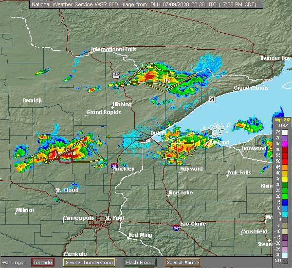 At 741 pm cdt, severe thunderstorms were located along a line extending from 6 miles southeast of buyck, to 11 miles northwest of burntside lake, to near fall lake, moving northeast at 25 mph (radar indicated). Hazards include 60 mph wind gusts and quarter size hail. Hail damage to vehicles is expected. expect wind damage to roofs, siding, and trees. Locations impacted include, winton, northwestern boundary waters canoe area wilderness, basswood lake, fall lake, boundary waters canoe area wilderness near trout lake, snowbank lake, burntside lake, ensign lake, lac la croix, knife lake, lake agnes, farm lake, crooked lake, fourtown lake, loon lake, high lake, greenstone lake, big moose lake, ojibway lake, and trout lake. At 741 pm cdt, severe thunderstorms were located along a line extending from 6 miles southeast of buyck, to 11 miles northwest of burntside lake, to near fall lake, moving northeast at 25 mph (radar indicated). Hazards include 60 mph wind gusts and quarter size hail. Hail damage to vehicles is expected. expect wind damage to roofs, siding, and trees. Locations impacted include, winton, northwestern boundary waters canoe area wilderness, basswood lake, fall lake, boundary waters canoe area wilderness near trout lake, snowbank lake, burntside lake, ensign lake, lac la croix, knife lake, lake agnes, farm lake, crooked lake, fourtown lake, loon lake, high lake, greenstone lake, big moose lake, ojibway lake, and trout lake.
|
| 7/8/2020 7:31 PM CDT |
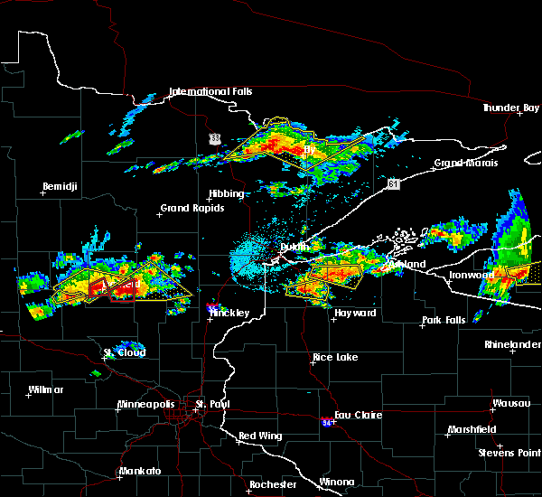 At 731 pm cdt, severe thunderstorms were located along a line extending from 8 miles south of buyck, to 12 miles northwest of burntside lake, to near fall lake, moving northeast at 25 mph (radar indicated). Hazards include 60 mph wind gusts and half dollar size hail. Hail damage to vehicles is expected. expect wind damage to roofs, siding, and trees. Locations impacted include, ely, winton, basswood lake, fall lake, boundary waters canoe area wilderness near trout lake, burntside lake, white iron lake, snowbank lake, northwestern boundary waters canoe area wilderness, birch lake, ensign lake, ojibway lake, farm lake, cummings lake, high lake, greenstone lake, trout lake, lac la croix, knife lake, and lake agnes. At 731 pm cdt, severe thunderstorms were located along a line extending from 8 miles south of buyck, to 12 miles northwest of burntside lake, to near fall lake, moving northeast at 25 mph (radar indicated). Hazards include 60 mph wind gusts and half dollar size hail. Hail damage to vehicles is expected. expect wind damage to roofs, siding, and trees. Locations impacted include, ely, winton, basswood lake, fall lake, boundary waters canoe area wilderness near trout lake, burntside lake, white iron lake, snowbank lake, northwestern boundary waters canoe area wilderness, birch lake, ensign lake, ojibway lake, farm lake, cummings lake, high lake, greenstone lake, trout lake, lac la croix, knife lake, and lake agnes.
|
| 7/8/2020 7:12 PM CDT |
 At 711 pm cdt, severe thunderstorms were located along a line extending from 7 miles northeast of cook, to 11 miles northeast of lake vermilion, to near white iron lake, moving northeast at 25 mph (radar indicated). Hazards include 60 mph wind gusts and quarter size hail. Hail damage to vehicles is expected. Expect wind damage to roofs, siding, and trees. At 711 pm cdt, severe thunderstorms were located along a line extending from 7 miles northeast of cook, to 11 miles northeast of lake vermilion, to near white iron lake, moving northeast at 25 mph (radar indicated). Hazards include 60 mph wind gusts and quarter size hail. Hail damage to vehicles is expected. Expect wind damage to roofs, siding, and trees.
|
| 7/8/2020 7:12 PM CDT |
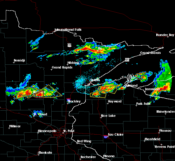 At 712 pm cdt, severe thunderstorms were located along a line extending from 7 miles northeast of cook, to 11 miles northeast of lake vermilion, to near white iron lake, moving northeast at 25 mph (radar indicated). Hazards include 60 mph wind gusts and quarter size hail. Hail damage to vehicles is expected. Expect wind damage to roofs, siding, and trees. At 712 pm cdt, severe thunderstorms were located along a line extending from 7 miles northeast of cook, to 11 miles northeast of lake vermilion, to near white iron lake, moving northeast at 25 mph (radar indicated). Hazards include 60 mph wind gusts and quarter size hail. Hail damage to vehicles is expected. Expect wind damage to roofs, siding, and trees.
|
| 7/26/2019 5:40 PM CDT |
 At 540 pm cdt, a severe thunderstorm was located near white iron lake, or 7 miles southeast of ely, moving east at 50 mph (radar indicated). Hazards include 70 mph wind gusts and ping pong ball size hail. People and animals outdoors will be injured. expect hail damage to roofs, siding, windows, and vehicles. expect considerable tree damage. Wind damage is also likely to mobile homes, roofs, and outbuildings. At 540 pm cdt, a severe thunderstorm was located near white iron lake, or 7 miles southeast of ely, moving east at 50 mph (radar indicated). Hazards include 70 mph wind gusts and ping pong ball size hail. People and animals outdoors will be injured. expect hail damage to roofs, siding, windows, and vehicles. expect considerable tree damage. Wind damage is also likely to mobile homes, roofs, and outbuildings.
|
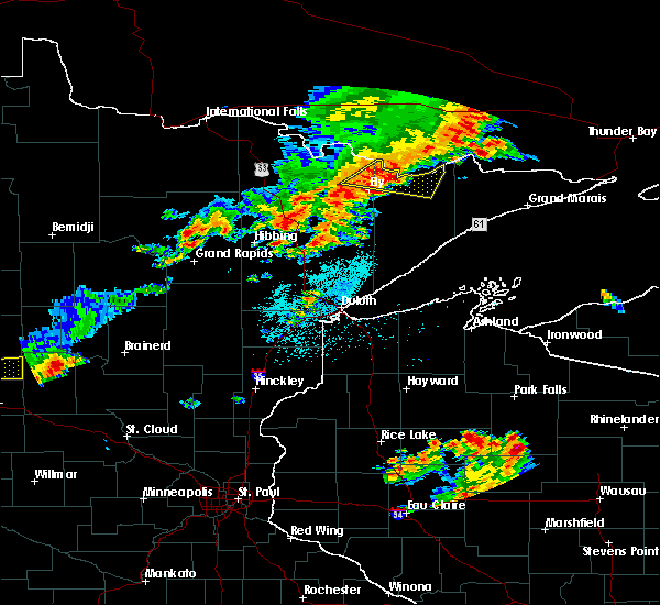
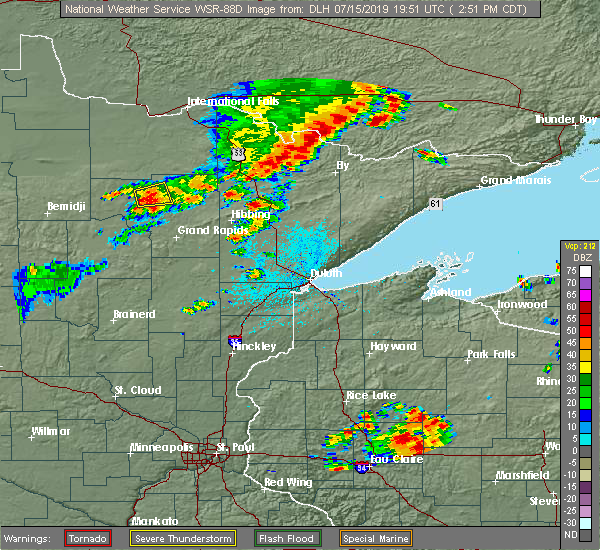
| 7/15/2019 3:33 PM CDT |
 At 333 pm cdt, severe thunderstorms were located along a line extending from 7 miles north of boundary waters canoe area wilderness near trout lake, to boundary waters canoe area wilderness, to ely, moving east at 50 mph (radar indicated). Hazards include 60 mph wind gusts and quarter size hail. Hail damage to vehicles is expected. Expect wind damage to roofs, siding, and trees. At 333 pm cdt, severe thunderstorms were located along a line extending from 7 miles north of boundary waters canoe area wilderness near trout lake, to boundary waters canoe area wilderness, to ely, moving east at 50 mph (radar indicated). Hazards include 60 mph wind gusts and quarter size hail. Hail damage to vehicles is expected. Expect wind damage to roofs, siding, and trees.
|
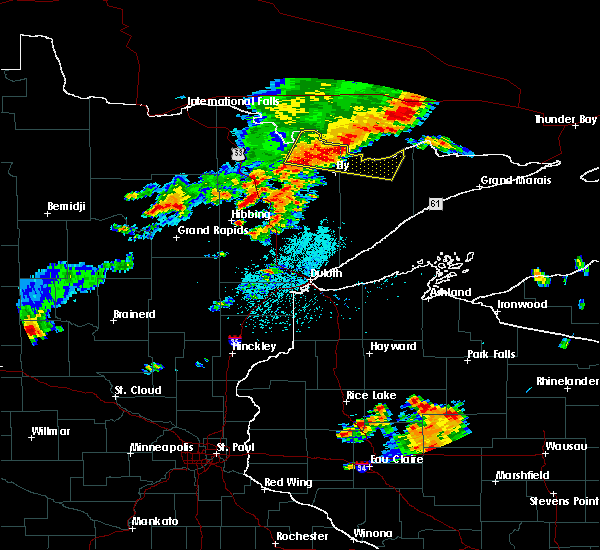
| 7/15/2019 3:25 PM CDT |
 At 310 pm cdt, severe thunderstorms were located along a line extending from 13 miles north of basswood lake, to boundary waters canoe area wilderness, to near burntside lake, moving east at 45 mph (radar indicated). Hazards include 60 mph wind gusts and quarter size hail. Hail damage to vehicles is expected. expect wind damage to roofs, siding, and trees. Locations impacted include, winton, basswood lake, fall lake, boundary waters canoe area wilderness near trout lake, snowbank lake, southern boundary waters canoe area wilderness, burntside lake, ensign lake, kekekabic lake, alice lake, ojibway lake, disappointment lake, cummings lake, high lake, greenstone lake, lake three, hudson lake, thomas lake, knife lake, and crooked lake. At 310 pm cdt, severe thunderstorms were located along a line extending from 13 miles north of basswood lake, to boundary waters canoe area wilderness, to near burntside lake, moving east at 45 mph (radar indicated). Hazards include 60 mph wind gusts and quarter size hail. Hail damage to vehicles is expected. expect wind damage to roofs, siding, and trees. Locations impacted include, winton, basswood lake, fall lake, boundary waters canoe area wilderness near trout lake, snowbank lake, southern boundary waters canoe area wilderness, burntside lake, ensign lake, kekekabic lake, alice lake, ojibway lake, disappointment lake, cummings lake, high lake, greenstone lake, lake three, hudson lake, thomas lake, knife lake, and crooked lake.
|
| 7/15/2019 3:11 PM CDT |
 At 310 pm cdt, severe thunderstorms were located along a line extending from 13 miles north of basswood lake, to boundary waters canoe area wilderness, to near burntside lake, moving east at 45 mph (radar indicated). Hazards include 60 mph wind gusts and quarter size hail. Hail damage to vehicles is expected. expect wind damage to roofs, siding, and trees. Locations impacted include, winton, basswood lake, fall lake, boundary waters canoe area wilderness near trout lake, snowbank lake, southern boundary waters canoe area wilderness, burntside lake, ensign lake, kekekabic lake, alice lake, ojibway lake, disappointment lake, cummings lake, high lake, greenstone lake, lake three, hudson lake, thomas lake, knife lake, and crooked lake. At 310 pm cdt, severe thunderstorms were located along a line extending from 13 miles north of basswood lake, to boundary waters canoe area wilderness, to near burntside lake, moving east at 45 mph (radar indicated). Hazards include 60 mph wind gusts and quarter size hail. Hail damage to vehicles is expected. expect wind damage to roofs, siding, and trees. Locations impacted include, winton, basswood lake, fall lake, boundary waters canoe area wilderness near trout lake, snowbank lake, southern boundary waters canoe area wilderness, burntside lake, ensign lake, kekekabic lake, alice lake, ojibway lake, disappointment lake, cummings lake, high lake, greenstone lake, lake three, hudson lake, thomas lake, knife lake, and crooked lake.
|
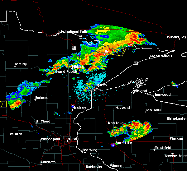
| 7/15/2019 2:54 PM CDT |
 At 254 pm cdt, severe thunderstorms were located along a line extending from boundary waters canoe area wilderness, to 21 miles east of crane lake, to 10 miles northwest of burntside lake, moving east at 45 mph (radar indicated). Hazards include 60 mph wind gusts and quarter size hail. Hail damage to vehicles is expected. Expect wind damage to roofs, siding, and trees. At 254 pm cdt, severe thunderstorms were located along a line extending from boundary waters canoe area wilderness, to 21 miles east of crane lake, to 10 miles northwest of burntside lake, moving east at 45 mph (radar indicated). Hazards include 60 mph wind gusts and quarter size hail. Hail damage to vehicles is expected. Expect wind damage to roofs, siding, and trees.
|
| 7/8/2018 9:56 AM CDT |
 At 956 am cdt, severe thunderstorms were located along a line extending from 10 miles north of basswood lake, to boundary waters canoe area wilderness, to birch lake, moving east at 55 mph (radar indicated). Hazards include 60 mph wind gusts. Expect damage to roofs, siding, and trees. Locations impacted include, ely, winton, basswood lake, fall lake, birch lake, white iron lake, snowbank lake, southern boundary waters canoe area wilderness, forest center, little saganaga lake, saganaga lake, ensign lake, kekekabic lake, bald eagle lake, alice lake, gabbro lake, ojibway lake, farm lake, isabella lake, and disappointment lake. At 956 am cdt, severe thunderstorms were located along a line extending from 10 miles north of basswood lake, to boundary waters canoe area wilderness, to birch lake, moving east at 55 mph (radar indicated). Hazards include 60 mph wind gusts. Expect damage to roofs, siding, and trees. Locations impacted include, ely, winton, basswood lake, fall lake, birch lake, white iron lake, snowbank lake, southern boundary waters canoe area wilderness, forest center, little saganaga lake, saganaga lake, ensign lake, kekekabic lake, bald eagle lake, alice lake, gabbro lake, ojibway lake, farm lake, isabella lake, and disappointment lake.
|
| 7/8/2018 9:42 AM CDT |
 At 942 am cdt, severe thunderstorms were located along a line extending from boundary waters canoe area wilderness, to 7 miles northwest of winton, to near robinson, moving east at 55 mph (radar indicated). Hazards include 60 mph wind gusts. expect damage to roofs, siding, and trees At 942 am cdt, severe thunderstorms were located along a line extending from boundary waters canoe area wilderness, to 7 miles northwest of winton, to near robinson, moving east at 55 mph (radar indicated). Hazards include 60 mph wind gusts. expect damage to roofs, siding, and trees
|
| 7/8/2018 9:39 AM CDT |
 At 923 am cdt, severe thunderstorms were located along a line extending from near crane lake, to 11 miles southeast of buyck, to near lake verm!** ilion, to near tower, moving east at 50 mph (radar indicated). Hazards include 70 mph wind gusts and penny size hail. Expect considerable tree damage. damage is likely to mobile homes, roofs, and outbuildings. Locations impacted include, ely, lake vermilion, tower, winton, crane lake, burntside lake, buyck, white iron lake, robinson, fall lake, birch lake, soudan, bear island lake, bear head lake, cummings lake, high lake, vermillion lake reservation, trout lake, lac la croix, and soudan underground mine state park. At 923 am cdt, severe thunderstorms were located along a line extending from near crane lake, to 11 miles southeast of buyck, to near lake verm!** ilion, to near tower, moving east at 50 mph (radar indicated). Hazards include 70 mph wind gusts and penny size hail. Expect considerable tree damage. damage is likely to mobile homes, roofs, and outbuildings. Locations impacted include, ely, lake vermilion, tower, winton, crane lake, burntside lake, buyck, white iron lake, robinson, fall lake, birch lake, soudan, bear island lake, bear head lake, cummings lake, high lake, vermillion lake reservation, trout lake, lac la croix, and soudan underground mine state park.
|
| 7/8/2018 9:23 AM CDT |
 At 923 am cdt, severe thunderstorms were located along a line extending from near crane lake, to 11 miles southeast of buyck, to near lake verm!** ilion, to near tower, moving east at 50 mph (radar indicated). Hazards include 70 mph wind gusts and penny size hail. Expect considerable tree damage. damage is likely to mobile homes, roofs, and outbuildings. Locations impacted include, ely, lake vermilion, tower, winton, crane lake, burntside lake, buyck, white iron lake, robinson, fall lake, birch lake, soudan, bear island lake, bear head lake, cummings lake, high lake, vermillion lake reservation, trout lake, lac la croix, and soudan underground mine state park. At 923 am cdt, severe thunderstorms were located along a line extending from near crane lake, to 11 miles southeast of buyck, to near lake verm!** ilion, to near tower, moving east at 50 mph (radar indicated). Hazards include 70 mph wind gusts and penny size hail. Expect considerable tree damage. damage is likely to mobile homes, roofs, and outbuildings. Locations impacted include, ely, lake vermilion, tower, winton, crane lake, burntside lake, buyck, white iron lake, robinson, fall lake, birch lake, soudan, bear island lake, bear head lake, cummings lake, high lake, vermillion lake reservation, trout lake, lac la croix, and soudan underground mine state park.
|
| 7/8/2018 9:05 AM CDT |
 At 905 am cdt, severe thunderstorms were located along a line extending from 8 miles northeast of ash lake, to near orr, to near cook, moving east at 55 mph (radar indicated). Hazards include 70 mph wind gusts and penny size hail. Expect considerable tree damage. damage is likely to mobile homes, roofs, and outbuildings. Locations impacted include, ely, lake vermilion, babbitt, cook, tower, orr, meadow brook, winton, ash lake, crane lake, gheen, burntside lake, buyck, white iron lake, robinson, pelican lake, cusson, fall lake, birch lake, and voyageurs national park. At 905 am cdt, severe thunderstorms were located along a line extending from 8 miles northeast of ash lake, to near orr, to near cook, moving east at 55 mph (radar indicated). Hazards include 70 mph wind gusts and penny size hail. Expect considerable tree damage. damage is likely to mobile homes, roofs, and outbuildings. Locations impacted include, ely, lake vermilion, babbitt, cook, tower, orr, meadow brook, winton, ash lake, crane lake, gheen, burntside lake, buyck, white iron lake, robinson, pelican lake, cusson, fall lake, birch lake, and voyageurs national park.
|
| 7/8/2018 8:56 AM CDT |
 At 856 am cdt, severe thunderstorms were located along a line extending from 6 miles north of ash lake, to pelican lake, to near meadow brook, to 6 miles east of togo, moving east at 55 mph (radar indicated). Hazards include 70 mph wind gusts and penny size hail. Expect considerable tree damage. Damage is likely to mobile homes, roofs, and outbuildings. At 856 am cdt, severe thunderstorms were located along a line extending from 6 miles north of ash lake, to pelican lake, to near meadow brook, to 6 miles east of togo, moving east at 55 mph (radar indicated). Hazards include 70 mph wind gusts and penny size hail. Expect considerable tree damage. Damage is likely to mobile homes, roofs, and outbuildings.
|
| 7/8/2018 7:55 AM CDT |
 At 754 am cdt, severe thunderstorms were located along a line extending from near crane lake, to 16 miles east of buyck, to robinson, moving east at 45 mph (radar indicated). Hazards include 60 mph wind gusts and penny size hail. Expect damage to roofs, siding, and trees. Locations impacted include, ely, winton, basswood lake, fall lake, burntside lake, white iron lake, robinson, snowbank lake, boundary waters canoe area wilderness near trout lake, western boundary waters canoe area wilderness, birch lake, ojibway lake, farm lake, cummings lake, high lake, greenstone lake, lake three, lac la croix, lake agnes, and crooked lake. At 754 am cdt, severe thunderstorms were located along a line extending from near crane lake, to 16 miles east of buyck, to robinson, moving east at 45 mph (radar indicated). Hazards include 60 mph wind gusts and penny size hail. Expect damage to roofs, siding, and trees. Locations impacted include, ely, winton, basswood lake, fall lake, burntside lake, white iron lake, robinson, snowbank lake, boundary waters canoe area wilderness near trout lake, western boundary waters canoe area wilderness, birch lake, ojibway lake, farm lake, cummings lake, high lake, greenstone lake, lake three, lac la croix, lake agnes, and crooked lake.
|
| 7/8/2018 7:35 AM CDT |
 At 735 am cdt, severe thunderstorms were located along a line extending from 10 miles south of voyageurs national park, to near buyck, to near lake vermilion, moving east at 45 mph (radar indicated). Hazards include 70 mph wind gusts and quarter size hail. Hail damage to vehicles is expected. expect considerable tree damage. Wind damage is also likely to mobile homes, roofs, and outbuildings. At 735 am cdt, severe thunderstorms were located along a line extending from 10 miles south of voyageurs national park, to near buyck, to near lake vermilion, moving east at 45 mph (radar indicated). Hazards include 70 mph wind gusts and quarter size hail. Hail damage to vehicles is expected. expect considerable tree damage. Wind damage is also likely to mobile homes, roofs, and outbuildings.
|
| 6/29/2018 7:52 AM CDT |
 At 750 am cdt, severe thunderstorms were located along a line extending from the far western areas of the boundary waters canoe area wilderness, to near white iron lake, to 6 miles southeast of birch lake, to 6 miles south of babbitt, moving east at 75 mph. these are very dangerous storms (trained weather spotters reported 20 inch trees broken in babbitt with these storms). Hazards include 80 mph wind gusts and half dollar size hail. Flying debris will be dangerous to those caught without shelter. mobile homes will be heavily damaged. expect considerable damage to roofs, windows, and vehicles. Extensive tree damage and power outages are likely. At 750 am cdt, severe thunderstorms were located along a line extending from the far western areas of the boundary waters canoe area wilderness, to near white iron lake, to 6 miles southeast of birch lake, to 6 miles south of babbitt, moving east at 75 mph. these are very dangerous storms (trained weather spotters reported 20 inch trees broken in babbitt with these storms). Hazards include 80 mph wind gusts and half dollar size hail. Flying debris will be dangerous to those caught without shelter. mobile homes will be heavily damaged. expect considerable damage to roofs, windows, and vehicles. Extensive tree damage and power outages are likely.
|
| 6/29/2018 7:45 AM CDT |
 At 743 am cdt, severe thunderstorms were located along a line extending from boundary waters canoe area wilderness, to fall lake, to near birch lake, to 7 miles south of babbitt, moving east at 75 mph. these are very dangerous storms (radar indicated. trained spotters reported 20 inch diameter trees broken in babbitt at 740 am). Hazards include 80 mph wind gusts and quarter size hail. Flying debris will be dangerous to those caught without shelter. mobile homes will be heavily damaged. expect considerable damage to roofs, windows, and vehicles. extensive tree damage and power outages are likely. Locations impacted include, ely, lake vermilion, virginia, mountain iron, hoyt lakes, aurora, babbitt, biwabik, embarrass, clear lake, tower, winton, basswood lake, boundary waters canoe area wilderness near trout lake, birch lake, burntside lake, white iron lake, saganaga lake, dumbbell lake, and sea gull lake. At 743 am cdt, severe thunderstorms were located along a line extending from boundary waters canoe area wilderness, to fall lake, to near birch lake, to 7 miles south of babbitt, moving east at 75 mph. these are very dangerous storms (radar indicated. trained spotters reported 20 inch diameter trees broken in babbitt at 740 am). Hazards include 80 mph wind gusts and quarter size hail. Flying debris will be dangerous to those caught without shelter. mobile homes will be heavily damaged. expect considerable damage to roofs, windows, and vehicles. extensive tree damage and power outages are likely. Locations impacted include, ely, lake vermilion, virginia, mountain iron, hoyt lakes, aurora, babbitt, biwabik, embarrass, clear lake, tower, winton, basswood lake, boundary waters canoe area wilderness near trout lake, birch lake, burntside lake, white iron lake, saganaga lake, dumbbell lake, and sea gull lake.
|
| 6/29/2018 7:24 AM CDT |
 At 722 am cdt, severe thunderstorms were located along a line extending from near crane lake, to 10 miles southeast of buyck, to near tower, to mountain iron, moving east at 70 mph. there were severe thunderstorms ahead of the main line located near embarrass and moving northeast at 45 mph (radar indicated. trained spotters reported quarter-size hail near mountain iron and a 58 mph wind gusts was reported at the cook airport with these storms). Hazards include 70 mph wind gusts and quarter size hail. Hail damage to vehicles is expected. expect considerable tree damage. wind damage is also likely to mobile homes, roofs, and outbuildings. Locations impacted include, hibbing, ely, lake vermilion, virginia, mountain iron, hoyt lakes, aurora, babbitt, biwabik, embarrass, cook, clear lake, tower, winton, crane lake, basswood lake, boundary waters canoe area wilderness near trout lake, birch lake, burntside lake, and buyck. At 722 am cdt, severe thunderstorms were located along a line extending from near crane lake, to 10 miles southeast of buyck, to near tower, to mountain iron, moving east at 70 mph. there were severe thunderstorms ahead of the main line located near embarrass and moving northeast at 45 mph (radar indicated. trained spotters reported quarter-size hail near mountain iron and a 58 mph wind gusts was reported at the cook airport with these storms). Hazards include 70 mph wind gusts and quarter size hail. Hail damage to vehicles is expected. expect considerable tree damage. wind damage is also likely to mobile homes, roofs, and outbuildings. Locations impacted include, hibbing, ely, lake vermilion, virginia, mountain iron, hoyt lakes, aurora, babbitt, biwabik, embarrass, cook, clear lake, tower, winton, crane lake, basswood lake, boundary waters canoe area wilderness near trout lake, birch lake, burntside lake, and buyck.
|
| 6/29/2018 7:10 AM CDT |
 At 708 am cdt, severe thunderstorms were located along a line extending from 7 miles northeast of ash lake, to 7 miles east of gheen, to near cook, to 6 miles north of chisholm, moving east at 75 mph. there were also severe thunderstorms ahead of the main line located near cook and virginia moving northeast at 45 mph. these are very dangerous storms (radar indicated). Hazards include 80 mph wind gusts and quarter size hail. Flying debris will be dangerous to those caught without shelter. mobile homes will be heavily damaged. expect considerable damage to roofs, windows, and vehicles. Extensive tree damage and power outages are likely. At 708 am cdt, severe thunderstorms were located along a line extending from 7 miles northeast of ash lake, to 7 miles east of gheen, to near cook, to 6 miles north of chisholm, moving east at 75 mph. there were also severe thunderstorms ahead of the main line located near cook and virginia moving northeast at 45 mph. these are very dangerous storms (radar indicated). Hazards include 80 mph wind gusts and quarter size hail. Flying debris will be dangerous to those caught without shelter. mobile homes will be heavily damaged. expect considerable damage to roofs, windows, and vehicles. Extensive tree damage and power outages are likely.
|
| 5/29/2018 8:06 PM CDT |
 At 804 pm cdt, severe thunderstorms were located along a line extending from 8 miles northwest of crane lake, to boundary waters canoe area wilderness, to near finland, moving northeast at 55 mph (public. this storm has a history of causing tree damage). Hazards include 60 mph wind gusts. Expect damage to roofs, siding, and trees. Locations impacted include, gunflint lake, clear lake, winton, basswood lake, eagle mountain, white iron lake, saganaga lake, finland, dumbbell lake, sea gull lake, fall lake, boundary waters canoe area wilderness north of the gunflint trail, snowbank lake, boundary waters canoe area wilderness, forest center, little saganaga lake, alpine lake, isabella, birch lake, and pine lake. At 804 pm cdt, severe thunderstorms were located along a line extending from 8 miles northwest of crane lake, to boundary waters canoe area wilderness, to near finland, moving northeast at 55 mph (public. this storm has a history of causing tree damage). Hazards include 60 mph wind gusts. Expect damage to roofs, siding, and trees. Locations impacted include, gunflint lake, clear lake, winton, basswood lake, eagle mountain, white iron lake, saganaga lake, finland, dumbbell lake, sea gull lake, fall lake, boundary waters canoe area wilderness north of the gunflint trail, snowbank lake, boundary waters canoe area wilderness, forest center, little saganaga lake, alpine lake, isabella, birch lake, and pine lake.
|
| 5/29/2018 7:46 PM CDT |
 At 745 pm cdt, severe thunderstorms were located along a line extending from 8 miles northwest of crane lake, into the boundary waters canoe area wilderness, to near finland, moving northeast at 55 mph (radar indicated). Hazards include 60 mph wind gusts. Expect damage to roofs, siding, and trees. Locations impacted include, ely, gunflint lake, clear lake, winton, crane lake, basswood lake, eagle mountain, boundary waters canoe area wilderness near trout lake, white iron lake, saganaga lake, finland, dumbbell lake, sea gull lake, fall lake, boundary waters canoe area wilderness north of the gunflint trail, snowbank lake, boundary waters canoe area wilderness, forest center, little saganaga lake, and alpine lake. At 745 pm cdt, severe thunderstorms were located along a line extending from 8 miles northwest of crane lake, into the boundary waters canoe area wilderness, to near finland, moving northeast at 55 mph (radar indicated). Hazards include 60 mph wind gusts. Expect damage to roofs, siding, and trees. Locations impacted include, ely, gunflint lake, clear lake, winton, crane lake, basswood lake, eagle mountain, boundary waters canoe area wilderness near trout lake, white iron lake, saganaga lake, finland, dumbbell lake, sea gull lake, fall lake, boundary waters canoe area wilderness north of the gunflint trail, snowbank lake, boundary waters canoe area wilderness, forest center, little saganaga lake, and alpine lake.
|
| 5/29/2018 7:28 PM CDT |
 At 727 pm cdt, severe thunderstorms were located along a line extending from near ash lake, to near ely, to 9 miles west of beaver bay, moving northeast at 55 mph (radar indicated). Hazards include 60 mph wind gusts. Expect damage to roofs, siding, and trees. Travelers in the bwca should seek shelter. At 727 pm cdt, severe thunderstorms were located along a line extending from near ash lake, to near ely, to 9 miles west of beaver bay, moving northeast at 55 mph (radar indicated). Hazards include 60 mph wind gusts. Expect damage to roofs, siding, and trees. Travelers in the bwca should seek shelter.
|
| 7/6/2017 8:00 AM CDT |
 At 800 am cdt, a severe thunderstorm was located over western boundary waters canoe area wilderness, or 13 miles north of ely, moving southeast at 25 mph (radar indicated). Hazards include 60 mph wind gusts and quarter size hail. Hail damage to vehicles is expected. Expect wind damage to roofs, siding, and trees. At 800 am cdt, a severe thunderstorm was located over western boundary waters canoe area wilderness, or 13 miles north of ely, moving southeast at 25 mph (radar indicated). Hazards include 60 mph wind gusts and quarter size hail. Hail damage to vehicles is expected. Expect wind damage to roofs, siding, and trees.
|
| 7/21/2016 3:02 AM CDT |
 At 302 am cdt, severe thunderstorms were located along a line extending from 23 miles north of basswood lake, to boundary waters canoe area wilderness, moving east at 50 mph (radar indicated). Hazards include 60 mph wind gusts and quarter size hail. Hail damage to vehicles is expected. expect wind damage to roofs, siding, and trees. these severe storms will be near, forest center around 315 am cdt. Other locations impacted by these severe thunderstorms include hudson lake, disappointment lake, greenstone lake, ojibway lake, kekekabic lake, alice lake, ensign lake, lake three, farm lake and bald eagle lake. At 302 am cdt, severe thunderstorms were located along a line extending from 23 miles north of basswood lake, to boundary waters canoe area wilderness, moving east at 50 mph (radar indicated). Hazards include 60 mph wind gusts and quarter size hail. Hail damage to vehicles is expected. expect wind damage to roofs, siding, and trees. these severe storms will be near, forest center around 315 am cdt. Other locations impacted by these severe thunderstorms include hudson lake, disappointment lake, greenstone lake, ojibway lake, kekekabic lake, alice lake, ensign lake, lake three, farm lake and bald eagle lake.
|
| 7/21/2016 2:49 AM CDT |
 At 248 am cdt, severe thunderstorms were located along a line extending from 22 miles north of basswood lake, to near birch lake, moving east at 50 mph (radar indicated). Hazards include 60 mph wind gusts and quarter size hail. Hail damage to vehicles is expected. expect wind damage to roofs, siding, and trees. these severe storms will be near, forest center around 315 am cdt. Other locations impacted by these severe thunderstorms include hudson lake, knife lake, alice lake, kekekabic lake, ensign lake, lake three, shagawa lake, isabella lake, high lake and perent lake. At 248 am cdt, severe thunderstorms were located along a line extending from 22 miles north of basswood lake, to near birch lake, moving east at 50 mph (radar indicated). Hazards include 60 mph wind gusts and quarter size hail. Hail damage to vehicles is expected. expect wind damage to roofs, siding, and trees. these severe storms will be near, forest center around 315 am cdt. Other locations impacted by these severe thunderstorms include hudson lake, knife lake, alice lake, kekekabic lake, ensign lake, lake three, shagawa lake, isabella lake, high lake and perent lake.
|
| 7/21/2016 2:38 AM CDT |
 At 237 am cdt, severe thunderstorms were located along a line extending from 25 miles northwest of basswood lake, to near robinson, moving east at 50 mph (radar indicated). Hazards include 60 mph wind gusts and quarter size hail. Hail damage to vehicles is expected. expect wind damage to roofs, siding, and trees. these severe storms will be near, winton around 245 am cdt. white iron lake around 250 am cdt. birch lake around 255 am cdt. forest center around 315 am cdt. Other locations impacted by these severe thunderstorms include hudson lake, knife lake, kekekabic lake, alice lake, ensign lake, lake three, shagawa lake, echo lake, isabella lake and high lake. At 237 am cdt, severe thunderstorms were located along a line extending from 25 miles northwest of basswood lake, to near robinson, moving east at 50 mph (radar indicated). Hazards include 60 mph wind gusts and quarter size hail. Hail damage to vehicles is expected. expect wind damage to roofs, siding, and trees. these severe storms will be near, winton around 245 am cdt. white iron lake around 250 am cdt. birch lake around 255 am cdt. forest center around 315 am cdt. Other locations impacted by these severe thunderstorms include hudson lake, knife lake, kekekabic lake, alice lake, ensign lake, lake three, shagawa lake, echo lake, isabella lake and high lake.
|
| 7/21/2016 2:30 AM CDT |
 At 230 am cdt, severe thunderstorms were located along a line extending from 27 miles northeast of crane lake, to robinson, moving east at 50 mph (radar indicated). Hazards include 60 mph wind gusts and quarter size hail. Hail damage to vehicles is expected. expect wind damage to roofs, siding, and trees. these severe storms will be near, ely around 240 am cdt. winton and white iron lake around 245 am cdt. fall lake around 250 am cdt. birch lake around 255 am cdt. snowbank lake around 305 am cdt. forest center around 310 am cdt. Other locations impacted by these severe thunderstorms include hudson lake, knife lake, kekekabic lake, alice lake, ensign lake, lake three, shagawa lake, echo lake, isabella lake and high lake. At 230 am cdt, severe thunderstorms were located along a line extending from 27 miles northeast of crane lake, to robinson, moving east at 50 mph (radar indicated). Hazards include 60 mph wind gusts and quarter size hail. Hail damage to vehicles is expected. expect wind damage to roofs, siding, and trees. these severe storms will be near, ely around 240 am cdt. winton and white iron lake around 245 am cdt. fall lake around 250 am cdt. birch lake around 255 am cdt. snowbank lake around 305 am cdt. forest center around 310 am cdt. Other locations impacted by these severe thunderstorms include hudson lake, knife lake, kekekabic lake, alice lake, ensign lake, lake three, shagawa lake, echo lake, isabella lake and high lake.
|
| 7/21/2016 2:17 AM CDT |
 At 217 am cdt, severe thunderstorms were located along a line extending from 18 miles northeast of crane lake, to near tower, moving east at 50 mph (radar indicated). Hazards include 60 mph wind gusts and quarter size hail. Hail damage to vehicles is expected. expect wind damage to roofs, siding, and trees. severe thunderstorms will be near, boundary waters canoe area wilderness around 220 am cdt. burntside lake around 235 am cdt. ely around 240 am cdt. winton, white iron lake and fall lake around 245 am cdt. birch lake around 255 am cdt. snowbank lake around 305 am cdt. forest center around 310 am cdt. Other locations impacted by these severe thunderstorms include hudson lake, knife lake, kekekabic lake, alice lake, ensign lake, lake three, shagawa lake, echo lake, isabella lake and high lake. At 217 am cdt, severe thunderstorms were located along a line extending from 18 miles northeast of crane lake, to near tower, moving east at 50 mph (radar indicated). Hazards include 60 mph wind gusts and quarter size hail. Hail damage to vehicles is expected. expect wind damage to roofs, siding, and trees. severe thunderstorms will be near, boundary waters canoe area wilderness around 220 am cdt. burntside lake around 235 am cdt. ely around 240 am cdt. winton, white iron lake and fall lake around 245 am cdt. birch lake around 255 am cdt. snowbank lake around 305 am cdt. forest center around 310 am cdt. Other locations impacted by these severe thunderstorms include hudson lake, knife lake, kekekabic lake, alice lake, ensign lake, lake three, shagawa lake, echo lake, isabella lake and high lake.
|
| 6/25/2016 5:56 PM CDT |
 The severe thunderstorm warning for northeastern st. louis and northwestern lake counties will expire at 600 pm cdt, the storms which prompted the warning have moved out of the area. therefore the warning will be allowed to expire. however small hail and gusty winds are still possible with these thunderstorms. a tornado watch remains in effect until 900 pm cdt for northeastern minnesota. The severe thunderstorm warning for northeastern st. louis and northwestern lake counties will expire at 600 pm cdt, the storms which prompted the warning have moved out of the area. therefore the warning will be allowed to expire. however small hail and gusty winds are still possible with these thunderstorms. a tornado watch remains in effect until 900 pm cdt for northeastern minnesota.
|
| 6/25/2016 5:37 PM CDT |
 At 536 pm cdt, severe thunderstorms were located along a line extending from 8 miles northwest of crane lake to boundary waters canoe area wilderness, moving northeast at 40 mph (radar indicated). Hazards include 60 mph wind gusts and quarter size hail. Hail damage to vehicles is expected. expect wind damage to roofs, siding, and trees. these severe storms will be near, basswood lake around 545 pm cdt. other locations impacted by these severe thunderstorms include crooked lake, loon lake, farm lake, big moose lake, echo lake, lake agnes, high lake, sand point lake, fourtown lake and lac la croix. A tornado watch remains in effect until 900 pm cdt for northeastern minnesota. At 536 pm cdt, severe thunderstorms were located along a line extending from 8 miles northwest of crane lake to boundary waters canoe area wilderness, moving northeast at 40 mph (radar indicated). Hazards include 60 mph wind gusts and quarter size hail. Hail damage to vehicles is expected. expect wind damage to roofs, siding, and trees. these severe storms will be near, basswood lake around 545 pm cdt. other locations impacted by these severe thunderstorms include crooked lake, loon lake, farm lake, big moose lake, echo lake, lake agnes, high lake, sand point lake, fourtown lake and lac la croix. A tornado watch remains in effect until 900 pm cdt for northeastern minnesota.
|
| 6/25/2016 5:27 PM CDT |
 At 527 pm cdt, severe thunderstorms were located along a line extending from 8 miles west of crane lake to fall lake, moving northeast at 40 mph (radar indicated). Hazards include 60 mph wind gusts and quarter size hail. Hail damage to vehicles is expected. expect wind damage to roofs, siding, and trees. these severe storms will be near, fall lake around 535 pm cdt. basswood lake around 545 pm cdt. other locations impacted by these severe thunderstorms include big moose lake, sand point lake, cummings lake, fourtown lake, black duck lake, lac la croix, crooked lake, loon lake, farm lake and shagawa lake. A tornado watch remains in effect until 900 pm cdt for northeastern minnesota. At 527 pm cdt, severe thunderstorms were located along a line extending from 8 miles west of crane lake to fall lake, moving northeast at 40 mph (radar indicated). Hazards include 60 mph wind gusts and quarter size hail. Hail damage to vehicles is expected. expect wind damage to roofs, siding, and trees. these severe storms will be near, fall lake around 535 pm cdt. basswood lake around 545 pm cdt. other locations impacted by these severe thunderstorms include big moose lake, sand point lake, cummings lake, fourtown lake, black duck lake, lac la croix, crooked lake, loon lake, farm lake and shagawa lake. A tornado watch remains in effect until 900 pm cdt for northeastern minnesota.
|
| 6/25/2016 5:12 PM CDT |
 At 511 pm cdt, severe thunderstorms were located along a line extending from near cusson to near white iron lake, moving northeast at 40 mph (radar indicated). Hazards include 60 mph wind gusts and quarter size hail. Hail damage to vehicles is expected. expect wind damage to roofs, siding, and trees. severe thunderstorms will be near, ely and burntside lake around 520 pm cdt. winton, white iron lake and birch lake around 525 pm cdt. crane lake and fall lake around 530 pm cdt. basswood lake around 540 pm cdt. other locations impacted by these severe thunderstorms include big moose lake, bear island lake, johnson lake, sand point lake, cummings lake, fourtown lake, bear head lake state park, black duck lake, lac la croix and crooked lake. A tornado watch remains in effect until 900 pm cdt for northeastern minnesota. At 511 pm cdt, severe thunderstorms were located along a line extending from near cusson to near white iron lake, moving northeast at 40 mph (radar indicated). Hazards include 60 mph wind gusts and quarter size hail. Hail damage to vehicles is expected. expect wind damage to roofs, siding, and trees. severe thunderstorms will be near, ely and burntside lake around 520 pm cdt. winton, white iron lake and birch lake around 525 pm cdt. crane lake and fall lake around 530 pm cdt. basswood lake around 540 pm cdt. other locations impacted by these severe thunderstorms include big moose lake, bear island lake, johnson lake, sand point lake, cummings lake, fourtown lake, bear head lake state park, black duck lake, lac la croix and crooked lake. A tornado watch remains in effect until 900 pm cdt for northeastern minnesota.
|
| 6/25/2016 5:04 PM CDT |
 At 504 pm cdt, severe thunderstorms were located along a line extending from orr to near robinson, moving northeast at 55 mph (radar indicated). Hazards include 60 mph wind gusts and quarter size hail. Hail damage to vehicles is expected. expect wind damage to roofs, siding, and trees. these severe storms will be near, robinson around 510 pm cdt. ely, winton, burntside lake and fall lake around 515 pm cdt. other locations impacted by these severe thunderstorms include big moose lake, angora, celina, bear island lake, wynne lake, cummings lake, soudan underground mine state park, bear head lake state park, greaney and black duck lake. A tornado watch remains in effect until 900 pm cdt for northeastern minnesota. At 504 pm cdt, severe thunderstorms were located along a line extending from orr to near robinson, moving northeast at 55 mph (radar indicated). Hazards include 60 mph wind gusts and quarter size hail. Hail damage to vehicles is expected. expect wind damage to roofs, siding, and trees. these severe storms will be near, robinson around 510 pm cdt. ely, winton, burntside lake and fall lake around 515 pm cdt. other locations impacted by these severe thunderstorms include big moose lake, angora, celina, bear island lake, wynne lake, cummings lake, soudan underground mine state park, bear head lake state park, greaney and black duck lake. A tornado watch remains in effect until 900 pm cdt for northeastern minnesota.
|
| 6/25/2016 4:55 PM CDT |
 At 455 pm cdt, severe thunderstorms were located along a line extending from near pelican lake to 7 miles south of robinson, moving northeast at 55 mph (radar indicated). Hazards include 60 mph wind gusts and quarter size hail. Hail damage to vehicles is expected. expect wind damage to roofs, siding, and trees. these severe storms will be near, robinson around 505 pm cdt. ash lake and burntside lake around 510 pm cdt. ely, winton and fall lake around 515 pm cdt. other locations impacted by these severe thunderstorms include side lake, angora, celina, bear island lake, perch lake, greaney, black duck lake, shagawa lake, echo lake and soudan. A tornado watch remains in effect until 900 pm cdt for northeastern minnesota. At 455 pm cdt, severe thunderstorms were located along a line extending from near pelican lake to 7 miles south of robinson, moving northeast at 55 mph (radar indicated). Hazards include 60 mph wind gusts and quarter size hail. Hail damage to vehicles is expected. expect wind damage to roofs, siding, and trees. these severe storms will be near, robinson around 505 pm cdt. ash lake and burntside lake around 510 pm cdt. ely, winton and fall lake around 515 pm cdt. other locations impacted by these severe thunderstorms include side lake, angora, celina, bear island lake, perch lake, greaney, black duck lake, shagawa lake, echo lake and soudan. A tornado watch remains in effect until 900 pm cdt for northeastern minnesota.
|
| 6/25/2016 4:45 PM CDT |
 At 444 pm cdt, severe thunderstorms were located along a line extending from near meadow brook to embarrass, moving northeast at 55 mph (radar indicated). Hazards include 60 mph wind gusts and quarter size hail. Hail damage to vehicles is expected. expect wind damage to roofs, siding, and trees. these severe storms will be near, embarrass around 450 pm cdt. tower around 455 pm cdt. orr around 500 pm cdt. cusson, pelican lake and robinson around 505 pm cdt. ely, ash lake and burntside lake around 510 pm cdt. winton and fall lake around 515 pm cdt. other locations impacted by these severe thunderstorms include side lake, angora, celina, bear island lake, perch lake, greaney, black duck lake, shagawa lake, echo lake and soudan. A tornado watch remains in effect until 900 pm cdt for northeastern minnesota. At 444 pm cdt, severe thunderstorms were located along a line extending from near meadow brook to embarrass, moving northeast at 55 mph (radar indicated). Hazards include 60 mph wind gusts and quarter size hail. Hail damage to vehicles is expected. expect wind damage to roofs, siding, and trees. these severe storms will be near, embarrass around 450 pm cdt. tower around 455 pm cdt. orr around 500 pm cdt. cusson, pelican lake and robinson around 505 pm cdt. ely, ash lake and burntside lake around 510 pm cdt. winton and fall lake around 515 pm cdt. other locations impacted by these severe thunderstorms include side lake, angora, celina, bear island lake, perch lake, greaney, black duck lake, shagawa lake, echo lake and soudan. A tornado watch remains in effect until 900 pm cdt for northeastern minnesota.
|
| 6/25/2016 4:32 PM CDT |
 At 432 pm cdt, severe thunderstorms were located along a line extending from near togo to biwabik, moving northeast at 55 mph (radar indicated). Hazards include 60 mph wind gusts and quarter size hail. Hail damage to vehicles is expected. expect wind damage to roofs, siding, and trees. severe thunderstorms will be near, gilbert, aurora and biwabik around 435 pm cdt. hoyt lakes, embarrass and meadow brook around 445 pm cdt. tower around 450 pm cdt. gheen around 455 pm cdt. orr, robinson and pelican lake around 500 pm cdt. cusson around 505 pm cdt. ely, ash lake and burntside lake around 510 pm cdt. winton, fall lake and buyck around 515 pm cdt. other locations impacted by these severe thunderstorms include side lake, angora, celina, bear island lake, perch lake, greaney, black duck lake, shagawa lake, echo lake and soudan. A tornado watch remains in effect until 900 pm cdt for northeastern minnesota. At 432 pm cdt, severe thunderstorms were located along a line extending from near togo to biwabik, moving northeast at 55 mph (radar indicated). Hazards include 60 mph wind gusts and quarter size hail. Hail damage to vehicles is expected. expect wind damage to roofs, siding, and trees. severe thunderstorms will be near, gilbert, aurora and biwabik around 435 pm cdt. hoyt lakes, embarrass and meadow brook around 445 pm cdt. tower around 450 pm cdt. gheen around 455 pm cdt. orr, robinson and pelican lake around 500 pm cdt. cusson around 505 pm cdt. ely, ash lake and burntside lake around 510 pm cdt. winton, fall lake and buyck around 515 pm cdt. other locations impacted by these severe thunderstorms include side lake, angora, celina, bear island lake, perch lake, greaney, black duck lake, shagawa lake, echo lake and soudan. A tornado watch remains in effect until 900 pm cdt for northeastern minnesota.
|
| 6/25/2016 9:07 AM CDT |
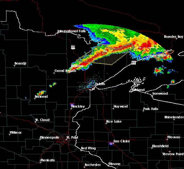 At 905 am cdt, severe thunderstorms were located along a line extending from near lake saganaga in the boundary waters canoe area wilderness to near white iron lake to near embarrass, moving east at 35 mph (radar indicated). Hazards include 60 mph wind gusts and penny size hail. Expect damage to roofs. siding. and trees. Locations impacted include, ely, saganaga lake, gunflint lake, lake vermilion, hoyt lakes, babbitt, embarrass, tower, winton, fall lake, burntside lake, basswood lake, robinson, snowbank lake, alpine lake, forest center, white iron lake, little saganaga lake, the eastern boundary waters canoe area wilderness and sea gull lake. At 905 am cdt, severe thunderstorms were located along a line extending from near lake saganaga in the boundary waters canoe area wilderness to near white iron lake to near embarrass, moving east at 35 mph (radar indicated). Hazards include 60 mph wind gusts and penny size hail. Expect damage to roofs. siding. and trees. Locations impacted include, ely, saganaga lake, gunflint lake, lake vermilion, hoyt lakes, babbitt, embarrass, tower, winton, fall lake, burntside lake, basswood lake, robinson, snowbank lake, alpine lake, forest center, white iron lake, little saganaga lake, the eastern boundary waters canoe area wilderness and sea gull lake.
|
| 6/25/2016 8:45 AM CDT |
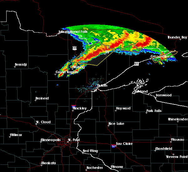 At 844 am cdt, severe thunderstorms were located along a line extending from near crooked lake in the boundary waters canoe area wilderness to near burntside lake to 8 miles north of biwabik, moving east at 35 mph (radar indicated). Hazards include 60 mph wind gusts and penny size hail. Expect damage to roofs. siding. And trees. At 844 am cdt, severe thunderstorms were located along a line extending from near crooked lake in the boundary waters canoe area wilderness to near burntside lake to 8 miles north of biwabik, moving east at 35 mph (radar indicated). Hazards include 60 mph wind gusts and penny size hail. Expect damage to roofs. siding. And trees.
|
| 6/25/2016 8:30 AM CDT |
 At 830 am cdt, severe thunderstorms were located along a line extending from just east of lac la croix in the boundary waters canoe area wilderness to 9 miles northeast of lake vermilion to 9 miles north of mountain iron, moving southeast at 35 mph (radar indicated). Hazards include 60 mph wind gusts. Expect damage to roofs. siding. and trees. Locations impacted include, ely, lake vermilion, mountain iron, hoyt lakes, babbitt, biwabik, embarrass, cook, tower, winton, white iron lake, fall lake, burntside lake, basswood lake, robinson, birch lake, boundary waters canoe area wilderness and bear island lake. At 830 am cdt, severe thunderstorms were located along a line extending from just east of lac la croix in the boundary waters canoe area wilderness to 9 miles northeast of lake vermilion to 9 miles north of mountain iron, moving southeast at 35 mph (radar indicated). Hazards include 60 mph wind gusts. Expect damage to roofs. siding. and trees. Locations impacted include, ely, lake vermilion, mountain iron, hoyt lakes, babbitt, biwabik, embarrass, cook, tower, winton, white iron lake, fall lake, burntside lake, basswood lake, robinson, birch lake, boundary waters canoe area wilderness and bear island lake.
|
| 6/25/2016 8:06 AM CDT |
 At 805 am cdt, severe thunderstorms were located along a line extending from 28 miles northwest of basswood lake to cook, moving southeast at 35 mph (radar indicated). Hazards include 60 mph wind gusts and nickel size hail. Expect roof and tree damage. severe thunderstorms will be near, mountain iron around 825 am cdt. biwabik around 845 am cdt. other locations impacted by these severe thunderstorms include big moose lake, angora, bear island lake, wynne lake, cummings lake, fourtown lake, soudan underground mine state park, bear head lake state park, ridge and crooked lake. Large hail. At 805 am cdt, severe thunderstorms were located along a line extending from 28 miles northwest of basswood lake to cook, moving southeast at 35 mph (radar indicated). Hazards include 60 mph wind gusts and nickel size hail. Expect roof and tree damage. severe thunderstorms will be near, mountain iron around 825 am cdt. biwabik around 845 am cdt. other locations impacted by these severe thunderstorms include big moose lake, angora, bear island lake, wynne lake, cummings lake, fourtown lake, soudan underground mine state park, bear head lake state park, ridge and crooked lake. Large hail.
|
| 8/28/2015 1:18 PM CDT |
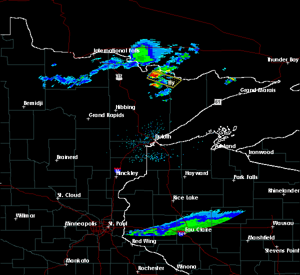 At 115 pm cdt, a severe thunderstorm was located 15 miles northwest of burntside lake, near big lake, or 20 miles northwest of ely, moving southeast at 35 mph (radar indicated). Hazards include 60 mph wind gusts and half dollar size hail. Hail damage to vehicles is expected. expect wind damage to roofs, siding and trees. this severe thunderstorm will be near, burntside lake around 145 pm cdt. winton around 150 pm cdt. fall lake and white iron lake around 155 pm cdt. basswood lake and western boundary waters canoe area wilderness around 200 pm cdt. the storms will move along or near the echo trail. Other locations impacted by this severe thunderstorm include farm lake, big moose lake, fourtown lake, lake agnes and high lake. At 115 pm cdt, a severe thunderstorm was located 15 miles northwest of burntside lake, near big lake, or 20 miles northwest of ely, moving southeast at 35 mph (radar indicated). Hazards include 60 mph wind gusts and half dollar size hail. Hail damage to vehicles is expected. expect wind damage to roofs, siding and trees. this severe thunderstorm will be near, burntside lake around 145 pm cdt. winton around 150 pm cdt. fall lake and white iron lake around 155 pm cdt. basswood lake and western boundary waters canoe area wilderness around 200 pm cdt. the storms will move along or near the echo trail. Other locations impacted by this severe thunderstorm include farm lake, big moose lake, fourtown lake, lake agnes and high lake.
|
| 8/8/2015 4:39 PM CDT |
 At 439 pm cdt, a severe thunderstorm was located over white iron lake, or over ely, moving east at 25 mph (radar indicated). Hazards include golf ball size hail and 60 mph wind gusts. People and animals outdoors will be injured. expect hail damage to roofs, siding, windows and vehicles. expect wind damage to roofs, siding and trees. Locations impacted include, ely, winton, white iron lake, fall lake, birch lake, burntside lake, farm lake, shagawa lake and gabbro lake. At 439 pm cdt, a severe thunderstorm was located over white iron lake, or over ely, moving east at 25 mph (radar indicated). Hazards include golf ball size hail and 60 mph wind gusts. People and animals outdoors will be injured. expect hail damage to roofs, siding, windows and vehicles. expect wind damage to roofs, siding and trees. Locations impacted include, ely, winton, white iron lake, fall lake, birch lake, burntside lake, farm lake, shagawa lake and gabbro lake.
|
| 8/8/2015 4:29 PM CDT |
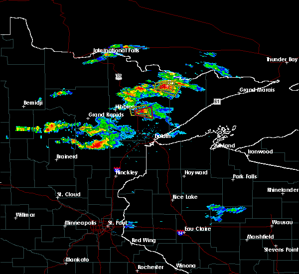 At 428 pm cdt, a severe thunderstorm was located near ely, moving southeast at 25 mph (radar indicated). Hazards include tennis ball size hail and 60 mph wind gusts. People and animals outdoors will be injured. expect hail damage to roofs, siding, windows and vehicles. Expect wind damage to roofs, siding and trees. At 428 pm cdt, a severe thunderstorm was located near ely, moving southeast at 25 mph (radar indicated). Hazards include tennis ball size hail and 60 mph wind gusts. People and animals outdoors will be injured. expect hail damage to roofs, siding, windows and vehicles. Expect wind damage to roofs, siding and trees.
|
| 8/8/2015 4:22 PM CDT |
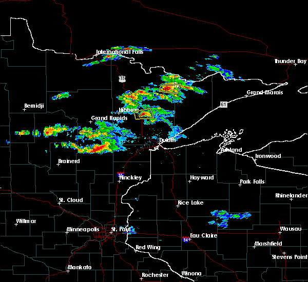 At 421 pm cdt, a severe thunderstorm was located near burntside lake, or near ely, moving east at 30 mph (radar indicated). Hazards include tennis ball size hail and 60 mph wind gusts. People and animals outdoors will be injured. expect hail damage to roofs, siding, windows and vehicles. expect wind damage to roofs, siding and trees. this severe storm will be near, ely, winton, white iron lake and fall lake around 430 pm cdt. Other locations impacted by this severe thunderstorm include farm lake, high lake and shagawa lake. At 421 pm cdt, a severe thunderstorm was located near burntside lake, or near ely, moving east at 30 mph (radar indicated). Hazards include tennis ball size hail and 60 mph wind gusts. People and animals outdoors will be injured. expect hail damage to roofs, siding, windows and vehicles. expect wind damage to roofs, siding and trees. this severe storm will be near, ely, winton, white iron lake and fall lake around 430 pm cdt. Other locations impacted by this severe thunderstorm include farm lake, high lake and shagawa lake.
|
| 8/8/2015 4:06 PM CDT |
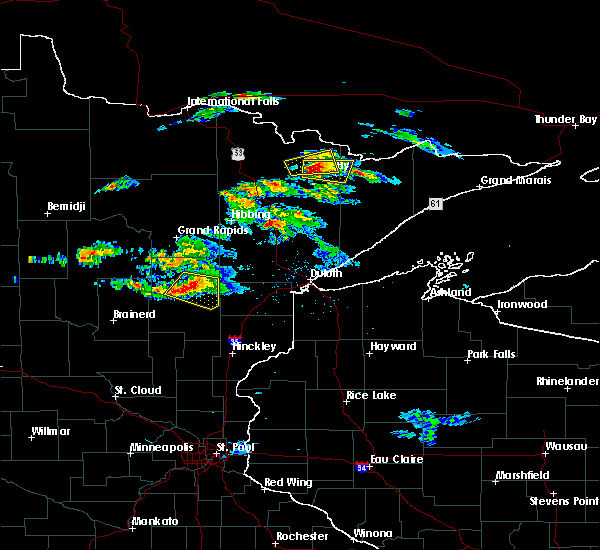 The national weather service in duluth mn has issued a * severe thunderstorm warning for. east central st. louis county in northeastern minnesota. northwestern lake county in northeastern minnesota. until 430 pm cdt * at 406 pm cdt. A severe thunderstorm was located over southeastern. The national weather service in duluth mn has issued a * severe thunderstorm warning for. east central st. louis county in northeastern minnesota. northwestern lake county in northeastern minnesota. until 430 pm cdt * at 406 pm cdt. A severe thunderstorm was located over southeastern.
|
| 8/2/2015 2:57 AM CDT | The severe thunderstorm warning for northeastern st. louis and northwestern lake counties will expire at 300 am cdt, the storms which prompted the warning have weakened below severe limits, and no longer pose an immediate threat to life or property. therefore the warning will be allowed to expire. however gusty winds are still possible with these thunderstorms, and the winds may reach up to 50 mph for a time this morning. |
| 8/2/2015 2:38 AM CDT |
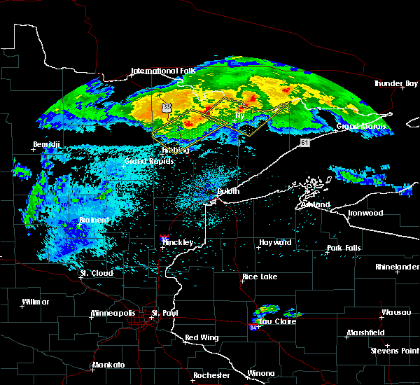 At 237 am cdt, severe thunderstorms were located along a line extending from 12 miles north of basswood lake to near robinson, moving southeast at 60 mph (radar indicated). Hazards include 60 mph wind gusts and penny size hail. Expect damage to roofs. siding and trees. Locations impacted include, ely, winton, white iron lake, fall lake, burntside lake, basswood lake, snowbank lake, birch lake, knife lake, kekekabic lake, ensign lake, lake three, shagawa lake, high lake, gabbro lake, big moose lake, disappointment lake, greenstone lake, cummings lake and fourtown lake. At 237 am cdt, severe thunderstorms were located along a line extending from 12 miles north of basswood lake to near robinson, moving southeast at 60 mph (radar indicated). Hazards include 60 mph wind gusts and penny size hail. Expect damage to roofs. siding and trees. Locations impacted include, ely, winton, white iron lake, fall lake, burntside lake, basswood lake, snowbank lake, birch lake, knife lake, kekekabic lake, ensign lake, lake three, shagawa lake, high lake, gabbro lake, big moose lake, disappointment lake, greenstone lake, cummings lake and fourtown lake.
|
| 8/2/2015 2:27 AM CDT |
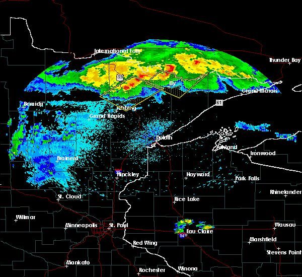 At 226 am cdt, severe thunderstorms were located along a line extending from 18 miles north of basswood lake to 7 miles northeast of vermillion lake, moving southeast at 60 mph (radar indicated). Hazards include 60 mph wind gusts and penny size hail. Expect damage to roofs. Siding and trees. At 226 am cdt, severe thunderstorms were located along a line extending from 18 miles north of basswood lake to 7 miles northeast of vermillion lake, moving southeast at 60 mph (radar indicated). Hazards include 60 mph wind gusts and penny size hail. Expect damage to roofs. Siding and trees.
|
| 1/1/0001 12:00 AM | A couple trees blown down along the kawishiwi trail in lake county MN, 4.1 miles NW of Winton, MN |
Hail Maps for Winton, MN


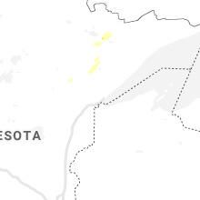

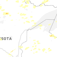


Connect with Interactive Hail Maps