

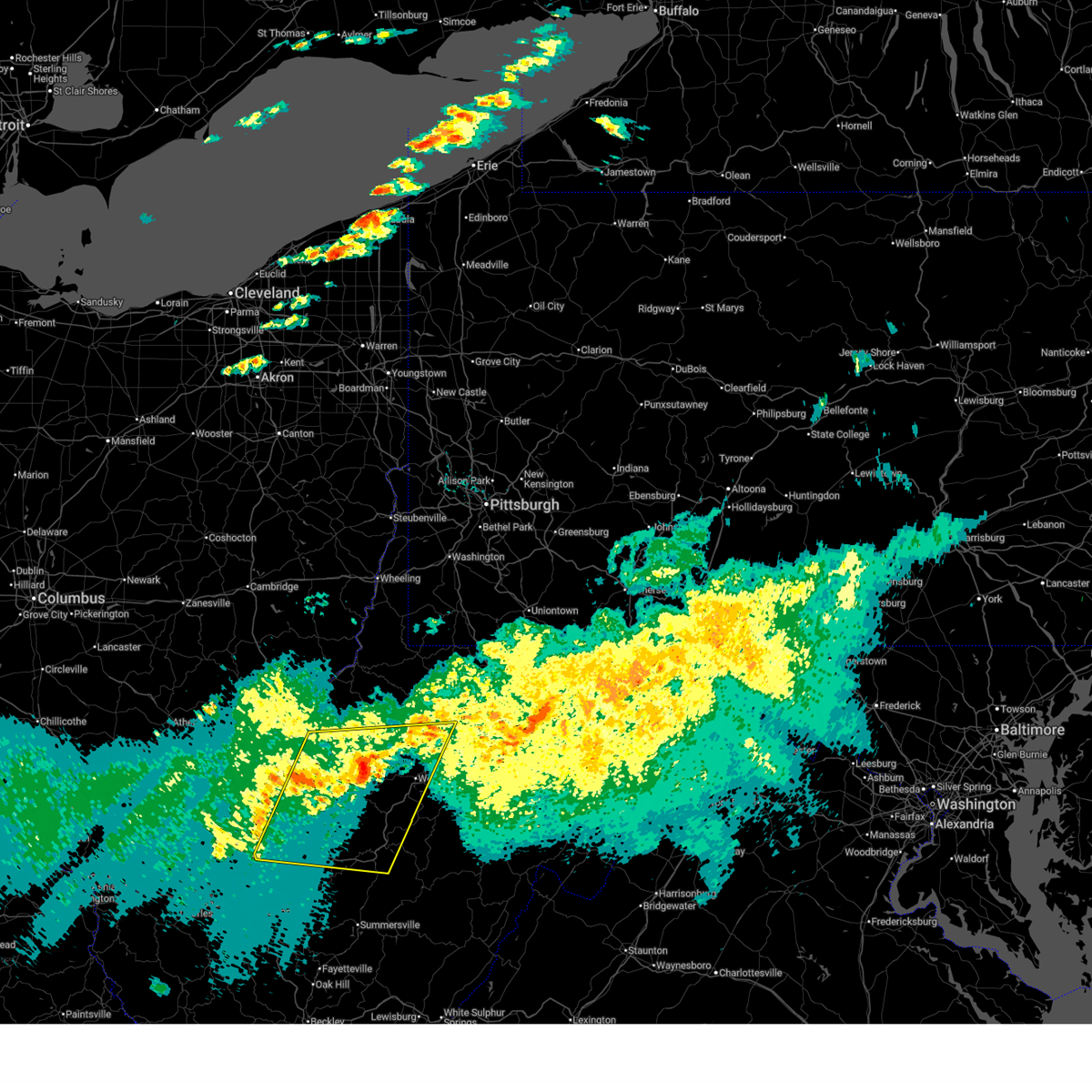
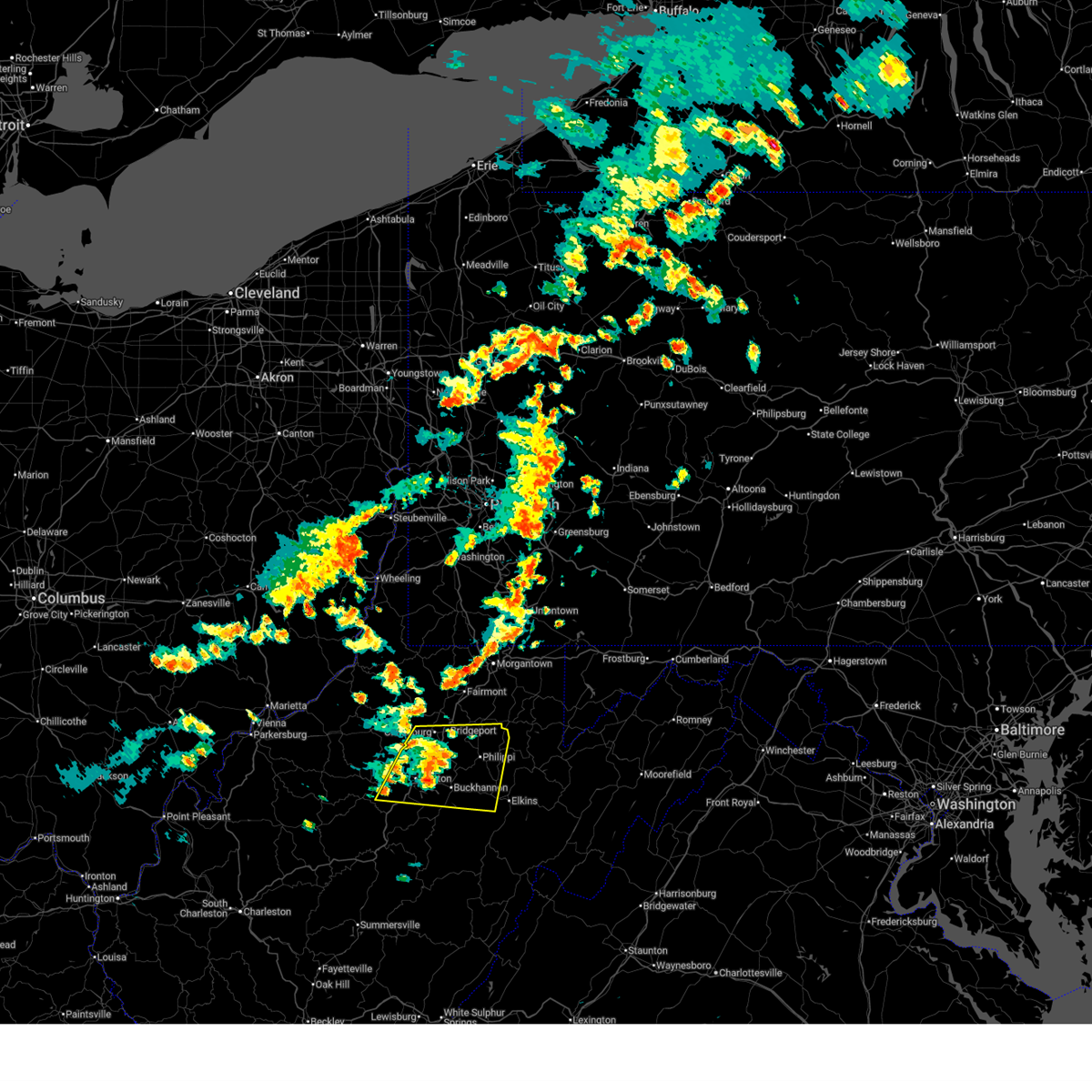
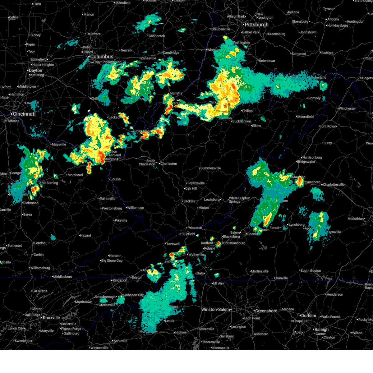
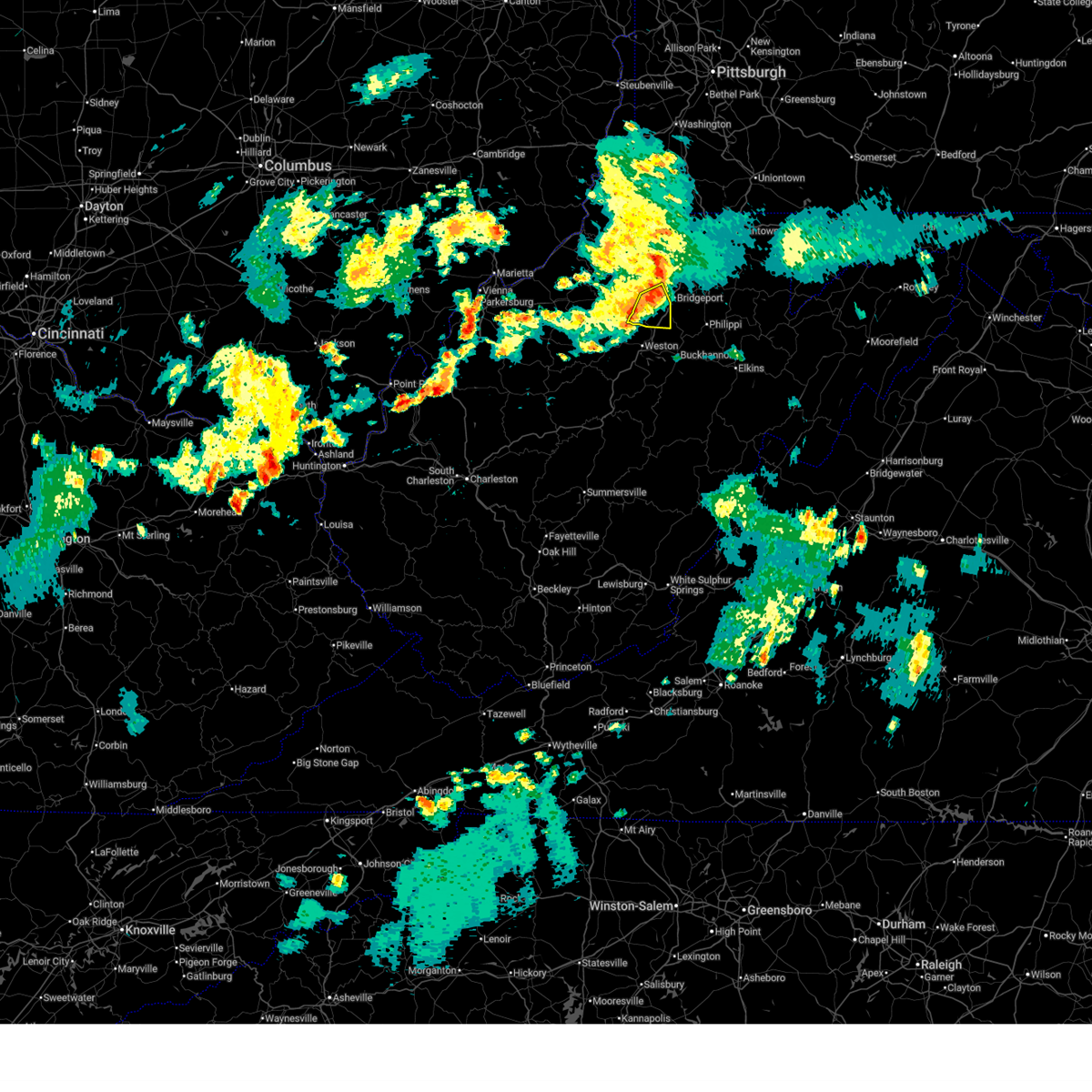
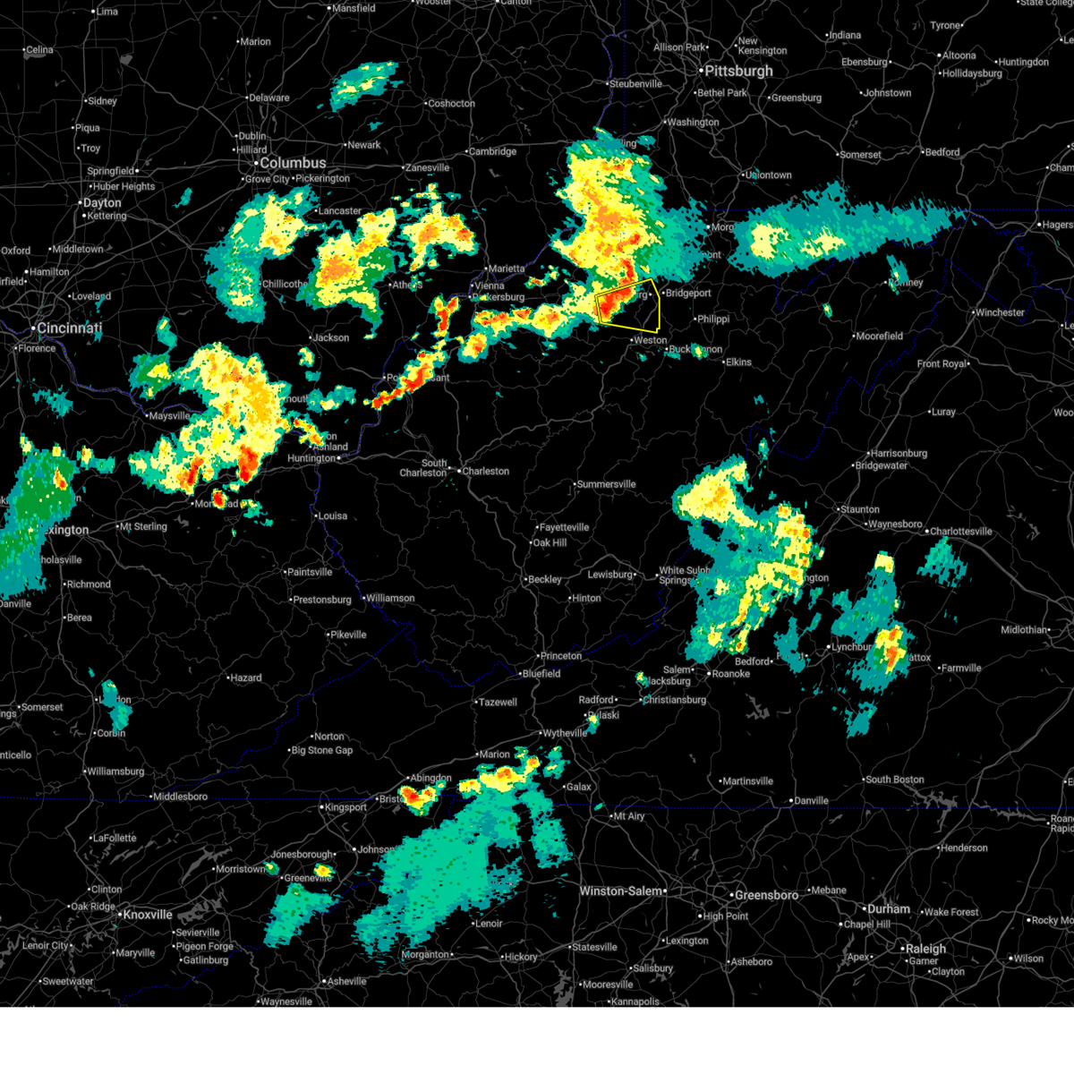
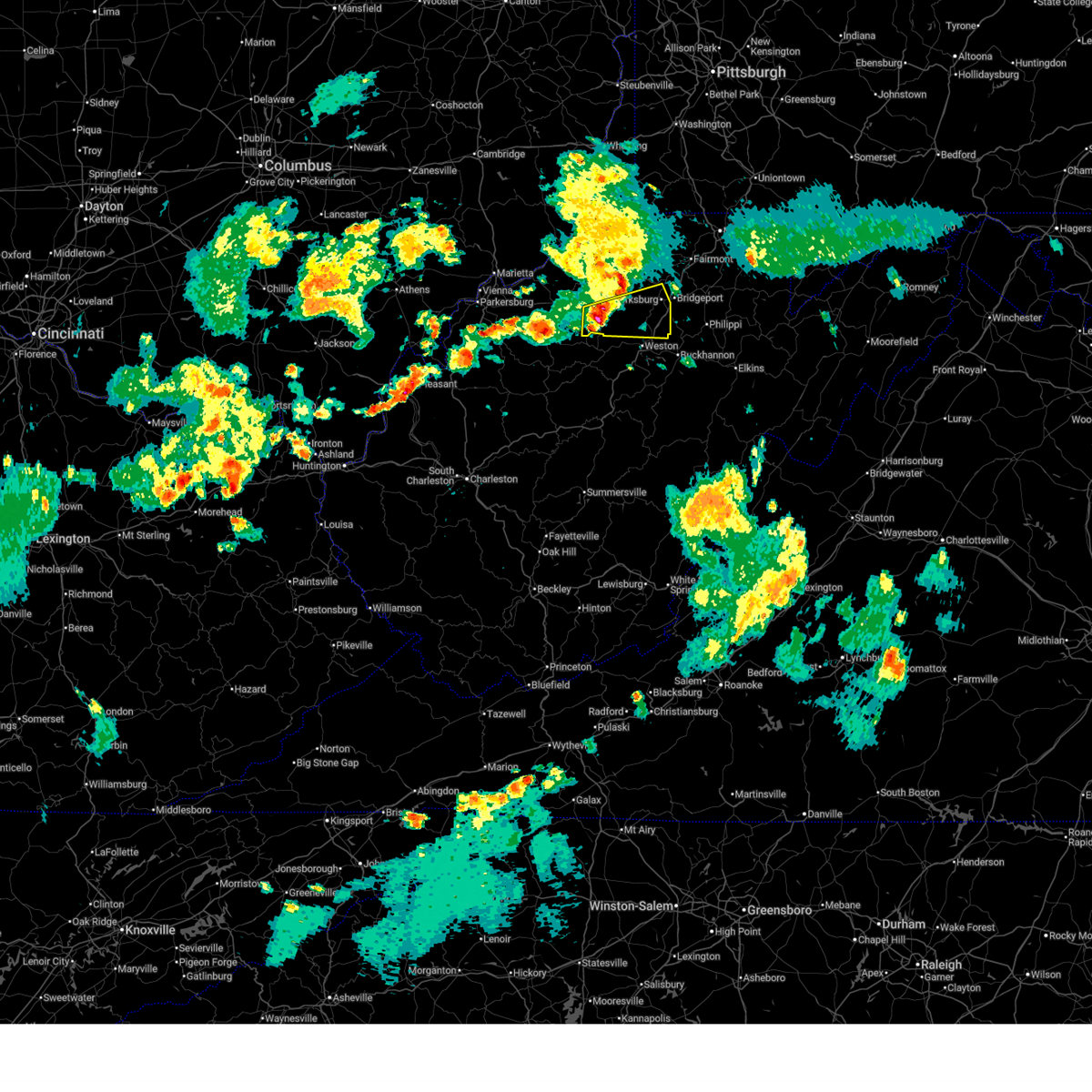
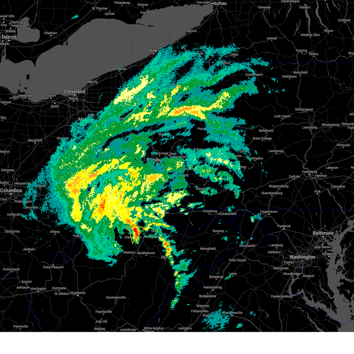
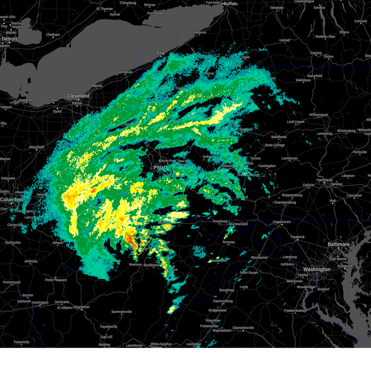
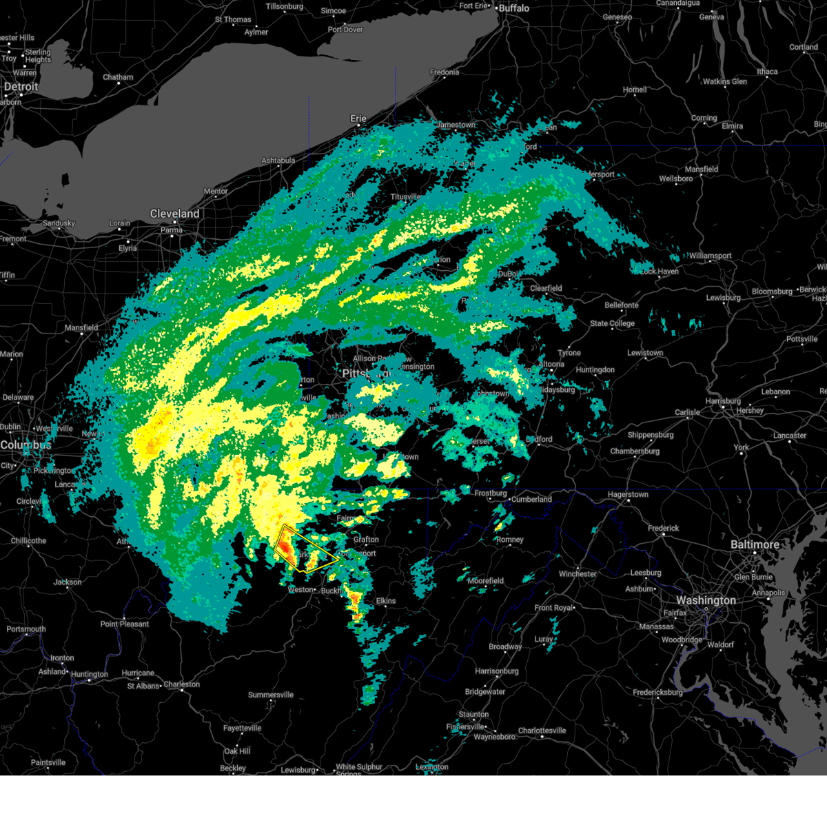
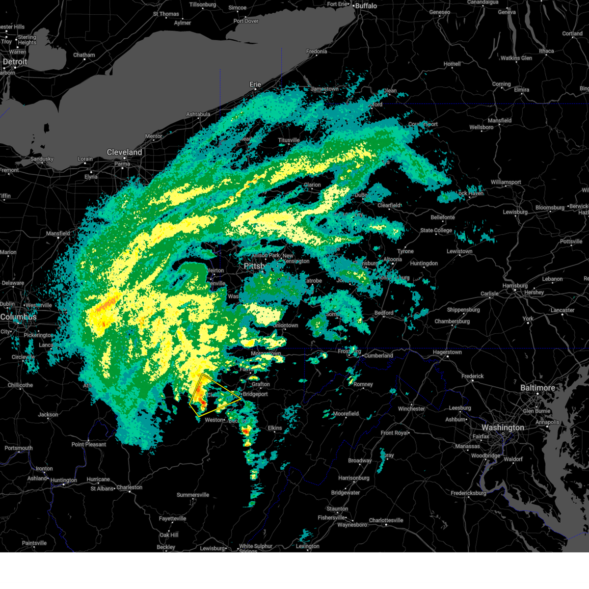
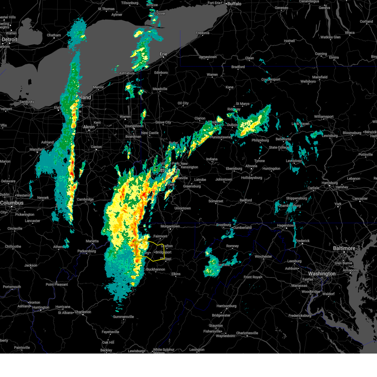
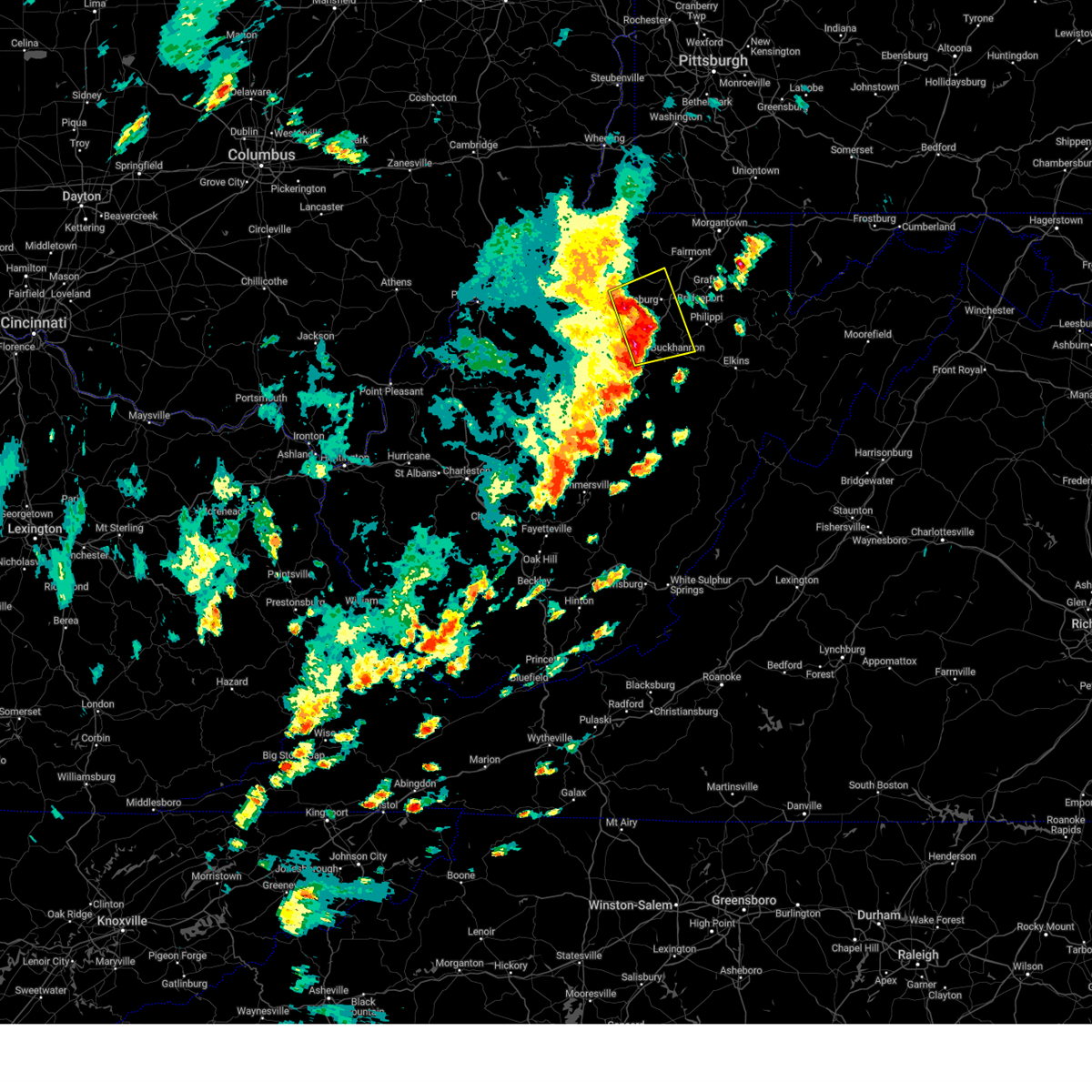
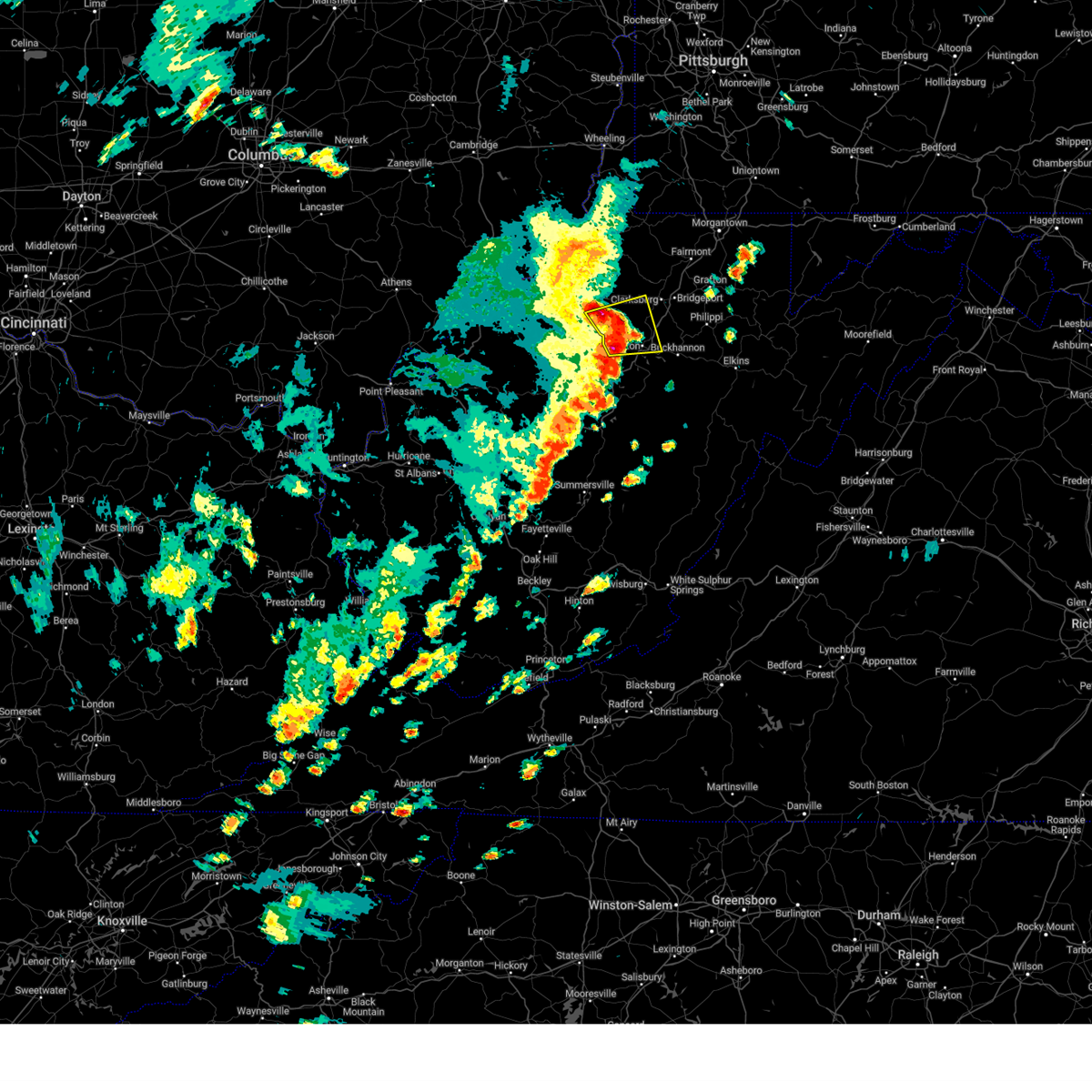
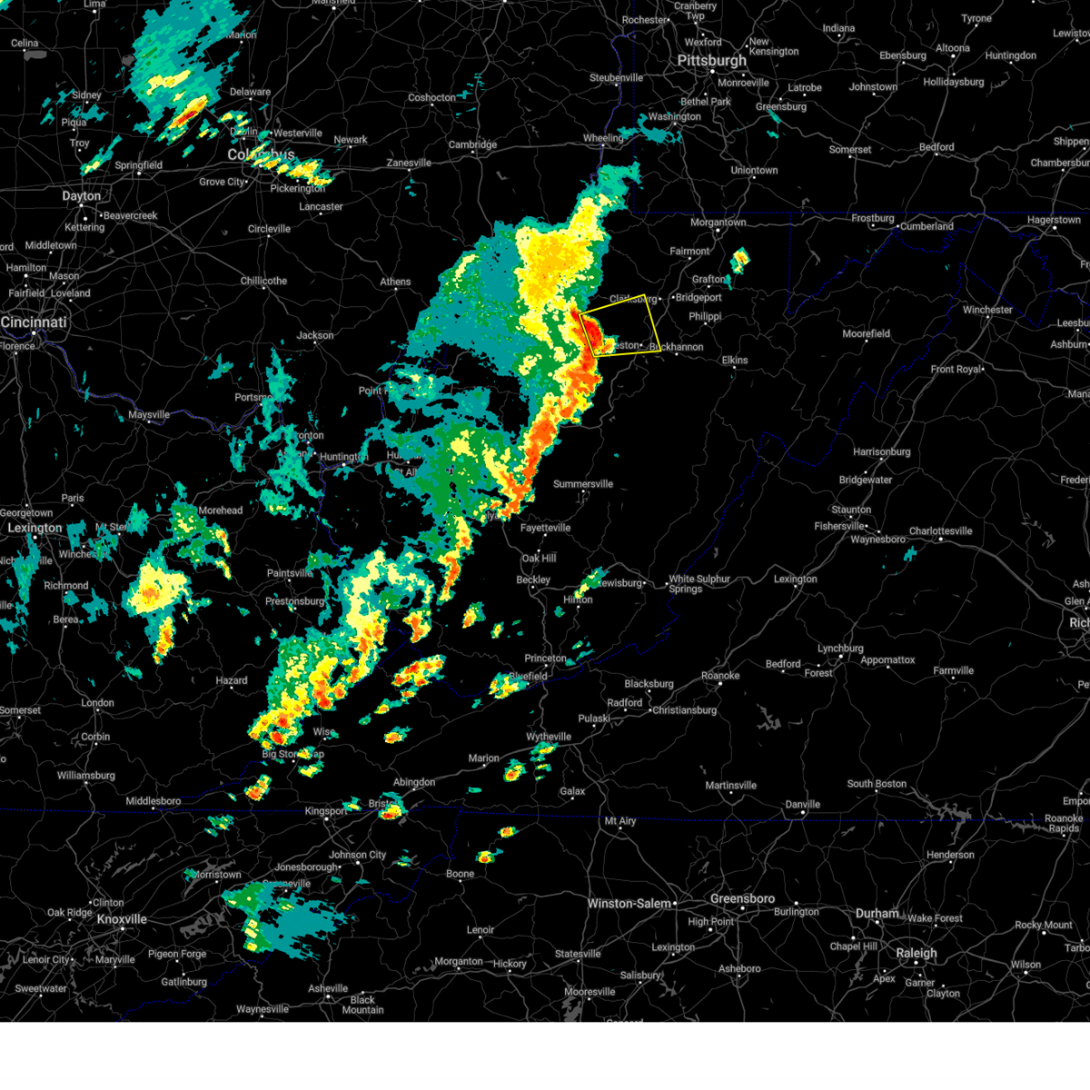
Hail Map for Wolf Summit, WV
The Wolf Summit, WV area has had 1 report of on-the-ground hail by trained spotters, and has been under severe weather warnings 11 times during the past 12 months. Doppler radar has detected hail at or near Wolf Summit, WV on 24 occasions.
| Name: | Wolf Summit, WV |
| Where Located: | 41.4 miles NW of Elkins, WV |
| Map: | Google Map for Wolf Summit, WV |
| Population: | 272 |
| Housing Units: | 127 |
| More Info: | Search Google for Wolf Summit, WV |
5
The Top Recent Hail Date for Wolf Summit, WV is Friday, July 10, 2015 (1st out of 24)

Hail and Wind Damage Spotted near Wolf Summit, WV
| Date / Time | Report Details |
|---|---|
| 6/22/2026 6:48 PM EDT | Tree down on big rock camp road. time is estimated by rada in harrison county WV, 4.9 miles S of Wolf Summit, WV |
| 6/18/2026 6:47 AM EDT |
 Svrrlx the national weather service in charleston west virginia has issued a * severe thunderstorm warning for, calhoun county in north central west virginia, ritchie county in northwestern west virginia, doddridge county in northern west virginia, gilmer county in north central west virginia, lewis county in northern west virginia, braxton county in north central west virginia, southeastern wirt county in northwestern west virginia, roane county in central west virginia, northeastern clay county in north central west virginia, southern harrison county in northern west virginia, * until 715 am edt. * at 646 am edt, severe thunderstorms were located along a line extending from 6 miles west of north bend state park to 7 miles east of kenna, moving east at 75 mph (radar indicated). Hazards include 60 mph wind gusts. expect damage to roofs, siding, and trees Svrrlx the national weather service in charleston west virginia has issued a * severe thunderstorm warning for, calhoun county in north central west virginia, ritchie county in northwestern west virginia, doddridge county in northern west virginia, gilmer county in north central west virginia, lewis county in northern west virginia, braxton county in north central west virginia, southeastern wirt county in northwestern west virginia, roane county in central west virginia, northeastern clay county in north central west virginia, southern harrison county in northern west virginia, * until 715 am edt. * at 646 am edt, severe thunderstorms were located along a line extending from 6 miles west of north bend state park to 7 miles east of kenna, moving east at 75 mph (radar indicated). Hazards include 60 mph wind gusts. expect damage to roofs, siding, and trees
|
| 6/14/2026 7:44 PM EDT |
 Svrrlx the national weather service in charleston west virginia has issued a * severe thunderstorm warning for, northern calhoun county in north central west virginia, southeastern ritchie county in northwestern west virginia, southeastern doddridge county in northern west virginia, taylor county in northern west virginia, northern gilmer county in north central west virginia, lewis county in northern west virginia, northwestern upshur county in northeastern west virginia, northern barbour county in northeastern west virginia, harrison county in northern west virginia, * until 845 pm edt. * at 744 pm edt, severe thunderstorms were located along a line extending from near pleasant valley to near grantsville, moving east at 55 mph (radar indicated). Hazards include 60 mph wind gusts. expect damage to roofs, siding, and trees Svrrlx the national weather service in charleston west virginia has issued a * severe thunderstorm warning for, northern calhoun county in north central west virginia, southeastern ritchie county in northwestern west virginia, southeastern doddridge county in northern west virginia, taylor county in northern west virginia, northern gilmer county in north central west virginia, lewis county in northern west virginia, northwestern upshur county in northeastern west virginia, northern barbour county in northeastern west virginia, harrison county in northern west virginia, * until 845 pm edt. * at 744 pm edt, severe thunderstorms were located along a line extending from near pleasant valley to near grantsville, moving east at 55 mph (radar indicated). Hazards include 60 mph wind gusts. expect damage to roofs, siding, and trees
|
| 6/14/2026 7:35 PM EDT |
 At 735 pm edt, severe thunderstorms were located along a line extending from near lumberport to 8 miles northwest of grantsville, moving east at 45 mph (radar indicated). Hazards include 60 mph wind gusts. Expect damage to roofs, siding, and trees. Locations impacted include, clarksburg, bridgeport, shinnston, stonewood, nutter fort, salem, lumberport, west union, anmoore, enterprise, west milford, pullman, auburn, smithville, wolf summit, meadland, newberne, sedalia, big springs, and brohard. At 735 pm edt, severe thunderstorms were located along a line extending from near lumberport to 8 miles northwest of grantsville, moving east at 45 mph (radar indicated). Hazards include 60 mph wind gusts. Expect damage to roofs, siding, and trees. Locations impacted include, clarksburg, bridgeport, shinnston, stonewood, nutter fort, salem, lumberport, west union, anmoore, enterprise, west milford, pullman, auburn, smithville, wolf summit, meadland, newberne, sedalia, big springs, and brohard.
|
| 6/14/2026 7:22 PM EDT |
 Svrrlx the national weather service in charleston west virginia has issued a * severe thunderstorm warning for, northern calhoun county in north central west virginia, southern ritchie county in northwestern west virginia, doddridge county in northern west virginia, northern taylor county in northern west virginia, northwestern gilmer county in north central west virginia, northwestern lewis county in northern west virginia, southern wirt county in northwestern west virginia, harrison county in northern west virginia, * until 800 pm edt. * at 721 pm edt, severe thunderstorms were located along a line extending from 8 miles southeast of jacksonburg to near elizabeth, moving east at 40 mph (radar indicated). Hazards include 60 mph wind gusts. expect damage to roofs, siding, and trees Svrrlx the national weather service in charleston west virginia has issued a * severe thunderstorm warning for, northern calhoun county in north central west virginia, southern ritchie county in northwestern west virginia, doddridge county in northern west virginia, northern taylor county in northern west virginia, northwestern gilmer county in north central west virginia, northwestern lewis county in northern west virginia, southern wirt county in northwestern west virginia, harrison county in northern west virginia, * until 800 pm edt. * at 721 pm edt, severe thunderstorms were located along a line extending from 8 miles southeast of jacksonburg to near elizabeth, moving east at 40 mph (radar indicated). Hazards include 60 mph wind gusts. expect damage to roofs, siding, and trees
|
| 6/11/2026 3:59 PM EDT |
 Svrrlx the national weather service in charleston west virginia has issued a * severe thunderstorm warning for, northwestern randolph county in northeastern west virginia, southern taylor county in northern west virginia, east central gilmer county in north central west virginia, lewis county in northern west virginia, northern upshur county in northeastern west virginia, barbour county in northeastern west virginia, southern harrison county in northern west virginia, * until 445 pm edt. * at 359 pm edt, severe thunderstorms were located along a line extending from near nutter fort to 8 miles southwest of stonewall jackson, moving east at 50 mph (radar indicated). Hazards include 60 mph wind gusts. expect damage to roofs, siding, and trees Svrrlx the national weather service in charleston west virginia has issued a * severe thunderstorm warning for, northwestern randolph county in northeastern west virginia, southern taylor county in northern west virginia, east central gilmer county in north central west virginia, lewis county in northern west virginia, northern upshur county in northeastern west virginia, barbour county in northeastern west virginia, southern harrison county in northern west virginia, * until 445 pm edt. * at 359 pm edt, severe thunderstorms were located along a line extending from near nutter fort to 8 miles southwest of stonewall jackson, moving east at 50 mph (radar indicated). Hazards include 60 mph wind gusts. expect damage to roofs, siding, and trees
|
| 4/1/2026 7:54 PM EDT |
 The storm which prompted the warning has weakened below severe limits, and no longer poses an immediate threat to life or property. therefore, the warning will be allowed to expire. however, gusty winds and heavy rain are still possible with this thunderstorm. a severe thunderstorm watch remains in effect until 800 pm edt for northern west virginia. The storm which prompted the warning has weakened below severe limits, and no longer poses an immediate threat to life or property. therefore, the warning will be allowed to expire. however, gusty winds and heavy rain are still possible with this thunderstorm. a severe thunderstorm watch remains in effect until 800 pm edt for northern west virginia.
|
| 4/1/2026 7:37 PM EDT |
 At 737 pm edt, a severe thunderstorm was located near nutter fort, or near clarksburg, moving east at 35 mph (radar indicated). Hazards include 60 mph wind gusts and penny size hail. Expect damage to roofs, siding, and trees. Locations impacted include, clarksburg, stonewood, nutter fort, anmoore, west milford, lost creek, wolf summit, and despard. At 737 pm edt, a severe thunderstorm was located near nutter fort, or near clarksburg, moving east at 35 mph (radar indicated). Hazards include 60 mph wind gusts and penny size hail. Expect damage to roofs, siding, and trees. Locations impacted include, clarksburg, stonewood, nutter fort, anmoore, west milford, lost creek, wolf summit, and despard.
|
| 4/1/2026 7:37 PM EDT |
 the severe thunderstorm warning has been cancelled and is no longer in effect the severe thunderstorm warning has been cancelled and is no longer in effect
|
| 4/1/2026 7:23 PM EDT |
 At 722 pm edt, a severe thunderstorm was located near salem, or 13 miles northwest of weston, moving east at 35 mph (radar indicated). Hazards include 60 mph wind gusts and penny size hail. Expect damage to roofs, siding, and trees. Locations impacted include, clarksburg, stonewood, nutter fort, salem, anmoore, west milford, lost creek, jane lew, new milton, avon, wolf summit, and despard. At 722 pm edt, a severe thunderstorm was located near salem, or 13 miles northwest of weston, moving east at 35 mph (radar indicated). Hazards include 60 mph wind gusts and penny size hail. Expect damage to roofs, siding, and trees. Locations impacted include, clarksburg, stonewood, nutter fort, salem, anmoore, west milford, lost creek, jane lew, new milton, avon, wolf summit, and despard.
|
| 4/1/2026 7:23 PM EDT |
 the severe thunderstorm warning has been cancelled and is no longer in effect the severe thunderstorm warning has been cancelled and is no longer in effect
|
| 4/1/2026 7:07 PM EDT |
 Svrrlx the national weather service in charleston west virginia has issued a * severe thunderstorm warning for, east central ritchie county in northwestern west virginia, southern doddridge county in northern west virginia, northern lewis county in northern west virginia, southwestern harrison county in northern west virginia, * until 800 pm edt. * at 707 pm edt, a severe thunderstorm was located 8 miles south of west union, or 14 miles east of harrisville, moving east at 35 mph (radar indicated). Hazards include 60 mph wind gusts and penny size hail. expect damage to roofs, siding, and trees Svrrlx the national weather service in charleston west virginia has issued a * severe thunderstorm warning for, east central ritchie county in northwestern west virginia, southern doddridge county in northern west virginia, northern lewis county in northern west virginia, southwestern harrison county in northern west virginia, * until 800 pm edt. * at 707 pm edt, a severe thunderstorm was located 8 miles south of west union, or 14 miles east of harrisville, moving east at 35 mph (radar indicated). Hazards include 60 mph wind gusts and penny size hail. expect damage to roofs, siding, and trees
|
| 5/30/2025 4:28 PM EDT |
 At 428 pm edt, a severe thunderstorm was located 7 miles west of lumberport, or 10 miles northwest of clarksburg, moving northeast at 25 mph (radar indicated). Hazards include 60 mph wind gusts and penny size hail. Expect damage to roofs, siding, and trees. Locations impacted include, shinnston, salem, lumberport, wallace, and wolf summit. At 428 pm edt, a severe thunderstorm was located 7 miles west of lumberport, or 10 miles northwest of clarksburg, moving northeast at 25 mph (radar indicated). Hazards include 60 mph wind gusts and penny size hail. Expect damage to roofs, siding, and trees. Locations impacted include, shinnston, salem, lumberport, wallace, and wolf summit.
|
| 5/30/2025 4:28 PM EDT |
 the severe thunderstorm warning has been cancelled and is no longer in effect the severe thunderstorm warning has been cancelled and is no longer in effect
|
| 5/30/2025 4:10 PM EDT |
 The storm which prompted the warning has moved out of the area. therefore, the warning will be allowed to expire. however, gusty winds and heavy rain are still possible with this thunderstorm. a tornado watch remains in effect until 800 pm edt for northern west virginia. remember, a severe thunderstorm warning still remains in effect for the northern portions of tyler, doddridge, and harrison counties until 5pm. The storm which prompted the warning has moved out of the area. therefore, the warning will be allowed to expire. however, gusty winds and heavy rain are still possible with this thunderstorm. a tornado watch remains in effect until 800 pm edt for northern west virginia. remember, a severe thunderstorm warning still remains in effect for the northern portions of tyler, doddridge, and harrison counties until 5pm.
|
| 5/30/2025 4:08 PM EDT |
 Svrrlx the national weather service in charleston west virginia has issued a * severe thunderstorm warning for, northeastern doddridge county in northern west virginia, east central tyler county in northern west virginia, northwestern harrison county in northern west virginia, * until 500 pm edt. * at 408 pm edt, a severe thunderstorm was located 7 miles northeast of west union, or 15 miles southeast of middlebourne, moving northeast at 25 mph (radar indicated). Hazards include 60 mph wind gusts and penny size hail. expect damage to roofs, siding, and trees Svrrlx the national weather service in charleston west virginia has issued a * severe thunderstorm warning for, northeastern doddridge county in northern west virginia, east central tyler county in northern west virginia, northwestern harrison county in northern west virginia, * until 500 pm edt. * at 408 pm edt, a severe thunderstorm was located 7 miles northeast of west union, or 15 miles southeast of middlebourne, moving northeast at 25 mph (radar indicated). Hazards include 60 mph wind gusts and penny size hail. expect damage to roofs, siding, and trees
|
| 5/30/2025 3:58 PM EDT |
 At 357 pm edt, a severe thunderstorm was located near west union, or 17 miles southeast of middlebourne, moving northeast at 45 mph (radar indicated). Hazards include 60 mph wind gusts and penny size hail. Expect damage to roofs, siding, and trees. Locations impacted include, clarksburg, stonewood, nutter fort, salem, west union, anmoore, west milford, blandville, avon, wolf summit, new milton, smithburg, lima, center point, sedalia, and canton. At 357 pm edt, a severe thunderstorm was located near west union, or 17 miles southeast of middlebourne, moving northeast at 45 mph (radar indicated). Hazards include 60 mph wind gusts and penny size hail. Expect damage to roofs, siding, and trees. Locations impacted include, clarksburg, stonewood, nutter fort, salem, west union, anmoore, west milford, blandville, avon, wolf summit, new milton, smithburg, lima, center point, sedalia, and canton.
|
| 5/30/2025 3:58 PM EDT |
 the severe thunderstorm warning has been cancelled and is no longer in effect the severe thunderstorm warning has been cancelled and is no longer in effect
|
| 5/30/2025 3:45 PM EDT |
 Svrrlx the national weather service in charleston west virginia has issued a * severe thunderstorm warning for, east central ritchie county in northwestern west virginia, doddridge county in northern west virginia, northeastern gilmer county in north central west virginia, northwestern lewis county in northern west virginia, southeastern tyler county in northern west virginia, southern harrison county in northern west virginia, * until 415 pm edt. * at 345 pm edt, a severe thunderstorm was located 8 miles south of west union, or 16 miles east of harrisville, moving northeast at 35 mph (radar indicated). Hazards include 60 mph wind gusts and penny size hail. expect damage to roofs, siding, and trees Svrrlx the national weather service in charleston west virginia has issued a * severe thunderstorm warning for, east central ritchie county in northwestern west virginia, doddridge county in northern west virginia, northeastern gilmer county in north central west virginia, northwestern lewis county in northern west virginia, southeastern tyler county in northern west virginia, southern harrison county in northern west virginia, * until 415 pm edt. * at 345 pm edt, a severe thunderstorm was located 8 miles south of west union, or 16 miles east of harrisville, moving northeast at 35 mph (radar indicated). Hazards include 60 mph wind gusts and penny size hail. expect damage to roofs, siding, and trees
|
| 4/3/2025 5:57 AM EDT |
 Svrrlx the national weather service in charleston west virginia has issued a * severe thunderstorm warning for, southeastern calhoun county in north central west virginia, northwestern randolph county in northeastern west virginia, northeastern kanawha county in central west virginia, upshur county in northeastern west virginia, southeastern roane county in central west virginia, northwestern webster county in northeastern west virginia, barbour county in northeastern west virginia, harrison county in northern west virginia, southeastern doddridge county in northern west virginia, taylor county in northern west virginia, north central nicholas county in southeastern west virginia, central gilmer county in north central west virginia, lewis county in northern west virginia, braxton county in north central west virginia, northern clay county in north central west virginia, * until 645 am edt. * at 557 am edt, severe thunderstorms were located along a line extending from near salem to 7 miles northwest of gassaway to near amma, moving east at 65 mph (radar indicated). Hazards include 60 mph wind gusts. expect damage to roofs, siding, and trees Svrrlx the national weather service in charleston west virginia has issued a * severe thunderstorm warning for, southeastern calhoun county in north central west virginia, northwestern randolph county in northeastern west virginia, northeastern kanawha county in central west virginia, upshur county in northeastern west virginia, southeastern roane county in central west virginia, northwestern webster county in northeastern west virginia, barbour county in northeastern west virginia, harrison county in northern west virginia, southeastern doddridge county in northern west virginia, taylor county in northern west virginia, north central nicholas county in southeastern west virginia, central gilmer county in north central west virginia, lewis county in northern west virginia, braxton county in north central west virginia, northern clay county in north central west virginia, * until 645 am edt. * at 557 am edt, severe thunderstorms were located along a line extending from near salem to 7 miles northwest of gassaway to near amma, moving east at 65 mph (radar indicated). Hazards include 60 mph wind gusts. expect damage to roofs, siding, and trees
|
| 4/3/2025 5:00 AM EDT |
 At 500 am edt, severe thunderstorms were located along a line extending from 7 miles south of jacksonburg to 6 miles southwest of salem to 8 miles north of grantsville, moving east at 60 mph (radar indicated). Hazards include 60 mph wind gusts. Expect damage to roofs, siding, and trees. Locations impacted include, shinnston, lumberport, anmoore, wolf summit, bridgeport, newberne, west milford, center point, sedalia, salem, despard, burnt house, clarksburg, blandville, auburn, avon, grove, leopold, new milton, and wallace. At 500 am edt, severe thunderstorms were located along a line extending from 7 miles south of jacksonburg to 6 miles southwest of salem to 8 miles north of grantsville, moving east at 60 mph (radar indicated). Hazards include 60 mph wind gusts. Expect damage to roofs, siding, and trees. Locations impacted include, shinnston, lumberport, anmoore, wolf summit, bridgeport, newberne, west milford, center point, sedalia, salem, despard, burnt house, clarksburg, blandville, auburn, avon, grove, leopold, new milton, and wallace.
|
| 4/3/2025 5:00 AM EDT |
 the severe thunderstorm warning has been cancelled and is no longer in effect the severe thunderstorm warning has been cancelled and is no longer in effect
|
| 4/3/2025 4:43 AM EDT |
 Svrrlx the national weather service in charleston west virginia has issued a * severe thunderstorm warning for, southeastern pleasants county in northwestern west virginia, north central calhoun county in north central west virginia, ritchie county in northwestern west virginia, doddridge county in northern west virginia, northwestern taylor county in northern west virginia, northwestern gilmer county in north central west virginia, northwestern lewis county in northern west virginia, east central wirt county in northwestern west virginia, central tyler county in northern west virginia, harrison county in northern west virginia, * until 530 am edt. * at 442 am edt, severe thunderstorms were located along a line extending from near jacksonburg to near west union to 9 miles south of harrisville, moving east at 65 mph (radar indicated). Hazards include 60 mph wind gusts. expect damage to roofs, siding, and trees Svrrlx the national weather service in charleston west virginia has issued a * severe thunderstorm warning for, southeastern pleasants county in northwestern west virginia, north central calhoun county in north central west virginia, ritchie county in northwestern west virginia, doddridge county in northern west virginia, northwestern taylor county in northern west virginia, northwestern gilmer county in north central west virginia, northwestern lewis county in northern west virginia, east central wirt county in northwestern west virginia, central tyler county in northern west virginia, harrison county in northern west virginia, * until 530 am edt. * at 442 am edt, severe thunderstorms were located along a line extending from near jacksonburg to near west union to 9 miles south of harrisville, moving east at 65 mph (radar indicated). Hazards include 60 mph wind gusts. expect damage to roofs, siding, and trees
|
| 3/16/2025 12:03 PM EDT |
 the severe thunderstorm warning has been cancelled and is no longer in effect the severe thunderstorm warning has been cancelled and is no longer in effect
|
| 3/16/2025 12:03 PM EDT |
 At 1202 pm edt, severe thunderstorms were located along a line extending from 6 miles southeast of jacksonburg to near lumberport to 6 miles west of nutter fort, moving east at 55 mph (radar indicated). Hazards include 60 mph wind gusts. Expect damage to roofs, siding, and trees. Locations impacted include, flemington, clarksburg, rosemont, shinnston, lumberport, anmoore, wolf summit, meadland, bridgeport, wallace, enterprise, sedalia, salem, mcgee, stonewood, nutter fort, galloway, meadowbrook, and despard. At 1202 pm edt, severe thunderstorms were located along a line extending from 6 miles southeast of jacksonburg to near lumberport to 6 miles west of nutter fort, moving east at 55 mph (radar indicated). Hazards include 60 mph wind gusts. Expect damage to roofs, siding, and trees. Locations impacted include, flemington, clarksburg, rosemont, shinnston, lumberport, anmoore, wolf summit, meadland, bridgeport, wallace, enterprise, sedalia, salem, mcgee, stonewood, nutter fort, galloway, meadowbrook, and despard.
|
| 3/16/2025 11:51 AM EDT |
 Svrrlx the national weather service in charleston west virginia has issued a * severe thunderstorm warning for, northeastern doddridge county in northern west virginia, western taylor county in northern west virginia, east central tyler county in northern west virginia, northwestern barbour county in northeastern west virginia, harrison county in northern west virginia, * until 1215 pm edt. * at 1151 am edt, severe thunderstorms were located along a line extending from near jacksonburg to near salem to 10 miles northwest of jackson mill, moving east at 55 mph (radar indicated). Hazards include 60 mph wind gusts and quarter size hail. Hail damage to vehicles is expected. Expect wind damage to roofs, siding, and trees. Svrrlx the national weather service in charleston west virginia has issued a * severe thunderstorm warning for, northeastern doddridge county in northern west virginia, western taylor county in northern west virginia, east central tyler county in northern west virginia, northwestern barbour county in northeastern west virginia, harrison county in northern west virginia, * until 1215 pm edt. * at 1151 am edt, severe thunderstorms were located along a line extending from near jacksonburg to near salem to 10 miles northwest of jackson mill, moving east at 55 mph (radar indicated). Hazards include 60 mph wind gusts and quarter size hail. Hail damage to vehicles is expected. Expect wind damage to roofs, siding, and trees.
|
| 9/24/2024 2:14 PM EDT |
 The storm which prompted the warning has moved out of the area. therefore, the warning will be allowed to expire. however, gusty winds are still possible with this thunderstorm. The storm which prompted the warning has moved out of the area. therefore, the warning will be allowed to expire. however, gusty winds are still possible with this thunderstorm.
|
| 9/24/2024 1:56 PM EDT |
 Svrrlx the national weather service in charleston west virginia has issued a * severe thunderstorm warning for, north central randolph county in northeastern west virginia, taylor county in northern west virginia, northeastern lewis county in northern west virginia, northern upshur county in northeastern west virginia, barbour county in northeastern west virginia, harrison county in northern west virginia, * until 245 pm edt. * at 156 pm edt, a severe thunderstorm was located near stonewood, or 8 miles south of clarksburg, moving northeast at 25 mph (radar indicated). Hazards include 60 mph wind gusts and quarter size hail. Hail damage to vehicles is expected. Expect wind damage to roofs, siding, and trees. Svrrlx the national weather service in charleston west virginia has issued a * severe thunderstorm warning for, north central randolph county in northeastern west virginia, taylor county in northern west virginia, northeastern lewis county in northern west virginia, northern upshur county in northeastern west virginia, barbour county in northeastern west virginia, harrison county in northern west virginia, * until 245 pm edt. * at 156 pm edt, a severe thunderstorm was located near stonewood, or 8 miles south of clarksburg, moving northeast at 25 mph (radar indicated). Hazards include 60 mph wind gusts and quarter size hail. Hail damage to vehicles is expected. Expect wind damage to roofs, siding, and trees.
|
| 9/24/2024 1:51 PM EDT |
 At 151 pm edt, a severe thunderstorm was located near jackson mill, or 8 miles northeast of weston, moving east at 30 mph (radar indicated). Hazards include 60 mph wind gusts and quarter size hail. Hail damage to vehicles is expected. expect wind damage to roofs, siding, and trees. Locations impacted include, clarksburg, buckhannon, weston, bridgeport, shinnston, stonewood, nutter fort, salem, lumberport, anmoore, stonewall jackson, jackson mill, west milford, lost creek, jane lew, camden, lorentz, century, wolf summit, and hodgesville. At 151 pm edt, a severe thunderstorm was located near jackson mill, or 8 miles northeast of weston, moving east at 30 mph (radar indicated). Hazards include 60 mph wind gusts and quarter size hail. Hail damage to vehicles is expected. expect wind damage to roofs, siding, and trees. Locations impacted include, clarksburg, buckhannon, weston, bridgeport, shinnston, stonewood, nutter fort, salem, lumberport, anmoore, stonewall jackson, jackson mill, west milford, lost creek, jane lew, camden, lorentz, century, wolf summit, and hodgesville.
|
| 9/24/2024 1:42 PM EDT |
 Svrrlx the national weather service in charleston west virginia has issued a * severe thunderstorm warning for, southeastern doddridge county in northern west virginia, northeastern lewis county in northern west virginia, northern upshur county in northeastern west virginia, west central barbour county in northeastern west virginia, harrison county in northern west virginia, * until 215 pm edt. * at 141 pm edt, a severe thunderstorm was located over jackson mill, or near weston, moving east at 30 mph (radar indicated). Hazards include 60 mph wind gusts. expect damage to roofs, siding, and trees Svrrlx the national weather service in charleston west virginia has issued a * severe thunderstorm warning for, southeastern doddridge county in northern west virginia, northeastern lewis county in northern west virginia, northern upshur county in northeastern west virginia, west central barbour county in northeastern west virginia, harrison county in northern west virginia, * until 215 pm edt. * at 141 pm edt, a severe thunderstorm was located over jackson mill, or near weston, moving east at 30 mph (radar indicated). Hazards include 60 mph wind gusts. expect damage to roofs, siding, and trees
|
| 9/24/2024 1:34 PM EDT |
 At 133 pm edt, a severe thunderstorm was located near jackson mill, or 8 miles northwest of weston, moving east at 30 mph (radar indicated). Hazards include 60 mph wind gusts. Expect damage to roofs, siding, and trees. Locations impacted include, weston, jackson mill, stonewall jackson, jane lew, new milton, camden, alum bridge, avon, grove, leopold, and wolf summit. At 133 pm edt, a severe thunderstorm was located near jackson mill, or 8 miles northwest of weston, moving east at 30 mph (radar indicated). Hazards include 60 mph wind gusts. Expect damage to roofs, siding, and trees. Locations impacted include, weston, jackson mill, stonewall jackson, jane lew, new milton, camden, alum bridge, avon, grove, leopold, and wolf summit.
|
| 9/24/2024 1:34 PM EDT |
 the severe thunderstorm warning has been cancelled and is no longer in effect the severe thunderstorm warning has been cancelled and is no longer in effect
|
| 9/24/2024 1:18 PM EDT |
 Svrrlx the national weather service in charleston west virginia has issued a * severe thunderstorm warning for, east central ritchie county in northwestern west virginia, southern doddridge county in northern west virginia, northeastern gilmer county in north central west virginia, northern lewis county in northern west virginia, southwestern harrison county in northern west virginia, * until 145 pm edt. * at 118 pm edt, a severe thunderstorm was located 12 miles northeast of glenville, moving east at 30 mph (radar indicated). Hazards include 60 mph wind gusts. expect damage to roofs, siding, and trees Svrrlx the national weather service in charleston west virginia has issued a * severe thunderstorm warning for, east central ritchie county in northwestern west virginia, southern doddridge county in northern west virginia, northeastern gilmer county in north central west virginia, northern lewis county in northern west virginia, southwestern harrison county in northern west virginia, * until 145 pm edt. * at 118 pm edt, a severe thunderstorm was located 12 miles northeast of glenville, moving east at 30 mph (radar indicated). Hazards include 60 mph wind gusts. expect damage to roofs, siding, and trees
|
| 6/18/2024 7:14 PM EDT |
 At 714 pm edt, a severe thunderstorm was located near salem, or 17 miles west of clarksburg, moving northwest at 15 mph (radar indicated). Hazards include 60 mph wind gusts. Expect damage to roofs, siding, and trees. Locations impacted include, salem, west union, smithburg, center point, sedalia, canton, and wolf summit. At 714 pm edt, a severe thunderstorm was located near salem, or 17 miles west of clarksburg, moving northwest at 15 mph (radar indicated). Hazards include 60 mph wind gusts. Expect damage to roofs, siding, and trees. Locations impacted include, salem, west union, smithburg, center point, sedalia, canton, and wolf summit.
|
| 6/18/2024 6:53 PM EDT |
 Svrrlx the national weather service in charleston west virginia has issued a * severe thunderstorm warning for, northern doddridge county in northern west virginia, west central harrison county in northern west virginia, * until 745 pm edt. * at 653 pm edt, a severe thunderstorm was located over salem, or 13 miles west of clarksburg, moving northwest at 15 mph (radar indicated). Hazards include 60 mph wind gusts. expect damage to roofs, siding, and trees Svrrlx the national weather service in charleston west virginia has issued a * severe thunderstorm warning for, northern doddridge county in northern west virginia, west central harrison county in northern west virginia, * until 745 pm edt. * at 653 pm edt, a severe thunderstorm was located over salem, or 13 miles west of clarksburg, moving northwest at 15 mph (radar indicated). Hazards include 60 mph wind gusts. expect damage to roofs, siding, and trees
|
| 4/17/2024 9:29 PM EDT |
 At 929 pm edt, severe thunderstorms were located along a line extending from 8 miles north of salem to 9 miles northeast of elizabeth, moving east at 30 mph (radar indicated). Hazards include 60 mph wind gusts and quarter size hail. Hail damage to vehicles is expected. expect wind damage to roofs, siding, and trees. Locations impacted include, harrisville, shinnston, salem, pennsboro, lumberport, west union, north bend state park, enterprise, ellenboro, cairo, pullman, auburn, wolf summit, pike, center point, sedalia, berea, highland, greenwood, and blandville. At 929 pm edt, severe thunderstorms were located along a line extending from 8 miles north of salem to 9 miles northeast of elizabeth, moving east at 30 mph (radar indicated). Hazards include 60 mph wind gusts and quarter size hail. Hail damage to vehicles is expected. expect wind damage to roofs, siding, and trees. Locations impacted include, harrisville, shinnston, salem, pennsboro, lumberport, west union, north bend state park, enterprise, ellenboro, cairo, pullman, auburn, wolf summit, pike, center point, sedalia, berea, highland, greenwood, and blandville.
|
| 4/17/2024 9:29 PM EDT |
 the severe thunderstorm warning has been cancelled and is no longer in effect the severe thunderstorm warning has been cancelled and is no longer in effect
|
| 4/17/2024 9:15 PM EDT |
 Svrrlx the national weather service in charleston west virginia has issued a * severe thunderstorm warning for, pleasants county in northwestern west virginia, ritchie county in northwestern west virginia, doddridge county in northern west virginia, central tyler county in northern west virginia, east central wood county in northwestern west virginia, northern harrison county in northern west virginia, * until 945 pm edt. * at 915 pm edt, severe thunderstorms were located along a line extending from 6 miles southwest of jacksonburg to near parkersburg, moving southeast at 20 mph (radar indicated). Hazards include 60 mph wind gusts and quarter size hail. Hail damage to vehicles is expected. Expect wind damage to roofs, siding, and trees. Svrrlx the national weather service in charleston west virginia has issued a * severe thunderstorm warning for, pleasants county in northwestern west virginia, ritchie county in northwestern west virginia, doddridge county in northern west virginia, central tyler county in northern west virginia, east central wood county in northwestern west virginia, northern harrison county in northern west virginia, * until 945 pm edt. * at 915 pm edt, severe thunderstorms were located along a line extending from 6 miles southwest of jacksonburg to near parkersburg, moving southeast at 20 mph (radar indicated). Hazards include 60 mph wind gusts and quarter size hail. Hail damage to vehicles is expected. Expect wind damage to roofs, siding, and trees.
|
| 4/2/2024 12:11 PM EDT |
 The storms which prompted the warning have weakened below severe limits, and have exited the warned area. therefore, the warning will be allowed to expire. a tornado watch remains in effect until 100 pm edt for northern and north central west virginia. The storms which prompted the warning have weakened below severe limits, and have exited the warned area. therefore, the warning will be allowed to expire. a tornado watch remains in effect until 100 pm edt for northern and north central west virginia.
|
| 4/2/2024 12:06 PM EDT |
 Svrrlx the national weather service in charleston west virginia has issued a * severe thunderstorm warning for, southern taylor county in northern west virginia, northeastern lewis county in northern west virginia, barbour county in northeastern west virginia, southern harrison county in northern west virginia, * until 1245 pm edt. * at 1206 pm edt, a severe thunderstorm was located 7 miles north of jackson mill, or 10 miles north of weston, moving east at 65 mph (radar indicated). Hazards include 60 mph wind gusts. expect damage to roofs, siding, and trees Svrrlx the national weather service in charleston west virginia has issued a * severe thunderstorm warning for, southern taylor county in northern west virginia, northeastern lewis county in northern west virginia, barbour county in northeastern west virginia, southern harrison county in northern west virginia, * until 1245 pm edt. * at 1206 pm edt, a severe thunderstorm was located 7 miles north of jackson mill, or 10 miles north of weston, moving east at 65 mph (radar indicated). Hazards include 60 mph wind gusts. expect damage to roofs, siding, and trees
|
| 4/2/2024 11:50 AM EDT |
 At 1149 am edt, severe thunderstorms were located along a line extending from near harrisville to near grantsville, moving east at 50 mph (radar indicated). Hazards include 60 mph wind gusts. Expect damage to roofs, siding, and trees. Locations impacted include, salem, pennsboro, lumberport, west union, pullman, auburn, greenwood, blandville, avon, grove, leopold, wolf summit, new milton, smithburg, and berea. At 1149 am edt, severe thunderstorms were located along a line extending from near harrisville to near grantsville, moving east at 50 mph (radar indicated). Hazards include 60 mph wind gusts. Expect damage to roofs, siding, and trees. Locations impacted include, salem, pennsboro, lumberport, west union, pullman, auburn, greenwood, blandville, avon, grove, leopold, wolf summit, new milton, smithburg, and berea.
|
| 4/2/2024 11:50 AM EDT |
 the severe thunderstorm warning has been cancelled and is no longer in effect the severe thunderstorm warning has been cancelled and is no longer in effect
|
| 4/2/2024 11:36 AM EDT |
 At 1135 am edt, severe thunderstorms were located along a line extending from north bend state park to 7 miles southeast of elizabeth, moving east at 50 mph (radar indicated). Hazards include 60 mph wind gusts. Expect damage to roofs, siding, and trees. Locations impacted include, harrisville, salem, pennsboro, lumberport, west union, north bend state park, ellenboro, cairo, pullman, auburn, smithville, wolf summit, pike, sedalia, berea, macfarlan, highland, greenwood, blandville, and nutter farm. At 1135 am edt, severe thunderstorms were located along a line extending from north bend state park to 7 miles southeast of elizabeth, moving east at 50 mph (radar indicated). Hazards include 60 mph wind gusts. Expect damage to roofs, siding, and trees. Locations impacted include, harrisville, salem, pennsboro, lumberport, west union, north bend state park, ellenboro, cairo, pullman, auburn, smithville, wolf summit, pike, sedalia, berea, macfarlan, highland, greenwood, blandville, and nutter farm.
|
| 4/2/2024 11:36 AM EDT |
 the severe thunderstorm warning has been cancelled and is no longer in effect the severe thunderstorm warning has been cancelled and is no longer in effect
|
| 4/2/2024 11:11 AM EDT |
 Svrrlx the national weather service in charleston west virginia has issued a * severe thunderstorm warning for, southern pleasants county in northwestern west virginia, ritchie county in northwestern west virginia, doddridge county in northern west virginia, north central gilmer county in north central west virginia, northwestern lewis county in northern west virginia, northern wirt county in northwestern west virginia, south central tyler county in northern west virginia, southeastern wood county in northwestern west virginia, southwestern harrison county in northern west virginia, * until 1215 pm edt. * at 1111 am edt, severe thunderstorms were located along a line extending from 6 miles east of parkersburg to 7 miles northeast of sandyville, moving east at 60 mph (radar indicated). Hazards include 60 mph wind gusts. expect damage to roofs, siding, and trees Svrrlx the national weather service in charleston west virginia has issued a * severe thunderstorm warning for, southern pleasants county in northwestern west virginia, ritchie county in northwestern west virginia, doddridge county in northern west virginia, north central gilmer county in north central west virginia, northwestern lewis county in northern west virginia, northern wirt county in northwestern west virginia, south central tyler county in northern west virginia, southeastern wood county in northwestern west virginia, southwestern harrison county in northern west virginia, * until 1215 pm edt. * at 1111 am edt, severe thunderstorms were located along a line extending from 6 miles east of parkersburg to 7 miles northeast of sandyville, moving east at 60 mph (radar indicated). Hazards include 60 mph wind gusts. expect damage to roofs, siding, and trees
|
| 3/30/2024 8:13 PM EDT |
 The storm which prompted the warning has weakened below severe limits, and no longer poses an immediate threat to life or property. therefore, the warning will be allowed to expire. however, small hail and gusty winds are still possible with this thunderstorm. a severe thunderstorm watch remains in effect until 1000 pm edt for northern west virginia. The storm which prompted the warning has weakened below severe limits, and no longer poses an immediate threat to life or property. therefore, the warning will be allowed to expire. however, small hail and gusty winds are still possible with this thunderstorm. a severe thunderstorm watch remains in effect until 1000 pm edt for northern west virginia.
|
| 3/30/2024 8:01 PM EDT |
 the severe thunderstorm warning has been cancelled and is no longer in effect the severe thunderstorm warning has been cancelled and is no longer in effect
|
| 3/30/2024 8:01 PM EDT |
 At 800 pm edt, a severe thunderstorm was located near west union, or 17 miles east of harrisville, moving southeast at 45 mph (radar indicated). Hazards include 60 mph wind gusts and quarter size hail. Hail damage to vehicles is expected. expect wind damage to roofs, siding, and trees. Locations impacted include, salem, west union, new milton, smithburg, blandville, avon, and wolf summit. At 800 pm edt, a severe thunderstorm was located near west union, or 17 miles east of harrisville, moving southeast at 45 mph (radar indicated). Hazards include 60 mph wind gusts and quarter size hail. Hail damage to vehicles is expected. expect wind damage to roofs, siding, and trees. Locations impacted include, salem, west union, new milton, smithburg, blandville, avon, and wolf summit.
|
| 3/30/2024 7:44 PM EDT |
 Svrrlx the national weather service in charleston west virginia has issued a * severe thunderstorm warning for, east central pleasants county in northwestern west virginia, northeastern ritchie county in northwestern west virginia, doddridge county in northern west virginia, north central lewis county in northern west virginia, southwestern tyler county in northern west virginia, southwestern harrison county in northern west virginia, * until 815 pm edt. * at 744 pm edt, a severe thunderstorm was located near west union, or 10 miles south of middlebourne, moving southeast at 55 mph (radar indicated). Hazards include 60 mph wind gusts and quarter size hail. Hail damage to vehicles is expected. Expect wind damage to roofs, siding, and trees. Svrrlx the national weather service in charleston west virginia has issued a * severe thunderstorm warning for, east central pleasants county in northwestern west virginia, northeastern ritchie county in northwestern west virginia, doddridge county in northern west virginia, north central lewis county in northern west virginia, southwestern tyler county in northern west virginia, southwestern harrison county in northern west virginia, * until 815 pm edt. * at 744 pm edt, a severe thunderstorm was located near west union, or 10 miles south of middlebourne, moving southeast at 55 mph (radar indicated). Hazards include 60 mph wind gusts and quarter size hail. Hail damage to vehicles is expected. Expect wind damage to roofs, siding, and trees.
|
| 8/25/2023 3:45 AM EDT |
 At 345 am edt, severe thunderstorms were located along a line extending from near winfield to 7 miles north of belmont, moving southeast at 45 mph (radar indicated). Hazards include 60 mph wind gusts and penny size hail. Expect damage to roofs, siding, and trees. locations impacted include, clarksburg, grafton, st. marys, middlebourne, bridgeport, shinnston, stonewood, nutter fort, salem, sistersville, lumberport, west union, anmoore, enterprise, matamoras, flemington, friendly, alma, knottsville, and wolf summit. hail threat, radar indicated max hail size, 0. 75 in wind threat, radar indicated max wind gust, 60 mph. At 345 am edt, severe thunderstorms were located along a line extending from near winfield to 7 miles north of belmont, moving southeast at 45 mph (radar indicated). Hazards include 60 mph wind gusts and penny size hail. Expect damage to roofs, siding, and trees. locations impacted include, clarksburg, grafton, st. marys, middlebourne, bridgeport, shinnston, stonewood, nutter fort, salem, sistersville, lumberport, west union, anmoore, enterprise, matamoras, flemington, friendly, alma, knottsville, and wolf summit. hail threat, radar indicated max hail size, 0. 75 in wind threat, radar indicated max wind gust, 60 mph.
|
| 8/25/2023 3:23 AM EDT |
 At 323 am edt, severe thunderstorms were located along a line extending from near mannington to near beverly, moving southeast at 60 mph (radar indicated). Hazards include 60 mph wind gusts and penny size hail. expect damage to roofs, siding, and trees At 323 am edt, severe thunderstorms were located along a line extending from near mannington to near beverly, moving southeast at 60 mph (radar indicated). Hazards include 60 mph wind gusts and penny size hail. expect damage to roofs, siding, and trees
|
| 8/12/2023 9:52 PM EDT |
 The tornado warning for east central doddridge and west central harrison counties will expire at 1000 pm edt, the storm which prompted the warning has weakened below severe limits, and has exited the warned area. therefore, the warning will be allowed to expire. a severe thunderstorm watch remains in effect until 200 am edt for northern west virginia. The tornado warning for east central doddridge and west central harrison counties will expire at 1000 pm edt, the storm which prompted the warning has weakened below severe limits, and has exited the warned area. therefore, the warning will be allowed to expire. a severe thunderstorm watch remains in effect until 200 am edt for northern west virginia.
|
| 8/12/2023 9:43 PM EDT |
 At 943 pm edt, a severe thunderstorm capable of producing a tornado was located over salem, or 15 miles west of clarksburg, moving southeast at 35 mph (radar indicated rotation). Hazards include tornado. Flying debris will be dangerous to those caught without shelter. mobile homes will be damaged or destroyed. damage to roofs, windows, and vehicles will occur. tree damage is likely. this dangerous storm will be near, salem around 950 pm edt. Other locations impacted by this tornadic thunderstorm include smithburg, blandville, and wolf summit. At 943 pm edt, a severe thunderstorm capable of producing a tornado was located over salem, or 15 miles west of clarksburg, moving southeast at 35 mph (radar indicated rotation). Hazards include tornado. Flying debris will be dangerous to those caught without shelter. mobile homes will be damaged or destroyed. damage to roofs, windows, and vehicles will occur. tree damage is likely. this dangerous storm will be near, salem around 950 pm edt. Other locations impacted by this tornadic thunderstorm include smithburg, blandville, and wolf summit.
|
| 8/12/2023 9:34 PM EDT |
 At 934 pm edt, a severe thunderstorm capable of producing a tornado was located near west union, or 16 miles southeast of middlebourne, moving southeast at 35 mph (radar indicated rotation). Hazards include tornado. Flying debris will be dangerous to those caught without shelter. mobile homes will be damaged or destroyed. damage to roofs, windows, and vehicles will occur. tree damage is likely. this dangerous storm will be near, salem around 940 pm edt. Other locations impacted by this tornadic thunderstorm include new milton, smithburg, avon, canton, blandville, and wolf summit. At 934 pm edt, a severe thunderstorm capable of producing a tornado was located near west union, or 16 miles southeast of middlebourne, moving southeast at 35 mph (radar indicated rotation). Hazards include tornado. Flying debris will be dangerous to those caught without shelter. mobile homes will be damaged or destroyed. damage to roofs, windows, and vehicles will occur. tree damage is likely. this dangerous storm will be near, salem around 940 pm edt. Other locations impacted by this tornadic thunderstorm include new milton, smithburg, avon, canton, blandville, and wolf summit.
|
| 8/7/2023 1:20 PM EDT |
 The severe thunderstorm warning for northeastern doddridge, east central tyler and northern harrison counties will expire at 130 pm edt, the storm which prompted the warning has weakened below severe limits, and has exited the warned area. therefore, the warning will be allowed to expire. a tornado watch remains in effect until 600 pm edt for northern west virginia. The severe thunderstorm warning for northeastern doddridge, east central tyler and northern harrison counties will expire at 130 pm edt, the storm which prompted the warning has weakened below severe limits, and has exited the warned area. therefore, the warning will be allowed to expire. a tornado watch remains in effect until 600 pm edt for northern west virginia.
|
| 8/7/2023 1:13 PM EDT |
 At 112 pm edt, a severe thunderstorm was located 7 miles north of salem, or 14 miles southwest of mannington, moving northeast at 30 mph (radar indicated). Hazards include 60 mph wind gusts and quarter size hail. Hail damage to vehicles is expected. expect wind damage to roofs, siding, and trees. Locations impacted include, shinnston, salem, lumberport, enterprise, wallace, center point, sedalia, meadowbrook, and wolf summit. At 112 pm edt, a severe thunderstorm was located 7 miles north of salem, or 14 miles southwest of mannington, moving northeast at 30 mph (radar indicated). Hazards include 60 mph wind gusts and quarter size hail. Hail damage to vehicles is expected. expect wind damage to roofs, siding, and trees. Locations impacted include, shinnston, salem, lumberport, enterprise, wallace, center point, sedalia, meadowbrook, and wolf summit.
|
| 8/7/2023 12:52 PM EDT |
 At 1252 pm edt, a severe thunderstorm was located near west union, or 16 miles southeast of middlebourne, moving northeast at 30 mph (radar indicated). Hazards include 60 mph wind gusts and quarter size hail. Hail damage to vehicles is expected. Expect wind damage to roofs, siding, and trees. At 1252 pm edt, a severe thunderstorm was located near west union, or 16 miles southeast of middlebourne, moving northeast at 30 mph (radar indicated). Hazards include 60 mph wind gusts and quarter size hail. Hail damage to vehicles is expected. Expect wind damage to roofs, siding, and trees.
|
| 7/28/2023 4:25 PM EDT |
 The severe thunderstorm warning for northeastern doddridge, northeastern lewis, northwestern upshur and harrison counties will expire at 430 pm edt, the storms which prompted the warning are moving out of the area. therefore, the warning will be allowed to expire. a severe thunderstorm watch remains in effect until 800 pm edt for northern and northeastern west virginia. The severe thunderstorm warning for northeastern doddridge, northeastern lewis, northwestern upshur and harrison counties will expire at 430 pm edt, the storms which prompted the warning are moving out of the area. therefore, the warning will be allowed to expire. a severe thunderstorm watch remains in effect until 800 pm edt for northern and northeastern west virginia.
|
| 7/28/2023 4:11 PM EDT |
 At 411 pm edt, severe thunderstorms were located along a line extending from 8 miles south of jacksonburg to near stonewall jackson, moving east at 25 mph (radar indicated). Hazards include 60 mph wind gusts and nickel size hail. Expect damage to roofs, siding, and trees. locations impacted include, clarksburg, weston, shinnston, stonewood, nutter fort, salem, lumberport, anmoore, stonewall jackson, jackson mill, west milford, lost creek, jane lew, wolf summit, wallace, sedalia, meadowbrook, horner, and despard. hail threat, radar indicated max hail size, 0. 88 in wind threat, radar indicated max wind gust, 60 mph. At 411 pm edt, severe thunderstorms were located along a line extending from 8 miles south of jacksonburg to near stonewall jackson, moving east at 25 mph (radar indicated). Hazards include 60 mph wind gusts and nickel size hail. Expect damage to roofs, siding, and trees. locations impacted include, clarksburg, weston, shinnston, stonewood, nutter fort, salem, lumberport, anmoore, stonewall jackson, jackson mill, west milford, lost creek, jane lew, wolf summit, wallace, sedalia, meadowbrook, horner, and despard. hail threat, radar indicated max hail size, 0. 88 in wind threat, radar indicated max wind gust, 60 mph.
|
| 7/28/2023 3:43 PM EDT |
 At 343 pm edt, severe thunderstorms were located along a line extending from near west union to near glenville, moving east at 25 mph (radar indicated). Hazards include 60 mph wind gusts and quarter size hail. Hail damage to vehicles is expected. Expect wind damage to roofs, siding, and trees. At 343 pm edt, severe thunderstorms were located along a line extending from near west union to near glenville, moving east at 25 mph (radar indicated). Hazards include 60 mph wind gusts and quarter size hail. Hail damage to vehicles is expected. Expect wind damage to roofs, siding, and trees.
|
| 7/23/2022 3:28 PM EDT |
 At 328 pm edt, a severe thunderstorm was located near jackson mill, or 8 miles northwest of weston, moving southeast at 50 mph (radar indicated). Hazards include 60 mph wind gusts and penny size hail. expect damage to roofs, siding, and trees At 328 pm edt, a severe thunderstorm was located near jackson mill, or 8 miles northwest of weston, moving southeast at 50 mph (radar indicated). Hazards include 60 mph wind gusts and penny size hail. expect damage to roofs, siding, and trees
|
| 6/16/2022 8:31 PM EDT |
 At 831 pm edt, a severe thunderstorm was located near salem, or 18 miles west of clarksburg, moving southeast at 30 mph (radar indicated). Hazards include 60 mph wind gusts and penny size hail. expect damage to roofs, siding, and trees At 831 pm edt, a severe thunderstorm was located near salem, or 18 miles west of clarksburg, moving southeast at 30 mph (radar indicated). Hazards include 60 mph wind gusts and penny size hail. expect damage to roofs, siding, and trees
|
| 6/14/2022 10:52 AM EDT |
 At 1052 am edt, a severe thunderstorm was located over buckhannon, moving south at 40 mph (radar indicated). Hazards include 60 mph wind gusts and nickel size hail. Expect damage to roofs, siding, and trees. locations impacted include, clarksburg, buckhannon, bridgeport, stonewood, nutter fort, anmoore, rock cave, west milford, lost creek, jane lew, lorentz, century, wolf summit, tallmansville, overhill, hodgesville, meadowbrook, horner, french creek and despard. hail threat, radar indicated max hail size, 0. 88 in wind threat, radar indicated max wind gust, 60 mph. At 1052 am edt, a severe thunderstorm was located over buckhannon, moving south at 40 mph (radar indicated). Hazards include 60 mph wind gusts and nickel size hail. Expect damage to roofs, siding, and trees. locations impacted include, clarksburg, buckhannon, bridgeport, stonewood, nutter fort, anmoore, rock cave, west milford, lost creek, jane lew, lorentz, century, wolf summit, tallmansville, overhill, hodgesville, meadowbrook, horner, french creek and despard. hail threat, radar indicated max hail size, 0. 88 in wind threat, radar indicated max wind gust, 60 mph.
|
| 6/14/2022 10:28 AM EDT |
 At 1028 am edt, a severe thunderstorm was located near nutter fort, or near clarksburg, moving south at 35 mph (radar indicated). Hazards include 60 mph wind gusts and quarter size hail. Hail damage to vehicles is expected. Expect wind damage to roofs, siding, and trees. At 1028 am edt, a severe thunderstorm was located near nutter fort, or near clarksburg, moving south at 35 mph (radar indicated). Hazards include 60 mph wind gusts and quarter size hail. Hail damage to vehicles is expected. Expect wind damage to roofs, siding, and trees.
|
| 6/14/2022 10:20 AM EDT |
 At 1020 am edt, a severe thunderstorm was located near nutter fort, or near clarksburg, moving south at 45 mph (radar indicated). Hazards include 60 mph wind gusts and quarter size hail. Hail damage to vehicles is expected. expect wind damage to roofs, siding, and trees. locations impacted include, clarksburg, bridgeport, shinnston, stonewood, nutter fort, salem, lumberport, anmoore, enterprise, west milford, wolf summit, wallace, sedalia, meadowbrook and despard. hail threat, radar indicated max hail size, 1. 00 in wind threat, radar indicated max wind gust, 60 mph. At 1020 am edt, a severe thunderstorm was located near nutter fort, or near clarksburg, moving south at 45 mph (radar indicated). Hazards include 60 mph wind gusts and quarter size hail. Hail damage to vehicles is expected. expect wind damage to roofs, siding, and trees. locations impacted include, clarksburg, bridgeport, shinnston, stonewood, nutter fort, salem, lumberport, anmoore, enterprise, west milford, wolf summit, wallace, sedalia, meadowbrook and despard. hail threat, radar indicated max hail size, 1. 00 in wind threat, radar indicated max wind gust, 60 mph.
|
| 6/14/2022 10:01 AM EDT |
 At 959 am edt, a severe thunderstorm was located near jacksonburg, or 10 miles west of mannington, moving southeast at 40 mph. this was a second thunderstorm that formed behind the original one, which had weakened (radar indicated). Hazards include 60 mph wind gusts and nickel size hail. expect damage to roofs, siding, and trees At 959 am edt, a severe thunderstorm was located near jacksonburg, or 10 miles west of mannington, moving southeast at 40 mph. this was a second thunderstorm that formed behind the original one, which had weakened (radar indicated). Hazards include 60 mph wind gusts and nickel size hail. expect damage to roofs, siding, and trees
|
| 7/29/2021 1:16 PM EDT |
 At 116 pm edt, a severe thunderstorm was located over salem, or 14 miles west of clarksburg, moving southeast at 35 mph (radar indicated). Hazards include 60 mph wind gusts and quarter size hail. Hail damage to vehicles is expected. Expect wind damage to roofs, siding, and trees. At 116 pm edt, a severe thunderstorm was located over salem, or 14 miles west of clarksburg, moving southeast at 35 mph (radar indicated). Hazards include 60 mph wind gusts and quarter size hail. Hail damage to vehicles is expected. Expect wind damage to roofs, siding, and trees.
|
| 6/21/2021 5:58 PM EDT |
 The severe thunderstorm warning for northeastern doddridge. southwestern taylor and harrison counties will expire at 600 pm edt. the storms which prompted the warning have weakened below severe limits, and no longer pose an immediate threat to life or property. therefore, the warning will be allowed to expire. However gusty. The severe thunderstorm warning for northeastern doddridge. southwestern taylor and harrison counties will expire at 600 pm edt. the storms which prompted the warning have weakened below severe limits, and no longer pose an immediate threat to life or property. therefore, the warning will be allowed to expire. However gusty.
|
| 6/21/2021 5:48 PM EDT |
 At 547 pm edt, severe thunderstorms were located along a line extending from near mannington to near lumberport to near nutter fort, moving east at 40 mph (radar indicated). Hazards include 60 mph wind gusts and penny size hail. Expect damage to roofs, siding, and trees. Locations impacted include, clarksburg, bridgeport, shinnston, stonewood, nutter fort, salem, lumberport, anmoore, enterprise, rosemont, wolf summit, meadland, wallace, center point, sedalia, mcgee, meadowbrook and despard. At 547 pm edt, severe thunderstorms were located along a line extending from near mannington to near lumberport to near nutter fort, moving east at 40 mph (radar indicated). Hazards include 60 mph wind gusts and penny size hail. Expect damage to roofs, siding, and trees. Locations impacted include, clarksburg, bridgeport, shinnston, stonewood, nutter fort, salem, lumberport, anmoore, enterprise, rosemont, wolf summit, meadland, wallace, center point, sedalia, mcgee, meadowbrook and despard.
|
| 6/21/2021 5:19 PM EDT | At 519 pm edt, severe thunderstorms were located along a line extending from near jacksonburg to near salem to near west union, moving east at 40 mph (radar indicated). Hazards include 60 mph wind gusts and penny size hail. expect damage to roofs, siding, and trees |
| 6/14/2021 7:18 PM EDT |
 At 718 pm edt, a severe thunderstorm was located over west union, or 16 miles east of harrisville, moving southeast at 30 mph (radar indicated). Hazards include 60 mph wind gusts and quarter size hail. Hail damage to vehicles is expected. expect wind damage to roofs, siding, and trees. Locations impacted include, clarksburg, nutter fort, salem, west union, jackson mill, west milford, camden, greenwood, blandville, avon, grove, leopold, wolf summit, new milton, smithburg, alum bridge, canton and despard. At 718 pm edt, a severe thunderstorm was located over west union, or 16 miles east of harrisville, moving southeast at 30 mph (radar indicated). Hazards include 60 mph wind gusts and quarter size hail. Hail damage to vehicles is expected. expect wind damage to roofs, siding, and trees. Locations impacted include, clarksburg, nutter fort, salem, west union, jackson mill, west milford, camden, greenwood, blandville, avon, grove, leopold, wolf summit, new milton, smithburg, alum bridge, canton and despard.
|
| 6/14/2021 7:00 PM EDT |
 At 659 pm edt, a severe thunderstorm was located near lumberport, or 9 miles southwest of mannington, moving southeast at 30 mph (radar indicated). Hazards include 60 mph wind gusts and quarter size hail. Hail damage to vehicles is expected. expect wind damage to roofs, siding, and trees. Locations impacted include, clarksburg, bridgeport, shinnston, stonewood, nutter fort, lumberport, anmoore, enterprise, wolf summit, meadland, wallace, mcgee, meadowbrook and despard. At 659 pm edt, a severe thunderstorm was located near lumberport, or 9 miles southwest of mannington, moving southeast at 30 mph (radar indicated). Hazards include 60 mph wind gusts and quarter size hail. Hail damage to vehicles is expected. expect wind damage to roofs, siding, and trees. Locations impacted include, clarksburg, bridgeport, shinnston, stonewood, nutter fort, lumberport, anmoore, enterprise, wolf summit, meadland, wallace, mcgee, meadowbrook and despard.
|
| 6/14/2021 6:57 PM EDT |
 The national weather service in charleston west virginia has issued a * severe thunderstorm warning for. southeastern pleasants county in northwestern west virginia. northeastern ritchie county in northwestern west virginia. doddridge county in northern west virginia. Northwestern lewis county in northern west virginia. The national weather service in charleston west virginia has issued a * severe thunderstorm warning for. southeastern pleasants county in northwestern west virginia. northeastern ritchie county in northwestern west virginia. doddridge county in northern west virginia. Northwestern lewis county in northern west virginia.
|
| 6/14/2021 6:39 PM EDT |
 At 639 pm edt, a severe thunderstorm was located near jacksonburg, or 13 miles west of mannington, moving southeast at 40 mph (radar indicated). Hazards include 60 mph wind gusts and quarter size hail. Hail damage to vehicles is expected. Expect wind damage to roofs, siding, and trees. At 639 pm edt, a severe thunderstorm was located near jacksonburg, or 13 miles west of mannington, moving southeast at 40 mph (radar indicated). Hazards include 60 mph wind gusts and quarter size hail. Hail damage to vehicles is expected. Expect wind damage to roofs, siding, and trees.
|
| 6/13/2021 3:05 PM EDT |
 At 305 pm edt, a severe thunderstorm was located near jacksonburg, or 11 miles east of middlebourne, moving southeast at 30 mph (radar indicated). Hazards include 60 mph wind gusts and quarter size hail. Hail damage to vehicles is expected. Expect wind damage to roofs, siding, and trees. At 305 pm edt, a severe thunderstorm was located near jacksonburg, or 11 miles east of middlebourne, moving southeast at 30 mph (radar indicated). Hazards include 60 mph wind gusts and quarter size hail. Hail damage to vehicles is expected. Expect wind damage to roofs, siding, and trees.
|
| 8/1/2020 8:47 PM EDT | Trees down in reynoldsville in harrison county WV, 2 miles WSW of Wolf Summit, WV |
| 8/1/2020 8:47 PM EDT |
 At 847 pm edt, a severe thunderstorm was located near salem, or west of clarksburg, moving northeast at 30 mph (radar indicated). Hazards include 60 mph wind gusts. Expect damage to roofs, siding, and trees. Locations impacted include, clarksburg, shinnston, salem, lumberport, enterprise, wallace, center point, sedalia, meadowbrook and wolf summit. At 847 pm edt, a severe thunderstorm was located near salem, or west of clarksburg, moving northeast at 30 mph (radar indicated). Hazards include 60 mph wind gusts. Expect damage to roofs, siding, and trees. Locations impacted include, clarksburg, shinnston, salem, lumberport, enterprise, wallace, center point, sedalia, meadowbrook and wolf summit.
|
| 8/1/2020 8:21 PM EDT |
 At 820 pm edt, a severe thunderstorm was located 7 miles south of west union, or 17 miles east of harrisville, moving northeast at 30 mph (radar indicated). Hazards include 60 mph wind gusts and penny size hail. expect damage to roofs, siding, and trees At 820 pm edt, a severe thunderstorm was located 7 miles south of west union, or 17 miles east of harrisville, moving northeast at 30 mph (radar indicated). Hazards include 60 mph wind gusts and penny size hail. expect damage to roofs, siding, and trees
|
| 1/11/2020 5:36 PM EST |
 At 536 pm est, severe thunderstorms were located along a line extending from near hundred to near mannington to near clarksburg to 6 miles southwest of stonewood to near weston, moving east at 55 mph (radar indicated). Hazards include 60 mph wind gusts. Expect damage to roofs, siding, and trees. Locations impacted include, clarksburg, weston, bridgeport, shinnston, stonewood, nutter fort, salem, lumberport, anmoore, stonewall jackson, jackson mill, west milford, lost creek, jane lew, camden, wolf summit, wallace, meadowbrook, horner and despard. At 536 pm est, severe thunderstorms were located along a line extending from near hundred to near mannington to near clarksburg to 6 miles southwest of stonewood to near weston, moving east at 55 mph (radar indicated). Hazards include 60 mph wind gusts. Expect damage to roofs, siding, and trees. Locations impacted include, clarksburg, weston, bridgeport, shinnston, stonewood, nutter fort, salem, lumberport, anmoore, stonewall jackson, jackson mill, west milford, lost creek, jane lew, camden, wolf summit, wallace, meadowbrook, horner and despard.
|
| 1/11/2020 5:15 PM EST |
 At 515 pm est, severe thunderstorms were located along a line extending from near fairview to near jacksonburg to 8 miles south of west union to 11 miles west of jackson mill to glenville, moving east at 55 mph (radar indicated). Hazards include 60 mph wind gusts. Expect damage to roofs, siding, and trees. Locations impacted include, clarksburg, weston, glenville, bridgeport, shinnston, stonewood, nutter fort, salem, lumberport, west union, anmoore, jackson mill, stonewall jackson, west milford, lost creek, jane lew, wolf summit, alum bridge, center point and sedalia. At 515 pm est, severe thunderstorms were located along a line extending from near fairview to near jacksonburg to 8 miles south of west union to 11 miles west of jackson mill to glenville, moving east at 55 mph (radar indicated). Hazards include 60 mph wind gusts. Expect damage to roofs, siding, and trees. Locations impacted include, clarksburg, weston, glenville, bridgeport, shinnston, stonewood, nutter fort, salem, lumberport, west union, anmoore, jackson mill, stonewall jackson, west milford, lost creek, jane lew, wolf summit, alum bridge, center point and sedalia.
|
| 1/11/2020 5:00 PM EST |
 At 500 pm est, severe thunderstorms were located along a line extending from near paden city to 7 miles southeast of middlebourne to 8 miles southeast of harrisville to 6 miles northwest of glenville to near grantsville, moving east at 55 mph (radar indicated). Hazards include 70 mph wind gusts. Expect considerable tree damage. Damage is likely to mobile homes, roofs, and outbuildings. At 500 pm est, severe thunderstorms were located along a line extending from near paden city to 7 miles southeast of middlebourne to 8 miles southeast of harrisville to 6 miles northwest of glenville to near grantsville, moving east at 55 mph (radar indicated). Hazards include 70 mph wind gusts. Expect considerable tree damage. Damage is likely to mobile homes, roofs, and outbuildings.
|
| 10/31/2019 3:06 PM EDT |
 At 305 pm edt, severe thunderstorms were located along a line extending from lumberport to 8 miles northeast of richwood, moving northeast at 60 mph (radar indicated). Hazards include 60 mph wind gusts. Expect damage to roofs, siding, and trees. Locations impacted include, clarksburg, elkins, buckhannon, grafton, weston, philippi, richwood, audra state park, webster springs, cass scenic railroad, greenbank, bridgeport, shinnston, belington, stonewood, nutter fort, lumberport, addison (webster springs), anmoore and mill creek. At 305 pm edt, severe thunderstorms were located along a line extending from lumberport to 8 miles northeast of richwood, moving northeast at 60 mph (radar indicated). Hazards include 60 mph wind gusts. Expect damage to roofs, siding, and trees. Locations impacted include, clarksburg, elkins, buckhannon, grafton, weston, philippi, richwood, audra state park, webster springs, cass scenic railroad, greenbank, bridgeport, shinnston, belington, stonewood, nutter fort, lumberport, addison (webster springs), anmoore and mill creek.
|
| 10/31/2019 2:43 PM EDT |
 At 242 pm edt, severe thunderstorms were located along a line extending from 7 miles southwest of salem to 6 miles north of quinwood, moving northeast at 60 mph (radar indicated). Hazards include 60 mph wind gusts. expect damage to roofs, siding, and trees At 242 pm edt, severe thunderstorms were located along a line extending from 7 miles southwest of salem to 6 miles north of quinwood, moving northeast at 60 mph (radar indicated). Hazards include 60 mph wind gusts. expect damage to roofs, siding, and trees
|
| 8/20/2019 10:26 PM EDT |
 The severe thunderstorm warning for eastern doddridge, taylor, north central lewis and harrison counties will expire at 1030 pm edt, the storm which prompted the warning has weakened below severe limits, and no longer poses an immediate threat to life or property. therefore, the warning will be allowed to expire. The severe thunderstorm warning for eastern doddridge, taylor, north central lewis and harrison counties will expire at 1030 pm edt, the storm which prompted the warning has weakened below severe limits, and no longer poses an immediate threat to life or property. therefore, the warning will be allowed to expire.
|
| 8/20/2019 10:10 PM EDT |
 At 946 pm edt, a severe thunderstorm was located 8 miles south of salem, or 11 miles northwest of weston, moving northeast at 30 mph (radar indicated). Hazards include 60 mph wind gusts and quarter size hail. Hail damage to vehicles is expected. Expect wind damage to roofs, siding, and trees. At 946 pm edt, a severe thunderstorm was located 8 miles south of salem, or 11 miles northwest of weston, moving northeast at 30 mph (radar indicated). Hazards include 60 mph wind gusts and quarter size hail. Hail damage to vehicles is expected. Expect wind damage to roofs, siding, and trees.
|
| 8/20/2019 9:46 PM EDT |
 At 946 pm edt, a severe thunderstorm was located 8 miles south of salem, or 11 miles northwest of weston, moving northeast at 30 mph (radar indicated). Hazards include 60 mph wind gusts and quarter size hail. Hail damage to vehicles is expected. Expect wind damage to roofs, siding, and trees. At 946 pm edt, a severe thunderstorm was located 8 miles south of salem, or 11 miles northwest of weston, moving northeast at 30 mph (radar indicated). Hazards include 60 mph wind gusts and quarter size hail. Hail damage to vehicles is expected. Expect wind damage to roofs, siding, and trees.
|
| 7/6/2019 7:56 PM EDT |
 The severe thunderstorm warning for northeastern doddridge and harrison counties will expire at 800 pm edt, the storm which prompted the warning has weakened below severe limits, and no longer poses an immediate threat to life or property. therefore, the warning will be allowed to expire. however gusty winds and heavy rain are still possible with this thunderstorm, and a flash flood warning remains in effect. The severe thunderstorm warning for northeastern doddridge and harrison counties will expire at 800 pm edt, the storm which prompted the warning has weakened below severe limits, and no longer poses an immediate threat to life or property. therefore, the warning will be allowed to expire. however gusty winds and heavy rain are still possible with this thunderstorm, and a flash flood warning remains in effect.
|
| 7/6/2019 7:42 PM EDT |
 At 741 pm edt, a severe thunderstorm was located near lumberport, or 9 miles northwest of clarksburg, moving east at 35 mph (radar indicated). Hazards include 60 mph wind gusts and quarter size hail. Hail damage to vehicles is expected. expect wind damage to roofs, siding, and trees. Locations impacted include, clarksburg, bridgeport, shinnston, stonewood, nutter fort, salem, lumberport, anmoore, enterprise, blandville, wolf summit, wallace, smithburg, center point, sedalia, meadowbrook and despard. At 741 pm edt, a severe thunderstorm was located near lumberport, or 9 miles northwest of clarksburg, moving east at 35 mph (radar indicated). Hazards include 60 mph wind gusts and quarter size hail. Hail damage to vehicles is expected. expect wind damage to roofs, siding, and trees. Locations impacted include, clarksburg, bridgeport, shinnston, stonewood, nutter fort, salem, lumberport, anmoore, enterprise, blandville, wolf summit, wallace, smithburg, center point, sedalia, meadowbrook and despard.
|
| 7/6/2019 7:26 PM EDT |
 At 726 pm edt, a severe thunderstorm was located 8 miles northwest of salem, or 16 miles southeast of middlebourne, moving east at 35 mph (radar indicated). Hazards include 60 mph wind gusts and quarter size hail. Hail damage to vehicles is expected. Expect wind damage to roofs, siding, and trees. At 726 pm edt, a severe thunderstorm was located 8 miles northwest of salem, or 16 miles southeast of middlebourne, moving east at 35 mph (radar indicated). Hazards include 60 mph wind gusts and quarter size hail. Hail damage to vehicles is expected. Expect wind damage to roofs, siding, and trees.
|
| 5/25/2019 6:32 PM EDT |
 At 631 pm edt, a severe thunderstorm was located near salem, or 9 miles northwest of clarksburg, moving northeast at 40 mph (radar indicated). Hazards include 60 mph wind gusts and quarter size hail. Hail damage to vehicles is expected. Expect wind damage to roofs, siding, and trees. At 631 pm edt, a severe thunderstorm was located near salem, or 9 miles northwest of clarksburg, moving northeast at 40 mph (radar indicated). Hazards include 60 mph wind gusts and quarter size hail. Hail damage to vehicles is expected. Expect wind damage to roofs, siding, and trees.
|
| 4/14/2019 8:25 PM EDT |
 At 824 pm edt, severe thunderstorms were located along a line extending from 6 miles west of mannington to near gassaway, moving northeast at 60 mph (radar indicated). Hazards include 60 mph wind gusts. expect damage to roofs, siding, and trees At 824 pm edt, severe thunderstorms were located along a line extending from 6 miles west of mannington to near gassaway, moving northeast at 60 mph (radar indicated). Hazards include 60 mph wind gusts. expect damage to roofs, siding, and trees
|
| 4/14/2019 8:14 PM EDT |
 At 814 pm edt, severe thunderstorms were located along a line extending from 7 miles west of mannington to 9 miles northwest of gassaway, moving east at 35 mph (radar indicated). Hazards include 60 mph wind gusts. Expect damage to roofs, siding, and trees. Locations impacted include, clarksburg, weston, glenville, bridgeport, shinnston, stonewood, nutter fort, salem, lumberport, west union, anmoore, jackson mill, cedar creek state park, stonewall jackson, enterprise, west milford, burnsville, lost creek, jane lew and sand fork. At 814 pm edt, severe thunderstorms were located along a line extending from 7 miles west of mannington to 9 miles northwest of gassaway, moving east at 35 mph (radar indicated). Hazards include 60 mph wind gusts. Expect damage to roofs, siding, and trees. Locations impacted include, clarksburg, weston, glenville, bridgeport, shinnston, stonewood, nutter fort, salem, lumberport, west union, anmoore, jackson mill, cedar creek state park, stonewall jackson, enterprise, west milford, burnsville, lost creek, jane lew and sand fork.
|
| 4/14/2019 7:40 PM EDT |
 At 740 pm edt, severe thunderstorms were located along a line extending from near pine grove to near arnoldsburg, moving northeast at 50 mph (radar indicated). Hazards include 60 mph wind gusts. expect damage to roofs, siding, and trees At 740 pm edt, severe thunderstorms were located along a line extending from near pine grove to near arnoldsburg, moving northeast at 50 mph (radar indicated). Hazards include 60 mph wind gusts. expect damage to roofs, siding, and trees
|
| 10/2/2018 5:01 PM EDT |
 At 501 pm edt, a severe thunderstorm was located near clarksburg, moving southeast at 25 mph (radar indicated). Hazards include 60 mph wind gusts. Expect damage to roofs, siding, and trees. This severe thunderstorm will remain over mainly rural areas of west central harrison county. At 501 pm edt, a severe thunderstorm was located near clarksburg, moving southeast at 25 mph (radar indicated). Hazards include 60 mph wind gusts. Expect damage to roofs, siding, and trees. This severe thunderstorm will remain over mainly rural areas of west central harrison county.
|
| 10/2/2018 4:41 PM EDT |
 At 440 pm edt, a severe thunderstorm was located near salem, or 12 miles northwest of clarksburg, moving southeast at 25 mph (radar indicated). Hazards include 60 mph wind gusts. expect damage to roofs, siding, and trees At 440 pm edt, a severe thunderstorm was located near salem, or 12 miles northwest of clarksburg, moving southeast at 25 mph (radar indicated). Hazards include 60 mph wind gusts. expect damage to roofs, siding, and trees
|
| 4/3/2018 10:37 PM EDT |
 At 1036 pm edt, a severe thunderstorm was located near lumberport, or near clarksburg, moving east at 45 mph (radar indicated). Hazards include 60 mph wind gusts and quarter size hail. Hail damage to vehicles is expected. expect wind damage to roofs, siding, and trees. locations impacted include, clarksburg, bridgeport, shinnston, stonewood, nutter fort, lumberport, anmoore, enterprise, wallace, meadowbrook, wolf summit and despard. this includes the following highways, interstate 79 between mile markers 118 and 128. Route 50 in west virginia between mile markers 69 and 82. At 1036 pm edt, a severe thunderstorm was located near lumberport, or near clarksburg, moving east at 45 mph (radar indicated). Hazards include 60 mph wind gusts and quarter size hail. Hail damage to vehicles is expected. expect wind damage to roofs, siding, and trees. locations impacted include, clarksburg, bridgeport, shinnston, stonewood, nutter fort, lumberport, anmoore, enterprise, wallace, meadowbrook, wolf summit and despard. this includes the following highways, interstate 79 between mile markers 118 and 128. Route 50 in west virginia between mile markers 69 and 82.
|
| 4/3/2018 10:28 PM EDT |
 At 1028 pm edt, a severe thunderstorm was located near salem, or 8 miles west of clarksburg, moving east at 45 mph (radar indicated). Hazards include 60 mph wind gusts and quarter size hail. Hail damage to vehicles is expected. expect wind damage to roofs, siding, and trees. locations impacted include, clarksburg, bridgeport, shinnston, stonewood, nutter fort, salem, lumberport, anmoore, enterprise, west milford, wolf summit, wallace, sedalia, meadowbrook and despard. this includes the following highways, interstate 79 between mile markers 115 and 128. Route 50 in west virginia between mile markers 61 and 82. At 1028 pm edt, a severe thunderstorm was located near salem, or 8 miles west of clarksburg, moving east at 45 mph (radar indicated). Hazards include 60 mph wind gusts and quarter size hail. Hail damage to vehicles is expected. expect wind damage to roofs, siding, and trees. locations impacted include, clarksburg, bridgeport, shinnston, stonewood, nutter fort, salem, lumberport, anmoore, enterprise, west milford, wolf summit, wallace, sedalia, meadowbrook and despard. this includes the following highways, interstate 79 between mile markers 115 and 128. Route 50 in west virginia between mile markers 61 and 82.
|
| 4/3/2018 10:13 PM EDT |
 At 1013 pm edt, a severe thunderstorm was located near west union, or 17 miles northwest of weston, moving east at 45 mph (radar indicated). Hazards include 60 mph wind gusts and quarter size hail. Hail damage to vehicles is expected. Expect wind damage to roofs, siding, and trees. At 1013 pm edt, a severe thunderstorm was located near west union, or 17 miles northwest of weston, moving east at 45 mph (radar indicated). Hazards include 60 mph wind gusts and quarter size hail. Hail damage to vehicles is expected. Expect wind damage to roofs, siding, and trees.
|
| 7/10/2017 7:09 PM EDT |
 At 708 pm edt, a severe thunderstorm was located over shinnston, or 8 miles south of mannington, moving east at 50 mph (radar indicated). Hazards include 60 mph wind gusts and quarter size hail. Hail damage to vehicles is expected. expect wind damage to roofs, siding, and trees. locations impacted include, clarksburg, bridgeport, shinnston, stonewood, nutter fort, salem, lumberport, anmoore, enterprise, west milford, lost creek, flemington, valley falls, grangeville, rosemont, wolf summit, meadland, wallace, mcgee and meadowbrook. this includes the following highways, interstate 79 between mile markers 109 and 128. Route 50 in west virginia between mile markers 64 and 82. At 708 pm edt, a severe thunderstorm was located over shinnston, or 8 miles south of mannington, moving east at 50 mph (radar indicated). Hazards include 60 mph wind gusts and quarter size hail. Hail damage to vehicles is expected. expect wind damage to roofs, siding, and trees. locations impacted include, clarksburg, bridgeport, shinnston, stonewood, nutter fort, salem, lumberport, anmoore, enterprise, west milford, lost creek, flemington, valley falls, grangeville, rosemont, wolf summit, meadland, wallace, mcgee and meadowbrook. this includes the following highways, interstate 79 between mile markers 109 and 128. Route 50 in west virginia between mile markers 64 and 82.
|
| 7/10/2017 7:04 PM EDT | Multiple trees down in reynoldsville... one fell onto a car. time estimated by rada in harrison county WV, 1.5 miles WSW of Wolf Summit, WV |
| 7/10/2017 6:58 PM EDT |
 At 657 pm edt, a severe thunderstorm was located 7 miles west of lumberport, or 11 miles southwest of mannington, moving east at 50 mph (radar indicated). Hazards include 60 mph wind gusts and half dollar size hail. Hail damage to vehicles is expected. Expect wind damage to roofs, siding, and trees. At 657 pm edt, a severe thunderstorm was located 7 miles west of lumberport, or 11 miles southwest of mannington, moving east at 50 mph (radar indicated). Hazards include 60 mph wind gusts and half dollar size hail. Hail damage to vehicles is expected. Expect wind damage to roofs, siding, and trees.
|
| 7/10/2017 6:46 PM EDT |
 At 646 pm edt, a severe thunderstorm was located near west union, or 12 miles northeast of harrisville, moving southeast at 50 mph (radar indicated). Hazards include ping pong ball size hail and 60 mph wind gusts. People and animals outdoors will be injured. expect hail damage to roofs, siding, windows, and vehicles. expect wind damage to roofs, siding, and trees. locations impacted include, salem, pennsboro, west union, ellenboro, pullman, alma, greenwood, blandville, maxwell, avon, grove, wolf summit, new milton, arvilla, smithburg, wick, mountain, hebron, pike and center point. This includes route 50 in west virginia between mile markers 36 and 73. At 646 pm edt, a severe thunderstorm was located near west union, or 12 miles northeast of harrisville, moving southeast at 50 mph (radar indicated). Hazards include ping pong ball size hail and 60 mph wind gusts. People and animals outdoors will be injured. expect hail damage to roofs, siding, windows, and vehicles. expect wind damage to roofs, siding, and trees. locations impacted include, salem, pennsboro, west union, ellenboro, pullman, alma, greenwood, blandville, maxwell, avon, grove, wolf summit, new milton, arvilla, smithburg, wick, mountain, hebron, pike and center point. This includes route 50 in west virginia between mile markers 36 and 73.
|
| 7/10/2017 6:36 PM EDT |
 At 635 pm edt, a severe thunderstorm was located near pennsboro, or 9 miles north of harrisville, moving southeast at 50 mph (radar indicated). Hazards include ping pong ball size hail and 60 mph wind gusts. People and animals outdoors will be injured. expect hail damage to roofs, siding, windows, and vehicles. expect wind damage to roofs, siding, and trees. locations impacted include, st. marys, salem, pennsboro, west union, ellenboro, pullman, alma, maxwell, wolf summit, mountain, hebron, pike, center point, sedalia, highland, greenwood, blandville, avon, grove and new milton. This includes route 50 in west virginia between mile markers 37 and 73. At 635 pm edt, a severe thunderstorm was located near pennsboro, or 9 miles north of harrisville, moving southeast at 50 mph (radar indicated). Hazards include ping pong ball size hail and 60 mph wind gusts. People and animals outdoors will be injured. expect hail damage to roofs, siding, windows, and vehicles. expect wind damage to roofs, siding, and trees. locations impacted include, st. marys, salem, pennsboro, west union, ellenboro, pullman, alma, maxwell, wolf summit, mountain, hebron, pike, center point, sedalia, highland, greenwood, blandville, avon, grove and new milton. This includes route 50 in west virginia between mile markers 37 and 73.
|
| 7/10/2017 6:25 PM EDT |
 At 625 pm edt, a severe thunderstorm was located over st. marys, moving southeast at 50 mph (radar indicated). Hazards include ping pong ball size hail and 60 mph wind gusts. People and animals outdoors will be injured. expect hail damage to roofs, siding, windows, and vehicles. Expect wind damage to roofs, siding, and trees. At 625 pm edt, a severe thunderstorm was located over st. marys, moving southeast at 50 mph (radar indicated). Hazards include ping pong ball size hail and 60 mph wind gusts. People and animals outdoors will be injured. expect hail damage to roofs, siding, windows, and vehicles. Expect wind damage to roofs, siding, and trees.
|
| 5/1/2017 2:44 PM EDT |
 At 244 pm edt, a severe thunderstorm was located over salem, or 9 miles west of clarksburg, moving northeast at 65 mph (radar indicated). Hazards include 70 mph wind gusts. Expect considerable tree damage. Damage is likely to mobile homes, roofs, and outbuildings. At 244 pm edt, a severe thunderstorm was located over salem, or 9 miles west of clarksburg, moving northeast at 65 mph (radar indicated). Hazards include 70 mph wind gusts. Expect considerable tree damage. Damage is likely to mobile homes, roofs, and outbuildings.
|
| 7/4/2016 7:34 PM EDT |
 At 733 pm edt, a severe thunderstorm was located near jackson mill, or 9 miles north of weston, moving east at 50 mph (radar indicated). Hazards include 60 mph wind gusts. Expect damage to roofs. siding. And trees. At 733 pm edt, a severe thunderstorm was located near jackson mill, or 9 miles north of weston, moving east at 50 mph (radar indicated). Hazards include 60 mph wind gusts. Expect damage to roofs. siding. And trees.
|
| 6/23/2016 3:31 AM EDT |
 At 331 am edt, severe thunderstorms were located along a line extending from near lumberport to 11 miles north of glenville, moving east at 45 mph (radar indicated). Hazards include 60 mph wind gusts and penny size hail. Expect damage to roofs. siding. and trees. Locations impacted include, clarksburg, grafton, weston, bridgeport, shinnston, stonewood, nutter fort, salem, lumberport, anmoore, jackson mill, west milford, lost creek, jane lew, flemington, auburn, coxs mills, despard, galloway and wolf summit. At 331 am edt, severe thunderstorms were located along a line extending from near lumberport to 11 miles north of glenville, moving east at 45 mph (radar indicated). Hazards include 60 mph wind gusts and penny size hail. Expect damage to roofs. siding. and trees. Locations impacted include, clarksburg, grafton, weston, bridgeport, shinnston, stonewood, nutter fort, salem, lumberport, anmoore, jackson mill, west milford, lost creek, jane lew, flemington, auburn, coxs mills, despard, galloway and wolf summit.
|
| 6/23/2016 3:14 AM EDT |
 At 314 am edt, severe thunderstorms were located along a line extending from 6 miles north of salem to near harrisville, moving east at 40 mph (radar indicated). Hazards include 60 mph wind gusts and quarter size hail. Hail damage to vehicles is expected. Expect wind damage to roofs, siding, and trees. At 314 am edt, severe thunderstorms were located along a line extending from 6 miles north of salem to near harrisville, moving east at 40 mph (radar indicated). Hazards include 60 mph wind gusts and quarter size hail. Hail damage to vehicles is expected. Expect wind damage to roofs, siding, and trees.
|
| 7/14/2015 5:09 PM EDT |
 At 507 pm edt, doppler radar indicated a line of severe thunderstorms capable of producing damaging winds in excess of 60 mph. these storms were located along a line extending from 6 miles southeast of pennsboro to near grantsville to 8 miles north of spencer, moving southeast at 45 mph. locations impacted include, spencer, harrisville, glenville, elizabeth, grantsville, salem, pennsboro, west union, arnoldsburg, north bend state park, cedar creek state park, ellenboro, cairo, reedy, sand fork, pullman, auburn, coxs mills, creston and wolf summit. At 507 pm edt, doppler radar indicated a line of severe thunderstorms capable of producing damaging winds in excess of 60 mph. these storms were located along a line extending from 6 miles southeast of pennsboro to near grantsville to 8 miles north of spencer, moving southeast at 45 mph. locations impacted include, spencer, harrisville, glenville, elizabeth, grantsville, salem, pennsboro, west union, arnoldsburg, north bend state park, cedar creek state park, ellenboro, cairo, reedy, sand fork, pullman, auburn, coxs mills, creston and wolf summit.
|
| 7/14/2015 4:34 PM EDT |
 At 433 pm edt, doppler radar indicated a line of severe thunderstorms capable of producing damaging winds in excess of 60 mph. these storms were located along a line extending from near belmont to mineralwells to forked run state park, and moving southeast at 45 mph. At 433 pm edt, doppler radar indicated a line of severe thunderstorms capable of producing damaging winds in excess of 60 mph. these storms were located along a line extending from near belmont to mineralwells to forked run state park, and moving southeast at 45 mph.
|
| 4/9/2015 6:54 PM EDT | The national weather service in charleston has issued a * severe thunderstorm warning for. northern barbour county in west virginia. east central doddridge county in west virginia. southern harrison county in west virginia. This includes the city of clarksburg. |
| 4/9/2015 6:26 PM EDT | A severe thunderstorm warning remains in effect until 700 pm edt for southern doddridge. western harrison. northern lewis. east central ritchie and north central gilmer counties. at 624 pm edt. national weather service doppler radar continued to indicate a severe thunderstorm capable of producing half dollar size hail. this storm was located near grove. Or 14 miles east of. |
| 4/9/2015 5:59 PM EDT | The national weather service in charleston has issued a * severe thunderstorm warning for. north central calhoun county in west virginia. doddridge county in west virginia. northern gilmer county in west virginia. Western harrison county in west virginia. |
| 4/9/2015 4:58 PM EDT | A severe thunderstorm warning remains in effect until 530 pm edt for doddridge. harrison. northern lewis and northeastern gilmer counties. at 455 pm edt. national weather service doppler radar continued to indicate a severe thunderstorm capable of producing ping pong ball size hail. and damaging winds in excess of 60 mph. This storm was. |
| 4/9/2015 4:24 PM EDT | The national weather service in charleston has issued a * severe thunderstorm warning for. doddridge county in west virginia. north central gilmer county in west virginia. harrison county in west virginia. This includes the city of clarksburg. |
| 9/15/2011 1:05 AM EDT | Golf Ball sized hail reported 0.2 miles W of Wolf Summit, WV, in marshfield. radar-est. time |
Hail Maps for Wolf Summit, WV


Connect with Interactive Hail Maps