

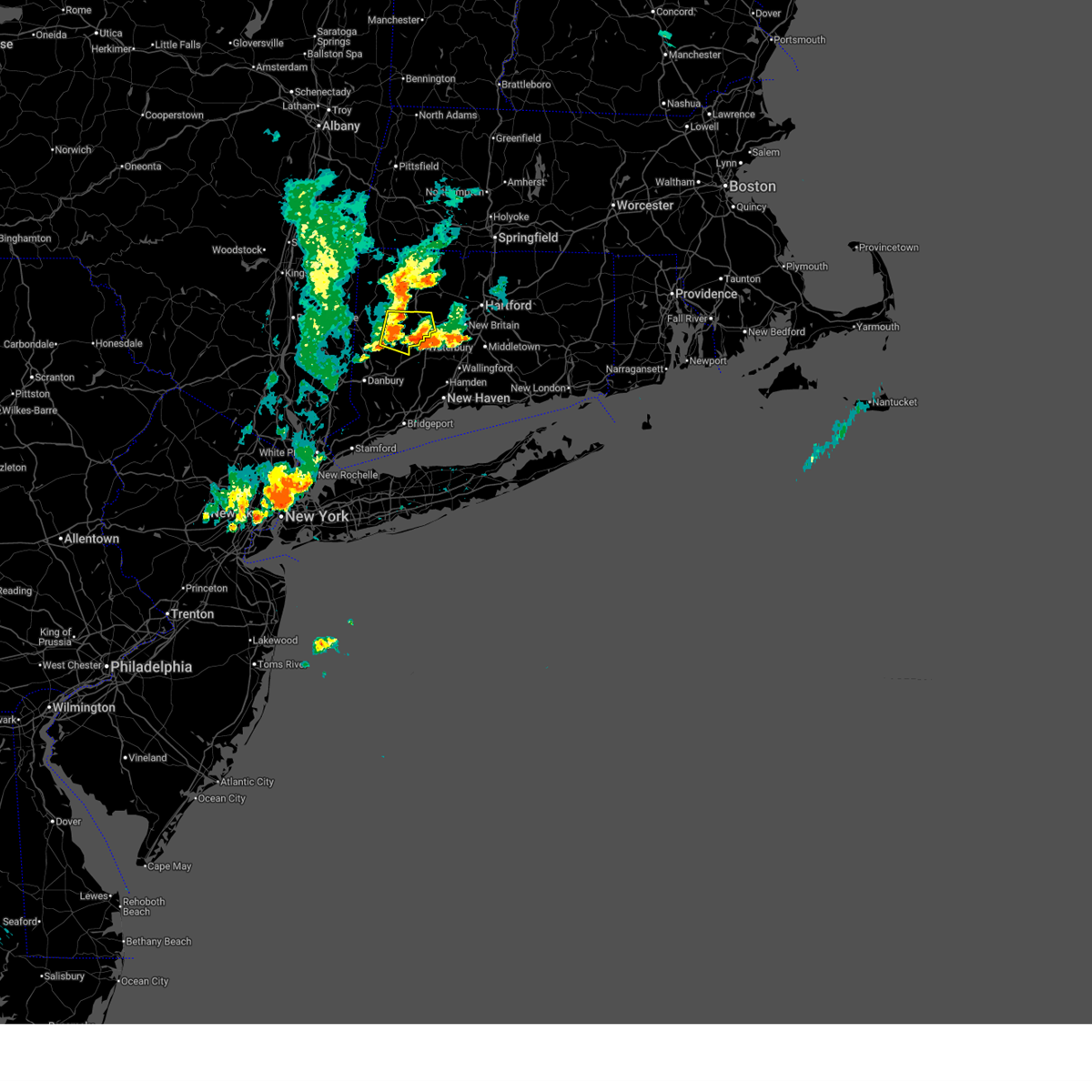
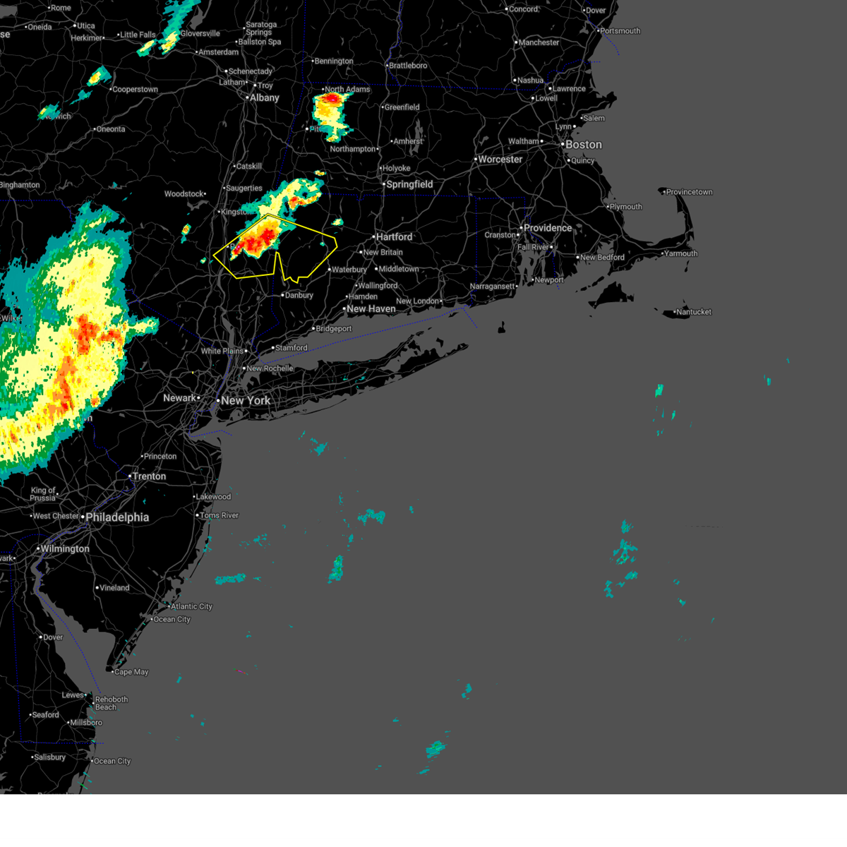
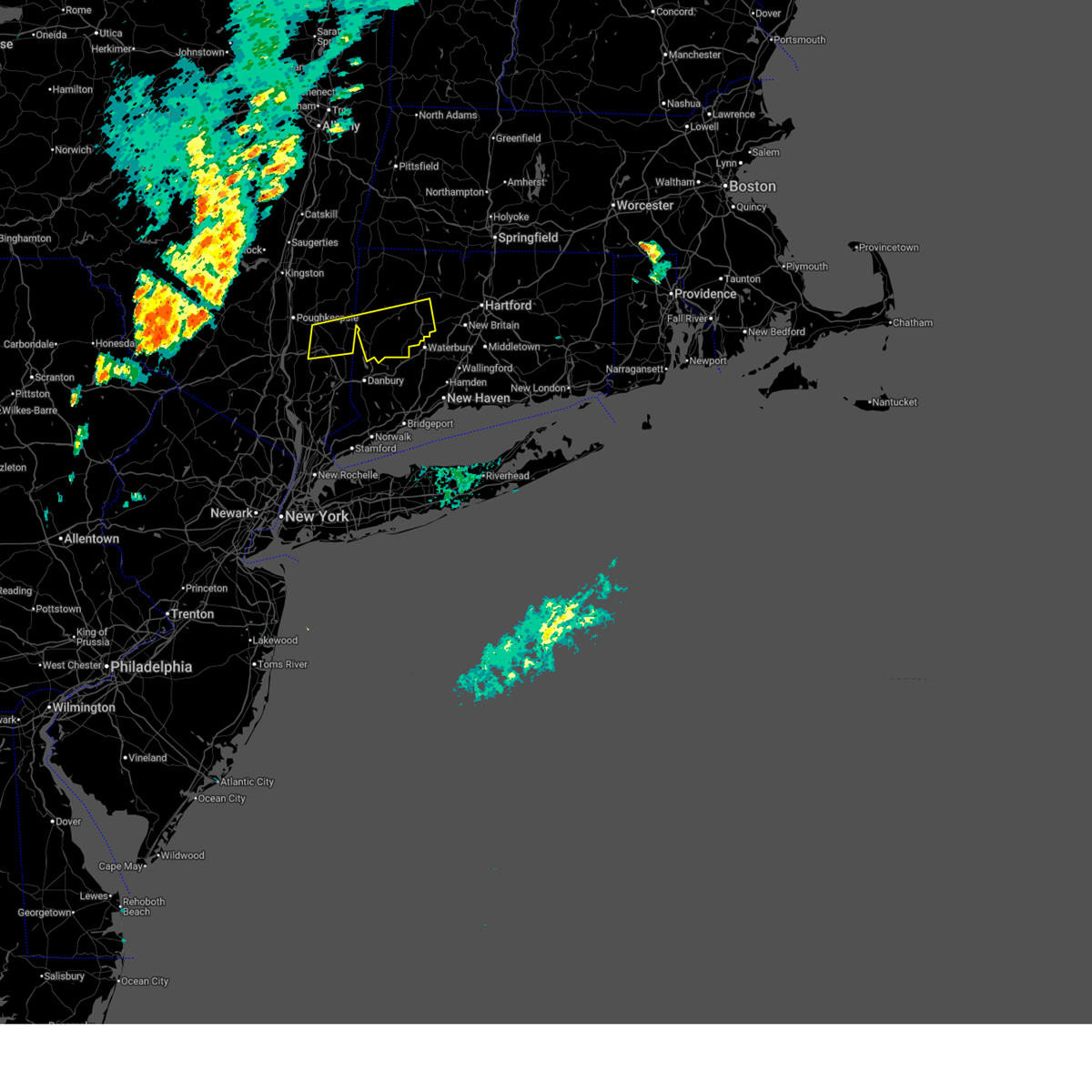
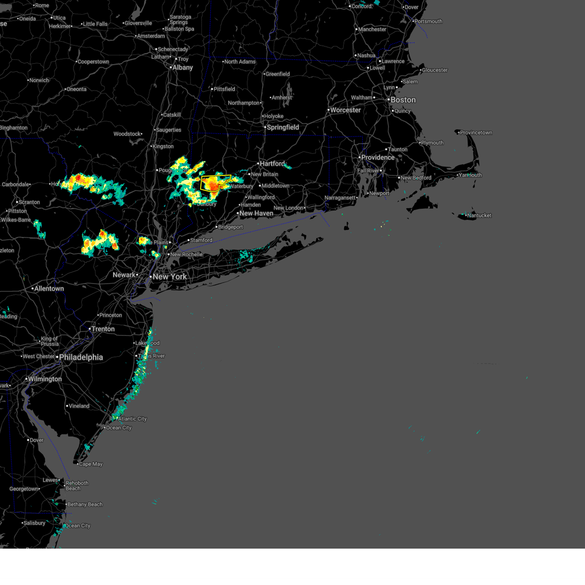
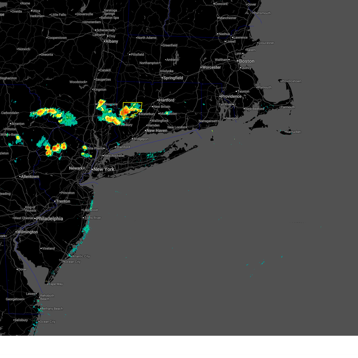
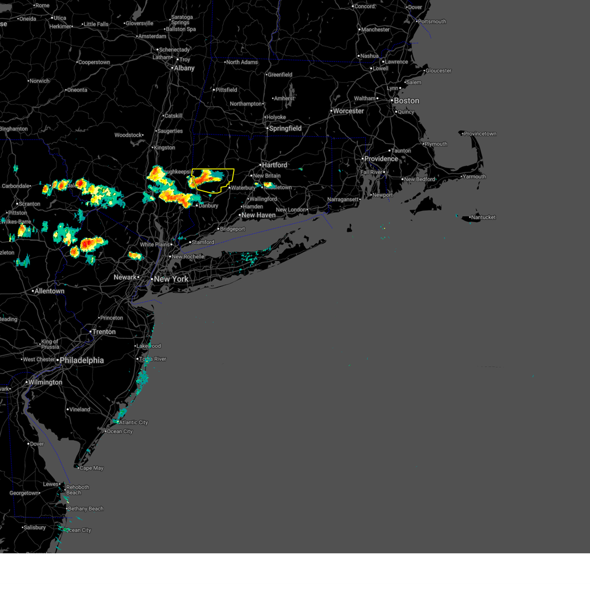
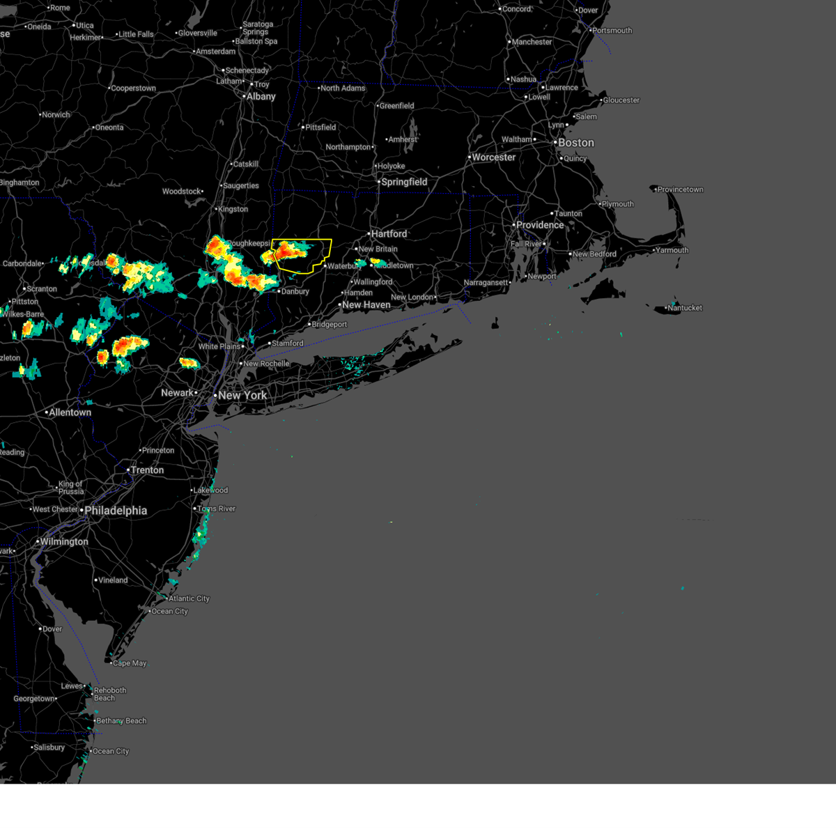
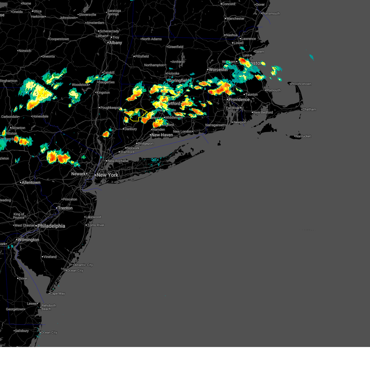
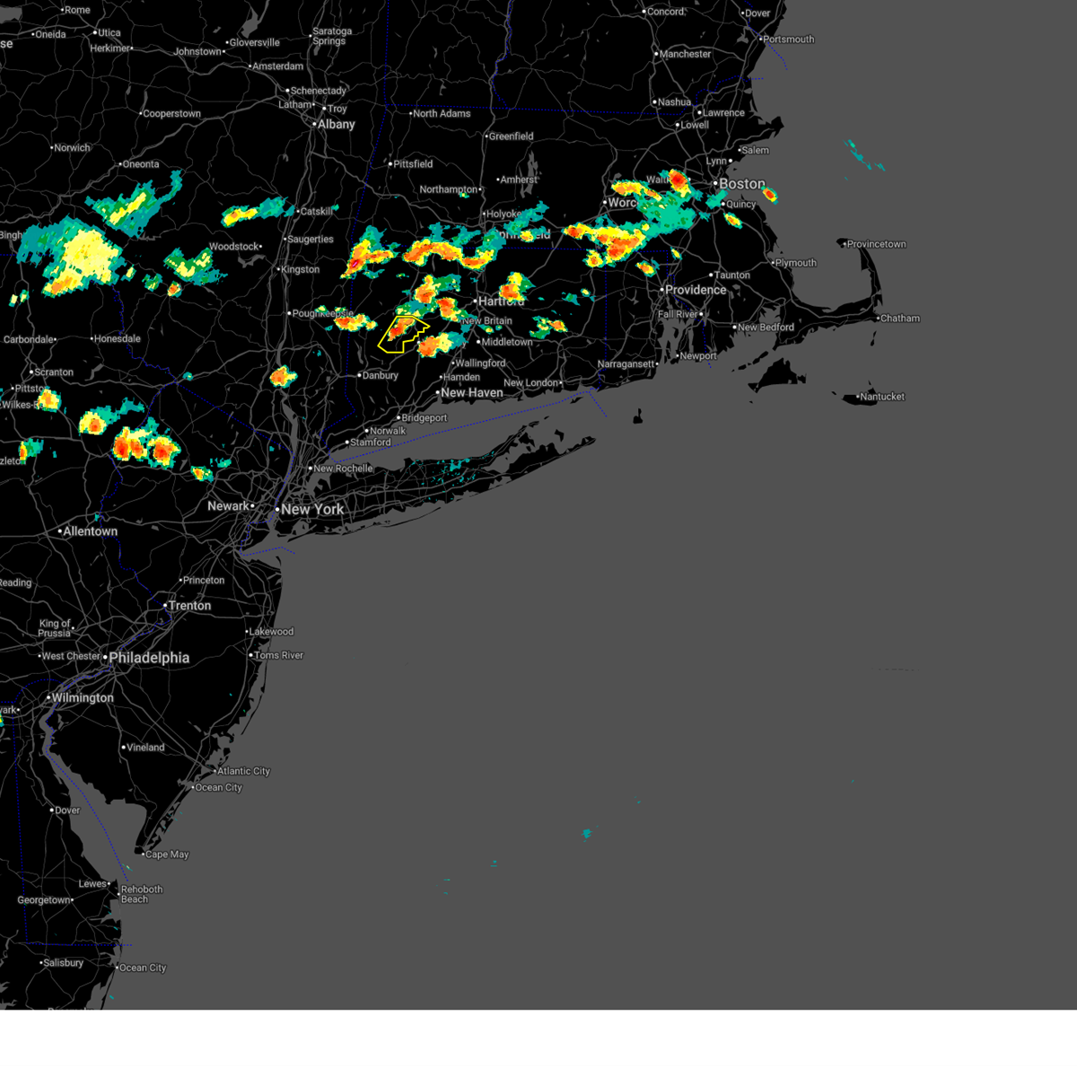
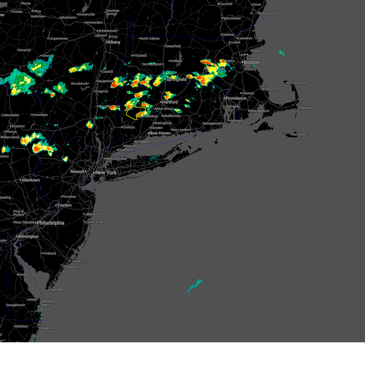
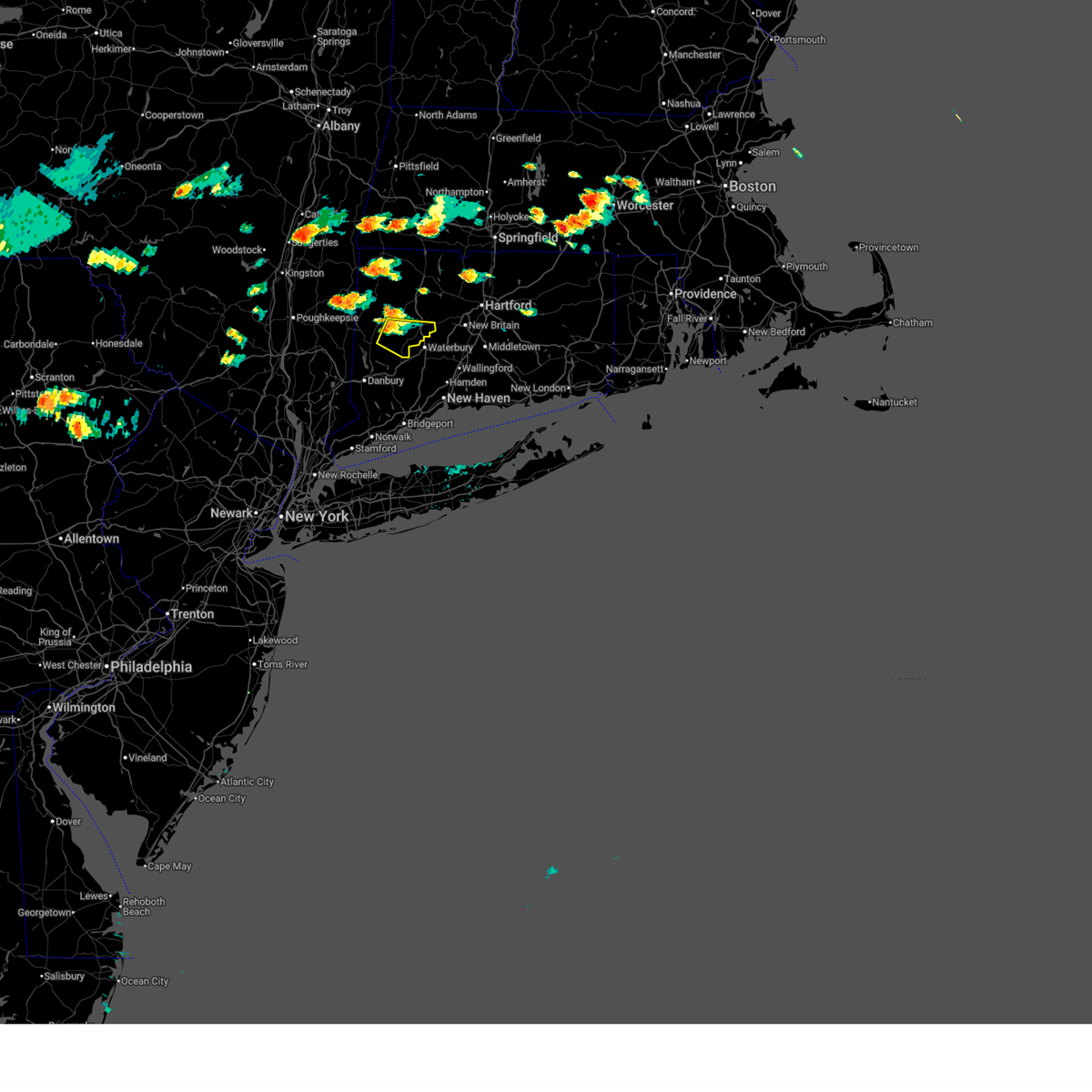
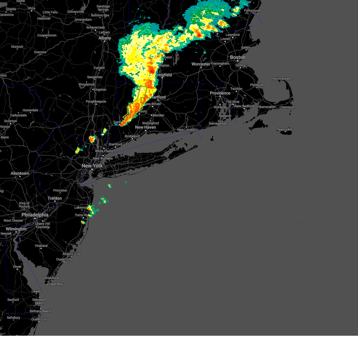
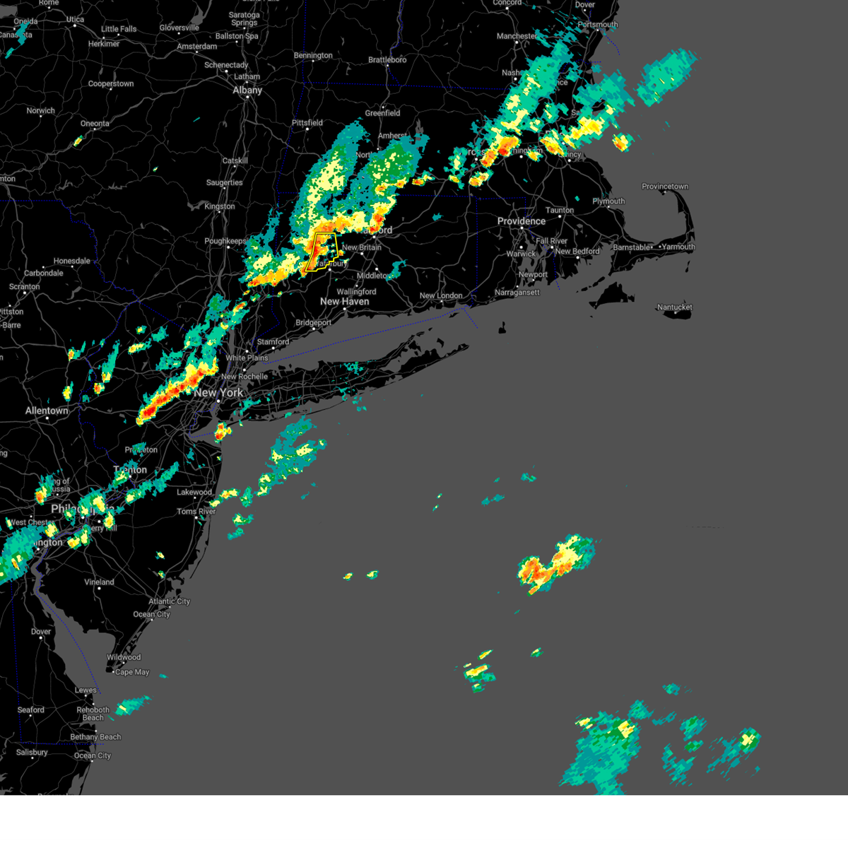
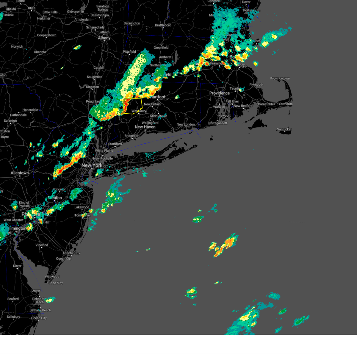
Hail Map for Woodbury Center, CT
The Woodbury Center, CT area has had 0 reports of on-the-ground hail by trained spotters, and has been under severe weather warnings 25 times during the past 12 months. Doppler radar has detected hail at or near Woodbury Center, CT on 24 occasions, including 3 occasions during the past year.
| Name: | Woodbury Center, CT |
| Where Located: | 71.6 miles NE of Brooklyn, NY |
| Map: | Google Map for Woodbury Center, CT |
| Population: | 1294 |
| Housing Units: | 704 |
| More Info: | Search Google for Woodbury Center, CT |
0
The Top Recent Hail Date for Woodbury Center, CT is Friday, June 12, 2026 (14th out of 24)

Hail and Wind Damage Spotted near Woodbury Center, CT
| Date / Time | Report Details |
|---|---|
| 6/12/2026 6:50 PM EDT |
 Svraly the national weather service in albany has issued a * severe thunderstorm warning for, southeastern litchfield county in northern connecticut, * until 745 pm edt. * at 650 pm edt, a severe thunderstorm was located near woodbury center, or 10 miles northeast of new milford, moving east at 10 mph (radar indicated). Hazards include 60 mph wind gusts and quarter size hail. Hail damage to vehicles is expected. Expect wind damage to roofs, siding, and trees. Svraly the national weather service in albany has issued a * severe thunderstorm warning for, southeastern litchfield county in northern connecticut, * until 745 pm edt. * at 650 pm edt, a severe thunderstorm was located near woodbury center, or 10 miles northeast of new milford, moving east at 10 mph (radar indicated). Hazards include 60 mph wind gusts and quarter size hail. Hail damage to vehicles is expected. Expect wind damage to roofs, siding, and trees.
|
| 6/11/2026 3:55 PM EDT |
 At 354 pm edt, a severe thunderstorm was located near thomaston, or 10 miles northwest of wolcott, moving southeast at 40 mph (radar indicated). Hazards include 60 mph wind gusts. Expect damage to roofs, siding, and trees. this severe storm will be near, thomaston and oakville around 400 pm edt. Other locations impacted by this severe thunderstorm include west torrington, grappaville, hotchkissville, haight vineyard, pequabuck, reynolds bridge, hancock, pomeraug, washington, and wrightville. At 354 pm edt, a severe thunderstorm was located near thomaston, or 10 miles northwest of wolcott, moving southeast at 40 mph (radar indicated). Hazards include 60 mph wind gusts. Expect damage to roofs, siding, and trees. this severe storm will be near, thomaston and oakville around 400 pm edt. Other locations impacted by this severe thunderstorm include west torrington, grappaville, hotchkissville, haight vineyard, pequabuck, reynolds bridge, hancock, pomeraug, washington, and wrightville.
|
| 6/11/2026 3:44 PM EDT |
 Svraly the national weather service in albany has issued a * severe thunderstorm warning for, central litchfield county in northern connecticut, * until 415 pm edt. * at 344 pm edt, a severe thunderstorm was located near litchfield, or 7 miles southwest of torrington, moving southeast at 40 mph (radar indicated). Hazards include 60 mph wind gusts. expect damage to roofs, siding, and trees Svraly the national weather service in albany has issued a * severe thunderstorm warning for, central litchfield county in northern connecticut, * until 415 pm edt. * at 344 pm edt, a severe thunderstorm was located near litchfield, or 7 miles southwest of torrington, moving southeast at 40 mph (radar indicated). Hazards include 60 mph wind gusts. expect damage to roofs, siding, and trees
|
| 6/6/2026 6:50 PM EDT |
 At 650 pm edt, a severe thunderstorm was located near new milford, moving east at 35 mph (radar indicated). Hazards include 60 mph wind gusts and penny size hail. Expect damage to roofs, siding, and trees. Locations impacted include, new milford, pawling, thomaston, kent, litchfield, northwest harwinton, woodbury center, new preston, wingdale, hopewell junction, east fishkill, watertown, beekman, plymouth, woodbury, harwinton, bethlehem, washington, morris, and roxbury. At 650 pm edt, a severe thunderstorm was located near new milford, moving east at 35 mph (radar indicated). Hazards include 60 mph wind gusts and penny size hail. Expect damage to roofs, siding, and trees. Locations impacted include, new milford, pawling, thomaston, kent, litchfield, northwest harwinton, woodbury center, new preston, wingdale, hopewell junction, east fishkill, watertown, beekman, plymouth, woodbury, harwinton, bethlehem, washington, morris, and roxbury.
|
| 6/6/2026 6:22 PM EDT |
 At 621 pm edt, a severe thunderstorm was located over wingdale, or 7 miles northwest of sherman, moving east at 45 mph (radar indicated). Hazards include 60 mph wind gusts and penny size hail. Expect damage to roofs, siding, and trees. Locations impacted include, poughkeepsie, new milford, pawling, pleasant valley, thomaston, wappingers falls, amenia, kent, sharon, fishkill, millbrook, litchfield, northwest harwinton, woodbury center, hopewell junction, marlboro, red oaks mill, myers corner, new preston, and cornwall bridge. At 621 pm edt, a severe thunderstorm was located over wingdale, or 7 miles northwest of sherman, moving east at 45 mph (radar indicated). Hazards include 60 mph wind gusts and penny size hail. Expect damage to roofs, siding, and trees. Locations impacted include, poughkeepsie, new milford, pawling, pleasant valley, thomaston, wappingers falls, amenia, kent, sharon, fishkill, millbrook, litchfield, northwest harwinton, woodbury center, hopewell junction, marlboro, red oaks mill, myers corner, new preston, and cornwall bridge.
|
| 6/6/2026 5:58 PM EDT |
 Svraly the national weather service in albany has issued a * severe thunderstorm warning for, southern litchfield county in northern connecticut, southeastern ulster county in east central new york, dutchess county in east central new york, * until 700 pm edt. * at 558 pm edt, a severe thunderstorm was located over pleasant valley, or near poughkeepsie, moving east at 30 mph (radar indicated). Hazards include 60 mph wind gusts and quarter size hail. Hail damage to vehicles is expected. Expect wind damage to roofs, siding, and trees. Svraly the national weather service in albany has issued a * severe thunderstorm warning for, southern litchfield county in northern connecticut, southeastern ulster county in east central new york, dutchess county in east central new york, * until 700 pm edt. * at 558 pm edt, a severe thunderstorm was located over pleasant valley, or near poughkeepsie, moving east at 30 mph (radar indicated). Hazards include 60 mph wind gusts and quarter size hail. Hail damage to vehicles is expected. Expect wind damage to roofs, siding, and trees.
|
| 9/6/2025 3:57 PM EDT |
 The storms which prompted the warning have moved out of the area. therefore, the warning will be allowed to expire. a severe thunderstorm watch remains in effect until 800 pm edt for northern connecticut. The storms which prompted the warning have moved out of the area. therefore, the warning will be allowed to expire. a severe thunderstorm watch remains in effect until 800 pm edt for northern connecticut.
|
| 9/6/2025 3:44 PM EDT |
 At 344 pm edt, severe thunderstorms were located along a line extending from near hartland to near burlington to near southbury, moving east at 20 mph (radar indicated). Hazards include 60 mph wind gusts and quarter size hail. Hail damage to vehicles is expected. expect wind damage to roofs, siding, and trees. Locations impacted include, thomaston, terryville, oakville, woodbury center, watertown, plymouth, woodbury, allentown, minortown, roraback lodge, pequabuck, reynolds bridge, hancock, tolles, pomeraug, north woodbury, plymouth green, terryville station, and delano field. At 344 pm edt, severe thunderstorms were located along a line extending from near hartland to near burlington to near southbury, moving east at 20 mph (radar indicated). Hazards include 60 mph wind gusts and quarter size hail. Hail damage to vehicles is expected. expect wind damage to roofs, siding, and trees. Locations impacted include, thomaston, terryville, oakville, woodbury center, watertown, plymouth, woodbury, allentown, minortown, roraback lodge, pequabuck, reynolds bridge, hancock, tolles, pomeraug, north woodbury, plymouth green, terryville station, and delano field.
|
| 9/6/2025 3:15 PM EDT |
 Svraly the national weather service in albany has issued a * severe thunderstorm warning for, central litchfield county in northern connecticut, * until 400 pm edt. * at 315 pm edt, severe thunderstorms were located along a line extending from near norfolk to near litchfield to near new fairfield, moving east at 20 mph (radar indicated). Hazards include 60 mph wind gusts and quarter size hail. Hail damage to vehicles is expected. Expect wind damage to roofs, siding, and trees. Svraly the national weather service in albany has issued a * severe thunderstorm warning for, central litchfield county in northern connecticut, * until 400 pm edt. * at 315 pm edt, severe thunderstorms were located along a line extending from near norfolk to near litchfield to near new fairfield, moving east at 20 mph (radar indicated). Hazards include 60 mph wind gusts and quarter size hail. Hail damage to vehicles is expected. Expect wind damage to roofs, siding, and trees.
|
| 9/6/2025 2:41 PM EDT |
 the severe thunderstorm warning has been cancelled and is no longer in effect the severe thunderstorm warning has been cancelled and is no longer in effect
|
| 9/6/2025 2:41 PM EDT |
 At 240 pm edt, a severe thunderstorm was located near new milford, moving east at 45 mph (radar indicated). Hazards include 60 mph wind gusts and quarter size hail. Hail damage to vehicles is expected. expect wind damage to roofs, siding, and trees. Locations impacted include, new milford, thomaston, kent, litchfield, northwest harwinton, oakville, new preston, terryville, woodbury center, gaylordsville, watertown, plymouth, woodbury, harwinton, bethlehem, washington, morris, roxbury, bridgewater, and warren. At 240 pm edt, a severe thunderstorm was located near new milford, moving east at 45 mph (radar indicated). Hazards include 60 mph wind gusts and quarter size hail. Hail damage to vehicles is expected. expect wind damage to roofs, siding, and trees. Locations impacted include, new milford, thomaston, kent, litchfield, northwest harwinton, oakville, new preston, terryville, woodbury center, gaylordsville, watertown, plymouth, woodbury, harwinton, bethlehem, washington, morris, roxbury, bridgewater, and warren.
|
| 9/6/2025 2:31 PM EDT |
 At 230 pm edt, a severe thunderstorm was located over wingdale, or near sherman, moving east at 45 mph (radar indicated). Hazards include 60 mph wind gusts and quarter size hail. Hail damage to vehicles is expected. expect wind damage to roofs, siding, and trees. Locations impacted include, new milford, sherman, pawling, thomaston, kent, litchfield, northwest harwinton, oakville, new preston, terryville, woodbury center, wingdale, gaylordsville, watertown, plymouth, woodbury, harwinton, bethlehem, washington, and morris. At 230 pm edt, a severe thunderstorm was located over wingdale, or near sherman, moving east at 45 mph (radar indicated). Hazards include 60 mph wind gusts and quarter size hail. Hail damage to vehicles is expected. expect wind damage to roofs, siding, and trees. Locations impacted include, new milford, sherman, pawling, thomaston, kent, litchfield, northwest harwinton, oakville, new preston, terryville, woodbury center, wingdale, gaylordsville, watertown, plymouth, woodbury, harwinton, bethlehem, washington, and morris.
|
| 9/6/2025 2:21 PM EDT |
 Svraly the national weather service in albany has issued a * severe thunderstorm warning for, southern litchfield county in northern connecticut, southeastern dutchess county in east central new york, * until 315 pm edt. * at 220 pm edt, a severe thunderstorm was located near pawling, moving east at 45 mph (radar indicated). Hazards include 60 mph wind gusts and quarter size hail. Hail damage to vehicles is expected. Expect wind damage to roofs, siding, and trees. Svraly the national weather service in albany has issued a * severe thunderstorm warning for, southern litchfield county in northern connecticut, southeastern dutchess county in east central new york, * until 315 pm edt. * at 220 pm edt, a severe thunderstorm was located near pawling, moving east at 45 mph (radar indicated). Hazards include 60 mph wind gusts and quarter size hail. Hail damage to vehicles is expected. Expect wind damage to roofs, siding, and trees.
|
| 7/30/2025 5:16 PM EDT |
 At 516 pm edt, a severe thunderstorm was located near woodbury center, or 7 miles west of waterbury, moving east at 20 mph (trained weather spotters). Hazards include 60 mph wind gusts and penny size hail. Expect damage to roofs, siding, and trees. Locations impacted include, woodbury center, oakville, watertown, woodbury, bethlehem, washington, roxbury, bridgewater, hotchkissville, reynolds bridge, hancock, river road reserve, pomeraug, gulls hollow, mead corners, delano field, minortown, bethlehem village, the clam shell, and judds bridge. At 516 pm edt, a severe thunderstorm was located near woodbury center, or 7 miles west of waterbury, moving east at 20 mph (trained weather spotters). Hazards include 60 mph wind gusts and penny size hail. Expect damage to roofs, siding, and trees. Locations impacted include, woodbury center, oakville, watertown, woodbury, bethlehem, washington, roxbury, bridgewater, hotchkissville, reynolds bridge, hancock, river road reserve, pomeraug, gulls hollow, mead corners, delano field, minortown, bethlehem village, the clam shell, and judds bridge.
|
| 7/30/2025 5:02 PM EDT |
 At 501 pm edt, a severe thunderstorm was located near woodbury center, or 7 miles east of new milford, moving east at 20 mph (trained weather spotters). Hazards include 60 mph wind gusts and penny size hail. Expect damage to roofs, siding, and trees. Locations impacted include, thomaston, woodbury center, oakville, new preston, terryville, watertown, plymouth, woodbury, bethlehem, washington, morris, roxbury, bridgewater, bantam, grappaville, hotchkissville, reynolds bridge, hancock, river road reserve, and pomeraug. At 501 pm edt, a severe thunderstorm was located near woodbury center, or 7 miles east of new milford, moving east at 20 mph (trained weather spotters). Hazards include 60 mph wind gusts and penny size hail. Expect damage to roofs, siding, and trees. Locations impacted include, thomaston, woodbury center, oakville, new preston, terryville, watertown, plymouth, woodbury, bethlehem, washington, morris, roxbury, bridgewater, bantam, grappaville, hotchkissville, reynolds bridge, hancock, river road reserve, and pomeraug.
|
| 7/30/2025 4:41 PM EDT |
 At 441 pm edt, a severe thunderstorm was located near new milford, moving east at 20 mph (trained weather spotters). Hazards include 60 mph wind gusts and quarter size hail. Hail damage to vehicles is expected. expect wind damage to roofs, siding, and trees. Locations impacted include, new milford, thomaston, kent, oakville, new preston, woodbury center, gaylordsville, terryville, watertown, plymouth, woodbury, bethlehem, washington, morris, roxbury, bridgewater, bantam, hotchkissville, reynolds bridge, and candlewood trails. At 441 pm edt, a severe thunderstorm was located near new milford, moving east at 20 mph (trained weather spotters). Hazards include 60 mph wind gusts and quarter size hail. Hail damage to vehicles is expected. expect wind damage to roofs, siding, and trees. Locations impacted include, new milford, thomaston, kent, oakville, new preston, woodbury center, gaylordsville, terryville, watertown, plymouth, woodbury, bethlehem, washington, morris, roxbury, bridgewater, bantam, hotchkissville, reynolds bridge, and candlewood trails.
|
| 7/30/2025 4:37 PM EDT |
 Svraly the national weather service in albany has issued a * severe thunderstorm warning for, southern litchfield county in northern connecticut, * until 530 pm edt. * at 437 pm edt, a severe thunderstorm was located over new milford, moving east at 20 mph (radar indicated). Hazards include 60 mph wind gusts and penny size hail. expect damage to roofs, siding, and trees Svraly the national weather service in albany has issued a * severe thunderstorm warning for, southern litchfield county in northern connecticut, * until 530 pm edt. * at 437 pm edt, a severe thunderstorm was located over new milford, moving east at 20 mph (radar indicated). Hazards include 60 mph wind gusts and penny size hail. expect damage to roofs, siding, and trees
|
| 7/25/2025 2:53 PM EDT |
 the severe thunderstorm warning has been cancelled and is no longer in effect the severe thunderstorm warning has been cancelled and is no longer in effect
|
| 7/25/2025 2:29 PM EDT |
 Svraly the national weather service in albany has issued a * severe thunderstorm warning for, southeastern litchfield county in northern connecticut, * until 315 pm edt. * at 229 pm edt, a severe thunderstorm was located near woodbury center, or near waterbury, moving southeast at 25 mph (radar indicated). Hazards include 60 mph wind gusts and penny size hail. expect damage to roofs, siding, and trees Svraly the national weather service in albany has issued a * severe thunderstorm warning for, southeastern litchfield county in northern connecticut, * until 315 pm edt. * at 229 pm edt, a severe thunderstorm was located near woodbury center, or near waterbury, moving southeast at 25 mph (radar indicated). Hazards include 60 mph wind gusts and penny size hail. expect damage to roofs, siding, and trees
|
| 7/25/2025 2:15 PM EDT |
 At 214 pm edt, a severe thunderstorm was located near new preston, or 9 miles northeast of new milford, moving southeast at 45 mph. this is a different storm that initially prompted the warning. the initial storm is moving into new haven county (radar indicated). Hazards include 60 mph wind gusts and penny size hail. Expect damage to roofs, siding, and trees. Locations impacted include, thomaston, terryville, woodbury center, oakville, watertown, plymouth, woodbury, bethlehem, washington, morris, roxbury, hotchkissville, pequabuck, reynolds bridge, hancock, pomeraug, gulls hollow, plymouth green, terryville station, and delano field. At 214 pm edt, a severe thunderstorm was located near new preston, or 9 miles northeast of new milford, moving southeast at 45 mph. this is a different storm that initially prompted the warning. the initial storm is moving into new haven county (radar indicated). Hazards include 60 mph wind gusts and penny size hail. Expect damage to roofs, siding, and trees. Locations impacted include, thomaston, terryville, woodbury center, oakville, watertown, plymouth, woodbury, bethlehem, washington, morris, roxbury, hotchkissville, pequabuck, reynolds bridge, hancock, pomeraug, gulls hollow, plymouth green, terryville station, and delano field.
|
| 7/25/2025 1:48 PM EDT |
 Svraly the national weather service in albany has issued a * severe thunderstorm warning for, southeastern litchfield county in northern connecticut, * until 230 pm edt. * at 148 pm edt, a severe thunderstorm was located near new preston, or 8 miles northeast of new milford, moving east at 30 mph (radar indicated). Hazards include 60 mph wind gusts and penny size hail. expect damage to roofs, siding, and trees Svraly the national weather service in albany has issued a * severe thunderstorm warning for, southeastern litchfield county in northern connecticut, * until 230 pm edt. * at 148 pm edt, a severe thunderstorm was located near new preston, or 8 miles northeast of new milford, moving east at 30 mph (radar indicated). Hazards include 60 mph wind gusts and penny size hail. expect damage to roofs, siding, and trees
|
| 7/3/2025 6:44 PM EDT |
 the severe thunderstorm warning has been cancelled and is no longer in effect the severe thunderstorm warning has been cancelled and is no longer in effect
|
| 7/3/2025 6:23 PM EDT |
 At 623 pm edt, severe thunderstorms were located along a line extending from near burlington to near southbury, moving northeast at 65 mph (radar indicated). Hazards include 60 mph wind gusts and quarter size hail. Hail damage to vehicles is expected. expect wind damage to roofs, siding, and trees. Locations impacted include, new milford, sherman, thomaston, oakville, terryville, woodbury center, gaylordsville, watertown, plymouth, woodbury, bethlehem, washington, morris, roxbury, bridgewater, hotchkissville, pequabuck, reynolds bridge, candlewood trails, and pomeraug. At 623 pm edt, severe thunderstorms were located along a line extending from near burlington to near southbury, moving northeast at 65 mph (radar indicated). Hazards include 60 mph wind gusts and quarter size hail. Hail damage to vehicles is expected. expect wind damage to roofs, siding, and trees. Locations impacted include, new milford, sherman, thomaston, oakville, terryville, woodbury center, gaylordsville, watertown, plymouth, woodbury, bethlehem, washington, morris, roxbury, bridgewater, hotchkissville, pequabuck, reynolds bridge, candlewood trails, and pomeraug.
|
| 7/3/2025 6:23 PM EDT |
 the severe thunderstorm warning has been cancelled and is no longer in effect the severe thunderstorm warning has been cancelled and is no longer in effect
|
| 7/3/2025 6:01 PM EDT |
 Svraly the national weather service in albany has issued a * severe thunderstorm warning for, southern litchfield county in northern connecticut, southeastern dutchess county in east central new york, * until 700 pm edt. * at 600 pm edt, severe thunderstorms were located along a line extending from near burlington to near kent to near fahnestock state park, moving southeast at 35 mph (radar indicated). Hazards include 60 mph wind gusts and quarter size hail. Hail damage to vehicles is expected. Expect wind damage to roofs, siding, and trees. Svraly the national weather service in albany has issued a * severe thunderstorm warning for, southern litchfield county in northern connecticut, southeastern dutchess county in east central new york, * until 700 pm edt. * at 600 pm edt, severe thunderstorms were located along a line extending from near burlington to near kent to near fahnestock state park, moving southeast at 35 mph (radar indicated). Hazards include 60 mph wind gusts and quarter size hail. Hail damage to vehicles is expected. Expect wind damage to roofs, siding, and trees.
|
| 5/3/2025 3:52 PM EDT |
 At 352 pm edt, severe thunderstorms were located along a line extending from montgomery to near east granby to near middlebury, moving northeast at 55 mph (radar indicated). Hazards include 60 mph wind gusts. Expect damage to roofs, siding, and trees. Locations impacted include, hotchkissville, pequabuck, reynolds bridge, pomeraug, beech rock, harwinton, east litchfield, plymouth green, morris, delano field, bethlehem village, bethlehem, plymouth, pine meadow, sandy beach, northwest harwinton, east morris, horse heaven, watertown, and bakersville. At 352 pm edt, severe thunderstorms were located along a line extending from montgomery to near east granby to near middlebury, moving northeast at 55 mph (radar indicated). Hazards include 60 mph wind gusts. Expect damage to roofs, siding, and trees. Locations impacted include, hotchkissville, pequabuck, reynolds bridge, pomeraug, beech rock, harwinton, east litchfield, plymouth green, morris, delano field, bethlehem village, bethlehem, plymouth, pine meadow, sandy beach, northwest harwinton, east morris, horse heaven, watertown, and bakersville.
|
| 5/3/2025 3:33 PM EDT |
 At 332 pm edt, severe thunderstorms were located along a line extending from near sandisfield to near northwest harwinton to near bethel, moving east at 55 mph (radar indicated). Hazards include 60 mph wind gusts. Expect damage to roofs, siding, and trees. Locations impacted include, cornwall, west torrington, south canaan, haight vineyard, wrightville, marble dale, east litchfield, taconic, north kent, plymouth green, cornwall bridge pottery, delano field, dempsey landing, lime rock, litchfield green, hatch four corners, bethlehem, plymouth, newfield, and pine meadow. At 332 pm edt, severe thunderstorms were located along a line extending from near sandisfield to near northwest harwinton to near bethel, moving east at 55 mph (radar indicated). Hazards include 60 mph wind gusts. Expect damage to roofs, siding, and trees. Locations impacted include, cornwall, west torrington, south canaan, haight vineyard, wrightville, marble dale, east litchfield, taconic, north kent, plymouth green, cornwall bridge pottery, delano field, dempsey landing, lime rock, litchfield green, hatch four corners, bethlehem, plymouth, newfield, and pine meadow.
|
| 5/3/2025 3:33 PM EDT |
 the severe thunderstorm warning has been cancelled and is no longer in effect the severe thunderstorm warning has been cancelled and is no longer in effect
|
| 5/3/2025 3:16 PM EDT |
 At 316 pm edt, severe thunderstorms were located along a line extending from near canaan to near cornwall bridge to carmel, moving northeast at 55 mph (radar indicated). Hazards include 60 mph wind gusts. Expect damage to roofs, siding, and trees. Locations impacted include, south canaan, wrightville, salisbury, south amenia, east litchfield, plymouth green, bulls bridge, delano field, dempsey landing, litchfield green, hatch four corners, bethlehem, hammertown, gaylordsville station, wellsville, northwest harwinton, mcclaveville, horse heaven, carlsons grove, and winchester center. At 316 pm edt, severe thunderstorms were located along a line extending from near canaan to near cornwall bridge to carmel, moving northeast at 55 mph (radar indicated). Hazards include 60 mph wind gusts. Expect damage to roofs, siding, and trees. Locations impacted include, south canaan, wrightville, salisbury, south amenia, east litchfield, plymouth green, bulls bridge, delano field, dempsey landing, litchfield green, hatch four corners, bethlehem, hammertown, gaylordsville station, wellsville, northwest harwinton, mcclaveville, horse heaven, carlsons grove, and winchester center.
|
| 5/3/2025 3:05 PM EDT |
 Svraly the national weather service in albany has issued a * severe thunderstorm warning for, litchfield county in northern connecticut, eastern dutchess county in east central new york, * until 400 pm edt. * at 304 pm edt, severe thunderstorms were located along a line extending from near millerton to kent to near yorktown heights, moving northeast at 50 mph (radar indicated). Hazards include 60 mph wind gusts. expect damage to roofs, siding, and trees Svraly the national weather service in albany has issued a * severe thunderstorm warning for, litchfield county in northern connecticut, eastern dutchess county in east central new york, * until 400 pm edt. * at 304 pm edt, severe thunderstorms were located along a line extending from near millerton to kent to near yorktown heights, moving northeast at 50 mph (radar indicated). Hazards include 60 mph wind gusts. expect damage to roofs, siding, and trees
|
| 8/4/2024 4:04 PM EDT |
 At 404 pm edt, a severe thunderstorm was located over thomaston, or 8 miles west of bristol, moving east at 25 mph (radar indicated). Hazards include 60 mph wind gusts. Expect damage to roofs, siding, and trees. Locations impacted include, thomaston, terryville, northwest harwinton, oakville, woodbury center, watertown, plymouth, harwinton, bethlehem, hotchkissville, haight vineyard, pequabuck, reynolds bridge, hancock, east litchfield, plymouth green, northfield, terryville station, delano field, and allentown. At 404 pm edt, a severe thunderstorm was located over thomaston, or 8 miles west of bristol, moving east at 25 mph (radar indicated). Hazards include 60 mph wind gusts. Expect damage to roofs, siding, and trees. Locations impacted include, thomaston, terryville, northwest harwinton, oakville, woodbury center, watertown, plymouth, harwinton, bethlehem, hotchkissville, haight vineyard, pequabuck, reynolds bridge, hancock, east litchfield, plymouth green, northfield, terryville station, delano field, and allentown.
|
| 8/4/2024 3:42 PM EDT |
 Svraly the national weather service in albany has issued a * severe thunderstorm warning for, southeastern litchfield county in northern connecticut, * until 430 pm edt. * at 342 pm edt, a severe thunderstorm was located near new preston, or 9 miles northeast of new milford, moving east at 25 mph (radar indicated). Hazards include 60 mph wind gusts. expect damage to roofs, siding, and trees Svraly the national weather service in albany has issued a * severe thunderstorm warning for, southeastern litchfield county in northern connecticut, * until 430 pm edt. * at 342 pm edt, a severe thunderstorm was located near new preston, or 9 miles northeast of new milford, moving east at 25 mph (radar indicated). Hazards include 60 mph wind gusts. expect damage to roofs, siding, and trees
|
| 6/26/2024 9:45 PM EDT |
 The storms which prompted the warning have moved out of the area. therefore, the warning will be allowed to expire for dutchess and southern and western portions of litchfield county. however, a severe thunderstorm warning remains in effect for portions of northern and eastern litchfield county until 1015 pm. a severe thunderstorm watch remains in effect until midnight edt for northern connecticut, and east central new york. The storms which prompted the warning have moved out of the area. therefore, the warning will be allowed to expire for dutchess and southern and western portions of litchfield county. however, a severe thunderstorm warning remains in effect for portions of northern and eastern litchfield county until 1015 pm. a severe thunderstorm watch remains in effect until midnight edt for northern connecticut, and east central new york.
|
| 6/26/2024 9:30 PM EDT |
 At 929 pm edt, severe thunderstorms were located along a line extending from near amenia to near cornwall bridge to near newtown, moving northeast at 45 mph (law enforcement. this line of storms has had a history of producing downed trees and wires in dutchess county). Hazards include 60 mph wind gusts. Expect damage to roofs, siding, and trees. these severe storms will be near, torrington, litchfield, millerton, woodbury center, and falls village around 935 pm edt. oakville and northwest harwinton around 940 pm edt. Other locations impacted by these severe thunderstorms include cornwall, west torrington, south canaan, haight vineyard, wrightville, salisbury, smithfield, south amenia, marble dale, and east litchfield. At 929 pm edt, severe thunderstorms were located along a line extending from near amenia to near cornwall bridge to near newtown, moving northeast at 45 mph (law enforcement. this line of storms has had a history of producing downed trees and wires in dutchess county). Hazards include 60 mph wind gusts. Expect damage to roofs, siding, and trees. these severe storms will be near, torrington, litchfield, millerton, woodbury center, and falls village around 935 pm edt. oakville and northwest harwinton around 940 pm edt. Other locations impacted by these severe thunderstorms include cornwall, west torrington, south canaan, haight vineyard, wrightville, salisbury, smithfield, south amenia, marble dale, and east litchfield.
|
| 6/21/2024 5:06 PM EDT |
 At 505 pm edt, a severe thunderstorm was located over thomaston, or 8 miles northwest of wolcott, moving east at 25 mph (radar indicated). Hazards include 60 mph wind gusts. Expect damage to roofs, siding, and trees. Locations impacted include, thomaston, terryville, oakville, woodbury center, watertown, plymouth, woodbury, allentown, minortown, roraback lodge, hotchkissville, pequabuck, reynolds bridge, hancock, tolles, pomeraug, north woodbury, plymouth green, northfield, and terryville station. At 505 pm edt, a severe thunderstorm was located over thomaston, or 8 miles northwest of wolcott, moving east at 25 mph (radar indicated). Hazards include 60 mph wind gusts. Expect damage to roofs, siding, and trees. Locations impacted include, thomaston, terryville, oakville, woodbury center, watertown, plymouth, woodbury, allentown, minortown, roraback lodge, hotchkissville, pequabuck, reynolds bridge, hancock, tolles, pomeraug, north woodbury, plymouth green, northfield, and terryville station.
|
| 6/21/2024 4:42 PM EDT |
 Svraly the national weather service in albany has issued a * severe thunderstorm warning for, southern litchfield county in northern connecticut, * until 515 pm edt. * at 442 pm edt, a severe thunderstorm was located near new preston, or near new milford, moving east at 25 mph (radar indicated). Hazards include 60 mph wind gusts. expect damage to roofs, siding, and trees Svraly the national weather service in albany has issued a * severe thunderstorm warning for, southern litchfield county in northern connecticut, * until 515 pm edt. * at 442 pm edt, a severe thunderstorm was located near new preston, or near new milford, moving east at 25 mph (radar indicated). Hazards include 60 mph wind gusts. expect damage to roofs, siding, and trees
|
| 9/8/2023 5:20 PM EDT |
 At 520 pm edt, severe thunderstorms were located along a line extending from near torrington to near thomaston to middlebury, moving northeast at 30 mph (radar indicated). Hazards include 60 mph wind gusts and quarter size hail. Hail damage to vehicles is expected. expect wind damage to roofs, siding, and trees. locations impacted include, torrington, thomaston, litchfield, northwest harwinton, oakville, terryville, woodbury center, new preston, watertown, plymouth, woodbury, harwinton, bethlehem, goshen, morris, warren, bantam, west torrington, hotchkissville and haight vineyard. hail threat, radar indicated max hail size, 1. 00 in wind threat, radar indicated max wind gust, 60 mph. At 520 pm edt, severe thunderstorms were located along a line extending from near torrington to near thomaston to middlebury, moving northeast at 30 mph (radar indicated). Hazards include 60 mph wind gusts and quarter size hail. Hail damage to vehicles is expected. expect wind damage to roofs, siding, and trees. locations impacted include, torrington, thomaston, litchfield, northwest harwinton, oakville, terryville, woodbury center, new preston, watertown, plymouth, woodbury, harwinton, bethlehem, goshen, morris, warren, bantam, west torrington, hotchkissville and haight vineyard. hail threat, radar indicated max hail size, 1. 00 in wind threat, radar indicated max wind gust, 60 mph.
|
| 9/8/2023 4:59 PM EDT |
 At 459 pm edt, severe thunderstorms were located along a line extending from near cornwall bridge to near new preston to near brookfield, moving northeast at 30 mph (radar indicated). Hazards include 60 mph wind gusts and quarter size hail. Hail damage to vehicles is expected. Expect wind damage to roofs, siding, and trees. At 459 pm edt, severe thunderstorms were located along a line extending from near cornwall bridge to near new preston to near brookfield, moving northeast at 30 mph (radar indicated). Hazards include 60 mph wind gusts and quarter size hail. Hail damage to vehicles is expected. Expect wind damage to roofs, siding, and trees.
|
| 9/8/2023 4:50 PM EDT |
 At 450 pm edt, a severe thunderstorm was located over new milford, moving northeast at 25 mph (radar indicated). Hazards include 60 mph wind gusts and quarter size hail. Hail damage to vehicles is expected. expect wind damage to roofs, siding, and trees. locations impacted include, new milford, kent, litchfield, new preston, woodbury center, gaylordsville, cornwall bridge, woodbury, bethlehem, washington, morris, roxbury, bridgewater, warren, bantam, hotchkissville, haight vineyard, candlewood trails, skiff mountain and lower merryall. hail threat, radar indicated max hail size, 1. 00 in wind threat, radar indicated max wind gust, 60 mph. At 450 pm edt, a severe thunderstorm was located over new milford, moving northeast at 25 mph (radar indicated). Hazards include 60 mph wind gusts and quarter size hail. Hail damage to vehicles is expected. expect wind damage to roofs, siding, and trees. locations impacted include, new milford, kent, litchfield, new preston, woodbury center, gaylordsville, cornwall bridge, woodbury, bethlehem, washington, morris, roxbury, bridgewater, warren, bantam, hotchkissville, haight vineyard, candlewood trails, skiff mountain and lower merryall. hail threat, radar indicated max hail size, 1. 00 in wind threat, radar indicated max wind gust, 60 mph.
|
| 9/8/2023 4:03 PM EDT |
 At 403 pm edt, a severe thunderstorm was located over new milford, moving northeast at 10 mph (radar indicated). Hazards include 60 mph wind gusts and quarter size hail. Hail damage to vehicles is expected. Expect wind damage to roofs, siding, and trees. At 403 pm edt, a severe thunderstorm was located over new milford, moving northeast at 10 mph (radar indicated). Hazards include 60 mph wind gusts and quarter size hail. Hail damage to vehicles is expected. Expect wind damage to roofs, siding, and trees.
|
| 8/12/2023 9:21 PM EDT |
 The severe thunderstorm warning for southwestern litchfield county will expire at 930 pm edt, the storms which prompted the warning have weakened below severe limits, and have exited the warned area. therefore, the warning will be allowed to expire. a severe thunderstorm watch remains in effect until midnight edt for northern connecticut, and east central new york. The severe thunderstorm warning for southwestern litchfield county will expire at 930 pm edt, the storms which prompted the warning have weakened below severe limits, and have exited the warned area. therefore, the warning will be allowed to expire. a severe thunderstorm watch remains in effect until midnight edt for northern connecticut, and east central new york.
|
| 8/12/2023 9:06 PM EDT |
 At 906 pm edt, severe thunderstorms were located along a line extending from near new preston to near mount kisco, moving southeast at 30 mph (radar indicated). Hazards include 60 mph wind gusts and quarter size hail. Hail damage to vehicles is expected. expect wind damage to roofs, siding, and trees. Locations impacted include, new milford, new preston, woodbury center, gaylordsville, woodbury, bethlehem, washington, roxbury, bridgewater, warren, hotchkissville, candlewood trails, pomeraug, lower merryall, marble dale, bulls bridge, upper merryall, erickson corner, bethlehem village and candlewood point. At 906 pm edt, severe thunderstorms were located along a line extending from near new preston to near mount kisco, moving southeast at 30 mph (radar indicated). Hazards include 60 mph wind gusts and quarter size hail. Hail damage to vehicles is expected. expect wind damage to roofs, siding, and trees. Locations impacted include, new milford, new preston, woodbury center, gaylordsville, woodbury, bethlehem, washington, roxbury, bridgewater, warren, hotchkissville, candlewood trails, pomeraug, lower merryall, marble dale, bulls bridge, upper merryall, erickson corner, bethlehem village and candlewood point.
|
| 8/12/2023 8:53 PM EDT |
 At 852 pm edt, severe thunderstorms were located along a line extending from near cornwall bridge to near yorktown heights, moving southeast at 35 mph (radar indicated). Hazards include 60 mph wind gusts and quarter size hail. Hail damage to vehicles is expected. Expect wind damage to roofs, siding, and trees. At 852 pm edt, severe thunderstorms were located along a line extending from near cornwall bridge to near yorktown heights, moving southeast at 35 mph (radar indicated). Hazards include 60 mph wind gusts and quarter size hail. Hail damage to vehicles is expected. Expect wind damage to roofs, siding, and trees.
|
| 7/27/2023 6:25 PM EDT |
 The severe thunderstorm warning for central litchfield county will expire at 630 pm edt, the storms which prompted the warning have weakened below severe limits, and no longer pose an immediate threat to life or property. therefore, the warning will be allowed to expire. a severe thunderstorm watch remains in effect until 800 pm edt for northern connecticut, and east central new york. The severe thunderstorm warning for central litchfield county will expire at 630 pm edt, the storms which prompted the warning have weakened below severe limits, and no longer pose an immediate threat to life or property. therefore, the warning will be allowed to expire. a severe thunderstorm watch remains in effect until 800 pm edt for northern connecticut, and east central new york.
|
| 7/27/2023 6:10 PM EDT |
 At 609 pm edt, severe thunderstorms were located along a line extending from new hartford center to near new fairfield, moving east at 45 mph (radar indicated). Hazards include 60 mph wind gusts and penny size hail. Expect damage to roofs, siding, and trees. locations impacted include, torrington, new milford, thomaston, new hartford, kent, litchfield, northwest harwinton, oakville, terryville, new hartford center, woodbury center, gaylordsville, new preston, watertown, plymouth, woodbury, harwinton, bethlehem, washington and goshen. hail threat, radar indicated max hail size, 0. 75 in wind threat, radar indicated max wind gust, 60 mph. At 609 pm edt, severe thunderstorms were located along a line extending from new hartford center to near new fairfield, moving east at 45 mph (radar indicated). Hazards include 60 mph wind gusts and penny size hail. Expect damage to roofs, siding, and trees. locations impacted include, torrington, new milford, thomaston, new hartford, kent, litchfield, northwest harwinton, oakville, terryville, new hartford center, woodbury center, gaylordsville, new preston, watertown, plymouth, woodbury, harwinton, bethlehem, washington and goshen. hail threat, radar indicated max hail size, 0. 75 in wind threat, radar indicated max wind gust, 60 mph.
|
| 7/27/2023 5:42 PM EDT |
 The severe thunderstorm warning for litchfield, southeastern ulster and dutchess counties will expire at 545 pm edt, the storms which prompted the warning have moved out portions of the area and another warning has been issued. therefore, this warning will be allowed to expire. a severe thunderstorm watch remains in effect until 800 pm edt for northern connecticut, and east central new york. remember, a severe thunderstorm warning still remains in effect for portions of dutchess and litchfield county until 630 pm edt. The severe thunderstorm warning for litchfield, southeastern ulster and dutchess counties will expire at 545 pm edt, the storms which prompted the warning have moved out portions of the area and another warning has been issued. therefore, this warning will be allowed to expire. a severe thunderstorm watch remains in effect until 800 pm edt for northern connecticut, and east central new york. remember, a severe thunderstorm warning still remains in effect for portions of dutchess and litchfield county until 630 pm edt.
|
| 7/27/2023 5:40 PM EDT |
 At 538 pm edt, severe thunderstorms were located along a line extending from near cornwall bridge to fishkill, moving east at 45 mph (radar indicated). Hazards include 60 mph wind gusts and penny size hail. expect damage to roofs, siding, and trees At 538 pm edt, severe thunderstorms were located along a line extending from near cornwall bridge to fishkill, moving east at 45 mph (radar indicated). Hazards include 60 mph wind gusts and penny size hail. expect damage to roofs, siding, and trees
|
| 7/27/2023 4:55 PM EDT |
 At 454 pm edt, severe thunderstorms were located along a line extending from near hartland to near litchfield to new paltz, moving south at 40 mph (radar indicated). Hazards include 60 mph wind gusts and penny size hail. expect damage to roofs, siding, and trees At 454 pm edt, severe thunderstorms were located along a line extending from near hartland to near litchfield to new paltz, moving south at 40 mph (radar indicated). Hazards include 60 mph wind gusts and penny size hail. expect damage to roofs, siding, and trees
|
| 7/24/2022 8:53 PM EDT |
 At 853 pm edt, severe thunderstorms were located along a line extending from 6 miles northwest of torrington to near new preston to brewster, moving east at 40 mph (radar indicated). Hazards include 60 mph wind gusts. expect damage to roofs, siding, and trees At 853 pm edt, severe thunderstorms were located along a line extending from 6 miles northwest of torrington to near new preston to brewster, moving east at 40 mph (radar indicated). Hazards include 60 mph wind gusts. expect damage to roofs, siding, and trees
|
| 7/21/2022 2:25 PM EDT |
 At 225 pm edt, a severe thunderstorm was located over woodbury center, or near southbury, moving east at 55 mph (radar indicated). Hazards include 60 mph wind gusts and quarter size hail. Hail damage to vehicles is expected. Expect wind damage to roofs, siding, and trees. At 225 pm edt, a severe thunderstorm was located over woodbury center, or near southbury, moving east at 55 mph (radar indicated). Hazards include 60 mph wind gusts and quarter size hail. Hail damage to vehicles is expected. Expect wind damage to roofs, siding, and trees.
|
| 5/22/2022 8:01 PM EDT |
 At 800 pm edt, severe thunderstorms were located along a line extending from near new hartford center to near thomaston to near brookfield, moving east at 30 mph (radar indicated). Hazards include 60 mph wind gusts and quarter size hail. Hail damage to vehicles is expected. expect wind damage to roofs, siding, and trees. locations impacted include, torrington, new milford, thomaston, litchfield, northwest harwinton, oakville, terryville, woodbury center, new hartford center, watertown, plymouth, woodbury, harwinton, bethlehem, washington, morris, roxbury, bridgewater, bantam and west torrington. hail threat, radar indicated max hail size, 1. 00 in wind threat, radar indicated max wind gust, 60 mph. At 800 pm edt, severe thunderstorms were located along a line extending from near new hartford center to near thomaston to near brookfield, moving east at 30 mph (radar indicated). Hazards include 60 mph wind gusts and quarter size hail. Hail damage to vehicles is expected. expect wind damage to roofs, siding, and trees. locations impacted include, torrington, new milford, thomaston, litchfield, northwest harwinton, oakville, terryville, woodbury center, new hartford center, watertown, plymouth, woodbury, harwinton, bethlehem, washington, morris, roxbury, bridgewater, bantam and west torrington. hail threat, radar indicated max hail size, 1. 00 in wind threat, radar indicated max wind gust, 60 mph.
|
| 5/22/2022 7:42 PM EDT |
 At 741 pm edt, a severe thunderstorm was located near litchfield, or 7 miles southwest of torrington, moving east at 35 mph (radar indicated). Hazards include 60 mph wind gusts and quarter size hail. Hail damage to vehicles is expected. Expect wind damage to roofs, siding, and trees. At 741 pm edt, a severe thunderstorm was located near litchfield, or 7 miles southwest of torrington, moving east at 35 mph (radar indicated). Hazards include 60 mph wind gusts and quarter size hail. Hail damage to vehicles is expected. Expect wind damage to roofs, siding, and trees.
|
| 5/16/2022 4:53 PM EDT |
 At 452 pm edt, severe thunderstorms were located along a line extending from near great barrington to sharon to brewster, moving northeast at 75 mph (radar indicated). Hazards include 60 mph wind gusts and quarter size hail. Hail damage to vehicles is expected. Expect wind damage to roofs, siding, and trees. At 452 pm edt, severe thunderstorms were located along a line extending from near great barrington to sharon to brewster, moving northeast at 75 mph (radar indicated). Hazards include 60 mph wind gusts and quarter size hail. Hail damage to vehicles is expected. Expect wind damage to roofs, siding, and trees.
|
| 4/14/2022 6:02 PM EDT |
 At 601 pm edt, severe thunderstorms were located along a line extending from near granville to near burlington, moving northeast at 50 mph (radar indicated). Hazards include 60 mph wind gusts. Expect damage to roofs, siding, and trees. Locations impacted include, torrington, thomaston, new hartford, litchfield, northwest harwinton, oakville, terryville, winsted, new hartford center, woodbury center, watertown, plymouth, woodbury, harwinton, barkhamsted, bethlehem, goshen, morris, colebrook and bantam. At 601 pm edt, severe thunderstorms were located along a line extending from near granville to near burlington, moving northeast at 50 mph (radar indicated). Hazards include 60 mph wind gusts. Expect damage to roofs, siding, and trees. Locations impacted include, torrington, thomaston, new hartford, litchfield, northwest harwinton, oakville, terryville, winsted, new hartford center, woodbury center, watertown, plymouth, woodbury, harwinton, barkhamsted, bethlehem, goshen, morris, colebrook and bantam.
|
| 4/14/2022 5:41 PM EDT |
 At 541 pm edt, severe thunderstorms were located along a line extending from norfolk to near new preston, moving northeast at 50 mph (radar indicated). Hazards include 60 mph wind gusts. Expect damage to roofs, siding, and trees. locations impacted include, torrington, new milford, thomaston, new hartford, kent, sharon, litchfield, northwest harwinton, oakville, terryville, new hartford center, woodbury center, new preston, cornwall bridge, winsted, watertown, plymouth, woodbury, harwinton and barkhamsted. hail threat, radar indicated max hail size, <. 75 in wind threat, radar indicated max wind gust, 60 mph. At 541 pm edt, severe thunderstorms were located along a line extending from norfolk to near new preston, moving northeast at 50 mph (radar indicated). Hazards include 60 mph wind gusts. Expect damage to roofs, siding, and trees. locations impacted include, torrington, new milford, thomaston, new hartford, kent, sharon, litchfield, northwest harwinton, oakville, terryville, new hartford center, woodbury center, new preston, cornwall bridge, winsted, watertown, plymouth, woodbury, harwinton and barkhamsted. hail threat, radar indicated max hail size, <. 75 in wind threat, radar indicated max wind gust, 60 mph.
|
| 4/14/2022 5:16 PM EDT |
 At 515 pm edt, severe thunderstorms were located along a line extending from amenia to lake carmel, moving northeast at 50 mph (radar indicated). Hazards include 60 mph wind gusts. expect damage to roofs, siding, and trees At 515 pm edt, severe thunderstorms were located along a line extending from amenia to lake carmel, moving northeast at 50 mph (radar indicated). Hazards include 60 mph wind gusts. expect damage to roofs, siding, and trees
|
| 3/7/2022 9:31 PM EST |
 At 930 pm est, severe thunderstorms were located along a line extending from near tolland to litchfield to new fairfield, moving east at 65 mph (radar indicated). Hazards include 60 mph wind gusts. Expect damage to roofs, siding, and trees. severe thunderstorms will be near, thomaston around 935 pm est. northwest harwinton and terryville around 940 pm est. wolcott and woodbury center around 945 pm est. oakville around 950 pm est. other locations impacted by these severe thunderstorms include west torrington, haight vineyard, wrightville, marble dale, east litchfield, plymouth green, delano field, dempsey landing, litchfield green and hatch four corners. please report hail size, damaging winds and reports of trees down to the national weather service by email at alb. stormreport@noaa. gov, on facebook at www. facebook. com/nwsalbany or twitter @nwsalbany hail threat, radar indicated max hail size, <. 75 in wind threat, radar indicated max wind gust, 60 mph. At 930 pm est, severe thunderstorms were located along a line extending from near tolland to litchfield to new fairfield, moving east at 65 mph (radar indicated). Hazards include 60 mph wind gusts. Expect damage to roofs, siding, and trees. severe thunderstorms will be near, thomaston around 935 pm est. northwest harwinton and terryville around 940 pm est. wolcott and woodbury center around 945 pm est. oakville around 950 pm est. other locations impacted by these severe thunderstorms include west torrington, haight vineyard, wrightville, marble dale, east litchfield, plymouth green, delano field, dempsey landing, litchfield green and hatch four corners. please report hail size, damaging winds and reports of trees down to the national weather service by email at alb. stormreport@noaa. gov, on facebook at www. facebook. com/nwsalbany or twitter @nwsalbany hail threat, radar indicated max hail size, <. 75 in wind threat, radar indicated max wind gust, 60 mph.
|
| 11/13/2021 2:09 PM EST |
 At 208 pm est, a severe thunderstorm was located over mahopac, moving northeast at 50 mph (radar indicated). Hazards include 60 mph wind gusts and quarter size hail. Hail damage to vehicles is expected. Expect wind damage to roofs, siding, and trees. At 208 pm est, a severe thunderstorm was located over mahopac, moving northeast at 50 mph (radar indicated). Hazards include 60 mph wind gusts and quarter size hail. Hail damage to vehicles is expected. Expect wind damage to roofs, siding, and trees.
|
| 7/17/2021 3:25 PM EDT |
 At 324 pm edt, a severe thunderstorm was located over woodbury center, or near southbury, moving northeast at 20 mph (radar indicated). Hazards include 60 mph wind gusts and quarter size hail. Hail damage to vehicles is expected. expect wind damage to roofs, siding, and trees. Locations impacted include, torrington, new milford, thomaston, litchfield, northwest harwinton, oakville, new preston, terryville, woodbury center, gaylordsville, watertown, plymouth, woodbury, harwinton, bethlehem, washington, morris, roxbury, bridgewater and bantam. At 324 pm edt, a severe thunderstorm was located over woodbury center, or near southbury, moving northeast at 20 mph (radar indicated). Hazards include 60 mph wind gusts and quarter size hail. Hail damage to vehicles is expected. expect wind damage to roofs, siding, and trees. Locations impacted include, torrington, new milford, thomaston, litchfield, northwest harwinton, oakville, new preston, terryville, woodbury center, gaylordsville, watertown, plymouth, woodbury, harwinton, bethlehem, washington, morris, roxbury, bridgewater and bantam.
|
| 7/17/2021 3:22 PM EDT |
 At 322 pm edt, a severe thunderstorm was located over woodbury center, or near southbury, moving northeast at 20 mph (radar indicated). Hazards include 60 mph wind gusts and quarter size hail. Hail damage to vehicles is expected. Expect wind damage to roofs, siding, and trees. At 322 pm edt, a severe thunderstorm was located over woodbury center, or near southbury, moving northeast at 20 mph (radar indicated). Hazards include 60 mph wind gusts and quarter size hail. Hail damage to vehicles is expected. Expect wind damage to roofs, siding, and trees.
|
| 7/7/2021 8:23 PM EDT |
 At 823 pm edt, a severe thunderstorm was located over gaylordsville, or near sherman, moving east at 25 mph (radar indicated). Hazards include 60 mph wind gusts and quarter size hail. Hail damage to vehicles is expected. Expect wind damage to roofs, siding, and trees. At 823 pm edt, a severe thunderstorm was located over gaylordsville, or near sherman, moving east at 25 mph (radar indicated). Hazards include 60 mph wind gusts and quarter size hail. Hail damage to vehicles is expected. Expect wind damage to roofs, siding, and trees.
|
| 7/6/2021 5:06 PM EDT | Trees down on wires with two cars trapped by live wires at middle road turnpike and cat swamp road in litchfield county CT, 2.2 miles WSW of Woodbury Center, CT |
| 7/6/2021 5:05 PM EDT |
 At 504 pm edt, a severe thunderstorm was located near thomaston, and another one near woodbury center, moving east at 20 mph (radar indicated). Hazards include 70 mph wind gusts and quarter size hail. Hail damage to vehicles is expected. expect considerable tree damage. wind damage is also likely to mobile homes, roofs, and outbuildings. Locations impacted include, thomaston, terryville, woodbury center, northwest harwinton, oakville, watertown, plymouth, woodbury, harwinton, bethlehem, roxbury, hotchkissville, pequabuck, reynolds bridge, hancock, pomeraug, gulls hollow, plymouth green, northfield and terryville station. At 504 pm edt, a severe thunderstorm was located near thomaston, and another one near woodbury center, moving east at 20 mph (radar indicated). Hazards include 70 mph wind gusts and quarter size hail. Hail damage to vehicles is expected. expect considerable tree damage. wind damage is also likely to mobile homes, roofs, and outbuildings. Locations impacted include, thomaston, terryville, woodbury center, northwest harwinton, oakville, watertown, plymouth, woodbury, harwinton, bethlehem, roxbury, hotchkissville, pequabuck, reynolds bridge, hancock, pomeraug, gulls hollow, plymouth green, northfield and terryville station.
|
| 7/6/2021 4:43 PM EDT |
 At 443 pm edt, a severe thunderstorm was located over new preston, or 7 miles north of new milford, moving east at 20 mph (radar indicated). Hazards include 70 mph wind gusts and quarter size hail. Hail damage to vehicles is expected. expect considerable tree damage. Wind damage is also likely to mobile homes, roofs, and outbuildings. At 443 pm edt, a severe thunderstorm was located over new preston, or 7 miles north of new milford, moving east at 20 mph (radar indicated). Hazards include 70 mph wind gusts and quarter size hail. Hail damage to vehicles is expected. expect considerable tree damage. Wind damage is also likely to mobile homes, roofs, and outbuildings.
|
| 6/30/2021 7:35 PM EDT |
 At 734 pm edt, a severe thunderstorm was located near sherman, moving east at 35 mph (radar indicated). Hazards include 60 mph wind gusts and quarter size hail. Hail damage to vehicles is expected. Expect wind damage to roofs, siding, and trees. At 734 pm edt, a severe thunderstorm was located near sherman, moving east at 35 mph (radar indicated). Hazards include 60 mph wind gusts and quarter size hail. Hail damage to vehicles is expected. Expect wind damage to roofs, siding, and trees.
|
| 5/26/2021 8:23 PM EDT |
 The severe thunderstorm warning for south central litchfield county will expire at 830 pm edt, the storm which prompted the warning has weakened below severe limits, and has exited the warned area. therefore, the warning will be allowed to expire. The severe thunderstorm warning for south central litchfield county will expire at 830 pm edt, the storm which prompted the warning has weakened below severe limits, and has exited the warned area. therefore, the warning will be allowed to expire.
|
| 5/26/2021 8:20 PM EDT |
 At 820 pm edt, a severe thunderstorm was located near oakville, or 7 miles northwest of waterbury, moving east at 40 mph (radar indicated). Hazards include 60 mph wind gusts and nickel size hail. Expect damage to roofs, siding, and trees. Locations impacted include, litchfield, woodbury center, woodbury, bethlehem, morris, bantam, dempsey landing, minortown, bethlehem village, grappaville, hotchkissville, west morris, sandy beach, north woodbury, gulls hollow and lakeside. At 820 pm edt, a severe thunderstorm was located near oakville, or 7 miles northwest of waterbury, moving east at 40 mph (radar indicated). Hazards include 60 mph wind gusts and nickel size hail. Expect damage to roofs, siding, and trees. Locations impacted include, litchfield, woodbury center, woodbury, bethlehem, morris, bantam, dempsey landing, minortown, bethlehem village, grappaville, hotchkissville, west morris, sandy beach, north woodbury, gulls hollow and lakeside.
|
| 5/26/2021 8:07 PM EDT |
 At 807 pm edt, a severe thunderstorm was located near litchfield, or 11 miles northwest of waterbury, moving east at 30 mph (radar indicated). Hazards include 60 mph wind gusts and nickel size hail. Expect damage to roofs, siding, and trees. Locations impacted include, new milford, litchfield, woodbury center, new preston, woodbury, bethlehem, washington, morris, roxbury, bridgewater, bantam, northville, candlewood springs, grappaville, hotchkissville, river road reserve, candlewood trails, hickory haven, marble dale and gulls hollow. At 807 pm edt, a severe thunderstorm was located near litchfield, or 11 miles northwest of waterbury, moving east at 30 mph (radar indicated). Hazards include 60 mph wind gusts and nickel size hail. Expect damage to roofs, siding, and trees. Locations impacted include, new milford, litchfield, woodbury center, new preston, woodbury, bethlehem, washington, morris, roxbury, bridgewater, bantam, northville, candlewood springs, grappaville, hotchkissville, river road reserve, candlewood trails, hickory haven, marble dale and gulls hollow.
|
| 5/26/2021 7:49 PM EDT |
 At 749 pm edt, a severe thunderstorm was located over new preston, or near new milford, moving east at 40 mph (radar indicated). Hazards include 60 mph wind gusts and nickel size hail. Expect damage to roofs, siding, and trees. Locations impacted include, new milford, pawling, kent, litchfield, new preston, woodbury center, wingdale, gaylordsville, woodbury, bethlehem, washington, goshen, morris, roxbury, bridgewater, warren, bantam, hotchkissville, baker corner and south dover. At 749 pm edt, a severe thunderstorm was located over new preston, or near new milford, moving east at 40 mph (radar indicated). Hazards include 60 mph wind gusts and nickel size hail. Expect damage to roofs, siding, and trees. Locations impacted include, new milford, pawling, kent, litchfield, new preston, woodbury center, wingdale, gaylordsville, woodbury, bethlehem, washington, goshen, morris, roxbury, bridgewater, warren, bantam, hotchkissville, baker corner and south dover.
|
| 5/26/2021 7:42 PM EDT |
 At 742 pm edt, a severe thunderstorm was located over gaylordsville, or near new milford, moving east at 35 mph (radar indicated). Hazards include 60 mph wind gusts and nickel size hail. Expect damage to roofs, siding, and trees. Locations impacted include, new milford, pawling, kent, litchfield, new preston, woodbury center, wingdale, dover plains, gaylordsville, woodbury, bethlehem, washington, goshen, morris, roxbury, bridgewater, warren, bantam, hotchkissville and baker corner. At 742 pm edt, a severe thunderstorm was located over gaylordsville, or near new milford, moving east at 35 mph (radar indicated). Hazards include 60 mph wind gusts and nickel size hail. Expect damage to roofs, siding, and trees. Locations impacted include, new milford, pawling, kent, litchfield, new preston, woodbury center, wingdale, dover plains, gaylordsville, woodbury, bethlehem, washington, goshen, morris, roxbury, bridgewater, warren, bantam, hotchkissville and baker corner.
|
| 5/26/2021 7:26 PM EDT |
 At 726 pm edt, a severe thunderstorm was located near wingdale, or near pawling, moving east at 30 mph (radar indicated). Hazards include 60 mph wind gusts and nickel size hail. expect damage to roofs, siding, and trees At 726 pm edt, a severe thunderstorm was located near wingdale, or near pawling, moving east at 30 mph (radar indicated). Hazards include 60 mph wind gusts and nickel size hail. expect damage to roofs, siding, and trees
|
| 5/26/2021 7:26 PM EDT |
 The national weather service in albany has issued a * severe thunderstorm warning for. southwestern litchfield county in northern connecticut. southeastern dutchess county in east central new york. until 830 pm edt. At 726 pm edt, a severe thunderstorm was located near wingdale, or. The national weather service in albany has issued a * severe thunderstorm warning for. southwestern litchfield county in northern connecticut. southeastern dutchess county in east central new york. until 830 pm edt. At 726 pm edt, a severe thunderstorm was located near wingdale, or.
|
| 4/21/2021 3:08 PM EDT |
 At 307 pm edt, a severe thunderstorm was located near torrington, moving northeast at 45 mph (radar indicated). Hazards include 60 mph wind gusts and quarter size hail. Hail damage to vehicles is expected. expect wind damage to roofs, siding, and trees. Locations impacted include, torrington, new milford, sherman, thomaston, new hartford, kent, sharon, norfolk, litchfield, northwest harwinton, oakville, terryville, new hartford center, woodbury center, gaylordsville, falls village, new preston, cornwall bridge, winsted and watertown. At 307 pm edt, a severe thunderstorm was located near torrington, moving northeast at 45 mph (radar indicated). Hazards include 60 mph wind gusts and quarter size hail. Hail damage to vehicles is expected. expect wind damage to roofs, siding, and trees. Locations impacted include, torrington, new milford, sherman, thomaston, new hartford, kent, sharon, norfolk, litchfield, northwest harwinton, oakville, terryville, new hartford center, woodbury center, gaylordsville, falls village, new preston, cornwall bridge, winsted and watertown.
|
| 4/21/2021 2:41 PM EDT |
 The national weather service in albany has issued a * severe thunderstorm warning for. litchfield county in northern connecticut. southeastern dutchess county in east central new york. until 345 pm edt. At 241 pm edt, a severe thunderstorm was located over dover plains,. The national weather service in albany has issued a * severe thunderstorm warning for. litchfield county in northern connecticut. southeastern dutchess county in east central new york. until 345 pm edt. At 241 pm edt, a severe thunderstorm was located over dover plains,.
|
| 11/15/2020 9:14 PM EST |
 At 914 pm est, severe thunderstorms were located along a line extending from near tolland to southbury, moving east at 50 mph (radar indicated). Hazards include 60 mph wind gusts. expect damage to roofs, siding, and trees At 914 pm est, severe thunderstorms were located along a line extending from near tolland to southbury, moving east at 50 mph (radar indicated). Hazards include 60 mph wind gusts. expect damage to roofs, siding, and trees
|
| 11/15/2020 9:01 PM EST |
 At 901 pm est, severe thunderstorms were located along a line extending from housatonic to near kent, moving northeast at 45 mph (radar indicated). Hazards include 60 mph wind gusts. Expect damage to roofs, siding, and trees. Locations impacted include, torrington, new milford, thomaston, kent, sharon, norfolk, litchfield, canaan, northwest harwinton, oakville, woodbury center, gaylordsville, falls village, new preston, cornwall bridge, winsted, new hartford center, watertown, plymouth and woodbury. At 901 pm est, severe thunderstorms were located along a line extending from housatonic to near kent, moving northeast at 45 mph (radar indicated). Hazards include 60 mph wind gusts. Expect damage to roofs, siding, and trees. Locations impacted include, torrington, new milford, thomaston, kent, sharon, norfolk, litchfield, canaan, northwest harwinton, oakville, woodbury center, gaylordsville, falls village, new preston, cornwall bridge, winsted, new hartford center, watertown, plymouth and woodbury.
|
| 11/15/2020 8:55 PM EST |
 At 854 pm est, severe thunderstorms were located along a line extending from near great barrington to wingdale, moving northeast at 45 mph (radar indicated). Hazards include 60 mph wind gusts. Expect damage to roofs, siding, and trees. Locations impacted include, torrington, new milford, thomaston, kent, sharon, norfolk, litchfield, canaan, northwest harwinton, oakville, woodbury center, gaylordsville, falls village, new preston, cornwall bridge, winsted, new hartford center, watertown, plymouth and woodbury. At 854 pm est, severe thunderstorms were located along a line extending from near great barrington to wingdale, moving northeast at 45 mph (radar indicated). Hazards include 60 mph wind gusts. Expect damage to roofs, siding, and trees. Locations impacted include, torrington, new milford, thomaston, kent, sharon, norfolk, litchfield, canaan, northwest harwinton, oakville, woodbury center, gaylordsville, falls village, new preston, cornwall bridge, winsted, new hartford center, watertown, plymouth and woodbury.
|
| 11/15/2020 8:33 PM EST |
 At 833 pm est, severe thunderstorms were located along a line extending from near livingston to near hopewell junction, moving northeast at 45 mph (radar indicated). Hazards include 60 mph wind gusts. Expect damage to roofs, siding, and trees. Locations impacted include, torrington, poughkeepsie, new milford, beacon, pawling, pleasant valley, thomaston, wappingers falls, amenia, kent, sharon, pine plains, fishkill, norfolk, millbrook, litchfield, canaan, millerton, northwest harwinton and stanfordville. At 833 pm est, severe thunderstorms were located along a line extending from near livingston to near hopewell junction, moving northeast at 45 mph (radar indicated). Hazards include 60 mph wind gusts. Expect damage to roofs, siding, and trees. Locations impacted include, torrington, poughkeepsie, new milford, beacon, pawling, pleasant valley, thomaston, wappingers falls, amenia, kent, sharon, pine plains, fishkill, norfolk, millbrook, litchfield, canaan, millerton, northwest harwinton and stanfordville.
|
| 11/15/2020 8:18 PM EST |
 At 817 pm est, severe thunderstorms were located along a line extending from near saugerties south to new windsor, moving northeast at 45 mph (radar indicated). Hazards include 60 mph wind gusts. expect damage to roofs, siding, and trees At 817 pm est, severe thunderstorms were located along a line extending from near saugerties south to new windsor, moving northeast at 45 mph (radar indicated). Hazards include 60 mph wind gusts. expect damage to roofs, siding, and trees
|
| 10/7/2020 5:25 PM EDT |
 At 525 pm edt, severe thunderstorms were located along a line extending from terryville to near woodbury center to near new milford, moving southeast at 25 mph (radar indicated). Hazards include 60 mph wind gusts. expect damage to roofs, siding, and trees At 525 pm edt, severe thunderstorms were located along a line extending from terryville to near woodbury center to near new milford, moving southeast at 25 mph (radar indicated). Hazards include 60 mph wind gusts. expect damage to roofs, siding, and trees
|
| 8/27/2020 3:46 PM EDT |
 At 346 pm edt, a severe thunderstorm capable of producing a tornado was located over woodbury center, or near southbury, moving southeast at 55 mph (radar indicated rotation). Hazards include tornado and ping pong ball size hail. Flying debris will be dangerous to those caught without shelter. mobile homes will be damaged or destroyed. damage to roofs, windows, and vehicles will occur. tree damage is likely. Locations impacted include, thomaston, litchfield, northwest harwinton, oakville, terryville, woodbury center, new preston, watertown, plymouth, woodbury, harwinton, bethlehem, washington, morris, roxbury, bantam, hotchkissville, haight vineyard, pequabuck and reynolds bridge. At 346 pm edt, a severe thunderstorm capable of producing a tornado was located over woodbury center, or near southbury, moving southeast at 55 mph (radar indicated rotation). Hazards include tornado and ping pong ball size hail. Flying debris will be dangerous to those caught without shelter. mobile homes will be damaged or destroyed. damage to roofs, windows, and vehicles will occur. tree damage is likely. Locations impacted include, thomaston, litchfield, northwest harwinton, oakville, terryville, woodbury center, new preston, watertown, plymouth, woodbury, harwinton, bethlehem, washington, morris, roxbury, bantam, hotchkissville, haight vineyard, pequabuck and reynolds bridge.
|
| 8/27/2020 3:44 PM EDT | Trees down near intersection of grassy hill rd. and owl ridge r in litchfield county CT, 1.7 miles E of Woodbury Center, CT |
| 8/27/2020 3:39 PM EDT |
 At 337 pm edt, a severe thunderstorm capable of producing a tornado was located over wolcott, moving southeast at 50 mph (radar indicated rotation). Hazards include tornado and quarter size hail. Flying debris will be dangerous to those caught without shelter. mobile homes will be damaged or destroyed. damage to roofs, windows, and vehicles will occur. tree damage is likely. locations impacted include, torrington, new milford, thomaston, litchfield, northwest harwinton, oakville, new preston, terryville, woodbury center, watertown, plymouth, woodbury, harwinton, bethlehem, washington, goshen, morris, roxbury, warren and cornwall. a second tornadic thunderstorm is just east of kent and will track toward new preston and bethlehem village through 4 pm. Hail to the size of golf balls is also possible in this storm. At 337 pm edt, a severe thunderstorm capable of producing a tornado was located over wolcott, moving southeast at 50 mph (radar indicated rotation). Hazards include tornado and quarter size hail. Flying debris will be dangerous to those caught without shelter. mobile homes will be damaged or destroyed. damage to roofs, windows, and vehicles will occur. tree damage is likely. locations impacted include, torrington, new milford, thomaston, litchfield, northwest harwinton, oakville, new preston, terryville, woodbury center, watertown, plymouth, woodbury, harwinton, bethlehem, washington, goshen, morris, roxbury, warren and cornwall. a second tornadic thunderstorm is just east of kent and will track toward new preston and bethlehem village through 4 pm. Hail to the size of golf balls is also possible in this storm.
|
| 8/27/2020 3:31 PM EDT |
 At 328 pm edt, a severe thunderstorm capable of producing a tornado was located near thomaston, or 7 miles northwest of waterbury, moving southeast at 50 mph (radar indicated rotation). Hazards include tornado and quarter size hail. Flying debris will be dangerous to those caught without shelter. mobile homes will be damaged or destroyed. damage to roofs, windows, and vehicles will occur. tree damage is likely. this tornadic thunderstorm will remain over mainly rural areas of central litchfield county, including the following locations, cornwall, west torrington, torringford, hotchkissville, haight vineyard, pequabuck, reynolds bridge, west goshen, pomeraug and skiff mountain. a second tornadic thunderstorm is entering litchfield county near kent and will track toward new preston and bethlehem village through 4 pm. Hail to the size of golf balls is also possible in this storm. At 328 pm edt, a severe thunderstorm capable of producing a tornado was located near thomaston, or 7 miles northwest of waterbury, moving southeast at 50 mph (radar indicated rotation). Hazards include tornado and quarter size hail. Flying debris will be dangerous to those caught without shelter. mobile homes will be damaged or destroyed. damage to roofs, windows, and vehicles will occur. tree damage is likely. this tornadic thunderstorm will remain over mainly rural areas of central litchfield county, including the following locations, cornwall, west torrington, torringford, hotchkissville, haight vineyard, pequabuck, reynolds bridge, west goshen, pomeraug and skiff mountain. a second tornadic thunderstorm is entering litchfield county near kent and will track toward new preston and bethlehem village through 4 pm. Hail to the size of golf balls is also possible in this storm.
|
| 8/27/2020 3:09 PM EDT |
 The national weather service in albany has issued a * tornado warning for. central litchfield county in northern connecticut. until 400 pm edt. At 309 pm edt, a severe thunderstorm capable of producing a tornado was located over cornwall bridge, or 13 miles north of new milford,. The national weather service in albany has issued a * tornado warning for. central litchfield county in northern connecticut. until 400 pm edt. At 309 pm edt, a severe thunderstorm capable of producing a tornado was located over cornwall bridge, or 13 miles north of new milford,.
|
| 6/29/2020 3:15 PM EDT |
 At 315 pm edt, a severe thunderstorm was located near litchfield, or 10 miles southwest of torrington, moving south at 20 mph (radar indicated). Hazards include 60 mph wind gusts and quarter size hail. Hail damage to vehicles is expected. expect wind damage to roofs, siding, and trees. Locations impacted include, torrington, thomaston, litchfield, woodbury center, oakville, northwest harwinton, watertown, plymouth, woodbury, bethlehem, washington, morris, bantam, west torrington, grappaville, hotchkissville, haight vineyard, reynolds bridge, hancock and pomeraug. At 315 pm edt, a severe thunderstorm was located near litchfield, or 10 miles southwest of torrington, moving south at 20 mph (radar indicated). Hazards include 60 mph wind gusts and quarter size hail. Hail damage to vehicles is expected. expect wind damage to roofs, siding, and trees. Locations impacted include, torrington, thomaston, litchfield, woodbury center, oakville, northwest harwinton, watertown, plymouth, woodbury, bethlehem, washington, morris, bantam, west torrington, grappaville, hotchkissville, haight vineyard, reynolds bridge, hancock and pomeraug.
|
| 6/29/2020 2:50 PM EDT |
 At 250 pm edt, a severe thunderstorm was located near litchfield, or near torrington, moving south at 25 mph (radar indicated). Hazards include 60 mph wind gusts and quarter size hail. Hail damage to vehicles is expected. Expect wind damage to roofs, siding, and trees. At 250 pm edt, a severe thunderstorm was located near litchfield, or near torrington, moving south at 25 mph (radar indicated). Hazards include 60 mph wind gusts and quarter size hail. Hail damage to vehicles is expected. Expect wind damage to roofs, siding, and trees.
|
| 6/28/2020 4:25 PM EDT |
 At 425 pm edt, a severe thunderstorm was located over middlebury, or near waterbury, moving northeast at 5 mph (radar indicated). Hazards include 60 mph wind gusts and quarter size hail. Hail damage to vehicles is expected. expect wind damage to roofs, siding, and trees. Locations impacted include, oakville, woodbury center, watertown, plymouth, woodbury, minortown, north woodbury, reynolds bridge, plymouth green, hancock, pomeraug and delano field. At 425 pm edt, a severe thunderstorm was located over middlebury, or near waterbury, moving northeast at 5 mph (radar indicated). Hazards include 60 mph wind gusts and quarter size hail. Hail damage to vehicles is expected. expect wind damage to roofs, siding, and trees. Locations impacted include, oakville, woodbury center, watertown, plymouth, woodbury, minortown, north woodbury, reynolds bridge, plymouth green, hancock, pomeraug and delano field.
|
| 6/28/2020 3:44 PM EDT |
 At 343 pm edt, a severe thunderstorm was located over woodbury center, or near southbury, moving northeast at 15 mph (radar indicated). Hazards include 60 mph wind gusts and quarter size hail. Hail damage to vehicles is expected. Expect wind damage to roofs, siding, and trees. At 343 pm edt, a severe thunderstorm was located over woodbury center, or near southbury, moving northeast at 15 mph (radar indicated). Hazards include 60 mph wind gusts and quarter size hail. Hail damage to vehicles is expected. Expect wind damage to roofs, siding, and trees.
|
| 5/15/2020 8:37 PM EDT |
 At 836 pm edt, a severe thunderstorm was located near litchfield, or 10 miles southwest of torrington, moving east at 45 mph (radar indicated). Hazards include 70 mph wind gusts. Expect considerable tree damage. Damage is likely to mobile homes, roofs, and outbuildings. At 836 pm edt, a severe thunderstorm was located near litchfield, or 10 miles southwest of torrington, moving east at 45 mph (radar indicated). Hazards include 70 mph wind gusts. Expect considerable tree damage. Damage is likely to mobile homes, roofs, and outbuildings.
|
| 8/21/2019 1:46 PM EDT |
 At 123 pm edt, a severe thunderstorm was located over terryville, or near bristol, moving east at 45 mph (radar indicated). Hazards include 60 mph wind gusts and penny size hail. expect damage to roofs, siding, and trees At 123 pm edt, a severe thunderstorm was located over terryville, or near bristol, moving east at 45 mph (radar indicated). Hazards include 60 mph wind gusts and penny size hail. expect damage to roofs, siding, and trees
|
| 8/21/2019 1:23 PM EDT |
 At 123 pm edt, a severe thunderstorm was located over terryville, or near bristol, moving east at 45 mph (radar indicated). Hazards include 60 mph wind gusts and penny size hail. expect damage to roofs, siding, and trees At 123 pm edt, a severe thunderstorm was located over terryville, or near bristol, moving east at 45 mph (radar indicated). Hazards include 60 mph wind gusts and penny size hail. expect damage to roofs, siding, and trees
|
| 8/8/2019 6:59 PM EDT |
 At 645 pm edt, severe thunderstorms were located along a line extending from near winsted to fahnestock state park, moving east at 35 mph (radar indicated). Hazards include 60 mph wind gusts and penny size hail. expect damage to roofs, siding, and trees At 645 pm edt, severe thunderstorms were located along a line extending from near winsted to fahnestock state park, moving east at 35 mph (radar indicated). Hazards include 60 mph wind gusts and penny size hail. expect damage to roofs, siding, and trees
|
| 8/8/2019 6:45 PM EDT |
 At 645 pm edt, severe thunderstorms were located along a line extending from near winsted to fahnestock state park, moving east at 35 mph (radar indicated). Hazards include 60 mph wind gusts and penny size hail. expect damage to roofs, siding, and trees At 645 pm edt, severe thunderstorms were located along a line extending from near winsted to fahnestock state park, moving east at 35 mph (radar indicated). Hazards include 60 mph wind gusts and penny size hail. expect damage to roofs, siding, and trees
|
| 8/8/2019 6:16 PM EDT |
 At 615 pm edt, severe thunderstorms were located along a line extending from near falls village to plattekill, moving east at 40 mph (trained weather spotters). Hazards include 60 mph wind gusts. Expect damage to roofs, siding, and trees. these severe storms will be near, falls village and cornwall bridge around 620 pm edt. norfolk around 625 pm edt. torrington and myers corner around 630 pm edt. fishkill around 635 pm edt. hopewell junction and winsted around 640 pm edt. canton, new hartford, new hartford center and northwest harwinton around 645 pm edt. Other locations impacted by these severe thunderstorms include south canaan, lithgow, hoxie corner, wrightville, salisbury, south amenia, pleasant ridge, east litchfield, washington hollow and plymouth green. At 615 pm edt, severe thunderstorms were located along a line extending from near falls village to plattekill, moving east at 40 mph (trained weather spotters). Hazards include 60 mph wind gusts. Expect damage to roofs, siding, and trees. these severe storms will be near, falls village and cornwall bridge around 620 pm edt. norfolk around 625 pm edt. torrington and myers corner around 630 pm edt. fishkill around 635 pm edt. hopewell junction and winsted around 640 pm edt. canton, new hartford, new hartford center and northwest harwinton around 645 pm edt. Other locations impacted by these severe thunderstorms include south canaan, lithgow, hoxie corner, wrightville, salisbury, south amenia, pleasant ridge, east litchfield, washington hollow and plymouth green.
|
| 8/8/2019 5:48 PM EDT |
 At 547 pm edt, severe thunderstorms were located along a line extending from near pine plains to near ellenville, moving east at 40 mph (trained weather spotters reported trees and wires down near glasco and kingston). Hazards include 60 mph wind gusts. Expect damage to roofs, siding, and trees. severe thunderstorms will be near, pine plains around 555 pm edt. amenia and millerton around 600 pm edt. sharon around 605 pm edt. wallkill and modena around 610 pm edt. plattekill, falls village and cornwall bridge around 615 pm edt. beacon, norfolk and marlboro around 625 pm edt. torrington, wappingers falls, fishkill and myers corner around 630 pm edt. hopewell junction and winsted around 635 pm edt. Other locations impacted by these severe thunderstorms include norrie heights, atwood, lithgow, hoxie corner, south amenia, pleasant ridge, jackson corners, verbank, bulls bridge and dempsey landing. At 547 pm edt, severe thunderstorms were located along a line extending from near pine plains to near ellenville, moving east at 40 mph (trained weather spotters reported trees and wires down near glasco and kingston). Hazards include 60 mph wind gusts. Expect damage to roofs, siding, and trees. severe thunderstorms will be near, pine plains around 555 pm edt. amenia and millerton around 600 pm edt. sharon around 605 pm edt. wallkill and modena around 610 pm edt. plattekill, falls village and cornwall bridge around 615 pm edt. beacon, norfolk and marlboro around 625 pm edt. torrington, wappingers falls, fishkill and myers corner around 630 pm edt. hopewell junction and winsted around 635 pm edt. Other locations impacted by these severe thunderstorms include norrie heights, atwood, lithgow, hoxie corner, south amenia, pleasant ridge, jackson corners, verbank, bulls bridge and dempsey landing.
|
| 8/3/2019 5:48 PM EDT |
 At 547 pm edt, severe thunderstorms were located along a line extending from near new preston to near new milford to gaylordsville, moving southeast at 35 mph (radar indicated). Hazards include 60 mph wind gusts and penny size hail. expect damage to roofs, siding, and trees At 547 pm edt, severe thunderstorms were located along a line extending from near new preston to near new milford to gaylordsville, moving southeast at 35 mph (radar indicated). Hazards include 60 mph wind gusts and penny size hail. expect damage to roofs, siding, and trees
|
| 8/17/2018 11:10 PM EDT |
 The severe thunderstorm warning for central litchfield county will expire at 1115 pm edt, the storm which prompted the warning has weakened below severe limits, and no longer poses an immediate threat to life or property. therefore, the warning will be allowed to expire. The severe thunderstorm warning for central litchfield county will expire at 1115 pm edt, the storm which prompted the warning has weakened below severe limits, and no longer poses an immediate threat to life or property. therefore, the warning will be allowed to expire.
|
| 8/17/2018 10:38 PM EDT |
 At 1038 pm edt, a severe thunderstorm was located over new preston, or near new milford, moving east at 35 mph (radar indicated). Hazards include 60 mph wind gusts and quarter size hail. Hail damage to vehicles is expected. expect wind damage to roofs, siding, and trees. this severe storm will be near, litchfield around 1055 pm edt. thomaston around 1105 pm edt. terryville and northwest harwinton around 1110 pm edt. Other locations impacted by this severe thunderstorm include cornwall, west torrington, torringford, hotchkissville, haight vineyard, pequabuck, reynolds bridge, west goshen, skiff mountain and wrightville. At 1038 pm edt, a severe thunderstorm was located over new preston, or near new milford, moving east at 35 mph (radar indicated). Hazards include 60 mph wind gusts and quarter size hail. Hail damage to vehicles is expected. expect wind damage to roofs, siding, and trees. this severe storm will be near, litchfield around 1055 pm edt. thomaston around 1105 pm edt. terryville and northwest harwinton around 1110 pm edt. Other locations impacted by this severe thunderstorm include cornwall, west torrington, torringford, hotchkissville, haight vineyard, pequabuck, reynolds bridge, west goshen, skiff mountain and wrightville.
|
| 8/17/2018 10:09 PM EDT |
 At 1008 pm edt, a severe thunderstorm was located near hopewell junction, or 9 miles northwest of pawling, moving east at 25 mph (radar indicated). Hazards include 60 mph wind gusts and quarter size hail. Hail damage to vehicles is expected. expect wind damage to roofs, siding, and trees. this severe thunderstorm will be near, pawling around 1025 pm edt. wingdale and dover plains around 1030 pm edt. gaylordsville around 1040 pm edt. kent around 1045 pm edt. new milford around 1050 pm edt. new preston around 1105 pm edt. thomaston and litchfield around 1115 pm edt. Other locations impacted by this severe thunderstorm include cornwall, west torrington, salt point, norrie heights, haight vineyard, baker corner, beekman, lithgow, hoxie corner and wrightville. At 1008 pm edt, a severe thunderstorm was located near hopewell junction, or 9 miles northwest of pawling, moving east at 25 mph (radar indicated). Hazards include 60 mph wind gusts and quarter size hail. Hail damage to vehicles is expected. expect wind damage to roofs, siding, and trees. this severe thunderstorm will be near, pawling around 1025 pm edt. wingdale and dover plains around 1030 pm edt. gaylordsville around 1040 pm edt. kent around 1045 pm edt. new milford around 1050 pm edt. new preston around 1105 pm edt. thomaston and litchfield around 1115 pm edt. Other locations impacted by this severe thunderstorm include cornwall, west torrington, salt point, norrie heights, haight vineyard, baker corner, beekman, lithgow, hoxie corner and wrightville.
|
| 7/27/2018 3:39 PM EDT |
 At 338 pm edt, severe thunderstorms were located along a line extending from near norfolk to near hopewell junction, moving northeast at 25 mph (radar indicated). Hazards include 60 mph wind gusts and quarter size hail. Hail damage to vehicles is expected. expect wind damage to roofs, siding, and trees. these severe storms will be near, torrington around 345 pm edt. winsted around 355 pm edt. new hartford and new hartford center around 400 pm edt. sherman and gaylordsville around 410 pm edt. New milford and kent around 415 pm edt. At 338 pm edt, severe thunderstorms were located along a line extending from near norfolk to near hopewell junction, moving northeast at 25 mph (radar indicated). Hazards include 60 mph wind gusts and quarter size hail. Hail damage to vehicles is expected. expect wind damage to roofs, siding, and trees. these severe storms will be near, torrington around 345 pm edt. winsted around 355 pm edt. new hartford and new hartford center around 400 pm edt. sherman and gaylordsville around 410 pm edt. New milford and kent around 415 pm edt.
|
| 7/27/2018 3:12 PM EDT |
 At 311 pm edt, severe thunderstorms were located along a line extending from near cornwall bridge to fishkill, moving northeast at 25 mph (radar indicated). Hazards include 60 mph wind gusts and quarter size hail. Hail damage to vehicles is expected. expect wind damage to roofs, siding, and trees. severe thunderstorms will be near, cornwall bridge around 315 pm edt. torrington around 335 pm edt. norfolk around 340 pm edt. pawling around 350 pm edt. new hartford and winsted around 355 pm edt. wingdale and new hartford center around 400 pm edt. sherman, gaylordsville and dover plains around 410 pm edt. New milford and kent around 415 pm edt. At 311 pm edt, severe thunderstorms were located along a line extending from near cornwall bridge to fishkill, moving northeast at 25 mph (radar indicated). Hazards include 60 mph wind gusts and quarter size hail. Hail damage to vehicles is expected. expect wind damage to roofs, siding, and trees. severe thunderstorms will be near, cornwall bridge around 315 pm edt. torrington around 335 pm edt. norfolk around 340 pm edt. pawling around 350 pm edt. new hartford and winsted around 355 pm edt. wingdale and new hartford center around 400 pm edt. sherman, gaylordsville and dover plains around 410 pm edt. New milford and kent around 415 pm edt.
|
| 6/18/2018 4:48 PM EDT |
 At 447 pm edt, a severe thunderstorm was located over new preston, or 8 miles north of new milford, moving east at 35 mph (radar indicated). Hazards include 60 mph wind gusts. Expect damage to roofs, siding, and trees. this severe storm will be near, litchfield around 505 pm edt. northwest harwinton around 515 pm edt. Other locations impacted by this severe thunderstorm include cornwall, west torrington, hotchkissville, haight vineyard, kelly corner, west goshen, skiff mountain, wrightville, lower merryall and marble dale. At 447 pm edt, a severe thunderstorm was located over new preston, or 8 miles north of new milford, moving east at 35 mph (radar indicated). Hazards include 60 mph wind gusts. Expect damage to roofs, siding, and trees. this severe storm will be near, litchfield around 505 pm edt. northwest harwinton around 515 pm edt. Other locations impacted by this severe thunderstorm include cornwall, west torrington, hotchkissville, haight vineyard, kelly corner, west goshen, skiff mountain, wrightville, lower merryall and marble dale.
|
| 6/18/2018 4:12 PM EDT |
 At 412 pm edt, a severe thunderstorm was located near pleasant valley, or 7 miles east of poughkeepsie, moving east at 40 mph (radar indicated). Hazards include 60 mph wind gusts. Expect damage to roofs, siding, and trees. this severe thunderstorm will be near, millbrook around 420 pm edt. dover plains and wingdale around 430 pm edt. sherman, kent and gaylordsville around 435 pm edt. new milford and cornwall bridge around 445 pm edt. new preston around 450 pm edt. litchfield around 500 pm edt. northwest harwinton around 510 pm edt. Other locations impacted by this severe thunderstorm include cornwall, west torrington, haight vineyard, baker corner, beekman, hoxie corner, wrightville, south amenia, marble dale and pleasant ridge. At 412 pm edt, a severe thunderstorm was located near pleasant valley, or 7 miles east of poughkeepsie, moving east at 40 mph (radar indicated). Hazards include 60 mph wind gusts. Expect damage to roofs, siding, and trees. this severe thunderstorm will be near, millbrook around 420 pm edt. dover plains and wingdale around 430 pm edt. sherman, kent and gaylordsville around 435 pm edt. new milford and cornwall bridge around 445 pm edt. new preston around 450 pm edt. litchfield around 500 pm edt. northwest harwinton around 510 pm edt. Other locations impacted by this severe thunderstorm include cornwall, west torrington, haight vineyard, baker corner, beekman, hoxie corner, wrightville, south amenia, marble dale and pleasant ridge.
|
| 6/18/2018 4:12 PM EDT |
 The national weather service in albany has issued a * severe thunderstorm warning for. southwestern litchfield county in northern connecticut. central dutchess county in east central new york. until 515 pm edt. At 412 pm edt, a severe thunderstorm was located near pleasant. The national weather service in albany has issued a * severe thunderstorm warning for. southwestern litchfield county in northern connecticut. central dutchess county in east central new york. until 515 pm edt. At 412 pm edt, a severe thunderstorm was located near pleasant.
|
| 5/15/2018 4:58 PM EDT |
 At 458 pm edt, a severe thunderstorm was located over terryville, or near bristol, moving southeast at 45 mph (radar indicated). Hazards include 70 mph wind gusts and quarter size hail. Hail damage to vehicles is expected. expect considerable tree damage. wind damage is also likely to mobile homes, roofs, and outbuildings. this severe thunderstorm will remain over mainly rural areas of southeastern litchfield county, including the following locations, west torrington, torringford, haight vineyard, pequabuck, reynolds bridge, nepaug, hancock, harwinton, east litchfield and gulls hollow. A tornado watch remains in effect until 800 pm edt for northern connecticut. At 458 pm edt, a severe thunderstorm was located over terryville, or near bristol, moving southeast at 45 mph (radar indicated). Hazards include 70 mph wind gusts and quarter size hail. Hail damage to vehicles is expected. expect considerable tree damage. wind damage is also likely to mobile homes, roofs, and outbuildings. this severe thunderstorm will remain over mainly rural areas of southeastern litchfield county, including the following locations, west torrington, torringford, haight vineyard, pequabuck, reynolds bridge, nepaug, hancock, harwinton, east litchfield and gulls hollow. A tornado watch remains in effect until 800 pm edt for northern connecticut.
|
| 5/15/2018 4:51 PM EDT |
 At 448 pm edt, severe thunderstorms were located along a line extending from near windsor locks to sherman to danbury to near pomona to boonton to near bloomsbury, moving east at 45 mph (mesonet observations and trained weather spotters. the new york state mesonet site at beacon reported winds of 78 mph at 420 pm). Hazards include 70 mph wind gusts and quarter size hail. Minor hail damage to vehicles is possible. expect considerable tree damage. Wind damage is also likely to mobile homes, roofs, and outbuildings. At 448 pm edt, severe thunderstorms were located along a line extending from near windsor locks to sherman to danbury to near pomona to boonton to near bloomsbury, moving east at 45 mph (mesonet observations and trained weather spotters. the new york state mesonet site at beacon reported winds of 78 mph at 420 pm). Hazards include 70 mph wind gusts and quarter size hail. Minor hail damage to vehicles is possible. expect considerable tree damage. Wind damage is also likely to mobile homes, roofs, and outbuildings.
|
| 5/15/2018 4:48 PM EDT |
 At 447 pm edt, a severe thunderstorm capable of producing a tornado was located near new milford, moving east at 60 mph (radar indicated rotation). Hazards include tornado and quarter size hail. Flying debris will be dangerous to those caught without shelter. mobile homes will be damaged or destroyed. damage to roofs, windows, and vehicles will occur. tree damage is likely. this dangerous storm will be near, woodbury center around 500 pm edt. Oakville around 505 pm edt. At 447 pm edt, a severe thunderstorm capable of producing a tornado was located near new milford, moving east at 60 mph (radar indicated rotation). Hazards include tornado and quarter size hail. Flying debris will be dangerous to those caught without shelter. mobile homes will be damaged or destroyed. damage to roofs, windows, and vehicles will occur. tree damage is likely. this dangerous storm will be near, woodbury center around 500 pm edt. Oakville around 505 pm edt.
|
| 5/15/2018 4:28 PM EDT |
 At 428 pm edt, a severe thunderstorm was located over torrington, moving east at 50 mph (radar indicated). Hazards include 60 mph wind gusts and quarter size hail. Hail damage to vehicles is expected. expect wind damage to roofs, siding, and trees. this severe thunderstorm will be near, new hartford and new hartford center around 440 pm edt. canton around 445 pm edt. A tornado watch remains in effect until 800 pm edt for northern connecticut, and east central new york. At 428 pm edt, a severe thunderstorm was located over torrington, moving east at 50 mph (radar indicated). Hazards include 60 mph wind gusts and quarter size hail. Hail damage to vehicles is expected. expect wind damage to roofs, siding, and trees. this severe thunderstorm will be near, new hartford and new hartford center around 440 pm edt. canton around 445 pm edt. A tornado watch remains in effect until 800 pm edt for northern connecticut, and east central new york.
|
| 9/5/2017 7:37 PM EDT |
 At 737 pm edt, a severe thunderstorm was located near heritage village, or near southbury, moving northeast at 35 mph (radar indicated). Hazards include 60 mph wind gusts and penny size hail. Expect damage to trees, and power lines. this severe thunderstorm will be near, woodbury center around 750 pm edt. oakville around 800 pm edt. thomaston around 805 pm edt. Terryville around 810 pm edt. At 737 pm edt, a severe thunderstorm was located near heritage village, or near southbury, moving northeast at 35 mph (radar indicated). Hazards include 60 mph wind gusts and penny size hail. Expect damage to trees, and power lines. this severe thunderstorm will be near, woodbury center around 750 pm edt. oakville around 800 pm edt. thomaston around 805 pm edt. Terryville around 810 pm edt.
|
| 9/5/2017 5:48 PM EDT |
 At 548 pm edt, severe thunderstorms were located along a line extending from near southwick to near litchfield, moving northeast at 35 mph (radar indicated). Hazards include 60 mph wind gusts and penny size hail. Expect damage to trees, and power lines. These severe thunderstorms will remain over mainly rural areas of litchfield county, including the following locations: west torrington, haight vineyard, wrightville, marble dale, east litchfield, plymouth green, delano field, dempsey landing, litchfield green and hatch four corners. At 548 pm edt, severe thunderstorms were located along a line extending from near southwick to near litchfield, moving northeast at 35 mph (radar indicated). Hazards include 60 mph wind gusts and penny size hail. Expect damage to trees, and power lines. These severe thunderstorms will remain over mainly rural areas of litchfield county, including the following locations: west torrington, haight vineyard, wrightville, marble dale, east litchfield, plymouth green, delano field, dempsey landing, litchfield green and hatch four corners.
|
| 9/5/2017 5:21 PM EDT |
 At 521 pm edt, severe thunderstorms were located along a line extending from winsted to near new milford, moving northeast at 35 mph (radar indicated). Hazards include 60 mph wind gusts and penny size hail. Expect damage to trees, and power lines. these severe storms will be near, torrington, new hartford, winsted and new hartford center around 525 pm edt. canton around 535 pm edt. new preston and woodbury center around 540 pm edt. litchfield and oakville around 555 pm edt. thomaston, terryville and northwest harwinton around 600 pm edt. Other locations impacted by these severe thunderstorms include cornwall, west torrington, haight vineyard, wrightville, marble dale, east litchfield, north kent, plymouth green, bulls bridge and cornwall bridge pottery. At 521 pm edt, severe thunderstorms were located along a line extending from winsted to near new milford, moving northeast at 35 mph (radar indicated). Hazards include 60 mph wind gusts and penny size hail. Expect damage to trees, and power lines. these severe storms will be near, torrington, new hartford, winsted and new hartford center around 525 pm edt. canton around 535 pm edt. new preston and woodbury center around 540 pm edt. litchfield and oakville around 555 pm edt. thomaston, terryville and northwest harwinton around 600 pm edt. Other locations impacted by these severe thunderstorms include cornwall, west torrington, haight vineyard, wrightville, marble dale, east litchfield, north kent, plymouth green, bulls bridge and cornwall bridge pottery.
|
| 9/5/2017 5:00 PM EDT |
 At 500 pm edt, severe thunderstorms were located along a line extending from 6 miles northeast of cornwall bridge to near lake carmel, moving northeast at 35 mph (radar indicated). Hazards include 60 mph wind gusts and penny size hail. Expect damage to trees, and power lines. severe thunderstorms will be near, torrington and wingdale around 515 pm edt. winsted and gaylordsville around 520 pm edt. new milford, new hartford and new hartford center around 525 pm edt. canton around 535 pm edt. new preston and woodbury center around 540 pm edt. litchfield and oakville around 550 pm edt. thomaston around 555 pm edt. Terryville and northwest harwinton around 600 pm edt. At 500 pm edt, severe thunderstorms were located along a line extending from 6 miles northeast of cornwall bridge to near lake carmel, moving northeast at 35 mph (radar indicated). Hazards include 60 mph wind gusts and penny size hail. Expect damage to trees, and power lines. severe thunderstorms will be near, torrington and wingdale around 515 pm edt. winsted and gaylordsville around 520 pm edt. new milford, new hartford and new hartford center around 525 pm edt. canton around 535 pm edt. new preston and woodbury center around 540 pm edt. litchfield and oakville around 550 pm edt. thomaston around 555 pm edt. Terryville and northwest harwinton around 600 pm edt.
|
| 7/13/2017 4:30 PM EDT |
 At 430 pm edt, a severe thunderstorm was located near woodbury center, or 9 miles northwest of waterbury, moving east at 40 mph (radar indicated). Hazards include 70 mph wind gusts and penny size hail. Expect considerable tree damage. damage is likely to mobile homes, roofs, and outbuildings. this severe storm will be near, thomaston, oakville and terryville around 440 pm edt. Other locations impacted by this severe thunderstorm include northville, grappaville, hotchkissville, haight vineyard, pequabuck, reynolds bridge, hancock, hickory haven, washington and marble dale. At 430 pm edt, a severe thunderstorm was located near woodbury center, or 9 miles northwest of waterbury, moving east at 40 mph (radar indicated). Hazards include 70 mph wind gusts and penny size hail. Expect considerable tree damage. damage is likely to mobile homes, roofs, and outbuildings. this severe storm will be near, thomaston, oakville and terryville around 440 pm edt. Other locations impacted by this severe thunderstorm include northville, grappaville, hotchkissville, haight vineyard, pequabuck, reynolds bridge, hancock, hickory haven, washington and marble dale.
|
| 7/13/2017 4:21 PM EDT |
 At 421 pm edt, a severe thunderstorm was located near new preston, or 8 miles northeast of new milford, moving east at 30 mph (radar indicated). Hazards include 70 mph wind gusts and penny size hail. Expect considerable tree damage. damage is likely to mobile homes, roofs, and outbuildings. this severe storm will be near, woodbury center around 430 pm edt. thomaston and oakville around 440 pm edt. terryville around 445 pm edt. Other locations impacted by this severe thunderstorm include northville, grappaville, hotchkissville, haight vineyard, pequabuck, reynolds bridge, hancock, hickory haven, washington and marble dale. At 421 pm edt, a severe thunderstorm was located near new preston, or 8 miles northeast of new milford, moving east at 30 mph (radar indicated). Hazards include 70 mph wind gusts and penny size hail. Expect considerable tree damage. damage is likely to mobile homes, roofs, and outbuildings. this severe storm will be near, woodbury center around 430 pm edt. thomaston and oakville around 440 pm edt. terryville around 445 pm edt. Other locations impacted by this severe thunderstorm include northville, grappaville, hotchkissville, haight vineyard, pequabuck, reynolds bridge, hancock, hickory haven, washington and marble dale.
|
| 7/13/2017 3:58 PM EDT |
 At 358 pm edt, a severe thunderstorm was located over kent, or 9 miles north of sherman, moving east at 30 mph (radar indicated). Hazards include 60 mph wind gusts and penny size hail. Expect damage to trees, and power lines. this severe thunderstorm will be near, new milford around 405 pm edt. new preston around 410 pm edt. litchfield and woodbury center around 420 pm edt. thomaston around 425 pm edt. terryville and oakville around 430 pm edt. Other locations impacted by this severe thunderstorm include hotchkissville, haight vineyard, pequabuck, reynolds bridge, south dover, skiff mountain, lower merryall, south amenia, marble dale and east litchfield. At 358 pm edt, a severe thunderstorm was located over kent, or 9 miles north of sherman, moving east at 30 mph (radar indicated). Hazards include 60 mph wind gusts and penny size hail. Expect damage to trees, and power lines. this severe thunderstorm will be near, new milford around 405 pm edt. new preston around 410 pm edt. litchfield and woodbury center around 420 pm edt. thomaston around 425 pm edt. terryville and oakville around 430 pm edt. Other locations impacted by this severe thunderstorm include hotchkissville, haight vineyard, pequabuck, reynolds bridge, south dover, skiff mountain, lower merryall, south amenia, marble dale and east litchfield.
|
| 7/13/2017 3:58 PM EDT |
 The national weather service in albany has issued a * severe thunderstorm warning for. southern litchfield county in northern connecticut. east central dutchess county in east central new york. Until 500 pm edt * at 358 pm edt, a severe thunderstorm was located over kent, or 9. The national weather service in albany has issued a * severe thunderstorm warning for. southern litchfield county in northern connecticut. east central dutchess county in east central new york. Until 500 pm edt * at 358 pm edt, a severe thunderstorm was located over kent, or 9.
|
| 6/19/2017 5:04 PM EDT |
 At 504 pm edt, a severe thunderstorm was located near new preston, or near new milford, moving east at 25 mph (radar indicated). Hazards include 60 mph wind gusts and quarter size hail. Minor damage to vehicles is possible. expect wind damage to trees, and power lines. this severe storm will be near, woodbury center around 510 pm edt. thomaston, oakville and terryville around 530 pm edt. Other locations impacted by this severe thunderstorm include west torrington, torringford, hotchkissville, haight vineyard, pequabuck, reynolds bridge, pomeraug, lower merryall, marble dale and harwinton. At 504 pm edt, a severe thunderstorm was located near new preston, or near new milford, moving east at 25 mph (radar indicated). Hazards include 60 mph wind gusts and quarter size hail. Minor damage to vehicles is possible. expect wind damage to trees, and power lines. this severe storm will be near, woodbury center around 510 pm edt. thomaston, oakville and terryville around 530 pm edt. Other locations impacted by this severe thunderstorm include west torrington, torringford, hotchkissville, haight vineyard, pequabuck, reynolds bridge, pomeraug, lower merryall, marble dale and harwinton.
|
| 6/19/2017 4:53 PM EDT |
 At 453 pm edt, a severe thunderstorm was located over new milford, moving east at 25 mph (radar indicated). Hazards include 60 mph wind gusts and quarter size hail. Minor damage to vehicles is possible. expect wind damage to trees, and power lines. this severe storm will be near, woodbury center around 515 pm edt. thomaston, oakville and terryville around 530 pm edt. Other locations impacted by this severe thunderstorm include west torrington, torringford, hotchkissville, haight vineyard, pequabuck, reynolds bridge, candlewood trails, pomeraug, wrightville and lower merryall. At 453 pm edt, a severe thunderstorm was located over new milford, moving east at 25 mph (radar indicated). Hazards include 60 mph wind gusts and quarter size hail. Minor damage to vehicles is possible. expect wind damage to trees, and power lines. this severe storm will be near, woodbury center around 515 pm edt. thomaston, oakville and terryville around 530 pm edt. Other locations impacted by this severe thunderstorm include west torrington, torringford, hotchkissville, haight vineyard, pequabuck, reynolds bridge, candlewood trails, pomeraug, wrightville and lower merryall.
|
| 6/19/2017 4:31 PM EDT |
 At 430 pm edt, a severe thunderstorm was located over pawling, moving east at 25 mph (radar indicated). Hazards include 60 mph wind gusts and quarter size hail. Minor damage to vehicles is possible. expect wind damage to trees, and power lines. this severe thunderstorm will be near, gaylordsville around 445 pm edt. new milford around 455 pm edt. new preston around 505 pm edt. woodbury center around 515 pm edt. thomaston, oakville and terryville around 530 pm edt. Other locations impacted by this severe thunderstorm include west torrington, haight vineyard, baker corner, wrightville, marble dale, east litchfield, north kent, plymouth green, bulls bridge and delano field. At 430 pm edt, a severe thunderstorm was located over pawling, moving east at 25 mph (radar indicated). Hazards include 60 mph wind gusts and quarter size hail. Minor damage to vehicles is possible. expect wind damage to trees, and power lines. this severe thunderstorm will be near, gaylordsville around 445 pm edt. new milford around 455 pm edt. new preston around 505 pm edt. woodbury center around 515 pm edt. thomaston, oakville and terryville around 530 pm edt. Other locations impacted by this severe thunderstorm include west torrington, haight vineyard, baker corner, wrightville, marble dale, east litchfield, north kent, plymouth green, bulls bridge and delano field.
|
| 5/31/2017 8:21 PM EDT |
 The severe thunderstorm warning for southern litchfield county will expire at 830 pm edt, the storm which prompted the warning has moved out of the area. therefore the warning will be allowed to expire. a severe thunderstorm watch remains in effect until 900 pm edt for northern connecticut. The severe thunderstorm warning for southern litchfield county will expire at 830 pm edt, the storm which prompted the warning has moved out of the area. therefore the warning will be allowed to expire. a severe thunderstorm watch remains in effect until 900 pm edt for northern connecticut.
|
| 5/31/2017 7:44 PM EDT |
 At 744 pm edt, a severe thunderstorm was located over new milford, moving east at 40 mph (radar indicated). Hazards include 60 mph wind gusts and quarter size hail. Hail damage to vehicles is expected. expect wind damage to roofs, siding, and trees. this severe thunderstorm will be near, woodbury center around 755 pm edt. oakville around 805 pm edt. thomaston around 810 pm edt. terryville around 815 pm edt. Other locations impacted by this severe thunderstorm include hotchkissville, pequabuck, reynolds bridge, candlewood trails, pomeraug, lower merryall, marble dale, plymouth green, morris and upper merryall. At 744 pm edt, a severe thunderstorm was located over new milford, moving east at 40 mph (radar indicated). Hazards include 60 mph wind gusts and quarter size hail. Hail damage to vehicles is expected. expect wind damage to roofs, siding, and trees. this severe thunderstorm will be near, woodbury center around 755 pm edt. oakville around 805 pm edt. thomaston around 810 pm edt. terryville around 815 pm edt. Other locations impacted by this severe thunderstorm include hotchkissville, pequabuck, reynolds bridge, candlewood trails, pomeraug, lower merryall, marble dale, plymouth green, morris and upper merryall.
|
| 8/12/2016 7:53 PM EDT |
 At 753 pm edt, a severe thunderstorm was located near kent, or 11 miles north of new milford, moving southeast at 30 mph (radar indicated). Hazards include 60 mph wind gusts and quarter size hail. Hail damage to vehicles is expected. expect wind damage to roofs, siding, and trees. this severe thunderstorm will be near, new preston around 805 pm edt. litchfield around 815 pm edt. thomaston around 830 pm edt. oakville and terryville around 835 pm edt. Other locations impacted by this severe thunderstorm include dean corners, minortown, south kent, delano field, goose green, nepaug, east cornwall, cornwall bridge pottery, kelly corner and winchester center. At 753 pm edt, a severe thunderstorm was located near kent, or 11 miles north of new milford, moving southeast at 30 mph (radar indicated). Hazards include 60 mph wind gusts and quarter size hail. Hail damage to vehicles is expected. expect wind damage to roofs, siding, and trees. this severe thunderstorm will be near, new preston around 805 pm edt. litchfield around 815 pm edt. thomaston around 830 pm edt. oakville and terryville around 835 pm edt. Other locations impacted by this severe thunderstorm include dean corners, minortown, south kent, delano field, goose green, nepaug, east cornwall, cornwall bridge pottery, kelly corner and winchester center.
|
| 7/25/2016 2:51 PM EDT |
 At 250 pm edt, severe thunderstorms were located along a line extending from near great barrington to near cornwall bridge to new milford to near brewster, moving east at 30 mph (radar indicated). Hazards include 60 mph wind gusts. Expect damage to roofs. siding. and trees. Locations impacted include, bristol, torrington, new milford, southbury, great barrington, brookfield, canton, thomaston, new hartford, sheffield, norfolk, litchfield, canaan, sandisfield, tolland, new hartford center, northwest harwinton, falls village, new preston and cornwall bridge. At 250 pm edt, severe thunderstorms were located along a line extending from near great barrington to near cornwall bridge to new milford to near brewster, moving east at 30 mph (radar indicated). Hazards include 60 mph wind gusts. Expect damage to roofs. siding. and trees. Locations impacted include, bristol, torrington, new milford, southbury, great barrington, brookfield, canton, thomaston, new hartford, sheffield, norfolk, litchfield, canaan, sandisfield, tolland, new hartford center, northwest harwinton, falls village, new preston and cornwall bridge.
|
| 7/25/2016 2:17 PM EDT |
 At 217 pm edt, severe thunderstorms were located along a line extending from near claverack to dover plains to near beacon, moving east at 45 mph (radar indicated). Hazards include 60 mph wind gusts and quarter size hail. Hail damage to vehicles is expected. Expect wind damage to roofs, siding, and trees. At 217 pm edt, severe thunderstorms were located along a line extending from near claverack to dover plains to near beacon, moving east at 45 mph (radar indicated). Hazards include 60 mph wind gusts and quarter size hail. Hail damage to vehicles is expected. Expect wind damage to roofs, siding, and trees.
|
| 2/25/2016 12:31 AM EST |
 At 1230 am est, severe thunderstorms were located along a line extending from near shaftsbury to near savoy to kent, moving northeast at 85 mph (radar indicated). Hazards include 60 mph wind gusts. Expect damage to roofs. siding and trees. these severe storms will be near, north adams, adams, charlemont, stamford and florida around 1235 am est. monroe, readsboro, heath and rowe around 1240 am est. wilmington, norfolk, canaan, falls village and ashley falls around 1245 am est. sheffield and west wardsboro around 1250 am est. sandisfield, tolland and newfane around 1255 am est. becket and otis around 100 am est. Other locations impacted by these severe thunderstorms include dean corners, konkapot, medburyville, the cedars, sharon valley, minortown, lenox house country shops, paper mill village, east cornwall and maple grove. At 1230 am est, severe thunderstorms were located along a line extending from near shaftsbury to near savoy to kent, moving northeast at 85 mph (radar indicated). Hazards include 60 mph wind gusts. Expect damage to roofs. siding and trees. these severe storms will be near, north adams, adams, charlemont, stamford and florida around 1235 am est. monroe, readsboro, heath and rowe around 1240 am est. wilmington, norfolk, canaan, falls village and ashley falls around 1245 am est. sheffield and west wardsboro around 1250 am est. sandisfield, tolland and newfane around 1255 am est. becket and otis around 100 am est. Other locations impacted by these severe thunderstorms include dean corners, konkapot, medburyville, the cedars, sharon valley, minortown, lenox house country shops, paper mill village, east cornwall and maple grove.
|
| 2/24/2016 11:57 PM EST |
 At 1156 pm est, severe thunderstorms were located along a line extending from near wyantskill to near copake to near lake carmel, moving northeast at 65 mph (radar indicated). Hazards include 60 mph wind gusts. Expect damage to roofs. siding and trees. severe thunderstorms will be near, sheffield, wyantskill, west sand lake and averill park around 1200 am est. troy, great barrington, austerlitz, housatonic and center brunswick around 1205 am est. sherman, lee, grafton, gaylordsville and wingdale around 1210 am est. new milford, lenox and kent around 1215 am est. pittsfield, hoosick falls, becket and new preston around 1220 am est. bennington, cheshire, litchfield and cornwall bridge around 1225 am est. savoy around 1230 am est. torrington, norfolk and florida around 1235 am est. Other locations impacted by these severe thunderstorms include medburyville, arthursburg, the cedars, sharon valley, birch groves, east cornwall, dunham hollow, mount ross, maple grove and kelly corner. At 1156 pm est, severe thunderstorms were located along a line extending from near wyantskill to near copake to near lake carmel, moving northeast at 65 mph (radar indicated). Hazards include 60 mph wind gusts. Expect damage to roofs. siding and trees. severe thunderstorms will be near, sheffield, wyantskill, west sand lake and averill park around 1200 am est. troy, great barrington, austerlitz, housatonic and center brunswick around 1205 am est. sherman, lee, grafton, gaylordsville and wingdale around 1210 am est. new milford, lenox and kent around 1215 am est. pittsfield, hoosick falls, becket and new preston around 1220 am est. bennington, cheshire, litchfield and cornwall bridge around 1225 am est. savoy around 1230 am est. torrington, norfolk and florida around 1235 am est. Other locations impacted by these severe thunderstorms include medburyville, arthursburg, the cedars, sharon valley, birch groves, east cornwall, dunham hollow, mount ross, maple grove and kelly corner.
|
| 2/24/2016 11:47 PM EST |
 At 1146 pm est, severe thunderstorms were located along a line extending from near claverack-red mills to near pawling, moving northeast at 60 mph (radar indicated). Hazards include 60 mph wind gusts. Expect damage to roofs. siding and trees. these severe storms will be near, claverack, philmont, claverack-red mills and lorenz park around 1150 pm est. dover plains around 1155 pm est. new milford, kent and new preston around 1200 am est. Other locations impacted by these severe thunderstorms include dean corners, konkapot, arthursburg, the cedars, elizaville, sharon valley, birch groves, minortown, macdonnell heights and netherwood. At 1146 pm est, severe thunderstorms were located along a line extending from near claverack-red mills to near pawling, moving northeast at 60 mph (radar indicated). Hazards include 60 mph wind gusts. Expect damage to roofs. siding and trees. these severe storms will be near, claverack, philmont, claverack-red mills and lorenz park around 1150 pm est. dover plains around 1155 pm est. new milford, kent and new preston around 1200 am est. Other locations impacted by these severe thunderstorms include dean corners, konkapot, arthursburg, the cedars, elizaville, sharon valley, birch groves, minortown, macdonnell heights and netherwood.
|
| 2/24/2016 11:22 PM EST |
 At 1121 pm est, severe thunderstorms were located along a line extending from near saugerties to near fahnestock state park, moving northeast at 70 mph (radar indicated). Hazards include 60 mph wind gusts. Expect damage to roofs. siding and trees. severe thunderstorms will be near, saugerties, woodstock, saugerties south and lake katrine around 1125 pm est. clermont, hopewell junction and myers corner around 1130 pm est. hudson, catskill, pawling and livingston around 1135 pm est. claverack, athens, philmont, wingdale, claverack-red mills and lorenz park around 1140 pm est. new milford, sherman, kent, gaylordsville and dover plains around 1145 pm est. new preston around 1150 pm est. cornwall bridge around 1155 pm est. litchfield around 1200 am est. Other locations impacted by these severe thunderstorms include ohioville, arthursburg, the cedars, sharon valley, birch groves, macdonnell heights, east cornwall, mount ross, east kingston and kelly corner. At 1121 pm est, severe thunderstorms were located along a line extending from near saugerties to near fahnestock state park, moving northeast at 70 mph (radar indicated). Hazards include 60 mph wind gusts. Expect damage to roofs. siding and trees. severe thunderstorms will be near, saugerties, woodstock, saugerties south and lake katrine around 1125 pm est. clermont, hopewell junction and myers corner around 1130 pm est. hudson, catskill, pawling and livingston around 1135 pm est. claverack, athens, philmont, wingdale, claverack-red mills and lorenz park around 1140 pm est. new milford, sherman, kent, gaylordsville and dover plains around 1145 pm est. new preston around 1150 pm est. cornwall bridge around 1155 pm est. litchfield around 1200 am est. Other locations impacted by these severe thunderstorms include ohioville, arthursburg, the cedars, sharon valley, birch groves, macdonnell heights, east cornwall, mount ross, east kingston and kelly corner.
|
| 5/27/2015 7:18 PM EDT | At 718 pm edt, severe thunderstorms were located along a line extending from near west springfield to woodbury center, moving east at 35 mph (radar indicated). Hazards include 60 mph wind gusts and penny size hail. Expect damage to roofs. siding and trees. these severe storms will be near, waterbury and thomaston around 730 pm edt. Other locations impacted by these severe thunderstorms include wrightville, harwinton, the clam shell, minortown, northville, bridgwater green, delano field, town hill, goose green and nepaug. |
| 5/27/2015 6:45 PM EDT | At 645 pm edt, severe thunderstorms were located along a line extending from near tolland to near lake carmel, moving east at 35 mph (radar indicated). Hazards include 60 mph wind gusts and penny size hail. Expect damage to roofs. siding and trees. severe thunderstorms will be near, hartland and winsted around 650 pm edt. granby around 700 pm edt. new milford around 705 pm edt. woodbury center around 720 pm edt. southbury and bridgeport--stamford around 725 pm edt. waterbury, thomaston, middlebury and oakville around 730 pm edt. Other locations impacted by these severe thunderstorms include dean corners, huntsville, birch groves, minortown, south kent, delano field, goose green, nepaug, east cornwall and bridgewater. |
| 5/27/2015 6:38 PM EDT | At 638 pm edt, severe thunderstorms were located along a line extending from near norfolk to near new milford, moving east at 35 mph (radar indicated). Hazards include 60 mph wind gusts and penny size hail. Expect damage to roofs. siding and trees. these severe storms will be near, hartland and winsted around 645 pm edt. Other locations impacted by these severe thunderstorms include dean corners, minortown, south kent, delano field, goose green, nepaug, east cornwall, bridgewater, cornwall bridge pottery and kelly corner. |
| 5/27/2015 6:19 PM EDT | At 619 pm edt, severe thunderstorms were located along a line extending from near norfolk to near new milford, moving east at 50 mph (radar indicated). Hazards include 60 mph wind gusts and penny size hail. Expect damage to roofs. siding and trees. these severe storms will be near, hartland and winsted around 625 pm edt. middlebury, litchfield and oakville around 635 pm edt. waterbury, thomaston, terryville and northwest harwinton around 640 pm edt. bristol, wolcott and burlington around 645 pm edt. Other locations impacted by these severe thunderstorms include dean corners, arthursburg, sharon valley, minortown, birch groves, netherwood, east cornwall, kelly corner, hurd corners and shunpike. |
| 5/27/2015 6:19 PM EDT | At 619 pm edt, severe thunderstorms were located along a line extending from near norfolk to near new milford, moving east at 50 mph (radar indicated). Hazards include 60 mph wind gusts and penny size hail. Expect damage to roofs. siding and trees. these severe storms will be near, hartland and winsted around 625 pm edt. middlebury, litchfield and oakville around 635 pm edt. waterbury, thomaston, terryville and northwest harwinton around 640 pm edt. bristol, wolcott and burlington around 645 pm edt. Other locations impacted by these severe thunderstorms include dean corners, arthursburg, sharon valley, minortown, birch groves, netherwood, east cornwall, kelly corner, hurd corners and shunpike. |
| 5/27/2015 5:40 PM EDT | At 539 pm edt, severe thunderstorms were located along a line extending from stanfordville to cold spring, moving east at 50 mph (radar indicated). Hazards include 60 mph wind gusts and penny size hail. Expect damage to roofs. siding and trees. severe thunderstorms will be near, millbrook around 545 pm edt. amenia around 550 pm edt. sharon and hopewell junction around 555 pm edt. pawling around 605 pm edt. brookfield, new fairfield and wingdale around 610 pm edt. sherman and gaylordsville around 615 pm edt. new milford and winsted around 620 pm edt. hartland, new preston and woodbury center around 625 pm edt. Other locations impacted by these severe thunderstorms include dean corners, ohioville, arthursburg, sharon valley, birch groves, minortown, macdonnell heights, netherwood, east cornwall and clintondale station. |
| 5/27/2015 5:40 PM EDT | At 539 pm edt, severe thunderstorms were located along a line extending from stanfordville to cold spring, moving east at 50 mph (radar indicated). Hazards include 60 mph wind gusts and penny size hail. Expect damage to roofs. siding and trees. severe thunderstorms will be near, millbrook around 545 pm edt. amenia around 550 pm edt. sharon and hopewell junction around 555 pm edt. pawling around 605 pm edt. brookfield, new fairfield and wingdale around 610 pm edt. sherman and gaylordsville around 615 pm edt. new milford and winsted around 620 pm edt. hartland, new preston and woodbury center around 625 pm edt. Other locations impacted by these severe thunderstorms include dean corners, ohioville, arthursburg, sharon valley, birch groves, minortown, macdonnell heights, netherwood, east cornwall and clintondale station. |
| 1/1/0001 12:00 AM | Trees down in litchfield county CT, 0.3 miles NNE of Woodbury Center, CT |
Hail Maps for Woodbury Center, CT
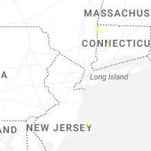


Connect with Interactive Hail Maps