

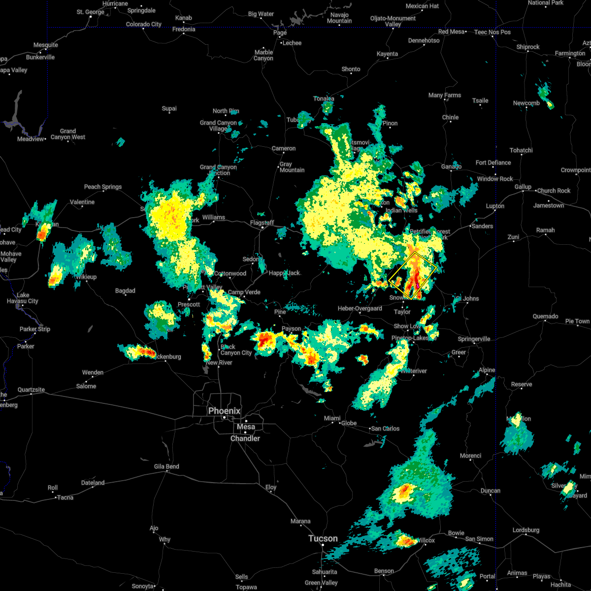
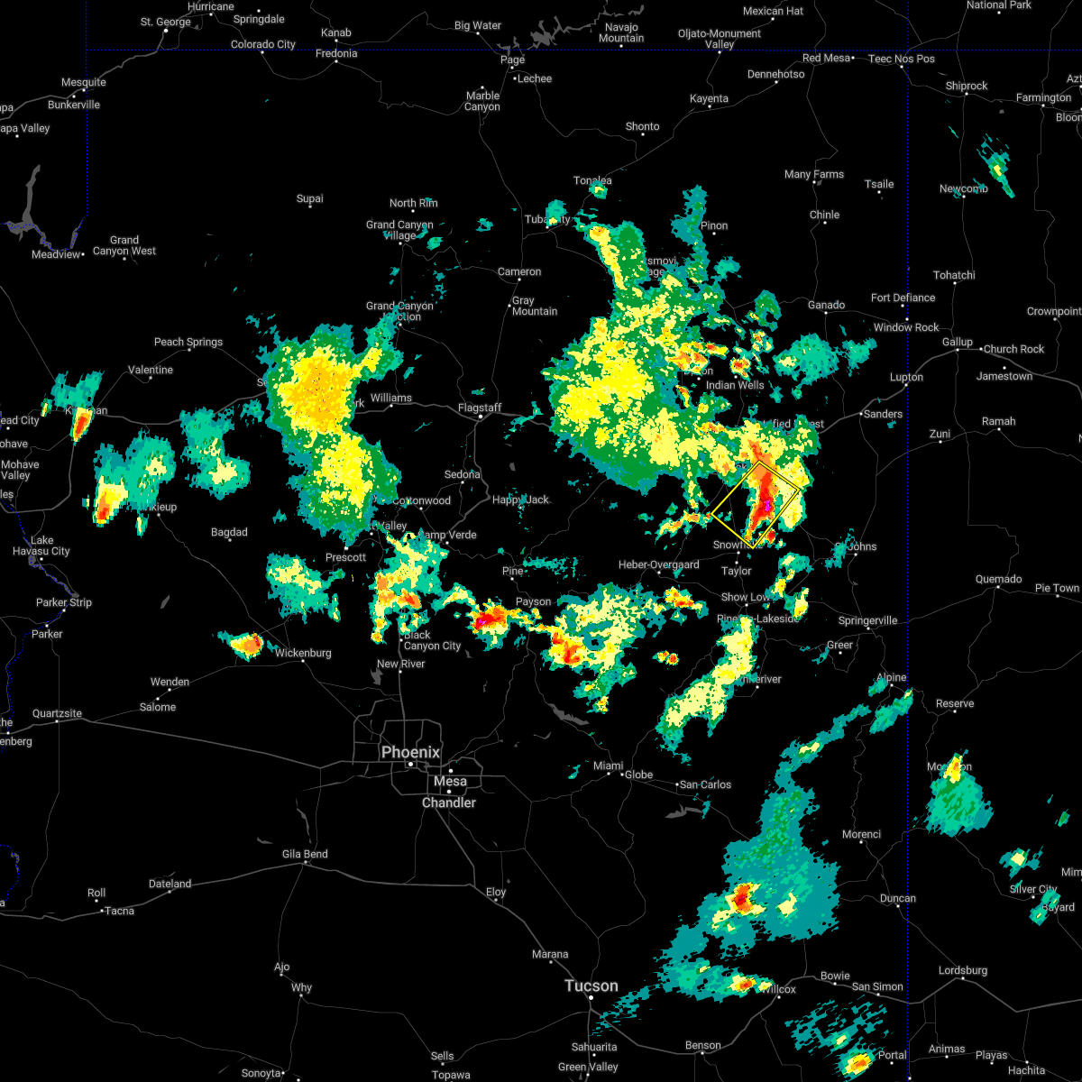
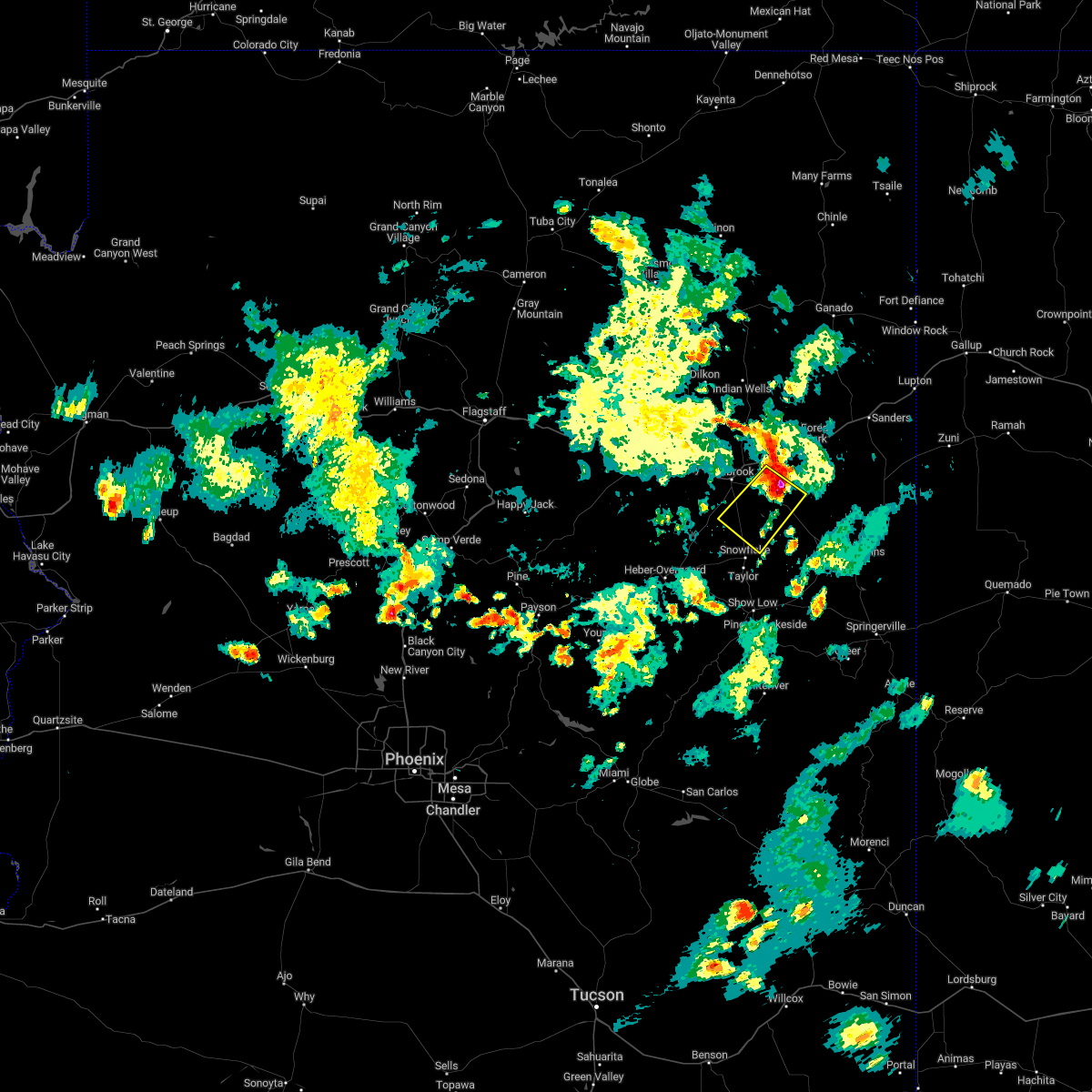
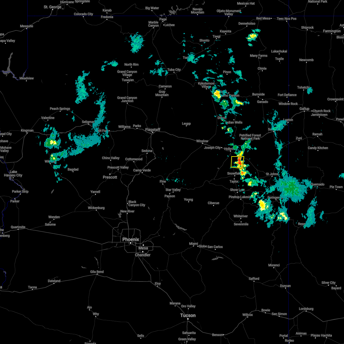
Hail Map for Woodruff, AZ
The Woodruff, AZ area has had 0 reports of on-the-ground hail by trained spotters, and has been under severe weather warnings 0 times during the past 12 months. Doppler radar has detected hail at or near Woodruff, AZ on 14 occasions, including 1 occasion during the past year.
| Name: | Woodruff, AZ |
| Where Located: | 36.8 miles N of Show Low, AZ |
| Map: | Google Map for Woodruff, AZ |
| Population: | 191 |
| Housing Units: | 85 |
| More Info: | Search Google for Woodruff, AZ |
0
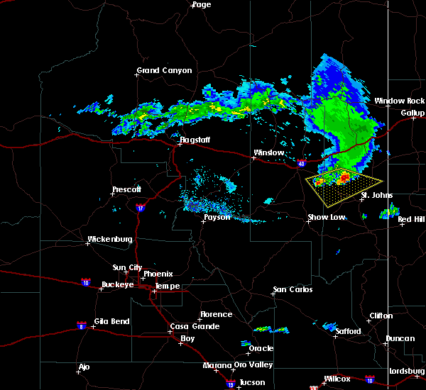
The Top Recent Hail Date for Woodruff, AZ is Wednesday, September 13, 2023 (4th out of 14)

Hail and Wind Damage Spotted near Woodruff, AZ
| Date / Time | Report Details |
|---|---|
| 8/7/2022 6:09 PM MST |
 The severe thunderstorm warning for apache and navajo counties will expire at 615 pm mst, the storm which prompted the warning has weakened below severe limits, and no longer poses an immediate threat to life or property. therefore, the warning will be allowed to expire. however small hail and heavy rain are still possible with this thunderstorm. The severe thunderstorm warning for apache and navajo counties will expire at 615 pm mst, the storm which prompted the warning has weakened below severe limits, and no longer poses an immediate threat to life or property. therefore, the warning will be allowed to expire. however small hail and heavy rain are still possible with this thunderstorm.
|
| 8/7/2022 5:58 PM MST |
 At 558 pm mst, a severe thunderstorm was located near woodruff, moving southwest at 25 mph (radar indicated). Hazards include 60 mph wind gusts and quarter size hail. Hail damage to vehicles is expected. expect wind damage to roofs, siding, and trees. locations impacted include, woodruff, petrified forest national park and petrified forest n. p. visitors center. hail threat, radar indicated max hail size, 1. 00 in wind threat, radar indicated max wind gust, 60 mph. At 558 pm mst, a severe thunderstorm was located near woodruff, moving southwest at 25 mph (radar indicated). Hazards include 60 mph wind gusts and quarter size hail. Hail damage to vehicles is expected. expect wind damage to roofs, siding, and trees. locations impacted include, woodruff, petrified forest national park and petrified forest n. p. visitors center. hail threat, radar indicated max hail size, 1. 00 in wind threat, radar indicated max wind gust, 60 mph.
|
| 8/7/2022 5:39 PM MST |
 At 538 pm mst, a severe thunderstorm was located 8 miles northeast of woodruff, near the south entrance of petrified forest moving southwest at 25 mph (radar indicated). Hazards include 60 mph wind gusts and quarter size hail. Hail damage to vehicles is expected. Expect wind damage to roofs, siding, and trees. At 538 pm mst, a severe thunderstorm was located 8 miles northeast of woodruff, near the south entrance of petrified forest moving southwest at 25 mph (radar indicated). Hazards include 60 mph wind gusts and quarter size hail. Hail damage to vehicles is expected. Expect wind damage to roofs, siding, and trees.
|
| 6/17/2021 6:25 PM MST |
 At 624 pm mst, a severe thunderstorm was located near woodruff, or 33 miles north of show low, moving west at 15 mph (radar indicated). Hazards include 70 mph wind gusts. Expect considerable tree damage. Damage is likely to mobile homes, roofs, and outbuildings. At 624 pm mst, a severe thunderstorm was located near woodruff, or 33 miles north of show low, moving west at 15 mph (radar indicated). Hazards include 70 mph wind gusts. Expect considerable tree damage. Damage is likely to mobile homes, roofs, and outbuildings.
|
| 9/1/2018 6:59 PM MST |
 The national weather service in flagstaff has issued a * severe thunderstorm warning for. apache county in northeastern arizona. navajo county in north central arizona. Until 745 pm mst * at 658 pm mst, severe thunderstorms were located along a line. The national weather service in flagstaff has issued a * severe thunderstorm warning for. apache county in northeastern arizona. navajo county in north central arizona. Until 745 pm mst * at 658 pm mst, severe thunderstorms were located along a line.
|
| 9/1/2018 6:43 PM MST |
 At 643 pm mst, severe thunderstorms were located along a line extending from 6 miles southeast of petrified forest national park to near woodruff, moving southeast at 35 mph (radar indicated). Hazards include 60 mph wind gusts and half dollar size hail. Hail damage to vehicles is expected. expect wind damage to roofs, siding, and trees. locations impacted include, taylor, woodruff, petrified forest national park, snowflake and petrified forest n. p. visitors center. this includes the following highways, interstate 40 between mile markers 303 and 309. state route 277 between mile markers 332 and 336. state route 77 between mile markers 360 and 383. Highway 180 between mile markers 312 and 332. At 643 pm mst, severe thunderstorms were located along a line extending from 6 miles southeast of petrified forest national park to near woodruff, moving southeast at 35 mph (radar indicated). Hazards include 60 mph wind gusts and half dollar size hail. Hail damage to vehicles is expected. expect wind damage to roofs, siding, and trees. locations impacted include, taylor, woodruff, petrified forest national park, snowflake and petrified forest n. p. visitors center. this includes the following highways, interstate 40 between mile markers 303 and 309. state route 277 between mile markers 332 and 336. state route 77 between mile markers 360 and 383. Highway 180 between mile markers 312 and 332.
|
| 9/1/2018 6:30 PM MST |
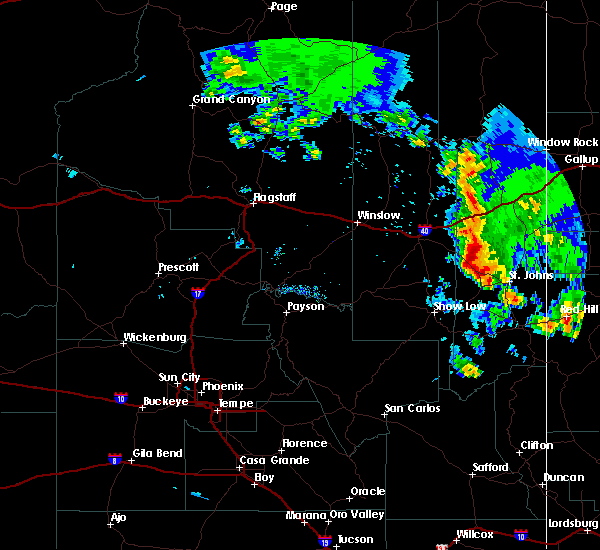
 At 630 pm mst, severe thunderstorms were located along a line extending from petrified forest national park to near woodruff, moving southeast at 35 mph. these are very dangerous storms (radar indicated). Hazards include 80 mph wind gusts and two inch hail. Flying debris will be dangerous to those caught without shelter. mobile homes will be heavily damaged. expect considerable damage to roofs, windows, and vehicles. extensive tree damage and power outages are likely. locations impacted include, holbrook, taylor, sun valley, woodruff, petrified forest national park, snowflake, petrified forest n. p. visitors center and petrified forest n. p. headquarters. this includes the following highways, business interstate 40 between mile markers 286 and 289. interstate 40 between mile markers 283 and 321. state route 277 between mile markers 331 and 336. state route 377 between mile markers 22 and 33. state route 77 between mile markers 360 and 396. Highway 180 between mile markers 308 and 333. At 630 pm mst, severe thunderstorms were located along a line extending from petrified forest national park to near woodruff, moving southeast at 35 mph. these are very dangerous storms (radar indicated). Hazards include 80 mph wind gusts and two inch hail. Flying debris will be dangerous to those caught without shelter. mobile homes will be heavily damaged. expect considerable damage to roofs, windows, and vehicles. extensive tree damage and power outages are likely. locations impacted include, holbrook, taylor, sun valley, woodruff, petrified forest national park, snowflake, petrified forest n. p. visitors center and petrified forest n. p. headquarters. this includes the following highways, business interstate 40 between mile markers 286 and 289. interstate 40 between mile markers 283 and 321. state route 277 between mile markers 331 and 336. state route 377 between mile markers 22 and 33. state route 77 between mile markers 360 and 396. Highway 180 between mile markers 308 and 333.
|
| 9/1/2018 6:10 PM MST |
 At 609 pm mst, severe thunderstorms were located along a line extending from 10 miles northwest of petrified forest national park to 7 miles south of joseph city, moving southeast at 35 mph. these are very dangerous storms (radar indicated). Hazards include 80 mph wind gusts and two inch hail. Flying debris will be dangerous to those caught without shelter. mobile homes will be heavily damaged. expect considerable damage to roofs, windows, and vehicles. Extensive tree damage and power outages are likely. At 609 pm mst, severe thunderstorms were located along a line extending from 10 miles northwest of petrified forest national park to 7 miles south of joseph city, moving southeast at 35 mph. these are very dangerous storms (radar indicated). Hazards include 80 mph wind gusts and two inch hail. Flying debris will be dangerous to those caught without shelter. mobile homes will be heavily damaged. expect considerable damage to roofs, windows, and vehicles. Extensive tree damage and power outages are likely.
|
| 7/1/2015 7:11 PM MST |
 At 710 pm mst, doppler radar indicated a severe thunderstorm capable of producing quarter size hail and damaging winds in excess of 60 mph. this storm was located 10 miles northwest of hunt, or 25 miles southeast of holbrook and moving west at 20 mph. At 710 pm mst, doppler radar indicated a severe thunderstorm capable of producing quarter size hail and damaging winds in excess of 60 mph. this storm was located 10 miles northwest of hunt, or 25 miles southeast of holbrook and moving west at 20 mph.
|
Hail Maps for Woodruff, AZ


Connect with Interactive Hail Maps