

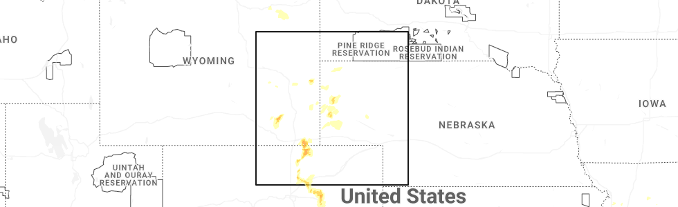
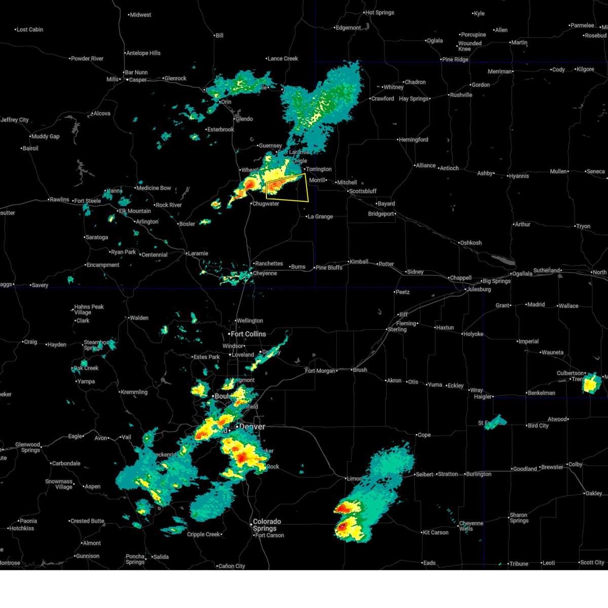
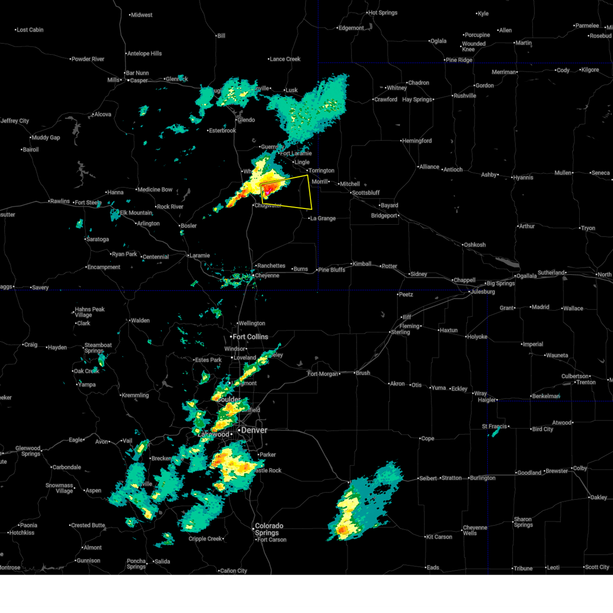
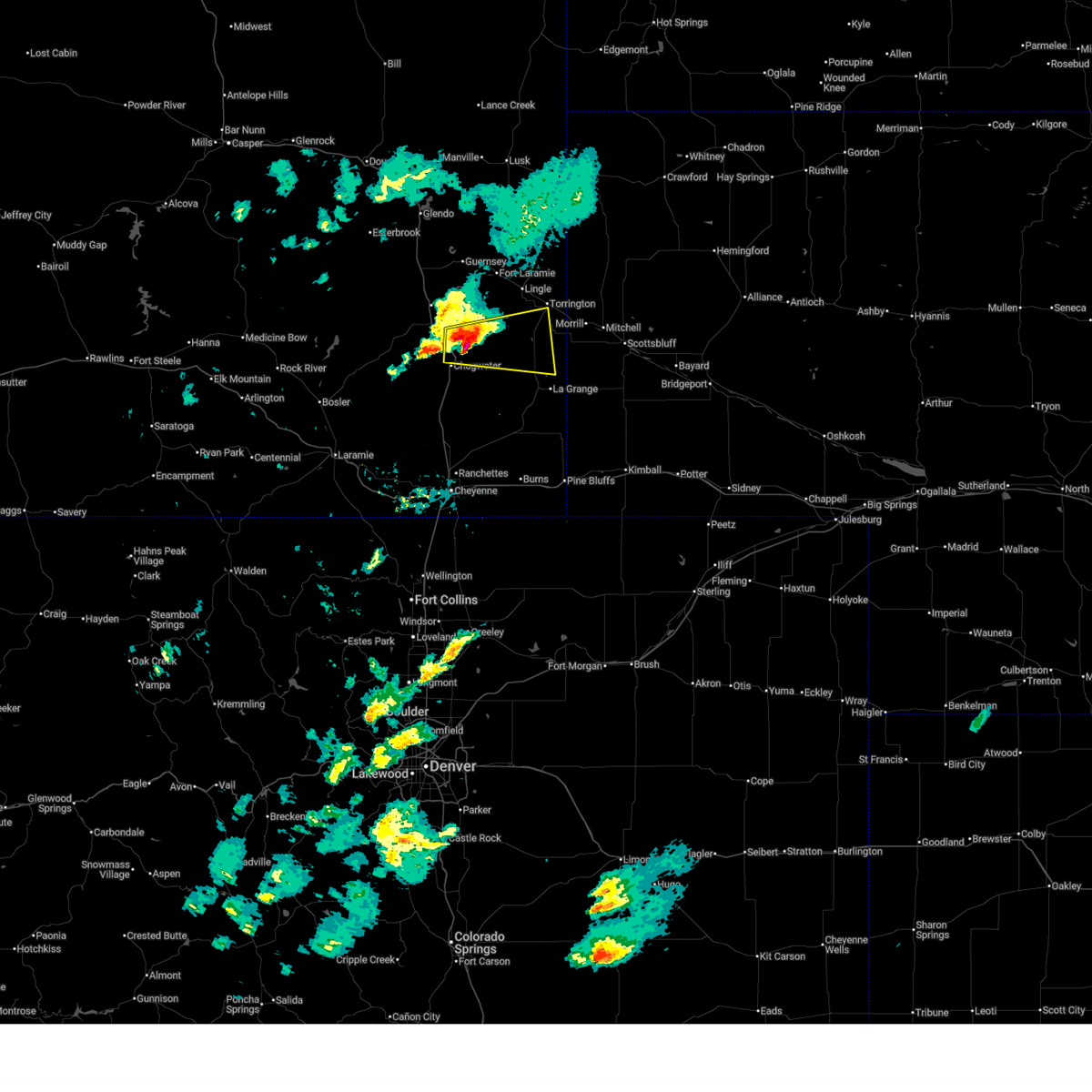
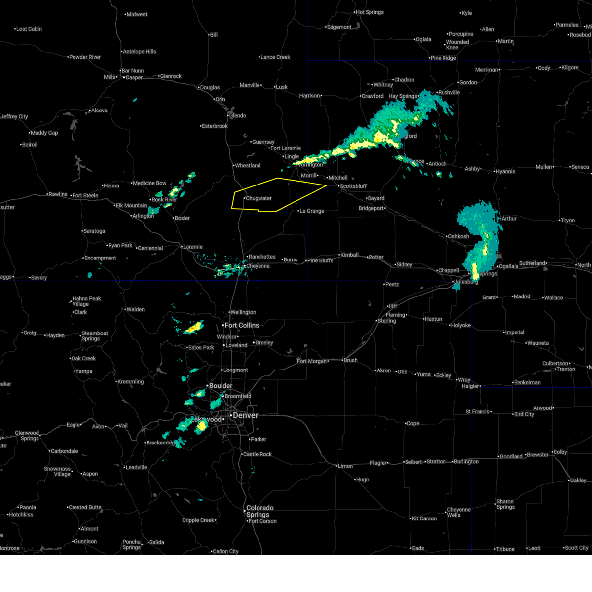
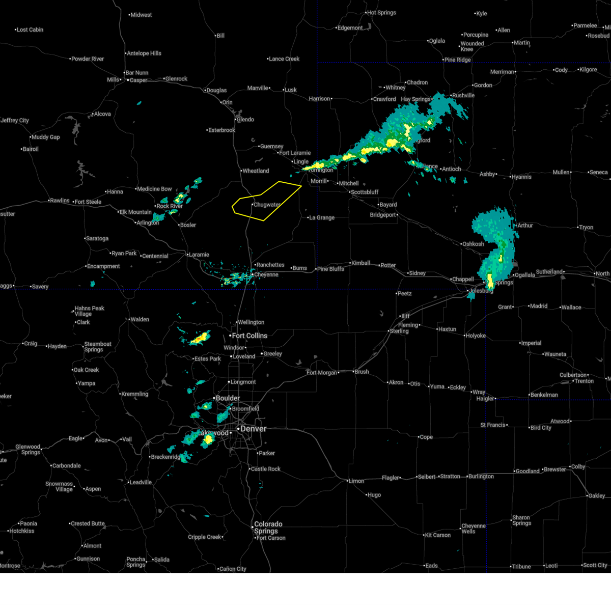
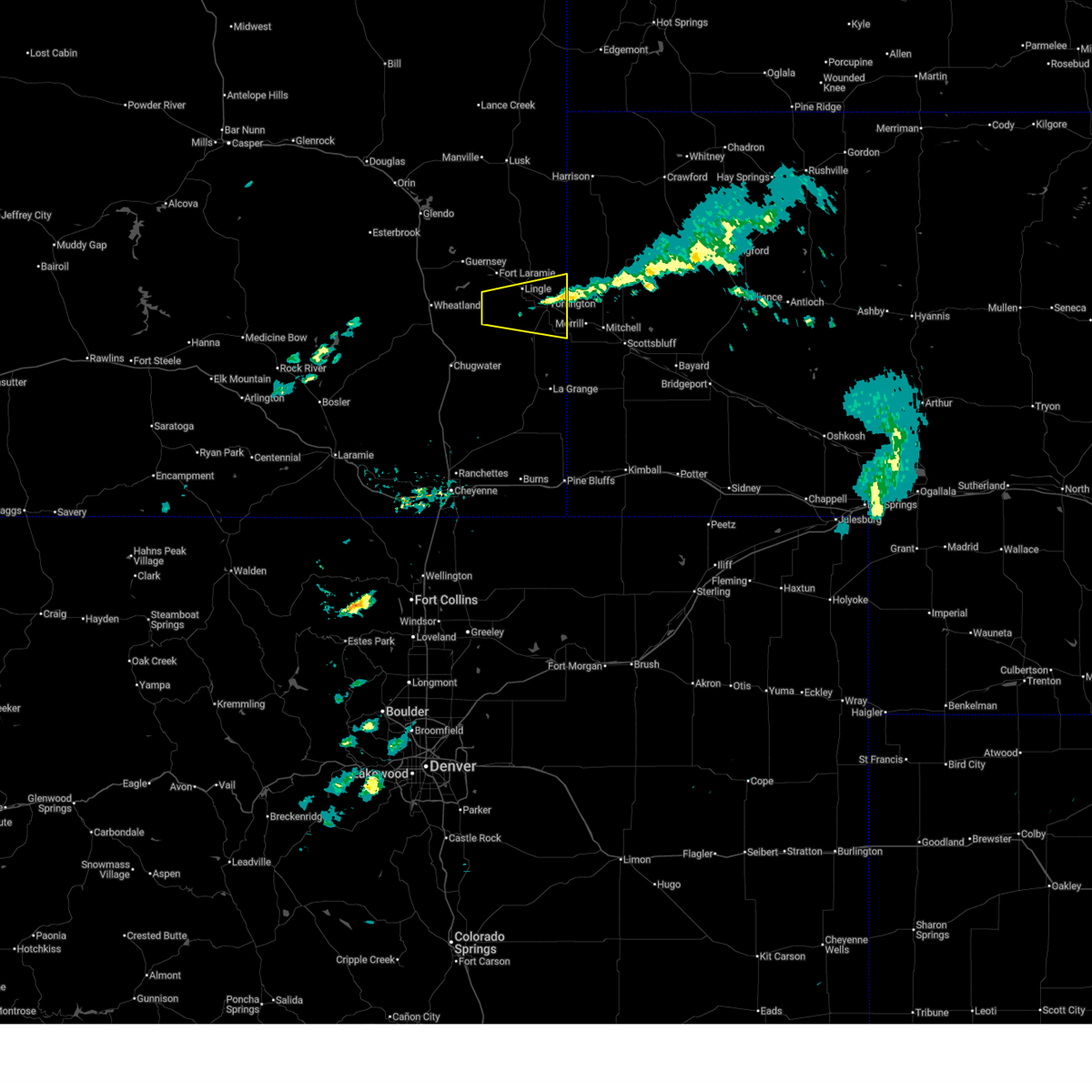
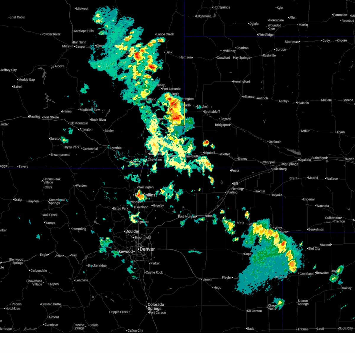
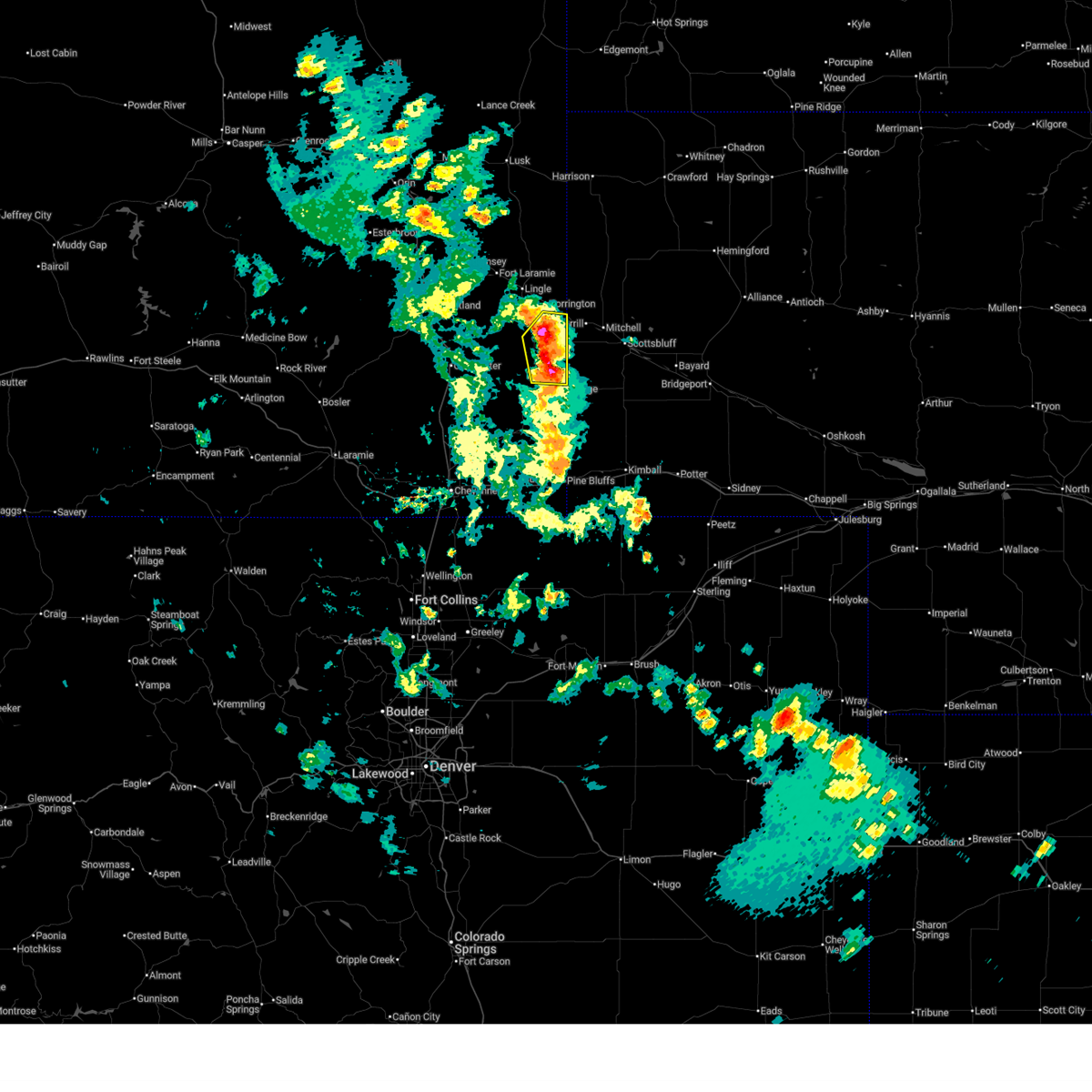
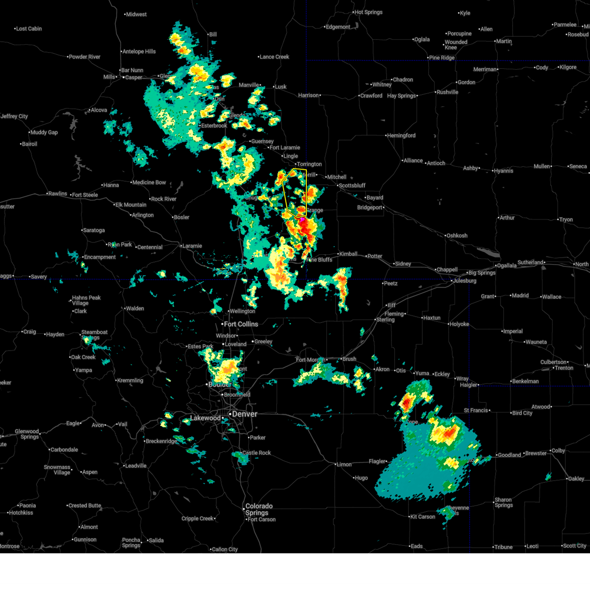
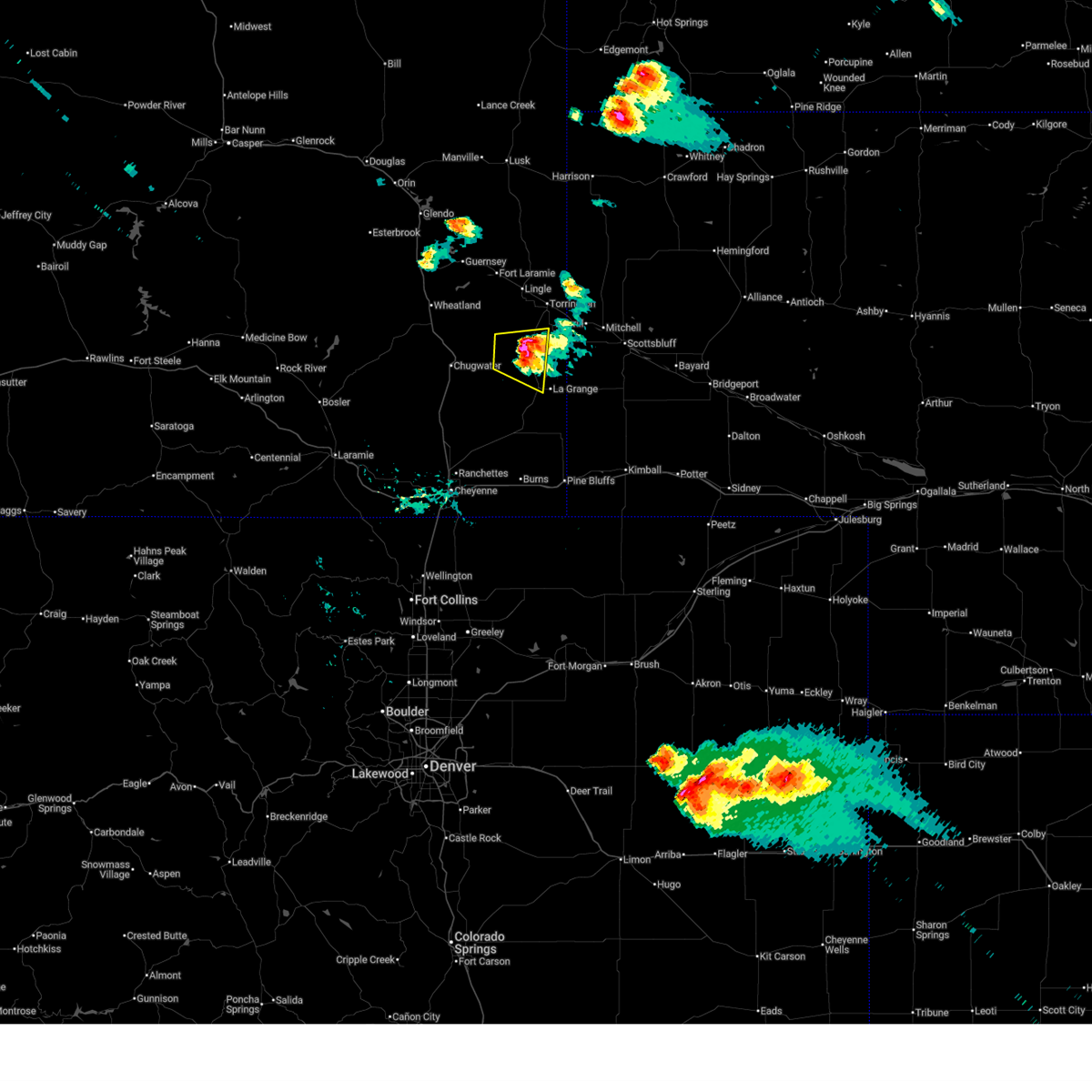
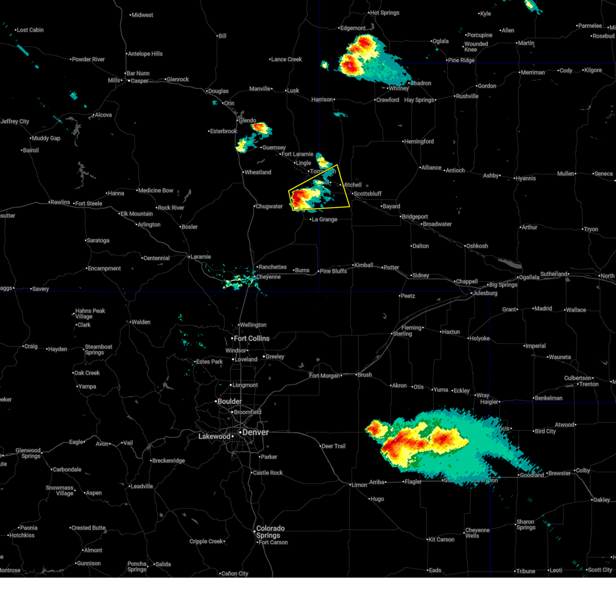
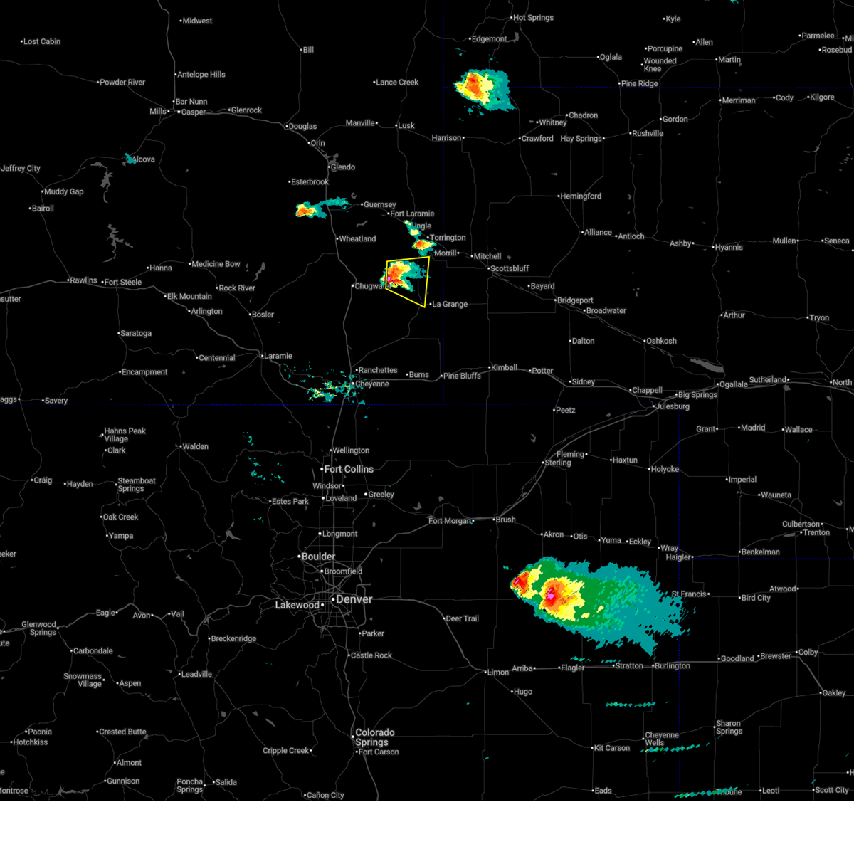
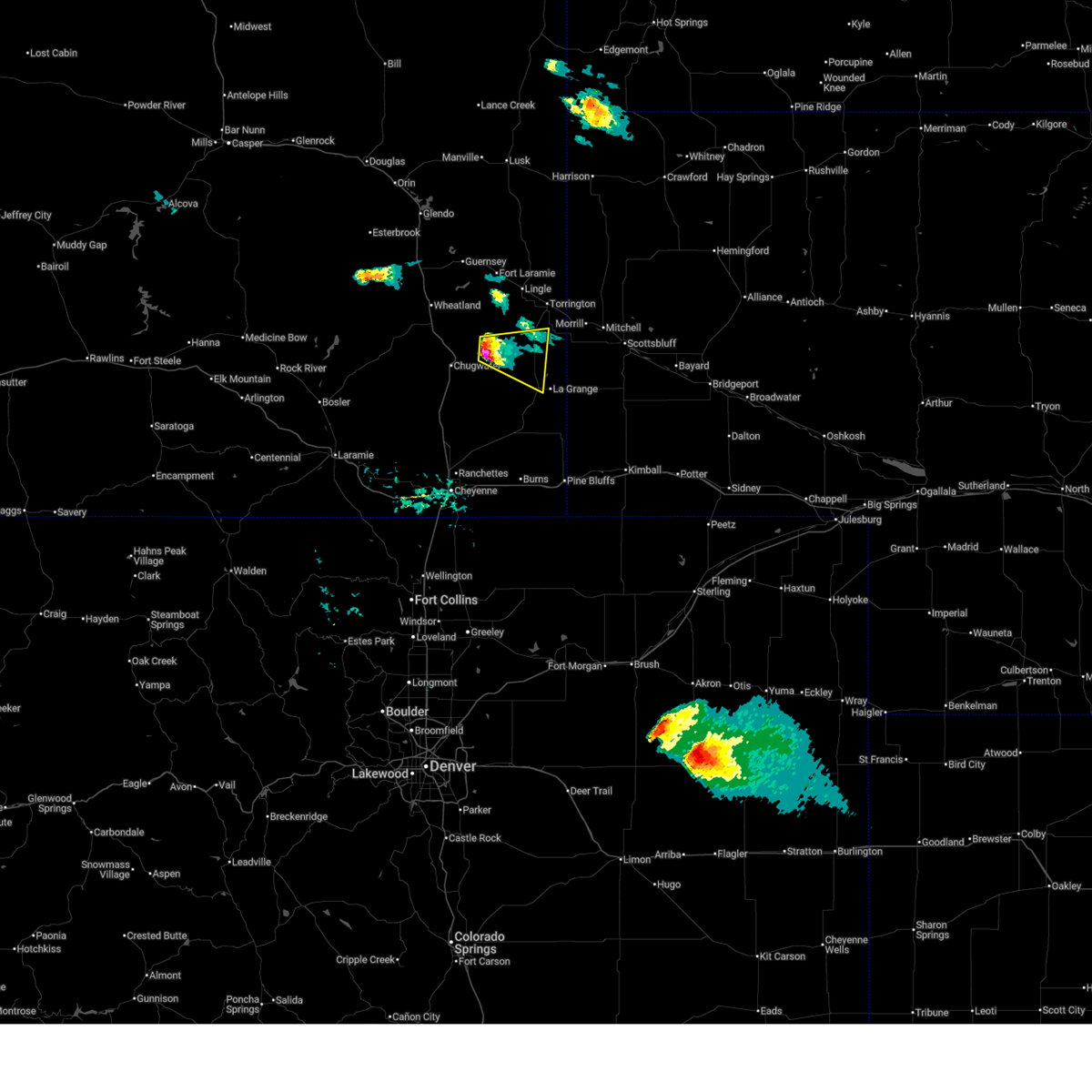
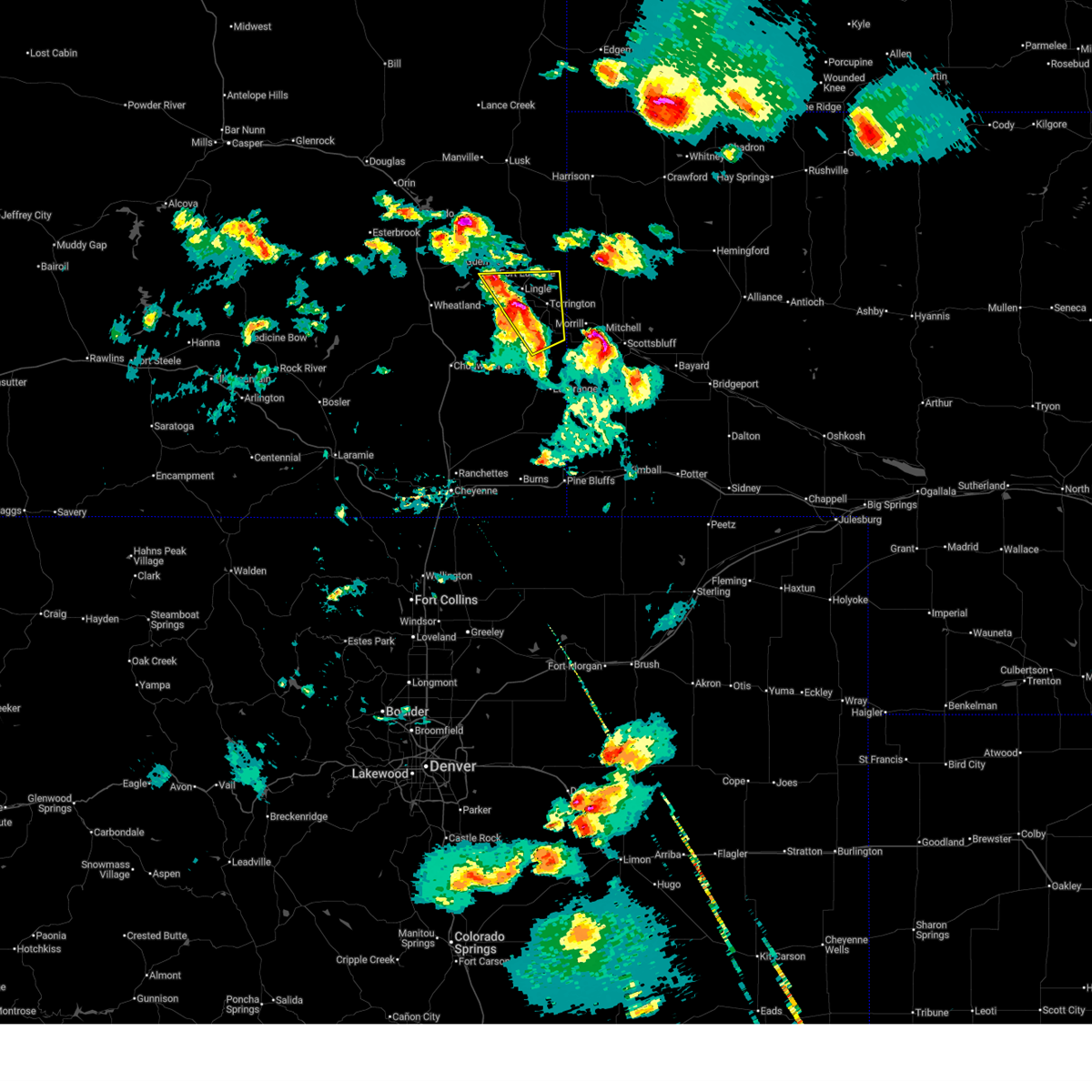
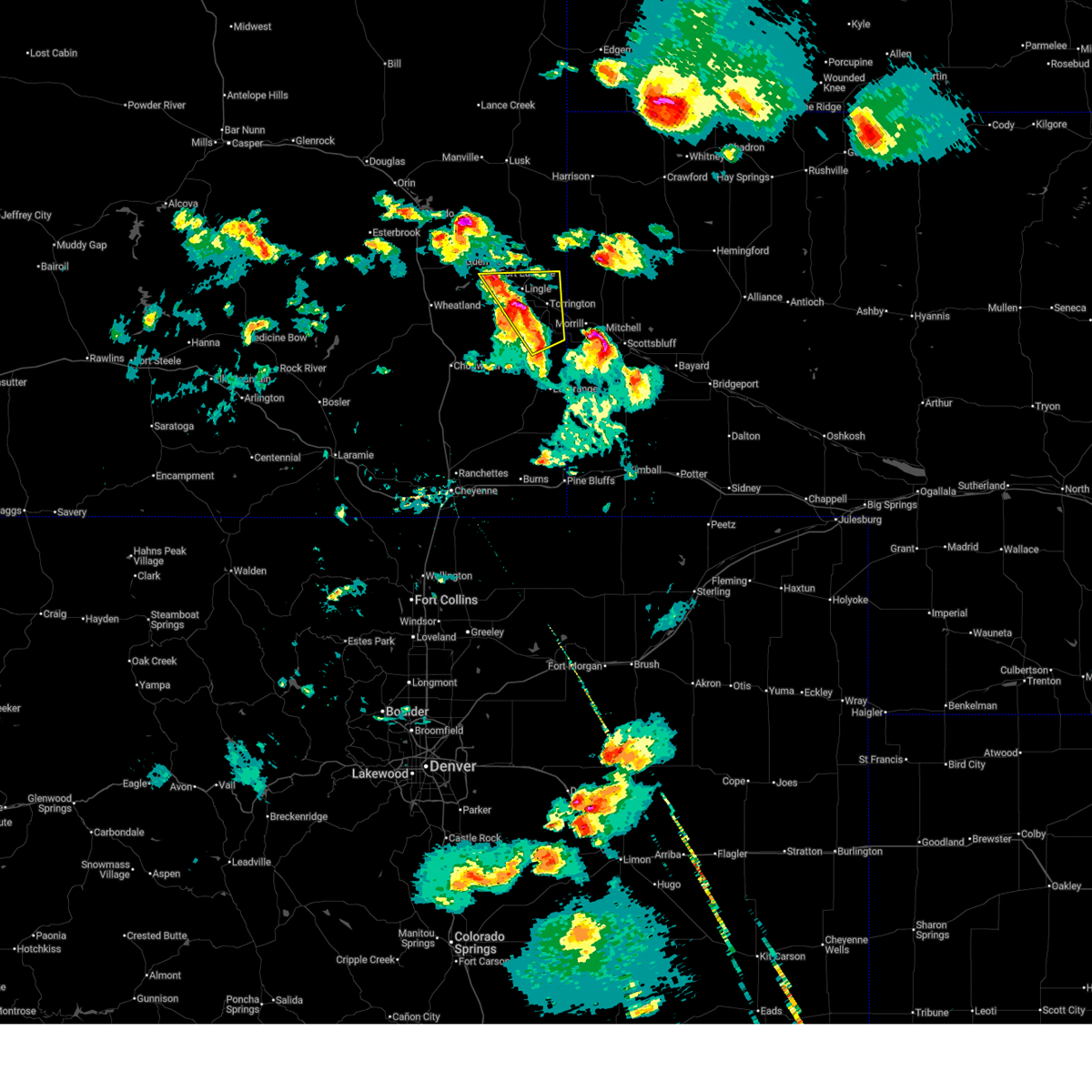
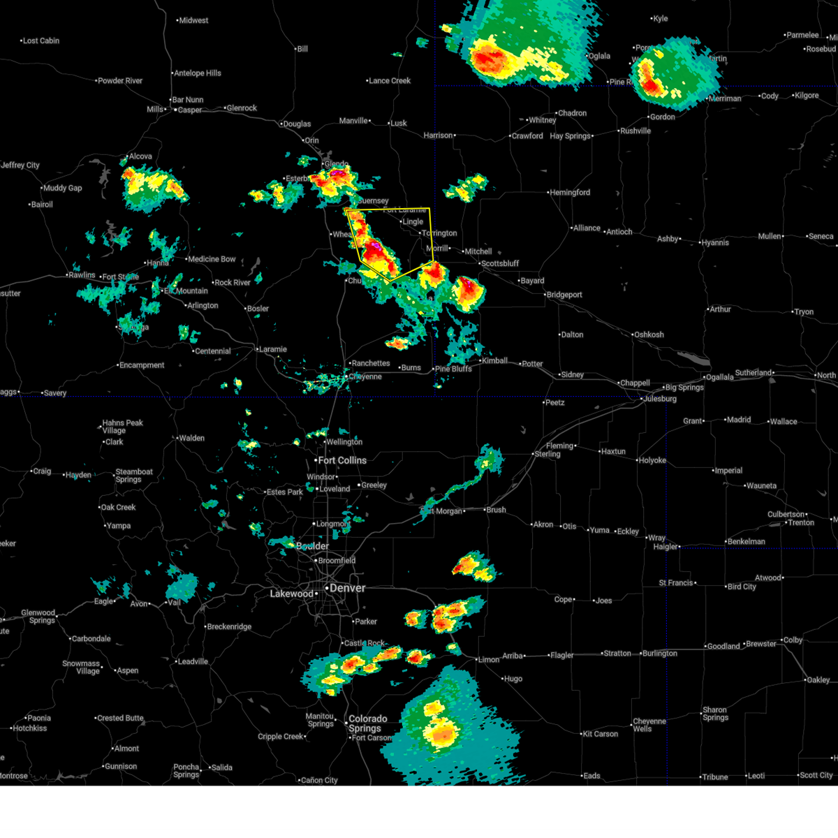
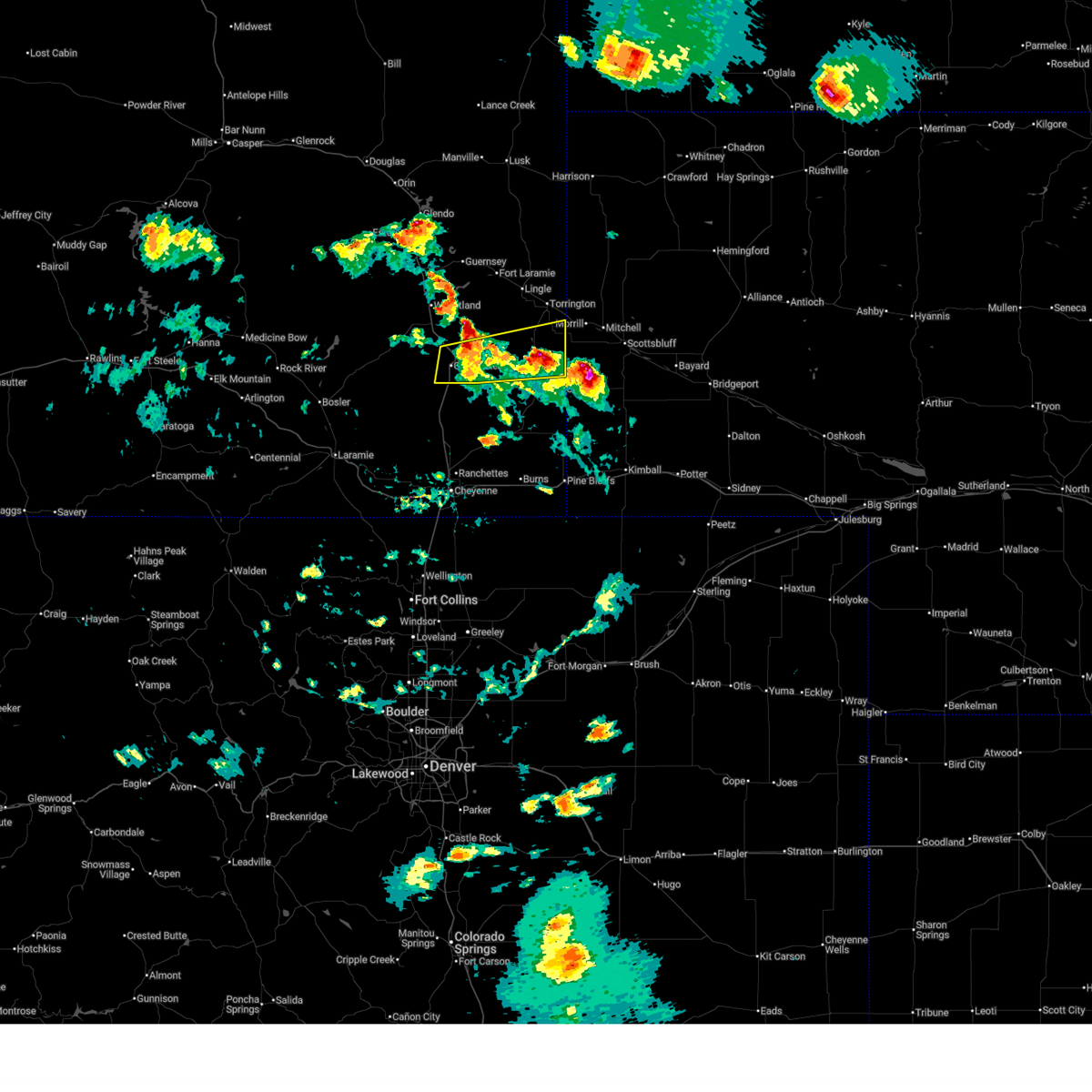
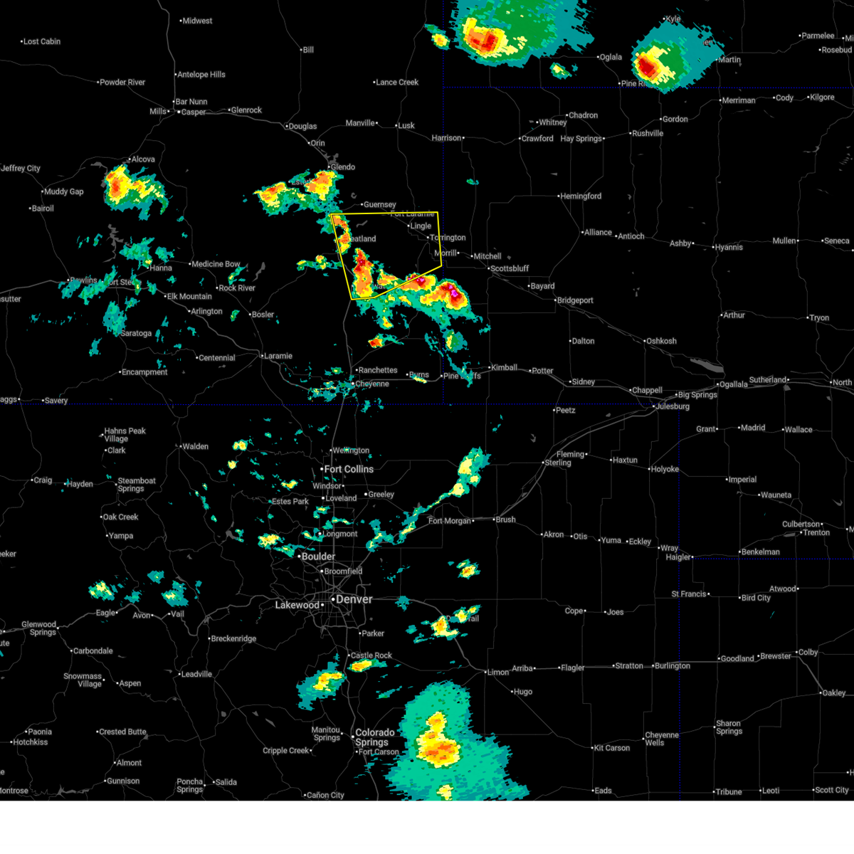
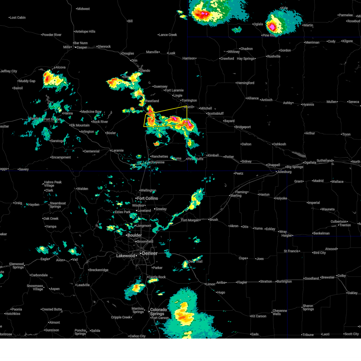
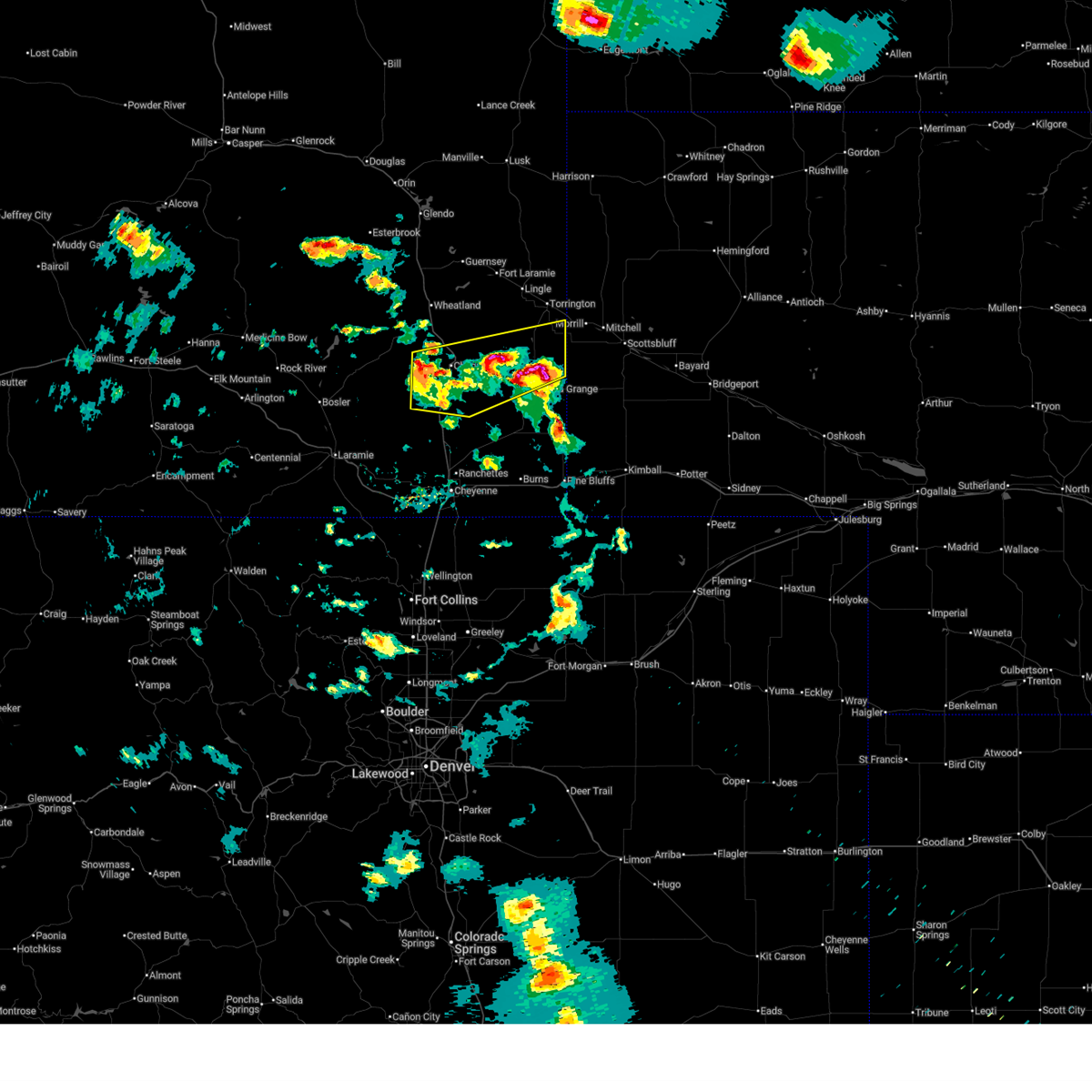
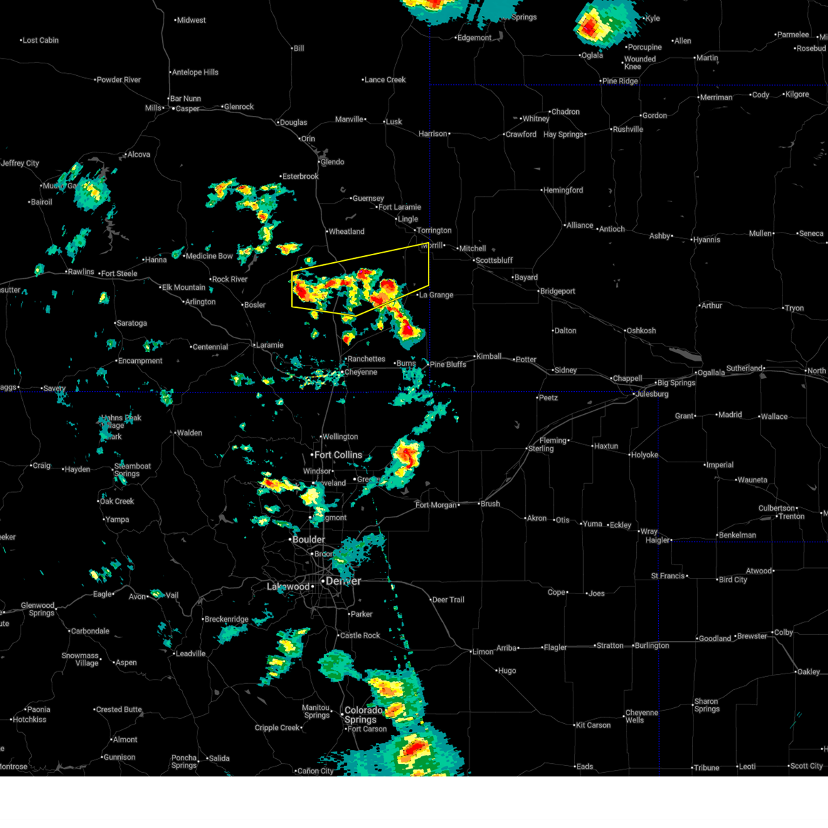
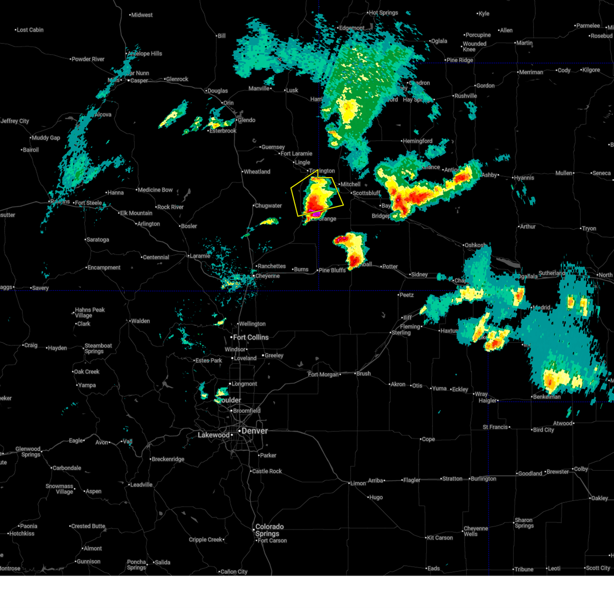
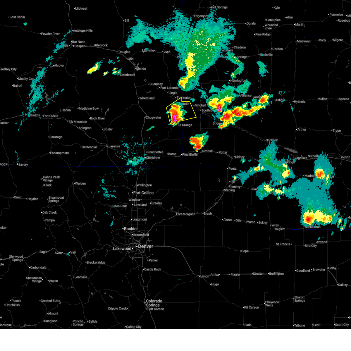
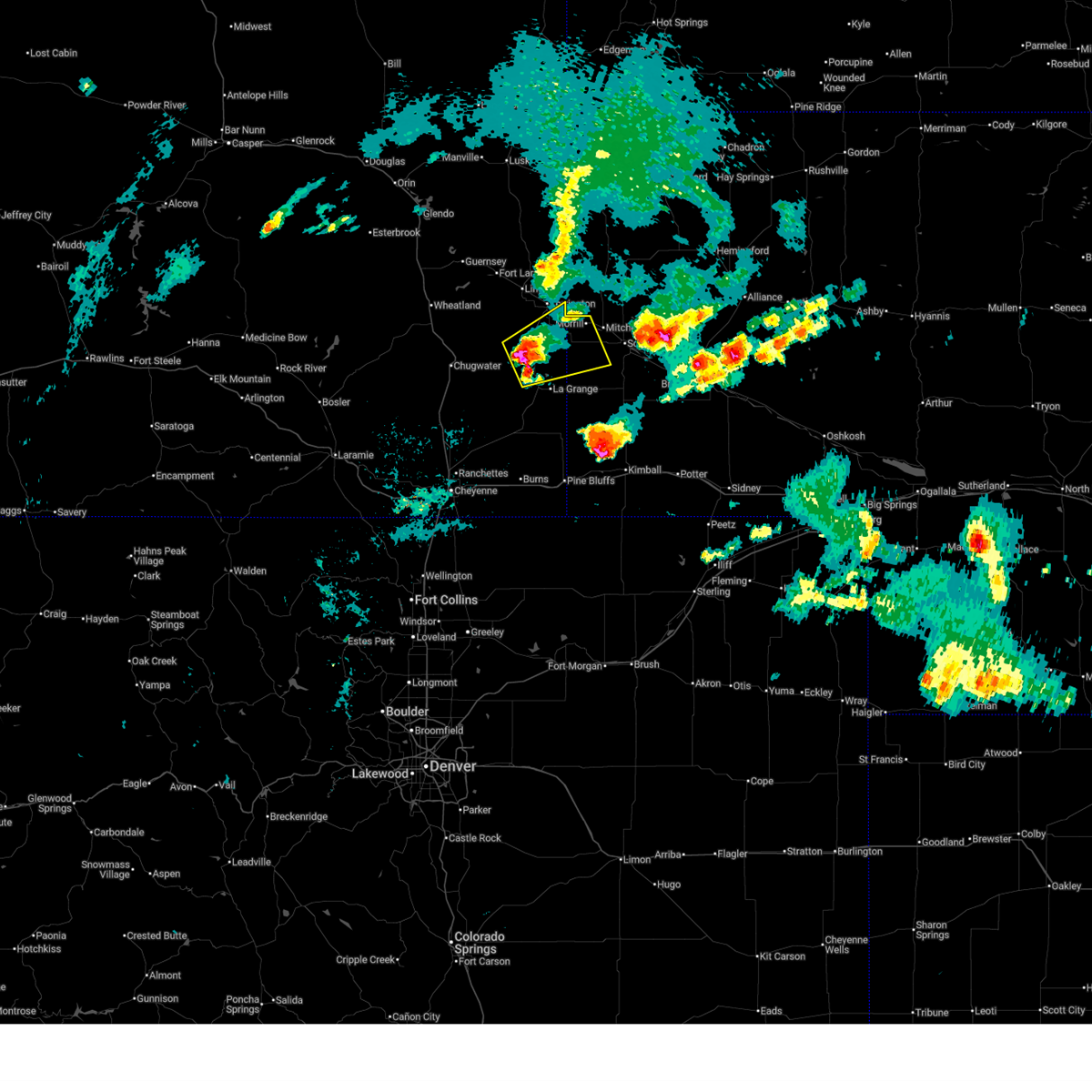
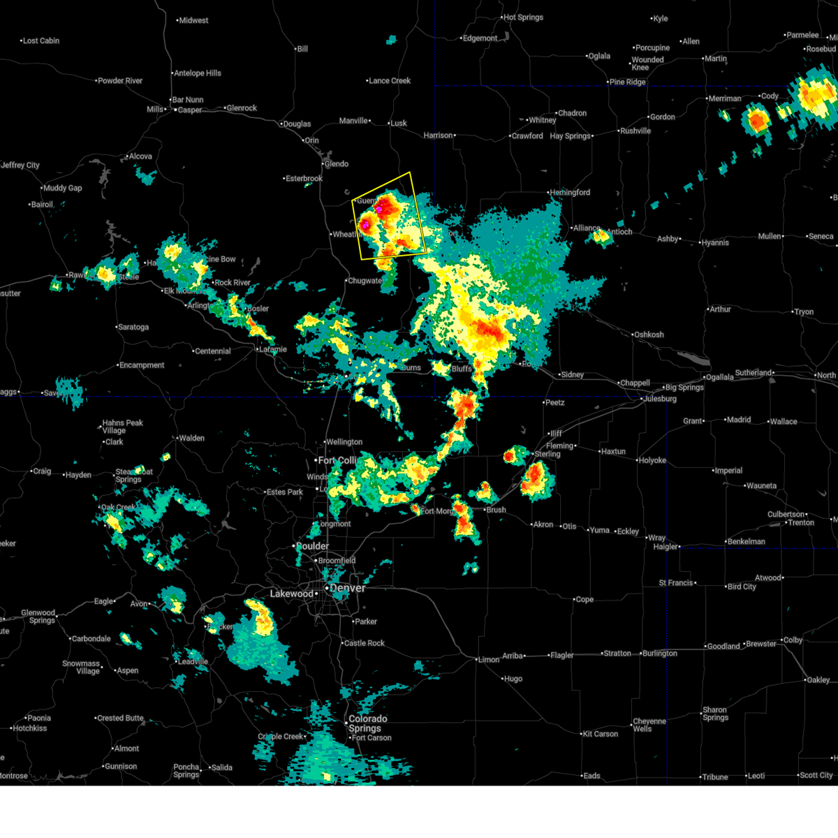
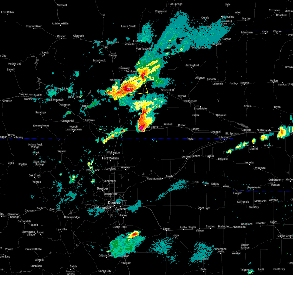
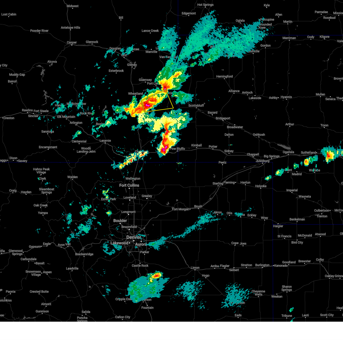
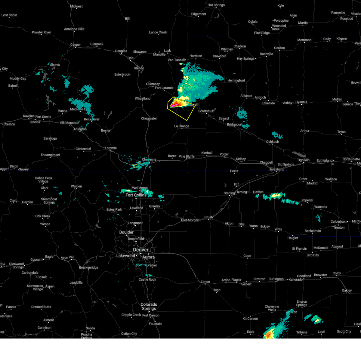
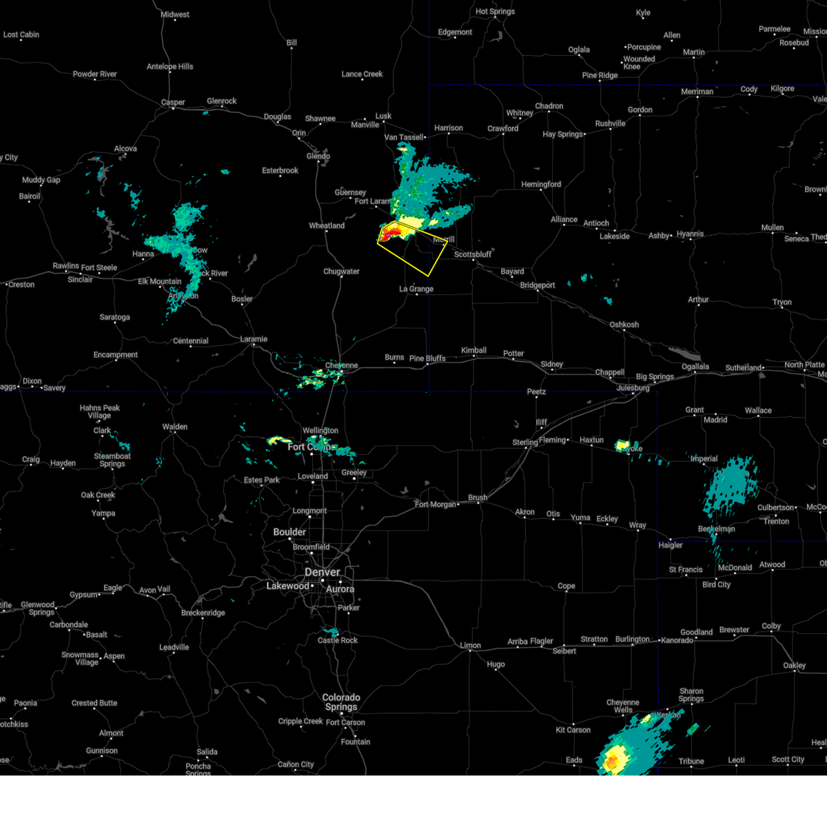
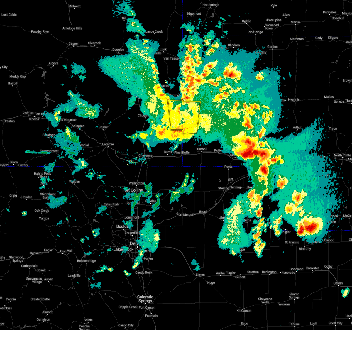
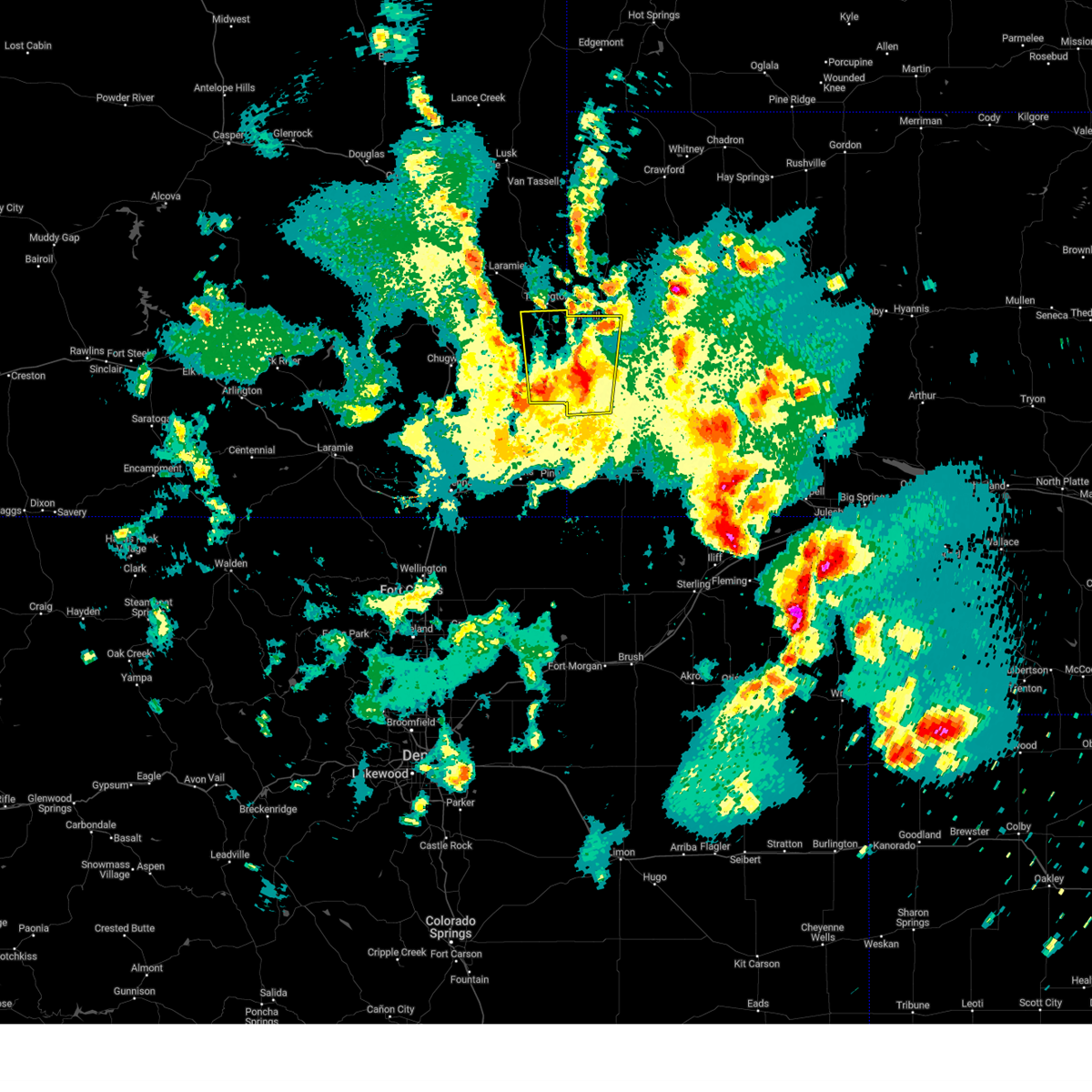
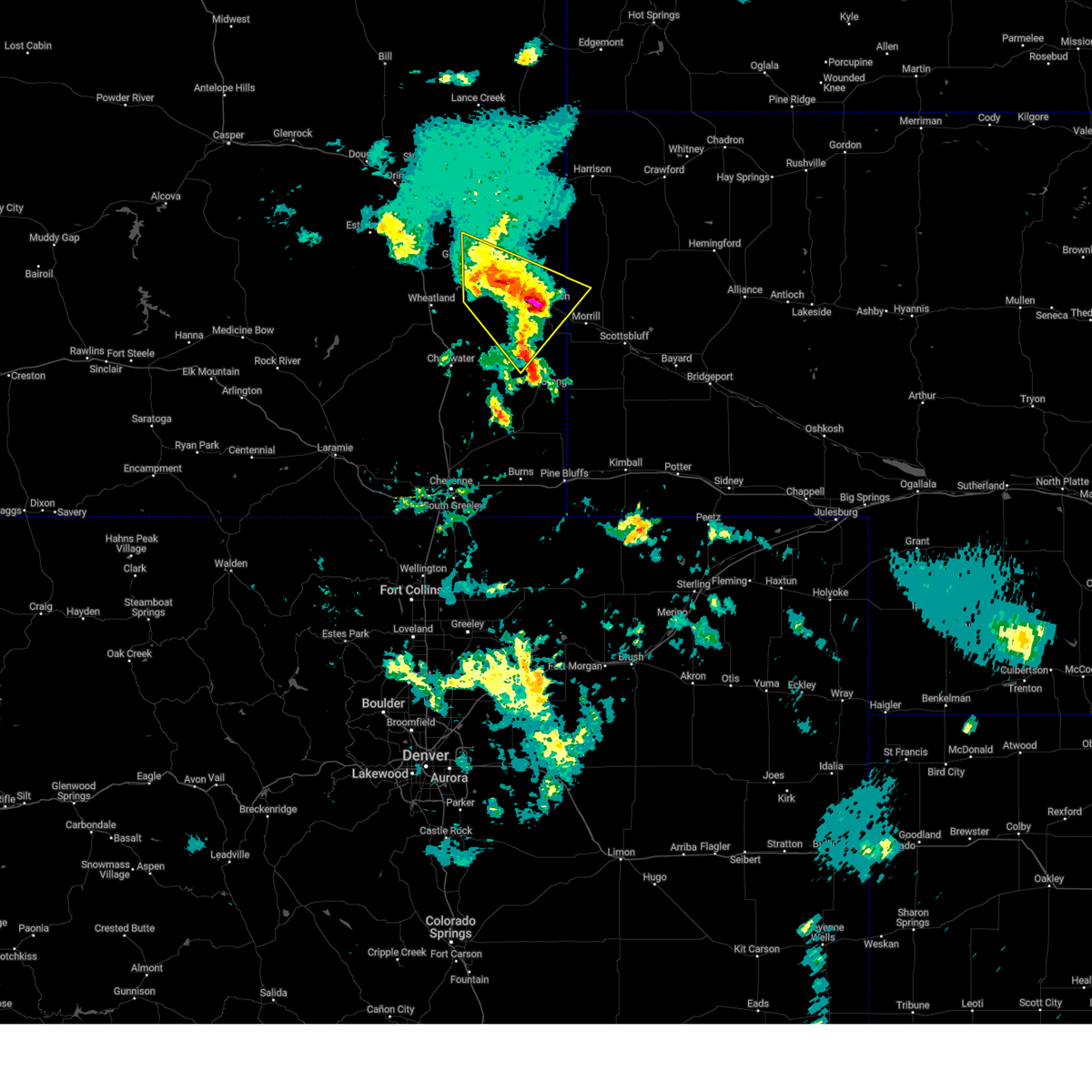
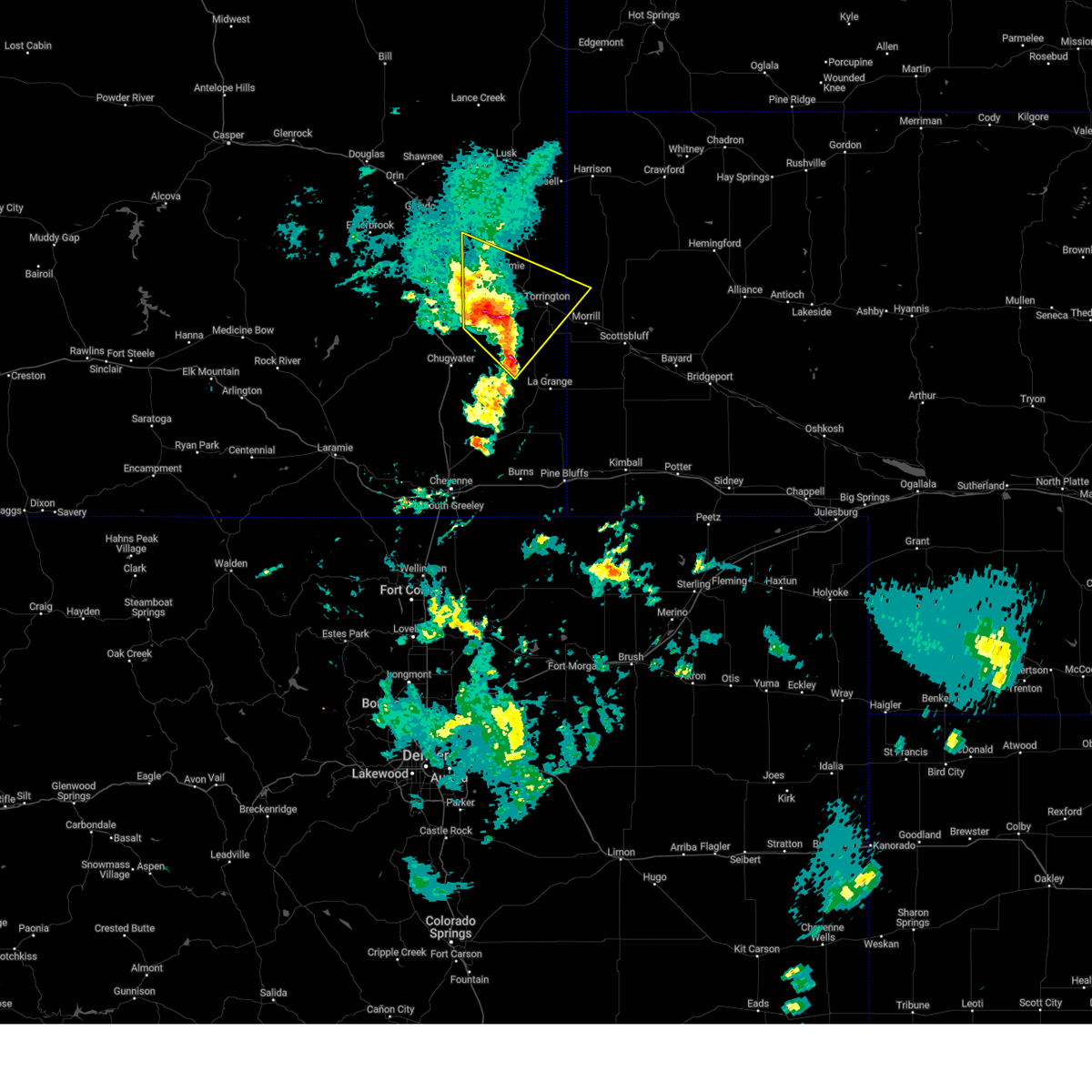
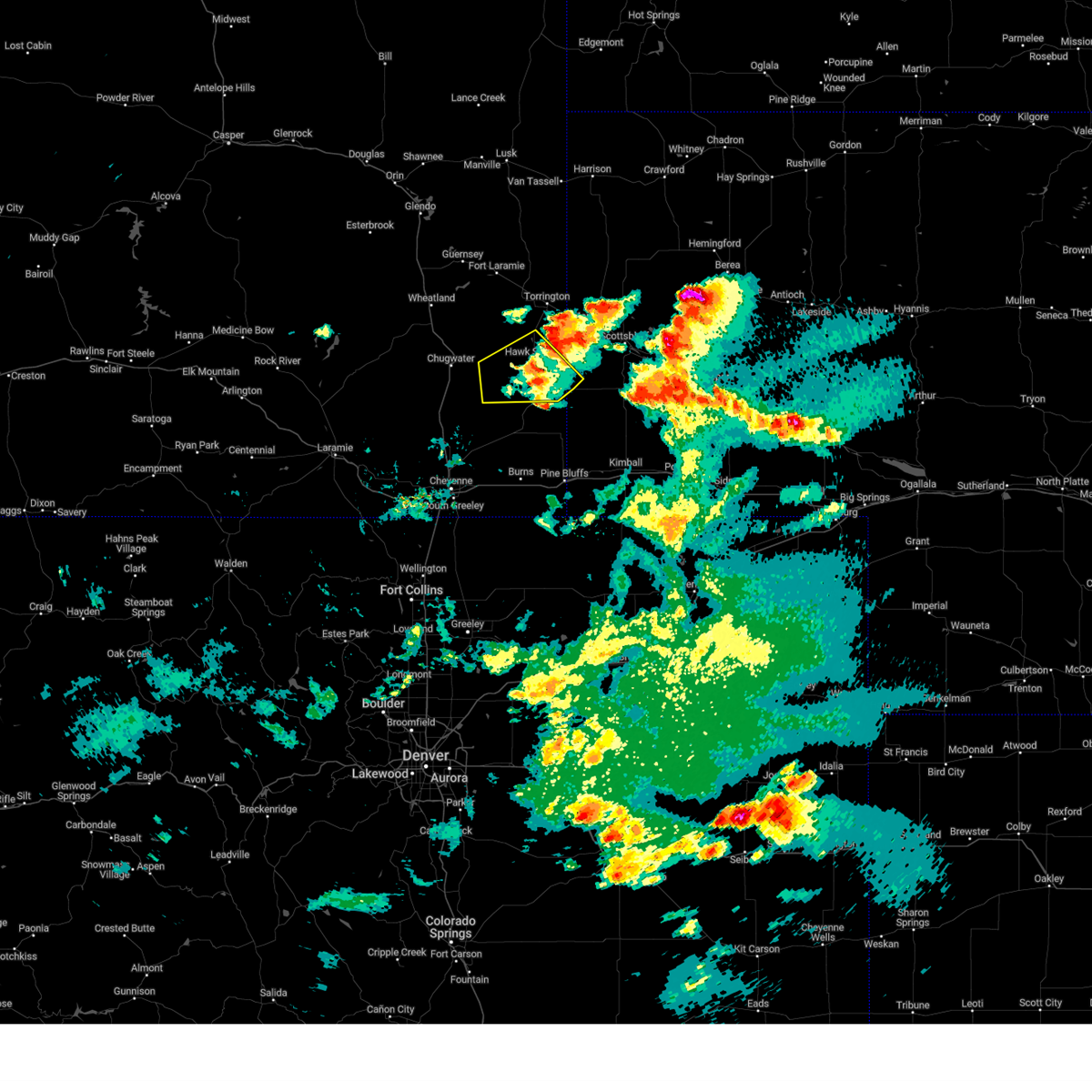
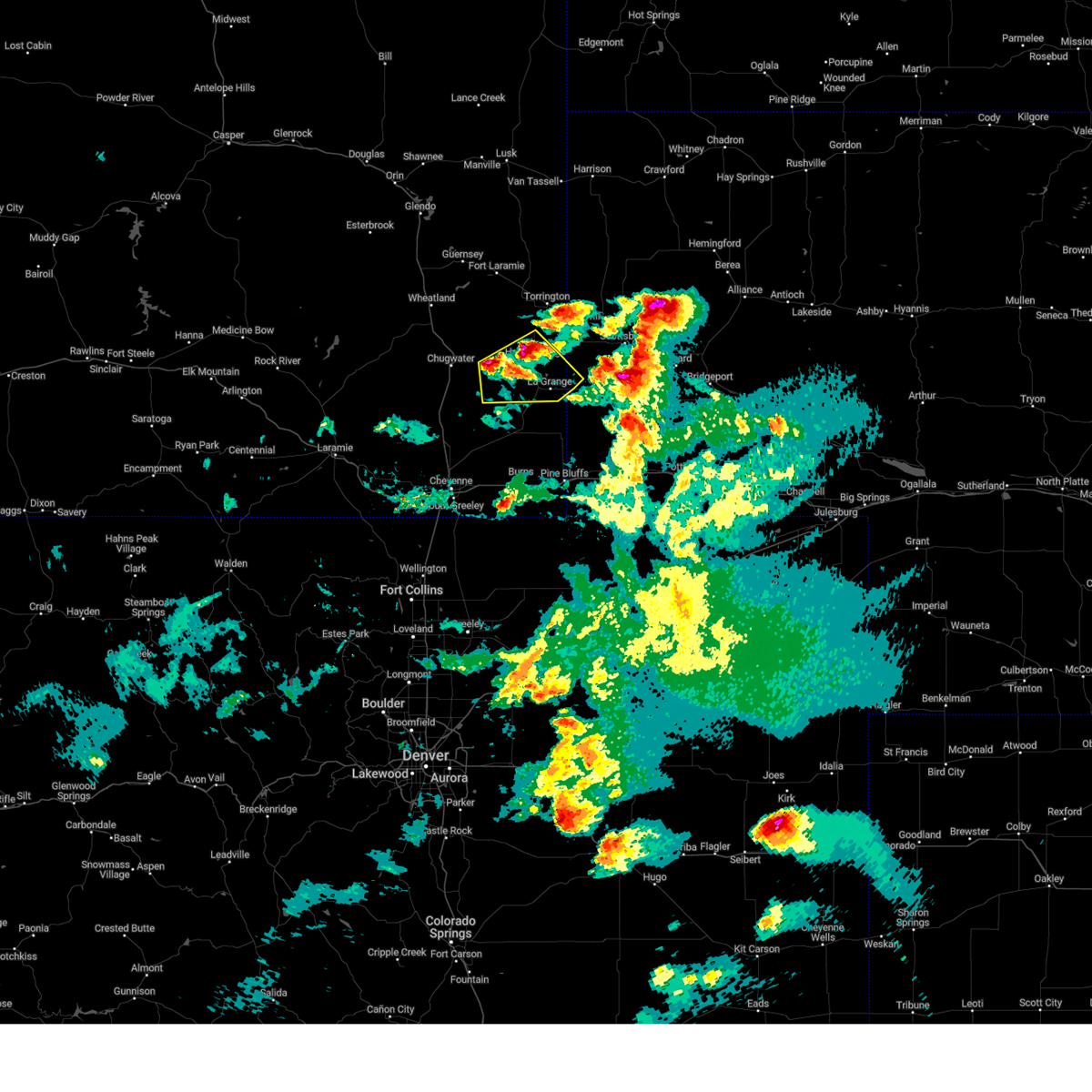
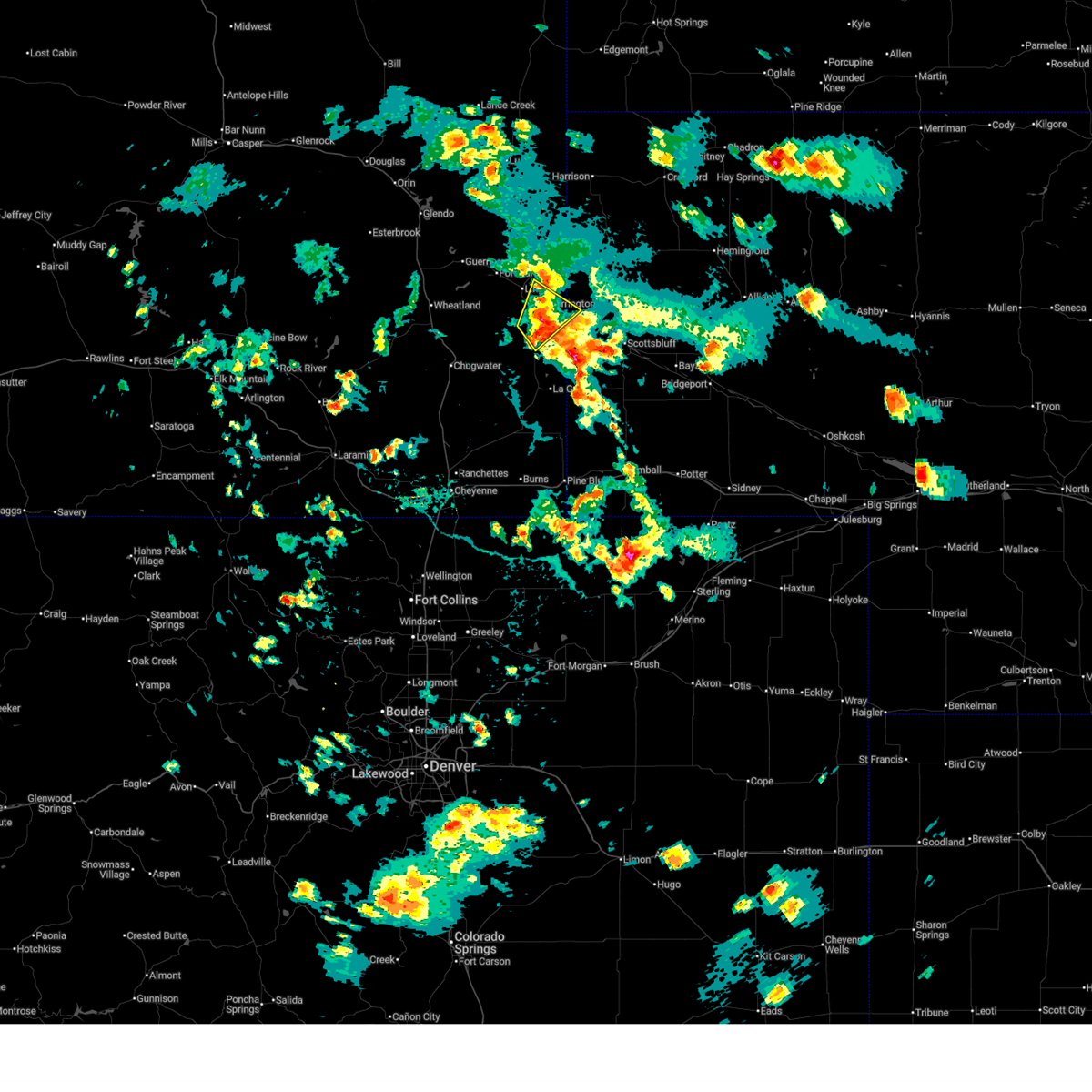
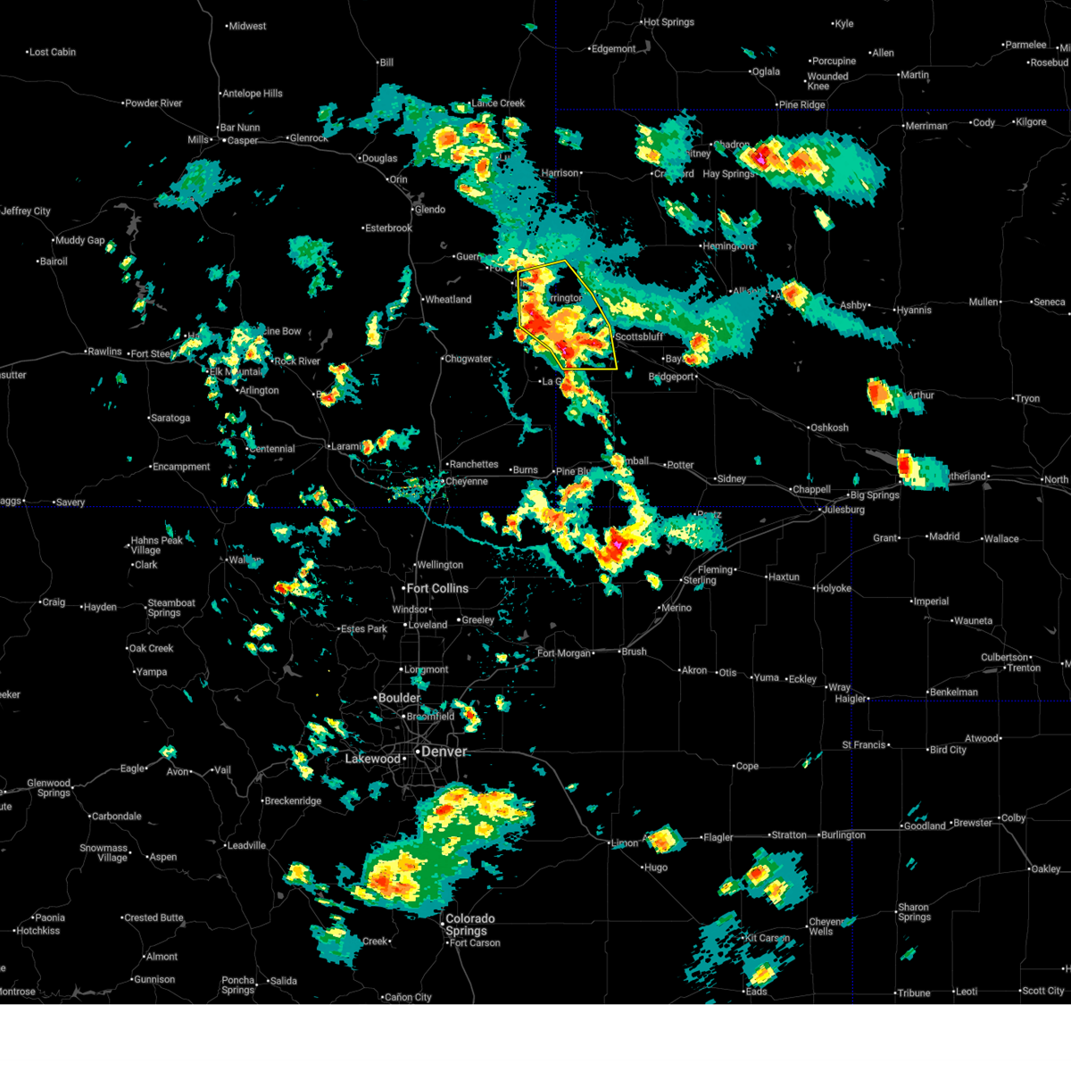
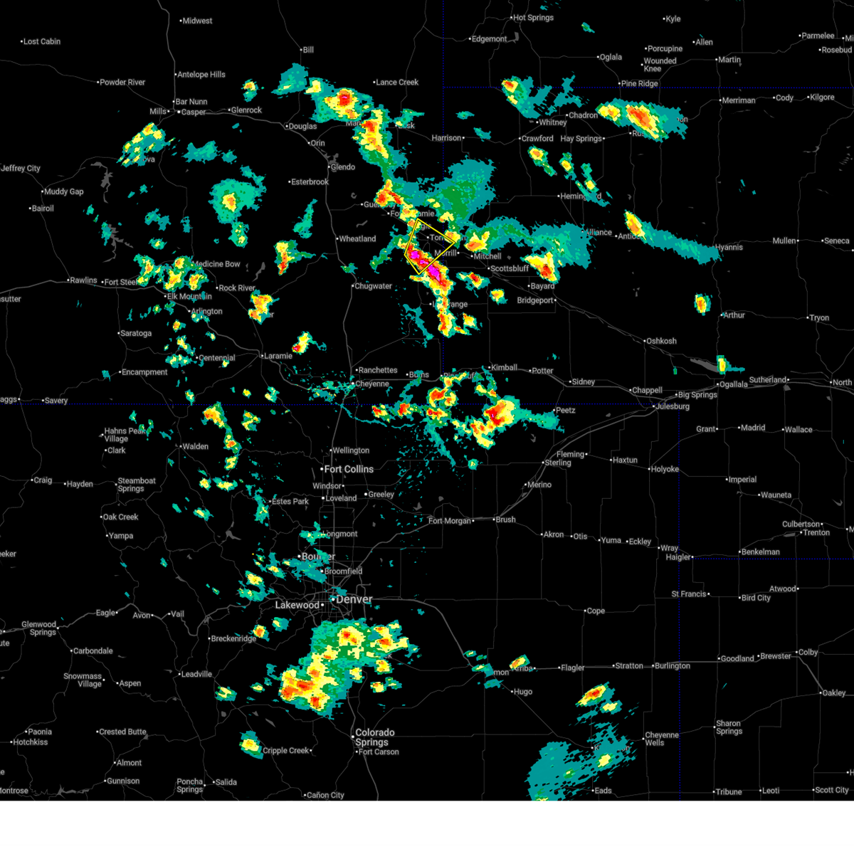
Hail Map for Yoder, WY
The Yoder, WY area has had 45 reports of on-the-ground hail by trained spotters, and has been under severe weather warnings 29 times during the past 12 months. Doppler radar has detected hail at or near Yoder, WY on 84 occasions, including 6 occasions during the past year.
| Name: | Yoder, WY |
| Where Located: | 32.8 miles W of Scottsbluff, NE |
| Map: | Google Map for Yoder, WY |
| Population: | 151 |
| Housing Units: | 85 |
| More Info: | Search Google for Yoder, WY |
1
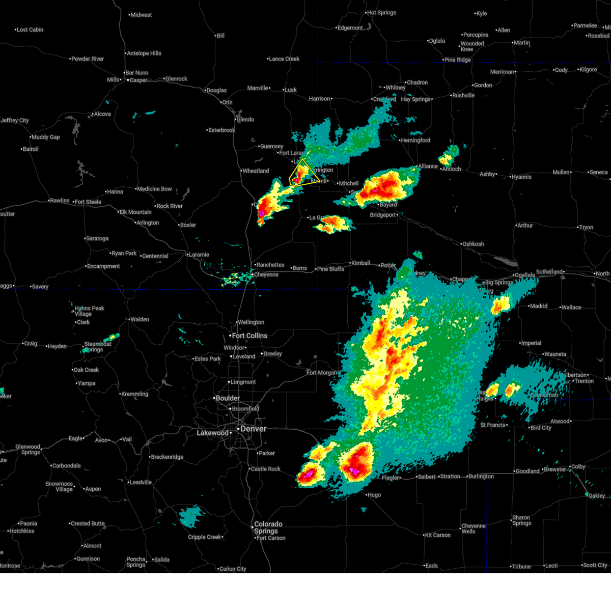
The Top Recent Hail Date for Yoder, WY is Thursday, July 24, 2025 (25th out of 84)
Hail and Wind Damage Spotted near Yoder, WY
| Date / Time | Report Details |
|---|---|
| 6/8/2026 6:23 PM MDT |
 Svrcys the national weather service in cheyenne has issued a * severe thunderstorm warning for, northwestern scotts bluff county in the panhandle of nebraska, east central goshen county in southeastern wyoming, * until 715 pm mdt. * at 623 pm mdt, a severe thunderstorm was located near yoder, or 9 miles southwest of torrington, moving northeast at 15 mph (radar indicated). Hazards include 60 mph wind gusts and quarter size hail. Hail damage to vehicles is expected. Expect wind damage to roofs, siding, and trees. Svrcys the national weather service in cheyenne has issued a * severe thunderstorm warning for, northwestern scotts bluff county in the panhandle of nebraska, east central goshen county in southeastern wyoming, * until 715 pm mdt. * at 623 pm mdt, a severe thunderstorm was located near yoder, or 9 miles southwest of torrington, moving northeast at 15 mph (radar indicated). Hazards include 60 mph wind gusts and quarter size hail. Hail damage to vehicles is expected. Expect wind damage to roofs, siding, and trees.
|
| 6/8/2026 5:40 PM MDT | Quarter sized hail reported 12.1 miles E of Yoder, WY, em received reports from public of quarter-sized hail within large quantities of small hail covering the roadway. |
| 6/8/2026 5:31 PM MDT |
 Svrcys the national weather service in cheyenne has issued a * severe thunderstorm warning for, central goshen county in southeastern wyoming, * until 615 pm mdt. * at 531 pm mdt, a severe thunderstorm was located near veteran, or 18 miles southwest of torrington, moving northeast at 15 mph (radar indicated). Hazards include 60 mph wind gusts and quarter size hail. Hail damage to vehicles is expected. Expect wind damage to roofs, siding, and trees. Svrcys the national weather service in cheyenne has issued a * severe thunderstorm warning for, central goshen county in southeastern wyoming, * until 615 pm mdt. * at 531 pm mdt, a severe thunderstorm was located near veteran, or 18 miles southwest of torrington, moving northeast at 15 mph (radar indicated). Hazards include 60 mph wind gusts and quarter size hail. Hail damage to vehicles is expected. Expect wind damage to roofs, siding, and trees.
|
| 6/8/2026 3:27 PM MDT |
 The storm which prompted the warning has weakened below severe limits, and no longer poses an immediate threat to life or property. therefore, the warning will be allowed to expire. however, small hail and gusty winds are still possible with this thunderstorm. a severe thunderstorm watch remains in effect until 900 pm mdt for southeastern wyoming. The storm which prompted the warning has weakened below severe limits, and no longer poses an immediate threat to life or property. therefore, the warning will be allowed to expire. however, small hail and gusty winds are still possible with this thunderstorm. a severe thunderstorm watch remains in effect until 900 pm mdt for southeastern wyoming.
|
| 6/8/2026 3:09 PM MDT |
 At 309 pm mdt, a severe thunderstorm was located 9 miles southwest of veteran, or 22 miles southwest of torrington, moving east at 20 mph (radar indicated). Hazards include 60 mph wind gusts and quarter size hail. Hail damage to vehicles is expected. expect wind damage to roofs, siding, and trees. Locations impacted include, yoder, veteran, hawk springs, and southern hills estates. At 309 pm mdt, a severe thunderstorm was located 9 miles southwest of veteran, or 22 miles southwest of torrington, moving east at 20 mph (radar indicated). Hazards include 60 mph wind gusts and quarter size hail. Hail damage to vehicles is expected. expect wind damage to roofs, siding, and trees. Locations impacted include, yoder, veteran, hawk springs, and southern hills estates.
|
| 6/8/2026 2:55 PM MDT |
 At 255 pm mdt, a severe thunderstorm was located 10 miles east of slater, or 23 miles southeast of wheatland, moving east at 25 mph (radar indicated). Hazards include ping pong ball size hail and 60 mph wind gusts. People and animals outdoors will be injured. expect hail damage to roofs, siding, windows, and vehicles. expect wind damage to roofs, siding, and trees. Locations impacted include, yoder, veteran, hawk springs, southern hills estates, and slater. At 255 pm mdt, a severe thunderstorm was located 10 miles east of slater, or 23 miles southeast of wheatland, moving east at 25 mph (radar indicated). Hazards include ping pong ball size hail and 60 mph wind gusts. People and animals outdoors will be injured. expect hail damage to roofs, siding, windows, and vehicles. expect wind damage to roofs, siding, and trees. Locations impacted include, yoder, veteran, hawk springs, southern hills estates, and slater.
|
| 6/8/2026 2:41 PM MDT |
 Svrcys the national weather service in cheyenne has issued a * severe thunderstorm warning for, southern goshen county in southeastern wyoming, southeastern platte county in southeastern wyoming, * until 330 pm mdt. * at 240 pm mdt, a severe thunderstorm was located near slater, or 19 miles southeast of wheatland, moving east at 35 mph (radar indicated). Hazards include ping pong ball size hail and 60 mph wind gusts. People and animals outdoors will be injured. expect hail damage to roofs, siding, windows, and vehicles. Expect wind damage to roofs, siding, and trees. Svrcys the national weather service in cheyenne has issued a * severe thunderstorm warning for, southern goshen county in southeastern wyoming, southeastern platte county in southeastern wyoming, * until 330 pm mdt. * at 240 pm mdt, a severe thunderstorm was located near slater, or 19 miles southeast of wheatland, moving east at 35 mph (radar indicated). Hazards include ping pong ball size hail and 60 mph wind gusts. People and animals outdoors will be injured. expect hail damage to roofs, siding, windows, and vehicles. Expect wind damage to roofs, siding, and trees.
|
| 6/1/2026 4:21 PM MDT |
 The storms which prompted the warning have weakened below severe limits, and no longer pose an immediate threat to life or property. therefore, the warning will be allowed to expire. however, small hail and heavy rain are still possible with these thunderstorms. a severe thunderstorm watch remains in effect until 800 pm mdt for the panhandle of nebraska, and southeastern wyoming. remember, a severe thunderstorm warning still remains in effect for much of scotts bluff and southern sioux counties. The storms which prompted the warning have weakened below severe limits, and no longer pose an immediate threat to life or property. therefore, the warning will be allowed to expire. however, small hail and heavy rain are still possible with these thunderstorms. a severe thunderstorm watch remains in effect until 800 pm mdt for the panhandle of nebraska, and southeastern wyoming. remember, a severe thunderstorm warning still remains in effect for much of scotts bluff and southern sioux counties.
|
| 6/1/2026 3:41 PM MDT |
 The storms which prompted the warning have moved out of the area. therefore, the warning will be allowed to expire. however, small hail, gusty winds and heavy rain are still possible with these thunderstorms. a severe thunderstorm watch remains in effect until 800 pm mdt for southeastern wyoming. remember, a severe thunderstorm warning still remains in effect for portions of platte and goshen counties until 430 pm. The storms which prompted the warning have moved out of the area. therefore, the warning will be allowed to expire. however, small hail, gusty winds and heavy rain are still possible with these thunderstorms. a severe thunderstorm watch remains in effect until 800 pm mdt for southeastern wyoming. remember, a severe thunderstorm warning still remains in effect for portions of platte and goshen counties until 430 pm.
|
| 6/1/2026 3:39 PM MDT |
 Svrcys the national weather service in cheyenne has issued a * severe thunderstorm warning for, west central scotts bluff county in the panhandle of nebraska, southern goshen county in southeastern wyoming, southeastern platte county in southeastern wyoming, * until 430 pm mdt. * at 339 pm mdt, severe thunderstorms were located along a line extending from near yoder to chugwater, moving east at 25 mph (radar indicated). Hazards include 60 mph wind gusts and quarter size hail. Hail damage to vehicles is expected. Expect wind damage to roofs, siding, and trees. Svrcys the national weather service in cheyenne has issued a * severe thunderstorm warning for, west central scotts bluff county in the panhandle of nebraska, southern goshen county in southeastern wyoming, southeastern platte county in southeastern wyoming, * until 430 pm mdt. * at 339 pm mdt, severe thunderstorms were located along a line extending from near yoder to chugwater, moving east at 25 mph (radar indicated). Hazards include 60 mph wind gusts and quarter size hail. Hail damage to vehicles is expected. Expect wind damage to roofs, siding, and trees.
|
| 6/1/2026 3:25 PM MDT |
 Svrcys the national weather service in cheyenne has issued a * severe thunderstorm warning for, northwestern scotts bluff county in the panhandle of nebraska, southwestern sioux county in the panhandle of nebraska, east central goshen county in southeastern wyoming, * until 415 pm mdt. * at 325 pm mdt, a severe thunderstorm was located over henry, or near torrington, moving east at 20 mph (radar indicated). Hazards include 60 mph wind gusts and quarter size hail. Hail damage to vehicles is expected. Expect wind damage to roofs, siding, and trees. Svrcys the national weather service in cheyenne has issued a * severe thunderstorm warning for, northwestern scotts bluff county in the panhandle of nebraska, southwestern sioux county in the panhandle of nebraska, east central goshen county in southeastern wyoming, * until 415 pm mdt. * at 325 pm mdt, a severe thunderstorm was located over henry, or near torrington, moving east at 20 mph (radar indicated). Hazards include 60 mph wind gusts and quarter size hail. Hail damage to vehicles is expected. Expect wind damage to roofs, siding, and trees.
|
| 6/1/2026 3:20 PM MDT |
 At 320 pm mdt, severe thunderstorms were located along a line extending from 7 miles southwest of veteran to 6 miles west of chugwater, moving east at 20 mph (radar indicated). Hazards include 60 mph wind gusts and quarter size hail. Hail damage to vehicles is expected. expect wind damage to roofs, siding, and trees. locations impacted include, chugwater, yoder, and slater. This includes interstate 25 in wyoming between mile markers 47 and 61. At 320 pm mdt, severe thunderstorms were located along a line extending from 7 miles southwest of veteran to 6 miles west of chugwater, moving east at 20 mph (radar indicated). Hazards include 60 mph wind gusts and quarter size hail. Hail damage to vehicles is expected. expect wind damage to roofs, siding, and trees. locations impacted include, chugwater, yoder, and slater. This includes interstate 25 in wyoming between mile markers 47 and 61.
|
| 6/1/2026 2:54 PM MDT |
 Svrcys the national weather service in cheyenne has issued a * severe thunderstorm warning for, southwestern goshen county in southeastern wyoming, northwestern laramie county in southeastern wyoming, southeastern platte county in southeastern wyoming, * until 345 pm mdt. * at 253 pm mdt, severe thunderstorms were located along a line extending from 6 miles east of slater to 13 miles west of chugwater, moving east at 25 mph (radar indicated). Hazards include 60 mph wind gusts and quarter size hail. Hail damage to vehicles is expected. Expect wind damage to roofs, siding, and trees. Svrcys the national weather service in cheyenne has issued a * severe thunderstorm warning for, southwestern goshen county in southeastern wyoming, northwestern laramie county in southeastern wyoming, southeastern platte county in southeastern wyoming, * until 345 pm mdt. * at 253 pm mdt, severe thunderstorms were located along a line extending from 6 miles east of slater to 13 miles west of chugwater, moving east at 25 mph (radar indicated). Hazards include 60 mph wind gusts and quarter size hail. Hail damage to vehicles is expected. Expect wind damage to roofs, siding, and trees.
|
| 6/1/2026 2:31 PM MDT |
 Svrcys the national weather service in cheyenne has issued a * severe thunderstorm warning for, central goshen county in southeastern wyoming, * until 330 pm mdt. * at 231 pm mdt, a severe thunderstorm was located 9 miles northwest of veteran, or 16 miles west of torrington, moving east at 25 mph (emergency management). Hazards include 60 mph wind gusts and quarter size hail. Hail damage to vehicles is expected. Expect wind damage to roofs, siding, and trees. Svrcys the national weather service in cheyenne has issued a * severe thunderstorm warning for, central goshen county in southeastern wyoming, * until 330 pm mdt. * at 231 pm mdt, a severe thunderstorm was located 9 miles northwest of veteran, or 16 miles west of torrington, moving east at 25 mph (emergency management). Hazards include 60 mph wind gusts and quarter size hail. Hail damage to vehicles is expected. Expect wind damage to roofs, siding, and trees.
|
| 5/29/2026 5:35 PM MDT |
 The storms which prompted the warning have weakened below severe limits, and no longer pose an immediate threat to life or property. therefore, the warning will be allowed to expire. however, small hail and heavy rain are still possible with these thunderstorms. The storms which prompted the warning have weakened below severe limits, and no longer pose an immediate threat to life or property. therefore, the warning will be allowed to expire. however, small hail and heavy rain are still possible with these thunderstorms.
|
| 5/29/2026 5:18 PM MDT |
 At 518 pm mdt, severe thunderstorms were located along a line from east of yoder towards east of hawk springs, moving northwest at 20 mph (radar indicated). Hazards include 60 mph wind gusts and quarter size hail. Hail damage to vehicles is expected. expect wind damage to roofs, siding, and trees. Locations impacted include, yoder, henry, huntley, hawk springs reservoir, southern hills estates, hawk springs, hawk springs state recreation area, wycross, and hawk springs campground. At 518 pm mdt, severe thunderstorms were located along a line from east of yoder towards east of hawk springs, moving northwest at 20 mph (radar indicated). Hazards include 60 mph wind gusts and quarter size hail. Hail damage to vehicles is expected. expect wind damage to roofs, siding, and trees. Locations impacted include, yoder, henry, huntley, hawk springs reservoir, southern hills estates, hawk springs, hawk springs state recreation area, wycross, and hawk springs campground.
|
| 5/29/2026 5:05 PM MDT |
 Svrcys the national weather service in cheyenne has issued a * severe thunderstorm warning for, southeastern goshen county in southeastern wyoming, * until 545 pm mdt. * at 504 pm mdt, severe thunderstorms were located along a line located from near la grange north towards east of hawk springs, moving northwest at 30 mph (radar indicated). Hazards include 60 mph wind gusts and quarter size hail. Hail damage to vehicles is expected. Expect wind damage to roofs, siding, and trees. Svrcys the national weather service in cheyenne has issued a * severe thunderstorm warning for, southeastern goshen county in southeastern wyoming, * until 545 pm mdt. * at 504 pm mdt, severe thunderstorms were located along a line located from near la grange north towards east of hawk springs, moving northwest at 30 mph (radar indicated). Hazards include 60 mph wind gusts and quarter size hail. Hail damage to vehicles is expected. Expect wind damage to roofs, siding, and trees.
|
| 8/4/2025 5:28 PM MDT |
 A severe thunderstorm watch remains in effect until 1000 pm mdt for southeastern wyoming. remember, a severe thunderstorm warning still remains in effect for western scotts bluff, southwestern sioux and southeastern goshen counties until 630 pm mdt. A severe thunderstorm watch remains in effect until 1000 pm mdt for southeastern wyoming. remember, a severe thunderstorm warning still remains in effect for western scotts bluff, southwestern sioux and southeastern goshen counties until 630 pm mdt.
|
| 8/4/2025 5:25 PM MDT |
 Svrcys the national weather service in cheyenne has issued a * severe thunderstorm warning for, western scotts bluff county in the panhandle of nebraska, southwestern sioux county in the panhandle of nebraska, southeastern goshen county in southeastern wyoming, * until 630 pm mdt. * at 525 pm mdt, a severe thunderstorm was located near hawk springs, or 17 miles southwest of torrington, moving east at 30 mph (radar indicated). Hazards include 60 mph wind gusts and half dollar size hail. Hail damage to vehicles is expected. Expect wind damage to roofs, siding, and trees. Svrcys the national weather service in cheyenne has issued a * severe thunderstorm warning for, western scotts bluff county in the panhandle of nebraska, southwestern sioux county in the panhandle of nebraska, southeastern goshen county in southeastern wyoming, * until 630 pm mdt. * at 525 pm mdt, a severe thunderstorm was located near hawk springs, or 17 miles southwest of torrington, moving east at 30 mph (radar indicated). Hazards include 60 mph wind gusts and half dollar size hail. Hail damage to vehicles is expected. Expect wind damage to roofs, siding, and trees.
|
| 8/4/2025 5:22 PM MDT | Half Dollar sized hail reported 10.1 miles NNE of Yoder, WY |
| 8/4/2025 4:58 PM MDT |
 At 458 pm mdt, a severe thunderstorm was located 10 miles west of hawk springs, or 24 miles southwest of torrington, moving southeast at 20 mph (radar indicated). Hazards include 60 mph wind gusts and half dollar size hail. Hail damage to vehicles is expected. expect wind damage to roofs, siding, and trees. Locations impacted include, yoder and hawk springs. At 458 pm mdt, a severe thunderstorm was located 10 miles west of hawk springs, or 24 miles southwest of torrington, moving southeast at 20 mph (radar indicated). Hazards include 60 mph wind gusts and half dollar size hail. Hail damage to vehicles is expected. expect wind damage to roofs, siding, and trees. Locations impacted include, yoder and hawk springs.
|
| 8/4/2025 4:37 PM MDT |
 Svrcys the national weather service in cheyenne has issued a * severe thunderstorm warning for, southern goshen county in southeastern wyoming, * until 530 pm mdt. * at 437 pm mdt, a severe thunderstorm was located 11 miles southeast of slater, or 25 miles southeast of wheatland, moving east at 20 mph (radar indicated). Hazards include 60 mph wind gusts and quarter size hail. Hail damage to vehicles is expected. Expect wind damage to roofs, siding, and trees. Svrcys the national weather service in cheyenne has issued a * severe thunderstorm warning for, southern goshen county in southeastern wyoming, * until 530 pm mdt. * at 437 pm mdt, a severe thunderstorm was located 11 miles southeast of slater, or 25 miles southeast of wheatland, moving east at 20 mph (radar indicated). Hazards include 60 mph wind gusts and quarter size hail. Hail damage to vehicles is expected. Expect wind damage to roofs, siding, and trees.
|
| 6/29/2025 6:19 PM MDT |
 At 618 pm mdt, severe thunderstorms were located along a line extending from fort laramie national historic site to near hawk springs, moving east at 30 mph (radar indicated). Hazards include golf ball size hail and 60 mph wind gusts. People and animals outdoors will be injured. expect hail damage to roofs, siding, windows, and vehicles. expect wind damage to roofs, siding, and trees. Locations impacted include, torrington, lingle, fort laramie, yoder, huntley, fort laramie national historic site, southern hills estates, torrington municipal airport, veteran, and goshen county fairgrounds. At 618 pm mdt, severe thunderstorms were located along a line extending from fort laramie national historic site to near hawk springs, moving east at 30 mph (radar indicated). Hazards include golf ball size hail and 60 mph wind gusts. People and animals outdoors will be injured. expect hail damage to roofs, siding, windows, and vehicles. expect wind damage to roofs, siding, and trees. Locations impacted include, torrington, lingle, fort laramie, yoder, huntley, fort laramie national historic site, southern hills estates, torrington municipal airport, veteran, and goshen county fairgrounds.
|
| 6/29/2025 6:19 PM MDT |
 the severe thunderstorm warning has been cancelled and is no longer in effect the severe thunderstorm warning has been cancelled and is no longer in effect
|
| 6/29/2025 5:58 PM MDT |
 At 558 pm mdt, severe thunderstorms were located along a line extending from near grayrocks reservoir to near hawk springs, moving east at 35 mph (radar indicated). Hazards include golf ball size hail and 60 mph wind gusts. People and animals outdoors will be injured. expect hail damage to roofs, siding, windows, and vehicles. expect wind damage to roofs, siding, and trees. Locations impacted include, torrington, lingle, fort laramie, yoder, huntley, fort laramie national historic site, grayrocks reservoir, southern hills estates, torrington municipal airport, veteran, slater, and goshen county fairgrounds. At 558 pm mdt, severe thunderstorms were located along a line extending from near grayrocks reservoir to near hawk springs, moving east at 35 mph (radar indicated). Hazards include golf ball size hail and 60 mph wind gusts. People and animals outdoors will be injured. expect hail damage to roofs, siding, windows, and vehicles. expect wind damage to roofs, siding, and trees. Locations impacted include, torrington, lingle, fort laramie, yoder, huntley, fort laramie national historic site, grayrocks reservoir, southern hills estates, torrington municipal airport, veteran, slater, and goshen county fairgrounds.
|
| 6/29/2025 5:39 PM MDT |
 The storm which prompted the warning has moved out of the area. therefore, the warning will be allowed to expire. a severe thunderstorm watch remains in effect until 900 pm mdt for southeastern wyoming. remember, a severe thunderstorm warning still remains in effect for central goshen county and southeastern platte county in southeast wyoming until 630 pm mdt. The storm which prompted the warning has moved out of the area. therefore, the warning will be allowed to expire. a severe thunderstorm watch remains in effect until 900 pm mdt for southeastern wyoming. remember, a severe thunderstorm warning still remains in effect for central goshen county and southeastern platte county in southeast wyoming until 630 pm mdt.
|
| 6/29/2025 5:36 PM MDT |
 Svrcys the national weather service in cheyenne has issued a * severe thunderstorm warning for, central goshen county in southeastern wyoming, southeastern platte county in southeastern wyoming, * until 630 pm mdt. * at 536 pm mdt, a severe thunderstorm was located near slater, or 17 miles southeast of wheatland, moving east at 30 mph (radar indicated). Hazards include 60 mph wind gusts and half dollar size hail. Hail damage to vehicles is expected. Expect wind damage to roofs, siding, and trees. Svrcys the national weather service in cheyenne has issued a * severe thunderstorm warning for, central goshen county in southeastern wyoming, southeastern platte county in southeastern wyoming, * until 630 pm mdt. * at 536 pm mdt, a severe thunderstorm was located near slater, or 17 miles southeast of wheatland, moving east at 30 mph (radar indicated). Hazards include 60 mph wind gusts and half dollar size hail. Hail damage to vehicles is expected. Expect wind damage to roofs, siding, and trees.
|
| 6/29/2025 5:27 PM MDT |
 At 527 pm mdt, a severe thunderstorm was located over hawk springs, or 21 miles south of torrington, moving east at 25 mph (radar indicated). Hazards include ping pong ball size hail and 60 mph wind gusts. People and animals outdoors will be injured. expect hail damage to roofs, siding, windows, and vehicles. expect wind damage to roofs, siding, and trees. Locations impacted include, chugwater, yoder, huntley, hawk springs reservoir, hawk springs state recreation area, hawk springs, slater, and hawk springs campground. At 527 pm mdt, a severe thunderstorm was located over hawk springs, or 21 miles south of torrington, moving east at 25 mph (radar indicated). Hazards include ping pong ball size hail and 60 mph wind gusts. People and animals outdoors will be injured. expect hail damage to roofs, siding, windows, and vehicles. expect wind damage to roofs, siding, and trees. Locations impacted include, chugwater, yoder, huntley, hawk springs reservoir, hawk springs state recreation area, hawk springs, slater, and hawk springs campground.
|
| 6/29/2025 5:27 PM MDT |
 the severe thunderstorm warning has been cancelled and is no longer in effect the severe thunderstorm warning has been cancelled and is no longer in effect
|
| 6/29/2025 5:08 PM MDT |
 At 507 pm mdt, a severe thunderstorm was located over hawk springs state recreation area, or 23 miles south of torrington, moving east at 25 mph (radar indicated). Hazards include ping pong ball size hail and 60 mph wind gusts. People and animals outdoors will be injured. expect hail damage to roofs, siding, windows, and vehicles. expect wind damage to roofs, siding, and trees. Locations impacted include, chugwater, yoder, huntley, hawk springs reservoir, hawk springs state recreation area, hawk springs, wycross, slater, and hawk springs campground. At 507 pm mdt, a severe thunderstorm was located over hawk springs state recreation area, or 23 miles south of torrington, moving east at 25 mph (radar indicated). Hazards include ping pong ball size hail and 60 mph wind gusts. People and animals outdoors will be injured. expect hail damage to roofs, siding, windows, and vehicles. expect wind damage to roofs, siding, and trees. Locations impacted include, chugwater, yoder, huntley, hawk springs reservoir, hawk springs state recreation area, hawk springs, wycross, slater, and hawk springs campground.
|
| 6/29/2025 4:42 PM MDT |
 Svrcys the national weather service in cheyenne has issued a * severe thunderstorm warning for, southern goshen county in southeastern wyoming, northwestern laramie county in southeastern wyoming, southern platte county in southeastern wyoming, * until 545 pm mdt. * at 442 pm mdt, a severe thunderstorm was located 10 miles east of chugwater, or 26 miles southeast of wheatland, moving east at 15 mph (radar indicated). Hazards include 60 mph wind gusts and quarter size hail. Hail damage to vehicles is expected. Expect wind damage to roofs, siding, and trees. Svrcys the national weather service in cheyenne has issued a * severe thunderstorm warning for, southern goshen county in southeastern wyoming, northwestern laramie county in southeastern wyoming, southern platte county in southeastern wyoming, * until 545 pm mdt. * at 442 pm mdt, a severe thunderstorm was located 10 miles east of chugwater, or 26 miles southeast of wheatland, moving east at 15 mph (radar indicated). Hazards include 60 mph wind gusts and quarter size hail. Hail damage to vehicles is expected. Expect wind damage to roofs, siding, and trees.
|
| 6/17/2025 1:06 AM MDT |
 The storm which prompted the warning has moved out of the area. therefore, the warning will be allowed to expire. however, small hail and gusty winds are still possible with this thunderstorm. The storm which prompted the warning has moved out of the area. therefore, the warning will be allowed to expire. however, small hail and gusty winds are still possible with this thunderstorm.
|
| 6/17/2025 12:49 AM MDT | Half Dollar sized hail reported 9.6 miles N of Yoder, WY |
| 6/17/2025 12:46 AM MDT |
 At 1245 am mdt, a severe thunderstorm was located near hawk springs, or 15 miles south of torrington, moving northeast at 40 mph (radar indicated). Hazards include two inch hail and 60 mph wind gusts. People and animals outdoors will be injured. expect hail damage to roofs, siding, windows, and vehicles. expect wind damage to roofs, siding, and trees. Locations impacted include, morrill, lyman, yoder, henry, huntley, hawk springs reservoir, stegall, southern hills estates, hawk springs state recreation area, hawk springs, hubbard hill, wycross, and hawk springs campground. At 1245 am mdt, a severe thunderstorm was located near hawk springs, or 15 miles south of torrington, moving northeast at 40 mph (radar indicated). Hazards include two inch hail and 60 mph wind gusts. People and animals outdoors will be injured. expect hail damage to roofs, siding, windows, and vehicles. expect wind damage to roofs, siding, and trees. Locations impacted include, morrill, lyman, yoder, henry, huntley, hawk springs reservoir, stegall, southern hills estates, hawk springs state recreation area, hawk springs, hubbard hill, wycross, and hawk springs campground.
|
| 6/17/2025 12:34 AM MDT |
 Svrcys the national weather service in cheyenne has issued a * severe thunderstorm warning for, western scotts bluff county in the panhandle of nebraska, southeastern goshen county in southeastern wyoming, * until 115 am mdt. * at 1234 am mdt, a severe thunderstorm was located near hawk springs, or 19 miles southwest of torrington, moving northeast at 40 mph (radar indicated). Hazards include 60 mph wind gusts and half dollar size hail. Hail damage to vehicles is expected. Expect wind damage to roofs, siding, and trees. Svrcys the national weather service in cheyenne has issued a * severe thunderstorm warning for, western scotts bluff county in the panhandle of nebraska, southeastern goshen county in southeastern wyoming, * until 115 am mdt. * at 1234 am mdt, a severe thunderstorm was located near hawk springs, or 19 miles southwest of torrington, moving northeast at 40 mph (radar indicated). Hazards include 60 mph wind gusts and half dollar size hail. Hail damage to vehicles is expected. Expect wind damage to roofs, siding, and trees.
|
| 6/12/2025 5:14 PM MDT |
 At 514 pm mdt, a severe thunderstorm was located near veteran, or 14 miles west of torrington, moving east at 25 mph (radar indicated). Hazards include ping pong ball size hail. People and animals outdoors will be injured. expect damage to roofs, siding, windows, and vehicles. Locations impacted include, torrington, guernsey, lingle, fort laramie, yoder, huntley, register cliff state historic site, southern hills estates, pine ridge estates, oregon trail ruts state historic site, fort laramie national historic site, grayrocks reservoir, veteran, hwy 85 at dry rawhide creek, and goshen county fairgrounds. At 514 pm mdt, a severe thunderstorm was located near veteran, or 14 miles west of torrington, moving east at 25 mph (radar indicated). Hazards include ping pong ball size hail. People and animals outdoors will be injured. expect damage to roofs, siding, windows, and vehicles. Locations impacted include, torrington, guernsey, lingle, fort laramie, yoder, huntley, register cliff state historic site, southern hills estates, pine ridge estates, oregon trail ruts state historic site, fort laramie national historic site, grayrocks reservoir, veteran, hwy 85 at dry rawhide creek, and goshen county fairgrounds.
|
| 6/12/2025 5:04 PM MDT |
 Svrcys the national weather service in cheyenne has issued a * severe thunderstorm warning for, central goshen county in southeastern wyoming, east central platte county in southeastern wyoming, * until 545 pm mdt. * at 504 pm mdt, a severe thunderstorm was located 8 miles northwest of veteran, or 17 miles west of torrington, moving east at 25 mph (radar indicated). Hazards include half dollar size hail. damage to vehicles is expected Svrcys the national weather service in cheyenne has issued a * severe thunderstorm warning for, central goshen county in southeastern wyoming, east central platte county in southeastern wyoming, * until 545 pm mdt. * at 504 pm mdt, a severe thunderstorm was located 8 miles northwest of veteran, or 17 miles west of torrington, moving east at 25 mph (radar indicated). Hazards include half dollar size hail. damage to vehicles is expected
|
| 6/12/2025 4:49 PM MDT |
 At 449 pm mdt, a severe thunderstorm was located near yoder, or 14 miles southwest of torrington, moving northeast at 20 mph (radar indicated). Hazards include half dollar size hail. Damage to vehicles is expected. Locations impacted include, yoder, veteran, and hawk springs. At 449 pm mdt, a severe thunderstorm was located near yoder, or 14 miles southwest of torrington, moving northeast at 20 mph (radar indicated). Hazards include half dollar size hail. Damage to vehicles is expected. Locations impacted include, yoder, veteran, and hawk springs.
|
| 6/12/2025 4:33 PM MDT |
 At 433 pm mdt, a severe thunderstorm was located near hawk springs, or 18 miles southwest of torrington, moving northeast at 20 mph (radar indicated). Hazards include half dollar size hail. Damage to vehicles is expected. Locations impacted include, yoder, hawk springs reservoir, veteran, hawk springs state recreation area, hawk springs, wycross, and hawk springs campground. At 433 pm mdt, a severe thunderstorm was located near hawk springs, or 18 miles southwest of torrington, moving northeast at 20 mph (radar indicated). Hazards include half dollar size hail. Damage to vehicles is expected. Locations impacted include, yoder, hawk springs reservoir, veteran, hawk springs state recreation area, hawk springs, wycross, and hawk springs campground.
|
| 6/12/2025 4:22 PM MDT |
 Svrcys the national weather service in cheyenne has issued a * severe thunderstorm warning for, southern goshen county in southeastern wyoming, * until 500 pm mdt. * at 422 pm mdt, a severe thunderstorm was located 9 miles west of hawk springs, or 22 miles southwest of torrington, moving northeast at 20 mph (radar indicated). Hazards include half dollar size hail. damage to vehicles is expected Svrcys the national weather service in cheyenne has issued a * severe thunderstorm warning for, southern goshen county in southeastern wyoming, * until 500 pm mdt. * at 422 pm mdt, a severe thunderstorm was located 9 miles west of hawk springs, or 22 miles southwest of torrington, moving northeast at 20 mph (radar indicated). Hazards include half dollar size hail. damage to vehicles is expected
|
| 6/2/2025 4:55 PM MDT |
 At 455 pm mdt, a severe thunderstorm was located near slater, or 16 miles southeast of wheatland, and is nearly stationary (radar indicated). Hazards include 60 mph wind gusts and half dollar size hail. Hail damage to vehicles is expected. expect wind damage to roofs, siding, and trees. Locations impacted include, lingle, yoder, slater, and veteran. At 455 pm mdt, a severe thunderstorm was located near slater, or 16 miles southeast of wheatland, and is nearly stationary (radar indicated). Hazards include 60 mph wind gusts and half dollar size hail. Hail damage to vehicles is expected. expect wind damage to roofs, siding, and trees. Locations impacted include, lingle, yoder, slater, and veteran.
|
| 6/2/2025 4:50 PM MDT |
 Svrcys the national weather service in cheyenne has issued a * severe thunderstorm warning for, central goshen county in southeastern wyoming, southeastern platte county in southeastern wyoming, * until 530 pm mdt. * at 450 pm mdt, a severe thunderstorm was located near slater, or 16 miles southeast of wheatland, moving east at 35 mph (radar indicated). Hazards include 60 mph wind gusts and half dollar size hail. Hail damage to vehicles is expected. Expect wind damage to roofs, siding, and trees. Svrcys the national weather service in cheyenne has issued a * severe thunderstorm warning for, central goshen county in southeastern wyoming, southeastern platte county in southeastern wyoming, * until 530 pm mdt. * at 450 pm mdt, a severe thunderstorm was located near slater, or 16 miles southeast of wheatland, moving east at 35 mph (radar indicated). Hazards include 60 mph wind gusts and half dollar size hail. Hail damage to vehicles is expected. Expect wind damage to roofs, siding, and trees.
|
| 5/23/2025 8:50 PM MDT |
 At 849 pm mdt, a severe thunderstorm was located near southern hills estates, or near torrington, moving east at 30 mph (emergency management reports golf ball sized hail north of veteran). Hazards include two inch hail and 60 mph wind gusts. People and animals outdoors will be injured. expect hail damage to roofs, siding, windows, and vehicles. expect wind damage to roofs, siding, and trees. Locations impacted include, torrington, morrill, lyman, yoder, henry, huntley, southern hills estates, veteran, torrington municipal airport, and goshen county fairgrounds. At 849 pm mdt, a severe thunderstorm was located near southern hills estates, or near torrington, moving east at 30 mph (emergency management reports golf ball sized hail north of veteran). Hazards include two inch hail and 60 mph wind gusts. People and animals outdoors will be injured. expect hail damage to roofs, siding, windows, and vehicles. expect wind damage to roofs, siding, and trees. Locations impacted include, torrington, morrill, lyman, yoder, henry, huntley, southern hills estates, veteran, torrington municipal airport, and goshen county fairgrounds.
|
| 5/23/2025 8:40 PM MDT |
 Svrcys the national weather service in cheyenne has issued a * severe thunderstorm warning for, northwestern scotts bluff county in the panhandle of nebraska, southwestern sioux county in the panhandle of nebraska, east central goshen county in southeastern wyoming, * until 915 pm mdt. * at 840 pm mdt, a severe thunderstorm was located near veteran, or 10 miles west of torrington, moving east at 30 mph (radar indicated). Hazards include golf ball size hail and 60 mph wind gusts. People and animals outdoors will be injured. expect hail damage to roofs, siding, windows, and vehicles. Expect wind damage to roofs, siding, and trees. Svrcys the national weather service in cheyenne has issued a * severe thunderstorm warning for, northwestern scotts bluff county in the panhandle of nebraska, southwestern sioux county in the panhandle of nebraska, east central goshen county in southeastern wyoming, * until 915 pm mdt. * at 840 pm mdt, a severe thunderstorm was located near veteran, or 10 miles west of torrington, moving east at 30 mph (radar indicated). Hazards include golf ball size hail and 60 mph wind gusts. People and animals outdoors will be injured. expect hail damage to roofs, siding, windows, and vehicles. Expect wind damage to roofs, siding, and trees.
|
| 5/18/2025 5:35 PM MDT |
 The storms which prompted the warning have weakened below severe limits, and no longer pose an immediate threat to life or property. therefore, the warning will be allowed to expire. however, gusty winds are still possible with these thunderstorms. a tornado watch remains in effect until 800 pm mdt for the panhandle of nebraska. The storms which prompted the warning have weakened below severe limits, and no longer pose an immediate threat to life or property. therefore, the warning will be allowed to expire. however, gusty winds are still possible with these thunderstorms. a tornado watch remains in effect until 800 pm mdt for the panhandle of nebraska.
|
| 5/18/2025 4:57 PM MDT |
 Svrcys the national weather service in cheyenne has issued a * severe thunderstorm warning for, western scotts bluff county in the panhandle of nebraska, northwestern banner county in the panhandle of nebraska, southeastern goshen county in southeastern wyoming, * until 545 pm mdt. * at 457 pm mdt, severe thunderstorms were located along a line extending from near wycross to 10 miles northwest of harrisburg, moving north at 35 mph (radar indicated). Hazards include 60 mph wind gusts and quarter size hail. Hail damage to vehicles is expected. Expect wind damage to roofs, siding, and trees. Svrcys the national weather service in cheyenne has issued a * severe thunderstorm warning for, western scotts bluff county in the panhandle of nebraska, northwestern banner county in the panhandle of nebraska, southeastern goshen county in southeastern wyoming, * until 545 pm mdt. * at 457 pm mdt, severe thunderstorms were located along a line extending from near wycross to 10 miles northwest of harrisburg, moving north at 35 mph (radar indicated). Hazards include 60 mph wind gusts and quarter size hail. Hail damage to vehicles is expected. Expect wind damage to roofs, siding, and trees.
|
| 9/15/2024 6:15 PM MDT |
 At 615 pm mdt, a severe thunderstorm was located near fort laramie, or 16 miles northwest of torrington, moving north at 25 mph (radar indicated). Hazards include golf ball size hail and 60 mph wind gusts. People and animals outdoors will be injured. expect hail damage to roofs, siding, windows, and vehicles. expect wind damage to roofs, siding, and trees. Locations impacted include, torrington, guernsey, lingle, fort laramie, yoder, henry, hartville, huntley, register cliff state historic site, southern hills estates, torrington municipal airport, pine ridge estates, fort laramie national historic site, grayrocks reservoir, veteran, hawk springs, and goshen county fairgrounds. At 615 pm mdt, a severe thunderstorm was located near fort laramie, or 16 miles northwest of torrington, moving north at 25 mph (radar indicated). Hazards include golf ball size hail and 60 mph wind gusts. People and animals outdoors will be injured. expect hail damage to roofs, siding, windows, and vehicles. expect wind damage to roofs, siding, and trees. Locations impacted include, torrington, guernsey, lingle, fort laramie, yoder, henry, hartville, huntley, register cliff state historic site, southern hills estates, torrington municipal airport, pine ridge estates, fort laramie national historic site, grayrocks reservoir, veteran, hawk springs, and goshen county fairgrounds.
|
| 9/15/2024 5:48 PM MDT | Quarter sized hail reported 14.8 miles ESE of Yoder, WY, report of slightly larger than quarter size hail. |
| 9/15/2024 5:45 PM MDT |
 Svrcys the national weather service in cheyenne has issued a * severe thunderstorm warning for, northwestern scotts bluff county in the panhandle of nebraska, southwestern sioux county in the panhandle of nebraska, central goshen county in southeastern wyoming, east central platte county in southeastern wyoming, * until 630 pm mdt. * at 545 pm mdt, a severe thunderstorm was located 7 miles northwest of veteran, or 18 miles west of torrington, moving north at 25 mph (radar indicated). Hazards include 60 mph wind gusts and quarter size hail. Hail damage to vehicles is expected. Expect wind damage to roofs, siding, and trees. Svrcys the national weather service in cheyenne has issued a * severe thunderstorm warning for, northwestern scotts bluff county in the panhandle of nebraska, southwestern sioux county in the panhandle of nebraska, central goshen county in southeastern wyoming, east central platte county in southeastern wyoming, * until 630 pm mdt. * at 545 pm mdt, a severe thunderstorm was located 7 miles northwest of veteran, or 18 miles west of torrington, moving north at 25 mph (radar indicated). Hazards include 60 mph wind gusts and quarter size hail. Hail damage to vehicles is expected. Expect wind damage to roofs, siding, and trees.
|
| 8/7/2024 6:14 PM MDT |
 the severe thunderstorm warning has been cancelled and is no longer in effect the severe thunderstorm warning has been cancelled and is no longer in effect
|
| 8/7/2024 5:47 PM MDT |
 Svrcys the national weather service in cheyenne has issued a * severe thunderstorm warning for, southwestern scotts bluff county in the panhandle of nebraska, northwestern banner county in the panhandle of nebraska, southern goshen county in southeastern wyoming, * until 630 pm mdt. * at 546 pm mdt, severe thunderstorms were located along a line extending from near hawk springs to 11 miles east of chugwater, moving southeast at 15 mph (radar indicated). Hazards include ping pong ball size hail and 60 mph wind gusts. People and animals outdoors will be injured. expect hail damage to roofs, siding, windows, and vehicles. Expect wind damage to roofs, siding, and trees. Svrcys the national weather service in cheyenne has issued a * severe thunderstorm warning for, southwestern scotts bluff county in the panhandle of nebraska, northwestern banner county in the panhandle of nebraska, southern goshen county in southeastern wyoming, * until 630 pm mdt. * at 546 pm mdt, severe thunderstorms were located along a line extending from near hawk springs to 11 miles east of chugwater, moving southeast at 15 mph (radar indicated). Hazards include ping pong ball size hail and 60 mph wind gusts. People and animals outdoors will be injured. expect hail damage to roofs, siding, windows, and vehicles. Expect wind damage to roofs, siding, and trees.
|
| 7/27/2024 6:14 PM MDT |
 The storms which prompted the warning have moved out of the area. therefore, the warning will be allowed to expire. however, gusty winds and heavy rain are still possible with these thunderstorms. remember, a severe thunderstorm warning still remains in effect for converse, niobrara, goshen, sioux, and scotts bluff counties until 645 pm. The storms which prompted the warning have moved out of the area. therefore, the warning will be allowed to expire. however, gusty winds and heavy rain are still possible with these thunderstorms. remember, a severe thunderstorm warning still remains in effect for converse, niobrara, goshen, sioux, and scotts bluff counties until 645 pm.
|
| 7/27/2024 5:33 PM MDT |
 Svrcys the national weather service in cheyenne has issued a * severe thunderstorm warning for, western scotts bluff county in the panhandle of nebraska, southwestern sioux county in the panhandle of nebraska, southern goshen county in southeastern wyoming, east central platte county in southeastern wyoming, * until 615 pm mdt. * at 532 pm mdt, severe thunderstorms were located along a line extending from chugcreek to 6 miles west of veteran to 6 miles west of wycross, moving northeast at 35 mph (radar indicated). Hazards include 60 mph wind gusts. expect damage to roofs, siding, and trees Svrcys the national weather service in cheyenne has issued a * severe thunderstorm warning for, western scotts bluff county in the panhandle of nebraska, southwestern sioux county in the panhandle of nebraska, southern goshen county in southeastern wyoming, east central platte county in southeastern wyoming, * until 615 pm mdt. * at 532 pm mdt, severe thunderstorms were located along a line extending from chugcreek to 6 miles west of veteran to 6 miles west of wycross, moving northeast at 35 mph (radar indicated). Hazards include 60 mph wind gusts. expect damage to roofs, siding, and trees
|
| 7/20/2024 4:27 PM MDT |
 At 427 pm mdt, a severe thunderstorm was located 11 miles southwest of veteran, or 23 miles southwest of torrington, moving south at 25 mph (radar indicated). Hazards include 60 mph wind gusts and quarter size hail. Hail damage to vehicles is expected. expect wind damage to roofs, siding, and trees. Locations impacted include, yoder, veteran, hawk springs, and slater. At 427 pm mdt, a severe thunderstorm was located 11 miles southwest of veteran, or 23 miles southwest of torrington, moving south at 25 mph (radar indicated). Hazards include 60 mph wind gusts and quarter size hail. Hail damage to vehicles is expected. expect wind damage to roofs, siding, and trees. Locations impacted include, yoder, veteran, hawk springs, and slater.
|
| 7/20/2024 4:12 PM MDT |
 At 411 pm mdt, a severe thunderstorm was located 8 miles west of veteran, or 21 miles southwest of torrington, moving south at 25 mph (radar indicated). Hazards include 60 mph wind gusts and quarter size hail. Hail damage to vehicles is expected. expect wind damage to roofs, siding, and trees. Locations impacted include, yoder, veteran, hawk springs, and slater. At 411 pm mdt, a severe thunderstorm was located 8 miles west of veteran, or 21 miles southwest of torrington, moving south at 25 mph (radar indicated). Hazards include 60 mph wind gusts and quarter size hail. Hail damage to vehicles is expected. expect wind damage to roofs, siding, and trees. Locations impacted include, yoder, veteran, hawk springs, and slater.
|
| 7/20/2024 3:59 PM MDT |
 Svrcys the national weather service in cheyenne has issued a * severe thunderstorm warning for, southern goshen county in southeastern wyoming, southeastern platte county in southeastern wyoming, * until 445 pm mdt. * at 359 pm mdt, a severe thunderstorm was located 10 miles west of veteran, or 19 miles east of wheatland, moving south at 25 mph (radar indicated). Hazards include 60 mph wind gusts and penny size hail. expect damage to roofs, siding, and trees Svrcys the national weather service in cheyenne has issued a * severe thunderstorm warning for, southern goshen county in southeastern wyoming, southeastern platte county in southeastern wyoming, * until 445 pm mdt. * at 359 pm mdt, a severe thunderstorm was located 10 miles west of veteran, or 19 miles east of wheatland, moving south at 25 mph (radar indicated). Hazards include 60 mph wind gusts and penny size hail. expect damage to roofs, siding, and trees
|
| 7/17/2024 3:43 PM MDT |
 The storms which prompted the warning have weakened below severe limits, and have exited the warned area. therefore, the warning will be allowed to expire. The storms which prompted the warning have weakened below severe limits, and have exited the warned area. therefore, the warning will be allowed to expire.
|
| 7/17/2024 3:08 PM MDT |
 The storm which prompted the warning has moved out of the area. therefore, the warning will be allowed to expire. however, gusty winds are still possible with this thunderstorm. remember, a severe thunderstorm warning still remains in effect for far eastern goshen county, southwest sioux county, and western scotts bluff county until 345 pm. The storm which prompted the warning has moved out of the area. therefore, the warning will be allowed to expire. however, gusty winds are still possible with this thunderstorm. remember, a severe thunderstorm warning still remains in effect for far eastern goshen county, southwest sioux county, and western scotts bluff county until 345 pm.
|
| 7/17/2024 3:06 PM MDT |
 At 304 pm mdt, severe thunderstorms were located along a line extending from 6 miles north of torrington to southern hills estates to near stegall to 12 miles east of la grange, moving east at 20 mph (trained weather spotters. at 300 pm, a wind gust of 60 mph was reported 3 miles southwest of lyman). Hazards include 60 mph wind gusts and nickel size hail. Expect damage to roofs, siding, and trees. Locations impacted include, scottsbluff, torrington, gering, mitchell, terrytown, morrill, lyman, yoder, henry, huntley, wildcat hills state recreation area, stegall, southern hills estates, scotts bluff county fairground, torrington municipal airport, scotts bluff national monument, hubbard hill, and goshen county fairgrounds. At 304 pm mdt, severe thunderstorms were located along a line extending from 6 miles north of torrington to southern hills estates to near stegall to 12 miles east of la grange, moving east at 20 mph (trained weather spotters. at 300 pm, a wind gust of 60 mph was reported 3 miles southwest of lyman). Hazards include 60 mph wind gusts and nickel size hail. Expect damage to roofs, siding, and trees. Locations impacted include, scottsbluff, torrington, gering, mitchell, terrytown, morrill, lyman, yoder, henry, huntley, wildcat hills state recreation area, stegall, southern hills estates, scotts bluff county fairground, torrington municipal airport, scotts bluff national monument, hubbard hill, and goshen county fairgrounds.
|
| 7/17/2024 2:58 PM MDT |
 Svrcys the national weather service in cheyenne has issued a * severe thunderstorm warning for, western scotts bluff county in the panhandle of nebraska, southwestern sioux county in the panhandle of nebraska, east central goshen county in southeastern wyoming, * until 345 pm mdt. * at 258 pm mdt, severe thunderstorms were located along a line extending from 6 miles east of lingle to near southern hills estates to near stegall to 11 miles east of la grange, moving east at 20 mph (radar indicated). Hazards include 60 mph wind gusts and quarter size hail. Hail damage to vehicles is expected. Expect wind damage to roofs, siding, and trees. Svrcys the national weather service in cheyenne has issued a * severe thunderstorm warning for, western scotts bluff county in the panhandle of nebraska, southwestern sioux county in the panhandle of nebraska, east central goshen county in southeastern wyoming, * until 345 pm mdt. * at 258 pm mdt, severe thunderstorms were located along a line extending from 6 miles east of lingle to near southern hills estates to near stegall to 11 miles east of la grange, moving east at 20 mph (radar indicated). Hazards include 60 mph wind gusts and quarter size hail. Hail damage to vehicles is expected. Expect wind damage to roofs, siding, and trees.
|
| 7/17/2024 2:53 PM MDT |
 At 252 pm mdt, a severe thunderstorm was located over southern hills estates, or near torrington, moving northeast at 20 mph (radar indicated). Hazards include 60 mph wind gusts and quarter size hail. Hail damage to vehicles is expected. expect wind damage to roofs, siding, and trees. Locations impacted include, torrington, yoder, henry, huntley, southern hills estates, torrington municipal airport, and goshen county fairgrounds. At 252 pm mdt, a severe thunderstorm was located over southern hills estates, or near torrington, moving northeast at 20 mph (radar indicated). Hazards include 60 mph wind gusts and quarter size hail. Hail damage to vehicles is expected. expect wind damage to roofs, siding, and trees. Locations impacted include, torrington, yoder, henry, huntley, southern hills estates, torrington municipal airport, and goshen county fairgrounds.
|
| 7/17/2024 2:39 PM MDT |
 Svrcys the national weather service in cheyenne has issued a * severe thunderstorm warning for, northwestern scotts bluff county in the panhandle of nebraska, southwestern sioux county in the panhandle of nebraska, east central goshen county in southeastern wyoming, * until 315 pm mdt. * at 239 pm mdt, a severe thunderstorm was located over yoder, or 9 miles southwest of torrington, moving northeast at 20 mph (radar indicated). Hazards include ping pong ball size hail and 60 mph wind gusts. People and animals outdoors will be injured. expect hail damage to roofs, siding, windows, and vehicles. Expect wind damage to roofs, siding, and trees. Svrcys the national weather service in cheyenne has issued a * severe thunderstorm warning for, northwestern scotts bluff county in the panhandle of nebraska, southwestern sioux county in the panhandle of nebraska, east central goshen county in southeastern wyoming, * until 315 pm mdt. * at 239 pm mdt, a severe thunderstorm was located over yoder, or 9 miles southwest of torrington, moving northeast at 20 mph (radar indicated). Hazards include ping pong ball size hail and 60 mph wind gusts. People and animals outdoors will be injured. expect hail damage to roofs, siding, windows, and vehicles. Expect wind damage to roofs, siding, and trees.
|
| 6/20/2024 3:29 PM MDT |
 The storm which prompted the warning has moved out of the area. therefore, the warning will be allowed to expire. a severe thunderstorm watch remains in effect until 700 pm mdt for the panhandle of nebraska, and southeastern wyoming. to report severe weather, contact your nearest law enforcement agency. they will relay your report to the national weather service cheyenne. The storm which prompted the warning has moved out of the area. therefore, the warning will be allowed to expire. a severe thunderstorm watch remains in effect until 700 pm mdt for the panhandle of nebraska, and southeastern wyoming. to report severe weather, contact your nearest law enforcement agency. they will relay your report to the national weather service cheyenne.
|
| 6/20/2024 3:06 PM MDT | Softball sized hail reported 0.3 miles WSW of Yoder, WY |
| 6/20/2024 3:02 PM MDT |
 At 302 pm mdt, a severe thunderstorm capable of producing a tornado was located over yoder, or 13 miles southwest of torrington, moving east at 25 mph (radar indicated rotation). Hazards include tornado and softball size hail. Expect damage to mobile homes, roofs, and vehicles. This dangerous storm will be near, yoder around 305 pm mdt. At 302 pm mdt, a severe thunderstorm capable of producing a tornado was located over yoder, or 13 miles southwest of torrington, moving east at 25 mph (radar indicated rotation). Hazards include tornado and softball size hail. Expect damage to mobile homes, roofs, and vehicles. This dangerous storm will be near, yoder around 305 pm mdt.
|
| 6/20/2024 3:00 PM MDT | Grapefruit sized hail reported 4.2 miles NNE of Yoder, WY, delayed report... storm chaser reports 4 inch hail with image on twitter. says that there was likely 4.5+ inch hail... but could not get out to grab it. winds likwly 60 |
| 6/20/2024 3:00 PM MDT | Softball sized hail reported 1.2 miles NNW of Yoder, WY, reported by media from trained spotter |
| 6/20/2024 3:00 PM MDT |
 At 258 pm mdt, a severe thunderstorm was located over yoder, or 11 miles southwest of torrington, moving east at 40 mph. this is a destructive storm for yoder and highway 85 between mile markers 75 and 90 (trained weather spotters. softball sized hail was confirmed 6 miles northwest of hawk springs with this storm!). Hazards include softball size hail and 60 mph wind gusts. brief landspout tornadoes have also been observed. People and animals outdoors will be severely injured. expect shattered windows, extensive damage to roofs, siding, and vehicles. Locations impacted include, yoder, henry, huntley, southern hills estates, veteran, and hawk springs. At 258 pm mdt, a severe thunderstorm was located over yoder, or 11 miles southwest of torrington, moving east at 40 mph. this is a destructive storm for yoder and highway 85 between mile markers 75 and 90 (trained weather spotters. softball sized hail was confirmed 6 miles northwest of hawk springs with this storm!). Hazards include softball size hail and 60 mph wind gusts. brief landspout tornadoes have also been observed. People and animals outdoors will be severely injured. expect shattered windows, extensive damage to roofs, siding, and vehicles. Locations impacted include, yoder, henry, huntley, southern hills estates, veteran, and hawk springs.
|
| 6/20/2024 2:56 PM MDT | Measured by car roof anemometer reported through slack in goshen county WY, 8.9 miles N of Yoder, WY |
| 6/20/2024 2:53 PM MDT | Softball sized hail reported 5.5 miles NNE of Yoder, WY |
| 6/20/2024 2:52 PM MDT | Tennis Ball sized hail reported 5.5 miles ENE of Yoder, WY |
| 6/20/2024 2:50 PM MDT |
 Torcys the national weather service in cheyenne has issued a * tornado warning for, west central goshen county in southeastern wyoming, * until 315 pm mdt. * at 250 pm mdt, a confirmed tornado was located near veteran, or 17 miles southwest of torrington, moving east at 25 mph (weather spotters confirmed landspout tornado). Hazards include tornado. Expect damage to mobile homes, roofs, and vehicles. The tornado will be near, yoder and veteran around 255 pm mdt. Torcys the national weather service in cheyenne has issued a * tornado warning for, west central goshen county in southeastern wyoming, * until 315 pm mdt. * at 250 pm mdt, a confirmed tornado was located near veteran, or 17 miles southwest of torrington, moving east at 25 mph (weather spotters confirmed landspout tornado). Hazards include tornado. Expect damage to mobile homes, roofs, and vehicles. The tornado will be near, yoder and veteran around 255 pm mdt.
|
| 6/20/2024 2:47 PM MDT |
 Svrcys the national weather service in cheyenne has issued a * severe thunderstorm warning for, southern goshen county in southeastern wyoming, * until 330 pm mdt. * at 247 pm mdt, a severe thunderstorm was located near veteran, or 16 miles southwest of torrington, moving east at 40 mph. this is a destructive storm for areas south of torrington including veteran and yoder. this includes highway 85 between torrington and hawk springs (radar indicated). Hazards include baseball size hail and 60 mph wind gusts. People and animals outdoors will be severely injured. Expect shattered windows, extensive damage to roofs, siding, and vehicles. Svrcys the national weather service in cheyenne has issued a * severe thunderstorm warning for, southern goshen county in southeastern wyoming, * until 330 pm mdt. * at 247 pm mdt, a severe thunderstorm was located near veteran, or 16 miles southwest of torrington, moving east at 40 mph. this is a destructive storm for areas south of torrington including veteran and yoder. this includes highway 85 between torrington and hawk springs (radar indicated). Hazards include baseball size hail and 60 mph wind gusts. People and animals outdoors will be severely injured. Expect shattered windows, extensive damage to roofs, siding, and vehicles.
|
| 6/20/2024 2:42 PM MDT | Ping Pong Ball sized hail reported 8.2 miles ENE of Yoder, WY |
| 9/10/2023 12:06 AM MDT | Ping Pong Ball sized hail reported 0.9 miles NW of Yoder, WY, hail accumulating to several inches deep. |
| 9/10/2023 12:00 AM MDT | Quarter sized hail reported 0.3 miles WSW of Yoder, WY |
| 9/9/2023 11:58 PM MDT |
 At 1157 pm mdt, a severe thunderstorm was located over yoder, or 11 miles southwest of torrington, moving southeast at 30 mph. this is a destructive storm for yoder (radar indicated). Hazards include baseball size hail and 60 mph wind gusts. People and animals outdoors will be severely injured. expect shattered windows, extensive damage to roofs, siding, and vehicles. locations impacted include, yoder. thunderstorm damage threat, destructive hail threat, observed max hail size, 2. 75 in wind threat, radar indicated max wind gust, 60 mph. At 1157 pm mdt, a severe thunderstorm was located over yoder, or 11 miles southwest of torrington, moving southeast at 30 mph. this is a destructive storm for yoder (radar indicated). Hazards include baseball size hail and 60 mph wind gusts. People and animals outdoors will be severely injured. expect shattered windows, extensive damage to roofs, siding, and vehicles. locations impacted include, yoder. thunderstorm damage threat, destructive hail threat, observed max hail size, 2. 75 in wind threat, radar indicated max wind gust, 60 mph.
|
| 9/9/2023 11:32 PM MDT |
 At 1132 pm mdt, a severe thunderstorm was located near veteran, or 14 miles west of torrington, moving southeast at 25 mph (radar indicated). Hazards include tennis ball size hail and 60 mph wind gusts. People and animals outdoors will be injured. expect hail damage to roofs, siding, windows, and vehicles. expect wind damage to roofs, siding, and trees. this severe thunderstorm will be near, veteran around 1135 pm mdt. yoder around 1150 pm mdt. thunderstorm damage threat, considerable hail threat, radar indicated max hail size, 2. 50 in wind threat, radar indicated max wind gust, 60 mph. At 1132 pm mdt, a severe thunderstorm was located near veteran, or 14 miles west of torrington, moving southeast at 25 mph (radar indicated). Hazards include tennis ball size hail and 60 mph wind gusts. People and animals outdoors will be injured. expect hail damage to roofs, siding, windows, and vehicles. expect wind damage to roofs, siding, and trees. this severe thunderstorm will be near, veteran around 1135 pm mdt. yoder around 1150 pm mdt. thunderstorm damage threat, considerable hail threat, radar indicated max hail size, 2. 50 in wind threat, radar indicated max wind gust, 60 mph.
|
| 7/19/2023 4:06 PM MDT |
 At 405 pm mdt, a severe thunderstorm was located over yoder, or 9 miles southwest of torrington, moving east at 30 mph (radar indicated). Hazards include tennis ball size hail. People and animals outdoors will be injured. expect damage to roofs, siding, windows, and vehicles. locations impacted include, torrington, lyman, yoder, huntley, veteran and henry. thunderstorm damage threat, considerable hail threat, radar indicated max hail size, 2. 50 in wind threat, radar indicated max wind gust, <50 mph. At 405 pm mdt, a severe thunderstorm was located over yoder, or 9 miles southwest of torrington, moving east at 30 mph (radar indicated). Hazards include tennis ball size hail. People and animals outdoors will be injured. expect damage to roofs, siding, windows, and vehicles. locations impacted include, torrington, lyman, yoder, huntley, veteran and henry. thunderstorm damage threat, considerable hail threat, radar indicated max hail size, 2. 50 in wind threat, radar indicated max wind gust, <50 mph.
|
| 7/19/2023 4:00 PM MDT | Ping Pong Ball sized hail reported 5 miles E of Yoder, WY, initially ping pong ball size hail then mostly dime size. |
| 7/19/2023 3:55 PM MDT |
 At 354 pm mdt, a severe thunderstorm was located over veteran, or 13 miles southwest of torrington, moving east at 30 mph (radar indicated). Hazards include ping pong ball size hail. People and animals outdoors will be injured. Expect damage to roofs, siding, windows, and vehicles. At 354 pm mdt, a severe thunderstorm was located over veteran, or 13 miles southwest of torrington, moving east at 30 mph (radar indicated). Hazards include ping pong ball size hail. People and animals outdoors will be injured. Expect damage to roofs, siding, windows, and vehicles.
|
| 7/4/2023 2:52 PM MDT |
 At 251 pm mdt, a severe thunderstorm was located near huntley, or 7 miles south of torrington, moving southeast at 40 mph. this is a destructive storm for morrill, lyman, yoder, huntley, stegall and henry (radar indicated). Hazards include 80 mph wind gusts and two inch hail. Flying debris will be dangerous to those caught without shelter. mobile homes will be heavily damaged. expect considerable damage to roofs, windows, and vehicles. Extensive tree damage and power outages are likely. At 251 pm mdt, a severe thunderstorm was located near huntley, or 7 miles south of torrington, moving southeast at 40 mph. this is a destructive storm for morrill, lyman, yoder, huntley, stegall and henry (radar indicated). Hazards include 80 mph wind gusts and two inch hail. Flying debris will be dangerous to those caught without shelter. mobile homes will be heavily damaged. expect considerable damage to roofs, windows, and vehicles. Extensive tree damage and power outages are likely.
|
| 7/4/2023 2:48 PM MDT | Ping Pong Ball sized hail reported 0.3 miles WSW of Yoder, WY, emergency manager reports wind driven hail knocked out windows in yoder... wy. estimated size is 1.5. |
| 7/4/2023 2:41 PM MDT |
 At 240 pm mdt, a severe thunderstorm was located near veteran, or 8 miles southwest of torrington, moving east at 40 mph. this is a destructive storm for torrington, yoder, and veteran (public). Hazards include 80 mph wind gusts and two inch hail. Flying debris will be dangerous to those caught without shelter. mobile homes will be heavily damaged. expect considerable damage to roofs, windows, and vehicles. extensive tree damage and power outages are likely. locations impacted include, torrington, lingle, yoder and veteran. thunderstorm damage threat, destructive hail threat, radar indicated max hail size, 2. 00 in wind threat, radar indicated max wind gust, 80 mph. At 240 pm mdt, a severe thunderstorm was located near veteran, or 8 miles southwest of torrington, moving east at 40 mph. this is a destructive storm for torrington, yoder, and veteran (public). Hazards include 80 mph wind gusts and two inch hail. Flying debris will be dangerous to those caught without shelter. mobile homes will be heavily damaged. expect considerable damage to roofs, windows, and vehicles. extensive tree damage and power outages are likely. locations impacted include, torrington, lingle, yoder and veteran. thunderstorm damage threat, destructive hail threat, radar indicated max hail size, 2. 00 in wind threat, radar indicated max wind gust, 80 mph.
|
| 7/4/2023 2:28 PM MDT |
 At 227 pm mdt, a severe thunderstorm was located near fort laramie national historic site, or 18 miles west of torrington, moving east at 40 mph. this is a destructive storm for lingle and torrington (radar indicated). Hazards include 80 mph wind gusts and two inch hail. Flying debris will be dangerous to those caught without shelter. mobile homes will be heavily damaged. expect considerable damage to roofs, windows, and vehicles. Extensive tree damage and power outages are likely. At 227 pm mdt, a severe thunderstorm was located near fort laramie national historic site, or 18 miles west of torrington, moving east at 40 mph. this is a destructive storm for lingle and torrington (radar indicated). Hazards include 80 mph wind gusts and two inch hail. Flying debris will be dangerous to those caught without shelter. mobile homes will be heavily damaged. expect considerable damage to roofs, windows, and vehicles. Extensive tree damage and power outages are likely.
|
| 7/3/2023 8:10 PM MDT |
 The severe thunderstorm warning for southern niobrara, goshen, northeastern platte and east central converse counties will expire at 815 pm mdt, the storms which prompted the warning have weakened below severe limits, and no longer pose an immediate threat to life or property. therefore, the warning will be allowed to expire. however gusty winds to 55 mph are still possible with these thunderstorms. a severe thunderstorm watch remains in effect until 1100 pm mdt for east central wyoming. to report severe weather, contact your nearest law enforcement agency. they will relay your report to the national weather service cheyenne. remember, a severe thunderstorm warning still remains in effect for niobrara and eastern converse counties. The severe thunderstorm warning for southern niobrara, goshen, northeastern platte and east central converse counties will expire at 815 pm mdt, the storms which prompted the warning have weakened below severe limits, and no longer pose an immediate threat to life or property. therefore, the warning will be allowed to expire. however gusty winds to 55 mph are still possible with these thunderstorms. a severe thunderstorm watch remains in effect until 1100 pm mdt for east central wyoming. to report severe weather, contact your nearest law enforcement agency. they will relay your report to the national weather service cheyenne. remember, a severe thunderstorm warning still remains in effect for niobrara and eastern converse counties.
|
| 7/3/2023 7:49 PM MDT |
 At 749 pm mdt, severe thunderstorms were located along a line extending from 9 miles west of keeline to 8 miles west of rawhide buttes to near fort laramie to 6 miles west of hawk springs, moving northeast at 30 mph (radar indicated). Hazards include 60 mph wind gusts and quarter size hail. Hail damage to vehicles is expected. expect wind damage to roofs, siding, and trees. locations impacted include, torrington, lusk, guernsey, lingle, fort laramie, glendo, yoder, manville, huntley, prairie center, keeline, jay em, fort laramie national historic site, guernsey campground, rawhide buttes, veteran, hawk springs, hartville, van tassell and lost springs. this includes interstate 25 in wyoming between mile markers 112 and 132. hail threat, radar indicated max hail size, 1. 00 in wind threat, radar indicated max wind gust, 60 mph. At 749 pm mdt, severe thunderstorms were located along a line extending from 9 miles west of keeline to 8 miles west of rawhide buttes to near fort laramie to 6 miles west of hawk springs, moving northeast at 30 mph (radar indicated). Hazards include 60 mph wind gusts and quarter size hail. Hail damage to vehicles is expected. expect wind damage to roofs, siding, and trees. locations impacted include, torrington, lusk, guernsey, lingle, fort laramie, glendo, yoder, manville, huntley, prairie center, keeline, jay em, fort laramie national historic site, guernsey campground, rawhide buttes, veteran, hawk springs, hartville, van tassell and lost springs. this includes interstate 25 in wyoming between mile markers 112 and 132. hail threat, radar indicated max hail size, 1. 00 in wind threat, radar indicated max wind gust, 60 mph.
|
| 7/3/2023 7:15 PM MDT |
 At 715 pm mdt, severe thunderstorms were located along a line extending from 11 miles northwest of glendo to near two moon campground to near grayrocks reservoir to 9 miles east of slater, moving northeast at 30 mph (trained weather spotters. these storms have a history of producing 60 to 70 mph wind gusts). Hazards include 70 mph wind gusts and quarter size hail. Hail damage to vehicles is expected. expect considerable tree damage. Wind damage is also likely to mobile homes, roofs, and outbuildings. At 715 pm mdt, severe thunderstorms were located along a line extending from 11 miles northwest of glendo to near two moon campground to near grayrocks reservoir to 9 miles east of slater, moving northeast at 30 mph (trained weather spotters. these storms have a history of producing 60 to 70 mph wind gusts). Hazards include 70 mph wind gusts and quarter size hail. Hail damage to vehicles is expected. expect considerable tree damage. Wind damage is also likely to mobile homes, roofs, and outbuildings.
|
| 6/29/2023 4:42 PM MDT |
 At 442 pm mdt, a severe thunderstorm was located 9 miles northwest of meriden rest area, or 32 miles southwest of torrington, moving northeast at 25 mph (radar indicated). Hazards include golf ball size hail and 60 mph wind gusts. People and animals outdoors will be injured. expect hail damage to roofs, siding, windows, and vehicles. expect wind damage to roofs, siding, and trees. this severe storm will be near, la grange around 510 pm mdt. Hawk springs recreation area, hawk springs campground and hawk springs around 515 pm mdt. At 442 pm mdt, a severe thunderstorm was located 9 miles northwest of meriden rest area, or 32 miles southwest of torrington, moving northeast at 25 mph (radar indicated). Hazards include golf ball size hail and 60 mph wind gusts. People and animals outdoors will be injured. expect hail damage to roofs, siding, windows, and vehicles. expect wind damage to roofs, siding, and trees. this severe storm will be near, la grange around 510 pm mdt. Hawk springs recreation area, hawk springs campground and hawk springs around 515 pm mdt.
|
| 6/29/2023 4:22 PM MDT |
 At 421 pm mdt, a severe thunderstorm was located 14 miles southeast of chugwater, or 32 miles north of cheyenne, moving east at 30 mph (radar indicated). Hazards include two inch hail and 60 mph wind gusts. People and animals outdoors will be injured. expect hail damage to roofs, siding, windows, and vehicles. expect wind damage to roofs, siding, and trees. this severe storm will be near, meriden rest area around 455 pm mdt. hawk springs campground and hawk springs recreation area around 505 pm mdt. la grange around 510 pm mdt. This includes interstate 25 in wyoming between mile markers 29 and 58. At 421 pm mdt, a severe thunderstorm was located 14 miles southeast of chugwater, or 32 miles north of cheyenne, moving east at 30 mph (radar indicated). Hazards include two inch hail and 60 mph wind gusts. People and animals outdoors will be injured. expect hail damage to roofs, siding, windows, and vehicles. expect wind damage to roofs, siding, and trees. this severe storm will be near, meriden rest area around 455 pm mdt. hawk springs campground and hawk springs recreation area around 505 pm mdt. la grange around 510 pm mdt. This includes interstate 25 in wyoming between mile markers 29 and 58.
|
| 6/29/2023 4:01 PM MDT |
 At 401 pm mdt, a severe thunderstorm was located 9 miles south of chugwater, or 31 miles south of wheatland, moving northeast at 30 mph (radar indicated). Hazards include two inch hail and 60 mph wind gusts. People and animals outdoors will be injured. expect hail damage to roofs, siding, windows, and vehicles. Expect wind damage to roofs, siding, and trees. At 401 pm mdt, a severe thunderstorm was located 9 miles south of chugwater, or 31 miles south of wheatland, moving northeast at 30 mph (radar indicated). Hazards include two inch hail and 60 mph wind gusts. People and animals outdoors will be injured. expect hail damage to roofs, siding, windows, and vehicles. Expect wind damage to roofs, siding, and trees.
|
| 6/23/2023 8:05 PM MDT |
 At 805 pm mdt, a severe thunderstorm was located near huntley, or 9 miles south of torrington, moving northeast at 30 mph (radar indicated). Hazards include ping pong ball size hail and 60 mph wind gusts. People and animals outdoors will be injured. expect hail damage to roofs, siding, windows, and vehicles. Expect wind damage to roofs, siding, and trees. At 805 pm mdt, a severe thunderstorm was located near huntley, or 9 miles south of torrington, moving northeast at 30 mph (radar indicated). Hazards include ping pong ball size hail and 60 mph wind gusts. People and animals outdoors will be injured. expect hail damage to roofs, siding, windows, and vehicles. Expect wind damage to roofs, siding, and trees.
|
| 6/23/2023 6:38 PM MDT |
 At 638 pm mdt, a severe thunderstorm was located over lyman, or 13 miles southeast of torrington, moving east at 35 mph (radar indicated). Hazards include two inch hail and 60 mph wind gusts. People and animals outdoors will be injured. expect hail damage to roofs, siding, windows, and vehicles. expect wind damage to roofs, siding, and trees. Locations impacted include, torrington, morrill, lyman, yoder, huntley, stegall, veteran and henry. At 638 pm mdt, a severe thunderstorm was located over lyman, or 13 miles southeast of torrington, moving east at 35 mph (radar indicated). Hazards include two inch hail and 60 mph wind gusts. People and animals outdoors will be injured. expect hail damage to roofs, siding, windows, and vehicles. expect wind damage to roofs, siding, and trees. Locations impacted include, torrington, morrill, lyman, yoder, huntley, stegall, veteran and henry.
|
| 6/23/2023 6:25 PM MDT |
 At 624 pm mdt, a severe thunderstorm was located near huntley, or 12 miles south of torrington, moving east at 35 mph (radar indicated). Hazards include two inch hail and 60 mph wind gusts. People and animals outdoors will be injured. expect hail damage to roofs, siding, windows, and vehicles. expect wind damage to roofs, siding, and trees. Locations impacted include, torrington, morrill, lyman, yoder, huntley, stegall, veteran and henry. At 624 pm mdt, a severe thunderstorm was located near huntley, or 12 miles south of torrington, moving east at 35 mph (radar indicated). Hazards include two inch hail and 60 mph wind gusts. People and animals outdoors will be injured. expect hail damage to roofs, siding, windows, and vehicles. expect wind damage to roofs, siding, and trees. Locations impacted include, torrington, morrill, lyman, yoder, huntley, stegall, veteran and henry.
|
| 6/23/2023 6:24 PM MDT | Quarter sized hail reported 12.2 miles NE of Yoder, WY, recieved via social media. |
| 6/23/2023 6:11 PM MDT |
 At 611 pm mdt, a severe thunderstorm was located near yoder, or 16 miles southwest of torrington, moving east at 35 mph (radar indicated). Hazards include two inch hail and 60 mph wind gusts. People and animals outdoors will be injured. expect hail damage to roofs, siding, windows, and vehicles. Expect wind damage to roofs, siding, and trees. At 611 pm mdt, a severe thunderstorm was located near yoder, or 16 miles southwest of torrington, moving east at 35 mph (radar indicated). Hazards include two inch hail and 60 mph wind gusts. People and animals outdoors will be injured. expect hail damage to roofs, siding, windows, and vehicles. Expect wind damage to roofs, siding, and trees.
|
| 6/23/2023 4:58 PM MDT |
 At 458 pm mdt, a severe thunderstorm was located 8 miles northeast of slater, or 17 miles southeast of wheatland, moving northeast at 55 mph (radar indicated). Hazards include golf ball size hail and 60 mph wind gusts. People and animals outdoors will be injured. expect hail damage to roofs, siding, windows, and vehicles. Expect wind damage to roofs, siding, and trees. At 458 pm mdt, a severe thunderstorm was located 8 miles northeast of slater, or 17 miles southeast of wheatland, moving northeast at 55 mph (radar indicated). Hazards include golf ball size hail and 60 mph wind gusts. People and animals outdoors will be injured. expect hail damage to roofs, siding, windows, and vehicles. Expect wind damage to roofs, siding, and trees.
|
| 6/21/2023 7:56 PM MDT |
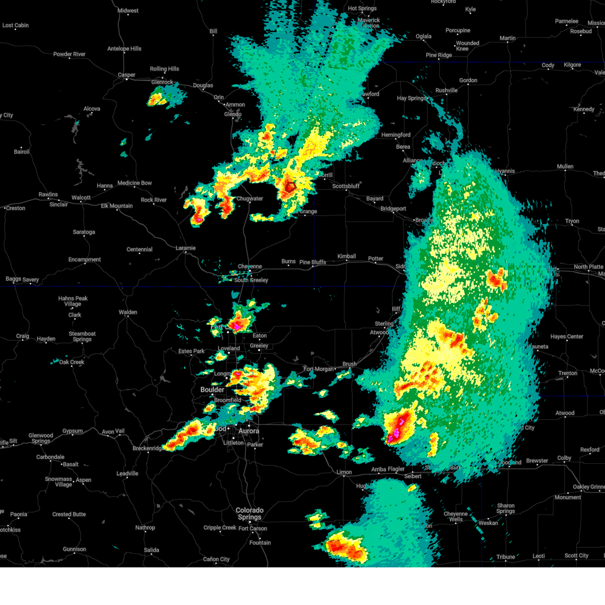 The tornado warning for central goshen county will expire at 800 pm mdt, the storm which prompted the warning has weakened and no longer appears capable of producing a tornado. therefore, the warning will be allowed to expire. however gusty winds are still possible with this thunderstorm. a tornado watch remains in effect until 800 pm mdt for southeastern wyoming. The tornado warning for central goshen county will expire at 800 pm mdt, the storm which prompted the warning has weakened and no longer appears capable of producing a tornado. therefore, the warning will be allowed to expire. however gusty winds are still possible with this thunderstorm. a tornado watch remains in effect until 800 pm mdt for southeastern wyoming.
|
| 6/21/2023 7:50 PM MDT |
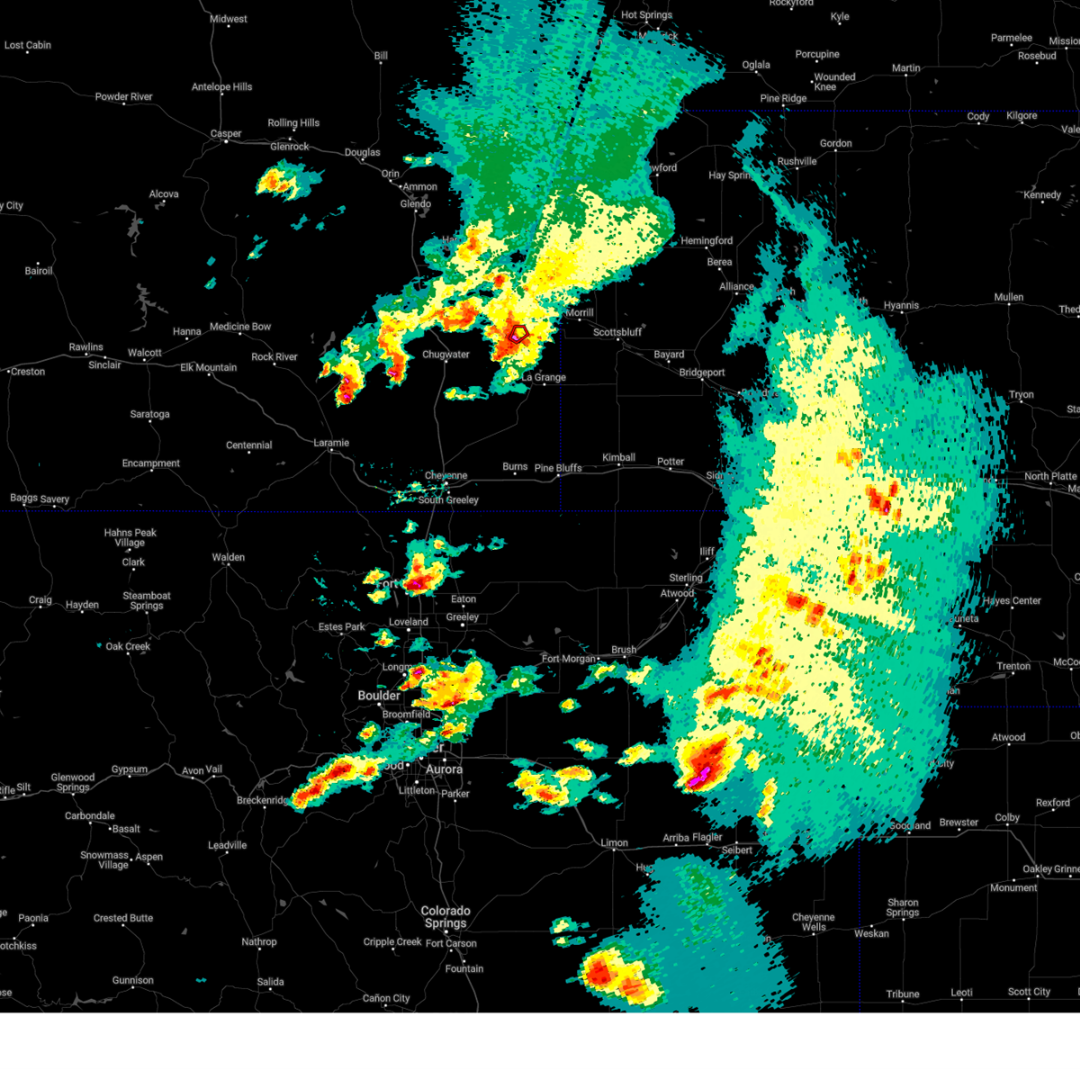 At 749 pm mdt, a confirmed tornado was located near yoder, or 15 miles southwest of torrington, moving northeast at 10 mph (trained spotter confirmed tornado 3 miles sw of yoder drifting nw and becoming wrapped in rain). Hazards include damaging tornado and quarter size hail. Flying debris will be dangerous to those caught without shelter. mobile homes will be damaged or destroyed. damage to roofs, windows, and vehicles will occur. tree damage is likely. This tornado will be near, yoder around 800 pm mdt. At 749 pm mdt, a confirmed tornado was located near yoder, or 15 miles southwest of torrington, moving northeast at 10 mph (trained spotter confirmed tornado 3 miles sw of yoder drifting nw and becoming wrapped in rain). Hazards include damaging tornado and quarter size hail. Flying debris will be dangerous to those caught without shelter. mobile homes will be damaged or destroyed. damage to roofs, windows, and vehicles will occur. tree damage is likely. This tornado will be near, yoder around 800 pm mdt.
|
| 6/21/2023 7:44 PM MDT | Quarter sized hail reported 3 miles NE of Yoder, WY, trained spotter reported stovepipe tornado touchdown 3 sw yoder at 744pm. quickly became rain-wrapped and drifted northwest. |
| 6/21/2023 7:43 PM MDT |
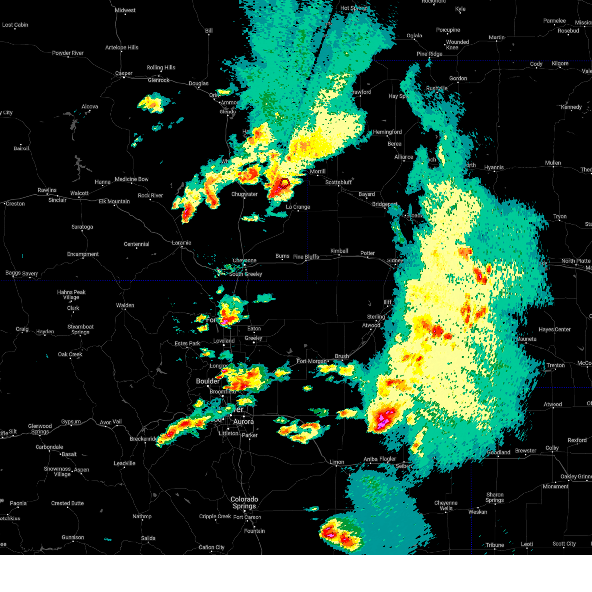 At 742 pm mdt, a severe thunderstorm capable of producing a tornado was located near yoder, or 16 miles southwest of torrington, moving northeast at 10 mph (radar indicated rotation. storm spotters have reported a funnel cloud halfway to the ground with this storm). Hazards include tornado and quarter size hail. Flying debris will be dangerous to those caught without shelter. mobile homes will be damaged or destroyed. damage to roofs, windows, and vehicles will occur. tree damage is likely. This dangerous storm will be near, yoder around 800 pm mdt. At 742 pm mdt, a severe thunderstorm capable of producing a tornado was located near yoder, or 16 miles southwest of torrington, moving northeast at 10 mph (radar indicated rotation. storm spotters have reported a funnel cloud halfway to the ground with this storm). Hazards include tornado and quarter size hail. Flying debris will be dangerous to those caught without shelter. mobile homes will be damaged or destroyed. damage to roofs, windows, and vehicles will occur. tree damage is likely. This dangerous storm will be near, yoder around 800 pm mdt.
|
| 6/21/2023 7:33 PM MDT |
 At 732 pm mdt, severe thunderstorms were located along a line extending from veteran to near yoder to near hawk springs to 7 miles northwest of hawk springs recreation area to 9 miles west of hawk springs campground, moving east at 20 mph (radar indicated). Hazards include 60 mph wind gusts and quarter size hail. Hail damage to vehicles is expected. expect wind damage to roofs, siding, and trees. locations impacted include, yoder, huntley, veteran and hawk springs. hail threat, radar indicated max hail size, 1. 00 in wind threat, radar indicated max wind gust, 60 mph. At 732 pm mdt, severe thunderstorms were located along a line extending from veteran to near yoder to near hawk springs to 7 miles northwest of hawk springs recreation area to 9 miles west of hawk springs campground, moving east at 20 mph (radar indicated). Hazards include 60 mph wind gusts and quarter size hail. Hail damage to vehicles is expected. expect wind damage to roofs, siding, and trees. locations impacted include, yoder, huntley, veteran and hawk springs. hail threat, radar indicated max hail size, 1. 00 in wind threat, radar indicated max wind gust, 60 mph.
|
| 6/21/2023 7:13 PM MDT |
 At 712 pm mdt, severe thunderstorms were located along a line extending from 13 miles northeast of slater to 8 miles southwest of veteran to 9 miles west of hawk springs to 13 miles west of hawk springs recreation area to 14 miles northwest of meriden rest area, moving east at 20 mph (radar indicated). Hazards include 60 mph wind gusts and quarter size hail. Hail damage to vehicles is expected. Expect wind damage to roofs, siding, and trees. At 712 pm mdt, severe thunderstorms were located along a line extending from 13 miles northeast of slater to 8 miles southwest of veteran to 9 miles west of hawk springs to 13 miles west of hawk springs recreation area to 14 miles northwest of meriden rest area, moving east at 20 mph (radar indicated). Hazards include 60 mph wind gusts and quarter size hail. Hail damage to vehicles is expected. Expect wind damage to roofs, siding, and trees.
|
| 6/8/2023 4:43 PM MDT |
 The severe thunderstorm warning for southeastern goshen county will expire at 445 pm mdt, the storm which prompted the warning has weakened below severe limits, and no longer poses an immediate threat to life or property. therefore, the warning will be allowed to expire. however torrential rain is still possible with this thunderstorm. The severe thunderstorm warning for southeastern goshen county will expire at 445 pm mdt, the storm which prompted the warning has weakened below severe limits, and no longer poses an immediate threat to life or property. therefore, the warning will be allowed to expire. however torrential rain is still possible with this thunderstorm.
|
| 6/8/2023 4:30 PM MDT |
 At 430 pm mdt, a severe thunderstorm was located near hawk springs, or 23 miles south of torrington, moving north at 15 mph (radar indicated). Hazards include quarter size hail. Damage to vehicles is expected. locations impacted include, torrington, yoder, huntley, hawk springs campground, hawk springs recreation area, veteran and hawk springs. hail threat, radar indicated max hail size, 1. 00 in wind threat, radar indicated max wind gust, <50 mph. At 430 pm mdt, a severe thunderstorm was located near hawk springs, or 23 miles south of torrington, moving north at 15 mph (radar indicated). Hazards include quarter size hail. Damage to vehicles is expected. locations impacted include, torrington, yoder, huntley, hawk springs campground, hawk springs recreation area, veteran and hawk springs. hail threat, radar indicated max hail size, 1. 00 in wind threat, radar indicated max wind gust, <50 mph.
|
| 6/8/2023 4:02 PM MDT |
 At 402 pm mdt, a severe thunderstorm was located near hawk springs, or 16 miles south of torrington, moving north at 25 mph (radar indicated). Hazards include quarter size hail. damage to vehicles is expected At 402 pm mdt, a severe thunderstorm was located near hawk springs, or 16 miles south of torrington, moving north at 25 mph (radar indicated). Hazards include quarter size hail. damage to vehicles is expected
|
| 5/27/2023 6:15 PM MDT |
 At 615 pm mdt, severe thunderstorms were located along a line extending from 6 miles northeast of veteran to 9 miles east of albin to 8 miles east of panorama point, moving northeast at 35 mph (radar indicated). Hazards include 60 mph wind gusts and half dollar size hail. Hail damage to vehicles is expected. Expect wind damage to roofs, siding, and trees. At 615 pm mdt, severe thunderstorms were located along a line extending from 6 miles northeast of veteran to 9 miles east of albin to 8 miles east of panorama point, moving northeast at 35 mph (radar indicated). Hazards include 60 mph wind gusts and half dollar size hail. Hail damage to vehicles is expected. Expect wind damage to roofs, siding, and trees.
|
| 5/27/2023 5:38 PM MDT |
 At 538 pm mdt, severe thunderstorms were located along a line extending from 10 miles south of jay em to lingle to 9 miles east of slater, moving east at 25 mph (radar indicated). Hazards include 60 mph wind gusts and half dollar size hail. Hail damage to vehicles is expected. expect wind damage to roofs, siding, and trees. locations impacted include, torrington, lingle, fort laramie, yoder, veteran, slater and hwy 85 at dry rawhide creek. hail threat, radar indicated max hail size, 1. 25 in wind threat, radar indicated max wind gust, 60 mph. At 538 pm mdt, severe thunderstorms were located along a line extending from 10 miles south of jay em to lingle to 9 miles east of slater, moving east at 25 mph (radar indicated). Hazards include 60 mph wind gusts and half dollar size hail. Hail damage to vehicles is expected. expect wind damage to roofs, siding, and trees. locations impacted include, torrington, lingle, fort laramie, yoder, veteran, slater and hwy 85 at dry rawhide creek. hail threat, radar indicated max hail size, 1. 25 in wind threat, radar indicated max wind gust, 60 mph.
|
| 5/27/2023 5:21 PM MDT |
 At 521 pm mdt, severe thunderstorms were located along a line extending from 7 miles northeast of fort laramie to 6 miles southwest of lingle to 6 miles east of chugwater, moving northeast at 25 mph (radar indicated). Hazards include half dollar size hail. damage to vehicles is expected At 521 pm mdt, severe thunderstorms were located along a line extending from 7 miles northeast of fort laramie to 6 miles southwest of lingle to 6 miles east of chugwater, moving northeast at 25 mph (radar indicated). Hazards include half dollar size hail. damage to vehicles is expected
|
| 6/20/2022 12:57 PM MDT |
 At 1257 pm mdt, a severe thunderstorm was located near yoder, or 16 miles southwest of torrington, moving northeast at 25 mph (radar indicated). Hazards include ping pong ball size hail and 60 mph wind gusts. People and animals outdoors will be injured. expect hail damage to roofs, siding, windows, and vehicles. expect wind damage to roofs, siding, and trees. locations impacted include, yoder, huntley, veteran and hawk springs. hail threat, radar indicated max hail size, 1. 50 in wind threat, radar indicated max wind gust, 60 mph. At 1257 pm mdt, a severe thunderstorm was located near yoder, or 16 miles southwest of torrington, moving northeast at 25 mph (radar indicated). Hazards include ping pong ball size hail and 60 mph wind gusts. People and animals outdoors will be injured. expect hail damage to roofs, siding, windows, and vehicles. expect wind damage to roofs, siding, and trees. locations impacted include, yoder, huntley, veteran and hawk springs. hail threat, radar indicated max hail size, 1. 50 in wind threat, radar indicated max wind gust, 60 mph.
|
| 6/20/2022 12:56 PM MDT | Quarter sized hail reported 1.4 miles WNW of Yoder, WY, time estimated based on radar. picture received of quarter-sized one inch hail. |
| 6/20/2022 12:44 PM MDT |
 At 1242 pm mdt, a severe thunderstorm was located 8 miles west of hawk springs, or 22 miles southwest of torrington, moving northeast at 25 mph (radar indicated). Hazards include 60 mph wind gusts and quarter size hail. Hail damage to vehicles is expected. expect wind damage to roofs, siding, and trees. locations impacted include, yoder, huntley, veteran and hawk springs. hail threat, radar indicated max hail size, 1. 00 in wind threat, radar indicated max wind gust, 60 mph. At 1242 pm mdt, a severe thunderstorm was located 8 miles west of hawk springs, or 22 miles southwest of torrington, moving northeast at 25 mph (radar indicated). Hazards include 60 mph wind gusts and quarter size hail. Hail damage to vehicles is expected. expect wind damage to roofs, siding, and trees. locations impacted include, yoder, huntley, veteran and hawk springs. hail threat, radar indicated max hail size, 1. 00 in wind threat, radar indicated max wind gust, 60 mph.
|
| 6/20/2022 12:26 PM MDT |
 At 1226 pm mdt, a severe thunderstorm was located 12 miles west of hawk springs, or 28 miles southwest of torrington, moving northeast at 25 mph (radar indicated). Hazards include 60 mph wind gusts and quarter size hail. Hail damage to vehicles is expected. Expect wind damage to roofs, siding, and trees. At 1226 pm mdt, a severe thunderstorm was located 12 miles west of hawk springs, or 28 miles southwest of torrington, moving northeast at 25 mph (radar indicated). Hazards include 60 mph wind gusts and quarter size hail. Hail damage to vehicles is expected. Expect wind damage to roofs, siding, and trees.
|
| 6/6/2020 5:27 PM MDT | Storm damage reported in goshen county WY, 1.8 miles NE of Yoder, WY |
| 6/6/2020 5:26 PM MDT | Storm damage reported in goshen county WY, 5.5 miles NE of Yoder, WY |
| 6/2/2020 7:20 PM MDT |
 At 719 pm mdt, a severe thunderstorm was located near hawk springs, or 14 miles south of torrington, moving northeast at 20 mph (trained weather spotters). Hazards include 60 mph wind gusts and half dollar size hail. Hail damage to vehicles is expected. expect wind damage to roofs, siding, and trees. Locations impacted include, torrington, morrill, lyman, yoder, huntley and henry. At 719 pm mdt, a severe thunderstorm was located near hawk springs, or 14 miles south of torrington, moving northeast at 20 mph (trained weather spotters). Hazards include 60 mph wind gusts and half dollar size hail. Hail damage to vehicles is expected. expect wind damage to roofs, siding, and trees. Locations impacted include, torrington, morrill, lyman, yoder, huntley and henry.
|
| 6/2/2020 6:59 PM MDT | Half Dollar sized hail reported 9.1 miles NNE of Yoder, WY, hail size up to a half dollar... lasted for approximately 10 minutes. |
| 6/2/2020 6:59 PM MDT |
 At 659 pm mdt, a severe thunderstorm was located over hawk springs, or 21 miles south of torrington, moving northeast at 20 mph (radar indicated). Hazards include 60 mph wind gusts and half dollar size hail. Hail damage to vehicles is expected. Expect wind damage to roofs, siding, and trees. At 659 pm mdt, a severe thunderstorm was located over hawk springs, or 21 miles south of torrington, moving northeast at 20 mph (radar indicated). Hazards include 60 mph wind gusts and half dollar size hail. Hail damage to vehicles is expected. Expect wind damage to roofs, siding, and trees.
|
| 6/2/2020 6:51 PM MDT |
 At 650 pm mdt, severe thunderstorms were located along a line extending from 7 miles west of hawk springs to near hawk springs campground, moving northeast at 30 mph (radar indicated). Hazards include 60 mph wind gusts and quarter size hail. Hail damage to vehicles is expected. expect wind damage to roofs, siding, and trees. Locations impacted include, yoder, hawk springs recreation area, huntley, veteran, hawk springs campground and hawk springs. At 650 pm mdt, severe thunderstorms were located along a line extending from 7 miles west of hawk springs to near hawk springs campground, moving northeast at 30 mph (radar indicated). Hazards include 60 mph wind gusts and quarter size hail. Hail damage to vehicles is expected. expect wind damage to roofs, siding, and trees. Locations impacted include, yoder, hawk springs recreation area, huntley, veteran, hawk springs campground and hawk springs.
|
| 6/2/2020 6:28 PM MDT |
 At 628 pm mdt, severe thunderstorms were located along a line extending from 15 miles southwest of hawk springs to near meriden rest area, moving northeast at 30 mph (radar indicated). Hazards include 60 mph wind gusts and quarter size hail. Hail damage to vehicles is expected. Expect wind damage to roofs, siding, and trees. At 628 pm mdt, severe thunderstorms were located along a line extending from 15 miles southwest of hawk springs to near meriden rest area, moving northeast at 30 mph (radar indicated). Hazards include 60 mph wind gusts and quarter size hail. Hail damage to vehicles is expected. Expect wind damage to roofs, siding, and trees.
|
| 5/23/2020 3:35 PM MDT |
 At 335 pm mdt, a severe thunderstorm was located over veteran, or 10 miles southwest of torrington, moving northeast at 25 mph (radar indicated). Hazards include ping pong ball size hail and 60 mph wind gusts. People and animals outdoors will be injured. expect hail damage to roofs, siding, windows, and vehicles. Expect wind damage to roofs, siding, and trees. At 335 pm mdt, a severe thunderstorm was located over veteran, or 10 miles southwest of torrington, moving northeast at 25 mph (radar indicated). Hazards include ping pong ball size hail and 60 mph wind gusts. People and animals outdoors will be injured. expect hail damage to roofs, siding, windows, and vehicles. Expect wind damage to roofs, siding, and trees.
|
| 9/20/2019 3:46 PM MDT | Half Dollar sized hail reported 8.9 miles N of Yoder, WY, quarters to half dollar sized hail in hawk springs currently. |
| 9/20/2019 3:46 PM MDT | Golf Ball sized hail reported 6.9 miles N of Yoder, WY |
| 9/20/2019 3:45 PM MDT |
 At 342 pm mdt, emergency managers reported quarter size hail in hawk springs from a severe thunderstorm located near hawk springs, or 16 miles south of torrington, moving northeast at 30 mph (emergency management). Hazards include 60 mph wind gusts and half dollar size hail. Hail damage to vehicles is expected. expect wind damage to roofs, siding, and trees. Locations impacted include, yoder, huntley and hawk springs. At 342 pm mdt, emergency managers reported quarter size hail in hawk springs from a severe thunderstorm located near hawk springs, or 16 miles south of torrington, moving northeast at 30 mph (emergency management). Hazards include 60 mph wind gusts and half dollar size hail. Hail damage to vehicles is expected. expect wind damage to roofs, siding, and trees. Locations impacted include, yoder, huntley and hawk springs.
|
| 9/20/2019 3:41 PM MDT | Quarter sized hail reported 8.8 miles N of Yoder, WY, goshen county em2 reported quarter sized hail over wyolink. |
| 9/20/2019 3:27 PM MDT |
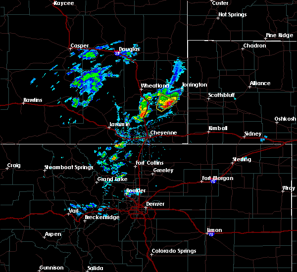 At 326 pm mdt, a severe thunderstorm was located 8 miles west of hawk springs, or 24 miles southwest of torrington, moving northeast at 25 mph (radar indicated). Hazards include 60 mph wind gusts and half dollar size hail. Hail damage to vehicles is expected. Expect wind damage to roofs, siding, and trees. At 326 pm mdt, a severe thunderstorm was located 8 miles west of hawk springs, or 24 miles southwest of torrington, moving northeast at 25 mph (radar indicated). Hazards include 60 mph wind gusts and half dollar size hail. Hail damage to vehicles is expected. Expect wind damage to roofs, siding, and trees.
|
| 9/11/2019 12:45 PM MDT |
 At 1245 pm mdt, a severe thunderstorm was located 10 miles east of slater, or 22 miles southeast of wheatland, moving northeast at 40 mph (radar indicated). Hazards include 60 mph wind gusts and quarter size hail. Hail damage to vehicles is expected. expect wind damage to roofs, siding, and trees. Locations impacted include, yoder, huntley, veteran and slater. At 1245 pm mdt, a severe thunderstorm was located 10 miles east of slater, or 22 miles southeast of wheatland, moving northeast at 40 mph (radar indicated). Hazards include 60 mph wind gusts and quarter size hail. Hail damage to vehicles is expected. expect wind damage to roofs, siding, and trees. Locations impacted include, yoder, huntley, veteran and slater.
|
| 9/11/2019 12:29 PM MDT |
 At 1228 pm mdt, a severe thunderstorm was located near chugwater, or 22 miles southeast of wheatland, moving northeast at 40 mph (radar indicated). Hazards include 60 mph wind gusts and quarter size hail. Hail damage to vehicles is expected. Expect wind damage to roofs, siding, and trees. At 1228 pm mdt, a severe thunderstorm was located near chugwater, or 22 miles southeast of wheatland, moving northeast at 40 mph (radar indicated). Hazards include 60 mph wind gusts and quarter size hail. Hail damage to vehicles is expected. Expect wind damage to roofs, siding, and trees.
|
| 9/10/2019 5:48 PM MDT | Quarter sized hail reported 8.9 miles N of Yoder, WY, quarter sized hail reported by emergency management while mobile |
| 9/10/2019 5:24 PM MDT |
 At 524 pm mdt, severe thunderstorms were located along a line extending from near hawk springs to 11 miles west of meriden rest area, moving east at 20 mph (radar indicated). Hazards include 60 mph wind gusts and half dollar size hail. Hail damage to vehicles is expected. Expect wind damage to roofs, siding, and trees. At 524 pm mdt, severe thunderstorms were located along a line extending from near hawk springs to 11 miles west of meriden rest area, moving east at 20 mph (radar indicated). Hazards include 60 mph wind gusts and half dollar size hail. Hail damage to vehicles is expected. Expect wind damage to roofs, siding, and trees.
|
| 9/10/2019 4:48 PM MDT |
 At 447 pm mdt, a severe thunderstorm was located 7 miles east of chugwater, or 25 miles southeast of wheatland, moving northeast at 30 mph (radar indicated). Hazards include 60 mph wind gusts and half dollar size hail. Hail damage to vehicles is expected. Expect wind damage to roofs, siding, and trees. At 447 pm mdt, a severe thunderstorm was located 7 miles east of chugwater, or 25 miles southeast of wheatland, moving northeast at 30 mph (radar indicated). Hazards include 60 mph wind gusts and half dollar size hail. Hail damage to vehicles is expected. Expect wind damage to roofs, siding, and trees.
|
| 8/20/2019 10:23 PM MDT |
 At 1023 pm mdt, severe thunderstorms were located along a line extending from near chadron campground to near whitaker, moving northeast at 10 mph (radar indicated). Hazards include 70 mph wind gusts and quarter size hail. Hail damage to vehicles is expected. expect considerable tree damage. wind damage is also likely to mobile homes, roofs, and outbuildings. locations impacted include, scottsbluff, torrington, chadron, gering, mitchell, terrytown, morrill, minatare, hemingford, la grange, lyman, yoder, wildcat hills state recreation area, stegall, wildcat hills campground, hawk springs, box butte dam, hawk springs campground, hubbard hill and chadron campground. This includes interstate 25 in wyoming between mile markers 38 and 41. At 1023 pm mdt, severe thunderstorms were located along a line extending from near chadron campground to near whitaker, moving northeast at 10 mph (radar indicated). Hazards include 70 mph wind gusts and quarter size hail. Hail damage to vehicles is expected. expect considerable tree damage. wind damage is also likely to mobile homes, roofs, and outbuildings. locations impacted include, scottsbluff, torrington, chadron, gering, mitchell, terrytown, morrill, minatare, hemingford, la grange, lyman, yoder, wildcat hills state recreation area, stegall, wildcat hills campground, hawk springs, box butte dam, hawk springs campground, hubbard hill and chadron campground. This includes interstate 25 in wyoming between mile markers 38 and 41.
|
| 8/20/2019 10:07 PM MDT |
 At 1006 pm mdt, severe thunderstorms were located along a line extending from near chadron campground to near whitaker, moving northeast at 10 mph (radar indicated). Hazards include 70 mph wind gusts and quarter size hail. Hail damage to vehicles is expected. expect considerable tree damage. Wind damage is also likely to mobile homes, roofs, and outbuildings. At 1006 pm mdt, severe thunderstorms were located along a line extending from near chadron campground to near whitaker, moving northeast at 10 mph (radar indicated). Hazards include 70 mph wind gusts and quarter size hail. Hail damage to vehicles is expected. expect considerable tree damage. Wind damage is also likely to mobile homes, roofs, and outbuildings.
|
| 8/20/2019 9:46 PM MDT |
 A severe thunderstorm warning remains in effect until 1015 pm mdt for southeastern goshen county. at 946 pm mdt, a severe thunderstorm was located near hawk springs, or 15 miles south of torrington, moving east at 20 mph. hazard. 60 mph wind gusts and half dollar size hail. source. Radar indicated. A severe thunderstorm warning remains in effect until 1015 pm mdt for southeastern goshen county. at 946 pm mdt, a severe thunderstorm was located near hawk springs, or 15 miles south of torrington, moving east at 20 mph. hazard. 60 mph wind gusts and half dollar size hail. source. Radar indicated.
|
| 8/20/2019 9:37 PM MDT |
 At 936 pm mdt, a severe thunderstorm was located near yoder, or 15 miles south of torrington, moving east at 20 mph (radar indicated). Hazards include 60 mph wind gusts and half dollar size hail. Hail damage to vehicles is expected. expect wind damage to roofs, siding, and trees. Locations impacted include, yoder, huntley and hawk springs. At 936 pm mdt, a severe thunderstorm was located near yoder, or 15 miles south of torrington, moving east at 20 mph (radar indicated). Hazards include 60 mph wind gusts and half dollar size hail. Hail damage to vehicles is expected. expect wind damage to roofs, siding, and trees. Locations impacted include, yoder, huntley and hawk springs.
|
| 8/20/2019 9:25 PM MDT |
 The national weather service in cheyenne has issued a * severe thunderstorm warning for. southeastern goshen county in southeastern wyoming. until 1015 pm mdt. At 925 pm mdt, a severe thunderstorm was located near yoder, or 16 miles southwest of torrington, moving east at 20 mph. The national weather service in cheyenne has issued a * severe thunderstorm warning for. southeastern goshen county in southeastern wyoming. until 1015 pm mdt. At 925 pm mdt, a severe thunderstorm was located near yoder, or 16 miles southwest of torrington, moving east at 20 mph.
|
| 8/16/2019 1:11 AM MDT |
 The severe thunderstorm warning for southeastern goshen county will expire at 115 am mdt, the storm which prompted the warning has moved out of the area. therefore, the warning will be allowed to expire. a severe thunderstorm watch remains in effect until 500 am mdt for the panhandle of nebraska, and southeastern wyoming. The severe thunderstorm warning for southeastern goshen county will expire at 115 am mdt, the storm which prompted the warning has moved out of the area. therefore, the warning will be allowed to expire. a severe thunderstorm watch remains in effect until 500 am mdt for the panhandle of nebraska, and southeastern wyoming.
|
| 8/16/2019 12:46 AM MDT |
 A severe thunderstorm warning remains in effect until 115 am mdt for southeastern goshen county. at 1245 am mdt, a severe thunderstorm was located near veteran, or near torrington, moving southeast at 45 mph. this storm has a history of producing large destructive hail! move to an interior room away from windows. Prepare now for large and possibly damaging. A severe thunderstorm warning remains in effect until 115 am mdt for southeastern goshen county. at 1245 am mdt, a severe thunderstorm was located near veteran, or near torrington, moving southeast at 45 mph. this storm has a history of producing large destructive hail! move to an interior room away from windows. Prepare now for large and possibly damaging.
|
| 8/16/2019 12:32 AM MDT |
 At 1231 am mdt, a severe thunderstorm was located near lingle, or 10 miles west of torrington, moving east at 45 mph (radar indicated). Hazards include 60 mph wind gusts and half dollar size hail. Hail damage to vehicles is expected. expect wind damage to roofs, siding, and trees. Locations impacted include, torrington, lingle, fort laramie, yoder, huntley, fort laramie national historic site, veteran and henry. At 1231 am mdt, a severe thunderstorm was located near lingle, or 10 miles west of torrington, moving east at 45 mph (radar indicated). Hazards include 60 mph wind gusts and half dollar size hail. Hail damage to vehicles is expected. expect wind damage to roofs, siding, and trees. Locations impacted include, torrington, lingle, fort laramie, yoder, huntley, fort laramie national historic site, veteran and henry.
|
| 8/16/2019 12:13 AM MDT |
 At 1213 am mdt, a severe thunderstorm was located near grayrocks reservoir, or 17 miles northeast of wheatland, moving east at 45 mph (radar indicated). Hazards include golf ball size hail and 60 mph wind gusts. People and animals outdoors will be injured. expect hail damage to roofs, siding, windows, and vehicles. Expect wind damage to roofs, siding, and trees. At 1213 am mdt, a severe thunderstorm was located near grayrocks reservoir, or 17 miles northeast of wheatland, moving east at 45 mph (radar indicated). Hazards include golf ball size hail and 60 mph wind gusts. People and animals outdoors will be injured. expect hail damage to roofs, siding, windows, and vehicles. Expect wind damage to roofs, siding, and trees.
|
| 8/15/2019 4:34 PM MDT |
 At 433 pm mdt, a severe thunderstorm was located near veteran, or 14 miles west of torrington, moving southeast at 40 mph (radar indicated). Hazards include 60 mph wind gusts and quarter size hail. Hail damage to vehicles is expected. expect wind damage to roofs, siding, and trees. Locations impacted include, yoder, huntley, veteran, hawk springs and henry. At 433 pm mdt, a severe thunderstorm was located near veteran, or 14 miles west of torrington, moving southeast at 40 mph (radar indicated). Hazards include 60 mph wind gusts and quarter size hail. Hail damage to vehicles is expected. expect wind damage to roofs, siding, and trees. Locations impacted include, yoder, huntley, veteran, hawk springs and henry.
|
| 8/15/2019 4:23 PM MDT |
 At 422 pm mdt, a severe thunderstorm was located 9 miles southeast of grayrocks reservoir, or 19 miles east of wheatland, moving southeast at 40 mph (radar indicated). Hazards include 60 mph wind gusts and quarter size hail. Hail damage to vehicles is expected. Expect wind damage to roofs, siding, and trees. At 422 pm mdt, a severe thunderstorm was located 9 miles southeast of grayrocks reservoir, or 19 miles east of wheatland, moving southeast at 40 mph (radar indicated). Hazards include 60 mph wind gusts and quarter size hail. Hail damage to vehicles is expected. Expect wind damage to roofs, siding, and trees.
|
| 7/6/2019 8:28 PM MDT |
 At 828 pm mdt, severe thunderstorms were located along a line extending from near hawk springs to hawk springs campground to near meriden rest area to 8 miles southwest of gun barrel, moving east at 35 mph (radar indicated). Hazards include ping pong ball size hail and 60 mph wind gusts. People and animals outdoors will be injured. expect hail damage to roofs, siding, windows, and vehicles. Expect wind damage to roofs, siding, and trees. At 828 pm mdt, severe thunderstorms were located along a line extending from near hawk springs to hawk springs campground to near meriden rest area to 8 miles southwest of gun barrel, moving east at 35 mph (radar indicated). Hazards include ping pong ball size hail and 60 mph wind gusts. People and animals outdoors will be injured. expect hail damage to roofs, siding, windows, and vehicles. Expect wind damage to roofs, siding, and trees.
|
| 7/2/2019 7:13 PM MDT |
 The severe thunderstorm warning for southeastern goshen county will expire at 715 pm mdt. the storms which prompted the warning have weakened below severe limits, and no longer pose an immediate threat to life or property. therefore, the warning will be allowed to expire. However small hail and heavy rain are still possible with these thunderstorms. The severe thunderstorm warning for southeastern goshen county will expire at 715 pm mdt. the storms which prompted the warning have weakened below severe limits, and no longer pose an immediate threat to life or property. therefore, the warning will be allowed to expire. However small hail and heavy rain are still possible with these thunderstorms.
|
| 7/2/2019 7:02 PM MDT |
 At 701 pm mdt, severe thunderstorms were located along a line extending from near yoder to near hawk springs, moving northeast at 10 mph (emergency management). Hazards include 60 mph wind gusts and quarter size hail. Hail damage to vehicles is expected. expect wind damage to roofs, siding, and trees. Locations impacted include, yoder, hawk springs recreation area, huntley, hawk springs campground and hawk springs. At 701 pm mdt, severe thunderstorms were located along a line extending from near yoder to near hawk springs, moving northeast at 10 mph (emergency management). Hazards include 60 mph wind gusts and quarter size hail. Hail damage to vehicles is expected. expect wind damage to roofs, siding, and trees. Locations impacted include, yoder, hawk springs recreation area, huntley, hawk springs campground and hawk springs.
|
| 7/2/2019 6:43 PM MDT |
 At 642 pm mdt, severe thunderstorms were located along a line extending from near veteran to near hawk springs, moving northeast at 20 mph. at 638 pm mdt, emergency manager reported quarter size hail 1 mile southwest of yoder (emergency management). Hazards include 60 mph wind gusts and quarter size hail. Hail damage to vehicles is expected. expect wind damage to roofs, siding, and trees. Locations impacted include, torrington, yoder, huntley, hawk springs campground, hawk springs recreation area, veteran and hawk springs. At 642 pm mdt, severe thunderstorms were located along a line extending from near veteran to near hawk springs, moving northeast at 20 mph. at 638 pm mdt, emergency manager reported quarter size hail 1 mile southwest of yoder (emergency management). Hazards include 60 mph wind gusts and quarter size hail. Hail damage to vehicles is expected. expect wind damage to roofs, siding, and trees. Locations impacted include, torrington, yoder, huntley, hawk springs campground, hawk springs recreation area, veteran and hawk springs.
|
| 7/2/2019 6:33 PM MDT |
 At 633 pm mdt, severe thunderstorms were located along a line extending from near veteran to 7 miles southwest of hawk springs, moving northeast at 20 mph (radar indicated). Hazards include 60 mph wind gusts and quarter size hail. Hail damage to vehicles is expected. Expect wind damage to roofs, siding, and trees. At 633 pm mdt, severe thunderstorms were located along a line extending from near veteran to 7 miles southwest of hawk springs, moving northeast at 20 mph (radar indicated). Hazards include 60 mph wind gusts and quarter size hail. Hail damage to vehicles is expected. Expect wind damage to roofs, siding, and trees.
|
| 6/30/2019 8:00 PM MDT |
 At 746 pm mdt, severe thunderstorms were located along a line extending from near fort laramie to near lingle to near yoder, moving northeast at 25 mph (radar indicated). Hazards include 60 mph wind gusts and nickel size hail. expect damage to roofs, siding, and trees At 746 pm mdt, severe thunderstorms were located along a line extending from near fort laramie to near lingle to near yoder, moving northeast at 25 mph (radar indicated). Hazards include 60 mph wind gusts and nickel size hail. expect damage to roofs, siding, and trees
|
| 6/30/2019 8:00 PM MDT |
 At 800 pm mdt, severe thunderstorms were located along a line extending from 8 miles northeast of fort laramie to near lingle to yoder, moving northeast at 30 mph (radar indicated). Hazards include 60 mph wind gusts and quarter size hail. Hail damage to vehicles is expected. expect wind damage to roofs, siding, and trees. Locations impacted include, torrington, lingle, yoder, huntley, hawk springs and hwy 85 at dry rawhide creek. At 800 pm mdt, severe thunderstorms were located along a line extending from 8 miles northeast of fort laramie to near lingle to yoder, moving northeast at 30 mph (radar indicated). Hazards include 60 mph wind gusts and quarter size hail. Hail damage to vehicles is expected. expect wind damage to roofs, siding, and trees. Locations impacted include, torrington, lingle, yoder, huntley, hawk springs and hwy 85 at dry rawhide creek.
|
| 6/30/2019 7:46 PM MDT |
 At 746 pm mdt, severe thunderstorms were located along a line extending from near fort laramie to near lingle to near yoder, moving northeast at 25 mph (radar indicated). Hazards include 60 mph wind gusts and nickel size hail. expect damage to roofs, siding, and trees At 746 pm mdt, severe thunderstorms were located along a line extending from near fort laramie to near lingle to near yoder, moving northeast at 25 mph (radar indicated). Hazards include 60 mph wind gusts and nickel size hail. expect damage to roofs, siding, and trees
|
| 6/30/2019 7:46 PM MDT |
 The national weather service in cheyenne has issued a * severe thunderstorm warning for. southwestern sioux county in the panhandle of nebraska. central goshen county in southeastern wyoming. until 815 pm mdt. At 746 pm mdt, severe thunderstorms were located along a line. The national weather service in cheyenne has issued a * severe thunderstorm warning for. southwestern sioux county in the panhandle of nebraska. central goshen county in southeastern wyoming. until 815 pm mdt. At 746 pm mdt, severe thunderstorms were located along a line.
|
| 6/26/2019 4:28 PM MDT |
 At 428 pm mdt, a severe thunderstorm was located near hawk springs, or 16 miles south of torrington, moving north at 25 mph (radar indicated). Hazards include 60 mph wind gusts and quarter size hail. Hail damage to vehicles is expected. Expect wind damage to roofs, siding, and trees. At 428 pm mdt, a severe thunderstorm was located near hawk springs, or 16 miles south of torrington, moving north at 25 mph (radar indicated). Hazards include 60 mph wind gusts and quarter size hail. Hail damage to vehicles is expected. Expect wind damage to roofs, siding, and trees.
|
| 6/25/2019 3:53 PM MDT |
 At 352 pm mdt, a severe thunderstorm was located near torrington, moving northeast at 35 mph (radar indicated). Hazards include 60 mph wind gusts and quarter size hail. Hail damage to vehicles is expected. Expect wind damage to roofs, siding, and trees. At 352 pm mdt, a severe thunderstorm was located near torrington, moving northeast at 35 mph (radar indicated). Hazards include 60 mph wind gusts and quarter size hail. Hail damage to vehicles is expected. Expect wind damage to roofs, siding, and trees.
|
| 6/17/2019 5:30 PM MDT | Quarter sized hail reported 10.2 miles N of Yoder, WY |
| 6/7/2019 3:05 PM MDT |
 The severe thunderstorm warning for southeastern goshen county will expire at 315 pm mdt, the storms which prompted the warning have moved out of the area. therefore, the warning will be allowed to expire. The severe thunderstorm warning for southeastern goshen county will expire at 315 pm mdt, the storms which prompted the warning have moved out of the area. therefore, the warning will be allowed to expire.
|
| 6/7/2019 2:47 PM MDT |
 At 246 pm mdt, severe thunderstorms were located along a line extending from yoder to near hawk springs campground, moving northeast at 25 mph (radar indicated). Hazards include 60 mph wind gusts and quarter size hail. Hail damage to vehicles is expected. expect wind damage to roofs, siding, and trees. these severe storms will be near, huntley around 300 pm mdt. Torrington around 310 pm mdt. At 246 pm mdt, severe thunderstorms were located along a line extending from yoder to near hawk springs campground, moving northeast at 25 mph (radar indicated). Hazards include 60 mph wind gusts and quarter size hail. Hail damage to vehicles is expected. expect wind damage to roofs, siding, and trees. these severe storms will be near, huntley around 300 pm mdt. Torrington around 310 pm mdt.
|
| 6/7/2019 2:37 PM MDT |
 At 237 pm mdt, a severe thunderstorm was located over hawk springs, or 17 miles south of torrington, moving northeast at 25 mph (radar indicated). Hazards include 60 mph wind gusts and quarter size hail. Hail damage to vehicles is expected. expect wind damage to roofs, siding, and trees. this severe thunderstorm will be near, yoder around 250 pm mdt. Huntley around 305 pm mdt. At 237 pm mdt, a severe thunderstorm was located over hawk springs, or 17 miles south of torrington, moving northeast at 25 mph (radar indicated). Hazards include 60 mph wind gusts and quarter size hail. Hail damage to vehicles is expected. expect wind damage to roofs, siding, and trees. this severe thunderstorm will be near, yoder around 250 pm mdt. Huntley around 305 pm mdt.
|
| 4/26/2019 3:41 PM MDT |
 The severe thunderstorm warning for northwestern scotts bluff, southwestern sioux and east central goshen counties will expire at 345 pm mdt, the storm which prompted the warning has moved out of the area. therefore, the warning will be allowed to expire. however gusty winds and heavy rain are still possible with this thunderstorm. The severe thunderstorm warning for northwestern scotts bluff, southwestern sioux and east central goshen counties will expire at 345 pm mdt, the storm which prompted the warning has moved out of the area. therefore, the warning will be allowed to expire. however gusty winds and heavy rain are still possible with this thunderstorm.
|
| 4/26/2019 3:15 PM MDT |
 At 313 pm mdt, a severe thunderstorm was located near torrington, moving east at 50 mph. this is a very dangerous storm (trained weather spotters). Hazards include 80 mph wind gusts were reported just north of yoder. Flying debris will be dangerous to those caught without shelter. mobile homes will be heavily damaged. expect considerable damage to roofs, windows, and vehicles. extensive tree damage and power outages are likely. Locations impacted include, torrington, morrill, lyman, yoder, huntley, stegall, veteran and henry. At 313 pm mdt, a severe thunderstorm was located near torrington, moving east at 50 mph. this is a very dangerous storm (trained weather spotters). Hazards include 80 mph wind gusts were reported just north of yoder. Flying debris will be dangerous to those caught without shelter. mobile homes will be heavily damaged. expect considerable damage to roofs, windows, and vehicles. extensive tree damage and power outages are likely. Locations impacted include, torrington, morrill, lyman, yoder, huntley, stegall, veteran and henry.
|
| 4/26/2019 2:54 PM MDT |
 At 253 pm mdt, a severe thunderstorm was located 11 miles northwest of veteran, or 19 miles west of torrington, moving east at 55 mph (radar indicated). Hazards include 60 mph wind gusts and penny size hail. expect damage to roofs, siding, and trees At 253 pm mdt, a severe thunderstorm was located 11 miles northwest of veteran, or 19 miles west of torrington, moving east at 55 mph (radar indicated). Hazards include 60 mph wind gusts and penny size hail. expect damage to roofs, siding, and trees
|
| 4/26/2019 2:52 PM MDT | Public report of a side by side four wheeler blown over relayed by goshen county em in goshen county WY, 0.9 miles SSW of Yoder, WY |
| 8/17/2018 6:18 PM MDT |
 At 618 pm mdt, a severe thunderstorm was located over veteran, or 14 miles southwest of torrington, moving northeast at 15 mph (radar indicated). Hazards include 60 mph wind gusts and quarter size hail. Hail damage to vehicles is expected. expect wind damage to roofs, siding, and trees. Locations impacted include, yoder, veteran and huntley. At 618 pm mdt, a severe thunderstorm was located over veteran, or 14 miles southwest of torrington, moving northeast at 15 mph (radar indicated). Hazards include 60 mph wind gusts and quarter size hail. Hail damage to vehicles is expected. expect wind damage to roofs, siding, and trees. Locations impacted include, yoder, veteran and huntley.
|
| 8/17/2018 6:10 PM MDT |
 At 610 pm mdt, a severe thunderstorm was located near veteran, or 15 miles southwest of torrington, moving northeast at 20 mph (radar indicated). Hazards include golf ball size hail and 60 mph wind gusts. People and animals outdoors will be injured. expect hail damage to roofs, siding, windows, and vehicles. expect wind damage to roofs, siding, and trees. Locations impacted include, yoder, veteran and huntley. At 610 pm mdt, a severe thunderstorm was located near veteran, or 15 miles southwest of torrington, moving northeast at 20 mph (radar indicated). Hazards include golf ball size hail and 60 mph wind gusts. People and animals outdoors will be injured. expect hail damage to roofs, siding, windows, and vehicles. expect wind damage to roofs, siding, and trees. Locations impacted include, yoder, veteran and huntley.
|
| 8/17/2018 6:01 PM MDT |
 At 601 pm mdt, a severe thunderstorm was located near veteran, or 17 miles southwest of torrington, moving northeast at 25 mph (radar indicated). Hazards include two inch hail and 60 mph wind gusts. People and animals outdoors will be injured. expect hail damage to roofs, siding, windows, and vehicles. expect wind damage to roofs, siding, and trees. Locations impacted include, yoder, veteran and huntley. At 601 pm mdt, a severe thunderstorm was located near veteran, or 17 miles southwest of torrington, moving northeast at 25 mph (radar indicated). Hazards include two inch hail and 60 mph wind gusts. People and animals outdoors will be injured. expect hail damage to roofs, siding, windows, and vehicles. expect wind damage to roofs, siding, and trees. Locations impacted include, yoder, veteran and huntley.
|
| 8/17/2018 5:51 PM MDT |
 At 550 pm mdt, a severe thunderstorm was located 9 miles southwest of veteran, or 21 miles southwest of torrington, moving northeast at 25 mph (radar indicated). Hazards include two inch hail and 60 mph wind gusts. People and animals outdoors will be injured. expect hail damage to roofs, siding, windows, and vehicles. Expect wind damage to roofs, siding, and trees. At 550 pm mdt, a severe thunderstorm was located 9 miles southwest of veteran, or 21 miles southwest of torrington, moving northeast at 25 mph (radar indicated). Hazards include two inch hail and 60 mph wind gusts. People and animals outdoors will be injured. expect hail damage to roofs, siding, windows, and vehicles. Expect wind damage to roofs, siding, and trees.
|
| 8/7/2018 8:52 PM MDT |
 The severe thunderstorm warning for southwestern goshen and southeastern platte counties will expire at 900 pm mdt, the storm which prompted the warning has weakened below severe limits, and no longer poses an immediate threat to life or property. therefore, the warning will be allowed to expire. however small hail and gusty winds are still possible with this thunderstorm. The severe thunderstorm warning for southwestern goshen and southeastern platte counties will expire at 900 pm mdt, the storm which prompted the warning has weakened below severe limits, and no longer poses an immediate threat to life or property. therefore, the warning will be allowed to expire. however small hail and gusty winds are still possible with this thunderstorm.
|
| 8/7/2018 8:28 PM MDT |
 At 828 pm mdt, a severe thunderstorm was located 7 miles east of slater, or 18 miles southeast of wheatland, moving east at 15 mph (radar indicated). Hazards include ping pong ball size hail and 60 mph wind gusts. People and animals outdoors will be injured. expect hail damage to roofs, siding, windows, and vehicles. Expect wind damage to roofs, siding, and trees. At 828 pm mdt, a severe thunderstorm was located 7 miles east of slater, or 18 miles southeast of wheatland, moving east at 15 mph (radar indicated). Hazards include ping pong ball size hail and 60 mph wind gusts. People and animals outdoors will be injured. expect hail damage to roofs, siding, windows, and vehicles. Expect wind damage to roofs, siding, and trees.
|
| 6/18/2018 6:08 PM MDT |
 At 608 pm mdt, a severe thunderstorm was located over yoder, or 14 miles southwest of torrington, moving east at 25 mph (radar indicated). Hazards include 60 mph wind gusts and quarter size hail. Hail damage to vehicles is expected. expect wind damage to roofs, siding, and trees. Locations impacted include, yoder and veteran. At 608 pm mdt, a severe thunderstorm was located over yoder, or 14 miles southwest of torrington, moving east at 25 mph (radar indicated). Hazards include 60 mph wind gusts and quarter size hail. Hail damage to vehicles is expected. expect wind damage to roofs, siding, and trees. Locations impacted include, yoder and veteran.
|
| 6/18/2018 5:53 PM MDT |
 At 552 pm mdt, a severe thunderstorm was located 7 miles southwest of veteran, or 18 miles southwest of torrington, moving east at 25 mph (radar indicated). Hazards include 60 mph wind gusts and quarter size hail. Hail damage to vehicles is expected. Expect wind damage to roofs, siding, and trees. At 552 pm mdt, a severe thunderstorm was located 7 miles southwest of veteran, or 18 miles southwest of torrington, moving east at 25 mph (radar indicated). Hazards include 60 mph wind gusts and quarter size hail. Hail damage to vehicles is expected. Expect wind damage to roofs, siding, and trees.
|
| 6/18/2018 5:37 PM MDT |
 At 536 pm mdt, a severe thunderstorm was located 10 miles west of veteran, or 21 miles southwest of torrington, moving east at 25 mph (radar indicated). Hazards include 60 mph wind gusts and half dollar size hail. Hail damage to vehicles is expected. expect wind damage to roofs, siding, and trees. Locations impacted include, yoder and veteran. At 536 pm mdt, a severe thunderstorm was located 10 miles west of veteran, or 21 miles southwest of torrington, moving east at 25 mph (radar indicated). Hazards include 60 mph wind gusts and half dollar size hail. Hail damage to vehicles is expected. expect wind damage to roofs, siding, and trees. Locations impacted include, yoder and veteran.
|
| 6/18/2018 5:20 PM MDT |
 At 520 pm mdt, a severe thunderstorm was located near slater, or 18 miles southeast of wheatland, moving east at 30 mph (radar indicated). Hazards include 60 mph wind gusts and half dollar size hail. Hail damage to vehicles is expected. Expect wind damage to roofs, siding, and trees. At 520 pm mdt, a severe thunderstorm was located near slater, or 18 miles southeast of wheatland, moving east at 30 mph (radar indicated). Hazards include 60 mph wind gusts and half dollar size hail. Hail damage to vehicles is expected. Expect wind damage to roofs, siding, and trees.
|
| 6/7/2018 4:54 PM MDT |
 At 453 pm mdt, a severe thunderstorm was located near torrington, moving northeast at 30 mph (radar indicated). Hazards include 60 mph wind gusts and half dollar size hail. Hail damage to vehicles is expected. expect wind damage to roofs, siding, and trees. Locations impacted include, torrington, morrill, lyman, yoder, huntley, veteran and henry. At 453 pm mdt, a severe thunderstorm was located near torrington, moving northeast at 30 mph (radar indicated). Hazards include 60 mph wind gusts and half dollar size hail. Hail damage to vehicles is expected. expect wind damage to roofs, siding, and trees. Locations impacted include, torrington, morrill, lyman, yoder, huntley, veteran and henry.
|
| 6/7/2018 4:36 PM MDT |
 At 435 pm mdt, a severe thunderstorm was located over yoder, or 13 miles southwest of torrington, moving northeast at 30 mph (radar indicated). Hazards include 60 mph wind gusts and half dollar size hail. Hail damage to vehicles is expected. Expect wind damage to roofs, siding, and trees. At 435 pm mdt, a severe thunderstorm was located over yoder, or 13 miles southwest of torrington, moving northeast at 30 mph (radar indicated). Hazards include 60 mph wind gusts and half dollar size hail. Hail damage to vehicles is expected. Expect wind damage to roofs, siding, and trees.
|
| 5/15/2017 5:53 PM MDT |
 The severe thunderstorm warning for central goshen county will expire at 600 pm mdt, the storm which prompted the warning has weakened below severe limits, and has exited the warned area. therefore, the warning will be allowed to expire. a severe thunderstorm watch remains in effect until midnight mdt for goshen county of wyoming. The severe thunderstorm warning for central goshen county will expire at 600 pm mdt, the storm which prompted the warning has weakened below severe limits, and has exited the warned area. therefore, the warning will be allowed to expire. a severe thunderstorm watch remains in effect until midnight mdt for goshen county of wyoming.
|
| 5/15/2017 5:42 PM MDT |
 At 539 pm mdt, a severe thunderstorm was located just northeast of yoder, or 8 miles south of torrington, moving east at 20 mph. some weakening of the storm has been noted but reports of smaller hail covering the ground has occurred (radar indicated). Hazards include quarter size hail. Damage to vehicles is expected. Locations impacted include, yoder and veteran. At 539 pm mdt, a severe thunderstorm was located just northeast of yoder, or 8 miles south of torrington, moving east at 20 mph. some weakening of the storm has been noted but reports of smaller hail covering the ground has occurred (radar indicated). Hazards include quarter size hail. Damage to vehicles is expected. Locations impacted include, yoder and veteran.
|
| 5/15/2017 5:18 PM MDT |
 At 518 pm mdt, a severe thunderstorm was located over veteran, or 13 miles southwest of torrington, moving northeast at 10 mph (radar indicated). Hazards include quarter size hail. damage to vehicles is expected At 518 pm mdt, a severe thunderstorm was located over veteran, or 13 miles southwest of torrington, moving northeast at 10 mph (radar indicated). Hazards include quarter size hail. damage to vehicles is expected
|
| 8/26/2016 3:39 PM MDT | Golf Ball sized hail reported 8.9 miles N of Yoder, WY |
| 7/30/2016 7:00 PM MDT | Storm damage reported in goshen county WY, 12.9 miles ESE of Yoder, WY |
| 7/27/2016 10:20 PM MDT | Golf Ball sized hail reported 8.9 miles N of Yoder, WY |
| 7/27/2016 10:06 PM MDT |
 At 1004 pm mdt, a severe thunderstorm was located near hawk springs, or 16 miles south of torrington, moving southeast at 35 mph (radar indicated). Hazards include golf ball size hail and 60 mph wind gusts. hawk springs reported golf ball size hail. People and animals outdoors will be injured. expect hail damage to roofs, siding, windows, and vehicles. expect wind damage to roofs, siding, and trees. Locations impacted include, yoder and hawk springs. At 1004 pm mdt, a severe thunderstorm was located near hawk springs, or 16 miles south of torrington, moving southeast at 35 mph (radar indicated). Hazards include golf ball size hail and 60 mph wind gusts. hawk springs reported golf ball size hail. People and animals outdoors will be injured. expect hail damage to roofs, siding, windows, and vehicles. expect wind damage to roofs, siding, and trees. Locations impacted include, yoder and hawk springs.
|
| 7/27/2016 10:00 PM MDT | Golf Ball sized hail reported 11 miles N of Yoder, WY |
| 7/27/2016 9:55 PM MDT |
 At 955 pm mdt, a severe thunderstorm was located near yoder, or 13 miles south of torrington, moving southeast at 35 mph (radar indicated). Hazards include golf ball size hail and 60 mph wind gusts. People and animals outdoors will be injured. expect hail damage to roofs, siding, windows, and vehicles. expect wind damage to roofs, siding, and trees. Locations impacted include, yoder, huntley and hawk springs. At 955 pm mdt, a severe thunderstorm was located near yoder, or 13 miles south of torrington, moving southeast at 35 mph (radar indicated). Hazards include golf ball size hail and 60 mph wind gusts. People and animals outdoors will be injured. expect hail damage to roofs, siding, windows, and vehicles. expect wind damage to roofs, siding, and trees. Locations impacted include, yoder, huntley and hawk springs.
|
| 7/27/2016 9:37 PM MDT |
 At 936 pm mdt, a severe thunderstorm was located near veteran, or 7 miles west of torrington, moving southeast at 30 mph (radar indicated. 4 miles southwest of lingle reported golf ball size hail). Hazards include tennis ball size hail and 70 mph wind gusts. People and animals outdoors will be injured. expect hail damage to roofs, siding, windows, and vehicles. expect considerable tree damage. Wind damage is also likely to mobile homes, roofs, and outbuildings. At 936 pm mdt, a severe thunderstorm was located near veteran, or 7 miles west of torrington, moving southeast at 30 mph (radar indicated. 4 miles southwest of lingle reported golf ball size hail). Hazards include tennis ball size hail and 70 mph wind gusts. People and animals outdoors will be injured. expect hail damage to roofs, siding, windows, and vehicles. expect considerable tree damage. Wind damage is also likely to mobile homes, roofs, and outbuildings.
|
| 7/24/2016 3:32 PM MDT |
 At 332 pm mdt, a severe thunderstorm was located near hawk springs recreation area, or 21 miles south of torrington, moving northeast at 35 mph (radar indicated). Hazards include quarter size hail. Damage to vehicles is expected. this severe storm will be near, lyman around 350 pm mdt. morrill around 400 pm mdt. Other locations impacted by this severe thunderstorm include henry. At 332 pm mdt, a severe thunderstorm was located near hawk springs recreation area, or 21 miles south of torrington, moving northeast at 35 mph (radar indicated). Hazards include quarter size hail. Damage to vehicles is expected. this severe storm will be near, lyman around 350 pm mdt. morrill around 400 pm mdt. Other locations impacted by this severe thunderstorm include henry.
|
| 7/24/2016 3:15 PM MDT |
 At 314 pm mdt, a severe thunderstorm was located near hawk springs recreation area, or 25 miles south of torrington, moving north at 35 mph (radar indicated). Hazards include quarter size hail. Damage to vehicles is expected. this severe thunderstorm will be near, hawk springs around 325 pm mdt. yoder around 340 pm mdt. lyman and huntley around 345 pm mdt. torrington around 405 pm mdt. Other locations impacted by this severe thunderstorm include henry. At 314 pm mdt, a severe thunderstorm was located near hawk springs recreation area, or 25 miles south of torrington, moving north at 35 mph (radar indicated). Hazards include quarter size hail. Damage to vehicles is expected. this severe thunderstorm will be near, hawk springs around 325 pm mdt. yoder around 340 pm mdt. lyman and huntley around 345 pm mdt. torrington around 405 pm mdt. Other locations impacted by this severe thunderstorm include henry.
|
| 6/28/2016 5:15 PM MDT |
 At 515 pm mdt, a severe thunderstorm was located over yoder, or 9 miles southwest of torrington, moving east at 25 mph (radar indicated). Hazards include 60 mph wind gusts and quarter size hail. Hail damage to vehicles is possible. expect wind damage to roofs, siding, and trees. Locations impacted include, torrington, yoder, veteran and huntley. At 515 pm mdt, a severe thunderstorm was located over yoder, or 9 miles southwest of torrington, moving east at 25 mph (radar indicated). Hazards include 60 mph wind gusts and quarter size hail. Hail damage to vehicles is possible. expect wind damage to roofs, siding, and trees. Locations impacted include, torrington, yoder, veteran and huntley.
|
| 6/28/2016 5:09 PM MDT | Quarter sized hail reported 0.3 miles WSW of Yoder, WY |
| 6/28/2016 4:59 PM MDT |
 At 459 pm mdt, a severe thunderstorm was located near veteran, or 14 miles southwest of torrington, moving northeast at 30 mph (radar indicated). Hazards include 70 mph wind gusts and half dollar size hail. Hail damage to vehicles is expected. expect considerable tree damage. Wind damage is also likely to mobile homes, roofs, and outbuildings. At 459 pm mdt, a severe thunderstorm was located near veteran, or 14 miles southwest of torrington, moving northeast at 30 mph (radar indicated). Hazards include 70 mph wind gusts and half dollar size hail. Hail damage to vehicles is expected. expect considerable tree damage. Wind damage is also likely to mobile homes, roofs, and outbuildings.
|
| 5/6/2016 8:00 PM MDT |
 At 800 pm mdt, severe thunderstorms were located along a line extending from 7 miles southeast of grayrocks reservoir to near lyman, moving north at 15 mph (radar indicated). Hazards include 60 mph wind gusts and quarter size hail. Hail damage to vehicles is expected. expect wind damage to roofs, siding, and trees. these severe storms will be near, fort laramie national historic site around 830 pm mdt. fort laramie around 835 pm mdt. torrington around 845 pm mdt. Other locations impacted by these severe thunderstorms include hwy 85 at dry rawhide creek. At 800 pm mdt, severe thunderstorms were located along a line extending from 7 miles southeast of grayrocks reservoir to near lyman, moving north at 15 mph (radar indicated). Hazards include 60 mph wind gusts and quarter size hail. Hail damage to vehicles is expected. expect wind damage to roofs, siding, and trees. these severe storms will be near, fort laramie national historic site around 830 pm mdt. fort laramie around 835 pm mdt. torrington around 845 pm mdt. Other locations impacted by these severe thunderstorms include hwy 85 at dry rawhide creek.
|
| 5/6/2016 7:42 PM MDT |
 At 742 pm mdt, a severe thunderstorm was located over yoder, or 12 miles southwest of torrington, moving north at 30 mph (radar indicated). Hazards include 60 mph wind gusts and quarter size hail. Hail damage to vehicles is expected. Expect wind damage to roofs, siding, and trees. At 742 pm mdt, a severe thunderstorm was located over yoder, or 12 miles southwest of torrington, moving north at 30 mph (radar indicated). Hazards include 60 mph wind gusts and quarter size hail. Hail damage to vehicles is expected. Expect wind damage to roofs, siding, and trees.
|
| 8/17/2015 11:19 PM MDT |
 At 1119 pm mdt, severe thunderstorms were located along a line extending from near agate bed national monument to huntley, moving east at 25 mph (radar indicated). Hazards include quarter size hail. Damage to vehicles is expected. Locations impacted include, torrington, yoder, veteran, agate bed national monument, huntley and henry. At 1119 pm mdt, severe thunderstorms were located along a line extending from near agate bed national monument to huntley, moving east at 25 mph (radar indicated). Hazards include quarter size hail. Damage to vehicles is expected. Locations impacted include, torrington, yoder, veteran, agate bed national monument, huntley and henry.
|
| 8/17/2015 11:01 PM MDT |
 At 1101 pm mdt, severe thunderstorms were located along a line extending from 7 miles west of whitney lake to near veteran, moving east at 35 mph (radar indicated). Hazards include 60 mph wind gusts and quarter size hail. Hail damage to vehicles is expected. expect wind damage to roofs, siding and trees. Locations impacted include, torrington, crawford, yoder, whitney lake, fort robinson campground, veteran, agate bed national monument, huntley, henry, whitney and fort robinson. At 1101 pm mdt, severe thunderstorms were located along a line extending from 7 miles west of whitney lake to near veteran, moving east at 35 mph (radar indicated). Hazards include 60 mph wind gusts and quarter size hail. Hail damage to vehicles is expected. expect wind damage to roofs, siding and trees. Locations impacted include, torrington, crawford, yoder, whitney lake, fort robinson campground, veteran, agate bed national monument, huntley, henry, whitney and fort robinson.
|
| 8/17/2015 10:46 PM MDT |
 At 1046 pm mdt, severe thunderstorms were located along a line extending from montrose to 12 miles west of veteran, moving southeast at 25 mph (radar indicated). Hazards include ping pong ball size hail and 60 mph wind gusts. People and animals outdoors will be injured. expect hail damage to roofs, siding, windows and vehicles. Expect wind damage to roofs, siding and trees. At 1046 pm mdt, severe thunderstorms were located along a line extending from montrose to 12 miles west of veteran, moving southeast at 25 mph (radar indicated). Hazards include ping pong ball size hail and 60 mph wind gusts. People and animals outdoors will be injured. expect hail damage to roofs, siding, windows and vehicles. Expect wind damage to roofs, siding and trees.
|
| 6/17/2015 6:07 PM MDT |
 The severe thunderstorm warning for northwestern scotts bluff and southeastern goshen counties will expire at 615 pm mdt, the storm which prompted the warning has moved out of the area. therefore the warning will be allowed to expire. remember, a severe thunderstorm warning still remains in effect for far eastern goshen county east of torrington. The severe thunderstorm warning for northwestern scotts bluff and southeastern goshen counties will expire at 615 pm mdt, the storm which prompted the warning has moved out of the area. therefore the warning will be allowed to expire. remember, a severe thunderstorm warning still remains in effect for far eastern goshen county east of torrington.
|
| 6/17/2015 5:50 PM MDT | Hen Egg sized hail reported 1.4 miles WNW of Yoder, WY |
| 6/17/2015 5:40 PM MDT | Ping Pong Ball sized hail reported 3 miles NE of Yoder, WY |
| 6/17/2015 5:40 PM MDT | Tennis Ball sized hail reported 0.3 miles WSW of Yoder, WY |
| 6/17/2015 5:39 PM MDT |
 At 539 pm mdt, a severe thunderstorm was located over yoder, or 14 miles southwest of torrington, moving northeast at 30 mph (public). Hazards include ping pong size hail and 60 mph wind gusts. People and animals outdoors will be injured. expect hail damage to roofs, siding, windows and vehicles. Expect wind damage to roofs, siding and trees. At 539 pm mdt, a severe thunderstorm was located over yoder, or 14 miles southwest of torrington, moving northeast at 30 mph (public). Hazards include ping pong size hail and 60 mph wind gusts. People and animals outdoors will be injured. expect hail damage to roofs, siding, windows and vehicles. Expect wind damage to roofs, siding and trees.
|
| 6/16/2015 7:06 PM MDT | Hen Egg sized hail reported 6.5 miles NNW of Yoder, WY, shredded leaves... dented vehicles... damaged shingles and broken car windows. |
| 6/16/2015 6:59 PM MDT | Golf Ball sized hail reported 9 miles NNE of Yoder, WY |
| 6/16/2015 6:45 PM MDT |
 At 644 pm mdt, a severe thunderstorm was located near yoder, or 17 miles southwest of torrington, and is nearly stationary (radar indicated). Hazards include half dollar size hail and 60 mph wind gusts. Hail damage to vehicles is expected. expect wind damage to roofs, siding and trees. Locations impacted include, la grange, yoder, hawk springs campground, hawk springs and hawk springs recreation area. At 644 pm mdt, a severe thunderstorm was located near yoder, or 17 miles southwest of torrington, and is nearly stationary (radar indicated). Hazards include half dollar size hail and 60 mph wind gusts. Hail damage to vehicles is expected. expect wind damage to roofs, siding and trees. Locations impacted include, la grange, yoder, hawk springs campground, hawk springs and hawk springs recreation area.
|
| 6/16/2015 6:35 PM MDT |
 At 635 pm mdt, a severe thunderstorm was located 8 miles southwest of veteran, or 19 miles southwest of torrington, moving southeast at 40 mph (radar indicated). Hazards include quarter size hail and 60 mph wind gusts. Hail damage to vehicles is expected. Expect wind damage to roofs, siding and trees. At 635 pm mdt, a severe thunderstorm was located 8 miles southwest of veteran, or 19 miles southwest of torrington, moving southeast at 40 mph (radar indicated). Hazards include quarter size hail and 60 mph wind gusts. Hail damage to vehicles is expected. Expect wind damage to roofs, siding and trees.
|
| 6/16/2015 6:03 PM MDT |
 At 602 pm mdt, a severe thunderstorm was located over yoder, or 11 miles south of torrington, moving southeast at 15 mph (radar indicated). Hazards include ping pong ball size hail and 60 mph wind gusts. People and animals outdoors will be injured. expect hail damage to roofs, siding, windows and vehicles. Expect wind damage to roofs, siding and trees. At 602 pm mdt, a severe thunderstorm was located over yoder, or 11 miles south of torrington, moving southeast at 15 mph (radar indicated). Hazards include ping pong ball size hail and 60 mph wind gusts. People and animals outdoors will be injured. expect hail damage to roofs, siding, windows and vehicles. Expect wind damage to roofs, siding and trees.
|
| 6/16/2015 4:39 PM MDT |
 The severe thunderstorm warning for east central goshen county will expire at 445 pm mdt, the storm which prompted the warning has weakened below severe limits, and no longer pose an immediate threat to life or property. therefore the warning will be allowed to expire. however gusty winds are still possible with this thunderstorm. a severe thunderstorm watch remains in effect until 900 pm mdt for southeastern wyoming. The severe thunderstorm warning for east central goshen county will expire at 445 pm mdt, the storm which prompted the warning has weakened below severe limits, and no longer pose an immediate threat to life or property. therefore the warning will be allowed to expire. however gusty winds are still possible with this thunderstorm. a severe thunderstorm watch remains in effect until 900 pm mdt for southeastern wyoming.
|
| 6/16/2015 4:29 PM MDT |
 At 429 pm mdt, a severe thunderstorm was located near huntley, or 7 miles south of torrington, moving southeast at 25 mph (trained weather spotters). Hazards include half dollar size hail and 60 mph wind gusts. Hail damage to vehicles is expected. expect wind damage to roofs, siding and trees. Locations impacted include, yoder and huntley. At 429 pm mdt, a severe thunderstorm was located near huntley, or 7 miles south of torrington, moving southeast at 25 mph (trained weather spotters). Hazards include half dollar size hail and 60 mph wind gusts. Hail damage to vehicles is expected. expect wind damage to roofs, siding and trees. Locations impacted include, yoder and huntley.
|
| 6/16/2015 3:59 PM MDT |
 At 358 pm mdt, a severe thunderstorm was located 8 miles northwest of veteran, or 16 miles west of torrington, moving southeast at 25 mph (radar indicated. this storm has a history of producing large destructive hail). Hazards include golf ball size hail and 60 mph wind gusts. People and animals outdoors will be injured. expect hail damage to roofs, siding, windows and vehicles. Expect wind damage to roofs, siding and trees. At 358 pm mdt, a severe thunderstorm was located 8 miles northwest of veteran, or 16 miles west of torrington, moving southeast at 25 mph (radar indicated. this storm has a history of producing large destructive hail). Hazards include golf ball size hail and 60 mph wind gusts. People and animals outdoors will be injured. expect hail damage to roofs, siding, windows and vehicles. Expect wind damage to roofs, siding and trees.
|
| 5/15/2015 3:32 PM MDT | At 332 pm mdt, a severe thunderstorm capable of producing a tornado was located over yoder, or 11 miles south of torrington, moving north at 30 mph (radar indicated rotation). Hazards include tornado and quarter size hail. Flying debris will be dangerous to those caught without shelter. mobile homes will be damaged or destroyed. damage to roofs, windows and vehicles will occur. Tree damage is likely. |
| 5/15/2015 3:18 PM MDT | At 317 pm mdt, a severe thunderstorm was located near yoder, or 15 miles south of torrington, moving north at 45 mph (radar indicated). Hazards include quarter size hail and 60 mph wind gusts. Hail damage to vehicles is expected. expect wind damage to roofs, siding and trees. this severe thunderstorm will be near, huntley around 325 pm mdt. veteran around 330 pm mdt. torrington around 340 pm mdt. lingle around 345 pm mdt. other locations impacted by this severe thunderstorm include hwy 85 at dry rawhide creek. a tornado watch remains in effect until 800 pm mdt for southeastern wyoming. 1. 00in. |
| 6/26/2014 5:41 PM MDT | Quarter sized hail reported 3 miles NE of Yoder, WY |
| 6/1/2014 3:37 PM MDT | Quarter sized hail reported 12 miles ENE of Yoder, WY, time estimated based on radar. |
| 7/9/2013 5:30 PM MDT | Quarter sized hail reported 1.2 miles NNW of Yoder, WY |
| 6/22/2013 4:16 PM MDT | Quarter sized hail reported 3 miles NE of Yoder, WY, some nickel size |
| 1/1/0001 12:00 AM | Hen Egg sized hail reported 8.9 miles N of Yoder, WY |
| 1/1/0001 12:00 AM | Golf Ball sized hail reported 0.3 miles WSW of Yoder, WY |
| 1/1/0001 12:00 AM | Quarter sized hail reported 15 miles ESE of Yoder, WY, very heavy rain appx 2 inches. ground is completly covered with hail. |
| 1/1/0001 12:00 AM | Quarter sized hail reported 4.9 miles E of Yoder, WY |
| 1/1/0001 12:00 AM | Quarter sized hail reported 3 miles NE of Yoder, WY, hail was mainly dime to nickel size. heavy rain with three tenths of an inch in 15 minutes. winds gusted to 35 mph. |
| 1/1/0001 12:00 AM | Quarter sized hail reported 6.8 miles N of Yoder, WY |
| 1/1/0001 12:00 AM | Half Dollar sized hail reported 9.3 miles NW of Yoder, WY |
| 1/1/0001 12:00 AM | Quarter sized hail reported 12.1 miles E of Yoder, WY, at the intersection of cr 50 and 13. |
| 1/1/0001 12:00 AM | Quarter sized hail reported 6.2 miles NNW of Yoder, WY, some nickle sized also. 45 mph winds. |
| 1/1/0001 12:00 AM | A south bound semi truck was blown over into the north bound ditch. 2 injurie in goshen county WY, 1.8 miles W of Yoder, WY |
Hail Maps for Yoder, WY
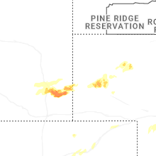
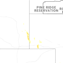
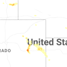
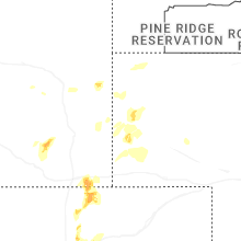
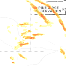
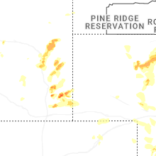
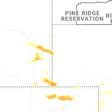
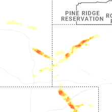


Connect with Interactive Hail Maps