

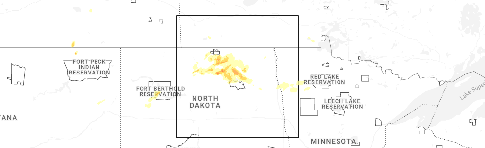
Hail Map for York, ND
The York, ND area has had 1 report of on-the-ground hail by trained spotters, and has been under severe weather warnings 24 times during the past 12 months. Doppler radar has detected hail at or near York, ND on 46 occasions, including 3 occasions during the past year.
| Name: | York, ND |
| Where Located: | 35.8 miles WNW of Devils Lake, ND |
| Map: | Google Map for York, ND |
| Population: | 23 |
| Housing Units: | 23 |
| More Info: | Search Google for York, ND |
3
The Top Recent Hail Date for York, ND is Thursday, September 11, 2025 (3rd out of 46)
Hail and Wind Damage Spotted near York, ND
| Date / Time | Report Details |
|---|---|
| 6/29/2026 1:54 AM CDT |
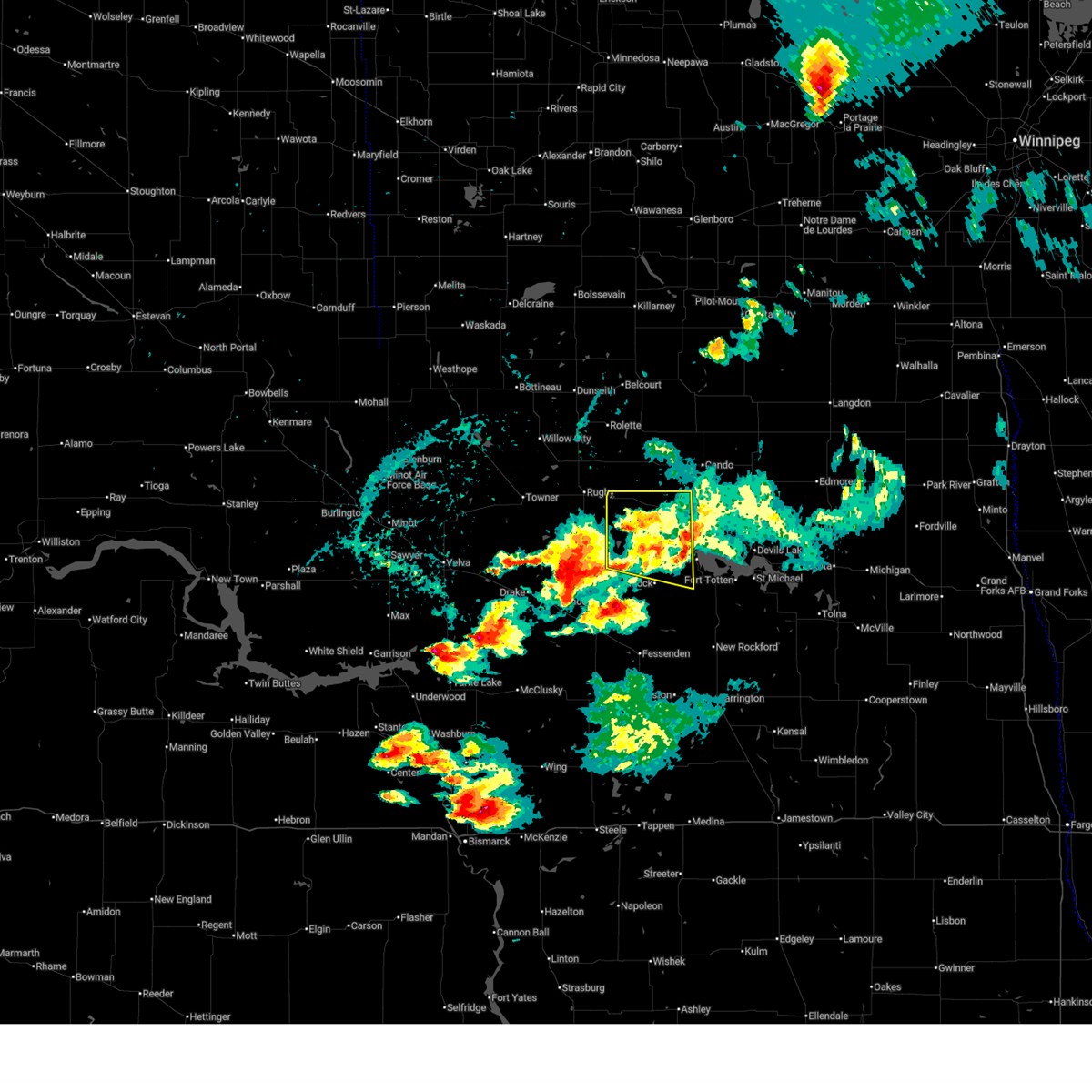
 Svrfgf the national weather service in grand forks has issued a * severe thunderstorm warning for, northwestern benson county in northeastern north dakota, southern towner county in northeastern north dakota, northwestern ramsey county in northeastern north dakota, * until 300 am cdt. * at 153 am cdt, a severe thunderstorm was located over leeds, or 26 miles east of rugby, moving northeast at 25 mph (radar indicated). Hazards include two inch hail and 60 mph wind gusts. People and animals outdoors will be injured. expect hail damage to roofs, siding, windows, and vehicles. Expect wind damage to roofs, siding, and trees. Svrfgf the national weather service in grand forks has issued a * severe thunderstorm warning for, northwestern benson county in northeastern north dakota, southern towner county in northeastern north dakota, northwestern ramsey county in northeastern north dakota, * until 300 am cdt. * at 153 am cdt, a severe thunderstorm was located over leeds, or 26 miles east of rugby, moving northeast at 25 mph (radar indicated). Hazards include two inch hail and 60 mph wind gusts. People and animals outdoors will be injured. expect hail damage to roofs, siding, windows, and vehicles. Expect wind damage to roofs, siding, and trees.
|
| 6/29/2026 1:29 AM CDT |
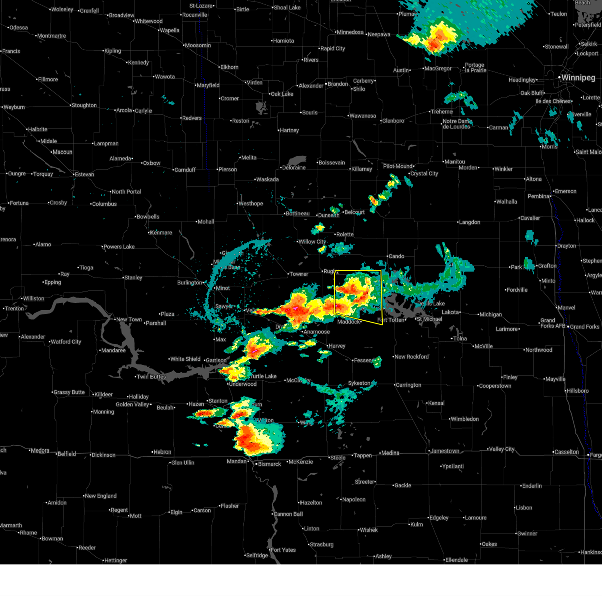
 At 129 am cdt, a severe thunderstorm was located near york, or 20 miles east of rugby, moving northeast at 30 mph (radar indicated). Hazards include tennis ball size hail and 60 mph wind gusts. People and animals outdoors will be injured. expect hail damage to roofs, siding, windows, and vehicles. expect wind damage to roofs, siding, and trees. Locations impacted include, cando, leeds, minnewaukan, esmond, penn, brinsmade, and harlow. At 129 am cdt, a severe thunderstorm was located near york, or 20 miles east of rugby, moving northeast at 30 mph (radar indicated). Hazards include tennis ball size hail and 60 mph wind gusts. People and animals outdoors will be injured. expect hail damage to roofs, siding, windows, and vehicles. expect wind damage to roofs, siding, and trees. Locations impacted include, cando, leeds, minnewaukan, esmond, penn, brinsmade, and harlow.
|
| 6/29/2026 12:55 AM CDT |
 Svrfgf the national weather service in grand forks has issued a * severe thunderstorm warning for, benson county in northeastern north dakota, southern towner county in northeastern north dakota, southwestern ramsey county in northeastern north dakota, * until 200 am cdt. * at 1254 am cdt, a severe thunderstorm was located over silva, or 14 miles south of rugby, moving east at 45 mph (radar indicated). Hazards include two inch hail and 60 mph wind gusts. People and animals outdoors will be injured. expect hail damage to roofs, siding, windows, and vehicles. Expect wind damage to roofs, siding, and trees. Svrfgf the national weather service in grand forks has issued a * severe thunderstorm warning for, benson county in northeastern north dakota, southern towner county in northeastern north dakota, southwestern ramsey county in northeastern north dakota, * until 200 am cdt. * at 1254 am cdt, a severe thunderstorm was located over silva, or 14 miles south of rugby, moving east at 45 mph (radar indicated). Hazards include two inch hail and 60 mph wind gusts. People and animals outdoors will be injured. expect hail damage to roofs, siding, windows, and vehicles. Expect wind damage to roofs, siding, and trees.
|
| 6/28/2026 11:55 PM CDT |
 The storm which prompted the warning has weakened below severe limits, and no longer poses an immediate threat to life or property. therefore, the warning will be allowed to expire. however, heavy rain is still possible with this thunderstorm. The storm which prompted the warning has weakened below severe limits, and no longer poses an immediate threat to life or property. therefore, the warning will be allowed to expire. however, heavy rain is still possible with this thunderstorm.
|
| 6/28/2026 11:31 PM CDT |
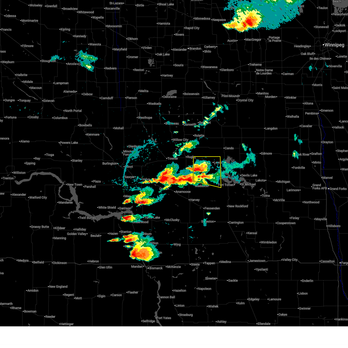
 At 1131 pm cdt, a severe thunderstorm was located near wellsburg, or 14 miles northeast of harvey, moving east at 35 mph (radar indicated). Hazards include 60 mph wind gusts and quarter size hail. Hail damage to vehicles is expected. expect wind damage to roofs, siding, and trees. Locations impacted include, leeds, maddock, minnewaukan, oberon, esmond, brinsmade, and harlow. At 1131 pm cdt, a severe thunderstorm was located near wellsburg, or 14 miles northeast of harvey, moving east at 35 mph (radar indicated). Hazards include 60 mph wind gusts and quarter size hail. Hail damage to vehicles is expected. expect wind damage to roofs, siding, and trees. Locations impacted include, leeds, maddock, minnewaukan, oberon, esmond, brinsmade, and harlow.
|
| 6/28/2026 11:05 PM CDT |
 Svrfgf the national weather service in grand forks has issued a * severe thunderstorm warning for, benson county in northeastern north dakota, * until midnight cdt. * at 1104 pm cdt, a severe thunderstorm was located near selz, or near harvey, moving east at 40 mph (radar indicated). Hazards include 60 mph wind gusts and quarter size hail. Hail damage to vehicles is expected. Expect wind damage to roofs, siding, and trees. Svrfgf the national weather service in grand forks has issued a * severe thunderstorm warning for, benson county in northeastern north dakota, * until midnight cdt. * at 1104 pm cdt, a severe thunderstorm was located near selz, or near harvey, moving east at 40 mph (radar indicated). Hazards include 60 mph wind gusts and quarter size hail. Hail damage to vehicles is expected. Expect wind damage to roofs, siding, and trees.
|
| 6/28/2026 12:50 AM CDT |
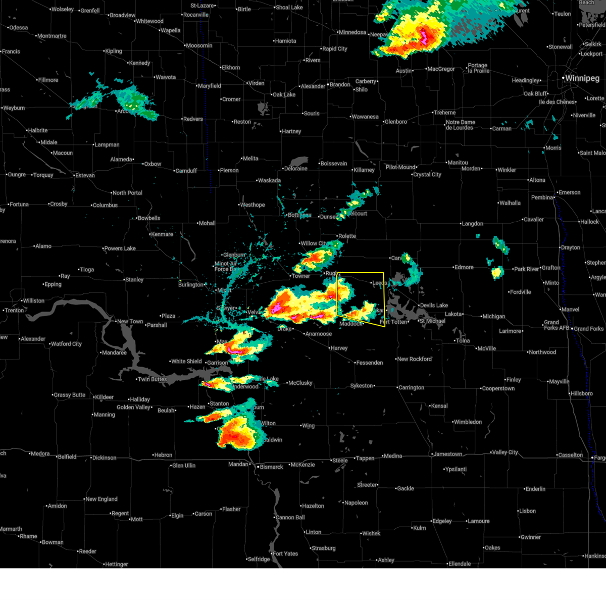
 At 1250 am cdt, severe thunderstorms were located along a line extending from near fillmore to maddock to 6 miles southwest of barlow, moving northeast at 40 mph (radar indicated). Hazards include 60 mph wind gusts. Expect damage to roofs, siding, and trees. Locations impacted include, devils lake, new rockford, camp grafton, lakewood park, leeds, maddock, and fort totten. At 1250 am cdt, severe thunderstorms were located along a line extending from near fillmore to maddock to 6 miles southwest of barlow, moving northeast at 40 mph (radar indicated). Hazards include 60 mph wind gusts. Expect damage to roofs, siding, and trees. Locations impacted include, devils lake, new rockford, camp grafton, lakewood park, leeds, maddock, and fort totten.
|
| 6/28/2026 12:19 AM CDT |
 Svrfgf the national weather service in grand forks has issued a * severe thunderstorm warning for, benson county in northeastern north dakota, southwestern ramsey county in northeastern north dakota, eddy county in northeastern north dakota, * until 115 am cdt. * at 1218 am cdt, severe thunderstorms were located along a line extending from 9 miles north of orrin to near selz to 10 miles southeast of bowdon, moving northeast at 45 mph (radar indicated). Hazards include 60 mph wind gusts and penny size hail. expect damage to roofs, siding, and trees Svrfgf the national weather service in grand forks has issued a * severe thunderstorm warning for, benson county in northeastern north dakota, southwestern ramsey county in northeastern north dakota, eddy county in northeastern north dakota, * until 115 am cdt. * at 1218 am cdt, severe thunderstorms were located along a line extending from 9 miles north of orrin to near selz to 10 miles southeast of bowdon, moving northeast at 45 mph (radar indicated). Hazards include 60 mph wind gusts and penny size hail. expect damage to roofs, siding, and trees
|
| 6/9/2026 10:26 PM CDT |
 The storms which prompted the warning have weakened. therefore, the warning will be allowed to expire. however, gusty winds are still possible with these thunderstorms. a severe thunderstorm watch remains in effect until 400 am cdt for northeastern north dakota. The storms which prompted the warning have weakened. therefore, the warning will be allowed to expire. however, gusty winds are still possible with these thunderstorms. a severe thunderstorm watch remains in effect until 400 am cdt for northeastern north dakota.
|
| 6/9/2026 9:53 PM CDT |
 At 952 pm cdt, severe thunderstorms were located along a line extending from near leeds to near flora to 7 miles west of new rockford, moving northeast at 50 mph. at 952 pm cdt, a 61 mph wind gust was reported near baker (radar indicated). Hazards include 60 mph wind gusts. Expect damage to roofs, siding, and trees. Locations impacted include, devils lake, new rockford, camp grafton, lakewood park, leeds, maddock, and fort totten. At 952 pm cdt, severe thunderstorms were located along a line extending from near leeds to near flora to 7 miles west of new rockford, moving northeast at 50 mph. at 952 pm cdt, a 61 mph wind gust was reported near baker (radar indicated). Hazards include 60 mph wind gusts. Expect damage to roofs, siding, and trees. Locations impacted include, devils lake, new rockford, camp grafton, lakewood park, leeds, maddock, and fort totten.
|
| 6/9/2026 9:50 PM CDT | Gust at 10 f in benson county ND, 10.5 miles NNE of York, ND |
| 6/9/2026 9:28 PM CDT |
 Svrfgf the national weather service in grand forks has issued a * severe thunderstorm warning for, benson county in northeastern north dakota, southwestern ramsey county in northeastern north dakota, eddy county in northeastern north dakota, * until 1030 pm cdt. * at 928 pm cdt, severe thunderstorms were located along a line extending from near esmond to heimdal to near heaton, moving northeast at 50 mph (radar indicated). Hazards include 60 mph wind gusts. expect damage to roofs, siding, and trees Svrfgf the national weather service in grand forks has issued a * severe thunderstorm warning for, benson county in northeastern north dakota, southwestern ramsey county in northeastern north dakota, eddy county in northeastern north dakota, * until 1030 pm cdt. * at 928 pm cdt, severe thunderstorms were located along a line extending from near esmond to heimdal to near heaton, moving northeast at 50 mph (radar indicated). Hazards include 60 mph wind gusts. expect damage to roofs, siding, and trees
|
| 6/7/2026 11:37 PM CDT |
 At 1137 pm cdt, severe thunderstorms were located along a line extending from near shell valley to near wolford to near maddock, moving east at 55 mph (radar indicated). Hazards include 60 mph wind gusts. Expect damage to roofs, siding, and trees. Locations impacted include, cando, leeds, maddock, minnewaukan, bisbee, oberon, and rocklake. At 1137 pm cdt, severe thunderstorms were located along a line extending from near shell valley to near wolford to near maddock, moving east at 55 mph (radar indicated). Hazards include 60 mph wind gusts. Expect damage to roofs, siding, and trees. Locations impacted include, cando, leeds, maddock, minnewaukan, bisbee, oberon, and rocklake.
|
| 6/7/2026 11:00 PM CDT |
 Svrfgf the national weather service in grand forks has issued a * severe thunderstorm warning for, benson county in northeastern north dakota, western towner county in northeastern north dakota, * until 1215 am cdt. * at 1059 pm cdt, severe thunderstorms were located along a line extending from near willow city to balta to 10 miles north of hurdsfield, moving northeast at 55 mph (public. at 1030 the mchenry awos gusted to 72 mph). Hazards include 70 mph wind gusts. Expect considerable tree damage. Damage is likely to mobile homes, roofs, and outbuildings. Svrfgf the national weather service in grand forks has issued a * severe thunderstorm warning for, benson county in northeastern north dakota, western towner county in northeastern north dakota, * until 1215 am cdt. * at 1059 pm cdt, severe thunderstorms were located along a line extending from near willow city to balta to 10 miles north of hurdsfield, moving northeast at 55 mph (public. at 1030 the mchenry awos gusted to 72 mph). Hazards include 70 mph wind gusts. Expect considerable tree damage. Damage is likely to mobile homes, roofs, and outbuildings.
|
| 9/12/2025 1:39 AM CDT | At 138 am cdt, severe thunderstorms were located along a line extending from near maza to leeds to near york, moving east at 15 mph (radar indicated). Hazards include two inch hail and 60 mph wind gusts. People and animals outdoors will be injured. expect hail damage to roofs, siding, windows, and vehicles. expect wind damage to roofs, siding, and trees. Locations impacted include, cando, leeds, egeland, knox, york, considine, and maza. |
| 9/12/2025 1:38 AM CDT | At 137 am cdt, severe thunderstorms were located along a line extending from near cando to 6 miles north of leeds to near knox, moving northeast at 15 mph (radar indicated). Hazards include two inch hail and 60 mph wind gusts. People and animals outdoors will be injured. expect hail damage to roofs, siding, windows, and vehicles. expect wind damage to roofs, siding, and trees. Locations impacted include, cando, leeds, egeland, knox, york, considine, and maza. |
| 9/12/2025 1:17 AM CDT | Svrfgf the national weather service in grand forks has issued a * severe thunderstorm warning for, northwestern benson county in northeastern north dakota, southern towner county in northeastern north dakota, * until 215 am cdt. * at 115 am cdt, severe thunderstorms were located along a line extending from near cando to york to near knox, moving northeast at 15 mph (radar indicated). Hazards include ping pong ball size hail. People and animals outdoors will be injured. Expect damage to roofs, siding, windows, and vehicles. |
| 9/12/2025 12:46 AM CDT | Svrfgf the national weather service in grand forks has issued a * severe thunderstorm warning for, northwestern benson county in northeastern north dakota, * until 145 am cdt. * at 1245 am cdt, a severe thunderstorm was located near baker, or 16 miles southeast of rugby, moving east at 20 mph (radar indicated). Hazards include tennis ball size hail and 60 mph wind gusts. People and animals outdoors will be injured. expect hail damage to roofs, siding, windows, and vehicles. Expect wind damage to roofs, siding, and trees. |
| 9/12/2025 12:27 AM CDT | Svrfgf the national weather service in grand forks has issued a * severe thunderstorm warning for, northwestern benson county in northeastern north dakota, * until 130 am cdt. * at 1227 am cdt, a severe thunderstorm was located near fillmore, or 11 miles southeast of rugby, moving northeast at 20 mph (radar indicated). Hazards include ping pong ball size hail and 60 mph wind gusts. People and animals outdoors will be injured. expect hail damage to roofs, siding, windows, and vehicles. Expect wind damage to roofs, siding, and trees. |
| 8/8/2025 1:41 AM CDT |
 The storms which prompted the warning have weakened below severe limits, and no longer pose an immediate threat to life or property. therefore, the warning will be allowed to expire. a severe thunderstorm watch remains in effect until 300 am cdt for northeastern north dakota. The storms which prompted the warning have weakened below severe limits, and no longer pose an immediate threat to life or property. therefore, the warning will be allowed to expire. a severe thunderstorm watch remains in effect until 300 am cdt for northeastern north dakota.
|
| 8/8/2025 1:08 AM CDT |
 At 108 am cdt, severe thunderstorms were located along a line extending from near cando to near maddock, moving east at 35 mph (radar indicated). Hazards include 60 mph wind gusts and quarter size hail. Hail damage to vehicles is expected. expect wind damage to roofs, siding, and trees. Locations impacted include, devils lake, cando, camp grafton, lakewood park, leeds, maddock, and fort totten. At 108 am cdt, severe thunderstorms were located along a line extending from near cando to near maddock, moving east at 35 mph (radar indicated). Hazards include 60 mph wind gusts and quarter size hail. Hail damage to vehicles is expected. expect wind damage to roofs, siding, and trees. Locations impacted include, devils lake, cando, camp grafton, lakewood park, leeds, maddock, and fort totten.
|
| 8/8/2025 12:48 AM CDT |
 Svrfgf the national weather service in grand forks has issued a * severe thunderstorm warning for, benson county in northeastern north dakota, southern towner county in northeastern north dakota, southwestern cavalier county in northeastern north dakota, western ramsey county in northeastern north dakota, * until 145 am cdt. * at 1247 am cdt, severe thunderstorms were located along a line extending from 9 miles east of wolford to near wellsburg, moving east at 35 mph (radar indicated). Hazards include 60 mph wind gusts and quarter size hail. Hail damage to vehicles is expected. Expect wind damage to roofs, siding, and trees. Svrfgf the national weather service in grand forks has issued a * severe thunderstorm warning for, benson county in northeastern north dakota, southern towner county in northeastern north dakota, southwestern cavalier county in northeastern north dakota, western ramsey county in northeastern north dakota, * until 145 am cdt. * at 1247 am cdt, severe thunderstorms were located along a line extending from 9 miles east of wolford to near wellsburg, moving east at 35 mph (radar indicated). Hazards include 60 mph wind gusts and quarter size hail. Hail damage to vehicles is expected. Expect wind damage to roofs, siding, and trees.
|
| 7/27/2025 6:54 AM CDT |
 The storms which prompted the warning have weakened below severe limits, and no longer pose an immediate threat to life or property. therefore, the warning will be allowed to expire. however, gusty winds are still possible with these thunderstorms. a severe thunderstorm watch remains in effect until 700 am cdt for northeastern north dakota. The storms which prompted the warning have weakened below severe limits, and no longer pose an immediate threat to life or property. therefore, the warning will be allowed to expire. however, gusty winds are still possible with these thunderstorms. a severe thunderstorm watch remains in effect until 700 am cdt for northeastern north dakota.
|
| 7/27/2025 6:33 AM CDT |
 At 633 am cdt, severe thunderstorms were located along in a cluster extending from 7 miles southeast of agate to near flora to near barlow, moving east at 60 mph (radar indicated). Hazards include 70 mph wind gusts. Expect considerable tree damage. damage is likely to mobile homes, roofs, and outbuildings. Locations impacted include, devils lake, new rockford, cando, camp grafton, lakewood park, leeds, and maddock. At 633 am cdt, severe thunderstorms were located along in a cluster extending from 7 miles southeast of agate to near flora to near barlow, moving east at 60 mph (radar indicated). Hazards include 70 mph wind gusts. Expect considerable tree damage. damage is likely to mobile homes, roofs, and outbuildings. Locations impacted include, devils lake, new rockford, cando, camp grafton, lakewood park, leeds, and maddock.
|
| 7/27/2025 5:56 AM CDT |
 Svrfgf the national weather service in grand forks has issued a * severe thunderstorm warning for, benson county in northeastern north dakota, southern towner county in northeastern north dakota, western ramsey county in northeastern north dakota, eddy county in northeastern north dakota, * until 700 am cdt. * at 555 am cdt, severe thunderstorms were located in a cluster extending from barton to near orrin to 8 miles south of harvey, moving east at 60 mph (radar indicated). Hazards include 70 mph wind gusts. Expect considerable tree damage. Damage is likely to mobile homes, roofs, and outbuildings. Svrfgf the national weather service in grand forks has issued a * severe thunderstorm warning for, benson county in northeastern north dakota, southern towner county in northeastern north dakota, western ramsey county in northeastern north dakota, eddy county in northeastern north dakota, * until 700 am cdt. * at 555 am cdt, severe thunderstorms were located in a cluster extending from barton to near orrin to 8 miles south of harvey, moving east at 60 mph (radar indicated). Hazards include 70 mph wind gusts. Expect considerable tree damage. Damage is likely to mobile homes, roofs, and outbuildings.
|
| 6/27/2025 9:11 PM CDT |
 The storms which prompted the warning have weakened below severe limits, and no longer pose an immediate threat to life or property. therefore, the warning will be allowed to expire. a tornado watch remains in effect until 100 am cdt for northeastern north dakota. The storms which prompted the warning have weakened below severe limits, and no longer pose an immediate threat to life or property. therefore, the warning will be allowed to expire. a tornado watch remains in effect until 100 am cdt for northeastern north dakota.
|
| 6/27/2025 8:52 PM CDT |
 At 852 pm cdt, severe thunderstorms were located along a line extending from near baker to esmond, moving east at 30 mph (radar indicated). Hazards include 60 mph wind gusts and quarter size hail. Hail damage to vehicles is expected. expect wind damage to roofs, siding, and trees. Locations impacted include, leeds, esmond, harlow, brinsmade, knox, york, and fillmore. At 852 pm cdt, severe thunderstorms were located along a line extending from near baker to esmond, moving east at 30 mph (radar indicated). Hazards include 60 mph wind gusts and quarter size hail. Hail damage to vehicles is expected. expect wind damage to roofs, siding, and trees. Locations impacted include, leeds, esmond, harlow, brinsmade, knox, york, and fillmore.
|
| 6/27/2025 8:38 PM CDT |
 At 838 pm cdt, severe thunderstorms were located along a line extending from fillmore to 7 miles west of esmond, moving east at 25 mph (radar indicated). Hazards include two inch hail and 60 mph wind gusts. People and animals outdoors will be injured. expect hail damage to roofs, siding, windows, and vehicles. expect wind damage to roofs, siding, and trees. Locations impacted include, leeds, esmond, harlow, brinsmade, knox, york, and fillmore. At 838 pm cdt, severe thunderstorms were located along a line extending from fillmore to 7 miles west of esmond, moving east at 25 mph (radar indicated). Hazards include two inch hail and 60 mph wind gusts. People and animals outdoors will be injured. expect hail damage to roofs, siding, windows, and vehicles. expect wind damage to roofs, siding, and trees. Locations impacted include, leeds, esmond, harlow, brinsmade, knox, york, and fillmore.
|
| 6/27/2025 8:17 PM CDT |
 Svrfgf the national weather service in grand forks has issued a * severe thunderstorm warning for, western benson county in northeastern north dakota, * until 915 pm cdt. * at 817 pm cdt, a severe thunderstorm was located over silva, or 13 miles south of rugby, moving east at 30 mph (radar indicated). Hazards include ping pong ball size hail and 60 mph wind gusts. People and animals outdoors will be injured. expect hail damage to roofs, siding, windows, and vehicles. Expect wind damage to roofs, siding, and trees. Svrfgf the national weather service in grand forks has issued a * severe thunderstorm warning for, western benson county in northeastern north dakota, * until 915 pm cdt. * at 817 pm cdt, a severe thunderstorm was located over silva, or 13 miles south of rugby, moving east at 30 mph (radar indicated). Hazards include ping pong ball size hail and 60 mph wind gusts. People and animals outdoors will be injured. expect hail damage to roofs, siding, windows, and vehicles. Expect wind damage to roofs, siding, and trees.
|
| 9/16/2024 10:15 PM CDT |
 The storm which prompted the warning has weakened below severe limits, and has exited the warned area. therefore, the warning has been allowed to expire. however, gusty winds and heavy rain are still possible with this thunderstorm. a severe thunderstorm watch remains in effect until midnight cdt for northeastern north dakota. The storm which prompted the warning has weakened below severe limits, and has exited the warned area. therefore, the warning has been allowed to expire. however, gusty winds and heavy rain are still possible with this thunderstorm. a severe thunderstorm watch remains in effect until midnight cdt for northeastern north dakota.
|
| 9/16/2024 9:21 PM CDT |
 Svrfgf the national weather service in grand forks has issued a * severe thunderstorm warning for, western benson county in northeastern north dakota, * until 1015 pm cdt. * at 921 pm cdt, a severe thunderstorm was located 9 miles southeast of orrin, or 17 miles north of harvey, moving northeast at 30 mph (radar indicated). Hazards include ping pong ball size hail and 60 mph wind gusts. People and animals outdoors will be injured. expect hail damage to roofs, siding, windows, and vehicles. Expect wind damage to roofs, siding, and trees. Svrfgf the national weather service in grand forks has issued a * severe thunderstorm warning for, western benson county in northeastern north dakota, * until 1015 pm cdt. * at 921 pm cdt, a severe thunderstorm was located 9 miles southeast of orrin, or 17 miles north of harvey, moving northeast at 30 mph (radar indicated). Hazards include ping pong ball size hail and 60 mph wind gusts. People and animals outdoors will be injured. expect hail damage to roofs, siding, windows, and vehicles. Expect wind damage to roofs, siding, and trees.
|
| 9/16/2024 4:03 AM CDT |
 At 403 am cdt, a severe thunderstorm was located over baker, or 20 miles southeast of rugby, moving northeast at 25 mph (radar indicated). Hazards include golf ball size hail and 60 mph wind gusts. People and animals outdoors will be injured. expect hail damage to roofs, siding, windows, and vehicles. expect wind damage to roofs, siding, and trees. Locations impacted include, leeds, esmond, harlow, brinsmade, york, fillmore, and churchs ferry. At 403 am cdt, a severe thunderstorm was located over baker, or 20 miles southeast of rugby, moving northeast at 25 mph (radar indicated). Hazards include golf ball size hail and 60 mph wind gusts. People and animals outdoors will be injured. expect hail damage to roofs, siding, windows, and vehicles. expect wind damage to roofs, siding, and trees. Locations impacted include, leeds, esmond, harlow, brinsmade, york, fillmore, and churchs ferry.
|
| 9/16/2024 3:26 AM CDT |
 Svrfgf the national weather service in grand forks has issued a * severe thunderstorm warning for, northwestern benson county in northeastern north dakota, west central ramsey county in northeastern north dakota, * until 430 am cdt. * at 326 am cdt, a severe thunderstorm was located 8 miles west of esmond, or 17 miles north of harvey, moving northeast at 35 mph (radar indicated). Hazards include golf ball size hail and 60 mph wind gusts. People and animals outdoors will be injured. expect hail damage to roofs, siding, windows, and vehicles. Expect wind damage to roofs, siding, and trees. Svrfgf the national weather service in grand forks has issued a * severe thunderstorm warning for, northwestern benson county in northeastern north dakota, west central ramsey county in northeastern north dakota, * until 430 am cdt. * at 326 am cdt, a severe thunderstorm was located 8 miles west of esmond, or 17 miles north of harvey, moving northeast at 35 mph (radar indicated). Hazards include golf ball size hail and 60 mph wind gusts. People and animals outdoors will be injured. expect hail damage to roofs, siding, windows, and vehicles. Expect wind damage to roofs, siding, and trees.
|
| 8/29/2024 1:20 AM CDT |
 The storm which prompted the warning has weakened below severe limits, and has exited the warned area. therefore, the warning will be allowed to expire. The storm which prompted the warning has weakened below severe limits, and has exited the warned area. therefore, the warning will be allowed to expire.
|
| 8/29/2024 1:03 AM CDT |
 At 102 am cdt, a severe thunderstorm was located near fillmore, or 18 miles southeast of rugby, moving north at 40 mph (radar indicated). Hazards include 60 mph wind gusts and quarter size hail. Hail damage to vehicles is expected. expect wind damage to roofs, siding, and trees. Locations impacted include, esmond, knox, fillmore, york, baker, and pleasant lake. At 102 am cdt, a severe thunderstorm was located near fillmore, or 18 miles southeast of rugby, moving north at 40 mph (radar indicated). Hazards include 60 mph wind gusts and quarter size hail. Hail damage to vehicles is expected. expect wind damage to roofs, siding, and trees. Locations impacted include, esmond, knox, fillmore, york, baker, and pleasant lake.
|
| 8/29/2024 12:41 AM CDT |
 Svrfgf the national weather service in grand forks has issued a * severe thunderstorm warning for, western benson county in northeastern north dakota, * until 130 am cdt. * at 1241 am cdt, a severe thunderstorm was located near esmond, or 14 miles north of harvey, moving north at 40 mph (radar indicated). Hazards include 60 mph wind gusts and quarter size hail. Hail damage to vehicles is expected. Expect wind damage to roofs, siding, and trees. Svrfgf the national weather service in grand forks has issued a * severe thunderstorm warning for, western benson county in northeastern north dakota, * until 130 am cdt. * at 1241 am cdt, a severe thunderstorm was located near esmond, or 14 miles north of harvey, moving north at 40 mph (radar indicated). Hazards include 60 mph wind gusts and quarter size hail. Hail damage to vehicles is expected. Expect wind damage to roofs, siding, and trees.
|
| 7/22/2024 7:01 PM CDT |
 Svrfgf the national weather service in grand forks has issued a * severe thunderstorm warning for, western benson county in northeastern north dakota, * until 745 pm cdt. * at 701 pm cdt, a severe thunderstorm was located near harlow, or 27 miles west of devils lake, moving southwest at 15 mph (radar indicated). Hazards include ping pong ball size hail and 60 mph wind gusts. People and animals outdoors will be injured. expect hail damage to roofs, siding, windows, and vehicles. Expect wind damage to roofs, siding, and trees. Svrfgf the national weather service in grand forks has issued a * severe thunderstorm warning for, western benson county in northeastern north dakota, * until 745 pm cdt. * at 701 pm cdt, a severe thunderstorm was located near harlow, or 27 miles west of devils lake, moving southwest at 15 mph (radar indicated). Hazards include ping pong ball size hail and 60 mph wind gusts. People and animals outdoors will be injured. expect hail damage to roofs, siding, windows, and vehicles. Expect wind damage to roofs, siding, and trees.
|
| 7/12/2024 9:55 PM CDT |
 The storms which prompted the warning have weakened below severe limits, and no longer pose an immediate threat to life or property. therefore, the warning will be allowed to expire. however, gusty winds are still possible with these thunderstorms. to report severe weather, contact your nearest law enforcement agency. they will relay your report to the national weather service grand forks. The storms which prompted the warning have weakened below severe limits, and no longer pose an immediate threat to life or property. therefore, the warning will be allowed to expire. however, gusty winds are still possible with these thunderstorms. to report severe weather, contact your nearest law enforcement agency. they will relay your report to the national weather service grand forks.
|
| 7/12/2024 9:43 PM CDT |
 At 943 pm cdt, severe thunderstorms were located along a line extending from 6 miles southeast of wolford to 6 miles north of flora to near hamberg, moving east at 35 mph (radar indicated). Hazards include 60 mph wind gusts and nickel size hail. Expect damage to roofs, siding, and trees. Locations impacted include, leeds, maddock, harlow, brinsmade, knox, york, and flora. At 943 pm cdt, severe thunderstorms were located along a line extending from 6 miles southeast of wolford to 6 miles north of flora to near hamberg, moving east at 35 mph (radar indicated). Hazards include 60 mph wind gusts and nickel size hail. Expect damage to roofs, siding, and trees. Locations impacted include, leeds, maddock, harlow, brinsmade, knox, york, and flora.
|
| 7/12/2024 8:54 PM CDT |
 Svrfgf the national weather service in grand forks has issued a * severe thunderstorm warning for, benson county in northeastern north dakota, southwestern towner county in northeastern north dakota, * until 1000 pm cdt. * at 853 pm cdt, severe thunderstorms were located along a line extending from near rugby to near orrin to near martin to sheyenne lake, moving east at 25 mph (radar indicated). Hazards include 60 mph wind gusts and quarter size hail. Hail damage to vehicles is expected. Expect wind damage to roofs, siding, and trees. Svrfgf the national weather service in grand forks has issued a * severe thunderstorm warning for, benson county in northeastern north dakota, southwestern towner county in northeastern north dakota, * until 1000 pm cdt. * at 853 pm cdt, severe thunderstorms were located along a line extending from near rugby to near orrin to near martin to sheyenne lake, moving east at 25 mph (radar indicated). Hazards include 60 mph wind gusts and quarter size hail. Hail damage to vehicles is expected. Expect wind damage to roofs, siding, and trees.
|
| 6/16/2024 2:50 AM CDT |
 The storms which prompted the warning have weakened below severe limits, and no longer pose an immediate threat to life or property. therefore, the warning will be allowed to expire. however, gusty winds are still possible with these thunderstorms. a severe thunderstorm watch remains in effect until 600 am cdt for northeastern north dakota. The storms which prompted the warning have weakened below severe limits, and no longer pose an immediate threat to life or property. therefore, the warning will be allowed to expire. however, gusty winds are still possible with these thunderstorms. a severe thunderstorm watch remains in effect until 600 am cdt for northeastern north dakota.
|
| 6/16/2024 2:12 AM CDT |
 Svrfgf the national weather service in grand forks has issued a * severe thunderstorm warning for, benson county in northeastern north dakota, towner county in northeastern north dakota, western cavalier county in northeastern north dakota, western ramsey county in northeastern north dakota, * until 300 am cdt. * at 212 am cdt, severe thunderstorms were located along a line extending from 12 miles north of sarles to near heimdal, moving east at 35 mph (radar indicated). Hazards include 60 mph wind gusts and quarter size hail. Hail damage to vehicles is expected. Expect wind damage to roofs, siding, and trees. Svrfgf the national weather service in grand forks has issued a * severe thunderstorm warning for, benson county in northeastern north dakota, towner county in northeastern north dakota, western cavalier county in northeastern north dakota, western ramsey county in northeastern north dakota, * until 300 am cdt. * at 212 am cdt, severe thunderstorms were located along a line extending from 12 miles north of sarles to near heimdal, moving east at 35 mph (radar indicated). Hazards include 60 mph wind gusts and quarter size hail. Hail damage to vehicles is expected. Expect wind damage to roofs, siding, and trees.
|
| 6/16/2024 1:49 AM CDT |
 At 149 am cdt, severe thunderstorms were located along a line extending from 25 miles north of hansboro to rocklake to near esmond, moving east at 55 mph (radar indicated). Hazards include 60 mph wind gusts and penny size hail. Expect damage to roofs, siding, and trees. Locations impacted include, cando, leeds, minnewaukan, munich, bisbee, starkweather, and rocklake. At 149 am cdt, severe thunderstorms were located along a line extending from 25 miles north of hansboro to rocklake to near esmond, moving east at 55 mph (radar indicated). Hazards include 60 mph wind gusts and penny size hail. Expect damage to roofs, siding, and trees. Locations impacted include, cando, leeds, minnewaukan, munich, bisbee, starkweather, and rocklake.
|
| 6/16/2024 1:23 AM CDT |
 Svrfgf the national weather service in grand forks has issued a * severe thunderstorm warning for, benson county in northeastern north dakota, towner county in northeastern north dakota, western cavalier county in northeastern north dakota, western ramsey county in northeastern north dakota, * until 215 am cdt. * at 123 am cdt, severe thunderstorms were located along a line extending from 21 miles northeast of international peace garden to 6 miles northeast of rolette to 6 miles southwest of orrin, moving northeast at 60 mph (radar indicated). Hazards include 60 mph wind gusts and penny size hail. expect damage to roofs, siding, and trees Svrfgf the national weather service in grand forks has issued a * severe thunderstorm warning for, benson county in northeastern north dakota, towner county in northeastern north dakota, western cavalier county in northeastern north dakota, western ramsey county in northeastern north dakota, * until 215 am cdt. * at 123 am cdt, severe thunderstorms were located along a line extending from 21 miles northeast of international peace garden to 6 miles northeast of rolette to 6 miles southwest of orrin, moving northeast at 60 mph (radar indicated). Hazards include 60 mph wind gusts and penny size hail. expect damage to roofs, siding, and trees
|
| 9/4/2023 10:01 PM CDT |
 At 1000 pm cdt, severe thunderstorms were located along a line extending from 10 miles south of harvey to near sykeston to near cleveland, moving northeast at 45 mph (radar indicated). Hazards include 60 mph wind gusts and penny size hail. expect damage to roofs, siding, and trees At 1000 pm cdt, severe thunderstorms were located along a line extending from 10 miles south of harvey to near sykeston to near cleveland, moving northeast at 45 mph (radar indicated). Hazards include 60 mph wind gusts and penny size hail. expect damage to roofs, siding, and trees
|
| 6/8/2023 7:50 PM CDT |
 The severe thunderstorm warning for northwestern benson county will expire at 800 pm cdt, the storm which prompted the warning has weakened below severe limits, and no longer poses an immediate threat to life or property. therefore, the warning will be allowed to expire. The severe thunderstorm warning for northwestern benson county will expire at 800 pm cdt, the storm which prompted the warning has weakened below severe limits, and no longer poses an immediate threat to life or property. therefore, the warning will be allowed to expire.
|
| 6/8/2023 7:33 PM CDT |
 At 732 pm cdt, a severe thunderstorm was located near fillmore, or 39 miles west of devils lake, moving southeast at 20 mph (radar indicated). Hazards include 60 mph wind gusts and quarter size hail. Hail damage to vehicles is expected. expect wind damage to roofs, siding, and trees. locations impacted include, harlow, fillmore, york, baker and esmond. hail threat, radar indicated max hail size, 1. 00 in wind threat, radar indicated max wind gust, 60 mph. At 732 pm cdt, a severe thunderstorm was located near fillmore, or 39 miles west of devils lake, moving southeast at 20 mph (radar indicated). Hazards include 60 mph wind gusts and quarter size hail. Hail damage to vehicles is expected. expect wind damage to roofs, siding, and trees. locations impacted include, harlow, fillmore, york, baker and esmond. hail threat, radar indicated max hail size, 1. 00 in wind threat, radar indicated max wind gust, 60 mph.
|
| 6/8/2023 7:11 PM CDT |
 At 711 pm cdt, a severe thunderstorm was located over pleasant lake, or 44 miles west of devils lake, moving southeast at 20 mph (radar indicated). Hazards include 60 mph wind gusts and quarter size hail. Hail damage to vehicles is expected. Expect wind damage to roofs, siding, and trees. At 711 pm cdt, a severe thunderstorm was located over pleasant lake, or 44 miles west of devils lake, moving southeast at 20 mph (radar indicated). Hazards include 60 mph wind gusts and quarter size hail. Hail damage to vehicles is expected. Expect wind damage to roofs, siding, and trees.
|
| 8/18/2022 2:31 AM CDT |
 At 231 am cdt, a severe thunderstorm was located over churchs ferry, or 20 miles northwest of devils lake, moving east at 30 mph. at 221 am cdt, a 60 mph wind gust was reported 3 miles se of niles (mesonet). Hazards include 60 mph wind gusts and quarter size hail. Hail damage to vehicles is expected. expect wind damage to roofs, siding, and trees. this severe thunderstorm will be near, churchs ferry around 235 am cdt. maza around 240 am cdt. penn around 245 am cdt. other locations in the path of this severe thunderstorm include garske, webster and starkweather. hail threat, radar indicated max hail size, 1. 00 in wind threat, observed max wind gust, 60 mph. At 231 am cdt, a severe thunderstorm was located over churchs ferry, or 20 miles northwest of devils lake, moving east at 30 mph. at 221 am cdt, a 60 mph wind gust was reported 3 miles se of niles (mesonet). Hazards include 60 mph wind gusts and quarter size hail. Hail damage to vehicles is expected. expect wind damage to roofs, siding, and trees. this severe thunderstorm will be near, churchs ferry around 235 am cdt. maza around 240 am cdt. penn around 245 am cdt. other locations in the path of this severe thunderstorm include garske, webster and starkweather. hail threat, radar indicated max hail size, 1. 00 in wind threat, observed max wind gust, 60 mph.
|
| 7/22/2022 10:30 PM CDT |
 At 1030 pm cdt, severe thunderstorms were located along a line extending from near perth to 7 miles north of leeds to near fillmore, moving east at 45 mph. at 1025 pm cdt, a 68 mph wind gust was reported near wolford (radar indicated). Hazards include 70 mph wind gusts and quarter size hail. Hail damage to vehicles is expected. expect considerable tree damage. wind damage is also likely to mobile homes, roofs, and outbuildings. Locations impacted include, maza, rocklake, churchs ferry, brinsmade, egeland, garske, webster, clyde, penn and calio. At 1030 pm cdt, severe thunderstorms were located along a line extending from near perth to 7 miles north of leeds to near fillmore, moving east at 45 mph. at 1025 pm cdt, a 68 mph wind gust was reported near wolford (radar indicated). Hazards include 70 mph wind gusts and quarter size hail. Hail damage to vehicles is expected. expect considerable tree damage. wind damage is also likely to mobile homes, roofs, and outbuildings. Locations impacted include, maza, rocklake, churchs ferry, brinsmade, egeland, garske, webster, clyde, penn and calio.
|
| 7/22/2022 10:19 PM CDT |
 At 1018 pm cdt, severe thunderstorms were located along a line extending from near rolla to 7 miles northeast of knox to 6 miles northwest of fillmore, moving east at 45 mph (radar indicated). Hazards include 60 mph wind gusts and quarter size hail. Hail damage to vehicles is expected. expect wind damage to roofs, siding, and trees. severe thunderstorms will be near, leeds around 1030 pm cdt. baker, perth and york around 1035 pm cdt. other locations in the path of these severe thunderstorms include harlow, maza, rocklake, churchs ferry, brinsmade and egeland. hail threat, radar indicated max hail size, 1. 00 in wind threat, radar indicated max wind gust, 60 mph. At 1018 pm cdt, severe thunderstorms were located along a line extending from near rolla to 7 miles northeast of knox to 6 miles northwest of fillmore, moving east at 45 mph (radar indicated). Hazards include 60 mph wind gusts and quarter size hail. Hail damage to vehicles is expected. expect wind damage to roofs, siding, and trees. severe thunderstorms will be near, leeds around 1030 pm cdt. baker, perth and york around 1035 pm cdt. other locations in the path of these severe thunderstorms include harlow, maza, rocklake, churchs ferry, brinsmade and egeland. hail threat, radar indicated max hail size, 1. 00 in wind threat, radar indicated max wind gust, 60 mph.
|
| 6/20/2022 3:24 AM CDT |
 At 323 am cdt, a severe thunderstorm was located near maddock, or 28 miles west of devils lake, moving northeast at 50 mph. wind gust near maddock measured 58 mph (radar indicated). Hazards include 60 mph wind gusts. Expect damage to roofs, siding, and trees. this severe thunderstorm will be near, minnewaukan around 335 am cdt. brinsmade around 340 am cdt. other locations in the path of this severe thunderstorm include churchs ferry, penn, maza and garske. hail threat, radar indicated max hail size, <. 75 in wind threat, radar indicated max wind gust, 60 mph. At 323 am cdt, a severe thunderstorm was located near maddock, or 28 miles west of devils lake, moving northeast at 50 mph. wind gust near maddock measured 58 mph (radar indicated). Hazards include 60 mph wind gusts. Expect damage to roofs, siding, and trees. this severe thunderstorm will be near, minnewaukan around 335 am cdt. brinsmade around 340 am cdt. other locations in the path of this severe thunderstorm include churchs ferry, penn, maza and garske. hail threat, radar indicated max hail size, <. 75 in wind threat, radar indicated max wind gust, 60 mph.
|
| 8/22/2021 4:51 PM CDT |
 The tornado warning for northwestern benson county will expire at 500 pm cdt, the storm which prompted the warning has weakened below severe limits, and no longer appears capable of producing a tornado. therefore, the warning will be allowed to expire. however gusty winds are still possible with this thunderstorm. a severe thunderstorm watch remains in effect until 900 pm cdt for northeastern north dakota. The tornado warning for northwestern benson county will expire at 500 pm cdt, the storm which prompted the warning has weakened below severe limits, and no longer appears capable of producing a tornado. therefore, the warning will be allowed to expire. however gusty winds are still possible with this thunderstorm. a severe thunderstorm watch remains in effect until 900 pm cdt for northeastern north dakota.
|
| 8/22/2021 4:39 PM CDT |
 At 439 pm cdt, a severe thunderstorm capable of producing a tornado was located near baker, or 33 miles west of devils lake, moving northeast at 50 mph (radar indicated rotation). Hazards include tornado and quarter size hail. Flying debris will be dangerous to those caught without shelter. mobile homes will be damaged or destroyed. damage to roofs, windows, and vehicles will occur. tree damage is likely. this dangerous storm will be near, harlow around 440 pm cdt. york around 445 pm cdt. Other locations in the path of this tornadic thunderstorm include leeds. At 439 pm cdt, a severe thunderstorm capable of producing a tornado was located near baker, or 33 miles west of devils lake, moving northeast at 50 mph (radar indicated rotation). Hazards include tornado and quarter size hail. Flying debris will be dangerous to those caught without shelter. mobile homes will be damaged or destroyed. damage to roofs, windows, and vehicles will occur. tree damage is likely. this dangerous storm will be near, harlow around 440 pm cdt. york around 445 pm cdt. Other locations in the path of this tornadic thunderstorm include leeds.
|
| 8/22/2021 4:25 PM CDT |
 At 425 pm cdt, a severe thunderstorm capable of producing a tornado was located near esmond, or 40 miles west of devils lake, moving northeast at 50 mph (radar indicated rotation). Hazards include tornado and quarter size hail. Flying debris will be dangerous to those caught without shelter. mobile homes will be damaged or destroyed. damage to roofs, windows, and vehicles will occur. tree damage is likely. this dangerous storm will be near, baker around 435 pm cdt. harlow around 440 pm cdt. york around 445 pm cdt. Other locations in the path of this tornadic thunderstorm include leeds. At 425 pm cdt, a severe thunderstorm capable of producing a tornado was located near esmond, or 40 miles west of devils lake, moving northeast at 50 mph (radar indicated rotation). Hazards include tornado and quarter size hail. Flying debris will be dangerous to those caught without shelter. mobile homes will be damaged or destroyed. damage to roofs, windows, and vehicles will occur. tree damage is likely. this dangerous storm will be near, baker around 435 pm cdt. harlow around 440 pm cdt. york around 445 pm cdt. Other locations in the path of this tornadic thunderstorm include leeds.
|
| 6/6/2021 1:55 AM CDT |
 At 155 am cdt, severe thunderstorms were located along a line extending from near shell valley to hurdsfield, moving east at 40 mph (radar indicated). Hazards include 60 mph wind gusts and quarter size hail. Hail damage to vehicles is expected. Expect wind damage to roofs, siding, and trees. At 155 am cdt, severe thunderstorms were located along a line extending from near shell valley to hurdsfield, moving east at 40 mph (radar indicated). Hazards include 60 mph wind gusts and quarter size hail. Hail damage to vehicles is expected. Expect wind damage to roofs, siding, and trees.
|
| 8/9/2020 6:53 AM CDT |
 The severe thunderstorm warning for benson and west central ramsey counties will expire at 700 am cdt, the storm which prompted the warning has weakened below severe limits, and no longer pose an immediate threat to life or property. therefore, the warning will be allowed to expire. however small hail is still possible with this thunderstorm. The severe thunderstorm warning for benson and west central ramsey counties will expire at 700 am cdt, the storm which prompted the warning has weakened below severe limits, and no longer pose an immediate threat to life or property. therefore, the warning will be allowed to expire. however small hail is still possible with this thunderstorm.
|
| 8/9/2020 6:25 AM CDT |
 At 624 am cdt, a severe thunderstorm was located over esmond, or 42 miles west of devils lake, moving east at 35 mph (radar indicated). Hazards include 60 mph wind gusts and half dollar size hail. Hail damage to vehicles is expected. expect wind damage to roofs, siding, and trees. this severe storm will be near, baker around 635 am cdt. harlow and maddock around 645 am cdt. brinsmade around 655 am cdt. minnewaukan around 700 am cdt. Grahams island state park around 715 am cdt. At 624 am cdt, a severe thunderstorm was located over esmond, or 42 miles west of devils lake, moving east at 35 mph (radar indicated). Hazards include 60 mph wind gusts and half dollar size hail. Hail damage to vehicles is expected. expect wind damage to roofs, siding, and trees. this severe storm will be near, baker around 635 am cdt. harlow and maddock around 645 am cdt. brinsmade around 655 am cdt. minnewaukan around 700 am cdt. Grahams island state park around 715 am cdt.
|
| 8/9/2020 6:01 AM CDT |
 The national weather service in grand forks has issued a * severe thunderstorm warning for. benson county in northeastern north dakota. west central ramsey county in northeastern north dakota. until 700 am cdt. At 601 am cdt, a severe thunderstorm was located over balta, or 51. The national weather service in grand forks has issued a * severe thunderstorm warning for. benson county in northeastern north dakota. west central ramsey county in northeastern north dakota. until 700 am cdt. At 601 am cdt, a severe thunderstorm was located over balta, or 51.
|
| 7/17/2020 4:39 PM CDT |
 At 439 pm cdt, a severe thunderstorm was located near brinsmade, or 23 miles west of devils lake, moving east at 30 mph (radar indicated). Hazards include 70 mph wind gusts and quarter size hail. Hail damage to vehicles is expected. expect considerable tree damage. wind damage is also likely to mobile homes, roofs, and outbuildings. this severe storm will be near, brinsmade around 445 pm cdt. churchs ferry around 450 pm cdt. penn around 500 pm cdt. Western grahams island state park around 515 pm cdt. At 439 pm cdt, a severe thunderstorm was located near brinsmade, or 23 miles west of devils lake, moving east at 30 mph (radar indicated). Hazards include 70 mph wind gusts and quarter size hail. Hail damage to vehicles is expected. expect considerable tree damage. wind damage is also likely to mobile homes, roofs, and outbuildings. this severe storm will be near, brinsmade around 445 pm cdt. churchs ferry around 450 pm cdt. penn around 500 pm cdt. Western grahams island state park around 515 pm cdt.
|
| 7/17/2020 4:13 PM CDT |
 At 412 pm cdt, a severe thunderstorm was located over york, or 34 miles west of devils lake, moving east at 40 mph (radar indicated). Hazards include 70 mph wind gusts and quarter size hail. Hail damage to vehicles is expected. expect considerable tree damage. wind damage is also likely to mobile homes, roofs, and outbuildings. this severe thunderstorm will be near, leeds and harlow around 420 pm cdt. brinsmade around 435 pm cdt. churchs ferry around 440 pm cdt. Penn around 450 pm cdt. At 412 pm cdt, a severe thunderstorm was located over york, or 34 miles west of devils lake, moving east at 40 mph (radar indicated). Hazards include 70 mph wind gusts and quarter size hail. Hail damage to vehicles is expected. expect considerable tree damage. wind damage is also likely to mobile homes, roofs, and outbuildings. this severe thunderstorm will be near, leeds and harlow around 420 pm cdt. brinsmade around 435 pm cdt. churchs ferry around 440 pm cdt. Penn around 450 pm cdt.
|
| 7/17/2020 2:56 PM CDT |
 At 256 pm cdt, severe thunderstorms were located along a line extending from near clyde to near knox, moving east at 45 mph (radar indicated). Hazards include 70 mph wind gusts and quarter size hail. Hail damage to vehicles is expected. expect considerable tree damage. wind damage is also likely to mobile homes, roofs, and outbuildings. severe thunderstorms will be near, clyde around 300 pm cdt. dresden around 320 pm cdt. churchs ferry, langdon and maza around 325 pm cdt. penn around 335 pm cdt. Osnabrock around 340 pm cdt. At 256 pm cdt, severe thunderstorms were located along a line extending from near clyde to near knox, moving east at 45 mph (radar indicated). Hazards include 70 mph wind gusts and quarter size hail. Hail damage to vehicles is expected. expect considerable tree damage. wind damage is also likely to mobile homes, roofs, and outbuildings. severe thunderstorms will be near, clyde around 300 pm cdt. dresden around 320 pm cdt. churchs ferry, langdon and maza around 325 pm cdt. penn around 335 pm cdt. Osnabrock around 340 pm cdt.
|
| 7/17/2020 2:45 PM CDT |
 At 245 pm cdt, a severe thunderstorm was located 7 miles southeast of wolford, or 39 miles northwest of devils lake, moving east at 55 mph. this is a very dangerous storm (radar indicated). Hazards include 80 mph wind gusts and quarter size hail. Flying debris will be dangerous to those caught without shelter. mobile homes will be heavily damaged. expect considerable damage to roofs, windows, and vehicles. extensive tree damage and power outages are likely. this severe storm will be near, cando and maza around 305 pm cdt. starkweather and garske around 320 pm cdt. hampden around 330 pm cdt. derrick around 335 pm cdt. Edmore around 340 pm cdt. At 245 pm cdt, a severe thunderstorm was located 7 miles southeast of wolford, or 39 miles northwest of devils lake, moving east at 55 mph. this is a very dangerous storm (radar indicated). Hazards include 80 mph wind gusts and quarter size hail. Flying debris will be dangerous to those caught without shelter. mobile homes will be heavily damaged. expect considerable damage to roofs, windows, and vehicles. extensive tree damage and power outages are likely. this severe storm will be near, cando and maza around 305 pm cdt. starkweather and garske around 320 pm cdt. hampden around 330 pm cdt. derrick around 335 pm cdt. Edmore around 340 pm cdt.
|
| 7/17/2020 2:22 PM CDT |
 At 222 pm cdt, a severe thunderstorm was located near rugby, or 58 miles northwest of devils lake, moving east at 55 mph. this is a very dangerous storm (radar indicated). Hazards include 80 mph wind gusts and quarter size hail. Flying debris will be dangerous to those caught without shelter. mobile homes will be heavily damaged. expect considerable damage to roofs, windows, and vehicles. extensive tree damage and power outages are likely. this severe thunderstorm will be near, pleasant lake around 235 pm cdt. knox around 240 pm cdt. cando and maza around 305 pm cdt. Starkweather and garske around 315 pm cdt. At 222 pm cdt, a severe thunderstorm was located near rugby, or 58 miles northwest of devils lake, moving east at 55 mph. this is a very dangerous storm (radar indicated). Hazards include 80 mph wind gusts and quarter size hail. Flying debris will be dangerous to those caught without shelter. mobile homes will be heavily damaged. expect considerable damage to roofs, windows, and vehicles. extensive tree damage and power outages are likely. this severe thunderstorm will be near, pleasant lake around 235 pm cdt. knox around 240 pm cdt. cando and maza around 305 pm cdt. Starkweather and garske around 315 pm cdt.
|
| 7/8/2020 1:12 AM CDT |
 At 112 am cdt, severe thunderstorms were located along a line extending from 6 miles northeast of york to near warwick, moving northeast at 45 mph (radar indicated). Hazards include 60 mph wind gusts. Expect damage to roofs, siding, and trees. these severe storms will be near, warwick around 115 am cdt. hamar around 120 am cdt. Tolna and maza around 125 am cdt. At 112 am cdt, severe thunderstorms were located along a line extending from 6 miles northeast of york to near warwick, moving northeast at 45 mph (radar indicated). Hazards include 60 mph wind gusts. Expect damage to roofs, siding, and trees. these severe storms will be near, warwick around 115 am cdt. hamar around 120 am cdt. Tolna and maza around 125 am cdt.
|
| 7/8/2020 12:44 AM CDT |
 At 1242 am cdt, severe thunderstorms were located along a line extending from near balta to near barlow, moving northeast at 45 mph (radar indicated). Hazards include 60 mph wind gusts and penny size hail. Expect damage to roofs, siding, and trees. severe thunderstorms will be near, new rockford around 1250 am cdt. brantford around 1255 am cdt. knox around 100 am cdt. york around 105 am cdt. Leeds around 110 am cdt. At 1242 am cdt, severe thunderstorms were located along a line extending from near balta to near barlow, moving northeast at 45 mph (radar indicated). Hazards include 60 mph wind gusts and penny size hail. Expect damage to roofs, siding, and trees. severe thunderstorms will be near, new rockford around 1250 am cdt. brantford around 1255 am cdt. knox around 100 am cdt. york around 105 am cdt. Leeds around 110 am cdt.
|
| 6/30/2020 5:28 PM CDT |
 The severe thunderstorm warning for western benson county will expire at 530 pm cdt, the storm which prompted the warning has weakened below severe limits, and no longer pose an immediate threat to life or property. therefore, the warning will be allowed to expire. however small hail, gusty winds and heavy rain are still possible with this thunderstorm. The severe thunderstorm warning for western benson county will expire at 530 pm cdt, the storm which prompted the warning has weakened below severe limits, and no longer pose an immediate threat to life or property. therefore, the warning will be allowed to expire. however small hail, gusty winds and heavy rain are still possible with this thunderstorm.
|
| 6/30/2020 5:10 PM CDT |
 At 510 pm cdt, a severe thunderstorm was located near leeds, or 28 miles west of devils lake, moving northeast at 30 mph (radar indicated). Hazards include 60 mph wind gusts and quarter size hail. Hail damage to vehicles is expected. expect wind damage to roofs, siding, and trees. This severe storm will be near, leeds around 520 pm cdt. At 510 pm cdt, a severe thunderstorm was located near leeds, or 28 miles west of devils lake, moving northeast at 30 mph (radar indicated). Hazards include 60 mph wind gusts and quarter size hail. Hail damage to vehicles is expected. expect wind damage to roofs, siding, and trees. This severe storm will be near, leeds around 520 pm cdt.
|
| 6/30/2020 4:28 PM CDT |
 At 428 pm cdt, a severe thunderstorm was located near esmond, or 37 miles west of devils lake, moving northeast at 30 mph (radar indicated). Hazards include 70 mph wind gusts and ping pong ball size hail. People and animals outdoors will be injured. expect hail damage to roofs, siding, windows, and vehicles. expect considerable tree damage. wind damage is also likely to mobile homes, roofs, and outbuildings. this severe thunderstorm will be near, maddock around 435 pm cdt. baker around 450 pm cdt. harlow around 500 pm cdt. brinsmade around 510 pm cdt. York around 515 pm cdt. At 428 pm cdt, a severe thunderstorm was located near esmond, or 37 miles west of devils lake, moving northeast at 30 mph (radar indicated). Hazards include 70 mph wind gusts and ping pong ball size hail. People and animals outdoors will be injured. expect hail damage to roofs, siding, windows, and vehicles. expect considerable tree damage. wind damage is also likely to mobile homes, roofs, and outbuildings. this severe thunderstorm will be near, maddock around 435 pm cdt. baker around 450 pm cdt. harlow around 500 pm cdt. brinsmade around 510 pm cdt. York around 515 pm cdt.
|
| 6/30/2020 3:55 PM CDT |
 At 354 pm cdt, a severe thunderstorm was located near esmond, or 40 miles west of devils lake, moving north at 35 mph (radar indicated). Hazards include 70 mph wind gusts and ping pong ball size hail. People and animals outdoors will be injured. expect hail damage to roofs, siding, windows, and vehicles. expect considerable tree damage. wind damage is also likely to mobile homes, roofs, and outbuildings. this severe storm will be near, esmond around 400 pm cdt. baker, harlow and fillmore around 420 pm cdt. York, knox and leeds around 440 pm cdt. At 354 pm cdt, a severe thunderstorm was located near esmond, or 40 miles west of devils lake, moving north at 35 mph (radar indicated). Hazards include 70 mph wind gusts and ping pong ball size hail. People and animals outdoors will be injured. expect hail damage to roofs, siding, windows, and vehicles. expect considerable tree damage. wind damage is also likely to mobile homes, roofs, and outbuildings. this severe storm will be near, esmond around 400 pm cdt. baker, harlow and fillmore around 420 pm cdt. York, knox and leeds around 440 pm cdt.
|
| 6/30/2020 3:36 PM CDT |
 At 336 pm cdt, a severe thunderstorm was located over wellsburg, or 46 miles southwest of devils lake, moving north at 35 mph (radar indicated). Hazards include 60 mph wind gusts and quarter size hail. Hail damage to vehicles is expected. expect wind damage to roofs, siding, and trees. this severe thunderstorm will be near, esmond around 405 pm cdt. baker, harlow and fillmore around 420 pm cdt. York around 430 pm cdt. At 336 pm cdt, a severe thunderstorm was located over wellsburg, or 46 miles southwest of devils lake, moving north at 35 mph (radar indicated). Hazards include 60 mph wind gusts and quarter size hail. Hail damage to vehicles is expected. expect wind damage to roofs, siding, and trees. this severe thunderstorm will be near, esmond around 405 pm cdt. baker, harlow and fillmore around 420 pm cdt. York around 430 pm cdt.
|
| 9/20/2019 5:04 PM CDT |
 At 503 pm cdt, a severe thunderstorm was located over maddock, or 30 miles west of devils lake, moving north at 25 mph (radar indicated). Hazards include 60 mph wind gusts and quarter size hail. Hail damage to vehicles is expected. expect wind damage to roofs, siding, and trees. this severe thunderstorm will be near, harlow around 535 pm cdt. brinsmade around 540 pm cdt. Leeds around 600 pm cdt. At 503 pm cdt, a severe thunderstorm was located over maddock, or 30 miles west of devils lake, moving north at 25 mph (radar indicated). Hazards include 60 mph wind gusts and quarter size hail. Hail damage to vehicles is expected. expect wind damage to roofs, siding, and trees. this severe thunderstorm will be near, harlow around 535 pm cdt. brinsmade around 540 pm cdt. Leeds around 600 pm cdt.
|
| 8/19/2019 11:32 PM CDT |
 At 1131 pm cdt, a severe thunderstorm was located over churchs ferry, or 17 miles northwest of devils lake, moving east at 30 mph. 1 inch hail was reported 4 miles east-northeast of leeds from this storm. movment of this storm will take the core of the storm just north of the city of devils lake (radar indicated). Hazards include 60 mph wind gusts and quarter size hail. Hail damage to vehicles is expected. expect wind damage to roofs, siding, and trees. this severe storm will be near, penn around 1140 pm cdt. Webster and devils lake around 1200 am cdt. At 1131 pm cdt, a severe thunderstorm was located over churchs ferry, or 17 miles northwest of devils lake, moving east at 30 mph. 1 inch hail was reported 4 miles east-northeast of leeds from this storm. movment of this storm will take the core of the storm just north of the city of devils lake (radar indicated). Hazards include 60 mph wind gusts and quarter size hail. Hail damage to vehicles is expected. expect wind damage to roofs, siding, and trees. this severe storm will be near, penn around 1140 pm cdt. Webster and devils lake around 1200 am cdt.
|
| 8/19/2019 11:04 PM CDT |
 At 1103 pm cdt, a severe thunderstorm was located over leeds, or 28 miles northwest of devils lake, moving east at 40 mph (radar indicated). Hazards include 60 mph wind gusts and quarter size hail. Hail damage to vehicles is expected. expect wind damage to roofs, siding, and trees. this severe thunderstorm will be near, brinsmade around 1115 pm cdt. churchs ferry around 1120 pm cdt. penn around 1130 pm cdt. devils lake and webster around 1145 pm cdt. Southam and crary around 1200 am cdt. At 1103 pm cdt, a severe thunderstorm was located over leeds, or 28 miles northwest of devils lake, moving east at 40 mph (radar indicated). Hazards include 60 mph wind gusts and quarter size hail. Hail damage to vehicles is expected. expect wind damage to roofs, siding, and trees. this severe thunderstorm will be near, brinsmade around 1115 pm cdt. churchs ferry around 1120 pm cdt. penn around 1130 pm cdt. devils lake and webster around 1145 pm cdt. Southam and crary around 1200 am cdt.
|
| 6/29/2019 8:07 AM CDT |
 At 806 am cdt, severe thunderstorms were located along a line extending from near perth to near maza to 6 miles south of esmond, moving east at 30 mph (radar indicated). Hazards include 60 mph wind gusts and quarter size hail. Hail damage to vehicles is expected. expect wind damage to roofs, siding, and trees. severe thunderstorms will be near, cando around 815 am cdt. maza, rocklake and churchs ferry around 820 am cdt. maddock and arndt around 830 am cdt. egeland and flora around 840 am cdt. Webster and garske around 850 am cdt. At 806 am cdt, severe thunderstorms were located along a line extending from near perth to near maza to 6 miles south of esmond, moving east at 30 mph (radar indicated). Hazards include 60 mph wind gusts and quarter size hail. Hail damage to vehicles is expected. expect wind damage to roofs, siding, and trees. severe thunderstorms will be near, cando around 815 am cdt. maza, rocklake and churchs ferry around 820 am cdt. maddock and arndt around 830 am cdt. egeland and flora around 840 am cdt. Webster and garske around 850 am cdt.
|
| 6/29/2019 7:50 AM CDT | Half Dollar sized hail reported 2.9 miles ESE of York, ND, strong winds and torrential rains occurred with the hail. |
| 6/29/2019 7:50 AM CDT |
 At 750 am cdt, severe thunderstorms were located along a line extending from near rolla to 10 miles northeast of york to 7 miles north of selz, moving east at 40 mph (radar indicated). Hazards include 60 mph wind gusts and quarter size hail. Hail damage to vehicles is expected. expect wind damage to roofs, siding, and trees. these severe storms will be near, perth around 755 am cdt. amourdale around 800 am cdt. maza and cando around 805 am cdt. rocklake around 810 am cdt. Maddock and flora around 815 am cdt. At 750 am cdt, severe thunderstorms were located along a line extending from near rolla to 10 miles northeast of york to 7 miles north of selz, moving east at 40 mph (radar indicated). Hazards include 60 mph wind gusts and quarter size hail. Hail damage to vehicles is expected. expect wind damage to roofs, siding, and trees. these severe storms will be near, perth around 755 am cdt. amourdale around 800 am cdt. maza and cando around 805 am cdt. rocklake around 810 am cdt. Maddock and flora around 815 am cdt.
|
| 6/29/2019 7:18 AM CDT |
 At 717 am cdt, severe thunderstorms were located along a line extending from near shell valley to near pleasant lake to orrin, moving east at 45 mph (radar indicated). Hazards include 70 mph wind gusts and quarter size hail. Hail damage to vehicles is expected. expect considerable tree damage. wind damage is also likely to mobile homes, roofs, and outbuildings. severe thunderstorms will be near, pleasant lake around 725 am cdt. knox around 730 am cdt. york around 740 am cdt. esmond, leeds and perth around 745 am cdt. Bisbee, brinsmade and rocklake around 755 am cdt. At 717 am cdt, severe thunderstorms were located along a line extending from near shell valley to near pleasant lake to orrin, moving east at 45 mph (radar indicated). Hazards include 70 mph wind gusts and quarter size hail. Hail damage to vehicles is expected. expect considerable tree damage. wind damage is also likely to mobile homes, roofs, and outbuildings. severe thunderstorms will be near, pleasant lake around 725 am cdt. knox around 730 am cdt. york around 740 am cdt. esmond, leeds and perth around 745 am cdt. Bisbee, brinsmade and rocklake around 755 am cdt.
|
| 9/6/2018 3:54 PM CDT |
 The severe thunderstorm warning for northwestern benson, southern towner and western ramsey counties will expire at 400 pm cdt, the storm which prompted the warning has weakened below severe limits, and no longer pose an immediate threat to life or property. therefore, the warning will be allowed to expire. however small hail is still possible with this thunderstorm. The severe thunderstorm warning for northwestern benson, southern towner and western ramsey counties will expire at 400 pm cdt, the storm which prompted the warning has weakened below severe limits, and no longer pose an immediate threat to life or property. therefore, the warning will be allowed to expire. however small hail is still possible with this thunderstorm.
|
| 9/6/2018 3:23 PM CDT |
 At 323 pm cdt, a severe thunderstorm was located near wolford, or 44 miles northwest of devils lake, moving east at 30 mph (radar indicated). Hazards include quarter size hail. Damage to vehicles is expected. this severe storm will be near, knox around 325 pm cdt. Cando, maza and considine around 400 pm cdt. At 323 pm cdt, a severe thunderstorm was located near wolford, or 44 miles northwest of devils lake, moving east at 30 mph (radar indicated). Hazards include quarter size hail. Damage to vehicles is expected. this severe storm will be near, knox around 325 pm cdt. Cando, maza and considine around 400 pm cdt.
|
| 9/6/2018 2:57 PM CDT |
 At 257 pm cdt, a severe thunderstorm was located near pleasant lake, or 47 miles northwest of devils lake, moving east at 30 mph (radar indicated). Hazards include quarter size hail. Damage to vehicles is expected. this severe thunderstorm will be near, knox around 305 pm cdt. york around 320 pm cdt. leeds around 330 pm cdt. Maza and cando around 355 pm cdt. At 257 pm cdt, a severe thunderstorm was located near pleasant lake, or 47 miles northwest of devils lake, moving east at 30 mph (radar indicated). Hazards include quarter size hail. Damage to vehicles is expected. this severe thunderstorm will be near, knox around 305 pm cdt. york around 320 pm cdt. leeds around 330 pm cdt. Maza and cando around 355 pm cdt.
|
| 7/4/2018 2:00 AM CDT |
 At 159 am cdt, severe thunderstorms were located along a line extending from near esmond to carrington, moving northeast at 50 mph (radar indicated). Hazards include 60 mph wind gusts and nickel size hail. Expect damage to roofs, siding, and trees. severe thunderstorms will be near, brantford and baker around 215 am cdt. harlow around 220 am cdt. leeds and brinsmade around 230 am cdt. Churchs ferry and hamar around 240 am cdt. At 159 am cdt, severe thunderstorms were located along a line extending from near esmond to carrington, moving northeast at 50 mph (radar indicated). Hazards include 60 mph wind gusts and nickel size hail. Expect damage to roofs, siding, and trees. severe thunderstorms will be near, brantford and baker around 215 am cdt. harlow around 220 am cdt. leeds and brinsmade around 230 am cdt. Churchs ferry and hamar around 240 am cdt.
|
| 6/29/2018 3:04 AM CDT |
 At 304 am cdt, severe thunderstorms were located along a line extending from near leeds to near penn to near crary, moving northeast at 45 mph (radar indicated). Hazards include 60 mph wind gusts and penny size hail. Expect damage to roofs, siding, and trees. these severe storms will be near, webster around 315 am cdt. southam, maza and garske around 320 am cdt. Cando around 325 am cdt. At 304 am cdt, severe thunderstorms were located along a line extending from near leeds to near penn to near crary, moving northeast at 45 mph (radar indicated). Hazards include 60 mph wind gusts and penny size hail. Expect damage to roofs, siding, and trees. these severe storms will be near, webster around 315 am cdt. southam, maza and garske around 320 am cdt. Cando around 325 am cdt.
|
| 6/29/2018 2:45 AM CDT |
 At 244 am cdt, severe thunderstorms were located along a line extending from near fillmore to near brinsmade to near grahams island state park, moving northeast at 30 mph (radar indicated). Hazards include 60 mph wind gusts and penny size hail. Expect damage to roofs, siding, and trees. severe thunderstorms will be near, fort totten around 250 am cdt. grahams island state park and brinsmade around 255 am cdt. lakewood park, camp grafton and york around 305 am cdt. churchs ferry, devils lake and penn around 310 am cdt. Maza around 320 am cdt. At 244 am cdt, severe thunderstorms were located along a line extending from near fillmore to near brinsmade to near grahams island state park, moving northeast at 30 mph (radar indicated). Hazards include 60 mph wind gusts and penny size hail. Expect damage to roofs, siding, and trees. severe thunderstorms will be near, fort totten around 250 am cdt. grahams island state park and brinsmade around 255 am cdt. lakewood park, camp grafton and york around 305 am cdt. churchs ferry, devils lake and penn around 310 am cdt. Maza around 320 am cdt.
|
| 6/29/2018 2:19 AM CDT |
 At 218 am cdt, severe thunderstorms were located along a line extending from near esmond to near maddock to near flora, moving northeast at 45 mph (radar indicated). Hazards include 70 mph wind gusts and penny size hail. Expect considerable tree damage. damage is likely to mobile homes, roofs, and outbuildings. these severe storms will be near, flora and maddock around 220 am cdt. baker around 230 am cdt. harlow around 235 am cdt. minnewaukan around 240 am cdt. Brinsmade, leeds and penn around 245 am cdt. At 218 am cdt, severe thunderstorms were located along a line extending from near esmond to near maddock to near flora, moving northeast at 45 mph (radar indicated). Hazards include 70 mph wind gusts and penny size hail. Expect considerable tree damage. damage is likely to mobile homes, roofs, and outbuildings. these severe storms will be near, flora and maddock around 220 am cdt. baker around 230 am cdt. harlow around 235 am cdt. minnewaukan around 240 am cdt. Brinsmade, leeds and penn around 245 am cdt.
|
| 6/29/2018 1:48 AM CDT |
 At 147 am cdt, severe thunderstorms were located along a line extending from near shell valley to near pleasant lake to 7 miles northeast of anamoose, moving east at 30 mph (radar indicated). Hazards include 60 mph wind gusts and penny size hail. Expect damage to roofs, siding, and trees. severe thunderstorms will be near, pleasant lake around 150 am cdt. knox around 200 am cdt. york around 215 am cdt. esmond around 220 am cdt. Leeds around 225 am cdt. At 147 am cdt, severe thunderstorms were located along a line extending from near shell valley to near pleasant lake to 7 miles northeast of anamoose, moving east at 30 mph (radar indicated). Hazards include 60 mph wind gusts and penny size hail. Expect damage to roofs, siding, and trees. severe thunderstorms will be near, pleasant lake around 150 am cdt. knox around 200 am cdt. york around 215 am cdt. esmond around 220 am cdt. Leeds around 225 am cdt.
|
| 6/28/2018 8:37 PM CDT |
 The severe thunderstorm warning for northwestern benson county will expire at 845 pm cdt, the storm which prompted the warning has weakened below severe limits, and no longer pose an immediate threat to life or property. therefore, the warning will be allowed to expire. however heavy rain is still possible with this thunderstorm. a tornado watch remains in effect until 1100 pm cdt for northeastern north dakota. The severe thunderstorm warning for northwestern benson county will expire at 845 pm cdt, the storm which prompted the warning has weakened below severe limits, and no longer pose an immediate threat to life or property. therefore, the warning will be allowed to expire. however heavy rain is still possible with this thunderstorm. a tornado watch remains in effect until 1100 pm cdt for northeastern north dakota.
|
| 6/28/2018 8:29 PM CDT |
 At 828 pm cdt, a severe thunderstorm was located near leeds, or 27 miles west of devils lake, moving northeast at 50 mph (radar indicated). Hazards include 60 mph wind gusts and quarter size hail. Hail damage to vehicles is expected. expect wind damage to roofs, siding, and trees. this severe storm will be near, leeds around 830 pm cdt. brinsmade around 835 pm cdt. A tornado watch remains in effect until 1100 pm cdt for northeastern north dakota. At 828 pm cdt, a severe thunderstorm was located near leeds, or 27 miles west of devils lake, moving northeast at 50 mph (radar indicated). Hazards include 60 mph wind gusts and quarter size hail. Hail damage to vehicles is expected. expect wind damage to roofs, siding, and trees. this severe storm will be near, leeds around 830 pm cdt. brinsmade around 835 pm cdt. A tornado watch remains in effect until 1100 pm cdt for northeastern north dakota.
|
| 6/28/2018 8:17 PM CDT |
 At 816 pm cdt, a severe thunderstorm was located over baker, or 35 miles west of devils lake, moving northeast at 50 mph (radar indicated). Hazards include 60 mph wind gusts and quarter size hail. Hail damage to vehicles is expected. expect wind damage to roofs, siding, and trees. this severe thunderstorm will be near, harlow around 825 pm cdt. leeds and brinsmade around 835 pm cdt. A tornado watch remains in effect until 1100 pm cdt for northeastern north dakota. At 816 pm cdt, a severe thunderstorm was located over baker, or 35 miles west of devils lake, moving northeast at 50 mph (radar indicated). Hazards include 60 mph wind gusts and quarter size hail. Hail damage to vehicles is expected. expect wind damage to roofs, siding, and trees. this severe thunderstorm will be near, harlow around 825 pm cdt. leeds and brinsmade around 835 pm cdt. A tornado watch remains in effect until 1100 pm cdt for northeastern north dakota.
|
| 6/14/2018 11:30 PM CDT |
 At 1129 pm cdt, a severe thunderstorm was located near harlow, or 31 miles west of devils lake, moving east at 40 mph (radar indicated). Hazards include 60 mph wind gusts and quarter size hail. Hail damage to vehicles is expected. expect wind damage to roofs, siding, and trees. this severe storm will be near, brinsmade around 1145 pm cdt. minnewaukan around 1150 pm cdt. grahams island state park around 1200 am cdt. A tornado watch remains in effect until 200 am cdt for northeastern north dakota. At 1129 pm cdt, a severe thunderstorm was located near harlow, or 31 miles west of devils lake, moving east at 40 mph (radar indicated). Hazards include 60 mph wind gusts and quarter size hail. Hail damage to vehicles is expected. expect wind damage to roofs, siding, and trees. this severe storm will be near, brinsmade around 1145 pm cdt. minnewaukan around 1150 pm cdt. grahams island state park around 1200 am cdt. A tornado watch remains in effect until 200 am cdt for northeastern north dakota.
|
| 6/14/2018 11:11 PM CDT |
 At 1110 pm cdt, a severe thunderstorm was located near fillmore, or 44 miles west of devils lake, moving east at 40 mph (radar indicated). Hazards include 60 mph wind gusts and nickel size hail. Expect damage to roofs, siding, and trees. this severe thunderstorm will be near, esmond around 1115 pm cdt. baker around 1125 pm cdt. harlow around 1130 pm cdt. brinsmade around 1145 pm cdt. minnewaukan around 1150 pm cdt. A tornado watch remains in effect until 200 am cdt for northeastern north dakota. At 1110 pm cdt, a severe thunderstorm was located near fillmore, or 44 miles west of devils lake, moving east at 40 mph (radar indicated). Hazards include 60 mph wind gusts and nickel size hail. Expect damage to roofs, siding, and trees. this severe thunderstorm will be near, esmond around 1115 pm cdt. baker around 1125 pm cdt. harlow around 1130 pm cdt. brinsmade around 1145 pm cdt. minnewaukan around 1150 pm cdt. A tornado watch remains in effect until 200 am cdt for northeastern north dakota.
|
| 9/19/2017 7:39 PM CDT |
 The severe thunderstorm warning for western benson, southwestern towner and west central ramsey counties will expire at 745 pm cdt, the storm which prompted the warning has weakened below severe limits, and no longer pose an immediate threat to life or property. therefore the warning will be allowed to expire. however small hail and gusty winds are still possible with this thunderstorm. a tornado watch remains in effect until midnight cdt for northeastern north dakota. The severe thunderstorm warning for western benson, southwestern towner and west central ramsey counties will expire at 745 pm cdt, the storm which prompted the warning has weakened below severe limits, and no longer pose an immediate threat to life or property. therefore the warning will be allowed to expire. however small hail and gusty winds are still possible with this thunderstorm. a tornado watch remains in effect until midnight cdt for northeastern north dakota.
|
| 9/19/2017 7:11 PM CDT |
 At 711 pm cdt, a severe thunderstorm was located over baker, or 33 miles west of devils lake, moving northeast at 40 mph (radar indicated). Hazards include 60 mph wind gusts and quarter size hail. Hail damage to vehicles is expected. expect wind damage to roofs, siding, and trees. this severe storm will be near, leeds and york around 725 pm cdt. A tornado watch remains in effect until midnight cdt for northeastern north dakota. At 711 pm cdt, a severe thunderstorm was located over baker, or 33 miles west of devils lake, moving northeast at 40 mph (radar indicated). Hazards include 60 mph wind gusts and quarter size hail. Hail damage to vehicles is expected. expect wind damage to roofs, siding, and trees. this severe storm will be near, leeds and york around 725 pm cdt. A tornado watch remains in effect until midnight cdt for northeastern north dakota.
|
| 9/19/2017 6:47 PM CDT |
 At 647 pm cdt, a severe thunderstorm was located over esmond, or 42 miles west of devils lake, moving north at 50 mph (radar indicated). Hazards include 60 mph wind gusts and quarter size hail. Hail damage to vehicles is expected. expect wind damage to roofs, siding, and trees. this severe thunderstorm will be near, baker and fillmore around 700 pm cdt. harlow around 705 pm cdt. leeds, york and knox around 715 pm cdt. A tornado watch remains in effect until midnight cdt for northeastern north dakota. At 647 pm cdt, a severe thunderstorm was located over esmond, or 42 miles west of devils lake, moving north at 50 mph (radar indicated). Hazards include 60 mph wind gusts and quarter size hail. Hail damage to vehicles is expected. expect wind damage to roofs, siding, and trees. this severe thunderstorm will be near, baker and fillmore around 700 pm cdt. harlow around 705 pm cdt. leeds, york and knox around 715 pm cdt. A tornado watch remains in effect until midnight cdt for northeastern north dakota.
|
| 6/9/2017 7:29 PM CDT |
 At 728 pm cdt, a confirmed tornado was located near harlow, or 27 miles west of devils lake, moving east at 45 mph (weather spotters confirmed tornado). Hazards include tornado and ping pong ball size hail. Expect damage to mobile homes, roofs, and vehicles. the tornado will be near, brinsmade around 735 pm cdt. minnewaukan around 740 pm cdt. churchs ferry around 745 pm cdt. penn around 750 pm cdt. Lakewood park and camp grafton around 800 pm cdt. At 728 pm cdt, a confirmed tornado was located near harlow, or 27 miles west of devils lake, moving east at 45 mph (weather spotters confirmed tornado). Hazards include tornado and ping pong ball size hail. Expect damage to mobile homes, roofs, and vehicles. the tornado will be near, brinsmade around 735 pm cdt. minnewaukan around 740 pm cdt. churchs ferry around 745 pm cdt. penn around 750 pm cdt. Lakewood park and camp grafton around 800 pm cdt.
|
| 6/9/2017 7:20 PM CDT | Large pine tree blown dow in benson county ND, 7.8 miles N of York, ND |
| 6/9/2017 6:48 PM CDT |
 At 647 pm cdt, a severe thunderstorm was located near silva, or 45 miles southeast of bottineau, moving east at 30 mph (radar indicated). Hazards include 60 mph wind gusts and quarter size hail. Hail damage to vehicles is expected. expect wind damage to roofs, siding, and trees. this severe thunderstorm will be near, fillmore around 705 pm cdt. baker around 715 pm cdt. harlow around 730 pm cdt. Brinsmade around 745 pm cdt. At 647 pm cdt, a severe thunderstorm was located near silva, or 45 miles southeast of bottineau, moving east at 30 mph (radar indicated). Hazards include 60 mph wind gusts and quarter size hail. Hail damage to vehicles is expected. expect wind damage to roofs, siding, and trees. this severe thunderstorm will be near, fillmore around 705 pm cdt. baker around 715 pm cdt. harlow around 730 pm cdt. Brinsmade around 745 pm cdt.
|
| 6/9/2017 6:15 PM CDT |
 At 615 pm cdt, a severe thunderstorm was located near york, or 32 miles west of devils lake, moving northeast at 50 mph (radar indicated). Hazards include 60 mph wind gusts and quarter size hail. Hail damage to vehicles is expected. expect wind damage to roofs, siding, and trees. This severe storm will be near, leeds around 625 pm cdt. At 615 pm cdt, a severe thunderstorm was located near york, or 32 miles west of devils lake, moving northeast at 50 mph (radar indicated). Hazards include 60 mph wind gusts and quarter size hail. Hail damage to vehicles is expected. expect wind damage to roofs, siding, and trees. This severe storm will be near, leeds around 625 pm cdt.
|
| 6/9/2017 5:58 PM CDT |
 At 558 pm cdt, a severe thunderstorm was located near fillmore, or 42 miles west of devils lake, moving northeast at 45 mph (radar indicated). Hazards include 60 mph wind gusts and quarter size hail. Hail damage to vehicles is expected. expect wind damage to roofs, siding, and trees. this severe storm will be near, fillmore around 600 pm cdt. baker around 605 pm cdt. harlow around 610 pm cdt. knox around 615 pm cdt. York around 620 pm cdt. At 558 pm cdt, a severe thunderstorm was located near fillmore, or 42 miles west of devils lake, moving northeast at 45 mph (radar indicated). Hazards include 60 mph wind gusts and quarter size hail. Hail damage to vehicles is expected. expect wind damage to roofs, siding, and trees. this severe storm will be near, fillmore around 600 pm cdt. baker around 605 pm cdt. harlow around 610 pm cdt. knox around 615 pm cdt. York around 620 pm cdt.
|
| 6/9/2017 5:37 PM CDT |
 At 537 pm cdt, a severe thunderstorm was located 8 miles northwest of selz, or 54 miles west of devils lake, moving northeast at 40 mph (radar indicated). Hazards include 60 mph wind gusts and quarter size hail. Hail damage to vehicles is expected. expect wind damage to roofs, siding, and trees. this severe thunderstorm will be near, esmond around 555 pm cdt. fillmore around 600 pm cdt. baker around 605 pm cdt. harlow around 610 pm cdt. York around 620 pm cdt. At 537 pm cdt, a severe thunderstorm was located 8 miles northwest of selz, or 54 miles west of devils lake, moving northeast at 40 mph (radar indicated). Hazards include 60 mph wind gusts and quarter size hail. Hail damage to vehicles is expected. expect wind damage to roofs, siding, and trees. this severe thunderstorm will be near, esmond around 555 pm cdt. fillmore around 600 pm cdt. baker around 605 pm cdt. harlow around 610 pm cdt. York around 620 pm cdt.
|
| 10/3/2016 6:52 AM CDT |
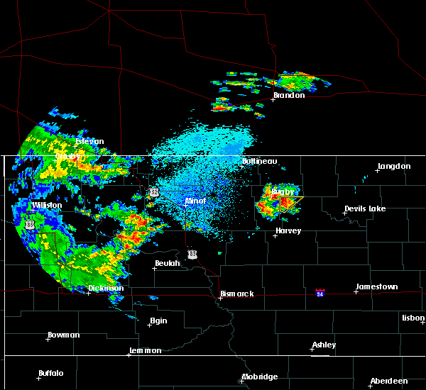 The severe thunderstorm warning for northwestern benson county will expire at 700 am cdt, the storm which prompted the warning has weakened below severe limits, and no longer poses an immediate threat to life or property. therefore, the warning will be allowed to expire. The severe thunderstorm warning for northwestern benson county will expire at 700 am cdt, the storm which prompted the warning has weakened below severe limits, and no longer poses an immediate threat to life or property. therefore, the warning will be allowed to expire.
|
| 10/3/2016 6:46 AM CDT |
 At 645 am cdt, a severe thunderstorm was located over pleasant lake, or 45 miles west of devils lake, moving north at 20 mph (radar indicated). Hazards include quarter size hail. Damage to vehicles is expected. This severe storm will be near, knox around 650 am cdt. At 645 am cdt, a severe thunderstorm was located over pleasant lake, or 45 miles west of devils lake, moving north at 20 mph (radar indicated). Hazards include quarter size hail. Damage to vehicles is expected. This severe storm will be near, knox around 650 am cdt.
|
| 10/3/2016 6:29 AM CDT |
 At 628 am cdt, a severe thunderstorm was located near fillmore, or 45 miles west of devils lake, moving northeast at 25 mph (radar indicated). Hazards include quarter size hail. Damage to vehicles is expected. this severe thunderstorm will be near, pleasant lake around 645 am cdt. knox around 650 am cdt. York around 655 am cdt. At 628 am cdt, a severe thunderstorm was located near fillmore, or 45 miles west of devils lake, moving northeast at 25 mph (radar indicated). Hazards include quarter size hail. Damage to vehicles is expected. this severe thunderstorm will be near, pleasant lake around 645 am cdt. knox around 650 am cdt. York around 655 am cdt.
|
| 9/4/2016 5:29 AM CDT |
 At 529 am cdt, a severe thunderstorm was located near harlow, or 31 miles west of devils lake, moving northeast at 15 mph (radar indicated). Hazards include quarter size hail. Damage to vehicles is expected. this severe storm will be near, york around 535 am cdt. Leeds around 550 am cdt. At 529 am cdt, a severe thunderstorm was located near harlow, or 31 miles west of devils lake, moving northeast at 15 mph (radar indicated). Hazards include quarter size hail. Damage to vehicles is expected. this severe storm will be near, york around 535 am cdt. Leeds around 550 am cdt.
|
| 9/4/2016 4:57 AM CDT |
 At 457 am cdt, a severe thunderstorm was located over baker, or 38 miles west of devils lake, moving northeast at 20 mph (radar indicated). Hazards include quarter size hail. Damage to vehicles is expected. this severe thunderstorm will be near, baker around 505 am cdt. harlow around 520 am cdt. york around 530 am cdt. Leeds around 540 am cdt. At 457 am cdt, a severe thunderstorm was located over baker, or 38 miles west of devils lake, moving northeast at 20 mph (radar indicated). Hazards include quarter size hail. Damage to vehicles is expected. this severe thunderstorm will be near, baker around 505 am cdt. harlow around 520 am cdt. york around 530 am cdt. Leeds around 540 am cdt.
|
| 8/3/2016 6:57 PM CDT |
 At 656 pm cdt, severe thunderstorms were located along a line extending from arndt to near york, moving east at 25 mph (radar indicated). Hazards include two inch hail and 60 mph wind gusts. People and animals outdoors will be injured. expect hail damage to roofs, siding, windows, and vehicles. expect wind damage to roofs, siding, and trees. these severe storms will be near, arndt and considine around 700 pm cdt. egeland around 715 pm cdt. calio, churchs ferry and maza around 730 pm cdt. A tornado watch remains in effect until 1100 pm cdt for northeastern north dakota. At 656 pm cdt, severe thunderstorms were located along a line extending from arndt to near york, moving east at 25 mph (radar indicated). Hazards include two inch hail and 60 mph wind gusts. People and animals outdoors will be injured. expect hail damage to roofs, siding, windows, and vehicles. expect wind damage to roofs, siding, and trees. these severe storms will be near, arndt and considine around 700 pm cdt. egeland around 715 pm cdt. calio, churchs ferry and maza around 730 pm cdt. A tornado watch remains in effect until 1100 pm cdt for northeastern north dakota.
|
| 8/3/2016 6:48 PM CDT |
 At 647 pm cdt, a severe thunderstorm was located over bisbee, or 41 miles northwest of devils lake, moving east at 25 mph (radar indicated). Hazards include two inch hail and 60 mph wind gusts. People and animals outdoors will be injured. expect hail damage to roofs, siding, windows, and vehicles. expect wind damage to roofs, siding, and trees. this severe thunderstorm will be near, considine around 700 pm cdt. arndt around 705 pm cdt. egeland around 720 pm cdt. calio around 730 pm cdt. A tornado watch remains in effect until 1100 pm cdt for northeastern north dakota. At 647 pm cdt, a severe thunderstorm was located over bisbee, or 41 miles northwest of devils lake, moving east at 25 mph (radar indicated). Hazards include two inch hail and 60 mph wind gusts. People and animals outdoors will be injured. expect hail damage to roofs, siding, windows, and vehicles. expect wind damage to roofs, siding, and trees. this severe thunderstorm will be near, considine around 700 pm cdt. arndt around 705 pm cdt. egeland around 720 pm cdt. calio around 730 pm cdt. A tornado watch remains in effect until 1100 pm cdt for northeastern north dakota.
|
| 8/3/2016 4:54 PM CDT |
 At 453 pm cdt, a severe thunderstorm was located over wolford, or 41 miles southeast of bottineau, moving northeast at 40 mph (radar indicated). Hazards include golf ball size hail and 60 mph wind gusts. People and animals outdoors will be injured. expect hail damage to roofs, siding, windows, and vehicles. expect wind damage to roofs, siding, and trees. this severe thunderstorm will remain over mainly rural areas of northwestern benson and southwestern towner counties. A tornado watch remains in effect until 1100 pm cdt for northeastern north dakota. At 453 pm cdt, a severe thunderstorm was located over wolford, or 41 miles southeast of bottineau, moving northeast at 40 mph (radar indicated). Hazards include golf ball size hail and 60 mph wind gusts. People and animals outdoors will be injured. expect hail damage to roofs, siding, windows, and vehicles. expect wind damage to roofs, siding, and trees. this severe thunderstorm will remain over mainly rural areas of northwestern benson and southwestern towner counties. A tornado watch remains in effect until 1100 pm cdt for northeastern north dakota.
|
| 8/3/2016 4:30 PM CDT |
 At 429 pm cdt, a severe thunderstorm was located near rugby, or 39 miles southeast of bottineau, moving northeast at 30 mph. tennis ball sized sized hail was reported at rugby (radar indicated). Hazards include tennis ball size hail and 60 mph wind gusts. People and animals outdoors will be injured. expect hail damage to roofs, siding, windows, and vehicles. expect wind damage to roofs, siding, and trees. this severe thunderstorm will be near, pleasant lake around 435 pm cdt. knox around 445 pm cdt. A tornado watch remains in effect until 1100 pm cdt for northeastern north dakota. At 429 pm cdt, a severe thunderstorm was located near rugby, or 39 miles southeast of bottineau, moving northeast at 30 mph. tennis ball sized sized hail was reported at rugby (radar indicated). Hazards include tennis ball size hail and 60 mph wind gusts. People and animals outdoors will be injured. expect hail damage to roofs, siding, windows, and vehicles. expect wind damage to roofs, siding, and trees. this severe thunderstorm will be near, pleasant lake around 435 pm cdt. knox around 445 pm cdt. A tornado watch remains in effect until 1100 pm cdt for northeastern north dakota.
|
| 7/20/2016 8:31 PM CDT |
 At 830 pm cdt, a severe thunderstorm was located near minnewaukan, or 17 miles west of devils lake, moving east at 90 mph (radar indicated). Hazards include 70 mph wind gusts and nickel size hail. Expect considerable tree damage. damage is likely to mobile homes, roofs, and outbuildings. this severe storm will be near, penn around 835 pm cdt. lakewood park and camp grafton around 840 pm cdt. A tornado watch remains in effect until 1100 pm cdt for northeastern north dakota. At 830 pm cdt, a severe thunderstorm was located near minnewaukan, or 17 miles west of devils lake, moving east at 90 mph (radar indicated). Hazards include 70 mph wind gusts and nickel size hail. Expect considerable tree damage. damage is likely to mobile homes, roofs, and outbuildings. this severe storm will be near, penn around 835 pm cdt. lakewood park and camp grafton around 840 pm cdt. A tornado watch remains in effect until 1100 pm cdt for northeastern north dakota.
|
| 7/20/2016 8:15 PM CDT | Peak wind measured by the ndawn senso in benson county ND, 9.8 miles NNE of York, ND |
| 7/20/2016 7:56 PM CDT |
 At 756 pm cdt, a severe thunderstorm was located over fillmore, or 42 miles west of devils lake, moving east at 55 mph (radar indicated). Hazards include 70 mph wind gusts and nickel size hail. Expect considerable tree damage. damage is likely to mobile homes, roofs, and outbuildings. this severe thunderstorm will be near, baker around 805 pm cdt. harlow around 810 pm cdt. brinsmade around 820 pm cdt. minnewaukan around 825 pm cdt. penn around 830 pm cdt. A tornado watch remains in effect until 1100 pm cdt for northeastern north dakota. At 756 pm cdt, a severe thunderstorm was located over fillmore, or 42 miles west of devils lake, moving east at 55 mph (radar indicated). Hazards include 70 mph wind gusts and nickel size hail. Expect considerable tree damage. damage is likely to mobile homes, roofs, and outbuildings. this severe thunderstorm will be near, baker around 805 pm cdt. harlow around 810 pm cdt. brinsmade around 820 pm cdt. minnewaukan around 825 pm cdt. penn around 830 pm cdt. A tornado watch remains in effect until 1100 pm cdt for northeastern north dakota.
|
| 7/9/2016 3:50 PM CDT |
 At 350 pm cdt, a severe thunderstorm was located near leeds, or 32 miles northwest of devils lake, moving northeast at 30 mph (radar indicated). Hazards include ping pong ball size hail. People and animals outdoors will be injured. expect damage to roofs, siding, windows, and vehicles. this severe storm will be near, maza around 405 pm cdt. Cando and considine around 415 pm cdt. At 350 pm cdt, a severe thunderstorm was located near leeds, or 32 miles northwest of devils lake, moving northeast at 30 mph (radar indicated). Hazards include ping pong ball size hail. People and animals outdoors will be injured. expect damage to roofs, siding, windows, and vehicles. this severe storm will be near, maza around 405 pm cdt. Cando and considine around 415 pm cdt.
|
| 7/9/2016 3:32 PM CDT |
 At 331 pm cdt, a severe thunderstorm was located over york, or 34 miles west of devils lake, moving northeast at 30 mph (spotters reported quarter sized hail 10 miles north of esmond at 314 pm). Hazards include quarter size hail. Damage to vehicles is expected. this severe storm will be near, leeds around 340 pm cdt. maza around 355 pm cdt. Cando and considine around 400 pm cdt. At 331 pm cdt, a severe thunderstorm was located over york, or 34 miles west of devils lake, moving northeast at 30 mph (spotters reported quarter sized hail 10 miles north of esmond at 314 pm). Hazards include quarter size hail. Damage to vehicles is expected. this severe storm will be near, leeds around 340 pm cdt. maza around 355 pm cdt. Cando and considine around 400 pm cdt.
|
| 7/9/2016 3:11 PM CDT |
 At 310 pm cdt, a severe thunderstorm was located near baker, or 37 miles west of devils lake, moving northeast at 30 mph (radar indicated). Hazards include quarter size hail. Damage to vehicles is expected. this severe thunderstorm will be near, baker around 320 pm cdt. harlow around 330 pm cdt. york and brinsmade around 340 pm cdt. leeds around 345 pm cdt. Churchs ferry around 400 pm cdt. At 310 pm cdt, a severe thunderstorm was located near baker, or 37 miles west of devils lake, moving northeast at 30 mph (radar indicated). Hazards include quarter size hail. Damage to vehicles is expected. this severe thunderstorm will be near, baker around 320 pm cdt. harlow around 330 pm cdt. york and brinsmade around 340 pm cdt. leeds around 345 pm cdt. Churchs ferry around 400 pm cdt.
|
| 7/4/2016 4:30 PM CDT |
 At 429 pm cdt, a severe thunderstorm was located near penn, or 15 miles west of devils lake, moving southeast at 35 mph (radar indicated). Hazards include 60 mph wind gusts and quarter size hail. Hail damage to vehicles is expected. expect wind damage to roofs, siding, and trees. this severe storm will be near, penn around 435 pm cdt. devils lake, lakewood park and camp grafton around 455 pm cdt. St michael around 500 pm cdt. At 429 pm cdt, a severe thunderstorm was located near penn, or 15 miles west of devils lake, moving southeast at 35 mph (radar indicated). Hazards include 60 mph wind gusts and quarter size hail. Hail damage to vehicles is expected. expect wind damage to roofs, siding, and trees. this severe storm will be near, penn around 435 pm cdt. devils lake, lakewood park and camp grafton around 455 pm cdt. St michael around 500 pm cdt.
|
| 7/4/2016 4:13 PM CDT |
 At 412 pm cdt, a severe thunderstorm was located near brinsmade, or 25 miles west of devils lake, moving southeast at 45 mph. another storm located near knox is also moving southeast around 45 mph (radar indicated). Hazards include ping pong ball size hail and 60 mph wind gusts. People and animals outdoors will be injured. expect hail damage to roofs, siding, windows, and vehicles. expect wind damage to roofs, siding, and trees. this severe thunderstorm will be near, brinsmade and churchs ferry around 420 pm cdt. minnewaukan around 425 pm cdt. penn around 430 pm cdt. devils lake, camp grafton and lakewood park around 445 pm cdt. St michael around 450 pm cdt. At 412 pm cdt, a severe thunderstorm was located near brinsmade, or 25 miles west of devils lake, moving southeast at 45 mph. another storm located near knox is also moving southeast around 45 mph (radar indicated). Hazards include ping pong ball size hail and 60 mph wind gusts. People and animals outdoors will be injured. expect hail damage to roofs, siding, windows, and vehicles. expect wind damage to roofs, siding, and trees. this severe thunderstorm will be near, brinsmade and churchs ferry around 420 pm cdt. minnewaukan around 425 pm cdt. penn around 430 pm cdt. devils lake, camp grafton and lakewood park around 445 pm cdt. St michael around 450 pm cdt.
|
| 7/4/2016 3:49 PM CDT |
 At 348 pm cdt, a severe thunderstorm was located over knox, or 41 miles west of devils lake, moving east at 35 mph. another storm was approaching southwestern towner county (radar indicated). Hazards include 60 mph wind gusts and half dollar size hail. Hail damage to vehicles is expected. expect wind damage to roofs, siding, and trees. this severe storm will be near, knox around 350 pm cdt. york around 400 pm cdt. Leeds around 410 pm cdt. At 348 pm cdt, a severe thunderstorm was located over knox, or 41 miles west of devils lake, moving east at 35 mph. another storm was approaching southwestern towner county (radar indicated). Hazards include 60 mph wind gusts and half dollar size hail. Hail damage to vehicles is expected. expect wind damage to roofs, siding, and trees. this severe storm will be near, knox around 350 pm cdt. york around 400 pm cdt. Leeds around 410 pm cdt.
|
| 7/4/2016 3:31 PM CDT |
 At 330 pm cdt, severe thunderstorms were located along a line extending from near nanson to near rugby, moving east at 35 mph (radar indicated). Hazards include 60 mph wind gusts and half dollar size hail. Hail damage to vehicles is expected. expect wind damage to roofs, siding, and trees. severe thunderstorms will be near, pleasant lake around 340 pm cdt. knox around 350 pm cdt. york around 400 pm cdt. leeds around 410 pm cdt. Considine around 415 pm cdt. At 330 pm cdt, severe thunderstorms were located along a line extending from near nanson to near rugby, moving east at 35 mph (radar indicated). Hazards include 60 mph wind gusts and half dollar size hail. Hail damage to vehicles is expected. expect wind damage to roofs, siding, and trees. severe thunderstorms will be near, pleasant lake around 340 pm cdt. knox around 350 pm cdt. york around 400 pm cdt. leeds around 410 pm cdt. Considine around 415 pm cdt.
|
| 6/19/2016 3:23 AM CDT |
 At 322 am cdt, severe thunderstorms were located along a line extending from 9 miles northeast of barton to near rugby to near balta, moving east at 55 mph (radar indicated). Hazards include 60 mph wind gusts and half dollar size hail. Hail damage to vehicles is expected. expect wind damage to roofs, siding, and trees. severe thunderstorms will be near, pleasant lake around 330 am cdt. fillmore around 335 am cdt. baker around 345 am cdt. harlow, york and perth around 350 am cdt. Bisbee, leeds and considine around 355 am cdt. At 322 am cdt, severe thunderstorms were located along a line extending from 9 miles northeast of barton to near rugby to near balta, moving east at 55 mph (radar indicated). Hazards include 60 mph wind gusts and half dollar size hail. Hail damage to vehicles is expected. expect wind damage to roofs, siding, and trees. severe thunderstorms will be near, pleasant lake around 330 am cdt. fillmore around 335 am cdt. baker around 345 am cdt. harlow, york and perth around 350 am cdt. Bisbee, leeds and considine around 355 am cdt.
|
| 6/12/2016 1:40 AM CDT |
 At 139 am cdt, severe thunderstorms were located along a line extending from knox to 7 miles west of minnewaukan, moving northeast at 25 mph (radar indicated). Hazards include ping pong ball size hail and 60 mph wind gusts. People and animals outdoors will be injured. expect hail damage to roofs, siding, windows, and vehicles. expect wind damage to roofs, siding, and trees. these severe storms will be near, knox, pleasant lake and york around 145 am cdt. harlow around 150 am cdt. Brinsmade around 200 am cdt. At 139 am cdt, severe thunderstorms were located along a line extending from knox to 7 miles west of minnewaukan, moving northeast at 25 mph (radar indicated). Hazards include ping pong ball size hail and 60 mph wind gusts. People and animals outdoors will be injured. expect hail damage to roofs, siding, windows, and vehicles. expect wind damage to roofs, siding, and trees. these severe storms will be near, knox, pleasant lake and york around 145 am cdt. harlow around 150 am cdt. Brinsmade around 200 am cdt.
|
| 6/12/2016 1:18 AM CDT |
 At 117 am cdt, a severe thunderstorm was located near baker, or 35 miles west of devils lake, moving northeast at 40 mph (radar indicated). Hazards include ping pong ball size hail and 60 mph wind gusts. People and animals outdoors will be injured. expect hail damage to roofs, siding, windows, and vehicles. expect wind damage to roofs, siding, and trees. this severe thunderstorm will be near, baker and harlow around 125 am cdt. leeds and york around 140 am cdt. Cando and considine around 210 am cdt. At 117 am cdt, a severe thunderstorm was located near baker, or 35 miles west of devils lake, moving northeast at 40 mph (radar indicated). Hazards include ping pong ball size hail and 60 mph wind gusts. People and animals outdoors will be injured. expect hail damage to roofs, siding, windows, and vehicles. expect wind damage to roofs, siding, and trees. this severe thunderstorm will be near, baker and harlow around 125 am cdt. leeds and york around 140 am cdt. Cando and considine around 210 am cdt.
|
| 6/10/2016 1:55 AM CDT |
 At 154 am cdt, severe thunderstorms were located along a line extending from near churchs ferry to 6 miles southwest of carrington, moving east at 45 mph (radar indicated). Hazards include 60 mph wind gusts. Expect damage to roofs. siding. and trees. these severe storms will be near, penn around 200 am cdt. webster around 205 am cdt. Garske around 210 am cdt. At 154 am cdt, severe thunderstorms were located along a line extending from near churchs ferry to 6 miles southwest of carrington, moving east at 45 mph (radar indicated). Hazards include 60 mph wind gusts. Expect damage to roofs. siding. and trees. these severe storms will be near, penn around 200 am cdt. webster around 205 am cdt. Garske around 210 am cdt.
|
| 6/10/2016 1:29 AM CDT |
 At 128 am cdt, severe thunderstorms were located along a line extending from near york to 6 miles south of bowdon, moving east at 45 mph (radar indicated). Hazards include 60 mph wind gusts. Expect damage to roofs. siding. and trees. severe thunderstorms will be near, york around 130 am cdt. leeds around 140 am cdt. brinsmade around 145 am cdt. churchs ferry around 150 am cdt. Penn around 155 am cdt. At 128 am cdt, severe thunderstorms were located along a line extending from near york to 6 miles south of bowdon, moving east at 45 mph (radar indicated). Hazards include 60 mph wind gusts. Expect damage to roofs. siding. and trees. severe thunderstorms will be near, york around 130 am cdt. leeds around 140 am cdt. brinsmade around 145 am cdt. churchs ferry around 150 am cdt. Penn around 155 am cdt.
|
| 6/10/2016 12:26 AM CDT |
 At 1225 am cdt, a severe thunderstorm was located near harlow, or 31 miles west of devils lake, moving southeast at 40 mph (public). Hazards include 70 mph wind gusts. Expect considerable tree damage. damage is likely to mobile homes, roofs, and outbuildings. This severe storm will be near, brinsmade around 1240 am cdt. At 1225 am cdt, a severe thunderstorm was located near harlow, or 31 miles west of devils lake, moving southeast at 40 mph (public). Hazards include 70 mph wind gusts. Expect considerable tree damage. damage is likely to mobile homes, roofs, and outbuildings. This severe storm will be near, brinsmade around 1240 am cdt.
|
| 6/10/2016 12:04 AM CDT |
 At 1203 am cdt, a severe thunderstorm was located near pleasant lake, or 45 miles southeast of bottineau, moving southeast at 40 mph (public. at rugby a 70 mph wind gust was reported out in front of the thunderstorm). Hazards include 70 mph wind gusts. Expect considerable tree damage. damage is likely to mobile homes, roofs, and outbuildings. this severe thunderstorm will be near, knox and fillmore around 1210 am cdt. york and baker around 1220 am cdt. leeds and harlow around 1230 am cdt. Brinsmade around 1240 am cdt. At 1203 am cdt, a severe thunderstorm was located near pleasant lake, or 45 miles southeast of bottineau, moving southeast at 40 mph (public. at rugby a 70 mph wind gust was reported out in front of the thunderstorm). Hazards include 70 mph wind gusts. Expect considerable tree damage. damage is likely to mobile homes, roofs, and outbuildings. this severe thunderstorm will be near, knox and fillmore around 1210 am cdt. york and baker around 1220 am cdt. leeds and harlow around 1230 am cdt. Brinsmade around 1240 am cdt.
|
| 7/23/2015 9:09 PM CDT |
 At 908 pm cdt, severe thunderstorms were located along a line extending from near leeds to near flora, moving east at 40 mph (radar indicated). Hazards include 60 mph wind gusts and quarter size hail. Hail damage to vehicles is expected. expect wind damage to roofs, siding and trees. These severe storms will be near, oberon around 925 pm cdt. At 908 pm cdt, severe thunderstorms were located along a line extending from near leeds to near flora, moving east at 40 mph (radar indicated). Hazards include 60 mph wind gusts and quarter size hail. Hail damage to vehicles is expected. expect wind damage to roofs, siding and trees. These severe storms will be near, oberon around 925 pm cdt.
|
| 7/23/2015 8:38 PM CDT |
 At 837 pm cdt, severe thunderstorms were located along a line extending from near fillmore to near wellsburg, moving east at 30 mph (radar indicated). Hazards include 60 mph wind gusts and quarter size hail. Hail damage to vehicles is expected. expect wind damage to roofs, siding and trees. severe thunderstorms will be near, fillmore around 840 pm cdt. maddock and knox around 900 pm cdt. york and flora around 910 pm cdt. leeds around 920 pm cdt. Oberon around 930 pm cdt. At 837 pm cdt, severe thunderstorms were located along a line extending from near fillmore to near wellsburg, moving east at 30 mph (radar indicated). Hazards include 60 mph wind gusts and quarter size hail. Hail damage to vehicles is expected. expect wind damage to roofs, siding and trees. severe thunderstorms will be near, fillmore around 840 pm cdt. maddock and knox around 900 pm cdt. york and flora around 910 pm cdt. leeds around 920 pm cdt. Oberon around 930 pm cdt.
|
| 7/12/2015 8:28 PM CDT |
 At 828 pm cdt, severe thunderstorms were located along a line extending from near leeds to 6 miles north of heimdal, moving east at 40 mph (radar indicated). Hazards include 70 mph wind gusts and quarter size hail. Hail damage to vehicles is expected. expect considerable tree damage. wind damage is also likely to mobile homes, roofs and outbuildings. these severe storms will be near, leeds around 830 pm cdt. flora around 840 pm cdt. churchs ferry around 845 pm cdt. Oberon and penn around 855 pm cdt. At 828 pm cdt, severe thunderstorms were located along a line extending from near leeds to 6 miles north of heimdal, moving east at 40 mph (radar indicated). Hazards include 70 mph wind gusts and quarter size hail. Hail damage to vehicles is expected. expect considerable tree damage. wind damage is also likely to mobile homes, roofs and outbuildings. these severe storms will be near, leeds around 830 pm cdt. flora around 840 pm cdt. churchs ferry around 845 pm cdt. Oberon and penn around 855 pm cdt.
|
| 7/12/2015 8:05 PM CDT |
 At 805 pm cdt, severe thunderstorms were located along a line extending from near pleasant lake to near wellsburg, moving east at 30 mph (radar indicated). Hazards include 70 mph wind gusts and quarter size hail. Hail damage to vehicles is expected. expect considerable tree damage. wind damage is also likely to mobile homes, roofs and outbuildings. severe thunderstorms will be near, knox around 820 pm cdt. york around 830 pm cdt. leeds around 840 pm cdt. brinsmade around 855 pm cdt. Churchs ferry and penn around 900 pm cdt. At 805 pm cdt, severe thunderstorms were located along a line extending from near pleasant lake to near wellsburg, moving east at 30 mph (radar indicated). Hazards include 70 mph wind gusts and quarter size hail. Hail damage to vehicles is expected. expect considerable tree damage. wind damage is also likely to mobile homes, roofs and outbuildings. severe thunderstorms will be near, knox around 820 pm cdt. york around 830 pm cdt. leeds around 840 pm cdt. brinsmade around 855 pm cdt. Churchs ferry and penn around 900 pm cdt.
|
| 7/11/2015 10:23 PM CDT |
 At 1023 pm cdt, a severe thunderstorm capable of producing a tornado was located over harlow, or 24 miles southeast of rugby, moving northeast at 20 mph (radar indicated rotation). Hazards include tornado and ping pong ball size hail. Flying debris will be dangerous to those caught without shelter. mobile homes will be damaged or destroyed. damage to roofs, windows and vehicles will occur. tree damage is likely. this dangerous storm will be near, harlow around 1030 pm cdt. Leeds around 1100 pm cdt. At 1023 pm cdt, a severe thunderstorm capable of producing a tornado was located over harlow, or 24 miles southeast of rugby, moving northeast at 20 mph (radar indicated rotation). Hazards include tornado and ping pong ball size hail. Flying debris will be dangerous to those caught without shelter. mobile homes will be damaged or destroyed. damage to roofs, windows and vehicles will occur. tree damage is likely. this dangerous storm will be near, harlow around 1030 pm cdt. Leeds around 1100 pm cdt.
|
| 7/11/2015 10:10 PM CDT |
 At 1009 pm cdt, a severe thunderstorm capable of producing a tornado was located near1 mile south of baker moving northeast at 10 mph (radar indicated rotation). Hazards include tornado and ping pong ball size hail. Expect damage to mobile homes. roofs and vehicles. this dangerous storm will be near, baker around 1025 pm cdt. harlow around 1040 pm cdt. Leeds and york around 1100 pm cdt. At 1009 pm cdt, a severe thunderstorm capable of producing a tornado was located near1 mile south of baker moving northeast at 10 mph (radar indicated rotation). Hazards include tornado and ping pong ball size hail. Expect damage to mobile homes. roofs and vehicles. this dangerous storm will be near, baker around 1025 pm cdt. harlow around 1040 pm cdt. Leeds and york around 1100 pm cdt.
|
| 7/11/2015 9:50 PM CDT |
 At 949 pm cdt, a severe thunderstorm was located near fillmore, or 17 miles southeast of rugby, moving northeast at 15 mph (radar indicated). Hazards include quarter size hail. Damage to vehicles is expected. This severe storm will be near, york and knox around 1015 pm cdt. At 949 pm cdt, a severe thunderstorm was located near fillmore, or 17 miles southeast of rugby, moving northeast at 15 mph (radar indicated). Hazards include quarter size hail. Damage to vehicles is expected. This severe storm will be near, york and knox around 1015 pm cdt.
|
| 7/11/2015 9:17 PM CDT |
 At 916 pm cdt, a severe thunderstorm was located near fillmore, or 18 miles southeast of rugby, moving northeast at 15 mph (radar indicated). Hazards include half dollar size hail. Damage to vehicles is expected. this severe thunderstorm will be near, york and knox around 940 pm cdt. Leeds around 945 pm cdt. At 916 pm cdt, a severe thunderstorm was located near fillmore, or 18 miles southeast of rugby, moving northeast at 15 mph (radar indicated). Hazards include half dollar size hail. Damage to vehicles is expected. this severe thunderstorm will be near, york and knox around 940 pm cdt. Leeds around 945 pm cdt.
|
| 6/21/2015 8:07 PM CDT |
 The severe thunderstorm warning for west central ramsey and northwestern benson counties will expire at 815 pm cdt, the storm which prompted the warning has weakened below severe limits, and no longer pose an immediate threat to life or property. therefore the warning will be allowed to expire. however gusty winds are still possible with this thunderstorm. a tornado watch remains in effect until 1100 pm cdt for northeastern north dakota. The severe thunderstorm warning for west central ramsey and northwestern benson counties will expire at 815 pm cdt, the storm which prompted the warning has weakened below severe limits, and no longer pose an immediate threat to life or property. therefore the warning will be allowed to expire. however gusty winds are still possible with this thunderstorm. a tornado watch remains in effect until 1100 pm cdt for northeastern north dakota.
|
| 6/21/2015 7:54 PM CDT |
 At 753 pm cdt, a severe thunderstorm capable of producing a tornado was located over york, or 18 miles east of rugby, moving east at 25 mph (radar indicated rotation). Hazards include tornado. Expect damage to mobile homes. roofs and vehicles. this dangerous storm will be near, york around 755 pm cdt. Leeds around 810 pm cdt. At 753 pm cdt, a severe thunderstorm capable of producing a tornado was located over york, or 18 miles east of rugby, moving east at 25 mph (radar indicated rotation). Hazards include tornado. Expect damage to mobile homes. roofs and vehicles. this dangerous storm will be near, york around 755 pm cdt. Leeds around 810 pm cdt.
|
| 6/21/2015 7:51 PM CDT |
 At 750 pm cdt, a severe thunderstorm was located over leeds, or 27 miles east of rugby, moving east at 50 mph (radar indicated). Hazards include 60 mph wind gusts and penny size hail. Expect damage to roofs. siding and trees. this severe storm will be near, churchs ferry around 800 pm cdt. penn around 810 pm cdt. A tornado watch remains in effect until 1100 pm cdt for northeastern north dakota. At 750 pm cdt, a severe thunderstorm was located over leeds, or 27 miles east of rugby, moving east at 50 mph (radar indicated). Hazards include 60 mph wind gusts and penny size hail. Expect damage to roofs. siding and trees. this severe storm will be near, churchs ferry around 800 pm cdt. penn around 810 pm cdt. A tornado watch remains in effect until 1100 pm cdt for northeastern north dakota.
|
| 6/21/2015 7:36 PM CDT |
 At 735 pm cdt, a severe thunderstorm capable of producing a tornado was located over pleasant lake, or 9 miles east of rugby, moving east at 40 mph (radar indicated rotation). Hazards include tornado. Expect damage to mobile homes. roofs and vehicles. this dangerous storm will be near, knox around 740 pm cdt. york around 750 pm cdt. leeds around 800 pm cdt. Churchs ferry around 815 pm cdt. At 735 pm cdt, a severe thunderstorm capable of producing a tornado was located over pleasant lake, or 9 miles east of rugby, moving east at 40 mph (radar indicated rotation). Hazards include tornado. Expect damage to mobile homes. roofs and vehicles. this dangerous storm will be near, knox around 740 pm cdt. york around 750 pm cdt. leeds around 800 pm cdt. Churchs ferry around 815 pm cdt.
|
| 6/21/2015 7:20 PM CDT |
 At 719 pm cdt, a severe thunderstorm was located near rugby, moving east at 40 mph (radar indicated). Hazards include 60 mph wind gusts and penny size hail. Expect damage to roofs. siding and trees. this severe thunderstorm will be near, pleasant lake around 730 pm cdt. knox around 735 pm cdt. york around 740 pm cdt. leeds around 750 pm cdt. churchs ferry and maza around 800 pm cdt. A tornado watch remains in effect until 1100 pm cdt for northeastern north dakota. At 719 pm cdt, a severe thunderstorm was located near rugby, moving east at 40 mph (radar indicated). Hazards include 60 mph wind gusts and penny size hail. Expect damage to roofs. siding and trees. this severe thunderstorm will be near, pleasant lake around 730 pm cdt. knox around 735 pm cdt. york around 740 pm cdt. leeds around 750 pm cdt. churchs ferry and maza around 800 pm cdt. A tornado watch remains in effect until 1100 pm cdt for northeastern north dakota.
|
Hail Maps for York, ND
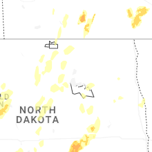
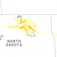
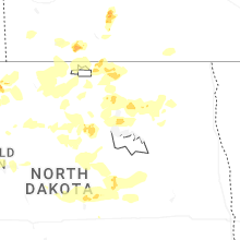


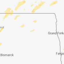


Connect with Interactive Hail Maps