

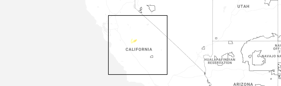
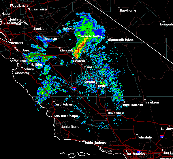
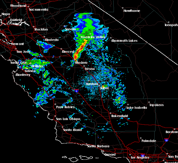
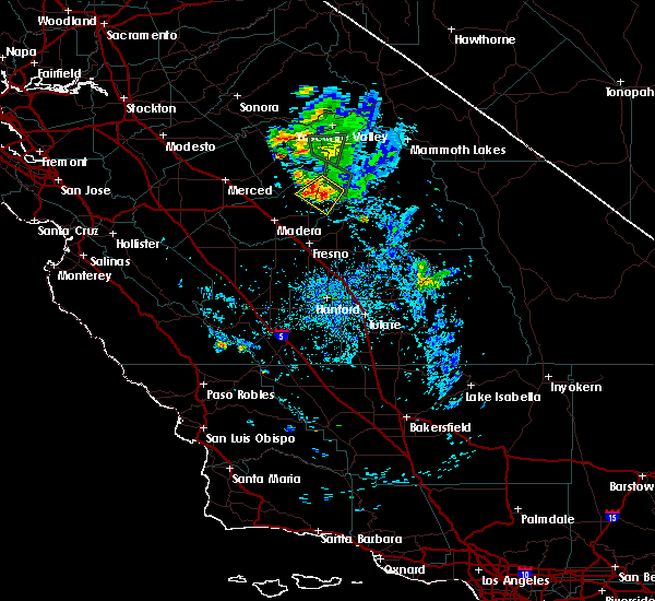
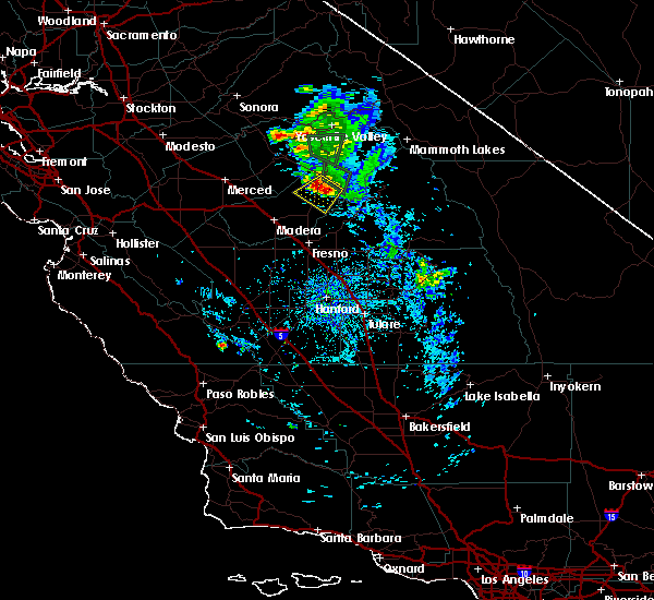
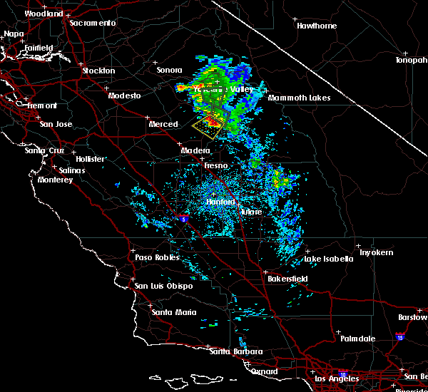
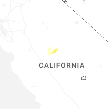
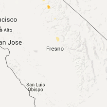
Hail Map for Yosemite Lakes, CA
The Yosemite Lakes, CA area has had 0 reports of on-the-ground hail by trained spotters, and has been under severe weather warnings 4 times during the past 12 months. Doppler radar has detected hail at or near Yosemite Lakes, CA on 2 occasions, including 1 occasion during the past year.
| Name: | Yosemite Lakes, CA |
| Where Located: | 30.8 miles N of Fresno, CA |
| Map: | Google Map for Yosemite Lakes, CA |
| Population: | 4952 |
| Housing Units: | 2156 |
| More Info: | Search Google for Yosemite Lakes, CA |
0
The Top Recent Hail Date for Yosemite Lakes, CA is Tuesday, April 21, 2026 (2nd out of 2)
Hail and Wind Damage Spotted near Yosemite Lakes, CA
| Date / Time | Report Details |
|---|---|
| 4/21/2026 5:11 PM PDT |
 The storm which prompted the warning has weakened below severe limits, and no longer poses an immediate threat to life or property. therefore, the warning will be allowed to expire. The storm which prompted the warning has weakened below severe limits, and no longer poses an immediate threat to life or property. therefore, the warning will be allowed to expire.
|
| 4/21/2026 5:04 PM PDT |
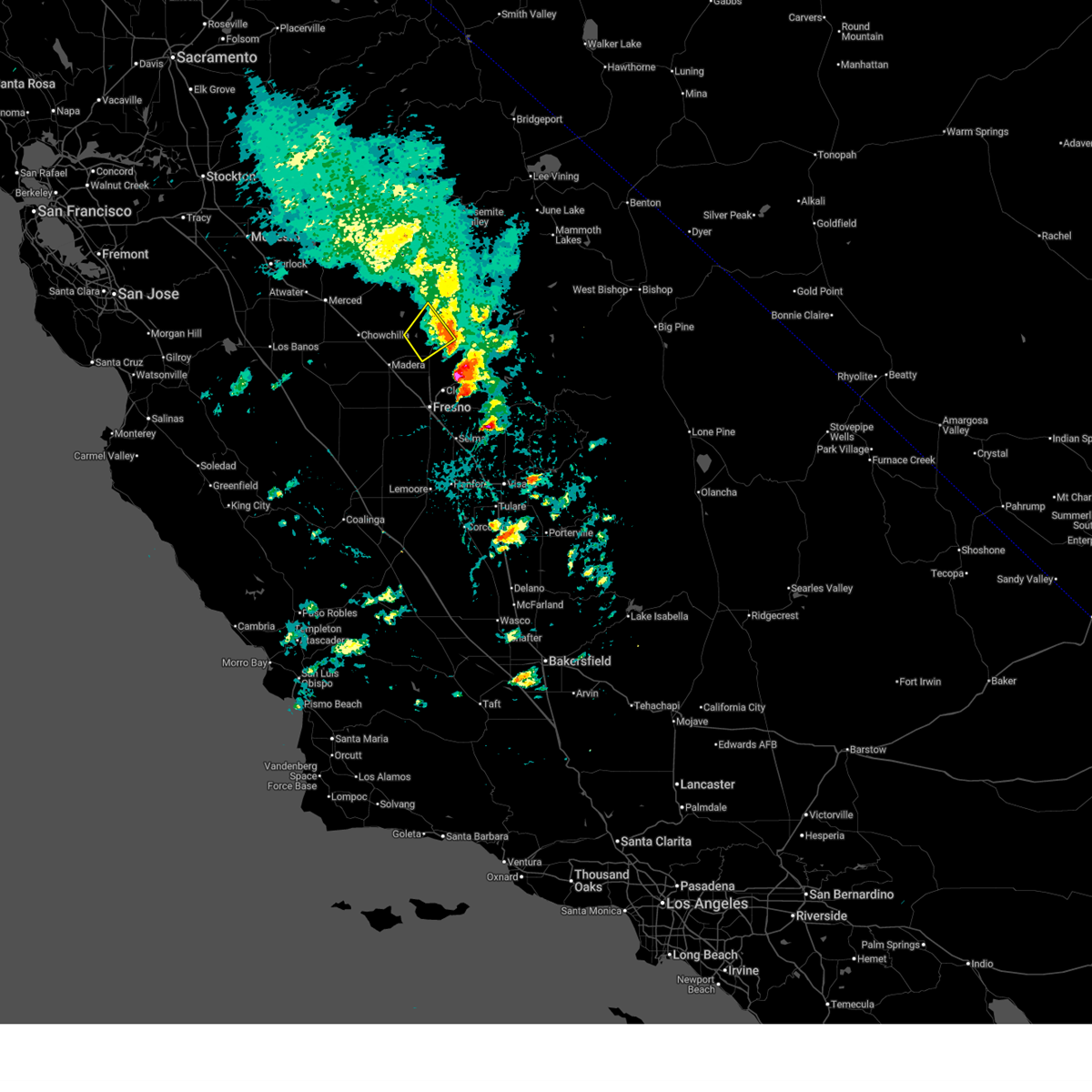
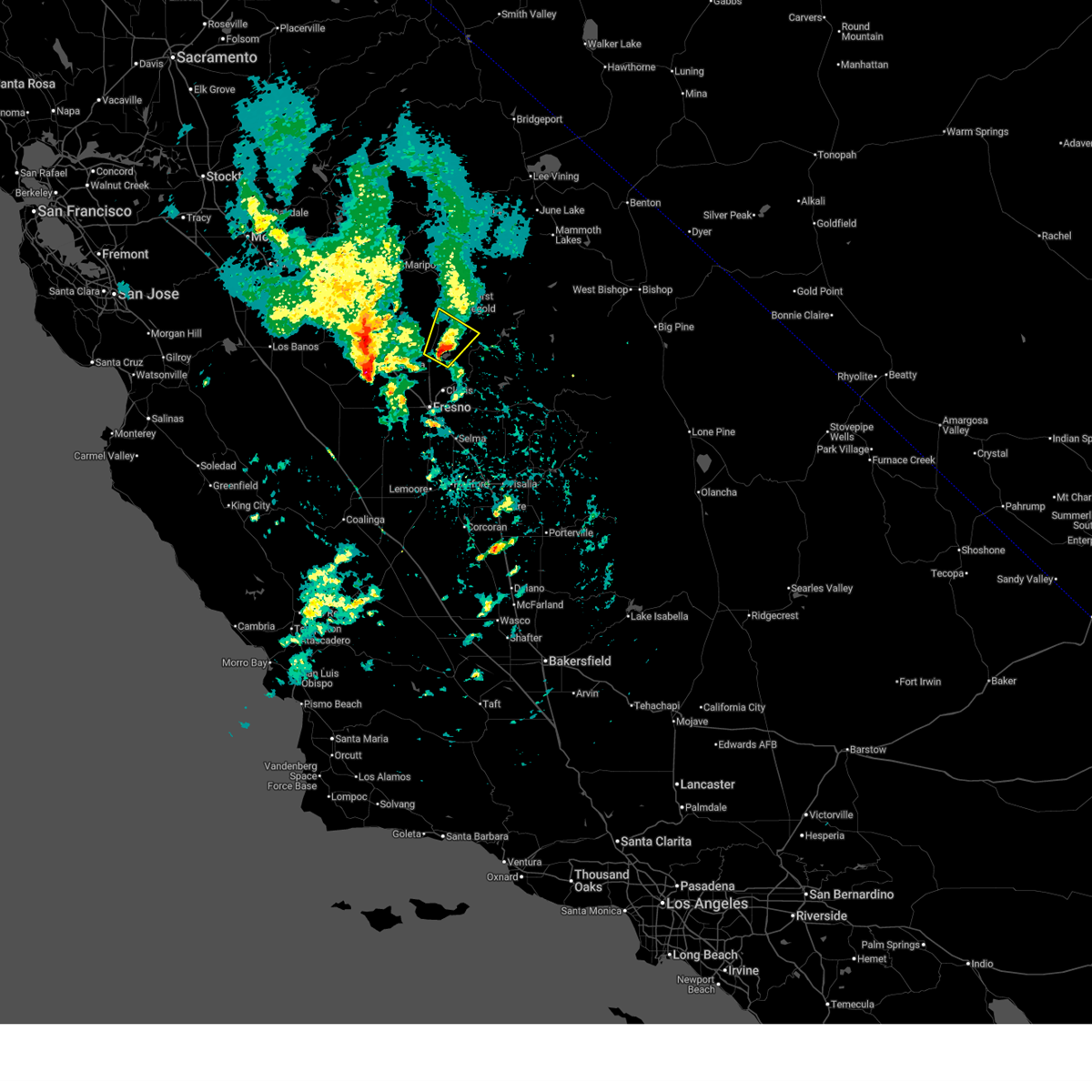
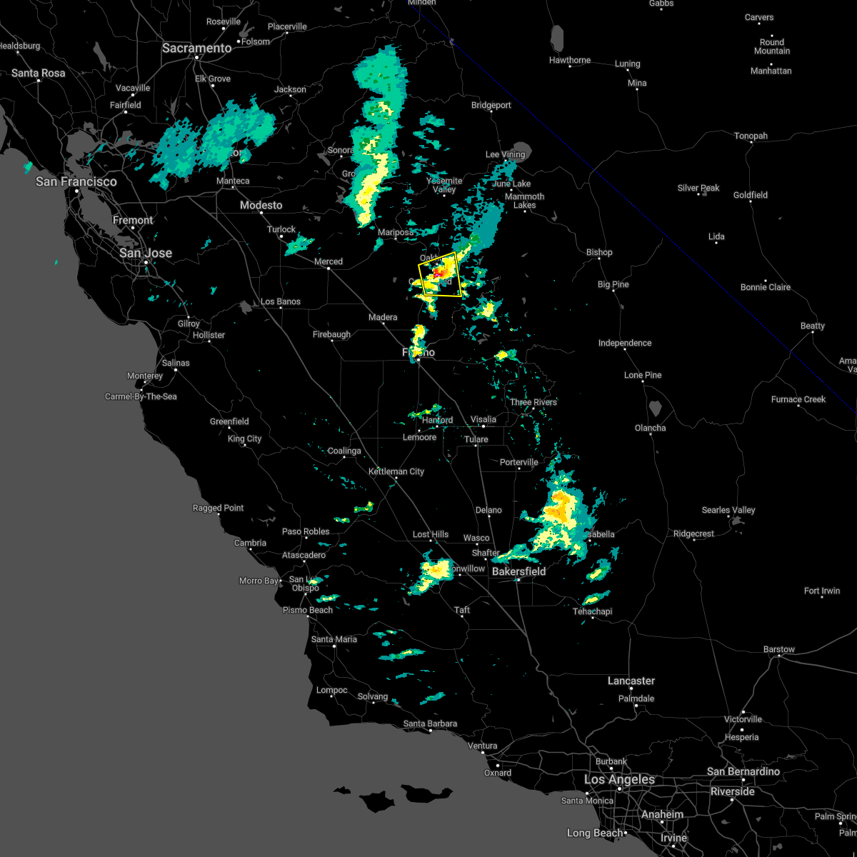
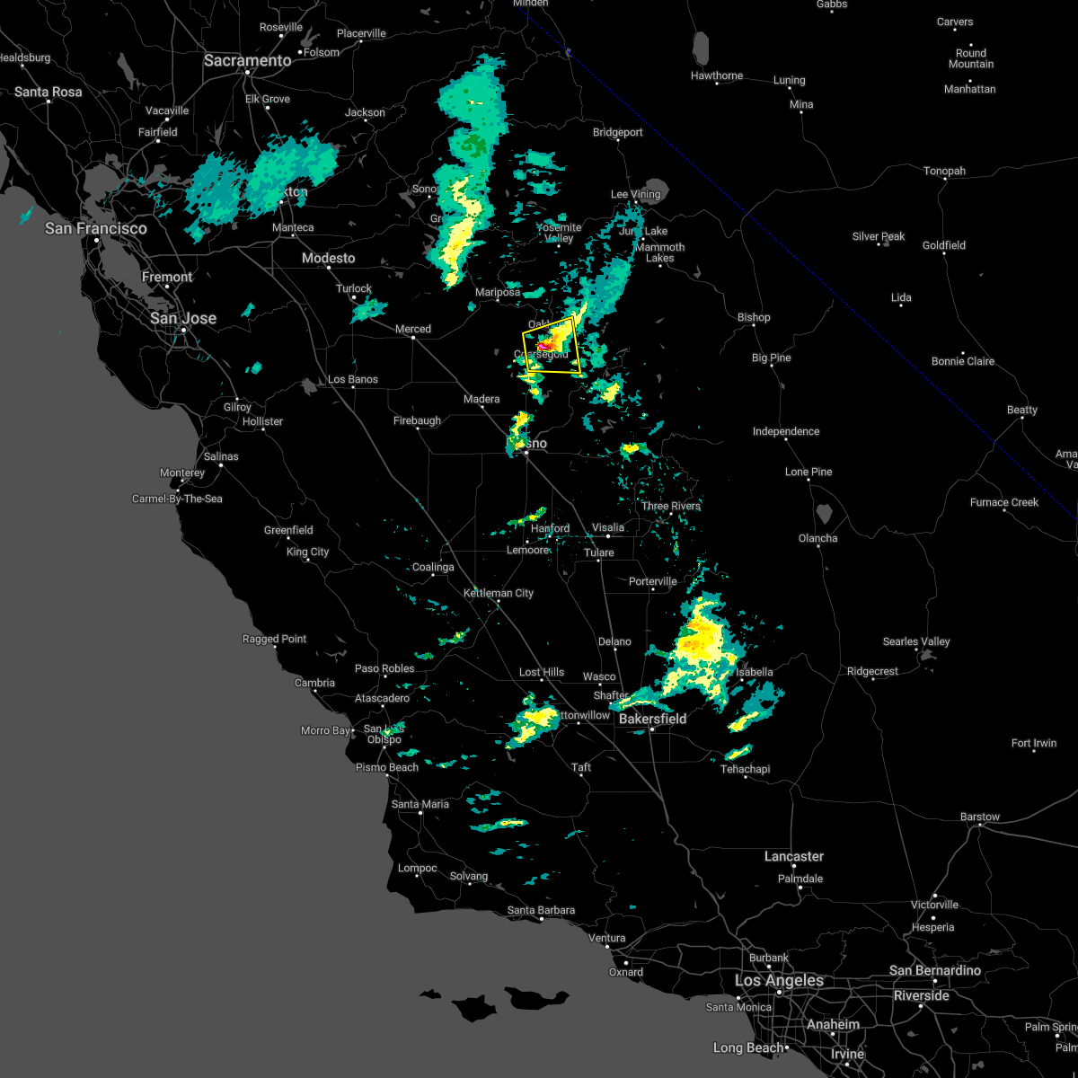
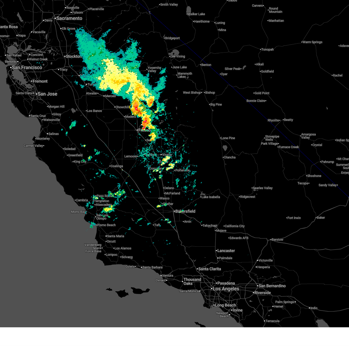 At 503 pm pdt, a severe thunderstorm was located over yosemite lakes, or 23 miles northeast of madera, moving northeast at 30 mph (radar indicated). Hazards include 60 mph wind gusts and quarter size hail. Hail damage to vehicles is expected. expect wind damage to roofs, siding, and trees. Locations impacted include, yosemite lakes and bonadelle ranchos-madera ranchos. At 503 pm pdt, a severe thunderstorm was located over yosemite lakes, or 23 miles northeast of madera, moving northeast at 30 mph (radar indicated). Hazards include 60 mph wind gusts and quarter size hail. Hail damage to vehicles is expected. expect wind damage to roofs, siding, and trees. Locations impacted include, yosemite lakes and bonadelle ranchos-madera ranchos.
|
| 4/21/2026 4:41 PM PDT |
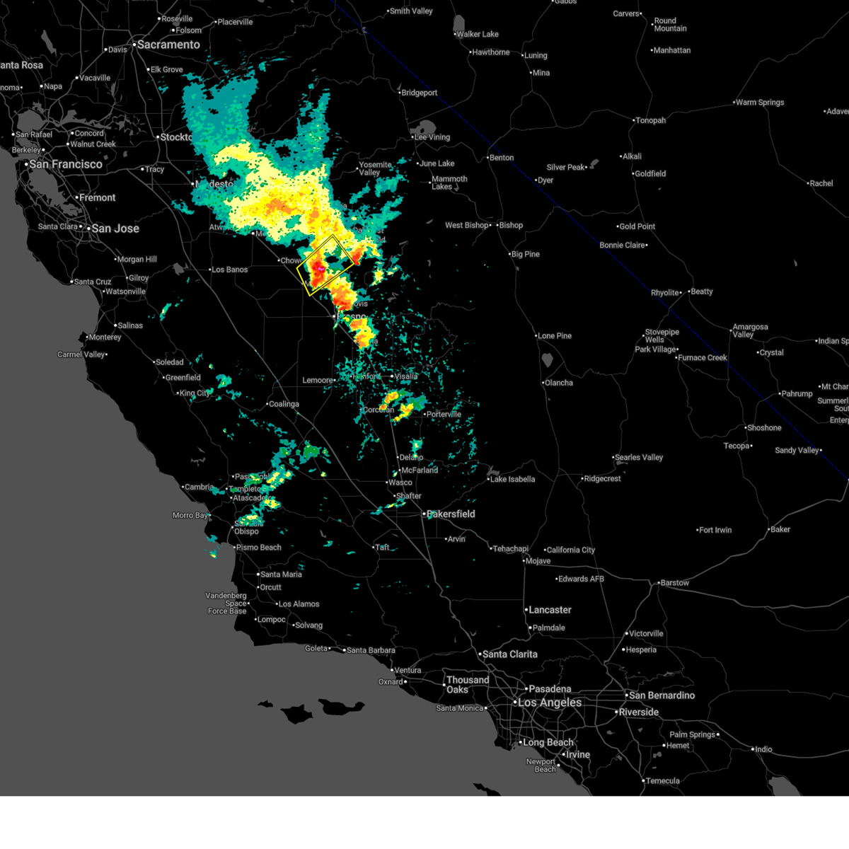 Svrhnx the national weather service in hanford ca has issued a * severe thunderstorm warning for, south central madera county in central california, * until 515 pm pdt. * at 441 pm pdt, a severe thunderstorm was located 7 miles north of bonadelle ranchos-madera ranchos, or 11 miles northeast of madera, moving northeast at 30 mph (radar indicated). Hazards include 60 mph wind gusts and quarter size hail. Hail damage to vehicles is expected. Expect wind damage to roofs, siding, and trees. Svrhnx the national weather service in hanford ca has issued a * severe thunderstorm warning for, south central madera county in central california, * until 515 pm pdt. * at 441 pm pdt, a severe thunderstorm was located 7 miles north of bonadelle ranchos-madera ranchos, or 11 miles northeast of madera, moving northeast at 30 mph (radar indicated). Hazards include 60 mph wind gusts and quarter size hail. Hail damage to vehicles is expected. Expect wind damage to roofs, siding, and trees.
|
| 4/21/2026 4:05 PM PDT |
 Svrhnx the national weather service in hanford ca has issued a * severe thunderstorm warning for, south central madera county in central california, central fresno county in central california, * until 430 pm pdt. * at 405 pm pdt, a severe thunderstorm was located 10 miles south of yosemite lakes, or 15 miles north of clovis, moving northeast at 15 mph (radar indicated). Hazards include 60 mph wind gusts and quarter size hail. Hail damage to vehicles is expected. Expect wind damage to roofs, siding, and trees. Svrhnx the national weather service in hanford ca has issued a * severe thunderstorm warning for, south central madera county in central california, central fresno county in central california, * until 430 pm pdt. * at 405 pm pdt, a severe thunderstorm was located 10 miles south of yosemite lakes, or 15 miles north of clovis, moving northeast at 15 mph (radar indicated). Hazards include 60 mph wind gusts and quarter size hail. Hail damage to vehicles is expected. Expect wind damage to roofs, siding, and trees.
|
| 1/10/2023 2:09 PM PST |
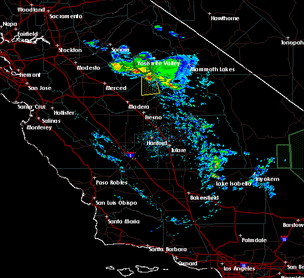
 At 209 pm pst, a severe thunderstorm was located near oakhurst, or 17 miles south of yosemite south entrance, moving east at 10 mph (radar indicated). Hazards include 60 mph wind gusts and quarter size hail. Hail damage to vehicles is expected. expect wind damage to roofs, siding, and trees. locations impacted include, oakhurst, yosemite lakes, coarsegold, bass lake, crane valley reservoir, bass lake ranger district and north fork. hail threat, radar indicated max hail size, 1. 00 in wind threat, radar indicated max wind gust, 60 mph. At 209 pm pst, a severe thunderstorm was located near oakhurst, or 17 miles south of yosemite south entrance, moving east at 10 mph (radar indicated). Hazards include 60 mph wind gusts and quarter size hail. Hail damage to vehicles is expected. expect wind damage to roofs, siding, and trees. locations impacted include, oakhurst, yosemite lakes, coarsegold, bass lake, crane valley reservoir, bass lake ranger district and north fork. hail threat, radar indicated max hail size, 1. 00 in wind threat, radar indicated max wind gust, 60 mph.
|
| 1/10/2023 1:53 PM PST |
 At 153 pm pst, a severe thunderstorm was located near yosemite lakes, or 18 miles south of yosemite south entrance, moving east at 10 mph (radar indicated). Hazards include 60 mph wind gusts and quarter size hail. Hail damage to vehicles is expected. Expect wind damage to roofs, siding, and trees. At 153 pm pst, a severe thunderstorm was located near yosemite lakes, or 18 miles south of yosemite south entrance, moving east at 10 mph (radar indicated). Hazards include 60 mph wind gusts and quarter size hail. Hail damage to vehicles is expected. Expect wind damage to roofs, siding, and trees.
|
| 5/9/2019 7:19 PM PDT |
 At 718 pm pdt, a severe thunderstorm was located near oakhurst, or 10 miles south of yosemite south entrance, moving south at around 15 mph (radar indicated). Hazards include quarter size hail. damage to vehicles is expected At 718 pm pdt, a severe thunderstorm was located near oakhurst, or 10 miles south of yosemite south entrance, moving south at around 15 mph (radar indicated). Hazards include quarter size hail. damage to vehicles is expected
|
| 3/27/2019 7:06 PM PDT |
 The severe thunderstorm warning for south central mariposa, central madera and east central merced counties will expire at 715 pm pdt, the storm which prompted the warning has weakened below severe limits, and no longer poses an immediate threat to life or property. therefore, the warning will be allowed to expire. however small hail, gusty winds and heavy rain are still possible with this thunderstorm. to report severe weather, contact your nearest law enforcement agency. they will relay your report to the national weather service hanford ca. The severe thunderstorm warning for south central mariposa, central madera and east central merced counties will expire at 715 pm pdt, the storm which prompted the warning has weakened below severe limits, and no longer poses an immediate threat to life or property. therefore, the warning will be allowed to expire. however small hail, gusty winds and heavy rain are still possible with this thunderstorm. to report severe weather, contact your nearest law enforcement agency. they will relay your report to the national weather service hanford ca.
|
| 3/27/2019 6:49 PM PDT |
 At 648 pm pdt, a severe thunderstorm was located 10 miles west of yosemite lakes, or 16 miles north of madera, moving east at 20 mph (radar indicated). Hazards include quarter size hail. damage to vehicles is expected At 648 pm pdt, a severe thunderstorm was located 10 miles west of yosemite lakes, or 16 miles north of madera, moving east at 20 mph (radar indicated). Hazards include quarter size hail. damage to vehicles is expected
|
| 7/20/2015 6:40 PM PDT |
 The severe thunderstorm warning for central madera and central fresno counties will expire at 645 pm pdt, the storm which prompted the warning has weakened below severe limits, and no longer poses an immediate threat to life or property. therefore the warning will be allowed to expire. however small. The severe thunderstorm warning for central madera and central fresno counties will expire at 645 pm pdt, the storm which prompted the warning has weakened below severe limits, and no longer poses an immediate threat to life or property. therefore the warning will be allowed to expire. however small.
|
| 7/20/2015 6:28 PM PDT |
 At 624 pm pdt, the public reported a severe thunderstorm producing up to 1 inch hail and damaging winds in excess of 60 mph. this storm was located 7 miles east of yosemite lakes, or 19 miles south of yosemite south entrance, moving southwest at 5 mph. in addition, at 1820 pdt half inch hail and 50 mph winds was reported at oakhurst. bass lake weather reported 1.65 inches with this storm. flooding is possible as rainfall rates are over 1.5 inches per hour. locations impacted include, oakhurst, yosemite lakes and coarsegold. At 624 pm pdt, the public reported a severe thunderstorm producing up to 1 inch hail and damaging winds in excess of 60 mph. this storm was located 7 miles east of yosemite lakes, or 19 miles south of yosemite south entrance, moving southwest at 5 mph. in addition, at 1820 pdt half inch hail and 50 mph winds was reported at oakhurst. bass lake weather reported 1.65 inches with this storm. flooding is possible as rainfall rates are over 1.5 inches per hour. locations impacted include, oakhurst, yosemite lakes and coarsegold.
|
| 7/20/2015 6:17 PM PDT |
 At 617 pm pdt, the public reported a severe thunderstorm producing quarter size hail and damaging winds in excess of 60 mph. this storm was located 7 miles south of oakhurst, or 19 miles south of yosemite south entrance, and moving southwest at 5 mph. At 617 pm pdt, the public reported a severe thunderstorm producing quarter size hail and damaging winds in excess of 60 mph. this storm was located 7 miles south of oakhurst, or 19 miles south of yosemite south entrance, and moving southwest at 5 mph.
|
Hail Maps for Yosemite Lakes, CA
Connect with Interactive Hail Maps