

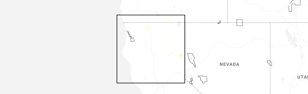
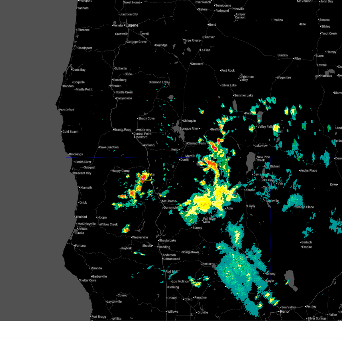
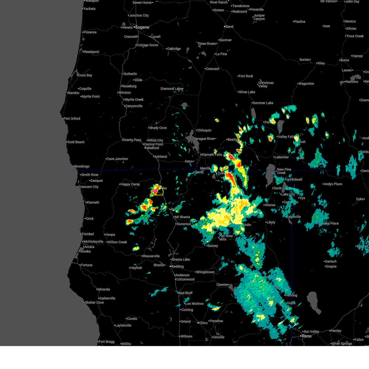
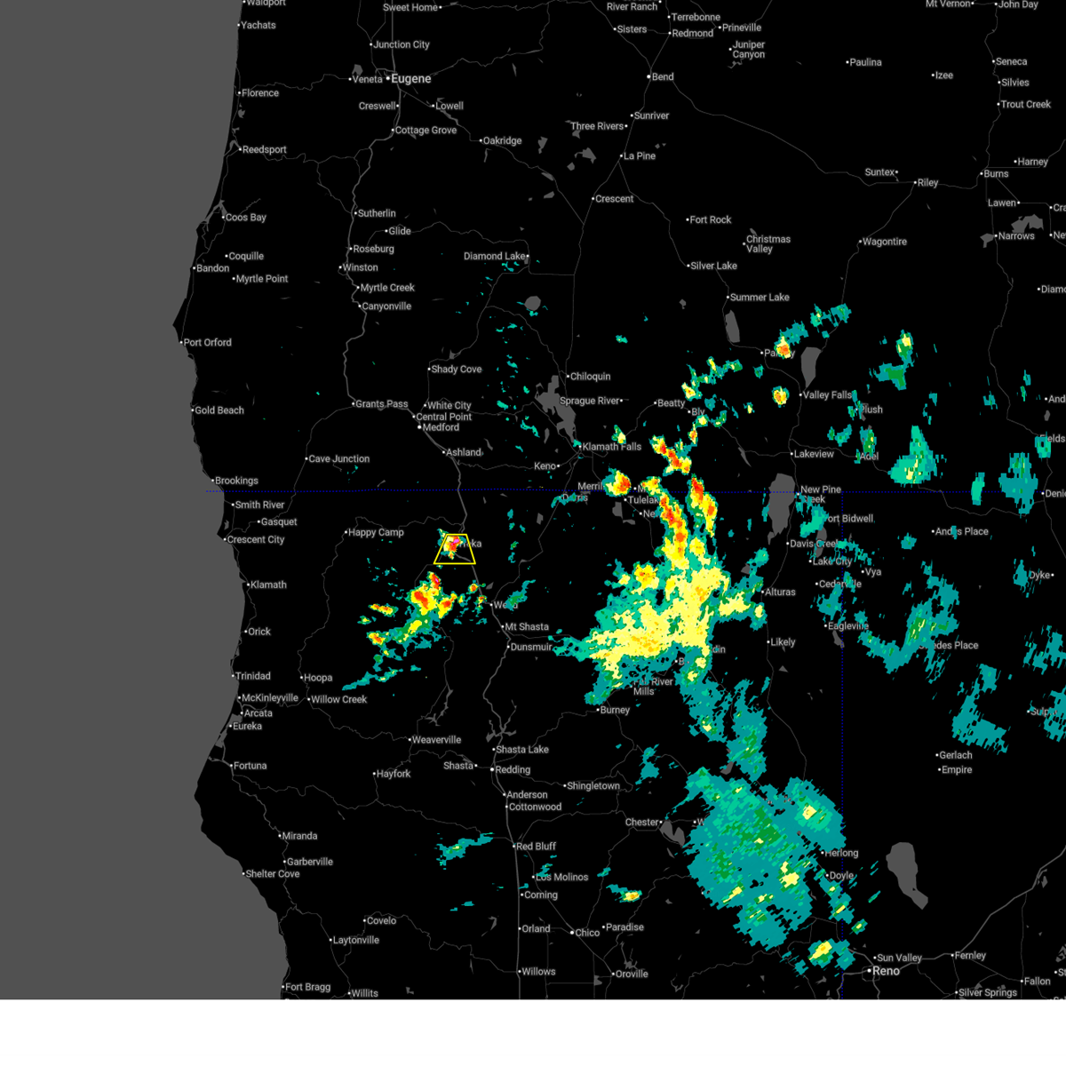
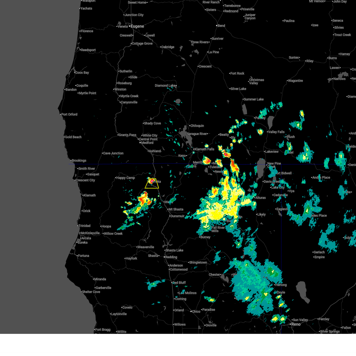
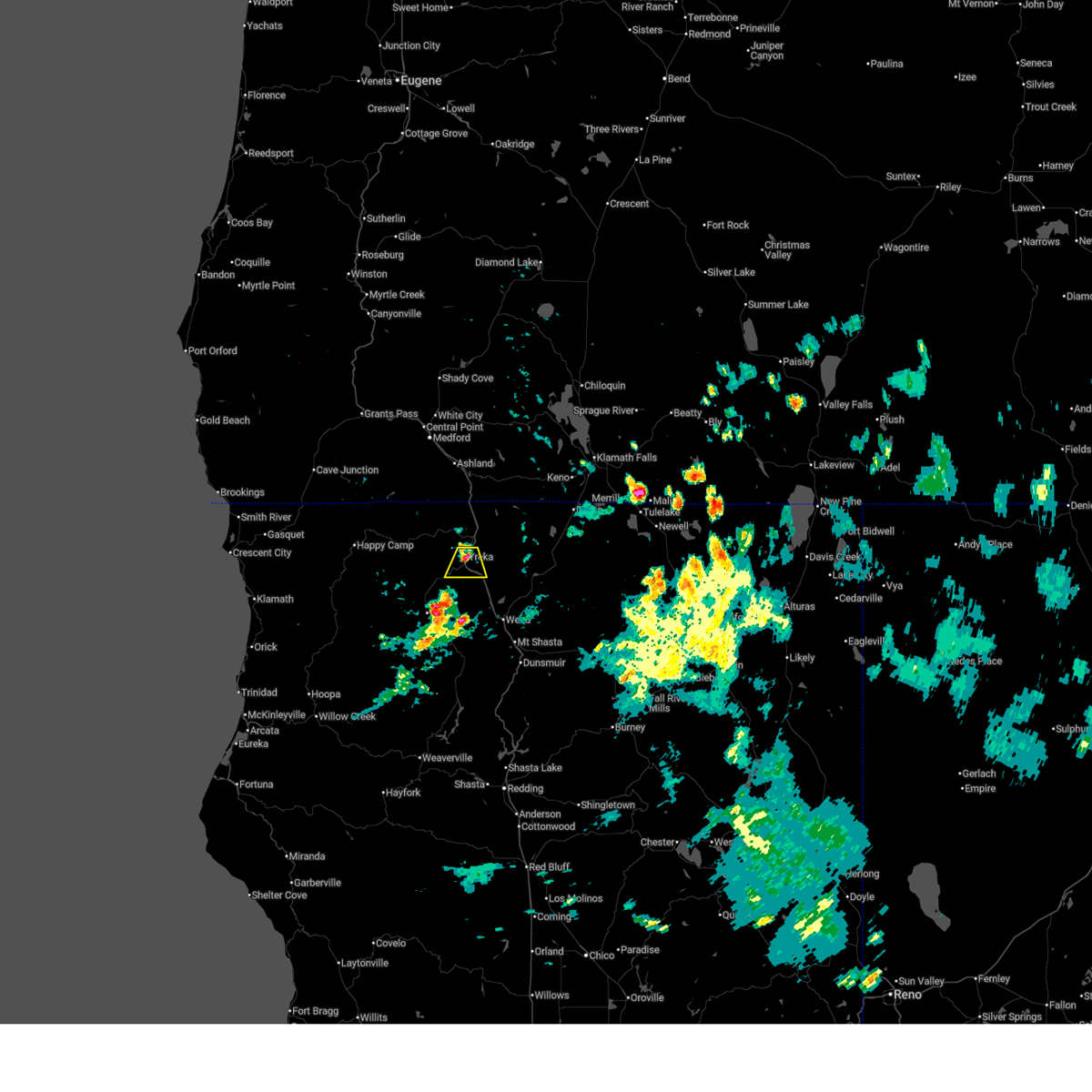
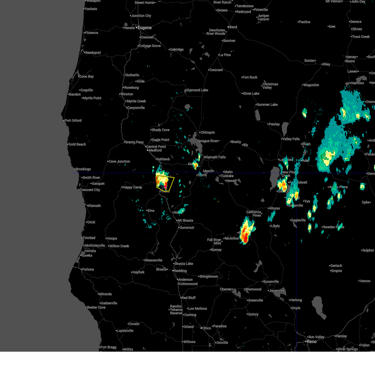
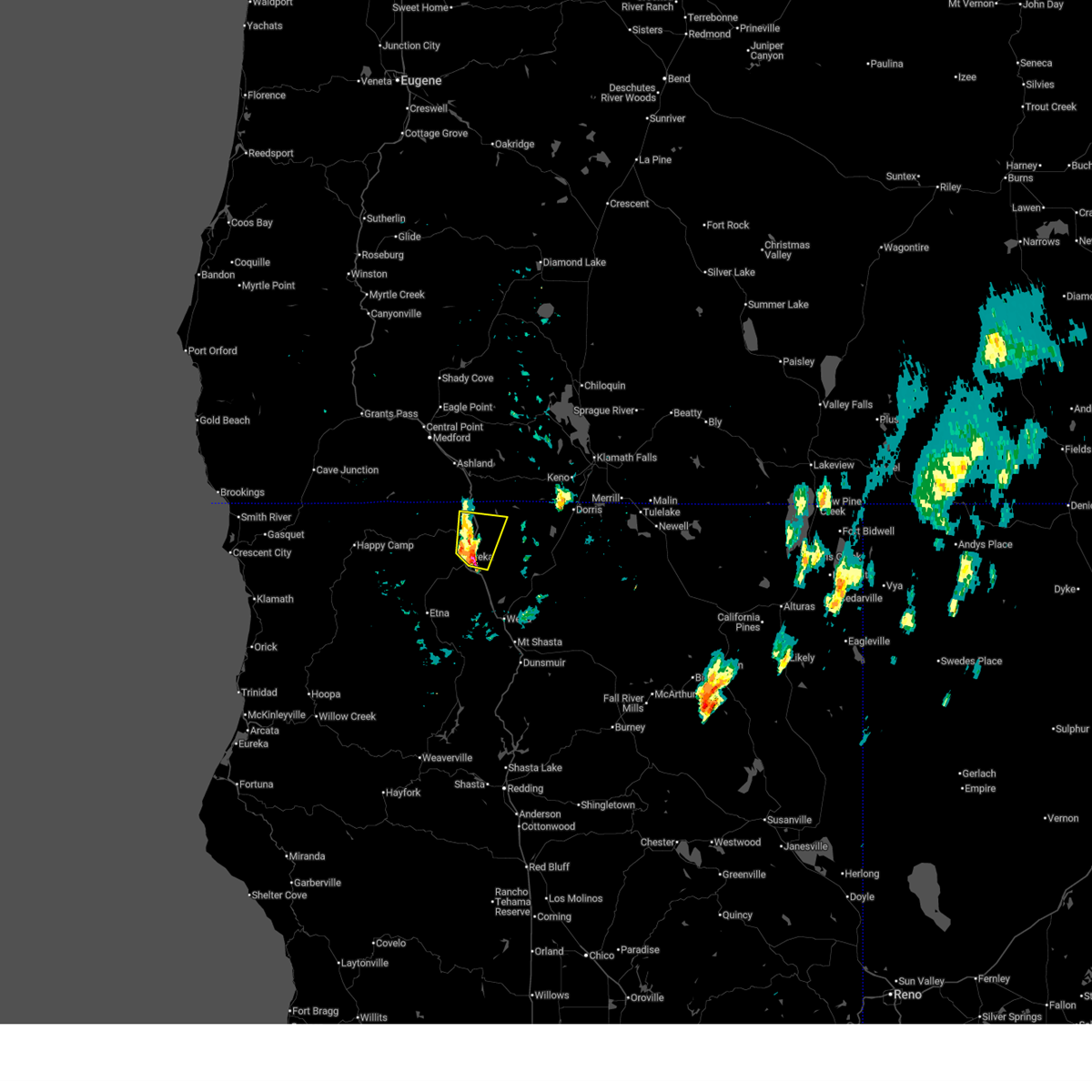
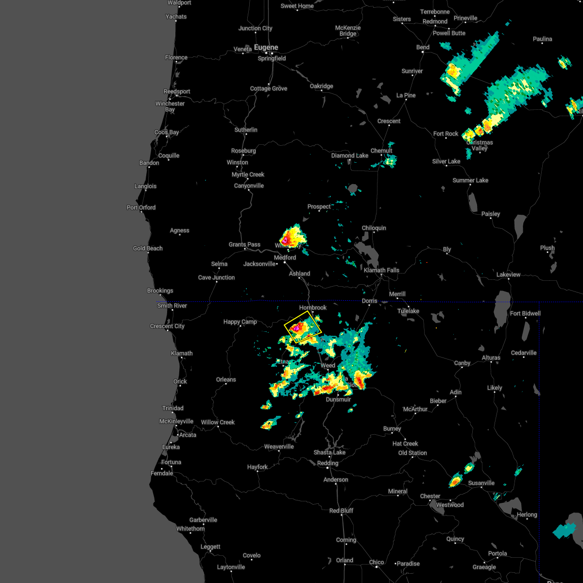
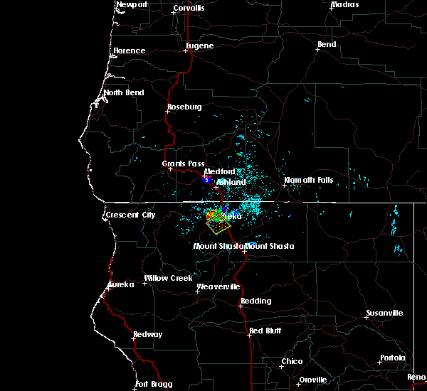
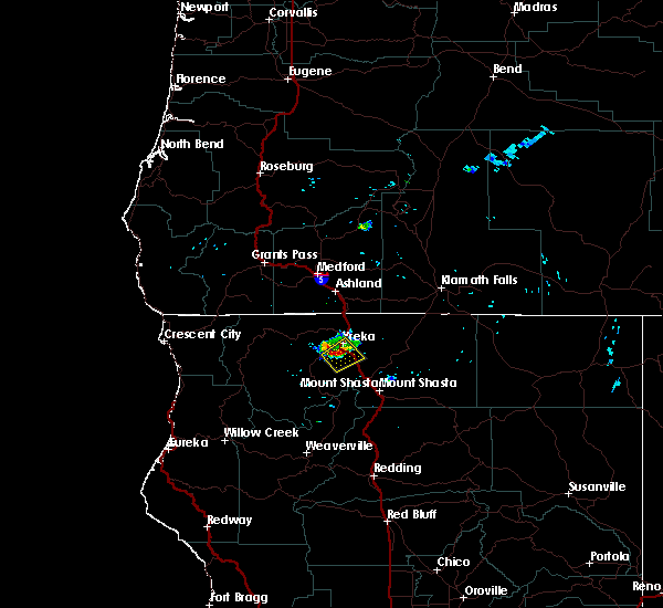
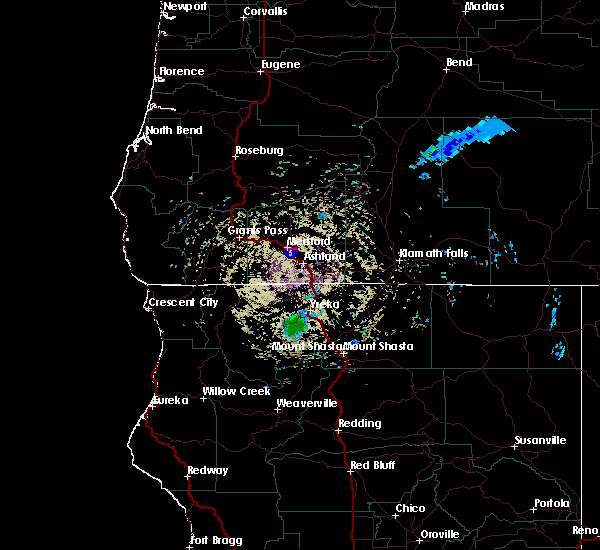
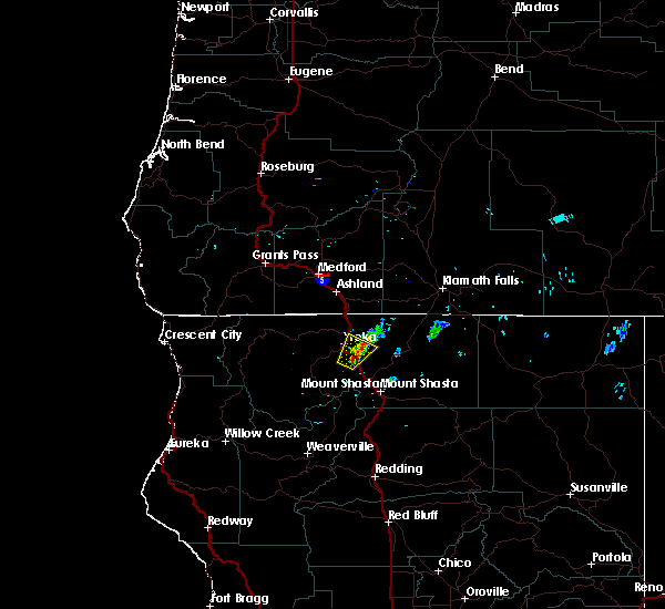
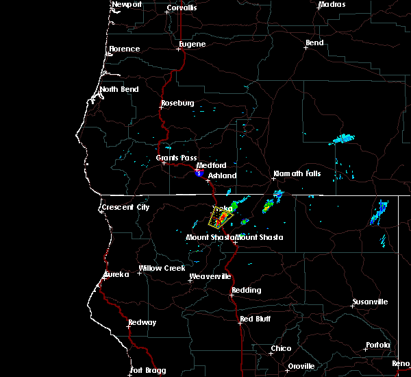
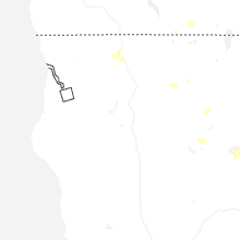
Hail Map for Yreka, CA
The Yreka, CA area has had 3 reports of on-the-ground hail by trained spotters, and has been under severe weather warnings 14 times during the past 12 months. Doppler radar has detected hail at or near Yreka, CA on 11 occasions, including 3 occasions during the past year.
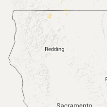
| Name: | Yreka, CA |
| Where Located: | 43 miles SSE of Medford, OR |
| Map: | Google Map for Yreka, CA |
| Population: | 7765 |
| Housing Units: | 3675 |
| More Info: | Search Google for Yreka, CA |
5
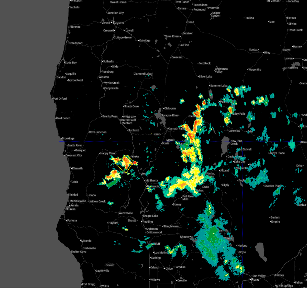
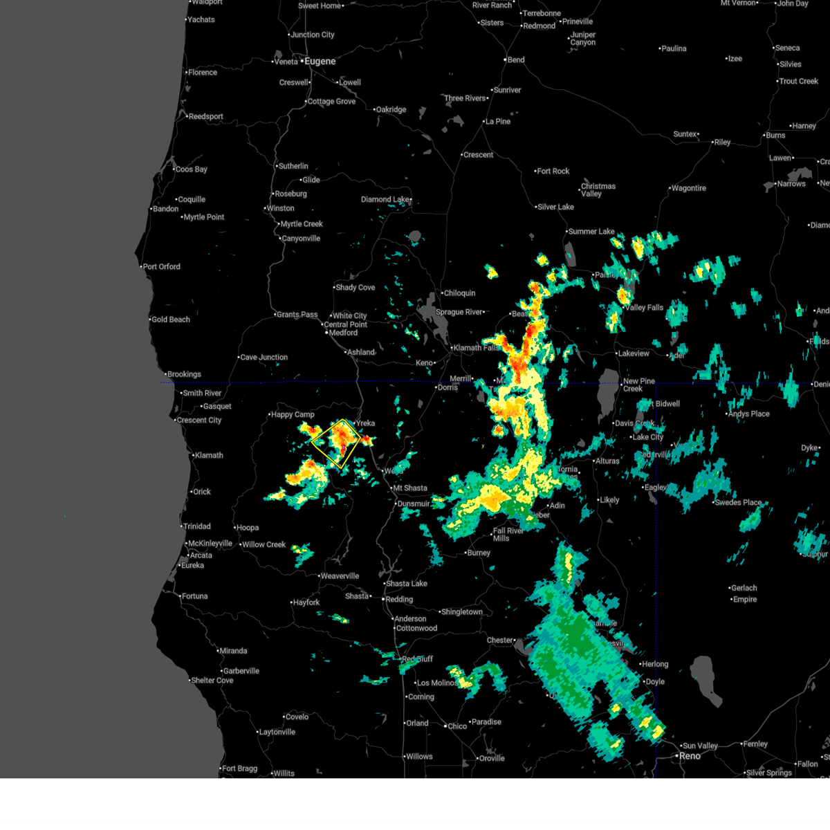
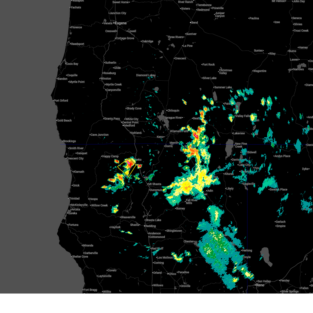
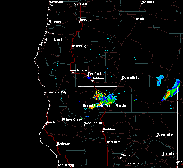
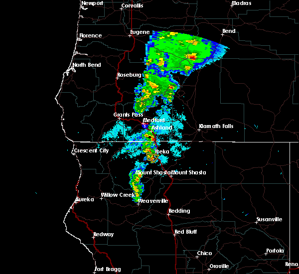
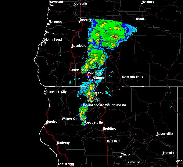
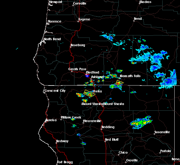
The Top Recent Hail Date for Yreka, CA is Thursday, July 24, 2025 (1st out of 11)
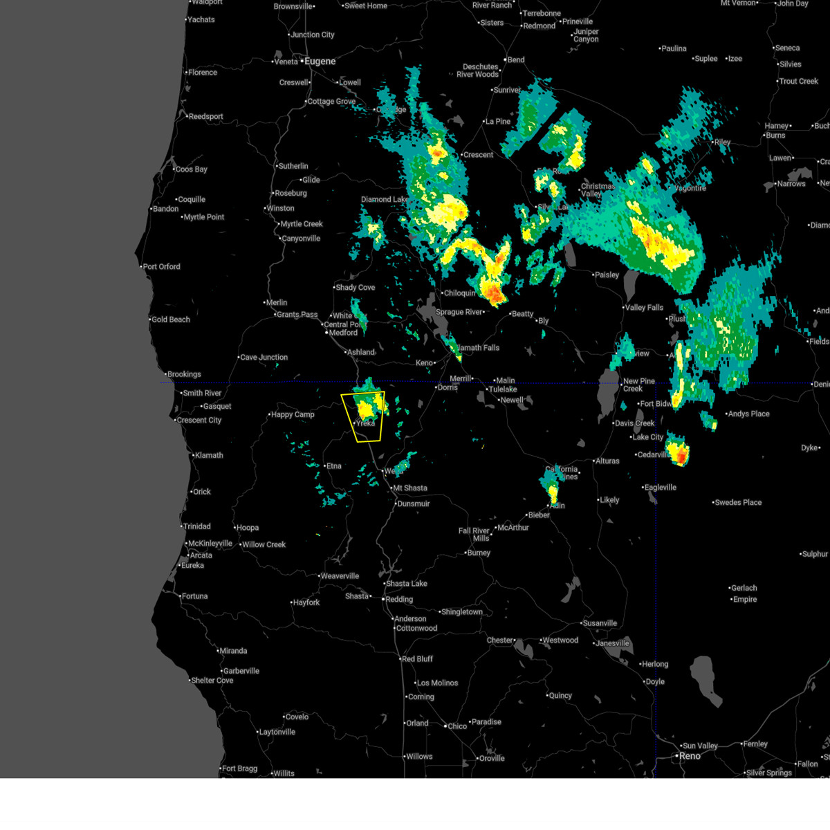
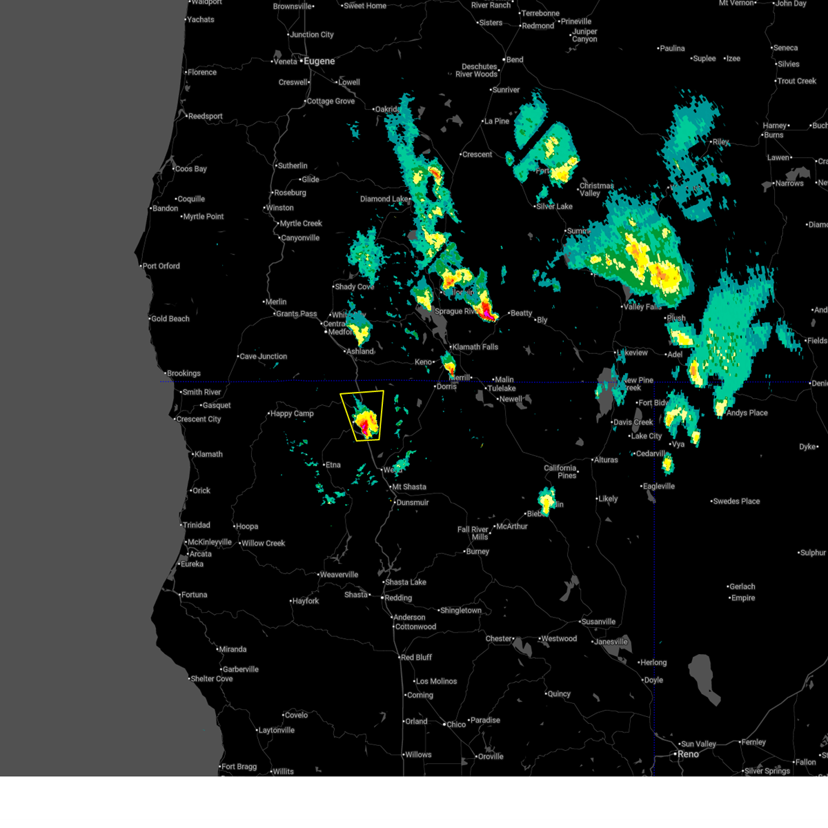
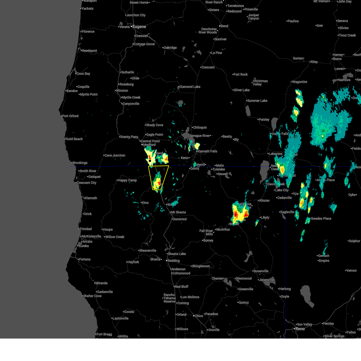
Hail and Wind Damage Spotted near Yreka, CA
| Date / Time | Report Details |
|---|---|
| 7/24/2025 6:37 PM PDT |
 The storm which prompted the warning has weakened below severe limits, and no longer poses an immediate threat to life or property. therefore, the warning will be allowed to expire. however gusty winds are still possible with this thunderstorm. The storm which prompted the warning has weakened below severe limits, and no longer poses an immediate threat to life or property. therefore, the warning will be allowed to expire. however gusty winds are still possible with this thunderstorm.
|
| 7/24/2025 6:29 PM PDT |
 At 629 pm pdt, a severe thunderstorm was located near fort jones, or 9 miles southwest of yreka, moving southwest at 15 mph (radar indicated). Hazards include 60 mph wind gusts and quarter size hail. Hail damage to vehicles is expected. expect wind damage to roofs, siding, and trees. Locations impacted include, yreka, fort jones, and greenview. At 629 pm pdt, a severe thunderstorm was located near fort jones, or 9 miles southwest of yreka, moving southwest at 15 mph (radar indicated). Hazards include 60 mph wind gusts and quarter size hail. Hail damage to vehicles is expected. expect wind damage to roofs, siding, and trees. Locations impacted include, yreka, fort jones, and greenview.
|
| 7/24/2025 6:18 PM PDT |
 At 618 pm pdt, a severe thunderstorm was located near fort jones, or 7 miles southwest of yreka, moving southwest at 10 mph (radar indicated). Hazards include 60 mph wind gusts and quarter size hail. Hail damage to vehicles is expected. expect wind damage to roofs, siding, and trees. Locations impacted include, yreka, fort jones, and greenview. At 618 pm pdt, a severe thunderstorm was located near fort jones, or 7 miles southwest of yreka, moving southwest at 10 mph (radar indicated). Hazards include 60 mph wind gusts and quarter size hail. Hail damage to vehicles is expected. expect wind damage to roofs, siding, and trees. Locations impacted include, yreka, fort jones, and greenview.
|
| 7/24/2025 6:10 PM PDT |
 The storm which prompted the warning has moved out of the area. therefore, the warning will be allowed to expire. remember, a severe thunderstorm warning still remains in effect for areas below this area in siskiyou county as quarter size hail and gusty winds remain a threat. The storm which prompted the warning has moved out of the area. therefore, the warning will be allowed to expire. remember, a severe thunderstorm warning still remains in effect for areas below this area in siskiyou county as quarter size hail and gusty winds remain a threat.
|
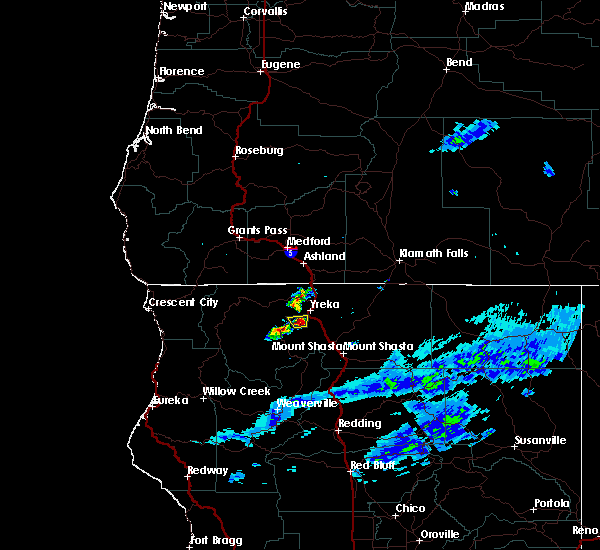
| 7/24/2025 6:09 PM PDT |
 Svrmfr the national weather service in medford has issued a * severe thunderstorm warning for, central siskiyou county in northern california, * until 645 pm pdt. * at 608 pm pdt, a severe thunderstorm was located near yreka, moving southwest at 15 mph (radar indicated). Hazards include 60 mph wind gusts and quarter size hail. Hail damage to vehicles is expected. Expect wind damage to roofs, siding, and trees. Svrmfr the national weather service in medford has issued a * severe thunderstorm warning for, central siskiyou county in northern california, * until 645 pm pdt. * at 608 pm pdt, a severe thunderstorm was located near yreka, moving southwest at 15 mph (radar indicated). Hazards include 60 mph wind gusts and quarter size hail. Hail damage to vehicles is expected. Expect wind damage to roofs, siding, and trees.
|
| 7/24/2025 5:56 PM PDT |
 At 556 pm pdt, a severe thunderstorm was located over yreka, moving south at 5 mph (radar indicated). Hazards include 60 mph wind gusts and quarter size hail. Hail damage to vehicles is expected. expect wind damage to roofs, siding, and trees. Locations impacted include, yreka, montague, and grenada. At 556 pm pdt, a severe thunderstorm was located over yreka, moving south at 5 mph (radar indicated). Hazards include 60 mph wind gusts and quarter size hail. Hail damage to vehicles is expected. expect wind damage to roofs, siding, and trees. Locations impacted include, yreka, montague, and grenada.
|
| 7/24/2025 5:47 PM PDT |
 At 547 pm pdt, a severe thunderstorm was located over yreka, moving south at 5 mph (radar indicated). Hazards include 60 mph wind gusts and quarter size hail. Hail damage to vehicles is expected. expect wind damage to roofs, siding, and trees. Locations impacted include, yreka, montague, and grenada. At 547 pm pdt, a severe thunderstorm was located over yreka, moving south at 5 mph (radar indicated). Hazards include 60 mph wind gusts and quarter size hail. Hail damage to vehicles is expected. expect wind damage to roofs, siding, and trees. Locations impacted include, yreka, montague, and grenada.
|
| 7/24/2025 5:36 PM PDT |
 At 536 pm pdt, a severe thunderstorm was located over yreka, and is nearly stationary (radar indicated). Hazards include 60 mph wind gusts and quarter size hail. Hail damage to vehicles is expected. expect wind damage to roofs, siding, and trees. Locations impacted include, yreka, montague, and grenada. At 536 pm pdt, a severe thunderstorm was located over yreka, and is nearly stationary (radar indicated). Hazards include 60 mph wind gusts and quarter size hail. Hail damage to vehicles is expected. expect wind damage to roofs, siding, and trees. Locations impacted include, yreka, montague, and grenada.
|
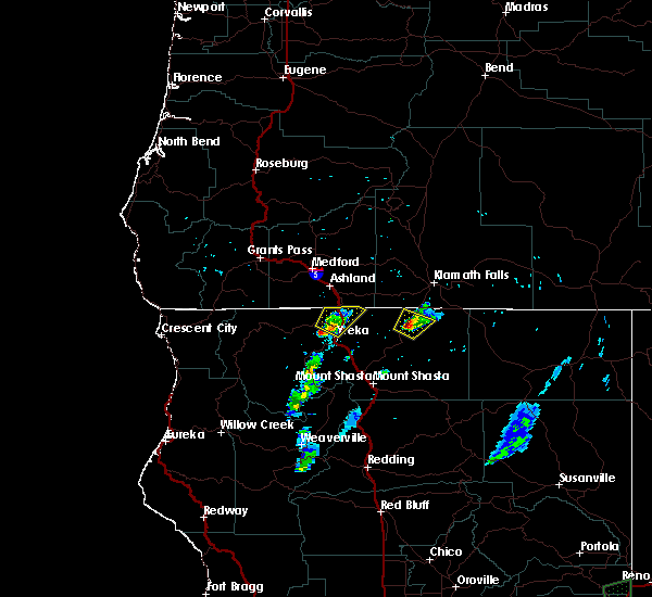
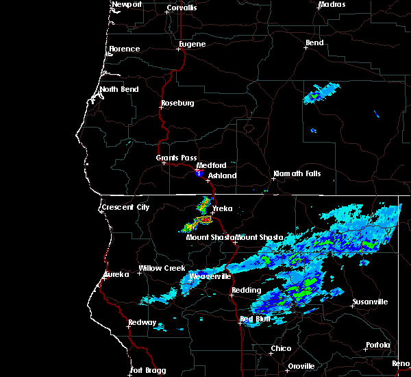
| 7/24/2025 5:28 PM PDT | Quarter sized hail reported 0.3 miles ESE of Yreka, CA |
| 7/24/2025 5:26 PM PDT |
 Svrmfr the national weather service in medford has issued a * severe thunderstorm warning for, central siskiyou county in northern california, * until 615 pm pdt. * at 525 pm pdt, a severe thunderstorm was located over yreka, and is nearly stationary (radar indicated). Hazards include 60 mph wind gusts and quarter size hail. Hail damage to vehicles is expected. Expect wind damage to roofs, siding, and trees. Svrmfr the national weather service in medford has issued a * severe thunderstorm warning for, central siskiyou county in northern california, * until 615 pm pdt. * at 525 pm pdt, a severe thunderstorm was located over yreka, and is nearly stationary (radar indicated). Hazards include 60 mph wind gusts and quarter size hail. Hail damage to vehicles is expected. Expect wind damage to roofs, siding, and trees.
|
| 7/3/2025 7:36 PM PDT |
 The storm which prompted the warning has weakened below severe limits, and has exited the warned area. therefore, the warning will be allowed to expire. The storm which prompted the warning has weakened below severe limits, and has exited the warned area. therefore, the warning will be allowed to expire.
|
| 7/3/2025 7:17 PM PDT |
 Svrmfr the national weather service in medford has issued a * severe thunderstorm warning for, north central siskiyou county in northern california, * until 745 pm pdt. * at 717 pm pdt, a severe thunderstorm was located over montague, or near yreka, moving north at 25 mph (radar indicated). Hazards include 60 mph wind gusts and quarter size hail. Hail damage to vehicles is expected. Expect wind damage to roofs, siding, and trees. Svrmfr the national weather service in medford has issued a * severe thunderstorm warning for, north central siskiyou county in northern california, * until 745 pm pdt. * at 717 pm pdt, a severe thunderstorm was located over montague, or near yreka, moving north at 25 mph (radar indicated). Hazards include 60 mph wind gusts and quarter size hail. Hail damage to vehicles is expected. Expect wind damage to roofs, siding, and trees.
|
| 7/3/2025 4:48 PM PDT |
 Svrmfr the national weather service in medford has issued a * severe thunderstorm warning for, north central siskiyou county in northern california, southeastern jackson county in southwestern oregon, * until 515 pm pdt. * at 448 pm pdt, a severe thunderstorm was located over montague, or near yreka, moving north at 25 mph (radar indicated). Hazards include 60 mph wind gusts and quarter size hail. Hail damage to vehicles is expected. Expect wind damage to roofs, siding, and trees. Svrmfr the national weather service in medford has issued a * severe thunderstorm warning for, north central siskiyou county in northern california, southeastern jackson county in southwestern oregon, * until 515 pm pdt. * at 448 pm pdt, a severe thunderstorm was located over montague, or near yreka, moving north at 25 mph (radar indicated). Hazards include 60 mph wind gusts and quarter size hail. Hail damage to vehicles is expected. Expect wind damage to roofs, siding, and trees.
|
| 7/3/2025 4:13 PM PDT |
 At 413 pm pdt, a severe thunderstorm was located near hornbrook, or 9 miles northeast of yreka, moving north at 35 mph (radar indicated). Hazards include 60 mph wind gusts and quarter size hail. Hail damage to vehicles is expected. expect wind damage to roofs, siding, and trees. Locations impacted include, yreka, montague, tree of heaven campground, and hornbrook. At 413 pm pdt, a severe thunderstorm was located near hornbrook, or 9 miles northeast of yreka, moving north at 35 mph (radar indicated). Hazards include 60 mph wind gusts and quarter size hail. Hail damage to vehicles is expected. expect wind damage to roofs, siding, and trees. Locations impacted include, yreka, montague, tree of heaven campground, and hornbrook.
|
| 7/3/2025 4:03 PM PDT |
 Svrmfr the national weather service in medford has issued a * severe thunderstorm warning for, north central siskiyou county in northern california, * until 430 pm pdt. * at 403 pm pdt, a severe thunderstorm was located near montague, or near yreka, moving north at 35 mph (radar indicated). Hazards include 60 mph wind gusts and quarter size hail. Hail damage to vehicles is expected. Expect wind damage to roofs, siding, and trees. Svrmfr the national weather service in medford has issued a * severe thunderstorm warning for, north central siskiyou county in northern california, * until 430 pm pdt. * at 403 pm pdt, a severe thunderstorm was located near montague, or near yreka, moving north at 35 mph (radar indicated). Hazards include 60 mph wind gusts and quarter size hail. Hail damage to vehicles is expected. Expect wind damage to roofs, siding, and trees.
|
| 8/2/2022 7:38 PM PDT |
 At 738 pm pdt, a severe thunderstorm was located over tree of heaven campground, or near yreka, moving northeast at 10 mph (radar indicated). Hazards include quarter size hail. damage to vehicles is expected At 738 pm pdt, a severe thunderstorm was located over tree of heaven campground, or near yreka, moving northeast at 10 mph (radar indicated). Hazards include quarter size hail. damage to vehicles is expected
|
| 8/2/2022 7:21 PM PDT |
 At 720 pm pdt, a severe thunderstorm was located near tree of heaven campground, or near yreka, moving northeast at 10 mph (radar indicated). Hazards include quarter size hail. damage to vehicles is expected At 720 pm pdt, a severe thunderstorm was located near tree of heaven campground, or near yreka, moving northeast at 10 mph (radar indicated). Hazards include quarter size hail. damage to vehicles is expected
|
| 5/28/2020 9:37 PM PDT |
 The severe thunderstorm warning for north central siskiyou county will expire at 945 pm pdt, the severe thunderstorm which prompted the warning has weakened. therefore, the warning will be allowed to expire. The severe thunderstorm warning for north central siskiyou county will expire at 945 pm pdt, the severe thunderstorm which prompted the warning has weakened. therefore, the warning will be allowed to expire.
|
| 5/28/2020 9:12 PM PDT |
 At 912 pm pdt, a severe thunderstorm was located near juanita lake campground, or 22 miles east of yreka, moving northeast at 35 mph (radar indicated). Hazards include 60 mph wind gusts and quarter size hail. Hail damage to vehicles is expected. Expect wind damage to roofs, siding, and trees. At 912 pm pdt, a severe thunderstorm was located near juanita lake campground, or 22 miles east of yreka, moving northeast at 35 mph (radar indicated). Hazards include 60 mph wind gusts and quarter size hail. Hail damage to vehicles is expected. Expect wind damage to roofs, siding, and trees.
|
| 5/28/2020 8:43 PM PDT |
 At 843 pm pdt, a severe thunderstorm was located near grenada, or 7 miles south of yreka, moving northeast at 30 mph (radar indicated). Hazards include 60 mph wind gusts and quarter size hail. Hail damage to vehicles is expected. Expect wind damage to roofs, siding, and trees. At 843 pm pdt, a severe thunderstorm was located near grenada, or 7 miles south of yreka, moving northeast at 30 mph (radar indicated). Hazards include 60 mph wind gusts and quarter size hail. Hail damage to vehicles is expected. Expect wind damage to roofs, siding, and trees.
|
| 7/23/2018 8:42 PM PDT |
 At 841 pm pdt, a severe thunderstorm was located over grenada, or 8 miles southeast of yreka, moving northeast at 15 mph (radar indicated). Hazards include 70 mph wind gusts and quarter size hail. a tornado is possible with this storm, and damaging winds are likely. Hail damage to vehicles is expected. expect considerable tree damage. wind damage is also likely to mobile homes, roofs, and outbuildings. Locations impacted include, yreka, montague, grenada and gazelle. At 841 pm pdt, a severe thunderstorm was located over grenada, or 8 miles southeast of yreka, moving northeast at 15 mph (radar indicated). Hazards include 70 mph wind gusts and quarter size hail. a tornado is possible with this storm, and damaging winds are likely. Hail damage to vehicles is expected. expect considerable tree damage. wind damage is also likely to mobile homes, roofs, and outbuildings. Locations impacted include, yreka, montague, grenada and gazelle.
|
| 7/23/2018 8:31 PM PDT |
 At 831 pm pdt, a severe thunderstorm was located near grenada, or 10 miles southeast of yreka, moving northeast at 15 mph (radar indicated). Hazards include 60 mph wind gusts and quarter size hail. Hail damage to vehicles is expected. Expect wind damage to roofs, siding, and trees. At 831 pm pdt, a severe thunderstorm was located near grenada, or 10 miles southeast of yreka, moving northeast at 15 mph (radar indicated). Hazards include 60 mph wind gusts and quarter size hail. Hail damage to vehicles is expected. Expect wind damage to roofs, siding, and trees.
|
| 7/23/2018 6:55 PM PDT |
 At 654 pm pdt, a severe thunderstorm was located over tree of heaven campground, or 8 miles north of yreka, moving northeast at 15 mph (radar indicated). Hazards include 60 mph wind gusts and quarter size hail. Hail damage to vehicles is expected. Expect wind damage to roofs, siding, and trees. At 654 pm pdt, a severe thunderstorm was located over tree of heaven campground, or 8 miles north of yreka, moving northeast at 15 mph (radar indicated). Hazards include 60 mph wind gusts and quarter size hail. Hail damage to vehicles is expected. Expect wind damage to roofs, siding, and trees.
|
| 7/22/2018 7:31 PM PDT |
 At 731 pm pdt, a severe thunderstorm was located near grenada, or near yreka, moving northeast at 15 mph (radar indicated). Hazards include 60 mph wind gusts and quarter size hail. Hail damage to vehicles is expected. Expect wind damage to roofs, siding, and trees. At 731 pm pdt, a severe thunderstorm was located near grenada, or near yreka, moving northeast at 15 mph (radar indicated). Hazards include 60 mph wind gusts and quarter size hail. Hail damage to vehicles is expected. Expect wind damage to roofs, siding, and trees.
|
| 5/4/2017 9:04 PM PDT |
 At 904 pm pdt, a severe thunderstorm was located over yreka, moving north at 35 mph (radar indicated). Hazards include 60 mph wind gusts and quarter size hail. Hail damage to vehicles is expected. expect wind damage to roofs, siding, and trees. Locations impacted include, yreka and montague. At 904 pm pdt, a severe thunderstorm was located over yreka, moving north at 35 mph (radar indicated). Hazards include 60 mph wind gusts and quarter size hail. Hail damage to vehicles is expected. expect wind damage to roofs, siding, and trees. Locations impacted include, yreka and montague.
|
| 5/4/2017 8:47 PM PDT |
 At 846 pm pdt, a severe thunderstorm was located near fort jones, or 13 miles southwest of yreka, moving north at 35 mph (radar indicated). Hazards include 60 mph wind gusts and quarter size hail. Hail damage to vehicles is possible. Wind damage to roofs, siding, and trees is also possible. At 846 pm pdt, a severe thunderstorm was located near fort jones, or 13 miles southwest of yreka, moving north at 35 mph (radar indicated). Hazards include 60 mph wind gusts and quarter size hail. Hail damage to vehicles is possible. Wind damage to roofs, siding, and trees is also possible.
|
| 8/5/2016 5:20 PM PDT | Quarter sized hail reported 13.5 miles SE of Yreka, CA, estimated hail size. |
| 8/4/2015 7:41 PM PDT |
 At 739 pm pdt, doppler radar indicated a severe thunderstorm capable of producing large hail up to ping pong ball size. this storm was located near yreka, moving north at 5 mph. this severe thunderstorm will cross over highway 3 between yreka and fort jones. At 739 pm pdt, doppler radar indicated a severe thunderstorm capable of producing large hail up to ping pong ball size. this storm was located near yreka, moving north at 5 mph. this severe thunderstorm will cross over highway 3 between yreka and fort jones.
|
| 8/4/2015 7:32 PM PDT |
 At 732 pm pdt, doppler radar indicated a severe thunderstorm capable of producing quarter size hail. this storm was located near fort jones, or 8 miles southwest of yreka, and moving north at 5 mph. wind gusts to 40 mph are also possible with this storm. * this severe thunderstorm will remain over mainly rural areas of northwestern siskiyou county. At 732 pm pdt, doppler radar indicated a severe thunderstorm capable of producing quarter size hail. this storm was located near fort jones, or 8 miles southwest of yreka, and moving north at 5 mph. wind gusts to 40 mph are also possible with this storm. * this severe thunderstorm will remain over mainly rural areas of northwestern siskiyou county.
|
| 7/7/2015 4:59 PM PDT | Golf Ball sized hail reported 13.5 miles SE of Yreka, CA, general store employee reports golf ball sized hail with thunderstorm. |
| 7/5/2015 3:42 PM PDT |
 At 341 pm pdt, doppler radar indicated a severe thunderstorm capable of producing quarter size hail. this storm was located near yreka. this storm was moving north to northeast around at around 5 mph. locations impacted include, yreka. At 341 pm pdt, doppler radar indicated a severe thunderstorm capable of producing quarter size hail. this storm was located near yreka. this storm was moving north to northeast around at around 5 mph. locations impacted include, yreka.
|
| 7/5/2015 3:26 PM PDT |
 At 326 pm pdt, doppler radar indicated a severe thunderstorm capable of producing quarter size hail. this storm was located near yreka. this storm was nearly moving slowly northeast at 5 mph. At 326 pm pdt, doppler radar indicated a severe thunderstorm capable of producing quarter size hail. this storm was located near yreka. this storm was nearly moving slowly northeast at 5 mph.
|
Hail Maps for Yreka, CA


Connect with Interactive Hail Maps