

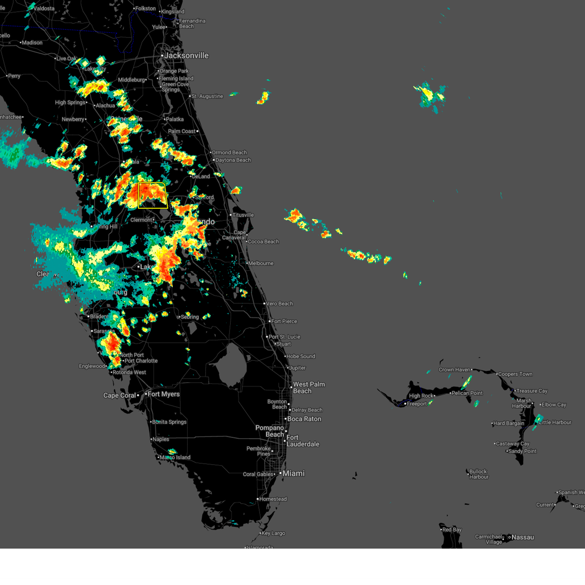
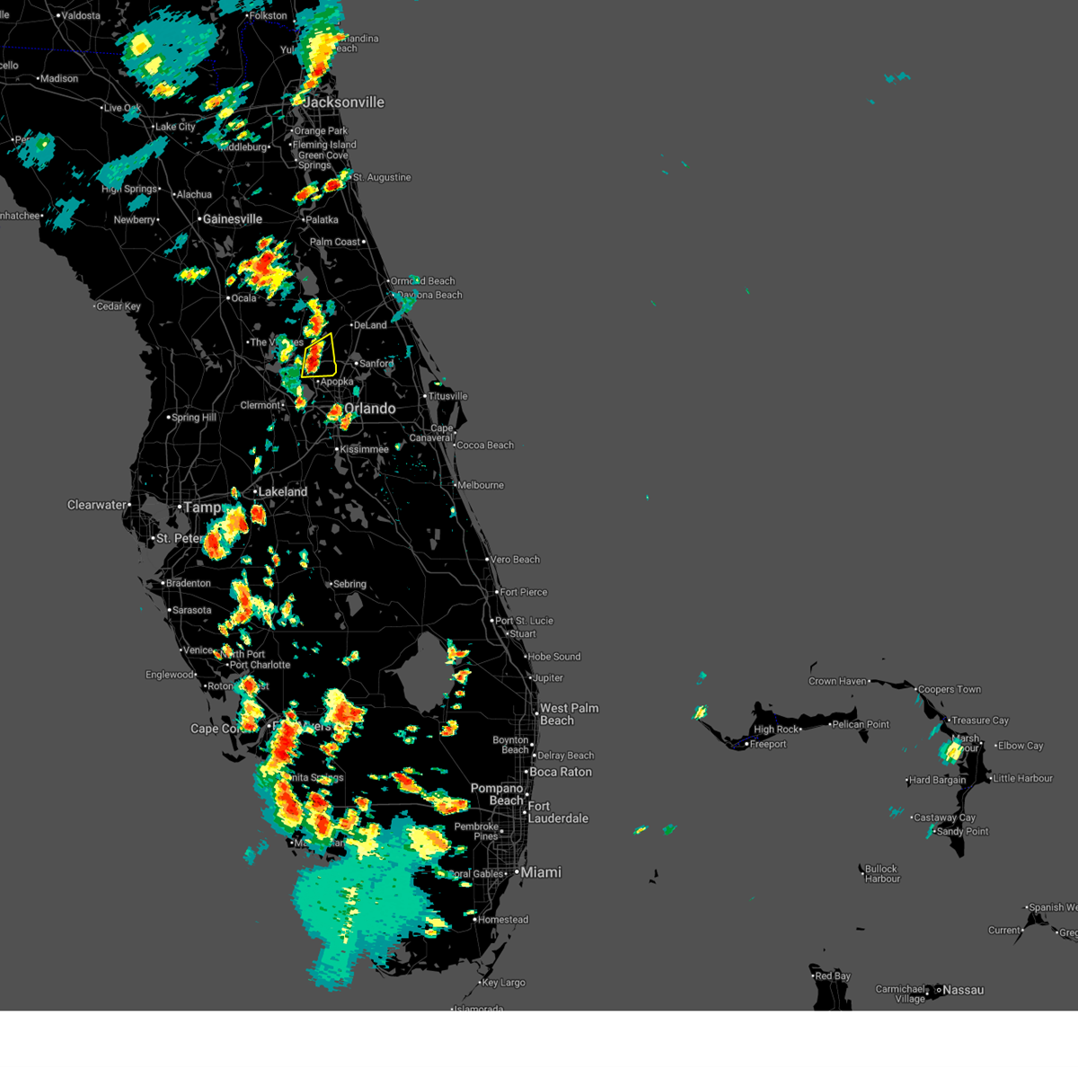
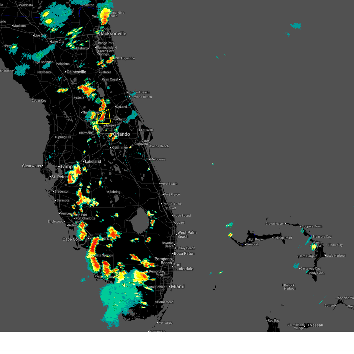
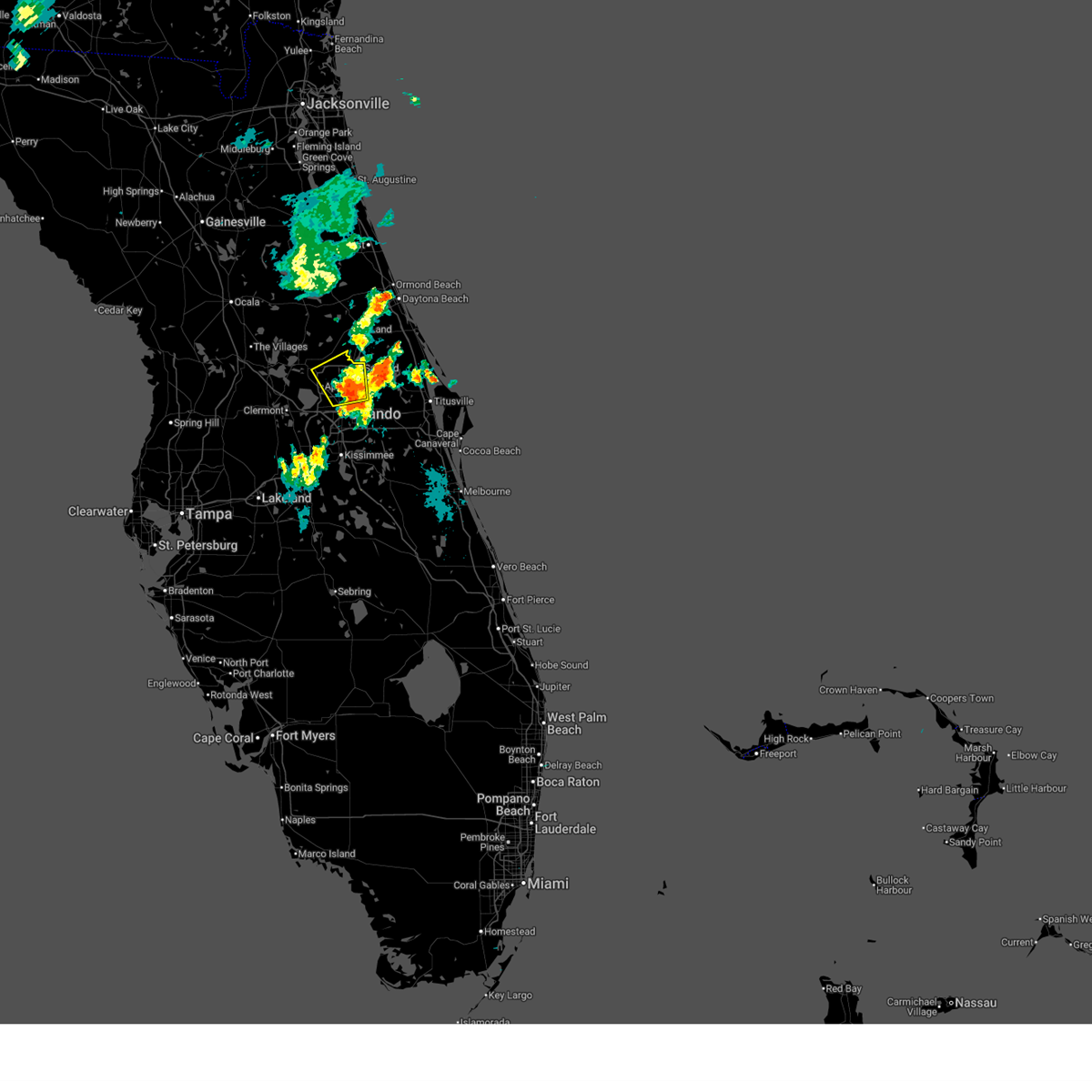
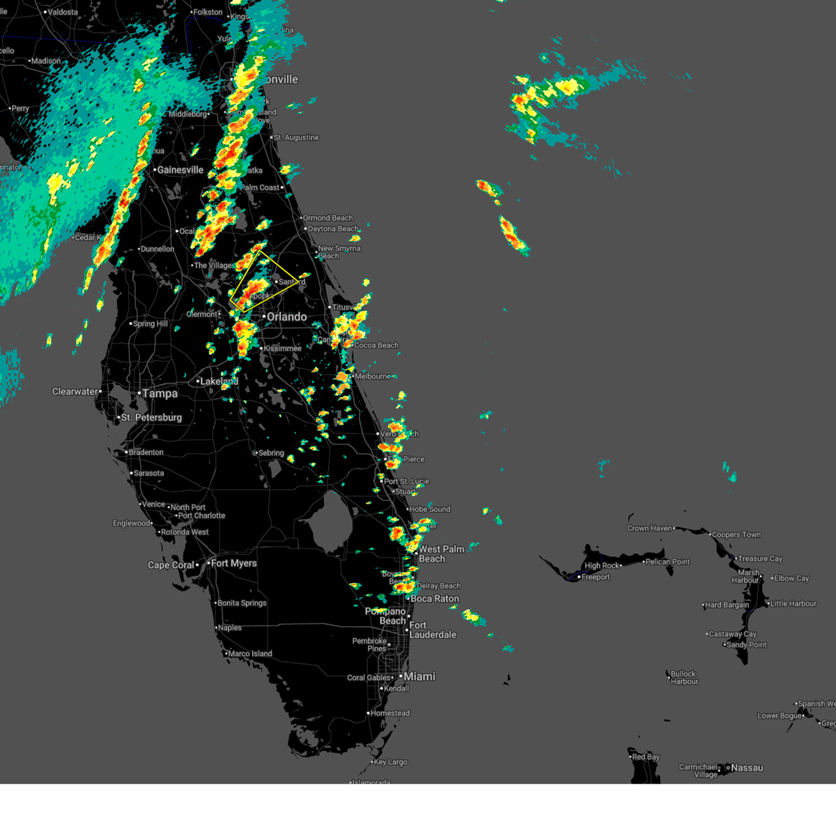
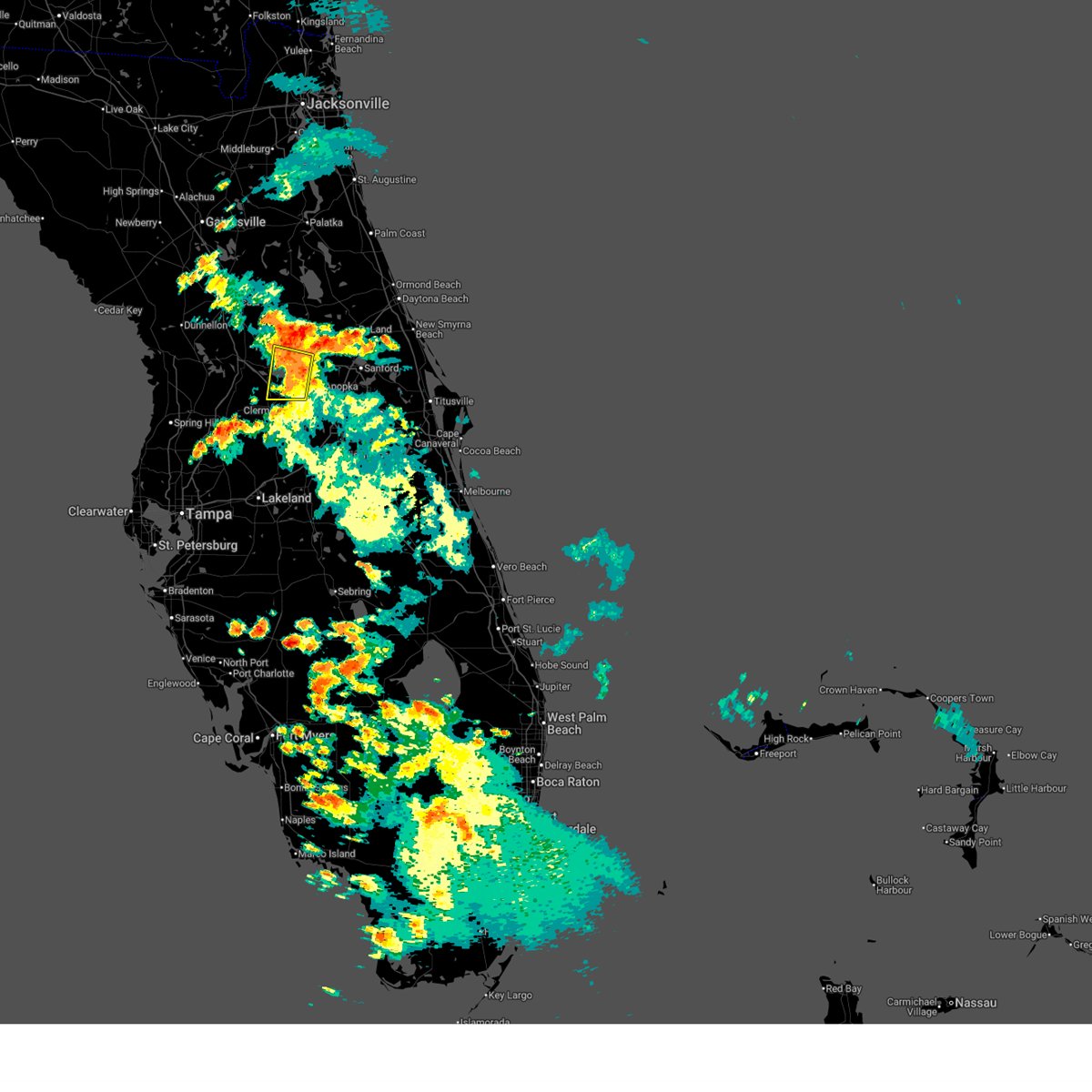
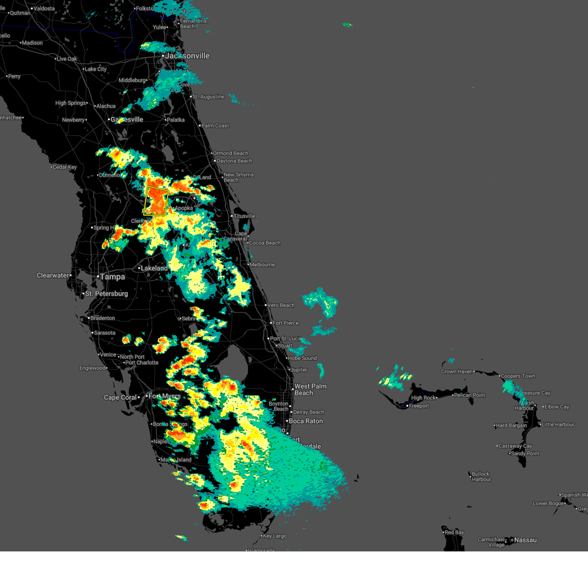
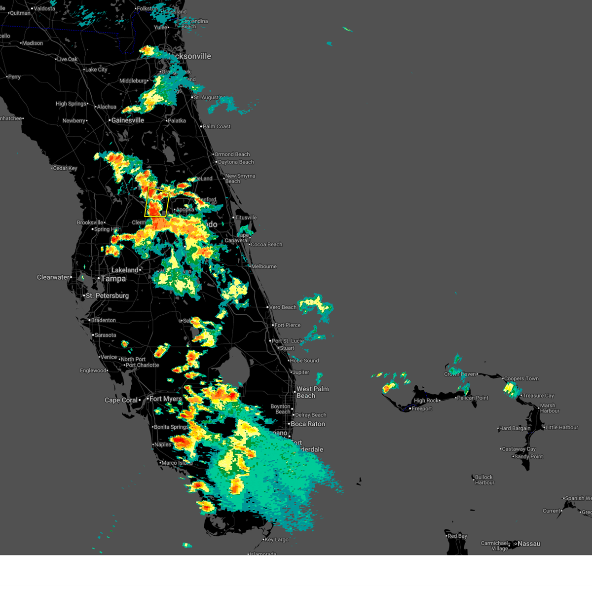
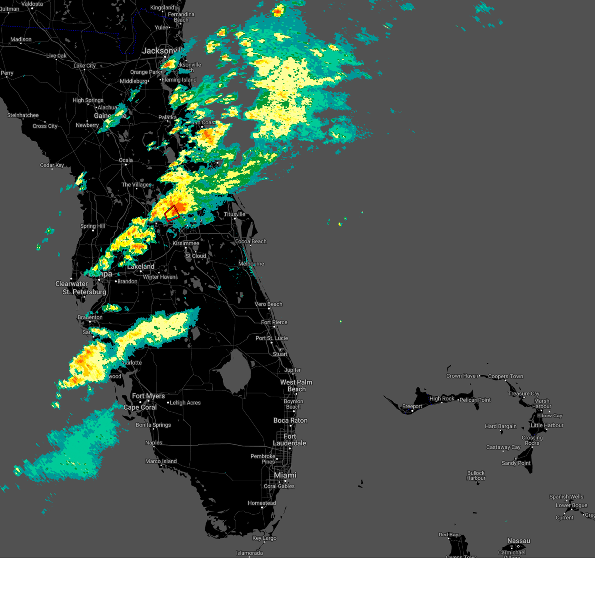
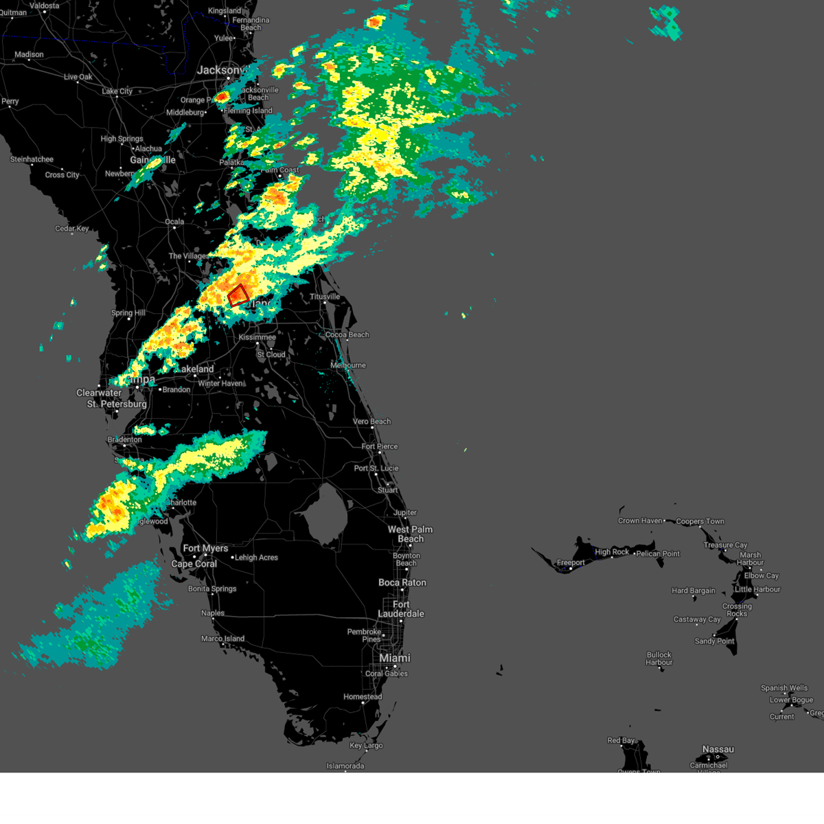
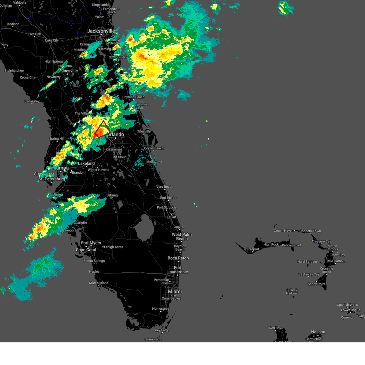
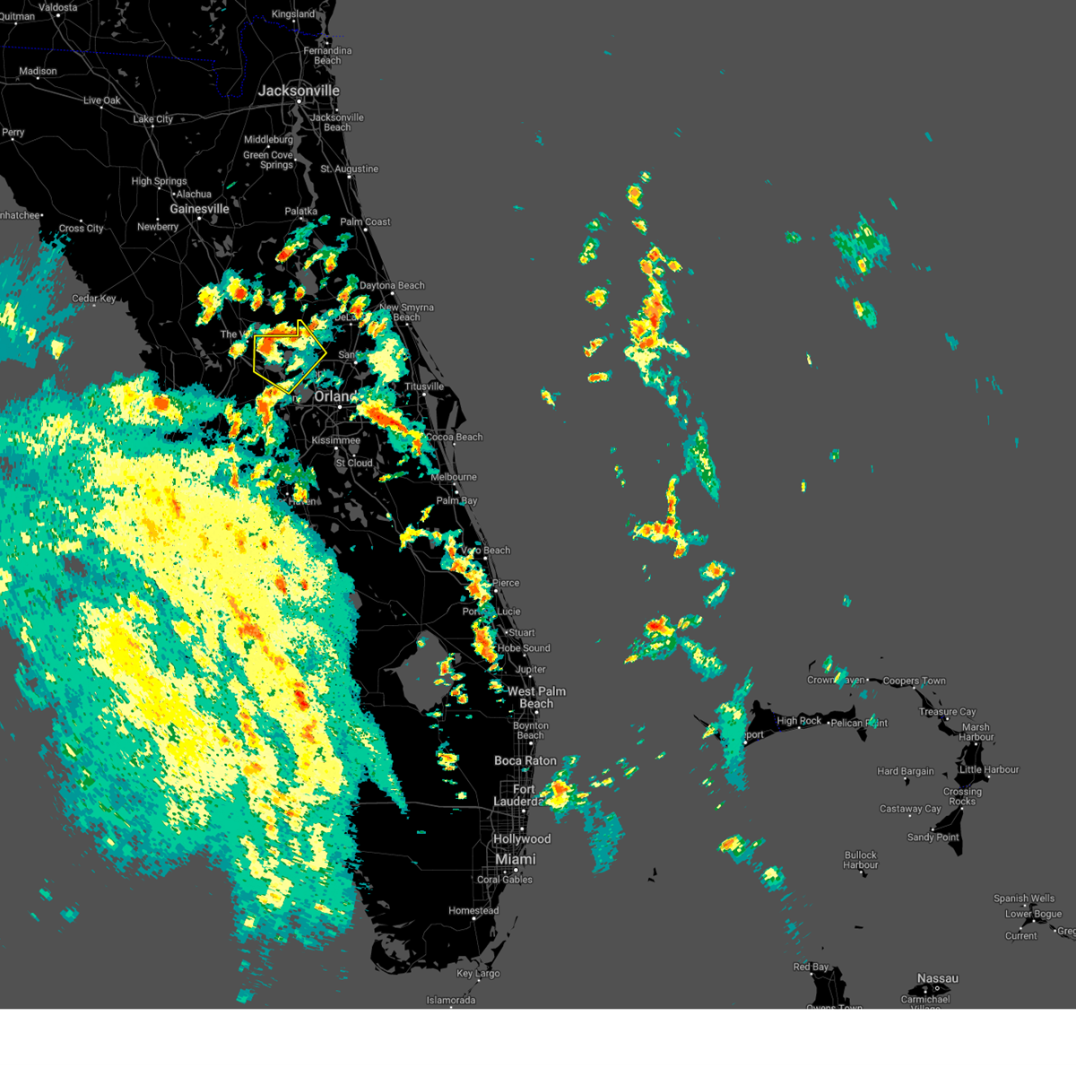
Hail Map for Zellwood, FL
The Zellwood, FL area has had 0 reports of on-the-ground hail by trained spotters, and has been under severe weather warnings 9 times during the past 12 months. Doppler radar has detected hail at or near Zellwood, FL on 82 occasions, including 5 occasions during the past year.
| Name: | Zellwood, FL |
| Where Located: | 18.3 miles NW of Orlando, FL |
| Map: | Google Map for Zellwood, FL |
| Population: | 2817 |
| Housing Units: | 1643 |
| More Info: | Search Google for Zellwood, FL |
0
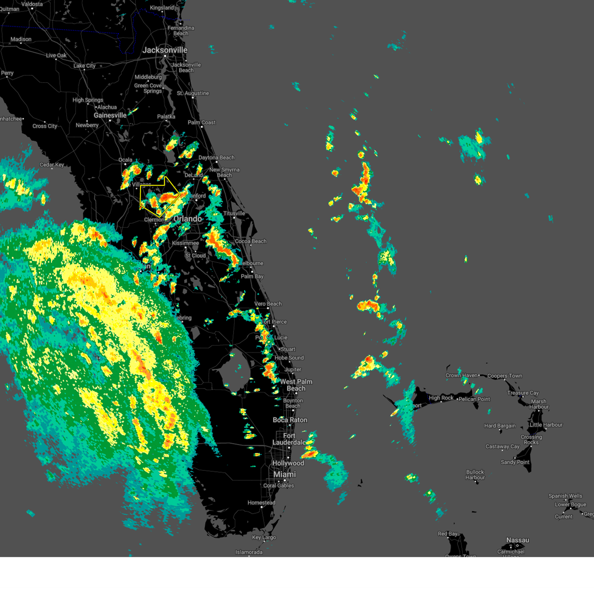
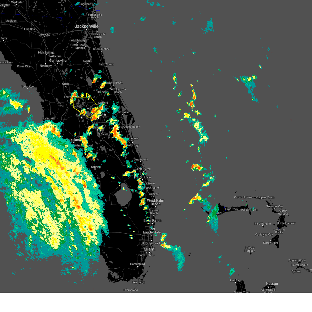
The Top Recent Hail Date for Zellwood, FL is Saturday, June 27, 2026 (34th out of 82)

Hail and Wind Damage Spotted near Zellwood, FL
| Date / Time | Report Details |
|---|---|
| 6/30/2026 2:33 PM EDT |
 Svrmlb the national weather service in melbourne has issued a * severe thunderstorm warning for, west central lake county in east central florida, northwestern orange county in east central florida, * until 300 pm edt. * at 233 pm edt, a severe thunderstorm was located over lake griffin, moving south at 10 mph (radar indicated). Hazards include 60 mph wind gusts and penny size hail. expect damage to roofs, siding, and trees Svrmlb the national weather service in melbourne has issued a * severe thunderstorm warning for, west central lake county in east central florida, northwestern orange county in east central florida, * until 300 pm edt. * at 233 pm edt, a severe thunderstorm was located over lake griffin, moving south at 10 mph (radar indicated). Hazards include 60 mph wind gusts and penny size hail. expect damage to roofs, siding, and trees
|
| 6/27/2026 4:59 PM EDT |
 At 459 pm edt, a severe thunderstorm was located over mount plymouth, moving east at 15 mph (radar indicated). Hazards include 60 mph wind gusts and penny size hail. Expect damage to roofs, siding, and trees. Locations impacted include, apopka, mount dora, cassia, mount plymouth, and zellwood. At 459 pm edt, a severe thunderstorm was located over mount plymouth, moving east at 15 mph (radar indicated). Hazards include 60 mph wind gusts and penny size hail. Expect damage to roofs, siding, and trees. Locations impacted include, apopka, mount dora, cassia, mount plymouth, and zellwood.
|
| 6/27/2026 4:49 PM EDT |
 Svrmlb the national weather service in melbourne has issued a * severe thunderstorm warning for, east central lake county in east central florida, northwestern orange county in east central florida, * until 530 pm edt. * at 449 pm edt, a severe thunderstorm was located over sorrento, or over mount plymouth, moving east at 10 mph (radar indicated). Hazards include 60 mph wind gusts and penny size hail. expect damage to roofs, siding, and trees Svrmlb the national weather service in melbourne has issued a * severe thunderstorm warning for, east central lake county in east central florida, northwestern orange county in east central florida, * until 530 pm edt. * at 449 pm edt, a severe thunderstorm was located over sorrento, or over mount plymouth, moving east at 10 mph (radar indicated). Hazards include 60 mph wind gusts and penny size hail. expect damage to roofs, siding, and trees
|
| 6/13/2026 9:53 PM EDT |
 Svrmlb the national weather service in melbourne has issued a * severe thunderstorm warning for, western seminole county in east central florida, east central lake county in east central florida, northwestern orange county in east central florida, * until 1030 pm edt. * at 953 pm edt, a severe thunderstorm was located near longwood, moving north at 5 mph (radar indicated). Hazards include 60 mph wind gusts. expect damage to roofs, siding, and trees Svrmlb the national weather service in melbourne has issued a * severe thunderstorm warning for, western seminole county in east central florida, east central lake county in east central florida, northwestern orange county in east central florida, * until 1030 pm edt. * at 953 pm edt, a severe thunderstorm was located near longwood, moving north at 5 mph (radar indicated). Hazards include 60 mph wind gusts. expect damage to roofs, siding, and trees
|
| 3/16/2026 2:01 PM EDT |
 Svrmlb the national weather service in melbourne has issued a * severe thunderstorm warning for, northwestern seminole county in east central florida, east central lake county in east central florida, northwestern orange county in east central florida, south central volusia county in east central florida, * until 230 pm edt. * at 200 pm edt, a severe thunderstorm was located over wekiwa springs state park, or near apopka, moving northeast at 30 mph (radar indicated). Hazards include 60 mph wind gusts and quarter size hail. Hail damage to vehicles is expected. Expect wind damage to roofs, siding, and trees. Svrmlb the national weather service in melbourne has issued a * severe thunderstorm warning for, northwestern seminole county in east central florida, east central lake county in east central florida, northwestern orange county in east central florida, south central volusia county in east central florida, * until 230 pm edt. * at 200 pm edt, a severe thunderstorm was located over wekiwa springs state park, or near apopka, moving northeast at 30 mph (radar indicated). Hazards include 60 mph wind gusts and quarter size hail. Hail damage to vehicles is expected. Expect wind damage to roofs, siding, and trees.
|
| 9/23/2025 6:38 PM EDT | The storm which prompted the warning has weakened below severe limits, and no longer poses an immediate threat to life or property. therefore, the warning will be allowed to expire. however gusty winds and heavy rain are still possible with this thunderstorm. |
| 9/23/2025 6:25 PM EDT | the severe thunderstorm warning has been cancelled and is no longer in effect |
| 9/23/2025 6:25 PM EDT | At 624 pm edt, a severe thunderstorm was located near ocoee, moving southwest at 20 mph (radar indicated). Hazards include 60 mph wind gusts and penny size hail. Expect damage to roofs, siding, and trees. Locations impacted include, apopka, ocoee, winter garden, zellwood, and clarcona. |
| 9/23/2025 6:12 PM EDT | Svrmlb the national weather service in melbourne has issued a * severe thunderstorm warning for, west central seminole county in east central florida, northwestern orange county in east central florida, * until 645 pm edt. * at 612 pm edt, a severe thunderstorm was located over apopka, moving southwest at 20 mph (radar indicated). Hazards include 60 mph wind gusts and penny size hail. expect damage to roofs, siding, and trees |
| 6/27/2025 5:44 PM EDT |
 The severe thunderstorm which prompted the warning has weakened. therefore, the warning will be allowed to expire. however gusty winds and heavy rain are still possible with this thunderstorm. The severe thunderstorm which prompted the warning has weakened. therefore, the warning will be allowed to expire. however gusty winds and heavy rain are still possible with this thunderstorm.
|
| 6/27/2025 5:31 PM EDT |
 At 531 pm edt, a severe thunderstorm was located over tavares, moving north at 10 mph (radar indicated). Hazards include 60 mph wind gusts and penny size hail. Expect damage to roofs, siding, and trees. Locations impacted include, eustis, tavares, mount dora, howey-in-the-hills, and lake griffin. At 531 pm edt, a severe thunderstorm was located over tavares, moving north at 10 mph (radar indicated). Hazards include 60 mph wind gusts and penny size hail. Expect damage to roofs, siding, and trees. Locations impacted include, eustis, tavares, mount dora, howey-in-the-hills, and lake griffin.
|
| 6/27/2025 5:16 PM EDT |
 Svrmlb the national weather service in melbourne has issued a * severe thunderstorm warning for, west central lake county in east central florida, northwestern orange county in east central florida, * until 545 pm edt. * at 516 pm edt, a severe thunderstorm was located over howey-in-the-hills, moving northeast at 20 mph (radar indicated). Hazards include 60 mph wind gusts and penny size hail. expect damage to roofs, siding, and trees Svrmlb the national weather service in melbourne has issued a * severe thunderstorm warning for, west central lake county in east central florida, northwestern orange county in east central florida, * until 545 pm edt. * at 516 pm edt, a severe thunderstorm was located over howey-in-the-hills, moving northeast at 20 mph (radar indicated). Hazards include 60 mph wind gusts and penny size hail. expect damage to roofs, siding, and trees
|
| 3/10/2025 9:19 AM EDT |
 the tornado warning has been cancelled and is no longer in effect the tornado warning has been cancelled and is no longer in effect
|
| 3/10/2025 9:13 AM EDT |
 the tornado warning has been cancelled and is no longer in effect the tornado warning has been cancelled and is no longer in effect
|
| 3/10/2025 9:13 AM EDT |
 At 912 am edt, a severe thunderstorm capable of producing a tornado was located over lake apopka, moving northeast at 35 mph (radar indicated rotation). Hazards include tornado. Flying debris will be dangerous to those caught without shelter. mobile homes will be damaged or destroyed. damage to roofs, windows, and vehicles will occur. tree damage is likely. this dangerous storm will be near, apopka, ocoee, and zellwood around 920 am edt. Other locations impacted by this tornadic thunderstorm include south apopka. At 912 am edt, a severe thunderstorm capable of producing a tornado was located over lake apopka, moving northeast at 35 mph (radar indicated rotation). Hazards include tornado. Flying debris will be dangerous to those caught without shelter. mobile homes will be damaged or destroyed. damage to roofs, windows, and vehicles will occur. tree damage is likely. this dangerous storm will be near, apopka, ocoee, and zellwood around 920 am edt. Other locations impacted by this tornadic thunderstorm include south apopka.
|
| 3/10/2025 9:05 AM EDT |
 At 904 am edt, a severe thunderstorm capable of producing a tornado was located over ferndale, moving northeast at 40 mph (radar indicated rotation). Hazards include tornado. Flying debris will be dangerous to those caught without shelter. mobile homes will be damaged or destroyed. damage to roofs, windows, and vehicles will occur. tree damage is likely. this dangerous storm will be near, apopka, lake apopka, and ferndale around 910 am edt. mount dora around 920 am edt. Other locations impacted by this tornadic thunderstorm include south apopka. At 904 am edt, a severe thunderstorm capable of producing a tornado was located over ferndale, moving northeast at 40 mph (radar indicated rotation). Hazards include tornado. Flying debris will be dangerous to those caught without shelter. mobile homes will be damaged or destroyed. damage to roofs, windows, and vehicles will occur. tree damage is likely. this dangerous storm will be near, apopka, lake apopka, and ferndale around 910 am edt. mount dora around 920 am edt. Other locations impacted by this tornadic thunderstorm include south apopka.
|
| 3/10/2025 8:57 AM EDT |
 Tormlb the national weather service in melbourne has issued a * tornado warning for, southwestern lake county in east central florida, northwestern orange county in east central florida, * until 930 am edt. * at 856 am edt, a severe thunderstorm capable of producing a tornado was located near clermont, or near ferndale, moving northeast at 35 mph (radar indicated rotation). Hazards include tornado. Flying debris will be dangerous to those caught without shelter. mobile homes will be damaged or destroyed. damage to roofs, windows, and vehicles will occur. tree damage is likely. this dangerous storm will be near, clermont, lake apopka, and ferndale around 900 am edt. apopka and zellwood around 910 am edt. Other locations impacted by this tornadic thunderstorm include minneola. Tormlb the national weather service in melbourne has issued a * tornado warning for, southwestern lake county in east central florida, northwestern orange county in east central florida, * until 930 am edt. * at 856 am edt, a severe thunderstorm capable of producing a tornado was located near clermont, or near ferndale, moving northeast at 35 mph (radar indicated rotation). Hazards include tornado. Flying debris will be dangerous to those caught without shelter. mobile homes will be damaged or destroyed. damage to roofs, windows, and vehicles will occur. tree damage is likely. this dangerous storm will be near, clermont, lake apopka, and ferndale around 900 am edt. apopka and zellwood around 910 am edt. Other locations impacted by this tornadic thunderstorm include minneola.
|
| 8/4/2024 1:13 PM EDT |
 The storm which prompted the warning has weakened below severe limits, and no longer poses an immediate threat to life or property. therefore, the warning will be allowed to expire. however gusty winds are still possible with this thunderstorm. a tornado watch remains in effect until 800 pm edt for east central florida. remember, a tornado warning still remains in effect until 8 pm. The storm which prompted the warning has weakened below severe limits, and no longer poses an immediate threat to life or property. therefore, the warning will be allowed to expire. however gusty winds are still possible with this thunderstorm. a tornado watch remains in effect until 800 pm edt for east central florida. remember, a tornado warning still remains in effect until 8 pm.
|
| 8/4/2024 1:02 PM EDT |
 the severe thunderstorm warning has been cancelled and is no longer in effect the severe thunderstorm warning has been cancelled and is no longer in effect
|
| 8/4/2024 1:02 PM EDT |
 At 101 pm edt, a severe thunderstorm was located over eustis, moving northwest at 45 mph (radar indicated). Hazards include 60 mph wind gusts. Expect damage to roofs, siding, and trees. Locations impacted include, leesburg, eustis, tavares, lady lake, and mount dora. At 101 pm edt, a severe thunderstorm was located over eustis, moving northwest at 45 mph (radar indicated). Hazards include 60 mph wind gusts. Expect damage to roofs, siding, and trees. Locations impacted include, leesburg, eustis, tavares, lady lake, and mount dora.
|
| 8/4/2024 12:45 PM EDT |
 Svrmlb the national weather service in melbourne has issued a * severe thunderstorm warning for, west central seminole county in east central florida, central lake county in east central florida, northwestern orange county in east central florida, * until 115 pm edt. * at 1245 pm edt, a severe thunderstorm was located over zellwood, moving northwest at 40 mph (radar indicated). Hazards include 60 mph wind gusts. expect damage to roofs, siding, and trees Svrmlb the national weather service in melbourne has issued a * severe thunderstorm warning for, west central seminole county in east central florida, central lake county in east central florida, northwestern orange county in east central florida, * until 115 pm edt. * at 1245 pm edt, a severe thunderstorm was located over zellwood, moving northwest at 40 mph (radar indicated). Hazards include 60 mph wind gusts. expect damage to roofs, siding, and trees
|
| 5/18/2024 3:29 PM EDT |
 Svrmlb the national weather service in melbourne has issued a * severe thunderstorm warning for, northwestern seminole county in east central florida, central lake county in east central florida, northwestern orange county in east central florida, * until 400 pm edt. * at 329 pm edt, a severe thunderstorm was located over tavares, moving east at 35 mph (radar indicated). Hazards include 60 mph wind gusts and quarter size hail. Hail damage to vehicles is expected. Expect wind damage to roofs, siding, and trees. Svrmlb the national weather service in melbourne has issued a * severe thunderstorm warning for, northwestern seminole county in east central florida, central lake county in east central florida, northwestern orange county in east central florida, * until 400 pm edt. * at 329 pm edt, a severe thunderstorm was located over tavares, moving east at 35 mph (radar indicated). Hazards include 60 mph wind gusts and quarter size hail. Hail damage to vehicles is expected. Expect wind damage to roofs, siding, and trees.
|
| 5/14/2024 12:12 PM EDT |
 Svrmlb the national weather service in melbourne has issued a * severe thunderstorm warning for, southwestern seminole county in east central florida, southwestern lake county in east central florida, western orange county in east central florida, northwestern osceola county in east central florida, * until 1245 pm edt. * at 1211 pm edt, severe thunderstorms were located along a line extending from near zellwood to near groveland to 12 miles southwest of lake louisa to 8 miles southeast of zephyrhills south, moving east at 35 mph (radar indicated). Hazards include 60 mph wind gusts and penny size hail. expect damage to roofs, siding, and trees Svrmlb the national weather service in melbourne has issued a * severe thunderstorm warning for, southwestern seminole county in east central florida, southwestern lake county in east central florida, western orange county in east central florida, northwestern osceola county in east central florida, * until 1245 pm edt. * at 1211 pm edt, severe thunderstorms were located along a line extending from near zellwood to near groveland to 12 miles southwest of lake louisa to 8 miles southeast of zephyrhills south, moving east at 35 mph (radar indicated). Hazards include 60 mph wind gusts and penny size hail. expect damage to roofs, siding, and trees
|
| 2/4/2024 6:57 PM EST |
 At 656 pm est, a severe thunderstorm was located over tavares, moving northeast at 30 mph (radar indicated). Hazards include 60 mph wind gusts and quarter size hail. Hail damage to vehicles is expected. Expect wind damage to roofs, siding, and trees. At 656 pm est, a severe thunderstorm was located over tavares, moving northeast at 30 mph (radar indicated). Hazards include 60 mph wind gusts and quarter size hail. Hail damage to vehicles is expected. Expect wind damage to roofs, siding, and trees.
|
| 1/9/2024 5:21 PM EST |
 The national weather service in melbourne has issued a * severe thunderstorm warning for. seminole county in east central florida. central lake county in east central florida. orange county in east central florida. Volusia county in east central florida. The national weather service in melbourne has issued a * severe thunderstorm warning for. seminole county in east central florida. central lake county in east central florida. orange county in east central florida. Volusia county in east central florida.
|
| 1/9/2024 5:07 PM EST |
 At 506 pm est, severe thunderstorms were located along a line extending from near pierson to mid florida lakes to 12 miles southwest of lake louisa, moving northeast at 70 mph (radar indicated). Hazards include 60 mph wind gusts. Expect damage to roofs, siding, and trees. Locations impacted include, apopka, ocoee, winter garden, leesburg, and eustis. At 506 pm est, severe thunderstorms were located along a line extending from near pierson to mid florida lakes to 12 miles southwest of lake louisa, moving northeast at 70 mph (radar indicated). Hazards include 60 mph wind gusts. Expect damage to roofs, siding, and trees. Locations impacted include, apopka, ocoee, winter garden, leesburg, and eustis.
|
| 1/9/2024 4:46 PM EST |
 At 446 pm est, severe thunderstorms were located along a line extending from lake george to near leesburg to 6 miles east of dade city, moving northeast at 65 mph (radar indicated). Hazards include 60 mph wind gusts. expect damage to roofs, siding, and trees At 446 pm est, severe thunderstorms were located along a line extending from lake george to near leesburg to 6 miles east of dade city, moving northeast at 65 mph (radar indicated). Hazards include 60 mph wind gusts. expect damage to roofs, siding, and trees
|
| 6/19/2023 8:09 PM EDT |
 At 808 pm edt, severe thunderstorms were located along a line extending from near tavares to near groveland, moving east at 30 mph. terminal doppler weather radar form orlando continues to indicate wind gusts near 60 mph possible with this band of storms (radar indicated). Hazards include 60 mph wind gusts. Expect damage to roofs, siding, and trees. locations impacted include, apopka, winter garden, tavares, groveland and mascotte. hail threat, radar indicated max hail size, <. 75 in wind threat, radar indicated max wind gust, 60 mph. At 808 pm edt, severe thunderstorms were located along a line extending from near tavares to near groveland, moving east at 30 mph. terminal doppler weather radar form orlando continues to indicate wind gusts near 60 mph possible with this band of storms (radar indicated). Hazards include 60 mph wind gusts. Expect damage to roofs, siding, and trees. locations impacted include, apopka, winter garden, tavares, groveland and mascotte. hail threat, radar indicated max hail size, <. 75 in wind threat, radar indicated max wind gust, 60 mph.
|
| 6/19/2023 7:51 PM EDT |
 At 751 pm edt, doppler radar indicated severe thunderstorms were located along a line extending from the lake county line west of leesburg to 7 miles west of mascotte, moving east at 30 mph (radar indicated). Hazards include 60 mph wind gusts. expect damage to roofs, siding, and trees At 751 pm edt, doppler radar indicated severe thunderstorms were located along a line extending from the lake county line west of leesburg to 7 miles west of mascotte, moving east at 30 mph (radar indicated). Hazards include 60 mph wind gusts. expect damage to roofs, siding, and trees
|
| 6/17/2023 11:13 AM EDT |
 At 1112 am edt, a strong to severe thunderstorm was located over ferndale, to near clermont moving southeast at 30 mph (radar indicated). Hazards include 60 mph wind gusts and penny size hail. Expect damage to roofs, siding, and trees. locations impacted include, apopka, ocoee, winter garden, eustis and tavares. hail threat, radar indicated max hail size, 0. 75 in wind threat, radar indicated max wind gust, 60 mph. At 1112 am edt, a strong to severe thunderstorm was located over ferndale, to near clermont moving southeast at 30 mph (radar indicated). Hazards include 60 mph wind gusts and penny size hail. Expect damage to roofs, siding, and trees. locations impacted include, apopka, ocoee, winter garden, eustis and tavares. hail threat, radar indicated max hail size, 0. 75 in wind threat, radar indicated max wind gust, 60 mph.
|
| 6/17/2023 11:02 AM EDT |
 At 1102 am edt, a severe thunderstorm was located near howey-in-the-hills, moving southeast at 30 mph (radar indicated). Hazards include 60 mph wind gusts and penny size hail. expect damage to roofs, siding, and trees At 1102 am edt, a severe thunderstorm was located near howey-in-the-hills, moving southeast at 30 mph (radar indicated). Hazards include 60 mph wind gusts and penny size hail. expect damage to roofs, siding, and trees
|
| 8/1/2022 9:10 PM EDT |
 At 910 pm edt, a severe thunderstorm was located over zellwood, moving north at 10 mph (radar indicated). Hazards include 60 mph wind gusts and quarter size hail. Hail damage to vehicles is expected. expect wind damage to roofs, siding, and trees. locations impacted include, apopka, eustis, mount dora, mount plymouth and zellwood. hail threat, radar indicated max hail size, 1. 00 in wind threat, radar indicated max wind gust, 60 mph. At 910 pm edt, a severe thunderstorm was located over zellwood, moving north at 10 mph (radar indicated). Hazards include 60 mph wind gusts and quarter size hail. Hail damage to vehicles is expected. expect wind damage to roofs, siding, and trees. locations impacted include, apopka, eustis, mount dora, mount plymouth and zellwood. hail threat, radar indicated max hail size, 1. 00 in wind threat, radar indicated max wind gust, 60 mph.
|
| 8/1/2022 8:58 PM EDT |
 At 857 pm edt, a severe thunderstorm was located near zellwood, moving north at 10 mph (radar indicated). Hazards include 60 mph wind gusts and quarter size hail. Hail damage to vehicles is expected. Expect wind damage to roofs, siding, and trees. At 857 pm edt, a severe thunderstorm was located near zellwood, moving north at 10 mph (radar indicated). Hazards include 60 mph wind gusts and quarter size hail. Hail damage to vehicles is expected. Expect wind damage to roofs, siding, and trees.
|
| 5/21/2022 7:17 PM EDT |
 At 716 pm edt, a severe thunderstorm was located over tavares, moving north at 15 mph (radar indicated). Hazards include 60 mph wind gusts and quarter size hail. Hail damage to vehicles is expected. expect wind damage to roofs, siding, and trees. locations impacted include, eustis, tavares, mount dora, howey-in-the-hills and zellwood. hail threat, radar indicated max hail size, 1. 00 in wind threat, radar indicated max wind gust, 60 mph. At 716 pm edt, a severe thunderstorm was located over tavares, moving north at 15 mph (radar indicated). Hazards include 60 mph wind gusts and quarter size hail. Hail damage to vehicles is expected. expect wind damage to roofs, siding, and trees. locations impacted include, eustis, tavares, mount dora, howey-in-the-hills and zellwood. hail threat, radar indicated max hail size, 1. 00 in wind threat, radar indicated max wind gust, 60 mph.
|
| 5/21/2022 6:57 PM EDT |
 At 657 pm edt, a severe thunderstorm was located near zellwood, moving north at 30 mph (radar indicated). Hazards include 60 mph wind gusts and quarter size hail. Hail damage to vehicles is expected. Expect wind damage to roofs, siding, and trees. At 657 pm edt, a severe thunderstorm was located near zellwood, moving north at 30 mph (radar indicated). Hazards include 60 mph wind gusts and quarter size hail. Hail damage to vehicles is expected. Expect wind damage to roofs, siding, and trees.
|
| 4/7/2022 12:42 PM EDT |
 The severe thunderstorm warning for seminole, western orange and northwestern osceola counties will expire at 1245 pm edt, the storms which prompted the warning have weakened below severe limits, and no longer pose an immediate threat to life or property. therefore, the warning will be allowed to expire. however gusty winds are still possible with these thunderstorms. The severe thunderstorm warning for seminole, western orange and northwestern osceola counties will expire at 1245 pm edt, the storms which prompted the warning have weakened below severe limits, and no longer pose an immediate threat to life or property. therefore, the warning will be allowed to expire. however gusty winds are still possible with these thunderstorms.
|
| 4/7/2022 12:30 PM EDT |
 At 1230 pm edt, severe thunderstorms were located along a line extending from apopka to lockhart to orlovista to near bay lake to 9 miles north of auburndale, moving east at 45 mph (radar indicated). Hazards include 60 mph wind gusts and penny size hail. Expect damage to roofs, siding, and trees. locations impacted include, orlando, kissimmee, sanford, apopka and altamonte springs. hail threat, radar indicated max hail size, 0. 75 in wind threat, radar indicated max wind gust, 60 mph. At 1230 pm edt, severe thunderstorms were located along a line extending from apopka to lockhart to orlovista to near bay lake to 9 miles north of auburndale, moving east at 45 mph (radar indicated). Hazards include 60 mph wind gusts and penny size hail. Expect damage to roofs, siding, and trees. locations impacted include, orlando, kissimmee, sanford, apopka and altamonte springs. hail threat, radar indicated max hail size, 0. 75 in wind threat, radar indicated max wind gust, 60 mph.
|
| 4/7/2022 12:22 PM EDT |
 At 1222 pm edt, severe thunderstorms were located along a line extending from near zellwood to near winter garden to ocoee to near bay lake to 9 miles north of combee settlement, moving east at 45 mph (radar indicated). Hazards include 60 mph wind gusts and penny size hail. Expect damage to roofs, siding, and trees. locations impacted include, orlando, kissimmee, sanford, apopka and altamonte springs. hail threat, radar indicated max hail size, 0. 75 in wind threat, radar indicated max wind gust, 60 mph. At 1222 pm edt, severe thunderstorms were located along a line extending from near zellwood to near winter garden to ocoee to near bay lake to 9 miles north of combee settlement, moving east at 45 mph (radar indicated). Hazards include 60 mph wind gusts and penny size hail. Expect damage to roofs, siding, and trees. locations impacted include, orlando, kissimmee, sanford, apopka and altamonte springs. hail threat, radar indicated max hail size, 0. 75 in wind threat, radar indicated max wind gust, 60 mph.
|
| 4/7/2022 12:13 PM EDT |
 At 1212 pm edt, severe thunderstorms were located along a line extending from near ferndale to near lake apopka to near oakland to near four corners to 9 miles northwest of combee settlement, moving east at 45 mph (radar indicated). Hazards include 60 mph wind gusts and penny size hail. expect damage to roofs, siding, and trees At 1212 pm edt, severe thunderstorms were located along a line extending from near ferndale to near lake apopka to near oakland to near four corners to 9 miles northwest of combee settlement, moving east at 45 mph (radar indicated). Hazards include 60 mph wind gusts and penny size hail. expect damage to roofs, siding, and trees
|
| 4/7/2022 12:08 PM EDT |
 At 1208 pm edt, severe thunderstorms were located along a line extending from near ferndale to near lake apopka to near oakland to 9 miles northwest of lakeland, moving east at 45 mph (radar indicated). Hazards include 60 mph wind gusts and penny size hail. Expect damage to roofs, siding, and trees. locations impacted include, apopka, ocoee, winter garden, groveland and mascotte. hail threat, radar indicated max hail size, 0. 75 in wind threat, radar indicated max wind gust, 60 mph. At 1208 pm edt, severe thunderstorms were located along a line extending from near ferndale to near lake apopka to near oakland to 9 miles northwest of lakeland, moving east at 45 mph (radar indicated). Hazards include 60 mph wind gusts and penny size hail. Expect damage to roofs, siding, and trees. locations impacted include, apopka, ocoee, winter garden, groveland and mascotte. hail threat, radar indicated max hail size, 0. 75 in wind threat, radar indicated max wind gust, 60 mph.
|
| 4/7/2022 11:57 AM EDT |
 At 1152 am edt, severe thunderstorms were located along a line extending from near mascotte to groveland to hillsborough river state park, moving east at 45 mph (radar indicated). Hazards include 60 mph wind gusts and penny size hail. expect damage to roofs, siding, and trees At 1152 am edt, severe thunderstorms were located along a line extending from near mascotte to groveland to hillsborough river state park, moving east at 45 mph (radar indicated). Hazards include 60 mph wind gusts and penny size hail. expect damage to roofs, siding, and trees
|
| 4/2/2022 3:04 PM EDT |
 At 303 pm edt, a severe thunderstorm was located near wekiwa springs state park, moving east at 30 mph (radar indicated). Hazards include 60 mph wind gusts and nickel size hail. Expect damage to roofs, siding, and trees. locations impacted include, apopka, mount dora, zellwood, wekiwa springs state park and tangerine. hail threat, radar indicated max hail size, 0. 88 in wind threat, radar indicated max wind gust, 60 mph. At 303 pm edt, a severe thunderstorm was located near wekiwa springs state park, moving east at 30 mph (radar indicated). Hazards include 60 mph wind gusts and nickel size hail. Expect damage to roofs, siding, and trees. locations impacted include, apopka, mount dora, zellwood, wekiwa springs state park and tangerine. hail threat, radar indicated max hail size, 0. 88 in wind threat, radar indicated max wind gust, 60 mph.
|
| 4/2/2022 2:42 PM EDT |
 At 242 pm edt, a severe thunderstorm was located over mount dora, moving east at 30 mph (radar indicated). Hazards include 60 mph wind gusts and nickel size hail. Expect damage to roofs, siding, and trees. locations impacted include, apopka, eustis, tavares, mount dora and zellwood. hail threat, radar indicated max hail size, 0. 88 in wind threat, radar indicated max wind gust, 60 mph. At 242 pm edt, a severe thunderstorm was located over mount dora, moving east at 30 mph (radar indicated). Hazards include 60 mph wind gusts and nickel size hail. Expect damage to roofs, siding, and trees. locations impacted include, apopka, eustis, tavares, mount dora and zellwood. hail threat, radar indicated max hail size, 0. 88 in wind threat, radar indicated max wind gust, 60 mph.
|
| 4/2/2022 2:26 PM EDT |
 At 226 pm edt, a severe thunderstorm was located over tavares, moving east at 30 mph (radar indicated). Hazards include 60 mph wind gusts and nickel size hail. expect damage to roofs, siding, and trees At 226 pm edt, a severe thunderstorm was located over tavares, moving east at 30 mph (radar indicated). Hazards include 60 mph wind gusts and nickel size hail. expect damage to roofs, siding, and trees
|
| 3/16/2022 6:08 PM EDT |
 At 607 pm edt, a severe thunderstorm was located over wekiwa springs state park, or over apopka, moving northeast at 35 mph (radar indicated). Hazards include golf ball size hail and 60 mph wind gusts. People and animals outdoors may be injured. expect hail damage to roofs, siding, windows, and vehicles. expect wind damage to roofs, siding, and trees. locations impacted include, orlando, deltona, sanford, apopka and altamonte springs. thunderstorm damage threat, considerable hail threat, radar indicated max hail size, 1. 75 in wind threat, radar indicated max wind gust, 60 mph. At 607 pm edt, a severe thunderstorm was located over wekiwa springs state park, or over apopka, moving northeast at 35 mph (radar indicated). Hazards include golf ball size hail and 60 mph wind gusts. People and animals outdoors may be injured. expect hail damage to roofs, siding, windows, and vehicles. expect wind damage to roofs, siding, and trees. locations impacted include, orlando, deltona, sanford, apopka and altamonte springs. thunderstorm damage threat, considerable hail threat, radar indicated max hail size, 1. 75 in wind threat, radar indicated max wind gust, 60 mph.
|
| 3/16/2022 6:00 PM EDT |
 At 559 pm edt, a severe thunderstorm was located over apopka, moving northeast at 40 mph (radar indicated). Hazards include 60 mph wind gusts and quarter size hail. Hail damage to vehicles is expected. Expect wind damage to roofs, siding, and trees. At 559 pm edt, a severe thunderstorm was located over apopka, moving northeast at 40 mph (radar indicated). Hazards include 60 mph wind gusts and quarter size hail. Hail damage to vehicles is expected. Expect wind damage to roofs, siding, and trees.
|
| 3/15/2022 8:28 PM EDT |
 At 828 pm edt, a severe thunderstorm capable of producing a tornado was located over oakland, or near winter garden, moving northeast at 15 mph (radar indicated rotation). Hazards include tornado. Flying debris will be dangerous to those caught without shelter. mobile homes will be damaged or destroyed. damage to roofs, windows, and vehicles will occur. tree damage is likely. this dangerous storm will be near, oakland around 830 pm edt. lake apopka around 840 pm edt. ocoee around 850 pm edt. apopka around 900 pm edt. Other locations impacted by this tornadic thunderstorm include paradise heights. At 828 pm edt, a severe thunderstorm capable of producing a tornado was located over oakland, or near winter garden, moving northeast at 15 mph (radar indicated rotation). Hazards include tornado. Flying debris will be dangerous to those caught without shelter. mobile homes will be damaged or destroyed. damage to roofs, windows, and vehicles will occur. tree damage is likely. this dangerous storm will be near, oakland around 830 pm edt. lake apopka around 840 pm edt. ocoee around 850 pm edt. apopka around 900 pm edt. Other locations impacted by this tornadic thunderstorm include paradise heights.
|
| 3/12/2022 9:30 AM EST |
 At 930 am est, severe thunderstorms were located along a line extending from 6 miles northeast of ormond-by-the-sea to near ocoee to 9 miles southwest of lake louisa, moving east at 60 mph (radar indicated). Hazards include 60 mph wind gusts and penny size hail. expect damage to roofs, siding, and trees At 930 am est, severe thunderstorms were located along a line extending from 6 miles northeast of ormond-by-the-sea to near ocoee to 9 miles southwest of lake louisa, moving east at 60 mph (radar indicated). Hazards include 60 mph wind gusts and penny size hail. expect damage to roofs, siding, and trees
|
| 3/12/2022 8:43 AM EST |
 At 842 am est, severe thunderstorms were located along a line extending from near lake george to near lady lake and into sumter county, moving east at 55 mph (radar indicated). Hazards include 60 mph wind gusts and penny size hail. expect damage to roofs, siding, and trees At 842 am est, severe thunderstorms were located along a line extending from near lake george to near lady lake and into sumter county, moving east at 55 mph (radar indicated). Hazards include 60 mph wind gusts and penny size hail. expect damage to roofs, siding, and trees
|
| 10/28/2021 2:52 PM EDT |
 At 252 pm edt, a severe thunderstorm was located over oakland, or over winter garden, moving northeast at 35 mph (radar indicated). Hazards include 60 mph wind gusts. Expect damage to roofs, siding, and trees. Locations impacted include, orlando, sanford, apopka, altamonte springs and ocoee. At 252 pm edt, a severe thunderstorm was located over oakland, or over winter garden, moving northeast at 35 mph (radar indicated). Hazards include 60 mph wind gusts. Expect damage to roofs, siding, and trees. Locations impacted include, orlando, sanford, apopka, altamonte springs and ocoee.
|
| 10/28/2021 2:40 PM EDT |
 At 239 pm edt, a severe thunderstorm was located over clermont, or near ferndale, moving northeast at 40 mph (radar indicated). Hazards include 60 mph wind gusts. Expect damage to roofs, siding, and trees. Locations impacted include, orlando, sanford, apopka, altamonte springs and ocoee. At 239 pm edt, a severe thunderstorm was located over clermont, or near ferndale, moving northeast at 40 mph (radar indicated). Hazards include 60 mph wind gusts. Expect damage to roofs, siding, and trees. Locations impacted include, orlando, sanford, apopka, altamonte springs and ocoee.
|
| 10/28/2021 2:19 PM EDT |
 At 218 pm edt, a severe thunderstorm was located 9 miles south of groveland, moving northeast at 40 mph (radar indicated). Hazards include 60 mph wind gusts. expect damage to roofs, siding, and trees At 218 pm edt, a severe thunderstorm was located 9 miles south of groveland, moving northeast at 40 mph (radar indicated). Hazards include 60 mph wind gusts. expect damage to roofs, siding, and trees
|
| 10/28/2021 2:09 PM EDT |
 At 208 pm edt, a severe thunderstorm was located over zellwood, moving northeast at 60 mph (radar indicated). Hazards include 60 mph wind gusts. Expect damage to roofs, siding, and trees. locations impacted include, apopka, eustis, tavares, mount dora and howey-in-the-hills. hail threat, radar indicated max hail size, <. 75 in wind threat, radar indicated max wind gust, 60 mph. At 208 pm edt, a severe thunderstorm was located over zellwood, moving northeast at 60 mph (radar indicated). Hazards include 60 mph wind gusts. Expect damage to roofs, siding, and trees. locations impacted include, apopka, eustis, tavares, mount dora and howey-in-the-hills. hail threat, radar indicated max hail size, <. 75 in wind threat, radar indicated max wind gust, 60 mph.
|
| 10/28/2021 1:38 PM EDT |
 At 137 pm edt, a severe thunderstorm was located 7 miles southeast of bushnell, moving northeast at 60 mph (radar indicated). Hazards include 60 mph wind gusts. expect damage to roofs, siding, and trees At 137 pm edt, a severe thunderstorm was located 7 miles southeast of bushnell, moving northeast at 60 mph (radar indicated). Hazards include 60 mph wind gusts. expect damage to roofs, siding, and trees
|
| 5/22/2020 5:38 PM EDT |
 At 537 pm edt, severe thunderstorms were located along a line extending from near sorrento to bay hill, moving northwest at less than 10 mph (radar indicated). Hazards include 60 mph wind gusts and quarter size hail. Hail damage to vehicles is expected. Expect wind damage to roofs, siding, and trees. At 537 pm edt, severe thunderstorms were located along a line extending from near sorrento to bay hill, moving northwest at less than 10 mph (radar indicated). Hazards include 60 mph wind gusts and quarter size hail. Hail damage to vehicles is expected. Expect wind damage to roofs, siding, and trees.
|
| 4/20/2020 11:17 AM EDT |
 At 1116 am edt, a severe thunderstorm capable of producing a tornado was located over zellwood, moving east-southeast at 45 mph (radar indicated rotation). Hazards include tornado. Flying debris will be dangerous to those caught without shelter. mobile homes will be damaged or destroyed. damage to roofs, windows, and vehicles will occur. tree damage is likely. this dangerous storm will be near, wekiwa springs state park around 1130 am edt. lake mary around 1140 am edt. Other locations impacted by this tornadic thunderstorm include rock springs. At 1116 am edt, a severe thunderstorm capable of producing a tornado was located over zellwood, moving east-southeast at 45 mph (radar indicated rotation). Hazards include tornado. Flying debris will be dangerous to those caught without shelter. mobile homes will be damaged or destroyed. damage to roofs, windows, and vehicles will occur. tree damage is likely. this dangerous storm will be near, wekiwa springs state park around 1130 am edt. lake mary around 1140 am edt. Other locations impacted by this tornadic thunderstorm include rock springs.
|
| 4/20/2020 11:06 AM EDT |
 At 1105 am edt, a severe thunderstorm capable of producing a tornado was located near howey-in-the-hills, moving east at 45 to 50 mph (radar indicated rotation). Hazards include tornado. Flying debris will be dangerous to those caught without shelter. mobile homes will be damaged or destroyed. damage to roofs, windows, and vehicles will occur. tree damage is likely. this dangerous storm will be near, mount plymouth, zellwood and sorrento around 1120 am edt. lake mary around 1130 am edt. Other locations impacted by this tornadic thunderstorm include lake dora. At 1105 am edt, a severe thunderstorm capable of producing a tornado was located near howey-in-the-hills, moving east at 45 to 50 mph (radar indicated rotation). Hazards include tornado. Flying debris will be dangerous to those caught without shelter. mobile homes will be damaged or destroyed. damage to roofs, windows, and vehicles will occur. tree damage is likely. this dangerous storm will be near, mount plymouth, zellwood and sorrento around 1120 am edt. lake mary around 1130 am edt. Other locations impacted by this tornadic thunderstorm include lake dora.
|
| 4/20/2020 10:42 AM EDT |
 At 1041 am edt, a severe thunderstorm was located 8 miles northeast of bushnell, moving east at 45 to 50 mph (radar indicated). Hazards include 60 mph wind gusts and quarter size hail. Hail damage to vehicles is expected. Expect wind damage to roofs, siding, and trees. At 1041 am edt, a severe thunderstorm was located 8 miles northeast of bushnell, moving east at 45 to 50 mph (radar indicated). Hazards include 60 mph wind gusts and quarter size hail. Hail damage to vehicles is expected. Expect wind damage to roofs, siding, and trees.
|
| 2/7/2020 12:00 AM EST |
 At 1157 pm est, severe thunderstorms were located along a line extending from 9 miles northeast of deleon springs to near debary to near lake apopka to near four corners, moving east at 55 mph. severe storms will cross the attractions area shortly, and are expected to produce damaging wind gusts!! take shelter in a sturdy building now!! (radar indicated). Hazards include 70 mph wind gusts. Expect considerable tree damage. damage is likely to mobile homes, roofs, and outbuildings. Locations impacted include, orlando, deltona, daytona beach, sanford and apopka. At 1157 pm est, severe thunderstorms were located along a line extending from 9 miles northeast of deleon springs to near debary to near lake apopka to near four corners, moving east at 55 mph. severe storms will cross the attractions area shortly, and are expected to produce damaging wind gusts!! take shelter in a sturdy building now!! (radar indicated). Hazards include 70 mph wind gusts. Expect considerable tree damage. damage is likely to mobile homes, roofs, and outbuildings. Locations impacted include, orlando, deltona, daytona beach, sanford and apopka.
|
| 2/6/2020 11:46 PM EST |
 At 1146 pm est, severe thunderstorms were located along a line extending from 6 miles northeast of barberville to 10 miles southwest of lake louisa, moving east at 50 mph (radar indicated). Hazards include 70 mph wind gusts. Expect considerable tree damage. damage is likely to mobile homes, roofs, and outbuildings. Locations impacted include, orlando, deltona, daytona beach, sanford and apopka. At 1146 pm est, severe thunderstorms were located along a line extending from 6 miles northeast of barberville to 10 miles southwest of lake louisa, moving east at 50 mph (radar indicated). Hazards include 70 mph wind gusts. Expect considerable tree damage. damage is likely to mobile homes, roofs, and outbuildings. Locations impacted include, orlando, deltona, daytona beach, sanford and apopka.
|
| 2/6/2020 11:18 PM EST |
 At 1117 pm est, severe thunderstorms were located along a line extending from near pierson to 9 miles west of four corners, moving east at 50 mph (radar indicated). Hazards include 70 mph wind gusts. Expect considerable tree damage. Damage is likely to mobile homes, roofs, and outbuildings. At 1117 pm est, severe thunderstorms were located along a line extending from near pierson to 9 miles west of four corners, moving east at 50 mph (radar indicated). Hazards include 70 mph wind gusts. Expect considerable tree damage. Damage is likely to mobile homes, roofs, and outbuildings.
|
| 12/17/2019 3:09 PM EST |
 At 308 pm est, a severe thunderstorm was located over lake apopka, moving northeast at 30 mph (radar indicated). Hazards include 60 mph wind gusts and penny size hail. Expect damage to roofs, siding, and trees. Locations impacted include, lake apopka, apopka, altamonte springs, ocoee and winter garden. At 308 pm est, a severe thunderstorm was located over lake apopka, moving northeast at 30 mph (radar indicated). Hazards include 60 mph wind gusts and penny size hail. Expect damage to roofs, siding, and trees. Locations impacted include, lake apopka, apopka, altamonte springs, ocoee and winter garden.
|
| 12/17/2019 2:56 PM EST |
 At 256 pm est, a severe thunderstorm was located near ferndale, moving northeast at 35 mph (radar indicated). Hazards include 60 mph wind gusts and quarter size hail. Hail damage to vehicles is expected. Expect wind damage to roofs, siding, and trees. At 256 pm est, a severe thunderstorm was located near ferndale, moving northeast at 35 mph (radar indicated). Hazards include 60 mph wind gusts and quarter size hail. Hail damage to vehicles is expected. Expect wind damage to roofs, siding, and trees.
|
| 7/21/2019 4:02 PM EDT |
 At 402 pm edt, a severe thunderstorm was located over mount dora, moving northwest at 10 mph (radar indicated). Hazards include 60 mph wind gusts and penny size hail. Expect damage to roofs, siding, and trees. Locations impacted include, apopka, eustis, tavares, mount dora and mount plymouth. At 402 pm edt, a severe thunderstorm was located over mount dora, moving northwest at 10 mph (radar indicated). Hazards include 60 mph wind gusts and penny size hail. Expect damage to roofs, siding, and trees. Locations impacted include, apopka, eustis, tavares, mount dora and mount plymouth.
|
| 7/21/2019 3:37 PM EDT |
 At 337 pm edt, a severe thunderstorm was located near zellwood, moving northwest at 10 mph (radar indicated). Hazards include 60 mph wind gusts. expect damage to roofs, siding, and trees At 337 pm edt, a severe thunderstorm was located near zellwood, moving northwest at 10 mph (radar indicated). Hazards include 60 mph wind gusts. expect damage to roofs, siding, and trees
|
| 7/18/2019 5:10 PM EDT |
 The severe thunderstorm warning for west central seminole and northwestern orange counties will expire at 515 pm edt, the storm which prompted the warning has weakened below severe limits, and no longer poses an immediate threat to life or property. therefore, the warning will be allowed to expire. The severe thunderstorm warning for west central seminole and northwestern orange counties will expire at 515 pm edt, the storm which prompted the warning has weakened below severe limits, and no longer poses an immediate threat to life or property. therefore, the warning will be allowed to expire.
|
| 7/18/2019 4:57 PM EDT |
 At 457 pm edt, a severe thunderstorm was located near mount plymouth, moving northwest at 10 mph (radar indicated). Hazards include 60 mph wind gusts. expect damage to roofs, siding, and trees At 457 pm edt, a severe thunderstorm was located near mount plymouth, moving northwest at 10 mph (radar indicated). Hazards include 60 mph wind gusts. expect damage to roofs, siding, and trees
|
| 7/18/2019 4:52 PM EDT |
 At 451 pm edt, a severe thunderstorm was located over wekiwa springs state park, or near apopka, moving northwest at 10 mph. pea sized hail has been reported with this storms on hunt club blvd in wekiva (radar indicated). Hazards include 60 mph wind gusts and penny size hail. Expect damage to roofs, siding, and trees. Locations impacted include, apopka, altamonte springs, longwood, lockhart and zellwood. At 451 pm edt, a severe thunderstorm was located over wekiwa springs state park, or near apopka, moving northwest at 10 mph. pea sized hail has been reported with this storms on hunt club blvd in wekiva (radar indicated). Hazards include 60 mph wind gusts and penny size hail. Expect damage to roofs, siding, and trees. Locations impacted include, apopka, altamonte springs, longwood, lockhart and zellwood.
|
| 7/18/2019 4:27 PM EDT |
 At 427 pm edt, a severe thunderstorm was located over wekiwa springs state park, or over apopka, moving northwest at 10 mph (radar indicated). Hazards include 60 mph wind gusts and penny size hail. expect damage to roofs, siding, and trees At 427 pm edt, a severe thunderstorm was located over wekiwa springs state park, or over apopka, moving northwest at 10 mph (radar indicated). Hazards include 60 mph wind gusts and penny size hail. expect damage to roofs, siding, and trees
|
| 5/5/2019 2:14 PM EDT |
 At 213 pm edt, severe thunderstorms were located along a line extending from near zellwood to near winter haven, moving east at 50 mph (radar indicated). Hazards include 60 mph wind gusts and nickel size hail. expect damage to roofs, siding, and trees At 213 pm edt, severe thunderstorms were located along a line extending from near zellwood to near winter haven, moving east at 50 mph (radar indicated). Hazards include 60 mph wind gusts and nickel size hail. expect damage to roofs, siding, and trees
|
| 5/4/2019 3:20 PM EDT |
 At 319 pm edt, a severe thunderstorm was located near mount plymouth, moving northeast at 30 mph (radar indicated). Hazards include 60 mph wind gusts and nickel size hail. Expect damage to roofs, siding, and trees. Locations impacted include, apopka, lake mary, mount dora, cassia and mount plymouth. At 319 pm edt, a severe thunderstorm was located near mount plymouth, moving northeast at 30 mph (radar indicated). Hazards include 60 mph wind gusts and nickel size hail. Expect damage to roofs, siding, and trees. Locations impacted include, apopka, lake mary, mount dora, cassia and mount plymouth.
|
| 5/4/2019 3:10 PM EDT |
 At 310 pm edt, a severe thunderstorm was located over zellwood, moving northeast at 25 mph (radar indicated). Hazards include 60 mph wind gusts and nickel size hail. Expect damage to roofs, siding, and trees. Locations impacted include, apopka, altamonte springs, winter springs, casselberry and lake mary. At 310 pm edt, a severe thunderstorm was located over zellwood, moving northeast at 25 mph (radar indicated). Hazards include 60 mph wind gusts and nickel size hail. Expect damage to roofs, siding, and trees. Locations impacted include, apopka, altamonte springs, winter springs, casselberry and lake mary.
|
| 5/4/2019 2:54 PM EDT |
 At 253 pm edt, a severe thunderstorm was located near howey-in-the-hills, or near astatula, moving northeast at 25 mph (radar indicated). Hazards include 60 mph wind gusts and quarter size hail. Hail damage to vehicles is expected. Expect wind damage to roofs, siding, and trees. At 253 pm edt, a severe thunderstorm was located near howey-in-the-hills, or near astatula, moving northeast at 25 mph (radar indicated). Hazards include 60 mph wind gusts and quarter size hail. Hail damage to vehicles is expected. Expect wind damage to roofs, siding, and trees.
|
| 4/19/2019 1:51 PM EDT |
 At 149 pm edt, severe thunderstorms were located along a line extending from lake george to eustis to near mascotte, moving northeast at 60 mph (radar indicated). Hazards include 60 mph wind gusts. Expect damage to roofs, siding, and trees. Locations impacted include, apopka, ocoee, winter garden, leesburg and eustis. At 149 pm edt, severe thunderstorms were located along a line extending from lake george to eustis to near mascotte, moving northeast at 60 mph (radar indicated). Hazards include 60 mph wind gusts. Expect damage to roofs, siding, and trees. Locations impacted include, apopka, ocoee, winter garden, leesburg and eustis.
|
| 4/19/2019 1:30 PM EDT |
 At 128 pm edt, severe thunderstorms were located along a line extending from ocala south to tarrytown in southern sumter county, moving northeast at 60 mph (radar indicated). Hazards include 60 mph wind gusts. expect damage to roofs, siding, and trees At 128 pm edt, severe thunderstorms were located along a line extending from ocala south to tarrytown in southern sumter county, moving northeast at 60 mph (radar indicated). Hazards include 60 mph wind gusts. expect damage to roofs, siding, and trees
|
| 1/24/2019 5:34 AM EST |
 At 533 am est, severe thunderstorms were located along a line extending from near altoona to fruitland park to near mascotte to 9 miles east of dade city, moving east-northeast at 55 mph (radar indicated). Hazards include 60 mph wind gusts. expect damage to roofs, siding, and trees At 533 am est, severe thunderstorms were located along a line extending from near altoona to fruitland park to near mascotte to 9 miles east of dade city, moving east-northeast at 55 mph (radar indicated). Hazards include 60 mph wind gusts. expect damage to roofs, siding, and trees
|
| 12/20/2018 8:35 AM EST |
 At 833 am est, a squall line capable of producing brief tornadoes and straight line wind damage was located over ferndale, moving northeast at 45 mph (radar indicated rotation). Hazards include tornado. Flying debris will be dangerous to those caught without shelter. mobile homes will be damaged or destroyed. damage to roofs, windows, and vehicles will occur. tree damage is likely. this tornadic thunderstorm will remain over mainly rural areas of southern lake and northwestern orange counties, including the following locations, minneola and lake apopka. other storms slightly farther south are showing signs of rotation. Additional warnings are likely. At 833 am est, a squall line capable of producing brief tornadoes and straight line wind damage was located over ferndale, moving northeast at 45 mph (radar indicated rotation). Hazards include tornado. Flying debris will be dangerous to those caught without shelter. mobile homes will be damaged or destroyed. damage to roofs, windows, and vehicles will occur. tree damage is likely. this tornadic thunderstorm will remain over mainly rural areas of southern lake and northwestern orange counties, including the following locations, minneola and lake apopka. other storms slightly farther south are showing signs of rotation. Additional warnings are likely.
|
| 12/20/2018 8:23 AM EST |
 At 822 am est, severe thunderstorms capable of producing both tornadoes and straight line wind damage were located over groveland, moving northeast at 45 mph (radar indicated rotation). Hazards include tornado. Flying debris will be dangerous to those caught without shelter. mobile homes will be damaged or destroyed. damage to roofs, windows, and vehicles will occur. tree damage is likely. these dangerous storms will be near, ferndale around 830 am est. lake apopka around 840 am est. Other locations impacted by this tornadic thunderstorm include minneola. At 822 am est, severe thunderstorms capable of producing both tornadoes and straight line wind damage were located over groveland, moving northeast at 45 mph (radar indicated rotation). Hazards include tornado. Flying debris will be dangerous to those caught without shelter. mobile homes will be damaged or destroyed. damage to roofs, windows, and vehicles will occur. tree damage is likely. these dangerous storms will be near, ferndale around 830 am est. lake apopka around 840 am est. Other locations impacted by this tornadic thunderstorm include minneola.
|
| 11/2/2018 4:50 PM EDT |
 At 449 pm edt, a severe thunderstorm capable of producing a tornado was located 4 miles west of windermere, moving east at 45 mph (radar indicated rotation). Hazards include tornado. Flying debris will be dangerous to those caught without shelter. mobile homes will be damaged or destroyed. damage to roofs, windows, and vehicles will occur. tree damage is likely. this dangerous storm will be near, ocoee, winter garden and windermere around 455 pm edt. oak ridge, orlovista and universal studios around 500 pm edt. Other locations impacted by this tornadic thunderstorm include minneola. At 449 pm edt, a severe thunderstorm capable of producing a tornado was located 4 miles west of windermere, moving east at 45 mph (radar indicated rotation). Hazards include tornado. Flying debris will be dangerous to those caught without shelter. mobile homes will be damaged or destroyed. damage to roofs, windows, and vehicles will occur. tree damage is likely. this dangerous storm will be near, ocoee, winter garden and windermere around 455 pm edt. oak ridge, orlovista and universal studios around 500 pm edt. Other locations impacted by this tornadic thunderstorm include minneola.
|
| 11/2/2018 4:45 PM EDT |
 At 443 pm edt, severe thunderstorms capable of producing both tornadoes and extensive straight line wind damage were located near 8 miles west of horizon west moving east at 45 mph. an additional tornado was developing near little lake harris (radar indicated rotation). Hazards include tornado. Flying debris will be dangerous to those caught without shelter. mobile homes will be damaged or destroyed. damage to roofs, windows, and vehicles will occur. tree damage is likely. these dangerous storms will be near, ocoee, winter garden and windermere around 450 pm edt. oak ridge, orlovista and universal studios around 500 pm edt. Other locations impacted by this tornadic thunderstorm include minneola. At 443 pm edt, severe thunderstorms capable of producing both tornadoes and extensive straight line wind damage were located near 8 miles west of horizon west moving east at 45 mph. an additional tornado was developing near little lake harris (radar indicated rotation). Hazards include tornado. Flying debris will be dangerous to those caught without shelter. mobile homes will be damaged or destroyed. damage to roofs, windows, and vehicles will occur. tree damage is likely. these dangerous storms will be near, ocoee, winter garden and windermere around 450 pm edt. oak ridge, orlovista and universal studios around 500 pm edt. Other locations impacted by this tornadic thunderstorm include minneola.
|
| 6/9/2018 2:38 PM EDT |
 The severe thunderstorm warning for southwestern seminole and northwestern orange counties will expire at 245 pm edt, the storm which prompted the warning has weakened below severe limits, and no longer poses an immediate threat to life or property. therefore, the warning will be allowed to expire. however gusty winds are still possible with this thunderstorm. The severe thunderstorm warning for southwestern seminole and northwestern orange counties will expire at 245 pm edt, the storm which prompted the warning has weakened below severe limits, and no longer poses an immediate threat to life or property. therefore, the warning will be allowed to expire. however gusty winds are still possible with this thunderstorm.
|
| 6/9/2018 2:19 PM EDT |
 At 219 pm edt, a severe thunderstorm was located over apopka, moving east at 20 mph (radar indicated). Hazards include 60 mph wind gusts. Expect damage to roofs, siding, and trees. Locations impacted include, orlando, lake mary, apopka, altamonte springs and ocoee. At 219 pm edt, a severe thunderstorm was located over apopka, moving east at 20 mph (radar indicated). Hazards include 60 mph wind gusts. Expect damage to roofs, siding, and trees. Locations impacted include, orlando, lake mary, apopka, altamonte springs and ocoee.
|
| 6/9/2018 2:04 PM EDT |
 At 203 pm edt, a severe thunderstorm was located over zellwood, moving east at 20 mph (radar indicated). Hazards include 60 mph wind gusts. expect damage to roofs, siding, and trees At 203 pm edt, a severe thunderstorm was located over zellwood, moving east at 20 mph (radar indicated). Hazards include 60 mph wind gusts. expect damage to roofs, siding, and trees
|
| 4/15/2018 3:35 PM EDT |
 The severe thunderstorm warning for east central lake and northwestern orange counties will expire at 345 pm edt, the storm which prompted the warning has moved out of the area. therefore the warning will be allowed to expire. The severe thunderstorm warning for east central lake and northwestern orange counties will expire at 345 pm edt, the storm which prompted the warning has moved out of the area. therefore the warning will be allowed to expire.
|
| 4/15/2018 3:08 PM EDT |
 At 307 pm edt, a severe thunderstorm was located over apopka, moving north at 50 mph (radar indicated). Hazards include 60 mph wind gusts. expect damage to roofs, siding, and trees At 307 pm edt, a severe thunderstorm was located over apopka, moving north at 50 mph (radar indicated). Hazards include 60 mph wind gusts. expect damage to roofs, siding, and trees
|
| 9/10/2017 6:34 PM EDT |
 At 634 pm edt, a severe thunderstorm capable of producing a tornado was located over university of central florida, moving west at 55 mph (radar indicated rotation). Hazards include tornado. Flying debris will be dangerous to those caught without shelter. mobile homes will be damaged or destroyed. damage to roofs, windows, and vehicles will occur. tree damage is likely. this dangerous storm will be near, winter park, casselberry and maitland around 640 pm edt. apopka, altamonte springs and lockhart around 650 pm edt. zellwood and lake apopka around 700 pm edt. Other locations impacted by this tornadic thunderstorm include eatonville. At 634 pm edt, a severe thunderstorm capable of producing a tornado was located over university of central florida, moving west at 55 mph (radar indicated rotation). Hazards include tornado. Flying debris will be dangerous to those caught without shelter. mobile homes will be damaged or destroyed. damage to roofs, windows, and vehicles will occur. tree damage is likely. this dangerous storm will be near, winter park, casselberry and maitland around 640 pm edt. apopka, altamonte springs and lockhart around 650 pm edt. zellwood and lake apopka around 700 pm edt. Other locations impacted by this tornadic thunderstorm include eatonville.
|
| 7/4/2017 5:57 PM EDT |
 The severe thunderstorm warning for southwestern seminole and central orange counties will expire at 600 pm edt, the storm which prompted the warning has weakened below severe limits, and has exited the warned area. therefore, the warning will be allowed to expire. strong wind gusts, frequent lightning, and torrential rain are still expected through 630 pm. additional warnings will be possible in lake and osceola counties. The severe thunderstorm warning for southwestern seminole and central orange counties will expire at 600 pm edt, the storm which prompted the warning has weakened below severe limits, and has exited the warned area. therefore, the warning will be allowed to expire. strong wind gusts, frequent lightning, and torrential rain are still expected through 630 pm. additional warnings will be possible in lake and osceola counties.
|
| 7/4/2017 5:46 PM EDT |
 At 545 pm edt, severe thunderstorms were located east of lake apopka and near orlando international airport, movement was nearly stationary (radar indicated). Hazards include 60 mph wind gusts and penny size hail. Expect damage to roofs, siding, and trees. Locations impacted include, orlando, apopka, altamonte springs, winter park and casselberry. At 545 pm edt, severe thunderstorms were located east of lake apopka and near orlando international airport, movement was nearly stationary (radar indicated). Hazards include 60 mph wind gusts and penny size hail. Expect damage to roofs, siding, and trees. Locations impacted include, orlando, apopka, altamonte springs, winter park and casselberry.
|
| 7/4/2017 5:28 PM EDT |
 At 526 pm edt, a line of severe thunderstorms was located from near orlando international airport to near maitland, moving west at 5 to 10 mph (radar indicated). Hazards include 60 mph wind gusts and penny size hail. expect damage to roofs, siding, and trees At 526 pm edt, a line of severe thunderstorms was located from near orlando international airport to near maitland, moving west at 5 to 10 mph (radar indicated). Hazards include 60 mph wind gusts and penny size hail. expect damage to roofs, siding, and trees
|
| 5/24/2017 4:12 PM EDT |
 At 410 pm edt, severe thunderstorms were located along a line extending from near cassia to oviedo to near lake hart, moving northeast at 45 mph. other strong to severe storms were moving into saint cloud and southern orange county near orlando international airport (radar indicated). Hazards include 60 mph wind gusts. Expect damage to roofs, siding, and trees. Locations impacted include, orlando, deltona, saint cloud and sanford. At 410 pm edt, severe thunderstorms were located along a line extending from near cassia to oviedo to near lake hart, moving northeast at 45 mph. other strong to severe storms were moving into saint cloud and southern orange county near orlando international airport (radar indicated). Hazards include 60 mph wind gusts. Expect damage to roofs, siding, and trees. Locations impacted include, orlando, deltona, saint cloud and sanford.
|
| 5/24/2017 3:48 PM EDT |
 At 347 pm edt, severe thunderstorms were located along a line extending from near lake apopka to near oak ridge to near west lake toho, moving northeast at 45 mph (radar indicated). Hazards include 60 mph wind gusts. expect damage to roofs, siding, and trees At 347 pm edt, severe thunderstorms were located along a line extending from near lake apopka to near oak ridge to near west lake toho, moving northeast at 45 mph (radar indicated). Hazards include 60 mph wind gusts. expect damage to roofs, siding, and trees
|
| 4/4/2017 2:34 PM EDT |
 At 232 pm edt, a severe thunderstorm was located over longwood and lake mary, moving east at 15 mph. other cities receiving heavy storm activity include altamonte springs, forest city, fern park, and casselberry (radar indicated). Hazards include 60 mph wind gusts and quarter size hail. Hail damage to vehicles is expected. expect wind damage to roofs, siding, and trees. Locations impacted include, orlando, sanford, apopka, altamonte springs, winter springs, and ocoee. At 232 pm edt, a severe thunderstorm was located over longwood and lake mary, moving east at 15 mph. other cities receiving heavy storm activity include altamonte springs, forest city, fern park, and casselberry (radar indicated). Hazards include 60 mph wind gusts and quarter size hail. Hail damage to vehicles is expected. expect wind damage to roofs, siding, and trees. Locations impacted include, orlando, sanford, apopka, altamonte springs, winter springs, and ocoee.
|
| 4/4/2017 2:11 PM EDT |
 At 210 pm edt, a severe thunderstorm was located over wekiwa springs state park, or near apopka, moving east at 15 mph (radar indicated). Hazards include 60 mph wind gusts and quarter size hail. Hail damage to vehicles is expected. Expect wind damage to roofs, siding, and trees. At 210 pm edt, a severe thunderstorm was located over wekiwa springs state park, or near apopka, moving east at 15 mph (radar indicated). Hazards include 60 mph wind gusts and quarter size hail. Hail damage to vehicles is expected. Expect wind damage to roofs, siding, and trees.
|
| 4/4/2017 1:41 PM EDT |
 At 140 pm edt, a severe thunderstorm was located over mount dora, moving east-southeast at 15 mph (radar indicated). Hazards include 60 mph wind gusts and quarter size hail. Hail damage to vehicles is expected. expect wind damage to roofs, siding, and trees. Locations impacted include, apopka, leesburg, eustis, tavares and mount dora. At 140 pm edt, a severe thunderstorm was located over mount dora, moving east-southeast at 15 mph (radar indicated). Hazards include 60 mph wind gusts and quarter size hail. Hail damage to vehicles is expected. expect wind damage to roofs, siding, and trees. Locations impacted include, apopka, leesburg, eustis, tavares and mount dora.
|
| 4/4/2017 1:12 PM EDT |
 At 111 pm edt, a severe thunderstorm was located over tavares, moving east at 25 mph (radar indicated). Hazards include 60 mph wind gusts and quarter size hail. Hail damage to vehicles is expected. Expect wind damage to roofs, siding, and trees. At 111 pm edt, a severe thunderstorm was located over tavares, moving east at 25 mph (radar indicated). Hazards include 60 mph wind gusts and quarter size hail. Hail damage to vehicles is expected. Expect wind damage to roofs, siding, and trees.
|
| 1/22/2017 7:53 PM EST |
 At 752 pm est, a line of severe thunderstorms was located from pierson to eustis, moving northeast at 65 mph (radar indicated). Hazards include 60 mph wind gusts and quarter size hail. Hail damage to vehicles is expected. Expect wind damage to roofs, siding, and trees. At 752 pm est, a line of severe thunderstorms was located from pierson to eustis, moving northeast at 65 mph (radar indicated). Hazards include 60 mph wind gusts and quarter size hail. Hail damage to vehicles is expected. Expect wind damage to roofs, siding, and trees.
|
| 1/22/2017 7:52 PM EST |
 At 750 pm est, severe thunderstorms were located along a line extending from near barberville to near paisley to near mascotte, moving east at 60 mph. the threat for damaging winds is especially high near paisley and cassia (radar indicated). Hazards include 70 mph wind gusts and quarter size hail. Hail damage to vehicles is expected. expect considerable tree damage. wind damage is also likely to mobile homes, roofs, and outbuildings. locations impacted include, apopka, leesburg, eustis, tavares and mount dora. A tornado watch remains in effect until 1000 pm est for east central florida. At 750 pm est, severe thunderstorms were located along a line extending from near barberville to near paisley to near mascotte, moving east at 60 mph. the threat for damaging winds is especially high near paisley and cassia (radar indicated). Hazards include 70 mph wind gusts and quarter size hail. Hail damage to vehicles is expected. expect considerable tree damage. wind damage is also likely to mobile homes, roofs, and outbuildings. locations impacted include, apopka, leesburg, eustis, tavares and mount dora. A tornado watch remains in effect until 1000 pm est for east central florida.
|
| 1/22/2017 7:26 PM EST |
 At 726 pm est, severe thunderstorms were located near lisbon and leesburg, moving northeast at 55 mph (radar indicated). Hazards include 70 mph wind gusts. Expect considerable tree damage. Damage is likely to mobile homes, roofs, and outbuildings. At 726 pm est, severe thunderstorms were located near lisbon and leesburg, moving northeast at 55 mph (radar indicated). Hazards include 70 mph wind gusts. Expect considerable tree damage. Damage is likely to mobile homes, roofs, and outbuildings.
|
| 1/22/2017 6:39 PM EST |
 At 637 pm est, severe thunderstorms were located near cassia, mount dora, and mount plymouth, moving northeast at 40 to 50 mph (radar indicated). Hazards include 70 mph wind gusts and quarter size hail. Hail damage to vehicles is expected. expect considerable tree damage. Wind damage is also likely to mobile homes, roofs, and outbuildings. At 637 pm est, severe thunderstorms were located near cassia, mount dora, and mount plymouth, moving northeast at 40 to 50 mph (radar indicated). Hazards include 70 mph wind gusts and quarter size hail. Hail damage to vehicles is expected. expect considerable tree damage. Wind damage is also likely to mobile homes, roofs, and outbuildings.
|
| 1/22/2017 6:15 PM EST |
 At 612 pm est, severe thunderstorms capable of producing tornadoes were located near ferndale and lake harris, moving northeast at 55 mph (radar indicated rotation). Hazards include tornado and quarter size hail. Flying debris will be dangerous to those caught without shelter. mobile homes will be damaged or destroyed. damage to roofs, windows, and vehicles will occur. tree damage is likely. this dangerous storm will be near, tavares around 620 pm est. eustis, mount dora and sorrento around 630 pm est. paisley around 640 pm est. Other locations impacted by this tornadic thunderstorm include yalaha. At 612 pm est, severe thunderstorms capable of producing tornadoes were located near ferndale and lake harris, moving northeast at 55 mph (radar indicated rotation). Hazards include tornado and quarter size hail. Flying debris will be dangerous to those caught without shelter. mobile homes will be damaged or destroyed. damage to roofs, windows, and vehicles will occur. tree damage is likely. this dangerous storm will be near, tavares around 620 pm est. eustis, mount dora and sorrento around 630 pm est. paisley around 640 pm est. Other locations impacted by this tornadic thunderstorm include yalaha.
|
| 1/22/2017 6:03 PM EST |
 At 601 pm est, a severe thunderstorm capable of producing a tornado was just west of mascotte near the lake county and sumter county border, moving northeast at 55 mph (radar indicated rotation). Hazards include tornado and quarter size hail. Flying debris will be dangerous to those caught without shelter. mobile homes will be damaged or destroyed. damage to roofs, windows, and vehicles will occur. tree damage is likely. this dangerous storm will be near, howey-in-the-hills around 610 pm est. tavares around 620 pm est. eustis, mount dora and sorrento around 630 pm est. paisley around 640 pm est. Other locations impacted by this tornadic thunderstorm include bassville park. At 601 pm est, a severe thunderstorm capable of producing a tornado was just west of mascotte near the lake county and sumter county border, moving northeast at 55 mph (radar indicated rotation). Hazards include tornado and quarter size hail. Flying debris will be dangerous to those caught without shelter. mobile homes will be damaged or destroyed. damage to roofs, windows, and vehicles will occur. tree damage is likely. this dangerous storm will be near, howey-in-the-hills around 610 pm est. tavares around 620 pm est. eustis, mount dora and sorrento around 630 pm est. paisley around 640 pm est. Other locations impacted by this tornadic thunderstorm include bassville park.
|
| 1/22/2017 5:54 PM EST |
 At 553 pm est, developing severe thunderstorms were located near bushnell, moving northeast at 55 to 60 mph (radar indicated). Hazards include 60 mph wind gusts and quarter size hail. Hail damage to vehicles is expected. Expect wind damage to roofs, siding, and trees. At 553 pm est, developing severe thunderstorms were located near bushnell, moving northeast at 55 to 60 mph (radar indicated). Hazards include 60 mph wind gusts and quarter size hail. Hail damage to vehicles is expected. Expect wind damage to roofs, siding, and trees.
|
| 9/1/2016 9:25 PM EDT |
 At 922 pm edt, a severe thunderstorm capable of producing a tornado was located over wekiwa springs state park, or over apopka, moving north at 45 to 50 mph (radar indicated rotation). Hazards include tornado. Flying debris will be dangerous to those caught without shelter. mobile homes will be damaged or destroyed. damage to roofs, windows, and vehicles will occur. tree damage is likely. this tornadic thunderstorm will remain over areas of western orange and southwestern seminole counties, including the following locations: eatonville. another circulation was forming near doctor phillips and was moving north. A new warning may be needed. At 922 pm edt, a severe thunderstorm capable of producing a tornado was located over wekiwa springs state park, or over apopka, moving north at 45 to 50 mph (radar indicated rotation). Hazards include tornado. Flying debris will be dangerous to those caught without shelter. mobile homes will be damaged or destroyed. damage to roofs, windows, and vehicles will occur. tree damage is likely. this tornadic thunderstorm will remain over areas of western orange and southwestern seminole counties, including the following locations: eatonville. another circulation was forming near doctor phillips and was moving north. A new warning may be needed.
|
| 9/1/2016 9:02 PM EDT |
 At 902 pm edt, a severe thunderstorm capable of producing a tornado was located over windermere, moving north at 35 mph (radar indicated rotation). Hazards include tornado. Flying debris will be dangerous to those caught without shelter. mobile homes will be damaged or destroyed. damage to roofs, windows, and vehicles will occur. tree damage is likely. this dangerous storm will be near, ocoee and winter garden around 910 pm edt. apopka, zellwood and wekiwa springs state park around 930 pm edt. Other locations impacted by this tornadic thunderstorm include eatonville. At 902 pm edt, a severe thunderstorm capable of producing a tornado was located over windermere, moving north at 35 mph (radar indicated rotation). Hazards include tornado. Flying debris will be dangerous to those caught without shelter. mobile homes will be damaged or destroyed. damage to roofs, windows, and vehicles will occur. tree damage is likely. this dangerous storm will be near, ocoee and winter garden around 910 pm edt. apopka, zellwood and wekiwa springs state park around 930 pm edt. Other locations impacted by this tornadic thunderstorm include eatonville.
|
| 9/1/2016 8:44 PM EDT |
 At 843 pm edt, a severe thunderstorm capable of producing a tornado was located over oakland, approaching winter garden, moving north at 30 mph to 35 mph (radar indicated strengthening rotation). Hazards include tornado. Flying debris will be dangerous to those caught without shelter. mobile homes will be damaged or destroyed. damage to roofs, windows, and vehicles will occur. tree damage is likely. this dangerous storm will be near, ocoee and winter garden around 850 pm edt. lake apopka around 900 pm edt. Other locations impacted by this tornadic thunderstorm include montverde. At 843 pm edt, a severe thunderstorm capable of producing a tornado was located over oakland, approaching winter garden, moving north at 30 mph to 35 mph (radar indicated strengthening rotation). Hazards include tornado. Flying debris will be dangerous to those caught without shelter. mobile homes will be damaged or destroyed. damage to roofs, windows, and vehicles will occur. tree damage is likely. this dangerous storm will be near, ocoee and winter garden around 850 pm edt. lake apopka around 900 pm edt. Other locations impacted by this tornadic thunderstorm include montverde.
|
| 9/1/2016 8:34 PM EDT |
 At 833 pm edt, a severe thunderstorm capable of producing a tornado was located near horizon west, or 7 miles northwest of bay lake, moving north at 30 mph (radar indicated rotation). Hazards include tornado. Flying debris will be dangerous to those caught without shelter. mobile homes will be damaged or destroyed. damage to roofs, windows, and vehicles will occur. tree damage is likely. this dangerous storm will be near, clermont and oakland around 850 pm edt. ferndale and lake apopka around 900 pm edt. Other locations impacted by this tornadic thunderstorm include astatula. At 833 pm edt, a severe thunderstorm capable of producing a tornado was located near horizon west, or 7 miles northwest of bay lake, moving north at 30 mph (radar indicated rotation). Hazards include tornado. Flying debris will be dangerous to those caught without shelter. mobile homes will be damaged or destroyed. damage to roofs, windows, and vehicles will occur. tree damage is likely. this dangerous storm will be near, clermont and oakland around 850 pm edt. ferndale and lake apopka around 900 pm edt. Other locations impacted by this tornadic thunderstorm include astatula.
|
| 9/1/2016 3:27 PM EDT |
 The severe thunderstorm warning for northwestern orange and central lake counties will expire at 330 pm edt. the storm which prompted the warning has weakened below severe limits. and no longer pose an immediate threat to life or property. therefore. the warning will be allowed to expire. A tornado watch remains in effect until 1100 pm edt for east central. The severe thunderstorm warning for northwestern orange and central lake counties will expire at 330 pm edt. the storm which prompted the warning has weakened below severe limits. and no longer pose an immediate threat to life or property. therefore. the warning will be allowed to expire. A tornado watch remains in effect until 1100 pm edt for east central.
|
| 9/1/2016 2:53 PM EDT |
 At 251 pm edt, a severe thunderstorm was located over ferndale, moving north at 25 mph (radar indicated). Hazards include 60 mph wind gusts. Expect damage to roofs. siding. And trees. At 251 pm edt, a severe thunderstorm was located over ferndale, moving north at 25 mph (radar indicated). Hazards include 60 mph wind gusts. Expect damage to roofs. siding. And trees.
|
| 8/14/2016 3:03 PM EDT |
 At 303 pm edt, severe thunderstorms were located along a line extending from near lake apopka to clermont to 7 miles southwest of lake louisa, moving northwest at 20 mph (radar indicated). Hazards include 60 mph wind gusts. Expect damage to roofs. siding. And trees. At 303 pm edt, severe thunderstorms were located along a line extending from near lake apopka to clermont to 7 miles southwest of lake louisa, moving northwest at 20 mph (radar indicated). Hazards include 60 mph wind gusts. Expect damage to roofs. siding. And trees.
|
| 7/15/2016 8:17 PM EDT |
 At 817 pm edt, a severe thunderstorm was located over clermont, or near groveland, moving northwest at 5 mph (radar indicated). Hazards include 60 mph wind gusts and penny size hail. Expect damage to roofs. siding. And trees. At 817 pm edt, a severe thunderstorm was located over clermont, or near groveland, moving northwest at 5 mph (radar indicated). Hazards include 60 mph wind gusts and penny size hail. Expect damage to roofs. siding. And trees.
|
| 7/14/2016 6:07 PM EDT |
 At 607 pm edt, a severe thunderstorm was located over mount plymouth, and is nearly stationary (radar indicated). Hazards include 60 mph wind gusts. Expect damage to roofs. siding. And trees. At 607 pm edt, a severe thunderstorm was located over mount plymouth, and is nearly stationary (radar indicated). Hazards include 60 mph wind gusts. Expect damage to roofs. siding. And trees.
|
| 5/29/2016 6:11 PM EDT |
 At 610 pm edt, a severe thunderstorm was located over mount plymouth, moving southeast at 5 to 10 mph (trained weather spotters reported quarter size hail in mount plymouth). Hazards include 60 mph wind gusts and quarter size hail. Hail damage to vehicles is expected. expect wind damage to roofs, siding, and trees. Locations impacted include, apopka, mount dora, mount plymouth, zellwood and sorrento. At 610 pm edt, a severe thunderstorm was located over mount plymouth, moving southeast at 5 to 10 mph (trained weather spotters reported quarter size hail in mount plymouth). Hazards include 60 mph wind gusts and quarter size hail. Hail damage to vehicles is expected. expect wind damage to roofs, siding, and trees. Locations impacted include, apopka, mount dora, mount plymouth, zellwood and sorrento.
|
| 5/29/2016 5:57 PM EDT |
 At 556 pm edt, a severe thunderstorm was located over sorrento, or over mount plymouth, moving southeast at 5 to 10 mph (radar indicated). Hazards include 60 mph wind gusts and quarter size hail. Hail damage to vehicles is expected. Expect wind damage to roofs, siding, and trees. At 556 pm edt, a severe thunderstorm was located over sorrento, or over mount plymouth, moving southeast at 5 to 10 mph (radar indicated). Hazards include 60 mph wind gusts and quarter size hail. Hail damage to vehicles is expected. Expect wind damage to roofs, siding, and trees.
|
| 3/26/2016 6:59 PM EDT |
 At 658 pm edt, a severe thunderstorm was located near sorrento, or near mount plymouth, moving east-northeast at 25 mph (radar indicated). Hazards include 60 mph wind gusts and quarter size hail. Hail damage to vehicles is expected. Expect wind damage to roofs, siding, and trees. At 658 pm edt, a severe thunderstorm was located near sorrento, or near mount plymouth, moving east-northeast at 25 mph (radar indicated). Hazards include 60 mph wind gusts and quarter size hail. Hail damage to vehicles is expected. Expect wind damage to roofs, siding, and trees.
|
| 1/22/2016 10:34 AM EST | The national weather service in melbourne has issued a * severe thunderstorm warning for. northwestern orange county in east central florida. east central lake county in east central florida. northwestern seminole county in east central florida. Central volusia county in east central florida. |
| 7/11/2015 6:01 PM EDT |
 At 559 pm edt, doppler radar indicated a severe thunderstorm capable of producing damaging winds in excess of 60 mph. this storm was located near wekiva springs, or near longwood, moving south at 10 mph. penny size hail may also accompany the damaging winds. locations impacted include, sanford, apopka, altamonte springs, lake mary and longwood. At 559 pm edt, doppler radar indicated a severe thunderstorm capable of producing damaging winds in excess of 60 mph. this storm was located near wekiva springs, or near longwood, moving south at 10 mph. penny size hail may also accompany the damaging winds. locations impacted include, sanford, apopka, altamonte springs, lake mary and longwood.
|
| 7/11/2015 5:48 PM EDT |
 At 548 pm edt, doppler radar indicated a severe thunderstorm capable of producing damaging winds in excess of 60 mph. this storm was located over wekiwa springs state park, or near mount plymouth, and moving south at 15 mph. penny size hail may also accompany the damaging winds. At 548 pm edt, doppler radar indicated a severe thunderstorm capable of producing damaging winds in excess of 60 mph. this storm was located over wekiwa springs state park, or near mount plymouth, and moving south at 15 mph. penny size hail may also accompany the damaging winds.
|
| 7/5/2015 5:47 PM EDT |
 At 543 pm edt, doppler radar continued to indicate strong to severe thunderstorms capable of producing quarter size hail and damaging winds in excess of 60 mph. these storms were located near ocoee and windermere, moving east at 10 mph. penny-sized hail was reported by the public around 535 pm edt in vicinity of ocoee. other locations impacted include, apopka, winter garden, bay lake, and places near the attractions area. At 543 pm edt, doppler radar continued to indicate strong to severe thunderstorms capable of producing quarter size hail and damaging winds in excess of 60 mph. these storms were located near ocoee and windermere, moving east at 10 mph. penny-sized hail was reported by the public around 535 pm edt in vicinity of ocoee. other locations impacted include, apopka, winter garden, bay lake, and places near the attractions area.
|
| 7/5/2015 5:24 PM EDT |
 At 522 pm edt, doppler radar indicated severe thunderstorms capable of producing quarter size hail and damaging winds in excess of 60 mph. these storms were located near apopka and zellwood, and moving east at 10 mph. * other locations impacted include, ocoee, winter garden, windermere, bay lake, .and places near the attractions area. At 522 pm edt, doppler radar indicated severe thunderstorms capable of producing quarter size hail and damaging winds in excess of 60 mph. these storms were located near apopka and zellwood, and moving east at 10 mph. * other locations impacted include, ocoee, winter garden, windermere, bay lake, .and places near the attractions area.
|
| 6/20/2015 6:10 PM EDT |
 At 608 pm edt, doppler radar indicated a severe thunderstorm capable of producing damaging winds in excess of 60 mph. this storm was located over eustis. this storm was nearly stationary. penny size hail may also accompany the damaging winds. doppler radar has indicated some weak rotation within this storm. although a tornado is not immediately likely, if one is spotted, act quickly and move to a place of safety in a sturdy structure, such as a small interior room. locations impacted include, apopka, eustis, mount dora, cassia and paisley. At 608 pm edt, doppler radar indicated a severe thunderstorm capable of producing damaging winds in excess of 60 mph. this storm was located over eustis. this storm was nearly stationary. penny size hail may also accompany the damaging winds. doppler radar has indicated some weak rotation within this storm. although a tornado is not immediately likely, if one is spotted, act quickly and move to a place of safety in a sturdy structure, such as a small interior room. locations impacted include, apopka, eustis, mount dora, cassia and paisley.
|
| 6/12/2015 3:50 PM EDT |
 At 350 pm edt, doppler radar indicated a severe thunderstorm capable of producing damaging winds in excess of 58 mph. this storm was located over zellwood, and moving northwest at 10 mph. penny size hail may also accompany the damaging winds. At 350 pm edt, doppler radar indicated a severe thunderstorm capable of producing damaging winds in excess of 58 mph. this storm was located over zellwood, and moving northwest at 10 mph. penny size hail may also accompany the damaging winds.
|
| 6/10/2015 2:12 PM EDT | The severe thunderstorm warning for northwestern orange county will expire at 215 pm edt, the storm which prompted the warning has exited the warned area. therefore the warning will be allowed to expire. however gusty winds are still possible with this thunderstorm and additional thunderstorm activity later this afternoon. |
| 6/10/2015 2:02 PM EDT |
 At 201 pm edt, doppler radar indicated a severe thunderstorm capable of producing damaging winds in excess of 60 mph. this storm was located near zellwood, tangerine, and plymouth in northwest orange county, moving east at 20 mph. At 201 pm edt, doppler radar indicated a severe thunderstorm capable of producing damaging winds in excess of 60 mph. this storm was located near zellwood, tangerine, and plymouth in northwest orange county, moving east at 20 mph.
|
| 6/10/2015 1:49 PM EDT |
 At 148 pm edt, doppler radar indicated a severe thunderstorm capable of producing damaging winds in excess of 60 mph. this storm was located over mount dora, and moving east northeast at 20 mph. At 148 pm edt, doppler radar indicated a severe thunderstorm capable of producing damaging winds in excess of 60 mph. this storm was located over mount dora, and moving east northeast at 20 mph.
|
| 6/1/2015 4:42 PM EDT | At 441 pm edt, doppler radar indicated a severe thunderstorm capable of producing quarter size hail and damaging winds in excess of 60 mph. this storm was located over lockhart, moving southwest at 15 mph. quarter sized was reported with this storm in wekiva springs at 420 pm. locations impacted include, orlando, apopka, clarcona, altamonte springs, plymouth, ocoee and winter garden. |
| 6/1/2015 4:16 PM EDT | At 415 pm edt, doppler radar indicated a severe thunderstorm capable of producing quarter size hail and damaging winds in excess of 60 mph. this storm was located near longwood. this storm was drifting southwest. |
| 4/20/2015 3:30 PM EDT | At 309 pm edt, doppler radar indicated a severe thunderstorm capable of producing quarter size hail and damaging winds in excess of 60 mph. this storm was located over clermont, or near groveland, and moving northeast at 45 mph. |
| 4/20/2015 3:10 PM EDT | At 309 pm edt, doppler radar indicated a severe thunderstorm capable of producing quarter size hail and damaging winds in excess of 60 mph. this storm was located over clermont, or near groveland, and moving northeast at 45 mph. |
| 4/29/2014 6:00 PM EDT | Two manufactured homes...1 major damage with roof peeled off substantially and carport destroyed...1 minor with partial roof peeled and carport damage...small shed dama in orange county FL, 0.8 miles E of Zellwood, FL |
Hail Maps for Zellwood, FL

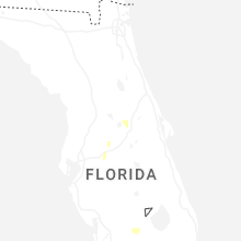
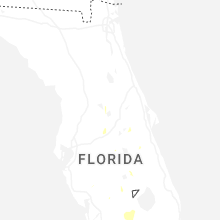

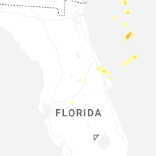
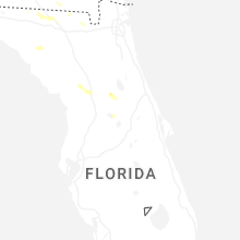


Connect with Interactive Hail Maps