

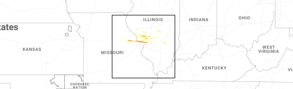
Hail Map for Sunday, May 3, 2026
Number of Impacted Households on 5/3/2026
0
Impacted by 1" or Larger Hail
0
Impacted by 1.75" or Larger Hail
0
Impacted by 2.5" or Larger Hail
Square Miles of Populated Area Impacted on 5/3/2026
0
Impacted by 1" or Larger Hail
0
Impacted by 1.75" or Larger Hail
0
Impacted by 2.5" or Larger Hail
Cities Most Affected by Hail Storms of 5/3/2026
| Hail Size | Demographics of Zip Codes Affected | ||||||
|---|---|---|---|---|---|---|---|
| City | Count | Average | Largest | Pop Density | House Value | Income | Age |
| Alton, IL | 2 | 1.88 | 2.00 | 771 | $62k | $34.3k | 38.4 |
| Hawk Point, MO | 1 | 1.75 | 1.75 | 44 | $87k | $32.5k | 37.3 |
| Godfrey, IL | 1 | 1.75 | 1.75 | 358 | $89k | $50.1k | 44.4 |
| Troy, MO | 1 | 1.75 | 1.75 | 181 | $111k | $44.2k | 34.3 |
Hail and Wind Damage Spotted on 5/3/2026
Filter by Report Type:Hail ReportsWind Reports
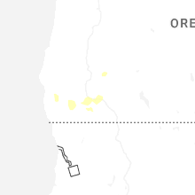
Nevada
| Local Time | Report Details |
|---|---|
| 2:30 PM PDT | Mesonet station nv025 carson cit in carson city county NV, 27.5 miles S of Reno, NV |
| 2:31 PM PDT | Mesonet station nemnv 4.6 s gold hill (nv dot in lyon county NV, 22.9 miles SSE of Reno, NV |
| 2:53 PM PDT | Asos station krno ren in washoe county NV, 3 miles SE of Reno, NV |
| 3:20 PM PDT | Mesonet station nv052 south verd in washoe county NV, 9.3 miles WSW of Reno, NV |
| 3:20 PM PDT | Mesonet station nv013 northwest ren in washoe county NV, 3 miles NW of Reno, NV |
| 4:15 PM PDT | Mesonet station a06aa 16.4 n mercury (arl sord). showers were in the vicinity at the time of gus in nye county NV, 70.4 miles NW of Las Vegas, NV |
| 4:45 PM PDT | Mesonet station a04aa 30.6 n mercury (arl sord). showers were in the vicinity at the time of gus in nye county NV, 83 miles NW of Las Vegas, NV |
Wyoming
| Local Time | Report Details |
|---|---|
| 3:46 PM MDT | Mesonet station wy60 3.4 w van tassell (wydot). 20dbz convective shower over van tassell gusted 58mp in niobrara county WY, 61.3 miles NNW of Scottsbluff, NE |
South Dakota
| Local Time | Report Details |
|---|---|
| 4:15 PM MDT | Storm damage reported in fall river county SD, 72.1 miles S of Rapid City, SD |
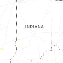
Nebraska
| Local Time | Report Details |
|---|---|
| 4:42 PM MDT | Asos station kcdr chadron airport - cd in dawes county NE, 72.8 miles NNE of Scottsbluff, NE |
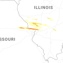
Missouri
| Local Time | Report Details |
|---|---|
| 9:55 PM CDT | Ping Pong Ball sized hail reported near Truxton, MO, 59.5 miles E of Columbia, MO, report from mping: ping pong ball (1.50 in.). |
| 9:58 PM CDT | Golf Ball sized hail reported near Hawk Point, MO, 55.5 miles WNW of Saint Louis, MO |
| 10:02 PM CDT | Quarter sized hail reported near Troy, MO, 53.1 miles WNW of Saint Louis, MO, report from mping: quarter (1.00 in.). |
| 10:08 PM CDT | Golf Ball sized hail reported near Troy, MO, 48.6 miles WNW of Saint Louis, MO |
Illinois
| Local Time | Report Details |
|---|---|
| 10:55 PM CDT | Quarter sized hail reported near Godfrey, IL, 20.2 miles N of Saint Louis, MO, report from mping: quarter (1.00 in.). |
| 10:55 PM CDT | Ping Pong Ball sized hail reported near Godfrey, IL, 20.9 miles N of Saint Louis, MO, report from mping: ping pong ball (1.50 in.). |
| 10:58 PM CDT | Quarter sized hail reported near Alton, IL, 19.7 miles N of Saint Louis, MO |
| 10:58 PM CDT | Golf Ball sized hail reported near Alton, IL, 19.8 miles N of Saint Louis, MO, report from mping: golf ball (1.75 in.). |
| 10:59 PM CDT | Golf Ball sized hail reported near Godfrey, IL, 22.2 miles N of Saint Louis, MO |
| 11:00 PM CDT | Hen Egg sized hail reported near Alton, IL, 19.5 miles N of Saint Louis, MO, email report showing 2 inch stone next to tape measure. time estimated from radar. |
| 11:05 PM CDT | Ping Pong Ball sized hail reported near Bethalto, IL, 21.3 miles NNE of Saint Louis, MO |
| 11:06 PM CDT | Quarter sized hail reported near Bethalto, IL, 21.1 miles NNE of Saint Louis, MO |
| 11:42 PM CDT | Quarter sized hail reported near Carlinville, IL, 43.7 miles NNE of Saint Louis, MO, via email... no photo. time estimated via radar. |
Connect with Interactive Hail Maps