

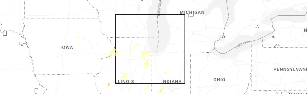
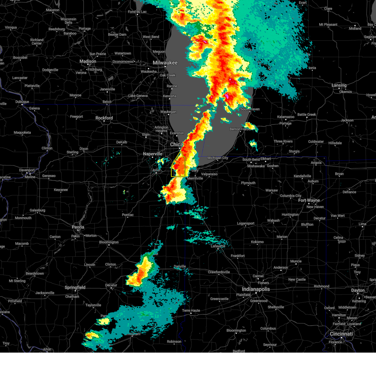
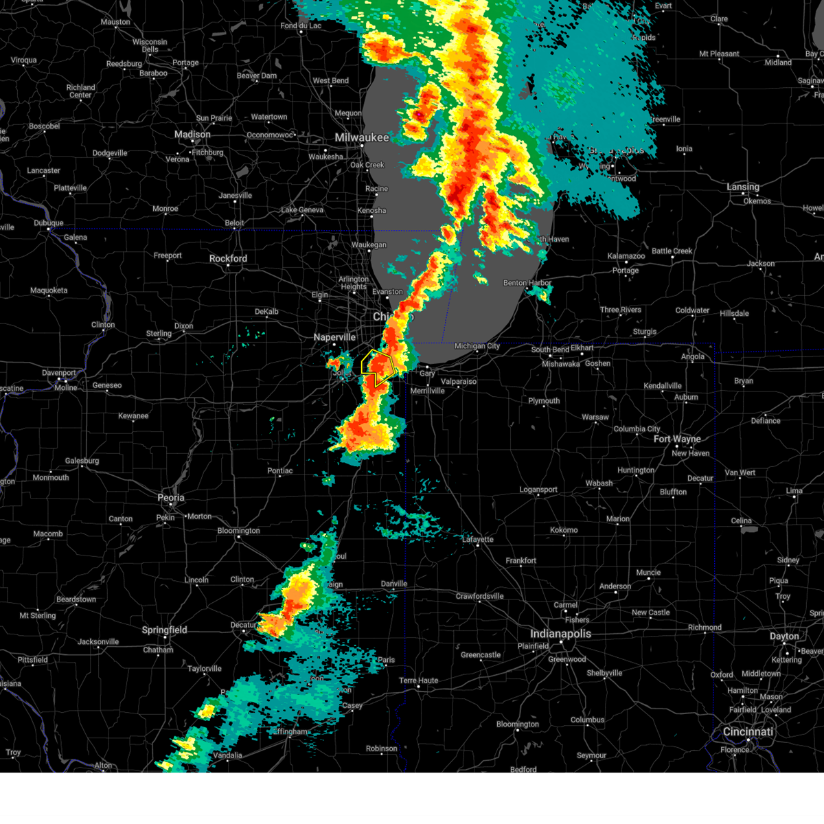
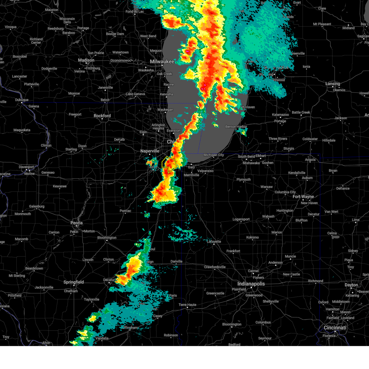
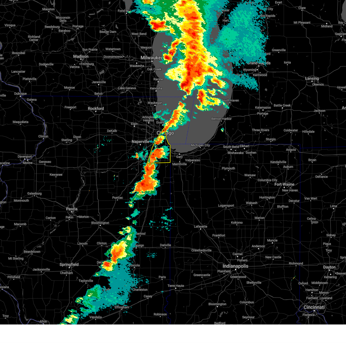
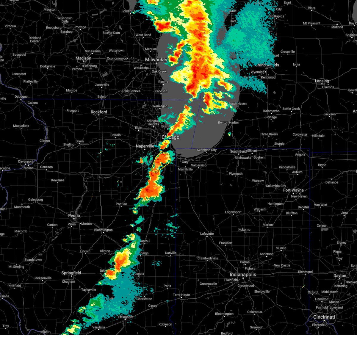
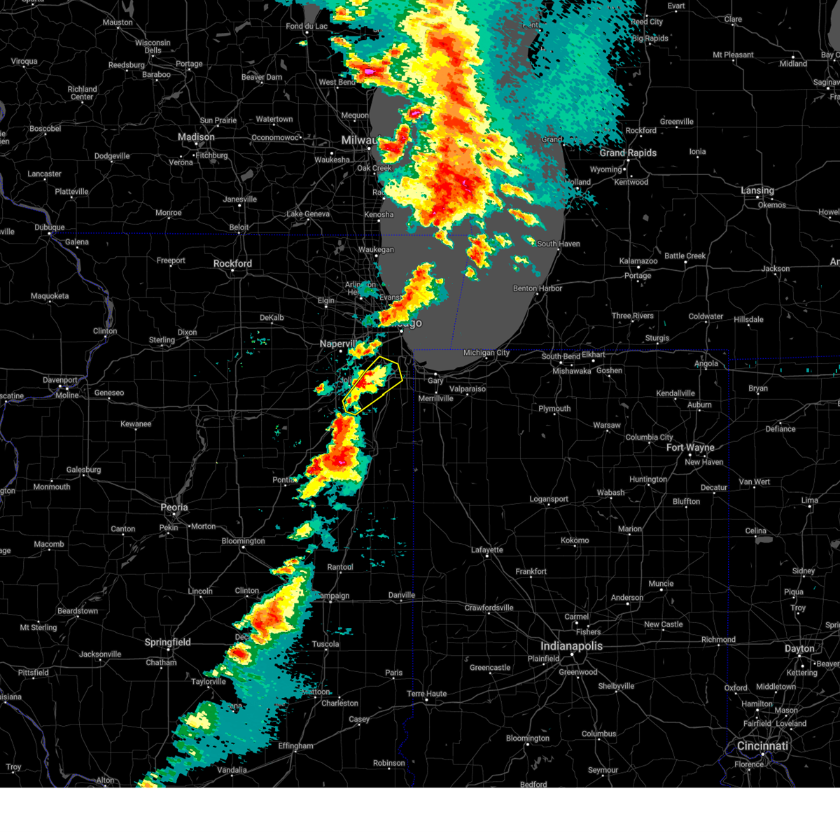
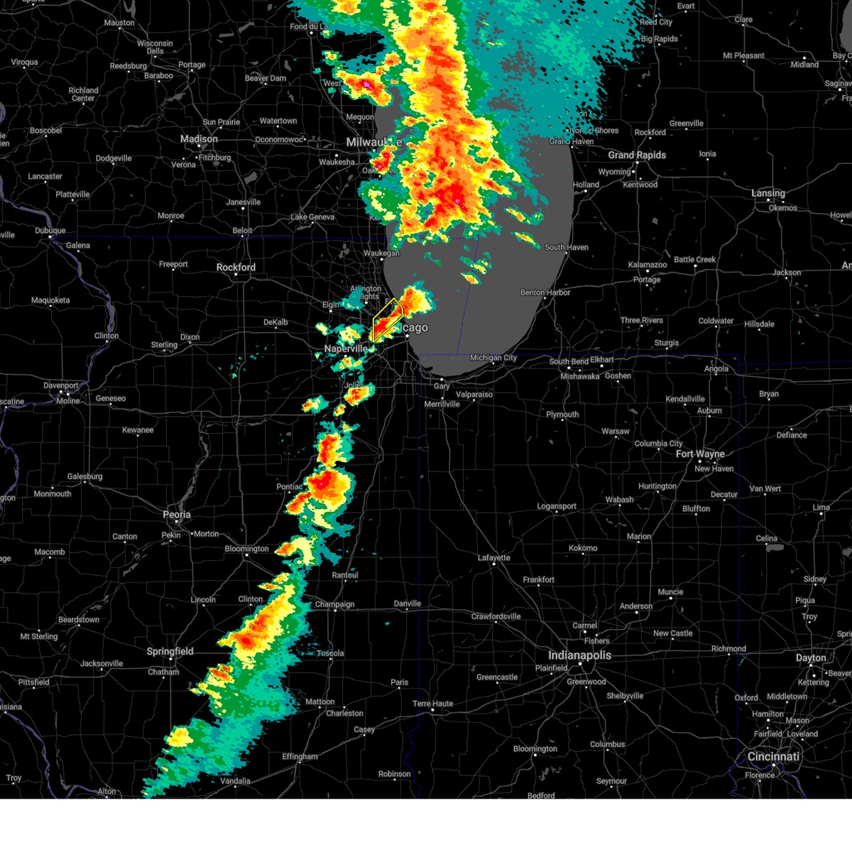
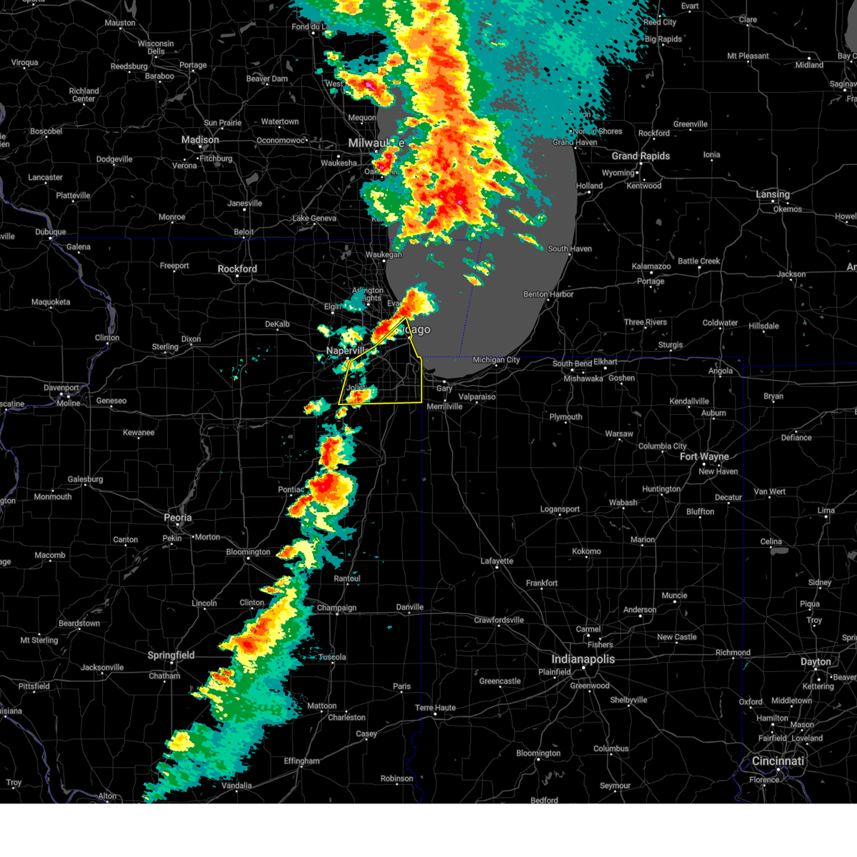
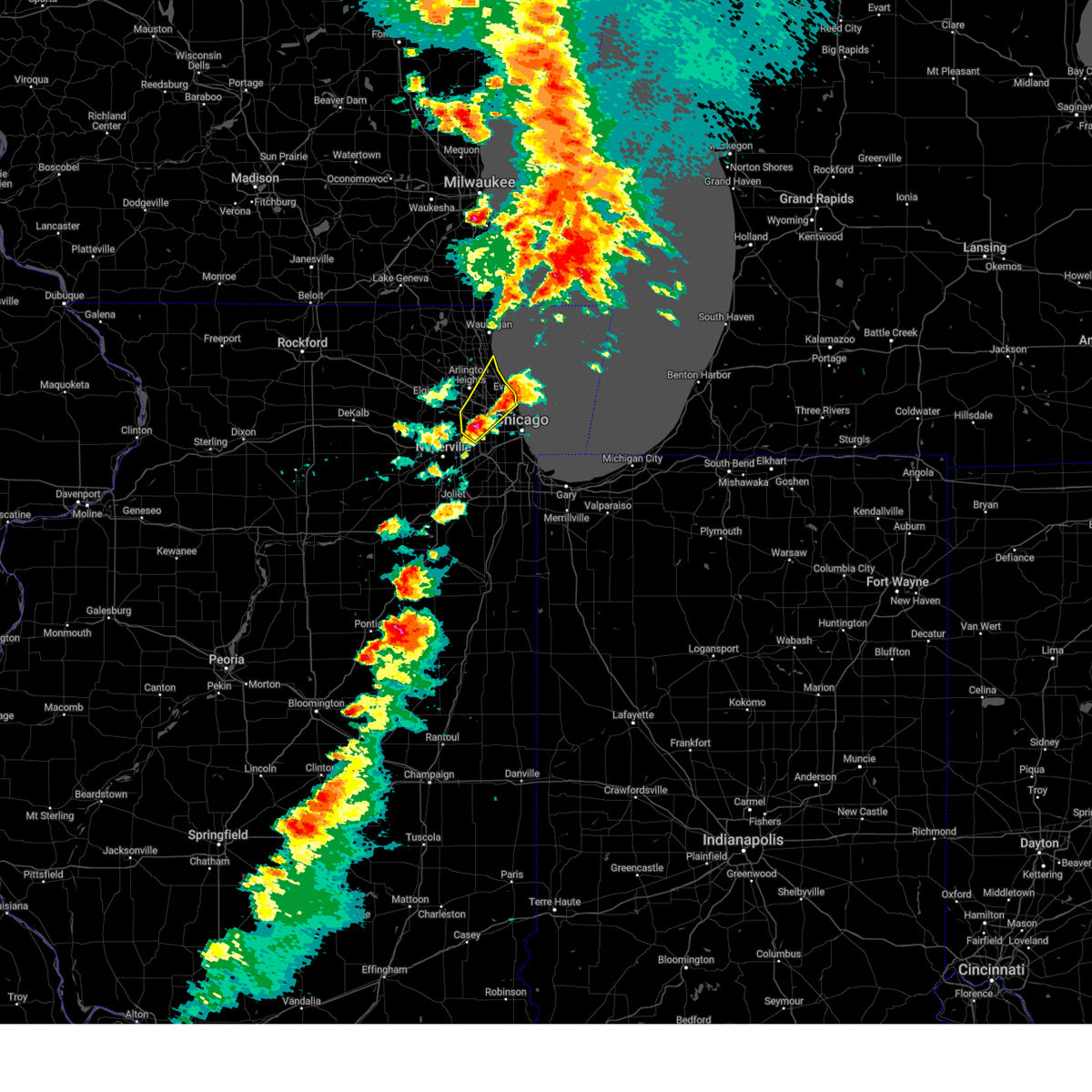
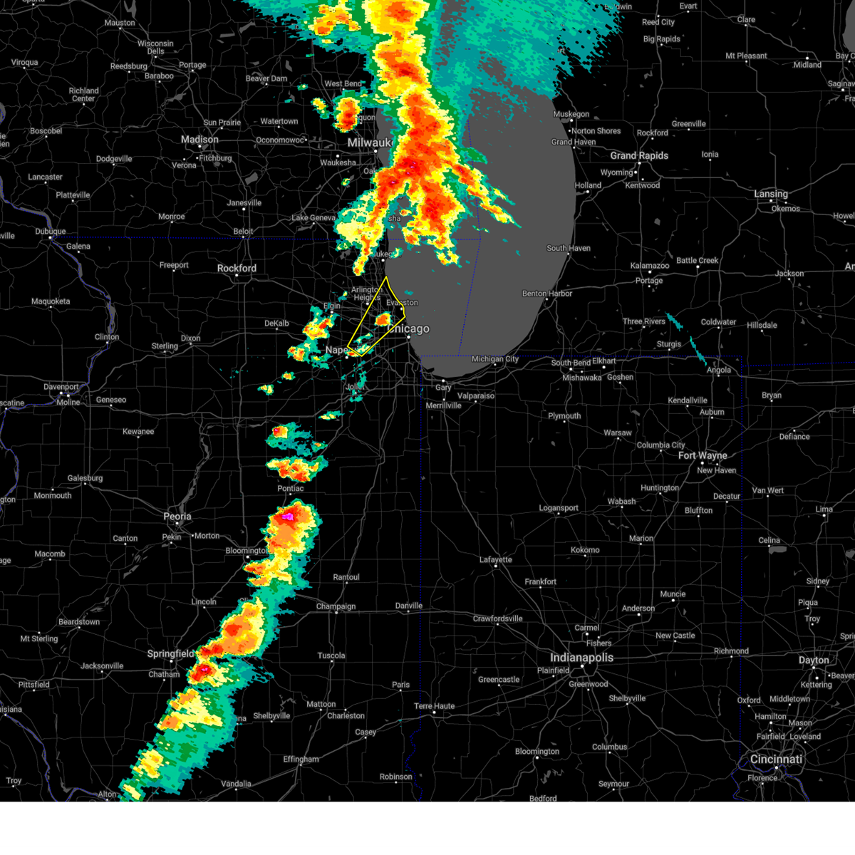
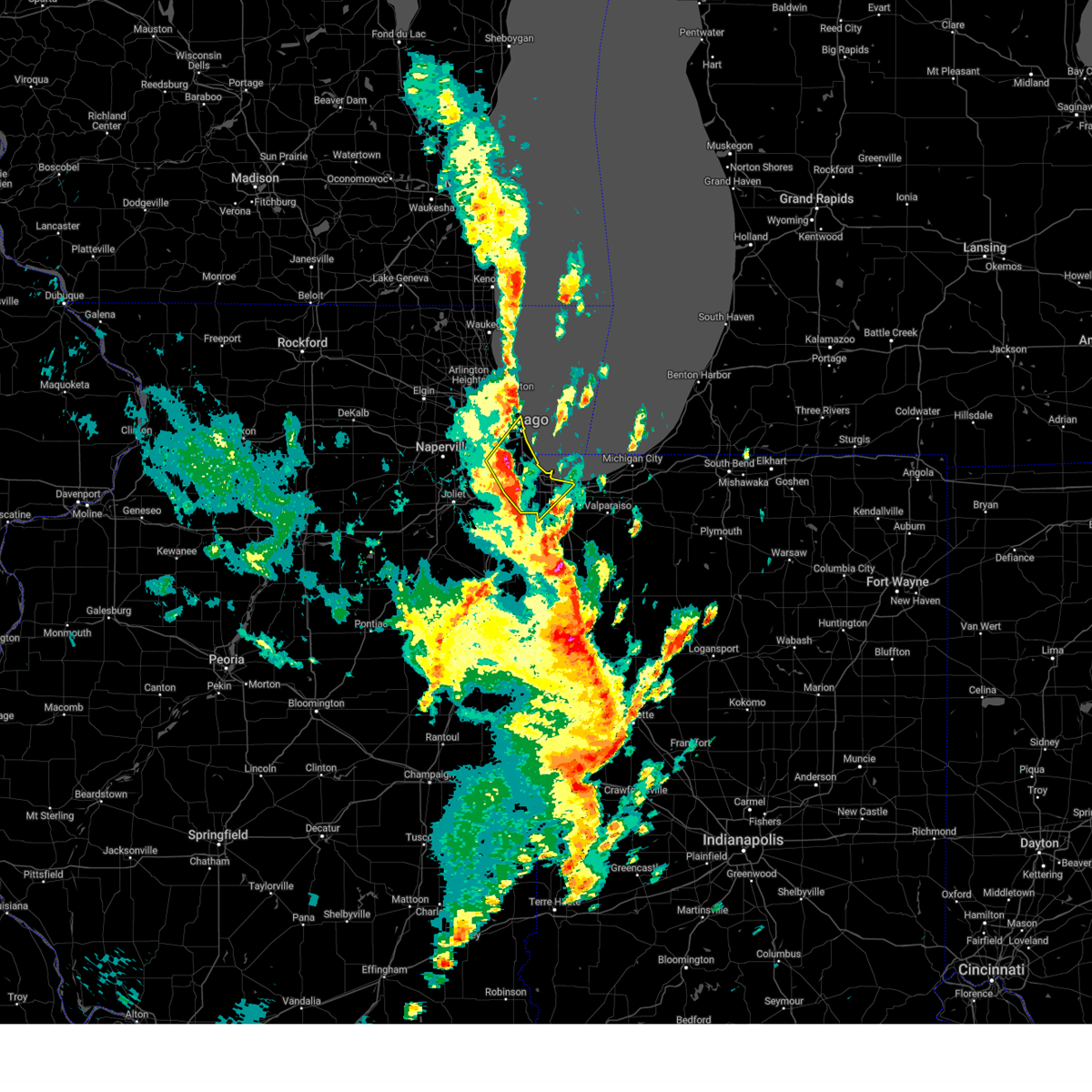
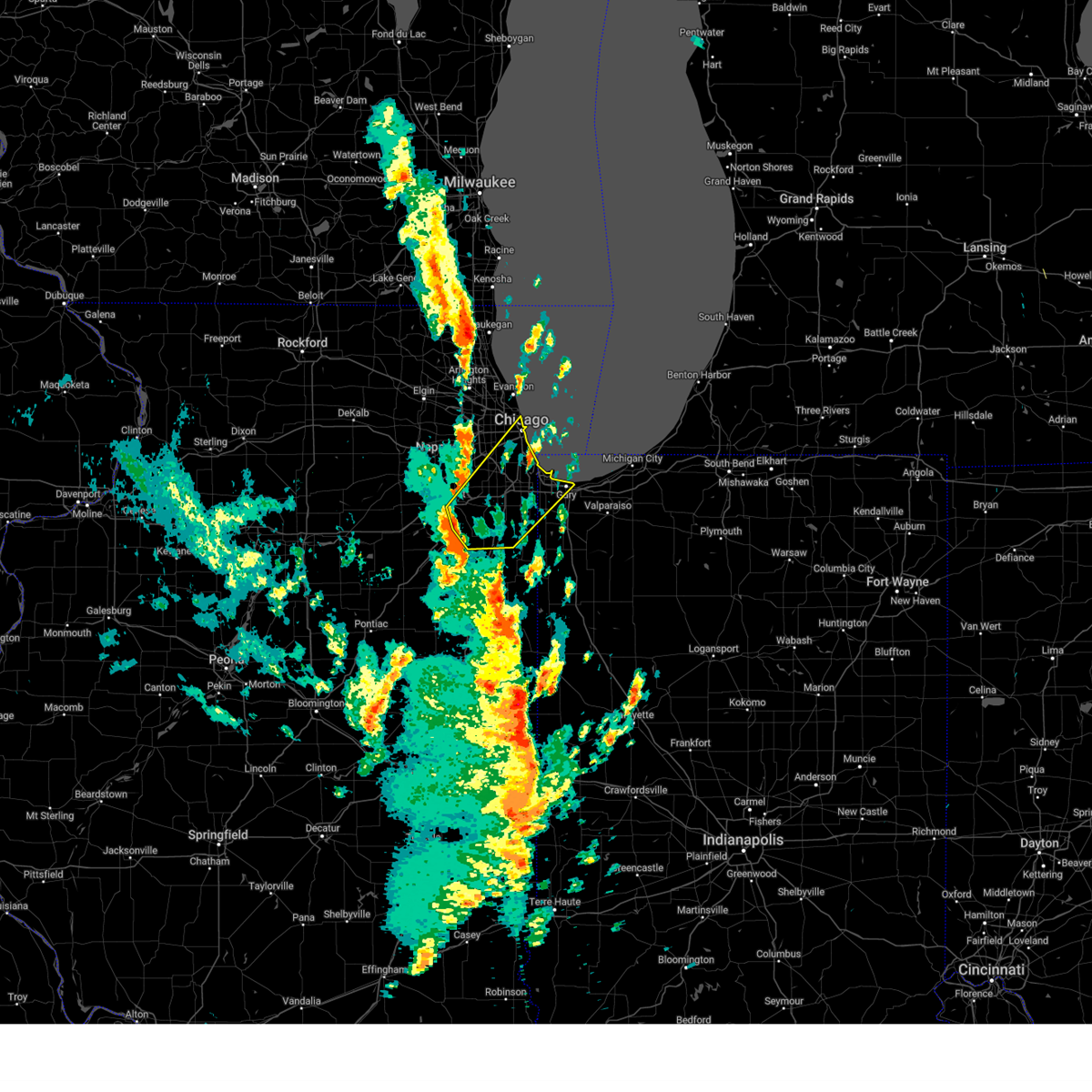
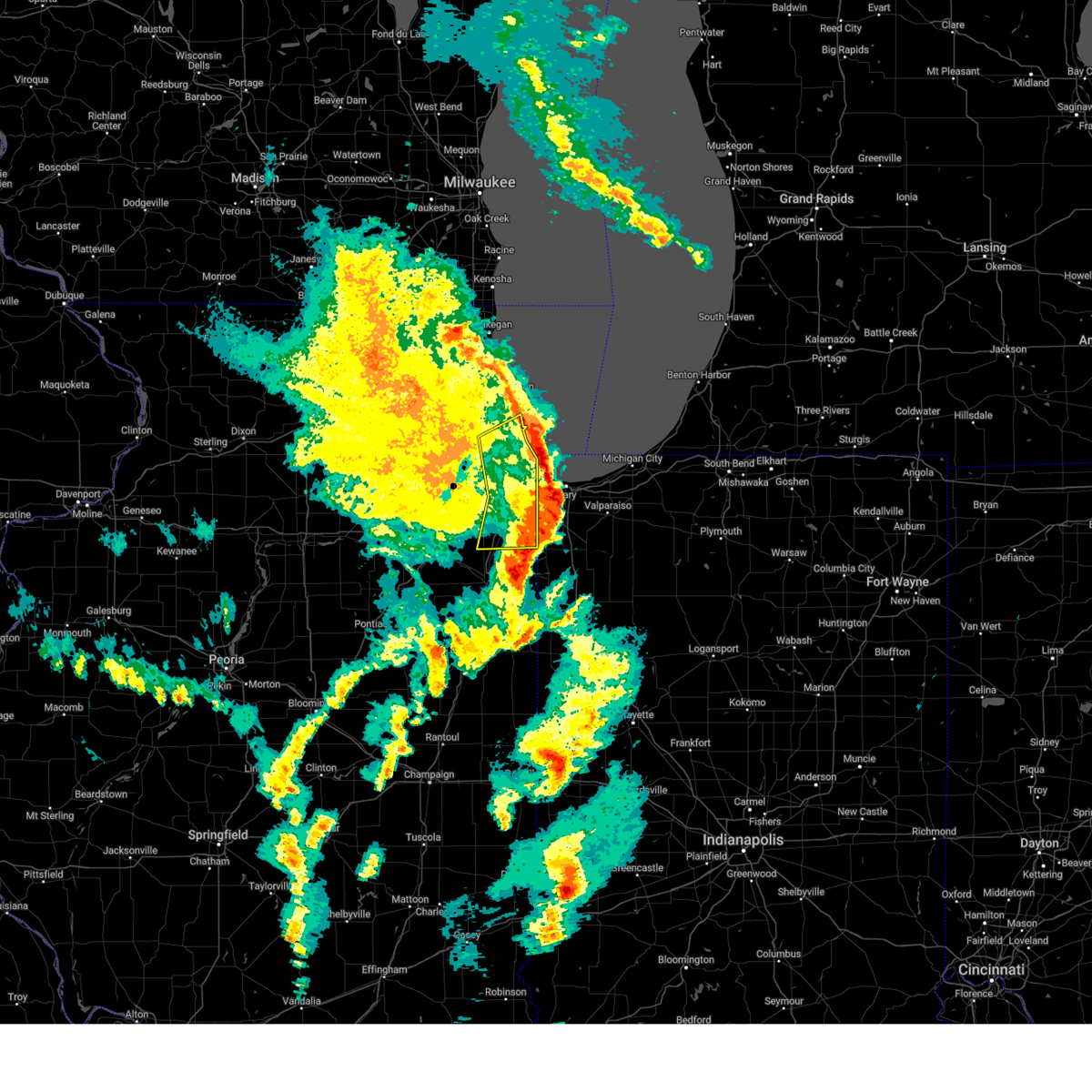
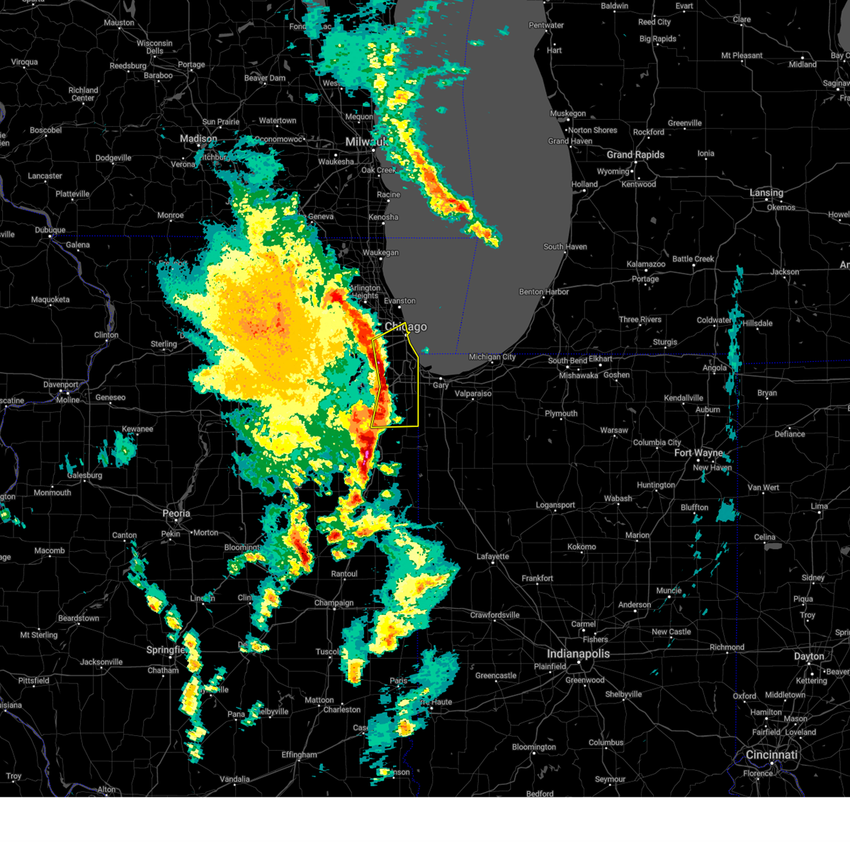
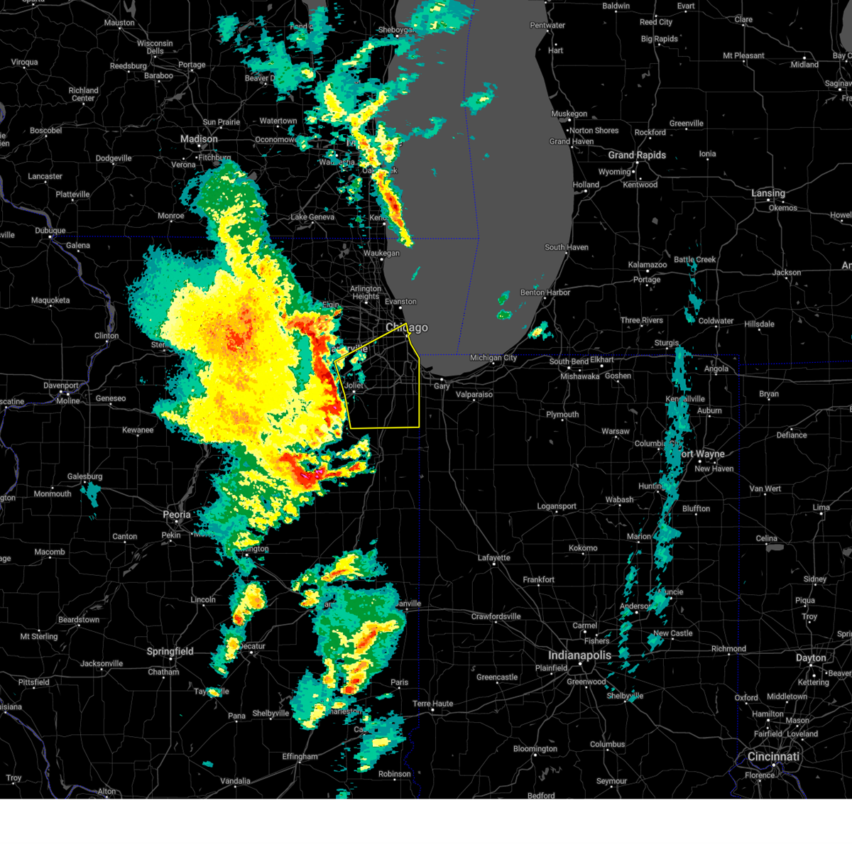
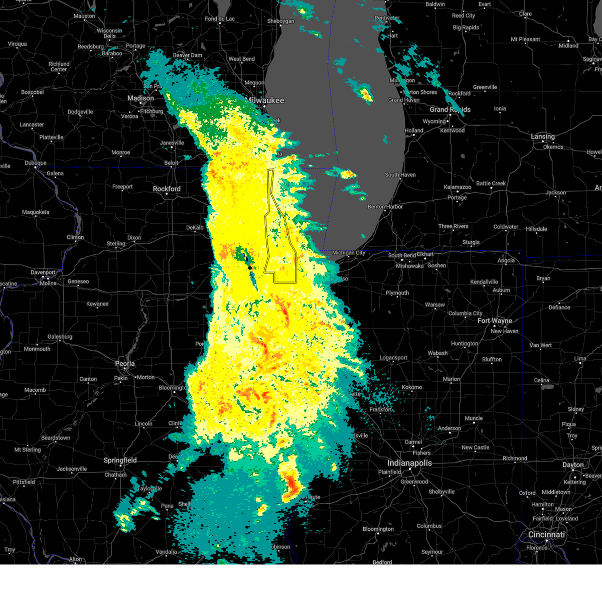
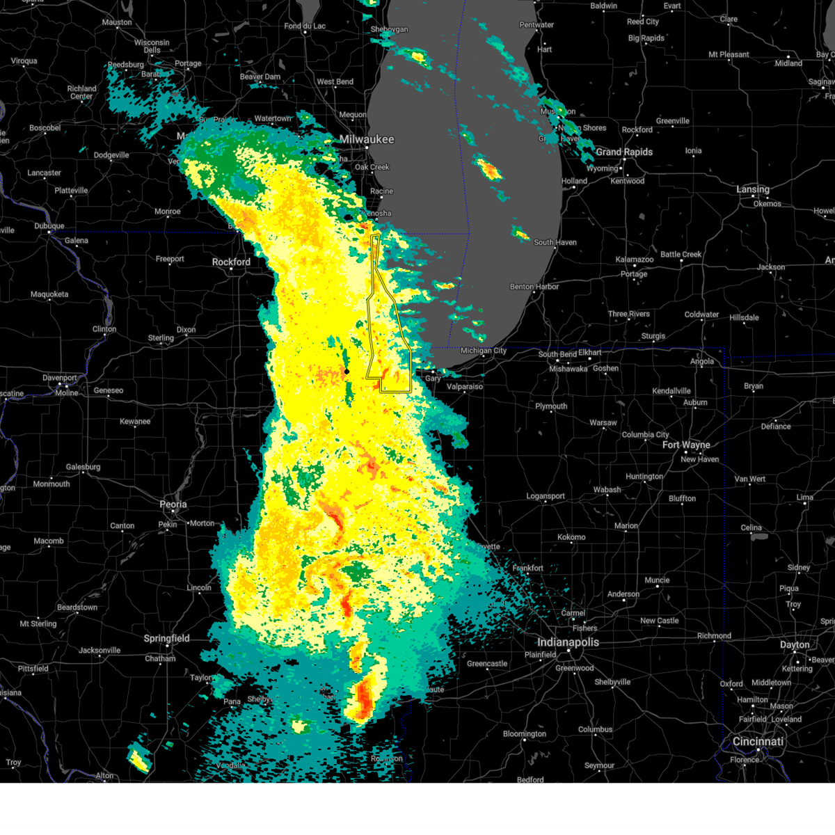
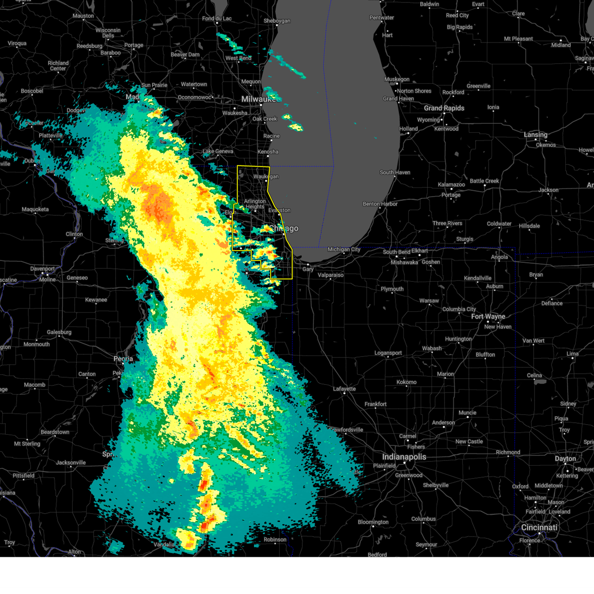
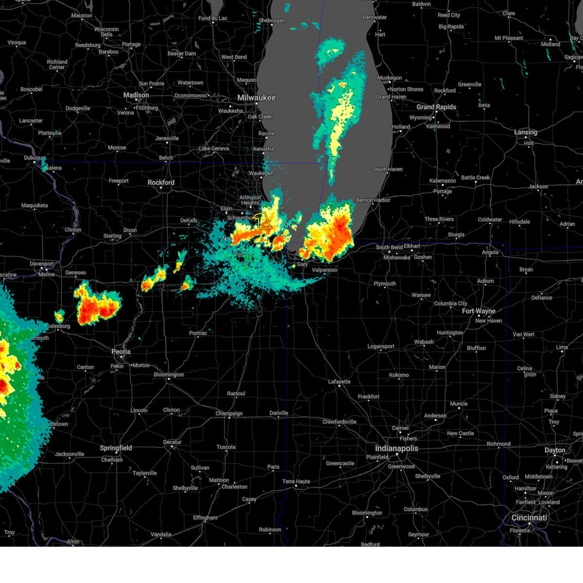
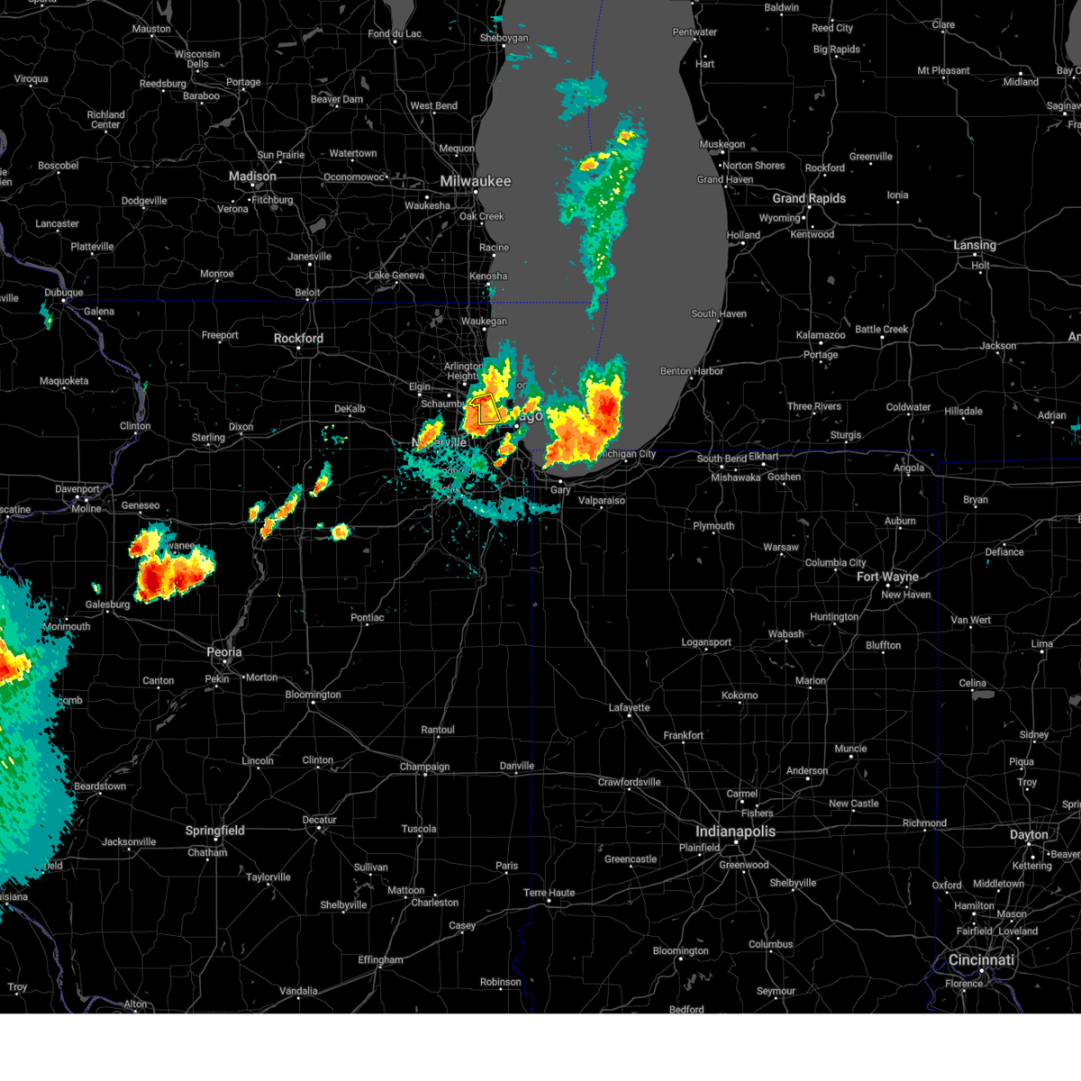
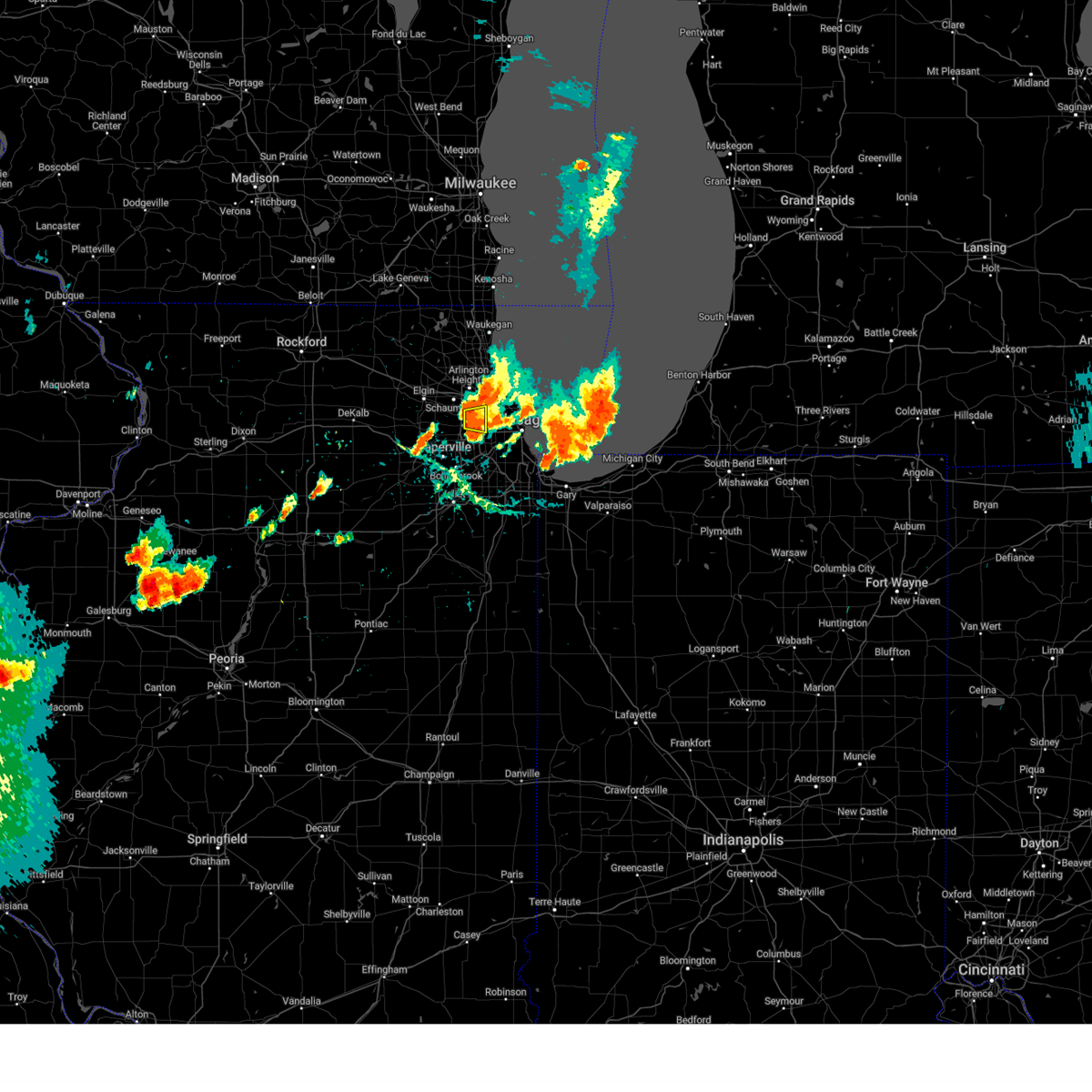
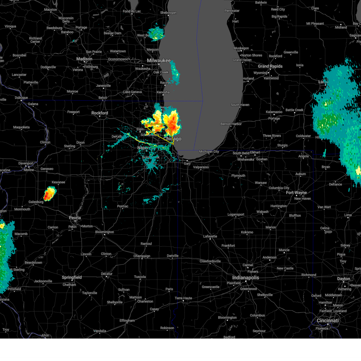
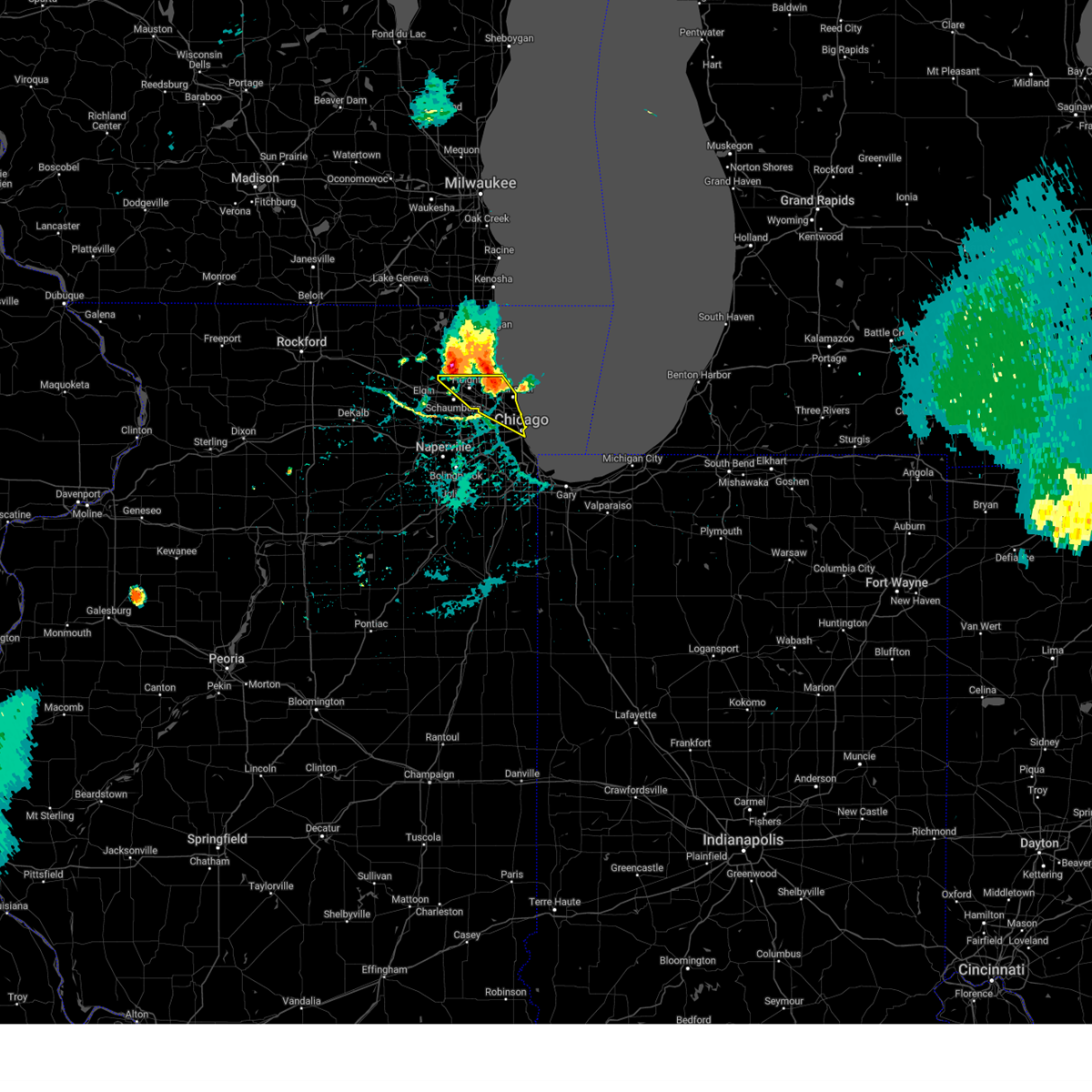
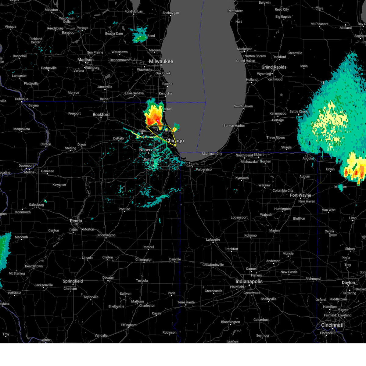
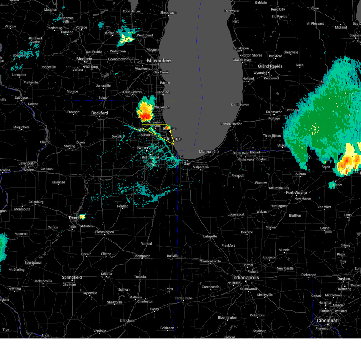
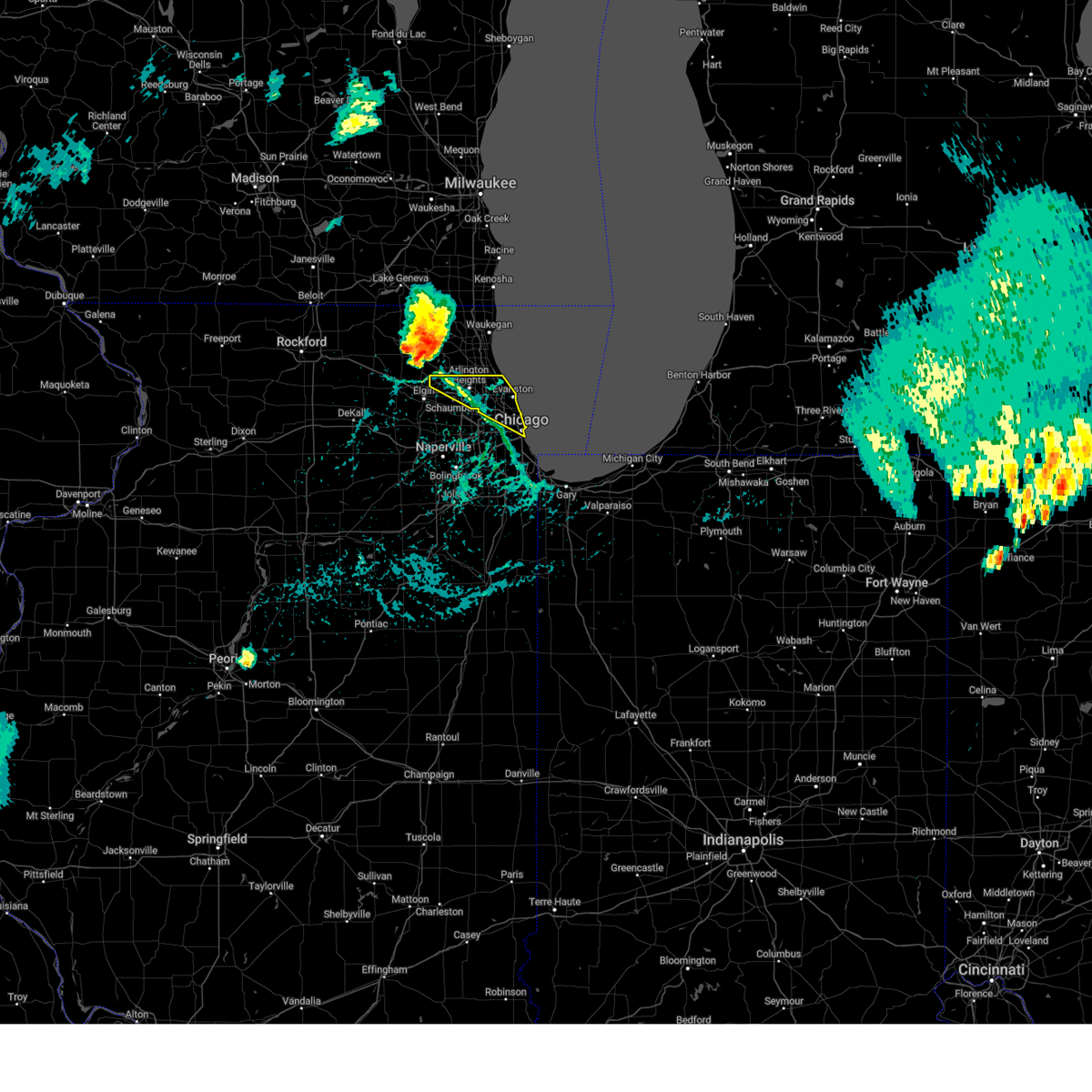
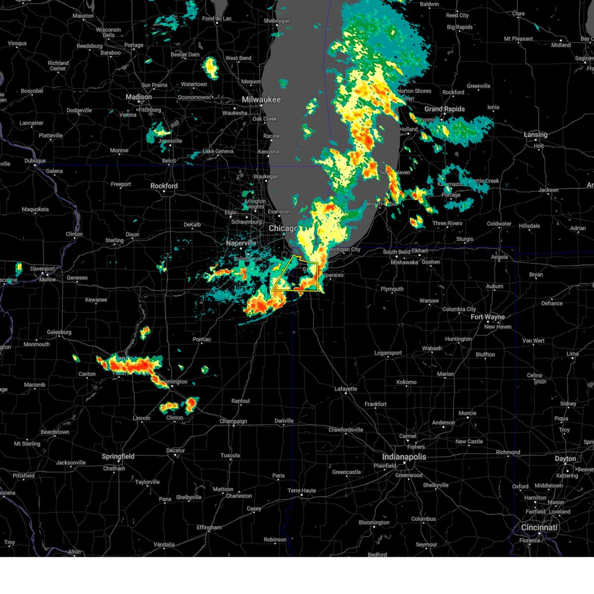
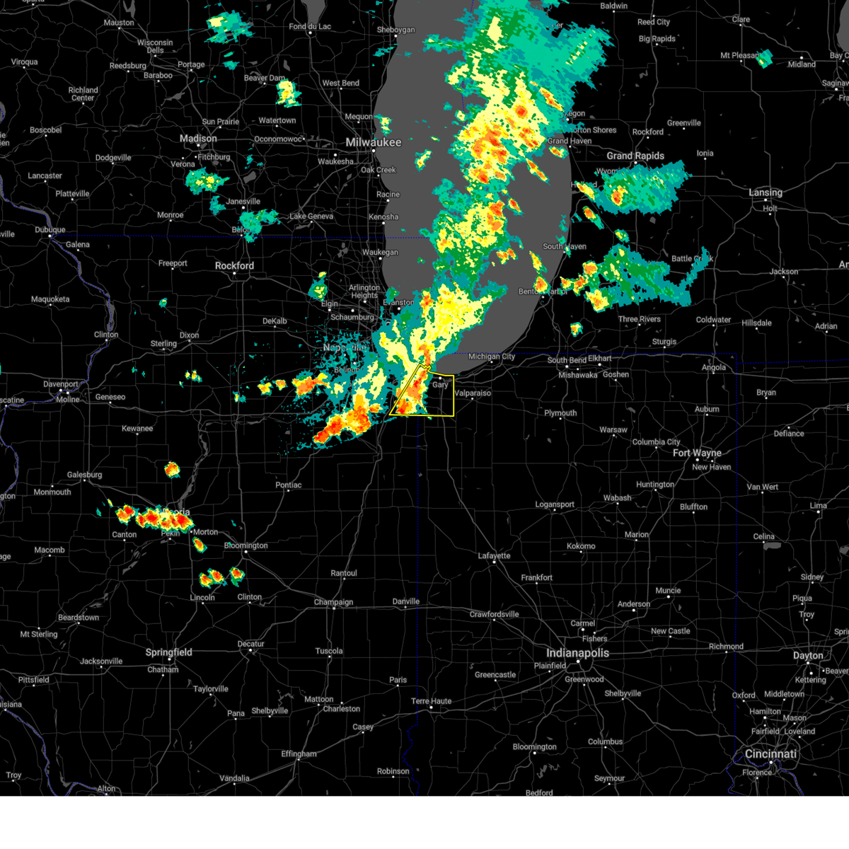
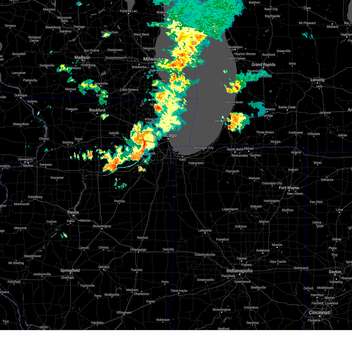
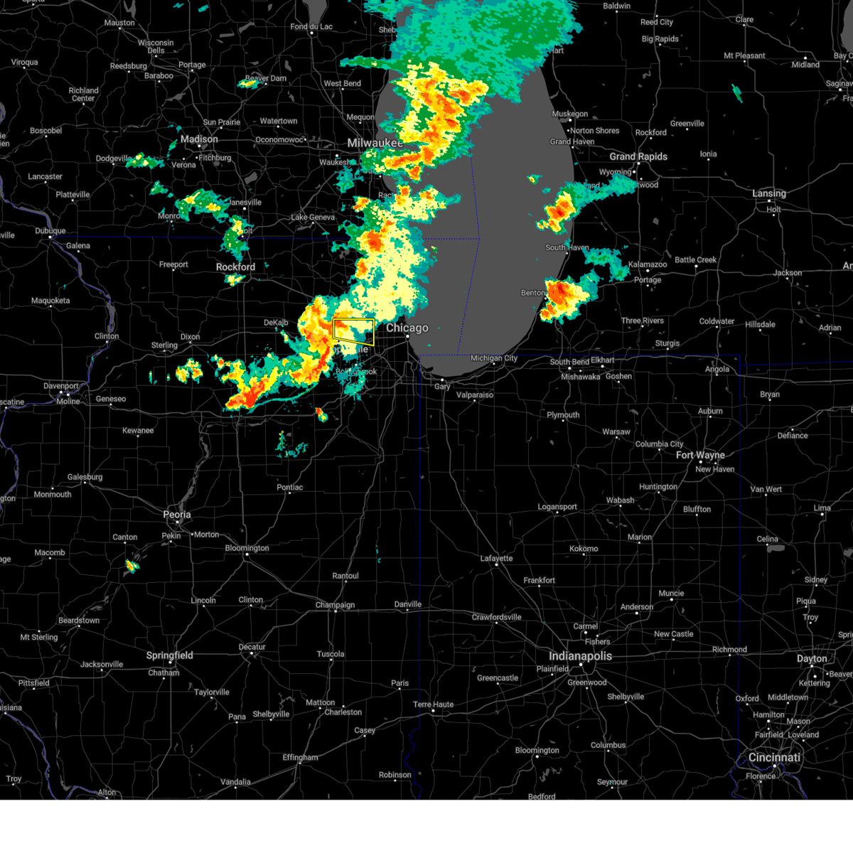
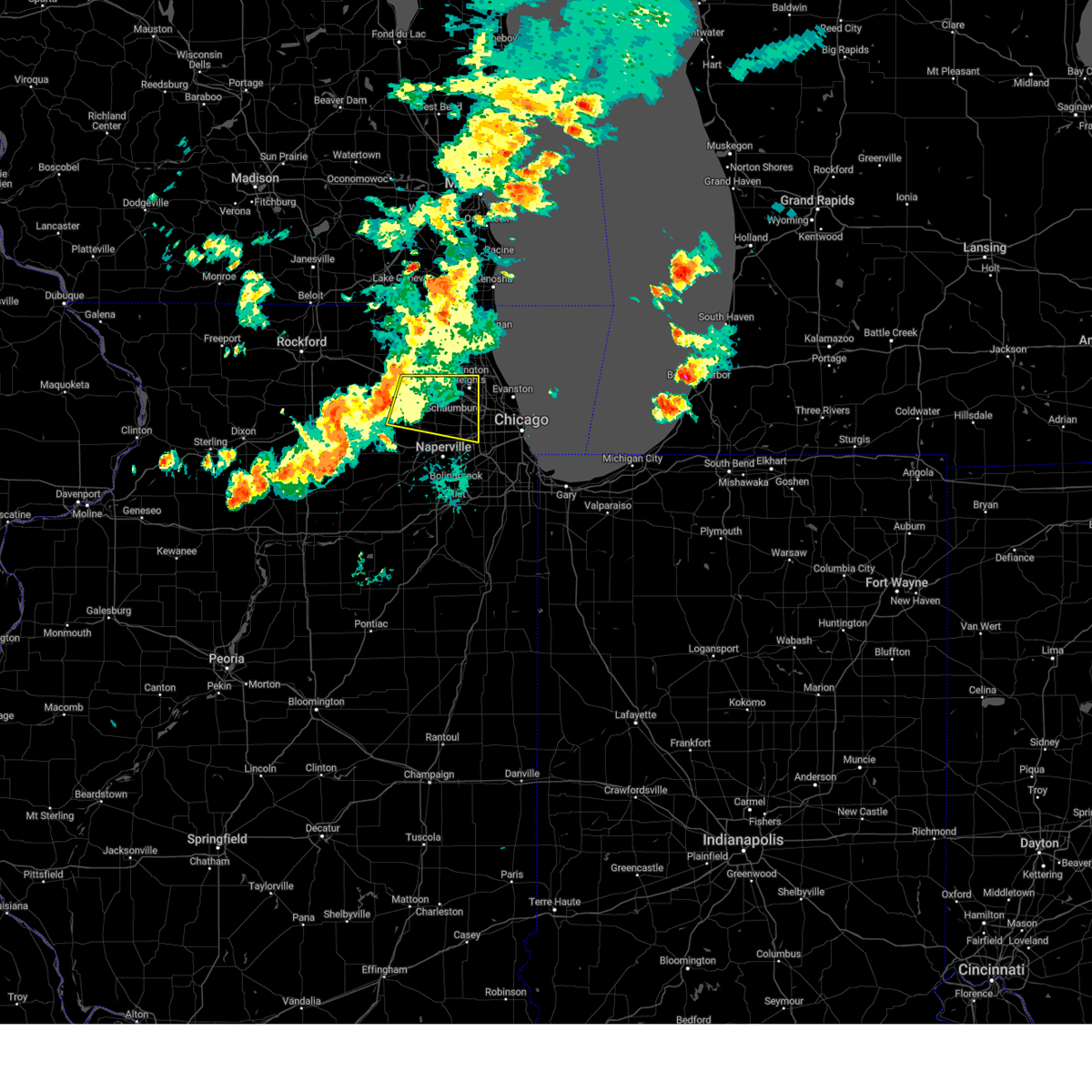
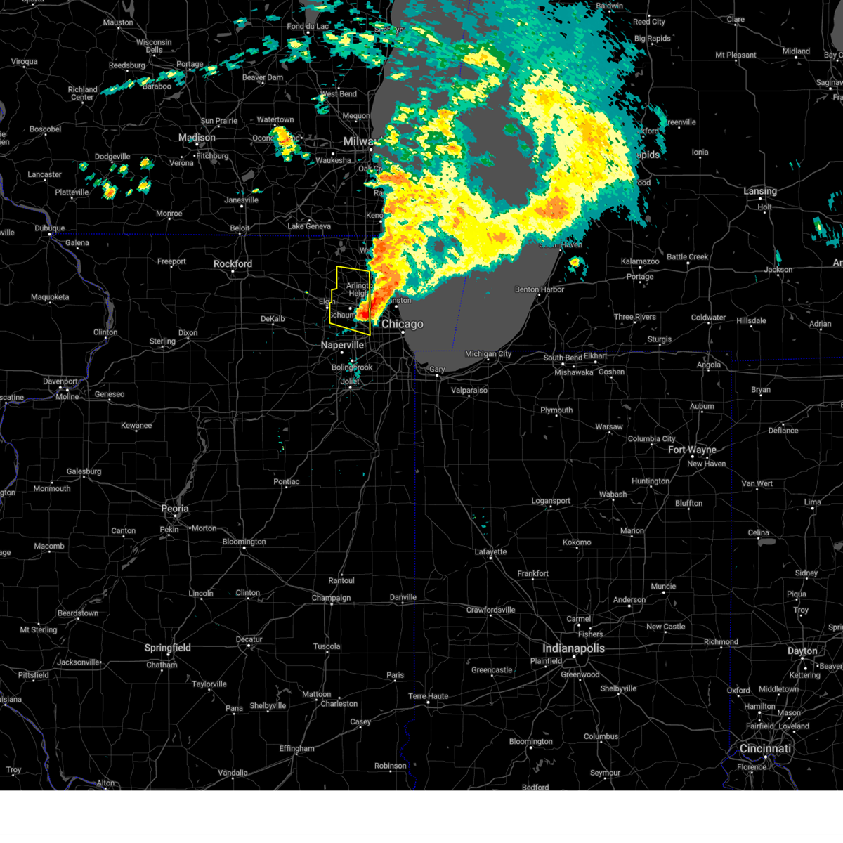
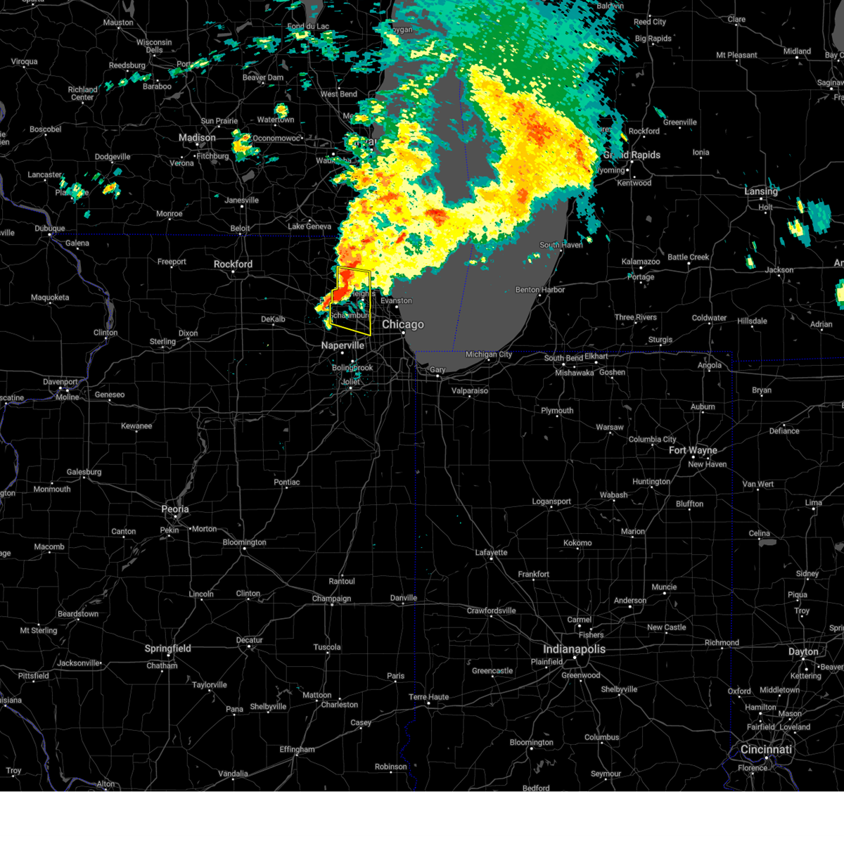
Hail Map for Chicago, IL
The Chicago, IL area has had 53 reports of on-the-ground hail by trained spotters, and has been under severe weather warnings 123 times during the past 12 months. Doppler radar has detected hail at or near Chicago, IL on 135 occasions, including 7 occasions during the past year.
| Name: | Chicago, IL |
| Where Located: | 5.4 miles W of Chicago, IL |
| Map: | Google Map for Chicago, IL |
| Population: | 2695598 |
| Housing Units: | 1194337 |
| More Info: | Search Google for Chicago, IL |
1
The Top Recent Hail Date for Chicago, IL is Wednesday, March 19, 2025 (46th out of 135)
Hail and Wind Damage Spotted near Chicago, IL
| Date / Time | Report Details |
|---|---|
| 6/8/2025 4:14 PM CDT |
 The severe thunderstorm which prompted the warning has weakened. therefore, the warning will be allowed to expire. however, small hail and gusty winds are still possible. The severe thunderstorm which prompted the warning has weakened. therefore, the warning will be allowed to expire. however, small hail and gusty winds are still possible.
|
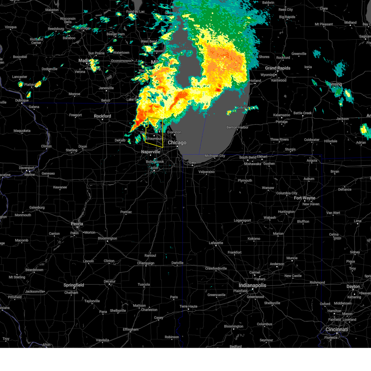
| 6/8/2025 3:52 PM CDT | At 352 pm cdt, a severe thunderstorm was located over burbank, moving east southeast at 30 mph (radar indicated). Hazards include 60 mph wind gusts and quarter size hail. Hail damage to vehicles is expected. expect wind damage to roofs, siding, and trees. Locations impacted include, west lawn, chicago lawn, englewood, oak lawn, summit, west elsdon, beverly, east side, avalon park, grand boulevard, south deering, hyde park, south chicago, south shore, roseland, woodlawn, evergreen park, fuller park, forest view, hickory hills, bedford park, ashburn, justice, midway airport, and west englewood. |
| 6/8/2025 3:31 PM CDT |
 Svrlot the national weather service in chicago has issued a * severe thunderstorm warning for, east central cook county in northeastern illinois, * until 415 pm cdt. * at 330 pm cdt, a severe thunderstorm was located over westmont, or over oak brook, moving east at 30 mph (radar indicated). Hazards include 60 mph wind gusts and quarter size hail. Hail damage to vehicles is expected. Expect wind damage to roofs, siding, and trees. Svrlot the national weather service in chicago has issued a * severe thunderstorm warning for, east central cook county in northeastern illinois, * until 415 pm cdt. * at 330 pm cdt, a severe thunderstorm was located over westmont, or over oak brook, moving east at 30 mph (radar indicated). Hazards include 60 mph wind gusts and quarter size hail. Hail damage to vehicles is expected. Expect wind damage to roofs, siding, and trees.
|
| 5/16/2025 6:52 PM CDT | Harrison dever crib reported 78 mph gust. gust was associated with the leading edge of a dust stor in lmz741 county IL, 9.1 miles WSW of Chicago, IL |
| 5/15/2025 8:36 PM CDT |
 The storm which prompted the warning has moved out of the area. therefore, the warning will be allowed to expire. a tornado watch remains in effect until 1000 pm cdt for northeastern illinois. to report severe weather, contact your nearest law enforcement agency. they will relay your report to the national weather service chicago. The storm which prompted the warning has moved out of the area. therefore, the warning will be allowed to expire. a tornado watch remains in effect until 1000 pm cdt for northeastern illinois. to report severe weather, contact your nearest law enforcement agency. they will relay your report to the national weather service chicago.
|
| 5/15/2025 8:25 PM CDT |
 The storm which prompted the warning has moved out of the area. therefore, the warning will be allowed to expire. a tornado watch remains in effect until 1000 pm cdt for northeastern illinois. to report severe weather, contact your nearest law enforcement agency. they will relay your report to the national weather service chicago. The storm which prompted the warning has moved out of the area. therefore, the warning will be allowed to expire. a tornado watch remains in effect until 1000 pm cdt for northeastern illinois. to report severe weather, contact your nearest law enforcement agency. they will relay your report to the national weather service chicago.
|
| 5/15/2025 8:24 PM CDT | Harrison dever crib reported 79 mph gus in lmz741 county IL, 9.1 miles WSW of Chicago, IL |
| 5/15/2025 8:22 PM CDT |
 At 821 pm cdt, a severe thunderstorm was located near south deering, or near south shore, moving northeast at 50 mph (radar indicated. the strongest winds are moving toward hyde park!). Hazards include 70 to 80 mph wind gusts and quarter size hail. Hail damage to vehicles is expected. expect considerable tree damage. wind damage is also likely to mobile homes, roofs, and outbuildings. Locations impacted include, englewood, merrionette park, oakland, south holland, beverly, east side, riverdale, lynwood, crestwood, flossmoor, avalon park, ford heights, grand boulevard, calumet city, south deering, hyde park, south chicago, glenwood, south shore, roseland, lansing, midlothian, calumet park, woodlawn, and evergreen park. At 821 pm cdt, a severe thunderstorm was located near south deering, or near south shore, moving northeast at 50 mph (radar indicated. the strongest winds are moving toward hyde park!). Hazards include 70 to 80 mph wind gusts and quarter size hail. Hail damage to vehicles is expected. expect considerable tree damage. wind damage is also likely to mobile homes, roofs, and outbuildings. Locations impacted include, englewood, merrionette park, oakland, south holland, beverly, east side, riverdale, lynwood, crestwood, flossmoor, avalon park, ford heights, grand boulevard, calumet city, south deering, hyde park, south chicago, glenwood, south shore, roseland, lansing, midlothian, calumet park, woodlawn, and evergreen park.
|
| 5/15/2025 8:22 PM CDT |
 the severe thunderstorm warning has been cancelled and is no longer in effect the severe thunderstorm warning has been cancelled and is no longer in effect
|
| 5/15/2025 8:20 PM CDT | Multiple reports of downed trees and tree limbs across the south chicago heights... chatham... and cheltenham neighborhoods of chicago. data collected from 311 request in cook county IL, 13.2 miles NW of Chicago, IL |
| 5/15/2025 8:16 PM CDT |
 At 815 pm cdt, a severe thunderstorm was located over midlothian, or over blue island, moving northeast at 70 mph. this is a destructive storm for tinley park, oak forest, and country club hills! (radar indicated). Hazards include 80 mph wind gusts. Flying debris will be dangerous to those caught without shelter. mobile homes will be heavily damaged. expect considerable damage to roofs, windows, and vehicles. extensive tree damage and power outages are likely. Locations impacted include, palos heights, country club hills, homewood, oak forest, merrionette park, orland hills, posen, tinley park, robbins, palos hills, orland park, worth, crestwood, dixmoor, flossmoor, chicago ridge, hazel crest, alsip, midlothian, palos park, blue island, east hazel crest, harvey, markham, and matteson. At 815 pm cdt, a severe thunderstorm was located over midlothian, or over blue island, moving northeast at 70 mph. this is a destructive storm for tinley park, oak forest, and country club hills! (radar indicated). Hazards include 80 mph wind gusts. Flying debris will be dangerous to those caught without shelter. mobile homes will be heavily damaged. expect considerable damage to roofs, windows, and vehicles. extensive tree damage and power outages are likely. Locations impacted include, palos heights, country club hills, homewood, oak forest, merrionette park, orland hills, posen, tinley park, robbins, palos hills, orland park, worth, crestwood, dixmoor, flossmoor, chicago ridge, hazel crest, alsip, midlothian, palos park, blue island, east hazel crest, harvey, markham, and matteson.
|
| 5/15/2025 8:16 PM CDT |
 the severe thunderstorm warning has been cancelled and is no longer in effect the severe thunderstorm warning has been cancelled and is no longer in effect
|
| 5/15/2025 8:15 PM CDT | Photos showed on social media of large tree across roadway and on cars. the core of the tree appeared to be rotten. time estimated by rada in cook county IL, 5.1 miles WNW of Chicago, IL |
| 5/15/2025 8:15 PM CDT | Photos shared showing a tree snapped at its base in kennedy park in chicago. time estimated from rada in cook county IL, 13.1 miles NNW of Chicago, IL |
| 5/15/2025 8:10 PM CDT | Multiple reports of downed trees and tree limbs across the cornell... cheltenham... and south chicago heights neighborhoods of chicago. data collected from 311 request in cook county IL, 13.6 miles NW of Chicago, IL |
| 5/15/2025 8:07 PM CDT | Video shared to social media shows small branches broken near 45th and leamington avenue in garfield ridge community area of chicago. time estimated by rada in cook county IL, 4.6 miles N of Chicago, IL |
| 5/15/2025 8:07 PM CDT |
 the severe thunderstorm warning has been cancelled and is no longer in effect the severe thunderstorm warning has been cancelled and is no longer in effect
|
| 5/15/2025 8:07 PM CDT |
 At 807 pm cdt, a severe thunderstorm was located over crestwood, or over alsip, moving northeast at 50 mph (radar indicated). Hazards include 60 mph wind gusts and quarter size hail. Hail damage to vehicles is expected. expect wind damage to roofs, siding, and trees. Locations impacted include, frankfort square, palos heights, west town, chicago lawn, englewood, oak lawn, merrionette park, orland hills, summit, austin, west garfield park, near north side, stickney, logan square, crestwood, lower west side, avalon park, grand boulevard, calumet city, south deering, hyde park, south chicago, hodgkins, humboldt park, and glenwood. At 807 pm cdt, a severe thunderstorm was located over crestwood, or over alsip, moving northeast at 50 mph (radar indicated). Hazards include 60 mph wind gusts and quarter size hail. Hail damage to vehicles is expected. expect wind damage to roofs, siding, and trees. Locations impacted include, frankfort square, palos heights, west town, chicago lawn, englewood, oak lawn, merrionette park, orland hills, summit, austin, west garfield park, near north side, stickney, logan square, crestwood, lower west side, avalon park, grand boulevard, calumet city, south deering, hyde park, south chicago, hodgkins, humboldt park, and glenwood.
|
| 5/15/2025 8:07 PM CDT |
 At 807 pm cdt, a severe thunderstorm was located near new lenox, moving northeast at 65 mph. this is a destructive storm for frankfort, tinley park, oak forest, and orland park! (radar indicated). Hazards include 80 mph wind gusts. Flying debris will be dangerous to those caught without shelter. mobile homes will be heavily damaged. expect considerable damage to roofs, windows, and vehicles. extensive tree damage and power outages are likely. Locations impacted include, frankfort square, palos heights, country club hills, homewood, oak forest, merrionette park, orland hills, posen, tinley park, robbins, palos hills, orland park, worth, new lenox, crestwood, dixmoor, flossmoor, chicago ridge, hazel crest, alsip, midlothian, palos park, blue island, east hazel crest, and harvey. At 807 pm cdt, a severe thunderstorm was located near new lenox, moving northeast at 65 mph. this is a destructive storm for frankfort, tinley park, oak forest, and orland park! (radar indicated). Hazards include 80 mph wind gusts. Flying debris will be dangerous to those caught without shelter. mobile homes will be heavily damaged. expect considerable damage to roofs, windows, and vehicles. extensive tree damage and power outages are likely. Locations impacted include, frankfort square, palos heights, country club hills, homewood, oak forest, merrionette park, orland hills, posen, tinley park, robbins, palos hills, orland park, worth, new lenox, crestwood, dixmoor, flossmoor, chicago ridge, hazel crest, alsip, midlothian, palos park, blue island, east hazel crest, and harvey.
|
| 5/15/2025 8:05 PM CDT | Video shared to social media shows small branch broken near 51st and mcvicker in garfield ridge community area of chicago. time estimated by rada in cook county IL, 5.5 miles NNE of Chicago, IL |
| 5/15/2025 8:05 PM CDT |
 The storm which prompted the warning has moved out of the area. therefore, the warning will be allowed to expire. a tornado watch remains in effect until 1000 pm cdt for northeastern illinois. The storm which prompted the warning has moved out of the area. therefore, the warning will be allowed to expire. a tornado watch remains in effect until 1000 pm cdt for northeastern illinois.
|
| 5/15/2025 8:03 PM CDT | Quarter sized hail reported 7.4 miles SSW of Chicago, IL, public report of quarter size hail in uptown area of chicago. relayed via mping. |
| 5/15/2025 8:01 PM CDT |
 Svrlot the national weather service in chicago has issued a * severe thunderstorm warning for, central will county in northeastern illinois, southeastern cook county in northeastern illinois, * until 830 pm cdt. * at 801 pm cdt, a severe thunderstorm was located over manhattan, or 7 miles south of new lenox, moving northeast at 65 mph. this is a destructive storm for northeastern will and southwestern cook counties (radar indicated). Hazards include 80 mph wind gusts. Flying debris will be dangerous to those caught without shelter. mobile homes will be heavily damaged. expect considerable damage to roofs, windows, and vehicles. Extensive tree damage and power outages are likely. Svrlot the national weather service in chicago has issued a * severe thunderstorm warning for, central will county in northeastern illinois, southeastern cook county in northeastern illinois, * until 830 pm cdt. * at 801 pm cdt, a severe thunderstorm was located over manhattan, or 7 miles south of new lenox, moving northeast at 65 mph. this is a destructive storm for northeastern will and southwestern cook counties (radar indicated). Hazards include 80 mph wind gusts. Flying debris will be dangerous to those caught without shelter. mobile homes will be heavily damaged. expect considerable damage to roofs, windows, and vehicles. Extensive tree damage and power outages are likely.
|
| 5/15/2025 8:00 PM CDT | Public report of a large tree snapped in the edgewater area of chicag in cook county IL, 8.8 miles SSW of Chicago, IL |
| 5/15/2025 8:00 PM CDT | Private weather station kilchica577 reported 59 mph gus in cook county IL, 7.4 miles SSW of Chicago, IL |
| 5/15/2025 7:54 PM CDT | Private weather station kilchica929 reported 59 mph gus in cook county IL, 7.3 miles S of Chicago, IL |
| 5/15/2025 7:52 PM CDT | Private weather station reported 60 mph gust in jefferson park area of chicag in cook county IL, 5.9 miles S of Chicago, IL |
| 5/15/2025 7:52 PM CDT | Photo shared to social media shows numerous large branches broken near kennedy expressway (i90) and lawrence avenue in jefferson park area of chicago. time estimated by in cook county IL, 6.6 miles S of Chicago, IL |
| 5/15/2025 7:52 PM CDT | Photo shared of a 2 foot in diameter tree uprooted in the andersonville neighborhood of chicago. several other reports of downed trees were received in the same general in cook county IL, 8 miles SSW of Chicago, IL |
| 5/15/2025 7:49 PM CDT |
 At 749 pm cdt, a severe thunderstorm was located over niles, moving northeast at 55 mph (trained weather spotters. this storm has a history of producing quarter to half dollar size hail). Hazards include 60 mph wind gusts and quarter size hail. Hail damage to vehicles is expected. expect wind damage to roofs, siding, and trees. Locations impacted include, dunning, west ridge, forest glen, park ridge, bellwood, berkeley, skokie, rogers park, hillside, winnetka, northlake, schiller park, kenilworth, edison park, norwood park, franklin park, jefferson park, stone park, morton grove, elmwood park, golf, niles, north park, rosemont, and evanston. At 749 pm cdt, a severe thunderstorm was located over niles, moving northeast at 55 mph (trained weather spotters. this storm has a history of producing quarter to half dollar size hail). Hazards include 60 mph wind gusts and quarter size hail. Hail damage to vehicles is expected. expect wind damage to roofs, siding, and trees. Locations impacted include, dunning, west ridge, forest glen, park ridge, bellwood, berkeley, skokie, rogers park, hillside, winnetka, northlake, schiller park, kenilworth, edison park, norwood park, franklin park, jefferson park, stone park, morton grove, elmwood park, golf, niles, north park, rosemont, and evanston.
|
| 5/15/2025 7:49 PM CDT |
 the severe thunderstorm warning has been cancelled and is no longer in effect the severe thunderstorm warning has been cancelled and is no longer in effect
|
| 5/15/2025 7:48 PM CDT |
 Svrlot the national weather service in chicago has issued a * severe thunderstorm warning for, northern will county in northeastern illinois, southeastern dupage county in northeastern illinois, southeastern cook county in northeastern illinois, * until 845 pm cdt. * at 748 pm cdt, severe thunderstorms were located over naperville, and joliet, and were moving northeast at 50 mph (radar indicated). Hazards include 60 mph wind gusts and quarter size hail. Hail damage to vehicles is expected. Expect wind damage to roofs, siding, and trees. Svrlot the national weather service in chicago has issued a * severe thunderstorm warning for, northern will county in northeastern illinois, southeastern dupage county in northeastern illinois, southeastern cook county in northeastern illinois, * until 845 pm cdt. * at 748 pm cdt, severe thunderstorms were located over naperville, and joliet, and were moving northeast at 50 mph (radar indicated). Hazards include 60 mph wind gusts and quarter size hail. Hail damage to vehicles is expected. Expect wind damage to roofs, siding, and trees.
|
| 5/15/2025 7:46 PM CDT | Multiple trees and large tree limbs downed in the portage park community area of chicago. time estimated from rada in cook county IL, 5.9 miles SSE of Chicago, IL |
| 5/15/2025 7:45 PM CDT | Photo showing large tree limb downed onto canfield avenue at talcott road. time estimated from rada in cook county IL, 9 miles SSE of Chicago, IL |
| 5/15/2025 7:45 PM CDT | Multiple reports of downed trees and tree limbs across the norwood park neighborhood of chicago. data collected from 311 request map. time estimated by rada in cook county IL, 8.5 miles SSE of Chicago, IL |
| 5/15/2025 7:45 PM CDT | Photo shared to social media shows large tree snapped at the base and damage to at least one nearby car in dunning community area of chicago. time estimated by rada in cook county IL, 6.2 miles SE of Chicago, IL |
| 5/15/2025 7:39 PM CDT |
 At 739 pm cdt, a severe thunderstorm was located over northlake, or over elmhurst, moving northeast at 50 mph (trained weather spotters. half dollar size hail was reported in elmhurst with this storm). Hazards include 60 mph wind gusts and half dollar size hail. Hail damage to vehicles is expected. expect wind damage to roofs, siding, and trees. Locations impacted include, dunning, forest glen, bellwood, berkeley, rogers park, hillside, winnetka, northlake, oakbrook terrace, schiller park, york center, highwood, deerfield, edison park, glenview, highland park, stone park, elmwood park, elmhurst, golf, glencoe, niles, rosemont, evanston, and lombard. At 739 pm cdt, a severe thunderstorm was located over northlake, or over elmhurst, moving northeast at 50 mph (trained weather spotters. half dollar size hail was reported in elmhurst with this storm). Hazards include 60 mph wind gusts and half dollar size hail. Hail damage to vehicles is expected. expect wind damage to roofs, siding, and trees. Locations impacted include, dunning, forest glen, bellwood, berkeley, rogers park, hillside, winnetka, northlake, oakbrook terrace, schiller park, york center, highwood, deerfield, edison park, glenview, highland park, stone park, elmwood park, elmhurst, golf, glencoe, niles, rosemont, evanston, and lombard.
|
| 5/15/2025 7:29 PM CDT |
 Svrlot the national weather service in chicago has issued a * severe thunderstorm warning for, southeastern lake county in northeastern illinois, northeastern dupage county in northeastern illinois, northeastern cook county in northeastern illinois, * until 815 pm cdt. * at 729 pm cdt, a severe thunderstorm was located over lombard, moving northeast at 55 mph (radar indicated). Hazards include 60 mph wind gusts and quarter size hail. Hail damage to vehicles is expected. Expect wind damage to roofs, siding, and trees. Svrlot the national weather service in chicago has issued a * severe thunderstorm warning for, southeastern lake county in northeastern illinois, northeastern dupage county in northeastern illinois, northeastern cook county in northeastern illinois, * until 815 pm cdt. * at 729 pm cdt, a severe thunderstorm was located over lombard, moving northeast at 55 mph (radar indicated). Hazards include 60 mph wind gusts and quarter size hail. Hail damage to vehicles is expected. Expect wind damage to roofs, siding, and trees.
|
| 5/15/2025 7:20 PM CDT | Harrison dever crib reported 61 mph gus in lmz741 county IL, 9.1 miles WSW of Chicago, IL |
| 3/30/2025 2:44 PM CDT | A few scattered reports of tree branches downed in the east side... calumet heights... roseland... burnside... pullman... south deering... and riverdale community areas in cook county IL, 14 miles NW of Chicago, IL |
| 3/30/2025 2:42 PM CDT |
 At 241 pm cdt, a severe thunderstorm was located over merrionette park, or over alsip, moving northeast at 55 mph (automated equipment. a 60 mph wind gust was measured in oak forest with these storms!). Hazards include 70 mph wind gusts. Expect considerable tree damage. damage is likely to mobile homes, roofs, and outbuildings. Locations impacted include, palos heights, west town, dyer, chicago lawn, englewood, oak lawn, merrionette park, near north side, stickney, crestwood, east chicago, lower west side, avalon park, grand boulevard, calumet city, south deering, hyde park, south chicago, glenwood, south shore, roseland, griffith, near south side, woodlawn, and armour square. At 241 pm cdt, a severe thunderstorm was located over merrionette park, or over alsip, moving northeast at 55 mph (automated equipment. a 60 mph wind gust was measured in oak forest with these storms!). Hazards include 70 mph wind gusts. Expect considerable tree damage. damage is likely to mobile homes, roofs, and outbuildings. Locations impacted include, palos heights, west town, dyer, chicago lawn, englewood, oak lawn, merrionette park, near north side, stickney, crestwood, east chicago, lower west side, avalon park, grand boulevard, calumet city, south deering, hyde park, south chicago, glenwood, south shore, roseland, griffith, near south side, woodlawn, and armour square.
|
| 3/30/2025 2:42 PM CDT |
 the severe thunderstorm warning has been cancelled and is no longer in effect the severe thunderstorm warning has been cancelled and is no longer in effect
|
| 3/30/2025 2:40 PM CDT | Public report of small tree branches downed near 12th place and parnell avenue in west pullman community area of chicago. time estimated by rada in cook county IL, 15 miles NNW of Chicago, IL |
| 3/30/2025 2:31 PM CDT | At 231 pm cdt, a severe thunderstorm was located over orland park, moving northeast at 55 mph (radar indicated). Hazards include 70 mph wind gusts. the strongest winds are moving into oak forest, midlothian, harvey, and blue island. Expect considerable tree damage. damage is likely to mobile homes, roofs, and outbuildings. Locations impacted include, frankfort square, palos heights, west town, dyer, chicago lawn, englewood, oak lawn, merrionette park, orland hills, near north side, stickney, crestwood, east chicago, lower west side, avalon park, grand boulevard, calumet city, south deering, hyde park, south chicago, glenwood, south shore, roseland, griffith, and near south side. |
| 3/30/2025 2:26 PM CDT | At 225 pm cdt, a line of severe thunderstorms was located from homer glen to peotone, moving northeast at 55 mph (radar indicated). Hazards include 60 to 70 mph wind gusts. Expect damage to roofs, siding, and trees. Locations impacted include, frankfort square, palos heights, west town, dyer, chicago lawn, englewood, oak lawn, merrionette park, orland hills, near north side, stickney, crestwood, east chicago, lower west side, avalon park, grand boulevard, calumet city, south deering, hyde park, south chicago, glenwood, south shore, roseland, griffith, and near south side. |
| 3/30/2025 2:17 PM CDT |
 Svrlot the national weather service in chicago has issued a * severe thunderstorm warning for, central will county in northeastern illinois, southeastern cook county in northeastern illinois, northwestern lake county in northwestern indiana, * until 300 pm cdt. * at 217 pm cdt, a severe thunderstorm was located over manhattan, or near new lenox, moving northeast at 55 mph (radar indicated). Hazards include 60 mph wind gusts. expect damage to roofs, siding, and trees Svrlot the national weather service in chicago has issued a * severe thunderstorm warning for, central will county in northeastern illinois, southeastern cook county in northeastern illinois, northwestern lake county in northwestern indiana, * until 300 pm cdt. * at 217 pm cdt, a severe thunderstorm was located over manhattan, or near new lenox, moving northeast at 55 mph (radar indicated). Hazards include 60 mph wind gusts. expect damage to roofs, siding, and trees
|
| 3/19/2025 5:49 PM CDT |
 The storms which prompted the warning have moved out of the warned area. therefore, the warning has been allowed to expire. a tornado watch remains in effect until 900 pm cdt for northeastern illinois. The storms which prompted the warning have moved out of the warned area. therefore, the warning has been allowed to expire. a tornado watch remains in effect until 900 pm cdt for northeastern illinois.
|
| 3/19/2025 5:29 PM CDT |
 the severe thunderstorm warning has been cancelled and is no longer in effect the severe thunderstorm warning has been cancelled and is no longer in effect
|
| 3/19/2025 5:29 PM CDT |
 At 528 pm cdt, severe thunderstorms were located along a line extending from stickney to hazel crest to near beecher, moving east at 45 mph (radar indicated). Hazards include 60 mph wind gusts and quarter size hail. Hail damage to vehicles is expected. expect wind damage to roofs, siding, and trees. Locations impacted include, frankfort square, palos heights, westchester, west town, chicago lawn, englewood, oak lawn, merrionette park, orland hills, summit, west garfield park, austin, near north side, stickney, logan square, crestwood, lower west side, avalon park, grand boulevard, calumet city, south deering, hyde park, south chicago, hodgkins, and humboldt park. At 528 pm cdt, severe thunderstorms were located along a line extending from stickney to hazel crest to near beecher, moving east at 45 mph (radar indicated). Hazards include 60 mph wind gusts and quarter size hail. Hail damage to vehicles is expected. expect wind damage to roofs, siding, and trees. Locations impacted include, frankfort square, palos heights, westchester, west town, chicago lawn, englewood, oak lawn, merrionette park, orland hills, summit, west garfield park, austin, near north side, stickney, logan square, crestwood, lower west side, avalon park, grand boulevard, calumet city, south deering, hyde park, south chicago, hodgkins, and humboldt park.
|
| 3/19/2025 5:09 PM CDT |
 At 508 pm cdt, severe thunderstorms were located along a line extending from bolingbrook to near new lenox to near manhattan to 7 miles northwest of manteno, moving east at 50 mph (radar indicated). Hazards include 60 mph wind gusts and quarter size hail. Hail damage to vehicles is expected. expect wind damage to roofs, siding, and trees. Locations impacted include, frankfort square, palos heights, westchester, west town, preston heights, chicago lawn, englewood, oak lawn, merrionette park, orland hills, summit, west garfield park, austin, near north side, stickney, willowbrook, logan square, crestwood, westmont, lower west side, elwood, avalon park, grand boulevard, calumet city, and south deering. At 508 pm cdt, severe thunderstorms were located along a line extending from bolingbrook to near new lenox to near manhattan to 7 miles northwest of manteno, moving east at 50 mph (radar indicated). Hazards include 60 mph wind gusts and quarter size hail. Hail damage to vehicles is expected. expect wind damage to roofs, siding, and trees. Locations impacted include, frankfort square, palos heights, westchester, west town, preston heights, chicago lawn, englewood, oak lawn, merrionette park, orland hills, summit, west garfield park, austin, near north side, stickney, willowbrook, logan square, crestwood, westmont, lower west side, elwood, avalon park, grand boulevard, calumet city, and south deering.
|
| 3/19/2025 5:01 PM CDT |
 Svrlot the national weather service in chicago has issued a * severe thunderstorm warning for, will county in northeastern illinois, southern dupage county in northeastern illinois, southeastern cook county in northeastern illinois, * until 545 pm cdt. * at 501 pm cdt, severe thunderstorms were located along a line extending from near bolingbrook to near joliet to near manhattan to near lakewood shores, moving east at 50 mph (radar indicated). Hazards include 60 mph wind gusts and nickel size hail. expect damage to roofs, siding, and trees Svrlot the national weather service in chicago has issued a * severe thunderstorm warning for, will county in northeastern illinois, southern dupage county in northeastern illinois, southeastern cook county in northeastern illinois, * until 545 pm cdt. * at 501 pm cdt, severe thunderstorms were located along a line extending from near bolingbrook to near joliet to near manhattan to near lakewood shores, moving east at 50 mph (radar indicated). Hazards include 60 mph wind gusts and nickel size hail. expect damage to roofs, siding, and trees
|
| 3/15/2025 12:55 AM CDT |
 The storms which prompted the warning have weakened below severe limits, and no longer pose an immediate threat to life or property. therefore, the warning will be allowed to expire. a severe thunderstorm watch remains in effect until 200 am cdt for northeastern illinois. The storms which prompted the warning have weakened below severe limits, and no longer pose an immediate threat to life or property. therefore, the warning will be allowed to expire. a severe thunderstorm watch remains in effect until 200 am cdt for northeastern illinois.
|
| 3/15/2025 12:41 AM CDT |
 the severe thunderstorm warning has been cancelled and is no longer in effect the severe thunderstorm warning has been cancelled and is no longer in effect
|
| 3/15/2025 12:41 AM CDT |
 At 1240 am cdt, severe thunderstorms were located along a line extending from kenosha to 8 miles east of lake bluff to lake view to hazel crest, moving northeast at 55 mph (radar indicated). Hazards include 60 mph wind gusts. Expect damage to roofs, siding, and trees. Locations impacted include, belmont cragin, palos heights, dunning, west town, chicago lawn, englewood, oak lawn, merrionette park, orland hills, bellwood, summit, west garfield park, austin, rogers park, near north side, stickney, logan square, crestwood, highwood, lower west side, glenview, avalon park, niles, grand boulevard, and rosemont. At 1240 am cdt, severe thunderstorms were located along a line extending from kenosha to 8 miles east of lake bluff to lake view to hazel crest, moving northeast at 55 mph (radar indicated). Hazards include 60 mph wind gusts. Expect damage to roofs, siding, and trees. Locations impacted include, belmont cragin, palos heights, dunning, west town, chicago lawn, englewood, oak lawn, merrionette park, orland hills, bellwood, summit, west garfield park, austin, rogers park, near north side, stickney, logan square, crestwood, highwood, lower west side, glenview, avalon park, niles, grand boulevard, and rosemont.
|
| 3/15/2025 12:15 AM CDT | At 1215 am cdt, severe thunderstorms were located along a line extending from near east troy to near mount prospect to 6 miles south of manhattan, moving northeast at 55 mph (radar indicated). Hazards include 70 mph wind gusts. Expect considerable tree damage. damage is likely to mobile homes, roofs, and outbuildings. Locations impacted include, west town, glendale heights, chicago lawn, englewood, oak lawn, merrionette park, orland hills, berkeley, summit, west garfield park, austin, lisle, near north side, northlake, oakbrook terrace, stickney, york center, crestwood, highwood, round lake beach, westmont, avalon park, south barrington, niles, and grand boulevard. |
| 3/14/2025 11:52 PM CDT |
 At 1151 pm cdt, severe thunderstorms were located along a line extending from near clinton to batavia to near gardner, moving east at 55 mph (radar indicated). Hazards include 70 mph wind gusts. Expect considerable tree damage. damage is likely to mobile homes, roofs, and outbuildings. Locations impacted include, west town, glendale heights, chicago lawn, englewood, oak lawn, merrionette park, orland hills, berkeley, summit, west garfield park, austin, lisle, near north side, northlake, oakbrook terrace, stickney, york center, crestwood, highwood, round lake beach, westmont, avalon park, south barrington, niles, and grand boulevard. At 1151 pm cdt, severe thunderstorms were located along a line extending from near clinton to batavia to near gardner, moving east at 55 mph (radar indicated). Hazards include 70 mph wind gusts. Expect considerable tree damage. damage is likely to mobile homes, roofs, and outbuildings. Locations impacted include, west town, glendale heights, chicago lawn, englewood, oak lawn, merrionette park, orland hills, berkeley, summit, west garfield park, austin, lisle, near north side, northlake, oakbrook terrace, stickney, york center, crestwood, highwood, round lake beach, westmont, avalon park, south barrington, niles, and grand boulevard.
|
| 3/14/2025 11:41 PM CDT | Svrlot the national weather service in chicago has issued a * severe thunderstorm warning for, lake county in northeastern illinois, dupage county in northeastern illinois, cook county in northeastern illinois, * until 100 am cdt. * at 1140 pm cdt, severe thunderstorms were located along a line extending from near south beloit to near sugar grove to near dwight, moving northeast at 55 mph. multilple reports of 60 to 65 mph wind gusts have been reported with these storms (radar indicated). Hazards include 70 mph wind gusts. Expect considerable tree damage. Damage is likely to mobile homes, roofs, and outbuildings. |
| 8/27/2024 8:11 PM CDT |
 The storm which prompted the warning has weakened below severe limits, and no longer poses an immediate threat to life or property. therefore, the warning will be allowed to expire. however, small hail, gusty winds and heavy rain are still possible with additional strong thunderstorms. a severe thunderstorm watch remains in effect until 1100 pm cdt for northeastern illinois. The storm which prompted the warning has weakened below severe limits, and no longer poses an immediate threat to life or property. therefore, the warning will be allowed to expire. however, small hail, gusty winds and heavy rain are still possible with additional strong thunderstorms. a severe thunderstorm watch remains in effect until 1100 pm cdt for northeastern illinois.
|
| 8/27/2024 7:53 PM CDT |
 At 753 pm cdt, a severe thunderstorm was located over elmwood park, or over oak park, moving southeast at 30 mph (radar indicated). Hazards include 60 mph wind gusts and nickel size hail. Expect damage to roofs, siding, and trees. Locations impacted include, chicago, des plaines, oak park, park ridge, elk grove village, niles, austin, melrose park, maywood, franklin park, norridge, belmont cragin, dunning, portage park, humboldt park, elmwood park, morton grove, bellwood, schiller park, river forest, river grove, harwood heights, rosemont, norwood park, and jefferson park. At 753 pm cdt, a severe thunderstorm was located over elmwood park, or over oak park, moving southeast at 30 mph (radar indicated). Hazards include 60 mph wind gusts and nickel size hail. Expect damage to roofs, siding, and trees. Locations impacted include, chicago, des plaines, oak park, park ridge, elk grove village, niles, austin, melrose park, maywood, franklin park, norridge, belmont cragin, dunning, portage park, humboldt park, elmwood park, morton grove, bellwood, schiller park, river forest, river grove, harwood heights, rosemont, norwood park, and jefferson park.
|
| 8/27/2024 7:48 PM CDT |
 At 747 pm cdt, a severe thunderstorm was located over franklin park, moving east at 20 mph (radar indicated). Hazards include 60 mph wind gusts and penny size hail. Expect damage to roofs, siding, and trees. Locations impacted include, elmhurst, lombard, ohare airport, addison, elk grove village, melrose park, franklin park, villa park, bellwood, bensenville, wood dale, northlake, schiller park, itasca, hillside, rosemont, berkeley, and stone park. At 747 pm cdt, a severe thunderstorm was located over franklin park, moving east at 20 mph (radar indicated). Hazards include 60 mph wind gusts and penny size hail. Expect damage to roofs, siding, and trees. Locations impacted include, elmhurst, lombard, ohare airport, addison, elk grove village, melrose park, franklin park, villa park, bellwood, bensenville, wood dale, northlake, schiller park, itasca, hillside, rosemont, berkeley, and stone park.
|
| 8/27/2024 7:41 PM CDT |
 Svrlot the national weather service in chicago has issued a * severe thunderstorm warning for, north central cook county in northeastern illinois, * until 815 pm cdt. * at 741 pm cdt, a severe thunderstorm was located over ohare airport, moving southeast at 30 mph (radar indicated). Hazards include 70 mph wind gusts and nickel size hail. Expect considerable tree damage. Damage is likely to mobile homes, roofs, and outbuildings. Svrlot the national weather service in chicago has issued a * severe thunderstorm warning for, north central cook county in northeastern illinois, * until 815 pm cdt. * at 741 pm cdt, a severe thunderstorm was located over ohare airport, moving southeast at 30 mph (radar indicated). Hazards include 70 mph wind gusts and nickel size hail. Expect considerable tree damage. Damage is likely to mobile homes, roofs, and outbuildings.
|
| 8/27/2024 7:31 PM CDT |
 Svrlot the national weather service in chicago has issued a * severe thunderstorm warning for, northeastern dupage county in northeastern illinois, north central cook county in northeastern illinois, * until 800 pm cdt. * at 731 pm cdt, a severe thunderstorm was located over addison, moving east at 15 mph (radar indicated). Hazards include 60 mph wind gusts and penny size hail. expect damage to roofs, siding, and trees Svrlot the national weather service in chicago has issued a * severe thunderstorm warning for, northeastern dupage county in northeastern illinois, north central cook county in northeastern illinois, * until 800 pm cdt. * at 731 pm cdt, a severe thunderstorm was located over addison, moving east at 15 mph (radar indicated). Hazards include 60 mph wind gusts and penny size hail. expect damage to roofs, siding, and trees
|
| 8/27/2024 7:11 PM CDT |
 The storms which prompted the warning have weakened below severe limits, and no longer pose an immediate threat to life or property. therefore, the warning will be allowed to expire. however, small hail, gusty winds and heavy rain are still possible with additional strong thunderstorms. a severe thunderstorm watch remains in effect until 1100 pm cdt for northeastern illinois. The storms which prompted the warning have weakened below severe limits, and no longer pose an immediate threat to life or property. therefore, the warning will be allowed to expire. however, small hail, gusty winds and heavy rain are still possible with additional strong thunderstorms. a severe thunderstorm watch remains in effect until 1100 pm cdt for northeastern illinois.
|
| 8/27/2024 7:03 PM CDT |
 At 702 pm cdt, a cluster of severe thunderstorms was located in northern cook county, moving east at 35 mph (radar indicated). Hazards include 60 mph wind gusts and quarter size hail. Hail damage to vehicles is expected. expect wind damage to roofs, siding, and trees. Locations impacted include, chicago, arlington heights, evanston, schaumburg, palatine, skokie, des plaines, mount prospect, hoffman estates, glenview, buffalo grove, ohare airport, wheeling, park ridge, northbrook, elk grove village, niles, west town, chicago loop, lake view, irving park, west ridge, lincoln park, austin, and wilmette. At 702 pm cdt, a cluster of severe thunderstorms was located in northern cook county, moving east at 35 mph (radar indicated). Hazards include 60 mph wind gusts and quarter size hail. Hail damage to vehicles is expected. expect wind damage to roofs, siding, and trees. Locations impacted include, chicago, arlington heights, evanston, schaumburg, palatine, skokie, des plaines, mount prospect, hoffman estates, glenview, buffalo grove, ohare airport, wheeling, park ridge, northbrook, elk grove village, niles, west town, chicago loop, lake view, irving park, west ridge, lincoln park, austin, and wilmette.
|
| 8/27/2024 7:02 PM CDT | Harrison-dever crib reported 52 knot gus in lmz741 county IL, 9.1 miles WSW of Chicago, IL |
| 8/27/2024 6:53 PM CDT |
 At 652 pm cdt, a cluster of severe thunderstorms was located in northern cook county, moving east at 35 mph (radar indicated). Hazards include 60 mph wind gusts and quarter size hail. Hail damage to vehicles is expected. expect wind damage to roofs, siding, and trees. Locations impacted include, chicago, arlington heights, evanston, schaumburg, palatine, skokie, des plaines, mount prospect, hoffman estates, glenview, buffalo grove, ohare airport, wheeling, park ridge, northbrook, elk grove village, niles, west town, chicago loop, lake view, irving park, west ridge, lincoln park, austin, and wilmette. At 652 pm cdt, a cluster of severe thunderstorms was located in northern cook county, moving east at 35 mph (radar indicated). Hazards include 60 mph wind gusts and quarter size hail. Hail damage to vehicles is expected. expect wind damage to roofs, siding, and trees. Locations impacted include, chicago, arlington heights, evanston, schaumburg, palatine, skokie, des plaines, mount prospect, hoffman estates, glenview, buffalo grove, ohare airport, wheeling, park ridge, northbrook, elk grove village, niles, west town, chicago loop, lake view, irving park, west ridge, lincoln park, austin, and wilmette.
|
| 8/27/2024 6:36 PM CDT |
 At 635 pm cdt, a cluster of severe thunderstorms was located in far northern cook and southern lake counties , moving east at 35 mph (radar indicated). Hazards include 70 mph wind gusts and half dollar size hail. Hail damage to vehicles is expected. expect considerable tree damage. wind damage is also likely to mobile homes, roofs, and outbuildings. Locations impacted include, chicago, arlington heights, evanston, schaumburg, palatine, skokie, des plaines, mount prospect, hoffman estates, glenview, buffalo grove, ohare airport, wheeling, park ridge, northbrook, elk grove village, niles, west town, chicago loop, lake view, irving park, west ridge, lincoln park, austin, and wilmette. At 635 pm cdt, a cluster of severe thunderstorms was located in far northern cook and southern lake counties , moving east at 35 mph (radar indicated). Hazards include 70 mph wind gusts and half dollar size hail. Hail damage to vehicles is expected. expect considerable tree damage. wind damage is also likely to mobile homes, roofs, and outbuildings. Locations impacted include, chicago, arlington heights, evanston, schaumburg, palatine, skokie, des plaines, mount prospect, hoffman estates, glenview, buffalo grove, ohare airport, wheeling, park ridge, northbrook, elk grove village, niles, west town, chicago loop, lake view, irving park, west ridge, lincoln park, austin, and wilmette.
|
| 8/27/2024 6:23 PM CDT |
 At 623 pm cdt, severe thunderstorms were located along a line extending from bannockburn to prospect heights, moving east at 35 mph (radar indicated). Hazards include 70 mph wind gusts and half dollar size hail. Hail damage to vehicles is expected. expect considerable tree damage. wind damage is also likely to mobile homes, roofs, and outbuildings. Locations impacted include, chicago, arlington heights, evanston, schaumburg, palatine, skokie, des plaines, mount prospect, hoffman estates, glenview, buffalo grove, ohare airport, wheeling, park ridge, northbrook, elk grove village, niles, west town, chicago loop, lake view, irving park, west ridge, lincoln park, austin, and wilmette. At 623 pm cdt, severe thunderstorms were located along a line extending from bannockburn to prospect heights, moving east at 35 mph (radar indicated). Hazards include 70 mph wind gusts and half dollar size hail. Hail damage to vehicles is expected. expect considerable tree damage. wind damage is also likely to mobile homes, roofs, and outbuildings. Locations impacted include, chicago, arlington heights, evanston, schaumburg, palatine, skokie, des plaines, mount prospect, hoffman estates, glenview, buffalo grove, ohare airport, wheeling, park ridge, northbrook, elk grove village, niles, west town, chicago loop, lake view, irving park, west ridge, lincoln park, austin, and wilmette.
|
| 8/27/2024 6:08 PM CDT |
 At 608 pm cdt, severe thunderstorms were located along a line extending from long grove to near kildeer, moving east at 35 mph (radar indicated). Hazards include 70 mph wind gusts and half dollar size hail. Hail damage to vehicles is expected. expect considerable tree damage. wind damage is also likely to mobile homes, roofs, and outbuildings. Locations impacted include, chicago, arlington heights, evanston, schaumburg, palatine, skokie, des plaines, mount prospect, hoffman estates, glenview, buffalo grove, ohare airport, wheeling, park ridge, northbrook, elk grove village, niles, west town, chicago loop, lake view, irving park, west ridge, lincoln park, austin, and wilmette. At 608 pm cdt, severe thunderstorms were located along a line extending from long grove to near kildeer, moving east at 35 mph (radar indicated). Hazards include 70 mph wind gusts and half dollar size hail. Hail damage to vehicles is expected. expect considerable tree damage. wind damage is also likely to mobile homes, roofs, and outbuildings. Locations impacted include, chicago, arlington heights, evanston, schaumburg, palatine, skokie, des plaines, mount prospect, hoffman estates, glenview, buffalo grove, ohare airport, wheeling, park ridge, northbrook, elk grove village, niles, west town, chicago loop, lake view, irving park, west ridge, lincoln park, austin, and wilmette.
|
| 8/27/2024 5:54 PM CDT |
 Svrlot the national weather service in chicago has issued a * severe thunderstorm warning for, northern cook county in northeastern illinois, * until 715 pm cdt. * at 554 pm cdt, severe thunderstorms were located along a line extending from wauconda to near barrington, moving southeast at 35 mph (radar indicated). Hazards include 70 mph wind gusts and half dollar size hail. Hail damage to vehicles is expected. expect considerable tree damage. Wind damage is also likely to mobile homes, roofs, and outbuildings. Svrlot the national weather service in chicago has issued a * severe thunderstorm warning for, northern cook county in northeastern illinois, * until 715 pm cdt. * at 554 pm cdt, severe thunderstorms were located along a line extending from wauconda to near barrington, moving southeast at 35 mph (radar indicated). Hazards include 70 mph wind gusts and half dollar size hail. Hail damage to vehicles is expected. expect considerable tree damage. Wind damage is also likely to mobile homes, roofs, and outbuildings.
|
| 8/16/2024 8:54 PM CDT |
 The storms which prompted the warning have weakened below severe limits, and have exited the warned area. therefore, the warning will be allowed to expire. The storms which prompted the warning have weakened below severe limits, and have exited the warned area. therefore, the warning will be allowed to expire.
|
| 8/16/2024 8:32 PM CDT |
 At 831 pm cdt, severe thunderstorms were located along a line extending from near east chicago to beecher, moving east at 45 mph (radar indicated). Hazards include 60 mph wind gusts. Expect damage to roofs, siding, and trees. locations impacted include, hammond, gary, calumet city, portage, merrillville, chicago heights, east chicago, schererville, hobart, lansing, crown point, highland, munster, park forest, cedar lake, steger, south holland, griffith, dyer, st. John, lake station, sauk village, lynwood, glenwood, and crete. At 831 pm cdt, severe thunderstorms were located along a line extending from near east chicago to beecher, moving east at 45 mph (radar indicated). Hazards include 60 mph wind gusts. Expect damage to roofs, siding, and trees. locations impacted include, hammond, gary, calumet city, portage, merrillville, chicago heights, east chicago, schererville, hobart, lansing, crown point, highland, munster, park forest, cedar lake, steger, south holland, griffith, dyer, st. John, lake station, sauk village, lynwood, glenwood, and crete.
|
| 8/16/2024 8:15 PM CDT |
 Svrlot the national weather service in chicago has issued a * severe thunderstorm warning for, east central will county in northeastern illinois, southeastern cook county in northeastern illinois, lake county in northwestern indiana, * until 900 pm cdt. * at 815 pm cdt, severe thunderstorms were located along a line extending from near evergreen park to near peotone, moving east at 45 mph (radar indicated). Hazards include 60 mph wind gusts. expect damage to roofs, siding, and trees Svrlot the national weather service in chicago has issued a * severe thunderstorm warning for, east central will county in northeastern illinois, southeastern cook county in northeastern illinois, lake county in northwestern indiana, * until 900 pm cdt. * at 815 pm cdt, severe thunderstorms were located along a line extending from near evergreen park to near peotone, moving east at 45 mph (radar indicated). Hazards include 60 mph wind gusts. expect damage to roofs, siding, and trees
|
| 8/16/2024 8:09 PM CDT | Measured gust to 62 mph at a private weather statio in cook county IL, 5.3 miles WSW of Chicago, IL |
| 8/16/2024 8:02 PM CDT |
 At 802 pm cdt, severe thunderstorms were located along a line extending from river forest to summit to near homer glen, moving east at 45 mph (radar indicated). Hazards include 60 mph wind gusts. Expect damage to roofs, siding, and trees. Locations impacted include, chicago, joliet, cicero, hammond, orland park, tinley park, oak lawn, berwyn, oak park, downers grove, elmhurst, lombard, romeoville, calumet city, woodridge, chicago heights, west town, chicago lawn, englewood, austin, south shore, roseland, bridgeport, chicago loop, and south lawndale. At 802 pm cdt, severe thunderstorms were located along a line extending from river forest to summit to near homer glen, moving east at 45 mph (radar indicated). Hazards include 60 mph wind gusts. Expect damage to roofs, siding, and trees. Locations impacted include, chicago, joliet, cicero, hammond, orland park, tinley park, oak lawn, berwyn, oak park, downers grove, elmhurst, lombard, romeoville, calumet city, woodridge, chicago heights, west town, chicago lawn, englewood, austin, south shore, roseland, bridgeport, chicago loop, and south lawndale.
|
| 8/16/2024 7:43 PM CDT |
 The storm which prompted the warning has weakened below severe limits, and has exited the warned area. therefore, the warning will be allowed to expire. however, gusty winds are still possible with this thunderstorm. remember, a severe thunderstorm warning still remains in effect for southeastern dupage county. The storm which prompted the warning has weakened below severe limits, and has exited the warned area. therefore, the warning will be allowed to expire. however, gusty winds are still possible with this thunderstorm. remember, a severe thunderstorm warning still remains in effect for southeastern dupage county.
|
| 8/16/2024 7:40 PM CDT |
 Svrlot the national weather service in chicago has issued a * severe thunderstorm warning for, northern will county in northeastern illinois, southern dupage county in northeastern illinois, southeastern cook county in northeastern illinois, * until 815 pm cdt. * at 740 pm cdt, severe thunderstorms were located along a line extending from wheaton to lisle to near shorewood, moving east at 50 mph (radar indicated). Hazards include 60 mph wind gusts. expect damage to roofs, siding, and trees Svrlot the national weather service in chicago has issued a * severe thunderstorm warning for, northern will county in northeastern illinois, southern dupage county in northeastern illinois, southeastern cook county in northeastern illinois, * until 815 pm cdt. * at 740 pm cdt, severe thunderstorms were located along a line extending from wheaton to lisle to near shorewood, moving east at 50 mph (radar indicated). Hazards include 60 mph wind gusts. expect damage to roofs, siding, and trees
|
| 8/16/2024 7:28 PM CDT |
 the severe thunderstorm warning has been cancelled and is no longer in effect the severe thunderstorm warning has been cancelled and is no longer in effect
|
| 8/16/2024 7:28 PM CDT |
 At 727 pm cdt, a severe thunderstorm was located over carol stream, moving east at 30 mph (radar indicated). Hazards include 60 mph wind gusts. Expect damage to roofs, siding, and trees. locations impacted include, wheaton, downers grove, elmhurst, lombard, bartlett, carol stream, hanover park, addison, glendale heights, elk grove village, st. Charles, glen ellyn, west chicago, hinsdale, oak brook, roselle, bloomingdale, villa park, bensenville, wood dale, winfield, itasca, wayne, dupage airport, and berkeley. At 727 pm cdt, a severe thunderstorm was located over carol stream, moving east at 30 mph (radar indicated). Hazards include 60 mph wind gusts. Expect damage to roofs, siding, and trees. locations impacted include, wheaton, downers grove, elmhurst, lombard, bartlett, carol stream, hanover park, addison, glendale heights, elk grove village, st. Charles, glen ellyn, west chicago, hinsdale, oak brook, roselle, bloomingdale, villa park, bensenville, wood dale, winfield, itasca, wayne, dupage airport, and berkeley.
|
| 8/16/2024 7:01 PM CDT |
 Svrlot the national weather service in chicago has issued a * severe thunderstorm warning for, northern kane county in northeastern illinois, northern dupage county in northeastern illinois, northwestern cook county in northeastern illinois, * until 745 pm cdt. * at 701 pm cdt, a severe thunderstorm was located near pingree grove, or near campton hills, moving east at 40 mph (radar indicated). Hazards include 60 mph wind gusts. expect damage to roofs, siding, and trees Svrlot the national weather service in chicago has issued a * severe thunderstorm warning for, northern kane county in northeastern illinois, northern dupage county in northeastern illinois, northwestern cook county in northeastern illinois, * until 745 pm cdt. * at 701 pm cdt, a severe thunderstorm was located near pingree grove, or near campton hills, moving east at 40 mph (radar indicated). Hazards include 60 mph wind gusts. expect damage to roofs, siding, and trees
|
| 8/6/2024 4:37 AM CDT |
 The storm which prompted the warning has weakened below severe limits and has exited the warned area. therefore, the warning will be allowed to expire. The storm which prompted the warning has weakened below severe limits and has exited the warned area. therefore, the warning will be allowed to expire.
|
| 8/6/2024 4:28 AM CDT |
 At 428 am cdt, a severe thunderstorm was located over albany park, or over irving park, moving east-southeast at 40 mph (radar indicated). Hazards include 60 mph wind gusts and penny size hail. Expect damage to roofs, siding, and trees. Locations impacted include, chicago, cicero, evanston, skokie, oak park, niles, west town, austin, chicago loop, lake view, irving park, west ridge, lincoln park, bridgeport, south lawndale, melrose park, maywood, norridge, navy pier, belmont cragin, dunning, rogers park, near north side, logan square, and uptown. At 428 am cdt, a severe thunderstorm was located over albany park, or over irving park, moving east-southeast at 40 mph (radar indicated). Hazards include 60 mph wind gusts and penny size hail. Expect damage to roofs, siding, and trees. Locations impacted include, chicago, cicero, evanston, skokie, oak park, niles, west town, austin, chicago loop, lake view, irving park, west ridge, lincoln park, bridgeport, south lawndale, melrose park, maywood, norridge, navy pier, belmont cragin, dunning, rogers park, near north side, logan square, and uptown.
|
| 8/6/2024 4:28 AM CDT |
 the severe thunderstorm warning has been cancelled and is no longer in effect the severe thunderstorm warning has been cancelled and is no longer in effect
|
| 8/6/2024 4:19 AM CDT |
 At 418 am cdt, a severe thunderstorm was located over o'hare airport, moving east-southeast at 45 mph (radar indicated). Hazards include 60 mph wind gusts and quarter size hail. Hail damage to vehicles is expected. expect wind damage to roofs, siding, and trees. Locations impacted include, chicago, cicero, evanston, skokie, des plaines, mount prospect, oak park, glenview, elmhurst, ohare airport, park ridge, addison, northbrook, elk grove village, niles, west town, austin, chicago loop, lake view, irving park, west ridge, lincoln park, bridgeport, south lawndale, and wilmette. At 418 am cdt, a severe thunderstorm was located over o'hare airport, moving east-southeast at 45 mph (radar indicated). Hazards include 60 mph wind gusts and quarter size hail. Hail damage to vehicles is expected. expect wind damage to roofs, siding, and trees. Locations impacted include, chicago, cicero, evanston, skokie, des plaines, mount prospect, oak park, glenview, elmhurst, ohare airport, park ridge, addison, northbrook, elk grove village, niles, west town, austin, chicago loop, lake view, irving park, west ridge, lincoln park, bridgeport, south lawndale, and wilmette.
|
| 8/6/2024 4:19 AM CDT |
 the severe thunderstorm warning has been cancelled and is no longer in effect the severe thunderstorm warning has been cancelled and is no longer in effect
|
| 8/6/2024 4:17 AM CDT |
 The severe thunderstorm which prompted the warning has moved out of the warned area. therefore, the warning has been allowed to expire. another severe thunderstorm warning remains in effect for northeast dupage and northern cook counties until 445 am cdt. The severe thunderstorm which prompted the warning has moved out of the warned area. therefore, the warning has been allowed to expire. another severe thunderstorm warning remains in effect for northeast dupage and northern cook counties until 445 am cdt.
|
| 8/6/2024 4:02 AM CDT |
 Svrlot the national weather service in chicago has issued a * severe thunderstorm warning for, southeastern lake county in northeastern illinois, northeastern dupage county in northeastern illinois, northeastern cook county in northeastern illinois, * until 445 am cdt. * at 401 am cdt, a severe thunderstorm was located over rolling meadows, or over arlington heights, moving east-southeast at 45 mph (radar indicated). Hazards include 60 mph wind gusts and quarter size hail. Hail damage to vehicles is expected. Expect wind damage to roofs, siding, and trees. Svrlot the national weather service in chicago has issued a * severe thunderstorm warning for, southeastern lake county in northeastern illinois, northeastern dupage county in northeastern illinois, northeastern cook county in northeastern illinois, * until 445 am cdt. * at 401 am cdt, a severe thunderstorm was located over rolling meadows, or over arlington heights, moving east-southeast at 45 mph (radar indicated). Hazards include 60 mph wind gusts and quarter size hail. Hail damage to vehicles is expected. Expect wind damage to roofs, siding, and trees.
|
| 8/6/2024 3:52 AM CDT |
 At 351 am cdt, a severe thunderstorm was located over barrington hills, moving east-southeast at 45 mph (radar indicated. a personal weather station in crystal lake reported a 55 mph gust with this storm). Hazards include 60 mph wind gusts and quarter size hail. Hail damage to vehicles is expected. expect wind damage to roofs, siding, and trees. Locations impacted include, elgin, arlington heights, schaumburg, palatine, des plaines, mount prospect, hoffman estates, elmhurst, lombard, buffalo grove, bartlett, streamwood, carol stream, hanover park, wheeling, addison, glendale heights, elk grove village, mundelein, vernon hills, libertyville, lake zurich, franklin park, wauconda, and barrington. At 351 am cdt, a severe thunderstorm was located over barrington hills, moving east-southeast at 45 mph (radar indicated. a personal weather station in crystal lake reported a 55 mph gust with this storm). Hazards include 60 mph wind gusts and quarter size hail. Hail damage to vehicles is expected. expect wind damage to roofs, siding, and trees. Locations impacted include, elgin, arlington heights, schaumburg, palatine, des plaines, mount prospect, hoffman estates, elmhurst, lombard, buffalo grove, bartlett, streamwood, carol stream, hanover park, wheeling, addison, glendale heights, elk grove village, mundelein, vernon hills, libertyville, lake zurich, franklin park, wauconda, and barrington.
|
| 8/6/2024 3:36 AM CDT |
 Svrlot the national weather service in chicago has issued a * severe thunderstorm warning for, southwestern lake county in northeastern illinois, northern dupage county in northeastern illinois, northwestern cook county in northeastern illinois, * until 415 am cdt. * at 335 am cdt, a severe thunderstorm was located over lakewood, moving east-southeast at 50 mph (radar indicated). Hazards include 60 mph wind gusts and quarter size hail. Hail damage to vehicles is expected. Expect wind damage to roofs, siding, and trees. Svrlot the national weather service in chicago has issued a * severe thunderstorm warning for, southwestern lake county in northeastern illinois, northern dupage county in northeastern illinois, northwestern cook county in northeastern illinois, * until 415 am cdt. * at 335 am cdt, a severe thunderstorm was located over lakewood, moving east-southeast at 50 mph (radar indicated). Hazards include 60 mph wind gusts and quarter size hail. Hail damage to vehicles is expected. Expect wind damage to roofs, siding, and trees.
|
| 8/5/2024 8:26 AM CDT |
 The storm which prompted the warning has weakened below severe limits, and no longer poses an immediate threat to life or property. therefore, the warning will be allowed to expire. however, gusty winds and heavy rain are still possible with this thunderstorm. to report severe weather, contact your nearest law enforcement agency. they will relay your report to the national weather service chicago. The storm which prompted the warning has weakened below severe limits, and no longer poses an immediate threat to life or property. therefore, the warning will be allowed to expire. however, gusty winds and heavy rain are still possible with this thunderstorm. to report severe weather, contact your nearest law enforcement agency. they will relay your report to the national weather service chicago.
|
| 8/5/2024 8:14 AM CDT |
 At 814 am cdt, a severe thunderstorm was located over homer glen, moving east at 25 mph (radar indicated). Hazards include 60 mph wind gusts. Expect damage to roofs, siding, and trees. Locations impacted include, chicago, hammond, orland park, tinley park, calumet city, chicago heights, roseland, lansing, oak forest, harvey, blue island, munster, dolton, park forest, homewood, alsip, matteson, steger, chatham, south holland, country club hills, south deering, midlothian, hazel crest, and richton park. At 814 am cdt, a severe thunderstorm was located over homer glen, moving east at 25 mph (radar indicated). Hazards include 60 mph wind gusts. Expect damage to roofs, siding, and trees. Locations impacted include, chicago, hammond, orland park, tinley park, calumet city, chicago heights, roseland, lansing, oak forest, harvey, blue island, munster, dolton, park forest, homewood, alsip, matteson, steger, chatham, south holland, country club hills, south deering, midlothian, hazel crest, and richton park.
|
| 8/5/2024 8:03 AM CDT | Large tree uproote in cook county IL, 16.4 miles NW of Chicago, IL |
| 8/5/2024 8:01 AM CDT |
 Svrlot the national weather service in chicago has issued a * severe thunderstorm warning for, southeastern cook county in northeastern illinois, * until 830 am cdt. * at 801 am cdt, a severe thunderstorm was located over south deering, or over dolton, moving southeast at 30 mph (radar indicated). Hazards include 60 mph wind gusts. expect damage to roofs, siding, and trees Svrlot the national weather service in chicago has issued a * severe thunderstorm warning for, southeastern cook county in northeastern illinois, * until 830 am cdt. * at 801 am cdt, a severe thunderstorm was located over south deering, or over dolton, moving southeast at 30 mph (radar indicated). Hazards include 60 mph wind gusts. expect damage to roofs, siding, and trees
|
| 8/5/2024 7:07 AM CDT | Quarter sized hail reported 8.8 miles SSW of Chicago, IL, report from mping: quarter (1.00 in.). |
| 7/23/2024 7:33 PM CDT | Photo shared on social media showed a large tree limb 8 to 10 inches in diameter blown dow in cook county IL, 5.3 miles N of Chicago, IL |
| 7/15/2024 10:16 PM CDT | The storms which prompted the warning have moved out of the area. therefore, the warning has been allowed to expire. a tornado watch remains in effect until 100 am cdt for northeastern and east central illinois. |
| 7/15/2024 10:08 PM CDT |
 The storms which prompted the warning have moved out of the area. therefore, the warning will be allowed to expire. however, gusty winds are still possible with these thunderstorms. a tornado watch remains in effect until 100 am cdt for northeastern illinois, and northwestern indiana. The storms which prompted the warning have moved out of the area. therefore, the warning will be allowed to expire. however, gusty winds are still possible with these thunderstorms. a tornado watch remains in effect until 100 am cdt for northeastern illinois, and northwestern indiana.
|
| 7/15/2024 10:06 PM CDT |
 At 1006 pm cdt, severe thunderstorms were located along a line extending from lakes of the four seasons to near shelby to near st. anne, moving east at 80 mph (radar indicated). Hazards include 60 mph wind gusts. Expect damage to roofs, siding, and trees. Locations impacted include, calumet city, chicago heights, lansing, kankakee, harvey, dolton, park forest, homewood, matteson, bourbonnais, frankfort, bradley, steger, manteno, peotone, momence, south holland, country club hills, hazel crest, richton park, markham, sauk village, flossmoor, lynwood, and glenwood. At 1006 pm cdt, severe thunderstorms were located along a line extending from lakes of the four seasons to near shelby to near st. anne, moving east at 80 mph (radar indicated). Hazards include 60 mph wind gusts. Expect damage to roofs, siding, and trees. Locations impacted include, calumet city, chicago heights, lansing, kankakee, harvey, dolton, park forest, homewood, matteson, bourbonnais, frankfort, bradley, steger, manteno, peotone, momence, south holland, country club hills, hazel crest, richton park, markham, sauk village, flossmoor, lynwood, and glenwood.
|
| 7/15/2024 9:59 PM CDT |
 The storms which prompted the warning have moved out of the area. therefore, the warning will be allowed to expire. a tornado watch remains in effect until 100 am cdt for northeastern illinois. The storms which prompted the warning have moved out of the area. therefore, the warning will be allowed to expire. a tornado watch remains in effect until 100 am cdt for northeastern illinois.
|
| 7/15/2024 9:58 PM CDT | Harrison dever crib reported 51 kt wind gus in lmz741 county IL, 9.1 miles WSW of Chicago, IL |
| 7/15/2024 9:58 PM CDT |
 The storm which prompted the warning has moved out of the area. therefore, the warning will be allowed to expire. a tornado watch remains in effect until 100 am cdt for northeastern illinois. The storm which prompted the warning has moved out of the area. therefore, the warning will be allowed to expire. a tornado watch remains in effect until 100 am cdt for northeastern illinois.
|
| 7/15/2024 9:56 PM CDT | Measured at personal weather station kilchica99 in cook county IL, 4.2 miles SW of Chicago, IL |
| 7/15/2024 9:54 PM CDT | Storm damage reported in cook county IL, 6.3 miles WNW of Chicago, IL |
| 7/15/2024 9:52 PM CDT | Tree damage in logan square community area of chicago. relayed via mping. time estimated by rada in cook county IL, 4.2 miles SW of Chicago, IL |
| 7/15/2024 9:51 PM CDT | Large tree branch downed onto car in the west loop area of chicago. time estimated by rada in cook county IL, 4.5 miles W of Chicago, IL |
| 7/15/2024 9:48 PM CDT |
 At 947 pm cdt, tornado producing storms were located along a line extending from belmont cragin to brighton park to evergreen park, moving east at 50 mph (radar confirmed tornadoes). Hazards include damaging tornadoes. this storm is producing mulitple tornadoes at the same time!!. Flying debris will be dangerous to those caught without shelter. mobile homes will be damaged or destroyed. damage to roofs, windows, and vehicles will occur. tree damage is likely. these tornadic storms will be near, chicago, west town, roseland, bridgeport, englewood, lake view, lincoln park, chicago loop, south shore, and northerly island around 955 pm cdt. oemc zones, tornado warning. 1, 3, 4, 5, 6, 7, 8, 9, 10, 11, and 12. At 947 pm cdt, tornado producing storms were located along a line extending from belmont cragin to brighton park to evergreen park, moving east at 50 mph (radar confirmed tornadoes). Hazards include damaging tornadoes. this storm is producing mulitple tornadoes at the same time!!. Flying debris will be dangerous to those caught without shelter. mobile homes will be damaged or destroyed. damage to roofs, windows, and vehicles will occur. tree damage is likely. these tornadic storms will be near, chicago, west town, roseland, bridgeport, englewood, lake view, lincoln park, chicago loop, south shore, and northerly island around 955 pm cdt. oemc zones, tornado warning. 1, 3, 4, 5, 6, 7, 8, 9, 10, 11, and 12.
|
| 7/15/2024 9:47 PM CDT |
 At 947 pm cdt, tornado producing storms were located along a line extending from alsip to homewood to chicago heights to near beecher, moving east at 70 mph (radar confirmed tornadoes). Hazards include damaging tornadoes. there are multiple tornadoes occuring at the same time in this storm!!. Flying debris will be dangerous to those caught without shelter. mobile homes will be damaged or destroyed. damage to roofs, windows, and vehicles will occur. tree damage is likely. these tornadic storms will be near, chicago, hammond, oak lawn, calumet city, chicago heights, roseland, lansing, harvey, blue island, and munster around 950 pm cdt. oemc zones, tornado warning. 10 and 12. At 947 pm cdt, tornado producing storms were located along a line extending from alsip to homewood to chicago heights to near beecher, moving east at 70 mph (radar confirmed tornadoes). Hazards include damaging tornadoes. there are multiple tornadoes occuring at the same time in this storm!!. Flying debris will be dangerous to those caught without shelter. mobile homes will be damaged or destroyed. damage to roofs, windows, and vehicles will occur. tree damage is likely. these tornadic storms will be near, chicago, hammond, oak lawn, calumet city, chicago heights, roseland, lansing, harvey, blue island, and munster around 950 pm cdt. oemc zones, tornado warning. 10 and 12.
|
| 7/15/2024 9:44 PM CDT | Corrects previous report from 1 nw norridge. public report of broken 5-inch tree branch. time estimated by rada in cook county IL, 9.3 miles SE of Chicago, IL |
| 7/15/2024 9:40 PM CDT |
 the tornado warning has been cancelled and is no longer in effect the tornado warning has been cancelled and is no longer in effect
|
| 7/15/2024 9:40 PM CDT |
 At 939 pm cdt, a confirmed tornado was located over oak park, moving east at 45 mph (radar confirmed tornadoes). Hazards include damaging tornadoes. this storm is producing multiple tornadoes at the same time!. Flying debris will be dangerous to those caught without shelter. mobile homes will be damaged or destroyed. damage to roofs, windows, and vehicles will occur. tree damage is likely. this tornado will be near, chicago, cicero, west town, austin, south lawndale, bridgeport, lake view, lincoln park, chicago loop, and northerly island around 945 pm cdt. oemc zones, tornado warning. 1, 3, 4, 5, 6, 7, 8, 9, 10, 11, and 12. At 939 pm cdt, a confirmed tornado was located over oak park, moving east at 45 mph (radar confirmed tornadoes). Hazards include damaging tornadoes. this storm is producing multiple tornadoes at the same time!. Flying debris will be dangerous to those caught without shelter. mobile homes will be damaged or destroyed. damage to roofs, windows, and vehicles will occur. tree damage is likely. this tornado will be near, chicago, cicero, west town, austin, south lawndale, bridgeport, lake view, lincoln park, chicago loop, and northerly island around 945 pm cdt. oemc zones, tornado warning. 1, 3, 4, 5, 6, 7, 8, 9, 10, 11, and 12.
|
| 7/15/2024 9:40 PM CDT |
 At 940 pm cdt, line of tornado-producing storms was located over chicago o'hare airport (radar confirmed tornadoes). Hazards include damaging tornadoes. Flying debris will be dangerous to those caught without shelter. mobile homes will be damaged or destroyed. damage to roofs, windows, and vehicles will occur. tree damage is likely. this tornado will be near, evanston, skokie, glenview, park ridge, northbrook, niles, wilmette, morton grove, winnetka, and northfield around 945 pm cdt. other locations in the path of this tornadic thunderstorm include west ridge, lincolnwood, glencoe, kenilworth and rogers park. oemc zones, tornado warning. 1, 2, 3, and 4. At 940 pm cdt, line of tornado-producing storms was located over chicago o'hare airport (radar confirmed tornadoes). Hazards include damaging tornadoes. Flying debris will be dangerous to those caught without shelter. mobile homes will be damaged or destroyed. damage to roofs, windows, and vehicles will occur. tree damage is likely. this tornado will be near, evanston, skokie, glenview, park ridge, northbrook, niles, wilmette, morton grove, winnetka, and northfield around 945 pm cdt. other locations in the path of this tornadic thunderstorm include west ridge, lincolnwood, glencoe, kenilworth and rogers park. oemc zones, tornado warning. 1, 2, 3, and 4.
|
| 7/15/2024 9:38 PM CDT |
 At 938 pm cdt, tornado producing storms were located along a line extending from orland park to mokena to near frankfort to near peotone, moving east at 60 mph (radar confirmed tornado). Hazards include damaging tornadoes. this storm is producing multiple tornadoes at the same time!. Flying debris will be dangerous to those caught without shelter. mobile homes will be damaged or destroyed. damage to roofs, windows, and vehicles will occur. tree damage is likely. these tornadic storms will be near, chicago, tinley park, chicago heights, oak forest, harvey, blue island, dolton, park forest, homewood, and alsip around 945 pm cdt. other locations in the path of these tornadic storms include hammond, calumet city, roseland, lansing, munster, dyer and south deering. oemc zones, tornado warning. 10 and 12. At 938 pm cdt, tornado producing storms were located along a line extending from orland park to mokena to near frankfort to near peotone, moving east at 60 mph (radar confirmed tornado). Hazards include damaging tornadoes. this storm is producing multiple tornadoes at the same time!. Flying debris will be dangerous to those caught without shelter. mobile homes will be damaged or destroyed. damage to roofs, windows, and vehicles will occur. tree damage is likely. these tornadic storms will be near, chicago, tinley park, chicago heights, oak forest, harvey, blue island, dolton, park forest, homewood, and alsip around 945 pm cdt. other locations in the path of these tornadic storms include hammond, calumet city, roseland, lansing, munster, dyer and south deering. oemc zones, tornado warning. 10 and 12.
|
| 7/15/2024 9:29 PM CDT |
 At 929 pm cdt, a severe squall line capable of producing both tornadoes and extensive straight line wind damage was located over elk grove village, moving east at 35 mph (radar indicated rotation). Hazards include tornadoes. Flying debris will be dangerous to those caught without shelter. mobile homes will be damaged or destroyed. damage to roofs, windows, and vehicles will occur. tree damage is likely. these dangerous storms will be near, chicago, arlington heights, des plaines, mount prospect, glenview, wheeling, park ridge, elk grove village, niles, and bensenville around 935 pm cdt. other locations in the path of this tornadic thunderstorm include northbrook, morton grove, skokie, wilmette, winnetka, northfield, evanston, lincolnwood, glencoe and kenilworth. oemc zones, tornado warning. 1, 2, 3, and 4. At 929 pm cdt, a severe squall line capable of producing both tornadoes and extensive straight line wind damage was located over elk grove village, moving east at 35 mph (radar indicated rotation). Hazards include tornadoes. Flying debris will be dangerous to those caught without shelter. mobile homes will be damaged or destroyed. damage to roofs, windows, and vehicles will occur. tree damage is likely. these dangerous storms will be near, chicago, arlington heights, des plaines, mount prospect, glenview, wheeling, park ridge, elk grove village, niles, and bensenville around 935 pm cdt. other locations in the path of this tornadic thunderstorm include northbrook, morton grove, skokie, wilmette, winnetka, northfield, evanston, lincolnwood, glencoe and kenilworth. oemc zones, tornado warning. 1, 2, 3, and 4.
|
| 7/15/2024 9:27 PM CDT |
 Torlot the national weather service in chicago has issued a * tornado warning for, east central dupage county in northeastern illinois, east central cook county in northeastern illinois, * until 1000 pm cdt. * at 927 pm cdt, severe thunderstorms capable of producing both tornadoes and extensive straight line wind damage were located over oak brook, moving east at 45 mph (radar indicated rotation). Hazards include tornadoes. Flying debris will be dangerous to those caught without shelter. mobile homes will be damaged or destroyed. damage to roofs, windows, and vehicles will occur. tree damage is likely. these dangerous storms will be near, elmhurst, melrose park, maywood, brookfield, hinsdale, westchester, la grange, oak brook, bellwood, and forest park around 930 pm cdt. chicago, cicero, berwyn, oak park, austin, elmwood park, river grove, and stickney around 935 pm cdt. west town, south lawndale, belmont cragin, logan square, humboldt park, near west side, brighton park, and east garfield park around 940 pm cdt. bridgeport, lake view, lincoln park, chicago loop, northerly island, navy pier, and near north side around 945 pm cdt. oemc zones, tornado warning. 1, 3, 4, 5, 6, 7, 8, 9, 10, 11, and 12. Torlot the national weather service in chicago has issued a * tornado warning for, east central dupage county in northeastern illinois, east central cook county in northeastern illinois, * until 1000 pm cdt. * at 927 pm cdt, severe thunderstorms capable of producing both tornadoes and extensive straight line wind damage were located over oak brook, moving east at 45 mph (radar indicated rotation). Hazards include tornadoes. Flying debris will be dangerous to those caught without shelter. mobile homes will be damaged or destroyed. damage to roofs, windows, and vehicles will occur. tree damage is likely. these dangerous storms will be near, elmhurst, melrose park, maywood, brookfield, hinsdale, westchester, la grange, oak brook, bellwood, and forest park around 930 pm cdt. chicago, cicero, berwyn, oak park, austin, elmwood park, river grove, and stickney around 935 pm cdt. west town, south lawndale, belmont cragin, logan square, humboldt park, near west side, brighton park, and east garfield park around 940 pm cdt. bridgeport, lake view, lincoln park, chicago loop, northerly island, navy pier, and near north side around 945 pm cdt. oemc zones, tornado warning. 1, 3, 4, 5, 6, 7, 8, 9, 10, 11, and 12.
|
| 7/15/2024 9:27 PM CDT |
 At 927 pm cdt, tornado producing storms were located along a line extending from romeoville to ingalls park to near elwood to near wilmington, moving east at 55 mph (radar confirmed tornadoes). Hazards include damaging tornadoes. Flying debris will be dangerous to those caught without shelter. mobile homes will be damaged or destroyed. damage to roofs, windows, and vehicles will occur. tree damage is likely. these tornadic storms will be near, joliet, orland park, romeoville, lockport, new lenox, homer glen, mokena, frankfort, lemont, and manhattan around 930 pm cdt. other locations in the path of these tornadic storms include tinley park, frankfort square, oak forest, alsip, matteson, peotone, country club hills, midlothian, richton park, palos heights, crestwood, university park, chicago heights, harvey, blue island, park forest, homewood, steger, hazel crest, riverdale, markham, worth, chicago, calumet city, lansing, dolton, south holland, sauk village, lynwood, glenwood, beecher, ford heights, hammond, munster, dyer and south deering. oemc zones, tornado warning. 10 and 12. At 927 pm cdt, tornado producing storms were located along a line extending from romeoville to ingalls park to near elwood to near wilmington, moving east at 55 mph (radar confirmed tornadoes). Hazards include damaging tornadoes. Flying debris will be dangerous to those caught without shelter. mobile homes will be damaged or destroyed. damage to roofs, windows, and vehicles will occur. tree damage is likely. these tornadic storms will be near, joliet, orland park, romeoville, lockport, new lenox, homer glen, mokena, frankfort, lemont, and manhattan around 930 pm cdt. other locations in the path of these tornadic storms include tinley park, frankfort square, oak forest, alsip, matteson, peotone, country club hills, midlothian, richton park, palos heights, crestwood, university park, chicago heights, harvey, blue island, park forest, homewood, steger, hazel crest, riverdale, markham, worth, chicago, calumet city, lansing, dolton, south holland, sauk village, lynwood, glenwood, beecher, ford heights, hammond, munster, dyer and south deering. oemc zones, tornado warning. 10 and 12.
|
| 7/15/2024 9:27 PM CDT |
 the tornado warning has been cancelled and is no longer in effect the tornado warning has been cancelled and is no longer in effect
|
| 7/15/2024 9:16 PM CDT |
 Torlot the national weather service in chicago has issued a * tornado warning for, southern lake county in northeastern illinois, northern dupage county in northeastern illinois, northern cook county in northeastern illinois, * until 1000 pm cdt. * at 916 pm cdt, severe thunderstorms capable of producing both tornadoes and extensive straight line wind damage were located over streamwood, moving east at 35 mph (radar indicated rotation). Hazards include tornadoes. Flying debris will be dangerous to those caught without shelter. mobile homes will be damaged or destroyed. damage to roofs, windows, and vehicles will occur. tree damage is likely. these dangerous storms will be near, schaumburg, hoffman estates, bartlett, streamwood, hanover park, elk grove village, roselle, bloomingdale, and itasca around 920 pm cdt. arlington heights, rolling meadows, and wood dale around 925 pm cdt. chicago, des plaines, mount prospect, and bensenville around 930 pm cdt. glenview, park ridge, prospect heights, and rosemont around 935 pm cdt. other locations in the path of this tornadic thunderstorm include wheeling, niles, morton grove, skokie, northbrook, wilmette, northfield, evanston, west ridge, lincolnwood, winnetka, glencoe, kenilworth and rogers park. oemc zones, tornado warning. 1, 2, 3, and 4. Torlot the national weather service in chicago has issued a * tornado warning for, southern lake county in northeastern illinois, northern dupage county in northeastern illinois, northern cook county in northeastern illinois, * until 1000 pm cdt. * at 916 pm cdt, severe thunderstorms capable of producing both tornadoes and extensive straight line wind damage were located over streamwood, moving east at 35 mph (radar indicated rotation). Hazards include tornadoes. Flying debris will be dangerous to those caught without shelter. mobile homes will be damaged or destroyed. damage to roofs, windows, and vehicles will occur. tree damage is likely. these dangerous storms will be near, schaumburg, hoffman estates, bartlett, streamwood, hanover park, elk grove village, roselle, bloomingdale, and itasca around 920 pm cdt. arlington heights, rolling meadows, and wood dale around 925 pm cdt. chicago, des plaines, mount prospect, and bensenville around 930 pm cdt. glenview, park ridge, prospect heights, and rosemont around 935 pm cdt. other locations in the path of this tornadic thunderstorm include wheeling, niles, morton grove, skokie, northbrook, wilmette, northfield, evanston, west ridge, lincolnwood, winnetka, glencoe, kenilworth and rogers park. oemc zones, tornado warning. 1, 2, 3, and 4.
|
| 7/15/2024 9:13 PM CDT |
 Torlot the national weather service in chicago has issued a * tornado warning for, southeastern kendall county in northeastern illinois, will county in northeastern illinois, northeastern grundy county in northeastern illinois, southeastern cook county in northeastern illinois, * until 1000 pm cdt. * at 913 pm cdt, a severe thunderstorm capable of producing tornadoes was located near shorewood, or near plainfield, moving east at 45 mph (radar indicated rotation). Hazards include tornadoes. Flying debris will be dangerous to those caught without shelter. mobile homes will be damaged or destroyed. damage to roofs, windows, and vehicles will occur. tree damage is likely. this dangerous storm will be near, joliet, romeoville, plainfield, lockport, and crest hill around 920 pm cdt. new lenox, homer glen, and ingalls park around 925 pm cdt. orland park and mokena around 930 pm cdt. other locations in the path of this tornadic thunderstorm include tinley park, oak forest, palos heights, harvey, blue island, homewood, country club hills, midlothian, hazel crest, markham, crestwood, flossmoor, posen, dolton, alsip, south holland, riverdale, glenwood, dixmoor, thornton and phoenix. oemc zones, tornado warning. 10 and 12. Torlot the national weather service in chicago has issued a * tornado warning for, southeastern kendall county in northeastern illinois, will county in northeastern illinois, northeastern grundy county in northeastern illinois, southeastern cook county in northeastern illinois, * until 1000 pm cdt. * at 913 pm cdt, a severe thunderstorm capable of producing tornadoes was located near shorewood, or near plainfield, moving east at 45 mph (radar indicated rotation). Hazards include tornadoes. Flying debris will be dangerous to those caught without shelter. mobile homes will be damaged or destroyed. damage to roofs, windows, and vehicles will occur. tree damage is likely. this dangerous storm will be near, joliet, romeoville, plainfield, lockport, and crest hill around 920 pm cdt. new lenox, homer glen, and ingalls park around 925 pm cdt. orland park and mokena around 930 pm cdt. other locations in the path of this tornadic thunderstorm include tinley park, oak forest, palos heights, harvey, blue island, homewood, country club hills, midlothian, hazel crest, markham, crestwood, flossmoor, posen, dolton, alsip, south holland, riverdale, glenwood, dixmoor, thornton and phoenix. oemc zones, tornado warning. 10 and 12.
|
| 7/15/2024 9:08 PM CDT |
 At 908 pm cdt, severe thunderstorms were located along a line extending from near oswego to 6 miles north of morris to near seneca, moving east at 45 mph (radar indicated). Hazards include 60 mph wind gusts. Expect damage to roofs, siding, and trees. Locations impacted include, aurora, joliet, naperville, bolingbrook, orland park, tinley park, romeoville, plainfield, calumet city, woodridge, chicago heights, lansing, oak forest, kankakee, harvey, lockport, new lenox, homer glen, blue island, dolton, park forest, homewood, alsip, matteson, and mokena. At 908 pm cdt, severe thunderstorms were located along a line extending from near oswego to 6 miles north of morris to near seneca, moving east at 45 mph (radar indicated). Hazards include 60 mph wind gusts. Expect damage to roofs, siding, and trees. Locations impacted include, aurora, joliet, naperville, bolingbrook, orland park, tinley park, romeoville, plainfield, calumet city, woodridge, chicago heights, lansing, oak forest, kankakee, harvey, lockport, new lenox, homer glen, blue island, dolton, park forest, homewood, alsip, matteson, and mokena.
|
| 7/15/2024 9:01 PM CDT |
 At 900 pm cdt, severe thunderstorms were located along a line extending from near richmond to huntley to near campton hills to near sugar grove, moving east at 40 mph. the aurora-sugar grove airport recorded a wind gust of 70 mph with these storms (surface observations). Hazards include 70 mph wind gusts. Expect considerable tree damage. damage is likely to mobile homes, roofs, and outbuildings. Locations impacted include, chicago, aurora, naperville, elgin, waukegan, cicero, arlington heights, evanston, schaumburg, bolingbrook, palatine, skokie, des plaines, oak lawn, berwyn, mount prospect, wheaton, hoffman estates, oak park, downers grove, glenview, elmhurst, lombard, buffalo grove, and bartlett. At 900 pm cdt, severe thunderstorms were located along a line extending from near richmond to huntley to near campton hills to near sugar grove, moving east at 40 mph. the aurora-sugar grove airport recorded a wind gust of 70 mph with these storms (surface observations). Hazards include 70 mph wind gusts. Expect considerable tree damage. damage is likely to mobile homes, roofs, and outbuildings. Locations impacted include, chicago, aurora, naperville, elgin, waukegan, cicero, arlington heights, evanston, schaumburg, bolingbrook, palatine, skokie, des plaines, oak lawn, berwyn, mount prospect, wheaton, hoffman estates, oak park, downers grove, glenview, elmhurst, lombard, buffalo grove, and bartlett.
|
| 7/15/2024 9:01 PM CDT |
 Svrlot the national weather service in chicago has issued a * severe thunderstorm warning for, will county in northeastern illinois, kankakee county in northeastern illinois, southeastern cook county in northeastern illinois, * until 1015 pm cdt. * at 901 pm cdt, severe thunderstorms were located along a line extending from oswego to 6 miles southeast of newark to near marseilles, moving east at 45 mph (radar indicated). Hazards include 60 mph wind gusts. expect damage to roofs, siding, and trees Svrlot the national weather service in chicago has issued a * severe thunderstorm warning for, will county in northeastern illinois, kankakee county in northeastern illinois, southeastern cook county in northeastern illinois, * until 1015 pm cdt. * at 901 pm cdt, severe thunderstorms were located along a line extending from oswego to 6 miles southeast of newark to near marseilles, moving east at 45 mph (radar indicated). Hazards include 60 mph wind gusts. expect damage to roofs, siding, and trees
|
| 7/15/2024 8:52 PM CDT |
 Svrlot the national weather service in chicago has issued a * severe thunderstorm warning for, lake county in northeastern illinois, dupage county in northeastern illinois, cook county in northeastern illinois, * until 1015 pm cdt. * at 852 pm cdt, severe thunderstorms were located along a line extending from near hebron to huntley to lily lake to near sugar grove, moving east at 40 mph (radar indicated). Hazards include 60 mph wind gusts. expect damage to roofs, siding, and trees Svrlot the national weather service in chicago has issued a * severe thunderstorm warning for, lake county in northeastern illinois, dupage county in northeastern illinois, cook county in northeastern illinois, * until 1015 pm cdt. * at 852 pm cdt, severe thunderstorms were located along a line extending from near hebron to huntley to lily lake to near sugar grove, moving east at 40 mph (radar indicated). Hazards include 60 mph wind gusts. expect damage to roofs, siding, and trees
|
| 7/14/2024 11:00 PM CDT |
 Svrlot the national weather service in chicago has issued a * severe thunderstorm warning for, southeastern cook county in northeastern illinois, porter county in northwestern indiana, northern lake county in northwestern indiana, * until midnight cdt. * at 1059 pm cdt, severe thunderstorms were located along a line extending from east chicago to chicago heights, moving east at 40 mph (radar indicated). Hazards include 60 mph wind gusts. expect damage to roofs, siding, and trees Svrlot the national weather service in chicago has issued a * severe thunderstorm warning for, southeastern cook county in northeastern illinois, porter county in northwestern indiana, northern lake county in northwestern indiana, * until midnight cdt. * at 1059 pm cdt, severe thunderstorms were located along a line extending from east chicago to chicago heights, moving east at 40 mph (radar indicated). Hazards include 60 mph wind gusts. expect damage to roofs, siding, and trees
|
| 7/14/2024 10:56 PM CDT | Peak gust to 58 knot in lmz741 county IL, 8.9 miles WSW of Chicago, IL |
| 7/14/2024 10:54 PM CDT |
 The storms which prompted the warning have moved out of the area. therefore, the warning will be allowed to expire. however, gusty winds and heavy rain are still possible with these thunderstorms. a severe thunderstorm watch remains in effect until 100 am cdt for northeastern illinois. The storms which prompted the warning have moved out of the area. therefore, the warning will be allowed to expire. however, gusty winds and heavy rain are still possible with these thunderstorms. a severe thunderstorm watch remains in effect until 100 am cdt for northeastern illinois.
|
| 7/14/2024 10:47 PM CDT |
 the tornado warning has been cancelled and is no longer in effect the tornado warning has been cancelled and is no longer in effect
|
| 7/14/2024 10:45 PM CDT | Storm damage reported in cook county IL, 5.7 miles SSW of Chicago, IL |
| 7/14/2024 10:44 PM CDT | Relayed by broadcast medi in cook county IL, 6 miles SW of Chicago, IL |
| 7/14/2024 10:40 PM CDT | Numerous large branches and several trees down in a path from near 48th and state st to east of mlk dr and 46th s in cook county IL, 7.5 miles NW of Chicago, IL |
| 7/14/2024 10:38 PM CDT |
 Torlot the national weather service in chicago has issued a * tornado warning for, east central cook county in northeastern illinois, * until 1100 pm cdt. * at 1037 pm cdt, severe thunderstorms capable of producing both tornadoes and extensive straight line wind damage were located over cicero, moving east at 40 mph (radar indicated rotation). Hazards include tornado. Flying debris will be dangerous to those caught without shelter. mobile homes will be damaged or destroyed. damage to roofs, windows, and vehicles will occur. tree damage is likely. these dangerous storms will be near, chicago, west town, bridgeport, lincoln park, chicago loop, northerly island, navy pier, near west side, new city, and near north side around 1045 pm cdt. oemc zones, tornado warning. 4, 5, 6, 7, 8, 9, and 11. Torlot the national weather service in chicago has issued a * tornado warning for, east central cook county in northeastern illinois, * until 1100 pm cdt. * at 1037 pm cdt, severe thunderstorms capable of producing both tornadoes and extensive straight line wind damage were located over cicero, moving east at 40 mph (radar indicated rotation). Hazards include tornado. Flying debris will be dangerous to those caught without shelter. mobile homes will be damaged or destroyed. damage to roofs, windows, and vehicles will occur. tree damage is likely. these dangerous storms will be near, chicago, west town, bridgeport, lincoln park, chicago loop, northerly island, navy pier, near west side, new city, and near north side around 1045 pm cdt. oemc zones, tornado warning. 4, 5, 6, 7, 8, 9, and 11.
|
| 7/14/2024 10:34 PM CDT | Storm damage reported in cook county IL, 5.9 miles N of Chicago, IL |
| 7/14/2024 10:30 PM CDT |
 The storms which prompted the warning have moved out of the area. therefore, the warning has been allowed to expire. however, gusty winds and heavy rain are still possible with these thunderstorms. a severe thunderstorm watch remains in effect until 100 am cdt for northeastern illinois. The storms which prompted the warning have moved out of the area. therefore, the warning has been allowed to expire. however, gusty winds and heavy rain are still possible with these thunderstorms. a severe thunderstorm watch remains in effect until 100 am cdt for northeastern illinois.
|
| 7/14/2024 10:20 PM CDT |
 At 1020 pm cdt, severe thunderstorms were located along a line extending from bensenville to burr ridge, moving east at 40 mph (emergency management). Hazards include 70 mph wind gusts. Expect considerable tree damage. damage is likely to mobile homes, roofs, and outbuildings. Locations impacted include, chicago, cicero, evanston, schaumburg, skokie, des plaines, oak lawn, berwyn, mount prospect, oak park, glenview, ohare airport, park ridge, calumet city, elk grove village, niles, west town, chicago lawn, englewood, austin, south shore, roseland, west ridge, lincoln park, and bridgeport. At 1020 pm cdt, severe thunderstorms were located along a line extending from bensenville to burr ridge, moving east at 40 mph (emergency management). Hazards include 70 mph wind gusts. Expect considerable tree damage. damage is likely to mobile homes, roofs, and outbuildings. Locations impacted include, chicago, cicero, evanston, schaumburg, skokie, des plaines, oak lawn, berwyn, mount prospect, oak park, glenview, ohare airport, park ridge, calumet city, elk grove village, niles, west town, chicago lawn, englewood, austin, south shore, roseland, west ridge, lincoln park, and bridgeport.
|
| 7/14/2024 10:15 PM CDT |
 At 1014 pm cdt, severe thunderstorms were located along a line extending from addison to oak brook to near naperville, moving east at 40 mph (trained weather spotters and automated weather observations). Hazards include 70 mph wind gusts. Expect considerable tree damage. damage is likely to mobile homes, roofs, and outbuildings. locations impacted include, aurora, naperville, bolingbrook, wheaton, downers grove, elmhurst, lombard, bartlett, carol stream, hanover park, addison, glendale heights, elk grove village, st. Charles, woodridge, glen ellyn, west chicago, franklin park, hinsdale, lemont, burr ridge, oak brook, westmont, roselle, and lisle. At 1014 pm cdt, severe thunderstorms were located along a line extending from addison to oak brook to near naperville, moving east at 40 mph (trained weather spotters and automated weather observations). Hazards include 70 mph wind gusts. Expect considerable tree damage. damage is likely to mobile homes, roofs, and outbuildings. locations impacted include, aurora, naperville, bolingbrook, wheaton, downers grove, elmhurst, lombard, bartlett, carol stream, hanover park, addison, glendale heights, elk grove village, st. Charles, woodridge, glen ellyn, west chicago, franklin park, hinsdale, lemont, burr ridge, oak brook, westmont, roselle, and lisle.
|
| 7/14/2024 10:03 PM CDT |
 Svrlot the national weather service in chicago has issued a * severe thunderstorm warning for, northern cook county in northeastern illinois, * until 1100 pm cdt. * at 1003 pm cdt, severe thunderstorms were located along a line extending from hanover park to naperville, moving east at 40 mph (radar indicated). Hazards include 60 mph wind gusts. expect damage to roofs, siding, and trees Svrlot the national weather service in chicago has issued a * severe thunderstorm warning for, northern cook county in northeastern illinois, * until 1100 pm cdt. * at 1003 pm cdt, severe thunderstorms were located along a line extending from hanover park to naperville, moving east at 40 mph (radar indicated). Hazards include 60 mph wind gusts. expect damage to roofs, siding, and trees
|
| 7/14/2024 9:52 PM CDT |
 At 952 pm cdt, severe thunderstorms were located along a line extending from wayne to near warrenville to aurora, moving east at 40 mph (radar indicated). Hazards include 70 mph wind gusts. Expect considerable tree damage. damage is likely to mobile homes, roofs, and outbuildings. locations impacted include, aurora, naperville, bolingbrook, wheaton, downers grove, elmhurst, lombard, bartlett, carol stream, hanover park, addison, glendale heights, elk grove village, st. Charles, woodridge, glen ellyn, west chicago, franklin park, hinsdale, lemont, burr ridge, oak brook, westmont, roselle, and lisle. At 952 pm cdt, severe thunderstorms were located along a line extending from wayne to near warrenville to aurora, moving east at 40 mph (radar indicated). Hazards include 70 mph wind gusts. Expect considerable tree damage. damage is likely to mobile homes, roofs, and outbuildings. locations impacted include, aurora, naperville, bolingbrook, wheaton, downers grove, elmhurst, lombard, bartlett, carol stream, hanover park, addison, glendale heights, elk grove village, st. Charles, woodridge, glen ellyn, west chicago, franklin park, hinsdale, lemont, burr ridge, oak brook, westmont, roselle, and lisle.
|
| 7/14/2024 9:41 PM CDT |
 Svrlot the national weather service in chicago has issued a * severe thunderstorm warning for, dupage county in northeastern illinois, * until 1030 pm cdt. * at 941 pm cdt, severe thunderstorms were located along a line extending from near south elgin to sugar grove, moving east at 40 mph (radar indicated). Hazards include 70 mph wind gusts. Expect considerable tree damage. Damage is likely to mobile homes, roofs, and outbuildings. Svrlot the national weather service in chicago has issued a * severe thunderstorm warning for, dupage county in northeastern illinois, * until 1030 pm cdt. * at 941 pm cdt, severe thunderstorms were located along a line extending from near south elgin to sugar grove, moving east at 40 mph (radar indicated). Hazards include 70 mph wind gusts. Expect considerable tree damage. Damage is likely to mobile homes, roofs, and outbuildings.
|
| 6/25/2024 7:56 AM CDT | Corrects time of previous marine tstm wind report from 3 ne navy pier. measured at the harrison-dever cri in lmz741 county IL, 9.1 miles WSW of Chicago, IL |
| 6/25/2024 7:43 AM CDT |
 the severe thunderstorm warning has been cancelled and is no longer in effect the severe thunderstorm warning has been cancelled and is no longer in effect
|
| 6/25/2024 7:31 AM CDT |
 At 731 am cdt, a severe thunderstorm was located over orland park, moving east at 50 mph (radar indicated). Hazards include 60 mph wind gusts and nickel size hail. Expect damage to roofs, siding, and trees. Locations impacted include, chicago, joliet, naperville, hammond, bolingbrook, orland park, tinley park, oak lawn, romeoville, plainfield, calumet city, woodridge, chicago heights, roseland, south shore, burbank, lansing, oak forest, harvey, lockport, new lenox, homer glen, blue island, dolton, and park forest. At 731 am cdt, a severe thunderstorm was located over orland park, moving east at 50 mph (radar indicated). Hazards include 60 mph wind gusts and nickel size hail. Expect damage to roofs, siding, and trees. Locations impacted include, chicago, joliet, naperville, hammond, bolingbrook, orland park, tinley park, oak lawn, romeoville, plainfield, calumet city, woodridge, chicago heights, roseland, south shore, burbank, lansing, oak forest, harvey, lockport, new lenox, homer glen, blue island, dolton, and park forest.
|
| 6/25/2024 7:28 AM CDT |
 the severe thunderstorm warning has been cancelled and is no longer in effect the severe thunderstorm warning has been cancelled and is no longer in effect
|
| 6/25/2024 7:24 AM CDT | Corrects time of previous marine tstm wind report from 3 ne navy pier. measured at the harrison-dever cri in lmz741 county IL, 9.1 miles WSW of Chicago, IL |
| 6/25/2024 7:24 AM CDT | Corrects time of previous marine tstm wind report from 3 ne navy pier. measured at the harrison-dever cri in lmz741 county IL, 9.1 miles WSW of Chicago, IL |
| 6/25/2024 7:20 AM CDT |
 The storm which prompted the warning has moved out of the area. therefore, the warning will be allowed to expire. a severe thunderstorm watch remains in effect until 1100 am cdt for northeastern illinois. The storm which prompted the warning has moved out of the area. therefore, the warning will be allowed to expire. a severe thunderstorm watch remains in effect until 1100 am cdt for northeastern illinois.
|
| 6/25/2024 7:17 AM CDT |
 Svrlot the national weather service in chicago has issued a * severe thunderstorm warning for, northern will county in northeastern illinois, southeastern dupage county in northeastern illinois, southeastern cook county in northeastern illinois, * until 800 am cdt. * at 717 am cdt, a severe thunderstorm was located over romeoville, moving east at 60 mph (radar indicated). Hazards include 60 mph wind gusts and quarter size hail. Hail damage to vehicles is expected. Expect wind damage to roofs, siding, and trees. Svrlot the national weather service in chicago has issued a * severe thunderstorm warning for, northern will county in northeastern illinois, southeastern dupage county in northeastern illinois, southeastern cook county in northeastern illinois, * until 800 am cdt. * at 717 am cdt, a severe thunderstorm was located over romeoville, moving east at 60 mph (radar indicated). Hazards include 60 mph wind gusts and quarter size hail. Hail damage to vehicles is expected. Expect wind damage to roofs, siding, and trees.
|
| 6/25/2024 7:10 AM CDT | Numerous large limbs near 6 inches in diameter and power line damage from nagle to harlem ave between foster and gunnison in the norwood park neighborhoo in cook county IL, 7.3 miles SSE of Chicago, IL |
| 6/25/2024 7:10 AM CDT | Social media report of inbound trains halted at mayfair due to tree down on the tracks. time estimated based on rada in cook county IL, 5.9 miles S of Chicago, IL |
| 6/25/2024 7:07 AM CDT | Social media photo of 3-4 inch diameter limb down in the norwood park neighborhood are in cook county IL, 8.5 miles SSE of Chicago, IL |
| 6/25/2024 7:02 AM CDT |
 At 701 am cdt, a severe thunderstorm was located near evanston, moving east at 50 mph (trained weather spotters). Hazards include 60 mph wind gusts. Expect damage to roofs, siding, and trees. Locations impacted include, chicago, arlington heights, evanston, schaumburg, skokie, des plaines, mount prospect, glenview, ohare airport, hanover park, wheeling, park ridge, northbrook, elk grove village, niles, irving park, west ridge, lake view, wilmette, franklin park, norridge, dunning, rogers park, uptown, and portage park. At 701 am cdt, a severe thunderstorm was located near evanston, moving east at 50 mph (trained weather spotters). Hazards include 60 mph wind gusts. Expect damage to roofs, siding, and trees. Locations impacted include, chicago, arlington heights, evanston, schaumburg, skokie, des plaines, mount prospect, glenview, ohare airport, hanover park, wheeling, park ridge, northbrook, elk grove village, niles, irving park, west ridge, lake view, wilmette, franklin park, norridge, dunning, rogers park, uptown, and portage park.
|
| 6/25/2024 7:02 AM CDT |
 the severe thunderstorm warning has been cancelled and is no longer in effect the severe thunderstorm warning has been cancelled and is no longer in effect
|
| 6/25/2024 6:55 AM CDT |
 At 655 am cdt, severe thunderstorms were located along a line extending from roselle to near west chicago to near hinckley, moving east at 50 mph. spotters reported powerlines down in sugar grove with these storms (trained weather spotters). Hazards include 60 mph wind gusts and quarter size hail. Hail damage to vehicles is expected. expect wind damage to roofs, siding, and trees. locations impacted include, aurora, naperville, bolingbrook, wheaton, downers grove, elmhurst, lombard, bartlett, carol stream, hanover park, addison, glendale heights, elk grove village, st. Charles, woodridge, glen ellyn, west chicago, batavia, geneva, franklin park, hinsdale, lemont, campton hills, burr ridge, and oak brook. At 655 am cdt, severe thunderstorms were located along a line extending from roselle to near west chicago to near hinckley, moving east at 50 mph. spotters reported powerlines down in sugar grove with these storms (trained weather spotters). Hazards include 60 mph wind gusts and quarter size hail. Hail damage to vehicles is expected. expect wind damage to roofs, siding, and trees. locations impacted include, aurora, naperville, bolingbrook, wheaton, downers grove, elmhurst, lombard, bartlett, carol stream, hanover park, addison, glendale heights, elk grove village, st. Charles, woodridge, glen ellyn, west chicago, batavia, geneva, franklin park, hinsdale, lemont, campton hills, burr ridge, and oak brook.
|
| 6/25/2024 6:50 AM CDT |
 At 649 am cdt, a severe thunderstorm was located over glenview, moving east at 50 mph. a trained spotter reported tree damage in wheeling with this storm (trained weather spotters). Hazards include 60 mph wind gusts and quarter size hail. Hail damage to vehicles is expected. expect wind damage to roofs, siding, and trees. Locations impacted include, chicago, elgin, arlington heights, evanston, schaumburg, palatine, skokie, des plaines, mount prospect, hoffman estates, glenview, buffalo grove, bartlett, ohare airport, streamwood, hanover park, wheeling, park ridge, northbrook, elk grove village, niles, irving park, west ridge, lake view, and highland park. At 649 am cdt, a severe thunderstorm was located over glenview, moving east at 50 mph. a trained spotter reported tree damage in wheeling with this storm (trained weather spotters). Hazards include 60 mph wind gusts and quarter size hail. Hail damage to vehicles is expected. expect wind damage to roofs, siding, and trees. Locations impacted include, chicago, elgin, arlington heights, evanston, schaumburg, palatine, skokie, des plaines, mount prospect, hoffman estates, glenview, buffalo grove, bartlett, ohare airport, streamwood, hanover park, wheeling, park ridge, northbrook, elk grove village, niles, irving park, west ridge, lake view, and highland park.
|
| 6/25/2024 6:38 AM CDT |
 Svrlot the national weather service in chicago has issued a * severe thunderstorm warning for, southern lake county in northeastern illinois, northeastern kane county in northeastern illinois, northern cook county in northeastern illinois, * until 730 am cdt. * at 638 am cdt, a severe thunderstorm was located over palatine, moving east at 55 mph (radar indicated). Hazards include 60 mph wind gusts and quarter size hail. Hail damage to vehicles is expected. Expect wind damage to roofs, siding, and trees. Svrlot the national weather service in chicago has issued a * severe thunderstorm warning for, southern lake county in northeastern illinois, northeastern kane county in northeastern illinois, northern cook county in northeastern illinois, * until 730 am cdt. * at 638 am cdt, a severe thunderstorm was located over palatine, moving east at 55 mph (radar indicated). Hazards include 60 mph wind gusts and quarter size hail. Hail damage to vehicles is expected. Expect wind damage to roofs, siding, and trees.
|
| 6/25/2024 6:32 AM CDT |
 Svrlot the national weather service in chicago has issued a * severe thunderstorm warning for, kane county in northeastern illinois, dupage county in northeastern illinois, * until 745 am cdt. * at 632 am cdt, a severe thunderstorm was located over maple park, or near dekalb, moving east at 55 mph (radar indicated). Hazards include 60 mph wind gusts and quarter size hail. Hail damage to vehicles is expected. Expect wind damage to roofs, siding, and trees. Svrlot the national weather service in chicago has issued a * severe thunderstorm warning for, kane county in northeastern illinois, dupage county in northeastern illinois, * until 745 am cdt. * at 632 am cdt, a severe thunderstorm was located over maple park, or near dekalb, moving east at 55 mph (radar indicated). Hazards include 60 mph wind gusts and quarter size hail. Hail damage to vehicles is expected. Expect wind damage to roofs, siding, and trees.
|
| 6/22/2024 11:55 PM CDT |
 The storms which prompted the warning have weakened below severe limits, and have exited the warned area. therefore, the warning will be allowed to expire. however, heavy rain is still possible with these thunderstorms. a severe thunderstorm watch remains in effect until 100 am cdt for northeastern illinois. The storms which prompted the warning have weakened below severe limits, and have exited the warned area. therefore, the warning will be allowed to expire. however, heavy rain is still possible with these thunderstorms. a severe thunderstorm watch remains in effect until 100 am cdt for northeastern illinois.
|
| 6/22/2024 11:48 PM CDT |
 At 1148 pm cdt, severe thunderstorms were located along a line extending from near south shore to near whiting to near south deering, moving east at 45 mph (radar indicated). Hazards include 60 mph wind gusts. Expect damage to roofs, siding, and trees. Locations impacted include, chicago, calumet city, south shore, roseland, lansing, harvey, blue island, dolton, chatham, south holland, south deering, midlothian, riverdale, posen, dixmoor, phoenix, south chicago, greater grand crossing, west pullman, washington heights, woodlawn, east side, morgan park, calumet heights, and avalon park. At 1148 pm cdt, severe thunderstorms were located along a line extending from near south shore to near whiting to near south deering, moving east at 45 mph (radar indicated). Hazards include 60 mph wind gusts. Expect damage to roofs, siding, and trees. Locations impacted include, chicago, calumet city, south shore, roseland, lansing, harvey, blue island, dolton, chatham, south holland, south deering, midlothian, riverdale, posen, dixmoor, phoenix, south chicago, greater grand crossing, west pullman, washington heights, woodlawn, east side, morgan park, calumet heights, and avalon park.
|
| 6/22/2024 11:39 PM CDT |
 At 1139 pm cdt, severe thunderstorms were located along a line extending from new city to auburn gresham to merrionette park, moving east at 45 mph (radar indicated). Hazards include 60 mph wind gusts. Expect damage to roofs, siding, and trees. Locations impacted include, chicago, oak lawn, calumet city, chicago lawn, englewood, south shore, roseland, burbank, lansing, harvey, blue island, dolton, alsip, ashburn, chatham, auburn gresham, new city, brighton park, hyde park, south holland, evergreen park, south deering, midlothian, chicago ridge, and riverdale. At 1139 pm cdt, severe thunderstorms were located along a line extending from new city to auburn gresham to merrionette park, moving east at 45 mph (radar indicated). Hazards include 60 mph wind gusts. Expect damage to roofs, siding, and trees. Locations impacted include, chicago, oak lawn, calumet city, chicago lawn, englewood, south shore, roseland, burbank, lansing, harvey, blue island, dolton, alsip, ashburn, chatham, auburn gresham, new city, brighton park, hyde park, south holland, evergreen park, south deering, midlothian, chicago ridge, and riverdale.
|
| 6/22/2024 11:29 PM CDT |
 At 1129 pm cdt, severe thunderstorms were located along a line extending from stickney to midway airport to chicago ridge, moving east at 45 mph (radar indicated). Hazards include 70 mph wind gusts. Expect considerable tree damage. damage is likely to mobile homes, roofs, and outbuildings. Locations impacted include, chicago, oak lawn, roseland, chicago lawn, englewood, south shore, burbank, blue island, alsip, brighton park, south deering and riverdale. At 1129 pm cdt, severe thunderstorms were located along a line extending from stickney to midway airport to chicago ridge, moving east at 45 mph (radar indicated). Hazards include 70 mph wind gusts. Expect considerable tree damage. damage is likely to mobile homes, roofs, and outbuildings. Locations impacted include, chicago, oak lawn, roseland, chicago lawn, englewood, south shore, burbank, blue island, alsip, brighton park, south deering and riverdale.
|
| 6/22/2024 11:11 PM CDT |
 Svrlot the national weather service in chicago has issued a * severe thunderstorm warning for, east central cook county in northeastern illinois, * until midnight cdt. * at 1111 pm cdt, severe thunderstorms were located along a line extending from lombard to downers grove to woodridge, moving east at 45 mph (radar indicated). Hazards include 70 mph wind gusts. Expect considerable tree damage. damage is likely to mobile homes, roofs, and outbuildings. severe thunderstorms will be near, melrose park, maywood, brookfield, hinsdale, westchester, lemont, la grange, burr ridge, bellwood, and la grange park around 1115 pm cdt. chicago, cicero, berwyn, oak park, palos hills, justice, summit, bridgeview, forest park, and hickory hills around 1120 pm cdt. oak lawn, midway airport, austin, south lawndale, burbank, alsip, brighton park, ashburn, chicago ridge, and palos heights around 1125 pm cdt. Chicago lawn, bridgeport, englewood, blue island, near west side, new city, auburn gresham, evergreen park, crestwood, and merrionette park around 1130 pm cdt. Svrlot the national weather service in chicago has issued a * severe thunderstorm warning for, east central cook county in northeastern illinois, * until midnight cdt. * at 1111 pm cdt, severe thunderstorms were located along a line extending from lombard to downers grove to woodridge, moving east at 45 mph (radar indicated). Hazards include 70 mph wind gusts. Expect considerable tree damage. damage is likely to mobile homes, roofs, and outbuildings. severe thunderstorms will be near, melrose park, maywood, brookfield, hinsdale, westchester, lemont, la grange, burr ridge, bellwood, and la grange park around 1115 pm cdt. chicago, cicero, berwyn, oak park, palos hills, justice, summit, bridgeview, forest park, and hickory hills around 1120 pm cdt. oak lawn, midway airport, austin, south lawndale, burbank, alsip, brighton park, ashburn, chicago ridge, and palos heights around 1125 pm cdt. Chicago lawn, bridgeport, englewood, blue island, near west side, new city, auburn gresham, evergreen park, crestwood, and merrionette park around 1130 pm cdt.
|
| 6/22/2024 11:06 PM CDT |
 At 1106 pm cdt, severe thunderstorms were located along a line extending from near elmhurst to near glen ellyn to naperville, moving east at 45 mph (radar indicated). Hazards include 60 mph wind gusts. Expect damage to roofs, siding, and trees. these severe storms will be near, naperville, bolingbrook, downers grove, elmhurst, lombard, woodridge, franklin park, hinsdale, burr ridge, and oak brook around 1110 pm cdt. Lemont and willow springs around 1115 pm cdt. At 1106 pm cdt, severe thunderstorms were located along a line extending from near elmhurst to near glen ellyn to naperville, moving east at 45 mph (radar indicated). Hazards include 60 mph wind gusts. Expect damage to roofs, siding, and trees. these severe storms will be near, naperville, bolingbrook, downers grove, elmhurst, lombard, woodridge, franklin park, hinsdale, burr ridge, and oak brook around 1110 pm cdt. Lemont and willow springs around 1115 pm cdt.
|
| 6/22/2024 10:55 PM CDT |
 At 1054 pm cdt, severe thunderstorms were located along a line extending from bartlett to west chicago to north aurora, moving east at 45 mph (radar indicated). Hazards include 70 mph wind gusts. Expect considerable tree damage. damage is likely to mobile homes, roofs, and outbuildings. these severe storms will be near, aurora, naperville, wheaton, bartlett, carol stream, hanover park, addison, glendale heights, glen ellyn, and west chicago around 1100 pm cdt. Other locations in the path of these severe thunderstorms include downers grove, lombard, woodridge, villa park, wood dale, itasca, bolingbrook, elmhurst, franklin park, hinsdale, oak brook, westmont, darien, bensenville, northlake, willowbrook, lemont, burr ridge and willow springs. At 1054 pm cdt, severe thunderstorms were located along a line extending from bartlett to west chicago to north aurora, moving east at 45 mph (radar indicated). Hazards include 70 mph wind gusts. Expect considerable tree damage. damage is likely to mobile homes, roofs, and outbuildings. these severe storms will be near, aurora, naperville, wheaton, bartlett, carol stream, hanover park, addison, glendale heights, glen ellyn, and west chicago around 1100 pm cdt. Other locations in the path of these severe thunderstorms include downers grove, lombard, woodridge, villa park, wood dale, itasca, bolingbrook, elmhurst, franklin park, hinsdale, oak brook, westmont, darien, bensenville, northlake, willowbrook, lemont, burr ridge and willow springs.
|
| 6/22/2024 10:43 PM CDT |
 Svrlot the national weather service in chicago has issued a * severe thunderstorm warning for, dupage county in northeastern illinois, * until 1130 pm cdt. * at 1042 pm cdt, severe thunderstorms were located along a line extending from near south elgin to near campton hills to near elburn, moving east at 45 mph (radar indicated). Hazards include 70 mph wind gusts. Expect considerable tree damage. damage is likely to mobile homes, roofs, and outbuildings. severe thunderstorms will be near, aurora, bartlett, carol stream, hanover park, st. charles, west chicago, warrenville, wayne, and dupage airport around 1050 pm cdt. naperville, wheaton, glendale heights, roselle, bloomingdale, and winfield around 1055 pm cdt. downers grove, lombard, addison, glen ellyn, lisle, and itasca around 1100 pm cdt. including the following interstates, i-55 between mile markers 270 and 276. i-88 between mile markers 121 and 140. i-290 between mile markers 5 and 15. I-355 near mile marker 12, and between mile markers 15 and 30. Svrlot the national weather service in chicago has issued a * severe thunderstorm warning for, dupage county in northeastern illinois, * until 1130 pm cdt. * at 1042 pm cdt, severe thunderstorms were located along a line extending from near south elgin to near campton hills to near elburn, moving east at 45 mph (radar indicated). Hazards include 70 mph wind gusts. Expect considerable tree damage. damage is likely to mobile homes, roofs, and outbuildings. severe thunderstorms will be near, aurora, bartlett, carol stream, hanover park, st. charles, west chicago, warrenville, wayne, and dupage airport around 1050 pm cdt. naperville, wheaton, glendale heights, roselle, bloomingdale, and winfield around 1055 pm cdt. downers grove, lombard, addison, glen ellyn, lisle, and itasca around 1100 pm cdt. including the following interstates, i-55 between mile markers 270 and 276. i-88 between mile markers 121 and 140. i-290 between mile markers 5 and 15. I-355 near mile marker 12, and between mile markers 15 and 30.
|
| 6/16/2024 5:49 PM CDT |
 The strongest winds from the outflow from the thunderstorms which prompted the warning have weakened below severe limits, and have exited the warned area. therefore, the warning has been allowed to expire. however, gusty winds are still possible with these thunderstorms. The strongest winds from the outflow from the thunderstorms which prompted the warning have weakened below severe limits, and have exited the warned area. therefore, the warning has been allowed to expire. however, gusty winds are still possible with these thunderstorms.
|
| 6/16/2024 5:45 PM CDT | Several trees/large branches down in chatham and burnside neighborhood in cook county IL, 12 miles NNW of Chicago, IL |
| 6/16/2024 5:37 PM CDT |
 the severe thunderstorm warning has been cancelled and is no longer in effect the severe thunderstorm warning has been cancelled and is no longer in effect
|
| 6/16/2024 5:37 PM CDT |
 At 535 pm cdt, strong to severe thunderstorm outflow winds were located along a line extending from near winthrop harbor to near evanston to merrionette park to near manhattan, moving east at 40 mph. this strong surge of outflow winds will produce gusts of 50 to locally 60 mph, strong enough to down some trees and powerlines. these strong winds will be accompanied by little or no rain. do not wait for lightning, thunder, or rain to seek shelter (radar indicated). Hazards include 60 mph wind gusts. Expect damage to roofs, siding, and trees. these severe storms will be near, chicago, tinley park, roseland, bridgeport, englewood, chicago loop, south shore, oak forest, harvey, and blue island around 540 pm cdt. Other locations impacted by these severe thunderstorms include mettawa, preston heights, west lawn, forest glen, orland hills, west garfield park, oakland, west elsdon, beverly, and lower west side. At 535 pm cdt, strong to severe thunderstorm outflow winds were located along a line extending from near winthrop harbor to near evanston to merrionette park to near manhattan, moving east at 40 mph. this strong surge of outflow winds will produce gusts of 50 to locally 60 mph, strong enough to down some trees and powerlines. these strong winds will be accompanied by little or no rain. do not wait for lightning, thunder, or rain to seek shelter (radar indicated). Hazards include 60 mph wind gusts. Expect damage to roofs, siding, and trees. these severe storms will be near, chicago, tinley park, roseland, bridgeport, englewood, chicago loop, south shore, oak forest, harvey, and blue island around 540 pm cdt. Other locations impacted by these severe thunderstorms include mettawa, preston heights, west lawn, forest glen, orland hills, west garfield park, oakland, west elsdon, beverly, and lower west side.
|
| 6/16/2024 5:30 PM CDT | Numerous downed trees/large branches in the jefferson park and portage park neighborhood in cook county IL, 6.1 miles SSE of Chicago, IL |
| 6/16/2024 5:25 PM CDT | Numerous trees and large branches down in the west humboldt park neighborhoo in cook county IL, 1.9 miles SSW of Chicago, IL |
| 6/16/2024 5:19 PM CDT |
 At 518 pm cdt, strong to severe outflow winds from weakening thunderstorms were located along a line extending from near wadsworth to niles to near homer glen to near elwood, moving east at 40 mph. this strong surge of outflow winds will produce gusts of 50 to locally 60 mph, strong enough to down some trees and powerlines. these strong winds will be accompanied by little or no rain. do not wait for lightning, thunder, or rain to seek shelter (radar indicated). Hazards include 60 mph wind gusts. Expect damage to roofs, siding, and trees. these severe storms will be near, chicago, joliet, waukegan, cicero, evanston, skokie, orland park, tinley park, oak lawn, and berwyn around 525 pm cdt. chicago lawn, bridgeport, chicago loop, blue island, new city, auburn gresham, near north side, evergreen park, midlothian, and frankfort square around 530 pm cdt. roseland, englewood, harvey, matteson, navy pier, chatham, hyde park, country club hills, hazel crest, and richton park around 535 pm cdt. South shore and south deering around 540 pm cdt. At 518 pm cdt, strong to severe outflow winds from weakening thunderstorms were located along a line extending from near wadsworth to niles to near homer glen to near elwood, moving east at 40 mph. this strong surge of outflow winds will produce gusts of 50 to locally 60 mph, strong enough to down some trees and powerlines. these strong winds will be accompanied by little or no rain. do not wait for lightning, thunder, or rain to seek shelter (radar indicated). Hazards include 60 mph wind gusts. Expect damage to roofs, siding, and trees. these severe storms will be near, chicago, joliet, waukegan, cicero, evanston, skokie, orland park, tinley park, oak lawn, and berwyn around 525 pm cdt. chicago lawn, bridgeport, chicago loop, blue island, new city, auburn gresham, near north side, evergreen park, midlothian, and frankfort square around 530 pm cdt. roseland, englewood, harvey, matteson, navy pier, chatham, hyde park, country club hills, hazel crest, and richton park around 535 pm cdt. South shore and south deering around 540 pm cdt.
|
| 6/16/2024 5:04 PM CDT |
 Svrlot the national weather service in chicago has issued a * severe thunderstorm warning for, southeastern kendall county in northeastern illinois, lake county in northeastern illinois, will county in northeastern illinois, northeastern grundy county in northeastern illinois, northeastern mchenry county in northeastern illinois, dupage county in northeastern illinois, cook county in northeastern illinois, * until 545 pm cdt. * at 502 pm cdt, severe outflow winds from thunderstorms were located along a line extending from channel lake to elk grove village to near romeoville to near morris, moving east at 35 mph. this strong surge of outflow winds from weakening thunderstorms will produce wind gusts of 50 to locally 60 mph, strong enough to down some trees and powerlines. these strong winds will be accompanied by little or no rain (radar indicated). Hazards include 60 mph wind gusts. Expect damage to roofs, siding, and trees. severe thunderstorms will be near, chicago, joliet, waukegan, arlington heights, bolingbrook, des plaines, mount prospect, downers grove, glenview, and elmhurst around 510 pm cdt. skokie, orland park, berwyn, oak park, austin, highland park, wilmette, zion, brookfield, and justice around 515 pm cdt. Cicero, evanston, oak lawn, irving park, west ridge, burbank, mokena, palos hills, logan square, and humboldt park around 520 pm cdt. Svrlot the national weather service in chicago has issued a * severe thunderstorm warning for, southeastern kendall county in northeastern illinois, lake county in northeastern illinois, will county in northeastern illinois, northeastern grundy county in northeastern illinois, northeastern mchenry county in northeastern illinois, dupage county in northeastern illinois, cook county in northeastern illinois, * until 545 pm cdt. * at 502 pm cdt, severe outflow winds from thunderstorms were located along a line extending from channel lake to elk grove village to near romeoville to near morris, moving east at 35 mph. this strong surge of outflow winds from weakening thunderstorms will produce wind gusts of 50 to locally 60 mph, strong enough to down some trees and powerlines. these strong winds will be accompanied by little or no rain (radar indicated). Hazards include 60 mph wind gusts. Expect damage to roofs, siding, and trees. severe thunderstorms will be near, chicago, joliet, waukegan, arlington heights, bolingbrook, des plaines, mount prospect, downers grove, glenview, and elmhurst around 510 pm cdt. skokie, orland park, berwyn, oak park, austin, highland park, wilmette, zion, brookfield, and justice around 515 pm cdt. Cicero, evanston, oak lawn, irving park, west ridge, burbank, mokena, palos hills, logan square, and humboldt park around 520 pm cdt.
|
| 6/5/2024 12:12 AM CDT |
 The storms which prompted the warning have weakened below severe limits, and no longer pose an immediate threat to life or property. therefore, the warning will be allowed to expire. however, gusty winds and heavy rain are still possible with these thunderstorms. The storms which prompted the warning have weakened below severe limits, and no longer pose an immediate threat to life or property. therefore, the warning will be allowed to expire. however, gusty winds and heavy rain are still possible with these thunderstorms.
|
| 6/4/2024 11:53 PM CDT |
 the severe thunderstorm warning has been cancelled and is no longer in effect the severe thunderstorm warning has been cancelled and is no longer in effect
|
| 6/4/2024 11:53 PM CDT |
 At 1153 pm cdt, severe thunderstorms were located along a line extending from near lombard to willow springs, moving northeast at 40 mph (radar indicated). Hazards include 60 mph wind gusts. Expect damage to roofs, siding, and trees. Locations impacted include, chicago, cicero, berwyn, downers grove, elmhurst, lombard, addison, woodridge, south lawndale, burbank, glen ellyn, melrose park, maywood, brookfield, palos hills, hinsdale, westchester, lemont, la grange, justice, summit, burr ridge, oak brook, westmont, and lisle. At 1153 pm cdt, severe thunderstorms were located along a line extending from near lombard to willow springs, moving northeast at 40 mph (radar indicated). Hazards include 60 mph wind gusts. Expect damage to roofs, siding, and trees. Locations impacted include, chicago, cicero, berwyn, downers grove, elmhurst, lombard, addison, woodridge, south lawndale, burbank, glen ellyn, melrose park, maywood, brookfield, palos hills, hinsdale, westchester, lemont, la grange, justice, summit, burr ridge, oak brook, westmont, and lisle.
|
| 6/4/2024 11:42 PM CDT |
 Svrlot the national weather service in chicago has issued a * severe thunderstorm warning for, north central will county in northeastern illinois, eastern dupage county in northeastern illinois, central cook county in northeastern illinois, * until 1215 am cdt. * at 1141 pm cdt, severe thunderstorms were located along a line extending from near bolingbrook to near mokena, moving north at 35 mph (radar indicated). Hazards include 60 mph wind gusts. expect damage to roofs, siding, and trees Svrlot the national weather service in chicago has issued a * severe thunderstorm warning for, north central will county in northeastern illinois, eastern dupage county in northeastern illinois, central cook county in northeastern illinois, * until 1215 am cdt. * at 1141 pm cdt, severe thunderstorms were located along a line extending from near bolingbrook to near mokena, moving north at 35 mph (radar indicated). Hazards include 60 mph wind gusts. expect damage to roofs, siding, and trees
|
| 6/4/2024 7:56 PM CDT | Large tree blown down on a house on oakley avenu in cook county IL, 7.9 miles NNW of Chicago, IL |
| 6/4/2024 7:55 PM CDT |
 The storm which prompted the warning has moved out of the area. therefore, the warning will be allowed to expire. however, gusty winds are still possible. The storm which prompted the warning has moved out of the area. therefore, the warning will be allowed to expire. however, gusty winds are still possible.
|
| 6/4/2024 7:42 PM CDT |
 At 741 pm cdt, a severe thunderstorm was located over palos hills, moving north at 30 mph (radar indicated). Hazards include 60 mph wind gusts. Expect damage to roofs, siding, and trees. Locations impacted include, southwest portions of chicago, orland park, oak lawn, chicago lawn, burbank, homer glen, alsip, palos hills, justice, summit, burr ridge, ashburn, evergreen park, bridgeview, midlothian, chicago ridge, hickory hills, western springs, palos heights, crestwood, worth, countryside, willow springs, indian head park, and hodgkins. At 741 pm cdt, a severe thunderstorm was located over palos hills, moving north at 30 mph (radar indicated). Hazards include 60 mph wind gusts. Expect damage to roofs, siding, and trees. Locations impacted include, southwest portions of chicago, orland park, oak lawn, chicago lawn, burbank, homer glen, alsip, palos hills, justice, summit, burr ridge, ashburn, evergreen park, bridgeview, midlothian, chicago ridge, hickory hills, western springs, palos heights, crestwood, worth, countryside, willow springs, indian head park, and hodgkins.
|
| 6/4/2024 7:33 PM CDT |
 Svrlot the national weather service in chicago has issued a * severe thunderstorm warning for, south central cook county in northeastern illinois, * until 800 pm cdt. * at 732 pm cdt, a severe thunderstorm was located over orland park, moving north at 30 mph (radar indicated). Hazards include 60 mph wind gusts. expect damage to roofs, siding, and trees Svrlot the national weather service in chicago has issued a * severe thunderstorm warning for, south central cook county in northeastern illinois, * until 800 pm cdt. * at 732 pm cdt, a severe thunderstorm was located over orland park, moving north at 30 mph (radar indicated). Hazards include 60 mph wind gusts. expect damage to roofs, siding, and trees
|
| 5/24/2024 1:52 PM CDT |
 The storms which prompted the warning have weakened below severe limits, and have exited the warned area. therefore, the warning will be allowed to expire. a severe thunderstorm watch remains in effect until 300 pm cdt for northwestern indiana. The storms which prompted the warning have weakened below severe limits, and have exited the warned area. therefore, the warning will be allowed to expire. a severe thunderstorm watch remains in effect until 300 pm cdt for northwestern indiana.
|
| 5/24/2024 1:25 PM CDT |
 At 124 pm cdt, severe thunderstorms were located along a line extending from whiting to near st. john, moving east at 20 mph (radar indicated). Hazards include 60 mph wind gusts and quarter size hail. Hail damage to vehicles is expected. expect wind damage to roofs, siding, and trees. locations impacted include, hammond, gary, calumet city, portage, merrillville, east chicago, schererville, hobart, lansing, crown point, highland, munster, cedar lake, griffith, dyer, st. John, lake station, lynwood, lakes of the four seasons, whiting, winfield, new chicago, lake dalecarlia, east side, and hegewisch. At 124 pm cdt, severe thunderstorms were located along a line extending from whiting to near st. john, moving east at 20 mph (radar indicated). Hazards include 60 mph wind gusts and quarter size hail. Hail damage to vehicles is expected. expect wind damage to roofs, siding, and trees. locations impacted include, hammond, gary, calumet city, portage, merrillville, east chicago, schererville, hobart, lansing, crown point, highland, munster, cedar lake, griffith, dyer, st. John, lake station, lynwood, lakes of the four seasons, whiting, winfield, new chicago, lake dalecarlia, east side, and hegewisch.
|
| 5/24/2024 1:25 PM CDT |
 the severe thunderstorm warning has been cancelled and is no longer in effect the severe thunderstorm warning has been cancelled and is no longer in effect
|
| 5/24/2024 1:14 PM CDT |
 At 114 pm cdt, severe thunderstorms were located along a line extending from near hyde park to whiting to near crete, moving northeast at 20 mph (radar indicated). Hazards include 60 mph wind gusts and half dollar size hail. Hail damage to vehicles is expected. expect wind damage to roofs, siding, and trees. locations impacted include, hammond, gary, calumet city, portage, merrillville, chicago heights, east chicago, schererville, hobart, lansing, crown point, highland, munster, cedar lake, steger, lowell, south holland, griffith, dyer, south deering, st. John, lake station, sauk village, lynwood, and glenwood. At 114 pm cdt, severe thunderstorms were located along a line extending from near hyde park to whiting to near crete, moving northeast at 20 mph (radar indicated). Hazards include 60 mph wind gusts and half dollar size hail. Hail damage to vehicles is expected. expect wind damage to roofs, siding, and trees. locations impacted include, hammond, gary, calumet city, portage, merrillville, chicago heights, east chicago, schererville, hobart, lansing, crown point, highland, munster, cedar lake, steger, lowell, south holland, griffith, dyer, south deering, st. John, lake station, sauk village, lynwood, and glenwood.
|
| 5/24/2024 1:04 PM CDT | Scattered damage to trees in chatham... calumet heights... avalon park... southshore community areas. relayed via chicago311. time estimated by rada in cook county IL, 12 miles NW of Chicago, IL |
| 5/24/2024 12:57 PM CDT |
 The storms which prompted the warning have been placed in a new severe thunderstorm warning for southeastern cook county and far eastern will county through 200 pm cdt. a severe thunderstorm watch remains in effect until 300 pm cdt for northwestern indiana. The storms which prompted the warning have been placed in a new severe thunderstorm warning for southeastern cook county and far eastern will county through 200 pm cdt. a severe thunderstorm watch remains in effect until 300 pm cdt for northwestern indiana.
|
| 5/24/2024 12:53 PM CDT |
 Svrlot the national weather service in chicago has issued a * severe thunderstorm warning for, southeastern will county in northeastern illinois, southeastern cook county in northeastern illinois, lake county in northwestern indiana, * until 200 pm cdt. * at 1252 pm cdt, severe thunderstorms were located along a line extending from auburn gresham to dolton to near monee, moving east at 30 mph (radar indicated). Hazards include 60 mph wind gusts and half dollar size hail. Hail damage to vehicles is expected. Expect wind damage to roofs, siding, and trees. Svrlot the national weather service in chicago has issued a * severe thunderstorm warning for, southeastern will county in northeastern illinois, southeastern cook county in northeastern illinois, lake county in northwestern indiana, * until 200 pm cdt. * at 1252 pm cdt, severe thunderstorms were located along a line extending from auburn gresham to dolton to near monee, moving east at 30 mph (radar indicated). Hazards include 60 mph wind gusts and half dollar size hail. Hail damage to vehicles is expected. Expect wind damage to roofs, siding, and trees.
|
| 5/24/2024 12:43 PM CDT | Scattered damage to trees in morgan park community area. relayed via chicago311. time estimated by rada in cook county IL, 12.5 miles NNW of Chicago, IL |
| 5/24/2024 12:38 PM CDT |
 the severe thunderstorm warning has been cancelled and is no longer in effect the severe thunderstorm warning has been cancelled and is no longer in effect
|
| 5/24/2024 12:38 PM CDT |
 At 1238 pm cdt, severe thunderstorms were located along a line extending from justice to crestwood to near peotone, moving east at 30 mph (radar indicated). Hazards include 60 mph wind gusts and penny size hail. Expect damage to roofs, siding, and trees. Locations impacted include, chicago, hammond, orland park, tinley park, oak lawn, calumet city, chicago heights, chicago lawn, englewood, south shore, roseland, burbank, lansing, oak forest, harvey, blue island, munster, dolton, park forest, homewood, alsip, matteson, mokena, frankfort, and palos hills. At 1238 pm cdt, severe thunderstorms were located along a line extending from justice to crestwood to near peotone, moving east at 30 mph (radar indicated). Hazards include 60 mph wind gusts and penny size hail. Expect damage to roofs, siding, and trees. Locations impacted include, chicago, hammond, orland park, tinley park, oak lawn, calumet city, chicago heights, chicago lawn, englewood, south shore, roseland, burbank, lansing, oak forest, harvey, blue island, munster, dolton, park forest, homewood, alsip, matteson, mokena, frankfort, and palos hills.
|
| 5/24/2024 12:22 PM CDT |
 At 1222 pm cdt, severe thunderstorms were located along a line extending from near darien to near manhattan, moving east at 30 mph (radar indicated). Hazards include 60 mph wind gusts and penny size hail. Expect damage to roofs, siding, and trees. Locations impacted include, chicago, joliet, hammond, bolingbrook, orland park, tinley park, oak lawn, calumet city, woodridge, chicago heights, chicago lawn, englewood, south shore, roseland, burbank, lansing, oak forest, harvey, lockport, new lenox, homer glen, blue island, munster, dolton, and park forest. At 1222 pm cdt, severe thunderstorms were located along a line extending from near darien to near manhattan, moving east at 30 mph (radar indicated). Hazards include 60 mph wind gusts and penny size hail. Expect damage to roofs, siding, and trees. Locations impacted include, chicago, joliet, hammond, bolingbrook, orland park, tinley park, oak lawn, calumet city, woodridge, chicago heights, chicago lawn, englewood, south shore, roseland, burbank, lansing, oak forest, harvey, lockport, new lenox, homer glen, blue island, munster, dolton, and park forest.
|
| 5/24/2024 12:06 PM CDT |
 Svrlot the national weather service in chicago has issued a * severe thunderstorm warning for, central will county in northeastern illinois, southeastern dupage county in northeastern illinois, southeastern cook county in northeastern illinois, * until 100 pm cdt. * at 1206 pm cdt, severe thunderstorms were located along a line extending from woodridge to near manhattan, moving east at 30 mph (radar indicated). Hazards include 60 mph wind gusts and nickel size hail. expect damage to roofs, siding, and trees Svrlot the national weather service in chicago has issued a * severe thunderstorm warning for, central will county in northeastern illinois, southeastern dupage county in northeastern illinois, southeastern cook county in northeastern illinois, * until 100 pm cdt. * at 1206 pm cdt, severe thunderstorms were located along a line extending from woodridge to near manhattan, moving east at 30 mph (radar indicated). Hazards include 60 mph wind gusts and nickel size hail. expect damage to roofs, siding, and trees
|
| 5/20/2024 3:15 PM CDT |
 The storms which prompted the warning have moved out of the area. therefore, the warning has been allowed to expire. The storms which prompted the warning have moved out of the area. therefore, the warning has been allowed to expire.
|
| 5/20/2024 3:05 PM CDT | Multiple public reports of tree damage in chatham and grand crossing community areas of chicago. relayed by chicago311. time estimated by rada in cook county IL, 10.9 miles NW of Chicago, IL |
| 5/20/2024 3:03 PM CDT | Multiple public reports of tree damage in roseland community area of chicago. relayed by chicago311. time estimated by rada in cook county IL, 13.1 miles NNW of Chicago, IL |
| 5/20/2024 3:01 PM CDT |
 At 300 pm cdt, severe thunderstorms were located along a line extending from cicero to chicago lawn to blue island, moving northeast at 40 mph (radar indicated. at 249 pm cdt quater size hail was reported palos hills, il). Hazards include 60 mph wind gusts and quarter size hail. Hail damage to vehicles is expected. expect wind damage to roofs, siding, and trees. Locations impacted include, chicago, cicero, oak lawn, chicago lawn, englewood, bridgeport, chicago loop, south lawndale, south shore, roseland, midway airport, west town, lincoln park, burbank, blue island, alsip, summit, northerly island, near north side, near west side, ashburn, new city, brighton park, chatham, and auburn gresham. At 300 pm cdt, severe thunderstorms were located along a line extending from cicero to chicago lawn to blue island, moving northeast at 40 mph (radar indicated. at 249 pm cdt quater size hail was reported palos hills, il). Hazards include 60 mph wind gusts and quarter size hail. Hail damage to vehicles is expected. expect wind damage to roofs, siding, and trees. Locations impacted include, chicago, cicero, oak lawn, chicago lawn, englewood, bridgeport, chicago loop, south lawndale, south shore, roseland, midway airport, west town, lincoln park, burbank, blue island, alsip, summit, northerly island, near north side, near west side, ashburn, new city, brighton park, chatham, and auburn gresham.
|
| 5/20/2024 3:00 PM CDT | Multiple public reports of tree damage in beverly and washington heights community areas of chicago. relayed by chicago311. time estimated by rada in cook county IL, 12.5 miles NNW of Chicago, IL |
| 5/20/2024 2:58 PM CDT | Photos shared via social media show multiple large branches downed near lincoln park in chicago. time estimated by rada in cook county IL, 6.3 miles WSW of Chicago, IL |
| 5/20/2024 2:58 PM CDT | Photos and videos shared to social media show numerous large branches downed near wrightwood avenue and hampden court in the lincoln park community area of chicago. tim in cook county IL, 6.2 miles SW of Chicago, IL |
| 5/20/2024 2:50 PM CDT |
 the severe thunderstorm warning has been cancelled and is no longer in effect the severe thunderstorm warning has been cancelled and is no longer in effect
|
| 5/20/2024 2:50 PM CDT |
 At 250 pm cdt, a severe thunderstorm was located over chicago ridge, or over oak lawn, moving northeast at 40 mph (radar indicated). Hazards include 60 mph wind gusts and quarter size hail. Hail damage to vehicles is expected. expect wind damage to roofs, siding, and trees. Locations impacted include, chicago, cicero, orland park, tinley park, oak lawn, chicago lawn, englewood, bridgeport, chicago loop, south lawndale, south shore, roseland, midway airport, west town, lincoln park, burbank, oak forest, blue island, alsip, palos hills, justice, summit, northerly island, near north side, and near west side. At 250 pm cdt, a severe thunderstorm was located over chicago ridge, or over oak lawn, moving northeast at 40 mph (radar indicated). Hazards include 60 mph wind gusts and quarter size hail. Hail damage to vehicles is expected. expect wind damage to roofs, siding, and trees. Locations impacted include, chicago, cicero, orland park, tinley park, oak lawn, chicago lawn, englewood, bridgeport, chicago loop, south lawndale, south shore, roseland, midway airport, west town, lincoln park, burbank, oak forest, blue island, alsip, palos hills, justice, summit, northerly island, near north side, and near west side.
|
| 5/20/2024 2:39 PM CDT |
 Svrlot the national weather service in chicago has issued a * severe thunderstorm warning for, north central will county in northeastern illinois, southeastern cook county in northeastern illinois, * until 315 pm cdt. * at 239 pm cdt, a severe thunderstorm was located over homer glen, moving northeast at 40 mph (radar indicated). Hazards include 60 mph wind gusts and quarter size hail. Hail damage to vehicles is expected. Expect wind damage to roofs, siding, and trees. Svrlot the national weather service in chicago has issued a * severe thunderstorm warning for, north central will county in northeastern illinois, southeastern cook county in northeastern illinois, * until 315 pm cdt. * at 239 pm cdt, a severe thunderstorm was located over homer glen, moving northeast at 40 mph (radar indicated). Hazards include 60 mph wind gusts and quarter size hail. Hail damage to vehicles is expected. Expect wind damage to roofs, siding, and trees.
|
| 5/13/2024 2:54 PM CDT | Storm damage reported in lmz741 county IL, 9.1 miles WSW of Chicago, IL |
| 5/7/2024 2:43 PM CDT |
 The storm which prompted the warning has moved out of the area. therefore, the warning will be allowed to expire. a tornado watch remains in effect until 800 pm cdt for northeastern illinois. The storm which prompted the warning has moved out of the area. therefore, the warning will be allowed to expire. a tornado watch remains in effect until 800 pm cdt for northeastern illinois.
|
| 5/7/2024 2:38 PM CDT | Quarter sized hail reported 10 miles NNW of Chicago, IL |
| 5/7/2024 2:34 PM CDT |
 At 234 pm cdt, a severe thunderstorm was located over englewood, moving northeast at 55 mph (radar indicated). Hazards include 60 mph wind gusts and quarter size hail. Hail damage to vehicles is expected. expect wind damage to roofs, siding, and trees. Locations impacted include, chicago, cicero, calumet city, west town, chicago lawn, englewood, bridgeport, chicago loop, south lawndale, south shore, roseland, lake view, lincoln park, harvey, blue island, dolton, alsip, navy pier, near north side, near west side, ashburn, new city, brighton park, chatham, and auburn gresham. At 234 pm cdt, a severe thunderstorm was located over englewood, moving northeast at 55 mph (radar indicated). Hazards include 60 mph wind gusts and quarter size hail. Hail damage to vehicles is expected. expect wind damage to roofs, siding, and trees. Locations impacted include, chicago, cicero, calumet city, west town, chicago lawn, englewood, bridgeport, chicago loop, south lawndale, south shore, roseland, lake view, lincoln park, harvey, blue island, dolton, alsip, navy pier, near north side, near west side, ashburn, new city, brighton park, chatham, and auburn gresham.
|
| 5/7/2024 2:30 PM CDT | Quarter sized hail reported 10 miles NNW of Chicago, IL, corrects time on previous hail report from 1 sw auburn-gresham. |
| 5/7/2024 2:25 PM CDT |
 At 224 pm cdt, a severe thunderstorm was located over chicago ridge, or over oak lawn, moving northeast at 50 mph (trained spotters. several reports of quarter size hail have received with this storm). Hazards include 70 mph wind gusts and quarter size hail. Hail damage to vehicles is expected. expect considerable tree damage. wind damage is also likely to mobile homes, roofs, and outbuildings. Locations impacted include, chicago, cicero, orland park, tinley park, oak lawn, berwyn, oak park, calumet city, west town, chicago lawn, englewood, south shore, roseland, lincoln park, bridgeport, chicago loop, south lawndale, lake view, midway airport, austin, burbank, lansing, oak forest, harvey, and blue island. At 224 pm cdt, a severe thunderstorm was located over chicago ridge, or over oak lawn, moving northeast at 50 mph (trained spotters. several reports of quarter size hail have received with this storm). Hazards include 70 mph wind gusts and quarter size hail. Hail damage to vehicles is expected. expect considerable tree damage. wind damage is also likely to mobile homes, roofs, and outbuildings. Locations impacted include, chicago, cicero, orland park, tinley park, oak lawn, berwyn, oak park, calumet city, west town, chicago lawn, englewood, south shore, roseland, lincoln park, bridgeport, chicago loop, south lawndale, lake view, midway airport, austin, burbank, lansing, oak forest, harvey, and blue island.
|
| 5/7/2024 2:25 PM CDT |
 the severe thunderstorm warning has been cancelled and is no longer in effect the severe thunderstorm warning has been cancelled and is no longer in effect
|
| 5/7/2024 2:09 PM CDT |
 Svrlot the national weather service in chicago has issued a * severe thunderstorm warning for, north central will county in northeastern illinois, southeastern cook county in northeastern illinois, * until 245 pm cdt. * at 209 pm cdt, a severe thunderstorm was located over homer glen, moving northeast at 55 mph (radar indicated). Hazards include 60 mph wind gusts and quarter size hail. Hail damage to vehicles is expected. Expect wind damage to roofs, siding, and trees. Svrlot the national weather service in chicago has issued a * severe thunderstorm warning for, north central will county in northeastern illinois, southeastern cook county in northeastern illinois, * until 245 pm cdt. * at 209 pm cdt, a severe thunderstorm was located over homer glen, moving northeast at 55 mph (radar indicated). Hazards include 60 mph wind gusts and quarter size hail. Hail damage to vehicles is expected. Expect wind damage to roofs, siding, and trees.
|
| 5/7/2024 1:56 PM CDT | Quarter sized hail reported 11.5 miles N of Chicago, IL, report from mping: quarter (1.00 in.). |
| 5/4/2024 7:34 PM CDT |
 the severe thunderstorm warning has been cancelled and is no longer in effect the severe thunderstorm warning has been cancelled and is no longer in effect
|
| 5/4/2024 7:28 PM CDT |
 At 728 pm cdt, severe thunderstorms were located along a line extending from near navy pier to hyde park to riverdale, moving east at 35 mph (radar indicated). Hazards include 60 mph wind gusts. Expect damage to roofs, siding, and trees. Locations impacted include, chicago, oak lawn, chicago lawn, englewood, south shore, roseland, midway airport, bridgeport, burbank, oak forest, blue island, alsip, ashburn, new city, brighton park, chatham, auburn gresham, hyde park, evergreen park, south deering, midlothian, chicago ridge, crestwood, posen, and dixmoor. At 728 pm cdt, severe thunderstorms were located along a line extending from near navy pier to hyde park to riverdale, moving east at 35 mph (radar indicated). Hazards include 60 mph wind gusts. Expect damage to roofs, siding, and trees. Locations impacted include, chicago, oak lawn, chicago lawn, englewood, south shore, roseland, midway airport, bridgeport, burbank, oak forest, blue island, alsip, ashburn, new city, brighton park, chatham, auburn gresham, hyde park, evergreen park, south deering, midlothian, chicago ridge, crestwood, posen, and dixmoor.
|
| 5/4/2024 7:23 PM CDT |
 At 723 pm cdt, severe thunderstorms were located along a line extending from near north side to chicago lawn to crestwood, moving east at 30 mph (radar indicated). Hazards include 60 mph wind gusts. Expect damage to roofs, siding, and trees. Locations impacted include, chicago, cicero, orland park, oak lawn, berwyn, oak park, west town, chicago lawn, englewood, austin, south shore, roseland, lincoln park, bridgeport, chicago loop, south lawndale, lake view, midway airport, burbank, oak forest, blue island, alsip, palos hills, justice, and summit. At 723 pm cdt, severe thunderstorms were located along a line extending from near north side to chicago lawn to crestwood, moving east at 30 mph (radar indicated). Hazards include 60 mph wind gusts. Expect damage to roofs, siding, and trees. Locations impacted include, chicago, cicero, orland park, oak lawn, berwyn, oak park, west town, chicago lawn, englewood, austin, south shore, roseland, lincoln park, bridgeport, chicago loop, south lawndale, lake view, midway airport, burbank, oak forest, blue island, alsip, palos hills, justice, and summit.
|
| 5/4/2024 7:13 PM CDT |
 the severe thunderstorm warning has been cancelled and is no longer in effect the severe thunderstorm warning has been cancelled and is no longer in effect
|
| 5/4/2024 7:13 PM CDT |
 At 712 pm cdt, severe thunderstorms were located along a line extending from east garfield park to burbank to orland park, moving east at 30 mph (radar indicated). Hazards include 60 mph wind gusts and penny size hail. Expect damage to roofs, siding, and trees. Locations impacted include, chicago, cicero, orland park, oak lawn, berwyn, oak park, west town, chicago lawn, englewood, austin, south shore, roseland, lincoln park, bridgeport, chicago loop, south lawndale, lake view, midway airport, burbank, oak forest, melrose park, maywood, blue island, alsip, and brookfield. At 712 pm cdt, severe thunderstorms were located along a line extending from east garfield park to burbank to orland park, moving east at 30 mph (radar indicated). Hazards include 60 mph wind gusts and penny size hail. Expect damage to roofs, siding, and trees. Locations impacted include, chicago, cicero, orland park, oak lawn, berwyn, oak park, west town, chicago lawn, englewood, austin, south shore, roseland, lincoln park, bridgeport, chicago loop, south lawndale, lake view, midway airport, burbank, oak forest, melrose park, maywood, blue island, alsip, and brookfield.
|
| 5/4/2024 7:05 PM CDT |
 At 705 pm cdt, severe thunderstorms were located along a line extending from austin to hickory hills to near orland park, moving east at 30 mph (radar indicated). Hazards include 60 mph wind gusts and penny size hail. Expect damage to roofs, siding, and trees. Locations impacted include, chicago, cicero, bolingbrook, orland park, oak lawn, berwyn, oak park, downers grove, elmhurst, lombard, woodridge, west town, chicago lawn, englewood, austin, south shore, roseland, lincoln park, bridgeport, chicago loop, south lawndale, lake view, midway airport, burbank, and oak forest. At 705 pm cdt, severe thunderstorms were located along a line extending from austin to hickory hills to near orland park, moving east at 30 mph (radar indicated). Hazards include 60 mph wind gusts and penny size hail. Expect damage to roofs, siding, and trees. Locations impacted include, chicago, cicero, bolingbrook, orland park, oak lawn, berwyn, oak park, downers grove, elmhurst, lombard, woodridge, west town, chicago lawn, englewood, austin, south shore, roseland, lincoln park, bridgeport, chicago loop, south lawndale, lake view, midway airport, burbank, and oak forest.
|
| 5/4/2024 6:49 PM CDT |
 Svrlot the national weather service in chicago has issued a * severe thunderstorm warning for, north central will county in northeastern illinois, southeastern dupage county in northeastern illinois, southeastern cook county in northeastern illinois, * until 745 pm cdt. * at 649 pm cdt, a severe thunderstorm was located over bolingbrook, moving east at 30 mph (radar indicated). Hazards include 60 mph wind gusts and penny size hail. expect damage to roofs, siding, and trees Svrlot the national weather service in chicago has issued a * severe thunderstorm warning for, north central will county in northeastern illinois, southeastern dupage county in northeastern illinois, southeastern cook county in northeastern illinois, * until 745 pm cdt. * at 649 pm cdt, a severe thunderstorm was located over bolingbrook, moving east at 30 mph (radar indicated). Hazards include 60 mph wind gusts and penny size hail. expect damage to roofs, siding, and trees
|
| 5/2/2024 10:33 PM CDT |
 the severe thunderstorm warning has been cancelled and is no longer in effect the severe thunderstorm warning has been cancelled and is no longer in effect
|
| 5/2/2024 10:25 PM CDT |
 the severe thunderstorm warning has been cancelled and is no longer in effect the severe thunderstorm warning has been cancelled and is no longer in effect
|
| 5/2/2024 10:25 PM CDT |
 At 1024 pm cdt, severe thunderstorms were located along a line extending from west town to near calumet city, moving northeast at 30 mph (radar indicated). Hazards include 60 mph wind gusts and penny size hail. Expect damage to roofs, siding, and trees. these severe storms will be near, chicago, hammond, west town, lake view, lincoln park, chicago loop, south shore, navy pier, near west side, and uptown around 1030 pm cdt. Other locations impacted by these severe thunderstorms include west lawn, west englewood, morgan park, north center, greater grand crossing, west garfield park, oakland, west elsdon, beverly, and burnside. At 1024 pm cdt, severe thunderstorms were located along a line extending from west town to near calumet city, moving northeast at 30 mph (radar indicated). Hazards include 60 mph wind gusts and penny size hail. Expect damage to roofs, siding, and trees. these severe storms will be near, chicago, hammond, west town, lake view, lincoln park, chicago loop, south shore, navy pier, near west side, and uptown around 1030 pm cdt. Other locations impacted by these severe thunderstorms include west lawn, west englewood, morgan park, north center, greater grand crossing, west garfield park, oakland, west elsdon, beverly, and burnside.
|
| 5/2/2024 10:19 PM CDT |
 At 1019 pm cdt, severe thunderstorms were located along a line extending from east garfield park to dolton, moving northeast at 30 mph (radar indicated). Hazards include 60 mph wind gusts and penny size hail. Expect damage to roofs, siding, and trees. these severe storms will be near, chicago, hammond, calumet city, west town, bridgeport, englewood, lake view, lincoln park, chicago loop, and south shore around 1025 pm cdt. Other locations impacted by these severe thunderstorms include west lawn, orland hills, west garfield park, oakland, west elsdon, beverly, east side, riverdale, lower west side, and mckinley park. At 1019 pm cdt, severe thunderstorms were located along a line extending from east garfield park to dolton, moving northeast at 30 mph (radar indicated). Hazards include 60 mph wind gusts and penny size hail. Expect damage to roofs, siding, and trees. these severe storms will be near, chicago, hammond, calumet city, west town, bridgeport, englewood, lake view, lincoln park, chicago loop, and south shore around 1025 pm cdt. Other locations impacted by these severe thunderstorms include west lawn, orland hills, west garfield park, oakland, west elsdon, beverly, east side, riverdale, lower west side, and mckinley park.
|
| 5/2/2024 10:04 PM CDT |
 Svrlot the national weather service in chicago has issued a * severe thunderstorm warning for, central cook county in northeastern illinois, northwestern lake county in northwestern indiana, * until 1045 pm cdt. * at 1004 pm cdt, severe thunderstorms were located along a line extending from brookfield to country club hills, moving northeast at 30 mph (radar indicated). Hazards include 60 mph wind gusts and nickel size hail. expect damage to roofs, siding, and trees Svrlot the national weather service in chicago has issued a * severe thunderstorm warning for, central cook county in northeastern illinois, northwestern lake county in northwestern indiana, * until 1045 pm cdt. * at 1004 pm cdt, severe thunderstorms were located along a line extending from brookfield to country club hills, moving northeast at 30 mph (radar indicated). Hazards include 60 mph wind gusts and nickel size hail. expect damage to roofs, siding, and trees
|
| 5/2/2024 3:58 PM CDT | Portion of roofing material peeled off commercial structure near fullerton avenue and ashland avenue in lincoln park community area. time estimated by rada in cook county IL, 4.6 miles SW of Chicago, IL |
| 5/2/2024 3:56 PM CDT | A few small tree branches downed on streets and cars in the vicinity of 2600 w logan boulevard. relayed by chicago311. time estimated by rada in cook county IL, 4.5 miles SSW of Chicago, IL |
| 5/2/2024 3:16 PM CDT |
 The storm which prompted the warning has moved out over the lake, therefore the warning has been allowed to expire. The storm which prompted the warning has moved out over the lake, therefore the warning has been allowed to expire.
|
| 5/2/2024 3:07 PM CDT |
 At 307 pm cdt, a severe thunderstorm was located over chicago loop, moving northeast at 30 mph (radar indicated). Hazards include 60 mph wind gusts and quarter size hail. Hail damage to vehicles is expected. expect wind damage to roofs, siding, and trees. This severe thunderstorm will remain over mainly rural areas of east central cook county, including the following locations, armour square, kenwood, douglas, grand boulevard, lower west side, oakland, mckinley park, near south side, fuller park, and north center. At 307 pm cdt, a severe thunderstorm was located over chicago loop, moving northeast at 30 mph (radar indicated). Hazards include 60 mph wind gusts and quarter size hail. Hail damage to vehicles is expected. expect wind damage to roofs, siding, and trees. This severe thunderstorm will remain over mainly rural areas of east central cook county, including the following locations, armour square, kenwood, douglas, grand boulevard, lower west side, oakland, mckinley park, near south side, fuller park, and north center.
|
| 5/2/2024 2:59 PM CDT | Private weather station kilchica1007 reported 59 mph gust near logan boulevard and i-90 in the logan square community are in cook county IL, 4.5 miles SSW of Chicago, IL |
| 5/2/2024 2:57 PM CDT |
 At 257 pm cdt, a severe thunderstorm was located over brighton park, or over south lawndale, moving northeast at 35 mph (radar indicated). Hazards include 60 mph wind gusts and quarter size hail. Hail damage to vehicles is expected. expect wind damage to roofs, siding, and trees. this severe storm will be near, chicago, west town, bridgeport, chicago loop, northerly island, navy pier, near west side, near north side, and hyde park around 305 pm cdt. Other locations impacted by this severe thunderstorm include west lawn, west englewood, north center, greater grand crossing, west garfield park, oakland, west elsdon, avondale, north lawndale, and lower west side. At 257 pm cdt, a severe thunderstorm was located over brighton park, or over south lawndale, moving northeast at 35 mph (radar indicated). Hazards include 60 mph wind gusts and quarter size hail. Hail damage to vehicles is expected. expect wind damage to roofs, siding, and trees. this severe storm will be near, chicago, west town, bridgeport, chicago loop, northerly island, navy pier, near west side, near north side, and hyde park around 305 pm cdt. Other locations impacted by this severe thunderstorm include west lawn, west englewood, north center, greater grand crossing, west garfield park, oakland, west elsdon, avondale, north lawndale, and lower west side.
|
| 5/2/2024 2:49 PM CDT |
 Svrlot the national weather service in chicago has issued a * severe thunderstorm warning for, central cook county in northeastern illinois, * until 315 pm cdt. * at 248 pm cdt, a severe thunderstorm was located over stickney, or over midway airport, moving northeast at 35 mph (radar indicated). Hazards include 60 mph wind gusts and quarter size hail. Hail damage to vehicles is expected. expect wind damage to roofs, siding, and trees. this severe thunderstorm will be near, chicago, cicero, west town, austin, south lawndale, chicago lawn, bridgeport, englewood, chicago loop, and northerly island around 255 pm cdt. navy pier, near north side, and hyde park around 300 pm cdt. lincoln park around 305 pm cdt. Other locations impacted by this severe thunderstorm include west lawn, west englewood, north center, greater grand crossing, west garfield park, oakland, west elsdon, avondale, north lawndale, and lower west side. Svrlot the national weather service in chicago has issued a * severe thunderstorm warning for, central cook county in northeastern illinois, * until 315 pm cdt. * at 248 pm cdt, a severe thunderstorm was located over stickney, or over midway airport, moving northeast at 35 mph (radar indicated). Hazards include 60 mph wind gusts and quarter size hail. Hail damage to vehicles is expected. expect wind damage to roofs, siding, and trees. this severe thunderstorm will be near, chicago, cicero, west town, austin, south lawndale, chicago lawn, bridgeport, englewood, chicago loop, and northerly island around 255 pm cdt. navy pier, near north side, and hyde park around 300 pm cdt. lincoln park around 305 pm cdt. Other locations impacted by this severe thunderstorm include west lawn, west englewood, north center, greater grand crossing, west garfield park, oakland, west elsdon, avondale, north lawndale, and lower west side.
|
| 3/26/2024 11:38 AM CDT | Peak gust at the harrison-dever cri in lmz741 county IL, 9.1 miles WSW of Chicago, IL |
| 3/26/2024 11:37 AM CDT | Peak gust at montrose harbor recorded by pws kilchica129. peak gust of 58 mph also measured at the nearby montrose beach ligh in lmz741 county IL, 7.7 miles SW of Chicago, IL |
| 3/26/2024 11:35 AM CDT | Light pole downed onto broadway street at addison stree in cook county IL, 6.8 miles SW of Chicago, IL |
| 2/27/2024 9:02 PM CST |
 Torlot the national weather service in chicago has issued a * tornado warning for, southeastern cook county in northeastern illinois, northwestern lake county in northwestern indiana, * until 930 pm cst. * at 902 pm cst, a severe thunderstorm capable of producing a tornado was located over south holland, or over lansing, moving east at 35 mph (radar indicated rotation). Hazards include tornado and half dollar size hail. Flying debris will be dangerous to those caught without shelter. mobile homes will be damaged or destroyed. damage to roofs, windows, and vehicles will occur. tree damage is likely. this dangerous storm will be near, hammond, calumet city, east chicago, lansing, highland, munster, dolton, south holland, and lynwood around 905 pm cst. gary, griffith, and whiting around 910 pm cst. oemc zones, tornado warning. 12. Torlot the national weather service in chicago has issued a * tornado warning for, southeastern cook county in northeastern illinois, northwestern lake county in northwestern indiana, * until 930 pm cst. * at 902 pm cst, a severe thunderstorm capable of producing a tornado was located over south holland, or over lansing, moving east at 35 mph (radar indicated rotation). Hazards include tornado and half dollar size hail. Flying debris will be dangerous to those caught without shelter. mobile homes will be damaged or destroyed. damage to roofs, windows, and vehicles will occur. tree damage is likely. this dangerous storm will be near, hammond, calumet city, east chicago, lansing, highland, munster, dolton, south holland, and lynwood around 905 pm cst. gary, griffith, and whiting around 910 pm cst. oemc zones, tornado warning. 12.
|
| 2/27/2024 8:49 PM CST |
 At 849 pm cst, a severe thunderstorm was located over riverdale, or over dolton, moving east at 30 mph (public). Hazards include 60 mph wind gusts and half dollar size hail. Hail damage to vehicles is expected. expect wind damage to roofs, siding, and trees. Locations impacted include, chicago, hammond, tinley park, calumet city, chicago heights, south shore, roseland, englewood, lansing, oak forest, harvey, blue island, dolton, park forest, homewood, alsip, matteson, frankfort, steger, chatham, auburn gresham, south holland, evergreen park, country club hills, and south deering. At 849 pm cst, a severe thunderstorm was located over riverdale, or over dolton, moving east at 30 mph (public). Hazards include 60 mph wind gusts and half dollar size hail. Hail damage to vehicles is expected. expect wind damage to roofs, siding, and trees. Locations impacted include, chicago, hammond, tinley park, calumet city, chicago heights, south shore, roseland, englewood, lansing, oak forest, harvey, blue island, dolton, park forest, homewood, alsip, matteson, frankfort, steger, chatham, auburn gresham, south holland, evergreen park, country club hills, and south deering.
|
| 2/27/2024 8:32 PM CST |
 At 831 pm cst, severe thunderstorms were located along a line extending from bridgeport to near orland park, moving east at 35 mph (public). Hazards include 60 mph wind gusts and quarter size hail. Hail damage to vehicles is expected. expect wind damage to roofs, siding, and trees. Locations impacted include, chicago, cicero, hammond, orland park, tinley park, oak lawn, berwyn, calumet city, chicago heights, chicago lawn, englewood, south shore, roseland, bridgeport, chicago loop, south lawndale, midway airport, west town, austin, burbank, lansing, oak forest, harvey, blue island, and dolton. At 831 pm cst, severe thunderstorms were located along a line extending from bridgeport to near orland park, moving east at 35 mph (public). Hazards include 60 mph wind gusts and quarter size hail. Hail damage to vehicles is expected. expect wind damage to roofs, siding, and trees. Locations impacted include, chicago, cicero, hammond, orland park, tinley park, oak lawn, berwyn, calumet city, chicago heights, chicago lawn, englewood, south shore, roseland, bridgeport, chicago loop, south lawndale, midway airport, west town, austin, burbank, lansing, oak forest, harvey, blue island, and dolton.
|
| 2/27/2024 8:14 PM CST |
 Svrlot the national weather service in chicago has issued a * severe thunderstorm warning for, southeastern cook county in northeastern illinois, * until 900 pm cst. * at 814 pm cst, severe thunderstorms were located along a line extending from south lawndale to near mokena, moving east at 25 mph (public). Hazards include 60 mph wind gusts and half dollar size hail. Hail damage to vehicles is expected. Expect wind damage to roofs, siding, and trees. Svrlot the national weather service in chicago has issued a * severe thunderstorm warning for, southeastern cook county in northeastern illinois, * until 900 pm cst. * at 814 pm cst, severe thunderstorms were located along a line extending from south lawndale to near mokena, moving east at 25 mph (public). Hazards include 60 mph wind gusts and half dollar size hail. Hail damage to vehicles is expected. Expect wind damage to roofs, siding, and trees.
|
| 2/27/2024 8:01 PM CST |
 At 800 pm cst, severe thunderstorms were located along a line extending from north chicago to bannockburn to glencoe to harwood heights to near darien, moving east at 40 mph (trained weather spotters). Hazards include 70 mph wind gusts and half dollar size hail. Hail damage to vehicles is expected. expect considerable tree damage. wind damage is also likely to mobile homes, roofs, and outbuildings. Locations impacted include, chicago, joliet, naperville, waukegan, cicero, arlington heights, evanston, schaumburg, bolingbrook, palatine, skokie, des plaines, orland park, tinley park, oak lawn, berwyn, mount prospect, wheaton, oak park, downers grove, glenview, elmhurst, lombard, buffalo grove, and ohare airport. At 800 pm cst, severe thunderstorms were located along a line extending from north chicago to bannockburn to glencoe to harwood heights to near darien, moving east at 40 mph (trained weather spotters). Hazards include 70 mph wind gusts and half dollar size hail. Hail damage to vehicles is expected. expect considerable tree damage. wind damage is also likely to mobile homes, roofs, and outbuildings. Locations impacted include, chicago, joliet, naperville, waukegan, cicero, arlington heights, evanston, schaumburg, bolingbrook, palatine, skokie, des plaines, orland park, tinley park, oak lawn, berwyn, mount prospect, wheaton, oak park, downers grove, glenview, elmhurst, lombard, buffalo grove, and ohare airport.
|
| 2/27/2024 7:44 PM CST |
 At 743 pm cst, severe thunderstorms were located along a line extending from near mundelein to palatine to arlington heights to addison to near plainfield, moving northeast at 45 mph (trained weather spotters). Hazards include 70 mph wind gusts and quarter size hail. Hail damage to vehicles is expected. expect considerable tree damage. wind damage is also likely to mobile homes, roofs, and outbuildings. Locations impacted include, chicago, aurora, joliet, naperville, elgin, waukegan, cicero, arlington heights, evanston, schaumburg, bolingbrook, palatine, skokie, des plaines, orland park, tinley park, oak lawn, berwyn, mount prospect, wheaton, hoffman estates, oak park, downers grove, glenview, and elmhurst. At 743 pm cst, severe thunderstorms were located along a line extending from near mundelein to palatine to arlington heights to addison to near plainfield, moving northeast at 45 mph (trained weather spotters). Hazards include 70 mph wind gusts and quarter size hail. Hail damage to vehicles is expected. expect considerable tree damage. wind damage is also likely to mobile homes, roofs, and outbuildings. Locations impacted include, chicago, aurora, joliet, naperville, elgin, waukegan, cicero, arlington heights, evanston, schaumburg, bolingbrook, palatine, skokie, des plaines, orland park, tinley park, oak lawn, berwyn, mount prospect, wheaton, hoffman estates, oak park, downers grove, glenview, and elmhurst.
|
| 2/27/2024 7:40 PM CST |
 At 739 pm cst, tornado producing storms were located along a line extending from near hawthorn woods to glendale heights, moving east at 35 mph (weather spotters confirmed tornado near iverness and palatine. additional tornadoes are possible within the warning!). Hazards include damaging tornado. Flying debris will be dangerous to those caught without shelter. mobile homes will be damaged or destroyed. damage to roofs, windows, and vehicles will occur. tree damage is likely. these tornadic storms will be near, chicago, arlington heights, schaumburg, palatine, des plaines, mount prospect, buffalo grove, wheeling, addison, and elk grove village around 745 pm cst. glenview, ohare airport, park ridge, northbrook, lake forest, deerfield, schiller park, rosemont, green oaks, and bannockburn around 750 pm cst. other locations in the path of these tornadic storms include north chicago, niles, highland park, morton grove, lake bluff, highwood, skokie, wilmette, lincolnwood, winnetka, glencoe, northfield, evanston and kenilworth. oemc zones, tornado warning. 1 and 2. At 739 pm cst, tornado producing storms were located along a line extending from near hawthorn woods to glendale heights, moving east at 35 mph (weather spotters confirmed tornado near iverness and palatine. additional tornadoes are possible within the warning!). Hazards include damaging tornado. Flying debris will be dangerous to those caught without shelter. mobile homes will be damaged or destroyed. damage to roofs, windows, and vehicles will occur. tree damage is likely. these tornadic storms will be near, chicago, arlington heights, schaumburg, palatine, des plaines, mount prospect, buffalo grove, wheeling, addison, and elk grove village around 745 pm cst. glenview, ohare airport, park ridge, northbrook, lake forest, deerfield, schiller park, rosemont, green oaks, and bannockburn around 750 pm cst. other locations in the path of these tornadic storms include north chicago, niles, highland park, morton grove, lake bluff, highwood, skokie, wilmette, lincolnwood, winnetka, glencoe, northfield, evanston and kenilworth. oemc zones, tornado warning. 1 and 2.
|
| 2/27/2024 7:32 PM CST |
 Torlot the national weather service in chicago has issued a * tornado warning for, southeastern lake county in northeastern illinois, northeastern dupage county in northeastern illinois, northwestern cook county in northeastern illinois, * until 830 pm cst. * at 731 pm cst, a line of severe thunderstorms capable of producing tornadoes were located along a line extending from lake barrington to carol stream, moving northeast at 35 mph (radar indicated rotation). Hazards include brief rain-wrapped tornadoes. Flying debris will be dangerous to those caught without shelter. mobile homes will be damaged or destroyed. damage to roofs, windows, and vehicles will occur. tree damage is likely. these dangerous storms will be near, arlington heights, schaumburg, palatine, hoffman estates, addison, glendale heights, elk grove village, mundelein, lake zurich, and rolling meadows around 735 pm cst. mount prospect, buffalo grove, vernon hills, grayslake, libertyville, wood dale, and round lake park around 740 pm cst. chicago, waukegan, des plaines, wheeling, bensenville, prospect heights, and lincolnshire around 745 pm cst. ohare airport, northbrook, north chicago, lake forest, deerfield, rosemont, green oaks, riverwoods, and bannockburn around 750 pm cst. oemc zones, tornado warning. 1 and 2. Torlot the national weather service in chicago has issued a * tornado warning for, southeastern lake county in northeastern illinois, northeastern dupage county in northeastern illinois, northwestern cook county in northeastern illinois, * until 830 pm cst. * at 731 pm cst, a line of severe thunderstorms capable of producing tornadoes were located along a line extending from lake barrington to carol stream, moving northeast at 35 mph (radar indicated rotation). Hazards include brief rain-wrapped tornadoes. Flying debris will be dangerous to those caught without shelter. mobile homes will be damaged or destroyed. damage to roofs, windows, and vehicles will occur. tree damage is likely. these dangerous storms will be near, arlington heights, schaumburg, palatine, hoffman estates, addison, glendale heights, elk grove village, mundelein, lake zurich, and rolling meadows around 735 pm cst. mount prospect, buffalo grove, vernon hills, grayslake, libertyville, wood dale, and round lake park around 740 pm cst. chicago, waukegan, des plaines, wheeling, bensenville, prospect heights, and lincolnshire around 745 pm cst. ohare airport, northbrook, north chicago, lake forest, deerfield, rosemont, green oaks, riverwoods, and bannockburn around 750 pm cst. oemc zones, tornado warning. 1 and 2.
|
| 2/27/2024 7:27 PM CST |
 At 727 pm cst, severe thunderstorms were located along a line extending from fox river grove to near streamwood to near warrenville to near oswego, moving northeast at 45 mph (trained weather spotters). Hazards include 70 mph wind gusts and quarter size hail. Hail damage to vehicles is expected. expect considerable tree damage. wind damage is also likely to mobile homes, roofs, and outbuildings. Locations impacted include, chicago, aurora, joliet, naperville, elgin, waukegan, cicero, arlington heights, evanston, schaumburg, bolingbrook, palatine, skokie, des plaines, orland park, tinley park, oak lawn, berwyn, mount prospect, wheaton, hoffman estates, oak park, downers grove, glenview, and elmhurst. At 727 pm cst, severe thunderstorms were located along a line extending from fox river grove to near streamwood to near warrenville to near oswego, moving northeast at 45 mph (trained weather spotters). Hazards include 70 mph wind gusts and quarter size hail. Hail damage to vehicles is expected. expect considerable tree damage. wind damage is also likely to mobile homes, roofs, and outbuildings. Locations impacted include, chicago, aurora, joliet, naperville, elgin, waukegan, cicero, arlington heights, evanston, schaumburg, bolingbrook, palatine, skokie, des plaines, orland park, tinley park, oak lawn, berwyn, mount prospect, wheaton, hoffman estates, oak park, downers grove, glenview, and elmhurst.
|
| 2/27/2024 7:11 PM CST |
 At 711 pm cst, severe thunderstorms were located along a line extending from algonquin to near st. charles to near north aurora to near yorkville, moving east at 40 mph (radar indicated). Hazards include 70 mph wind gusts and half dollar size hail. Hail damage to vehicles is expected. expect considerable tree damage. wind damage is also likely to mobile homes, roofs, and outbuildings. Locations impacted include, chicago, aurora, joliet, naperville, elgin, waukegan, cicero, arlington heights, evanston, schaumburg, bolingbrook, palatine, skokie, des plaines, orland park, tinley park, oak lawn, berwyn, mount prospect, wheaton, hoffman estates, oak park, downers grove, glenview, and elmhurst. At 711 pm cst, severe thunderstorms were located along a line extending from algonquin to near st. charles to near north aurora to near yorkville, moving east at 40 mph (radar indicated). Hazards include 70 mph wind gusts and half dollar size hail. Hail damage to vehicles is expected. expect considerable tree damage. wind damage is also likely to mobile homes, roofs, and outbuildings. Locations impacted include, chicago, aurora, joliet, naperville, elgin, waukegan, cicero, arlington heights, evanston, schaumburg, bolingbrook, palatine, skokie, des plaines, orland park, tinley park, oak lawn, berwyn, mount prospect, wheaton, hoffman estates, oak park, downers grove, glenview, and elmhurst.
|
| 2/27/2024 7:07 PM CST |
 Svrlot the national weather service in chicago has issued a * severe thunderstorm warning for, kendall county in northeastern illinois, southern lake county in northeastern illinois, northwestern will county in northeastern illinois, kane county in northeastern illinois, southeastern mchenry county in northeastern illinois, dupage county in northeastern illinois, cook county in northeastern illinois, * until 815 pm cst. * at 707 pm cst, severe thunderstorms were located along a line extending from algonquin to near campton hills to near sugar grove to near yorkville, moving east at 40 mph (radar indicated). Hazards include 70 mph wind gusts and half dollar size hail. Hail damage to vehicles is expected. expect considerable tree damage. Wind damage is also likely to mobile homes, roofs, and outbuildings. Svrlot the national weather service in chicago has issued a * severe thunderstorm warning for, kendall county in northeastern illinois, southern lake county in northeastern illinois, northwestern will county in northeastern illinois, kane county in northeastern illinois, southeastern mchenry county in northeastern illinois, dupage county in northeastern illinois, cook county in northeastern illinois, * until 815 pm cst. * at 707 pm cst, severe thunderstorms were located along a line extending from algonquin to near campton hills to near sugar grove to near yorkville, moving east at 40 mph (radar indicated). Hazards include 70 mph wind gusts and half dollar size hail. Hail damage to vehicles is expected. expect considerable tree damage. Wind damage is also likely to mobile homes, roofs, and outbuildings.
|
| 2/8/2024 7:41 PM CST | Quarter sized hail reported 9 miles SSE of Chicago, IL |
| 2/8/2024 6:38 PM CST | Harrison-dever crib reported a wind gust to 51 kt in lmz741 county IL, 9.1 miles WSW of Chicago, IL |
| 1/1/0001 12:00 AM | Storm damage reported in lmz741 county IL, 9.1 miles WSW of Chicago, IL |
| 7/28/2023 11:34 PM CDT |
 At 1133 pm cdt, severe thunderstorms were located along a line extending from near whiting to sauk village to momence, moving east at 70 mph (radar indicated). Hazards include 70 mph wind gusts. Expect considerable tree damage. damage is likely to mobile homes, roofs, and outbuildings. locations impacted include, hammond, orland park, tinley park, oak lawn, calumet city, chicago heights, roseland, lansing, oak forest, harvey, blue island, munster, dolton, park forest, homewood, alsip, matteson, mokena, frankfort and steger. this includes, windy city thunderbolts baseball, hollywood casino amphitheatre, governors state university, prairie state college, south suburban college, and will county fairgrounds. including the following interstates, i-57 between mile markers 325 and 355. i-80 between mile markers 145 and 155. i-94 between mile markers 66 and 74. i-294 between mile markers 66 and 74. Indiana i-90 between mile markers 1 and 2. At 1133 pm cdt, severe thunderstorms were located along a line extending from near whiting to sauk village to momence, moving east at 70 mph (radar indicated). Hazards include 70 mph wind gusts. Expect considerable tree damage. damage is likely to mobile homes, roofs, and outbuildings. locations impacted include, hammond, orland park, tinley park, oak lawn, calumet city, chicago heights, roseland, lansing, oak forest, harvey, blue island, munster, dolton, park forest, homewood, alsip, matteson, mokena, frankfort and steger. this includes, windy city thunderbolts baseball, hollywood casino amphitheatre, governors state university, prairie state college, south suburban college, and will county fairgrounds. including the following interstates, i-57 between mile markers 325 and 355. i-80 between mile markers 145 and 155. i-94 between mile markers 66 and 74. i-294 between mile markers 66 and 74. Indiana i-90 between mile markers 1 and 2.
|
| 7/28/2023 11:26 PM CDT |
 The severe thunderstorm warning for dupage and northeastern cook counties will expire at 1130 pm cdt, the storms which prompted the warning have moved out of the area. therefore, the warning will be allowed to expire. however gusty winds are still possible with these thunderstorms. a severe thunderstorm watch remains in effect until 200 am cdt for northeastern illinois. The severe thunderstorm warning for dupage and northeastern cook counties will expire at 1130 pm cdt, the storms which prompted the warning have moved out of the area. therefore, the warning will be allowed to expire. however gusty winds are still possible with these thunderstorms. a severe thunderstorm watch remains in effect until 200 am cdt for northeastern illinois.
|
| 7/28/2023 11:23 PM CDT |
 At 1123 pm cdt, severe thunderstorms were located along a line extending from evergreen park to near frankfort to near limestone, moving east at 60 mph (radar indicated). Hazards include 70 mph wind gusts. Expect considerable tree damage. damage is likely to mobile homes, roofs, and outbuildings. locations impacted include, joliet, hammond, orland park, tinley park, oak lawn, calumet city, chicago heights, roseland, lansing, oak forest, harvey, lockport, new lenox, homer glen, blue island, munster, dolton, park forest, homewood and alsip. this includes, windy city thunderbolts baseball, hollywood casino amphitheatre, governors state university, moraine valley community college, prairie state college, south suburban college, and will county fairgrounds. including the following interstates, i-55 between mile markers 235 and 240. i-57 between mile markers 325 and 355. i-80 between mile markers 136 and 155. i-94 between mile markers 66 and 74. i-294 between mile markers 66 and 74. i-355 between mile markers 1 and 11. Indiana i-90 between mile markers 1 and 2. At 1123 pm cdt, severe thunderstorms were located along a line extending from evergreen park to near frankfort to near limestone, moving east at 60 mph (radar indicated). Hazards include 70 mph wind gusts. Expect considerable tree damage. damage is likely to mobile homes, roofs, and outbuildings. locations impacted include, joliet, hammond, orland park, tinley park, oak lawn, calumet city, chicago heights, roseland, lansing, oak forest, harvey, lockport, new lenox, homer glen, blue island, munster, dolton, park forest, homewood and alsip. this includes, windy city thunderbolts baseball, hollywood casino amphitheatre, governors state university, moraine valley community college, prairie state college, south suburban college, and will county fairgrounds. including the following interstates, i-55 between mile markers 235 and 240. i-57 between mile markers 325 and 355. i-80 between mile markers 136 and 155. i-94 between mile markers 66 and 74. i-294 between mile markers 66 and 74. i-355 between mile markers 1 and 11. Indiana i-90 between mile markers 1 and 2.
|
| 7/28/2023 11:16 PM CDT |
 At 1115 pm cdt, severe thunderstorms were located along a line extending from 7 miles east of northerly island to orland park to near shorewood, moving southeast at 35 mph (radar indicated). Hazards include 60 mph wind gusts. Expect damage to roofs, siding, and trees. locations impacted include, chicago, aurora, naperville, cicero, evanston, bolingbrook, skokie, des plaines, oak lawn, berwyn, wheaton, oak park, downers grove, elmhurst, lombard, ohare airport, carol stream, park ridge, addison and glendale heights. hail threat, radar indicated max hail size, <. 75 in wind threat, radar indicated max wind gust, 60 mph. At 1115 pm cdt, severe thunderstorms were located along a line extending from 7 miles east of northerly island to orland park to near shorewood, moving southeast at 35 mph (radar indicated). Hazards include 60 mph wind gusts. Expect damage to roofs, siding, and trees. locations impacted include, chicago, aurora, naperville, cicero, evanston, bolingbrook, skokie, des plaines, oak lawn, berwyn, wheaton, oak park, downers grove, elmhurst, lombard, ohare airport, carol stream, park ridge, addison and glendale heights. hail threat, radar indicated max hail size, <. 75 in wind threat, radar indicated max wind gust, 60 mph.
|
| 7/28/2023 10:55 PM CDT |
 At 1055 pm cdt, severe thunderstorms were located along a line extending from near batavia to shorewood to near morris, moving east at 65 mph (radar indicated. this storm has a history of producing wind damage in kendall county). Hazards include 60 mph wind gusts. expect damage to roofs, siding, and trees At 1055 pm cdt, severe thunderstorms were located along a line extending from near batavia to shorewood to near morris, moving east at 65 mph (radar indicated. this storm has a history of producing wind damage in kendall county). Hazards include 60 mph wind gusts. expect damage to roofs, siding, and trees
|
| 7/28/2023 10:47 PM CDT |
 At 1047 pm cdt, severe thunderstorms were located along a line extending from evanston to near lisle to near plano, moving southeast at 35 mph (radar indicated). Hazards include 60 mph wind gusts. Expect damage to roofs, siding, and trees. locations impacted include, chicago, aurora, naperville, cicero, arlington heights, evanston, schaumburg, bolingbrook, skokie, des plaines, oak lawn, berwyn, mount prospect, wheaton, oak park, downers grove, glenview, elmhurst, lombard and bartlett. hail threat, radar indicated max hail size, <. 75 in wind threat, radar indicated max wind gust, 60 mph. At 1047 pm cdt, severe thunderstorms were located along a line extending from evanston to near lisle to near plano, moving southeast at 35 mph (radar indicated). Hazards include 60 mph wind gusts. Expect damage to roofs, siding, and trees. locations impacted include, chicago, aurora, naperville, cicero, arlington heights, evanston, schaumburg, bolingbrook, skokie, des plaines, oak lawn, berwyn, mount prospect, wheaton, oak park, downers grove, glenview, elmhurst, lombard and bartlett. hail threat, radar indicated max hail size, <. 75 in wind threat, radar indicated max wind gust, 60 mph.
|
| 7/28/2023 10:23 PM CDT |
 At 1022 pm cdt, severe thunderstorms were located along a line extending from wheeling to near west chicago to near sugar grove, moving southeast at 35 mph (radar indicated). Hazards include 60 mph wind gusts. expect damage to roofs, siding, and trees At 1022 pm cdt, severe thunderstorms were located along a line extending from wheeling to near west chicago to near sugar grove, moving southeast at 35 mph (radar indicated). Hazards include 60 mph wind gusts. expect damage to roofs, siding, and trees
|
| 7/26/2023 9:33 AM CDT |
 At 931 am cdt, severe thunderstorms were located along a line extending from wilmette to elk grove village, moving east southeast at 50 mph (radar indicated). Hazards include 60 mph wind gusts. Expect damage to roofs, siding, and trees. locations impacted include, chicago, cicero, arlington heights, evanston, schaumburg, skokie, des plaines, berwyn, mount prospect, hoffman estates, oak park, elmhurst, ohare airport, park ridge, addison, elk grove village, niles, west town, austin and chicago loop. this includes, lincoln park zoo, loyola university, triton college, northeastern illinois university, soldier field, university of illinois chicago, wrigley field, the loop, museum campus, and northerly island. hail threat, radar indicated max hail size, <. 75 in wind threat, radar indicated max wind gust, 60 mph. At 931 am cdt, severe thunderstorms were located along a line extending from wilmette to elk grove village, moving east southeast at 50 mph (radar indicated). Hazards include 60 mph wind gusts. Expect damage to roofs, siding, and trees. locations impacted include, chicago, cicero, arlington heights, evanston, schaumburg, skokie, des plaines, berwyn, mount prospect, hoffman estates, oak park, elmhurst, ohare airport, park ridge, addison, elk grove village, niles, west town, austin and chicago loop. this includes, lincoln park zoo, loyola university, triton college, northeastern illinois university, soldier field, university of illinois chicago, wrigley field, the loop, museum campus, and northerly island. hail threat, radar indicated max hail size, <. 75 in wind threat, radar indicated max wind gust, 60 mph.
|
| 7/26/2023 9:08 AM CDT |
 At 907 am cdt, severe thunderstorms were located along a line extending from near libertyville to inverness to near sleepy hollow, moving southeast at 55 mph (radar indicated). Hazards include 60 mph wind gusts. expect damage to roofs, siding, and trees At 907 am cdt, severe thunderstorms were located along a line extending from near libertyville to inverness to near sleepy hollow, moving southeast at 55 mph (radar indicated). Hazards include 60 mph wind gusts. expect damage to roofs, siding, and trees
|
| 7/14/2023 9:55 PM CDT |
 The severe thunderstorm warning for northeastern cook county will expire at 1000 pm cdt, the storm which prompted the warning has moved out of the area. therefore, the warning will be allowed to expire. a severe thunderstorm watch remains in effect until 1000 pm cdt for northeastern illinois. to report severe weather, contact your nearest law enforcement agency. they will relay your report to the national weather service chicago. The severe thunderstorm warning for northeastern cook county will expire at 1000 pm cdt, the storm which prompted the warning has moved out of the area. therefore, the warning will be allowed to expire. a severe thunderstorm watch remains in effect until 1000 pm cdt for northeastern illinois. to report severe weather, contact your nearest law enforcement agency. they will relay your report to the national weather service chicago.
|
| 7/14/2023 9:44 PM CDT |
 At 944 pm cdt, a severe thunderstorm was located over lincoln park, moving east at 45 mph (radar indicated). Hazards include 60 mph wind gusts. Expect damage to roofs, siding, and trees. locations impacted include, chicago, cicero, arlington heights, evanston, palatine, skokie, des plaines, oak lawn, berwyn, mount prospect, oak park, glenview, ohare airport, wheeling, park ridge, northbrook, elk grove village, niles, west town and chicago lawn. this includes, brookfield zoo, lincoln park zoo, loyola university, oakton community college, seatgeek stadium, triton college, university of chicago, hawthorne park, northeastern illinois university, northwestern university, soldier field, university of illinois chicago, guaranteed rate field, il institute of technology, wrigley field, the loop, museum of science and industry, museum campus, and northerly island. including the following interstates, i-55 between mile markers 282 and 294. i-57 between mile markers 356 and 358. i-90 between mile markers 71 and 105. i-94 between mile markers 30 and 64. i-290 between mile markers 20 and 29. i-294 between mile markers 30 and 64. hail threat, radar indicated max hail size, <. 75 in wind threat, radar indicated max wind gust, 60 mph. At 944 pm cdt, a severe thunderstorm was located over lincoln park, moving east at 45 mph (radar indicated). Hazards include 60 mph wind gusts. Expect damage to roofs, siding, and trees. locations impacted include, chicago, cicero, arlington heights, evanston, palatine, skokie, des plaines, oak lawn, berwyn, mount prospect, oak park, glenview, ohare airport, wheeling, park ridge, northbrook, elk grove village, niles, west town and chicago lawn. this includes, brookfield zoo, lincoln park zoo, loyola university, oakton community college, seatgeek stadium, triton college, university of chicago, hawthorne park, northeastern illinois university, northwestern university, soldier field, university of illinois chicago, guaranteed rate field, il institute of technology, wrigley field, the loop, museum of science and industry, museum campus, and northerly island. including the following interstates, i-55 between mile markers 282 and 294. i-57 between mile markers 356 and 358. i-90 between mile markers 71 and 105. i-94 between mile markers 30 and 64. i-290 between mile markers 20 and 29. i-294 between mile markers 30 and 64. hail threat, radar indicated max hail size, <. 75 in wind threat, radar indicated max wind gust, 60 mph.
|
| 7/14/2023 9:42 PM CDT | Power lines down at maplewood and belde in cook county IL, 3.9 miles SW of Chicago, IL |
| 7/14/2023 9:40 PM CDT | Large tree branch down on car 1800 s damen... person was briefly trapped in the ca in cook county IL, 4.2 miles NW of Chicago, IL |
| 7/14/2023 9:40 PM CDT | Large limb down on a couple of cars at 1441 n californi in cook county IL, 3 miles SW of Chicago, IL |
| 7/14/2023 9:33 PM CDT |
 At 933 pm cdt, a severe thunderstorm was located over oak brook, moving northeast at 35 mph (trained weather spotters). Hazards include 60 mph wind gusts. Expect damage to roofs, siding, and trees. locations impacted include, orland park, tinley park, wheaton, downers grove, elmhurst, lombard, carol stream, hanover park, addison, glendale heights, elk grove village, woodridge, glen ellyn, melrose park, homer glen, maywood, brookfield, franklin park, palos hills and hinsdale. this includes, argonne national laboratory, brookfield zoo, college of dupage, moraine valley community college, morton arboretum, and wheaton college. including the following interstates, i-55 between mile markers 270 and 282. i-88 between mile markers 129 and 140. i-290 between mile markers 5 and 19. I-355 between mile markers 8 and 10, near mile marker 12, and between mile markers 15 and 30. At 933 pm cdt, a severe thunderstorm was located over oak brook, moving northeast at 35 mph (trained weather spotters). Hazards include 60 mph wind gusts. Expect damage to roofs, siding, and trees. locations impacted include, orland park, tinley park, wheaton, downers grove, elmhurst, lombard, carol stream, hanover park, addison, glendale heights, elk grove village, woodridge, glen ellyn, melrose park, homer glen, maywood, brookfield, franklin park, palos hills and hinsdale. this includes, argonne national laboratory, brookfield zoo, college of dupage, moraine valley community college, morton arboretum, and wheaton college. including the following interstates, i-55 between mile markers 270 and 282. i-88 between mile markers 129 and 140. i-290 between mile markers 5 and 19. I-355 between mile markers 8 and 10, near mile marker 12, and between mile markers 15 and 30.
|
| 7/14/2023 9:31 PM CDT |
 At 931 pm cdt, a severe thunderstorm was located over east garfield park, or over west town, moving east at 50 mph (trained weather spotters). Hazards include 60 to 70 mph wind gusts. Expect considerable tree damage. damage is likely to mobile homes, roofs, and outbuildings. locations impacted include, chicago, cicero, arlington heights, evanston, schaumburg, palatine, skokie, des plaines, orland park, tinley park, oak lawn, berwyn, mount prospect, hoffman estates, oak park, glenview, ohare airport, streamwood, hanover park and wheeling. this includes, brookfield zoo, lincoln park zoo, loyola university, oakton community college, schaumburg boomers baseball, seatgeek stadium, triton college, university of chicago, windy city thunderbolts baseball, harper college, hawthorne park, northeastern illinois university, northwestern university, soldier field, university of illinois chicago, guaranteed rate field, il institute of technology, wrigley field, the loop, museum of science and industry, museum campus, and northerly island. including the following interstates, i-55 between mile markers 282 and 294. i-57 between mile markers 353 and 358. i-90 between mile markers 63 and 105. i-94 between mile markers 30 and 66. i-290 between mile markers 1 and 4, and between mile markers 20 and 29. I-294 between mile markers 30 and 66. At 931 pm cdt, a severe thunderstorm was located over east garfield park, or over west town, moving east at 50 mph (trained weather spotters). Hazards include 60 to 70 mph wind gusts. Expect considerable tree damage. damage is likely to mobile homes, roofs, and outbuildings. locations impacted include, chicago, cicero, arlington heights, evanston, schaumburg, palatine, skokie, des plaines, orland park, tinley park, oak lawn, berwyn, mount prospect, hoffman estates, oak park, glenview, ohare airport, streamwood, hanover park and wheeling. this includes, brookfield zoo, lincoln park zoo, loyola university, oakton community college, schaumburg boomers baseball, seatgeek stadium, triton college, university of chicago, windy city thunderbolts baseball, harper college, hawthorne park, northeastern illinois university, northwestern university, soldier field, university of illinois chicago, guaranteed rate field, il institute of technology, wrigley field, the loop, museum of science and industry, museum campus, and northerly island. including the following interstates, i-55 between mile markers 282 and 294. i-57 between mile markers 353 and 358. i-90 between mile markers 63 and 105. i-94 between mile markers 30 and 66. i-290 between mile markers 1 and 4, and between mile markers 20 and 29. I-294 between mile markers 30 and 66.
|
| 7/14/2023 9:22 PM CDT |
 At 922 pm cdt, a severe thunderstorm was located over brookfield, moving east at 50 mph (trained weather spotters). Hazards include 70 mph wind gusts. a brief tornado with similar winds speeds is possible, too. Expect considerable tree damage. damage is likely to mobile homes, roofs, and outbuildings. locations impacted include, chicago, elgin, cicero, arlington heights, evanston, schaumburg, palatine, skokie, des plaines, orland park, tinley park, oak lawn, berwyn, mount prospect, hoffman estates, oak park, glenview, bartlett, ohare airport and streamwood. this includes, brookfield zoo, lincoln park zoo, loyola university, oakton community college, schaumburg boomers baseball, seatgeek stadium, triton college, university of chicago, windy city thunderbolts baseball, harper college, hawthorne park, northeastern illinois university, northwestern university, soldier field, university of illinois chicago, guaranteed rate field, il institute of technology, wrigley field, the loop, museum of science and industry, museum campus, and northerly island. including the following interstates, i-55 between mile markers 282 and 294. i-57 between mile markers 353 and 358. i-90 between mile markers 57 and 105. i-94 between mile markers 30 and 66. i-290 between mile markers 1 and 5, and between mile markers 20 and 29. I-294 between mile markers 30 and 66. At 922 pm cdt, a severe thunderstorm was located over brookfield, moving east at 50 mph (trained weather spotters). Hazards include 70 mph wind gusts. a brief tornado with similar winds speeds is possible, too. Expect considerable tree damage. damage is likely to mobile homes, roofs, and outbuildings. locations impacted include, chicago, elgin, cicero, arlington heights, evanston, schaumburg, palatine, skokie, des plaines, orland park, tinley park, oak lawn, berwyn, mount prospect, hoffman estates, oak park, glenview, bartlett, ohare airport and streamwood. this includes, brookfield zoo, lincoln park zoo, loyola university, oakton community college, schaumburg boomers baseball, seatgeek stadium, triton college, university of chicago, windy city thunderbolts baseball, harper college, hawthorne park, northeastern illinois university, northwestern university, soldier field, university of illinois chicago, guaranteed rate field, il institute of technology, wrigley field, the loop, museum of science and industry, museum campus, and northerly island. including the following interstates, i-55 between mile markers 282 and 294. i-57 between mile markers 353 and 358. i-90 between mile markers 57 and 105. i-94 between mile markers 30 and 66. i-290 between mile markers 1 and 5, and between mile markers 20 and 29. I-294 between mile markers 30 and 66.
|
| 7/14/2023 9:15 PM CDT |
 At 915 pm cdt, a severe thunderstorm was located over burr ridge, moving east at 45 mph (trained weather spotters). Hazards include 70 mph wind gusts. Expect considerable tree damage. damage is likely to mobile homes, roofs, and outbuildings. locations impacted include, aurora, naperville, bolingbrook, orland park, tinley park, wheaton, downers grove, elmhurst, lombard, bartlett, carol stream, romeoville, plainfield, hanover park, addison, glendale heights, elk grove village, st. charles, woodridge and glen ellyn. this includes, argonne national laboratory, brookfield zoo, benedictine university, college of dupage, dupage county fairgrounds, lewis university, moraine valley community college, morton arboretum, wheaton college, and north central college. including the following interstates, i-55 between mile markers 260 and 282. i-88 between mile markers 121 and 140. i-290 between mile markers 5 and 19. I-355 between mile markers 2 and 30. At 915 pm cdt, a severe thunderstorm was located over burr ridge, moving east at 45 mph (trained weather spotters). Hazards include 70 mph wind gusts. Expect considerable tree damage. damage is likely to mobile homes, roofs, and outbuildings. locations impacted include, aurora, naperville, bolingbrook, orland park, tinley park, wheaton, downers grove, elmhurst, lombard, bartlett, carol stream, romeoville, plainfield, hanover park, addison, glendale heights, elk grove village, st. charles, woodridge and glen ellyn. this includes, argonne national laboratory, brookfield zoo, benedictine university, college of dupage, dupage county fairgrounds, lewis university, moraine valley community college, morton arboretum, wheaton college, and north central college. including the following interstates, i-55 between mile markers 260 and 282. i-88 between mile markers 121 and 140. i-290 between mile markers 5 and 19. I-355 between mile markers 2 and 30.
|
| 7/14/2023 9:13 PM CDT |
 At 913 pm cdt, a severe squall line capable of producing both tornadoes and extensive straight line wind damage was located over lombard, moving northeast at 40 mph (radar indicated rotation). Hazards include tornado. Flying debris will be dangerous to those caught without shelter. mobile homes will be damaged or destroyed. damage to roofs, windows, and vehicles will occur. tree damage is likely. these dangerous storms will be near, bensenville around 925 pm cdt. including the following interstates, i-88 between mile markers 134 and 139. i-290 between mile markers 6 and 15. I-355 between mile markers 23 and 30. At 913 pm cdt, a severe squall line capable of producing both tornadoes and extensive straight line wind damage was located over lombard, moving northeast at 40 mph (radar indicated rotation). Hazards include tornado. Flying debris will be dangerous to those caught without shelter. mobile homes will be damaged or destroyed. damage to roofs, windows, and vehicles will occur. tree damage is likely. these dangerous storms will be near, bensenville around 925 pm cdt. including the following interstates, i-88 between mile markers 134 and 139. i-290 between mile markers 6 and 15. I-355 between mile markers 23 and 30.
|
| 7/14/2023 9:09 PM CDT |
 At 908 pm cdt, a confirmed tornado was located over glen ellyn, moving northeast at 45 mph (radar confirmed tornado over south wheaton). Hazards include damaging tornado. Flying debris will be dangerous to those caught without shelter. mobile homes will be damaged or destroyed. damage to roofs, windows, and vehicles will occur. tree damage is likely. this tornado will be near, addison around 915 pm cdt. elmhurst, oak brook, villa park, wood dale and itasca around 920 pm cdt. other locations in the path of this tornadic thunderstorm include bensenville. this includes, college of dupage, dupage county fairgrounds, morton arboretum, and wheaton college. including the following interstates, i-88 between mile markers 128 and 139. i-290 between mile markers 6 and 15. I-355 between mile markers 19 and 30. At 908 pm cdt, a confirmed tornado was located over glen ellyn, moving northeast at 45 mph (radar confirmed tornado over south wheaton). Hazards include damaging tornado. Flying debris will be dangerous to those caught without shelter. mobile homes will be damaged or destroyed. damage to roofs, windows, and vehicles will occur. tree damage is likely. this tornado will be near, addison around 915 pm cdt. elmhurst, oak brook, villa park, wood dale and itasca around 920 pm cdt. other locations in the path of this tornadic thunderstorm include bensenville. this includes, college of dupage, dupage county fairgrounds, morton arboretum, and wheaton college. including the following interstates, i-88 between mile markers 128 and 139. i-290 between mile markers 6 and 15. I-355 between mile markers 19 and 30.
|
| 7/14/2023 9:06 PM CDT |
 At 905 pm cdt, a severe thunderstorm was located over lisle, or over naperville, moving east at 50 mph (radar indicated). Hazards include 70 mph wind gusts. Expect considerable tree damage. Damage is likely to mobile homes, roofs, and outbuildings. At 905 pm cdt, a severe thunderstorm was located over lisle, or over naperville, moving east at 50 mph (radar indicated). Hazards include 70 mph wind gusts. Expect considerable tree damage. Damage is likely to mobile homes, roofs, and outbuildings.
|
| 7/14/2023 9:02 PM CDT |
 At 902 pm cdt, severe thunderstorms capable of producing both tornadoes and extensive straight line wind damage were located over geneva, moving northeast at 40 mph (radar indicated rotation). Hazards include tornado. Flying debris will be dangerous to those caught without shelter. mobile homes will be damaged or destroyed. damage to roofs, windows, and vehicles will occur. tree damage is likely. these dangerous storms will be near, west chicago, warrenville and dupage airport around 905 pm cdt. bartlett, winfield and wayne around 910 pm cdt. wheaton, carol stream, glen ellyn and bloomingdale around 915 pm cdt. lombard, hanover park and glendale heights around 920 pm cdt. other locations in the path of this tornadic thunderstorm include addison, roselle, villa park, itasca, elmhurst, elk grove village, bensenville and wood dale. this includes, benedictine university, college of dupage, dupage county fairgrounds, kane county cougars ballpark, morton arboretum, wheaton college, and north central college. including the following interstates, i-88 between mile markers 123 and 139. i-290 between mile markers 5 and 15. I-355 between mile markers 19 and 30. At 902 pm cdt, severe thunderstorms capable of producing both tornadoes and extensive straight line wind damage were located over geneva, moving northeast at 40 mph (radar indicated rotation). Hazards include tornado. Flying debris will be dangerous to those caught without shelter. mobile homes will be damaged or destroyed. damage to roofs, windows, and vehicles will occur. tree damage is likely. these dangerous storms will be near, west chicago, warrenville and dupage airport around 905 pm cdt. bartlett, winfield and wayne around 910 pm cdt. wheaton, carol stream, glen ellyn and bloomingdale around 915 pm cdt. lombard, hanover park and glendale heights around 920 pm cdt. other locations in the path of this tornadic thunderstorm include addison, roselle, villa park, itasca, elmhurst, elk grove village, bensenville and wood dale. this includes, benedictine university, college of dupage, dupage county fairgrounds, kane county cougars ballpark, morton arboretum, wheaton college, and north central college. including the following interstates, i-88 between mile markers 123 and 139. i-290 between mile markers 5 and 15. I-355 between mile markers 19 and 30.
|
| 7/14/2023 8:59 PM CDT |
 At 858 pm cdt, a severe thunderstorm was located near naperville, moving east at 45 mph (trained weather spotters). Hazards include 70 mph wind gusts. the strongest winds are moving into west chicago, warrenville, and naperville!. Expect considerable tree damage. damage is likely to mobile homes, roofs, and outbuildings. locations impacted include, aurora, joliet, naperville, bolingbrook, orland park, tinley park, wheaton, downers grove, elmhurst, lombard, bartlett, carol stream, romeoville, plainfield, hanover park, addison, glendale heights, elk grove village, st. charles and woodridge. this includes, argonne national laboratory, brookfield zoo, university of st. francis, benedictine university, chicagoland speedway, route 66 raceway, college of dupage, dupage county fairgrounds, joliet junior college, joliet slammers baseball, lewis university, moraine valley community college, morton arboretum, wheaton college, and north central college. including the following interstates, i-55 between mile markers 249 and 282. i-80 between mile markers 123 and 148. i-88 between mile markers 121 and 140. i-290 between mile markers 5 and 19. I-355 between mile markers 1 and 30. At 858 pm cdt, a severe thunderstorm was located near naperville, moving east at 45 mph (trained weather spotters). Hazards include 70 mph wind gusts. the strongest winds are moving into west chicago, warrenville, and naperville!. Expect considerable tree damage. damage is likely to mobile homes, roofs, and outbuildings. locations impacted include, aurora, joliet, naperville, bolingbrook, orland park, tinley park, wheaton, downers grove, elmhurst, lombard, bartlett, carol stream, romeoville, plainfield, hanover park, addison, glendale heights, elk grove village, st. charles and woodridge. this includes, argonne national laboratory, brookfield zoo, university of st. francis, benedictine university, chicagoland speedway, route 66 raceway, college of dupage, dupage county fairgrounds, joliet junior college, joliet slammers baseball, lewis university, moraine valley community college, morton arboretum, wheaton college, and north central college. including the following interstates, i-55 between mile markers 249 and 282. i-80 between mile markers 123 and 148. i-88 between mile markers 121 and 140. i-290 between mile markers 5 and 19. I-355 between mile markers 1 and 30.
|
| 7/14/2023 8:42 PM CDT |
 At 841 pm cdt, a severe thunderstorm was located near yorkville, moving east at 45 mph (trained weather spotters. a 64 mph wind gust was measured in plano). Hazards include 70 mph wind gusts. Expect considerable tree damage. Damage is likely to mobile homes, roofs, and outbuildings. At 841 pm cdt, a severe thunderstorm was located near yorkville, moving east at 45 mph (trained weather spotters. a 64 mph wind gust was measured in plano). Hazards include 70 mph wind gusts. Expect considerable tree damage. Damage is likely to mobile homes, roofs, and outbuildings.
|
| 7/12/2023 7:24 PM CDT |
 At 724 pm cdt, a severe thunderstorm capable of producing a tornado was located over west town, moving east at 35 mph (radar indicated rotation). Hazards include tornado. Flying debris will be dangerous to those caught without shelter. mobile homes will be damaged or destroyed. damage to roofs, windows, and vehicles will occur. tree damage is likely. this dangerous storm will be near, northerly island around 730 pm cdt. this includes, lincoln park zoo, soldier field, university of illinois chicago, wrigley field, the loop, museum campus, and northerly island. including the following interstates, i-55 between mile markers 291 and 294. i-94 between mile markers 47 and 55. i-290 between mile markers 26 and 29. i-294 between mile markers 47 and 55. oemc zones, tornado warning. 3, 4, 5, 6, 7, and 8. At 724 pm cdt, a severe thunderstorm capable of producing a tornado was located over west town, moving east at 35 mph (radar indicated rotation). Hazards include tornado. Flying debris will be dangerous to those caught without shelter. mobile homes will be damaged or destroyed. damage to roofs, windows, and vehicles will occur. tree damage is likely. this dangerous storm will be near, northerly island around 730 pm cdt. this includes, lincoln park zoo, soldier field, university of illinois chicago, wrigley field, the loop, museum campus, and northerly island. including the following interstates, i-55 between mile markers 291 and 294. i-94 between mile markers 47 and 55. i-290 between mile markers 26 and 29. i-294 between mile markers 47 and 55. oemc zones, tornado warning. 3, 4, 5, 6, 7, and 8.
|
| 7/12/2023 7:13 PM CDT |
 At 713 pm cdt, severe thunderstorms capable of producing tornadoes were located along a line extending from skokie to river forest, moving east at 35 mph (radar indicated rotation). Hazards include tornado. Flying debris will be dangerous to those caught without shelter. mobile homes will be damaged or destroyed. damage to roofs, windows, and vehicles will occur. tree damage is likely. these dangerous storms will be near, evanston, west ridge, rogers park and edgewater around 720 pm cdt. other locations in the path of these tornadic storms include south lawndale, logan square, east garfield park, chicago, chicago loop, west town, lincoln park, lake view, bridgeport, navy pier, northerly island, near west side and near north side. this includes, lincoln park zoo, loyola university, triton college, northeastern illinois university, northwestern university, soldier field, university of illinois chicago, wrigley field, the loop, museum campus, and northerly island. including the following interstates, i-55 between mile markers 291 and 294. i-90 between mile markers 81 and 84. i-94 between mile markers 36 and 55. i-290 between mile markers 19 and 29. i-294 between mile markers 36 and 55. oemc zones, tornado warning. 1, 2, 3, 4, 5, 6, and 7. At 713 pm cdt, severe thunderstorms capable of producing tornadoes were located along a line extending from skokie to river forest, moving east at 35 mph (radar indicated rotation). Hazards include tornado. Flying debris will be dangerous to those caught without shelter. mobile homes will be damaged or destroyed. damage to roofs, windows, and vehicles will occur. tree damage is likely. these dangerous storms will be near, evanston, west ridge, rogers park and edgewater around 720 pm cdt. other locations in the path of these tornadic storms include south lawndale, logan square, east garfield park, chicago, chicago loop, west town, lincoln park, lake view, bridgeport, navy pier, northerly island, near west side and near north side. this includes, lincoln park zoo, loyola university, triton college, northeastern illinois university, northwestern university, soldier field, university of illinois chicago, wrigley field, the loop, museum campus, and northerly island. including the following interstates, i-55 between mile markers 291 and 294. i-90 between mile markers 81 and 84. i-94 between mile markers 36 and 55. i-290 between mile markers 19 and 29. i-294 between mile markers 36 and 55. oemc zones, tornado warning. 1, 2, 3, 4, 5, 6, and 7.
|
| 7/12/2023 7:09 PM CDT |
 The tornado warning for northeastern dupage and northwestern cook counties will expire at 715 pm cdt, the storms which prompted the warning have moved out of the area. therefore, the warning will be allowed to expire. a tornado watch remains in effect until 1000 pm cdt for northeastern illinois. another tornado warning still remains in effect for central cook county until 745 pm cdt. The tornado warning for northeastern dupage and northwestern cook counties will expire at 715 pm cdt, the storms which prompted the warning have moved out of the area. therefore, the warning will be allowed to expire. a tornado watch remains in effect until 1000 pm cdt for northeastern illinois. another tornado warning still remains in effect for central cook county until 745 pm cdt.
|
| 7/12/2023 7:03 PM CDT |
 At 703 pm cdt, tornado producing storms were located along a line extending from rosemont to elmhurst, moving east at 35 mph (broadcast media confirmed tornado near ohare airport). Hazards include damaging tornado. Flying debris will be dangerous to those caught without shelter. mobile homes will be damaged or destroyed. damage to roofs, windows, and vehicles will occur. tree damage is likely. these tornadic storms will be near, glenview, niles, norridge, morton grove and harwood heights around 710 pm cdt. skokie, austin, portage park, elmwood park, forest park, lincolnwood, river forest, river grove and north riverside around 715 pm cdt. cicero, evanston, berwyn, oak park, west ridge, irving park, wilmette, albany park, belmont cragin and dunning around 720 pm cdt. other locations in the path of these tornadic storms include lake view, south lawndale, rogers park, edgewater, humboldt park, uptown, logan square, east garfield park, chicago, chicago loop, west town, lincoln park, bridgeport, navy pier, northerly island, near west side and near north side. this includes, lincoln park zoo, loyola university, triton college, northeastern illinois university, northwestern university, soldier field, university of illinois chicago, wrigley field, the loop, museum campus, and northerly island. including the following interstates, i-55 between mile markers 291 and 294. i-88 near mile marker 140. i-90 between mile markers 75 and 84. i-94 between mile markers 36 and 55. i-290 between mile markers 14 and 29. i-294 between mile markers 36 and 55. oemc zones, tornado warning. 1, 2, 3, 4, 5, 6, and 7. At 703 pm cdt, tornado producing storms were located along a line extending from rosemont to elmhurst, moving east at 35 mph (broadcast media confirmed tornado near ohare airport). Hazards include damaging tornado. Flying debris will be dangerous to those caught without shelter. mobile homes will be damaged or destroyed. damage to roofs, windows, and vehicles will occur. tree damage is likely. these tornadic storms will be near, glenview, niles, norridge, morton grove and harwood heights around 710 pm cdt. skokie, austin, portage park, elmwood park, forest park, lincolnwood, river forest, river grove and north riverside around 715 pm cdt. cicero, evanston, berwyn, oak park, west ridge, irving park, wilmette, albany park, belmont cragin and dunning around 720 pm cdt. other locations in the path of these tornadic storms include lake view, south lawndale, rogers park, edgewater, humboldt park, uptown, logan square, east garfield park, chicago, chicago loop, west town, lincoln park, bridgeport, navy pier, northerly island, near west side and near north side. this includes, lincoln park zoo, loyola university, triton college, northeastern illinois university, northwestern university, soldier field, university of illinois chicago, wrigley field, the loop, museum campus, and northerly island. including the following interstates, i-55 between mile markers 291 and 294. i-88 near mile marker 140. i-90 between mile markers 75 and 84. i-94 between mile markers 36 and 55. i-290 between mile markers 14 and 29. i-294 between mile markers 36 and 55. oemc zones, tornado warning. 1, 2, 3, 4, 5, 6, and 7.
|
| 7/12/2023 7:00 PM CDT |
 At 659 pm cdt, severe thunderstorms capable of producing tornadoes located along a line extending from des plaines to villa park, moving east at 35 mph. theses storms have an extensive history of producing tornadoes (radar indicated rotation). Hazards include tornado. Flying debris will be dangerous to those caught without shelter. mobile homes will be damaged or destroyed. damage to roofs, windows, and vehicles will occur. tree damage is likely. these dangerous storms will be near, franklin park, schiller park, hillside and rosemont around 705 pm cdt. glenview, park ridge, niles, melrose park, maywood, westchester, norridge, morton grove, bellwood and harwood heights around 710 pm cdt. skokie, berwyn, austin, portage park, dunning, elmwood park, forest park, river forest, river grove and north riverside around 715 pm cdt. oemc zones, tornado warning. 1, 2, 3, 4, 5, 6, and 7. At 659 pm cdt, severe thunderstorms capable of producing tornadoes located along a line extending from des plaines to villa park, moving east at 35 mph. theses storms have an extensive history of producing tornadoes (radar indicated rotation). Hazards include tornado. Flying debris will be dangerous to those caught without shelter. mobile homes will be damaged or destroyed. damage to roofs, windows, and vehicles will occur. tree damage is likely. these dangerous storms will be near, franklin park, schiller park, hillside and rosemont around 705 pm cdt. glenview, park ridge, niles, melrose park, maywood, westchester, norridge, morton grove, bellwood and harwood heights around 710 pm cdt. skokie, berwyn, austin, portage park, dunning, elmwood park, forest park, river forest, river grove and north riverside around 715 pm cdt. oemc zones, tornado warning. 1, 2, 3, 4, 5, 6, and 7.
|
| 7/12/2023 6:51 PM CDT |
 At 651 pm cdt, severe thunderstorms capable of producing a tornado were located along a line extending from schaumburg to glendale heights, moving east at 30 mph (radar indicated rotation). Hazards include tornado. Flying debris will be dangerous to those caught without shelter. mobile homes will be damaged or destroyed. damage to roofs, windows, and vehicles will occur. tree damage is likely. these dangerous storms will be near, addison, rolling meadows and itasca around 655 pm cdt. arlington heights, lombard, elk grove village, villa park and wood dale around 700 pm cdt. des plaines, mount prospect, elmhurst and bensenville around 705 pm cdt. this includes, schaumburg boomers baseball. including the following interstates, i-90 between mile markers 70 and 74. i-290 between mile markers 1 and 15. I-355 between mile markers 27 and 30. At 651 pm cdt, severe thunderstorms capable of producing a tornado were located along a line extending from schaumburg to glendale heights, moving east at 30 mph (radar indicated rotation). Hazards include tornado. Flying debris will be dangerous to those caught without shelter. mobile homes will be damaged or destroyed. damage to roofs, windows, and vehicles will occur. tree damage is likely. these dangerous storms will be near, addison, rolling meadows and itasca around 655 pm cdt. arlington heights, lombard, elk grove village, villa park and wood dale around 700 pm cdt. des plaines, mount prospect, elmhurst and bensenville around 705 pm cdt. this includes, schaumburg boomers baseball. including the following interstates, i-90 between mile markers 70 and 74. i-290 between mile markers 1 and 15. I-355 between mile markers 27 and 30.
|
| 7/12/2023 6:27 PM CDT |
 The tornado warning for southern cook county will expire at 630 pm cdt, the storm which prompted the warning has moved out of the area. therefore, the warning will be allowed to expire. a tornado watch remains in effect until 1000 pm cdt for northeastern illinois. another tornado warning remains in effect for central cook county until 700 pm cdt. The tornado warning for southern cook county will expire at 630 pm cdt, the storm which prompted the warning has moved out of the area. therefore, the warning will be allowed to expire. a tornado watch remains in effect until 1000 pm cdt for northeastern illinois. another tornado warning remains in effect for central cook county until 700 pm cdt.
|
| 7/12/2023 6:25 PM CDT |
 At 625 pm cdt, a confirmed large and extremely dangerous tornado was located over stickney, or over berwyn, moving northeast at 35 mph. this is a particularly dangerous situation. take cover now! (radar confirmed tornado). Hazards include damaging tornado. You are in a life-threatening situation. flying debris may be deadly to those caught without shelter. mobile homes will be destroyed. considerable damage to homes, businesses, and vehicles is likely and complete destruction is possible. the tornado will be near, austin around 630 pm cdt. south lawndale, bridgeport, brighton park, new city and east garfield park around 635 pm cdt. west town, irving park, navy pier, northerly island, near west side, humboldt park and logan square around 640 pm cdt. other locations in the path of this tornadic thunderstorm include chicago, chicago loop, lincoln park, lake view, near north side, uptown and edgewater. this includes, lincoln park zoo, hawthorne park, soldier field, university of illinois chicago, guaranteed rate field, il institute of technology, wrigley field, the loop, museum campus, and northerly island. including the following interstates, i-55 between mile markers 283 and 294. i-94 between mile markers 46 and 56. i-290 between mile markers 23 and 29. i-294 between mile markers 46 and 56. oemc zones, tornado warning. 2, 3, 4, 5, 6, 7, and 8. At 625 pm cdt, a confirmed large and extremely dangerous tornado was located over stickney, or over berwyn, moving northeast at 35 mph. this is a particularly dangerous situation. take cover now! (radar confirmed tornado). Hazards include damaging tornado. You are in a life-threatening situation. flying debris may be deadly to those caught without shelter. mobile homes will be destroyed. considerable damage to homes, businesses, and vehicles is likely and complete destruction is possible. the tornado will be near, austin around 630 pm cdt. south lawndale, bridgeport, brighton park, new city and east garfield park around 635 pm cdt. west town, irving park, navy pier, northerly island, near west side, humboldt park and logan square around 640 pm cdt. other locations in the path of this tornadic thunderstorm include chicago, chicago loop, lincoln park, lake view, near north side, uptown and edgewater. this includes, lincoln park zoo, hawthorne park, soldier field, university of illinois chicago, guaranteed rate field, il institute of technology, wrigley field, the loop, museum campus, and northerly island. including the following interstates, i-55 between mile markers 283 and 294. i-94 between mile markers 46 and 56. i-290 between mile markers 23 and 29. i-294 between mile markers 46 and 56. oemc zones, tornado warning. 2, 3, 4, 5, 6, 7, and 8.
|
| 7/12/2023 6:20 PM CDT |
 At 620 pm cdt, a confirmed large and extremely dangerous tornado was located over summit, moving northeast at 30 mph. this is a particularly dangerous situation. take cover now! (radar confirmed tornado). Hazards include damaging tornado. You are in a life-threatening situation. flying debris may be deadly to those caught without shelter. mobile homes will be destroyed. considerable damage to homes, businesses, and vehicles is likely and complete destruction is possible. the tornado will be near, berwyn, forest park, riverside, stickney and north riverside around 630 pm cdt. cicero, oak park, austin and brighton park around 635 pm cdt. south lawndale, bridgeport, belmont cragin, new city and east garfield park around 640 pm cdt. other locations in the path of this tornadic thunderstorm include west town, near west side, humboldt park, logan square, chicago, chicago loop, lincoln park, irving park, navy pier, northerly island, near north side, lake view, uptown and edgewater. this includes, brookfield zoo, lincoln park zoo, hawthorne park, soldier field, university of illinois chicago, guaranteed rate field, il institute of technology, wrigley field, the loop, museum campus, and northerly island. including the following interstates, i-55 between mile markers 279 and 294. i-94 between mile markers 46 and 56. i-290 between mile markers 23 and 29. i-294 between mile markers 46 and 56. oemc zones, tornado warning. 2, 3, 4, 5, 6, 7, 8, and 9. At 620 pm cdt, a confirmed large and extremely dangerous tornado was located over summit, moving northeast at 30 mph. this is a particularly dangerous situation. take cover now! (radar confirmed tornado). Hazards include damaging tornado. You are in a life-threatening situation. flying debris may be deadly to those caught without shelter. mobile homes will be destroyed. considerable damage to homes, businesses, and vehicles is likely and complete destruction is possible. the tornado will be near, berwyn, forest park, riverside, stickney and north riverside around 630 pm cdt. cicero, oak park, austin and brighton park around 635 pm cdt. south lawndale, bridgeport, belmont cragin, new city and east garfield park around 640 pm cdt. other locations in the path of this tornadic thunderstorm include west town, near west side, humboldt park, logan square, chicago, chicago loop, lincoln park, irving park, navy pier, northerly island, near north side, lake view, uptown and edgewater. this includes, brookfield zoo, lincoln park zoo, hawthorne park, soldier field, university of illinois chicago, guaranteed rate field, il institute of technology, wrigley field, the loop, museum campus, and northerly island. including the following interstates, i-55 between mile markers 279 and 294. i-94 between mile markers 46 and 56. i-290 between mile markers 23 and 29. i-294 between mile markers 46 and 56. oemc zones, tornado warning. 2, 3, 4, 5, 6, 7, 8, and 9.
|
| 7/12/2023 6:16 PM CDT |
 At 616 pm cdt, a confirmed tornado was located over hodgkins, or over summit, moving east at 30 mph (radar confirmed tornado). Hazards include damaging tornado. Flying debris will be dangerous to those caught without shelter. mobile homes will be damaged or destroyed. damage to roofs, windows, and vehicles will occur. tree damage is likely. this tornado will be near, summit and bridgeview around 620 pm cdt. burbank and lyons around 625 pm cdt. this includes, seatgeek stadium. including the following interstate, i-55 between mile markers 278 and 284. oemc zones, tornado warning. 8 At 616 pm cdt, a confirmed tornado was located over hodgkins, or over summit, moving east at 30 mph (radar confirmed tornado). Hazards include damaging tornado. Flying debris will be dangerous to those caught without shelter. mobile homes will be damaged or destroyed. damage to roofs, windows, and vehicles will occur. tree damage is likely. this tornado will be near, summit and bridgeview around 620 pm cdt. burbank and lyons around 625 pm cdt. this includes, seatgeek stadium. including the following interstate, i-55 between mile markers 278 and 284. oemc zones, tornado warning. 8
|
| 7/12/2023 6:10 PM CDT |
 At 610 pm cdt, a severe thunderstorm capable of producing a tornado was located over burr ridge, moving east at 30 mph (radar indicated rotation). Hazards include tornado. Flying debris will be dangerous to those caught without shelter. mobile homes will be damaged or destroyed. damage to roofs, windows, and vehicles will occur. tree damage is likely. this dangerous storm will be near, la grange, justice, hickory hills, countryside and hodgkins around 620 pm cdt. summit, bridgeview and lyons around 625 pm cdt. oak lawn and burbank around 630 pm cdt. this includes, seatgeek stadium. including the following interstate, i-55 between mile markers 277 and 284. oemc zones, tornado warning. 8 At 610 pm cdt, a severe thunderstorm capable of producing a tornado was located over burr ridge, moving east at 30 mph (radar indicated rotation). Hazards include tornado. Flying debris will be dangerous to those caught without shelter. mobile homes will be damaged or destroyed. damage to roofs, windows, and vehicles will occur. tree damage is likely. this dangerous storm will be near, la grange, justice, hickory hills, countryside and hodgkins around 620 pm cdt. summit, bridgeview and lyons around 625 pm cdt. oak lawn and burbank around 630 pm cdt. this includes, seatgeek stadium. including the following interstate, i-55 between mile markers 277 and 284. oemc zones, tornado warning. 8
|
| 7/11/2023 2:46 PM CDT |
 At 246 pm cdt, a severe thunderstorm was located over auburn gresham, or over roseland, moving southeast at 25 mph (radar indicated. this storm has a history of producing wind gust strong enough to down tree limbs!). Hazards include 60 mph wind gusts. Expect damage to roofs, siding, and trees. locations impacted include, chicago, hammond, oak lawn, calumet city, chicago lawn, englewood, south shore, roseland, burbank, lansing, harvey, blue island, dolton, alsip, ashburn, chatham, auburn gresham, south holland, evergreen park and south deering. this includes, south suburban college. including the following interstates, i-57 between mile markers 351 and 358. i-90 between mile markers 101 and 107. i-94 between mile markers 59 and 74. i-294 between mile markers 59 and 74. indiana i-90 between mile markers 1 and 2. hail threat, radar indicated max hail size, <. 75 in wind threat, observed max wind gust, 60 mph. At 246 pm cdt, a severe thunderstorm was located over auburn gresham, or over roseland, moving southeast at 25 mph (radar indicated. this storm has a history of producing wind gust strong enough to down tree limbs!). Hazards include 60 mph wind gusts. Expect damage to roofs, siding, and trees. locations impacted include, chicago, hammond, oak lawn, calumet city, chicago lawn, englewood, south shore, roseland, burbank, lansing, harvey, blue island, dolton, alsip, ashburn, chatham, auburn gresham, south holland, evergreen park and south deering. this includes, south suburban college. including the following interstates, i-57 between mile markers 351 and 358. i-90 between mile markers 101 and 107. i-94 between mile markers 59 and 74. i-294 between mile markers 59 and 74. indiana i-90 between mile markers 1 and 2. hail threat, radar indicated max hail size, <. 75 in wind threat, observed max wind gust, 60 mph.
|
| 7/11/2023 2:39 PM CDT |
 At 239 pm cdt, a severe thunderstorm was located over oak lawn, moving southeast at 30 mph (automated measurements. a 68 mph wind gust was measured at chicago midway airprot). Hazards include 70 mph wind gusts and quarter size hail. Hail damage to vehicles is expected. expect considerable tree damage. wind damage is also likely to mobile homes, roofs, and outbuildings. locations impacted include, chicago, cicero, hammond, oak lawn, calumet city, chicago lawn, englewood, south shore, roseland, midway airport, burbank, lansing, harvey, blue island, dolton, alsip, ashburn, chatham, auburn gresham and brighton park. this includes, seatgeek stadium and south suburban college. including the following interstates, i-55 between mile markers 285 and 287. i-57 between mile markers 351 and 358. i-90 between mile markers 101 and 107. i-94 between mile markers 59 and 74. i-294 between mile markers 59 and 74. indiana i-90 between mile markers 1 and 2. thunderstorm damage threat, considerable hail threat, radar indicated max hail size, 1. 00 in wind threat, observed max wind gust, 70 mph. At 239 pm cdt, a severe thunderstorm was located over oak lawn, moving southeast at 30 mph (automated measurements. a 68 mph wind gust was measured at chicago midway airprot). Hazards include 70 mph wind gusts and quarter size hail. Hail damage to vehicles is expected. expect considerable tree damage. wind damage is also likely to mobile homes, roofs, and outbuildings. locations impacted include, chicago, cicero, hammond, oak lawn, calumet city, chicago lawn, englewood, south shore, roseland, midway airport, burbank, lansing, harvey, blue island, dolton, alsip, ashburn, chatham, auburn gresham and brighton park. this includes, seatgeek stadium and south suburban college. including the following interstates, i-55 between mile markers 285 and 287. i-57 between mile markers 351 and 358. i-90 between mile markers 101 and 107. i-94 between mile markers 59 and 74. i-294 between mile markers 59 and 74. indiana i-90 between mile markers 1 and 2. thunderstorm damage threat, considerable hail threat, radar indicated max hail size, 1. 00 in wind threat, observed max wind gust, 70 mph.
|
| 7/11/2023 2:34 PM CDT |
 At 233 pm cdt, a severe thunderstorm was located over burbank, moving southeast at 25 mph (radar indicated). Hazards include 70 mph wind gusts and quarter size hail. Hail damage to vehicles is expected. expect considerable tree damage. Wind damage is also likely to mobile homes, roofs, and outbuildings. At 233 pm cdt, a severe thunderstorm was located over burbank, moving southeast at 25 mph (radar indicated). Hazards include 70 mph wind gusts and quarter size hail. Hail damage to vehicles is expected. expect considerable tree damage. Wind damage is also likely to mobile homes, roofs, and outbuildings.
|
| 7/11/2023 2:33 PM CDT | Storm damage reported in cook county IL, 6.7 miles N of Chicago, IL |
| 7/5/2023 7:05 PM CDT | Large branch down blocking 101st and torrenc in cook county IL, 14.3 miles NW of Chicago, IL |
| 7/5/2023 7:05 PM CDT |
 At 704 pm cdt, severe thunderstorms were located along a line extending from near lynwood to near cedar lake to near grant park, moving east at 35 mph (radar indicated). Hazards include 70 mph wind gusts. Expect considerable tree damage. damage is likely to mobile homes, roofs, and outbuildings. Locations impacted include, hammond, gary, oak lawn, calumet city, portage, merrillville, chicago heights, roseland, east chicago, schererville, hobart, lansing, oak forest, crown point, harvey, highland, blue island, munster, dolton and park forest. At 704 pm cdt, severe thunderstorms were located along a line extending from near lynwood to near cedar lake to near grant park, moving east at 35 mph (radar indicated). Hazards include 70 mph wind gusts. Expect considerable tree damage. damage is likely to mobile homes, roofs, and outbuildings. Locations impacted include, hammond, gary, oak lawn, calumet city, portage, merrillville, chicago heights, roseland, east chicago, schererville, hobart, lansing, oak forest, crown point, harvey, highland, blue island, munster, dolton and park forest.
|
| 7/5/2023 6:52 PM CDT |
 At 650 pm cdt, severe thunderstorms were located along a line extending from south deering to near crete to momence, moving east at 40 mph (radar indicated). Hazards include 70 mph wind gusts. Expect considerable tree damage. Damage is likely to mobile homes, roofs, and outbuildings. At 650 pm cdt, severe thunderstorms were located along a line extending from south deering to near crete to momence, moving east at 40 mph (radar indicated). Hazards include 70 mph wind gusts. Expect considerable tree damage. Damage is likely to mobile homes, roofs, and outbuildings.
|
| 7/5/2023 6:46 PM CDT |
 At 645 pm cdt, severe thunderstorms were located along a line extending from country club hills to monee, moving east at 35 mph (radar indicated). Hazards include 70 mph wind gusts. Expect considerable tree damage. damage is likely to mobile homes, roofs, and outbuildings. locations impacted include, chicago, hammond, orland park, tinley park, oak lawn, calumet city, chicago heights, south shore, roseland, chicago lawn, englewood, burbank, lansing, oak forest, harvey, blue island, dolton, park forest, homewood and alsip. this includes, seatgeek stadium, windy city thunderbolts baseball, hollywood casino amphitheatre, governors state university, moraine valley community college, prairie state college, and south suburban college. thunderstorm damage threat, considerable hail threat, radar indicated max hail size, <. 75 in wind threat, radar indicated max wind gust, 70 mph. At 645 pm cdt, severe thunderstorms were located along a line extending from country club hills to monee, moving east at 35 mph (radar indicated). Hazards include 70 mph wind gusts. Expect considerable tree damage. damage is likely to mobile homes, roofs, and outbuildings. locations impacted include, chicago, hammond, orland park, tinley park, oak lawn, calumet city, chicago heights, south shore, roseland, chicago lawn, englewood, burbank, lansing, oak forest, harvey, blue island, dolton, park forest, homewood and alsip. this includes, seatgeek stadium, windy city thunderbolts baseball, hollywood casino amphitheatre, governors state university, moraine valley community college, prairie state college, and south suburban college. thunderstorm damage threat, considerable hail threat, radar indicated max hail size, <. 75 in wind threat, radar indicated max wind gust, 70 mph.
|
| 7/5/2023 6:30 PM CDT |
 At 630 pm cdt, severe thunderstorms were located along a line extending from chicago ridge to orland park to near mokena, moving east at 25 mph (radar indicated). Hazards include 70 mph wind gusts and penny size hail. Expect considerable tree damage. damage is likely to mobile homes, roofs, and outbuildings. locations impacted include, chicago, joliet, hammond, orland park, tinley park, oak lawn, romeoville, calumet city, woodridge, chicago heights, south shore, roseland, chicago lawn, englewood, burbank, lansing, oak forest, harvey, lockport and new lenox. this includes, argonne national laboratory, seatgeek stadium, university of st. Francis, windy city thunderbolts baseball, chicagoland speedway, route 66 raceway, hollywood casino amphitheatre, governors state university, joliet slammers baseball, lewis university, moraine valley community college, prairie state college, and south suburban college. At 630 pm cdt, severe thunderstorms were located along a line extending from chicago ridge to orland park to near mokena, moving east at 25 mph (radar indicated). Hazards include 70 mph wind gusts and penny size hail. Expect considerable tree damage. damage is likely to mobile homes, roofs, and outbuildings. locations impacted include, chicago, joliet, hammond, orland park, tinley park, oak lawn, romeoville, calumet city, woodridge, chicago heights, south shore, roseland, chicago lawn, englewood, burbank, lansing, oak forest, harvey, lockport and new lenox. this includes, argonne national laboratory, seatgeek stadium, university of st. Francis, windy city thunderbolts baseball, chicagoland speedway, route 66 raceway, hollywood casino amphitheatre, governors state university, joliet slammers baseball, lewis university, moraine valley community college, prairie state college, and south suburban college.
|
| 7/5/2023 6:25 PM CDT |
 At 625 pm cdt, severe thunderstorms were located along a line extending from palos hills to homer glen to near new lenox, moving east at 20 mph (radar indicated). Hazards include 60 mph wind gusts and penny size hail. expect damage to roofs, siding, and trees At 625 pm cdt, severe thunderstorms were located along a line extending from palos hills to homer glen to near new lenox, moving east at 20 mph (radar indicated). Hazards include 60 mph wind gusts and penny size hail. expect damage to roofs, siding, and trees
|
| 7/5/2023 6:04 PM CDT |
 At 604 pm cdt, severe thunderstorms were located along a line extending from near rolling meadows to villa park to woodridge, moving east at 20 mph (radar indicated). Hazards include 60 mph wind gusts. Expect damage to roofs, siding, and trees. locations impacted include, aurora, naperville, elgin, arlington heights, schaumburg, bolingbrook, palatine, des plaines, mount prospect, wheaton, hoffman estates, downers grove, glenview, elmhurst, lombard, buffalo grove, bartlett, ohare airport, streamwood and carol stream. hail threat, radar indicated max hail size, <. 75 in wind threat, radar indicated max wind gust, 60 mph. At 604 pm cdt, severe thunderstorms were located along a line extending from near rolling meadows to villa park to woodridge, moving east at 20 mph (radar indicated). Hazards include 60 mph wind gusts. Expect damage to roofs, siding, and trees. locations impacted include, aurora, naperville, elgin, arlington heights, schaumburg, bolingbrook, palatine, des plaines, mount prospect, wheaton, hoffman estates, downers grove, glenview, elmhurst, lombard, buffalo grove, bartlett, ohare airport, streamwood and carol stream. hail threat, radar indicated max hail size, <. 75 in wind threat, radar indicated max wind gust, 60 mph.
|
| 7/5/2023 5:49 PM CDT |
 At 548 pm cdt, a line of severe thunderstorms was located from palatine to near carol stream to near aurora, moving east at 25 mph (radar indicated). Hazards include 60 mph wind gusts. expect damage to roofs, siding, and trees At 548 pm cdt, a line of severe thunderstorms was located from palatine to near carol stream to near aurora, moving east at 25 mph (radar indicated). Hazards include 60 mph wind gusts. expect damage to roofs, siding, and trees
|
| 7/5/2023 3:24 PM CDT |
 The severe thunderstorm warning for southeastern cook and northwestern lake counties will expire at 330 pm cdt, the storm which prompted the warning has moved out of the area. therefore, the warning will be allowed to expire. The severe thunderstorm warning for southeastern cook and northwestern lake counties will expire at 330 pm cdt, the storm which prompted the warning has moved out of the area. therefore, the warning will be allowed to expire.
|
| 7/5/2023 3:07 PM CDT |
 At 306 pm cdt, a severe thunderstorm was located over south deering, or near roseland, moving east at 20 mph (radar indicated). Hazards include 60 mph wind gusts. Expect damage to roofs, siding, and trees. locations impacted include, chicago, hammond, gary, calumet city, englewood, south shore, roseland, chicago lawn, east chicago, lansing, harvey, blue island, munster, dolton, homewood, alsip, ashburn, chatham, auburn gresham and hyde park. this includes, purdue university northwest hammond, university of chicago, south suburban college, and museum of science and industry. hail threat, radar indicated max hail size, <. 75 in wind threat, radar indicated max wind gust, 60 mph. At 306 pm cdt, a severe thunderstorm was located over south deering, or near roseland, moving east at 20 mph (radar indicated). Hazards include 60 mph wind gusts. Expect damage to roofs, siding, and trees. locations impacted include, chicago, hammond, gary, calumet city, englewood, south shore, roseland, chicago lawn, east chicago, lansing, harvey, blue island, munster, dolton, homewood, alsip, ashburn, chatham, auburn gresham and hyde park. this includes, purdue university northwest hammond, university of chicago, south suburban college, and museum of science and industry. hail threat, radar indicated max hail size, <. 75 in wind threat, radar indicated max wind gust, 60 mph.
|
| 7/5/2023 2:56 PM CDT | Large tree uprooted landing on a buildin in cook county IL, 14.4 miles NNW of Chicago, IL |
| 7/5/2023 2:50 PM CDT |
 At 249 pm cdt, a severe thunderstorm was located over merrionette park, or over blue island, moving northeast at 20 mph (radar indicated). Hazards include 60 mph wind gusts. expect damage to roofs, siding, and trees At 249 pm cdt, a severe thunderstorm was located over merrionette park, or over blue island, moving northeast at 20 mph (radar indicated). Hazards include 60 mph wind gusts. expect damage to roofs, siding, and trees
|
| 6/25/2023 2:04 AM CDT |
 At 203 am cdt, severe thunderstorms were located along a line extending from near south deering to calumet city to park forest, moving east at 35 mph (radar indicated). Hazards include 60 mph wind gusts. expect damage to roofs, siding, and trees At 203 am cdt, severe thunderstorms were located along a line extending from near south deering to calumet city to park forest, moving east at 35 mph (radar indicated). Hazards include 60 mph wind gusts. expect damage to roofs, siding, and trees
|
| 4/20/2023 7:07 PM CDT |
 At 707 pm cdt, a severe thunderstorm was located over roseland, moving northeast at 50 mph (radar indicated). Hazards include 60 mph wind gusts. Expect damage to roofs, siding, and trees. locations impacted include, chicago, cicero, hammond, orland park, tinley park, oak lawn, berwyn, calumet city, west town, chicago lawn, englewood, south shore, roseland, lincoln park, bridgeport, chicago loop, south lawndale, lake view, midway airport and austin. this includes, lincoln park zoo, seatgeek stadium, university of chicago, windy city thunderbolts baseball, hollywood casino amphitheatre, hawthorne park, soldier field, university of illinois chicago, guaranteed rate field, il institute of technology, wrigley field, the loop, museum of science and industry, museum campus, and northerly island. including the following interstates, i-55 between mile markers 283 and 294. i-57 between mile markers 343 and 358. i-80 between mile markers 150 and 155. i-90 between mile markers 101 and 107. i-94 between mile markers 48 and 70. i-290 between mile markers 25 and 29. i-294 between mile markers 48 and 70. indiana i-90 between mile markers 1 and 2. hail threat, radar indicated max hail size, <. 75 in wind threat, radar indicated max wind gust, 60 mph. At 707 pm cdt, a severe thunderstorm was located over roseland, moving northeast at 50 mph (radar indicated). Hazards include 60 mph wind gusts. Expect damage to roofs, siding, and trees. locations impacted include, chicago, cicero, hammond, orland park, tinley park, oak lawn, berwyn, calumet city, west town, chicago lawn, englewood, south shore, roseland, lincoln park, bridgeport, chicago loop, south lawndale, lake view, midway airport and austin. this includes, lincoln park zoo, seatgeek stadium, university of chicago, windy city thunderbolts baseball, hollywood casino amphitheatre, hawthorne park, soldier field, university of illinois chicago, guaranteed rate field, il institute of technology, wrigley field, the loop, museum of science and industry, museum campus, and northerly island. including the following interstates, i-55 between mile markers 283 and 294. i-57 between mile markers 343 and 358. i-80 between mile markers 150 and 155. i-90 between mile markers 101 and 107. i-94 between mile markers 48 and 70. i-290 between mile markers 25 and 29. i-294 between mile markers 48 and 70. indiana i-90 between mile markers 1 and 2. hail threat, radar indicated max hail size, <. 75 in wind threat, radar indicated max wind gust, 60 mph.
|
| 4/20/2023 7:04 PM CDT | Trees and wires down in the vicinity of 2434 w marquette. time estimated based on radar. relayed via chicago oem in cook county IL, 1.9 miles W of Chicago, IL |
| 4/20/2023 7:04 PM CDT | Trees downed onto house near 8807 s bishop. relayed via chicago oemc. time estimated based on rada in cook county IL, 10.8 miles NNW of Chicago, IL |
| 4/20/2023 6:54 PM CDT |
 At 653 pm cdt, a severe thunderstorm was located over tinley park, moving northeast at 60 mph (radar indicated). Hazards include 60 mph wind gusts. Expect damage to roofs, siding, and trees. locations impacted include, chicago, cicero, hammond, orland park, tinley park, oak lawn, berwyn, calumet city, west town, chicago lawn, englewood, south shore, roseland, lincoln park, bridgeport, chicago loop, south lawndale, lake view, midway airport and austin. this includes, lincoln park zoo, seatgeek stadium, university of chicago, windy city thunderbolts baseball, hollywood casino amphitheatre, hawthorne park, moraine valley community college, soldier field, university of illinois chicago, guaranteed rate field, il institute of technology, wrigley field, the loop, museum of science and industry, museum campus, and northerly island. including the following interstates, i-55 between mile markers 283 and 294. i-57 between mile markers 343 and 358. i-80 between mile markers 140 and 155. i-90 between mile markers 101 and 107. i-94 between mile markers 48 and 70. i-290 between mile markers 25 and 29. i-294 between mile markers 48 and 70. indiana i-90 between mile markers 1 and 2. hail threat, radar indicated max hail size, <. 75 in wind threat, radar indicated max wind gust, 60 mph. At 653 pm cdt, a severe thunderstorm was located over tinley park, moving northeast at 60 mph (radar indicated). Hazards include 60 mph wind gusts. Expect damage to roofs, siding, and trees. locations impacted include, chicago, cicero, hammond, orland park, tinley park, oak lawn, berwyn, calumet city, west town, chicago lawn, englewood, south shore, roseland, lincoln park, bridgeport, chicago loop, south lawndale, lake view, midway airport and austin. this includes, lincoln park zoo, seatgeek stadium, university of chicago, windy city thunderbolts baseball, hollywood casino amphitheatre, hawthorne park, moraine valley community college, soldier field, university of illinois chicago, guaranteed rate field, il institute of technology, wrigley field, the loop, museum of science and industry, museum campus, and northerly island. including the following interstates, i-55 between mile markers 283 and 294. i-57 between mile markers 343 and 358. i-80 between mile markers 140 and 155. i-90 between mile markers 101 and 107. i-94 between mile markers 48 and 70. i-290 between mile markers 25 and 29. i-294 between mile markers 48 and 70. indiana i-90 between mile markers 1 and 2. hail threat, radar indicated max hail size, <. 75 in wind threat, radar indicated max wind gust, 60 mph.
|
| 4/20/2023 6:42 PM CDT |
 At 641 pm cdt, severe thunderstorms were located along a line extending from near waukegan to near lake bluff to winnetka, moving northeast at 35 mph (public. at 640 pm, quarter sized hail was reported in glenview). Hazards include 60 mph wind gusts and quarter size hail. Hail damage to vehicles is expected. expect wind damage to roofs, siding, and trees. locations impacted include, waukegan, evanston, skokie, glenview, northbrook, north chicago, gurnee, highland park, wilmette, libertyville, lake forest, rogers park, morton grove, deerfield, winnetka, glencoe, park city, lincolnshire, lake bluff and northfield. this includes, great lakes naval training center, lake forest college, northwestern university, and ravinia music festival. including the following interstates, i-94 between mile markers 10 and 37. i-294 between mile markers 10 and 37. hail threat, observed max hail size, 1. 00 in wind threat, radar indicated max wind gust, 60 mph. At 641 pm cdt, severe thunderstorms were located along a line extending from near waukegan to near lake bluff to winnetka, moving northeast at 35 mph (public. at 640 pm, quarter sized hail was reported in glenview). Hazards include 60 mph wind gusts and quarter size hail. Hail damage to vehicles is expected. expect wind damage to roofs, siding, and trees. locations impacted include, waukegan, evanston, skokie, glenview, northbrook, north chicago, gurnee, highland park, wilmette, libertyville, lake forest, rogers park, morton grove, deerfield, winnetka, glencoe, park city, lincolnshire, lake bluff and northfield. this includes, great lakes naval training center, lake forest college, northwestern university, and ravinia music festival. including the following interstates, i-94 between mile markers 10 and 37. i-294 between mile markers 10 and 37. hail threat, observed max hail size, 1. 00 in wind threat, radar indicated max wind gust, 60 mph.
|
| 4/20/2023 6:28 PM CDT |
 At 628 pm cdt, a severe thunderstorm was located over channahon, moving northeast at 50 mph (radar indicated). Hazards include 60 mph wind gusts. expect damage to roofs, siding, and trees At 628 pm cdt, a severe thunderstorm was located over channahon, moving northeast at 50 mph (radar indicated). Hazards include 60 mph wind gusts. expect damage to roofs, siding, and trees
|
| 4/20/2023 6:22 PM CDT |
 At 621 pm cdt, severe thunderstorms were located along a line extending from near pleasant prairie to bannockburn to itasca, moving northeast at 45 mph (radar indicated). Hazards include 70 mph wind gusts and quarter size hail. at 622 pm, quarter sized hail was reported by a trained spotter in roselle. Hail damage to vehicles is expected. expect considerable tree damage. Wind damage is also likely to mobile homes, roofs, and outbuildings. At 621 pm cdt, severe thunderstorms were located along a line extending from near pleasant prairie to bannockburn to itasca, moving northeast at 45 mph (radar indicated). Hazards include 70 mph wind gusts and quarter size hail. at 622 pm, quarter sized hail was reported by a trained spotter in roselle. Hail damage to vehicles is expected. expect considerable tree damage. Wind damage is also likely to mobile homes, roofs, and outbuildings.
|
| 4/5/2023 7:22 AM CDT |
 The severe thunderstorm warning for lake and northern cook counties will expire at 730 am cdt, the storm which prompted the warning has moved out of the area. therefore, the warning will be allowed to expire. a severe thunderstorm watch remains in effect until 1100 am cdt for northeastern illinois. to report severe weather, contact your nearest law enforcement agency. they will relay your report to the national weather service chicago. The severe thunderstorm warning for lake and northern cook counties will expire at 730 am cdt, the storm which prompted the warning has moved out of the area. therefore, the warning will be allowed to expire. a severe thunderstorm watch remains in effect until 1100 am cdt for northeastern illinois. to report severe weather, contact your nearest law enforcement agency. they will relay your report to the national weather service chicago.
|
| 4/5/2023 7:08 AM CDT |
 At 708 am cdt, a severe thunderstorm was located over buffalo grove, moving east at 60 mph (trained weather spotters. a 61 mph wind gust was measured north of roselle with this line of storms). Hazards include locally 60 mph wind gusts. Expect damage to roofs, siding, and trees. locations impacted include, chicago, waukegan, arlington heights, evanston, schaumburg, palatine, skokie, des plaines, mount prospect, hoffman estates, glenview, buffalo grove, wheeling, park ridge, northbrook, elk grove village, north chicago, gurnee, mundelein and niles. this includes, oakton community college, college of lake county, great lakes naval training center, harper college, lake county il fairgrounds, lake forest college, northwestern university, ravinia music festival, and six flags great america. including the following interstates, i-90 between mile markers 65 and 77. i-94 between mile markers 8 and 40. i-290 between mile markers 1 and 4. I-294 between mile markers 8 and 40. At 708 am cdt, a severe thunderstorm was located over buffalo grove, moving east at 60 mph (trained weather spotters. a 61 mph wind gust was measured north of roselle with this line of storms). Hazards include locally 60 mph wind gusts. Expect damage to roofs, siding, and trees. locations impacted include, chicago, waukegan, arlington heights, evanston, schaumburg, palatine, skokie, des plaines, mount prospect, hoffman estates, glenview, buffalo grove, wheeling, park ridge, northbrook, elk grove village, north chicago, gurnee, mundelein and niles. this includes, oakton community college, college of lake county, great lakes naval training center, harper college, lake county il fairgrounds, lake forest college, northwestern university, ravinia music festival, and six flags great america. including the following interstates, i-90 between mile markers 65 and 77. i-94 between mile markers 8 and 40. i-290 between mile markers 1 and 4. I-294 between mile markers 8 and 40.
|
| 4/5/2023 6:54 AM CDT |
 At 654 am cdt, a severe thunderstorm was located over east dundee, or near elgin, moving east at 55 mph (radar indicated). Hazards include 60 mph wind gusts. expect damage to roofs, siding, and trees At 654 am cdt, a severe thunderstorm was located over east dundee, or near elgin, moving east at 55 mph (radar indicated). Hazards include 60 mph wind gusts. expect damage to roofs, siding, and trees
|
| 4/4/2023 2:58 PM CDT | Half Dollar sized hail reported 5.2 miles S of Chicago, IL |
| 4/4/2023 2:14 PM CDT |
 At 214 pm cdt, severe thunderstorms were located along a line extending from near kenosha to near highwood, moving east at 30 mph (radar indicated). Hazards include 70 mph wind gusts and ping pong ball size hail. People and animals outdoors will be injured. expect hail damage to roofs, siding, windows, and vehicles. expect considerable tree damage. wind damage is also likely to mobile homes, roofs, and outbuildings. locations impacted include, chicago, waukegan, arlington heights, evanston, schaumburg, palatine, skokie, des plaines, mount prospect, hoffman estates, glenview, buffalo grove, wheeling, park ridge, northbrook, elk grove village, north chicago, mundelein, niles and west ridge. this includes, oakton community college, great lakes naval training center, harper college, lake forest college, northwestern university, and ravinia music festival. including the following interstates, i-90 between mile markers 65 and 77. i-94 between mile markers 12 and 40. i-290 between mile markers 1 and 4. i-294 between mile markers 12 and 40. thunderstorm damage threat, considerable hail threat, radar indicated max hail size, 1. 50 in wind threat, radar indicated max wind gust, 70 mph. At 214 pm cdt, severe thunderstorms were located along a line extending from near kenosha to near highwood, moving east at 30 mph (radar indicated). Hazards include 70 mph wind gusts and ping pong ball size hail. People and animals outdoors will be injured. expect hail damage to roofs, siding, windows, and vehicles. expect considerable tree damage. wind damage is also likely to mobile homes, roofs, and outbuildings. locations impacted include, chicago, waukegan, arlington heights, evanston, schaumburg, palatine, skokie, des plaines, mount prospect, hoffman estates, glenview, buffalo grove, wheeling, park ridge, northbrook, elk grove village, north chicago, mundelein, niles and west ridge. this includes, oakton community college, great lakes naval training center, harper college, lake forest college, northwestern university, and ravinia music festival. including the following interstates, i-90 between mile markers 65 and 77. i-94 between mile markers 12 and 40. i-290 between mile markers 1 and 4. i-294 between mile markers 12 and 40. thunderstorm damage threat, considerable hail threat, radar indicated max hail size, 1. 50 in wind threat, radar indicated max wind gust, 70 mph.
|
| 4/4/2023 2:07 PM CDT | Half Dollar sized hail reported 9.9 miles SSW of Chicago, IL, half dollar size hail reported in rogers park community area of chicago. time estimated by radar. |
| 4/4/2023 2:07 PM CDT | Photo shared on social media showed a tree roughly 1 foot in diameter tree snapped at base and downed on car. time estimated by rada in cook county IL, 6.5 miles SW of Chicago, IL |
| 4/4/2023 2:06 PM CDT | Chicago fire dept repots via social media roof damage near north avenue and wells street. time estimated by rada in cook county IL, 5.5 miles WSW of Chicago, IL |
| 4/4/2023 2:06 PM CDT | Quarter sized hail reported 9.6 miles SSW of Chicago, IL, quarter size hail in west ridge area of chicago. time estimated by radar. |
| 4/4/2023 2:05 PM CDT | Roofing material peeled off of vienna factory and deposited into the chicago river. time estimated from rada in cook county IL, 4.8 miles SW of Chicago, IL |
| 4/4/2023 2:04 PM CDT | Photo shared to social media shows large branches downed on cars in wicker park area of chicago. report indicates that wind last just 30 seconds in an area of no rainfa in cook county IL, 3.8 miles SW of Chicago, IL |
| 4/4/2023 2:04 PM CDT | Ping Pong Ball sized hail reported 7.4 miles SSE of Chicago, IL, 5600 block of west bryn mawr ave. |
| 4/4/2023 2:03 PM CDT | Half Dollar sized hail reported 8 miles S of Chicago, IL, most hailstones were closer to nickel size... but largest hailstones were roughly 1.25 inches in diameter. |
| 4/4/2023 2:02 PM CDT | Ping Pong Ball sized hail reported 10 miles SSE of Chicago, IL, time estimated from radar. |
| 4/4/2023 2:02 PM CDT |
 At 201 pm cdt, severe thunderstorms were located along a line extending from near palatine to summit, moving east at 30 mph (radar indicated). Hazards include golf ball size hail and 60 mph wind gusts. People and animals outdoors will be injured. expect hail damage to roofs, siding, windows, and vehicles. expect wind damage to roofs, siding, and trees. locations impacted include, chicago, des plaines, oak park, ohare airport, park ridge, niles, west town, austin, chicago loop, lake view, irving park, west ridge, lincoln park, melrose park, maywood, franklin park, westchester, norridge, navy pier and belmont cragin. this includes, lincoln park zoo, loyola university, triton college, northeastern illinois university, wrigley field, and the loop. including the following interstates, i-90 between mile markers 77 and 84. i-94 between mile markers 41 and 52. i-290 between mile markers 14 and 16, and between mile markers 18 and 29. i-294 between mile markers 41 and 52. thunderstorm damage threat, considerable hail threat, observed max hail size, 1. 75 in wind threat, radar indicated max wind gust, 60 mph. At 201 pm cdt, severe thunderstorms were located along a line extending from near palatine to summit, moving east at 30 mph (radar indicated). Hazards include golf ball size hail and 60 mph wind gusts. People and animals outdoors will be injured. expect hail damage to roofs, siding, windows, and vehicles. expect wind damage to roofs, siding, and trees. locations impacted include, chicago, des plaines, oak park, ohare airport, park ridge, niles, west town, austin, chicago loop, lake view, irving park, west ridge, lincoln park, melrose park, maywood, franklin park, westchester, norridge, navy pier and belmont cragin. this includes, lincoln park zoo, loyola university, triton college, northeastern illinois university, wrigley field, and the loop. including the following interstates, i-90 between mile markers 77 and 84. i-94 between mile markers 41 and 52. i-290 between mile markers 14 and 16, and between mile markers 18 and 29. i-294 between mile markers 41 and 52. thunderstorm damage threat, considerable hail threat, observed max hail size, 1. 75 in wind threat, radar indicated max wind gust, 60 mph.
|
| 4/4/2023 2:01 PM CDT | Quarter sized hail reported 9.2 miles SSE of Chicago, IL |
| 4/4/2023 2:01 PM CDT | Chicago fire dept repots via social media roof damage near grand avenue and division street. time estimated by rada in cook county IL, 1.9 miles SSW of Chicago, IL |
| 4/4/2023 2:00 PM CDT | Chicago fire dept repots via social media roof damage near grand avenue and north avenue. time estimated by rada in cook county IL, 2.4 miles S of Chicago, IL |
| 4/4/2023 2:00 PM CDT | Half Dollar sized hail reported 6 miles SSW of Chicago, IL |
| 4/4/2023 1:58 PM CDT | Half Dollar sized hail reported 5.2 miles S of Chicago, IL, corrects time of previous hail report from portage park - chicago. |
| 4/4/2023 1:53 PM CDT |
 At 153 pm cdt, severe thunderstorms were located along a line extending from lake catherine to riverwoods, moving east at 30 mph (radar indicated). Hazards include 70 mph wind gusts and ping pong ball size hail. People and animals outdoors will be injured. expect hail damage to roofs, siding, windows, and vehicles. expect considerable tree damage. wind damage is also likely to mobile homes, roofs, and outbuildings. locations impacted include, chicago, elgin, waukegan, arlington heights, evanston, schaumburg, palatine, skokie, des plaines, mount prospect, hoffman estates, glenview, buffalo grove, bartlett, streamwood, hanover park, wheeling, park ridge, northbrook and elk grove village. this includes, oakton community college, schaumburg boomers baseball, college of lake county, great lakes naval training center, harper college, lake county il fairgrounds, lake forest college, northwestern university, ravinia music festival, and six flags great america. including the following interstates, i-90 between mile markers 57 and 77. i-94 between mile markers 4 and 40. i-290 between mile markers 1 and 4. i-294 between mile markers 4 and 40. thunderstorm damage threat, considerable hail threat, radar indicated max hail size, 1. 50 in wind threat, radar indicated max wind gust, 70 mph. At 153 pm cdt, severe thunderstorms were located along a line extending from lake catherine to riverwoods, moving east at 30 mph (radar indicated). Hazards include 70 mph wind gusts and ping pong ball size hail. People and animals outdoors will be injured. expect hail damage to roofs, siding, windows, and vehicles. expect considerable tree damage. wind damage is also likely to mobile homes, roofs, and outbuildings. locations impacted include, chicago, elgin, waukegan, arlington heights, evanston, schaumburg, palatine, skokie, des plaines, mount prospect, hoffman estates, glenview, buffalo grove, bartlett, streamwood, hanover park, wheeling, park ridge, northbrook and elk grove village. this includes, oakton community college, schaumburg boomers baseball, college of lake county, great lakes naval training center, harper college, lake county il fairgrounds, lake forest college, northwestern university, ravinia music festival, and six flags great america. including the following interstates, i-90 between mile markers 57 and 77. i-94 between mile markers 4 and 40. i-290 between mile markers 1 and 4. i-294 between mile markers 4 and 40. thunderstorm damage threat, considerable hail threat, radar indicated max hail size, 1. 50 in wind threat, radar indicated max wind gust, 70 mph.
|
| 4/4/2023 1:45 PM CDT |
 At 144 pm cdt, severe thunderstorms were located along a line extending from hoffman estates to near darien, moving east at 30 mph (radar indicated). Hazards include golf ball size hail and 70 mph wind gusts. People and animals outdoors will be injured. expect hail damage to roofs, siding, windows, and vehicles. expect considerable tree damage. wind damage is also likely to mobile homes, roofs, and outbuildings. locations impacted include, chicago, aurora, naperville, cicero, schaumburg, bolingbrook, des plaines, oak lawn, berwyn, wheaton, oak park, downers grove, elmhurst, lombard, bartlett, ohare airport, carol stream, hanover park, park ridge and addison. this includes, brookfield zoo, lincoln park zoo, loyola university, seatgeek stadium, triton college, university of chicago, benedictine university, college of dupage, dupage county fairgrounds, fermilab, hawthorne park, kane county cougars ballpark, morton arboretum, northeastern illinois university, soldier field, university of illinois chicago, guaranteed rate field, il institute of technology, wheaton college, wrigley field, the loop, museum of science and industry, museum campus, northerly island, and north central college. including the following interstates, i-55 between mile markers 272 and 294. i-88 between mile markers 122 and 140. i-90 between mile markers 77 and 105. i-94 between mile markers 41 and 62. i-290 between mile markers 5 and 29. i-294 between mile markers 41 and 62. i-355 between mile markers 14 and 30. thunderstorm damage threat, considerable hail threat, observed max hail size, 1. 75 in wind threat, radar indicated max wind gust, 70 mph. At 144 pm cdt, severe thunderstorms were located along a line extending from hoffman estates to near darien, moving east at 30 mph (radar indicated). Hazards include golf ball size hail and 70 mph wind gusts. People and animals outdoors will be injured. expect hail damage to roofs, siding, windows, and vehicles. expect considerable tree damage. wind damage is also likely to mobile homes, roofs, and outbuildings. locations impacted include, chicago, aurora, naperville, cicero, schaumburg, bolingbrook, des plaines, oak lawn, berwyn, wheaton, oak park, downers grove, elmhurst, lombard, bartlett, ohare airport, carol stream, hanover park, park ridge and addison. this includes, brookfield zoo, lincoln park zoo, loyola university, seatgeek stadium, triton college, university of chicago, benedictine university, college of dupage, dupage county fairgrounds, fermilab, hawthorne park, kane county cougars ballpark, morton arboretum, northeastern illinois university, soldier field, university of illinois chicago, guaranteed rate field, il institute of technology, wheaton college, wrigley field, the loop, museum of science and industry, museum campus, northerly island, and north central college. including the following interstates, i-55 between mile markers 272 and 294. i-88 between mile markers 122 and 140. i-90 between mile markers 77 and 105. i-94 between mile markers 41 and 62. i-290 between mile markers 5 and 29. i-294 between mile markers 41 and 62. i-355 between mile markers 14 and 30. thunderstorm damage threat, considerable hail threat, observed max hail size, 1. 75 in wind threat, radar indicated max wind gust, 70 mph.
|
| 4/4/2023 1:36 PM CDT |
 At 136 pm cdt, severe thunderstorms were located along a line extending from spring grove to palatine, moving northeast at 30 mph (radar indicated). Hazards include 70 mph wind gusts and ping pong ball size hail. People and animals outdoors will be injured. expect hail damage to roofs, siding, windows, and vehicles. expect considerable tree damage. wind damage is also likely to mobile homes, roofs, and outbuildings. locations impacted include, chicago, elgin, waukegan, arlington heights, evanston, schaumburg, palatine, skokie, des plaines, mount prospect, hoffman estates, glenview, buffalo grove, bartlett, crystal lake, streamwood, hanover park, carpentersville, wheeling and park ridge. this includes, oakton community college, schaumburg boomers baseball, college of lake county, elgin community college, great lakes naval training center, harper college, lake county il fairgrounds, lake forest college, mchenry county college, mchenry county fairgrounds, moraine hills state park, northwestern university, ravinia music festival, and six flags great america. including the following interstates, i-90 between mile markers 46 and 77. i-94 between mile markers 3 and 40. i-290 between mile markers 1 and 4. i-294 between mile markers 3 and 40. thunderstorm damage threat, considerable hail threat, radar indicated max hail size, 1. 50 in wind threat, radar indicated max wind gust, 70 mph. At 136 pm cdt, severe thunderstorms were located along a line extending from spring grove to palatine, moving northeast at 30 mph (radar indicated). Hazards include 70 mph wind gusts and ping pong ball size hail. People and animals outdoors will be injured. expect hail damage to roofs, siding, windows, and vehicles. expect considerable tree damage. wind damage is also likely to mobile homes, roofs, and outbuildings. locations impacted include, chicago, elgin, waukegan, arlington heights, evanston, schaumburg, palatine, skokie, des plaines, mount prospect, hoffman estates, glenview, buffalo grove, bartlett, crystal lake, streamwood, hanover park, carpentersville, wheeling and park ridge. this includes, oakton community college, schaumburg boomers baseball, college of lake county, elgin community college, great lakes naval training center, harper college, lake county il fairgrounds, lake forest college, mchenry county college, mchenry county fairgrounds, moraine hills state park, northwestern university, ravinia music festival, and six flags great america. including the following interstates, i-90 between mile markers 46 and 77. i-94 between mile markers 3 and 40. i-290 between mile markers 1 and 4. i-294 between mile markers 3 and 40. thunderstorm damage threat, considerable hail threat, radar indicated max hail size, 1. 50 in wind threat, radar indicated max wind gust, 70 mph.
|
| 4/4/2023 1:28 PM CDT |
 At 128 pm cdt, severe thunderstorms were located along a line extending from near elgin to romeoville, moving northeast at 30 mph (radar indicated). Hazards include golf ball size hail and 70 mph wind gusts. People and animals outdoors will be injured. expect hail damage to roofs, siding, windows, and vehicles. expect considerable tree damage. wind damage is also likely to mobile homes, roofs, and outbuildings. locations impacted include, chicago, aurora, naperville, cicero, schaumburg, bolingbrook, des plaines, oak lawn, berwyn, wheaton, oak park, downers grove, elmhurst, lombard, bartlett, ohare airport, carol stream, hanover park, park ridge and addison. this includes, brookfield zoo, lincoln park zoo, loyola university, seatgeek stadium, triton college, university of chicago, benedictine university, college of dupage, dupage county fairgrounds, fermilab, hawthorne park, kane county cougars ballpark, morton arboretum, northeastern illinois university, soldier field, university of illinois chicago, guaranteed rate field, il institute of technology, wheaton college, wrigley field, the loop, museum of science and industry, museum campus, northerly island, and north central college. including the following interstates, i-55 between mile markers 272 and 294. i-88 between mile markers 116 and 140. i-90 between mile markers 77 and 105. i-94 between mile markers 41 and 62. i-290 between mile markers 5 and 29. i-294 between mile markers 41 and 62. i-355 between mile markers 14 and 30. thunderstorm damage threat, considerable hail threat, observed max hail size, 1. 75 in wind threat, radar indicated max wind gust, 70 mph. At 128 pm cdt, severe thunderstorms were located along a line extending from near elgin to romeoville, moving northeast at 30 mph (radar indicated). Hazards include golf ball size hail and 70 mph wind gusts. People and animals outdoors will be injured. expect hail damage to roofs, siding, windows, and vehicles. expect considerable tree damage. wind damage is also likely to mobile homes, roofs, and outbuildings. locations impacted include, chicago, aurora, naperville, cicero, schaumburg, bolingbrook, des plaines, oak lawn, berwyn, wheaton, oak park, downers grove, elmhurst, lombard, bartlett, ohare airport, carol stream, hanover park, park ridge and addison. this includes, brookfield zoo, lincoln park zoo, loyola university, seatgeek stadium, triton college, university of chicago, benedictine university, college of dupage, dupage county fairgrounds, fermilab, hawthorne park, kane county cougars ballpark, morton arboretum, northeastern illinois university, soldier field, university of illinois chicago, guaranteed rate field, il institute of technology, wheaton college, wrigley field, the loop, museum of science and industry, museum campus, northerly island, and north central college. including the following interstates, i-55 between mile markers 272 and 294. i-88 between mile markers 116 and 140. i-90 between mile markers 77 and 105. i-94 between mile markers 41 and 62. i-290 between mile markers 5 and 29. i-294 between mile markers 41 and 62. i-355 between mile markers 14 and 30. thunderstorm damage threat, considerable hail threat, observed max hail size, 1. 75 in wind threat, radar indicated max wind gust, 70 mph.
|
| 4/4/2023 1:18 PM CDT |
 At 118 pm cdt, severe thunderstorms were located along a line extending from near wonder lake to hoffman estates, moving northeast at 30 mph (radar indicated). Hazards include 70 mph wind gusts and ping pong ball size hail. People and animals outdoors will be injured. expect hail damage to roofs, siding, windows, and vehicles. expect considerable tree damage. wind damage is also likely to mobile homes, roofs, and outbuildings. locations impacted include, chicago, elgin, waukegan, arlington heights, evanston, schaumburg, palatine, skokie, des plaines, mount prospect, hoffman estates, glenview, buffalo grove, bartlett, crystal lake, streamwood, hanover park, carpentersville, wheeling and park ridge. this includes, oakton community college, schaumburg boomers baseball, chain o lakes state park, college of lake county, elgin community college, great lakes naval training center, harper college, lake county il fairgrounds, lake forest college, mchenry county college, mchenry county fairgrounds, moraine hills state park, northwestern university, ravinia music festival, and six flags great america. including the following interstates, i-90 between mile markers 46 and 77. i-94 between mile markers 1 and 40. i-290 between mile markers 1 and 4. i-294 between mile markers 1 and 40. thunderstorm damage threat, considerable hail threat, radar indicated max hail size, 1. 50 in wind threat, radar indicated max wind gust, 70 mph. At 118 pm cdt, severe thunderstorms were located along a line extending from near wonder lake to hoffman estates, moving northeast at 30 mph (radar indicated). Hazards include 70 mph wind gusts and ping pong ball size hail. People and animals outdoors will be injured. expect hail damage to roofs, siding, windows, and vehicles. expect considerable tree damage. wind damage is also likely to mobile homes, roofs, and outbuildings. locations impacted include, chicago, elgin, waukegan, arlington heights, evanston, schaumburg, palatine, skokie, des plaines, mount prospect, hoffman estates, glenview, buffalo grove, bartlett, crystal lake, streamwood, hanover park, carpentersville, wheeling and park ridge. this includes, oakton community college, schaumburg boomers baseball, chain o lakes state park, college of lake county, elgin community college, great lakes naval training center, harper college, lake county il fairgrounds, lake forest college, mchenry county college, mchenry county fairgrounds, moraine hills state park, northwestern university, ravinia music festival, and six flags great america. including the following interstates, i-90 between mile markers 46 and 77. i-94 between mile markers 1 and 40. i-290 between mile markers 1 and 4. i-294 between mile markers 1 and 40. thunderstorm damage threat, considerable hail threat, radar indicated max hail size, 1. 50 in wind threat, radar indicated max wind gust, 70 mph.
|
| 4/4/2023 1:16 PM CDT | Measured at the harrison-dever cri in lmz741 county IL, 9.1 miles WSW of Chicago, IL |
| 4/4/2023 1:07 PM CDT |
 At 107 pm cdt, severe thunderstorms were located along a line extending from near campton hills to near plainfield, moving northeast at 30 mph (radar indicated). Hazards include golf ball size hail and 70 mph wind gusts. People and animals outdoors will be injured. expect hail damage to roofs, siding, windows, and vehicles. expect considerable tree damage. Wind damage is also likely to mobile homes, roofs, and outbuildings. At 107 pm cdt, severe thunderstorms were located along a line extending from near campton hills to near plainfield, moving northeast at 30 mph (radar indicated). Hazards include golf ball size hail and 70 mph wind gusts. People and animals outdoors will be injured. expect hail damage to roofs, siding, windows, and vehicles. expect considerable tree damage. Wind damage is also likely to mobile homes, roofs, and outbuildings.
|
| 4/4/2023 1:01 PM CDT |
 The national weather service in chicago has issued a * severe thunderstorm warning for. lake county in northeastern illinois. northeastern kane county in northeastern illinois. mchenry county in northeastern illinois. Northern cook county in northeastern illinois. The national weather service in chicago has issued a * severe thunderstorm warning for. lake county in northeastern illinois. northeastern kane county in northeastern illinois. mchenry county in northeastern illinois. Northern cook county in northeastern illinois.
|
| 3/31/2023 8:44 PM CDT | Measured at the harrison-dever cri in lmz741 county IL, 9.1 miles WSW of Chicago, IL |
| 11/5/2022 12:28 PM CDT | 60 kt wind gust measured at the harrison-dever crib. wind direction shift to the s in lmz741 county IL, 9.1 miles WSW of Chicago, IL |
| 11/5/2022 12:24 PM CDT | 60 mph wind gust at the montrose beach light weatherflow site. associated with squall in lmz741 county IL, 8.5 miles SW of Chicago, IL |
| 11/5/2022 12:22 PM CDT | Corrects previous marine tstm wind report from 3 ne navy pier. 63 kt wind gust measured at the harrison-dever crib. wind direction shift to the s in lmz741 county IL, 9.1 miles WSW of Chicago, IL |
| 11/5/2022 12:16 PM CDT |
 At 1215 pm cdt, severe squalls producing little to no lightning were located along a line extending from pleasant prairie to albany park to flossmoor, moving east at 50 mph. these squalls have a history of producing wind damage, and will be capable of producing isolated swaths of enhanced wind damage (social media reports and surface observations). Hazards include 70 mph wind gusts. Expect considerable tree damage. damage is likely to mobile homes, roofs, and outbuildings. locations impacted include, chicago, waukegan, cicero, evanston, skokie, des plaines, oak lawn, berwyn, mount prospect, oak park, glenview, wheeling, park ridge, calumet city, northbrook, north chicago, gurnee, chicago heights, niles and west town. this includes, lincoln park zoo, loyola university, oakton community college, triton college, university of chicago, windy city thunderbolts baseball, great lakes naval training center, hawthorne park, lake county fielders baseball, lake forest college, northeastern illinois university, northwestern university, prairie state college, ravinia music festival, six flags great america, soldier field, south suburban college, university of illinois chicago, us cellular field, il institute of technology, wrigley field, the loop, museum of science and industry, museum campus, and northerly island. including the following interstates, i-55 between mile markers 283 and 294. i-57 between mile markers 344 and 358. i-80 between mile markers 152 and 155. i-90 between mile markers 78 and 107. i-94 between mile markers 1 and 74. i-290 between mile markers 20 and 29. I-294 between mile markers 1 and 74. At 1215 pm cdt, severe squalls producing little to no lightning were located along a line extending from pleasant prairie to albany park to flossmoor, moving east at 50 mph. these squalls have a history of producing wind damage, and will be capable of producing isolated swaths of enhanced wind damage (social media reports and surface observations). Hazards include 70 mph wind gusts. Expect considerable tree damage. damage is likely to mobile homes, roofs, and outbuildings. locations impacted include, chicago, waukegan, cicero, evanston, skokie, des plaines, oak lawn, berwyn, mount prospect, oak park, glenview, wheeling, park ridge, calumet city, northbrook, north chicago, gurnee, chicago heights, niles and west town. this includes, lincoln park zoo, loyola university, oakton community college, triton college, university of chicago, windy city thunderbolts baseball, great lakes naval training center, hawthorne park, lake county fielders baseball, lake forest college, northeastern illinois university, northwestern university, prairie state college, ravinia music festival, six flags great america, soldier field, south suburban college, university of illinois chicago, us cellular field, il institute of technology, wrigley field, the loop, museum of science and industry, museum campus, and northerly island. including the following interstates, i-55 between mile markers 283 and 294. i-57 between mile markers 344 and 358. i-80 between mile markers 152 and 155. i-90 between mile markers 78 and 107. i-94 between mile markers 1 and 74. i-290 between mile markers 20 and 29. I-294 between mile markers 1 and 74.
|
| 11/5/2022 12:15 PM CDT | Trained spotter reports tree down on top of two cars on the 3700 block of n clifton ave. estimates diameter of tree to be 2 to 3 feet. time estimated by rada in cook county IL, 6.5 miles SW of Chicago, IL |
| 11/5/2022 12:15 PM CDT | Trained spotter reports several 4 to 6 inch tree branches down on the 2600 block of west wilson ave. time estimated by rada in cook county IL, 6.3 miles SSW of Chicago, IL |
| 11/5/2022 12:15 PM CDT | Trained spotter reports approximately 3-foot diameter tree down on the 1500 block of west wilson ave. time estimated by rada in cook county IL, 7.4 miles SSW of Chicago, IL |
| 11/5/2022 11:54 AM CDT |
 At 1153 am cdt, severe squalls producing little to no lightning were located along a line extending from fox lake to villa park to near peotone, moving east at 45 mph. these squalls have a history of producing wind damage, and will be capable of producing isolated swaths of enhanced wind damage through cook, lake, and eastern will counties (trained weather spotters). Hazards include 70 mph wind gusts. Expect considerable tree damage. damage is likely to mobile homes, roofs, and outbuildings. locations impacted include, chicago, joliet, waukegan, cicero, hammond, arlington heights, evanston, schaumburg, bolingbrook, palatine, skokie, des plaines, orland park, tinley park, oak lawn, berwyn, mount prospect, wheaton, hoffman estates and oak park. including the following interstates, i-55 between mile markers 268 and 294. i-57 between mile markers 325 and 358. i-80 between mile markers 137 and 155. i-88 between mile markers 129 and 140. i-90 between mile markers 61 and 107. i-94 between mile markers 1 and 74. i-290 between mile markers 1 and 29. i-294 between mile markers 1 and 74. i-355 between mile markers 1 and 30. Indiana i-90 between mile markers 1 and 2. At 1153 am cdt, severe squalls producing little to no lightning were located along a line extending from fox lake to villa park to near peotone, moving east at 45 mph. these squalls have a history of producing wind damage, and will be capable of producing isolated swaths of enhanced wind damage through cook, lake, and eastern will counties (trained weather spotters). Hazards include 70 mph wind gusts. Expect considerable tree damage. damage is likely to mobile homes, roofs, and outbuildings. locations impacted include, chicago, joliet, waukegan, cicero, hammond, arlington heights, evanston, schaumburg, bolingbrook, palatine, skokie, des plaines, orland park, tinley park, oak lawn, berwyn, mount prospect, wheaton, hoffman estates and oak park. including the following interstates, i-55 between mile markers 268 and 294. i-57 between mile markers 325 and 358. i-80 between mile markers 137 and 155. i-88 between mile markers 129 and 140. i-90 between mile markers 61 and 107. i-94 between mile markers 1 and 74. i-290 between mile markers 1 and 29. i-294 between mile markers 1 and 74. i-355 between mile markers 1 and 30. Indiana i-90 between mile markers 1 and 2.
|
| 11/5/2022 11:35 AM CDT |
 At 1133 am cdt, severe thunderstorms were located along a line extending from near woodstock to west chicago to near lakewood shores, moving east at 55 mph. a wind gust of 77 mph was recently recorded at dupage airport (trained weather spotters). Hazards include 70 mph wind gusts. Expect considerable tree damage. damage is likely to mobile homes, roofs, and outbuildings. locations impacted include, chicago, aurora, joliet, naperville, elgin, waukegan, cicero, hammond, arlington heights, evanston, schaumburg, bolingbrook, palatine, skokie, des plaines, orland park, tinley park, oak lawn, berwyn and mount prospect. including the following interstates, i-55 between mile markers 235 and 294. i-57 between mile markers 315 and 358. i-80 between mile markers 124 and 155. i-88 between mile markers 121 and 140. i-90 between mile markers 57 and 107. i-94 between mile markers 1 and 74. i-290 between mile markers 1 and 29. i-294 between mile markers 1 and 74. i-355 between mile markers 1 and 30. Indiana i-90 between mile markers 1 and 2. At 1133 am cdt, severe thunderstorms were located along a line extending from near woodstock to west chicago to near lakewood shores, moving east at 55 mph. a wind gust of 77 mph was recently recorded at dupage airport (trained weather spotters). Hazards include 70 mph wind gusts. Expect considerable tree damage. damage is likely to mobile homes, roofs, and outbuildings. locations impacted include, chicago, aurora, joliet, naperville, elgin, waukegan, cicero, hammond, arlington heights, evanston, schaumburg, bolingbrook, palatine, skokie, des plaines, orland park, tinley park, oak lawn, berwyn and mount prospect. including the following interstates, i-55 between mile markers 235 and 294. i-57 between mile markers 315 and 358. i-80 between mile markers 124 and 155. i-88 between mile markers 121 and 140. i-90 between mile markers 57 and 107. i-94 between mile markers 1 and 74. i-290 between mile markers 1 and 29. i-294 between mile markers 1 and 74. i-355 between mile markers 1 and 30. Indiana i-90 between mile markers 1 and 2.
|
| 11/5/2022 11:29 AM CDT |
 At 1128 am cdt, severe thunderstorms were located along a line extending from near marengo to batavia to lakewood shores, moving east at 55 mph. pockets of enhanced wind damage are possible along this line (radar indicated). Hazards include 60 mph wind gusts. expect damage to roofs, siding, and trees At 1128 am cdt, severe thunderstorms were located along a line extending from near marengo to batavia to lakewood shores, moving east at 55 mph. pockets of enhanced wind damage are possible along this line (radar indicated). Hazards include 60 mph wind gusts. expect damage to roofs, siding, and trees
|
| 9/20/2022 6:54 PM CDT |
 At 653 pm cdt, a severe thunderstorm was located over oak lawn, moving southeast at 35 mph (public and social media reports). Hazards include 60 mph wind gusts. Expect damage to roofs, siding, and trees. locations impacted include, chicago, cicero, hammond, orland park, tinley park, oak lawn, berwyn, calumet city, chicago heights, chicago lawn, englewood, south shore, roseland, midway airport, south lawndale, burbank, lansing, oak forest, harvey and blue island. this includes, brookfield zoo, toyota park, windy city thunderbolts baseball, moraine valley community college, prairie state college, and south suburban college. including the following interstates, i-55 between mile markers 277 and 288. i-57 between mile markers 345 and 358. i-80 between mile markers 152 and 155. i-90 between mile markers 101 and 107. i-94 between mile markers 58 and 74. i-294 between mile markers 58 and 74. hail threat, radar indicated max hail size, <. 75 in wind threat, observed max wind gust, 60 mph. At 653 pm cdt, a severe thunderstorm was located over oak lawn, moving southeast at 35 mph (public and social media reports). Hazards include 60 mph wind gusts. Expect damage to roofs, siding, and trees. locations impacted include, chicago, cicero, hammond, orland park, tinley park, oak lawn, berwyn, calumet city, chicago heights, chicago lawn, englewood, south shore, roseland, midway airport, south lawndale, burbank, lansing, oak forest, harvey and blue island. this includes, brookfield zoo, toyota park, windy city thunderbolts baseball, moraine valley community college, prairie state college, and south suburban college. including the following interstates, i-55 between mile markers 277 and 288. i-57 between mile markers 345 and 358. i-80 between mile markers 152 and 155. i-90 between mile markers 101 and 107. i-94 between mile markers 58 and 74. i-294 between mile markers 58 and 74. hail threat, radar indicated max hail size, <. 75 in wind threat, observed max wind gust, 60 mph.
|
| 9/20/2022 6:43 PM CDT |
 At 641 pm cdt, a severe thunderstorm was located over indian head park, or over justice, moving southeast at 30 mph. this storm has a history of producing wind damage (public and social media reports). Hazards include 60 mph wind gusts and nickel size hail. Expect damage to roofs, siding, and trees. locations impacted include, chicago, cicero, hammond, bolingbrook, orland park, tinley park, oak lawn, berwyn, downers grove, elmhurst, calumet city, woodridge, chicago heights, chicago lawn, englewood, south shore, roseland, midway airport, south lawndale and burbank. this includes, argonne national laboratory, brookfield zoo, toyota park, windy city thunderbolts baseball, first midwest bank amphitheatre, governors state university, moraine valley community college, prairie state college, and south suburban college. including the following interstates, i-55 between mile markers 268 and 288. i-57 between mile markers 336 and 358. i-80 between mile markers 142 and 155. i-88 between mile markers 137 and 140. i-94 between mile markers 58 and 74. hail threat, radar indicated max hail size, 0. 88 in wind threat, observed max wind gust, 60 mph. At 641 pm cdt, a severe thunderstorm was located over indian head park, or over justice, moving southeast at 30 mph. this storm has a history of producing wind damage (public and social media reports). Hazards include 60 mph wind gusts and nickel size hail. Expect damage to roofs, siding, and trees. locations impacted include, chicago, cicero, hammond, bolingbrook, orland park, tinley park, oak lawn, berwyn, downers grove, elmhurst, calumet city, woodridge, chicago heights, chicago lawn, englewood, south shore, roseland, midway airport, south lawndale and burbank. this includes, argonne national laboratory, brookfield zoo, toyota park, windy city thunderbolts baseball, first midwest bank amphitheatre, governors state university, moraine valley community college, prairie state college, and south suburban college. including the following interstates, i-55 between mile markers 268 and 288. i-57 between mile markers 336 and 358. i-80 between mile markers 142 and 155. i-88 between mile markers 137 and 140. i-94 between mile markers 58 and 74. hail threat, radar indicated max hail size, 0. 88 in wind threat, observed max wind gust, 60 mph.
|
| 9/20/2022 6:22 PM CDT |
 The severe thunderstorm warning for northeastern dupage and northwestern cook counties will expire at 630 pm cdt, the storm which prompted the warning has weakened below severe limits, and has exited the warned area. therefore, the warning will be allowed to expire. a severe thunderstorm watch remains in effect until 800 pm cdt for northeastern illinois. The severe thunderstorm warning for northeastern dupage and northwestern cook counties will expire at 630 pm cdt, the storm which prompted the warning has weakened below severe limits, and has exited the warned area. therefore, the warning will be allowed to expire. a severe thunderstorm watch remains in effect until 800 pm cdt for northeastern illinois.
|
| 9/20/2022 6:14 PM CDT |
 At 613 pm cdt, a severe thunderstorm was located over wheaton, moving southeast at 35 mph. these storms have a history of producing wind damage (social media and public reports). Hazards include 60 mph wind gusts and nickel size hail. expect damage to roofs, siding, and trees At 613 pm cdt, a severe thunderstorm was located over wheaton, moving southeast at 35 mph. these storms have a history of producing wind damage (social media and public reports). Hazards include 60 mph wind gusts and nickel size hail. expect damage to roofs, siding, and trees
|
| 9/20/2022 5:55 PM CDT |
 At 555 pm cdt, a severe thunderstorm was located over schaumburg, moving southeast at 30 mph (radar indicated). Hazards include 60 mph wind gusts and quarter size hail. Hail damage to vehicles is expected. expect wind damage to roofs, siding, and trees. locations impacted include, elgin, arlington heights, schaumburg, palatine, des plaines, mount prospect, hoffman estates, glenview, elmhurst, buffalo grove, bartlett, ohare airport, streamwood, hanover park, wheeling, park ridge, addison, northbrook, elk grove village and niles. this includes, oakton community college, schaumburg boomers baseball, and harper college. including the following interstates, i-90 between mile markers 57 and 77. i-290 between mile markers 1 and 15. i-355 near mile marker 30. hail threat, radar indicated max hail size, 1. 00 in wind threat, radar indicated max wind gust, 60 mph. At 555 pm cdt, a severe thunderstorm was located over schaumburg, moving southeast at 30 mph (radar indicated). Hazards include 60 mph wind gusts and quarter size hail. Hail damage to vehicles is expected. expect wind damage to roofs, siding, and trees. locations impacted include, elgin, arlington heights, schaumburg, palatine, des plaines, mount prospect, hoffman estates, glenview, elmhurst, buffalo grove, bartlett, ohare airport, streamwood, hanover park, wheeling, park ridge, addison, northbrook, elk grove village and niles. this includes, oakton community college, schaumburg boomers baseball, and harper college. including the following interstates, i-90 between mile markers 57 and 77. i-290 between mile markers 1 and 15. i-355 near mile marker 30. hail threat, radar indicated max hail size, 1. 00 in wind threat, radar indicated max wind gust, 60 mph.
|
| 9/20/2022 5:31 PM CDT |
 At 530 pm cdt, a severe thunderstorm was located over carpentersville, moving southeast at 30 mph (radar indicated). Hazards include 60 mph wind gusts and quarter size hail. Hail damage to vehicles is expected. Expect wind damage to roofs, siding, and trees. At 530 pm cdt, a severe thunderstorm was located over carpentersville, moving southeast at 30 mph (radar indicated). Hazards include 60 mph wind gusts and quarter size hail. Hail damage to vehicles is expected. Expect wind damage to roofs, siding, and trees.
|
| 8/29/2022 12:57 PM CDT | The severe thunderstorm warning for southeastern lake and northeastern cook counties will expire at 100 pm cdt, the storms which prompted the warning have moved out of the area. therefore, the warning will be allowed to expire. however gusty winds are still possible. a severe thunderstorm watch remains in effect until 400 pm cdt for northeastern illinois. |
| 8/29/2022 12:49 PM CDT | At 1248 pm cdt, severe thunderstorms were located along a line extending from 9 miles northeast of kenilworth to 8 miles east of uptown to near hyde park, moving east at 55 mph. these storms have a history of producing scattered wind damage in the northwest suburbs (trained weather spotters). Hazards include 60 mph wind gusts. Expect damage to roofs, siding, and trees. locations impacted include, chicago, cicero, evanston, skokie, berwyn, oak park, glenview, buffalo grove, wheeling, park ridge, northbrook, niles, west town, austin, bridgeport, chicago loop, south lawndale, lake view, irving park and west ridge. this includes, lincoln park zoo, loyola university, triton college, hawthorne park, northeastern illinois university, northwestern university, ravinia music festival, soldier field, university of illinois chicago, wrigley field, the loop, museum campus, and northerly island. hail threat, radar indicated max hail size, <. 75 in wind threat, observed max wind gust, 60 mph. |
| 8/29/2022 12:45 PM CDT | Picture of tree branches down on a car in the 7000 block of washtenaw avenue. report relayed via social medi in cook county IL, 7.7 miles NNW of Chicago, IL |
| 8/29/2022 12:40 PM CDT | 8 inch diameter limb downed near eastlake terrance and howard street. time estimated by rada in cook county IL, 10.7 miles SSW of Chicago, IL |
| 8/29/2022 12:39 PM CDT | Weather station at montrose harbor reported 59 mph gus in lmz741 county IL, 8.5 miles SW of Chicago, IL |
| 8/29/2022 12:35 PM CDT | Public report of 8 inch tree limbs downed and damage to a screen door. relayed via social media. time estimated by rada in cook county IL, 2.4 miles S of Chicago, IL |
| 8/29/2022 12:35 PM CDT | Large portion of tree downed at howard and eastlake. estimated one and a half foot in diameter. relayed on social medi in cook county IL, 10.7 miles SSW of Chicago, IL |
| 8/29/2022 12:28 PM CDT | Tree down on ca in cook county IL, 2.4 miles S of Chicago, IL |
| 8/29/2022 12:26 PM CDT | At 1226 pm cdt, severe thunderstorms were located along a line extending from riverwoods to norridge to la grange park, moving east at 55 mph. a wind sensor at chicago o`hare airport gusted to 58 mph with these storms. a large tree limb was also downed in barrington with this storm (observed wind speed). Hazards include 60 mph wind gusts. Expect damage to roofs, siding, and trees. locations impacted include, chicago, cicero, arlington heights, evanston, palatine, skokie, des plaines, berwyn, mount prospect, oak park, glenview, elmhurst, lombard, buffalo grove, ohare airport, wheeling, park ridge, addison, northbrook and elk grove village. this includes, lincoln park zoo, loyola university, oakton community college, triton college, hawthorne park, northeastern illinois university, northwestern university, ravinia music festival, soldier field, university of illinois chicago, wrigley field, the loop, museum campus, and northerly island. hail threat, radar indicated max hail size, <. 75 in wind threat, observed max wind gust, 60 mph. |
| 8/29/2022 12:14 PM CDT | At 1214 pm cdt, severe thunderstorms were located along a line extending from inverness to addison to near lisle, moving east at 55 mph (radar indicated). Hazards include 60 mph wind gusts. expect damage to roofs, siding, and trees |
| 8/28/2022 7:03 PM CDT | At 702 pm cdt, a severe thunderstorm was located over kenilworth, or over wilmette, moving northeast at 45 mph (radar indicated). Hazards include 60 mph wind gusts and quarter size hail. Hail damage to vehicles is expected. expect wind damage to roofs, siding, and trees. locations impacted include, chicago, evanston, skokie, glenview, park ridge, northbrook, niles, west ridge, irving park, wilmette, edgewater, rogers park, albany park, portage park, uptown, morton grove, lincolnwood, winnetka, glencoe and northfield. this includes, loyola university, northeastern illinois university, and northwestern university. including the following interstates, i-90 between mile markers 82 and 84. i-94 between mile markers 29 and 43. i-294 between mile markers 29 and 43. hail threat, radar indicated max hail size, 1. 00 in wind threat, radar indicated max wind gust, 60 mph. |
| 8/28/2022 6:44 PM CDT | At 643 pm cdt, a severe thunderstorm was located over bensenville, or over ohare airport, moving northeast at 45 mph (radar indicated). Hazards include 60 mph wind gusts and quarter size hail. Hail damage to vehicles is expected. Expect wind damage to roofs, siding, and trees. |
| 8/3/2022 2:52 PM CDT |
 The severe thunderstorm warning for southeastern will and southeastern cook counties will expire at 300 pm cdt, the storm which prompted the warning has moved out of the area. therefore, the warning will be allowed to expire. a severe thunderstorm watch remains in effect until 800 pm cdt for northeastern illinois, and northwestern indiana. The severe thunderstorm warning for southeastern will and southeastern cook counties will expire at 300 pm cdt, the storm which prompted the warning has moved out of the area. therefore, the warning will be allowed to expire. a severe thunderstorm watch remains in effect until 800 pm cdt for northeastern illinois, and northwestern indiana.
|
| 8/3/2022 2:34 PM CDT |
 At 234 pm cdt, a severe thunderstorm was located over chicago heights, moving east at 35 mph (radar indicated). Hazards include 60 mph wind gusts. Expect damage to roofs, siding, and trees. locations impacted include, chicago, hammond, orland park, tinley park, oak lawn, calumet city, chicago heights, south shore, roseland, lansing, oak forest, harvey, blue island, munster, dolton, park forest, homewood, alsip, matteson and palos hills. this includes, windy city thunderbolts baseball, hollywood casino amphitheatre, governors state university, prairie state college, and south suburban college. including the following interstates, i-57 between mile markers 338 and 358. i-80 between mile markers 149 and 155. i-90 between mile markers 103 and 107. i-94 between mile markers 61 and 74. i-294 between mile markers 61 and 74. indiana i-90 between mile markers 1 and 2. hail threat, radar indicated max hail size, <. 75 in wind threat, radar indicated max wind gust, 60 mph. At 234 pm cdt, a severe thunderstorm was located over chicago heights, moving east at 35 mph (radar indicated). Hazards include 60 mph wind gusts. Expect damage to roofs, siding, and trees. locations impacted include, chicago, hammond, orland park, tinley park, oak lawn, calumet city, chicago heights, south shore, roseland, lansing, oak forest, harvey, blue island, munster, dolton, park forest, homewood, alsip, matteson and palos hills. this includes, windy city thunderbolts baseball, hollywood casino amphitheatre, governors state university, prairie state college, and south suburban college. including the following interstates, i-57 between mile markers 338 and 358. i-80 between mile markers 149 and 155. i-90 between mile markers 103 and 107. i-94 between mile markers 61 and 74. i-294 between mile markers 61 and 74. indiana i-90 between mile markers 1 and 2. hail threat, radar indicated max hail size, <. 75 in wind threat, radar indicated max wind gust, 60 mph.
|
| 8/3/2022 2:15 PM CDT |
 At 215 pm cdt, a severe thunderstorm was located over homer glen, moving east at 35 mph (radar indicated). Hazards include 60 mph wind gusts. expect damage to roofs, siding, and trees At 215 pm cdt, a severe thunderstorm was located over homer glen, moving east at 35 mph (radar indicated). Hazards include 60 mph wind gusts. expect damage to roofs, siding, and trees
|
| 8/3/2022 2:06 PM CDT |
 At 205 pm cdt, a severe thunderstorm was located over whiting, or over hammond, moving east at 30 mph is moving out of the warning area. an additional severe thunderstorm is located over manhatten and is moving into the warned area (radar indicated). Hazards include 60 mph wind gusts and quarter size hail. Hail damage to vehicles is expected. expect wind damage to roofs, siding, and trees. locations impacted include, orland park, tinley park, calumet city, chicago heights, roseland, lansing, oak forest, harvey, blue island, dolton, park forest, homewood, alsip, matteson, mokena, frankfort, steger, peotone, south holland and country club hills. this includes, windy city thunderbolts baseball, hollywood casino amphitheatre, governors state university, prairie state college, south suburban college, and will county fairgrounds. including the following interstates, i-57 between mile markers 329 and 356. i-80 between mile markers 146 and 155. i-90 between mile markers 106 and 107. i-94 between mile markers 64 and 74. i-294 between mile markers 64 and 74. hail threat, radar indicated max hail size, 1. 00 in wind threat, radar indicated max wind gust, 60 mph. At 205 pm cdt, a severe thunderstorm was located over whiting, or over hammond, moving east at 30 mph is moving out of the warning area. an additional severe thunderstorm is located over manhatten and is moving into the warned area (radar indicated). Hazards include 60 mph wind gusts and quarter size hail. Hail damage to vehicles is expected. expect wind damage to roofs, siding, and trees. locations impacted include, orland park, tinley park, calumet city, chicago heights, roseland, lansing, oak forest, harvey, blue island, dolton, park forest, homewood, alsip, matteson, mokena, frankfort, steger, peotone, south holland and country club hills. this includes, windy city thunderbolts baseball, hollywood casino amphitheatre, governors state university, prairie state college, south suburban college, and will county fairgrounds. including the following interstates, i-57 between mile markers 329 and 356. i-80 between mile markers 146 and 155. i-90 between mile markers 106 and 107. i-94 between mile markers 64 and 74. i-294 between mile markers 64 and 74. hail threat, radar indicated max hail size, 1. 00 in wind threat, radar indicated max wind gust, 60 mph.
|
| 8/3/2022 1:55 PM CDT | Multiple trees reported dow in cook county IL, 4.8 miles SSW of Chicago, IL |
| 8/3/2022 1:52 PM CDT |
 At 151 pm cdt, a severe thunderstorm was located over northerly island, moving east at 30 mph (radar indicated). Hazards include 60 mph wind gusts and quarter size hail. Hail damage to vehicles is expected. expect wind damage to roofs, siding, and trees. locations impacted include, chicago, cicero, berwyn, chicago lawn, englewood, bridgeport, chicago loop, south lawndale, south shore, midway airport, west town, austin, burbank, summit, navy pier, northerly island, near north side, near west side, ashburn and new city. this includes, university of chicago, hawthorne park, soldier field, university of illinois chicago, guaranteed rate field, il institute of technology, the loop, museum of science and industry, museum campus, and northerly island. including the following interstates, i-55 between mile markers 284 and 294. i-90 between mile markers 101 and 104. i-94 between mile markers 50 and 61. i-290 between mile markers 26 and 29. i-294 between mile markers 50 and 61. hail threat, radar indicated max hail size, 1. 00 in wind threat, radar indicated max wind gust, 60 mph. At 151 pm cdt, a severe thunderstorm was located over northerly island, moving east at 30 mph (radar indicated). Hazards include 60 mph wind gusts and quarter size hail. Hail damage to vehicles is expected. expect wind damage to roofs, siding, and trees. locations impacted include, chicago, cicero, berwyn, chicago lawn, englewood, bridgeport, chicago loop, south lawndale, south shore, midway airport, west town, austin, burbank, summit, navy pier, northerly island, near north side, near west side, ashburn and new city. this includes, university of chicago, hawthorne park, soldier field, university of illinois chicago, guaranteed rate field, il institute of technology, the loop, museum of science and industry, museum campus, and northerly island. including the following interstates, i-55 between mile markers 284 and 294. i-90 between mile markers 101 and 104. i-94 between mile markers 50 and 61. i-290 between mile markers 26 and 29. i-294 between mile markers 50 and 61. hail threat, radar indicated max hail size, 1. 00 in wind threat, radar indicated max wind gust, 60 mph.
|
| 8/3/2022 1:50 PM CDT | Tree downed on house... roof damage in cook county IL, 4.7 miles SSW of Chicago, IL |
| 8/3/2022 1:50 PM CDT | Tree reported down on power line in cook county IL, 4.5 miles S of Chicago, IL |
| 8/3/2022 1:50 PM CDT |
 At 149 pm cdt, multiple severe thunderstorms were located over markham, or over harvey, moving east at 30 mph (radar indicated). Hazards include 70 mph wind gusts and quarter size hail. Hail damage to vehicles is expected. expect considerable tree damage. wind damage is also likely to mobile homes, roofs, and outbuildings. locations impacted include, orland park, tinley park, calumet city, chicago heights, roseland, lansing, oak forest, harvey, blue island, dolton, park forest, homewood, alsip, matteson, mokena, frankfort, steger, peotone, south holland and country club hills. this includes, windy city thunderbolts baseball, hollywood casino amphitheatre, governors state university, prairie state college, south suburban college, and will county fairgrounds. including the following interstates, i-57 between mile markers 329 and 356. i-80 between mile markers 146 and 155. i-90 between mile markers 106 and 107. i-94 between mile markers 64 and 74. i-294 between mile markers 64 and 74. thunderstorm damage threat, considerable hail threat, radar indicated max hail size, 1. 00 in wind threat, radar indicated max wind gust, 70 mph. At 149 pm cdt, multiple severe thunderstorms were located over markham, or over harvey, moving east at 30 mph (radar indicated). Hazards include 70 mph wind gusts and quarter size hail. Hail damage to vehicles is expected. expect considerable tree damage. wind damage is also likely to mobile homes, roofs, and outbuildings. locations impacted include, orland park, tinley park, calumet city, chicago heights, roseland, lansing, oak forest, harvey, blue island, dolton, park forest, homewood, alsip, matteson, mokena, frankfort, steger, peotone, south holland and country club hills. this includes, windy city thunderbolts baseball, hollywood casino amphitheatre, governors state university, prairie state college, south suburban college, and will county fairgrounds. including the following interstates, i-57 between mile markers 329 and 356. i-80 between mile markers 146 and 155. i-90 between mile markers 106 and 107. i-94 between mile markers 64 and 74. i-294 between mile markers 64 and 74. thunderstorm damage threat, considerable hail threat, radar indicated max hail size, 1. 00 in wind threat, radar indicated max wind gust, 70 mph.
|
| 8/3/2022 1:48 PM CDT | Trees and limbs reported dow in cook county IL, 7.1 miles SSW of Chicago, IL |
| 8/3/2022 1:45 PM CDT | Many 4-6 inch branches down across the area. multiple roads closed or impassable. residents also report no power in are in cook county IL, 4.5 miles S of Chicago, IL |
| 8/3/2022 1:40 PM CDT | Photo relayed of small tree snapped near base at intersection of montrose and lake shore drive. time estimated by rada in cook county IL, 7.7 miles SW of Chicago, IL |
| 8/3/2022 1:40 PM CDT | Large 12 inch diameter tree uproote in cook county IL, 5.1 miles S of Chicago, IL |
| 8/3/2022 1:33 PM CDT | Tree top snapped off and fell on parked ca in cook county IL, 3.9 miles SW of Chicago, IL |
| 8/3/2022 1:33 PM CDT |
 At 133 pm cdt, multiple severe thunderstorms were located over tinley park, moving east at 30 mph (radar indicated). Hazards include 70 mph wind gusts and penny size hail. Expect considerable tree damage. damage is likely to mobile homes, roofs, and outbuildings. locations impacted include, joliet, orland park, tinley park, calumet city, chicago heights, roseland, lansing, oak forest, harvey, lockport, new lenox, homer glen, blue island, dolton, park forest, homewood, alsip, matteson, mokena and frankfort. this includes, university of st. francis, windy city thunderbolts baseball, chicagoland speedway, route 66 raceway, hollywood casino amphitheatre, governors state university, joliet slammers baseball, prairie state college, south suburban college, and will county fairgrounds. thunderstorm damage threat, considerable hail threat, radar indicated max hail size, 0. 75 in wind threat, radar indicated max wind gust, 70 mph. At 133 pm cdt, multiple severe thunderstorms were located over tinley park, moving east at 30 mph (radar indicated). Hazards include 70 mph wind gusts and penny size hail. Expect considerable tree damage. damage is likely to mobile homes, roofs, and outbuildings. locations impacted include, joliet, orland park, tinley park, calumet city, chicago heights, roseland, lansing, oak forest, harvey, lockport, new lenox, homer glen, blue island, dolton, park forest, homewood, alsip, matteson, mokena and frankfort. this includes, university of st. francis, windy city thunderbolts baseball, chicagoland speedway, route 66 raceway, hollywood casino amphitheatre, governors state university, joliet slammers baseball, prairie state college, south suburban college, and will county fairgrounds. thunderstorm damage threat, considerable hail threat, radar indicated max hail size, 0. 75 in wind threat, radar indicated max wind gust, 70 mph.
|
| 8/3/2022 1:28 PM CDT | Large tree limbs downed at corner of avers and roscoe. time estimated by rada in cook county IL, 4.5 miles S of Chicago, IL |
| 8/3/2022 1:27 PM CDT |
 At 127 pm cdt, a severe thunderstorm was located over summit, moving east at 30 mph (radar indicated). Hazards include 60 mph wind gusts and penny size hail. Expect damage to roofs, siding, and trees. locations impacted include, chicago, cicero, oak lawn, berwyn, chicago lawn, englewood, bridgeport, chicago loop, south lawndale, south shore, midway airport, west town, austin, burbank, brookfield, la grange, justice, summit, navy pier and northerly island. this includes, brookfield zoo, seatgeek stadium, university of chicago, hawthorne park, soldier field, university of illinois chicago, guaranteed rate field, il institute of technology, the loop, museum of science and industry, museum campus, and northerly island. hail threat, radar indicated max hail size, 0. 75 in wind threat, radar indicated max wind gust, 60 mph. At 127 pm cdt, a severe thunderstorm was located over summit, moving east at 30 mph (radar indicated). Hazards include 60 mph wind gusts and penny size hail. Expect damage to roofs, siding, and trees. locations impacted include, chicago, cicero, oak lawn, berwyn, chicago lawn, englewood, bridgeport, chicago loop, south lawndale, south shore, midway airport, west town, austin, burbank, brookfield, la grange, justice, summit, navy pier and northerly island. this includes, brookfield zoo, seatgeek stadium, university of chicago, hawthorne park, soldier field, university of illinois chicago, guaranteed rate field, il institute of technology, the loop, museum of science and industry, museum campus, and northerly island. hail threat, radar indicated max hail size, 0. 75 in wind threat, radar indicated max wind gust, 60 mph.
|
| 8/3/2022 1:22 PM CDT |
 At 122 pm cdt, multiple severe thunderstorms were located over new lenox, moving east at 30 mph (radar indicated). Hazards include 70 mph wind gusts and penny size hail. Expect considerable tree damage. Damage is likely to mobile homes, roofs, and outbuildings. At 122 pm cdt, multiple severe thunderstorms were located over new lenox, moving east at 30 mph (radar indicated). Hazards include 70 mph wind gusts and penny size hail. Expect considerable tree damage. Damage is likely to mobile homes, roofs, and outbuildings.
|
| 8/3/2022 1:14 PM CDT |
 At 113 pm cdt, a severe thunderstorm was located over indian head park, or over burr ridge, moving east at 30 mph (radar indicated). Hazards include 60 mph wind gusts and penny size hail. expect damage to roofs, siding, and trees At 113 pm cdt, a severe thunderstorm was located over indian head park, or over burr ridge, moving east at 30 mph (radar indicated). Hazards include 60 mph wind gusts and penny size hail. expect damage to roofs, siding, and trees
|
| 7/27/2022 3:58 PM CDT |
 At 357 pm cdt, two severe thunderstorms were located over whiting and indiana harbor, moving southeast at 20 mph (radar indicated). Hazards include 60 mph wind gusts and penny size hail. Expect damage to roofs, siding, and trees. locations impacted include, hammond, gary, portage, east chicago, hobart, lake station, and whiting. this includes, south shore rail cats baseball. hail threat, radar indicated max hail size, 0. 75 in wind threat, radar indicated max wind gust, 60 mph. At 357 pm cdt, two severe thunderstorms were located over whiting and indiana harbor, moving southeast at 20 mph (radar indicated). Hazards include 60 mph wind gusts and penny size hail. Expect damage to roofs, siding, and trees. locations impacted include, hammond, gary, portage, east chicago, hobart, lake station, and whiting. this includes, south shore rail cats baseball. hail threat, radar indicated max hail size, 0. 75 in wind threat, radar indicated max wind gust, 60 mph.
|
| 7/27/2022 3:40 PM CDT |
 At 340 pm cdt, a severe thunderstorm was located over whiting, or near east chicago, moving southeast at 20 mph (radar indicated). Hazards include 60 mph wind gusts and quarter size hail. Hail damage to vehicles is expected. expect wind damage to roofs, siding, and trees. locations impacted include, hammond, gary, portage, east chicago, hobart, lake station, whiting, new chicago, hegewisch and burnham. This includes, indiana university northwest and south shore rail cats baseball. At 340 pm cdt, a severe thunderstorm was located over whiting, or near east chicago, moving southeast at 20 mph (radar indicated). Hazards include 60 mph wind gusts and quarter size hail. Hail damage to vehicles is expected. expect wind damage to roofs, siding, and trees. locations impacted include, hammond, gary, portage, east chicago, hobart, lake station, whiting, new chicago, hegewisch and burnham. This includes, indiana university northwest and south shore rail cats baseball.
|
| 7/27/2022 3:38 PM CDT |
 At 338 pm cdt, a severe thunderstorm was located over whiting, moving southeast at 20 mph (radar indicated). Hazards include 60 mph wind gusts and quarter size hail. Hail damage to vehicles is expected. Expect wind damage to roofs, siding, and trees. At 338 pm cdt, a severe thunderstorm was located over whiting, moving southeast at 20 mph (radar indicated). Hazards include 60 mph wind gusts and quarter size hail. Hail damage to vehicles is expected. Expect wind damage to roofs, siding, and trees.
|
| 7/23/2022 6:24 AM CDT |
 At 624 am cdt, severe thunderstorms were located along a line extending from near gary to beecher to 6 miles northwest of limestone, moving southeast at 55 mph (radar indicated). Hazards include 60 mph wind gusts. Expect damage to roofs, siding, and trees. locations impacted include, chicago, hammond, tinley park, calumet city, chicago heights, south shore, roseland, lansing, oak forest, harvey, blue island, munster, dolton, park forest, homewood, alsip, matteson, mokena, frankfort and steger. this includes, hollywood casino amphitheatre, governors state university, prairie state college, south suburban college, and will county fairgrounds. including the following interstates, i-57 between mile markers 325 and 355, and near mile marker 358. i-80 between mile markers 148 and 155. i-90 between mile markers 104 and 107. i-94 between mile markers 63 and 74. i-294 between mile markers 63 and 74. indiana i-90 between mile markers 1 and 2. hail threat, radar indicated max hail size, <. 75 in wind threat, radar indicated max wind gust, 60 mph. At 624 am cdt, severe thunderstorms were located along a line extending from near gary to beecher to 6 miles northwest of limestone, moving southeast at 55 mph (radar indicated). Hazards include 60 mph wind gusts. Expect damage to roofs, siding, and trees. locations impacted include, chicago, hammond, tinley park, calumet city, chicago heights, south shore, roseland, lansing, oak forest, harvey, blue island, munster, dolton, park forest, homewood, alsip, matteson, mokena, frankfort and steger. this includes, hollywood casino amphitheatre, governors state university, prairie state college, south suburban college, and will county fairgrounds. including the following interstates, i-57 between mile markers 325 and 355, and near mile marker 358. i-80 between mile markers 148 and 155. i-90 between mile markers 104 and 107. i-94 between mile markers 63 and 74. i-294 between mile markers 63 and 74. indiana i-90 between mile markers 1 and 2. hail threat, radar indicated max hail size, <. 75 in wind threat, radar indicated max wind gust, 60 mph.
|
| 7/23/2022 5:29 AM CDT |
 At 528 am cdt, severe thunderstorms were located along a line extending from edgewater to maywood to lisle, moving southeast at 35 mph. o`hare airport gusted to 58 mph with these storms (surface observations). Hazards include 60 mph wind gusts and quarter size hail. Hail damage to vehicles is expected. Expect wind damage to roofs, siding, and trees. At 528 am cdt, severe thunderstorms were located along a line extending from edgewater to maywood to lisle, moving southeast at 35 mph. o`hare airport gusted to 58 mph with these storms (surface observations). Hazards include 60 mph wind gusts and quarter size hail. Hail damage to vehicles is expected. Expect wind damage to roofs, siding, and trees.
|
| 7/23/2022 5:20 AM CDT |
 At 519 am cdt, a severe thunderstorm was located over rosemont, or over o`hare airport, moving east at 40 mph. o`hare airport recently gusted to 58 mph with this storm (surface observation). Hazards include 60 mph wind gusts and quarter size hail. Hail damage to vehicles is expected. expect wind damage to roofs, siding, and trees. locations impacted include, chicago, elgin, cicero, arlington heights, evanston, schaumburg, palatine, skokie, des plaines, berwyn, mount prospect, hoffman estates, oak park, glenview, elmhurst, lombard, buffalo grove, bartlett, ohare airport and streamwood. this includes, lincoln park zoo, loyola university, oakton community college, schaumburg boomers baseball, triton college, harper college, hawthorne park, northeastern illinois university, northwestern university, university of illinois chicago, guaranteed rate field, il institute of technology, wrigley field, and the loop. hail threat, radar indicated max hail size, 1. 00 in wind threat, observed max wind gust, 60 mph. At 519 am cdt, a severe thunderstorm was located over rosemont, or over o`hare airport, moving east at 40 mph. o`hare airport recently gusted to 58 mph with this storm (surface observation). Hazards include 60 mph wind gusts and quarter size hail. Hail damage to vehicles is expected. expect wind damage to roofs, siding, and trees. locations impacted include, chicago, elgin, cicero, arlington heights, evanston, schaumburg, palatine, skokie, des plaines, berwyn, mount prospect, hoffman estates, oak park, glenview, elmhurst, lombard, buffalo grove, bartlett, ohare airport and streamwood. this includes, lincoln park zoo, loyola university, oakton community college, schaumburg boomers baseball, triton college, harper college, hawthorne park, northeastern illinois university, northwestern university, university of illinois chicago, guaranteed rate field, il institute of technology, wrigley field, and the loop. hail threat, radar indicated max hail size, 1. 00 in wind threat, observed max wind gust, 60 mph.
|
| 7/23/2022 5:16 AM CDT |
 At 515 am cdt, a severe thunderstorm was located over ohare airport, moving east at 40 mph (radar indicated). Hazards include 60 mph wind gusts and quarter size hail. Hail damage to vehicles is expected. expect wind damage to roofs, siding, and trees. locations impacted include, chicago, elgin, cicero, arlington heights, evanston, schaumburg, palatine, skokie, des plaines, berwyn, mount prospect, hoffman estates, oak park, glenview, elmhurst, lombard, buffalo grove, bartlett, ohare airport and streamwood. this includes, lincoln park zoo, loyola university, oakton community college, schaumburg boomers baseball, triton college, harper college, hawthorne park, northeastern illinois university, northwestern university, university of illinois chicago, guaranteed rate field, il institute of technology, wrigley field, and the loop. including the following interstates, i-55 between mile markers 288 and 293. i-90 between mile markers 57 and 84. i-290 between mile markers 1 and 29. i-355 between mile markers 26 and 30. hail threat, radar indicated max hail size, 1. 00 in wind threat, radar indicated max wind gust, 60 mph. At 515 am cdt, a severe thunderstorm was located over ohare airport, moving east at 40 mph (radar indicated). Hazards include 60 mph wind gusts and quarter size hail. Hail damage to vehicles is expected. expect wind damage to roofs, siding, and trees. locations impacted include, chicago, elgin, cicero, arlington heights, evanston, schaumburg, palatine, skokie, des plaines, berwyn, mount prospect, hoffman estates, oak park, glenview, elmhurst, lombard, buffalo grove, bartlett, ohare airport and streamwood. this includes, lincoln park zoo, loyola university, oakton community college, schaumburg boomers baseball, triton college, harper college, hawthorne park, northeastern illinois university, northwestern university, university of illinois chicago, guaranteed rate field, il institute of technology, wrigley field, and the loop. including the following interstates, i-55 between mile markers 288 and 293. i-90 between mile markers 57 and 84. i-290 between mile markers 1 and 29. i-355 between mile markers 26 and 30. hail threat, radar indicated max hail size, 1. 00 in wind threat, radar indicated max wind gust, 60 mph.
|
| 7/23/2022 4:56 AM CDT |
 At 456 am cdt, a severe thunderstorm was located over hoffman estates, moving east at 40 mph (radar indicated). Hazards include 60 mph wind gusts and quarter size hail. Hail damage to vehicles is expected. Expect wind damage to roofs, siding, and trees. At 456 am cdt, a severe thunderstorm was located over hoffman estates, moving east at 40 mph (radar indicated). Hazards include 60 mph wind gusts and quarter size hail. Hail damage to vehicles is expected. Expect wind damage to roofs, siding, and trees.
|
| 7/5/2022 1:03 AM CDT |
 At 103 am cdt, a severe thunderstorm was located over midlothian, or over blue island, moving southeast at 40 mph (radar indicated). Hazards include 60 mph wind gusts. Expect damage to roofs, siding, and trees. locations impacted include, chicago, orland park, tinley park, oak lawn, calumet city, chicago heights, roseland, south shore, englewood, burbank, lansing, oak forest, harvey, blue island, dolton, park forest, homewood, alsip, matteson and palos hills. this includes, windy city thunderbolts baseball, hollywood casino amphitheatre, moraine valley community college, prairie state college, and south suburban college. including the following interstates, i-57 between mile markers 340 and 358. i-80 between mile markers 150 and 155. i-90 between mile markers 103 and 107. i-94 between mile markers 61 and 74. i-294 between mile markers 61 and 74. hail threat, radar indicated max hail size, <. 75 in wind threat, radar indicated max wind gust, 60 mph. At 103 am cdt, a severe thunderstorm was located over midlothian, or over blue island, moving southeast at 40 mph (radar indicated). Hazards include 60 mph wind gusts. Expect damage to roofs, siding, and trees. locations impacted include, chicago, orland park, tinley park, oak lawn, calumet city, chicago heights, roseland, south shore, englewood, burbank, lansing, oak forest, harvey, blue island, dolton, park forest, homewood, alsip, matteson and palos hills. this includes, windy city thunderbolts baseball, hollywood casino amphitheatre, moraine valley community college, prairie state college, and south suburban college. including the following interstates, i-57 between mile markers 340 and 358. i-80 between mile markers 150 and 155. i-90 between mile markers 103 and 107. i-94 between mile markers 61 and 74. i-294 between mile markers 61 and 74. hail threat, radar indicated max hail size, <. 75 in wind threat, radar indicated max wind gust, 60 mph.
|
| 7/5/2022 12:52 AM CDT |
 At 1252 am cdt, a severe thunderstorm was located over palos hills, moving southeast at 50 mph (radar indicated). Hazards include 60 mph wind gusts. Expect damage to roofs, siding, and trees. locations impacted include, chicago, aurora, joliet, naperville, cicero, bolingbrook, orland park, tinley park, oak lawn, berwyn, downers grove, romeoville, plainfield, calumet city, woodridge, chicago heights, chicago lawn, englewood, south shore and roseland. this includes, argonne national laboratory, brookfield zoo, seatgeek stadium, university of chicago, university of st. francis, windy city thunderbolts baseball, benedictine university, hollywood casino amphitheatre, joliet slammers baseball, lewis university, moraine valley community college, prairie state college, south suburban college, museum of science and industry, and north central college. including the following interstates, i-55 between mile markers 257 and 289. i-57 between mile markers 339 and 358. i-80 between mile markers 130 and 155. i-90 between mile markers 101 and 107. i-94 between mile markers 56 and 74. i-294 between mile markers 56 and 74. i-355 between mile markers 1 and 19. hail threat, radar indicated max hail size, <. 75 in wind threat, radar indicated max wind gust, 60 mph. At 1252 am cdt, a severe thunderstorm was located over palos hills, moving southeast at 50 mph (radar indicated). Hazards include 60 mph wind gusts. Expect damage to roofs, siding, and trees. locations impacted include, chicago, aurora, joliet, naperville, cicero, bolingbrook, orland park, tinley park, oak lawn, berwyn, downers grove, romeoville, plainfield, calumet city, woodridge, chicago heights, chicago lawn, englewood, south shore and roseland. this includes, argonne national laboratory, brookfield zoo, seatgeek stadium, university of chicago, university of st. francis, windy city thunderbolts baseball, benedictine university, hollywood casino amphitheatre, joliet slammers baseball, lewis university, moraine valley community college, prairie state college, south suburban college, museum of science and industry, and north central college. including the following interstates, i-55 between mile markers 257 and 289. i-57 between mile markers 339 and 358. i-80 between mile markers 130 and 155. i-90 between mile markers 101 and 107. i-94 between mile markers 56 and 74. i-294 between mile markers 56 and 74. i-355 between mile markers 1 and 19. hail threat, radar indicated max hail size, <. 75 in wind threat, radar indicated max wind gust, 60 mph.
|
| 7/5/2022 12:51 AM CDT |
 The severe thunderstorm warning for northern dupage and northwestern cook counties will expire at 100 am cdt, the storm which prompted the warning has moved out of the area. therefore, the warning will be allowed to expire. however gusty winds and heavy rain are still possible with this thunderstorm. a severe thunderstorm watch remains in effect until 300 am cdt for northeastern illinois. to report severe weather, contact your nearest law enforcement agency. they will relay your report to the national weather service chicago. The severe thunderstorm warning for northern dupage and northwestern cook counties will expire at 100 am cdt, the storm which prompted the warning has moved out of the area. therefore, the warning will be allowed to expire. however gusty winds and heavy rain are still possible with this thunderstorm. a severe thunderstorm watch remains in effect until 300 am cdt for northeastern illinois. to report severe weather, contact your nearest law enforcement agency. they will relay your report to the national weather service chicago.
|
| 7/5/2022 12:46 AM CDT |
 At 1246 am cdt, a severe thunderstorm was located over elmwood park, or over melrose park, moving southeast at 30 mph (radar indicated). Hazards include 60 mph wind gusts. Expect damage to roofs, siding, and trees. locations impacted include, chicago, cicero, berwyn, oak park, west town, austin, bridgeport, chicago loop, south lawndale, lincoln park, irving park, melrose park, maywood, brookfield, franklin park, westchester, norridge, navy pier, northerly island and belmont cragin. this includes, brookfield zoo, triton college, hawthorne park, soldier field, university of illinois chicago, guaranteed rate field, il institute of technology, the loop, museum campus, and northerly island. including the following interstates, i-55 between mile markers 288 and 294. i-88 near mile marker 140. i-94 between mile markers 47 and 56. i-290 between mile markers 14 and 29. i-294 between mile markers 47 and 56. hail threat, radar indicated max hail size, <. 75 in wind threat, radar indicated max wind gust, 60 mph. At 1246 am cdt, a severe thunderstorm was located over elmwood park, or over melrose park, moving southeast at 30 mph (radar indicated). Hazards include 60 mph wind gusts. Expect damage to roofs, siding, and trees. locations impacted include, chicago, cicero, berwyn, oak park, west town, austin, bridgeport, chicago loop, south lawndale, lincoln park, irving park, melrose park, maywood, brookfield, franklin park, westchester, norridge, navy pier, northerly island and belmont cragin. this includes, brookfield zoo, triton college, hawthorne park, soldier field, university of illinois chicago, guaranteed rate field, il institute of technology, the loop, museum campus, and northerly island. including the following interstates, i-55 between mile markers 288 and 294. i-88 near mile marker 140. i-94 between mile markers 47 and 56. i-290 between mile markers 14 and 29. i-294 between mile markers 47 and 56. hail threat, radar indicated max hail size, <. 75 in wind threat, radar indicated max wind gust, 60 mph.
|
| 7/5/2022 12:46 AM CDT |
 At 1246 am cdt, a severe thunderstorm was located over lincolnwood, or over irving park, moving east at 25 mph (radar indicated). Hazards include 60 mph wind gusts. Expect damage to roofs, siding, and trees. locations impacted include, chicago, evanston, skokie, des plaines, mount prospect, glenview, ohare airport, wheeling, park ridge, northbrook, niles, west ridge, lake view, irving park, lincoln park, wilmette, norridge, edgewater, rogers park and albany park. this includes, loyola university, oakton community college, northeastern illinois university, northwestern university, and wrigley field. including the following interstates, i-90 between mile markers 75 and 84. i-94 between mile markers 26 and 45. i-294 between mile markers 26 and 45. hail threat, radar indicated max hail size, <. 75 in wind threat, radar indicated max wind gust, 60 mph. At 1246 am cdt, a severe thunderstorm was located over lincolnwood, or over irving park, moving east at 25 mph (radar indicated). Hazards include 60 mph wind gusts. Expect damage to roofs, siding, and trees. locations impacted include, chicago, evanston, skokie, des plaines, mount prospect, glenview, ohare airport, wheeling, park ridge, northbrook, niles, west ridge, lake view, irving park, lincoln park, wilmette, norridge, edgewater, rogers park and albany park. this includes, loyola university, oakton community college, northeastern illinois university, northwestern university, and wrigley field. including the following interstates, i-90 between mile markers 75 and 84. i-94 between mile markers 26 and 45. i-294 between mile markers 26 and 45. hail threat, radar indicated max hail size, <. 75 in wind threat, radar indicated max wind gust, 60 mph.
|
| 7/5/2022 12:39 AM CDT |
 At 1238 am cdt, a severe thunderstorm was located over hillside, or over westchester, moving southeast at 40 mph (radar indicated). Hazards include 60 mph wind gusts. Expect damage to roofs, siding, and trees. locations impacted include, elgin, arlington heights, schaumburg, palatine, des plaines, mount prospect, wheaton, hoffman estates, downers grove, elmhurst, lombard, buffalo grove, bartlett, streamwood, carol stream, hanover park, wheeling, addison, glendale heights and elk grove village. this includes, schaumburg boomers baseball, college of dupage, dupage county fairgrounds, harper college, and wheaton college. including the following interstates, i-88 between mile markers 134 and 139. i-90 between mile markers 57 and 74. i-290 between mile markers 1 and 15. i-355 between mile markers 23 and 30. hail threat, radar indicated max hail size, <. 75 in wind threat, radar indicated max wind gust, 60 mph. At 1238 am cdt, a severe thunderstorm was located over hillside, or over westchester, moving southeast at 40 mph (radar indicated). Hazards include 60 mph wind gusts. Expect damage to roofs, siding, and trees. locations impacted include, elgin, arlington heights, schaumburg, palatine, des plaines, mount prospect, wheaton, hoffman estates, downers grove, elmhurst, lombard, buffalo grove, bartlett, streamwood, carol stream, hanover park, wheeling, addison, glendale heights and elk grove village. this includes, schaumburg boomers baseball, college of dupage, dupage county fairgrounds, harper college, and wheaton college. including the following interstates, i-88 between mile markers 134 and 139. i-90 between mile markers 57 and 74. i-290 between mile markers 1 and 15. i-355 between mile markers 23 and 30. hail threat, radar indicated max hail size, <. 75 in wind threat, radar indicated max wind gust, 60 mph.
|
| 7/5/2022 12:36 AM CDT |
 At 1236 am cdt, a severe thunderstorm was located over west chicago, moving southeast at 40 mph (radar indicated). Hazards include 60 mph wind gusts. expect damage to roofs, siding, and trees At 1236 am cdt, a severe thunderstorm was located over west chicago, moving southeast at 40 mph (radar indicated). Hazards include 60 mph wind gusts. expect damage to roofs, siding, and trees
|
| 7/5/2022 12:33 AM CDT |
 At 1232 am cdt, a severe thunderstorm was located over park ridge, moving east at 45 mph (radar indicated). Hazards include 60 mph wind gusts. Expect damage to roofs, siding, and trees. locations impacted include, chicago, evanston, skokie, des plaines, mount prospect, glenview, ohare airport, wheeling, park ridge, northbrook, niles, west ridge, lake view, irving park, lincoln park, wilmette, norridge, edgewater, rogers park and albany park. this includes, loyola university, oakton community college, northeastern illinois university, northwestern university, and wrigley field. including the following interstates, i-90 between mile markers 75 and 84. i-94 between mile markers 26 and 45. i-294 between mile markers 26 and 45. hail threat, radar indicated max hail size, <. 75 in wind threat, radar indicated max wind gust, 60 mph. At 1232 am cdt, a severe thunderstorm was located over park ridge, moving east at 45 mph (radar indicated). Hazards include 60 mph wind gusts. Expect damage to roofs, siding, and trees. locations impacted include, chicago, evanston, skokie, des plaines, mount prospect, glenview, ohare airport, wheeling, park ridge, northbrook, niles, west ridge, lake view, irving park, lincoln park, wilmette, norridge, edgewater, rogers park and albany park. this includes, loyola university, oakton community college, northeastern illinois university, northwestern university, and wrigley field. including the following interstates, i-90 between mile markers 75 and 84. i-94 between mile markers 26 and 45. i-294 between mile markers 26 and 45. hail threat, radar indicated max hail size, <. 75 in wind threat, radar indicated max wind gust, 60 mph.
|
| 7/5/2022 12:27 AM CDT |
 At 1227 am cdt, a severe thunderstorm was located over itasca, or over elk grove village, moving southeast at 30 mph (radar indicated). Hazards include 60 mph wind gusts. Expect damage to roofs, siding, and trees. locations impacted include, chicago, cicero, berwyn, oak park, west town, austin, bridgeport, chicago loop, south lawndale, lincoln park, irving park, melrose park, maywood, brookfield, franklin park, westchester, norridge, navy pier, northerly island and belmont cragin. this includes, brookfield zoo, triton college, hawthorne park, soldier field, university of illinois chicago, guaranteed rate field, il institute of technology, the loop, museum campus, and northerly island. including the following interstates, i-55 between mile markers 288 and 294. i-88 near mile marker 140. i-94 between mile markers 47 and 56. i-290 between mile markers 14 and 29. i-294 between mile markers 47 and 56. hail threat, radar indicated max hail size, <. 75 in wind threat, radar indicated max wind gust, 60 mph. At 1227 am cdt, a severe thunderstorm was located over itasca, or over elk grove village, moving southeast at 30 mph (radar indicated). Hazards include 60 mph wind gusts. Expect damage to roofs, siding, and trees. locations impacted include, chicago, cicero, berwyn, oak park, west town, austin, bridgeport, chicago loop, south lawndale, lincoln park, irving park, melrose park, maywood, brookfield, franklin park, westchester, norridge, navy pier, northerly island and belmont cragin. this includes, brookfield zoo, triton college, hawthorne park, soldier field, university of illinois chicago, guaranteed rate field, il institute of technology, the loop, museum campus, and northerly island. including the following interstates, i-55 between mile markers 288 and 294. i-88 near mile marker 140. i-94 between mile markers 47 and 56. i-290 between mile markers 14 and 29. i-294 between mile markers 47 and 56. hail threat, radar indicated max hail size, <. 75 in wind threat, radar indicated max wind gust, 60 mph.
|
| 7/5/2022 12:27 AM CDT |
 At 1226 am cdt, a severe thunderstorm was located over bloomingdale, or over glendale heights, moving southeast at 40 mph (radar indicated). Hazards include 60 mph wind gusts. Expect damage to roofs, siding, and trees. locations impacted include, elgin, arlington heights, schaumburg, palatine, des plaines, mount prospect, wheaton, hoffman estates, downers grove, elmhurst, lombard, buffalo grove, bartlett, streamwood, carol stream, hanover park, carpentersville, wheeling, addison and glendale heights. this includes, schaumburg boomers baseball, college of dupage, dupage county fairgrounds, elgin community college, harper college, and wheaton college. including the following interstates, i-88 between mile markers 134 and 139. i-90 between mile markers 56 and 74. i-290 between mile markers 1 and 15. i-355 between mile markers 23 and 30. hail threat, radar indicated max hail size, <. 75 in wind threat, radar indicated max wind gust, 60 mph. At 1226 am cdt, a severe thunderstorm was located over bloomingdale, or over glendale heights, moving southeast at 40 mph (radar indicated). Hazards include 60 mph wind gusts. Expect damage to roofs, siding, and trees. locations impacted include, elgin, arlington heights, schaumburg, palatine, des plaines, mount prospect, wheaton, hoffman estates, downers grove, elmhurst, lombard, buffalo grove, bartlett, streamwood, carol stream, hanover park, carpentersville, wheeling, addison and glendale heights. this includes, schaumburg boomers baseball, college of dupage, dupage county fairgrounds, elgin community college, harper college, and wheaton college. including the following interstates, i-88 between mile markers 134 and 139. i-90 between mile markers 56 and 74. i-290 between mile markers 1 and 15. i-355 between mile markers 23 and 30. hail threat, radar indicated max hail size, <. 75 in wind threat, radar indicated max wind gust, 60 mph.
|
| 7/5/2022 12:19 AM CDT |
 At 1219 am cdt, a severe thunderstorm was located over carol stream, moving southeast at 40 mph (radar indicated). Hazards include 60 mph wind gusts. Expect damage to roofs, siding, and trees. locations impacted include, elgin, arlington heights, schaumburg, palatine, des plaines, mount prospect, wheaton, hoffman estates, downers grove, elmhurst, lombard, buffalo grove, bartlett, streamwood, carol stream, hanover park, carpentersville, wheeling, addison and glendale heights. this includes, schaumburg boomers baseball, college of dupage, dupage county fairgrounds, elgin community college, harper college, and wheaton college. including the following interstates, i-88 between mile markers 134 and 139. i-90 between mile markers 56 and 74. i-290 between mile markers 1 and 15. i-355 between mile markers 23 and 30. hail threat, radar indicated max hail size, <. 75 in wind threat, radar indicated max wind gust, 60 mph. At 1219 am cdt, a severe thunderstorm was located over carol stream, moving southeast at 40 mph (radar indicated). Hazards include 60 mph wind gusts. Expect damage to roofs, siding, and trees. locations impacted include, elgin, arlington heights, schaumburg, palatine, des plaines, mount prospect, wheaton, hoffman estates, downers grove, elmhurst, lombard, buffalo grove, bartlett, streamwood, carol stream, hanover park, carpentersville, wheeling, addison and glendale heights. this includes, schaumburg boomers baseball, college of dupage, dupage county fairgrounds, elgin community college, harper college, and wheaton college. including the following interstates, i-88 between mile markers 134 and 139. i-90 between mile markers 56 and 74. i-290 between mile markers 1 and 15. i-355 between mile markers 23 and 30. hail threat, radar indicated max hail size, <. 75 in wind threat, radar indicated max wind gust, 60 mph.
|
| 7/5/2022 12:17 AM CDT |
 At 1216 am cdt, numerous severe thunderstorms were located from hampshire to albany park, all moving southeast at 35 mph (radar indicated). Hazards include 60 mph wind gusts. Expect damage to roofs, siding, and trees. locations impacted include, chicago, cicero, berwyn, oak park, west town, austin, bridgeport, chicago loop, south lawndale, lincoln park, irving park, melrose park, maywood, brookfield, franklin park, westchester, norridge, navy pier, northerly island and belmont cragin. this includes, brookfield zoo, triton college, hawthorne park, soldier field, university of illinois chicago, guaranteed rate field, il institute of technology, the loop, museum campus, and northerly island. including the following interstates, i-55 between mile markers 288 and 294. i-88 near mile marker 140. i-94 between mile markers 47 and 56. i-290 between mile markers 14 and 29. i-294 between mile markers 47 and 56. hail threat, radar indicated max hail size, <. 75 in wind threat, radar indicated max wind gust, 60 mph. At 1216 am cdt, numerous severe thunderstorms were located from hampshire to albany park, all moving southeast at 35 mph (radar indicated). Hazards include 60 mph wind gusts. Expect damage to roofs, siding, and trees. locations impacted include, chicago, cicero, berwyn, oak park, west town, austin, bridgeport, chicago loop, south lawndale, lincoln park, irving park, melrose park, maywood, brookfield, franklin park, westchester, norridge, navy pier, northerly island and belmont cragin. this includes, brookfield zoo, triton college, hawthorne park, soldier field, university of illinois chicago, guaranteed rate field, il institute of technology, the loop, museum campus, and northerly island. including the following interstates, i-55 between mile markers 288 and 294. i-88 near mile marker 140. i-94 between mile markers 47 and 56. i-290 between mile markers 14 and 29. i-294 between mile markers 47 and 56. hail threat, radar indicated max hail size, <. 75 in wind threat, radar indicated max wind gust, 60 mph.
|
| 7/5/2022 12:14 AM CDT |
 At 1213 am cdt, nws meteorologists were tracking numerous severe thunderstorms from huntley to evanston, all moving southeast at 35 mph (radar indicated). Hazards include 60 mph wind gusts. expect damage to roofs, siding, and trees At 1213 am cdt, nws meteorologists were tracking numerous severe thunderstorms from huntley to evanston, all moving southeast at 35 mph (radar indicated). Hazards include 60 mph wind gusts. expect damage to roofs, siding, and trees
|
| 7/4/2022 11:58 PM CDT |
 At 1158 pm cdt, numerous severe thunderstorm were located from hampshire to elgin, all moving southeast at 40 mph (radar indicated). Hazards include 60 mph wind gusts. expect damage to roofs, siding, and trees At 1158 pm cdt, numerous severe thunderstorm were located from hampshire to elgin, all moving southeast at 40 mph (radar indicated). Hazards include 60 mph wind gusts. expect damage to roofs, siding, and trees
|
| 7/4/2022 11:52 PM CDT |
 At 1151 pm cdt, a severe thunderstorm was located over des plaines, moving east at 35 mph (radar indicated). Hazards include 60 mph wind gusts and quarter size hail. Hail damage to vehicles is expected. expect wind damage to roofs, siding, and trees. locations impacted include, chicago, arlington heights, evanston, schaumburg, palatine, skokie, des plaines, mount prospect, hoffman estates, glenview, buffalo grove, ohare airport, wheeling, park ridge, northbrook, elk grove village, niles, lake view, irving park and west ridge. this includes, lincoln park zoo, loyola university, oakton community college, harper college, northeastern illinois university, northwestern university, and wrigley field. including the following interstates, i-90 between mile markers 62 and 84. i-94 between mile markers 26 and 47. i-290 between mile markers 1 and 3. i-294 between mile markers 26 and 47. hail threat, radar indicated max hail size, 1. 00 in wind threat, radar indicated max wind gust, 60 mph. At 1151 pm cdt, a severe thunderstorm was located over des plaines, moving east at 35 mph (radar indicated). Hazards include 60 mph wind gusts and quarter size hail. Hail damage to vehicles is expected. expect wind damage to roofs, siding, and trees. locations impacted include, chicago, arlington heights, evanston, schaumburg, palatine, skokie, des plaines, mount prospect, hoffman estates, glenview, buffalo grove, ohare airport, wheeling, park ridge, northbrook, elk grove village, niles, lake view, irving park and west ridge. this includes, lincoln park zoo, loyola university, oakton community college, harper college, northeastern illinois university, northwestern university, and wrigley field. including the following interstates, i-90 between mile markers 62 and 84. i-94 between mile markers 26 and 47. i-290 between mile markers 1 and 3. i-294 between mile markers 26 and 47. hail threat, radar indicated max hail size, 1. 00 in wind threat, radar indicated max wind gust, 60 mph.
|
| 7/4/2022 11:51 PM CDT |
 At 1150 pm cdt, a severe thunderstorm was located over schaumburg, moving southeast at 30 mph (radar indicated). Hazards include 60 mph wind gusts and quarter size hail. Hail damage to vehicles is expected. Expect wind damage to roofs, siding, and trees. At 1150 pm cdt, a severe thunderstorm was located over schaumburg, moving southeast at 30 mph (radar indicated). Hazards include 60 mph wind gusts and quarter size hail. Hail damage to vehicles is expected. Expect wind damage to roofs, siding, and trees.
|
| 7/4/2022 11:41 PM CDT |
 At 1141 pm cdt, a severe thunderstorm was located over northbrook, moving east at 40 mph (radar indicated). Hazards include 60 mph wind gusts. Expect damage to roofs, siding, and trees. locations impacted include, chicago, arlington heights, evanston, schaumburg, palatine, skokie, des plaines, mount prospect, hoffman estates, glenview, buffalo grove, ohare airport, streamwood, wheeling, park ridge, northbrook, elk grove village, mundelein, niles and lake view. this includes, lincoln park zoo, loyola university, oakton community college, harper college, lake forest college, northeastern illinois university, northwestern university, ravinia music festival, and wrigley field. including the following interstates, i-90 between mile markers 59 and 84. i-94 between mile markers 18 and 46. i-290 between mile markers 1 and 3. i-294 between mile markers 18 and 46. hail threat, radar indicated max hail size, <. 75 in wind threat, radar indicated max wind gust, 60 mph. At 1141 pm cdt, a severe thunderstorm was located over northbrook, moving east at 40 mph (radar indicated). Hazards include 60 mph wind gusts. Expect damage to roofs, siding, and trees. locations impacted include, chicago, arlington heights, evanston, schaumburg, palatine, skokie, des plaines, mount prospect, hoffman estates, glenview, buffalo grove, ohare airport, streamwood, wheeling, park ridge, northbrook, elk grove village, mundelein, niles and lake view. this includes, lincoln park zoo, loyola university, oakton community college, harper college, lake forest college, northeastern illinois university, northwestern university, ravinia music festival, and wrigley field. including the following interstates, i-90 between mile markers 59 and 84. i-94 between mile markers 18 and 46. i-290 between mile markers 1 and 3. i-294 between mile markers 18 and 46. hail threat, radar indicated max hail size, <. 75 in wind threat, radar indicated max wind gust, 60 mph.
|
| 7/4/2022 11:23 PM CDT |
 At 1123 pm cdt, a severe thunderstorm was located over kildeer, or over palatine, moving east at 40 mph (trained weather spotters). Hazards include 70 mph wind gusts. Expect considerable tree damage. damage is likely to mobile homes, roofs, and outbuildings. locations impacted include, chicago, arlington heights, evanston, schaumburg, palatine, skokie, des plaines, mount prospect, hoffman estates, glenview, buffalo grove, ohare airport, streamwood, wheeling, park ridge, northbrook, elk grove village, north chicago, mundelein and niles. this includes, lincoln park zoo, loyola university, oakton community college, harper college, lake forest college, northeastern illinois university, northwestern university, ravinia music festival, and wrigley field. including the following interstates, i-90 between mile markers 59 and 84. i-94 between mile markers 15 and 46. i-290 between mile markers 1 and 3. i-294 between mile markers 15 and 46. thunderstorm damage threat, considerable hail threat, radar indicated max hail size, <. 75 in wind threat, observed max wind gust, 70 mph. At 1123 pm cdt, a severe thunderstorm was located over kildeer, or over palatine, moving east at 40 mph (trained weather spotters). Hazards include 70 mph wind gusts. Expect considerable tree damage. damage is likely to mobile homes, roofs, and outbuildings. locations impacted include, chicago, arlington heights, evanston, schaumburg, palatine, skokie, des plaines, mount prospect, hoffman estates, glenview, buffalo grove, ohare airport, streamwood, wheeling, park ridge, northbrook, elk grove village, north chicago, mundelein and niles. this includes, lincoln park zoo, loyola university, oakton community college, harper college, lake forest college, northeastern illinois university, northwestern university, ravinia music festival, and wrigley field. including the following interstates, i-90 between mile markers 59 and 84. i-94 between mile markers 15 and 46. i-290 between mile markers 1 and 3. i-294 between mile markers 15 and 46. thunderstorm damage threat, considerable hail threat, radar indicated max hail size, <. 75 in wind threat, observed max wind gust, 70 mph.
|
| 7/4/2022 11:16 PM CDT |
 At 1115 pm cdt, a severe thunderstorm was located over barrington, moving east at 40 mph (trained weather spotters. a 64 mph wind gust was measured in wonder lake with this storm!). Hazards include 60 mph wind gusts. expect damage to roofs, siding, and trees At 1115 pm cdt, a severe thunderstorm was located over barrington, moving east at 40 mph (trained weather spotters. a 64 mph wind gust was measured in wonder lake with this storm!). Hazards include 60 mph wind gusts. expect damage to roofs, siding, and trees
|
| 6/13/2022 7:23 PM CDT | Large tree uprooted. time estimated from rada in cook county IL, 8.7 miles NNW of Chicago, IL |
| 6/13/2022 7:22 PM CDT | Corrects previous marine tstm wind report from 3 ne navy pier. 64 knot gust measured at the harrison-dever water crib... just under 3 miles east of chicago. anemometer in lmz741 county IL, 9.1 miles WSW of Chicago, IL |
| 6/13/2022 7:18 PM CDT | 61 knot gust measured at the harrison-dever water crib... just under 3 miles east of chicago. anemometer height 85 fee in lmz741 county IL, 9.1 miles WSW of Chicago, IL |
| 6/13/2022 7:09 PM CDT | Via social media. wall of parking garage blown ou in cook county IL, 5.1 miles WSW of Chicago, IL |
| 6/13/2022 7:08 PM CDT | Asos station kmdw chicago midwa in cook county IL, 6.7 miles N of Chicago, IL |
| 6/13/2022 6:45 PM CDT | Several tree branches downed just northwest of montrose harbor. time estimated by rada in cook county IL, 7.9 miles SW of Chicago, IL |
| 6/13/2022 5:46 PM CDT |
 At 545 pm cdt, a severe thunderstorm was located near huntley, moving east at 35 mph (radar indicated). Hazards include ping pong ball size hail and 60 mph wind gusts. People and animals outdoors will be injured. expect hail damage to roofs, siding, windows, and vehicles. Expect wind damage to roofs, siding, and trees. At 545 pm cdt, a severe thunderstorm was located near huntley, moving east at 35 mph (radar indicated). Hazards include ping pong ball size hail and 60 mph wind gusts. People and animals outdoors will be injured. expect hail damage to roofs, siding, windows, and vehicles. Expect wind damage to roofs, siding, and trees.
|
| 5/25/2022 6:15 PM CDT |
 At 614 pm cdt, a severe thunderstorm was located over st. john, or near schererville, moving north at 45 mph (radar indicated). Hazards include 60 mph wind gusts. the strongest winds are moving along the illinois and indiana state line toward willowbrook, dyer, and lynwood. Expect damage to roofs, siding, and trees. locations impacted include, hammond, gary, tinley park, oak lawn, calumet city, merrillville, chicago heights, roseland, east chicago, schererville, hobart, lansing, oak forest, crown point, harvey, highland, blue island, munster, dolton and park forest. this includes, indiana university northwest, purdue university northwest hammond, windy city thunderbolts baseball, hollywood casino amphitheatre, governors state university, illiana motor speedway, lake county fairgrounds, prairie state college, south shore rail cats baseball, and south suburban college. including the following interstates, i-57 between mile markers 336 and 356. i-80 between mile markers 150 and 155. i-94 between mile markers 66 and 74. i-294 between mile markers 66 and 74. indiana i-80 between mile markers 1 and 12. indiana i-90 between mile markers 1 and 18. indiana i-65 between mile markers 247 and 261. hail threat, radar indicated max hail size, <. 75 in wind threat, radar indicated max wind gust, 60 mph. At 614 pm cdt, a severe thunderstorm was located over st. john, or near schererville, moving north at 45 mph (radar indicated). Hazards include 60 mph wind gusts. the strongest winds are moving along the illinois and indiana state line toward willowbrook, dyer, and lynwood. Expect damage to roofs, siding, and trees. locations impacted include, hammond, gary, tinley park, oak lawn, calumet city, merrillville, chicago heights, roseland, east chicago, schererville, hobart, lansing, oak forest, crown point, harvey, highland, blue island, munster, dolton and park forest. this includes, indiana university northwest, purdue university northwest hammond, windy city thunderbolts baseball, hollywood casino amphitheatre, governors state university, illiana motor speedway, lake county fairgrounds, prairie state college, south shore rail cats baseball, and south suburban college. including the following interstates, i-57 between mile markers 336 and 356. i-80 between mile markers 150 and 155. i-94 between mile markers 66 and 74. i-294 between mile markers 66 and 74. indiana i-80 between mile markers 1 and 12. indiana i-90 between mile markers 1 and 18. indiana i-65 between mile markers 247 and 261. hail threat, radar indicated max hail size, <. 75 in wind threat, radar indicated max wind gust, 60 mph.
|
| 5/25/2022 6:00 PM CDT |
 At 559 pm cdt, a severe thunderstorm was located near lowell, moving north at 45 mph (radar indicated). Hazards include 60 mph wind gusts and penny size hail. expect damage to roofs, siding, and trees At 559 pm cdt, a severe thunderstorm was located near lowell, moving north at 45 mph (radar indicated). Hazards include 60 mph wind gusts and penny size hail. expect damage to roofs, siding, and trees
|
| 5/25/2022 3:59 PM CDT |
 At 358 pm cdt, a severe thunderstorm capable of producing a tornado was located over elk grove village, moving northeast at 40 mph (radar indicated rotation). Hazards include tornado. Flying debris will be dangerous to those caught without shelter. mobile homes will be damaged or destroyed. damage to roofs, windows, and vehicles will occur. tree damage is likely. this dangerous storm will be near, glenview, niles and morton grove around 405 pm cdt. other locations in the path of this tornadic thunderstorm include wheeling, prospect heights, buffalo grove, northbrook, winnetka, northfield, deerfield and glencoe. this includes, oakton community college. including the following interstates, i-90 between mile markers 68 and 76. i-94 between mile markers 26 and 34. i-290 between mile markers 1 and 4. I-294 between mile markers 26 and 34. At 358 pm cdt, a severe thunderstorm capable of producing a tornado was located over elk grove village, moving northeast at 40 mph (radar indicated rotation). Hazards include tornado. Flying debris will be dangerous to those caught without shelter. mobile homes will be damaged or destroyed. damage to roofs, windows, and vehicles will occur. tree damage is likely. this dangerous storm will be near, glenview, niles and morton grove around 405 pm cdt. other locations in the path of this tornadic thunderstorm include wheeling, prospect heights, buffalo grove, northbrook, winnetka, northfield, deerfield and glencoe. this includes, oakton community college. including the following interstates, i-90 between mile markers 68 and 76. i-94 between mile markers 26 and 34. i-290 between mile markers 1 and 4. I-294 between mile markers 26 and 34.
|
| 5/25/2022 3:48 PM CDT |
 At 348 pm cdt, a severe thunderstorm capable of producing a tornado was located over addison, moving northeast at 40 mph (radar indicated rotation). Hazards include tornado. Flying debris will be dangerous to those caught without shelter. mobile homes will be damaged or destroyed. damage to roofs, windows, and vehicles will occur. tree damage is likely. this dangerous storm will be near, ohare airport, elk grove village and franklin park around 355 pm cdt. schiller park and rosemont around 400 pm cdt. arlington heights, des plaines, park ridge and rolling meadows around 405 pm cdt. other locations in the path of this tornadic thunderstorm include palatine, mount prospect, glenview, niles, morton grove, prospect heights, buffalo grove, wheeling, northbrook, winnetka, northfield, deerfield and glencoe. this includes, oakton community college. including the following interstates, i-90 between mile markers 67 and 78. i-94 between mile markers 26 and 35. i-290 between mile markers 1 and 4. i-294 between mile markers 26 and 35. oemc zones, tornado warning. 1 At 348 pm cdt, a severe thunderstorm capable of producing a tornado was located over addison, moving northeast at 40 mph (radar indicated rotation). Hazards include tornado. Flying debris will be dangerous to those caught without shelter. mobile homes will be damaged or destroyed. damage to roofs, windows, and vehicles will occur. tree damage is likely. this dangerous storm will be near, ohare airport, elk grove village and franklin park around 355 pm cdt. schiller park and rosemont around 400 pm cdt. arlington heights, des plaines, park ridge and rolling meadows around 405 pm cdt. other locations in the path of this tornadic thunderstorm include palatine, mount prospect, glenview, niles, morton grove, prospect heights, buffalo grove, wheeling, northbrook, winnetka, northfield, deerfield and glencoe. this includes, oakton community college. including the following interstates, i-90 between mile markers 67 and 78. i-94 between mile markers 26 and 35. i-290 between mile markers 1 and 4. i-294 between mile markers 26 and 35. oemc zones, tornado warning. 1
|
| 5/25/2022 3:43 PM CDT |
 At 342 pm cdt, a severe thunderstorm capable of producing a tornado was located over glen ellyn, moving northeast at 30 mph (radar indicated rotation. a brief funnel cloud was reported with this storm near wheaton). Hazards include tornado. Flying debris will be dangerous to those caught without shelter. mobile homes will be damaged or destroyed. damage to roofs, windows, and vehicles will occur. tree damage is likely. locations impacted include, elmhurst, addison, roselle, elk grove village, bensenville, wood dale and itasca. including the following interstates, i-290 between mile markers 5 and 12. I-355 between mile markers 24 and 30. At 342 pm cdt, a severe thunderstorm capable of producing a tornado was located over glen ellyn, moving northeast at 30 mph (radar indicated rotation. a brief funnel cloud was reported with this storm near wheaton). Hazards include tornado. Flying debris will be dangerous to those caught without shelter. mobile homes will be damaged or destroyed. damage to roofs, windows, and vehicles will occur. tree damage is likely. locations impacted include, elmhurst, addison, roselle, elk grove village, bensenville, wood dale and itasca. including the following interstates, i-290 between mile markers 5 and 12. I-355 between mile markers 24 and 30.
|
| 5/25/2022 3:33 PM CDT |
 At 333 pm cdt, a severe thunderstorm capable of producing a tornado was located over lisle, or near wheaton, moving northeast at 25 mph (radar indicated rotation). Hazards include tornado. Flying debris will be dangerous to those caught without shelter. mobile homes will be damaged or destroyed. damage to roofs, windows, and vehicles will occur. tree damage is likely. this dangerous storm will be near, carol stream and glen ellyn around 345 pm cdt. lombard, glendale heights and bloomingdale around 350 pm cdt. other locations in the path of this tornadic thunderstorm include addison, villa park, elmhurst, roselle, elk grove village, bensenville, wood dale and itasca. this includes, college of dupage, dupage county fairgrounds, morton arboretum, and wheaton college. including the following interstates, i-88 between mile markers 128 and 130. i-290 between mile markers 5 and 14. I-355 between mile markers 23 and 30. At 333 pm cdt, a severe thunderstorm capable of producing a tornado was located over lisle, or near wheaton, moving northeast at 25 mph (radar indicated rotation). Hazards include tornado. Flying debris will be dangerous to those caught without shelter. mobile homes will be damaged or destroyed. damage to roofs, windows, and vehicles will occur. tree damage is likely. this dangerous storm will be near, carol stream and glen ellyn around 345 pm cdt. lombard, glendale heights and bloomingdale around 350 pm cdt. other locations in the path of this tornadic thunderstorm include addison, villa park, elmhurst, roselle, elk grove village, bensenville, wood dale and itasca. this includes, college of dupage, dupage county fairgrounds, morton arboretum, and wheaton college. including the following interstates, i-88 between mile markers 128 and 130. i-290 between mile markers 5 and 14. I-355 between mile markers 23 and 30.
|
| 4/30/2022 7:26 PM CDT |
 The severe thunderstorm warning for southeastern dupage county will expire at 730 pm cdt, the storm which prompted the warning has weakened below severe limits, and no longer poses an immediate threat to life or property. therefore, the warning will be allowed to expire. a tornado watch remains in effect until 800 pm cdt for northeastern illinois. The severe thunderstorm warning for southeastern dupage county will expire at 730 pm cdt, the storm which prompted the warning has weakened below severe limits, and no longer poses an immediate threat to life or property. therefore, the warning will be allowed to expire. a tornado watch remains in effect until 800 pm cdt for northeastern illinois.
|
| 4/30/2022 7:11 PM CDT |
 At 710 pm cdt, a severe thunderstorm was located over lisle, or near naperville, moving northeast at 35 mph (radar indicated). Hazards include 60 mph wind gusts. Expect damage to roofs, siding, and trees. locations impacted include, aurora, naperville, bolingbrook, wheaton, downers grove, elmhurst, lombard, addison, woodridge, glen ellyn, franklin park, hinsdale, lemont, burr ridge, oak brook, westmont, lisle, darien, villa park and bensenville. this includes, argonne national laboratory, benedictine university, college of dupage, morton arboretum, and north central college. including the following interstates, i-55 between mile markers 270 and 276. i-88 between mile markers 126 and 140. i-290 between mile markers 10 and 15. i-355 near mile marker 12, and between mile markers 15 and 27. hail threat, radar indicated max hail size, <. 75 in wind threat, radar indicated max wind gust, 60 mph. At 710 pm cdt, a severe thunderstorm was located over lisle, or near naperville, moving northeast at 35 mph (radar indicated). Hazards include 60 mph wind gusts. Expect damage to roofs, siding, and trees. locations impacted include, aurora, naperville, bolingbrook, wheaton, downers grove, elmhurst, lombard, addison, woodridge, glen ellyn, franklin park, hinsdale, lemont, burr ridge, oak brook, westmont, lisle, darien, villa park and bensenville. this includes, argonne national laboratory, benedictine university, college of dupage, morton arboretum, and north central college. including the following interstates, i-55 between mile markers 270 and 276. i-88 between mile markers 126 and 140. i-290 between mile markers 10 and 15. i-355 near mile marker 12, and between mile markers 15 and 27. hail threat, radar indicated max hail size, <. 75 in wind threat, radar indicated max wind gust, 60 mph.
|
| 4/30/2022 6:56 PM CDT |
 At 656 pm cdt, a severe thunderstorm was located near plainfield, moving northeast at 40 mph (radar indicated). Hazards include 60 mph wind gusts. expect damage to roofs, siding, and trees At 656 pm cdt, a severe thunderstorm was located near plainfield, moving northeast at 40 mph (radar indicated). Hazards include 60 mph wind gusts. expect damage to roofs, siding, and trees
|
| 4/30/2022 4:42 PM CDT |
 At 442 pm cdt, severe thunderstorms were located along a line extending from mount prospect to clarendon hills to near orland park, moving northeast at 40 mph (radar indicated). Hazards include 60 mph wind gusts. Expect damage to roofs, siding, and trees. these severe storms will be near, arlington heights, des plaines, mount prospect, ohare airport, elk grove village, bensenville, prospect heights, wood dale, schiller park and rosemont around 445 pm cdt. glenview, wheeling, northbrook, la grange, la grange park, northlake, hillside and hodgkins around 450 pm cdt. elmhurst, franklin park, westchester, bellwood and broadview around 455 pm cdt. melrose park around 500 pm cdt. chicago around 515 pm cdt. hail threat, radar indicated max hail size, <. 75 in wind threat, radar indicated max wind gust, 60 mph. At 442 pm cdt, severe thunderstorms were located along a line extending from mount prospect to clarendon hills to near orland park, moving northeast at 40 mph (radar indicated). Hazards include 60 mph wind gusts. Expect damage to roofs, siding, and trees. these severe storms will be near, arlington heights, des plaines, mount prospect, ohare airport, elk grove village, bensenville, prospect heights, wood dale, schiller park and rosemont around 445 pm cdt. glenview, wheeling, northbrook, la grange, la grange park, northlake, hillside and hodgkins around 450 pm cdt. elmhurst, franklin park, westchester, bellwood and broadview around 455 pm cdt. melrose park around 500 pm cdt. chicago around 515 pm cdt. hail threat, radar indicated max hail size, <. 75 in wind threat, radar indicated max wind gust, 60 mph.
|
| 4/30/2022 4:22 PM CDT |
 At 422 pm cdt, severe thunderstorms were located along a line extending from near bartlett to near plainfield, moving northeast at 45 mph (radar indicated). Hazards include 60 mph wind gusts.the strongest winds are heading through plainfield and toward bolingbrook. Expect damage to roofs, siding, and trees. locations impacted include, carol stream, hanover park, glendale heights, west chicago, bloomingdale, winfield, roselle, bolingbrook, rolling meadows, arlington heights, woodridge, prospect heights, wheaton, downers grove, wheeling, northbrook, burr ridge, lisle, darien, willowbrook, indian head park, glen ellyn, hinsdale, la grange, oak brook, westmont, western springs, clarendon hills, countryside, lombard, addison, westchester, villa park, la grange park, northlake, hillside, broadview, elmhurst, elk grove village, melrose park, franklin park, bellwood, bensenville, wood dale and itasca. this includes, argonne national laboratory, oakton community college, university of st. francis, benedictine university, chicagoland speedway, route 66 raceway, college of dupage, dupage county fairgrounds, joliet junior college, joliet slammers baseball, lewis university, morton arboretum, wheaton college, and north central college. including the following interstates, i-55 between mile markers 249 and 279. i-80 between mile markers 123 and 145. i-88 between mile markers 121 and 140. i-90 between mile markers 71 and 77. i-290 between mile markers 3 and 18. I-355 between mile markers 1 and 30. At 422 pm cdt, severe thunderstorms were located along a line extending from near bartlett to near plainfield, moving northeast at 45 mph (radar indicated). Hazards include 60 mph wind gusts.the strongest winds are heading through plainfield and toward bolingbrook. Expect damage to roofs, siding, and trees. locations impacted include, carol stream, hanover park, glendale heights, west chicago, bloomingdale, winfield, roselle, bolingbrook, rolling meadows, arlington heights, woodridge, prospect heights, wheaton, downers grove, wheeling, northbrook, burr ridge, lisle, darien, willowbrook, indian head park, glen ellyn, hinsdale, la grange, oak brook, westmont, western springs, clarendon hills, countryside, lombard, addison, westchester, villa park, la grange park, northlake, hillside, broadview, elmhurst, elk grove village, melrose park, franklin park, bellwood, bensenville, wood dale and itasca. this includes, argonne national laboratory, oakton community college, university of st. francis, benedictine university, chicagoland speedway, route 66 raceway, college of dupage, dupage county fairgrounds, joliet junior college, joliet slammers baseball, lewis university, morton arboretum, wheaton college, and north central college. including the following interstates, i-55 between mile markers 249 and 279. i-80 between mile markers 123 and 145. i-88 between mile markers 121 and 140. i-90 between mile markers 71 and 77. i-290 between mile markers 3 and 18. I-355 between mile markers 1 and 30.
|
| 4/30/2022 4:09 PM CDT |
 At 408 pm cdt, severe thunderstorms were located along a line extending from batavia to near minooka, moving northeast at 45 mph (radar indicated). Hazards include 60 mph wind gusts. Expect damage to roofs, siding, and trees. severe thunderstorms will be near, west chicago and warrenville around 415 pm cdt. carol stream and winfield around 420 pm cdt. glendale heights and bloomingdale around 425 pm cdt. naperville, plainfield, hanover park, lockport, roselle and crest hill around 430 pm cdt. romeoville and homer glen around 435 pm cdt. arlington heights, bolingbrook and rolling meadows around 440 pm cdt. wheeling, woodridge, lisle, darien and prospect heights around 445 pm cdt. wheaton, downers grove, northbrook, hinsdale, burr ridge, westmont, willowbrook, clarendon hills, willow springs and indian head park around 450 pm cdt. hail threat, radar indicated max hail size, <. 75 in wind threat, radar indicated max wind gust, 60 mph. At 408 pm cdt, severe thunderstorms were located along a line extending from batavia to near minooka, moving northeast at 45 mph (radar indicated). Hazards include 60 mph wind gusts. Expect damage to roofs, siding, and trees. severe thunderstorms will be near, west chicago and warrenville around 415 pm cdt. carol stream and winfield around 420 pm cdt. glendale heights and bloomingdale around 425 pm cdt. naperville, plainfield, hanover park, lockport, roselle and crest hill around 430 pm cdt. romeoville and homer glen around 435 pm cdt. arlington heights, bolingbrook and rolling meadows around 440 pm cdt. wheeling, woodridge, lisle, darien and prospect heights around 445 pm cdt. wheaton, downers grove, northbrook, hinsdale, burr ridge, westmont, willowbrook, clarendon hills, willow springs and indian head park around 450 pm cdt. hail threat, radar indicated max hail size, <. 75 in wind threat, radar indicated max wind gust, 60 mph.
|
| 4/13/2022 4:58 PM CDT | Correction to earlier report. winds gusting to 62 mph at harrison-dever crib... approximately 85 feet above lake michiga in lmz741 county IL, 9.1 miles WSW of Chicago, IL |
| 3/25/2022 5:20 PM CDT |
 The severe thunderstorm warning for southeastern cook county will expire at 530 pm cdt, the storm which prompted the warning has moved out of the area. therefore, the warning will be allowed to expire. The severe thunderstorm warning for southeastern cook county will expire at 530 pm cdt, the storm which prompted the warning has moved out of the area. therefore, the warning will be allowed to expire.
|
| 3/25/2022 5:09 PM CDT |
 At 509 pm cdt, a severe thunderstorm was located over south holland, or over lansing, moving east at 50 mph (radar indicated). Hazards include 65 mph wind gusts. Expect damage to roofs, siding, and trees. locations impacted include, chicago, tinley park, oak lawn, calumet city, chicago heights, roseland, burbank, lansing, oak forest, harvey, blue island, dolton, park forest, homewood, alsip, matteson, frankfort, steger, ashburn and chatham. this includes, windy city thunderbolts baseball, hollywood casino amphitheatre, prairie state college, and south suburban college. including the following interstates, i-57 between mile markers 339 and 358. i-80 between mile markers 150 and 155. i-90 between mile markers 104 and 107. i-94 between mile markers 61 and 74. i-294 between mile markers 61 and 74. hail threat, radar indicated max hail size, <. 75 in wind threat, observed max wind gust, 60 mph. At 509 pm cdt, a severe thunderstorm was located over south holland, or over lansing, moving east at 50 mph (radar indicated). Hazards include 65 mph wind gusts. Expect damage to roofs, siding, and trees. locations impacted include, chicago, tinley park, oak lawn, calumet city, chicago heights, roseland, burbank, lansing, oak forest, harvey, blue island, dolton, park forest, homewood, alsip, matteson, frankfort, steger, ashburn and chatham. this includes, windy city thunderbolts baseball, hollywood casino amphitheatre, prairie state college, and south suburban college. including the following interstates, i-57 between mile markers 339 and 358. i-80 between mile markers 150 and 155. i-90 between mile markers 104 and 107. i-94 between mile markers 61 and 74. i-294 between mile markers 61 and 74. hail threat, radar indicated max hail size, <. 75 in wind threat, observed max wind gust, 60 mph.
|
| 3/25/2022 4:55 PM CDT |
 At 455 pm cdt, a severe thunderstorm was located over orland park, moving east at 50 mph (radar indicated). Hazards include 70 mph wind gusts and small, non-damaging hail. Expect considerable tree damage. damage is likely to mobile homes, roofs, and outbuildings. locations impacted include, chicago, orland park, tinley park, oak lawn, calumet city, chicago heights, roseland, south shore, chicago lawn, burbank, lansing, oak forest, harvey, blue island, dolton, park forest, homewood, alsip, matteson and mokena. this includes, windy city thunderbolts baseball, hollywood casino amphitheatre, moraine valley community college, prairie state college, and south suburban college. including the following interstates, i-55 between mile markers 277 and 280. i-57 between mile markers 338 and 358. i-80 between mile markers 143 and 155. i-90 between mile markers 104 and 107. i-94 between mile markers 61 and 74. i-294 between mile markers 61 and 74. thunderstorm damage threat, considerable hail threat, radar indicated max hail size, <. 75 in wind threat, observed max wind gust, 70 mph. At 455 pm cdt, a severe thunderstorm was located over orland park, moving east at 50 mph (radar indicated). Hazards include 70 mph wind gusts and small, non-damaging hail. Expect considerable tree damage. damage is likely to mobile homes, roofs, and outbuildings. locations impacted include, chicago, orland park, tinley park, oak lawn, calumet city, chicago heights, roseland, south shore, chicago lawn, burbank, lansing, oak forest, harvey, blue island, dolton, park forest, homewood, alsip, matteson and mokena. this includes, windy city thunderbolts baseball, hollywood casino amphitheatre, moraine valley community college, prairie state college, and south suburban college. including the following interstates, i-55 between mile markers 277 and 280. i-57 between mile markers 338 and 358. i-80 between mile markers 143 and 155. i-90 between mile markers 104 and 107. i-94 between mile markers 61 and 74. i-294 between mile markers 61 and 74. thunderstorm damage threat, considerable hail threat, radar indicated max hail size, <. 75 in wind threat, observed max wind gust, 70 mph.
|
| 3/25/2022 4:51 PM CDT | Report of a roughly 1 foot diameter tree down in jefferson park. time estimated based on rada in cook county IL, 7.4 miles SSE of Chicago, IL |
| 3/25/2022 4:44 PM CDT |
 At 444 pm cdt, a severe thunderstorm was located over lemont, moving east at 50 mph (radar indicated). Hazards include 70 mph wind gusts. Expect considerable tree damage. Damage is likely to mobile homes, roofs, and outbuildings. At 444 pm cdt, a severe thunderstorm was located over lemont, moving east at 50 mph (radar indicated). Hazards include 70 mph wind gusts. Expect considerable tree damage. Damage is likely to mobile homes, roofs, and outbuildings.
|
| 3/5/2022 11:49 PM CST |
 At 1149 pm cst, severe thunderstorms were located along a line extending from ashburn to near manhattan, moving east at 55 mph (radar indicated). Hazards include 60 mph wind gusts. Expect damage to roofs, siding, and trees. these severe storms will be near, oak lawn, englewood, roseland, blue island, auburn gresham, chatham, ashburn, evergreen park, south deering and merrionette park around 1155 pm cst. tinley park and south shore around 1200 am cst. chicago heights, oak forest, park forest, homewood, country club hills, midlothian, hazel crest, markham, flossmoor and crete around 1205 am cst. harvey, steger, south holland, riverdale, sauk village, lynwood, glenwood, posen, dixmoor and ford heights around 1210 am cst. calumet city, lansing, munster and dolton around 1215 am cst. hammond around 1220 am cst. hail threat, radar indicated max hail size, <. 75 in wind threat, radar indicated max wind gust, 60 mph. At 1149 pm cst, severe thunderstorms were located along a line extending from ashburn to near manhattan, moving east at 55 mph (radar indicated). Hazards include 60 mph wind gusts. Expect damage to roofs, siding, and trees. these severe storms will be near, oak lawn, englewood, roseland, blue island, auburn gresham, chatham, ashburn, evergreen park, south deering and merrionette park around 1155 pm cst. tinley park and south shore around 1200 am cst. chicago heights, oak forest, park forest, homewood, country club hills, midlothian, hazel crest, markham, flossmoor and crete around 1205 am cst. harvey, steger, south holland, riverdale, sauk village, lynwood, glenwood, posen, dixmoor and ford heights around 1210 am cst. calumet city, lansing, munster and dolton around 1215 am cst. hammond around 1220 am cst. hail threat, radar indicated max hail size, <. 75 in wind threat, radar indicated max wind gust, 60 mph.
|
| 3/5/2022 11:33 PM CST |
 At 1132 pm cst, severe thunderstorms were located along a line extending from 14 miles northeast of kenilworth to near near north side to ashburn, moving east at 50 mph (radar indicated). Hazards include 70 mph wind gusts. Expect considerable tree damage. damage is likely to mobile homes, roofs, and outbuildings. thunderstorm damage threat, considerable hail threat, radar indicated max hail size, <. 75 in wind threat, radar indicated max wind gust, 70 mph. At 1132 pm cst, severe thunderstorms were located along a line extending from 14 miles northeast of kenilworth to near near north side to ashburn, moving east at 50 mph (radar indicated). Hazards include 70 mph wind gusts. Expect considerable tree damage. damage is likely to mobile homes, roofs, and outbuildings. thunderstorm damage threat, considerable hail threat, radar indicated max hail size, <. 75 in wind threat, radar indicated max wind gust, 70 mph.
|
| 3/5/2022 11:31 PM CST |
 At 1130 pm cst, severe thunderstorms were located along a line extending from near lemont to near diamond, moving east at 50 mph (radar indicated). Hazards include 70 mph wind gusts. Expect considerable tree damage. damage is likely to mobile homes, roofs, and outbuildings. these severe storms will be near, homer glen, lemont and willow springs around 1135 pm cst. oak forest, alsip, palos hills, bridgeview, midlothian, chicago ridge, hickory hills, palos heights, crestwood and worth around 1140 pm cst. oak lawn, burbank, blue island, ashburn, evergreen park, posen, dixmoor and merrionette park around 1145 pm cst. englewood, roseland, auburn gresham, chatham, riverdale and manhattan around 1150 pm cst. hammond, south shore and south deering around 1155 pm cst. peotone and monee around 1200 am cst. park forest, richton park, crete and university park around 1205 am cst. steger and beecher around 1210 am cst. thunderstorm damage threat, considerable hail threat, radar indicated max hail size, <. 75 in wind threat, radar indicated max wind gust, 70 mph. At 1130 pm cst, severe thunderstorms were located along a line extending from near lemont to near diamond, moving east at 50 mph (radar indicated). Hazards include 70 mph wind gusts. Expect considerable tree damage. damage is likely to mobile homes, roofs, and outbuildings. these severe storms will be near, homer glen, lemont and willow springs around 1135 pm cst. oak forest, alsip, palos hills, bridgeview, midlothian, chicago ridge, hickory hills, palos heights, crestwood and worth around 1140 pm cst. oak lawn, burbank, blue island, ashburn, evergreen park, posen, dixmoor and merrionette park around 1145 pm cst. englewood, roseland, auburn gresham, chatham, riverdale and manhattan around 1150 pm cst. hammond, south shore and south deering around 1155 pm cst. peotone and monee around 1200 am cst. park forest, richton park, crete and university park around 1205 am cst. steger and beecher around 1210 am cst. thunderstorm damage threat, considerable hail threat, radar indicated max hail size, <. 75 in wind threat, radar indicated max wind gust, 70 mph.
|
| 3/5/2022 11:26 PM CST | Kmdw asos peak gus in cook county IL, 5.9 miles N of Chicago, IL |
| 3/5/2022 11:21 PM CST |
 At 1121 pm cst, severe thunderstorms were located along a line extending from 9 miles east of winthrop harbor to wilmette to near lemont, moving east at 60 mph (radar indicated). Hazards include 70 mph wind gusts. Expect considerable tree damage. damage is likely to mobile homes, roofs, and outbuildings. these severe storms will be near, chicago, evanston, rogers park, edgewater and kenilworth around 1125 pm cst. brookfield and la grange park around 1130 pm cst. cicero, oak lawn, berwyn, midway airport, burbank, ashburn, evergreen park, lyons, riverside and stickney around 1135 pm cst. englewood, chicago lawn, bridgeport, south lawndale, new city, auburn gresham, brighton park, chatham, near west side and east garfield park around 1140 pm cst. south shore, chicago loop, navy pier and hyde park around 1145 pm cst. thunderstorm damage threat, considerable hail threat, radar indicated max hail size, <. 75 in wind threat, radar indicated max wind gust, 70 mph. At 1121 pm cst, severe thunderstorms were located along a line extending from 9 miles east of winthrop harbor to wilmette to near lemont, moving east at 60 mph (radar indicated). Hazards include 70 mph wind gusts. Expect considerable tree damage. damage is likely to mobile homes, roofs, and outbuildings. these severe storms will be near, chicago, evanston, rogers park, edgewater and kenilworth around 1125 pm cst. brookfield and la grange park around 1130 pm cst. cicero, oak lawn, berwyn, midway airport, burbank, ashburn, evergreen park, lyons, riverside and stickney around 1135 pm cst. englewood, chicago lawn, bridgeport, south lawndale, new city, auburn gresham, brighton park, chatham, near west side and east garfield park around 1140 pm cst. south shore, chicago loop, navy pier and hyde park around 1145 pm cst. thunderstorm damage threat, considerable hail threat, radar indicated max hail size, <. 75 in wind threat, radar indicated max wind gust, 70 mph.
|
| 3/5/2022 11:17 PM CST | Photo shared on social media showing part of an apartment complex roof peeled back. time estimated from rada in cook county IL, 6.4 miles SE of Chicago, IL |
| 3/5/2022 11:09 PM CST |
 At 1108 pm cst, severe thunderstorms were located along a line extending from boulder hill to near seneca, moving east at 55 mph (radar indicated). Hazards include 70 mph wind gusts. Expect considerable tree damage. damage is likely to mobile homes, roofs, and outbuildings. severe thunderstorms will be near, plainfield around 1115 pm cst. romeoville around 1120 pm cst. bolingbrook, woodridge and lemont around 1125 pm cst. braidwood, coal city, willow springs and diamond around 1130 pm cst. palos hills, wilmington, bridgeview, chicago ridge, hickory hills, palos heights, worth and lakewood shores around 1135 pm cst. oak lawn, burbank and ashburn around 1140 pm cst. englewood, roseland, auburn gresham, evergreen park and manhattan around 1145 pm cst. south shore, chatham and south deering around 1150 pm cst. thunderstorm damage threat, considerable hail threat, radar indicated max hail size, <. 75 in wind threat, radar indicated max wind gust, 70 mph. At 1108 pm cst, severe thunderstorms were located along a line extending from boulder hill to near seneca, moving east at 55 mph (radar indicated). Hazards include 70 mph wind gusts. Expect considerable tree damage. damage is likely to mobile homes, roofs, and outbuildings. severe thunderstorms will be near, plainfield around 1115 pm cst. romeoville around 1120 pm cst. bolingbrook, woodridge and lemont around 1125 pm cst. braidwood, coal city, willow springs and diamond around 1130 pm cst. palos hills, wilmington, bridgeview, chicago ridge, hickory hills, palos heights, worth and lakewood shores around 1135 pm cst. oak lawn, burbank and ashburn around 1140 pm cst. englewood, roseland, auburn gresham, evergreen park and manhattan around 1145 pm cst. south shore, chatham and south deering around 1150 pm cst. thunderstorm damage threat, considerable hail threat, radar indicated max hail size, <. 75 in wind threat, radar indicated max wind gust, 70 mph.
|
| 3/5/2022 11:05 PM CST |
 At 1104 pm cst, severe thunderstorms were located along a line extending from near kenosha to vernon hills to near naperville, moving east at 55 mph (radar indicated and numerous measured gusts at or above 70 mph). Hazards include 70 mph wind gusts. Expect considerable tree damage. damage is likely to mobile homes, roofs, and outbuildings. these severe storms will be near, northbrook, libertyville, lake forest, deerfield, lincolnshire, winthrop harbor, green oaks, riverwoods and bannockburn around 1110 pm cst. north chicago, highland park, glencoe, lake bluff and highwood around 1115 pm cst. palos hills, hinsdale, burr ridge, oak brook, western springs, clarendon hills, willow springs and indian head park around 1120 pm cst. melrose park, brookfield, westchester, la grange, justice, summit, bellwood, bridgeview, hickory hills and la grange park around 1125 pm cst. cicero, oak lawn, berwyn, oak park, midway airport, austin, chicago lawn, burbank, maywood and ashburn around 1130 pm cst. south lawndale, bridgeport, englewood, irving park, brighton park, humboldt park, belmont cragin, logan square, new city and albany park around 1135 pm cst. chicago loop, west town, lincoln park, lake view, navy pier, near west side, near north side, uptown, rogers park and edgewater around 1140 pm cst. including the following interstates, i-55 between mile markers 265 and 294. i-88 between mile markers 111 and 140. i-90 between mile markers 60 and 103. i-94 between mile markers 1 and 61. i-290 between mile markers 1 and 29. i-294 between mile markers 1 and 61. i-355 between mile markers 11 and 30. thunderstorm damage threat, considerable hail threat, radar indicated max hail size, <. 75 in wind threat, radar indicated max wind gust, 70 mph. At 1104 pm cst, severe thunderstorms were located along a line extending from near kenosha to vernon hills to near naperville, moving east at 55 mph (radar indicated and numerous measured gusts at or above 70 mph). Hazards include 70 mph wind gusts. Expect considerable tree damage. damage is likely to mobile homes, roofs, and outbuildings. these severe storms will be near, northbrook, libertyville, lake forest, deerfield, lincolnshire, winthrop harbor, green oaks, riverwoods and bannockburn around 1110 pm cst. north chicago, highland park, glencoe, lake bluff and highwood around 1115 pm cst. palos hills, hinsdale, burr ridge, oak brook, western springs, clarendon hills, willow springs and indian head park around 1120 pm cst. melrose park, brookfield, westchester, la grange, justice, summit, bellwood, bridgeview, hickory hills and la grange park around 1125 pm cst. cicero, oak lawn, berwyn, oak park, midway airport, austin, chicago lawn, burbank, maywood and ashburn around 1130 pm cst. south lawndale, bridgeport, englewood, irving park, brighton park, humboldt park, belmont cragin, logan square, new city and albany park around 1135 pm cst. chicago loop, west town, lincoln park, lake view, navy pier, near west side, near north side, uptown, rogers park and edgewater around 1140 pm cst. including the following interstates, i-55 between mile markers 265 and 294. i-88 between mile markers 111 and 140. i-90 between mile markers 60 and 103. i-94 between mile markers 1 and 61. i-290 between mile markers 1 and 29. i-294 between mile markers 1 and 61. i-355 between mile markers 11 and 30. thunderstorm damage threat, considerable hail threat, radar indicated max hail size, <. 75 in wind threat, radar indicated max wind gust, 70 mph.
|
| 3/5/2022 10:45 PM CST |
 At 1044 pm cst, severe thunderstorms were located along a line extending from near hebron to near gilberts to near sandwich, moving northeast at 60 mph (radar indicated). Hazards include 70 mph wind gusts. Expect considerable tree damage. damage is likely to mobile homes, roofs, and outbuildings. severe thunderstorms will be near, elgin, hoffman estates, carpentersville, barrington hills and east dundee around 1050 pm cst. wauconda, barrington, island lake, inverness, lake barrington, fox river grove, port barrington and tower lakes around 1055 pm cst. aurora, naperville, palatine, lake zurich, montgomery, boulder hill, hawthorn woods, kildeer, channel lake and forest lake around 1100 pm cst. thunderstorm damage threat, considerable hail threat, radar indicated max hail size, <. 75 in wind threat, radar indicated max wind gust, 70 mph. At 1044 pm cst, severe thunderstorms were located along a line extending from near hebron to near gilberts to near sandwich, moving northeast at 60 mph (radar indicated). Hazards include 70 mph wind gusts. Expect considerable tree damage. damage is likely to mobile homes, roofs, and outbuildings. severe thunderstorms will be near, elgin, hoffman estates, carpentersville, barrington hills and east dundee around 1050 pm cst. wauconda, barrington, island lake, inverness, lake barrington, fox river grove, port barrington and tower lakes around 1055 pm cst. aurora, naperville, palatine, lake zurich, montgomery, boulder hill, hawthorn woods, kildeer, channel lake and forest lake around 1100 pm cst. thunderstorm damage threat, considerable hail threat, radar indicated max hail size, <. 75 in wind threat, radar indicated max wind gust, 70 mph.
|
| 10/11/2021 4:45 PM CDT | Several pictures relayed via social media of trees down along paulina s in cook county IL, 4.7 miles NW of Chicago, IL |
| 10/11/2021 4:28 PM CDT | Large tree down sheridan par in cook county IL, 8.2 miles SSW of Chicago, IL |
| 10/11/2021 4:25 PM CDT | Corrects previous tstm wnd dmg report from mckinley park - chicago. several pictures relayed via social media of trees down along paulina s in cook county IL, 6.8 miles SSW of Chicago, IL |
| 9/7/2021 2:22 PM CDT |
 The severe thunderstorm warning for northeastern cook county will expire at 230 pm cdt, the storm which prompted the warning has moved out over the lake. therefore, the warning will be allowed to expire. a severe thunderstorm watch remains in effect until 900 pm cdt for northeastern illinois. The severe thunderstorm warning for northeastern cook county will expire at 230 pm cdt, the storm which prompted the warning has moved out over the lake. therefore, the warning will be allowed to expire. a severe thunderstorm watch remains in effect until 900 pm cdt for northeastern illinois.
|
| 9/7/2021 2:11 PM CDT |
 At 210 pm cdt, a severe thunderstorm was located over skokie, moving southeast at 35 mph (automated weather station observed a 58 mph gust at palwaukee airport at 152 pm cdt). Hazards include 70 mph wind gusts and quarter size hail. Hail damage to vehicles is expected. expect considerable tree damage. wind damage is also likely to mobile homes, roofs, and outbuildings. locations impacted include, north side of chicago, arlington heights, evanston, skokie, des plaines, mount prospect, glenview, wheeling, park ridge, northbrook, elk grove village, niles, west ridge, lake view, irving park, lincoln park, wilmette, edgewater, rogers park and albany park. thunderstorm damage threat, considerable hail threat, radar indicated max hail size, 1. 00 in wind threat, observed max wind gust, 70 mph oemc zones, severe thunderstorm warning. 1, 2, 3, and 4. At 210 pm cdt, a severe thunderstorm was located over skokie, moving southeast at 35 mph (automated weather station observed a 58 mph gust at palwaukee airport at 152 pm cdt). Hazards include 70 mph wind gusts and quarter size hail. Hail damage to vehicles is expected. expect considerable tree damage. wind damage is also likely to mobile homes, roofs, and outbuildings. locations impacted include, north side of chicago, arlington heights, evanston, skokie, des plaines, mount prospect, glenview, wheeling, park ridge, northbrook, elk grove village, niles, west ridge, lake view, irving park, lincoln park, wilmette, edgewater, rogers park and albany park. thunderstorm damage threat, considerable hail threat, radar indicated max hail size, 1. 00 in wind threat, observed max wind gust, 70 mph oemc zones, severe thunderstorm warning. 1, 2, 3, and 4.
|
| 9/7/2021 1:41 PM CDT |
 At 141 pm cdt, a severe thunderstorm was located over lake zurich, moving east at 55 mph (at 132 pm cdt trained weather spotters reported a 68 mph gust near crystal lake). Hazards include 70 mph wind gusts and half dollar size hail. Hail damage to vehicles is expected. expect considerable tree damage. Wind damage is also likely to mobile homes, roofs, and outbuildings. At 141 pm cdt, a severe thunderstorm was located over lake zurich, moving east at 55 mph (at 132 pm cdt trained weather spotters reported a 68 mph gust near crystal lake). Hazards include 70 mph wind gusts and half dollar size hail. Hail damage to vehicles is expected. expect considerable tree damage. Wind damage is also likely to mobile homes, roofs, and outbuildings.
|
| 8/25/2021 6:11 PM CDT |
 The severe thunderstorm warning for eastern dupage and central cook counties will expire at 615 pm cdt, the storm which prompted the warning has weakened below severe limits, and no longer poses an immediate threat to life or property. therefore, the warning will be allowed to expire. however gusty winds and heavy rain are still possible with this thunderstorm. to report severe weather, contact your nearest law enforcement agency. they will relay your report to the national weather service chicago. The severe thunderstorm warning for eastern dupage and central cook counties will expire at 615 pm cdt, the storm which prompted the warning has weakened below severe limits, and no longer poses an immediate threat to life or property. therefore, the warning will be allowed to expire. however gusty winds and heavy rain are still possible with this thunderstorm. to report severe weather, contact your nearest law enforcement agency. they will relay your report to the national weather service chicago.
|
| 8/25/2021 6:00 PM CDT |
 At 559 pm cdt, a severe thunderstorm was located over oak brook, and is nearly stationary (radar indicated). Hazards include 60 mph wind gusts and quarter size hail. reports of dime sized hail have already been received. Hail damage to vehicles is expected. expect wind damage to roofs, siding, and trees. locations impacted include, chicago, downers grove, elmhurst, lombard, ohare airport, park ridge, addison, glendale heights, elk grove village, woodridge, glen ellyn, melrose park, maywood, brookfield, franklin park, hinsdale, westchester, la grange, norridge and justice. hail threat, radar indicated max hail size, 1. 00 in wind threat, radar indicated max wind gust, 60 mph oemc zones, severe thunderstorm warning. 1 At 559 pm cdt, a severe thunderstorm was located over oak brook, and is nearly stationary (radar indicated). Hazards include 60 mph wind gusts and quarter size hail. reports of dime sized hail have already been received. Hail damage to vehicles is expected. expect wind damage to roofs, siding, and trees. locations impacted include, chicago, downers grove, elmhurst, lombard, ohare airport, park ridge, addison, glendale heights, elk grove village, woodridge, glen ellyn, melrose park, maywood, brookfield, franklin park, hinsdale, westchester, la grange, norridge and justice. hail threat, radar indicated max hail size, 1. 00 in wind threat, radar indicated max wind gust, 60 mph oemc zones, severe thunderstorm warning. 1
|
| 8/25/2021 5:42 PM CDT |
 At 542 pm cdt, a severe thunderstorm was located over oak brook, and is nearly stationary (radar indicated). Hazards include 60 mph wind gusts and quarter size hail. Hail damage to vehicles is expected. Expect wind damage to roofs, siding, and trees. At 542 pm cdt, a severe thunderstorm was located over oak brook, and is nearly stationary (radar indicated). Hazards include 60 mph wind gusts and quarter size hail. Hail damage to vehicles is expected. Expect wind damage to roofs, siding, and trees.
|
| 8/24/2021 8:07 PM CDT |
 At 804 pm cdt, severe thunderstorms were located along a line extending from 11 miles northeast of winthrop harbor to near highwood to edgewater to auburn gresham, moving east at 40 mph (radar indicated). Hazards include 60 mph wind gusts. Expect damage to roofs, siding, and trees. locations impacted include, chicago, cicero, evanston, skokie, oak lawn, berwyn, oak park, glenview, niles, west town, englewood, chicago lawn, austin, south shore, roseland, west ridge, lincoln park, bridgeport, chicago loop and south lawndale. hail threat, radar indicated max hail size, <. 75 in wind threat, radar indicated max wind gust, 60 mph oemc zones, severe thunderstorm warning. 1, 2, 3, 4, 5, 6, 7, 8, 9, 10, 11, and 12. At 804 pm cdt, severe thunderstorms were located along a line extending from 11 miles northeast of winthrop harbor to near highwood to edgewater to auburn gresham, moving east at 40 mph (radar indicated). Hazards include 60 mph wind gusts. Expect damage to roofs, siding, and trees. locations impacted include, chicago, cicero, evanston, skokie, oak lawn, berwyn, oak park, glenview, niles, west town, englewood, chicago lawn, austin, south shore, roseland, west ridge, lincoln park, bridgeport, chicago loop and south lawndale. hail threat, radar indicated max hail size, <. 75 in wind threat, radar indicated max wind gust, 60 mph oemc zones, severe thunderstorm warning. 1, 2, 3, 4, 5, 6, 7, 8, 9, 10, 11, and 12.
|
| 8/24/2021 7:34 PM CDT |
 At 734 pm cdt, severe thunderstorms were located along a line extending from 6 miles east of paddock lake to hawthorn woods to elk grove village to woodridge, moving east at 40 mph (radar indicated). Hazards include 60 mph wind gusts. Expect damage to roofs, siding, and trees. locations impacted include, chicago, aurora, naperville, waukegan, cicero, arlington heights, evanston, schaumburg, bolingbrook, palatine, skokie, des plaines, oak lawn, berwyn, mount prospect, wheaton, hoffman estates, oak park, downers grove and glenview. hail threat, radar indicated max hail size, <. 75 in wind threat, observed max wind gust, 60 mph oemc zones, severe thunderstorm warning. 1, 2, 3, 4, 5, 6, 7, 8, 9, 10, 11, and 12. At 734 pm cdt, severe thunderstorms were located along a line extending from 6 miles east of paddock lake to hawthorn woods to elk grove village to woodridge, moving east at 40 mph (radar indicated). Hazards include 60 mph wind gusts. Expect damage to roofs, siding, and trees. locations impacted include, chicago, aurora, naperville, waukegan, cicero, arlington heights, evanston, schaumburg, bolingbrook, palatine, skokie, des plaines, oak lawn, berwyn, mount prospect, wheaton, hoffman estates, oak park, downers grove and glenview. hail threat, radar indicated max hail size, <. 75 in wind threat, observed max wind gust, 60 mph oemc zones, severe thunderstorm warning. 1, 2, 3, 4, 5, 6, 7, 8, 9, 10, 11, and 12.
|
| 8/24/2021 7:27 PM CDT |
 At 726 pm cdt, severe thunderstorms were located along a line extending from paddock lake to tower lakes to roselle to near naperville, moving east at 40 mph (radar indicated). Hazards include 60 mph wind gusts. Expect damage to roofs, siding, and trees. locations impacted include, chicago, aurora, naperville, elgin, waukegan, cicero, arlington heights, evanston, schaumburg, bolingbrook, palatine, skokie, des plaines, oak lawn, berwyn, mount prospect, wheaton, hoffman estates, oak park and downers grove. hail threat, radar indicated max hail size, <. 75 in wind threat, observed max wind gust, 60 mph oemc zones, severe thunderstorm warning. 1, 2, 3, 4, 5, 6, 7, 8, 9, 10, 11, and 12. At 726 pm cdt, severe thunderstorms were located along a line extending from paddock lake to tower lakes to roselle to near naperville, moving east at 40 mph (radar indicated). Hazards include 60 mph wind gusts. Expect damage to roofs, siding, and trees. locations impacted include, chicago, aurora, naperville, elgin, waukegan, cicero, arlington heights, evanston, schaumburg, bolingbrook, palatine, skokie, des plaines, oak lawn, berwyn, mount prospect, wheaton, hoffman estates, oak park and downers grove. hail threat, radar indicated max hail size, <. 75 in wind threat, observed max wind gust, 60 mph oemc zones, severe thunderstorm warning. 1, 2, 3, 4, 5, 6, 7, 8, 9, 10, 11, and 12.
|
| 8/24/2021 7:08 PM CDT |
 At 707 pm cdt, severe thunderstorms were located along a line extending from near powers lake to crystal lake to near south elgin to near montgomery, moving east at 40 mph. this line of storms has a history of producing wind gusts to 60 mph (radar indicated). Hazards include 60 mph wind gusts. expect damage to roofs, siding, and trees At 707 pm cdt, severe thunderstorms were located along a line extending from near powers lake to crystal lake to near south elgin to near montgomery, moving east at 40 mph. this line of storms has a history of producing wind gusts to 60 mph (radar indicated). Hazards include 60 mph wind gusts. expect damage to roofs, siding, and trees
|
| 8/12/2021 3:14 AM CDT |
 At 314 am cdt, a severe thunderstorm was located over hammond, moving east at 30 mph (radar indicated). Hazards include 60 mph wind gusts. Expect damage to roofs, siding, and trees. locations impacted include, hammond, gary, calumet city, portage, east chicago, hobart, lansing, harvey, highland, munster, dolton, homewood, south holland, griffith, south deering, lake station, glenwood, whiting, thornton and new chicago. hail threat, radar indicated max hail size, <. 75 in wind threat, radar indicated max wind gust, 60 mph oemc zones, severe thunderstorm warning. 10 and 12. At 314 am cdt, a severe thunderstorm was located over hammond, moving east at 30 mph (radar indicated). Hazards include 60 mph wind gusts. Expect damage to roofs, siding, and trees. locations impacted include, hammond, gary, calumet city, portage, east chicago, hobart, lansing, harvey, highland, munster, dolton, homewood, south holland, griffith, south deering, lake station, glenwood, whiting, thornton and new chicago. hail threat, radar indicated max hail size, <. 75 in wind threat, radar indicated max wind gust, 60 mph oemc zones, severe thunderstorm warning. 10 and 12.
|
| 8/12/2021 2:55 AM CDT |
 At 255 am cdt, a severe thunderstorm was located over harvey, moving east at 30 mph (radar indicated). Hazards include 60 mph wind gusts. expect damage to roofs, siding, and trees At 255 am cdt, a severe thunderstorm was located over harvey, moving east at 30 mph (radar indicated). Hazards include 60 mph wind gusts. expect damage to roofs, siding, and trees
|
| 8/11/2021 10:01 PM CDT |
 At 1000 pm cdt, a severe thunderstorm was located over lombard, moving east at 35 mph (radar indicated). Hazards include 60 mph wind gusts. Expect damage to roofs, siding, and trees. locations impacted include, naperville, des plaines, wheaton, downers grove, elmhurst, lombard, ohare airport, carol stream, hanover park, park ridge, addison, glendale heights, elk grove village, woodridge, glen ellyn, melrose park, maywood, brookfield and franklin park. hail threat, radar indicated max hail size, <. 75 in wind threat, radar indicated max wind gust, 60 mph oemc zones, severe thunderstorm warning. 1 At 1000 pm cdt, a severe thunderstorm was located over lombard, moving east at 35 mph (radar indicated). Hazards include 60 mph wind gusts. Expect damage to roofs, siding, and trees. locations impacted include, naperville, des plaines, wheaton, downers grove, elmhurst, lombard, ohare airport, carol stream, hanover park, park ridge, addison, glendale heights, elk grove village, woodridge, glen ellyn, melrose park, maywood, brookfield and franklin park. hail threat, radar indicated max hail size, <. 75 in wind threat, radar indicated max wind gust, 60 mph oemc zones, severe thunderstorm warning. 1
|
| 8/11/2021 9:43 PM CDT |
 At 942 pm cdt, a severe thunderstorm was located over winfield, or over wheaton, moving east at 25 mph. dupage airport gusted to 56 mph at 930 pm cdt (radar indicated). Hazards include 60 mph wind gusts and penny size hail. expect damage to roofs, siding, and trees At 942 pm cdt, a severe thunderstorm was located over winfield, or over wheaton, moving east at 25 mph. dupage airport gusted to 56 mph at 930 pm cdt (radar indicated). Hazards include 60 mph wind gusts and penny size hail. expect damage to roofs, siding, and trees
|
| 8/11/2021 10:53 AM CDT | Asos station kmdw chicago midwa in cook county IL, 6.7 miles N of Chicago, IL |
| 8/11/2021 10:41 AM CDT |
 The severe thunderstorm warning for eastern will and cook counties will expire at 1045 am cdt, the storm which prompted the warning has moved out of the area. therefore, the warning will be allowed to expire. gusty winds will continue for another 30 minutes to an hour. a severe thunderstorm watch remains in effect until 100 pm cdt for northeastern illinois, and northwestern indiana. to report severe weather, contact your nearest law enforcement agency. they will relay your report to the national weather service chicago. The severe thunderstorm warning for eastern will and cook counties will expire at 1045 am cdt, the storm which prompted the warning has moved out of the area. therefore, the warning will be allowed to expire. gusty winds will continue for another 30 minutes to an hour. a severe thunderstorm watch remains in effect until 100 pm cdt for northeastern illinois, and northwestern indiana. to report severe weather, contact your nearest law enforcement agency. they will relay your report to the national weather service chicago.
|
| 8/11/2021 10:19 AM CDT |
 At 1018 am cdt, a severe thunderstorm was located over palos heights, or over alsip, moving east at 65 mph (trained weather spotters). Hazards include 60 mph wind gusts and nickel size hail. the strongest winds are moving into southern cook county. Expect damage to roofs, siding, and trees. locations impacted include, chicago, elgin, cicero, hammond, arlington heights, evanston, schaumburg, palatine, skokie, des plaines, orland park, tinley park, oak lawn, berwyn, mount prospect, hoffman estates, oak park, glenview, buffalo grove and bartlett. hail threat, radar indicated max hail size, 0. 88 in wind threat, observed max wind gust, 60 mph oemc zones, severe thunderstorm warning. 1, 2, 3, 4, 5, 6, 7, 8, 9, 10, 11, and 12. At 1018 am cdt, a severe thunderstorm was located over palos heights, or over alsip, moving east at 65 mph (trained weather spotters). Hazards include 60 mph wind gusts and nickel size hail. the strongest winds are moving into southern cook county. Expect damage to roofs, siding, and trees. locations impacted include, chicago, elgin, cicero, hammond, arlington heights, evanston, schaumburg, palatine, skokie, des plaines, orland park, tinley park, oak lawn, berwyn, mount prospect, hoffman estates, oak park, glenview, buffalo grove and bartlett. hail threat, radar indicated max hail size, 0. 88 in wind threat, observed max wind gust, 60 mph oemc zones, severe thunderstorm warning. 1, 2, 3, 4, 5, 6, 7, 8, 9, 10, 11, and 12.
|
| 8/11/2021 10:18 AM CDT |
 At 1018 am cdt, a severe thunderstorm was located near whiting, or near south shore, moving east at 55 mph (radar indicated). Hazards include 60 mph wind gusts. Expect damage to roofs, siding, and trees. locations impacted include, aurora, joliet, naperville, bolingbrook, wheaton, downers grove, elmhurst, lombard, bartlett, carol stream, romeoville, plainfield, hanover park, addison, glendale heights, elk grove village, st. charles, woodridge, glen ellyn and west chicago. hail threat, radar indicated max hail size, <. 75 in wind threat, observed max wind gust, 60 mph. At 1018 am cdt, a severe thunderstorm was located near whiting, or near south shore, moving east at 55 mph (radar indicated). Hazards include 60 mph wind gusts. Expect damage to roofs, siding, and trees. locations impacted include, aurora, joliet, naperville, bolingbrook, wheaton, downers grove, elmhurst, lombard, bartlett, carol stream, romeoville, plainfield, hanover park, addison, glendale heights, elk grove village, st. charles, woodridge, glen ellyn and west chicago. hail threat, radar indicated max hail size, <. 75 in wind threat, observed max wind gust, 60 mph.
|
| 8/11/2021 9:55 AM CDT |
 At 955 am cdt, a severe thunderstorm was located over plainfield, moving east at 65 mph (trained weather spotters). Hazards include 60 mph wind gusts. Expect damage to roofs, siding, and trees. locations impacted include, chicago, elgin, cicero, hammond, arlington heights, evanston, schaumburg, palatine, skokie, des plaines, orland park, tinley park, oak lawn, berwyn, mount prospect, hoffman estates, oak park, glenview, buffalo grove and bartlett. hail threat, radar indicated max hail size, <. 75 in wind threat, observed max wind gust, 60 mph oemc zones, severe thunderstorm warning. 1, 2, 3, 4, 5, 6, 7, 8, 9, 10, 11, and 12. At 955 am cdt, a severe thunderstorm was located over plainfield, moving east at 65 mph (trained weather spotters). Hazards include 60 mph wind gusts. Expect damage to roofs, siding, and trees. locations impacted include, chicago, elgin, cicero, hammond, arlington heights, evanston, schaumburg, palatine, skokie, des plaines, orland park, tinley park, oak lawn, berwyn, mount prospect, hoffman estates, oak park, glenview, buffalo grove and bartlett. hail threat, radar indicated max hail size, <. 75 in wind threat, observed max wind gust, 60 mph oemc zones, severe thunderstorm warning. 1, 2, 3, 4, 5, 6, 7, 8, 9, 10, 11, and 12.
|
| 8/11/2021 9:54 AM CDT |
 At 954 am cdt, a severe thunderstorm was located near palos hills, moving east at 55 mph (radar indicated). Hazards include 60 mph wind gusts. Expect damage to roofs, siding, and trees. locations impacted include, aurora, joliet, naperville, bolingbrook, wheaton, downers grove, elmhurst, lombard, bartlett, carol stream, romeoville, plainfield, hanover park, addison, glendale heights, elk grove village, st. charles, woodridge, glen ellyn and west chicago. hail threat, radar indicated max hail size, <. 75 in wind threat, observed max wind gust, 60 mph. At 954 am cdt, a severe thunderstorm was located near palos hills, moving east at 55 mph (radar indicated). Hazards include 60 mph wind gusts. Expect damage to roofs, siding, and trees. locations impacted include, aurora, joliet, naperville, bolingbrook, wheaton, downers grove, elmhurst, lombard, bartlett, carol stream, romeoville, plainfield, hanover park, addison, glendale heights, elk grove village, st. charles, woodridge, glen ellyn and west chicago. hail threat, radar indicated max hail size, <. 75 in wind threat, observed max wind gust, 60 mph.
|
| 8/11/2021 9:40 AM CDT |
 At 940 am cdt, a severe thunderstorm was located near sandwich, moving east at 65 mph (trained spotters). Hazards include 70 mph wind gusts. this storm has a history of producing wind damage!. Expect considerable tree damage. Damage is likely to mobile homes, roofs, and outbuildings. At 940 am cdt, a severe thunderstorm was located near sandwich, moving east at 65 mph (trained spotters). Hazards include 70 mph wind gusts. this storm has a history of producing wind damage!. Expect considerable tree damage. Damage is likely to mobile homes, roofs, and outbuildings.
|
| 8/11/2021 9:31 AM CDT |
 At 931 am cdt, a severe thunderstorm was located near plainfield, moving east at 55 mph (radar indicated). Hazards include 70 mph wind gusts. a 64 mph wind gust was measured in sugar grove with these storms!. Expect considerable tree damage. damage is likely to mobile homes, roofs, and outbuildings. locations impacted include, aurora, joliet, naperville, bolingbrook, wheaton, downers grove, elmhurst, lombard, bartlett, carol stream, romeoville, plainfield, hanover park, addison, glendale heights, elk grove village, st. charles, woodridge, glen ellyn and west chicago. thunderstorm damage threat, considerable hail threat, radar indicated max hail size, <. 75 in wind threat, observed max wind gust, 70 mph. At 931 am cdt, a severe thunderstorm was located near plainfield, moving east at 55 mph (radar indicated). Hazards include 70 mph wind gusts. a 64 mph wind gust was measured in sugar grove with these storms!. Expect considerable tree damage. damage is likely to mobile homes, roofs, and outbuildings. locations impacted include, aurora, joliet, naperville, bolingbrook, wheaton, downers grove, elmhurst, lombard, bartlett, carol stream, romeoville, plainfield, hanover park, addison, glendale heights, elk grove village, st. charles, woodridge, glen ellyn and west chicago. thunderstorm damage threat, considerable hail threat, radar indicated max hail size, <. 75 in wind threat, observed max wind gust, 70 mph.
|
| 8/11/2021 9:25 AM CDT |
 At 924 am cdt, a severe thunderstorm was located near yorkville, moving east at 55 mph (radar indicated). Hazards include 70 mph wind gusts. this storm has a history of producing wind damage and power outages!. Expect considerable tree damage. Damage is likely to mobile homes, roofs, and outbuildings. At 924 am cdt, a severe thunderstorm was located near yorkville, moving east at 55 mph (radar indicated). Hazards include 70 mph wind gusts. this storm has a history of producing wind damage and power outages!. Expect considerable tree damage. Damage is likely to mobile homes, roofs, and outbuildings.
|
| 8/10/2021 8:23 PM CDT |
 The severe thunderstorm warning for central will and southeastern cook counties will expire at 830 pm cdt, the storms which prompted the warning have moved out of the area. therefore, the warning will be allowed to expire. however gusty winds over 35 mph are still likely through 845 pm in parts of central and southern cook county. a severe thunderstorm watch remains in effect until 1000 pm cdt for northeastern illinois. a severe thunderstorm watch also remains in effect until 200 am cdt for northwestern indiana. The severe thunderstorm warning for central will and southeastern cook counties will expire at 830 pm cdt, the storms which prompted the warning have moved out of the area. therefore, the warning will be allowed to expire. however gusty winds over 35 mph are still likely through 845 pm in parts of central and southern cook county. a severe thunderstorm watch remains in effect until 1000 pm cdt for northeastern illinois. a severe thunderstorm watch also remains in effect until 200 am cdt for northwestern indiana.
|
| 8/10/2021 8:14 PM CDT |
 At 813 pm cdt, severe thunderstorms were located along a line extending from near navy pier harvey, moving east at 35 mph. the most severe winds are now passing through southern parts of the city of chicago. these storms do have a history of producing severe wind gusts and wind damage (trained weather spotters). Hazards include 70 mph wind gusts and quarter size hail. Hail damage to vehicles is expected. expect considerable tree damage. wind damage is also likely to mobile homes, roofs, and outbuildings. locations impacted include, chicago, cicero, hammond, orland park, tinley park, oak lawn, berwyn, oak park, calumet city, chicago heights, west town, englewood, chicago lawn, south shore, roseland, bridgeport, chicago loop, south lawndale, midway airport and austin. thunderstorm damage threat, considerable hail threat, radar indicated max hail size, 1. 00 in wind threat, radar indicated max wind gust, 70 mph oemc zones, severe thunderstorm warning. 3, 4, 5, 6, 7, 8, 9, 10, 11, and 12. At 813 pm cdt, severe thunderstorms were located along a line extending from near navy pier harvey, moving east at 35 mph. the most severe winds are now passing through southern parts of the city of chicago. these storms do have a history of producing severe wind gusts and wind damage (trained weather spotters). Hazards include 70 mph wind gusts and quarter size hail. Hail damage to vehicles is expected. expect considerable tree damage. wind damage is also likely to mobile homes, roofs, and outbuildings. locations impacted include, chicago, cicero, hammond, orland park, tinley park, oak lawn, berwyn, oak park, calumet city, chicago heights, west town, englewood, chicago lawn, south shore, roseland, bridgeport, chicago loop, south lawndale, midway airport and austin. thunderstorm damage threat, considerable hail threat, radar indicated max hail size, 1. 00 in wind threat, radar indicated max wind gust, 70 mph oemc zones, severe thunderstorm warning. 3, 4, 5, 6, 7, 8, 9, 10, 11, and 12.
|
| 8/10/2021 8:06 PM CDT |
 At 805 pm cdt, severe thunderstorms were located along a line extending from lincoln park to near riverdale, moving east at 30 mph. these storms have a history of producing severe winds. these will be crossing the city of chicago through 820 pm (trained weather spotters). Hazards include 70 mph wind gusts and quarter size hail. Hail damage to vehicles is expected. expect considerable tree damage. wind damage is also likely to mobile homes, roofs, and outbuildings. locations impacted include, chicago, joliet, naperville, cicero, hammond, evanston, bolingbrook, skokie, orland park, tinley park, oak lawn, berwyn, wheaton, oak park, downers grove, elmhurst, lombard, romeoville, calumet city and woodridge. thunderstorm damage threat, considerable hail threat, radar indicated max hail size, 1. 00 in wind threat, radar indicated max wind gust, 70 mph oemc zones, severe thunderstorm warning. 1, 2, 3, 4, 5, 6, 7, 8, 9, 10, 11, and 12. At 805 pm cdt, severe thunderstorms were located along a line extending from lincoln park to near riverdale, moving east at 30 mph. these storms have a history of producing severe winds. these will be crossing the city of chicago through 820 pm (trained weather spotters). Hazards include 70 mph wind gusts and quarter size hail. Hail damage to vehicles is expected. expect considerable tree damage. wind damage is also likely to mobile homes, roofs, and outbuildings. locations impacted include, chicago, joliet, naperville, cicero, hammond, evanston, bolingbrook, skokie, orland park, tinley park, oak lawn, berwyn, wheaton, oak park, downers grove, elmhurst, lombard, romeoville, calumet city and woodridge. thunderstorm damage threat, considerable hail threat, radar indicated max hail size, 1. 00 in wind threat, radar indicated max wind gust, 70 mph oemc zones, severe thunderstorm warning. 1, 2, 3, 4, 5, 6, 7, 8, 9, 10, 11, and 12.
|
| 8/10/2021 8:01 PM CDT |
 At 801 pm cdt, severe thunderstorms were located along a line extending from humboldt park to riverdale, moving east at 30 mph. these storms have a history of producing wind damage, including oak brook (trained weather spotters). Hazards include 70 mph wind gusts and quarter size hail. Hail damage to vehicles is expected. expect considerable tree damage. wind damage is also likely to mobile homes, roofs, and outbuildings. locations impacted include, chicago, aurora, joliet, naperville, cicero, hammond, evanston, bolingbrook, skokie, orland park, tinley park, oak lawn, berwyn, wheaton, oak park, downers grove, elmhurst, lombard, romeoville and plainfield. thunderstorm damage threat, considerable hail threat, radar indicated max hail size, 1. 00 in wind threat, radar indicated max wind gust, 70 mph oemc zones, severe thunderstorm warning. 1, 2, 3, 4, 5, 6, 7, 8, 9, 10, 11, and 12. At 801 pm cdt, severe thunderstorms were located along a line extending from humboldt park to riverdale, moving east at 30 mph. these storms have a history of producing wind damage, including oak brook (trained weather spotters). Hazards include 70 mph wind gusts and quarter size hail. Hail damage to vehicles is expected. expect considerable tree damage. wind damage is also likely to mobile homes, roofs, and outbuildings. locations impacted include, chicago, aurora, joliet, naperville, cicero, hammond, evanston, bolingbrook, skokie, orland park, tinley park, oak lawn, berwyn, wheaton, oak park, downers grove, elmhurst, lombard, romeoville and plainfield. thunderstorm damage threat, considerable hail threat, radar indicated max hail size, 1. 00 in wind threat, radar indicated max wind gust, 70 mph oemc zones, severe thunderstorm warning. 1, 2, 3, 4, 5, 6, 7, 8, 9, 10, 11, and 12.
|
| 8/10/2021 7:55 PM CDT | Photo shared via social media of large branch blocking roadway in rogers park... chicago. time estimated by rada in cook county IL, 9.9 miles SSW of Chicago, IL |
| 8/10/2021 7:50 PM CDT |
 At 749 pm cdt, severe thunderstorms were located along a line extending from elmhurst to lansing, moving east at 40 mph. additional severe storms were near plainfield moving east toward romeoville and bolingbrook (radar indicated). Hazards include 70 mph wind gusts and quarter size hail. Hail damage to vehicles is expected. expect considerable tree damage. wind damage is also likely to mobile homes, roofs, and outbuildings. locations impacted include, chicago, aurora, joliet, naperville, cicero, hammond, evanston, bolingbrook, skokie, orland park, tinley park, oak lawn, berwyn, wheaton, oak park, downers grove, elmhurst, lombard, carol stream and romeoville. thunderstorm damage threat, considerable hail threat, radar indicated max hail size, 1. 00 in wind threat, radar indicated max wind gust, 70 mph oemc zones, severe thunderstorm warning. 1, 2, 3, 4, 5, 6, 7, 8, 9, 10, 11, and 12. At 749 pm cdt, severe thunderstorms were located along a line extending from elmhurst to lansing, moving east at 40 mph. additional severe storms were near plainfield moving east toward romeoville and bolingbrook (radar indicated). Hazards include 70 mph wind gusts and quarter size hail. Hail damage to vehicles is expected. expect considerable tree damage. wind damage is also likely to mobile homes, roofs, and outbuildings. locations impacted include, chicago, aurora, joliet, naperville, cicero, hammond, evanston, bolingbrook, skokie, orland park, tinley park, oak lawn, berwyn, wheaton, oak park, downers grove, elmhurst, lombard, carol stream and romeoville. thunderstorm damage threat, considerable hail threat, radar indicated max hail size, 1. 00 in wind threat, radar indicated max wind gust, 70 mph oemc zones, severe thunderstorm warning. 1, 2, 3, 4, 5, 6, 7, 8, 9, 10, 11, and 12.
|
| 8/10/2021 7:48 PM CDT | Public report of a 6 inch diameter limb down blocking 83rd and cicero in oak law in cook county IL, 9.4 miles N of Chicago, IL |
| 8/10/2021 7:47 PM CDT |
 At 746 pm cdt, severe thunderstorms were located along a line extending from pleasant prairie to des plaines, moving east at 45 mph. these storms have a history of producing wind damage, as well as a 58 mph gust at o`hare airport (trained weather spotters). Hazards include 70 mph wind gusts. Expect considerable tree damage. damage is likely to mobile homes, roofs, and outbuildings. Locations impacted include, chicago, elgin, waukegan, arlington heights, evanston, schaumburg, palatine, skokie, des plaines, mount prospect, wheaton, hoffman estates, glenview, elmhurst, lombard, buffalo grove, bartlett, ohare airport, streamwood and carol stream. At 746 pm cdt, severe thunderstorms were located along a line extending from pleasant prairie to des plaines, moving east at 45 mph. these storms have a history of producing wind damage, as well as a 58 mph gust at o`hare airport (trained weather spotters). Hazards include 70 mph wind gusts. Expect considerable tree damage. damage is likely to mobile homes, roofs, and outbuildings. Locations impacted include, chicago, elgin, waukegan, arlington heights, evanston, schaumburg, palatine, skokie, des plaines, mount prospect, wheaton, hoffman estates, glenview, elmhurst, lombard, buffalo grove, bartlett, ohare airport, streamwood and carol stream.
|
| 8/10/2021 7:38 PM CDT |
 At 737 pm cdt, severe thunderstorms were located along a line extending from near pleasant prairie to elk grove village, moving east at 45 mph. o`hare airport has gusted to 58 mph with these storms, and these storms have a history of producing widespread wind damage (trained weather spotters). Hazards include 70 mph wind gusts. Expect considerable tree damage. damage is likely to mobile homes, roofs, and outbuildings. Locations impacted include, chicago, elgin, waukegan, arlington heights, evanston, schaumburg, palatine, skokie, des plaines, mount prospect, wheaton, hoffman estates, glenview, elmhurst, lombard, buffalo grove, bartlett, crystal lake, ohare airport and streamwood. At 737 pm cdt, severe thunderstorms were located along a line extending from near pleasant prairie to elk grove village, moving east at 45 mph. o`hare airport has gusted to 58 mph with these storms, and these storms have a history of producing widespread wind damage (trained weather spotters). Hazards include 70 mph wind gusts. Expect considerable tree damage. damage is likely to mobile homes, roofs, and outbuildings. Locations impacted include, chicago, elgin, waukegan, arlington heights, evanston, schaumburg, palatine, skokie, des plaines, mount prospect, wheaton, hoffman estates, glenview, elmhurst, lombard, buffalo grove, bartlett, crystal lake, ohare airport and streamwood.
|
| 8/10/2021 7:23 PM CDT |
 At 722 pm cdt, severe thunderstorms were located along a line extending from near channel lake to near streamwood, moving east at 50 mph. these storms have a history of producing severe wind gusts and wind damage across far northern illinois (trained weather spotters). Hazards include 70 mph wind gusts. Expect considerable tree damage. damage is likely to mobile homes, roofs, and outbuildings. Locations impacted include, chicago, elgin, waukegan, arlington heights, evanston, schaumburg, palatine, skokie, des plaines, mount prospect, wheaton, hoffman estates, glenview, elmhurst, lombard, buffalo grove, bartlett, crystal lake, ohare airport and streamwood. At 722 pm cdt, severe thunderstorms were located along a line extending from near channel lake to near streamwood, moving east at 50 mph. these storms have a history of producing severe wind gusts and wind damage across far northern illinois (trained weather spotters). Hazards include 70 mph wind gusts. Expect considerable tree damage. damage is likely to mobile homes, roofs, and outbuildings. Locations impacted include, chicago, elgin, waukegan, arlington heights, evanston, schaumburg, palatine, skokie, des plaines, mount prospect, wheaton, hoffman estates, glenview, elmhurst, lombard, buffalo grove, bartlett, crystal lake, ohare airport and streamwood.
|
| 8/10/2021 7:20 PM CDT |
 At 720 pm cdt, severe thunderstorms were located along a line extending from batavia to near shorewood, moving east at 35 mph. the strongest winds are moving into southern dupage county, as well as with another storm moving toward joliet (radar indicated). Hazards include 70 mph wind gusts and quarter size hail. Hail damage to vehicles is expected. expect considerable tree damage. wind damage is also likely to mobile homes, roofs, and outbuildings. locations impacted include, chicago, aurora, joliet, naperville, cicero, hammond, evanston, bolingbrook, skokie, orland park, tinley park, oak lawn, berwyn, wheaton, oak park, downers grove, elmhurst, lombard, carol stream and romeoville. thunderstorm damage threat, considerable hail threat, radar indicated max hail size, 1. 00 in wind threat, radar indicated max wind gust, 70 mph oemc zones, severe thunderstorm warning. 1, 2, 3, 4, 5, 6, 7, 8, 9, 10, 11, and 12. At 720 pm cdt, severe thunderstorms were located along a line extending from batavia to near shorewood, moving east at 35 mph. the strongest winds are moving into southern dupage county, as well as with another storm moving toward joliet (radar indicated). Hazards include 70 mph wind gusts and quarter size hail. Hail damage to vehicles is expected. expect considerable tree damage. wind damage is also likely to mobile homes, roofs, and outbuildings. locations impacted include, chicago, aurora, joliet, naperville, cicero, hammond, evanston, bolingbrook, skokie, orland park, tinley park, oak lawn, berwyn, wheaton, oak park, downers grove, elmhurst, lombard, carol stream and romeoville. thunderstorm damage threat, considerable hail threat, radar indicated max hail size, 1. 00 in wind threat, radar indicated max wind gust, 70 mph oemc zones, severe thunderstorm warning. 1, 2, 3, 4, 5, 6, 7, 8, 9, 10, 11, and 12.
|
| 8/10/2021 7:02 PM CDT |
 At 701 pm cdt, severe thunderstorms were located along a line extending from near hebron to near huntley, moving east at 60 mph. these storms have a history of producing wind damage (trained weather spotters). Hazards include 70 mph wind gusts. Expect considerable tree damage. damage is likely to mobile homes, roofs, and outbuildings. locations impacted include, chicago, elgin, waukegan, arlington heights, evanston, schaumburg, palatine, skokie, des plaines, mount prospect, wheaton, hoffman estates, glenview, elmhurst, lombard, buffalo grove, bartlett, crystal lake, ohare airport and streamwood. thunderstorm damage threat, considerable hail threat, radar indicated max hail size, <. 75 in wind threat, radar indicated max wind gust, 70 mph oemc zones, severe thunderstorm warning. 1, 2, and 3. At 701 pm cdt, severe thunderstorms were located along a line extending from near hebron to near huntley, moving east at 60 mph. these storms have a history of producing wind damage (trained weather spotters). Hazards include 70 mph wind gusts. Expect considerable tree damage. damage is likely to mobile homes, roofs, and outbuildings. locations impacted include, chicago, elgin, waukegan, arlington heights, evanston, schaumburg, palatine, skokie, des plaines, mount prospect, wheaton, hoffman estates, glenview, elmhurst, lombard, buffalo grove, bartlett, crystal lake, ohare airport and streamwood. thunderstorm damage threat, considerable hail threat, radar indicated max hail size, <. 75 in wind threat, radar indicated max wind gust, 70 mph oemc zones, severe thunderstorm warning. 1, 2, and 3.
|
| 8/10/2021 6:55 PM CDT |
 At 654 pm cdt, severe thunderstorms were located along a line extending from near maple park to near newark, moving east at 35 mph. this storm produced a 58 mph gust at aurora airport in sugar grove (radar indicated). Hazards include 70 mph wind gusts and quarter size hail. Hail damage to vehicles is expected. expect considerable tree damage. Wind damage is also likely to mobile homes, roofs, and outbuildings. At 654 pm cdt, severe thunderstorms were located along a line extending from near maple park to near newark, moving east at 35 mph. this storm produced a 58 mph gust at aurora airport in sugar grove (radar indicated). Hazards include 70 mph wind gusts and quarter size hail. Hail damage to vehicles is expected. expect considerable tree damage. Wind damage is also likely to mobile homes, roofs, and outbuildings.
|
| 8/10/2021 6:49 PM CDT |
 At 648 pm cdt, severe thunderstorms were located along a line extending from near clinton to near malta, moving east at 45 mph. these storms have a history of produce severe wind gusts and damage in and near rockford (trained weather spotters). Hazards include 70 mph wind gusts. Expect considerable tree damage. damage is likely to mobile homes, roofs, and outbuildings. locations impacted include, chicago, elgin, waukegan, arlington heights, evanston, schaumburg, palatine, skokie, des plaines, mount prospect, wheaton, hoffman estates, glenview, elmhurst, lombard, buffalo grove, bartlett, crystal lake, ohare airport and streamwood. thunderstorm damage threat, considerable hail threat, radar indicated max hail size, <. 75 in wind threat, radar indicated max wind gust, 70 mph oemc zones, severe thunderstorm warning. 1, 2, and 3. At 648 pm cdt, severe thunderstorms were located along a line extending from near clinton to near malta, moving east at 45 mph. these storms have a history of produce severe wind gusts and damage in and near rockford (trained weather spotters). Hazards include 70 mph wind gusts. Expect considerable tree damage. damage is likely to mobile homes, roofs, and outbuildings. locations impacted include, chicago, elgin, waukegan, arlington heights, evanston, schaumburg, palatine, skokie, des plaines, mount prospect, wheaton, hoffman estates, glenview, elmhurst, lombard, buffalo grove, bartlett, crystal lake, ohare airport and streamwood. thunderstorm damage threat, considerable hail threat, radar indicated max hail size, <. 75 in wind threat, radar indicated max wind gust, 70 mph oemc zones, severe thunderstorm warning. 1, 2, and 3.
|
| 8/10/2021 6:34 PM CDT |
 At 634 pm cdt, severe thunderstorms were located along a line extending from south beloit to near rochelle, moving east at 45 mph (radar indicated). Hazards include 70 mph wind gusts. Expect considerable tree damage. Damage is likely to mobile homes, roofs, and outbuildings. At 634 pm cdt, severe thunderstorms were located along a line extending from south beloit to near rochelle, moving east at 45 mph (radar indicated). Hazards include 70 mph wind gusts. Expect considerable tree damage. Damage is likely to mobile homes, roofs, and outbuildings.
|
| 8/9/2021 7:34 PM CDT |
 At 734 pm cdt, a severe thunderstorm was located over park ridge, moving east at 25 mph (radar indicated). Hazards include 60 mph wind gusts. Expect damage to roofs, siding, and trees. Locations impacted include, chicago, evanston, skokie, glenview, park ridge, niles, west ridge, irving park, wilmette, norridge, edgewater, rogers park, albany park, uptown, portage park, morton grove, lincolnwood, schiller park, harwood heights and rosemont. At 734 pm cdt, a severe thunderstorm was located over park ridge, moving east at 25 mph (radar indicated). Hazards include 60 mph wind gusts. Expect damage to roofs, siding, and trees. Locations impacted include, chicago, evanston, skokie, glenview, park ridge, niles, west ridge, irving park, wilmette, norridge, edgewater, rogers park, albany park, uptown, portage park, morton grove, lincolnwood, schiller park, harwood heights and rosemont.
|
| 8/9/2021 7:18 PM CDT |
 At 718 pm cdt, a severe thunderstorm was located over ohare airport, moving east at 30 mph (radar indicated). Hazards include 60 mph wind gusts. expect damage to roofs, siding, and trees At 718 pm cdt, a severe thunderstorm was located over ohare airport, moving east at 30 mph (radar indicated). Hazards include 60 mph wind gusts. expect damage to roofs, siding, and trees
|
| 7/29/2021 3:31 AM CDT |
 The severe thunderstorm warning for central de kalb, southern kane, dupage and northern cook counties has expired, the storms which prompted the warning have moved out of the area. therefore, the warning has been allowed to expire. however gusty winds are still possible with these thunderstorms. a severe thunderstorm watch remains in effect until 800 am cdt for north central and northeastern illinois. remember, a severe thunderstorm warning still remains in effect for southern cook county until 415 am cdt. The severe thunderstorm warning for central de kalb, southern kane, dupage and northern cook counties has expired, the storms which prompted the warning have moved out of the area. therefore, the warning has been allowed to expire. however gusty winds are still possible with these thunderstorms. a severe thunderstorm watch remains in effect until 800 am cdt for north central and northeastern illinois. remember, a severe thunderstorm warning still remains in effect for southern cook county until 415 am cdt.
|
| 7/29/2021 3:22 AM CDT |
 At 320 am cdt, severe thunderstorms were located along a line extending from plano to romeoville to downtown chicago, moving southeast at 40 mph (emergency management. this line of storms has a history of producing wind damage across the chicago metro). Hazards include 70 mph wind gusts. Expect considerable tree damage. damage is likely to mobile homes, roofs, and outbuildings. Locations impacted include, joliet, hammond, gary, bolingbrook, orland park, tinley park, romeoville, plainfield, calumet city, portage, merrillville, woodridge, oswego, chicago heights, east chicago, schererville, hobart and lansing. At 320 am cdt, severe thunderstorms were located along a line extending from plano to romeoville to downtown chicago, moving southeast at 40 mph (emergency management. this line of storms has a history of producing wind damage across the chicago metro). Hazards include 70 mph wind gusts. Expect considerable tree damage. damage is likely to mobile homes, roofs, and outbuildings. Locations impacted include, joliet, hammond, gary, bolingbrook, orland park, tinley park, romeoville, plainfield, calumet city, portage, merrillville, woodridge, oswego, chicago heights, east chicago, schererville, hobart and lansing.
|
| 7/29/2021 3:06 AM CDT |
 At 305 am cdt, severe thunderstorms were located along a line extending from the north side of chicago to aurora to near hinckley, moving southeast at 50 mph (emergency management. multiple reports of wind damage across the north half of the chicago metro). Hazards include 70 mph wind gusts. Expect considerable tree damage. damage is likely to mobile homes, roofs, and outbuildings. Locations impacted include, chicago, aurora, naperville, cicero, evanston, schaumburg, bolingbrook, skokie, des plaines, oak lawn, berwyn, wheaton, oak park, downers grove, elmhurst, dekalb, lombard, bartlett, ohare airport and carol stream. At 305 am cdt, severe thunderstorms were located along a line extending from the north side of chicago to aurora to near hinckley, moving southeast at 50 mph (emergency management. multiple reports of wind damage across the north half of the chicago metro). Hazards include 70 mph wind gusts. Expect considerable tree damage. damage is likely to mobile homes, roofs, and outbuildings. Locations impacted include, chicago, aurora, naperville, cicero, evanston, schaumburg, bolingbrook, skokie, des plaines, oak lawn, berwyn, wheaton, oak park, downers grove, elmhurst, dekalb, lombard, bartlett, ohare airport and carol stream.
|
| 7/29/2021 2:58 AM CDT |
 The national weather service in chicago has issued a * severe thunderstorm warning for. kendall county in northeastern illinois. will county in northeastern illinois. northern grundy county in northeastern illinois. Southeastern cook county in northeastern illinois. The national weather service in chicago has issued a * severe thunderstorm warning for. kendall county in northeastern illinois. will county in northeastern illinois. northern grundy county in northeastern illinois. Southeastern cook county in northeastern illinois.
|
| 7/29/2021 2:34 AM CDT |
 At 233 am cdt, severe thunderstorms were located along a line extending from lake bluff to near hampshire to near kirkland, moving southeast at 50 mph (emergency management. multiple reports of wind damage in mchenry and lake counties with this line of storms). Hazards include 70 mph wind gusts. Expect considerable tree damage. damage is likely to mobile homes, roofs, and outbuildings. Locations impacted include, chicago, aurora, naperville, elgin, cicero, arlington heights, evanston, schaumburg, bolingbrook, palatine, skokie, des plaines, oak lawn, berwyn, mount prospect, wheaton, hoffman estates, oak park, downers grove and glenview. At 233 am cdt, severe thunderstorms were located along a line extending from lake bluff to near hampshire to near kirkland, moving southeast at 50 mph (emergency management. multiple reports of wind damage in mchenry and lake counties with this line of storms). Hazards include 70 mph wind gusts. Expect considerable tree damage. damage is likely to mobile homes, roofs, and outbuildings. Locations impacted include, chicago, aurora, naperville, elgin, cicero, arlington heights, evanston, schaumburg, bolingbrook, palatine, skokie, des plaines, oak lawn, berwyn, mount prospect, wheaton, hoffman estates, oak park, downers grove and glenview.
|
| 7/29/2021 2:14 AM CDT |
 At 212 am cdt, severe thunderstorms were located along a line extending from near kenosha to near woodstock to pecatonica, moving southeast at 55 mph (radar indicated). Hazards include 70 mph wind gusts. Expect considerable tree damage. Damage is likely to mobile homes, roofs, and outbuildings. At 212 am cdt, severe thunderstorms were located along a line extending from near kenosha to near woodstock to pecatonica, moving southeast at 55 mph (radar indicated). Hazards include 70 mph wind gusts. Expect considerable tree damage. Damage is likely to mobile homes, roofs, and outbuildings.
|
| 7/28/2021 5:04 AM CDT |
 At 502 am cdt, a severe thunderstorm was located over lincolnwood, or over west ridge, moving southeast at 30 mph (radar indicated). Hazards include 60 mph wind gusts. Expect damage to roofs, siding, and trees. Locations impacted include, chicago, evanston, skokie, des plaines, glenview, ohare airport, park ridge, northbrook, niles, west town, lake view, irving park, west ridge, lincoln park, chicago loop, austin, wilmette, franklin park, norridge and navy pier. At 502 am cdt, a severe thunderstorm was located over lincolnwood, or over west ridge, moving southeast at 30 mph (radar indicated). Hazards include 60 mph wind gusts. Expect damage to roofs, siding, and trees. Locations impacted include, chicago, evanston, skokie, des plaines, glenview, ohare airport, park ridge, northbrook, niles, west town, lake view, irving park, west ridge, lincoln park, chicago loop, austin, wilmette, franklin park, norridge and navy pier.
|
| 7/28/2021 4:50 AM CDT |
 At 450 am cdt, a severe thunderstorm was located over glenview, moving east at 30 mph (radar indicated). Hazards include 60 mph wind gusts. expect damage to roofs, siding, and trees At 450 am cdt, a severe thunderstorm was located over glenview, moving east at 30 mph (radar indicated). Hazards include 60 mph wind gusts. expect damage to roofs, siding, and trees
|
| 7/24/2021 5:24 PM CDT |
 At 523 pm cdt, severe thunderstorms were located along a line extending from near whiting to midlothian, moving southeast at 25 mph (radar indicated). Hazards include 60 mph wind gusts. Expect damage to roofs, siding, and trees. Locations impacted include, far south side of chicago, hammond, gary, tinley park, oak lawn, calumet city, portage, merrillville, chicago heights, south shore, roseland, east chicago, schererville, hobart, lansing, oak forest, harvey, highland and blue island. At 523 pm cdt, severe thunderstorms were located along a line extending from near whiting to midlothian, moving southeast at 25 mph (radar indicated). Hazards include 60 mph wind gusts. Expect damage to roofs, siding, and trees. Locations impacted include, far south side of chicago, hammond, gary, tinley park, oak lawn, calumet city, portage, merrillville, chicago heights, south shore, roseland, east chicago, schererville, hobart, lansing, oak forest, harvey, highland and blue island.
|
| 7/24/2021 5:05 PM CDT |
 At 505 pm cdt, severe thunderstorms were located along a line extending from hyde park to burbank, moving southeast at 30 mph (radar indicated). Hazards include 60 mph wind gusts. Expect damage to roofs, siding, and trees. Locations impacted include, south side of chicago, cicero, oak lawn, berwyn, englewood, chicago lawn, midway airport, bridgeport, south lawndale, south shore, burbank, brookfield, summit, northerly island, new city, brighton park, ashburn, auburn gresham, hyde park and bridgeview. At 505 pm cdt, severe thunderstorms were located along a line extending from hyde park to burbank, moving southeast at 30 mph (radar indicated). Hazards include 60 mph wind gusts. Expect damage to roofs, siding, and trees. Locations impacted include, south side of chicago, cicero, oak lawn, berwyn, englewood, chicago lawn, midway airport, bridgeport, south lawndale, south shore, burbank, brookfield, summit, northerly island, new city, brighton park, ashburn, auburn gresham, hyde park and bridgeview.
|
| 7/24/2021 5:01 PM CDT |
 At 500 pm cdt, severe thunderstorms were located along a line extending from northerly island to willow springs, moving south- southeast at 25 mph (radar indicated). Hazards include 60 mph wind gusts. expect damage to roofs, siding, and trees At 500 pm cdt, severe thunderstorms were located along a line extending from northerly island to willow springs, moving south- southeast at 25 mph (radar indicated). Hazards include 60 mph wind gusts. expect damage to roofs, siding, and trees
|
| 7/24/2021 4:49 PM CDT | Large tree limbs downed onto a car in lincoln park. time estimated from rada in cook county IL, 5 miles SW of Chicago, IL |
| 7/24/2021 4:47 PM CDT |
 At 446 pm cdt, severe thunderstorms were located along a line extending from near uptown and lakeview to near brookfield, moving southeast at 30 mph (radar indicated). Hazards include 60 mph wind gusts. Expect damage to roofs, siding, and trees. Locations impacted include, chicago, cicero, evanston, skokie, oak lawn, berwyn, oak park, west town, englewood, chicago lawn, austin, west ridge, lincoln park, bridgeport, chicago loop, south lawndale, lake view, irving park, midway airport and south shore. At 446 pm cdt, severe thunderstorms were located along a line extending from near uptown and lakeview to near brookfield, moving southeast at 30 mph (radar indicated). Hazards include 60 mph wind gusts. Expect damage to roofs, siding, and trees. Locations impacted include, chicago, cicero, evanston, skokie, oak lawn, berwyn, oak park, west town, englewood, chicago lawn, austin, west ridge, lincoln park, bridgeport, chicago loop, south lawndale, lake view, irving park, midway airport and south shore.
|
| 7/24/2021 4:42 PM CDT |
 The severe thunderstorm warning for northeastern dupage and northeastern cook counties will expire at 445 pm cdt, the storm which prompted the warning has moved out of the area. therefore, the warning will be allowed to expire. a severe thunderstorm watch remains in effect until 1000 pm cdt for northeastern illinois. remember, a severe thunderstorm warning still remains in effect for central cook county, including most of chicago, until 515 pm cdt. The severe thunderstorm warning for northeastern dupage and northeastern cook counties will expire at 445 pm cdt, the storm which prompted the warning has moved out of the area. therefore, the warning will be allowed to expire. a severe thunderstorm watch remains in effect until 1000 pm cdt for northeastern illinois. remember, a severe thunderstorm warning still remains in effect for central cook county, including most of chicago, until 515 pm cdt.
|
| 7/24/2021 4:39 PM CDT | Photo shared on social media of a large tree branch downed near the i-90 and i-94 split on the northwest side of chicago. time estimated from rada in cook county IL, 5.9 miles S of Chicago, IL |
| 7/24/2021 4:34 PM CDT | Video shared on social media of a large tree snapped in norridge. time estimated from rada in cook county IL, 6.7 miles SE of Chicago, IL |
| 7/24/2021 4:28 PM CDT |
 At 427 pm cdt, a severe thunderstorm was located over rosemont, or near ohare airport, moving southeast at 25 mph (radar indicated). Hazards include 60 mph wind gusts. Expect damage to roofs, siding, and trees. Locations impacted include, chicago, arlington heights, evanston, skokie, des plaines, mount prospect, glenview, ohare airport, carol stream, park ridge, addison, glendale heights, northbrook, elk grove village, niles, west ridge, wilmette, norridge, rogers park and morton grove. At 427 pm cdt, a severe thunderstorm was located over rosemont, or near ohare airport, moving southeast at 25 mph (radar indicated). Hazards include 60 mph wind gusts. Expect damage to roofs, siding, and trees. Locations impacted include, chicago, arlington heights, evanston, skokie, des plaines, mount prospect, glenview, ohare airport, carol stream, park ridge, addison, glendale heights, northbrook, elk grove village, niles, west ridge, wilmette, norridge, rogers park and morton grove.
|
| 7/24/2021 4:26 PM CDT |
 At 425 pm cdt, a severe thunderstorm was located over near ohare airport, moving southeast at 30 mph (radar indicated). Hazards include 60 mph wind gusts. expect damage to roofs, siding, and trees At 425 pm cdt, a severe thunderstorm was located over near ohare airport, moving southeast at 30 mph (radar indicated). Hazards include 60 mph wind gusts. expect damage to roofs, siding, and trees
|
| 7/24/2021 4:12 PM CDT |
 At 411 pm cdt, a severe thunderstorm was located over rolling meadows, moving southeast at 25 mph (radar indicated). Hazards include 60 mph wind gusts. Expect damage to roofs, siding, and trees. Locations impacted include, far north side of chicago, arlington heights, evanston, schaumburg, palatine, skokie, des plaines, mount prospect, hoffman estates, glenview, buffalo grove, bartlett, ohare airport, streamwood, carol stream, hanover park, wheeling, park ridge, addison and glendale heights. At 411 pm cdt, a severe thunderstorm was located over rolling meadows, moving southeast at 25 mph (radar indicated). Hazards include 60 mph wind gusts. Expect damage to roofs, siding, and trees. Locations impacted include, far north side of chicago, arlington heights, evanston, schaumburg, palatine, skokie, des plaines, mount prospect, hoffman estates, glenview, buffalo grove, bartlett, ohare airport, streamwood, carol stream, hanover park, wheeling, park ridge, addison and glendale heights.
|
| 7/24/2021 3:54 PM CDT |
 At 353 pm cdt, severe thunderstorms were located along a line extending from arlington heights to near hoffman estates, moving southeast at 30 mph (radar indicated). Hazards include 60 mph wind gusts. expect damage to roofs, siding, and trees At 353 pm cdt, severe thunderstorms were located along a line extending from arlington heights to near hoffman estates, moving southeast at 30 mph (radar indicated). Hazards include 60 mph wind gusts. expect damage to roofs, siding, and trees
|
| 6/28/2021 3:07 PM CDT |
 At 306 pm cdt, severe thunderstorms were located along a line extending from chicago lawn to auburn gresham to roseland, moving northeast at 40 mph (radar indicated). Hazards include 60 mph wind gusts. Expect damage to roofs, siding, and trees. Locations impacted include, chicago, hammond, gary, oak lawn, calumet city, south shore, roseland, englewood, chicago lawn, east chicago, burbank, lansing, harvey, blue island, dolton, alsip, ashburn, chatham, auburn gresham and hyde park. At 306 pm cdt, severe thunderstorms were located along a line extending from chicago lawn to auburn gresham to roseland, moving northeast at 40 mph (radar indicated). Hazards include 60 mph wind gusts. Expect damage to roofs, siding, and trees. Locations impacted include, chicago, hammond, gary, oak lawn, calumet city, south shore, roseland, englewood, chicago lawn, east chicago, burbank, lansing, harvey, blue island, dolton, alsip, ashburn, chatham, auburn gresham and hyde park.
|
| 6/28/2021 2:57 PM CDT |
 At 257 pm cdt, severe thunderstorms were located along a line extending from burbank to evergreen park to markham, moving northeast at 40 mph (radar indicated). Hazards include 60 mph wind gusts. Expect damage to roofs, siding, and trees. Locations impacted include, chicago, hammond, gary, orland park, tinley park, oak lawn, calumet city, south shore, roseland, englewood, chicago lawn, east chicago, burbank, lansing, oak forest, harvey, blue island, dolton, homewood and alsip. At 257 pm cdt, severe thunderstorms were located along a line extending from burbank to evergreen park to markham, moving northeast at 40 mph (radar indicated). Hazards include 60 mph wind gusts. Expect damage to roofs, siding, and trees. Locations impacted include, chicago, hammond, gary, orland park, tinley park, oak lawn, calumet city, south shore, roseland, englewood, chicago lawn, east chicago, burbank, lansing, oak forest, harvey, blue island, dolton, homewood and alsip.
|
| 6/28/2021 2:43 PM CDT |
 At 243 pm cdt, a severe thunderstorm was located over orland park, moving east at 30 mph (radar indicated). Hazards include 60 mph wind gusts. expect damage to roofs, siding, and trees At 243 pm cdt, a severe thunderstorm was located over orland park, moving east at 30 mph (radar indicated). Hazards include 60 mph wind gusts. expect damage to roofs, siding, and trees
|
| 6/26/2021 1:26 PM CDT |
 At 126 pm cdt, severe thunderstorms were located along a line extending from east chicago to ford heights to near beecher, moving northeast at 35 mph (radar indicated). Hazards include 60 mph wind gusts. expect damage to roofs, siding, and trees At 126 pm cdt, severe thunderstorms were located along a line extending from east chicago to ford heights to near beecher, moving northeast at 35 mph (radar indicated). Hazards include 60 mph wind gusts. expect damage to roofs, siding, and trees
|
| 6/26/2021 1:12 PM CDT |
 The severe thunderstorm warning for central will, southeastern cook and northwestern lake counties will expire at 115 pm cdt, the storms which prompted the warning have weakened below severe limits, and no longer pose an significant threat to life or property. therefore, the warning will be allowed to expire. however strong, gusty winds and heavy rain are still possible with these thunderstorms. a tornado watch remains in effect until 700 pm cdt for northeastern illinois, and northwestern indiana. to report severe weather, contact your nearest law enforcement agency. they will relay your report to the national weather service chicago. The severe thunderstorm warning for central will, southeastern cook and northwestern lake counties will expire at 115 pm cdt, the storms which prompted the warning have weakened below severe limits, and no longer pose an significant threat to life or property. therefore, the warning will be allowed to expire. however strong, gusty winds and heavy rain are still possible with these thunderstorms. a tornado watch remains in effect until 700 pm cdt for northeastern illinois, and northwestern indiana. to report severe weather, contact your nearest law enforcement agency. they will relay your report to the national weather service chicago.
|
| 6/26/2021 12:59 PM CDT |
 The national weather service in chicago has issued a * severe thunderstorm warning for. southeastern cook county in northeastern illinois. until 130 pm cdt. At 1259 pm cdt, a severe thunderstorm was located over south shore, moving northeast at 50 mph. The national weather service in chicago has issued a * severe thunderstorm warning for. southeastern cook county in northeastern illinois. until 130 pm cdt. At 1259 pm cdt, a severe thunderstorm was located over south shore, moving northeast at 50 mph.
|
| 6/26/2021 12:49 PM CDT |
 At 1249 pm cdt, severe thunderstorms were located along a line extending from blue island to markham to matteson, moving northeast at 50 mph (radar indicated). Hazards include 60 mph wind gusts. Expect damage to roofs, siding, and trees. Locations impacted include, chicago, hammond, gary, orland park, tinley park, calumet city, chicago heights, roseland, south shore, east chicago, lansing, oak forest, harvey, lockport, new lenox, homer glen, highland, blue island, munster and dolton. At 1249 pm cdt, severe thunderstorms were located along a line extending from blue island to markham to matteson, moving northeast at 50 mph (radar indicated). Hazards include 60 mph wind gusts. Expect damage to roofs, siding, and trees. Locations impacted include, chicago, hammond, gary, orland park, tinley park, calumet city, chicago heights, roseland, south shore, east chicago, lansing, oak forest, harvey, lockport, new lenox, homer glen, highland, blue island, munster and dolton.
|
| 6/26/2021 12:34 PM CDT |
 At 1234 pm cdt, severe thunderstorms were located along a line extending from near new lenox to near mokena, moving northeast at 45 mph (radar indicated). Hazards include 60 mph wind gusts. expect damage to roofs, siding, and trees At 1234 pm cdt, severe thunderstorms were located along a line extending from near new lenox to near mokena, moving northeast at 45 mph (radar indicated). Hazards include 60 mph wind gusts. expect damage to roofs, siding, and trees
|
| 6/26/2021 12:03 PM CDT |
 At 1203 pm cdt, a severe thunderstorm capable of producing a tornado was located over south lawndale, moving northeast at 45 mph (radar indicated rotation). Hazards include tornado. Flying debris will be dangerous to those caught without shelter. mobile homes will be damaged or destroyed. damage to roofs, windows, and vehicles will occur. tree damage is likely. Locations impacted include, chicago loop, navy pier, northerly island, near north side, chicago, lincoln park, lake view, uptown and edgewater. At 1203 pm cdt, a severe thunderstorm capable of producing a tornado was located over south lawndale, moving northeast at 45 mph (radar indicated rotation). Hazards include tornado. Flying debris will be dangerous to those caught without shelter. mobile homes will be damaged or destroyed. damage to roofs, windows, and vehicles will occur. tree damage is likely. Locations impacted include, chicago loop, navy pier, northerly island, near north side, chicago, lincoln park, lake view, uptown and edgewater.
|
| 6/26/2021 11:49 AM CDT |
 At 1149 am cdt, a severe thunderstorm capable of producing a tornado was located over east garfield park, or over west town, moving northeast at 40 mph (radar indicated rotation). Hazards include tornado. Flying debris will be dangerous to those caught without shelter. mobile homes will be damaged or destroyed. damage to roofs, windows, and vehicles will occur. tree damage is likely. this dangerous storm will be near, lincoln park, navy pier and near north side around 1155 am cdt. lake view, uptown and edgewater around 1200 pm cdt. this includes, lincoln park zoo, hawthorne park, soldier field, university of illinois chicago, wrigley field, the loop, museum campus, and northerly island. including the following interstates, i-55 between mile markers 285 and 294. i-94 between mile markers 44 and 55. i-290 between mile markers 19 and 29. I-294 between mile markers 44 and 55. At 1149 am cdt, a severe thunderstorm capable of producing a tornado was located over east garfield park, or over west town, moving northeast at 40 mph (radar indicated rotation). Hazards include tornado. Flying debris will be dangerous to those caught without shelter. mobile homes will be damaged or destroyed. damage to roofs, windows, and vehicles will occur. tree damage is likely. this dangerous storm will be near, lincoln park, navy pier and near north side around 1155 am cdt. lake view, uptown and edgewater around 1200 pm cdt. this includes, lincoln park zoo, hawthorne park, soldier field, university of illinois chicago, wrigley field, the loop, museum campus, and northerly island. including the following interstates, i-55 between mile markers 285 and 294. i-94 between mile markers 44 and 55. i-290 between mile markers 19 and 29. I-294 between mile markers 44 and 55.
|
| 6/21/2021 12:09 AM CDT |
 The severe thunderstorm warning for central will and southeastern cook counties will expire at 1215 am cdt, the storms which prompted the warning are exiting the warned area. therefore, the warning will be allowed to expire. however gusty winds are still possible with these thunderstorms through 1230 am. a severe thunderstorm watch remains in effect until 200 am cdt for northeastern illinois, and northwestern indiana. The severe thunderstorm warning for central will and southeastern cook counties will expire at 1215 am cdt, the storms which prompted the warning are exiting the warned area. therefore, the warning will be allowed to expire. however gusty winds are still possible with these thunderstorms through 1230 am. a severe thunderstorm watch remains in effect until 200 am cdt for northeastern illinois, and northwestern indiana.
|
| 6/20/2021 11:51 PM CDT |
 The severe thunderstorm warning for east central cook county will expire at midnight cdt, the storm which prompted the warning has moved out of the area. therefore, the warning will be allowed to expire. a severe thunderstorm watch remains in effect until 200 am cdt for northeastern illinois. The severe thunderstorm warning for east central cook county will expire at midnight cdt, the storm which prompted the warning has moved out of the area. therefore, the warning will be allowed to expire. a severe thunderstorm watch remains in effect until 200 am cdt for northeastern illinois.
|
| 6/20/2021 11:49 PM CDT |
 At 1148 pm cdt, severe thunderstorms were located along a line extending from whiting to near peotone, moving east at 50 mph (radar indicated). Hazards include 70 mph wind gusts. Expect considerable tree damage. damage is likely to mobile homes, roofs, and outbuildings. Locations impacted include, chicago, joliet, hammond, orland park, tinley park, oak lawn, calumet city, chicago heights, englewood, chicago lawn, south shore, roseland, bridgeport, burbank, lansing, oak forest, harvey, new lenox, homer glen and blue island. At 1148 pm cdt, severe thunderstorms were located along a line extending from whiting to near peotone, moving east at 50 mph (radar indicated). Hazards include 70 mph wind gusts. Expect considerable tree damage. damage is likely to mobile homes, roofs, and outbuildings. Locations impacted include, chicago, joliet, hammond, orland park, tinley park, oak lawn, calumet city, chicago heights, englewood, chicago lawn, south shore, roseland, bridgeport, burbank, lansing, oak forest, harvey, new lenox, homer glen and blue island.
|
| 6/20/2021 11:35 PM CDT |
 At 1134 pm cdt, a severe thunderstorm capable of producing a tornado near burbank, moving east at 45 mph. the rotation in this storm has shown weakening over the past 10 minutes, and if this trend continues, a downstream warning will not be needed and this warning will be allowed to expire (radar indicated rotation). Hazards include tornado. Flying debris will be dangerous to those caught without shelter. mobile homes will be damaged or destroyed. damage to roofs, windows, and vehicles will occur. tree damage is likely. This tornadic thunderstorm will remain over mainly rural areas of east central cook county, including the following locations, archer heights, gage park, forest view, mccook, north lawndale, west garfield park, garfield ridge and west elsdon. At 1134 pm cdt, a severe thunderstorm capable of producing a tornado near burbank, moving east at 45 mph. the rotation in this storm has shown weakening over the past 10 minutes, and if this trend continues, a downstream warning will not be needed and this warning will be allowed to expire (radar indicated rotation). Hazards include tornado. Flying debris will be dangerous to those caught without shelter. mobile homes will be damaged or destroyed. damage to roofs, windows, and vehicles will occur. tree damage is likely. This tornadic thunderstorm will remain over mainly rural areas of east central cook county, including the following locations, archer heights, gage park, forest view, mccook, north lawndale, west garfield park, garfield ridge and west elsdon.
|
| 6/20/2021 11:33 PM CDT |
 At 1132 pm cdt, a storm capable of producing a tornado was located near burbank, moving east at 45 mph. the rotation in this storm has shown weakening over the past 10 minutes, and if this trend continues, a downstream warning will not be needed and this warning will be allowed to expire (radar confirmed tornado). Hazards include damaging tornado. Flying debris will be dangerous to those caught without shelter. mobile homes will be damaged or destroyed. damage to roofs, windows, and vehicles will occur. tree damage is likely. This tornado will be near, chicago lawn, ashburn, evergreen park and midlothian around 1135 pm cdt. At 1132 pm cdt, a storm capable of producing a tornado was located near burbank, moving east at 45 mph. the rotation in this storm has shown weakening over the past 10 minutes, and if this trend continues, a downstream warning will not be needed and this warning will be allowed to expire (radar confirmed tornado). Hazards include damaging tornado. Flying debris will be dangerous to those caught without shelter. mobile homes will be damaged or destroyed. damage to roofs, windows, and vehicles will occur. tree damage is likely. This tornado will be near, chicago lawn, ashburn, evergreen park and midlothian around 1135 pm cdt.
|
| 6/20/2021 11:32 PM CDT |
 At 1131 pm cdt, severe thunderstorms were located along a line extending from broadview to near shorewood, moving east at 35 mph (radar indicated). Hazards include 70 mph wind gusts. Expect considerable tree damage. damage is likely to mobile homes, roofs, and outbuildings. Locations impacted include, chicago, joliet, naperville, cicero, hammond, bolingbrook, orland park, tinley park, oak lawn, berwyn, romeoville, plainfield, calumet city, woodridge, chicago heights, englewood, chicago lawn, south shore, roseland and bridgeport. At 1131 pm cdt, severe thunderstorms were located along a line extending from broadview to near shorewood, moving east at 35 mph (radar indicated). Hazards include 70 mph wind gusts. Expect considerable tree damage. damage is likely to mobile homes, roofs, and outbuildings. Locations impacted include, chicago, joliet, naperville, cicero, hammond, bolingbrook, orland park, tinley park, oak lawn, berwyn, romeoville, plainfield, calumet city, woodridge, chicago heights, englewood, chicago lawn, south shore, roseland and bridgeport.
|
| 6/20/2021 11:30 PM CDT |
 At 1130 pm cdt, a severe thunderstorm was located over oak park, moving east at 45 mph (radar indicated). Hazards include 60 mph wind gusts. expect damage to roofs, siding, and trees At 1130 pm cdt, a severe thunderstorm was located over oak park, moving east at 45 mph (radar indicated). Hazards include 60 mph wind gusts. expect damage to roofs, siding, and trees
|
| 6/20/2021 11:26 PM CDT |
 At 1125 pm cdt, a severe thunderstorm capable of producing a tornado was located over la grange, moving east at 35 mph. the original rotation near downers grove has weakened slightly as this storm has moved into western cook county, however still some rotation is present. the strongest rotation is just south of countryside where another tornado warning is present (radar indicated rotation). Hazards include tornado. Flying debris will be dangerous to those caught without shelter. mobile homes will be damaged or destroyed. damage to roofs, windows, and vehicles will occur. tree damage is likely. this dangerous storm will be near, summit around 1130 pm cdt. cicero, berwyn and stickney around 1135 pm cdt. Other locations in the path of this tornadic thunderstorm include south lawndale, brighton park, east garfield park and near west side. At 1125 pm cdt, a severe thunderstorm capable of producing a tornado was located over la grange, moving east at 35 mph. the original rotation near downers grove has weakened slightly as this storm has moved into western cook county, however still some rotation is present. the strongest rotation is just south of countryside where another tornado warning is present (radar indicated rotation). Hazards include tornado. Flying debris will be dangerous to those caught without shelter. mobile homes will be damaged or destroyed. damage to roofs, windows, and vehicles will occur. tree damage is likely. this dangerous storm will be near, summit around 1130 pm cdt. cicero, berwyn and stickney around 1135 pm cdt. Other locations in the path of this tornadic thunderstorm include south lawndale, brighton park, east garfield park and near west side.
|
| 6/20/2021 11:24 PM CDT |
 At 1123 pm cdt, a confirmed large and extremely dangerous tornado was located over willow springs, or over justice, moving east at 50 mph. this storm has a history of producing damage across southern dupage county, and radar has indicated debris lofted thousands of feet in the air. this is a particularly dangerous situation. take cover now! (radar confirmed tornado). Hazards include damaging tornado. You are in a life-threatening situation. flying debris may be deadly to those caught without shelter. mobile homes will be destroyed. considerable damage to homes, businesses, and vehicles is likely and complete destruction is possible. the tornado will be near, oak lawn, midway airport, alsip, midlothian and crestwood around 1130 pm cdt. Chicago lawn, ashburn and evergreen park around 1135 pm cdt. At 1123 pm cdt, a confirmed large and extremely dangerous tornado was located over willow springs, or over justice, moving east at 50 mph. this storm has a history of producing damage across southern dupage county, and radar has indicated debris lofted thousands of feet in the air. this is a particularly dangerous situation. take cover now! (radar confirmed tornado). Hazards include damaging tornado. You are in a life-threatening situation. flying debris may be deadly to those caught without shelter. mobile homes will be destroyed. considerable damage to homes, businesses, and vehicles is likely and complete destruction is possible. the tornado will be near, oak lawn, midway airport, alsip, midlothian and crestwood around 1130 pm cdt. Chicago lawn, ashburn and evergreen park around 1135 pm cdt.
|
| 6/20/2021 11:21 PM CDT |
 At 1121 pm cdt, a severe thunderstorm was located over uptown, or over lake view, moving east at 35 mph (trained weather spotters). Hazards include 60 mph wind gusts. Expect damage to roofs, siding, and trees. Locations impacted include, chicago, cicero, arlington heights, evanston, skokie, des plaines, berwyn, mount prospect, wheaton, oak park, glenview, elmhurst, lombard, ohare airport, carol stream, park ridge, addison, glendale heights, elk grove village and niles. At 1121 pm cdt, a severe thunderstorm was located over uptown, or over lake view, moving east at 35 mph (trained weather spotters). Hazards include 60 mph wind gusts. Expect damage to roofs, siding, and trees. Locations impacted include, chicago, cicero, arlington heights, evanston, skokie, des plaines, berwyn, mount prospect, wheaton, oak park, glenview, elmhurst, lombard, ohare airport, carol stream, park ridge, addison, glendale heights, elk grove village and niles.
|
| 6/20/2021 11:18 PM CDT |
 At 1118 pm cdt, severe thunderstorms were located along a line extending from lombard to 6 miles south of yorkville, moving east at 35 mph (radar indicated). Hazards include 70 mph wind gusts. Expect considerable tree damage. damage is likely to mobile homes, roofs, and outbuildings. Locations impacted include, chicago, aurora, joliet, naperville, cicero, hammond, bolingbrook, orland park, tinley park, oak lawn, berwyn, wheaton, downers grove, lombard, romeoville, plainfield, calumet city, woodridge, chicago heights and englewood. At 1118 pm cdt, severe thunderstorms were located along a line extending from lombard to 6 miles south of yorkville, moving east at 35 mph (radar indicated). Hazards include 70 mph wind gusts. Expect considerable tree damage. damage is likely to mobile homes, roofs, and outbuildings. Locations impacted include, chicago, aurora, joliet, naperville, cicero, hammond, bolingbrook, orland park, tinley park, oak lawn, berwyn, wheaton, downers grove, lombard, romeoville, plainfield, calumet city, woodridge, chicago heights and englewood.
|
| 6/20/2021 11:16 PM CDT |
 At 1115 pm cdt, a confirmed large and extremely dangerous tornado was located over darien, or over far east woodridge, moving east at 45 mph. radar confirms debris with this tornado moving over populated areas. this is a particularly dangerous situation. take cover now! (radar confirmed tornado). Hazards include damaging tornado. You are in a life-threatening situation. flying debris may be deadly to those caught without shelter. mobile homes will be destroyed. considerable damage to homes, businesses, and vehicles is likely and complete destruction is possible. the tornado will be near, burr ridge, western springs and indian head park around 1120 pm cdt. palos hills, justice, summit, bridgeview, hickory hills, countryside, willow springs and hodgkins around 1125 pm cdt. oak lawn, midway airport, burbank, alsip, chicago ridge, palos heights, crestwood and worth around 1130 pm cdt. Other locations in the path of this tornadic thunderstorm include chicago lawn, oak forest, ashburn, evergreen park and midlothian. At 1115 pm cdt, a confirmed large and extremely dangerous tornado was located over darien, or over far east woodridge, moving east at 45 mph. radar confirms debris with this tornado moving over populated areas. this is a particularly dangerous situation. take cover now! (radar confirmed tornado). Hazards include damaging tornado. You are in a life-threatening situation. flying debris may be deadly to those caught without shelter. mobile homes will be destroyed. considerable damage to homes, businesses, and vehicles is likely and complete destruction is possible. the tornado will be near, burr ridge, western springs and indian head park around 1120 pm cdt. palos hills, justice, summit, bridgeview, hickory hills, countryside, willow springs and hodgkins around 1125 pm cdt. oak lawn, midway airport, burbank, alsip, chicago ridge, palos heights, crestwood and worth around 1130 pm cdt. Other locations in the path of this tornadic thunderstorm include chicago lawn, oak forest, ashburn, evergreen park and midlothian.
|
| 6/20/2021 11:15 PM CDT |
 At 1114 pm cdt, a severe thunderstorm capable of producing a tornado was located over westmont, or over downers grove, moving east at 45 mph (radar indicated rotation). Hazards include tornado. Flying debris will be dangerous to those caught without shelter. mobile homes will be damaged or destroyed. damage to roofs, windows, and vehicles will occur. tree damage is likely. this dangerous storm will be near, westchester, la grange park, western springs and hillside around 1120 pm cdt. maywood, brookfield, la grange, summit, bellwood, forest park, river forest, lyons, riverside and broadview around 1125 pm cdt. cicero, berwyn, oak park, austin and stickney around 1130 pm cdt. other locations in the path of this tornadic thunderstorm include south lawndale, west town, brighton park, humboldt park, east garfield park and near west side. This includes, brookfield zoo, hawthorne park, and morton arboretum. At 1114 pm cdt, a severe thunderstorm capable of producing a tornado was located over westmont, or over downers grove, moving east at 45 mph (radar indicated rotation). Hazards include tornado. Flying debris will be dangerous to those caught without shelter. mobile homes will be damaged or destroyed. damage to roofs, windows, and vehicles will occur. tree damage is likely. this dangerous storm will be near, westchester, la grange park, western springs and hillside around 1120 pm cdt. maywood, brookfield, la grange, summit, bellwood, forest park, river forest, lyons, riverside and broadview around 1125 pm cdt. cicero, berwyn, oak park, austin and stickney around 1130 pm cdt. other locations in the path of this tornadic thunderstorm include south lawndale, west town, brighton park, humboldt park, east garfield park and near west side. This includes, brookfield zoo, hawthorne park, and morton arboretum.
|
| 6/20/2021 11:10 PM CDT |
 At 1109 pm cdt, a confirmed tornado was located near the woodridge and bolingbrook border, moving east at 50 mph. this is confirmed via debris signature on radar (radar confirmed tornado). Hazards include damaging tornado. Flying debris will be dangerous to those caught without shelter. mobile homes will be damaged or destroyed. damage to roofs, windows, and vehicles will occur. tree damage is likely. this tornado will be near, homer glen, darien, willowbrook and clarendon hills around 1115 pm cdt. hinsdale, burr ridge, countryside, willow springs and indian head park around 1120 pm cdt. orland park, palos hills, justice, summit, bridgeview, chicago ridge, hickory hills, palos heights, worth and hodgkins around 1125 pm cdt. Other locations in the path of this tornadic thunderstorm include tinley park, oak lawn, midway airport, burbank, oak forest, alsip, ashburn, midlothian, crestwood, chicago lawn and evergreen park. At 1109 pm cdt, a confirmed tornado was located near the woodridge and bolingbrook border, moving east at 50 mph. this is confirmed via debris signature on radar (radar confirmed tornado). Hazards include damaging tornado. Flying debris will be dangerous to those caught without shelter. mobile homes will be damaged or destroyed. damage to roofs, windows, and vehicles will occur. tree damage is likely. this tornado will be near, homer glen, darien, willowbrook and clarendon hills around 1115 pm cdt. hinsdale, burr ridge, countryside, willow springs and indian head park around 1120 pm cdt. orland park, palos hills, justice, summit, bridgeview, chicago ridge, hickory hills, palos heights, worth and hodgkins around 1125 pm cdt. Other locations in the path of this tornadic thunderstorm include tinley park, oak lawn, midway airport, burbank, oak forest, alsip, ashburn, midlothian, crestwood, chicago lawn and evergreen park.
|
| 6/20/2021 11:05 PM CDT |
 At 1105 pm cdt, a severe thunderstorm capable of producing a tornado was located over naperville, moving east at 50 mph (radar indicated rotation). Hazards include tornado. Flying debris will be dangerous to those caught without shelter. mobile homes will be damaged or destroyed. damage to roofs, windows, and vehicles will occur. tree damage is likely. this dangerous storm will be near, woodridge around 1110 pm cdt. lockport, homer glen, westmont, darien, willowbrook and clarendon hills around 1115 pm cdt. hinsdale, lemont, burr ridge, western springs, countryside, willow springs and indian head park around 1120 pm cdt. orland park, palos hills, justice, summit, bridgeview, hickory hills, palos heights, worth and hodgkins around 1125 pm cdt. other locations in the path of this tornadic thunderstorm include tinley park, oak lawn, midway airport, burbank, oak forest, alsip, ashburn, midlothian, chicago ridge, crestwood, chicago lawn and evergreen park. this includes, argonne national laboratory, seatgeek stadium, benedictine university, hollywood casino amphitheatre, moraine valley community college, and north central college. including the following interstates, i-55 between mile markers 263 and 282. i-80 between mile markers 144 and 150. I-355 between mile markers 5 and 18. At 1105 pm cdt, a severe thunderstorm capable of producing a tornado was located over naperville, moving east at 50 mph (radar indicated rotation). Hazards include tornado. Flying debris will be dangerous to those caught without shelter. mobile homes will be damaged or destroyed. damage to roofs, windows, and vehicles will occur. tree damage is likely. this dangerous storm will be near, woodridge around 1110 pm cdt. lockport, homer glen, westmont, darien, willowbrook and clarendon hills around 1115 pm cdt. hinsdale, lemont, burr ridge, western springs, countryside, willow springs and indian head park around 1120 pm cdt. orland park, palos hills, justice, summit, bridgeview, hickory hills, palos heights, worth and hodgkins around 1125 pm cdt. other locations in the path of this tornadic thunderstorm include tinley park, oak lawn, midway airport, burbank, oak forest, alsip, ashburn, midlothian, chicago ridge, crestwood, chicago lawn and evergreen park. this includes, argonne national laboratory, seatgeek stadium, benedictine university, hollywood casino amphitheatre, moraine valley community college, and north central college. including the following interstates, i-55 between mile markers 263 and 282. i-80 between mile markers 144 and 150. I-355 between mile markers 5 and 18.
|
| 6/20/2021 11:00 PM CDT | Public reports possible tree damage in albanay park neighborhood of chicago. time estimated by rada in cook county IL, 6 miles SSW of Chicago, IL |
| 6/20/2021 10:56 PM CDT |
 At 1055 pm cdt, severe thunderstorms were located along a line extending from near warrenville to sheridan, moving east at 35 mph. aurora airport in sugar grove gusted to 60 mph with these storms (radar indicated). Hazards include 70 mph wind gusts. Expect considerable tree damage. Damage is likely to mobile homes, roofs, and outbuildings. At 1055 pm cdt, severe thunderstorms were located along a line extending from near warrenville to sheridan, moving east at 35 mph. aurora airport in sugar grove gusted to 60 mph with these storms (radar indicated). Hazards include 70 mph wind gusts. Expect considerable tree damage. Damage is likely to mobile homes, roofs, and outbuildings.
|
| 6/20/2021 10:56 PM CDT |
 At 1056 pm cdt, a severe squall line capable of producing both tornadoes and extensive straight line wind damage was located over wood dale, or over elk grove village, moving east at 30 mph (radar indicated rotation). Hazards include tornado. Flying debris will be dangerous to those caught without shelter. mobile homes will be damaged or destroyed. damage to roofs, windows, and vehicles will occur. tree damage is likely. these dangerous storms will be near, ohare airport and franklin park around 1100 pm cdt. des plaines, schiller park and rosemont around 1105 pm cdt. Other locations in the path of this tornadic thunderstorm include glenview, park ridge, niles, norridge, harwood heights, portage park, dunning, morton grove, skokie, lincolnwood, northfield, evanston, west ridge, irving park, wilmette, albany park, winnetka, kenilworth, chicago, lake view, rogers park, edgewater and uptown. At 1056 pm cdt, a severe squall line capable of producing both tornadoes and extensive straight line wind damage was located over wood dale, or over elk grove village, moving east at 30 mph (radar indicated rotation). Hazards include tornado. Flying debris will be dangerous to those caught without shelter. mobile homes will be damaged or destroyed. damage to roofs, windows, and vehicles will occur. tree damage is likely. these dangerous storms will be near, ohare airport and franklin park around 1100 pm cdt. des plaines, schiller park and rosemont around 1105 pm cdt. Other locations in the path of this tornadic thunderstorm include glenview, park ridge, niles, norridge, harwood heights, portage park, dunning, morton grove, skokie, lincolnwood, northfield, evanston, west ridge, irving park, wilmette, albany park, winnetka, kenilworth, chicago, lake view, rogers park, edgewater and uptown.
|
| 6/20/2021 10:53 PM CDT |
 At 1053 pm cdt, a severe thunderstorm was located over bensenville, or over ohare airport, moving east at 25 mph (trained weather spotters. at 10:51 pm cdt, a 60 mph wind gust was measured near roselle). Hazards include 60 mph wind gusts. Expect damage to roofs, siding, and trees. Locations impacted include, chicago, elgin, cicero, arlington heights, evanston, schaumburg, palatine, skokie, des plaines, berwyn, mount prospect, wheaton, hoffman estates, oak park, glenview, elmhurst, lombard, buffalo grove, bartlett and ohare airport. At 1053 pm cdt, a severe thunderstorm was located over bensenville, or over ohare airport, moving east at 25 mph (trained weather spotters. at 10:51 pm cdt, a 60 mph wind gust was measured near roselle). Hazards include 60 mph wind gusts. Expect damage to roofs, siding, and trees. Locations impacted include, chicago, elgin, cicero, arlington heights, evanston, schaumburg, palatine, skokie, des plaines, berwyn, mount prospect, wheaton, hoffman estates, oak park, glenview, elmhurst, lombard, buffalo grove, bartlett and ohare airport.
|
| 6/20/2021 10:46 PM CDT |
 At 1046 pm cdt, severe thunderstorms capable of producing both tornadoes and extensive straight line wind damage were located over itasca, or near addison, moving east at 30 mph (radar indicated rotation). Hazards include tornado. Flying debris will be dangerous to those caught without shelter. mobile homes will be damaged or destroyed. damage to roofs, windows, and vehicles will occur. tree damage is likely. these dangerous storms will be near, elk grove village and wood dale around 1055 pm cdt. arlington heights, ohare airport, franklin park and bensenville around 1100 pm cdt. des plaines, mount prospect, schiller park and rosemont around 1105 pm cdt. other locations in the path of this tornadic thunderstorm include park ridge, niles, norridge, harwood heights, glenview, dunning, morton grove, skokie, portage park, lincolnwood, northfield, west ridge, irving park, wilmette, albany park, winnetka, kenilworth, chicago, evanston, lake view, rogers park, edgewater and uptown. this includes, loyola university, oakton community college, northeastern illinois university, and northwestern university. including the following interstates, i-90 between mile markers 72 and 84. i-94 between mile markers 32 and 45. i-290 between mile markers 3 and 9. I-294 between mile markers 32 and 45. At 1046 pm cdt, severe thunderstorms capable of producing both tornadoes and extensive straight line wind damage were located over itasca, or near addison, moving east at 30 mph (radar indicated rotation). Hazards include tornado. Flying debris will be dangerous to those caught without shelter. mobile homes will be damaged or destroyed. damage to roofs, windows, and vehicles will occur. tree damage is likely. these dangerous storms will be near, elk grove village and wood dale around 1055 pm cdt. arlington heights, ohare airport, franklin park and bensenville around 1100 pm cdt. des plaines, mount prospect, schiller park and rosemont around 1105 pm cdt. other locations in the path of this tornadic thunderstorm include park ridge, niles, norridge, harwood heights, glenview, dunning, morton grove, skokie, portage park, lincolnwood, northfield, west ridge, irving park, wilmette, albany park, winnetka, kenilworth, chicago, evanston, lake view, rogers park, edgewater and uptown. this includes, loyola university, oakton community college, northeastern illinois university, and northwestern university. including the following interstates, i-90 between mile markers 72 and 84. i-94 between mile markers 32 and 45. i-290 between mile markers 3 and 9. I-294 between mile markers 32 and 45.
|
| 6/20/2021 10:40 PM CDT |
 At 1040 pm cdt, a severe thunderstorm was located over roselle, or near hanover park, moving east at 35 mph (radar indicated). Hazards include 60 mph wind gusts. expect damage to roofs, siding, and trees At 1040 pm cdt, a severe thunderstorm was located over roselle, or near hanover park, moving east at 35 mph (radar indicated). Hazards include 60 mph wind gusts. expect damage to roofs, siding, and trees
|
| 6/18/2021 4:54 AM CDT | Storm damage reported in lmz741 county IL, 9.1 miles WSW of Chicago, IL |
| 6/12/2021 2:50 PM CDT |
 The severe thunderstorm warning for northeastern dupage and northwestern cook counties will expire at 300 pm cdt, the storm which prompted the warning has weakened below severe limits. therefore, the warning will be allowed to expire. however heavy rain is still possible with this thunderstorm. to report severe weather, contact your nearest law enforcement agency. they will relay your report to the national weather service chicago. The severe thunderstorm warning for northeastern dupage and northwestern cook counties will expire at 300 pm cdt, the storm which prompted the warning has weakened below severe limits. therefore, the warning will be allowed to expire. however heavy rain is still possible with this thunderstorm. to report severe weather, contact your nearest law enforcement agency. they will relay your report to the national weather service chicago.
|
| 6/12/2021 2:49 PM CDT |
 At 248 pm cdt, a severe thunderstorm was located over bridgeview, or over justice, moving southeast at 15 mph (asos. a 68 mph wind gust was measured at midway airport at 2:48 pm cdt). Hazards include 70 mph wind gusts. Expect considerable tree damage. damage is likely to mobile homes, roofs, and outbuildings. Locations impacted include, chicago, cicero, orland park, tinley park, oak lawn, berwyn, oak park, calumet city, chicago lawn, south lawndale, roseland, midway airport, austin, burbank, lansing, oak forest, harvey, homer glen, blue island and dolton. At 248 pm cdt, a severe thunderstorm was located over bridgeview, or over justice, moving southeast at 15 mph (asos. a 68 mph wind gust was measured at midway airport at 2:48 pm cdt). Hazards include 70 mph wind gusts. Expect considerable tree damage. damage is likely to mobile homes, roofs, and outbuildings. Locations impacted include, chicago, cicero, orland park, tinley park, oak lawn, berwyn, oak park, calumet city, chicago lawn, south lawndale, roseland, midway airport, austin, burbank, lansing, oak forest, harvey, homer glen, blue island and dolton.
|
| 6/12/2021 2:48 PM CDT | Storm damage reported in cook county IL, 5.9 miles N of Chicago, IL |
| 6/12/2021 2:41 PM CDT |
 At 240 pm cdt, a severe thunderstorm was located over justice, moving southeast at 15 mph (radar indicated). Hazards include 60 mph wind gusts and small hail. this cluster of storms has a history of producing wind gusts in excess of 60 mph!. Expect damage to roofs, siding, and trees. Locations impacted include, chicago, cicero, bolingbrook, orland park, tinley park, oak lawn, berwyn, wheaton, oak park, downers grove, lombard, carol stream, calumet city, glendale heights, woodridge, chicago lawn, roseland, south lawndale, midway airport and austin. At 240 pm cdt, a severe thunderstorm was located over justice, moving southeast at 15 mph (radar indicated). Hazards include 60 mph wind gusts and small hail. this cluster of storms has a history of producing wind gusts in excess of 60 mph!. Expect damage to roofs, siding, and trees. Locations impacted include, chicago, cicero, bolingbrook, orland park, tinley park, oak lawn, berwyn, wheaton, oak park, downers grove, lombard, carol stream, calumet city, glendale heights, woodridge, chicago lawn, roseland, south lawndale, midway airport and austin.
|
| 6/12/2021 2:30 PM CDT |
 At 229 pm cdt, a severe thunderstorm was located over bensenville, or over elmhurst, moving southeast at 20 mph (trained weather spotters. at 225 pm, a 61 mph gust was measured northwest of addison). Hazards include 60 mph wind gusts. Expect damage to roofs, siding, and trees. Locations impacted include, chicago, arlington heights, schaumburg, palatine, des plaines, berwyn, mount prospect, hoffman estates, oak park, glenview, elmhurst, lombard, ohare airport, streamwood, carol stream, hanover park, wheeling, park ridge, addison and glendale heights. At 229 pm cdt, a severe thunderstorm was located over bensenville, or over elmhurst, moving southeast at 20 mph (trained weather spotters. at 225 pm, a 61 mph gust was measured northwest of addison). Hazards include 60 mph wind gusts. Expect damage to roofs, siding, and trees. Locations impacted include, chicago, arlington heights, schaumburg, palatine, des plaines, berwyn, mount prospect, hoffman estates, oak park, glenview, elmhurst, lombard, ohare airport, streamwood, carol stream, hanover park, wheeling, park ridge, addison and glendale heights.
|
| 6/12/2021 2:26 PM CDT |
 At 225 pm cdt, a severe thunderstorm was located over la grange, moving southeast at 15 mph (radar indicated). Hazards include 60 mph wind gusts. expect damage to roofs, siding, and trees At 225 pm cdt, a severe thunderstorm was located over la grange, moving southeast at 15 mph (radar indicated). Hazards include 60 mph wind gusts. expect damage to roofs, siding, and trees
|
| 6/12/2021 2:08 PM CDT |
 At 207 pm cdt, a severe thunderstorm was located over elk grove village, moving southeast at 20 mph (radar indicated). Hazards include 60 mph wind gusts. Expect damage to roofs, siding, and trees. Locations impacted include, chicago, arlington heights, schaumburg, palatine, des plaines, berwyn, mount prospect, hoffman estates, oak park, glenview, elmhurst, lombard, ohare airport, streamwood, carol stream, hanover park, wheeling, park ridge, addison and glendale heights. At 207 pm cdt, a severe thunderstorm was located over elk grove village, moving southeast at 20 mph (radar indicated). Hazards include 60 mph wind gusts. Expect damage to roofs, siding, and trees. Locations impacted include, chicago, arlington heights, schaumburg, palatine, des plaines, berwyn, mount prospect, hoffman estates, oak park, glenview, elmhurst, lombard, ohare airport, streamwood, carol stream, hanover park, wheeling, park ridge, addison and glendale heights.
|
| 6/12/2021 1:52 PM CDT |
 At 152 pm cdt, a severe thunderstorm was located over schaumburg, moving southeast at 20 mph (radar indicated). Hazards include 60 mph wind gusts and quarter size hail. Hail damage to vehicles is expected. Expect wind damage to roofs, siding, and trees. At 152 pm cdt, a severe thunderstorm was located over schaumburg, moving southeast at 20 mph (radar indicated). Hazards include 60 mph wind gusts and quarter size hail. Hail damage to vehicles is expected. Expect wind damage to roofs, siding, and trees.
|
| 11/10/2020 6:00 PM CST |
 At 559 pm cst, severe thunderstorms were located along a line extending from near northerly island to merrionette park to near manhattan, moving east at 35 mph (radar indicated). Hazards include 60 mph wind gusts. Expect damage to roofs, siding, and trees. Locations impacted include, chicago, orland park, tinley park, oak lawn, calumet city, chicago heights, englewood, chicago lawn, south shore, roseland, bridgeport, chicago loop, south lawndale, lincoln park, west town, burbank, lansing, oak forest, harvey and new lenox. At 559 pm cst, severe thunderstorms were located along a line extending from near northerly island to merrionette park to near manhattan, moving east at 35 mph (radar indicated). Hazards include 60 mph wind gusts. Expect damage to roofs, siding, and trees. Locations impacted include, chicago, orland park, tinley park, oak lawn, calumet city, chicago heights, englewood, chicago lawn, south shore, roseland, bridgeport, chicago loop, south lawndale, lincoln park, west town, burbank, lansing, oak forest, harvey and new lenox.
|
| 11/10/2020 5:58 PM CST | Recorded at the harrison-dever cri in lmz741 county IL, 9.1 miles WSW of Chicago, IL |
| 11/10/2020 5:52 PM CST |
 The severe thunderstorm warning for southeastern lake, eastern dupage and northern cook counties will expire at 600 pm cst, the storms which prompted the warning have moved out of the area. therefore, the warning will be allowed to expire. a tornado watch remains in effect until 800 pm cst for northeastern illinois. a severe thunderstorm warning still remains in effect for central and southern cook county, including the south half of chicago, until 615 pm cst. The severe thunderstorm warning for southeastern lake, eastern dupage and northern cook counties will expire at 600 pm cst, the storms which prompted the warning have moved out of the area. therefore, the warning will be allowed to expire. a tornado watch remains in effect until 800 pm cst for northeastern illinois. a severe thunderstorm warning still remains in effect for central and southern cook county, including the south half of chicago, until 615 pm cst.
|
| 11/10/2020 5:44 PM CST | Asos station kmdw chicago midwa in cook county IL, 6.7 miles N of Chicago, IL |
| 11/10/2020 5:31 PM CST |
 At 530 pm cst, severe thunderstorms were located along a line extending from near zion to glenview to darien, moving northeast at 45 mph (trained weather spotters. multiple reports of damaging wind gusts up to 70 mph with this line of storms. a 64 mph wind gust was also observed at o`hare airport at 525 pm cst). Hazards include 70 mph wind gusts. Expect considerable tree damage. damage is likely to mobile homes, roofs, and outbuildings. Locations impacted include, northwest side of chicago, evanston, bolingbrook, skokie, des plaines, berwyn, mount prospect, oak park, downers grove, glenview, elmhurst, lombard, ohare airport, wheeling, park ridge, addison, northbrook, elk grove village, woodridge and north chicago. At 530 pm cst, severe thunderstorms were located along a line extending from near zion to glenview to darien, moving northeast at 45 mph (trained weather spotters. multiple reports of damaging wind gusts up to 70 mph with this line of storms. a 64 mph wind gust was also observed at o`hare airport at 525 pm cst). Hazards include 70 mph wind gusts. Expect considerable tree damage. damage is likely to mobile homes, roofs, and outbuildings. Locations impacted include, northwest side of chicago, evanston, bolingbrook, skokie, des plaines, berwyn, mount prospect, oak park, downers grove, glenview, elmhurst, lombard, ohare airport, wheeling, park ridge, addison, northbrook, elk grove village, woodridge and north chicago.
|
| 11/10/2020 5:31 PM CST |
 At 529 pm cst, severe thunderstorms were located along a line extending from melrose park to lemont to near channahon, moving east at 45 mph. these storms have a history of producing wind damage with a measured gust of 64 mph recently recorded at o`hare international airport (radar indicated). Hazards include 70 mph wind gusts. Expect considerable tree damage. damage is likely to mobile homes, roofs, and outbuildings. Locations impacted include, chicago, joliet, cicero, bolingbrook, orland park, tinley park, oak lawn, berwyn, oak park, romeoville, plainfield, calumet city, woodridge, chicago heights, west town, englewood, chicago lawn, austin, south shore and roseland. At 529 pm cst, severe thunderstorms were located along a line extending from melrose park to lemont to near channahon, moving east at 45 mph. these storms have a history of producing wind damage with a measured gust of 64 mph recently recorded at o`hare international airport (radar indicated). Hazards include 70 mph wind gusts. Expect considerable tree damage. damage is likely to mobile homes, roofs, and outbuildings. Locations impacted include, chicago, joliet, cicero, bolingbrook, orland park, tinley park, oak lawn, berwyn, oak park, romeoville, plainfield, calumet city, woodridge, chicago heights, west town, englewood, chicago lawn, austin, south shore and roseland.
|
| 11/10/2020 5:06 PM CST |
 At 505 pm cst, severe thunderstorms were located along a line extending from near antioch to roselle to 7 miles west of plainfield, moving northeast at 60 mph (trained weather spotters. multiple reports of damaging 70 mph wind gusts with this line of storms). Hazards include 70 mph wind gusts and penny size hail. Expect considerable tree damage. damage is likely to mobile homes, roofs, and outbuildings. Locations impacted include, northwest side of chicago, aurora, naperville, elgin, waukegan, arlington heights, evanston, schaumburg, bolingbrook, palatine, skokie, des plaines, berwyn, mount prospect, wheaton, hoffman estates, oak park, downers grove, glenview and elmhurst. At 505 pm cst, severe thunderstorms were located along a line extending from near antioch to roselle to 7 miles west of plainfield, moving northeast at 60 mph (trained weather spotters. multiple reports of damaging 70 mph wind gusts with this line of storms). Hazards include 70 mph wind gusts and penny size hail. Expect considerable tree damage. damage is likely to mobile homes, roofs, and outbuildings. Locations impacted include, northwest side of chicago, aurora, naperville, elgin, waukegan, arlington heights, evanston, schaumburg, bolingbrook, palatine, skokie, des plaines, berwyn, mount prospect, wheaton, hoffman estates, oak park, downers grove, glenview and elmhurst.
|
| 11/10/2020 4:54 PM CST |
 At 454 pm cst, severe thunderstorms were located along a line extending from dupage airport to near yorkville to 6 miles south of seneca, moving northeast at 50 mph. these storms have a history of producing wind damage (radar indicated). Hazards include 70 mph wind gusts and nickel size hail. Expect considerable tree damage. Damage is likely to mobile homes, roofs, and outbuildings. At 454 pm cst, severe thunderstorms were located along a line extending from dupage airport to near yorkville to 6 miles south of seneca, moving northeast at 50 mph. these storms have a history of producing wind damage (radar indicated). Hazards include 70 mph wind gusts and nickel size hail. Expect considerable tree damage. Damage is likely to mobile homes, roofs, and outbuildings.
|
| 11/10/2020 4:38 PM CST |
 At 435 pm cst, severe thunderstorms were located along a line extending from richmond to near dekalb to near plano, moving northeast at 55 mph (trained weather spotters. these storms have a history of producing damaging 70 mph winds west of the chicago metro). Hazards include 70 mph wind gusts and penny size hail. Expect considerable tree damage. Damage is likely to mobile homes, roofs, and outbuildings. At 435 pm cst, severe thunderstorms were located along a line extending from richmond to near dekalb to near plano, moving northeast at 55 mph (trained weather spotters. these storms have a history of producing damaging 70 mph winds west of the chicago metro). Hazards include 70 mph wind gusts and penny size hail. Expect considerable tree damage. Damage is likely to mobile homes, roofs, and outbuildings.
|
| 8/25/2020 4:37 AM CDT |
 At 436 am cdt, a severe thunderstorm was located over park ridge, moving southeast at 35 mph. multiple spotters reported gusts of 50 to 55 mph with this storm. the storm appears to be gradually weakening (radar indicated). Hazards include 60 mph wind gusts and penny size hail. Expect damage to roofs, siding, and trees. Locations impacted include, arlington heights, evanston, skokie, des plaines, mount prospect, glenview, elmhurst, lombard, ohare airport, carol stream, park ridge, addison, glendale heights, northbrook, elk grove village, niles, glen ellyn, wilmette, melrose park and franklin park. At 436 am cdt, a severe thunderstorm was located over park ridge, moving southeast at 35 mph. multiple spotters reported gusts of 50 to 55 mph with this storm. the storm appears to be gradually weakening (radar indicated). Hazards include 60 mph wind gusts and penny size hail. Expect damage to roofs, siding, and trees. Locations impacted include, arlington heights, evanston, skokie, des plaines, mount prospect, glenview, elmhurst, lombard, ohare airport, carol stream, park ridge, addison, glendale heights, northbrook, elk grove village, niles, glen ellyn, wilmette, melrose park and franklin park.
|
| 8/25/2020 4:19 AM CDT |
 At 419 am cdt, a severe thunderstorm was located over arlington heights, moving southeast at 35 mph. this storm has shown a gradual weakening trend recently (radar indicated). Hazards include 60 mph wind gusts and quarter size hail. Hail damage to vehicles is expected. expect wind damage to roofs, siding, and trees. Locations impacted include, elgin, arlington heights, evanston, schaumburg, palatine, skokie, des plaines, mount prospect, hoffman estates, glenview, elmhurst, lombard, buffalo grove, bartlett, ohare airport, streamwood, carol stream, hanover park, wheeling and park ridge. At 419 am cdt, a severe thunderstorm was located over arlington heights, moving southeast at 35 mph. this storm has shown a gradual weakening trend recently (radar indicated). Hazards include 60 mph wind gusts and quarter size hail. Hail damage to vehicles is expected. expect wind damage to roofs, siding, and trees. Locations impacted include, elgin, arlington heights, evanston, schaumburg, palatine, skokie, des plaines, mount prospect, hoffman estates, glenview, elmhurst, lombard, buffalo grove, bartlett, ohare airport, streamwood, carol stream, hanover park, wheeling and park ridge.
|
| 8/25/2020 4:07 AM CDT |
 At 407 am cdt, a severe thunderstorm was located over inverness, or near barrington, moving southeast at 35 mph (radar indicated). Hazards include 60 mph wind gusts and quarter size hail. Hail damage to vehicles is expected. expect wind damage to roofs, siding, and trees. Locations impacted include, elgin, waukegan, arlington heights, evanston, schaumburg, palatine, skokie, des plaines, mount prospect, hoffman estates, glenview, elmhurst, lombard, buffalo grove, bartlett, ohare airport, streamwood, carol stream, hanover park and carpentersville. At 407 am cdt, a severe thunderstorm was located over inverness, or near barrington, moving southeast at 35 mph (radar indicated). Hazards include 60 mph wind gusts and quarter size hail. Hail damage to vehicles is expected. expect wind damage to roofs, siding, and trees. Locations impacted include, elgin, waukegan, arlington heights, evanston, schaumburg, palatine, skokie, des plaines, mount prospect, hoffman estates, glenview, elmhurst, lombard, buffalo grove, bartlett, ohare airport, streamwood, carol stream, hanover park and carpentersville.
|
| 8/25/2020 3:53 AM CDT |
 At 352 am cdt, a severe thunderstorm was located over cary, or near lake in the hills, moving southeast at 35 mph (radar indicated). Hazards include 60 mph wind gusts and quarter size hail. Hail damage to vehicles is expected. Expect wind damage to roofs, siding, and trees. At 352 am cdt, a severe thunderstorm was located over cary, or near lake in the hills, moving southeast at 35 mph (radar indicated). Hazards include 60 mph wind gusts and quarter size hail. Hail damage to vehicles is expected. Expect wind damage to roofs, siding, and trees.
|
| 8/23/2020 7:44 PM CDT |
 At 743 pm cdt, a severe thunderstorm was located over schaumburg, and is nearly stationary. torrential rainfall is occurring with this storm, and may lead to localized instances of flash flooding given this storm`s slow movement. do not drive your vehicle through flooded roadways! (radar indicated). Hazards include 60 mph wind gusts and quarter size hail. Hail damage to vehicles is expected. expect wind damage to roofs, siding, and trees. Locations impacted include, arlington heights, schaumburg, palatine, des plaines, mount prospect, hoffman estates, glenview, streamwood, hanover park, addison, elk grove village, rolling meadows, roselle, bloomingdale, bensenville, prospect heights, wood dale, itasca, inverness and medinah. At 743 pm cdt, a severe thunderstorm was located over schaumburg, and is nearly stationary. torrential rainfall is occurring with this storm, and may lead to localized instances of flash flooding given this storm`s slow movement. do not drive your vehicle through flooded roadways! (radar indicated). Hazards include 60 mph wind gusts and quarter size hail. Hail damage to vehicles is expected. expect wind damage to roofs, siding, and trees. Locations impacted include, arlington heights, schaumburg, palatine, des plaines, mount prospect, hoffman estates, glenview, streamwood, hanover park, addison, elk grove village, rolling meadows, roselle, bloomingdale, bensenville, prospect heights, wood dale, itasca, inverness and medinah.
|
| 8/23/2020 7:35 PM CDT |
 At 734 pm cdt, a severe thunderstorm was located over schaumburg, and is nearly stationary (radar indicated). Hazards include 60 mph wind gusts and quarter size hail. Hail damage to vehicles is expected. Expect wind damage to roofs, siding, and trees. At 734 pm cdt, a severe thunderstorm was located over schaumburg, and is nearly stationary (radar indicated). Hazards include 60 mph wind gusts and quarter size hail. Hail damage to vehicles is expected. Expect wind damage to roofs, siding, and trees.
|
| 8/10/2020 4:10 PM CDT | Tree blocking kezie blvd at logan blvd in logan square neighborhood of chicag in cook county IL, 4 miles SSW of Chicago, IL |
| 8/10/2020 4:03 PM CDT | Large tree snapped. time estimated by rada in cook county IL, 6 miles SW of Chicago, IL |
| 8/10/2020 4:02 PM CDT | Mesonet station xmtb montrose beac in lmz741 county IL, 8.5 miles SW of Chicago, IL |
| 8/10/2020 4:02 PM CDT | Harrison dever crib measured a 63 kt wind gus in lmz741 county IL, 9.1 miles WSW of Chicago, IL |
| 8/10/2020 4:02 PM CDT |
 At 402 pm cdt, a severe thunderstorm capable of producing a tornado was located over west ridge, moving east at 50 mph (radar indicated rotation). Hazards include tornado. Flying debris will be dangerous to those caught without shelter. mobile homes will be damaged or destroyed. damage to roofs, windows, and vehicles will occur. tree damage is likely. This tornadic thunderstorm will remain over mainly rural areas of northeastern cook county, including the following locations, lincoln square, north park, forest glen, edison park, golf, jefferson park and norwood park. At 402 pm cdt, a severe thunderstorm capable of producing a tornado was located over west ridge, moving east at 50 mph (radar indicated rotation). Hazards include tornado. Flying debris will be dangerous to those caught without shelter. mobile homes will be damaged or destroyed. damage to roofs, windows, and vehicles will occur. tree damage is likely. This tornadic thunderstorm will remain over mainly rural areas of northeastern cook county, including the following locations, lincoln square, north park, forest glen, edison park, golf, jefferson park and norwood park.
|
| 8/10/2020 4:00 PM CDT | Possible structure damage near 18th and canalport avenue in chicag in cook county IL, 5.1 miles WNW of Chicago, IL |
| 8/10/2020 4:00 PM CDT | Numerous reports of downed tree limbs across wrigleyville... roscoe village... logan square... and lincoln square. time estimated by rada in cook county IL, 6.1 miles W of Chicago, IL |
| 8/10/2020 3:57 PM CDT | Bricks knocked off top of building and trees downed. time estimated by rada in cook county IL, 5.8 miles S of Chicago, IL |
| 8/10/2020 3:57 PM CDT | Measured by weatherbug statio in cook county IL, 7.6 miles SSW of Chicago, IL |
| 8/10/2020 3:57 PM CDT | Reports of a roof blown off a building north of addison and lake shore driv in cook county IL, 7.2 miles SW of Chicago, IL |
| 8/10/2020 3:57 PM CDT | Midway asos peak gus in cook county IL, 5.9 miles N of Chicago, IL |
| 8/10/2020 3:57 PM CDT | Reported at 2105 w eastwood dr... chicago... il. large tree down and large branches broken out of other tree in cook county IL, 7.1 miles SSW of Chicago, IL |
| 8/10/2020 3:55 PM CDT |
 The tornado warning for northwestern will and dupage counties will expire at 400 pm cdt, the storms which prompted the warning have moved out of the area. therefore, the warning will be allowed to expire. strong and gusty winds will remain possible, however. a severe thunderstorm watch remains in effect until 700 pm cdt for northeastern illinois. The tornado warning for northwestern will and dupage counties will expire at 400 pm cdt, the storms which prompted the warning have moved out of the area. therefore, the warning will be allowed to expire. strong and gusty winds will remain possible, however. a severe thunderstorm watch remains in effect until 700 pm cdt for northeastern illinois.
|
| 8/10/2020 3:54 PM CDT |
 At 353 pm cdt, severe thunderstorms capable of producing tornadoes and widespread significant wind damage were located along a line extending from des plaines to rosemont to austin, moving northeast at 50 mph (radar indicated rotation). Hazards include tornado. Flying debris will be dangerous to those caught without shelter. mobile homes will be damaged or destroyed. damage to roofs, windows, and vehicles will occur. tree damage is likely. these dangerous storms will be near, irving park, west town, logan square and albany park around 400 pm cdt. chicago, skokie, lake view, west ridge, lincoln park, uptown, rogers park, edgewater, lincolnwood and glencoe around 405 pm cdt. evanston, wilmette, winnetka and kenilworth around 410 pm cdt. Other locations impacted by these tornadic storms include jefferson park, lincoln square, north park, golf, forest glen, hermosa, avondale, north center, edison park and norwood park. At 353 pm cdt, severe thunderstorms capable of producing tornadoes and widespread significant wind damage were located along a line extending from des plaines to rosemont to austin, moving northeast at 50 mph (radar indicated rotation). Hazards include tornado. Flying debris will be dangerous to those caught without shelter. mobile homes will be damaged or destroyed. damage to roofs, windows, and vehicles will occur. tree damage is likely. these dangerous storms will be near, irving park, west town, logan square and albany park around 400 pm cdt. chicago, skokie, lake view, west ridge, lincoln park, uptown, rogers park, edgewater, lincolnwood and glencoe around 405 pm cdt. evanston, wilmette, winnetka and kenilworth around 410 pm cdt. Other locations impacted by these tornadic storms include jefferson park, lincoln square, north park, golf, forest glen, hermosa, avondale, north center, edison park and norwood park.
|
| 8/10/2020 3:52 PM CDT | Small garage partially collapsed. time estimated by rada in cook county IL, 5.5 miles SE of Chicago, IL |
| 8/10/2020 3:50 PM CDT | Garage collapsed. reported at nordica and rosco in cook county IL, 5.5 miles SE of Chicago, IL |
| 8/10/2020 3:43 PM CDT |
 At 342 pm cdt, a severe thunderstorm capable of producing a tornado was located over elmhurst, moving east at 50 mph (radar indicated rotation). Hazards include tornado. Flying debris will be dangerous to those caught without shelter. mobile homes will be damaged or destroyed. damage to roofs, windows, and vehicles will occur. tree damage is likely. this dangerous storm will be near, norridge, elmwood park, river forest and river grove around 350 pm cdt. oak park, austin, dunning, portage park, belmont cragin, morton grove and harwood heights around 355 pm cdt. irving park, west town, west ridge, albany park, logan square, humboldt park and lincolnwood around 400 pm cdt. chicago, evanston, lake view, lincoln park, uptown, rogers park and edgewater around 405 pm cdt. other locations impacted by this tornadic thunderstorm include jefferson park, stone park, north park, golf, forest glen, north center, berkeley, lincoln square, medinah and york center. this includes, lincoln park zoo, loyola university, oakton community college, triton college, northeastern illinois university, northwestern university, and wrigley field. including the following interstates, i-88 near mile marker 140. i-90 between mile markers 72 and 84. i-94 between mile markers 31 and 48. i-290 between mile markers 3 and 16. i-294 between mile markers 31 and 48. I-355 between mile markers 27 and 30. At 342 pm cdt, a severe thunderstorm capable of producing a tornado was located over elmhurst, moving east at 50 mph (radar indicated rotation). Hazards include tornado. Flying debris will be dangerous to those caught without shelter. mobile homes will be damaged or destroyed. damage to roofs, windows, and vehicles will occur. tree damage is likely. this dangerous storm will be near, norridge, elmwood park, river forest and river grove around 350 pm cdt. oak park, austin, dunning, portage park, belmont cragin, morton grove and harwood heights around 355 pm cdt. irving park, west town, west ridge, albany park, logan square, humboldt park and lincolnwood around 400 pm cdt. chicago, evanston, lake view, lincoln park, uptown, rogers park and edgewater around 405 pm cdt. other locations impacted by this tornadic thunderstorm include jefferson park, stone park, north park, golf, forest glen, north center, berkeley, lincoln square, medinah and york center. this includes, lincoln park zoo, loyola university, oakton community college, triton college, northeastern illinois university, northwestern university, and wrigley field. including the following interstates, i-88 near mile marker 140. i-90 between mile markers 72 and 84. i-94 between mile markers 31 and 48. i-290 between mile markers 3 and 16. i-294 between mile markers 31 and 48. I-355 between mile markers 27 and 30.
|
| 8/10/2020 3:32 PM CDT |
 At 331 pm cdt, a severe thunderstorm was located 23 miles northwest of long beach, or 24 miles northwest of michigan city, moving east at 75 mph. this is a very dangerous storm (trained weather spotters). Hazards include 80 mph wind gusts and quarter size hail. Flying debris will be dangerous to those caught without shelter. mobile homes will be heavily damaged. expect considerable damage to roofs, windows, and vehicles. Extensive tree damage and power outages are likely. At 331 pm cdt, a severe thunderstorm was located 23 miles northwest of long beach, or 24 miles northwest of michigan city, moving east at 75 mph. this is a very dangerous storm (trained weather spotters). Hazards include 80 mph wind gusts and quarter size hail. Flying debris will be dangerous to those caught without shelter. mobile homes will be heavily damaged. expect considerable damage to roofs, windows, and vehicles. Extensive tree damage and power outages are likely.
|
| 8/10/2020 3:26 PM CDT |
 At 326 pm cdt, severe thunderstorms capable of producing tornadoes and extremely damaging wind gusts were located along a line extending from st. charles to north aurora to near oswego, moving east at 60 mph (radar indicated rotation). Hazards include tornado. Flying debris will be dangerous to those caught without shelter. mobile homes will be damaged or destroyed. damage to roofs, windows, and vehicles will occur. tree damage is likely. these dangerous storms will be near, bartlett, west chicago, warrenville, wayne and dupage airport around 330 pm cdt. naperville, carol stream, hanover park, lisle, bloomingdale and winfield around 335 pm cdt. wheaton, downers grove, romeoville, addison, glendale heights, woodridge, glen ellyn, lockport, roselle and crest hill around 340 pm cdt. bolingbrook, elmhurst, lombard, elk grove village, homer glen, hinsdale, lemont, oak brook, westmont and darien around 345 pm cdt. franklin park, burr ridge, willowbrook, hillside and willow springs around 350 pm cdt. other locations impacted by these tornadic storms include medinah, preston heights, crystal lawns, oakbrook terrace, york center, fairmont, rockdale and berkeley. this includes, argonne national laboratory, university of st. francis, benedictine university, college of dupage, dupage county fairgrounds, joliet junior college, joliet slammers baseball, lewis university, morton arboretum, wheaton college, and north central college. including the following interstates, i-55 between mile markers 251 and 276. i-80 between mile markers 128 and 144. i-88 between mile markers 121 and 140. i-290 between mile markers 5 and 15. I-355 between mile markers 1 and 7, and between mile markers 11 and 30. At 326 pm cdt, severe thunderstorms capable of producing tornadoes and extremely damaging wind gusts were located along a line extending from st. charles to north aurora to near oswego, moving east at 60 mph (radar indicated rotation). Hazards include tornado. Flying debris will be dangerous to those caught without shelter. mobile homes will be damaged or destroyed. damage to roofs, windows, and vehicles will occur. tree damage is likely. these dangerous storms will be near, bartlett, west chicago, warrenville, wayne and dupage airport around 330 pm cdt. naperville, carol stream, hanover park, lisle, bloomingdale and winfield around 335 pm cdt. wheaton, downers grove, romeoville, addison, glendale heights, woodridge, glen ellyn, lockport, roselle and crest hill around 340 pm cdt. bolingbrook, elmhurst, lombard, elk grove village, homer glen, hinsdale, lemont, oak brook, westmont and darien around 345 pm cdt. franklin park, burr ridge, willowbrook, hillside and willow springs around 350 pm cdt. other locations impacted by these tornadic storms include medinah, preston heights, crystal lawns, oakbrook terrace, york center, fairmont, rockdale and berkeley. this includes, argonne national laboratory, university of st. francis, benedictine university, college of dupage, dupage county fairgrounds, joliet junior college, joliet slammers baseball, lewis university, morton arboretum, wheaton college, and north central college. including the following interstates, i-55 between mile markers 251 and 276. i-80 between mile markers 128 and 144. i-88 between mile markers 121 and 140. i-290 between mile markers 5 and 15. I-355 between mile markers 1 and 7, and between mile markers 11 and 30.
|
| 8/10/2020 3:21 PM CDT |
 At 320 pm cdt, a severe thunderstorm was located 18 miles east of uptown, or 18 miles east of lake view, moving east at 75 mph. this is a very dangerous storm (trained weather spotters). Hazards include 80 mph wind gusts and quarter size hail. the strongest winds are heading into will county, and may last longer than 30 minutes!. Flying debris will be dangerous to those caught without shelter. mobile homes will be heavily damaged. expect considerable damage to roofs, windows, and vehicles. extensive tree damage and power outages are likely. Locations impacted include, chicago, aurora, joliet, naperville, elgin, waukegan, cicero, hammond, arlington heights, evanston, schaumburg, bolingbrook, palatine, skokie, des plaines, orland park, tinley park, oak lawn, berwyn and mount prospect. At 320 pm cdt, a severe thunderstorm was located 18 miles east of uptown, or 18 miles east of lake view, moving east at 75 mph. this is a very dangerous storm (trained weather spotters). Hazards include 80 mph wind gusts and quarter size hail. the strongest winds are heading into will county, and may last longer than 30 minutes!. Flying debris will be dangerous to those caught without shelter. mobile homes will be heavily damaged. expect considerable damage to roofs, windows, and vehicles. extensive tree damage and power outages are likely. Locations impacted include, chicago, aurora, joliet, naperville, elgin, waukegan, cicero, hammond, arlington heights, evanston, schaumburg, bolingbrook, palatine, skokie, des plaines, orland park, tinley park, oak lawn, berwyn and mount prospect.
|
| 8/10/2020 2:56 PM CDT |
 At 254 pm cdt, a line of severe thunderstorms were located along a line from rockford to mendota, moving east at 75 mph. this is a very dangerous storm! (trained weather spotters. this storm has a history of producing widespread wind damage across western and north central illinois). Hazards include 80 mph wind gusts and quarter size hail. Flying debris will be dangerous to those caught without shelter. mobile homes will be heavily damaged. expect considerable damage to roofs, windows, and vehicles. Extensive tree damage and power outages are likely. At 254 pm cdt, a line of severe thunderstorms were located along a line from rockford to mendota, moving east at 75 mph. this is a very dangerous storm! (trained weather spotters. this storm has a history of producing widespread wind damage across western and north central illinois). Hazards include 80 mph wind gusts and quarter size hail. Flying debris will be dangerous to those caught without shelter. mobile homes will be heavily damaged. expect considerable damage to roofs, windows, and vehicles. Extensive tree damage and power outages are likely.
|
| 7/19/2020 11:56 AM CDT |
 The severe thunderstorm warning for northeastern cook county will expire at noon cdt, the strongest portion of the line of storms has shifted out over the lake. winds over cook county may still gust to 45 mph a bit longer. therefore, the warning will be allowed to expire. a severe thunderstorm watch remains in effect until 600 pm cdt for northeastern illinois. The severe thunderstorm warning for northeastern cook county will expire at noon cdt, the strongest portion of the line of storms has shifted out over the lake. winds over cook county may still gust to 45 mph a bit longer. therefore, the warning will be allowed to expire. a severe thunderstorm watch remains in effect until 600 pm cdt for northeastern illinois.
|
| 7/19/2020 11:52 AM CDT |
 At 1151 am cdt, an area of severe thunderstorms was located over much of chicago, moving northeast at 50 mph (radar indicated). Hazards include 60 mph wind gusts. Expect damage to roofs, siding, and trees. Locations impacted include, chicago, cicero, evanston, skokie, oak lawn, berwyn, oak park, west town, englewood, chicago lawn, austin, south shore, roseland, west ridge, lincoln park, bridgeport, chicago loop, south lawndale, lake view and irving park. At 1151 am cdt, an area of severe thunderstorms was located over much of chicago, moving northeast at 50 mph (radar indicated). Hazards include 60 mph wind gusts. Expect damage to roofs, siding, and trees. Locations impacted include, chicago, cicero, evanston, skokie, oak lawn, berwyn, oak park, west town, englewood, chicago lawn, austin, south shore, roseland, west ridge, lincoln park, bridgeport, chicago loop, south lawndale, lake view and irving park.
|
| 7/19/2020 11:50 AM CDT | Corrects previous tstm wnd gst report from 3 ne navy pier for wind speed. measured at the chicago harrison-dever cri in lmz741 county IL, 9.1 miles WSW of Chicago, IL |
| 7/19/2020 11:50 AM CDT | Portion of large tree downed onto roa in cook county IL, 6 miles SW of Chicago, IL |
| 7/19/2020 11:45 AM CDT | 6-8 tree branch down near parked cars. time estimated from radar. report from social medi in cook county IL, 6.3 miles SW of Chicago, IL |
| 7/19/2020 11:44 AM CDT | Reports of large tree limbs and numerous smaller limbs down along balbo and michigan avenue. time estimated based on rada in cook county IL, 6 miles W of Chicago, IL |
| 7/19/2020 11:38 AM CDT |
 At 1137 am cdt, a severe thunderstorm was located over brighton park, or over chicago lawn, moving northeast at 40 mph (radar indicated). Hazards include 60 mph wind gusts. expect damage to roofs, siding, and trees At 1137 am cdt, a severe thunderstorm was located over brighton park, or over chicago lawn, moving northeast at 40 mph (radar indicated). Hazards include 60 mph wind gusts. expect damage to roofs, siding, and trees
|
| 7/19/2020 11:35 AM CDT | Lost a massive branch on a tree at st. joseph church in summit. a few other trees lost smaller limbs down the block... too. report via social media. time estimated via in cook county IL, 6.7 miles NNE of Chicago, IL |
| 6/29/2020 4:29 PM CDT |
 At 429 pm cdt, a severe thunderstorm was located over schererville, moving north at 15 mph (radar indicated). Hazards include 60 mph wind gusts and penny size hail. Expect damage to roofs, siding, and trees. locations impacted include, chicago, hammond, gary, calumet city, merrillville, east chicago, schererville, hobart, lansing, crown point, highland, munster, dolton, griffith, st. John, lake station, steger, whiting, burnham and south holland. At 429 pm cdt, a severe thunderstorm was located over schererville, moving north at 15 mph (radar indicated). Hazards include 60 mph wind gusts and penny size hail. Expect damage to roofs, siding, and trees. locations impacted include, chicago, hammond, gary, calumet city, merrillville, east chicago, schererville, hobart, lansing, crown point, highland, munster, dolton, griffith, st. John, lake station, steger, whiting, burnham and south holland.
|
| 6/29/2020 4:11 PM CDT |
 At 411 pm cdt, a severe thunderstorm was located over st. john, moving north at 15 mph (radar indicated). Hazards include 60 mph wind gusts and quarter size hail. Hail damage to vehicles is expected. Expect wind damage to roofs, siding, and trees. At 411 pm cdt, a severe thunderstorm was located over st. john, moving north at 15 mph (radar indicated). Hazards include 60 mph wind gusts and quarter size hail. Hail damage to vehicles is expected. Expect wind damage to roofs, siding, and trees.
|
| 6/26/2020 7:11 PM CDT | Twitter report of a tree down blocking the street at pittsburgh and addison. time estimated based on rada in cook county IL, 6.5 miles SE of Chicago, IL |
| 6/26/2020 7:10 PM CDT | Tree down on power line in cook county IL, 5.8 miles SE of Chicago, IL |
| 6/26/2020 7:08 PM CDT | A tree was blown down onto power lines near oconto and barry avenue in cook county IL, 5.8 miles SE of Chicago, IL |
| 6/26/2020 7:06 PM CDT |
 At 706 pm cdt, severe thunderstorms were located along a line extending from skokie to bellwood, moving east at 40 mph (radar indicated). Hazards include 70 mph wind gusts. Expect considerable tree damage. damage is likely to mobile homes, roofs, and outbuildings. these severe storms will be near, evanston, skokie and wilmette around 710 pm cdt. chicago, cicero, stickney and rogers park around 715 pm cdt. douglas park, humboldt park, logan square and englewood around 720 pm cdt. northerly island, navy pier, lincoln park, bridgeport and lakeview around 725 pm cdt. Hyde park around 730 pm cdt. At 706 pm cdt, severe thunderstorms were located along a line extending from skokie to bellwood, moving east at 40 mph (radar indicated). Hazards include 70 mph wind gusts. Expect considerable tree damage. damage is likely to mobile homes, roofs, and outbuildings. these severe storms will be near, evanston, skokie and wilmette around 710 pm cdt. chicago, cicero, stickney and rogers park around 715 pm cdt. douglas park, humboldt park, logan square and englewood around 720 pm cdt. northerly island, navy pier, lincoln park, bridgeport and lakeview around 725 pm cdt. Hyde park around 730 pm cdt.
|
| 6/26/2020 7:05 PM CDT | Power lines were blown down near pioneer and grace streets. time estimate in cook county IL, 7 miles SE of Chicago, IL |
| 6/26/2020 6:58 PM CDT |
 At 656 pm cdt, severe thunderstorms were located along a line extending from niles to lombard, moving east at 50 mph (radar indicated). Hazards include 60 mph wind gusts. Expect damage to roofs, siding, and trees. these severe storms will be near, evanston, wilmette, franklin park, westchester, bellwood, stone park, kenilworth and rogers park around 705 pm cdt. chicago, maywood, brookfield, la grange, forest park, river forest, summit, lyons, riverside and melrose park around 710 pm cdt. cicero, berwyn, oak park, stickney, midway airport, forest view, humboldt park and logan square around 715 pm cdt. navy pier, lincoln park, bridgeport, douglas park, lakeview and englewood around 720 pm cdt. northerly island and hyde park around 725 pm cdt. Other locations impacted by these severe thunderstorms include elmwood park, glendale heights, golf, oakbrook terrace, south chicago, lincolnwood, berkeley, broadview, river grove and la grange park. At 656 pm cdt, severe thunderstorms were located along a line extending from niles to lombard, moving east at 50 mph (radar indicated). Hazards include 60 mph wind gusts. Expect damage to roofs, siding, and trees. these severe storms will be near, evanston, wilmette, franklin park, westchester, bellwood, stone park, kenilworth and rogers park around 705 pm cdt. chicago, maywood, brookfield, la grange, forest park, river forest, summit, lyons, riverside and melrose park around 710 pm cdt. cicero, berwyn, oak park, stickney, midway airport, forest view, humboldt park and logan square around 715 pm cdt. navy pier, lincoln park, bridgeport, douglas park, lakeview and englewood around 720 pm cdt. northerly island and hyde park around 725 pm cdt. Other locations impacted by these severe thunderstorms include elmwood park, glendale heights, golf, oakbrook terrace, south chicago, lincolnwood, berkeley, broadview, river grove and la grange park.
|
| 6/26/2020 6:34 PM CDT |
 At 634 pm cdt, severe thunderstorms were located along a line extending from near hoffman estates to near geneva, moving east at 45 mph (radar indicated). Hazards include 60 mph wind gusts. Expect damage to roofs, siding, and trees. severe thunderstorms will be near, hoffman estates, barrington, streamwood, hanover park and inverness around 640 pm cdt. schaumburg, palatine, rolling meadows, roselle, warrenville and medinah around 645 pm cdt. arlington heights, carol stream, wheeling, elk grove village, prospect heights and winfield around 650 pm cdt. des plaines, mount prospect, wheaton, downers grove, buffalo grove, glen ellyn, lisle, rosemont, ohare airport and schiller park around 655 pm cdt. glenview, lombard, park ridge, addison, northbrook, westmont, morton grove, villa park, harwood heights and york center around 700 pm cdt. skokie, elmhurst, franklin park, hinsdale, winnetka, burr ridge, glencoe, oak brook, northlake and clarendon hills around 705 pm cdt. chicago, evanston, wilmette, maywood, brookfield, westchester, la grange, melrose park, bellwood and western springs around 710 pm cdt. Berwyn, oak park, forest park, justice, river forest, summit, lyons, riverside and north riverside around 715 pm cdt. At 634 pm cdt, severe thunderstorms were located along a line extending from near hoffman estates to near geneva, moving east at 45 mph (radar indicated). Hazards include 60 mph wind gusts. Expect damage to roofs, siding, and trees. severe thunderstorms will be near, hoffman estates, barrington, streamwood, hanover park and inverness around 640 pm cdt. schaumburg, palatine, rolling meadows, roselle, warrenville and medinah around 645 pm cdt. arlington heights, carol stream, wheeling, elk grove village, prospect heights and winfield around 650 pm cdt. des plaines, mount prospect, wheaton, downers grove, buffalo grove, glen ellyn, lisle, rosemont, ohare airport and schiller park around 655 pm cdt. glenview, lombard, park ridge, addison, northbrook, westmont, morton grove, villa park, harwood heights and york center around 700 pm cdt. skokie, elmhurst, franklin park, hinsdale, winnetka, burr ridge, glencoe, oak brook, northlake and clarendon hills around 705 pm cdt. chicago, evanston, wilmette, maywood, brookfield, westchester, la grange, melrose park, bellwood and western springs around 710 pm cdt. Berwyn, oak park, forest park, justice, river forest, summit, lyons, riverside and north riverside around 715 pm cdt.
|
| 6/22/2020 5:39 PM CDT |
 At 539 pm cdt, a severe thunderstorm was located over des plaines, moving northeast at 20 mph (radar indicated). Hazards include 60 mph wind gusts. Expect damage to roofs, siding, and trees. Locations impacted include, arlington heights, evanston, skokie, des plaines, mount prospect, glenview, wheeling, park ridge, northbrook, wilmette, morton grove, deerfield, winnetka, glencoe, niles, prospect heights, northfield, kenilworth and golf. At 539 pm cdt, a severe thunderstorm was located over des plaines, moving northeast at 20 mph (radar indicated). Hazards include 60 mph wind gusts. Expect damage to roofs, siding, and trees. Locations impacted include, arlington heights, evanston, skokie, des plaines, mount prospect, glenview, wheeling, park ridge, northbrook, wilmette, morton grove, deerfield, winnetka, glencoe, niles, prospect heights, northfield, kenilworth and golf.
|
| 6/22/2020 5:26 PM CDT |
 The severe thunderstorm warning for northeastern dupage and north central cook counties will expire at 530 pm cdt, the severe thunderstorm warning has been replaced by a new severe thunderstorm warning for northeastern cook county and far northeastern dupage county until 630 pm cdt. a severe thunderstorm watch remains in effect until 900 pm cdt for northeastern illinois. The severe thunderstorm warning for northeastern dupage and north central cook counties will expire at 530 pm cdt, the severe thunderstorm warning has been replaced by a new severe thunderstorm warning for northeastern cook county and far northeastern dupage county until 630 pm cdt. a severe thunderstorm watch remains in effect until 900 pm cdt for northeastern illinois.
|
| 6/22/2020 5:24 PM CDT |
 At 523 pm cdt, a severe thunderstorm was located over bensenville, or near ohare airport, moving northeast at 20 mph (radar indicated). Hazards include 60 mph wind gusts. expect damage to roofs, siding, and trees At 523 pm cdt, a severe thunderstorm was located over bensenville, or near ohare airport, moving northeast at 20 mph (radar indicated). Hazards include 60 mph wind gusts. expect damage to roofs, siding, and trees
|
| 6/22/2020 5:16 PM CDT |
 At 515 pm cdt, a severe thunderstorm was located over elmhurst and addison, moving northeast at 20 mph (radar indicated). Hazards include 60 mph wind gusts and penny size hail. Expect damage to roofs, siding, and trees. Locations impacted include, northwest side of chicago, skokie, des plaines, berwyn, oak park, elmhurst, lombard, park ridge, addison, glen ellyn, maywood, morton grove, villa park, franklin park, westchester, forest park, river forest, harwood heights, oak brook and rosemont. At 515 pm cdt, a severe thunderstorm was located over elmhurst and addison, moving northeast at 20 mph (radar indicated). Hazards include 60 mph wind gusts and penny size hail. Expect damage to roofs, siding, and trees. Locations impacted include, northwest side of chicago, skokie, des plaines, berwyn, oak park, elmhurst, lombard, park ridge, addison, glen ellyn, maywood, morton grove, villa park, franklin park, westchester, forest park, river forest, harwood heights, oak brook and rosemont.
|
| 6/22/2020 5:06 PM CDT |
 At 506 pm cdt, a severe thunderstorm was located over lombard, moving northeast at 20 mph (radar indicated). Hazards include 60 mph wind gusts and penny size hail. Expect damage to roofs, siding, and trees. Locations impacted include, chicago, cicero, evanston, skokie, des plaines, berwyn, oak park, downers grove, elmhurst, lombard, park ridge, addison, glen ellyn, wilmette, westmont, maywood, morton grove, lisle, villa park and brookfield. At 506 pm cdt, a severe thunderstorm was located over lombard, moving northeast at 20 mph (radar indicated). Hazards include 60 mph wind gusts and penny size hail. Expect damage to roofs, siding, and trees. Locations impacted include, chicago, cicero, evanston, skokie, des plaines, berwyn, oak park, downers grove, elmhurst, lombard, park ridge, addison, glen ellyn, wilmette, westmont, maywood, morton grove, lisle, villa park and brookfield.
|
| 6/22/2020 4:53 PM CDT |
 The severe thunderstorm warning for northeastern cook county will expire at 500 pm cdt, a new severe thunderstorm warning has replaced this warning, and is in effect until 530 pm cdt. The severe thunderstorm warning for northeastern cook county will expire at 500 pm cdt, a new severe thunderstorm warning has replaced this warning, and is in effect until 530 pm cdt.
|
| 6/22/2020 4:51 PM CDT |
 At 450 pm cdt, severe thunderstorms were located along a line extending from logan square to near downers grove, moving northeast at 20 mph (radar indicated). Hazards include 60 mph wind gusts and penny size hail. expect damage to roofs, siding, and trees At 450 pm cdt, severe thunderstorms were located along a line extending from logan square to near downers grove, moving northeast at 20 mph (radar indicated). Hazards include 60 mph wind gusts and penny size hail. expect damage to roofs, siding, and trees
|
| 6/22/2020 4:35 PM CDT |
 At 434 pm cdt, a severe thunderstorm was located over elmwood park forest, moving east at 15 mph. additional strong thunderstorms were located over eastern dupage county, moving northeast at 15 mph (radar indicated). Hazards include 60 mph wind gusts and penny size hail. Expect damage to roofs, siding, and trees. Locations impacted include, north side of chicago, evanston, skokie, berwyn, oak park, park ridge, wilmette, maywood, morton grove, franklin park, westchester, forest park, river forest, harwood heights, rosemont, lincoln park, navy pier, niles, melrose park and bellwood. At 434 pm cdt, a severe thunderstorm was located over elmwood park forest, moving east at 15 mph. additional strong thunderstorms were located over eastern dupage county, moving northeast at 15 mph (radar indicated). Hazards include 60 mph wind gusts and penny size hail. Expect damage to roofs, siding, and trees. Locations impacted include, north side of chicago, evanston, skokie, berwyn, oak park, park ridge, wilmette, maywood, morton grove, franklin park, westchester, forest park, river forest, harwood heights, rosemont, lincoln park, navy pier, niles, melrose park and bellwood.
|
| 6/22/2020 4:19 PM CDT |
 At 418 pm cdt, a severe thunderstorm was located over melrose park, or over franklin park, moving east at 20 mph (radar indicated). Hazards include 60 mph wind gusts and penny size hail. expect damage to roofs, siding, and trees At 418 pm cdt, a severe thunderstorm was located over melrose park, or over franklin park, moving east at 20 mph (radar indicated). Hazards include 60 mph wind gusts and penny size hail. expect damage to roofs, siding, and trees
|
| 6/22/2020 2:13 PM CDT |
 The severe thunderstorm warning for east central will and southeastern cook counties will expire at 215 pm cdt, the storm which prompted the warning has weakened below severe limits, and no longer poses an immediate threat to life or property. therefore, the warning will be allowed to expire. however gusty winds and heavy rain are still possible from another thunderstorms near frankfort. a severe thunderstorm watch remains in effect until 900 pm cdt for northeastern illinois. The severe thunderstorm warning for east central will and southeastern cook counties will expire at 215 pm cdt, the storm which prompted the warning has weakened below severe limits, and no longer poses an immediate threat to life or property. therefore, the warning will be allowed to expire. however gusty winds and heavy rain are still possible from another thunderstorms near frankfort. a severe thunderstorm watch remains in effect until 900 pm cdt for northeastern illinois.
|
| 6/22/2020 1:38 PM CDT |
 At 137 pm cdt, a severe thunderstorm was located over matteson, moving northeast at 20 mph. a severe thunderstorm warning remains in effect for portions of central and northeastern will county for a severe storm near minooka and joliet (radar indicated). Hazards include 60 mph wind gusts and penny size hail. Expect damage to roofs, siding, and trees. Locations impacted include, tinley park, calumet city, chicago heights, lansing, blue island, dolton, park forest, matteson, frankfort, midlothian, steger, flossmoor, lynwood, glenwood, university park, posen, olympia fields, burnham, oak forest and harvey. At 137 pm cdt, a severe thunderstorm was located over matteson, moving northeast at 20 mph. a severe thunderstorm warning remains in effect for portions of central and northeastern will county for a severe storm near minooka and joliet (radar indicated). Hazards include 60 mph wind gusts and penny size hail. Expect damage to roofs, siding, and trees. Locations impacted include, tinley park, calumet city, chicago heights, lansing, blue island, dolton, park forest, matteson, frankfort, midlothian, steger, flossmoor, lynwood, glenwood, university park, posen, olympia fields, burnham, oak forest and harvey.
|
| 6/22/2020 1:12 PM CDT |
 At 112 pm cdt, a severe thunderstorm was located near frankfort, moving northeast at 20 mph (radar indicated). Hazards include 60 mph wind gusts and quarter size hail. Hail damage to vehicles is expected. Expect wind damage to roofs, siding, and trees. At 112 pm cdt, a severe thunderstorm was located near frankfort, moving northeast at 20 mph (radar indicated). Hazards include 60 mph wind gusts and quarter size hail. Hail damage to vehicles is expected. Expect wind damage to roofs, siding, and trees.
|
| 6/10/2020 9:27 AM CDT |
 The severe thunderstorm warning for southeastern will, northeastern kankakee, southeastern cook and northern lake counties will expire at 930 am cdt, the storm which prompted the warning has weakened below severe limits, and no longer poses an immediate threat to life or property. therefore, the warning will be allowed to expire. however gusty winds and heavy rain are still possible with this thunderstorm. The severe thunderstorm warning for southeastern will, northeastern kankakee, southeastern cook and northern lake counties will expire at 930 am cdt, the storm which prompted the warning has weakened below severe limits, and no longer poses an immediate threat to life or property. therefore, the warning will be allowed to expire. however gusty winds and heavy rain are still possible with this thunderstorm.
|
| 6/10/2020 9:10 AM CDT |
 At 910 am cdt, a severe thunderstorm was located over highland, moving northeast at 45 mph (radar indicated). Hazards include golf ball size hail and 70 mph wind gusts. People and animals outdoors will be injured. expect hail damage to roofs, siding, windows, and vehicles. expect considerable tree damage. wind damage is also likely to mobile homes, roofs, and outbuildings. locations impacted include, chicago, hammond, gary, calumet city, merrillville, chicago heights, east chicago, schererville, hobart, lansing, highland, blue island, munster, dolton, park forest, alsip, matteson, griffith, st. John and midlothian. At 910 am cdt, a severe thunderstorm was located over highland, moving northeast at 45 mph (radar indicated). Hazards include golf ball size hail and 70 mph wind gusts. People and animals outdoors will be injured. expect hail damage to roofs, siding, windows, and vehicles. expect considerable tree damage. wind damage is also likely to mobile homes, roofs, and outbuildings. locations impacted include, chicago, hammond, gary, calumet city, merrillville, chicago heights, east chicago, schererville, hobart, lansing, highland, blue island, munster, dolton, park forest, alsip, matteson, griffith, st. John and midlothian.
|
| 6/10/2020 9:04 AM CDT |
 At 903 am cdt, a severe thunderstorm was located over sauk village, or near steger, moving northeast at 40 mph (radar indicated). Hazards include two inch hail and 60 mph wind gusts. People and animals outdoors will be injured. expect hail damage to roofs, siding, windows, and vehicles. expect wind damage to roofs, siding, and trees. Locations impacted include, chicago, hammond, gary, tinley park, oak lawn, calumet city, merrillville, chicago heights, east chicago, schererville, hobart, lansing, kankakee, highland, blue island, munster, dolton, park forest, alsip and matteson. At 903 am cdt, a severe thunderstorm was located over sauk village, or near steger, moving northeast at 40 mph (radar indicated). Hazards include two inch hail and 60 mph wind gusts. People and animals outdoors will be injured. expect hail damage to roofs, siding, windows, and vehicles. expect wind damage to roofs, siding, and trees. Locations impacted include, chicago, hammond, gary, tinley park, oak lawn, calumet city, merrillville, chicago heights, east chicago, schererville, hobart, lansing, kankakee, highland, blue island, munster, dolton, park forest, alsip and matteson.
|
| 6/10/2020 9:00 AM CDT | Large tree snapped power pole; 2 cars under massive braches; power ou in cook county IL, 8 miles NW of Chicago, IL |
| 6/10/2020 8:56 AM CDT |
 At 856 am cdt, severe thunderstorms were located along a line extending from chatham to near beecher to near momence, moving northeast at 40 mph (trained weather spotters). Hazards include 70 mph wind gusts and quarter size hail. Hail damage to vehicles is expected. expect considerable tree damage. wind damage is also likely to mobile homes, roofs, and outbuildings. Locations impacted include, chicago, hammond, gary, tinley park, oak lawn, calumet city, merrillville, chicago heights, east chicago, schererville, hobart, lansing, kankakee, highland, blue island, munster, dolton, park forest, alsip and matteson. At 856 am cdt, severe thunderstorms were located along a line extending from chatham to near beecher to near momence, moving northeast at 40 mph (trained weather spotters). Hazards include 70 mph wind gusts and quarter size hail. Hail damage to vehicles is expected. expect considerable tree damage. wind damage is also likely to mobile homes, roofs, and outbuildings. Locations impacted include, chicago, hammond, gary, tinley park, oak lawn, calumet city, merrillville, chicago heights, east chicago, schererville, hobart, lansing, kankakee, highland, blue island, munster, dolton, park forest, alsip and matteson.
|
| 6/10/2020 8:53 AM CDT |
 At 853 am cdt, severe thunderstorms were located along a line extending from near chatham to beecher to near bradley, moving northeast at 40 mph (radar indicated). Hazards include 70 mph wind gusts and quarter size hail. Hail damage to vehicles is expected. expect considerable tree damage. wind damage is also likely to mobile homes, roofs, and outbuildings. Locations impacted include, chicago, hammond, gary, tinley park, oak lawn, calumet city, merrillville, chicago heights, east chicago, schererville, hobart, lansing, kankakee, highland, blue island, munster, dolton, park forest, alsip and matteson. At 853 am cdt, severe thunderstorms were located along a line extending from near chatham to beecher to near bradley, moving northeast at 40 mph (radar indicated). Hazards include 70 mph wind gusts and quarter size hail. Hail damage to vehicles is expected. expect considerable tree damage. wind damage is also likely to mobile homes, roofs, and outbuildings. Locations impacted include, chicago, hammond, gary, tinley park, oak lawn, calumet city, merrillville, chicago heights, east chicago, schererville, hobart, lansing, kankakee, highland, blue island, munster, dolton, park forest, alsip and matteson.
|
| 6/10/2020 8:50 AM CDT |
 At 850 am cdt, severe thunderstorms were located along a line extending from near blue island to beecher to near bradley, moving northeast at 50 mph (radar indicated). Hazards include 70 mph wind gusts. Expect considerable tree damage. damage is likely to mobile homes, roofs, and outbuildings. Locations impacted include, chicago, hammond, gary, tinley park, oak lawn, calumet city, merrillville, chicago heights, east chicago, schererville, hobart, lansing, kankakee, highland, blue island, munster, dolton, park forest, alsip and matteson. At 850 am cdt, severe thunderstorms were located along a line extending from near blue island to beecher to near bradley, moving northeast at 50 mph (radar indicated). Hazards include 70 mph wind gusts. Expect considerable tree damage. damage is likely to mobile homes, roofs, and outbuildings. Locations impacted include, chicago, hammond, gary, tinley park, oak lawn, calumet city, merrillville, chicago heights, east chicago, schererville, hobart, lansing, kankakee, highland, blue island, munster, dolton, park forest, alsip and matteson.
|
| 6/10/2020 8:38 AM CDT |
 At 837 am cdt, severe thunderstorms were located along a line extending from country club hills to park forest, moving northeast at 50 mph (radar indicated). Hazards include 70 mph wind gusts. Expect considerable tree damage. damage is likely to mobile homes, roofs, and outbuildings. Locations impacted include, chicago, hammond, gary, orland park, tinley park, oak lawn, calumet city, merrillville, chicago heights, east chicago, schererville, hobart, lansing, kankakee, new lenox, highland, blue island, munster, dolton and park forest. At 837 am cdt, severe thunderstorms were located along a line extending from country club hills to park forest, moving northeast at 50 mph (radar indicated). Hazards include 70 mph wind gusts. Expect considerable tree damage. damage is likely to mobile homes, roofs, and outbuildings. Locations impacted include, chicago, hammond, gary, orland park, tinley park, oak lawn, calumet city, merrillville, chicago heights, east chicago, schererville, hobart, lansing, kankakee, new lenox, highland, blue island, munster, dolton and park forest.
|
| 6/10/2020 8:31 AM CDT |
 At 830 am cdt, severe thunderstorms were located along a line extending from near monee to near bradley, moving northeast at 40 mph (radar indicated). Hazards include 70 mph wind gusts. Expect considerable tree damage. damage is likely to mobile homes, roofs, and outbuildings. Locations impacted include, chicago, hammond, gary, orland park, tinley park, oak lawn, calumet city, merrillville, chicago heights, east chicago, schererville, hobart, lansing, kankakee, new lenox, highland, blue island, munster, dolton and park forest. At 830 am cdt, severe thunderstorms were located along a line extending from near monee to near bradley, moving northeast at 40 mph (radar indicated). Hazards include 70 mph wind gusts. Expect considerable tree damage. damage is likely to mobile homes, roofs, and outbuildings. Locations impacted include, chicago, hammond, gary, orland park, tinley park, oak lawn, calumet city, merrillville, chicago heights, east chicago, schererville, hobart, lansing, kankakee, new lenox, highland, blue island, munster, dolton and park forest.
|
| 6/10/2020 8:24 AM CDT |
 At 824 am cdt, severe thunderstorms were located along a line extending from near monee to near kankakee, moving northeast at 40 mph (radar indicated). Hazards include 60 mph wind gusts. Expect damage to roofs, siding, and trees. Locations impacted include, chicago, hammond, gary, orland park, tinley park, oak lawn, calumet city, merrillville, chicago heights, east chicago, schererville, hobart, lansing, kankakee, new lenox, highland, blue island, munster, dolton and park forest. At 824 am cdt, severe thunderstorms were located along a line extending from near monee to near kankakee, moving northeast at 40 mph (radar indicated). Hazards include 60 mph wind gusts. Expect damage to roofs, siding, and trees. Locations impacted include, chicago, hammond, gary, orland park, tinley park, oak lawn, calumet city, merrillville, chicago heights, east chicago, schererville, hobart, lansing, kankakee, new lenox, highland, blue island, munster, dolton and park forest.
|
| 6/10/2020 8:14 AM CDT |
 At 813 am cdt, severe thunderstorms were located along a line extending from 6 miles west of peotone to near chebanse, moving northeast at 40 mph (radar indicated). Hazards include 60 mph wind gusts. expect damage to roofs, siding, and trees At 813 am cdt, severe thunderstorms were located along a line extending from 6 miles west of peotone to near chebanse, moving northeast at 40 mph (radar indicated). Hazards include 60 mph wind gusts. expect damage to roofs, siding, and trees
|
| 6/9/2020 8:03 PM CDT |
 At 803 pm cdt, a severe thunderstorm was located near whiting, moving northeast at 40 mph. additional storms are developing into central will county (radar indicated). Hazards include 60 mph wind gusts. Expect damage to roofs, siding, and trees. Locations impacted include, chicago, orland park, tinley park, oak lawn, calumet city, chicago heights, lansing, blue island, dolton, park forest, alsip, matteson, mokena, frankfort, midlothian, chatham, steger, flossmoor, lynwood and glenwood. At 803 pm cdt, a severe thunderstorm was located near whiting, moving northeast at 40 mph. additional storms are developing into central will county (radar indicated). Hazards include 60 mph wind gusts. Expect damage to roofs, siding, and trees. Locations impacted include, chicago, orland park, tinley park, oak lawn, calumet city, chicago heights, lansing, blue island, dolton, park forest, alsip, matteson, mokena, frankfort, midlothian, chatham, steger, flossmoor, lynwood and glenwood.
|
| 6/9/2020 7:57 PM CDT |
 At 756 pm cdt, a severe thunderstorm capable of producing a tornado was located over burnham, moving northeast at 45 mph (radar indicated rotation). Hazards include tornado. Flying debris will be dangerous to those caught without shelter. mobile homes will be damaged or destroyed. damage to roofs, windows, and vehicles will occur. tree damage is likely. this dangerous storm will be near, whiting around 800 pm cdt. east chicago around 805 pm cdt. Other locations impacted by this tornadic thunderstorm include south chicago and riverdale. At 756 pm cdt, a severe thunderstorm capable of producing a tornado was located over burnham, moving northeast at 45 mph (radar indicated rotation). Hazards include tornado. Flying debris will be dangerous to those caught without shelter. mobile homes will be damaged or destroyed. damage to roofs, windows, and vehicles will occur. tree damage is likely. this dangerous storm will be near, whiting around 800 pm cdt. east chicago around 805 pm cdt. Other locations impacted by this tornadic thunderstorm include south chicago and riverdale.
|
| 6/9/2020 7:47 PM CDT |
 At 747 pm cdt, a severe thunderstorm capable of producing a tornado was located over homewood, or over glenwood, moving northeast at 35 mph (radar indicated rotation). Hazards include tornado. Flying debris will be dangerous to those caught without shelter. mobile homes will be damaged or destroyed. damage to roofs, windows, and vehicles will occur. tree damage is likely. this dangerous storm will be near, munster and dolton around 755 pm cdt. calumet city and burnham around 800 pm cdt. hammond and whiting around 805 pm cdt. east chicago around 810 pm cdt. other locations impacted by this tornadic thunderstorm include east hazel crest, south chicago and riverdale. this includes, prairie state college and south suburban college. including the following interstates, i-80 near mile marker 155. i-90 between mile markers 105 and 107. i-94 between mile markers 65 and 74. i-294 between mile markers 65 and 74. Indiana i-90 between mile markers 1 and 8. At 747 pm cdt, a severe thunderstorm capable of producing a tornado was located over homewood, or over glenwood, moving northeast at 35 mph (radar indicated rotation). Hazards include tornado. Flying debris will be dangerous to those caught without shelter. mobile homes will be damaged or destroyed. damage to roofs, windows, and vehicles will occur. tree damage is likely. this dangerous storm will be near, munster and dolton around 755 pm cdt. calumet city and burnham around 800 pm cdt. hammond and whiting around 805 pm cdt. east chicago around 810 pm cdt. other locations impacted by this tornadic thunderstorm include east hazel crest, south chicago and riverdale. this includes, prairie state college and south suburban college. including the following interstates, i-80 near mile marker 155. i-90 between mile markers 105 and 107. i-94 between mile markers 65 and 74. i-294 between mile markers 65 and 74. Indiana i-90 between mile markers 1 and 8.
|
| 6/9/2020 7:25 PM CDT |
 At 724 pm cdt, a severe thunderstorm was located over monee, or near university park, moving northeast at 40 mph (radar indicated). Hazards include 60 mph wind gusts. expect damage to roofs, siding, and trees At 724 pm cdt, a severe thunderstorm was located over monee, or near university park, moving northeast at 40 mph (radar indicated). Hazards include 60 mph wind gusts. expect damage to roofs, siding, and trees
|
| 6/9/2020 3:42 PM CDT |
 The severe thunderstorm warning for northwestern cook county will expire at 345 pm cdt, the storm which prompted the warning has moved out of the area. therefore, the warning will be allowed to expire. The severe thunderstorm warning for northwestern cook county will expire at 345 pm cdt, the storm which prompted the warning has moved out of the area. therefore, the warning will be allowed to expire.
|
| 6/9/2020 3:29 PM CDT |
 At 328 pm cdt, a severe thunderstorm was located over des plaines, moving north at 50 mph (radar indicated. 60 mph wind gust at o`hare airport at 323 pm cdt). Hazards include 70 mph wind gusts. Expect considerable tree damage. damage is likely to mobile homes, roofs, and outbuildings. Locations impacted include, arlington heights, schaumburg, palatine, skokie, des plaines, mount prospect, hoffman estates, glenview, buffalo grove, wheeling, park ridge, northbrook, wilmette, rolling meadows, morton grove, roselle, deerfield, winnetka, barrington and glencoe. At 328 pm cdt, a severe thunderstorm was located over des plaines, moving north at 50 mph (radar indicated. 60 mph wind gust at o`hare airport at 323 pm cdt). Hazards include 70 mph wind gusts. Expect considerable tree damage. damage is likely to mobile homes, roofs, and outbuildings. Locations impacted include, arlington heights, schaumburg, palatine, skokie, des plaines, mount prospect, hoffman estates, glenview, buffalo grove, wheeling, park ridge, northbrook, wilmette, rolling meadows, morton grove, roselle, deerfield, winnetka, barrington and glencoe.
|
| 6/9/2020 3:27 PM CDT |
 The severe thunderstorm warning for central cook county will expire at 330 pm cdt, the storm which prompted the warning has moved out of the area. therefore, the warning will be allowed to expire. northern cook county remains in a severe thunderstorm warning through 345 pm cdt. The severe thunderstorm warning for central cook county will expire at 330 pm cdt, the storm which prompted the warning has moved out of the area. therefore, the warning will be allowed to expire. northern cook county remains in a severe thunderstorm warning through 345 pm cdt.
|
| 6/9/2020 3:25 PM CDT | Portion of large tree downe in cook county IL, 9.9 miles SSW of Chicago, IL |
| 6/9/2020 3:21 PM CDT |
 At 321 pm cdt, a severe thunderstorm was located over schiller park, or over franklin park, moving north at 50 mph (radar indicated. 62 mph wind gust at midway airport at 307 pm cdt). Hazards include 70 mph wind gusts. Expect considerable tree damage. damage is likely to mobile homes, roofs, and outbuildings. Locations impacted include, chicago, evanston, skokie, oak park, park ridge, maywood, franklin park, westchester, forest park, river forest, harwood heights, rosemont, lincoln park, ohare airport, niles, melrose park, bellwood, bensenville, norridge and northlake. At 321 pm cdt, a severe thunderstorm was located over schiller park, or over franklin park, moving north at 50 mph (radar indicated. 62 mph wind gust at midway airport at 307 pm cdt). Hazards include 70 mph wind gusts. Expect considerable tree damage. damage is likely to mobile homes, roofs, and outbuildings. Locations impacted include, chicago, evanston, skokie, oak park, park ridge, maywood, franklin park, westchester, forest park, river forest, harwood heights, rosemont, lincoln park, ohare airport, niles, melrose park, bellwood, bensenville, norridge and northlake.
|
| 6/9/2020 3:20 PM CDT |
 At 319 pm cdt, a severe thunderstorm was located over melrose park, or over river forest, moving north at 50 mph (radar indicated). Hazards include 70 mph wind gusts. 62 mph wind gust at miday airport at 307 pm cdt. Expect considerable tree damage. Damage is likely to mobile homes, roofs, and outbuildings. At 319 pm cdt, a severe thunderstorm was located over melrose park, or over river forest, moving north at 50 mph (radar indicated). Hazards include 70 mph wind gusts. 62 mph wind gust at miday airport at 307 pm cdt. Expect considerable tree damage. Damage is likely to mobile homes, roofs, and outbuildings.
|
| 6/9/2020 3:15 PM CDT | Tree down blocking the roa in cook county IL, 3.3 miles SE of Chicago, IL |
| 6/9/2020 3:10 PM CDT |
 At 309 pm cdt, a severe thunderstorm was located over summit, moving north at 55 mph (radar indicated. 62 mph wind gust at midway airport at 307 pm cdt). Hazards include 70 mph wind gusts. Expect considerable tree damage. damage is likely to mobile homes, roofs, and outbuildings. Locations impacted include, chicago, cicero, evanston, skokie, oak lawn, berwyn, oak park, park ridge, maywood, brookfield, franklin park, westchester, la grange, forest park, justice, river forest, summit, lyons, riverside and harwood heights. At 309 pm cdt, a severe thunderstorm was located over summit, moving north at 55 mph (radar indicated. 62 mph wind gust at midway airport at 307 pm cdt). Hazards include 70 mph wind gusts. Expect considerable tree damage. damage is likely to mobile homes, roofs, and outbuildings. Locations impacted include, chicago, cicero, evanston, skokie, oak lawn, berwyn, oak park, park ridge, maywood, brookfield, franklin park, westchester, la grange, forest park, justice, river forest, summit, lyons, riverside and harwood heights.
|
| 6/9/2020 3:07 PM CDT | Storm damage reported in cook county IL, 6.6 miles N of Chicago, IL |
| 6/9/2020 3:01 PM CDT |
 At 300 pm cdt, a severe thunderstorm was located over alsip, moving north at 55 mph (radar indicated). Hazards include 60 mph wind gusts. expect damage to roofs, siding, and trees At 300 pm cdt, a severe thunderstorm was located over alsip, moving north at 55 mph (radar indicated). Hazards include 60 mph wind gusts. expect damage to roofs, siding, and trees
|
| 5/23/2020 4:28 PM CDT |
 At 428 pm cdt, severe thunderstorms were located along a line extending from northerly island to near burnham to lynwood, moving northeast at 25 mph (radar indicated). Hazards include two inch hail and 60 mph wind gusts. People and animals outdoors will be injured. expect hail damage to roofs, siding, windows, and vehicles. expect wind damage to roofs, siding, and trees. These severe thunderstorms will remain over mainly rural areas of southeastern cook county, including the following locations, south chicago heights, south chicago, riverdale, east hazel crest and calumet park. At 428 pm cdt, severe thunderstorms were located along a line extending from northerly island to near burnham to lynwood, moving northeast at 25 mph (radar indicated). Hazards include two inch hail and 60 mph wind gusts. People and animals outdoors will be injured. expect hail damage to roofs, siding, windows, and vehicles. expect wind damage to roofs, siding, and trees. These severe thunderstorms will remain over mainly rural areas of southeastern cook county, including the following locations, south chicago heights, south chicago, riverdale, east hazel crest and calumet park.
|
| 5/23/2020 4:12 PM CDT |
 At 411 pm cdt, severe thunderstorms were located along a line extending from englewood to phoenix to steger, moving northeast at 25 mph (radar indicated). Hazards include 60 mph wind gusts and quarter size hail. Hail damage to vehicles is expected. expect wind damage to roofs, siding, and trees. these severe storms will be near, chatham, south holland, bridgeport and englewood around 415 pm cdt. calumet city, lansing, dolton and burnham around 420 pm cdt. lynwood, lynwood and hyde park around 425 pm cdt. hammond around 430 pm cdt. Other locations impacted by these severe thunderstorms include south chicago, riverdale, east hazel crest, south chicago heights, robbins, calumet park, hometown, bridgeview and palos heights. At 411 pm cdt, severe thunderstorms were located along a line extending from englewood to phoenix to steger, moving northeast at 25 mph (radar indicated). Hazards include 60 mph wind gusts and quarter size hail. Hail damage to vehicles is expected. expect wind damage to roofs, siding, and trees. these severe storms will be near, chatham, south holland, bridgeport and englewood around 415 pm cdt. calumet city, lansing, dolton and burnham around 420 pm cdt. lynwood, lynwood and hyde park around 425 pm cdt. hammond around 430 pm cdt. Other locations impacted by these severe thunderstorms include south chicago, riverdale, east hazel crest, south chicago heights, robbins, calumet park, hometown, bridgeview and palos heights.
|
| 5/23/2020 3:55 PM CDT |
 At 355 pm cdt, severe thunderstorms were located along a line extending from hickory hills to near richton park, moving northeast at 25 mph (radar indicated). Hazards include ping pong ball size hail and 60 mph wind gusts. People and animals outdoors will be injured. expect hail damage to roofs, siding, windows, and vehicles. expect wind damage to roofs, siding, and trees. severe thunderstorms will be near, alsip, midlothian, justice, worth, chicago ridge, crestwood and bedford park around 400 pm cdt. oak lawn, blue island, olympia fields, burbank and merrionette park around 405 pm cdt. flossmoor, evergreen park and country club hills around 410 pm cdt. chicago heights, chatham, steger, homewood, hazel crest, markham, sauk village, bridgeport and englewood around 415 pm cdt. lynwood, glenwood, posen, harvey, dixmoor, ford heights, thornton and phoenix around 420 pm cdt. south holland, hyde park and lynwood around 425 pm cdt. calumet city, lansing, dolton and burnham around 430 pm cdt. hammond around 440 pm cdt. other locations impacted by these severe thunderstorms include palos park, palos heights, bridgeview, south chicago, riverdale, east hazel crest, south chicago heights, robbins, calumet park and hometown. A tornado watch remains in effect until 800 pm cdt for northeastern illinois, and northwestern indiana. At 355 pm cdt, severe thunderstorms were located along a line extending from hickory hills to near richton park, moving northeast at 25 mph (radar indicated). Hazards include ping pong ball size hail and 60 mph wind gusts. People and animals outdoors will be injured. expect hail damage to roofs, siding, windows, and vehicles. expect wind damage to roofs, siding, and trees. severe thunderstorms will be near, alsip, midlothian, justice, worth, chicago ridge, crestwood and bedford park around 400 pm cdt. oak lawn, blue island, olympia fields, burbank and merrionette park around 405 pm cdt. flossmoor, evergreen park and country club hills around 410 pm cdt. chicago heights, chatham, steger, homewood, hazel crest, markham, sauk village, bridgeport and englewood around 415 pm cdt. lynwood, glenwood, posen, harvey, dixmoor, ford heights, thornton and phoenix around 420 pm cdt. south holland, hyde park and lynwood around 425 pm cdt. calumet city, lansing, dolton and burnham around 430 pm cdt. hammond around 440 pm cdt. other locations impacted by these severe thunderstorms include palos park, palos heights, bridgeview, south chicago, riverdale, east hazel crest, south chicago heights, robbins, calumet park and hometown. A tornado watch remains in effect until 800 pm cdt for northeastern illinois, and northwestern indiana.
|
| 4/8/2020 4:52 PM CDT |
 At 452 pm cdt, severe thunderstorms were located along a line extending from fox river valley gardens to hoffman estates to near dupage airport, moving east at 70 mph (radar indicated). Hazards include quarter size hail. Damage to vehicles is expected. Locations impacted include, elgin, arlington heights, schaumburg, palatine, des plaines, mount prospect, hoffman estates, glenview, elmhurst, buffalo grove, carol stream, wheeling, park ridge, addison, northbrook, mundelein, west chicago, vernon hills, rolling meadows and morton grove. At 452 pm cdt, severe thunderstorms were located along a line extending from fox river valley gardens to hoffman estates to near dupage airport, moving east at 70 mph (radar indicated). Hazards include quarter size hail. Damage to vehicles is expected. Locations impacted include, elgin, arlington heights, schaumburg, palatine, des plaines, mount prospect, hoffman estates, glenview, elmhurst, buffalo grove, carol stream, wheeling, park ridge, addison, northbrook, mundelein, west chicago, vernon hills, rolling meadows and morton grove.
|
| 4/8/2020 4:43 PM CDT |
 At 442 pm cdt, severe thunderstorms were located along a line extending from near lakewood to gilberts to near lily lake, moving east at 70 mph (trained weather spotters. at 434 pm cdt, a trained spotter reported quarter size hail in hampshire). Hazards include quarter size hail. Damage to vehicles is expected. locations impacted include, elgin, arlington heights, schaumburg, palatine, des plaines, mount prospect, hoffman estates, glenview, elmhurst, buffalo grove, carol stream, carpentersville, wheeling, park ridge, addison, northbrook, st. Charles, mundelein, algonquin and highland park. At 442 pm cdt, severe thunderstorms were located along a line extending from near lakewood to gilberts to near lily lake, moving east at 70 mph (trained weather spotters. at 434 pm cdt, a trained spotter reported quarter size hail in hampshire). Hazards include quarter size hail. Damage to vehicles is expected. locations impacted include, elgin, arlington heights, schaumburg, palatine, des plaines, mount prospect, hoffman estates, glenview, elmhurst, buffalo grove, carol stream, carpentersville, wheeling, park ridge, addison, northbrook, st. Charles, mundelein, algonquin and highland park.
|
| 4/8/2020 4:37 PM CDT |
 At 437 pm cdt, severe thunderstorms were located along a line extending from near woodstock to near huntley to virgil, moving east at 65 to 70 mph (trained weather spotters). Hazards include quarter size hail. damage to vehicles is expected At 437 pm cdt, severe thunderstorms were located along a line extending from near woodstock to near huntley to virgil, moving east at 65 to 70 mph (trained weather spotters). Hazards include quarter size hail. damage to vehicles is expected
|
| 4/7/2020 9:00 PM CDT |
 At 859 pm cdt, severe thunderstorms were located along a line extending from hammond to near orland park, moving southeast at 25 mph (radar indicated). Hazards include 60 mph wind gusts and quarter size hail. Hail damage to vehicles is expected. expect wind damage to roofs, siding, and trees. Locations impacted include, orland park, tinley park, calumet city, chicago heights, lansing, blue island, dolton, park forest, alsip, matteson, frankfort, midlothian, worth, steger, flossmoor, lynwood, glenwood, university park, posen and olympia fields. At 859 pm cdt, severe thunderstorms were located along a line extending from hammond to near orland park, moving southeast at 25 mph (radar indicated). Hazards include 60 mph wind gusts and quarter size hail. Hail damage to vehicles is expected. expect wind damage to roofs, siding, and trees. Locations impacted include, orland park, tinley park, calumet city, chicago heights, lansing, blue island, dolton, park forest, alsip, matteson, frankfort, midlothian, worth, steger, flossmoor, lynwood, glenwood, university park, posen and olympia fields.
|
| 4/7/2020 8:46 PM CDT |
 At 845 pm cdt, a severe thunderstorm was located over worth, moving east at 35 mph (trained weather spotters). Hazards include 60 mph wind gusts and quarter size hail. Hail damage to vehicles is expected. expect wind damage to roofs, siding, and trees. Locations impacted include, oak lawn, worth, burbank, palos hills, chicago ridge, hickory hills, bridgeview, palos heights, palos park and hometown. At 845 pm cdt, a severe thunderstorm was located over worth, moving east at 35 mph (trained weather spotters). Hazards include 60 mph wind gusts and quarter size hail. Hail damage to vehicles is expected. expect wind damage to roofs, siding, and trees. Locations impacted include, oak lawn, worth, burbank, palos hills, chicago ridge, hickory hills, bridgeview, palos heights, palos park and hometown.
|
| 4/7/2020 8:40 PM CDT |
 At 839 pm cdt, severe thunderstorms were located along a line extending from englewood to near homer glen, moving southeast at 30 mph (radar indicated). Hazards include 60 mph wind gusts and quarter size hail. Hail damage to vehicles is expected. Expect wind damage to roofs, siding, and trees. At 839 pm cdt, severe thunderstorms were located along a line extending from englewood to near homer glen, moving southeast at 30 mph (radar indicated). Hazards include 60 mph wind gusts and quarter size hail. Hail damage to vehicles is expected. Expect wind damage to roofs, siding, and trees.
|
| 4/7/2020 8:38 PM CDT |
 The severe thunderstorm warning for northeastern cook county will expire at 845 pm cdt, the storm which prompted the warning has moved out of the area. therefore, the warning will be allowed to expire. a severe thunderstorm watch remains in effect until 1100 pm cdt for northeastern illinois. The severe thunderstorm warning for northeastern cook county will expire at 845 pm cdt, the storm which prompted the warning has moved out of the area. therefore, the warning will be allowed to expire. a severe thunderstorm watch remains in effect until 1100 pm cdt for northeastern illinois.
|
| 4/7/2020 8:32 PM CDT |
 At 832 pm cdt, a severe thunderstorm was located over willow springs, moving east at 20 mph (trained weather spotters in darien). Hazards include 60 mph wind gusts and quarter size hail. Hail damage to vehicles is expected. expect wind damage to roofs, siding, and trees. Locations impacted include, oak lawn, lemont, justice, worth, burr ridge, willow springs, woodridge, burbank, darien, palos hills, chicago ridge, hickory hills, countryside, indian head park, hodgkins, bedford park, bridgeview, palos heights, willowbrook and palos park. At 832 pm cdt, a severe thunderstorm was located over willow springs, moving east at 20 mph (trained weather spotters in darien). Hazards include 60 mph wind gusts and quarter size hail. Hail damage to vehicles is expected. expect wind damage to roofs, siding, and trees. Locations impacted include, oak lawn, lemont, justice, worth, burr ridge, willow springs, woodridge, burbank, darien, palos hills, chicago ridge, hickory hills, countryside, indian head park, hodgkins, bedford park, bridgeview, palos heights, willowbrook and palos park.
|
| 4/7/2020 8:23 PM CDT |
 At 822 pm cdt, a severe thunderstorm was located over glenview, moving east at 40 mph (radar indicated). Hazards include golf ball size hail. People and animals outdoors will be injured. expect damage to roofs, siding, windows, and vehicles. this severe storm will be near, kenilworth around 830 pm cdt. chicago, evanston and rogers park around 835 pm cdt. Other locations impacted by this severe thunderstorm include lincolnwood and golf. At 822 pm cdt, a severe thunderstorm was located over glenview, moving east at 40 mph (radar indicated). Hazards include golf ball size hail. People and animals outdoors will be injured. expect damage to roofs, siding, windows, and vehicles. this severe storm will be near, kenilworth around 830 pm cdt. chicago, evanston and rogers park around 835 pm cdt. Other locations impacted by this severe thunderstorm include lincolnwood and golf.
|
| 4/7/2020 8:17 PM CDT |
 At 817 pm cdt, a severe thunderstorm was located over prospect heights, or near wheeling, moving east at 40 mph (radar indicated). Hazards include quarter size hail. Damage to vehicles is expected. this severe thunderstorm will be near, skokie, morton grove, glencoe and northfield around 825 pm cdt. wilmette, winnetka and kenilworth around 830 pm cdt. chicago, evanston and rogers park around 835 pm cdt. other locations impacted by this severe thunderstorm include lincolnwood and golf. including the following interstates, i-94 between mile markers 26 and 40. I-294 between mile markers 26 and 40. At 817 pm cdt, a severe thunderstorm was located over prospect heights, or near wheeling, moving east at 40 mph (radar indicated). Hazards include quarter size hail. Damage to vehicles is expected. this severe thunderstorm will be near, skokie, morton grove, glencoe and northfield around 825 pm cdt. wilmette, winnetka and kenilworth around 830 pm cdt. chicago, evanston and rogers park around 835 pm cdt. other locations impacted by this severe thunderstorm include lincolnwood and golf. including the following interstates, i-94 between mile markers 26 and 40. I-294 between mile markers 26 and 40.
|
| 4/7/2020 8:17 PM CDT |
 At 817 pm cdt, a severe thunderstorm was located over wheaton, moving southeast at 15 mph (radar indicated). Hazards include quarter size hail. damage to vehicles is expected At 817 pm cdt, a severe thunderstorm was located over wheaton, moving southeast at 15 mph (radar indicated). Hazards include quarter size hail. damage to vehicles is expected
|
| 8/18/2019 9:25 AM CDT |
 The severe thunderstorm warning for central will and southeastern cook counties will expire at 930 am cdt, the storms which prompted the warning have weakened below severe limits, and no longer pose an immediate threat to life or property. therefore, the warning will be allowed to expire. however gusty winds are still possible with these thunderstorms. a severe thunderstorm watch remains in effect until 100 pm cdt for northeastern illinois, and northwestern indiana. The severe thunderstorm warning for central will and southeastern cook counties will expire at 930 am cdt, the storms which prompted the warning have weakened below severe limits, and no longer pose an immediate threat to life or property. therefore, the warning will be allowed to expire. however gusty winds are still possible with these thunderstorms. a severe thunderstorm watch remains in effect until 100 pm cdt for northeastern illinois, and northwestern indiana.
|
| 8/18/2019 9:24 AM CDT |
 The severe thunderstorm warning for southeastern dupage and east central cook counties will expire at 930 am cdt, the storm which prompted the warning has weakened below severe limits, and no longer poses an immediate threat to life or property. therefore, the warning will be allowed to expire. a severe thunderstorm watch remains in effect until 100 pm cdt for northeastern illinois. The severe thunderstorm warning for southeastern dupage and east central cook counties will expire at 930 am cdt, the storm which prompted the warning has weakened below severe limits, and no longer poses an immediate threat to life or property. therefore, the warning will be allowed to expire. a severe thunderstorm watch remains in effect until 100 pm cdt for northeastern illinois.
|
| 8/18/2019 9:10 AM CDT |
 At 910 am cdt, a severe thunderstorm was located over bridgeport, or near northerly island, moving northeast at 30 mph (radar indicated). Hazards include 60 mph wind gusts. Expect damage to roofs, siding, and trees. Locations impacted include, chicago, cicero, oak lawn, berwyn, oak park, downers grove, brookfield, hinsdale, lemont, la grange, justice, summit, worth, lyons, burr ridge, riverside, stickney, willow springs, midway airport and lincoln park. At 910 am cdt, a severe thunderstorm was located over bridgeport, or near northerly island, moving northeast at 30 mph (radar indicated). Hazards include 60 mph wind gusts. Expect damage to roofs, siding, and trees. Locations impacted include, chicago, cicero, oak lawn, berwyn, oak park, downers grove, brookfield, hinsdale, lemont, la grange, justice, summit, worth, lyons, burr ridge, riverside, stickney, willow springs, midway airport and lincoln park.
|
| 8/18/2019 9:08 AM CDT |
 At 908 am cdt, severe thunderstorms were located along a line extending from mokena to matteson, moving northeast at 50 mph (radar indicated). Hazards include 60 mph wind gusts and penny size hail. Expect damage to roofs, siding, and trees. Locations impacted include, chicago, joliet, hammond, orland park, tinley park, oak lawn, calumet city, chicago heights, lansing, new lenox, blue island, dolton, park forest, alsip, matteson, mokena, frankfort, midlothian, chatham and worth. At 908 am cdt, severe thunderstorms were located along a line extending from mokena to matteson, moving northeast at 50 mph (radar indicated). Hazards include 60 mph wind gusts and penny size hail. Expect damage to roofs, siding, and trees. Locations impacted include, chicago, joliet, hammond, orland park, tinley park, oak lawn, calumet city, chicago heights, lansing, new lenox, blue island, dolton, park forest, alsip, matteson, mokena, frankfort, midlothian, chatham and worth.
|
| 8/18/2019 9:06 AM CDT |
 At 905 am cdt, severe thunderstorms were located along a line extending from skokie to lakeview to brookfield, moving northeast at 35 mph (radar indicated). Hazards include 60 mph wind gusts. Expect damage to roofs, siding, and trees. Locations impacted include, chicago, cicero, evanston, skokie, des plaines, berwyn, mount prospect, oak park, downers grove, glenview, elmhurst, lombard, park ridge, addison, northbrook, wilmette, westmont, maywood, morton grove and villa park. At 905 am cdt, severe thunderstorms were located along a line extending from skokie to lakeview to brookfield, moving northeast at 35 mph (radar indicated). Hazards include 60 mph wind gusts. Expect damage to roofs, siding, and trees. Locations impacted include, chicago, cicero, evanston, skokie, des plaines, berwyn, mount prospect, oak park, downers grove, glenview, elmhurst, lombard, park ridge, addison, northbrook, wilmette, westmont, maywood, morton grove and villa park.
|
| 8/18/2019 8:50 AM CDT | Delayed report: photo shared on twitter of a large tree branch down near lincoln park. time estimated based on rada in cook county IL, 5.9 miles WSW of Chicago, IL |
| 8/18/2019 8:45 AM CDT |
 At 844 am cdt, severe thunderstorms were located along a line extending from near niles to harwood heights to oak brook, moving northeast at 35 mph (radar indicated). Hazards include 60 mph wind gusts. Expect damage to roofs, siding, and trees. Locations impacted include, chicago, cicero, evanston, skokie, des plaines, berwyn, mount prospect, oak park, downers grove, glenview, elmhurst, lombard, park ridge, addison, northbrook, wilmette, westmont, maywood, morton grove and villa park. At 844 am cdt, severe thunderstorms were located along a line extending from near niles to harwood heights to oak brook, moving northeast at 35 mph (radar indicated). Hazards include 60 mph wind gusts. Expect damage to roofs, siding, and trees. Locations impacted include, chicago, cicero, evanston, skokie, des plaines, berwyn, mount prospect, oak park, downers grove, glenview, elmhurst, lombard, park ridge, addison, northbrook, wilmette, westmont, maywood, morton grove and villa park.
|
| 8/18/2019 8:41 AM CDT |
 At 841 am cdt, a severe thunderstorm was located over midway airport, moving northeast at 40 mph (radar indicated). Hazards include 60 mph wind gusts. expect damage to roofs, siding, and trees At 841 am cdt, a severe thunderstorm was located over midway airport, moving northeast at 40 mph (radar indicated). Hazards include 60 mph wind gusts. expect damage to roofs, siding, and trees
|
| 8/18/2019 8:27 AM CDT |
 At 827 am cdt, a severe thunderstorm was located over wilmington, moving northeast at 40 mph (radar indicated). Hazards include 60 mph wind gusts and quarter size hail. Hail damage to vehicles is expected. Expect wind damage to roofs, siding, and trees. At 827 am cdt, a severe thunderstorm was located over wilmington, moving northeast at 40 mph (radar indicated). Hazards include 60 mph wind gusts and quarter size hail. Hail damage to vehicles is expected. Expect wind damage to roofs, siding, and trees.
|
| 8/18/2019 8:20 AM CDT |
 At 820 am cdt, a severe thunderstorm was located over lombard, moving northeast at 35 mph (radar indicated). Hazards include 60 mph wind gusts. expect damage to roofs, siding, and trees At 820 am cdt, a severe thunderstorm was located over lombard, moving northeast at 35 mph (radar indicated). Hazards include 60 mph wind gusts. expect damage to roofs, siding, and trees
|
| 8/18/2019 7:49 AM CDT |
 At 748 am cdt, severe thunderstorms were located along a line extending from arlington heights to des plaines to river forest, moving east at 40 mph (radar indicated). Hazards include 60 mph wind gusts and penny size hail. Expect damage to roofs, siding, and trees. Locations impacted include, arlington heights, evanston, palatine, skokie, des plaines, mount prospect, glenview, buffalo grove, wheeling, park ridge, northbrook, highland park, wilmette, vernon hills, morton grove, lake forest, franklin park, deerfield, winnetka and glencoe. At 748 am cdt, severe thunderstorms were located along a line extending from arlington heights to des plaines to river forest, moving east at 40 mph (radar indicated). Hazards include 60 mph wind gusts and penny size hail. Expect damage to roofs, siding, and trees. Locations impacted include, arlington heights, evanston, palatine, skokie, des plaines, mount prospect, glenview, buffalo grove, wheeling, park ridge, northbrook, highland park, wilmette, vernon hills, morton grove, lake forest, franklin park, deerfield, winnetka and glencoe.
|
| 8/18/2019 7:47 AM CDT |
 At 746 am cdt, a severe thunderstorm was located over oak park, moving northeast at 35 mph (radar indicated). Hazards include 60 mph wind gusts and penny size hail. Expect damage to roofs, siding, and trees. Locations impacted include, chicago, cicero, evanston, skokie, oak lawn, berwyn, oak park, wilmette, maywood, brookfield, franklin park, westchester, la grange, forest park, justice, river forest, summit, lyons, burr ridge and riverside. At 746 am cdt, a severe thunderstorm was located over oak park, moving northeast at 35 mph (radar indicated). Hazards include 60 mph wind gusts and penny size hail. Expect damage to roofs, siding, and trees. Locations impacted include, chicago, cicero, evanston, skokie, oak lawn, berwyn, oak park, wilmette, maywood, brookfield, franklin park, westchester, la grange, forest park, justice, river forest, summit, lyons, burr ridge and riverside.
|
| 8/18/2019 7:38 AM CDT |
 At 738 am cdt, severe thunderstorms were located along a line extending from near hoffman estates to elk grove village to hillside, moving northeast at 40 mph (radar indicated). Hazards include 60 mph wind gusts and penny size hail. Expect damage to roofs, siding, and trees. Locations impacted include, arlington heights, evanston, schaumburg, palatine, skokie, des plaines, mount prospect, hoffman estates, glenview, elmhurst, lombard, buffalo grove, wheeling, park ridge, addison, northbrook, highland park, wilmette, vernon hills and rolling meadows. At 738 am cdt, severe thunderstorms were located along a line extending from near hoffman estates to elk grove village to hillside, moving northeast at 40 mph (radar indicated). Hazards include 60 mph wind gusts and penny size hail. Expect damage to roofs, siding, and trees. Locations impacted include, arlington heights, evanston, schaumburg, palatine, skokie, des plaines, mount prospect, hoffman estates, glenview, elmhurst, lombard, buffalo grove, wheeling, park ridge, addison, northbrook, highland park, wilmette, vernon hills and rolling meadows.
|
| 8/18/2019 7:33 AM CDT |
 At 733 am cdt, a severe thunderstorm was located over new chicago, or over lake station, moving east at 35 mph (radar indicated). Hazards include 60 mph wind gusts and quarter size hail. Hail damage to vehicles is expected. expect wind damage to roofs, siding, and trees. locations impacted include, hammond, gary, calumet city, portage, merrillville, valparaiso, east chicago, schererville, hobart, lansing, crown point, highland, blue island, munster, dolton, alsip, griffith, st. John, midlothian and chesterton. At 733 am cdt, a severe thunderstorm was located over new chicago, or over lake station, moving east at 35 mph (radar indicated). Hazards include 60 mph wind gusts and quarter size hail. Hail damage to vehicles is expected. expect wind damage to roofs, siding, and trees. locations impacted include, hammond, gary, calumet city, portage, merrillville, valparaiso, east chicago, schererville, hobart, lansing, crown point, highland, blue island, munster, dolton, alsip, griffith, st. John, midlothian and chesterton.
|
| 8/18/2019 7:29 AM CDT |
 A severe thunderstorm warning remains in effect until 815 am cdt for southeastern lake. northern dupage and northwestern cook counties. At 728 am cdt, severe thunderstorms were located along a line extending from near streamwood to roselle to downers grove, moving northeast at 35 mph. A severe thunderstorm warning remains in effect until 815 am cdt for southeastern lake. northern dupage and northwestern cook counties. At 728 am cdt, severe thunderstorms were located along a line extending from near streamwood to roselle to downers grove, moving northeast at 35 mph.
|
| 8/18/2019 7:26 AM CDT |
 A severe thunderstorm warning remains in effect until 800 am cdt for east central dupage and eastern cook counties. at 726 am cdt, a severe thunderstorm was located over riverside, moving northeast at 35 mph. this storm produced wind damage in darien with downed tree limbs. hazard. 60 mph wind gusts and quarter size hail. A severe thunderstorm warning remains in effect until 800 am cdt for east central dupage and eastern cook counties. at 726 am cdt, a severe thunderstorm was located over riverside, moving northeast at 35 mph. this storm produced wind damage in darien with downed tree limbs. hazard. 60 mph wind gusts and quarter size hail.
|
| 8/18/2019 7:20 AM CDT |
 At 720 am cdt, a severe thunderstorm was located over highland, moving northeast at 50 mph (radar indicated). Hazards include 60 mph wind gusts and quarter size hail. Hail damage to vehicles is expected. Expect wind damage to roofs, siding, and trees. At 720 am cdt, a severe thunderstorm was located over highland, moving northeast at 50 mph (radar indicated). Hazards include 60 mph wind gusts and quarter size hail. Hail damage to vehicles is expected. Expect wind damage to roofs, siding, and trees.
|
| 8/18/2019 7:15 AM CDT |
 A severe thunderstorm warning remains in effect until 800 am cdt for southern dupage and eastern cook counties. at 715 am cdt, a severe thunderstorm was located over indian head park, or over burr ridge, moving northeast at 35 mph. hazard. 60 mph wind gusts and quarter size hail. source. Radar indicated. A severe thunderstorm warning remains in effect until 800 am cdt for southern dupage and eastern cook counties. at 715 am cdt, a severe thunderstorm was located over indian head park, or over burr ridge, moving northeast at 35 mph. hazard. 60 mph wind gusts and quarter size hail. source. Radar indicated.
|
| 8/18/2019 7:13 AM CDT |
 At 713 am cdt, severe thunderstorms were located along a line extending from bartlett to woodridge, moving east at 40 mph (radar indicated). Hazards include 60 mph wind gusts and penny size hail. expect damage to roofs, siding, and trees At 713 am cdt, severe thunderstorms were located along a line extending from bartlett to woodridge, moving east at 40 mph (radar indicated). Hazards include 60 mph wind gusts and penny size hail. expect damage to roofs, siding, and trees
|
| 6/30/2019 2:53 PM CDT |
 At 252 pm cdt, severe thunderstorms were located along a line extending from sauk village to clifton, moving south at 110 mph. these are very dangerous storms (trained weather spotters reported 74 mph winds in manteno). Hazards include 80 mph wind gusts. Flying debris will be dangerous to those caught without shelter. mobile homes will be heavily damaged. expect considerable damage to roofs, windows, and vehicles. extensive tree damage and power outages are likely. Locations impacted include, joliet, hammond, orland park, tinley park, calumet city, chicago heights, lansing, kankakee, new lenox, munster, park forest, matteson, mokena, bourbonnais, frankfort, bradley, channahon, steger, flossmoor and manteno. At 252 pm cdt, severe thunderstorms were located along a line extending from sauk village to clifton, moving south at 110 mph. these are very dangerous storms (trained weather spotters reported 74 mph winds in manteno). Hazards include 80 mph wind gusts. Flying debris will be dangerous to those caught without shelter. mobile homes will be heavily damaged. expect considerable damage to roofs, windows, and vehicles. extensive tree damage and power outages are likely. Locations impacted include, joliet, hammond, orland park, tinley park, calumet city, chicago heights, lansing, kankakee, new lenox, munster, park forest, matteson, mokena, bourbonnais, frankfort, bradley, channahon, steger, flossmoor and manteno.
|
| 6/30/2019 2:42 PM CDT |
 At 240 pm cdt, severe thunderstorms were located along a line extending from 11 miles east of kenilworth to near herscher, moving southeast at 35 mph (trained weather spotters). Hazards include 70 mph wind gusts. Expect considerable tree damage. damage is likely to mobile homes, roofs, and outbuildings. Locations impacted include, south side of chicago, joliet, naperville, cicero, hammond, bolingbrook, orland park, tinley park, oak lawn, berwyn, oak park, romeoville, plainfield, calumet city, chicago heights, lansing, kankakee, lockport, new lenox and homer glen. At 240 pm cdt, severe thunderstorms were located along a line extending from 11 miles east of kenilworth to near herscher, moving southeast at 35 mph (trained weather spotters). Hazards include 70 mph wind gusts. Expect considerable tree damage. damage is likely to mobile homes, roofs, and outbuildings. Locations impacted include, south side of chicago, joliet, naperville, cicero, hammond, bolingbrook, orland park, tinley park, oak lawn, berwyn, oak park, romeoville, plainfield, calumet city, chicago heights, lansing, kankakee, lockport, new lenox and homer glen.
|
| 6/30/2019 2:13 PM CDT |
 At 211 pm cdt, severe thunderstorms were located along a line extending from 11 miles northeast of highland park to near shorewood, moving southeast at 20 mph (trained weather spotters). Hazards include 70 mph wind gusts. Expect considerable tree damage. Damage is likely to mobile homes, roofs, and outbuildings. At 211 pm cdt, severe thunderstorms were located along a line extending from 11 miles northeast of highland park to near shorewood, moving southeast at 20 mph (trained weather spotters). Hazards include 70 mph wind gusts. Expect considerable tree damage. Damage is likely to mobile homes, roofs, and outbuildings.
|
| 6/30/2019 1:49 PM CDT |
 At 148 pm cdt, severe thunderstorms were located along a line extending from 6 miles east of north chicago to highland park to itasca to carol stream to near maple park, moving east at 40 mph (trained weather spotters. 67 mph winds were reported in roselle in du page county,). Hazards include 70 mph wind gusts. Expect considerable tree damage. damage is likely to mobile homes, roofs, and outbuildings. power outages possible. Locations impacted include, chicago, aurora, naperville, elgin, waukegan, cicero, arlington heights, evanston, schaumburg, bolingbrook, palatine, skokie, des plaines, berwyn, mount prospect, wheaton, hoffman estates, oak park, downers grove and glenview. At 148 pm cdt, severe thunderstorms were located along a line extending from 6 miles east of north chicago to highland park to itasca to carol stream to near maple park, moving east at 40 mph (trained weather spotters. 67 mph winds were reported in roselle in du page county,). Hazards include 70 mph wind gusts. Expect considerable tree damage. damage is likely to mobile homes, roofs, and outbuildings. power outages possible. Locations impacted include, chicago, aurora, naperville, elgin, waukegan, cicero, arlington heights, evanston, schaumburg, bolingbrook, palatine, skokie, des plaines, berwyn, mount prospect, wheaton, hoffman estates, oak park, downers grove and glenview.
|
| 6/30/2019 1:23 PM CDT |
 At 121 pm cdt, severe thunderstorms were located along a line extending from near wadsworth to grayslake to near east dundee to near sleepy hollow to near genoa, and extending back to the northwest across mchenry county, moving southeast at 40 mph (trained weather spotters). Hazards include 60 mph wind gusts. Expect damage to roofs, siding, and trees. Locations impacted include, chicago, aurora, naperville, elgin, waukegan, cicero, arlington heights, evanston, schaumburg, bolingbrook, palatine, skokie, des plaines, berwyn, mount prospect, wheaton, hoffman estates, oak park, downers grove and glenview. At 121 pm cdt, severe thunderstorms were located along a line extending from near wadsworth to grayslake to near east dundee to near sleepy hollow to near genoa, and extending back to the northwest across mchenry county, moving southeast at 40 mph (trained weather spotters). Hazards include 60 mph wind gusts. Expect damage to roofs, siding, and trees. Locations impacted include, chicago, aurora, naperville, elgin, waukegan, cicero, arlington heights, evanston, schaumburg, bolingbrook, palatine, skokie, des plaines, berwyn, mount prospect, wheaton, hoffman estates, oak park, downers grove and glenview.
|
| 6/30/2019 1:02 PM CDT |
 At 101 pm cdt, severe thunderstorms were located along a line extending from near union grove to lake catherine to near bull valley to near lakewood to near belvidere, moving southeast at 40 mph (trained weather spotters). Hazards include 60 mph wind gusts. expect damage to roofs, siding, and trees At 101 pm cdt, severe thunderstorms were located along a line extending from near union grove to lake catherine to near bull valley to near lakewood to near belvidere, moving southeast at 40 mph (trained weather spotters). Hazards include 60 mph wind gusts. expect damage to roofs, siding, and trees
|
| 6/28/2019 7:27 PM CDT |
 The severe thunderstorm warning for northeastern cook county will expire at 730 pm cdt, the storm which prompted the warning has moved offshore out of the warned area. therefore, the warning will be allowed to expire. The severe thunderstorm warning for northeastern cook county will expire at 730 pm cdt, the storm which prompted the warning has moved offshore out of the warned area. therefore, the warning will be allowed to expire.
|
| 6/28/2019 7:19 PM CDT |
 At 704 pm cdt, a severe thunderstorm was located over lakeview, or over lincoln park, and is nearly stationary (radar indicated). Hazards include 60 mph wind gusts and half dollar size hail. Hail damage to vehicles is expected. expect wind damage to roofs, siding, and trees. Locations impacted include, north side of chicago, northerly island, lincoln park, navy pier, lakeview, humboldt park, logan square and douglas park. At 704 pm cdt, a severe thunderstorm was located over lakeview, or over lincoln park, and is nearly stationary (radar indicated). Hazards include 60 mph wind gusts and half dollar size hail. Hail damage to vehicles is expected. expect wind damage to roofs, siding, and trees. Locations impacted include, north side of chicago, northerly island, lincoln park, navy pier, lakeview, humboldt park, logan square and douglas park.
|
| 6/28/2019 7:05 PM CDT |
 At 704 pm cdt, a severe thunderstorm was located over lakeview, or over lincoln park, and is nearly stationary (radar indicated). Hazards include 60 mph wind gusts and half dollar size hail. Hail damage to vehicles is expected. expect wind damage to roofs, siding, and trees. Locations impacted include, north side of chicago, northerly island, lincoln park, navy pier, lakeview, humboldt park, logan square and douglas park. At 704 pm cdt, a severe thunderstorm was located over lakeview, or over lincoln park, and is nearly stationary (radar indicated). Hazards include 60 mph wind gusts and half dollar size hail. Hail damage to vehicles is expected. expect wind damage to roofs, siding, and trees. Locations impacted include, north side of chicago, northerly island, lincoln park, navy pier, lakeview, humboldt park, logan square and douglas park.
|
| 6/28/2019 6:55 PM CDT |
 At 653 pm cdt, a severe thunderstorm was located over lakeview, or over lincoln park, and is nearly stationary (radar indicated. also public report of half dollar size hail near wrigley field). Hazards include ping pong ball size hail and 60 mph wind gusts. People and animals outdoors will be injured. expect hail damage to roofs, siding, windows, and vehicles. expect wind damage to roofs, siding, and trees. Locations impacted include, chicago, cicero, berwyn, oak park, harwood heights, northerly island, lincoln park, navy pier, lakeview, humboldt park, rogers park, logan square, douglas park and lincolnwood. At 653 pm cdt, a severe thunderstorm was located over lakeview, or over lincoln park, and is nearly stationary (radar indicated. also public report of half dollar size hail near wrigley field). Hazards include ping pong ball size hail and 60 mph wind gusts. People and animals outdoors will be injured. expect hail damage to roofs, siding, windows, and vehicles. expect wind damage to roofs, siding, and trees. Locations impacted include, chicago, cicero, berwyn, oak park, harwood heights, northerly island, lincoln park, navy pier, lakeview, humboldt park, rogers park, logan square, douglas park and lincolnwood.
|
| 6/28/2019 6:50 PM CDT | Half Dollar sized hail reported 6.3 miles SW of Chicago, IL, report received via social media. |
| 6/28/2019 6:50 PM CDT | Half Dollar sized hail reported 7.2 miles SW of Chicago, IL, report received via social media. |
| 6/28/2019 6:48 PM CDT |
 At 647 pm cdt, a severe thunderstorm was located over lakeview, or over lincoln park, and is nearly stationary (radar indicated). Hazards include quarter size hail. damage to vehicles is expected At 647 pm cdt, a severe thunderstorm was located over lakeview, or over lincoln park, and is nearly stationary (radar indicated). Hazards include quarter size hail. damage to vehicles is expected
|
| 6/26/2019 7:49 PM CDT |
 At 747 pm cdt, a severe thunderstorm was located over schaumburg, moving east at 15 mph (radar indicated. between 735 pm and 740 pm, trained spotters reported large hail up to two inches in diameter in streamwood and one inch in diameter in schaumburg. the storm has since weakened slightly). Hazards include 60 mph wind gusts and quarter size hail. Hail damage to vehicles is expected. expect wind damage to roofs, siding, and trees. Locations impacted include, arlington heights, schaumburg, des plaines, mount prospect, hoffman estates, rolling meadows, roselle, elk grove village, bensenville, prospect heights, wood dale, itasca and medinah. At 747 pm cdt, a severe thunderstorm was located over schaumburg, moving east at 15 mph (radar indicated. between 735 pm and 740 pm, trained spotters reported large hail up to two inches in diameter in streamwood and one inch in diameter in schaumburg. the storm has since weakened slightly). Hazards include 60 mph wind gusts and quarter size hail. Hail damage to vehicles is expected. expect wind damage to roofs, siding, and trees. Locations impacted include, arlington heights, schaumburg, des plaines, mount prospect, hoffman estates, rolling meadows, roselle, elk grove village, bensenville, prospect heights, wood dale, itasca and medinah.
|
| 6/26/2019 7:30 PM CDT |
 The national weather service in chicago has issued a * severe thunderstorm warning for. northeastern dupage county in northeastern illinois. northwestern cook county in northeastern illinois. until 815 pm cdt. At 730 pm cdt, a severe thunderstorm was located over streamwood,. The national weather service in chicago has issued a * severe thunderstorm warning for. northeastern dupage county in northeastern illinois. northwestern cook county in northeastern illinois. until 815 pm cdt. At 730 pm cdt, a severe thunderstorm was located over streamwood,.
|
| 6/25/2019 4:51 PM CDT |
 The severe thunderstorm warning for east central cook county will expire at 500 pm cdt, the storm which prompted the warning have moved out of the area. therefore, the warning will be allowed to expire. a severe thunderstorm watch remains in effect until 900 pm cdt for northeastern illinois. to report severe weather, contact your nearest law enforcement agency. they will relay your report to the national weather service chicago. The severe thunderstorm warning for east central cook county will expire at 500 pm cdt, the storm which prompted the warning have moved out of the area. therefore, the warning will be allowed to expire. a severe thunderstorm watch remains in effect until 900 pm cdt for northeastern illinois. to report severe weather, contact your nearest law enforcement agency. they will relay your report to the national weather service chicago.
|
| 6/25/2019 4:46 PM CDT |
 At 445 pm cdt, severe thunderstorms were located along a line extending from lakeview to navy pier, moving east at 30 mph (radar indicated). Hazards include 60 mph wind gusts and quarter size hail. Hail damage to vehicles is expected. expect wind damage to roofs, siding, and trees. Locations impacted include, chicago, lincoln park, navy pier, northerly island and lakeview. At 445 pm cdt, severe thunderstorms were located along a line extending from lakeview to navy pier, moving east at 30 mph (radar indicated). Hazards include 60 mph wind gusts and quarter size hail. Hail damage to vehicles is expected. expect wind damage to roofs, siding, and trees. Locations impacted include, chicago, lincoln park, navy pier, northerly island and lakeview.
|
| 6/25/2019 4:44 PM CDT | Shared image via social media of tree branch down. time estimated via rada in cook county IL, 6.8 miles SW of Chicago, IL |
| 6/25/2019 4:44 PM CDT | Reported at belmont harbo in lmz741 county IL, 6.7 miles SW of Chicago, IL |
| 6/25/2019 4:40 PM CDT | Quarter sized hail reported 4.5 miles SSW of Chicago, IL, video shared via social media in logan square. |
| 6/25/2019 4:37 PM CDT |
 At 436 pm cdt, a severe thunderstorm was located over humboldt park, or near chicago, moving east at 35 mph (radar indicated). Hazards include 60 mph wind gusts and quarter size hail. Hail damage to vehicles is expected. Expect wind damage to roofs, siding, and trees. At 436 pm cdt, a severe thunderstorm was located over humboldt park, or near chicago, moving east at 35 mph (radar indicated). Hazards include 60 mph wind gusts and quarter size hail. Hail damage to vehicles is expected. Expect wind damage to roofs, siding, and trees.
|
| 6/1/2019 6:25 PM CDT |
 At 625 pm cdt, a severe thunderstorm was located over chatham, moving east at 15 mph (radar indicated). Hazards include quarter size hail. Damage to vehicles is expected. Locations impacted include, chicago, chatham, hyde park and south chicago. At 625 pm cdt, a severe thunderstorm was located over chatham, moving east at 15 mph (radar indicated). Hazards include quarter size hail. Damage to vehicles is expected. Locations impacted include, chicago, chatham, hyde park and south chicago.
|
| 6/1/2019 6:13 PM CDT |
 At 613 pm cdt, a severe thunderstorm was located over chatham, moving east at 20 mph (radar indicated). Hazards include quarter size hail. Damage to vehicles is expected. Locations impacted include, chicago, oak lawn, chatham, burbank, evergreen park, merrionette park, bridgeport, bedford park, englewood, hyde park, hometown and south chicago. At 613 pm cdt, a severe thunderstorm was located over chatham, moving east at 20 mph (radar indicated). Hazards include quarter size hail. Damage to vehicles is expected. Locations impacted include, chicago, oak lawn, chatham, burbank, evergreen park, merrionette park, bridgeport, bedford park, englewood, hyde park, hometown and south chicago.
|
| 6/1/2019 6:01 PM CDT |
 At 601 pm cdt, severe thunderstorms were located along a line extending from bedford park to hyde park, moving east at 15 mph (radar indicated). Hazards include quarter size hail. damage to vehicles is expected At 601 pm cdt, severe thunderstorms were located along a line extending from bedford park to hyde park, moving east at 15 mph (radar indicated). Hazards include quarter size hail. damage to vehicles is expected
|
| 6/1/2019 4:13 PM CDT | Quarter sized hail reported 9.5 miles N of Chicago, IL, duration of hail 2 min... largest size 1 inch. |
| 6/1/2019 4:08 PM CDT |
 At 356 pm cdt, a severe thunderstorm was located over northerly island, moving east at 20 mph (radar indicated). Hazards include 60 mph wind gusts and quarter size hail. Hail damage to vehicles is expected. expect wind damage to roofs, siding, and trees. Locations impacted include, chicago, cicero, berwyn, oak park, maywood, forest park, river forest, summit, lyons, riverside, stickney, midway airport, lincoln park, navy pier, northerly island, north riverside, bridgeport, forest view, bedford park and douglas park. At 356 pm cdt, a severe thunderstorm was located over northerly island, moving east at 20 mph (radar indicated). Hazards include 60 mph wind gusts and quarter size hail. Hail damage to vehicles is expected. expect wind damage to roofs, siding, and trees. Locations impacted include, chicago, cicero, berwyn, oak park, maywood, forest park, river forest, summit, lyons, riverside, stickney, midway airport, lincoln park, navy pier, northerly island, north riverside, bridgeport, forest view, bedford park and douglas park.
|
| 6/1/2019 3:56 PM CDT |
 At 356 pm cdt, a severe thunderstorm was located over northerly island, moving east at 20 mph (radar indicated). Hazards include 60 mph wind gusts and quarter size hail. Hail damage to vehicles is expected. expect wind damage to roofs, siding, and trees. Locations impacted include, chicago, cicero, berwyn, oak park, maywood, forest park, river forest, summit, lyons, riverside, stickney, midway airport, lincoln park, navy pier, northerly island, north riverside, bridgeport, forest view, bedford park and douglas park. At 356 pm cdt, a severe thunderstorm was located over northerly island, moving east at 20 mph (radar indicated). Hazards include 60 mph wind gusts and quarter size hail. Hail damage to vehicles is expected. expect wind damage to roofs, siding, and trees. Locations impacted include, chicago, cicero, berwyn, oak park, maywood, forest park, river forest, summit, lyons, riverside, stickney, midway airport, lincoln park, navy pier, northerly island, north riverside, bridgeport, forest view, bedford park and douglas park.
|
| 6/1/2019 3:41 PM CDT |
 At 341 pm cdt, a severe thunderstorm was located over douglas park, or over cicero, moving east at 30 mph (radar indicated). Hazards include 60 mph wind gusts and quarter size hail. Hail damage to vehicles is expected. expect wind damage to roofs, siding, and trees. Locations impacted include, chicago, cicero, berwyn, oak park, maywood, brookfield, forest park, river forest, summit, lyons, riverside, stickney, midway airport, lincoln park, navy pier, northerly island, north riverside, bridgeport, forest view and bedford park. At 341 pm cdt, a severe thunderstorm was located over douglas park, or over cicero, moving east at 30 mph (radar indicated). Hazards include 60 mph wind gusts and quarter size hail. Hail damage to vehicles is expected. expect wind damage to roofs, siding, and trees. Locations impacted include, chicago, cicero, berwyn, oak park, maywood, brookfield, forest park, river forest, summit, lyons, riverside, stickney, midway airport, lincoln park, navy pier, northerly island, north riverside, bridgeport, forest view and bedford park.
|
| 6/1/2019 3:33 PM CDT |
 At 332 pm cdt, a severe thunderstorm was located over riverside, moving east at 25 mph (radar indicated). Hazards include 60 mph wind gusts and quarter size hail. Hail damage to vehicles is expected. Expect wind damage to roofs, siding, and trees. At 332 pm cdt, a severe thunderstorm was located over riverside, moving east at 25 mph (radar indicated). Hazards include 60 mph wind gusts and quarter size hail. Hail damage to vehicles is expected. Expect wind damage to roofs, siding, and trees.
|
| 5/27/2019 4:14 PM CDT |
 At 414 pm cdt, a severe thunderstorm capable of producing a tornado was located over steger, moving northeast at 25 mph (radar indicated rotation). Hazards include tornado and ping pong ball size hail. Flying debris will be dangerous to those caught without shelter. mobile homes will be damaged or destroyed. damage to roofs, windows, and vehicles will occur. tree damage is likely. this dangerous storm will be near, lynwood, glenwood, sauk village and thornton around 425 pm cdt. ford heights and lynwood around 430 pm cdt. schererville, lansing, munster, st. john and dyer around 435 pm cdt. highland around 440 pm cdt. crown point and griffith around 445 pm cdt. merrillville around 450 pm cdt. gary, hobart, lake station and new chicago around 500 pm cdt. other locations impacted by this tornadic thunderstorm include south chicago heights and east hazel crest. this includes, indiana university northwest, purdue university calumet, illiana motor speedway, prairie state college, and south shore rail cats baseball. including the following interstates, i-57 near mile marker 341. i-94 between mile markers 72 and 74. i-294 between mile markers 72 and 74. Indiana i-80 between mile markers 1 and 15. At 414 pm cdt, a severe thunderstorm capable of producing a tornado was located over steger, moving northeast at 25 mph (radar indicated rotation). Hazards include tornado and ping pong ball size hail. Flying debris will be dangerous to those caught without shelter. mobile homes will be damaged or destroyed. damage to roofs, windows, and vehicles will occur. tree damage is likely. this dangerous storm will be near, lynwood, glenwood, sauk village and thornton around 425 pm cdt. ford heights and lynwood around 430 pm cdt. schererville, lansing, munster, st. john and dyer around 435 pm cdt. highland around 440 pm cdt. crown point and griffith around 445 pm cdt. merrillville around 450 pm cdt. gary, hobart, lake station and new chicago around 500 pm cdt. other locations impacted by this tornadic thunderstorm include south chicago heights and east hazel crest. this includes, indiana university northwest, purdue university calumet, illiana motor speedway, prairie state college, and south shore rail cats baseball. including the following interstates, i-57 near mile marker 341. i-94 between mile markers 72 and 74. i-294 between mile markers 72 and 74. Indiana i-80 between mile markers 1 and 15.
|
| 5/27/2019 4:00 PM CDT |
 At 400 pm cdt, a severe thunderstorm was located over richton park, or near university park, moving northeast at 25 mph (radar indicated). Hazards include ping pong ball size hail and 60 mph wind gusts. People and animals outdoors will be injured. expect hail damage to roofs, siding, windows, and vehicles. Expect wind damage to roofs, siding, and trees. At 400 pm cdt, a severe thunderstorm was located over richton park, or near university park, moving northeast at 25 mph (radar indicated). Hazards include ping pong ball size hail and 60 mph wind gusts. People and animals outdoors will be injured. expect hail damage to roofs, siding, windows, and vehicles. Expect wind damage to roofs, siding, and trees.
|
| 5/27/2019 3:12 PM CDT |
 The severe thunderstorm warning for east central cook county will expire at 315 pm cdt, the storm which prompted the warning has moved out of the area. therefore, the warning will be allowed to expire. a tornado watch remains in effect until 900 pm cdt for northeastern illinois. The severe thunderstorm warning for east central cook county will expire at 315 pm cdt, the storm which prompted the warning has moved out of the area. therefore, the warning will be allowed to expire. a tornado watch remains in effect until 900 pm cdt for northeastern illinois.
|
| 5/27/2019 3:01 PM CDT |
 At 301 pm cdt, a severe thunderstorm was located over burnham, moving east at 35 mph (radar indicated). Hazards include 60 mph wind gusts and quarter size hail. Hail damage to vehicles is expected. expect wind damage to roofs, siding, and trees. Locations impacted include, chicago, hammond, gary, calumet city, portage, merrillville, chicago heights, east chicago, schererville, hobart, lansing, highland, blue island, munster, dolton, griffith, lake station, chatham, glenwood and posen. At 301 pm cdt, a severe thunderstorm was located over burnham, moving east at 35 mph (radar indicated). Hazards include 60 mph wind gusts and quarter size hail. Hail damage to vehicles is expected. expect wind damage to roofs, siding, and trees. Locations impacted include, chicago, hammond, gary, calumet city, portage, merrillville, chicago heights, east chicago, schererville, hobart, lansing, highland, blue island, munster, dolton, griffith, lake station, chatham, glenwood and posen.
|
| 5/27/2019 2:58 PM CDT |
 At 257 pm cdt, a severe thunderstorm was located over chatham, moving east at 30 mph (radar indicated). Hazards include 60 mph wind gusts and quarter size hail. Hail damage to vehicles is expected. expect wind damage to roofs, siding, and trees. Locations impacted include, chicago, cicero, oak lawn, summit, stickney, midway airport, navy pier, northerly island, burbank, evergreen park, bridgeport, forest view, bedford park, englewood, hyde park, douglas park, hometown and south chicago. At 257 pm cdt, a severe thunderstorm was located over chatham, moving east at 30 mph (radar indicated). Hazards include 60 mph wind gusts and quarter size hail. Hail damage to vehicles is expected. expect wind damage to roofs, siding, and trees. Locations impacted include, chicago, cicero, oak lawn, summit, stickney, midway airport, navy pier, northerly island, burbank, evergreen park, bridgeport, forest view, bedford park, englewood, hyde park, douglas park, hometown and south chicago.
|
| 5/27/2019 2:44 PM CDT |
 At 243 pm cdt, a severe thunderstorm was located over oak forest, or over midlothian, moving east at 30 mph. this thunderstorm has a history of producing damaging wind gusts and large hail (radar indicated). Hazards include ping pong ball size hail and 60 mph wind gusts. People and animals outdoors will be injured. expect hail damage to roofs, siding, windows, and vehicles. Expect wind damage to roofs, siding, and trees. At 243 pm cdt, a severe thunderstorm was located over oak forest, or over midlothian, moving east at 30 mph. this thunderstorm has a history of producing damaging wind gusts and large hail (radar indicated). Hazards include ping pong ball size hail and 60 mph wind gusts. People and animals outdoors will be injured. expect hail damage to roofs, siding, windows, and vehicles. Expect wind damage to roofs, siding, and trees.
|
| 5/27/2019 2:40 PM CDT |
 At 239 pm cdt, a severe thunderstorm was located over burbank, or over oak lawn, moving east at 30 mph (radar indicated). Hazards include 60 mph wind gusts and quarter size hail. Hail damage to vehicles is expected. expect wind damage to roofs, siding, and trees. Locations impacted include, chicago, cicero, oak lawn, berwyn, brookfield, la grange, forest park, justice, summit, lyons, burr ridge, riverside, stickney, willow springs, midway airport, navy pier, northerly island, burbank, evergreen park and palos hills. At 239 pm cdt, a severe thunderstorm was located over burbank, or over oak lawn, moving east at 30 mph (radar indicated). Hazards include 60 mph wind gusts and quarter size hail. Hail damage to vehicles is expected. expect wind damage to roofs, siding, and trees. Locations impacted include, chicago, cicero, oak lawn, berwyn, brookfield, la grange, forest park, justice, summit, lyons, burr ridge, riverside, stickney, willow springs, midway airport, navy pier, northerly island, burbank, evergreen park and palos hills.
|
| 5/27/2019 2:33 PM CDT |
 At 233 pm cdt, a severe thunderstorm capable of producing a tornado was located over orland park, moving east at 35 mph (radar indicated rotation). Hazards include tornado and golf ball size hail. Flying debris will be dangerous to those caught without shelter. mobile homes will be damaged or destroyed. damage to roofs, windows, and vehicles will occur. tree damage is likely. this dangerous storm will be near, alsip, midlothian, oak forest and crestwood around 240 pm cdt. oak lawn, calumet city, chicago heights, blue island, dolton, flossmoor, posen, olympia fields, burnham and harvey around 245 pm cdt. Other locations impacted by this tornadic thunderstorm include palos park, palos heights, orland hills, riverdale, east hazel crest, robbins, calumet park and bridgeview. At 233 pm cdt, a severe thunderstorm capable of producing a tornado was located over orland park, moving east at 35 mph (radar indicated rotation). Hazards include tornado and golf ball size hail. Flying debris will be dangerous to those caught without shelter. mobile homes will be damaged or destroyed. damage to roofs, windows, and vehicles will occur. tree damage is likely. this dangerous storm will be near, alsip, midlothian, oak forest and crestwood around 240 pm cdt. oak lawn, calumet city, chicago heights, blue island, dolton, flossmoor, posen, olympia fields, burnham and harvey around 245 pm cdt. Other locations impacted by this tornadic thunderstorm include palos park, palos heights, orland hills, riverdale, east hazel crest, robbins, calumet park and bridgeview.
|
| 5/27/2019 2:21 PM CDT |
 At 220 pm cdt, a severe thunderstorm was located over lemont, moving east at 35 mph (radar indicated). Hazards include golf ball size hail and 60 mph wind gusts. People and animals outdoors will be injured. expect hail damage to roofs, siding, windows, and vehicles. expect wind damage to roofs, siding, and trees. Locations impacted include, joliet, naperville, bolingbrook, orland park, wheaton, downers grove, elmhurst, lombard, romeoville, addison, glen ellyn, lockport, westmont, new lenox, homer glen, lisle, villa park, mokena, franklin park and hinsdale. At 220 pm cdt, a severe thunderstorm was located over lemont, moving east at 35 mph (radar indicated). Hazards include golf ball size hail and 60 mph wind gusts. People and animals outdoors will be injured. expect hail damage to roofs, siding, windows, and vehicles. expect wind damage to roofs, siding, and trees. Locations impacted include, joliet, naperville, bolingbrook, orland park, wheaton, downers grove, elmhurst, lombard, romeoville, addison, glen ellyn, lockport, westmont, new lenox, homer glen, lisle, villa park, mokena, franklin park and hinsdale.
|
| 5/27/2019 2:18 PM CDT |
 At 216 pm cdt, a severe thunderstorm capable of producing a tornado was located near lemont, moving east at 30 mph. half dollar sized hail was measured at the nws office in romeoville (radar indicated rotation). Hazards include tornado and two inch hail. Flying debris will be dangerous to those caught without shelter. mobile homes will be damaged or destroyed. damage to roofs, windows, and vehicles will occur. tree damage is likely. this dangerous storm will be near, homer glen, lemont and goodings grove around 225 pm cdt. orland park around 235 pm cdt. tinley park, palos hills and hickory hills around 240 pm cdt. oak lawn, blue island, alsip, midlothian, worth, posen, oak forest, harvey, evergreen park and homewood around 245 pm cdt. Other locations impacted by this tornadic thunderstorm include palos park, palos heights, orland hills, riverdale, east hazel crest, fairmont, robbins, calumet park, crest hill and bridgeview. At 216 pm cdt, a severe thunderstorm capable of producing a tornado was located near lemont, moving east at 30 mph. half dollar sized hail was measured at the nws office in romeoville (radar indicated rotation). Hazards include tornado and two inch hail. Flying debris will be dangerous to those caught without shelter. mobile homes will be damaged or destroyed. damage to roofs, windows, and vehicles will occur. tree damage is likely. this dangerous storm will be near, homer glen, lemont and goodings grove around 225 pm cdt. orland park around 235 pm cdt. tinley park, palos hills and hickory hills around 240 pm cdt. oak lawn, blue island, alsip, midlothian, worth, posen, oak forest, harvey, evergreen park and homewood around 245 pm cdt. Other locations impacted by this tornadic thunderstorm include palos park, palos heights, orland hills, riverdale, east hazel crest, fairmont, robbins, calumet park, crest hill and bridgeview.
|
| 5/27/2019 2:13 PM CDT |
 At 212 pm cdt, a severe thunderstorm was located over woodridge, or near bolingbrook, moving east at 35 mph. this storm has a history of producing large hail and wind damage (radar indicated). Hazards include ping pong ball size hail and 60 mph wind gusts. People and animals outdoors will be injured. expect hail damage to roofs, siding, windows, and vehicles. Expect wind damage to roofs, siding, and trees. At 212 pm cdt, a severe thunderstorm was located over woodridge, or near bolingbrook, moving east at 35 mph. this storm has a history of producing large hail and wind damage (radar indicated). Hazards include ping pong ball size hail and 60 mph wind gusts. People and animals outdoors will be injured. expect hail damage to roofs, siding, windows, and vehicles. Expect wind damage to roofs, siding, and trees.
|
| 5/27/2019 2:07 PM CDT |
 At 206 pm cdt, a severe thunderstorm capable of producing a tornado was located over romeoville, moving east at 35 mph (radar indicated rotation). Hazards include tornado and hail up to two inches in diameter. Flying debris will be dangerous to those caught without shelter. mobile homes will be damaged or destroyed. damage to roofs, windows, and vehicles will occur. tree damage is likely. this dangerous storm will be near, bolingbrook, romeoville, lockport and new lenox around 215 pm cdt. lemont and goodings grove around 220 pm cdt. homer glen around 225 pm cdt. orland park around 230 pm cdt. tinley park, worth, palos hills and hickory hills around 235 pm cdt. oak lawn, alsip, matteson, midlothian, olympia fields, oak forest, chicago ridge and crestwood around 240 pm cdt. calumet city, chicago heights, blue island, dolton, chatham, flossmoor, posen, burnham, harvey and south holland around 245 pm cdt. other locations impacted by this tornadic thunderstorm include palos park, palos heights, crystal lawns, crest hill, orland hills, riverdale, east hazel crest, fairmont, robbins and calumet park. this includes, windy city thunderbolts baseball, first midwest bank amphitheatre, lewis university, moraine valley community college, prairie state college, and south suburban college. including the following interstates, i-55 between mile markers 255 and 269. i-57 between mile markers 342 and 358. i-80 between mile markers 139 and 155. i-94 between mile markers 63 and 74. i-294 between mile markers 63 and 74. I-355 between mile markers 1 and 11. At 206 pm cdt, a severe thunderstorm capable of producing a tornado was located over romeoville, moving east at 35 mph (radar indicated rotation). Hazards include tornado and hail up to two inches in diameter. Flying debris will be dangerous to those caught without shelter. mobile homes will be damaged or destroyed. damage to roofs, windows, and vehicles will occur. tree damage is likely. this dangerous storm will be near, bolingbrook, romeoville, lockport and new lenox around 215 pm cdt. lemont and goodings grove around 220 pm cdt. homer glen around 225 pm cdt. orland park around 230 pm cdt. tinley park, worth, palos hills and hickory hills around 235 pm cdt. oak lawn, alsip, matteson, midlothian, olympia fields, oak forest, chicago ridge and crestwood around 240 pm cdt. calumet city, chicago heights, blue island, dolton, chatham, flossmoor, posen, burnham, harvey and south holland around 245 pm cdt. other locations impacted by this tornadic thunderstorm include palos park, palos heights, crystal lawns, crest hill, orland hills, riverdale, east hazel crest, fairmont, robbins and calumet park. this includes, windy city thunderbolts baseball, first midwest bank amphitheatre, lewis university, moraine valley community college, prairie state college, and south suburban college. including the following interstates, i-55 between mile markers 255 and 269. i-57 between mile markers 342 and 358. i-80 between mile markers 139 and 155. i-94 between mile markers 63 and 74. i-294 between mile markers 63 and 74. I-355 between mile markers 1 and 11.
|
| 5/27/2019 2:02 PM CDT |
 At 202 pm cdt, a severe thunderstorm was located over plainfield, moving east at 35 mph. golf ball sized hail was recently reported with this storm in oswego (radar indicated). Hazards include two inch hail and 60 mph wind gusts. People and animals outdoors will be injured. expect hail damage to roofs, siding, windows, and vehicles. expect wind damage to roofs, siding, and trees. Locations impacted include, aurora, joliet, naperville, bolingbrook, orland park, wheaton, downers grove, elmhurst, lombard, romeoville, plainfield, addison, oswego, glen ellyn, lockport, westmont, new lenox, homer glen, lisle and villa park. At 202 pm cdt, a severe thunderstorm was located over plainfield, moving east at 35 mph. golf ball sized hail was recently reported with this storm in oswego (radar indicated). Hazards include two inch hail and 60 mph wind gusts. People and animals outdoors will be injured. expect hail damage to roofs, siding, windows, and vehicles. expect wind damage to roofs, siding, and trees. Locations impacted include, aurora, joliet, naperville, bolingbrook, orland park, wheaton, downers grove, elmhurst, lombard, romeoville, plainfield, addison, oswego, glen ellyn, lockport, westmont, new lenox, homer glen, lisle and villa park.
|
| 5/27/2019 1:43 PM CDT |
 At 142 pm cdt, a severe thunderstorm was located over yorkville, moving east at 35 mph (radar indicated). Hazards include two inch hail and 60 mph wind gusts. People and animals outdoors will be injured. expect hail damage to roofs, siding, windows, and vehicles. Expect wind damage to roofs, siding, and trees. At 142 pm cdt, a severe thunderstorm was located over yorkville, moving east at 35 mph (radar indicated). Hazards include two inch hail and 60 mph wind gusts. People and animals outdoors will be injured. expect hail damage to roofs, siding, windows, and vehicles. Expect wind damage to roofs, siding, and trees.
|
| 5/19/2019 1:45 PM CDT |
 At 145 pm cdt, severe thunderstorms were located along a line extending from rogers park to northerly island, moving northeast at 45 mph (radar indicated). Hazards include 60 mph wind gusts. Expect damage to roofs, siding, and trees. Locations impacted include, chicago, cicero, evanston, skokie, wilmette, lincoln park, navy pier, northerly island, bridgeport, lakeview, humboldt park, rogers park, logan square, douglas park and lincolnwood. At 145 pm cdt, severe thunderstorms were located along a line extending from rogers park to northerly island, moving northeast at 45 mph (radar indicated). Hazards include 60 mph wind gusts. Expect damage to roofs, siding, and trees. Locations impacted include, chicago, cicero, evanston, skokie, wilmette, lincoln park, navy pier, northerly island, bridgeport, lakeview, humboldt park, rogers park, logan square, douglas park and lincolnwood.
|
| 5/19/2019 1:40 PM CDT | Additional reports of downed trees and wires across rogers park neighborhood. several streets completed blocked by downed trees and so far 3 vehicles damaged by trees d in cook county IL, 8.9 miles SSW of Chicago, IL |
| 5/19/2019 1:38 PM CDT |
 At 138 pm cdt, severe thunderstorms were located along a line extending from near logan square to douglas park, moving northeast at 45 mph (radar indicated). Hazards include 60 mph wind gusts. expect damage to roofs, siding, and trees At 138 pm cdt, severe thunderstorms were located along a line extending from near logan square to douglas park, moving northeast at 45 mph (radar indicated). Hazards include 60 mph wind gusts. expect damage to roofs, siding, and trees
|
| 5/19/2019 1:37 PM CDT | Numerous reports of trees down... powerlines down... and one report of a light pole downed. all heard of police scanner with time estimated by radar. time of damage lik in cook county IL, 8.1 miles SSW of Chicago, IL |
| 5/17/2019 1:02 AM CDT | Ping Pong Ball sized hail reported 7.3 miles SW of Chicago, IL |
| 5/17/2019 1:02 AM CDT |
 At 102 am cdt, a severe thunderstorm was located over bridgeport, or near northerly island, moving east at 45 mph (radar indicated). Hazards include 60 mph wind gusts and quarter size hail. Hail damage to vehicles is expected. expect wind damage to roofs, siding, and trees. This severe thunderstorm will remain over mainly rural areas of east central cook county, including the following locations, elmwood park, bridgeview, mccook, south chicago, broadview, river grove, la grange park and hometown. At 102 am cdt, a severe thunderstorm was located over bridgeport, or near northerly island, moving east at 45 mph (radar indicated). Hazards include 60 mph wind gusts and quarter size hail. Hail damage to vehicles is expected. expect wind damage to roofs, siding, and trees. This severe thunderstorm will remain over mainly rural areas of east central cook county, including the following locations, elmwood park, bridgeview, mccook, south chicago, broadview, river grove, la grange park and hometown.
|
| 5/17/2019 12:50 AM CDT |
 At 1249 am cdt, a severe thunderstorm was located over forest view, or over lyons, moving east at 45 mph (radar indicated). Hazards include 60 mph wind gusts and half dollar size hail. Hail damage to vehicles is expected. expect wind damage to roofs, siding, and trees. this severe storm will be near, humboldt park around 1255 am cdt. chatham, evergreen park, bridgeport, englewood and douglas park around 100 am cdt. Northerly island, navy pier and hyde park around 105 am cdt. At 1249 am cdt, a severe thunderstorm was located over forest view, or over lyons, moving east at 45 mph (radar indicated). Hazards include 60 mph wind gusts and half dollar size hail. Hail damage to vehicles is expected. expect wind damage to roofs, siding, and trees. this severe storm will be near, humboldt park around 1255 am cdt. chatham, evergreen park, bridgeport, englewood and douglas park around 100 am cdt. Northerly island, navy pier and hyde park around 105 am cdt.
|
| 5/17/2019 12:27 AM CDT |
 At 1227 am cdt, a severe thunderstorm was located over lisle, moving east at 45 mph (radar indicated). Hazards include ping pong ball size hail and 60 mph wind gusts. People and animals outdoors will be injured. expect hail damage to roofs, siding, windows, and vehicles. expect wind damage to roofs, siding, and trees. this severe thunderstorm will be near, downers grove, glen ellyn and woodridge around 1230 am cdt. lombard, westmont and york center around 1235 am cdt. hinsdale, burr ridge, oak brook, darien, northlake, clarendon hills and hillside around 1240 am cdt. maywood, brookfield, westchester, la grange, willow springs, melrose park, bellwood, palos hills, hickory hills and western springs around 1245 am cdt. berwyn, oak park, forest park, justice, river forest, summit, lyons, riverside, chicago ridge and north riverside around 1250 am cdt. cicero, oak lawn, stickney, midway airport, burbank, forest view and humboldt park around 1255 am cdt. evergreen park, bridgeport, englewood and douglas park around 100 am cdt. Chatham, northerly island, navy pier and hyde park around 105 am cdt. At 1227 am cdt, a severe thunderstorm was located over lisle, moving east at 45 mph (radar indicated). Hazards include ping pong ball size hail and 60 mph wind gusts. People and animals outdoors will be injured. expect hail damage to roofs, siding, windows, and vehicles. expect wind damage to roofs, siding, and trees. this severe thunderstorm will be near, downers grove, glen ellyn and woodridge around 1230 am cdt. lombard, westmont and york center around 1235 am cdt. hinsdale, burr ridge, oak brook, darien, northlake, clarendon hills and hillside around 1240 am cdt. maywood, brookfield, westchester, la grange, willow springs, melrose park, bellwood, palos hills, hickory hills and western springs around 1245 am cdt. berwyn, oak park, forest park, justice, river forest, summit, lyons, riverside, chicago ridge and north riverside around 1250 am cdt. cicero, oak lawn, stickney, midway airport, burbank, forest view and humboldt park around 1255 am cdt. evergreen park, bridgeport, englewood and douglas park around 100 am cdt. Chatham, northerly island, navy pier and hyde park around 105 am cdt.
|
| 5/17/2019 12:02 AM CDT |
 At 1202 am cdt, a severe thunderstorm was located near east chicago, moving east at 40 mph (radar indicated). Hazards include ping pong ball size hail and 60 mph wind gusts. People and animals outdoors will be injured. expect hail damage to roofs, siding, windows, and vehicles. expect wind damage to roofs, siding, and trees. This severe storm will be near, gary around 1215 am cdt. At 1202 am cdt, a severe thunderstorm was located near east chicago, moving east at 40 mph (radar indicated). Hazards include ping pong ball size hail and 60 mph wind gusts. People and animals outdoors will be injured. expect hail damage to roofs, siding, windows, and vehicles. expect wind damage to roofs, siding, and trees. This severe storm will be near, gary around 1215 am cdt.
|
| 5/16/2019 11:51 PM CDT |
 At 1151 pm cdt, a severe thunderstorm was located near chatham, moving east at 40 mph (radar indicated). Hazards include ping pong ball size hail and 60 mph wind gusts. People and animals outdoors will be injured. expect hail damage to roofs, siding, windows, and vehicles. expect wind damage to roofs, siding, and trees. this severe thunderstorm will be near, hammond and whiting around 1155 pm cdt. east chicago around 1200 am cdt. gary around 1215 am cdt. other locations impacted by this severe thunderstorm include south chicago and calumet park. including the following interstates, i-57 between mile markers 354 and 358. i-94 between mile markers 60 and 69. i-294 between mile markers 60 and 69. Indiana i-90 between mile markers 1 and 4. At 1151 pm cdt, a severe thunderstorm was located near chatham, moving east at 40 mph (radar indicated). Hazards include ping pong ball size hail and 60 mph wind gusts. People and animals outdoors will be injured. expect hail damage to roofs, siding, windows, and vehicles. expect wind damage to roofs, siding, and trees. this severe thunderstorm will be near, hammond and whiting around 1155 pm cdt. east chicago around 1200 am cdt. gary around 1215 am cdt. other locations impacted by this severe thunderstorm include south chicago and calumet park. including the following interstates, i-57 between mile markers 354 and 358. i-94 between mile markers 60 and 69. i-294 between mile markers 60 and 69. Indiana i-90 between mile markers 1 and 4.
|
| 5/16/2019 11:15 PM CDT |
 At 1115 pm cdt, a severe thunderstorm was located near merrillville, moving east at 45 mph (radar indicated). Hazards include 60 mph wind gusts and quarter size hail. Hail damage to vehicles is expected. expect wind damage to roofs, siding, and trees. This severe thunderstorm will remain over mainly rural areas of eastern cook and northwestern lake counties. At 1115 pm cdt, a severe thunderstorm was located near merrillville, moving east at 45 mph (radar indicated). Hazards include 60 mph wind gusts and quarter size hail. Hail damage to vehicles is expected. expect wind damage to roofs, siding, and trees. This severe thunderstorm will remain over mainly rural areas of eastern cook and northwestern lake counties.
|
| 5/16/2019 10:54 PM CDT |
 At 1054 pm cdt, a severe thunderstorm was located over hazel crest, or over flossmoor, moving east at 40 mph (radar indicated). Hazards include 60 mph wind gusts and quarter size hail. Hail damage to vehicles is expected. expect wind damage to roofs, siding, and trees. this severe thunderstorm will be near, calumet city, dolton, glenwood, burnham and south holland around 1100 pm cdt. lansing, munster, steger, lynwood, sauk village and ford heights around 1105 pm cdt. schererville, highland, dyer and lynwood around 1210 am edt. griffith and st. john around 1215 am edt. merrillville around 1220 am edt. gary around 1225 am edt. other locations impacted by this severe thunderstorm include east hazel crest, south chicago heights, robbins, riverdale and calumet park. including the following interstates, i-57 between mile markers 339 and 353. i-80 between mile markers 150 and 155. i-94 between mile markers 70 and 74. i-294 between mile markers 70 and 74. indiana i-80 between mile markers 1 and 8. indiana i-90 between mile markers 5 and 13. This includes, purdue university calumet, windy city thunderbolts baseball, first midwest bank amphitheatre, illiana motor speedway, prairie state college, and south suburban college. At 1054 pm cdt, a severe thunderstorm was located over hazel crest, or over flossmoor, moving east at 40 mph (radar indicated). Hazards include 60 mph wind gusts and quarter size hail. Hail damage to vehicles is expected. expect wind damage to roofs, siding, and trees. this severe thunderstorm will be near, calumet city, dolton, glenwood, burnham and south holland around 1100 pm cdt. lansing, munster, steger, lynwood, sauk village and ford heights around 1105 pm cdt. schererville, highland, dyer and lynwood around 1210 am edt. griffith and st. john around 1215 am edt. merrillville around 1220 am edt. gary around 1225 am edt. other locations impacted by this severe thunderstorm include east hazel crest, south chicago heights, robbins, riverdale and calumet park. including the following interstates, i-57 between mile markers 339 and 353. i-80 between mile markers 150 and 155. i-94 between mile markers 70 and 74. i-294 between mile markers 70 and 74. indiana i-80 between mile markers 1 and 8. indiana i-90 between mile markers 5 and 13. This includes, purdue university calumet, windy city thunderbolts baseball, first midwest bank amphitheatre, illiana motor speedway, prairie state college, and south suburban college.
|
| 4/7/2019 6:28 PM CDT | Measured at chicago harrison-dever cri in lmz741 county IL, 9.1 miles WSW of Chicago, IL |
| 3/14/2019 1:21 PM CDT |
 At 121 pm cdt, a severe thunderstorm was located over new lenox, moving northeast at 55 mph (radar indicated). Hazards include 60 mph wind gusts and quarter size hail. Hail damage to vehicles is expected. expect wind damage to roofs, siding, and trees. locations impacted include, joliet, orland park, tinley park, oak lawn, romeoville, lockport, new lenox, homer glen, alsip, mokena, frankfort, lemont, midlothian, justice, worth, willow springs, ingalls park, oak forest, palos hills and chicago ridge. A tornado watch remains in effect until 500 pm cdt for northeastern illinois. At 121 pm cdt, a severe thunderstorm was located over new lenox, moving northeast at 55 mph (radar indicated). Hazards include 60 mph wind gusts and quarter size hail. Hail damage to vehicles is expected. expect wind damage to roofs, siding, and trees. locations impacted include, joliet, orland park, tinley park, oak lawn, romeoville, lockport, new lenox, homer glen, alsip, mokena, frankfort, lemont, midlothian, justice, worth, willow springs, ingalls park, oak forest, palos hills and chicago ridge. A tornado watch remains in effect until 500 pm cdt for northeastern illinois.
|
| 3/14/2019 1:11 PM CDT |
 At 110 pm cdt, a severe thunderstorm was located over elwood, or near channahon, moving northeast at 55 mph (radar indicated). Hazards include 60 mph wind gusts and quarter size hail. Hail damage to vehicles is expected. Expect wind damage to roofs, siding, and trees. At 110 pm cdt, a severe thunderstorm was located over elwood, or near channahon, moving northeast at 55 mph (radar indicated). Hazards include 60 mph wind gusts and quarter size hail. Hail damage to vehicles is expected. Expect wind damage to roofs, siding, and trees.
|
| 3/14/2019 11:00 AM CDT | Multiple tree branches down (3-6 inch diameter) in calumet heights neighborhood of chicag in cook county IL, 12.9 miles NW of Chicago, IL |
| 9/25/2018 6:43 PM CDT |
 At 642 pm cdt, a severe thunderstorm was located over gary, moving east at 35 mph (radar indicated). Hazards include 60 mph wind gusts. Expect damage to roofs, siding, and trees. Locations impacted include, hammond, gary, calumet city, portage, merrillville, east chicago, schererville, hobart, lansing, highland, munster, griffith, lake station, whiting, burnham, dyer, new chicago and lynwood. At 642 pm cdt, a severe thunderstorm was located over gary, moving east at 35 mph (radar indicated). Hazards include 60 mph wind gusts. Expect damage to roofs, siding, and trees. Locations impacted include, hammond, gary, calumet city, portage, merrillville, east chicago, schererville, hobart, lansing, highland, munster, griffith, lake station, whiting, burnham, dyer, new chicago and lynwood.
|
| 9/25/2018 6:29 PM CDT |
 At 629 pm cdt, a severe thunderstorm was located over lynwood, moving east at 60 mph (radar indicated). Hazards include 60 mph wind gusts. expect damage to roofs, siding, and trees At 629 pm cdt, a severe thunderstorm was located over lynwood, moving east at 60 mph (radar indicated). Hazards include 60 mph wind gusts. expect damage to roofs, siding, and trees
|
| 9/25/2018 5:44 PM CDT |
 At 542 pm cdt, severe thunderstorms were located along a line extending from 17 miles east of north chicago to 14 miles east of evanston to near mokena, moving east at 50 mph (radar indicated). Hazards include 60 mph wind gusts. Expect damage to roofs, siding, and trees. Locations impacted include, chicago, joliet, cicero, evanston, skokie, des plaines, orland park, tinley park, oak lawn, berwyn, mount prospect, oak park, glenview, romeoville, wheeling, park ridge, calumet city, northbrook, chicago heights and lansing. At 542 pm cdt, severe thunderstorms were located along a line extending from 17 miles east of north chicago to 14 miles east of evanston to near mokena, moving east at 50 mph (radar indicated). Hazards include 60 mph wind gusts. Expect damage to roofs, siding, and trees. Locations impacted include, chicago, joliet, cicero, evanston, skokie, des plaines, orland park, tinley park, oak lawn, berwyn, mount prospect, oak park, glenview, romeoville, wheeling, park ridge, calumet city, northbrook, chicago heights and lansing.
|
| 9/25/2018 5:33 PM CDT |
 At 532 pm cdt, severe thunderstorms were located along a line extending from 8 miles east of north chicago to near kenilworth to ingalls park, moving east at 50 mph (radar indicated). Hazards include 60 mph wind gusts. Expect damage to roofs, siding, and trees. Locations impacted include, chicago, aurora, joliet, naperville, cicero, arlington heights, evanston, schaumburg, bolingbrook, skokie, des plaines, orland park, tinley park, oak lawn, berwyn, mount prospect, wheaton, oak park, downers grove and glenview. At 532 pm cdt, severe thunderstorms were located along a line extending from 8 miles east of north chicago to near kenilworth to ingalls park, moving east at 50 mph (radar indicated). Hazards include 60 mph wind gusts. Expect damage to roofs, siding, and trees. Locations impacted include, chicago, aurora, joliet, naperville, cicero, arlington heights, evanston, schaumburg, bolingbrook, skokie, des plaines, orland park, tinley park, oak lawn, berwyn, mount prospect, wheaton, oak park, downers grove and glenview.
|
| 9/25/2018 5:16 PM CDT |
 At 515 pm cdt, severe thunderstorms were located along a line extending from green oaks to glenview to near shorewood, moving east at 60 mph (radar indicated). Hazards include 70 mph wind gusts. Expect considerable tree damage. damage is likely to mobile homes, roofs, and outbuildings. Locations impacted include, chicago, aurora, joliet, naperville, elgin, waukegan, cicero, arlington heights, evanston, schaumburg, bolingbrook, palatine, skokie, des plaines, orland park, tinley park, oak lawn, berwyn, mount prospect and wheaton. At 515 pm cdt, severe thunderstorms were located along a line extending from green oaks to glenview to near shorewood, moving east at 60 mph (radar indicated). Hazards include 70 mph wind gusts. Expect considerable tree damage. damage is likely to mobile homes, roofs, and outbuildings. Locations impacted include, chicago, aurora, joliet, naperville, elgin, waukegan, cicero, arlington heights, evanston, schaumburg, bolingbrook, palatine, skokie, des plaines, orland park, tinley park, oak lawn, berwyn, mount prospect and wheaton.
|
| 9/25/2018 4:52 PM CDT |
 At 448 pm cdt, severe thunderstorms were located along a line extending from near woodstock to near elgin to near serena, moving east at 50 mph (radar indicated). Hazards include 70 mph wind gusts. Expect considerable tree damage. Damage is likely to mobile homes, roofs, and outbuildings. At 448 pm cdt, severe thunderstorms were located along a line extending from near woodstock to near elgin to near serena, moving east at 50 mph (radar indicated). Hazards include 70 mph wind gusts. Expect considerable tree damage. Damage is likely to mobile homes, roofs, and outbuildings.
|
| 9/3/2018 2:28 PM CDT | Two large branches downed in uptown neighborhood on far north side of chicago. time estimate in cook county IL, 7.6 miles SSW of Chicago, IL |
| 9/3/2018 2:28 PM CDT | One large tree and one large tree limb blown down near clark and montrose. time estimate in cook county IL, 6.8 miles SSW of Chicago, IL |
| 9/3/2018 2:26 PM CDT |
 At 226 pm cdt, a severe thunderstorm was located over lakeview, or near lincoln park, moving northeast at 30 mph (radar indicated). Hazards include 60 mph wind gusts. expect damage to roofs, siding, and trees At 226 pm cdt, a severe thunderstorm was located over lakeview, or near lincoln park, moving northeast at 30 mph (radar indicated). Hazards include 60 mph wind gusts. expect damage to roofs, siding, and trees
|
| 9/3/2018 2:16 PM CDT | Large trees and branches down in garfield park. large tree blocking road in the southern part of garfield park. branches scattered across i290 in between pulaski and ka in cook county IL, 1.4 miles WSW of Chicago, IL |
| 9/1/2018 8:15 AM CDT | Several large trees and tree limbs down in a very localized area of the belmont heights neighborhood on the far northwest side of chicago. most of the damage focused ne in cook county IL, 6.2 miles SE of Chicago, IL |
| 8/31/2018 7:40 PM CDT |
 At 739 pm cdt, a severe thunderstorm was located over markham, or over midlothian, moving north at 35 mph (radar indicated). Hazards include 60 mph wind gusts. expect damage to roofs, siding, and trees At 739 pm cdt, a severe thunderstorm was located over markham, or over midlothian, moving north at 35 mph (radar indicated). Hazards include 60 mph wind gusts. expect damage to roofs, siding, and trees
|
| 8/28/2018 10:10 PM CDT |
 At 1009 pm cdt, severe thunderstorms were located along a line extending from lakeview to willow springs, moving east at 40 mph (radar indicated). Hazards include 60 mph wind gusts. Expect damage to roofs, siding, and trees. Locations impacted include, chicago, cicero, oak lawn, berwyn, justice, chatham, summit, lyons, burr ridge, stickney, willow springs, midway airport, lincoln park, navy pier, northerly island, burbank, evergreen park, chicago ridge, hickory hills and countryside. At 1009 pm cdt, severe thunderstorms were located along a line extending from lakeview to willow springs, moving east at 40 mph (radar indicated). Hazards include 60 mph wind gusts. Expect damage to roofs, siding, and trees. Locations impacted include, chicago, cicero, oak lawn, berwyn, justice, chatham, summit, lyons, burr ridge, stickney, willow springs, midway airport, lincoln park, navy pier, northerly island, burbank, evergreen park, chicago ridge, hickory hills and countryside.
|
| 8/28/2018 9:54 PM CDT |
 At 953 pm cdt, severe thunderstorms were located along a line extending from park ridge to downers grove, moving southeast at 45 mph (radar indicated). Hazards include 60 mph wind gusts. Expect damage to roofs, siding, and trees. Locations impacted include, chicago, cicero, evanston, skokie, des plaines, oak lawn, berwyn, wheaton, oak park, downers grove, glenview, elmhurst, lombard, park ridge, addison, northbrook, glen ellyn, wilmette, westmont and maywood. At 953 pm cdt, severe thunderstorms were located along a line extending from park ridge to downers grove, moving southeast at 45 mph (radar indicated). Hazards include 60 mph wind gusts. Expect damage to roofs, siding, and trees. Locations impacted include, chicago, cicero, evanston, skokie, des plaines, oak lawn, berwyn, wheaton, oak park, downers grove, glenview, elmhurst, lombard, park ridge, addison, northbrook, glen ellyn, wilmette, westmont and maywood.
|
| 8/28/2018 9:41 PM CDT |
 A severe thunderstorm warning remains in effect until 1030 pm cdt for dupage and cook counties. at 939 pm cdt, severe thunderstorms were located along a line extending from palatine to warrenville, moving southeast at 50 mph. hazard. 60 mph wind gusts. source. automated weather stations. 60 mph wind gust observed at. A severe thunderstorm warning remains in effect until 1030 pm cdt for dupage and cook counties. at 939 pm cdt, severe thunderstorms were located along a line extending from palatine to warrenville, moving southeast at 50 mph. hazard. 60 mph wind gusts. source. automated weather stations. 60 mph wind gust observed at.
|
| 8/28/2018 9:29 PM CDT |
 At 928 pm cdt, severe thunderstorms were located along a line extending from near marengo to sycamore, moving southeast at 50 mph (radar indicated). Hazards include 60 mph wind gusts. expect damage to roofs, siding, and trees At 928 pm cdt, severe thunderstorms were located along a line extending from near marengo to sycamore, moving southeast at 50 mph (radar indicated). Hazards include 60 mph wind gusts. expect damage to roofs, siding, and trees
|
| 8/9/2018 7:38 PM CDT |
 At 737 pm cdt, a severe thunderstorm was located near elmhurst, moving southeast at 25 mph (radar indicated). Hazards include 60 mph wind gusts. expect damage to roofs, siding, and trees At 737 pm cdt, a severe thunderstorm was located near elmhurst, moving southeast at 25 mph (radar indicated). Hazards include 60 mph wind gusts. expect damage to roofs, siding, and trees
|
| 7/5/2018 2:15 PM CDT |
 At 215 pm cdt, severe thunderstorms were located along a line extending from burbank to new lenox, moving east at 25 mph (radar indicated). Hazards include 60 mph wind gusts. Expect damage to roofs, siding, and trees. Locations impacted include, joliet, orland park, tinley park, oak lawn, romeoville, lockport, new lenox, homer glen, alsip, mokena, frankfort, lemont, midlothian, worth, burr ridge, willow springs, ingalls park, oak forest, palos hills and chicago ridge. At 215 pm cdt, severe thunderstorms were located along a line extending from burbank to new lenox, moving east at 25 mph (radar indicated). Hazards include 60 mph wind gusts. Expect damage to roofs, siding, and trees. Locations impacted include, joliet, orland park, tinley park, oak lawn, romeoville, lockport, new lenox, homer glen, alsip, mokena, frankfort, lemont, midlothian, worth, burr ridge, willow springs, ingalls park, oak forest, palos hills and chicago ridge.
|
| 7/5/2018 2:02 PM CDT |
 At 202 pm cdt, severe thunderstorms were located along a line extending from burbank to near ingalls park, moving southeast at 30 mph (radar indicated). Hazards include 60 mph wind gusts. Expect damage to roofs, siding, and trees. Locations impacted include, joliet, orland park, tinley park, oak lawn, romeoville, lockport, new lenox, homer glen, alsip, mokena, frankfort, lemont, worth, burr ridge, willow springs, ingalls park, woodridge, oak forest, darien and palos hills. At 202 pm cdt, severe thunderstorms were located along a line extending from burbank to near ingalls park, moving southeast at 30 mph (radar indicated). Hazards include 60 mph wind gusts. Expect damage to roofs, siding, and trees. Locations impacted include, joliet, orland park, tinley park, oak lawn, romeoville, lockport, new lenox, homer glen, alsip, mokena, frankfort, lemont, worth, burr ridge, willow springs, ingalls park, woodridge, oak forest, darien and palos hills.
|
| 7/5/2018 2:01 PM CDT | Sky view of storm damage at a facility near 73rd and linder ave. damage was to the roof of the building and also a semi trailer was seen laying on its side. time estima in cook county IL, 8 miles NNE of Chicago, IL |
| 7/5/2018 1:48 PM CDT |
 At 148 pm cdt, severe thunderstorms were located along a line extending from near woodridge to shorewood, moving east at 20 mph (radar indicated). Hazards include 60 mph wind gusts. expect damage to roofs, siding, and trees At 148 pm cdt, severe thunderstorms were located along a line extending from near woodridge to shorewood, moving east at 20 mph (radar indicated). Hazards include 60 mph wind gusts. expect damage to roofs, siding, and trees
|
| 7/5/2018 1:44 PM CDT |
 At 143 pm cdt, severe thunderstorms were located along a line extending from elmhurst to bolingbrook, moving southeast at 15 mph (radar indicated). Hazards include 60 mph wind gusts. Expect damage to roofs, siding, and trees. Locations impacted include, naperville, bolingbrook, berwyn, oak park, downers grove, elmhurst, lombard, westmont, maywood, lisle, villa park, brookfield, hinsdale, westchester, la grange, forest park, river forest, lyons, burr ridge and riverside. At 143 pm cdt, severe thunderstorms were located along a line extending from elmhurst to bolingbrook, moving southeast at 15 mph (radar indicated). Hazards include 60 mph wind gusts. Expect damage to roofs, siding, and trees. Locations impacted include, naperville, bolingbrook, berwyn, oak park, downers grove, elmhurst, lombard, westmont, maywood, lisle, villa park, brookfield, hinsdale, westchester, la grange, forest park, river forest, lyons, burr ridge and riverside.
|
| 7/5/2018 1:30 PM CDT |
 The national weather service in chicago has issued a * severe thunderstorm warning for. southeastern dupage county in northeastern illinois. central cook county in northeastern illinois. Until 215 pm cdt * at 130 pm cdt, severe thunderstorms were located along a line. The national weather service in chicago has issued a * severe thunderstorm warning for. southeastern dupage county in northeastern illinois. central cook county in northeastern illinois. Until 215 pm cdt * at 130 pm cdt, severe thunderstorms were located along a line.
|
| 5/9/2018 5:48 PM CDT | Peak gust at the chicago harrison dever cri in lmz741 county IL, 9.1 miles WSW of Chicago, IL |
| 5/2/2018 7:41 PM CDT |
 The severe thunderstorm warning for south central lake and north central cook counties will expire at 745 pm cdt, the storm which prompted the warning has moved out of the area. therefore the warning will be allowed to expire. a severe thunderstorm watch remains in effect until 1100 pm cdt for northeastern illinois. The severe thunderstorm warning for south central lake and north central cook counties will expire at 745 pm cdt, the storm which prompted the warning has moved out of the area. therefore the warning will be allowed to expire. a severe thunderstorm watch remains in effect until 1100 pm cdt for northeastern illinois.
|
| 5/2/2018 7:41 PM CDT |
 At 741 pm cdt, a severe thunderstorm was located over wilmette, moving east at 45 mph (radar indicated). Hazards include 60 mph wind gusts and quarter size hail. Hail damage to vehicles is expected. expect wind damage to roofs, siding, and trees. Locations impacted include, chicago, arlington heights, evanston, skokie, des plaines, mount prospect, glenview, buffalo grove, wheeling, park ridge, northbrook, highland park, wilmette, vernon hills, morton grove, lake forest, deerfield, winnetka, glencoe and harwood heights. At 741 pm cdt, a severe thunderstorm was located over wilmette, moving east at 45 mph (radar indicated). Hazards include 60 mph wind gusts and quarter size hail. Hail damage to vehicles is expected. expect wind damage to roofs, siding, and trees. Locations impacted include, chicago, arlington heights, evanston, skokie, des plaines, mount prospect, glenview, buffalo grove, wheeling, park ridge, northbrook, highland park, wilmette, vernon hills, morton grove, lake forest, deerfield, winnetka, glencoe and harwood heights.
|
| 5/2/2018 7:34 PM CDT |
 At 734 pm cdt, a severe thunderstorm was located over des plaines, moving east at 50 mph (radar indicated). Hazards include 60 mph wind gusts and penny size hail. Expect damage to roofs, siding, and trees. Locations impacted include, arlington heights, schaumburg, palatine, des plaines, mount prospect, buffalo grove, wheeling, vernon hills, rolling meadows, lake zurich, long grove, elk grove village, bensenville, prospect heights, wood dale, itasca, hawthorn woods, inverness, kildeer and forest lake. At 734 pm cdt, a severe thunderstorm was located over des plaines, moving east at 50 mph (radar indicated). Hazards include 60 mph wind gusts and penny size hail. Expect damage to roofs, siding, and trees. Locations impacted include, arlington heights, schaumburg, palatine, des plaines, mount prospect, buffalo grove, wheeling, vernon hills, rolling meadows, lake zurich, long grove, elk grove village, bensenville, prospect heights, wood dale, itasca, hawthorn woods, inverness, kildeer and forest lake.
|
| 5/2/2018 7:24 PM CDT |
 At 723 pm cdt, a severe thunderstorm was located over rolling meadows, moving east at 45 mph (radar indicated). Hazards include 70 mph wind gusts and quarter size hail. Hail damage to vehicles is expected. expect considerable tree damage. Wind damage is also likely to mobile homes, roofs, and outbuildings. At 723 pm cdt, a severe thunderstorm was located over rolling meadows, moving east at 45 mph (radar indicated). Hazards include 70 mph wind gusts and quarter size hail. Hail damage to vehicles is expected. expect considerable tree damage. Wind damage is also likely to mobile homes, roofs, and outbuildings.
|
| 5/2/2018 7:22 PM CDT |
 At 721 pm cdt, a severe thunderstorm was located over rolling meadows, moving east at 45 mph (radar indicated). Hazards include 70 mph wind gusts and quarter size hail. Hail damage to vehicles is expected. expect considerable tree damage. wind damage is also likely to mobile homes, roofs, and outbuildings. Locations impacted include, elgin, arlington heights, schaumburg, palatine, des plaines, mount prospect, hoffman estates, buffalo grove, wheeling, mundelein, vernon hills, rolling meadows, roselle, lake zurich, barrington, long grove, east dundee, bartlett, streamwood and hanover park. At 721 pm cdt, a severe thunderstorm was located over rolling meadows, moving east at 45 mph (radar indicated). Hazards include 70 mph wind gusts and quarter size hail. Hail damage to vehicles is expected. expect considerable tree damage. wind damage is also likely to mobile homes, roofs, and outbuildings. Locations impacted include, elgin, arlington heights, schaumburg, palatine, des plaines, mount prospect, hoffman estates, buffalo grove, wheeling, mundelein, vernon hills, rolling meadows, roselle, lake zurich, barrington, long grove, east dundee, bartlett, streamwood and hanover park.
|
| 5/2/2018 7:02 PM CDT |
 At 702 pm cdt, a severe thunderstorm was located near elgin, moving east at 50 mph (radar indicated). Hazards include 60 mph wind gusts and half dollar size hail. Hail damage to vehicles is expected. Expect wind damage to roofs, siding, and trees. At 702 pm cdt, a severe thunderstorm was located near elgin, moving east at 50 mph (radar indicated). Hazards include 60 mph wind gusts and half dollar size hail. Hail damage to vehicles is expected. Expect wind damage to roofs, siding, and trees.
|
| 5/2/2018 5:18 PM CDT |
 At 517 pm cdt, a severe thunderstorm was located over thornton, or over glenwood, moving east at 40 mph (radar indicated). Hazards include 60 mph wind gusts and quarter size hail. Hail damage to vehicles is expected. expect wind damage to roofs, siding, and trees. Locations impacted include, hammond, tinley park, calumet city, chicago heights, lansing, blue island, munster, dolton, park forest, matteson, midlothian, steger, flossmoor, lynwood, glenwood, posen, olympia fields, burnham, oak forest and harvey. At 517 pm cdt, a severe thunderstorm was located over thornton, or over glenwood, moving east at 40 mph (radar indicated). Hazards include 60 mph wind gusts and quarter size hail. Hail damage to vehicles is expected. expect wind damage to roofs, siding, and trees. Locations impacted include, hammond, tinley park, calumet city, chicago heights, lansing, blue island, munster, dolton, park forest, matteson, midlothian, steger, flossmoor, lynwood, glenwood, posen, olympia fields, burnham, oak forest and harvey.
|
| 5/2/2018 5:10 PM CDT |
 The severe thunderstorm warning for east central cook county will expire at 515 pm cdt, the storm which prompted the warning has moved out of the area. therefore the warning will be allowed to expire. a severe thunderstorm watch remains in effect until 1100 pm cdt for northeastern illinois. The severe thunderstorm warning for east central cook county will expire at 515 pm cdt, the storm which prompted the warning has moved out of the area. therefore the warning will be allowed to expire. a severe thunderstorm watch remains in effect until 1100 pm cdt for northeastern illinois.
|
| 5/2/2018 5:06 PM CDT |
 At 506 pm cdt, a severe thunderstorm was located over hyde park, or near chatham, moving east at 35 mph (radar indicated). Hazards include 60 mph wind gusts and quarter size hail. Hail damage to vehicles is expected. expect wind damage to roofs, siding, and trees. Locations impacted include, chicago and hyde park. At 506 pm cdt, a severe thunderstorm was located over hyde park, or near chatham, moving east at 35 mph (radar indicated). Hazards include 60 mph wind gusts and quarter size hail. Hail damage to vehicles is expected. expect wind damage to roofs, siding, and trees. Locations impacted include, chicago and hyde park.
|
| 5/2/2018 5:03 PM CDT | Chicago oemc reports numerous trees down and an apartment building roof peeled back. damage is east of the dan ryan/i-94 possibly to the lake and between 63rd and 39th in cook county IL, 5.5 miles W of Chicago, IL |
| 5/2/2018 5:00 PM CDT | Roof damage to a building across from washington park at 51st and king drive...5035 king drive. also downed trees in the area. damage resulted in an evacuation order by in cook county IL, 8 miles NW of Chicago, IL |
| 5/2/2018 4:58 PM CDT |
 At 458 pm cdt, a severe thunderstorm was located near mokena, moving east at 40 mph (radar indicated). Hazards include 60 mph wind gusts and quarter size hail. Hail damage to vehicles is expected. Expect wind damage to roofs, siding, and trees. At 458 pm cdt, a severe thunderstorm was located near mokena, moving east at 40 mph (radar indicated). Hazards include 60 mph wind gusts and quarter size hail. Hail damage to vehicles is expected. Expect wind damage to roofs, siding, and trees.
|
| 5/2/2018 4:55 PM CDT |
 At 451 pm cdt, a severe thunderstorm was located over midway airport, moving east at 45 mph (radar indicated). Hazards include 60 mph wind gusts. expect damage to roofs, siding, and trees At 451 pm cdt, a severe thunderstorm was located over midway airport, moving east at 45 mph (radar indicated). Hazards include 60 mph wind gusts. expect damage to roofs, siding, and trees
|
| 5/2/2018 4:53 PM CDT | Quarter sized hail reported 6.6 miles N of Chicago, IL, reported by southwest airlines employee. |
| 5/2/2018 4:52 PM CDT | Multiple reports of damange from strong winds and quarter size hail near midway airport. damage to trees... vehicles... light poles... and houses including siding and a in cook county IL, 6.6 miles N of Chicago, IL |
| 5/2/2018 4:51 PM CDT | 58 knot gus in cook county IL, 6.6 miles N of Chicago, IL |
| 5/2/2018 4:51 PM CDT |
 At 451 pm cdt, a severe thunderstorm was located over midway airport, moving east at 45 mph (radar indicated). Hazards include 60 mph wind gusts. expect damage to roofs, siding, and trees At 451 pm cdt, a severe thunderstorm was located over midway airport, moving east at 45 mph (radar indicated). Hazards include 60 mph wind gusts. expect damage to roofs, siding, and trees
|
| 8/1/2017 3:10 PM CDT | Numerous branches downed... including several large branches between ashland and pulaski and roosevelt and 31st st in little village neighborhood. time estimated based in cook county IL, 3.1 miles NW of Chicago, IL |
| 7/23/2017 4:50 PM CDT |
 At 450 pm cdt, a severe thunderstorm was located over wheaton, moving southeast at 35 mph (radar indicated). Hazards include 60 mph wind gusts and quarter size hail. Hail damage to vehicles is expected. expect wind damage to roofs, siding, and trees. Locations impacted include, chicago, naperville, bolingbrook, wheaton, downers grove, elmhurst, lombard, carol stream, addison, glen ellyn, west chicago, westmont, maywood, roselle, lisle, villa park, brookfield, franklin park, hinsdale and westchester. At 450 pm cdt, a severe thunderstorm was located over wheaton, moving southeast at 35 mph (radar indicated). Hazards include 60 mph wind gusts and quarter size hail. Hail damage to vehicles is expected. expect wind damage to roofs, siding, and trees. Locations impacted include, chicago, naperville, bolingbrook, wheaton, downers grove, elmhurst, lombard, carol stream, addison, glen ellyn, west chicago, westmont, maywood, roselle, lisle, villa park, brookfield, franklin park, hinsdale and westchester.
|
| 7/23/2017 4:33 PM CDT |
 At 432 pm cdt, a severe thunderstorm was located over bartlett, or over dupage airport, moving southeast at 35 mph (radar indicated). Hazards include 60 mph wind gusts and quarter size hail. Hail damage to vehicles is expected. Expect wind damage to roofs, siding, and trees. At 432 pm cdt, a severe thunderstorm was located over bartlett, or over dupage airport, moving southeast at 35 mph (radar indicated). Hazards include 60 mph wind gusts and quarter size hail. Hail damage to vehicles is expected. Expect wind damage to roofs, siding, and trees.
|
| 7/21/2017 5:22 PM CDT |
 The severe thunderstorm warning for north central cook county will expire at 530 pm cdt, the storm which prompted the warning has weakened below severe limits, and has exited the warned area. therefore, the warning will be allowed to expire. however gusty winds are still possible with this thunderstorm. a severe thunderstorm watch remains in effect until midnight cdt for northeastern illinois. The severe thunderstorm warning for north central cook county will expire at 530 pm cdt, the storm which prompted the warning has weakened below severe limits, and has exited the warned area. therefore, the warning will be allowed to expire. however gusty winds are still possible with this thunderstorm. a severe thunderstorm watch remains in effect until midnight cdt for northeastern illinois.
|
| 7/21/2017 5:16 PM CDT |
 At 515 pm cdt, a severe thunderstorm was located over norridge, or over harwood heights, moving east at 30 mph (radar indicated). Hazards include 60 mph wind gusts and half dollar size hail. Hail damage to vehicles is expected. expect wind damage to roofs, siding, and trees. Other locations impacted by this severe thunderstorm include broadview, river grove, berkeley and la grange park. At 515 pm cdt, a severe thunderstorm was located over norridge, or over harwood heights, moving east at 30 mph (radar indicated). Hazards include 60 mph wind gusts and half dollar size hail. Hail damage to vehicles is expected. expect wind damage to roofs, siding, and trees. Other locations impacted by this severe thunderstorm include broadview, river grove, berkeley and la grange park.
|
| 7/21/2017 5:02 PM CDT |
 At 502 pm cdt, a severe thunderstorm was located over wood dale, or near ohare airport, moving east at 30 mph (radar indicated). Hazards include tennis ball size hail and 60 mph wind gusts. People and animals outdoors will be injured. expect hail damage to roofs, siding, windows, and vehicles. expect wind damage to roofs, siding, and trees. this severe storm will be near, park ridge, franklin park, rosemont, niles, northlake and hillside around 510 pm cdt. morton grove, westchester, melrose park, bellwood, norridge, schiller park and stone park around 515 pm cdt. maywood around 520 pm cdt. Chicago around 530 pm cdt. At 502 pm cdt, a severe thunderstorm was located over wood dale, or near ohare airport, moving east at 30 mph (radar indicated). Hazards include tennis ball size hail and 60 mph wind gusts. People and animals outdoors will be injured. expect hail damage to roofs, siding, windows, and vehicles. expect wind damage to roofs, siding, and trees. this severe storm will be near, park ridge, franklin park, rosemont, niles, northlake and hillside around 510 pm cdt. morton grove, westchester, melrose park, bellwood, norridge, schiller park and stone park around 515 pm cdt. maywood around 520 pm cdt. Chicago around 530 pm cdt.
|
| 7/21/2017 4:48 PM CDT |
 At 448 pm cdt, a severe thunderstorm was located over schaumburg, moving east at 25 mph (radar indicated). Hazards include tennis ball size hail and 60 mph wind gusts. People and animals outdoors will be injured. expect hail damage to roofs, siding, windows, and vehicles. expect wind damage to roofs, siding, and trees. this severe storm will be near, addison and glen ellyn around 455 pm cdt. arlington heights, lombard, elk grove village, wood dale and itasca around 500 pm cdt. des plaines, villa park and bensenville around 505 pm cdt. elmhurst, rosemont, ohare airport and northlake around 510 pm cdt. park ridge, franklin park, niles, schiller park and hillside around 515 pm cdt. maywood, morton grove, westchester, melrose park, bellwood, norridge and stone park around 520 pm cdt. Chicago around 530 pm cdt. At 448 pm cdt, a severe thunderstorm was located over schaumburg, moving east at 25 mph (radar indicated). Hazards include tennis ball size hail and 60 mph wind gusts. People and animals outdoors will be injured. expect hail damage to roofs, siding, windows, and vehicles. expect wind damage to roofs, siding, and trees. this severe storm will be near, addison and glen ellyn around 455 pm cdt. arlington heights, lombard, elk grove village, wood dale and itasca around 500 pm cdt. des plaines, villa park and bensenville around 505 pm cdt. elmhurst, rosemont, ohare airport and northlake around 510 pm cdt. park ridge, franklin park, niles, schiller park and hillside around 515 pm cdt. maywood, morton grove, westchester, melrose park, bellwood, norridge and stone park around 520 pm cdt. Chicago around 530 pm cdt.
|
| 7/21/2017 4:41 PM CDT |
 At 441 pm cdt, a severe thunderstorm was located over hanover park, or over roselle, moving east at 30 mph (radar indicated). Hazards include 60 mph wind gusts and half dollar size hail. Hail damage to vehicles is expected. expect wind damage to roofs, siding, and trees. this severe thunderstorm will be near, glen ellyn, roselle and medinah around 450 pm cdt. lombard, addison, elk grove village, wood dale and itasca around 455 pm cdt. villa park and bensenville around 500 pm cdt. elmhurst, franklin park, rosemont, ohare airport and northlake around 505 pm cdt. westchester, oak brook, melrose park, bellwood, norridge, schiller park, hillside and stone park around 510 pm cdt. maywood around 515 pm cdt. other locations impacted by this severe thunderstorm include glendale heights, berkeley, broadview, bloomingdale, river grove, la grange park and oakbrook terrace. the elmurst cycling classic bike race should seek safe shelter! including the following interstates, i-88 between mile markers 139 and 140. i-290 between mile markers 1 and 19. I-355 between mile markers 27 and 30. At 441 pm cdt, a severe thunderstorm was located over hanover park, or over roselle, moving east at 30 mph (radar indicated). Hazards include 60 mph wind gusts and half dollar size hail. Hail damage to vehicles is expected. expect wind damage to roofs, siding, and trees. this severe thunderstorm will be near, glen ellyn, roselle and medinah around 450 pm cdt. lombard, addison, elk grove village, wood dale and itasca around 455 pm cdt. villa park and bensenville around 500 pm cdt. elmhurst, franklin park, rosemont, ohare airport and northlake around 505 pm cdt. westchester, oak brook, melrose park, bellwood, norridge, schiller park, hillside and stone park around 510 pm cdt. maywood around 515 pm cdt. other locations impacted by this severe thunderstorm include glendale heights, berkeley, broadview, bloomingdale, river grove, la grange park and oakbrook terrace. the elmurst cycling classic bike race should seek safe shelter! including the following interstates, i-88 between mile markers 139 and 140. i-290 between mile markers 1 and 19. I-355 between mile markers 27 and 30.
|
| 7/19/2017 9:56 PM CDT |
 At 955 pm cdt, severe thunderstorms were located along a line extending from near harwood heights to country club hills to 6 miles east of lakewood shores, moving southeast at 50 mph (radar indicated). Hazards include 60 mph wind gusts. Expect damage to roofs, siding, and trees. Locations impacted include, chicago, joliet, cicero, evanston, bolingbrook, skokie, des plaines, orland park, tinley park, oak lawn, berwyn, mount prospect, oak park, downers grove, elmhurst, lombard, romeoville, park ridge, addison and lockport. At 955 pm cdt, severe thunderstorms were located along a line extending from near harwood heights to country club hills to 6 miles east of lakewood shores, moving southeast at 50 mph (radar indicated). Hazards include 60 mph wind gusts. Expect damage to roofs, siding, and trees. Locations impacted include, chicago, joliet, cicero, evanston, bolingbrook, skokie, des plaines, orland park, tinley park, oak lawn, berwyn, mount prospect, oak park, downers grove, elmhurst, lombard, romeoville, park ridge, addison and lockport.
|
| 7/19/2017 9:40 PM CDT |
 At 940 pm cdt, severe thunderstorms were located along a line extending from elk grove village to lemont to near diamond, moving east at 50 mph (radar indicated). Hazards include 60 mph wind gusts. Expect damage to roofs, siding, and trees. Locations impacted include, chicago, aurora, joliet, naperville, cicero, arlington heights, evanston, schaumburg, bolingbrook, skokie, des plaines, orland park, tinley park, oak lawn, berwyn, mount prospect, wheaton, oak park, downers grove and elmhurst. At 940 pm cdt, severe thunderstorms were located along a line extending from elk grove village to lemont to near diamond, moving east at 50 mph (radar indicated). Hazards include 60 mph wind gusts. Expect damage to roofs, siding, and trees. Locations impacted include, chicago, aurora, joliet, naperville, cicero, arlington heights, evanston, schaumburg, bolingbrook, skokie, des plaines, orland park, tinley park, oak lawn, berwyn, mount prospect, wheaton, oak park, downers grove and elmhurst.
|
| 7/19/2017 9:23 PM CDT |
 At 922 pm cdt, severe thunderstorms were located along a line extending from near carol stream to near plainfield to 6 miles northwest of morris, moving southeast at 50 mph (radar indicated). Hazards include 60 mph wind gusts. Expect damage to roofs, siding, and trees. Locations impacted include, chicago, aurora, joliet, naperville, cicero, arlington heights, evanston, schaumburg, bolingbrook, skokie, des plaines, orland park, tinley park, oak lawn, berwyn, mount prospect, wheaton, oak park, downers grove and elmhurst. At 922 pm cdt, severe thunderstorms were located along a line extending from near carol stream to near plainfield to 6 miles northwest of morris, moving southeast at 50 mph (radar indicated). Hazards include 60 mph wind gusts. Expect damage to roofs, siding, and trees. Locations impacted include, chicago, aurora, joliet, naperville, cicero, arlington heights, evanston, schaumburg, bolingbrook, skokie, des plaines, orland park, tinley park, oak lawn, berwyn, mount prospect, wheaton, oak park, downers grove and elmhurst.
|
| 7/19/2017 9:08 PM CDT |
 At 908 pm cdt, severe thunderstorms were located along a line extending from near elgin to near montgomery to sheridan, moving southeast at 50 mph (radar indicated). Hazards include 60 mph wind gusts. expect damage to roofs, siding, and trees At 908 pm cdt, severe thunderstorms were located along a line extending from near elgin to near montgomery to sheridan, moving southeast at 50 mph (radar indicated). Hazards include 60 mph wind gusts. expect damage to roofs, siding, and trees
|
| 7/12/2017 9:37 AM CDT |
 At 936 am cdt, severe thunderstorms were located along a line extending from near kenilworth to hanover park, moving southeast at 40 mph (radar indicated). Hazards include quarter size hail. Damage to vehicles is expected. Locations impacted include, chicago, arlington heights, evanston, schaumburg, palatine, skokie, des plaines, mount prospect, hoffman estates, glenview, elmhurst, lombard, buffalo grove, wheeling, park ridge, addison, northbrook, wilmette, rolling meadows and morton grove. At 936 am cdt, severe thunderstorms were located along a line extending from near kenilworth to hanover park, moving southeast at 40 mph (radar indicated). Hazards include quarter size hail. Damage to vehicles is expected. Locations impacted include, chicago, arlington heights, evanston, schaumburg, palatine, skokie, des plaines, mount prospect, hoffman estates, glenview, elmhurst, lombard, buffalo grove, wheeling, park ridge, addison, northbrook, wilmette, rolling meadows and morton grove.
|
| 7/12/2017 9:24 AM CDT |
 At 923 am cdt, severe thunderstorms were located along a line extending from near highland park to near hoffman estates, moving southeast at 40 mph (radar indicated). Hazards include quarter size hail. damage to vehicles is expected At 923 am cdt, severe thunderstorms were located along a line extending from near highland park to near hoffman estates, moving southeast at 40 mph (radar indicated). Hazards include quarter size hail. damage to vehicles is expected
|
| 6/28/2017 7:08 PM CDT |
 A severe thunderstorm warning remains in effect until 1230 am cdt for east central cook county. at 1207 am cdt, severe thunderstorms were located along a line extending from logan square to brookfield, moving east at 35 mph. hazard. 60 mph wind gusts. source. Radar indicated. A severe thunderstorm warning remains in effect until 1230 am cdt for east central cook county. at 1207 am cdt, severe thunderstorms were located along a line extending from logan square to brookfield, moving east at 35 mph. hazard. 60 mph wind gusts. source. Radar indicated.
|
| 6/28/2017 6:56 PM CDT |
 At 1156 pm cdt, severe thunderstorms were located along a line extending from norridge to oak brook, moving east at 35 mph (radar indicated). Hazards include 60 mph wind gusts. expect damage to roofs, siding, and trees At 1156 pm cdt, severe thunderstorms were located along a line extending from norridge to oak brook, moving east at 35 mph (radar indicated). Hazards include 60 mph wind gusts. expect damage to roofs, siding, and trees
|
| 6/14/2017 5:42 PM CDT |
 The severe thunderstorm warning for northwestern will, dupage and central cook counties will expire at 545 pm cdt, the storms which prompted the warning have weakened below severe limits, and no longer pose an immediate threat to life or property. therefore the warning will be allowed to expire. however gusty winds are still possible with these thunderstorms. a severe thunderstorm watch remains in effect until 800 pm cdt for northeastern illinois. The severe thunderstorm warning for northwestern will, dupage and central cook counties will expire at 545 pm cdt, the storms which prompted the warning have weakened below severe limits, and no longer pose an immediate threat to life or property. therefore the warning will be allowed to expire. however gusty winds are still possible with these thunderstorms. a severe thunderstorm watch remains in effect until 800 pm cdt for northeastern illinois.
|
| 6/14/2017 5:35 PM CDT |
 At 534 pm cdt, severe thunderstorms were located along a line extending from hoffman estates to western springs, moving northeast at 55 mph (radar indicated). Hazards include 60 mph wind gusts and dime size hail. Expect damage to roofs, siding, and trees. Locations impacted include, chicago, joliet, naperville, arlington heights, schaumburg, bolingbrook, palatine, des plaines, orland park, oak lawn, berwyn, mount prospect, wheaton, hoffman estates, downers grove, elmhurst, lombard, carol stream, romeoville and plainfield. At 534 pm cdt, severe thunderstorms were located along a line extending from hoffman estates to western springs, moving northeast at 55 mph (radar indicated). Hazards include 60 mph wind gusts and dime size hail. Expect damage to roofs, siding, and trees. Locations impacted include, chicago, joliet, naperville, arlington heights, schaumburg, bolingbrook, palatine, des plaines, orland park, oak lawn, berwyn, mount prospect, wheaton, hoffman estates, downers grove, elmhurst, lombard, carol stream, romeoville and plainfield.
|
| 6/14/2017 5:03 PM CDT |
 At 502 pm cdt, severe thunderstorms were located along a line extending from near sugar grove to shorewood, moving northeast at 55 mph (trained weather spotters). Hazards include 70 mph wind gusts, and hail to the size of pennies. Expect considerable tree damage. Damage is likely to mobile homes, roofs, and outbuildings. At 502 pm cdt, severe thunderstorms were located along a line extending from near sugar grove to shorewood, moving northeast at 55 mph (trained weather spotters). Hazards include 70 mph wind gusts, and hail to the size of pennies. Expect considerable tree damage. Damage is likely to mobile homes, roofs, and outbuildings.
|
| 6/14/2017 2:45 PM CDT |
 At 245 pm cdt, a severe thunderstorm was located over northerly island, moving northeast at 15 mph (radar indicated). Hazards include 60 mph wind gusts and quarter size hail. Hail damage to vehicles is expected. expect wind damage to roofs, siding, and trees. Locations impacted include, chicago, cicero, evanston, chatham, stickney, midway airport, northerly island, lincoln park, navy pier, bridgeport, forest view, englewood, lakeview, hyde park, humboldt park, rogers park, logan square, douglas park and south chicago. At 245 pm cdt, a severe thunderstorm was located over northerly island, moving northeast at 15 mph (radar indicated). Hazards include 60 mph wind gusts and quarter size hail. Hail damage to vehicles is expected. expect wind damage to roofs, siding, and trees. Locations impacted include, chicago, cicero, evanston, chatham, stickney, midway airport, northerly island, lincoln park, navy pier, bridgeport, forest view, englewood, lakeview, hyde park, humboldt park, rogers park, logan square, douglas park and south chicago.
|
| 6/14/2017 2:29 PM CDT |
 At 228 pm cdt, a severe thunderstorm was located over bridgeport, or near chatham, moving northeast at 20 mph (radar indicated). Hazards include 60 mph wind gusts and quarter size hail. Hail damage to vehicles is expected. Expect wind damage to roofs, siding, and trees. At 228 pm cdt, a severe thunderstorm was located over bridgeport, or near chatham, moving northeast at 20 mph (radar indicated). Hazards include 60 mph wind gusts and quarter size hail. Hail damage to vehicles is expected. Expect wind damage to roofs, siding, and trees.
|
| 5/18/2017 1:20 AM CDT |
 The severe thunderstorm warning for east central cook county will expire at 130 am cdt, the storm which prompted the warning has moved out of the area. therefore the warning will be allowed to expire. The severe thunderstorm warning for east central cook county will expire at 130 am cdt, the storm which prompted the warning has moved out of the area. therefore the warning will be allowed to expire.
|
| 5/18/2017 1:00 AM CDT |
 At 100 am cdt, a severe thunderstorm was located over oak lawn, moving northeast at 50 mph (radar indicated). Hazards include 70 mph wind gusts. Expect considerable tree damage. Damage is likely to mobile homes, roofs, and outbuildings. At 100 am cdt, a severe thunderstorm was located over oak lawn, moving northeast at 50 mph (radar indicated). Hazards include 70 mph wind gusts. Expect considerable tree damage. Damage is likely to mobile homes, roofs, and outbuildings.
|
| 5/18/2017 12:48 AM CDT |
 At 1248 am cdt, severe thunderstorms were located along a line extending from cicero to midway airport to worth, moving northeast at 45 mph (radar indicated). Hazards include 60 mph wind gusts. Expect damage to roofs, siding, and trees. Locations impacted include, chicago, cicero, orland park, tinley park, oak lawn, berwyn, lockport, new lenox, homer glen, blue island, alsip, mokena, lemont, midlothian, justice, chatham, summit, worth, lyons and stickney. At 1248 am cdt, severe thunderstorms were located along a line extending from cicero to midway airport to worth, moving northeast at 45 mph (radar indicated). Hazards include 60 mph wind gusts. Expect damage to roofs, siding, and trees. Locations impacted include, chicago, cicero, orland park, tinley park, oak lawn, berwyn, lockport, new lenox, homer glen, blue island, alsip, mokena, lemont, midlothian, justice, chatham, summit, worth, lyons and stickney.
|
| 5/18/2017 12:29 AM CDT |
 At 1228 am cdt, severe thunderstorms were located along a line extending from darien to lemont to lockport, moving northeast at 70 mph. this storm has a history of producing 65 to 70 mph winds (radar indicated). Hazards include 70 mph wind gusts. Expect considerable tree damage. damage is likely to mobile homes, roofs, and outbuildings. Locations impacted include, chicago, joliet, cicero, bolingbrook, orland park, tinley park, oak lawn, berwyn, oak park, romeoville, lockport, new lenox, homer glen, blue island, alsip, brookfield, mokena, hinsdale, lemont and la grange. At 1228 am cdt, severe thunderstorms were located along a line extending from darien to lemont to lockport, moving northeast at 70 mph. this storm has a history of producing 65 to 70 mph winds (radar indicated). Hazards include 70 mph wind gusts. Expect considerable tree damage. damage is likely to mobile homes, roofs, and outbuildings. Locations impacted include, chicago, joliet, cicero, bolingbrook, orland park, tinley park, oak lawn, berwyn, oak park, romeoville, lockport, new lenox, homer glen, blue island, alsip, brookfield, mokena, hinsdale, lemont and la grange.
|
| 5/18/2017 12:19 AM CDT |
 At 1218 am cdt, severe thunderstorms were located along a line extending from near romeoville to near joliet to near shorewood, moving northeast at 65 mph (radar indicated). Hazards include 60 mph wind gusts. expect damage to roofs, siding, and trees At 1218 am cdt, severe thunderstorms were located along a line extending from near romeoville to near joliet to near shorewood, moving northeast at 65 mph (radar indicated). Hazards include 60 mph wind gusts. expect damage to roofs, siding, and trees
|
| 5/17/2017 11:43 PM CDT |
 At 1143 pm cdt, severe thunderstorms were located along a line extending from north chicago to northbrook to rosemont, moving northeast at 60 mph (radar indicated). Hazards include 70 mph wind gusts. Expect considerable tree damage. damage is likely to mobile homes, roofs, and outbuildings. locations impacted include, chicago, aurora, naperville, elgin, waukegan, arlington heights, evanston, schaumburg, palatine, skokie, des plaines, mount prospect, wheaton, hoffman estates, oak park, downers grove, glenview, elmhurst, lombard and buffalo grove. A tornado watch remains in effect until 100 am cdt for northeastern illinois. At 1143 pm cdt, severe thunderstorms were located along a line extending from north chicago to northbrook to rosemont, moving northeast at 60 mph (radar indicated). Hazards include 70 mph wind gusts. Expect considerable tree damage. damage is likely to mobile homes, roofs, and outbuildings. locations impacted include, chicago, aurora, naperville, elgin, waukegan, arlington heights, evanston, schaumburg, palatine, skokie, des plaines, mount prospect, wheaton, hoffman estates, oak park, downers grove, glenview, elmhurst, lombard and buffalo grove. A tornado watch remains in effect until 100 am cdt for northeastern illinois.
|
| 5/17/2017 11:20 PM CDT |
 At 1118 pm cdt, severe thunderstorms were located along a line extending from trout valley to bartlett to near warrenville, moving northeast at 60 mph. these storms recently produced a 66 mph wind gust at dupage airport (radar indicated). Hazards include 70 mph wind gusts. Expect considerable tree damage. damage is likely to mobile homes, roofs, and outbuildings. locations impacted include, chicago, aurora, naperville, elgin, waukegan, arlington heights, evanston, schaumburg, palatine, skokie, des plaines, mount prospect, wheaton, hoffman estates, oak park, downers grove, glenview, elmhurst, lombard and buffalo grove. A tornado watch remains in effect until 100 am cdt for northeastern illinois. At 1118 pm cdt, severe thunderstorms were located along a line extending from trout valley to bartlett to near warrenville, moving northeast at 60 mph. these storms recently produced a 66 mph wind gust at dupage airport (radar indicated). Hazards include 70 mph wind gusts. Expect considerable tree damage. damage is likely to mobile homes, roofs, and outbuildings. locations impacted include, chicago, aurora, naperville, elgin, waukegan, arlington heights, evanston, schaumburg, palatine, skokie, des plaines, mount prospect, wheaton, hoffman estates, oak park, downers grove, glenview, elmhurst, lombard and buffalo grove. A tornado watch remains in effect until 100 am cdt for northeastern illinois.
|
| 5/17/2017 11:11 PM CDT |
 At 1110 pm cdt, severe thunderstorms were located along a line extending from gilberts to north aurora, moving northeast at 60 mph (radar indicated). Hazards include 60 mph wind gusts. expect damage to roofs, siding, and trees At 1110 pm cdt, severe thunderstorms were located along a line extending from gilberts to north aurora, moving northeast at 60 mph (radar indicated). Hazards include 60 mph wind gusts. expect damage to roofs, siding, and trees
|
| 4/10/2017 1:22 PM CDT |
 At 120 pm cdt, a severe thunderstorm was located near midway airport, moving northeast at 40 mph. wind gusts to 50 mph are also probable with this storm. the storms will be over the city of chicago at 130 pm cdt (radar indicated). Hazards include quarter size hail. Damage to vehicles is expected. Locations impacted include, chicago, cicero, hammond, oak lawn, berwyn, calumet city, east chicago, blue island, dolton, alsip, brookfield, la grange, midlothian, justice, chatham, summit, worth, lyons, burr ridge and riverside. At 120 pm cdt, a severe thunderstorm was located near midway airport, moving northeast at 40 mph. wind gusts to 50 mph are also probable with this storm. the storms will be over the city of chicago at 130 pm cdt (radar indicated). Hazards include quarter size hail. Damage to vehicles is expected. Locations impacted include, chicago, cicero, hammond, oak lawn, berwyn, calumet city, east chicago, blue island, dolton, alsip, brookfield, la grange, midlothian, justice, chatham, summit, worth, lyons, burr ridge and riverside.
|
| 4/10/2017 1:10 PM CDT |
 At 107 pm cdt, a severe thunderstorm was located over willow springs, moving northeast at 40 mph. this storm has a history of producing quarter size hail in plainfield at 1258 pm cdt (trained weather spotters). Hazards include half dollar size hail. damage to vehicles is expected At 107 pm cdt, a severe thunderstorm was located over willow springs, moving northeast at 40 mph. this storm has a history of producing quarter size hail in plainfield at 1258 pm cdt (trained weather spotters). Hazards include half dollar size hail. damage to vehicles is expected
|
| 3/20/2017 2:55 AM CDT |
 At 255 am cdt, a severe thunderstorm was located over crestwood, or over alsip, moving east at 40 mph (radar indicated). Hazards include quarter size hail. Damage to vehicles is expected. Locations impacted include, chicago, bolingbrook, orland park, tinley park, oak lawn, downers grove, romeoville, plainfield, calumet city, chicago heights, lansing, lockport, westmont, homer glen, blue island, dolton, park forest, alsip, matteson and mokena. At 255 am cdt, a severe thunderstorm was located over crestwood, or over alsip, moving east at 40 mph (radar indicated). Hazards include quarter size hail. Damage to vehicles is expected. Locations impacted include, chicago, bolingbrook, orland park, tinley park, oak lawn, downers grove, romeoville, plainfield, calumet city, chicago heights, lansing, lockport, westmont, homer glen, blue island, dolton, park forest, alsip, matteson and mokena.
|
| 3/20/2017 2:44 AM CDT |
 At 244 am cdt, a severe thunderstorm was located over palos hills, or near worth, moving east at 35 mph (radar indicated). Hazards include quarter size hail. Damage to vehicles is expected. Locations impacted include, chicago, aurora, naperville, bolingbrook, orland park, tinley park, oak lawn, wheaton, downers grove, romeoville, plainfield, calumet city, chicago heights, lansing, glen ellyn, west chicago, lockport, westmont, homer glen and blue island. At 244 am cdt, a severe thunderstorm was located over palos hills, or near worth, moving east at 35 mph (radar indicated). Hazards include quarter size hail. Damage to vehicles is expected. Locations impacted include, chicago, aurora, naperville, bolingbrook, orland park, tinley park, oak lawn, wheaton, downers grove, romeoville, plainfield, calumet city, chicago heights, lansing, glen ellyn, west chicago, lockport, westmont, homer glen and blue island.
|
| 3/20/2017 2:42 AM CDT |
 The severe thunderstorm warning for northern dupage and northern cook counties will expire at 245 am cdt, the storms which prompted the warning have weakened below severe limits, and have exited the warned area. therefore the warning will be allowed to expire. however small hail is still possible with some of these thunderstorms. The severe thunderstorm warning for northern dupage and northern cook counties will expire at 245 am cdt, the storms which prompted the warning have weakened below severe limits, and have exited the warned area. therefore the warning will be allowed to expire. however small hail is still possible with some of these thunderstorms.
|
| 3/20/2017 2:25 AM CDT |
 At 225 am cdt, severe thunderstorms were located along a line extending from near mount prospect to oak brook, moving east at 30 mph (radar indicated). Hazards include quarter size hail. Damage to vehicles is expected. Locations impacted include, chicago, cicero, arlington heights, evanston, schaumburg, palatine, skokie, des plaines, berwyn, mount prospect, wheaton, hoffman estates, oak park, downers grove, glenview, elmhurst, lombard, carol stream, wheeling and park ridge. At 225 am cdt, severe thunderstorms were located along a line extending from near mount prospect to oak brook, moving east at 30 mph (radar indicated). Hazards include quarter size hail. Damage to vehicles is expected. Locations impacted include, chicago, cicero, arlington heights, evanston, schaumburg, palatine, skokie, des plaines, berwyn, mount prospect, wheaton, hoffman estates, oak park, downers grove, glenview, elmhurst, lombard, carol stream, wheeling and park ridge.
|
| 3/20/2017 2:22 AM CDT |
 At 221 am cdt, a severe thunderstorm was located over lisle, moving east at 40 mph (radar indicated). Hazards include quarter size hail. damage to vehicles is expected At 221 am cdt, a severe thunderstorm was located over lisle, moving east at 40 mph (radar indicated). Hazards include quarter size hail. damage to vehicles is expected
|
| 3/20/2017 2:02 AM CDT |
 At 202 am cdt, severe thunderstorms were located along a line extending from near rolling meadows to near glen ellyn, moving east at 45 mph (trained weather spotters). Hazards include quarter size hail. Damage to vehicles is expected. Locations impacted include, chicago, elgin, cicero, arlington heights, evanston, schaumburg, palatine, skokie, des plaines, berwyn, mount prospect, wheaton, hoffman estates, oak park, downers grove, glenview, elmhurst, lombard, buffalo grove and carol stream. At 202 am cdt, severe thunderstorms were located along a line extending from near rolling meadows to near glen ellyn, moving east at 45 mph (trained weather spotters). Hazards include quarter size hail. Damage to vehicles is expected. Locations impacted include, chicago, elgin, cicero, arlington heights, evanston, schaumburg, palatine, skokie, des plaines, berwyn, mount prospect, wheaton, hoffman estates, oak park, downers grove, glenview, elmhurst, lombard, buffalo grove and carol stream.
|
| 3/20/2017 1:42 AM CDT |
 At 141 am cdt, severe thunderstorms were located along a line extending from east dundee to wayne, moving east at 45 mph (radar indicated). Hazards include quarter size hail. Damage to vehicles is expected. severe thunderstorms will be near, west chicago around 145 am cdt. hanover park, winfield and inverness around 150 am cdt. schaumburg, palatine, wheaton, addison, glen ellyn, rolling meadows, roselle and medinah around 155 am cdt. villa park, york center, elk grove village, bensenville and prospect heights around 200 am cdt. des plaines, mount prospect, elmhurst, franklin park, hinsdale, westchester, oak brook, rosemont, ohare airport and northlake around 205 am cdt. brookfield, la grange, forest park, river forest and harwood heights around 210 am cdt. lyons, riverside and stickney around 215 am cdt. chicago, evanston, lincoln park, bridgeport, rogers park, douglas park, humboldt park, logan square, lakeview and englewood around 220 am cdt. including the following interstates, i-55 between mile markers 282 and 294. i-88 between mile markers 134 and 140. i-90 between mile markers 22 and 27. i-94 between mile markers 31 and 62. i-290 between mile markers 1 and 29. i-294 between mile markers 31 and 62. I-355 between mile markers 23 and 30. At 141 am cdt, severe thunderstorms were located along a line extending from east dundee to wayne, moving east at 45 mph (radar indicated). Hazards include quarter size hail. Damage to vehicles is expected. severe thunderstorms will be near, west chicago around 145 am cdt. hanover park, winfield and inverness around 150 am cdt. schaumburg, palatine, wheaton, addison, glen ellyn, rolling meadows, roselle and medinah around 155 am cdt. villa park, york center, elk grove village, bensenville and prospect heights around 200 am cdt. des plaines, mount prospect, elmhurst, franklin park, hinsdale, westchester, oak brook, rosemont, ohare airport and northlake around 205 am cdt. brookfield, la grange, forest park, river forest and harwood heights around 210 am cdt. lyons, riverside and stickney around 215 am cdt. chicago, evanston, lincoln park, bridgeport, rogers park, douglas park, humboldt park, logan square, lakeview and englewood around 220 am cdt. including the following interstates, i-55 between mile markers 282 and 294. i-88 between mile markers 134 and 140. i-90 between mile markers 22 and 27. i-94 between mile markers 31 and 62. i-290 between mile markers 1 and 29. i-294 between mile markers 31 and 62. I-355 between mile markers 23 and 30.
|
| 3/7/2017 1:31 AM CST |
 At 129 am cst, severe thunderstorms were located along a line extending from highland park to stickney to near bourbonnais, moving northeast at 65 mph (radar indicated). Hazards include 60 mph wind gusts and quarter size hail. Hail damage to vehicles is expected. expect wind damage to roofs, siding, and trees. these severe storms will be near, cicero, berwyn, oak park, winnetka, glencoe, stickney, northerly island, midway airport, bridgeport and forest view around 135 am cst. Lincoln park around 140 am cst. At 129 am cst, severe thunderstorms were located along a line extending from highland park to stickney to near bourbonnais, moving northeast at 65 mph (radar indicated). Hazards include 60 mph wind gusts and quarter size hail. Hail damage to vehicles is expected. expect wind damage to roofs, siding, and trees. these severe storms will be near, cicero, berwyn, oak park, winnetka, glencoe, stickney, northerly island, midway airport, bridgeport and forest view around 135 am cst. Lincoln park around 140 am cst.
|
| 3/7/2017 1:13 AM CST |
 At 111 am cst, severe thunderstorms were located along a line extending from inverness to woodridge to 6 miles northwest of herscher, moving east at 60 mph (radar indicated). Hazards include 60 mph wind gusts and quarter size hail. Hail damage to vehicles is expected. expect wind damage to roofs, siding, and trees. these severe storms will be near, schaumburg, hoffman estates, downers grove, rolling meadows, woodridge and darien around 115 am cst. arlington heights, wheeling, westmont, hinsdale, willow springs and prospect heights around 120 am cst. skokie, glenview, morton grove, brookfield, westchester, la grange, forest park and justice around 125 am cst. cicero, oak lawn, bourbonnais, winnetka, and stickney around 130 am cst. Northerly island, lincoln park, douglas park, hyde park and lakeview around 135 am cst. At 111 am cst, severe thunderstorms were located along a line extending from inverness to woodridge to 6 miles northwest of herscher, moving east at 60 mph (radar indicated). Hazards include 60 mph wind gusts and quarter size hail. Hail damage to vehicles is expected. expect wind damage to roofs, siding, and trees. these severe storms will be near, schaumburg, hoffman estates, downers grove, rolling meadows, woodridge and darien around 115 am cst. arlington heights, wheeling, westmont, hinsdale, willow springs and prospect heights around 120 am cst. skokie, glenview, morton grove, brookfield, westchester, la grange, forest park and justice around 125 am cst. cicero, oak lawn, bourbonnais, winnetka, and stickney around 130 am cst. Northerly island, lincoln park, douglas park, hyde park and lakeview around 135 am cst.
|
| 3/7/2017 1:03 AM CST |
 At 102 am cst, severe thunderstorms were located along a line extending from east dundee to near aurora to near dwight, moving east at 60 mph (radar indicated). Hazards include 60 mph wind gusts and quarter size hail. Hail damage to vehicles is expected. expect wind damage to roofs, siding, and trees. these severe storms will be near, naperville, elgin, and warrenville around 105 am cst. bolingbrook, wheaton, romeoville, streamwood, and inverness around 110 am cst. schaumburg, downers grove, westmont, rolling meadows, york center, and darien around 115 am cst. arlington heights, des plaines, mount prospect, wheeling, hinsdale, oak brook, willow springs and palos hills around 120 am cst. skokie, northbrook, maywood, morton grove, brookfield, and justice around 125 am cst. cicero, wilmette, bourbonnais, bradley, winnetka, and stickney around 130 am cst. Chatham, navy pier, lincoln park, hyde park and lakeview around 135 am cst. At 102 am cst, severe thunderstorms were located along a line extending from east dundee to near aurora to near dwight, moving east at 60 mph (radar indicated). Hazards include 60 mph wind gusts and quarter size hail. Hail damage to vehicles is expected. expect wind damage to roofs, siding, and trees. these severe storms will be near, naperville, elgin, and warrenville around 105 am cst. bolingbrook, wheaton, romeoville, streamwood, and inverness around 110 am cst. schaumburg, downers grove, westmont, rolling meadows, york center, and darien around 115 am cst. arlington heights, des plaines, mount prospect, wheeling, hinsdale, oak brook, willow springs and palos hills around 120 am cst. skokie, northbrook, maywood, morton grove, brookfield, and justice around 125 am cst. cicero, wilmette, bourbonnais, bradley, winnetka, and stickney around 130 am cst. Chatham, navy pier, lincoln park, hyde park and lakeview around 135 am cst.
|
| 3/7/2017 12:43 AM CST |
 At 1242 am cst, severe thunderstorms were located along a line extending from sycamore to near newark to near flanagan, moving northeast at 80 mph (radar indicated). Hazards include 60 mph wind gusts. Expect damage to roofs, siding, and trees. severe thunderstorms will be near, maple park, newark and virgil around 1245 am cst. yorkville, plano and lily lake around 1250 am cst. elgin and oswego around 1255 am cst. aurora, naperville, west dundee and odell around 100 am cst. hoffman estates, romeoville, dwight, and inverness around 105 am cst. bolingbrook, palatine, wheaton, downers grove, glen ellyn, lisle, woodridge, darien and gardner around 110 am cst. Cicero, westchester, forest park and river forest around 120 am cst. At 1242 am cst, severe thunderstorms were located along a line extending from sycamore to near newark to near flanagan, moving northeast at 80 mph (radar indicated). Hazards include 60 mph wind gusts. Expect damage to roofs, siding, and trees. severe thunderstorms will be near, maple park, newark and virgil around 1245 am cst. yorkville, plano and lily lake around 1250 am cst. elgin and oswego around 1255 am cst. aurora, naperville, west dundee and odell around 100 am cst. hoffman estates, romeoville, dwight, and inverness around 105 am cst. bolingbrook, palatine, wheaton, downers grove, glen ellyn, lisle, woodridge, darien and gardner around 110 am cst. Cicero, westchester, forest park and river forest around 120 am cst.
|
| 2/28/2017 8:57 PM CST |
 At 857 pm cst, a severe thunderstorm was located over ford heights, or over glenwood, moving east at 60 mph (radar indicated). Hazards include 60 mph wind gusts and quarter size hail. Hail damage to vehicles is expected. Expect wind damage to roofs, siding, and trees. At 857 pm cst, a severe thunderstorm was located over ford heights, or over glenwood, moving east at 60 mph (radar indicated). Hazards include 60 mph wind gusts and quarter size hail. Hail damage to vehicles is expected. Expect wind damage to roofs, siding, and trees.
|
| 2/28/2017 6:57 PM CST |
 At 657 pm cst, severe thunderstorms were located along a line extending from near highland to crete to near monee, moving east at 30 mph (radar indicated). Hazards include 60 mph wind gusts and quarter size hail. Hail damage to vehicles is expected. expect wind damage to roofs, siding, and trees. locations impacted include, calumet city, chicago heights, lansing, dolton, park forest, matteson, frankfort, steger, flossmoor, lynwood, glenwood, university park, olympia fields, burnham, harvey, south holland, homewood, country club hills, hazel crest and richton park. A tornado watch remains in effect until 1000 pm cst for northeastern illinois. At 657 pm cst, severe thunderstorms were located along a line extending from near highland to crete to near monee, moving east at 30 mph (radar indicated). Hazards include 60 mph wind gusts and quarter size hail. Hail damage to vehicles is expected. expect wind damage to roofs, siding, and trees. locations impacted include, calumet city, chicago heights, lansing, dolton, park forest, matteson, frankfort, steger, flossmoor, lynwood, glenwood, university park, olympia fields, burnham, harvey, south holland, homewood, country club hills, hazel crest and richton park. A tornado watch remains in effect until 1000 pm cst for northeastern illinois.
|
| 2/28/2017 6:47 PM CST |
 At 647 pm cst, a severe thunderstorm was located over gary, moving east at 60 mph (radar indicated). Hazards include 70 mph wind gusts and quarter size hail. Hail damage to vehicles is expected. expect considerable tree damage. wind damage is also likely to mobile homes, roofs, and outbuildings. locations impacted include, hammond, gary, calumet city, portage, merrillville, valparaiso, east chicago, schererville, hobart, lansing, highland, munster, griffith, st. john, chesterton, lake station, whiting, porter, burnham and burns harbor. A tornado watch remains in effect until 1000 pm cst for northeastern illinois, and northwestern indiana. At 647 pm cst, a severe thunderstorm was located over gary, moving east at 60 mph (radar indicated). Hazards include 70 mph wind gusts and quarter size hail. Hail damage to vehicles is expected. expect considerable tree damage. wind damage is also likely to mobile homes, roofs, and outbuildings. locations impacted include, hammond, gary, calumet city, portage, merrillville, valparaiso, east chicago, schererville, hobart, lansing, highland, munster, griffith, st. john, chesterton, lake station, whiting, porter, burnham and burns harbor. A tornado watch remains in effect until 1000 pm cst for northeastern illinois, and northwestern indiana.
|
| 2/28/2017 6:44 PM CST |
 At 644 pm cst, severe thunderstorms were located along a line extending from calumet city to near manhattan, moving east at 25 mph (radar indicated). Hazards include 60 mph wind gusts and quarter size hail. Hail damage to vehicles is expected. Expect wind damage to roofs, siding, and trees. At 644 pm cst, severe thunderstorms were located along a line extending from calumet city to near manhattan, moving east at 25 mph (radar indicated). Hazards include 60 mph wind gusts and quarter size hail. Hail damage to vehicles is expected. Expect wind damage to roofs, siding, and trees.
|
| 2/28/2017 6:34 PM CST |
 At 634 pm cst, a severe thunderstorm was located over hammond, moving east at 35 mph (radar indicated). Hazards include golf ball size hail and 70 mph wind gusts. People and animals outdoors will be injured. expect hail damage to roofs, siding, windows, and vehicles. expect considerable tree damage. wind damage is also likely to mobile homes, roofs, and outbuildings. locations impacted include, hammond, gary, calumet city, portage, merrillville, valparaiso, east chicago, schererville, hobart, lansing, highland, munster, griffith, st. john, chesterton, lake station, whiting, porter, burnham and burns harbor. A tornado watch remains in effect until 1000 pm cst for northeastern illinois, and northwestern indiana. At 634 pm cst, a severe thunderstorm was located over hammond, moving east at 35 mph (radar indicated). Hazards include golf ball size hail and 70 mph wind gusts. People and animals outdoors will be injured. expect hail damage to roofs, siding, windows, and vehicles. expect considerable tree damage. wind damage is also likely to mobile homes, roofs, and outbuildings. locations impacted include, hammond, gary, calumet city, portage, merrillville, valparaiso, east chicago, schererville, hobart, lansing, highland, munster, griffith, st. john, chesterton, lake station, whiting, porter, burnham and burns harbor. A tornado watch remains in effect until 1000 pm cst for northeastern illinois, and northwestern indiana.
|
| 2/28/2017 6:31 PM CST |
 At 630 pm cst, a severe thunderstorm was located over calumet city, moving east at 35 mph (radar indicated). Hazards include golf ball size hail and 70 mph wind gusts. People and animals outdoors will be injured. expect hail damage to roofs, siding, windows, and vehicles. expect considerable tree damage. Wind damage is also likely to mobile homes, roofs, and outbuildings. At 630 pm cst, a severe thunderstorm was located over calumet city, moving east at 35 mph (radar indicated). Hazards include golf ball size hail and 70 mph wind gusts. People and animals outdoors will be injured. expect hail damage to roofs, siding, windows, and vehicles. expect considerable tree damage. Wind damage is also likely to mobile homes, roofs, and outbuildings.
|
| 2/28/2017 6:19 PM CST |
 At 619 pm cst, severe thunderstorms were located along a line extending from near dolton to morris, moving east at 35 mph (radar indicated). Hazards include golf ball size hail and 60 mph wind gusts. People and animals outdoors will be injured. expect hail damage to roofs, siding, windows, and vehicles. expect wind damage to roofs, siding, and trees. locations impacted include, chicago, joliet, hammond, orland park, tinley park, oak lawn, romeoville, calumet city, chicago heights, lansing, lockport, new lenox, homer glen, blue island, munster, dolton, park forest, alsip, matteson and mokena. A tornado watch remains in effect until 1000 pm cst for northeastern illinois, and northwestern indiana. At 619 pm cst, severe thunderstorms were located along a line extending from near dolton to morris, moving east at 35 mph (radar indicated). Hazards include golf ball size hail and 60 mph wind gusts. People and animals outdoors will be injured. expect hail damage to roofs, siding, windows, and vehicles. expect wind damage to roofs, siding, and trees. locations impacted include, chicago, joliet, hammond, orland park, tinley park, oak lawn, romeoville, calumet city, chicago heights, lansing, lockport, new lenox, homer glen, blue island, munster, dolton, park forest, alsip, matteson and mokena. A tornado watch remains in effect until 1000 pm cst for northeastern illinois, and northwestern indiana.
|
| 2/28/2017 6:00 PM CST |
 At 559 pm cst, three severe thunderstorms were located along a line extending from orland park to near morris, moving east at 50 mph (radar indicated). Hazards include golf ball size hail and 60 mph wind gusts. People and animals outdoors will be injured. expect hail damage to roofs, siding, windows, and vehicles. Expect wind damage to roofs, siding, and trees. At 559 pm cst, three severe thunderstorms were located along a line extending from orland park to near morris, moving east at 50 mph (radar indicated). Hazards include golf ball size hail and 60 mph wind gusts. People and animals outdoors will be injured. expect hail damage to roofs, siding, windows, and vehicles. Expect wind damage to roofs, siding, and trees.
|
| 8/12/2016 11:26 AM CDT | Wind gusts greater than 40kt from 1126 to 1130cdt. peak gust of 56kt at 1128 cd in lmz741 county IL, 9.1 miles WSW of Chicago, IL |
| 7/24/2016 7:56 PM CDT |
 At 755 pm cdt, severe thunderstorms were located along a line extending from olympia fields to near wheeler, moving southeast at 40 mph. these storms have exhibited a gradual weakening trend in the past 20 minutes (radar indicated). Hazards include 60 mph wind gusts. Expect damage to roofs. siding. and trees. locations impacted include, hammond, gary, calumet city, portage, merrillville, chicago heights, east chicago, schererville, hobart, lansing, crown point, highland, blue island, munster, dolton, park forest, alsip, griffith, st. John and midlothian. At 755 pm cdt, severe thunderstorms were located along a line extending from olympia fields to near wheeler, moving southeast at 40 mph. these storms have exhibited a gradual weakening trend in the past 20 minutes (radar indicated). Hazards include 60 mph wind gusts. Expect damage to roofs. siding. and trees. locations impacted include, hammond, gary, calumet city, portage, merrillville, chicago heights, east chicago, schererville, hobart, lansing, crown point, highland, blue island, munster, dolton, park forest, alsip, griffith, st. John and midlothian.
|
| 7/24/2016 7:44 PM CDT |
 At 744 pm cdt, severe thunderstorms were located along a line extending from oak forest to near gary, moving southeast at 30 mph. these storms have a history of producing wind damage (radar indicated). Hazards include 60 mph wind gusts and nickel size hail. Expect damage to roofs. siding. And trees. At 744 pm cdt, severe thunderstorms were located along a line extending from oak forest to near gary, moving southeast at 30 mph. these storms have a history of producing wind damage (radar indicated). Hazards include 60 mph wind gusts and nickel size hail. Expect damage to roofs. siding. And trees.
|
| 7/24/2016 7:30 PM CDT |
 At 730 pm cdt, severe thunderstorms were located along a line extending from country club hills to whiting, moving southeast at 20 mph (radar indicated). Hazards include 60 mph wind gusts and nickel size hail. Expect damage to roofs. siding. and trees. Locations impacted include, chicago, hammond, gary, orland park, tinley park, oak lawn, calumet city, chicago heights, east chicago, schererville, lansing, westmont, highland, blue island, munster, dolton, park forest, alsip, matteson and frankfort. At 730 pm cdt, severe thunderstorms were located along a line extending from country club hills to whiting, moving southeast at 20 mph (radar indicated). Hazards include 60 mph wind gusts and nickel size hail. Expect damage to roofs. siding. and trees. Locations impacted include, chicago, hammond, gary, orland park, tinley park, oak lawn, calumet city, chicago heights, east chicago, schererville, lansing, westmont, highland, blue island, munster, dolton, park forest, alsip, matteson and frankfort.
|
| 7/24/2016 7:13 PM CDT |
 At 712 pm cdt, severe thunderstorms were located along a line extending from near orland park to near whiting, moving southeast at 20 mph. the most intense storm was located near chatham (radar indicated). Hazards include 60 mph wind gusts and quarter size hail. Hail damage to vehicles is expected. expect wind damage to roofs, siding, and trees. Locations impacted include, south side of chicago, hammond, gary, orland park, tinley park, oak lawn, calumet city, chicago heights, east chicago, schererville, lansing, westmont, highland, blue island, munster, dolton, park forest, alsip, matteson and frankfort. At 712 pm cdt, severe thunderstorms were located along a line extending from near orland park to near whiting, moving southeast at 20 mph. the most intense storm was located near chatham (radar indicated). Hazards include 60 mph wind gusts and quarter size hail. Hail damage to vehicles is expected. expect wind damage to roofs, siding, and trees. Locations impacted include, south side of chicago, hammond, gary, orland park, tinley park, oak lawn, calumet city, chicago heights, east chicago, schererville, lansing, westmont, highland, blue island, munster, dolton, park forest, alsip, matteson and frankfort.
|
| 7/24/2016 6:59 PM CDT |
 At 658 pm cdt, severe thunderstorms were located along a line extending from near willow springs to near chatham, moving southeast at 20 mph (radar indicated). Hazards include 60 mph wind gusts and quarter size hail. Hail damage to vehicles is expected. Expect wind damage to roofs, siding, and trees. At 658 pm cdt, severe thunderstorms were located along a line extending from near willow springs to near chatham, moving southeast at 20 mph (radar indicated). Hazards include 60 mph wind gusts and quarter size hail. Hail damage to vehicles is expected. Expect wind damage to roofs, siding, and trees.
|
| 7/24/2016 6:49 PM CDT |
 At 647 pm cdt, severe thunderstorms were located along a line extending from downtown chicago to stickney, moving southeast at 20 mph (radar indicated. at 638 pm cdt...quarter size hail was reported north of wrigley field). Hazards include 60 mph wind gusts and quarter size hail. Hail damage to vehicles is expected. expect wind damage to roofs, siding, and trees. locations impacted include, chicago, cicero, berwyn, oak park, maywood, brookfield, westchester, forest park, river forest, riverside, stickney, meigs field, navy pier, bellwood, hillside, north riverside, bridgeport, forest view, hyde park and douglas park. This includes, university of chicago, hawthorne park, soldier field, university of illinois chicago, us cellular field, il institute of technology, the loop, museum of science and industry, museum campus, and northerly island. At 647 pm cdt, severe thunderstorms were located along a line extending from downtown chicago to stickney, moving southeast at 20 mph (radar indicated. at 638 pm cdt...quarter size hail was reported north of wrigley field). Hazards include 60 mph wind gusts and quarter size hail. Hail damage to vehicles is expected. expect wind damage to roofs, siding, and trees. locations impacted include, chicago, cicero, berwyn, oak park, maywood, brookfield, westchester, forest park, river forest, riverside, stickney, meigs field, navy pier, bellwood, hillside, north riverside, bridgeport, forest view, hyde park and douglas park. This includes, university of chicago, hawthorne park, soldier field, university of illinois chicago, us cellular field, il institute of technology, the loop, museum of science and industry, museum campus, and northerly island.
|
| 7/24/2016 6:45 PM CDT | Tree blown down and several tree limbs blown down. from twitte in cook county IL, 6.8 miles WNW of Chicago, IL |
| 7/24/2016 6:44 PM CDT | Gust to 58 mph at harrison dever cri in lmz741 county IL, 9.1 miles WSW of Chicago, IL |
| 7/24/2016 6:43 PM CDT |
 At 642 pm cdt, a severe thunderstorm was located over humboldt park, or over lincoln park, moving east at 10 mph (radar indicated. at 638 pm...quarter sized hail was reported north of wrigley field). Hazards include 60 mph wind gusts and quarter size hail. Hail damage to vehicles is expected. expect wind damage to roofs, siding, and trees. locations impacted include, chicago, evanston, skokie, des plaines, oak park, park ridge, maywood, franklin park, river forest, harwood heights, rosemont, montrose harbor, ohare airport, lincoln park, niles, melrose park, bellwood, bensenville, norridge and northlake. This includes, lincoln park zoo, loyola university, triton college, northeastern illinois university, and wrigley field. At 642 pm cdt, a severe thunderstorm was located over humboldt park, or over lincoln park, moving east at 10 mph (radar indicated. at 638 pm...quarter sized hail was reported north of wrigley field). Hazards include 60 mph wind gusts and quarter size hail. Hail damage to vehicles is expected. expect wind damage to roofs, siding, and trees. locations impacted include, chicago, evanston, skokie, des plaines, oak park, park ridge, maywood, franklin park, river forest, harwood heights, rosemont, montrose harbor, ohare airport, lincoln park, niles, melrose park, bellwood, bensenville, norridge and northlake. This includes, lincoln park zoo, loyola university, triton college, northeastern illinois university, and wrigley field.
|
| 7/24/2016 6:40 PM CDT | Wires downed onto l brown line. radar estimated tim in cook county IL, 5.4 miles SW of Chicago, IL |
| 7/24/2016 6:38 PM CDT | Quarter sized hail reported 7.3 miles SW of Chicago, IL, quarter size hail near buena park. |
| 7/24/2016 6:35 PM CDT |
 At 634 pm cdt, severe thunderstorms were located along a line extending from forest park to chicago, moving southeast at 20 mph. arrival in downtown chicago of the strongest winds will be near 645 pm cdt (radar indicated). Hazards include 60 mph wind gusts. Expect damage to roofs. siding. And trees. At 634 pm cdt, severe thunderstorms were located along a line extending from forest park to chicago, moving southeast at 20 mph. arrival in downtown chicago of the strongest winds will be near 645 pm cdt (radar indicated). Hazards include 60 mph wind gusts. Expect damage to roofs. siding. And trees.
|
| 7/24/2016 6:29 PM CDT | Numerous large branches down. estimated time per rada in cook county IL, 2.5 miles SW of Chicago, IL |
| 7/24/2016 6:20 PM CDT |
 At 620 pm cdt, a severe thunderstorm was located over harwood heights, moving east at 10 mph (radar indicated). Hazards include 60 mph wind gusts and quarter size hail. Hail damage to vehicles is expected. Expect wind damage to roofs, siding, and trees. At 620 pm cdt, a severe thunderstorm was located over harwood heights, moving east at 10 mph (radar indicated). Hazards include 60 mph wind gusts and quarter size hail. Hail damage to vehicles is expected. Expect wind damage to roofs, siding, and trees.
|
| 7/24/2016 5:42 PM CDT |
 The severe thunderstorm warning for northwestern cook and south central lake counties will expire at 545 pm cdt, the storm which prompted the warning has weakened below severe limits, and no longer poses an immediate threat to life or property. therefore the warning will be allowed to expire. however small. The severe thunderstorm warning for northwestern cook and south central lake counties will expire at 545 pm cdt, the storm which prompted the warning has weakened below severe limits, and no longer poses an immediate threat to life or property. therefore the warning will be allowed to expire. however small.
|
| 7/24/2016 5:27 PM CDT |
 At 527 pm cdt, a severe thunderstorm was located over rolling meadows, moving east at 15 mph (radar indicated). Hazards include 60 mph wind gusts and penny size hail. Expect damage to roofs. siding. and trees. locations impacted include, arlington heights, schaumburg, palatine, des plaines, mount prospect, hoffman estates, buffalo grove, wheeling, rolling meadows, barrington, long grove, lincolnshire, rosemont, riverwoods, streamwood, elk grove village, prospect heights, inverness, kildeer and south barrington. this includes, harper college. Including the following interstate, i-290 between mile markers 1 and 3. At 527 pm cdt, a severe thunderstorm was located over rolling meadows, moving east at 15 mph (radar indicated). Hazards include 60 mph wind gusts and penny size hail. Expect damage to roofs. siding. and trees. locations impacted include, arlington heights, schaumburg, palatine, des plaines, mount prospect, hoffman estates, buffalo grove, wheeling, rolling meadows, barrington, long grove, lincolnshire, rosemont, riverwoods, streamwood, elk grove village, prospect heights, inverness, kildeer and south barrington. this includes, harper college. Including the following interstate, i-290 between mile markers 1 and 3.
|
| 7/24/2016 5:12 PM CDT |
 At 511 pm cdt, a severe thunderstorm was located over hoffman estates, moving east at 25 mph (radar indicated). Hazards include 60 mph wind gusts and nickel size hail. Expect damage to roofs. siding. And trees. At 511 pm cdt, a severe thunderstorm was located over hoffman estates, moving east at 25 mph (radar indicated). Hazards include 60 mph wind gusts and nickel size hail. Expect damage to roofs. siding. And trees.
|
| 7/23/2016 6:56 PM CDT |
 The severe thunderstorm warning for northeastern cook county will expire at 700 pm cdt, the storms which prompted the warning have weakened. therefore the warning will be allowed to expire. however gusty winds to 40 to 50 mph and very heavy rain are still likely with these thunderstorms, including in downtown chicago. a severe thunderstorm watch remains in effect until 1000 pm cdt for northeastern illinois. to report severe weather, contact your nearest law enforcement agency. they will relay your report to the national weather service chicago. The severe thunderstorm warning for northeastern cook county will expire at 700 pm cdt, the storms which prompted the warning have weakened. therefore the warning will be allowed to expire. however gusty winds to 40 to 50 mph and very heavy rain are still likely with these thunderstorms, including in downtown chicago. a severe thunderstorm watch remains in effect until 1000 pm cdt for northeastern illinois. to report severe weather, contact your nearest law enforcement agency. they will relay your report to the national weather service chicago.
|
| 7/23/2016 6:45 PM CDT |
 At 644 pm cdt, severe thunderstorms were located along a line extending from oak park to near lincoln park, moving southeast at 25 mph. earlier trained spotters estimated 60 mph winds in skokie and small limbs down in evanston with these storms (trained weather spotters). Hazards include 60 mph wind gusts and penny size hail. Expect damage to roofs. siding. and trees. locations impacted include, chicago, cicero, evanston, skokie, des plaines, berwyn, oak park, glenview, park ridge, northbrook, wilmette, morton grove, forest park, winnetka, river forest, glencoe, harwood heights, stickney, meigs field and montrose harbor. this includes, lincoln park zoo, loyola university, university of chicago, hawthorne park, northeastern illinois university, northwestern university, soldier field, university of illinois chicago, u. s. Cellular field, il institute of technology, wrigley field, the loop, museum of science and industry, museum campus, and northerly island. At 644 pm cdt, severe thunderstorms were located along a line extending from oak park to near lincoln park, moving southeast at 25 mph. earlier trained spotters estimated 60 mph winds in skokie and small limbs down in evanston with these storms (trained weather spotters). Hazards include 60 mph wind gusts and penny size hail. Expect damage to roofs. siding. and trees. locations impacted include, chicago, cicero, evanston, skokie, des plaines, berwyn, oak park, glenview, park ridge, northbrook, wilmette, morton grove, forest park, winnetka, river forest, glencoe, harwood heights, stickney, meigs field and montrose harbor. this includes, lincoln park zoo, loyola university, university of chicago, hawthorne park, northeastern illinois university, northwestern university, soldier field, university of illinois chicago, u. s. Cellular field, il institute of technology, wrigley field, the loop, museum of science and industry, museum campus, and northerly island.
|
| 7/23/2016 6:33 PM CDT |
 At 631 pm cdt, severe thunderstorms were located along a line extending from schiller park to 5 miles north of montrose harbor, moving south at 20 mph. trained spotters estimated 60 mph winds in skokie and small limbs down in evanston (trained weather spotters). Hazards include 60 mph wind gusts. Expect damage to roofs. siding. and trees. locations impacted include, chicago, cicero, evanston, skokie, des plaines, berwyn, oak park, glenview, park ridge, northbrook, wilmette, morton grove, forest park, winnetka, river forest, glencoe, harwood heights, stickney, meigs field and montrose harbor. this includes, lincoln park zoo, loyola university, university of chicago, hawthorne park, northeastern illinois university, northwestern university, soldier field, university of illinois chicago, u. s. Cellular field, il institute of technology, wrigley field, the loop, museum of science and industry, museum campus, and northerly island. At 631 pm cdt, severe thunderstorms were located along a line extending from schiller park to 5 miles north of montrose harbor, moving south at 20 mph. trained spotters estimated 60 mph winds in skokie and small limbs down in evanston (trained weather spotters). Hazards include 60 mph wind gusts. Expect damage to roofs. siding. and trees. locations impacted include, chicago, cicero, evanston, skokie, des plaines, berwyn, oak park, glenview, park ridge, northbrook, wilmette, morton grove, forest park, winnetka, river forest, glencoe, harwood heights, stickney, meigs field and montrose harbor. this includes, lincoln park zoo, loyola university, university of chicago, hawthorne park, northeastern illinois university, northwestern university, soldier field, university of illinois chicago, u. s. Cellular field, il institute of technology, wrigley field, the loop, museum of science and industry, museum campus, and northerly island.
|
| 7/23/2016 6:13 PM CDT |
 At 612 pm cdt, severe thunderstorms were located along a line extending from des plaines to near rogers park, moving south at 25 mph (radar indicated). Hazards include 60 mph wind gusts. Expect damage to roofs. siding. and trees. severe thunderstorms will be near, chicago, evanston, skokie and rogers park around 615 pm cdt. montrose harbor around 625 pm cdt. harwood heights, lincoln park, norridge and lakeview around 630 pm cdt. oak park, river forest, navy pier and logan square around 640 pm cdt. forest park, meigs field and humboldt park around 645 pm cdt. cicero and berwyn around 650 pm cdt. stickney, hyde park and douglas park around 655 pm cdt. bridgeport and forest view around 700 pm cdt. other locations impacted by these severe thunderstorms include golf, lincolnwood and elmwood park. the festival at belmont and elston, u. s. Cellular field, festival on sheffield, river north festival, and wicker park festival is included in this warning! this includes, lincoln park zoo, loyola university, university of chicago, hawthorne park, northeastern illinois university, northwestern university, soldier field, university of illinois chicago, us cellular field, il institute of technology, wrigley field, the loop, museum of science and industry, museum campus, and northerly island. At 612 pm cdt, severe thunderstorms were located along a line extending from des plaines to near rogers park, moving south at 25 mph (radar indicated). Hazards include 60 mph wind gusts. Expect damage to roofs. siding. and trees. severe thunderstorms will be near, chicago, evanston, skokie and rogers park around 615 pm cdt. montrose harbor around 625 pm cdt. harwood heights, lincoln park, norridge and lakeview around 630 pm cdt. oak park, river forest, navy pier and logan square around 640 pm cdt. forest park, meigs field and humboldt park around 645 pm cdt. cicero and berwyn around 650 pm cdt. stickney, hyde park and douglas park around 655 pm cdt. bridgeport and forest view around 700 pm cdt. other locations impacted by these severe thunderstorms include golf, lincolnwood and elmwood park. the festival at belmont and elston, u. s. Cellular field, festival on sheffield, river north festival, and wicker park festival is included in this warning! this includes, lincoln park zoo, loyola university, university of chicago, hawthorne park, northeastern illinois university, northwestern university, soldier field, university of illinois chicago, us cellular field, il institute of technology, wrigley field, the loop, museum of science and industry, museum campus, and northerly island.
|
| 7/21/2016 8:43 PM CDT |
 At 843 pm cdt, a severe thunderstorm was located over medinah, or over schaumburg, moving southeast at 30 mph (radar indicated). Hazards include 60 mph wind gusts. Expect damage to roofs. siding. and trees. this severe thunderstorm will be near, addison around 850 pm cdt. bensenville and wood dale around 855 pm cdt. elmhurst, glen ellyn, villa park and franklin park around 900 pm cdt. lombard, york center, melrose park, northlake, hillside and stone park around 905 pm cdt. maywood, westchester, forest park, oak brook and bellwood around 910 pm cdt. downers grove around 915 pm cdt. Other locations impacted by this severe thunderstorm include bloomingdale, oakbrook terrace, berkeley, glendale heights, river grove and broadview. At 843 pm cdt, a severe thunderstorm was located over medinah, or over schaumburg, moving southeast at 30 mph (radar indicated). Hazards include 60 mph wind gusts. Expect damage to roofs. siding. and trees. this severe thunderstorm will be near, addison around 850 pm cdt. bensenville and wood dale around 855 pm cdt. elmhurst, glen ellyn, villa park and franklin park around 900 pm cdt. lombard, york center, melrose park, northlake, hillside and stone park around 905 pm cdt. maywood, westchester, forest park, oak brook and bellwood around 910 pm cdt. downers grove around 915 pm cdt. Other locations impacted by this severe thunderstorm include bloomingdale, oakbrook terrace, berkeley, glendale heights, river grove and broadview.
|
| 7/17/2016 10:55 PM CDT |
 The severe thunderstorm warning for southeastern cook county will expire at 1100 pm cdt, the storm which prompted the warning has weakened below severe limits, and no longer poses an immediate threat to life or property. therefore the warning will be allowed to expire. however gusty winds and heavy rain are still possible with this thunderstorm. The severe thunderstorm warning for southeastern cook county will expire at 1100 pm cdt, the storm which prompted the warning has weakened below severe limits, and no longer poses an immediate threat to life or property. therefore the warning will be allowed to expire. however gusty winds and heavy rain are still possible with this thunderstorm.
|
| 7/17/2016 10:38 PM CDT |
 At 1037 pm cdt, a severe thunderstorm was located over chatham, moving east at 40 mph (radar indicated). Hazards include 60 mph wind gusts and quarter size hail. Hail damage to vehicles is expected. expect wind damage to roofs, siding, and trees. locations impacted include, chicago, orland park, tinley park, oak lawn, calumet city, chicago heights, lansing, blue island, dolton, alsip, midlothian, chatham, worth, flossmoor, lynwood, glenwood, posen, olympia fields, burnham and burbank. this includes, windy city thunderbolts baseball, moraine valley community college, prairie state college, and south suburban college. including the following interstates, i-57 between mile markers 344 and 358. i-80 between mile markers 151 and 155. i-94 between mile markers 60 and 74. I-294 between mile markers 60 and 74. At 1037 pm cdt, a severe thunderstorm was located over chatham, moving east at 40 mph (radar indicated). Hazards include 60 mph wind gusts and quarter size hail. Hail damage to vehicles is expected. expect wind damage to roofs, siding, and trees. locations impacted include, chicago, orland park, tinley park, oak lawn, calumet city, chicago heights, lansing, blue island, dolton, alsip, midlothian, chatham, worth, flossmoor, lynwood, glenwood, posen, olympia fields, burnham and burbank. this includes, windy city thunderbolts baseball, moraine valley community college, prairie state college, and south suburban college. including the following interstates, i-57 between mile markers 344 and 358. i-80 between mile markers 151 and 155. i-94 between mile markers 60 and 74. I-294 between mile markers 60 and 74.
|
| 7/17/2016 10:25 PM CDT |
 At 1024 pm cdt, a severe thunderstorm was located over alsip, moving east at 40 mph (radar indicated). Hazards include 60 mph wind gusts and quarter size hail. Hail damage to vehicles is expected. expect wind damage to roofs, siding, and trees. locations impacted include, chicago, orland park, tinley park, oak lawn, calumet city, chicago heights, lansing, lockport, homer glen, blue island, dolton, alsip, matteson, mokena, lemont, midlothian, chatham, worth, flossmoor and lynwood. this includes, windy city thunderbolts baseball, first midwest bank amphitheatre, moraine valley community college, prairie state college, and south suburban college. including the following interstates, i-57 between mile markers 342 and 358. i-80 between mile markers 143 and 155. i-94 between mile markers 60 and 74. i-294 between mile markers 60 and 74. I-355 between mile markers 3 and 9. At 1024 pm cdt, a severe thunderstorm was located over alsip, moving east at 40 mph (radar indicated). Hazards include 60 mph wind gusts and quarter size hail. Hail damage to vehicles is expected. expect wind damage to roofs, siding, and trees. locations impacted include, chicago, orland park, tinley park, oak lawn, calumet city, chicago heights, lansing, lockport, homer glen, blue island, dolton, alsip, matteson, mokena, lemont, midlothian, chatham, worth, flossmoor and lynwood. this includes, windy city thunderbolts baseball, first midwest bank amphitheatre, moraine valley community college, prairie state college, and south suburban college. including the following interstates, i-57 between mile markers 342 and 358. i-80 between mile markers 143 and 155. i-94 between mile markers 60 and 74. i-294 between mile markers 60 and 74. I-355 between mile markers 3 and 9.
|
| 7/17/2016 10:09 PM CDT |
 At 1008 pm cdt, a severe thunderstorm was located over homer glen, moving east at 25 mph (radar indicated). Hazards include 60 mph wind gusts and quarter size hail. Hail damage to vehicles is expected. Expect wind damage to roofs, siding, and trees. At 1008 pm cdt, a severe thunderstorm was located over homer glen, moving east at 25 mph (radar indicated). Hazards include 60 mph wind gusts and quarter size hail. Hail damage to vehicles is expected. Expect wind damage to roofs, siding, and trees.
|
| 7/13/2016 7:57 PM CDT |
 The severe thunderstorm warning for east central cook and northwestern lake counties will expire at 800 pm cdt, the storms which prompted the warning have weakened below severe limits, and no longer poses an immediate threat to life or property. therefore the warning will be allowed to expire. wind gusts to 35 mph and heavy rainfall will continue with the storms through 830 pm cdt. The severe thunderstorm warning for east central cook and northwestern lake counties will expire at 800 pm cdt, the storms which prompted the warning have weakened below severe limits, and no longer poses an immediate threat to life or property. therefore the warning will be allowed to expire. wind gusts to 35 mph and heavy rainfall will continue with the storms through 830 pm cdt.
|
| 7/13/2016 7:44 PM CDT |
 At 744 pm cdt, severe thunderstorms were located along a line extending from near whiting to 5 miles north of highland, moving east at 30 mph (radar indicated). Hazards include 60 mph wind gusts. Expect damage to roofs. siding. and trees. Locations impacted include, hammond, gary, calumet city, east chicago, lansing, munster, lynwood, whiting, burnham and south holland. At 744 pm cdt, severe thunderstorms were located along a line extending from near whiting to 5 miles north of highland, moving east at 30 mph (radar indicated). Hazards include 60 mph wind gusts. Expect damage to roofs. siding. and trees. Locations impacted include, hammond, gary, calumet city, east chicago, lansing, munster, lynwood, whiting, burnham and south holland.
|
| 7/13/2016 7:30 PM CDT |
 At 730 pm cdt, severe thunderstorms were located along a line extending from merrionette park to lynwood, moving east at 35 mph (radar indicated). Hazards include 60 mph wind gusts. Expect damage to roofs. siding. And trees. At 730 pm cdt, severe thunderstorms were located along a line extending from merrionette park to lynwood, moving east at 35 mph (radar indicated). Hazards include 60 mph wind gusts. Expect damage to roofs. siding. And trees.
|
| 7/13/2016 7:20 PM CDT |
 At 719 pm cdt, severe thunderstorms were located along a line extending from brookfield to near cedar lake, moving northeast at 50 mph. the most intense winds were approaching homewood, alsip, and harvey. the gusty winds will persist for a while after the leading edge of storms has passed (radar indicated). Hazards include 60 mph wind gusts and nickel size hail. Expect damage to roofs. siding. and trees. Locations impacted include, chicago, hammond, gary, oak lawn, downers grove, calumet city, portage, merrillville, east chicago, schererville, hobart, lansing, crown point, westmont, highland, blue island, munster, dolton, alsip and griffith. At 719 pm cdt, severe thunderstorms were located along a line extending from brookfield to near cedar lake, moving northeast at 50 mph. the most intense winds were approaching homewood, alsip, and harvey. the gusty winds will persist for a while after the leading edge of storms has passed (radar indicated). Hazards include 60 mph wind gusts and nickel size hail. Expect damage to roofs. siding. and trees. Locations impacted include, chicago, hammond, gary, oak lawn, downers grove, calumet city, portage, merrillville, east chicago, schererville, hobart, lansing, crown point, westmont, highland, blue island, munster, dolton, alsip and griffith.
|
| 7/13/2016 7:00 PM CDT |
 At 659 pm cdt, severe thunderstorms were located along a line extending from bolingbrook to near lake village, moving northeast at 40 mph. the most concentrated area of high winds was approaching willow springs, palos hills, and tinley park (radar indicated). Hazards include 60 mph wind gusts and nickel size hail. Expect damage to roofs. siding. and trees. Locations impacted include, chicago, naperville, hammond, gary, bolingbrook, oak lawn, downers grove, calumet city, portage, merrillville, east chicago, schererville, hobart, lansing, crown point, westmont, highland, blue island, munster and dolton. At 659 pm cdt, severe thunderstorms were located along a line extending from bolingbrook to near lake village, moving northeast at 40 mph. the most concentrated area of high winds was approaching willow springs, palos hills, and tinley park (radar indicated). Hazards include 60 mph wind gusts and nickel size hail. Expect damage to roofs. siding. and trees. Locations impacted include, chicago, naperville, hammond, gary, bolingbrook, oak lawn, downers grove, calumet city, portage, merrillville, east chicago, schererville, hobart, lansing, crown point, westmont, highland, blue island, munster and dolton.
|
| 7/13/2016 6:47 PM CDT |
 At 646 pm cdt, severe thunderstorms were located along a line extending from near plainfield to near hopkins park, moving northeast at 60 mph (radar indicated). Hazards include 60 mph wind gusts and nickel size hail. Expect damage to roofs. siding. And trees. At 646 pm cdt, severe thunderstorms were located along a line extending from near plainfield to near hopkins park, moving northeast at 60 mph (radar indicated). Hazards include 60 mph wind gusts and nickel size hail. Expect damage to roofs. siding. And trees.
|
| 7/6/2016 3:13 AM CDT |
 At 313 am cdt, severe thunderstorms were located along a line extending from near hyde park to alsip to near lockport, moving southeast at 45 mph (radar indicated). Hazards include 60 mph wind gusts. Expect damage to roofs. siding. and trees. Locations impacted include, chicago, joliet, naperville, cicero, hammond, bolingbrook, orland park, tinley park, oak lawn, berwyn, oak park, downers grove, romeoville, calumet city, lansing, lockport, westmont, new lenox, homer glen and blue island. At 313 am cdt, severe thunderstorms were located along a line extending from near hyde park to alsip to near lockport, moving southeast at 45 mph (radar indicated). Hazards include 60 mph wind gusts. Expect damage to roofs. siding. and trees. Locations impacted include, chicago, joliet, naperville, cicero, hammond, bolingbrook, orland park, tinley park, oak lawn, berwyn, oak park, downers grove, romeoville, calumet city, lansing, lockport, westmont, new lenox, homer glen and blue island.
|
| 7/6/2016 3:06 AM CDT | Measured gust to 58 mph at harrison dever cri in lmz741 county IL, 9.1 miles WSW of Chicago, IL |
| 7/6/2016 2:58 AM CDT |
 The severe thunderstorm warning for northern dupage and northern cook counties will expire at 300 am cdt, the storms which prompted the warning have moved out of the area. therefore the warning will be allowed to expire. however gusty winds are still possible with these thunderstorms as they continue to move southeast through dupage and cook counties. a severe thunderstorm watch remains in effect until 900 am cdt for northeastern illinois. The severe thunderstorm warning for northern dupage and northern cook counties will expire at 300 am cdt, the storms which prompted the warning have moved out of the area. therefore the warning will be allowed to expire. however gusty winds are still possible with these thunderstorms as they continue to move southeast through dupage and cook counties. a severe thunderstorm watch remains in effect until 900 am cdt for northeastern illinois.
|
| 7/6/2016 2:50 AM CDT |
 At 249 am cdt, severe thunderstorms were located along a line extending from glencoe to ohare airport to warrenville, moving east at 55 mph (radar indicated). Hazards include 60 mph wind gusts. Expect damage to roofs. siding. and trees. locations impacted include, chicago, arlington heights, evanston, schaumburg, palatine, skokie, des plaines, mount prospect, hoffman estates, oak park, glenview, elmhurst, buffalo grove, wheeling, park ridge, addison, northbrook, wilmette, rolling meadows and morton grove. including the following interstates, i-94 between mile markers 26 and 51. i-290 between mile markers 1 and 11. I-294 between mile markers 26 and 51. At 249 am cdt, severe thunderstorms were located along a line extending from glencoe to ohare airport to warrenville, moving east at 55 mph (radar indicated). Hazards include 60 mph wind gusts. Expect damage to roofs. siding. and trees. locations impacted include, chicago, arlington heights, evanston, schaumburg, palatine, skokie, des plaines, mount prospect, hoffman estates, oak park, glenview, elmhurst, buffalo grove, wheeling, park ridge, addison, northbrook, wilmette, rolling meadows and morton grove. including the following interstates, i-94 between mile markers 26 and 51. i-290 between mile markers 1 and 11. I-294 between mile markers 26 and 51.
|
| 7/6/2016 2:47 AM CDT |
 At 246 am cdt, severe thunderstorms were located along a line extending from skokie to villa park to near warrenville, moving southeast at 45 mph (radar indicated). Hazards include 60 mph wind gusts. Expect damage to roofs. siding. And trees. At 246 am cdt, severe thunderstorms were located along a line extending from skokie to villa park to near warrenville, moving southeast at 45 mph (radar indicated). Hazards include 60 mph wind gusts. Expect damage to roofs. siding. And trees.
|
| 7/6/2016 2:34 AM CDT |
 At 233 am cdt, severe thunderstorms were located along a line extending from near lake forest to near elk grove village to near elburn, moving southeast at 45 mph (radar indicated). Hazards include 60 mph wind gusts. Expect damage to roofs. siding. and trees. Locations impacted include, chicago, elgin, waukegan, arlington heights, evanston, schaumburg, palatine, skokie, des plaines, mount prospect, hoffman estates, oak park, glenview, elmhurst, lombard, buffalo grove, carol stream, carpentersville, wheeling and park ridge. At 233 am cdt, severe thunderstorms were located along a line extending from near lake forest to near elk grove village to near elburn, moving southeast at 45 mph (radar indicated). Hazards include 60 mph wind gusts. Expect damage to roofs. siding. and trees. Locations impacted include, chicago, elgin, waukegan, arlington heights, evanston, schaumburg, palatine, skokie, des plaines, mount prospect, hoffman estates, oak park, glenview, elmhurst, lombard, buffalo grove, carol stream, carpentersville, wheeling and park ridge.
|
| 7/6/2016 1:57 AM CDT |
 At 157 am cdt, severe thunderstorms were located along a line extending from near channel lake to lakewood to kingston, moving east at 55 mph (radar indicated). Hazards include 70 mph wind gusts. Expect considerable tree damage. damage is likely to mobile homes, roofs, and outbuildings. Locations impacted include, chicago, elgin, waukegan, arlington heights, evanston, schaumburg, palatine, skokie, des plaines, mount prospect, hoffman estates, oak park, glenview, elmhurst, lombard, buffalo grove, carol stream, carpentersville, wheeling and park ridge. At 157 am cdt, severe thunderstorms were located along a line extending from near channel lake to lakewood to kingston, moving east at 55 mph (radar indicated). Hazards include 70 mph wind gusts. Expect considerable tree damage. damage is likely to mobile homes, roofs, and outbuildings. Locations impacted include, chicago, elgin, waukegan, arlington heights, evanston, schaumburg, palatine, skokie, des plaines, mount prospect, hoffman estates, oak park, glenview, elmhurst, lombard, buffalo grove, carol stream, carpentersville, wheeling and park ridge.
|
| 7/6/2016 1:54 AM CDT |
 At 153 am cdt, severe thunderstorms were located along a line extending from near richmond to near woodstock to near kingston, moving east at 55 mph (radar indicated). Hazards include 60 mph wind gusts. Expect damage to roofs. siding. and trees. Locations impacted include, chicago, elgin, waukegan, arlington heights, evanston, schaumburg, palatine, skokie, des plaines, mount prospect, hoffman estates, oak park, glenview, elmhurst, lombard, buffalo grove, carol stream, carpentersville, wheeling and park ridge. At 153 am cdt, severe thunderstorms were located along a line extending from near richmond to near woodstock to near kingston, moving east at 55 mph (radar indicated). Hazards include 60 mph wind gusts. Expect damage to roofs. siding. and trees. Locations impacted include, chicago, elgin, waukegan, arlington heights, evanston, schaumburg, palatine, skokie, des plaines, mount prospect, hoffman estates, oak park, glenview, elmhurst, lombard, buffalo grove, carol stream, carpentersville, wheeling and park ridge.
|
| 7/6/2016 1:50 AM CDT |
 At 149 am cdt, severe thunderstorms were located along a line extending from near richmond to near woodstock to near kingston, moving east at 55 mph (radar indicated). Hazards include 60 mph wind gusts. Expect damage to roofs. siding. And trees. At 149 am cdt, severe thunderstorms were located along a line extending from near richmond to near woodstock to near kingston, moving east at 55 mph (radar indicated). Hazards include 60 mph wind gusts. Expect damage to roofs. siding. And trees.
|
| 6/22/2016 9:20 PM CDT |
 At 920 pm cdt, severe thunderstorms were located along a line extending from east chicago to hammond to lynwood, moving east at 35 mph (radar indicated). Hazards include 60 mph wind gusts and quarter size hail. Hail damage to vehicles is expected. expect wind damage to roofs, siding, and trees. these severe storms will be near, gary and griffith around 925 pm cdt. highland around 930 pm cdt. other locations impacted by these severe thunderstorms include calumet park, east hazel crest, riverdale and robbins. this includes, purdue university calumet, prairie state college, and south suburban college. including the following interstates, i-57 between mile markers 346 and 353. i-80 between mile markers 153 and 155. i-94 between mile markers 65 and 74. i-294 between mile markers 65 and 74. indiana i-80 between mile markers 1 and 5. indiana i-90 between mile markers 1 and 14. A tornado watch remains in effect until 100 am cdt for northeastern illinois, and northwestern indiana. At 920 pm cdt, severe thunderstorms were located along a line extending from east chicago to hammond to lynwood, moving east at 35 mph (radar indicated). Hazards include 60 mph wind gusts and quarter size hail. Hail damage to vehicles is expected. expect wind damage to roofs, siding, and trees. these severe storms will be near, gary and griffith around 925 pm cdt. highland around 930 pm cdt. other locations impacted by these severe thunderstorms include calumet park, east hazel crest, riverdale and robbins. this includes, purdue university calumet, prairie state college, and south suburban college. including the following interstates, i-57 between mile markers 346 and 353. i-80 between mile markers 153 and 155. i-94 between mile markers 65 and 74. i-294 between mile markers 65 and 74. indiana i-80 between mile markers 1 and 5. indiana i-90 between mile markers 1 and 14. A tornado watch remains in effect until 100 am cdt for northeastern illinois, and northwestern indiana.
|
| 6/22/2016 9:12 PM CDT |
 At 911 pm cdt, severe thunderstorms were located along a line extending from whiting to dolton to homewood, moving southeast at 40 mph (radar indicated). Hazards include 60 mph wind gusts and quarter size hail. Hail damage to vehicles is expected. expect wind damage to roofs, siding, and trees. these severe storms will be near, hammond, gary, east chicago, lynwood and whiting around 915 pm cdt. munster, dyer and sauk village around 920 pm cdt. highland and griffith around 925 pm cdt. other locations impacted by these severe thunderstorms include calumet park, south chicago, east hazel crest, riverdale, palos heights, robbins and palos park. this includes, purdue university calumet, university of chicago, windy city thunderbolts baseball, prairie state college, south suburban college, and museum of science and industry. including the following interstates, i-57 between mile markers 345 and 358. i-80 between mile markers 152 and 155. i-94 between mile markers 60 and 74. i-294 between mile markers 60 and 74. indiana i-80 between mile markers 1 and 5. indiana i-90 between mile markers 1 and 14. A tornado watch remains in effect until 100 am cdt for northeastern illinois, and northwestern indiana. At 911 pm cdt, severe thunderstorms were located along a line extending from whiting to dolton to homewood, moving southeast at 40 mph (radar indicated). Hazards include 60 mph wind gusts and quarter size hail. Hail damage to vehicles is expected. expect wind damage to roofs, siding, and trees. these severe storms will be near, hammond, gary, east chicago, lynwood and whiting around 915 pm cdt. munster, dyer and sauk village around 920 pm cdt. highland and griffith around 925 pm cdt. other locations impacted by these severe thunderstorms include calumet park, south chicago, east hazel crest, riverdale, palos heights, robbins and palos park. this includes, purdue university calumet, university of chicago, windy city thunderbolts baseball, prairie state college, south suburban college, and museum of science and industry. including the following interstates, i-57 between mile markers 345 and 358. i-80 between mile markers 152 and 155. i-94 between mile markers 60 and 74. i-294 between mile markers 60 and 74. indiana i-80 between mile markers 1 and 5. indiana i-90 between mile markers 1 and 14. A tornado watch remains in effect until 100 am cdt for northeastern illinois, and northwestern indiana.
|
| 6/22/2016 9:04 PM CDT |
 At 903 pm cdt, severe thunderstorms were located along a line extending from near chatham to blue island to oak forest, moving southeast at 45 mph (radar indicated). Hazards include 60 mph wind gusts and quarter size hail. Hail damage to vehicles is expected. expect wind damage to roofs, siding, and trees. these severe storms will be near, hammond, calumet city, chicago heights, east chicago, flossmoor, whiting, olympia fields, burnham, south holland and homewood around 910 pm cdt. gary, lansing and munster around 915 pm cdt. highland, griffith, lynwood, glenwood, dyer, sauk village and ford heights around 920 pm cdt. other locations impacted by these severe thunderstorms include calumet park, south chicago, east hazel crest, riverdale, palos heights, robbins, hometown, palos park and bridgeview. this includes, purdue university calumet, university of chicago, windy city thunderbolts baseball, moraine valley community college, prairie state college, soldier field, south suburban college, us cellular field, il institute of technology, museum of science and industry, museum campus, and northerly island. including the following interstates, i-55 between mile markers 290 and 294. i-57 between mile markers 345 and 358. i-80 between mile markers 152 and 155. i-94 between mile markers 53 and 74. i-294 between mile markers 53 and 74. indiana i-80 between mile markers 1 and 5. indiana i-90 between mile markers 1 and 14. A tornado watch remains in effect until 100 am cdt for northeastern illinois, and northwestern indiana. At 903 pm cdt, severe thunderstorms were located along a line extending from near chatham to blue island to oak forest, moving southeast at 45 mph (radar indicated). Hazards include 60 mph wind gusts and quarter size hail. Hail damage to vehicles is expected. expect wind damage to roofs, siding, and trees. these severe storms will be near, hammond, calumet city, chicago heights, east chicago, flossmoor, whiting, olympia fields, burnham, south holland and homewood around 910 pm cdt. gary, lansing and munster around 915 pm cdt. highland, griffith, lynwood, glenwood, dyer, sauk village and ford heights around 920 pm cdt. other locations impacted by these severe thunderstorms include calumet park, south chicago, east hazel crest, riverdale, palos heights, robbins, hometown, palos park and bridgeview. this includes, purdue university calumet, university of chicago, windy city thunderbolts baseball, moraine valley community college, prairie state college, soldier field, south suburban college, us cellular field, il institute of technology, museum of science and industry, museum campus, and northerly island. including the following interstates, i-55 between mile markers 290 and 294. i-57 between mile markers 345 and 358. i-80 between mile markers 152 and 155. i-94 between mile markers 53 and 74. i-294 between mile markers 53 and 74. indiana i-80 between mile markers 1 and 5. indiana i-90 between mile markers 1 and 14. A tornado watch remains in effect until 100 am cdt for northeastern illinois, and northwestern indiana.
|
| 6/22/2016 8:49 PM CDT |
 At 849 pm cdt, severe thunderstorms were located along a line extending from douglas park to forest view to burr ridge, moving southeast at 25 mph (radar indicated). Hazards include 60 mph wind gusts and quarter size hail. Hail damage to vehicles is expected. expect wind damage to roofs, siding, and trees. these severe storms will be near, douglas park around 855 pm cdt. other locations impacted by these severe thunderstorms include mccook, willowbrook, la grange park, elmwood park, broadview, bridgeview, river grove and lincolnwood. this includes, brookfield zoo, toyota park, hawthorne park, northeastern illinois university, and wrigley field. including the following interstates, i-55 between mile markers 274 and 290. i-94 between mile markers 43 and 50. i-290 between mile markers 18 and 29. i-294 between mile markers 43 and 50. A tornado watch remains in effect until 100 am cdt for northeastern illinois. At 849 pm cdt, severe thunderstorms were located along a line extending from douglas park to forest view to burr ridge, moving southeast at 25 mph (radar indicated). Hazards include 60 mph wind gusts and quarter size hail. Hail damage to vehicles is expected. expect wind damage to roofs, siding, and trees. these severe storms will be near, douglas park around 855 pm cdt. other locations impacted by these severe thunderstorms include mccook, willowbrook, la grange park, elmwood park, broadview, bridgeview, river grove and lincolnwood. this includes, brookfield zoo, toyota park, hawthorne park, northeastern illinois university, and wrigley field. including the following interstates, i-55 between mile markers 274 and 290. i-94 between mile markers 43 and 50. i-290 between mile markers 18 and 29. i-294 between mile markers 43 and 50. A tornado watch remains in effect until 100 am cdt for northeastern illinois.
|
| 6/22/2016 8:47 PM CDT |
 At 847 pm cdt, severe thunderstorms were located along a line extending from near meigs field to stickney to willow springs, moving east at 35 mph (radar indicated). Hazards include 60 mph wind gusts and quarter size hail. Hail damage to vehicles is expected. expect wind damage to roofs, siding, and trees. severe thunderstorms will be near, navy pier and douglas park around 850 pm cdt. meigs field, bridgeport and englewood around 855 pm cdt. tinley park, alsip, chatham, crestwood and hyde park around 900 pm cdt. midlothian, oak forest, evergreen park and merrionette park around 905 pm cdt. hammond, blue island, flossmoor, posen, harvey, homewood, country club hills, hazel crest, markham and dixmoor around 910 pm cdt. calumet city, chicago heights, dolton, south holland, thornton and phoenix around 915 pm cdt. lansing, lynwood, whiting and burnham around 920 pm cdt. east chicago, munster and dyer around 925 pm cdt. other locations impacted by these severe thunderstorms include calumet park, mccook, south chicago, east hazel crest, riverdale, palos heights, robbins, hometown, palos park and bridgeview. People attending soccer at soldier field should seek safe shelter immediately! a tornado watch remains in effect until 100 am cdt for northeastern illinois, and northwestern indiana. At 847 pm cdt, severe thunderstorms were located along a line extending from near meigs field to stickney to willow springs, moving east at 35 mph (radar indicated). Hazards include 60 mph wind gusts and quarter size hail. Hail damage to vehicles is expected. expect wind damage to roofs, siding, and trees. severe thunderstorms will be near, navy pier and douglas park around 850 pm cdt. meigs field, bridgeport and englewood around 855 pm cdt. tinley park, alsip, chatham, crestwood and hyde park around 900 pm cdt. midlothian, oak forest, evergreen park and merrionette park around 905 pm cdt. hammond, blue island, flossmoor, posen, harvey, homewood, country club hills, hazel crest, markham and dixmoor around 910 pm cdt. calumet city, chicago heights, dolton, south holland, thornton and phoenix around 915 pm cdt. lansing, lynwood, whiting and burnham around 920 pm cdt. east chicago, munster and dyer around 925 pm cdt. other locations impacted by these severe thunderstorms include calumet park, mccook, south chicago, east hazel crest, riverdale, palos heights, robbins, hometown, palos park and bridgeview. People attending soccer at soldier field should seek safe shelter immediately! a tornado watch remains in effect until 100 am cdt for northeastern illinois, and northwestern indiana.
|
| 6/22/2016 8:35 PM CDT | 32 reports of tree limbs down across the city of chicago. time estimate in cook county IL, 5.5 miles W of Chicago, IL |
| 6/22/2016 8:31 PM CDT |
 At 831 pm cdt, severe thunderstorms were located along a line extending from near lakeview to river forest to elmhurst to near glen ellyn, moving southeast at 35 mph (radar indicated). Hazards include 60 mph wind gusts and quarter size hail. Hail damage to vehicles is expected. expect wind damage to roofs, siding, and trees. these severe storms will be near, chicago, oak park, forest park, river forest, montrose harbor, lakeview and logan square around 835 pm cdt. cicero, berwyn, brookfield, la grange and humboldt park around 840 pm cdt. summit, lyons, riverside, north riverside and douglas park around 845 pm cdt. stickney, willow springs, midway airport, countryside and forest view around 850 pm cdt. justice, hickory hills, hodgkins and bedford park around 855 pm cdt. other locations impacted by these severe thunderstorms include glendale heights, la grange park, elmwood park, oakbrook terrace, berkeley, mccook, willowbrook, glenbard south, broadview and river grove. A tornado watch remains in effect until 100 am cdt for northeastern illinois. At 831 pm cdt, severe thunderstorms were located along a line extending from near lakeview to river forest to elmhurst to near glen ellyn, moving southeast at 35 mph (radar indicated). Hazards include 60 mph wind gusts and quarter size hail. Hail damage to vehicles is expected. expect wind damage to roofs, siding, and trees. these severe storms will be near, chicago, oak park, forest park, river forest, montrose harbor, lakeview and logan square around 835 pm cdt. cicero, berwyn, brookfield, la grange and humboldt park around 840 pm cdt. summit, lyons, riverside, north riverside and douglas park around 845 pm cdt. stickney, willow springs, midway airport, countryside and forest view around 850 pm cdt. justice, hickory hills, hodgkins and bedford park around 855 pm cdt. other locations impacted by these severe thunderstorms include glendale heights, la grange park, elmwood park, oakbrook terrace, berkeley, mccook, willowbrook, glenbard south, broadview and river grove. A tornado watch remains in effect until 100 am cdt for northeastern illinois.
|
| 6/22/2016 8:11 PM CDT |
 At 811 pm cdt, severe thunderstorms were located along a line extending from schaumburg to hanover park to dupage airport, moving southeast at 30 mph (radar indicated). Hazards include 60 mph wind gusts and penny size hail. Expect damage to roofs. siding. And trees. At 811 pm cdt, severe thunderstorms were located along a line extending from schaumburg to hanover park to dupage airport, moving southeast at 30 mph (radar indicated). Hazards include 60 mph wind gusts and penny size hail. Expect damage to roofs. siding. And trees.
|
| 5/25/2016 5:28 PM CDT |
 At 527 pm cdt, a severe thunderstorm was located over westchester, moving northeast at 35 mph (radar indicated). Hazards include 60 mph wind gusts and nickel size hail. Expect damage to roofs. siding. and trees. locations impacted include, chicago, cicero, berwyn, wheaton, oak park, downers grove, elmhurst, lombard, addison, glen ellyn, westmont, maywood, villa park, brookfield, franklin park, hinsdale, westchester, la grange, forest park and justice. this includes, brookfield zoo, toyota park, triton college, and hawthorne park. including the following interstates, i-55 between mile markers 276 and 287. i-88 between mile markers 133 and 140. i-94 between mile markers 49 and 50. i-290 between mile markers 8 and 29. i-294 between mile markers 49 and 50. I-355 between mile markers 22 and 29. At 527 pm cdt, a severe thunderstorm was located over westchester, moving northeast at 35 mph (radar indicated). Hazards include 60 mph wind gusts and nickel size hail. Expect damage to roofs. siding. and trees. locations impacted include, chicago, cicero, berwyn, wheaton, oak park, downers grove, elmhurst, lombard, addison, glen ellyn, westmont, maywood, villa park, brookfield, franklin park, hinsdale, westchester, la grange, forest park and justice. this includes, brookfield zoo, toyota park, triton college, and hawthorne park. including the following interstates, i-55 between mile markers 276 and 287. i-88 between mile markers 133 and 140. i-94 between mile markers 49 and 50. i-290 between mile markers 8 and 29. i-294 between mile markers 49 and 50. I-355 between mile markers 22 and 29.
|
| 5/25/2016 5:06 PM CDT |
 At 506 pm cdt, a severe thunderstorm was located over bolingbrook, moving northeast at 35 mph (radar indicated). Hazards include 60 mph wind gusts and nickel size hail. Expect damage to roofs. siding. And trees. At 506 pm cdt, a severe thunderstorm was located over bolingbrook, moving northeast at 35 mph (radar indicated). Hazards include 60 mph wind gusts and nickel size hail. Expect damage to roofs. siding. And trees.
|
| 4/25/2016 9:45 PM CDT | Quarter sized hail reported 5.4 miles SW of Chicago, IL, in lincoln park. |
| 4/25/2016 9:40 PM CDT | Quarter sized hail reported 5.1 miles S of Chicago, IL, via facebook. nearest intersection irving park and pulaski. |
| 4/25/2016 9:31 PM CDT | Quarter sized hail reported 8.1 miles SSE of Chicago, IL, far northwest side of chicago. relayed via facebook. |
| 4/25/2016 9:30 PM CDT |
 At 930 pm cdt, a severe thunderstorm was located over harwood heights, moving east at 50 mph (radar indicated). Hazards include 60 mph wind gusts and quarter size hail. Hail damage to vehicles is expected. expect wind damage to roofs, siding, and trees. locations impacted include, chicago, evanston, skokie, oak park, park ridge, maywood, franklin park, river forest, harwood heights, rosemont, montrose harbor, navy pier, lincoln park, niles, melrose park, bensenville, norridge, northlake, schiller park and stone park. This includes, lincoln park zoo, loyola university, triton college, northeastern illinois university, wrigley field, and the loop. At 930 pm cdt, a severe thunderstorm was located over harwood heights, moving east at 50 mph (radar indicated). Hazards include 60 mph wind gusts and quarter size hail. Hail damage to vehicles is expected. expect wind damage to roofs, siding, and trees. locations impacted include, chicago, evanston, skokie, oak park, park ridge, maywood, franklin park, river forest, harwood heights, rosemont, montrose harbor, navy pier, lincoln park, niles, melrose park, bensenville, norridge, northlake, schiller park and stone park. This includes, lincoln park zoo, loyola university, triton college, northeastern illinois university, wrigley field, and the loop.
|
| 4/25/2016 9:16 PM CDT |
 At 916 pm cdt, a severe thunderstorm was located over addison, moving east at 50 mph (radar indicated). Hazards include 60 mph wind gusts and quarter size hail. Hail damage to vehicles is expected. Expect wind damage to roofs, siding, and trees. At 916 pm cdt, a severe thunderstorm was located over addison, moving east at 50 mph (radar indicated). Hazards include 60 mph wind gusts and quarter size hail. Hail damage to vehicles is expected. Expect wind damage to roofs, siding, and trees.
|
| 4/25/2016 6:22 PM CDT |
 At 621 pm cdt, a severe thunderstorm was located over glenview, moving east at 40 mph (radar indicated). Hazards include 60 mph wind gusts and quarter size hail. Hail damage to vehicles is expected. Expect wind damage to roofs, siding, and trees. At 621 pm cdt, a severe thunderstorm was located over glenview, moving east at 40 mph (radar indicated). Hazards include 60 mph wind gusts and quarter size hail. Hail damage to vehicles is expected. Expect wind damage to roofs, siding, and trees.
|
| 9/19/2015 12:51 AM CDT |
 The severe thunderstorm warning for southeastern cook and central will counties will expire at 100 am cdt, the storms which prompted the warning have weakened below severe limits, and exited the warned area. therefore the warning will be allowed to expire. The severe thunderstorm warning for southeastern cook and central will counties will expire at 100 am cdt, the storms which prompted the warning have weakened below severe limits, and exited the warned area. therefore the warning will be allowed to expire.
|
| 9/19/2015 12:36 AM CDT |
 At 1235 am cdt, severe thunderstorms were located along a line extending from near montrose harbor to alsip to near manhattan, moving east at 45 mph (radar indicated). Hazards include 60 mph wind gusts. Expect damage to roofs. siding and trees. locations impacted include, chicago, cicero, orland park, tinley park, oak lawn, new lenox, blue island, dolton, park forest, alsip, matteson, mokena, frankfort, midlothian, justice, chatham, summit, worth, flossmoor and university park. This includes, lincoln park zoo, toyota park, university of chicago, windy city thunderbolts baseball, first midwest bank amphitheatre, moraine valley community college, university of illinois chicago, us cellular field, il institute of technology, the loop, and museum of science and industry. At 1235 am cdt, severe thunderstorms were located along a line extending from near montrose harbor to alsip to near manhattan, moving east at 45 mph (radar indicated). Hazards include 60 mph wind gusts. Expect damage to roofs. siding and trees. locations impacted include, chicago, cicero, orland park, tinley park, oak lawn, new lenox, blue island, dolton, park forest, alsip, matteson, mokena, frankfort, midlothian, justice, chatham, summit, worth, flossmoor and university park. This includes, lincoln park zoo, toyota park, university of chicago, windy city thunderbolts baseball, first midwest bank amphitheatre, moraine valley community college, university of illinois chicago, us cellular field, il institute of technology, the loop, and museum of science and industry.
|
| 9/19/2015 12:21 AM CDT |
 At 1220 am cdt, severe thunderstorms were located along a line extending from near logan square to near homer glen to near diamond, moving east at 50 mph (radar indicated). Hazards include 60 mph wind gusts. Expect damage to roofs. siding and trees. locations impacted include, chicago, joliet, cicero, evanston, bolingbrook, skokie, des plaines, orland park, tinley park, oak lawn, berwyn, oak park, downers grove, glenview, elmhurst, lombard, romeoville, park ridge, wilmette and lockport. this includes, argonne national laboratory, brookfield zoo, lincoln park zoo, loyola university, toyota park, triton college, university of chicago, university of st. Francis, windy city thunderbolts baseball, chicagoland speedway route 66 raceway, first midwest bank amphitheatre, hawthorne park, joliet junior college, joliet slammers baseball, lewis university, moraine valley community college, northeastern illinois university, northwestern university, university of illinois chicago, us cellular field, il institute of technology, wrigley field, the loop, and museum of science and industry. At 1220 am cdt, severe thunderstorms were located along a line extending from near logan square to near homer glen to near diamond, moving east at 50 mph (radar indicated). Hazards include 60 mph wind gusts. Expect damage to roofs. siding and trees. locations impacted include, chicago, joliet, cicero, evanston, bolingbrook, skokie, des plaines, orland park, tinley park, oak lawn, berwyn, oak park, downers grove, glenview, elmhurst, lombard, romeoville, park ridge, wilmette and lockport. this includes, argonne national laboratory, brookfield zoo, lincoln park zoo, loyola university, toyota park, triton college, university of chicago, university of st. Francis, windy city thunderbolts baseball, chicagoland speedway route 66 raceway, first midwest bank amphitheatre, hawthorne park, joliet junior college, joliet slammers baseball, lewis university, moraine valley community college, northeastern illinois university, northwestern university, university of illinois chicago, us cellular field, il institute of technology, wrigley field, the loop, and museum of science and industry.
|
| 9/19/2015 12:07 AM CDT |
 At 1207 am cdt, severe thunderstorms were located along a line extending from northlake to near romeoville to morris, moving east at 45 mph (radar indicated). Hazards include 60 mph wind gusts. Expect damage to roofs. siding and trees. locations impacted include, chicago, aurora, joliet, naperville, cicero, arlington heights, evanston, schaumburg, bolingbrook, skokie, des plaines, orland park, tinley park, oak lawn, berwyn, mount prospect, wheaton, hoffman estates, oak park and downers grove. this includes, argonne national laboratory, brookfield zoo, lincoln park zoo, loyola university, oakton community college, toyota park, triton college, university of chicago, university of st. francis, windy city thunderbolts baseball, benedictine university, channahon state park, chicagoland speedway route 66 raceway, college of dupage, dupage county fairgrounds, first midwest bank amphitheatre, gebhard woods state park, grundy county speedway and fairgrounds, hawthorne park, joliet junior college, joliet slammers baseball, lewis university, moraine valley community college, morton arboretum, northeastern illinois university, northwestern university, university of illinois chicago, us cellular field, il institute of technology, wheaton college, william g stratton state park, wrigley field, the loop, and museum of science and industry. including the following interstates, i-55 between mile markers 241 and 293. i-57 between mile markers 330 and 358. i-80 between mile markers 106 and 155. i-88 between mile markers 121 and 140. i-94 between mile markers 36 and 68. i-290 between mile markers 1 and 29. i-294 between mile markers 36 and 68. I-355 between mile markers 1 and 30. At 1207 am cdt, severe thunderstorms were located along a line extending from northlake to near romeoville to morris, moving east at 45 mph (radar indicated). Hazards include 60 mph wind gusts. Expect damage to roofs. siding and trees. locations impacted include, chicago, aurora, joliet, naperville, cicero, arlington heights, evanston, schaumburg, bolingbrook, skokie, des plaines, orland park, tinley park, oak lawn, berwyn, mount prospect, wheaton, hoffman estates, oak park and downers grove. this includes, argonne national laboratory, brookfield zoo, lincoln park zoo, loyola university, oakton community college, toyota park, triton college, university of chicago, university of st. francis, windy city thunderbolts baseball, benedictine university, channahon state park, chicagoland speedway route 66 raceway, college of dupage, dupage county fairgrounds, first midwest bank amphitheatre, gebhard woods state park, grundy county speedway and fairgrounds, hawthorne park, joliet junior college, joliet slammers baseball, lewis university, moraine valley community college, morton arboretum, northeastern illinois university, northwestern university, university of illinois chicago, us cellular field, il institute of technology, wheaton college, william g stratton state park, wrigley field, the loop, and museum of science and industry. including the following interstates, i-55 between mile markers 241 and 293. i-57 between mile markers 330 and 358. i-80 between mile markers 106 and 155. i-88 between mile markers 121 and 140. i-94 between mile markers 36 and 68. i-290 between mile markers 1 and 29. i-294 between mile markers 36 and 68. I-355 between mile markers 1 and 30.
|
| 9/18/2015 11:54 PM CDT |
 At 1154 pm cdt, severe thunderstorms were located along a line extending from wheaton to near oswego to near seneca, moving east at 45 mph (radar indicated). Hazards include 60 mph wind gusts. Expect damage to roofs. Siding and trees. At 1154 pm cdt, severe thunderstorms were located along a line extending from wheaton to near oswego to near seneca, moving east at 45 mph (radar indicated). Hazards include 60 mph wind gusts. Expect damage to roofs. Siding and trees.
|
| 8/18/2015 8:30 PM CDT |
 At 830 pm cdt, severe thunderstorms were located along a line extending from near skokie to lincoln park to chatham, moving northeast at 50 mph (radar indicated). Hazards include 60 mph wind gusts. Expect damage to roofs. siding and trees. locations impacted include, chicago, cicero, evanston, skokie, park ridge, wilmette, blue island, morton grove, chatham, harwood heights, rosemont, navy pier, lincoln park, montrose harbor, niles, evergreen park, norridge, kenilworth, bridgeport and hyde park. this includes, lincoln park zoo, loyola university, university of chicago, northeastern illinois university, northwestern university, soldier field, university of illinois chicago, us cellular field, il institute of technology, wrigley field, the loop, museum of science and industry, museum campus, and northerly island. including the following interstates, i-55 between mile markers 287 and 294. i-57 between mile markers 353 and 358. i-94 between mile markers 37 and 67. i-290 between mile markers 24 and 29. i-294 between mile markers 37 and 67. A tornado watch remains in effect until 1000 pm cdt for northeastern illinois. At 830 pm cdt, severe thunderstorms were located along a line extending from near skokie to lincoln park to chatham, moving northeast at 50 mph (radar indicated). Hazards include 60 mph wind gusts. Expect damage to roofs. siding and trees. locations impacted include, chicago, cicero, evanston, skokie, park ridge, wilmette, blue island, morton grove, chatham, harwood heights, rosemont, navy pier, lincoln park, montrose harbor, niles, evergreen park, norridge, kenilworth, bridgeport and hyde park. this includes, lincoln park zoo, loyola university, university of chicago, northeastern illinois university, northwestern university, soldier field, university of illinois chicago, us cellular field, il institute of technology, wrigley field, the loop, museum of science and industry, museum campus, and northerly island. including the following interstates, i-55 between mile markers 287 and 294. i-57 between mile markers 353 and 358. i-94 between mile markers 37 and 67. i-290 between mile markers 24 and 29. i-294 between mile markers 37 and 67. A tornado watch remains in effect until 1000 pm cdt for northeastern illinois.
|
| 8/18/2015 8:20 PM CDT |
 At 819 pm cdt, severe thunderstorms were located along a line extending from melrose park to stickney to alsip, moving northeast at 50 mph (radar indicated). Hazards include 60 mph wind gusts. Expect damage to roofs. Siding and trees. At 819 pm cdt, severe thunderstorms were located along a line extending from melrose park to stickney to alsip, moving northeast at 50 mph (radar indicated). Hazards include 60 mph wind gusts. Expect damage to roofs. Siding and trees.
|
| 8/3/2015 12:05 AM CDT |
 At 1204 am cdt, severe thunderstorms were located along a line extending from rockdale to near 5 miles east of valparaiso, moving southeast at 40 mph (radar indicated). Hazards include 60 mph wind gusts and quarter size hail. Hail damage to vehicles is expected. expect wind damage to roofs, siding and trees. Locations impacted include, joliet, hammond, gary, orland park, tinley park, plainfield, calumet city, portage, merrillville, valparaiso, chicago heights, east chicago, schererville, hobart, lansing, crown point, lockport, new lenox, highland and blue island. At 1204 am cdt, severe thunderstorms were located along a line extending from rockdale to near 5 miles east of valparaiso, moving southeast at 40 mph (radar indicated). Hazards include 60 mph wind gusts and quarter size hail. Hail damage to vehicles is expected. expect wind damage to roofs, siding and trees. Locations impacted include, joliet, hammond, gary, orland park, tinley park, plainfield, calumet city, portage, merrillville, valparaiso, chicago heights, east chicago, schererville, hobart, lansing, crown point, lockport, new lenox, highland and blue island.
|
| 8/2/2015 11:51 PM CDT |
 The severe thunderstorm warning for east central cook, southeastern kane and southern dupage counties will expire at 1200 am cdt, the storms which prompted the warning have moved out of the area. therefore the warning will be allowed to expire. a severe thunderstorm warning remains in effect for southern cook county. to report severe weather, contact your nearest law enforcement agency. they will relay your report to the national weather service chicago. The severe thunderstorm warning for east central cook, southeastern kane and southern dupage counties will expire at 1200 am cdt, the storms which prompted the warning have moved out of the area. therefore the warning will be allowed to expire. a severe thunderstorm warning remains in effect for southern cook county. to report severe weather, contact your nearest law enforcement agency. they will relay your report to the national weather service chicago.
|
| 8/2/2015 11:42 PM CDT |
 At 1140 pm cdt, severe thunderstorms were located along a line extending from near plainfield to near porter, moving southeast at 45 mph (radar indicated). Hazards include 60 mph wind gusts and quarter size hail. Hail damage to vehicles is expected. expect wind damage to roofs, siding and trees. Locations impacted include, southern part of chicago, aurora, joliet, naperville, hammond, gary, bolingbrook, orland park, tinley park, oak lawn, romeoville, plainfield, calumet city, portage, merrillville, valparaiso, oswego, chicago heights, east chicago and schererville. At 1140 pm cdt, severe thunderstorms were located along a line extending from near plainfield to near porter, moving southeast at 45 mph (radar indicated). Hazards include 60 mph wind gusts and quarter size hail. Hail damage to vehicles is expected. expect wind damage to roofs, siding and trees. Locations impacted include, southern part of chicago, aurora, joliet, naperville, hammond, gary, bolingbrook, orland park, tinley park, oak lawn, romeoville, plainfield, calumet city, portage, merrillville, valparaiso, oswego, chicago heights, east chicago and schererville.
|
| 8/2/2015 11:30 PM CDT |
 At 1129 pm cdt, severe thunderstorms were located along a line extending from hyde park to near sugar grove, moving south at 25 mph (radar indicated). Hazards include 60 mph wind gusts and quarter size hail. Hail damage to vehicles is expected. expect wind damage to roofs, siding and trees. locations impacted include, chicago, aurora, naperville, cicero, bolingbrook, oak lawn, berwyn, wheaton, oak park, downers grove, elmhurst, lombard, glen ellyn, westmont, maywood, lisle, villa park, brookfield, hinsdale and westchester. This includes, grant park, midway airport. At 1129 pm cdt, severe thunderstorms were located along a line extending from hyde park to near sugar grove, moving south at 25 mph (radar indicated). Hazards include 60 mph wind gusts and quarter size hail. Hail damage to vehicles is expected. expect wind damage to roofs, siding and trees. locations impacted include, chicago, aurora, naperville, cicero, bolingbrook, oak lawn, berwyn, wheaton, oak park, downers grove, elmhurst, lombard, glen ellyn, westmont, maywood, lisle, villa park, brookfield, hinsdale and westchester. This includes, grant park, midway airport.
|
| 8/2/2015 11:22 PM CDT |
 At 1121 pm cdt, severe thunderstorms were located along a line extending from near sugar grove to 6 miles northeast of whiting, moving southeast at 45 mph (radar indicated). Hazards include 60 mph wind gusts and quarter size hail. Hail damage to vehicles is expected. Expect wind damage to roofs, siding and trees. At 1121 pm cdt, severe thunderstorms were located along a line extending from near sugar grove to 6 miles northeast of whiting, moving southeast at 45 mph (radar indicated). Hazards include 60 mph wind gusts and quarter size hail. Hail damage to vehicles is expected. Expect wind damage to roofs, siding and trees.
|
| 8/2/2015 11:13 PM CDT |
 At 1111 pm cdt, severe thunderstorms were located along a line extending from 9 miles east of navy pier to near maple park, moving south at 25 mph (radar indicated). Hazards include 60 mph wind gusts and quarter size hail. Hail damage to vehicles is expected. expect wind damage to roofs, siding and trees. locations impacted include, chicago, aurora, naperville, cicero, bolingbrook, oak lawn, berwyn, wheaton, oak park, downers grove, elmhurst, lombard, carol stream, addison, st. charles, glen ellyn, west chicago, batavia, westmont and maywood. This includes, grant park, midway airport. At 1111 pm cdt, severe thunderstorms were located along a line extending from 9 miles east of navy pier to near maple park, moving south at 25 mph (radar indicated). Hazards include 60 mph wind gusts and quarter size hail. Hail damage to vehicles is expected. expect wind damage to roofs, siding and trees. locations impacted include, chicago, aurora, naperville, cicero, bolingbrook, oak lawn, berwyn, wheaton, oak park, downers grove, elmhurst, lombard, carol stream, addison, st. charles, glen ellyn, west chicago, batavia, westmont and maywood. This includes, grant park, midway airport.
|
| 8/2/2015 11:04 PM CDT |
 At 1104 pm cdt, severe thunderstorms were located along a line extending from near rogers park to mount prospect, moving southeast at 25 mph. there have been multiple reports of large hail with these storms (trained weather spotters). Hazards include 60 mph wind gusts and half dollar size hail. Hail damage to vehicles is expected. expect wind damage to roofs, siding and trees. locations impacted include, chicago, arlington heights, evanston, skokie, des plaines, mount prospect, glenview, park ridge, wilmette, rolling meadows, morton grove, winnetka, niles, northfield, kenilworth, rogers park, wilmette harbor, lincolnwood and golf. this includes, loyola university, oakton community college, and northwestern university. Including the following interstates, i-94 between mile markers 33 and 40. At 1104 pm cdt, severe thunderstorms were located along a line extending from near rogers park to mount prospect, moving southeast at 25 mph. there have been multiple reports of large hail with these storms (trained weather spotters). Hazards include 60 mph wind gusts and half dollar size hail. Hail damage to vehicles is expected. expect wind damage to roofs, siding and trees. locations impacted include, chicago, arlington heights, evanston, skokie, des plaines, mount prospect, glenview, park ridge, wilmette, rolling meadows, morton grove, winnetka, niles, northfield, kenilworth, rogers park, wilmette harbor, lincolnwood and golf. this includes, loyola university, oakton community college, and northwestern university. Including the following interstates, i-94 between mile markers 33 and 40.
|
| 8/2/2015 11:00 PM CDT | Approximately 8 inch diameter tree branch snapped on northwest side of chicago in belmont neighborhood. also dime sized hai in cook county IL, 4.6 miles SSE of Chicago, IL |
| 8/2/2015 11:00 PM CDT |
 At 1100 pm cdt, severe thunderstorms were located along a line extending from near evanston to mount prospect, moving southeast at 25 mph. there have been multiple reports of large hail with these storms (trained weather spotters). Hazards include 60 mph wind gusts and half dollar size hail. Hail damage to vehicles is expected. Expect wind damage to roofs, siding and trees. At 1100 pm cdt, severe thunderstorms were located along a line extending from near evanston to mount prospect, moving southeast at 25 mph. there have been multiple reports of large hail with these storms (trained weather spotters). Hazards include 60 mph wind gusts and half dollar size hail. Hail damage to vehicles is expected. Expect wind damage to roofs, siding and trees.
|
| 8/2/2015 10:54 PM CDT |
 At 1052 pm cdt, severe thunderstorms were located along a line extending from near montrose harbor to near maple park, moving south at 25 mph. there have been multiple reports of large hail with this storm in northern cook county. this warning replaces existing warnings for central cook, dupage, and kane counties (trained weather spotters). Hazards include 60 mph wind gusts and half dollar size hail. Hail damage to vehicles is expected. Expect wind damage to roofs, siding and trees. At 1052 pm cdt, severe thunderstorms were located along a line extending from near montrose harbor to near maple park, moving south at 25 mph. there have been multiple reports of large hail with this storm in northern cook county. this warning replaces existing warnings for central cook, dupage, and kane counties (trained weather spotters). Hazards include 60 mph wind gusts and half dollar size hail. Hail damage to vehicles is expected. Expect wind damage to roofs, siding and trees.
|
| 8/2/2015 10:46 PM CDT |
 At 1045 pm cdt, severe thunderstorms were located along a line extending from rolling meadows to near virgil, moving southeast at 35 mph. there have been multiple reports of large hail with these storms (trained weather spotters). Hazards include 60 mph wind gusts and half dollar size hail. Hail damage to vehicles is expected. expect wind damage to roofs, siding and trees. locations impacted include, chicago, elgin, schaumburg, palatine, wheaton, hoffman estates, oak park, elmhurst, lombard, carol stream, carpentersville, addison, st. charles, glen ellyn, west chicago, rolling meadows, maywood, roselle, villa park and geneva. This includes, schaumburg boomers baseball, elgin community college, harper college, and kane county cougars ballpark. At 1045 pm cdt, severe thunderstorms were located along a line extending from rolling meadows to near virgil, moving southeast at 35 mph. there have been multiple reports of large hail with these storms (trained weather spotters). Hazards include 60 mph wind gusts and half dollar size hail. Hail damage to vehicles is expected. expect wind damage to roofs, siding and trees. locations impacted include, chicago, elgin, schaumburg, palatine, wheaton, hoffman estates, oak park, elmhurst, lombard, carol stream, carpentersville, addison, st. charles, glen ellyn, west chicago, rolling meadows, maywood, roselle, villa park and geneva. This includes, schaumburg boomers baseball, elgin community college, harper college, and kane county cougars ballpark.
|
| 8/2/2015 10:44 PM CDT |
 At 1042 pm cdt, severe thunderstorms were located along a line extending from winnetka to inverness, moving southeast at 35 mph. there have been multiple reports of large hail with these storms (trained weather spotters). Hazards include 60 mph wind gusts and half dollar size hail. Hail damage to vehicles is expected. Expect wind damage to roofs, siding and trees. At 1042 pm cdt, severe thunderstorms were located along a line extending from winnetka to inverness, moving southeast at 35 mph. there have been multiple reports of large hail with these storms (trained weather spotters). Hazards include 60 mph wind gusts and half dollar size hail. Hail damage to vehicles is expected. Expect wind damage to roofs, siding and trees.
|
| 8/2/2015 10:38 PM CDT |
 At 1037 pm cdt, severe thunderstorms were located along a line extending from rolling meadows to rogers park, moving southeast at 40 mph. these storms have a history of producing large hail in northern cook county (trained weather spotters). Hazards include 60 mph wind gusts and half dollar size hail. Hail damage to vehicles is expected. expect wind damage to roofs, siding and trees. locations impacted include, chicago, cicero, arlington heights, schaumburg, palatine, skokie, des plaines, mount prospect, oak park, park ridge, rolling meadows, morton grove, franklin park, forest park, river forest, harwood heights, rosemont, navy pier, lincoln park and montrose harbor. This includes, grant park, lincoln park zoo, loyola university, triton college, northeastern illinois university, soldier field, university of illinois chicago, wrigley field, the loop, museum campus, and northerly island. At 1037 pm cdt, severe thunderstorms were located along a line extending from rolling meadows to rogers park, moving southeast at 40 mph. these storms have a history of producing large hail in northern cook county (trained weather spotters). Hazards include 60 mph wind gusts and half dollar size hail. Hail damage to vehicles is expected. expect wind damage to roofs, siding and trees. locations impacted include, chicago, cicero, arlington heights, schaumburg, palatine, skokie, des plaines, mount prospect, oak park, park ridge, rolling meadows, morton grove, franklin park, forest park, river forest, harwood heights, rosemont, navy pier, lincoln park and montrose harbor. This includes, grant park, lincoln park zoo, loyola university, triton college, northeastern illinois university, soldier field, university of illinois chicago, wrigley field, the loop, museum campus, and northerly island.
|
| 8/2/2015 10:35 PM CDT |
 At 1034 pm cdt, severe thunderstorms were located along a line extending from buffalo grove to near hampshire, moving east at 45 mph. half dollar size hail has been reported in crystal lake and barrington with these storms (trained weather spotters). Hazards include 60 mph wind gusts and half dollar size hail. Hail damage to vehicles is expected. expect wind damage to roofs, siding and trees. locations impacted include, chicago, elgin, schaumburg, palatine, wheaton, hoffman estates, oak park, elmhurst, lombard, carol stream, carpentersville, addison, st. charles, algonquin, glen ellyn, west chicago, rolling meadows, maywood, roselle and villa park. this includes, schaumburg boomers baseball, elgin community college, harper college, and kane county cougars ballpark. including the following interstates, i-90 between mile markers 22 and 37. i-290 between mile markers 1 and 16, and between mile markers 19 and 22. I-355 between mile markers 26 and 30. At 1034 pm cdt, severe thunderstorms were located along a line extending from buffalo grove to near hampshire, moving east at 45 mph. half dollar size hail has been reported in crystal lake and barrington with these storms (trained weather spotters). Hazards include 60 mph wind gusts and half dollar size hail. Hail damage to vehicles is expected. expect wind damage to roofs, siding and trees. locations impacted include, chicago, elgin, schaumburg, palatine, wheaton, hoffman estates, oak park, elmhurst, lombard, carol stream, carpentersville, addison, st. charles, algonquin, glen ellyn, west chicago, rolling meadows, maywood, roselle and villa park. this includes, schaumburg boomers baseball, elgin community college, harper college, and kane county cougars ballpark. including the following interstates, i-90 between mile markers 22 and 37. i-290 between mile markers 1 and 16, and between mile markers 19 and 22. I-355 between mile markers 26 and 30.
|
| 8/2/2015 10:33 PM CDT |
 At 1032 pm cdt, severe thunderstorms were located along a line extending from glencoe to near hoffman estates, moving southeast at 40 mph (trained weather spotters). Hazards include 60 mph wind gusts and half dollar size hail. Hail damage to vehicles is expected. expect wind damage to roofs, siding and trees. locations impacted include, chicago, arlington heights, evanston, palatine, skokie, des plaines, mount prospect, glenview, buffalo grove, wheeling, park ridge, northbrook, highland park, wilmette, rolling meadows, morton grove, lake zurich, deerfield, winnetka and barrington. this includes, loyola university, oakton community college, northwestern university, and ravinia music festival. Including the following interstates, i-94 between mile markers 23 and 39. At 1032 pm cdt, severe thunderstorms were located along a line extending from glencoe to near hoffman estates, moving southeast at 40 mph (trained weather spotters). Hazards include 60 mph wind gusts and half dollar size hail. Hail damage to vehicles is expected. expect wind damage to roofs, siding and trees. locations impacted include, chicago, arlington heights, evanston, palatine, skokie, des plaines, mount prospect, glenview, buffalo grove, wheeling, park ridge, northbrook, highland park, wilmette, rolling meadows, morton grove, lake zurich, deerfield, winnetka and barrington. this includes, loyola university, oakton community college, northwestern university, and ravinia music festival. Including the following interstates, i-94 between mile markers 23 and 39.
|
| 8/2/2015 10:28 PM CDT |
 At 1026 pm cdt, severe thunderstorms were located along a line extending from near inverness to 10 miles east of kenilworth, moving southeast at 40 mph (radar indicated). Hazards include 60 mph wind gusts and quarter size hail. Hail damage to vehicles is expected. Expect wind damage to roofs, siding and trees. At 1026 pm cdt, severe thunderstorms were located along a line extending from near inverness to 10 miles east of kenilworth, moving southeast at 40 mph (radar indicated). Hazards include 60 mph wind gusts and quarter size hail. Hail damage to vehicles is expected. Expect wind damage to roofs, siding and trees.
|
| 8/2/2015 10:18 PM CDT |
 At 1007 pm cdt, severe thunderstorms were located along a line extending from near north chicago to near trout valley, moving south at 45 mph (radar indicated). Hazards include 60 mph wind gusts and quarter size hail. Hail damage to vehicles is expected. expect wind damage to roofs, siding and trees. locations impacted include, chicago, arlington heights, evanston, schaumburg, palatine, skokie, des plaines, mount prospect, hoffman estates, glenview, buffalo grove, wheeling, park ridge, northbrook, north chicago, mundelein, highland park, wilmette, vernon hills and rolling meadows. this includes, loyola university, oakton community college, great lakes naval training center, harper college, lake forest college, northwestern university, and ravinia music festival. Including the following interstates, i-94 between mile markers 15 and 40. At 1007 pm cdt, severe thunderstorms were located along a line extending from near north chicago to near trout valley, moving south at 45 mph (radar indicated). Hazards include 60 mph wind gusts and quarter size hail. Hail damage to vehicles is expected. expect wind damage to roofs, siding and trees. locations impacted include, chicago, arlington heights, evanston, schaumburg, palatine, skokie, des plaines, mount prospect, hoffman estates, glenview, buffalo grove, wheeling, park ridge, northbrook, north chicago, mundelein, highland park, wilmette, vernon hills and rolling meadows. this includes, loyola university, oakton community college, great lakes naval training center, harper college, lake forest college, northwestern university, and ravinia music festival. Including the following interstates, i-94 between mile markers 15 and 40.
|
| 8/2/2015 10:15 PM CDT |
 At 1015 pm cdt, severe thunderstorms were located along a line extending from trout valley to near hampshire, moving southeast at 40 mph (radar indicated). Hazards include 60 mph wind gusts and half dollar size hail. Hail damage to vehicles is expected. Expect wind damage to roofs, siding and trees. At 1015 pm cdt, severe thunderstorms were located along a line extending from trout valley to near hampshire, moving southeast at 40 mph (radar indicated). Hazards include 60 mph wind gusts and half dollar size hail. Hail damage to vehicles is expected. Expect wind damage to roofs, siding and trees.
|
| 8/2/2015 10:08 PM CDT |
 At 1007 pm cdt, severe thunderstorms were located along a line extending from near north chicago to near trout valley, moving south at 45 mph (radar indicated). Hazards include 60 mph wind gusts and quarter size hail. Hail damage to vehicles is expected. expect wind damage to roofs, siding and trees. locations impacted include, chicago, arlington heights, evanston, schaumburg, palatine, skokie, des plaines, mount prospect, hoffman estates, glenview, buffalo grove, wheeling, park ridge, northbrook, north chicago, mundelein, highland park, wilmette, vernon hills and rolling meadows. this includes, loyola university, oakton community college, great lakes naval training center, harper college, lake forest college, northwestern university, and ravinia music festival. Including the following interstates, i-94 between mile markers 15 and 40. At 1007 pm cdt, severe thunderstorms were located along a line extending from near north chicago to near trout valley, moving south at 45 mph (radar indicated). Hazards include 60 mph wind gusts and quarter size hail. Hail damage to vehicles is expected. expect wind damage to roofs, siding and trees. locations impacted include, chicago, arlington heights, evanston, schaumburg, palatine, skokie, des plaines, mount prospect, hoffman estates, glenview, buffalo grove, wheeling, park ridge, northbrook, north chicago, mundelein, highland park, wilmette, vernon hills and rolling meadows. this includes, loyola university, oakton community college, great lakes naval training center, harper college, lake forest college, northwestern university, and ravinia music festival. Including the following interstates, i-94 between mile markers 15 and 40.
|
| 8/2/2015 9:52 PM CDT |
 At 950 pm cdt, severe thunderstorms were located along a line extending from near north chicago to bull valley, moving southeast at 35 mph (radar indicated). Hazards include 60 mph wind gusts and quarter size hail. Hail damage to vehicles is expected. expect wind damage to roofs, siding and trees. locations impacted include, chicago, arlington heights, evanston, schaumburg, palatine, skokie, des plaines, mount prospect, hoffman estates, glenview, buffalo grove, wheeling, park ridge, northbrook, north chicago, mundelein, highland park, wilmette, mchenry and vernon hills. this includes, loyola university, oakton community college, great lakes naval training center, harper college, lake forest college, northwestern university, and ravinia music festival. including the following interstates, i-94 between mile markers 15 and 40. I-294 between mile markers 15 and 40. At 950 pm cdt, severe thunderstorms were located along a line extending from near north chicago to bull valley, moving southeast at 35 mph (radar indicated). Hazards include 60 mph wind gusts and quarter size hail. Hail damage to vehicles is expected. expect wind damage to roofs, siding and trees. locations impacted include, chicago, arlington heights, evanston, schaumburg, palatine, skokie, des plaines, mount prospect, hoffman estates, glenview, buffalo grove, wheeling, park ridge, northbrook, north chicago, mundelein, highland park, wilmette, mchenry and vernon hills. this includes, loyola university, oakton community college, great lakes naval training center, harper college, lake forest college, northwestern university, and ravinia music festival. including the following interstates, i-94 between mile markers 15 and 40. I-294 between mile markers 15 and 40.
|
| 8/2/2015 9:42 PM CDT |
 At 941 pm cdt, severe thunderstorms were located along a line extending from 9 miles southeast of winthrop harbor to mchenry, moving southeast at 45 mph (radar indicated). Hazards include 60 mph wind gusts and quarter size hail. Hail damage to vehicles is expected. Expect wind damage to roofs, siding and trees. At 941 pm cdt, severe thunderstorms were located along a line extending from 9 miles southeast of winthrop harbor to mchenry, moving southeast at 45 mph (radar indicated). Hazards include 60 mph wind gusts and quarter size hail. Hail damage to vehicles is expected. Expect wind damage to roofs, siding and trees.
|
| 8/2/2015 3:12 PM CDT | The severe thunderstorm warning for northeastern cook county will expire at 315 pm cdt, the storm which prompted the warning has moved out of the area. therefore the warning will be allowed to expire. more storms are possible late this afternoon into this evening. |
| 8/2/2015 2:58 PM CDT |
 At 257 pm cdt, a severe thunderstorm was located over rogers park, or over montrose harbor, moving east at 45 mph. there have been numerous reports of large hail with this storm (trained weather spotters). Hazards include golf ball size hail and 60 mph wind gusts. People and animals outdoors will be injured. expect hail damage to roofs, siding, windows and vehicles. Expect wind damage to roofs, siding and trees. At 257 pm cdt, a severe thunderstorm was located over rogers park, or over montrose harbor, moving east at 45 mph. there have been numerous reports of large hail with this storm (trained weather spotters). Hazards include golf ball size hail and 60 mph wind gusts. People and animals outdoors will be injured. expect hail damage to roofs, siding, windows and vehicles. Expect wind damage to roofs, siding and trees.
|
| 8/2/2015 2:57 PM CDT | *** 1 inj *** numerous large trees down in rogers park area. one man injured by a falling tree near touhy and kedzi in cook county IL, 9.5 miles SSW of Chicago, IL |
| 8/2/2015 2:53 PM CDT | Quarter sized hail reported 5.5 miles W of Chicago, IL |
| 8/2/2015 2:53 PM CDT |
 At 250 pm cdt, a severe thunderstorm was located over harwood heights, moving east at 50 mph. the largest hail with this storm looks to remain north of downtown chicago. however some hail and gusty winds are still expected for portions of city. there have been numerous reports of large hail with this storm, as well as wind gusts to 52 mph at ohare airport. the warning may have to be extended briefly for a portion of eastern cook county (trained weather spotters). Hazards include golf ball size hail and 60 mph wind gusts. People and animals outdoors will be injured. expect hail damage to roofs, siding, windows and vehicles. expect wind damage to roofs, siding and trees. locations impacted include, chicago, evanston, skokie, des plaines, oak park, glenview, park ridge, wilmette, maywood, morton grove, franklin park, forest park, river forest, harwood heights, rosemont, niles, melrose park, norridge, northlake and schiller park. this includes, triton college and northeastern illinois university. including the following interstates, i-94 between mile markers 36 and 47. i-290 near mile marker 25. I-294 between mile markers 36 and 47. At 250 pm cdt, a severe thunderstorm was located over harwood heights, moving east at 50 mph. the largest hail with this storm looks to remain north of downtown chicago. however some hail and gusty winds are still expected for portions of city. there have been numerous reports of large hail with this storm, as well as wind gusts to 52 mph at ohare airport. the warning may have to be extended briefly for a portion of eastern cook county (trained weather spotters). Hazards include golf ball size hail and 60 mph wind gusts. People and animals outdoors will be injured. expect hail damage to roofs, siding, windows and vehicles. expect wind damage to roofs, siding and trees. locations impacted include, chicago, evanston, skokie, des plaines, oak park, glenview, park ridge, wilmette, maywood, morton grove, franklin park, forest park, river forest, harwood heights, rosemont, niles, melrose park, norridge, northlake and schiller park. this includes, triton college and northeastern illinois university. including the following interstates, i-94 between mile markers 36 and 47. i-290 near mile marker 25. I-294 between mile markers 36 and 47.
|
| 8/2/2015 2:53 PM CDT |
 At 250 pm cdt, a severe thunderstorm was located over harwood heights, moving east at 50 mph. the largest hail with this storm looks to remain north of downtown chicago. however some hail and gusty winds are still expected for portions of city. there have been numerous reports of large hail with this storm, as well as wind gusts to 52 mph at ohare airport. the warning may have to be extended briefly for a portion of eastern cook county (trained weather spotters). Hazards include golf ball size hail and 60 mph wind gusts. People and animals outdoors will be injured. expect hail damage to roofs, siding, windows and vehicles. expect wind damage to roofs, siding and trees. locations impacted include, chicago, evanston, montrose harbor, navy pier, lincoln park, lakeview, rogers park and humboldt park. this includes, lincoln park zoo, loyola university, northwestern university, soldier field, university of illinois chicago, wrigley field, the loop, museum campus, and northerly island. including the following interstates, i-94 between mile markers 48 and 53. i-290 between mile markers 25 and 29. I-294 between mile markers 48 and 53. At 250 pm cdt, a severe thunderstorm was located over harwood heights, moving east at 50 mph. the largest hail with this storm looks to remain north of downtown chicago. however some hail and gusty winds are still expected for portions of city. there have been numerous reports of large hail with this storm, as well as wind gusts to 52 mph at ohare airport. the warning may have to be extended briefly for a portion of eastern cook county (trained weather spotters). Hazards include golf ball size hail and 60 mph wind gusts. People and animals outdoors will be injured. expect hail damage to roofs, siding, windows and vehicles. expect wind damage to roofs, siding and trees. locations impacted include, chicago, evanston, montrose harbor, navy pier, lincoln park, lakeview, rogers park and humboldt park. this includes, lincoln park zoo, loyola university, northwestern university, soldier field, university of illinois chicago, wrigley field, the loop, museum campus, and northerly island. including the following interstates, i-94 between mile markers 48 and 53. i-290 between mile markers 25 and 29. I-294 between mile markers 48 and 53.
|
| 8/2/2015 2:50 PM CDT | Quarter sized hail reported 9.3 miles SSW of Chicago, IL |
| 8/2/2015 2:47 PM CDT |
 At 245 pm cdt, a severe thunderstorm was located over rosemont, or over chicago ohare international airport, moving east at 45 mph. the largest hail with this storm looks to move just north of downtown chicago, however some hail and strong winds are expected in portions of the city (trained weather spotters). Hazards include golf ball size hail and 60 mph wind gusts. People and animals outdoors will be injured. expect hail damage to roofs, siding, windows and vehicles. expect wind damage to roofs, siding and trees. locations impacted include, chicago, evanston, montrose harbor, navy pier, lincoln park, lakeview, rogers park and humboldt park. this includes, lincoln park zoo, loyola university, northwestern university, soldier field, university of illinois chicago, wrigley field, the loop, museum campus, and northerly island. including the following interstates, i-94 between mile markers 48 and 53. i-290 between mile markers 25 and 29. I-294 between mile markers 48 and 53. At 245 pm cdt, a severe thunderstorm was located over rosemont, or over chicago ohare international airport, moving east at 45 mph. the largest hail with this storm looks to move just north of downtown chicago, however some hail and strong winds are expected in portions of the city (trained weather spotters). Hazards include golf ball size hail and 60 mph wind gusts. People and animals outdoors will be injured. expect hail damage to roofs, siding, windows and vehicles. expect wind damage to roofs, siding and trees. locations impacted include, chicago, evanston, montrose harbor, navy pier, lincoln park, lakeview, rogers park and humboldt park. this includes, lincoln park zoo, loyola university, northwestern university, soldier field, university of illinois chicago, wrigley field, the loop, museum campus, and northerly island. including the following interstates, i-94 between mile markers 48 and 53. i-290 between mile markers 25 and 29. I-294 between mile markers 48 and 53.
|
| 8/2/2015 2:45 PM CDT | Quarter sized hail reported 8.8 miles SSW of Chicago, IL, strong winds and heavy rain fall. |
| 8/2/2015 2:45 PM CDT |
 At 245 pm cdt, a severe thunderstorm was located over rosemont, or near chicago ohare international airport, moving east at 45 mph (trained weather spotters). Hazards include golf ball size hail and 60 mph wind gusts. People and animals outdoors will be injured. expect hail damage to roofs, siding, windows and vehicles. expect wind damage to roofs, siding and trees. locations impacted include, chicago, cicero, evanston, skokie, des plaines, berwyn, oak park, glenview, elmhurst, lombard, park ridge, addison, wilmette, maywood, morton grove, villa park, brookfield, franklin park, westchester and forest park. this includes, brookfield zoo, triton college, and northeastern illinois university. including the following interstates, i-88 between mile markers 138 and 140. i-94 between mile markers 36 and 47. i-290 between mile markers 8 and 24. I-294 between mile markers 36 and 47. At 245 pm cdt, a severe thunderstorm was located over rosemont, or near chicago ohare international airport, moving east at 45 mph (trained weather spotters). Hazards include golf ball size hail and 60 mph wind gusts. People and animals outdoors will be injured. expect hail damage to roofs, siding, windows and vehicles. expect wind damage to roofs, siding and trees. locations impacted include, chicago, cicero, evanston, skokie, des plaines, berwyn, oak park, glenview, elmhurst, lombard, park ridge, addison, wilmette, maywood, morton grove, villa park, brookfield, franklin park, westchester and forest park. this includes, brookfield zoo, triton college, and northeastern illinois university. including the following interstates, i-88 between mile markers 138 and 140. i-94 between mile markers 36 and 47. i-290 between mile markers 8 and 24. I-294 between mile markers 36 and 47.
|
| 8/2/2015 2:37 PM CDT |
 At 236 pm cdt, a severe thunderstorm was located over wood dale, or over addison, moving east at 40 mph (radar indicated). Hazards include golf ball size hail and 60 mph wind gusts. People and animals outdoors will be injured. expect hail damage to roofs, siding, windows and vehicles. expect wind damage to roofs, siding and trees. locations impacted include, chicago, cicero, evanston, skokie, des plaines, berwyn, mount prospect, wheaton, oak park, downers grove, glenview, elmhurst, lombard, carol stream, park ridge, addison, glen ellyn, wilmette, westmont and maywood. this includes, brookfield zoo, triton college, college of dupage, morton arboretum, northeastern illinois university, and wheaton college. including the following interstates, i-88 between mile markers 133 and 140. i-94 between mile markers 36 and 47. i-290 between mile markers 3 and 25. i-294 between mile markers 36 and 47. I-355 between mile markers 22 and 30. At 236 pm cdt, a severe thunderstorm was located over wood dale, or over addison, moving east at 40 mph (radar indicated). Hazards include golf ball size hail and 60 mph wind gusts. People and animals outdoors will be injured. expect hail damage to roofs, siding, windows and vehicles. expect wind damage to roofs, siding and trees. locations impacted include, chicago, cicero, evanston, skokie, des plaines, berwyn, mount prospect, wheaton, oak park, downers grove, glenview, elmhurst, lombard, carol stream, park ridge, addison, glen ellyn, wilmette, westmont and maywood. this includes, brookfield zoo, triton college, college of dupage, morton arboretum, northeastern illinois university, and wheaton college. including the following interstates, i-88 between mile markers 133 and 140. i-94 between mile markers 36 and 47. i-290 between mile markers 3 and 25. i-294 between mile markers 36 and 47. I-355 between mile markers 22 and 30.
|
| 8/2/2015 2:35 PM CDT |
 At 234 pm cdt, a severe thunderstorm was located over addison, moving east at 45 mph (trained weather spotters). Hazards include golf ball size hail and 60 mph wind gusts. People and animals outdoors will be injured. expect hail damage to roofs, siding, windows and vehicles. Expect wind damage to roofs, siding and trees. At 234 pm cdt, a severe thunderstorm was located over addison, moving east at 45 mph (trained weather spotters). Hazards include golf ball size hail and 60 mph wind gusts. People and animals outdoors will be injured. expect hail damage to roofs, siding, windows and vehicles. Expect wind damage to roofs, siding and trees.
|
| 8/2/2015 2:21 PM CDT |
 At 220 pm cdt, a severe thunderstorm was located over bartlett, or near carol stream, moving east at 50 mph (radar indicated). Hazards include golf ball size hail and 60 mph wind gusts. People and animals outdoors will be injured. expect hail damage to roofs, siding, windows and vehicles. Expect wind damage to roofs, siding and trees. At 220 pm cdt, a severe thunderstorm was located over bartlett, or near carol stream, moving east at 50 mph (radar indicated). Hazards include golf ball size hail and 60 mph wind gusts. People and animals outdoors will be injured. expect hail damage to roofs, siding, windows and vehicles. Expect wind damage to roofs, siding and trees.
|
| 7/18/2015 3:54 PM CDT |
 The severe thunderstorm warning for east central cook county will expire at 400 pm cdt, the storm which prompted the warning has moved out of the area. therefore the warning will be allowed to expire. a tornado watch remains in effect until 1000 pm cdt for northeastern illinois. to report severe weather, contact your nearest law enforcement agency. they will relay your report to the national weather service chicago. The severe thunderstorm warning for east central cook county will expire at 400 pm cdt, the storm which prompted the warning has moved out of the area. therefore the warning will be allowed to expire. a tornado watch remains in effect until 1000 pm cdt for northeastern illinois. to report severe weather, contact your nearest law enforcement agency. they will relay your report to the national weather service chicago.
|
| 7/18/2015 3:47 PM CDT |
 At 347 pm cdt, a severe thunderstorm was located over chicago, moving northeast at 40 mph (radar indicated). Hazards include 60 mph wind gusts. Expect damage to roofs. siding and trees. this severe thunderstorm will be near, lincoln park and lakeview around 350 pm cdt. chicago and montrose harbor around 355 pm cdt. this warning includes the chicago loop and navy pier. including the following interstates, i-94 between mile markers 47 and 53. i-290 between mile markers 26 and 29. i-294 between mile markers 47 and 53. this includes, lincoln park zoo, university of illinois chicago, wrigley field, and the loop. A tornado watch remains in effect until 1000 pm cdt for northeastern illinois. At 347 pm cdt, a severe thunderstorm was located over chicago, moving northeast at 40 mph (radar indicated). Hazards include 60 mph wind gusts. Expect damage to roofs. siding and trees. this severe thunderstorm will be near, lincoln park and lakeview around 350 pm cdt. chicago and montrose harbor around 355 pm cdt. this warning includes the chicago loop and navy pier. including the following interstates, i-94 between mile markers 47 and 53. i-290 between mile markers 26 and 29. i-294 between mile markers 47 and 53. this includes, lincoln park zoo, university of illinois chicago, wrigley field, and the loop. A tornado watch remains in effect until 1000 pm cdt for northeastern illinois.
|
| 7/18/2015 3:39 PM CDT |
 The severe thunderstorm warning for northeastern cook county will expire at 345 pm cdt, the storm which prompted the warning has weakened below severe limits and exited the warned area. therefore the warning will be allowed to expire. however heavy rain is still possible with this thunderstorm. a tornado watch remains in effect until 1000 pm cdt for northeastern illinois. The severe thunderstorm warning for northeastern cook county will expire at 345 pm cdt, the storm which prompted the warning has weakened below severe limits and exited the warned area. therefore the warning will be allowed to expire. however heavy rain is still possible with this thunderstorm. a tornado watch remains in effect until 1000 pm cdt for northeastern illinois.
|
| 7/18/2015 3:25 PM CDT |
 At 325 pm cdt, a severe thunderstorm was located over harwood heights, moving northeast at 30 mph (radar indicated). Hazards include 60 mph wind gusts. Expect damage to roofs. siding and trees. this severe storm will be near, niles around 335 pm cdt. skokie around 340 pm cdt. other locations impacted by this severe thunderstorm include river grove, elmwood park and lincolnwood. this includes, triton college and northeastern illinois university. including the following interstates, i-94 between mile markers 41 and 46. i-294 between mile markers 41 and 46. A tornado watch remains in effect until 1000 pm cdt for northeastern illinois. At 325 pm cdt, a severe thunderstorm was located over harwood heights, moving northeast at 30 mph (radar indicated). Hazards include 60 mph wind gusts. Expect damage to roofs. siding and trees. this severe storm will be near, niles around 335 pm cdt. skokie around 340 pm cdt. other locations impacted by this severe thunderstorm include river grove, elmwood park and lincolnwood. this includes, triton college and northeastern illinois university. including the following interstates, i-94 between mile markers 41 and 46. i-294 between mile markers 41 and 46. A tornado watch remains in effect until 1000 pm cdt for northeastern illinois.
|
| 7/18/2015 3:19 PM CDT |
 At 318 pm cdt, a severe thunderstorm was located over maywood, moving northeast at 30 mph (radar indicated). Hazards include 70 mph wind gusts. Expect considerable tree damage. damage is likely to mobile homes, roofs and outbuildings. this severe thunderstorm will be near, harwood heights, rosemont, norridge, schiller park and logan square around 330 pm cdt. park ridge and niles around 340 pm cdt. chicago and skokie around 345 pm cdt. other locations impacted by this severe thunderstorm include river grove, elmwood park, broadview, lincolnwood and berkeley. including the following interstates, i-94 between mile markers 41 and 46. i-290 between mile markers 17 and 22. i-294 between mile markers 41 and 46. A tornado watch remains in effect until 1000 pm cdt for northeastern illinois. At 318 pm cdt, a severe thunderstorm was located over maywood, moving northeast at 30 mph (radar indicated). Hazards include 70 mph wind gusts. Expect considerable tree damage. damage is likely to mobile homes, roofs and outbuildings. this severe thunderstorm will be near, harwood heights, rosemont, norridge, schiller park and logan square around 330 pm cdt. park ridge and niles around 340 pm cdt. chicago and skokie around 345 pm cdt. other locations impacted by this severe thunderstorm include river grove, elmwood park, broadview, lincolnwood and berkeley. including the following interstates, i-94 between mile markers 41 and 46. i-290 between mile markers 17 and 22. i-294 between mile markers 41 and 46. A tornado watch remains in effect until 1000 pm cdt for northeastern illinois.
|
| 7/17/2015 5:51 PM CDT |
 The severe thunderstorm warning for northwestern cook, southeastern kane and dupage counties will expire at 600 pm cdt, the line of storms which prompted the warning has weakened below severe limits, and no longer poses an immediate threat to life or property. therefore the warning will be allowed to expire. however small hail, .gusty winds and heavy rain are still possible with the remaining thunderstorms. The severe thunderstorm warning for northwestern cook, southeastern kane and dupage counties will expire at 600 pm cdt, the line of storms which prompted the warning has weakened below severe limits, and no longer poses an immediate threat to life or property. therefore the warning will be allowed to expire. however small hail, .gusty winds and heavy rain are still possible with the remaining thunderstorms.
|
| 7/17/2015 5:36 PM CDT |
 At 535 pm cdt, severe thunderstorms were located along a line extending from elk grove village to carol stream to st. charles, moving southeast at 25 mph (radar indicated). Hazards include 60 mph wind gusts and quarter size hail. Hail damage to vehicles is expected. expect wind damage to roofs, siding and trees. locations impacted include, chicago, aurora, naperville, elgin, arlington heights, schaumburg, palatine, des plaines, mount prospect, wheaton, hoffman estates, oak park, downers grove, elmhurst, lombard, carol stream, addison, st. charles, glen ellyn and west chicago. this includes, schaumburg boomers baseball, triton college, college of dupage, dupage county fairgrounds, elgin community college, fermilab, harper college, kane county cougars ballpark, morton arboretum, and wheaton college. including the following interstates, i-88 between mile markers 112 and 140. i-290 between mile markers 1 and 19. I-355 between mile markers 20 and 30. At 535 pm cdt, severe thunderstorms were located along a line extending from elk grove village to carol stream to st. charles, moving southeast at 25 mph (radar indicated). Hazards include 60 mph wind gusts and quarter size hail. Hail damage to vehicles is expected. expect wind damage to roofs, siding and trees. locations impacted include, chicago, aurora, naperville, elgin, arlington heights, schaumburg, palatine, des plaines, mount prospect, wheaton, hoffman estates, oak park, downers grove, elmhurst, lombard, carol stream, addison, st. charles, glen ellyn and west chicago. this includes, schaumburg boomers baseball, triton college, college of dupage, dupage county fairgrounds, elgin community college, fermilab, harper college, kane county cougars ballpark, morton arboretum, and wheaton college. including the following interstates, i-88 between mile markers 112 and 140. i-290 between mile markers 1 and 19. I-355 between mile markers 20 and 30.
|
| 7/17/2015 5:20 PM CDT |
 At 520 pm cdt, severe thunderstorms were located along a line extending from rolling meadows to bartlett to near lily lake, moving southeast at 25 mph (radar indicated). Hazards include 60 mph wind gusts and quarter size hail. Hail damage to vehicles is expected. Expect wind damage to roofs, siding and trees. At 520 pm cdt, severe thunderstorms were located along a line extending from rolling meadows to bartlett to near lily lake, moving southeast at 25 mph (radar indicated). Hazards include 60 mph wind gusts and quarter size hail. Hail damage to vehicles is expected. Expect wind damage to roofs, siding and trees.
|
| 7/13/2015 9:21 PM CDT |
 At 920 pm cdt, severe thunderstorms were located along a line extending from forest view to munster, moving northeast at 30 mph (radar indicated). Hazards include 70 mph wind gusts and quarter size hail. Hail damage to vehicles is expected. expect considerable tree damage. wind damage is also likely to mobile homes, roofs and outbuildings. locations impacted include, chicago, cicero, hammond, gary, orland park, tinley park, oak lawn, berwyn, oak park, downers grove, calumet city, chicago heights, east chicago, lansing, maywood, highland, blue island, munster, dolton and park forest. A tornado watch remains in effect until 1100 pm cdt for northeastern illinois and northwestern indiana. At 920 pm cdt, severe thunderstorms were located along a line extending from forest view to munster, moving northeast at 30 mph (radar indicated). Hazards include 70 mph wind gusts and quarter size hail. Hail damage to vehicles is expected. expect considerable tree damage. wind damage is also likely to mobile homes, roofs and outbuildings. locations impacted include, chicago, cicero, hammond, gary, orland park, tinley park, oak lawn, berwyn, oak park, downers grove, calumet city, chicago heights, east chicago, lansing, maywood, highland, blue island, munster, dolton and park forest. A tornado watch remains in effect until 1100 pm cdt for northeastern illinois and northwestern indiana.
|
| 7/13/2015 9:14 PM CDT |
 At 913 pm cdt, severe thunderstorms were located along a line extending from summit to lynwood, moving east at 35 mph (radar indicated). Hazards include 60 mph wind gusts and quarter size hail. Hail damage to vehicles is expected. expect wind damage to roofs, siding and trees. these severe storms will be near, calumet city, lansing, highland, munster, lynwood, burnham, dyer and sauk village around 920 pm cdt. gary, east chicago and griffith around 925 pm cdt. chatham, meigs field, lincoln park, hyde park and logan square around 930 pm cdt. other locations impacted by these severe thunderstorms include calumet park, mccook, south chicago, east hazel crest, riverdale, palos heights, robbins, orland hills, hometown and palos park. this includes, argonne national laboratory, brookfield zoo, lincoln park zoo, purdue university calumet, toyota park, university of chicago, windy city thunderbolts baseball, first midwest bank amphitheatre, hawthorne park, moraine valley community college, prairie state college, south suburban college, university of illinois chicago, us cellular field, il institute of technology, the loop, and museum of science and industry. including the following interstates, i-55 between mile markers 270 and 293. i-57 between mile markers 339 and 358. i-80 between mile markers 150 and 155. i-94 between mile markers 47 and 74. i-290 between mile markers 20 and 29. i-294 between mile markers 47 and 74. i-355 mile marker 12 and near mile marker 15. indiana i-80 between mile markers 1 and 6. indiana i-90 between mile markers 1 and 13. A tornado watch remains in effect until 1100 pm cdt for northeastern illinois and northwestern indiana. At 913 pm cdt, severe thunderstorms were located along a line extending from summit to lynwood, moving east at 35 mph (radar indicated). Hazards include 60 mph wind gusts and quarter size hail. Hail damage to vehicles is expected. expect wind damage to roofs, siding and trees. these severe storms will be near, calumet city, lansing, highland, munster, lynwood, burnham, dyer and sauk village around 920 pm cdt. gary, east chicago and griffith around 925 pm cdt. chatham, meigs field, lincoln park, hyde park and logan square around 930 pm cdt. other locations impacted by these severe thunderstorms include calumet park, mccook, south chicago, east hazel crest, riverdale, palos heights, robbins, orland hills, hometown and palos park. this includes, argonne national laboratory, brookfield zoo, lincoln park zoo, purdue university calumet, toyota park, university of chicago, windy city thunderbolts baseball, first midwest bank amphitheatre, hawthorne park, moraine valley community college, prairie state college, south suburban college, university of illinois chicago, us cellular field, il institute of technology, the loop, and museum of science and industry. including the following interstates, i-55 between mile markers 270 and 293. i-57 between mile markers 339 and 358. i-80 between mile markers 150 and 155. i-94 between mile markers 47 and 74. i-290 between mile markers 20 and 29. i-294 between mile markers 47 and 74. i-355 mile marker 12 and near mile marker 15. indiana i-80 between mile markers 1 and 6. indiana i-90 between mile markers 1 and 13. A tornado watch remains in effect until 1100 pm cdt for northeastern illinois and northwestern indiana.
|
| 7/13/2015 9:05 PM CDT |
 At 904 pm cdt, a severe thunderstorm was located over westmont, moving east at 35 mph (radar indicated). Hazards include 60 mph wind gusts and half dollar size hail. Hail damage to vehicles is expected. expect wind damage to roofs, siding and trees. this severe storm will be near, bensenville, western springs, northlake and indian head park around 910 pm cdt. maywood, brookfield, franklin park, westchester, la grange, justice, summit, lyons, riverside and melrose park around 915 pm cdt. other locations impacted by this severe thunderstorm include mccook, willowbrook, la grange park, glenbard south, broadview, oakbrook terrace, berkeley, glendale heights, river grove and bridgeview. this includes, brookfield zoo, benedictine university, college of dupage, morton arboretum, and wheaton college. including the following interstates, i-55 between mile markers 276 and 282. i-88 between mile markers 128 and 140. i-290 between mile markers 10 and 19. i-355 between mile markers 16 and 29. A tornado watch remains in effect until 1100 pm cdt for northeastern illinois. At 904 pm cdt, a severe thunderstorm was located over westmont, moving east at 35 mph (radar indicated). Hazards include 60 mph wind gusts and half dollar size hail. Hail damage to vehicles is expected. expect wind damage to roofs, siding and trees. this severe storm will be near, bensenville, western springs, northlake and indian head park around 910 pm cdt. maywood, brookfield, franklin park, westchester, la grange, justice, summit, lyons, riverside and melrose park around 915 pm cdt. other locations impacted by this severe thunderstorm include mccook, willowbrook, la grange park, glenbard south, broadview, oakbrook terrace, berkeley, glendale heights, river grove and bridgeview. this includes, brookfield zoo, benedictine university, college of dupage, morton arboretum, and wheaton college. including the following interstates, i-55 between mile markers 276 and 282. i-88 between mile markers 128 and 140. i-290 between mile markers 10 and 19. i-355 between mile markers 16 and 29. A tornado watch remains in effect until 1100 pm cdt for northeastern illinois.
|
| 7/13/2015 8:59 PM CDT |
 At 859 pm cdt, severe thunderstorms were located along a line extending from woodridge to homewood, moving northeast at 30 mph (radar indicated). Hazards include 60 mph wind gusts and quarter size hail. Hail damage to vehicles is expected. expect wind damage to roofs, siding and trees. severe thunderstorms will be near, chicago heights, park forest, flossmoor, lynwood, glenwood, posen, olympia fields, harvey, homewood and country club hills around 905 pm cdt. calumet city, lansing, dolton, south holland and dyer around 910 pm cdt. munster, worth and burnham around 915 pm cdt. hammond, highland, brookfield, griffith, summit, whiting, chicago ridge and bedford park around 920 pm cdt. gary, oak lawn, east chicago, maywood, forest park, lyons, riverside, midway airport, burbank and melrose park around 925 pm cdt. cicero, berwyn, oak park, river forest, stickney, meigs field, evergreen park, bridgeport, douglas park and humboldt park around 930 pm cdt. Hail up to ping pong size has been issued with this storm! a tornado watch remains in effect until 1100 pm cdt for northeastern illinois and northwestern indiana. At 859 pm cdt, severe thunderstorms were located along a line extending from woodridge to homewood, moving northeast at 30 mph (radar indicated). Hazards include 60 mph wind gusts and quarter size hail. Hail damage to vehicles is expected. expect wind damage to roofs, siding and trees. severe thunderstorms will be near, chicago heights, park forest, flossmoor, lynwood, glenwood, posen, olympia fields, harvey, homewood and country club hills around 905 pm cdt. calumet city, lansing, dolton, south holland and dyer around 910 pm cdt. munster, worth and burnham around 915 pm cdt. hammond, highland, brookfield, griffith, summit, whiting, chicago ridge and bedford park around 920 pm cdt. gary, oak lawn, east chicago, maywood, forest park, lyons, riverside, midway airport, burbank and melrose park around 925 pm cdt. cicero, berwyn, oak park, river forest, stickney, meigs field, evergreen park, bridgeport, douglas park and humboldt park around 930 pm cdt. Hail up to ping pong size has been issued with this storm! a tornado watch remains in effect until 1100 pm cdt for northeastern illinois and northwestern indiana.
|
| 7/13/2015 8:46 PM CDT |
 At 845 pm cdt, a severe thunderstorm was located over naperville, moving east at 45 mph (radar indicated). Hazards include 60 mph wind gusts and quarter size hail. Hail damage to vehicles is expected. expect wind damage to roofs, siding and trees. this severe thunderstorm will be near, wheaton, lisle and woodridge around 850 pm cdt. downers grove, lombard and glen ellyn around 855 pm cdt. westmont, villa park, york center, darien and clarendon hills around 900 pm cdt. elmhurst, hinsdale, westchester, la grange, burr ridge, oak brook, willow springs, bensenville, western springs and northlake around 905 pm cdt. maywood, brookfield, franklin park, justice, summit, lyons, riverside, melrose park, bellwood and north riverside around 910 pm cdt. including the following interstates, i-55 between mile markers 276 and 282. i-88 between mile markers 122 and 140. i-290 between mile markers 10 and 19. i-355 between mile markers 15 and 28. A tornado watch remains in effect until 1100 pm cdt for northeastern illinois. At 845 pm cdt, a severe thunderstorm was located over naperville, moving east at 45 mph (radar indicated). Hazards include 60 mph wind gusts and quarter size hail. Hail damage to vehicles is expected. expect wind damage to roofs, siding and trees. this severe thunderstorm will be near, wheaton, lisle and woodridge around 850 pm cdt. downers grove, lombard and glen ellyn around 855 pm cdt. westmont, villa park, york center, darien and clarendon hills around 900 pm cdt. elmhurst, hinsdale, westchester, la grange, burr ridge, oak brook, willow springs, bensenville, western springs and northlake around 905 pm cdt. maywood, brookfield, franklin park, justice, summit, lyons, riverside, melrose park, bellwood and north riverside around 910 pm cdt. including the following interstates, i-55 between mile markers 276 and 282. i-88 between mile markers 122 and 140. i-290 between mile markers 10 and 19. i-355 between mile markers 15 and 28. A tornado watch remains in effect until 1100 pm cdt for northeastern illinois.
|
| 7/13/2015 7:39 PM CDT | Tennis Ball sized hail reported 17.5 miles NNW of Chicago, IL, minor roof and tree damage. broken house windows. |
| 7/13/2015 7:38 PM CDT |
 At 737 pm cdt, a severe thunderstorm was located over dolton, moving east at 45 mph (radar indicated). Hazards include 60 mph wind gusts and quarter size hail. Hail damage to vehicles is expected. expect wind damage to roofs, siding and trees. this severe thunderstorm will remain over mainly rural areas of southeastern cook county, including the following locations, calumet park, south chicago, east hazel crest, riverdale and robbins. this includes, windy city thunderbolts baseball and south suburban college. including the following interstates, i-57 between mile markers 346 and 358. i-80 between mile markers 152 and 155. i-94 between mile markers 62 and 74. i-294 between mile markers 62 and 74. indiana i-90 between mile markers 1 and 2. A tornado watch remains in effect until 1100 pm cdt for northeastern illinois and northwestern indiana. At 737 pm cdt, a severe thunderstorm was located over dolton, moving east at 45 mph (radar indicated). Hazards include 60 mph wind gusts and quarter size hail. Hail damage to vehicles is expected. expect wind damage to roofs, siding and trees. this severe thunderstorm will remain over mainly rural areas of southeastern cook county, including the following locations, calumet park, south chicago, east hazel crest, riverdale and robbins. this includes, windy city thunderbolts baseball and south suburban college. including the following interstates, i-57 between mile markers 346 and 358. i-80 between mile markers 152 and 155. i-94 between mile markers 62 and 74. i-294 between mile markers 62 and 74. indiana i-90 between mile markers 1 and 2. A tornado watch remains in effect until 1100 pm cdt for northeastern illinois and northwestern indiana.
|
| 7/13/2015 7:21 PM CDT |
 At 720 pm cdt, a severe thunderstorm was located over orland park, moving east at 45 mph (radar indicated). Hazards include 60 mph wind gusts and quarter size hail. Hail damage to vehicles is expected. expect wind damage to roofs, siding and trees. this severe thunderstorm will be near, alsip, midlothian, oak forest, chicago ridge and crestwood around 725 pm cdt. oak lawn, flossmoor, posen, homewood, country club hills, hazel crest, markham and merrionette park around 730 pm cdt. blue island, harvey, south holland, evergreen park, dixmoor, thornton and phoenix around 735 pm cdt. calumet city, lansing, dolton, chatham and burnham around 740 pm cdt. hammond around 745 pm cdt. other locations impacted by this severe thunderstorm include calumet park, south chicago, east hazel crest, riverdale, palos heights, robbins, orland hills, palos park and bridgeview. including the following interstates, i-57 between mile markers 344 and 358. i-80 between mile markers 150 and 155. i-94 between mile markers 62 and 74. i-294 between mile markers 62 and 74. indiana i-90 between mile markers 1 and 2. A tornado watch remains in effect until 1100 pm cdt for northeastern illinois and northwestern indiana. At 720 pm cdt, a severe thunderstorm was located over orland park, moving east at 45 mph (radar indicated). Hazards include 60 mph wind gusts and quarter size hail. Hail damage to vehicles is expected. expect wind damage to roofs, siding and trees. this severe thunderstorm will be near, alsip, midlothian, oak forest, chicago ridge and crestwood around 725 pm cdt. oak lawn, flossmoor, posen, homewood, country club hills, hazel crest, markham and merrionette park around 730 pm cdt. blue island, harvey, south holland, evergreen park, dixmoor, thornton and phoenix around 735 pm cdt. calumet city, lansing, dolton, chatham and burnham around 740 pm cdt. hammond around 745 pm cdt. other locations impacted by this severe thunderstorm include calumet park, south chicago, east hazel crest, riverdale, palos heights, robbins, orland hills, palos park and bridgeview. including the following interstates, i-57 between mile markers 344 and 358. i-80 between mile markers 150 and 155. i-94 between mile markers 62 and 74. i-294 between mile markers 62 and 74. indiana i-90 between mile markers 1 and 2. A tornado watch remains in effect until 1100 pm cdt for northeastern illinois and northwestern indiana.
|
| 7/13/2015 6:36 AM CDT |
 At 632 am cdt, severe thunderstorms were located along a line extending from near skokie to shabbona, moving south at 40 mph (trained weather spotters). Hazards include 60 mph wind gusts. Expect damage to roofs. siding and trees. Locations impacted include, chicago, elgin, arlington heights, evanston, schaumburg, palatine, skokie, des plaines, mount prospect, hoffman estates, oak park, glenview, elmhurst, lombard, buffalo grove, carol stream, carpentersville, wheeling, park ridge and addison. At 632 am cdt, severe thunderstorms were located along a line extending from near skokie to shabbona, moving south at 40 mph (trained weather spotters). Hazards include 60 mph wind gusts. Expect damage to roofs. siding and trees. Locations impacted include, chicago, elgin, arlington heights, evanston, schaumburg, palatine, skokie, des plaines, mount prospect, hoffman estates, oak park, glenview, elmhurst, lombard, buffalo grove, carol stream, carpentersville, wheeling, park ridge and addison.
|
| 7/13/2015 6:33 AM CDT |
 At 632 am cdt, severe thunderstorms were located along a line extending from near skokie to shabbona, moving south at 40 mph (trained weather spotters). Hazards include 60 mph wind gusts. Expect damage to roofs. siding and trees. locations impacted include, chicago, aurora, naperville, cicero, bolingbrook, oak lawn, berwyn, wheaton, oak park, downers grove, elmhurst, lombard, carol stream, romeoville, plainfield, park ridge, addison, st. charles, oswego and glen ellyn. including the following interstates, i-55 between mile markers 262 and 294. i-57 between mile markers 356 and 358. i-88 between mile markers 98 and 140. i-94 between mile markers 41 and 65. i-290 between mile markers 7 and 29. i-294 between mile markers 41 and 65. I-355 between mile markers 8 and 30. At 632 am cdt, severe thunderstorms were located along a line extending from near skokie to shabbona, moving south at 40 mph (trained weather spotters). Hazards include 60 mph wind gusts. Expect damage to roofs. siding and trees. locations impacted include, chicago, aurora, naperville, cicero, bolingbrook, oak lawn, berwyn, wheaton, oak park, downers grove, elmhurst, lombard, carol stream, romeoville, plainfield, park ridge, addison, st. charles, oswego and glen ellyn. including the following interstates, i-55 between mile markers 262 and 294. i-57 between mile markers 356 and 358. i-88 between mile markers 98 and 140. i-94 between mile markers 41 and 65. i-290 between mile markers 7 and 29. i-294 between mile markers 41 and 65. I-355 between mile markers 8 and 30.
|
| 7/13/2015 6:26 AM CDT |
 At 625 am cdt, severe thunderstorms were located along a line extending from dekalb to near lake forest, moving southeast at 40 mph (trained weather spotters). Hazards include 70 mph wind gusts. Expect considerable tree damage. damage is likely to mobile homes, roofs and outbuildings. locations impacted include, chicago, elgin, arlington heights, evanston, schaumburg, palatine, skokie, des plaines, mount prospect, hoffman estates, oak park, glenview, elmhurst, lombard, buffalo grove, carol stream, carpentersville, wheeling, park ridge and addison. this includes, lincoln park zoo, loyola university, northern illinois university, oakton community college, schaumburg boomers baseball, triton college, elgin community college, harper college, lake forest college, northeastern illinois university, northwestern university, ravinia music festival, and wrigley field. including the following interstates, i-39 between mile markers 97 and 110. i-88 between mile markers 75 and 99. i-90 between mile markers 22 and 40. i-94 between mile markers 15 and 49. i-290 between mile markers 1 and 13. i-294 between mile markers 15 and 49. I-355 between mile markers 28 and 30. At 625 am cdt, severe thunderstorms were located along a line extending from dekalb to near lake forest, moving southeast at 40 mph (trained weather spotters). Hazards include 70 mph wind gusts. Expect considerable tree damage. damage is likely to mobile homes, roofs and outbuildings. locations impacted include, chicago, elgin, arlington heights, evanston, schaumburg, palatine, skokie, des plaines, mount prospect, hoffman estates, oak park, glenview, elmhurst, lombard, buffalo grove, carol stream, carpentersville, wheeling, park ridge and addison. this includes, lincoln park zoo, loyola university, northern illinois university, oakton community college, schaumburg boomers baseball, triton college, elgin community college, harper college, lake forest college, northeastern illinois university, northwestern university, ravinia music festival, and wrigley field. including the following interstates, i-39 between mile markers 97 and 110. i-88 between mile markers 75 and 99. i-90 between mile markers 22 and 40. i-94 between mile markers 15 and 49. i-290 between mile markers 1 and 13. i-294 between mile markers 15 and 49. I-355 between mile markers 28 and 30.
|
| 7/13/2015 6:22 AM CDT |
 At 621 am cdt, severe thunderstorms were located along a line extending from arlington heights to near malta, moving south at 40 mph (radar indicated). Hazards include 60 mph wind gusts. Expect damage to roofs. Siding and trees. At 621 am cdt, severe thunderstorms were located along a line extending from arlington heights to near malta, moving south at 40 mph (radar indicated). Hazards include 60 mph wind gusts. Expect damage to roofs. Siding and trees.
|
| 7/13/2015 6:13 AM CDT |
 At 612 am cdt, severe thunderstorms were located along a line extending from near malta to park city, moving southeast at 40 mph (trained weather spotters). Hazards include 70 mph wind gusts. Expect considerable tree damage. damage is likely to mobile homes, roofs and outbuildings. locations impacted include, chicago, elgin, arlington heights, evanston, schaumburg, palatine, skokie, des plaines, mount prospect, hoffman estates, oak park, glenview, elmhurst, lombard, buffalo grove, carol stream, carpentersville, wheeling, park ridge and addison. including the following interstates, i-39 between mile markers 97 and 114. i-88 between mile markers 75 and 99. i-90 between mile markers 22 and 51. i-94 between mile markers 15 and 49. i-290 between mile markers 1 and 13. i-294 between mile markers 15 and 49. I-355 between mile markers 28 and 30. At 612 am cdt, severe thunderstorms were located along a line extending from near malta to park city, moving southeast at 40 mph (trained weather spotters). Hazards include 70 mph wind gusts. Expect considerable tree damage. damage is likely to mobile homes, roofs and outbuildings. locations impacted include, chicago, elgin, arlington heights, evanston, schaumburg, palatine, skokie, des plaines, mount prospect, hoffman estates, oak park, glenview, elmhurst, lombard, buffalo grove, carol stream, carpentersville, wheeling, park ridge and addison. including the following interstates, i-39 between mile markers 97 and 114. i-88 between mile markers 75 and 99. i-90 between mile markers 22 and 51. i-94 between mile markers 15 and 49. i-290 between mile markers 1 and 13. i-294 between mile markers 15 and 49. I-355 between mile markers 28 and 30.
|
| 7/13/2015 5:49 AM CDT |
 At 548 am cdt, severe thunderstorms were located along a line extending from rockford airport to kenosha, moving southeast at 40 mph. a gust of 66 mph was observed at rockford airport and 63 mph in harvard with these storms (trained weather spotters). Hazards include 70 mph wind gusts. Expect considerable tree damage. damage is likely to mobile homes, roofs and outbuildings. locations impacted include, chicago, rockford, elgin, arlington heights, evanston, schaumburg, palatine, skokie, des plaines, mount prospect, hoffman estates, oak park, glenview, elmhurst, lombard, buffalo grove, carol stream, carpentersville, wheeling and park ridge. including the following interstates, i-39 between mile markers 97 and 123. i-88 between mile markers 75 and 99. i-90 between mile markers 22 and 62. i-94 between mile markers 15 and 49. i-290 between mile markers 1 and 13. i-294 between mile markers 15 and 49. I-355 between mile markers 28 and 30. At 548 am cdt, severe thunderstorms were located along a line extending from rockford airport to kenosha, moving southeast at 40 mph. a gust of 66 mph was observed at rockford airport and 63 mph in harvard with these storms (trained weather spotters). Hazards include 70 mph wind gusts. Expect considerable tree damage. damage is likely to mobile homes, roofs and outbuildings. locations impacted include, chicago, rockford, elgin, arlington heights, evanston, schaumburg, palatine, skokie, des plaines, mount prospect, hoffman estates, oak park, glenview, elmhurst, lombard, buffalo grove, carol stream, carpentersville, wheeling and park ridge. including the following interstates, i-39 between mile markers 97 and 123. i-88 between mile markers 75 and 99. i-90 between mile markers 22 and 62. i-94 between mile markers 15 and 49. i-290 between mile markers 1 and 13. i-294 between mile markers 15 and 49. I-355 between mile markers 28 and 30.
|
| 7/13/2015 5:41 AM CDT |
 At 541 am cdt, severe thunderstorms were located along a line extending from near rockford airport to near pleasant prairie, moving southeast at 40 mph (radar indicated). Hazards include 60 mph wind gusts. Expect damage to roofs. Siding and trees. At 541 am cdt, severe thunderstorms were located along a line extending from near rockford airport to near pleasant prairie, moving southeast at 40 mph (radar indicated). Hazards include 60 mph wind gusts. Expect damage to roofs. Siding and trees.
|
| 6/10/2015 6:55 PM CDT |
 The severe thunderstorm warning for east central cook county will expire at 700 pm cdt, the storm which prompted the warning has weakened below severe limits and exited the warned area. therefore the warning will be allowed to expire. The severe thunderstorm warning for east central cook county will expire at 700 pm cdt, the storm which prompted the warning has weakened below severe limits and exited the warned area. therefore the warning will be allowed to expire.
|
| 6/10/2015 6:38 PM CDT |
 At 637 pm cdt, a severe thunderstorm was located over burbank, or over oak lawn, moving southeast at 10 mph (radar indicated). Hazards include quarter size hail. Damage to vehicles is expected. locations impacted include, chicago, oak lawn, blue island, alsip, midlothian, justice, summit, worth, willow springs, midway airport, burbank, evergreen park, palos hills, chicago ridge, hickory hills, crestwood, merrionette park, hodgkins, bedford park and englewood. this includes, toyota park, windy city thunderbolts baseball, and moraine valley community college. including the following interstates, i-55 between mile markers 280 and 283. i-57 between mile markers 355 and 357. i-94 between mile markers 60 and 62. I-294 between mile markers 60 and 62. At 637 pm cdt, a severe thunderstorm was located over burbank, or over oak lawn, moving southeast at 10 mph (radar indicated). Hazards include quarter size hail. Damage to vehicles is expected. locations impacted include, chicago, oak lawn, blue island, alsip, midlothian, justice, summit, worth, willow springs, midway airport, burbank, evergreen park, palos hills, chicago ridge, hickory hills, crestwood, merrionette park, hodgkins, bedford park and englewood. this includes, toyota park, windy city thunderbolts baseball, and moraine valley community college. including the following interstates, i-55 between mile markers 280 and 283. i-57 between mile markers 355 and 357. i-94 between mile markers 60 and 62. I-294 between mile markers 60 and 62.
|
| 6/10/2015 6:21 PM CDT |
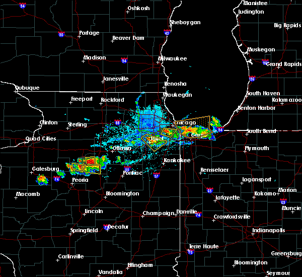 At 621 pm cdt, a severe thunderstorm was located over justice, moving southeast at 10 mph (radar indicated). Hazards include 60 mph wind gusts and quarter size hail. Hail damage to vehicles is expected. Expect wind damage to roofs, siding and trees. At 621 pm cdt, a severe thunderstorm was located over justice, moving southeast at 10 mph (radar indicated). Hazards include 60 mph wind gusts and quarter size hail. Hail damage to vehicles is expected. Expect wind damage to roofs, siding and trees.
|
| 6/8/2015 4:24 PM CDT | At 424 pm cdt, severe thunderstorms were located along a line extending from montrose harbor to near naperville, moving southeast at 20 mph (radar indicated). Hazards include 60 mph wind gusts and quarter size hail. Hail damage to vehicles is expected. expect wind damage to roofs, siding and trees. locations impacted include, chicago, aurora, naperville, evanston, wheaton, oak park, downers grove, elmhurst, lombard, glen ellyn, westmont, maywood, lisle, villa park, franklin park, westchester, forest park, river forest, harwood heights and oak brook. this includes, lincoln park zoo, loyola university, triton college, benedictine university, college of dupage, morton arboretum, northeastern illinois university, and wrigley field. including the following interstates, i-88 between mile markers 122 and 140. i-94 between mile markers 41 and 49. i-290 between mile markers 13 and 22. i-294 between mile markers 41 and 49. I-355 between mile markers 19 and 26. |
| 6/8/2015 4:15 PM CDT | At 415 pm cdt, severe thunderstorms were located along a line extending from rogers park to near aurora, moving southeast at 20 mph (radar indicated). Hazards include 60 mph wind gusts and quarter size hail. Hail damage to vehicles is expected. expect wind damage to roofs, siding and trees. locations impacted include, chicago, aurora, naperville, evanston, skokie, wheaton, oak park, downers grove, elmhurst, lombard, carol stream, park ridge, addison, glen ellyn, west chicago, westmont, maywood, morton grove, lisle and villa park. this includes, lincoln park zoo, loyola university, triton college, benedictine university, college of dupage, dupage county fairgrounds, morton arboretum, northeastern illinois university, wheaton college, and wrigley field. including the following interstates, i-88 between mile markers 121 and 140. i-94 between mile markers 39 and 49. i-290 between mile markers 9 and 22. i-294 between mile markers 39 and 49. I-355 between mile markers 19 and 29. |
| 6/8/2015 4:00 PM CDT | At 400 pm cdt, severe thunderstorms were located along a line extending from skokie to north aurora, moving southeast at 20 mph (radar indicated). Hazards include 60 mph wind gusts and quarter size hail. Hail damage to vehicles is expected. Expect wind damage to roofs, siding and trees. |
| 6/8/2015 3:35 PM CDT |
 At 334 pm cdt, severe thunderstorms were located along a line extending from 7 miles northeast of highland park to elgin, moving southeast at 30 mph (radar indicated). Hazards include 60 mph wind gusts and half dollar size hail. Hail damage to vehicles is expected. expect wind damage to roofs, siding and trees. locations impacted include, chicago, elgin, waukegan, arlington heights, evanston, schaumburg, palatine, skokie, des plaines, mount prospect, hoffman estates, glenview, buffalo grove, carpentersville, wheeling, park ridge, northbrook, north chicago, gurnee and mundelein. This includes, oakton community college, schaumburg boomers baseball, college of lake county, great lakes naval training center, harper college, lake county fielders baseball, lake county il fairgrounds, lake forest college, northwestern university, ravinia music festival, and six flags great america. At 334 pm cdt, severe thunderstorms were located along a line extending from 7 miles northeast of highland park to elgin, moving southeast at 30 mph (radar indicated). Hazards include 60 mph wind gusts and half dollar size hail. Hail damage to vehicles is expected. expect wind damage to roofs, siding and trees. locations impacted include, chicago, elgin, waukegan, arlington heights, evanston, schaumburg, palatine, skokie, des plaines, mount prospect, hoffman estates, glenview, buffalo grove, carpentersville, wheeling, park ridge, northbrook, north chicago, gurnee and mundelein. This includes, oakton community college, schaumburg boomers baseball, college of lake county, great lakes naval training center, harper college, lake county fielders baseball, lake county il fairgrounds, lake forest college, northwestern university, ravinia music festival, and six flags great america.
|
| 6/8/2015 3:16 PM CDT |
 At 316 pm cdt, severe thunderstorms were located along a line extending from beach park to gilberts, moving southeast at 25 mph (radar indicated). Hazards include half dollar size hail. damage to vehicles is expected At 316 pm cdt, severe thunderstorms were located along a line extending from beach park to gilberts, moving southeast at 25 mph (radar indicated). Hazards include half dollar size hail. damage to vehicles is expected
|
| 5/26/2015 1:25 PM CDT | Storm damage reported in lmz741 county IL, 9.1 miles WSW of Chicago, IL |
| 5/26/2015 1:00 PM CDT | 5 inch diameter tree branch fell on a truck in the 5600 block of south new england ave. numerous other branches of varying diameters down. street lights blown down at 5 in cook county IL, 7.4 miles NNE of Chicago, IL |
| 4/9/2015 9:56 PM CDT | The severe thunderstorm warning for southeastern cook. north central will and northwestern lake counties will expire at 1000 pm cdt. the storms which prompted the warning have weakened below severe limits. and no longer pose an immediate threat to life or property. Therefore the warning will be allowed to expire. |
| 4/9/2015 9:56 PM CDT | The severe thunderstorm warning for southeastern cook. north central will and northwestern lake counties will expire at 1000 pm cdt. the storms which prompted the warning have weakened below severe limits. and no longer pose an immediate threat to life or property. Therefore the warning will be allowed to expire. |
| 4/9/2015 9:47 PM CDT | A severe thunderstorm warning remains in effect until 1000 pm cdt for southeastern cook. north central will and northwestern lake counties. at 946 pm cdt. severe thunderstorms were located along a line extending from near navy pier to near east chicago. Moving northeast at 50 mph. |
| 4/9/2015 9:47 PM CDT | A severe thunderstorm warning remains in effect until 1000 pm cdt for southeastern cook. north central will and northwestern lake counties. at 946 pm cdt. severe thunderstorms were located along a line extending from near navy pier to near east chicago. Moving northeast at 50 mph. |
| 4/9/2015 9:25 PM CDT | The national weather service in chicago has issued a * severe thunderstorm warning for. southeastern cook county in northeastern illinois. north central will county in northeastern illinois. southeastern dupage county in northeastern illinois. Northwestern lake county in northwestern indiana. |
| 4/9/2015 9:25 PM CDT | The national weather service in chicago has issued a * severe thunderstorm warning for. southeastern cook county in northeastern illinois. north central will county in northeastern illinois. southeastern dupage county in northeastern illinois. Northwestern lake county in northwestern indiana. |
| 4/9/2015 12:40 AM CDT | The national weather service in chicago has issued a * severe thunderstorm warning for. southeastern cook county in northeastern illinois. until 215 am cdt * at 1240 am cdt. a severe thunderstorm was located over goodings grove. or over homer glen. Moving northeast at 20 mph. |
| 9/5/2014 2:55 PM CDT | Near harlem and devon in cook county IL, 9.4 miles SSE of Chicago, IL |
| 6/30/2014 10:21 PM CDT | Storm damage reported in cook county IL, 6.6 miles N of Chicago, IL |
| 5/20/2014 10:40 PM CDT | Storm damage reported in lmz741 county IL, 9.1 miles WSW of Chicago, IL |
| 5/20/2014 8:01 PM CDT | Quarter sized hail reported 5.5 miles W of Chicago, IL, 99th st and martin luther king dr. car dents. |
| 5/12/2014 11:30 PM CDT | Large tree approximately 70 ft tall with a 5 ft diameter trunk uprooted onto a house. near nagel and northwest highway or 7 miles east of o hare airpor in cook county IL, 5.5 miles W of Chicago, IL |
| 5/11/2014 6:39 PM CDT | Quarter sized hail reported 5.5 miles W of Chicago, IL, chicago hegwish area. |
| 5/11/2014 6:39 PM CDT | Chicago hegwish are in cook county IL, 5.5 miles W of Chicago, IL |
| 11/17/2013 12:55 PM CST | Delayed report from university of chicago hospitals helipor in cook county IL, 9.2 miles NW of Chicago, IL |
| 11/17/2013 12:55 PM CST | Storm damage reported in lmz741 county IL, 9.1 miles WSW of Chicago, IL |
| 10/3/2013 5:39 PM CDT | Several large trees downed including on vehicles in a neighborhood. time estimated per rada in cook county IL, 13.9 miles NW of Chicago, IL |
| 9/18/2013 8:51 PM CDT | Quarter sized hail reported 6.3 miles SW of Chicago, IL |
| 8/30/2013 7:30 PM CDT | Extensive tree damage and cars damaged in cook county IL, 5.5 miles W of Chicago, IL |
| 8/30/2013 6:16 PM CDT | Quarter sized hail reported 5.5 miles W of Chicago, IL, estimated 70 mph thunderstorm wind gust. montrose and lake shore drive. |
| 8/30/2013 6:09 PM CDT | At irving and north kostner avenue. dime sized hail. trees down and blinding rai in cook county IL, 5.5 miles W of Chicago, IL |
| 8/30/2013 6:00 PM CDT | Large tree limbs down from from 1 inch to 8 inches in diameter down across edison park. multiple tree limbs split off from trees. some are blocking roads and have falle in cook county IL, 5.5 miles W of Chicago, IL |
| 7/19/2013 10:55 PM CDT | 45 mph gust at 1055 pm cdt with peak of 66 mph at 1100 pm cdt. wind gusted in excess of 40 mph until 1115 pm cd in lmz741 county IL, 9.1 miles WSW of Chicago, IL |
| 6/27/2013 6:15 PM CDT | Quarter sized hail reported 10.3 miles NNW of Chicago, IL, slightly larger than quarter sized hail at the churchs chicken. |
| 6/27/2013 6:07 PM CDT | Large tree down on car. winds estimated 60 mp in cook county IL, 6.2 miles NNW of Chicago, IL |
| 6/24/2013 6:15 PM CDT | Strongest winds lasted about 30 seconds...knocked over trash cans and broke limbs off trees. storm in cook county IL, 5.5 miles W of Chicago, IL |
| 6/24/2013 6:15 PM CDT | Multiple tree limbs down varying from 17 to 5 inches in diameter around the 6100 block of north campbel in cook county IL, 5.5 miles W of Chicago, IL |
| 6/24/2013 6:00 PM CDT | Storm damage reported in cook county IL, 6.6 miles N of Chicago, IL |
| 6/12/2013 6:35 PM CDT | Quarter sized hail reported 5.5 miles W of Chicago, IL, w. winnemack st. |
| 6/12/2013 4:07 AM CDT | Wind gust to 56 knots at harrison cri in lmz741 county IL, 9.1 miles WSW of Chicago, IL |
| 8/4/2012 4:40 PM CDT | Storm damage reported in lmz741 county IL, 9.1 miles WSW of Chicago, IL |
| 8/4/2012 4:40 PM CDT | Minor flooding around cicero ave and 85t in cook county IL, 8.7 miles N of Chicago, IL |
| 8/4/2012 4:29 PM CDT | Numerous large trees snapped and uprooted. time estimated per rada in cook county IL, 6.3 miles SW of Chicago, IL |
| 7/26/2012 1:39 AM CDT | Storm damage reported in cook county IL, 11.1 miles SE of Chicago, IL |
| 7/26/2012 1:39 AM CDT | Hanger wall collapsed in cook county IL, 11.1 miles SE of Chicago, IL |
| 7/24/2012 6:40 AM CDT | Storm damage reported in lmz741 county IL, 9.1 miles WSW of Chicago, IL |
| 7/24/2012 6:36 AM CDT | Augusta and damen. power ou in cook county IL, 5.5 miles W of Chicago, IL |
| 7/24/2012 6:32 AM CDT | Storm damage reported in cook county IL, 6.6 miles N of Chicago, IL |
| 7/24/2012 6:16 AM CDT | Storm damage reported in cook county IL, 11.1 miles SE of Chicago, IL |
| 7/5/2012 3:15 PM CDT | Trees damaged between belmont and diversy along lake shore drive...including two large trees snapped at the base and another large tree spli in cook county IL, 6.2 miles SW of Chicago, IL |
| 7/1/2012 1:00 PM CDT | Golf Ball sized hail reported 15 miles NW of Chicago, IL, golf ball hail reported by tug boat off calumet harbor. time estimated. |
| 7/1/2012 12:47 PM CDT | Storm damage reported in cook county IL, 5.5 miles W of Chicago, IL |
| 7/1/2012 12:43 PM CDT | Storm damage reported in cook county IL, 11.1 miles SE of Chicago, IL |
| 5/3/2012 9:02 PM CDT | Quarter sized hail reported 5.5 miles W of Chicago, IL, wilson and broadway - hail dime to quarter sized |
| 5/3/2012 8:58 PM CDT | Quarter sized hail reported 7.3 miles S of Chicago, IL, hail fell in albany park. |
| 5/3/2012 8:55 PM CDT | Quarter sized hail reported 5.5 miles W of Chicago, IL, 5200-6000 n california ave |
| 5/3/2012 8:55 PM CDT | Golf Ball sized hail reported 5.1 miles S of Chicago, IL, in the city of chicago. intersection of milwaukee and addison. |
| 5/3/2012 8:46 PM CDT | Quarter sized hail reported 5.4 miles SSE of Chicago, IL, in city of chicago - portage park - central at addison |
| 5/3/2012 8:45 PM CDT | Quarter sized hail reported 5.2 miles S of Chicago, IL, in city of chicago - irving park rd,cicero ave,and milwaukee ave |
| 5/3/2012 8:38 PM CDT | Ping Pong Ball sized hail reported 6.5 miles S of Chicago, IL |
| 1/1/0001 12:00 AM | Large tree approximately 18 inches in diameter down at the intersection of goethe st and lasalle s in cook county IL, 5.5 miles W of Chicago, IL |
| 1/1/0001 12:00 AM | 12 inch diameter tree limb down at the intersection of dayton and willo in cook county IL, 6.2 miles SW of Chicago, IL |
| 1/1/0001 12:00 AM | Semi overturned on 65th and menard. fences blown down along with 10 inch diameter branches. sheet metal and shingles torn off roof in cook county IL, 6.6 miles N of Chicago, IL |
| 1/1/0001 12:00 AM | 3 inch tree limbs down at intersection of w leland ave and north winchester av in cook county IL, 5.5 miles W of Chicago, IL |
| 1/1/0001 12:00 AM | 6 inch tree limb downe in cook county IL, 5.5 miles W of Chicago, IL |
| 1/1/0001 12:00 AM | Semi overturned on 65th and menard. fences blown down along with 10 inch diameter branches. sheet metal and shingles torn off roof in cook county IL, 6.6 miles N of Chicago, IL |
| 1/1/0001 12:00 AM | Storm damage reported in cook county IL, 6.6 miles N of Chicago, IL |
| 1/1/0001 12:00 AM | Large tree approximately 18 inches in diameter down at the intersection of goethe st and lasalle s in cook county IL, 5.5 miles W of Chicago, IL |
| 1/1/0001 12:00 AM | 12 inch diameter tree limb down at the intersection of dayton and willo in cook county IL, 6.2 miles SW of Chicago, IL |
| 1/1/0001 12:00 AM | Large trees down near airport. relayed by fox chicag in cook county IL, 6.6 miles N of Chicago, IL |
| 1/1/0001 12:00 AM | At least six large trees blown down in loyola park section of rogers park near the lakefront. estimated 18 to 24 inch diameter trees. at least 65 mph wind gusts estimat in cook county IL, 9.9 miles SSW of Chicago, IL |
| 1/1/0001 12:00 AM | Storm damage reported in cook county IL, 11.1 miles SE of Chicago, IL |
| 6/30/2011 9:35 PM CDT | Baseball sized hail reported 2.8 miles NNW of Chicago, IL, estimated golfball to baseball size hail. w 26th and s kedzie ave. damage to vehicles. |
| 6/30/2011 9:33 PM CDT | Hen Egg sized hail reported 5.5 miles W of Chicago, IL, 5th and pulaski |
| 6/30/2011 9:30 PM CDT | Quarter sized hail reported 5.5 miles W of Chicago, IL, ravenswood. |
| 6/30/2011 9:30 PM CDT | Hen Egg sized hail reported 4 miles SSW of Chicago, IL, estimated 1.5 to 2 inch hail. |
| 6/30/2011 9:27 PM CDT | Ping Pong Ball sized hail reported 5.5 miles W of Chicago, IL |
| 6/30/2011 9:27 PM CDT | Golf Ball sized hail reported 3.6 miles SSW of Chicago, IL |
| 6/30/2011 9:26 PM CDT | Half Dollar sized hail reported 4.6 miles WSW of Chicago, IL, in lakeview neighborhood |
| 6/30/2011 9:25 PM CDT | Ping Pong Ball sized hail reported 4.1 miles WSW of Chicago, IL, intersection of erie and racine |
| 1/1/0001 12:00 AM | Storm damage reported in lmz741 county IL, 9.1 miles WSW of Chicago, IL |
| 1/1/0001 12:00 AM | Storm damage reported in lmz741 county IL, 9.1 miles WSW of Chicago, IL |
| 1/1/0001 12:00 AM | *** 2 inj *** local media reports two people in serious to critical condition after their car was crushed by a falling tree near farragut avenue and leavitt avenue. tim in cook county IL, 7.6 miles SSW of Chicago, IL |
| 5/22/2011 3:40 PM CDT | Quarter sized hail reported 5.5 miles W of Chicago, IL, 3/4 in to 1 inch hail. 59th and halstead. lasted around 8 minutes. |
| 1/1/0001 12:00 AM | Quarter sized hail reported 12.1 miles NNW of Chicago, IL, 95th and dan ryan expressway. |
| 1/1/0001 12:00 AM | Trees down at 65th and oakle in cook county IL, 4.5 miles N of Chicago, IL |
Hail Maps for Chicago, IL


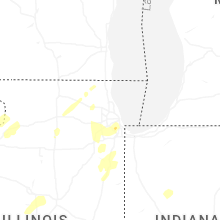


Connect with Interactive Hail Maps